archaeological site examination north yard of the ... - Fiske Center
archaeological site examination north yard of the ... - Fiske Center
archaeological site examination north yard of the ... - Fiske Center

Create successful ePaper yourself
Turn your PDF publications into a flip-book with our unique Google optimized e-Paper software.
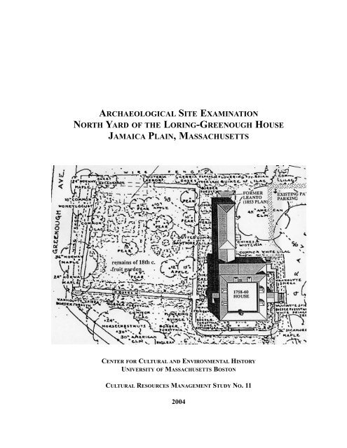
ARCHAEOLOGICAL SITE EXAMINATION<br />
NORTH YARD OF THE LORING-GREENOUGH HOUSE<br />
JAMAICA PLAIN, MASSACHUSETTS<br />
CENTER FOR CULTURAL AND ENVIRONMENTAL HISTORY<br />
UNIVERSITY OF MASSACHUSETTS BOSTON<br />
CULTURAL RESOURCES MANAGEMENT STUDY NO. 11<br />
2004
Cover Illustration: The Loring-Greenough property as depicted by <strong>the</strong> Historic American<br />
Buildings Survey in 1937 (Courtesy Detwiller 1998)
ARCHAEOLOGICAL SITE EXAMINATION<br />
NORTH YARD OF THE LORING-GREENOUGH HOUSE<br />
JAMAICA PLAIN, MASSACHUSETTS<br />
Prepared for<br />
The Jamaica Plain Tuesday Club Inc.<br />
By<br />
J.N. Leith Smith and Ka<strong>the</strong>rine Howlett<br />
<strong>Center</strong> for Cultural and Environmental History<br />
University <strong>of</strong> Massachusetts Boston<br />
Cultural Resources Management Study No. 11<br />
2004
CENTER FOR CULTURAL AND<br />
ENVIRONMENTAL HISTORY<br />
Established in 1996, <strong>the</strong> <strong>Center</strong> for Cultural<br />
and Environmental History’s mission<br />
includes research, public service, and educational<br />
initiatives. The <strong>Center</strong> maintains<br />
archaeology and conservation laboratories<br />
and supports research in landscape and<br />
environmental archaeology, historical<br />
archaeology, and environmental history.<br />
<strong>Center</strong> projects <strong>of</strong>ten have an applied focus,<br />
seeking to promote and protect <strong>the</strong> cultural<br />
heritage and historic landscape <strong>of</strong> <strong>the</strong><br />
Commonwealth <strong>of</strong> Massachusetts and <strong>the</strong><br />
surrounding region. As a public service<br />
unit <strong>of</strong> <strong>the</strong> Department <strong>of</strong> Anthropology, <strong>the</strong><br />
CCEH also serves an important educational<br />
role at <strong>the</strong> University <strong>of</strong> Massachusetts<br />
Boston, creating opportunities for students<br />
to participate in public service projects.<br />
iv
ABSTRACT<br />
A phased program <strong>of</strong> stabilization and<br />
restoration for <strong>the</strong> Loring-Greenough House<br />
and property located in Jamaica Plain, a<br />
suburb <strong>of</strong> Boston, MA, called for reconstruction<br />
<strong>of</strong> porches, construction <strong>of</strong> an<br />
entrance walk and new foundations for <strong>the</strong><br />
carriage house. This program also included<br />
landscaping and rehabilitation <strong>of</strong> garden<br />
plantings in <strong>the</strong> <strong>north</strong> <strong>yard</strong>. Archaeological<br />
testing was conducted to identify cultural<br />
resources that would be impacted by <strong>the</strong><br />
proposed project and to search for evidence<br />
<strong>of</strong> early garden features that could be used<br />
to guide landscape restoration. The first<br />
phase <strong>of</strong> research focused on house porches,<br />
walkway installation and foundation<br />
work in <strong>the</strong> carriage house (Mohler and<br />
Kelley 2000). The second phase <strong>of</strong> work,<br />
reported herein, focused on <strong>the</strong> temporal<br />
assessment <strong>of</strong> existing planting beds and<br />
identification <strong>of</strong> historic planting features.<br />
A total <strong>of</strong> five 1 m x 1 m units and four 1 m<br />
x .5 m units were excavated in <strong>the</strong> <strong>north</strong><br />
<strong>yard</strong>. Investigations revealed <strong>the</strong> presence<br />
<strong>of</strong> an intact buried A-horizon in <strong>the</strong> east and<br />
south portions <strong>of</strong> <strong>the</strong> <strong>north</strong> <strong>yard</strong> that contains<br />
eighteenth and early nineteenth century<br />
artifacts. Sand walkways were laid<br />
down in <strong>the</strong> early to mid nineteenth century<br />
and may have corresponded with o<strong>the</strong>r<br />
house improvements made around 1840.<br />
Such improvements may have included <strong>the</strong><br />
creation <strong>of</strong> a formal garden with beds laid<br />
out in a geometric pattern. These garden<br />
features were covered over with landscaping<br />
fill sometime after 1937 when a plan <strong>of</strong><br />
<strong>the</strong> property was made by <strong>the</strong> Historic<br />
American Buildings Survey. The present<br />
parallel garden beds may have been created<br />
simultaneously with <strong>the</strong> geometric garden.<br />
The parallel beds have been maintained<br />
with slight twentieth-century modification<br />
up to <strong>the</strong> present. The irregular lilac beds<br />
at <strong>the</strong> <strong>north</strong> edge <strong>of</strong> <strong>the</strong> property appear to<br />
date to <strong>the</strong> late nineteenth or early twentieth<br />
centuries, while <strong>the</strong> herb bed was created in<br />
<strong>the</strong> late twentieth century. Evidence <strong>of</strong> seventeenth<br />
to eighteenth century garden features<br />
consisting <strong>of</strong> a series <strong>of</strong> small planting<br />
holes was identified below <strong>the</strong> south end <strong>of</strong><br />
<strong>the</strong> parallel beds and associated walkway.<br />
The program <strong>of</strong> <strong>archaeological</strong> testing<br />
revealed <strong>the</strong> presence <strong>of</strong> a well-preserved<br />
buried A-horizon across much <strong>of</strong> <strong>the</strong> property<br />
that is associated with <strong>the</strong> eighteenth<br />
and early nineteenth cenury occupation <strong>of</strong><br />
<strong>the</strong> property. In addition evidence <strong>of</strong> eighteenth<br />
century gardening activity lies at <strong>the</strong><br />
base <strong>of</strong> <strong>the</strong> buried A-horizon. An early<br />
nineteenth century pathway was found on<br />
<strong>the</strong> surface <strong>of</strong> <strong>the</strong> buried A-horizon. Due to<br />
<strong>the</strong> presence <strong>of</strong> well-preserved arcaeological<br />
deposits recommendations for proposed<br />
garden restoration focused on <strong>the</strong> need to<br />
limit <strong>the</strong> depth <strong>of</strong> new planting holes to prevent<br />
disturbance to <strong>the</strong> buried A-horizon.<br />
Because tree planting and erection <strong>of</strong> posts<br />
for arbors require greater depths, it was recommended<br />
that <strong>the</strong> new planting and post<br />
locations should be <strong>archaeological</strong>ly excavated<br />
to mitigate potentially adverse<br />
impacts. The excavated holes will <strong>the</strong>n be<br />
used for specific trees and posts. The third<br />
phase <strong>of</strong> <strong>archaeological</strong> investigation associated<br />
with <strong>the</strong> foundations <strong>of</strong> <strong>the</strong> carriage<br />
house <strong>north</strong> wall joists will be reported<br />
under separate cover.<br />
v
MANAGEMENT SUMMARY<br />
The Jamaica Plain Tuesday Club Inc. contracted<br />
with <strong>the</strong> <strong>Center</strong> for Cultural and<br />
Environmental History to conduct an<br />
<strong>archaeological</strong> <strong>site</strong> <strong>examination</strong> at <strong>the</strong> historic<br />
Loring-Greenough House in <strong>the</strong><br />
Jamaica Plain neighborhood <strong>of</strong> Boston,<br />
MA. Subsurface testing conducted in 1999<br />
under State Archaeologist permit no. 1826<br />
tested areas to be disturbed by porch rehabilitation,<br />
walkway construction and foundation<br />
work in <strong>the</strong> carriage house. The second<br />
phase <strong>of</strong> investigation in April and May<br />
<strong>of</strong> 2002 under State Archaeologist permit<br />
no. 2145 focused on <strong>the</strong> temporal assessment<br />
<strong>of</strong> existing planting beds and identification<br />
<strong>of</strong> historic planting features in <strong>the</strong><br />
<strong>north</strong> <strong>yard</strong> <strong>of</strong> <strong>the</strong> property. Testing <strong>of</strong> <strong>the</strong><br />
<strong>north</strong> wall <strong>of</strong> <strong>the</strong> carriage house included<br />
under this permit will be reported on under<br />
separate cover.<br />
The initial phase <strong>of</strong> testing revealed intact<br />
<strong>archaeological</strong> deposits including a buried<br />
A-horizon, sand bed walkway and two periods<br />
<strong>of</strong> porch footings on <strong>the</strong> west side <strong>of</strong><br />
<strong>the</strong> house. In <strong>the</strong> area <strong>of</strong> <strong>the</strong> carriage house<br />
were foundations and associated builders<br />
trenches, deep deposits <strong>of</strong> mixed fill, possible<br />
refuse pits and a brick walk that predates<br />
<strong>the</strong> 1811 carriage house. The depth <strong>of</strong><br />
deposits suggests significant landscape<br />
modification in <strong>the</strong> eastern portion <strong>of</strong> <strong>the</strong><br />
property.<br />
The second phase <strong>of</strong> testing in <strong>the</strong> <strong>north</strong><br />
<strong>yard</strong> revealed <strong>the</strong> presence <strong>of</strong> a buried A-<br />
horizon associated with <strong>the</strong> eighteenth and<br />
early nineteenth century occupation as well<br />
as sand walkways that may have been laid<br />
down between <strong>the</strong> 1820s and 1860s when<br />
o<strong>the</strong>r changes were made to <strong>the</strong> house.<br />
Landscaping fill was spread across much <strong>of</strong><br />
<strong>the</strong> property in <strong>the</strong> late nineteenth to early<br />
twentieth centuries, and this was followed<br />
by additional capping with fill in specific<br />
areas after 1937. The <strong>site</strong> <strong>examination</strong><br />
finds represent an important contribution to<br />
<strong>the</strong> overall understanding <strong>of</strong> landscape use<br />
and alteration <strong>of</strong> <strong>the</strong> property. Limiting<br />
excavation depth to 16 inches was recommended<br />
for <strong>the</strong> proposed garden restoration.<br />
Due to <strong>the</strong> need to place trees and<br />
posts below this depth, <strong>the</strong> holes for <strong>the</strong>se<br />
new fixtures were recommended to be<br />
<strong>archaeological</strong>ly excavated to mitigate<br />
potential damage to subsurface resources.<br />
vi
TABLE OF C ONTENTS<br />
Abstract . . . . . . . . . . . . . . . . . . . . . . . . . . . . . . . . . . . . . . . . . . . . . . . . . . . . . . . . . . . . . . .v<br />
Management Summary . . . . . . . . . . . . . . . . . . . . . . . . . . . . . . . . . . . . . . . . . . . . . . . . . . .vi<br />
Table <strong>of</strong> Contents . . . . . . . . . . . . . . . . . . . . . . . . . . . . . . . . . . . . . . . . . . . . . . . . . . . . . . .vii<br />
List <strong>of</strong> Figures . . . . . . . . . . . . . . . . . . . . . . . . . . . . . . . . . . . . . . . . . . . . . . . . . . . . . . . . .viii<br />
List <strong>of</strong> Tables . . . . . . . . . . . . . . . . . . . . . . . . . . . . . . . . . . . . . . . . . . . . . . . . . . . . . . . . . .viii<br />
I. Introduction . . . . . . . . . . . . . . . . . . . . . . . . . . . . . . . . . . . . . . . . . . . . . . . . . . . . . . . . . .1<br />
II. Project Location and Environmental Context . . . . . . . . . . . . . . . . . . . . . . . . . . . . . . .4<br />
III. Background . . . . . . . . . . . . . . . . . . . . . . . . . . . . . . . . . . . . . . . . . . . . . . . . . . . . . . . . .5<br />
A. Native American Cultural Context <strong>of</strong> Sou<strong>the</strong>rn New England<br />
1. PaleoIndian Period (ca. 12,000-10,000 B.P. (Before Present))<br />
2. Early Archaic Period (ca. 10,000-8,000 B.P.)<br />
3. Middle Archaic Period (ca. 8,000-6,000 B.P.)<br />
4. Late Archaic Period (ca. 6000-3000 B.P.)<br />
5. Early Woodland Period (ca. 3,000-1,600 B.P.)<br />
6. Middle Woodland Period (ca. 1,600 –1,000 B.P.)<br />
7. Late Woodland Period (ca. 1,000-450 B.P.)<br />
8. Contact Period<br />
B. Native American Archaeological Sites Around <strong>the</strong> Project Area . . . . . . . . . . . . . . . . . . . . . . . . . . .8<br />
C. Historic Development <strong>of</strong> Jamaica Plain . . . . . . . . . . . . . . . . . . . . . . . . . . . . . . . . . . . . . . . . . . . . . . .8<br />
D. Loring-Greenough House History . . . . . . . . . . . . . . . . . . . . . . . . . . . . . . . . . . . . . . . . . . . . . . . . . .10<br />
E. Archaeological Potential <strong>of</strong> <strong>the</strong> Loring-Greenough House Property . . . . . . . . . . . . . . . . . . . . . . .14<br />
IV. Previous Investigations . . . . . . . . . . . . . . . . . . . . . . . . . . . . . . . . . . . . . . . . . . . . . . .15<br />
A. Proposed South Entrance Walkway<br />
B. Proposed West Entrance Proch and Stairs<br />
C. Carriage House South Wall Joists<br />
D. Carriage House East Wall Foundation<br />
E. Carriage House North Wall<br />
V. Archaeological Site Examination . . . . . . . . . . . . . . . . . . . . . . . . . . . . . . . . . . . . . . . . .18<br />
A. Research Design<br />
B. Scope <strong>of</strong> Work<br />
C. Field Methodology<br />
D. Site Examination Results<br />
VI. Interpretations and Discussion . . . . . . . . . . . . . . . . . . . . . . . . . . . . . . . . . . . . . . . . .24<br />
A. Garden Walk and Parallel Beds<br />
B. Planting Holes Below Walkway<br />
C. Irregular Bed<br />
D. Herb Bed<br />
E. Summary<br />
VII. Recommendations . . . . . . . . . . . . . . . . . . . . . . . . . . . . . . . . . . . . . . . . . . . . . . . . . .30<br />
References Cited . . . . . . . . . . . . . . . . . . . . . . . . . . . . . . . . . . . . . . . . . . . . . . . . . . . . . . . .34<br />
Appendix A: Artifact Photographs . . . . . . . . . . . . . . . . . . . . . . . . . . . . . . . . . . . . . . . . .36<br />
Appendix B: Artifact Catalog . . . . . . . . . . . . . . . . . . . . . . . . . . . . . . . . . . . . . . . . . . . . .40<br />
vii
LIST OF FIGURES<br />
Figure I-1. Project Area on USGS Boston South Quadrangle. . . . . . . . . . . . . . . . . . . . . .1<br />
Figure I-2. Historic American Buildings Survey (1937) plan <strong>of</strong> <strong>the</strong> Loring-Greenough<br />
property with additional captions (courtesy Detwiller 1998). . . . . . . . . . . . . . . . . . . . . . .2<br />
Figure III-1. Watercolor view <strong>of</strong> <strong>the</strong> Loring-Greenough House ca. 1815-1827 (Detwiller<br />
1998). . . . . . . . . . . . . . . . . . . . . . . . . . . . . . . . . . . . . . . . . . . . . . . . . . . . . . . . . . . . . . . . . .4<br />
Figure III-2. Plan <strong>of</strong> Loring-Greenough property in 1853 (Norfolk Registry <strong>of</strong> Deeds)<br />
(Detwiller 1998). . . . . . . . . . . . . . . . . . . . . . . . . . . . . . . . . . . . . . . . . . . . . . . . . . . . . . . . .13<br />
Figure III-3. The Loring-Greenough property as depicted by Hopkins Insurance Co. in<br />
1874 (Detwiller 1998). . . . . . . . . . . . . . . . . . . . . . . . . . . . . . . . . . . . . . . . . . . . . . . . . . . .14<br />
Figure IV-1 Archaeological testing locations from <strong>the</strong> 1999 <strong>site</strong> <strong>examination</strong>. . . . . . . .16<br />
Figure V-1. Photograph <strong>of</strong> <strong>the</strong> <strong>north</strong> entrance showing <strong>the</strong> <strong>north</strong> walkway and parallel<br />
garden beds ca. 1900 (Detwiller 1998). . . . . . . . . . . . . . . . . . . . . . . . . . . . . . . . . . . . . . .19<br />
Figure V-2. North Yard <strong>site</strong> <strong>examination</strong> unit locations (adapted from Due North Land<br />
Surveying property map 2002). . . . . . . . . . . . . . . . . . . . . . . . . . . . . . . . . . . . . . . . . . . . .20<br />
Figure V-3. South wall pr<strong>of</strong>ile <strong>of</strong> Units 1-4 at <strong>the</strong> south end <strong>of</strong> <strong>the</strong> Parallel Beds. . . . .22<br />
Figure V-4. Plan <strong>of</strong> units 1-4 at 46 cmbs showing planting holes in <strong>the</strong> B-horizon surface. . . . . . .23<br />
Figure V-5. South wall pr<strong>of</strong>ile <strong>of</strong> Units 5 and 6 at <strong>the</strong> <strong>north</strong> end <strong>of</strong> <strong>the</strong> Parallel Beds. .23<br />
Figure V-6. East wall pr<strong>of</strong>ile <strong>of</strong> Unit 5 in <strong>the</strong> Irregular Planting Bed. . . . . . . . . . . . . . .24<br />
Figure V-7. South wall pr<strong>of</strong>ile <strong>of</strong> Units 6 and 7 under <strong>the</strong> Herb Bed. . . . . . . . . . . . . . .25<br />
Figure VI-1. North walkway as it appeared in 1937 (HABS) (Detwiller 1998). . . . . . .26<br />
Figure VI-2. Comparison <strong>of</strong> <strong>the</strong> <strong>north</strong> walkway as it appeared in pr<strong>of</strong>ile at its south<br />
end (upper) and <strong>north</strong> end (lower). . . . . . . . . . . . . . . . . . . . . . . . . . . . . . . . . . . . . . . . . . .27<br />
Figure VII-1. Existing Conditions Plan, Loring-Greenough House…. . . . . . . . . . . . . .32<br />
Figure VII-2. Illustrative Master Plan, Loring-Greenough House…. . . . . . . . . . . . . . .33<br />
LIST OF TABLES<br />
Table 1. Site Examination Excavation Units . . . . . . . . . . . . . . . . . . . . . . . . . . . . . . . . .22<br />
viii
I. INTRODUCTION<br />
The Jamaica Plain Tuesday Club Inc. owns<br />
and maintains <strong>the</strong> historic Loring-<br />
Greenough House located at 12 South<br />
Street in Jamaica Plain, Massachusetts (Fig.<br />
I-1). The house is a Massachusetts and<br />
National Register Historic Landmark<br />
because <strong>of</strong> its historical connections to <strong>the</strong><br />
American Revolution and its exemplification<br />
<strong>of</strong> colonial architecture. The mansion<br />
with adjoining carriage house and gardens<br />
is <strong>the</strong> only surviving example <strong>of</strong> a colonial<br />
country estate in Jamaica Plain (Fig. I-2).<br />
A phased rehabilitation program for both<br />
<strong>the</strong> house and grounds that commenced in<br />
<strong>the</strong> spring <strong>of</strong> 1999 included repair <strong>of</strong> porches,<br />
installation <strong>of</strong> a handicapped access<br />
ramp, replacement <strong>of</strong> deteriorating posts in<br />
<strong>the</strong> carriage house and landscape restoration.<br />
This work was determined to have <strong>the</strong><br />
potential to negatively impact subsurface<br />
cultural resources. As a result, an archaeo-<br />
Figure I-1: Project area on USGS Boston South Quadrangle.<br />
1
Figure I-2: Historic American Buildings Survey (1937) plan <strong>of</strong> <strong>the</strong> Loring-Greenough property<br />
with additional captions (courtesy Detwiller 1998).<br />
2
logical <strong>site</strong> <strong>examination</strong> under State<br />
Archaeologist permit no. 1826 was carried<br />
out in <strong>the</strong> summer and fall <strong>of</strong> 1999 by <strong>the</strong><br />
<strong>Center</strong> for Cultural and Environmental<br />
History (CCEH). This work focused on <strong>the</strong><br />
exterior <strong>of</strong> <strong>the</strong> mansion house and carriage<br />
house and along <strong>the</strong> front (west) entrance<br />
walk (Mohler et al 2000). The Jamaica<br />
Plain Tuesday Club is now in <strong>the</strong> process <strong>of</strong><br />
completing <strong>the</strong> structural rehabilitation <strong>of</strong><br />
<strong>the</strong> carriage house and initiating <strong>the</strong> program<br />
<strong>of</strong> landscape restoration. Ka<strong>the</strong>rine<br />
Cipolla <strong>of</strong> <strong>the</strong> Jamaica Plain Tuesday Club<br />
contacted <strong>the</strong> CCEH in December 2001 to<br />
solicit <strong>archaeological</strong> services for <strong>the</strong> final<br />
phase <strong>of</strong> rehabilitation associated with carriage<br />
house post replacement and restoration<br />
<strong>of</strong> plantings in <strong>the</strong> <strong>north</strong> <strong>yard</strong>. An<br />
<strong>archaeological</strong> <strong>site</strong> <strong>examination</strong> <strong>of</strong> <strong>the</strong> <strong>north</strong><br />
<strong>yard</strong> was carried out under State<br />
Archaeologist Permit No. 2145 between<br />
April 19 and May 3, 2002. Final investigation<br />
<strong>of</strong> <strong>the</strong> carriage house is awaiting funding<br />
and will be reported on under separate<br />
cover. This work was performed in compliance<br />
with Section 106 <strong>of</strong> <strong>the</strong> National<br />
Historic Preservation Act <strong>of</strong> 1966 (36 CFR<br />
800), Massachusetts General Laws Chapter<br />
9, Sections 26-27C, as amended by Chapter<br />
254 <strong>of</strong> <strong>the</strong> Acts <strong>of</strong> 1988 (950 CMR 71).<br />
University <strong>of</strong> Massachusetts staff who<br />
worked on <strong>the</strong> project included Ka<strong>the</strong>rine<br />
Howlett and Leith Smith.<br />
3
II. PROJECT LOCATION AND<br />
ENVIRONMENTAL CONTEXT<br />
The Loring-Greenough property consists <strong>of</strong><br />
nearly two acres in <strong>the</strong> Boston neighborhood<br />
<strong>of</strong> Jamaica Plain in Suffolk County. It<br />
is bordered by Greenough Avenue on <strong>the</strong><br />
<strong>north</strong>, <strong>the</strong> intersection <strong>of</strong> South and Centre<br />
Streets to <strong>the</strong> west and by houselots to <strong>the</strong><br />
east and south. Well-known landmarks in<br />
<strong>the</strong> vicinity include Jamaica Pond to <strong>the</strong><br />
<strong>north</strong>, Franklin Park to <strong>the</strong> sou<strong>the</strong>ast and<br />
<strong>the</strong> Arnold Arboretum to <strong>the</strong> south west.<br />
The parcel is situated on an upland plain<br />
surrounded by gently rolling landscape that<br />
is punctuated by low hills. The closest<br />
water source is Muddy River, <strong>the</strong> headwaters<br />
<strong>of</strong> which are associated with Jamaica<br />
Pond that lies approximately 700 m to <strong>the</strong><br />
<strong>north</strong>west. The Muddy River flows generally<br />
<strong>north</strong>ward to <strong>the</strong> Charles River nearly 5<br />
km to <strong>the</strong> <strong>north</strong>. Water sources to <strong>the</strong> south<br />
consist <strong>of</strong> small ponds and streams that<br />
flow into <strong>the</strong> Neponset River 5 km to <strong>the</strong><br />
sou<strong>the</strong>ast and into <strong>the</strong> upper Charles River<br />
just over 6 km to <strong>the</strong> west and southwest.<br />
The plain on which <strong>the</strong> <strong>site</strong> is located is<br />
composed <strong>of</strong> nearly level and undulating<br />
Merrimac soil that is generally deep and<br />
excessively drained (USDA 1989). A typical<br />
soil pr<strong>of</strong>ile consists <strong>of</strong> 23 cm <strong>of</strong> dark<br />
brown fine sandy loam overlying approximately<br />
36 cm <strong>of</strong> yellow brown fine sandy<br />
loam that grades to a yellowish brown<br />
loamy sand. The C horizon consists <strong>of</strong> a<br />
light yellowish brown coarse sand and<br />
gravel. Much <strong>of</strong> <strong>the</strong> area is designated as<br />
Urban Land where <strong>the</strong> soil has been covered<br />
with impervious surfaces. A low hill<br />
immediately west <strong>of</strong> <strong>the</strong> property is characterized<br />
by Canton soils that are very deep<br />
and well drained and occur on <strong>the</strong> sides <strong>of</strong><br />
hills and ridges on uplands. Soils located<br />
approximately 200 m south <strong>of</strong> <strong>the</strong> property<br />
have been designated as Urban Land due to<br />
<strong>the</strong> excessive amount <strong>of</strong> disturbance and<br />
covering by construction. The area bordering<br />
<strong>the</strong> south end <strong>of</strong> Jamaica Pond consists<br />
<strong>of</strong> Merrimac fine sandy loam with 3 to 8<br />
percent slopes. This soil is deep and occurs<br />
on gentle slopes associated with major<br />
stream valleys.<br />
4
III. BACKGROUND<br />
A. Native American Cultural Context <strong>of</strong><br />
Sou<strong>the</strong>rn New England<br />
The history <strong>of</strong> Native American occupation<br />
in <strong>the</strong> area <strong>of</strong> Jamaica Plain and <strong>the</strong> broader<br />
region as a whole derives in part from a<br />
study conducted for <strong>the</strong> Olmstead Parks<br />
System (Loparto 1986), a sewer project in<br />
Arnold Arboretum (Donta et. al. 2002) and<br />
work conducted in <strong>the</strong> Neponset River valley<br />
(Ritchie 1994) that utilizes palynological<br />
data collected within <strong>the</strong> middle<br />
Neponset drainage in Canton and Milton.<br />
1. Paleo-Indian Period (ca. 12,000-10,000 B.P.)<br />
New England was first occupied by humans<br />
soon after <strong>the</strong> retreat <strong>of</strong> <strong>the</strong> Wisconsin ice<br />
sheet around 13,000 B.P. The environment<br />
at <strong>the</strong> time was rapidly changing as <strong>the</strong> glacial<br />
margins slowly moved <strong>north</strong>ward.<br />
Forests came to be dominated by spruce,<br />
birch and alder. Fauna would have been<br />
characterized by cold adapted species<br />
including mastodon, mammoth, caribou, elk<br />
and a variety <strong>of</strong> birds and smaller mammals.<br />
While big game would have been an<br />
important source <strong>of</strong> food (Ritchie 1980,<br />
Snow 1980), smaller species probably made<br />
up <strong>the</strong> bulk <strong>of</strong> <strong>the</strong> diet along with a wide<br />
variety <strong>of</strong> plant foods (Curran 1987; Curran<br />
and Dincauze 1977; Dincauze 1990;<br />
Dincauze and Curran 1984; Donta et al<br />
2002). Nothing is known <strong>of</strong> human social<br />
structure from this time, but it likely was<br />
characterized by small family groups that<br />
banded toge<strong>the</strong>r to move frequently about<br />
<strong>the</strong> landscape in search <strong>of</strong> food. This<br />
mobile hunting and ga<strong>the</strong>ring lifeway led to<br />
living <strong>site</strong>s that were typically occupied for<br />
short periods <strong>of</strong> time. Artifact assemblages<br />
from such <strong>site</strong>s are dominated by stone<br />
tools that include scraping tools, drills,<br />
gravers fluted projectile points and large<br />
quantities <strong>of</strong> flakes from stone working,<br />
some <strong>of</strong> which are utilized. Many <strong>of</strong> <strong>the</strong><br />
tools are manufactured <strong>of</strong> exotic, fine<br />
grained stone that was carried for long distances<br />
from <strong>the</strong>ir sources <strong>of</strong> origin. With<br />
<strong>the</strong> exception <strong>of</strong> isolated finds (Elia and<br />
Mahlstedt 1982) few <strong>archaeological</strong> <strong>site</strong>s <strong>of</strong><br />
this period have been found in New<br />
England (Loparto 1986). Bull Brook in<br />
Ipswitch, <strong>the</strong> Neponset <strong>site</strong> in Canton<br />
(Carty and Spiess 1992), and <strong>the</strong> Shattock<br />
Farm <strong>site</strong> in Andover (Spiess and Bradley<br />
1996) are a few.<br />
2. Early Archaic Period (ca. 10,000-8,000 B.P.)<br />
Although little is actually known <strong>of</strong> this<br />
phase due to a scarcity <strong>of</strong> well-documented<br />
<strong>site</strong>s, a lifeway characterized by mobile<br />
hunting and ga<strong>the</strong>ring is believed to have<br />
continued during <strong>the</strong> Early Archaic with an<br />
emphasis on seasonal settlement patterning<br />
(Ritchie 1980). The environment remained<br />
cool, but through a slow warming trend forest<br />
species in <strong>the</strong> Boston area came to be<br />
dominated by pine, oak and birch (Ritchie<br />
1994). The manufacture <strong>of</strong> stone tools out<br />
<strong>of</strong> locally available materials suggests a<br />
trend toward occupation <strong>of</strong> particular<br />
regions with a decrease in long distance<br />
mobility and trade. Differences in <strong>the</strong> lithic<br />
tool kit characterized by <strong>the</strong> manufacture <strong>of</strong><br />
bifurcate-base projectile points have been<br />
interpreted by some researchers to suggest a<br />
discontinuity with <strong>the</strong> preceding<br />
Paleoindian Perid (Donta et al 2002;<br />
Ritchie 1969; Snow 1980), while o<strong>the</strong>rs<br />
suggest a general continuum <strong>of</strong> development<br />
(Custer 1984).<br />
5
3. Middle Archaic Period (ca. 8,000-6,000 B.P.)<br />
During <strong>the</strong> Middle Archaic <strong>the</strong> New<br />
England landscape began to resemble that<br />
<strong>of</strong> today with <strong>the</strong> establishment <strong>of</strong> a deciduous<br />
forest and increased diversity <strong>of</strong> plant<br />
and animal foods (Dincauze 1976;<br />
Dincauze and Mulholland 1977). The number<br />
<strong>of</strong> <strong>archaeological</strong> <strong>site</strong>s from this period<br />
increases dramatically in comparison with<br />
<strong>the</strong> past period, suggesting a significant rise<br />
in population. The Merrimack River Valley<br />
associated with <strong>north</strong>ern Massachusetts and<br />
sou<strong>the</strong>rn New Hampshire, in particular,<br />
contain <strong>the</strong> best known <strong>site</strong>s <strong>of</strong> <strong>the</strong> period.<br />
These include <strong>the</strong> Neville and Smyth <strong>site</strong>s<br />
in New Hampshire (Dincause 1976;<br />
Kenyon 1983) and Shattuck Farm in<br />
Andover (Mahlstedt 1981; Leudtke 1985)<br />
Settlement in and exploitation <strong>of</strong> a variety<br />
<strong>of</strong> environments is clearly indicated by both<br />
faunal remains and tool kits and this was<br />
increasingly associated with seasonal<br />
resource availability (Dincauze and<br />
Mulholland 1977; Barber 1979).<br />
Andromous fishing at falls was clearly <strong>the</strong><br />
primary attraction at a number <strong>of</strong> localities<br />
including <strong>the</strong> Neville <strong>site</strong> that revealed evidence<br />
<strong>of</strong> reoccupation over a period <strong>of</strong><br />
time. The lithic tool kit during this period<br />
is characterized by three distinctive projectile<br />
point styles (Dincauze 1976). These<br />
include <strong>the</strong> Neville, Stark and Merrimack<br />
that are joined by atlatl weights, knives,<br />
perforators, axes, adzes, scrapers, abraders,<br />
ulus, gouges and harpoons (Donta et al<br />
2002).<br />
4. Late Archaic Period (ca. 6,000-3,000 B.P.)<br />
The greatest number <strong>of</strong> Native American<br />
<strong>archaeological</strong> <strong>site</strong>s in New England is<br />
associated with <strong>the</strong> Late Archaic. Seasonal<br />
temperatures were slightly higher than<br />
today and an oak-hickory forest came to<br />
dominate sou<strong>the</strong>rn New England (Loparto<br />
1986:7). The period is characterized by relatively<br />
high populations that occupied <strong>the</strong><br />
entire range <strong>of</strong> available environments for<br />
<strong>the</strong> purpose <strong>of</strong> exploiting an equally wide<br />
range <strong>of</strong> plant and animal resources.<br />
Seasonal settlement patterns continued, but<br />
toward <strong>the</strong> end <strong>of</strong> <strong>the</strong> period populations<br />
became more settled on <strong>the</strong> landscape as<br />
evidenced by shell middens and fish weirs.<br />
Coupled with this sedentism was limited<br />
cultivation <strong>of</strong> plant foods such as squash,<br />
gourds and sunflower.<br />
Three different lithic traditions suggest <strong>the</strong><br />
possible development <strong>of</strong> regional ethnic<br />
diversity (Dincauze 1974, 1975) or <strong>of</strong> differing<br />
tool kit functions. The Small-<br />
Stemmed point tradition is most widespread<br />
and is associated with indigenous populations<br />
that had long inhabited <strong>the</strong> region.<br />
The Laurentian tradition may represent a<br />
migration <strong>of</strong> peoples from <strong>the</strong> Great Lakes<br />
region where such tool kits are common.<br />
The Susquehanna tradition is generally<br />
associated with groups that derived from<br />
<strong>the</strong> Middle-Atlantic region. The mixture <strong>of</strong><br />
<strong>the</strong>se traditions in single <strong>site</strong>s suggests <strong>the</strong><br />
coexistence <strong>of</strong> <strong>the</strong> three groups and<br />
exchange <strong>of</strong> technologies (Dincauze 1976;<br />
Ritchie 1969; Snow 1980; Custer 1984;<br />
Bourque 1995). Evidence <strong>of</strong> religious<br />
beliefs from burials becomes more common<br />
during this period due to <strong>the</strong> use <strong>of</strong> particular<br />
practices that includes red ocher and<br />
burial goods.<br />
5. Early Woodland Period (ca. 3,000-1,600 B.P.)<br />
The Early Woodland is generally associated<br />
with a period <strong>of</strong> population reduction and a<br />
clustering <strong>of</strong> <strong>site</strong>s in valleys along river<br />
courses, but this characterization may be a<br />
product <strong>of</strong> sampling error. An expansion <strong>of</strong><br />
6
spruce and slight decline in oak may have<br />
been associated with a cooling trend during<br />
<strong>the</strong> period (Ritchie 1994). Coastal<br />
resources, particularly fish and shellfish,<br />
take on greater importance, but <strong>the</strong> most<br />
significant development during this period<br />
is <strong>the</strong> transition from simple cultivation to<br />
horticulture, and <strong>the</strong> development <strong>of</strong> ceramic<br />
technology that coincided with an<br />
increasingly settled lifeway. The Small-<br />
Stemmed and Susquehanna projectile point<br />
traditions continue in this period and were<br />
joined by <strong>the</strong> more common Meadowood<br />
and Rossville projectile points. The latter is<br />
associated with indigenous development,<br />
while <strong>the</strong> former may derive from <strong>the</strong> western<br />
interior (Loparto 1986). The Early<br />
Woodland is also known for increasingly<br />
complex burial customs that incorporate<br />
artworks including gorgets, pottery pipes,<br />
copper beads as well as red ocher (Ritchie<br />
1965; Ritchie and Funk 1973; Spence and<br />
Fox 1986). These goods imply a rich belief<br />
in <strong>the</strong> afterworld.<br />
6. Middle Woodland Period (ca. 1,600-1,000 B.P.)<br />
The general lifeway established during <strong>the</strong><br />
Early Woodland continues in <strong>the</strong> Middle<br />
with a subsistence and settlement focus on<br />
marine and riverine environments. Living<br />
<strong>site</strong>s by this time were semi-permanent or<br />
year-round habitations, where surpluses <strong>of</strong><br />
cultivated foods began to be preserved in<br />
storage pits (Donta et al 2002; Snow 1980).<br />
Ceramic use expanded and came to include<br />
<strong>the</strong> use <strong>of</strong> decoration, thought in some<br />
cases to signify ethnic identity. The major<br />
technological innovation <strong>of</strong> <strong>the</strong> period was<br />
that <strong>of</strong> <strong>the</strong> bow and arrow that ushered in a<br />
new repertoire <strong>of</strong> small projectile points.<br />
7. Late Woodland Period (ca. 1,000-450 B.P.)<br />
By <strong>the</strong> Late Woodland Period Native populations<br />
are living in settled communities,<br />
some <strong>of</strong> which were occupied throughout<br />
<strong>the</strong> year. Some seasonal movement continued<br />
to occur, particularly for <strong>the</strong> exploitation<br />
<strong>of</strong> migratory species. In addition,<br />
small groups may have traveled varying<br />
distances for <strong>the</strong> purpose <strong>of</strong> hunting as well<br />
as ga<strong>the</strong>ring <strong>of</strong> plant foods. While wild<br />
food resources remained a large component<br />
<strong>of</strong> <strong>the</strong> diet, cultivated species came to be<br />
produced in fields cleared specifically for<br />
that purpose. The development <strong>of</strong> regional<br />
home bases by this time also led to <strong>the</strong> formation<br />
<strong>of</strong> ethnic diversity reflected in <strong>the</strong><br />
growth <strong>of</strong> linguistic and cultural traditions<br />
unique to individual groups. The Boston<br />
Harbor area came to be occupied by <strong>the</strong><br />
Massachusett-speakers, while sou<strong>the</strong>astern<br />
Massachusetts was home to <strong>the</strong><br />
Wampanoag (Simmons 1986; Goddard and<br />
Bragdon 1988). The Nipmuc and<br />
Pawtucket (or Pennacook) were present to<br />
<strong>the</strong> <strong>north</strong> and west <strong>of</strong> <strong>the</strong> Massachusett, and<br />
to <strong>the</strong> west and south were <strong>the</strong> Narragansett<br />
and Pequot. Toge<strong>the</strong>r <strong>the</strong>se groups became<br />
known as <strong>the</strong> Eastern Algonquians.<br />
8. Contact Period<br />
The Contact Period commenced with <strong>the</strong><br />
arrival <strong>of</strong> Europeans on <strong>the</strong> coast. Basque<br />
fishermen were among <strong>the</strong> first to arrive as<br />
early as <strong>the</strong> sixteenth century. These were<br />
followed by explorers such as Champlain in<br />
1605 (Champlain 1907) and later by groups<br />
with <strong>the</strong> express purpose <strong>of</strong> settlement and<br />
exploitation <strong>of</strong> New World resources.<br />
Thus, <strong>the</strong> actual period <strong>of</strong> contact along <strong>the</strong><br />
coast lasted for nearly a century. The period<br />
closes with <strong>the</strong> establishment <strong>of</strong> permanent<br />
settlements. For <strong>the</strong> Native American<br />
populations, this was a period <strong>of</strong> tremen-<br />
7
dous change and transition. Europeanborne<br />
diseases for which <strong>the</strong> Natives had no<br />
immunity, may have killed as much as ninety<br />
percent <strong>of</strong> New England populations<br />
(Spiess and Spiess 1987; Carlson et al.<br />
1992). This tremendous loss in population<br />
had particularly negative effects on <strong>the</strong> ability<br />
<strong>of</strong> remaining community members to<br />
carry on long established traditions<br />
(Johnson 1997). This effort was made<br />
more difficult by <strong>the</strong> prejudicial European<br />
attitudes <strong>of</strong> Native peoples as uncivilized,<br />
leading to restricted use <strong>of</strong> hunting grounds,<br />
enforced Christianization (Cogley 1999)<br />
and forced removal from traditionally<br />
occupied lands.<br />
B. Native American Archaeological Sites<br />
Around <strong>the</strong> Project Area<br />
Much <strong>of</strong> <strong>the</strong> landscape in <strong>the</strong> vicinity <strong>of</strong> <strong>the</strong><br />
Loring-Greenough property has been<br />
severely impacted by urban development.<br />
Never<strong>the</strong>less, evidence <strong>of</strong> Native American<br />
occupation has been found at a number <strong>of</strong><br />
localities in <strong>the</strong> area. Isolated finds and<br />
collection <strong>site</strong>s dominate <strong>the</strong> record here.<br />
The greatest concentration <strong>of</strong> finds is from<br />
<strong>the</strong> Arnold Arboretum, due south <strong>of</strong> <strong>the</strong><br />
project area. Nine separate locations disturbed<br />
by garden cultivation have provided<br />
non-diagnostic and diagnostic projectile<br />
points including Neville-like, Archaic<br />
Notched, Small Stemmed, Orient Fishtail,<br />
Meadowwood, Atlantic, Foxcreek lanceolate,<br />
Susquehanna-like and small triangle.<br />
A small collection was made in Franklin<br />
Park to <strong>the</strong> east <strong>of</strong> <strong>the</strong> project area. To <strong>the</strong><br />
<strong>north</strong> is a historically documented fish weir<br />
on what was once Stoney Brook in Jackson<br />
Square. Finds to <strong>the</strong> <strong>north</strong>west include an<br />
isolated ground stone tool on <strong>the</strong> shore <strong>of</strong><br />
Jamaica Pond and additional material found<br />
fur<strong>the</strong>r <strong>north</strong> on <strong>the</strong> bank <strong>of</strong> Muddy River.<br />
Clear evidence <strong>of</strong> Native occupation in <strong>the</strong><br />
region, thus spans from <strong>the</strong> early Archaic<br />
through <strong>the</strong> contact period. No finds have<br />
been made in <strong>the</strong> immediate vicinity <strong>of</strong> <strong>the</strong><br />
Loring-Greenough property.<br />
C. Historic Development <strong>of</strong> Jamaica Plain<br />
Jamaica Plain was originally part <strong>of</strong> West<br />
Roxbury, founded in 1851 from its parent<br />
town <strong>of</strong> Roxbury that was established in<br />
1630. Fertile fields cleared by Native<br />
Americans for cultivation were found by<br />
<strong>the</strong> first settlers and this agricultural tradition<br />
characterized <strong>the</strong> area throughout <strong>the</strong><br />
eighteenth century. Among <strong>the</strong> early farms<br />
were <strong>the</strong> Polley Farm that included <strong>the</strong><br />
present project area and <strong>the</strong> Bussey Farm<br />
that later became <strong>the</strong> Arnold Arboretum.<br />
O<strong>the</strong>r farms were located in <strong>the</strong> valley<br />
formed by Stoney Brook. Much <strong>of</strong> early<br />
Boston’s fruit and produce was grown in<br />
this area (Pollan et. al. 1983). Close ties to<br />
Boston were maintained by <strong>the</strong> fact that <strong>the</strong><br />
two major thoroughfares that extended west<br />
<strong>of</strong> Boston, Washington and Centre streets,<br />
passed through western Roxbury. A school<br />
was established at what was to become<br />
Eliot Square in 1689 and this was followed<br />
by <strong>the</strong> establishment <strong>of</strong> a second parish in<br />
<strong>the</strong> western portion <strong>of</strong> <strong>the</strong> town.<br />
The rural character <strong>of</strong> <strong>the</strong> area encouraged<br />
<strong>the</strong> establishment <strong>of</strong> large estates by<br />
wealthy Bostonians in <strong>the</strong> mid and later<br />
eighteenth centuries. The Loring-<br />
Greenough house is <strong>the</strong> last remaining<br />
example <strong>of</strong> <strong>the</strong>se (Fig. III-1). During <strong>the</strong><br />
later eighteenth and early nineteenth centuries<br />
settlement expanded from Boston following<br />
<strong>the</strong> major thoroughfares <strong>of</strong><br />
Washington and Centre Streets. It was not<br />
until <strong>the</strong> mid nineteenth century that cross<br />
streets began to be laid out to accommodate<br />
<strong>the</strong> growing population. The Jamaica Plain<br />
Aqueduct Company was formed in 1795 to<br />
8
construct a water supply between Jamaica<br />
Pond and Fort Hill. This remained in operation<br />
until 1845 when pipes were extended<br />
to Lake Cochituate. Few large-scale industries<br />
operated in <strong>the</strong> area until <strong>the</strong> arrival <strong>of</strong><br />
<strong>the</strong> railroad in 1834 that improved transportation<br />
into Boston and to points south<br />
and west. Major industrial growth that<br />
included tanneries and breweries followed<br />
in <strong>the</strong> area <strong>of</strong> Stoney Brook between<br />
Roxbury Crossing and Forest Hills.<br />
Accompanying <strong>the</strong> industry was an influx<br />
<strong>of</strong> predominantly Irish and German workers<br />
that stimulated a building boom on land<br />
created from <strong>the</strong> subdivision <strong>of</strong> former<br />
farms and estates.<br />
The western portion <strong>of</strong> Roxbury split <strong>of</strong>f to<br />
form <strong>the</strong> town <strong>of</strong> West Roxbury in 1851<br />
and <strong>the</strong> area <strong>of</strong> Jamaica Plain was included<br />
in <strong>the</strong> new town. Eliot Square formed <strong>the</strong><br />
center <strong>of</strong> <strong>the</strong> town and a town hall was constructed<br />
immediately south <strong>of</strong> <strong>the</strong> Loring-<br />
Greenough house in 1868. Many <strong>of</strong> <strong>the</strong><br />
town’s residents worked locally, but an<br />
increasing number commuted into Boston.<br />
This trend toward a commuter community<br />
was streng<strong>the</strong>ned by <strong>the</strong> arrival <strong>of</strong> street<br />
cars in <strong>the</strong> 1870s. Annexation <strong>of</strong> West<br />
Roxbury to Boston in 1873 placed <strong>the</strong> area<br />
within a larger metropolitan context that<br />
became a center <strong>of</strong> population growth during<br />
<strong>the</strong> late nineteenth and early twentieth<br />
centuries. This growth was supported by<br />
significant industrial expansion that included<br />
carriage factories, rubber mills, and<br />
additional breweries.<br />
Amid this growth and industry was a prevailing<br />
concern for green space by some <strong>of</strong><br />
<strong>the</strong> more wealthy residents. An agricultural<br />
school and later <strong>the</strong> Arnold Arboretum was<br />
created in 1842 and this was followed by<br />
<strong>the</strong> extensive Forest Hills Cemetery in<br />
Figure III-1: Watercolor view <strong>of</strong> <strong>the</strong> Loring-Greenough House ca. 1815-1827 (Detwiller 1998).<br />
9
1848. In 1876, land began to be set aside<br />
for one <strong>of</strong> <strong>the</strong> largest urban park systems<br />
designed by Frederick Law Olmstead.<br />
Scenic landscapes, drives and bodies <strong>of</strong><br />
water were included in what was to become<br />
known as <strong>the</strong> Emerald Necklace that was<br />
completed in <strong>the</strong> 1890s. Over <strong>the</strong> course <strong>of</strong><br />
<strong>the</strong> twentieth century much <strong>of</strong> <strong>the</strong> area’s<br />
industry has been replaced by institutional<br />
establishments associated with schools and<br />
hospitals, while small businesses have<br />
grown to service what has become a large<br />
residential area.<br />
D. Loring-Greenough House History<br />
The present Loring Greenough property<br />
was originally part <strong>of</strong> a 288-acre tract <strong>of</strong><br />
land in what was <strong>the</strong>n Roxbury granted to<br />
Joshua Hewes in 1639. The parcel was<br />
recorded as lying along <strong>the</strong> Country Road<br />
to Dedham, today known as Centre and<br />
South Streets. John Polley purchased a 16-<br />
acre parcel from Hewes in 1654 that later<br />
became known as <strong>the</strong> Polley Farm. By<br />
1663 South Street was described as “that<br />
highway leading out <strong>of</strong> Dedham by John<br />
Polley’s home lot” (Drake 1905:438). The<br />
farm was enlarged from 16 to 60 acres during<br />
<strong>the</strong> tenure <strong>of</strong> Polley’s heirs, John<br />
Walley and finally Joshua Cheever who<br />
purchased <strong>the</strong> property in 1745.<br />
1. Loring Occupation 1752-1775<br />
Joshua Loring, <strong>the</strong> son <strong>of</strong> Joshua and<br />
Hannah Loring <strong>of</strong> Roxbury, followed in his<br />
fa<strong>the</strong>r’s footsteps as a tanner, but took to<br />
<strong>the</strong> sea as <strong>the</strong> commander <strong>of</strong> a privateer<br />
against <strong>the</strong> French in 1744 (Detwiller<br />
1998:4). In 1752, Loring, by <strong>the</strong>n a<br />
Commodore, purchased <strong>the</strong> old Polley<br />
Farm <strong>of</strong> 60-acres in Jamaica Plain from <strong>the</strong><br />
heirs <strong>of</strong> Joshua Cheever. That same year,<br />
Loring moved his wife and three children to<br />
<strong>the</strong> 60-acre farm in <strong>the</strong> center <strong>of</strong> <strong>the</strong><br />
Jamaica Plain community along Dedham<br />
Road. During <strong>the</strong> French and Indian Wars,<br />
Joshua Loring was an <strong>of</strong>ficer in <strong>the</strong> Royal<br />
Navy, eventually earning <strong>the</strong> title<br />
“Commodore <strong>of</strong> <strong>the</strong> Lakes” for his campaigns<br />
against <strong>the</strong> French on Lakes George,<br />
Champlain, and Ontario. In <strong>the</strong> British<br />
attempt to capture Quebec in 1759-1760,<br />
Loring was severely wounded, thus ending<br />
his naval career. Thereafter, he retired to<br />
his country estate in Jamaica Plain. In<br />
1760, Loring sold <strong>the</strong> original Polley farmhouse<br />
to <strong>the</strong> First Church, which moved <strong>the</strong><br />
structure to <strong>the</strong> west side <strong>of</strong> South Street.<br />
Loring <strong>the</strong>n constructed <strong>the</strong> present mansion<br />
on <strong>the</strong> <strong>site</strong> <strong>of</strong> <strong>the</strong> old farmhouse.<br />
Joshua lived <strong>the</strong> life <strong>of</strong> a country gentleman<br />
for <strong>the</strong> next fourteen years, living <strong>of</strong>f his<br />
pension from <strong>the</strong> British government as<br />
well as private transactions. Loring also<br />
owned 23-acres <strong>of</strong> woodland in Roxbury, 5-<br />
acres <strong>of</strong> salt meadow near Boston Neck,<br />
and a small estate near Boston Common.<br />
Loring and his family were well respected<br />
within <strong>the</strong> community until he accepted an<br />
appointment to <strong>the</strong> Governor’s Council by<br />
writ <strong>of</strong> mandamus from Governor Thomas<br />
Gage in 1774. Such appointments were traditionally<br />
filled by local election. The<br />
change in procedure and acceptance by<br />
Loring angered <strong>the</strong> local community, resulting<br />
in mobbing and mistreatment <strong>of</strong> him<br />
and his family. In August <strong>of</strong> 1774, Loring<br />
left his estate to seek refuge at ei<strong>the</strong>r <strong>the</strong>ir<br />
small estate or <strong>the</strong>ir daughter’s house in<br />
Boston. According to Mary Loring’s deposition,<br />
<strong>the</strong>y were “compelled to fly for<br />
refuge to Boston, and put [<strong>the</strong>mselves]<br />
under <strong>the</strong> protection <strong>of</strong> <strong>the</strong> King’s troops,<br />
from which time until <strong>the</strong> evacuation <strong>of</strong> <strong>the</strong><br />
place [<strong>the</strong>y] were confined to <strong>the</strong> town”<br />
(Boyd 1959). After a stay <strong>of</strong> nearly eighteen<br />
months, <strong>the</strong> family was evacuated to<br />
10
England with General Howe on March 17,<br />
1776. Joshua Loring died in England in<br />
1781, and two years later his widow, Mary<br />
Curtis, made a claim <strong>of</strong> indemnity describing<br />
<strong>the</strong> estate as containing “a large wellbuilt<br />
house, out houses, coach house, and<br />
stables with sixty acres <strong>of</strong> land.”<br />
2. Revolutionary Period 1775-1784<br />
On May 13, 1775, town selectmen were<br />
instructed to “take care <strong>of</strong> <strong>the</strong> estates <strong>of</strong> <strong>the</strong><br />
gentlemen who have left <strong>the</strong>m and gone to<br />
Boston” (Boyd 1959). Private Samuel<br />
Hawes <strong>of</strong> Wrentham wrote in his diary on<br />
May 30, “Captain Pond’s Company moved<br />
into Commo. Loring’s house.” The property<br />
was <strong>of</strong>ficially seized by Colonial troops<br />
in April 1775, and between June 3 and June<br />
17, became <strong>the</strong> headquarters for General<br />
Nathaniel Greene’s three Rhode Island<br />
Regiments during <strong>the</strong> siege <strong>of</strong> Boston.<br />
After <strong>the</strong> Battle <strong>of</strong> Bunker Hill (June 17,<br />
1775), several rooms and outbuildings on<br />
<strong>the</strong> Loring property were commissioned as<br />
public stores for <strong>the</strong> Massachusetts Army<br />
stationed in Roxbury. In addition, alterations<br />
were made to <strong>the</strong> buildings in order<br />
to make it convenient to “bake all <strong>the</strong> flour<br />
into bread sufficient for <strong>the</strong> whole<br />
Massachusetts Army stationed at Roxbury”<br />
and to build ovens in <strong>the</strong> buildings for such<br />
a purpose (Byod 1959).<br />
On June 23, 1775, <strong>the</strong> Loring House was<br />
appointed “a hospital for <strong>the</strong> camp in<br />
Roxbury,” treating wounded soldiers from<br />
<strong>the</strong> Battle <strong>of</strong> Bunker Hill. The Provincial<br />
Congress <strong>of</strong> Watertown recorded that <strong>the</strong><br />
house chosen to provide a hospital for <strong>the</strong><br />
camp was that <strong>of</strong> Joshua Loring. Some <strong>of</strong><br />
<strong>the</strong> unfortunate soldiers who died from <strong>the</strong><br />
Battle <strong>of</strong> Bunker Hill were buried “just<br />
back <strong>of</strong> <strong>the</strong> house” where <strong>the</strong>ir graves were<br />
discovered by construction activities in<br />
1867 (Drake 1905:415). These may be <strong>the</strong><br />
same graves reported to be those <strong>of</strong> smallpox<br />
victims located between Everett and<br />
Elm Streets. These remains were reinterred<br />
in <strong>the</strong> old Walter Street burial ground that is<br />
now part <strong>of</strong> <strong>the</strong> Arnold Arboretum in 1867<br />
(Anderson et. al. 1956).<br />
Following <strong>the</strong> Siege <strong>of</strong> Boston, <strong>the</strong> Loring<br />
house was leased by <strong>the</strong> town Selectmen to<br />
<strong>the</strong> Hon. William Phillips, who later<br />
became Governor Phillips. In 1779, “In<br />
accordance with <strong>the</strong> act <strong>of</strong> <strong>the</strong> General<br />
Court <strong>of</strong> April 30, 1779, to confiscate <strong>the</strong><br />
estates <strong>of</strong> ‘notorious conspirators,’ Loring’s<br />
large mansion house, convenient out-houses,<br />
[and] gardens planted with fruit trees”<br />
were <strong>of</strong>ficially confiscated by <strong>the</strong><br />
Provincial Legislature’s Committee on<br />
Absentee Estates. Ownership <strong>of</strong> <strong>the</strong> property<br />
reverted to <strong>the</strong> state, resulting in its<br />
sale at auction to Isaac Sears. In 1783, <strong>the</strong><br />
property was transferred to Pascal Smith<br />
who, <strong>the</strong> next year, sold it to Anne Hough<br />
Doane, a wealthy widow.<br />
3. Greenough Occupation: 1784-1924<br />
David Stoddard Greenough A prominent<br />
Boston lawyer and Anne Doane were married<br />
<strong>the</strong> same year that she purchased <strong>the</strong><br />
old Loring estate. In addition to his law<br />
practice, Greenough was one <strong>of</strong> <strong>the</strong> “Sons<br />
<strong>of</strong> Liberty” and served on <strong>the</strong> Committee <strong>of</strong><br />
Safety under George Washington.<br />
Although Anne Doane died in 1802, <strong>the</strong><br />
estate remained in <strong>the</strong> Greenough family<br />
for ano<strong>the</strong>r four generations.<br />
It was during <strong>the</strong> nineteenth century tenure<br />
<strong>of</strong> <strong>the</strong> Greenoughs that major changes were<br />
made to <strong>the</strong> property. The Carriage House<br />
ell was added to <strong>the</strong> main house in 1811,<br />
dated by an inscription on <strong>the</strong> timber fram-<br />
11
ing for <strong>the</strong> ro<strong>of</strong> that reads “B. 1811”<br />
(Detwiller 1998) O<strong>the</strong>r changes focused on<br />
<strong>the</strong> porches. Noted Boston architect<br />
Charles Bulfinch is attributed with designing<br />
<strong>the</strong> west doorway porch, but more likely<br />
designed <strong>the</strong> Federal Period <strong>north</strong> entry<br />
portico and doorway with sidelights. The<br />
original <strong>north</strong> entry doorway and pediment<br />
was, at some time, relocated to <strong>the</strong> house’s<br />
west side.<br />
The death <strong>of</strong> David Stoddard Greenough,<br />
Esquire, in 1826 may have led to additional<br />
improvements throughout <strong>the</strong> main house<br />
and possibly o<strong>the</strong>r modifications elsewhere<br />
by David S. Greenough, Jr. Examples <strong>of</strong><br />
such changes include <strong>the</strong> six-over-six<br />
Federal Period window sashes and <strong>the</strong><br />
design <strong>of</strong> <strong>the</strong> North portico and doorway.<br />
After <strong>the</strong> death <strong>of</strong> David S. Greenough, Jr.<br />
in 1830, subdivision <strong>of</strong> <strong>the</strong> property by<br />
David S. Greenough III and o<strong>the</strong>r heirs<br />
began in order to distribute <strong>the</strong> inheritance.<br />
In 1838, <strong>the</strong> heirs subdivided and developed<br />
a large part <strong>of</strong> <strong>the</strong> acreage into house<br />
lots, including <strong>the</strong> area known as Sumner<br />
Hill (Detwiller 1998).<br />
Fur<strong>the</strong>r improvements made to <strong>the</strong> old mansion<br />
may have been prompted by <strong>the</strong> marriage<br />
<strong>of</strong> David S. Greenough III to Anna<br />
Parkman in 1843. The west side porch with<br />
Ionic detailing that survived into <strong>the</strong> twentieth<br />
century was likely built between <strong>the</strong><br />
1840’s and 1860’s. During <strong>the</strong> late 1840’s,<br />
as <strong>the</strong> family grew with <strong>the</strong> birth <strong>of</strong> David<br />
Greenough IV, <strong>the</strong> estate was divided fur<strong>the</strong>r<br />
by <strong>the</strong> extensions <strong>of</strong> Roanoke Avenue<br />
and Elm Street. In 1853, Sumner and<br />
Greenough Avenues fur<strong>the</strong>r reduced <strong>the</strong><br />
size <strong>of</strong> <strong>the</strong> property (Figs. III-2 and III-3).<br />
Additional changes occurred when <strong>the</strong> family<br />
<strong>of</strong> David S. Greenough IV, who had<br />
been living in ano<strong>the</strong>r house on Greenough<br />
land nearby, moved into <strong>the</strong> Loring-<br />
Greenough House in l907. Changes at this<br />
time were primarily internal, consisting <strong>of</strong><br />
installation <strong>of</strong> central heating and <strong>the</strong> addition<br />
<strong>of</strong> a bathroom. In 1924, <strong>the</strong> death <strong>of</strong><br />
David Greenough IV led to <strong>the</strong> sale <strong>of</strong> <strong>the</strong><br />
house and two acres by his son, David<br />
Greenough V to a group <strong>of</strong> local businessmen<br />
to be demolished for development<br />
(Detwiller 1998).<br />
4. Jamaica Plain Tuesday Club<br />
Occupation: 1926-present<br />
Although <strong>the</strong> Loring-Greenough property<br />
had been acquired for investment purposes,<br />
members <strong>of</strong> <strong>the</strong> Tuesday Club initiated<br />
plans for <strong>the</strong> purchase <strong>of</strong> <strong>the</strong> house in late<br />
June <strong>of</strong> 1924. Preservation <strong>of</strong> <strong>the</strong> house<br />
and grounds was a primary goal since <strong>the</strong><br />
house was considered “a rare specimen <strong>of</strong><br />
Colonial architecture” (Anderson et. al.<br />
1956). The property was finally purchased<br />
in 1926 and has served as <strong>the</strong> headquarters<br />
for <strong>the</strong> Tuesday Club ever since. A stipulation<br />
<strong>of</strong> <strong>the</strong> purchase agreement required<br />
maintenance and restoration <strong>of</strong> <strong>the</strong> house.<br />
The need to raise funds for such repairs<br />
prompted <strong>the</strong> transformation <strong>of</strong> <strong>the</strong> second<br />
floor <strong>of</strong> <strong>the</strong> carriage house in May <strong>of</strong> 1925<br />
into a tearoom that was open to <strong>the</strong> public.<br />
This space also served as an antique shop to<br />
provide additional income. In 1937 <strong>the</strong><br />
house and grounds were formally documented<br />
by <strong>the</strong> Historic American Buildings<br />
Survey (HABS).<br />
Improvements made to <strong>the</strong> property by <strong>the</strong><br />
Tuesday Club include <strong>the</strong> reconstruction <strong>of</strong><br />
<strong>the</strong> fence around <strong>the</strong> property, maintenance<br />
<strong>of</strong> plantings in garden beds and occasional<br />
replacement <strong>of</strong> trees. A program <strong>of</strong> structural<br />
and ro<strong>of</strong>ing repairs was initiated in <strong>the</strong><br />
1970’s and continued into <strong>the</strong> 1980’s under<br />
<strong>the</strong> guidance <strong>of</strong> <strong>the</strong> Society for <strong>the</strong><br />
Preservation <strong>of</strong> New England Antiquities<br />
(SPNEA).<br />
12
Figure III-2: Plan <strong>of</strong> Loring-Greenough property in 1853 (Norfolk Registry <strong>of</strong> Deeds)<br />
(Detwiller 1998).<br />
13
Figure III-3: The Loring-Greenough property as depicted by Hopkins Insurance Co. in<br />
1874 (Detwiller 1998).<br />
E. Archaeological Potential <strong>of</strong> <strong>the</strong><br />
Loring-Greenough House Property<br />
Native resources in this area may retain<br />
research significance.<br />
The Loring-Greenough property is listed on<br />
<strong>the</strong> National and State registers <strong>of</strong> Historic<br />
Places and has been nominated for local<br />
landmark status. The property consists <strong>of</strong><br />
nearly two acres in <strong>the</strong> historic center <strong>of</strong><br />
Jamaica Plain, adjacent to two National<br />
Register Historic Neighborhoods and close<br />
to <strong>the</strong> Arnold Arboretum and Jamaica Pond,<br />
part <strong>of</strong> Boston’s Emerald Necklace.<br />
No evidence <strong>of</strong> Native American occupation<br />
<strong>of</strong> <strong>the</strong> property was found prior to <strong>the</strong><br />
North Lawn investigation. The <strong>site</strong>’s location<br />
on well-drained upland not far from<br />
streams and wetlands, however, suggested<br />
<strong>the</strong> potential for such presence. Nine<br />
Native <strong>site</strong>s spanning in time between 8000<br />
and 400 B.P. have been identified in <strong>the</strong><br />
Arnold Arboretum only 500 m southwest <strong>of</strong><br />
<strong>the</strong> property. Additionally, extensive wetlands<br />
associated with Muddy River (area <strong>of</strong><br />
Jamaica Pond) lie approximately 600 m to<br />
<strong>the</strong> <strong>north</strong>west. Even partially disturbed<br />
The Loring-Greenough property clearly<br />
possesses high potential for historic <strong>archaeological</strong><br />
resources. The <strong>yard</strong> surrounding<br />
<strong>the</strong> house is likely to contain remains that<br />
could increase our understanding <strong>of</strong> 1) a<br />
seventeenth to early eighteenth century<br />
farmstead (Polley Farm), 2) an eighteenthcentury<br />
country estate (Loring family), 3)<br />
Revolutionary War hospitals, commissaries,<br />
bakeries, and arsenals, and 4) late eighteenth<br />
and nineteenth-century domestic life<br />
and farming practices (Greenough family).<br />
In addition to its extant structures, <strong>the</strong> parcel<br />
may retain evidence <strong>of</strong> <strong>the</strong> 1807 coach<br />
house, (on <strong>the</strong> <strong>site</strong> <strong>of</strong> <strong>the</strong> present tennis<br />
court), <strong>the</strong> 1807 mill house, <strong>the</strong> 1796 barn,<br />
and o<strong>the</strong>r early out buildings. Given <strong>the</strong><br />
documented presence <strong>of</strong> eighteenth century<br />
gardens, <strong>the</strong> property may also retain data<br />
important to early gardening practices and<br />
design.<br />
14
IV. PREVIOUS INVESTIGATIONS<br />
Initial <strong>archaeological</strong> investigations were<br />
conducted on <strong>the</strong> property during <strong>the</strong> summer<br />
and fall <strong>of</strong> 1999 (Fig. IV-1). A longterm<br />
management plan developed by <strong>the</strong><br />
JPTC called for several improvements that<br />
had <strong>the</strong> potential to negatively impact<br />
buried cultural resources. These included<br />
1) installation <strong>of</strong> a walkway from <strong>the</strong> south<br />
entrance to <strong>the</strong> gate on <strong>the</strong> western edge <strong>of</strong><br />
<strong>the</strong> property, 2) replacement <strong>of</strong> <strong>the</strong> west<br />
entrance porch and addition <strong>of</strong> porch stairs,<br />
3) <strong>the</strong> replacement <strong>of</strong> timber joists in <strong>the</strong><br />
south carriage house wall, 4) <strong>the</strong> replacement<br />
<strong>of</strong> <strong>the</strong> stone foundation supporting <strong>the</strong><br />
east carriage house wall, and 5) <strong>the</strong> grading<br />
<strong>of</strong> <strong>the</strong> area along <strong>the</strong> <strong>north</strong> carriage house<br />
façade.<br />
A. Proposed South Entrance Walkway<br />
The area <strong>of</strong> <strong>the</strong> proposed walkway was tested<br />
with a series <strong>of</strong> ten shovel test pits and<br />
two excavation units to identify earlier<br />
walks that may have been in this area and<br />
original footings for <strong>the</strong> south porch. A<br />
deposit <strong>of</strong> A-horizon fill was found to overlie<br />
a 20 cm-thick walkway defined by yellow-brown<br />
silty sand oriented in an eastwest<br />
direction. The walk lay directly on <strong>the</strong><br />
surface <strong>of</strong> a buried A-horizon.<br />
B. Proposed West Entrance Porch and Stairs<br />
The west entrance was tested with two<br />
excavation units located where proposed<br />
footers were to be constructed for porch<br />
support. A single shovel test was also<br />
placed between <strong>the</strong>se immediately below<br />
<strong>the</strong> porch. Revealed here were two sets <strong>of</strong><br />
porch footings, one from <strong>the</strong> 1826 porch<br />
and ano<strong>the</strong>r from <strong>the</strong> 1850 porch.<br />
C. Carriage House South Wall Joists<br />
Four excavation units were used to test this<br />
area. Two were situated around a stone<br />
joist foundation, while <strong>the</strong> o<strong>the</strong>r two were<br />
trenches that stretched from <strong>the</strong> exterior to<br />
interior <strong>of</strong> <strong>the</strong> structure in <strong>the</strong> middle <strong>of</strong><br />
both entry ways. Both units around <strong>the</strong><br />
joist stones revealed builders trenches for<br />
<strong>the</strong> stones and sand bedding, presumably<br />
associated with use <strong>of</strong> <strong>the</strong> structure. In <strong>the</strong><br />
trenches were various layers <strong>of</strong> fill over a<br />
brick walk at 60 cmbs. The walk predated<br />
<strong>the</strong> 1811 carriage house. Below this was a<br />
trash deposit with eighteenth century artifacts.<br />
D. Carriage House East Wall Foundation<br />
The south portion <strong>of</strong> <strong>the</strong> east wall foundation<br />
was tested with three trenches. Two <strong>of</strong><br />
<strong>the</strong>se were adjacent to <strong>the</strong> interior and exterior<br />
foundation, while <strong>the</strong> third extended<br />
eastward from <strong>the</strong> outside wall. These units<br />
revealed various layers <strong>of</strong> disturbed fill,<br />
builders trenches associated with <strong>the</strong> carriage<br />
house construction and trash deposits<br />
dating to <strong>the</strong> eighteenth century and extending<br />
to a depth <strong>of</strong> 85 cmbs to 1 mbs. A layer<br />
<strong>of</strong> cobbles observed at 85 cmbs may represent<br />
an early walk or floor.<br />
E. Carriage House North Wall<br />
A series <strong>of</strong> three shovel tests were placed<br />
along <strong>the</strong> exterior <strong>of</strong> <strong>the</strong> <strong>north</strong> wall <strong>of</strong> <strong>the</strong><br />
carriage house and kitchen. These revealed<br />
a deep buried A-horizon and little evidence<br />
<strong>of</strong> disturbance.<br />
15
Figure IV-1: Archaeological testing locations from <strong>the</strong> 1999 <strong>site</strong> <strong>examination</strong>.<br />
16
F. Summary<br />
The previous investigations succeeded in<br />
identifying <strong>archaeological</strong> deposits consisting<br />
<strong>of</strong> buried <strong>yard</strong> surfaces and intact architectural<br />
and o<strong>the</strong>r features associated with<br />
<strong>the</strong> eighteenth- and nineteenth-century<br />
occupation <strong>of</strong> <strong>the</strong> property. In addition, a<br />
significant degree <strong>of</strong> landscape change is<br />
evidenced by as much as a meter <strong>of</strong> mixed<br />
fill at <strong>the</strong> east end <strong>of</strong> <strong>the</strong> carriage house,<br />
suggesting that <strong>the</strong> <strong>yard</strong> was originally<br />
much lower here (unless <strong>the</strong> disturbed<br />
deposits were in an unidentified cellar feature).<br />
Landscaping fill was found to have<br />
been placed over much <strong>of</strong> <strong>the</strong> ground surface<br />
on <strong>the</strong> west and south sides <strong>of</strong> <strong>the</strong><br />
house.<br />
17
V. ARCHAEOLOGICALSITE EXAMINATION<br />
A. Research Design<br />
The Loring-Greenough House property,<br />
consisting <strong>of</strong> <strong>the</strong> eighteenth-century mansion,<br />
nineteenth century carriage house and<br />
gardens is <strong>the</strong> only surviving example <strong>of</strong> a<br />
colonial country estate in <strong>the</strong> Jamaica Plain<br />
neighborhood <strong>of</strong> Boston. The house is a<br />
Massachusetts Historic Landmark because<br />
<strong>of</strong> its historical connections to <strong>the</strong> American<br />
Revolution and its exemplification <strong>of</strong><br />
Colonial architecture. This status implies<br />
that any subsurface cultural remains are<br />
considered significant due to <strong>the</strong>ir potential<br />
to contribute data to <strong>the</strong> prehistoric and historic<br />
interpretation <strong>of</strong> <strong>the</strong> property. The primary<br />
goal <strong>of</strong> <strong>the</strong> <strong>site</strong> <strong>examination</strong> was to<br />
determine whe<strong>the</strong>r extant garden features<br />
were historically significant and <strong>the</strong>refore<br />
worthy <strong>of</strong> inclusion in proposed garden<br />
restoration efforts.<br />
By <strong>the</strong> 18th century, gardens had taken on a<br />
dual function that combined utilitarian<br />
needs with an increasingly popular colonial<br />
aes<strong>the</strong>tic that favored <strong>the</strong> creation <strong>of</strong> visually<br />
appealing landscapes. Over time <strong>the</strong><br />
arrangement <strong>of</strong> plantings within <strong>the</strong> utilitarian<br />
vegetable garden were combined with<br />
fruit trees and shrubs to create spaces that<br />
were not only functional, but were also aes<strong>the</strong>tically<br />
pleasing. Thus, <strong>the</strong> concept <strong>of</strong><br />
<strong>the</strong> garden was transformed from a place <strong>of</strong><br />
work to a place <strong>of</strong> recreation and beauty.<br />
Because it was <strong>the</strong> wealthy who maintained<br />
<strong>the</strong> means <strong>of</strong> creating and maintaining such<br />
spaces, gardens became synonymous with<br />
<strong>the</strong> image <strong>of</strong> <strong>the</strong> colonial gentleman and<br />
came to serve, in addition to <strong>the</strong> estate<br />
house, as a symbol <strong>of</strong> one’s wealth and status<br />
(Yentsch 1996). The 1779 description<br />
<strong>of</strong> Joshua Loring’s property includes mention<br />
<strong>of</strong> gardens and fruit trees. Although<br />
Loring was an individual <strong>of</strong> high repute<br />
with a distinguished military career, it is not<br />
known if he conformed to popular upper<br />
class taste by maintaining a formal garden.<br />
The popularity <strong>of</strong> <strong>the</strong> garden with its<br />
romantic associations and its connection to<br />
a purer perception <strong>of</strong> <strong>the</strong> past (Beaudry<br />
1996:3) extended <strong>the</strong> appreciation <strong>of</strong> gardens<br />
through <strong>the</strong> nineteenth century, implying<br />
that <strong>the</strong> Greenough family, too, might<br />
have maintained a formal garden space on<br />
<strong>the</strong> property similar to that known to have<br />
been present at <strong>the</strong> Longfellow House in<br />
Cambridge (Pendery 2002, 2003). The<br />
continued popularity <strong>of</strong> decorative gardens<br />
in <strong>the</strong> twentieth century (Binzen and Kelley<br />
2000, Binzen et. al. 2002) suggests that <strong>the</strong><br />
geometrically arranged garden depicted on<br />
<strong>the</strong> 1937 HABS plan, in fact, may have<br />
been constructed more recently.<br />
Archaeology has become a valuable tool in<br />
<strong>the</strong> identification and eventual restoration<br />
<strong>of</strong> early gardens (Kelso, 1990; Leone 1984,<br />
1988; Yentsch 1994). A multidisciplinary<br />
approach to landscape design that combines<br />
non-destructive remote sensing techniques<br />
along with documentary research to generate<br />
both emic and etic perspectives, careful<br />
excavation and soil analysis and detailed<br />
mapping <strong>of</strong> extant vegetation is now considered<br />
standard for such projects (Me<strong>the</strong>ny<br />
et. al. 1999; Yentsch 1994). The investigation<br />
<strong>of</strong> <strong>the</strong> Loring-Greenough House North<br />
Yard is limited in scope and, <strong>the</strong>refore, is<br />
reliant upon careful observation <strong>of</strong> stratigraphic<br />
sequences and features. The<br />
<strong>archaeological</strong> identification <strong>of</strong> garden<br />
related features is contingent upon <strong>the</strong> presence<br />
<strong>of</strong> specific indicators. These can<br />
include differences in soil type, texture and<br />
elevation across <strong>the</strong> <strong>site</strong>, borders that are<br />
indicated by soil differences, <strong>the</strong> presence<br />
<strong>of</strong> walkways or edging that may appear as<br />
linear arrangements <strong>of</strong> post holes, bricks or<br />
o<strong>the</strong>r border materials as well as indications<br />
<strong>of</strong> specific plant locations. Plant locations<br />
are generally defined by depressions or<br />
holes that have been backfilled with soil<br />
that can be differentiated from surrounding<br />
matrix due to obvious or subtle alterations<br />
in soil color, texture and composition.<br />
Occasionally artifacts are incorporated into<br />
<strong>the</strong> back fill <strong>of</strong> planting holes that also aid<br />
in identification and dating.<br />
18
B. Scope <strong>of</strong> Work<br />
A major component <strong>of</strong> <strong>the</strong> landscape<br />
restoration is <strong>the</strong> reconstruction <strong>of</strong> garden<br />
plantings that include trees, shrubs and prepared<br />
beds. The most comprehensive<br />
depiction <strong>of</strong> garden plantings was made in<br />
1937 when <strong>the</strong> property was documented<br />
by <strong>the</strong> HABS (see Fig. 2). The <strong>north</strong> <strong>yard</strong><br />
<strong>of</strong> <strong>the</strong> house was shown to contain a series<br />
<strong>of</strong> isolated garden plots that were geometrically<br />
arranged within four footpaths or<br />
walks that frame much <strong>of</strong> <strong>the</strong> <strong>yard</strong> area.<br />
Only a few <strong>of</strong> <strong>the</strong>se features have been<br />
maintained to <strong>the</strong> present. Of particular<br />
interest for garden reconstruction efforts is<br />
<strong>the</strong> age <strong>of</strong> garden features depicted in <strong>the</strong><br />
1937 plan. Landscaping by <strong>the</strong> Tuesday<br />
Club is known to have occurred after 1926,<br />
but <strong>the</strong> extent <strong>of</strong> this work as depicted on<br />
<strong>the</strong> 1937 plan is unknown. In addition, it is<br />
unclear what, if any effort was made at that<br />
time to maintain garden features dating to<br />
<strong>the</strong> nineteenth or even eighteenth centuries.<br />
A program <strong>of</strong> limited <strong>archaeological</strong> testing<br />
was requested by <strong>the</strong> Tuesday Club to<br />
examine three separate garden beds in an<br />
attempt to discern <strong>the</strong>ir borders and approximate<br />
ages as well as internal characteristics<br />
that would benefit reconstruction efforts.<br />
Due to funding limitations, <strong>the</strong> present garden<br />
restoration plan does not call for a<br />
detailed recreation <strong>of</strong> an historic garden,<br />
but ra<strong>the</strong>r <strong>the</strong> establishment <strong>of</strong> beds and<br />
plantings that are historically appropriate<br />
and that do not require a high level <strong>of</strong><br />
maintenance (Shari Page Berg, personal<br />
communication). Thus, <strong>the</strong> proposed<br />
<strong>archaeological</strong> investigation in <strong>the</strong> garden is<br />
limited in scope and a more accurate reconstruction<br />
in conjunction with detailed<br />
<strong>archaeological</strong> investigations is planned for<br />
<strong>the</strong> future.<br />
1. Parallel Planting Beds and Walk<br />
A pair <strong>of</strong> parallel planting beds lies on<br />
ei<strong>the</strong>r side <strong>of</strong> a grass-covered walkway that<br />
extends from <strong>the</strong> main house <strong>north</strong>ward to<br />
Greenough Street (Fig. V-1). The walkway<br />
is believed to be associated with <strong>the</strong> eighteenth<br />
century occupation <strong>of</strong> <strong>the</strong> property,<br />
leaving a question as to <strong>the</strong> age <strong>of</strong> <strong>the</strong> beds<br />
on its borders. Testing <strong>of</strong> <strong>the</strong>se features<br />
was carried out by excavation <strong>of</strong> a series <strong>of</strong><br />
four contiguous 1 m x 1 m units placed<br />
across <strong>the</strong> beds and walk (Fig. V-2). The<br />
units were located at <strong>the</strong> south end <strong>of</strong> <strong>the</strong><br />
beds closest to <strong>the</strong> house to provide both<br />
plan and pr<strong>of</strong>ile views that allowed assessment<br />
<strong>of</strong> <strong>the</strong> relationship between <strong>the</strong> walk<br />
and beds as well as temporal and spatial<br />
characteristics <strong>of</strong> <strong>the</strong> beds <strong>the</strong>mselves.<br />
Assisting this analysis were observations <strong>of</strong><br />
bed location, size and depth, as well as soil<br />
composition, texture and <strong>the</strong> nature <strong>of</strong><br />
planting features. Since <strong>the</strong> original alignment<br />
<strong>of</strong> <strong>the</strong> walk and beds was also in<br />
question, a .5 m wide trench extending 4 m<br />
in length was placed across <strong>the</strong> <strong>north</strong>ernportion<br />
<strong>of</strong> <strong>the</strong> beds and walk. This allowed<br />
similarities between <strong>the</strong> <strong>north</strong> and south<br />
ends <strong>of</strong> <strong>the</strong> beds to be observed. This strategy<br />
also provided an opportunity to view<br />
potential differences in walk construction.<br />
2. Herb Garden<br />
A small, raised herb bed is located approximately<br />
5 m <strong>north</strong> <strong>of</strong> <strong>the</strong> junction between<br />
C. Field Methodology<br />
Three extant planting beds were <strong>the</strong> focus<br />
<strong>of</strong> <strong>archaeological</strong> investigations in <strong>the</strong> <strong>north</strong><br />
<strong>yard</strong>. Each <strong>of</strong> <strong>the</strong>se is discussed separately<br />
below.<br />
Figure V-1: Photograph <strong>of</strong> <strong>the</strong> <strong>north</strong><br />
entrance walkway and parallel garden beds<br />
ca. 1900 (Detwiller 1998).<br />
19
Figure V-2: North Yard <strong>site</strong> <strong>examination</strong> unit locations (adapted from Due North Land<br />
Surveying property map 2002).<br />
20
<strong>the</strong> main house and east ell. This bed is not<br />
depicted on <strong>the</strong> 1937 HABS plan <strong>of</strong> <strong>the</strong><br />
property (see Fig. V-2) and <strong>the</strong>refore may<br />
represent a more recent creation. Of particular<br />
interest in considering <strong>the</strong> possible<br />
reconstruction <strong>of</strong> this bed, is whe<strong>the</strong>r a similar<br />
garden was located in this area prior to<br />
<strong>the</strong> early twentieth century. A series <strong>of</strong> four<br />
50 cm x 1 m contiguous excavation units<br />
were placed across <strong>the</strong> present herb bed to<br />
identify possible changes to <strong>the</strong> bed’s<br />
boundaries and to search for evidence <strong>of</strong><br />
earlier beds at this same location. Although<br />
it was stipulated that <strong>the</strong> 50 cm-wide units<br />
could be expanded into 1 m x 1 m units to<br />
provide a clearer plan view <strong>of</strong> planting<br />
holes or o<strong>the</strong>r features, this was not necessary<br />
as evidence <strong>of</strong> <strong>the</strong>se was not found.<br />
3. Irregular Planting Bed Adjacent to<br />
Greenough Avenue<br />
An irregularly-shaped planting bed is<br />
presently located on <strong>the</strong> <strong>north</strong> edge <strong>of</strong> <strong>the</strong><br />
property adjacent to <strong>the</strong> fence bordering<br />
Greenough Avenue (see Fig. V-2). This bed<br />
is not specifically identifiable on <strong>the</strong> 1937<br />
HABS plan, and may have been an area<br />
planted with shrubs and trees. The present<br />
bed lies immediately <strong>north</strong> <strong>of</strong> a group <strong>of</strong><br />
geometrically-shaped beds (no longer in<br />
existence) that are clearly depicted on <strong>the</strong><br />
plan. The area <strong>of</strong> geometric beds maintains<br />
unique potential for a thorough <strong>archaeological</strong><br />
study <strong>of</strong> planting bed history on <strong>the</strong><br />
property and this area, <strong>the</strong>refore, was not<br />
included in <strong>the</strong> present investigation. Since<br />
<strong>the</strong>re are no immediate plans to alter <strong>the</strong><br />
configuration <strong>of</strong> <strong>the</strong> existing irregular bed,<br />
this area was tested with a single 1 m x 1 m<br />
excavation unit to assess changes to <strong>the</strong><br />
bed’s boundaries as well as its approximate<br />
age.<br />
Archaeological excavation proceeded in 10<br />
cm arbitrary levels within stratigraphic layers<br />
to natural, sterile subsoil and all soil<br />
was screened through 1/4 in mesh hardware<br />
cloth. All cultural materials were collected<br />
and placed in labeled self-sealing plastic<br />
bags and processed following standard<br />
<strong>archaeological</strong> laboratory procedures.<br />
Work was conducted in compliance with<br />
Section 27C <strong>of</strong> Chapter 9 <strong>of</strong> Massachusetts<br />
General Laws and according to <strong>the</strong> regulations<br />
outlined in 950 CMR 70.00.<br />
D. Site Examination Results<br />
A total <strong>of</strong> five 1 m x 1 m units and eight 50<br />
cm x 1 m units were completed during <strong>the</strong><br />
<strong>site</strong> <strong>examination</strong> to investigate <strong>the</strong> Parallel<br />
Beds, Herb Garden and one <strong>of</strong> <strong>the</strong> Irregular<br />
Beds (Table I). The natural soil pr<strong>of</strong>ile at<br />
<strong>the</strong> <strong>site</strong> consists <strong>of</strong> a dark medium brown<br />
medium sandy or clay loam A-horizon<br />
overlying an orangy-brown to yellowbrown<br />
clay loam with a trace <strong>of</strong> medium<br />
sand. The C-horizon consists <strong>of</strong> yellowbrown<br />
fine silty sand that grades to a coarse<br />
sand. No direct evidence <strong>of</strong> plowing in <strong>the</strong><br />
form <strong>of</strong> plow scars or a well-defined plow<br />
zone was observed in any <strong>of</strong> <strong>the</strong> units.<br />
1. Parallel Planting Beds<br />
a. South End<br />
Four contiguous 1 m x 1 m units were<br />
placed at <strong>the</strong> south end <strong>of</strong> <strong>the</strong> parallel garden<br />
beds and were located 12 m <strong>north</strong> <strong>of</strong><br />
<strong>the</strong> house and 3.50 m <strong>north</strong> <strong>of</strong> <strong>the</strong> south end<br />
<strong>of</strong> <strong>the</strong> beds. These units stretched from<br />
beyond <strong>the</strong> east edge <strong>of</strong> <strong>the</strong> east bed (EU<br />
1), westward across <strong>the</strong> bed (EU 2) and<br />
across most <strong>of</strong> <strong>the</strong> grass-covered walk<br />
between <strong>the</strong> beds (EU 3 and 4) (see Fig. V-<br />
2). All four units were excavated toge<strong>the</strong>r<br />
to provide a plan view <strong>of</strong> garden bed and<br />
walkway borders as well as <strong>of</strong> potential features.<br />
The A-horizon consisted <strong>of</strong> two episodes in<br />
<strong>the</strong> east and three in <strong>the</strong> west. An A 1 -horizon<br />
was composed <strong>of</strong> a dark brown medium<br />
sandy loam that was little differentiated<br />
from <strong>the</strong> soil within <strong>the</strong> garden bed.<br />
21
Table 1. Completed Excavation Units.<br />
Location No. <strong>of</strong> Units Unit Dimensions<br />
N. Yard-Parallel Beds 4 contiguous 1 m x 1 m<br />
N. Yard-Parallel Beds 4 contiguous 50 cm. x 1 m<br />
N. Yard-Herb Garden 4 contiguous 50 cm. x 1 m<br />
N. Yard-Irregular Bed 1 isolated 1 m x 1 m<br />
Artifacts were mixed and ranged from a<br />
modern plastic cellophane candy wrapper to<br />
nineteenth-century (whiteware, yellow<br />
ware, ironstone, redware) and eighteenthcentury<br />
(porcelain, redware, tin glaze enamel,<br />
Nottingham stoneware (1700-1810))<br />
ceramics, bottle glass and architectural<br />
refuse including nails and brick fragments<br />
(Appendix A).<br />
This horizon overlayed several layers <strong>of</strong><br />
coal ash and sand used for walkway bedding<br />
between <strong>the</strong> parallel beds (Fig. V-3).<br />
The topmost layer <strong>of</strong> <strong>the</strong> walkway consisted<br />
<strong>of</strong> 2 cm. <strong>of</strong> coal ash and clinker. Below<br />
this were 4 cm <strong>of</strong> hard-packed dark medium-brown<br />
coarse sandy loam. The next<br />
layer consisted <strong>of</strong> 6-8 cm <strong>of</strong> dark mediumbrown<br />
coarse sand and gravel in a loam<br />
matrix. This overlay ano<strong>the</strong>r layer <strong>of</strong> hardpacked<br />
dark medium-brown coarse sandy<br />
loam that, in turn, was on top <strong>of</strong> a thin lens<br />
<strong>of</strong> coarse sand and gravel in a dark medium-brown<br />
loam matrix. The only artifacts<br />
associated with <strong>the</strong>se lenses were an assortment<br />
<strong>of</strong> burned nails (4 wrought, 11 cut, 6<br />
wire) that derived from <strong>the</strong> uppermost layer<br />
<strong>of</strong> coal ash.<br />
Below <strong>the</strong> walkway bedding and below <strong>the</strong><br />
garden bed was a buried A 2 -horizon extending<br />
to approximately 35 cm below surface<br />
(cmbs) that was slightly more compact than<br />
<strong>the</strong> A 1 -horizon above. The surface <strong>of</strong> this<br />
layer was slightly disturbed by digging at<br />
<strong>the</strong> base <strong>of</strong> <strong>the</strong> modern planting bed and<br />
two well-defined planting holes extended 2-<br />
3 cm into <strong>the</strong> buried A-horizon. Artifacts<br />
from <strong>the</strong> A 2 -horizon revealed less mixture<br />
and included bone fragments, oyster shell,<br />
bottle glass, a glass goblet bowl fragment<br />
with cut facets, nails and ceramics consisting<br />
<strong>of</strong> transfer printed whiteware, pearlware,<br />
creamware, porcelain, redware,<br />
Nottingham stoneware and Astbury ware<br />
(1725-1750). Below 4-5 cm <strong>of</strong> mottled<br />
transition that contained 4 secondary argellite<br />
flakes, was an orangy-brown clay loam<br />
B-horizon that extended below 65 cmbs.<br />
The surface <strong>of</strong> this layer revealed a number<br />
<strong>of</strong> small, round, oval and irregularly-shaped<br />
features filled with dark or medium brown<br />
loam (Fig. V-4). Excavation <strong>of</strong> <strong>the</strong> loamy<br />
soil from <strong>the</strong>se revealed <strong>the</strong>m to extend<br />
only 4-6 cm in depth. None contained artifacts<br />
with <strong>the</strong> exception <strong>of</strong> a small oxidized<br />
Figure V-3: South wall pr<strong>of</strong>ile <strong>of</strong> Units 1-4 at <strong>the</strong> south end <strong>of</strong> <strong>the</strong> Parallel Beds.<br />
22
Figure V-4: Plan <strong>of</strong> units 1-4 at 46 cmbs showing planting holes in <strong>the</strong> B-horizon surface.<br />
iron fragment. The quantity <strong>of</strong> cultural<br />
material in <strong>the</strong> B-horizon, in general,<br />
dropped <strong>of</strong>f considerably with none found<br />
below 50 cmbs. Present in <strong>the</strong> upper B-<br />
horizon were fragments <strong>of</strong> window glass,<br />
redware, a nail and 1 argellite secondary<br />
flake.<br />
b. North End<br />
A 50 cm-wide, 4 m-long trench was placed<br />
toward <strong>the</strong> <strong>north</strong> end <strong>of</strong> <strong>the</strong> parallel beds<br />
(28 m <strong>north</strong> <strong>of</strong> <strong>the</strong> house). The trench was<br />
divided into an east (EU 8) and west (EU 9)<br />
half and spanned from <strong>the</strong> west edge <strong>of</strong> <strong>the</strong><br />
east bed, across <strong>the</strong> center median and<br />
across <strong>the</strong> west bed. The soil pr<strong>of</strong>ile here<br />
closely resembled that at <strong>the</strong> south end.<br />
Two dark brown, medium sandy loam A-<br />
horizon fill soils were present at <strong>the</strong> top, <strong>the</strong><br />
lower <strong>of</strong> which contained some gravel. The<br />
upper A 1 contained a cuprous button and<br />
fragmented window glass and ceramics that<br />
included transfer printed whiteware, redware,<br />
porcelain pearlware, recent bottle<br />
glass and brick and nail fragments. The<br />
lower A 2 contained only three fragments <strong>of</strong><br />
a badly burned whiteware bowl. Five layers<br />
<strong>of</strong> walkway fill were present in this<br />
horizon and consisted <strong>of</strong> coal ash over a<br />
thin sandy loam that overlay a thick deposit<br />
<strong>of</strong> coarse sand and gravel. Below this was<br />
hard packed sandy loam over a mediumbrown<br />
coarse sand and gravel that sat<br />
directly on <strong>the</strong> surface <strong>of</strong> <strong>the</strong> underlying<br />
buried A-horizon (Fig. V-5). The dark<br />
medium-brown clay loam that made up <strong>the</strong><br />
buried A-horizon was encountered approximately<br />
35 cmbs and contained <strong>the</strong> greatest<br />
quantity <strong>of</strong> eighteenth- and early nineteenth-century<br />
cultural material. Included<br />
here were fragments <strong>of</strong> German stoneware,<br />
Chinese export porcelain, tinglazed ware,<br />
Figure V-5: South wall pr<strong>of</strong>ile <strong>of</strong> Units 5 and 6 at <strong>the</strong> <strong>north</strong> end <strong>of</strong> <strong>the</strong> Parallel Beds.<br />
23
creamware, pearlware, redware, transfer<br />
printed whiteware, wine bottle glass, window<br />
glass, brick and cut and wrought nails.<br />
The B-horizon consisted <strong>of</strong> a yellow brown<br />
silty clay loam and only <strong>the</strong> upper 3 to 4<br />
cm contained cultural material, all <strong>of</strong> which<br />
is firmly associated with <strong>the</strong> eighteenth century.<br />
This included fragments <strong>of</strong> a white<br />
salt glazed stoneware plate (1740-1775),<br />
regular and deeper yellow creamware<br />
(1762-1780), a possible redware planting<br />
pot, window glass and nails. Three clay<br />
tobacco pipe stems and an oyster shell were<br />
also present.<br />
2. Irregular Planting Bed adjacent to<br />
Greenough Avenue<br />
Figure V-6: East wall pr<strong>of</strong>ile <strong>of</strong> Unit 5 in<br />
<strong>the</strong> Irregular Planting Bed.<br />
The Irregular Planting Bed that lies adjacent<br />
to Greenough Avenue was tested with<br />
a single 1 m x 1 m unit (EU 5) that was<br />
located on <strong>the</strong> bed’s south border (see Fig.<br />
V-2). The <strong>north</strong>west half <strong>of</strong> <strong>the</strong> unit lay<br />
within <strong>the</strong> bed, while its sou<strong>the</strong>ast half<br />
extended beyond <strong>the</strong> bed boundary. The<br />
unit was oriented cardinally, 12 m south <strong>of</strong><br />
<strong>the</strong> <strong>north</strong> property fence line and 17.30 m<br />
west <strong>of</strong> <strong>the</strong> east fence line. The uppermost<br />
A 1 -horizon consisted <strong>of</strong> a dark brown fine<br />
sandy loam that was present both within<br />
and outside <strong>of</strong> <strong>the</strong> bed. This layer was 20<br />
cm thick within <strong>the</strong> bed, and slightly thinner<br />
in <strong>the</strong> <strong>yard</strong> (Fig. V-6). Cultural material<br />
from this layer included modern bottle glass<br />
and tarpaper as well as a few small fragments<br />
<strong>of</strong> wine bottle glass, redware, pearlware,<br />
whiteware ceramics and cut nails. A<br />
sudden increase in gravel marked <strong>the</strong> lower<br />
A 2 -horizon that consisted <strong>of</strong> a dark medium-brown<br />
sandy clay loam. This layer<br />
extended to a depth <strong>of</strong> approximately 40<br />
cmbs and contained a similar assortment <strong>of</strong><br />
fragmented artifacts including coal slag and<br />
calcined bone fragments. The surface <strong>of</strong><br />
<strong>the</strong> underlying B-horizon was poorly<br />
defined and consisted <strong>of</strong> a yellow-brown<br />
medium sandy clay loam with coarse sand<br />
and gravel. Artifacts here were similar to<br />
those above with bottle glass, brick and<br />
mortar fragments, calcined bone and ceramics<br />
that included whiteware, yellow ware<br />
and ironstone (1842-1930) fragments. A<br />
single small, rounded feature was identified<br />
in <strong>the</strong> southwest corner just below <strong>the</strong> surface<br />
<strong>of</strong> <strong>the</strong> B-horizon at 45 cmbs. This<br />
contained soil similar to <strong>the</strong> A 2 -horizon<br />
with a few fragments <strong>of</strong> redware, calcined<br />
bone and a wrought nail. The feature<br />
extended to a depth <strong>of</strong> 70 cmbs.<br />
3. Herb Bed<br />
The herb bed was constructed <strong>of</strong> 2 in x 6 in<br />
planks laid on <strong>the</strong>ir sides that created an<br />
above-ground border for approximately 10<br />
cm <strong>of</strong> planting loam. A 50 cm x 2 m trench<br />
placed across <strong>the</strong> <strong>north</strong> portion <strong>of</strong> <strong>the</strong> bed<br />
was oriented on an east-west axis 6.60 m<br />
<strong>north</strong> <strong>of</strong> <strong>the</strong> house wall. The extreme ends<br />
<strong>of</strong> <strong>the</strong> trench fell just outside <strong>the</strong> east and<br />
west ends <strong>of</strong> <strong>the</strong> bed (see Fig. V-2). The<br />
trench was divided into east (EU 6) and<br />
west (EU 7) halves. Removal <strong>of</strong> <strong>the</strong> herb<br />
bed fill revealed gardening-related disturbance<br />
<strong>of</strong> <strong>the</strong> underlying former ground surface.<br />
The present A 1 -horizon representing<br />
that for <strong>the</strong> <strong>north</strong> lawn in general, consisted<br />
<strong>of</strong> a dark brown coarse sandy loam with a<br />
24
Figure V-7: South wall pr<strong>of</strong>ile <strong>of</strong> Units 6 and 7 under <strong>the</strong> Herb Bed.<br />
considerable amount <strong>of</strong> waterworn gravel<br />
(Fig. V-7). Cultural material from this<br />
included recent bottle glass, a plastic wrapper,<br />
cut nails, a complete pair <strong>of</strong> scissors,<br />
and a fragment <strong>of</strong> creamware and Canton<br />
porcelain (1800-1830). The A 2 -horizon<br />
consisted <strong>of</strong> a 14 cm-thick deposit <strong>of</strong> medium<br />
brown coarse sand and gravel mixed<br />
with some dark medium brown loam. This<br />
fill layer was depo<strong>site</strong>d directly on <strong>the</strong> surface<br />
<strong>of</strong> a buried A-horizon. The sand and<br />
gravel contained a low density <strong>of</strong> artifacts<br />
from <strong>the</strong> eighteenth through twentieth centuries<br />
some <strong>of</strong> which likely derived from<br />
<strong>the</strong> overlying fill and from <strong>the</strong> earlier surface<br />
below. The more recent objects<br />
include a foil wrapper, wire nail and bottle<br />
glass. Coal, cut nails and whiteware and<br />
redware are representative <strong>of</strong> <strong>the</strong> nineteenth<br />
century. Earlier material includes pearlware,<br />
creamware, redware and a tobacco<br />
pipe stem.<br />
The underlying buried A-horizon was<br />
encountered at a depth <strong>of</strong> 30 cmbs and consisted<br />
<strong>of</strong> a dark brown to dark medium<br />
brown sandy loam with charcoal flecks and<br />
a high density <strong>of</strong> cultural material. Highly<br />
fragmented ceramics (n=2032) made up <strong>the</strong><br />
majority <strong>of</strong> objects and included plain and<br />
slip decorated redware (bowls, pans, jars,<br />
jug), white salt glazed stoneware (plate and<br />
saucer), German stoneware, Nottingham<br />
stoneware (tankard) tin glazed ware,<br />
Astbury ware (teapot) (1725-1750),<br />
Chinese export porcelain (tea bowls and<br />
saucers) including Batavian (tea bowl)<br />
(1740-1780), deeper yellow and lighter yellow<br />
creamware (plates, bowls), and shell<br />
edged pearlware (plates) and mocha decorated<br />
pearlware (bowls, pitcher). Pieces <strong>of</strong><br />
wine bottles and o<strong>the</strong>r glassware (n=186),<br />
animal bone and shell (n=110), tobacco<br />
pipe fragments, architectural debris including<br />
brick, nails and window glass (n=162),<br />
as well as 1 primary and 3 secondary argellite<br />
flakes were also present. Eleven out <strong>of</strong><br />
a total <strong>of</strong> nineteen tobacco pipe stems<br />
revealed a bore diameter <strong>of</strong> 5/64ths suggesting<br />
a manufacture range between 1710<br />
and 1750 (Hume 1972). The buried A-horizon<br />
was 40 cm to 45 cm in thickness and<br />
overlay a yellow-brown silty clay loam B-<br />
horizon. The surface <strong>of</strong> <strong>the</strong> B-horizon was<br />
slightly undulating and only a single fragment<br />
<strong>of</strong> window glass derived from this<br />
layer.<br />
25
VI. INTERPRETATIONS AND DISCUSSION<br />
A. Garden Walk and Parallel Beds<br />
The location <strong>of</strong> garden paths is one <strong>of</strong> <strong>the</strong><br />
most common <strong>archaeological</strong> contributions<br />
to garden investigations. Not only <strong>the</strong><br />
placement, but also changes in location and<br />
in construction materials <strong>of</strong>ten promote<br />
diachronic inperpretations <strong>of</strong> garden development.<br />
Major alterations have been found<br />
to be closely linked to changes in household<br />
composition and familial events.<br />
The walkway located between <strong>the</strong> parallel<br />
beds (Fig. VI-1) was clearly defined by a<br />
series <strong>of</strong> superimposed lenses <strong>of</strong> bedding.<br />
The original walk was demarcated by a<br />
medium- brown coarse sand and gravel that<br />
was laid down on <strong>the</strong> original <strong>yard</strong> surface<br />
(buried A-horizon). The presence <strong>of</strong> a fragment<br />
<strong>of</strong> transfer printed whiteware in <strong>the</strong><br />
upper portion <strong>of</strong> <strong>the</strong> buried A-horizon and<br />
whiteware, yellow ware and ironstone in<br />
<strong>the</strong> overlying fill suggests <strong>the</strong> walk was<br />
first created in <strong>the</strong> early nineteenth century.<br />
Natural erosion <strong>of</strong> <strong>the</strong> walk and trampling<br />
resulted in <strong>the</strong> formation <strong>of</strong> a hard-packed<br />
lens <strong>of</strong> sandy loam over <strong>the</strong> original sand<br />
layer. The walk was redefined by a new,<br />
thick layer <strong>of</strong> coarse sand and gravel, possibly<br />
between <strong>the</strong> 1840s and 1860s, and it<br />
may have been at this time that <strong>the</strong> planting<br />
bed borders were added. Fill associated<br />
with bed creation abutted <strong>the</strong> walk, and as<br />
before, slowly mixed with <strong>the</strong> surface <strong>of</strong><br />
<strong>the</strong> walk to form a hard-packed sandy loam.<br />
The walk was redefined a final time by <strong>the</strong><br />
spreading <strong>of</strong> a layer <strong>of</strong> coal ash down its<br />
length. The laying down <strong>of</strong> this ash layer<br />
very likely corresponded with a period <strong>of</strong><br />
repair to <strong>the</strong> house since mixed in <strong>the</strong> coal<br />
ash were modern wire nails as well as cut<br />
and wrought examples. This assortment<br />
that included cut lath nails likely resulted<br />
from <strong>the</strong> burning <strong>of</strong> construction/demolition<br />
debris on <strong>site</strong> or from <strong>the</strong> accidental burning<br />
<strong>of</strong> an outbuilding. This latter interpretation<br />
is supported by three fragments <strong>of</strong> a<br />
badly burned whiteware bowl, <strong>the</strong> only<br />
Figure V-1: North walkway as it appeared in 1937. View facing <strong>north</strong> from <strong>the</strong> house<br />
(HABS) (Detwiller 1998).<br />
26
items found in association with <strong>the</strong> walk in<br />
<strong>the</strong> <strong>north</strong> units.<br />
The laying down <strong>of</strong> <strong>the</strong> final ash layer in<br />
<strong>the</strong> very late nineteenth or more likely early<br />
twentieth century corresponds with <strong>the</strong><br />
reestablishment <strong>of</strong> <strong>the</strong> parallel garden beds<br />
that actually cut into <strong>the</strong> outer edges <strong>of</strong> all<br />
layers <strong>of</strong> <strong>the</strong> walkway (see Fig. V-3).<br />
Sometime after 1937 a layer <strong>of</strong> loam was<br />
spread over <strong>the</strong> walk, possibly to discourage<br />
use since by this time <strong>the</strong> main entrance<br />
to <strong>the</strong> house was on its south side. This<br />
action widened <strong>the</strong> space that had contained<br />
<strong>the</strong> walk by covering over <strong>the</strong> inner edges<br />
<strong>of</strong> <strong>the</strong> parallel beds, and in turn narrowed<br />
<strong>the</strong> total width <strong>of</strong> <strong>the</strong> beds. The trench at<br />
<strong>the</strong> <strong>north</strong> end <strong>of</strong> <strong>the</strong> beds revealed <strong>the</strong> original<br />
walk width to be approximately one<br />
meter. Over time <strong>the</strong> walk narrowed to<br />
approximately 70 cm before its final loam<br />
capping (Fig. VI-2).<br />
B. Planting Holes Below Walkway<br />
The shallow depressions identified at <strong>the</strong><br />
surface <strong>of</strong> <strong>the</strong> B-1 horizon at <strong>the</strong> south end<br />
<strong>of</strong> <strong>the</strong> parallel beds were clearly defined by<br />
<strong>the</strong>ir dark brown loamy fill. A distinct uniformity<br />
in size and shape as well as <strong>the</strong>ir<br />
stratigraphic location identified <strong>the</strong>se as <strong>the</strong><br />
bottom portions <strong>of</strong> small planting holes.<br />
The only object <strong>of</strong> cultural material found<br />
from <strong>the</strong> fill was a small piece <strong>of</strong> oxidized<br />
iron, possibly a nail fragment. The depressions<br />
in <strong>the</strong> two western units generally follow<br />
a NW to SE orientation with a separate<br />
cluster in <strong>the</strong> two eastern units. The location<br />
<strong>of</strong> <strong>the</strong>se well below <strong>the</strong> garden walkway<br />
and below <strong>the</strong> buried A-horizon suggests<br />
<strong>the</strong>y are associated with <strong>the</strong> eighteenth<br />
or even seventeenth century occupation<br />
<strong>of</strong> <strong>the</strong> property.<br />
C. Irregular Bed<br />
The Irregular Bed revealed a slightly different<br />
stratigraphic pr<strong>of</strong>ile than that observed<br />
in <strong>the</strong> o<strong>the</strong>r areas <strong>of</strong> <strong>the</strong> <strong>site</strong>. The A 1 -horizon<br />
appears to be a twentieth century <strong>yard</strong><br />
and garden fill that was depo<strong>site</strong>d on top <strong>of</strong><br />
<strong>the</strong> A 2 -horizon. The A 2 -horizon was gravelly<br />
and contained a mixture <strong>of</strong> artifacts. The<br />
underlying B-horizon was disturbed and<br />
contained a mixed range <strong>of</strong> artifacts atypical<br />
<strong>of</strong> that layer in o<strong>the</strong>r parts <strong>of</strong> <strong>the</strong> property.<br />
The absence <strong>of</strong> a well-developed buried<br />
A-horizon here and disturbed B-horizon<br />
Figure VI-2: Comparison <strong>of</strong> <strong>the</strong> <strong>north</strong> walkway as it appeared in pr<strong>of</strong>ile at its south end<br />
(upper) and <strong>north</strong> end (lower).<br />
27
suggests several possible interpretations.<br />
This area may be heavily disturbed from<br />
intensive gardening activities including tree<br />
and shrub planting. Such is suggested by<br />
<strong>the</strong> mixed soils and <strong>the</strong> presence <strong>of</strong> burned<br />
bone fragments that may have derived from<br />
bonemeal used as fertilizer. This area may<br />
also have been a borrow pit or may have<br />
been <strong>the</strong> <strong>site</strong> for a structure that required<br />
ground leveling prior to construction.<br />
There is no evidence that this was a lowlying<br />
area such as for a pond since no<br />
organic accumulation is present.<br />
D. Herb Bed<br />
The Herb Bed is clearly <strong>of</strong> recent, twentieth<br />
-century origin given <strong>the</strong> fact that it was<br />
constructed <strong>of</strong> modern materials and was<br />
filled with dark brown planting loam.<br />
Correspondence with Katharine Cipolla<br />
revealed <strong>the</strong> bed was, in fact, constructed<br />
by Jean Sullivan between 1989 and 1994.<br />
Planting activities disturbed <strong>the</strong> layer <strong>of</strong><br />
dark loam <strong>yard</strong> soil that lay below and<br />
caused some mixing <strong>of</strong> <strong>the</strong> two soils. No<br />
fur<strong>the</strong>r evidence <strong>of</strong> gardening activities was<br />
found in this area, and although planting<br />
holes were identified in <strong>the</strong> surface <strong>of</strong> <strong>the</strong><br />
B-horizon at <strong>the</strong> south end <strong>of</strong> <strong>the</strong> parallel<br />
beds, no such features were apparent in <strong>the</strong><br />
B-horizon below <strong>the</strong> Herb Bed.<br />
Observation <strong>of</strong> <strong>the</strong> soil stratigraphy at this<br />
locality, however, was extremely beneficial<br />
in contributing to <strong>the</strong> general interpretation<br />
<strong>of</strong> historic <strong>yard</strong> use. The 40 cm thickness<br />
<strong>of</strong> <strong>the</strong> Buried A-horizon and <strong>the</strong> high quantity<br />
<strong>of</strong> artifacts it contained point out that<br />
this was an activity area where a certain<br />
amount <strong>of</strong> refuse was allowed to accumulate,<br />
but this was also an area <strong>of</strong> heavy foot<br />
traffic revealed by <strong>the</strong> heavily fragmented<br />
condition <strong>of</strong> <strong>the</strong> ceramics and glassware.<br />
The thickness <strong>of</strong> <strong>the</strong> A-horizon here is not<br />
surprising, due to <strong>the</strong> close proximity to <strong>the</strong><br />
house and kitchen where refuse was discarded<br />
and where organic debris would<br />
have contributed to soil formation. It is<br />
worth noting that <strong>the</strong> large number <strong>of</strong> fragmented<br />
tea wares found in this area is<br />
indicative <strong>of</strong> <strong>the</strong> upper status <strong>of</strong> <strong>the</strong> Loring<br />
and Greenough families. Sometime in <strong>the</strong><br />
early nineteenth century a sand and gravel<br />
walkway was laid down across this area<br />
and remained in use until as least 1937<br />
when a path was formally recorded to be<br />
present in this area.<br />
E. Native American Occupation<br />
Excavation in <strong>the</strong> area <strong>of</strong> <strong>the</strong> Parallel Beds<br />
and Herb Bed revealed evidence <strong>of</strong> Native<br />
American occupation in <strong>the</strong> form <strong>of</strong><br />
chipped stone debitage. Gray argellite secondary<br />
flakes were found in <strong>the</strong> disturbed<br />
A-horizon (N=1), <strong>the</strong> transition between <strong>the</strong><br />
A- and B- horizons (N=4) and in <strong>the</strong> upper<br />
B-horizon (N=1). In <strong>the</strong> buried A-horizon<br />
under <strong>the</strong> Herb Bed were 1 primary flake<br />
and 3 secondary flakes. The presence <strong>of</strong><br />
<strong>the</strong>se flakes, whe<strong>the</strong>r used as tools <strong>the</strong>mselves<br />
or representing <strong>the</strong> byproducts <strong>of</strong><br />
stone tool manufacture provides conclusive<br />
evidence <strong>of</strong> Native American presence in<br />
<strong>the</strong> <strong>site</strong> area. The period <strong>of</strong> occupation is<br />
unknown due to <strong>the</strong> absence <strong>of</strong> diagnostic<br />
artifacts such as projectile points or dateable<br />
features.<br />
Summary<br />
The eighteenth and possibly <strong>the</strong> seventeenth<br />
century occupation <strong>of</strong> <strong>the</strong> property is associated<br />
with a deep layer <strong>of</strong> <strong>yard</strong> loam that<br />
lies between 30 cm and 35 cm below <strong>the</strong><br />
present <strong>yard</strong> surface. Evidence <strong>of</strong> gardening<br />
for this period is represented by <strong>the</strong><br />
series <strong>of</strong> small planting holes identified<br />
under <strong>the</strong> south end <strong>of</strong> <strong>the</strong> <strong>north</strong> walk.<br />
28
Coarse sand and gravel walkways were laid<br />
down on top <strong>of</strong> <strong>the</strong> original <strong>yard</strong> surface to<br />
provide formal access to <strong>the</strong> <strong>north</strong> entrance<br />
(in <strong>the</strong> area <strong>of</strong> <strong>the</strong> Parallel Beds), <strong>the</strong> west<br />
and/or south entrance, and in <strong>the</strong> <strong>north</strong> <strong>yard</strong><br />
parallel to <strong>the</strong> carriage house (under <strong>the</strong><br />
Herb Bed). The similarity in sand and<br />
gravel composition, in underlying and associated<br />
artifacts, and in <strong>the</strong>ir stratigraphic<br />
location lying on <strong>the</strong> original <strong>yard</strong> surface<br />
suggests that <strong>the</strong>se were laid down at <strong>the</strong><br />
same time in <strong>the</strong> early nineteenth century.<br />
These were likely associated with construction<br />
<strong>of</strong> <strong>the</strong> carriage house in 1811 or with<br />
o<strong>the</strong>r changes made to <strong>the</strong> house after 1826.<br />
The location <strong>of</strong> <strong>the</strong>se paths remains <strong>the</strong><br />
same for approximately one hundred years<br />
based on <strong>the</strong> 1937 HABS plan. The placement<br />
<strong>of</strong> <strong>the</strong> Herb Bed walk parallel to <strong>the</strong><br />
1811 Carriage House suggests that this<br />
structure was in place at <strong>the</strong> time <strong>the</strong> walk<br />
was created, fur<strong>the</strong>r supporting <strong>the</strong> early<br />
nineteenth century date.<br />
The walks remained in use for a period <strong>of</strong><br />
time as evidenced by repeated maintenance<br />
<strong>of</strong> <strong>the</strong> <strong>north</strong> walk. The fact that <strong>the</strong> walk<br />
under <strong>the</strong> Herb Bed consists <strong>of</strong> a single<br />
thick layer may indicate that this portion <strong>of</strong><br />
<strong>the</strong> walk was little used and, <strong>the</strong>refore,<br />
required little maintenance, while <strong>the</strong> <strong>north</strong><br />
walk was heavily used and required new<br />
bedding due to erosion by foot traffic and<br />
mixing with adjacent loamy soil. The laying<br />
down <strong>of</strong> <strong>the</strong> walks signaled <strong>the</strong> general<br />
cessation <strong>of</strong> refuse disposal in <strong>the</strong> <strong>north</strong><br />
<strong>yard</strong> since very little material dating to <strong>the</strong><br />
last three quarters <strong>of</strong> <strong>the</strong> nineteenth century<br />
was present in <strong>the</strong> excavations.<br />
walk and <strong>the</strong> A 1 -horizon at its south end.<br />
This soil was not spread as far south as <strong>the</strong><br />
Herb Bed area, but was placed in <strong>the</strong> area<br />
<strong>of</strong> <strong>the</strong> Irregular Beds represented by <strong>the</strong> A 2<br />
horizon <strong>the</strong>re. The addition <strong>of</strong> this soil may<br />
have levelled <strong>the</strong> <strong>yard</strong> and at <strong>the</strong> same time<br />
provided new bedding for <strong>the</strong> creation <strong>of</strong><br />
<strong>the</strong> formal garden and parallel beds. This<br />
landscaping corresponded with improvements<br />
made to <strong>the</strong> house that included a<br />
possible shift <strong>of</strong> <strong>the</strong> formal entrance to <strong>the</strong><br />
west side <strong>of</strong> <strong>the</strong> house, thus transforming<br />
<strong>the</strong> <strong>north</strong> <strong>yard</strong> into a more private space.<br />
The garden and walks were maintained<br />
through <strong>the</strong> remainder <strong>of</strong> <strong>the</strong> nineteenth<br />
century. By <strong>the</strong> time <strong>of</strong> <strong>the</strong> HABS documentation,<br />
<strong>the</strong> geometrically-arranged garden<br />
may have been in disrepair as evidenced<br />
by <strong>the</strong> dotted garden outlines on <strong>the</strong><br />
HABS plan. It is clear from photos taken<br />
during <strong>the</strong> documentation that <strong>the</strong> portion<br />
<strong>of</strong> <strong>the</strong> <strong>north</strong> <strong>yard</strong> associated with <strong>the</strong> <strong>north</strong><br />
walk and <strong>the</strong> west <strong>yard</strong> were landscaped<br />
with a wide assortment <strong>of</strong> flowers, shrubs<br />
and trees. Maintenance <strong>of</strong> <strong>the</strong> gardens and<br />
walks may have been considered too great,<br />
however, for sometime after 1937, 15 cm to<br />
20 cm <strong>of</strong> loam fill was spread across much<br />
<strong>of</strong> <strong>the</strong> <strong>yard</strong> and specifically over <strong>the</strong> walkways.<br />
The irregular beds along <strong>the</strong> <strong>north</strong><br />
border <strong>of</strong> <strong>the</strong> property may have been created<br />
at this time and <strong>the</strong> borders <strong>of</strong> <strong>the</strong> parallel<br />
beds shifted slightly to accommodate <strong>the</strong><br />
wider space that now covered <strong>the</strong> <strong>north</strong><br />
entrance walk. The covering <strong>of</strong> <strong>the</strong> walks<br />
implies a shift in focus to <strong>the</strong> west and/or<br />
south sides <strong>of</strong> <strong>the</strong> house.<br />
Sometime between <strong>the</strong> 1840s and 1860s<br />
much <strong>of</strong> <strong>the</strong> <strong>yard</strong> was relandscaped with a<br />
layer <strong>of</strong> loam fill. This is represented by<br />
<strong>the</strong> A 2 -horizon at <strong>the</strong> <strong>north</strong> end <strong>of</strong> <strong>the</strong> <strong>north</strong><br />
29
VII. R ECOMMENDATIONS<br />
The proposed rehabilitation <strong>of</strong> <strong>the</strong> North<br />
Yard calls for seven changes to <strong>the</strong> area<br />
(Figs. VII-1; VII-2). Each <strong>of</strong> <strong>the</strong>se is listed<br />
below along with comments regarding <strong>the</strong><br />
potential for subsurface disturbance that<br />
each presents.<br />
1) Rehabilitate perennial (parallel) beds<br />
with rose arbors (Fig. VII-2:9).<br />
Garden beds were found to have been present<br />
at this location since <strong>the</strong> early to mid<br />
nineteenth century and were even maintained<br />
when <strong>the</strong> <strong>yard</strong> was landscaped in <strong>the</strong><br />
early twentieth century. The planting <strong>of</strong><br />
shallow-rooted rose bushes in <strong>the</strong>se beds is<br />
not likely to have an impact on <strong>the</strong> wellpreserved<br />
buried A-horizon that is present<br />
approximately 40 cm (16 in) below <strong>the</strong><br />
present ground surface as long as precautions<br />
are taken to prevent planting below<br />
this depth. Construction <strong>of</strong> <strong>the</strong> rose arbor,<br />
however, will impact potentially important<br />
sediments since support posts need to<br />
extend below <strong>the</strong> frost line. Holes for <strong>the</strong><br />
new posts should be <strong>archaeological</strong>ly excavated<br />
in <strong>the</strong> form <strong>of</strong> shovel test pits to mitigate<br />
negative affects on potentially important<br />
<strong>archaeological</strong> deposits in this area.<br />
2) Place a bench at <strong>the</strong> <strong>north</strong> end <strong>of</strong> <strong>the</strong><br />
perennial beds (Fig. VII-2:10).<br />
No subsurface impacts are expected here.<br />
3) Replace existing chain link fence with<br />
new chain link (Fig. VII-2:11).<br />
No subsurface impacts are expected here,<br />
especially if existing posts or post locations<br />
are used.<br />
4) Remove overgrown vegetation from<br />
irregular bed along Greenough Ave (Fig.<br />
VII-2:12).<br />
This work requires <strong>the</strong> removal <strong>of</strong> root balls<br />
from lilacs and o<strong>the</strong>r shrubs. This area is<br />
particularly sensitive since some portions <strong>of</strong><br />
<strong>the</strong> geometric garden bed may be located<br />
here. One <strong>of</strong> <strong>the</strong> early nineteenth century<br />
garden paths should pass through this area<br />
as well. Since significant disturbance may<br />
result from <strong>the</strong> removal <strong>of</strong> plantings, additional<br />
<strong>archaeological</strong> testing is recommended<br />
for this area to identify <strong>the</strong> location <strong>of</strong><br />
<strong>the</strong> garden path and to search for evidence<br />
<strong>of</strong> <strong>the</strong> formal garden. Up to four 1m x 1m<br />
excavation units are recommended for this<br />
area.<br />
5) Restore fruit tree plantings (Fig. VII-<br />
2:13).<br />
The restoration plan calls for <strong>the</strong> removal <strong>of</strong><br />
some existing trees and <strong>the</strong> planting <strong>of</strong><br />
twelve or more apple trees inside <strong>the</strong> sand<br />
walks depicted on <strong>the</strong> 1937 HABS plan.<br />
These activities maintain <strong>the</strong> greatest potential<br />
to disturb <strong>archaeological</strong> deposits. It is<br />
<strong>the</strong>refore recommended to conduct test<br />
excavations at tree removal locations and to<br />
excavate <strong>the</strong> holes for <strong>the</strong> new trees. This<br />
solution will minimize <strong>the</strong> loss <strong>of</strong> potentially<br />
important <strong>archaeological</strong> data across <strong>the</strong><br />
property.<br />
6) Renovate existing lawn (Fig. VII-<br />
2:14).<br />
This activity will not disturb <strong>archaeological</strong>ly<br />
sensitive deposits as long as renovation<br />
does not extended deeper than 40 cm<br />
(16 in).<br />
7) Replace existing wisteria arbor with a<br />
30
new arbor (Fig. VII-2:15).<br />
The new arbor must be moved from its<br />
present location since it now straddles <strong>the</strong><br />
east property line. Similar to <strong>the</strong> proposed<br />
rose arbor, new support posts must extend<br />
below <strong>the</strong> frost line. It is <strong>the</strong>refore recommended<br />
to <strong>archaeological</strong>ly excavate <strong>the</strong><br />
new postholes with shovel test pits to mitigate<br />
disturbance in this area. In addition,<br />
<strong>the</strong>se tests will provide information on <strong>the</strong><br />
nature <strong>of</strong> <strong>the</strong> soils since no <strong>archaeological</strong><br />
testing has been conducted in this part <strong>of</strong><br />
<strong>the</strong> garden.<br />
The primary threat from <strong>the</strong> proposed<br />
changes is disturbance to <strong>yard</strong> soils that lie<br />
below approximately 40 cm (16 in). Most<br />
garden plants and shrubs do not require<br />
excavation <strong>of</strong> planting holes below this<br />
depth. Some portions <strong>of</strong> <strong>the</strong> surface <strong>of</strong> <strong>the</strong><br />
perennial (parallel) beds, however, lie<br />
below <strong>the</strong> level <strong>of</strong> <strong>the</strong> surrounding lawn. In<br />
such areas it is recommended that garden<br />
loam be added to <strong>the</strong> existing beds to raise<br />
<strong>the</strong> surface and thus<br />
minimize potential negative impacts to<br />
underlying soils.<br />
Regarding <strong>the</strong> tree planting, it is recommended<br />
that existing trees be removed by<br />
cutting and grinding at ground level so that<br />
old roots can be left in place. Where this is<br />
not possible, excavations should be conducted<br />
within <strong>the</strong> root area prior to <strong>the</strong>ir<br />
removal to assure that <strong>archaeological</strong><br />
resources are not affected by <strong>the</strong> root<br />
removal. This work will also provide a<br />
hole for <strong>the</strong> planting <strong>of</strong> new trees. New<br />
tree locations should be <strong>archaeological</strong>ly<br />
excavated as well.<br />
31
REFERENCES CITED<br />
Anderson, Winifred V., Eva D. Boyd,<br />
Marion J. Dunham and Marguerite Sou<strong>the</strong>r<br />
1956 The History <strong>of</strong> <strong>the</strong> Loring-Greenough<br />
House. The Jamaica Plain<br />
Tuesday Club, Inc.<br />
Barber, R.J.<br />
1979 A Summary and Analysis <strong>of</strong> Cultural<br />
Resource Information on <strong>the</strong><br />
Continental Shelf from <strong>the</strong> Bay <strong>of</strong><br />
Fundy to Cape Hatteras. Vol. II:<br />
Archaeology and Paleontology.<br />
Institute for Conservation Archaeology,<br />
Peabody Museum, Harvard<br />
University.<br />
Beaudry, Mary C.<br />
1996 Why Gardens? In Landscape<br />
Archaeology: Reading and Interpreting<br />
<strong>the</strong> American Historical<br />
Landscape, edited by Rebecca<br />
Yamin and Karen B. Me<strong>the</strong>ny, pp 3-<br />
5. University <strong>of</strong> Tennessee Press,<br />
Knoxville.<br />
Binzen, Timothy L. and Margaret Kelley<br />
2000 Archaeological Site Reconnaissance<br />
and Intensive (Locational) Survey<br />
for <strong>the</strong> Proposed Utilities Corridor<br />
and Parking Area and <strong>the</strong> Construction<br />
and Restoration at <strong>the</strong> Forecourt,<br />
Lime Walk, and Greenhouse,<br />
The Mount, Lenox, Massachusetts.<br />
Copy on file at <strong>the</strong> Massachusetts<br />
Historical Commission.<br />
2002 Results <strong>of</strong> an Archaeological Site<br />
Examination in 2000 for Historic<br />
Landscape Restorations a The<br />
Mount, Lenox, Massachusetts.<br />
Copy on file at <strong>the</strong> Massachusetts<br />
Historical Commission.<br />
Bourque, B.J.<br />
1995 Diversity and Complexity in<br />
Prehistoric Maritime Societies: A<br />
Gulf <strong>of</strong> Maine Perspective. Plenum,<br />
New York.<br />
Boyd, Eva Phillips<br />
1959 Jamaica Plain by Way <strong>of</strong> London.<br />
In Old-Time New England, Bulletin<br />
<strong>of</strong> <strong>the</strong> Society <strong>of</strong> <strong>the</strong> Preservation <strong>of</strong><br />
New England Antiquities, No. 176.<br />
Carty, Frederick M., and Arthur E. Spiess<br />
1992 The Neponset Paleoindian Site in<br />
Massachusetts. Archaeology <strong>of</strong><br />
Eastern North America 20: 19-37.<br />
Champlain, S. de<br />
1907 Voyages <strong>of</strong> Samuel de Champlain,<br />
1604-1618. Edited by W.L. Grant.<br />
Barnes and Noble, NY.<br />
Cogley, R.W.<br />
1999 John Eliots Mission to <strong>the</strong> Indians<br />
Before King Philip’s War. Harvard<br />
University, Cambridge.<br />
Curran, M.L. and D.F. Dincauze<br />
1977 Paleo-Indians and Paleo-Lakes:<br />
New Data from <strong>the</strong> Connecticut<br />
Drainage. Annals <strong>of</strong> <strong>the</strong> New York<br />
Academy <strong>of</strong> Sciences 288:333-348.<br />
Custer, Jay<br />
1984 Delaware Prehistoric Archaeology:<br />
An Ecological Approach.<br />
University <strong>of</strong> Delaware, Newark.<br />
Detwiller, Frederick C.<br />
1998 Historic Structure Report, Loring-<br />
Greenough House, Jamaica Plain,<br />
Massachusetts. McGinley Hart &<br />
Associates, Boston, MA.<br />
32
Dincauze, D.F.<br />
1974 An Introduction to Archaeology in<br />
<strong>the</strong> Greater Boston Area.<br />
Archaeology <strong>of</strong> Eastern North<br />
America. 2:39-67.<br />
1975 The Late Archaic Period in Sou<strong>the</strong>rn<br />
New England. Arctic Anthropology<br />
12(2):23-34.<br />
1976 The Neville Site: 8000 Years at<br />
Amoskeag. Peabody Museum<br />
Monographs No. 4. Harvard<br />
University, Cambridge, MA.<br />
1990 A Capsule Prehistory <strong>of</strong> Sou<strong>the</strong>rn<br />
New England. In The Pepuots in<br />
Sou<strong>the</strong>rn New England: The Fall<br />
and Rise <strong>of</strong> an American Indian<br />
Nation, L. M. Hauptman and J.D.<br />
Wherry, eds., pp. 19-32. University<br />
<strong>of</strong> Oklahoma Press, Norman.<br />
Dincauze, D.F. and M.L. Curran<br />
1984 Paleoindians as Flexible Generalists:<br />
An Ecological Perspective. Paper<br />
Presented at <strong>the</strong> 24 th Annual<br />
Meeting <strong>of</strong> <strong>the</strong> Eastern States<br />
Archaeological Federation,<br />
Hartford, CT.<br />
Dincauze, D.F. and M.T. Mulholland<br />
1977 Early and Middle Archaic Site<br />
Distributions and Habitats in<br />
Sou<strong>the</strong>rn New England. In<br />
Amerinds and Their<br />
Paleoenvironments in Nor<strong>the</strong>astern<br />
North Amcerica. Annals <strong>of</strong> <strong>the</strong> New<br />
York Academy <strong>of</strong> Sciences 288:439-<br />
456.<br />
Donta, Christopher L., Ann Chapman, F.<br />
Timothy Barker, Mitchell Mulholland<br />
2002 Archaeological Intensive<br />
(Locational) Survey for <strong>the</strong><br />
Proposed Combined Sewer<br />
Overflow Project in Arnold<br />
Arboretum, Boston (Jamaica Plain),<br />
Massachusetts. Archaeological<br />
Services, The Environmental<br />
Institute, University <strong>of</strong><br />
Massachusetts, Amherst, MA.<br />
Drake, Francis S.<br />
1905 The Town <strong>of</strong> Roxbury, Its<br />
Memorable Persons and Places.<br />
Municipal Printing Office, Boston,<br />
MA.<br />
Elia, Ricardo and Thomas F. Mahlstedt<br />
1982 Report on <strong>the</strong> Phase II Tewksbury to<br />
Ames bury Right-<strong>of</strong>-Way 345 KV<br />
Transmission Line. Office <strong>of</strong> Public<br />
Archaeology, Boston University.<br />
Report on file at <strong>the</strong> Massachusetts<br />
Historical Commission, Boston.<br />
Goddard, I., and K.J. Bragdon<br />
1988 Native Writings in Massachusett.<br />
American Philosophy Society,<br />
Philadelphia.<br />
Hopkins, G.M. & Co.<br />
1874 Atlas <strong>of</strong> <strong>the</strong> County <strong>of</strong> Suffolk, Mass.<br />
G.M. Hopkins & Co, Philadelphia,<br />
PA.<br />
Kelso, William M. and Rachel Most (eds.)<br />
1990 Earth Patterns: Essays in Landscape<br />
Archaeology. University<br />
Press <strong>of</strong> Virginia, Charlottesville.<br />
Kenyon, V.B.<br />
1983 Prehistoric Archaeology in <strong>the</strong><br />
Merrimack River Valley. Man in<br />
<strong>the</strong> Nor<strong>the</strong>ast 25:1-5.<br />
Leone, Mark P.<br />
1984 Interpreting Ideology in Historical<br />
Archaeology: Using <strong>the</strong> Rules <strong>of</strong><br />
Perspective in <strong>the</strong> William Paca<br />
33
Garden in Annapolis, Maryland. In<br />
Ideology, Power and Prehistory,<br />
edited by Daniel Miller and Christopher<br />
Tilley, pp. 25-36. Cambridge<br />
University Press, Cambridge.<br />
1988 The Relationship Between Archaeological<br />
Data and <strong>the</strong> Documentary<br />
Record: 18 th Century Gardens in<br />
Annapolis, Maryland. Historical<br />
Archaeology 22(1):29-35.<br />
Leudke, Barbara<br />
1985 The Camp at <strong>the</strong> Bend in <strong>the</strong> River:<br />
Prehistory at <strong>the</strong> Shattuck Farm<br />
Site. Copy on file at <strong>the</strong> Massachusetts<br />
Historical Commission,<br />
Boston.<br />
Loparto Leonard<br />
1986 Draft Report, Prehistoric Background<br />
Study, Olmstead Parks<br />
Project. Museum <strong>of</strong> Afro American<br />
History, Boston, MA.<br />
Me<strong>the</strong>ny, Karen B., Judson Kratzer, Anne<br />
E. Yentsch, and Conrad M. Goodwin<br />
1996 Method in Landscape Archaeology:<br />
Research Strategies in a Historic<br />
New Jersey Garden. In Landscape<br />
Archaeology: Reading and Interpreting<br />
<strong>the</strong> American Historical<br />
Landscape, edited by Rebecca<br />
Yamin and Karen B. Me<strong>the</strong>ny, pp.,<br />
6-31. University <strong>of</strong> Tennessee<br />
Press, Knoxville.<br />
Mohler, Paul J., John W. Kelley and<br />
Ka<strong>the</strong>rine Howlett<br />
2000 Archaeological Investigations at <strong>the</strong><br />
Loring-Greenough House, Jamaica<br />
Plain, Massachusetts. <strong>Center</strong> for<br />
Cultural and Environmental History,<br />
University <strong>of</strong> Massachusetts,<br />
Boston, MA.<br />
Noel Hume, Ivor<br />
1969 A Guide to <strong>the</strong> Artifacts <strong>of</strong> Colonial<br />
America. Alfred A. Knopf, New<br />
York, NY.<br />
Pendery, Steven R.<br />
2002 Research Design, Archaeological<br />
Site Identification Survey <strong>of</strong> <strong>the</strong><br />
Formal Garden, Longfellow<br />
National Historic Site, Cambridge,<br />
MA. Manuscript on file at <strong>the</strong><br />
Massachusetts Historical Commission.<br />
2003 Management Summary, Longfellow<br />
Garden Excavations, 2001-2002,<br />
Longfellow National Historic Site,<br />
Cambridge, Massachusetts. Manuscript<br />
on file at <strong>the</strong> Massachusetts<br />
Historical Commission.<br />
Pollan, Rosalind, Carol Kennedy and<br />
Edward Gordon<br />
1983 Jamaica Plain Preservation Study.<br />
In 1982 Survey & Planning Grant,<br />
Part I-Jamaica Plain Project<br />
Completion Report, Boston<br />
Landmarks Commission, Boston.<br />
Ritchie, Duncan<br />
1994 New Neponset Valley Relief Sewer<br />
System Data Recovery Program for<br />
Locus D <strong>of</strong> <strong>the</strong> Neponset/Wamsutta<br />
Site (19-NF-70), Canton, Massachusetts.<br />
The Public Archaeology<br />
Laboratory Inc., Pawtucket, RI,<br />
Report No. 498. Report on file at<br />
<strong>the</strong> Massachusetts Historical<br />
Commission, Boston.<br />
Ritchie, W.A.<br />
1980 The Archaeology <strong>of</strong> New York State.<br />
Natural History Press, Garden City,<br />
NY.<br />
1969 The Archaeology <strong>of</strong> Martha’s<br />
34
Vine<strong>yard</strong>. Natural History Press,<br />
Garden City, NY.<br />
1965 The Small-Stemmed Point in New<br />
England. Pennsylvania<br />
Archaeologist 35:134-138.<br />
Ritchie, W.A. and R.E. Funk<br />
1973 Aboriginal Settlement Patterns in<br />
<strong>the</strong> Nor<strong>the</strong>ast. New York State<br />
Museum and Science Service<br />
Memoir 20.<br />
Simmons, W.S.<br />
1986 Spirit <strong>of</strong> <strong>the</strong> New England Tribes:<br />
Indian History and Folklore, 1620-<br />
1984. University Press <strong>of</strong> New<br />
England, Hanover, New Hampshire.<br />
USDA<br />
1991 Soil Survey <strong>of</strong> Norfolk and Suffolk<br />
Counties, Massachusetts. National<br />
Cooperative Conservation Service,<br />
USDA Soil Conservation Service.<br />
Yentsch, Anne E. and Judson M. Kratzer<br />
1994 Techinques for Excavating and<br />
Analyzing Buried Eighteenth<br />
Century Garden Landscapes. In The<br />
Archaeolgoy <strong>of</strong> Garden and Field,<br />
edited by Naomi F. Miller and<br />
Kathryn L. Gleason, pp.168-201.<br />
University <strong>of</strong> Pennsylvania Press,<br />
Philadelphia.<br />
Snow, D.<br />
1980 The Archaeology <strong>of</strong> New England.<br />
Academic Press, NY.<br />
Spiess, A.E., Deborah B. Wilson and James<br />
Bradley<br />
1998 Paleoindian Occupation in <strong>the</strong> New<br />
England-Maritimes Region: Beyond<br />
Cultural Ecology. Archaeology <strong>of</strong><br />
Eastern North America 26:201-264.<br />
Spiess, A.E. and B.D. Spiess<br />
1987 New England Pandemic <strong>of</strong> 1616-<br />
1622: Cause and Archaeological<br />
Implication. Man in <strong>the</strong> Nor<strong>the</strong>ast<br />
34:71-83.<br />
Spence, M.W. and W.A. Fox<br />
1986 The Early Woodland Occupations <strong>of</strong><br />
Sou<strong>the</strong>rn Ontario. In Early<br />
Woodland Archaeology, pp.4-46.<br />
Edited by K.B. Farnsworth and T.E.<br />
Emerson. <strong>Center</strong> for American<br />
Archaeology Press, Kampsville, IL.<br />
35
APPENDIX A<br />
ARTIFACT PHOTOGRAPHS<br />
36
ARTIFACTS FROM THE PARALLEL BED EXCAVATION.<br />
1) Blown 3-mold glass (early 19th century)<br />
2) Window Glass<br />
3) Goblet bowl with cut facets<br />
4) Printie Block pattern whale oil lamp font (2nd quarter 19th century)<br />
5) Wrought nails<br />
6) Transfer printed whiteware plate (1820+)<br />
7) Crumb decorated Astbury Ware (1725-1750)<br />
8) Chinese export porcelain plate (18th century)<br />
9) Lead glazed redware<br />
10) White salt-glazed stoneware (1740-1775)<br />
Dot, Diaper and Basket rim (above)<br />
Barley pattern rim (below)<br />
11) Porcelain handle and rim<br />
12) Creamware Royal pattern plate (1775-1820)<br />
13) Tobacco pipe stem<br />
14) Nottingham stoneware tankard (1683-1810)<br />
37
ARTIFACTS FROM THE HERB BED EXCAVATION.<br />
1) Nottingham stoneware tankard (1683-1810)<br />
2) Chinese export porcelain 1660-1830)<br />
3) Food bones<br />
4) North Devon Gravel Temper Ware (1675-1760)<br />
5) Tobacco pipes<br />
6) Lead glaze redware<br />
7) Wine bottle neck and base<br />
8) White salt-glazed stoneware (1740-1775)<br />
9) Ferrous scissors<br />
10) Dipt pearlware (1782-1810)<br />
Thimble fragment (right <strong>of</strong> 10)<br />
38
ARTIFACTS FROM THE IRREGULAR BED EXCAVATION.<br />
1) Wine bottle neck<br />
2) Burned bone fragments<br />
3) Ironstone base (1842-1930)<br />
4) Chinese export porcelain saucer (18th –19th century)<br />
5) Ferrous hook or latch<br />
39
APPENDIX B<br />
ARTIFACT CATALOG<br />
40