Duval County - Northeast Florida Regional Council
Duval County - Northeast Florida Regional Council
Duval County - Northeast Florida Regional Council

You also want an ePaper? Increase the reach of your titles
YUMPU automatically turns print PDFs into web optimized ePapers that Google loves.
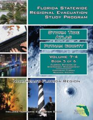
Volume VII-4 <strong>Northeast</strong> <strong>Florida</strong><br />
Statewide <strong>Regional</strong> Evacuation Studies Program<br />
VARIATIONS TO CONSIDER<br />
Variations between modeled versus actual measured storm tide elevations are typical of current<br />
technology in coastal storm surge modeling. In interpreting the data emergency planners should<br />
recognize the uncertainties characteristic of mathematical models and severe weather systems such<br />
as hurricanes. The storm tide elevations developed for this study and presented in the Storm Tide<br />
Atlas should be used as guideline information for planning purposes.<br />
Storm Tide & Wave Height<br />
Regarding interpretation of the data, it is important to understand that the configuration and depth<br />
(bathymetry) of the Atlantic Ocean bottom will have a bearing on surge and wave heights. A narrow<br />
shelf, or one that drops steeply from the shoreline and subsequently produces deep water in close<br />
proximity to the shoreline, tends to produce a lower surge but a higher and more powerful wave.<br />
Those regions, like the <strong>Northeast</strong> <strong>Florida</strong> Region, which have a gently sloping shelf and shallower<br />
normal water depths, can expect a higher surge but smaller waves. The reason this occurs is<br />
because a surge in deeper water can be dispersed down and out away from the hurricane.<br />
However, once that surge reaches a shallow gently sloping shelf it can no longer be dispersed away<br />
from the hurricane, consequently water piles up as it is driven ashore by the wind stresses of the<br />
hurricane. Wave height is NOT calculated by the SLOSH model and is not reflected within the storm<br />
tide delineations.<br />
Forward Speed<br />
Under actual storm conditions it may be expected that a hurricane moving at a slower speed could<br />
have higher coastal storm tides than those depicted from model results. At the same time, a fast<br />
moving hurricane would have less time to move storm surge water up river courses to more inland<br />
areas.<br />
Astronomical Tides<br />
Surge heights were provided by NOAA at high tide. The tide level is referenced to North American<br />
Vertical Datum of 1988. The storm tide limits reflect high tide in the region.<br />
Accuracy<br />
As part of the Statewide <strong>Regional</strong> Evacuation Study, all coastal areas as well as areas surrounding<br />
Lake Okeechobee were mapped using remote-sensing laser terrains mapping (LIDAR 3 ) providing<br />
the most comprehensive, accurate and precise topographic data for this analysis. As a general rule,<br />
the vertical accuracy of the laser mapping is within a 15 centimeter tolerance. However, it should<br />
be noted that the accuracy of these elevations is limited to the precision and tolerance in which the<br />
horizontal accuracy for any given point is recorded. Other factors such as artifact removal<br />
algorithms (that remove buildings and trees) can affect the recorded elevation in a particular<br />
location. For the purposes of this study, the horizontal accuracy cannot be assumed to be greater<br />
3 Light Imaging Detection and Ranging<br />
Volume VII: Storm Tide Atlas Page 15