revised final closure plan - Salinas Valley Solid Waste Authority
revised final closure plan - Salinas Valley Solid Waste Authority
revised final closure plan - Salinas Valley Solid Waste Authority

Create successful ePaper yourself
Turn your PDF publications into a flip-book with our unique Google optimized e-Paper software.
REVISED FINAL CLOSURE PLAN<br />
(2010)<br />
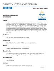
CRAZY HORSE SANITARY LANDFILL<br />
MONTEREY COUNTY, CALIFORNIA<br />
Prepared for<br />
<strong>Salinas</strong> <strong>Valley</strong> <strong>Solid</strong> <strong>Waste</strong> <strong>Authority</strong><br />
128 Sun Street, Suite 101<br />
<strong>Salinas</strong>, CA 93901<br />
Prepared by<br />
Golder Associates, Inc.<br />
1000 Enterprise Way, Ste 190<br />
Roseville, California 95678<br />
July 2010 103-97133
Revised Final Closure Plan<br />
Crazy Horse Sanitary Landfill<br />
Monterey County, California<br />
The material and data in this report were prepared under the supervision and direction of the<br />
undersigned. The services described in this report were performed consistent with generally accepted<br />
professional consulting principles and practices. No other warranty, express or implied, is made.<br />
These services were performed consistent with our agreement with the <strong>Salinas</strong> <strong>Valley</strong> <strong>Solid</strong> <strong>Waste</strong><br />
<strong>Authority</strong> (SVSWA). This report is solely for the use and information of SVSWA unless otherwise<br />
noted. Any reliance on this report by a third party is at such party's sole risk.<br />
Opinions and recommendations contained in this report apply to conditions existing when services<br />
were performed and are intended only for the client, purposes, locations, time frames, and project<br />
parameters indicated. We are not responsible for the impacts of any changes in environmental<br />
standards, practices, or regulations subsequent to performance of services. We do not warrant the<br />
accuracy of information supplied by others, nor the use of segregated portions of this report.<br />
I certify under penalty of perjury I have personally examined and am familiar with the information<br />
submitted in this document and all attachments and, based on my inquiry of those individuals<br />
immediately responsible for obtaining the information, I believe the information is true, accurate, and<br />
complete. I am aware there are significant penalties for knowingly submitting false information,<br />
including the possibility of fines and imprisonment.<br />
Golder Associates, Inc.<br />
12/31/11<br />
Christopher M. Richgels, P.E.<br />
RCE 47767<br />
July 14, 2010<br />
Date<br />
Golder Associates
Revised Final Closure Plan July 2010<br />
Crazy Horse Sanitary Landfill -iii- 103-97133<br />
TABLE OF CONTENTS<br />
1.0 INTRODUCTION ..................................................................................................................... 1<br />
1.1 Background .................................................................................................................. 1<br />
1.2 Report Submittal .......................................................................................................... 2<br />
2.0 CLOSURE PLAN ..................................................................................................................... 4<br />
2.1 Site Location ................................................................................................................ 4<br />
2.2 Landfill Topography..................................................................................................... 4<br />
2.3 Maximum Closure Area ............................................................................................... 4<br />
2.4 Monitoring and Control Systems ................................................................................. 5<br />
2.5 Closure Date ................................................................................................................. 6<br />
2.6 Description of Closure.................................................................................................. 6<br />
2.7 Removal of Landfill Structures .................................................................................... 8<br />
2.8 Decommissioning of Environmental Control Systems ................................................ 8<br />
2.9 Security at Closed Sites ................................................................................................ 9<br />
2.10 Final Cover ................................................................................................................. 10<br />
2.11 Construction Documents and CQA ............................................................................ 13<br />
2.12 Final Grading .............................................................................................................. 13<br />
2.13 Final Site Face ............................................................................................................ 14<br />
2.13.1 Slope Stability ............................................................................................... 14<br />
2.13.1.1 Previous Stability Analyses ....................................................... 14<br />
2.13.1.2 Existing Steep Slopes ................................................................ 15<br />
2.14 Final Drainage ............................................................................................................ 19<br />
2.15 Slope Protection and Erosion Control ........................................................................ 22<br />
2.16 Leachate Management System ................................................................................... 23<br />
2.17 Groundwater Monitoring System ............................................................................... 26<br />
2.18 Groundwater Corrective Action Program .................................................................. 27<br />
2.19 Storm Water Discharge Monitoring System .............................................................. 28<br />
2.20 Gas Monitoring System .............................................................................................. 28<br />
2.21 Landfill Gas Control System ...................................................................................... 29<br />
3.0 CLOSURE COST ESTIMATES ............................................................................................. 30<br />
3.1 Introduction ................................................................................................................ 30<br />
3.2 Closure Cost Estimate ................................................................................................ 30<br />
3.3 Financial Responsibility for Closure .......................................................................... 30<br />
3.4 Disbursement of Funds During Closure ..................................................................... 30<br />
3.5 Financial Assurance for Corrective Action ................................................................ 31<br />
4.0 BIBLIOGRAPHY ................................................................................................................... 32<br />
Golder Associates
Revised Final Closure Plan July 2010<br />
Crazy Horse Sanitary Landfill -iv- 103-97133<br />
TABLES<br />
Table 1<br />
Table 2<br />
Table 3<br />
Table 4<br />
Closure and Post<strong>closure</strong> Maintenance Plan Index CIWMB Requirements<br />
Closure and Post<strong>closure</strong> Maintenance Plan Index SWRCB Requirements<br />
Closure Cost Estimate<br />
Closure Cost Disbursement Summary<br />
FIGURES<br />
1 Site Location Map<br />
2 Site Facilities Plan<br />
3 Estimated Landfill Base Grades<br />
4 Final Grading Plan<br />
5 Estimated Closure Construction Schedule<br />
6 Leachate Control System<br />
7 Environmental Control Facilities Plan<br />
8 Groundwater Detection Monitoring Wells<br />
9 Groundwater Corrective Action Monitoring Wells<br />
10 Groundwater Remediation System<br />
11 Landfill Gas Control and Monitoring Plan<br />
12 Landfill Cross Sections<br />
13 Closure System Details<br />
14 Drainage System Details<br />
15 Landfill Gas System Details<br />
16 Drainage System Details – Main Drainage Channel<br />
17 Stormwater Detention Improvements<br />
18 Module 1 Final Cover Extension Details<br />
Golder Associates
Revised Final Closure Plan July 2010<br />
Crazy Horse Sanitary Landfill -v- 103-97133<br />
APPENDICES<br />
Appendix A<br />
Appendix B<br />
Appendix C<br />
Appendix D<br />
Appendix E<br />
Appendix F<br />
Appendix G<br />
Appendix H<br />
Appendix I<br />
Appendix J<br />
Appendix K<br />
Appendix L<br />
Appendix M<br />
Appendix N<br />
Appendix O<br />
Permits and Approvals<br />
Settlement Evaluation<br />
Slope Stability Analysis<br />
Leachate Generation, Leachate Volume Reduction, and Recirculation (Revised)<br />
Drainage Calculations (Revised)<br />
Landfill Gas Generation<br />
Final Cover Construction Quality Assurance Plan (Revised)<br />
Emergency Response Plan<br />
Soil Loss Equation<br />
Closure Cost Estimate (Revised)<br />
Labor Transition Plan<br />
2009 LFG System Improvements Plan<br />
2009 Landfill Gas Monitoring Work Plan<br />
2010 Final Cover Test Pad Report<br />
Closure Turf Test Results (New)<br />
Golder Associates
Revised Final Closure Plan July 2010<br />
Crazy Horse Sanitary Landfill -vi- 103-97133<br />
Table 1<br />
CIWMB FINAL CLOSURE PLAN INDEX<br />
CIWMB - Closure/Post- Closure<br />
Maintenance Plan Requirements<br />
CIWMB Section No. SWRCB Section No. FCP Page(s)<br />
Chapter 3. Criteria for All <strong>Waste</strong> Management Units, Facilities and Disposal<br />
Sites<br />
Subchapter 4 Development of Closure/Post-Closure Maintenance Plans<br />
21790. Preliminary Closure Plan Contents Included in Final Closure Plan.<br />
Citation<br />
Closure Cost Estimate 21790(b)(1) 21820 21769(c)(1)(B) 29<br />
Location Maps 21790(b)(2 & 4) 4<br />
Post-Closure Land Uses 21790(b)(5) 2<br />
Estimate of Required Closure Area 21790(b)(6) 4<br />
Closure Date 21790(b)(7) 6<br />
Closure Activities 21790(b)(8) 21090(d) 6<br />
Site Security and Structure Removal<br />
Final Cover and Grading<br />
21790(b)(8)(A)<br />
21135<br />
21790(b)(8)(B)<br />
21090(a)-(a)(2), (a)(6),<br />
(b)-(b)(3), 21750 (f)(5)<br />
Construction Quality Assurance 21790(b)(8)(C) 13<br />
8 – 9<br />
10 - 18<br />
Drainage and Erosion Control 21790(b)(8)(D) 21090(a)(3)- (a)(3)(B) 18 - 21<br />
Gas Monitoring<br />
21790(b)(8)(E)<br />
20925<br />
20425(d)(3) 27<br />
Leachate Monitoring 21790(b)(8)(F) 21090(c)(2) 22 - 24<br />
CIWMB –FINAL Closure Plan Contents CIWMB Section No. SWRCB Section No. FCP Section(s)<br />
Items Under 21790<br />
21800(c)<br />
20425(d)(3), 20950(f),<br />
20909(a)-(a)(3)<br />
(A)(3), 21090<br />
Sequence of Closure Stages With Dates 21800(c) 21090(a)-(a)(2), (d) 6 - 8<br />
Schedule for Disbursement 21800(d) 29<br />
3 - 28<br />
Golder Associates
Revised Final Closure Plan July 2010<br />
Crazy Horse Sanitary Landfill -vii- 103-97133<br />
Table 2<br />
SWRCB FINAL CLOSURE PLAN INDEX<br />
SWRCB Requirement<br />
SWRCB Requirement SWRCB Citation Related CIWMB<br />
Citation<br />
FCP Section<br />
Chapter 3. Criteria for All <strong>Waste</strong> Management Units, Facilities and Disposal<br />
Sites<br />
Subchapter 5 Closure and Post-Closure Maintenance<br />
Article 2.<br />
Closure and Post-Closure Maintenance Standards for Disposal Sites and Landfills<br />
21090. Closure and Post-Closure Maintenance Requirements for <strong>Solid</strong> <strong>Waste</strong> Landfills.ion<br />
Final cover requirements (general)<br />
21090(a)- (a)(2)<br />
Erosion control layer 21090(a)(3) -<br />
(a)(3)(A)3.<br />
Discharges of liquids to covers (other<br />
liquids)<br />
21140, 21790(b)(8)(B) ,<br />
21800(c)<br />
21140, 21150,<br />
21790(b)(8)(D), 21800(c)<br />
10 - 15<br />
21090(a)(5) (B) 20800, 21600(b)(8)(D) 24<br />
Stability analysis 21090(a)(6) 21145, 21790(b)(8)(B) 16 - 19<br />
Grading requirements (performance<br />
standards)<br />
Landfill <strong>closure</strong> deadline & extension<br />
21090(b)- (b)(3)<br />
21090(d)<br />
20650, 21142(a), 21150,<br />
21600(b)(4)(D),<br />
21790(b)(8)(B)<br />
21110, 21790(b)(8),<br />
21800(c)<br />
Final cover survey(s) 21090(e)- (e)(4) 21142(b) 15<br />
Optional clean <strong>closure</strong> 21090(f)- (f)(2) 21810 NA<br />
12<br />
14, 15<br />
Chapter 6. Financial Assurances at <strong>Solid</strong> <strong>Waste</strong> Facilities and at <strong>Waste</strong><br />
Management Units for <strong>Solid</strong> <strong>Waste</strong><br />
Subchapter 2. Financial Assurance Requirements<br />
Article 1.<br />
Financial Assurance for Closure<br />
22207. SWRCB - Closure Funding<br />
Requirements.<br />
Article 2.<br />
Financial Assurance for Post<strong>closure</strong> Maintenance<br />
22212. SWRCB - Post-Closure Funding<br />
Requirements.<br />
Article 4.<br />
22207(a) 29<br />
22212(a)<br />
Financial Assurance Requirements for Corrective Action<br />
22222. SWRCB - Corrective Action<br />
Funding Requirements<br />
6<br />
RPCMP<br />
22222 30<br />
Golder Associates
Revised Final Closure Plan July 2010<br />
Crazy Horse Sanitary Landfill -1- 103-97133<br />
1.0 INTRODUCTION<br />
1.1 Background<br />
The Crazy Horse Sanitary Landfill (CHLF) is a 160-acre site, located in northern Monterey County,<br />
approximately five miles directly northeast of <strong>Salinas</strong>, and approximately two miles east of<br />
Prunedale. Site access is from Crazy Horse Canyon Road off State Highway 101, as shown in Figure<br />
1, Site Location Map.<br />
The CHLF is a Class III landfill and began operation in 1934. <strong>Salinas</strong> <strong>Valley</strong> <strong>Solid</strong> <strong>Waste</strong> SVSWA<br />
(SVSWA) is the owner of the landfill and is responsible for the landfill operation. The current<br />
General Manager is Patrick Mathews [(831) 775-3000]. When the landfill was active, the SVSWA<br />
contracted landfill operations to Norcal <strong>Waste</strong> Systems. Information concerning the landfill<br />
regulatory and operating history can be found in Section 1.1.3 of the Report of <strong>Waste</strong> Discharge/<br />
Report of Disposal Site Information submitted as Volume 1 of the Joint Technical Document, Crazy<br />
Horse Sanitary Landfill, Monterey County, California, EMCON/OWT, July 2004 (JTD (Vol. 1)).<br />
The CHLF can generally be separated into two areas, the closed Module 1 area and the once active<br />
area. The closed Module 1 area consists of a 6-acre unlined area, located in the southeastern portion<br />
of the property, as shown on Figure 2. The once active fill area is approximately 66 acres and<br />
consists of the top deck, the south slope, and the equipment parking area as referenced on Figure 2.<br />
The once active fill area includes both lined and unlined disposal areas. Landfill disposal areas<br />
developed after October 9, 1993 were constructed with a composite liner system in accordance with<br />
Title 27 of the California Code of Regulations (CCR).<br />
A small <strong>closure</strong> area, referred to as the Plescia property, was located southeast of the closed Module<br />
1. This site contained a septic tank that registered in the environmental health risk accounting<br />
associated with the National Priorities Listing of the Module 1 area. Recent discussions with the<br />
Federal Environmental Protection Agency (USEPA) and the Regional Water Quality Control Board<br />
(RWQCB) have removed this site from association with <strong>closure</strong> of the Crazy Horse Sanitary Landfill<br />
hence is not discussed within this report. Details on field investigations and those findings for the<br />
Plescia property were reported to the RWQCB on June 17, 2008. The report was attached as<br />
Appendix J in the 2008 Second Semi-Annual Groundwater Monitoring Report.<br />
The landfill operates in accordance with <strong>Solid</strong> <strong>Waste</strong> Facility Permit (SWFP) 27-AA-0007, issued on<br />
March 25, 2005, by the County of Monterey Environmental Health Division, the local enforcement<br />
agency (LEA) for the landfill. The landfill also operates in accordance with <strong>Waste</strong> Discharge<br />
Requirements (WDRs) contained in Order No. R3-2007-0003, which was adopted on February 9,<br />
2007. Copies of the <strong>revised</strong> SWFP and WDRs are included in Appendix A of the JTD (Vol. 1).<br />
In the JTD (Vol. 1), the SVSWA proposed a vertical expansion, increasing the maximum landfill<br />
elevation from 605 feet above mean sea level (amsl) to 635 feet amsl. A Final Closure and<br />
Post<strong>closure</strong> Maintenance Plan (FCPCMP, 2004) was prepared in 2004 (Emcon/OWT, 2004b) in<br />
conjunction with the JTD (Vol. 1) reflective of that vertical expansion.<br />
In 2009, the SVSWA prepared the Revised Final Closure and Post<strong>closure</strong> Maintenance Plan<br />
(FCPCMP) which <strong>revised</strong> the 2004 FCPCMP. The 2009 FCPCMP was subsequently approved by<br />
Department of Resources Recycling and Recovery (CalRecycle), the RWQCB, and the LEA. The<br />
2009 RFCPCMP prepared the CHLF for <strong>closure</strong> in its <strong>final</strong> condition as non-irrigated open space.<br />
Golder Associates
Revised Final Closure Plan July 2010<br />
Crazy Horse Sanitary Landfill -2- 103-97133<br />
The primary changes between the 2009 FCPCMP and the 2004 FCPCMP are noted below:<br />
• Additional static and seismic analysis. This was necessary since there are some steep slopes<br />
that were not addressed in the 2004 FCP<br />
• Additional drainage analysis. This was necessary due to using a different weather station that<br />
is more representative of the conditions experienced at the Crazy Horse Landfill.<br />
• Replacement of LFG extraction wells. This was necessary due to the disrepair of existing<br />
LFG wells<br />
• Modification of fill space on the east side of the site bordering the site entrance facilities<br />
(Figure 8 of the FCPCMP). The C&D processing area is replaced with emergency equipment<br />
parking area and a recycling center 1 .<br />
• Closure schedule. The construction schedule for site <strong>closure</strong> will exceed the prescriptive<br />
standard of 180 days as discussed in Section 2.6.<br />
The Final Closure Plan (FCP 2009) and Final Post Closure Maintenance Plan (FPCP 2009) have been<br />
approved by the appropriate regulatory agencies.<br />
The SVSWA is revising the project description to accommodate installation of a solar power<br />
generation station at the site. Also, the 2-foot vegetative soil layer is being replaced with a<br />
geosynthetic product serving as a mechanically erosion resistant system to reduce construction<br />
environmental impacts that would have been associated with soil import to the site. Since the<br />
regulatory agencies have approved the 2009 <strong>closure</strong> documents, revisions to those documents are now<br />
entitled Revised Final Closure Plan - 2010 (RFCP-2010) and the Revised Final Post Closure<br />
Maintenance Plan – 2010 (RFPCMP 2010).<br />
The primary changes between the 2009 FCP and this document are noted below:<br />
• Incorporate photovoltaic (PV) technology to the landfill cover system.<br />
• Replace the vegetative cover with a geosynthetic vegetative cover.<br />
• Add a leachate treatment and recirculation system over the lined cell.<br />
• Additional drainage analysis.<br />
1.2 Report Submittal<br />
This RFCP was developed to prepare the Crazy Horse Sanitary Landfill for <strong>final</strong> <strong>closure</strong> in its current<br />
condition. This document describes:<br />
1. How the SVSWA will close and maintain the landfill consistent with 27 CCR<br />
regulations.<br />
1 operating under Section 17402.5(d), Title 14 of the California Code of Regulations.<br />
Golder Associates
Revised Final Closure Plan July 2010<br />
Crazy Horse Sanitary Landfill -3- 103-97133<br />
2. Allows the SVSWA to prepare an estimate of <strong>closure</strong> and post<strong>closure</strong> maintenance<br />
costs for the landfill.<br />
3. Enables the LEA, CIWMB and RWQCB to assess the reasonableness of the cost<br />
estimate.<br />
Section 2 of this report presents the <strong>final</strong> <strong>closure</strong> <strong>plan</strong> for the landfill, which identifies and describes<br />
tasks involved in closing the landfill in a manner consistent with applicable regulations and<br />
acceptable standards to protect public health and safety, and the environment. The contents of this<br />
<strong>final</strong> <strong>closure</strong> <strong>plan</strong> are consistent with the requirements of 27 CCR 21769 and 21800, and other<br />
applicable sections of Title 27.<br />
Site monitoring and maintenance information and descriptions of tasks for implementing the<br />
post<strong>closure</strong> maintenance activities are provided separately in the Revised Final Post-Closure<br />
Maintenance Plan (RFPCMP). The <strong>closure</strong> cost estimates consistent with the requirements of 27 CCR<br />
21820 are presented in Section 3.<br />
Golder Associates
Revised Final Closure Plan July 2010<br />
Crazy Horse Sanitary Landfill -4- 103-97133<br />
2.0 CLOSURE PLAN<br />
2.1 Site Location<br />
27 CCR 21790(b)(2)<br />
The Crazy Horse Sanitary Landfill (CHLF) is located in northern Monterey County, approximately<br />
nine miles north of the City of <strong>Salinas</strong> at 350 Crazy Horse Canyon Road (ref. Figure 1). Access to<br />
the site is from Crazy Horse Canyon Road, a paved two-lane road which runs southeasterly from U.S.<br />
Highway 101 to the road intersection at San Juan Grade Road. The landfill is approximately one mile<br />
south of U.S. Highway 101.<br />
The CHLF is located in Sections 14 and 15, Township 13 South, Range 3 East, Mount Diablo<br />
Baseline and Meridian. The entire CHLF (existing landfill areas and associated facilities) is located<br />
within these quadrangles. The longitude and latitude of the landfill is latitude 36.81 o N, longitude<br />
121.62 o W. The current Assessor Parcel Numbers for the site are 125-271-063, 125-491-012, and<br />
125-571-058.<br />
2.2 Landfill Topography<br />
27 CCR 21790(2) and 21142<br />
Current Topography. The current site topography of the CHLF is presented on Figure 2. This<br />
topography is based in part on a survey that was performed in August 2009. WDR Order No. R3-<br />
2007-0003 specified the site would cease landfill operations by April 30, 2009. The RWQCB<br />
subsequently granted a one year extension to this <strong>closure</strong> date, or April 2010. However, Condition<br />
17f of the <strong>Solid</strong> <strong>Waste</strong> Facility Permit (SWFP) allows site operation only until December 31, 2009,<br />
which therefore served as the controlling date for <strong>final</strong> cessation of site operation. On March 4, 2010,<br />
CalRecycle approved the 2009 FCPCMP and the project is currently in ‘closing’ status until the<br />
<strong>closure</strong> construction is complete.<br />
Final Grading Topography. The <strong>final</strong> grades for the CHLF are presented on Figure 4. Cross<br />
sections of this topography are presented on Figure 12. Sideslopes for the closed CHLF will typically<br />
be no steeper than 3H:1V (horizontal to vertical) as shown on Figure 3. However, there are two<br />
general areas where <strong>final</strong> cover slopes are approaching 2H:1V.<br />
Refuse fill placement on the southeastern slope above the entrance area and Landfill Gas to Energy<br />
Plant (LFGTE Plant) was built as steep as 2.2H:1V as shown on Figure 4 to conserve fill space in the<br />
<strong>final</strong> lifts at the site. Beginning in 2008, fill along this slope was placed at 3H:1V to finish grade.<br />
The southern slope down to the toe of the landfill has three general areas steeper than 3H:1V. Slope<br />
No. 5 as shown on Figure 4 was constructed to slopes of 2.3H:1V during <strong>final</strong> operations at the site.<br />
There are two areas on Slope No. 2 that are steep as 2.5H:1V.<br />
2.3 Maximum Closure Area<br />
27 CCR 21790(b)(6)<br />
Approximately 72 acres of the Crazy Horse Sanitary Landfill is permitted for waste disposal. To<br />
date, only Module 1, an approximately 6-acre area, has been closed, which occurred in 1989.<br />
Therefore, the maximum <strong>closure</strong> area is the remainder of the landfill footprint. At this stage, the total<br />
Golder Associates
Revised Final Closure Plan July 2010<br />
Crazy Horse Sanitary Landfill -5- 103-97133<br />
area requiring <strong>closure</strong> is approximately 66 acres. A schedule for CHLF <strong>closure</strong> activities based on<br />
<strong>closure</strong> construction material quantities and deployment rates is discussed in Section 2.6.<br />
The remaining landfill areas to be closed are identified below. The <strong>closure</strong> will take place in four<br />
general phases. These phases in sequence are:<br />
I. Southern slopes to the canyon floor.<br />
II. Western topdeck and sideslopes<br />
III. Eastern topdeck and sideslopes.<br />
IV. Equipment parking and a recycling center area.<br />
The first phase, the southern slopes, must be closed first to provide the necessary drainage<br />
conveyance structures required to control stormwater discharge from improved surfaces in the other<br />
phases as the site is closed. The second and third phases are depicted on Figure 4 as the west and east<br />
sections of the currently active landfilling area. It is necessary to separate the topdeck area of the<br />
CHLF into separate <strong>closure</strong> phases to maintain LFG control in the primary waste mass during <strong>closure</strong><br />
as discussed in Section 2.21. Active LFG control is a component of the groundwater Corrective<br />
Action Program (CAP) so this function must be maintained during <strong>closure</strong> construction.<br />
The fourth phase is the area currently used for recycling and maintenance activities, located to the<br />
east of the active landfill and north of Module 1. This area was determined to be within the “Subtitle<br />
D landfill footprint” as reported in 1993 and included within the limits of waste as shown on Figure 4.<br />
Final Cover Extension. The SVSWA investigated the potential for waste outside the limits of the<br />
Module 1 <strong>final</strong> cover system with a series of test pits in 2007. An extension to the Module 1 <strong>final</strong><br />
cover system is required due to the presence of waste discovered beyond the perimeter road (ref.<br />
Figure 4). The extent of <strong>final</strong> cover begins near the flare station to past the visually obvious locations<br />
of perimeter road subsidence, encompassing approximately 0.34 acres. This work will include<br />
rebuilding the perimeter road to re-establish positive drainage to the catch basin at the end of the<br />
perimeter road.<br />
2.4 Monitoring and Control Systems<br />
27 CCR 21790(b)(4) and 20180<br />
The current monitoring and control systems at the Crazy Horse Sanitary Landfill consist of leachate<br />
monitoring and control system (ref. Figures 6 and 7), a groundwater monitoring system (ref. Figures<br />
8, 9, and 10), a groundwater extraction and treatment system, a stormwater discharge monitoring<br />
system, and an LFG monitoring and control system (ref. Figure 11). The current monitoring and<br />
control systems were described in the following sections of the JTD (Vol. 1):<br />
• Section 5.6 - Leachate Monitoring and Control System<br />
• Section 6.3.1 - Groundwater Monitoring System<br />
• Section 3.5.8 - Groundwater Extraction System<br />
• Section 6.3.3 - Stormwater Discharge Monitoring System<br />
• Section 6.3.4 - Landfill Gas Management System<br />
Golder Associates
Revised Final Closure Plan July 2010<br />
Crazy Horse Sanitary Landfill -6- 103-97133<br />
Detailed discussions on <strong>closure</strong> activities required for these environmental systems are discussed in<br />
the RFPCMP 2010. These systems will not be decommissioned until required regulatory approvals<br />
are received per 27 CCR 21900 as discussed in Section 2.8 of this RFCP 2010 as well as the<br />
RFPCMP 2010.<br />
2.5 Closure Date<br />
27 CCR 21790(b)(7) and 21769<br />
General Specification No. 19 of WDRs Order No. R3-2007-0003 states that the landfill must<br />
discontinue receiving waste by April 30, 2009. The RWQCB subsequently granted a one year<br />
extension to this <strong>closure</strong> date, or April 2010. On March 4, 2010, CalRecycle approved the 2009<br />
FCPCMP and the project is currently in ‘closing’ status until <strong>closure</strong> construction is complete.<br />
2.6 Description of Closure<br />
27 CCR 21790(b)(8)<br />
Closure Sequence. The sequence of <strong>closure</strong> activities is based on the approval of this <strong>final</strong> <strong>closure</strong><br />
and post<strong>closure</strong> maintenance <strong>plan</strong> (FCPMP) by the CIWMB, RWQCB, and LEA. To complete<br />
<strong>closure</strong> of the CHLF, the following activities will be performed under the supervision of a civil<br />
engineer registered in the State of California:<br />
• Place <strong>final</strong> cover consistent with an approved FCPMP.<br />
• Establish internal access roads.<br />
• Install <strong>final</strong> drainage structures (overside drains, diversion berms, swales and<br />
ditches, outlet energy dispersion aprons, etc.).<br />
• Install the alternative vegetative cover (except for Module 1).<br />
• Extend the <strong>final</strong> cover system of Module 1 and establish the vegetative cover.<br />
• Prepare the as-built topographic map for the Crazy Horse Sanitary Landfill by<br />
field survey or aerial topographic survey, or both.<br />
• Remove unnecessary structures.<br />
• Establish additional site security, as needed.<br />
• Perform post<strong>closure</strong> maintenance and monitoring.<br />
• Obtain regulatory approval to discontinue post<strong>closure</strong> monitoring.<br />
• Decommission environmental control systems.<br />
Performance of these <strong>closure</strong> activities shall incorporate the mitigation measures in the Crazy Horse<br />
Sanitary Landfill Initial Study/Mitigated Negative Declaration (SCH# 2009011062) for the <strong>closure</strong><br />
project.<br />
Closure Schedule. The Crazy Horse Sanitary Landfill will be closed to the <strong>final</strong> grades consistent<br />
with the <strong>final</strong> grading <strong>plan</strong> (Figure 4). A conceptual <strong>plan</strong> for installation of a solar power generation<br />
station on the completed <strong>final</strong> cover is shown on Figure 4A. The <strong>closure</strong> activities will include the<br />
Golder Associates
Revised Final Closure Plan July 2010<br />
Crazy Horse Sanitary Landfill -7- 103-97133<br />
placement of <strong>final</strong> cover and alternative vegetative cover, vegetation of Module 1, construction of<br />
permanent drainage features, and removal of landfill structures (if necessary).<br />
Implementation of the Final Closure Plan for the landfill has begun with the placement of site security<br />
features, the installation of <strong>final</strong> landfill gas extraction wells, and the importation of foundation fill.<br />
A phased construction <strong>plan</strong> is provided below. The actual sequence or duration of events may change<br />
with the <strong>closure</strong> construction contractor’s proposal. The contract specifications will require the<br />
contractor to maintain active landfill gas extraction system operation throughout the <strong>closure</strong> project,<br />
storm water drainage path during winter seasons, and adherence to mitigation measures outlined in<br />
the SVSWA’s environmental document for the project.<br />
Figure 5 presents the estimated construction schedule for <strong>closure</strong> of the CHLF. The schedule is based<br />
on material quantities and typical deployment rates for geosynthetics as experienced in the industry.<br />
As shown on Figure 5, the entire project schedule is estimated at 439 days from project approval by<br />
the SVSWA board to construction contract close-out and submittal of the <strong>closure</strong> construction quality<br />
assurance report to the regulatory agencies. The contract procurement process that the SVSWA, as a<br />
public agency must complete is estimated in Figure 5 as a 97-day process. This process will start in<br />
winter 2010. Using typical deployment rates, <strong>closure</strong> construction is estimated at 249 working days<br />
from March 2011 to February 2012 at completion of sedimentation basin improvements. The Project<br />
Close-out process (punchlist items, <strong>final</strong> inspection and payments, <strong>closure</strong> certification CQA report,<br />
regulatory review of the <strong>closure</strong> report, etc.) is estimated as an 80-working day process from February<br />
2012 to June 2012. The primary cause for this schedule is equipment access conditions and<br />
geosynthetic deployment rates for <strong>closure</strong> of the 66-acre area at the CHLF.<br />
Except for Module 1, the <strong>final</strong> cover construction will include clearing, grubbing, and regrading the<br />
foundation layer, placement of geosynthetic liner material and subdrains, placement of the<br />
geosynthetic vegetative cover, drainage structures, and management of the LFG extraction system.<br />
Some foundation layer material will be placed as intermediate soil cover during <strong>final</strong> landfill<br />
operations. Additional foundation layer material may be stockpiled prior to <strong>closure</strong> activities. Fine<br />
grading, construction of the access roads, below grade drainage and landfill gas pipe installment, and<br />
verifying the foundation layer thickness will be required prior to placement of the geomembrane liner.<br />
The geosynthetic vegetative soil cover may also be placed concurrently with the geomembrane to<br />
avoid prolonged exposure of the geomembrane liner to possible adverse weather conditions (wind,<br />
sunlight, rain, etc.).<br />
The schedule for placement of the <strong>final</strong> cover will depend on the overlapping of construction times<br />
for the geomembrane low-permeability layer, and the geosynthetic vegetative layer. Construction<br />
times are contingent on the performance of the equipment and weather and site conditions. The CHLF<br />
will be closed in four phases as discussed previously. Earthwork has been significantly reduced by<br />
replacing the vegetative soil layer with geosynthetics. Some earthwork is required to provide a 2-foot<br />
foundation layer beneath traveled areas as preferred by the RWQCB. Soil has already been imported<br />
to the site for this use. Earthwork activities will be especially time consuming relative to quantities in<br />
Phase I – the southern slopes. This is due to limited equipment access across the existing benches<br />
from the site entrance.<br />
For the Module 1 2-foot thick vegetative cover earthwork, 1,440 cubic yards per day (cy/d) would be<br />
spread over a work area of approximately 20,000 square feet per day (sf/d).<br />
Golder Associates
Revised Final Closure Plan July 2010<br />
Crazy Horse Sanitary Landfill -8- 103-97133<br />
The following sections present a general description of the <strong>closure</strong> activities.<br />
presentation is consistent with 27 CCR 21790.<br />
The order of<br />
2.7 Removal of Landfill Structures<br />
27 CCR 21790(b)(8)(A) and 21137<br />
Numerous structures on the site, including an office/scalehouse and equipment maintenance<br />
building/fueling facility supported the landfill operation. Other structures, such as the hazardous<br />
waste storage area, the antifreeze, batteries, oil and paint (ABOP) drop-off facility, and the LFG-toenergy<br />
facility, support resource recovery activities.<br />
The office/scalehouse, at the landfill entrance, is equipped with a truck scale. This facility was used<br />
not only to collect tipping fees, but also to process each vehicle, to collect data on the type and<br />
number of vehicles, to weigh the volume of refuse per vehicle, and for other miscellaneous functions.<br />
The office/scalehouse contains the site manager's office and limited space for the administrative<br />
support activities. It will remain part of landfill <strong>closure</strong> to provide office space for field personnel.<br />
Monterey County emergency service equipment and SVSWA vehicles and equipment may be stored<br />
on site south of the landfill maintenance building. To the east of the maintenance building is the flare<br />
station and main leachate storage tank pad. These structures will remain through the post<strong>closure</strong><br />
period servicing the LFG and leachate environmental control systems. To the west of the<br />
maintenance building are a series of storage tanks for collection of groundwater treatment system<br />
effluent and backup (wintertime) leachate storage. This support infrastructure will be temporarily<br />
relocated during <strong>closure</strong> construction and remain through post<strong>closure</strong> until the respective<br />
environmental control systems can be decommissioned. Currently, the SVSWA reuses treated<br />
groundwater from the pump and treat system as dust control water. This water is delivered to the<br />
storage tanks shown on Figure 7 via two 2-inch diameter HDPE force mains. This water delivery<br />
system will be temporarily halted during <strong>closure</strong> activities in the parking area. Operation of the water<br />
delivery system is not necessary for site <strong>closure</strong> but will be relocated and reinstalled after <strong>closure</strong><br />
activities are completed to provide backup water supply for Monterey County emergency equipment.<br />
Relocation and reinstallation of this system will not interfere with the function of the <strong>closure</strong> system.<br />
The on-site structures to remain through site <strong>closure</strong> are shown on Figure 7. One of the weigh scales<br />
will be removed and either disposed off site, sold, or used at another SVSWA facility.<br />
2.8 Decommissioning of Environmental Control Systems<br />
27 CCR 21137<br />
The environmental control systems (ECS) utilized at the landfill currently consists of groundwater<br />
monitoring wells, groundwater extraction system, leachate collection systems, and LFG monitoring<br />
and control system. The locations of each existing system are shown in Figures 6 through 11.<br />
All ECS existing at <strong>closure</strong> are proposed to remain in place upon <strong>closure</strong> and during the post<strong>closure</strong><br />
maintenance period, a minimum of 30 years, or until landfill by-products, such as leachate and LFG,<br />
are demonstrated to no longer pose a threat to the environment and when proper regulatory agency<br />
approval for decommissioning has been obtained (27 CCR 21900). The accessible portions of the<br />
ECS will then be decommissioned, if necessary.<br />
Golder Associates
Revised Final Closure Plan July 2010<br />
Crazy Horse Sanitary Landfill -9- 103-97133<br />
ECS to be decommissioned during the post<strong>closure</strong> maintenance period will either be abandoned in<br />
place or be dismantled and disposed of at another authorized solid waste disposal site. Well<br />
abandonment techniques for decommissioning the groundwater monitoring system will be consistent<br />
with the procedures prescribed in California Well Standards, Bulletin 74-90, and supplement to<br />
Bulletin 74-81 (DWR, January 1990) or equivalent document applicable at the time of<br />
decommissioning as required by the Monterey County Department of Health. Underground pipe<br />
components of the leachate control system and the LFG monitoring system will be cut off at the<br />
surface, capped, and buried to minimize the disturbance of the landfill <strong>final</strong> cover. Aboveground<br />
components will be dismantled, decontaminated, and salvaged for reuse or discarded in a permitted,<br />
active waste disposal site. Transportation and disposal will be consistent with federal, state, and local<br />
laws and accomplished in a manner that prevents the introduction of leachate or waste constituents<br />
into the environment. Materials intended for reuse may be cleaned by:<br />
• Washing with water, detergent, or chemical solvents<br />
• Steam-cleaning<br />
• Scrubbing with abrasives<br />
• Sand blasting<br />
The residues produced as a result of cleaning reusable components will be disposed of consistent with<br />
applicable federal, state, and local laws.<br />
The decommissioning of each ECS is discussed further in the RFPCMP.<br />
2.9 Security at Closed Sites<br />
27 CCR 21790(b)(8)(A) and 21135<br />
Entry onto the landfill during business hours is controlled by site personnel at the entrance facility,<br />
which is the single point of public access to the site. Unauthorized access to the site will be<br />
controlled by perimeter fencing and lockable entrance gates at the point of public access (Crazy Horse<br />
Canyon Road). The fencing also surrounds specific on-site facilities. In 2006, groundwater<br />
extraction wells were vandalized south of Module 1. In 2009, approximately 1,600 feet of security<br />
fencing has been installed along the southern boundary to increase security for the groundwater<br />
remediation system. In those areas where no fencing has been installed, topographical constraints<br />
limit access to the site.<br />
Security at the site is provided by the SVSWA and includes signs, written in English and Spanish,<br />
which will be posted at all entry points 60 days before the start of <strong>final</strong> <strong>closure</strong> activities. These signs<br />
will present (1) the intended <strong>closure</strong> date for waste disposal, and (2) the location of alternative waste<br />
disposal sites. These signs will remain in place for at least 180 days after <strong>final</strong> waste placement. All<br />
entry points to the site from public roads will be controlled with lockable gates. No additional<br />
security installations are proposed for <strong>closure</strong>.<br />
Golder Associates
Revised Final Closure Plan July 2010<br />
Crazy Horse Sanitary Landfill -10- 103-97133<br />
2.10 Final Cover<br />
27 CCR 21790(b)(8)(B), 21140, 21090(a), and 21769(b)(2)<br />
Background and Present Conditions – To date, only the 6-acre Module 1 area has been closed.<br />
Module 1 was closed in 1989 in accordance with a RWQCB-approved <strong>closure</strong> <strong>plan</strong>. The Module 1<br />
<strong>final</strong> cover consists of, from bottom to top:<br />
• A minimum of 2 feet of compacted foundation soil;<br />
• A geomembrane low-permeability layer; and<br />
• A minimum 1-foot thick vegetative layer.<br />
An intermediate cover consisting of at least 12 inches of soil will be placed over the inactive waste<br />
fill areas. Currently active landfill areas will receive daily and intermediate cover, as appropriate, to<br />
provide a 1-foot thick foundation layer.<br />
Regulatory Requirements – According to 27 CCR 21140, <strong>final</strong> cover shall have a minimum<br />
thickness and quality of cover material consistent with the 27 CCR 21090(a) minimum <strong>final</strong> cover<br />
requirements, which consist of the following layers, from bottom to top:<br />
• A minimum of 2 feet of compacted foundation soil;<br />
• A minimum of 1 foot of compacted low permeability soil (k ≤ 1 x<br />
10 -6 centimeters per second [cm/sec]) or equal to the hydraulic conductivity of<br />
any bottom liner system or underlying natural geologic materials, whichever is<br />
less permeable; and<br />
• A minimum of 1 foot of vegetative cover soil.<br />
Proposed Final Cover Phases – As stated earlier, there are four phases at the CHLF to be closed.<br />
The first phase is the southern slopes of the landfill down to the canyon floor. This phase will collect<br />
and convey stormwater drainage from portions of the topdeck area requiring specific attention to<br />
drainage infrastructure. The second and third phases are on the currently active topdeck. The fourth<br />
phase will be the equipment parking area that is east of the active landfill area and north of Module 1.<br />
This area was declared to be within the landfill footprint in the FCPCMP (2004) and previous<br />
investigations have determined there is waste in the area. It is proposed to continue to use this area<br />
for Monterey County emergency (fire, earthquake response, etc.) equipment staging, parking for<br />
SVSWA vehicles and equipment, and a recycling center.<br />
Active Landfill Area – For cost estimating purposes, the <strong>final</strong> cover design for the active landfill<br />
area consists of the following (from top to bottom) discussed in more detail below:<br />
• A geosynthetic erosion protective layer;<br />
• A structured geomembrane low-permeability layer;<br />
• A minimum 1-foot-thick foundation layer beneath the geomembrane; and<br />
• A minimum 2-foot thick foundation layer beneath the geomembrane in traveled areas.<br />
Golder Associates
Revised Final Closure Plan July 2010<br />
Crazy Horse Sanitary Landfill -11- 103-97133<br />
The <strong>final</strong> cover above is an engineered alternative <strong>final</strong> cover consistent with 27 CCR 20080. In May<br />
2010, the SVSWA constructed a test pad of the proposed cover system. The Construction Report<br />
documenting the results of the test pad is provided in Appendix N.<br />
The <strong>final</strong> cover for the current recycling and maintenance area will be asphaltic concrete (AC)<br />
paving. The AC paving will provide a functional <strong>final</strong> cover while providing usable space for<br />
SVSWA and county use.<br />
Foundation Layer - Title 27 CCR §21090 stipulates that not less than two feet of a soil foundation<br />
layer shall be constructed for the <strong>final</strong> cover, unless it is shown that differential settlement and<br />
ultimate land use do not adversely affect the integrity of the <strong>final</strong> cover. Post<strong>closure</strong> use for the site<br />
will be as a solar power generation facility on the topdeck (Figure 4A). The remaining areas will be<br />
non-irrigated open-space. The ultimate land use does not involve structures or other uses of the<br />
covered areas that could be affected by differential settlement.<br />
To support vehicle travel on the closed facility during construction activities and the post<strong>closure</strong><br />
period, the foundation layer beneath traveled roadways will be a minimum of two feet thick. The<br />
SVSWA recently conducted a survey of existing foundation soil thickness. It was determined that<br />
onsite soils are available for foundation layer construction, however, it is anticipated that some soil<br />
will require import. Other surfaces of the landfill will be constructed with a minimum 1-foot thick<br />
foundation layer in the <strong>final</strong> cover system as discussed below.<br />
Low-Permeability Layer - The proposed low-permeability hydraulic barrier layer is provided by<br />
geosynthetic materials (structured LLDPE geomembrane). These geosynthetic materials can tolerate<br />
substantially higher strains up to 10 to 20 percent or greater before yielding, and thus are a superior<br />
cover construction material. Because these materials can tolerate strains 10 times larger than soil<br />
components without adverse impacts, the two-foot foundation layer thickness supportive for<br />
construction of a clay liner is not required for geosynthetic materials. Furthermore, modern<br />
landfilling techniques focus on achieving a high degree of compaction to optimize airspace, and large<br />
containers are typically diverted from the landfill that could otherwise collapse and cause large<br />
differential settlements. As a result, differential settlements at the top of the refuse are expected to be<br />
relatively small at approximately 2 percent or less (Appendix B). Therefore, the foundation layer for<br />
the proposed EAD cover design need only be thick enough to provide a clean, firm surface for the<br />
geosynthetic materials.<br />
Due to the SVSWA’s efforts and practices to divert large appliances/containers from the landfill, the<br />
development of large differential settlements resulting from large voids is considered unlikely. In<br />
addition, the SVSWA is considering utilizing dynamic compaction techniques on the finished topdeck<br />
surface to reduce settlement impacts on the constructed <strong>final</strong> cover. However, a very conservative<br />
analysis was completed that considered the potential development of a void in the underlying wastes<br />
(Appendix B). This analysis indicates that the resulting strain (2%) are well within the limits that can<br />
be tolerated by the proposed cover materials in the unlikely event that significant voids develop<br />
beneath the cover system. For the CHLF, a foundation layer of one foot is more than sufficient to<br />
achieve this objective and will also reduce the traffic and environmental impact of transporting<br />
additional foundation layer material to the site.<br />
For unlined and lined areas, the low-permeability layer will be a geomembrane placed on the<br />
foundation layer. The geomembrane exceeds the permeability requirement in 27 CCR as discussed in<br />
Appendix D.<br />
Golder Associates
Revised Final Closure Plan July 2010<br />
Crazy Horse Sanitary Landfill -12- 103-97133<br />
For the sideslopes of the CHLF, a combined structured geomembrane/drainage geocomposite has<br />
been selected for stability concerns (discussed in Section 2.13). This material has significantly higher<br />
shear strength properties than typical geomembrane/geocomposite combinations and thus is specified<br />
for use on the sideslopes of the CHLF. The hydraulic performance of geomembrane was evaluated in<br />
Appendix D.<br />
Drainage Layer – The drainage layer will be within the stub side of the structured geomembrane. As<br />
shown on the <strong>closure</strong> system details on Figures 13 and 14, the structured geomembrane will be<br />
overlain with an artificial turf product as discussed below.<br />
Geosynthetic Mechanically Erosion-Resistant Layer – An engineered alternative to the<br />
prescriptive vegetative erosion protection design discussed above is proposed to be a geosynthetic<br />
vegetative cover placed over the geomembrane. The geosynthetic vegetative layer is a permeable<br />
geosynthetic grass that consists of a woven geotextile and UV resistant blades of artificial grass<br />
ballasted with interlocking sand infill.<br />
The quantity of <strong>final</strong> cover soils and geosynthetic material required for the landfill <strong>closure</strong> is<br />
presented on Table 3. Appendix J presents the Closure Cost Estimate back-up calculations based on<br />
these quantities. Final cover construction will begin early 2011 as shown of Figure 5. A construction<br />
quality assurance (CQA) program, including geomembrane installation, is presented in Appendix G.<br />
Final cover construction will be conducted under the supervision of a registered civil engineer.<br />
Recycling Center and Equipment Parking Area – Prior to opening a recycling center, appropriate<br />
permits required under Title 14 will be secured. The <strong>final</strong> cover for the recycling center and<br />
equipment parking and staging area will be AC paving. AC paving has previously been used as <strong>final</strong><br />
cover at other landfills in road areas and end-use development areas. For cost estimating purposes,<br />
the <strong>final</strong> cover for the recycling center and equipment parking and staging area consists of, from<br />
bottom to top:<br />
• Minimum 6-inch thick aggregate base layer;<br />
• Geotextile fabric; and<br />
• Minimum 6-inch thick low-permeability AC layer.<br />
Aggregate Base Layer - A minimum 6-inch thick aggregate base will be placed on the prepared<br />
subgrade. The aggregate base will support the AC layer and provide a dampening effect for any<br />
differential settlement.<br />
Geotextile Fabric – A geotextile fabric will be placed on the aggregate base layer before the AC<br />
paving. The geotextile will act as a reinforcing layer and further isolate the AC paving from the<br />
underlying waste.<br />
AC Paving – Low-permeability AC paving typically incorporates additional binder to seal void space<br />
within the pavement section that greatly decreases the permeability. Permeabilities as low as 1 x 10 -8<br />
cm/sec have been measured for low-permeability AC paving samples. Also, this area will not have a<br />
(saturated) vegetative cover over it providing a driving hydraulic head through the pavement section.<br />
Proper grading of the paved area to prevent ponding will provide more protection against infiltration<br />
then asphalt permeability. As shown on Figure 4 minimum slope on the pavement will be 2%.<br />
Golder Associates
Revised Final Closure Plan July 2010<br />
Crazy Horse Sanitary Landfill -13- 103-97133<br />
2.11 Construction Documents and CQA<br />
Construction <strong>plan</strong>s and specifications previously had been prepared based on the RFCP (2009).<br />
These <strong>plan</strong>s will be <strong>revised</strong> and submitted for regulatory review in late July 2010. The construction<br />
documents will include <strong>final</strong> construction drawings, specifications, and a construction quality<br />
assurance <strong>plan</strong>, which will be prepared under the supervision of a Registered Civil Engineer or<br />
Certified Engineering Geologist in the State of California. Appendix G includes a CQA Plan that<br />
addresses placement of the geosynthetic material <strong>closure</strong> design as described in this document.<br />
CQA will be implemented during <strong>closure</strong> to verify that the construction complies with approved<br />
construction drawings, specifications, and the CQA Plan. The CQA activities will be completed<br />
under the supervision of a Registered Civil Engineer or Certified Engineering Geologist in the State<br />
of California as required by Title 27 CCR.<br />
2.12 Final Grading<br />
27 CCR 21090(b), 21790(b)(8)(B), 21142, and 21769(b)(2)<br />
Background and Existing Conditions. The <strong>final</strong> landfill grades were configured to maximize refuse<br />
fill while addressing existing topographic restrictions, drainage requirements, and aesthetics. The<br />
existing sideslopes of the landfill have been constructed with a nominal slope of approximately<br />
3H:1V. However, as discussed previously and presented on Figure 3, there are five basic areas where<br />
<strong>final</strong> slopes at the CHLF will exceed 3H:1V. These slopes are specifically discussed in Section 2.13<br />
for overall drainage, static and seismic stability.<br />
Regulatory Requirements. According to 27 CCR 21090(b), the <strong>final</strong> elevations of the landfill must<br />
be designed to prevent ponding, accommodate anticipated future settlement, and reduce runoff<br />
velocities in order to protect the <strong>final</strong> cover from soil erosion. Additionally, 27 CCR 21142 requires<br />
that <strong>final</strong> grades be designed and maintained to reduce impacts to health and safety and take into<br />
consideration any post<strong>closure</strong> land use.<br />
Final Grades. The <strong>final</strong> grades are consistent with 27 CCR requirements. The <strong>final</strong> grades on the<br />
topdeck will be constructed with slopes no flatter than 5 percent to provide sufficient slope for<br />
continued stormwater runoff after refuse consolidation and settlement, and to prevent the potential for<br />
ponding in the event of differential settlement. Sideslopes will be nominally 3H:1V, or flatter.<br />
However, some sideslope areas are steeper approaching 2H:1V under current conditions. The highest<br />
peak elevation of the closed facility will be on the topdeck area at about 635 feet amsl. The proposed<br />
<strong>final</strong> grades for the Crazy Horse Sanitary Landfill are shown in Figure 4.<br />
The <strong>final</strong> grades are controlled by surrounding topography, existing waste fill, anticipated refuse<br />
settlement, and minimum gradients for adequate drainage of the completed fill. Final landfill grades<br />
are designed to prevent ponding, to accommodate anticipated future settlement, and to reduce runoff<br />
velocities to minimize erosive conditions. The <strong>final</strong> landfill grades, shown in Figure 4, represent presettlement<br />
grades. Refuse settlement after <strong>closure</strong> is estimated to be up to approximately 25 feet on<br />
the southern slope (settlement calculations are presented in Appendix B). This estimate is based on<br />
the method of landfill operation, effects of surcharging over the deepest parts of the fill, estimated<br />
settlement during the active life of the landfill, refuse decomposition and landfill settlement<br />
experienced at other sites with similar characteristics.<br />
Final Cover Surveys. To monitor settlement of the site during the post<strong>closure</strong> maintenance period,<br />
measuring techniques, such as aerial photographic surveys, will be used. The entire landfill will be<br />
Golder Associates
Revised Final Closure Plan July 2010<br />
Crazy Horse Sanitary Landfill -14- 103-97133<br />
aerially photographed and topographic maps of the site prepared to evaluate landfill settlement. The<br />
landfill will be aerially photographed at the end of <strong>closure</strong> activities, and every 5 years throughout the<br />
post<strong>closure</strong> maintenance period. An iso-settlement map will also be produced every 5 years showing<br />
changes in elevation from the map produced upon <strong>closure</strong> and the most recent topographic map. Isosettlement<br />
maps will be produced consistent with 27 CCR 21090(e). As shown on Figure 2, there are<br />
6 existing survey control benchmarks available to prepare these post<strong>closure</strong> surveys and locate<br />
containment structures and monitoring facilities throughout the post-<strong>closure</strong> period which is required<br />
by 27 CCR 20950(d).<br />
2.13 Final Site Face<br />
27 CCR 21145 and 21769(b)<br />
The <strong>final</strong> landfill configuration for the Crazy Horse Sanitary Landfill will provide a <strong>final</strong> site face<br />
with most slopes no steeper than 3H:1V and with minimum 15-foot-wide benches at approximately<br />
50-foot elevation change intervals. Some <strong>final</strong> slopes as shown on Figure 4, will be steeper than<br />
3H:1V, approaching 2H:1V in the case on the upper eastern slope of the topdeck and 2.3H:1V on the<br />
upper southern slope. Stability issues associated with these slopes are discussed below. H:1V On<br />
the topdeck, minimum <strong>final</strong> surface slopes of 5 percent will be used to provide sufficient run-off slope<br />
after refuse settlement. Settlement analyses specific to the topdeck areas in Appendix B (based on<br />
Figure 12), indicates that this topdeck slope is expected to remain serviceable for consistent surface<br />
water drainage throughout the post<strong>closure</strong> period of the CHLF without excessive maintenance<br />
requirements.<br />
2.13.1 Slope Stability<br />
Requirements: Slope stability of the CHLF must be analyzed per the requirements of Title 27.<br />
Section 20370 of Title 27 specifies that Class III landfills shall be designed to “withstand the<br />
maximum probable earthquake (MPE) without damage to the foundation or to the structures which<br />
control leachate, surface drainage or erosion, or gas” (LFG). This slope stability requirement is<br />
repeated under Section 21145 under “dynamic and static” conditions. Section 21090(a) requires any<br />
<strong>final</strong> cover design having slopes steeper than 3H:1V (H:V), or having a geosynthetic component must<br />
be supported in the “slope stability report required under §21750(f)(5).” Where critical slope factors<br />
of safety less than 1.5 under “dynamic conditions” are achieved, Section 21750(f)(5)(D) requires a<br />
“quantified estimate of the magnitude of movement” and demonstrate this seismically induced<br />
permanent displacement can be accommodated without “jeopardizing the integrity” of the foundation<br />
or the environmental control structures listed in Sections 20370 and 21145. Analyses were previously<br />
performed for the prescriptive vegetative soil cover. The stability properties of the artificial turf<br />
component were measured against this analysis and were found to be satisfactory.<br />
2.13.1.1 Previous Stability Analyses<br />
A global stability analysis through the refuse mass in the lined area on the western side of the CHLF<br />
was performed in 1993 by GeoLogic Associates (GLA) for development of the lined phases of the<br />
landfill. This analysis is attached to the RFCP in Appendix C. The analysis calculated both the<br />
Maximum Probable Earthquake (MPE) and the Maximum Credible Earthquake (MCE) for several<br />
faults in the South Bay Area including the “creeping” and “northern” segments of the San Andreas<br />
Fault. Based on the northern segment of the San Andreas approximately 10 miles from the site, GLA<br />
calculated a design MPE acceleration of 0.27g resulting from a 7.5 Magnitude event. As a<br />
conservative approach, GLA elected to use the calculated MCE site acceleration of 0.39g from a “7.0<br />
Magnitude event on the (creeping) segment of the San Andreas Fault located approximately 4 miles<br />
Golder Associates
Revised Final Closure Plan July 2010<br />
Crazy Horse Sanitary Landfill -15- 103-97133<br />
from the site.” The 1993 analysis estimated seismically induced permanent displacement in the base<br />
liner and LCRS “on the order of less than one-half of one foot.”<br />
In 2004 (Emcon/OWT, Inc. 2004b) both veneer (<strong>final</strong> cover) and global (through refuse mass) slope<br />
stability analyses were performed to evaluate the affects of the vertical expansion of the landfill to the<br />
<strong>final</strong> maximum elevation of 635 feet amsl. This analysis is attached to the RFCP in Appendix C. For<br />
the slope stability analysis performed in the 2004 study, the design ground motion was chosen as that<br />
having a 10 percent probability of exceedance in 50 years 2 and calculated at 0.53 g. This design<br />
ground motion is more stringent than the ground motion associated with the MCE estimated in the<br />
1993 analysis. The 2004 slope stability analysis concluded the following regarding global and veneer<br />
stability for the proposed site conditions analyzed in 2004:<br />
• For the proposed <strong>final</strong> landfill slopes, the static factor of safety for global<br />
stability is equal to or greater than 1.5, the generally accepted value for static<br />
factor of safety.<br />
• For the proposed <strong>final</strong> landfill slopes, a displacement analysis concluded the<br />
permanent displacement was less than 1 foot for global stability supportive of the<br />
findings in the initial 1993 analysis.<br />
• For the proposed <strong>final</strong> cover on 3H:1V slopes, a veneer stability analysis for a<br />
soil vegetative layer determined the seismically induced permanent displacement<br />
would be less than 1 foot if the interface shear strengths within the <strong>final</strong> cover<br />
system equaled or exceeded a shear strength envelope defined by a friction angle<br />
of 31 degrees. This friction angle would also provide a static factor of safety<br />
greater than the required 1.5 value.<br />
However, these previous analyses did not consider the existence of localized slopes steeper than<br />
3H:1V at the crest of the landfill. Overall global stability of the landfill is not affected by these slope<br />
conditions as the previous critical surfaces were determined to be over the lined areas on the west side<br />
of the topdeck. Sideslopes along the lined area will all be 3H:1V or less, therefore the stability<br />
assumptions, conditions, and findings of those previous studies over the critical surfaces on the lined<br />
area remain unchanged. Both the 1993 and 2004 global stability analyses concluded the existing base<br />
liner and LCRS at the CHLF would experience seismically induced permanent displacement of less<br />
than the generally accepted limit of 12 inches.<br />
2.13.1.2 Existing Steep Slopes<br />
The CHLF will possess a few localized areas of over steepened slope during the post<strong>closure</strong> period.<br />
In 2009, Golder performed additional veneer stability calculations regarding these slopes which range<br />
from 2.3H:1V to 2.2H:1V. Slope measurements on the <strong>final</strong> slopes are shown on Figure C-1<br />
(Appendix C). The upper slope above a 12-foot wide bench on the eastern face of the topdeck (facing<br />
the entrance facilities) currently has an average slope of 2.2H:1V in steepness over an approximate<br />
area of 1.0 acres, with a localized area approaching 2H:1V. The slope height of the over steepened<br />
section is approximately 24 feet. The SVSWA directed its site operator to stop this steep slope<br />
construction and return to typical 3H:1V sideslopes above the steepen area in anticipation of site<br />
<strong>closure</strong>. The 3H:1V slope segment will be approximately 10 feet in height at <strong>final</strong> <strong>closure</strong>. Below<br />
2 per the United States Geological Survey (USGS) Probabilistic Seismic Hazard Assessment.<br />
Golder Associates
Revised Final Closure Plan July 2010<br />
Crazy Horse Sanitary Landfill -16- 103-97133<br />
the mid-slope bench are sideslopes generally 3H:1V in steepness with some localized areas as steep<br />
as 2.6H:1V as shown on Figure C-1.<br />
The uppermost slope of the south face is approximately 2.3H:1V in steepness over approximately 1.1<br />
acres as shown on Figure C-1 in Appendix C. The slope height in this area is approximately 40 feet.<br />
Slopes to be constructed beyond the main access road and western bench road are to be constructed at<br />
3H:1V slopes per direction given by the SVSWA to its site operator. These slopes were relatively<br />
short hence a sliding block analysis was performed versus an infinite slope analysis. The 2009 slope<br />
stability analysis concluded the following regarding veneer stability for the proposed <strong>final</strong> cover<br />
system with a vegetative soil layer:<br />
• Upper Eastern Slope Face: To limit the estimated seismically induced permanent<br />
displacements to less than 12 inches, the vegetative soil required tapering from a thickness of<br />
2 feet at the slope crest to a thickness of 4 feet at the mid-slope bench. This vegetative layer<br />
configuration also resulted in an acceptable factor of safety greater than 1.5 for this slope.<br />
• Upper Southern Slope Face: The computed factor of safety and estimates of seismically<br />
induced permanent displacement were acceptable with a uniform vegetative soil layer<br />
thickness of 2 feet.<br />
• These analyses were based on interface shear strengths within the <strong>final</strong> cover system equal or<br />
exceeding a shear strength envelope defined by a friction angle of 32.5 degrees. This friction<br />
angle was based on direct shear test results of the internal shear strength of the proposed<br />
vegetative soil material.<br />
Geosynthetic Final Cover Stability. The proposed geosynthetic cover system eliminates the use of<br />
a thick vegetative soil layer. This also eliminates the potential for damage to the <strong>final</strong> cover system<br />
due to excessive seismically induced permanent displacements. With elimination of the 2-foot thick<br />
vegetative layer, an infinite slope is a more appropriate means of stability analysis for the proposed<br />
geosynthetic materials. For the required factor of safety (FS) of 1.5, the minimum shear strength<br />
envelope is determined by:<br />
tanφ => 1.5 x tanα<br />
Where φ is the internal friction angle of the veneer interface being considered and α is the slope<br />
angle. For a 2.2H:1V slope and FS = >1.5, the internal friction angle must be greater than or equal to<br />
34.5 degrees (rounding to the nearest half degree).<br />
The manufacturer of the proposed geosynthetic mechanically erosion-resistant layer, Closure Turf<br />
LLC, had direct shear tests performed on the material to represent both the closed condition and <strong>final</strong><br />
cover construction conditions at the CHLF: These test results are presented in Appendix O. These<br />
results are summarized in the table below and plotted against the minimum shear strength envelope in<br />
the accompanying chart. The tests were conducted using a concrete sand infill in the artificial turf<br />
component placed against the stud side of the structured geomembrane. The tests were conducted<br />
under “soaked” conditions and run at a shear rate of 0.04 inches per minute.<br />
Golder Associates
Revised Final Closure Plan July 2010<br />
Crazy Horse Sanitary Landfill -17- 103-97133<br />
Closure Turf Direct Shear Testing Summary<br />
Applied Normal Shear Stress<br />
Stress Peak Residual<br />
(psf) (psf) (psf)<br />
50 96 54<br />
100 151 114<br />
200 185 132<br />
400 302 224<br />
600 464 335<br />
2000 1376 1308<br />
3500 2425 2291<br />
5000 3400 3233<br />
Golder Associates
Revised Final Closure Plan July 2010<br />
Crazy Horse Sanitary Landfill -18- 103-97133<br />
500<br />
450<br />
400<br />
Measure Shear Stress (psf)<br />
Measure Shear Stress (psf)<br />
350<br />
300<br />
250<br />
200<br />
150<br />
100<br />
50<br />
0<br />
500<br />
450<br />
400<br />
350<br />
300<br />
250<br />
200<br />
150<br />
100<br />
50<br />
0<br />
Peak<br />
Residual<br />
Minimum Shear Strength Envelope (2.2H:1V)<br />
2.3H:1V Slope<br />
3H:1V Slope<br />
0 100 200 300 400 500 600 700 800 900 1,000<br />
Applied Normal Stress (psf)<br />
Peak<br />
Residual<br />
Minimum Shear Strength Envelope (2.2H:1V)<br />
2.3H:1V Slope<br />
3H:1V Slope<br />
0 100 200 300 400 500 600 700 800 900 1,000<br />
Applied Normal Stress (psf)<br />
The peak and residual shear strength test results indicate the proposed geosynthetic <strong>final</strong> cover system<br />
should remain above the minimum shear strength envelope for typical normal load conditions (< 50<br />
psf) during the post-<strong>closure</strong> period. However, test results at higher normal loads (400 psf to 5,000<br />
psf, representing equipment loading) produce shear strengths that are under the minimum shear<br />
strength envelope. Equipment travel across the deployed <strong>final</strong> cover system on slopes steeper than<br />
3H:1V should be prohibited during construction.<br />
Golder Associates
Revised Final Closure Plan July 2010<br />
Crazy Horse Sanitary Landfill -19- 103-97133<br />
2.14 Final Drainage<br />
27 CCR 21790(b)(8)(D), 21150, 20365, and 21090<br />
Proposed Final Drainage Control System<br />
The proposed <strong>final</strong> drainage control system configuration is shown on Figure 4 and 17. A detailed<br />
discussion of the hydraulic performance of the geosynthetic <strong>final</strong> cover system is presented in<br />
Appendix E. The proposed <strong>final</strong> drainage improvements, combined with the proposed surface<br />
grading, will facilitate the rapid removal of surface water run-off from the waste area in accordance<br />
with 27 CCR regulations. The <strong>final</strong> surface or deck area of the landfill will be sloped to prevent<br />
ponding and promote lateral runoff of storm water which falls directly on the landfill. Downdrain<br />
inlets placed around the edges of the deck area, deck area drainage swales and/or berms and the slope<br />
on benches will direct storm water to either the downdrain or the peripheral storm drain systems.<br />
Hydrology<br />
A hydrology study for proposed conditions at the site was conducted in accordance with 27 CCR<br />
20365. The objective of the hydrology study was to provide sizing and location information for the<br />
site's storm drain facilities at <strong>closure</strong>. Historical hydrological analysis has used climatological data<br />
collected at the <strong>Salinas</strong> Airport. However, the SVSWA had started collecting onsite rainfall data at<br />
the CHLF beginning in 2003. While not considered “statistically significant” for standard<br />
climatological analysis, the few years of onsite data available suggested annual rainfall totals at the<br />
CHLF were potentially double that previously considered. Therefore, a new hydrology study for<br />
conditions at the site was conducted in accordance with 27 CCR 20365. The objective of the<br />
hydrology study was to provide sizing and location information for the site's storm drain facilities at<br />
<strong>closure</strong>. For this Revised FCP, climatological data was collected from weather stations located along<br />
the ridge on which the CHLF resides. These data reported rainfall levels confirming measured<br />
precipitation at the onsite weather station. The weather station along the Pajaro River (CIMIS Station<br />
129) was selected for this hydrological study as the most reflective of site hydrology conditions.<br />
Collected data from this station produces a calculated 100-year, 24-hr storm rainfall precipitation total<br />
of 5.65 inches. This design storm was used in the drainage analysis presented in Appendix E.<br />
Hydraulic Analysis Method<br />
Previous revisions of the FCP used the Rational Method in performance of hydraulic calculations for<br />
the closed CHLF. This method was appropriate for a drainage area of less than 100 acres and a<br />
surface condition of vegetated sandy silt soil. Detention capacity of peak discharge for the previously<br />
proposed <strong>final</strong> cover system was readily available from the existing sedimentation basins.<br />
However, the run-off and peak discharge potential of the proposed artificial turf based <strong>final</strong> cover<br />
system is much higher than that of a vegetated soil layer. While the Rational Method would produce<br />
fairly conservative estimates of peak discharge for drainage conveyance structure (ditches, overside<br />
drains, etc.) sizing, it cannot perform the routing analysis required to determine the required detention<br />
capacity from a design storm event on an entirely geosynthetic <strong>final</strong> cover. Therefore, Golder used<br />
the Technical Release No. 55 (TR-55) method from the Natural Resources Conservation Service<br />
(NRCS) for calculation of peak discharge from a 24-hour, 100-year storm event. Estimated peak<br />
discharge and routing values were calculated based on the Pajaro climatological data presented in<br />
Appendix E.<br />
Golder Associates
Revised Final Closure Plan July 2010<br />
Crazy Horse Sanitary Landfill -20- 103-97133<br />
Drainage Sub Basins<br />
In general, storm water on the landfill deck will sheet flow until it is intercepted by diversion berms<br />
or the perimeter access road located across the topdeck as shown on Figure 4. Diversion berms will<br />
be used where necessary to direct runoff flows into overside drains for conveyance to the perimeter<br />
road. Erosion control, using aggregate, or geosynthetic materials, will be installed as needed to<br />
minimize erosion.<br />
The overside drains will be installed perpendicular to slope contours and located atop, and anchored<br />
into, the <strong>final</strong> landfill surface. The overside drains will empty into rip-rap energy dispersion<br />
structures at sideslope benches. To reduce refuse excavation, rather than use of catch basins, the<br />
benches will be fitted with surface swales to direct overside drain and bench ditch flows into the next<br />
overside drain pipe.<br />
There are three primary subbasins and discharge points in the proposed Final Drainage Plan of the<br />
CHLF:<br />
A. Adjacent to the southwest corner of the waste fill area for flows originating from the<br />
northern and western portions of the landfill. (Final Cover Construction Phase II on<br />
Figure 4)<br />
B. The southwest corner of the closed Module 1 area for flows originating from the<br />
eastern and southern portions of the landfill. (Final Cover Construction Phases III<br />
and IV)<br />
C. The south slope of the main fill area. (Final Cover Construction Phase I)<br />
These locations can be seen on Figure 4 as referenced.<br />
Subbasin A is the topdeck and sideslopes northwest of the main topdeck access road shown on Figure<br />
4. This subbasin is approximately 29 acres in area and consists primarily of overland flow conditions<br />
on the topdeck area with concentrated flows directed to overside drainage structures down the<br />
sideslopes. Flows are discharged from the overside drains to the paved perimeter road which directs<br />
run-off flow into Sedimentation Basin A. The grades of the paved road generally vary from 1.5 to 14<br />
percent and rises from an elevation of approximately 410-ft MSL at the existing Sedimentation Basin<br />
A to a grade break located at the northeastern tip of the landfill at an approximate elevation of 580-ft<br />
MSL.<br />
Subbasin B is approximately 39 acres in total area. In addition to the topdeck and sideslope areas<br />
southeast of the main topdeck access road, the subbasin also collects run-off from the proposed<br />
parking lot area, and the closed Module 1. Also, this subbasin diverts rain-fall run-on from the small<br />
hill east of the topdeck area, the power <strong>plan</strong>t pad and driveway, and the entrance facilities. Diverted<br />
run-on from the power <strong>plan</strong>t pad and entrance facilities area will be conveyed to the Main Drainage<br />
Channel. Details for the main drainage channel are presented on Figure 16. The existing<br />
underground pipeline will be removed and replaced with an above ground artificial turf lined<br />
trapezoid channel. The channel will discharge to the existing catch basin at the end of the Module 1<br />
perimeter road as currently occurs. All flows from Subbasin B are discharged to the existing catch<br />
basin at the end of the Module 1 perimeter road. This catch basin discharges to an existing 36-inch<br />
CMP culvert pipe which discharges to the natural drainage course (discussed below).<br />
Subbasin C is approximately 11 acres in area and consists entirely of the southern slopes and benches<br />
of the CHLF. As with common hydraulic engineering practice, the south slope area, including the<br />
main drainage channel of Subbasin B, will receive <strong>closure</strong> improvements first to facilitate drainage<br />
flow from the upstream phases as they receive <strong>closure</strong> improvements. Otherwise, improved drainage<br />
Golder Associates
Revised Final Closure Plan July 2010<br />
Crazy Horse Sanitary Landfill -21- 103-97133<br />
conditions in the upstream phases could potentially overwhelm the existing benches and overside<br />
drains on the south slope and the subsurface HDPE pipe currently in the main channel alignment<br />
flowing from the entrance area to the southeast discharge at the end of the Module 1 perimeter road.<br />
Storm Water Sedimentation Basins and Retention Capacity<br />
After stormwater run-off and run-on has been conveyed away from the closed landfill, it enters a<br />
system of proposed energy dispersion and existing retention structures. Stormwater flow from<br />
Sedimentation Basin A, Subbasin C, and Subbasin B will discharge to a rip-rap energy dispersion<br />
apron at the location shown on Figure 17. The peak discharge to this apron will be approximately<br />
162 cfs (Appendix E). The apron is sized with a riprap D 50 diameter of 12.5 inches. This classifies as<br />
a Light riprap (Caltrans) to be placed 2 feet deep over a 15-foot by 20-foot area. Flow exiting the riprap<br />
apron will enter an approximately 500-foot long natural drainage course as shown on Figure 17.<br />
This vegetated drainage will remove most sediment before flows enter Sedimentation Basin B. This<br />
drainage course discharges into the headwater pool of a culvert emptying into Sedimentation Basin B.<br />
Discharge from Sedimentation Basin B leaves the landfill property and flows into Pesante Creek. The<br />
peak discharge of Sedimentation Basin B was compared to estimates of pre-landfill discharge in<br />
accordance with Low Impact Development (LID) practices. A detention analysis of the two basins is<br />
detailed in Appendix E and summarized below.<br />
Sedimentation Basin A receives stormwater discharge from Subbasin A on the west side of the<br />
topdeck area. The southern low point of Sedimentation Basin A discharges into an existing 36-inch<br />
CSP which discharges to the rip-rap apron dicussed above. Ultimately discharge from Sedimentation<br />
Basin A contributes to peak flow into Sedimentation Basin B further downgradient (the lowest point<br />
of the site’s property). As discussed in Appendix E, Sedimentation Basin A has an adequately sized<br />
discharge structure (36” culvert) for the 100-year design storm. Hydraulic analysis of the culvert<br />
outlet flow capacity to the peak stormwater flow revealed no improvements to this basin should be<br />
required according to the analysis.<br />
To satisfy LID restrictions on peak discharge, Sedimentation Basin B will require some minor<br />
improvements to control peak discharge:<br />
1. Installation of a sluice gate on the existing outlet to restrict peak discharge.<br />
2. Raising the southern berm to provide required freeboard.<br />
3. Installation of a diversion channel to accommodate 100-year peak flow into the<br />
basin.<br />
The existing Sedimentation Basin B outlet structure consists of a concrete-lined trapezoidal weir<br />
approximately 8 feet wide and 2.5 feet deep with an inlet elevation of 312-ft MSL. The basin is<br />
surrounded by a mixture of tall vegetation and trees, thus protected from wind induced wave action.<br />
The sideslopes of the weir are approximately 2H:1V. Flow calculations indicate the weir can<br />
adequately manage peak discharge off of the proposed artificial turf <strong>final</strong> cover system from the 100-<br />
yr storm event. However, that peak flow would exceed the estimated peak flow from pre-landfill<br />
conditions. A flow restriction device is required to reduce peak discharge from the basin to that<br />
estimated for the pre-landfill condition. As discussed in Appendix E, a sluice gate installed to a<br />
height of 1.3 feet above the bottom of the existing 8-foot wide weir will adequately restrict peak flow<br />
as required. The sluice gate will be fastened to the existing concrete lining of the weir and supported<br />
if required to resist any hydrostatic forces that may develop on the upstream side.<br />
Golder Associates
Revised Final Closure Plan July 2010<br />
Crazy Horse Sanitary Landfill -22- 103-97133<br />
Capacity estimates were performed in Appendix E with the sluice gate in place. The calculations<br />
indicate the surface water elevation in Sedimentation Basin B will rise to an elevation of<br />
approximately 314.5-ft MSL at the time of peak flow into the basin. This is the current elevation<br />
along portions of the existing berm along the southwestern side of the basin. Therefore, the<br />
southwestern berm of the basin will be raised to an elevation of 315.5-ft MSL to provide a nominal 1-<br />
foot of freeboard from the top of the estimated maximum water surface elevation in the basin to the<br />
top of the berm. Retention time and particle settling velocity calculations (Appendix E) indicate any<br />
eroded sand ballast component of the artificial turf <strong>final</strong> cover system should be entirely retained in<br />
the basin at peak flow conditions (100-yr, 24-hr flows) during the post<strong>closure</strong> period.<br />
Figure 17 indicates a diversion channel is to be installed to accommodate peak inlet flows to<br />
Sedimentation Basin B. The existing 36-inch culvert inlet to the basin is inadequate to manage that<br />
peak flow condition. To avoid uncontrolled flooding in the area surrounding the headwater pool,<br />
installation of the diversion channel is necessary. The channel will be 4 feet wide at its base with<br />
2H:1V sideslopes. It will be graded at a slope of 3.6-percent from the headwater pool to the basin.<br />
Subsurface Drainage. Drainage media in the structured geomembrane will provide adequate<br />
subsurface drainage of the artificial turf on the steeper slopes (2.5H:1V, and those approaching<br />
2H:1V) present within the manufacturers recommended factor of safety. However, the length of the<br />
3H:1V slopes on the west side of the landfill will require mid-slope outlets of the drainage media to<br />
avoid saturated conditions within the sand ballast material.<br />
2.15 Slope Protection and Erosion Control<br />
27 CCR 21145, 21150, and 20365(c)<br />
Closure will incorporate the “Drainage and Erosion Control Program” to minimize sand ballast<br />
erosion. This program addresses drainage facilities, design slope length, and vegetation. The major<br />
program elements are summarized below:<br />
• A diversion berm graded to a flowline slope of 1-percent will be placed to<br />
intercept runoff on the topdeck and to direct this runoff to overside drain inlets.<br />
The purpose is to reduce the erosion associated with the high velocities of runoff<br />
flowing down steep gradients. Flow calculations included in Appendix E<br />
indicate flow velocities (100-yr storm flows) of less than 5 feet per second and<br />
subcritical flow conditions as recommended for vegetated soil. That design<br />
parameter will be used to minimize hydraulic stress on the sand ballast where<br />
possible.<br />
• The Final Drainage Plan will use corrugated HDPE pipe for overside drains on<br />
the sideslopes to contain and control high velocity flows.<br />
• Monthly inspection and following high intensity rainfall periods to identify and<br />
schedule repairs of eroded areas with particular attention paid to the existing<br />
vegetative layer in Module 1.<br />
• Temporary repairs, including the use of geosynthetic tarps, when the ground is<br />
too saturated for equipment to make repairs without causing additional damage<br />
(Module 1).<br />
• Annual maintenance of the sedimentation basins, if necessary.<br />
Golder Associates
Revised Final Closure Plan July 2010<br />
Crazy Horse Sanitary Landfill -23- 103-97133<br />
2.16 Leachate Management System<br />
27 CCR 21790(b)(8)(F), 21160(d), and 20340<br />
The leachate control system for the closed CHLF is shown on Figures 6 and 7. Currently leachate<br />
gravity drains from the 15-ac leachate collection and removal system (LCRS) under the west side of<br />
the landfill. These flows are captured by a 5,000-gallon collection tank near Sedimentation Basin A.<br />
The collected leachate is pumped from the lower collection tank to the upper storage tanks located<br />
near the landfill gas flares and maintenance building in the entrance facilities (ref. Figure 7).<br />
Leachate flows for the past few water years since recording began are shown below:<br />
CHLF Leachate Generation<br />
Water Year<br />
Gallons<br />
2002/2003 253,426<br />
2003/2004 512,219<br />
2004/2005 680,005<br />
2005/2006 729,355<br />
2006/2007 646,645<br />
2007/2008 679,590<br />
2008/2009 750,300<br />
These annual flows are divided into monthly flows:<br />
Golder Associates
Revised Final Closure Plan July 2010<br />
Crazy Horse Sanitary Landfill -24- 103-97133<br />
Monthly Leachate Flows (ga)<br />
Month Average Max Min<br />
January 75,739 139,643 37,289<br />
February 62,228 100,792 32,177<br />
March 80,946 111,996 32,897<br />
April 58,499 93,368 30,065<br />
May 59,435 130,795 27,570<br />
June 54,048 112,574 32,087<br />
July 41,868 59,914 25,788<br />
August 44,390 59,977 29,973<br />
September 36,755 47,100 24,843<br />
October 33,196 52,920 4,015<br />
November 42,105 68,201 22,460<br />
December 44,372 65,967 31,679<br />
Totals 633,581 1,043,247 330,843<br />
The leachate storage tanks in the entrance facility provide a total storage capacity of 40,000 gallons as<br />
shown on Figure 7. The tanks located near the flare station (L1 and L2 on Figure 7) are referred to as<br />
the Upper Leachate Storage Tanks in SVSWA reports regarding leachate generation and disposal.<br />
These tanks provide 10,000 gallons of storage each. Overflow piping in tanks L1 and L2 gravity flow<br />
to the backup leachate storage tanks L3 and L4 (Ref. Figure 7) located west of the maintenance<br />
building. The backup tanks provide an additional combined storage of 20,000 gallons. These tanks<br />
are typically used during the wintertime during higher leachate flow rates. Leachate was used as dust<br />
control in the operating areas of the landfill. That practice will no longer be available after site<br />
<strong>closure</strong> so offsite disposal of leachate will initially be required during winter months at a local<br />
wastewater treatment works. Alternatively, leachate treatment and recirculation will be added to<br />
address the leachate volume as discussed below.<br />
Leachate Volume Reduction Treatment – Beginning in 2009, the SVSWA started an experimental<br />
leachate volume reduction treatment project. The project consists of two main processes: oxidation to<br />
control odors, and evaporation by controlled forced air. The results of the experimental project are<br />
included in Appendix D. With satisfactory results, the SVSWA is proceeding with expanding the<br />
leachate volume reduction treatment project to serve about 30 to 50 percent of the site’s leachate<br />
volume.<br />
The proposed leachate volume reduction treatment unit will be located adjacent to the storage tanks<br />
near the flare system. The unit will process a maximum of 30,000 gallons per month and it is<br />
expected to reduce the leachate volume by 90 percent. The unit contains a holding tank for storage<br />
and overflow. The operation and monitoring of the unit will be conducted by Cal-Recovery, a waste<br />
management consulting firm.<br />
The unit will comply with all necessary regulatory requirements before proceeding assembly, testing<br />
and operations.<br />
Golder Associates
Revised Final Closure Plan July 2010<br />
Crazy Horse Sanitary Landfill -25- 103-97133<br />
Leachate Recirculation - The proposed method for leachate and LFG condensate management at the<br />
closed CHLF is recirculation. The storage tanks discussed above would still be available as a backup<br />
management system. The location of the proposed recirculation gallery is shown on Figures 4 and 6.<br />
Leachate recirculation at the CHLF has been analyzed according to the regulatory and operational<br />
restrictions presented in Appendix D1 of this report. That analysis determined that a properly design<br />
and constructed recirculation system will achieve the following:<br />
• Operate within a Title 27 and Subtitle D compliant base liner and operating<br />
LCRS system.<br />
• The recirculation system should not generate leachate seeps thereby discharging<br />
contaminants to surface run-off. Trenches will be located at least 85 feet from<br />
the slope face.<br />
• The recirculation system is not expected to cause instability in the waste.<br />
• The recirculation system is not expected to generate landfill gas beyond the<br />
extraction capacity of the active landfill gas extraction system at the site.<br />
• Recirculation will be limited so that it does not generate leachate volumes in<br />
exceedance of the hydraulic capacity of the LCRS.<br />
Furthermore, the proposed recirculation system is compatible with the Class III liner systems at the<br />
CHLF and will not harm public health or the environment.<br />
Based on the evaluations presented in Appendix D1, the following design criteria are recommended<br />
for leachate and LFG condensate recirculation at the CHLF:<br />
• Locate recirculation trenches a minimum of 85-feet from any slope face.<br />
• Trenches shall be placed towards the downslope end of the topdeck to<br />
accommodate surface water drainage with accelerated differential settlement in<br />
the recirculation area.<br />
• The maximum application rate should be no more than 6,100 gpd or 35 gpd/ft for<br />
the proposed 174-foot horizontal trench.<br />
• The trench should have a total depth of at least 5 feet with shredded tire particles<br />
at least 2 feet thick and 3 feet wide. They should also be preferentially level to<br />
evenly distribute liquids. The tire particles shall be covered with 3 feet of<br />
compacted soil.<br />
Leachate generation should decrease during the post<strong>closure</strong> period as the <strong>final</strong> cover system will<br />
significantly reduce rainfall infiltration and the waste mass stabilizes. The Environmental Protection<br />
Agency (EPA) evaluated containment performance for numerous landfills throughout the United<br />
States (EPA, 2002) and found that following landfill <strong>closure</strong> with a low-permeability cover, leachate<br />
generation rates typically decrease by 90 percent within the first 2 to 4 years and then decrease to near<br />
zero within 10 years. The National Research Council (NRC) reported leachate generation decreases<br />
to 1 percent of the annual precipitation 10 years after <strong>closure</strong> with a composite <strong>final</strong> cover (NRC,<br />
2007).<br />
Golder Associates
Revised Final Closure Plan July 2010<br />
Crazy Horse Sanitary Landfill -26- 103-97133<br />
If recirculation were unavailable, the SVSWA would be able to store the quantities collected<br />
(approximately 33,000 gallons from October to March of an average year) in the existing onsite<br />
storage tanks if leachate generation rates decrease to 10-percent of current rates.<br />
Consistent with 27 CCR 20340 and WDR Order No. R3-2007-0003, the LCRS will be monitored by<br />
periodic observation and sampling of collected leachate. Annual LCRS testing will consist of<br />
visually monitoring the physical condition of the aboveground components and determining that the<br />
system is operating properly. As with current monitoring procedures, the LCRS will be tested<br />
annually for biofouling using a typical testing procedure of injecting fixed volumes of water into the<br />
LCRS clean-outs and comparing to the corresponding LCRS discharge volume. The results will be<br />
submitted to the RWQCB.<br />
As required by Monitoring and Reporting Program, included in the current WDR Order, leachate<br />
monitoring and inspection results are submitted to the RWQCB as part of the semi-annual monitoring<br />
report. If no leachate has been detected or pumped during the reporting period, a statement to that<br />
effect will be submitted.<br />
2.17 Groundwater Monitoring System<br />
27 CCR 20385 and 20415<br />
Details on the function of the existing groundwater monitoring system were discussed in Section<br />
6.3.1 of the JTD (Vol. 1). The current monitoring system as described in MRP R3-2007-0003<br />
(Appendix A) will continue to be used in the post <strong>closure</strong> period. No additional monitoring wells are<br />
proposed for installation during <strong>closure</strong> activities.<br />
The objectives of the water quality monitoring system for the landfill are to:<br />
• Characterize background groundwater quality.<br />
• Detect changes in water quality that may result from changes in recharge,<br />
possible landfill leakage or other landfill-related factors before such changes<br />
affect off-site water quality.<br />
• Monitor groundwater elevations and gradients around the landfill.<br />
• Fulfill RWQCB WDRs for groundwater monitoring.<br />
• Monitor the effectiveness of the selected corrective action alternatives.<br />
Geologic and hydrogeologic investigations at the site indicate that groundwater beneath the site<br />
occurs within the alluvium, Aromas Sand, Purisma Formation, and the granitic bedrock that underlies<br />
the sedimentary units. Groundwater generally flows to the southwest. The groundwater wells that<br />
are part of the Detection Monitoring Plan (DMP) network are positioned to provide upgradient<br />
(background) and downgradient (point of compliance) water quality monitoring and to better define<br />
the occurrence and flow direction of groundwater within the vicinity of the facility.<br />
The groundwater DMP system consists of the following wells:<br />
• Aromas Sand Aquifer: A-1, A-10, A-14, A-29, A-30, A-31, A-53, A-54, A-55,<br />
A-56, A-57, A-58, A-59, and A-60.<br />
• Granitic Aquifer: P-4 and A-61.<br />
• Purisma Formation Aquifer: P-3, P-7, P-8, P-9, P-10, P-15, and P-16.<br />
Golder Associates
Revised Final Closure Plan July 2010<br />
Crazy Horse Sanitary Landfill -27- 103-97133<br />
• Residential water supply wells: Burton Well, Githens Well, Grider Well,<br />
Howard Well, Newman Well, Whitcomb Well, the well at 370 Crazy Horse<br />
Canyon Road, and the well at 380 Crazy Horse Canyon Road.<br />
The DMP wells are shown on Figure 8. In addition, an unsaturated zone monitoring well is shown on<br />
Figure 8. The DMP is summarized in the Final Post-Closure Maintenance Plan. DMP monitoring<br />
wells are sampled on a semiannual basis, though the residential water supply wells are sampled on a<br />
quarterly basis.<br />
Because a release to groundwater has been identified, SVSWA has developed a Correction Action<br />
Program (CAP) to mitigate the release. Three corrective action programs are currently in place at the<br />
site: a groundwater extraction and treatment system, a bioaugmentation system, and LFG control in<br />
the waste mass. Progress of the CAP is monitored by the following monitoring points as shown on<br />
Figure 9:<br />
• Aromas Sand Aquifer: A-6, A-7B, A-8, A-12, A-13, A-15, A-16, A-20, A-21,<br />
A-22, A-34, and A-62. Wells TH-1 and TH-2 have recently been constructed<br />
downgradient of the bioaugmentation system. These wells will be monitored to<br />
evaluate that CAP alternative though they have not been included in the WDRs<br />
for the site.<br />
• Alluvial Aquifer: A-32.<br />
• Purisma Formation Aquifer: P-1, P-2, P-5, P-6, P-11, P-12, P-13 and P-14.<br />
• As part of a further evaluation of the corrective action program, additional wells<br />
were added. The 2007 Evaluation Monitoring Program identified the following<br />
wells; alluvial monitoring well A-63, Purisuma Formation well P-17, and<br />
piezometers PZ-1A (Aromas Sand) and PZ-1P (Pursima Formation).<br />
• Sedimentation Basin “B.”<br />
• CAP Treatment System Influent and Effluent.<br />
2.18 Groundwater Corrective Action Program<br />
The groundwater CAP at the CHLF consists of 3 environmental control systems as described below:<br />
Landfill Gas System (see also Section 2.21). As part of landfill <strong>closure</strong>, SVSWA has rebuilt the site<br />
landfill gas extraction system. Wells that were damaged were decommissioned and replaced with the<br />
wellfield shown on Figure 11. The proposed layout of the gas collection laterals from the wellheads<br />
was designed to accommodate installation of solar panels on the topdeck of the site while providing<br />
drainage grade for condensate accumulation within the collection pipe. Gas extracted from the<br />
system will be routed to the landfill gas-to-energy facility or the flare station for destruction.<br />
Bioaugmentation System. SVSWA is in the process of constructing an in situ bioaugmentation<br />
groundwater treatment system. The first phase of this project will include eight injection wells<br />
location near the southern edge of the landfill. An emulsion of organic nutrients (fatty acids and<br />
lactic acids) and water will be injected into these wells to stimulate growth of naturally-occurring<br />
bacteria colonies that will metabolize the nutrients and break down chlorinated solvents in the<br />
groundwater.<br />
Golder Associates
Revised Final Closure Plan July 2010<br />
Crazy Horse Sanitary Landfill -28- 103-97133<br />
The groundwater bioaugmentation treatment system provides nutrients to stimulate the growth of<br />
naturally-occurring bacteria, which, in turn, break down VOCs in groundwater. These corrective<br />
action alternatives also include groundwater monitoring to evaluate the effectiveness of groundwater<br />
remedial alternatives.<br />
Once the first phase of the bioaugmentation system is constructed and is demonstrated to be effective<br />
at reducing chlorinated solvent concentrations, additional bioaugmentation injection wells may be<br />
constructed at strategic locations adjacent to the landfill, including up to 56 injection wells along the<br />
southern edge of the landfill and up to approximately 25 injection wells near the landfill entrance.<br />
Groundwater Extraction and Treatment System. As currently envisioned, the groundwater<br />
corrective action system includes two source destruction technologies – the landfill gas extraction<br />
system and the bioaugmentation system – and hydraulic containment provided by the groundwater<br />
extraction and treatment system.<br />
SVSWA currently extracts groundwater at very small rates and volumes from the wells noted on<br />
Figure 10 and located along the southern edge of the property, west of the residence at 370 Crazy<br />
Horse Canyon Road. Since these wells were brought “on-line” in 2008, the total average<br />
groundwater extraction rate is approximately 0.25 gallons per minute. Extracted groundwater may be<br />
piped to a series of three granular activated carbon (GAC) units that adsorb volatile organic<br />
compounds (VOCs) or through an air stripping unit before the effluent is discharged to a<br />
sedimentation pond or collection tank.<br />
As part of the routine groundwater monitoring and reporting program for the site, extracted<br />
groundwater that has passed through the granular activated carbon unit and surface water in the<br />
sedimentation pond are sampled and analyzed for VOCs on a quarterly basis.<br />
Should groundwater impacts increase over time, additional groundwater extraction wells can be<br />
brought on-line or constructed in strategic areas to broaden containment ability of the extraction well<br />
array.<br />
2.19 Storm Water Discharge Monitoring System<br />
Surface water monitoring at the landfill is performed at one on-site monitoring point (SW-1). SW-1<br />
is shown on Figure 8. Surface water monitoring is performed on an annual basis in accordance with<br />
the current WDRs. The surface water monitoring parameters are discussed in the RFPCMP. Storm<br />
water monitoring is performed in accordance with the landfills storm water pollution prevention <strong>plan</strong>.<br />
Storm water samples are obtained twice per year if there is discharge from Sedimentation Basin A.<br />
The storm water pollution prevention <strong>plan</strong> for the landfill is on file at the SVSWA office.<br />
2.20 Gas Monitoring System<br />
27 CCR 21790(b)(8)(E) and 20921<br />
The landfill complies with regulatory requirements for methane migration monitoring as required<br />
under 27 CCR. Locations of the gas probes are shown in Figure 11. These probes are used to comply<br />
with the landfill gas migration monitoring requirements for active operations and will be utilized after<br />
<strong>closure</strong>. These monitoring probes are sampled on a quarterly basis for the parameters required in the<br />
current WDRs.<br />
Golder Associates
Revised Final Closure Plan July 2010<br />
Crazy Horse Sanitary Landfill -29- 103-97133<br />
Results of the perimeter gas probe monitoring are used to evaluate the effectiveness of the landfill gas<br />
collection system. If methane levels in one or more perimeter gas probes are found to be increasing,<br />
more vacuum can be applied to the collection wells nearest the “hot” probes. Increasing the vacuum<br />
increases the quantity of landfill gas removed from the landfill mass and reduces the methane levels<br />
in nearby perimeter gas probes. During <strong>closure</strong> activities, the SVSWA will perform additional<br />
surveillance monitoring of the probes on a biweekly basis.<br />
The existing landfill gas monitoring probes are generally spaced at 1,000 feet or less. Based on the<br />
landfill’s location and scarcity of nearby structures, it is not proposed to install additional landfill gas<br />
monitoring probes. It is proposed to continue to utilize the existing landfill gas monitoring system. If<br />
changes to the current system are required for compliance with 27 CCR 20921, the <strong>revised</strong> gas<br />
monitoring <strong>plan</strong> work <strong>plan</strong>(s) will be attached to the RFCP under Appendix M.<br />
2.21 Landfill Gas Control System<br />
As discussed in Section 2.18, landfill gas control at the closed Crazy Horse Landfill is a primary<br />
element in the groundwater CAP. The existing landfill gas control system, as shown in Figure 11, has<br />
had a substantial replacement of its wellfield. In July 2008, 19 LFG extraction wells were installed.<br />
In summer 2009, an additional 48 LFG extraction wells were installed. The collection pipe network<br />
will be installed during <strong>closure</strong> activities. The collection pipe network will be constructed with<br />
HDPE pipe and placed on the closed surface. HDPE pipe has significant thermal expansion<br />
properties. Thus the pipe will be anchored with concrete blocks every 50 feet on center to control the<br />
effects of thermal contraction and expansion. The system will be operated during the <strong>closure</strong> and<br />
post<strong>closure</strong> maintenance period to control landfill gas concentrations at the landfill perimeter,<br />
subsurface migration, and surface emissions.<br />
Closure Construction System Operation. During <strong>closure</strong> construction activities, the LFG control<br />
system operation will be maintained. Shutdown of LFG well subheaders will proceed in a phased<br />
manner as discussed in Section 2.3. This phased construction is intended to control subsurface and<br />
surface emissions of fugitive landfill gas as required under 27 CCR 21110(e). As mentioned in<br />
Section 2.20 above, additional surveillance monitoring of the LFG perimeter monitoring probes will<br />
be used to adjust the construction phasing as necessary to avoid subsurface migration as a<br />
contingency <strong>plan</strong>. If the probes report methane concentrations of 2.5% or greater during a<br />
surveillance monitoring event, the SVSWA will have offline branches of the LFG control system<br />
nearest the affected probes returned to full service to reduce the measured perimeter methane<br />
concentrations to less than 2.5%. However, this scenario is unlikely due to the following;<br />
• Current probe readings, particularly along Crazy Horse Canyon Road, have<br />
reported methane levels below this concentration after replacement LFG<br />
extraction well construction activities were completed in 2009,<br />
• The current LFG control system was found to be essentially non-functional in<br />
some areas due to collapsed well casings or insufficient vacuum coverage,<br />
• The LFG control systems improvements already or currently being installed<br />
before site <strong>closure</strong> will provide improved extraction vacuum coverage across the<br />
waste mass hence better subsurface control than the older wellfield system.<br />
The landfill gas control system will be operated until it is demonstrated that landfill gas does not<br />
present a threat to the environment and regulatory agencies approve shutting down the control system<br />
as required in 27 CCR 21900.<br />
Golder Associates
Revised Final Closure Plan July 2010<br />
Crazy Horse Sanitary Landfill -30- 103-97133<br />
3.0 CLOSURE COST ESTIMATES<br />
3.1 Introduction<br />
This section presents the <strong>closure</strong> cost estimates, financial mechanism, and associated supporting<br />
documentation for the Crazy Horse Sanitary Landfill. The cost estimates were prepared consistent<br />
with 27 CCR, Sections 21769(b)(2)(a) and 21780(a)(2).<br />
3.2 Closure Cost Estimate<br />
27 CCR 21820 and 21769(b)(2)(A)<br />
Golder prepared a cost estimate of the geosynthetic <strong>final</strong> cover system included in Appendix J. The<br />
calculation <strong>revised</strong> the previous <strong>closure</strong> cost estimate (2009 FCP) by removing the vegetative soil<br />
layer costs and inserting cost estimates for the geosynthetic <strong>final</strong> cover system. The <strong>closure</strong> cost<br />
estimate is for the maximum area to be closed, as described in Section 2.3, and were prepared based<br />
on the <strong>closure</strong> activities described in the Closure Plan. The estimate is based on 2010 dollars, local<br />
prevailing wage rates for labor cost, and hiring a third party to perform <strong>closure</strong> activities. It includes<br />
the cost of materials, equipment, labor, administration, and quality assurance. Table 3 summarizes<br />
the <strong>closure</strong> cost estimate. Backup calculations are provided in Appendix J.<br />
3.3 Financial Responsibility for Closure<br />
27 CCR 20950(f), 20380(b), and 22207(a)<br />
The SVSWA is the owner of the landfill and retains responsibility for <strong>closure</strong> and post<strong>closure</strong><br />
maintenance. This section documents the operator's certification for the establishment of a financial<br />
mechanism.<br />
The SVSWA has previously submitted evidence of financial assurance for <strong>closure</strong> and post<strong>closure</strong><br />
maintenance for the existing permitted landfill that has been approved by the CIWMB. The SVSWA<br />
established an enterprise fund as the financial assurance mechanism for <strong>closure</strong> and a pledge of<br />
revenue as the financial assurance mechanism for post<strong>closure</strong> maintenance. The SVSWA has<br />
received approval for both of these financial assurance mechanisms from the CIWMB (Appendix A).<br />
3.4 Disbursement of Funds During Closure<br />
27 CCR 21800(d)<br />
A schedule for disbursement of <strong>closure</strong> construction monies from the <strong>closure</strong> enterprise fund is<br />
provided on Table 4. The SVSWA will retain management of the <strong>closure</strong> funds in the SVSWA’s<br />
possession unless the CIWMB or the RWQCB direct otherwise. As progress toward <strong>final</strong> <strong>closure</strong> of<br />
the site progresses, the SVSWA will disburse the appropriate quantity of constructive funding from<br />
the enterprise fund, subject to the approval of the authoritative regulatory approval.<br />
The disbursement of enterprise funds for <strong>closure</strong> construction (includes contingency from Table 3) in<br />
accordance with the SVSWA’s proposed schedule along with the SVSWA’s internal management<br />
costs has occurred or is anticipated to be as follows:<br />
January 2010 – December 2010 ($180,000 - from <strong>closure</strong> fund)<br />
Prepare Revised FCPCMP, Update IS/MND, Provide Equipment and Construct Final<br />
Closure Test Pad, Prepare Solar Energy Plan, Prepare Construction Document, Start Bid<br />
Advertisement<br />
Golder Associates
Revised Final Closure Plan July 2010<br />
Crazy Horse Sanitary Landfill -31- 103-97133<br />
January 2011 – February 2012 ($8,500,000 - from <strong>closure</strong> fund)<br />
Complete Closure Construction, Complete CQA Oversight, Complete LFG Facility<br />
Improvements, Complete Leachate Treatment and Recirculation System, Implement Solar<br />
Plan<br />
February 2012 – May 2012 ($100,000 – from <strong>closure</strong> fund)<br />
Submittal of Report of Construction, Deed Restriction to Regulatory Agencies<br />
3.5 Financial Assurance for Corrective Action<br />
27 CCR 22222<br />
The CCR requires landfill owners and operators to demonstrate the availability of financial resources<br />
to conduct corrective action activities for all known or reasonably foreseeable releases from the<br />
disposal facility affecting water quality. An acceptable mechanism to demonstrate financial<br />
responsibility for corrective action is a pledge of revenue.<br />
A pledge of revenue shall consist of a resolution by the governing body of the owner/operator<br />
authorizing an agreement between the owner/operator or provider of financial assurance and the<br />
CIWMB to establish the pledge. The resolution and the agreement shall remain effective continuously<br />
throughout the period in which the pledge of revenue is used to satisfy the requirements of the<br />
California Code of Regulations.<br />
The pledge of revenue agreement shall contain the following items: (1) The types and sources of<br />
pledged revenue; (2) The amount of revenue pledged from each source; (3) The period of time that<br />
each source of revenue is pledged to be available; (4) The solid waste landfill(s) and the current<br />
corrective action cost estimate(s) that are covered by the pledge; and (5) the authorization for the<br />
CIWMB to pay for corrective action if the CIWMB determines that the owner/operator has failed or<br />
is failing to perform corrective action activities covered by the mechanism.<br />
As discussed in Section 2.18, several investigations have been generated related to groundwater<br />
corrective action at the CHLF. The most recent (GeoLogic, 2008) has recommended a combined<br />
implementation of active landfill gas management for groundwater impacts east and west of the<br />
landfill. In addition, the groundwater CAP consists of bioenhancement and groundwater extraction<br />
and treatment to address impacts south of the landfill. The effect of these control <strong>closure</strong><br />
improvements on groundwater quality will be evaluated to determine the adequacy of remedial<br />
efforts.<br />
On November 18, 2008, the CIWMB and the <strong>Authority</strong> entered into a Pledge of Revenue Agreement<br />
for corrective action which complies with 27 CCR 22222. This Pledge of Revenue Agreement was<br />
authorized by the <strong>Authority</strong> on October 16, 2008 with Resolution No. 2008-47. The Pledge of<br />
Revenue Agreement and supporting documentation is found in Appendix A.<br />
Golder Associates
Revised Final Closure Plan July 2010<br />
Crazy Horse Sanitary Landfill -32- 103-97133<br />
4.0 BIBLIOGRAPHY<br />
California Code of Regulations, Title 27.<br />
California Department of Water Resources. 1976. Rainfall Analysis for Drainage Design, Short-<br />
Duration Precipitation Frequency Data.<br />
California Department of Water Resources. 1982. Evaporation from Water Surfaces in California.<br />
Bulletin 73-79.<br />
California Regional Water Quality Control Board – Central Coast Region. February 2007. <strong>Waste</strong><br />
Discharge Requirements Order No. R3-2007-0003, and Monitoring and Reporting Program No. R3-<br />
2007-003, <strong>Waste</strong> Discharge Identification No. 3270304001 for the <strong>Salinas</strong> <strong>Valley</strong> <strong>Solid</strong> <strong>Waste</strong><br />
<strong>Authority</strong>, Crazy Horse Class III Sanitary Landfill, Monterey County.<br />
Brown Vence Associates. 2002. Joint Technical Document, Crazy Horse Sanitary Landfill, <strong>Salinas</strong>,<br />
California.<br />
Bryan A. Stirrat & Associates, Inc. January 2000. Preliminary Closure/Post-Closure Maintenance<br />
Plan, Crazy Horse Sanitary Landfill, <strong>Salinas</strong>, California.<br />
EMCON Associates. 1988. <strong>Solid</strong> <strong>Waste</strong> Assessment Test Report, Crazy Horse Sanitary Landfill,<br />
Monterey County, California.<br />
EMCON/OWT, Inc. September 2004a. Joint Technical Document, Volume 1, Report of Disposal<br />
Site Information and <strong>Waste</strong> Discharge, Crazy Horse Sanitary Landfill, Monterey County, California.<br />
EMCON/OWT, Inc. 2004b. Joint Technical Document, Volume 2, Final Closure and Post<strong>closure</strong><br />
Maintenance Plan, Crazy Horse Sanitary Landfill, Monterey County, California. September 2004.<br />
Environmental Protection Agency (EPA), 2002, Assessment and Recommendations for Improving<br />
the Performance of <strong>Waste</strong> Containment Systems<br />
GeoLogic Associates, 1993. Crazy Horse Phase 1 Development Stability.<br />
GeoLogic Associates, December 2007. Evaluation Monitoring Program Report, Crazy Horse<br />
Sanitary Landfill, Monterey County, California.<br />
GeoLogic Associates, January 2008. Engineering Feasibility Study for Corrective Action, Crazy<br />
Horse Sanitary Landfill, Monterey County, California.<br />
Geomatrix Consultants, Inc. May 2000. Conceptual Hydrogeological Model and Proposed Revised<br />
Monitoring and Reporting Program, Crazy Horse Class III Landfill, Monterey County, California.<br />
Geomatrix Consultants, Inc. March 2004. Combined Second Semiannual and Annual 2003<br />
Detection and Corrective Action Monitoring Report, Crazy Horse Class III Sanitary Landfill,<br />
Monterey County, California.<br />
Golder Associates, Inc. June 2009. Revised Final Closure Plan, Crazy Horse Landfill. Monterey<br />
County, California.<br />
National Research Council (NRC) 2007, Assessment of the Performance of Engineered <strong>Waste</strong><br />
Containment Barriers<br />
United States Code of Federal Regulations, Title 40, Part 258.<br />
Golder Associates
Revised Final Closure Plan July 2010<br />
Crazy Horse Sanitary Landfill -33- 103-97133<br />
United States Department of Commerce, National Oceanic and Atmospheric Administration. 1973.<br />
Precipitation-Frequency Atlas of the Western United States.<br />
United States Department of Commerce, National Oceanic and Atmospheric Administration. 1974.<br />
Climates of the States.<br />
United States Environmental Protection Agency. December 1993. <strong>Solid</strong> <strong>Waste</strong> Disposal Facility<br />
Criteria, Technical Manual, EPA 530-R-93-017.<br />
Golder Associates
TABLES<br />
Table 1 – CalRecycles Final Closure Plan Index, and Table 2 – SWRCB Final Closure Plan Index, are located<br />
at the beginning of the document
Unit<br />
Item 1 Unit Cost Quantity Total<br />
1. Final Soil Cover 2<br />
a. Foundation Layer cy $ 8.26 46,570 $ 384,811<br />
b. Low Permeability Liner sf $ -<br />
- $<br />
-<br />
c. Vegetative Layer cy $ 12.45 197,206 $ 2,455,211<br />
2. Geosynthetic Layers<br />
a. Structured Geomembrane (50 mil<br />
with Closure Turf erosion Resistant<br />
TABLE 3<br />
CLOSURE COST SUMMARY (2010)<br />
CRAZY HORSE SANITARY LANDFILL<br />
Layer 3 sf $ 1.75 2,883,904 $ 5,056,925<br />
b. Geocomposite LFG Panels 4 sf $ 1.39 29,425 $ 40,812<br />
c. Asphalt Concrete Surface sf $ 5.03 158,699 $ 798,254<br />
d. Geosynthetic testing percent 5% $ 294,800<br />
3. Construction Quality Assurance lump sum $ 625,000<br />
1 $ 625,000<br />
4. Revegetation acre $ 2,100<br />
66 $ 138,600<br />
5. Landfill Gas Monitoring Network lump sum $ -<br />
1 $<br />
-<br />
6. Gas Control System 4 lump sum $ 445,900<br />
1 $ 445,900<br />
7. Groundwater Monitoring System 5 lump sum $ -<br />
1 $<br />
-<br />
8. Drainage Structures lump sum $ 445,780<br />
1 $ 445,780<br />
9. Security Measures 6 lump sum $ 16,000<br />
1 $ 16,000<br />
10. Closure Survey, lump sum $ 201,057<br />
1 $ 201,057<br />
Access Roads<br />
11. Final Cover Extension lump sum $ 375,300<br />
1 $ 375,300<br />
(Module 1 GM replacement and Ext)<br />
Subtotal<br />
20% Contingency<br />
$<br />
$<br />
8,668,638<br />
1,733,728<br />
Total $ 10,402,365<br />
Notes<br />
1. Struckout items are either completed or not used in the geosynthetics <strong>final</strong> cover design<br />
2. Cover Profile - foundation layer (1 ft already in place), HDPE geomembrane , and Artificial Turf layer.<br />
3. Structured geomembrane/Artificial Turf on top deck and side-slopes. Unit costs reflect<br />
2009 construction season bids for geomembrane and geocomposite materials (inc. purchase, sales tax, and installation).<br />
4. LFG control system installation consists of collection piping network and geocomposite panels along topdeck perimeter and<br />
sideslopes (beneath liner)<br />
5. Groundwater monitoring system in-place. The existing network is sufficient to monitor site through<br />
post-<strong>closure</strong> per WDR R3-2007-0003 specifications<br />
6. New fence installation along southern boundary to increase security of groundwater wells has been completed.<br />
10397133 CHLF Closecosts.xlsx Golder Associates Inc.
Initial Closure<br />
Final Cover Phase<br />
Item Activities I II III IV Total<br />
Estimated Start Date (ref. Figure 5) 2011 Mar-2011 June 2011 Sep-2011 Oct-2011<br />
Estimated Finish Date Aug-2011 Nov-2011 Feb-2012 Jan-2012<br />
1. Final Soil Cover<br />
TABLE 4<br />
CLOSURE COST DISBURSEMENT SUMMARY<br />
CRAZY HORSE SANITARY LANDFILL<br />
a. Foundation Layer 1 $ 81,598 $ 99,157 $ 201,631 $ 2,425 $ 384,811<br />
b. Vegetative Layer $ 663,159 $ 861,738 $ 776,679 $ 153,635<br />
2. Geosynthetic Layers $ 1,513,105 $ 1,981,451 $ 1,799,717 $ 896,518 $ 6,190,791<br />
3. Construction Quality Assurance $ 156,261 $ 203,632 $ 192,260 $ 72,846 $ 625,000<br />
4. Revegetation 2 $ -<br />
5. Landfill Gas Monitoring Network $ -<br />
6. Gas Control System 3 $ 148,633 $ 148,633 $ 148,633<br />
$ 445,900<br />
7. Groundwater Monitoring System $ -<br />
8. Drainage Structures 4 $ 445,780<br />
9. Security Measures 2 $ -<br />
10. Closure Survey,<br />
Access Roads 2 $ 201,057<br />
11. Module 1 Final Cover Extension $ 375,300 $ 375,300<br />
Total Closure Funds $ - $ 2,562,756 $ 3,294,612 $ 3,118,920 $ 1,500,725 $ 8,668,638<br />
Notes:<br />
1. The SVSWA will import soil from the JCLF.<br />
2. Occurs at project end in late 2010 to early 2011<br />
3. Landfill gas wells have been installed. Costs reflect installation of collection piping.<br />
4. Drainage structures will be installed in each phase. Funds disbursed throughout 2011<br />
10397133 CHLF Closecosts.xlsx Golder Associates Inc.
FIGURES
This figure was originally produced in color. Reproduction<br />
in black and white may result in a loss of information.
APPROXIMATE<br />
SITE BOUNDARY<br />
CP2<br />
SITE<br />
ENTRANCE<br />
LIMIT OF<br />
WASTE<br />
LEGEND<br />
FROM PROPERTY LINE<br />
1000' OFFSET<br />
CP3<br />
LFG-<br />
ELECTRICITY<br />
FACILITY<br />
(On-Site)<br />
SCALE<br />
HOUSE<br />
(On-Site)<br />
MAINTENANCE<br />
BUILDING<br />
(On-Site)<br />
EQUIPMENT<br />
PARKING<br />
AREA<br />
CLOSED<br />
MODULE 1<br />
CP1<br />
TOP DECK<br />
AREA<br />
SOUTH<br />
SLOPE<br />
CP4<br />
BOWMAN<br />
ARCHER<br />
STORAGE<br />
(On-Site)<br />
SEDIMENTATION<br />
BASIN A<br />
SEDIMENTATION<br />
BASIN B<br />
CP5<br />
REVISED FINAL CLOSURE PLAN<br />
SITE FACILITIES<br />
CRAZY HORSE LANDFILL<br />
2
CRAZY HORSE CANYON ROAD<br />
CRAZY HORSE CANYON ROAD<br />
MODULE 1<br />
(CLOSED)<br />
LEGEND<br />
NOTES<br />
REVISED FINAL CLOSURE PLAN<br />
FOUNDATION LAYER THICKNESS<br />
SURVEY<br />
CRAZY HORSE LANDFILL<br />
3
4 12<br />
B<br />
CRAZY HORSE CANYON ROAD<br />
4 14<br />
L<br />
CRAZY HORSE CANYON ROAD<br />
A<br />
4 12<br />
B1<br />
4 12<br />
IV<br />
C<br />
4 13<br />
U<br />
4 16<br />
MODULE 1<br />
(CLOSED)<br />
LEGEND<br />
D<br />
4 13<br />
F<br />
4 13<br />
III<br />
1<br />
4 14<br />
I<br />
M<br />
4 14<br />
II<br />
I<br />
NOTES<br />
A<br />
5<br />
E<br />
4 13<br />
K<br />
4 14<br />
REVISED FINAL CLOSURE PLAN<br />
FINAL GRADING PLAN<br />
CRAZY HORSE LANDFILL<br />
4
A<br />
-<br />
1<br />
- -<br />
TYPICAL ARRAY SECTION<br />
LEGEND<br />
A<br />
- -<br />
TYPICAL ARRAY SECTION<br />
NOTES<br />
REVISED FINAL CLOSURE PLAN<br />
CONCEPTUAL SOLAR PANEL LAYOUT<br />
CRAZY HORSE LANDFILL<br />
4A
ID Task Name Duration Start Finish<br />
1 PLANNING PHASE 267 days 12/1/2009 12/14/2010<br />
2 Work Plan Using PV Option 60 days 12/1/2009 2/24/2010<br />
9 Closure/Post-Closure Plan Technical Review 92 days 2/18/2010 6/28/2010<br />
10 Refine PV Concept 5 days 2/18/2010 2/24/2010<br />
11 Develop Revised Grading Plan 5 days 2/25/2010 3/3/2010<br />
12 Prepare Design Report 17 days 2/25/2010 3/19/2010<br />
13 Regulatory Review of Design Report 18 days 3/22/2010 4/14/2010<br />
14 Project Management Meeting 0 days 4/14/2010 4/14/2010<br />
15 Prepare Final Cover Test Plot 2 days 4/15/2010 4/16/2010<br />
16 Start Construct Test Plot 5 days 4/19/2010 4/23/2010<br />
17 Rain and Schedule Delay 20 days 4/26/2010 5/21/2010<br />
18 Resume and Finish Test Plot Work 5 days 5/24/2010 5/31/2010<br />
19 Complete Foundation Layer Pothole Work 10 days 5/10/2010 5/21/2010<br />
20 Run Tests on Test Pad 5 days 6/1/2010 6/7/2010<br />
21 Develop Final Cover Test Plot Report 10 days 6/8/2010 6/21/2010<br />
22 Submit Test Plot and Foundation Layer Pothole Rep 0 days 6/21/2010 6/21/2010<br />
23 Agree on FCP/FPCP Concept 5 days 6/22/2010 6/28/2010<br />
24 CEQA Process 191 days 2/25/2010 11/22/2010<br />
25 Formalize Concept Plan 30 days 2/25/2010 4/7/2010<br />
26 Initiate CEQA Compliance/Scope 20 days 4/8/2010 5/5/2010<br />
27 Prepare Initial Study 20 days 5/6/2010 6/3/2010<br />
28 Technical Studies 40 days 5/6/2010 7/1/2010<br />
29 Prepare Admin Draft IS/MND 10 days 7/2/2010 7/16/2010<br />
30 Prepare IS/MND Public Document 20 days 7/19/2010 8/13/2010<br />
31 Pubic Review 23 days 8/16/2010 9/15/2010<br />
32 Prepare Final IS/MND with Response to Comments 10 days 9/16/2010 9/29/2010<br />
33 Certify IS/MND & MMRP 15 days 9/30/2010 10/20/2010<br />
34 CEQA Review Period 23 days 10/21/2010 11/22/2010<br />
35 Develop Draft Closure/Post-Closure Plan 104 days 6/29/2010 11/22/2010<br />
36 Prepare Revised Chapters and Appendices 10 days 6/29/2010 7/13/2010<br />
37 Prepare 95% Plans and Specs 10 days 6/29/2010 7/13/2010<br />
38 Deliver Revised Closure/Post-Closure Plan 0 days 7/13/2010 7/13/2010<br />
39 Regulatory Review of Revised Closure Plan 15 days 7/14/2010 8/3/2010<br />
40 Incorporate Regulatory Comments 15 days 8/4/2010 8/24/2010<br />
41 Regulatory Review of Revised Closure Plan 20 days 8/25/2010 9/21/2010<br />
42 Regulatory Approval of Revised Closure Plan 0 days 11/22/2010 11/22/2010<br />
43 WDR Renewal Process, if required 110 days 7/14/2010 12/14/2010<br />
44 Submit Draft Closure Plan to RWQCB 10 days 7/14/2010 7/27/2010<br />
45 RWQCB Drafts WDR 30 days 7/28/2010 9/7/2010<br />
46 Staff Level Agreement on Permit 10 days 9/8/2010 9/21/2010<br />
47 RWQCB Board Approval 60 days 9/22/2010 12/14/2010<br />
48 DESIGN PHASE 40 days 7/14/2010 9/7/2010<br />
49 Review 95% Plans and Specs 10 days 7/14/2010 7/27/2010<br />
50 Submit Plans and Specs 0 days 7/27/2010 7/27/2010<br />
51 RWQCB Review/Approval 15 days 7/28/2010 8/17/2010<br />
52 SVSWA Review 5 days 8/18/2010 8/24/2010<br />
53 Prepare 100% Plans and Specs 10 days 8/25/2010 9/7/2010<br />
54 CONSTRUCTION PHASE 419 days 10/21/2010 5/29/2012<br />
55 Approve Project/Authorize Bids 92 days 10/21/2010 2/25/2011<br />
56 Staff Report and Resolution 5 days 10/21/2010 10/27/2010<br />
57 Board Meeting 15 days 10/28/2010 11/17/2010<br />
58 Bid Advertisement 22 days 10/28/2010 11/26/2010<br />
59 Send P&S to Printers 1 day 10/28/2010 10/28/2010<br />
60 Develop Electronic Copy of Bid Package 1 day 10/28/2010 10/28/2010<br />
61 P&S Available 1 day 10/29/2010 10/29/2010<br />
62 Notice of Availability 1 day 11/18/2010 11/18/2010<br />
63 Website Notice 1 day 11/18/2010 11/18/2010<br />
64 Provide Distribution List to Admin 1 day 11/18/2010 11/18/2010<br />
65 Distribute P&S 1 day 11/19/2010 11/19/2010<br />
66 Mandatory Pre-Bid Meeting 5 days 11/22/2010 11/26/2010<br />
67 Q & A 11 days 11/29/2010 12/13/2010<br />
68 Receive Questions 5 days 11/29/2010 12/3/2010<br />
69 Develop Addendum No. 1 3 days 12/6/2010 12/8/2010<br />
70 Develop Addendum No. 2 3 days 12/9/2010 12/13/2010<br />
71 Accept and Award Bid 20 days 12/27/2010 1/24/2011<br />
72 Receive & Date Stamp 0 days 12/27/2010 12/27/2010<br />
73 Review Proposal 1 day 12/28/2010 12/28/2010<br />
74 Identify Responsible Low Bidder 1 day 12/29/2010 12/29/2010<br />
75 Draft Construction Contract 1 day 12/30/2010 12/30/2010<br />
76 Staff Report/Resolution 1 day 12/31/2010 12/31/2010<br />
77 Board Meeting 15 days 1/3/2011 1/21/2011<br />
78 Unsuccessful Bidder Notification 1 day 1/24/2011 1/24/2011<br />
79 Contract Execution 25 days 1/24/2011 2/25/2011<br />
80 Send Unsigned Contract 5 days 1/24/2011 1/28/2011<br />
81 Receive Signed Contract and Bonds 10 days 1/24/2011 2/4/2011<br />
82 Execute Contract 5 days 2/7/2011 2/11/2011<br />
83 Receive Items for Notice to Proceed 10 days 2/14/2011 2/25/2011<br />
84 Issue Notice to Proceed 0 days 2/25/2011 2/25/2011<br />
85 CLOSURE CAP CONSTRUCTION 249 days 2/28/2011 2/9/2012<br />
Crazy Horse Landfill Closure<br />
Task<br />
Progress<br />
April 29, 2010<br />
Split<br />
Milestone<br />
CRAZY HORSE SANITARY LANDFILL FINAL CLOSURE PLAN<br />
FINAL CLOSURE CONSTRUCTION SCHEDULE<br />
2010 2011 2012<br />
Qtr 4 Qtr 1 Qtr 2 Qtr 3 Qtr 4 Qtr 1 Qtr 2 Qtr 3 Qtr 4 Qtr 1 Qtr 2<br />
Summary<br />
Project Summary<br />
4/14<br />
6/21<br />
7/13<br />
External Tasks<br />
External Milestone<br />
7/27<br />
Deadline<br />
11/22<br />
12/27<br />
2/25<br />
Page 1 of 3
ID Task Name Duration Start Finish<br />
86 Pre-Construction Mtg 1 day 2/28/2011 2/28/2011<br />
87 Submittals 15 days 3/1/2011 3/21/2011<br />
88 Schedule Submittal 1 day 3/1/2011 3/1/2011<br />
89 Review Schedule Submittal 5 days 3/2/2011 3/8/2011<br />
90 Pre-Construction Topo Submittal 1 day 3/9/2011 3/9/2011<br />
91 Review Pre-Construction Submittal 5 days 3/10/2011 3/16/2011<br />
92 LFG Work Plan Submittal No. 1 2 days 3/2/2011 3/3/2011<br />
93 Review LFG Work Plan Submittal No. 1 5 days 3/4/2011 3/10/2011<br />
94 LFG Work Plan Submittal No. 2 2 days 3/11/2011 3/14/2011<br />
95 Review LFG Work Plan Submittal No. 2 5 days 3/15/2011 3/21/2011<br />
96 Odor Control Plan 1 day 3/4/2011 3/4/2011<br />
97 Review Odor Control Plan 5 days 3/7/2011 3/11/2011<br />
98 Survey Staking Submittal 1 day 3/4/2011 3/4/2011<br />
99 Review Staking Submittal 5 days 3/7/2011 3/11/2011<br />
100 Temporary Erosion Control Submittal 1 day 3/4/2011 3/4/2011<br />
101 Review Erosion Control Submittal 5 days 3/7/2011 3/11/2011<br />
102 Geomembrane Submittal 1 day 3/4/2011 3/4/2011<br />
103 Review Geomembrane Submittal 5 days 3/7/2011 3/11/2011<br />
104 Geocomposite Submittal 1 day 3/4/2011 3/4/2011<br />
105 Review Geocomposite Submittal 5 days 3/7/2011 3/11/2011<br />
106 Foundation Fill Submittal 1 day 3/4/2011 3/4/2011<br />
107 Review Foundation Fill Submittal 5 days 3/7/2011 3/11/2011<br />
108 Drainage Plan Submittal Package 1 day 3/4/2011 3/4/2011<br />
109 Review Drainage Plan Submittal 10 days 3/7/2011 3/18/2011<br />
110 Filler Sand Submittal 1 day 3/4/2011 3/4/2011<br />
111 Review Sand Submittal 5 days 3/7/2011 3/11/2011<br />
112 Veg Cover Submittal 1 day 3/4/2011 3/4/2011<br />
113 Review Veg Cover Submittal 5 days 3/7/2011 3/11/2011<br />
114 Hydroseed Submittal 1 day 3/4/2011 3/4/2011<br />
115 Review Hydroseed Submittal 5 days 3/7/2011 3/11/2011<br />
116 Prepare Relocation of Existing LFG System 15 days 3/4/2011 3/24/2011<br />
117 Relocate Header System 10 days 3/4/2011 3/17/2011<br />
118 Relocate Sump System 5 days 3/18/2011 3/24/2011<br />
119 Phase 1 - Southern Sideslope 112 days 3/25/2011 8/29/2011<br />
120 Identify LFG Wells to be placed off-line 1 day 3/25/2011 3/25/2011<br />
121 Remove LFG Collection Pipes in Area 1 day 3/28/2011 3/28/2011<br />
122 Clear, Grub, Strip Area 10 days 3/29/2011 4/11/2011<br />
123 Staking 2 days 4/12/2011 4/13/2011<br />
124 Grade for Drainage and Access Roads 10 days 4/14/2011 4/27/2011<br />
125 Install Subgrade Drainage 10 days 4/28/2011 5/11/2011<br />
126 Install Subgrade LFG Pipe 15 days 5/12/2011 6/1/2011<br />
127 Build Access Roads 5 days 6/2/2011 6/8/2011<br />
128 Foundation Layer (& Temp Erosion Control) 10 days 6/9/2011 6/22/2011<br />
129 Pothole Foundation Layer 1 day 6/23/2011 6/23/2011<br />
130 Install Geomembrane 19 days 6/23/2011 7/19/2011<br />
131 Conformance Testing Geomembrane 1 day 7/6/2011 7/6/2011<br />
132 Syn Vegatative Cover Placement 19 days 7/20/2011 8/15/2011<br />
133 Install Access Road 10 days 8/16/2011 8/29/2011<br />
134 Install Aboveground Drainage 5 days 7/20/2011 7/26/2011<br />
135 Install Aboveground LFG Collection System 5 days 8/16/2011 8/22/2011<br />
136 Reactivate LFG Wells 1 day 8/23/2011 8/23/2011<br />
137 Phase 2 - Western Topdeck & Sideslope 109 days 6/23/2011 11/22/2011<br />
138 Identify LFG Wells to be placed off-line 1 day 6/23/2011 6/23/2011<br />
139 Remove LFG Collection Pipes in Area 1 day 6/24/2011 6/24/2011<br />
140 Clear, Grub, Strip Area 7 days 6/27/2011 7/5/2011<br />
141 Staking 2 days 7/6/2011 7/7/2011<br />
142 Grade for Drainage and Access Roads 5 days 7/8/2011 7/14/2011<br />
143 Install Subgrade Drainage 10 days 7/15/2011 7/28/2011<br />
144 Install Subgrade LFG Pipe 15 days 7/29/2011 8/18/2011<br />
145 Build Access Roads 5 days 8/19/2011 8/25/2011<br />
146 Foundation Layer (& Temp Erosion Control) 10 days 8/19/2011 9/1/2011<br />
147 Pothole Foundation Layer 1 day 8/19/2011 8/19/2011<br />
148 Install Geomembrane 21 days 9/2/2011 9/30/2011<br />
149 Conformance Testing Geomembrane 1 day 10/3/2011 10/3/2011<br />
150 Syn Vegatative Cover Placement 21 days 10/3/2011 10/31/2011<br />
151 Install Access Road 5 days 11/1/2011 11/7/2011<br />
152 Install Aboveground Drainage 5 days 11/8/2011 11/14/2011<br />
153 Install Aboveground LFG Collection System 5 days 11/15/2011 11/21/2011<br />
154 Reactivate LFG Wells 1 day 11/22/2011 11/22/2011<br />
155 Phase 3 - Eastern Top Deck & Sideslope 115 days 9/2/2011 2/9/2012<br />
156 Identify LFG Wells to be placed off-line 1 day 9/2/2011 9/2/2011<br />
157 Remove LFG Collection Pipes in Area 1 day 9/5/2011 9/5/2011<br />
158 Clear, Grub, Strip Area 7 days 9/6/2011 9/14/2011<br />
159 Staking 2 days 9/15/2011 9/16/2011<br />
160 Grade for Drainage and Access Roads 5 days 9/19/2011 9/23/2011<br />
161 Install Subgrade Drainage 10 days 9/26/2011 10/7/2011<br />
162 Install Subgrade LFG Pipe 15 days 10/10/2011 10/28/2011<br />
163 Build Access Roads 5 days 10/31/2011 11/4/2011<br />
164 Foundation Layer (& Temp Erosion Control) 14 days 11/7/2011 11/24/2011<br />
165 Pothole Foundation Layer 1 day 11/7/2011 11/7/2011<br />
CRAZY HORSE SANITARY LANDFILL FINAL CLOSURE PLAN<br />
FINAL CLOSURE CONSTRUCTION SCHEDULE<br />
2010 2011 2012<br />
Qtr 4 Qtr 1 Qtr 2 Qtr 3 Qtr 4 Qtr 1 Qtr 2 Qtr 3 Qtr 4 Qtr 1 Qtr 2<br />
Crazy Horse Landfill Closure<br />
April 29, 2010<br />
Task<br />
Split<br />
Progress<br />
Milestone<br />
Summary<br />
Project Summary<br />
External Tasks<br />
External Milestone<br />
Deadline<br />
Page 2 of 3
ID Task Name Duration Start Finish<br />
166 Install Geomembrane 18 days 11/25/2011 12/20/2011<br />
167 Conformance Testing Geomembrane 1 day 12/21/2011 12/21/2011<br />
168 Syn Vegatative Cover Placement 18 days 12/22/2011 1/16/2012<br />
169 Install Access Road 5 days 1/17/2012 1/23/2012<br />
170 Install Aboveground Drainage 5 days 1/24/2012 1/30/2012<br />
171 Install Aboveground LFG Collection System 5 days 1/31/2012 2/6/2012<br />
172 Reactivate LFG Wells 1 day 2/7/2012 2/7/2012<br />
173 Hydroseed Perimeter Road Area 2 days 2/8/2012 2/9/2012<br />
174 Phase 4 - Equipment Parking - Module 1 47 days 10/31/2011 1/3/2012<br />
175 Identify LFG Wells to be placed off-line 1 day 10/31/2011 10/31/2011<br />
176 Remove LFG Collection Pipes in Area 1 day 11/1/2011 11/1/2011<br />
177 Clear and Grub Area 5 days 11/1/2011 11/7/2011<br />
178 Staking 1 day 11/8/2011 11/8/2011<br />
179 Grade for Drainage and Access Roads 1 day 11/9/2011 11/9/2011<br />
180 Foundation Layer (includes access roads) 5 days 11/10/2011 11/16/2011<br />
181 Pothole Foundation Layer 1 day 11/17/2011 11/17/2011<br />
182 Clear Module 1 Termination 2 days 11/18/2011 11/21/2011<br />
183 Install Geomembrane 10 days 11/22/2011 12/5/2011<br />
184 Conformance Testing Geomembrane 1 day 12/5/2011 12/5/2011<br />
185 Vegatative Cover Placement 9 days 11/29/2011 12/9/2011<br />
186 Install Drainage 2 days 12/12/2011 12/13/2011<br />
187 Asphalt Concrete Paving 8 days 12/14/2011 12/23/2011<br />
188 Replace LFG Collection System 2 days 12/26/2011 12/27/2011<br />
189 Reactivate LFG Wells 1 day 12/28/2011 12/28/2011<br />
190 Install Perimeter Access Road 2 days 12/29/2011 12/30/2011<br />
191 Temporary Erosion Control - Hydroseed 2 days 1/2/2012 1/3/2012<br />
192 Permanent Erosion Control & Other 40 days 12/14/2011 2/7/2012<br />
193 Install Rest of Drainage Works 10 days 12/14/2011 12/27/2011<br />
194 Complete Sed Basin Improvements 20 days 12/28/2011 1/24/2012<br />
195 Construction Complete 0 days 2/7/2012 2/7/2012<br />
196 Contract Close Out Process 80 days 2/8/2012 5/29/2012<br />
197 Punchlist 10 days 2/8/2012 2/21/2012<br />
198 As-Built Submittal 10 days 2/22/2012 3/6/2012<br />
199 As-Built Review and Approval 10 days 3/7/2012 3/20/2012<br />
200 Review Change Orders 5 days 3/21/2012 3/27/2012<br />
201 Review Progress Payments 5 days 2/22/2012 2/28/2012<br />
202 Recommend Final Payment 10 days 2/29/2012 3/13/2012<br />
203 Receive Release of Stop Payments 10 days 2/29/2012 3/13/2012<br />
204 SVSWA Approves Closure 20 days 3/14/2012 4/10/2012<br />
205 SVSWA Records Notice of Completion 30 days 4/11/2012 5/22/2012<br />
206 SVSWA Distributes Final Payment 5 days 5/23/2012 5/29/2012<br />
207 Closure Report 70 days 2/8/2012 5/15/2012<br />
208 SVSWA Board Approves Deed Restriction 10 days 2/8/2012 2/21/2012<br />
209 Final CQA Report 30 days 2/22/2012 4/3/2012<br />
210 Regulatory Review of Closure 30 days 4/4/2012 5/15/2012<br />
CRAZY HORSE SANITARY LANDFILL FINAL CLOSURE PLAN<br />
FINAL CLOSURE CONSTRUCTION SCHEDULE<br />
2010 2011 2012<br />
Qtr 4 Qtr 1 Qtr 2 Qtr 3 Qtr 4 Qtr 1 Qtr 2 Qtr 3 Qtr 4 Qtr 1 Qtr 2<br />
2/7<br />
Crazy Horse Landfill Closure<br />
April 29, 2010<br />
Task<br />
Split<br />
Progress<br />
Milestone<br />
Summary<br />
Project Summary<br />
External Tasks<br />
External Milestone<br />
Deadline<br />
Page 3 of 3
LEGEND<br />
NOTES<br />
REVISED FINAL CLOSURE PLAN<br />
LEACHATE CONTROL SYSTEM<br />
CRAZY HORSE LANDFILL<br />
6
LEGEND<br />
NOTES<br />
REVISED FINAL CLOSURE PLAN<br />
ENVIRONMENTAL CONTROL FACILITIES AND<br />
STRUCTURE REMOVAL PLAN<br />
CRAZY HORSE LANDFILL<br />
7
LEGEND<br />
A-55<br />
SW-1<br />
NOTES<br />
REVISED FINAL CLOSURE PLAN<br />
GROUNDWATER DETECTION MONITORING<br />
WELLS<br />
CRAZY HORSE LANDFILL<br />
8
LEGEND<br />
A-15<br />
NOTES<br />
REVISED FINAL CLOSURE PLAN<br />
GROUNDWATER CORRECTIVE ACTION<br />
MONITORING WELLS<br />
CRAZY HORSE LANDFILL<br />
9
LEGEND<br />
E<br />
A-15<br />
NOTES<br />
REVISED FINAL CLOSURE PLAN<br />
GROUNDWATER REMEDIATION ACTION<br />
WELLS<br />
CRAZY HORSE LANDFILL<br />
10
O<br />
11 15<br />
11 15<br />
N<br />
P<br />
11 15<br />
2<br />
11 15<br />
POWER PLANT<br />
WELLFIELD<br />
LEGEND<br />
FLARE STATION<br />
WELLFIELD<br />
11 15<br />
R<br />
Q<br />
11 15<br />
NOTES<br />
REVISED FINAL CLOSURE PLAN<br />
LANDFILL GAS CONTROL AND<br />
MONITORING SYSTEMS<br />
CRAZY HORSE LANDFILL<br />
11
NE<br />
SW<br />
A<br />
4 12<br />
LANDFILL CROSS SECTION -<br />
NORTH/SOUTH<br />
NW<br />
SE<br />
W<br />
E<br />
B1<br />
4 12<br />
LANDFILL CROSS SECTION -<br />
EAST SLOPE TEST PAD<br />
B<br />
4 12<br />
LANDFILL CROSS SECTION -<br />
EAST/WEST<br />
REVISED FINAL CLOSURE PLAN<br />
LANDFILL CROSS SECTIONS<br />
CRAZY HORSE LANDFILL<br />
12
C<br />
4 13<br />
TYPICAL TOP DECK HINGE<br />
D<br />
4 13<br />
TYPICAL BENCH<br />
COVER SYSTEM DETAIL<br />
F<br />
4 13<br />
TYPICAL COVER SYSTEM TERMINATION<br />
DETAIL WITHOUT LINER SYSTEM<br />
E<br />
4 13<br />
TYPICAL COVER SYSTEM TERMINATION<br />
DETAIL WITH LINER SYSTEM<br />
LEGEND<br />
A<br />
2 3<br />
NOTES<br />
5<br />
4 13<br />
TYPICAL RECYCLING & MAINTENANCE<br />
AREA COVER SYSTEM<br />
REVISED FINAL CLOSURE PLAN<br />
CLOSURE SYSTEM DETAILS<br />
CRAZY HORSE LANDFILL<br />
13
LEGEND<br />
NOTES<br />
J<br />
14 14<br />
OVERSIDE DRAIN ANCHOR BLOCK<br />
1<br />
4 14<br />
TYPICAL BENCH SWALE<br />
K<br />
4 14<br />
TYPICAL DOWNDRAIN OUTLET DETAIL<br />
AT LANDFILL PERIMETER WITH LINER SYSTEM<br />
G<br />
14 14<br />
BENCH SWALE SECTION -<br />
FLOW PATH<br />
L<br />
4 14<br />
TYPICAL DOWNDRAIN OUTLET DETAIL<br />
AT LANDFILL PERIMETER WITHOUT LINER SYSTEM<br />
M<br />
4 14<br />
SIDESLOPE DRAINAGE PANEL PIPE<br />
H<br />
14 14<br />
BENCH SWALE SECTION -<br />
CROSS SECTION<br />
REVISED FINAL CLOSURE PLAN<br />
DRAINAGE SYSTEM DETAILS<br />
CRAZY HORSE LANDFILL<br />
14
S<br />
15 15<br />
N<br />
11 15<br />
LFG WELLHEAD (TYP.)<br />
Q<br />
11 15<br />
LCRS TO PERIMETER LFG<br />
HEADER CONNECTION (TYP.)<br />
2<br />
4 15<br />
LFG COLLECTION STRIP<br />
CONNECTION TO LATERAL PIPE<br />
O<br />
11 15<br />
POWER PLANT HEADER<br />
CONNECTION<br />
T<br />
15 15<br />
R<br />
11 15<br />
SUBHEADER/ HEADER<br />
CONNECTION - WEST SLOPE (TYP.)<br />
S<br />
15 15<br />
SECTION VIEW LFG COLLECTION<br />
STRIP LATERAL CONNECTION<br />
LEGEND<br />
T<br />
15 15<br />
TYPICAL LFG PIPE ANCHOR<br />
BLOCK<br />
P<br />
11 15<br />
LFG SUBHEADER HEADER<br />
CONNECTION - EAST SLOPE (TYP.)<br />
REVISED FINAL CLOSURE PLAN<br />
LANDFILL GAS SYSTEM DETAILS<br />
CRAZY HORSE LANDFILL<br />
15
1<br />
16 16<br />
2B<br />
16 16<br />
2A<br />
16 16<br />
U<br />
4 16<br />
MAIN DRAINAGE CHANNEL<br />
CROSS SECTION<br />
W W W W W W W W W W W W W W W W W W W W W W W W W W<br />
W W W W W<br />
W W W W W W W W W W W W W W W W W W W W W W W W W W<br />
1<br />
16 16<br />
MAIN DRAINAGE CHANNEL<br />
W W W W W W W W<br />
2B<br />
16 16<br />
MAIN DRAINAGE CHANNEL HEADWALL<br />
APPROACH<br />
SECTION<br />
2A<br />
16 16<br />
MAIN DRAINAGE CHANNEL HEADWALL<br />
NOTES<br />
REVISED FINAL CLOSURE PLAN<br />
DRAINAGE SYSTEM DETAILS<br />
MAIN DRAINAGE CHANNEL<br />
CRAZY HORSE LANDFILL<br />
16
LEGEND<br />
NOTES<br />
REVISED FINAL CLOSURE PLAN<br />
STORMWATER DETENTION IMPROVEMENTS<br />
CRAZY HORSE LANDFILL<br />
17
V<br />
18 18<br />
NOTES<br />
V<br />
18 18<br />
MODULE 1 FINAL COVER<br />
EXTENSION CROSS SECTION<br />
REVISED FINAL CLOSURE PLAN<br />
MODULE 1 FINAL COVER EXTENSION DETAILS<br />
CRAZY HORSE LANDFILL<br />
18