BRANAN FIELD MASTER PLAN GOALS ... - Clay County!
BRANAN FIELD MASTER PLAN GOALS ... - Clay County!
BRANAN FIELD MASTER PLAN GOALS ... - Clay County!

Create successful ePaper yourself
Turn your PDF publications into a flip-book with our unique Google optimized e-Paper software.
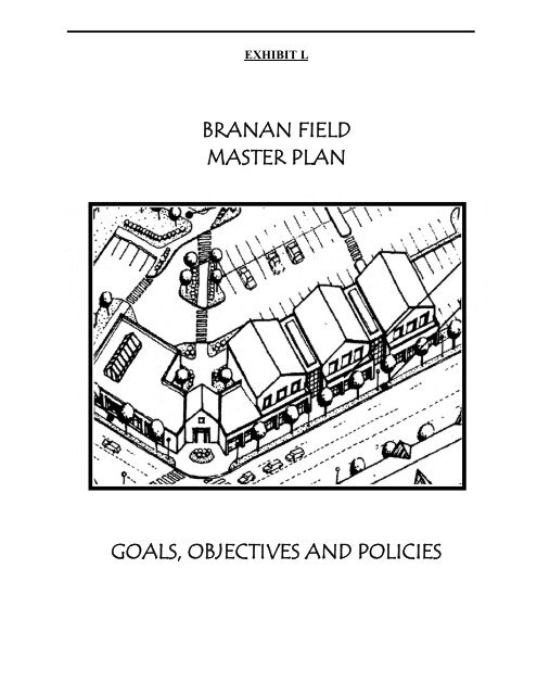
EXHIBIT L<br />
<strong>BRANAN</strong> <strong>FIELD</strong><br />
<strong>MASTER</strong> <strong>PLAN</strong><br />
<strong>GOALS</strong>, OBJECTIVES AND POLICIES
Table of Contents<br />
Section<br />
Page<br />
1. Future Land Use Element ................................................................................................ 1<br />
2. Transportation Element.................................................................................................. 17<br />
3. Recreation and Open Space Element.............................................................................. 21<br />
4. Community Facilities Element ....................................................................................... 24<br />
5. Conservation Element .................................................................................................... 27
[COMPREHENSIVE <strong>PLAN</strong>] 2025<br />
Goals, Objectives and Policies<br />
The <strong>Clay</strong> <strong>County</strong> Board of <strong>County</strong> Commissioners established the Branan Field Sector Plan in April<br />
of 2000 by adopting a set of Goals, Objectives and Policies (GOPs). These GOPs have been revised<br />
to further reinforce the urban form established by the Sector Plan and to implement the Master Plan.<br />
These GOPs are not associated with statutory Sector Plans or Specific Area Plans.<br />
FUTURE LAND USE ELEMENT<br />
BF Goal:<br />
BF Objective 1:<br />
BF Policy 1.1:<br />
BF Objective 2:<br />
BF Policy 2.1:<br />
BF Policy 2.2:<br />
BF Policy 2.3:<br />
BF Objective 3:<br />
Establish a process and specific development criteria applicable to lands<br />
within the Branan Field District that implements a long-range systems<br />
planning approach to natural resource protection and transportation planning;<br />
ensures availability of suitable land for public facilities; defines desirable<br />
development patterns; provides incentives for implementation; and requires<br />
financial feasibility for the provision of infrastructure prior to development.<br />
The <strong>County</strong> will establish incentives to preserve transportation corridors,<br />
the PCN, public recreation sites, and public facilities to ensure<br />
development consistent with the Master Plan.<br />
The <strong>County</strong> will implement standards which may include an Adequate Public<br />
Facilities requirement program, the establishment of special taxing districts,<br />
and/or special impact fees to preserve public infrastructure and facilities<br />
consistent with the Master Plan.<br />
The <strong>County</strong> will guide development within the District and protect the<br />
ability to implement the Branan Field Plan.<br />
Lands within the District shall be subject to the Goals, Objectives and Policies<br />
of the Branan Field Elements, as well as those of the 2015 Comprehensive<br />
Plan. In the event of conflict between the two, the area of conflict will be<br />
resolved in favor of the more specific Branan Field Elements. However if<br />
elements of the 2015 Plan are more stringent, they will prevail.<br />
Prior to the adoption of the Branan Field land development regulations, the<br />
<strong>County</strong> shall review all such proposed development for consistency with the<br />
Branan Field District Future Road Network (the Road Network) which is part<br />
of the Master Plan. The <strong>County</strong> will act to protect the intent of the Road<br />
Network prior to approval of development plans.<br />
Development with construction plans approved before July 1, 2003, will be<br />
subject to regulations in effect at that time.<br />
The <strong>County</strong> will establish a long range strategic planning approach to<br />
natural resource protection and will regulate new development within the<br />
District to ensure the preservation and protection of wetlands and upland<br />
native vegetation communities.<br />
Exhibit L | Branan Field Master Plan 1
2025 [CLAY COUNTY]<br />
BF Policy 3.1:<br />
Prior to or concurrent with development of the Master Plan, the <strong>County</strong> shall<br />
implement plan to implement the Primary Conservation Network (PCN)<br />
within the District protecting environmentally sensitive lands, hydrologically<br />
sensitive lands and preserving wildlife habitat.<br />
The implementation plan shall include coordination with state and federal<br />
agencies and other groups to pursue matching grants for the acquisition of<br />
PCN lands.<br />
BF Policy 3.2:<br />
Natural water bodies and major drainage features within the District shall be<br />
protected with the establishment of the PCN.<br />
The boundary of the PCN (depicted on the Primary Conservation Network<br />
Map) shall be a minimum of 200 feet in width or a minimum of 25 feet from<br />
the jurisdictional wetland line, whichever is greater.<br />
Except for that portion of the PCN that lies within the Regional Park, all<br />
natural vegetation and wetlands within the PCN shall be protected by a<br />
conservation easement that is dedicated to the St. Johns River Water<br />
Management District, the Florida Fish and Wildlife Conservation<br />
Commission, an established land trust, or the <strong>County</strong>. These lands shall be<br />
deeded to one of these agencies to the homeowners‟ association, with specific<br />
restrictions prohibiting development or disturbance except for environmental<br />
management or by the creation of hiking trails.<br />
BF Policy 3.3:<br />
BF Policy 3.4:<br />
BF Objective 4:<br />
The <strong>County</strong> will coordinate its resources with existing state and federal<br />
programs that provide funding assistance to acquire environmentally sensitive<br />
lands. The <strong>County</strong> will provide assistance to landowners within the PCN<br />
boundary with submittal, supported by the Master Plan, to the appropriate<br />
agencies for consideration of purchase.<br />
Land Development Regulations that implement land use categories within the<br />
District. These land use categories will provide for higher density through an<br />
enhanced density program, mixed uses and other innovative approaches to<br />
conserve open space and environmentally sensitive areas. Proposed<br />
developments shall be evaluated for conformance with the Branan Field land<br />
development regulations through review of development submittals and<br />
written narratives.<br />
The <strong>County</strong> shall define specific development standards in land<br />
development regulations to guide development within the Master Plan.<br />
2 Branan Field Master Plan | Exhibit L
[COMPREHENSIVE <strong>PLAN</strong>] 2025<br />
BF Policy 4.1:<br />
BF Policy 4.2:<br />
In order to implement the urban form identified by the Branan Field Master<br />
Plan, the Master Plan shall include the following land use categories: Activity<br />
Center, Community Center, Traditional Neighborhood, Master Planned<br />
Community, Rural Suburb, Rural Activity Center, District Park and<br />
Wetland/Conservation. The location and mix of development shall be<br />
consistent with the Master Plan Land Use Map.<br />
Master Planned Community<br />
Land Use<br />
Planning within the Master Planned Community (MPC) land use category<br />
should provide for a mix of uses in one project. This community is<br />
characterized by a mix of residential, recreation and neighborhood<br />
commercial uses within clearly defined neighborhoods. Civic buildings for<br />
education, community meetings, religion and culture serve as landmarks by<br />
being centrally located. This balanced mix of land uses allows for increased<br />
efficiency and economy by providing home, work, and service places in close<br />
proximity to each other.<br />
Density<br />
The density range in the Master Planned Community is one dwelling unit per<br />
three acres to 12 dwelling units per acre, with an average density of three units<br />
per acre. To ensure that the density will not deviate substantially from the<br />
planned average, this average may not depart from the range of 2 to 5 units<br />
per acre at any time. Higher density and senior housing will be placed<br />
adjacent to the Neighborhood Center, Community Centers, Activity Centers<br />
and transit lines to provide travel opportunities for the least mobile residents.<br />
The density will be reduced based on distance from the Neighborhood<br />
Centers, Community Centers and Activity Centers, placing housing with<br />
lower densities near conservation areas.<br />
MPC Neighborhood Principles<br />
Planning within the MPC should be in the form of complete and integrated<br />
neighborhoods containing housing, shops, work place, schools, parks and<br />
civic facilities essential to the daily life of the MPC residents. Each<br />
neighborhood should be designed so that housing is generally within a 1 mile<br />
radius of a Neighborhood Center (shops, services and civic uses) or<br />
Community Center. This radius may be increased where natural features or<br />
community facilities and services interrupt such design. The MPC should<br />
contain a diversity of housing types to enable citizens from a wide range of<br />
economic levels and age groups to live within its boundaries.<br />
Local and collector streets and pedestrian/bike paths should contribute to a<br />
system of fully-connected routes from individual neighborhoods to the<br />
Neighborhood Center, Community Center, activity nodes and other<br />
neighborhoods. Their design should encourage pedestrian and bicycle use by<br />
being spatially defined by buildings, trees, and lighting.<br />
Exhibit L | Branan Field Master Plan 3
2025 [CLAY COUNTY]<br />
Neighborhoods within the MPC should have well defined edges and centers<br />
with common areas where neighbors can interact. The common area may take<br />
the form of a park, playground or recreation center so long as it fits the<br />
population it is intended to serve. Edges should be defined, whenever<br />
possible, by natural buffers such as tree screens, wetlands, and/or lakes, rather<br />
than physical barriers such as walls or fences.<br />
The MPC development pattern is arranged in the form of villages, with three<br />
zones within each village, starting with the business and civic core known as<br />
the Neighborhood Center, which is surrounded by the denser multi-family,<br />
townhome, and small-lot single family Village zone, and finally with the<br />
periphery of the village being the single-family Suburban zone. A designated<br />
Activity or Community Center may substitute for the Neighborhood Center.<br />
Such a center must be walking distance range of all dwellings that is no<br />
greater than three-quarters of a mile. Neighborhood Centers must be located<br />
at least one mile from another Neighborhood, Activity or Community Center,<br />
unless the Neighborhood Center is utilized as a transition element for an<br />
existing Activity or Community Center.<br />
Residential Development Classifications.<br />
Residential development within the MPC category shall be classified under<br />
three distinct types: Contemporary Residential, TND Moderate and TND<br />
High. Contemporary Residential is for development that is less than 3 units<br />
per acre, and will have few design standards other than neighborhood<br />
connectivity. All residential development between 3 and 6 units per acre will<br />
be TND Moderate, and along with connectivity will require some basic TND<br />
elements like short blocks, maximum front setbacks, and recessed garages.<br />
All development greater than 6 units per acre must meet TND Moderate<br />
standards, and must also provide alleys for parking purposes.<br />
Neighborhood Center Principles<br />
Each neighborhood within the MPC land use category should have a<br />
minimum of one Neighborhood Center that serves as the focus of the<br />
community combining neighborhood commercial (service-oriented small<br />
office, retail and small grocery), civic uses and public facilities such as fire<br />
stations and post offices. Each Neighborhood Center must be located at the<br />
intersection of two collector roads.<br />
The Neighborhood Center must be designed to provide connections to the<br />
pedestrian/bike path system and to integrate with the collector streets within<br />
the neighborhoods. The Neighborhood Center should maintain a minimum<br />
separation of approximately three/quarter miles from another Neighborhood<br />
Center or Community Center.<br />
The size of each Neighborhood Center shall be two to ten acres with a<br />
maximum of eight acres designated as commercial. Neighborhood Centers<br />
shall not be required when there is a designated Activity or Community<br />
Center serving residents living within a three quarter mile radius.<br />
4 Branan Field Master Plan | Exhibit L
[COMPREHENSIVE <strong>PLAN</strong>] 2025<br />
Neighborhood Centers should be located adjacent to or within walking<br />
distance of schools whenever possible. The maximum floor area ratio (FAR)<br />
for each non-residential development within the Neighborhood Center shall<br />
not exceed 70%. Amendment 04-2, November 2004.<br />
The quantification of uses within the Master Planned Community<br />
Neighborhood Center designation shall be consistent with the following:<br />
Minimum Maximum<br />
Land Use Required Permitted<br />
Office 0% 40%<br />
Commercial/Retail 50% 80%<br />
Public Parks/Open Space 5% 30%<br />
School Sites<br />
School sites within the MPC are designated on the Public Facilities Map. The<br />
final location of school sites shall be determined during the development<br />
review process. To promote a „campus‟ effect and encourage the maximum<br />
use of facilities, middle and high schools should be located contiguously.<br />
Whenever possible, all schools should be located adjacent or close to<br />
Neighborhood Centers and adjacent to public facilities such as parks, libraries,<br />
and civic uses.<br />
Specialized Open Space<br />
Each development within the MPC land use should include specialized open<br />
space in the form of squares, greens and neighborhood parks whose frequent<br />
use is encouraged through placement and design. The level of service for<br />
neighborhood parks is set in the table below. Specialized open space shall be<br />
calculated during development review of site plans. Retention facilities when<br />
designed as a functional amenity, wetlands, and natural water bodies may<br />
constitute up to 25% of the required open space. When possible, the natural<br />
terrain, drainage and vegetation of the area should be preserved within parks<br />
or open space.<br />
Neighborhood parks within the MPC shall be equipped with playground<br />
equipment, picnic areas, and a multi-use playfield, and may also include<br />
basketball courts, tennis courts, or other recreational uses.<br />
Recreation<br />
The MPC shall include a minimum of 5% of the developable land designated<br />
as Community Parks. Community Park locations within the MPC areas will be<br />
designated during development review. Determination of need will be based<br />
on the LOS standard identified below.<br />
Community Parks within the MPC are located near major streets and should<br />
offer a variety of programs and facilities such as baseball fields, swimming<br />
pools, and tennis courts and are intended to serve residents within a three-mile<br />
Exhibit L | Branan Field Master Plan 5
2025 [CLAY COUNTY]<br />
radius. Location adjacent to a school is preferred to maximize joint utilization<br />
of facilities.<br />
Type of Park Standard Minimum<br />
Size<br />
Neighborhood Park (overall) 500 SF per Single-Family<br />
Detached Unit; 150 SF per Multi-<br />
Family Unit<br />
Primary (Neighborhood) Park *<br />
–with facilities<br />
Minimum 300 SF per Single-<br />
Family Detached Unit; minimum<br />
100 SF per Multi-Family Unit<br />
(up to 60,000 SF)<br />
15,000 SF<br />
Pocket (Neighborhood) Parks –<br />
(for developments with 100 or<br />
more units)<br />
Neighborhood Park -<br />
Nonresidential<br />
200 SF per 1,000 SF<br />
Commercial Space<br />
7,500 SF<br />
2,500 SF<br />
(Plaza or Green)<br />
Community Park ** 500 SF per Unit 20 Acres<br />
Amendment 04-2, November 2004.<br />
BF Policy 4.3:<br />
Traditional Neighborhood<br />
Land Use<br />
The Traditional Neighborhood (TN) is a land use category characterized by<br />
houses on narrow lots with front porches that are close to the street,<br />
encouraging pedestrian and bicycle use as well as the automobile. This<br />
category includes single-family housing, with detached and attached units and<br />
cluster and zero lot line dwellings. Neighborhood commercial and civic<br />
facilities within the Traditional Neighborhood are allowed in Neighborhood<br />
Centers.<br />
Density<br />
The density range within the Traditional Neighborhood development is 4<br />
dwelling units per acre to 10 dwelling units per acre with an average gross<br />
density of five dwelling units per acre. To ensure that the density will not<br />
deviate substantially from the planned average, this average may not depart<br />
from the range of 5 to 8 units per acre at any time. Higher density housing<br />
will be placed in or near the Neighborhood Center and transit lines to provide<br />
travel opportunities for the least mobile residents. The density will be reduced<br />
based on distance from the Neighborhood Center, placing housing with lower<br />
densities near conservation areas and existing subdivision developments.<br />
Density above four dwelling units per acre will be encouraged based upon<br />
adherence to specific design performance criteria listed in the Branan Field<br />
land development regulations. The intent of the specific design performance<br />
standards will encourage adherence to classic Traditional Neighborhood<br />
6 Branan Field Master Plan | Exhibit L
[COMPREHENSIVE <strong>PLAN</strong>] 2025<br />
design standards. Determination of permissible density will occur during the<br />
development review process.<br />
TN Neighborhood Principles<br />
Each Traditional Neighborhood should be 100 acres in size or less. Each<br />
neighborhood must contain a central public focal point consisting of a<br />
combination of parks, elementary school and/or public facilities. Homes will<br />
be concentrated and within a one-half mile radius of these uses and of<br />
proposed trolley stops, making public transit a viable alternative to the<br />
automobile. Street space is designed to accommodate vehicles and pedestrians<br />
comfortably. To enhance streetscapes, houses should be constructed close to<br />
the street and garages should face the rear lot line with access from alleys.<br />
On-street parking is permitted.<br />
Local and collector streets and pedestrian/bike paths should contribute to a<br />
system of fully-connected routes from individual neighborhoods to the<br />
Neighborhood Center, Community Center and other neighborhoods. Their<br />
design should encourage pedestrian and bicycle use by being spatially defined<br />
by buildings, trees, and lighting.<br />
To create a sense of neighborhood identity, neighborhoods within the TN<br />
should have well defined edges and centers with common areas where<br />
neighbors can interact. The common area may take the form of a park or<br />
playground. Edges should be defined, whenever possible, by natural buffers<br />
such as tree screens, wetlands and/or lakes, rather than physical barriers such<br />
as walls or fences.<br />
The quantification of uses within the Traditional Neighborhood Development<br />
Neighborhood Center designation shall be consistent with the following:<br />
Minimum Maximum<br />
Land Use Required Permitted<br />
Office 0% 40%<br />
Commercial/Retail 50% 80%<br />
Public Parks/Open Space 5% 30%<br />
The TN development pattern is arranged in the form of villages, with three<br />
zones within each village, starting with the business and civic core known as<br />
the Neighborhood Center, which is surrounded by the denser multi-family,<br />
townhome, and small-lot single family Village zone, and finally with the<br />
periphery of the village being the single-family Suburban zone. A designated<br />
Activity or Community Center may substitute for the Neighborhood Center.<br />
Such a center must be walking distance range of all dwellings that is no<br />
greater than three-quarters of a mile. Neighborhood Centers must be located<br />
at least one mile from another Neighborhood, Activity or Community Center,<br />
unless the Neighborhood Center is utilized as a transition element for an<br />
existing Activity or Community Center.<br />
Exhibit L | Branan Field Master Plan 7
2025 [CLAY COUNTY]<br />
Residential Development Classifications.<br />
Residential development within the TN category shall be classified under two<br />
distinct types: TND Moderate and TND High. All residential development<br />
between 4 and 6 units per acre will be TND Moderate, and along with<br />
connectivity will require some basic TND elements like short blocks,<br />
maximum front setbacks, and recessed garages. All development greater than<br />
6 units per acre must meet TND Moderate standards, and must also provide<br />
alleys for parking purposes.<br />
Neighborhood Center Principles<br />
Neighborhoods within the TN land use categories should have Neighborhood<br />
Centers that serve as the focus of the community combining neighborhood<br />
commercial (service-oriented small office, and retail), civic uses and public<br />
facilities such as fire stations and post offices.<br />
The Neighborhood Center must be designed to provide connections to the<br />
pedestrian/bike path system and to integrate with other neighborhood streets.<br />
The size of each Neighborhood Center shall be two to ten acres in size with a<br />
maximum of eight acres designated as commercial. Neighborhood Centers<br />
should be located adjacent to or near School Activity nodes whenever<br />
possible. The maximum floor area ratio (FAR) for each non-residential<br />
development within the Neighborhood Center shall not exceed 70%.<br />
Amendment 04-2, November 2004.<br />
Schools<br />
School sites within the Traditional Neighborhood are designated on the Public<br />
Facilities Map. The final location of school sites shall be determined at the<br />
development review process. Elementary schools should be the focal point of<br />
the Traditional Neighborhood community and, whenever possible should be<br />
located adjacent to the Neighborhood Center.<br />
Specialized Open Space<br />
The Traditional Neighborhood should contain include specialized open space<br />
in the form of squares, greens and neighborhood parks whose frequent use is<br />
encouraged through placement and design. The level of service for<br />
neighborhood parks is set in the table below. Specialized open space shall be<br />
calculated during development review of site plans. Retention facilities, when<br />
designed as a functional amenity, wetlands, and natural water bodies may<br />
constitute up to 50% of the required open space. When possible, the natural<br />
terrain, drainage and vegetation of the area should be preserved within parks<br />
or open space.<br />
8 Branan Field Master Plan | Exhibit L
[COMPREHENSIVE <strong>PLAN</strong>] 2025<br />
Neighborhood Park (overall)<br />
Type of Park Standard Minimum Size<br />
Primary (Neighborhood) Park * –with<br />
facilities<br />
Pocket (Neighborhood) Parks – (for<br />
developments with 100 or more units)<br />
Neighborhood Park - Nonresidential<br />
(Plaza or Green)<br />
500 SF per Single-Family Detached<br />
Unit; 150 SF per Multi-Family Unit<br />
Minimum 300 SF per Single-Family<br />
Detached Unit; minimum 100 SF per<br />
Multi-Family Unit (up to 60,000 SF)<br />
200 SF per 1,000 SF<br />
Commercial Space<br />
15,000 SF<br />
7,500 SF<br />
2,500 SF<br />
Community Park ** 500 SF per Unit 20 Acres<br />
Amendment 04-2, November 2004.<br />
Recreation<br />
Neighborhood parks shall be equipped with playground equipment, picnic<br />
areas, and a multi-use playfield, and may also include basketball courts, tennis<br />
courts, or other recreational uses. Neighborhood parks within the Traditional<br />
Neighborhood district are one to five acres in size and are intended to serve a<br />
residential population within a walking distance of one-half mile.<br />
The Traditional Neighborhood shall include a minimum of 5% of the<br />
developable land designated as Community Parks. The location of<br />
Community Parks will be determined during development review.<br />
Determination of need will be based on the LOS standard identified in the<br />
Branan Field Recreation and Open Space Element.<br />
Community parks should be designed to serve the needs of the surrounding<br />
development offering a variety of programs and facilities such as baseball<br />
fields, swimming pools and tennis courts. Location adjacent to a school is<br />
preferred to maximize utilization of facilities.<br />
BF Policy 4.4:<br />
Rural Suburbs<br />
Land Use<br />
The Rural Suburbs (RS) land use category is a reflection of the current<br />
lifestyle associated with the District. Existing residents expressed their desire<br />
to see a land use form that represented this rural character as a viable lifestyle<br />
alternative. Development within the Rural Suburbs is characterized<br />
predominately by large lots served by wells and septic tanks that provide a<br />
lifestyle attractive to a range of income levels and maintains compatibility<br />
with the character of existing development.<br />
Exhibit L | Branan Field Master Plan 9
2025 [CLAY COUNTY]<br />
Permitted uses include single-family residential as well as agricultural uses on<br />
properties greater than two acres in size. Specific Permitted uses will be listed<br />
in the Branan Field land development regulations.<br />
Density<br />
Generally gross density within the Rural Suburbs is one dwelling unit per five<br />
acres. However gross density can be as high as one unit per acre, subject to a<br />
density bonus program. Through this program higher densities can be<br />
obtained through the following measures:<br />
1. Provision of vegetative buffers along the perimeter of the master<br />
parcel. These buffers shall be a minimum average of 50 feet in width and<br />
shall minimize the visual and noise impact on surrounding properties as well<br />
as provide for additional water quality and wildlife habitat areas; and<br />
2. One dwelling unit per two gross acres will be allowed when<br />
development is adjacent to one or more of the following land uses: Activity<br />
Center, Community Center, Master Planned Community, Traditional<br />
Neighborhood Development, or any other land use that allows densities of<br />
greater than one unit per two gross acres. In this case, “adjacent” requires that<br />
the property in question share a property boundary with one or more of the<br />
above land uses. Lands across a road classified as collector or below shall be<br />
counted in this calculation; and<br />
3. Inclusion of uplands in the Primary Conservation Network. Ten units<br />
per acre of additional density is available for each acre of new upland PCN<br />
lands that are immediately adjacent to the existing PCN or that will function<br />
as a corridor providing for wildlife movement between PCN lands. If PCN<br />
lands are not located on a site, two units per acre of density is available for<br />
each acre of non-PCN uplands, preferably, or areas dominated by ecologically<br />
sensitive communities like longleaf pine, turkey oak, or sand hill<br />
communities. Such lands must be contiguous areas that are at least two acres<br />
in size. In the absence of these two types of non-PCN density bonus lands,<br />
open space should be forested areas or an extension of required perimeter<br />
buffers.<br />
Septic tanks and wells shall be allowed for single-family units on existing lots<br />
of record as of the adoption date of this plan. New commercial, except within<br />
the Rural Activity Center, must tie into central water and sewer. Residential<br />
subdivisions may also be served by well and septic meeting the following<br />
thresholds: no more than fifty units, an overall gross density of no greater<br />
than two-and-one-half units per acre, and no lots smaller than three-quarters of<br />
an acre.<br />
Schools<br />
School sites within the Rural Suburbs are designated on the Public Facilities<br />
Map. The final location of school sites shall be determined at the development<br />
review process.<br />
10 Branan Field Master Plan | Exhibit L
[COMPREHENSIVE <strong>PLAN</strong>] 2025<br />
Recreation<br />
Neighborhood and Community Parks will be designated during development<br />
review. Neighborhood parks are not required for development not utilizing<br />
the density bonus program. Determination of need will be based on the LOS<br />
standard identified in the Branan Field Recreation and Open Space Element.<br />
Neighborhood parks shall be equipped with playground equipment, picnic<br />
areas, and a multi-use playfield, and may also include basketball courts, tennis<br />
courts, or other recreational uses. Community parks should be designed to<br />
serve the needs of the surrounding development offering a variety of programs<br />
and facilities such as baseball fields, swimming pools and tennis courts.<br />
Location adjacent to a school is preferred to maximize utilization of facilities.<br />
BF Policy 4.5:<br />
Wetland/Conservation<br />
The wetland/conservation areas are lands that will provide for the<br />
conservation and protection of <strong>Clay</strong> <strong>County</strong>‟s natural resources in order to<br />
prevent any degradation to the major natural resources. These areas include<br />
most creek and stream banks, major drainage ways, major wetlands, hydric<br />
soils, and FEMA designated 100-year floodplains.<br />
Natural water bodies and major drainage features within the Master Plan area<br />
shall be protected with the establishment of the PCN.<br />
The PCN depicted on the Master Plan Map will interconnect natural resources<br />
throughout the Master Plan area protecting drainage systems and headwaters<br />
of the regional tributaries. This network will serve to separate and buffer<br />
adjacent land uses while providing for wildlife habitat and opportunities for<br />
passive recreation. Such passive recreation elements may include pedestrian<br />
walkways, bicycle paths, boardwalks, docks built for water access, fences<br />
necessary to protect habitat areas, and similar uses for which no adverse<br />
affects to the PCN would result. Impacts to the network may include filling<br />
for roadway and utility construction for crossings shown on the adopted plan.<br />
Impacts to the network may also include road crossings not shown on the<br />
adopted plan where no other feasible alternatives exist, excavation of<br />
stormwater management systems when accompanied by the dedication of<br />
additional land that is generally equivalent in quality and quantity for<br />
conservation, and construction of the passive recreational facilities identified<br />
above. All roadway and utility encroachments not shown on the adopted plan<br />
should be avoided and/or minimized when possible.<br />
The boundary of the PCN (depicted on the Primary Conservation Network<br />
Map) shall be a minimum of 200 feet in width or 25 feet from the<br />
jurisdictional wetland line, whichever is greater.<br />
Except for that portion of the PCN that lies within the Regional Park, all<br />
natural vegetation and wetlands within the PCN shall be protected by a<br />
conservation easement that is dedicated to the St. Johns River Water<br />
Exhibit L | Branan Field Master Plan 11
2025 [CLAY COUNTY]<br />
Management District, the Florida Fish and Wildlife Conservation<br />
Commission, an established land trust, or the <strong>County</strong>. These lands shall be<br />
deeded to one of these agencies or the homeowners‟ association, with specific<br />
restrictions prohibiting development or disturbance except for environmental<br />
management or by the creation of hiking trails. Amendment 04-2, November<br />
2004.<br />
BF Policy 4.6:<br />
District Parks<br />
Included on the Branan Field Land Use Map is the designation of District<br />
Parks. All lands within the District/Regional Park classification will be owned<br />
by public or quasi-public entities. The lands will be held for use as<br />
conservation, public recreation and open space amenities.<br />
District Parks (DP) shall be linked to neighborhood developments and public<br />
greens by a system of roads, sidewalks and bicycle trails.<br />
Changes in park locations shown on the Master Plan Map may be approved<br />
when justified by reasons including improved access, more suitable location,<br />
and similar factors. Amendment 04-2, November 2004.<br />
BF Policy 4.7:<br />
Activity Center<br />
Activity Centers are planned to accommodate a range of activities from<br />
employment-based office and light industrial activities to commercial<br />
services, recreational facilities, and housing. Design, aesthetics and<br />
environmental protection and enhancement shall be emphasized as part of the<br />
development. These areas shall be high-intensity, design-unified areas<br />
containing a concentration of different urban functions and housing. The<br />
concentration of these economic uses will provide the opportunity for the<br />
efficient provision of public facilities and, by concentrating these uses, the<br />
need to provide buffers for incompatible uses is minimized.<br />
Future development in Activity Centers will require a cooperative effort<br />
between both the public and private sector to ensure that local services and<br />
infrastructure meet the anticipated demand. These locations have been<br />
targeted near two major transportation areas: (1) the area north of State Road<br />
21 between Old Jennings and Branan Field Road, and (2) the future<br />
interchange of Branan Field Road and the proposed Cleveland<br />
Connector/Argyle Forest Boulevard.<br />
Activity Centers may be designated to serve many different property owners,<br />
but will function in a manner to share facilities and services to reduce<br />
inefficiency and redundancy. These districts should provide a high<br />
development quality that emphasizes pleasant, convenient, and satisfying<br />
work conditions, along with amenities such as recreational areas, restaurants,<br />
retail services, and convenient locations relative to residential areas.<br />
12 Branan Field Master Plan | Exhibit L
[COMPREHENSIVE <strong>PLAN</strong>] 2025<br />
Development shall be designed to emphasize pedestrian and bicycle<br />
movement and internal and external connectivity. In particular, the land<br />
development regulations will require walkable streets and strategically located<br />
excess landscaping.<br />
Activity Centers are generally designed to serve a regional population of at<br />
least 75,000. A maximum of twenty percent of each Activity Center may be<br />
developed to support multi-family residential uses at a density of eight to 20<br />
units per acre.<br />
The Master Plan Land Use Map designates approximately 1,500 acres in the<br />
Activity Center land use category. It is the <strong>County</strong>‟s intent to encourage a mix<br />
of uses within the Activity Center to encourage economic development and<br />
serve as a regional employment center. The mixture of uses indicated in the<br />
following table is to be applied to the entire Activity Center, not individual<br />
parcels.<br />
The quantification of uses within the Activity Center land use designation<br />
shall be consistent with the following:<br />
Minimum Maximum<br />
Land Use Required Permitted<br />
Office and/or Light Industrial 10% 80%<br />
Commercial/Retail 2% 65%<br />
Residential 10% 15%<br />
Public & Civic 5% 20%<br />
Public Parks & Open Space 5% 10%<br />
The maximum floor area ratio (FAR) for each non-residential development<br />
within the Activity Center shall not exceed 80%, with an average not to<br />
exceed 60%.<br />
Residential Development Classifications.<br />
Residential development within the Activity Center category must conform<br />
with the TND High standards and must also provide alleys or interior<br />
courtyards for parking purposes. Amendment 04-2, November 2004.<br />
BF Policy 4.8:<br />
Community Centers<br />
The Community Center (CC) land use category is characterized by a variety<br />
of community-scaled residential, restaurant, office and retail (including<br />
grocery store) facilities (except for „big box‟ uses) intended to generally serve<br />
a population of 25,000. Community Centers are 30 to 80 acres in size and<br />
located at the intersections of major collector and/or arterial roads.<br />
Community Centers are intended to be a minimum of 800 feet in depth and<br />
grouped so as not to encourage strip development patterns. A maximum of<br />
twenty percent of each Community Center may be developed to support<br />
multi-family residential use at a density of eight to 16 units per acre.<br />
Exhibit L | Branan Field Master Plan 13
2025 [CLAY COUNTY]<br />
It is the <strong>County</strong>‟s intent to encourage a mix of uses within the Community<br />
Center to serve the surrounding residential community. The mixture of uses<br />
indicated in the following table are to be applied to the entire Community<br />
Center, not individual parcels.<br />
Residential development within the Community Center category must<br />
conform with the TND High standards and must also provide alleys or interior<br />
courtyards for parking purposes.<br />
The quantification of uses within the Community Center land use designation<br />
shall be consistent with the following:<br />
Minimum Maximum<br />
Land Use Required Permitted<br />
Office 10% 35%<br />
Commercial/Retail 20% 60%<br />
Residential 10% 25%<br />
Public Parks and Open Space 2% No Max<br />
The maximum floor area ratio (FAR) for each non-residential development<br />
within the Community Center shall not exceed 80%, with an average not to<br />
exceed 40%.<br />
The previously adopted <strong>Clay</strong> <strong>County</strong> 2015 Future Land Use Map designates a<br />
narrow corridor along the north side of Doctor‟s Inlet Road (C.R. 220) west of<br />
C.R. 209 to Baxley Road for commercial uses. Recognizing the property<br />
rights associated with the prior land use, as well as the need to provide nonresidential<br />
uses that serve the surrounding community, the Master Plan Land<br />
Use Map designates these properties as Community Center. The intent of this<br />
particular Community Center is to provide compatibility with the existing and<br />
planned residential development immediately to the north, while allowing a<br />
“Main Street” form of development to occur. The Land Development<br />
Regulations will include provisions to address this community center in<br />
regards to the very linear form of the non-residential properties. The Land<br />
Development Regulations may include regulations on the scale of the<br />
development, build-to lines, and specialized access and parking requirements<br />
to prevent highway strip development. Amendment 04-2, November 2004.<br />
BF Policy 4.9<br />
Institutional/Public-Semi Public Designations<br />
This classification includes lands that are planned for public or semi-public<br />
community facilities such as parks, libraries, schools, government buildings,<br />
post offices, hospitals, fire and police services, and similar uses. These land<br />
uses are located on the Institutional Map that is part of the Future Land Use<br />
Map Series. Such uses will be located during development of the Master<br />
Plan.<br />
14 Branan Field Master Plan | Exhibit L
[COMPREHENSIVE <strong>PLAN</strong>] 2025<br />
BF Policy 4.10<br />
Rural Activity Center<br />
The specific plan designates one rural activity center of up to 12 acres to serve<br />
the day-to-day commercial needs of the Rural Suburbs within Branan Field.<br />
Typical uses within the rural activity center are convenience stores, general<br />
retail stores and shops having a gross area of no more than 35,000 square feet<br />
per establishment offering merchandise reasonably related to the day-to-day<br />
needs of the community.<br />
The maximum floor area ratio for non-residential development within the<br />
Rural Activity Center shall not exceed 30%. Specific development of nonresidential<br />
uses shall be governed by standards adopted in the Branan Field<br />
land development regulations.<br />
BF Policy 4.11:<br />
Branan Field Mixed Use<br />
The Branan Field Mixed Use (BFMU) land use category is characterized by a<br />
variety of retail facilities (including grocery stores but excluding „big box‟<br />
uses), offices, light industrial activities and high density residential<br />
development.<br />
This district is intended to encourage development compatible with<br />
surrounding or abutting residential districts, with suitable open space,<br />
landscaping and parking areas. Activities that cannot be carried on in a<br />
relatively unobtrusive manner shall be required to adequately buffer those<br />
activities from adjoining residential development.<br />
BFMU developments are intended to include a mix of uses that provides high<br />
intensity urban functions of a uniform design and character and grouped so as<br />
not to encourage strip development patterns. A maximum of fifteen percent of<br />
the BFMU may be developed for multi-family residential use at a maximum<br />
density of 12 units per acre. Residential development within the BFMU<br />
category must conform to the TND Village standards and must also provide<br />
alleys or interior courtyards for parking purposes.<br />
It is the <strong>County</strong>‟s intent to encourage a mix of uses within the BFMU to<br />
provide regional jobs. The mixture of uses indicated in the following table is<br />
to be applied to the entire BFMU, not individual parcels.<br />
The quantification of uses within the Branan Field Mixed Use land use<br />
designation shall be consistent with the following:<br />
Minimum Maximum<br />
Land Use Required Permitted<br />
Office/Light Industrial 55% 85%<br />
Commercial/Retail 10% 15%<br />
Residential 0% 15%<br />
Public Parks and Open Space 5% No Max<br />
Exhibit L | Branan Field Master Plan 15
2025 [CLAY COUNTY]<br />
The maximum floor area ratio (FAR) for each non-residential development<br />
within the BFMU shall be a maximum 50%.<br />
No residential or commercial shall be developed prior to year 2014 except for<br />
uses which are clearly subordinate and incidental to the Office/Light Industrial<br />
use.<br />
All Office and Light Industrial uses shall conform to the Business Park<br />
Zoning District except that outside vehicle parking and storage with proper<br />
screening shall be allowed. Visual and noise impacts from Light Industrial<br />
uses, especially from truck traffic and a daily operation of businesses, shall be<br />
minimized through the <strong>County</strong>‟s Development Review Process with the<br />
criteria devised in the Land Development Regulations. Retail uses shall<br />
conform to the Community Center design standards. All nonresidential uses<br />
are subject to the Branan Field Architectural and Lighting Standards.<br />
Only 850,000 square feet GFA of industrial uses, 555,000 square feet GFA of<br />
general office uses, or 2 million square feet GFA of warehousing uses or any<br />
combination of such uses are allowed prior to year 2014. Commercial uses<br />
meeting the subordinate and incidental test may also be allowed. However, the<br />
total trips generated from the development shall not be greater than 709 P.M.<br />
Peak trips by year 2014.<br />
For long-term concurrency management purposes, <strong>Clay</strong> <strong>County</strong> shall annually<br />
update traffic counts, revisit its concurrency system to monitor the existing<br />
level of service, and make every effort to reduce the impacts from the<br />
development to SR 23. If any improvements over <strong>Clay</strong> <strong>County</strong> Concurrency<br />
System utilizing impact fees, fair share, or any other available measures fail to<br />
mitigate traffic loads on SR23, <strong>Clay</strong> <strong>County</strong> shall develop innovative<br />
strategies to maintain or manage the required level of service. The strategies<br />
may include TCEA, MMTD, and other appropriate planning tools that can<br />
address the issues the best.<br />
BF Objective 5:<br />
BF Policy 5.1:<br />
The <strong>County</strong> will adopt rational limits on growth in order to plan and<br />
provide for public facilities and limit community impacts.<br />
The following limitations shall be placed on growth in the Master Plan area<br />
through 2025.<br />
Use<br />
Residential<br />
Retail Commercial/Office<br />
Industrial<br />
Limitation<br />
21,485 units (Total)<br />
No Limit<br />
No limit<br />
16 Branan Field Master Plan | Exhibit L
[COMPREHENSIVE <strong>PLAN</strong>] 2025<br />
TRANSPORTATION ELEMENT<br />
Goal:<br />
BF Objective 1:<br />
BF Policy 1.1:<br />
Establish a process and specific development criteria applicable to lands<br />
within the Master Plan that implements a long-range systems planning<br />
approach to transportation planning; ensures availability of suitable land for<br />
public facilities; and plans for the provision of infrastructure prior to<br />
development.<br />
The <strong>County</strong> shall provide adequate safety and circulation designs for new<br />
or upgraded roadways in order to reduce congestion and traffic<br />
accidents.<br />
Future local road network design within the Master Plan will be characterized<br />
by interconnected streets providing alternate travel routes to neighborhood<br />
communities, civic uses and neighborhood employment centers.<br />
BF Objective 2: Develop a phased implementation program for transportation<br />
improvements to maintain the LOS standard adopted.<br />
BF Policy 2.1:<br />
BF Policy 2.2:<br />
BF Objective 3:<br />
BF Policy 3.1:<br />
Rights-of-way for future transportation corridors are identified on the Master<br />
Plan Map. Whenever possible, alignments as shown on the APF Map shall be<br />
adhered to. At the request of the landowner or the <strong>County</strong>, minor changes in<br />
road locations and laneage may be approved administratively. For the<br />
purposes of this policy, minor changes are defined as those changes in road<br />
location that do not shift right-of-way lines by more than an average of two<br />
hundred feet, and changes in lane configuration that add or subtract more lane,<br />
excluding turning lanes. Such changes shall be consistent with the adopted<br />
Comprehensive Plan and shall be reflected on the annual update of the<br />
Comprehensive Plan maps. Comprehensive Plan amendments will be<br />
required prior to eliminating roads, adding new roads or significantly<br />
changing the location and laneage of existing roads. Amendment 05-2,<br />
November 2005.<br />
The Master Plan will direct a public-private partnership to provide needed<br />
public facilities for the District as identified in Future Land Use Policy 5.3.<br />
The county shall provide a safe, convenient and efficient motorized<br />
transportation system to mitigate the negative effects of development,<br />
including commercial, educational, public facilities, industrial and<br />
residential, on the transportation system.<br />
All new development within the District adjacent to arterial or collector streets<br />
shall meet the FDOT access management guidelines or those established<br />
within the Branan Field land development regulations. Development of<br />
access control within the Master Plan shall be reflective of a unified planning<br />
approach. Individual parcel development will adhere to the unified access<br />
control established.<br />
Branan Field Master Plan 2025 Plan · Page 17<br />
Transportation Element
2025 [CLAY COUNTY]<br />
BF Policy 3.2<br />
BF Objective 4:<br />
BF Policy 4.1:<br />
BF Objective 5:<br />
BF Policy 5.1:<br />
BF Objective 6:<br />
BF Policy 6.1:<br />
BF Policy 6.2:<br />
BF Policy 6.3:<br />
BF Objective 7:<br />
BF Policy 7.1:<br />
Other than Branan Field Road, Blanding Boulevard, the Cleveland<br />
Connector, and parts of CR 209 Ext., no other roads shall exceed 4 lanes.<br />
The county shall minimize, to the extent possible, the right-of-way costs<br />
when constructing new roadway facilities and expanding existing<br />
roadway facilities by taking maximum advantage of rights-of-way<br />
established for other transportation modes and reserved right-of-way<br />
corridors, and by protecting its existing and future rights-of-way from<br />
building encroachment to the fullest extent of the law.<br />
The <strong>County</strong> has identified needed future transportation rights-of-way through<br />
the Adequate Public Facilities Map. These rights-of-way will be acquired by<br />
the <strong>County</strong> at the time of site plan review, or at the time the <strong>County</strong> is<br />
designing the road, or when the landowner voluntarily chooses to donate this<br />
land, whichever comes first.<br />
The <strong>County</strong> will evaluate transportation impacts of development within<br />
the Branan Field District as a unified plan of development.<br />
At the end of each phase, and at the time changes are made to the<br />
development program, and in conjunction with transportation modeling<br />
update to the MPO network, <strong>Clay</strong> <strong>County</strong> will evaluate potential impacts from<br />
development within the Branan Field District and make appropriate changes<br />
to capacity limits or to the Capital Improvements Program as appropriate.<br />
Provide for non-vehicular transportation modes when planning new or<br />
upgraded roadways.<br />
The <strong>County</strong> shall prepare a bicycle corridor long-range plan concurrent with<br />
the development of the Master Plan. All corridors identified shall be included<br />
in the MPO bicycle corridor long-range plan within the Comprehensive<br />
Bikeway Plan for the Jacksonville Urbanized Area.<br />
The <strong>County</strong> will reserve space for a potential trolley corridor in the Branan<br />
Field right-of-way.<br />
The Branan Field land development regulations will include design standards<br />
to implement Transit Oriented Design in Activity Centers, Community<br />
Centers and Neighborhood Centers.<br />
The establishment of an interconnected system of rights-of-way which<br />
provides for the safe, convenient and efficient movement of nonmotorized<br />
traffic, specifically pedestrian and bicycle accommodations,<br />
throughout the county shall be accomplished by requiring pedestrian<br />
facilities on all newly constructed or improved existing minor arterials,<br />
collector roadways and local streets.<br />
All roads within the District, with the exception of the Branan Field Road<br />
limited access road, will have minimum five foot wide sidewalks on both<br />
18 Branan Field Master Plan | Exhibit L
[COMPREHENSIVE <strong>PLAN</strong>] 2025<br />
sides of the road. Sidewalks that are a minimum of eight feet in width shall be<br />
separated from arterial and collector roads with a landscape strip that is at<br />
least fifteen feet in width. All roads classified as Minor Collector or above<br />
will also have minimum four foot wide dedicated or designated bicycle lanes.<br />
These standards may be substituted with an approved alternative pedestrian<br />
circulation system that accomplishes the same result in terms of pedestrian<br />
and bicycle movement, as set forth in the land development regulations.<br />
BF Policy 7.2:<br />
Within the District, the following guidelines shall be used to determine<br />
minimum lane widths on new or expanded roadways as defined by the<br />
proposed roadway‟s operating functional classification.<br />
Roadway Classification<br />
Pavement Width, Feet<br />
Minor Access 20<br />
Marginal Access 20<br />
Minor Residential 20<br />
Minor Local Collector 30<br />
2-Lane Local Collector Boulevard 30<br />
4-Lane L1ocal Collector Boulevard 56<br />
BF Policy 7.3:<br />
BF Policy 7.4:<br />
BF Policy 7.5:<br />
BF Policy 7.6<br />
BF Objective 8:<br />
BF Policy 8.1:<br />
Both outside lanes of Collector roads shall include four foot wide designated<br />
bicycle lanes.<br />
Local and collector streets and pedestrian/bike paths will be designed so as to<br />
contribute to a system of fully connected non-vehicular routes from individual<br />
neighborhoods to Community Centers, Activity Centers, recreation facilities<br />
and other neighborhoods.<br />
Parking lot design within the District shall support pedestrian access to nonresidential<br />
and multi-family uses.<br />
All roads within the District classified as Minor Collector or above, with the<br />
exception of Branan Field Road, will have trees planted in the rights-of-way<br />
on both sides of the road at intervals of not more than one tree per 30 lineal<br />
feet or less than one tree per 100 lineal feet, the exact distance dependent on<br />
local conditions and the approval of the <strong>County</strong>.<br />
The proposed roadway cross sections provided in the Branan Field Master<br />
Plan Transportation Element shall serve as a guide to all new roads and road<br />
improvements within the Branan Field District.<br />
Provide for meaningful citizen participation in decisions that impact the<br />
transportation system.<br />
The <strong>County</strong> will continue participation of interested residents, neighborhood<br />
and civic groups within the District in continued refinement of the<br />
transportation system.<br />
Branan Field Master Plan 2025 Plan · Page 19<br />
Transportation Element
2025 [CLAY COUNTY]<br />
BF Objective 9:<br />
BF Policy 9.1:<br />
BF Policy 9.2:<br />
BF Objective 10:<br />
BF Policy 10.1:<br />
BF Policy 10.2:<br />
BF Policy 10.3:<br />
BF Policy 10.4:<br />
<strong>Clay</strong> <strong>County</strong> shall coordinate with the FDOT, the First Coast MPO, the<br />
Jacksonville Transit Authority, and the City of Jacksonville on improving<br />
access and effectiveness of regional transit service between activity<br />
centers within the Branan Field District and Jacksonville.<br />
Within the Activity Center Land uses, proposed developments shall allocate<br />
space for access and amenities for the Branan Field trolley or other transit<br />
facilities as appropriate.<br />
Trolley stops or pullout bays shall be planned for during the construction of<br />
roadways and development of adjacent parcels at major stops or destinations<br />
such as community centers and schools.<br />
The Branan Field Master Plan shall provide for adequate pedestrian and<br />
bicycle facilities to serve the surrounding community and provide for<br />
alternative modes of transportation.<br />
Bike lanes and sidewalks shall be provided with all major reconstruction<br />
projects within the Branan Field District. Where in-street bicycle lanes are<br />
deemed unsafe, a minimum eight (8) foot off-street bicycle/pedestrian path<br />
shall be provided.<br />
Any widening improvements to SR 21 (Blanding Boulevard) shall include, to<br />
the greatest extent practicable, an extra-wide sidewalk (8 foot minimum<br />
recommended) with separation and landscaping between the vehicle lanes and<br />
the sidewalk, to provide a safer, more attractive walking/bicycle environment.<br />
To provide a bicycle/pedestrian friendly community, and to encourage the use<br />
of alternate modes, at the time of construction of the 4-lane limited access<br />
Branan Field Road, a minimum ten (10) foot off-street bicycle pedestrian path<br />
shall be added to the Branan Field West Service Road. The Branan Field East<br />
service road should include sidewalks and in-street bike lanes. Alternatively,<br />
an off-street bicycle/pedestrian path should be provided along this alignment.<br />
All local residential streets within the Branan Field District should be<br />
constructed with a minimum of a five (5) foot sidewalk on both sides of the<br />
road.<br />
20 Branan Field Master Plan | Exhibit L
[COMPREHENSIVE <strong>PLAN</strong>] 2025<br />
RECREATION AND OPEN SPACE ELEMENT<br />
BF Goal:<br />
BF Objective 1:<br />
BF Policy 1.1:<br />
To provide, protect, and maintain a high-quality, environmentally sensitive,<br />
accessible, economically efficient, and adequate system of recreation facilities<br />
and sites to serve the Branan Field District.<br />
From 1999 to 2040, <strong>Clay</strong> <strong>County</strong> will acquire, develop, maintain, and<br />
protect parks and recreation facilities, consistent with the needs of its<br />
population, as determined by the Master Plan recreation levels of service.<br />
The <strong>County</strong> will adopt and maintain the following recreation levels of service<br />
(LOS) for parks within the District:<br />
Type of Park Standard Minimum<br />
Size<br />
Neighborhood Park (overall) 500 SF per Single-Family<br />
Detached Unit; 150 SF per<br />
Multi-Family Unit<br />
Primary (Neighborhood) Park *<br />
–with facilities<br />
Minimum 300 SF per Single-<br />
Family Detached Unit;<br />
minimum 100 SF per Multi-<br />
Family Unit (up to 60,000 SF)<br />
15,000 SF<br />
Pocket (Neighborhood) Parks –<br />
(for developments with 100 or<br />
more units)<br />
Neighborhood Park -<br />
Nonresidential<br />
200 SF per 1,000 SF<br />
Commercial Space<br />
7,500 SF<br />
2,500 SF<br />
(Plaza or Green)<br />
Community Park ** 500 SF per Unit 20 Acres<br />
Amendment 04-2, November 2004.<br />
BF Policy 1.2:<br />
Development of the District will include adequate lands to maintain the<br />
adopted LOS in Policy 1.1. The number of dwelling units approved in the<br />
District shall be the basis for determining recreational need within the District.<br />
District parks will be generally located as depicted on the Master Plan map.<br />
Other park types will be located during development within the District.<br />
BF Policy 1.3:<br />
BF Objective 2:<br />
The <strong>County</strong> may institute a countywide park impact fee.<br />
The <strong>County</strong> will improve public access to existing and future recreation<br />
sites, facilities and open space systems within the District to meet the<br />
recreational needs of its residents and visitors.<br />
Branan Field Master Plan 2025 Plan· Page 21<br />
Recreation and Open Space Element
2025 [CLAY COUNTY]<br />
BF Policy 2.1:<br />
BF Policy 2.2:<br />
BF Policy 2.3:<br />
BF Objective 3:<br />
BF Policy 3.1:<br />
BF Policy 3.2:<br />
BF Policy 3.3:<br />
BF Objective 4:<br />
BF Policy 4.1:<br />
BF Policy 4.2:<br />
Development within the District shall provide a system of bikeways,<br />
footpaths, or nature trails linking recreational facilities and open space with<br />
residential areas.<br />
Neighborhood, Community and District parks will be located adjacent to<br />
middle and high schools, whenever possible.<br />
Safe access and parking facilities shall be provided at future recreational sites<br />
for the handicapped consistent with ADA requirements.<br />
The <strong>County</strong> will coordinate with and provide technical assistance to<br />
suppliers of public recreational opportunities so that available resources<br />
and programs are maximized toward meeting the recreational needs of<br />
all segments of the District population.<br />
The <strong>County</strong> will coordinate with state and federal agencies, private<br />
organizations, and other providers of recreational and conservation lands to<br />
enhance and expand the open space and recreation system.<br />
The <strong>County</strong> will implement standards for the provision of recreation lands and<br />
facilities within the LDRs.<br />
Timing of the provision of recreation facilities required to meet the LOS<br />
associated with the District population shall be met by the end of each tenyear<br />
period following adoption of the Master Plan.<br />
<strong>Clay</strong> <strong>County</strong> shall ensure that an adequate amount of open space is<br />
maintained in all new residential and non-residential development within<br />
the District, and shall preserve environmentally sensitive areas and native<br />
habitats.<br />
Adequate open space in residential uses within the District will be attained<br />
through wetland buffering requirements, the integration of parks, greens and<br />
plazas into surrounding communities and the establishment of a<br />
pedestrian/bicycle system linking neighborhoods, parks and employment<br />
centers.<br />
Environmentally sensitive areas and natural habitats within the District will be<br />
preserved by excluding development within the PCN. Impacts to the PCN<br />
network may include filling for roadway contruction for crossings shown on<br />
the adopted plan. Impacts to the network may also include road crossings not<br />
shown on the adopted plan where no other feasible alternatives exist,<br />
excavation of stormwater management systems when accompanied by the<br />
dedication of additional land that is generally equivalent in quality and<br />
quantity for conservation, and construction of the passive recreational<br />
facilities identified above. All roadway and utility encroachments not shown<br />
on the adopted plan should be avoided and/or minimized when possible.<br />
22 Branan Field Master Plan | Exhibit L
[COMPREHENSIVE <strong>PLAN</strong>] 2025<br />
BF Policy 4.3:<br />
Neighborhood parks shall be provided with new developments so that all<br />
areas are within walking distance of park lands. Amendment 04-2, November<br />
2004.<br />
Branan Field Master Plan 2025 Plan· Page 23<br />
Recreation and Open Space Element
2025 [CLAY COUNTY]<br />
COMMUNITY FACILITIES ELEMENT<br />
Goal:<br />
BF Objective 1:<br />
BF Policy 1.1:<br />
BF Policy 1.2:<br />
BF Policy 1.3:<br />
BF Policy 1.4:<br />
BF Policy 1.5:<br />
BF Policy 1.6:<br />
BF Policy 1.7:<br />
To implement a long-range systems planning approach to guide the<br />
development of community facilities, the water supply; preserve water quality<br />
and promote efficient water use within the District and to develop water,<br />
wastewater, drainage, and solid waste systems within the District consistent<br />
with the needs of its population.<br />
The <strong>County</strong> shall maximize the use of existing facilities within the District<br />
through mandatory hookups, and prioritization of stormwater discharge<br />
alternatives.<br />
The <strong>County</strong> shall require the utilization of a central sewer system within the<br />
Urban Service Area. The use of existing septic tanks serving land uses within<br />
the planned urban service areas may continue in a manner consistent with the<br />
requirements specified in this Master Plan. Amendment 04-2, November<br />
2004.<br />
Upon adoption of the Master Plan, the <strong>County</strong> shall permit individual<br />
wastewater disposal systems (septic tanks) for new development within the<br />
Rural Suburbs development form only, provided that site and soil conditions<br />
are suitable for septic tank use as determined by the requirements of Chapter<br />
10D-6, FAC.<br />
Upon adoption of the Master Plan, the <strong>County</strong> shall permit individual potable<br />
water wells within the Rural Suburbs development form provided that such<br />
wells are allowed as regulated by <strong>County</strong> land development regulations,<br />
applicable State standards, and consistent with the Potable Water and<br />
Wastewater Master Plan.<br />
Upon adoption of the Master Plan, the entirety of the plan area will be added<br />
to the Urban Service Area.<br />
Drainage within the BFUSA will be primarily managed by a regional drainage<br />
system comprised of large stormwater treatment systems to handle high<br />
density areas within the Master Planned Community and Traditional<br />
Neighborhood land use categories.<br />
The Comprehensive Stormwater Management Plan shall be amended as<br />
required to identify projected future drainage needs within the District based<br />
on the intensity of development within the District. Projects identified as<br />
required to maintain the adopted LOS shall be funded through a stormwater<br />
utility or a financially feasible program of improvements.<br />
Within the Rural Suburbs, central water and sewer will be required for those<br />
developments utilizing the density bonus program and/or for developments<br />
with lots under a certain size. This requirement will be set forth within the<br />
Branan Field land development regulations.<br />
24 Branan Field Master Plan | Exhibit L
[COMPREHENSIVE <strong>PLAN</strong>] 2025<br />
BF Objective 2:<br />
BF Policy 2.1:<br />
Prevent further degradation of ambient water quality and conserve and<br />
protect the quantity of surface water resources within the District.<br />
Within the District, water quality and the quantity of surface water resources<br />
will be protected with the establishment of a PCN.<br />
The boundary of the PCN (depicted on the Primary Conservation Network<br />
Map) shall be a minimum of 200 feet in width or 25 feet from the<br />
jurisdictional wetland line, whichever is greater.<br />
Except for that portion of the PCN that lies within the Regional Park, all<br />
natural vegetation and wetlands within the PCN shall be protected by a<br />
conservation easement that is dedicated to the St. Johns River Water<br />
Management District, the Florida Fish and Wildlife Conservation<br />
Commission, an established land trust, or the <strong>County</strong>. These lands shall be<br />
deeded to one of these agencies or the homeowners‟ association, with specific<br />
restrictions prohibiting development or disturbance except for environmental<br />
management or by the creation of hiking trails. Amendment 04-2, November<br />
2004.<br />
BF Policy 2.2:<br />
BF Objective 3:<br />
BF Policy 3.1:<br />
BF Policy 3.2:<br />
BF Policy 3.3:<br />
BF Policy 3.4:<br />
BF Policy 3.5:<br />
If identified as necessary in the countywide Stormwater Management Plan, a<br />
level of service greater than currently adopted will apply. Any additionally<br />
recommended area-wide stormwater management studies will be completed<br />
prior to development within the District.<br />
Create a mechanism for development to provide the land for and<br />
construction of needed public facilities within the District.<br />
The Master Plan will direct a public-private partnership to provide needed<br />
public facilities for the District as identified in Future Land Use Policy 5.2.<br />
Amendment 04-2, November 2004.<br />
<strong>Clay</strong> <strong>County</strong> shall consider the availability of local revenue sources such as ad<br />
valorem taxes, sales & use taxes, and gas taxes, as a basis for financing<br />
needed public facilities. Amendment 04-2, November 2004.<br />
<strong>Clay</strong> <strong>County</strong> shall research and apply for relevant federal and state grant<br />
programs earmarked for community development projects such as the Branan<br />
Field Plan.<br />
<strong>Clay</strong> <strong>County</strong> may implement road and park impact fees to acquire and develop<br />
needed roads and parks. Amendment 04-2, November 2004.<br />
<strong>Clay</strong> <strong>County</strong> shall investigate the establishment of dependent and independent<br />
special assessment districts within the Branan Field District for the provision<br />
of adequate public facilities. These districts may include, but not be limited<br />
to, Municipal Service Benefit/Taxing Units, Community Redevelopment/Tax<br />
Increment Financing Areas, and Community Development Districts.<br />
Branan Field Master Plan 2025 Plan · Page 25<br />
Community Facilities Element
2025 [CLAY COUNTY]<br />
BF Policy 3.6:<br />
<strong>Clay</strong> <strong>County</strong> shall encourage master development of all or substantial portions<br />
of the Branan Field District in order to maximize the potential for the<br />
utilization of multiple financial mechanisms.<br />
26 Branan Field Master Plan | Exhibit L
[COMPREHENSIVE <strong>PLAN</strong>] 2025<br />
CONSERVATION ELEMENT<br />
BF Goal:<br />
BF Objective 1:<br />
BF Policy 1.1:<br />
BF Policy 1.2:<br />
To implement a long-range systems planning approach to preserve, conserve<br />
and appropriately manage the natural resources of the Branan Field District<br />
and provide protection of environmentally sensitive lands.<br />
The <strong>County</strong> will maintain air quality within the District in order to<br />
exceed minimum air quality standards established by the Florida<br />
Department of Environmental Protection, Rule 62-204.240 FAC or the<br />
Environmental Protection Agency (40 CFR Part 50).<br />
The LDRs will require development standards for landscaping and vegetative<br />
buffers between arterial roadways and residential neighborhoods as well as<br />
tree planting requirements along transportation corridors.<br />
Development will include the provisions of bike/pedestrian paths and public<br />
transit as connections between the mixed land uses within the District to<br />
minimize mobile pollution.<br />
BF Policy 1.3: The <strong>County</strong> will designate and reserve the transit corridor (approximately 25<br />
feet in width) to ensure availability when implementation of service occurs in<br />
later phases.<br />
BF Policy 1.4:<br />
BF Objective 2:<br />
BF Policy 2.1:<br />
The <strong>County</strong> will develop Transportation Demand Management (TDM)<br />
strategies within the Branan Field land development regulations for<br />
development within the Activity Centers. Such strategies shall include<br />
reserved/preferential parking for ridesharers, the identification of transit routes<br />
and stops on a traffic circulation plan for the two Activity Centers, and the<br />
identification of transit routes and stops on development plans.<br />
Prevent further degradation of ambient water quality and conserve and<br />
protect the quantity of surface water resources within the District.<br />
Within the District, water quality and the quantity of surface water resources<br />
will be protected with the establishment of a PCN.<br />
The boundary of the PCN (depicted on the Primary Conservation Network<br />
Map) shall be a minimum of 200 feet in width or a minimum of 25 feet from<br />
the jurisdictional wetland line, whichever is greater.<br />
Except for that portion of the PCN that lies within the Regional Park, all<br />
natural vegetation and wetlands within the PCN shall be protected by a<br />
conservation easement that is dedicated to the St. Johns River Water<br />
Management District, the Florida Fish and Wildlife Conservation<br />
Commission, an established land trust, or the <strong>County</strong>. These lands shall be<br />
deeded to one of these agencies or the homeowners‟ association, with specific<br />
restrictions prohibiting development or disturbance except for environmental<br />
27 Branan Field Master Plan | Exhibit L
2025 [CLAY COUNTY]<br />
management or by the creation of hiking trails. Amendment 04-2, November<br />
2004.<br />
In order to encourage conservation of land within the PCN and add value to<br />
such lands, the owner/developer may retain ownership of land dedicated for<br />
the PCN for the purpose of providing mitigation for development of other land<br />
within the <strong>County</strong>. Such mitigation would be subject to review and approval<br />
of the appropriate local, state and federal regulatory agencies.<br />
BF Policy 2.2:<br />
BF Objective 3:<br />
BF Policy 3.1:<br />
BF Policy 3.2:<br />
BF Policy 3.3<br />
BF Objective 4:<br />
BF Policy 4.1:<br />
If identified as necessary in the countywide Stormwater Management Plan, a<br />
level of service greater than currently adopted will apply. Any additionally<br />
recommended area-wide stormwater management studies will be completed<br />
prior to development within the District.<br />
The <strong>County</strong> shall regulate new development to ensure the preservation<br />
and protection of floodplains, wetlands, upland native vegetation<br />
communities and wildlife within the District.<br />
Concurrent with development, the <strong>County</strong> will implement the PCN.<br />
Amendment 04-2, November 2004.<br />
Mining activities shall be prohibited within the PCN.<br />
The location of future roadway crossings within the PCN should be avoided<br />
when feasible. If unavoidable, roadway crossings will be planned to minimize<br />
interruption of the PCN and provide safe crossing areas or underpasses as<br />
appropriate. The smaller urban roadways can be designed with standard<br />
culverts and traffic calming devices that would reduce possible road kill,<br />
while larger roadways will be designed with large box culverts, bridges with<br />
multi-leveled underpasses, or other techniques to minimize the risk of road<br />
kill. Existing bridge structures and crossing locations should be redesigned as<br />
future improvement of each structure is continued. Additional measures (i.e.<br />
fencing, retaining walls, etc.) should also be incorporated to direct animals to<br />
the specially treated crossing locations. Amendment 04-2, November 2004.<br />
The Branan Field Master Plan shall identify a contiguous network of<br />
significant wetland and upland systems designated as the PCN. The<br />
<strong>County</strong> shall utilize the PCN to protect the natural environment in the<br />
District from development to ensure the most desirable habitat for<br />
existing vegetation and wildlife.<br />
Impacts to the network may include filling for roadway and utility<br />
construction for crossings shown on the adopted plan. Impacts to the network<br />
may also include road crossings not shown on the adopted plan where no<br />
other feasible alternatives exist, excavation of stormwater management<br />
systems when accompanied by the dedication of additional land that is<br />
generally equivalent in quality and quantity for conservation, and construction<br />
of the passive recreational facilities identified above. All roadway and utility<br />
28 Branan Field Master Plan | Exhibit L
[COMPREHENSIVE <strong>PLAN</strong>] 2025<br />
encroachments not shown on the adopted plan should be avoided and/or<br />
minimized when possible.<br />
BF Policy 4.2:<br />
BF Policy 4.3:<br />
BF Policy 4.4:<br />
The <strong>County</strong> shall implement the PCN through the development review<br />
process on a case-by-case basis through a combination of incentives,<br />
acquisition and design guidelines. The PCN may be utilized to provide for<br />
mitigation, to meet open space/buffer requirements, to serve as passive<br />
recreation, or for density transfers.<br />
The <strong>County</strong> shall adopt a management plan for the PCN prior to the end of the<br />
first phase.<br />
A wildlife crossing shall be required at Branan Field Road at the PCN<br />
crossing concurrent with improvements of this road.<br />
29 Branan Field Master Plan | Exhibit L
2025 [CLAY COUNTY]<br />
30 Branan Field Master Plan | Exhibit L