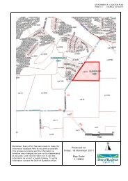
Attachments 11.4 and 11.5 - City of Busselton
Attachments 11.4 and 11.5 - City of Busselton
Attachments 11.4 and 11.5 - City of Busselton

Create successful ePaper yourself
Turn your PDF publications into a flip-book with our unique Google optimized e-Paper software.
LAND inSights<br />
ATTACHMENT A – DRAFT LEPS ITEM <strong>11.5</strong> COUNCIL 12/10/2011<br />
Executive Summary<br />
3 Biodiversity<br />
3.1 Background<br />
Introduction<br />
Biodiversity is defined by the Department <strong>of</strong> Environment, Water, Heritage <strong>and</strong> the Arts as the<br />
variety <strong>of</strong> life: the different plants, animals <strong>and</strong> microorganisms <strong>and</strong> the ecosystems <strong>of</strong> which<br />
they are a part (DEWHA, 2009). The Shire <strong>of</strong> <strong>Busselton</strong> is located within the South-west <strong>of</strong><br />
Western Australia, which is identified as being an international ‘Biodiversity Hotspot’. This<br />
means that the region has met two strict criteria: it contains at least 1, 500 species <strong>of</strong> vascular<br />
plants as endemics, <strong>and</strong> it has lost at least 70% <strong>of</strong> its original habitat (Conservation<br />
International, 2007).<br />
As the level <strong>of</strong> biodiversity is an important asset to the Shire, it is important that all future<br />
planning decisions take into account the issue <strong>of</strong> biodiversity protection.<br />
Remnant Vegetation<br />
Approximately 48% <strong>of</strong> the Shire comprises remnant vegetation (Shire <strong>of</strong> <strong>Busselton</strong>, 2004). A<br />
majority <strong>of</strong> this remnant vegetation is contained within National Park or State Forest. The<br />
central area <strong>of</strong> the Shire is mostly cleared <strong>of</strong> native vegetation <strong>and</strong> which occurred in the past<br />
for agricultural pursuits. To accommodate Urban Development clearing has also occurred in<br />
placesalong the northern coastline between the eastern Shire boundary <strong>and</strong> Dunsborough.<br />
Much <strong>of</strong> the remnant vegetation exists in the eastern section <strong>of</strong> the Shire (which covers<br />
approximately one third <strong>of</strong> the Shire) <strong>and</strong> along the western coastal areas.<br />
Vegetation Complexes<br />
The vegetation complexes vary across the Shire to correspond with the various l<strong>and</strong>forms that<br />
exist. In general, most <strong>of</strong> the complexes exist in ‘b<strong>and</strong>s’ which run parallel with either the<br />
western or northern coastlines. The vegetation complexes that exist along the northern coastal<br />
area include Quindalup (which occurs closest to the coast) <strong>and</strong> Ludlow (exists further inl<strong>and</strong> to<br />
the south <strong>of</strong> the Quindalup complex). Much <strong>of</strong> the central agricultural region consists <strong>of</strong><br />
vegetation belonging to the Abba vegetation complex. The Yelverton <strong>and</strong> Treeton vegetation<br />
complexes occur at the southern end <strong>of</strong> the Shire.<br />
Different vegetation complexes also run parallel to the western coast. Some patches <strong>of</strong><br />
Kilcarnup vegetation complex occur along the rocky coastline <strong>and</strong> the Gracetown vegetation<br />
complex occupies the remainder <strong>of</strong> this rocky coastline. Beyond this exists a relatively larger<br />
strip <strong>of</strong> vegetation belonging to the Cowaramup complex.<br />
The vegetation complexes found in the eastern section <strong>of</strong> the Shire include Rosa, Telera,<br />
Kingia, Bidella, Jalbaragup, Preston <strong>and</strong> Coate.<br />
Vegetation complexes <strong>and</strong> vegetation classes which have less than 30% <strong>of</strong> the pre-European<br />
extent remaining are commonly referred to as ‘poorly represented’ (EPA, 2000). Vegetation<br />
complexes with less than 400 ha remaining in the state are also considered to be poorly<br />
represented. Most poorly represented vegetation complexes are found along the northern<br />
VER 1 – FINAL DRAFT<br />
Shire <strong>of</strong> <strong>Busselton</strong> Local Environmental Planning Strategy<br />
Report 3 – Objectives, Strategies <strong>and</strong> Actions<br />
November 2010<br />
Page 24