Rural-Residential Land Use Strategy Discussion Document - May
Rural-Residential Land Use Strategy Discussion Document - May
Rural-Residential Land Use Strategy Discussion Document - May
You also want an ePaper? Increase the reach of your titles
YUMPU automatically turns print PDFs into web optimized ePapers that Google loves.
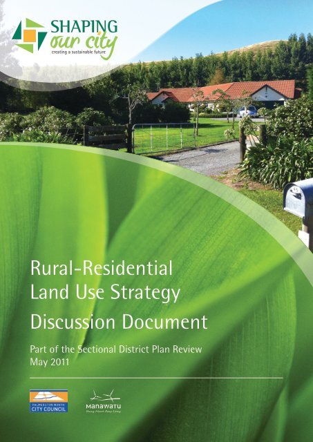
<strong>Rural</strong>-<strong>Residential</strong><br />
<strong>Land</strong> <strong>Use</strong> <strong>Strategy</strong><br />
<strong>Discussion</strong> <strong>Document</strong><br />
Part of the Sectional District Plan Review<br />
<strong>May</strong> 2011
Table of Contents<br />
Introduction<br />
1<br />
Part 1: Background to the Palmerston North District Plan, the Sectional<br />
District Plan Review and the Consultation Process<br />
2<br />
Part 2: The <strong>Rural</strong> <strong>Residential</strong> <strong>Land</strong> <strong>Use</strong> <strong>Strategy</strong> and the <strong>Rural</strong> Zone Review<br />
4<br />
Part 3: Issues and Options for <strong>Rural</strong> <strong>Residential</strong> Development and <strong>Discussion</strong> Points<br />
15<br />
Glossary<br />
24
Introduction<br />
This <strong>Discussion</strong> <strong>Document</strong> covers the topic of rural-residential development.<br />
The Council has recently started a review of its planning provisions for rural areas and wants to prepare<br />
a <strong>Land</strong> <strong>Use</strong> <strong>Strategy</strong> to guide rural-residential development over the next ten years. The aim of the <strong>Rural</strong><br />
<strong>Residential</strong> <strong>Land</strong> <strong>Use</strong> <strong>Strategy</strong> is to provide long-term direction for managing rural-residential growth<br />
within the City boundary.<br />
The Palmerston North District Plan is the main planning document that guides rural-residential<br />
development.<br />
Purpose of this <strong>Discussion</strong> <strong>Document</strong><br />
The purpose of this discussion document is to seek feedback on the planning provisions and rules that<br />
govern rural-residential development within the City. Different perspectives are sought on what is<br />
working, what needs changing and how much land should be provided for rural-residential development<br />
in the next ten year period.<br />
This discussion document is divided into three parts:<br />
Part 1: Background to the Palmerston North District Plan, the Sectional District Plan Review and the<br />
Consultation Process for developing the <strong>Rural</strong> <strong>Residential</strong> <strong>Land</strong> <strong>Use</strong> <strong>Strategy</strong><br />
Part 2: The <strong>Rural</strong> <strong>Residential</strong> <strong>Land</strong> <strong>Use</strong> <strong>Strategy</strong> and The <strong>Rural</strong> Zone Review<br />
Part 3: Issues and Options for rural-residential development and discussion points.<br />
1
PART 1: BACKGROUND TO THE PALMERSTON NORTH DISTRICT PLAN AND THE<br />
SECTIONAL DISTRICT PLAN REVIEW<br />
The current District Plan was prepared in the early 1990s and was made operative in December 2000. The<br />
Council is required to review the parts of the District Plan that have not been reviewed in the past 10<br />
Years, pursuant to section 79 of the Resource Management Act 1991 (“the Act” or “RMA”).<br />
Recent changes to the Resource Management Act have provided Councils with greater flexibility in how<br />
it can review the District Plan. District Plans can now be reviewed in parts or sections, as opposed to<br />
one full review every 10 years. ‘Shaping our City’ is the name of the Palmerston North City Council’s<br />
Sectional District Plan Review.<br />
The Council has decided to undertake a Sectional District Plan Review, which will be carried out in four<br />
distinct stages over the next five years. The timeline for the ‘Shaping Our City’ staged review can be<br />
viewed at www.pncc.govt.nz (Sectional District Plan Review under Quick Links).<br />
This discussion document on rural-residential development is the first step in the preparation of a <strong>Rural</strong><br />
<strong>Residential</strong> <strong>Land</strong> <strong>Use</strong> <strong>Strategy</strong> and the review of the <strong>Rural</strong> Zone section of the District Plan for Palmerston<br />
North City.<br />
The District Plan<br />
The District Plan guides what activities people can carry out on their land and how land can be developed.<br />
The District Plan manages significant issues, such as urban growth, and more minor matters, such as how<br />
far away an intensive farming activity such as a piggery or poultry shed can be located from a property<br />
boundary.<br />
There are limitations to what the District Plan can achieve. For example, while the District Plan establishes<br />
rules and guidelines for how activities can be established, it is individuals and developers responding to<br />
the market conditions who shape where and when development occurs.<br />
In addition some of the factors that shape the rural environment and the pattern of development are<br />
outside the scope of the District Plan. Examples include: National Infrastructure Projects that are lead<br />
by Government agencies such as Transpower or the NZ Transport Agency.<br />
The consultation process<br />
A District Plan is a community document. It is important to hear all the different points of view at<br />
the start of the review process. The Council welcomes comments from everyone - whether they are<br />
residents, rural land owners, land development professionals, infrastructure or service providers.<br />
This discussion document includes a number of questions to provide a framework for your feedback.<br />
A feedback form is included – please answer as many questions as you wish – or simply send your<br />
comments to the Council by Friday 24 June 2011. Please feel free to make any additional comments on<br />
matters not covered by the questions in the feedback form.<br />
Once this consultation period has ended, the Council will assess the information received from the public<br />
and other key stakeholders and start to draft the new <strong>Rural</strong> <strong>Residential</strong> <strong>Land</strong> <strong>Use</strong> <strong>Strategy</strong> and develop<br />
planning provisions that will form the basis of a Proposed District Plan Change. All submissions received<br />
will be made available to the public.<br />
2
How to Comment<br />
Please send the feedback form and any other comments to:<br />
<strong>Rural</strong> <strong>Residential</strong> <strong>Land</strong> <strong>Use</strong> <strong>Strategy</strong>: <strong>Rural</strong> <strong>Residential</strong> <strong>Discussion</strong> <strong>Document</strong><br />
Attention: Team Leader – Governance and Support<br />
Palmerston North City Council<br />
DX Box PX33319<br />
PALMERSTON NORTH 4442<br />
Alternatively, any comments can be sent via:<br />
Fax: 06 355 4115<br />
Email: submission@pncc.govt.nz<br />
Deliver: Customer Service Centre<br />
Te Manaakitanga o Hineaute<br />
Civic Administration Building<br />
The Square<br />
PALMERSTON NORTH<br />
The period for giving feedback closes on Friday 24 June 2011.<br />
If you have any queries, or wish to discuss any matters relating to the <strong>Rural</strong> <strong>Residential</strong> <strong>Land</strong> <strong>Use</strong><br />
<strong>Strategy</strong> or the <strong>Rural</strong> Zone Review, please call Cynthia Ward, Senior Policy Planner on 06 356 8199.<br />
3
PART 2: THE RURAL - RESIDENTIAL LAND USE STRATEGY AND THE RURAL ZONE<br />
REVIEW<br />
The <strong>Rural</strong> <strong>Residential</strong> <strong>Land</strong> <strong>Use</strong> <strong>Strategy</strong> seeks to provide a “helicopter view” of issues and policy direction<br />
across the City’s rural areas. To set the context for the <strong>Rural</strong> <strong>Residential</strong> <strong>Land</strong> <strong>Use</strong> <strong>Strategy</strong>, this section of<br />
the discussion document provides further background information on the existing pattern and character<br />
of rural-residential development in Palmerston North, and current planning provisions and rules relating<br />
to this form of development.<br />
Information is presented under the following headings:<br />
• What is rural-residential development?<br />
• Interesting facts<br />
• Location map<br />
• <strong>Rural</strong>-<strong>Residential</strong> Development history<br />
• Monitoring of development trends<br />
• Current District Plan approach<br />
• The <strong>Rural</strong> <strong>Residential</strong> <strong>Land</strong> <strong>Use</strong> <strong>Strategy</strong><br />
Understanding rural-residential development in Palmerston North<br />
What is rural-residential development?<br />
<strong>Rural</strong>-residential areas are unique from other types of living environments in the City. These areas<br />
commonly have larger sized properties but no council services - such as stormwater and sewage<br />
infrastructure.<br />
<strong>Rural</strong>-residential development is also generally understood to mean development occurring in the <strong>Rural</strong><br />
Zone at an average density of between one to two households per hectare.<br />
The natural landscapes and features of many rural-residential areas contribute to a variety of different<br />
lifestyle environments and roading layouts.<br />
In Palmerston North, the minimum lot size for rural subdivision and dwellings in the <strong>Rural</strong> Zone is four<br />
hectares. Within the <strong>Rural</strong> Zone, there is an Overlay for rural-residential subdivision where the minimum<br />
lot size is one hectare, subject to meeting specific criteria.<br />
Three distinct rural-residential areas are identified in the District Plan and on the current District planning<br />
maps. These areas are the Aokautere-Parklands Area, the Moonshine Valley Area and the Aokautere<br />
<strong>Rural</strong>-<strong>Residential</strong> Area. Minimum lot sizes for these areas are 1300m 2 in the Aokautere-Parklands 1 Area,<br />
1.5ha in the Moonshine Valley Area and 3500m 2 hectares in the Aokautere <strong>Rural</strong>-<strong>Residential</strong> Area.<br />
As with other parts of the land and housing market, the demand for rural residential living operates<br />
across local authority boundaries, making a co-ordinated planning approach between Palmerston North<br />
City and Manawatu District important.<br />
1<br />
The Aokautere-Parklands Area is zoned residential under the current District Plan but has similarities with<br />
other rural-residential areas in terms of its large lot character and limited provision of urban services.<br />
4
The minimum lot size for rural subdivision and dwellings (‘lifestyle lot’) in Palmerston North and<br />
Manawatu District is the same – four hectares. These four hectare lots are popular for rural living<br />
although there is evidence that some buyers would prefer a smaller lot, but are unable to purchase these<br />
because of shortage of supply 2 . Around 42 rural residential lots are created each year within the City 3 .<br />
Some of the factors influencing the rate of rural-residential development include:<br />
• Changes in population<br />
• Changes in lifestyle preferences<br />
• Economic factors (market conditions and housing affordability)<br />
• Fuel prices<br />
• Changes in planning rules<br />
Some interesting facts<br />
• In Palmerston North there are three distinct areas for rural-residential development:<br />
- Aokautere-Parklands Area<br />
- Moonshine Valley Area<br />
- Aokautere rural-residential Area<br />
• 42% of rural land within the City boundary could be further subdivided into rural lifestyle blocks<br />
down to a minimum lot size of one hectare. (<strong>Rural</strong>-<strong>Residential</strong> subdivision overlay)<br />
• Demand for rural lifestyle blocks is increasing and has extended beyond the specific areas provided<br />
for rural-residential development and within the <strong>Rural</strong> Zone (ie outside the 42%).<br />
• There is increasing demand for reticulated water and wastewater services in rural residential<br />
development areas.<br />
• <strong>Land</strong> developers are providing a wider range of lifestyle choices and environments, including ruralresidential<br />
nodes and clusters, farmparks and eco park concepts.<br />
The distribution of rural-residential areas<br />
In Palmerston North, the planning provisions have created a dispersed settlement pattern of ruralresidential<br />
development. The extent of the rural-residential areas and the <strong>Rural</strong>-<strong>Residential</strong> Overlay Area<br />
are highlighted on Map 1 below.<br />
2<br />
2009 Monitoring Report and anecdotal evidence.<br />
3<br />
<strong>Residential</strong> Growth Review Issues and Options Information, Update March 2008, pg 2.<br />
5
map 1: RURAL - RESIDENTIAL development in palmerston north<br />
6
The existing rural-residential areas of Aokautere-Parklands, Moonshine Valley and Aokautere <strong>Rural</strong>-<br />
<strong>Residential</strong> are quite close to the well-established residential suburb of Summerhill. In comparison, the<br />
<strong>Rural</strong> <strong>Residential</strong> Overlay Areas are usually at a greater distance from the City’s urban environment.<br />
Increases in the volumes of traffic movements, new roading, houses and plantings have the potential<br />
to affect the look and feel of rural areas. The <strong>Rural</strong> <strong>Residential</strong> <strong>Land</strong> <strong>Use</strong> <strong>Strategy</strong> will review the overall<br />
management approach for our rural areas and provide more direction on the location, quality and<br />
character of rural-residential development.<br />
At the end of 2009, the City had a potential total land area of 11206.49ha 4 identified for ruralresidential<br />
development. Beyond the Overlay Area, there is an additional landbank of 2583.66ha 5 , which<br />
is ‘consented’ for rural-residential development.<br />
Development principles: different environments, scales and pressures<br />
Each existing rural-residential area has its own set of planning provisions that generally relate to<br />
development issues and on-site servicing arrangements.<br />
The existing <strong>Rural</strong> Zone provisions preserve productive rural holdings although some rural subdivision<br />
allows smaller holdings (four hectares) to establish, subject to specific development criteria. In the <strong>Rural</strong><br />
<strong>Residential</strong> Overlay Areas where land typically has poorer soils, rural-residential development for smaller<br />
one hectare lots is possible.<br />
Planning provisions for rural residential developments, as noted in Map 1, have created a dispersed<br />
settlement pattern with development changing the rural character of some areas and the open vistas<br />
typical on the Manawatu Plains. It may also make it difficult to return the land to full agricultural<br />
production, should economic changes make this more desirable in the future.<br />
The <strong>Rural</strong> <strong>Residential</strong> <strong>Land</strong> <strong>Use</strong> <strong>Strategy</strong> will focus on the long-term strategic direction for rural-residential<br />
development and the subdivision and planning rules in the District Plan that cover subdivision, building<br />
and land development activities, in rural environments.<br />
Different planning perspectives<br />
<strong>Rural</strong>-residential living has become a more popular lifestyle choice in the past two decades. However, providing<br />
for growth and meeting ongoing demands for this type and form of living can come at a high cost:<br />
• Ongoing subdivision of rural land can threaten the overall productivity of the <strong>Rural</strong> Zone and<br />
undermine one of the City’s key strategic and competitive advantages - a high quality food supply<br />
at its doorstep.<br />
• Undermine a strong rural sector.<br />
• Lifestyle blocks can have adverse effects on rural landscapes. Often rural-residential developments<br />
occur in attractive, or near sensitive, landscapes, such as adjacent to water and native bush.<br />
• There is potential for reduced environmental outcomes in some rural areas if onsite systems, for<br />
example effluent disposal beds, are not well maintained.<br />
4<br />
Parkland/Moonshine/Aokautere <strong>Rural</strong> <strong>Residential</strong> Areas and the Overlay Area.<br />
5<br />
Consented <strong>Rural</strong> <strong>Residential</strong> landbank.<br />
7
• There is also the potential for inefficient or unplanned provision of water and wastewater services,<br />
roading upgrades and rubbish disposal if rural-residential development is not carefully planned and<br />
definite decisions about servicing rural-residential subdivisions are not made by the Council.<br />
• Perception of exclusiveness.<br />
Growth also needs to be considered in the context of site suitability and development limitations.<br />
For example, if onsite wastewater systems are to be used, there may be site limitations such as high<br />
groundwater levels that could lead to difficulties. If each household is to have water supplied by private<br />
bores, there may be potential for development to adversely affect stream flows or wetland areas.<br />
On the other hand rural-residential can provide a number of benefits:<br />
• Support regeneration and investment in existing rural areas<br />
• Strengthen rural communities<br />
• Create opportunities to enhance biodiversity by encouraging riparian plantings and establishment<br />
of new natural areas.<br />
Recent concerns about the loss of ‘rural character’ in small subdivisions in some areas has meant some<br />
rural dwellers have commented on the need for tighter subdivision controls 6 .<br />
History of rural residential development in Palmerston North<br />
Palmerston North has experienced steady growth and development over the past 25 years.<br />
Some of the significant changes and general trends over the years include:<br />
• Changes to local government boundaries in the late 1980s, saw the inclusion of rural land, including<br />
the Massey University landholdings (part of the former Kairanga County), within the City boundary.<br />
• Growth planning has focused on infill (urban intensification) and greenfield development (the<br />
development of new suburban neighbourhoods at Kelvin Grove and Aokautere) to meet demands<br />
for housing and provide choice of locations and environments.<br />
• In the first District Plan prepared under the Resource Management Act 1991, rural-residential areas<br />
are provided to meet a small but growing segment of the housing market. A number of ruralresidential<br />
areas are provided in the wider Aokautere area - for example, Aokautere-Parklands and<br />
Moonshine Valley.<br />
• Additional opportunities for rural residential lifestyle subdivision are provided in rural parts of the<br />
district, generally on the poorer quality soils. Subdivision planning rules limit the minimum lot size<br />
to one hectare. (<strong>Rural</strong>-<strong>Residential</strong> Area Overlay)<br />
• New height and setback rules are introduced to address the effects of residential development at<br />
Pacific Drive, on the rural character of the Turitea Valley. The interface between these residential<br />
and rural-residential environments was recognised as being a “special treatment area”, requiring a<br />
specific policy framework.<br />
6<br />
Submissions to “Shaping Our City’ <strong>Discussion</strong> <strong>Document</strong> and anecdotal feedback from public meetings.<br />
8
Monitoring of development trends<br />
The Council collects a range of information and statistics about population, demographics, employment,<br />
building development, resource consents and land subdivision. This information is available from a range<br />
of Council sources and is used to inform policy development and new land use rules:<br />
• Census - Household Projections for Palmerston North<br />
• Annual Growth Monitoring Reports<br />
• State of the Environment Monitoring Report<br />
• Housing Needs Assessments<br />
Some summary statistics and information relevant to the <strong>Rural</strong> <strong>Residential</strong> <strong>Land</strong> <strong>Use</strong> <strong>Strategy</strong> and the<br />
<strong>Rural</strong> Zone Review include:<br />
Population Growth<br />
• Palmerston North is growing. By 2031 the population is projected to increase by nearly 20% to<br />
94,000 people.<br />
Household Projections<br />
• A household is defined as one person usually living alone, or two or more people usually living<br />
together and sharing facilities (eg: eating and cooking facilities, bathrooms, toilet facilities and<br />
living areas) in a private dwelling.<br />
• The average annual growth in the number of households between 2001 and 2031 in Palmerston<br />
North is projected to be 1.1%, resulting in 9300 additional households between 2006 and 2031.<br />
• Household projections reflect trends towards smaller households – one person households will<br />
account for 31% of households in 2031 compared with 24% currently.<br />
• Household growth is expanding at a greater rate than the number of new houses being built.<br />
Subdivision and building development trends monitoring<br />
The subdivision of land is an important stage of the land development process, creating additional<br />
sections (lots with legal title) within existing urban areas, new greenfield suburbs and lifestyle lots in<br />
rural areas. Subdivision generally precedes the construction of houses.<br />
The following table shows the number of building consent applications processed by the Council for the<br />
three main types of residential environments in the City:<br />
9
Table 1: New Dwelling Units by Type of Development 2000-2009<br />
Year Ended<br />
(December)<br />
Building<br />
Consents<br />
(Authorised)<br />
<strong>Residential</strong><br />
Infill<br />
<strong>Rural</strong>/<strong>Rural</strong>-<br />
<strong>Residential</strong><br />
2000 215 123 (57%) 58 (27%) 34 (16%)<br />
2001 242 138 (57%) 71 (29%) 33 (14%)<br />
2002 281 151 (54%) 84 (30%) 46 (16%)<br />
2003 318 168 (53%) 100 (31%) 50 (16%)<br />
2004 397 241 (61%) 107 (27%) 49 (12%)<br />
2005 347 221 (64%) 95 (27%) 31 (9%)<br />
2006 379 243 (64%) 93 (25%) 43 (11%)<br />
2007 257 151 (59%) 92 (36%) 14 (5%)<br />
2008 180 96 (53%) 56 (31%) 28 (16%)<br />
2009 187 115 (61%) 49 (26%) 23 (12%)<br />
Total 2803 1647 805 351<br />
Average<br />
(2000-2009)<br />
280 165 81 35<br />
Source: PNCC Annual Building Consent Monitoring Data.<br />
The most common subdivisions in rural areas are four or five lot developments. However, larger, more<br />
comprehensive subdivision developments have taken place, such as Kingsdale Park, off Pahiatua-<br />
Aokautere Road.<br />
The <strong>Residential</strong> Growth <strong>Strategy</strong><br />
The focus of the <strong>Residential</strong> Growth <strong>Strategy</strong> is on providing sufficient land to enable the growth of the<br />
City via greenfield land development, supplemented by residential infill (intensification) and to a lesser<br />
extent, rural-residential subdivision. Based on growth forecasts and the continuation of recent trends,<br />
the projections indicate a possible requirement for 981 rural-residential lots over the 20 year plan period.<br />
The current demand preference for rural-residential living is estimated at around 45 lots a year. The<br />
following tables set out the relevant information from Council’s growth monitoring research:<br />
Table 2: Demand Projections by <strong>Residential</strong> Lifestyle Categories, 2010-2029<br />
% of total<br />
demand<br />
Lots per Year<br />
Total Lots required<br />
2010-2029<br />
<strong>Residential</strong> 57 188 3760<br />
<strong>Residential</strong> Infill 30 98 1960<br />
<strong>Rural</strong> <strong>Residential</strong> 13 42 840<br />
Total 100% 1328 6560<br />
10
Table 3: Projected <strong>Residential</strong> Preferences 2010 – 2031, using 10 year average preferences<br />
Avereage Lots<br />
per Year<br />
Total Lots<br />
2010-2031<br />
<strong>Residential</strong> 59% 219 4,823<br />
<strong>Residential</strong> Infill 29% 108 2,731<br />
<strong>Rural</strong> <strong>Residential</strong> 12% 45 981<br />
Total 100% 372 8,175 7<br />
Source: <strong>Residential</strong> Growth Review Issues and Options Information Update 2008, pg 2.<br />
Data monitoring<br />
Monitoring of consent data and community feedback collated from open days, landowner and<br />
stakeholder meetings and written responses to the recent <strong>Residential</strong> Review <strong>Discussion</strong> <strong>Document</strong> show<br />
opportunities for rural-residential living 8 continue to be desired.<br />
This means that the <strong>Rural</strong> <strong>Residential</strong> <strong>Land</strong> <strong>Use</strong> <strong>Strategy</strong> may need to define a clear strategic direction<br />
and promote a more managed approach to the supply and release of rural land for rural residential<br />
development to ensure that while choice is maintained, rural-residential development does not jeopardise<br />
the uptake of sections and infrastructure investment in planned new growth areas, or the uptake of<br />
intensification in existing established urban suburbs.<br />
Current District Plan Rules<br />
The policy framework and rules for rural residential development<br />
<strong>Rural</strong> subdivision and rural-residential development is addressed within the District Plan – in the <strong>Rural</strong><br />
Zone (Chapter 9) and the Subdivision (Chapter 7) sections. These sections of the District Plan state a<br />
number of objectives and policies and describe the anticipated outcomes for rural areas and policies for<br />
rural subdivision and rural-residential development.<br />
In the <strong>Rural</strong> Zone, considerable weight is given to the protection of elite soils, or versatile soils, which are<br />
valuable for the production of food.<br />
The Subdivision Section of the District Plan recognises and provides for market choice and includes rules<br />
which govern the type of rural residential development that can occur at different locations within the<br />
City boundary. These rules or ‘performance conditions’ ensure that development responds to the specific<br />
development issues and site conditions at each of these locations. Key planning considerations are lot<br />
sizes and efficient on-site servicing (water, stormwater, on-site effluent disposal).<br />
In Palmerston North, the minimum lot size for rural subdivision and dwellings in the <strong>Rural</strong> Zone is<br />
four hectares, 3500m 2 in the Aokautere <strong>Rural</strong>-<strong>Residential</strong> Area and 1.5ha in the Moonshine Valley Area.<br />
Within the <strong>Rural</strong> Zone, there is also a <strong>Rural</strong> <strong>Residential</strong> Area Overlay, which identifies where further<br />
subdivision is allowed for one hectare lots, subject to meeting specific criteria.<br />
There are also rules to manage the effects of rural activities including adverse effects on neighbouring<br />
sites and the operation of roads.<br />
7<br />
This total is not simply 20 times the lots per year. This is because this is a linear 20 year average, whereas the<br />
average projected growth rate varies non-linearly over time.<br />
8<br />
<strong>Residential</strong> demand preferences are evaluated in ‘Urban and Citywide <strong>Residential</strong> Dwelling Growth<br />
Monitoring Reports’.<br />
11
What sorts of activities are permitted within the rural area?<br />
Some activities in the rural area are permitted as of right. This means people can expect to carry out<br />
the activity so long as they meet certain conditions in the District Plan and Regional Plans. Permitted<br />
activities within the District Plan include:<br />
• dwellings<br />
• farming<br />
• horticulture<br />
• production forestry<br />
• effluent ponds for on-farm waste disposal<br />
• existing industries on specified sites.<br />
Other activities are generally allowed, provided an application for resource consent is made to the<br />
Council and certain conditions in the District Plan are met. These include:<br />
• garden centres<br />
• education and early childhood facilities<br />
• relocated dwellings.<br />
The <strong>Rural</strong> <strong>Residential</strong> <strong>Land</strong> <strong>Use</strong> <strong>Strategy</strong><br />
<strong>Strategy</strong> aims<br />
The purpose of the <strong>Rural</strong> <strong>Residential</strong> <strong>Land</strong> <strong>Use</strong> <strong>Strategy</strong> will be to maintain a reasonable supply of ruralresidential<br />
lots to ensure a choice of living environments within Palmerston North and to accommodate<br />
some population growth. The majority of population growth will continue to be provided for through<br />
development of new greenfield residential suburbs and infill in the existing established urban suburbs.<br />
The location of these future residential growth areas (Greenfield residential suburbs) has been established<br />
through the <strong>Residential</strong> Growth <strong>Strategy</strong>.<br />
The <strong>Rural</strong> <strong>Residential</strong> <strong>Land</strong> <strong>Use</strong> <strong>Strategy</strong> will define a vision for subdivision and development within the<br />
rural parts of the City, based primarily on statutory directives and directions contained with Council’s key<br />
reference documents. It will document the challenges and opportunities of planning for rural-residential<br />
developments and may include guidance on how to achieve more sustainable subdivisions. It will discuss<br />
a range of forward planning techniques and identify specific planning approaches to manage rural<br />
subdivision and development areas as well as a range of options to achieve sustainable subdivision<br />
development. It will clarify the long-term plans for infrastructure provision within rural areas and<br />
strategic directions for rural-residential development in the City.<br />
12
The <strong>Strategy</strong> development process<br />
The starting point for strategy development is understanding the current pattern of rural-residential<br />
development, the drivers for this lifestyle choice and the effectiveness of the current subdivision<br />
provisions within the District Plan. The strategy is also informed by Council’s <strong>Residential</strong> Growth <strong>Strategy</strong><br />
which sets out a vision for managing residential growth for the next 20 years as well as long term plans<br />
for the provision of Council infrastructure and Asset Management Plans.<br />
In formulating a strategy for rural-residential development, the Council is required to take into<br />
account national and regional directions, contained in planning legislation and other strategic planning<br />
documents.<br />
The Council’s strategic planning framework includes:<br />
• The 10 year plan (2012- 2022) and Asset Management Plans<br />
• The Sustainable City <strong>Strategy</strong><br />
• The <strong>Residential</strong> Growth <strong>Strategy</strong><br />
• The Urban Design <strong>Strategy</strong><br />
• Climate Change <strong>Strategy</strong><br />
• Joint Industrial <strong>Land</strong> Review<br />
• Transport Plans<br />
• Housing Needs Assessment<br />
The Council’s statutory planning framework includes:<br />
• National Policy Statements and National Environmental Standards<br />
• The Regional Policy Statement, Regional Plan and the Proposed One Plan<br />
• The Regional <strong>Land</strong> Transport <strong>Strategy</strong><br />
Community consultation has also helped to provide information on specific issues to be reviewed - for<br />
example, rural transport activities.<br />
13
PART 3: ISSUES AND OPTIONS FOR RURAL RESIDENTIAL DEVELOPMENT<br />
Overview of issues<br />
There is little written guidance about what sustainable subdivision development may mean with respect<br />
to rural-residential subdivisions.<br />
This type of development presents a distinct set of issues that should be considered and planned for.<br />
Such issues may include the following:<br />
• <strong>Rural</strong>-residential properties are desired by people who wish to live in a rural environment. Such<br />
development can have the potential to destroy the very features that these people have come to the<br />
rural environment for, such as privacy, open ’natural’ surroundings and quiet. Often rural-residential<br />
development occurs in, or near, attractive or sensitive landscapes such as adjacent to waterbodies<br />
and native bush. Special landscape and ecological protections may need to be planned for.<br />
• As land is developed for rural living, future options for the productive agricultural use of the land<br />
are reduced, particularly where this occurs on elite or more versatile soils.<br />
• Fragmentation of farmland effectively limits future production choices for the land. Farm parks or<br />
similar concepts can provide a rural residential lifestyle while keeping farming activities intact and<br />
having only minor effects on rural character.<br />
• There is some evidence that a lack of properties in the 0.5ha to1.5ha range is encouraging people to<br />
purchase four hectare lots for their rural living activities. This takes up more land than is needed and<br />
leaves some purchasers with land they find difficult to manage. However, a predominance of these<br />
smaller blocks also risks the creation of rural areas with housing intensities closer to levels in lower<br />
density suburban areas.<br />
• Large areas of similar rural-residential blocks will often radically alter the rural landscape, sometimes<br />
causing the landscape to take on more of an ‘urban‘ character than a rural one. If this is an issue for local<br />
communities, such change may need to be managed by appropriate planning, informed by an accurate<br />
assessment of existing landform patterns and visual impact. For example, small compact houselots<br />
(hamlets) surrounded by open farm land may better preserve the rural open character of the plains.<br />
• <strong>Rural</strong>-residential development on the outskirts of the City, if not appropriately located and designed,<br />
can constrain plans for controlled urban growth. If staged expansion is intended for the future,<br />
planning mechanisms need to be in place in these potential expansion areas, to secure appropriately<br />
designed and well-integrated neighbourhood communities. There are examples in Palmerston North<br />
where rural residential developments, located close to planned growth areas have now been infilled<br />
and retrofitted, and are poorly integrated with the surrounding residential community.<br />
• Setting up rural-residential developments away from established water and sewage reticulation<br />
requires private infrastructure systems. If private systems are not properly constructed or maintained<br />
this creates the risk of adverse impacts on the environment. Council can also face mounting pressure<br />
to provide reticulated infrastructure systems, which may be inefficient. There are potentially high<br />
costs to Council, if failing private systems have to be taken under public control, in order to avoid<br />
adverse effects on the environment.<br />
• <strong>Rural</strong>-residential areas usually do not cater well for bicycle and walking traffic. Walking along rural<br />
country roads can be very dangerous due to narrow roads with limited shoulders and traffic speeds.<br />
• Additional traffic from rural-residential subdivision development on unsealed roads can create noise<br />
and dust nuisance.<br />
14
• Maintaining a balance between a suitable supply of rural-residential lots to meet demand and<br />
provide housing choice, while at the same time avoiding putting in place unnecessary infrastructure<br />
to serve growth, is important.<br />
• The current trends in rural living in the <strong>Rural</strong> Zones in Manawatu District and Palmerston North City,<br />
if sustained, are considered to present a moderate risk to achieving the successful implementation<br />
of the <strong>Residential</strong> Growth <strong>Strategy</strong>.<br />
• There is a need to ensure rural-residential development does not jeopardise the development of<br />
planned residential growth areas, or intensification in and around suburban centres.<br />
• Constraints to rural-residential development within the City boundary could potentially encourage<br />
inappropriate development in <strong>Rural</strong> Zones outside the City, for example, within the Manawatu District.<br />
Developing an Options Framework<br />
The following questions have been developed for consultation and to elicit feedback. Your feedback will<br />
help Council define a set of management options to provide a sustainable supply of rural-residential<br />
land and approaches for planning for rural-residential development in the City, over the next 20 years.<br />
A series of questions are grouped under the following headings:<br />
(i) Sustainability<br />
(ii) Diversity and market choice<br />
(iii) <strong>Rural</strong> economy<br />
(iv) <strong>Rural</strong> residential subdivision – development controls and environmental design<br />
(v) Integrated planning approaches and cross boundary issues.<br />
<strong>Discussion</strong> points<br />
<strong>Discussion</strong> point one: Sustainability<br />
Sustainable development generally means development that meets the needs of the present without<br />
compromising the ability of future generations to meet their own needs.<br />
The Council is committed to becoming a sustainable City and has adopted a Sustainable City <strong>Strategy</strong> for<br />
achieving the Council’s vision and delivering on its aspirations of becoming a more sustainable City. The<br />
purpose of the strategy is also to ensure cross Council integration towards this goal and that ongoing<br />
work progressively directs positive changes in the environmental, economic and social development of<br />
the City.<br />
The Sustainable City <strong>Strategy</strong> provides an integrated planning framework for delivering on long-term<br />
objectives to become a more resilient, self sufficient City, including its productive rural communities.<br />
Several trends impact upon the ability of rural communities to be sustainable or self- sufficient into the<br />
future, including:<br />
15
Transport systems:<br />
• increasing reliance on the private motor car<br />
• dependence on fossil fuels for transportation (for household use, primary production industries and<br />
freighting of goods)<br />
• limited public transport options<br />
• existing poor pedestrian and cycle linkages between communities and rural residential developments.<br />
Population change:<br />
• high turnover of sections in some rural residential areas<br />
• succession planning for retiring farmers<br />
• potential for land parcels, suitable for production, to be taken up for other purposes through subdivision<br />
and development<br />
• potential increases in the cost of fuel and housing<br />
If the future form and development of rural settlements and rural land subdivision is not comprehensively<br />
addressed, these trends could result in residents in rural areas finding it more difficult to provide for their<br />
social and economic well-being, into the future.<br />
Understanding rural residential demand<br />
1. Living in the country is growing in popularity. Please indicate why you think people shift to rural areas?<br />
• to be self-sufficient in food/reduce your environmental footprint<br />
• for the children – have a pony and space to run around<br />
• run a few animals<br />
• afforestation for carbon trading<br />
• privacy<br />
• isolation<br />
• quality of the rural landscape<br />
• intensification of the urban environment<br />
• other<br />
2. If you are a resident in the rural area, please indicate what is the most important reason for living in<br />
the country?<br />
3. How much land is required for rural-residential living?<br />
• large lot (2500m2 – 5000m 2 )<br />
• small rural lot (one hectare)<br />
• lifestyle (two - four hectares)<br />
• smallholding farmlet (four or more hectares)<br />
• other.<br />
16
Managing rural residential demand<br />
4. Providing direction on the preferred form and location of long term rural residential growth is<br />
important for infrastructure planning and to guide the subdivision approval process. What is working<br />
or not working with the current approach to managing rural-residential subdivision?<br />
5. There are a number of approaches for managing rural-residential subdivision. Which of the following<br />
approaches do you prefer and why?<br />
• Traditional rural-residential areas, e.g. Moonshine Valley<br />
• Nodal or clustered developments with shared services<br />
• Scattered development<br />
• Restriction of any further rural-residential subdivision<br />
• Other?<br />
6. Regional Council Policy requires the Council to restrict development, including rural-residential<br />
subdivision, on high class soils. Has the current approach to rural-residential subdivision been<br />
successful in this regard? How can Council best provide for rural-residential subdivision and protect<br />
high class soils?<br />
Self-sufficient rural residential developments<br />
7. A number of recent rural residential subdivisions have anticipated the provision of reticulated services<br />
(water and wastewater by Council). Should Council strengthen its current policy direction of separating<br />
residential and rural residential development, by requiring rural landowners to provide on-site water<br />
and wastewater servicing for all rural residential development?<br />
<strong>Discussion</strong> point two: Diversity and market choice<br />
A range of locations are identified in the District Plan as potentially suitable for rural-residential<br />
development. However, some of these areas are almost approaching their development capacity e.g. the<br />
Parklands-Aokautere Area and the Moonshine Valley Area.<br />
The Aokautere <strong>Rural</strong> <strong>Residential</strong> Area and the land within the <strong>Rural</strong>-<strong>Residential</strong> Overlay Area provide a<br />
significant future landbank for rural-residential development. However, this perceived capacity does not<br />
always reflect actual capacity as this potential land bank does not:<br />
• reflect existing land uses or account for significant site limitations or development constraints, such<br />
as soil stability, slope and aspect issues<br />
• always occur in locations of actual/potential demand (eg: the site may be prone to windiness, suffer<br />
shading, lack views or may be physically remote from the City<br />
• account for development costs (topography and site limitations may significantly impact on the<br />
feasibility of developing some land)<br />
• properly reflect landowner aspirations and development intentions<br />
17
Some areas identified for rural residential or lifestyle opportunities may not offer potential purchasers<br />
with the necessary levels of community support or facilities to attract permanent residents, which may<br />
then lead to a high turnover rate for new rural-residential sections.<br />
The topography and cadastral pattern of some land parcels has seen a prevalence of cul-de-sac<br />
developments in many rural residential locations. This roading configuration and development layout is<br />
not always conducive to creating strong neighbourhoods or a strong sense of community.<br />
Where the perceived development capacity does not reflect actual capacity, this can lead to pressure to<br />
subdivide other higher class rural land. In the <strong>Rural</strong> Zone, there is limited flexibility of rural subdivision<br />
lot sizes. While the four hectare block provides more room for landscaping and planting to soften the<br />
visual impact of new residential lifestyle development, it can work against the efficient use of land and<br />
the protection of the rural land resource for productive activities.<br />
Some rural areas are also at great risk of losing their remote rural character or rural ‘look and feel’<br />
through the scattering of rural residential development and the rise of new land use activities (e.g. wind<br />
farms)<br />
1. A variety of rural-residential subdivision developments have been provided over the last 25 years. If<br />
the Council was to specifically identify more areas for rural residential development, where should<br />
these be located? Why?<br />
<strong>Discussion</strong> point three: <strong>Rural</strong> economy<br />
The outlook for the rural sector is positive according to the March 2011 quarterly economic report (PNCC).<br />
The export commodity prices continue to rise, which has the effect of offsetting recent exchange rate<br />
increases in the 2010 September and 2010 December quarters. Statistics New Zealand estimates for the<br />
December 2010 quarter suggest dairy prices increased by 37 % from the December 2009 quarter, while<br />
meat prices increased by 14% and wool prices by 34%. The strength of export commodity prices is<br />
reflected in favourable economic indicators in Manawatu District and to a lesser extent the Palmerston<br />
North and national data.<br />
The relationship between property value and subdivision is a complex one. Property value is a reflection<br />
of a number of influences including, the extent of development on a property and associated capital<br />
cost, the development potential, location, accessibility, and infrastructure provision.<br />
The value of property is firstly derived from a combination of land value and improvements: the existing<br />
dwelling and associated ancillary buildings such as those used for rural, horticultural and agricultural<br />
activities. The capital value is provided by the level/degree of activity and value input, whether it is used<br />
for productive activities (such as orchards, market gardens, grazing) and by the capital returns derived<br />
from these activities.<br />
For rural land where site density is high (i.e. there is an intensive cadastral pattern), then there may be<br />
increased pressure to further develop such land, as the ‘subdivision expectation’ is often reflected in the<br />
value of the property. Where properties are developed as productive farming units, have a high capital<br />
value and there is a consistent pattern of larger landholdings, it is less likely that further ‘speculative’<br />
subdivision could occur.<br />
An understanding of property value and economic market conditions is central to addressing resource<br />
allocation pressures.<br />
18
Resource Allocation Pressures<br />
1. The current District Plan identifies a large expanse of land for rural-residential development. Should<br />
the Council review the current extent of the <strong>Rural</strong> <strong>Residential</strong> Area Overlay, which is made available for<br />
rural-residential development? Why?<br />
<strong>Discussion</strong> point four: <strong>Rural</strong>-residential subdivision – development controls and environmental design<br />
Subdivision has a significant impact on the design of places and the essence of rural community – from<br />
the layout of the roading to the orientation of the lots, the number of sections (lots) and the overall<br />
density of development. Some examples of how design can positively contribute to good environmental<br />
and community outcomes, include:<br />
• designing the subdivision to take into account and respond to natural landforms and features and the<br />
wider environment.<br />
• roading in a north-south direction to maximise sunlight for properties and houses<br />
• providing for a variety of lot sizes and dimensions<br />
• setting design controls for infrastructure (water storage tanks), so that these are screened from view.<br />
The Urban Design <strong>Strategy</strong><br />
The Council became a signatory to the NZ Urban Design Protocol in June 2010 and adopted an Urban<br />
Design <strong>Strategy</strong> in September 2010. This strategy presents a vision for the physical development of<br />
Palmerston North that will contribute to the City being recognised as vibrant, caring, creative and<br />
sustainable.<br />
The strategy acknowledges the importance of providing choices of living spaces and lifestyles. It also<br />
acknowledges the importance and value of the City’s natural landscapes in providing character to<br />
different parts of the City and the benefits of incorporating environmental features in the design of<br />
subdivision developments.<br />
This strategy presents a few challenges for rural-residential development and directs the <strong>Rural</strong> Zone<br />
Review towards ensuring that rural-residential development occurs in planned locations with clear policy<br />
differences between rural and rural-residential development in Council’s strategies, policies and plans.<br />
The challenges identified in the Urban Design <strong>Strategy</strong> are:<br />
• desire for city services, transport impacts, loss of productive land and sensitivity to rural activities<br />
• interactions with planning for urban areas of the City and infrastructure provision (e.g. roads)<br />
The design and control of rural subdivision is crucial for ensuring high quality living and working<br />
environments, which are environmentally compatible.<br />
19
Environmental Design<br />
1. <strong>Rural</strong>-residential subdivision can affect the amenity values commonly associated with rural areas.<br />
What would better subdivision design mean in terms of rural-residential development?<br />
2. Are the current rural-residential subdivision and density standards still appropriate?<br />
3. Should the Council amend the District Plan to include urban design guidelines on any of the<br />
following matters? Why?<br />
• boundary fencing<br />
• accessory buildings and tanks<br />
• building colours and material<br />
• site landscaping and planting, accessways<br />
• exterior lighting<br />
Reverse sensitivity issues<br />
4. Reverse sensitivity is where new activities such as rural-residential dwellings are established close<br />
to traditional rural activities or an intensive farming activity such as a piggery or poultry farm.<br />
Reverse sensitivity effects are a legitimate reason for restricting new land uses. Is rural-residential<br />
subdivision causing any reverse sensitivity effects? How should these effects be managed?<br />
<strong>Land</strong>scape values<br />
5. Palmerston North City is surrounded by an expansive landscape. How important are the open views<br />
you enjoy, for example, over to the plains with the backdrop of the Tararua Ranges?<br />
6. Currently the plains and much of the foothills are farmed. How essential is their pastoral character<br />
to your enjoyment of the City’s landscape?<br />
7. Does ‘native’ vegetation contribute to natural character?<br />
8. The plains and raised terraces are a feature of the Palmerston North landscape. People seem to want<br />
to build on the edge of the terraces where they are elevated and get good views. How important<br />
are these raised edges?<br />
9. Are there other features of the Palmerston North landscape that are important to you? If so, should<br />
development here have special controls?<br />
20
Managing change<br />
10. There is a lot of pressure for rural lifestyle development. Is it better to protect landscapes by<br />
controlling where development is allowed or by controlling how development is undertaken?<br />
11. The most sought-after land for development is out of the valleys on the edge of the raised terraces.<br />
Should development here have special controls?<br />
<strong>Discussion</strong> point five: Integrated planning approaches and cross boundary issues<br />
The demand for residential living operates across local authority boundaries making it important that<br />
there is a coordinated planning approach between Palmerston North City and Manawatu District.<br />
1. How should the Council work with its neighbouring Councils in Manawatu, Horowhenua and Tararua<br />
to best manage rural-residential development?<br />
21
Appendix 1: <strong>Rural</strong> <strong>Residential</strong> Performance Conditions<br />
The following summarises the performance conditions:<br />
1. Existing buildings<br />
2. Minimum lot area<br />
3. Access<br />
4. Esplanade reserves<br />
5. Intensive farming buffer zone<br />
6. Roads<br />
7. Earthworks.<br />
22
Glossary<br />
Ancillary Buildings – Means a building not being part of the principal building, the use of which is<br />
incidental to that of another building or buildings on the site. In the case of a site on which no building<br />
has been erected, it is a building incidental to the use of the principal building permitted on the site.<br />
This includes a garage, carport, tool shed, playroom, recreation room, glasshouse, swimming pool, spa<br />
pool and sleepout.<br />
Cadastral pattern – A technical term associated with land survey and the subdivisions process and which<br />
also describes the size, location and layout of lots and general form of development which emerges<br />
through the process of land development.<br />
Density - A term that describes the intensity of building on a particular site or in a particular zone, as<br />
defined within the District Plan. For example, in the <strong>Rural</strong> Zone, the density of development is primarily<br />
controlled through the minimum lot size rule.<br />
Development capacity - The permitted number of household lots/dwellings that a site or an area is able<br />
to accommodate at current densities (intensity), as defined within the District Plan.<br />
Development criteria - Criteria used to assess the suitability of development, generally in terms of its<br />
effects on the environment, and compliance with objectives, policies and rules of the District Plan.<br />
Development pattern - The subdivisional and land use pattern (or activities) taking place in an area or<br />
location.<br />
Farmparks or ecoparks - A specifically designed farm (or forest park) within rural areas where the<br />
design of the allotments and dwelling sites are each individually located to ensure the least impact on<br />
the rural environment and rural landscape values.<br />
Fragmentation - In the context of rural landuse, fragmentation means the breaking up of contiguous<br />
rural land into disconnected or discontinous parcels. Fragmenation can be caused by land subdivision<br />
and subsequent development including, housing, roading, powerlines and planting.<br />
Greenfield - New urban development on land not previously built on that is usually, but not always rural<br />
land.<br />
High class soils / elite soils/versatile soils - Fertile soils that are capable of supporting a wide range of<br />
crops and other plants. Typically they are deep, loamy, have good drainage and are relatively flat.<br />
Household - Defined as one person usually living alone, or two or more people usually living together<br />
and sharing facilities in a private dwelling (e.g cooking facilities, bathroom and toilet facilities, and living<br />
areas).<br />
Infill subdivision or residential infill - Means the splitting of an existing section into two or more<br />
allotments (lots) usually for the purpose of building another dwelling(s).<br />
Intensification – Means subdivision, use and/or redevelopment of areas within developed urban areas,<br />
to promote a more consolidated or concentrated form of development.<br />
Intensive Farming – Means the production of plant and animal produce, where the predominant<br />
productive processes are carried out within buildings. It includes, but is not limited to, poultry farming<br />
(where more than 50 poultry are farmed), intensive feedlot farming, fitch farming, rabbit farming, and<br />
mushroom production. It does not include domestic pig farming, glasshouse horticulture or hydroponic<br />
growing of plants.<br />
<strong>Land</strong>bank - Specific blocks of land that are zoned for development. This term is often used in relation<br />
to growth forecasts and monitoring the uptake of residential and industrial zoned land.<br />
Lot and allotment - As per the definition of “Allotment” in Section 218(2) of the Resource Management<br />
Act, including: any parcel of land under the <strong>Land</strong> Transfer Act 1952 that is a continuous area and whose<br />
23
oundaries are shown separately on a survey plan; or any parcel of land or building or part of a building<br />
that is shown or identified separately on a survey plan; or any unit on a unit plan; or any parcel of land<br />
not subject to the <strong>Land</strong> Transfer Act 1952.<br />
Minimum lot size - Means the total area of the lot allowable, less the area used for access, where the lot<br />
concerned is linked to a public road via a single or shared access strip.<br />
Nodes or cluster developments - Clustering of residential allotments within the rural environment to<br />
retain and preserve the open visual character and expanse of rural areas. Sometimes called ‘hamlets’<br />
this pattern of land development is recognised as one option for meeting demands for rural lifestyle<br />
subdivisions.<br />
Overlay/<strong>Rural</strong> <strong>Residential</strong> Overlay Area – The land area which is identified on the District Planning<br />
maps as ‘<strong>Rural</strong> <strong>Residential</strong> Area’ and graphically illustrated on the <strong>Rural</strong> Zone, through horizontal hatched<br />
lines (hatching overlay). The land parcels within this area are potentially suitable for subdivision for rural<br />
residential living, subject to meeting the specific rules in Section 7 Subdivision. The <strong>Rural</strong> <strong>Residential</strong><br />
Area covers (overlays) a large area of the <strong>Rural</strong> Zone, and serves to clearly identify where the opportunity<br />
for subdivision down to 1 ha allotments is allowed. This provision is sometimes referred to as the <strong>Rural</strong><br />
<strong>Residential</strong> Overlay or Overlay Area.<br />
Private infrastructure systems – These systems include private water bores, domestic water and<br />
wastewater (grey water) or stormwater systems designed to serve rural households in rural areas.<br />
Production Forestry – Means the planting, replanting, cultivation, management and extraction of exotic<br />
trees in forests or tree plantations and indigenous forestry specifically planned and grown for harvest.<br />
This includes the processing of the timber on the site by use of a portable sawmill provided this does not<br />
occur for a period exceeding 6 months in any calendar year. This does not include shelter belt planting.<br />
Resource consent – has the meaning set out in section 87 of the Resource Management Act 1991.<br />
A consent can generally be described as a permission (usually a written application) required from a<br />
Regional Council or a territorial authority or local authority, to carry out an activity under the Resource<br />
Management Act 1991 and includes all conditions to which the consent is subject.<br />
Reticulated services – Means publicly or privately owned network utility infrastructure and generally<br />
includes water supplies, pump stations, wastewater sewers and stormwater reticulation services to service<br />
residential households and new residential areas.<br />
Reverse sensitivity - Reverse sensitivity arises where a new incompatible activity is introduced into an<br />
environment which has the potential to limit the operation of existing activities.<br />
<strong>Rural</strong> lifestyle block - <strong>Rural</strong> land used primarily for farming activities and usually containing a dwelling,<br />
comprising an area of about four hectares.<br />
<strong>Rural</strong> residential area - <strong>Land</strong> which is identified in the District Planning Maps for rural residential living,<br />
for example, Moonshine Valley Area and Aokautere <strong>Rural</strong> <strong>Residential</strong> Area.<br />
Subdivision – Subdivision is defined in the section 281(1) of the Resource Management Act 1991 to<br />
mean the division of an allotment by various means including cross-lease, unit titles and for leases which<br />
are for 20 years or longer (including renewals).<br />
Zoning - A system of land use regulation whereby land is mapped into zones which separate one set of<br />
permitted land uses from another.<br />
9<br />
Obtained from: www.qp.org.nz/pubs/wine-industry-example-reverse-sensitivity.pdf<br />
10<br />
Obtained from: http://www.websters-online-dictionary.org/definitions/zoning?cx=partner-pub-<br />
0939450753529744%3Av0qd01-tdlq&cof=FORID%3A9&ie=UTF-8&q=zoning&sa=Search#906<br />
24


