Bilsthorpe & Rufford - Newark and Sherwood District Council
Bilsthorpe & Rufford - Newark and Sherwood District Council
Bilsthorpe & Rufford - Newark and Sherwood District Council

You also want an ePaper? Increase the reach of your titles
YUMPU automatically turns print PDFs into web optimized ePapers that Google loves.
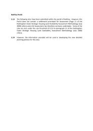
<strong>Bilsthorpe</strong> <strong>and</strong> <strong>Rufford</strong> Parishes<br />
5.17 Within <strong>Bilsthorpe</strong> <strong>and</strong> <strong>Rufford</strong> Parishes, 26 sites have been through the full<br />
Assessment process, 22 of these in <strong>Bilsthorpe</strong> Parish <strong>and</strong> 4 sites which are actually<br />
within <strong>Rufford</strong> Parish but are adjacent to the village of <strong>Bilsthorpe</strong>. Other sites in<br />
<strong>Rufford</strong> Parish which were not adjacent to the village of <strong>Bilsthorpe</strong> <strong>and</strong> therefore not<br />
in a settlement prioritised for Assessment (Page 11 of the Nottingham Outer<br />
Strategic Housing L<strong>and</strong> Availability Assessment Methodology (July 2008) refers) are<br />
detailed at paragraph 5.23 below. Of the 24 sites in <strong>Bilsthorpe</strong> <strong>and</strong> <strong>Rufford</strong> Parishes<br />
fully assessed 8 sites are not considered suitable for development <strong>and</strong> have not<br />
progressed through the Achievability or Availability stages.<br />
5.18 6 sites are considered suitable for development <strong>and</strong> could provide for approximately<br />
345 dwelling units.<br />
5.19 12 sites may be considered suitable for development <strong>and</strong> could provide for<br />
approximately 1258 dwelling units. For development of these sites to be considered<br />
suitable, changes to Planning Policy would need to be considered <strong>and</strong> implemented<br />
through the Local Development Framework. It should be noted that no decisions on<br />
changes to Planning Policy have yet been made <strong>and</strong> the inclusion of sites within this<br />
category should not be taken as an indication that changes will be made.<br />
5.20 The following sites within the parish of <strong>Bilsthorpe</strong> have been submitted to the Local<br />
Planning Authority, or have been identified through the Planning Officer led Desktop<br />
search exercise, <strong>and</strong> have been fully assessed:<br />
Sites not Considered Suitable<br />
08_0173<br />
08_0201a<br />
08_0201b<br />
08_0439<br />
08_0445<br />
08_0446<br />
08_0448<br />
08_0449<br />
Sites which are Considered Suitable<br />
08_0111<br />
08_0284<br />
08_0441<br />
08_0443<br />
08_0447<br />
08_0599<br />
Site which may be Considered Suitable
08_0081<br />
08_0085<br />
08_0095<br />
08_0200<br />
08_0202<br />
08_0261<br />
08_0440<br />
08_0442<br />
08_0444<br />
08_0450<br />
08_0451<br />
08_0452<br />
5.21 The following sites have also been submitted, but 08_0093 <strong>and</strong> 08_0183 are under<br />
the size threshold of 0.25 ha (paragraph 12 of the Nottingham Outer Strategic<br />
Housing L<strong>and</strong> Availability Assessment Methodology (July 2008) refers) <strong>and</strong> a full<br />
Assessment has therefore not been undertaken. Site 08_0108 is a duplicate of<br />
08_0095 <strong>and</strong> 08_0598 is considered to be fully developed.<br />
08_0093- South of Hollowdyke Lane<br />
08_0180- Eakring Road<br />
08_0183- Sports Ground Bungalow Eakring Road<br />
08_0598- The Crescent<br />
5.22 However, the information provided will be used in developing the new detailed<br />
planning policies for this area.<br />
5.23 The following sites have been submitted for the part of <strong>Rufford</strong> parish which is not<br />
adjacent to <strong>Bilsthorpe</strong> Village <strong>and</strong> a full Assessment has therefore not been<br />
undertaken.<br />
08_0014- Eakring Road, <strong>Bilsthorpe</strong><br />
08_0196- L<strong>and</strong> Adjacent The Chase/Mulberry House, Maylodge Dr, <strong>Rufford</strong><br />
08_0203- L<strong>and</strong> South of Maylodge Drive, <strong>Rufford</strong><br />
08_0378- Broad Oak, Old <strong>Rufford</strong> Road, <strong>Rufford</strong><br />
5.24 However, the information provided will be used in developing the new detailed<br />
planning policies for this area.
Site Ref:<br />
Rectory Farm, Kirklington Road<br />
08_0081 Area(ha): 0.49 Parish: BILSTHORPE Proposed Yield : 10<br />
Suitability Conculsion<br />
Availability Conclusions:<br />
Availability Comments:<br />
Achievability Conclusion:<br />
Achievabilty Comments:<br />
Overall Draft Conclusion:<br />
Overall Final Conclusion:<br />
The site may be suitable<br />
The site could be available in 5 - 10 years time<br />
Information provided: Developer has shown an interest in the site. 4 dwellings<br />
detailed in submission. Site available within 5 years. However, as the site currently<br />
has policy constraints it has been put in the 5-10 tranche.<br />
The site is economically viable/acheivable for housing<br />
Viable - Assessed at 30dph site area reduced by 30% to reflect on-site trees <strong>and</strong><br />
pond No on-site POS required but with POS commuted sum. No. of dwellings 10.<br />
Potential contamination issues in the locality would need to be investigated<br />
<strong>and</strong> mitigated if necessary. If the Village Envelope designation is changed<br />
through the Development Plan process, this site could be considered<br />
suitable subject to appropriate mitigation works. The site is both Available<br />
<strong>and</strong> Achievable.<br />
Potential contamination issues in the locality would need to be investigated<br />
<strong>and</strong> mitigated if necessary. If the Village Envelope designation is changed<br />
through the Development Plan process, this site could be considered<br />
suitable subject to appropriate mitigation works. The site is Achievable <strong>and</strong><br />
it is considered that it could be developed within 5 - 10 years.<br />
Character L<strong>and</strong> Use Location The site may be suitable<br />
Location: Village (outside but adjoining Boundary) PDL/Greenfield: PDL<br />
Area Character: MixedVillage/Countyside<br />
Area Greenfield:<br />
Setting: Village<br />
Area PDL: 0.49<br />
Current Use: Residential<br />
Proposed Use:<br />
Policy<br />
The site may be suitable<br />
AllocatedSite: Countryside Other: NE1 Development in the Countryside , C1-C5,<br />
C12,C12-15 Conservation Areas<br />
Conflicting Issues Yes Outside Village Envelope<br />
Access to Services<br />
The site is suitable<br />
Within 800m or 10 mins walking<br />
Primary school: Yes<br />
GP/ Health<br />
Centre:<br />
No<br />
Store of Local Importance:<br />
Cash<br />
Machine/PO:<br />
Yes<br />
Within 30 mins travel by public transport<br />
Bus stop: Yes Secondary school: Yes<br />
Yes<br />
Further Education:<br />
Supermarket:<br />
No<br />
Yes<br />
Retail Area:<br />
Hospital:<br />
Employment:<br />
Yes<br />
No<br />
Yes<br />
Proximity to<br />
Town centre:<br />
Over 1km from a town centre<br />
Southwell Town Centre 9525m<br />
Proximity<br />
Transport Node:<br />
Over 1km from a major public transport<br />
node<br />
GreenSpaceSt<strong>and</strong>ards: Within 400m of publicly accessible green space<br />
GreenSpaceStrategy Comments: 189m<br />
Physical Constraints<br />
The site may be suitable<br />
Highway Engineers Comments: Visibility <strong>and</strong> on site highway layout to be provided to st<strong>and</strong>ard. Traffic Statement<br />
required. Access would need to be to current design st<strong>and</strong>ard including adequate<br />
visibility onto Kirklington Rd.<br />
Topography<br />
Constraints:<br />
No Slopes down<br />
to the west<br />
Access to Utilities? Yes<br />
Contamination Category:<br />
Contaminated L<strong>and</strong>?:<br />
Maybe<br />
B-Potentially contaminative usage has been
Site Ref:<br />
Rectory Farm, Kirklington Road<br />
08_0081 Area(ha): 0.49 Parish: BILSTHORPE Proposed Yield : 10<br />
Agricultural L<strong>and</strong> Quality: Grade 2 (Very good) Part<br />
Grade 2/Part Grade 3<br />
Neighbour Issues:<br />
Identified in SFRA: No<br />
SFRA Comments:<br />
None<br />
Impact on L<strong>and</strong>scape Biodiversity<br />
Impact on views: No<br />
Impact on existing<br />
Recreational Use:<br />
ProtectedSpecies/<br />
Habitats:<br />
No<br />
Suitability Conclusion:<br />
No<br />
The site is suitable<br />
The site may be suitable<br />
identified in close proximity to the site<br />
Site Apparatus:<br />
Site within a flood<br />
zone?:<br />
Natural Features:<br />
None<br />
In Floodzone 1<br />
Listed Bldg / Local Interest Bldg:<br />
Tree Preservation Order:<br />
Conservation Area: Yes<br />
Yes Pond <strong>and</strong> Trees on east of<br />
site.<br />
No<br />
No<br />
Availability <strong>and</strong> Achievability<br />
Availability Conclusions:<br />
The site could be available in 5 - 10 years time<br />
Achievability Conclusion:<br />
Availability Comments:<br />
Achievabilty Comments:<br />
The site is economically viable/acheivable for housing<br />
Information provided: Developer has shown an interest in the site. 4 dwellings<br />
detailed in submission. Site available within 5 years. However, as the site currently<br />
has policy constraints it has been put in the 5-10 tranche.<br />
Viable - Assessed at 30dph site area reduced by 30% to reflect on-site trees <strong>and</strong><br />
pond No on-site POS required but with POS commuted sum. No. of dwellings 10.<br />
Ownership Constraints No ownership constraints 0-5<br />
years<br />
Legal Issues:<br />
Timescale:<br />
No<br />
No other constraints 0-5 years<br />
Ownership Comments:<br />
Legal Comments:<br />
Availability Other Issues: No other constraints 0-5 years<br />
Viability Comments: Viable - Assessed at 30dph site area reduced by 30% to reflect on-site trees <strong>and</strong> pond No onsite<br />
POS required but with POS commuted sum. No. of dwellings 10.<br />
Additional Comments:
Site Ref:<br />
L<strong>and</strong> South of <strong>Bilsthorpe</strong><br />
08_0085 Area(ha): 8.10 Parish: BILSTHORPE Proposed Yield : 170<br />
Suitability Conculsion<br />
Availability Conclusions:<br />
Availability Comments:<br />
Achievability Conclusion:<br />
Achievabilty Comments:<br />
Overall Draft Conclusion:<br />
Overall Final Conclusion:<br />
The site may be suitable<br />
The site could be available in 5 - 10 years time<br />
Information provided: Developer has shown interest in site. Developer has<br />
invested in the site. Site available for development within 5 years. However, as the<br />
site currently has policy constraints it has been put in the 5-10 tranche.<br />
The site is economically viable/acheivable for housing<br />
Viable - Assessed at 30dph site area reduced by 30% to reflect on-site POS no<br />
POS commuted sum. Number of dwellings 170.<br />
Topography issues. Highway access constraints in this location. This site is<br />
not appropriate for development in isolation. However, the site is adjacent to<br />
other SHLAA sites, which may be considered suitable for development <strong>and</strong><br />
provide access. See Site 08_0261.<br />
Topography issues. Possible on <strong>and</strong> off site highways mitigation works may<br />
be required. If the Village Envelope designation is changed through the<br />
Development Plan process, this site could be considered suitable subject to<br />
appropriate mitigation works. The site is Achievable <strong>and</strong> it is considered that<br />
it could be developed within 5 - 10 years.<br />
Character L<strong>and</strong> Use Location The site may be suitable<br />
Location: Village (outside but adjoining Boundary) PDL/Greenfield: Greenfield<br />
Area Character: Mixedcountryside/residential<br />
Area Greenfield: 8.1<br />
Setting: Countryside<br />
Area PDL:<br />
Current Use: Vacant L<strong>and</strong><br />
Proposed Use:<br />
Policy<br />
AllocatedSite:<br />
The site may be suitable<br />
Countryside north <strong>and</strong> far east of site<br />
are within Smoke Control Order Area<br />
Conflicting Issues Yes Outside Village Envelope<br />
Other: Policies NEI Development in the Countryside,<br />
NE9 <strong>Sherwood</strong> Forest Special L<strong>and</strong>scape Area<br />
<strong>and</strong> PU4 Aquifer Protection Zone<br />
Access to Services<br />
The site is suitable<br />
Within 800m or 10 mins walking<br />
Primary school: Yes<br />
GP/ Health<br />
Centre:<br />
Yes<br />
Store of Local Importance:<br />
Cash<br />
Machine/PO:<br />
Yes<br />
Within 30 mins travel by public transport<br />
Bus stop: Yes Secondary school: No<br />
Yes<br />
Further Education:<br />
Supermarket:<br />
No<br />
No<br />
Retail Area:<br />
Hospital:<br />
Employment:<br />
Yes<br />
No<br />
Yes<br />
Proximity to<br />
Town centre:<br />
Over 1km from a town centre<br />
Ollerton Town Centre 9507m<br />
Proximity<br />
Transport Node:<br />
Over 1km from a major public transport<br />
node<br />
GreenSpaceSt<strong>and</strong>ards: Within 400m of publicly accessible green space<br />
GreenSpaceStrategy Comments: 92m<br />
Physical Constraints<br />
The site may be suitable<br />
Highway Engineers Comments: Comments amended in response to consultation reply: Assuming third party l<strong>and</strong><br />
could be acquired for connections as indicated, there would be a need for a<br />
Transport Assessment to show whether the surrounding road network could<br />
accommodate the proposed development. Potential access D has no connection<br />
to the site <strong>and</strong> C is unlikely to be suitable.
Site Ref:<br />
L<strong>and</strong> South of <strong>Bilsthorpe</strong><br />
08_0085 Area(ha): 8.10 Parish: BILSTHORPE Proposed Yield : 170<br />
Topography<br />
Constraints:<br />
Yes Slopes to<br />
south west; some<br />
slopes are steep<br />
Access to Utilities? Yes<br />
Agricultural L<strong>and</strong> Quality: Grade 3 (Good-moderate)<br />
Neighbour Issues:<br />
Identified in SFRA: Yes<br />
None<br />
Contamination Category:<br />
Site Apparatus:<br />
Site within a flood<br />
zone?:<br />
Contaminated L<strong>and</strong>?:<br />
None<br />
No<br />
C-Potentially contaminative usage is yet to be<br />
identified at the site or surrounding areas<br />
SFRA Comments: Entire site located in flood zone1, suitable for all forms of development<br />
In Floodzone 1<br />
Impact on L<strong>and</strong>scape Biodiversity<br />
Impact on views: No Would impact upon views from<br />
south into <strong>Bilsthorpe</strong><br />
Impact on existing<br />
Recreational Use:<br />
ProtectedSpecies/<br />
Habitats:<br />
No<br />
Suitability Conclusion:<br />
No<br />
The site is suitable<br />
The site may be suitable<br />
Natural Features: No ditch on boundary.<br />
Listed Bldg / Local Interest Bldg: No<br />
Tree Preservation Order: No<br />
Conservation Area: No<br />
Availability <strong>and</strong> Achievability<br />
Availability Conclusions:<br />
The site could be available in 5 - 10 years time<br />
Achievability Conclusion:<br />
Availability Comments:<br />
Achievabilty Comments:<br />
The site is economically viable/acheivable for housing<br />
Information provided: Developer has shown interest in site. Developer has<br />
invested in the site. Site available for development within 5 years. However, as the<br />
site currently has policy constraints it has been put in the 5-10 tranche.<br />
Viable - Assessed at 30dph site area reduced by 30% to reflect on-site POS no<br />
POS commuted sum. Number of dwellings 170.<br />
Ownership Constraints No ownership constraints 0-5<br />
years<br />
Legal Issues:<br />
Timescale:<br />
No<br />
No other constraints 0-5 years<br />
Ownership Comments:<br />
Legal Comments:<br />
Availability Other Issues: No other constraints 0-5 years<br />
Viability Comments: Viable - Assessed at 30dph site area reduced by 30% to reflect on-site POS no POS<br />
commuted sum. Number of dwellings 170.<br />
Additional Comments:
Site Ref:<br />
L<strong>and</strong> off the Eakring Road,<br />
08_0095 Area(ha): 3.95 Parish: BILSTHORPE Proposed Yield : 102<br />
Suitability Conculsion<br />
Availability Conclusions:<br />
Availability Comments:<br />
Achievability Conclusion:<br />
Achievabilty Comments:<br />
Overall Draft Conclusion:<br />
Overall Final Conclusion:<br />
The site may be suitable<br />
The site could be available in 5 - 10 years time<br />
Information provided: Site available within 5 years. However, as the site currently<br />
has policy constraints it has been put in the 5-10 tranche.<br />
The site is economically viable/acheivable for housing<br />
Viable - Assessed at 30dph with 14% on-site POS <strong>and</strong> POS commuted sum. No.<br />
of dwellings 102.<br />
Potential contamination issues at the site would need to be investigated <strong>and</strong><br />
mitigated if necessary. Possible highways mitigation works may be<br />
required. If the Village Envelope designation is changed through the<br />
Development Plan process, this site could be considered suitable subject to<br />
appropriate mitigation works. The site is both Available <strong>and</strong> Achievable.<br />
Potential contamination issues at the site would need to be investigated <strong>and</strong><br />
mitigated if necessary. Possible highways mitigation works may be<br />
required. Any possible development would need to mitigate against any<br />
detrimental impact on potential wildlife species in the locality. If the Village<br />
Envelope designation is changed through the Development Plan process,<br />
this site could be considered suitable subject to appropriate mitigation<br />
works. The site is Achievable <strong>and</strong> it is considered that it could be developed<br />
within 5 - 10 years.<br />
Character L<strong>and</strong> Use Location The site may be suitable<br />
Location: Village (outside but adjoining Boundary) PDL/Greenfield: Greenfield<br />
Area Character: Mixedvillage/countryside<br />
Area Greenfield: 3.95<br />
Setting: Countryside adjacent to village<br />
Area PDL:<br />
Current Use: Agriculture<br />
Proposed Use:<br />
Policy<br />
AllocatedSite:<br />
The site may be suitable<br />
Countryside Outside the village plan<br />
boundary<br />
Conflicting Issues Yes Outside Village Envelope<br />
Other: NE1 development in the countryside, PU4<br />
Aquifer Protection Zone<br />
Access to Services<br />
The site is suitable<br />
Within 800m or 10 mins walking<br />
Primary school: Yes<br />
GP/ Health<br />
Centre:<br />
Yes<br />
Store of Local Importance:<br />
Cash<br />
Machine/PO:<br />
Yes<br />
Within 30 mins travel by public transport<br />
Bus stop: Yes Secondary school: Yes<br />
Yes<br />
Further Education:<br />
Supermarket:<br />
No<br />
Yes<br />
Retail Area:<br />
Hospital:<br />
Employment:<br />
Yes<br />
No<br />
Yes<br />
Proximity to<br />
Town centre:<br />
Over 1km from a town centre<br />
Ollerton Town Centre 9013m<br />
Proximity<br />
Transport Node:<br />
Over 1km from a major public transport<br />
node<br />
GreenSpaceSt<strong>and</strong>ards: Within 800m of publicly accessible green space<br />
GreenSpaceStrategy Comments: 466m<br />
Physical Constraints<br />
The site may be suitable<br />
Highway Engineers Comments: Visibility <strong>and</strong> highway layout to be provided to st<strong>and</strong>ard. Off site higway works<br />
required. Traffic Assessment required. There is no pedestrian facility to this side of<br />
the road <strong>and</strong> would require off site works for this provision. The access would<br />
need to be given careful consideration due to the elevation of the adjacent
Site Ref:<br />
L<strong>and</strong> off the Eakring Road,<br />
08_0095 Area(ha): 3.95 Parish: BILSTHORPE Proposed Yield : 102<br />
Topography<br />
Constraints:<br />
No flat l<strong>and</strong> Access to Utilities? No<br />
Contaminated L<strong>and</strong>?: Yes<br />
Agricultural L<strong>and</strong> Quality: Grade 3 (Good-moderate)<br />
Neighbour Issues:<br />
Identified in SFRA: No<br />
SFRA Comments:<br />
None<br />
roadway. TA required.<br />
Contamination Category:<br />
A-Potentially contaminative usage has been<br />
identified at the site<br />
Site Apparatus:<br />
Site within a flood<br />
zone?:<br />
Telephone wires adjacent to site<br />
In Floodzone 1<br />
Impact on L<strong>and</strong>scape Biodiversity<br />
Impact on views: No<br />
Impact on existing<br />
Recreational Use:<br />
ProtectedSpecies/<br />
Habitats:<br />
No<br />
The site is suitable<br />
Yes Consultation indicates<br />
potential location of protected<br />
species in the locality.<br />
Natural Features: No<br />
Listed Bldg / Local Interest Bldg:<br />
Tree Preservation Order: No<br />
Conservation Area: No<br />
No<br />
Suitability Conclusion:<br />
The site may be suitable<br />
Availability <strong>and</strong> Achievability<br />
Availability Conclusions:<br />
The site could be available in 5 - 10 years time<br />
Achievability Conclusion:<br />
Availability Comments:<br />
Achievabilty Comments:<br />
The site is economically viable/acheivable for housing<br />
Information provided: Site available within 5 years. However, as the site currently<br />
has policy constraints it has been put in the 5-10 tranche.<br />
Viable - Assessed at 30dph with 14% on-site POS <strong>and</strong> POS commuted sum. No.<br />
of dwellings 102.<br />
Ownership Constraints No ownership constraints 0-5<br />
years<br />
Legal Issues:<br />
Timescale:<br />
No<br />
No other constraints 0-5 years<br />
Ownership Comments:<br />
Legal Comments:<br />
Availability Other Issues: No other constraints 0-5 years<br />
Viability Comments: Viable - Assessed at 30dph with 14% on-site POS <strong>and</strong> POS commuted sum. No. of dwellings<br />
102.<br />
Additional Comments: SHLAA Site 08_0108 is a duplicate of this site.<br />
Part of wider site refused permission in 2005 <strong>and</strong> 2007 for a wind farm.
Site Ref:<br />
L<strong>and</strong> North of Maid Marion Avenue<br />
08_0111 Area(ha): 3.80 Parish: BILSTHORPE Proposed Yield : 91<br />
Suitability Conculsion<br />
Availability Conclusions:<br />
Availability Comments:<br />
Achievability Conclusion:<br />
Achievabilty Comments:<br />
Overall Draft Conclusion:<br />
Overall Final Conclusion:<br />
The site is suitable<br />
The site could be available within 5 years<br />
Information supplied: up to 100 dwellings are proposed <strong>and</strong> the site will be<br />
available within 5 years.<br />
The site is economically viable/acheivable for housing<br />
Viable - Assessed at 30dph with 14% on-site POS (accomodated within 20% site<br />
area reduction) <strong>and</strong> POS commuted sum. No. of dwellings 91.<br />
Potential contamination issues at the site would need to be investigated <strong>and</strong><br />
mitigated if necessary. Any possible development would need to mitigate<br />
against any detrimental impact on the Southwell Trail Local Nature Reserve<br />
<strong>and</strong> retain a recreation ground within the site. Although the site is subject to<br />
constraints, appropriate mitigation measures could be provided. The site is<br />
both Available <strong>and</strong> Achievable.<br />
Character L<strong>and</strong> Use Location<br />
Location: Village (within boundary) PDL/Greenfield: Greenfield<br />
Area Character:<br />
Setting:<br />
Village<br />
Current Use:<br />
The site is suitable<br />
Mixedvillage/leisure/countryside<br />
Vacant l<strong>and</strong> plus recreation ground with<br />
play equipmentVacant L<strong>and</strong><br />
Area Greenfield: 3.8<br />
Area PDL:<br />
Proposed Use:<br />
Policy<br />
AllocatedSite:<br />
The site is suitable<br />
Conflicting Issues No<br />
Open Space Small part of site is an<br />
equipped recreation ground.<br />
Other: R2 Existing Open Space <strong>and</strong> rest of site H13<br />
Area within Village Envelope<br />
Access to Services<br />
The site is suitable<br />
Within 800m or 10 mins walking<br />
Primary school: Yes<br />
GP/ Health<br />
Centre:<br />
No<br />
Store of Local Importance:<br />
Cash<br />
Machine/PO:<br />
Yes<br />
Within 30 mins travel by public transport<br />
Bus stop: Yes Secondary school: Yes<br />
Yes<br />
Further Education:<br />
Supermarket:<br />
No<br />
Yes<br />
Retail Area:<br />
Hospital:<br />
Employment:<br />
Yes<br />
No<br />
Yes<br />
Proximity to<br />
Town centre:<br />
Over 1km from a town centre<br />
Southwell Town Centre 9340m<br />
Proximity<br />
Transport Node:<br />
Over 1km from a major public transport<br />
node<br />
GreenSpaceSt<strong>and</strong>ards: Within 400m of publicly accessible green space<br />
GreenSpaceStrategy Comments: 151m<br />
Physical Constraints<br />
The site may be suitable<br />
Highway Engineers Comments: Visibility <strong>and</strong> On site Highway Layout to be provided to st<strong>and</strong>ard. Large site with<br />
limited access from the existing public highway . Would therefore need to gain<br />
access through the Recreation Ground
Site Ref:<br />
L<strong>and</strong> North of Maid Marion Avenue<br />
08_0111 Area(ha): 3.80 Parish: BILSTHORPE Proposed Yield : 91<br />
Topography<br />
Constraints:<br />
No Flat Access to Utilities? Yes<br />
Contaminated L<strong>and</strong>?: Yes<br />
Agricultural L<strong>and</strong> Quality: Grade 3 (Good-moderate)<br />
Neighbour Issues:<br />
No<br />
Contamination Category:<br />
A-Potentially contaminative usage has been<br />
identified at the site<br />
Site Apparatus:<br />
Pylons running through site from SW<br />
to NE<br />
Identified in SFRA: Yes<br />
SFRA Comments: Site suitable for all forms of development.<br />
Site within a flood<br />
zone?:<br />
In Floodzone 1<br />
Impact on L<strong>and</strong>scape Biodiversity<br />
Impact on views: No<br />
Impact on existing<br />
Recreational Use:<br />
ProtectedSpecies/<br />
Habitats:<br />
Yes South east of site is an<br />
existing open space<br />
Yes Partially coincides with<br />
<strong>and</strong> abuts Southwell Trail<br />
LNR. Direct impacts can be<br />
expected.<br />
The site may be suitable<br />
Natural Features:<br />
No<br />
Listed Bldg / Local Interest Bldg:<br />
Tree Preservation Order:<br />
Conservation Area: No<br />
No<br />
No<br />
Suitability Conclusion:<br />
The site is suitable<br />
Availability <strong>and</strong> Achievability<br />
Availability Conclusions:<br />
The site could be available within 5 years<br />
Achievability Conclusion:<br />
Availability Comments:<br />
Achievabilty Comments:<br />
The site is economically viable/acheivable for housing<br />
Information supplied: up to 100 dwellings are proposed <strong>and</strong> the site will be<br />
available within 5 years.<br />
Viable - Assessed at 30dph with 14% on-site POS (accomodated within 20% site<br />
area reduction) <strong>and</strong> POS commuted sum. No. of dwellings 91.<br />
Ownership Constraints No ownership constraints 0-5<br />
years<br />
Legal Issues:<br />
Timescale:<br />
No<br />
other constraints 0-5 years Access to the<br />
site is via <strong>Bilsthorpe</strong> Parish <strong>Council</strong> l<strong>and</strong> -<br />
however they have indicated in the past<br />
that this would be acceptable provided a<br />
new play area was provided<br />
Ownership Comments:<br />
Legal Comments:<br />
Availability Other Issues: other constraints 0-5 years<br />
Viability Comments: Viable - Assessed at 30dph with 14% on-site POS (accomodated within 20% site area<br />
reduction) <strong>and</strong> POS commuted sum. No. of dwellings 91.<br />
Additional Comments: 02/02210/OUTM refused.
Site Ref:<br />
L<strong>and</strong> off Archer Drive<br />
08_0173 Area(ha): 3.38 Parish: BILSTHORPE Proposed Yield :<br />
Suitability Conculsion<br />
Availability Conclusions:<br />
Availability Comments:<br />
Achievability Conclusion:<br />
Achievabilty Comments:<br />
Overall Draft Conclusion:<br />
Overall Final Conclusion:<br />
The site is not suitable<br />
Information Supplied: A developer has shown interest in this site. Available within<br />
all the timescales specified on the Site Submission Form.<br />
Any potential development would need to take account of the potential<br />
impact on the setting of the nearby Grade 1 Listed Building. Highway access<br />
constraints in this location.This site is not appropriate for development in<br />
isolation. However, the site is adjacent to other SHLAA sites, which may be<br />
considered suitable for development <strong>and</strong> provide access. See Site 08_0202<br />
<strong>and</strong> subsequently 08_0284.<br />
Character L<strong>and</strong> Use Location The site may be suitable<br />
Location: Village (outside but adjoining Boundary) PDL/Greenfield: Greenfield<br />
Area Character: MixedCountryside/ Village<br />
Area Greenfield: 3.38<br />
Setting: Other Countryside/ Village<br />
Area PDL:<br />
Current Use: Agriculture<br />
Proposed Use:<br />
Policy<br />
The site may be suitable<br />
AllocatedSite: Countryside Other: NE1- Development in the Countryside, C1-5,<br />
C12, C16 - 18 Conservation Area<br />
Conflicting Issues Yes Outside Village Envelope<br />
Access to Services<br />
The site is suitable<br />
Within 800m or 10 mins walking<br />
Primary school: No<br />
GP/ Health<br />
Centre:<br />
No<br />
Store of Local Importance:<br />
Cash<br />
Machine/PO:<br />
Yes<br />
Within 30 mins travel by public transport<br />
Bus stop: Yes Secondary school: No<br />
Further Education:<br />
Supermarket:<br />
No<br />
No<br />
Retail Area:<br />
Hospital:<br />
Employment:<br />
Yes<br />
No<br />
Yes<br />
Proximity to<br />
Town centre:<br />
Over 1km from a town centre<br />
Southwell Town Centre 9051m<br />
Proximity<br />
Transport Node:<br />
Over 1km from a major public transport<br />
node<br />
GreenSpaceSt<strong>and</strong>ards: Within 400m of publicly accessible green space<br />
GreenSpaceStrategy Comments: 208m<br />
Physical Constraints<br />
The site is not suitable<br />
Highway Engineers Comments: Site has no connection to the public highway <strong>and</strong> is therefore unsatisfactory.<br />
Topography<br />
Constraints:<br />
No Slopes down<br />
to East<br />
Access to Utilities? Yes<br />
Contamination Category:<br />
Contaminated L<strong>and</strong>?:<br />
No<br />
C-Potentially contaminative usage is yet to be<br />
identified at the site or surrounding areas
Site Ref:<br />
L<strong>and</strong> off Archer Drive<br />
08_0173 Area(ha): 3.38 Parish: BILSTHORPE Proposed Yield :<br />
Agricultural L<strong>and</strong> Quality: Grade 2 (Very good) Part<br />
Grade 2/Part Grade 3<br />
Neighbour Issues:<br />
Identified in SFRA: No<br />
SFRA Comments:<br />
None<br />
Site Apparatus:<br />
Site within a flood<br />
zone?:<br />
Pylons to the East of the site running<br />
North to South<br />
In Floodzone 1<br />
Impact on L<strong>and</strong>scape Biodiversity<br />
Impact on views: Yes Potential impact on th setting of<br />
the Grade 1 Listed St Margaret's<br />
Church (<strong>and</strong> others) needs to be<br />
carefiully considered in terms of<br />
whether they can be developed. (EH)<br />
Impact on existing<br />
Recreational Use:<br />
ProtectedSpecies/<br />
Habitats:<br />
No<br />
Suitability Conclusion:<br />
Availability <strong>and</strong> Achievability<br />
Availability Conclusions:<br />
Achievability Conclusion:<br />
The site may be suitable<br />
Yes Footpath crosses site<br />
The site is not suitable<br />
Natural Features:<br />
Tree Preservation Order:<br />
Yes Trees on site.<br />
Listed Bldg / Local Interest Bldg:<br />
Conservation Area: Yes<br />
No<br />
Yes<br />
Availability Comments:<br />
Information Supplied: A developer has shown interest in this site. Available within<br />
all the timescales specified on the Site Submission Form.<br />
Achievabilty Comments:<br />
Ownership Constraints owner constraints 6-10 years<br />
currently held under an<br />
agricultural tenancy<br />
agreement<br />
Legal Issues:<br />
Timescale:<br />
No<br />
No other constraints 0-5 years<br />
Ownership Comments: currently held under an<br />
agricultural tenancy agreement<br />
Legal Comments:<br />
Availability Other Issues: No other constraints 0-5 years<br />
Viability Comments:<br />
Additional Comments: Abuts SHLAA Sites 08_0202 <strong>and</strong> 08_0446.<br />
The impact of these sites on the setting of the Grade I listed St Margaret’s Church (as well as<br />
a number of other listed <strong>and</strong> historic buildings) will need to be<br />
carefully considered in terms of whether they can be developed.
Site Ref:<br />
Off Farnsfield Road<br />
08_0200 Area(ha): 2.10 Parish: BILSTHORPE Proposed Yield : 54<br />
Suitability Conculsion<br />
Availability Conclusions:<br />
Availability Comments:<br />
Achievability Conclusion:<br />
Achievabilty Comments:<br />
Overall Draft Conclusion:<br />
Overall Final Conclusion:<br />
The site may be suitable<br />
The site could be available in 5 - 10 years time<br />
Information provided: Developer has shown an interest in the site. Developer has<br />
alreadsy invested in the site. Site available within 5 years. However, as the site<br />
currently has policy constraints it has been put in the 5-10 tranche.<br />
The site is economically viable/acheivable for housing<br />
Viable - Assessed at 30dph, 14% on-site POS but no POS commuted sum. No. of<br />
dwellings 54.<br />
If the Village Envelope designation is changed through the Development Plan<br />
process, this site could be considered suitable in all other respects. The site<br />
is both Available <strong>and</strong> Achievable.<br />
If the Village Envelope designation is changed through the Development Plan<br />
process, this site could be considered suitable in all other respects. The site<br />
is Achievable <strong>and</strong> it is considered that it could be developed within 5 - 10<br />
years.<br />
Character L<strong>and</strong> Use Location The site may be suitable<br />
Location: Village (outside but adjoining Boundary) PDL/Greenfield: Greenfield<br />
Area Character: CountrysideVillage<br />
Area Greenfield: 2.1<br />
Setting: Countryside Village<br />
Area PDL:<br />
Current Use: HorsicultureOther<br />
Proposed Use:<br />
Policy<br />
AllocatedSite:<br />
The site may be suitable<br />
Countryside Site is within area of<br />
Smoke Control Order.<br />
Conflicting Issues Yes Outside Village Envelope<br />
Other: NE1 Development in the Countryside<br />
Access to Services<br />
The site is suitable<br />
Within 800m or 10 mins walking<br />
Primary school: No<br />
GP/ Health<br />
Centre:<br />
No<br />
Store of Local Importance:<br />
Cash<br />
Machine/PO:<br />
Yes<br />
Within 30 mins travel by public transport<br />
Bus stop: Yes Secondary school: Yes<br />
Further Education:<br />
Supermarket:<br />
No<br />
Yes<br />
Retail Area:<br />
Hospital:<br />
Employment:<br />
Yes<br />
No<br />
Yes<br />
Proximity to<br />
Town centre:<br />
Over 1km from a town centre<br />
Southwell Town Centre 9020m<br />
Proximity<br />
Transport Node:<br />
Over 1km from a major public transport<br />
node<br />
GreenSpaceSt<strong>and</strong>ards: Within 400m of publicly accessible green space<br />
GreenSpaceStrategy Comments: 305m<br />
Physical Constraints<br />
The site is suitable<br />
Highway Engineers Comments: Visibility <strong>and</strong> on site highway layout to be provided to st<strong>and</strong>ard. Traffic Statement<br />
required. An acceptable vehicular access could be achieved to this site but may<br />
struggle with a pedestrian connection to the village<br />
Topography<br />
Constraints:<br />
No Slopes down<br />
to north<br />
Access to Utilities? Yes<br />
Contamination Category:<br />
Contaminated L<strong>and</strong>?:<br />
No<br />
C-Potentially contaminative usage is yet to be<br />
identified at the site or surrounding areas
Site Ref:<br />
Off Farnsfield Road<br />
08_0200 Area(ha): 2.10 Parish: BILSTHORPE Proposed Yield : 54<br />
Agricultural L<strong>and</strong> Quality: Grade 2 (Very good) Grade 3 Site Apparatus:<br />
Neighbour Issues:<br />
Identified in SFRA: Yes<br />
Site within a flood<br />
zone?:<br />
SFRA Comments: Flood zone 1 suitable for all forms of development.<br />
In Floodzone 1<br />
Impact on L<strong>and</strong>scape Biodiversity<br />
Impact on views: No<br />
Impact on existing<br />
Recreational Use:<br />
ProtectedSpecies/<br />
Habitats:<br />
No<br />
Suitability Conclusion:<br />
No<br />
The site is suitable<br />
The site may be suitable<br />
Natural Features: No<br />
Listed Bldg / Local Interest Bldg:<br />
Tree Preservation Order: No<br />
Conservation Area: No<br />
No<br />
Availability <strong>and</strong> Achievability<br />
Availability Conclusions:<br />
The site could be available in 5 - 10 years time<br />
Achievability Conclusion:<br />
Availability Comments:<br />
Achievabilty Comments:<br />
The site is economically viable/acheivable for housing<br />
Information provided: Developer has shown an interest in the site. Developer has<br />
alreadsy invested in the site. Site available within 5 years. However, as the site<br />
currently has policy constraints it has been put in the 5-10 tranche.<br />
Viable - Assessed at 30dph, 14% on-site POS but no POS commuted sum. No. of<br />
dwellings 54.<br />
Ownership Constraints No ownership constraints 0-5<br />
years<br />
Legal Issues:<br />
Timescale:<br />
No<br />
No other constraints 0-5 years<br />
Ownership Comments:<br />
Legal Comments:<br />
Availability Other Issues: No other constraints 0-5 years<br />
Viability Comments: Viable - Assessed at 30dph, 14% on-site POS but no POS commuted sum. No. of dwellings 54.<br />
Additional Comments: Abuts SHLAA site 08_0449. Stables within site.
Site Ref:<br />
L<strong>and</strong> At Eakring Road/Swish Lane (South Site)<br />
08_0201a Area(ha): 2.56 Parish: BILSTHORPE Proposed Yield :<br />
Suitability Conculsion<br />
Availability Conclusions:<br />
Availability Comments:<br />
Achievability Conclusion:<br />
Achievabilty Comments:<br />
Overall Draft Conclusion:<br />
Overall Final Conclusion:<br />
The site is not suitable<br />
Information provided: Developer has shown an interest in the site. Developer has<br />
already invested in the site. Site available within 5 years.<br />
Potential contamination issues at the site would need to be investigated <strong>and</strong><br />
mitigated if necessary. Highway access constraints in this location make this<br />
site unsuitable for development.<br />
Potential contamination issues at the site would need to be investigated <strong>and</strong><br />
mitigated if necessary. Highway access constraints in this location make this<br />
site unsuitable for development.<br />
Character L<strong>and</strong> Use Location The site may be suitable<br />
Location: Village (outside but adjoining Boundary) PDL/Greenfield: Greenfield<br />
Area Character: CountrysideVillage<br />
Area Greenfield: 2.56<br />
Setting: Countryside Village<br />
Area PDL:<br />
Current Use: Agriculture<br />
Proposed Use:<br />
Policy<br />
AllocatedSite:<br />
The site may be suitable<br />
Countryside Within a Smoke Control<br />
Order area.<br />
Conflicting Issues Yes Outside Village Envelope<br />
Other: NE1 Development in the Countryside, NE9<br />
<strong>Sherwood</strong> Forest Special L<strong>and</strong>scape Area, PU4<br />
Aquifer Protection Zone<br />
Access to Services<br />
The site is suitable<br />
Within 800m or 10 mins walking<br />
Primary school: No<br />
GP/ Health<br />
Centre:<br />
Yes<br />
Store of Local Importance:<br />
Cash<br />
Machine/PO:<br />
Yes<br />
Within 30 mins travel by public transport<br />
Bus stop: Yes Secondary school: No<br />
Yes<br />
Further Education:<br />
Supermarket:<br />
No<br />
No<br />
Retail Area:<br />
Hospital:<br />
Employment:<br />
Yes<br />
No<br />
Yes<br />
Proximity to<br />
Town centre:<br />
Over 1km from a town centre<br />
Ollerton Town Centre 8711m<br />
Proximity<br />
Transport Node:<br />
Over 1km from a major public transport<br />
node<br />
GreenSpaceSt<strong>and</strong>ards: Within 400m of publicly accessible green space<br />
GreenSpaceStrategy Comments: 74m<br />
Physical Constraints<br />
The site is not suitable<br />
Highway Engineers Comments: The site has no connection to the public highway <strong>and</strong> is therefore unsatisfactory.<br />
Topography<br />
Constraints:<br />
No Flat Access to Utilities? Yes<br />
Contaminated L<strong>and</strong>?: Yes<br />
Agricultural L<strong>and</strong> Quality: Grade 3 (Good-moderate)<br />
Neighbour Issues:<br />
Identified in SFRA: Yes<br />
Contamination Category:<br />
SFRA Comments: Flood zone 1 all forms of development suitable.<br />
A-Potentially contaminative usage has been<br />
identified at the site<br />
Site Apparatus:<br />
Site within a flood<br />
zone?:<br />
In Floodzone 1
Site Ref:<br />
L<strong>and</strong> At Eakring Road/Swish Lane (South Site)<br />
08_0201a Area(ha): 2.56 Parish: BILSTHORPE Proposed Yield :<br />
Impact on L<strong>and</strong>scape Biodiversity<br />
Impact on views: No<br />
Impact on existing<br />
Recreational Use:<br />
ProtectedSpecies/<br />
Habitats:<br />
No<br />
Suitability Conclusion:<br />
Availability <strong>and</strong> Achievability<br />
Availability Conclusions:<br />
Achievability Conclusion:<br />
Yes <strong>Rufford</strong> BW19<br />
The site is suitable<br />
The site is not suitable<br />
Natural Features: No<br />
Listed Bldg / Local Interest Bldg:<br />
Tree Preservation Order: No<br />
Conservation Area: No<br />
No<br />
Availability Comments:<br />
Information provided: Developer has shown an interest in the site. Developer has<br />
already invested in the site. Site available within 5 years.<br />
Achievabilty Comments:<br />
Ownership Constraints No ownership constraints 0-5<br />
years<br />
Legal Issues:<br />
Timescale:<br />
No<br />
No other constraints 0-5 years<br />
Ownership Comments:<br />
Legal Comments:<br />
Availability Other Issues: No other constraints 0-5 years<br />
Viability Comments:<br />
Additional Comments: 74891287 - Overhead power line covers edge of site.
Site Ref:<br />
L<strong>and</strong> At Eakring Road/Swish Lane (North Site)<br />
08_0201b Area(ha): 2.41 Parish: BILSTHORPE Proposed Yield :<br />
Suitability Conculsion<br />
Availability Conclusions:<br />
Availability Comments:<br />
Achievability Conclusion:<br />
Achievabilty Comments:<br />
Overall Draft Conclusion:<br />
Overall Final Conclusion:<br />
The site is not suitable<br />
Information provided: Developer has shown an interest in the site. Developer has<br />
already invested in the site. Site available within 5 years.<br />
Potential contamination issues at the site would need to be investigated <strong>and</strong><br />
mitigated if necessary. Not presently suitable due to level of separation from<br />
existing settlement.<br />
Potential contamination issues at the site would need to be investigated <strong>and</strong><br />
mitigated if necessary. Not presently suitable due to level of separation from<br />
existing settlement.<br />
Character L<strong>and</strong> Use Location The site is not suitable<br />
Location: Seperated from urban/village boundary PDL/Greenfield: Greenfield<br />
Area Character: CountrysideVillage<br />
Area Greenfield: 2.41<br />
Setting: Countryside Village<br />
Area PDL:<br />
Current Use: Agriculture<br />
Proposed Use:<br />
Policy<br />
AllocatedSite:<br />
The site is not suitable<br />
Countryside Within a Smoke Control<br />
Order area.<br />
Conflicting Issues Yes Development in the Countryside<br />
Other: NE1 Development in the Countryside, NE9<br />
<strong>Sherwood</strong> Forest Special L<strong>and</strong>scape Area, PU4<br />
Aquifer Protection Zone<br />
Access to Services<br />
The site is suitable<br />
Within 800m or 10 mins walking<br />
Primary school: No<br />
GP/ Health<br />
Centre:<br />
Yes<br />
Store of Local Importance:<br />
Cash<br />
Machine/PO:<br />
Yes<br />
Within 30 mins travel by public transport<br />
Bus stop: Yes Secondary school: No<br />
Yes<br />
Further Education:<br />
Supermarket:<br />
No<br />
No<br />
Retail Area:<br />
Hospital:<br />
Employment:<br />
Yes<br />
No<br />
Yes<br />
Proximity to<br />
Town centre:<br />
Over 1km from a town centre<br />
Ollerton Town Centre 8711m<br />
Proximity<br />
Transport Node:<br />
Over 1km from a major public transport<br />
node<br />
GreenSpaceSt<strong>and</strong>ards: Within 400m of publicly accessible green space<br />
GreenSpaceStrategy Comments: 74m<br />
Physical Constraints<br />
The site may be suitable<br />
Highway Engineers Comments: Visibility <strong>and</strong> on site highway layout to be provided to st<strong>and</strong>ard. Traffic<br />
Assessment required. Subject to satisfactory details of access <strong>and</strong> TA result.<br />
Topography<br />
Constraints:<br />
No Flat Access to Utilities? Yes<br />
Contaminated L<strong>and</strong>?: Yes<br />
Agricultural L<strong>and</strong> Quality: Grade 3 (Good-moderate)<br />
Neighbour Issues:<br />
Identified in SFRA: Yes<br />
Contamination Category:<br />
A-Potentially contaminative usage has been<br />
identified at the site<br />
Site Apparatus:<br />
Site within a flood<br />
zone?:<br />
In Floodzone 1
Site Ref:<br />
L<strong>and</strong> At Eakring Road/Swish Lane (North Site)<br />
08_0201b Area(ha): 2.41 Parish: BILSTHORPE Proposed Yield :<br />
SFRA Comments: Flood zone 1 all forms of development suitable.<br />
Impact on L<strong>and</strong>scape Biodiversity<br />
Impact on views: No<br />
Impact on existing<br />
Recreational Use:<br />
ProtectedSpecies/<br />
Habitats:<br />
No<br />
Suitability Conclusion:<br />
Availability <strong>and</strong> Achievability<br />
Availability Conclusions:<br />
Achievability Conclusion:<br />
Yes <strong>Rufford</strong> BW19<br />
The site is suitable<br />
The site is not suitable<br />
Natural Features: No<br />
Listed Bldg / Local Interest Bldg:<br />
Tree Preservation Order: No<br />
Conservation Area: No<br />
No<br />
Availability Comments:<br />
Information provided: Developer has shown an interest in the site. Developer has<br />
already invested in the site. Site available within 5 years.<br />
Achievabilty Comments:<br />
Ownership Constraints No ownership constraints 0-5<br />
years<br />
Legal Issues:<br />
Timescale:<br />
No<br />
No other constraints 0-5 years<br />
Ownership Comments:<br />
Legal Comments:<br />
Availability Other Issues: No other constraints 0-5 years<br />
Viability Comments:<br />
Additional Comments: Adjoins SHLAA site 08_0133. 74891287 - Overhead power line covers edge of site.
Site Ref:<br />
L<strong>and</strong> East of Wycar Road<br />
08_0202 Area(ha): 6.55 Parish: BILSTHORPE Proposed Yield : 138<br />
Suitability Conculsion<br />
Availability Conclusions:<br />
Availability Comments:<br />
Achievability Conclusion:<br />
Achievabilty Comments:<br />
Overall Draft Conclusion:<br />
Overall Final Conclusion:<br />
The site may be suitable<br />
The site could be available in 5 - 10 years time<br />
Information provided: Developer has shown an interest in the site. Developer has<br />
already invested in the site. Site available within 5 years. However, as the site<br />
currently has policy constraints it has been put in the 5-10 tranche.<br />
The site is economically viable/acheivable for housing<br />
Viable - Assessed at 30 DPH 30% on-site POS, no POS commuted sum. Number<br />
of dwellings 138<br />
Highway access constraints in this location. This site is not appropriate for<br />
development in isolation. However, the site is adjacent to other SHLAA sites,<br />
which may be considered suitable for development <strong>and</strong> provide access. See<br />
Site 08_0284 or 08_0452.<br />
If the Village Envelope designation is changed through the Development Plan<br />
process, this site could be considered suitable in all other respects. The site<br />
is Achievable <strong>and</strong> it is considered that it could be developed within 5 - 10<br />
years.<br />
Character L<strong>and</strong> Use Location The site may be suitable<br />
Location: Village (outside but adjoining Boundary) PDL/Greenfield: Greenfield<br />
Area Character: CountrysideVillage<br />
Area Greenfield: 6.55<br />
Setting: Countryside Village<br />
Area PDL:<br />
Current Use: Agriculture<br />
Proposed Use:<br />
Policy The site may be suitable<br />
AllocatedSite: Countryside Other: NE1- Development in the Countryside<br />
Conflicting Issues Yes Outside Village Envelope<br />
Access to Services<br />
The site may be suitable<br />
Within 800m or 10 mins walking<br />
Primary school: No<br />
GP/ Health<br />
Centre:<br />
No<br />
Store of Local Importance:<br />
Cash<br />
Machine/PO:<br />
Yes<br />
Within 30 mins travel by public transport<br />
Bus stop: Yes Secondary school: Yes<br />
Further Education:<br />
Supermarket:<br />
No<br />
Yes<br />
Retail Area:<br />
Hospital:<br />
Employment:<br />
Yes<br />
No<br />
Yes<br />
Proximity to<br />
Town centre:<br />
Over 1km from a town centre<br />
Southwell Town Centre 8857m<br />
Proximity<br />
Transport Node:<br />
Over 1km from a major public transport<br />
node<br />
GreenSpaceSt<strong>and</strong>ards: Within 800m of publicly accessible green space<br />
GreenSpaceStrategy Comments: 406m<br />
Physical Constraints<br />
The site is suitable<br />
Highway Engineers Comments: Comments amended in response to consultation reply: Following investigation of<br />
adopted highway limits it would appear that the site would be contiguous with the<br />
adopted highway <strong>and</strong> therefore could gain access to the highway. There would be<br />
a limit to the number of dwellings that could be served from the end of Wycar Rd,<br />
this being in the region of 150 units.<br />
Topography<br />
Constraints:<br />
No Slopes down<br />
to East<br />
Access to Utilities? Yes<br />
Contamination Category:<br />
Contaminated L<strong>and</strong>?:<br />
No<br />
C-Potentially contaminative usage is yet to be<br />
identified at the site or surrounding areas
Site Ref:<br />
L<strong>and</strong> East of Wycar Road<br />
08_0202 Area(ha): 6.55 Parish: BILSTHORPE Proposed Yield : 138<br />
Agricultural L<strong>and</strong> Quality: Grade 2 (Very good) / Grade<br />
3<br />
Neighbour Issues:<br />
Identified in SFRA: Yes<br />
Noise from factory to the South<br />
Site Apparatus:<br />
Site within a flood<br />
zone?:<br />
SFRA Comments: Located in Flood Zone 1- Suitable for all forms of development<br />
Yes- Pylons run across site East to<br />
West<br />
In Floodzone 1<br />
Impact on L<strong>and</strong>scape Biodiversity<br />
Impact on views: No<br />
Impact on existing<br />
Recreational Use:<br />
ProtectedSpecies/<br />
Habitats:<br />
No<br />
Suitability Conclusion:<br />
No<br />
The site is suitable<br />
The site may be suitable<br />
Natural Features: Yes Trees to South of site<br />
Listed Bldg / Local Interest Bldg: No<br />
Tree Preservation Order: No<br />
Conservation Area: No<br />
Availability <strong>and</strong> Achievability<br />
Availability Conclusions:<br />
The site could be available in 5 - 10 years time<br />
Achievability Conclusion:<br />
Availability Comments:<br />
Achievabilty Comments:<br />
The site is economically viable/acheivable for housing<br />
Information provided: Developer has shown an interest in the site. Developer has<br />
already invested in the site. Site available within 5 years. However, as the site<br />
currently has policy constraints it has been put in the 5-10 tranche.<br />
Viable - Assessed at 30 DPH 30% on-site POS, no POS commuted sum. Number<br />
of dwellings 138<br />
Ownership Constraints No ownership constraints 0-5<br />
years<br />
Legal Issues:<br />
Timescale:<br />
No<br />
No other constraints 0-5 years<br />
Ownership Comments:<br />
Legal Comments:<br />
Availability Other Issues: No other constraints 0-5 years<br />
Viability Comments: Viable - Assessed at 30 DPH 30% on-site POS, no POS commuted sum. Number of dwellings<br />
138<br />
Additional Comments: Abuts SHLAA sites 08_0173, 08_0284 <strong>and</strong> 08_0452.
Site Ref:<br />
L<strong>and</strong> off Scarborough Road<br />
08_0261 Area(ha): 0.82 Parish: BILSTHORPE Proposed Yield : 23<br />
Suitability Conculsion<br />
Availability Conclusions:<br />
Availability Comments:<br />
Achievability Conclusion:<br />
Achievabilty Comments:<br />
Overall Draft Conclusion:<br />
Overall Final Conclusion:<br />
The site may be suitable<br />
The site could be available in 5 - 10 years time<br />
Information Supplied: Available within 5-10 years.<br />
The site is economically viable/acheivable for housing<br />
Viable - Assessed with 6% on-site POS <strong>and</strong> POS commuted sum. No. of dwellings<br />
23.<br />
If the Village Envelope designation is changed through the Development Plan<br />
process, this site could be considered suitable in all other respects. The site<br />
is Achievable <strong>and</strong> information supplied is that it could be developed within 5 -<br />
10 years.<br />
If the Village Envelope designation is changed through the Development Plan<br />
process, this site could be considered suitable in all other respects. The site<br />
is Achievable <strong>and</strong> information supplied is that it could be developed within<br />
5 - 10 years.<br />
Character L<strong>and</strong> Use Location The site may be suitable<br />
Location: Village (outside but adjoining Boundary) PDL/Greenfield: Combination<br />
Area Character: Mixedvillage/countryside<br />
Area Greenfield: 0.33<br />
Setting: Countryside urban<br />
Area PDL: 0.49<br />
Current Use: Open L<strong>and</strong><br />
Proposed Use:<br />
Policy<br />
AllocatedSite:<br />
The site may be suitable<br />
Countryside H13 applies to the small<br />
part of the site within the village envelope<br />
Conflicting Issues Yes Mostly outside Village Envelope<br />
Other: NE9 <strong>Sherwood</strong> Forest Special L<strong>and</strong>scape Area,<br />
PU4 Aquifer Protection Zone, H13 within village<br />
envelope; NE1 Development in the Countryside<br />
Access to Services<br />
The site is suitable<br />
Within 800m or 10 mins walking<br />
Primary school: Yes<br />
GP/ Health<br />
Centre:<br />
Yes<br />
Store of Local Importance:<br />
Cash<br />
Machine/PO:<br />
Yes<br />
Within 30 mins travel by public transport<br />
Bus stop: Yes Secondary school: No<br />
Yes<br />
Further Education:<br />
Supermarket:<br />
No<br />
No<br />
Retail Area:<br />
Hospital:<br />
Employment:<br />
Yes<br />
No<br />
Yes<br />
Proximity to<br />
Town centre:<br />
Over 1km from a town centre<br />
Ollerton Town Centre 9476m<br />
Proximity<br />
Transport Node:<br />
Over 1km from a major public transport<br />
node<br />
GreenSpaceSt<strong>and</strong>ards: Within 400m of publicly accessible green space<br />
GreenSpaceStrategy Comments: 42m<br />
Physical Constraints<br />
The site is suitable<br />
Highway Engineers Comments: Visibility <strong>and</strong> on site highway layout to be provided to st<strong>and</strong>ard. Traffic statement<br />
required. Site would lend itself to frontage develpment to both roads. Accesses to<br />
st<strong>and</strong>ard.<br />
Topography<br />
Constraints:<br />
No slopes down<br />
to west<br />
Access to Utilities? Yes<br />
Contamination Category:<br />
Contaminated L<strong>and</strong>?:<br />
Yes<br />
C-Potentially contaminative usage is yet to be<br />
identified at the site or surrounding areas
Site Ref:<br />
L<strong>and</strong> off Scarborough Road<br />
08_0261 Area(ha): 0.82 Parish: BILSTHORPE Proposed Yield : 23<br />
Agricultural L<strong>and</strong> Quality: Grade 3 (Good-moderate)<br />
Neighbour Issues: none<br />
Identified in SFRA: No<br />
SFRA Comments:<br />
Site Apparatus:<br />
Site within a flood<br />
zone?:<br />
none<br />
In Floodzone 1<br />
Impact on L<strong>and</strong>scape Biodiversity<br />
Impact on views: No<br />
Impact on existing<br />
Recreational Use:<br />
ProtectedSpecies/<br />
Habitats:<br />
No<br />
Suitability Conclusion:<br />
No<br />
The site is suitable<br />
The site may be suitable<br />
Natural Features: Yes trees on site<br />
Listed Bldg / Local Interest Bldg: No<br />
Tree Preservation Order: No<br />
Conservation Area: No<br />
Availability <strong>and</strong> Achievability<br />
Availability Conclusions:<br />
The site could be available in 5 - 10 years time<br />
Achievability Conclusion:<br />
Availability Comments:<br />
Achievabilty Comments:<br />
The site is economically viable/acheivable for housing<br />
Information Supplied: Available within 5-10 years.<br />
Viable - Assessed with 6% on-site POS <strong>and</strong> POS commuted sum. No. of dwellings<br />
23.<br />
Ownership Constraints No ownership constraints 0-5<br />
years<br />
Legal Issues:<br />
Timescale:<br />
No<br />
No other constraints 0-5 years<br />
Ownership Comments:<br />
Legal Comments:<br />
Availability Other Issues: No other constraints 0-5 years<br />
Viability Comments: Viable - Assessed with 6% on-site POS <strong>and</strong> POS commuted sum. No. of dwellings 23.<br />
Additional Comments: Adjacent to SHLAA site 08_0085. Site lies mainly outside the villlage envelope <strong>and</strong> the<br />
southern part of the site is part of a wider residential planning consent.
Site Ref:<br />
L<strong>and</strong> at Hillside, 81 Kirklington Road<br />
08_0284 Area(ha): 1.97 Parish: BILSTHORPE Proposed Yield : 53<br />
Suitability Conculsion<br />
Availability Conclusions:<br />
Availability Comments:<br />
Achievability Conclusion:<br />
Character L<strong>and</strong> Use Location<br />
Location: Village (within boundary) PDL/Greenfield: PDL<br />
Area Character:<br />
Setting:<br />
Village<br />
Current Use:<br />
MixedResidential/Countryside/Industry<br />
Residential/PiggeryOther<br />
The site is suitable<br />
The site could be available within 5 years<br />
Information Supplied: Developer has already invested in the site. Number/type of<br />
dwellings in mind: St<strong>and</strong>ard housing mix to LPA requirements. Available within 5<br />
years.<br />
Achievabilty Comments: Viable - Assessed 10% site area reduction, 6% on-site POS located within 10%<br />
site reduction area <strong>and</strong> POS commuted sum. No. of dwellings 53.<br />
Overall Draft Conclusion:<br />
Overall Final Conclusion:<br />
The site is economically viable/acheivable for housing<br />
Potential contamination issues at the site would need to be investigated <strong>and</strong><br />
mitigated if necessary. Possible off site highways mitigation works may be<br />
required. This site appears to be suitable for development subject to<br />
appropriate mitigation. The site is both Available <strong>and</strong> Achievable.<br />
The site is suitable<br />
Area Greenfield:<br />
Area PDL: 1.97<br />
Proposed Use:<br />
Policy The site is suitable<br />
AllocatedSite: Housing Other: H2-Wb Kirklington Road, <strong>Bilsthorpe</strong><br />
Conflicting Issues No<br />
Access to Services<br />
The site is suitable<br />
Within 800m or 10 mins walking<br />
Primary school: No<br />
GP/ Health<br />
Centre:<br />
No<br />
Store of Local Importance:<br />
Cash<br />
Machine/PO:<br />
Yes<br />
Within 30 mins travel by public transport<br />
Bus stop: Yes Secondary school: Yes<br />
Further Education:<br />
Supermarket:<br />
No<br />
Yes<br />
Retail Area:<br />
Hospital:<br />
Employment:<br />
Yes<br />
No<br />
Yes<br />
Proximity to<br />
Town centre:<br />
Over 1km from a town centre<br />
Southwell Town Centre 8869m<br />
Proximity<br />
Transport Node:<br />
Over 1km from a major public transport<br />
node<br />
GreenSpaceSt<strong>and</strong>ards: Within 400m of publicly accessible green space<br />
GreenSpaceStrategy Comments: 228m<br />
Physical Constraints<br />
The site may be suitable<br />
Highway Engineers Comments: Visability <strong>and</strong> on site highway layout to be provided to st<strong>and</strong>ard. Transport<br />
Assessment required. Access to this site has previously been considered, by the<br />
Highway Authority, for a comprehensive development <strong>and</strong> found to be dependant<br />
on the provision of a mini roundabout. This requires third party l<strong>and</strong>. Without third<br />
party l<strong>and</strong> development on this site would be severely limited.<br />
Topography<br />
Constraints:<br />
No Slopes down<br />
to west<br />
Access to Utilities? Yes<br />
Contamination Category:<br />
Contaminated L<strong>and</strong>?:<br />
Yes<br />
A-Potentially contaminative usage has been<br />
identified at the site
Site Ref:<br />
L<strong>and</strong> at Hillside, 81 Kirklington Road<br />
08_0284 Area(ha): 1.97 Parish: BILSTHORPE Proposed Yield : 53<br />
Agricultural L<strong>and</strong> Quality: Grade 2 (Very good) Part of<br />
site Grade 3<br />
Site Apparatus:<br />
Buildings on site<br />
Neighbour Issues:<br />
Identified in SFRA: Yes<br />
None<br />
SFRA Comments: Flood zone 1 suitable for all forms of development<br />
Site within a flood<br />
zone?:<br />
In Floodzone 1<br />
Impact on L<strong>and</strong>scape Biodiversity<br />
Impact on views: No<br />
Impact on existing<br />
Recreational Use:<br />
ProtectedSpecies/<br />
Habitats:<br />
No<br />
Suitability Conclusion:<br />
No<br />
The site is suitable<br />
The site is suitable<br />
Natural Features: Yes Trees<br />
Listed Bldg / Local Interest Bldg:<br />
Tree Preservation Order: No<br />
Conservation Area: No<br />
No<br />
Availability <strong>and</strong> Achievability<br />
Availability Conclusions:<br />
The site could be available within 5 years<br />
Achievability Conclusion:<br />
Availability Comments:<br />
The site is economically viable/acheivable for housing<br />
Information Supplied: Developer has already invested in the site. Number/type of<br />
dwellings in mind: St<strong>and</strong>ard housing mix to LPA requirements. Available within 5<br />
years.<br />
Achievabilty Comments: Viable - Assessed 10% site area reduction, 6% on-site POS located within 10%<br />
site reduction area <strong>and</strong> POS commuted sum. No. of dwellings 53.<br />
Ownership Constraints No ownership constraints 0-5<br />
years Single ownership,<br />
untenanted<br />
Legal Issues:<br />
Timescale:<br />
No<br />
other constraints 0-5 years<br />
Ownership Comments: Single ownership, untenanted<br />
Legal Comments:<br />
Availability Other Issues: other constraints 0-5 years<br />
Viability Comments: Viable - Assessed 10% site area reduction, 6% on-site POS located within 10% site reduction<br />
area <strong>and</strong> POS commuted sum. No. of dwellings 53.<br />
Additional Comments: Adjacent to SHLAA sites 08_0202 <strong>and</strong> 08_0452 <strong>and</strong> could provide access for these sites.<br />
Refusal for residential was for eastern part of site.
Site Ref:<br />
<strong>Bilsthorpe</strong> Colliery<br />
08_0439 Area(ha): 4.77 Parish: BILSTHORPE Proposed Yield :<br />
Suitability Conculsion<br />
Availability Conclusions:<br />
Availability Comments:<br />
Achievability Conclusion:<br />
Achievabilty Comments:<br />
Overall Draft Conclusion:<br />
Overall Final Conclusion:<br />
The site is not suitable<br />
Potential contamination issues at the site would need to be investigated <strong>and</strong><br />
mitigated if necessary. Not presently suitable due to level of separation from<br />
existing settlement.<br />
Potential contamination issues at the site would need to be investigated <strong>and</strong><br />
mitigated if necessary. Not presently suitable due to level of separation from<br />
existing settlement.<br />
Character L<strong>and</strong> Use Location<br />
Location: Seperated from urban/village boundary PDL/Greenfield: Greenfield<br />
Area Character:<br />
Setting:<br />
Current Use:<br />
Countryside<br />
Other area of countryside to the West of<br />
former colliery<br />
Agriculture<br />
The site is not suitable<br />
Area Greenfield: 4.77<br />
Area PDL:<br />
Proposed Use:<br />
Policy<br />
The site is not suitable<br />
AllocatedSite: Employment Other: NE1 Development in the Countryside E2Wc<br />
<strong>Bilsthorpe</strong> Colliery, <strong>Bilsthorpe</strong>; PU4 Aquifer<br />
Protection Zone<br />
Conflicting Issues Yes<br />
Development in the Countryside<br />
Access to Services<br />
The site is suitable<br />
Within 800m or 10 mins walking<br />
Primary school: No<br />
GP/ Health<br />
Centre:<br />
Yes<br />
Store of Local Importance:<br />
Cash<br />
Machine/PO:<br />
Yes<br />
Within 30 mins travel by public transport<br />
Bus stop: Yes Secondary school: No<br />
Yes<br />
Further Education:<br />
Supermarket:<br />
No<br />
No<br />
Retail Area:<br />
Hospital:<br />
Employment:<br />
Yes<br />
No<br />
Yes<br />
Proximity to<br />
Town centre:<br />
Over 1km from a town centre<br />
Ollerton Town Centre 8692m<br />
Proximity<br />
Transport Node:<br />
Over 1km from a major public transport<br />
node<br />
GreenSpaceSt<strong>and</strong>ards: Within 400m of publicly accessible green space<br />
GreenSpaceStrategy Comments: 328m<br />
Physical Constraints<br />
The site may be suitable<br />
Highway Engineers Comments: Visibility <strong>and</strong> on site highway layout to be provided to st<strong>and</strong>ard. Traffic<br />
assessment required. Access to this site would need to be taken near to the<br />
northern end of the site frontage away from the rail bridge.<br />
Topography<br />
Constraints:<br />
No Access to Utilities?<br />
Contaminated L<strong>and</strong>?: Yes<br />
Contamination Category:<br />
A-Potentially contaminative usage has been<br />
identified at the site
Site Ref:<br />
<strong>Bilsthorpe</strong> Colliery<br />
08_0439 Area(ha): 4.77 Parish: BILSTHORPE Proposed Yield :<br />
Agricultural L<strong>and</strong> Quality: Grade 3 (Good-moderate)<br />
Neighbour Issues:<br />
Identified in SFRA: No<br />
SFRA Comments:<br />
adjacent to growing industrial<br />
estate to E<br />
Site Apparatus:<br />
Site within a flood<br />
zone?:<br />
No<br />
In Floodzone 1<br />
Impact on L<strong>and</strong>scape Biodiversity<br />
Impact on views: No<br />
Impact on existing<br />
Recreational Use:<br />
ProtectedSpecies/<br />
Habitats:<br />
No<br />
Suitability Conclusion:<br />
No<br />
The site is suitable<br />
The site is not suitable<br />
Natural Features:<br />
Listed Bldg / Local Interest Bldg:<br />
Tree Preservation Order:<br />
Conservation Area: No<br />
Yes embankment on road frontage<br />
to West<br />
No<br />
No<br />
Availability <strong>and</strong> Achievability<br />
Availability Conclusions:<br />
Achievability Conclusion:<br />
Availability Comments:<br />
Achievabilty Comments:<br />
Ownership Constraints owner constraints 11-15 years<br />
Legal Issues:<br />
Timescale:<br />
Ownership Comments:<br />
Legal Comments:<br />
Availability Other Issues:<br />
Viability Comments:<br />
Additional Comments: Smoke Control Zone
Site Ref:<br />
L<strong>and</strong> Adj JFP Distribution Centre, Eakring Road<br />
08_0440 Area(ha): 0.32 Parish: BILSTHORPE Proposed Yield : 10<br />
Suitability Conculsion<br />
Availability Conclusions:<br />
Availability Comments:<br />
Achievability Conclusion:<br />
Achievabilty Comments:<br />
Overall Draft Conclusion:<br />
Overall Final Conclusion:<br />
The site may be suitable<br />
The site could be available in 5 - 10 years time<br />
As the site currently has policy constraints it has been put in the 5-10 tranche.<br />
The site is economically viable/acheivable for housing<br />
Viable - Assessed at 30 DPH with no on-site POS but POS commuted sum. No. of<br />
dwellings 10.<br />
Potential contamination issues at the site would need to be investigated <strong>and</strong><br />
mitigated if necessary. If the Village Envelope designation is changed<br />
through the Development Plan process, this site could be considered<br />
suitable subject to appropriate mitigation works. The site is both Available<br />
<strong>and</strong> Achievable.<br />
Potential contamination issues at the site would need to be investigated <strong>and</strong><br />
mitigated if necessary. If the Village Envelope designation is changed<br />
through the Development Plan process, this site could be considered<br />
suitable subject to appropriate mitigation works. The site is Achievable <strong>and</strong><br />
could be available within 5 to 10 years.<br />
Character L<strong>and</strong> Use Location The site may be suitable<br />
Location: Village (outside but adjoining Boundary) PDL/Greenfield: PDL<br />
Area Character: Residential<br />
Area Greenfield:<br />
Setting: Other edge of village<br />
Area PDL: 0.32<br />
Current Use: commercial storageL<strong>and</strong> & Bldgs in Use Proposed Use:<br />
Policy<br />
The site may be suitable<br />
AllocatedSite: Countryside Other: NE1 Development in the Countryside; PU4<br />
Aquifer Protection Zone<br />
Conflicting Issues Yes Outside Village Envelope<br />
Access to Services<br />
The site is suitable<br />
Within 800m or 10 mins walking<br />
Primary school: Yes<br />
GP/ Health<br />
Centre:<br />
Yes<br />
Store of Local Importance:<br />
Cash<br />
Machine/PO:<br />
Yes<br />
Within 30 mins travel by public transport<br />
Bus stop: Yes Secondary school: Yes<br />
Yes<br />
Further Education:<br />
Supermarket:<br />
No<br />
Yes<br />
Retail Area:<br />
Hospital:<br />
Employment:<br />
Yes<br />
No<br />
Yes<br />
Proximity to<br />
Town centre:<br />
Over 1km from a town centre<br />
Ollerton Town Centre 9376m<br />
Proximity<br />
Transport Node:<br />
Over 1km from a major public transport<br />
node<br />
GreenSpaceSt<strong>and</strong>ards: Within 400m of publicly accessible green space<br />
GreenSpaceStrategy Comments: 198m<br />
Physical Constraints<br />
The site may be suitable<br />
Highway Engineers Comments: Visibility <strong>and</strong> on site highway layout to be provided to st<strong>and</strong>ard. This site has<br />
previously been considered for residential development. Subject to conditions<br />
there were no highway objections<br />
Topography<br />
Constraints:<br />
No Access to Utilities?<br />
Contaminated L<strong>and</strong>?: Yes<br />
Contamination Category:<br />
A-Potentially contaminative usage has been<br />
identified at the site
Site Ref:<br />
L<strong>and</strong> Adj JFP Distribution Centre, Eakring Road<br />
08_0440 Area(ha): 0.32 Parish: BILSTHORPE Proposed Yield : 10<br />
Agricultural L<strong>and</strong> Quality: Grade 3 (Good-moderate)<br />
Neighbour Issues:<br />
Identified in SFRA: No<br />
SFRA Comments:<br />
Site Apparatus:<br />
Site within a flood<br />
zone?:<br />
elec. sub-station adjacent roadside<br />
In Floodzone 1<br />
Impact on L<strong>and</strong>scape Biodiversity<br />
Impact on views: No<br />
Impact on existing<br />
Recreational Use:<br />
ProtectedSpecies/<br />
Habitats:<br />
No<br />
Suitability Conclusion:<br />
No<br />
The site is suitable<br />
The site may be suitable<br />
Natural Features: No<br />
Listed Bldg / Local Interest Bldg:<br />
Tree Preservation Order: No<br />
Conservation Area: No<br />
No<br />
Availability <strong>and</strong> Achievability<br />
Availability Conclusions:<br />
The site could be available in 5 - 10 years time<br />
Achievability Conclusion:<br />
Availability Comments:<br />
Achievabilty Comments:<br />
The site is economically viable/acheivable for housing<br />
As the site currently has policy constraints it has been put in the 5-10 tranche.<br />
Viable - Assessed at 30 DPH with no on-site POS but POS commuted sum. No. of<br />
dwellings 10.<br />
Ownership Constraints No ownership constraints 0-5<br />
years<br />
Legal Issues:<br />
Timescale:<br />
Ownership Comments:<br />
Legal Comments:<br />
Availability Other Issues:<br />
Viability Comments: Viable - Assessed at 30 DPH with no on-site POS but POS commuted sum. No. of dwellings 10.<br />
Additional Comments: Smoke Control Zone
Site Ref:<br />
North of Mickledale Lane<br />
08_0441 Area(ha): 6.55 Parish: RUFFORD Proposed Yield : 140<br />
Suitability Conculsion<br />
Availability Conclusions:<br />
Availability Comments:<br />
Achievability Conclusion:<br />
Achievabilty Comments:<br />
Overall Draft Conclusion:<br />
Overall Final Conclusion:<br />
The site is suitable<br />
The site could be available in 10 - 15 years time<br />
The site is economically viable/acheivable for housing<br />
Viable - Assessed at 30 DPH with 10% site area reduction (floodzone 3) <strong>and</strong> a<br />
further 20% to make overall 30% on-site POS no POS commuted sum. No of<br />
dwellings 140.<br />
Part of the site lies within Environment Agency Flood Zone 3 where<br />
residential development should be resisted. Although constraints could<br />
prevent part of the site from being developed, some areas could<br />
accommodate development. The site is Achievable <strong>and</strong> it is considered that it<br />
could be developed within 10- 15 years.<br />
Character L<strong>and</strong> Use Location<br />
Location: Village (within boundary) PDL/Greenfield: Combination<br />
Area Character:<br />
Setting:<br />
Current Use:<br />
MixedResidential/Countryside/Employm<br />
ent<br />
Other Residential/Countryside/Employment<br />
Agriculture<br />
The site is suitable<br />
Area Greenfield: 6.18<br />
Area PDL: 0.37<br />
Proposed Use:<br />
Policy<br />
The site is suitable<br />
AllocatedSite: Not Allocated Other: H13 - Housing Development in Large Villages,<br />
PU4 - Aquifer Protection Zone<br />
Conflicting Issues No<br />
Access to Services<br />
The site is suitable<br />
Within 800m or 10 mins walking<br />
Primary school: No<br />
GP/ Health<br />
Centre:<br />
Yes<br />
Store of Local Importance:<br />
Cash<br />
Machine/PO:<br />
Yes<br />
Within 30 mins travel by public transport<br />
Bus stop: Yes Secondary school: No<br />
Further Education:<br />
Supermarket:<br />
No<br />
No<br />
Retail Area:<br />
Hospital:<br />
Employment:<br />
Yes<br />
No<br />
Yes<br />
Proximity to<br />
Town centre:<br />
Over 1km from a town centre<br />
Ollerton Town Centre 8517m<br />
Proximity<br />
Transport Node:<br />
Over 1km from a major public transport<br />
node<br />
GreenSpaceSt<strong>and</strong>ards: Within 1500m of publicly accessible green space<br />
GreenSpaceStrategy Comments: 918m<br />
Physical Constraints<br />
The site is suitable<br />
Highway Engineers Comments: Comments not available<br />
Topography<br />
Constraints:<br />
No Access to Utilities? Unknown Contaminated L<strong>and</strong>?: Maybe<br />
Contamination Category:<br />
B-Potentially contaminative usage has been<br />
identified in close proximity to the site
Site Ref:<br />
North of Mickledale Lane<br />
08_0441 Area(ha): 6.55 Parish: RUFFORD Proposed Yield : 140<br />
Agricultural L<strong>and</strong> Quality: Grade 3 (Good-moderate)<br />
Neighbour Issues: A614 on western boundary<br />
Identified in SFRA: No<br />
Site Apparatus:<br />
Site within a flood<br />
zone?:<br />
Telegraph poles along rear boundary<br />
In zone 3 Approximately<br />
10% of the site is in Zone 3<br />
<strong>and</strong> also 2. Only affects<br />
eastern part of site.<br />
SFRA Comments:<br />
Impact on L<strong>and</strong>scape Biodiversity<br />
Impact on views: No<br />
Impact on existing<br />
Recreational Use:<br />
ProtectedSpecies/<br />
Habitats:<br />
No<br />
Suitability Conclusion:<br />
No<br />
The site is suitable<br />
The site is suitable<br />
Natural Features: Yes Trees along bank to north<br />
Listed Bldg / Local Interest Bldg: No<br />
Tree Preservation Order: No<br />
Conservation Area: No<br />
Availability <strong>and</strong> Achievability<br />
Availability Conclusions:<br />
The site could be available in 10 - 15 years time<br />
Achievability Conclusion:<br />
The site is economically viable/acheivable for housing<br />
Availability Comments:<br />
Achievabilty Comments:<br />
Ownership Constraints<br />
Legal Issues:<br />
Timescale:<br />
Viable - Assessed at 30 DPH with 10% site area reduction (floodzone 3) <strong>and</strong> a<br />
further 20% to make overall 30% on-site POS no POS commuted sum. No of<br />
dwellings 140.<br />
Ownership Comments:<br />
Legal Comments:<br />
Availability Other Issues:<br />
Viability Comments: Viable - Assessed at 30 DPH with 10% site area reduction (floodzone 3) <strong>and</strong> a further 20% to<br />
make overall 30% on-site POS no POS commuted sum. No of dwellings 140.<br />
Additional Comments: Smoke control zone
Strategic Housing L<strong>and</strong> Availability Assessment 2010<br />
<strong>Rufford</strong> CP<br />
08_0441<br />
6.55 Hectares<br />
<strong>Bilsthorpe</strong> CP<br />
08_0441 - North Of Mickledale Lane,<br />
<strong>Bilsthorpe</strong><br />
This map is reproduced from the Ordnance Survey material with the permission of Ordnance Survey on behalf of the Controller of Her Majesty's Stationery Office © Crown Copyright.<br />
Unauthorised reproduction infringes Crown Copyright <strong>and</strong> may lead to prosecution or civil proceedings. <strong>Newark</strong> <strong>and</strong> <strong>Sherwood</strong> <strong>District</strong> <strong>Council</strong>. Licence 100022288, 2010.<br />
Date:<br />
Scale:<br />
30/03/2010<br />
1:5,000
Site Ref:<br />
South of Mickledale Lane<br />
08_0442 Area(ha): 16.61 Parish: RUFFORD Proposed Yield : 354<br />
Suitability Conculsion<br />
Availability Conclusions:<br />
Availability Comments:<br />
Achievability Conclusion:<br />
Achievabilty Comments:<br />
Overall Draft Conclusion:<br />
Overall Final Conclusion:<br />
The site may be suitable<br />
The site could be available in 10 - 15 years time<br />
The site is economically viable/acheivable for housing<br />
Viable - Assessed at 30 DPH with 5% site area reduction (floodzone 3 + TPO) <strong>and</strong><br />
a further 25% to make overall 30% on-site POS no POS commuted sum. Site split<br />
into 3 phases of 5.536 Ha. with each phase yielding 118 units giving a total yield<br />
354 units<br />
Potential contamination issues at the site would need to be investigated <strong>and</strong><br />
mitigated if necessary. Approx 5% of the site lies within Environment<br />
Agency Flood Zone 3 where residential development should be resisted.<br />
Although constraints could prevent part of the site from being developed,<br />
some areas could accommodate development. If the Village Envelope<br />
designation is changed through the Development Plan process, this site<br />
could be considered suitable subject to appropriate mitigation works. The<br />
site is Achievable <strong>and</strong> it is considered that it could be developed within 10- 15<br />
years.<br />
Potential contamination issues at the site would need to be investigated <strong>and</strong><br />
mitigated if necessary. Approx 5% of the site lies within Environment<br />
Agency Flood Zone 3 where residential development should be resisted.<br />
Although constraints could prevent part of the site from being developed,<br />
some areas could accommodate development. If the Village Envelope<br />
designation is changed through the Development Plan process, this site<br />
could be considered suitable subject to appropriate mitigation works. The<br />
site is Achievable <strong>and</strong> it is considered that it could be developed within 10-<br />
15 years.<br />
Character L<strong>and</strong> Use Location<br />
Location: Village (outside but adjoining Boundary) PDL/Greenfield: Combination<br />
Area Character:<br />
Setting:<br />
Current Use:<br />
MixedCountryside/Residential/Employm<br />
ent<br />
Other Countryside/Residential/Employment<br />
Industrial/AgricultureOther<br />
The site may be suitable<br />
Area Greenfield: 8.74<br />
Area PDL: 7.87<br />
Proposed Use:<br />
Policy<br />
The site may be suitable<br />
AllocatedSite: Not Allocated Other: H13 - Housing Development in Large Villages,<br />
PU4 - Aquifer Protection Zone, NE1 -<br />
Development in the Countryside, NE9 -<br />
<strong>Sherwood</strong> Forest Special L<strong>and</strong>scape Area<br />
Conflicting Issues Yes Partly outside Village Envelope<br />
Access to Services<br />
The site is suitable<br />
Within 800m or 10 mins walking<br />
Primary school: No<br />
GP/ Health<br />
Centre:<br />
No<br />
Store of Local Importance:<br />
Cash<br />
Machine/PO:<br />
Yes<br />
Within 30 mins travel by public transport<br />
Bus stop: Yes Secondary school: No<br />
Further Education:<br />
Supermarket:<br />
No<br />
No<br />
Retail Area:<br />
Hospital:<br />
Employment:<br />
Yes<br />
No<br />
Yes<br />
Proximity to<br />
Town centre:<br />
Over 1km from a town centre<br />
Ollerton Town Centre 8609m<br />
Proximity<br />
Transport Node:<br />
Over 1km from a major public transport<br />
node
Site Ref:<br />
South of Mickledale Lane<br />
08_0442 Area(ha): 16.61 Parish: RUFFORD Proposed Yield : 354<br />
GreenSpaceSt<strong>and</strong>ards: Within 1500m of publicly accessible green space<br />
GreenSpaceStrategy Comments: 860m<br />
Physical Constraints<br />
The site may be suitable<br />
Highway Engineers Comments: Comments not available<br />
Topography<br />
Constraints:<br />
No Access to Utilities? Unknown Contaminated L<strong>and</strong>?: Yes<br />
Agricultural L<strong>and</strong> Quality: Grade 3 (Good-moderate)<br />
Neighbour Issues:<br />
Contamination Category:<br />
Industrial Estate <strong>and</strong> A614<br />
A-Potentially contaminative usage has been<br />
identified at the site<br />
Site Apparatus:<br />
Mast on building, telegraph poles<br />
<strong>and</strong> street lights along northern<br />
boundary<br />
Identified in SFRA: No<br />
SFRA Comments:<br />
Site within a flood<br />
zone?:<br />
In zone 3 Approximately 5%<br />
of the site is in Flood zone 3<br />
<strong>and</strong> also within zone 2. Only<br />
affects eastern part of site.<br />
Impact on L<strong>and</strong>scape Biodiversity<br />
Impact on views: No<br />
Impact on existing<br />
Recreational Use:<br />
ProtectedSpecies/<br />
Habitats:<br />
No<br />
Suitability Conclusion:<br />
No<br />
Availability <strong>and</strong> Achievability<br />
Availability Conclusions:<br />
The site may be suitable<br />
The site may be suitable<br />
Natural Features:<br />
Listed Bldg / Local Interest Bldg:<br />
Tree Preservation Order:<br />
Conservation Area: No<br />
The site could be available in 10 - 15 years time<br />
Yes Drain on eastern boundary,<br />
pond, hedges <strong>and</strong> trees<br />
Yes<br />
Yes<br />
Achievability Conclusion:<br />
The site is economically viable/acheivable for housing<br />
Availability Comments:<br />
Achievabilty Comments:<br />
Ownership Constraints<br />
Legal Issues:<br />
Timescale:<br />
Viable - Assessed at 30 DPH with 5% site area reduction (floodzone 3 + TPO) <strong>and</strong><br />
a further 25% to make overall 30% on-site POS no POS commuted sum. Site split<br />
into 3 phases of 5.536 Ha. with each phase yielding 118 units giving a total yield<br />
354 units<br />
Ownership Comments:<br />
Legal Comments:<br />
Availability Other Issues:<br />
Viability Comments: Viable - Assessed at 30 DPH with 5% site area reduction (floodzone 3 + TPO) <strong>and</strong> a further<br />
25% to make overall 30% on-site POS no POS commuted sum. Site split into 3 phases of<br />
5.536 Ha. with each phase yielding 118 units giving a total yield 354 units<br />
Additional Comments: Smoke control zone
Strategic Housing L<strong>and</strong> Availability Assessment 2010<br />
<strong>Rufford</strong> CP<br />
08_0442<br />
16.61 Hectares<br />
<strong>Bilsthorpe</strong> CP<br />
08_0442 - South Of Mickledale Lane,<br />
<strong>Bilsthorpe</strong><br />
This map is reproduced from the Ordnance Survey material with the permission of Ordnance Survey on behalf of the Controller of Her Majesty's Stationery Office © Crown Copyright.<br />
Unauthorised reproduction infringes Crown Copyright <strong>and</strong> may lead to prosecution or civil proceedings. <strong>Newark</strong> <strong>and</strong> <strong>Sherwood</strong> <strong>District</strong> <strong>Council</strong>. Licence 100022288, 2010.<br />
Date:<br />
Scale:<br />
30/03/2010<br />
1:5,000
Site Ref:<br />
Caravan Site, R/O Mickledale Close<br />
08_0443 Area(ha): 0.35 Parish: RUFFORD Proposed Yield : 11<br />
Suitability Conculsion<br />
Availability Conclusions:<br />
Availability Comments:<br />
Achievability Conclusion:<br />
Achievabilty Comments:<br />
Overall Draft Conclusion:<br />
Overall Final Conclusion:<br />
The site is suitable<br />
The site could be available in 10 - 15 years time<br />
The site is economically viable/acheivable for housing<br />
Viable - Assessed at 30 DPH with no on-site POS but POS commuted sum. No. of<br />
dwellings 11.<br />
Possible off site highways mitigation works may be required. This site<br />
appears to be suitable for development subject to appropriate mitigation.<br />
The site is Achievable <strong>and</strong> it is considered that it could be developed within<br />
10- 15 years.<br />
Possible off site highways mitigation works may be required. This site<br />
appears to be suitable for development subject to appropriate mitigation.<br />
The site is Achievable <strong>and</strong> it is considered that it could be developed within<br />
10- 15 years.<br />
Character L<strong>and</strong> Use Location The site is suitable<br />
Location: Village (within boundary) PDL/Greenfield: PDL<br />
Area Character: Residential<br />
Area Greenfield:<br />
Setting: Village<br />
Area PDL: 0.35<br />
Current Use: caravan storageL<strong>and</strong> & Bldgs in Use Proposed Use:<br />
Policy<br />
The site is suitable<br />
AllocatedSite: Not Allocated Other: H13 Housing Development in Large Villages;<br />
PU4 Aquifer Protection Zone<br />
Conflicting Issues No<br />
Access to Services<br />
The site is suitable<br />
Within 800m or 10 mins walking<br />
Primary school: Yes<br />
GP/ Health<br />
Centre:<br />
Yes<br />
Store of Local Importance:<br />
Cash<br />
Machine/PO:<br />
Yes<br />
Within 30 mins travel by public transport<br />
Bus stop: Yes Secondary school: No<br />
No<br />
Further Education:<br />
Supermarket:<br />
No<br />
No<br />
Retail Area:<br />
Hospital:<br />
Employment:<br />
Yes<br />
No<br />
Yes<br />
Proximity to<br />
Town centre:<br />
Over 1km from a town centre<br />
Ollerton Town Centre 8817m<br />
Proximity<br />
Transport Node:<br />
Over 1km from a major public transport<br />
node<br />
GreenSpaceSt<strong>and</strong>ards: Within 800m of publicly accessible green space<br />
GreenSpaceStrategy Comments: 599m<br />
Physical Constraints<br />
The site is suitable<br />
Highway Engineers Comments: Visibility <strong>and</strong> on site highway layout to be provided to st<strong>and</strong>ard. Off site highway<br />
works required. Access to this site off Mickledale ln is narrow <strong>and</strong> would therefore<br />
restrict the number of dwellings that could be served to a level that the access<br />
could accommodate.<br />
However, if access were to be available from Mickledale Close perhaps further<br />
development could be achieved up to a level as shown in the current guidance.<br />
Topography<br />
Constraints:<br />
No Access to Utilities?<br />
Contaminated L<strong>and</strong>?: No<br />
Contamination Category:<br />
C-Potentially contaminative usage is yet to be<br />
identified at the site or surrounding areas
Site Ref:<br />
Caravan Site, R/O Mickledale Close<br />
08_0443 Area(ha): 0.35 Parish: RUFFORD Proposed Yield : 11<br />
Agricultural L<strong>and</strong> Quality: Grade 3 (Good-moderate)<br />
Neighbour Issues: No<br />
Identified in SFRA: No<br />
SFRA Comments:<br />
Site Apparatus:<br />
Site within a flood<br />
zone?:<br />
No<br />
In Floodzone 1<br />
Impact on L<strong>and</strong>scape Biodiversity<br />
Impact on views: No<br />
Impact on existing<br />
Recreational Use:<br />
ProtectedSpecies/<br />
Habitats:<br />
No<br />
Suitability Conclusion:<br />
The site is suitable<br />
Yes R o W 207/19/1 <strong>Rufford</strong><br />
BW19 runs through South-east<br />
boundary. <strong>Rufford</strong> BW19<br />
The site is suitable<br />
Natural Features: No<br />
Listed Bldg / Local Interest Bldg:<br />
Tree Preservation Order: No<br />
Conservation Area: No<br />
No<br />
Availability <strong>and</strong> Achievability<br />
Availability Conclusions:<br />
The site could be available in 10 - 15 years time<br />
Achievability Conclusion:<br />
The site is economically viable/acheivable for housing<br />
Availability Comments:<br />
Achievabilty Comments:<br />
Viable - Assessed at 30 DPH with no on-site POS but POS commuted sum. No. of<br />
dwellings 11.<br />
Ownership Constraints owner constraints 11-15 years<br />
Legal Issues:<br />
Timescale:<br />
Ownership Comments:<br />
Legal Comments:<br />
Availability Other Issues:<br />
Viability Comments: Viable - Assessed at 30 DPH with no on-site POS but POS commuted sum. No. of dwellings 11.<br />
Additional Comments: Site lies within two Wards (Rainworth/Farnsfield <strong>and</strong> <strong>Bilsthorpe</strong>) <strong>and</strong> two Parishes (<strong>Rufford</strong><br />
<strong>and</strong> <strong>Bilsthorpe</strong>)<br />
The <strong>District</strong> <strong>Council</strong> has records indicating that this site may have flooded in the past. It<br />
should be noted that flooding in some instances was caused by watercourse <strong>and</strong> drainage<br />
blockage that may or may not present a risk in the future.<br />
Mining Area- Smoke Control Zone
9<br />
3<br />
7<br />
14<br />
Strategic Housing L<strong>and</strong> Availability Assessment 2010<br />
Und<br />
11<br />
15<br />
1.22m FF<br />
19<br />
22<br />
1<br />
5<br />
CREMORNE<br />
1<br />
LUMLEY CLOSE<br />
2<br />
6<br />
19<br />
Path<br />
Def<br />
60<br />
31<br />
23<br />
2<br />
4<br />
DRIVE<br />
15<br />
23a<br />
7<br />
11<br />
1.22m FF<br />
5<br />
MICKLEDALE CLOSE<br />
<strong>Rufford</strong> CP<br />
29<br />
08_0443<br />
0.35 Hectares<br />
12a<br />
11<br />
Mobile Home Park<br />
6<br />
70<br />
1<br />
RISE<br />
OAK<br />
El<br />
Sub<br />
Sta<br />
72<br />
74<br />
76<br />
2<br />
78<br />
80<br />
33<br />
1.22m<br />
1<br />
RH<br />
86<br />
88<br />
ROAD<br />
79<br />
Waters Edge<br />
107<br />
105<br />
105a<br />
103<br />
101<br />
MICKLEDALE CLOSE<br />
99<br />
97<br />
93<br />
95<br />
<strong>Bilsthorpe</strong> CP<br />
89<br />
91<br />
VALLEY<br />
81<br />
87<br />
62.2m<br />
66.4m<br />
Def<br />
94<br />
96<br />
92<br />
90<br />
86<br />
1<br />
2<br />
1<br />
Garage<br />
Brookside<br />
68.6m<br />
08_0443 - Caravan Site, R/O Mickledale Close,<br />
<strong>Bilsthorpe</strong><br />
This map is reproduced from the Ordnance Survey material with the permission of Ordnance Survey on behalf of the Controller of Her Majesty's Stationery Office © Crown Copyright.<br />
Unauthorised reproduction infringes Crown Copyright <strong>and</strong> may lead to prosecution or civil proceedings. <strong>Newark</strong> <strong>and</strong> <strong>Sherwood</strong> <strong>District</strong> <strong>Council</strong>. Licence 100022288, 2010.<br />
Date:<br />
Scale:<br />
30/03/2010<br />
1:1,250
Site Ref:<br />
West of New Road<br />
08_0444 Area(ha): 1.51 Parish: RUFFORD Proposed Yield : 40<br />
Suitability Conculsion<br />
Availability Conclusions:<br />
Availability Comments:<br />
Achievability Conclusion:<br />
Achievabilty Comments:<br />
Overall Draft Conclusion:<br />
Overall Final Conclusion:<br />
The site may be suitable<br />
The site could be available in 5 - 10 years time<br />
The site is economically viable/acheivable for housing<br />
Viable - Assessed at 30 DPH with 5% site area reduction <strong>and</strong> 6% on-site POS <strong>and</strong><br />
POS commuted sum. No. of dwellings 40.<br />
Potential contamination issues in the locality would need to be investigated<br />
<strong>and</strong> mitigated if necessary. Potential flooding issues. Further information<br />
would need to be provided to justify development in this location. If the<br />
Village Envelope designation is changed through the Development Plan<br />
process, this site could be considered suitable subject to appropriate<br />
mitigation works. The site is Achievable <strong>and</strong> it is considered that it could be<br />
developed within 5 - 10 years.<br />
Character L<strong>and</strong> Use Location<br />
Location: Village (outside but adjoining Boundary) PDL/Greenfield: Combination<br />
Area Character:<br />
Setting:<br />
Current Use:<br />
Mixedfilling station / dwelling <strong>and</strong><br />
paddock - adjacent to residential <strong>and</strong><br />
countryside<br />
Other countryside / village<br />
residential, filling station <strong>and</strong><br />
paddockOther<br />
The site may be suitable<br />
Area Greenfield: 1.16<br />
Area PDL: 0.35<br />
Proposed Use:<br />
Policy<br />
The site may be suitable<br />
AllocatedSite: Countryside Other: H13 Housing Development in Large Villages;<br />
NE1 Development in the Countryside; NE9<br />
<strong>Sherwood</strong> Forest Special L<strong>and</strong>scape Area; PU4<br />
Aquifer Protection Zone<br />
Conflicting Issues Yes Partly Outside Village Envelope<br />
Access to Services<br />
The site is suitable<br />
Within 800m or 10 mins walking<br />
Primary school: Yes<br />
GP/ Health<br />
Centre:<br />
Yes<br />
Store of Local Importance:<br />
Cash<br />
Machine/PO:<br />
Yes<br />
Within 30 mins travel by public transport<br />
Bus stop: Yes Secondary school: No<br />
No<br />
Further Education:<br />
Supermarket:<br />
No<br />
No<br />
Retail Area:<br />
Hospital:<br />
Employment:<br />
Yes<br />
No<br />
Yes<br />
Proximity to<br />
Town centre:<br />
Over 1km from a town centre<br />
Ollerton Town Centre 8806m<br />
Proximity<br />
Transport Node:<br />
Over 1km from a major public transport<br />
node<br />
GreenSpaceSt<strong>and</strong>ards: Within 800m of publicly accessible green space<br />
GreenSpaceStrategy Comments: 539m<br />
Physical Constraints<br />
The site may be suitable
Site Ref:<br />
West of New Road<br />
08_0444 Area(ha): 1.51 Parish: RUFFORD Proposed Yield : 40<br />
Highway Engineers Comments: Visibility <strong>and</strong> on site highway layout to be provided to st<strong>and</strong>ard. Traffic statement<br />
required. An acceptable st<strong>and</strong>ard of access onto Mickledale Ln is likely at this<br />
location.<br />
Topography<br />
Constraints:<br />
No Access to Utilities?<br />
Contaminated L<strong>and</strong>?: Maybe<br />
Agricultural L<strong>and</strong> Quality: Grade 3 (Good-moderate)<br />
Neighbour Issues:<br />
Identified in SFRA: No<br />
SFRA Comments:<br />
No<br />
Contamination Category:<br />
B-Potentially contaminative usage has been<br />
identified in close proximity to the site<br />
Site Apparatus:<br />
Site within a flood<br />
zone?:<br />
No<br />
In zone 2 On the Western<br />
boundary - 95% of site in<br />
Flood Zone 1<br />
Impact on L<strong>and</strong>scape Biodiversity<br />
Impact on views: No<br />
Impact on existing<br />
Recreational Use:<br />
ProtectedSpecies/<br />
Habitats:<br />
No<br />
Suitability Conclusion:<br />
No<br />
The site is suitable<br />
The site may be suitable<br />
Natural Features: No<br />
Listed Bldg / Local Interest Bldg:<br />
Tree Preservation Order: No<br />
Conservation Area: No<br />
No<br />
Availability <strong>and</strong> Achievability<br />
Availability Conclusions:<br />
The site could be available in 5 - 10 years time<br />
Achievability Conclusion:<br />
The site is economically viable/acheivable for housing<br />
Availability Comments:<br />
Achievabilty Comments:<br />
Viable - Assessed at 30 DPH with 5% site area reduction <strong>and</strong> 6% on-site POS <strong>and</strong><br />
POS commuted sum. No. of dwellings 40.<br />
Ownership Constraints owner constraints 11-15 years<br />
Legal Issues:<br />
Timescale:<br />
Ownership Comments:<br />
Legal Comments:<br />
Availability Other Issues:<br />
Viability Comments: Viable - Assessed at 30 DPH with 5% site area reduction <strong>and</strong> 6% on-site POS <strong>and</strong> POS<br />
commuted sum. No. of dwellings 40.<br />
Additional Comments: The <strong>District</strong> <strong>Council</strong> has records indicating that this site may have flooded in the past. It<br />
should be noted that flooding in some instances was caused by watercourse <strong>and</strong> drainage<br />
blockage that may or may not present a risk in the future. Smoke Control Area. The site is<br />
also within <strong>Bilsthorpe</strong> Parish <strong>and</strong> Farnsfield <strong>and</strong> <strong>Bilsthorpe</strong> Ward.
Def<br />
20<br />
24<br />
25<br />
23<br />
Featherstone Cott<br />
Waters Edge<br />
Strategic Housing L<strong>and</strong> Availability Assessment 2010<br />
107<br />
105<br />
105a<br />
103<br />
101<br />
MICKLEDALE CLOSE<br />
97<br />
95<br />
89<br />
91<br />
VALLEY<br />
62.2m<br />
66.4m<br />
Def<br />
94<br />
96<br />
92<br />
90<br />
1<br />
2<br />
1<br />
Garage<br />
Brookside<br />
68.6m<br />
8<br />
16<br />
15<br />
<strong>Rufford</strong> CP<br />
08_0444<br />
1.51 Hectares<br />
12<br />
<strong>Bilsthorpe</strong> CP<br />
13<br />
14<br />
ALLANDALE<br />
NEW<br />
El Sub Sta<br />
ROAD<br />
69.8m<br />
15<br />
1.22m RH<br />
26<br />
Ward Bdy<br />
24<br />
40<br />
39<br />
08_0444 - West Of New Road,<br />
<strong>Bilsthorpe</strong><br />
This map is reproduced from the Ordnance Survey material with the permission of Ordnance Survey on behalf of the Controller of Her Majesty's Stationery Office © Crown Copyright.<br />
Unauthorised reproduction infringes Crown Copyright <strong>and</strong> may lead to prosecution or civil proceedings. <strong>Newark</strong> <strong>and</strong> <strong>Sherwood</strong> <strong>District</strong> <strong>Council</strong>. Licence 100022288, 2010.<br />
Date:<br />
Scale:<br />
30/03/2010<br />
1:1,250
Site Ref:<br />
North of Manor Farm<br />
08_0445 Area(ha): 2.47 Parish: BILSTHORPE Proposed Yield :<br />
Suitability Conculsion<br />
Availability Conclusions:<br />
Availability Comments:<br />
Achievability Conclusion:<br />
Achievabilty Comments:<br />
Overall Draft Conclusion:<br />
Overall Final Conclusion:<br />
The site is not suitable<br />
Potential contamination issues at the site would need to be investigated <strong>and</strong><br />
mitigated if necessary. Potential impact on nearby listed buildings. Possible<br />
highway constraints in this location, in conjunction with other<br />
considerations, make this site unsuitable for development.<br />
Character L<strong>and</strong> Use Location The site may be suitable<br />
Location: Village (outside but adjoining Boundary) PDL/Greenfield: Greenfield<br />
Area Character: Countrysideopen grass paddock Area Greenfield: 2.47<br />
Setting: Countryside<br />
Area PDL:<br />
Current Use: Agriculture<br />
Proposed Use:<br />
Policy<br />
The site may be suitable<br />
AllocatedSite: Heritage Conservation designation Other: C1 Development in Conservation Areas; NE1<br />
Development in the Countryside<br />
Conflicting Issues Yes Outside Village Envelope<br />
Access to Services<br />
The site is suitable<br />
Within 800m or 10 mins walking<br />
Primary school: No<br />
GP/ Health<br />
Centre:<br />
No<br />
Store of Local Importance:<br />
Cash<br />
Machine/PO:<br />
Yes<br />
Within 30 mins travel by public transport<br />
Bus stop: Yes Secondary school: Yes<br />
Yes<br />
Further Education:<br />
Supermarket:<br />
No<br />
Yes<br />
Retail Area:<br />
Hospital:<br />
Employment:<br />
Yes<br />
No<br />
Yes<br />
Proximity to<br />
Town centre:<br />
Over 1km from a town centre<br />
Southwell Town Centre 9582m<br />
Proximity<br />
Transport Node:<br />
Over 1km from a major public transport<br />
node<br />
GreenSpaceSt<strong>and</strong>ards: Within 400m of publicly accessible green space<br />
GreenSpaceStrategy Comments: 124m<br />
Physical Constraints<br />
The site is not suitable<br />
Highway Engineers Comments: The site has no connection top the adopted highway <strong>and</strong> is therefore<br />
unsatisfactory.<br />
Topography<br />
Constraints:<br />
Yes slopes<br />
(strongly) to South<br />
Access to Utilities? Unknown<br />
Contamination Category:<br />
Agricultural L<strong>and</strong> Quality: Grade 2 (Very good) Grade<br />
2 / Grade 3<br />
Site Apparatus:<br />
Contaminated L<strong>and</strong>?:<br />
none<br />
Yes<br />
A-Potentially contaminative usage has been<br />
identified at the site
Site Ref:<br />
North of Manor Farm<br />
08_0445 Area(ha): 2.47 Parish: BILSTHORPE Proposed Yield :<br />
Neighbour Issues:<br />
Identified in SFRA: No<br />
none<br />
Site within a flood<br />
zone?:<br />
In Floodzone 1<br />
SFRA Comments:<br />
Impact on L<strong>and</strong>scape Biodiversity<br />
Impact on views: No<br />
Impact on existing<br />
Recreational Use:<br />
ProtectedSpecies/<br />
Habitats:<br />
No<br />
Suitability Conclusion:<br />
Availability <strong>and</strong> Achievability<br />
Availability Conclusions:<br />
Achievability Conclusion:<br />
Availability Comments:<br />
Achievabilty Comments:<br />
The site may be suitable<br />
Yes R o W 165/5/1 <strong>Bilsthorpe</strong><br />
FP5 runs through the site<br />
(where split)<br />
The site is not suitable<br />
Natural Features:<br />
Tree Preservation Order:<br />
Conservation Area: Yes<br />
No pond adjacent (to North)<br />
Listed Bldg / Local Interest Bldg:<br />
No<br />
Yes<br />
Ownership Constraints owner constraints 11-15 years<br />
Legal Issues:<br />
Timescale:<br />
Ownership Comments:<br />
Legal Comments:<br />
Availability Other Issues:<br />
Viability Comments:<br />
Additional Comments: site lies within two Parishes (<strong>Bilsthorpe</strong> <strong>and</strong> Eakring)<br />
site borders SHLAA Sites 08_0081, 08_0446 <strong>and</strong> 08_0093<br />
Close to existing Household Waste Recycling Centre <strong>and</strong> existing scrapyard<br />
L<strong>and</strong>fill Sites Historic Buffer - <strong>Bilsthorpe</strong> Brickworks: part of site former clay quarry <strong>and</strong><br />
<strong>Bilsthorpe</strong> Brickworks<br />
<strong>Bilsthorpe</strong> – Site Refs 0173, 0445 <strong>and</strong> 0446<br />
The impact of these three sites on the setting of the Grade I listed St Margaret’s Church (as<br />
well as a number of other listed <strong>and</strong> historic buildings) will need to be<br />
carefully considered in terms of whether they can be developed.
Site Ref:<br />
End of Bungalow Lane<br />
08_0446 Area(ha): 1.43 Parish: BILSTHORPE Proposed Yield :<br />
Suitability Conculsion<br />
Availability Conclusions:<br />
Availability Comments:<br />
Achievability Conclusion:<br />
Achievabilty Comments:<br />
Overall Draft Conclusion:<br />
Overall Final Conclusion:<br />
The site is not suitable<br />
Potential contamination issues in the locality would need to be investigated<br />
<strong>and</strong> mitigated if necessary. Not presently suitable due to level of separation<br />
from existing settlement. Possible highway constraints in this location, in<br />
conjunction with other considerations, make this site unsuitable for<br />
development.<br />
Character L<strong>and</strong> Use Location<br />
Location: Seperated from urban/village boundary PDL/Greenfield: Greenfield<br />
Area Character:<br />
Setting:<br />
Current Use:<br />
Countryside<br />
Countryside former clay quarry - close to<br />
village<br />
former clay quarryAgriculture<br />
The site is not suitable<br />
Area Greenfield: 1.43<br />
Area PDL:<br />
Proposed Use:<br />
Policy<br />
The site is not suitable<br />
AllocatedSite: Countryside L<strong>and</strong>fill Sites Active Buffer -<br />
<strong>Bilsthorpe</strong> L<strong>and</strong>fill Site, <strong>and</strong> L<strong>and</strong>fill Sites<br />
Historic Buffer - <strong>Bilsthorpe</strong> Brickworks<br />
Conflicting Issues Yes Development in the Countryside<br />
Other: NE1 Development in the Countryside; C1<br />
Development in Conservation Areas<br />
Access to Services<br />
The site is suitable<br />
Within 800m or 10 mins walking<br />
Primary school: No<br />
GP/ Health<br />
Centre:<br />
No<br />
Store of Local Importance:<br />
Cash<br />
Machine/PO:<br />
Yes<br />
Within 30 mins travel by public transport<br />
Bus stop: Yes Secondary school: No<br />
No<br />
Further Education:<br />
Supermarket:<br />
No<br />
No<br />
Retail Area:<br />
Hospital:<br />
Employment:<br />
Yes<br />
No<br />
Yes<br />
Proximity to<br />
Town centre:<br />
Over 1km from a town centre<br />
Southwell Town Centre 9404m<br />
Proximity<br />
Transport Node:<br />
Over 1km from a major public transport<br />
node<br />
GreenSpaceSt<strong>and</strong>ards: Within 400m of publicly accessible green space<br />
GreenSpaceStrategy Comments: 133m<br />
Physical Constraints<br />
The site is not suitable<br />
Highway Engineers Comments: The site has no connection to the adopted highway <strong>and</strong> is therefore unsatisfactory.<br />
Topography<br />
Constraints:<br />
No Access to Utilities?<br />
Contaminated L<strong>and</strong>?: Maybe<br />
Contamination Category:<br />
Agricultural L<strong>and</strong> Quality: Grade 2 (Very good) soil<br />
stripping - linked with clay<br />
B-Potentially contaminative usage has been<br />
identified in close proximity to the site<br />
Site Apparatus:<br />
no
Site Ref:<br />
End of Bungalow Lane<br />
08_0446 Area(ha): 1.43 Parish: BILSTHORPE Proposed Yield :<br />
quarrying?<br />
Neighbour Issues:<br />
Identified in SFRA: No<br />
no<br />
Site within a flood<br />
zone?:<br />
In Floodzone 1<br />
SFRA Comments:<br />
Impact on L<strong>and</strong>scape Biodiversity<br />
Impact on views: Yes development would need to be<br />
sensitive to adjoining Conservation Area<br />
Impact on existing<br />
Recreational Use:<br />
ProtectedSpecies/<br />
Habitats:<br />
No<br />
Suitability Conclusion:<br />
No<br />
Availability <strong>and</strong> Achievability<br />
Availability Conclusions:<br />
Achievability Conclusion:<br />
Availability Comments:<br />
Achievabilty Comments:<br />
The site is suitable<br />
The site is not suitable<br />
Natural Features:<br />
Listed Bldg / Local Interest Bldg:<br />
Tree Preservation Order:<br />
Conservation Area: No<br />
Yes pond <strong>and</strong> drainage channel to<br />
Western boundary<br />
No<br />
Yes<br />
Ownership Constraints owner constraints 11-15 years<br />
Legal Issues:<br />
Timescale:<br />
Ownership Comments:<br />
Legal Comments:<br />
Availability Other Issues:<br />
Viability Comments:<br />
Additional Comments: Part of site also lies within Eakring Parish<br />
site adjoins SHLAA sites 08_0445, 08_0173, <strong>and</strong> 08_0093<br />
Close to existing scrapyard - Mining Area - Smoke Control Area (western boundary)<br />
<strong>Bilsthorpe</strong> – Site Refs 0173, 0445 <strong>and</strong> 0446<br />
The impact of these three sites on the setting of the Grade I listed St Margaret’s Church (as<br />
well as a number of other listed <strong>and</strong> historic buildings) will need to be<br />
carefully considered in terms of whether they can be developed.
Site Ref:<br />
Eakring Road<br />
08_0447 Area(ha): 1.29 Parish: BILSTHORPE Proposed Yield : 34<br />
Suitability Conculsion<br />
Availability Conclusions:<br />
Availability Comments:<br />
Achievability Conclusion:<br />
Achievabilty Comments:<br />
Overall Draft Conclusion:<br />
Overall Final Conclusion:<br />
The site is suitable<br />
The site could be available in 10 - 15 years time<br />
The site is economically viable/acheivable for housing<br />
Viable - Assessed at 30 DPH with 5% site area reduction <strong>and</strong> 6% on-site POS <strong>and</strong><br />
POS commuted sum. No. of dwellings 34.<br />
Potential contamination issues in the locality would need to be investigated<br />
<strong>and</strong> mitigated if necessary. Possible highways mitigation works may be<br />
required. This site appears to be suitable for development subject to<br />
appropriate mitigation. The site is Achievable <strong>and</strong> it is considered that it<br />
could be developed within 10- 15 years.<br />
Character L<strong>and</strong> Use Location<br />
Location: Village (within boundary) PDL/Greenfield: Greenfield<br />
Area Character:<br />
Setting:<br />
Village<br />
Current Use:<br />
Mixedfarmyard / agricultural area within<br />
village<br />
Agriculture<br />
The site is suitable<br />
Area Greenfield: 1.29<br />
Area PDL:<br />
Proposed Use:<br />
Policy<br />
The site is suitable<br />
AllocatedSite: Housing Other: H2-Wa Housing L<strong>and</strong> Allocation; H13 Housing<br />
Development in Large Villages; C1<br />
Development in Conservation Areas <strong>and</strong> all<br />
other relevant Con Policies<br />
Conflicting Issues No<br />
Access to Services<br />
The site is suitable<br />
Within 800m or 10 mins walking<br />
Primary school: Yes<br />
GP/ Health<br />
Centre:<br />
No<br />
Store of Local Importance:<br />
Cash<br />
Machine/PO:<br />
Yes<br />
Within 30 mins travel by public transport<br />
Bus stop: Yes Secondary school: Yes<br />
Yes<br />
Further Education:<br />
Supermarket:<br />
No<br />
Yes<br />
Retail Area:<br />
Hospital:<br />
Employment:<br />
Yes<br />
No<br />
Yes<br />
Proximity to<br />
Town centre:<br />
Over 1km from a town centre<br />
Southwell Town Centre 9437m<br />
Proximity<br />
Transport Node:<br />
Over 1km from a major public transport<br />
node<br />
GreenSpaceSt<strong>and</strong>ards: Within 400m of publicly accessible green space<br />
GreenSpaceStrategy Comments: 256m<br />
Physical Constraints<br />
The site may be suitable<br />
Highway Engineers Comments: Visibility <strong>and</strong> on site highway layout to be provided to st<strong>and</strong>ard. Traffic statement<br />
required. Access possible onto Kirklington Rd but would require a large area at<br />
the front of the site to provide an acceptable visibility splay onto Kirklington Rd.
Site Ref:<br />
Eakring Road<br />
08_0447 Area(ha): 1.29 Parish: BILSTHORPE Proposed Yield : 34<br />
Topography<br />
Constraints:<br />
No Access to Utilities?<br />
Contaminated L<strong>and</strong>?: Maybe<br />
Agricultural L<strong>and</strong> Quality: Grade 2 (Very good) Grade<br />
2 / Grade 3<br />
Neighbour Issues:<br />
Identified in SFRA: No<br />
SFRA Comments:<br />
no<br />
Contamination Category:<br />
B-Potentially contaminative usage has been<br />
identified in close proximity to the site<br />
Site Apparatus:<br />
Site within a flood<br />
zone?:<br />
no<br />
In Floodzone 1<br />
Impact on L<strong>and</strong>scape Biodiversity<br />
Impact on views: No<br />
Impact on existing<br />
Recreational Use:<br />
ProtectedSpecies/<br />
Habitats:<br />
No<br />
Suitability Conclusion:<br />
No<br />
The site is suitable<br />
The site is suitable<br />
Natural Features: No<br />
Listed Bldg / Local Interest Bldg:<br />
Tree Preservation Order: No<br />
Conservation Area: Yes<br />
No<br />
Availability <strong>and</strong> Achievability<br />
Availability Conclusions:<br />
The site could be available in 10 - 15 years time<br />
Achievability Conclusion:<br />
The site is economically viable/acheivable for housing<br />
Availability Comments:<br />
Achievabilty Comments:<br />
Viable - Assessed at 30 DPH with 5% site area reduction <strong>and</strong> 6% on-site POS <strong>and</strong><br />
POS commuted sum. No. of dwellings 34.<br />
Ownership Constraints owner constraints 11-15 years<br />
Legal Issues:<br />
Timescale:<br />
Ownership Comments:<br />
Legal Comments:<br />
Availability Other Issues:<br />
Viability Comments: Viable - Assessed at 30 DPH with 5% site area reduction <strong>and</strong> 6% on-site POS <strong>and</strong> POS<br />
commuted sum. No. of dwellings 34.<br />
Additional Comments: The <strong>District</strong> <strong>Council</strong> has records indicating that this site may have flooded in the past. It<br />
should be noted that flooding in some instances was caused by watercourse <strong>and</strong> drainage<br />
blockage that may or may not present a risk in the future.<br />
Mining Area - Smoke Control Area
Site Ref:<br />
Rear of Highfields Drive<br />
08_0448 Area(ha): 4.56 Parish: BILSTHORPE Proposed Yield :<br />
Suitability Conculsion<br />
Availability Conclusions:<br />
Availability Comments:<br />
Achievability Conclusion:<br />
Achievabilty Comments:<br />
Overall Draft Conclusion:<br />
Overall Final Conclusion:<br />
The site is not suitable<br />
Potential contamination issues at the site would need to be investigated <strong>and</strong><br />
mitigated if necessary. Any possible development would need to mitigate<br />
against any detrimental impacton the Site of Interest for Nature Conservation<br />
<strong>and</strong> Local Nature Reserve adjacent to the site. Highway access constraints<br />
in this location. This site is not appropriate for development in isolation.<br />
However, the site is adjacent to other SHLAA sites, which may be considered<br />
suitable for development <strong>and</strong> provide access. See Sites 08_0449 <strong>and</strong><br />
08_0200.<br />
Character L<strong>and</strong> Use Location The site may be suitable<br />
Location: Village (outside but adjoining Boundary) PDL/Greenfield: Greenfield<br />
Area Character: Mixededge of village<br />
Area Greenfield: 4.56<br />
Setting: Other edge of village<br />
Area PDL:<br />
Current Use: Agriculture<br />
Proposed Use:<br />
Policy The site may be suitable<br />
AllocatedSite: Countryside Other: NE1 (Development in the Countryside)<br />
Conflicting Issues Yes Outside Village Envelope<br />
Access to Services<br />
The site is suitable<br />
Within 800m or 10 mins walking<br />
Primary school: No<br />
GP/ Health<br />
Centre:<br />
No<br />
Store of Local Importance:<br />
Cash<br />
Machine/PO:<br />
Yes<br />
Within 30 mins travel by public transport<br />
Bus stop: Yes Secondary school: Yes<br />
Further Education:<br />
Supermarket:<br />
No<br />
Yes<br />
Retail Area:<br />
Hospital:<br />
Employment:<br />
Yes<br />
No<br />
Yes<br />
Proximity to<br />
Town centre:<br />
Over 1km from a town centre<br />
Southwell Town Centre 9185m<br />
Proximity<br />
Transport Node:<br />
Over 1km from a major public transport<br />
node<br />
GreenSpaceSt<strong>and</strong>ards: Within 400m of publicly accessible green space<br />
GreenSpaceStrategy Comments: 285m<br />
Physical Constraints<br />
The site is not suitable<br />
Highway Engineers Comments: The site has no connection to the adopted highway <strong>and</strong> is therefore unsatisfactory.<br />
Topography<br />
Constraints:<br />
No Access to Utilities? Unknown Contaminated L<strong>and</strong>?: Yes<br />
Contamination Category:<br />
A-Potentially contaminative usage has been
Site Ref:<br />
Rear of Highfields Drive<br />
08_0448 Area(ha): 4.56 Parish: BILSTHORPE Proposed Yield :<br />
Agricultural L<strong>and</strong> Quality: Grade 3 (Good-moderate)<br />
Neighbour Issues:<br />
no<br />
identified at the site<br />
Site Apparatus:<br />
power lines abutting Southern<br />
boundary<br />
Identified in SFRA: No<br />
SFRA Comments:<br />
Site within a flood<br />
zone?:<br />
In Floodzone 1<br />
Impact on L<strong>and</strong>scape Biodiversity<br />
Impact on views: No<br />
Impact on existing<br />
Recreational Use:<br />
ProtectedSpecies/<br />
Habitats:<br />
The site is suitable<br />
No but site adjoins Southwell<br />
Trail to West<br />
Yes Partially coincides with<br />
(Site adjoins) Southwell Trail<br />
to West - Local Nature<br />
Reserve. 2/541 - Farnsfield<br />
Disused Railway. Direct<br />
impacts can be expected.<br />
Natural Features: No<br />
Listed Bldg / Local Interest Bldg:<br />
Tree Preservation Order: No<br />
Conservation Area: No<br />
No<br />
Suitability Conclusion:<br />
The site is not suitable<br />
Availability <strong>and</strong> Achievability<br />
Availability Conclusions:<br />
Achievability Conclusion:<br />
Availability Comments:<br />
Achievabilty Comments:<br />
Ownership Constraints<br />
Legal Issues:<br />
Timescale:<br />
Ownership Comments:<br />
Legal Comments:<br />
Availability Other Issues:<br />
Viability Comments:<br />
Additional Comments: Mining Area - Smoke Control Area (Eastern side of site)<br />
Site borders SHLAA sites 08_0111 <strong>and</strong> 08_0449
Site Ref:<br />
Rear of Oak Tree Drive<br />
08_0449 Area(ha): 2.10 Parish: BILSTHORPE Proposed Yield :<br />
Suitability Conculsion<br />
Availability Conclusions:<br />
Availability Comments:<br />
Achievability Conclusion:<br />
Achievabilty Comments:<br />
Overall Draft Conclusion:<br />
Overall Final Conclusion:<br />
The site is not suitable<br />
Possible highway access constraints in this location. This site is may not be<br />
appropriate for development in isolation. However, the site is adjacent to<br />
other SHLAA sites, which may be considered suitable for development <strong>and</strong><br />
provide access. See Site 08_0200.<br />
Possible highway access constraints in this location. This site is may not be<br />
appropriate for development in isolation. However, the site is adjacent to<br />
other SHLAA sites, which may be considered suitable for development <strong>and</strong><br />
provide access. See Site 08_0200.<br />
Character L<strong>and</strong> Use Location The site may be suitable<br />
Location: Village (outside but adjoining Boundary) PDL/Greenfield: Greenfield<br />
Area Character: Mixededge of village<br />
Area Greenfield: 2.1<br />
Setting: Other edge of village<br />
Area PDL:<br />
Current Use: Agriculture<br />
Proposed Use:<br />
Policy The site may be suitable<br />
AllocatedSite: Countryside Other: NE1 (Development in the Countryside)<br />
Conflicting Issues Yes Outside Village Envelope<br />
Access to Services<br />
The site is suitable<br />
Within 800m or 10 mins walking<br />
Primary school: No<br />
GP/ Health<br />
Centre:<br />
No<br />
Store of Local Importance:<br />
Cash<br />
Machine/PO:<br />
Yes<br />
Within 30 mins travel by public transport<br />
Bus stop: Yes Secondary school: Yes<br />
Further Education:<br />
Supermarket:<br />
No<br />
Yes<br />
Retail Area:<br />
Hospital:<br />
Employment:<br />
Yes<br />
No<br />
Yes<br />
Proximity to<br />
Town centre:<br />
Over 1km from a town centre<br />
Southwell Town Centre 9082m<br />
Proximity<br />
Transport Node:<br />
Over 1km from a major public transport<br />
node<br />
GreenSpaceSt<strong>and</strong>ards: Within 400m of publicly accessible green space<br />
GreenSpaceStrategy Comments: 219m<br />
Physical Constraints<br />
The site is not suitable<br />
Highway Engineers Comments: Visibility <strong>and</strong> on site highway layout to be provided to st<strong>and</strong>ard. Traffic statement<br />
required. The site has only a narrow frontage to Farnsfield Rd. It is unlikely that<br />
an access of an acceptable st<strong>and</strong>ard could be achieved should the site be<br />
comprehensively developed.<br />
Topography<br />
Constraints:<br />
No Access to Utilities?<br />
Contaminated L<strong>and</strong>?: No<br />
Contamination Category:<br />
Agricultural L<strong>and</strong> Quality: Grade 2 (Very good) Grade<br />
2 / Grade 3<br />
C-Potentially contaminative usage is yet to be<br />
identified at the site or surrounding areas<br />
Site Apparatus:<br />
power lines on Northern boundary
Site Ref:<br />
Rear of Oak Tree Drive<br />
08_0449 Area(ha): 2.10 Parish: BILSTHORPE Proposed Yield :<br />
Neighbour Issues:<br />
Identified in SFRA: No<br />
no<br />
Site within a flood<br />
zone?:<br />
In Floodzone 1<br />
SFRA Comments:<br />
Impact on L<strong>and</strong>scape Biodiversity<br />
Impact on views: No<br />
Impact on existing<br />
Recreational Use:<br />
ProtectedSpecies/<br />
Habitats:<br />
No<br />
Suitability Conclusion:<br />
Availability <strong>and</strong> Achievability<br />
Availability Conclusions:<br />
Achievability Conclusion:<br />
Availability Comments:<br />
Achievabilty Comments:<br />
The site is suitable<br />
Yes R o W 165/3/2 <strong>Bilsthorpe</strong><br />
FP3. <strong>Bilsthorpe</strong> FP3<br />
The site is not suitable<br />
Natural Features: No<br />
Listed Bldg / Local Interest Bldg:<br />
Tree Preservation Order: No<br />
Conservation Area: No<br />
No<br />
Ownership Constraints<br />
Legal Issues:<br />
Timescale:<br />
Ownership Comments:<br />
Legal Comments:<br />
Availability Other Issues:<br />
Viability Comments:<br />
Additional Comments: Mining Area - Smoke Control Zone (part of site)<br />
Site borders SHLAA sites 08_0448 <strong>and</strong> 08_0200.
Site Ref:<br />
South of Farnsfield Road<br />
08_0450 Area(ha): 3.78 Parish: BILSTHORPE Proposed Yield : 88<br />
Suitability Conculsion<br />
Availability Conclusions:<br />
Availability Comments:<br />
Achievability Conclusion:<br />
Achievabilty Comments:<br />
Overall Draft Conclusion:<br />
Overall Final Conclusion:<br />
The site may be suitable<br />
The site could be available in 5 - 10 years time<br />
The site is economically viable/acheivable for housing<br />
Viable - Assessed at 30 DPH with 14% on-site POS <strong>and</strong> POS commuted sum. No.<br />
of dwellings 88.<br />
Possible off site highways mitigation works may be required. If the Village<br />
Envelope designation is changed through the Development Plan process,<br />
this site could be considered suitable subject to appropriate mitigation<br />
works. The site is Achievable <strong>and</strong> it is considered that it could be developed<br />
within 5 - 10 years.<br />
Character L<strong>and</strong> Use Location The site may be suitable<br />
Location: Village (outside but adjoining Boundary) PDL/Greenfield: Combination<br />
Area Character: Mixededge of village<br />
Area Greenfield: 2.88<br />
Setting: Other mixed - edge of village<br />
Area PDL: 0.9<br />
Current Use: Agriculture<br />
Proposed Use:<br />
Policy<br />
The site may be suitable<br />
AllocatedSite: Countryside Other: NE1 (Development in the Countryside); H13<br />
(Housing Development in Large Villages)<br />
Conflicting Issues Yes Outside Village Envelope<br />
Access to Services<br />
The site is suitable<br />
Within 800m or 10 mins walking<br />
Primary school: No<br />
GP/ Health<br />
Centre:<br />
No<br />
Store of Local Importance:<br />
Cash<br />
Machine/PO:<br />
Yes<br />
Within 30 mins travel by public transport<br />
Bus stop: Yes Secondary school: Yes<br />
Further Education:<br />
Supermarket:<br />
No<br />
Yes<br />
Retail Area:<br />
Hospital:<br />
Employment:<br />
No<br />
No<br />
Yes<br />
Proximity to<br />
Town centre:<br />
Over 1km from a town centre<br />
Southwell Town Centre 8832m<br />
Proximity<br />
Transport Node:<br />
Over 1km from a major public transport<br />
node<br />
GreenSpaceSt<strong>and</strong>ards: Within 400m of publicly accessible green space<br />
GreenSpaceStrategy Comments: 381m<br />
Physical Constraints<br />
The site is suitable<br />
Highway Engineers Comments: Visibility <strong>and</strong> on site highway layout to be provided to st<strong>and</strong>ard. Off site highway<br />
works required. Traffic assessment required. An access to this site is likely to be<br />
achievable but off site works would be required in order to provide a pedestrian<br />
link to the village centre.<br />
Topography<br />
Constraints:<br />
No steeply rising<br />
to South<br />
Access to Utilities?<br />
Contamination Category:<br />
Contaminated L<strong>and</strong>?:<br />
No<br />
C-Potentially contaminative usage is yet to be<br />
identified at the site or surrounding areas
Site Ref:<br />
South of Farnsfield Road<br />
08_0450 Area(ha): 3.78 Parish: BILSTHORPE Proposed Yield : 88<br />
Agricultural L<strong>and</strong> Quality: Grade 2 (Very good) Grade<br />
2 / Grade 3<br />
Site Apparatus:<br />
no<br />
Neighbour Issues:<br />
Identified in SFRA: No<br />
no<br />
Site within a flood<br />
zone?:<br />
In Floodzone 1<br />
SFRA Comments:<br />
Impact on L<strong>and</strong>scape Biodiversity<br />
Impact on views: No<br />
Impact on existing<br />
Recreational Use:<br />
ProtectedSpecies/<br />
Habitats:<br />
No<br />
Suitability Conclusion:<br />
The site is suitable<br />
Yes R o W 165/4/1 <strong>Bilsthorpe</strong><br />
FP4 runs through site.<br />
<strong>Bilsthorpe</strong> FP4<br />
The site may be suitable<br />
Natural Features: No<br />
Listed Bldg / Local Interest Bldg:<br />
Tree Preservation Order: No<br />
Conservation Area: No<br />
No<br />
Availability <strong>and</strong> Achievability<br />
Availability Conclusions:<br />
The site could be available in 5 - 10 years time<br />
Achievability Conclusion:<br />
The site is economically viable/acheivable for housing<br />
Availability Comments:<br />
Achievabilty Comments:<br />
Ownership Constraints<br />
Legal Issues:<br />
Timescale:<br />
Viable - Assessed at 30 DPH with 14% on-site POS <strong>and</strong> POS commuted sum. No.<br />
of dwellings 88.<br />
Ownership Comments:<br />
Legal Comments:<br />
Availability Other Issues:<br />
Viability Comments: Viable - Assessed at 30 DPH with 14% on-site POS <strong>and</strong> POS commuted sum. No. of dwellings<br />
88.<br />
Additional Comments: Mining Area - Smoke Control Zone<br />
site adjoins western corner of 08_0451
Site Ref:<br />
South of Kirklington Road<br />
08_0451 Area(ha): 4.53 Parish: BILSTHORPE Proposed Yield : 117<br />
Suitability Conculsion<br />
Availability Conclusions:<br />
Availability Comments:<br />
Achievability Conclusion:<br />
Achievabilty Comments:<br />
Overall Draft Conclusion:<br />
Overall Final Conclusion:<br />
The site may be suitable<br />
The site could be available in 10 - 15 years time<br />
The site is economically viable/acheivable for housing<br />
Viable - Assessed at 30 DPH with 14% on-site POS <strong>and</strong> POS commuted sum. No.<br />
of dwellings 117.<br />
Potential contamination issues in the locality would need to be investigated<br />
<strong>and</strong> mitigated if necessary. Possible highway constraints in this location. If<br />
the Village Envelope designation is changed through the Development Plan<br />
process, this site could be considered suitable subject to appropriate<br />
mitigation works. The site is Achievable <strong>and</strong> it is considered that it could be<br />
developed within 10- 15 years.<br />
Character L<strong>and</strong> Use Location The site may be suitable<br />
Location: Village (outside but adjoining Boundary) PDL/Greenfield: Greenfield<br />
Area Character: Countryside<br />
Area Greenfield: 4.53<br />
Setting: Countryside<br />
Area PDL:<br />
Current Use: Agriculture<br />
Proposed Use:<br />
Policy The site may be suitable<br />
AllocatedSite: Countryside Other: NE1 (Development in the Countryside)<br />
Conflicting Issues Yes Outside Village Envelope<br />
Access to Services<br />
The site is suitable<br />
Within 800m or 10 mins walking<br />
Primary school: No<br />
GP/ Health<br />
Centre:<br />
No<br />
Store of Local Importance:<br />
Cash<br />
Machine/PO:<br />
Yes<br />
Within 30 mins travel by public transport<br />
Bus stop: Yes Secondary school: Yes<br />
Further Education:<br />
Supermarket:<br />
No<br />
Yes<br />
Retail Area:<br />
Hospital:<br />
Employment:<br />
No<br />
No<br />
Yes<br />
Proximity to<br />
Town centre:<br />
Over 1km from a town centre<br />
Southwell Town Centre 8550m<br />
Proximity<br />
Transport Node:<br />
Over 1km from a major public transport<br />
node<br />
GreenSpaceSt<strong>and</strong>ards: Within 800m of publicly accessible green space<br />
GreenSpaceStrategy Comments: 496m<br />
Physical Constraints<br />
The site may be suitable<br />
Highway Engineers Comments: Visibility <strong>and</strong> on site highway layout to be provided to st<strong>and</strong>ard. Insufficient<br />
information to give advice. Off site highway works required. Traffic assessment<br />
required. Set on a road where there is a 60 mph speed limit, visibility from the site<br />
may therefore be an issue. The horizontal <strong>and</strong> vertical alignment of the road may<br />
prevent a safe access being provided. More info required
Site Ref:<br />
South of Kirklington Road<br />
08_0451 Area(ha): 4.53 Parish: BILSTHORPE Proposed Yield : 117<br />
Topography<br />
Constraints:<br />
No l<strong>and</strong> falls away<br />
to the South-east<br />
Access to Utilities?<br />
Agricultural L<strong>and</strong> Quality: Grade 2 (Very good) Grade<br />
2 / Grade 3<br />
Neighbour Issues:<br />
Identified in SFRA: No<br />
SFRA Comments:<br />
Contamination Category:<br />
Nobel Foods site opposite<br />
Site Apparatus:<br />
Site within a flood<br />
zone?:<br />
Contaminated L<strong>and</strong>?:<br />
In Floodzone 1<br />
Maybe<br />
B-Potentially contaminative usage has been<br />
identified in close proximity to the site<br />
power lines run North / Souh through<br />
site<br />
Impact on L<strong>and</strong>scape Biodiversity<br />
Impact on views: No<br />
Impact on existing<br />
Recreational Use:<br />
ProtectedSpecies/<br />
Habitats:<br />
No<br />
Suitability Conclusion:<br />
No<br />
The site is suitable<br />
The site may be suitable<br />
Natural Features: No<br />
Listed Bldg / Local Interest Bldg:<br />
Tree Preservation Order: No<br />
Conservation Area: No<br />
No<br />
Availability <strong>and</strong> Achievability<br />
Availability Conclusions:<br />
The site could be available in 10 - 15 years time<br />
Achievability Conclusion:<br />
The site is economically viable/acheivable for housing<br />
Availability Comments:<br />
Achievabilty Comments:<br />
Ownership Constraints<br />
Legal Issues:<br />
Timescale:<br />
Viable - Assessed at 30 DPH with 14% on-site POS <strong>and</strong> POS commuted sum. No.<br />
of dwellings 117.<br />
Ownership Comments:<br />
Legal Comments:<br />
Availability Other Issues:<br />
Viability Comments: Viable - Assessed at 30 DPH with 14% on-site POS <strong>and</strong> POS commuted sum. No. of dwellings<br />
117.<br />
Additional Comments:
Site Ref:<br />
North of Kirklington Road<br />
08_0452 Area(ha): 7.22 Parish: BILSTHORPE Proposed Yield : 152<br />
Suitability Conculsion<br />
Availability Conclusions:<br />
Availability Comments:<br />
Achievability Conclusion:<br />
Achievabilty Comments:<br />
Overall Draft Conclusion:<br />
Overall Final Conclusion:<br />
The site may be suitable<br />
The site could be available in 5 - 10 years time<br />
The site is economically viable/acheivable for housing<br />
Viable - Assessed at 30 DPH with 30% on-site POS <strong>and</strong> no POS commuted sum.<br />
No. of dwellings 152.<br />
Potential contamination issues at the site would need to be investigated <strong>and</strong><br />
mitigated if necessary. Possible off site highways mitigation works may be<br />
required. If the Village Envelope designation is changed through the<br />
Development Plan process, this site could be considered suitable subject to<br />
appropriate mitigation works. The site is Achievable <strong>and</strong> it is considered that<br />
it could be developed within 5 - 10 years.<br />
Character L<strong>and</strong> Use Location The site may be suitable<br />
Location: Village (outside but adjoining Boundary) PDL/Greenfield: PDL<br />
Area Character: Employment<br />
Area Greenfield:<br />
Setting: Other adjacent to village<br />
Area PDL: 7.22<br />
Current Use: L<strong>and</strong> & Bldgs in Use<br />
Proposed Use:<br />
Policy<br />
The site may be suitable<br />
AllocatedSite: Countryside Other: NE1 (Development in the Countryside); E16<br />
(Protection of Industrial L<strong>and</strong>); E23 (Relocation<br />
of Existing Businesses)<br />
Conflicting Issues Yes Outside Village Envelope<br />
Access to Services<br />
The site is suitable<br />
Within 800m or 10 mins walking<br />
Primary school: No<br />
GP/ Health<br />
Centre:<br />
No<br />
Store of Local Importance:<br />
Cash<br />
Machine/PO:<br />
Yes<br />
Within 30 mins travel by public transport<br />
Bus stop: Yes Secondary school: Yes<br />
Further Education:<br />
Supermarket:<br />
No<br />
Yes<br />
Retail Area:<br />
Hospital:<br />
Employment:<br />
No<br />
No<br />
Yes<br />
Proximity to<br />
Town centre:<br />
Over 1km from a town centre<br />
Southwell Town Centre 8633m<br />
Proximity<br />
Transport Node:<br />
Over 1km from a major public transport<br />
node<br />
GreenSpaceSt<strong>and</strong>ards: Within 800m of publicly accessible green space<br />
GreenSpaceStrategy Comments: 448m<br />
Physical Constraints<br />
The site may be suitable<br />
Highway Engineers Comments: Visibility <strong>and</strong> on site highway layout to be provided to st<strong>and</strong>ard. Off site highway<br />
works required. Traffic assessment required. Site is currently being considered<br />
for a nursing home <strong>and</strong> residential dev. Access is currently being considered .<br />
Access needs to be located as near to the northern boundary of the site as is<br />
practicable in order to maximise visibility.
Site Ref:<br />
North of Kirklington Road<br />
08_0452 Area(ha): 7.22 Parish: BILSTHORPE Proposed Yield : 152<br />
Topography<br />
Constraints:<br />
No Access to Utilities?<br />
Contaminated L<strong>and</strong>?: Yes<br />
Agricultural L<strong>and</strong> Quality: Grade 2 (Very good) Grade<br />
2 / Grade 3<br />
Neighbour Issues:<br />
Identified in SFRA: No<br />
SFRA Comments:<br />
no<br />
Contamination Category:<br />
A-Potentially contaminative usage has been<br />
identified at the site<br />
Site Apparatus:<br />
Site within a flood<br />
zone?:<br />
no<br />
In Floodzone 1<br />
Impact on L<strong>and</strong>scape Biodiversity<br />
Impact on views: No<br />
Impact on existing<br />
Recreational Use:<br />
ProtectedSpecies/<br />
Habitats:<br />
No<br />
Suitability Conclusion:<br />
No<br />
The site is suitable<br />
The site may be suitable<br />
Natural Features: No<br />
Listed Bldg / Local Interest Bldg:<br />
Tree Preservation Order: No<br />
Conservation Area: No<br />
No<br />
Availability <strong>and</strong> Achievability<br />
Availability Conclusions:<br />
The site could be available in 5 - 10 years time<br />
Achievability Conclusion:<br />
The site is economically viable/acheivable for housing<br />
Availability Comments:<br />
Achievabilty Comments:<br />
Ownership Constraints<br />
Legal Issues:<br />
Timescale:<br />
Viable - Assessed at 30 DPH with 30% on-site POS <strong>and</strong> no POS commuted sum.<br />
No. of dwellings 152.<br />
Ownership Comments:<br />
Legal Comments:<br />
Availability Other Issues:<br />
Viability Comments: Viable - Assessed at 30 DPH with 30% on-site POS <strong>and</strong> no POS commuted sum. No. of<br />
dwellings 152.<br />
Additional Comments:
Site Ref:<br />
L<strong>and</strong> at Gable Farm, Kirklington Road<br />
08_0599 Area(ha): 0.57 Parish: BILSTHORPE Proposed Yield : 16<br />
Suitability Conculsion<br />
Availability Conclusions:<br />
Availability Comments:<br />
Achievability Conclusion:<br />
Achievabilty Comments:<br />
Overall Draft Conclusion:<br />
Overall Final Conclusion:<br />
The site is suitable<br />
The site could be available in 10 - 15 years time<br />
The site is economically viable/acheivable for housing<br />
Viable - Assessed at 30 DPH with no on-site POS but POS commuted sum. No. of<br />
dwellings 16.<br />
This site appears to be suitable for development. The site is Achievable <strong>and</strong><br />
it is considered that it could be developed within 10- 15 years.<br />
This site appears to be suitable for development. The site is Achievable <strong>and</strong><br />
it is considered that it could be developed within 10- 15 years.<br />
Character L<strong>and</strong> Use Location The site is suitable<br />
Location: Village (within boundary) PDL/Greenfield: Greenfield<br />
Area Character: Residential<br />
Area Greenfield: 0.57<br />
Setting: Village<br />
Area PDL:<br />
Current Use: Agriculture<br />
Proposed Use:<br />
Policy<br />
The site is suitable<br />
AllocatedSite: Not Allocated Other: H13- Housing development in large villages, C1-<br />
5, 12, 15-18 Conservation Areas<br />
Conflicting Issues No<br />
Access to Services<br />
The site is suitable<br />
Within 800m or 10 mins walking<br />
Primary school: Yes<br />
GP/ Health<br />
Centre:<br />
No<br />
Store of Local Importance:<br />
Cash<br />
Machine/PO:<br />
Yes<br />
Within 30 mins travel by public transport<br />
Bus stop: Yes Secondary school: Yes<br />
No<br />
Further Education:<br />
Supermarket:<br />
No<br />
Yes<br />
Retail Area:<br />
Hospital:<br />
Employment:<br />
Yes<br />
No<br />
Yes<br />
Proximity to<br />
Town centre:<br />
Over 1km from a town centre<br />
Southwell Town Centre 9285m<br />
Proximity<br />
Transport Node:<br />
Over 1km from a major public transport<br />
node<br />
GreenSpaceSt<strong>and</strong>ards: Within 400m of publicly accessible green space<br />
GreenSpaceStrategy Comments: 202m<br />
Physical Constraints<br />
The site is suitable<br />
Highway Engineers Comments: Visibility <strong>and</strong> on-site highway layout to be provided to st<strong>and</strong>ard. Subject to the<br />
provision of appropriate highway infrastructure residential development is liable to<br />
be acceptable on this site.<br />
Topography<br />
Constraints:<br />
No Gentle slope<br />
to West<br />
Access to Utilities? Unknown<br />
Agricultural L<strong>and</strong> Quality: Grade 3 (Good-moderate)<br />
Neighbour Issues:<br />
Identified in SFRA: No<br />
SFRA Comments:<br />
None<br />
Contamination Category:<br />
Site Apparatus:<br />
Site within a flood<br />
zone?:<br />
Contaminated L<strong>and</strong>?:<br />
None<br />
No<br />
C-Potentially contaminative usage is yet to be<br />
identified at the site or surrounding areas<br />
In Floodzone 1
Site Ref:<br />
L<strong>and</strong> at Gable Farm, Kirklington Road<br />
08_0599 Area(ha): 0.57 Parish: BILSTHORPE Proposed Yield : 16<br />
Impact on L<strong>and</strong>scape Biodiversity<br />
Impact on views: No<br />
Impact on existing<br />
Recreational Use:<br />
ProtectedSpecies/<br />
Habitats:<br />
No<br />
Suitability Conclusion:<br />
No<br />
The site is suitable<br />
The site is suitable<br />
Natural Features:<br />
Tree Preservation Order:<br />
No Trees <strong>and</strong> hedgerows on<br />
boundaries<br />
Listed Bldg / Local Interest Bldg:<br />
Conservation Area: Yes<br />
No<br />
No<br />
Availability <strong>and</strong> Achievability<br />
Availability Conclusions:<br />
The site could be available in 10 - 15 years time<br />
Achievability Conclusion:<br />
The site is economically viable/acheivable for housing<br />
Availability Comments:<br />
Achievabilty Comments:<br />
Ownership Constraints<br />
Legal Issues:<br />
Timescale:<br />
Viable - Assessed at 30 DPH with no on-site POS but POS commuted sum. No. of<br />
dwellings 16.<br />
Ownership Comments:<br />
Legal Comments:<br />
Availability Other Issues:<br />
Viability Comments: Viable - Assessed at 30 DPH with no on-site POS but POS commuted sum. No. of dwellings<br />
16.<br />
Additional Comments:
BILSTHORPE – SITES NOT FULLY ASSESSED/REMOVED FROM THE STUDY<br />
Ref Address Parish Reason Why Not Fully Assessed/Removed from the Study<br />
08_0093 L<strong>and</strong> at Church Close <strong>Bilsthorpe</strong> Site below 0.25ha. Not included in study.<br />
08_0108 Eakring Road <strong>Bilsthorpe</strong> Duplicate. See SHLAA Site 08_0095.<br />
08_0183 Sports Ground Bungalow<br />
Eakring Road<br />
<strong>Bilsthorpe</strong><br />
Site below 0.25ha. Not included in study.<br />
08_0598 The Crescent <strong>Bilsthorpe</strong> Site has been fully developed.
RUFFORD – SITES NOT FULLY ASSESSED/REMOVED FROM THE STUDY<br />
Ref Address Parish Reason Why Not Fully Assessed/Removed from the Study<br />
08_0014 Eakring Road, <strong>Bilsthorpe</strong> <strong>Rufford</strong> Site not within a settlement prioritised for Assessment.<br />
08_0196 L<strong>and</strong> Adjacent The<br />
Chase/Mulberry<br />
House,Maylodge Dr<br />
<strong>Rufford</strong><br />
Site not within a settlement prioritised for Assessment.<br />
08_0203 L<strong>and</strong> South of Maylodge Drive <strong>Rufford</strong> Site not within a settlement prioritised for Assessment.<br />
08_0378 Broad Oak, Old <strong>Rufford</strong> Road <strong>Rufford</strong> Site not within a settlement prioritised for Assessment.
Strategic Housing L<strong>and</strong> Availability Assessment 2010<br />
08_0108<br />
Eakring CP<br />
<strong>Bilsthorpe</strong> CP<br />
08_0093<br />
08_0093 - 08_0108,<br />
<strong>Bilsthorpe</strong> 1 of 2<br />
This map is reproduced from the Ordnance Survey material with the permission of Ordnance Survey on behalf of the Controller of Her Majesty's Stationery Office © Crown Copyright.<br />
Unauthorised reproduction infringes Crown Copyright <strong>and</strong> may lead to prosecution or civil proceedings. <strong>Newark</strong> <strong>and</strong> <strong>Sherwood</strong> <strong>District</strong> <strong>Council</strong>. Licence 100022288, 2010.<br />
Date:<br />
Scale:<br />
05/05/2010<br />
1:4,500
Strategic Housing L<strong>and</strong> Availability Assessment 2010<br />
08_0183<br />
<strong>Rufford</strong> CP<br />
<strong>Bilsthorpe</strong> CP<br />
08_0598<br />
08_0183 - 08_0598,<br />
<strong>Bilsthorpe</strong> 2 of 2<br />
This map is reproduced from the Ordnance Survey material with the permission of Ordnance Survey on behalf of the Controller of Her Majesty's Stationery Office © Crown Copyright.<br />
Unauthorised reproduction infringes Crown Copyright <strong>and</strong> may lead to prosecution or civil proceedings. <strong>Newark</strong> <strong>and</strong> <strong>Sherwood</strong> <strong>District</strong> <strong>Council</strong>. Licence 100022288, 2010.<br />
Date:<br />
Scale:<br />
05/05/2010<br />
1:3,000
Strategic Housing L<strong>and</strong> Availability Assessment 2010<br />
08_0378<br />
<strong>Rufford</strong> CP<br />
08_0196<br />
08_0203<br />
08_0196 - 08_0203 - 08_0378,<br />
<strong>Rufford</strong> 1 of 2<br />
This map is reproduced from the Ordnance Survey material with the permission of Ordnance Survey on behalf of the Controller of Her Majesty's Stationery Office © Crown Copyright.<br />
Unauthorised reproduction infringes Crown Copyright <strong>and</strong> may lead to prosecution or civil proceedings. <strong>Newark</strong> <strong>and</strong> <strong>Sherwood</strong> <strong>District</strong> <strong>Council</strong>. Licence 100022288, 2010.<br />
Date:<br />
Scale:<br />
05/05/2010<br />
1:3,600
Strategic Housing L<strong>and</strong> Availability Assessment 2010<br />
<strong>Rufford</strong> CP<br />
08_0014<br />
08_0014<br />
<strong>Rufford</strong> 2 of 2<br />
This map is reproduced from the Ordnance Survey material with the permission of Ordnance Survey on behalf of the Controller of Her Majesty's Stationery Office © Crown Copyright.<br />
Unauthorised reproduction infringes Crown Copyright <strong>and</strong> may lead to prosecution or civil proceedings. <strong>Newark</strong> <strong>and</strong> <strong>Sherwood</strong> <strong>District</strong> <strong>Council</strong>. Licence 100022288, 2010.<br />
Date:<br />
Scale:<br />
05/05/2010<br />
1:2,500