Untitled - Neccdep.com
Untitled - Neccdep.com
Untitled - Neccdep.com

You also want an ePaper? Increase the reach of your titles
YUMPU automatically turns print PDFs into web optimized ePapers that Google loves.
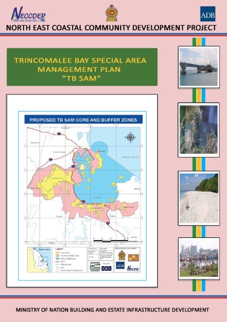
Ministry of Nation Building and Estate Infrastructure Development<br />
EASTERN PROVINCE INTEGRATED COASTAL<br />
RESOURCES MANAGEMENT PLAN<br />
TRINCOMALEE BAY SPECIAL AREA MANAGEMENT PLAN<br />
“TB SAM"<br />
25 JANUARY 2010<br />
North East Coastal Community Development Project
EASTERN PROVINCE INTEGRATED COASTAL<br />
RESOURCES MANAGEMENT PLAN<br />
TRINCOMALEE BAY SPECIAL AREA MANAGEMENT PLAN<br />
“TB SAM"<br />
PREPARED FOR<br />
NECCDEP<br />
ANZDEC LIMITED<br />
IN ASSOCIATION WITH<br />
Resource Development Consultants<br />
25 January 2010
Citation:<br />
This document may be cited as:<br />
NECCDEP (2010). Trin<strong>com</strong>alee Bay Special Area Management Plan "TB SAM". Final. Pp.<br />
102. January 2010. Eastern Province Integrated Coastal Resources Management Plan (EP<br />
ICRMP) 2010-2013. The Green Blue Sunrise Plan. Anzdec Ltd., Resource Development<br />
Consultants. ADB LOAN 2027 SRI (SF): North East Coastal Community Development<br />
Project (NECCDEP).<br />
Note to the Pictures in the cover page:<br />
Top to Bottom:<br />
1. Kinniya bridge, prominent land mark in the TB SAM (The longest bridge in the country)<br />
2. Aerial view of Trin<strong>com</strong>alee bay (source: Google earth, 2009)<br />
3. Coral rubble along the shore of Pigeon Island<br />
4. Cod bay multi-day fishing boats in Cod bay (Trin<strong>com</strong>alee bay)<br />
Page Cover Concept:<br />
Page Cover Design:<br />
A. Rajaratnam, Deputy Project Director, NECCDEP<br />
N.Gobyrajh – Data Entry Operator, NECCDEP<br />
Published by: North East Coastal Community Development Project.<br />
Funded by ADB, GoSL & GoN<br />
This document is available electronically from NECCDEP at www.neccdep.<strong>com</strong>.<br />
Please do not print unnecessarily and use paper and ink responsibly.
COASTAL RESOURCES PLANNING UNIT (CRPU) MEMBERS<br />
Name<br />
Dr. Steven Creech<br />
Dr. A.R. Dawson<br />
Shepherd<br />
Dr. Selvaratnam Kandiah<br />
Designation<br />
Team Leader (From November<br />
2007 to December 2008)<br />
Team Leader (From 24 th<br />
February to November 2009)<br />
Deputy Team Leader - Resource<br />
Planner<br />
Consultants<br />
Dr.Sunil Liyanage<br />
Mr T Mathiventhan<br />
Mr. B. Umashanthan<br />
Mr. A.M.A. Lebbe<br />
Senior Resource Planner<br />
(National)<br />
Environment /Resource Specialist<br />
(National)<br />
Database & GIS Specialist<br />
Legal Advisor<br />
Administrative and Logistic Support<br />
Mrs. R. Chandrakala<br />
Mr. K. Vijayananthan<br />
Miss. G. Nilukshi Nadeeka<br />
Mr. C.J. Rathnakumar<br />
Mr. M. Enoke<br />
Office Manager<br />
Planner<br />
Data Management Assistant<br />
Driver<br />
Office Assistant<br />
NECCDEP MEMBERS NAMES<br />
Name<br />
S.M. Croos<br />
Designation<br />
Project Director<br />
A. Rajaratnam Deputy Project Director<br />
District Coordinators<br />
Mr. N.Arunanthi<br />
Mr. M.Thileeban<br />
Ms. Manoranjani<br />
Mr. J. Gnanenthiran<br />
Natural Resource Planner<br />
Natural Resource Planner<br />
Natural Resource Planner<br />
Management Assistant
FOREWORD<br />
This Trin<strong>com</strong>alee Bay Special Area Management Plan (TB SAM) is a significant deliverable<br />
from Component two of the North East Coastal Community Development Project (NECCDEP<br />
TA No.2027- SRI). The NECCDEP is funded by the Asian Development Bank, under the<br />
guidance of the Ministry of Nation Building and Estate Infrastructure Development.<br />
The Government of Sri Lanka recognizes the significant links between natural resources and<br />
social and economic development. The benefits to economy and society from the goods and<br />
services provided by natural resources are substantial and include agriculture, fisheries,<br />
forestry, recreation and culture. All these natural assets and the social and economic benefits<br />
that are derived from them are at risk from overexploitation and the projected negative<br />
impacts from climate change.<br />
The Plan provides a roadmap to respond to these risks and reflects the guidelines provided<br />
by the Coast Conservation Department in the National Coastal Zone Management Plan of<br />
2006.<br />
Technical support for delivery of the 3 SAM Plans, including this TB SAM Plan under<br />
Component 2, “Resource Management in 3 Special Management Areas” involved 20 months<br />
of national consulting together with ad hoc international consultant support.<br />
The delivery of this product was co-ordinated by the NECCDEP and used the products of a<br />
number of NECCDEP activities such as the Divisional level “Coastal Resource Profiles” and<br />
“Special Studies”.<br />
During the course of the assignment the consultant team worked closely with the public<br />
sector at national, Provincial, District and DSD level as well as with civil society stakeholders.<br />
The Plan was subject to review by the general public, District level Special Area<br />
Management Community Consultative Committees and Provincial and National Interagency<br />
Planning Groups.<br />
The Trin<strong>com</strong>alee Bay Special Area Management Plan (TB SAM) has been designed using<br />
the logical framework approach.<br />
TB SAM Plan contains an overall objective, a purpose, 5 thematic results, a number of<br />
activities designed to support these results together with organizational arrangements for<br />
collaborating institutions and civil society players. The projected budget is Rs 57 million.<br />
It is the hope of the NECCDEP that this Plan will <strong>com</strong>plement and integrate with the next<br />
National Coastal Zone Management Plan being prepared by the Coast Conservation<br />
Department.<br />
Finally may I take this opportunity to thank the Secretary, and the Senior Advisor of the<br />
Ministry of Nation Building and Estate Infrastructure Development, Chief Secretary,<br />
Secretary to the Honorable Chief Minister and other officials of the Eastern Provincial<br />
Council, Security Forces, and all those who have shared their knowledge and experience to<br />
make the formulation of this Plan a success. I am grateful to the consultants and to the<br />
NECCDEP staff of Trin<strong>com</strong>alee, Batticaloa and Ampara for their <strong>com</strong>mitment and dedication<br />
to the production of this TB SAM Plan.<br />
S. M. Croos<br />
Project Director, NECCDEP<br />
15 th January 2010
PREAMBLE<br />
The Trin<strong>com</strong>alee Bay Special Area Management Plan (TB SAM) has been produced by a<br />
team of consultants at a time when our Province is gradually recovering from difficult times.<br />
At this juncture, I cannot help but think, with nostalgia, of the past when teeming tourists<br />
thronged the lovely beaches and other places of natural and cultural importance in the<br />
Eastern Province.<br />
This document is especially significant at a time when the Eastern Provincial Council has the<br />
full backing of the central government and the support of international agencies in its<br />
relentless pursuit of economic recovery and growth. In these respects I cannot over stress<br />
the important contribution that the natural environment has to make to this recovery and<br />
growth. This Plan provides a roadmap for this contribution to be delivered.<br />
I would like to thank the Asian Development Bank for funding the development of the Plan<br />
and NECCDEP, under the Ministry of Nation Building and Estate Infrastructure Development,<br />
for managing and facilitating the development of this Plan. I would also like to take this<br />
opportunity to thank the Project Director and the consultants <strong>com</strong>prising of national and<br />
international planners for their hard and dedicated work.<br />
V.P. Balasingham<br />
Chief Secretary<br />
Eastern Province<br />
15 th January 2010
PREFACE<br />
"Reawakening East" is one of the major initiatives of Mahinda Chintana. The North East<br />
Coastal Community Development Programme (NECCDEP) was launched by the Ministry of<br />
Nation Building and Estate Infrastructure Development in 2004 to contribute to this<br />
reawakening.<br />
Trin<strong>com</strong>alee Bay Special Area Management Plan (TB SAM) has been prepared by a team of<br />
consultants under Component 2, “Resource Management in 3 Special Management Areas”<br />
of NECCDEP.<br />
Agriculture, fisheries, forestry and tourism all contribute positively to national and provincial<br />
economic and social development by providing food and fuel, generating foreign exchange<br />
and providing direct and indirect employment. To a great extent these benefits derive from<br />
the environmental goods and services provided by renewable natural resources. These<br />
resources need to be managed to ensure that they continue to provide these goods and<br />
services to current and future generations. Overexploitation and the projected negative<br />
impacts from climate change are challenges to this management. I believe that this Plan will<br />
help build capacity to meet these challenges.<br />
The Eastern Provincial Council has a concurrent role with that of the central Government to<br />
regulate and promote the environment in the Eastern Province so that it continues to provide<br />
benefits to present and future generations. MNB & EID <strong>com</strong>mends the Eastern Provincial<br />
Council for supporting the development of this Plan and looks forward to facilitating its<br />
implementation under the concurrent list.<br />
On behalf of the Ministry of Nation Building and Estate Infrastructure Development, I wish to<br />
convey my sincere appreciation to the Asian Development Bank for providing funds, the<br />
Project Director of NECCDEP and his team, the Consultants and all those who have<br />
contributed in many ways to successfully preparing this Plan.<br />
W.K.K. Kumarasiri<br />
Secretary<br />
Ministry of Nation Building and Estate Infrastructure Development<br />
15 th January 2010
MESSAGE<br />
I am very pleased to note my appreciation of the hard work undertaken by NECCDEP in<br />
producing the Trin<strong>com</strong>alee Bay Special Area Management Plan (TB SAM)<br />
This Plan provides a good example of how to manage the environment under the concurrent<br />
list of the 13 th Amendment in that it “thinks globally but acts locally”. The Plan also reflects<br />
international good practice in terms of the principles of the “Ecosystem Approach”, of the<br />
International Convention on Biodiversity to which Sri Lanka is a signatory.<br />
The Plan addresses SAM level environmental issues but also responds to national and<br />
international concerns such as climate change. In these respects it <strong>com</strong>plements and<br />
supports the CCD requirement, under the Coast Conservation Act, to deliver a national<br />
coastal zone management plan at four yearly intervals.<br />
It is my hope that this Plan will be fully integrated into CCD workplans and the next Sri Lanka<br />
National Coastal Zone Management Plan. Over the last year CCD has assigned officers to<br />
all three of the Districts in Eastern Province and it is my hope and expectation that the Plan<br />
request for significant participation of the CCD will be met.<br />
H.N.R. Perera<br />
Director General<br />
Coast Conservation Department<br />
15 th January 2010
ACKNOWLEDGEMENTS<br />
The Special Area Management (SAM) planning process took place during the period from March 2009<br />
to November 2009. During the planning process, consultations were held with <strong>com</strong>munities, Farmer<br />
Organizations and Fishers Associations in the area. Consultations were also conducted with officers of<br />
State agencies such as Coast Conservation Department (CCD), Department of Agriculture (DA),<br />
Forest Department (FD), Department of Wildlife Conservation (DWLC), Irrigation Department (ID),<br />
Department of Agriculture (DA) and other agencies. The SAM planning team would like to<br />
acknowledge the contribution of the <strong>com</strong>munities and State agencies to the SAM planning process.<br />
Divisional Secretaries and Assistant Divisional Secretaries who attended District SAM Community<br />
Consultative Committee (DSAM CCC) meetings and also meetings at their offices provided invaluable<br />
assistance to the planning process by providing suggestions.<br />
The technical information provided by Deputy Director- Irrigation, Assistant Director-Agriculture,<br />
Kantalai and Muthur were very useful in the planning process. Assistant Director-Department of<br />
Fisheries and Aquatic Resources Development, Fishery Inspectors of Kinniya and Muthur provided<br />
valuable information for the planning process.<br />
Special note is made of the District Secretary of Trin<strong>com</strong>alee who provided guidance to the SAM<br />
planning process and facilitated the consultation process with Community Coordinating Committee<br />
(CCC). The leadership shown by the District Secretary contributed significantly to the SAM planning<br />
process. Appreciation is also extended to the contribution of members of the District SAM CCC.<br />
The contributions of the Director General and Director of CCD are very much appreciated. The<br />
planning guidance and direction provided by the CCD was essential to ensuring vertical integration of<br />
the SAM planning process with the CCD guidelines.<br />
Particular acknowledgement is made of the overall guidance provided by NECCDEP Project Director<br />
(PD) Mr. S.M. Croos and the detailed assistance provided by the Deputy Project Director (DPD), Mr.<br />
A. Rajaratnam. The DPD read drafts, provided valuable suggestions concerning content and helped<br />
organize the local assistance of the NECCDEP district level office in Trin<strong>com</strong>alee.<br />
The services of the other NECCDEP staff and in particular the Natural Resource Planner (NRP) of<br />
Trin<strong>com</strong>alee District are highly appreciated. The NRP has coordinated the field work, meetings and<br />
consultation with individuals in an effective manner. The NRP has also organized and facilitated the<br />
IP-NGO meeting at Trin<strong>com</strong>alee.<br />
The contribution of NECCDEP Coastal Resources Planning Group (CRPU) staff was essential to the<br />
successful development of this SAM Plan. The Team Leader Dr. Alec Dawson Shepherd provided<br />
overall guidance and advice to <strong>com</strong>plete the task and our special appreciation is extended to him. The<br />
contributions of Deputy Team Leader Dr. S. Kandiah, Mr. Umashanthan, Mr. Vijayananthan<br />
Kanasundaram, Ms. Nilukshi Nadeeka, and all other staff members to the SAM planning process are<br />
also gratefully acknowledged. Our special thanks go to our able driver Mr. Sathyan who provided very<br />
effective transport facilities and sometimes also provided translations during the field programs.<br />
Finally our appreciation is extended to ANZDEC LIMITED and Resource Development Consultants<br />
who provided this valuable opportunity to do this important work.<br />
Dr. Sunil Liyanage – Senior Consultant – Natural Resources<br />
Management Planning.<br />
Mr. T. Mathiventhan– Planner – Coastal Resources<br />
Management.
Abbreviations<br />
AD<br />
AD<br />
ADB<br />
AD – DFAD<br />
ADP<br />
AHAM<br />
BC<br />
BOD<br />
BZ<br />
o C<br />
CBO<br />
CCC<br />
CCD<br />
CD<br />
CEA<br />
COD<br />
CRM<br />
CRMP<br />
CRPU<br />
CZ<br />
CZMP<br />
DA<br />
DCC<br />
DD-A<br />
DFAD<br />
DPD<br />
DPPD<br />
DPS<br />
DS<br />
DSAM CCC<br />
DSC<br />
DSD<br />
DSO<br />
DWLC<br />
EIA<br />
ENSO<br />
EP<br />
EP ICRMP<br />
EPL<br />
FA<br />
FD<br />
Agriculture Department<br />
Assistant Director<br />
Asian Development Bank<br />
Assistant Director Department of Fisheries and Aquatic Resources Development<br />
Assistant Director of Planning<br />
AHAM<br />
Before Christ<br />
Biological Oxygen Demand<br />
Buffer Zone<br />
Degrees Centigrade<br />
Community Based Organization<br />
Community Coordinating Committee<br />
Coast Conservation Department<br />
Cooperative Department<br />
Central Environmental Authority<br />
Chemical Oxygen Demand<br />
Coastal Resources Management<br />
Coastal Resource Management Plan<br />
Coastal Resources Planning Unit<br />
Core zone<br />
Coastal Zone Management Plan<br />
Department of Agriculture<br />
Divisional Coordinating Committee<br />
Deputy Director, Agriculture<br />
Department of Fisheries and Aquatic Resources Development<br />
Deputy Project Director<br />
District Project Planning Division<br />
District Planning Secretariat<br />
Divisional Secretary<br />
District Special Area Management Community Coordinating Committee<br />
Department of Statistics and Census<br />
Divisional Secretary Division<br />
District Statistic Office<br />
Department of Wildlife Conservation<br />
Environmental Impact Assessment<br />
El Nino Southern Oscillation<br />
Eastern Province<br />
Eastern Province Integrated Coastal Zone Management Plan<br />
Environmental Protection License<br />
Fishers Association<br />
Forest Department
FF<br />
FGD<br />
FO<br />
GA<br />
GDP<br />
GND<br />
ha<br />
HFL<br />
HH<br />
ID<br />
IDP<br />
IE<br />
IEE<br />
IP<br />
IP NGO<br />
IUCN<br />
IWC<br />
Kg<br />
Km<br />
KV<br />
L<br />
LFA<br />
m<br />
MC<br />
MFAR<br />
Mg/l -1<br />
MHWL<br />
MLWL<br />
mm<br />
Mn<br />
MNB&EID<br />
MOH<br />
MP<br />
MSL<br />
NAQDA<br />
NARA<br />
NECCDEP<br />
NECDO<br />
NECORD<br />
NEIAP<br />
NERTRA<br />
NGO<br />
No<br />
NRP<br />
Fishers Federation<br />
Focus Group Discussion<br />
Forest Officer<br />
Government Agent<br />
Gross Domestic Product<br />
Grama Niladhari Division<br />
Hectare<br />
High Flood Level<br />
House Hold<br />
Irrigation Department<br />
Internal Displaced Place<br />
Irrigation Engineer<br />
Initial Environmental Examination<br />
Implementing Partner<br />
Implementing Partner NGO<br />
International Union for the Conservation of Nature and Natural Resources<br />
International whaling Commission<br />
Kilogram<br />
Kilometers<br />
Kinniya Vision<br />
Liters<br />
Logical Framework (Log frame) Approach / Analysis<br />
Meters<br />
Municipal Council<br />
Ministry of Fisheries and Aquatic Resources<br />
Milligrams per liter<br />
Mean High Water Line<br />
Mean Low Water Line<br />
Millimeters<br />
Million<br />
Ministry of Nation Building and Estates Infrastructure Development<br />
Ministry of Health<br />
Mangrove Park<br />
Mean Sea Level<br />
National Aquatic Development Authority<br />
National Aquatic Resources Agency<br />
North East Coastal Community Development Project<br />
North East Community Development Organization<br />
North East Community Restoration Development<br />
North East Irrigated Agriculture Project<br />
North East Rehabilitation Training and Research Association<br />
Non Governmental Organization<br />
Number<br />
Natural Resource Planner
% Percent<br />
PD<br />
Project Director<br />
PL<br />
Post Larvea<br />
PPI<br />
Public Private Investment<br />
PPTA<br />
Project preparatory Technical Assistance<br />
ppm<br />
Parts per million<br />
ppt<br />
Parts per thousand<br />
PRA<br />
Participatory Rural Appraisal<br />
PS<br />
Pradeshiya Sabha<br />
PSAMCC Provincial Level SAM Coordinating Committee<br />
Q<br />
Quarter<br />
RDA<br />
Road Development Authority<br />
RDS<br />
Rural Development Society<br />
Ref<br />
Reference in the bibliography<br />
RRP<br />
Report and Re<strong>com</strong>mendations to the President (ADB)<br />
Rs<br />
Rupees<br />
SA<br />
State Agency<br />
SAM<br />
Special Area Management<br />
SD<br />
Survey Department<br />
SEDOT Socio Economic Development Organization of Trin<strong>com</strong>alee<br />
Sim Sri Lanka Sim Sri Lanka<br />
SLF<br />
Sewa Lanka Foundation<br />
SLS<br />
Sri Lanka Standards<br />
SLTDA Sri Lanka Tourism Development Authority<br />
SMA<br />
Special Management Area (synonymous with SAM)<br />
SMART Specific, Measurable, Achievable, Realistic and Time bound<br />
Sq.km<br />
Square kilometer<br />
SRI<br />
Sri Lanka<br />
SSED<br />
Society for Socio Economic Development<br />
STDP-EP Strategic Tourism Development Plan – Eastern Province<br />
SWM<br />
Solid Waste Management<br />
SWOT<br />
Strengths, Weaknesses, Opportunities and Threats<br />
TB<br />
Trin<strong>com</strong>alee Bay<br />
TDDA<br />
Trin<strong>com</strong>alee District Development Association<br />
TEC<br />
Technical Evaluation Committee<br />
TRO<br />
Tamil Rehabilitation Organization<br />
TSP<br />
Triple Super Phosphate<br />
UC<br />
Urban Council<br />
UDA<br />
Urban Development Authority<br />
UNOPS United Nations Office for Project Services<br />
URI<br />
University of Rhode Island<br />
USAID<br />
United States Aid<br />
VDP<br />
Village Development Plan
VSP<br />
WDF<br />
WRDS<br />
Y<br />
Village Social Profile<br />
Women Development Forum<br />
Women Rural Development Society<br />
Year
CONTENTS<br />
Page<br />
EXECUTIVE SUMMARY<br />
i<br />
I. INTRODUCTION 1<br />
A. Conservation of natural resources in Sri Lanka 1<br />
B. Coastal Region 1<br />
C. Economic importance of coastal region 2<br />
D. Coastal Zone Management 4<br />
E. Special Area Management (SAM) Concept 5<br />
F. Trin<strong>com</strong>alee Bay 6<br />
G. North East Coastal Community Development Project (NECCDEP) 7<br />
II. SAM PLANNING PROCESS 10<br />
A. Scope of the planning process 10<br />
B. Standard SAM Planning process of CZMP of CCD 10<br />
III.<br />
PREPARATION OF INTERIM SMA PLAN AND IMPLEMENTATION BY<br />
NECCDEP 13<br />
A. SMA process adopted in NECCDEP 13<br />
B. Scope of Interim SMA Plan 14<br />
C. Interim SMA 14<br />
D. Special Management Area Committee 16<br />
E. Consultation process 16<br />
F. Identification of environmental priority areas and interventions 18<br />
G. Implementation of interim SMA plan 19<br />
H. Work plan 19<br />
IV. ENVIRONMENTAL PROFILE OF TRINCOMALEE BAY 20<br />
A. Introduction 20<br />
B. Physical environment 21<br />
C. Biological environment 25<br />
D. Socio-economic environment 33<br />
V. COMPREHENSIVE SAM PLANNING 43<br />
A. Background 43<br />
B. Scope of the SAM Planning 43<br />
C. Methodology 43<br />
D. Present status of issues/threats in management of SAM Area 50<br />
E. Draft SAM Plan 56<br />
F. DSAM CCC consultation 56<br />
G. Presentation of final draft to CCD 56<br />
H. SWOT analysis 57<br />
I. Planning process 58<br />
J. Comparison of this SAM planning methodology with the CCD guidelines. 58<br />
VI. COMPREHENSIVE SAM PLAN OF TRINCOMALEE BAY (TB SAM) 60<br />
A. Mission of SAM and Overall management Objectives 60<br />
B. Demarcation of the SAM area 60<br />
C. TB SAM Buffer Zone 63<br />
D. Sub-zoning of the TB SAM 64<br />
E. TB SAM core conservation zone sub-zones 65<br />
F. TB SAM buffer zone sub-zones 68
G. Institutional mechanism 72<br />
H. Proposed Key interventions 74<br />
I. Activity Plan 77<br />
J. Cost estimate for SAM Plan 80<br />
K. Lessons to be applied/Future Approach 80<br />
APPENDIXES:<br />
1. List Of Gn Divisions Included In Interim SMA (Ref.0969) 85<br />
2. Members Of SMA Committee Under Interim SMA Plan 87<br />
3. List Of Environmental Issues Identified In The Consultation Process 88<br />
4. Prioritized Environmental Issues In The Stakeholders Consultation Workshop 89<br />
5. Details Of Progress Of Implementation Of Interim SAMP Up To Third Quarter 2009 91<br />
6. List Of Flora And Fauna Observed In Field Studies 94<br />
7. Name List Of IP-NGOs In Consultation Process 96<br />
8. Name List Of Community Participants In Consultation Process 97<br />
9. List Of Individual Government Officers Consulted 98<br />
10. Name List Of Trin<strong>com</strong>alee DSAM CCC 99<br />
11. LFA of TB SAM 102
i<br />
EXECUTIVE SUMMARY<br />
1. In recognition of their ecological, socio-cultural and economic significance, and<br />
because of the existing threats to resources, Trin<strong>com</strong>alee Bay and Thampalagamam Bay<br />
were identified in the 1997 Coastal Zone Management Plan (CZMP) as areas requiring<br />
special management.<br />
2. The Sri Lanka Coastal Zone Management Plan, 2004 (Ref.0903) further developed the<br />
Special Area Management (SAM) concept. The concept of SAM is the collaborative, adaptive<br />
and flexible approach to resource management within a defined geographic area.<br />
3. The North East Coastal Community Development Project (NECCDEP) identified<br />
Trin<strong>com</strong>alee bay (TB) as an important coastal area and initiated the development of a SAM<br />
plan with the concurrence of the Coast Conservation Department (CCD). The North East<br />
Coastal Community Development Project (NECCDEP) developed an interim Special<br />
Management Area (SMA) Plan and implemented several activities in the adjoining areas of<br />
TB focusing on natural resource conservation and sustainable utilization by coastal<br />
<strong>com</strong>munities.<br />
4. NECCDEP took the initiative to develop a <strong>com</strong>prehensive SAM Plan for TB in March<br />
2009. The interim SMA Plan developed by NECCDEP was used as the base document in the<br />
planning process and additional information was collected where necessary. The SAM<br />
terminology was adopted to <strong>com</strong>ply with the CCD requirements specified in the 2004 CZMP.<br />
5. The key focus of the planning process was conservation of natural resources and<br />
sustainable utilization of those resources to maximize the benefits to stakeholders,<br />
particularly local <strong>com</strong>munity stakeholders.<br />
6. Negative issues related to the sustainable use of the TB and potential interventions to<br />
address these issues were identified through a consultation process with <strong>com</strong>munities, line<br />
agencies, District SAM Community Coordinating Committee (DSAM CCC), Non-<br />
Governmental Organisations (NGOs) and resource user groups. Necessary field trips were<br />
also conducted for further data collection and verification purposes.<br />
7. TB is a prominent feature of the geography of Sri Lanka due to a large deep water<br />
bay, which functioned as a natural harbour for thousands of years before be<strong>com</strong>ing a<br />
<strong>com</strong>mercial harbour about 200 years ago. TB is a large basin estuarine ecosystem rather<br />
than a single water body and consists of the large central estuary of Koddiyar bay and<br />
associated smaller bays, Inner harbour bay, China bay, Thampalagamam bay, Shell bay and<br />
Dutch bay.<br />
8. A 1-2 km band extends from the shore in the southern and eastern sections of<br />
Trin<strong>com</strong>alee bay. The water in this band is generally shallow with 10-12 m depth. The<br />
seabed then descends sharply to depths of 400-800 m in the core area of the Bay. The Bay<br />
mouth towards the northern harbour area is about 55-68 m deep.<br />
9. Due to the depth, these areas are not suitable for the growth of coastal vegetation<br />
such as mangroves and associates. However, the western section of Thampalagamam bay<br />
is generally shallow (1-2 m in depth) and provides suitable habitat for mangrove vegetation<br />
and mudflats. Prominent mangrove vegetation occurs along the southern and south-western<br />
sections of Thampalagamam bay.<br />
10. The mission of the TB SAM Plan is the “Sustainable management of the TB SAM<br />
area so as to bring environmental, social and economic benefits to local <strong>com</strong>munities whilst<br />
ensuring the conservation of natural resources”.
ii<br />
11. The over all objective of the TB SAM Plan is “TB SAM is co-managed with the active<br />
involvement of the main stakeholder <strong>com</strong>munities so as to deliver sustainable livelihoods<br />
within the carrying capacity of SAM natural resources”.<br />
12. The conservation of natural resources of the TB through implementation of the TB<br />
SAM Plan is scheduled to take an initial 4 years. The following results are expected to be<br />
achieved by the end of this four year period:<br />
- Sustainable fishery management to bring the benefits to fisher <strong>com</strong>munities<br />
and other stakeholders;<br />
- Ecologically /socially friendly livelihoods and Micro/ Small Enterprise<br />
developments in the TB SAM buffer zone to bring benefits to all stakeholders;<br />
- Ecologically friendly agricultural practices delivered in the buffer zone to bring<br />
benefits to farming <strong>com</strong>munities and other stakeholders and to minimise<br />
negative impacts on the SAM;<br />
- Improved micro environment in TB SAM through proper solid waste<br />
management, natural habitat improvement and other interventions to bring<br />
benefits to local people;<br />
- Conservation of natural resources of the conservation core zone of TB SAM<br />
including the islands in the bay;<br />
- Conservation of natural habitats in the areas under security forces<br />
management in and around Trin<strong>com</strong>alee bay based on guidelines developed<br />
by DSAM CCC and security forces.<br />
- Conservation of natural resources in the buffer zone of TB SAM.<br />
13. The proposed TB SAM includes the coastal zone from Dutch Fort at Trin<strong>com</strong>alee City<br />
to the southern end of Kaddaiparichchan lagoon mouth including the whole of<br />
Kaddaiparichchan lagoon. A continuous coastal belt is proposed for the SAM multiple use<br />
conservation core zone that does not include any private properties.<br />
14. The activities proposed for the TB SAM core conservation zone are as follows:<br />
- Boundary demarcation, preparation of maps and erection of information<br />
boards;<br />
- Establishment of Mangrove Park at Mahaweli River estuary;<br />
- Habitat restoration programs between Kinniya ferry point to Muthur ferry point;<br />
- Habitat restoration program in Kaddaiparichchan lagoon;<br />
- Control of Illegal extraction of timber and fuel woods from coastal habitats;<br />
- Develop management guidelines and activity plan for the core conservation<br />
sub zone under security forces management with the participation of security<br />
forces and facilitate the implementation of the activity plan;<br />
- Manage the aquaculture projects and fisheries in the TB area on sustainable<br />
resource use guidelines developed by National Aquatic Development Agency
iii<br />
(NAQDA), National Aquatic Research Agency (NARA), Coast Conservation<br />
Department (CCD) and set guidelines of District Special Area Management<br />
Community Coordinating Committee (DSAM CCC);<br />
- Manage sustainable tourism in the TB area under the guidelines of Sri Lanka<br />
Tourism Development Authority, CCD and DSAM CCC;<br />
- Conservation of natural resources through effective law enforcement and<br />
participatory management;<br />
- Develop operational guidelines for shell mining and grinding industry;<br />
- Aquaculture based micro enterprises in Thampalagamam bay;<br />
- Sea erosion control;<br />
15. It is also propose to implement following activities in the designated buffer zone to<br />
mitigate transboundary impacts to the TB core zone:<br />
a. Promote organic farming in home gardens;<br />
b. Alternative livelihood development;<br />
c. Conduct awareness program for farmers to minimize use of agrochemicals<br />
and chemical fertilizers;<br />
d. Establish and manage <strong>com</strong>munity wood lots by Divisional Secretary with the<br />
assistance of the FD as alternative source of poles and fuel wood;<br />
e. Conduct awareness programs for school children on the TB SAM plan and the<br />
responsibilities of stakeholders;<br />
f. Implement solid waste management program in urban areas;<br />
g. Conduct alternative livelihood development programs;<br />
h. Develop management guidelines for micro saltern;<br />
16. The estimated cost for implementation of the initial four year SAM Plan is Rs. 57.0<br />
million. It is proposed that the CCD with the assistance of DSAM CCC and line agencies will<br />
implement the TB SAM Plan.
TRINCOMALEE BAY SPECIAL MANAGEMENT AREA Page | 1<br />
I. INTRODUCTION<br />
A. Conservation of natural resources in Sri Lanka<br />
1. Sri Lanka has a diverse and rich natural environment within its 65600 km 2 land area<br />
and also in its exclusive economic zone. This rich environment has been used harmoniously<br />
by people for many centuries. However, population growth and rapid development have<br />
upset this harmonious balance during the last few decades. State natural resources<br />
management agencies have taken timely action to identify important natural sites rich in<br />
biodiversity and environmentally sensitive areas and declared them as conservation /<br />
protected areas as a means of redressing the resulting imbalance.<br />
2. Forest Department (FD) has identified a number of natural forests as environmentally<br />
sensitive areas important for biodiversity conservation, watershed management, education,<br />
recreation and culture. Some of these forests have been declared as World heritage forests,<br />
Man and Biosphere reserves and Conservation forests.<br />
3. The Department of Wildlife Conservation (DWLC) has also identified and protected<br />
important faunal habitats such as forests, wetlands and other ecosystems. Some of these<br />
protected areas have been declared as Ramsar sites under the Ramsar Convention on<br />
wetlands of international importance.<br />
4. It is well documented that the coastal zone of Sri Lanka contains diverse habitats with<br />
a high diversity of fauna and flora. The coral reefs of Unawatuna, Hikkaduwa and Bar Reef<br />
are particularly diverse. The increasing threats to coastal habitats with industrialization,<br />
urbanization and tourism related development, have been identified by the relevant state<br />
agencies, particularly the Coast Conservation Department (CCD) (Ref.0906) .<br />
5. CCD is mandated by the Coast Conservation Act to identify important coastal areas<br />
along the 1760 km long shoreline/coastal belt of Sri Lanka (including shoreline of bays and<br />
inlets but excluding lagoons), to determine their conservation status and needs and to<br />
provide management to address these needs in the form of a four yearly coastal zone<br />
management plan.<br />
6. A key element of management relates to <strong>com</strong>munity participation since <strong>com</strong>munity<br />
livelihoods and <strong>com</strong>mercial interests need to be balanced to deliver sustainable use.<br />
B. Coastal Region<br />
7. Historically, infrastructure, urbanization and industrialization were concentrated in the<br />
coastal region because of ease of access to natural resources and markets. This coastal<br />
focus was re-enforced during the colonial times. The coastal belt occupies approximately 24<br />
percent of the country's land area, and ac<strong>com</strong>modates about one-third of its population<br />
(Ref.1648).<br />
The coastal region has a rich variety of landscapes including headlands, bays,<br />
lagoons, peninsulas, sand bars, and islets and a wide range of habitats with high biodiversity<br />
including coastal wetlands (about 120,000 ha), lagoons and estuaries (about 42,000 ha),<br />
mangroves (10,000 ha), salt marshes, sea grass beds, coral reefs, and coastal sand dunes<br />
(Ref.1647).<br />
8. Forty percent of the national gross domestic product is derived from the activities<br />
performed in the coastal zone. Industry is a significant contributor to the national economy.<br />
Most of the industry in Sri Lanka is located in the coastal zone. The proximity of industry, that<br />
can create pollution, to coastal habitats that are sensitive to pollution and that sustain<br />
livelihoods, creates environmental risk. Pollution from inward human migration, increased
TRINCOMALEE BAY SPECIAL MANAGEMENT AREA Page | 2<br />
population and urbanization in the coastal zone adds to this risk. The infrastructure<br />
necessary to avoid, minimize or mitigate these risks, so as to avoid negative impacts, is<br />
expensive and available resources are limited.<br />
9. Coastal fisheries also make a significant contribution to the national economy.<br />
Coastal habitats and their valuable physical and biological resources have increasingly <strong>com</strong>e<br />
under pressure as human activities have be<strong>com</strong>e more intense, and this has inevitably led to<br />
conflicts among resource users and threatened the livelihoods of all who depend on those<br />
resources. With these developments, there is the risk of exploiting coastal resources beyond<br />
sustainable limits (Ref. 1647, 1648) .<br />
10. The devastating tsunami of 26 th December 2004 created havoc particularly in the<br />
coastal regions of eastern and southern Sri Lanka. More than 35,000 inhabitants died whilst<br />
over 443,000 were displaced. The loss and damage to property was over 2 billion US $ (ADB<br />
feature on 8 December 2008). The destruction of infrastructure such as buildings and roads<br />
created a huge volume of building waste which was dumped along the coastline creating<br />
many secondary environmental issues. Large numbers of reconstruction projects were able<br />
to bring back and, indeed, upgrade, almost all the infrastructure facilities, thanks to donors<br />
and international <strong>com</strong>munities.<br />
11. The impacts of the tsunami on natural habitats such as mangroves, coral reefs, sea<br />
grass beds, and sand dunes were also locally significant. A number of restoration projects<br />
have been implemented to rehabilitate these natural systems.<br />
C. Economic importance of coastal region<br />
12. The coastal zone is a very important economic and environmental asset for the island<br />
nation of Sri Lanka. Five out of nine provinces of the country, the Western Province, the<br />
North-Western Province, the Southern Province, the Eastern Province and the Northern<br />
Province include the coastal zone. At present 59 % of the Sri Lankan population lives in<br />
coastal districts with maritime boundaries. Infrastructure facilities, employment opportunities,<br />
service facilities are required by this population and proper planning in the coastal region is<br />
the only way to meet these challenges.<br />
The 2007 study by Nayanananda (Ref.0907) of the economic significance of the coastal region of<br />
Sri Lanka, in the context of pre and post tsunami environmental changes, revealed valuable<br />
information on the economic importance of the coastal zone. The economic value of the<br />
coastal zone is immense because the coastal zone is rich in natural resources. The total<br />
national GDP value in 2006 was Rs. 980,720 million. Of this value, Rs. 426,998 million was<br />
contributed from the coastal provinces amounting to 44% of the total. In terms of contribution<br />
of coastal GDP by province, the Western Province contributed the highest which was about<br />
66% whilst the lowest contribution was about 4% from the Northern Province. The Eastern<br />
Province contribution was about 5.5%.<br />
13. Trade, tourism, manufacturing and transport, storage and <strong>com</strong>munication, fisheries<br />
and agriculture are the important economic activities in the coastal zone. Tourism has<br />
emerged as the fourth largest foreign exchange earner in Sri Lanka and coastal tourism is<br />
the major tourism <strong>com</strong>ponent.<br />
14. The information in Table I.1 below shows the contribution of the Eastern Province to<br />
national GDP and national coastal zone GDP. These data show the economic importance of<br />
the eastern coastal zone and highlight the need for proper management of resources to<br />
sustain socio-economic development.
TRINCOMALEE BAY SPECIAL MANAGEMENT AREA Page | 3<br />
Table I.1: Contribution of economic sectors in Eastern Province to National and<br />
coastal GDP (Sri Lanka rupees, in millions)<br />
Economic sector<br />
Eastern<br />
Provincial<br />
Contribution<br />
GDP<br />
Total<br />
Coastal<br />
GDP<br />
National<br />
GDP<br />
Contribution<br />
of coastal<br />
regions to<br />
National<br />
GDP %<br />
EP coastal<br />
contribution<br />
coastal GDP<br />
%<br />
EP coastal<br />
contributio<br />
n national<br />
GDP %<br />
1.Agriculture,<br />
Forestry, Fishing<br />
9194.2 36262.3 175853.8 20.6 25.4 5.2<br />
1.1 Agriculture 4635.8 13016.0 135964.1 9.6 35.6 3.4<br />
1.1.1. Tea 0.0 41.9 12315.0 0.3 0.0 0.0<br />
1.1.2. Rubber 0.0 81.9 3370.0 2.4 0.0 0.0<br />
1.1.3. Coconuts 51.4 1091.2 12212.9 8.9 4.7 0.4<br />
1.1.4. Paddy 2351.5 4085.0 25151.6 16.2 57.6 9.3<br />
1.1.1.5. Other<br />
2232.9 7715.9 82914.6 9.3 28.9 2.7<br />
agriculture<br />
1.2.Forestry and<br />
827.8 2341.2 17109.5 13.7 35.4 4.8<br />
Firewood<br />
1.3 Fishing 3730.6 20905.1 22780.1 91.8 17.8 16.4<br />
1.3.1.Coastal fishing 3682.4 20826.4 20829.1 100.0 17.7 17.7<br />
1.3.2.Inland fishing 48.2 78.7 1951.0 4.0 61.2 2.5<br />
2. Mining and<br />
473.6 4347.1 16944.9 25.7 10.9 2.8<br />
Quarrying<br />
3. Manufacture 2019.0 83548.9 159721.0 52.3 2.4 1.3<br />
4. Construction 882.6 17189.0 68332.3 25.2 5.1 1.3<br />
5. Elecricity , Gas &<br />
274.8 9937.4 14286.8 69.6 2.8 1.9<br />
Water<br />
6. Transport,<br />
1018.0 63840.9 269316.4 23.7 1.6 0.4<br />
Storage<br />
and<br />
Communication<br />
6.1. Road 848.8 46466.1 106994.0 43.4 1.8 0.8<br />
6.2. Rail 85.5 7516.8 140651.0 5.3 1.1 0.1<br />
6.3. Air 3.0 2771.3 2770.4 100.0 0.1 0.1<br />
6.4. Water 49.1 1552.3 1598.0 97.1 3.2 3.1<br />
6.5. Communication 31.5 5534.3 17303.0 32.0 0.6 0.2<br />
7. Trade & tourism 5538.2 127792.6 219040.3 58.3 4.3 2.5<br />
7.1. Trade 5449.1 122488.8 212410.6 57.7 4.4 2.6<br />
7.2. Tourism 89.1 5303.8 6629.7 80.0 1.7 1.3<br />
8. Banking,<br />
958.6 37148.8 73952.0 50.2 2.6 1.3<br />
Insurance<br />
and Real estate<br />
9. Ownership &<br />
723.4 15043.1 40709.3 37.0 4.8 1.8<br />
Dwelling<br />
10. Public services 1667.6 12432.3 42985.4 28.9 13.4 3.9<br />
10.1.Defence &<br />
1189.5 8872.6 31063.6 28.6 13.4 3.8<br />
Administration<br />
10.2. Health 38.1 880.1 1917.1 45.9 4.3 2.0<br />
10.3. Education 440.0 2679.6 10004.6 26.8 16.4 4.4<br />
11. Private services 557.8 19456.1 26169.1 74.3 2.9 2.1<br />
GDP 23307.7 426998.6 980720.3 43.5 5.5 2.4<br />
(Developed based on the information on National GDP of Central Bank of Sri Lanka)
TRINCOMALEE BAY SPECIAL MANAGEMENT AREA Page | 4<br />
D. Coastal Zone Management<br />
15. The Sri Lanka National Coastal Zone Management plan (CZMP) emphasizes the<br />
need for integrated Coastal Zone Management to conserve, develop, and use in a<br />
sustainable manner, the resources in the coastal region. The CZMP provides an assessment<br />
of the status of the coastal environment identifying the nature and magnitude of the problems<br />
and issues to be addressed in the coastal zone. An outline of the existing plan, policies and<br />
programmes, laws, institutional mechanisms, enforcement and present objectives, policies,<br />
strategies and proposed actions <strong>com</strong>prise the sections of the CZMP.<br />
16. Coastal 2000 1 was an important study in relation to the economic significance of the<br />
coastal region of the country. The study was conducted by CCD with the assistance of<br />
University of Rhode Island (URI) and with the support of United States Aid (USAID). The<br />
study was designed to respond to the coastal peoples’ need to sustain and improve their<br />
quality of life in tangible terms. Coastal 2000 <strong>com</strong>prised the following elements:-<br />
1. Collaborative coastal management simultaneously at the national,<br />
provincial, district and local levels to achieve effective and participatory<br />
resource management by governmental and non-governmental<br />
agencies,<br />
2. Monitoring of the condition and use of coastal environmental systems<br />
and the out<strong>com</strong>es of selected development and resource management<br />
projects through collaboration of the Coast Conservation Department<br />
(CCD), National Aquatic Resources Development Agency (NARA),<br />
Central Environmental Authority (CEA), Irrigation Department (ID),<br />
Ministry of Fisheries and Aquatic Resources (MFAR) and other<br />
agencies.<br />
3. A research programme of direct relevance to Coastal Resources<br />
Management (CRM) through NARA, national universities and other<br />
institutions which will provide a better understanding of ecological<br />
processes and social and cultural issues as well as provide information<br />
of critical importance to the formulation and implementation of coastal<br />
resources management plans.<br />
4. Strengthening of institutional and human capacity to manage coastal<br />
ecosystems.<br />
5. Updating and extending the scope of the master plan for coastal erosion<br />
management.<br />
6. Creating awareness, both by national and provincial government<br />
personnel and NGOs, of the strategies for coastal resources<br />
management and the issues they address.<br />
17. Generally the coastal zone represents an area of transition where the terrestrial and<br />
marine environment interacts to form a unique ecosystem. Hence the coastal zone covers<br />
landwards areas, inshore waters, inter-tidal areas, estuaries, lagoons and seaward areas.<br />
Since it is necessary to have an administrative and legal demarcation, the Coast<br />
Conservation Act provided the following definition of the coastal zone. The CCD is mandated<br />
to manage the environment of the coastal zone as illustrated in Figure I.1 below.<br />
1<br />
A Resources Management Strategy for Sri Lanka’s Coastal Region, conducted by a collaborative effort of the<br />
URI/USAID
TRINCOMALEE BAY SPECIAL MANAGEMENT AREA Page | 5<br />
Coastal zone is the area lying within a 300 m landward of the mean high water line<br />
(MHWL) and a limit of 2 km seaward of the mean low water line (MLWL); in the case of<br />
rivers, streams, lagoon or any other body of water connected to sea either permanently<br />
or periodically, the landward boundary extends to a limit of 2 km measured<br />
perpendicular to the straight baseline drawn between the natural entrance points<br />
thereof and includes waters of such rivers, streams, lagoon or any other body of water<br />
so connected to the sea (CCD, 2004).<br />
18. The human interventions in landward areas, seaward areas, the inter-tidal zone and<br />
coastal water bodies require coastal zone management. Natural occurrences such as coastal<br />
erosion, flooding, and sedimentation also create impacts in the coastal zone. Coastal zone<br />
management requires both vertical and horizontal integration. The vertical integration is<br />
between various government levels from national, provincial to local levels. The horizontal<br />
integration is between various sector activities and coastal <strong>com</strong>munities.<br />
E. Special Area Management (SAM) Concept<br />
19. The 2008 review of coastal zone laws and implementation experience in Sri Lanka<br />
(Ref. 0945).<br />
provides a useful background to coastal zone management in Sri Lanka<br />
20. Sri Lanka established a Coast Conservation Department (CCD) within the Ministry of<br />
Fisheries in 1978. Coastal zone management in Sri Lanka was formalized by the Coast<br />
Conservation Act of 09th September 1981 (Ref.0913) as amended on 17th December<br />
1988 (Ref.0914) and on 28th July 1992 (Ref.0944). The Act required the preparation of a Coastal<br />
Zone Management Plan (CZMP) as defined and subsequent CZMP revision for consideration<br />
at four yearly intervals.
TRINCOMALEE BAY SPECIAL MANAGEMENT AREA Page | 6<br />
21. The first Sri Lanka CZMP Plan was produced in 1990 some 9 years after the 1981 Act<br />
came into force. It included the concept of Special Area Management (SAM).<br />
22. The second Sri Lanka CZMP Plan was approved on 10th September 1997 and<br />
included SAM plans for Rekawa and Hikkaduwa (Ref.0945). The Plan identified 21 more sites as<br />
important coastal sites based on a set of criteria which included: (a) severity of resource<br />
management issues, (b) biodiversity, (c) viability of SAM concept at the site and (d) economic<br />
significance. The Plan also addressed issues of permits, prohibited activities, setback,<br />
exemptions and variations, monitoring of <strong>com</strong>pliance, Environmental Impact Assessment<br />
(EIA) and Initial Environmental Examinations (IEE).<br />
23. The third Sri Lanka CZMP was <strong>com</strong>pleted before the tsunami on 26th December<br />
2004. The CZMP was revised following the tsunami and was published in the Gazette on the<br />
24th January 2006 and became operational from that date (Ref.0903).<br />
24. SAM sites are categorised at 2 levels. SAM level-1 sites have larger geographical<br />
areas with multiple resource use conflicts and SAM level-2 sites have a smaller geographical<br />
area with fewer resource user conflicts. In this categorization process, Trin<strong>com</strong>alee Bay was<br />
identified as a potential SAM Level-1 site.<br />
25. Special Area Management (SAM) is an innovative approach where local <strong>com</strong>munities<br />
play a significant role in planning and management. The concept of SAM is the collaborative,<br />
adaptive and flexible approach to resource management within a defined geographic area.<br />
The SAM concept, introduced to Sri Lanka in 1980, is now an integral <strong>com</strong>ponent of national<br />
coastal zone management policy.<br />
SAM Planning is a locally-based, geographically-specific planning process that, in theory, is a<br />
highly participatory practice that allows for the <strong>com</strong>prehensive management of natural resources<br />
with the active involvement of the local <strong>com</strong>munity as the main stakeholder group. It involves <strong>com</strong>anagement<br />
of resources where local <strong>com</strong>munity groups are considered the custodians of the<br />
resources being managed under the SAM process through which sustainable livelihood practices<br />
allow for sustainable natural resources use and management within the designated area.<br />
(CZMP, 2004, Gazette, 2006)<br />
F. Trin<strong>com</strong>alee Bay<br />
26. Trin<strong>com</strong>alee bay is a prominent landscape in the geography of Sri Lanka due to an<br />
extensive deep water bay, which functioned as natural harbour for thousands of years before<br />
be<strong>com</strong>ing a <strong>com</strong>mercial harbour about 200 years back. Trin<strong>com</strong>alee bay is a large basin<br />
estuarine ecosystem rather than a single water body and consists of the large central estuary<br />
of Koddiyar bay that is contiguous with smaller bays including Inner harbour bay with China<br />
bay and Thampalagamam bay, Shell bay, and Dutch bay.<br />
27. A 1-2 km stretch from the shoreline towards sea in the southern and eastern sections<br />
of the bay is generally shallow with 10-12 m depth and then sharply deepens to a depth of<br />
400-800 m in the core area of the bay. The bay mouth towards the northern harbour area is<br />
about 55-68 m deep. Due to the depth, these areas are not suitable for the growth of coastal<br />
vegetation such as mangroves and associates. However the western section of<br />
Thampalagamam bay is generally shallow (1-2 m in depth) and provide suitable habitats for<br />
mangrove vegetation and mudflats. Prominent mangrove vegetation could be identified along<br />
the southern and south-western sections of Thampalagamam bay.
TRINCOMALEE BAY SPECIAL MANAGEMENT AREA Page | 7<br />
28. The impact of the 2004 Tsunami on the Trin<strong>com</strong>alee bay ecosystem is described in<br />
the box below.<br />
Impact of the 2004 tsunami on Trin<strong>com</strong>alee Bay ecosystem<br />
The Tsunami on 26 th December 2004, affected the whole eastern coastal zone and some parts<br />
of the coastal belt of Trin<strong>com</strong>alee District such as Kinniya and Muthur were severely affected.<br />
The strong currents brought large amounts of sands and debris into the bay disturbing the bay<br />
ecosystem. A study carried out by O.K. Nayanananda (2007) (Ref.0907) revealed that tsunami<br />
waves hit the land surface in varying proportions. Details of the inundations and wave lengths<br />
are given below.<br />
G.N.<br />
Division / Village<br />
Max. distance<br />
of inundation (m)<br />
Approximate wave<br />
length (m)<br />
Kinniya 500 2.5<br />
Mancholachenai 1000 2<br />
Dimuthugama 200 1.5<br />
Koddiyar Bay 100 2.5<br />
Mineral sands 150 1.5<br />
Orr’s Hill 750 3 750 3<br />
Samudragama 300 1.5<br />
Muthur 300 8<br />
Kayankerni 2.5<br />
Mankerni 750 10<br />
Uppuveli 800 2.5<br />
Sampatheevu 500<br />
Kuchchaveli 2000 >3<br />
Nilaveli 1000 >5 1000 >5<br />
Kumpurupiddy 500<br />
Jayanagar 1500 4 1500 4<br />
G. North East Coastal Community Development Project (NECCDEP)<br />
29. NECCDEP (Ref.0978) is a Government of Sri Lanka project implemented by Ministry of<br />
Nation Building and Estates Infrastructure Development (MNB&EID). The NECCDEP is<br />
funded by a loan from the ADB to the amount of US $ 20 m whilst The Netherlands<br />
Government contribution is US $ 1.5 m. The Government of Sri Lanka contribution is US $
TRINCOMALEE BAY SPECIAL MANAGEMENT AREA Page | 8<br />
5.6 m. The beneficiary contribution is US $ 1.3 m. The total project cost is US $ 28.4 m (RRP<br />
SRI 31287).<br />
30. NECCDEP is scheduled to run from 2004 to 2010. NECCDEP aims to enhance the<br />
livelihoods of conflict affected coastal <strong>com</strong>munities by providing <strong>com</strong>munity infrastructure<br />
facilities and livelihood opportunities based on the sustainable utilization of natural resources<br />
in the coastal zone.<br />
31. The Goal of the NECCDEP is: “Poverty reduced and basic needs met in coastal<br />
<strong>com</strong>munities in the Eastern Province”.<br />
32. The Purpose of the NECCDEP is: “Sustainable livelihood improvement and sound<br />
management of natural resources in the Eastern Province”.<br />
33. NECCDEP has five <strong>com</strong>ponents designed to deliver this purpose and goal:<br />
34. Component 1: Sustainable livelihood improvements;<br />
35. Component 2: Resources management in 3 special management areas;<br />
36. Component 3: Coastal resources planning;<br />
37. Component 4: Fisheries development;<br />
38. Component 5: Project implementation support;<br />
39. Under the <strong>com</strong>ponent 2, NECCDEP is required to develop SMA Plans for 3 identified<br />
sites, Trin<strong>com</strong>alee bay, Batticaloa lagoon and Southern Ampara biodiversity zone (Figure<br />
I.2). These are environmental sensitive areas with high conservation, social and economic<br />
value particularly in respect of tourism and fisheries. However, these areas are deteriorating<br />
due to unmanaged and unsustainable use.<br />
40. It is expected that, once these SMA (SAM) 2 Plans are developed, NECCDEP will take<br />
proper action to implement the Plans with the concurrence of CCD which is mandated to<br />
ensure effective management of the environment within the coastal zone. It is also expected<br />
that legal status will be accorded to each SAM area by gazette under the Coast Conservation<br />
Act.<br />
2<br />
The term SMA has been modified to Special Area Management to reflect the terminology used in the Sri Lanka<br />
Coastal Zone Management Plan, 2004.
TRINCOMALEE BAY SPECIAL MANAGEMENT AREA Page | 9<br />
(Ref. 0978)<br />
Figure I.2 SMA sites selected by NECCDEP
TRINCOMALEE BAY SPECIAL MANAGEMENT AREA Page | 10<br />
II.<br />
SAM PLANNING PROCESS<br />
A. Scope of the planning process<br />
41. The process was initiated using the earlier terminology of Special Management Area<br />
(SMA) Planning resulting in the production of in interim SMA Plan. The terminology has<br />
subsequently been modified, in consultation with CCD, to reflect the terminology used in the<br />
2004 CZMP of Special Area Management (SAM).<br />
42. The scope of the process is to develop the SAM Plan in line with the CZMP 2004<br />
guidelines given in the CCD gazette notification of 2006. The SAM planning process will<br />
identifies issues which hamper the conservation of natural resources, sustainable utilization<br />
of natural resources and integrated development such as tourism.<br />
43. Through a participatory process of <strong>com</strong>munities and other stakeholders, the SAM<br />
Plan proposes remedial action to over<strong>com</strong>e the said issues. It should also provide a medium<br />
term (4 year) work plan to ensure the conservation of bay system, enhance the socioeconomic<br />
development of coastal <strong>com</strong>munities through sustainable utilization and also<br />
manage development using principles of vertical and horizontal integration. The SAM Plan<br />
also proposes an implementation mechanism and organizational structure to monitor the<br />
implementation process. An approximate cost estimate is also proposed including<br />
re<strong>com</strong>mendations for facilitating the generation of funds to support implementation.<br />
B. Standard SAM Planning process of CZMP of CCD<br />
44. Based on the planning process in pilot areas, Rekawa and Hikkaduwa, CCD has<br />
developed SAM planning guidelines to develop SAM Plans for other sites. These guidelines<br />
have been gazetted in Government Special Gazette Notification 2006. These guidelines are<br />
briefly described below.<br />
1. Selection of a site<br />
45. SAM sites identified by CZMP, 2004 can be selected for management by an<br />
implementing agency that can initiate SAM planning. A site specific plan should be prepared<br />
by the implementing agency for the selected site with active <strong>com</strong>munity participation enabled<br />
by professional facilitator/manager.<br />
2. Preparation of plan<br />
46. To ensure the preparation of standard SAM Plan for all SAM sites, the CCD has<br />
proposed the following process:<br />
a. Identification of issues through <strong>com</strong>munity consultation<br />
47. The Facilitator / Manager of the SAM site is responsible for identification and<br />
prioritizing of site specific issues through stakeholder consultation using an appropriate tool<br />
such as Participatory Rural Appraisal (PRA), Logical framework approach or Strengths,<br />
Weaknesses, Opportunities and Threats (SWOT) analysis. It should be noted that the<br />
identification of the magnitude of issues is not possible at this stage).<br />
b. Establishment of a Community Coordinating Committee<br />
48. A <strong>com</strong>munity Coordinating Committee (CCC) has to be established at the site to<br />
function as the SAM planning and implementation body. The CCC should <strong>com</strong>prise:
TRINCOMALEE BAY SPECIAL MANAGEMENT AREA Page | 11<br />
49. Representatives of all resource user groups of the area;<br />
50. Resource guardians (e.g. NGO, CBO); Resource managers (e.g. Government, semigovernment<br />
and local government authorities);<br />
51. The facilitator / Manager has to ensure that all resource groups and their<br />
representatives are included in the CCC.<br />
c. Prioritization of identified issues and preparation of environmental<br />
profile or situation/Site report<br />
52. The implementing agency will, depending on the magnitude of the issues to be<br />
addressed and the urgency of implementing the Plan, prepare the environmental profile or<br />
situation / site report. This will be done with help of facilitator and CCC.<br />
53. Prioritization of issues identified is a basic requirement for the preparation of an<br />
environmental profile or situation/site report. In addition data gaps have to be filled through<br />
analysis of secondary data and collection of primary data.<br />
54. The data collection can be carried out by the facilitator / manager in collaboration with<br />
the CCC, using data collectors mobilised for the purpose.<br />
d. Preparation of draft SAM Plan<br />
55. The implementing agency should prepare the SAM Plan based on an environmental<br />
profile or situation/site report through a transparent and flexible process with the co-operation<br />
of stakeholders. The SAM Plan should:<br />
1. Clearly identify the objectives of management and policies to be adopted with<br />
action plans;<br />
2. Clearly defined the rights and obligations of stakeholders in the utilization of<br />
resources at the site;<br />
3. Clearly define and specify legal authority and regulations pertaining to the<br />
SAM site following its declaration;<br />
4. Identify and include indicators to monitoring plan implementation;<br />
5. Identify and include indicators to monitor changes desired in the Plan;<br />
6. Have provision for public awareness and education programmes and<br />
<strong>com</strong>munication among stakeholders;<br />
7. Clarify and define the role to be played by the <strong>com</strong>munities in managing the<br />
resources;<br />
8. Explain short, medium and long term interventions enabling the implementing<br />
agency to take up the short term interventions as a priority which can run<br />
parallel to long term planning.<br />
56. The draft SAM Plan should be scrutinised by the CCC and any short<strong>com</strong>ings<br />
corrected before finalization.
TRINCOMALEE BAY SPECIAL MANAGEMENT AREA Page | 12<br />
3. Declaration of Special Area Management Site<br />
57. The final SAM Plan should be submitted to the Coast Conservation Advisory<br />
Committee for approval. It is envisaged that the revised Coast Conservation Act will have<br />
provision to declare the sites specified in the CZMP as Special Area Management sites<br />
clearly defining their boundaries. This will confer legal status to the site and regulations<br />
specified in the SAM Plan.<br />
4. Implementation of selected activities simultaneously with planning<br />
process<br />
58. Small scale selected activities that can bring about tangible benefits to the local<br />
people should <strong>com</strong>mence in parallel with planning to provide impetus for participation in the<br />
SAM process. For example, an action plan prepared to improve management of a small<br />
lagoon fishery in a SAM site will show results within a relatively short period and demonstrate<br />
local benefits through SAM.<br />
5. Monitoring and evaluating of plan implementation<br />
59. Monitoring and evaluating the impacts of the SAM Plan during its implementation<br />
should be carried out using specified indicators identified during SAM Plan preparation.
TRINCOMALEE BAY SPECIAL MANAGEMENT AREA Page | 13<br />
III.<br />
PREPARATION OF INTERIM SMA PLAN AND IMPLEMENTATION BY NECCDEP<br />
A. SMA process adopted in NECCDEP<br />
60. The <strong>com</strong>prehensive SMA planning process (currently the SAM planning process) can<br />
take several years. The CCC needs to be formed, made operational, strengthened and<br />
integrated into the wider stakeholder <strong>com</strong>munity. At least 1-2 years are also needed to<br />
<strong>com</strong>plete the data collection process and to <strong>com</strong>plete necessary studies such as<br />
participatory rural appraisal (PRA), development of resource profiles, water quality studies<br />
and other related studies. The <strong>com</strong>prehensive SAM Plan then needs to be developed in a<br />
consultative way that is gender sensitive and includes isolated and vulnerable stakeholders.<br />
61. In view of the timeframe and the delay in mobilizing the international consultants due<br />
to the poor security situation prevailing at the time, NECCDEP has adopted a parallel two<br />
track process involving the development of a fast-track interim SMA Plan and a slower more<br />
formal <strong>com</strong>prehensive SAM planning process. The development of resource profiles, water<br />
quality studies, tourism development studies follows the slower more formal <strong>com</strong>prehensive<br />
SAM planning process<br />
62. The fast track approach recognizes the precautionary principle “Noting also that<br />
where there is a threat of significant reduction or loss of biological diversity, lack of full<br />
scientific certainty should not be used as a reason for postponing measures to avoid or<br />
minimize such a threat” (Ref. 0121) . Waiting for several years to conserve the environment and<br />
bring benefits to local <strong>com</strong>munities may aggravate the situation by letting the environment<br />
deteriorate still further and losing the support of stakeholders due to lack of action.<br />
63. The NECCDEP “fast track” interim SMA planning approach focused on identifying and<br />
addressing priority issues through a work plan implemented during 2005-2006. The<br />
<strong>com</strong>prehensive slower SAM planning process continued in parallel. The <strong>com</strong>bined process is<br />
briefly listed below:-<br />
1. Review existing study and research reports;<br />
2. Start new studies to fill the gaps in information flow;<br />
3. Undertake a resource inventory and prepare the environmental profile;<br />
4. Identify core environmental issues;<br />
5. Undertake stakeholder workshops;<br />
6. Undertake field visits;<br />
7. Develop work plan 2005-2006;<br />
8. Form the SMA Committee (SMA C);<br />
9. SMA Committee approval of the work plan;<br />
10. Implementation of work plan through IP-NGO and IPs;<br />
11. Monitoring and evaluation;<br />
12. Formation of the District SAM Community Coordinating Committee<br />
(DSAM CCC);
TRINCOMALEE BAY SPECIAL MANAGEMENT AREA Page | 14<br />
13. Preparation of <strong>com</strong>prehensive SAM Plan.<br />
B. Scope of Interim SMA Plan<br />
64. The scope of the interim SMA Plan was to identify important environmental issues<br />
which needed early interventions and that were not dependent on long term studies.<br />
NECCDEP adopted the following criteria in support of the interim “fast track” SMA Planning<br />
approach:<br />
1. Promote effective management of valuable natural resources to ensure<br />
sustainable viability;<br />
2. Rehabilitate damaged natural areas and protects sensitive eco-systems;<br />
3. Stimulate economic development in the coastal <strong>com</strong>munities by<br />
promoting sustainable livelihood opportunities;<br />
4. Increase awareness and inform the public about key environmental<br />
issues;<br />
5. Foster participation of <strong>com</strong>munity members to develop sense of<br />
stewardship and promote sustainability of the resource management<br />
system;<br />
6. Provide equitable access to resources and livelihood opportunities<br />
among marginalized groups and,<br />
7. Establish institutional structures that can have harmonizing effect, and<br />
help to reduce conflict amongst divided groups.<br />
65. NECCDEP developed the interim SMA Plan to address the existing issues keeping<br />
consistency with other operational plans. The work plan to guide the execution of sub-project<br />
activities was identified under the overall SMA process and implementation of the work plan<br />
also stimulated the local agencies, NGOs and <strong>com</strong>munities. This approach built support for<br />
the longer-term <strong>com</strong>prehensive SAM Plan amongst local agencies and <strong>com</strong>munities.<br />
66. Since the interim SMA Plan already identified and implemented priority activities, the<br />
workload of the longer term SAM Plan is lessened because it does not need to address these<br />
urgent priorities so allowing the focus to be on longer-term issues. This process of “fast track”<br />
issues engagement and “quick wins” also built a stronger stakeholder constituency for<br />
supporting the delivery of the more difficult and time consuming <strong>com</strong>prehensive SAM<br />
planning process.<br />
C. Interim SMA<br />
67. NECCDEP selected all Grama Niladhari (GN) divisions which touch the coast or bay<br />
between Pigeon Island in the north to Fowl point in the south as the interim SMA. The list of<br />
GN divisions is given in Appendix 1. The area covered by these GN divisions is about 60km 2<br />
out of 2630.8 km 2 (about 2.2%). A map of the interim SMA is given in Figure III.1 below. The<br />
total number of GN divisions lying in the interim SMA is 69 and these GN divisions belong to<br />
5 Divisional Secretary Divisions. The details are given in Table III.1 below.
TRINCOMALEE BAY SPECIAL MANAGEMENT AREA Page | 15<br />
Figure III.1: Trin<strong>com</strong>alee Bay Interim SMA with GN boundaries
TRINCOMALEE BAY SPECIAL MANAGEMENT AREA Page | 16<br />
Table III.1:<br />
Distribution of GN divisions within the interim SMA area<br />
No.<br />
Divisional Secretary<br />
Division<br />
Total number of<br />
GN Divisions<br />
Number of GN divisions<br />
under interim SAM plan<br />
1 Kuchchaveli 24 3<br />
2 Town & Gravets 42 22<br />
3 Kinniya 31 23<br />
4 Muthur 42 19<br />
5 Thampalagamam 12 2<br />
Total 151 69<br />
(Source: Interim SAM Plan of NECCDEP)<br />
D. Special Management Area Committee<br />
68. As per the RRP, NECCDEP formulated a Special Area Management Committee to<br />
act as the regulatory body for the SMA and undertake the integrated planning and<br />
subsequent management of the SMA at district level. This <strong>com</strong>mittee was established by the<br />
NECCDEP District Project Office under the chairmanship of the Government Agent/ District<br />
Secretary, in 2004. The Committee consisted of representatives of relevant district<br />
departments and statutory boards, local government bodies, IP-NGOs, private sector<br />
organizations and civil society organizations. Every member of the Committee was given a<br />
letter of appointment specifying responsibilities. The Committee provided overall guidelines<br />
and approval of work plans and budgets. The list of individuals forming the SMA Committee<br />
is given in Appendix 2.<br />
69. However this SMA Committee does not meet the criteria for CCC specified in the<br />
CCD SAM guidelines particularly with respect to the level of <strong>com</strong>munity participation. The<br />
Interim SMA Committee was dominated by government agencies. The Committee required<br />
restructuring in the <strong>com</strong>prehensive SAM planning process to include more <strong>com</strong>munity<br />
members, according to the CCD terminology of Community Coordinating Committee (CCC),<br />
although it continues to be chaired by the District Secretary.<br />
E. Consultation process<br />
70. NECCDEP consultations in support of the interim SMA included the District level SMA<br />
Coordinating Committee. NECCDEP also consulted with the IP-NGOs selected to develop<br />
resource profiles for coastal Divisional Secretary Divisions of the District. Indigenous<br />
knowledge and experience of stakeholders and beneficiaries were also obtained through the<br />
consultation process.<br />
71. The planning team reviewed studies conducted by different agencies in the recent<br />
past. These included the 6 PPTA (ADB/EuroConsult et. al.,) studies undertaken in support of<br />
the NECCDEP RRP on the Trin<strong>com</strong>alee bay ecosystem during 2002-2004.<br />
72. GTZ/IFSP also conducted 5 environmental studies in the interim SMA during the<br />
period 2001 to 2004. These studies were related to solid waste disposal issues, ground water<br />
of agro wells and characteristics of coastal sand aquifers. There were a few national studies<br />
carried out after the tsunami in December 2004 which covered the Trin<strong>com</strong>alee interim SMA.<br />
These studies also suggested several interventions in the tsunami affected interim SMA.
TRINCOMALEE BAY SPECIAL MANAGEMENT AREA Page | 17<br />
Re<strong>com</strong>mendations of ADB/Euro Consultant Studies (2002-2004)<br />
a. Support to aquaculture and mariculture development (e.g. oyster culture, crab fattening,<br />
sea weed culture)<br />
b. Establish fuel wood plantations<br />
c. Promote eco-tourism development<br />
d. Develop small scale infrastructure<br />
e. Develop small scale sanitation facilities<br />
f. Develop sanitary solid waste disposal dumps<br />
g. Implement or promote anti-coastal erosion measures<br />
Re<strong>com</strong>mendations of GTZ/IFSP Environmental Studies 2001-2004<br />
a. Change the attitude and behaviour of all sectors of general public contributing to the<br />
generation of solid waste in the SAM area by providing specific awareness programmes<br />
with follow up activities;<br />
b. Improve the efficiency of solid waste collection mechanism of local authorities especially<br />
Trin<strong>com</strong>alee UC, Kinniya and Muthur Pradeshiya Sabahs by providing awareness and<br />
training and required facilities;<br />
c. Introduce the application of integrated solid waste management strategies;<br />
d. Recognise and facilitate the local recycling of glass, metals and paper to enhance the<br />
efficiency of collection network;<br />
e. Promote the involvement of private entrepreneurs on plastic / polythene recycling locally;<br />
f. Impose guidelines and control on extracting the ground water from the agro-wells in<br />
sensitive areas of Kuchchaveli DS divisions where shallow fresh water lens available<br />
between the estuary and sea;<br />
g. Raise awareness amongst the farmers regarding the harmful effects of using excessive<br />
agrochemicals for cultivation and persuade them to change harmful practices.<br />
Re<strong>com</strong>mendations of Post Tsunami National studies which covered Trin<strong>com</strong>alee<br />
interim SMA<br />
a. Promote the segregation of the building debris from other waste and reusing for useful<br />
purposes;<br />
b. Establish temporary disposal sites for building debris;<br />
c. Promote the re-planting of coastal vegetation and stabilizing beach;<br />
d. Prevent the extinction of mangrove and lagoon ecosystems;<br />
e. Impose control on water extraction from wells and rehabilitating the affected wells and<br />
cultivable lands;
TRINCOMALEE BAY SPECIAL MANAGEMENT AREA Page | 18<br />
73. After reviewing these studies, NECCDEP identified 19 special studies to provide<br />
additional information. However, the re<strong>com</strong>mendations from these studies were not available<br />
to support the interim SMA process. Indeed a number of these studies are still ongoing and<br />
several have only just been approved to start (November 2009).<br />
74. NECCDEP, therefore, decided to develop the “fast track” interim SMA Plan based on<br />
the findings and re<strong>com</strong>mendations of the studies conducted by other agencies/projects rather<br />
than wait for the results of the special studies.<br />
75. NECCDEP identified 20 environmental issues to be addressed by the interim SMA<br />
Plan based on the review of previous studies and a stakeholders workshop held in<br />
September 2005. The list of these environmental issues is given in Appendix 3.<br />
76. The workshop participants were then asked to select 8 of the 20 issues as core<br />
issues and were asked to suggested remedial actions to address these issues. The selected<br />
8 core issues are given below in priority order.<br />
1. Solid waste collection and disposal including human waste;<br />
2. Degradation of mangrove and coastal vegetation;<br />
3. Destructive Fishing and Collection of Marine Ornamental life;<br />
4. Uncontrolled mining of gravel, clay, sand and shell;<br />
5. Septic tank Pollution and under ground water quality and quantity changes;<br />
6. Destruction of sea-grass beds and coral reef;<br />
7. Coastal erosion;<br />
8. Unplanned tourism and urbanization.<br />
77. The proposed remedial actions and interventions to address these 8 core issues are<br />
given in Appendix 4.<br />
F. Identification of environmental priority areas and interventions<br />
78. NECCDEP appointed a team of officers headed by Officer in Charge of Regional<br />
Office of Central Environmental Authority (CEA) to carry out intensive field studies to select<br />
hotspots. The other members of the study team included relevant District Forest Officers,<br />
Divisional Environmental Officers, respective Land Officers, representatives of local NGO’s<br />
and CBO’s. The team conducted 45 field visits to 69 GN divisions. Previous study reports<br />
were reviewed by the team including the NECCDEP prepared Village Development Plans<br />
(VDP) and Village Social Profiles (VSP). After reviewing the information, the team selected a<br />
list of hotspots and prepared a detailed report, “Identification of environmental priority areas<br />
for Special Management”<br />
79. The study team looked at the inter-relationships between environmental issues and<br />
priority hot spot areas and consolidated then into 4 core-environmental issues. These were:<br />
(i) solid waste collection and disposal; (ii) mangrove habitat loss; (iii) coastal erosion, and; (iv)<br />
localized pollution. These four core environmental issues were then subject to problem tree<br />
analysis or cause-effect analysis which identifies (<strong>com</strong>mon) root causes resulting in issues<br />
(or problems). This is the start of the logical framework analyses which provides the vertical<br />
logic for interventions that resolve the root causes and turn negative problem statements into<br />
positive out<strong>com</strong>e statements.
TRINCOMALEE BAY SPECIAL MANAGEMENT AREA Page | 19<br />
80. The team identified 24 interventions to implement in hotspots. A local implementing<br />
partner was also selected for each intervention by the team. NECCDEP obtained the SMA<br />
Coordinating Committee approval to implement these interventions.<br />
G. Implementation of interim SMA plan<br />
81. Environmental interventions took place at two scales. Small scale <strong>com</strong>munity level<br />
sub-projects were implemented through IP-NGOs and large scale projects were implemented<br />
through the SMA Committee. The criteria adopted for selection of the interventions are given<br />
in Table III.2 below.<br />
Table III.2: Environmental interventions suggested in the consultation process<br />
Community environmental interventions<br />
Sub-project activities should be facilitated by<br />
available NECCDEP IP-NGO at the time and<br />
implemented by the active CBO of the area<br />
Total estimated cost shall be less than Rs.<br />
300,000<br />
Implementation period shall be less than 6<br />
months<br />
Should be in NECCDEP GN divisions<br />
Divisional Coordination Committee approval is<br />
necessary<br />
SMA Committee environmental<br />
interventions<br />
Implementing partner should be most relevant<br />
to the sub-project activity<br />
Total estimated cost shall be more than Rs.<br />
300,000<br />
Appropriate implementation period<br />
Should be in SMA GN divisions<br />
SMA Committee approval is necessary<br />
82. NECCDEP selected 8 IP-NGOs based on selected criteria who implemented the<br />
<strong>com</strong>munity level sub-projects. Criteria were relevant experience and durability (likelihood that<br />
the IP-NGO would continue to exist and so could provide ongoing support after the end of the<br />
NECCDEP. The progress in implementation of the interim SMA is presented below.<br />
H. Work plan<br />
83. A work plan was developed by NECCDEP for 2005-2009 and implemented through<br />
IP-NGO and IPs. NECCDEP identified 6 sub sectors and implemented 24 activities in<br />
selected GN divisions. The detailed work plan and progress are given in Appendix 5 (Ref.1620) .<br />
84. The following chapters describe the process used to develop the SAM Plan.
TRINCOMALEE BAY SPECIAL MANAGEMENT AREA Page | 20<br />
IV.<br />
ENVIRONMENTAL PROFILE OF TRINCOMALEE BAY<br />
A. Introduction<br />
85. Developing an environmental profile of an area to be considered for SAM planning is<br />
an essential part of the SAM planning process. The profile should support the consultation<br />
process and be strengthened by the consultation process. The profile should be<strong>com</strong>e more<br />
<strong>com</strong>prehensive and focused as the SAM planning proceeds<br />
86. Trin<strong>com</strong>alee bay is a large bay ecosystem rather than a single water body and consist<br />
of large core water body of Koddiyar bay (Cod bay) that is contiguous with smaller bays,<br />
Inner harbour bay with China bay, Thampalagamam bay, Shell bay and Dutch bay as<br />
illustrated in Figure IV.1. The depth of the bay varies from shallow water to very deep water<br />
within the bay system.<br />
Figure IV.1: Aerial view of Trin<strong>com</strong>alee bay (source: Google earth, 2009)<br />
Inner harbour<br />
bay<br />
Thampalagamam bay<br />
Koddiyar bay<br />
87. A 1-2 km stretch from the shore seawards at the southern and eastern sections of the<br />
bay is generally shallow with 10-12 m depth. The sea bed then deepens sharply to depths of<br />
400-800 m in the core area of the bay. The bay mouth towards the northern harbour area is<br />
about 55-68 m deep. Due to the depth, these areas are not suitable for the growth of coastal<br />
vegetation such as mangrove and associates. However, the western section of<br />
Thampalagamam bay is generally shallow (1-2 m in depth) and provides suitable habitat
TRINCOMALEE BAY SPECIAL MANAGEMENT AREA Page | 21<br />
for mangrove vegetation and mudflats. Depths greater than 500 m penetrate well into the<br />
bay, creating one of the finest deepwater harbours in the world.<br />
88. Trin<strong>com</strong>alee bay consists of some smooth trawlable bottom. The shallow areas have<br />
potential for mariculture.<br />
89. In recognition of their ecological, socio-cultural and economic significance, and<br />
because of the existing threats to resources, Trin<strong>com</strong>alee bay and Thampalagamam bay<br />
were identified in the 1997 Coastal Zone management Plan as areas requiring special<br />
management. In addition, the entire area of Trin<strong>com</strong>alee is gazetted (26 November 1991) as<br />
an ‘Urban Development Area’ by the Urban Development Authority (UDA). A 'Trin<strong>com</strong>alee<br />
Metro Urban Area Development Plan' was produced in 2006 (Ref.1204) . The UDA plan 3 ,<br />
proposes numerous management measures. These measures were also subject to a<br />
Strategic Environmental Assessment (SEA) (Ref.1685) produced in 2008 that suggested various<br />
modifications.<br />
B. Physical environment<br />
1. Topography<br />
90. The diverse terrain of outcroppings, small hills and islands associated with<br />
Trin<strong>com</strong>alee bay is unique in Sri Lanka. Trin<strong>com</strong>alee harbour is the largest natural harbour<br />
and the deepest harbour in Sri Lanka and is encircled by hills at the eastern and western<br />
ends of the bay. The northern hills start at Koneswaran temple/ Dutch Fort and extend along<br />
the coast to the harbour mouth. Another range of hills starts from China bay and extends to<br />
Kinniya bay mouth. The southern range of hills starts from Sampoor and extends to Foul<br />
Point where the light house is located.<br />
91. The topography in the area between these hilly areas, from Kinniya to Sampoor, is<br />
generally flat. This area is divided to 5 sections by Upparu estuary, Mahaweli river estuary,<br />
Ralkuli estuary and Kaddaiparichchan lagoon.<br />
92. Trin<strong>com</strong>alee bay consist of many outcroppings and smaller hills such as Swami rock,<br />
Chapel Hill (105 m), Diamond Hill (79 m), Greater Sober Island (70 m), Clappenburg Hill (100<br />
m). In addition there are some cliff backed beaches at Clappenburg Beach, Golden Beach<br />
and Marble Beach. There is limited accessibility to these areas due to the security situation.<br />
The adjoining Trin<strong>com</strong>alee and Nilaveli beaches have attracted many tourist, both local and<br />
foreigners for many years.<br />
93. The popular Koneswaran temple and Dutch Fort are located in the northern hill range.<br />
Sampoor Light house is located in the southern hilly area of the bay. The Cod Bay, which is<br />
part of Trin<strong>com</strong>alee bay, provides anchorage facilities for a hundred or more fishing vessels,<br />
large multiple day boats and smaller day boats. Trin<strong>com</strong>alee beach and Nilaveli beach have<br />
be<strong>com</strong>e tourist attractions with the improved security situation in the area at present and<br />
tourists visit these places in increasing numbers at the weekends.<br />
2. Land uses<br />
94. Land use types in the Trin<strong>com</strong>alee bay and surrounding terrestrial areas are<br />
illustrated below in Figure IV.2.<br />
3 Consultants Services for the Preparation of an Integrated Urban Development Plan for the Trin<strong>com</strong>alee District.<br />
March 2001
TRINCOMALEE BAY SPECIAL MANAGEMENT AREA Page | 22<br />
Figure IV.2: Land use map of Trin<strong>com</strong>alee bay and adjoining terrestrial areas<br />
2000)<br />
(UDA,
TRINCOMALEE BAY SPECIAL MANAGEMENT AREA Page | 23<br />
95. The prominent land use areas in the bay area are described below.<br />
a. Main Koddiyar bay;<br />
b. Sober island and other smaller islands in the bay;<br />
c. Upparu estuary;<br />
d. Mahaweli river and estuary;<br />
e. Ralkuli estuary;<br />
f. Coastal vegetation around the bays;<br />
g. Developed urban areas such as Trin<strong>com</strong>alee, Kinniya, Muthur;<br />
h. Paddy lands irrigate under Kantalai irrigation scheme west of Kinniya;<br />
i. Paddy lands irrigate under Allai-Kanatali irrigation scheme west of Muthur;<br />
j. Kaddaiparichchan lagoon and;<br />
k. Villages around Muthur and Kaddaiparichchan lagoon.<br />
Figure IV.3: Kinniya bridge, prominent land mark in the TB SAM<br />
(The longest bridge in the country)<br />
96. The railway track from Trin<strong>com</strong>alee to Colombo lies to the north-western side of the<br />
Trin<strong>com</strong>alee bay whilst the Trin<strong>com</strong>alee-Ambepussa (Colombo) A-6 main road runs parallel<br />
to much of the rail track. The A-15 road (Trin<strong>com</strong>alee–Muthur–Batticaloa) runs close to the<br />
bay from Trin<strong>com</strong>alee to Muthur. Construction of the 396m Kinniya Bridge on the A-15 road,
TRINCOMALEE BAY SPECIAL MANAGEMENT AREA Page | 24<br />
together with the proposed construction of bridges at existing ferry crossings, will open up<br />
rapid access to the coastal area south of Trin<strong>com</strong>alee and enhance opportunities for<br />
development of this area.<br />
3. Climate<br />
97. The entire eastern coast is located within the dry zone of Sri Lanka, which has a hot<br />
and humid tropical climate. The mean annual temperature is 28.5 o C, although typically this<br />
ranges from 18 o C on cooler nights during the rainy season, to 39 o C during the day in the dry<br />
months. Eastern Province receives rainfall of between 1000 to 2000 mm per annum,<br />
primarily, about 60%, from the northeast monsoon during October to February.<br />
98. Trin<strong>com</strong>alee District has a longer dry spell than the three months dry spell found in<br />
the other two Districts of the Eastern Province. Average annual rainfall during the period<br />
1995-2000 was 1,469 mm most of which fell in the north east monsoon. This suggests a<br />
decline in annual rainfall from earlier years, since the 1951 to 1980 average was 1,615 mm.<br />
99. Sri Lanka’s east coast is frequently hit by storms and cyclones, especially during the<br />
northeast monsoon, and these can cause considerable damage to property and threaten<br />
lives. Trin<strong>com</strong>alee bay is also frequently hit by minor storms in the rainy season. Winds are<br />
generally moderate, ranging from 7-15 km per hour with the evening winds being stronger.<br />
100. According to the agro-climatic zone of Sri Lanka, the area covered in the Trin<strong>com</strong>alee<br />
bay SAM area belongs to the DL 1 , DL 2 and DL 4 agro-climatic zone. Accordingly, DSDs of<br />
Town & Gravets, Kuchchaveli, Thampalagamam and half of Kinniya Division fall within the<br />
DL 1, which is dry zone low country-1. Half of Kinniya DS division and part of the Muthur<br />
Division fall within the DL 2, which is dry zone low country-2. Sampoor section of Muthur DS<br />
Division belongs to the DL 4, which is dry zone low country-4, which is equivalent to an arid<br />
zone. The rainfall, major soil types and land use features vary according to these agroclimatic<br />
zones.<br />
4. Geology & soils<br />
101. The geological formations to the north and northwest of Trin<strong>com</strong>alee bay consist of<br />
charnockites and quartzites, along with more recent alluvium. The hilly areas around the<br />
harbour mainly consist of rocky areas with charnockites and quartzites. Bands and lenses of<br />
base charnockite of variable thickness are found in the Inner Harbour area and form the<br />
Elephant Ostenburg, Clappenburg, Engineer and Cod ridges, China and Orr’s Hill, along with<br />
the southern ends of Great Sober Island and most of Small Sober Island. Dolerite and<br />
pyroxenite dykes are present in outcrops at Had Cove, Sober Island, Deadman’s Cove and<br />
near the road at China Bay airport. Most of the acid charnockite is found between Elephant<br />
and Ostenburg ridges, Diamond Hill, Nicholson’s Bay, Malay Cove, Deadman’s Cove and<br />
Sweat Bay. Garnet-biotite gneiss bands are found at Snug Cove, Clappenburg bay, off Cod<br />
ridge and north of Engineer ridge. The areas south, southwest and southeast of Trin<strong>com</strong>alee<br />
bay are characterized by recent alluvium, while Norway Point is also characterized by the<br />
presence of garnet-biotic gneiss.<br />
102. Soils are mostly sandy regosols and recent beach and dune sands, with areas of<br />
riverine alluvial soils. Further in the interior there are reddish-brown earths and their<br />
derivatives. Reddish-brown earths occur to the west and southwest of the bay, whilst sandy<br />
regosols and alluvial soils are characteristic around the rest of the bay. Low humic gley soils<br />
dominate the paddy lands in the adjoining areas.
TRINCOMALEE BAY SPECIAL MANAGEMENT AREA Page | 25<br />
5. Hydrology<br />
103. Trin<strong>com</strong>alee bay is fed by three river basins, Mahaweli river, Kantalai and<br />
Palampottaru rivers. Mahaweli is the largest river basin in the country and has a 10,327 km 2<br />
catchment areas and an annual volume of runoff of 26,804 x 10 6 m 3 . This river basin brings<br />
about 11,016 x 10 6 m 3 of annual discharge to Trin<strong>com</strong>alee bay. However, the annual volume<br />
of discharge varies due to diversions and storage in the reservoirs of the upstream Mahaweli<br />
Development scheme. Large amounts of drainage water are also added to the bay through<br />
the Kantalai Irrigation scheme and Allai-Kantalai scheme.<br />
104. Trin<strong>com</strong>alee bay is rich in nutrients and supports diverse coastal ecosystems such as<br />
mangroves, sea grasses and other coastal vegetation. The southern part of the bay between<br />
Kinniya and Sampoor is flat and often swampy due to various coastal water bodies, lagoons,<br />
estuaries sustained by water flows from Palampottaru, and drainage from Kantalai basin and<br />
Mahaweli River.<br />
105. There are many inland surface water bodies (minor tanks) in Muthur and Kinniya DS<br />
divisions, which hold freshwater during the rainy season, and maintain the groundwater table<br />
in the area. There are estuaries such as Upparu, Mahaweli river and Ralkuli, which are<br />
brackish water bodies where the salinity level varies from 5 to 30 parts per million (ppm)<br />
depending on freshwater input. Kaddaiparchchan lagoon has a smaller watershed and so<br />
gets a lesser amount of drainage.<br />
106. The sea current generally moves in a northerly direction, resulting in longshore drift of<br />
the sand northwards. Tidal range around the Trin<strong>com</strong>alee Bay is the smallest in Sri Lanka.<br />
Tidal range varies from 0.7m at spring tides to 0.05m at neap tides. Thampalagamam bay, in<br />
the southern section of Trin<strong>com</strong>alee bay, is shallow and has diverse ecosystems such as<br />
mangroves, sea grasses and mud flats.<br />
107. Terrestrial areas adjacent to Trin<strong>com</strong>alee bay contain surface water and ground water<br />
which are extracted and used for both domestic purposes and agricultural activities. To the<br />
north of the bay, towards Nilaveli, large open pits are sunk in sandy ground to obtain<br />
groundwater for the irrigation of onion fields. Saline water intrusion has been reported in<br />
many parts of the SAM planning area, possibly as a result of excessive draw-down from<br />
overlying freshwater lenses or aquifers.<br />
C. Biological environment<br />
108. Trin<strong>com</strong>alee SAM planning area consists of numerous smaller lagoons (technically<br />
estuaries) with brackish water and these lagoon areas are enriched with true and associated<br />
mangrove species. The bays and estuaries are protected by offshore reef bars and rocky<br />
outcropping at the bay mouth. Terrestrial habitats include dry deciduous forest, secondary<br />
scrub forest, degraded open natural forest in hilly areas and forest plantations in the northwest<br />
parts of the bay. Major ecological habitats of the Trin<strong>com</strong>alee bay SAMP area are:<br />
a. Bays such as Inner harbour, Koddiyar bay, Thampalagamam bay;<br />
b. Estuaries such as Upparu, Mahaweli river estuary, Ralkuli, Kaddaiparichchan;<br />
c. Terrestrial natural dry deciduous forest in the hilly range (especially to the<br />
north of the bay);<br />
d. Secondary scrub forests;<br />
e. Coastal vegetations such as mangroves (especially at Thampalagamam Bay),<br />
and salt marshes;
TRINCOMALEE BAY SPECIAL MANAGEMENT AREA Page | 26<br />
f. Corals in the marine area of the bay;<br />
g. Sea grass beds;<br />
h. Beaches with low dunes (especially to the north of the bay).<br />
109. Major ecological habitats are interrelated and equally important in terms of<br />
determining richness of the biodiversity and supporting fisheries industries in the SAM<br />
planning area. Among these the carbon productivity of seagrass beds is the highest<br />
<strong>com</strong>pared to other ecosystems.<br />
110. There is no specific quantitative data on habitats in the SAM planning area but Table<br />
IV.2 below gives the “Distribution of Ecological habitats of Trin<strong>com</strong>alee District” which<br />
includes the habitats of Trin<strong>com</strong>alee bay SAM. According to the data given in the table,<br />
Trin<strong>com</strong>alee District is covered by 31.1% of forest and 43.5% of vegetation which is far<br />
exceeding the Sri Lankan national average.<br />
Table IV.2 : Distributions of Ecological Habitats in Trin<strong>com</strong>alee District<br />
Forest<br />
Habitat % of Total Land Area Area (ha)<br />
Tall, well developed dry land forest 23.7 64,530<br />
Open Natural Forest 6.3 16,310<br />
Forest Plantations 0.3 817<br />
Other Forest Vegetation<br />
Scrubland 12.2 33,230<br />
Mangroves 0.8 2,043<br />
Grassland 0.1 216<br />
Coastal Habitats<br />
Marshland 1.6 4,230<br />
Beaches and low dunes 0.3 671<br />
Lagoons and Bays 6.7 18,317<br />
Salt marshes 0.5 1,401<br />
Inland Waters<br />
Inland waters 7.24 19,800<br />
Source: ISMAP-NECCDEP (Ref.969)<br />
111. There are four legally protected areas under the Department of Wildlife Conservation<br />
(DWLC) located in Trin<strong>com</strong>alee bay and adjacent areas. These are Greater and Little Sober<br />
Islands, Naval Head works Sanctuary and Puramalai (Pigeon) Island National Park at<br />
Nilaveli. The Naval Head works Sanctuary is located west of the Thampalagamam bay and is<br />
an important catchment area for Palampattar River which drains to Thampalagamam bay.<br />
112. All these protected areas are primarily terrestrial, though the marine waters around<br />
Puramalai (Pigeon Island) are protected (DID1624) .
TRINCOMALEE BAY SPECIAL MANAGEMENT AREA Page | 27<br />
113. Under the existing DWLC framework, protection is given to wildlife in the sanctuaries,<br />
but human activities are permitted to some extent. However only visitation and research are<br />
allowed in National Parks. There is no permanent presence of DWLC staff at any of these<br />
four locations, which are also only patrolled occasionally. The limited number of Wildlife<br />
Officers in the District meant that consultations with and collection of specific information by<br />
these Officers was not possible.<br />
114. The forest reserves of Chundankulam, Mahaweli Ganga and Somawathiya Chattiya<br />
blocks are partly located in the SAM.<br />
1. Coastal wetlands: Estuaries and Lagoons<br />
115. Coastal wetlands of SAM area include the Upparu estuary, Mahaweli river estuary,<br />
Ralkuli estuary and Kaddaiparichchan lagoon. These wetlands are sustained by watershed<br />
drainage containing high concentrations of nutrients. The wetland habitats support nursery<br />
and feeding grounds for fish and prawns and also sustain local fisheries.<br />
116. There are several hundred fishers fishing these wetlands. However, fisher densities<br />
are less in these wetlands than in other coastal wetlands in the Eastern Province possibly<br />
because of the high security restrictions.<br />
117. The biodiversity of these coastal wetlands is subject to increasing negative impact<br />
from domestic sewage, other untreated effluents, disposal of solid waste and oil waste from<br />
boats and ships. These ecosystems are also affected by indiscriminate harvesting of<br />
<strong>com</strong>mercially important aquatic species and clearing of coastal vegetation, particularly<br />
mangrove.<br />
118. The salinity regimes in these coastal wetlands have also been affected by changes in<br />
drainage patterns of the Mahaweli river due to the construction of large reservoirs under the<br />
Mahaweli development project. The reduction of fresh water flows have changed the water<br />
quality of the estuaries and have also encouraged the growth of invasive plant species such<br />
as Najas marina and Salvinia molesta, which are highly evident in Trin<strong>com</strong>alee bay.<br />
119. Another negative impact on the coastal wetlands in the SAM planning area is<br />
reclamation in the Kinniya area along the Thampalagamam bay. Many of the smaller canals<br />
have been blocked either by road construction or by reclamation. This reduces tidal water<br />
exchange and water quality. All these adverse impacts hamper the sustainable use of the<br />
ecosystem goods and services provided by these coastal wetlands by fisheries, tourism,<br />
scientific research and education.<br />
2. Coastal wetlands: Bays<br />
120. Trin<strong>com</strong>alee bay SAM is a large estuarine ecosystem rather than a single water body.<br />
The depth varies from shallow to medium to very deep water so providing a range of<br />
habitats. Areas of the bay that are rocky, close to deeper water and lacking sediment input<br />
do not have mangrove and associated vegetation.<br />
121. However, the western and southern sections of Thampalagamam bay are generally<br />
shallow (1-2 m in depth) and a lot of sediment has been brought in with drainage water from<br />
the Kantalai irrigation scheme and Palampottaru river. These sediments provide suitable<br />
conditions for mudflat and mangrove to develop. Relatively extensive mangrove is<br />
consequently found along the southern and south-western sections of Thampalagamam bay.<br />
122. Thampalagamam bay also has the largest dead sea-shell deposits in the country and<br />
provides significant potential for economic development to the local <strong>com</strong>munities. Studies
TRINCOMALEE BAY SPECIAL MANAGEMENT AREA Page | 28<br />
carried out by NARA revealed that heavy rain water run off in the rainy season carries the<br />
shells into Thampalagamam bay.<br />
123. In summary Trin<strong>com</strong>alee bay provides a diverse range of habitats reflecting the<br />
deltaic influences on a rocky geomorphology and varied bathymetry. Some coral areas are<br />
found. Mangroves and seagrass are well represented. Mineral sand beaches, cliffs and<br />
forested rocky island outcrops are also represented.<br />
3. Mangrove ecosystem<br />
124. Mangroves are limited to the northern and western sections of Thampalagamam bay<br />
associated with the estuaries of Upparu, Mahaweli River, Ralkuli and Kaddaiparichchan<br />
lagoon as illustrated in Figure IV.3. Field studies also revealed that extensive mangrove<br />
habitats have developed in the Mahaweli estuary and extend about 2-3 km along the river as<br />
illustrated in Figure IV.4. The species diversity and density is much higher in these areas and<br />
needs to be managed accordingly. According to the FD records in 2000, total extent of<br />
mangroves in Trin<strong>com</strong>alee District was 1491 which is about 5.9% of the land cover of the<br />
District . About 2,000 hectares of mangroves are thought to still occur in Trin<strong>com</strong>alee<br />
District (Ref.1172) and of this probably as many three-quarters are likely to occur in the<br />
Trin<strong>com</strong>alee bay SAM planning area.<br />
125. The shallow areas of the northern and western sections of the main Thampalagamam<br />
bay have larger mangrove vegetation patched dominated by Rhizophora apiculata. The list of<br />
flora and fauna observed in the field studies is given in Appendix 6. Other <strong>com</strong>mon species<br />
are Excoecaria agallocha, Lumnitzera racemosa and Bruguiera sp. Different studies have<br />
identified 10-12 mangrove species in the bay area of Trin<strong>com</strong>alee bay SAM and the <strong>com</strong>mon<br />
mangrove species are Avicennia officinalis, Excoecaria agallocha, Acanthus ilicifolius,<br />
Acrostichum aureum, Bruguiera gymnorrhiza, Heritiera littoralis, Lumnitzera racemosa and<br />
Sonneratia caseolaris.<br />
Figure IV.3: Luxurious mangrove belt in Thampalagamam
TRINCOMALEE BAY SPECIAL MANAGEMENT AREA Page | 29<br />
126. The dominant and <strong>com</strong>mon mangrove associates recorded in the previous studies<br />
and also found in this study are Clerodendron inerme, Thespesia populnea, Calophyllum<br />
inopyllum, Cerbera manghas, Derris trifoliata, Hibiscus tiliaceus, Morinda tinctoria, Pandanus<br />
odoratissimus, Pongamia pinnata and Randia spp.<br />
127. These mangrove vegetation patches are significant for local biodiversity in that they<br />
form an important habitat for birds, reptiles and mollusks. The main human intervention is<br />
the cutting of mangroves for fuel wood and the level of use and adverse impact is very high<br />
in the Kinniya section of Thampalagamam bay. The studies revealed that some mangrove<br />
land has been converted to other land uses in Kinniya Divisional Secretary Division.<br />
128. The qualitative information on mangrove in the Interim SMA is given in Table IV.3<br />
below. This information is based on field level observation rather than detail assessments.<br />
4. Salt marshes<br />
129. Salt marshes are not <strong>com</strong>mon in the SAM planning area except few patches in north<br />
western sections close to Kinniya. Most of salt marshes have converted to salt fields by<br />
villagers in this area and micro salterns are <strong>com</strong>mon livelihood practice in the area. The<br />
remaining salt marshes are scattered within these saltern and only Suaeda species are<br />
observed. The expansion of micro saltern industry has damaged the salt marshes and at<br />
least 5 ha of land have converted saltern during last few years.<br />
5. Sea grass beds<br />
130. Assessment of sea grass bed habitats is limited to a few observations in the estuary<br />
ferry crossing area. Detail studies were not carried out. Sea grass beds are rooted, seed<br />
bearing, marine plants, that form dense growths in shallow sheltered waters along the coast<br />
and also in estuaries and lagoons.<br />
131. Sea grass beds are observed in the ferry crossing in Thampalagamam, Upparu and<br />
Mahaweli river estuary and shallow sea close to Muthur. Like coral reefs, sea grass beds are<br />
highly productive systems and efficient sediment and nutrient traps. This ecological habitat<br />
provides shelter for many aquatic fauna species, especially fish species. The invertebrates<br />
species in sea grass beds provide important part of the diet of several species of sea turtle.<br />
Seagrass beds also provide the main habitat and food source for the endangered dugong<br />
(Dugong dugon). NARA studies have found that dugong are frequently visiting sea grass<br />
beds in Trin<strong>com</strong>alee bay, particularly close to Sampoor section of the bay (Personal<br />
<strong>com</strong>munication with Mr. Arjan Rajasooriya - NARA).<br />
6. Beaches<br />
132. Narrow 5-8m wide beaches occur along the Kinniya-Muthur coastal belt. The beaches<br />
between Koneswaran temple and Kinniya area are very narrow except the beach park area<br />
in the Trin<strong>com</strong>alee city. The A-15 road lies along the beach from Kinniya to Mahaweli estuary<br />
and is open to public access. Fishermen are active in this beach section and beach seining is<br />
a <strong>com</strong>mon practice in the area. The beach section between Mahaweli River estuary and<br />
Muthur is closed and A-15 road has diverted to inland.<br />
133. There are no records of turtle nesting on the beaches around Trin<strong>com</strong>alee bay.<br />
Considering the heavy disturbance of the area turtle nesting is unlikely but should be<br />
excluded based on studies.
TRINCOMALEE BAY SPECIAL MANAGEMENT AREA Page | 30<br />
Table IV.3: Distribution and Status of Mangroves in the Trin<strong>com</strong>alee Bay SMA<br />
Water Body<br />
Thampalagamam<br />
bay<br />
DS divisions<br />
Thampalagamam<br />
SMA GN<br />
divisions<br />
Thampalagamam<br />
Palampottaru<br />
Uppuweli lagoon Town & Gravets Varothayanagar,<br />
Sambaltivu<br />
Nature<br />
Large<br />
patches<br />
Small<br />
patches<br />
and<br />
Clustered<br />
Mattikali lagoon Town & Gravets Orr’s Hill Fully<br />
Destroyed<br />
Sinna Karachchi<br />
lagoon<br />
Kuchchaveli Valaiyoottu Small<br />
patches &<br />
Clustered<br />
Ullaikali lagoon Muthur Nalloor Small<br />
patches &<br />
Clustered<br />
Kollannaru<br />
lagoon<br />
Nadutheevu<br />
lagoon<br />
Muthur Muthur Centre Dominated<br />
by<br />
Acanthus<br />
spp.<br />
Muthur Nadutheevu Small<br />
patches &<br />
Clustered<br />
Ralkuli lagoon Muthur Thaqwanagar,<br />
Thaganagar<br />
Manchcholaichenai<br />
lagoon<br />
Kuttikarachchi<br />
lagoon<br />
Periyatrumunai<br />
Lagoon<br />
Kinniya<br />
Small<br />
patches &<br />
Clustered<br />
Small<br />
stripes<br />
Kinniya Kuttikarachchi Small<br />
stripes<br />
Kinniya Periyatrumunai Small<br />
stripes<br />
Status and Need<br />
Under destruction.<br />
Prevention is<br />
necessary.<br />
Partially destroyed.<br />
Prevention &<br />
replanting is<br />
necessary.<br />
Highly encroached<br />
Partially destroyed.<br />
Prevention &<br />
replanting is<br />
necessary.<br />
Partially destroyed,<br />
Prevention &<br />
replanting is<br />
necessary.<br />
Fully destroyed.<br />
Replanting is<br />
necessary.<br />
Partially destroyed.<br />
Prevention &<br />
replanting is<br />
necessary.<br />
Partially destroyed.<br />
Prevention &<br />
replanting is<br />
necessary.<br />
Partially destroyed.<br />
Prevention &<br />
replanting is<br />
necessary.<br />
Partially destroyed.<br />
Prevention &<br />
replanting is<br />
necessary.<br />
Partially destroyed.<br />
Prevention &<br />
replanting is<br />
necessary.
TRINCOMALEE BAY SPECIAL MANAGEMENT AREA Page | 31<br />
134. Field observations show that sea erosion was severe in the area alongside the A-15<br />
road. This shows that sea currents bigger and destructive in the monsoon, north east<br />
.(Ref. 0991)<br />
monsoon from October to January<br />
7. Coral reef<br />
135. Coral reef is extensive in the TB SAM PLAN area and extends from Nilaveli to Foul<br />
Point near Sampur and generally takes the form of fringing and shallow bottom reef. Studies,<br />
by NARA, indicate that well-developed coral reefs are found around Pigeon Island where the<br />
resulting rubble forms much of the beach as illustrated in Figure IV.4, at Foul Point and along<br />
Coral Point, with a total length of 2-3 km, 6 km and 2 km, respectively. Patchy coral reefs are<br />
also recorded at a distance of about 15-20 km from the shore, at an average depth of 20 m.<br />
Corals can also be seen in association with widespread offshore sandstone reefs.<br />
Figure IV.4: Coral rubble along the shore of Pigeon Island<br />
136. Coral reefs from Nilaveli to Foul Point provide a habitat to a wide variety of reef fauna.<br />
Most of these reefs consist of Acropora/ Pocillopora verrucosa assemblages, although some<br />
are characterized by the local dominance of Echinopora lamellose. These reefs are also<br />
important habitats for reef fish and many associated species of algae, sea grass, sponges,<br />
soft corals, marine worms, crinoids and crustaceans. Barrier coral reefs, consisting of ridges<br />
of coral lying some distance from the shore, parallel with it and forming a broad ‘reef region’,<br />
are not found in Sri Lanka.<br />
137. Research conducted by A. Rajasuriya (NARA) prior to the tsunami found that the<br />
coral reef in Dutch Bay was in relatively good condition with sections of healthy branching<br />
Acropora spp, foliose Montipora and Echinopora lamellosa. This reef was previously<br />
monitored using Reef Check methodology and had a cover of live hard coral of about 52%<br />
and 20% coral rubble. The reef sustained extensive damage due to the tsunami and the reef<br />
was subsequently assessed as having 38.30% live hard coral, while coral rubble covered<br />
40.23% of the substrate. A large section of the reef that contained foliose Montipora spp was<br />
<strong>com</strong>pletely destroyed by the tsunami. Rajasuriya further stated that the ‘El Nino’ Southern<br />
Oscillation (ENSO) event that affected most part of Sri Lanka’s coral reef in 1998 due to<br />
bleaching caused by high water temperature, only had limited impact in the Trin<strong>com</strong>alee bay
TRINCOMALEE BAY SPECIAL MANAGEMENT AREA Page | 32<br />
of thorns starfish (Acanthaster planci) and other invasive species can <strong>com</strong>pounded the<br />
damage to the coral reefs.<br />
138. NARA has identified many issues which threaten the sustainability of reef ecosystems<br />
in Trin<strong>com</strong>alee bay. Reefs are threatened by dynamite fishing, collection of corals for the<br />
aquarium trade, breaking of corals to obtain giant tubeworms and sea feathers for the<br />
aquarium trade, spear fishing, boat anchors, use of illegal fishing gears and tools, boat<br />
anchorage, pollution, accidental treading and breaking by tourists, and collecting as<br />
souvenirs. There are seven or eight aquarium trade <strong>com</strong>panies in Trin<strong>com</strong>alee alone, and a<br />
further four or five <strong>com</strong>panies operate out of China bay. These employ 150-200 aqualung<br />
divers plus additional 50-60 snorkelers.(Personal <strong>com</strong>munication with Arjan Rajasuriya -<br />
NARA)<br />
8. Forests and Forest Plantations<br />
139. Hilly areas in the north western section of the Trin<strong>com</strong>alee bay are covered with<br />
natural forest dominated by semi-deciduous monsoon forests. Degraded secondary scrub<br />
forests are found at lower elevations in these hilly ranges. Due to the rocky outcrops in the<br />
hilly areas, natural forests are less diverse and sparse. The natural forests are dominated by<br />
species such as Chloroxylon swietenia (satin wood), Drypetes sepiaria, and Manilkara<br />
hexandra while other species such as Bauhinia racemosa, Sterculia spp and Zizyphus spp.,<br />
are less prevalent.<br />
140. There are no forest plantations in the SAM planning area. There is no information<br />
about the extent of the forests and forest plantations in the SAM planning area. However,<br />
Trin<strong>com</strong>alee District has high forest cover and recent study by Urban Development Authority<br />
shows that forest cover of the district is 49% (130,000 hectares).<br />
9. Wild fauna<br />
141. The hilly terrain and extensive network of wetlands covering over 50,000 ha that<br />
extend inland from Trin<strong>com</strong>alee harbour / Koddiyar bay between Kinniya and Muthur create a<br />
diverse mosaic of habitat for wild fauna. Unfortunately no studies have been carried out in<br />
the hilly areas around the bay because these areas are under the control of the security<br />
forces where the Navy, Air force and Army have bases. Due to the relatively large area and<br />
diversity of habitat types, faunal diversity could also be very high. Rare fauna such as<br />
Elephant (Maximum maximum), Crocodile (Crocodylus palustris, C. Porosus) Leopard<br />
(Panthera pardus) have been reported in the SAM planning area in the past.<br />
142. The Great Sober Island and Little Sober Island in the inner harbour were declared as<br />
sanctuaries in 1963 partly to protect an elephant route where elephant swam from Snug cove<br />
to the islands. These movements were still reported to occur in 2001. This phenomenon<br />
would be of huge interest to tourists and for tourism marketing purposes. It is, therefore,<br />
important that the elephant corridors between the delta area and Snug cove are kept clear of<br />
any development and barriers removed as soon as the security situation warrants (Ref.0950).<br />
143. Avifauna diversity is <strong>com</strong>paratively high due to habitat diversity such as hilly forests,<br />
scrub forests, mangroves, mud flats and coastal water bodies. Different studies have<br />
identified 65 avifaunal species in and around Trin<strong>com</strong>alee bay. The <strong>com</strong>mon bird species are<br />
terns, gulls, pond herons and egrets. Large resident water birds have been recorded in<br />
wetlands around the bay and the bay attracts large numbers of migratory birds in the winter<br />
months.
TRINCOMALEE BAY SPECIAL MANAGEMENT AREA Page | 33<br />
144. The bay is important for at least five species of larger whales along with dolphins and<br />
porpoises. There are about 16 marine mammals and large blue whales and sperm whales<br />
have been recorded close to the outer perimeter of the bay.<br />
145. Discussions with officers from NARA indicate that whales can frequently be observed<br />
in Trin<strong>com</strong>alee bay and the southern coastal zone of Sri Lanka throughout the year. Hence<br />
Trin<strong>com</strong>alee bay has huge potential for whale based tourism which is not yet properly<br />
developed. Dugongs are also reported from the outer bay area where sea grass beds are<br />
available. In some seasons, different shark species can also be observed.<br />
D. Socio-economic environment<br />
1. Population<br />
146. The most populated areas of the SAM planning area are located in the Trin<strong>com</strong>alee<br />
and Kinniya urban areas. The total population around the bay, which includes Trin<strong>com</strong>alee<br />
Town & Gravets, Kinniya and Muthur DSD, is more than 200,000. This has almost doubled<br />
since 1971 as illustrated in Table IV.4 below, with an average annual growth of 2.5-3.1%.<br />
Table IV.4: Population trend at Trin<strong>com</strong>alee Bay<br />
Division 1971 1981 1991 2000 2001 2002 2003* 2005* 2007**<br />
Town &<br />
Gravets<br />
58,013 71,609 84,400 94,979 93,748 102,487 106,704 111,922 89,046<br />
Kinniya 39,093 31,142 36,748 62,819 55,628 66,859 69,413 75,507 61,558<br />
Muthur 29,299 39,992 47,191 55,974 52,656 60,060 61,931 63,690 47,132<br />
Total 126,405 142,743 168,339 213,772 202,032 229,406 238,048 251,119 197,736<br />
Source: Urban Development Authority (2000), year 1971<br />
Note: District Population figures were confirmed by Censes Department 1981, 2001 & 2007<br />
* District Statistical Hand Books 2003 & 2005 of District Planning Secretariat, Trin<strong>com</strong>alee.<br />
**Special enumeration by Dept. of Census & Statistics in 2007(34 GN divisions not done)<br />
147. Ethnic and religious diversity in the district is high. Based on 1999 data, the<br />
population was 38.9% Muslim, 31.9% Tamil and 28.9% Sinhalese.<br />
148. There are an estimated 3,290 female-headed households in the SAM planning area,<br />
who are an especially vulnerable group. Some of the <strong>com</strong>munities with the highest numbers<br />
of female-headed households are within the <strong>com</strong>munities ranked as most vulnerable overall<br />
(especially a number of <strong>com</strong>munities in Town & Gravets and Kinniya DSDs). The improved<br />
security situation has resulted in the return of people who left Trin<strong>com</strong>alee during last 10<br />
years. Population density and ethnic ratio is rapidly changing as a consequence.<br />
2. Economic status<br />
149. The local economy in Trin<strong>com</strong>alee District is largely based on agriculture and<br />
fisheries, with agriculture providing more than 40% of all employment. There is only limited<br />
activity in other sectors such as manufacturing or services. There is also a high degree of<br />
unemployment and under-employment. The resulting poverty can put extra pressure on<br />
natural resources through increased subsistence use. However, the tourism industry, which<br />
was damaged by the poor security situation over the last 2-3 decades, is recovering rapidly<br />
with the return of peace and looks set to be<strong>com</strong>e an important economic driver in the SAM<br />
planning area, particularly in the Trin<strong>com</strong>alee urban zone.
TRINCOMALEE BAY SPECIAL MANAGEMENT AREA Page | 34<br />
150. According to the NECCDEP Interim SMA Plan for Trin<strong>com</strong>alee bay, most of the SMA<br />
GN Divisions show poverty (Interim SMA Plan specifies that “Conventionally poverty is<br />
viewed as the lack of access to adequate quantities of goods and services to satisfy an<br />
individual’s material and social needs”). According to the assessment all SMA GN Division<br />
poverty profiles are well below 45, which was the threshold chosen for ADB intervention.<br />
151. Improving the economic situation of families in the SAMP area is a challenging task<br />
because poverty creates increasing dependency on natural resources. However, high<br />
poverty was not observed in the field studies and the situation might well have improved over<br />
the last 2-3 years with the gradual improvement in the security situation in the area.<br />
a. Fishing and fishing related activities<br />
152. Fishing is the second most important economic activity after agriculture, and the<br />
production in the District in the year 2000 was 14,500 tons. It has not recovered fully<br />
following the Tsunami and due to the conflicting situation in the recent past. Restrictions on<br />
the fishery industry have been reduced with the improved security situation and the industry<br />
appears to be recovering rapidly over the last 3-4 months. The ability to transport the fish<br />
catches directly to Colombo market has increased the buying prices of fishes and the in<strong>com</strong>e<br />
of fishers has increased as a consequence.<br />
153. About 21,000 fisher families live in the District and the majority of them are in the<br />
SAMP area. There are more than 39,000 active fishermen in the District (www.ep.gov.lk).<br />
There has been an increasing of number of fishers during the last few years. Figure IV.5<br />
shows an increase in fisher families’ from 2001-2008. However most of the fishers supporting<br />
these families are engage in deep sea fishing with larger boats and there is no direct threats<br />
to the fishery resources in the TB SAM planning area from this increase.<br />
Figure IV. 5. Trend in rising fishing families in Trin<strong>com</strong>alee District 2001-2008<br />
(Source: DFAD data base. DSC 2009)<br />
154. Many larger pelagic and demersal finfish species are found in the bay, but many are<br />
over-exploited, especially the larger ‘game’ fish sought by spear fishermen such as trevally,<br />
seer, marlin, barracuda and queen fish. Migratory fishes such as yellow fin and skipjack tuna
TRINCOMALEE BAY SPECIAL MANAGEMENT AREA Page | 35<br />
are found in the area. More than 300 large boats anchor in Cod bay fisheries harbor. Many<br />
<strong>com</strong>e from the southern part of Sri Lanka.<br />
155. The field studies revealed that Gracilaria seaweed collection and export has been<br />
taking place since 1970s in the Kinniya area but has reduced to a very low level during the<br />
last decade due to the poor security situation. Current production is small and is around 68<br />
tons/year. It should be possible to develop the industry to its former level. Dried un-cleaned<br />
(brown colour)) seaweed is sold for Rs. 15/kg and cleaned (white colour) seaweed is sold for<br />
Rs. 50/kg. Locally in Sri Lanka, seaweed is processed into powdered jelly used for making<br />
desserts.<br />
156. The collection and processing of sea cucumber was reported from Kinniya during the<br />
field studies and also diving for mussels can be observed at Trin<strong>com</strong>alee bay and off rocks in<br />
mid-channel near the ferry crossing to Kinniya. Clams and oysters are also extracted from<br />
this water on a seasonal basis.<br />
157. Dynamite fishing is the main destructive fishing method practiced in the SAM planning<br />
area particularly at Bar reef and Dutch bay where the blasting is indiscriminate and kills all<br />
fish and also coral. The management authority, the Department of Fisheries and Aquatic<br />
Resources has failed to stop this illegal fishing.<br />
b. Agriculture<br />
158. The main agricultural activity in Trin<strong>com</strong>alee District is paddy cultivation, with 32,261<br />
hectares under cultivation in the 1989/99 season. This has declined by almost 30% since the<br />
early 1980s, when the total area was about 45,000 hectares, or 16.7% of the land area in the<br />
District. Most of this decline is attributed to displacement because of the conflict.<br />
159. Paddy cultivation is also the key agriculture practice in the SAM planning area<br />
including adjoining areas of Kinniya which <strong>com</strong>e under the Kantalai irrigation scheme and<br />
adjoining areas of Muthur which <strong>com</strong>e under the Allai irrigation scheme. However, these<br />
paddy lands are 1-2 km away from the bay boundaries.<br />
160. Other important crops are coconut, groundnut, Palmyra, onion and other vegetables.<br />
Home gardening is less important but some farmers have developed home gardens in the<br />
west and south of Kinniya.<br />
c. Aquaculture - Shrimp Farms<br />
161. Trin<strong>com</strong>alee bay has high potential for expanding <strong>com</strong>mercial shrimp farm culture,<br />
edible windowpane oyster (Lacuna placenta) and seaweed culture (Gracilaria & Eucheuma<br />
spp). Post-larvae (PL 5 ) of shrimp could also be introduced into the lagoons to increase the<br />
shrimp catches.<br />
162. There are currently only small scale shrimp farm ponds in the SAMP area. They are,<br />
primarily, in the Kakkamunai area of Kinniya, where shrimp farming of black tiger shrimp and<br />
white shrimp is done in a non-intensive manner. National Aquatic Development Authority<br />
(NAQDA) and NARA have conducted a few studies to identify the potential site for shrimp<br />
farming and shrimp hatcheries in Trin<strong>com</strong>alee District. Figure IV.6 and Figure IV. 7 illustrate<br />
possible areas around the bay (Ref.1025) .<br />
163. The experience from shrimp farming in the north western coastal area of Sri Lanka is<br />
that shrimp farming can do a lot of environmental damage through habitat destruction from<br />
the construction of the ponds and pollution from the release of untreated waste from<br />
operations. NAQDA has developed management guidelines for shrimp farming to make it
TRINCOMALEE BAY SPECIAL MANAGEMENT AREA Page | 36<br />
more environmental friendly. CEA has also implementing its law enforcement process with<br />
NAQDA to minimize the waste generation and disposal process.<br />
Figure IV.6: Suitable shrimp farm areas, part of the Trin<strong>com</strong>alee bay, identified by<br />
NARA and NAQDA – 1
TRINCOMALEE BAY SPECIAL MANAGEMENT AREA Page | 37<br />
Figure IV.7: Suitable shrimp farm areas, part of the Trin<strong>com</strong>alee bay, identified by<br />
NARA and NAQDA – 2
TRINCOMALEE BAY SPECIAL MANAGEMENT AREA Page | 38<br />
164. Crab fattening is also an important mariculture (aquaculture) practice in Kinniya which<br />
has developed relatively recently. It is carried out in lagoons, in cages, which are fully<br />
submerged resting on the bottom at 4-5 ft depth. Typically, wild caught mud crabs (Scylla<br />
serrata), which have just molted, are held in the cages for about one month, and fed heavily<br />
on raw fish (fish offal, sardines, and skate). The muscle tissue inside the shell increases<br />
rapidly in mass and fills out the new shell. The crabs are then sold to buyers who transport<br />
them to Colombo for export.<br />
165. A private <strong>com</strong>pany has started a fish culture (sea bass) project in Thampalagamam<br />
bay recently and there has been a mixed response from fishers recorded in the field studies.<br />
The profit margin of the sea bass culture is not attractive for fishers when <strong>com</strong>pare to the<br />
cost of labour and the cost of the cage. On the other hand, the buying price is decided by the<br />
<strong>com</strong>pany which is lower than the market price in Kinniya. The fishermen cannot develop their<br />
own cage culture because they don’t have a mechanism to get the fingerlings. Discussion<br />
with NAQDA revealed that it is planning to develop hatcheries but this will take another 2-3<br />
years. Hence there is limited potential for fish culture due to market issues.<br />
166. Thampalagamam bay used to be important for windowpane oysters (Placuna<br />
placenta), and in the 1950s a total of more than 4 million oysters were harvested. However,<br />
the industry was totally destroyed in 1957-1958 due to heavy floods, possibly exacerbated by<br />
overexploitation. Pearl oyster (Pinctada margaritifera), green mussel (Perna viridis), and<br />
horse mussel are <strong>com</strong>monly found in Clappenburg point and Inner Harbour area. Efforts are<br />
necessary to revive the oyster industry, and studies are being carried out on raft culture for<br />
mussels.<br />
d. Tourism sector<br />
167. Tourism is an important economic activity and has a long history in Trin<strong>com</strong>alee.<br />
Organized tourism started almost 30 years back with the establishment of tourist hotels and<br />
group tours by Colombo based tourism <strong>com</strong>panies. The historical Koneswaran temple, hot<br />
water wells in Kanniya and ancient Buddhist temples are well known tourist destinations.<br />
Nilaveli beach is an attraction for foreign and domestic tourists. Puramalai (Pigeon) Island is<br />
declared as a National Park by DWLC and is also an important asset for tourism.<br />
Opportunities for whale and dolphin watching also exist and have potential for tourism (Ref.<br />
0950) .<br />
168. Trin<strong>com</strong>alee has long been called the Whale Watching Centre of Sri Lanka and in the<br />
1980s a whale watching industry started to emerge, but was cut short by the conflict<br />
situation. The Indian Ocean is an International Whaling Commission (IWC) Sanctuary and it<br />
is thought that the populations of whale species are increasing. 26 species of the worlds 83<br />
species of Whales, Dolphin and Porpoise have been recorded in Sri Lankan waters including<br />
the iconic Blue, Humpback and Sperm Whales. Although the waters around Trin<strong>com</strong>alee<br />
have been disturbed by security operations, fishermen still report numbers of whales and<br />
dolphins close to the land. Cessation of military activities is likely to increase further the<br />
numbers seen. Whale and dolphin watching from Trin<strong>com</strong>alee can be undertaken both from<br />
land based viewpoints and boats, making it available to a wide range of visitors at an<br />
attractive cost.<br />
169. In 2005, the Ministry of Tourism announced a project to develop Trin<strong>com</strong>alee as a<br />
‘Whale Capital”. The Project, as proposed, included an integrated oceanography centre using<br />
Public Private Investment (PPI) and development of land held by the Sri Lanka Tourism<br />
Development Authority (SLTDA) for tourism / leisure activities at Deadman’s Cove, Sweat<br />
Bay, and Marble Bay. The Project still needs to be implemented.
TRINCOMALEE BAY SPECIAL MANAGEMENT AREA Page | 39<br />
170. Impacts associated with whale and dolphin watching can be direct impacts on the<br />
whales and dolphins themselves. It is therefore imperative that the development of Whale<br />
Watching should meet international standards both to preserve the welfare of the animals<br />
watched and the safety of the watchers. International guidelines have been established for<br />
the industry and these need to be fully implemented.<br />
171. The Secretary of the Tourism Minister 4 has indicated that, by 2012, the SLTDA hopes<br />
to transform Trin<strong>com</strong>alee into a major tourist hub. SLTDA plans to set up restaurants and<br />
restrooms along the stretch of highway between Habarana and Trin<strong>com</strong>alee. Some 500<br />
acres of State land are to be allocated to the SLTDA at Kuchchaveli, north of the popular<br />
Nilaveli beach. SLTDA has received 75 bids for the 65 available lots to construct fully fledged<br />
hotels in the area. These hotels are to be constructed with around 1,500 to 2,000 rooms and<br />
other facilities.<br />
172. A Conceptual Zoning Plan is currently being prepared for the area by the SLTDA with<br />
the assistance of the Urban Development Authority (UDA). The resorts will be developed<br />
according to the SLTDA guidelines. Blue Chip Company Aitken Spence owns some 105<br />
acres at Nilaveli. Currently the only hotels of any standard in the region are the Nilaveli<br />
Beach Hotel, Blue Oceanic at Uppuweli and the Wel<strong>com</strong>be Hotel 5 near the inner harbour.<br />
173. Hotel sources indicated very recently a very high rate of room occupancy with 10,000<br />
– 20,000 visitors visiting Trin<strong>com</strong>alee annually at the weekends, particularly on long<br />
weekends. Large visitor numbers will provide substantial economic benefits to the local<br />
economy through the employment needed to provide them with goods and services.<br />
e. Seashell mining and grinding<br />
174. The mining of dead seashells for grinding and use as a calcium carbonate<br />
supplement in poultry feed started almost a decade ago. The seashell mining started as a<br />
subsistence livelihood and more recently developed as a micro enterprise. Initially there were<br />
less than 5 grinding mills but the industry has flourished due to higher demand during the last<br />
5 years. Ground material is marketed at three different grades for poultry farmers as an<br />
additive to provide calcium mineral to formulate the poultry feed. The industry supplies<br />
supplement to poultry feed manufacturers in different parts of the country and there are some<br />
other limited uses as well.<br />
175. Seashell deposits are available at Kaukauna village of Kinniya DS division close to<br />
the mouth of Thampalagamam bay. There are more than 120 seashell collectors currently<br />
involved in this industry. Around 50 boats are engaged in seashell mining and 36 seashell<br />
grinding mills are operating in the vicinity of the mining area.<br />
176. National Aquatic Research Agency (NARA) conducted a rapid assessment of the<br />
status of seashell mining, in October 2007. Discussions with NARA officers revealed that<br />
about 1200-1600 bags of seashells are collected daily and about 28,000 bags monthly. The<br />
approximate weight of a bag is about 50 kg. NARA studies revealed that dead seashells are<br />
available in 3 locations in the bay and large heaps of dead seashells can be observed in<br />
these three locations.<br />
177. Seashell mining and grinding creates secondary environmental impacts such as air<br />
pollution due to grinding and cutting of mangroves for temporary sheds for grinding mills.<br />
4 George Michael, Secretary of Tourism Minister<br />
5 Ruwan Weerakoon, Bottom Line Newspaper 30 th September 2009. Nb
TRINCOMALEE BAY SPECIAL MANAGEMENT AREA Page | 40<br />
178. Some fishermen, who were earlier opponents of seashell mining, have now joined the<br />
seashell mining as an alternative livelihood. Due to this trend, the number of fishermen in the<br />
area has reduced in the recent past. Studies also revealed that shrimp are breeding in the<br />
mangrove habitats and cutting of mangroves directly affects the breeding of shrimps.<br />
179. Based on the findings of these studies, NARA provided guidelines for seashell mining<br />
in 2007. These are listed below. However, there have been no annual assessments after the<br />
first study. It is necessary to have a management process and an annual assessment before<br />
taking a decision on whether it is necessary to issue permits for transport.<br />
a. Transport permits issued should be limited to 20,000 ground seashell powder<br />
bags per month as a mean of controlling the environmental impacts;<br />
b. Establishment of new grinding mills should not be allowed in the area;<br />
c. Control further expansion of seashell mining industry to control the damage to<br />
mangrove habitat;<br />
d. Develop a management process for relevant authorities (Divisional Secretary<br />
and Fishery Department) with the consultation of seashell powder producers<br />
association;<br />
e. It is necessary to do annual assessments to provide information to make<br />
management decisions.<br />
180. None of these guidelines have been implemented to date and there is illegal as well<br />
as legal seashell grinding taking place in the area. None of the relevant authorities are taking<br />
action to manage the seashell mining and grinding activities. Hence it is necessary for the TB<br />
SAM Plan to identify appropriate action through the DSAM CCC.<br />
f. Salt manufacturing<br />
181. Salt production in mini salterns is be<strong>com</strong>ing a popular livelihood activity in the western<br />
section of Kinniya and more than 30 families manage mini-salterns. Most of the salt marshes<br />
have been converted to saltern. Some salterns are operating illegally on state lands and<br />
others are located in private and leased lands. In the field studies, it was noticed that these<br />
salterns operate without proper guidelines and monitoring. Hence the quality of the product is<br />
low and the processing and packaging centres also have low hygienic conditions. Hence, it is<br />
necessary to manage the saltern under proper guidelines to ensure a high quality product.<br />
The TB SAM Plan needs to identify appropriate action for implementation through the coordination<br />
of the DSAM CCC.<br />
g. Cod bay fishery harbour<br />
182. Cod bay fishery harbour is the key fishery facility in the whole of the Eastern Province.<br />
It provides anchorage facilities to many hundreds of multi-day boats and smaller boats. There<br />
are many services providers to the fishery harbour and this contributes to the economy of the<br />
Trin<strong>com</strong>alee bay area. Multiple day boat operators from distant locations such as Negombo,<br />
Chillaw and Southern Province use Cod bay as am anchorage point for their boats. More<br />
than 2000 fishers are directly employed in these boats and are using Trin<strong>com</strong>alee as an<br />
employment point. More than 15 lorries transport fish catch to Colombo and other parts of the<br />
country. The Cod bay fishery harbour facility contributes to the local economy in a significant<br />
manner. Figure IV.8 illustrates some of the multi-day boats in Cod bay.
TRINCOMALEE BAY SPECIAL MANAGEMENT AREA Page | 41<br />
Figure IV.8: Cod bay multi-day fishing boats in Cod bay (Trin<strong>com</strong>alee bay)<br />
h. Port facilities and industries<br />
183. A number of important industries are situated around China bay within Trin<strong>com</strong>alee<br />
bay. Many of these are linked with the port facilities. Apart from the Prima Flour mill, Mitsui<br />
Cement Factory and Cement Mixing Plant in Cod Bay, there are six garment factories in<br />
areas adjoining the TB SAM Plan area. A new Industrial Park is also situated close to the<br />
SAM Plan area and infrastructure development activities are in progress.<br />
184. Since the Industrial Park is in the Palampattar river watershed and the river<br />
discharges to Thampalagamam bay, it is important to ensure that the Industrial Park<br />
develops in a way that minimizes pollution. The TB SAM Plan should address this concern<br />
and the DSAM CCC should act in a timely way to minimise any risk of pollution.<br />
3. Educational status<br />
185. Compared to rural <strong>com</strong>munities of Trin<strong>com</strong>alee District, the urban <strong>com</strong>munities living<br />
around Trin<strong>com</strong>alee bay have better educational facilities. Trin<strong>com</strong>alee city has several large<br />
and good schools whilst several Muslim schools are available in Kinniya city. Trin<strong>com</strong>alee<br />
city has Tamil, Sinhala and Muslim schools and these are categorized as National and<br />
Provincial level. There are a few private schools located in Trin<strong>com</strong>alee city. Tamil, Muslim<br />
and Sinhala schools are also available in Muthur city.<br />
4. Health & Sanitation<br />
186. The base hospital in Trin<strong>com</strong>alee city provides health services to local <strong>com</strong>munities.<br />
District hospitals are available in adjoining urban areas such as Kinniya, Muthur, Kantalai<br />
whilst rural hospitals are available in smaller centres. Good health facilities are, therefore,<br />
available for local <strong>com</strong>munities.
TRINCOMALEE BAY SPECIAL MANAGEMENT AREA Page | 42<br />
5. Transportation<br />
187. Infrastructure in the coastal areas of Trin<strong>com</strong>alee District, and within the SAM<br />
planning area has been severely affected by the conflict. Most roads are in a dilapidated<br />
state, especially the A-15 road from Kinniya to Verugal, and the coastal roads from Nilaveli<br />
northwards. Roadways in Muthur and Kinniya have been washed out due to coastal erosion,<br />
and have been realigned on several occasions. These roads were particularly badly effected<br />
by the 2004 Tsunami. The poor condition of the roads has hindered movement of people,<br />
transport of goods, and access to services and so has had a major negative impact on the<br />
everyday lives of much of the population living in the SAM planning area.<br />
188. However, Government has introduced major infrastructure development projects<br />
under the Eastern Province Reawakening Program. These include the recently <strong>com</strong>pleted<br />
construction of Kinniya bridge, the longest bridge in Sri Lanka at about 396m. The China<br />
bay–Kinniya road is being developed whilst Kinniya-Muthur road is also under construction.<br />
Government is also taking action to construct bridges in Upparu estuary, Mahaweli Ganga<br />
estuary and Ralkuli estuary which will replace the existing ferry services.<br />
189. Development of the A-15 road will improve access to Kinniya and Muthur and the<br />
associated parts of the SAM planning area. There will be several environmental issues in the<br />
construction phase which will affect the SAM planning area. The DSAM CCC under the TB<br />
SAM Plan needs to ensure that the development minimizes adverse impacts on the SAM<br />
planning area by coordinating with the Road Development Authority (RDA).<br />
190. Government is also constructing the remaining section of the A-15 road from Muthur<br />
to Batticaloa. Once <strong>com</strong>pleted there will be a fast road link between Trin<strong>com</strong>alee and<br />
Batticaloa reducing travel time by several hours <strong>com</strong>pared the present route via Habarana<br />
Junction. All these developments will bring more vehicle transport to the A-15 road and more<br />
opportunities for socio-economic development between Kinniya and Muthur. Invariably these<br />
developments will put pressure on the TB SAM and DSAM CCC need to implement the<br />
SAMP in response to these developments.<br />
6. Cultural and Religious Environment<br />
191. The history and associated culture of the Eastern Province go back several thousand<br />
years. Hinduism and Buddhism have been enriched by the arrival of Muslims in the 9th<br />
century, Portuguese in the 16th Century, Dutch in the 17th Century and the British from the<br />
19th century together with their associated cultures and religions.<br />
192. All religious and ethnic groups can be found living in the SAM planning area. Because<br />
of this wide cultural diversity, each ethnic group has its own performing arts, handicrafts,<br />
festivals, cuisine, religious and ancient sites. The majority of these local arts, crafts and<br />
customs are virtually unknown to all but the immediate locality.<br />
193. Trin<strong>com</strong>alee city is also rich in history, culture and religious diversity with<br />
representation from all the major socio-cultural groups in the country. Koneswaran kovil<br />
(“Thadchana Kailash”), in Trin<strong>com</strong>alee city, is a major Hindu Temple in Sri Lanka. The<br />
temple is visited particularly by Indian pilgrims. Many other Hindu temples are located<br />
throughout the city. Seruvila Buddhist temple at Muthur and Tiriyai Buddhist temple at<br />
Trin<strong>com</strong>alee are very important pilgrimage sites for Sri Lankan Buddhists and for more than<br />
75% of the total population. Improvement of the A-15 road should increase the number of<br />
Buddhist pilgrims travelling from Tiriyai to Trin<strong>com</strong>alee to Seruwila via Kinniya and Muthur.<br />
All these development will have different impacts on the TB SAM.
TRINCOMALEE BAY SPECIAL MANAGEMENT AREA Page | 43<br />
A. Background<br />
V. COMPREHENSIVE SAM PLANNING<br />
194. The requirement for SMA planning in TB is specified in the original NECCDEP<br />
document (Ref. 0978) . The subsequent “fast track” approach to SMA planning resulted in the<br />
production of an interim SMA management plan in 2006 (Ref.0969) . The activities proposed in<br />
this interim management plan were implemented over the last two years and progress is<br />
discussed in Chapter III.<br />
195. The need for a more <strong>com</strong>prehensive SAM Plan is also discussed and justified above.<br />
The primary justification is that the SAMP should <strong>com</strong>ply with the SAMP guidelines specified<br />
in the Sri Lanka National Coastal Zone Management Plan, 2006 (Ref.0903) as presented above.<br />
The key requirement is for stakeholder <strong>com</strong>munity participation in the process.<br />
196. This chapter describes the process followed to develop a <strong>com</strong>prehensive SAM Plan<br />
following on from the interim SMA plan with the assistance of the Coastal Resources<br />
Planning Unit (CRPU) of NECCDEP, the CCD and other relevant stakeholders.<br />
B. Scope of the SAM Planning<br />
197. Under Component 2 of the NECCDEP (Ref. 0978) , CRPU took the initiative to develop a<br />
more <strong>com</strong>prehensive SAM plan for TB starting in March 2009. CRPU appointed two<br />
consultants for the planning process. The interim SMA plan developed by NECCDEP was<br />
used as the base document in the planning process and additional information was collected<br />
where necessary. Since the planning process had limited time, about 3 months, it mainly<br />
used existing data with supplementary information obtained when essential.<br />
198. The key focus of the planning process was to create a SAM Plan that will, when<br />
implemented, deliver conservation of natural resources and sustainable utilization of these<br />
resources so as to maximize benefits to stakeholders, particularly local <strong>com</strong>munity<br />
stakeholders. This requires that a <strong>com</strong>prehensive consultation process is followed with all<br />
key stakeholders so as to best identify key issues and identify possible management<br />
solutions that will form the SAM Plan.<br />
C. Methodology<br />
1. CCD Guidelines<br />
199. The CCD guidelines given for SAM planning clearly indicate the importance of<br />
<strong>com</strong>munity participation during planning and implementation. Based on the CCD guidelines<br />
the following are considered to be the key requirements:<br />
1. A geographically specified management area;<br />
2. Active <strong>com</strong>munity participation in the planning process;<br />
3. Enhancement of natural resources management;<br />
4. Sustainable utilization of natural resources by <strong>com</strong>munities;<br />
5. Active <strong>com</strong>munity participation in the natural resources management<br />
process;<br />
6. Adaptive process able to respond to evolving issues;
TRINCOMALEE BAY SPECIAL MANAGEMENT AREA Page | 44<br />
7. Conduct studies to fill critical information gaps necessary to develop and<br />
deliver solutions to environmental problems;<br />
8. Develop the SAM planning framework and implementation mechanisms<br />
to support delivery of the above requirements;<br />
9. Initiate a 3-5 year initial planning cycle to address issues, minimise<br />
negative impacts and enhance positive impacts to achieve the goals<br />
and objectives of the SAM Plan.<br />
10. Monitor and assess SAM delivery.<br />
2. Elements of the process<br />
200. The above guidelines were followed in the planning process. The key elements are<br />
briefly described below.<br />
a. Consultation process carried out by the DSAM CCC<br />
201. Lack of <strong>com</strong>munity participation in the District SMA Committee was an issue at the<br />
beginning of the planning process. Hence strengthening of <strong>com</strong>munity participation from the<br />
DSD level in the DSAM CCC was initiated as the first step in the <strong>com</strong>prehensive SAM Plan.<br />
However, due to lack of time and also the late formation of a CCD <strong>com</strong>pliant Community<br />
Coordinating Committee, it has not been possible to follow the full CCD SAM planning<br />
process. Nevertheless, <strong>com</strong>munities including villagers, NGOs and <strong>com</strong>munity leaders have<br />
been involved to the maximum extent possible and it is expected that the SAM will be subject<br />
to participatory review by District level CCC before consideration by the CCD.<br />
b. Review of studies carried out by other agencies<br />
202. Not all the special studies carried out with the assistance of NECCDEP had been<br />
<strong>com</strong>pleted at time of <strong>com</strong>prehensive SAM planning. Such information as was available from<br />
these special studies at the time of writing of this SAM Plan was used. The studies from<br />
other agencies were also reviewed and incorporated as necessary.<br />
c. Review of NECCDEP IP-NGO resource inventories<br />
203. The resource inventory and preparation of site specific resource profiles were also not<br />
<strong>com</strong>pleted at the time of preparation of this <strong>com</strong>prehensive SAMP. Draft reports were<br />
reviewed and discussions conducted with resource persons and IP-NGOs that conducted the<br />
studies to obtain such information as was available at the time (Ref. 1334, 1350-1355) .<br />
3. Consultation with IP-NGO<br />
204. A one day workshop was held at the Fishers Resting centre at Trin<strong>com</strong>alee with the<br />
IP-NGO who conducted the resource profile studies for Trin<strong>com</strong>alee bay. The list of IP-NGO<br />
and the names of the participants is given in Appendix 7. These IP-NGO staff were engaged<br />
in coastal resources profiling in the TB SAM planning area for more than 5 months and so<br />
developed a good knowledge and understanding of the issues threatening the sustainable<br />
management of the area. These officers also assisted in the field studies. The findings of the<br />
workshop with respect to dependency and threats are listed in Table V.1 below and possible<br />
solutions in Table V.2 below.
TRINCOMALEE BAY SPECIAL MANAGEMENT AREA Page | 45<br />
Table V.1: Dependency and threats of Trin<strong>com</strong>alee SAM area – Findings of IP NGOs<br />
Source Types of dependency Ranking Key issues/threats<br />
Sea<br />
• Fishing<br />
• Special fishing (sea<br />
cucumber, colour fish,<br />
bivalves)<br />
• Sand mining<br />
• Landing sites<br />
• Residential<br />
• Sea weeds<br />
• Garbage dumping<br />
1<br />
5<br />
3<br />
2<br />
4<br />
5<br />
3<br />
• Dynamite fishing<br />
• Illegal fishing nets<br />
• Loss of seaweeds<br />
• Migrating fishermen (more<br />
technology than local<br />
fishermen, conflicts)<br />
• Intrusion of sea<br />
• Loss of wind barrier – effect by<br />
tsunami, cyclone in future<br />
• Habitat destruction, habitat<br />
exploitation<br />
Mangroves<br />
• Fishing<br />
• Firewood<br />
• Fencing<br />
• Construction<br />
1<br />
2<br />
3<br />
3<br />
• Habitat destruction<br />
• Loss of biodiversity<br />
• Water pollution<br />
Forest<br />
• Firewood<br />
• Construction and furniture<br />
• Cattle rearing<br />
• Chena cultivation<br />
• Garbage dumping<br />
1<br />
2<br />
4<br />
3<br />
3<br />
• Environmental Pollution<br />
• Increasing temperature (Green<br />
house effect) and less rainfall<br />
• Loss of habitat<br />
• Loss of species (Palu, Veera,<br />
Nelli, Ebony)<br />
• Increasing bare land<br />
• Loss of grazing land<br />
Agriculture<br />
• Home garden/ life fencing<br />
• Paddy cultivation<br />
• Onion cultivation<br />
3<br />
1<br />
2<br />
• Chemical pollution<br />
• Loss of soil fertility<br />
Tourism<br />
• Small industries and hotels<br />
• Boat services<br />
1<br />
1<br />
• Cultural abuse<br />
• Sexual abuse, child abuse<br />
• Chances of Sexual transmitted<br />
diseases<br />
Bay<br />
• Fishing<br />
• Landing sites<br />
• Industries (Cement, Prima,<br />
IOC reservation)<br />
1<br />
1<br />
1<br />
• Over fishing<br />
• Illegal fishing nets<br />
• Pollution (sea, air)<br />
Aquaculture • Fish (fishing society) • Pollution<br />
Prawn and<br />
crab farming<br />
• Protein food<br />
• Pollution<br />
continued……
TRINCOMALEE BAY SPECIAL MANAGEMENT AREA Page | 46<br />
Source Types of dependency Ranking Key issues/threats<br />
Coral • Lime industry (about 45<br />
families)<br />
• Handicraft<br />
1<br />
2<br />
• Coral destruction- dynamite<br />
Encroachment • Trade, resident, hotels • Sewage disposal<br />
• Cultural issues<br />
• Fishing problem to access<br />
Table V.2: Suggestions to over<strong>com</strong>e the key threats - Interventions of IP NGOs<br />
Main<br />
activity<br />
Fishing<br />
Threats<br />
• Illegal fishing<br />
equipments<br />
• Illegal fishing<br />
activities<br />
Suggestions to mitigate threats<br />
• Awareness to fishermen<br />
• Monitoring through fishermen society and fisheries<br />
department<br />
• Subsidies, benefits and license should be stopped to<br />
those involved in illegal fishing.<br />
• Stop to use illegal equipments<br />
• Limited over fishing activities<br />
• Alternative fishing activities – aquaculture, prawn<br />
farming, etc.<br />
• Periodic monitoring quality of out-boat engines<br />
• Alternative livelihood activities – tourism, cottage<br />
industries, etc.<br />
Sand mining<br />
(Sea)<br />
Mangrove<br />
destruction<br />
• Destruction of sea<br />
shore vegetation<br />
• Soil erosion<br />
• Habitat destruction<br />
of flora and fauna<br />
• Disturbing natural<br />
biogeochemical<br />
cycles<br />
• Flood<br />
• Increasing<br />
temperature<br />
• Loss of natural<br />
barriers<br />
• Strictly following set-back zones<br />
• Re-plantation/ Plantation<br />
• Awareness program to stakeholders<br />
• Monitoring power to local society<br />
• Providing permit to sand mining<br />
• Indicating mining site by the government<br />
• Retaining walls along the eroded shores<br />
• Plantation/ Restoration<br />
• Awareness programme to different stakeholders<br />
• Plantation / re-plantation<br />
• Alternative fuel woods<br />
• Alternative livelihood activities<br />
• Plantation of firewood crops<br />
• Selecting older trees as fire wood and replanting the<br />
same species<br />
• Mangrove-aquaculture farming<br />
continued……
TRINCOMALEE BAY SPECIAL MANAGEMENT AREA Page | 47<br />
Main<br />
activity<br />
Agriculture<br />
Encroachment<br />
Coral mining<br />
Garbage<br />
dumping<br />
Threats<br />
• Loss of soil fertility<br />
• Salinity changes of<br />
water table<br />
• Habitat destruction<br />
• Shrinkage of<br />
wetland or coastal<br />
region<br />
• Habitat destruction<br />
• Floods<br />
• Loss of species<br />
• Pollution<br />
Suggestions to mitigate threats<br />
• Using organic fertilizers<br />
• Compost manufacturing and re-use<br />
• Crop rotation<br />
• Using re<strong>com</strong>mended levels of fertilizers and<br />
chemicals<br />
• Introducing water supply systems – drip irrigation,<br />
etc.<br />
• Reducing number of irrigating times to the crop<br />
• Land provisions to those not having lands<br />
• Excessive lands should be shared among land-less<br />
people<br />
• Imposing strict rules against encroachment<br />
• Using dead corals rather than live corals.<br />
• Awareness<br />
• Implementing laws and acts<br />
• Introducing new approaches and alternative ways to<br />
next generation<br />
• Compost manufacturing<br />
• Reuse / Recycle / Reduce<br />
• Burying degradable waste<br />
• Producing sub-products from the wastes<br />
4. Field studies<br />
205. After the reviews and discussions with resource persons and IP-NGO, field studies<br />
were used to collect additional information and also to fill information gaps. The field studies<br />
were carried out to identify the different ecosystems, sub-ecosystems and habitats. The<br />
results of special studies were also considered.<br />
5. Consultation with Communities<br />
206. During the field studies, individual and smaller group discussions were held at the<br />
villages and sites. The site specific issues discussed in detail with <strong>com</strong>munities and<br />
suggested solutions have also been considered in the SAM Plan. Table V.3 shows major<br />
issues and main suggestions during the consultation process. The list of individuals and<br />
associations that participated in the discussions is given in Appendix 8.<br />
207. After developing the draft plan, it was presented to <strong>com</strong>munities to get their further<br />
views and suggestions. This presentational process also ensured that the <strong>com</strong>munity<br />
participated in the revision and finalization of the SAM Plan.<br />
6. Consultation with Government Agencies<br />
208. Discussions were held with relevant state agencies which are implementing programs<br />
in the SAM area and adjoining buffer zones. Discussions were held with law enforcement<br />
agencies such as Forest Department, Department of Wildlife Conservation, Coast<br />
Conservation Department and Department of Fisheries and Aquatic Resources<br />
Development. Separate discussions were held with Divisional Secretaries whose
TRINCOMALEE BAY SPECIAL MANAGEMENT AREA Page | 48<br />
administrative areas cover the SAM. Table V.3 shows major environmental and social issues<br />
and main suggested solutions identified during the consultation process. The list of the<br />
agencies and individuals with whom discussions were held is given in Appendix 9.<br />
Table V.3: Major issues identified during consultancies with different stakeholders in<br />
TB SAM (Issues may be cross cutting)<br />
No. Issues Social issues Suggested solution*<br />
1 Environmental issues<br />
1.1 Discharges from aquaculture and<br />
agriculture farms<br />
Community,<br />
IP-NGOs,<br />
DSAMCCC,<br />
SA<br />
1.2 Disposal of human effluents Community,<br />
IP-NGOs, A<br />
1.3 Forest destruction: Loss of<br />
medicinal benefits, soil erosion,<br />
habitat destruction<br />
IP-NGOs,<br />
DSAMCCC,<br />
SA<br />
1.4 Improper solid waste disposal Community,<br />
IP-NGOs,<br />
DSAMCCC,<br />
SA<br />
1.5 Industrial air and water pollution Community,<br />
IP-NGOs,<br />
1.6 Mangrove destruction Community,<br />
IP-NGOs,<br />
DSAMCCC,<br />
SA<br />
1.7 Over exploitation of fishery<br />
resources<br />
IP-NGOs,<br />
DSAMCCC,<br />
SA<br />
1.8 Sand mining IP-NGOs,<br />
DSAMCCC,<br />
SA<br />
1.9 Shell mining and grinding IP-NGOs,<br />
DSAMCCC,<br />
SA<br />
1.10 Soil erosion IP-NGOs,<br />
DSAMCCC,<br />
SA<br />
1.11 Water pollution Community,<br />
IP-NGOs,<br />
DSAMCCC,<br />
SA<br />
Awareness, EIA<br />
approach, proper<br />
disposal approach<br />
Awareness<br />
Awareness, alternative<br />
livelihood activities,<br />
habitat restoration<br />
Proper SWM<br />
approaches<br />
Awareness, alternative<br />
disposal techniques,<br />
EIA approach<br />
Awareness, scientific<br />
habitat restoration<br />
Awareness, Ban illegal<br />
fishing activities, law<br />
enforcement<br />
Awareness, law<br />
enforcement<br />
Awareness, law<br />
enforcement, alternative<br />
livelihood approach<br />
Awareness, habitat<br />
resoration<br />
Awareness, proper<br />
SWM, organic farming
TRINCOMALEE BAY SPECIAL MANAGEMENT AREA Page | 49<br />
2 Social issues<br />
2.1 Drinking water problems Community,<br />
IP-NGOs,<br />
2.2 Encroachment of wetland IP-NGOs,<br />
DSAMCCC,<br />
SA<br />
2.3 Illegal fishing methods and tools IP-NGOs,<br />
DSAMCCC,<br />
SA<br />
Awareness, sustainable<br />
use, alternative methods<br />
Awareness,<br />
implementing laws<br />
Awareness, law<br />
enforcement<br />
2.4 Improper saltern operation IP-NGOs, Proper scientific<br />
approach<br />
2.5 Migrating fishermen (more<br />
technology than local fishermen,<br />
conflicts)<br />
Community,<br />
IP-NGOs,<br />
2.6 Salt water intrusion: paddy lands Community,<br />
IP-NGOs,<br />
2.7 Tourism: Cultural abuse, Sexual<br />
abuse, child abuse, Chances of<br />
Sexual transmitted diseases<br />
Community,<br />
IP-NGOs,<br />
2.8 Unplanned tourism and urbanization Community,<br />
IP-NGOs,<br />
Introducing technology<br />
among local fishermen<br />
Saltwater intrusion<br />
prevention bunds,<br />
alternative farming<br />
Awareness<br />
Awareness, scientific<br />
approach<br />
Note:<br />
SA-State Agencies, IP-NGOS-Implementing Partner NGOs, DSAM CCC-District Special Area<br />
Management Community Coordinating Committee.<br />
* Detail suggestions are explained in the chapter 5.<br />
7. Consultation process with DSAM CCC<br />
209. The DSAM CCC aims to <strong>com</strong>ply with the CCD that there be a Community<br />
Coordinating Committee to develop and implement the SAM Plan. The consultation process<br />
for the <strong>com</strong>prehensive SAMP process started with a review of the structure of the DSAM<br />
CCC. The review revealed a lack of <strong>com</strong>munity participation and gender balance. Efforts<br />
were made to resolve the situation by involving more <strong>com</strong>munity members.<br />
210. The first Trin<strong>com</strong>alee DSAM CCC meeting was held at District Secretary Office and<br />
the list of participants is given in Appendix 10. After the consultation process, it was agreed<br />
that the draft SAM Plan should be translated into Sinhala and Tamil and circulated among<br />
members of DSAM CCC before the next DSAM CCC.<br />
211. After giving more than 2 weeks to review the translated SAMP, the second DSAM<br />
CCC meeting was held on 24 th November 2009. However, the meeting did not progress to<br />
discussion of, or agreement to, the TB SAM Plan due to procedural problems.
TRINCOMALEE BAY SPECIAL MANAGEMENT AREA Page | 50<br />
8. Presentation of draft SAM Plan to CCD<br />
212. Since CCD is the final authority for approving the SAM Plan it needs to be submitted<br />
to the CCD for views and suggestions. Once the CCD suggestions and views have been<br />
incorporated it can then be submitted to the higher authority by NECCDEP for formal<br />
processing and approval.<br />
D. Present status of issues/threats in management of SAM Area<br />
213. Several environmental issues were identified through the consultation process, the<br />
review of studies, including special studies, and field studies. Most of these issues were<br />
identified in earlier studies and in the interim SAM planning process. Important issues to be<br />
addressed by the <strong>com</strong>prehensive SAM Plan are briefly described below.<br />
1. Weak law enforcement process<br />
214. Illegal activities such as destruction of forests and mangroves, encroachment, sand<br />
and gravel mining, and illegal fisheries are secondary issues resulting from weak law<br />
enforcement. The consultation process and field visits revealed the absence of relevant<br />
officers, low levels of field monitoring and lack of <strong>com</strong>munity based linkages. Under these<br />
circumstances individuals can violate the rules and regulations without censure resulting in<br />
overexploitation to the longer term detriment of the <strong>com</strong>munity as a whole.<br />
228. Strengthening the law enforcement process is the solution for most of the issues<br />
raised during the consultation process.<br />
2. Lack of proper boundary demarcation for natural habitats, reservation<br />
and estuaries<br />
215. This is a significant issue because the lack of proper boundaries provides<br />
opportunities for people to break the law on the basis that they are not aware of/have not<br />
been informed about, the boundaries. Field studies suggest that this is the cause of<br />
encroachment of mangrove in Kinniya. The state agencies also face difficulties in prosecuting<br />
boundary related cases in the courts when proper boundaries are not marked. As a result,<br />
state officers are reluctant to take action against culprits. Hence it is necessary to undertake<br />
a proper boundary survey and demarcation with clear boundary markers. Such a process<br />
generally discourages individuals from entering demarcated areas because they know that<br />
they are breaking the law.<br />
216. It was very clear, from the field visits, that demarcating the boundary for the SAM area<br />
is difficult because of the existing land uses.<br />
3. Lack of coordinating mechanism<br />
217. Many state agencies and NGOs are operating as individual entities to implement<br />
different activities, or even the same activities. This can be both confusing and counterproductive.<br />
Collaboration and information exchange is the solution. Hence the need for the<br />
DSAM CCC. In addition whilst most of the agencies are implanting activities to achieve a<br />
<strong>com</strong>mon goal uncoordinated interventions are not sufficient to address some issues. The<br />
sharing and <strong>com</strong>bining of resources can lead to more efficient delivery.<br />
218. Security forces, particularly the Navy, maintain several checkpoints around the bay<br />
area and those officers could minimise the illegal cutting of mangroves and encroachments if<br />
there are proper coordination mechanisms. Hence it is necessary to include representatives<br />
from security forces in the DSAM CCC.
TRINCOMALEE BAY SPECIAL MANAGEMENT AREA Page | 51<br />
4. Lack of <strong>com</strong>munity participation as well as assistance for the management<br />
219. During the consultation process, it was revealed that lack of <strong>com</strong>munity participation<br />
and assistance for conservation are key constraints to effective management. It is not<br />
possible for state agencies to implement activities successfully in isolation without <strong>com</strong>munity<br />
participation. If the <strong>com</strong>munity does not feel that it is a partner in the process then it may not<br />
cooperate. The general <strong>com</strong>plaint from <strong>com</strong>munities is that they are unaware of the<br />
programs that are being implemented. It is, therefore, necessary to build proper awareness<br />
amongst the <strong>com</strong>munities and involve them in planning, implementation and monitoring.<br />
Such participation will also help with enforcement since the <strong>com</strong>munities will view illegal<br />
activities as contrary to their interests.<br />
220. The draft SAM Plan was presented to the <strong>com</strong>munities before finalization and the<br />
finalised plan will also be presented to them for their information and to indicate their<br />
responsibilities in implementation and monitoring. This process will ensure proper <strong>com</strong>munity<br />
participation.<br />
5. Illegal fishery activities or destructive fishery practices and problems<br />
221. Fishing is an important livelihood activity for <strong>com</strong>munities living around bay. Four<br />
types of fishery activities are taking place. They are: Beach seining, near-shore fishing, out<br />
board fishing at sea and fishing in the estuaries and bays within the Trin<strong>com</strong>alee bay. The<br />
number of fishermen has increased in the recent past, particularly after the tsunami. This<br />
number has further increased with relaxation of security measures which formerly hampered<br />
the fishing time, distance and even the type of boat that could be used.<br />
222. Sustainable fishing is a very important <strong>com</strong>ponent of any wetland management plan<br />
and it is a win-win situation for management authorities and fishing <strong>com</strong>munities if it can be<br />
delivered. However use of destructive fishing practices, often as a response to reducing<br />
catch per unit effort, further reduce sustainability. Dynamite fishing is banned but was<br />
recorded even in areas with tight security by the SAM planning team. NARA studies reveal<br />
that dynamite fishing creates lot of damage to fish populations, coral reefs and other fish<br />
habitat. The Department of Fisheries has so far failed to control the situation and needs to<br />
address it as early as possible.<br />
223. Proper law enforcement, regulating fishing by gear type, number of gears including<br />
beach seines, and the duration of fishing are potential interventions to help deliver<br />
sustainable fisheries in Trin<strong>com</strong>alee bay SAM. The role of the Department of Fisheries is<br />
critical in these respects and needs to be strengthened.<br />
224. Discussions with Assistant Director (AD-DFAD) and Fisheries Inspectors revealed<br />
that a lack of officers is a key issue in delivering effective law enforcement. During the period<br />
when the security forces restricted offshore fishing activities DFAD adopted a soft approach<br />
to law enforcement process for the lagoon fishery to allow fishers to maintain a livelihood.<br />
However, this meant that use of illegal fishing gear became more <strong>com</strong>mon. With the removal<br />
of all fishing restrictions by the security forces DFAD is planning to implement more stringent<br />
rules and regulation to reduce the use of illegal fishing gears and dynamite fishing. DFAD<br />
also indicated that NAQDA is planning to introduce the fish cage culture and prawn farming<br />
with the assistance of NARA. These agencies have identified potential areas which are given<br />
in chapter IV.<br />
225. Lessons learned from prawn farming in Puttlam District show that unmanaged prawn<br />
farming damages coastal water bodies and habitats. It is, therefore, necessary to adopt<br />
proper Environment Impact Assessment procedures before issuing licenses for prawn<br />
farming. The Central Environment Authority and Coast Conservation Department, as
TRINCOMALEE BAY SPECIAL MANAGEMENT AREA Page | 52<br />
appropriate, should play a key role in the process and the <strong>com</strong>munity should be included in<br />
the decision making process. DFAD has also suggested that the introduction of seaweed<br />
farming is important as a potential new in<strong>com</strong>e source for the fishing <strong>com</strong>munities.<br />
226. The lack of an ice plant at Muthur is a key issue which prevents the storage of fish<br />
and requires that the daily catch is sold to traders at low prices before they spoil.<br />
227. Fishers associations are in operation in Kinniya, Muthur, China bay and Town DS<br />
divisions but leadership and management skills are very weak. Fishers associations in<br />
Kinniya and Muthur have formed two unions to enhance the management process but<br />
leadership and management skills of office bearers still need to be strengthened.<br />
6. Poor institutional mechanism<br />
228. The present institutional mechanism for management of the SAM Plan area is the<br />
District SAM CCC headed by the District Secretary and is supported by NECCDEP. The<br />
Natural Resources Planner of NECCDEP acts as the convener of the DSAM CCC. There are<br />
two significant constraints to effective operations of the DSAM CCC. The first is the lack of<br />
<strong>com</strong>munity participation and representation as required by the CCD. The second is the lack<br />
of representation by key state agencies. Some state agencies are represented by junior<br />
officers who cannot provide active participation in the decision making process. Hence it is<br />
necessary to build up more effective DSAM CCC by including local heads of relevant state<br />
agencies, all relevant Divisional Secretaries and <strong>com</strong>munity representatives from all DS<br />
Divisions.<br />
229. The lack of coordination amongst state agencies is a major constraint to the effective<br />
protection of natural resources. If state agencies coordinate and work as a team, then they<br />
can reduce the negative impact of limited human, financial and other resources. Divisional<br />
Secretary- Thampalagamam, Officers of DFAD and Forest Department raised this as an<br />
important issue. Hence the Trin<strong>com</strong>alee DSAM CCC should play a coordinating and<br />
monitoring role in delivery of the SAM Plan.<br />
7. Destruction of natural habitats – forests, mangroves<br />
230. This destruction largely reflects weak law enforcement processes and encroachment<br />
because of lack of a clear demarcation of set back boundaries. In addition the <strong>com</strong>munities<br />
are unaware that they have a vested interest in preventing encroachment. Bringing<br />
<strong>com</strong>munities into the management process should ensure <strong>com</strong>munity understanding of the<br />
adverse consequence of the destruction of natural habitats and consequent active<br />
participation in the management process. The result of such participation should be to make<br />
illegal activities socially unacceptable.<br />
231. In the field visits, it was note noted that security officers do not have the resources to<br />
control the illegal cutting of mangroves / forests and the transport of poles and fuel wood. It<br />
should be possible to control such activities by raising awareness concerning these issues,<br />
providing alternatives and getting key stakeholders to realise that it is in their interests to<br />
prevent such illegal activities and to use the alternatives. Figure V.1 illustrates two causes for<br />
mangrove loss in Kinniya.
TRINCOMALEE BAY SPECIAL MANAGEMENT AREA Page | 53<br />
Figure V.1: Destroyed mangroves for the purpose of construction of erosion<br />
prevention wall (left) and shrimp farm activities (right) in Kinniya<br />
232. The causes for mangrove and coastal vegetation destruction identified in the Interim<br />
SMA Plan were:<br />
a. Cutting of mangroves for fire wood, brush pile fishery and clearing for security<br />
reasons;<br />
b. Uncontrolled cattle grazing;<br />
c. Dumping of solid waste which disturbs natural regeneration and succession;<br />
d. Encroachment and Sand mining.<br />
233. Out of these 4 issues, clearance for security reasons may reduce with the improved<br />
security situation but cutting for fuel wood and for brush pile fishery will continue. Hence it is<br />
necessary to consider the latter issues in the planning process. Field studies suggest that<br />
cattle grazing is not a significant issue at present. The issue of sold waste dumping was<br />
discussed with relevant agencies and should be addressed in the SAM Plan. The boundary<br />
marking process together with improved enforcement and <strong>com</strong>munity participation should<br />
help reduce encroachment and sand mining.<br />
234. The negative impacts of these human interventions are clearly visible with a reduction<br />
in fish catch in most parts of the lagoon. The SAM Plan suggests a range of interventions to<br />
reduce the destruction of mangrove and coastal vegetation. These interventions include:<br />
a. Awareness building;<br />
b. Proper solid waste management process;<br />
c. Replanting mangroves and coastal vegetation;<br />
d. Sustainable utilization of mangroves, coastal vegetation and other resources;<br />
e. Enhance law enforcement and monitoring;
TRINCOMALEE BAY SPECIAL MANAGEMENT AREA Page | 54<br />
8. Sand mining and gravel mining<br />
235. Poor law enforcement and lack of institutional coordination have paved the way for<br />
illegal mining activities. Hence DSAM CCC should identify alternative sites for sand and<br />
gravel mining and advise respective agencies to issue permits accordingly. All other illegal<br />
mining activities should be stopped once the procedure is streamlined. The issue of gravel<br />
mining is related to road construction and is largely a temporary issue.<br />
236. Sand mining has been reported from the shoreline, inland and in seasonal water<br />
streams in the SAMP area. Large scale river sand mining also takes place in Katkadkullam<br />
area while sea sand mining has reported from Sambaltivu and Kappathurai areas. Interior<br />
sand mining has taken place in Athimoddai, Welgamvihara and Periya Kulam of Town and<br />
Gravets DS divisions. Sand mining is also reported from Jinna Nagar of Kinniya DSD and<br />
Poonchcholai of Muthur DSD. Sand removal in forests under the Forest Department is<br />
regularised but not in other areas. Hence DSAM CCC should look into alternative sand<br />
sources whilst controlling the sand mining in beach areas along the bay.<br />
237. The Interim SMA Plan has identified gravel mining in Varodhaya Nagar, Palaiyuttu,<br />
Mihindupura and Selva Nagar of Town & Gravets DSD. Gravel is widely used for rural road<br />
construction and land filling. Gravel mining in highland areas close to the China bay to<br />
Kinniya road needs to be stopped because mining removes vegetation cover and increases<br />
soil erosion with the eroded soil carried to Thampalagamam bay. The Interim SMA Plan has<br />
identified the following negative impacts in areas where gravel mining is taking place.<br />
a. Removal of vegetation on hillocks which reduces scenic beauty;<br />
b. Heavy soil erosion resulting in silt deposition on coral reef and sea grass<br />
beds;<br />
c. Emission of dust which may cause respiratory problems and loss of<br />
scenic beauty.<br />
9. Improper solid waste disposal<br />
238. Improper disposal of solid waste is a problem for Trin<strong>com</strong>alee Urban Council (UC),<br />
Kinniya and Muthur Pradeshiya Sabha (PS) of the SAMP area as is the case for many other<br />
local government agencies in the country. Both Trin<strong>com</strong>alee UC and Kinniya PS are facing<br />
difficulties in finding suitable solid waste disposal sites because of the lack of suitable lands.<br />
The UC waste disposal site at Kinniya does not follow sanitary land fill techniques and has a<br />
negative environmental impact.<br />
239. Discussions with stakeholders revealed that solid waste is being used to fill mangrove<br />
and other low lying areas adjoining the bay. It is necessary to stop this practice because such<br />
dumping destroys coastal habitat and pollutes the water of the bay.<br />
240. The Interim SMA Plan identified improper solid waste collection and disposal as a key<br />
issue and suggested remedial action. It is necessary to have a holistic approach to the solid<br />
waste management issue and a key <strong>com</strong>ponent of this approach includes the 3R process<br />
(Reduce, Re-use and Recycle). Composting, systematic disposal of hazardous waste,<br />
sanitary land filling, specified processing systems for waste, support for effective waste<br />
management from the general public and agencies, a responsible authority to implement the<br />
system and proper monitoring and coordinating mechanisms are all elements of this<br />
approach. The Interim SMA Plan has suggested most of these elements to develop<br />
environment friendly solid waste management systems.
TRINCOMALEE BAY SPECIAL MANAGEMENT AREA Page | 55<br />
10. Pollution of environment from agro chemicals, solid waste disposal and<br />
sewage<br />
241. Coastal water bodies are currently polluted through excessive use of agro chemicals<br />
by farmers, siltation due to agricultural and non agricultural soil erosion and leaching of<br />
polluting chemicals from solid waste dumping. Once solid waste management is streamlined,<br />
as explained above, the significant remaining contributors to pollution are the agriculture<br />
sector and urban sewage.<br />
242. The Department of Agriculture is implementing an intensive home garden<br />
development program in the SAM planning area based on organic farming. This program<br />
should reduce the soil erosion from poor agricultural practices and also minimise the<br />
excessive use of agro chemicals. Discussions with Assistant Director-Kantalai revealed that<br />
Department of Agriculture is implementing an awareness program to apply fertilizer in the<br />
right quantity at the right time. Application of Triple Super Phosphate (TSP) fertilizer as top<br />
dressing for paddy instead of basal application is an issue and department is taking proper<br />
action on this.<br />
11. Salt water intrusion to paddy fields<br />
243. This is an issue in paddy cultivation around the north western section of<br />
Thampalagamam bay but only to a limited extent. NECCDEP has constructed salt water<br />
intrusion prevention bunds in this area. However, salt water intrusion is not recorded as an<br />
issue from other parts of the buffer zone. There may be few inundations in the Ralkuli estuary<br />
but this is a temporary issue.<br />
12. Coastal or Sea erosion<br />
244. Coastal erosion is be<strong>com</strong>ing an important issue for management of shorelines and<br />
lagoon ecosystems. Coastal erosion is severe in Kadatkaraichchenai, Salli and Kinniya<br />
areas. Field visits revealed that sea erosion is a severe issue along A-15 road from Kinniya<br />
to Mahaweli River estuary. A-15 road has realigned at least 5 times during the past due to<br />
sea erosion. Figure V.2 shows the severe sea erosion between Kinniya and Upparu estuary.<br />
As a precaution, sections of the A-15 road have been shifted to inland areas under the A-15<br />
road rehabilitation program. It is essential to look into this issue. Discussions with RDA<br />
revealed that they are aware of the issue and take precautionary actions in the road<br />
construction process. The tsunami damaged the natural and man-made barriers and there<br />
are no interventions to control the erosion at present.<br />
Figure V.2: Severely eroded A-15 road in Kinniya
TRINCOMALEE BAY SPECIAL MANAGEMENT AREA Page | 56<br />
13. Destruction of sea grass bed and coral ecosystem<br />
245. Drainage canals and small streams carry a large amount of domestic and some<br />
industrial solid waste and deposit it on seagrass beds and even on coral reef in the SAM<br />
planning area. Pollution of these stream and canal waters also pollutes the bay water.<br />
246. Coral mining for the lime industry has increased over the last few years due to<br />
increased demand from the construction industry around the bay.<br />
247. All these impacts can act cumulatively to reduce the health of the lagoon and its<br />
capacity to deliver ecosystem goods and services in support of sustainable development.<br />
The TB SAM Plan proposes the establishment of sand filtering systems in all man made<br />
small drainage canals to trap the sediment and pollutants. This should help reduce the<br />
discharge to and negative impact on the lagoon ecosystem.<br />
14. Unplanned tourism and urbanization<br />
248. Whilst there is general master planning it is not very site specific and local<br />
government agencies still do not have proper development plans and zoning processes<br />
reflecting this mater planning framework.<br />
249. New tourist hotels and guest houses continue to be built without respect to the proper<br />
guidelines and existing tourist hotels and guest houses gradually encroach on the coast and<br />
restrict public access by establishing vegetation and buildings. Some hotels discharge waste<br />
water directly to the bay without treatment.<br />
250. The frequency of illegal urban construction and encroachment is increasing in the<br />
SAMP area. These developments may not have proper drainage and solid waste disposal<br />
systems and the waste adds cumulatively to that already being disposed of in the lagoonal<br />
ecosystem. The Municipal Council (MC) should take proper action along with relevant<br />
agencies to minimise pollution resulting from new construction and upgrade existing<br />
construction so that it is less polluting.<br />
E. Draft SAM Plan<br />
251. After initial field studies, the draft SAM Plan was developed and presented to DSAM<br />
CCC for <strong>com</strong>ments and suggestions. Based on the re<strong>com</strong>mendations of DSAM CCC the<br />
draft SAM planning consultation document <strong>com</strong>prising Chapter VI was translated into Sinhala<br />
and Tamil and was circulated among the members of DSAM CCC and other related agencies<br />
and individuals. The report is formatted based on ADB guidelines (Ref.1132)<br />
F. DSAM CCC consultation<br />
252. After the circulation of the draft plan, more than 2 weeks was given for review<br />
purposes and a second DSAM CCC meeting was held on November 2009. All the relevant<br />
and justifiable <strong>com</strong>ments and suggestions were incorporated in the SAM Plan<br />
G. Presentation of final draft to CCD<br />
253. Since the CCD is the legal authority of SAM process, the final draft plan was<br />
presented to CCD for their suggestions and <strong>com</strong>ments.<br />
254. Following the above processes, this final TB SAM Plan will be submitted to<br />
NECCDEP for formal consideration.
TRINCOMALEE BAY SPECIAL MANAGEMENT AREA Page | 57<br />
H. SWOT analysis<br />
255. SWOT analysis was undertaken using information from user groups, NGOs/CBOs<br />
and state sector agencies, other secondary information and data collected from field studies.<br />
1. Strengths<br />
256. Large areas of the bay extending from Thampalagamam to Muthur provide areas of<br />
water that can be used for the social and economic benefit of <strong>com</strong>munities;<br />
257. High ecosystem / Habitat diversity;<br />
258. Presence of large extent of mangrove vegetation particularly in Thampalagamam bay<br />
and Kaddaiparichchan lagoon;<br />
259. High level of fauna and flora diversity particularly avifauna and aquatic fauna;<br />
260. Diverse, large fish population in the estuary;<br />
261. Frequent sightings of whales and dolphin which provide high potential for tourism;<br />
262. Scenic and cultural areas for tourism;<br />
2. Weaknesses<br />
263. No weaknesses reported or observed.<br />
3. Opportunities<br />
264. Conservation of aquatic fauna and flora;<br />
265. Management of the bay ecosystem through the amelioration of adverse<br />
environmental activities in the SAM Plan buffer zone;<br />
266. Management of the ground water recharge process and maintenance of the ground<br />
water level in the buffer zone;<br />
267. High potential for eco-tourism development;<br />
268. Recreation facilities for local <strong>com</strong>munities;<br />
269. Fishing is the most important dependency of local <strong>com</strong>munities on bay resources;<br />
270. There are opportunities for controlled aquaculture development but these should be<br />
managed under environmental friendly management guidelines developed by CEA and<br />
NAQDA;<br />
271. Opportunities for agriculture development in the buffer zone using water from the<br />
upstream areas of Mahaweli river estuary;<br />
272. Possibility of expanding mini saltern projects in the buffer zone;<br />
273. Higher potential for whale and dolphin based tourism activities;<br />
274. Potential of ecotourism development in Upparu and Mahaweli river estuaries;
TRINCOMALEE BAY SPECIAL MANAGEMENT AREA Page | 58<br />
275. Lands are available for hotel development in an eco-friendly manner<br />
4. Threats<br />
276. Illegal fishing activities may adversely effect the fish populations;<br />
277. Loss of biodiversity due to destruction of natural habitats – forests, mangroves;<br />
278. Pollution of water due to improper solid waste disposal by local authorities;<br />
279. Pollution of estuarine water from the excessive use of agro chemicals and untreated<br />
sewage.<br />
I. Planning process<br />
280. CCD guidelines suggested the Logical Framework Approach (LFA) as a suitable tool<br />
for SAMplanning and implementation. The LFA approach has been adopted accordingly.<br />
LFA is an analytical process and one of tools used to support project planning and<br />
management. It provides set of interlocking concepts which are used as part of an<br />
iterative process to aid structured and systematic analysis of a project or programme<br />
idea. It allows information to be analyzed and organized in a structured way, so that<br />
important questions can be asked, weaknesses identified and decision makers can make<br />
informed decisions based on their improved understanding of the project rationale, its<br />
intended objectives and the means by which objectives will be achieved.<br />
281. The logical framework matrix (log frame) is used to provide a roadmap for delivering a<br />
significant objective or purpose by undertaking a number of activities. The log frame consists<br />
of a matrix with four columns and a number of rows. The project is delivered from bottom to<br />
top using a vertical logic containing a hierarchy of objectives specified in the first column. The<br />
second column provides indicators to be used to determine whether the project is being<br />
implemented successfully. The third column provides the means of verification for these<br />
indicators. The fourth column provides key risks and assumptions to delivery of the project. It<br />
should be noted that critical risks and assumptions that cannot be ac<strong>com</strong>modated within the<br />
project design as specified in the first column be<strong>com</strong>e killer risks and assumptions that make<br />
the project non-viable.<br />
282. The logical framework for this SAM Plan is given in Appendix 11. Considering the<br />
users of this document a user friendly simple activity plan is also developed based on the full<br />
logical framework. This simplified version is given below in Chapter VI. A key element of both<br />
versions is the use of management zones designed to separate in<strong>com</strong>patible uses and<br />
<strong>com</strong>bine <strong>com</strong>patible ones.<br />
J. Comparison of this SAM planning methodology with the CCD guidelines.<br />
283. A <strong>com</strong>parison of the methodology used for this SAM Plan with that re<strong>com</strong>mended by<br />
the CCD is given in Table V.4 below.
TRINCOMALEE BAY SPECIAL MANAGEMENT AREA Page | 59<br />
Table V.4: Comparison of planning process with CCD SAM planning process<br />
No CCD requirement SAM Plan <strong>com</strong>pliance<br />
i. Site identification and<br />
agreement on SAM site<br />
ii.<br />
Preparing site plan<br />
a. Identification of issues<br />
through <strong>com</strong>munity<br />
participation(use<br />
appropriate tools such<br />
as PRA, SWOT, LFA)<br />
b. Establishment of<br />
Community Coordinating<br />
Committee (CCC) which<br />
consist of Resource<br />
users, Resource<br />
Guardians and Resource<br />
Managers<br />
c. Prioritization of identified<br />
issues and preparation<br />
of environmental profile<br />
using secondary and<br />
primary data<br />
d. Preparation of draft SAM<br />
Plan should prepare plan<br />
through transparent and<br />
flexible process with the<br />
participation of<br />
stakeholders<br />
- CZMP 1997 identified Trin<strong>com</strong>alee Bay as potential SAM<br />
site;<br />
- Trin<strong>com</strong>alee bay, Nilaveli beach, Pigeon island, Periya<br />
Karachchi and Sinna Karachchi estuaries and Clappenburg<br />
bay have been identified as Level-1 sites in CCD special<br />
gazette notification on CZMP in 2006.<br />
- Applied <strong>com</strong>munity consultation and used Participatory<br />
Rural Appraisal) PRA tools such as Focus Group Discussion<br />
(FGD), transect walk, small group discussion;<br />
- Strengths, Weaknesses, Opportunities, Threats (SWOT)<br />
analysis;<br />
- Log frame Analysis (LFA).<br />
- Divisional Coordinating Committee formed by NECCDEP<br />
used for <strong>com</strong>munity consultation process;<br />
- Trin<strong>com</strong>alee District SAM CCC (DSAM CCC) formed by<br />
NECCDEP used as higher level consultation process;<br />
- Resource users and Resource Guardians representation at<br />
DSAM-CCC enhance by appointing more <strong>com</strong>munity and<br />
CBO / NGO members from SAM area to DSAM-CCC;<br />
- DSAM-CCC <strong>com</strong>prises Resource users, Resource<br />
Guardians and Resource Managers.<br />
- Reviewed and adopted the NECCDEP interim plan which<br />
identified and prioritized the issues in an appropriate<br />
manner;<br />
- Environmental profile was developed through a review of<br />
secondary data from study reports and primary data from<br />
NECCDEP special studies and IP-NGO DSD level coastal<br />
resource profiles.<br />
- Planning process involved relevant stakeholders ;<br />
- Consultation processes involved relevant stakeholders<br />
- Draft plan presented to DSAM-CCC for <strong>com</strong>ments and<br />
suggestions;<br />
- Final draft to be approved by CCD.<br />
iii Declaration of SAM site NECCDEP will submit finalised TB SAM Plan to CCD to<br />
declare TB SAM as a SAM site.<br />
iv.<br />
Implementation of selected<br />
activities simultaneously<br />
with SAM planning process<br />
v. Monitoring and evaluation<br />
of SAM plan<br />
implementation (Should be<br />
carried out using identified<br />
indicators in the planning<br />
process)<br />
NECCDEP implemented the interim plan during the period<br />
2006-2009. Implementation of this <strong>com</strong>prehensive SAM Plan<br />
is contingent on approval and resourcing.<br />
- Appropriate implementation, monitoring and evaluation and<br />
institutional mechanisms are included in the plan;<br />
- Specific, measurable, achievable, realistic and time bound<br />
(SMART) indicators are included in the logical framework.<br />
- SAM offices will do the monitoring at the village level whilst<br />
the DSAM-CCC will do the overall monitoring and evaluation<br />
of the implementation process.
TRINCOMALEE BAY SPECIAL MANAGEMENT AREA Page | 60<br />
VI.<br />
COMPREHENSIVE SAM PLAN OF TRINCOMALEE BAY (TB SAM)<br />
A. Mission of SAM and Overall management Objectives<br />
Mission- Sustainable management of the TB SAM area so<br />
as to bring environmental, social and economic benefits to<br />
local <strong>com</strong>munities whilst ensuring the conservation of<br />
natural resources<br />
Overall Objective – TB SAM is co-managed with the<br />
active involvement of the main stakeholder <strong>com</strong>munities so<br />
as to deliver sustainable livelihoods within the carrying<br />
capacity of SAM natural resources.<br />
1. Expected results from implementation of the four year TB SAM plan<br />
284. Conservation of natural resources of the Trin<strong>com</strong>alee Bay (TB) SAM by District<br />
Special Area Management Community Coordinating Committee (DSAM CCC) and line<br />
agencies to achieve long term conservation goals;<br />
285. Sustainable fishery management to bring the benefits to fisher <strong>com</strong>munities and other<br />
stakeholders;<br />
286. Ecologically /socially friendly livelihoods and Micro/ Small Enterprise developments<br />
in the TB SAM buffer zone to brings benefits to all stakeholders;<br />
287. Ecologically friendly agricultural practices delivered in the buffer zone to bring benefits<br />
to farming <strong>com</strong>munities and other stakeholders and to minimise negative impacts on the<br />
SAM;<br />
288. Improved micro environment in TB SAM through proper solid waste management,<br />
natural habitat improvement and other interventions to bring benefits to local people;<br />
289. Conservation of natural habitats in the areas under security forces management in<br />
and around Trin<strong>com</strong>alee bay based on guidelines developed by DSAM CCC and security<br />
forces.<br />
290. Conservation of natural resources in the buffer zone of TB SAM.<br />
B. Demarcation of the SAM area<br />
1. Trin<strong>com</strong>alee Bay SMA proposed in 2005<br />
291. The NECCDEP Interim Special Management Area (SMA) Plan in 2005 proposed the<br />
Trin<strong>com</strong>alee Bay SMA based on Grama Niladhari Division (GN) areas touching the Bay from<br />
Nilaveli and Pigeon Island in the north to Sampur in the south. GN Divisions’ boundaries<br />
formed the western boundary whilst the coast line formed the eastern boundary. The term<br />
SMA has been revised to Special Area Management (SAM) to reflect the terminology of the<br />
CCD as reflected in the Sri Lanka Coastal Zone Management Plan of 2004 (Ref. 0903) .<br />
2. TB SAM core conservation zone<br />
292. The areas north of Kinniya ferry point to Koneswaran temple, the Trin<strong>com</strong>alee inner<br />
harbour, Cod Bay area and islands in the bay are in a high security zone. However, these<br />
areas are very important for the conservation of the TB SAM and also for eco-tourism
TRINCOMALEE BAY SPECIAL MANAGEMENT AREA Page | 61<br />
development. Since the security situation is improving it is proposed that these areas are<br />
included under the SAM process in the future.<br />
293. Due to the difficulties in conducting field studies, in these areas, specific activities are<br />
not proposed in this TB SAM Plan. However, those areas are included as discrete sub zones<br />
and general activities are proposed in this TB SAM Plan.<br />
294. It is proposed that the northern area of the Trin<strong>com</strong>alee Bay SMA proposed in 2005,<br />
from Koneswaran Temple to Nilaveli is excluded from the revised TB SAM. This is because<br />
these areas are “outside” the Trin<strong>com</strong>alee bay and <strong>com</strong>prise a relatively simple narrow sandy<br />
beach strip that does not need to be managed within a SAM Plan.<br />
295. The Department of Wildlife Conservation has declared Puramalai (Pigeon Island) as a<br />
National Park and manages the area, so this area is also excluded from TB SAM. Areas<br />
south of Muthur also <strong>com</strong>e under Sampoor high security zone and so are excluded from the<br />
TB SAM.<br />
296. The proposed TB SAM includes the coastal zone from Dutch Fort at Trin<strong>com</strong>alee City<br />
to the southern end of Kaddaiparichchan lagoon mouth including the whole of<br />
Kaddaiparichchan lagoon.<br />
297. It is re<strong>com</strong>mended that this core zone be equivalent to a category VI protected area<br />
according to the guidelines produced by the International Union for the Conservation of<br />
Nature and Natural Resources (IUCN). This core zone could, eventually, be re-designated<br />
category IV when there is capacity to introduce substantive management (Ref.0884) .<br />
298. Western boundary: The landward (western) boundary of the TB SAM is the coastal<br />
vegetation zone and coastline up to extreme high tide line around Thampalagamam bay from<br />
the north end of Kinniya bridge to the south end of Kinniya bridge, beach zone from south<br />
end of Kinniya bridge along the A-15 road up to Upparu estuary excluding the developed<br />
areas, about 0.5 km inland of Upparu estuary, beach zone east of A-15 road from Upparu to<br />
Mahaweli Ganga, about 0.5 km inland of the Mahaweli river estuary, beach zone east of A-15<br />
from Mahaweli river mouth to Ralkuli estuary, Ralkuli to Muthur beach zone and<br />
Kaddaiparichchan lagoon.<br />
299. Eastern boundary: The eastern boundary <strong>com</strong>prises the line connecting the north<br />
end of Kinniya Bridge to the seawards lagoon mouth of Kaddaiparichchan lagoon. The TB-<br />
SAM conservation area includes natural coastal vegetation, beaches, and the sea area in<br />
Trin<strong>com</strong>alee bay.<br />
300. A continuous coastal belt is proposed for the SAM multiple use conservation core<br />
zone that does not include any private properties. Figure VI.1 below illustrates the TB SAM<br />
core and buffer zones.<br />
301. It is suggested that Survey Department survey the boundary and establish the<br />
boundary demarcation marks so that the boundary is clearly visible to adjacent <strong>com</strong>munities.<br />
It is also suggested that boundary demarcation should be achieved at the detailed level<br />
through participation and consensus so as to resolve issues of encroachments, illegal<br />
construction and illegal cultivation. The DSAM CCC will advise the relevant authorities for<br />
action concerning any encroachments, illegal construction and illegal cultivation to the<br />
relevant authorities for action.<br />
302. Proper demarcation of the TB SAM will enhance law enforcement and management<br />
which will help deliver sustainable results.
TRINCOMALEE BAY SPECIAL MANAGEMENT AREA Page | 62<br />
Figure VI.1: Proposed TB SAM Core conservation Zone and buffer zone
TRINCOMALEE BAY SPECIAL MANAGEMENT AREA Page | 63<br />
303. An adjoining land area along the western boundary is included in the TB SAM buffer<br />
zone for implementation of selected management interventions to minimize the negative<br />
impacts on the core zone through human activities. However, the CCD can redefine the area<br />
depending on management requirements.<br />
304. CCD should develop close relationships with Department Fishery and Aquatic<br />
Resources Development (DFAD), Agriculture Department (AD) and Divisional Secretaries<br />
because fisheries, agriculture and micro/small enterprises and livelihoods are the most<br />
important economic sectors of the TB SAM and buffer zone.<br />
305. The activities proposed for the TB SAM core conservation zone are focused on<br />
conservation of natural resources whilst ensuring the sustainable utilization of those<br />
resources for fishery and other coastal resource related economic activities. The main<br />
proposed activities for the TB SAM core conservation zone are as follows:<br />
306. Boundary demarcation, preparation of maps and erection of information boards;<br />
307. Establishment of Mangrove Park at Mahaweli estuary;<br />
308. Habitat restoration programs between Kinniya ferry point to Muthur ferry point;<br />
309. Habitat restoration program in Kaddaiparichchan lagoon;<br />
310. Develop management guidelines and activity plan for the core conservation sub zone<br />
under security forces management with the participation of security forces and facilitate the<br />
implementation of the activity plan;<br />
311. Manage the aquaculture projects and fisheries in Trin<strong>com</strong>alee bay area on<br />
sustainable resource use guidelines developed by National Aquatic Development Agency<br />
(NAQDA), National Aquatic Research Agency (NARA), Coast Conservation Department<br />
(CCD) and set guidelines of District Special Area Management Community Coordinating<br />
Committee (DSAM CCC);<br />
312. Manage sustainable tourism in Trin<strong>com</strong>alee bay area under the guidelines of Tourism<br />
Authority, CCD and DSAM CCC;<br />
313. Conservation of natural resources through effective law enforcement and participatory<br />
management.<br />
C. TB SAM Buffer Zone<br />
314. The proposed buffer zone of the TB SAM <strong>com</strong>prises two major sub-zones. These are<br />
the marine buffer zone at the eastern boundary and terrestrial buffer zone at the northern,<br />
western and southern boundary as illustrated in Figure VI.2 below. The buffer zone is<br />
designated for selected management interventions to minimise the negative impacts on the<br />
TB SAM core zone described above.<br />
315. Proposed interventions for the buffer zone include: the regularisation of seashell<br />
mining industry with set guidelines; regularisation of micro level saltern with set guidelines;<br />
control of solid waste disposal in urban areas particularly in Trin<strong>com</strong>alee Municipal Council,<br />
Kinniya and Muthur Urban Councils; control of the excessive use of agro chemicals and soil<br />
erosion. Such interventions will reduce the pollution of Trin<strong>com</strong>alee bay and the siltation of<br />
the mangrove habitats in the bay.
TRINCOMALEE BAY SPECIAL MANAGEMENT AREA Page | 64<br />
316. Northern boundary: The northern boundary of the buffer zone is the railway track<br />
from the Trin<strong>com</strong>alee City end to Thampalagamam road crossing at Thampalagamam<br />
Kinniya road.<br />
317. Western boundary: The western boundary is the Thampalagamam –Kinniya road<br />
from Thampalagamam rail crossing to Kachchkoduthivu junction of Thampalagamam -<br />
Kinniya road, areas around the Kinniya urban area, Puwarsakulam village area south of<br />
Kinniya urban area, adjoining areas of Upparu estuary boundaries as shown in the Figure<br />
VI.2, eastward section of A-15 road from Upparu estuary to Periyapallam junction of Muthur-<br />
Batticaloa (A-15 road) road. Since the buffer zone is not a fixed area, the zone can be redefined,<br />
as and when necessary, to fulfill the overall goal of the TB SAM. Key activities<br />
proposed for the buffer zone include:<br />
318. Promotion of environment friendly practices in saltern and shell grinding mills;<br />
319. Awareness building to minimize excessive use of agro chemicals and chemical<br />
fertilizers in paddy fields;<br />
320. Implement appropriate water management and soil conservation program for paddy<br />
farming in the buffer zone areas;<br />
321. Suitable solid and non-solid waste management program in the urban areas such as<br />
Trin<strong>com</strong>alee Urban Council, Kinniya Urban Council and Pradeshiya Sabha administrative<br />
areas;<br />
322. Establishment and management of <strong>com</strong>munity wood lots, avenue planting, protected<br />
wood lots, green belts along streams banks in the buffer zone;<br />
323. Promotion of organic farming in home gardens in the buffer zone;<br />
324. Promotion of alternative mechanisms for extraction of poles and fuel woods from<br />
natural habitats.<br />
D. Sub-zoning of the TB SAM<br />
325. Core zone: The TB SAM core conservation zone <strong>com</strong>prises diverse micro<br />
ecosystems. Conservation issues and challenges vary from Thampalagamam bay area to<br />
Kaddaiparichchan lagoon. Issues and interventions are varied in these ecosystems and<br />
demarcation by sub-zones is necessary to facilitate implementation of TB SAM. The TB Core<br />
conservation zone sub-zones are illustrated in Figure VI.2.<br />
326. Buffer zone: The land use patterns and livelihood activities also vary in the buffer<br />
zone villages and urban areas. Hence it is also proposed to divide the buffer zone into subzones<br />
to enhance the implementation of SAM plan activities. The TB buffer zone sub-zones<br />
are illustrated in Figure VI.3.
TRINCOMALEE BAY SPECIAL MANAGEMENT AREA Page | 65<br />
E. TB SAM core conservation zone sub-zones<br />
1. TB SAM Core Zone: Sub-zone 1. Thampalagamam bay coastal zone<br />
327. Protection and law enforcement;<br />
328. Habitat enrichment program particularly with mangrove species;<br />
329. Erection of notice board with TB SAM plan with additional information;<br />
330. Regularise boat landing and fishery activities with the assistance of DFAD;<br />
331. Establish and manage sand filters at all drainage canal outlets to Trin<strong>com</strong>alee bay;<br />
332. Establish green belts along stream banks which connect to Trin<strong>com</strong>alee bay.<br />
2. TB SAM Core Zone: Sub-zone 2. Thampalagamam bay aquatic zone<br />
333. Regularise the fishing activities by DFAD with assistance of CCD;<br />
334. Regularise the aquaculture projects by DFAD with assistance of NAQDA and CCD;<br />
335. Regularise the extraction of dead shells by CCD with the assistances of NARA and<br />
Divisional Secretary;<br />
336. Develop aquaculture projects such as sea bass cultivation, crab fattening etc;<br />
337. Protection and law enforcement.<br />
3. TB SAM Core Zone: Sub-zone 3. Coastal belt from Kinniya to Upparu<br />
338. Erection of notice board with TB SAM plan with additional information;<br />
339. Protection and law enforcement;<br />
340. Regularise the fishery activities and boat landing with the assistances of DFAD;<br />
341. Implement coastal erosion prevention program;<br />
342. Establish and manage coastal vegetation strip along the A-15 road.<br />
4. TB SAM Core Zone: Sub-zone 4. Upparu estuary Zone<br />
343. Erection of notice board with TB SAM plan with additional information;<br />
344. Habitat enrichment programs;<br />
345. Protection and law enforcement;<br />
346. Regularise fishery activities and boat landings with the assistances of DFAD.
TRINCOMALEE BAY SPECIAL MANAGEMENT AREA Page | 66<br />
Figure VI.2: Proposed TB SAM core zone sub-zones
TRINCOMALEE BAY SPECIAL MANAGEMENT AREA Page | 67<br />
5. TB SAM Core Zone: Sub-zone 5. Upparu to Mahaweli gang coastal zone<br />
347. Protection and law enforcement;<br />
348. Regularise fishery and boat landing with the assistances of DFAD;<br />
349. Sea erosion control program;<br />
350. Establish and manage green belt between coastline and the A-15 road;<br />
351. Erection of Information board by the side of the A-15 road with necessary information.<br />
6. TB SAM Core Zone: Sub-zone 6. Mahaweli Ganga Estuary zone<br />
352. Regularise fishery activities;<br />
353. Habitat enrichment program;<br />
354. Establish and manage Mangrove Park;<br />
355. Erect information board;<br />
356. Develop information centre with restaurant, toilet facilities;<br />
357. Protection and law enforcement.<br />
7. TB SAM Core Zone: Sub-zone 7. Mahaweli Ganga-(I)Ralkuli Coastal zone<br />
358. Protection and law enforcement;<br />
359. Establish and manage green belt between the coastline and the A-15 road;<br />
360. Erection of information board by the side of the A-15 road with necessary information.<br />
8. TB SAM Core Zone: Sub-zone 7. (I)Ralkuli Estuary zone<br />
361. Regularise fishery activities with the assistances of DFAD;<br />
362. Protection and law enforcement;<br />
363. Habitat enrichment program;<br />
364. Erection of name board with SAM Plan and necessary information.<br />
9. TB SAM Core Zone: Sub-zone 9. Muthur coastal zone<br />
365. Protection and law enforcement;<br />
366. Coastal planting program along the coastal belt;<br />
367. Regularise boat landing and other fishery activities.
TRINCOMALEE BAY SPECIAL MANAGEMENT AREA Page | 68<br />
10. TB SAM Core Zone: Sub-zone 10. Kaddaiparichchan lagoon<br />
368. Regularise fishery activities with the assistance of DFAD;<br />
369. Habitat enrichment program;<br />
370. Erection of name board with SAM Plan and necessary information;<br />
371. Protection and law enforcement.<br />
11. TB SAM Core Zone: Sub-zone 11. Koddiyar bay marine zone<br />
372. Promote Whale and Dolphin based tourism through selected tour operators;<br />
373. Regularise fishery activities with the assistances of DFAD and Navy;<br />
374. Protection and law enforcement;<br />
375. Regularise boat landings.<br />
12. TB SAM Core Zone: Sub-zone 12. Terrestrial areas and islands of TB managed<br />
by the security forces<br />
376. Develop activity plan and management guidelines for conservation of natural<br />
habitats and to promote ecotourism;<br />
377. Facilitate the implementation of activity plan.<br />
F. TB SAM buffer zone sub-zones<br />
378. Figure VI.3 below illustrates the location of the 11 TB SAM buffer zone sub-zones.<br />
1. TB SAM Buffer Zone: Sub-zone 1. Trin<strong>com</strong>alee urban zone.<br />
379. Municipal Council should implement a <strong>com</strong>prehensive solid waste management<br />
system to ensure that solid waste and other waste does not enter the Trin<strong>com</strong>alee bay area;<br />
380. Municipal Council should establish a sand filtering system in every main drainage<br />
canal outlet to Trin<strong>com</strong>alee bay;<br />
381. Conduct awareness programs in all schools to build awareness among school<br />
children of the TB SAM plan, the implementation process and the responsibilities of school<br />
children and parents;<br />
382. Conduct at least two field programs/ city cleaning programs with school children on<br />
environmentally important dates in the year;<br />
383. Conduct awareness programs for citizens, officers of state and private sector<br />
agencies and traders on the TB SAM plan and their responsibilities;<br />
384. Manage the existing beach park and beach in an appropriate manner to attract<br />
visitors;
TRINCOMALEE BAY SPECIAL MANAGEMENT AREA Page | 69<br />
Figure VI.3: Proposed TB SAM buffer zone sub-zones.
TRINCOMALEE BAY SPECIAL MANAGEMENT AREA Page | 70<br />
385. Erect at least 5 large information boards (Harbour road, Beach Park, Bus stand,<br />
Railway Stand etc) with the details of the TB SAM plan and expectations;<br />
386. Implement a program to clean and beautify the Dutch Fort and Koneswaran temple so<br />
as to enhance tourism.<br />
2. TB SAM Buffer Zone: Sub-zone 2. Inner harbour aquatic zone<br />
387. Conduct a cleaning program with the assistance of the Navy;<br />
388. Erect a large information board at Cod bay, Inner harbour and jetty area with<br />
information on the TB SAM plan and the responsibilities of citizens, fishers etc.;<br />
389. Regularise the fishing activities by DFAD;<br />
390. Regularise the boat anchorage by DFAD.<br />
3. TB SAM Buffer Zone: Sub-zone 3. Outer harbour hilly area zone under Navy<br />
391. Liaison with the Navy to get assistance with implementation of the TB SAM plan;<br />
392. Conduct awareness program for Navy staff on the TB SAM plan and responsibilities<br />
of the Navy for managing the sub-zone.<br />
4. TB SAM Buffer Zone: Sub-zone 4. Airport sub-zone under Air force<br />
393. Liaison with the Air Force to get assistance with implementation of the TB SAM plan;<br />
394. Conduct awareness program for Air Force staff on the TB SAM plan and<br />
responsibilities of the Air Force for managing the buffer sub-zone.<br />
5. TB SAM Buffer Zone: Sub-zone 5. Mixed developed zone between Airport and<br />
Kinniya bridge<br />
395. Conduct an awareness program for school children on the TB SAM plan and the<br />
responsibilities of villagers in the buffer zone;<br />
396. Conduct awareness program on domestic level solid waste management.<br />
6. TB SAM Buffer Zone: Sub-zone 6. Agricultural mixed development zone around<br />
Thampalagamam<br />
397. Conduct awareness programs for school children on the TB SAM plan and the<br />
responsibilities of stakeholders;<br />
398. Regularise the shell grinding mill activities by developing and implementing guidelines<br />
by Divisional Secretary – Kinniya with the assistances of Central Environmental Authority<br />
(CEA) and NARA;<br />
399. Regularise the activities of small saltern operations by developing and implementing<br />
guidelines by Divisional Secretary-Kinniya with the assistances of CEA;<br />
400. Establish and manage sand filtering system in each larger drainage area to purify<br />
waste water and trap solid waste;
TRINCOMALEE BAY SPECIAL MANAGEMENT AREA Page | 71<br />
401. Establish and manage <strong>com</strong>munity wood lots by Divisional Secretary with the<br />
assistances of Forest Department (FD) as alternative source for poles and fuel wood;<br />
402. Conduct alternative livelihoods development programs;<br />
403. Establish and manage green belts along streams discharging into Trin<strong>com</strong>alee bay at<br />
least 1 km from the discharge point.<br />
7. TB SAM Buffer Zone: Sub-zone 7. Kinniya urban area<br />
404. Conduct awareness programs for school children on the TB SAM plan and the<br />
responsibilities of stakeholders;<br />
405. Regularise the shell grinding mill activities by developing and implementing guidelines<br />
by Divisional Secretary – Kinniya with the assistances of Central Environmental Authority<br />
(CEA);<br />
406. Regularise the activities of small scale saltern operations by developing and<br />
implementing guidelines by Divisional Secretary-Kinniya with the assistances of CEA;<br />
407. Establish and manage sand filtering system in each larger drainage area to purify<br />
waste water and trap solid waste;<br />
408. Establish and manage <strong>com</strong>munity wood lots by Divisional Secretary with the<br />
assistances of Forest Department (FD) as alternative source for poles and fuel wood;<br />
409. Establish and manage green belts along streams discharging into Trin<strong>com</strong>alee bay at<br />
least 1 km from the discharge point.<br />
410. The Municipal Council should implement a <strong>com</strong>prehensive solid waste management<br />
system to ensure that solid waste and other waste does not enter Trin<strong>com</strong>alee bay.<br />
8. TB SAM Buffer Zone: Sub-zone 8. Poowarsankulam agricultural mixed<br />
development zone<br />
411. Promote organic farming in home gardens;<br />
412. Conduct awareness program for farmers to minimize the use of agrochemicals and<br />
chemical fertilizers;<br />
413. Establish and manage <strong>com</strong>munity wood lots by Divisional Secretary with assistance<br />
of the FD as alternative source of poles and fuel wood;<br />
414. Conduct an awareness program for school children on the TB SAM Plan and the<br />
responsibilities of stakeholders;<br />
415. Establish and manage green belts along streams discharging into Trin<strong>com</strong>alee bay at<br />
least 1 km from the discharge point.<br />
9. TB SAM Buffer Zone: Sub-zone 9. (I)Ralkuli agriculture zone<br />
416. Promote organic farming in home gardens;
TRINCOMALEE BAY SPECIAL MANAGEMENT AREA Page | 72<br />
417. Conduct awareness program for farmers to minimize use of agrochemicals and<br />
chemical fertilizers;<br />
418. Establish and manage <strong>com</strong>munity wood lots by Divisional Secretary with the<br />
assistance of the FD as alternative source of poles and fuel wood.<br />
10. TB SAM Buffer Zone: Sub-zone 10. Muthur urban zone<br />
419. Conduct awareness programs for school children on the TB SAM Plan and the<br />
responsibilities of stakeholders;<br />
420. Establish and manage sand filtering systems in each larger drainage area to purify<br />
waste water and trap solid waste;<br />
421. Establish and manage <strong>com</strong>munity wood lots by Divisional Secretary with the<br />
assistances of the FD as alternative source for poles and fuel wood;<br />
422. Municipal Council should implement a <strong>com</strong>prehensive solid waste management<br />
system to ensure that solid waste and other waste does not enter the Trin<strong>com</strong>alee bay area.<br />
11. TB SAM Buffer Zone: Sub-zone 11. Kaddaiparichchan south zone<br />
423. Promote organic farming in home gardens;<br />
424. Conduct awareness program for farmers to minimize use of agrochemicals and<br />
chemical fertilizers;<br />
425. Establish and manage <strong>com</strong>munity wood lots by Divisional Secretary with the<br />
assistance of the FD as alternative source of poles and fuel wood;<br />
426. Conduct awareness programs for school children on the TB SAM Plan and the<br />
responsibilities of stakeholders;<br />
427. Conduct alternative livelihood development programs.<br />
G. Institutional mechanism<br />
1. Coordinating Committees<br />
428. The new TB SAM planning process started with an increase in <strong>com</strong>munity<br />
participation in DSAM CCC by <strong>com</strong>munity members from buffer zone villages. Co-ordination<br />
between the line agencies and local <strong>com</strong>munities was provided by the DSAM CCC. It is<br />
suggested that the CCD could act as convener / Secretary of the DSAM CCC.<br />
429. The organisational structure for this co-ordination is presented in Figure VI.4 below.
TRINCOMALEE BAY SPECIAL MANAGEMENT AREA Page | 73<br />
Figure VI.4: Proposed organogram of the institutional structure for TB SAM<br />
Management<br />
CCD<br />
District<br />
Community<br />
Coordinating<br />
Committee<br />
(DSAM-CCC)<br />
- Chaired by District Secretary<br />
- Representatives from relevant line agencies<br />
- Representatives from local government agencies<br />
- Representatives from <strong>com</strong>munities / NGOs<br />
- Representatives from Navy<br />
- Representatives from Air force<br />
- Representatives from Army<br />
- Representatives from tourism sector<br />
- More <strong>com</strong>munity members than state officers<br />
- Gender balance should be maintained properly<br />
- Develop policy & strategies on SAM management<br />
- Approval of budgets & activity plans<br />
- Approval of all financial matters<br />
- Coordination with line agencies<br />
- Coordinate with Divisional Secretary Offices<br />
- Develop management guidelines and activity plan for<br />
the core conservation areas under security forces<br />
- Facilitate the implementation of activity plan in the<br />
core conservation sub zone under security forces<br />
- Monthly/quarterly progress review<br />
- Manage SAM Office and Mangrove Park<br />
SAM Office<br />
- CCD Office<br />
- Fishery Federation Office<br />
- Fishery Department office<br />
- Mangrove Park<br />
2. TB SAM Office<br />
430. A TB SAM office should be established at Kinniya to be managed by the CCD. The<br />
office should provide office facilities for DFAD and Fishers Federation (FF) operating within<br />
the TB SAM. The <strong>com</strong>munities should be able to directly access the TB SAM office for<br />
information, services and co-management processes. The TB SAM Office should give a “one<br />
stop shop” for services to key stakeholders and also facilitate the management of the TB<br />
SAM.<br />
3. Mangrove Park<br />
431. A mangrove Park should be established in Mahaweli Ganga estuary with eco-tourism<br />
facilities such as boat trips on the river and raised board walkways through the mangrove<br />
vegetation. With the opening up Kinniya Bridge and the rehabilitation of the A-15 road many<br />
hundreds of tourists will visit the Kinniya area and travel to Seruvila and Lankapatuna<br />
Buddhist temple in the near future. The Mangrove Park could be managed by the CCD office<br />
at Kinniya and it should also be possible to outsource some services such as boat trips,
TRINCOMALEE BAY SPECIAL MANAGEMENT AREA Page | 74<br />
restaurant facilities and other amenities. The CCD could manage a small information centre<br />
and charge a management fee from visitors. The in<strong>com</strong>e generated from visitors’ fee could<br />
be deposited in a revolving fund managed by the DSAM CCC.<br />
4. Role of Fishers Federation<br />
432. The consultation process with fishers revealed that they are facing difficulties such as<br />
lack of institutional assistance, weak leadership from the fishers association and high interest<br />
rates on micro loans from money lenders. The fishers suggested reorganizing the Fishers<br />
Association (FA) and forming stronger Fishers Federation (FF). There are two FF in Muthur<br />
and Kinniya at present and these FF need strengthening to provide better services to fishers.<br />
433. It is proposed that leadership development and business planning training be<br />
provided to build capacity to manage the operations. It is also suggested that the FF be given<br />
assistance in developing and managing a microfinance program for the fisher.<br />
434. DSAM CC, DFAD and CCD could facilitate the formation and strengthening of FF. FF<br />
should be provided with a small office at the TB SAM office and coordinate / facilitate the<br />
activities of fishery sector from this office. The microfinance program should generate<br />
adequate in<strong>com</strong>e for the FF to cover its operational expenses.<br />
H. Proposed Key interventions<br />
1. Establish and manage Mangrove Park<br />
435. The estuary at the mouth of the Mahaweli river includes dense mangrove vegetation<br />
and a diverse associated flora and fauna. The Mangrove Park (MP) should deliver<br />
environmental education and awareness building for visitors while conserving the sensitive<br />
habitats.<br />
436. Field studies revealed that the Upparu area would provide ideal location for boat trips,<br />
bird watching and mangrove walkways. The area has direct access through A-15 roads<br />
either from Trin<strong>com</strong>alee or Batticaloa. With the increase of visitors to Trin<strong>com</strong>alee and<br />
Seruvila, visitors to the MP will increase in the future. The adjoining beach also provides<br />
additional recreation facilities for the visitors. Since electricity and water facilities are<br />
available close to MP, those facilities could be obtained for the MP. Information boards on<br />
MP and TB SAM with awareness messages should be erected in the MP. CCD could<br />
manage MP with the assistances of SAM office and DSAM CCC.<br />
2. Develop operational guidelines for shell mining and grinding industry<br />
437. Dead shell mining is not an environmental issue according to the information provided<br />
by NARA and adequate dead shell deposits are available in Thampalagamam bay. However<br />
shell grinding mills operate without proper guidelines and air pollution due to shell grinding<br />
dust is <strong>com</strong>monly visible. There are about 15 grinding mills without proper infrastructure<br />
facilities. The dust pollutes the air and shell dust also deposits on trees and houses to reduce<br />
environmental quality for the nearby inhabitants.<br />
438. For the reasons given above it is necessary to manage the shell mining and grinding<br />
industry. It is proposed to form a sub <strong>com</strong>mittee, under DSAM CCC, to develop operational<br />
guidelines for shell mining and grinding. This sub <strong>com</strong>mittee should include Divisional<br />
Secretaries of Kinniya and Thampalagamam, representatives from NARA and CEA,<br />
representatives from DFAD, FD and members of shell grinding mill owners and shell miners.<br />
A CCD officer could act as convener of the <strong>com</strong>mittee and report to DSAM CCC.
TRINCOMALEE BAY SPECIAL MANAGEMENT AREA Page | 75<br />
439. Once the management guidelines have been developed, DSAM CCC should take<br />
appropriate action to implement the management guidelines. It is also suggested that DSAM<br />
CCC should ask for quarterly reports from Divisional Secretaries regarding issues of permits<br />
and actions taken.<br />
3. Develop management guidelines for micro saltern<br />
440. Micro saltern is another important micro enterprise in the buffer zone areas of TB<br />
SAM at Kinniya. Field studies revealed that there are more than 20 micro salterns and the<br />
production process is very basic and lacking health and environmental protection standards.<br />
The intrusion of salt water to inland areas could increase the soil salinity. Low quality salt<br />
also makes the industry vulnerable. Hence it is better to develop management guidelines for<br />
the micro saltern industry to ensure the sustainability of the industry and further develop and<br />
ensure the sustainable livelihoods of the more than hundred families who are dependent on<br />
this industry.<br />
441. It is proposed that DSAM CCC will appoint a suitable <strong>com</strong>mittee to develop<br />
management guidelines and ensure the correct application of these guidelines. Divisional<br />
Secretary should act on the DSAM CCC approved guidelines and should regularise the<br />
saltern operations.<br />
4. Control of Illegal extraction of timber and fuel woods from coastal<br />
habitats<br />
442. Field studies revealed that a large area of mangrove in Thampalagamam bay has<br />
been cut by people from Kinniya and transported to Kinniya. These illegal extractions are for<br />
<strong>com</strong>mercial purposes and are a highly significant environmental issue. This illegal activity<br />
therefore needs to be addressed.<br />
443. Line agencies such as FD, CCD, Divisional Secretaries, Police, Security Forces,<br />
particularly Navy, should all be involved in the management process. DSAM CCC should act<br />
as facilitator and co-ordinator of management initiatives and monitor the effectiveness of the<br />
management.<br />
444. Cutting of mangroves was also observed in other mangrove habitats but the level of<br />
extraction is low. However it is necessary to stop the extraction of mangroves <strong>com</strong>pletely<br />
through proper law enforcement.<br />
5. Habitat enrichment program<br />
445. Field studies revealed that coastal habitats have degraded during the last few<br />
decades due to civil unrest. Most state agencies that are responsible for natural resources<br />
management could not operate in an appropriate manner during this period. The result of this<br />
lack of management was the illegal felling of trees, filling of coastal wetlands and<br />
encroachment.<br />
446. With the improving security situation, relevant agencies could act more effectively to<br />
stop illegal activities. Field studies revealed that habitat enrichment/restoration programmes<br />
are necessary for the mangrove habitats in Thampalagamam bay. It is also necessary to<br />
conduct habitat enrichment program in Kaddaiparichchan lagoon. Hence it is proposed that<br />
the priority should be to undertake a basic survey to identify suitable sites and implement<br />
habitat enrichment/restoration programmes. DSAM CCC could implement this program with<br />
local <strong>com</strong>munities and FD could provide technical assistance.
TRINCOMALEE BAY SPECIAL MANAGEMENT AREA Page | 76<br />
6. Establishment of <strong>com</strong>munity woodlots<br />
447. Fuelwood scarcity is not an acute issue in the TB SAM except in urban areas of<br />
Trin<strong>com</strong>alee, Kinniya and Muthur. However extraction of mangroves for poles and fuel wood<br />
for <strong>com</strong>mercial purposes is be<strong>com</strong>ing an issue. Hence it is proposed that <strong>com</strong>munity<br />
woodlots are established by local <strong>com</strong>munities and Divisional Secretary, with assistance of<br />
FD and DSAM CCC, in suitable locations in the SAM buffer zone. Management of these<br />
woodlots should be the responsibility of Grama Niladhari and Divisional Secretary (DS). It is<br />
also suggested that DS could allow needy local people to extract fuel wood and poles from<br />
these plantations subject to DSAM CCC agreement and the payment of a small royalty or inkind<br />
contribution.<br />
7. Alternative livelihoods development<br />
448. The field studies revealed that fishery and agriculture sectors in the TB SAM provide<br />
very few new employment opportunities. It was also evident that the shell mining and<br />
grinding industry and micro saltern industry cannot be expanded further due to environmental<br />
issues. The TB SAM Plan proposes the control these 2 industries.<br />
449. New sustainable alternative livelihood opportunities need to be introduced, preferably<br />
based on value added to the present products and services, and targeted at youth<br />
employment. It is suggested that these opportunities build on the NECCDEP sustainable<br />
livelihoods initiatives. Introduction of alternative sustainable livelihoods should reduce the<br />
direct pressure on employment in the shell and saltern industries and indirect pressure on<br />
natural resources in the TB SAM.<br />
8. Aquaculture based micro enterprises in Thampalagamam bay<br />
450. Micro aquaculture projects such as sea bass culture and crab fattening are practiced<br />
at present with the assistance of DFAD, NAQDA and one private <strong>com</strong>pany. Discussions with<br />
fishers revealed that these micro level aquaculture projects are profitable for fishers.<br />
However there are difficulties in getting fingerlings and feeds. Discussions with NAQDA<br />
revealed that NAQDA is going to establish hatcheries in the Eastern Province within a few<br />
years and plans to promote aquaculture projects from 2010.<br />
451. DFAD should develop aquaculture in the Thampalagamam bay area with the<br />
assistances of NAQDA, Fishers Federations, CCD and DSAM CCC. Once DSAM CCC, CCD<br />
and other relevant agencies approve any aquaculture development plan, DFAD could<br />
implement it with the assistance of NAQDA.<br />
9. Sea erosion control<br />
452. Sea erosion was, and continues to be, a severe issue in the Kinniya area. The field<br />
studies revealed that A-15 road has shifted inland 4-5 times during last few decades due to<br />
sea erosion. Hence it is necessary to implement sea erosion control program in coastal zone<br />
from Kinniya to Muthur.<br />
10. Management of core conservation areas under security forces<br />
management<br />
453. The Dutch Fort and hilly areas around the Trin<strong>com</strong>alee bay provide an attractive<br />
landscape that is not found elsewhere in Eastern Province. The Greater and lesser Sober<br />
Islands and other smaller islands in the bay are also important natural habitats and have very<br />
high ecotourism potential. Due to security reasons, it was not possible for the SAM team to<br />
conduct field studies in support of the TB SAM planning process in these areas.
TRINCOMALEE BAY SPECIAL MANAGEMENT AREA Page | 77<br />
454. However, with the improving security situation in the area, security forces may allow<br />
controlled ecotourism activities in these areas such as surfing, boat trips, and picnics and<br />
nature walks on the islands. It may also be possible to organize tours for dolphin and dugong<br />
watching.<br />
455. It is, therefore, proposed that DSAM CCC and CCD should develop a dialogue with<br />
the security forces so as to develop management guidelines and an activity plan for<br />
conservation and sustainable use of these areas. Ideally representatives from the security<br />
forces should be included in the DSAM CCC to participate in and facilitate the<br />
implementation of the TB SAM Plan.<br />
I. Activity Plan<br />
456. The <strong>com</strong>prehensive Logical Framework Matrix for the TB SAM is given in Appendix<br />
11. The logical framework provides details of the proposed interventions. A simplified activity<br />
plan is given in Table VI.1 below.<br />
Activity<br />
Table VI.1: Activity Plan for Trin<strong>com</strong>alee Bay SAM Plan<br />
Time<br />
frame<br />
Budget<br />
est.<br />
Rs.M<br />
Zones<br />
Implementation<br />
Responsib<br />
- ilities<br />
Agency/<br />
remarks<br />
1. Conservation of natural resources in TB SAM by SAM CCC and line agencies to<br />
achieve long term conservation<br />
1.1. Survey & demarcation<br />
of SAM boundary based on<br />
proposed SAM plan.<br />
1.2. Declaration of TB-<br />
SAM as SAM site by CCD.<br />
Q-2/Y-1 8.000 Core<br />
zone (CZ)<br />
CCD/Project/<br />
Survey<br />
Department /<br />
DSAM CCC<br />
Q-2/Y-1 - CZ CCD/DSAM<br />
CCC<br />
Already<br />
discussed with<br />
DS and CCD /<br />
NECCDEP.<br />
CCD.<br />
1.3. Establish & manage<br />
TB SAM office at Kinniya l<br />
which will house CCD,<br />
DFAD and Fishers<br />
Federation.<br />
Q-2/ Y-1 0.500 CZ CCD and<br />
DSAM CCC<br />
DS should<br />
provide building<br />
facilities until the<br />
CCD is able to<br />
find a suitable<br />
location.<br />
1.4. Carry out awareness<br />
among the adjoining<br />
<strong>com</strong>munities about SAM<br />
concept, boundary<br />
marking and future<br />
expectations.<br />
Q-2/ Y-1 1.000 Buffer<br />
Zone<br />
1,2,3,4<br />
CCD and<br />
DSAM CCC<br />
CCD should<br />
facilitate the<br />
process.<br />
1.5. Establish at least 12<br />
descriptive information<br />
boards at key points along<br />
the A-15 road and<br />
Trin<strong>com</strong>alee city.<br />
Q-2/ Y-1 1.000 CZ CCD and<br />
DSAM CCC<br />
CCD should<br />
facilitate the<br />
process.<br />
1.6. Develop and<br />
implement habitat<br />
restoration plans.<br />
Q-3 / Y-1 2.000 CZ<br />
1,4,8,11<br />
DSAM CCC<br />
and CCD<br />
CCD should<br />
facilitate.
TRINCOMALEE BAY SPECIAL MANAGEMENT AREA Page | 78<br />
1.7. Conduct awareness<br />
program in all schools<br />
around SAM on<br />
conservation of TB SAM.<br />
Y-1- Y-4 1.000 BZ<br />
1,5,7,812,<br />
13<br />
DSAM CCC,<br />
CCD<br />
CCD should<br />
facilitate.<br />
1.8. Establish and manage<br />
Mahaweli Ganga Estuary<br />
mangrove habitat as<br />
mangrove park.<br />
Q-1/ Y-2 1.500 CZ<br />
4<br />
DSAM CCC,<br />
CCD and<br />
project<br />
CCD should<br />
implement.<br />
1.9. Sea erosion control<br />
mechanism between<br />
Kinniya and Muthur.<br />
Y 2-4 10.000 CZ<br />
3,5,7<br />
CCD, DSAM<br />
CCC<br />
CCD should<br />
implement.<br />
1.10. Develop and<br />
implement action plan for<br />
the core conservation sub<br />
zone under security forces<br />
management.<br />
Q-2,Y-1 2.000 CZ<br />
12<br />
DSAM CCC<br />
CCD,<br />
Security<br />
Forces<br />
Security Forces<br />
should<br />
implement.<br />
2. Sustainable fishery management process to bring the benefits to fisher <strong>com</strong>munities<br />
and other stakeholders<br />
2.1. Strengthening<br />
Fishers association (FA)<br />
with capacity building &<br />
awareness programs<br />
2.2. Formation /<br />
strengthening of TB<br />
SAM Fisher Federations<br />
in Kinniya and Muthur by<br />
bringing all FA of SMA<br />
into an integrated<br />
<strong>com</strong>munity organization<br />
2.3. Develop<br />
microfinance program<br />
for FF in<strong>com</strong>e<br />
generating activities and<br />
develop a revolving fund<br />
Q-2/ Y-1 0.500 BZ DSAM<br />
CCC,<br />
CCD<br />
and<br />
DFAD<br />
Q-2/ Y-1 0.500 BZ DSAM<br />
CCC,<br />
CCD,<br />
DFAD<br />
Q-4/ Y-1 1.000 BZ DSAM<br />
CCC,<br />
CCD,<br />
DFAD,<br />
Coop<br />
Dep<br />
DFAD should<br />
facilitate.<br />
DFAD should<br />
facilitate.<br />
Coop Dept (CD)<br />
should facilitate.<br />
2.4. Conduct alternative<br />
livelihood development<br />
trainings for selected<br />
youths in TB SAM area<br />
to help them find<br />
alternative livelihoods<br />
Q-3 / Y-1 1.000 BZ<br />
1-4<br />
DSAM<br />
CCC,<br />
CCD,<br />
DFAD<br />
CCD should<br />
implement.
TRINCOMALEE BAY SPECIAL MANAGEMENT AREA Page | 79<br />
3. Ecologically /socially friendly livelihoods and Micro/ Small Enterprise developments<br />
in the TB SAM buffer zone to brings benefits to all stakeholders<br />
3.1. Regularise the shell<br />
mining and grinding micro<br />
industry by developing and<br />
implementing operational<br />
guideline<br />
3.2. Regularise the micro<br />
saltern industry by<br />
developing management<br />
guidelines and<br />
implementing<br />
3.3. Implement alternative<br />
livelihood development<br />
programs by providing<br />
training and other business<br />
development services<br />
Y-1 to Y-4 0.500 BZ<br />
6, 7<br />
Y-1 to Y-4 0.500 BZ<br />
7<br />
Y-2 to Y-4 1.000 BZ<br />
6, 7<br />
DSAM<br />
CCC,<br />
CCD,<br />
DS,<br />
NARA<br />
DSAM<br />
CCC,<br />
CCD,<br />
DS<br />
DSAM<br />
CCC,<br />
CCD<br />
CCD should<br />
coordinate.<br />
CCD should<br />
implement.<br />
CCD should<br />
implement.<br />
4. Eco friendly agricultural practices in buffer zone to bring benefits to farming<br />
<strong>com</strong>munities and other stakeholders<br />
4.1. Promote organic<br />
farming in home gardens<br />
in the buffer zone.<br />
Y-1- Y-4 0.500 BZ<br />
1, 5-13<br />
Agriculture<br />
Department<br />
(AD),<br />
CCC, CCD<br />
AD should<br />
facilitate.<br />
4.2. Promote “live fence”<br />
program and wood lots<br />
in home gardens<br />
Y-1- Y-4 1.000 BZ<br />
1, 5-13<br />
AD, DSAM<br />
CCC, CCD<br />
AD should<br />
facilitate.<br />
4.3. Promote proper<br />
utilization of pesticide &<br />
chemical fertilizer among<br />
paddy farmers<br />
Y-1- Y-4 0.500 BZ<br />
1, 5-13<br />
AD, CCC,<br />
CCD<br />
AD should<br />
facilitate.<br />
5. Improved micro environment in buffer zone and SAM area through proper waste<br />
management and other interventions to bring benefits to local people<br />
5.1. Facilitate<br />
development of solid<br />
waste management<br />
system based on<br />
existing experiences<br />
Q-2/ Y-1 5.000- BZ<br />
1, 4<br />
CCC, CCD,<br />
Urban<br />
Council<br />
UC should<br />
facilitate with<br />
UNOP.<br />
5.2. Establish <strong>com</strong>munity<br />
woodlots in reservations<br />
& patches of state lands<br />
& manage with<br />
<strong>com</strong>munity<br />
Y-2- Y-4 5.000 BZ<br />
5-11, 13<br />
Forest<br />
Department<br />
(FD), CCC,<br />
CCD<br />
FD should<br />
facilitate with<br />
<strong>com</strong>munities.<br />
5.3. Facilitate<br />
development of solid<br />
waste management<br />
systems in Kinniya and<br />
Muthur Urban zone<br />
Y-2- Y-4 5.000 BZ<br />
7, 8,12<br />
CCC, CCD,<br />
UCs<br />
UCs should<br />
facilitate.
TRINCOMALEE BAY SPECIAL MANAGEMENT AREA Page | 80<br />
5.4. Establish & manage<br />
filtering system at outlets<br />
of drainage lines which<br />
discharge waste water to<br />
the TB SAM area<br />
Q-4/ Y-1 0.400 BZ<br />
1-4, 7, 8, 12<br />
PS, CCC,<br />
CCD, CEA<br />
PS should<br />
facilitate.<br />
J. Cost estimate for SAM Plan<br />
457. The cost is calculated based on activity cost basis where some activities may not<br />
need additional budget allocations. Activities such as coordination and monitoring are line<br />
agency responsibilities which should not need additional funds. All cost estimates are based<br />
on line agency estimates and on ground realities. Itemised costs are given in the activity plan<br />
whilst a summary of cost estimates is given in Table VI.2 below.<br />
Table VI.2: Cost estimate<br />
Component (All activities of the <strong>com</strong>ponent)<br />
1. Conservation of natural resources in TB SAM by DSAM CCC and line agencies<br />
to achieve long term conservation.<br />
2. Sustainable fishery management process to bring the benefits to fisher<br />
<strong>com</strong>munities and other stakeholders.<br />
3. Ecologically /socially friendly livelihoods and Micro/ Small Enterprise<br />
developments in the TB SAM buffer zone to brings benefits to all stakeholders.<br />
4. Eco friendly agricultural practices in buffer zone to bring benefits to farming<br />
<strong>com</strong>munities and other stakeholders.<br />
5. Improved micro environment in buffer zone and SAM area through proper<br />
waste management and other interventions to bring benefits to local people.<br />
Cost Rs.<br />
Million<br />
27<br />
3<br />
2<br />
2<br />
19<br />
Total activity cost 53<br />
Monitoring & Evaluation costs (DSAM-CCC, SAM Office) 2<br />
Administration & operational cost 2<br />
Total TB SAM Plan initial implementation cost 57<br />
K. Lessons to be applied/Future Approach<br />
458. This TB SAM planning process faced the following limitations:-<br />
459. Lack of time allocated for planning process.<br />
460. Resource profiles and other information from relevant special studies were not<br />
available before the SAM planning process started. Availability of such information should be<br />
a precondition for initiating the SAM planning process.<br />
461. Community coordinating <strong>com</strong>mittees were not suitably formed and were not<br />
operational at the time of SAM planning. Suitably formed and operational SAM CCC should<br />
be a precondition for initiating the SAM planning process.<br />
462. In the DSAM CCC, <strong>com</strong>munity and women were underrepresented as required to<br />
meet social safeguard assurances. Although representation became more balanced during
TRINCOMALEE BAY SPECIAL MANAGEMENT AREA Page | 81<br />
the planning process there is still room for improvement. Such balanced representation<br />
should be a precondition for initiating the SAM planning process.<br />
463. The SAM planning team conducted limited field studies and consultations to address<br />
the constraints listed above. The consultation process was <strong>com</strong>prehensive enough to<br />
ac<strong>com</strong>modate the views of individual villagers, <strong>com</strong>munity organizations, state agencies and<br />
professionals and to fill critical information gaps. Information subsequently provided by the<br />
<strong>com</strong>pletion of the resource profiles and studies could be incorporated in later versions of the<br />
TB SAM Plan as necessary.<br />
464. It is suggested that there should be a mid-term review and final review of the progress<br />
of implementation of this four-year SAM plan. At the end of the SAM plan period, the lessons<br />
to be applied from delivering and reviewing delivery the plan, research information, the<br />
results from resource profiles and special studies could be incorporated in the next iteration<br />
of the TB SAM plan. This follows the model for revising the CCD national coastal zone<br />
management plan.
TRINCOMALEE BAY SPECIAL MANAGEMENT AREA Page | 82<br />
VI.<br />
REFERENCES<br />
Ref Long title E<br />
copy<br />
121 CBD (1992) Convention on Biological Biodiversity with Annexes. Concluded at Rio De<br />
Janeiro on 5th June 1992 http://www.cbd.int/doc/legal/cbd-un-en.pdf<br />
Yes<br />
226 IUCN (1994). Guidelines for Protected Areas Management Categories. Pp. 83. IUCN<br />
Commission on National Parks and Protected Areas with the assistance of the World<br />
Conservation Monitoring Centre. IUCN 1994.<br />
http://www.iucn.org/themes/wcpa/pubs/guidelines.htm#categories<br />
884 Dudley, N. (Editor) (2008). Guidelines for Applying Protected Area Management<br />
Categories. Gland, Switzerland: IUCN. x + 86pp. http://data.iucn.org/dbtwwpd/edocs/PAPS-016.pdf<br />
903 GoSL (2006). Sri Lanka Coastal Zone Management Plan - 2004. Pp. 88. (English), Pp.<br />
58 (Electronic English), Pp. 102 (Sinhala). The Gazette of the Democratic Socialist<br />
Republic of Sri Lanka Extraordinary. No. 1,429/11. Tuesday, January 24, 2006. The<br />
Authority. Government of Sri Lanka. http://www.coastal.gov.lk/czmp%20english.pdf<br />
906 Samaranayake, R.A.D.B., (1995). Regulatory control of coastal development in Sri<br />
Lanka. Pp. 8. In: Resources volume for tertiary level education and training in coastal<br />
zone management. Network for environmental training at tertiary level in Asia and the<br />
Pacific (NETTLAP). NTTLAP Publication No. 13. May, 1995. http://www.coastal.gov.lk/<br />
907 O.K.Nayanananda, O.K. (2007). The Study of Economic Significance of Coastal<br />
Region of Sri Lanka in the Context of Environmental Changes of Pre and Post<br />
Tsunami. Pp. 68. Coast Conservation Department and The Ministry of Environment<br />
and Natural Resources July 2007. http://www.coastal.gov.lk/<br />
913 GoSL.1981. Coast Conservation Act No. 57 of 1981. Certified on 09th September,<br />
1981. Pp. 21. Parliament of the Democratic Socialist Republic of Sri Lanka.<br />
http://faolex.fao.org/docs/pdf/srl5289.pdf<br />
914 GoSL (1988). Coast Conservation Act, No. 64 of 1988. Certified on 17th December<br />
1988. Pp. 7. Parliament of the Democratic Socialist Republic of Sri Lanka.<br />
http://faolex.fao.org/docs/pdf/srl11456.pdf<br />
944 GoSL (1992). Mines and Minerals Act. No. 33 of 1992. Certified on 28th July, 1992.<br />
Pp. 21. Parliament of the Democratic Socialist Republic.<br />
http://www.customs.gov.lk/docs/25372.pdf<br />
945 Karunaratne, Parakrama. A Review of Coastal Zone Laws and Implementation<br />
Experience in Sri Lanka/Parakrama Karunaratne, Pannipitiya: Stamford Lake (Pvt)<br />
Ltd., 2008. P. 184. ISBN 978-955-658-117-1.<br />
950 NECCDEP, (2009). Strategic Tourism Development Plan for the Eastern Province of<br />
Sri Lanka. Draft. Pp. 142. March 2009. Eastern Provincial Council, NECCDEP,<br />
Anzdec, RDC. ADB LOAN 2027 SRI (SF): North East Coastal Community<br />
Development Project.<br />
969 NECCDEP (2006). Trin<strong>com</strong>alee Bay Special Management Area Plan - Interim. Draft.<br />
Pp. 70. October 2005. Sri Lanka North East Coastal Community Development Project<br />
(NECCDEP). ADB LOAN 2027 SRI (SF). NECCDEP District Project Office<br />
Trin<strong>com</strong>alee.<br />
978 ADB (2003). Report and Re<strong>com</strong>mendation of the President to the Board of Directors in<br />
a proposed loan to the Democratic Socialist Republic of Sri lanka for the North East<br />
Coastal Community Development Project. Pp. 60.15 supplementary appendices<br />
available on request. November 2003. Asian Development Bank.<br />
Yes<br />
Yes<br />
Yes<br />
Yes<br />
Yes<br />
Yes<br />
Yes<br />
No<br />
Yes<br />
Yes<br />
Yes
TRINCOMALEE BAY SPECIAL MANAGEMENT AREA Page | 83<br />
991 GreenTech Consultants, (2009). An assessment of the change in shoreline location<br />
along the coast of the Eastern Province of Sri Lanka, using remote sensing technology.<br />
Revised Final Report. Pp. 49. Annex 1.1 Trin<strong>com</strong>alee District. Annex 1.2 Batticaloa<br />
District. Annex 1.3. Ampara District. September 2009. NEC/PO/TECS(III)/08/10.<br />
GreenTech Consultants PVT. Ltd. ADB LOAN 2027 SRI (SF): North East Coastal<br />
Community Development Project (NECCDEP).<br />
1025 Gunaratna A.B.A.K. (undated). Draft Zonal Plan for Shrimp culture Development –<br />
Trin<strong>com</strong>alee District. Pp. 31. National Aquatic Resources Research and Development<br />
Agency (NARA), Sri Lanka.<br />
1132 ADB (2002). Handbook of Style and Usage. Pp.56. Office of the Secretary. Asian<br />
Development Bank. Manila.<br />
1172 GreenTech Consultants, (2009). An assessment of the past and current extent of<br />
mangrove coverage in the Eastern Province of Sri Lanka, using remote sensing<br />
technology. Pp. 80. Annexure 8. October 2009. NEC/PO/TECS(III)/08/09.<br />
NECCDEP/GreenTech Consultants PVT. Ltd. ADB LOAN 2027 SRI (SF): North East<br />
Coastal Community Development Project (NECCDEP).<br />
1204 UDA (2006). Development Plan for Trin<strong>com</strong>alee Metro Urban Centre. PP 109.<br />
September 2006. Urban Development Authority. Ministry of Water Supply & Urban<br />
Development.<br />
1334 NECCDEP., (2009). Coastal Resources Profile Town and Gravets Divisional<br />
Secretaries’ Division, Trin<strong>com</strong>alee District. Pp. 81. (Tamil). SEDOT, Anzdec, RDC, ADB<br />
LOAN 2027 SRI (SF): North East Coastal Community Development Project<br />
(NECCDEP).<br />
1350 NECCDEP., (2009). Coastal Resources Profile Kuchchaveli Divisional Secretaries’<br />
Division, Trin<strong>com</strong>alee District. Pp. 33. English. SEDOT Anzdec, RDC, ADB LOAN 2027<br />
SRI (SF): North East Coastal Community Development Project (NECCDEP).<br />
1351 NECCDEP., (2009). Coastal Resources Profile Thampalagamam Divisional<br />
Secretaries’ Division, Trin<strong>com</strong>alee District. Pp. 42. (Tamil). Kinniya Vision, Anzdec,<br />
RDC, ADB LOAN 2027 SRI (SF): North East Coastal Community Development Project<br />
(NECCDEP).<br />
1352 NECCDEP., (2009). Coastal Resources Profile Kinniya Divisional Secretaries’ Division,<br />
Trin<strong>com</strong>alee District. Pp. 60. (Tamil) Kinniya Vision Anzdec, RDC, ADB LOAN 2027<br />
SRI (SF): North East Coastal Community Development Project (NECCDEP).<br />
1353 NECCDEP., (2009). Coastal Resources Profile Muthur Divisional Secretaries’ Division,<br />
Trin<strong>com</strong>alee District. Pp. 63. (Tamil). Kinniya Vision Anzdec, RDC, ADB LOAN 2027<br />
SRI (SF): North East Coastal Community Development Project (NECCDEP).<br />
1354 NECCDEP., (2009). Coastal Resources Profile Eachchilampattu Divisional Secretaries’<br />
Division, Trin<strong>com</strong>alee District. Pp. 53. (Tamil). SEDOT, Anzdec, RDC, ADB LOAN 2027<br />
SRI (SF): North East Coastal Community Development Project (NECCDEP).<br />
1355 NECCDEP., (2009). Coastal Resources Profile Seruvila Divisional Secretaries’ Division,<br />
Trin<strong>com</strong>alee District. Pp. 27. (Tamil). SEDOT, Anzdec, RDC, ADB LOAN 2027 SRI<br />
(SF): North East Coastal Community Development Project (NECCDEP).<br />
1434 NEF (2009). A narrative and visual inventory of heritage sites, religious festivals and<br />
cultural groups in the coastal area of the Eastern Province of Sri Lanka. Final Report.<br />
Pp. 217. Appendices 4. ?? October 2009. NEC/PO/TECS(III)/08/11. National<br />
Environmental Forum. ADB LOAN 2027 SRI (SF): North East Coastal Community<br />
Development Project (NECCDEP).<br />
1453 NECCDEP (2009). Summary Consultation Document. Pottuvil-Arugam Bay-Panama Special<br />
Area Management Plan "PAP SAM". Chapter VI. Pp. 23. September 11th 2009. "Comprehensive<br />
PAP SAM Plan". Eastern Province Integrated Coastal Resources Management Plan (EP ICRMP)<br />
2010-2013. The Green Blue Sunrise Plan. Anzdec Ltd., Resource Development Consultants.<br />
ADB LOAN 2027 SRI (SF): North East Coastal Community Development Project (NECCDEP).<br />
Yes<br />
Yes<br />
Yes<br />
Yes<br />
Yes<br />
Yes<br />
Yes<br />
Yes<br />
Yes<br />
Yes<br />
Yes<br />
Yes<br />
part<br />
copy<br />
Yes
TRINCOMALEE BAY SPECIAL MANAGEMENT AREA Page | 84<br />
1467 NECCDEP (2009). Summary Consultation Document. Batticaloa Lagoon Ecosystem<br />
Special Area Management Plan "BL SAM". Final Draft. Chapter VI. Pp. 26, September<br />
17th 2009, "Comprehensive BL SAM Plan". Eastern Province Integrated Coastal<br />
Resources Management Plan (EP ICRMP) 2010-2013. The Green Blue Sunrise Plan.<br />
Anzdec Ltd., Resource Development Consultants. ADB LOAN 2027 SRI (SF): North<br />
East Coastal Community Development Project (NECCDEP).<br />
1469 NECCDEP (2009). Summary Consultation Document. Trin<strong>com</strong>alee Bay Special Area<br />
Management Plan "TB SAM". Chapter VI. Pp.21. October 06th 2009. "Comprehensive<br />
TB SAM Plan". Eastern Province Integrated Coastal Resources Management Plan (EP<br />
ICRMP) 2010-2013. The Green Blue Sunrise Plan. Anzdec Ltd., Resource<br />
Development Consultants. ADB LOAN 2027 SRI (SF): North East Coastal Community<br />
Development Project (NECCDEP).<br />
1470 GoSL (1963). Great Sober and Little Sober Island Sanctuary. 11-622 - Gazette No. 136<br />
of 74.11.01. Part I: Sec. (I) (General) - Ceylon Government Gazette - June 21st 1963.<br />
Colombo, June 08 1963. GoSL.<br />
1485 NECCDEP (2009). Pottuvil-Arugam Bay-Panama Special Area Management Plan "PAP<br />
SAMP". Final. January 2010. Eastern Province Integrated Coastal Resources<br />
Management Plan (EP ICRMP) 2010-2013. The Green Blue Sunrise Plan. Anzdec Ltd.,<br />
Resource Development Consultants. ADB LOAN 2027 SRI (SF): North East Coastal<br />
Community Development Project (NECCDEP).<br />
1488 NECCDEP (2009). Batticaloa Lagoon Special Area Management Plan "BL SAM". Final.<br />
January 2010. Eastern Province Integrated Coastal Resources Management Plan (EP<br />
ICRMP) 2010-2013. The Green Blue Sunrise Plan. Anzdec Ltd., Resource<br />
Development Consultants. ADB LOAN 2027 SRI (SF): North East Coastal Community<br />
Development Project (NECCDEP).<br />
1489 NECCDEP (2009).Draft Final Eastern Province Integrated Coastal Resources<br />
Management Plan (EP ICRMP) 2010-2013. The Green Blue Sunrise Plan. Final.<br />
January 2010. Anzdec Ltd., Resource Development Consultants. ADB LOAN 2027 SRI<br />
(SF): North East Coastal Community Development Project (NECCDEP).<br />
1620 NECCDEP (2009). NECCDEP Quarterly Progress Report No. 20. 3rd Quarter 2009<br />
(July - September). Pp. 280. Appendices XX. ADB LOAN 2027 SRI (SF): North East<br />
Coastal Community Development Project (NECCDEP).<br />
1624 GoSL (2004). Puramalai Island National Park. Fauna and Flora Protection Ordinance<br />
(Chapter 469). 21st March 2003. Gazette No. 1291/19 - Wednesday, June 04, 2003.<br />
Part I: Section (1) (General) - Gazette of the Democratic Socialist Republic of Sri Lanka<br />
Extra Ordinary September 1970, Colombo. GoSL.<br />
1647 Anon (1986) The management of coastal habitats in Sri Lanka. Report of the workshop<br />
held in Colombo. Pp 36 Coast Conservation Department, Sri Lanka.<br />
1648 GoSL (1990) Sri Lanka. Coastal zone management plan. PP 35 -51 Coast<br />
Conservation Department.<br />
1685 CEA (2008). Strategic Environmental Assessment for the proposed Trin<strong>com</strong>alee<br />
Development Plan. Volume 1: Executive Summary. Pp. 30. Volume 2: Main Report. Pp.<br />
212. April 2008. Department of Civil Engineering, University of Moratuwa.Central<br />
Environmental Authority.<br />
Yes<br />
Yes<br />
Yes<br />
Yes<br />
Yes<br />
Yes<br />
No<br />
No<br />
No<br />
Yes
85<br />
TRINCOMALEE BAY SPECIAL MANAGEMENT AREA<br />
APPENDIX 1<br />
LIST OF GN DIVISIONS INCLUDED IN INTERIM SMA (REF.0969)<br />
Divisional Secretary<br />
Division<br />
S. No GN Division<br />
Kuchchaveli 1 Nilaveli<br />
2 Gopalapuram<br />
3 Veloor (Veloor & Adampodai)<br />
Town & Gravets 4 Salli<br />
5 Kappalthurai<br />
6 Sambaltivu<br />
7 Villunry<br />
8 Uppuweli<br />
9 Thirukadaloor<br />
10 Manayaveli<br />
11 Thillainagar<br />
12 Vellaimanal<br />
13 Murugapuri<br />
14 Orr's Hill<br />
15 Pattanatheru<br />
16 Linganagar<br />
17 Arasady<br />
18 Sivapuri<br />
19 Mudcove<br />
20 Poompugar<br />
21 China Bay<br />
22 Nachikuda<br />
23 Peruntheru<br />
24 Muthunagar<br />
25 Varothayanagar<br />
Thampalagamam 26 Thampalagamam<br />
27 Palampottaru<br />
Kinniya 28 Upparu *<br />
29 Nadutheevu<br />
30 Kurinchakerny<br />
31 Periyathumunai<br />
32 Kakamunai<br />
33 Mancholaichenai<br />
34 Rahumaniya Nagar<br />
35 Soorangal
86<br />
TRINCOMALEE BAY SPECIAL MANAGEMENT AREA<br />
36 Annal Nagar<br />
37 Faizal Nagar<br />
38 Munaichennai<br />
39 Kachchaikoditivu<br />
40 Idiman<br />
41 Kuddikarachchi<br />
42 Kinniya<br />
43 Malinthurai<br />
44 Kaddaiaru<br />
45 Ehuthanagar<br />
46 Samawachchethivu<br />
47 Sinna Kinniya<br />
48 Mahroof Nagar<br />
49 Alankerny<br />
50 Echchantivu<br />
Muthur 51 Navaretnapuram<br />
52 Ralkuli<br />
53 Kaddaiparichchan North<br />
54 Nalloor<br />
55 Koonithivu<br />
56 Naduthivu<br />
57 Kadatkaraichchenai<br />
58 Thaqwa Nagar<br />
59 Sampoor West<br />
60 Kaddaiparichchan south<br />
61 Thaghanager<br />
62 Muthur West<br />
63 Shafi Nagar<br />
64 Chenaiyoor<br />
65 Muthur East<br />
66 Palanagar<br />
67 Muthur Central<br />
68 Anaichenai<br />
69 Iqbal Nagar<br />
(Source : Based on Trin<strong>com</strong>alee Bay Interim SAM Plan of NECCDEP )
87<br />
TRINCOMALEE BAY SPECIAL MANAGEMENT AREA<br />
APPENDIX 2<br />
MEMBERS OF SMA COMMITTEE UNDER INTERIM SMA PLAN<br />
S. No Designation Institution<br />
01 Chairman NGO Consortium, Trin<strong>com</strong>alee<br />
02 Deputy Director - Planning District Planning Secretariat, Trin<strong>com</strong>alee<br />
03 Divisional Secretary Town & Gravets, Trin<strong>com</strong>alee<br />
04 Divisional Secretary Muthur, Trin<strong>com</strong>alee<br />
05 Divisional Secretary Kuchchaveli, Trin<strong>com</strong>alee<br />
06 Divisional Secretary Thampalagamam, Trin<strong>com</strong>alee<br />
07 Divisional Secretary Kinniya, Trin<strong>com</strong>alee<br />
08 Divisional Forest Officer Forest Department, Trin<strong>com</strong>alee<br />
09 Officer In-charge Regional Office of the Central Environmental<br />
Authority, Trin<strong>com</strong>alee<br />
10 Deputy Project Director NECORD, Trin<strong>com</strong>alee<br />
11 Deputy Project Director NEIAP, Trin<strong>com</strong>alee<br />
12 Asst. Commissioner of Local<br />
Government<br />
Asst. Commissioner of Local Government Office,<br />
Trin<strong>com</strong>alee<br />
13 Assistant Commissioner Co-operative, Trin<strong>com</strong>alee<br />
14 District Rural Development Officer Rural Development Office, Trin<strong>com</strong>alee<br />
15 Secretary Urban Council, Trin<strong>com</strong>alee<br />
16 Secretary Pradeshiya Sabha, Town & Gravets<br />
17 Secretary Pradeshiya Sabha, Muthur<br />
18 Secretary Pradeshiya Sabha, Kinniya<br />
19 Secretary Pradeshiya Sabha, Kuchchaveli<br />
20 Secretary Pradeshiya Sabha, Mullipothanai<br />
21 District Director Sewa Lanka Foundation (SLF)<br />
22 District Director Kinniya Vision (KV)<br />
23 District Director Tamils Rehabilitation Organization (TRO)<br />
24 Project Coordinator Trin<strong>com</strong>alee District Development Association<br />
(TDDA)<br />
25 Project Coordinator Trin<strong>com</strong>alee District Youth Development<br />
“AHAM”<br />
26 Project Coordinator Socio Economic Development Organization of<br />
Trin<strong>com</strong>alee (SEDOT)<br />
27 Divisional Environmental Officer Urban Council, Trin<strong>com</strong>alee<br />
28 Divisional Environmental Officer Divisional Secretariat Office, Town & Gravets<br />
29 Divisional Environmental Officer Divisional Secretariat Office, Kinniya<br />
30 Divisional Environmental Officer Divisional Secretariat Office, Muthur<br />
31 Divisional Environmental Officer Divisional Secretariat Office, Kuchchaveli<br />
32 Divisional Environmental Officer Divisional Secretariat Office, Thampalagamam<br />
33 Officer In-charge Urban Development Authority, Trin<strong>com</strong>alee
88<br />
TRINCOMALEE BAY SPECIAL MANAGEMENT AREA<br />
APPENDIX 3<br />
LIST OF ENVIRONMENTAL ISSUES IDENTIFIED IN THE CONSULTATION PROCESS<br />
1. Solid Waste (Including Hazardous waste) Collection and Disposal in land and coastal<br />
and lagoon water;<br />
2. Destruction of Mangrove Forest and Habitat Lost by negative Human-made factors;<br />
3. Damages and Lost to the Coral Reef and Sea-grass bed eco-system;<br />
4. Practicing of Destructive Fishing types, crafts and gears;<br />
5. Collection of Marine Ornamental fish, sea cucumber, sea weeds, mussels and<br />
oysters;<br />
6. Un-controlled mining of gravel, clay, sand and shell;<br />
7. Filling of lagoon by solid waste and encroaching into the lagoon area;<br />
8. Localized Pollution caused by Rice Mills, Kilns, Cement Industry and Hotels;<br />
9. Pollution caused by dumping and disposal of human waste including septic tank<br />
pollution;<br />
10. Salinization of Under Ground Water;<br />
11. Lost of Coastal Vegetation;<br />
12. Encroachments to the Coastal Areas;<br />
13. Coastal Erosion;<br />
14. Salt Water Intrusion;<br />
15. Excessive use of Agro-chemicals and intensive agriculture;<br />
16. Scarcity of safe drinking water;<br />
17. Prone to Health Hazards, Natural Hazards and Floods;<br />
18. Extinction of Aquatic & Coastal Bio-diversity (Dugongs, Turtle, Dolphin, Shark,<br />
Lobsters);<br />
19. Environmental Damages and Pollutions caused by un-planned tourism; and<br />
20. Un-planned urbanization.
89<br />
TRINCOMALEE BAY SPECIAL MANAGEMENT AREA<br />
APPENDIX 4<br />
PRIORITIZED ENVIRONMENTAL ISSUES IN THE STAKEHOLDERS CONSULTATION WORKSHOP<br />
Core<br />
Environmental<br />
Issues<br />
Solid Waste<br />
Collection and<br />
Disposal<br />
including Human<br />
Waste<br />
Priority<br />
Rank<br />
Specific Environmental Issues<br />
1 1. Inability of implementing solid waste<br />
management (SWM) Strategies (3R, HH<br />
Composting, alternative use of polythene);<br />
2. Lack of management capacity of Local<br />
Authorities;<br />
3. Lack of human waste treatment facilities;<br />
4. Lack of Secure Land filling site;<br />
5. Wrong attitudes and irresponsibility of the public;<br />
6. Open Burning and Disposing Solid Waste along<br />
water ways;<br />
7. Lack of public <strong>com</strong>mitment;<br />
8. Health hazards and inconvenience to transport<br />
and agriculture;<br />
9. Collection of Building Waste after Tsunami in the<br />
UC Limit;<br />
10. Lack of designated places for SW Disposal;<br />
11. Lack of slaughter house waste disposal facilities;<br />
12. Urbanization and infrastructural development<br />
with out concerning SW Disposal facilities;<br />
13. Lack of devices to remove SW from sewerage<br />
line.<br />
Remedy Actions<br />
1. Promote and implement SWM Strategies (3R, HH Composting,<br />
alternative use of polythene) through awareness;<br />
2. Promote plastic and paper recycling at the domestic level;<br />
3. Promote <strong>com</strong>posting at household level for kitchen waste;<br />
4. Establish a <strong>com</strong>posting centre for UC Garden Waste;<br />
5. Strengthen LA’s with logistical support and establish a proper<br />
SWM system and train LA’s to adopt re<strong>com</strong>mended methods to<br />
dispose SW in dumping sites;<br />
6. Provide human waste treatment facilities & secure landfill sites;<br />
7. Change the attitudes and increase awareness of the public;<br />
8. Establish sub collection centers;<br />
9. Disinfect hospital waste and handle waste locally;<br />
10. Form and activate vigilance groups;<br />
11. Promote recycling of building waste and dispose residue at a<br />
proper identified place;<br />
12. Provide designated places to dispose SW;<br />
13. Provide Slaughter house waste disposal facilities;<br />
14. Provide devices to remove SW from sewerage line.<br />
continued…..
90<br />
TRINCOMALEE BAY SPECIAL MANAGEMENT AREA<br />
continued…..<br />
Core<br />
Environmental<br />
Issues<br />
Degradation of<br />
Mangrove and<br />
Coastal<br />
Vegetation<br />
Priority<br />
Rank<br />
Specific Environmental Issues<br />
2 1. Loss of Mangrove habitats (spawning grounds)<br />
reduce the lagoon productivity in terms of the<br />
lagoon fishery;<br />
2. Drying of water ways;<br />
3. Land filling and Illegal encroachment;<br />
4. Absence of coastal protective measures after the<br />
Tsunami;<br />
5. Lack of awareness about the importance of<br />
mangroves and coastal vegetation;<br />
6. Salt Water intrusion problem;<br />
7. Cutting of mangrove and coastal trees for<br />
security purposes.<br />
Remedy Actions<br />
1. Create awareness amongst villagers;<br />
2. Promote <strong>com</strong>munity based mangrove replanting programmes;<br />
3. Promote <strong>com</strong>munity based coastal planting programmes;<br />
4. Provide technical advice on alternative uses of mangrove and<br />
coastal vegetation resources;<br />
5. Strengthen legal enforcement and continuous monitoring;<br />
6. Promote <strong>com</strong>munity level interventions to prevent the destruction<br />
of mangroves and coastal vegetation;<br />
7. Control beach sand mining;<br />
8. Establish salt water retention barriers;<br />
9. Declare mangrove and coastal area as a reservation area and<br />
promote tree planting;<br />
10.Take measures to prevent mangrove and tree cutting for security<br />
reasons;<br />
11. Carry out feasibility studies and plant appropriate species in<br />
mangrove areas and coastal areas.
91<br />
TRINCOMALEE BAY SPECIAL MANAGEMENT AREA<br />
APPENDIX 5<br />
DETAILS OF PROGRESS OF IMPLEMENTATION OF INTERIM SAMP UP TO THIRD QUARTER 2009<br />
S.N Description DS Division<br />
Implementing<br />
Partner<br />
Remarks<br />
I. Solid Waste Demonstration<br />
1 Establishing solid waste collection points at Schools Kinniya Kinniya Pradeshiya Sabha Completed<br />
2 Establishing Solid waste Management system in school Town & Gravets , Thampalagamam Zonal Education office Completed<br />
3 Establishing solid waste collection points at Schools (Phase II) Town & Gravets , Zonal Education office Ongoing<br />
4 Establishing waste collection bins at vegetable market in<br />
Trin<strong>com</strong>alee<br />
II. Solid Waste Management<br />
1 Establishing sub-Solid Waste collection points at Strategic<br />
Places in Uppuweli.<br />
2 Establishing Solid Waste collection Points at Varodayanagar<br />
School and Ales garden Internal Displaced Person (IDP) Camp<br />
in Uppuweli<br />
3 Establishing Sub - Solid Waste collection points at Manayaveli &<br />
Orr’s Hill. (3 Points)<br />
4 Pilot Project on Facilitating re - cycling processes by Introducing<br />
Sorting out – Systems<br />
Town and Gravets, Muthur, Kinniya,<br />
Thampalagamam<br />
Local Government<br />
Authority<br />
Completed<br />
Town & Gravets Pradeshiya Sabha Completed<br />
Town & Gravets Pradeshiya Sabha Completed<br />
Town & Gravets Urban Council Completed<br />
Town & Gravets Trin<strong>com</strong>alee UC Completed<br />
continued……
92<br />
TRINCOMALEE BAY SPECIAL MANAGEMENT AREA<br />
continued…….<br />
III. Urban Protected Area<br />
1 City Greening Programme Town & Gravets Urban Council Completed<br />
2 Tree Planting at Lower road Town & Gravets Urban Council Completed<br />
3 Beautification of Trin<strong>com</strong>alee beach with recreational and Town & Gravets Urban Council Completed<br />
educational facilities Phase I<br />
4 Beautification of Trin<strong>com</strong>alee beach with recreational and<br />
educational facilities Phase II<br />
Town & Gravets Urban Council Completed<br />
5 Recycling Solid Waste generated from Trin<strong>com</strong>alee Urban<br />
Council Phase 1<br />
6 Composting Solid waste Generated from Trin<strong>com</strong>alee Urban<br />
Council Phase II<br />
Town & Gravets Awaiting ADB<br />
approval<br />
Town & Gravets Awaiting ADB<br />
approval<br />
7 Improving Landfill site at Kanniya Phase III Town & Gravets Awaiting IEE study<br />
5 Demarcation of forest land at Kinniya Kinniya Forest Department Completed<br />
IV. Habitat Restoration<br />
1 Restoration of mangrove vegetation in Muthur Muthur Fisheries Society Ongoing<br />
2 Restoration of mangrove vegetation in Kinniya Kinniya Social Development Ongoing<br />
Foundation<br />
3 Commencement of National Tree planting Day Town and Gravets Completed<br />
3 Sub total<br />
V. Conservation Intervention<br />
1 Coastal Conservation - Salli Town and Gravets Local Government<br />
Authority<br />
Awarded<br />
continued……
93<br />
TRINCOMALEE BAY SPECIAL MANAGEMENT AREA<br />
continued…….<br />
VI. Other intervention<br />
1 Introducing Paddy husk fired stoves to manage the destruction<br />
of forests and minimize accumulation of paddy husk waste<br />
2 Introducing Firewood efficient stoves to manage the destruction<br />
of forests<br />
Kinniya, Thampalagamam District Project office Completed<br />
Muthur, Kinniya, Thampalagamam,<br />
Town & Gravets , Kuchchaveli<br />
District Project office<br />
Completed<br />
3 Salt Water Exclusion bund at Thampalagamam Thampalagamam Irrigation Department Awarded<br />
4 Sea water Exclusion Wall at Malinthurai, Kinniya Kinniya Completed<br />
5 Protecting Fort Frederic retention walls Trin<strong>com</strong>alee Town & Gravets Rasika Contractors Ongoing<br />
6 Restoration of Green belt at Gobalapuram to Nilaveli Town & Gravets Pradeshiya Sabah Ongoing<br />
7 Restoration of Green belt at Veloor Town & Gravets Pradeshiya Sabah Ongoing
94<br />
TRINCOMALEE BAY SPECIAL MANAGEMENT AREA<br />
APPENDIX 6<br />
LIST OF FLORA AND FAUNA OBSERVED IN FIELD STUDIES<br />
6.1. List of woody flora species<br />
No<br />
Botanical Name<br />
(Sinhala)<br />
Local Name<br />
1 Acanthus ilicifolius Ikili Neer mulli<br />
(Tamil)<br />
2 Acrostichum aureum Keran koku Minni<br />
3 Avicennia officinalis Manda Vellai kandal<br />
4 Bauhinia racemosa Maila Thiruvathi<br />
5 Bruguiera gymnorrhiza Mal kadol<br />
6 Cassia fistula Ehala Thirukkontrai<br />
7 Cerbera manghas Wel kaduru Nachchukka<br />
8 Clerodendrum inerme Burenda Peechuvizhathi<br />
9 Croton spp Keppetiya<br />
10 Derris species Kalawel Thehilai<br />
11 Dichrostachys cinerea Andara Vidathal<br />
12 Diospyros malabarica Timbiri Panichchai<br />
13 Drypetes sepiaria Weera Veerai<br />
14 Excoecaria agallocha Thelkeeriya Thillai<br />
15 Ficus spp Nuga Alamaram<br />
16 Heritiera littoralis Etuna Chomuntri<br />
17 Hibiscus tiliaceus Belipatta Neer paruththi<br />
18 Limonia acidissima Divul Naruvila<br />
19 Lumnitzera racemosa Beriya Tipparethai<br />
20 Manilkara hexandra Palu Palai<br />
21 Pandanas tectorius Mudu-keyya Thazhalai<br />
22 Rhizophora apiculata Mahakadol Kanna<br />
23 Sonneratia alba Kirala Kanna<br />
24 Syzygium spp. Damba<br />
25 Terminalia arjuna Kumbuk Marutha maram<br />
26 Trema orientalis Gedumba Yerralai
95<br />
TRINCOMALEE BAY SPECIAL MANAGEMENT AREA<br />
6.2. List of fauna species observed<br />
Common name<br />
Bird species<br />
Little grebe<br />
Little cormorant<br />
Indian shag<br />
India darker<br />
Spotted pilled pelican<br />
Little green heron<br />
Pond heron<br />
Cattle egret<br />
Little egret<br />
Large egret<br />
Brahminy kite<br />
White bellied eagle<br />
Marsh sand piper<br />
Common sand piper<br />
White preasted kingfisher<br />
Common king fisher<br />
Pied king fisher<br />
Other faunal species<br />
Torque monkey<br />
Grey mongoose<br />
Brown mongoose<br />
Scientific name<br />
Tachybaptus ruficollis<br />
Phalacrocorax niger<br />
Phalacrocorax fuscicoll<br />
Anhinga malonogaster<br />
Pelecanus philippensis<br />
Butorides striatus<br />
Ardeola grayii<br />
Bubulcus ibis<br />
Egretta garzetta<br />
Egretta alba<br />
Haliaster indus<br />
Haliaster lencogaster<br />
Tringa stagnatilis<br />
Tringa hypoleucos<br />
Halcyon smyrnensis<br />
Alcedo atthis<br />
Ceyle rudis<br />
Macaca sinica<br />
Herpestes edwardsi<br />
Herpestes fuscus
96<br />
TRINCOMALEE BAY SPECIAL MANAGEMENT AREA<br />
APPENDIX 7<br />
NAME LIST OF IP-NGOS IN CONSULTATION PROCESS<br />
No. Name of participant Designation Name of IP-NGO<br />
1 Mathivathanan SM AHAM<br />
2 Farees S.I.M S/M Kinniya Vision<br />
3 Samaan M.I.M P/O Kinniya Vision<br />
4 Najerkhan M.S S/M/O Kinniya Vision<br />
5 Riyas B.M R/M/L KV<br />
6 Hasmy A.G.M KV<br />
7 Naleem V.M.M PC SDF<br />
8 Thuvarakan S SEDOT<br />
9 Carolin L SEDOT<br />
10 Sritharan S Field Officer SEDOT<br />
11 Barezith SM/D- SEWA LANKA Foundation<br />
Coordinator<br />
12 Irshath A.J S/M SEWA LANKA Foundation<br />
13 Safana Farwin A.S SM SEWA LANKA Foundation<br />
14 Sinthujan G Field Officer SSED<br />
15 Vathany D S/M/O SSED<br />
16 Ananthy S SM T.D.Y.D AHAM<br />
17 Vasuki V SMO T.D.Y.D AHAM<br />
18 Subagini N P/C T.D.Y.D AHAM<br />
19 Suthakar K P/C TDDA<br />
20 Rajini R SM TDDA<br />
21 Uvapriya M SM TDDA
97<br />
TRINCOMALEE BAY SPECIAL MANAGEMENT AREA<br />
APPENDIX 8<br />
NAME LIST OF COMMUNITY PARTICIPANTS IN CONSULTATION PROCESS<br />
No. Name of participant Designation Name of organization<br />
1 Bhanumathy V President Alasthottam WRDS<br />
2 Shantha T Secretary Alasthottam WRDS<br />
3 Suganthy N Member Alasthottam WRDS<br />
4 Tharshini T Member Eechchanthivu – 3, WRDS<br />
5 Kamaladevi P Secretary Kannakipuram WRDS<br />
6 Pavalananthini T Treasurer Kannakipuram WRDS<br />
7 Riyath J Member Malinthurai RDS<br />
8 Abubakkar M.M Member Malinthurai RDS<br />
9 Sahathevan R Member Manayaveli RDS<br />
10 Pirashanthan F Member Manayaveli RDS<br />
11 Kanchana M Member Manayaveli WRDS<br />
12 Saraswathy R Member Manayaveli WRDS<br />
13 Sinnamamayil P Member Manayaveli WRDS<br />
14 Selvarani S Member Manayaveli WRDS<br />
15 Rajees N Secretary Muthur Fisheries Cooperative Society<br />
16 Kumutha K Treasurer Pattanatheru WRDS<br />
17 Jeyamathy G Member Poompukar WRDS<br />
18 Arulmoly V Member Poompukar WRDS<br />
19 Piratheepa R Secretary Thampalagamam WRDS<br />
20 Jeyaledsumy S President Thillainagar WRDS<br />
21 Rizana Beham M.N Acting<br />
Thillainagar WRDS<br />
President<br />
22 Thilaharani V President Veeracholai WRDS<br />
23 Komathi M Deputy Veeracholai WRDS<br />
Secretary<br />
24 Navajothy R Secretary Welfare Society
98<br />
TRINCOMALEE BAY SPECIAL MANAGEMENT AREA<br />
APPENDIX 9<br />
LIST OF INDIVIDUAL GOVERNMENT OFFICERS CONSULTED<br />
Designation<br />
Department / agency<br />
1. Deputy Director Department of Agriculture<br />
2. Assistant Director Department of Agriculture – Kantalai<br />
3. Assistant Director Department of Agriculture – Muthur<br />
4. Deputy Director Department of Irrigation<br />
5. Senior Superintendent Survey Department<br />
6. Assistant Director Department of Fisheries & Aquatic Development<br />
7. Fisheries Inspector Kinniya<br />
8. Fisheries Inspector Muthur<br />
9. Divisional Forest Officer Forest Department<br />
10. Natural Resources Planner NECCDEP - Trin<strong>com</strong>alee<br />
11. Livelihood Development Officer NECCDEP - Trin<strong>com</strong>alee<br />
12. Planning Assistant Coast Conservation Department – Trin<strong>com</strong>alee<br />
13. Deputy Director Central Environmental Authority – Kantalai<br />
14. Assistant Director Central Environmental Authority – Trin<strong>com</strong>alee<br />
15. Development Officer Small Industries Development Department
99<br />
TRINCOMALEE BAY SPECIAL MANAGEMENT AREA<br />
No.<br />
Name of<br />
participant<br />
1 Major General T.T.R.<br />
De Silva<br />
APPENDIX 10<br />
NAME LIST OF TRINCOMALEE DSAM CCC<br />
Designation<br />
Government Agent<br />
2 Mr A. Nadrajah Add. Government Agent Trin<strong>com</strong>alee<br />
Agency/Department<br />
District Secretary, Trin<strong>com</strong>alee<br />
3 Mr. P. Suntharalingam Director / Planning Planning Secretariat, Eastern Province<br />
4 S. Jelatheepan Divisional Secretary Divisional Secretariat, Town and Gravets<br />
5 M. Mubarak Divisional Secretary Divisional Secretariat, Kinniya<br />
6 N. Selvanayagam Divisional Secretary Divisional Secretariat, Muthur<br />
7 L.D. Thennekoon Divisional Secretary Divisional Secretariat, Thampalagamam<br />
8 R. Rohan ADP Divisional Secretariat, Town and Gravets<br />
9 A.C.M. Mussil ADP Divisional Secretariat, Kinniya<br />
10 T. Sutharsana ADP Divisional Secretariat, Thampalagamam<br />
11 R.D.S. Karunaratne Divisional Forest Officer Forest Department, Trin<strong>com</strong>alee<br />
12 S. Prabaharan Range Forest Officer Range Forest Office, Trin<strong>com</strong>alee<br />
13 J.A.J.N. Jayasooriya Fisheries Inspector, Dept. of Fishery and Aquaculture, Trinco<br />
14 A.S. Farooz Salam Div. Environment Officer Divisional Secretariat, Kinniya<br />
15 A.M. Sanoos Secretary Pradeshiya Saba, Muthur<br />
16 I.J.M.G.S.R. Bandara Fisheries Inspector Dept. of Fishery and Aquaculture<br />
17 Mrs. S. Sathikeen Rahumaniya, Kinniya<br />
18 V. Suthesh Narth Rural Development Society,<br />
Eachchantheevu, Kinniya<br />
19 M.I. Nijamdeen President Rural Dev.Society, Malinthurai, Kinniya<br />
20 M.A. Nisar Nadutheevu, Muthur<br />
21 H. Arsha Banu WRDS, Thahanager, Muthur<br />
22 N.M. Maisara Neithal Nager, Muthur<br />
23 P. Thilaharatnam President Sammanthuraiveli Farmer Organization,<br />
Kalimedu, Thampalagamam<br />
24 S. Chanthiradevi Secretary,<br />
Thampalagamam<br />
Rural Development Society, Patimedu,<br />
25 M. Kirushnaphillai President Rural Development Society, Kalimedu,<br />
Thampalagamam<br />
26 Disnica Jayawardana WRDS, Madgo, Trin<strong>com</strong>alee<br />
27 W.S.T. Fernando 79, Sandy Bay.<br />
28 A.Mathiuse RDS, Poompohar, Trin<strong>com</strong>alee<br />
29 A.G. Kusumalatha 410/18, Vijithapura<br />
30 M. Thevarasa Main Street, Varothaya Nager,<br />
31 T. Nirmala WRDS, Muruhapuri, Trin<strong>com</strong>alee
102<br />
TRINCOMALEE BAY SPECIAL MANAGEMENT AREA<br />
APPENDIX 11<br />
LFA OF TB SAM<br />
Project Description Indicators Sources of verification Assumptions<br />
Overall objectives<br />
TB SAM is co-managed with the active<br />
involvement of the main stakeholder<br />
<strong>com</strong>munities so as to deliver<br />
sustainable livelihoods within the<br />
carrying capacity of SAM natural<br />
resources.<br />
(SAM is an innovative approach where<br />
local <strong>com</strong>munities play a significant<br />
role in planning and management. The<br />
concept of SAM is the collaborative,<br />
adaptive and flexible approach to<br />
resource management within a defined<br />
geographic area)<br />
1. CCCD declared TB SAM under<br />
Coast Conservation Act by Y-1<br />
2. Destruction of natural resources<br />
has be<strong>com</strong>e minimum or zero by Y-<br />
1to Y-4<br />
3. Sustainable in<strong>com</strong>e for fishers by<br />
Y-1 to Y-4<br />
4. Sediment deposition & pollution of<br />
bay has reduced by Y-1 to Y-4<br />
1. Gazette notification<br />
2. TB surveyed map<br />
3. Progress report<br />
4. DFAD & FF reports<br />
5. Study reports<br />
1. Draft and final SAM Plan will be<br />
approved by stake holders after<br />
the consultation process<br />
2. CCD should work with relevant<br />
agencies for survey and<br />
demarcation process.<br />
3. SAM Plan implemented effectively<br />
by DSAM CCC<br />
Purpose<br />
1. TB SAM plan implement by DSAM<br />
CCC to achieve conservation of<br />
natural resources and enhance<br />
socio-economic benefits to<br />
stakeholders.<br />
1. DSAM CCC prepare & implement<br />
annual plans based on TB SAM<br />
Plan<br />
2. Line agencies prepare & implement<br />
annual plan in line with TB SAM<br />
Plan.<br />
Records and progress<br />
reports<br />
Monthly and quarterly<br />
progress reports<br />
CCD will implement TB SAM Plan with<br />
DSAM CCC
103<br />
TRINCOMALEE BAY SPECIAL MANAGEMENT AREA<br />
Results<br />
1. Conservation of natural resources<br />
of the conservation core zone of<br />
TB SAM including the islands in<br />
the bay<br />
1.1 Destruction of natural resources<br />
has be<strong>com</strong>e minimum or zero by<br />
Y-1to Y-4<br />
1.2 Sediment deposition & pollution<br />
levels has reduce from Y-1<br />
onwards<br />
DSAM CCC reports<br />
Study reports<br />
DSAM CCC will develop annual action<br />
plan with line agencies and provide<br />
funding for necessary activities<br />
2. Sustainable fisheries management<br />
to bring the benefits to fisher<br />
<strong>com</strong>munities and other<br />
stakeholders<br />
2.1. FA,FF & DFAD preparing &<br />
implementing annual plan based<br />
on TB SAM plan<br />
Annual plans of<br />
FA,FF.DFAD<br />
DSAM CCC reports<br />
DFAD will actively involve with FF to<br />
manage sustainable fishery industry in<br />
BL<br />
Funds available through projects<br />
3. Ecologically /socially friendly<br />
livelihoods and Micro/ Small<br />
Enterprise developments in the<br />
TB SAM buffer zone to brings<br />
benefits to all stakeholders;<br />
3.1. DAM CCC prepare & implement<br />
guidelines for establishment &<br />
operation of microenterprises<br />
(saltern, seashell extraction &<br />
grinding etc) from Y-1 onwards<br />
DSAM CCC reports<br />
Field level verifications<br />
DS report<br />
DSAM CCC prepare the guidelines<br />
with assistances of CEA, NARA,<br />
NAQDA, DFAD & other related<br />
agencies<br />
DS will implement the guidelines<br />
effectively<br />
4. Ecologically friendly agricultural<br />
practices delivered in the buffer<br />
zone to bring benefits to farming<br />
<strong>com</strong>munities and other<br />
stakeholders and to minimise<br />
negative impacts on the SAM;<br />
4.1. DSAM CCC with DA prepare &<br />
implement annual plan based eco<br />
friendly agricultural practices from<br />
Y-1 onwards<br />
Reports of Agriculture<br />
Department<br />
DSAM CCC<br />
Agriculture Department will implement<br />
the activity plan under the guidance of<br />
DSAM CCC<br />
Funds available through projects
104<br />
TRINCOMALEE BAY SPECIAL MANAGEMENT AREA<br />
5. Improved micro environment in TB<br />
SAM through proper solid waste<br />
management, natural habitat<br />
improvement and other<br />
interventions to bring benefits to<br />
local people;<br />
5.1. UC, PS with assistances of<br />
DSAM CCC will prepare &<br />
implement annual Integrated<br />
Solid waste management<br />
system by Y1.<br />
5.2. DSAM with FD & DS will prepare<br />
& implement reforestation<br />
program Y-Y-4<br />
5.3. Better waste management<br />
system in operation in all<br />
households, enterprises & state<br />
agencies<br />
Progress reports / site<br />
inspection<br />
Progress reports & site<br />
inspection<br />
Reports, people response,<br />
site inspection<br />
DSAM CCC will facilitate the<br />
development & implementation of<br />
Integrated waste management system<br />
in all MC,UC,PS and business<br />
enterprises, state agencies & House<br />
holds<br />
Funds available through projects<br />
6. Conservation of natural habitats in<br />
the areas under security forces<br />
management in and around TB<br />
SAM based on guidelines<br />
developed by DSAM CCC and<br />
security forces.<br />
6.1. DSM CCC will coordinate with<br />
security forces to minimize or<br />
stop all illegal activities by Y-1<br />
6.2. DSAM CCC associate with Navy<br />
to stop all illegal activities in<br />
aquatic zone<br />
DSAM CCC meeting<br />
reports<br />
DSAM CCC will discuss with security<br />
forces to appoint representatives from<br />
Police & forces.<br />
Provide funds if necessary<br />
Activities<br />
1. Conservation of natural resources of the conservation core zone of TB SAM including the islands in the bay<br />
1.1. Survey & demarcation of SAM<br />
boundary based on proposed SAM<br />
plan<br />
1. Boundary poles established in Q-<br />
2,Y-1<br />
2. Sub zones demarcated Q-2, Y-1<br />
Survey reports & maps<br />
Field inspection<br />
Sub zones action plans<br />
Survey Department will <strong>com</strong>plete<br />
surveying within 6 months<br />
Funds provided by CCD/ DSAM CCC<br />
DSAM CCC will develop sub zone<br />
specific plans and delegate<br />
responsibilities to relevant agencies<br />
1.2. Declaration of TB-SAM as SAM<br />
site by CCD<br />
1.DSAM CC facilitate with CCD to<br />
declare TB SAM by Q-2 Y-1<br />
Gazette notification<br />
Reports<br />
CCD will gazette TB SAM as agreed<br />
with NECCDEP
105<br />
TRINCOMALEE BAY SPECIAL MANAGEMENT AREA<br />
1.3. Establish & manage TB SAM<br />
office at Kinniya which will house<br />
CCD, DFAD and Fishery<br />
Federation<br />
1.SAM Offices managing the TB SAM<br />
activities Y-1<br />
2. CCD, DFAD, FF officers are in SAM<br />
office by Q-2, Y-1<br />
DSAM CCC Reports<br />
Field verification<br />
DSAM CCC will implement SAM plan<br />
with CCD and project fund<br />
1.4. Carry out awareness among the<br />
adjoining <strong>com</strong>munities about SAM<br />
concept, boundary marking &<br />
future expectations<br />
1.Local <strong>com</strong>munities be<strong>com</strong>e aware<br />
of Tb SAM management by Q-2,Y-1<br />
DSAM CCC report<br />
CCD Report<br />
Filed verification<br />
SAM Office will implement the<br />
programs<br />
1.5. Establish at least 12 descriptive<br />
information boards at key points<br />
along the A-15 road and<br />
Trin<strong>com</strong>alee city<br />
1. Local <strong>com</strong>munities & passengers<br />
be<strong>com</strong>e aware about SAM<br />
management Q-2,Y-1<br />
DSAM CCC report<br />
Field verification<br />
DSAM CCC will select suitable<br />
locations and establish boards along<br />
A-15 road from Trin<strong>com</strong>alee to Muthur<br />
and around Trin<strong>com</strong>alee city<br />
1.6. Develop habitat restoration plans<br />
implement by Y-1-4<br />
Selected habitats rehabilitated by 4<br />
years duration by implementing<br />
annual program<br />
Field verification<br />
DSAM CCC report<br />
DSAM CCC & CCD will implement<br />
habitat restoration program<br />
1.7. Conduct awareness program in all<br />
school & villages around SAM on<br />
conservation of B-SAM<br />
School children actively involve in IB<br />
SAM conservation program through<br />
awareness building & participation in<br />
activities during y- to Y-4<br />
DSAM CCC report<br />
CCD Report<br />
SAM Office will implement the<br />
programs with Schools<br />
1.8. Establish & manage Mahaweli<br />
ganga Estuary mangrove habitat<br />
as mangrove park<br />
Local & outside visitors visit the<br />
mangrove park and will be<strong>com</strong>e<br />
aware of SAM and conservation<br />
aspect every year Y-1 to Y-4<br />
DSAM CCC report<br />
Field inspection<br />
DSAM CCC and CCD will establish<br />
and manage the mangrove park with<br />
suitable local entrepreneurs<br />
1.9. Sea erosion control mechanism<br />
between Kinniya and Muthur<br />
Sea erosion has reduced during Y-2-<br />
to Y-4<br />
CCD report<br />
Field inspection<br />
CCD will able to obtain fund under TB<br />
SAM plan<br />
1.10. Develop and implement action<br />
plan for the core conservation sub<br />
zone under security forces<br />
management<br />
Illegal activities has reduced or stop<br />
by security forces with SAM from Y-1<br />
onward<br />
DSAM report<br />
DSAM CCC will able to coordinate<br />
with security forces
106<br />
TRINCOMALEE BAY SPECIAL MANAGEMENT AREA<br />
2. Sustainable fishery management process to bring the benefits to fisher <strong>com</strong>munities& other stakeholders<br />
2.1 Strengthening Fishers association<br />
(FA) with capacity building &<br />
awareness programs<br />
1. Office bearers leading the FAs as<br />
strong organizations by Q-2,Y-1<br />
FAs reports<br />
DFAD report<br />
DSAM CCC, CCD & DFAD will<br />
implement capacity building programs<br />
2.2. Formation / strengthening of TB<br />
SAM Fisher Federations in Kinniya<br />
and Muthur by bringing all FA of<br />
SMA into an integrated<br />
<strong>com</strong>munity organization<br />
Office bearers leading the Kinniya and<br />
Muthur FF as strong organizations by<br />
Q-2,Y-1<br />
FAs reports<br />
DFAD report<br />
DSAM CCC, CCD & DFAD will<br />
implement capacity building programs<br />
2.3 Implement lagoon fish population<br />
enrichment program<br />
Fish populations in BL and water<br />
bodies in buffer zone increased by Y-<br />
2<br />
NAQDA Report<br />
DFAD report<br />
DFAD implement program with<br />
NAQDA. DSAM CCC provide<br />
guidance<br />
2.4.Develop microfinance program for<br />
FF in<strong>com</strong>e generating activities<br />
and develop a revolving fund<br />
Fishermen able to get micro credit<br />
facilities by Q-4, Y-1<br />
FF reports<br />
DSAM CCC report<br />
TB SAM plan will provide seeds fund<br />
to start microfinance program<br />
2.5 Conduct alternative livelihood<br />
development trainings for<br />
selected youths in TB SAM area to<br />
help them find alternative<br />
livelihoods<br />
Youths of Fishers families engage in<br />
alternative livelihoods by Y-2<br />
FF report<br />
DFAD & FF implement the program<br />
with assistances of DSAM CCC
107<br />
TRINCOMALEE BAY SPECIAL MANAGEMENT AREA<br />
3. Ecologically /socially friendly livelihoods and Micro/ Small Enterprise developments in the TB SAM buffer zone to brings benefits to all<br />
stakeholders<br />
3.1. Regularise the shell mining and<br />
grinding micro industry by<br />
developing and implementing<br />
operational guideline<br />
Pollution due to grinding of seashell<br />
has minimised or stop by Y-1 to Y-4<br />
DSAM CCC report<br />
Field verification<br />
DSAM CCC will develop guidelines<br />
and implement through DS, CEA,<br />
DFAD<br />
3.2. Regularise the micro saltern<br />
industry by developing<br />
management guidelines and<br />
implementing<br />
Encroachment on salt marsh has<br />
stopped from Y-1 onward<br />
Quality & hygienic Salt produce by<br />
micro entrepreneurs by Y-1 onward<br />
DSAM CCC report<br />
Filed inspection<br />
DSAM CCC developed guidelines for<br />
saltern and stopped encroachment of<br />
saltmarsh & mangrove habitats<br />
3.3. Implement alternative livelihood<br />
development programs by<br />
providing training and other<br />
business development services<br />
At least 5-10% of families involve in<br />
livelihoods other than fishing, shell<br />
mining & grinding and operation of<br />
micro saltern from Y-2 to Y-4<br />
DSAM CCC reports<br />
DS reports<br />
DSAM CCC select families who are<br />
involve in fishing, shell mining &<br />
grinding and micro saltern and<br />
motivate them for alternative<br />
livelihoods<br />
4. Eco friendly agricultural practices in buffer zone to bring benefits to farming <strong>com</strong>munities and other stakeholders<br />
4.1. Promote organic farming in crop<br />
lands in the buffer zone.<br />
Local <strong>com</strong>munities in buffer zone will<br />
aware the cost & benefits of organic<br />
farming in Y-1- Y4<br />
New farmers started organic farming<br />
every year from Y-1 to Y-4<br />
Department of Agriculture<br />
(DA) report<br />
Field surveys<br />
DA will implement an annual plan to<br />
enhance organic farming in buffer<br />
zone with DSAM CCC guidance<br />
4.2. Promote “live fence” program and<br />
wood lots in home gardens<br />
Households tree cover increased<br />
annually<br />
DA Report<br />
Field surveys<br />
DA will implement tree planting<br />
programs in buffer zone with<br />
assistances of DSAM CCC<br />
4.3. Promote proper utilization of<br />
pesticide & chemical fertilizer<br />
amongst paddy farmers.<br />
Excessive use of agro chemicals /<br />
chemical fertilizer reduce annually<br />
DA Report<br />
Field surveys<br />
DA will conduct program with<br />
assistances of DSAM CCC
108<br />
TRINCOMALEE BAY SPECIAL MANAGEMENT AREA<br />
5. Improved micro environment in buffer zone & SAM area through proper waste management and other interventions to bring benefits to<br />
local people<br />
5.1. Facilitate development of solid<br />
waste management system based<br />
on existing experiences and CEA<br />
project in Trin<strong>com</strong>alee UC<br />
Solid waste free micro environment<br />
through integrated solid waste<br />
management system from Y- to Y-4<br />
Reports of UC<br />
CEA project reports<br />
DSAM CCC will coordinate with CEA<br />
and local government agencies<br />
5.2. Establish <strong>com</strong>munity woodlots in<br />
reservations and patches of state<br />
lands and manage with <strong>com</strong>munity<br />
Local <strong>com</strong>munities be<strong>com</strong>e aware<br />
and also involve in establishment of<br />
annual <strong>com</strong>munity woodlot program<br />
FD annual <strong>com</strong>munity<br />
woodlot Report<br />
Inspection report<br />
Field surveys<br />
FD will develop annual plan with<br />
assistances of Divisional Secretaries<br />
and DSAM CCC<br />
DSAM CCC provide management<br />
guidance<br />
5.3 Facilitate development of solid<br />
waste management system based<br />
on existing experiences and CEA<br />
project in Kinniya & Muthur Urban<br />
areas<br />
Solid waste free micro environment<br />
through integrated solid waste<br />
management system from Y- to Y-4<br />
Reports of PSs<br />
CEA project reports<br />
DSAM CCC will coordinate with CEA<br />
and local government agencies<br />
5.4. Establish & manage filtering<br />
system at outlets of drainage lines<br />
which discharge waste water to<br />
the SAM in Urban Council & other<br />
urban areas<br />
Drainage water quality flows to<br />
aquatic zone of TB SAM has<br />
improved from Y-2<br />
UC & PS reports<br />
Field surveys<br />
DSAM CCC provide guidance to MC,<br />
UCs to establish & manage filtering<br />
systems<br />
CEA & ID provide technical<br />
assistances