

Sentinel 2A Launch
Sentinel 2A Launch
Sentinel 2A Launch

Create successful ePaper yourself
Turn your PDF publications into a flip-book with our unique Google optimized e-Paper software.
© ESA-ATG medialab<br />
<strong>Sentinel</strong>-2<br />
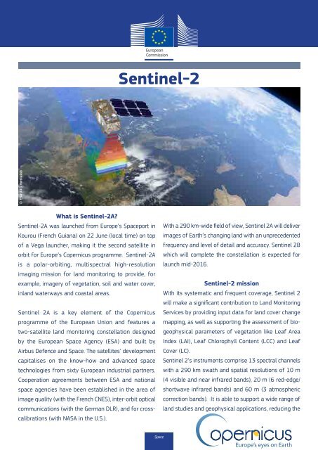
What is <strong>Sentinel</strong>-<strong>2A</strong>?<br />
<strong>Sentinel</strong>-<strong>2A</strong> was launched from Europe’s Spaceport in With a 290 km-wide field of view, <strong>Sentinel</strong> <strong>2A</strong> will deliver<br />
Kourou (French Guiana) on 22 June (local time) on top images of Earth’s changing land with an unprecedented<br />
of a Vega launcher, making it the second satellite in frequency and level of detail and accuracy. <strong>Sentinel</strong> 2B<br />
orbit for Europe’s Copernicus programme. <strong>Sentinel</strong>-<strong>2A</strong> which will complete the constellation is expected for<br />
is a polar-orbiting, multispectral high-resolution launch mid-2016.<br />
imaging mission for land monitoring to provide, for<br />
example, imagery of vegetation, soil and water cover,<br />
<strong>Sentinel</strong>-2 mission<br />
inland waterways and coastal areas.<br />
With its systematic and frequent coverage, <strong>Sentinel</strong> 2<br />
will make a significant contribution to Land Monitoring<br />
<strong>Sentinel</strong> <strong>2A</strong> is a key element of the Copernicus Services by providing input data for land cover change<br />
programme of the European Union and features a mapping, as well as supporting the assessment of biogeophysical<br />
parameters of vegetation like Leaf Area<br />
two-satellite land monitoring constellation designed<br />
by the European Space Agency (ESA) and built by Index (LAI), Leaf Chlorophyll Content (LCC) and Leaf<br />
Airbus Defence and Space. The satellites’ development Cover (LC).<br />
capitalises on the know-how and advanced space <strong>Sentinel</strong> 2’s instruments comprise 13 spectral channels<br />
technologies from sixty European industrial partners. with a 290 km swath and spatial resolutions of 10 m<br />
Cooperation agreements between ESA and national (4 visible and near infrared bands), 20 m (6 red-edge/<br />
space agencies have been established in the area of shortwave infrared bands) and 60 m (3 atmospheric<br />
image quality (with the French CNES), inter-orbit optical correction bands). It is able to support a wide range of<br />
communications (with the German DLR), and for crosscalibrations<br />
(with NASA in the<br />
land studies and geophysical applications, reducing the<br />
U.S.).<br />
Space<br />
time required to build a rich and worldwide cloud-free<br />
imaging archive. The spectral bands of <strong>Sentinel</strong> 2 will<br />
Forest monitoring: contribution to the conservation of<br />
biodiversity in forests, soil conservation;<br />
provide data for land cover and change classification,<br />
atmospheric correction and separation between cloud and<br />
snow.<br />
Urban planning: supporting<br />
urban planning in order to<br />
ensure sustainable and balanced<br />
Operational information from this latest Copernicus development, providing the<br />
mission will help improve agricultural practices, monitor<br />
desertification and the state of the world’s forests, detect<br />
pollution in lakes and coastal waters, contribute to disaster<br />
mapping and much more.<br />
These high-level objectives specified in 2007, after intense<br />
consultation with user communities, will make <strong>Sentinel</strong> 2<br />
means for a consistent basis<br />
of comparison across Europe,<br />
allowing the tracking of urban<br />
developments to understand how<br />
policies trigger or suppress urban<br />
expansion;<br />
a significant asset for Copernicus Services such as Land<br />
Monitoring, Emergency Management, Security and Climate<br />
Change.<br />
Water monitoring: water stress assessment and water<br />
scarcity forecasting, as information on the extent and<br />
impact of water scarcity and drought is indispensable for<br />
The <strong>Sentinel</strong> 2 mission will support broader policy decision-making at national and continental scale;<br />
objectives of the European Union, particularly in the areas<br />
of climate and environment.<br />
Cryosphere: assisting in improving the understanding of<br />
the water cycle and climate, supporting decision-making at<br />
the public and private levels, supporting flood forecasting<br />
and early warning systems;<br />
© ESA-ATG medialab<br />
Concrete applications<br />
Agricultural monitoring: food security monitoring,<br />
agricultural production estimation, crop area monitoring<br />
for agricultural statistics;<br />
Disaster monitoring: responses to major disasters in<br />
the shortest possible time, assisting in the identification<br />
of priority areas for humanitarian and financial aid,<br />
providing essential geographical information for remote<br />
areas where the information is absent or inaccurate (e.g.<br />
following flooding or earthquakes);<br />
Soil conservation: supporting European decision-making<br />
and spatial planning authorities with consistent and<br />
comparable EU-wide information products to analyse<br />
current and potential future trends and impacts of land<br />
use changes for urban developments and infrastructure<br />
investment, the prevention of land degradation;<br />
Biodiversity monitoring: supporting European, national<br />
and local authorities in monitoring the state of European<br />
habitats, supporting research monitoring and the<br />
assessment of biodiversity.<br />
For more information, visit http://www.copernicus.eu/main/last-steps-road-launch