Syllabus - Fall, 2012
Syllabus - Fall, 2012
Syllabus - Fall, 2012

Create successful ePaper yourself
Turn your PDF publications into a flip-book with our unique Google optimized e-Paper software.
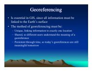
RNR 419/519<strong>Fall</strong>, <strong>2012</strong>Introduction to Spatial Analysis and ModelingLectures: BSE 225, 12 – 1 pm, Monday and WednesdayLab.: BSE 328, Tuesday, 2-5 pmInstructor: Dr. D. Phillip Guertin, 204c Biological Science East, Telephone: 520-621-1723, E-Mail: dguertin@cals.arizona.edu, Office Hours: By Appointment.Course Description: The objective of the course is to provide upper-division undergraduate andgraduate students with a background in spatial analysis and modeling to support decisionmaking.Students will learn methods and techniques for addressing spatially oriented problemsand to assist in decision making and application development.Course Website: www.srnr.arizona.edu/rnr/rnr419Student Requirements: Undergraduate grades (RNR 419) will be based on 1 midterm exam (100points), assignments (250 points), and a final exam (100 points). Final grades will be based on atotal of 450 points. Graduate grades (RNR 519) will be based on 1 midterm exam (100 points),lab. assignments (250 points), two paper reviews (50 points) and a final exam (100 points).Graduate students are required to write two short paper reviews. Final grades will be based on atotal of 500 points. Graduate students will also be expected to provide more extensive analysisand discussion on lab. assignments.Grades will be based on the following:Grade Undergraduate Points Graduate PointsA >=405 >=450B 404-360 449-400C 359-315 399-350D 314-270 350-300E
your last name and assignment number (e.g. guertin_lab1). I will only look for the answersheets in the assignment folder.Tentative OutlineLecture Topic1 Introduction to Spatial Analysis and Modeling2 Spatial Data Structures and Attribution3 Attribute and Location Queries4 Raster-based Modeling5 Types of Functions6 Reclassification Methods7 Cartographic Productions for Decision-Making8 Landscape Metrics, Scale Issues9 Distance Methods (Problem Set 1 – 10 points)10 Distance Methods11 Network Analysis12 Tests of Spatial Association13 Chi-square and K-S Tests (Problem Set 2 – 10 points)14 Modeling Process and techniques15 Modeling Methods – Linear Combination16 Modeling Methods – Fuzzy Logic17 Midterm Exam (October 17 – 1 hour exam)18 Modeling Methods – Regression19 Digital Elevation Models20 Terrain Analysis21 LIDAR22 Dynamic Modeling, Cellular Automata23 Dynamic Modeling, Cellular Atuomata24 Agent Modeling25 Agent Modeling26 Error and Uncertainty27 Methods for Parameterization28 Modeling Examples29 Modeling Examples30 Modeling Examples31 Review, EvaluationsDecember 11th Final Exam (1 pm – 3 pm) – TuesdayThe Final Exam will be a practicum in the computer lab.Lab Topics1 Introduction to ArcMap (10 points)2 Query and Reasoning (15 points)3 Binary Overlay Analysis (15points)4 Zonal and Focal Functions (15 points)5 Landscape Metrics and Scale (15 points)
6 Cost Distance Problem (15 points)7 Network Analysis (15 points)8 Tests of Association (15 points)9 Suitability Analysis – Linear Combination Analysis (15 points)10 Logistic Regression (15 points)11 Working with DEMs (15 points)12 Cellular Automata (15 points)13 Dynamic Modeling (15 points)14 Putting it all together (40 points)Paper ReviewGraduate students are required to submit two reviews of papers dealing with the use of GIS intheir discipline. Note, analysis of remote sensing data is not a GIS analysis or application,although remote sensing data can be used in a GOS analysis. The papers should deal with GISbasedmodeling or analysis, and the review must describe the procedures used in the modeling oranalysis process. The reviews must include the following:I. Problem Statement – What problem was the paper addressing (required)?II. Objective Statement – What was the author’s objectives (required)?III. Data RequirementsA. Identify spatial and non-spatial data requirements (required)B. Characteristics of the data such as resolution (required).IV. Discuss the procedure and techniquesA. Develop a Flow Diagram of the process (required)B. Identify the parameters/options of analysis techniques.C. Identify all criteria and weights used in modeling.V. Expect ResultsA. Identify derived outputs and their characteristics (required)B. Discuss the procedures, if any, used to validate the results (required).C. What do you hope to learn about the phenomenon under study?VI. ConclusionA. Discuss problems/limitations with the study (required)B. Identify ways the study could be improved.C. Did the study meet its objectives (required)?The first review is due October 27, <strong>2012</strong> and the second review is due November 30, <strong>2012</strong>.Please submit the review by email, include a copy of the paper that you reviewed.Locating References: Today GIS papers can be found in most professional journals. Journalswith special emphasis on include Geographical Analysis, International Journal of GeographicInformation Systems, Journal of the Urban and Regional Information Systems Association(URISA), Transactions of GIS, and Photogrammetric Engineering and Remote Sensing. Otherjournals that address GIS topics include The American Cartographer, Cartographica, Computersand Geosciences, and IEEE Computer Graphics and Applications. There are also numerous GISsymposiums and conference proceedings available. A good place to start searching for a paper is
the ESRI Annual User Conference Proceedings (URL: www.esri.com for the home page thesearch for the proceedings). Although the relative quality of the ESRI papers is usually notsufficient to write a review they can point to other articles in your area of interest.Incomplete Policy: Any incomplete grade must be verified with a written agreement with thestudent that specifies what work must be done and a timetable of completion.Course Withdrawal: Students withdrawing from this course must notify the instructor prior tononattendance in classes and execute drop or withdrawal procedures in accordance with the UAGeneral Catalog. Any student failing to attend class in two or more successive classes can besubject to automatic withdrawal if arrangements have not been made between student andinstructor. Students that miss the first exam without contacting the instructor will beautomatically dropped for the class. However, it is still the responsibility of the student towithdraw from the class.Special Needs: Students who need special accommodation or services should contact the SALT(Strategic Alternatives Learning Techniques) Center for Learning Disabilities (SALT Center,1010 N. Highland Ave., P.O. Box 210136, Tucson, AZ 85721, (520) 621-1242,http://www.salt.arizona.edu/, and/or the Disability Resources Center, 1224 East Lowell StreetTucson, Arizona 85721, Ph: (520) 621-3268 V/TTY Fax: (520) 621-9423, E-mail:uadrc@email.arizona.edu, web: http://drc.arizona.edu/. Theappropriate office must document the need for accommodations. The needs for specializedservices must be documented, verified by these UA units, and presented to me before the end ofthe second week of class. We will do everything we can to enhance your learning experience.