Powerpoint
Powerpoint
Powerpoint
- No tags were found...

You also want an ePaper? Increase the reach of your titles
YUMPU automatically turns print PDFs into web optimized ePapers that Google loves.
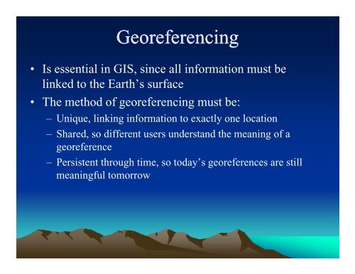
Uniqueness• A georeference may be unique only within adefined domain, not globally– There are many instances of Springfield in theU.S., but only one in any state– The meaning of a reference to London may dependon context, since there are smaller Londons inseveral parts of the world
Creating Scientific CoordinatesCoordinates have three properties:1. Origin2. Axis (easting and northing)3. Units of measurementTwo ClassesGeographic (spherical, nonlinear)Projection (Planar, linear)
ProcessReal WorldReference EllipsoidGeographicSphereDegreesProjectionPlanem, ft, in,NonlinearLinear
Geoids, Ellipsoids, and Plumbs1) ocean 2) ellipsoid 3) local plumb 4) land mass 5) geoid
Reference EllipsoidThe diameter of the Earthfrom pole to pole is smallerthan the distance across theequator.The ellipsoidal surface is amathematical construct…a map representation ofa planet that is not trulyround.EarthSpheroid
Geodetic Coordinate SystemsWhat WeLike To Thinkthe Earth IsShaped LikeEquipotentialGravimetricSurface (Sea-Level)Best FittingMathematicalShapeSphereGeoidSpheroid/EllipsoidBy calculating an ellipsoid, we take some of the complexity out of the surfacerepresented in a geoid, but are more truly representing the earth than if weconsidered it a round sphere. The ellipsoid of a map is the basis for horizontalcontrol.Ellipsoids commonly found on U.S. maps are Clarke 1866 (local) and GRS 80(global)
Ellipsodal and Datum• The reference ellipsoid, also known as a spheroidis an approximated shape of the earth is the basisof horizontal control in making maps.• The placement of a coordinate system upon theellipsoid is determined by a horizontal referencestarting point or datum.• There are a number of ellipsoids/datums used indifferent parts of the World because the Earth isnot consistent in its shape – the Earth is lumpy!
DatumThe datum determines the placement of the coordinatesystem upon the spheroid or ellipsoid.• Geocentric (Global) Datum: centered on Earth’scenter of mass• Local Datum: offset for greater local accuracy –located at a point on the earth surface
Common Datums• WGS84 – World Geodetic System 1984– Default datum on Garmin and most other GPS receivers. Mostaccurate datum, but not yet in wide use on maps. Based on GRS80• NAD83 – North Amerian Datum 1983– Very similar to WGS84. Used on newer USGS maps.• NAD27 – North American 1927 (Local)– Older datum used on most USGS topographic maps.– Based on Clarke 1866 Ellipsoid– Datum is located on Meades Ranch, Kansas
It Matters!UTM NAD 1927 vs. UTM NAD 1983The error can be hundreds of feet in some cases!
Geographic: Latitude and Longitude• The most comprehensive and powerful methodof georeferencing– Metric, standard, stable, unique• Uses a well-defined and fixed reference frameB d h E h’ i d f– Based on the Earth’s rotation and center of mass,and the Greenwich Meridian
Geographic Coordinate System• The system spherical, based on angles, so• Nomenclature is based on degrees, minutes, seconds• Arizona Example: Latitude 32° 7' 11.3" N Longitude 110° 55'48.5" W (or -110° 55' 48.5")• Three common formats:DDD° MM' SS.S"DDD° MM.MMM'DDD.DDDDD°Degrees, Minutes and SecondsDegrees and Decimal MinutesDecimal Degrees
Latitude and the Ellipsoid• Latitude (of the blue point) isthe angle between aperpendicular p to the surfaceand the plane of the Equator• WGS 84– Radius of the Earth at theEquator 6378.137 km– Flattening 1 part in 298.257
North PoleEquatorGreenwichDefinition of longitude. The Earth is seen here from above the North Pole,looking along the Axis, with the Equator forming the outer circle. The locationof Greenwich defines the Prime Meridian. The longitude of the point at thecenter of the red cross is determined by drawing a plane through it and theaxis, and measuring the angle between this plane and the Prime Meridian.
Latitude – change in the y direction – NorthingLongitude – change in the x direction – EastingTraditional negative in the southern and western hemispheres
Projections• There are many reasons for wanting to project the Earth’s surface onto aplane, rather than deal with the curved surface– The paper used to output GIS maps is flat– Flat maps are scanned and digitized to create GIS databases– Rasters are flat, it’s impossible to create a raster on a curved surface– The Earth has to be projected to see all of it at once– It’s much easier to measure distance on a plane
Classification of Projections• Families – How the paper is oriented on theellipsoidConicCylindrical• Types – What property is preservedDistance, Area, Shape, Direction
Cylindrical Projections• Conceptualized as the result of wrapping a cylinder ofpaper around the Earth• The Mercator projection is conformal
Conic Projections• Conceptualized as the result of wrapping a cone ofpaper around the Earth– Standard Parallels occur where the cone intersects theEarth
Distortions• Any projection must distort the Earth in some way• Two types of projections are important in GIS– Conformal property: Shapes of small features arepreserved: anywhere on the projection the distortion is thesame in all directions– Equal area property: Shapes are distorted, but featureshave the correct area– Both types of projections will generally distort distances
Multiple Projections Centered on the Same Point
The Universal Transverse Mercator(UTM) Projection• A type of cylindrical projection• Implemented as an internationally standardcoordinate system– Initially devised as a military standard• Uses a system of f60 zones (6d degrees wide)– Maximum distortion is 0.04%• Transverse Mercator because the cylinder iswrapped around the Poles, not the Equator
Zones are each six degrees of longitude,numbered as shown at the top, from W to E
UTM Coordinates• In the N Hemisphere define the Equator as0 mN• The central meridian of the zone is given afalse Easting of 500,000 mE• Eastings and northings are both in metersallowing easy estimation of distance onthe projection• A UTM georeference consists of a zonenumber, a six-digit easting and a sevendigitnorthing– e.g., 14, 468324E, 5362789N
UTM Zones in the U.S.Zone numbers proceed east from the 180 degree meridian
Implications of the Zone System• Each zone defines a different projection• Two maps of adjacent zones will not fit along theircommon border• Jurisdictions that span two zones must make specialarrangements– Use only one of the two projections, and accept the greater-than-normal ldistortions ti in the other zone– Use a third projection spanning the jurisdiction– E.g. Italy is spans UTM zones 32 and 33
State Plane Coordinates• Defined in the US by each state– Some states use multiple l zones– Several different types of projections are used bythe system• Provides less distortion than UTM– Preferred for applications needing very highaccuracy, such as surveying
Cadasters• Maps of land ownership,showing property boundaries• The Public Land Survey System(PLSS) in the US and similarsystems in other countriesprovide a method ofgeoreferencing linked to thecadaster• In the Western US the PLSS isoften used to record locations ofnatural resources, e.g. oil and gaswells
Township, Range, SectionTownships are six miles square, containing thirty-six one-mile square (or 640 acre)chunks called sections, which are broken up into half sections (320 acre) and quartersections (160 acre).
Converting Georeferences• GIS applications often require conversion ofprojections and ellipsoids– These are standard functions in popular GIS packages• Street addresses must be converted to coordinates formapping and analysis– Ui Using geocoding functions• Placenames can be converted to coordinates usinggazetteers
Other ways to GeoreferencePlace Names• The earliest form of georeferencing– And the most commonly used in everyday activitiesiti• Many names of geographic features are universallyrecognized– Others may be understood only by locals• Names work at many different scales– From continents to small villages and neighborhoods• Names may pass out of use in time– Where was Camelot?
Postal Addresses and Postcodes• Every dwelling and office is a potential destinationfor mail• Dwellings and offices are arrayed along streets, andnumbered accordingly• Streets have names that are unique within local areas• Local areas have names that are unique within largerregions• If these assumptions are true, then a postal address isa useful georeference
Postcodes as Georeferences• Defined in many countries– E.g. ZIP codes in the US• Hierarchically structured– The first few characters define large areas– Subsequent characters designate smaller areas– Coarser spatial resolution than postal address• Useful for mapping
Forward sortation areas (FSAs) of the centralpart of the Toronto metropolitan region. InCanada the first three characters of the sixcharacterpostcode form the FSA
ZIP d b d i i t tZIP code boundaries are a convenient way tosummarize data in the US. The dots on the lefthave been summarized as a density per squaremile on the right
Linear Referencing• A system for georeferencinggpositions on a road, street,rail, or river network• Combines the name of the linkwith an offset distance alongthe link from a fixed point,most often an intersection• Geocoding
Users of Linear Referencing• Transportation authorities* To keep track of pavement quality, signs,traffic conditions on roads• Police* To record the locations of accidents orcrime• Geocoding