An archaeological evaluation on land at Banstead Downs Golf Club ...
An archaeological evaluation on land at Banstead Downs Golf Club ...
An archaeological evaluation on land at Banstead Downs Golf Club ...

You also want an ePaper? Increase the reach of your titles
YUMPU automatically turns print PDFs into web optimized ePapers that Google loves.
Archaeology South- East<strong>Banstead</strong> <strong>Downs</strong> <strong>Golf</strong> <strong>Club</strong>Abstract<str<strong>on</strong>g>An</str<strong>on</strong>g> <str<strong>on</strong>g>archaeological</str<strong>on</strong>g> <str<strong>on</strong>g>evalu<strong>at</strong>i<strong>on</strong></str<strong>on</strong>g> was c<strong>on</strong>ducted <strong>on</strong> <strong>land</strong> <strong>at</strong> <strong>Banstead</strong> <strong>Downs</strong> <strong>Golf</strong><strong>Club</strong>, <strong>Banstead</strong>, South L<strong>on</strong>d<strong>on</strong> in advance of the c<strong>on</strong>structi<strong>on</strong> of a golf clubreservoir. Four trial trenches were excav<strong>at</strong>ed to a cumul<strong>at</strong>ive length of 80m.No <str<strong>on</strong>g>archaeological</str<strong>on</strong>g> finds or fe<strong>at</strong>ures were identified.__________________________________________________________________________________
Archaeology South- East<strong>Banstead</strong> <strong>Downs</strong> <strong>Golf</strong> <strong>Club</strong>CONTENTS1.0 Introducti<strong>on</strong>2.0 Archaeological Background3.0 Archaeological Methodology4.0 Results5.0 Discussi<strong>on</strong> and C<strong>on</strong>clusi<strong>on</strong>sTable 1. Levels Inform<strong>at</strong>i<strong>on</strong>SMR Summary SheetFig. 1: Site Loc<strong>at</strong>i<strong>on</strong>Fig. 2: Site Plan (showing loc<strong>at</strong>i<strong>on</strong> of trenches)Pl<strong>at</strong>e 1: Trench 1 facing NWPl<strong>at</strong>e 2: Trench 2 facing NPl<strong>at</strong>e 3: Trench 3 facing EPl<strong>at</strong>e 4: Trench 4 facing EPl<strong>at</strong>e 5: S<strong>on</strong>dage within Trench 4. E facing secti<strong>on</strong>Pl<strong>at</strong>e 6: S<strong>on</strong>dage within Trench 1. E facing secti<strong>on</strong>__________________________________________________________________________________iii
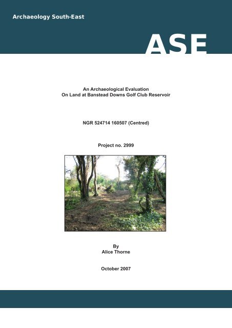
1.0 INTRODUCTIONArchaeology South- East<strong>Banstead</strong> <strong>Downs</strong> <strong>Golf</strong> <strong>Club</strong>1.1 Archaeology South-East (ASE), the c<strong>on</strong>tracting divisi<strong>on</strong> of The Centrefor Applied Archaeology <strong>at</strong> the Institute of Archaeology, UniversityCollege L<strong>on</strong>d<strong>on</strong>, was commissi<strong>on</strong>ed by 2ic C<strong>on</strong>sultants Ltd. toundertake an <str<strong>on</strong>g>archaeological</str<strong>on</strong>g> <str<strong>on</strong>g>evalu<strong>at</strong>i<strong>on</strong></str<strong>on</strong>g> in advance of thec<strong>on</strong>structi<strong>on</strong> of a reservoir <strong>at</strong> <strong>Banstead</strong> <strong>Downs</strong> <strong>Golf</strong> <strong>Club</strong>. The site iscentred <strong>on</strong> N<strong>at</strong>i<strong>on</strong>al Grid Reference (NGR) 524714 160507 and itsloc<strong>at</strong>i<strong>on</strong> is shown in Fig. 1.1.2 A Written Scheme of Investig<strong>at</strong>i<strong>on</strong> was prepared by ASE andsubmitted to T<strong>on</strong>y Howe <strong>at</strong> Surrey County Council for approval priorto commencement of the work.1.3 The site is loc<strong>at</strong>ed to the west of the A217 in <strong>Banstead</strong>, to the north ofthe railway line, and <strong>at</strong> the southern extent of the <strong>Banstead</strong> golfcourse (Fig. 1). The site is loc<strong>at</strong>ed <strong>on</strong> a north-west facing hill slope, inan overgrown p<strong>at</strong>ch of wood<strong>land</strong> with a thick shrub under storey.Several large trees have recently been cleared from the site, tofacilit<strong>at</strong>e access. The wood floor c<strong>on</strong>tained many hollows and ridges,resulting from this process, and which are also likely in part to derivefrom biological acti<strong>on</strong>.1.4 The British Geological Survey Map Sheets 270 and 286 Solid andDrift Editi<strong>on</strong> (1:50,000 scale) indic<strong>at</strong>es th<strong>at</strong> the site lies <strong>on</strong> theCretaceous Upper Chalk, which is described as white with flints, withnodular chalk <strong>at</strong> its base.1.5 The fieldwork was undertaken by Alice Thorne (Archaeologist) andPaul Derwent (Site Assistant) during October 2007. The project wasmanaged by Dicc<strong>on</strong> Hart (Project Manager) and Louise Rayner (Post-Excav<strong>at</strong>i<strong>on</strong> Manager).2.0 ARCHAEOLOGICAL BACKGROUND2.1 Little is known about activity in and around <strong>Banstead</strong> prior to theemergence of the town of Benestede during the l<strong>at</strong>er <str<strong>on</strong>g>An</str<strong>on</strong>g>glo-Sax<strong>on</strong>and medieval periods. Chance finds of Palaeolithic, Mesolithic andNeolithic d<strong>at</strong>e in the area <strong>at</strong>test to limited activity in the vicinity duringthese periods (Griffin 2003). Interestingly, menti<strong>on</strong> is made of adestroyed barrow of possible Neolithic d<strong>at</strong>e in close proximity to thesite (Griffin 2000), which may suggest increased activity of this d<strong>at</strong>ein the vicinity of the site. A Br<strong>on</strong>ze Age bowl barrow recorded <strong>at</strong>Tumble Beac<strong>on</strong> (SMR No. 2523) to the south of the site and afounder’s hoard to the east, as well as a general sc<strong>at</strong>ter of find spotsprovides somewh<strong>at</strong> more c<strong>on</strong>crete evidence of activity during thisperiod. A general dearth of Ir<strong>on</strong> Age finds in the <strong>Banstead</strong> areasuggests th<strong>at</strong> activity of this period is limited as does the isol<strong>at</strong>edfinds of Roman d<strong>at</strong>e, though a potential building recorded to the__________________________________________________________________________________1
south of the site (SMR No. 942) is worth noting.Archaeology South- East<strong>Banstead</strong> <strong>Downs</strong> <strong>Golf</strong> <strong>Club</strong>2.2 Benstede was first menti<strong>on</strong>ed in a royal charter d<strong>at</strong>ed AD967 and agroup of <str<strong>on</strong>g>An</str<strong>on</strong>g>glo-Sax<strong>on</strong> barrows are recorded to the north of the site(SAM No’s 23010 and 23034). By the Domesday Survey, a smallsettlement, recorded as Benestede was established and thisc<strong>on</strong>tinued to develop, albeit slowly throughout the medieval and postmedievalperiods. The advent of the railways served to acceler<strong>at</strong>e theexpansi<strong>on</strong> of the town to its present size.3.0 ARCHAEOLOGICAL METHODOLOGY3.1 The aims of the <str<strong>on</strong>g>archaeological</str<strong>on</strong>g> investig<strong>at</strong>i<strong>on</strong> were to ascertain:• Whether <str<strong>on</strong>g>archaeological</str<strong>on</strong>g> remains were present <strong>on</strong> the site and if soassess their d<strong>at</strong>e, survival and c<strong>on</strong>diti<strong>on</strong>.• To ascertain the character, d<strong>at</strong>e and quality of ancient remains anddeposits.• To assess how they might be affected by the development of thesite• To c<strong>on</strong>sider wh<strong>at</strong> opti<strong>on</strong>s should be c<strong>on</strong>sidered for mitig<strong>at</strong>i<strong>on</strong>3.2 The fieldwork aimed to investig<strong>at</strong>e the site, establish the distributi<strong>on</strong>of <str<strong>on</strong>g>archaeological</str<strong>on</strong>g> remains and to place these within our currentunderstanding of <strong>land</strong>scape development.3.3 The groundwork comprised the excav<strong>at</strong>i<strong>on</strong> of four 20m l<strong>on</strong>g, 1.8mwide trenches by mechanical excav<strong>at</strong>or, utilising a fl<strong>at</strong> blade ditchingbucket. These trenches were positi<strong>on</strong>ed within the footprint of theproposed reservoir, and were laid out prior to commencement of thefieldwork by the client (2ic C<strong>on</strong>sultants Ltd). Due to <strong>on</strong> sitec<strong>on</strong>straints, Trench 2 was shifted slightly in order to facilit<strong>at</strong>e machinemovement.3.4 All trenches were scanned with a Cable Avoidance Tool prior toexcav<strong>at</strong>i<strong>on</strong>.3.5 All encountered <str<strong>on</strong>g>archaeological</str<strong>on</strong>g> deposits, fe<strong>at</strong>ures and finds wererecorded according to accepted professi<strong>on</strong>al standards in accordancewith the Specific<strong>at</strong>i<strong>on</strong> using standard Archaeology South-East c<strong>on</strong>textrecord sheets. Deposit colours were verified by visual inspecti<strong>on</strong> andnot by reference to a Munsell Colour chart.3.6 A full photographic record of the work was kept (black and whiteprints, colour slides and digital images) and will form part of the sitearchive. The archive is presently held <strong>at</strong> the Archaeology South-East__________________________________________________________________________________2
Archaeology South- East<strong>Banstead</strong> <strong>Downs</strong> <strong>Golf</strong> <strong>Club</strong>offices <strong>at</strong> Portslade and will be offered to a suitable local museum.3.7 The site was levelled with respect to OD, using a Bench Mark loc<strong>at</strong>ed<strong>on</strong> a bridge to the east of the site (value 131.11mOD) and loc<strong>at</strong>ed <strong>on</strong> tothe 1:1250 map of the area.3.8 The spoil from the excav<strong>at</strong>i<strong>on</strong>s was inspected to recover anyartefacts or ecofacts of <str<strong>on</strong>g>archaeological</str<strong>on</strong>g> interest, and was scanned witha metal detector.4.0 RESULTSTrench no Top of trench (mOD) Base of trench (mOD)1. SE end: 125.00 124.461. NW end: 123.01 122.672. SW end: 123.86 122.982. NE end: 123.04 122.773. E end: 123.51 123.143. W end: 122.62 122.344. E end: 122.27 122.034. W end: 123.00 122.47Table 1. Levels Inform<strong>at</strong>i<strong>on</strong>4.1 Trench 1 (Pl<strong>at</strong>e 1)4.2 This trench was orient<strong>at</strong>ed NW-SE, and was loc<strong>at</strong>ed up<strong>on</strong> the hillslope. The str<strong>at</strong>igraphic sequence observed was as follows:• C<strong>on</strong>text 1/001 was a mulch and organically rich topsoil deposit,resulting from organic decay and biological movement <strong>on</strong> the woodfloor. This deposit was very variable in depth, ranging from betweenapproxim<strong>at</strong>ely 150mm- 300mm, and c<strong>on</strong>sisted of a dark greyishbrownclayey silt, c<strong>on</strong>taining frequent rooting, chalk fragments, leafmulch and occasi<strong>on</strong>al modern inclusi<strong>on</strong>s such as glass bottles,metal cans and modern ceramic.• Below this a light orangish brown clayey silt was encountered(C<strong>on</strong>text 1/002). This c<strong>on</strong>tained frequent rooting, frequent chalknodules and fragments and had a friable c<strong>on</strong>sistence. This depositrepresented a rooting deposit, which was present across the site,but was very variable in depth and character. Towards the north ofthe trench it measured approxim<strong>at</strong>ely 90mm in depth, whilst <strong>at</strong> thesouthern end of the trench the deposit measured up to 400mmthick. In areas this rooting had penetr<strong>at</strong>ed and broken up the erodedsurface of the underlying upper chalk and c<strong>on</strong>stituted pockets ofinfilled silting.• Below this the surface of the upper chalk was encountered (1/003).This c<strong>on</strong>stitutes a creamy off white we<strong>at</strong>hered, fragmented and__________________________________________________________________________________3
Archaeology South- East<strong>Banstead</strong> <strong>Downs</strong> <strong>Golf</strong> <strong>Club</strong>blocky chalk surface, which was compact in places with pockets of asofter, more friable creamy chalk marl and light orangish brown silts<strong>on</strong> the surface. A s<strong>on</strong>dage was excav<strong>at</strong>ed <strong>at</strong> the northernmostextent of the trench to investig<strong>at</strong>e the underlying chalk geology, anddem<strong>on</strong>str<strong>at</strong>ed th<strong>at</strong> a purer, less eroded deposit of chalk bedrockwas present <strong>at</strong> a depth of approxim<strong>at</strong>ely 800 - 900mm below groundsurface (Pl<strong>at</strong>e 6).4.3 No <str<strong>on</strong>g>archaeological</str<strong>on</strong>g> finds or fe<strong>at</strong>ures were observed.4.4 Trench 2 (Pl<strong>at</strong>e 2)4.5 This trench was orient<strong>at</strong>ed NE- SW. Due to the presence of severaltrees, and to allow the machine room to manoeuvre, the trench layoutwas shifted slightly, resulting in a ‘kinked’ layout in plan (Fig. 2). Thestr<strong>at</strong>igraphic sequence observed was as follows:• C<strong>on</strong>text 2/001 was a mulch and organically rich topsoil deposit, asin Trench 1. This varied in depth between approxim<strong>at</strong>ely 190mm –270mm.• Below this the light orangish brown clayey silt was encountered asin Trench 1 (C<strong>on</strong>text 2/002). This varied substantially, varyingbetween 160mm to 400mm in depth.• Below this the surface of the upper chalk was encountered (2/003).This c<strong>on</strong>stitutes a creamy off white we<strong>at</strong>hered, fragmented andblocky chalk surface, as in Trench 1.4.6 No <str<strong>on</strong>g>archaeological</str<strong>on</strong>g> finds or fe<strong>at</strong>ures were observed.4.7 Trench 3 (Pl<strong>at</strong>e 3)4.8 This trench was orient<strong>at</strong>ed E-W. The str<strong>at</strong>igraphic sequence observedwas as follows:• Topsoil 3/001 was the same as C<strong>on</strong>text 1/001, and varied in depthbetween 100mm – 230mm.• Below this the light orangish brown clayey silt was encountered (asin Trench 1) (C<strong>on</strong>text 3/002). This has a slightly more c<strong>on</strong>sistentdepth, varying between 100mm – 170mm.• Below this the surface of the upper chalk was encountered (2/003).4.9 No <str<strong>on</strong>g>archaeological</str<strong>on</strong>g> finds or fe<strong>at</strong>ures were observed. Several p<strong>at</strong>chesof silting were investig<strong>at</strong>ed to double check the n<strong>at</strong>ure of the soilshere. These investig<strong>at</strong>i<strong>on</strong>s c<strong>on</strong>firmed th<strong>at</strong> these were ‘n<strong>at</strong>ural’biological hollows and seams in the surface of the chalk, and th<strong>at</strong> the__________________________________________________________________________________4
silts were totally sterile of <str<strong>on</strong>g>archaeological</str<strong>on</strong>g> artefacts.4.10 Trench 4 (Pl<strong>at</strong>e 4)Archaeology South- East<strong>Banstead</strong> <strong>Downs</strong> <strong>Golf</strong> <strong>Club</strong>4.11 This trench was orient<strong>at</strong>ed E-W. The str<strong>at</strong>igraphic sequence observedwas as follows, and was very similar in depth to trench 3:• Topsoil 4/001 varied in depth between 100mm – 150mm.• Below this the light orangish brown clayey silt had a more c<strong>on</strong>sistentdepth, varying between 100mm – 200mm (4/002).• Below this the surface of the upper chalk was encountered (4/003).4.12 No <str<strong>on</strong>g>archaeological</str<strong>on</strong>g> finds or fe<strong>at</strong>ures were observed. A modern test pitwas identified towards the centre of the trench, and <strong>on</strong>-site inquiriesc<strong>on</strong>firmed th<strong>at</strong> it had been excav<strong>at</strong>ed in the past year. A s<strong>on</strong>dage wasexcav<strong>at</strong>ed in the centre of the trench, and dem<strong>on</strong>str<strong>at</strong>ed th<strong>at</strong> the chalkbecame ‘cleaner’ and less eroded <strong>at</strong> a depth of <strong>on</strong>ly 200mm below itssurface (Pl<strong>at</strong>e 5).5.0 DISCUSSION AND CONCLUSIONS5.1 No <str<strong>on</strong>g>archaeological</str<strong>on</strong>g> finds or fe<strong>at</strong>ures were observed during the<str<strong>on</strong>g>evalu<strong>at</strong>i<strong>on</strong></str<strong>on</strong>g>. Some areas of rooting and erosi<strong>on</strong> <strong>at</strong> the surface of theupper chalk were investig<strong>at</strong>ed to c<strong>on</strong>firm their ‘n<strong>at</strong>ural’ character, andwere found to have no evidence <strong>at</strong> all of human acti<strong>on</strong> ormodific<strong>at</strong>i<strong>on</strong>. They are therefore thought to derive from biologicalacti<strong>on</strong> such as rooting, burrowing and tree throws eroding andcausing intrusi<strong>on</strong> of the surface of the chalk, a process probablyexacerb<strong>at</strong>ed by chemical we<strong>at</strong>hering. The total absence of anyresidual finds (other than 20 th century m<strong>at</strong>erial) identified from thespoil heaps indic<strong>at</strong>es an area of little <str<strong>on</strong>g>archaeological</str<strong>on</strong>g> activity.ReferencesGriffin 2000: <str<strong>on</strong>g>An</str<strong>on</strong>g> Archaeological Desk Based Assessment of a Site <strong>at</strong> CastleHouse, Park Road, <strong>Banstead</strong>. Surrey. Unpub. ASE Report.Griffin 2003: <str<strong>on</strong>g>An</str<strong>on</strong>g> Archaeological Desk Based Assessment of a Site <strong>at</strong> 120,Hillside, <strong>Banstead</strong>. Surrey. Unpub. ASE Report.__________________________________________________________________________________5
Archaeology South- East<strong>Banstead</strong> <strong>Downs</strong> <strong>Golf</strong> <strong>Club</strong>SMR Summary FormSite CodeIdentific<strong>at</strong>i<strong>on</strong> Nameand AddressBDG07<strong>Banstead</strong> <strong>Downs</strong> <strong>Golf</strong> <strong>Club</strong> Reservoir, <strong>Banstead</strong>County, District &/orBoroughOS Grid Refs.Geology<strong>Banstead</strong>, South L<strong>on</strong>d<strong>on</strong>NGR 524714 160507 (Centred)Upper ChalkArch. South-EastProject NumberType of FieldworkType of SiteD<strong>at</strong>es of FieldworkSp<strong>on</strong>sor/ClientProject Manager2999Eval.Excav. W<strong>at</strong>chingBriefStandingStructureGreen Shallow Deep OtherField Urban UrbanEval. Excav. WB. Other10-11 th /10/20072iC C<strong>on</strong>sultants LtdDicc<strong>on</strong> HartSurveyOtherProject SupervisorAlice ThornePeriod Summary Palaeo. Meso. Neo. BA IA RBAS MED PM OtherModern100 Word Summary.<str<strong>on</strong>g>An</str<strong>on</strong>g> <str<strong>on</strong>g>archaeological</str<strong>on</strong>g> <str<strong>on</strong>g>evalu<strong>at</strong>i<strong>on</strong></str<strong>on</strong>g> was c<strong>on</strong>ducted <strong>on</strong> <strong>land</strong> <strong>at</strong> <strong>Banstead</strong> <strong>Downs</strong> <strong>Golf</strong> <strong>Club</strong>,<strong>Banstead</strong>, South L<strong>on</strong>d<strong>on</strong> in advance of the c<strong>on</strong>structi<strong>on</strong> of a golf club reservoir. Fourtrial trenches were excav<strong>at</strong>ed to a cumul<strong>at</strong>ive length of 80m. No <str<strong>on</strong>g>archaeological</str<strong>on</strong>g> findsor fe<strong>at</strong>ures were identified.__________________________________________________________________________________6
Archaeology South- East<strong>Banstead</strong> <strong>Downs</strong> <strong>Golf</strong> <strong>Club</strong>OASIS ID: archaeol6-33209Project detailsProject name<str<strong>on</strong>g>An</str<strong>on</strong>g> Archaeological Evalu<strong>at</strong>i<strong>on</strong>Short descripti<strong>on</strong> ofthe project<str<strong>on</strong>g>An</str<strong>on</strong>g> <str<strong>on</strong>g>archaeological</str<strong>on</strong>g> <str<strong>on</strong>g>evalu<strong>at</strong>i<strong>on</strong></str<strong>on</strong>g> was c<strong>on</strong>ducted <strong>on</strong> <strong>land</strong> <strong>at</strong> <strong>Banstead</strong><strong>Downs</strong> <strong>Golf</strong> <strong>Club</strong>, <strong>Banstead</strong>, South L<strong>on</strong>d<strong>on</strong> in advance of thec<strong>on</strong>structi<strong>on</strong> of a golf club reservoir. Four trial trenches wereexcav<strong>at</strong>ed to a cumul<strong>at</strong>ive length of 80m. No <str<strong>on</strong>g>archaeological</str<strong>on</strong>g> findsor fe<strong>at</strong>ures were identified.Project d<strong>at</strong>es Start: 10-10-2007 End: 11-10-2007Previous/futureworkNo / Not known<str<strong>on</strong>g>An</str<strong>on</strong>g>y associ<strong>at</strong>edproject referencecodesBDG07 - Sitecode<str<strong>on</strong>g>An</str<strong>on</strong>g>y associ<strong>at</strong>edproject referencecodes2999 - C<strong>on</strong>tracting Unit No.Type of projectField <str<strong>on</strong>g>evalu<strong>at</strong>i<strong>on</strong></str<strong>on</strong>g>Site st<strong>at</strong>usN<strong>on</strong>eCurrent Land useOther 13 - Waste groundM<strong>on</strong>ument typeNONE UncertainSignificant FindsNONE UncertainMethods &techniques'Sample Trenches'Development type<strong>Golf</strong> coursePromptVoluntary/self-interest__________________________________________________________________________________7
Archaeology South- East<strong>Banstead</strong> <strong>Downs</strong> <strong>Golf</strong> <strong>Club</strong>Positi<strong>on</strong> in theplanning processNot known / Not recordedProject loc<strong>at</strong>i<strong>on</strong>CountrySite loc<strong>at</strong>i<strong>on</strong>Eng<strong>land</strong>SURREY REIGATE AND BANSTEAD BANSTEAD <strong>Banstead</strong> <strong>Golf</strong>CoursePostcodeXXXXXXStudy area100.00 Square metresSite coordin<strong>at</strong>esTQ 24714 60507 51.3294517924 -0.209734893329 51 19 46 N000 12 35 W PointHeight OD Min: 122.00m Max: 124.00mProject cre<strong>at</strong>orsName ofOrganis<strong>at</strong>i<strong>on</strong>Archaeology South EastProject brieforigin<strong>at</strong>orSurrey County CouncilProject designorigin<strong>at</strong>orArchaeology South-EastProjectdirector/managerDicc<strong>on</strong> HartProject supervisorAlice ThorneType ofsp<strong>on</strong>sor/fundingbodyClientName ofsp<strong>on</strong>sor/fundingbodyIntern<strong>at</strong>i<strong>on</strong>al Irrig<strong>at</strong>i<strong>on</strong> C<strong>on</strong>sultants LTD__________________________________________________________________________________8
Archaeology South- East<strong>Banstead</strong> <strong>Downs</strong> <strong>Golf</strong> <strong>Club</strong>Project archivesPhysical ArchiveExists?NoDigital ArchiverecipientLocal MuseumDigital C<strong>on</strong>tents'other'Digital Mediaavailable'Images raster / digital photography'Paper ArchiverecipientLocal MuseumPaper C<strong>on</strong>tents'Str<strong>at</strong>igraphic'Paper Mediaavailable'C<strong>on</strong>text sheet','Corresp<strong>on</strong>dence','Diary','Map','Notebook -Excav<strong>at</strong>i<strong>on</strong>',' Research',' GeneralNotes','Photograph','Plan','Report'Projectbibliography 1Public<strong>at</strong>i<strong>on</strong> typeTitleGrey liter<strong>at</strong>ure (unpublished document/manuscript)<str<strong>on</strong>g>An</str<strong>on</strong>g> Archaeological Evalu<strong>at</strong>i<strong>on</strong>Author(s)/Editor(s)Thorne, AOther bibliographicdetails2999D<strong>at</strong>e 2007Issuer or publisherArchaeology South - EastPlace of issue orpublic<strong>at</strong>i<strong>on</strong>Archaeology South- EastDescripti<strong>on</strong>Grey Liter<strong>at</strong>ure report with trench photos__________________________________________________________________________________9
Archaeology South- East<strong>Banstead</strong> <strong>Downs</strong> <strong>Golf</strong> <strong>Club</strong>Entered byAlice Thorne (tcrn<strong>at</strong>h@ucl.ac.uk)Entered <strong>on</strong> 29 October 2007__________________________________________________________________________________10
63N6261The Site6059580 1km23 24 25 26 27© Archaeology South-EastRef: 2999 Oct 2007Drawn by:JLR<strong>Banstead</strong> <strong>Downs</strong> <strong>Golf</strong> <strong>Club</strong> ReservoirSite Loc<strong>at</strong>i<strong>on</strong>Fig. 1Reproduced from the Ordnance Survey's 1:25000 map of 1997 with permissi<strong>on</strong> of theC<strong>on</strong>troller of Her Majesty's St<strong>at</strong>i<strong>on</strong>ary Office. Crown Copyright. Licence No. AL 503 10 A
Pl<strong>at</strong>e 1: Trench 1 facing NWPl<strong>at</strong>e 2: Trench 2 facing N
Pl<strong>at</strong>e 3: Trench 3 facing EPl<strong>at</strong>e 4: Trench 4 facing E
Pl<strong>at</strong>e 5: S<strong>on</strong>dage within Trench 4. E facing secti<strong>on</strong>Pl<strong>at</strong>e 6: S<strong>on</strong>dage within Trench 1. E facing secti<strong>on</strong>
Head OfficeUnits 1 & 22 Chapel PlacePortsladeEast Sussex BN41 1DRTel: +44(0)1273 426830 Fax:+44(0)1273 420866email: fau@ucl.ac.ukWeb: www.archaeologyse.co.ukL<strong>on</strong>d<strong>on</strong> OfficeCentre for Applied ArchaeologyInstitute of ArchaeologyUniversity College L<strong>on</strong>d<strong>on</strong>31-34 Gord<strong>on</strong> Square, L<strong>on</strong>d<strong>on</strong>, WC1 0PYTel: +44(0)20 7679 4778 Fax:+44(0)20 7383 2572Web: www.ucl.ac.uk/caaThe c<strong>on</strong>tracts divisi<strong>on</strong> of the Centre for Applied Archaeology, University College L<strong>on</strong>d<strong>on</strong>c Archaeology South-East