THE IMPORTANCE OF HYDROGRAPHY - Iho-ohi.net
THE IMPORTANCE OF HYDROGRAPHY - Iho-ohi.net
THE IMPORTANCE OF HYDROGRAPHY - Iho-ohi.net
- No tags were found...

Create successful ePaper yourself
Turn your PDF publications into a flip-book with our unique Google optimized e-Paper software.
www.riskiernichts.deICH WAR EIN RASER.MAN WEISS NIE, ALS WAS MAN WIEDERGEBOREN WIRD.RISKIERNICHTS!SEI CLEVER!
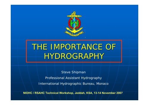
<strong>HYDROGRAPHY</strong>The scientific description of the waters of theearth.The science of surveying and charting bodies ofwater.The study, description, and mapping of oceans,lakes, and rivers, esp. with reference to theirnavigational and commercial uses.The oceans, lakes, rivers, etc. of a region, esp.as dealt with on a map or in a survey, treatise,etc.NIOHC / RSAHC Technical Workshop, Jeddah, KSA, 13-14 November 2007
IHO DEFINITIONis that branch of applied sciences which deals withthe measurement and description of the features ofthe seas and coastal areas for the primary purposeof navigation and all other marine purposes andactivities, including, inter alia, offshore activities,research, protection of the environment, andprediction services.NIOHC / RSAHC Technical Workshop, Jeddah, KSA, 13-14 November 2007
IHO DEFINITIONAPPLIED SCIENCESMEASUREMENTDESCRIPTIONis that branch of applied sciences which deals withthe measurement and description of the features ofthe seas and coastal areas for the primary purposeof navigation and all other marine purposes andactivities, including, inter alia, offshore activities,research, protection of the environment, andprediction services.FEATURES <strong>OF</strong> <strong>THE</strong> SEASAND COASTAL AREASPRIMARY PURPOSE <strong>OF</strong> NAVIGATIONALL O<strong>THE</strong>R MARINEPURPOSES AND ACTIVITIESNIOHC / RSAHC Technical Workshop, Jeddah, KSA, 13-14 November 2007
WHY?• TRADITIONAL USES <strong>OF</strong><strong>HYDROGRAPHY</strong>• NEW APPLICATIONS <strong>OF</strong><strong>HYDROGRAPHY</strong>• REGULATORYNIOHC / RSAHC Technical Workshop, Jeddah, KSA, 13-14 November 2007
TRADITIONAL USESAFETY <strong>OF</strong> NAVIGATIONNIOHC / RSAHC Technical Workshop, Jeddah, KSA, 13-14 November 2007
MILITARYNIOHC / RSAHC Technical Workshop, Jeddah, KSA, 13-14 November 2007
MERCHANTNIOHC / RSAHC Technical Workshop, Jeddah, KSA, 13-14 November 2007
NEW APPLICATIONSPORTSNATURALDISASTERSREAL ESTATETOURISMCOASTAL ZONEMANAGEMENTSPORTFARMINGENVIRONMENTFISHERIESNIOHC / RSAHC Technical Workshop, Jeddah, KSA, 13-14 November 2007
PORTSNIOHC / RSAHC Technical Workshop, Jeddah, KSA, 13-14 November 2007
NATURAL DISASTERSNIOHC / RSAHC Technical Workshop, Jeddah, KSA, 13-14 November 2007
REAL ESTATENIOHC / RSAHC Technical Workshop, Jeddah, KSA, 13-14 November 2007
TOURISMNIOHC / RSAHC Technical Workshop, Jeddah, KSA, 13-14 November 2007
SPORTSNIOHC / RSAHC Technical Workshop, Jeddah, KSA, 13-14 November 2007
FISHERIESNIOHC / RSAHC Technical Workshop, Jeddah, KSA, 13-14 November 2007
FARMINGNIOHC / RSAHC Technical Workshop, Jeddah, KSA, 13-14 November 2007
ENVIRONMENTAL PROTECTIONNIOHC / RSAHC Technical Workshop, Jeddah, KSA, 13-14 November 2007
ENVIRONMENTAL PROTECTIONNIOHC / RSAHC Technical Workshop, Jeddah, KSA, 13-14 November 2007
NEW APPLICATIONSNON LIVINGRESOURCESCABLE/PIPELAYINGMARITIMEDELIMITATION<strong>OF</strong>FSHOREDUMPING / DREDGINGAREASLIVINGRESOURCESSCIENTIFICRESEARCHNIOHC / RSAHC Technical Workshop, Jeddah, KSA, 13-14 November 2007
MARITIME DELIMITATIONThe baselines (normal, straight, archipelagic) andthe outer limit lines of the TS, EEZ, CS …shallbe shown on CHARTS of an adequate scalefor ascertaining their position. The coastalState shall give duepublicity to such chartsor lists of geographicalco-ordinates.NIOHC / RSAHC Technical Workshop, Jeddah, KSA, 13-14 November 2007
LIVING RESOURCESNIOHC / RSAHC Technical Workshop, Jeddah, KSA, 13-14 November 2007
NON LIVINGRESOURCESGASOILMINERALSNIOHC / RSAHC Technical Workshop, Jeddah, KSA, 13-14 November 2007
CABLE/PIPELAYINGCommunicationsGas/Oil industrySewage SystemsNIOHC / RSAHC Technical Workshop, Jeddah, KSA, 13-14 November 2007
DUMPING / DREDGING AREASMaterial from dredging operationsMiningSewage watersOther materialsNIOHC / RSAHC Technical Workshop, Jeddah, KSA, 13-14 November 2007
SCIENTIFIC RESEARCHOceanographyGeophysicsFisheriesOthersNIOHC / RSAHC Technical Workshop, Jeddah, KSA, 13-14 November 2007
REGULATORY• SAFETY <strong>OF</strong> LIFE AT SEA CONVENTION(SOLAS)‣ Chapter VNIOHC / RSAHC Technical Workshop, Jeddah, KSA, 13-14 November 2007
Safety of Life at Sea Convention(SOLAS)Chapter V, Regulation 9Contracting Governments undertake toarrange for the collection andcompilation of hydrographic data andthe publication, dissemination andkeeping up to date of all nauticalinformation necessary for safenavigation.NIOHC / RSAHC Technical Workshop, Jeddah, KSA, 13-14 November 2007
Chapter V, Regulation 9 (cont)• Contracting Governments undertake toensure the greatest possible uniformity incharts and nautical publications and to takeinto account; whenever possible, relevantinternational resolutions andrecommendations ** Refer to the appropriate resolutions andrecommendations adopted by the InternationalHydrographic Organization.NIOHC / RSAHC Technical Workshop, Jeddah, KSA, 13-14 November 2007
HYDROGRAPHICEVOLUTION• POSITIONING• DEPTH• OBSTRUCTION DETECTION• DATANIOHC / RSAHC Technical Workshop, Jeddah, KSA, 13-14 November 2007
POSITIONINGEVOLUTIONNIOHC / RSAHC Technical Workshop, Jeddah, KSA, 13-14 November 2007
DEPTH EVOLUTIONNIOHC / RSAHC Technical Workshop, Jeddah, KSA, 13-14 November 2007
OBSTRUCTION DETECTION15Lead Line2521Echo-sounder15 19 23 25 23 2119211719 20 21 22 21 17182218 21 21 22 16 9ES + Side Scan Sonar15 19 23 25 23 2119 20 21 22 21 1718 21 21 22 16 9Swath Echo-sounder15 19 20 23 25 23 2119 20 13 21 22 21 1820 18 21 21 23 21 1718 19 21 22 21 19 1718 20 21 22 22 14 1117 19 21 21 19 12 8NIOHC / RSAHC Technical Workshop, Jeddah, KSA, 13-14 November 2007
DATA EVOLUTION• Paper to digital• kB to Mb to Gb to TB• Storage• ManagementNIOHC / RSAHC Technical Workshop, Jeddah, KSA, 13-14 November 2007
CARTOGRAPHIC EVOLUTION• TRADITIONAL• COMPUTER ASSISTED• DIGITAL• ENCNIOHC / RSAHC Technical Workshop, Jeddah, KSA, 13-14 November 2007
MANUAL PROCESSESNIOHC / RSAHC Technical Workshop, Jeddah, KSA, 13-14 November 2007
COMPUTER ASSISTEDNIOHC / RSAHC Technical Workshop, Jeddah, KSA, 13-14 November 2007
PAPER CHART PRODUCTIONVOLUME PRINTINGPRINT ON DEMANDNIOHC / RSAHC Technical Workshop, Jeddah, KSA, 13-14 November 2007
ELECTRONIC NAVIGATIONALCHARTSNIOHC / RSAHC Technical Workshop, Jeddah, KSA, 13-14 November 2007
DISTRIBUTIONTRADITIONALELECTRONICNIOHC / RSAHC Technical Workshop, Jeddah, KSA, 13-14 November 2007
MODERN CHALLENGES• COMMERCIAL APPROACH• O<strong>THE</strong>R PRODUCTS• CULTURAL CHANGES• HOs RE-ENGINEERINGNIOHC / RSAHC Technical Workshop, Jeddah, KSA, 13-14 November 2007
SWOT ANALYSISStrengthsWeaknessesOpportunitiesThreatsNIOHC / RSAHC Technical Workshop, Jeddah, KSA, 13-14 November 2007
Concluding Thoughts1) All Maritime States should be aware of the importanceand benefits to be derived from collecting, processingand distributing quality hydrographic information, and ofcourse the obligations of the SOLAS convention.2) Given the increasing uses of hydrographic data, thevariety of data gatherers and product providers thereare benefits to be gained from the establishment of aNational Hydrographic Committee (NHC) to providehigh-level coordination.3) Coastal States developing hydrographic programmesthat do not have a NHC should consider establishing oneas a matter of high priority.NIOHC / RSAHC Technical Workshop, Jeddah, KSA, 13-14 November 2007
Concluding Thoughts4) The planning and programming of hydrographic activitiesshould include the participation of all end users of theproducts. Academia and the private sector can have a roleto play here.5) Coastal States already having a hydrographic capabilityshould consider conducting a SWOT analysis in order toidentify ways to improve.6) Coastal States without a national structure shouldconsider developing one with the advice of the IHO andIMO.NIOHC / RSAHC Technical Workshop, Jeddah, KSA, 13-14 November 2007
Concluding Thoughts7) The development of hydrographic surveying andnautical charting capability needs to follow a systematicapproach. This workshop is oriented to present relevantphases with particular emphasis on Phase One,“COLLECTION AND CIRCULATION <strong>OF</strong> NAUTICALINFORMATION”.NIOHC / RSAHC Technical Workshop, Jeddah, KSA, 13-14 November 2007