Vol 31 No 3 - Confederation of Bushwalking Clubs
Vol 31 No 3 - Confederation of Bushwalking Clubs
Vol 31 No 3 - Confederation of Bushwalking Clubs

You also want an ePaper? Increase the reach of your titles
YUMPU automatically turns print PDFs into web optimized ePapers that Google loves.
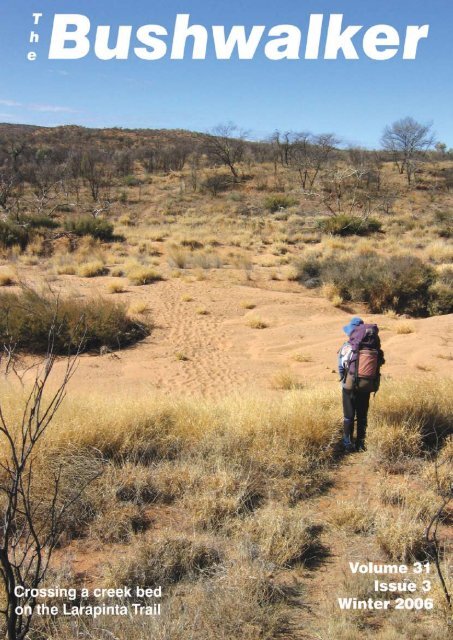
Walk Safely—Walk with a ClubTread on a path in the Pyrenees and youstep into rich and varied history. Precedingthe walks <strong>of</strong> our Bush Club (Group 3)in June 2006 were not only other groups<strong>of</strong> Australian walkers but also some <strong>of</strong> themost bloody invasions and expeditionaryforces <strong>of</strong> recorded history and religion. Theline up includes Roman, French, Spanishand Moorish Empires, and Catholic, Protestantand Islamic waxings and wanings.The indelible mark <strong>of</strong> mankind is ubiquitousin the Pyrenees.Pilgrims <strong>of</strong> the Chemin de St Jacques deCompostelle, readily identifiable by atleast one scallop shell (Pecten maximus)on their packs or clothing, come to retracethe reputed steps <strong>of</strong> John the Baptist fromvarious commencing points in Francethrough the Pyrenees all the way to thetown <strong>of</strong> Saint John de Compostela on theAtlantic Spanish coast.Real bush? Old growth forest? Naturalenvironment? In some places there aresome remnants <strong>of</strong> what might have beenafter the last ice age. Much <strong>of</strong> the naturalenvironment - serried peaks <strong>of</strong> geologicallyyoung fold mountains and once vastoak and beech forests, has been replacedwith pastures on even the most precipitousslopes. Here goats, sheep, wild horses andcattle share the walking trails with pilgrimsand mountaineers. Above the sky is full <strong>of</strong>flocks <strong>of</strong> griffon vultures and other raptorsmajestically riding the thermals in a constantsearch for the next meal. The occasionaldeer can be surprised in the woodsand rabbits abound.The 2006 European summer season hada torrid start, with the mercury in the midthirties every day. With humidity to matchit was very like midsummer in Sydney.Our base in the rural Payes Basque was anold 18th century farmhouse, named Etxexuria(pronounced Etcherchuria or just“Etchers”). This is located in the LantabatValley near the tiny hamlet <strong>of</strong> St Martin andis about 40 minutes from St Jean Pied dePort. The house has been completely renovatedand is a very comfortable abode. | The BushwalkerGroup organizersand hosts Bob andSue Taffel were atstation and airportto welcome usand provide transportto Etchers.We were a mixedlot – comprisingnon-walkers,moderate walkersand addictedwalkers. It wasBob’s task to runa program that made everybody happy. Hedid a remarkable job.Part <strong>of</strong> the charm <strong>of</strong> the visit was to indulgein the local cuisine. Our cook Sallywas, surprisingly, English but through hercraft as a ‘cuisenaire’ had developed all theskills necessary to ‘cook like a local’. Hermeals used local recipes made with freshingredients bought in the local markets,served with local wines.To the walking. Bob chose fairly localwalks to suit the varying abilities and hightemperatures. Pack walking would havebeen great but was not an option.Our first walk started at Col d’Iphariatze,a saddle at 328 m and a none-too-inspiringplace, bare <strong>of</strong> trees and windswept.Our route was along a ridge, followed bya steep descent into the Pagardeyko Erreka(Erreka = Creek). Humidity was high andwe were grateful for the shade <strong>of</strong> the oaktrees. To the east was the Bois d’Ostabat(Ostabat Forest); this green patch wasmost welcome. To our west was a prettycollection <strong>of</strong> more than a dozen villagesincluding Behaune, Ascombeguey and Orsanco.Most sported a church steeple andprovided serial photograph opportunities.As we swung east onto the GR 65 we encounteredpilgrims. By the time we reachedthe Chapelle de Soyarza there were frequentgroups <strong>of</strong> pilgrims in both directions. Thechapel is surrounded by a planting <strong>of</strong> planetrees, pollarded and cajoled into forming acontinuous, interwoven crown. The effectis dramatic given that the chapel is so elevated.Here we enjoyed morning tea andlimited conversation with pilgrims.Then it was time to head southwest to Harambeltzand the chapel <strong>of</strong> St Nicholas. Thischapel is in a rather sad state, now beingmostly used for storing agricultural items.This was where we had lunch. Some ateoutside but the heat drove three <strong>of</strong> us intothe undercr<strong>of</strong>t area where large squaredbeams now lying on the floor improvisedas seats. Whether it was the location, theheat, the bizarre carved symbols in thestonework or just the right moment but Irecall the conversation being very philosophical,deep and meaningful.As we passed through the south-west section<strong>of</strong> the Bois d’Ostabat, near HarambeltzkoErreka, there were improvisedladders fixed to very large trees that ledto hides, for pigeon shooters. The climbingwas good fun and provided excitementand photo opportunitiesAfter crossing another Erreka – the Ithurriberriako,we joined the Chemin de St.Jacques de Compostelle where time andfeet have lowered the track level by nearlya metre, resulting in a tunnel like effect.Emerging from the tunnel we were soonin the village <strong>of</strong> Ostabat. Here were some17th century buildings still in use includingone that served the function <strong>of</strong> a gited’etape or hostel for travellers: devout pilgrimsor a seasoned bushwalkers.Given the heat we decided that althoughit was Sunday we all merited a drink. Thelocal hostelry was open so in we went.Whilst a beer was popular the most consumeddrink by far was a “Citron Presse”.Made from freshly squeezed lemons, thisdrink is served with an accompanyingjug <strong>of</strong> chilled water and for the weak, abowl <strong>of</strong> sugar. It is truly refreshing and nohangovers. Mind you, one <strong>of</strong> these withoutsugar is about all a guy can handle.Our second walk was to the south west <strong>of</strong>Etchers. We drove through the villages <strong>of</strong>Iholdy, Irissary, Osses and Saint EtiennedeBaigorry and up the steep foothillslopes <strong>of</strong> Aintziaga (872 m) to park at theborder crossing <strong>of</strong> Col d’Ispeguy (672 m).What followed was a truly beautiful walkthrough oak and beech forest along theslopes <strong>of</strong> Olate (935 m)We border crossed several times as wepassed through Nekaitzeko and the Col<strong>Vol</strong><strong>31</strong> Issue 3, Winter 2006
d’Elhorrieta. Shepherds <strong>of</strong> long ago hadconstructed stone corrals to protect theflocks at night. Today the crumbling stonewalls and terra cotta tiled ro<strong>of</strong>s make itimpossible not to achieve postcard perfectshots <strong>of</strong> this area. The long-haired sheepwith their black faces and habit <strong>of</strong> nuzzlingeach other make for unforgettable imagesin beautiful scenery.At the saddle was a rare find in the modernworld – the border between two majorcountries completely open and markedonly by border stones (‘bornes’) every fewhundred metres. In real tourist fashion weposed with our legs straddling the border.Five <strong>of</strong> us set out from the saddle to climbAutza (1,304 m). An irrestistable part <strong>of</strong>the deal was to summit and return in 90minutes! As we climbed the views becamespectacular but the wind became an issue,with some gusts lifting you <strong>of</strong>f the ground.One member reluctantly turned back.Above the tree line there was no real pad tothe top, and across the rock scree there wasno identifiable route at all. Two <strong>of</strong> us reallyforced our pace and finally, using everybit <strong>of</strong> shelter, managed to reach the ‘first’summit, an area <strong>of</strong> ground that looked likepeat which was eroding rapidly. From thispoint we were able to walk and climb withrelative ease as the top <strong>of</strong> the mountain protectedus from the worst <strong>of</strong> the wind.These mountains are relatively young foldmountains and include an array <strong>of</strong> sedimentaryformations that have been squeezedand buckled to form the high peaks. Thediversity <strong>of</strong> rock types was amazing: sandstones,quartzites, greywackes, volcanicbreccias, mudstones and conglomerates.Each <strong>of</strong> these rock types revealed something<strong>of</strong> the changing environments whenthey were laid down.Finally the top was ours. We had allowed60 minutes up and 30 down: we had 5 minutesspare. This we used to look around,Walk Safely—Walk with a Clubas the ‘top’ is quite extensive. Imagine oursurprise when we found a small depressionat the top complete with a contingent<strong>of</strong> 8 armoured soldiers in full battledress,hunkered down speaking on walkie talkiesto others in their unit. Their language wasprobably Basque as neither <strong>of</strong> us could detectFrench or Spanish. <strong>No</strong>w was the timefor photos. Opportunities to have your picturetaken with such a backdrop are rarewithout faking it.On the way down we consoled our two teammates who ran out <strong>of</strong> time to join us on thesummit. Back with the group they allowedus time to snatch a bit <strong>of</strong> lunch and retailour story. The return journey was nearly allin Spain and was a pleasant stroll back tothe general store (‘venta’) where we hadparked the cars. Bob invited us in to explorethe diverse (!) range <strong>of</strong> goods on sale:marijuana, cooking pots, guns, clothes,food <strong>of</strong> every description, cow bells, bootsand knick-knacks. Jewellery was availablenext to miner’s picks and farm utensils.Great pitch-forks with wooden tines stoodoutside. It was bizarre and reportedly typical<strong>of</strong> many border establishments.We asked for “Citron Presse” but alas theyhad no citrons. We had to settle for a bottledversion which, while itdid not pack quite the samepunch, was an acceptable thirstquencher.That night Sally put on a typicalBasque meal. There weresausages and meats from thearea, two varieties <strong>of</strong> rich localpate, local potatoes, an amazingselection <strong>of</strong> char grilledcapsicums, chillies, mushroomsand zucchinis, and aselection <strong>of</strong> local cheeses andbreads. Adding the beer andwines that Bob had laid inmade a feast fit for a king.The highest peak on the walkon day three was Larla (700m). The start was considerablylower at the village <strong>of</strong> StMartin d’Arrossa – about 250m. Stunning flowering pinktamarisk scented the air. As weclimbed the La Nive River wasrevealed, sparkling in the sun.Near the top <strong>of</strong> first ridge wedisturbed a DIY builder creatinga home in a great setting asremote as it is possible to be inthe Pyrenees. With words <strong>of</strong>encouragement we left him tohis labours and pushed on.Morning tea was taken highup on a side road near a decayingcollection <strong>of</strong> farm buildings. Some realeffort had been expended in constructingthe track along the ridge line: at times theretaining wall was over 2 m in height andthe road capable <strong>of</strong> a small vehicle. Neglectand erosion made it now useless except as afootpad. Also along this section is a collection<strong>of</strong> crumbling shepherd’s huts that providemore excuses to take photographs <strong>of</strong>this stunning scenery. On several huts thero<strong>of</strong>s as well as the walls are made fromlichen-encrusted flag stones that look sogood.From Larla there are dramatic views to thewest <strong>of</strong> the ridge that marks the border betweenFrance and Spain. Called the Creted’Iparla, its highest point is Pic d’Iparla,some 1044 m high. It just begs to be climbed.Shortly after admiring this ridge we had a<strong>Vol</strong><strong>31</strong> Issue 3 Winter 2006The Bushwalker |
Walk Safely—Walk with a Clubwonderful experience. As we crested a risethere was a flock <strong>of</strong> vultures – maybe 40all, basking in the sun. With our approachthey took fright and, as one, made to take<strong>of</strong>f. <strong>No</strong>ne <strong>of</strong> us were quick enough to readycameras and capture the moment when 40two-metre wing spans opened simultaneouslyand 40 pairs <strong>of</strong> legs ran as one, liftingthe flock into space with all the majesty<strong>of</strong> a single giant creature. We were too late:our photos just show a scattering <strong>of</strong> blackdots disappearing across the valley intoSpain. Next time….A now solitary oak <strong>of</strong> huge size providedwelcome shade for lunch, with a viewnorth down a valley full <strong>of</strong> villages and thetown <strong>of</strong> Bidarray. With lunch consumed Iwas overcome with a compelling desire toshut my eyes and take forty winks. Cruelly,I was awakened 30 minutes later by my cowalkers,each trying to get a better picture<strong>of</strong> me prone and completely out to it!The 4th walk was to the Sommet d’Occabe.It is one <strong>of</strong> the classic Pays Basque walkswith extensive views <strong>of</strong> the Foret d’Iraty– one <strong>of</strong> the largest areas <strong>of</strong> old growthforest in the area. We parked at the Colde Burdinkurutxeta at 1135 m. Conditionswere calm as we climbed the 90 m to thetop <strong>of</strong> yet another col with views stretchingfor tens <strong>of</strong> kilometres. In the foregroundwas a deeply incised valley with serriedsheer limestone cliffs defining the deepergorges. This was the kind <strong>of</strong> topographyI had wanted to see. Immediately belowa jagged sequence <strong>of</strong> ridges begged to beclimbed. What a shame that was not ouragenda.We pressed on to the Col de Sourzay. Fromhere it was a steady climb through the forestto the Cromlechs d’Occabe (1382 m).Numerous great circles <strong>of</strong> stone stretchalong the open meadow-like crest <strong>of</strong> thismountain. Presumed to be burial grounds<strong>of</strong> an ancient people there is evidence <strong>of</strong>latter day archaeologists probing to findwhether each is a single grave or whetherthey were communal. Whatever thepurpose, their position is indisputable,commanding a huge vista deep into theNavarra <strong>of</strong> Spain as well as the more immediateareas in France. Where the stone | The Bushwalkercircles begin there were markers for theGR 10 (Grande Route 10), and we encounteredmany walkers. Some were talkativeand many had the goal <strong>of</strong> walking the fulllength <strong>of</strong> the route.Lunch on a rocky ridge with a view overthe Iraty Forest was a singular experience.I felt with the walk today that I had juststarted to get into the Pyrenees and the realwalking experiences that it <strong>of</strong>fered. Afterlunch it was time to start our descent viathe GR 10 and several small settlements.The frequent small mounds where therewas any depth <strong>of</strong> soil were mole-hills. Youlearn something every day.Down the track we entered a beech forestwhere the tree cover had eliminated theunder-story. Further on we entered an oakforest with an under-story <strong>of</strong> low growingbox giving the impression <strong>of</strong> a false forestfloor half a metre abovethe ground. Out <strong>of</strong> the forestand in cleared areasprostate yellow floweringpea like plants carpeted theground.The hot humid conditionsthat prompted my sleepon the last walk were stillwith us. As soon as I saw astream I thought <strong>of</strong> a swim.The theory was great, thereality was oh so different.When we found a bigenough stream it was sopolluted with animal faecalmaterial that the thoughtwas banished. Swimmablewater was fenced<strong>of</strong>f, owned by a hotel andcamping reserve.Like the rest <strong>of</strong> us I had tosettle for a cooling CitronPresse in a small local bar.It was a strange place withodd people coming andgoing. It was as if we hadstumbled across a cell <strong>of</strong>some underground organizationplanning a diabolicalplot. Well, we were inthe Basque country.Two <strong>of</strong> us went with Bob tocollect the car. Essentially we walked up asmall creek, known as the BurdincurchetakoErreka. <strong>No</strong>t only is this very beautifulit is also a gazetted nature reserve. We hadthe area to ourselves. As we crossed andre-crossed the creek we found the densestpopulation <strong>of</strong> tadpoles I have ever seen. Inthe photo I took there would be at least 200individuals. Further on a brilliant emeralddamson fly rested for me to capture its image.Looking up after hearing a noise wespied a young deer moving through thewoods. If that was not enough, a hillsideahead was purple in colour. Yes it was real.It was a solid carpet <strong>of</strong> a heather-like plantin full flower.On reaching the vehicle Bob drove it a littleto the west so we could see a geomorphologicalstructure called the ‘dinosaur’:an exposed 2 km long limestone ridge withthe crest called Pic de Behorleguy. It isalso climbable. Rejoining the rest <strong>of</strong> theparty we could not help ourselves in makingthem feel they had really missed out onnot walking with us.The four walks described are a summary<strong>of</strong> the experience I had <strong>of</strong> the Pyrenees. IfI have the opportunity to go again I wouldwant to pack walk and definitely opt formore rugged terrain.y a r a a n d o oeco-lodge and function centreIdeal for groups, overnight travellersand families.Attractions and Facilities Include –• The only pair <strong>of</strong> breeding Masked Owls in captivity• A Wildlife Sanctuary for endangered mammals• Spot lighting to observe native animals at night• Over 8kms <strong>of</strong> graded onsite bushwalks• Licenced restaurant and conference facilities• Full range <strong>of</strong> accommodation styles available.Located at Point Lookout, <strong>of</strong>f the Waterfall Way,via Armidale, NSW.Situated amongst World Heritage-Listed New EnglandNational Park and Cathedral Rocks National Park.yaraandoo Phone: 02 6775 9219 Fax: 02 6775 9216Email: enquiries@yaraandoo.com.auw w w. y a r a a n d o o. c o m . a u<strong>Vol</strong><strong>31</strong> Issue 3, Winter 2006
Walk Safely—Walk with a ClubDISTRESS BEACONSKeith Maxwell – President BWRSThe purpose <strong>of</strong> this articleis to help you understandhow distress beaconswork and help youdecide whether a distressbeacon is appropriate ornecessary for you as asafety item. This is NOT the last word! Bewarned that the technology is evolving sothis information may even be out <strong>of</strong> date atthe time <strong>of</strong> publication.The aim <strong>of</strong> a distress beacon is to transmita radio signal in a life-threatening situationso that emergency services can quicklylocate you. The major application is foraviation and marine use. The system todetect distress beacons relies on satellites,commercial aircraft and ground stations toreceive and “fix” the position <strong>of</strong> distressbeacon signals.Co-ordination <strong>of</strong> rescue resources to respondto a beacon is based at the CanberraRescue Co-ordination Centre (RCC). TheRCC has links to Commonwealth resources(RAN, RAAF etc) and State Statutory Authorities(Police, Ambulance etc) and otheremergency services.The type <strong>of</strong> distress beacon is changing.A new frequency <strong>of</strong> 406 MHz for distressbeacons is being phased in to eventually replacethe older 121.5 MHz. The old transmissionis analogue and is error prone. Although97% <strong>of</strong> alarms are false alarms theyare still investigated.As <strong>of</strong> 1 Feb 2009 satellites will NO longermonitor the 121.5 MHz frequency.Its digital method <strong>of</strong> transmission shouldeliminate false alarms. There are someother advantages. 406 MHz beacons giveout a stronger signal and their location canbe more quickly and closely determined.(The 406 MHz receiving satellites havea different flight path and configuration.)406 MHz beacons have been designed togive out a unique signal so each beacon canbe separately registered. 406 MHz beaconowners are encouraged to register theirbeacon, and registration is free!Emergency services will be able to quicklyeliminate false alarms plus confirm theowner and activity <strong>of</strong> the beacon. Friendsand family <strong>of</strong> the beacon owner should beable to outline the planned activities by thebeacon owner.Better models <strong>of</strong> 406 MHz distress beaconsinclude a GPS receiver. If the GPS receivercan get a “fix” then the 406 MHz distressbeacon can send a location code at thesame time as it sends its registration code.This location code means that the exact location<strong>of</strong> the 406 MHz distress beacon willbe even more quickly determined.See http://beacons.amsa.gov.au/What_is/406_vs_121.asp for a comparison between121.5 MHz & 406 MHz beacons. Inparticular note the difference in accuracy (5km vs 20 km) <strong>of</strong> the location for distressbeacons.JargonThere are three major types <strong>of</strong> distress beacon:• EPIRB (Emergency Position IndicatingRadio Beacons) are just one type<strong>of</strong> beacon. An EPIRB is waterpro<strong>of</strong> anddesigned to float upright in water (with itsaerial vertical) transmitting its distress signal.• PLB (Personal Locator Beacon)is a term used for beacons that are smallenough for bushwalkers etc to carry.• ELT (Emergency Locator Transmitters)refers to shock-sensitive beaconsmounted permanently in aircraft.CostAt present 406 MHz PLBs are costly, beingup to five times as expensive as a 121.5MHz PLB. Although 121.5 MHz PLBs areparticularly cheap (< $300) and there aremany outlets still selling them, you shouldNOT purchase one as it will be worthless intwo and a bit years time. If you currentlyhave an existing 121.5 MHz PLB keep itas it is still useful. The Australian Gov-WILLIS’SWALKABOUTSBuild Up <strong>Bushwalking</strong>The most dramatic season <strong>of</strong> allSeptember to <strong>No</strong>vember!Dawn. The pleasant temperature evaporates withthe sun. Huge clouds grow as the land sweltersbelow. Suddenly a wind springs up and the temperature crashes.Rain buckets down as lightning flashes and thunder roars. Then asquickly as it began, the storm passes. Frogs call and the birds sing.The land turns green, almost as you watch. All nature rejoices inthe change.Our Build Up trips are the most laid back and relaxed that we<strong>of</strong>fer – early starts, early finishes and long lunch breaks sitting bytranquil pools. On two <strong>of</strong> the trips, you spend a night relaxing on ahouseboat, visiting a magnificent area not easily accessible on foot.See our website or give us a call for details.www.bushwalkingholidays.com.au<strong>Vol</strong><strong>31</strong> Issue 3 Winter 200612 Carrington St Millner NT 0810Email walkabout@ais.net.auFax 08 8985 2355Phone 08 8985 2134The Bushwalker |
Walk Safely—Walk with a ClubEngineers Track HeritageInfrastructure CommitteeNewsThe Engineers Track Heritage InfrastructureCommittee (ETHIC) was created lastyear and mentioned in <strong>Vol</strong> 30 Issue 3.Michael Keats reports that it has had itsfirst round <strong>of</strong> funding approved, for 06/07.The following is an extract <strong>of</strong> the planningapplication as submitted to NPWS:“A general survey <strong>of</strong> the route is includedin ‘Back from the Brink’ by Andy Mc-Queen, 1997 (pp <strong>31</strong>6-320).The original compass and chain surveyfield books (3) by the Royal Engineersfrom 1859 over the full length <strong>of</strong> the Trackare located in State Records, Kingswood.This survey is remarkably accurate whencompared to the modern 1/25,000 CMAmaps. The survey records bench marks,construction camp sites and other recoverablefeatures.A general survey <strong>of</strong> the overall track isproposed with a detailed survey west<strong>of</strong> Wentworth Creek for 10 km towardsthe Devils Wilderness past Dark Creek,Wilderness Brook and Luminous Creekincluding the 240 m long false lead upWentworth Creek. Also the top 2.5 kmfrom Darling Causeway down the westernside <strong>of</strong> Surveyors Creek, across the upperGrose then to under Ikara Head. In boththese locations there is extensive dry stonewalling and hand drill holes, and the EngineersTrack is 80% or more intact.Dunns LeapOne <strong>of</strong> the intriguing namesin the Blue MountainsBrian FoxJoseph Frederick Dunn was a publican<strong>of</strong> the Post Office Hotel at Frederickton,about 10 km north <strong>of</strong> Kempsey. With hiswife Evelyn Isabel they had 5 children, allborn in the Kempsey district. In 1908 theydecided to go on holidays to Mount Victoria,most likely to visit other family members,(Mt Victoria school records show anumber <strong>of</strong> Dunns). However, this was tounlike most holidays where you returnhome safely and before you know what it’slike you’re back at work and you feel as ifyou’ve never had a holiday.An incident occurred which gave rise toa name and an intriguing feature whichis still there today, nearly 100 years later.While on the holiday two <strong>of</strong> the boys- Arthur in his early 20s and his youngerbrother Charles Daniel just 14 years <strong>of</strong> age,went exploring along the top <strong>of</strong> the cliffline just below Mount Piddington. One <strong>of</strong>the overhangs they explored has a slopingfloor and is made up <strong>of</strong> Mount York ClayStone. This is a reddish very fragile rockwith gives a very loose footing to walk on.It was at this point on Sunday 10 th May1908 that the younger boy slipped and fellover the cliff edge. He fell all <strong>of</strong> 55 m.If he had died that would have been a tragicend to their holiday, and over time theevent would have passed into history andbeen forgotten. But not only did the boysurvive, but he survived with only minorabrasions and bruises. While Arthur waswondering how he was going to tell hisparents, Charles was able to walk home!<strong>No</strong>w what makes this spot more intriguingis that at the top where he slipped an ironspike has been hammered in and a piece<strong>of</strong> wire has been tied to the spike. At thebottom where he landed the other end <strong>of</strong>the wire is tried to the base <strong>of</strong> a sign. Thewire shows the trajectory <strong>of</strong> his fall, andthe sign reads ‘Dunns Leap 200 ft’.Access to the bottom <strong>of</strong> Dunns Leap is viathe Fairy Bower Picnic Area, near the oldToll House at Mount Victoria and a 170 mside track before reaching Coxs Cave. Thetop is reached via Mount Piddington, FerrisCave and a 30 m side track.Dunns Leap is just one <strong>of</strong> the many colourfulnames found in our Blue Mountains region,and 1 <strong>of</strong> 2166 names recorded in theBlue Mountains Geographical Dictionaryby the Author. This book can be purchasedfrom the author for $45 plus postage. Hecan be contacted on 02 6332 2590 AH.ernment has pushed to relax some <strong>of</strong> thedesign criteria for 406 MHz PLBs to encouragethe manufacture <strong>of</strong> smaller, lessexpensive PLB.Some current models <strong>of</strong> PLB that maybeuseful are the• McMurdo “Fastfind” & “FastfindPlus” (compact with a weigh <strong>of</strong> about 300g) http://www.mcmurdo.co.uk/Images/CMS_Images/Fastfind%20&%20Fastfind%20Plus.pdf• GME “MT400 406 MHz EPIRB”(not as compact and a weight <strong>of</strong> about 550g) http://www.gme.net.au/epirb/mt400.php• KTI “RB8 Personal Locator Beacon”(yet to be released) (http://www.kti.com.au/epirbs.htm) that promises to becompact and light. This PLB is expected | The Bushwalkerwithin 3 – 6 months time.One Australian supplier <strong>of</strong> the Fastfind isPilot Supplies (based in Victoria)http://ozpilot.com/cgi-bin/webitempage.pl?fastf with a list price <strong>of</strong> $1395.An Australian supplier <strong>of</strong> the GME MT400is Prospectors Earth Sciences (based atSeven Hills) http://www.prospectors.com.au/ with a list price <strong>of</strong> $539.WARNINGMany 406 MHz beacons available for purchase(eg via Google) from the USA have aP... registration code. These P... registrationcode beacons cannot be registeredin Australia! You need to check the webaddress to be sure that you are NOT buyingan incompatible beacon. Remember,however that registration <strong>of</strong> a 406 MHzPLB is free!MaintenanceGenerally all beacons have a test button toconfirm that they are operating correctly.As a minimum, test the beacon at the manufacturersrecommended interval. Batteriesare long life and require the manufacturer/ agent to replace them. Do NOT gopast the ‘use by’ date.Accidental AlarmThere can be heavy penalties for falsealarms. These penalties can be avoidedif you know your beacon has accidentallystarted sending a signal by phoning 1800641 792.Further Informationhttp://www.amsa.gov.au/search_and_rescue/index.aspis an excellent site.<strong>Vol</strong><strong>31</strong> Issue 3, Winter 2006
Myles Dunphy and William CuneoTwo misguided nomenclaturists <strong>of</strong> the Blue MountainsDuring the Dreamtime pursuit <strong>of</strong> the“Rainbow Serpent” Gurangatch by theQuoll Mirragan, through the BurragorangValley, Gurangatch rested in a number <strong>of</strong>waterholes along the Wollondilly and CoxRivers. In his unpublished notes on thisGundungurra story R.H. Mathews listedthree <strong>of</strong> these waterholes on the Wollondilly:Goorit, Kweeoogang and Mullindi.<strong>No</strong>ne <strong>of</strong> these names appear to have everbeen published on any map <strong>of</strong> the WollondillyRiver. However the waterhole nameKweeoogang was to have the curious fate<strong>of</strong> being moved by white men to two differentmountains far from the waterhole.The only published use <strong>of</strong> the place nameKweeoogang (as Queahgong) in its correctcontext appears in an account <strong>of</strong> a trip byRobert Etheridge <strong>of</strong> the Australian Museumto the Burragorang Valley in the early1890s. He was accompanied by MauriceHayes, Burragorang Valley landowner andWilliam Albert Cuneo, Thirlmere StationMaster. Hayes had been familiar with theBurragorang Valley since the early 1840sand had purchased two portions <strong>of</strong> landbeside the Wollondilly River in the 1850s.He would have had ample opportunity totalk to the Gundungurra people <strong>of</strong> the valley.His property was called Queahgong.Mathews does not give the exact location<strong>of</strong> Kweeoogang waterhole but does describewhere Goorit and Mullindi waterholeswere, and Hayes’ property lies betweenthese. This property name probablyreflects Aboriginal usage for this locality.Etheridge’s account <strong>of</strong> the expedition alsouses “Mount Queahgong” to describe thebluff on the cliff top above the road descentinto the valley. This is over 3 km SSE <strong>of</strong>the waterhole and at the top <strong>of</strong> a verticalcliff some 150 m high. This name appearsnever to have been published. The featureis called “The Bluff” on current maps. WilliamCuneo was probably responsible forthe origin <strong>of</strong> the name Mt Queahgong for“The Bluff”.It was bushwalker, cartographer and conservationistMyles Joseph Dunphy (1891-1985) who applied ‘Queahgong’ to a peak32 km to the NW <strong>of</strong> the Wollondilly waterhole.Dunphy was probably the most prolificplace namer <strong>of</strong> the 20th century, bestowingnames across the Blue Mountains,Warrumbungles and Hawkesbury districts.In a few cases Dunphy may have recordedauthentic local Aboriginal place names, butthe great majority were taken from publishedbooks <strong>of</strong> Aboriginal words from allJim Smithover Australia. Some are made-up pseudo‐Aboriginalwords. Dunphy also usedhistorical references such as Barrallier’sdiary <strong>of</strong> his 1802 Burragorang Valley explorationas sources for commemorativenames, finding places to put the names <strong>of</strong>all the Aboriginal people met by Barrallier.One <strong>of</strong> Dunphy’s worst habits was to takeAboriginal place names that were in verbaluse by local communities but not yet usedon a map and put them where he pleased.Dunphy first explored the BurragorangValley in 1912-13. He apparently heardthe name Queahgong used by the valley’ssettlers and decided to use it for the peakbetween Mt Jenolan and Mt Guouogang onwhat he called the Krungle Bungle Range.Dunphy may have wanted to match thesounds <strong>of</strong> Queahgong and Guouogang (forwhich he suggested the pronunciation Kuo-wo-gang).Jenolan and Guouogang aregenuine Gundungurra names first recordedby surveyors Henry White and WilliamGovett respectively in 1833.Another name moved by Dunphy was DungallaCascades. The Burragorang community,probably reflecting Aboriginal usage,applied the name Dungala to rapids in theupper Burragorang near Coleman’s Creek.Dunphy moved the name to a waterfallnear Tuglow Caves about 40 km to the NW<strong>of</strong> Coleman’s Creek. Dunphy enjoyed thedouble entendre <strong>of</strong> this name with the firstsyllables <strong>of</strong> Dunphy and his walking companionHerb Gallup.It is ironic that the names Dungalla Cascadesand Mount Queahgong were approvedin 19<strong>31</strong> by the Surveyor General,Hamilton Bartlett Mathews (1873-1959),Walk Safely—Walk with a Clubthe son <strong>of</strong> R.H. Mathews (1841-1918).Mathews senior took considerable care tolocate Aboriginal place names accurately.In 19<strong>31</strong> his notebooks, which included theone that gave the true location <strong>of</strong> Queahgong,were still in the possession <strong>of</strong> hisfamily. The sheer volume <strong>of</strong> place namesproposed by Dunphy meant that Mathewsjunior and his successors were never ableto have them investigated properly.I believe that it is now time to re-examinethe Dunphy legacy. The pseudo-Aboriginalnames should be the first to be removed.Place names derived from Aboriginal languagesfar distant from where they havebeen applied could be replaced with genuinelocal words supplied by local Aboriginalcommunities. Where there are localplace names that have not been used beforePart <strong>of</strong> an early 20th century panorama <strong>of</strong> the Burragorang Valley, looking up the Valley <strong>of</strong>the Wollondilly River. The Bluff on the right side <strong>of</strong> the picture is Cuneo’s Mt Queahgong andhis Mt Kamilaroi is the pointed peak on the left side. Kweeoogang waterhole is behind The Bluff,four kilometres downstream <strong>of</strong> the junction <strong>of</strong> the Nattai and Wollondilly Rivers. This junction ismarked with an ‘x’. Photo from J. Carne, Geology and Mineral Resources <strong>of</strong> the Western Coalfield,Government Printer, Sydney, 1908.they can be used to replace Dunphy’s lessappropriate suggestions.Although the original Kweeoogang waterholehas been submerged by Lake Burragorang,the small headland that projectsinto the lake on the southern boundary <strong>of</strong>Hayes’ portion 34, Parish <strong>of</strong> Bimlow couldbe called Kweeoogang Point.There would be resistance amongbushwalkers to removing names such asMt Queahgong. Dunphy’s nomenclaturalzeal was part <strong>of</strong> his strategy for “claiming”the areas he wanted for bushwalking andconservation purposes. His names haveallowed generations <strong>of</strong> bushwalkers tocommunicate with each other about theirjourneys. Hopefully bushwalkers will acceptthat the claims now being made by thedescendents <strong>of</strong> the Aboriginal people wholived in these landscapes include the rightto suggest more authentic place names thanthose made up by Dunphy or stolen by himfrom their rightful locations.<strong>Vol</strong><strong>31</strong> Issue 3 Winter 2006The Bushwalker |
Walk Safely—Walk with a ClubIn my opinion the Gundungurra TribalCouncil should be invited to supply a nameto replace Queahgong and there should bea “clean sweep” <strong>of</strong> the foreign Aboriginalplace names in the Gangarang Ranges.Morriberri Pass could become Morrie BerryPass, avoiding the use <strong>of</strong> a form <strong>of</strong> placename that simulates or mocks Aboriginallanguage. The humour embodied in suchnames as Singajinglewell Creek and Chinaman’sGully does not reflect well on thematurity <strong>of</strong> the bushwalking movement.(Although Dunphy did not originate thesetwo names he perpetuated them on hismaps). Peter O’Reilly’s name deserves tobe reinstated in the “Wild Dog Mountains”where Dunphy replaced a name commemoratinghim that had been in local communityuse for over 50 years.The Geographical Names Board is not ableto change existing place names withoutextensive community consultation. Localcouncils, Aboriginal community groupsand the <strong>Confederation</strong> <strong>of</strong> <strong>Bushwalking</strong><strong>Clubs</strong> would be some <strong>of</strong> the organizationsinvited to comment on any proposedchanges to Dunphy’s names.Acknowledgement: Jim Barrett and WilfHilder commented on drafts <strong>of</strong> this article.Editorial <strong>No</strong>teJim Smith is author <strong>of</strong> ‘How To See TheBlue Mountains’. He is also involved withETHIC, who are concerned with the EngineersTrack in the Grose Valley.10 | The BushwalkerHe is completing a PhD on “GundungurraCountry” at Macquarie Uni. This is an editedversion <strong>of</strong> an article from the newsletterPlace names Australia, March 2006.This article is obviously contentious, andat present neither the <strong>Confederation</strong> northe Editor have expressed any opinion onthe matter. It is published as a matter <strong>of</strong> interestfor our members.EVEREST/ GOKYO LAKESDepart 26-Oct-2006 for 28 days Trek & 4 nights in KathmanduAnnapurna may have the numbers but Everest Base Camp has the name!This is “the” trek to beat all treks. This classic trek to Kala Patar andGokyo Lakes to view the world’s highest mountains and see the beautifulturquoise lakes <strong>of</strong> Gokyo is the one that trekkers worldwide want to do.Trek: $3800Gear For Private SaleIf you have more gear than you need butdon’t want to throw it out, advertise it here.<strong>No</strong> charge for club members.Tatonka Bushwalker pack, $100, editor@bushwalking.org.au. 2-compartment internalframe pack, 70-80 litre, waterpro<strong>of</strong> Cordurabody, used a few times, in very good condition.Suit fairly big trips.Fairydown sleeping bag, $200, editor@bushwalking.org.au, Suit winter trips down to-20 C, good condition, high l<strong>of</strong>t, centre 3/4 zip,hood, medium length.Scarpa Lady Trek boots, $150, admin@bushwalking.org.au, Size 37, tread as new,stitching perfect, worn on ~12 day walks -leather slightly sandstone scuffed.Salomon Gore-tex boots, $150, 0409 701 749,Dark blue, size UK 7, US 8 1/2 - too small formeTrangia Stove, $110, (w) 9978-3530 (h) 9956-5000, 25 Series (large) 25-8 SS coated bowlsplus kettle. Used approx 12 times, excellentcondition.The editor reserves the right to edit orrefuse any advertisements. Commercialadvertisements are not accepted. Send adswith contact details to editor@bushwalking.org.au,and renew for each issue.Flight: $1550 inc taxesIncludes 28 breakfasts, 28 lunches and 28 dinners. * Airport transfers *Flights Kathmandu/Lukla/Kathmandu US$190 *Australian Group Leader *Expert bilingual guide *Group medical kit* High altitude Chamber *Good quality accommodation in Kathmandu *Includes down or fibrefilled jacket and insulated mat *Private transportation *All park entrance fees and trekking permits*Porters to carry all personal and group equipment *Porter’s insurance.*Sightseeing in Kathmandu*Site entry fees *Staff flights and cargo *Comprehensive Trip <strong>No</strong>tesContact Lyn Taylor’s Adventure Travel on 99977442 or 0418917342 or email her attaylor51@bigpond.net.au or go to www.tayloradventure.comNATIONAL WILDERNESSCONFERENCE, 2006Ge<strong>of</strong>f MoselyCelebrating Wilderness – the Fifth NationalWilderness Conference will be held atthe Main Campus, University <strong>of</strong> Technologyon Broadway, Sydney from 8 – 10 <strong>of</strong>September. More information and copies <strong>of</strong>the brochure can be found on the websitewww.colongwilderness.org.auThe first three conferences, beginning in1977, were organised by the AustralianConservation Foundation and the fourth bythe Colong Foundation for Wilderness in1993. Australia was one <strong>of</strong> the birth places<strong>of</strong> the wilderness movement and our aim isto continue to provide leadership.Under the heading <strong>of</strong> Celebrating Wildernessthe Conference theme is The Contribution<strong>of</strong> Wilderness to a SustainableSociety. While celebrating what we haveachieved, and the benefits <strong>of</strong> wildernessfor happiness and conservation, the principalobjective <strong>of</strong> the meeting is to work outhow wilderness can make an even biggercontribution as part <strong>of</strong> a move towards amore environmentally conscious society.The work <strong>of</strong> the conference will be undertakenthrough three workshops. Thefirst workshop will consider how best topromote to the community the enduringbenefits <strong>of</strong> wilderness; the second willexamine the obstacles and opportunitiesto achieving more and better wildernessprotection across Australia; the last workshopwill seek to overcome managementand philosophical difficulties confrontingwilderness protection.We believe the Conference will appeal toboth activists and pr<strong>of</strong>essionals; indeedto anyone who is interested in the role thewilderness areas can play in the environmentalrevolution we must have.The speakers include Helen Gee, on celebratingwilderness; Bob Brown on wildernessand inspiration; John Sinclair, KeithMuir and Alec Marr on the current status<strong>of</strong> wilderness; Virginia Young and HaydnWashington on moving the wildernessagenda forward; and Peter Prineas on theneed for a National Wilderness system.<strong>Vol</strong><strong>31</strong> Issue 3, Winter 2006
Walk Safely—Walk with a ClubWombats do like the snow, but there areother places in Australia as well. Placeslike the centre <strong>of</strong> Australia, where there issand and spinifex and ancient rocks andwaterholes and, well, new things to see.Things like the Larapinta Trail which wandersalong through the West MacDonnellRanges for some 230 km. And so planswere made for a winter trip.In a spirit <strong>of</strong> indulgence the Wombat decidedto travel by train: the Indian Pacificand Ghan trains. There is effectively noluggage limit on the train, and gas canisterscould be carried, discretely tucked away atthe bottom <strong>of</strong> the pack, to be sure.Only an hour late in arriving at AliceSprings, the Wombat tumbled out onto theplatform complete with packs, food dropsetc. Redbank Gorge at the far end <strong>of</strong> theTrail is hundreds <strong>of</strong> kilometres away, butthere are several companies <strong>of</strong>fering transportand assistance with food drops: even aWombat is not going to carry food for 230km if alternatives exist. A car was waiting.Water and food dropsThe Larapinta Trail runs along several rangeswithin the West MacDonnells, but manypoints can be accessed from a road <strong>of</strong> somesort. The NT Parks rangers have placed watertanks at these points.At some <strong>of</strong> the tourist-accessible points fooddrops can be left. More details will be foundunder Expeditions in the FAQ soon.The ride along the asphalt Larapinta Drivewas exciting in a high speed 4WD. A fooddrop was made at Ellery Ck in a lockedsteel box, and the key was carefully packedaway. The luxury tourist resort <strong>of</strong> GlenHelen further on was visited briefly – theaccommodation there looked like convertedshipping containers. Then the corrugateddirt road to Redbank Gorge was tackled– still at high speed. But the car parks at theend were reached safely, and the Wombat<strong>Vol</strong><strong>31</strong> Issue 3 Winter 2006happily bade farewell to wheels.The car parks had cars and car campers inthem, so the Wombat headed <strong>of</strong>f towardsthe Redbank Creek below to camp. TheWombat was moved to comment that it wasnow clear why people camp in the creekbeds here: s<strong>of</strong>t smooth clean sand abounds,rather than the harsh jagged rock <strong>of</strong> theridges. What about the river you might ask?A river <strong>of</strong> sand most <strong>of</strong> the year, only showingwater during the wet season – if lucky.And there was a water tank down by theriver too, out <strong>of</strong> sight <strong>of</strong> the car campers.But the Wombat was reminded <strong>of</strong> the laws<strong>of</strong> physics here. Wind blowing through anarrow wet gorge and then expanding onthe downwind side gets cold. Never mindthe desert, it was -4 C overnight, and thetent was well frosted inside. This was <strong>of</strong>some concern the Wombat’s gear wasall ultra-lightweight, including the 300 gsleeping bag. A reasonable night was had,but only by wearing all available clothing.Was each night going to be this cold? Bettercamp sites were chosen hereafter.The books say climbing Mt Sonder takes 8hours, but the Wombat thought this excessive,and was back at the bottom for lunch.You might think that ‘Mt Sonder’ would bethe highest point around, but think again.The real peak has a metal trig tower on it,but is separated from the main ridge by avery complex route down across a narrowscarp. Mountain range? These are the erodedremnants <strong>of</strong> multiple layers <strong>of</strong> rocks,laid down 800 MYears ago and uplifted350 MYears ago. Allow an hour each waymaybe to get to the metal trig, and bring ahand line too. Ah well, the tourist summithad a fine cairn and good views all around.After this jaunt up onto the rocky ridges thetrack along the flat valley below was explored.The topo maps suggest the valleyfloor is flat, but the topo maps have rathercoarse contour intervals and many smallups and downs are simply not shown. Butthe Wombat was glad to be travelling, andthe way was easy. Water was picked up atthe Rocky Bar Gap tank and the climb tothe campsite at the Lookout above started.The sun was low and falling fast when thesign-board at the Lookout was reached.Oops – where is the campsite? The top <strong>of</strong>the ridge was covered in sharp rock andthick spinifex: hardly good camping. But acouple <strong>of</strong> scattered small cleared tent siteswere found and the best was enlarged a little.Here the Wombat found something interesting:the spinifex is very poorly rooted,and large clumps can be removed witha heel. Also the rock protruding from theground is very shattered, and lumps can behammered out with another rock. A good,and much warmer, night was had, with aspectacular view <strong>of</strong> Mt Sonder at dawn.The next stop was at Ormiston Gorge,where there is a Ranger station and supplies<strong>of</strong> Coke and ice cream. The Wombatwas not ashamed to indulge. The Gorge itselfwas impressive and the walk throughit enjoyed. Out in the Ormiston Pound theTrail was left for a cross-country route toMt Giles. The Wombat was not sure aboutthis at the start: pushing through thickspinifex didn’t seem like a great idea. Forthose who have never met spinifex grass,just think <strong>of</strong> round tufts up to half a metretall <strong>of</strong> lengths <strong>of</strong> sharp high-tensile steelwire radiating outwards. It goes straightthrough gaiters, and likes to stick in. Butthe land in the Pound had more vegetationand less spinifex, and was easy enough towalk across.As the sun set a dive was made for the bank<strong>of</strong> Ormiston Creek, where a waterhole anda sandy bank were found. A swim was considered,but the air was cold and the watercolder. The Wombat settled for a brief washbefore dinner, which was eaten while theducks quacked on the waterhole.The Bushwalker | 11
Walk Safely—Walk with a ClubNext day the spurs <strong>of</strong> Mt Giles were explored.There is a route up one <strong>of</strong> them,but it isn’t marked and the Wombat wasnot impressed by the shattered rock. Morefun was had exploring the narrow gorgescutting into the side <strong>of</strong> Mt Giles. Each onewas found to have clean cold water comingfrom the cracks in the rock and collectingin little pools. Dry water chutes and fallswere spectacular to explore.Late in the day the Wombat decided tohead back to the Trail on top <strong>of</strong> the HeavitreeRange to the south. A route was foundup a small rocky gully, but the Wombatthought it a bit thin. The plan had been tomove sideways onto a grassy slope, but the‘grass’ turned out to be thick spinifex!The Trail went on, along the Range and thevalley floor below, past gorges and waterholes. A wild windy night was spent on asaddle above Lomindra Gully. Saddles arenot good places in high wind, but the tentheld, with the Wombat’s support.Camp was made by the Ellery Creek waterholeand the Wombat even managed a briefcold bath. Hard decisions had to be made:there was too much food in the drop. Somewas left behind, although all the chocolatewas kept for some reason.From here the Trail went out onto the plainsfor a while as it moved from the HeavitreeRange to the Chewing Range. Hugh Gorgecarried the Hugh River and it was flowing– slightly. A pleasant and different worldfrom the dry plains and the rocky ridges.The payback was the steep climb onto RazorbackRidge, where the rock on top wasultra-hard and razor sharp. It sliced straightthrough 1000 denier Cordura gaiters, to bestopped by the thick socks underneath. Butthe scenery was … impressive. Camp wasmade deep inside the range this night on anice little patch <strong>of</strong> level gravel in a creekbed, leaving Spencer Gorge to be tackledin the morning.The Wombat was impressed by RazorbackRidge, and was even more impressed bythe route onto Brinkley Bluff the next day.This is meant for ‘trekkers and backpackers’?Hum. The top <strong>of</strong> the ridge was justas ‘interesting’ as Razorback had been, beforethe easy valley to Standley Chasm wasreached. Standley Chasm was narrow andimpressive, but dry. The Wombat thoughtit had rock-climbing possibilities.The ascent from Millers Flat up ‘MesicGully’ to Lorettas Lookout was even moreimpressive than the previousones. The Wombatwas moved to suggestthat the Chewing Rangehas guts, and would beworth exploring further- if you knew the reliablewaterholes.From here the Trailmoved onto the RungutjirbaRange and becamemuch easier, allthe way to Alice Springs.Some <strong>of</strong> the non-perennialwaterholes in theGaps had good waterand were very pretty,but they were alwayscold. The Wombat indulgedin some bathsanyhow. This wouldhave been better countryfor trekkers, butthe Wombat met none.Maybe it was too earlyin the year? But later inthe year the waterholesstart drying up.Soon the Wombat wasin Alice Springs, wherea pleasant few dayswere spent cleaning up and relaxing. Someshort local walks were explored, withsmall black-footed rock wallabies comingvery close at morning tea. Then the Wombatboarded one <strong>of</strong> those huge flying thingsand was home in just a few hours.Guide books and <strong>No</strong>tesThe <strong>of</strong>ficial Track <strong>No</strong>tes are for ‘trekkersand backpackers’ and assume you will take19 days from Alice to Redbank. Many <strong>of</strong>these ‘days’ are ridiculously short. Experiencedwalkers will travel faster, and mayprefer to start at Redbank and travel at theirown speed to Alice Springs.The Trail is well marked in both directionsand the track is usually quite obvious - barringa few places at critical bends on rockyridges. Keep an eye on your map.Guide books are coming from both JohnChapman and John Daly. JD’s maps don’thave contours, and the notes are for the19 stages <strong>of</strong> the E-W direction. This bookwould probably suit the ‘trekkers and backpackers’.John Chapman’s contour maps are to hisusual high standard, with campsites and watersigns shown. Most navigation was donewith JC’s maps, although the higher-resolutiontopos available free from the NT Parksweb site as PDFs were also carried.tasmanianguided adventuresFor a unique, small group guided adventure in Tasmania contactWorld Expeditions, Australia’s most experienced adventure travelcompany. Trek the classic Overland Track through the stunning CradleMountain National Park, experience true wilderness on our South CoastTrack adventure, raft the mighty Franklin River or cycle through thecolonial heart <strong>of</strong> Tasmania on our cycling itineraries.Call 1300 720 000 or visitwww.worldexpeditions.comLic 141812 | The Bushwalker<strong>Vol</strong><strong>31</strong> Issue 3, Winter 2006
Walk Safely—Walk with a ClubOn the weekend <strong>of</strong> 11-March-06 I travelleddown the south coast <strong>of</strong> NSW to MysteryBay, south <strong>of</strong> Narooma to join the ShoalhavenBushwalkers for a weekend <strong>of</strong> carcamping, kayaking and bushwalking. Onewalk on the agenda was the steep trek upthe slopes <strong>of</strong> nearby Mount Dromedary, awalk I had wanted to do for many years.On Sunday 12th March five members <strong>of</strong>our large party decided today was the day.A clear sky, the sun beating down and thetemperature rising into the early 30s. Weneeded our heads read to be climbing the730 m to the summit <strong>of</strong> Mt Dromedary. Itwas 9.15 am when we jumped into Jan’scar for the 15 minute drive to the smallvillage <strong>of</strong> Tilba Tilba. We parked the caron a vacant patch next to Pam’s GeneralStore, put on our packs and set <strong>of</strong>f on thetrail which commences next to the store. Asmall breeze had started which did help tocool us but it was still quite hot.At first the Tilba Tilba track is quite wideand level and passes between dairy farms,but it soon ascends to a locked gate. Fromhere we had good views <strong>of</strong> the rocky westernflank <strong>of</strong> Little Dromedary to the east.By now the temperature had risen considerablyand already my shirt was soaked insweat - and we had hardly begun the walk.We continued on, the vegetation either side<strong>of</strong> the track quite thick and providing ampleshade. The track ascends continually, butthankfully the ascent isn’t overly steep andwe set an easy pace. We were starting togain some height and got occasional viewsthrough the trees <strong>of</strong> the coast below us, butI made an effort not to look at the summitabove as the distance to the top may justdampen my enthusiasm in this heat. I continuallysipped water from my hydrationbag, hoping the 3 litres would last the expected5 hour journey.<strong>Vol</strong><strong>31</strong> Issue 3 Winter 2006MOUNT DROMEDARYPaul Ellis (Shoalhaven Bushwalkers)Two party members at one <strong>of</strong> the TorsBefore long we passed a cairn on the right<strong>of</strong> the track, about 2 km from the start. Thismarks the grave in the nearby bush nearby<strong>of</strong> an unknown Chinaman, a miner from the1800s who died here after gold was discoveredon the mountain. The track itself wascreated by the miners during the gold rush.We climbed on, setting a steady pace butstopping for regular breathers. I was quitesurprised when we passed ‘Halfway Rock’a large granite boulder set at the left side <strong>of</strong>the track. Just a few metres past this rock isa well defined Battery Track leading <strong>of</strong>f tothe left for about 800 metres to where theold miners once had a steam powered rockcrusher. Some items <strong>of</strong> old equipment maystill be found in the area.We stopped for morning tea on some smallrocks in the track about 100 metres furtherup. The rest break was welcome after theclimb so far. We continued on, the tracksteeply climbing to the saddle. I concentratedon keeping a steady pace without tryingto push myself too hard. I felt the otherswere doing the same, no one was fallingbehind or pushing ahead too far. Eventuallywe passed a pit toilet to the left and just beyondwas a shelter and a large log table. Wehad arrived at Dromedary Saddle.It was here we were told that we could finda small footpad into the forest that wouldtake us to some impressive rock formations.We found the track behind the pittoilet and followed it for a short distancethrough the forest before we reached anamazing scene. Rock Tors and monolithsrose from the forest floor and dominated theforest. We were informed this was a sacredA spectacular balancing rockaboriginal area, for most <strong>of</strong> the formationshad a rather phallic resemblance. We spentthe next 30 minutes exploring. The shapesand colours were magnificent and I ran mydigital camera batteries low by continuallytaking photograph after photograph.The formations continued on and on, occasionallygiving us excellent views <strong>of</strong> thecoastline below, some framed with treeferns and other rainforest plant species.However, our main aim was to reach thesummit <strong>of</strong> Dromedary Mountain, so weheaded back to the saddle and followed thesignposted track through thick rainforest asit again started to ascend steeply.After a short distance we passed a signpostthat signalled a short cut track whichascended very steeply to the summit. Wedecided we would return via this track andinstead, follow the rainforest circuit to thesummit. The rainforest track was magnificent.Many species <strong>of</strong> plant and tree, manyYet another phallic Torsignposted along the trail such as the giantPinkwood and Sassafras and the floor <strong>of</strong>the rainforest adorned by ferns, lichens andmosses. The walk was so interesting thatwe were almost able to ignore the steepness<strong>of</strong> the track to the top and eventually wecame out onto the summit at exactly 1.05pm and sat down at the trig to enjoy lunch.The summit was well overgrown, but stillprovided views <strong>of</strong> the coast, but the bestpart was the cool breeze that helped driveaway the heat we had built up during theascent. With lunch finished we shoulderedour packs for the descent back to the car atTilba Tilba.As we reached the end <strong>of</strong> the forested areajust above the farmland we were treated to awonderfully strong cool breeze that almostknocked us <strong>of</strong>f our feet. We had just onekilometre to walk to Pam’s General Storeand a refreshing ice cold drink, my hydrationbag had only just lasted the day’s walk.We arrived back at 3.00 pm and were backat Mystery Bay Camping Area 15 minuteslater.The Bushwalker | 13
Best Brands Best Range Best AdviceCameron Barrie crossing the Snowy River en route to Blue Lake.Photo: MVP / Taryn MillerSydney 491 Kent Street (02) 9264 5888 Chatswood 72 Archer Street (02) 9419 6955email: info@mountainequipment.comweb: www.mountainequipment.comWalkingJourneyOutfittersHiking in the Chilime Valley on the border <strong>of</strong> Nepal and Tibet. Photo: Robin Boustead447 Kent StreetSydney NSW 2000t: 02 9261 3435f: 02 9264 2645e: sydney@trekandtravel.com.au
5 REASONSPADDYWHY YOUWOULDN’T SHOPANYWHEREELSE12345PALLIN’S SATISFACTION GUARANTEEPaddy Pallin has been outfitting travellers and outdoor adventurers since1930. In that time, we’ve learned a lot about what it takes to make greatgear.That’s why we proudly guarantee all our gear against defects in materialsand workmanship. If any <strong>of</strong> our products fail to perform as claimed duringnormal use we will refund, repair or replace it. Satisfaction Guaranteed!STOCKISTS OF THE WORLD’S LEADING BRANDSPaddy Pallin has been committed to bringing you the best products fromaround the world for over 75 years. Some <strong>of</strong> the leading brands we areproud to stock include Macpac, Pallin, Scarpa, Berghaus, Ex<strong>of</strong>ficio, Osprey,Cloudveil, MSR and Icebreaker.KNOWLEDGEABLE SALES STAFFOur staff are people who love the outdoors. Their real-life experience andspecialist training ensures that every time you enter a Paddy Pallin store,you can be sure you are getting sound advice on the right equipment foryour next adventure.PADDY PALLIN PRICE PROMISEIf you find an identical product <strong>of</strong>fered at a cheaper price, we will happilymatch it. Even if the product is on sale. All you have to do is let us know.That’s our Price Promise to you.COMMITMENT TO CONSERVING THE ENVIRONMENTAt the heart <strong>of</strong> Paddy Pallin’s original philosophy was a strong commitmentto the environment.The legacy continues to this day.Our Don't Bag the Environment initiative encourages customers not to takeunnecessary shopping bags with their purchase. We then donate twentycents to a nominated cause for each bag that is refused.SYDNEY · PARRAMATTA · MIRANDA · KATOOMBA · CANBERRAFORTITUDE VALLEY · JINDABYNE · MELBOURNE · HAWTHORNRINGWOOD · HOBART · PERTH · LAUNCESTON · ADELAIDEM A I L O R D E R C u s t o m e r S e r v i c e & I n f o rmation 1800 805 398O N L I N E S H O P P I N G w w w. p a d d y p a l l i n . c o m . a u