SOCET GXP® - BAE Systems GXP Geospatial eXploitation Products
SOCET GXP® - BAE Systems GXP Geospatial eXploitation Products
SOCET GXP® - BAE Systems GXP Geospatial eXploitation Products
- No tags were found...

You also want an ePaper? Increase the reach of your titles
YUMPU automatically turns print PDFs into web optimized ePapers that Google loves.
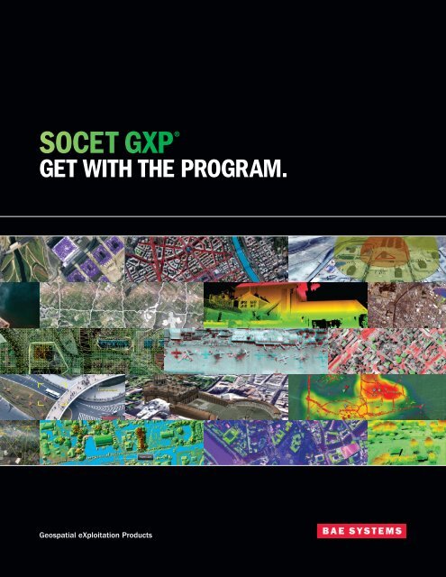
<strong>SOCET</strong> <strong>GXP</strong> ®GET WITH THE PROGRAM.<strong>Geospatial</strong> <strong>eXploitation</strong> <strong>Products</strong>
EXTREME ANALYSISBUNDLEGEOANALYSIS TARGETINGBUNDLEPROBUNDLEOne package — many advantages 2GEOANALYSISBUNDLEWorldwide support and training 3Image analysisFUNCTIONALITY<strong>Geospatial</strong> analysisIntuitive AND customizable 5Flexible and efficient 7Intelligence reporting 9product creation 133-D modeling and visualization 15LiDAR and Terrain visualization 19Feature analysis 21Remote sensing 23Accuracy and triangulation 25Orthorectification 27Video analysis 28Targeting 29Activity-based intelligence 30Application development 31
Data fusionAnalysis3-D visualizationProduct generation<strong>Geospatial</strong>-intelligence reporting1
One package — many advantagesStop working with multiple packages —save time, money, and resources<strong>SOCET</strong> <strong>GXP</strong> supports multiple projects and missions. Workflows aredesigned to reduce production cycle times, eliminate the redundancy ofmultiple specialty software packages, and maximize the interoperabilitywith other geospatial technologies, such as Google Earth, TerraGo ®GeoPDF ® , <strong>SOCET</strong> for ArcGIS ® , Esri ® Geodatabase, and <strong>GXP</strong> Xplorer.The configurable user interface and application programming interface (API) is the same for bothMicrosoft Windows®and Oracle® Solaris X86, with consistency across platforms and licensedproduct capabilities.GEOANALYSISBUNDLEGEOANALYSIS TARGETINGBUNDLEPRICEEXTREME ANALYSISBUNDLEPROBUNDLEImage analysisFUNCTIONALITY<strong>Geospatial</strong> analysis2
Define your toolsetAdd frequently used tasks tothe Quick Access Toolbar.Find tools easilyRelated functionality andbuttons are grouped together.
Reduce screen clutterMenus and tabs update dynamically. Toolsnot used for the current task are hidden.Access tools quicklyButtons execute a taskor begin a process.Advanced functionalityLaunch related windows withadvanced functionality.Intuitive AND customizableMake it your ownThe user interface offers quick access to an unprecedented range of versatile tools. Add or removebuttons according to the workflow. Minimize the toolbar to increase the viewable image space.Logical working environment<strong>SOCET</strong> <strong>GXP</strong> provides a common framework to extractfeatures, create products, and store imagery. Functionalityto dock windows provides accessibility to drawing tools,auto labels, and built-in templates. Windows can bestacked to display tabs for selection, or separated tomove around the desktop freely. Drawing tools displaywith an accompanying cue card to provide instructionand a visual reference of the selected tool.Jump-start productivityMost operations within <strong>SOCET</strong> <strong>GXP</strong> are accessed with afew mouse clicks, resulting in superior workflow efficiencyand usability. Customizable preferences and robust 64-bitprocessing increase productivity, while keyboard shortcutsprovide quick access to an array of software functionality.Workspace ManagerThe Workspace Manager is the starting point for all<strong>SOCET</strong> <strong>GXP</strong> workflows and offers convenient access toload imagery, import imagery, connect to a database, andview job processing status.MultiportThe Multiport is a multi-functional viewport and thepredominant workspace for viewing, analyzing andmodifying imagery, and creating 3-D products. Flexibleoptions are available for customizing the workingenvironment based on the tools most frequently used.Job QueueThe Job Queue manages the number of processesdedicated to a specific job, and enables the scheduling oflarge jobs to run when convenient for maximized efficiency.ToolsWindows related to the current task can bedocked to the perimeter of the Multiport,the predominant viewing and exploitationwindow, or moved around the desktop. Imagerycourtesy of Ordnance Survey Great Britain.−−Dockable windows:ToolBox, Layer Manager,cue cards, count graphics,template list, auto labels−−−−−−Quick Access ToolbarWeb Map ServiceCustomized preferences5
Flexible andefficientExploit and process on-the-flySee your data in a new light. Examine everyfacet of an image with familiar tools — dragand-drop,pan, zoom in-and-out, and rotate.Apply annotations, extract 3-D features, andadd icons with the ToolBox functionality.Observe patterns of life in microscopic detail to improvesituational awareness. Rehearse and exploit data.Build geospatial products and reports. Generate anddeliver actionable intelligence to users at the edge.The Multiport can be split into four differentpanels to view multiple data sets. Use oneas a reference from previous reporting,or compare two images in one Multiport.Satellite imagery courtesy of GeoEye.View, analyze, and modify data, extractfeatures, apply annotations, and create3-D models. All buttons and tools alwaysremain in the same functional group onthe same tab, no matter how you resize thewindow. Imagery courtesy of DigitalGlobe.Tools−−−−−−Smooth and continuous pan,roam, rotate, and zoomOverview displayWeb Map Service andmap background−−−−−−−−Ortho on-the-flyContinuous epipolar rectificationSpectral algorithmsPan-sharpening on-the-fly7
Analyze and compare images and terrainAdvanced image processing algorithms assist with change detection,image classification, trend analysis, tracking patterns of activity, and findinganomalies in imagery.Analyze coincident terrain to determine height and volumetricdifferences in areas for construction, tunneling, stock pile inventory,environmental analysis, and damage such as sedimentation,flooding, landslides, earthquakes, and bomb damage assessment.Highlight, measure, and store areas of interest (AOI).Use the two-color compare tool to view changes in old vs. new imagery. Toolssuch as Glove Align, Registration, and Triangulation tie images together foran accurate assessment of changes over time.Ground space vs. display spaceGround space graphics are generated using latitude, longitude, and elevation(or X, Y, and Z) coordinates rather than pixel grid calculations. <strong>SOCET</strong> <strong>GXP</strong>employs ground space graphics to maximize registration when comparingimages, features, and other geospatial data from multiple sources anddates. The software stores graphics with their corresponding error budget inground units for future analysis and to maintain data integrity.DSMs from stereo satellite imagery before andafter the 2010 Haiti earthquake. Red showsareas of negative elevation change indicatingearthquake damage. Stereo imagery for the DSMgeneration courtesy of DigitalGlobe and GeoEye.Two-color compare of temporal variant images (blueis new and red is fled) over the Toussaint LouvertureInternational Airport in Port-au-Prince, Haiti. WorldView-2satellite. Imagery courtesy of DigitalGlobe comparedwith a U.S. Air Force handheld aerial photo.Extract terrain modelsAnalyze, create, and edit terrain and elevation data; update geodatabaseswith 2-D and 3-D features; generate image and map products such as DigitalTerrain Models (DTMs) and Digital Surface Models (DSMs), perspectivescenes, slope maps, image maps, orthophotos, true orthophotos, mosaics,and pan-sharpened images — all in a fraction of the time required usingother tools.Automatic Terrain Generation (ATG) creates DSMs or DTMs from stereoimagery. Triangulated irregular network (TIN) or grid output formats areoptional, with densities that start as high as the ground sample distance ofthe stereo imagery. Accuracy is on the sub-pixel level.Auto DTEDCatalog and manage Digital Terrain Elevation Data (DTED). The DTED filesare automatically associated with geospatial data and processed as anadded component to ensure successful, accurate exploitation. Auto-loadingDTED is important for visualizing imagery and creating Virtual Mosaics ofimagery using Ortho On-the-Fly, or merging panchromatic and multispectralimages together with terrain, providing rigorous pan-sharpening. Workflowsthat benefit from auto-loading DTED include seeding the ATG and automatictie-point measurement processes.Tools−−−−−−−−−−−−−−Glove alignTriangulationMulti-color compareSwiperPortholeTransparencyFlicker and animation−−−−−−−−−−−−Terrain registrationATGVolumetric analysisTerrain Shaded Relief (TSR)Slope mapContours8
Intelligence reportingBe prepared for the missionView and annotate all geospatial-intelligence data critical to the mission.Identify borders and features; define entry points, dimensions, and otherimportant structures surrounding the primary area of interest. Apply atemplate and send to PowerPoint ® to create slides for intelligence reporting.9
Intelligence reportingThe rigorous pan-sharpened image combinesthe high-resolution panchromatic band with aGSD of 0.52 m with the 8-band multispectralimage to add color without writing a new imagefile. The Sequence Graphics tool automaticallynumbers an alphanumeric sequence to plot foreasy reference, and the on-the-fly display allowsfor quick analysis and product generation.Imagery courtesy of DigitalGlobe.Registration of a handheld U.S. Air Forcephotograph taken by Airman 1st Class PerryAston with a Nikon D3 35 mm cameraon January 16, 2010, to a DigitalGlobeWorldView-2 rigorous pan-sharpenedimage acquired on January 15, 2010.Imagery courtesy of DigitalGlobe.10
IN THE FIELDA 7.0 magnitude earthquake with an epicenter 10 mileswest of Port-au-Prince, Haiti, occurred on January 12,2010, killing tens of thousands of people, devastatingthe poor, third-world country. The Toussaint LouvertureInternational Airport in Port-au-Prince remained openaccepting foreign flights to support the relief mission.DigitalGlobe’s WorldView-2 satellite began acquiringimagery shortly after the earthquake.DigitalGlobe and GeoEye are two of the many satellitesensors <strong>SOCET</strong> <strong>GXP</strong> supports. When opening imagesfrom supported sensors, <strong>SOCET</strong> <strong>GXP</strong> uses metadataincluded with the images to derive exact coordinatesfor direct association to the ground.On January 16, 2010, Airman 1st Class Perry Aston useda Nikon D3 35 mm digital camera to photograph theToussaint Louverture International Airport from the air.This imagery did not contain metadata for georeferencing.However, when used with <strong>SOCET</strong> <strong>GXP</strong>, the unreferencedimage was registered to WorldView-2 imagery for temporalanalysis and ground space extraction.The 8-band multispectral image and high-resolution,panchromatic DigitalGlobe image were merged anddisplayed in real-time for viewing and analysis of therigorous pan-sharpened result. Using rigorous sensormodels, measurements can be made in true 3-D spacefor storage and retrieval to support information over time.11
product creationCreate custom productsCreate detailed, custom geospatial products and reports tocollaborate with colleagues and mission partners in the field.Templates and product creationZoom-in on an AOI, add graphics and annotations, apply a pre-defined product template, orcreate a custom template. Snapshot to PowerPoint, save as a National Imagery TransmissionFormat (NITF) product, or output as a TerraGo-layered 2-D GeoPDF or geospatial 3-D PDF.Product templates display with labels extracted from various sources automatically includingimagery metadata, classification markings, system date/time, and user login name. Customtemplates can be saved for selection and subsequent use for generating products.Standard Profile for Imagery Access (SPIA) tagsUse auto-populated Standard Profile for Imagery Access (SPIA) tags to derive andpopulate important details into finished geospatial products. Product labels and featureattributes automatically display with data values associated with current data tags.Snapshot the workspace toPowerPoint, or export to GeoPDF.Imagery courtesy of DigitalGlobe.13
IN THE FIELDOrdnance Survey Great Britain (OSGB) captured anaerial view of the 2012 Summer Olympic park in London,England. <strong>SOCET</strong> <strong>GXP</strong> was used to extract 3-D featuresto show progress for buildings under construction. Fullengineering models in COLLADA format were included toshow a visual of current buildings with views of completedbuildings. Projective sensor models for images from theaerial photography, taken by the OSGB, and satelliteimagery, were loaded into a Stereo or a 2-D Multiport for3-D feature collection.Underlying terrain was created automatically using theATG functionality and the input stereo imagery. The ATGprocess generated DSM and bare-earth terrain models.A half-meter TIN was extracted from the stereo imagesto accurately model the earth. The terrain model and 3-Dfeatures were textured with imagery automatically andviewed in the 3D Multiport for site progress assessment.17
Feature extractionCreate, collect, edit, query, store, and retrievegeospatial features and their associated attributeswith information captured directly within the <strong>SOCET</strong> <strong>GXP</strong>environment. <strong>SOCET</strong> <strong>GXP</strong> feature databases, shapefiles,and Esri geodatabases are available for immediate useand dissemination.Esri geodatabasesConnectivity to the Esri Geodatabase provides functionalityto the <strong>SOCET</strong> for ArcGIS and ArcMap®functionality.<strong>SOCET</strong> for ArcGIS displays the ArcMap canvas and enablesaccess to the drawing and editing tools within <strong>SOCET</strong> <strong>GXP</strong>to extract features and superimpose attributes on imagery.<strong>SOCET</strong> for ArcGIS stores and retrieves the feature data,and vectors of the imagery display in a Stereo Multiportwith the associated sensor model. The Spatially EnabledExploitation (SEE) initiative of the National <strong>Geospatial</strong>-Intelligence Agency to standardize data formats is anextension of the <strong>SOCET</strong> for ArcGIS functionality supportedwithin <strong>SOCET</strong> <strong>GXP</strong>.Complementary formats<strong>SOCET</strong> <strong>GXP</strong> loads shapefiles and Keyhole MarkupLanguage (KML) data into a Multiport as a data layer.The Safe Software FME plug-in used with <strong>SOCET</strong> <strong>GXP</strong>offers access to more than 275 formats. It transformsthe data between a <strong>SOCET</strong> <strong>GXP</strong> feature database andspatial data resources, including CAD, GIS, and vectorfeature formats for compatibility with numerous analytical,visualization, simulation, and engineering tools.20
Feature analysisWe have connectionsAnticipate conditions, such as rough terrain orcollapsed bridges, and accurately pinpoint operationalor evacuation routes. Reduce the dependency onexternal specialty packages for timely situationalawareness, visualization, and data collection.<strong>SOCET</strong> <strong>GXP</strong> Multiport synchronizedwith <strong>SOCET</strong> for ArcGIS window.Imagery courtesy of DigitalGlobe.Tools−−−−Advanced drawing and featurecollection tools include buffers,parallel lines, trim/extend, thin levelof detail, square, curve, arc, static,freehand/stream digitize, monotonic,copy/rubber stamp, move, rotate,scale, 3-D extrude, and 3-D walls2-D and 3-D snapping for grid, lines,points/vertices, and planes, plusa custom snap cursor to improvecollection efficiency by providingvisual cues during extraction−−−−−−−−−−−−−−−−−−−−Automatic attributionSpecification filesStyle sheetsFeature databaseFeature querySEEStereo Model Manager<strong>SOCET</strong> for ArcGISCOLLADA and KMZ modelsFME and SketchUp integration21
IN THE FIELDMultispectral, 8-band, WorldView-2 images takenafter the 2011 earthquake and tsunami in Japanare used to classify oil leaking into the ocean froma damaged refinery. The extent and location of oiland debris in the ocean is monitored over time toassist relief efforts, determine environmental impact,and expose potential navigational hazards.<strong>SOCET</strong> <strong>GXP</strong> algorithms track the footprint of oilwashed into the ocean. Anomaly detection andsupervised classification algorithms quickly establishthe size and location of debris when compared toits surroundings. Viewing and exploitation windowsare linked when roaming to display the results ofmultiple algorithms simultaneously. The spectralsignature of the supervised classification is saved insubsequent image collections for rapid classification.22
The Xport is a specialized Multiport used toview an image with various enhancementchains or algorithms applied. WorldView-2imagery courtesy of DigitalGlobe.Remote sensingWhat’s in my image? Get answers — fastDiscover solutions to your problems using more than just visible light. Analyze complexhyperspectral imagery (HSI), multispectral imagery (MSI), synthetic-aperture radar (SAR) data,and LiDAR. Detect a camouflaged vehicle in a heavily forested area, identify oil spills, anddetermine the health of crops or vegetation with simple interfaces and real-time processing.Remote sensing and Advanced <strong>Geospatial</strong>Intelligence (AGI) workflowsAnalyzing HSI, MSI, SAR, and panchromatic imagery fromnumerous satellites in real time without reformattingthe input imagery provides quick and accurate results.<strong>SOCET</strong> <strong>GXP</strong> combines photogrammetry (rigorous sensormodeling) and advanced image exploitation to makeintegrated analysis a reality. Noisy or non-discriminatingbands can be masked to avoid processing the entire datacube. Results are built in memory rather than written toa file to execute multiple algorithms on-the-fly. ComplexSAR imagery is used natively for real-time processingincluding display of the detected image automatically.The <strong>SOCET</strong> <strong>GXP</strong> user interface and tools bringadvanced full-spectrum <strong>Geospatial</strong> intelligence(GEOINT) workflows to the standard imagery analyst’sdesktop. Anomaly detection algorithms tip andqueue the analyst to abnormalities and AOIs.Third-party developers create algorithms and pluginson the <strong>SOCET</strong> <strong>GXP</strong> platform to increase theutility of geospatial-intelligence derived from fusingspectral data with HSI and MSI algorithms.The XportThe Xport is a specialized Multiport that displays up to16 linked preview panes, each with a different imageprocessing chain. Visualize results while roaming, exploitmultiple band composites, process algorithms, bandmath, and other image enhancements simultaneously,and save specific Xport configurations for reuse.iCee atmospheric correctionImagery used for land cover mapping is often contaminatedby the effects of atmospheric particles. The atmosphericcorrection algorithm converts pixels to ground materialreflectance to enable accurate spectral matches andsignature comparisons across different sensors.Tools−−−−−−−−−−−−−−−−Band mathScatter plotFind-in-Scene(Supervised classification)Pan-sharpeningSpectral masksDestripingReflectance calibrationComponents analysis−−−−−−−−−−−−−−−−Unsupervised classificationLinear spectral unmixingSpectral librariesAnomaly detectionSpectral change detectionImage colorizationMSI compositesHistograms23
IN THE FIELDThe first step in creating accurate geospatial productsis triangulation. On April 27, 2011, a massive tornadotouched down in Tuscaloosa, Ala., killing 50 peopleand causing damage to more than 5,000 homes.Two days later, the National Oceanic and AtmosphericAdministration’s (NOAA) National Geodetic Survey (NGS)flew an aerial mission using their Trimble®Digital SensorSystem (DSS) to create a digital orthophoto mosaic of thearea to assist relief efforts, and help assess the damage.<strong>SOCET</strong> <strong>GXP</strong> uses imagery and metadata in its nativeformat, eliminating the need to reformat data. Color TIFFimagery from the Trimble DSS is directly associated withthe Trimble POSEO IMU/GPS data within the <strong>SOCET</strong> <strong>GXP</strong>Frame Import process. This process associates theexterior and interior camera orientation information fromthe metadata to the imagery allowing it to be tied to Earth— in this case, the latitude and longitude of Tuscaloosa.24
Interactive point measurement allowsthe review and measurement of tie andcontrol points on separate image panels.Imagery courtesy of NOAA/NGS.Accuracy and triangulationAutomation is the key to accurate resultsAdvanced triangulation improves accuracy. Complex photogrammetric procedures are simplifiedto enable novice-to-expert users to complete triangulation effortlessly, with options to performadvanced operations. <strong>SOCET</strong> <strong>GXP</strong> reads data from an unprecedented number of image sensorsand supports sensor modeling for all sensors. Using data in its native format increases thecapacity to generate accurate results, and delivers performance and usability advantages.Metadata is often included with imagery to provide a direct associationto the ground when used within <strong>SOCET</strong> <strong>GXP</strong>, such as satellite imagery.A catalog of DTED files provides elevation information for the groundlocation of the imagery allowing the images to align with the ground andto each other within <strong>SOCET</strong> <strong>GXP</strong>.Triangulation displaying the connectionsbetween images and the associatedautomatically generated tie points; colorcoded by the number of measurements.Imagery courtesy of NOAA/NGS.TriangulationTriangulation improves the accuracy of input images, and managesstrips and blocks of mixed source imagery. Ground control, imagecontrol, and/or automatic tie point measurements are processes usedto tie images together, and to the ground. These processes improveaccuracy by adjusting the metadata of input images based on sensorparameter accuracies and derived covariance data. Fully weighted leastsquares bundle adjustment, blunder detection, and graphical analysisprovide full error propagation and reporting. Resulting images are usedto support downstream measurements, feature extraction, terrainextraction, orthophoto production, and processes with error attributes.Tools−−−−−−Triangulation block setupand managementAutomatic tie point matchingGraphical analysis−−−−−−Control point editorInteractive Point MeasurementAutomatic Point Measurement25
IN THE FIELDThe flight mission for the NOAA/NGS relief operationacquired imagery with 30 percent overlap with the intentto produce orthophotos and a high-resolution, largeareacoverage orthophoto mosaic. The entire block ofimagery was loaded into a single <strong>SOCET</strong> <strong>GXP</strong> Multiportafter triangulation, and the Ortho On-the-Fly functionalityapplied. Image pixels stretched and warped to displaythe image as if it were taken from nadir throughoutthe entire image, or a mosaic of many images.Seam lines for an image mosaic are generatedautomatically and displayed for editing withOrtho On-the-Fly processing applied resultingin edits that detail the actual product output.Imagery courtesy of NOAA/NGS.26
OrthorectificationDo it yourself on-the-flyCreate orthorectified images in real time,and convert images when orthophotos ororthophoto mosaic products are required.Ortho On-the-FlyOrtho On-the-Fly completes the orthorectifiedprocess in real-time, providing instant visualizationof imagery and data for analysis and exploitation.Ortho ManagerThe Ortho Manager automatically generates seamlines to build mosaicked orthophotos. Convert one ormore original images into an orthophoto or orthophotomosaic by transforming the pixels to their properposition according to the sensor model, terrain, andfeature information. Quickly correct the appearanceof building lean or other features to position them intheir exact geometric location. Edit seam lines to refinethe appearance of the mosaic by routing them aroundobstacles, such as buildings, lakes, or bridges.Tools−−−−−−True orthophotosOrtho sheets/tilesRaster Product Format (RPF)−−−−−−Automatic seam lineInteractive seam line editingMosaic27
Video analysisTrack a moving targetView details from the video track includedin metadata, such as location, speed,and direction.Integrate video to record a moving object for playbackand analysis. Confirm illicit activities, monitor portsand borders, and conduct surveillance missions.Extract still frames to create customized products.Record, play, and analyzeVideo Analysis reads and displays live video feeds or saved video files fromairborne sensors using image metadata and a video sensor model. Thissensor model establishes accurate geopositioning for real-time situationalawareness, historical data analysis, forensic analysis, and intelligencereporting. Integrate with Google Earth to track moving objects or vehiclesto provide sensor position, field of view, and situational awareness. Logand edit events for reference during the video, and add filters such asedge detection while the video plays. Mission Manager functionality allowsyou to configure pre-mission details including product save locations,keywords, and targets, which enables a collaborative analysis environment.28
Automatically find tie points between a singleimage and control images. View your targets,range rings, and joint mensurated point ofimpact in 3-D. WorldView-2 image of Kabul,Afghanistan, courtesy of DigitalGlobe.TargetingEvery minute countsFast and precise with proven accuracy. Fuseanalytical data with operational strategies andtasks. Minimize manual measuring and completeyour targeting tasks with confidence.Tools−−−−−−Automatic registrationSource selectionConfigurable target iconsfor output productsPrecision mensuration<strong>BAE</strong> <strong>Systems</strong>’ CGS program is the DoD standard for precisiontargeting, geopositioning services, and photogrammetric applications,representing more than 25 years of development. CGS combines with<strong>SOCET</strong> <strong>GXP</strong> to provide an all-source precision geolocation capabilitywith reliable and accurate 3-D coordinates and statistically valid errorestimates. CGS uses <strong>SOCET</strong> <strong>GXP</strong> as the integrated viewer to deployas a standalone targeting workstation on Oracle Solaris x86 andMicrosoft Windows platforms. The defense and intelligence communitiesrecognize <strong>SOCET</strong> <strong>GXP</strong> and CGS as reliable, precision geopositioningservices that set the standard for target-location error determination.29
Activity-based intelligenceGet answers to your most difficult questionsFind order in the chaosActivity from multiple images and video streamsproduces an excessive amount of data – all ofwhich must be analyzed. Active-Based Intelligence(ABI) provides an analytical technique to visualizedisparate data in the imagery, and provides avisual reference in which to track events.ABI used with collaborative software streams throughhours of video quickly. Apply filters and algorithmsto attributes within the video to locate specificpatterns of behavior, such as a certain time of day,or to track movements and recurring events.Information is georeferenced to provide the exactlocation of vehicles, buildings, or individuals.Analyze patterns of life and complex networks, and makedecisions based on the results. Isolate events and shareactivity data through linked Activity Stores. ABI enablesintelligent decision making based on past movementsand assists to predict events before they occur.ToolsCreate ABI system events in <strong>SOCET</strong> <strong>GXP</strong> usingWeb services. Imagery courtesy of DigitalGlobe.−−−−−−Activity StoreEvent Web ServiceDockable ABI ToolboxAnalysts create ABI system events in <strong>SOCET</strong> <strong>GXP</strong> using Web services.30
Application developmentLeverage the functionalityReduce the cost for system developers and system integrators, and savemillions of dollars. The <strong>SOCET</strong> <strong>GXP</strong> API eliminates the time and expenserequired to create, maintain, and support stove-piped ELT solutions.Focus on your missionSpend development dollars on mission requirements.The <strong>SOCET</strong> <strong>GXP</strong> API enables third-party applicationsto communicate with the software and providesdirect integration into larger system architectures.Existing programs that build on <strong>SOCET</strong> <strong>GXP</strong>reap the benefits of immediate exposure to<strong>BAE</strong> <strong>Systems</strong>’ global community of more than15,000 trained analysts and users.ToolsThe <strong>SOCET</strong> <strong>GXP</strong> API is popular with systemsintegrators such as Boeing, Lockheed Martin, NorthropGrumman, Raytheon, SAIC, and General Dynamics.−−−−−−C++ API interfaceSource code available for sample applicationsComprehensive documentation31
About <strong>BAE</strong> <strong>Systems</strong><strong>BAE</strong> <strong>Systems</strong> is a global defense and securitycompany with approximately 100,000 employeesworldwide. The Company delivers a full range ofproducts and services for air, land, and naval forces,as well as advanced electronics, security, informationtechnology solutions, and support services.<strong>BAE</strong> <strong>Systems</strong> is a global provider of software forimage analysis, geospatial production, mapping, 3-Dvisualization, video analysis, and photogrammetry. Formore than 40 years, <strong>BAE</strong> <strong>Systems</strong> been a trusted supplierof imagery, geospatial products, and services to thedefense and intelligence communities, and commercialmarkets. <strong>BAE</strong> <strong>Systems</strong> has experience and depth inmanaging, implementing, and developing products witha wide variety of other industry-standard applicationsthat support geospatial and related tradecrafts, andexperience developing GIS tools. This experiencerequires knowledge of the scientific underpinningof the technologies, methods, and techniques inuse to solve geospatial production challenges.<strong>Geospatial</strong> <strong>eXploitation</strong> <strong>Products</strong> (<strong>GXP</strong>®)<strong>GXP</strong> develops powerful software tools used to deliverhighly accurate geospatial and intelligence data. Basedin San Diego, Calif., <strong>GXP</strong> provides direct worldwide salesand support. In some areas, this is done in conjunctionwith a select team of distributors to facilitate greatercoverage and to provide effective customer service.<strong>GXP</strong> offers its customers top-quality technical supportand training to optimize their return on investment.32
For more information on <strong>BAE</strong> <strong>Systems</strong> and <strong>GXP</strong> products:AmericasTelephone 800 316 9643 | 703 668 4385Fax 703 668 4381gxpsales@baesystems.comAsia, Australia, and Pacific RimTelephone +61 0 2 6229 1665Fax +61 0 2 6230 4345gxpsales.apac@baesystems.comEurope, Middle East, and AfricaTelephone +44 1223 370022Fax +44 1223 370040gxpsales.emea@baesystems.comIndiaTelephone +91 11 43412345Fax +91 11 43412373gxpsales.india@baesystems.comFor additional contact information and worldwide distributors, please visit our website:www.baesystems.com/gxp© 2012 <strong>BAE</strong> <strong>Systems</strong>. All rights reserved.Trademarks: <strong>GXP</strong>, <strong>GXP</strong> Xplorer, Multiport, <strong>SOCET</strong> <strong>GXP</strong>, <strong>SOCET</strong> SET, Virtual Mosaic,ViTec, and Xport are trademarks or registered trademarks of <strong>BAE</strong> <strong>Systems</strong>.Other brands, product names, and trademarks are property of their respective owners.Approved for public release as of 05/25/2012.
<strong>SOCET</strong> <strong>GXP</strong> In the field<strong>SOCET</strong> <strong>GXP</strong> software is used on the frontlines for homelanddefense and security, and systems integrators working onNational <strong>Geospatial</strong>-Intelligence Agency programs to produceGEOINT products. The U.S. Army has procured <strong>SOCET</strong> <strong>GXP</strong>for Army-wide implementation into its Imagery Workstationbaseline for operational units, establishing the software as itsprimary GEOINT exploitation tool.Customers include:−−Defense forces−−Intelligence agencies−−Homeland security−−<strong>Systems</strong> integrators−−National and local mapping agencies−−State, local, and regional governments−−Private photogrammetry, mapping,surveying companies−−Transportation departments−−Natural resources management consultants−−Universities, colleges, research organizations−−Image scientists