

land subsidence and earth fissures in arizona - The Arizona ...
land subsidence and earth fissures in arizona - The Arizona ...
land subsidence and earth fissures in arizona - The Arizona ...

You also want an ePaper? Increase the reach of your titles
YUMPU automatically turns print PDFs into web optimized ePapers that Google loves.
LAND SUBSIDENCE & EARTH FISSURES IN ARIZONA<br />
LAND SUBSIDENCE AND EARTH FISSURES<br />
IN ARIZONA<br />
ARIZONA L<strong>and</strong> Subsidence Group<br />
L<strong>and</strong>, Infrastructure <strong>and</strong> Water<br />
Research <strong>and</strong> Informational Needs<br />
For Effective Risk Management<br />
By<br />
<strong>Arizona</strong> L<strong>and</strong> Subsidence Group (ALSG)<br />
December 2007<br />
Contributed Report CR-07-C<br />
<strong>Arizona</strong> Geological Survey
LAND SUBSIDENCE & EARTH FISSURES IN ARIZONA<br />
ARIZONA L<strong>and</strong> Subsidence Group<br />
L<strong>and</strong>, Infrastructure <strong>and</strong> Water<br />
CONTENTS<br />
PREFACE.............................................................................................................................. i<br />
EXECUTIVE SUMMARY ....................................................................................................... ii<br />
1 INTRODUCTION........................................................................................................ 1<br />
2 LAND SUBSIDENCE AND EARTH FISSURES AS A GEOLOGIC PROCESS.......... 2<br />
3 IMPACTS OF LAND SUBSIDENCE AND EARTH FISSURES ................................ 5<br />
4 IMPACTS ON SUSTAINABILITY AND GROWTH IN ARIZONA.............................. 9<br />
5 ADDRESSING EARTH FISSURES IN ARIZONA..................................................... 10<br />
6 SHORTCOMINGS IN LAND SUBSIDENCE AND EARTH FISSURE SCIENCE...... 11<br />
7 RECOMMENDATIONS.............................................................................................. 16<br />
8 BENEFITS TO THE CITIZENS AND STAKEHOLDERS OF ARIZONA ................... 18<br />
9 REFERENCES........................................................................................................... 19<br />
APPENDIX A – ARIZONA LAND SUBSIDENCE GROUP MEMBER LISTING<br />
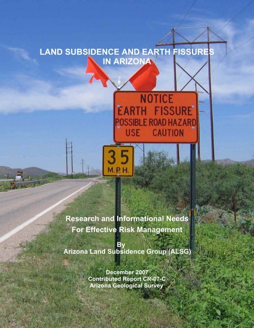
Cover page:<br />
Sign erected <strong>in</strong> 2006 warn<strong>in</strong>g motorists of <strong>earth</strong> fissure hazard across Dragoon Road <strong>in</strong><br />
Cochise County near the Apache Power Plant. (photo by Ray Harris)<br />
Page
LAND SUBSIDENCE & EARTH FISSURES IN ARIZONA<br />
PREFACE<br />
<strong>The</strong> <strong>Arizona</strong> L<strong>and</strong> Subsidence Group (ALSG) was orig<strong>in</strong>ally created by <strong>in</strong>terested geological<br />
<strong>and</strong> eng<strong>in</strong>eer<strong>in</strong>g professionals as a technical forum to discuss the state of knowledge regard<strong>in</strong>g<br />
<strong>subsidence</strong> <strong>and</strong> <strong>earth</strong> <strong>fissures</strong> <strong>in</strong> <strong>Arizona</strong>, <strong>and</strong> to share <strong>in</strong>formation <strong>and</strong> experiences. <strong>The</strong><br />
<strong>Arizona</strong> Geological Survey (AZGS) subsequently requested that the ALSG serve as a technical<br />
advisory committee for their State-m<strong>and</strong>ated Earth Fissure Mapp<strong>in</strong>g Program. <strong>The</strong> ALSG is a<br />
voluntary collaboration of professionals that <strong>in</strong>cludes representatives from AZGS, the <strong>Arizona</strong><br />
Department of Water Resources (ADWR), the <strong>Arizona</strong> Department of Environmental Quality<br />
(ADEQ), the Flood Control District of Maricopa County (FCDMC), the United States Geological<br />
Survey (USGS), P<strong>in</strong>al County, the University of <strong>Arizona</strong>, <strong>Arizona</strong> State University, various<br />
utilities serv<strong>in</strong>g <strong>Arizona</strong>, <strong>and</strong> consult<strong>in</strong>g geoscience <strong>and</strong> eng<strong>in</strong>eer<strong>in</strong>g specialists.<br />
This white paper has been created by ALSG to help educate stakeholders <strong>and</strong> decision makers<br />
by describ<strong>in</strong>g the geological features <strong>and</strong> processes of <strong>l<strong>and</strong></strong> <strong>subsidence</strong> <strong>and</strong> <strong>earth</strong> <strong>fissures</strong>, <strong>and</strong><br />
the hazards they create. This paper presents the current <strong>and</strong> future technical needs that exist <strong>in</strong><br />
terms of basic knowledge, available data, <strong>and</strong> the state of professional practice.<br />
ARIZONA L<strong>and</strong> Subsidence Group December 2007 i<br />
L<strong>and</strong>, Infrastructure <strong>and</strong> Water
LAND SUBSIDENCE & EARTH FISSURES IN ARIZONA<br />
EXECUTIVE SUMMARY<br />
L<strong>and</strong> <strong>subsidence</strong> <strong>and</strong> <strong>earth</strong> <strong>fissures</strong> have been part of the <strong>l<strong>and</strong></strong>scape of southern <strong>and</strong> south<br />
central <strong>Arizona</strong> for at least the past seventy years. With urban growth now exp<strong>and</strong><strong>in</strong>g <strong>in</strong>to<br />
former agricultural <strong>and</strong> undeveloped desert <strong>l<strong>and</strong></strong>s, the geologic hazards related to <strong>subsidence</strong><br />
<strong>and</strong> <strong>fissures</strong> are be<strong>in</strong>g steadily encroached upon with detrimental <strong>and</strong> costly impacts. <strong>The</strong>re is a<br />
grow<strong>in</strong>g need for <strong>in</strong>formation <strong>and</strong> tools to deal with these hazards.<br />
Due to the regional impacts of <strong>subsidence</strong> <strong>and</strong> <strong>earth</strong> <strong>fissures</strong>, policy-makers are faced with<br />
mak<strong>in</strong>g <strong>in</strong>formed risk management decisions to mitigate impacts of these hazards on public<br />
safety <strong>and</strong> welfare. Unfortunately, a sound technical framework for address<strong>in</strong>g <strong>subsidence</strong>related<br />
geological hazards is currently lack<strong>in</strong>g <strong>and</strong> some <strong>Arizona</strong> citizens are at risk.<br />
Legislation enacted <strong>in</strong> <strong>Arizona</strong> dur<strong>in</strong>g 2006 targets the identification <strong>and</strong> public disclosure of<br />
<strong>earth</strong> <strong>fissures</strong> with the implied <strong>in</strong>tent of mitigat<strong>in</strong>g hazards by avoidance. Once maps are<br />
prepared <strong>and</strong> released, however, best practices <strong>and</strong> possible statutory changes will need to be<br />
identified <strong>and</strong> implemented by state <strong>and</strong> local policy makers. Currently, there are no technical<br />
guidel<strong>in</strong>es or protocols for def<strong>in</strong><strong>in</strong>g fissure zones or for develop<strong>in</strong>g nearby <strong>l<strong>and</strong></strong>s. In def<strong>in</strong><strong>in</strong>g<br />
fissure zones, potential concerns <strong>in</strong>clude: development restrictions (i.e., build<strong>in</strong>g <strong>and</strong><br />
<strong>in</strong>frastructure setbacks from the fissure); mitigation techniques; <strong>and</strong> potential future fissure<br />
development. With few exceptions little is be<strong>in</strong>g done to (a) ga<strong>in</strong> knowledge of the orig<strong>in</strong>,<br />
mechanics, <strong>and</strong> behavior of <strong>l<strong>and</strong></strong> <strong>subsidence</strong> <strong>and</strong> <strong>earth</strong> <strong>fissures</strong>; (b) identify areas of potential<br />
<strong>earth</strong> fissure development <strong>and</strong> the magnitude of effects; (c) address groundwater withdrawal <strong>in</strong><br />
such a way as to impede future <strong>earth</strong> fissure formation; <strong>and</strong> (d) develop eng<strong>in</strong>eer<strong>in</strong>g practices<br />
<strong>and</strong> mitigation measures needed to address associated hazards <strong>and</strong> to substantially reduce<br />
risks.<br />
<strong>Arizona</strong>’s new Earth Fissure Mapp<strong>in</strong>g Program represents an important first step <strong>in</strong> meet<strong>in</strong>g the<br />
State’s responsibility for public safety <strong>and</strong> welfare. What is needed now is a comprehensive<br />
program to address <strong>earth</strong> <strong>fissures</strong> phenomenologically. It is important to know where <strong>fissures</strong><br />
will next appear; how they evolve <strong>and</strong> how fast they propagate; what the impact to<br />
structures/<strong>in</strong>frastructure is; <strong>and</strong> what eng<strong>in</strong>eer<strong>in</strong>g solutions can be applied to reduce risks. If<br />
<strong>Arizona</strong> limits it efforts to mapp<strong>in</strong>g <strong>earth</strong> <strong>fissures</strong>, we can anticipate more damage to structures<br />
<strong>and</strong> <strong>in</strong>frastructure, with related economic losses, <strong>and</strong>, more importantly, a burgeon<strong>in</strong>g threat to<br />
human health <strong>and</strong> safety.<br />
As groundwater m<strong>in</strong><strong>in</strong>g cont<strong>in</strong>ues, <strong>l<strong>and</strong></strong> <strong>subsidence</strong> <strong>and</strong> <strong>earth</strong> <strong>fissures</strong> will cont<strong>in</strong>ue to threaten<br />
the <strong>Arizona</strong> public. <strong>The</strong>se geohazards can result <strong>in</strong> damage to structures designed <strong>and</strong><br />
constructed to house, serve, <strong>and</strong> protect the general public as well as public <strong>in</strong>frastructure<br />
<strong>in</strong>clud<strong>in</strong>g roads, dams, canals, bridges, <strong>and</strong> utilities. A few specific examples of damage <strong>and</strong><br />
human safety threats are bulleted below.<br />
• Luke Air Force Base <strong>and</strong> Vic<strong>in</strong>ity (1992) - Dysart Dra<strong>in</strong> flow reversal with 100 homes<br />
flooded, base closure for 3 days, <strong>and</strong> about $3 million <strong>in</strong> damage.<br />
ARIZONA L<strong>and</strong> Subsidence Group December 2007 ii<br />
L<strong>and</strong>, Infrastructure <strong>and</strong> Water
EXECUTIVE SUMMARY<br />
• CAP Canal <strong>in</strong> Scottsdale (1999 to present) – Up to 1.5 feet of <strong>subsidence</strong> threaten<strong>in</strong>g the<br />
canal’s maximum flow capacity, result<strong>in</strong>g <strong>in</strong> rais<strong>in</strong>g canal l<strong>in</strong><strong>in</strong>g over many years at a cost of<br />
more than $1 million.<br />
• Loop 202 Red Mounta<strong>in</strong> Freeway (2006) – Earth fissure cross<strong>in</strong>g freeway cost $200,000 to<br />
mitigate <strong>and</strong> no one knows if the measures implemented will work.<br />
• Foothills Residences, Santan Mounta<strong>in</strong>s (2006-07) - Fissures opened almost<br />
•<br />
<strong>in</strong>stantaneously after storms, open<strong>in</strong>g dangerous gap<strong>in</strong>g holes <strong>in</strong> residential yards,<br />
crumbl<strong>in</strong>g driveways, expos<strong>in</strong>g underground utilities, <strong>and</strong> destabiliz<strong>in</strong>g adjacent <strong>l<strong>and</strong></strong>s.<br />
McMicken Dam (2003-06) – Earth <strong>fissures</strong> discovered near the dam, requir<strong>in</strong>g<br />
remov<strong>in</strong>g/replac<strong>in</strong>g a portion of the dam at a cost of several million dollars.<br />
<strong>The</strong>se problems are real <strong>and</strong> it is only a matter of time before they leave the realm of nuisances<br />
<strong>and</strong> economic costs <strong>and</strong> enter the realm of human casualties <strong>in</strong> the form of <strong>in</strong>jury or death (On<br />
July 21, 2007, reactivation of the <strong>in</strong>famous Y-crack near Queen Creek was responsible for the<br />
death of a horse that was engulfed <strong>in</strong> the rapidly widen<strong>in</strong>g fissure.).<br />
Currently, geologists <strong>and</strong> eng<strong>in</strong>eers lack adequate field tools or analytical methods to determ<strong>in</strong>e<br />
where a narrow <strong>earth</strong> fissure crack will present itself or when that fissure will erode <strong>and</strong> enlarge<br />
(perhaps overnight) <strong>in</strong>to a dangerous chasm. At present, the only mitigation strategy is to know<br />
exactly where <strong>fissures</strong> are so developers can avoid them. This is not always possible, however,<br />
<strong>and</strong>, what is more does noth<strong>in</strong>g to address pre-exist<strong>in</strong>g structures. Site-specific mitigation<br />
measures are mostly empirical, untested, <strong>and</strong> do not assess risk. Risk assessment <strong>and</strong><br />
mitigation strategies for protect<strong>in</strong>g facilities from damage must be researched <strong>and</strong> developed.<br />
ALSG offers the follow<strong>in</strong>g recommendations to address these issues:<br />
1. Encourage research <strong>in</strong>to the processes that cause horizontal movement, tension, cracks,<br />
<strong>and</strong> fissur<strong>in</strong>g by establish<strong>in</strong>g <strong>subsidence</strong> <strong>and</strong> <strong>earth</strong> fissure research centers at <strong>Arizona</strong>’s<br />
state universities.<br />
2. Establish a long-term monitor<strong>in</strong>g program to track the occurrence, evolution, <strong>and</strong> distribution<br />
of <strong>subsidence</strong> <strong>and</strong> fissur<strong>in</strong>g.<br />
3. Create a distributed network that can <strong>in</strong>tegrate <strong>in</strong>ter-operable onl<strong>in</strong>e sources for<br />
communicat<strong>in</strong>g data <strong>and</strong> new strategies for h<strong>and</strong>l<strong>in</strong>g <strong>subsidence</strong>-related hazards. <strong>The</strong><br />
University of <strong>Arizona</strong>’s, onl<strong>in</strong>e Geotechnical, Rock <strong>and</strong> Water Resources Library is a model<br />
to emulate.<br />
4. Partner with neighbor<strong>in</strong>g states who are experienc<strong>in</strong>g similar problems. Mitigation strategies<br />
recommended for the Las Vegas Valley can provide valuable <strong>in</strong>sight for <strong>Arizona</strong>.<br />
5. Integrate new knowledge <strong>in</strong>to <strong>subsidence</strong> <strong>and</strong> <strong>earth</strong> fissure publications <strong>and</strong> mapp<strong>in</strong>g<br />
products.<br />
Dedicated scientific research is needed to underst<strong>and</strong> the processes of <strong>subsidence</strong> <strong>and</strong> <strong>earth</strong><br />
fissur<strong>in</strong>g <strong>and</strong> develop eng<strong>in</strong>eer<strong>in</strong>g practices to identify <strong>and</strong> mitigate associated hazards.<br />
<strong>Arizona</strong> needs local <strong>and</strong> state governmental leaders, bus<strong>in</strong>ess leaders, <strong>and</strong> community activists<br />
to step forward <strong>and</strong> accept a leadership role here. At present, the best that the geoscience<br />
community can do is advise aga<strong>in</strong>st build<strong>in</strong>g near <strong>earth</strong> <strong>fissures</strong>. This, of course, does little to<br />
help <strong>l<strong>and</strong></strong> <strong>and</strong> home owners whose property values are underm<strong>in</strong>ed by the presence of nearby<br />
<strong>fissures</strong>. Research <strong>and</strong> data gather<strong>in</strong>g offer the best hopes for optimal <strong>l<strong>and</strong></strong> utilization while<br />
provid<strong>in</strong>g a rational way to protect facilities <strong>and</strong> property owned by <strong>Arizona</strong>ns.<br />
ARIZONA L<strong>and</strong> Subsidence Group December 2007 iii<br />
L<strong>and</strong>, Infrastructure <strong>and</strong> Water
LAND SUBSIDENCE & EARTH FISSURES IN ARIZONA<br />
1 INTRODUCTION<br />
L<strong>and</strong> <strong>subsidence</strong> <strong>and</strong> <strong>earth</strong> <strong>fissures</strong> have been observed for at least the past seventy years <strong>in</strong><br />
southern <strong>and</strong> south-central <strong>Arizona</strong>. With urban growth now exp<strong>and</strong><strong>in</strong>g <strong>in</strong>to former agricultural<br />
<strong>and</strong> undeveloped desert <strong>l<strong>and</strong></strong>s, the geologic hazards related to <strong>subsidence</strong> <strong>and</strong> <strong>fissures</strong> are<br />
be<strong>in</strong>g steadily encroached upon with detrimental <strong>and</strong> costly impacts. As public awareness of the<br />
presence of these geological features <strong>and</strong> processes grows, so too does the need for<br />
<strong>in</strong>formation <strong>and</strong> tools to identify <strong>and</strong> mitigate the associated hazards.<br />
<strong>The</strong> <strong>Arizona</strong> L<strong>and</strong> Subsidence Group (ALSG) was orig<strong>in</strong>ally created by <strong>in</strong>terested geological<br />
<strong>and</strong> eng<strong>in</strong>eer<strong>in</strong>g professionals as a technical forum to discuss the state of knowledge regard<strong>in</strong>g<br />
<strong>subsidence</strong> <strong>and</strong> <strong>earth</strong> <strong>fissures</strong> <strong>in</strong> <strong>Arizona</strong>, <strong>and</strong> to share <strong>in</strong>formation <strong>and</strong> experiences. <strong>The</strong><br />
<strong>Arizona</strong> Geological Survey (AZGS) subsequently requested that the ALSG serve as a technical<br />
advisory committee for their State-m<strong>and</strong>ated Earth Fissure Mapp<strong>in</strong>g Program. <strong>The</strong> ALSG is a<br />
voluntary collaboration of professionals that <strong>in</strong>cludes representatives from AZGS, the <strong>Arizona</strong><br />
Department of Water Resources (ADWR), the <strong>Arizona</strong> Department of Environmental Quality<br />
(ADEQ), the Flood Control District of Maricopa County (FCDMC), the United States Geological<br />
Survey (USGS), P<strong>in</strong>al County, the University of <strong>Arizona</strong>, <strong>Arizona</strong> State University, various<br />
utilities serv<strong>in</strong>g <strong>Arizona</strong>, <strong>and</strong> consult<strong>in</strong>g geoscience <strong>and</strong> eng<strong>in</strong>eer<strong>in</strong>g specialists.<br />
<strong>The</strong> chief benefit of the ALSG to date is a universal recognition amongst its participants of<br />
serious deficiencies regard<strong>in</strong>g our scientific underst<strong>and</strong><strong>in</strong>g of the mechanisms of ground<br />
<strong>subsidence</strong> <strong>and</strong> <strong>earth</strong> fissure formation. Major work is needed to improve model<strong>in</strong>g, monitor<strong>in</strong>g<br />
<strong>and</strong> mitigation of these geohazards. Shortcom<strong>in</strong>gs <strong>in</strong> these areas are compounded by the lack<br />
of data <strong>and</strong> by a ready means to acquire data for perform<strong>in</strong>g geological analyses <strong>and</strong> design<strong>in</strong>g<br />
mitigation techniques. Due to the regional impacts of <strong>subsidence</strong> <strong>and</strong> <strong>earth</strong> <strong>fissures</strong>, policy<br />
makers are faced with mak<strong>in</strong>g risk management decisions on behalf of public safety <strong>and</strong><br />
welfare. But for policy makers to make <strong>in</strong>formed decisions <strong>and</strong> develop effective policy, they<br />
must be guided by a scientific <strong>and</strong> eng<strong>in</strong>eer<strong>in</strong>g community well-versed <strong>in</strong> the formative<br />
processes of <strong>earth</strong> <strong>fissures</strong> <strong>and</strong> with experience mitigat<strong>in</strong>g the associated hazards. A sound<br />
technical framework for address<strong>in</strong>g hazards is lack<strong>in</strong>g <strong>and</strong> some <strong>Arizona</strong> citizens are at risk.<br />
Once the technical deficiencies were recognized, the ALSG turned its attention to identify<strong>in</strong>g<br />
effective means of implement<strong>in</strong>g research, compil<strong>in</strong>g relevant <strong>in</strong>formation, <strong>and</strong> dissem<strong>in</strong>at<strong>in</strong>g<br />
data. It quickly became obvious that <strong>Arizona</strong>'s regulatory agencies, private consultants, <strong>and</strong><br />
utility corporations are not the logical choice to adm<strong>in</strong>ister the long-term fund<strong>in</strong>g, structur<strong>in</strong>g or<br />
implementation of basic research. This is the function of a research <strong>in</strong>stitution or university;<br />
organizations with ready access to qualified scientists <strong>and</strong> eng<strong>in</strong>eers, <strong>and</strong> the capacity to seek<br />
f<strong>in</strong>ancial <strong>and</strong> technical support from the community at large.<br />
<strong>The</strong> follow<strong>in</strong>g discussion is designed to help educate stakeholders <strong>and</strong> decision makers by: (a)<br />
describ<strong>in</strong>g the geological features <strong>and</strong> processes of <strong>l<strong>and</strong></strong> <strong>subsidence</strong> <strong>and</strong> <strong>earth</strong> <strong>fissures</strong>; (b)<br />
detail<strong>in</strong>g the nature of associated geologic hazards; (c) address<strong>in</strong>g the technical needs that<br />
currently exist; <strong>and</strong> (d) match<strong>in</strong>g technical needs with resources of government agencies <strong>and</strong><br />
research <strong>in</strong>stitutions or universities.<br />
ARIZONA L<strong>and</strong> Subsidence Group December 2007 1
LAND SUBSIDENCE & EARTH FISSURES IN ARIZONA<br />
2 LAND SUBSIDENCE AND EARTH FISSURES AS A GEOLOGIC PROCESS<br />
L<strong>and</strong> <strong>subsidence</strong> <strong>and</strong> <strong>earth</strong> fissure formation <strong>in</strong> <strong>Arizona</strong> are the result of substantial<br />
groundwater withdrawal from aquifers <strong>in</strong> sedimentary bas<strong>in</strong>s. Subsidence frequently results <strong>in</strong><br />
bowl-shaped depressions, with loss of elevation greatest <strong>in</strong> the center <strong>and</strong> decreas<strong>in</strong>g towards<br />
the perimeter. Earth <strong>fissures</strong>, the most spectacular manifestation of <strong>subsidence</strong>-related<br />
phenomena, occur about the marg<strong>in</strong>s of alluvial bas<strong>in</strong>s, near exposed or shallow buried<br />
bedrock, or over zones of chang<strong>in</strong>g alluvial characteristics (facies) <strong>in</strong> bas<strong>in</strong>s where differential<br />
<strong>l<strong>and</strong></strong> <strong>subsidence</strong> has occurred.<br />
Subsidence<br />
S<strong>in</strong>ce 1900, groundwater pump<strong>in</strong>g <strong>in</strong> south-central <strong>Arizona</strong> for irrigation, m<strong>in</strong><strong>in</strong>g, <strong>and</strong> municipal<br />
use has greatly outstripped recharge, <strong>in</strong> some places by a factor of 500 times. (Schumann <strong>and</strong><br />
Cripe, 1986). A total area of more than 3,000 square miles is affected by <strong>subsidence</strong>, <strong>in</strong>clud<strong>in</strong>g<br />
the exp<strong>and</strong><strong>in</strong>g metropolitan areas of Phoenix <strong>and</strong> Tucson <strong>and</strong> rapidly grow<strong>in</strong>g northern P<strong>in</strong>al<br />
County (Carpenter, 1999). In the past, groundwater was withdrawn primarily from agricultural<br />
irrigation wells. Today, municipal wells also extract groundwater, <strong>and</strong> as a result, groundwater<br />
levels cont<strong>in</strong>ue to decl<strong>in</strong>e <strong>in</strong> many areas. In places where agriculture is be<strong>in</strong>g phased out <strong>in</strong> favor<br />
of residential <strong>and</strong> commercial users <strong>and</strong> where groundwater recharge programs us<strong>in</strong>g Central<br />
<strong>Arizona</strong> Project (CAP) Colorado River water occur along with use of reclaimed wastewater,<br />
groundwater levels are stable or on the rebound. In <strong>Arizona</strong>, however, groundwater still<br />
accounts for 40% of all water use.<br />
Fig. 1 - Differential displacement along fissure near<br />
Hunt Hwy <strong>in</strong> P<strong>in</strong>al County (photo by Ken Euge)<br />
Fig. 2 - Irrigation canal <strong>in</strong> west Maricopa<br />
County broken <strong>and</strong> offset by <strong>subsidence</strong><br />
(photo by L. Fellows)<br />
L<strong>and</strong> <strong>subsidence</strong> was first verified <strong>in</strong> south-central <strong>Arizona</strong> <strong>in</strong> 1948 (examples of differential<br />
movement from <strong>l<strong>and</strong></strong> <strong>subsidence</strong> are shown <strong>in</strong> Fig. 1 <strong>and</strong> Fig. 2). By the late 1960s, studies<br />
showed substantial <strong>subsidence</strong> near Eloy, at Higley Road south of Gilbert, <strong>and</strong> at Luke Air<br />
Force Base. In general, the areas of greatest <strong>subsidence</strong> corresponded with areas of greatest<br />
water-level decl<strong>in</strong>e (Schuman <strong>and</strong> Po<strong>l<strong>and</strong></strong>, 1969). By 1977, an area of nearly 625 square miles<br />
had subsided around Eloy, with maximum <strong>subsidence</strong> on the order of 12.5 feet. Stanfield<br />
ARIZONA L<strong>and</strong> Subsidence Group December 2007 2
LAND SUBSIDENCE & EARTH FISSURES IN ARIZONA<br />
showed <strong>subsidence</strong> over 425 square miles, with a maximum <strong>subsidence</strong> of 11.8 feet (Laney et<br />
al., 1978). Near Queen Creek, an area of almost 230 square miles subsided more than 3 feet. In<br />
northeast Phoenix, as much as 5 feet of <strong>subsidence</strong> occurred between 1962 <strong>and</strong> 1982.<br />
<strong>The</strong> relationship between groundwater-level decl<strong>in</strong>e <strong>and</strong> <strong>subsidence</strong> <strong>in</strong> <strong>Arizona</strong>’s sedimentary<br />
bas<strong>in</strong>s is complex <strong>and</strong> varies with<strong>in</strong> <strong>and</strong> between bas<strong>in</strong>s as a function of total aggregate<br />
thickness, composition, <strong>and</strong> compressibility. In the Harquahala Pla<strong>in</strong>, only about 0.6 feet of<br />
<strong>subsidence</strong> occurred <strong>in</strong> response to about 300 feet of water-level decl<strong>in</strong>e; <strong>in</strong> contrast, near<br />
Willcox more than 5 feet of <strong>subsidence</strong> occurred <strong>in</strong> response to just 200 feet of water-level<br />
decl<strong>in</strong>e (Holzer, 1980; Strange, 1983; Schumann <strong>and</strong> Cripe, 1986). By 1992, ground-water level<br />
decl<strong>in</strong>es of more than 300 feet generated <strong>l<strong>and</strong></strong> <strong>subsidence</strong> of as much as 18 feet about 20 miles<br />
west of Phoenix on <strong>and</strong> near Luke Air Force Base (Carpenter, 1999).<br />
Records of <strong>l<strong>and</strong></strong> <strong>subsidence</strong> <strong>in</strong> southern <strong>Arizona</strong> are spotty. Accurate, long-basel<strong>in</strong>e level surveys<br />
provide some historical records of <strong>l<strong>and</strong></strong> <strong>subsidence</strong>. <strong>The</strong> advent of Global Position<strong>in</strong>g Systems<br />
(GPS) facilitates some more recent studies of <strong>subsidence</strong>. Current state-of-the-practice<br />
measurements of <strong>l<strong>and</strong></strong> <strong>subsidence</strong> are extracted from time-series satellite radar images. While<br />
images <strong>and</strong> GPS data provide spatially dense measurements that are accurate over large areas<br />
(earliest data are from 1992) only subsequent <strong>subsidence</strong> can be measured. And, unfortunately,<br />
image data are expensive <strong>and</strong> not readily available for many affected areas of <strong>Arizona</strong>.<br />
Earth Fissures<br />
Earth <strong>fissures</strong> are cracks, seams, or separations <strong>in</strong> the ground caused by tensional forces related<br />
to differential <strong>l<strong>and</strong></strong> <strong>subsidence</strong> (Fig. 1 <strong>and</strong> Fig. 3). As related to groundwater pump<strong>in</strong>g, tensional<br />
forces tend to occur (though not always) <strong>in</strong> transition areas between <strong>subsidence</strong> zones <strong>and</strong> more<br />
rigid underground formations (e.g., bedrock) where surficial sediments experience differential<br />
settl<strong>in</strong>g. <strong>The</strong> difference <strong>in</strong> magnitude of <strong>subsidence</strong> across transition areas produces down-drag<br />
<strong>and</strong> tensional forces <strong>in</strong> the sediment column. Tensional cracks (i.e., <strong>earth</strong> <strong>fissures</strong>) occur where the<br />
sediment properties <strong>and</strong> stresses result <strong>in</strong> a subsurface rupture or separation.<br />
Fig. 3 - Incipient fissure crack<strong>in</strong>g near<br />
Bowie, <strong>Arizona</strong> (photo by Ken Euge)<br />
<strong>The</strong> formation of Bas<strong>in</strong> <strong>and</strong> Range physiography <strong>in</strong><br />
southern <strong>and</strong> south-central <strong>Arizona</strong> results <strong>in</strong> steeply<br />
slop<strong>in</strong>g bedrock surfaces that extend surface-ward from<br />
great depths. <strong>The</strong>se bedrock surfaces may be buried<br />
beneath sediment <strong>and</strong> are generally not reflected <strong>in</strong> the<br />
surface morphology or topography. Nonetheless,<br />
bedrock plays a major role <strong>in</strong> controll<strong>in</strong>g the location<br />
<strong>and</strong> geometry of many <strong>subsidence</strong> zones <strong>and</strong> thereby<br />
greatly <strong>in</strong>fluences the formation of most <strong>earth</strong> <strong>fissures</strong>.<br />
Along the perimeter of a <strong>subsidence</strong> bowl, <strong>earth</strong><br />
<strong>fissures</strong> commonly exhibit characteristic <strong>and</strong> similar<br />
surface expressions of orientation, length <strong>and</strong> width. In<br />
general, <strong>fissures</strong> are discrete rupture features with<br />
vertical offsets across the fissure of less than a foot.<br />
While the surface trace of a fissure can be miles long<br />
<strong>and</strong> the fissure might extend to depths of hundreds of<br />
feet, they are rarely more than a few feet wide.<br />
Sometimes, subsurface geometry can result <strong>in</strong> a “Y”<br />
shaped network of <strong>fissures</strong>.<br />
ARIZONA L<strong>and</strong> Subsidence Group December 2007 3
LAND SUBSIDENCE & EARTH FISSURES IN ARIZONA<br />
Fissure Gullies<br />
Because they commonly parallel nearby mounta<strong>in</strong> fronts, <strong>earth</strong> <strong>fissures</strong> cut across surface<br />
dra<strong>in</strong>age features. Surface runoff or flow <strong>in</strong>tercepted by an <strong>earth</strong> fissure has a vertical or nearvertical<br />
pathway to the subsurface groundwater table. <strong>The</strong> high gradient contributes to erosive<br />
forces that move sediments downward <strong>in</strong>to the fissure. As near-surface sediments are transported<br />
downward, erosion <strong>and</strong> cav<strong>in</strong>g at the surface creates a gully feature. <strong>The</strong> volume of water,<br />
erodability of sediments, size of the fissure rupture, <strong>and</strong> other geohydrologic parameters yield a<br />
unique result for each fissure. Result<strong>in</strong>g gullies can vary from slightly eroded <strong>fissures</strong> to gullies that<br />
are tens of feet wide <strong>and</strong> tens of feet deep (Fig. 4 <strong>and</strong> Fig. 5).<br />
Fig. 4 - Rogers fissure <strong>in</strong> the Harquahala<br />
Pla<strong>in</strong>, central <strong>Arizona</strong> (photo by Ray Harris)<br />
Fig. 5 - Fissure gully near Picacho, <strong>Arizona</strong><br />
(photo by S.R. Anderson, USGS)<br />
Fissure gullies develop over time as <strong>in</strong>tercepted runoff dra<strong>in</strong>s <strong>in</strong>to a fissure <strong>and</strong> dra<strong>in</strong>age patterns<br />
change <strong>in</strong> the affected area (the time factor here is not well constra<strong>in</strong>ed <strong>and</strong> is probably a complex<br />
function of fissure orientation, local topography, <strong>and</strong> precipitation volume <strong>and</strong> rate). Erosion tends<br />
to contour the fissure surface so that over time the fissure assumes the appearance of a dra<strong>in</strong>age<br />
gully; this transformation may impede identification of older, <strong>in</strong>active <strong>fissures</strong>. Additionally, erosion<br />
by channelized waters can enlarge fissure gullies over time produc<strong>in</strong>g an erosion bowl that can<br />
look like a localized <strong>subsidence</strong> feature.<br />
In agricultural areas, <strong>fissures</strong> <strong>and</strong> fissure gullies are often obscured by cultivation. Reactivation of<br />
<strong>fissures</strong> can recur, only to be obscured aga<strong>in</strong> by cultivation. In some cases, farmers periodically fill<br />
<strong>fissures</strong> with soil <strong>and</strong> other materials because the gully formation processes are persistent. Such<br />
<strong>fissures</strong> are commonly known only to the farmers who cultivate the fields.<br />
Gullies can also appear to form <strong>in</strong> the course of a s<strong>in</strong>gle storm event; while <strong>in</strong> reality, the formative<br />
process may be decades <strong>in</strong> the mak<strong>in</strong>g. In August 2005, monsoon runoff pooled along the trace of<br />
a fissure near the <strong>in</strong>tersection of Happy Road <strong>and</strong> 195 th Street, south of Queen Creek <strong>in</strong> southeast<br />
Maricopa County. Runoff entered the fissure <strong>and</strong> overnight created a gully 15 ft wide <strong>and</strong> up to 25<br />
ARIZONA L<strong>and</strong> Subsidence Group December 2007 4
LAND SUBSIDENCE & EARTH FISSURES IN ARIZONA<br />
ft deep, cutt<strong>in</strong>g across several driveways, block<strong>in</strong>g access <strong>and</strong> expos<strong>in</strong>g buried utilities (Fig. 6 <strong>and</strong><br />
Fig. 7). <strong>The</strong> location of this fissure had been known for decades <strong>and</strong> efforts to remediate with<br />
backfill clearly failed.<br />
Fig. 6 & 7 - Photos taken on two consecutive days south of Queen Creek, <strong>Arizona</strong>. <strong>The</strong> fissure gully <strong>in</strong><br />
the second photo formed dur<strong>in</strong>g a s<strong>in</strong>gle, heavy ra<strong>in</strong> storm (photos from AGIC newsletter, 2007).<br />
3 IMPACTS OF LAND SUBSIDENCE AND EARTH FISSURES<br />
L<strong>and</strong> <strong>subsidence</strong> <strong>and</strong> <strong>earth</strong> <strong>fissures</strong> will cont<strong>in</strong>ue to recur <strong>in</strong> <strong>Arizona</strong>, present<strong>in</strong>g a danger to the<br />
public. Subsidence can measurably change or reverse bas<strong>in</strong> gradients caus<strong>in</strong>g localized<br />
flood<strong>in</strong>g <strong>and</strong> adversely impact or even rupture long-basel<strong>in</strong>e <strong>in</strong>frastructure such as canals,<br />
sewer systems, gas l<strong>in</strong>es <strong>and</strong> roads, lead<strong>in</strong>g to expensive repairs. A change <strong>in</strong> the gradient of a<br />
sewer l<strong>in</strong>e, storm dra<strong>in</strong>, or aqueduct can <strong>in</strong>terrupt flow caus<strong>in</strong>g it to slow, clog, overflow or<br />
reverse. Valley-wide <strong>subsidence</strong> <strong>and</strong> local <strong>subsidence</strong> bowls do not present the most significant<br />
present or potential hazard (Bell <strong>and</strong> Price, 1993). Formation of <strong>subsidence</strong> bowls, however,<br />
triggers vertical <strong>and</strong> horizontal differential movement <strong>in</strong> unconsolidated bas<strong>in</strong>-fill sediments. This<br />
<strong>in</strong> turn leads to the greatest <strong>subsidence</strong>-related hazard, the formation <strong>and</strong> growth of <strong>earth</strong><br />
<strong>fissures</strong>!<br />
Hazards associated with <strong>earth</strong> <strong>fissures</strong> (Table 1) are generally more local <strong>and</strong> <strong>in</strong>clude damage<br />
to homes <strong>and</strong> build<strong>in</strong>gs, roads, dams, canals, sewer <strong>and</strong> utility l<strong>in</strong>es, as well as provid<strong>in</strong>g a<br />
conduit for contam<strong>in</strong>ated surface water to rapidly enter groundwater aquifers.<br />
Table 1. Hazards Directly Associated with Earth Fissures<br />
• Cracked or collaps<strong>in</strong>g roads<br />
• Broken pipes & utility l<strong>in</strong>es<br />
• Damaged or breached canals<br />
• Cracked foundation/separated walls<br />
• Loss of agricultural <strong>l<strong>and</strong></strong><br />
• Livestock & wildlife <strong>in</strong>jury or death<br />
(After Pewe, 1990; Bell & Price, 1993; <strong>and</strong> Slaff, 1993)<br />
• Severed or deformed railroad track<br />
• Damaged well cas<strong>in</strong>g or wellhead<br />
• Disrupted dra<strong>in</strong>age<br />
• Contam<strong>in</strong>ated groundwater aquifer<br />
• Sudden discharge of ponded water<br />
• Human <strong>in</strong>jury or death<br />
ARIZONA L<strong>and</strong> Subsidence Group December 2007 5
LAND SUBSIDENCE & EARTH FISSURES IN ARIZONA<br />
Abridged Case Studies of the Impact of Subsidence <strong>and</strong> Earth Fissures<br />
S<strong>in</strong>ce the 1950s the formation of <strong>subsidence</strong>-related <strong>earth</strong> <strong>fissures</strong> has greatly <strong>in</strong>creased <strong>in</strong><br />
<strong>Arizona</strong>, with hundreds now identified <strong>in</strong> the alluvial bas<strong>in</strong>s of southern Maricopa, western P<strong>in</strong>al,<br />
eastern Pima <strong>and</strong> northern Cochise Counties; the majority cropp<strong>in</strong>g out <strong>in</strong> P<strong>in</strong>al <strong>and</strong> Maricopa<br />
Counties (Gelt, 1992). <strong>The</strong> follow<strong>in</strong>g abridged case studies describe some of the historic<br />
problems caused by <strong>subsidence</strong> <strong>and</strong> <strong>earth</strong> <strong>fissures</strong> <strong>in</strong> <strong>Arizona</strong>.<br />
Earth <strong>fissures</strong> occur <strong>in</strong> three areas of differential <strong>subsidence</strong> on <strong>and</strong> near the Luke Air Force<br />
Base. Subsidence near the base led to flow reversal <strong>in</strong> a portion of the Dysart Dra<strong>in</strong>, an<br />
eng<strong>in</strong>eered flood conveyance. On September 20, 1992, surface runoff from four <strong>in</strong>ches of<br />
precipitation caused the sluggish Dysart Dra<strong>in</strong> to spill over flood<strong>in</strong>g the base runways, damag<strong>in</strong>g<br />
more than 100 homes, <strong>and</strong> forc<strong>in</strong>g the base to close for 3 days. Total damage was on the order<br />
of $3 million (Schumann, 1995).<br />
Sections of the CAP canal <strong>in</strong> Scottsdale traverse an area that has subsided up to 1.5 feet over a<br />
20-year period, threaten<strong>in</strong>g the canal’s maximum flow capacity. In response, CAP raised the<br />
canal l<strong>in</strong><strong>in</strong>g 3 feet over a one-mile segment of affected area at a cost of $350,000. A second<br />
<strong>and</strong> much larger <strong>subsidence</strong> area was later identified near the Scottsdale Airpark. Plans for<br />
rais<strong>in</strong>g the canal l<strong>in</strong><strong>in</strong>g will cost an estimated $820,000. Recently, a third <strong>subsidence</strong> area has<br />
been identified east of the Scottsdale Airpark <strong>in</strong> the Scottsdale WestWorld area. This happened<br />
<strong>in</strong> spite of the fact that dur<strong>in</strong>g the orig<strong>in</strong>al design phase, CAP Eng<strong>in</strong>eers showed considerable<br />
foresight <strong>in</strong> mapp<strong>in</strong>g a route to m<strong>in</strong>imize the likelihood of encounter<strong>in</strong>g zones of <strong>subsidence</strong><br />
(Gelt, 1992).<br />
<strong>The</strong> effect of <strong>subsidence</strong> on well cas<strong>in</strong>gs can be curious as well as destructive. As <strong>l<strong>and</strong></strong><br />
subsides, cas<strong>in</strong>gs from deep wells may seem to rise <strong>in</strong>to the air, as if they were grow<strong>in</strong>g from<br />
the ground. <strong>The</strong> cas<strong>in</strong>g is not ris<strong>in</strong>g, of course, but the <strong>earth</strong> is s<strong>in</strong>k<strong>in</strong>g. Well cases can also<br />
collapse under the pressure of <strong>subsidence</strong> necessitat<strong>in</strong>g expensive repairs <strong>and</strong> even the<br />
replacement of wells (Gelt, 1992).<br />
L<strong>and</strong> surveyors experience difficulties because of <strong>subsidence</strong>. <strong>The</strong>y may have difficulty clos<strong>in</strong>g<br />
traverses <strong>in</strong> certa<strong>in</strong> areas of the state. Bench marks <strong>in</strong> <strong>subsidence</strong> areas may settle while those<br />
on bedrock do not. Survey data<br />
quickly become obsolete.<br />
Basel<strong>in</strong>e elevations have been<br />
modified numerous times (Gelt,<br />
1992) lead<strong>in</strong>g to a costly<br />
elevation modernization program<br />
<strong>in</strong> <strong>Arizona</strong>.<br />
Fig. 8 - Earth fissure damage to residence<br />
<strong>in</strong> Nevada (photo by John Bell)<br />
Compaction from <strong>l<strong>and</strong></strong> <strong>subsidence</strong><br />
is, to a large degree, an<br />
irreversible process. And once<br />
the sediments compact, the<br />
storage capacity of the aquifer is<br />
permanently dim<strong>in</strong>ished. Even if<br />
the water table rises, the <strong>l<strong>and</strong></strong><br />
surface does not rebound<br />
substantially <strong>and</strong> the potential for<br />
aquifer recharge is reduced.<br />
ARIZONA L<strong>and</strong> Subsidence Group December 2007 6
LAND SUBSIDENCE & EARTH FISSURES IN ARIZONA<br />
Estimates of permanent groundwater storage losses <strong>in</strong> the Lower Canada del Oro sub-bas<strong>in</strong> <strong>in</strong><br />
Pima County are on the order of 4 million cubic meters (Pool, 1999).<br />
Fissures may <strong>in</strong>tercept surface runoff with<strong>in</strong> surface dra<strong>in</strong>ages dur<strong>in</strong>g floods or accidental fluid<br />
releases. <strong>The</strong> open <strong>and</strong> pervasive nature of <strong>fissures</strong> is such that they potentially provide a ready<br />
conduit for the delivery of contam<strong>in</strong>ants to subjacent aquifers. By way of example, <strong>fissures</strong><br />
northwest of Snowflake, <strong>Arizona</strong>, (probably caused by geologic processes of salt dissolution<br />
deep <strong>in</strong> sedimentary rock) captured about 6,000 acre-feet of paper mill effluent water <strong>in</strong> 1960<br />
<strong>and</strong> an additional 1,500 acre-feet of effluent water <strong>in</strong> 1984.<br />
<strong>The</strong> problems encountered with <strong>subsidence</strong> <strong>and</strong> <strong>earth</strong> <strong>fissures</strong> <strong>in</strong> <strong>Arizona</strong> will <strong>in</strong>crease as<br />
groundwater cont<strong>in</strong>ues to be withdrawn at unsusta<strong>in</strong>able levels. More damage to structures <strong>and</strong><br />
<strong>in</strong>frastructure can be expected with ever <strong>in</strong>creas<strong>in</strong>g economic losses, <strong>and</strong>, more importantly, a<br />
burgeon<strong>in</strong>g threat to human health <strong>and</strong> safety, too. Fig. 8 <strong>and</strong> Fig. 9 show the all too real effects<br />
of the confluence of <strong>earth</strong> <strong>fissures</strong> <strong>and</strong> development. Las Vegas has one of the worst <strong>earth</strong><br />
fissure problems <strong>in</strong> the country. <strong>The</strong> W<strong>in</strong>dsor Park subdivision <strong>in</strong> North Las Vegas was so<br />
severely impacted by <strong>fissures</strong> that 240 homes were repaired or replaced at a cost of $12 to $13<br />
million (Bell, et al., 1992). <strong>The</strong> <strong>in</strong>volvement of local governmental <strong>and</strong> bus<strong>in</strong>ess leaders, along<br />
with the <strong>in</strong>dustries <strong>and</strong> eng<strong>in</strong>eers that serve our public by design<strong>in</strong>g <strong>and</strong> construct<strong>in</strong>g<br />
<strong>in</strong>frastructure is required to mitigate the impact of <strong>subsidence</strong>-related phenomenon.<br />
Cost of Mitigation<br />
Fig. 9 – Fissure gully cross<strong>in</strong>g below above-grade pipe at a m<strong>in</strong>e facility <strong>in</strong> Nevada<br />
(photo by AMEC presented <strong>in</strong> 2004 ADOT workshop)<br />
In construct<strong>in</strong>g new facilities or <strong>in</strong>frastructure, <strong>fissures</strong> must either be avoided or mitigated. N<strong>in</strong>e<br />
<strong>fissures</strong> were crossed dur<strong>in</strong>g construction of the CAP canal system, necessitat<strong>in</strong>g corrective<br />
measures. Several methods were evaluated, from bridg<strong>in</strong>g <strong>fissures</strong> with gravel to rerout<strong>in</strong>g<br />
dra<strong>in</strong>age. Us<strong>in</strong>g gravel to bridge threaten<strong>in</strong>g <strong>fissures</strong> was only marg<strong>in</strong>ally successful. <strong>The</strong> most<br />
effective method comb<strong>in</strong>ed seal<strong>in</strong>g the fissure <strong>and</strong> rerout<strong>in</strong>g dra<strong>in</strong>age to prevent surface flows<br />
ARIZONA L<strong>and</strong> Subsidence Group December 2007 7
LAND SUBSIDENCE & EARTH FISSURES IN ARIZONA<br />
Fig. 10 - Central Ma<strong>in</strong> Lateral Canal of the<br />
CAP cross<strong>in</strong>g the Picacho <strong>earth</strong> fissure<br />
(fissure shown as a dark l<strong>in</strong>e)<br />
(photo by Michael Carpenter)<br />
from erod<strong>in</strong>g <strong>fissures</strong> <strong>in</strong>to large, destructive gullies.<br />
Canal l<strong>in</strong><strong>in</strong>gs were also constructed with steel<br />
re<strong>in</strong>forced concrete to bridge <strong>fissures</strong> that reopened<br />
(Fig. 10).<br />
Similar measures were recently undertaken where<br />
the Loop 202 Red Mounta<strong>in</strong> Freeway crosses<br />
exist<strong>in</strong>g <strong>earth</strong> <strong>fissures</strong> <strong>in</strong> East Mesa (Fig. 11). In<br />
addition to a steel-re<strong>in</strong>forced concrete roadway<br />
section, builders placed layers of densely packed<br />
<strong>earth</strong>, geotextiles <strong>and</strong> geogrid screens to bridge a<br />
65-foot wide roadway path above <strong>fissures</strong> at a<br />
$200,000 cost to the state. Dra<strong>in</strong>age pipes<br />
alongside the freeway were also cased to prevent<br />
possible future damage.<br />
In 2003, FCDMC studies of <strong>earth</strong> <strong>fissures</strong> <strong>and</strong><br />
surface flow conditions <strong>in</strong>dicated a high probability<br />
for further <strong>earth</strong> fissure development near the<br />
south end of McMicken Dam near the foothills of<br />
the White Tank Mounta<strong>in</strong>s west of Phoenix. <strong>The</strong><br />
eng<strong>in</strong>eered solution constructed <strong>in</strong> 2006 <strong>in</strong>volved<br />
remov<strong>in</strong>g that part of the exist<strong>in</strong>g dam segment<br />
situated <strong>in</strong> an area that held a high potential for<br />
<strong>earth</strong> <strong>fissures</strong>. <strong>The</strong> removed segment of the dam was replaced with a realigned soil-cement<br />
dam segment complemented by a surface water bas<strong>in</strong> located outside of the susceptible area.<br />
<strong>The</strong> total project cost was on the order of several million dollars. Other county flood retention<br />
structures are located <strong>in</strong> areas of significant <strong>subsidence</strong> <strong>and</strong> are <strong>in</strong> various stages of mitigation.<br />
Such mitigation measures are not<br />
typical. More often an old fissure is<br />
backfilled with dirt <strong>and</strong> debris which<br />
does little to mitigate the hazard <strong>and</strong><br />
serves only to conceal the feature<br />
from prospective <strong>l<strong>and</strong></strong> or home buyers.<br />
This was the case along the foothills of<br />
the Santan Mounta<strong>in</strong>s when <strong>in</strong> 2005<br />
heavy local ra<strong>in</strong>s washed construction<br />
debris down <strong>in</strong>to the buried voids, left<br />
gap<strong>in</strong>g holes <strong>in</strong> yards, cut across<br />
driveways, <strong>and</strong> exposed underground<br />
utilities <strong>and</strong> destabilized adjacent<br />
<strong>l<strong>and</strong></strong>s. <strong>The</strong> emotional toll on the<br />
<strong>l<strong>and</strong></strong>owners far exceeds the cost of<br />
refill<strong>in</strong>g the holes. When asked to<br />
comment about the <strong>earth</strong> <strong>fissures</strong> <strong>in</strong><br />
her Santan foothills neighborhood,<br />
Fig. 11 – Earth fissure cracks below Loop 202 Freeway<br />
construction <strong>in</strong> Mesa, AZ (photo by Ray Harris)<br />
homeowner Joan Etzenhouser said, “I didn't know what it was. I've had people come out,<br />
confirm that I have <strong>fissures</strong>. And I have one runn<strong>in</strong>g under my home. And I don't know what<br />
effect it has on the value of the property. I suspect it's not a good th<strong>in</strong>g.”<br />
ARIZONA L<strong>and</strong> Subsidence Group December 2007 8
LAND SUBSIDENCE & EARTH FISSURES IN ARIZONA<br />
4 IMPACTS ON SUSTAINABILITY AND GROWTH IN ARIZONA<br />
<strong>The</strong> CAP canal system completed <strong>in</strong> the mid 1980s provided <strong>Arizona</strong> with a supplemental water<br />
supply that lessened the dem<strong>and</strong> <strong>and</strong> overdraft of groundwater, slow<strong>in</strong>g <strong>subsidence</strong> <strong>and</strong> fissure<br />
development. This surplus could dim<strong>in</strong>ish <strong>in</strong> the future lead<strong>in</strong>g to renewed groundwater m<strong>in</strong><strong>in</strong>g<br />
<strong>and</strong> thereby <strong>in</strong>creas<strong>in</strong>g the potential for new <strong>subsidence</strong> <strong>and</strong> fissure occurrence.<br />
Accord<strong>in</strong>g to the University of <strong>Arizona</strong>’s Climate Assessment for the Southwest (CLIMAS), an<br />
exp<strong>and</strong><strong>in</strong>g population <strong>and</strong> a warm<strong>in</strong>g climate are converg<strong>in</strong>g to drive up water dem<strong>and</strong> (Lenart,<br />
2006). Moreover, <strong>Arizona</strong> is prone to multi-year <strong>and</strong> multi-decade drought as a result of longterm<br />
variations <strong>in</strong> Pacific Ocean circulation <strong>and</strong>, perhaps, Atlantic Ocean circulation, too (Garf<strong>in</strong>,<br />
2006). Between 2005 <strong>and</strong> 2035, projections for Maricopa, P<strong>in</strong>al <strong>and</strong> Pima counties show the<br />
population doubl<strong>in</strong>g. <strong>The</strong> estimated 9.6 million people <strong>in</strong> the three-county area will contribute to<br />
a projected near doubl<strong>in</strong>g of water dem<strong>and</strong> dur<strong>in</strong>g that same time frame. From 2000 to 2050 the<br />
state population is expected to triple, add<strong>in</strong>g even more pressure on our f<strong>in</strong>ite water resources<br />
(Fig. 12).<br />
Fig. 12 – <strong>Arizona</strong> population growth projections: 2000 to 2050<br />
(source: Maricopa Association of Governments)<br />
CLIMAS notes that given current water resources, the central <strong>Arizona</strong> region can support only<br />
about 8.5 million people. Beyond that population there is a need to secure additional nonpotable<br />
sources such as agricultural water <strong>and</strong> wastewater effluent. Secur<strong>in</strong>g additional water<br />
sources, <strong>in</strong>clud<strong>in</strong>g from the Colorado River allocations to agriculture, is one possible alternative.<br />
Water managers are pursu<strong>in</strong>g the prospect of treat<strong>in</strong>g wastewater effluent, among other<br />
sources, to keep up with the grow<strong>in</strong>g dem<strong>and</strong> for potable water. If drought conditions cont<strong>in</strong>ue<br />
ARIZONA L<strong>and</strong> Subsidence Group December 2007 9
LAND SUBSIDENCE & EARTH FISSURES IN ARIZONA<br />
<strong>and</strong> surface water supplies for the state dim<strong>in</strong>ish, local communities are expected to pump<br />
additional groundwater. This <strong>in</strong> turn could lead to renewed <strong>subsidence</strong> <strong>and</strong> fissur<strong>in</strong>g <strong>in</strong> exist<strong>in</strong>g<br />
<strong>subsidence</strong> areas, <strong>and</strong> the advent of new <strong>subsidence</strong> bowls <strong>in</strong> presently undeveloped bas<strong>in</strong>s<br />
that experience future development.<br />
Alternately, new home construction may be curtailed by concerns about <strong>subsidence</strong>-related<br />
groundwater use. Pima County is consider<strong>in</strong>g a new policy that could limit hous<strong>in</strong>g additions<br />
outside of established municipalities while requir<strong>in</strong>g water conservation technology <strong>in</strong> new<br />
houses <strong>and</strong> restrict<strong>in</strong>g digg<strong>in</strong>g new wells (Metzler, 2006). <strong>The</strong> County is consider<strong>in</strong>g tak<strong>in</strong>g <strong>in</strong>to<br />
account the impact of any groundwater pump<strong>in</strong>g on the surround<strong>in</strong>g areas, <strong>in</strong>clud<strong>in</strong>g exist<strong>in</strong>g<br />
wells <strong>and</strong> the natural environment, when decid<strong>in</strong>g whether to grant a re-zon<strong>in</strong>g or a<br />
comprehensive plan (208 Plan) amendment. Because shallow groundwater pump<strong>in</strong>g is limited<br />
due to ecosystem impacts, deep wells <strong>and</strong> a robust conservation program may be the only<br />
viable options.<br />
<strong>The</strong> State of <strong>Arizona</strong> has historically implemented rules that require new subdivisions <strong>and</strong><br />
communities to demonstrate 100-year availability <strong>and</strong> legal authority of water supplies. Recent<br />
growth projections for the state have led lawmakers to require local communities to plan <strong>and</strong><br />
prepare for drought <strong>and</strong> associated water supply issues. Additionally, the <strong>Arizona</strong> Department of<br />
Water Resources (ADWR) is <strong>in</strong> the f<strong>in</strong>al rulemak<strong>in</strong>g process for revisions to the Assured <strong>and</strong><br />
Adequate Water Supply for the P<strong>in</strong>al Active Management Area (AMA) due largely to the<br />
projected shift from agricultural to residential <strong>l<strong>and</strong></strong> use. ADWR is also <strong>in</strong> the process of review<strong>in</strong>g<br />
public comments for the upcom<strong>in</strong>g Draft Substantive Policy Statement: Hydrologic Studies for<br />
Assured <strong>and</strong> Adequate Water Supply Applications, which would apply to the entire state.<br />
Because <strong>Arizona</strong>’s water suppliers are plann<strong>in</strong>g for possible enhanced groundwater pump<strong>in</strong>g <strong>in</strong><br />
the future, <strong>and</strong> because there is a mechanistic l<strong>in</strong>k between groundwater pump<strong>in</strong>g, <strong>l<strong>and</strong></strong><br />
<strong>subsidence</strong> <strong>and</strong> fissur<strong>in</strong>g, the ALSG strongly recommends that <strong>Arizona</strong>’s stakeholders <strong>and</strong><br />
decision makers take action now to protect home <strong>and</strong> property owners from these geologic<br />
hazards that could worsen <strong>in</strong> the future.<br />
5 ADDRESSING EARTH FISSURES IN ARIZONA<br />
L<strong>and</strong> <strong>subsidence</strong> <strong>and</strong> <strong>earth</strong> <strong>fissures</strong> are important issues for the State of <strong>Arizona</strong>. That<br />
legislative leaders recognized this is ev<strong>in</strong>ced by House Bill (HB) 2639 passed <strong>in</strong> 2006. <strong>Arizona</strong><br />
Revised Statute 27-152.01 (created by HB2639) provides the <strong>Arizona</strong> Geological Survey<br />
(AZGS) with funds for mapp<strong>in</strong>g <strong>earth</strong> <strong>fissures</strong> throughout the state; AZGS is charged with<br />
updat<strong>in</strong>g their <strong>earth</strong> fissure database every five years. AZGS began their <strong>earth</strong> fissure mapp<strong>in</strong>g<br />
program <strong>in</strong> September 2006. In June 2007, they released a report <strong>and</strong> 1:250,000 scale <strong>earth</strong><br />
fissure plann<strong>in</strong>g maps for Cochise, Maricopa, Pima, <strong>and</strong> P<strong>in</strong>al counties (Allison <strong>and</strong> Shipman,<br />
2007). Subsequently, the AZGS mapp<strong>in</strong>g team began detailed mapp<strong>in</strong>g of the first of 22 select<br />
study areas us<strong>in</strong>g high resolution, global position<strong>in</strong>g system (GPS) receivers. As mapp<strong>in</strong>g of<br />
study areas is completed, AZGS will submit <strong>earth</strong> fissure data to the <strong>Arizona</strong> Department of<br />
State L<strong>and</strong>s (ADSL). <strong>The</strong> Resource Analysis Division at ADSL is m<strong>and</strong>ated to post <strong>earth</strong> fissure<br />
maps onl<strong>in</strong>e with<strong>in</strong> 90 days of receiv<strong>in</strong>g data from AZGS. Additionally, the <strong>Arizona</strong> Department<br />
of Real Estate (ADRE) is to make these maps available to the public upon request.<br />
This legislation targets the identification <strong>and</strong> public disclosure of <strong>earth</strong> <strong>fissures</strong> with the implied<br />
<strong>in</strong>tent of mitigat<strong>in</strong>g hazards by avoidance. Once maps are prepared <strong>and</strong> released, however,<br />
best practices <strong>and</strong> possible statutory changes will need to be identified <strong>and</strong> implemented by<br />
ARIZONA L<strong>and</strong> Subsidence Group December 2007 10
LAND SUBSIDENCE & EARTH FISSURES IN ARIZONA<br />
state <strong>and</strong> local policy makers. Currently, there are no technical guidel<strong>in</strong>es or protocols for<br />
def<strong>in</strong><strong>in</strong>g fissure zones or for develop<strong>in</strong>g nearby <strong>l<strong>and</strong></strong>s. In def<strong>in</strong><strong>in</strong>g fissure zones, potential<br />
concerns <strong>in</strong>clude: development restrictions (i.e., build<strong>in</strong>g <strong>and</strong> <strong>in</strong>frastructure setbacks from the<br />
fissure); mitigation techniques; <strong>and</strong> potential future fissure development. With few exceptions,<br />
little is be<strong>in</strong>g done to (a) ga<strong>in</strong> knowledge of the orig<strong>in</strong>, mechanics, <strong>and</strong> behavior of <strong>l<strong>and</strong></strong><br />
<strong>subsidence</strong> <strong>and</strong> <strong>earth</strong> <strong>fissures</strong>; (b) identify areas of potential <strong>earth</strong> fissure development <strong>and</strong> the<br />
magnitude of effects; (c) address groundwater withdrawal <strong>in</strong> such a way to impede future <strong>earth</strong><br />
fissure formation; <strong>and</strong> (d) develop eng<strong>in</strong>eer<strong>in</strong>g practices <strong>and</strong> mitigation measures needed to<br />
address associated hazards <strong>and</strong> to substantially reduce risks.<br />
<strong>Arizona</strong>’s State Geologist, M. Lee Allison, noted that HB2639 (2006) directed the AZGS to make<br />
available “maps of soils subject to <strong>fissures</strong>” so that anyone can see if their home or property is<br />
at risk (Allison, 2007). But soils <strong>and</strong> sediments at the surface do not control <strong>earth</strong> <strong>fissures</strong>.<br />
Fissures <strong>in</strong>itially form at depths of hundreds of feet <strong>and</strong> are thus <strong>in</strong>dependent of surface soil<br />
type. <strong>The</strong> State Legislature acted <strong>in</strong> 2007 to remedy this <strong>and</strong> other problems, <strong>and</strong> their<br />
amendment now awaits the Governor’s signature.<br />
<strong>The</strong> members of ALSG recognize that the mapp<strong>in</strong>g program funded by the State represents an<br />
important step forward <strong>in</strong> establish<strong>in</strong>g a rational approach to deal<strong>in</strong>g with these issues. But still<br />
more needs to be done.<br />
A member of ALSG, Dr. Muniram Budhu of the University of <strong>Arizona</strong>’s (U of A) Civil Eng<strong>in</strong>eer<strong>in</strong>g<br />
Department, has formed the <strong>Arizona</strong> Geohazards Research Center at the U of A to address the<br />
technical needs identified by the group. <strong>The</strong> ALSG has utilized Dr. Budhu's proposal as a model<br />
for test<strong>in</strong>g the potential effectiveness of a university-based research organization <strong>in</strong> meet<strong>in</strong>g the<br />
identified needs. <strong>The</strong> ALSG has weighed these needs aga<strong>in</strong>st the likely capabilities of the U of<br />
A research center, as a means of judg<strong>in</strong>g potential effectiveness. <strong>The</strong> <strong>Arizona</strong> Geohazards<br />
Research Center does not negate the possibility of other <strong>Arizona</strong>-based universities lead<strong>in</strong>g or<br />
participat<strong>in</strong>g <strong>in</strong> the effort. <strong>The</strong> ALSG is simply identify<strong>in</strong>g the needs <strong>and</strong> seek<strong>in</strong>g mechanisms to<br />
underst<strong>and</strong> <strong>and</strong> share <strong>in</strong>formation regard<strong>in</strong>g the processes of ground <strong>subsidence</strong> <strong>and</strong> <strong>earth</strong><br />
fissure formation.<br />
6 SHORTCOMINGS IN LAND SUBSIDENCE AND EARTH FISSURE SCIENCE<br />
In 1991, the U.S. National Research Council’s (NRC) Panel on L<strong>and</strong> Subsidence recognized<br />
three critical gaps <strong>in</strong> our underst<strong>and</strong><strong>in</strong>g of <strong>subsidence</strong>-related phenomena (Galloway et al.,<br />
1999): “First, basic <strong>earth</strong>-science data <strong>and</strong> <strong>in</strong>formation on the magnitude <strong>and</strong> distribution of<br />
<strong>subsidence</strong> ... to recognize <strong>and</strong> to assess future problems. <strong>The</strong>se data … help not only to<br />
address local <strong>subsidence</strong> problems but to identify national problems. ... Second, research on<br />
<strong>subsidence</strong> processes <strong>and</strong> eng<strong>in</strong>eer<strong>in</strong>g methods for deal<strong>in</strong>g with <strong>subsidence</strong> … for costeffective<br />
damage prevention or control. … And third, although many types of mitigation methods<br />
are <strong>in</strong> use <strong>in</strong> the United States, studies of their cost-effectiveness would facilitate choices by<br />
decision makers.”<br />
Model<strong>in</strong>g <strong>and</strong> Monitor<strong>in</strong>g<br />
<strong>The</strong> geologic pr<strong>in</strong>cipals that govern <strong>l<strong>and</strong></strong> <strong>subsidence</strong> <strong>and</strong> <strong>earth</strong> fissure development are not well<br />
understood. As a result, geoscientists, geologists <strong>and</strong> geotechnical eng<strong>in</strong>eers have limited tools<br />
at their disposal for evaluat<strong>in</strong>g <strong>and</strong> mitigat<strong>in</strong>g these geohazards. We are not now <strong>in</strong> a position to<br />
forecast where <strong>and</strong> when <strong>fissures</strong> will occur. Moreover, the technical bases on which to<br />
ARIZONA L<strong>and</strong> Subsidence Group December 2007 11
LAND SUBSIDENCE & EARTH FISSURES IN ARIZONA<br />
recommend setback distances from <strong>earth</strong> <strong>fissures</strong>, or even if setbacks are an effective<br />
mitigation or prevention strategy, rema<strong>in</strong>s uncerta<strong>in</strong>. As a result, public officials charged with<br />
ensur<strong>in</strong>g public safety are unable to meet that charge even as growth cont<strong>in</strong>ues to encroach on<br />
<strong>earth</strong> fissure areas (Fig. 13 <strong>and</strong> Fig. 14).<br />
Fig. 13 & 14 - 1997(L) <strong>and</strong> 2005(R) aerial photos of <strong>earth</strong> fissure complex (highlighted) <strong>in</strong> the Ch<strong>and</strong>ler<br />
Heights area. Note residential growth adjacent to <strong>and</strong> over <strong>fissures</strong> (source: Ray Harris).<br />
Earth fissure formation <strong>and</strong> propagation models are primitive, at best. Current techniques chiefly<br />
rely on surface features to detect an <strong>earth</strong> fissure, <strong>and</strong> are wholly unable to detect bl<strong>in</strong>d <strong>fissures</strong>.<br />
Applied geophysics is prov<strong>in</strong>g successful at trac<strong>in</strong>g the subsurface extent of <strong>earth</strong><br />
<strong>fissures</strong>. Long-term monitor<strong>in</strong>g of specific <strong>fissures</strong> at selected at-risk facilities is provid<strong>in</strong>g<br />
valuable data on local <strong>subsidence</strong>, surface displacement <strong>and</strong> stra<strong>in</strong>. But quantitative models<br />
characteriz<strong>in</strong>g how unconsolidated sediments behave dur<strong>in</strong>g groundwater m<strong>in</strong><strong>in</strong>g <strong>and</strong> bas<strong>in</strong><br />
<strong>subsidence</strong> are is <strong>in</strong> their <strong>in</strong>fancy.<br />
Only as geologic material <strong>subsidence</strong> behavior becomes better understood <strong>and</strong> more<br />
predictable will <strong>earth</strong> fissure prediction become feasible or practical. So many questions rema<strong>in</strong><br />
unanswered. Where will <strong>fissures</strong> next appear? How do <strong>fissures</strong> grow <strong>and</strong> how fast do they<br />
propagate? Can <strong>fissures</strong> be reactivated or further opened after form<strong>in</strong>g wide gullies? What is<br />
the risk of failure of <strong>in</strong>frastructure due to <strong>earth</strong> <strong>fissures</strong>? What eng<strong>in</strong>eer<strong>in</strong>g solutions can be<br />
applied to reduce the risk of failure?<br />
In 2005, Maurice Tatlow described efforts by ADWR to address <strong>l<strong>and</strong></strong> <strong>subsidence</strong> us<strong>in</strong>g a<br />
network of GPS stations scattered throughout the Phoenix area (ADWR, 2005). He concluded<br />
that with a sufficient number of discrete GPS stations it is possible to determ<strong>in</strong>e where<br />
<strong>subsidence</strong> has occurred <strong>and</strong> is cont<strong>in</strong>u<strong>in</strong>g to occur; <strong>in</strong>stall<strong>in</strong>g an effective number of stations,<br />
however, would be expensive. L<strong>and</strong> <strong>subsidence</strong>, past <strong>and</strong> present, is an issue <strong>in</strong> the Phoenix<br />
Active Management Area (AMA), the P<strong>in</strong>al AMA, the Tucson AMA, <strong>and</strong> the Willcox Bas<strong>in</strong>.<br />
Moreover, it is likely that <strong>subsidence</strong> is occurr<strong>in</strong>g with<strong>in</strong> the Bowie-San Simon area, as well as <strong>in</strong><br />
other bas<strong>in</strong>s where the groundwater table is fall<strong>in</strong>g. L<strong>and</strong> <strong>subsidence</strong> monitor<strong>in</strong>g requires a<br />
long-term commitment of 20 to 50 years. Residual <strong>subsidence</strong> is difficult to differentiate from<br />
active <strong>subsidence</strong>, <strong>and</strong> it is equally difficult to determ<strong>in</strong>e the immediate cause of <strong>subsidence</strong> – is<br />
it present-day pump<strong>in</strong>g, past pump<strong>in</strong>g, or both? <strong>The</strong> impact of a s<strong>in</strong>gle well is hard to determ<strong>in</strong>e<br />
ARIZONA L<strong>and</strong> Subsidence Group December 2007 12
LAND SUBSIDENCE & EARTH FISSURES IN ARIZONA<br />
<strong>and</strong> may be masked by variations <strong>in</strong> the subsurface materials, but the comb<strong>in</strong>ed impact of many<br />
wells over time is evident.<br />
Synoptic satellite imagery provides an alternative to expensive GPS monitor<strong>in</strong>g of large<br />
sedimentary bas<strong>in</strong>s. <strong>The</strong> advent of Interferometric Synthetic Aperture Radar (InSAR) satellite<br />
imagery provides recourse for temporal monitor<strong>in</strong>g of bas<strong>in</strong> <strong>subsidence</strong>. For an area of <strong>in</strong>terest<br />
radar imagery can be collected over time to create a time-series for mak<strong>in</strong>g <strong>in</strong>terferograms. An<br />
<strong>in</strong>terferogram shows fr<strong>in</strong>ge patterns that are related to <strong>subsidence</strong> occurr<strong>in</strong>g over the time<br />
<strong>in</strong>terval of the captured images (Fig. 15). InSAR satellite imagery has been used successfully to<br />
detect <strong>and</strong> measure <strong>subsidence</strong>. Moreover, it has the ability to focus attention to areas where<br />
<strong>fissures</strong> could develop <strong>and</strong> may provide <strong>in</strong>sight <strong>in</strong>to the causal mechanisms <strong>and</strong> relations<br />
between <strong>subsidence</strong> <strong>and</strong> <strong>earth</strong> <strong>fissures</strong>. This could lead to tools for identify<strong>in</strong>g at-risk zones,<br />
which could <strong>in</strong> turn result <strong>in</strong> deploy<strong>in</strong>g appropriate prevention or mitigation measures to alleviate<br />
impacts before structural damage ever occurs.<br />
Fig. 15 – InSAR ground-motion map for metro Phoenix show<strong>in</strong>g <strong>subsidence</strong> bowls <strong>in</strong> the<br />
northwest valley (Surprise) <strong>and</strong> northeast valley (Scottsdale). Each set of yellow-to-blue fr<strong>in</strong>ge<br />
colors represents 2.8 cm of <strong>subsidence</strong> over 1330 days (map developed by M. Tatlow <strong>and</strong> S.<br />
Buckley).<br />
ADWR <strong>and</strong> a number of local consult<strong>in</strong>g firms have been us<strong>in</strong>g InSAR <strong>in</strong> select locales for the<br />
past five to six years to determ<strong>in</strong>e the spatial extent, <strong>subsidence</strong> rates, <strong>and</strong> temporal history of<br />
several <strong>l<strong>and</strong></strong> <strong>subsidence</strong> features with<strong>in</strong> the Phoenix <strong>and</strong> Tucson AMA’s. With fund<strong>in</strong>g from<br />
NASA <strong>and</strong> technological help from Microsoft Vexcel Corporation <strong>and</strong> the Center for Space<br />
Research at the University of Texas at Aust<strong>in</strong>, ADWR has developed an application us<strong>in</strong>g<br />
Synthetic Aperture Radar (SAR) data <strong>and</strong> InSAR process<strong>in</strong>g techniques to conduct long-term<br />
ARIZONA L<strong>and</strong> Subsidence Group December 2007 13
LAND SUBSIDENCE & EARTH FISSURES IN ARIZONA<br />
monitor<strong>in</strong>g of <strong>l<strong>and</strong></strong> <strong>subsidence</strong> <strong>and</strong> improve water resource management. ADWR has<br />
established Inter-Governmental Agreements with both the Flood Control District of Maricopa<br />
County <strong>and</strong> the P<strong>in</strong>al County Flood Control District to ensure fund<strong>in</strong>g is <strong>in</strong> place to monitor<br />
<strong>subsidence</strong> around each District's flood control structures. ADWR’s InSAR program is<br />
expensive. As a result, ADWR is pursu<strong>in</strong>g additional fund<strong>in</strong>g from other state <strong>and</strong> federal<br />
agencies to bolster their limited budget <strong>and</strong> cont<strong>in</strong>ue this important monitor<strong>in</strong>g program.<br />
Satellite imagery is prov<strong>in</strong>g useful for track<strong>in</strong>g <strong>subsidence</strong> <strong>and</strong> aid<strong>in</strong>g <strong>in</strong> del<strong>in</strong>eat<strong>in</strong>g zones at risk<br />
of <strong>earth</strong> fissur<strong>in</strong>g. Unfortunately, the state of the science is such that we can but broadly <strong>in</strong>fer<br />
where new <strong>fissures</strong> might form. <strong>The</strong> <strong>earth</strong> fissure zone <strong>in</strong> east Scottsdale at the CAP Canal near<br />
Cactus Road was discovered <strong>in</strong> part by us<strong>in</strong>g InSAR imagery. In several cases, analytical <strong>and</strong><br />
numerical models comb<strong>in</strong>ed with InSAR data were used to successfully forecast cont<strong>in</strong>ued<br />
<strong>subsidence</strong> <strong>and</strong> predict the possible future onset of fissur<strong>in</strong>g. This type of analysis <strong>and</strong> the<br />
important results that it yields requires significant resources <strong>and</strong> a dedicated research team;<br />
eng<strong>in</strong>eers <strong>and</strong> geologists <strong>in</strong> private practice are unable to br<strong>in</strong>g the necessary focus or<br />
resources to bear. Dedicated research work supported at the appropriate fund<strong>in</strong>g level is<br />
essential for develop<strong>in</strong>g robust models of where, when <strong>and</strong> how <strong>subsidence</strong>-related <strong>fissures</strong> will<br />
form next.<br />
Mitigation<br />
<strong>The</strong> comb<strong>in</strong>ed efforts of the geoscience <strong>and</strong> eng<strong>in</strong>eer<strong>in</strong>g communities have led to successful<br />
mitigation practices for a plethora of geologic hazards. Swell<strong>in</strong>g <strong>and</strong> collaps<strong>in</strong>g soils, faults <strong>and</strong><br />
<strong>earth</strong>quakes, <strong>and</strong> f<strong>in</strong>d<strong>in</strong>g competent ground, for example, can be <strong>in</strong>vestigated, characterized,<br />
<strong>and</strong> del<strong>in</strong>eated. Eng<strong>in</strong>eers, designers <strong>and</strong> builders have extensively studied the associated<br />
hazards <strong>and</strong> eng<strong>in</strong>eered solutions that for the most part successfully mitigate their impacts.<br />
Unfortunately, geologists <strong>and</strong> eng<strong>in</strong>eers lack adequate field tools or analytical methods to<br />
determ<strong>in</strong>e where a narrow <strong>earth</strong> fissure crack will present itself or when that fissure will erode<br />
<strong>and</strong> enlarge (perhaps overnight) <strong>in</strong>to a dangerous chasm. It is difficult to mitigate <strong>and</strong> eng<strong>in</strong>eer a<br />
solution to a problem when the problem itself needs to be better understood.<br />
<strong>The</strong> state of practice for fissure mitigation is restricted to a h<strong>and</strong>ful of designs by local eng<strong>in</strong>eers<br />
<strong>and</strong> geologists us<strong>in</strong>g their<br />
experience <strong>and</strong> judgment to<br />
construct <strong>in</strong>formal seat-ofthe-pants<br />
solutions (Fig. 16).<br />
Generally accepted mitigation<br />
methods are lack<strong>in</strong>g.<br />
Currently, mitigation is<br />
commonly a function of client<br />
budget <strong>and</strong> lacks the rigor of<br />
a formal cost-benefit, risk<br />
analysis approach. Moreover,<br />
studies of mitigation<br />
failure are wholly lack<strong>in</strong>g,<br />
hamper<strong>in</strong>g our efforts to<br />
move forward with better <strong>and</strong><br />
surer mitigation methods. In<br />
Fig. 16 – Earth fissure mitigation effort on roadway <strong>in</strong> P<strong>in</strong>al County,<br />
AZ (photo by Ken Euge)<br />
short, ALSG sees a strong<br />
need to develop the science<br />
of <strong>earth</strong> fissure mitigation.<br />
ARIZONA L<strong>and</strong> Subsidence Group December 2007 14
LAND SUBSIDENCE & EARTH FISSURES IN ARIZONA<br />
Before the eng<strong>in</strong>eer<strong>in</strong>g <strong>and</strong> geoscience communities can develop sound evaluation <strong>and</strong><br />
mitigation practices, we need to better underst<strong>and</strong> the mechanisms that govern <strong>l<strong>and</strong></strong> <strong>subsidence</strong><br />
<strong>and</strong> cause <strong>earth</strong> <strong>fissures</strong> to form. At present, mitigation strategies are predicated on know<strong>in</strong>g<br />
precisely where <strong>fissures</strong> occur so that developers can either strategically place structures to<br />
avoid exist<strong>in</strong>g <strong>fissures</strong> or redirect surface waters to impede capture by exist<strong>in</strong>g <strong>fissures</strong>. This is<br />
difficult, of course, where facilities already exist near or <strong>in</strong> exist<strong>in</strong>g fissure-prone zones, or for<br />
long basel<strong>in</strong>e <strong>in</strong>frastructure (pipel<strong>in</strong>es, roadways, canals, electric transmission l<strong>in</strong>es, exist<strong>in</strong>g<br />
natural dra<strong>in</strong>ages etc.) that must extend through these zones. We need new <strong>and</strong> robust<br />
mitigation strategies for protect<strong>in</strong>g facilities from damage; the experiences of the geoscience<br />
community <strong>in</strong> fissure-prone Las Vegas Valley may be of great help here (Table 2). Alternately,<br />
avoidance will be the most reasonable option, forc<strong>in</strong>g restrictions on property development.<br />
<strong>The</strong> ALGS recognizes three areas critically important to address<strong>in</strong>g <strong>subsidence</strong> <strong>and</strong> <strong>earth</strong><br />
<strong>fissures</strong> <strong>in</strong> southeastern <strong>Arizona</strong>: (1) establish<strong>in</strong>g a long-term monitor<strong>in</strong>g program to track the<br />
occurrence <strong>and</strong> distribution of <strong>subsidence</strong> <strong>and</strong> fissur<strong>in</strong>g, (2) support<strong>in</strong>g research <strong>in</strong>to the<br />
processes that cause horizontal stresses, movement <strong>and</strong> fissur<strong>in</strong>g, <strong>and</strong>, 3) <strong>in</strong>stitut<strong>in</strong>g a formal<br />
evaluation of mitigation strategies us<strong>in</strong>g coherent step-by-step experimental <strong>and</strong> assessment<br />
procedures.<br />
Table 2<br />
Subsidence & Earth Fissure Mitigation Alternatives Recommended for the Las Vegas Valley (1)<br />
• Reduce the net annual groundwater withdrawal to the level of net annual recharge (reduce<br />
dependence on groundwater, <strong>in</strong>crease dependence on surface water, or <strong>in</strong>crease artificial recharge).<br />
• Cont<strong>in</strong>ue def<strong>in</strong><strong>in</strong>g potential hazard zones (based upon spatial distribution of faults, <strong>and</strong> <strong>fissures</strong> <strong>and</strong><br />
required deta<strong>in</strong>ed geologic, geotechnical <strong>and</strong> structural eng<strong>in</strong>eer<strong>in</strong>g studies with<strong>in</strong> zones). Def<strong>in</strong>itions<br />
may <strong>in</strong>clude “high hazard” or “no-build” designations <strong>in</strong> areas of significant differential <strong>subsidence</strong> or<br />
fissur<strong>in</strong>g. Developable <strong>subsidence</strong> zones may be def<strong>in</strong>ed on the basis of lower levels of potential<br />
hazard but may require that the area is buildable only with specialized construction.<br />
• Place restrictions on the use of surface-applied water <strong>in</strong> already-built areas ly<strong>in</strong>g with<strong>in</strong> high hazard<br />
zones to prevent the enlargement of <strong>fissures</strong> (may require implementation of strict water conservation<br />
– no water<strong>in</strong>g or desert <strong>l<strong>and</strong></strong>scap<strong>in</strong>g ord<strong>in</strong>ances).<br />
• Establish a “Subsidence District” as authorized by State legislation (similar to the Houston-Galveston<br />
area). <strong>The</strong> district would be responsible for sett<strong>in</strong>g water policy <strong>and</strong> priorities <strong>and</strong> for develop<strong>in</strong>g<br />
cont<strong>in</strong>ued <strong>subsidence</strong> mitigation strategies.<br />
• Establish long-term monitor<strong>in</strong>g programs to track the occurrence <strong>and</strong> distribution of <strong>subsidence</strong> <strong>and</strong><br />
fissur<strong>in</strong>g (perform annual surveys of exist<strong>in</strong>g geodetic networks <strong>and</strong> surveillance of know fissure<br />
areas to detect changes <strong>in</strong> runoff <strong>and</strong> erosion patterns).<br />
• Encourage cont<strong>in</strong>ued research <strong>in</strong>to the processes that cause horizontal movement, tension, cracks,<br />
<strong>and</strong> fissur<strong>in</strong>g. Assess mitigation strategies us<strong>in</strong>g coherent step-by-step experimental <strong>and</strong> assessment<br />
procedures. Work <strong>in</strong> concert with research <strong>in</strong> other parts of the country that are similarly affected by<br />
damage due to <strong>fissures</strong> to avoid costly duplication of effort.<br />
(1) Results of a research project performed by Nevada Bureau of M<strong>in</strong>es <strong>and</strong> Geology, Desert Research<br />
Institute, USGS, University of Nevada-Reno Civil Eng<strong>in</strong>eer<strong>in</strong>g Dept., University of Nevada-Las Vegas<br />
Geoscience Dept., <strong>and</strong> Miffl<strong>in</strong> & Assoc. Sponsored by five local Las Vegas agencies, two Nevada state<br />
agencies <strong>and</strong> four federal agencies, with assistance from NDOT (Price, et al., 1992)<br />
ARIZONA L<strong>and</strong> Subsidence Group December 2007 15
LAND SUBSIDENCE & EARTH FISSURES IN ARIZONA<br />
7 RECOMMENDATIONS<br />
Mitigat<strong>in</strong>g hazards of <strong>subsidence</strong> <strong>and</strong> <strong>earth</strong> <strong>fissures</strong> requires diligent monitor<strong>in</strong>g <strong>and</strong> the advent<br />
of new <strong>and</strong> effective models that <strong>in</strong>corporate historical <strong>and</strong> cont<strong>in</strong>uous observations <strong>in</strong> robust<br />
analytical techniques to foster new approaches to this problem. Pioneer<strong>in</strong>g eng<strong>in</strong>eer<strong>in</strong>g <strong>and</strong><br />
geoscience studies are required to p<strong>in</strong>po<strong>in</strong>t data requirements <strong>and</strong> construct heuristic models to<br />
illum<strong>in</strong>ate the underly<strong>in</strong>g physical processes. Equally important is the need for a complementary<br />
<strong>and</strong> groundbreak<strong>in</strong>g effort to identify <strong>and</strong> test eng<strong>in</strong>eered structures that promote human health<br />
<strong>and</strong> safety. <strong>The</strong>re exists, too, a compell<strong>in</strong>g need to obta<strong>in</strong>, warehouse, <strong>and</strong> dissem<strong>in</strong>ate relevant<br />
data to the community at large.<br />
Recommendation 1: Encourage research centers to embrace concentrated research on<br />
<strong>subsidence</strong> <strong>and</strong> <strong>earth</strong> <strong>fissures</strong> <strong>in</strong> <strong>Arizona</strong>.<br />
What are desperately needed are research centers or groups dedicated to further<strong>in</strong>g studies<br />
<strong>in</strong>to <strong>subsidence</strong>-related phenomenon <strong>and</strong> associated hazards. <strong>The</strong> National Science<br />
Foundation, the National Institute of Health, <strong>in</strong>dividual States, <strong>and</strong> philanthropic foundations <strong>and</strong><br />
bus<strong>in</strong>esses have provided <strong>in</strong>itial fund<strong>in</strong>g to research centers undertak<strong>in</strong>g cutt<strong>in</strong>g-edge <strong>and</strong><br />
focused research. As an example, the University of <strong>Arizona</strong> has obta<strong>in</strong>ed several of these<br />
centers over the past decade <strong>and</strong> has operated them successfully (e.g., Water Resources<br />
Research Center, Water Quality Center). In <strong>Arizona</strong>, the public universities are particularly well<br />
suited to host <strong>and</strong> nurture research centers for <strong>subsidence</strong> <strong>and</strong> <strong>earth</strong> <strong>fissures</strong> because of the<br />
variety <strong>and</strong> quality of their current research facilities, faculty, staff <strong>and</strong> students. Dr. Muniram<br />
Budhu’s <strong>Arizona</strong> Geohazards Research Center at the University of <strong>Arizona</strong> is a model of a<br />
university-based research center that may be capable of meet<strong>in</strong>g the identified needs.<br />
Dedicated research centers will fill a dire need that can not otherwise be met by operations<br />
with<strong>in</strong> state agencies or by private entities. Centers would partner with state agencies (e.g. the<br />
<strong>Arizona</strong> Geological Survey, the <strong>Arizona</strong> Department of Water Resources) <strong>and</strong> the private sector<br />
to br<strong>in</strong>g high quality research <strong>in</strong>formation to the community at large. In addition to collaborat<strong>in</strong>g<br />
with local, state <strong>and</strong> federal agencies, <strong>and</strong> utilities <strong>and</strong> private companies, research centers are<br />
magnets for attract<strong>in</strong>g external fund<strong>in</strong>g, highly-tra<strong>in</strong>ed personnel, <strong>and</strong> the k<strong>in</strong>ds of crossdiscipl<strong>in</strong>ary<br />
synergy required to address complex problems that extend across scientific fields.<br />
Fortunately, the expertise required can be found <strong>in</strong> the many departments that comprise a<br />
university, such as geosciences, hydrology <strong>and</strong> water resources, environmental science, civil<br />
eng<strong>in</strong>eer<strong>in</strong>g, law, <strong>and</strong> public plann<strong>in</strong>g <strong>and</strong> adm<strong>in</strong>istration. <strong>The</strong> resources <strong>and</strong> expertise available<br />
at <strong>Arizona</strong>’s universities are not to be found (or cobbled together) from state agencies or private<br />
consult<strong>in</strong>g firms.<br />
<strong>The</strong> mission of a <strong>subsidence</strong> <strong>and</strong> <strong>earth</strong> fissure research center, as perceived by ALSG, is to<br />
conduct research on associated geohazards <strong>and</strong> their impacts on eng<strong>in</strong>eered <strong>and</strong> noneng<strong>in</strong>eered<br />
facilities, to dissem<strong>in</strong>ate center studies, <strong>and</strong> to educate technical professionals,<br />
citizens <strong>and</strong> officials <strong>in</strong> <strong>Arizona</strong>. An early goal is to quantify the magnitude of <strong>subsidence</strong> <strong>and</strong><br />
the proliferation of <strong>earth</strong> <strong>fissures</strong> as a function of groundwater withdrawal.<br />
Through research <strong>in</strong>to patterns of groundwater decl<strong>in</strong>e, <strong>l<strong>and</strong></strong> <strong>subsidence</strong>, subsurface<br />
stratigraphy, <strong>and</strong> geomechanics of aquifer materials, a research center can build models to<br />
predict the real extent <strong>and</strong> magnitude of <strong>subsidence</strong>, <strong>and</strong> explore physical thresholds on <strong>earth</strong><br />
fissure formation. This, of course, requires a multidiscipl<strong>in</strong>ary approach beyond what any s<strong>in</strong>gle<br />
state agency could provide. Moreover, the collaborative environment native to research centers<br />
bolsters efficacious <strong>in</strong>formation distribution <strong>and</strong> idea shar<strong>in</strong>g via conferences <strong>and</strong> symposia.<br />
ARIZONA L<strong>and</strong> Subsidence Group December 2007 16
LAND SUBSIDENCE & EARTH FISSURES IN ARIZONA<br />
Dedicated research centers (such as those noted earlier at the University of <strong>Arizona</strong>) have a<br />
long history of susta<strong>in</strong>able operations via grants <strong>and</strong> contracts from Federal <strong>and</strong> private<br />
sources. Initial fund<strong>in</strong>g for <strong>subsidence</strong> <strong>and</strong> <strong>earth</strong> fissure research would be most readily<br />
available from both public <strong>and</strong> private stakeholders.<br />
Recommendation 2: Establish a long-term commitment to obta<strong>in</strong> <strong>subsidence</strong> data<br />
Funds provided last year via HB2639 authorized monies to the AZGS solely for mapp<strong>in</strong>g<br />
exist<strong>in</strong>g <strong>earth</strong> <strong>fissures</strong>. This is a good start, but does noth<strong>in</strong>g to assist geologists <strong>and</strong> eng<strong>in</strong>eers<br />
<strong>in</strong> their efforts to monitor <strong>subsidence</strong>, or develop models to predict future <strong>earth</strong> fissure<br />
development. What is required is collect<strong>in</strong>g more new data <strong>and</strong> <strong>in</strong>tegrat<strong>in</strong>g that with historic data<br />
to document <strong>earth</strong> fissure formation <strong>and</strong> to monitor subsid<strong>in</strong>g alluvial bas<strong>in</strong>s. At present, data<br />
gather<strong>in</strong>g is fragmented <strong>and</strong> lacks the long-term commitments essential for success.<br />
Agencies with statutory requirements are better served by gather<strong>in</strong>g <strong>and</strong> stor<strong>in</strong>g available data.<br />
Such <strong>in</strong>stitutionalized data bases tend to rema<strong>in</strong> <strong>in</strong>tact, viable <strong>and</strong> available when held by<br />
government entities, rather than <strong>in</strong> the private sector. Unfortunately, the rigid fund<strong>in</strong>g climate of<br />
state agencies sometimes precludes effective treatment of problems that are not fully addressed<br />
by legislation.<br />
In the case of bas<strong>in</strong> <strong>subsidence</strong>, the ADWR is try<strong>in</strong>g to supplement their exist<strong>in</strong>g resources by<br />
pursu<strong>in</strong>g extra-agency agreements to fund cont<strong>in</strong>uous monitor<strong>in</strong>g. <strong>The</strong> result is a fragmented<br />
effort that survives solely through the efforts of several dedicated <strong>in</strong>dividuals who have the<br />
vision <strong>and</strong> drive to perceive the long-term benefits. A long-term commitment is needed to fund<br />
widespread satellite InSAR coverage of <strong>Arizona</strong>’s subsid<strong>in</strong>g bas<strong>in</strong>s – at the very least those with<br />
histories of <strong>subsidence</strong> -- <strong>and</strong> create a dedicated monitor<strong>in</strong>g program with adequate personnel<br />
to process the data. Long-term commitments are also needed to ferret out <strong>and</strong> collate historic<br />
ground surveys as well as GPS <strong>and</strong> subsurface data that reside with various agencies <strong>and</strong><br />
private companies. Only by compil<strong>in</strong>g <strong>and</strong> analyz<strong>in</strong>g large volumes of high-quality data can<br />
hazard zones be established, physical models developed, <strong>and</strong> prevention <strong>and</strong> mitigation<br />
measures reliably eng<strong>in</strong>eered.<br />
Recommendation 3: Create a distributed network that can <strong>in</strong>tegrate <strong>in</strong>ter-operable onl<strong>in</strong>e<br />
sources for geohazard data.<br />
ALSG strongly recommends construct<strong>in</strong>g an <strong>in</strong>tegrated, <strong>in</strong>ter-operable onl<strong>in</strong>e data library for use<br />
by the geoscience research community. Currently, <strong>in</strong>formation about <strong>l<strong>and</strong></strong> <strong>subsidence</strong> <strong>and</strong> <strong>earth</strong><br />
<strong>fissures</strong> <strong>in</strong> <strong>Arizona</strong> is widely scattered among county, state <strong>and</strong> federal agencies, educational<br />
<strong>in</strong>stitutions, <strong>and</strong> numerous private consult<strong>in</strong>g companies. For example, InSAR data for the<br />
Phoenix, Tucson <strong>and</strong> P<strong>in</strong>al AMAs are collected <strong>and</strong> processed by ADWR; CAP ma<strong>in</strong>ta<strong>in</strong>s a<br />
wealth of deep geophysical data from years of service that is not readily available for public use;<br />
ADWR, ADEQ, <strong>and</strong> numerous water districts ma<strong>in</strong>ta<strong>in</strong> ground surface <strong>and</strong> groundwater data for<br />
much of <strong>Arizona</strong>. And new <strong>earth</strong> fissure maps of AZGS will soon be available through the<br />
<strong>Arizona</strong> Department of Real Estate <strong>and</strong> the <strong>Arizona</strong> Department of State L<strong>and</strong>s.<br />
Any related organization want<strong>in</strong>g to share data could allow users access by provid<strong>in</strong>g a l<strong>in</strong>k<br />
through the onl<strong>in</strong>e library. This elim<strong>in</strong>ates the problems <strong>in</strong>herent with large-scale database<br />
management <strong>and</strong> longevity, as each contribut<strong>in</strong>g organization would be responsible for its own<br />
data. An effort to gather <strong>and</strong> l<strong>in</strong>k data sources should greatly improve dissem<strong>in</strong>ation of this<br />
knowledge by allow<strong>in</strong>g users access to all the <strong>in</strong>formation stored <strong>in</strong> many locations. <strong>The</strong><br />
University of <strong>Arizona</strong>’s Geotechnical, Rock <strong>and</strong> Water Resource Library (GROW) is a marvelous<br />
ARIZONA L<strong>and</strong> Subsidence Group December 2007 17
LAND SUBSIDENCE & EARTH FISSURES IN ARIZONA<br />
template for a robust, <strong>in</strong>ter-operable, onl<strong>in</strong>e library; GROW is part of the National Science Digital<br />
Library (NSDL) funded by the National Science Foundation.<br />
Recommendation 4: Partner with neighbor<strong>in</strong>g states who are experienc<strong>in</strong>g similar<br />
problems<br />
<strong>Arizona</strong>’s public <strong>and</strong> private stakeholders should work with neighbor<strong>in</strong>g states to jo<strong>in</strong>tly seek<br />
federal <strong>and</strong> other f<strong>in</strong>ancial support <strong>and</strong> to collaborate on research efforts. State <strong>and</strong> local<br />
agencies <strong>in</strong> Nevada have made progress <strong>in</strong> establish<strong>in</strong>g mitigation strategies (see discussion on<br />
page 15) <strong>and</strong> should be able to provide valuable <strong>in</strong>sight for <strong>Arizona</strong>.<br />
L<strong>and</strong> <strong>subsidence</strong> <strong>and</strong> <strong>earth</strong> fissure issues are not restricted to <strong>Arizona</strong>. Several states, <strong>in</strong>clud<strong>in</strong>g<br />
Nevada, California, Utah <strong>and</strong> Texas have similar problems with <strong>subsidence</strong> <strong>and</strong> <strong>earth</strong> <strong>fissures</strong>.<br />
Moreover, <strong>l<strong>and</strong></strong> <strong>subsidence</strong> <strong>and</strong> <strong>earth</strong> <strong>fissures</strong> are important geological hazards <strong>in</strong> other<br />
countries where groundwater m<strong>in</strong><strong>in</strong>g is prolific, <strong>in</strong>clud<strong>in</strong>g Mexico, Ch<strong>in</strong>a, <strong>and</strong> Saudi Arabia.<br />
International research is a hodgepodge affair where <strong>in</strong>dividual researchers or groups of<br />
researchers tackle local issues <strong>and</strong> lack a clear, larger mission. Also, the <strong>in</strong>formation generated<br />
is sometimes controversial <strong>and</strong> is scattered <strong>in</strong> journals <strong>and</strong> reports, some of which are<br />
proprietary. Partner<strong>in</strong>g with others should significantly reduce duplication of efforts <strong>in</strong> research<br />
work.<br />
Recommendation 5: Integrate new knowledge <strong>in</strong>to Earth Fissure <strong>and</strong> L<strong>and</strong> Subsidence<br />
publications <strong>and</strong> mapp<strong>in</strong>g products.<br />
A risk analysis approach needs to be <strong>in</strong>corporated <strong>in</strong>to publications <strong>and</strong> mapp<strong>in</strong>g products as<br />
research <strong>and</strong> data acquisition techniques advance. New <strong>and</strong> exist<strong>in</strong>g data documented by a<br />
distributed network along with models <strong>and</strong> mitigation methods developed at research centers<br />
should be applied by state agencies to map products that showcase fissure locations (<strong>in</strong><br />
accordance with the 2006 A.R.S <strong>Arizona</strong> Revised Statute 27-152.01). Where feasible, <strong>earth</strong><br />
fissure hazard maps, with differentiated high, <strong>in</strong>termediate, <strong>and</strong> low risk zones, should be<br />
constructed to assist local authorities <strong>and</strong> other stakeholders <strong>in</strong> their decision-mak<strong>in</strong>g process.<br />
Such zones <strong>in</strong>itially may be quite broad, but would be expected to be ref<strong>in</strong>ed as further research<br />
develops better <strong>in</strong>formation.<br />
8 BENEFITS TO THE CITIZENS AND STAKEHOLDERS OF ARIZONA<br />
Through orchestrated, multidiscipl<strong>in</strong>ary research of patterns of groundwater decl<strong>in</strong>e, <strong>l<strong>and</strong></strong><br />
<strong>subsidence</strong>, subsurface stratigraphy, <strong>and</strong> geomechanics of aquifer materials, the <strong>Arizona</strong><br />
geoscience community can markedly improve our knowledge of <strong>subsidence</strong> <strong>and</strong> <strong>earth</strong> <strong>fissures</strong>.<br />
This strategic approach of centralized <strong>and</strong> orchestrated research was pioneered <strong>in</strong> the U.S. by<br />
the California geoscience community as they struggled with that state’s major geological<br />
hazard, <strong>earth</strong>quakes. Not long after the Great 1906 San Francisco Earthquake reduced San<br />
Francisco to rubble, a small group of scientists <strong>and</strong> eng<strong>in</strong>eers, work<strong>in</strong>g with governmental<br />
agencies, developed the scientific foundation <strong>and</strong> political <strong>in</strong>frastructure required to reduce risk<br />
associated with <strong>earth</strong>quake hazards; their efforts are the basis for the modern science of<br />
seismology. Today, California’s educational <strong>in</strong>stitutions, governmental agencies <strong>and</strong> private<br />
consultants are among the world’s lead<strong>in</strong>g experts on <strong>earth</strong>quake monitor<strong>in</strong>g, model<strong>in</strong>g <strong>and</strong><br />
mitigation<br />
ARIZONA L<strong>and</strong> Subsidence Group December 2007 18
LAND SUBSIDENCE & EARTH FISSURES IN ARIZONA<br />
Centralized research centers provide forums for data collection, analysis, discourse <strong>and</strong><br />
dissem<strong>in</strong>ation that could lead to wholly new ways of exam<strong>in</strong><strong>in</strong>g <strong>subsidence</strong> <strong>and</strong> <strong>earth</strong> <strong>fissures</strong>.<br />
This <strong>in</strong> turn would stimulate new ideas <strong>and</strong> physical models that could be used to draw <strong>in</strong>sights<br />
<strong>in</strong>to effective mitigation strategies <strong>and</strong> methods. Such a capability requires resources <strong>and</strong><br />
multidiscipl<strong>in</strong>ary research beyond the scope of any s<strong>in</strong>gle state agency or private consult<strong>in</strong>g<br />
firm. <strong>Arizona</strong> would measurably benefit by such a centralized, coord<strong>in</strong>ated effort.<br />
One of the ultimate aims of centralized research is to provide state-of-the-art <strong>in</strong>formation about<br />
how to mitigate the impact of <strong>subsidence</strong> <strong>and</strong> <strong>fissures</strong>. Currently, state, county, <strong>and</strong> city<br />
agencies <strong>and</strong> local consultants are clamor<strong>in</strong>g for advice about what specific methods are<br />
available to mitigate <strong>subsidence</strong> <strong>and</strong> <strong>earth</strong> <strong>fissures</strong> once these are identified.<br />
Right now, experts generally recommend that developers steer clear of <strong>earth</strong> <strong>fissures</strong>. Our<br />
entire approach is reactive <strong>and</strong> designed to avoid <strong>earth</strong> fissure whenever possible. This, of<br />
course, is of little help to home<br />
owners whose <strong>l<strong>and</strong></strong>s are bisected<br />
by gullies that grow larger <strong>and</strong><br />
more dangerous with every<br />
ra<strong>in</strong>storm (Fig. 17). Concentrated<br />
research <strong>and</strong> data gather<strong>in</strong>g offer<br />
the best hopes for optimal <strong>l<strong>and</strong></strong><br />
utilization while provid<strong>in</strong>g a rational<br />
way to protect facilities <strong>and</strong><br />
property owned by <strong>Arizona</strong>ns.<br />
Fig. 17 – Earth fissure gully that reopened August 2005<br />
near residences south of Queen Creek, <strong>Arizona</strong> – led to the<br />
enactment of HB2639 (photo by Mike Schaffer)<br />
9 REFERENCES<br />
Allison, M. L. (2007, February 28). Earth fissure disclosure legislation passes. <strong>Arizona</strong> Geology.<br />
Retrieved from http://<strong>arizona</strong>geology.blogspot.com/2007/02/<strong>earth</strong>-fissure-disclosure-<br />
legislation.html<br />
Allison, M. L., & Shipman, T. (2007, June). Earth fissure mapp<strong>in</strong>g program – 2006 progress<br />
report (Open-File Rep. No. 07-01). Tucson: <strong>Arizona</strong> Geological Survey.<br />
<strong>Arizona</strong> Department of Water Resources public <strong>in</strong>put process. (2005, January 26). Meet<strong>in</strong>g<br />
m<strong>in</strong>utes from Well Rules Stakeholder Group.<br />
ARIZONA L<strong>and</strong> Subsidence Group December 2007 19
LAND SUBSIDENCE & EARTH FISSURES IN ARIZONA<br />
<strong>Arizona</strong> Geographic Information Council. (2007, March). <strong>The</strong> Perils of Groundwater Subsidence.<br />
Surface Matters, (8), 1, 3.<br />
Bell, J. W., & Price, J. G. (1993). Subsidence <strong>in</strong> Las Vegas Valley, 1980–91 - f<strong>in</strong>al project report<br />
(Open-File Rep. No. 93-4). Reno: Nevada Bureau of M<strong>in</strong>es <strong>and</strong> Geology.<br />
Bell, J. W., Price, J. G., & Miffl<strong>in</strong>, M. D. (1992). Subsidence-<strong>in</strong>duced fissur<strong>in</strong>g along preexist<strong>in</strong>g<br />
faults <strong>in</strong> Las Vegas Valley, Nevada. In Association of Eng<strong>in</strong>eer<strong>in</strong>g Geologists 35th Annual<br />
Meet<strong>in</strong>g, Los Angeles (pp. 66-75).<br />
Carpenter, M. C. (1999). Part I: South-Central <strong>Arizona</strong>. In D. Galloway, D. R. Jones, & S. E.<br />
Ingebritsen (Eds.), L<strong>and</strong> <strong>subsidence</strong> <strong>in</strong> the United States (Circular No. 1182, pp. 65-78).<br />
Reston, VA: U.S. Geological Survey.<br />
Galloway, D., Ingebritsen, S.E., Riley, F.S., Ikehara, M.E., & Carpenter, M.C., (1999). <strong>The</strong> role<br />
of science. In D. Galloway, D. R. Jones, & S. E., Ingebritsen (Eds.), L<strong>and</strong> <strong>subsidence</strong> <strong>in</strong> the<br />
United States (Circular No. 1182, pp. 141-158). Reston, VA: U.S. Geological Survey<br />
Garf<strong>in</strong>, G. (2006, October 18-19). <strong>Arizona</strong> drought monitor<strong>in</strong>g. In North American Drought<br />
Monitor Workshop. Mexico City: National Meteorological Service of Mexico. Retrieved from<br />
NOAA's National Climatic Data Center Web site: fttp://www.ncdc.noaa.gov/oa/climate/<br />
research/2006/nadm-workshop/nadm-workshop06mexcty.php<br />
Gelt, J. (1992, Summer). Arroyo, 6(2). University of <strong>Arizona</strong> Water Resources Research Center<br />
(Ed.). Retrieved from http://www.ag.<strong>arizona</strong>.edu/AZWATER/arroyo/062<strong>l<strong>and</strong></strong>.html<br />
Holzer, T. L. (1980). Reconnaissance maps of <strong>earth</strong> <strong>fissures</strong> <strong>and</strong> <strong>l<strong>and</strong></strong> <strong>subsidence</strong>, Bowie <strong>and</strong><br />
Willcox areas, <strong>Arizona</strong> (MF-1156) [Map]. U.S. Geological Survey. 2 sheets<br />
Laney, R.L., Raymond, R.H., & W<strong>in</strong>ikka, C.C. (1978). Maps show<strong>in</strong>g water-level decl<strong>in</strong>es, <strong>l<strong>and</strong></strong><br />
<strong>subsidence</strong>, <strong>and</strong> <strong>earth</strong> <strong>fissures</strong> <strong>in</strong> south-central <strong>Arizona</strong> (Water-Resources Investigations<br />
Report 78-83). [Map]. U.S. Geological Survey. 2 sheets<br />
Lenart, M. (2006, September 27). Population growth, warm<strong>in</strong>g, <strong>and</strong> water supply. Southwest<br />
Climate Outlook, 3-6.<br />
Meltzer, E. (2006, December 13). New Water Policy May Curb Homes on Fr<strong>in</strong>ges. <strong>Arizona</strong> Daily<br />
Star.<br />
Pewe, T. L. (1990). L<strong>and</strong> <strong>subsidence</strong> <strong>and</strong> <strong>earth</strong>-fissure formation caused by groundwater<br />
withdrawal <strong>in</strong> <strong>Arizona</strong>; A review. In C.G. Higg<strong>in</strong>s <strong>and</strong> D.R. Coates, (Eds.), Groundwater<br />
geomorphology; <strong>The</strong> role of subsurface water <strong>in</strong> Earth-surface processes <strong>and</strong> <strong>l<strong>and</strong></strong>forms.<br />
(Special Paper 252, pp. 218-233) Boulder, CO: Geological Society of America<br />
Price, J. G., Bell, J. W., & Helm, D. C. (1992, Fall). Subsidence <strong>in</strong> Las Vegas Valley. Nevada<br />
Geology. Nevada Bureau of M<strong>in</strong>es <strong>and</strong> Geology<br />
Pool, D. R. (1999). Aquifer storage change <strong>in</strong> the Lower Canada del Oro sub-bas<strong>in</strong>, Pima<br />
County, AZ, 1996-1998 (Water Resources Investigation Report No. 99-4067).<br />
ARIZONA L<strong>and</strong> Subsidence Group December 2007 20
LAND SUBSIDENCE & EARTH FISSURES IN ARIZONA<br />
Slaff, S. (1993). L<strong>and</strong> Subsidence <strong>and</strong> Earth Fissures <strong>in</strong> <strong>Arizona</strong>: Down-to-Earth Series 3.<br />
Tucson: <strong>Arizona</strong> Geological Survey.<br />
Schumann, H. H. (1995). L<strong>and</strong> Subsidence <strong>and</strong> Earth fissure hazards near Luke Air Force<br />
Base, <strong>Arizona</strong>. In K. R. Pr<strong>in</strong>ce, D. L. Galloway, & S. A. Leake (Eds.), U.S. Geological Survey<br />
<strong>subsidence</strong> <strong>in</strong>terest group conference, Edwards Air Force Base, Antelope Valley, California,<br />
November 18–19, 1992—abstracts <strong>and</strong> summary (pp. 18-21). Sacramento, CA: U.S.<br />
Geological Survey. (Open-File Report No. 94-532)<br />
Schumann, H.H., <strong>and</strong> Cripe, L.S. (1986). L<strong>and</strong> <strong>subsidence</strong> <strong>and</strong> <strong>earth</strong> <strong>fissures</strong> caused by<br />
groundwater depletion <strong>in</strong> Southern <strong>Arizona</strong>, U.S.A. In A.I. Johnson, L. Carbogn<strong>in</strong> & L.<br />
Ubert<strong>in</strong>i (Eds.], Proceed<strong>in</strong>gs of the 3 rd International Symposium on L<strong>and</strong> Subsidence, Venice,<br />
Italy, 19-25 March 1984 (pp. 841-851). International Association of Hydrological Sciences.<br />
(Publication 151)<br />
Schumann, H. H., & Po<strong>l<strong>and</strong></strong>, J. F. (1969). L<strong>and</strong> <strong>subsidence</strong>, <strong>earth</strong> <strong>fissures</strong>, <strong>and</strong> groundwater<br />
withdrawal <strong>in</strong> South Central <strong>Arizona</strong>, U.S.A. International Symposium on Subsidence, Tokyo,<br />
295–302.<br />
Strange, W. E. (1983). Subsidence Monitor<strong>in</strong>g for the State of <strong>Arizona</strong>. Rockville, MD: National<br />
Oceanic <strong>and</strong> Atmospheric Adm<strong>in</strong>istration National Geodetic Information Center.<br />
ARIZONA L<strong>and</strong> Subsidence Group December 2007 21
ARIZONA L<strong>and</strong> Subsidence Group<br />
Member List
ARIZONA L<strong>and</strong> Subsidence Group<br />
Member List<br />
Affiliation<br />
AMEC Earth & Environmental<br />
Name Email<br />
Ken Fergason, R.G. ken.fergason@amec.com<br />
B. B. P<strong>and</strong>a, Ph.D., P.E. bibhuti.p<strong>and</strong>a@amec.com<br />
Mike Rucker, P.E. michael.rucker@amec.com<br />
Ralph Weeks, R.G. ralph.weeks@amec.com<br />
<strong>Arizona</strong> Dept. of Environmental<br />
Quality Jeanette Black, R.G. black.jeanette@azdeq.gov<br />
<strong>Arizona</strong> Dep. of Water Resources<br />
<strong>Arizona</strong> Geological Survey<br />
Brian Conway – Hydrology bdconway@azwater.gov<br />
Paul Ivanich – Hydrology paivanich@azwater.gov<br />
Ravi Murthy, P.E. – Dam Safety rmurthy@azwater.gov<br />
M. Lee Allison, Ph.D., R.G. lee.allison@azgs.az.gov<br />
Michael Conway, Ph.D. michael.conway@azgs.az.gov<br />
Mimi Diaz, M.S. mimi.diaz@azgs.az.gov<br />
Michael Mahan michael.mahan@azgs.az.gov<br />
Todd Shipman, Ph.D. todd.shipman@azgs.az.gov<br />
<strong>Arizona</strong> State Parks Bob Casavant, Ph.D. rcasavant@azstateparks.gov<br />
<strong>Arizona</strong> State University J. Ramón Arrowsmith, Ph.D. ramon.arrowsmith@asu.edu<br />
Brown & Caldwell Karen Schwab, R.G. kschwab@brwncald.com<br />
City of Scottsdale Maurice Tatlow, R.G. mtatlow@scottsdaleaz.gov<br />
County Supervisors Assoc. of AZ Beth Lewallen bethl@countysupervisors.org<br />
DMJM HARRIS | AECOM Wayne Harrison, P.G. wayne.harrison@dmjmharris.com<br />
Flood Control District of Maricopa<br />
County Dennis Duffy, Ph.D., P.E. dmd@mail.maricopa.gov<br />
Mike Greenslade, P.E. mdg@mail.maricopa.gov<br />
Fluid Solutions Tom Merrifield, R.G. tmerrifield@flusol.com<br />
Freeport-McMoRan Ray Sadowski, P.E. raymond_sadowski@fmi.com<br />
Gannett Flem<strong>in</strong>g<br />
Geological Consultants, Inc.<br />
Frances Ackerman, R.G. aackerman@gfnet.com<br />
Jessica Humble, P.E. jhumble@gfnet.com<br />
Ken Euge, R.G. keuge@aol.com<br />
Jason Williams, R.G. jasonw@prodigy.net
ARIZONA L<strong>and</strong> Subsidence Group<br />
Member List<br />
Affiliation Name Email<br />
HDR Gregg Mitchell, G.I.T. gregg.mitchell@hdr<strong>in</strong>c.com<br />
H.H. Schumann & Assoc. Herb Schumann, Ph.D. herbertschumann@cox.net<br />
hydroGEOPHYSICS, Inc. Jim F<strong>in</strong>k, Ph.D., P.E., R.L.S. jf<strong>in</strong>k@hgiworld.com<br />
Kle<strong>in</strong>felder, Inc. Dar<strong>in</strong> Hasham, R.G. dhasham@kle<strong>in</strong>felder.com<br />
Leighton Geosciences, Inc. Steve Jensen, R.G. stephenjensen@qwest.net<br />
NCS Consultants R<strong>and</strong>y Post, P.E., G.I.T. r<strong>and</strong>y.post@ncsconsultants.com<br />
Naresh Samtani, Ph.D., P.E. naresh.samtani@ncsconsultants.com<br />
N<strong>in</strong>yo & Moore<br />
P<strong>in</strong>al County<br />
Mark Edwards, G.I.T. mark.edwards@n<strong>in</strong>yo<strong>and</strong>moore.com<br />
Jeff Rodgers, G.I.T. jrodgers@n<strong>in</strong>yo<strong>and</strong>moore.com<br />
Steve Brown steve.brown@co.p<strong>in</strong>al.az.us<br />
Guillermo Garcia, M.S. Jesus.Garcia@co.p<strong>in</strong>al.az.us<br />
David Kuhl david.kuhl@co.p<strong>in</strong>al.az.us<br />
Gregory Stanley, P.E. gregory.stanley@co.p<strong>in</strong>al.az.us<br />
Ray Harris Group Raymond Harris, R.G. chooray@dakotacom.net<br />
Salt River Project<br />
Phyl Amadi, Ph.D., R.G. phyl.amadi@srpnet.com<br />
Peter K<strong>and</strong>aris, P.E. peter.k<strong>and</strong>aris@srpnet.com<br />
Mario R. Lluria, Ph.D., P.G. mario.lluria@srpnet.com<br />
Sonoran Water Resources Dave Pr<strong>in</strong>zhorn, P.E. sonoranwater@cox.net<br />
Southwest Gas Corp. William Mojica william.mojica@swgas.com<br />
Terracon Consultants<br />
University of <strong>Arizona</strong><br />
Chuck Reynolds cereynolds@terracon.com<br />
Mike Schaffer, P.E. mrschaffer@terracon.com<br />
Muniram Budhu, Ph.D., P.E. budhu@email.<strong>arizona</strong>.edu<br />
Bob Casavant, Ph.D. casavant@email.<strong>arizona</strong>.edu<br />
Ch<strong>and</strong>ra Desai, Ph.D. csdesai@engr.<strong>arizona</strong>.edu<br />
URS Corp Dave Palmer, R.G. david_palmer@urscorp.com<br />
US Geological Survey – Tucson<br />
Don Pool drpool@usgs.gov<br />
Stan Leake saleake@usgs.gov


