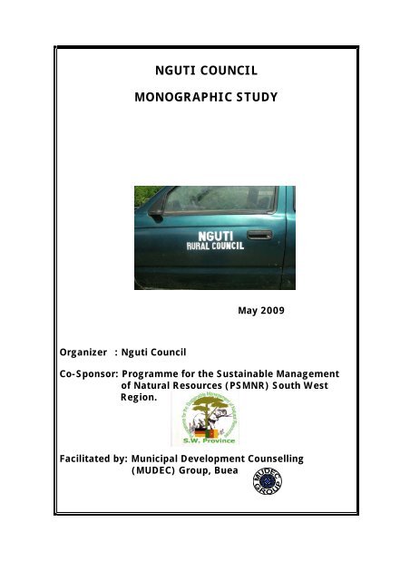
nguti council monographic study - Impact monitoring of Forest ...
nguti council monographic study - Impact monitoring of Forest ...
nguti council monographic study - Impact monitoring of Forest ...
- No tags were found...

Create successful ePaper yourself
Turn your PDF publications into a flip-book with our unique Google optimized e-Paper software.
Monographic Study Nguti CouncilTABLE OF CONTENTSTABLE OF CONTENTS ........................................................................................................ ILIST OF ABBREVIATIONS ............................................................................................... IVLIST OF TABLES .................................................................................................................. VLIST OF FIGURES ............................................................................................................... VIPREFACE ............................................................................................................................. VIIGENERAL INTRODUCTION ............................................................................................... 11.1 Background .................................................................................................................... 11.2 Relevance <strong>of</strong> the Monographic Study ............................................................................ 21.3 Objectives <strong>of</strong> the Monographic Study ........................................................................... 21.4 Methodology .................................................................................................................. 32. ADMINISTRATION, DEMOGRAPHY AND SOCIOLOGY ................................ 42.1 Historical Background ................................................................................................... 42.2 Administrative Units, Staff Situation and Accommodation Needs ............................... 42.3 Population ...................................................................................................................... 72.3.1 Population Figures ......................................................................................................... 72.3.2 Population Growth ....................................................................................................... 142.3.3 Population Distribution ................................................................................................ 142.3.4. Rural vs. Urban Population .......................................................................................... 142.3.5 Pattern <strong>of</strong> Population Composition .............................................................................. 142.4 Migration Pattern ......................................................................................................... 152.4.1 Overview ...................................................................................................................... 152.4.2 Emigration. ................................................................................................................... 152.4.3 Immigration.................................................................................................................. 152.5 Sociology ..................................................................................................................... 152.5.1 Origin and Migration .................................................................................................... 152.5.2 Conflicts ........................................................................................................................ 162.5.3 Social Stratification ....................................................................................................... 162.5.4 Religion ......................................................................................................................... 182.5.5 Cultural Heritage ........................................................................................................... 192.5.5.1 Arts ............................................................................................................................... 192.5.5.2 Dresses ......................................................................................................................... 192.5.5.3 Carnival Festivals and Dances ..................................................................................... 192.5.5.4 Historical and Cultural Sites ........................................................................................ 202.5.5.5 Food Types................................................................................................................... 202.5.6 Situation <strong>of</strong> the Woman ............................................................................................... 202.5.6.1 Marriage ....................................................................................................................... 202.5.6.2 Divorce ......................................................................................................................... 202.5.6.3 Analytical Tools - Situation <strong>of</strong> Women. ...................................................................... 202.5.6.4 Women and Politics ..................................................................................................... 212.5.7 Development Activities ............................................................................................... 242.5.7.1 Village Cultural Development Associations ................................................................ 242.5.7.2 Cooperative Societies and Common Initiative Groups ................................................ 242.5.7.3 Micro Projects (2007 to present).................................................................................. 263. ENVIRONMENT AND LAND USE ......................................................................... 271
Monographic Study Nguti Council3.1 General Overview ........................................................................................................ 273.2 Climate .......................................................................................................................... 273.3 Hydrology ..................................................................................................................... 283.4 Soils............................................................................................................................... 283.5 Vegetation ...................................................................................................................... 283.6 Natural Resources .......................................................................................................... 293.6.1 <strong>Forest</strong> Resources ............................................................................................................ 293.8 Land Use ........................................................................................................................ 313.8.1 Farmland ........................................................................................................................ 313.8.2 Settlements ..................................................................................................................... 323.8.3 <strong>Forest</strong>.............................................................................................................................. 324. ECONOMY .................................................................................................................. 334.1 General Overview .......................................................................................................... 334.1.1 Employment and Unemployment Situation ................................................................... 334.1.2 Children and Employment ............................................................................................. 334.1.3 Standard <strong>of</strong> Living ......................................................................................................... 334.2 Primary Sector ............................................................................................................... 334.2.1 Agriculture ...................................................................................................................... 334.2.2 Animal Rearing and Fishery. ......................................................................................... 354.2.3 Environment and <strong>Forest</strong> .................................................................................................. 354.2.4 Markets ........................................................................................................................... 354.3 Secondary Sector ............................................................................................................ 364.3.1.1 The WIJMA Wood Processing Industries. .................................................................. 364.4.1 Tourism ........................................................................................................................... 374.4.2 Financial Sector .............................................................................................................. 374.4.3 Transport ......................................................................................................................... 374.4.4 Administration, Police and Gendarmerie ....................................................................... 374.4.5 NGOs and Consultancy.................................................................................................. 374.4.6 Trade ............................................................................................................................... 384.5 Informal Sector .............................................................................................................. 395. INFRASTRUCTURE .................................................................................................. 405.1 Technical Infrastructure ................................................................................................ 405.1.1. Transport Infrastructure ................................................................................................ 405.1.1.1Road Infrastructure ....................................................................................................... 405.1.2 Electricity ...................................................................................................................... 415.1.3 Telecommunication Infrastructure ................................................................................ 415.1.4 Portable Water Supply .................................................................................................. 415.1.4.1Water Supply Networks ................................................................................................ 415.1.4.2 Problems linked to Water Supply ............................................................................... 425.1.4.3 Sanitation and Maintenance ......................................................................................... 425.2 Social Infrastructure ..................................................................................................... 425.2.1 Administrative Infrastructure ........................................................................................ 425.2.2 Education and Training Infrastructure .......................................................................... 435.2.2.3 Primary Education Statistics ........................................................................................ 435.2.2.4 Secondary Education Statistics .................................................................................... 445.2.2.5 Statistics for GHS Nguti .............................................................................................. 455.2.2.6Technical Education in Nguti ....................................................................................... 455.2.3 Health Care Infrastructure ............................................................................................. 455.2.3.1 Health Care Facilities 2008 .......................................................................................... 465.2.3.2 Situation <strong>of</strong> Medical equipment in health establishments ........................................... 46II
Monographic Study Nguti Council5.2.3.3 Medical Care Situation 2008 <strong>of</strong> Nguti Municipality ................................................... 485.2.3.4 Senior Medical Staff and number required 2008 ......................................................... 485.2.3.5 Consultations 2008....................................................................................................... 495.2.4 Sport Infrastructure and Recreational Facilities ........................................................... 495.2.5 Hotel and Catering Infrastructure .................................................................................. 495.3. Analysis <strong>of</strong> Basic Services per Clan .............................................................................. 506. COUNCIL ACTIVITIES ............................................................................................ 516.1 Councilors/Staff Pr<strong>of</strong>ile ................................................................................................. 516.1 Finance ........................................................................................................................... 546.3 Relationship with Supervisory Authorities .................................................................... 546.4 Strategy for Development .............................................................................................. 547. CONCLUSION ............................................................................................................ 557.1 Main Lessons Learnt ..................................................................................................... 567.2 Outlook .......................................................................................................................... 56ANNEXES .............................................................................................................................. 57III
Monographic Study Nguti CouncilLIST OF ABBREVIATIONSCAC…………………….Council SubsidyCamCCUL…………… Cameroon Credit Union LeagueCIG……………………..Common Initiative GroupCEFAM…………………Local Government Training CentreFEICOM………………..Council Support FundFMU……………………<strong>Forest</strong> Management UnitHIPCI Funds…………….Heavily Indebted Poor Country InitiativeKMD…………………….Kupe Mwanenguba DivisionMINEPAT……………….Ministry <strong>of</strong> Plan and Regional DevelopmentMUDEC Group………….Municipal Development Couselling (MUDEC) GroupNLORMAC-CIG……….Nloa River management Common Initiative GroupPSMNR-SWR………...…Programme for the Sustainable Management <strong>of</strong> Natural Resources– South West RegionRDARD…………………Regional Delegation <strong>of</strong> Agriculture and Rural DevelopmentREPAC-CIG…………….Rural Environment and Poverty Alleviation Community InitiativeGroupSNEC…………………….National Water CompanySWR……………………..South West RegionGHS…………………… Government High SchoolGTC…………………… Government Technical CollegeIV
Monographic Study Nguti CouncilLIST OF TABLESTABLE 1: Traditional Authority in Nguti Municipality .......................................................4TABLE 2: Past and Present Divisional Officers ....................................................................5TABLE 3: Past and Present Mayors <strong>of</strong> Nguti Council .........................................................5TABLE 4: Administrative Units and Personnel ....................................................................6TABLE 5: Population Figures for Villages/Quarters in Nguti Subdivision (1987 ................7TABLE 6: Population Growth Rate ......................................................................................14TABLE 7: Distributions <strong>of</strong> Religious Institutions ...............................................................18TABLE 8: Access and Control Pr<strong>of</strong>ile over Available Resources in Nguti ........................21TABLE 9: Pr<strong>of</strong>ile <strong>of</strong> Women socio-political Position to Men ............................................22TABLE 10: Twenty-four (24) Hours Daily Activity Pr<strong>of</strong>ile (Men, Women, Boys, Girls) ...22TABLE 11: Seasonal Calendar for Nguti Municipality ........................................................24TABLE 12: Cooperative Societies and Common Initiative Groups ......................................24TABLE 13: Micro projects per clan and village for the Past Two Years ..............................26TABLE 14: Average Monthly Temperatures <strong>of</strong> Nguti Municipality ....................................27TABLE 15: Average Monthly Rainfall in Nguti Municipality .............................................28TABLE 16: Nguti <strong>Forest</strong> Ressources Exploitation Data .......................................................29TABLE 17: Main Crop Production and Area under Cultivation ..........................................34TABLE 18: Livestock Number and Outstanding Livestock Production ...............................35TABLE 19: Markets in the Sub Division and major Products in the Area ............................36TABLE 20: Prices for Basic Commodities ...........................................................................38TABLE 21: Transport fare by Motor Bikes ...........................................................................39TABLE 22: Road Infrastructure ............................................................................................40TABLE 23: Distribution <strong>of</strong> Pipe borne Water in Nguti Municipality ...................................41TABLE 24: Administrative Infrastructures in Nguti .............................................................42TABLE 25: Pupils and Building Infrastructure .....................................................................43TABLE 26: Students, Teachers and Building ........................................................................43TABLE 27: Students and Teachers........................................................................................44TABLE 28: Figures by Class for GHS ..................................................................................45TABLE 29: Statistics by Class for GTC ................................................................................45TABLE 30: Health Care Facilities 2008 ................................................................................46TABLE 31: Situation <strong>of</strong> Medical Equipment in Health Establishments (2008) ...................46TABLE 32: Qualification <strong>of</strong> Heads <strong>of</strong> Health Establishments, 2009 ....................................48TABLE 33: Medical Care Situation ......................................................................................48TABLE 34: Senior Medical Staff and Number Required 2008 .............................................48TABLE 35: Malaria and HIV/AIDS consultations 2007 and 2008 .......................................49TABLE 36: Hotel Infrastructure ............................................................................................49TABLE 37: Repartition <strong>of</strong> Basic Services per Clan ..............................................................50TABLE 38: List <strong>of</strong> Council Staff...........................................................................................51TABLE 39: List <strong>of</strong> Councillors .............................................................................................52TABLE 40: Nguti Council Assets and Surface Area.............................................................53TABLE 41: Budget Realisation ............................................................................................54V
Monographic Study Nguti CouncilLIST OF FIGURESFIGURE 1: Age Structure <strong>of</strong> the Population <strong>of</strong> Nguti Municipality ...................................14FIGURE 2: Organigram for Ngemengoe and Abongoe .......................................................17FIGURE 3: Organigram for Upper Balong, Bassosi, Mbo, Low & Upper Nkongho,Banyu and Bebum Clans ..................................................................................17VI
Monographic Study Nguti CouncilPREFACEThe Monographic Study <strong>of</strong> Nguti Municipality was realized thanks to a coordinated effortbetween Nguti Council, Traditional Authorities, Government Technical Services, DevelopmentActors in Nguti and the Programme for the Sustainable Management <strong>of</strong> Natural Resources(PSMNR) South West Region which provided financial and technical support.As Local Councils are increasingly being required to play a greater role in providing basicservices to their constituencies, it is timely for Nguti Council to document the existing situation<strong>of</strong> all aspects <strong>of</strong> life within the municipality. This Monographic Study will serve the purposes<strong>of</strong> Strategic as well as Operational planning that will result in improved and balanced servicedelivery to the residents <strong>of</strong> all nine clans that constitute the municipality.Information in Cameroon is a very scare commodity. Gathering it provides several challengesat local, regional and national levels. We have attempted to put the most information aboutNguti Council area in one volume. This is a first <strong>of</strong> its kind. There may be omissions and theneed for corrections. We think these are minimal. However, we remain available tocontinuously update this document to the benefit <strong>of</strong> Nguti Council.Finally, we acknowledge the efforts <strong>of</strong> all those who contributed in one way or the othertowards the realization <strong>of</strong> this <strong>study</strong>.VII
GENERAL INTRODUCTION1.1 BackgroundMonographic Study Nguti CouncilFrom independence in 1960 to 1991, Cameroon was governed under a one party system whichsort to harmonise the thinking <strong>of</strong> all development actors in the country. One such strategy toensure this policy <strong>of</strong> oneness was through the elaboration on 5-year development plans that onpaper were usually well implemented and evaluated at the end <strong>of</strong> each period. Despite a fewweaknesses especially in the timely execution <strong>of</strong> planned activities, basic figures <strong>of</strong> growth andprogress could be stated with confidence following the implementation, <strong>monitoring</strong> andevaluation <strong>of</strong> these plans.With the advent <strong>of</strong> multi party politics in Cameroon (1992), the last five year development planended in 1991 and since then annual plans have seen the order <strong>of</strong> day. These annual plans lackclearly defined objectives with measurable indicators. The result is that growth parameters inCameroon have consistently been estimated with a high degree <strong>of</strong> error.National policy makers as well as Local Government and Traditional Authorities in the variousadministrative units <strong>of</strong> the country, hardly have a mastery <strong>of</strong> the development <strong>of</strong> their areas.This is <strong>of</strong>ten due to missing baseline information that can be used for comparison.The non-mastery <strong>of</strong> the development <strong>of</strong> the various regions could partially have resulted fromtoo much centralization <strong>of</strong> development plans that are <strong>of</strong>ten drawn at the central level andimposed on many local beneficiaries. Hardly has there been participatory planning where thepriorities <strong>of</strong> the beneficiaries are taken into consideration.The 2004 Law on Decentralisation as applicable to Councils mandates these collectivities t<strong>of</strong>oster local economic development in the domains <strong>of</strong> Infrastructure, Education, Health, WealthCreation, Sports, Culture and Leisure. This Law is in line with the decentralization statusenshrined in the 1996 Constitution <strong>of</strong> Cameroon. For local authorities to be effective, they willneed a clear knowledge <strong>of</strong> the resources <strong>of</strong> their municipalities. Unfortunately, this is not thecase. This database deficiency is most alarming at the level <strong>of</strong> the local <strong>council</strong>s that are veryclose to the grass root. On the other hand, these grass root jurisdictions sustain over 62% <strong>of</strong> thenation’s poor and are estimated to posses over 70% <strong>of</strong> the nation’s natural resources.The Monographic Study <strong>of</strong> a municipality can reveal baseline information on the socioeconomicsituation which can allow for project identification and prioritisation at village and<strong>council</strong> levels. A <strong>monographic</strong> <strong>study</strong> also can serve the basis for drawing up strategic as well asoperational plans. These instruments can give a clear guide on development projects to beimplemented and also enable the beneficiaries and the development agents to better master andown the development processes <strong>of</strong> their municipalities. It is worth noting that the Republic <strong>of</strong>Cameroon is a signatory to the Millennium Development Goals which promises to reducepoverty by 50% in 2015. There are barely 6 years left and baseline information about several <strong>of</strong>our municipalities have not been gathered. Nguti Council has taken a bold step (Elaborating aMonographic Study) that will culminate in drawing up a Strategic Development Plan.1
1.2 Relevance <strong>of</strong> the Monographic StudyMonographic Study Nguti CouncilThe results <strong>of</strong> the <strong>study</strong> will be <strong>of</strong> interest to: The Government to measure the attainment <strong>of</strong> the millennium objectives set in theprovincial master plan for sustainable development. Development Organizations wishing to implement development projects in the concernedareas. Researchers wishing to be informed on the socio-economic and related factors in Nguti. Policy makers and the inhabitants who will use the information for comparison. Councillors, staff, and other stakeholders, who will be empowered through the trainingsorganized and will eventually be aware <strong>of</strong> the existing situation, the potentials, weaknessesand possible solutions to problems in their <strong>council</strong> area.1.3 Objectives <strong>of</strong> the Monographic StudyThe main objective <strong>of</strong> the <strong>study</strong> is to collect and document existing socio-economic data onNguti Council <strong>of</strong> the South West Region <strong>of</strong> Cameroon.The specific objectives are to: Describe the history <strong>of</strong> the inhabitants <strong>of</strong> this area, Describe the population <strong>of</strong> the area by sex ratio, age groups, birth rate, death rate,immigration rate, migration rate and growth rate. Identify and describe the social structures in the area including sports facilities, water,electricity, bars, nightclubs, hotels etc. Identify the various village development associations and describe their contributions tothe development <strong>of</strong> the Council area. Identify the various religious institutions Identify and describe the geographical features including relief, rainfall and temperatures<strong>of</strong> the area, and propose possible economic activities adapted to these features. Describe the available natural resources (vegetation and wildlife) and their actual state Identify and describe the economic activities <strong>of</strong> the inhabitants including gender analysis. Identify and describe existing markets and marketing facilities. Describe the economic potentials <strong>of</strong> this area. Identify the various sources <strong>of</strong> household income including expenditure patterns. Identify the various financial institutions in the area and assess their strengths andweaknesses. Describe the infrastructure in the area including other communication facilities. Assess the level <strong>of</strong> wear and tear <strong>of</strong> the infrastructure. Identify the various educational and health facilities in the area and assess the rate <strong>of</strong>utilization <strong>of</strong> these facilities. (Enrolment, monthly consultations, births etc.) Describe the activities <strong>of</strong> the Council including potentials & limitations <strong>of</strong> the Councillorsin the management <strong>of</strong> the Council area. Assess the training needs <strong>of</strong> the Councillors. Identify the problems and needs <strong>of</strong> the inhabitants <strong>of</strong> the area. Empower the Staff, Councillors and other development actors to eventually collect andupdate baseline data <strong>of</strong> their municipality2
Monographic Study Nguti Council1.4 MethodologyThe Elaboration <strong>of</strong> the Monographic Study for Nguti Municipality incorporated severalparticipatory planning approaches. Women and Youth group leaders were trained onparticipatory strategies while Councillors, Council Staff and related development actors weretrained and coached to collect primary and secondary data. The data was analysed andtriangulated with the assistance <strong>of</strong> the competent authorities <strong>of</strong> Government Technical Servicesand other development actors during a validation workshop organised to this effect. A draftreport was compiled and discussed with the PSMNR-SWR and necessary corrections made. Afinal report was produced and this document served the basis for drawing up a strategicdevelopment plan for Nguti Municipality.Data was collected from primary and secondary sources. Primary data was collected throughthe use <strong>of</strong> some participatory tools. Production and dissemination <strong>of</strong> 1000 copies <strong>of</strong> an 8 page questionnaire to all 54 villages Resource /social maps <strong>of</strong> the area were used to identify the resources and social structures Transect walks were used to identify the geographical features in the area. Access and control pr<strong>of</strong>ile, seasonal calendar and twenty-four hours daily activity pr<strong>of</strong>ilefor gender analysis. Semi structured interviews Focus group discussions Historical time line.Traditional Authorities and their associates were contacted for information on the history andtraditional set up <strong>of</strong> the people.Sub-Divisional Delegates <strong>of</strong> Government Technical Services were consulted to ascertain thenature and levels <strong>of</strong> activities in their areas <strong>of</strong> competence. Farmer cooperatives, credit unions,confessional institutions and other self help initiatives were contacted for information on theiractivities. The World Conservation Society and Nature Cameroon also made available pertinentinformationThe Divisional Office was contacted to gather information on related developmental andpolitical activities in the area. At the regional level information was secured and triangulatedfrom the <strong>of</strong>fices <strong>of</strong> the Governor, RDARD, MINEPAT, Education (Basic & Secondary),CEFAM and Public Health.Secondary data was obtained through the exploitation <strong>of</strong> existing documents on the socioeconomicsituation <strong>of</strong> the area including: Annual reports <strong>of</strong> the Sub-Divisional Delegation <strong>of</strong> Agriculture and Rural Development Annual reports <strong>of</strong> the Inspectorate <strong>of</strong> Basic Education Annual reports <strong>of</strong> Nguti Health District. Annual reports <strong>of</strong> Confessional Institutions in the area. Village <strong>study</strong> reports carried out in this area. Annual reports <strong>of</strong> the Nguti Council. Written and Oral history <strong>of</strong> the villages. Meteorological reports on rainfall and temperatures in this area. Population census <strong>of</strong> the Council area.3
Monographic Study Nguti Council2. ADMINISTRATION, DEMOGRAPHY AND SOCIOLOGY2.1 Historical BackgroundNguti Municipality was created in 1967 by Presidential decree as an administrative unit. It wasknown as the Nguti Council Area which was later changed to Nguti Rural Council by degreeNo 74/23 <strong>of</strong> 5 th May 1974. It covers a surface area <strong>of</strong> 1,500 km 2 with an estimated population<strong>of</strong> 67,218 inhabitants living in 54 villages.2.2 Administrative Units, Staff Situation and Accommodation NeedsNguti Sub Division was created as an administrative unit in 1967 and comprises the followingdetails:Table: 1 Traditional Authority in Nguti MunicipalityClan Village Name <strong>of</strong> Chief Date EnthronedBEBUMNguti Town with Abia Julius Fobia 19826 quartersMboka John Bisong Epoh 1983Ekenge Enow Amamson Akuli 1990Ofrikpabi Ndumbe Martin K 1982Ediango DeceasedBASSOSIBabensi I DeceasedBabensi II Ejuba Joseph Ewang 2006Ekita Daniel Asong Simon 1983New Konye Mathias Epuli 1989Mungo Ndor Ekoko Samuel 1983Bombe KonyeNtale Atang Akepe Samuel 1983ABONGOE Babubock with 7 Marcus Ewange E 1983quartersBajange Ndoh Simon HalleMuanzeton Barnabas EnyuBambe Etungwe Angustine 2000NGEMENGOE BerminEwang Alung MarcusBadun Abel Bwea Ekwe 1983NkwenforNongomadiba Panje Samuel 2002Ekona BabetiBetock Makia Thomas Eni 2006Manyemen Nkongho Jacob E 1990Ebanga Deceased 1981Talangaye Atem EbakoUPPER BALONG Baro Tambe Arung 1975Osirayib Mbik Adolf 1983Ayong Akum Beteck Samuel 1983Sikam Basua Ebong Simon 1983Njuinyue Clement ELad 1983Songlu Ngolle N James 1983BANYUBomen Ehu. A. Joseph 1983Ediengo John Ebwenzo 1983Nloh James Ekepe Ngwese 19834
Monographic Study Nguti CouncilNzobi Enokonge Elat Jean 2006Kamelumpe Etutang .A. Johnson 1983Ehunyampe Aruli Ngwa Martin 2003Ekwenzo Augustine EhumboTangang Ehoun William 1992LOWER MBOEtabang Elomba Joseph Not appointedNzoa Ewun Eboule Not appointedElumba Court Eselem EmmanuelNot appointedYardEtodi Etimbi Gregory 1983Tabongkwa Ehu-Ngeoh Mathias 2005Mbetta Fomelong Mathias Not appointedLOWER NKONGHO Lekwe Fonven Andrew 1994Dinte Eotock Fotabong 1983Njungo Nkendem John 1989Fowung Fogu Nkong Bensoict 1989UPPER NKONGHO Nzeleted Egeh Fonkenyah Not appointedMbemfe Fonkock lebon Fidelis 1991Lebe Njingu N. Bernard 1983Njentu Njunkeng Bededict 1983Source: Field survey, 2009Table: 2 Past and Present Divisional OfficersNo Name Period Grade1 J.N Akale 1967-1969 -2 Kette 1969-1972 -3 Linus Ngu Ndikum 1972-1973 Senior Civil Administrator4 Rudolf Itoe 1973-1977 Civil Administrator5 Robinson Boma 1977-1982 Civil Administrator6 P.E Ndanga 1982-1985 Civil Administrator7 Mbuya Jeremiah 1985-1991 Civil Administrator8 Elive Bottroh Esuka 1991-1993 Senior Civil Administrator9 Wedji Jack Goerge 1993-1996 Senior Civil Administrator10 Ebombe Stephen 1996-1998 Senior Civil Administrator11 Fon Fominyen R.N 1998-2000 Senior Civil Administrator12 Ngone Ndonde Mesape 2000-2003 Senior Civil Administrator13 Ndifor John Nico 2003-2008 Senior Civil Administrator14 Chumbong Michael 2008-Present Senior Civil AdministratorSource: Nguti Divisional Office, 2009Table: 3 Past and Present Mayors <strong>of</strong> Nguti CouncilNo NamePeriod1 Chief Enow Adampson Akuli July 1985-November 19952 Mr. Achuo Peter Fobia November 1995-January 19963 Mr. Esape Peter Besong January 1996-June20024 Nhon Along Mbome Joseph July 2002-June20075 Mr. Tanyi Ayompe George June 2007-PresentSource: Nguti Council, 20095
Monographic Study Nguti CouncilTable: 4 Administrative Units and PersonnelService Position Number inplaceNguti Council Mayor 1Deputies 3Secretary General 1Municipal Treasurer 1Civil Status Registrar 1Chief <strong>of</strong> Tax 1Financial Clerk 1Correspondence Clerk 1Voucher Clerk 1Cashier 1Typist 1Gendarmerie Adjutant Chef 1Marshall de Logic 4Divisional Office Divisional Officer 1Assistant Divisional Officer 1Typist 0Correspondences Clerk 0Messenger 0Veterinary Sub Delegate 1Chief <strong>of</strong> Centre 1Agriculture Sub Delegate 1Technicians 3Police Security Officiers 2Inspectors 4SNEC Chief 1Auxiliary 2Customary Court Court Scribe 1Assessors 3Women Empowerment and the Chief 1FamilyAssistant 1<strong>Forest</strong>ryChiefs <strong>of</strong> Post Nguti,3Manyemen and BaroField Workers 3Treasurer Sub Treasurer 1Agriculture Post Manyemen Chief 1Post Office Post Master 1Source: Field survey, 20096
Monographic Study Nguti Council2.3 Population2.3.1 Population FiguresTable: 5 Population figures for Villages/Quarters in Nguti Subdivision (1987)Name <strong>of</strong> village General Private Houses Public Houses (Schools,Hospitals and Staffbreakdown)Number<strong>of</strong>HousesPopulationTotalM F Number<strong>of</strong>Houses1PopulationTotalM F Number<strong>of</strong>HousesNGUTI TOWN 3.114 17.300 8.750 3.182 3.102 16.934 8.561 8.373 12 118 56Nguti 752 3.074 1.738 715 715 2.993 1679 1.313 6 59 28Basung 535 253 145 108 53 253 175 188 - - -Ebombome 155 548 277 271 155 648 377 271 - - -Niegaja 115 527 399 228 114 511 283 228 1 16 -Niejom 48 290 169 121 47 228 127 101 4 42 28Niesope 106 430 230 200 36 438 230 288 - - -Niesukpe 33 114 64 50 33 114 64 58 - - -Nundinja 40 179 102 77 39 178 101 77 1 1New Layout 171 633 352 281 171 633 352 281 - - -BABUBOCK 116 999 509 490 116 999 589 490 - - -Abokum 2 24 14 10 2 24 14 10 - - -Bejange 15 86 43 43 15 86 43 43 - - -Bejange Nzanpte 3 19 10 9 3 19 10 9 - - -Edinu 2 16 8 8 2 16 8 8 - - -Nuabukong 18 166 79 87 18 166 79 87 - - -Nuabwe 24 196 109 87 24 196 109 87 - - -Nualatue 6 81 39 42 6 79 39 42 - - -MF
Monographic Study Nguti CouncilNuambwah 28 198 108 90 20 59 108 90 - - -Nuazembong 11 79 35 44 11 27 35 44 - - -Nuenanke 6 59 28 31 6 48 28 31 - - -Ngolenin 2 27 11 16 2 185 11 16 - - -Ngonut 7 48 25 23 7 125 25 23 - - -BERMIN 74 497 262 235 74 245 262 235 - - -Kum Kum 22 129 65 64 22 78 65 64 - - -Meteng 23 140 76 64 23 44 76 64 - - -Ndibe 14 103 54 49 24 27 54 49 - - -Ngomin 15 125 67 58 15 66 67 58 - - -BAMBE 50 245 124 121 50 38 124 121 - - -Banzee 13 70 26 44 13 59 26 44 - - -Etallac 11 44 28 16 11 42 28 16 - - -Mban Mbambe 3 27 13 14 3 17 13 14 - - -Muanzitor 14 66 38 28 14 113 38 28 - - -Nzambeng 9 38 19 19 9 65 19 19 - - -BOMEN 16 59 33 26 16 10 33 26 - - -Bendon 12 42 22 20 12 38 22 28 - - -Dwetta 4 17 11 6 4 218 11 6 - - -EDIENGO 20 113 51 62 20 11 51 62 - - -Diombo 10 65 26 39 10 28 26 39 - - -Maobiwe 2 10 5 5 2 12 5 5 - - -Numbo 8 38 20 18 8 167 12 16 - - -NJUINYUE 49 218 97 121 49 87 7 5 - - -Beboh 3 11 5 6 3 4 73 94 - - -Ekante 8 28 12 16 8 31 41 46 - - -Nudip 3 12 7 5 3 52 2 2 - - -8
Monographic Study Nguti CouncilNjuinyue Centra 35 167 73 94 35 256 15 16 - - -SONGLO 23 87 41 46 23 87 41 46 - - -Ballouh 1 4 2 2 1 4 2 2 - - -Songlo 1 6 31 15 16 6 31 15 16 - - -Songlo 2 16 52 24 28 16 52 24 28 - - -EHUNYAMPE 45 256 110 146 45 256 110 146 - - -Edengwa 18 107 41 66 18 107 41 66 - - -Mumjah 4 28 12 16 4 28 12 16 - - -Nkanbi 14 82 36 46 14 82 36 46 - - -Puseh 9 39 21 18 9 39 21 18 - - -EKWENZO 42 251 127 124 42 251 127 124 - - -Ebatiteh 6 49 27 22 6 49 27 22 - - -Egodi 16 110 51 59 16 110 51 59 - - -Ekwenzo 14 55 29 26 14 55 29 26 - - -Ngokendo 6 37 20 17 6 37 20 17 - - -ELUMBA 21 136 76 60 21 136 76 60 - - -ETABANG 15 65 30 35 15 65 30 35 - - -ETODI 56 280 128 152 56 280 128 152 - - -Ebatite 27 146 66 80 27 146 66 80 - - -Mbokekwo 8 39 16 23 8 39 16 23 - - -Nsanke 21 95 46 21 21 95 46 21 - - -KAMELUMPE 44 252 123 129 44 252 123 129 - - -Edikang 8 43 20 23 8 43 20 23 - - -Mbua 19 128 67 61 19 128 67 61 - - -Ndom 17 81 36 45 17 81 36 45 - - -NZOA 38 210 108 102 38 210 108 102 - - -Kenbong 7 53 29 24 7 53 29 24 - - -Nzoa 31 157 79 78 31 157 79 78 - - -9
Monographic Study Nguti CouncilTABONGKWA 63 431 192 239 63 431 192 239 - - -Ebatiteh 3 15 7 8 3 15 7 8 - - -Kongbong 6 27 12 15 6 27 12 15 - - -Kongmeng 14 98 48 50 14 98 48 50 - - -Kwaku 11 68 25 43 11 68 25 43 - - -Mbanke 19 141 61 80 19 141 61 80 - - -Osenke 10 82 39 43 10 82 39 43 - - -TANGANG 92 500 237 263 92 500 237 263 - - -Bekang 10 40 20 20 10 40 20 20 - - -Bengrum 20 105 50 55 20 105 50 55 - - -Nkombi 33 209 104 105 33 209 104 105 - - -Tangang 1 29 146 104 83 29 146 104 83 - - -AYONG 14 50 34 16 14 50 34 16 - - -BABENSI 84 487 252 235 84 487 252 235 - - -Babensi 1 44 261 144 117 44 261 144 117 - - -Babensi 2 23 144 65 79 23 144 65 79 - - -Ekita 17 82 43 39 17 82 43 39 - - -BADUN 35 219 120 99 35 219 120 99 - - -Badun 1 3 24 16 8 3 24 16 8 - - -Badun2 32 195 104 91 32 195 104 91 - - -BARO 40 136 72 64 40 136 72 64 - - -BETOCK 67 244 118 126 67 244 118 126 - - -Agborken 35 119 62 57 35 119 62 57 - - -Betock 18 81 38 43 18 81 38 43 - - -Tanyistung 14 44 18 26 14 44 18 26 - - -EBANGA 40 183 85 98 40 183 85 98 - - -OSIRAYIB 16 63 31 32 16 63 31 32 - - -MANYEMEN 411 1.766 862 904 405 1.479 732 747 6 130 15710
Monographic Study Nguti CouncilBapene 51 270 134 136 51 270 134 136 - - -Panyah Quarter 11 45 24 21 11 45 24 21 - - -Bassa Quarter 15 74 32 42 15 74 32 42 - - -Hausa Quarter 17 52 29 23 17 52 29 23 - - -K 26 74 36 38 26 74 36 38 - - -Manyemen 6 28 10 18 6 28 10 18 - - -Ngong 107 588 275 313 106 391 197 194 1 78 119New Quarter 36 144 73 71 36 144 73 71 - - -Njet 38 192 91 101 38 192 91 101 - - -Ntimbock 22 97 45 52 22 97 45 52 - - -Settlement 82 202 113 89 77 112 61 51 5 52 38NONGOMADIBA 30 224 111 113 30 224 111 113 - - -NWENFOR 14 85 46 39 14 85 46 39 - - -SIKAM 4 31 16 15 4 31 16 15 - - -TALAGAYE 4 32 16 16 4 32 16 16 - - -BOMBE KONYE 22 159 77 82 22 159 77 82 - - -EDIENSUEN 5 31 16 15 5 31 16 15 - - -MUNGO NDOR 60 352 182 170 60 352 182 170 - - -NEW KONYE 12 59 24 35 12 59 24 35 - - -NTALE 68 393 194 199 68 393 194 199 - - -BAKONBA 12 73 35 38 12 73 35 38 - - -SAMBALIBA 19 110 52 58 19 110 52 58 - - -Diboki 2 8 4 4 2 8 4 4 - - -Sambaliba 17 102 48 54 17 102 48 54 - - -EDIENGO 26 237 114 123 26 237 114 123 - - -EKEGE 29 171 89 82 29 171 89 82 - - -MBOKA 31 126 61 65 31 126 61 65 - - -High Way Camp 2 8 2 6 2 8 2 6 - - -11
Monographic Study Nguti CouncilNboka 29 118 59 59 29 118 59 59 - - -OFFRIKPABI 27 97 51 46 27 97 51 46 - - -DINTE 54 394 208 186 54 394 208 186 - - -Bazeh 6 53 30 23 6 53 30 23 - - -Dinte 2 24 10 14 2 24 10 14 - - -Musack 48 258 137 121 48 258 137 121 - - -Ngezock 6 59 31 28 6 59 31 28 - - -LEBE 21 194 86 108 21 194 86 108 - - -LEBOCK FOWUNG 61 528 239 289 61 528 239 289 - - -Lebock 12 72 33 7 12 72 33 7 - - -Ngienden 7 66 33 32 7 66 33 32 - - -- - -Njesang 32 241 106 135 32 241 106 135 - - -Nshinbeng 3 59 23 36 3 59 23 36 - - -Soke 7 90 44 46 7 90 44 46 - - -LEKWEEN92 543 269 274 92 543 269 274 - - -FORVENBantoh 14 92 43 49 14 92 43 49 - - -Betang Mbong 1 24 109 52 57 24 109 52 57 - - -Betang Mbong 2 23 129 63 66 23 129 63 66 - - -Ngiezeh 5 40 19 21 5 40 19 21 - - -Nzokeh 14 72 37 35 14 72 37 35 - - -Sekanghe 12 101 55 46 12 101 55 46 - - -MBEMFEE 43 373 186 187 43 373 186 187 - - -MBETTA 81 518 271 247 81 518 271 247 - - -Masbesobg 21 110 55 55 21 110 55 55 - - -Mbeseh 12 91 49 42 12 91 49 42 - - -Njonk -Njock 1 32 13 19 1 32 13 19 - - -12
Monographic Study Nguti Council- - -- - -Muemelong 6 285 154 131 6 285 154 131 - - -Njentu 28 289 146 143 28 289 146 143 - - -- - -NJUNGO 79 755 358 397 79 755 358 397 - - -Banjock 20 137 65 72 20 137 65 72 - - -Chehefem 17 11 85 86 17 11 85 86 - - -Essect 14 175 68 107 14 175 68 107 - - -Mbeka 11 123 58 65 11 123 58 65 - - -Njock Nami 10 90 44 46 10 90 44 46 - - -Njungo 7 59 38 21 7 59 38 21 - - -NZELETED 25 221 98 123 25 221 98 123 - - -Source: Culled word verbatim from the 1987 Population Census Form showing 48 villages in Nguti Council area.13
Monographic Study Nguti Council2.3.2 Population GrowthAccording to the Economic Report <strong>of</strong> the South West Region, the population (2001) <strong>of</strong> KupeMuanenguba Division (KMD) was about 123,843 inhabitants (1.9% annual growth rate) spreadacross the three subdivisions as follows: Bangem (14,514 persons), Nguti (67,665 persons) andTombel (41,664 persons). This means that 54.6% <strong>of</strong> the population <strong>of</strong> KMD is found in NgutiMunicipality. (Source: SWR Master Plan for Sustainable Development. MINEPAT, 2001).Nguti has an estimated land area <strong>of</strong> 1500 km. sq resulting to a population density <strong>of</strong> about45.1persons per square kilometer. The 2005 population figures for Nguti as elsewhere inCameroon have not been published. National population growth has fluctuated over the yearswith the rural areas experiencing a lower rate than urban areas.Table: 6 Population Growth RatePeriodAnnual RateRemarks(National)1987-1992 2.89% Growth rate in rural areas are slowerincluding KMD with an annual growthrate <strong>of</strong> 1.9%1993-1997 2.83 Same above1998-2002 2.81 Same aboveSource: Demographic Indicators <strong>of</strong> Cameroon (MINEPAT, 1993 Edition)2.3.3 Population DistributionNguti Council area has more than 50% <strong>of</strong> the total population <strong>of</strong> Kupe Mweneguba Division.Since the terrain is undulating and highly inaccessible, heavily concentrated population areas arein the hinterlands. The Mbo community comprising five Clans: Lower Mbo, Bebun, Banyu,Lower and Upper Nkongho are thickly populated.The Bakossi clans <strong>of</strong> Aboengoe and Ngemengoe are relatively sparely populated while theBassosi and Upper Balong have a more widely dispersed population.2.3.4. Rural vs. Urban PopulationThe population <strong>of</strong> Nguti Municipality is basically rural (about 72%) with Nguti and Manyementowns classified as semi urban.2.3.5 Pattern <strong>of</strong> Population CompositionThe age structure <strong>of</strong> Nguti Council area is illustrated on the table below.SexAge group (years)% <strong>of</strong>Population41Figure 10 – 1415 - 60 53> 61 6Total 100Source: RGPH (1976 and 1987)Figure 1Age Structure <strong>of</strong> population0-1415-60>6114
Monographic Study Nguti Council2.4 Migration Pattern2.4.1 OverviewMovement in and out <strong>of</strong> Nguti municipality is same like in other rural communities. There issignificant movement <strong>of</strong> people out <strong>of</strong> Nguti Municipality to other areas <strong>of</strong> the South WestRegion, Douala, Yaounde, and even out <strong>of</strong> the country. People move out <strong>of</strong> Nguti for severalreasons including the search for job opportunities, higher education, and other economicopportunities. Movement into the municipality is significantly low. Most <strong>of</strong> the internal migrationis due to farmers’ quest for new farmlands and administrative transfers <strong>of</strong> teachers and other civilservants.2.4.2 Emigration.Movement out <strong>of</strong> Nguti sub division is high mostly due to the following: work and highereducation opportunities, the search for better social facilities and the human desire to discover theworld. This high rural-urban migration can be attributed to the absence <strong>of</strong> electricity, job creatinginstructions and the generally slow pace <strong>of</strong> life.2.4.3 ImmigrationMovement into Nguti is slow compared to movement out <strong>of</strong> the area. Emigrants from villagesaround migrate to settle and do business. People <strong>of</strong> the North West Region <strong>of</strong> Cameroon alsomigrate here to take advantage <strong>of</strong> the fertility <strong>of</strong> the soil which is good for the cultivation <strong>of</strong>cocoa and major food crops such as plantains and yams that have become important sources <strong>of</strong>income. The St John <strong>of</strong> God Hospital and Presbyterian Hospital in Manyemen constitute pullfactors for migration into Nguti as many persons come for health reasons. The WIJMA WoodProcessing Industry plays a contributing role in bringing people into Nguti. There are a fewservices that have been established in Nguti and Manyemen towns to cater for the needs <strong>of</strong>WIJMA workers including road side sellers <strong>of</strong> food, drinks, provision stores and the availability<strong>of</strong> free women who have come from other parts <strong>of</strong> the South West and Littoral Regions.Nguti and Manyemen towns are transit areas on the Kumba – Mamfe road. Few Nigerians havesettled in Nguti and Manyemen as traders.2.5 SociologyNguti Sub division consists <strong>of</strong> fifty–four (54) villages belonging to the following clans: theBebum clan dominates in Nguti town with six quarters, the Bassosi clan rules in eleven villages,the Ngemengoe clan in eight villages, the Upper Balong in eight villages, the Banyu clan in sixvillages, the Lower Mbo in nine villages, the Upper Nkongho in seven villages, the LowerNkongho in three villages and the Abongoe clan dominates one village with 7 quarters. Thesefifty-four villages, which are made up <strong>of</strong> four tribes (Bakossi, Bassosi, Balong and Mbo), havedifferent founding fathers who shared the same ancestral origin.2.5.1 Origin and MigrationNguti Subdivision is inhabited by 4 tribes: Bakossi, Balong, Bassosi and Mbo all <strong>of</strong> whom sharethe same ancestor as descendants <strong>of</strong> Ngoe who was married to Sumediang and they had sevensons. They lived in Mwekan, in the western part <strong>of</strong> the Mwanenguba Mountain.As prosperity increased in property and people, the land became smaller and there was need toexpand into new lands to avoid internal clashes. The further afield people went hunting andencountered more game the more the lure to move out <strong>of</strong> the original home at Mwekan.15
Monographic Study Nguti CouncilThe Bakossi are the <strong>of</strong>fsprings <strong>of</strong> Ngoe’s first son (Asomengoe) who moved southwards from themountain. The Bakossi in Nguti subdivision are divided into 2 clans: Aboengoe and Ngemengoe.The Balong are <strong>of</strong>fsprings <strong>of</strong> Kaahngoe whose son “Elonge” or “Elong” opted to search land thatcould be secured without contest (freeland). Some <strong>of</strong> them settled in present day Manyemen(Upper Balong) while others moved southwards to settle at Malende, Muyuka and the land onboth Sides <strong>of</strong> the River Mungo.The Bassosi are <strong>of</strong>fshoots <strong>of</strong> Abongoe. During violent controversies, the ”Nssosi” groupdeveloped in the west <strong>of</strong> the valiant Elong and peaceful Balong this creating the calm deposition<strong>of</strong> people (Bassosi) who are inclined to be on good terms with their neighbours.The Mbo are the <strong>of</strong>fsprings <strong>of</strong> Mboengoe who was violent and pursuing northwards in constantconflicts with the people he met but gaining a large foothold. The Mboengoe had to deal with asouthwards drifting people probably <strong>of</strong> Sudanese origin. They fought at every instance gainingand loosing here and there.The present day Mbo land is zigzag in terrain and extremely remote (hinterlands) that thesepeople have been able to entrench themselves where they are which is laudable testimony <strong>of</strong> theirpast valour, unity and determination.Source: The Tradition <strong>of</strong> a People-Bakossi by S.N Ejedepang-Koge 19862.5.2 ConflictsConflicts in Nguti Municipality are relatively few and are centred on land, ethnic, administrativeand chieftaincies disputes. Conflicts identified include: Administrative conflict between Konye Sub-division and Nguti Sub-division on thesituation <strong>of</strong> Sambaliba settlement. Sambaliba people who originate from Konye have settledon land belonging to Tanlangaye and Ayong people <strong>of</strong> Nguti Municipality. Potentially conflicting land issues that require the attention <strong>of</strong> the Council Managementinclude:a. Kokobuma which is a village in Konye Sub-division is located between 2 villages(Nkwenfor and Badun) in Nguti Munucipalityb. There are 3 Banyu Clan villages (Nloh, Nzorbi and Ediengo) which are found outsidethe Nguti Council map. The position <strong>of</strong> these villages have been geo-referred andcorrected using geographic positioning system (GPS), while the shape <strong>of</strong> the <strong>council</strong>area is obtained from archives and might not have been corrected.c. Eyumojock borders Nguti Council Area. Nevertheless the restructuring <strong>of</strong> Councilsattributed neighoring villages to Eyumojock Council from the then Mamfe Central. Theshape has since not been corrected.d. Ekona Babeti is at the border between 3 Council areas (Bangem, Nguti and Tombel).e. There are Francophone villages in the largely inaccessible Lower and Upper NkonghoClans which do their daily business in Melong (Littoral). It is easier for them to reachMelong and Santcho than to get to Nguti town. Chieftaincies disputes within villages. There are several cases where quarters within avillage have been declared as chiefdoms. This accounts for the disparity <strong>of</strong> figures relatingto number <strong>of</strong> quarters in a village or number <strong>of</strong> villages in a Clan.2.5.3 Social StratificationThe villages are stratified in various ways.In each village, the hierarchy and traditional institution are respected. In each village, thecommoners form the bulk <strong>of</strong> the community. They are followed by the quarter heads, traditional<strong>council</strong>lor and the chiefs. Except for villages in Ngemngoe and Abongoe clan where there is aslightly different traditional set up. Here you have the Population, Town Crier, TraditionalCouncil, Quarter heads, chiefs and a Clan head. This is presented in a diagram below.16
Monographic Study Nguti CouncilThe functions <strong>of</strong> the traditional <strong>council</strong> include: Maintenance <strong>of</strong> peace and stability within the village Resolution <strong>of</strong> conflict between villagers Organisation <strong>of</strong> community development work Circulation <strong>of</strong> important information to the rest <strong>of</strong> the village through the town criersThese villages work in close collaboration with their Village Development Association to fosterthe development work in the village.Most <strong>of</strong> the traditional rulers in Nguti are third class chiefs. Chiefs are appointed making it more<strong>of</strong> a political institution than a traditional one. As a result <strong>of</strong> this the culture <strong>of</strong> chiefdom beenhereditary is slowly dying down as each time a chief dies there is a quibble over who should bethe next to sit on the throne.Figure 2Traditional HierarchyOrganigram for Ngemengoe and Abongoe ClansClan HeadChiefsTraditional CouncilQuarter HeadsTown CrierFamily HeadsQuarter CrierPopulationFigure 3Organigram for Upper Balong, Bassosi, Mbo, Low &Upper Nkongho,Banyu and Bebum ClansChief / ReagentQuarter HeadTraditional CouncilPopulation17
Monographic Study Nguti Council2.5.4 ReligionThe main religions in Nguti Municipality are Christianity, Islam and Animism. The Christianreligions have the following denominations; Catholic, Presbyterian, Apostolic and Full Gospel.Traditionalists adhere to ‘juju’ and shrine worship. Several persons are both Christians andtraditionalists however; Christianity is increasingly becoming more dominant.Below is a table on the distribution <strong>of</strong> these institutions.Table 7: Distributions <strong>of</strong> Religious InstitutionsName <strong>of</strong> villageBaptist(number)Catholic(number)Presbyterian(number)Apostolic(number)FullGospel(number)Islam(number)Pentecostal(number)Traditional(number)Nguti Town 1 2 1 1 1 2Mboka 1 1 2Ekenge 1 1 2Ofrikpabi 1 1 2Ediango 1 1 2Babensi I 1 2Babensi II 2Ekita 2New Konye 1 1 3Mungo Ndor 1 2 2Bombe1 2 2KonyeNtale 1 3 2Babubock 1 1 2 2Bajange 1 2Muanzeton 1 2Bambe 1 2Bermin 2Badun 1 2Nkwenfor 2Nongomadiba 1 1 2Ekona Babeti 2Betock 1 1Manyemen 1 2 1 1 1Ebanga 1 1 1Talangaye 1 1 1Baro 3 1 2Osirayib 1 3Ayong 1 4 1 2Sikam 4 3Njuinyue 1 3Songlu 1 4Bomen 4Other(number)18
Monographic Study Nguti CouncilEdiengo 1 1 2Nloh 1Nzobi 1 2Kamelumpe 1 2Ehunyampe 2 3Ekwenzo 1 3Tangang 1 3Etabang 3Nzoa 1 2Elumba Court1 2YardEtodi 1 1 3Tabongwa 1 2 3Mbetta 1 2 2Lekwe 3Dinte 4Njungo 1 3Fowung 1 3Nzeleted ‐ 4Mbemfe 1 3Fonki 1 3Lebe 1 3Njentu 3Total 42 34 4 2 1 4 128 ‐Source: Field survey, 20092.5.5 Cultural Heritage2.5.5.1 ArtsThe people are involved in craftwork such as weaving and carving. They weave baskets, chairsand tables. They carve drums used for cultural dances, and other house utensils like woodenspoons and mortars used for pounding cocoyams which is their staple food.2.5.5.2 DressesTraditional dressing in this area include a long white sleeve shirt and loincloth (sanja) with ablack hat for the men while the women put on a gown (known in the local language as Kaba)with a headscarf tied on their heads.2.5.5.3 Carnival Festivals and DancesNguti Municipality is blessed with very beautiful dances which are executed by men, women andyouths. These dances are performed during traditional marriages, youth and cultural weeks andduring death celebrations. The dances performed include Ngone, Club, Asiko, Mwewang,Abiyong, Beloh, Berom, Nsuck-mah and Amoh Ekaph which is a ‘juju’ or sacred dance. There isalso ‘Amab’ Festival (buddle) during which these dances are performed.19
Monographic Study Nguti Council2.5.5.4 Historical and Cultural Sitesa) ‘Mboh’ is located in the up hills <strong>of</strong> Nguti town.b) ‘Njip’ is found in all Bakossi villages within the Municipalityc) Bambe Escarpmentd) Ayong Sacred <strong>Forest</strong> Site (Yearly Traditional Fishing)2.5.5.5 Food TypesStaple dishes for the inhabitants <strong>of</strong> the <strong>council</strong> area include Koki corn, pounded cocoyam andnzab (black soup), Koki beans with plantains or banana, water fufu, sweet yams, red yams (mbu)and vegetables such as huckleberry, green, garden eggs, waterleaf, okogobong and bitter leaf.Most villagers don’t have access to rice and garri because these are not produced locallyconsequently they are expensive.2.5.6 Situation <strong>of</strong> the Woman2.5.6.1 MarriageThe situation <strong>of</strong> the woman in marriage has greatly evolved compared to what used to be in thepast. Today, when a boy and a girl agree to get married, their parents are informed and bothfamily members are invited on an arranged date to pay the bride price. The parents <strong>of</strong> the girldecide on how much has to be paid as bride price for their daughter and this usually depends onher level <strong>of</strong> education. The girl’s family members are also given palm wine, beer, kola nuts andtobacco. A later date is when the bride price is paid and the boy and the girl are free to live ashusband and wife. Before her departure she receives gifts such as kitchen utensils and loinclothto enable her start her home. However, increasingly the phenomenon <strong>of</strong> “come we stay’(co-habitat without formal approval) prevails in the municipality especially in the hinterlands.2.5.6.2 DivorceTraditionally, husbands do not divorce their wives unless an action is taken to return the brideprice or the dowry. If this does not happen the woman remains his wife for life. Even when thewoman finally dies her remains must be buried in the husband’s compound.2.5.6.3 Analytical Tools - Situation <strong>of</strong> Women.A number <strong>of</strong> tools were used to further analyse the situation <strong>of</strong> women in Nguti municipalitywhich include the access and control pr<strong>of</strong>ile over available resources, the daily activity pr<strong>of</strong>ile <strong>of</strong>men, women, boys and girls, the seasonal calendar and socio – political conditions <strong>of</strong> women inrelation to men. The tables are presented below:-20
Monographic Study Nguti CouncilTable 8: Access and Control Pr<strong>of</strong>ile over available resources in NgutiResource Type ACCESS CONTROLMen Women Men WomenNatural/Material Land xxx xxx xxx xxResources Capital xxx xx xxx xxTools xxx xxx xxx xxxOil Palm xxx xx xxx xAnimals xxx xxx xxx xxProduction inputs xxx xxx xxx xxxTimber xxx x xxx xHousing xxx xxx xxx xxPalm Wine xxx xx xxx xxMotorbikes xxx xx xxx xVehicles xxx xxx xxx xxMarkets Buying xxx xxx xxx xxxSocio–CulturalRessourcesKey: x =low; xx=Average; xxx=high2.5.6.4 Women and PoliticsSelling xx xxx xx xxxShrines xxx xxx xxx xxxTourist site xxx xx xxx xInformation xxx xxx xxx xxxChurch xxx xxx xxx xxCIG xxx xxx xx xxxEducation xxx xxx xxx xxxPublic Services xxx xxx xxx xxNguti women in politics are at a very low gear because <strong>of</strong> inadequate participation. Some <strong>of</strong> thereasons are imbedded in the fact that representation is by clans. This system limits the chancesavailable to women hence the dominant roles <strong>of</strong> men. Women are considered as domesticworkers. They shy away from responsibilities, challenges and are not encouraged. Due toignorance they seem to accept the back seat. The situation is further complicated by the fact thatmost grass root women come from the hinterlands where incomes are very low as this weakenstheir ambitions. As a result, few women feature in politics and development committees wheredecision making usually takes place. However, much is being done by a few dedicated women tosensitize and mobilize more women. All women belong to the ruling political party. During lasttwo mandates (2002-2007 and 2007-2012) only one female <strong>council</strong>lor has been elected and bothtimes she served as second deputy Mayor.21
Monographic Study Nguti CouncilTable 9: Pr<strong>of</strong>ile <strong>of</strong> Women Socio-political Position to MenSector Participation in WomenDecision Making AloneFinance Daily Budgeting X InvestmentWho Makes the DecisionWomenDominateJointlyM/FXMenDominateHousehold Education <strong>of</strong>XChildren Family PlanningX Health ServicesXCommunity Representation XSociety atlarge Organisation X Political Sphere Economic Sphere Religious SphereWomen Socio-Political PositionCompared to MenWomen Self ImageImage in the SocietyOrganisation CapacityOther ParticipationXLower/ Lower/better betterBetterBetterXAboutEqualXHigherHigherHigherMenAloneHigherTable 10: Twenty-four (24) hours daily activity pr<strong>of</strong>ile (Men, Women, Boys, Girls)Time Men Women Boy Girl1.00am- Sleeping Sleeping Sleeping Sleeping4.00am5.00am -Some go t<strong>of</strong>arms-Some go t<strong>of</strong>arms/ /- Some preparefor work- Some preparefor work6.00am / / Wake up Wake up7.00am -Working on the -Working on -Prepare to go t<strong>of</strong>arm orfarm.school or go helpPreparation to go -Markets sites parent in farmto jobsite8.00am- Early familieseat- Working on thefarm or marketAt schoolOr in farms9.00am - Working on the / / /22Prepare to go toschool or go helpparent in farmAt schoolor in the farm andmarket
Source: Field survey, 2009Monographic Study Nguti Councilfarm10.00am Early farmers eat Early farmers eat / /11.00am Some arereturning fromfarm- Some stillworking-Some arereturning fromfarms and bushmarkets-Some still on theSome arereturning fromfarm.Some are returningfrom farm12.00pm1.00pm-Most are backfrom farms andmarkets-Go to break atjobsite-Wash and rest-Eat and drinkpalm winefarm, market.-Most are backfrom farms andmarkets.-Resting at jobsite-Wash, cook/ eatcook and restMost are backfrom farmsMost are back fromfarmsAssist mother inKitchen2.00pm / / / /3.00pm - Some back -Some from / /from jobsite jobsite4.00pm Go to meetings -Go to meetings -Playing football -Playing5.00pm Go to meetings Go to meetings -Playing -Playing6.00pm-Late comersfrom farm-Coming backfrom meeting-Late comersback from-Coming backfrom meeting7.00pm Drinking/eating Preparing foodand eat-Playing-Go outingdistraction, eat,readSome read- Helping at homeGo outingdistraction, eat , read8.00pm / Drinking/eating / Preparing foodand eat9.00pm Some go to bed Some go to bed Most go to bed Most go to bedwatch news10.00pm / Some go to bed / Some go to bed Sleeping Sleepingwatch news11.00pm Most are sleeping Most are sleeping Sleeping Sleeping12.00midnight Sleeping Sleeping Sleeping SleepingThe table indicates that, most inhabitants <strong>of</strong> Nguti are available from 1pm to 6pm daily. This timeinterval is therefore favourable for programming meetings with the people.23
Monographic Study Nguti CouncilTable 11: Seasonal Calendars for Nguti MunicipalityActivities Jan Feb Mar Apr May June July Aug Sep Oct Nov DecLand preparation x x x x x xMoulding x x xPlanting x x x xPruningxSpraying x x x x x xWeeding x x x xHarvesting x x x x x x x x x xSource: Research Survey, 2009The calendar indicates the months <strong>of</strong> December to April are used for land preparation andharvesting thus giving farmers a period for rest and festivities.2.5.7 Development Activities2.5.7.1 Village Cultural Development AssociationsDue to the small sizes <strong>of</strong> most villages, development associations are constituted largely on clanbasis thus rendering them more participatory and effective. They include:Lower Mbo Development Associationa) Nkongho Mbo Development Associationb) Bassosi Cultural and Development Associationc) Aboh Ngoe Development Associationd) Ngeme Ngoe Development Associatione) Balong Cultural and Development Association2.5.7.2 Cooperative Societies and Common Initiative GroupsTable: 12Village)Cooperative Societies and Common Initiative Groups (Activity, Composition andNo Name <strong>of</strong> Association Field <strong>of</strong> Operation Composition Village1 BEBUM livestock Piggery farm, Fish pond and M/FNguti TownPoultry2 Muayang Sister Farming / Poultry F Nguti TownFarmers3 GOD Helps Farmers Palms and Livestock M/F Nguti Town4 Ediengwo Family Cash Crop M/F Bombe Konye5 Nguti Young Farmer Cattle Rearing and Marketing M/F Nguti6 Methen Farming M/F Ntale7 Perseverance Farming M/F Manyemen8 Virtuous Ladies Poultry and Crop production F Nguti9 NARD Processing and Marketing M Manyemen10 Manyemen United Pig Piggery and Cash Crop M/FManyemenFarmersFarming11 Tree Can Fall Food Crop M/F Nguti12 <strong>Forest</strong> ManagementCommitteeCash Crop M/F Ntale24
Monographic Study Nguti Council13 CommunityFood Crop M MbokaDevelopment (Mboka)14 Ekenge Community Cash Crop M EkengeFarm15 Sinke CIG Cash Crop M Mboka16 New Generation CIG Cash Crop M Nguti Town17 Payda CIG Cash Crop M Ediengo18 Mbenarema CIG Food Crop F Nguti19 Babubock Farmers Cash Crop M BabubockCooperative20 Mungo Ndor Farmer Cash Crop M/F Mungo NdorCooperative21 The Young Shall Food Crop M/F BambeGrow(Bambe)22 Village <strong>Forest</strong> Cash Crop M/F BambeManagementCommittee(Bambe)23 Seven in One (Badun) Food Crop F Badun24 Hunter Group Piggery M/F Ntale25 UNIFARM Palms M/F Manyemen26 Mighty Eleven Cash Crop M/F Talangaye(Talangaye)27 Nba CIG Palms/ Cash Crop M/F Mungo Ndor28 Edi Nzo CIG Cash Crop M/F Mungo Ndor29 Mbie CIG Piggery/ Fowls M/F Ntale30 Mwafacing (Mungo Cocoa/ C<strong>of</strong>fee M/F Mungo NdorNdor)31 Efua Mbe CIG Palms M/F Bombe konye32 Etua Nzah Food Crop M/F Bombe konye33 Penye CIG Cash crop M/F Ntale34 Muabokong Farmers Piggery/Poultry M/F Babubock35 Self Help Cash Crop M/F Nguti townSource: Sub- Delegation <strong>of</strong> Agriculture, Nguti. 200925
Monographic Study Nguti Council2.5.7.3 Micro Projects (2007 to present)Table: 13 Micro projects per clan and village for the past two yearsNo Clan Village Project FundingSource1 Ngemengoe Bambe a) Water Project (Ongoing)b) School Buildingc) Bore Hole Waterd) Bridgesa) Guinness Cameroonb) Communityc) Nguti Councild) Community2 Abongoe Babubock Pipe borne water CommunityHealth CenterHIPCI Funds3 Lower Mbo Etodi/Elumba Bore Hole WaterGuinness CameroonCourtyardEkwenzo Construction <strong>of</strong> one classroom Governmentat GS4 Upper Njungo Rehabilitation <strong>of</strong> the Health Nature CameroonNkonghoCentreConstruction <strong>of</strong> 4 Classrooms Governmentand a Toilet at GHS5 Bassosi Ntale Animal Farm for Village Nature Cameroon<strong>Forest</strong> CommitteeVillage BankRumpi ProjectRenovation <strong>of</strong> Water Project Guinness Cameroon6 Banyu Njuinyue Water Project Guinness Cameroon7 Bebum Nguti a. Animal FarmNature Cameroonb. Crop FarmMarketRumpi ProjectDistrict Health Centre GovernmentBuilding <strong>of</strong> StreetsWIJMA/ CouncilOpening <strong>of</strong> GuttersCouncilPublic Toilets in Nguti Market CouncilGiant GeneratorGovernmentSource: Nguti Council/ Nature Cameroon, 2009The Council planned the following projects for fiscal 2009: Realisation <strong>of</strong> the Nguti Council <strong>Forest</strong> Participatory Planning Processes Capacity Building for Councillors and Staff on Institutional Development andOrganisational Strengthening(ID/OS) Construction <strong>of</strong> the Ngwatta (Santcho)to Mbetta Road Construction <strong>of</strong> the Ngwatta to Njungo Road Construction <strong>of</strong> Mbokambo to Tabongwa Road Construction <strong>of</strong> Kokobuma (Konye) to Badun to Mungo Ndor26
3. ENVIRONMENT AND LAND USE3.1 General OverviewMonographic Study Nguti CouncilNguti subdivision is found in Kupe Muanenguba Division <strong>of</strong> the Southwest Region <strong>of</strong> Cameroon.It is about 94 km from the town <strong>of</strong> Kumba and has an altitude <strong>of</strong> about 400m above sea level,with a surface area <strong>of</strong> 1500 square km.The subdivision shares common boundaries to the north with Tinto Sub division, to the southwith Konye Sub division, to the south-east with Bangem and Melong, to the east with Santchou,Dschang and Fontem and to the west with Eyumojock and Toko.Topographically, the land is generally flat and raised 400m above sea level with gentle and steephills dotted within the thick humid forest in the municipality. It is host to several forest reservesincluding Bayang Mbo and the Nguti Council <strong>Forest</strong> with timber resources, wildlife andmedicinal plants.3.2 ClimateNguti Municipality is within the equatorial rain forest with a climate which is characterized bytwo distinct seasons; the rainy and the dry seasons. The dry season runs from October orNovember to March and is characterized by elevated temperatures (30C-32C). The rainyseason begins from March or April and ends in September or October. Peak periods are duringthe months <strong>of</strong> July and August. Tables 14 and 15 below show the average monthly rainfall andtemperature for Nguti.Table 14: Monthly Rainfall in Nguti Municipality from 2005 to 2008(Measured in Millimetre)MonthsYears2005 2006 2007 2008January 27 28 30 32February 27 28 35 38March 29 29.5 75 78April 159 158 159 261May 273 274 273 279June 296 295 296 293July 513 514 514 520August 515 513 560 557September 383 384 393 397October 231 230 220 223November 84 85 89 91December 22 23 25 27Annual Total 2559 2561.5 2669 2796Annual Average 213.25 213.4 222.4 233Source: WIJMA, 2009Rainfall25002000150010005000JanuaryFebruaryMarchAnnual RainfallAprilMayJuneJulyMonthAugustSeptemberOctoberNo vembe rDecember200820072006200527
Monographic Study Nguti CouncilTable 15: Average Monthly Temperatures in Nguti Municipality(Measured in Celcius degrees).MonthsSource: WIJMA, 20093.3 HydrologyYear2005 2006 2007 2008January 26.8 26.7 27 27.3February 27.7 27.9 28 29March 29.5 30.7 30 31.1April 26.2 26.2 24 24.5May 27.0 27.3 24.2 25June 25.7 25.8 23.2 24July 25.6 25.8 22 23.2August 24.6 24.1 19 20.3September 25.7 25.6 23 24.6October 27.3 27.6 24 24.4November 27.3 27.3 27 26December 27.9 27.8 27.2 27.1Annual Total 321.3 322.8 298.6 306.5Annual Average 26.75 26.83 24.66 25.5Temperature140120100806040200JanuaryFebruaryMarchAnnual TemperatureAprilMayJuneJulyMonthAugustSeptemberOctoberNovemberDecember2008200720062005There are several water sources in the municipality. In the hinterlands, these springs and streamswhich take on different names at different locations serve as vital sources for drinking water. Theriver Mungo passes through the municipality but serves little purpose. During the rains it holdsthe villagers <strong>of</strong> Nongomadiba as hostages by reducing their mobility to zero. Lake Bermin hastourist and inland fishing potentials which are yet to be exploited. In the Bayang Mbo area arelocated the rivers Mor and Mfi-Mie while in the Mungo Ndor forest area one can find the riversNloa and Manfue. The Nguti Council forest area is host to the rivers Bake and Bakebe withseveral tributaries. There are 3 waterfalls in Nguti municipality (see Annex 5)3.4 SoilsThe municipality is largely covered with black and brown soils that result from Basaltic rocksespecially found in the Mbo and Banyu enclave areas. Soil type in the semi urban areas <strong>of</strong>Manyemen and Nguti consists <strong>of</strong> laterite with pepples.3.5 VegetationThe area is primarily under the thick, humid equatorial rain forest. Three vegetation types can beidentified. The evergreen forest that has seen little exploitation is immense, luxuriant and has acontinuous canopy <strong>of</strong> leaves. This is home to several tree and animal species. There is asecondary type forest that has appeared as a result <strong>of</strong> human activity. Though <strong>of</strong> limited surfacearea there is grassland at the eastern outposts <strong>of</strong> the municipality.28
Monographic Study Nguti Council3.6 Natural Resources3.6.1 <strong>Forest</strong> ResourcesThe subdivision is endowed with valuable forest resources including Timber, Non-Timber <strong>Forest</strong>Products (NTFPs), Wildlife and Minerals. No data on the quantity <strong>of</strong> timber in the area exist butit is estimated that over 80% <strong>of</strong> the area is covered by forest which is home to a considerable size<strong>of</strong> NTFPs and Wildlife. Below is a table indicating the estimated quantity <strong>of</strong> Timber, NTFPs andWildlife harvested in the 9 clans during the past three years.Table 16: Nguti <strong>Forest</strong> Resources Exploitation Data. (Estimated quantity in tons per clan peryear)Data available on NTF,Mammals, Primate and Reptiles from only two clans (Bebum and UpperBalong). The other clans are less accessible resulting in limited data collection.Clan: BEBUMYearNTFPs 2006 2007 2008Eru 4 3 6Njansang 2 1 11Bush Mango 4 7 11Bush Mango(dry season) 0.2 0.4Bush Pepper 0.4 0.5 2Kola Nut 0.7 1 4Bitter Kola 0.3 1 4Cashew Nuts 1 0.7 0.4Monkey Kola 4 3 2Alligator Pepper 0.4 0.2 0.9Rattan(Cain rope) 4 1 3Njabe Oil 2 1 0.8Oil Palm 7 7.5 9Snail 1 2 3Mush Room 0.1 0.3Large MammalsElephant 1Small MammalsRed Duiker 7 9 6Blue Duiker 12 6 8Porcupine 14 8 11Pangolin 3 4 2Cane Rat(cutting grass) 0.7 0.4 0.3Water Beef 0.2 0.09 0.3Antelope 0.04 0.02 0.03Sleeping Deer 0.01 0.04 0.01Bush Baby 0.02 0.03 0.02Rat Cat 2 4 1Rat Mole 0.9 0.8 0.6Bush Pig 4 3.5 3PrimateDrill 3 1 2Man Drill 0.7 1 0.4Chimpanzee 0.5 0.2 0.429
Monographic Study Nguti CouncilMonkey 13 10 8ReptileAlligator 1 0.8 2Iguana 0.2 0.08 0.06Tortoise 0.8 0.5 0.09Clan: Upper Balong YearNTFPs 2006 2007 2008Eru 2 4 5Njansang 1 2 6Bush Mango 7.5 8 15Bush Mango(dry season) 0.02 0.1 0.2Bush Pepper 0.8 2 4Kola Nut 1 2 3Bitter Kola 2 1 2Cashew Nuts 2 0.8 1.5Monkey Kola 2 4 3Alligator Pepper 0.6 0.8 1.5Rattan(Cain rope) 3.5 2 4Njabe Oil 3 2 0.9Oil Palm 4.5 8 12Snail 2 2.8 3Mush Room 0.3 0.1 0.4Small MammalsRed Duiker 10 9 12Blue Duiker 11 8 10Porcupine 15 9 13Pangolin 4 2 4Cane Rat(cutting grass) 0.5 0.3 0.7Water Beef 0.7 0.8 0.2Antelope 0.02 0.01 0.04Sleeping Deer 0.01 0.02 0.01Bush Baby 0.02 0.01 0.01Fox 3 3 2Bush Cat 0.8 0.5 0.7Rat Mole 0.08 0.01 0.02Bush Pig 5 4 3PrimateDrill 3 1 2Man Drill 0.7 1 0.4Chimpanzee 0.5 0.2 0.4Monkey 13 10 8ReptileAlligator 1 0.8 2Iguana 0.2 0.08 0.06Tortoise 0.8 0.5 0.09Tree Species available in the municipality include: Azobe, OkanTali, Doussie(R&B), Kossipo,Ngollon, Moabi, Ekop, Illombe, Iroko, Dabemba, Moringui, Framire, Frake, Onzambela, Aicle,Niove, Ebon,Sapelli,Bossie T. Source: Council <strong>Forest</strong> Office, 200930
Monographic Study Nguti Council3.7 Ecological SituationThe Municipality has abundant forests, made up <strong>of</strong> diverse low land tree species and inhabited bya wide range <strong>of</strong> animal species such as primates, mammals and reptiles (See annex 5, the NaturalResource Repartition Map). The abundance and diversity <strong>of</strong> trees and animal species is as aresult <strong>of</strong> favorable factors like adequate rainfall averaging between 213.25 to 233mm over thepast four years (2005-2008), moderate temperatures averaging 24.66C-26.83C over the sameperiod, rich soils, abundant light and air. The abundance mentioned above have enabled growthin ecosystem activities thereby easing interaction between the various components (air, land,water, animals and plants). The availability <strong>of</strong> rivers and streams also favour the existence <strong>of</strong>aquatic animals.However, with the intervention <strong>of</strong> man, forest land is slowly giving way to farming and housingwhile timber is exploited for sale. This has led to an ecological imbalance in some parts <strong>of</strong> themunicipality. For example, large cocoa and palm farms exist in all the villages occupying verylarge areas <strong>of</strong> land while villages with human settlements have few or no farmland and have lostvaluable animal and plant species either through extinction or forcing the animals to move furtherinland in search for new habitats.The environmental situation in the municipality can be appreciated as averages as there are fewindustries or related economic activities that cause pollution. In Manyemen and Nguti townswhere there are daily markets the <strong>council</strong> and other administrative units make sure the clean upcampaign days are respected. The other villages suffer from situations <strong>of</strong> low hygiene andsanitation as stray animals can be seen every where. They are not well organized.In most regards, the area is conducive for human settlement. The coastal wind that stretches fromthe coast to the area brings high rainfall and moderate temperature. The soils are generally fertilethe reason why more than 80% <strong>of</strong> the population in the municipality is involved in agriculture.The municipality harbours many rivers, streams, waterfalls and wetlands that can attract touristsand also supply valuable resources for development.3.8 Land UseLand in Nguti municipality is not a scarce commodity despite its inaccessibility. The populationputs all the available land to various uses but principally for farming, hunting, logging, settlementand reserve. (See Annex 5: Natural Resource Repartition Map)Land UseReserveFarmingSettlementLoggingHunting3.8.1 FarmlandFarming activity in this municipality is carried out by about 80% <strong>of</strong> the population. Farming isdone primarily in close proximity to the villages. Men in these villages engage mostly in theproduction <strong>of</strong> crops such as cocoa, oil palm, tapping <strong>of</strong> wine, hunting, fishing, dredging <strong>of</strong> sandwhile women mostly cultivate cocoyams, egusi, plantain, colocasia, maize, beans and the31
Monographic Study Nguti Councilexploitation <strong>of</strong> Non Timber <strong>Forest</strong> Products (NTFPs including njansang, bitter kola, bushpepper).3.8.2 SettlementsTwo basic settlement patterns are observed in this municipality. These patterns are the Linearand Nuclear Settlement with the former practised in most <strong>of</strong> the remote villages while the latter isfound in big settlement areas where roads have been constructed such as Babubock, Manyemenand Nguti towns which hosts big residences, hospitals, government <strong>of</strong>fices and large drinking andeating places. Most settlement structures are constructed with wood which is derived from theforest. Land is transmitted largely through hereditary. There is seldom the need for land titles inmore remote areas as members <strong>of</strong> the traditional <strong>council</strong> are usually invited during land transferceremonies3.8.3 <strong>Forest</strong>As the biggest sub-division in KMD, Nguti has several forest entities that have been divided into<strong>Forest</strong> Reserves and Community <strong>Forest</strong>s. The <strong>Forest</strong> Reserves include the Bayang Mbo WildlifeSanctuary (surface area 69,147 hectares and has high elephant population, timber and medicinalplants), the Bakossi National Park (surface area 29,320Ha), the FMU 11- 007A (surface area9,048Ha), the FMU 11-007B (surface area 27,065Ha and the Nguti Council <strong>Forest</strong> (surfacearea 11,919). The Community <strong>Forest</strong>s includes MBACOF (surface area 3,070 Ha), theNLORMAC-CIG (surface area 4,721 Ha) and the REPAC-CIG (surface area 5,178 Ha).Together these entities occupy about 45% <strong>of</strong> the total surface area in the municipality.Source: MINFOF GIS Database, 200932
Monographic Study Nguti Council4. ECONOMY4.1 General OverviewThe population <strong>of</strong> Nguti Council area consists predominantly out <strong>of</strong> farmers. Over 80% <strong>of</strong> thepopulation is involved in agriculture which therefore constitutes the base <strong>of</strong> the local economy.The rest (20%) <strong>of</strong> the population is involved in other sectors including administration, teaching,petit trading, transportation and forest exploitation. Livestock is reared as a part time activity.4.1.1 Employment and Unemployment SituationEight persons out <strong>of</strong> 10 are involved in agriculture related activities. The lack <strong>of</strong> electricity hasrendered it difficult for any processing activities to develop thus agriculture is limited to farming,harvesting and sale <strong>of</strong> farm produce in the primary state. Non farm actors include civil servants,teachers, medical personnel, petit traders and motor cycle riders. The WIJMA Wood ProcessingCompany is the highest employer with 106 workers and closely followed by two medicalinstitutions; Manyemen General and St. John <strong>of</strong> God Hospitals. The youth unemployment rate isextremely high as many have rejected farm work and posses no marketable skill needed for anygainful employment. They engage in farm work to assist their parents and not as a permanentpr<strong>of</strong>ession. The crime rate however has remained relatively low.4.1.2 Children and EmploymentChildren in this municipality go to school and <strong>of</strong>fer assistance to their parents as the need arise;they help in farm preparation, weeding after planting and harvesting. They also help in themarket during the weekends and do other household chores. Therefore, children in thismunicipality are not deprived <strong>of</strong> their education.4.1.3 Standard <strong>of</strong> LivingUsing the method <strong>of</strong> the Cameroon Household Survey to measure poverty in the South WestRegion (SWR), the average yearly consumption per adult stood at 148,000frs CFA in 1996.Poverty in the SWR is essentially a rural phenomenon. Since Nguti is 72% rural one canconclude that inhabitants <strong>of</strong> this municipality are living far below the national average. The 2004Millennium Indicators put the poverty situation <strong>of</strong> Cameroonians at 40.2%. In the area under<strong>study</strong>, focus group discussions reveal that instruments for assessing living conditions <strong>of</strong> a peopleindicate that in Nguti municipality the following prevails: housing is semi permanent (mud orplank), Education is averagely at the primary school level, and Clothing is largely obtainedthrough traders <strong>of</strong> second hand goods from nearby towns. Feeding habits are reflected in theavailability <strong>of</strong> what is produced locally. Sanitation conditions are poor as it is commonplace t<strong>of</strong>ind stray animals and some homes without pit toilet facilities. People bath upstream while otherscollect the down stream water for domestic and related chores.4.2 Primary Sector4.2.1 AgricultureAs subsistence farming practices still hold sway in Nguti Municipality, agriculture constitutes themain occupation and source <strong>of</strong> income for the population. Data on farm sizes are not availablehowever most household farms are small holdings in scattered parcels <strong>of</strong> land.33
Monographic Study Nguti CouncilTable 17: Main Crop Production and Area under CultivationCrop Area CultivatedQuantity (tons)(ha) Produced (tons) Consumed (tons) Sold2007 2008 2007 2008 2007 2008 2007 2008Egusi 3 3 29 25 15 10 14 15Palm oil 180 194 70 79.9 15 20 55 59.9Oranges 10 10 6 8 0.5 0.5 5.5 7.5Plantains 168 178.5 975 1175 100 125 875 1050Cocoa 1700 1808 440 475 0 0 440 475Bush- - - - - - - -mangoCassava 115 130 580 656 20 25 560 631Maize 18 21.25 25 31.8 10 15 15 16Vegetable 2.0 3.70 3 - - - - -Cola nut - - - - - - - -Colocassia 1.5 1.5 0.5 0.5 0.1 0.1 0.4 0.4Cocoyams 5 5 0.2 0.3 0.1 0.1 0.1 0.2Yams 3 3 2.5 2.8 1 1.5 1.5 1.3Total Production 2,131.2 2,454.3 - - - -Cumulative Consumption - - 161.7 197.2 - -Cumulative Sales - - - - 1,969.5 2,257.1Source: Sub- Delegation <strong>of</strong> Agriculture, Nguti (2009)Farming (food crop and vegetable production) is at subsistence levels and involves traditionalpractices such as mix cropping, use <strong>of</strong> local farm inputs/rudimentary tools and cultivation <strong>of</strong>small farm sizes, except for cassava and colocassia. Some farmers however use improved seedsand fertilizers for maize and vegetable cultivation respectively.This practice is very different from perennial crop production, which proposes an intensive use <strong>of</strong>fertilizers, pesticides and high technical input and manpower on plantations. Aggregately, cropproductivity in the area is high, realized in prominent crops like egusi, oranges, cocoa, cassava,and colocassia and bush mango.Though highly consumed by the producers, cassava attracts a large market in the area andconstitutes a salient crop to the farmers. Perennial crops like palms, bush mango, oranges, cocoaare almost entirely sold.Agricultural activities encounter a variety <strong>of</strong> problems, some <strong>of</strong> which are general and othersspecific to villages or specific crops. These include amongst others: Fluctuation <strong>of</strong> prices <strong>of</strong> cocoa as a result <strong>of</strong> the low bargaining power and no organizedmarket for cocoa in most villages Poor state <strong>of</strong> roads to evacuate produce. Pest and disease attack:1. Termite attack on cassava cuttings as well as tubers and roots.2. Insect attack on egussi and vegetable leaves (leaf perforation and folding).3. Insect and nematode attack on plantain suckers and roots.4. Black pod and capsids in cocoa.34
Monographic Study Nguti Council4.2.2 Animal Rearing and Fishery.Livestock activities are largely limited in the area. Cattle rearing are completely absent due tolack <strong>of</strong> appropriate grazing land since the area is covered by forest. The ecological conditions(moist forest) are not favorable for cattle rearing due to the prevalence <strong>of</strong> cattle diseases.However, this sector accommodates some livestock activities like sheep/goat rearing, poultry, pigproduction, fishing and beekeeping. There is no organized market and the sizes <strong>of</strong> the animal areusually small since this for local consumption. There is a veterinary service with one staff with<strong>of</strong>fice attached to the Sub-Divisional OfficeTable 18: Livestock number and outstanding livestock productionLivestock NumberSheep/Goat2100 HeadsPigs2800 HeadsFowls3700 HeadsFish ponds7(one active)Beekeeping10 hivesSource: Sub- Delegation <strong>of</strong> Agriculture, Nguti4.2.3 Environment and <strong>Forest</strong>There is little pollution in the Nguti Council area. This leaves the environment in an appreciablestate with fresh air to breath. Nguti municipality falls within the tropical evergreen rainforestzone <strong>of</strong> Cameroon. It is endowed with valuable forest resources including Timber, Non Timber<strong>Forest</strong> Products (NTFPs) and wildlife. There several trees and animal spices (see table 16: Nguti<strong>Forest</strong> Resources Exploitation Data). There are problems between humans and wildlife especiallyas elephants destroy farm land and attack humans. Another visible problem relate to riverpoisoning where by villagers up stream use chemical (Gamaline) for fishing.Hunting, fishing, collection <strong>of</strong> NTFPs and forest exploitation are guided by forestry laws.However, poaching and illegal forest exploitation still prevails.There is high exploitation <strong>of</strong> timber (Mahogany, Sapelli, Iroko, Bubinga, Small leaves, Akom,Milk stick and Black Afara) within Nguti subdivision. Timber is exploited for home use and asubstantial quantity is illegally exploited for commercial purposes that serve a timber supplychain in Kumba, Douala, Limbe and Buea.NTFPs, including wildlife (bush meat) provides substantial income, employment and serves asfood source to a good number <strong>of</strong> people in Nguti subdivision. Like timber exploitation, there isno information on the total quantity <strong>of</strong> NTFP harvested from the area.4.2.4 MarketsNguti Municipality has eleven (11) markets most <strong>of</strong> which are held in the open while a few havesemi permanent structures. Lock up stores can be found only in Nguti and Manyemen. Thesemarkets represent the main facility through which the population acquires their basiccommodities. Collectively, the markets constitute the major internal revenue source for theCouncil. Consequently it should be preoccupied with the state <strong>of</strong> the structures.35
Monographic Study Nguti CouncilTable 19: Markets in the sub division and major products in the areaMarket Distance Major products sold Frequency Market daysfrom NgutiTownNgutiAll variety <strong>of</strong> foodstuff and Daily DailyManufactured goodsManyemen 14km Cassava, Cocoyams,Daily DailyPlantains, Fruits, Palm OilNjungo 6 hrs. trek Cocoyams, Plantains Every 8daysMungoNdor 23km Cocoyams, Plantains 1 SundayBabubock 40km Cocoyams, Plantains,1 SaturdayBitter KolaNtale 36km Cocoyams, Plantains, 1 WednesdayAyong 30km Cocoyams, Plantains,1 WednesdayNTFPsBabessi II 20km Cocoyams, Plantains Every 8 daysFonven 6hrs. trek Cocoyams, Plantains After 10 daysElumba 8hrs. trek Cocoyams, Plantains Every 8 daysMbetta 7hrs. trek Cocoyams, Plantains 1 SundaySource: Sub-Delegation <strong>of</strong> Agriculture, Nguti. 20094.3 Secondary Sector4.3.1 Manufacturing and Agro-industry4.3.1.1 The WIJMA Wood Processing Industries.Founded in May 2004, it has a contract to operate for at least 30 years. They extract (exploitationand transformation) timber and are also involved in re-forestation <strong>of</strong> valuable tree species.WIJMA has 20 big trucks (consuming 100.000 litres <strong>of</strong> fuel monthly) that facilitate operating asawmill and the movement <strong>of</strong> logs from the forest. It employs 106 workers (105 men and 1woman) who are mostly mechanics, forestry technicians and electricians. Besides creatingemployment opportunities to the local community, WIJMA provides wood, sawdust, coal and icewater at low cost. 10% <strong>of</strong> waste wood is made available to Nguti Council. WIJMA has a cordialrelationship with Nguti Council but does not pay its taxes there except land rents. The Woodprocessed is extracted from Eyumojock and most <strong>of</strong> its product is meant for foreign markets. Thecompany operates 24 hours a day (Monday to Sunday) and its major problem is the bad state <strong>of</strong>the roads.4.4 Tertiary SectorThe tertiary sector is still in its infancy. Infrastructure to accommodate services is grosslyinadequate. Health and education services are treated in greater detail under infrastructure.36
Monographic Study Nguti Council4.4.1 TourismThis area is still very much undeveloped especially as there is no policy in place. A few touristsites which have witnessed no upgrading from local authorities during the past several yearsserve the demands <strong>of</strong> the people. These include: The Escapement at Bambe The Water fall at Ntale with Precious Stone Lake Bermin The Bayang Mbo Wildlife SanctuaryThe potentials for growth in this industry abound. There has to be an integrated strategy thatwould require the collaboration <strong>of</strong> the Council, the Ministry <strong>of</strong> Tourism as well as BusinessOperators in the domains <strong>of</strong> hostelling and catering4.4.2 Financial SectorThere is only one formal financial institution in the municipality which is the Credit Union anaffiliate to the Cameroon Credit Union League (CamCCUL). The Nguti Credit Union has twoworkers and does not keep a daily schedule. Its membership dwindles as savings are erratic anddefault on loan repayment is high. Most members are men leaving the women to operate a moreefficient informal financial sector in which they make regular contributions to the benefit <strong>of</strong> onemember who must carry out an economic or social activity. This is called the ‘Njangi’. It iscommon place to find njangis in all settlements in the municipality. The absence <strong>of</strong> financialinstitutions means that hoarding <strong>of</strong> money in large quantities takes place within the municipality.4.4.3 TransportTransportation in this area is only by road. The road from Kumba to Nguti is passable all yearround with small vehicles, (called “clandor”) which barely have the necessary documents andtherefore carry overload to enable them pay their way through corrupt uniform <strong>of</strong>ficers.However, from Nguti to the other villages is mostly done through trekking or with poorlymaintained motorcycles that have no documents or helmets at high risk to the user.4.4.4 Administration, Police and GendarmerieThe administration and the various services (but for a few) are present in the sub division. Theirmain functions are to provide technical services in their various spheres <strong>of</strong> competence. Theseinclude sensitization on government policies, training, providing legal documents and adviceincluding liaising with divisional, regional and national institutions. The police and gendarmerieprovide services in the domains <strong>of</strong> law and order. They are also involved in disputes and conflictresolution.A major preoccupation in this sector is the inadequacy <strong>of</strong> personnel, infrastructure andequipment. Most <strong>of</strong> the services are not housed in their own buildings and the limited staffs areusually away from their places <strong>of</strong> work for long periods on a monthly basis. This explains thehuge gaps experienced by researchers seeking information about the municipality.4.4.5 NGOs and ConsultancyBeside Nature Cameroon that has effective presence operating in the domain <strong>of</strong> Conservationand Natural Resource Management, several organisations have made valuable contributionstoward the development <strong>of</strong> the municipality including:37
Monographic Study Nguti CouncilOrganisation Development AreaKORUP Park Conservation and Road MaintenanceWCSConservation and EmploymentHelvetas Cameroon Training <strong>of</strong> CouncillorsCEFAMTraining <strong>of</strong> Councillors and StaffMUDEC Group Process FacilitationGTZStudies on HIV/AIDSCurrently, the PSMNR-SWR is actively involved in providing assistance for the Council <strong>Forest</strong>and support for related studies including Participatory Planning Processes.4.4.6 TradeTrade in the municipality is facilitated mainly through the Kumba – Mamfe road. Goods comeusually from Kumba and are distributed in other villages through the efforts <strong>of</strong> traders inManyemen and Nguti towns. Villages in the hinterlands secure their needed goods through headloads from towns in other nearby Council areas. Agricultural output is usually sold within the<strong>council</strong> area however some <strong>of</strong> these are sold in neighbouring localities such as Konye.Table 20: Prices for Basic CommoditiesCommoditiesPrices( fcfa)Nguti Town KumbaBread (Kumba Bread) 300 300Sugar(Pk) 900 700Milk(peak Powder) 3000 2500Ovaltine 3000 2500Rice(Cup) 100 100Plantains(Bunch) 2500 1500Cocoyams (heap <strong>of</strong> 5) 500 200Maggi ( 4 cubes) 50 50Groundnuts (cup) 100 100Egusi (cup/cracked) 250 300Battery 350 350Candle 100 100Matches 25 25Water (Tangui) 500 400Basic Drugs(Paracetamol) 10 25Bathing Soap 250 250Palm Oil(litre) 500 500Garri (cup) 50 50Beer 500 450Egg 100 75Cigarettes (pk)NTFPRemote Nguti KumbavillagesNjansang (Cup) 200 250 400Kola Nut( Bucket) 2500 - 6000Bush pepper (cup) 300 - 500Bush Mango (Bucket) 4000 - 7000Traders come mainly from littoral, other parts <strong>of</strong> South West and the Federal Republic <strong>of</strong>Nigeria.38
Monographic Study Nguti CouncilTable 21: Transport Fares by Motor BikeOrigin Destination FareNguti Manyemen 400frsManyemen Ayong 2000frsNguti Babubock 4000 to7000frsNguti Ntale 2500 to 5000frsNguti Bangem 6000 to 10.000frsFares defer based on the period <strong>of</strong> the year and some distances may take a whole day.Sources Field Survey 20094.5 Informal SectorThis sector is very vast and contributes significantly to the local economy <strong>of</strong> the municipality.Farming is the main activity in this sector providing opportunities for 8 out <strong>of</strong> 10 persons. Otheractivities providing self help opportunities include roadside sellers <strong>of</strong> fuel, mechanics, carpenters,builders, electricians, shoe menders, tailors, buyam sellams and petit traders. Palm oil processingis done manually in a few villages including Badun (where an individual owns more that 10hectares <strong>of</strong> palms) New Konye, Nkwenfor, Ediengo, Betock, and Mboka. Buyers from Kumbaengaged purchases directly in the farms consequently figures <strong>of</strong> transactions are unavailable evenat the level <strong>of</strong> the <strong>council</strong>. There is also palm oil processing in Mbetta area where the RDARDrecently donated a palm oil processing unit. Several women are involved in restoration servicesaround major <strong>of</strong>f licenses (drinking spots) in Manyemen and Nguti towns.Life in the municipality is generally very slow indeed. Businesses are not open until about 8amand they close before 9pm. During the rains it is possible to find a general shut down by 6pm.Prices <strong>of</strong> goods and services are relatively high due to several hidden costs incurred by those whoventure into business activities. The absence <strong>of</strong> a road network linking villages <strong>of</strong> themunicipality, lack <strong>of</strong> electricity, absence <strong>of</strong> portable water and storage facilities are contributingfactors to the very slow pace <strong>of</strong> activities in the area.39
Monographic Study Nguti Council5. INFRASTRUCTURE5.1 Technical InfrastructureTechnical infrastructure comprises transport facilities, telecommunication, water supply systemand electricity.The National Road 8(NR8), which runs from, Mutengene via Kumba to Mamfe, passes throughNguti Municipality. The 50km stretch <strong>of</strong> NR8 from Supe (Konye Council) to Nfaitok (TintoCouncil) is tarred. About 30km <strong>of</strong> the above distance is in Nguti Council area (Nkwenfor to theoutskirts <strong>of</strong> Nguti Town). There is 2km road deviation in Nguti town. The entire 50km <strong>of</strong> tarredroad is already suffering from lack <strong>of</strong> maintenance and is fast witnessing an increase <strong>of</strong> largepotholes that make driving an unpleasant exercise. The entire KMD has 336 km <strong>of</strong> rural roadswith more than 30% in Nguti Municipality.5.1.1. Transport InfrastructureThe major road from Kumba to Mamfe passes through the municipality touching several villagesand both the towns <strong>of</strong> Manyemen and Nguti. The road serves as a vital link between themunicipality and the rest <strong>of</strong> the world. The stretch within Nguti Municipality is tarred. Most otherroads in the area are not tarred. These include inter village and farm to market roads.Major rural roads within the municipality (see village map) include:1. Nkwenfor-Nguti2. Kokobuma (Konye Council) to Badun to Babubock3. Manyemen – Ayong-Sikam4. Ediengo -Osiyarib5. Nguti—Bayenti (Eyumojock Council)6. Nguti-Mungo Ndor-Ntale-Babubock7. Nguti-Nfaitock / Eyang (both in Tinto Council area)Most <strong>of</strong> the villages within the municipality are inaccessible by road. Motorbike tracks andfootpaths are common.NR8 passes through 3 clans: Bassosi, Upper Balong and Bebun. This make them the mostaccessible thus the implantation <strong>of</strong> several basic services in Health, Education and Water supplyeven though these clans are not the most thickly populatedDespite immense community effort to address the problem <strong>of</strong> lack <strong>of</strong> roads, their produce havelargely been transported by head loads on footpathsMore than 80% <strong>of</strong> the villages in the municipality are accessible only by footpath and motorbike.This makes movement <strong>of</strong> persons and goods extremely expensive and dangerous. The populationhas <strong>of</strong>ten engaged relentless efforts using rudimentary tools and methods to maintain road tracks.5.1.1.1. Road InfrastructureTable22: Road InfrastructureRegional Rural Total FarmTarred Untarred Tarred Untarred Tarred Untarredtarred market32km 0 0 0 0 75km 32km 75kmSource: Regional Delegation <strong>of</strong> Public Works40to
Monographic Study Nguti Council5.1.2 ElectricityThere is no supply <strong>of</strong> electricity in homes or <strong>of</strong>fices throughout the municipality. Lighting is onlythrough the use <strong>of</strong> kerosene by 99% <strong>of</strong> the population. Few persons use generators when the needarises. St. John <strong>of</strong> God Hospital recently acquired a hydro plant that supplies round the clockelectricity within the hospital. Manyemen Hospital also operates a generator as the case mayrequire.5.1.3 Telecommunication InfrastructureNguti Municipality suffers immensely from the lack <strong>of</strong> infrastructure and services in this domain.There is one Post and Telecommunication <strong>of</strong>fice with one staff that serves the mailing needs <strong>of</strong>the whole <strong>council</strong> area. Most persons do not rely on its services rather they have developed amethod <strong>of</strong> sending mail through transport drivers or passenger for a token compensation. Thereare no Television and radio signals within the municipality. The absence <strong>of</strong> Newspaper sales isalso evident. Only mobile telephone networks are available (MTN and ORANGE). The lack <strong>of</strong>electricity makes it difficult for cell phone owners to recharge on a regular basis. St. John <strong>of</strong> GodHospital operates an internet facility that is open to the public. The hourly access rate is almostdouble what is paid in Kumba or Buea. The State budget for fiscal 2003 allocated theimplantation <strong>of</strong> 5 Pilot Tele Centres in the municipality precisely at Nguti, Manyemen, Njungo,Mbetta and Elumba. (Source: P and T Delegation, Buea).5.1.4 Portable Water SupplyPortable water is a relative scarce commodity in the municipality. Despite the presence <strong>of</strong> theNational Water Corporation in Nguti town, there are no facilities for the population to accesswater. Community effort in a few villages have resulted in realizing either pipe borne water orbore holes.32 villages depend on questionable water sources that include springs, rivers and rain.5.1.4.1 Water Supply NetworksTable 23: Distribution <strong>of</strong> pipe borne water in Nguti municipalityVillageTargetedpopulationNumber <strong>of</strong>householdsconnectedNumber <strong>of</strong>stand tapsNumber <strong>of</strong>taps to berepairedNumber <strong>of</strong>tapsabandonedManyemen 5000 - O7 - 0Nguti Town 6000 06 06Ekenge 500 05 0Mboka 150 02 0Ediengo 150 03 0Betock 100 05 0Ebanga 150 05 0Source: Field survey, 200941
Monographic Study Nguti CouncilThere is Bole Hole water supply in the following villages: Babubock Bambe Njuinyue Mbetta Elumba5.1.4.2 Problems linked to Water SupplySeveral health problems can be linked to the poor supply <strong>of</strong> water in the municipality includingthe high rate <strong>of</strong> malaria attacks, constant stomach aches as people drink from streams and riverswhich have been contaminated upstream by others persons and animals. More so, as peopleregularly fall sick they loose valuable time and effort which could have been used to increasetheir farm output.5.1.4.3 Sanitation and MaintenanceThere are no proper functioning water maintenance committees in any <strong>of</strong> the villages. In the tableabove, Nguti town had six (6) stand taps all <strong>of</strong> which have been abandoned. Several stand taps inother villages are either not working or the water pressure is not enough. The absence <strong>of</strong> watersupply has a negative effect on the hygiene <strong>of</strong> the population as it is commonplace to see notproperly disposed human and household wastes.5.2 Social Infrastructure5.2.1 Administrative InfrastructureTable: 24 Administrative Infrastructures in NgutiDepartmentNature <strong>of</strong>administrativeResidence Building Needs for Officesand ResidencebuildingOfficesResidenceDivisional Office Permanent Permanent Renovation 2Sub Delegation <strong>of</strong> Agriculture Temporal - Renovation 1<strong>Forest</strong>ry Permanent - Renovation 1Women’s affairs Permanent - Renovation 1Nguti Council Permanent - Renovation 2Gendarmerie Permanent - Renovation 2Public security Permanent - Renovation 2Customary Court No Structure - - 1Post and Telecommunication Permanent - Renovation 1SNEC Permanent - Renovation 2Agricultural Post Manyemen Permanent - Renovation 1Veterinary Attached to D.O - - 1Source: Field survey, 2009Generally the structures are in desperate need <strong>of</strong> renovation and equipment.42
5.2.2 Education and Training InfrastructureMonographic Study Nguti CouncilMajor problems were identified during field surveys including; inadequate school infrastructureand insufficient staff. There are schools that have been approved but have no infrastructure whileexisting schools suffer from limited buildings or buildings in urgent need <strong>of</strong> renovation. The lack<strong>of</strong> didactic materials is also commonplace within the municipality. There are schools with onlyone teacher who is usually the headmaster. This causes parents to employ sometimes unqualifiedstaff through the Parent Teacher Association (PTA). Absenteeism is very high for teachersespecially in more remote areas. This accounts for the low achievement rates at publicexaminations. There is also a low rate <strong>of</strong> scholarisation especially for the girl child as a ratio tothe total population <strong>of</strong> girls in the municipality.5.2.2.1 Nursery Education StatisticsTable: 25 Pupils and Building InfrastructureSchoolClassroomsType Boys Girls Total Permanent SemiPermanentGovernmentGNS Nguti 53 50 103 3GNS Njungo 04 06 10 1GNS Mbetta 15 16 31 1GNS19 36 55 2ManyemenPNS Manyemen 42 51 93 2Total PrivateTOTALTemporal5.2.2.3 Primary Education StatisticsTable: 26 Students, Teachers and BuildingSchool TypeGovernment:EnrolmentNo. OfClassroomsTeachersBoys Girls Total M F Permanent SemiPermanentTemporalG.S Nguti 235 223 458 3 8 9G.S16 14 30 2 3NongomadibaG.S Tabongkwa 82 100 182 4 4G.S New Konye 5G.S Njuinyue 89 111 200 1 2 5G.S Baro 8 8 16 2 3G.S Manyemen 146 272 3 4 9G.S Njungo 116 144 260 2 3 2 4G.S Bombe 53 47 100 1 2 4 2KonyeG.S Elumba Mbo 140 144 284 3 4 3G.S Ehunyampe 145 121 266 4 3 6G.S Babensi I 89 66 155 1 1 1 5G.S Mungo Ndor 72 62 134 3 1 4 243
Monographic Study Nguti CouncilG.S Lebock 139 113 252 2 1 5GBPS Nguti 66 62 128 1 2 4G.S Sikam 38 29 67 1 1 2 1G.S Ntale 142 155 297 3 1 4 2G.S Fonven 107 93 200 2 2 4 2G.S Bermin 47 50 97 2 2 2G.S Nzoa- 138 151 289 1 3EtawangG.S Talangaye 26 28 54 1 5 1 3G.S Ekwenzoh 107 124 231 2 1 4G.S Bambe 42 68 110 2 5G.S Babubock 87 73 160 1 1 2 4G.S Tangang 90 79 169 1 1 6G.S Fonki 53 41 94 2 1 2 4G.S Ayong 78 82 160 1 1 2 2G.S Ekenge 64 70 134 2 3 1Lay PrivateC.S Mbetta 65 74 139 1 3 7C.S Nguti 138 2 4 7P.S Nguti 64 1 2 3P.S Manyemen 212 4 1 6Source: Inspectorate <strong>of</strong> Nursery and Primary Education Report, 2008/20095.2.2.4 Secondary Education StatisticsTable: 27 Students and TeachersSecondary Enrolment No. Of No. Of Student/ Student/Education in Boys Girls Total benches teachers bench teacherNgutiratio ratioMunicipalityGHS Njungo 96 144 240406(4 PTA)GSS Bermin 24 19 43 3 14GSS51 33 84 5 17ManyemenGSS Mbetta 23 29 52 7(5 PTA) 8GSS Elumba 78 59 137 6(5 PTA) 23MboSource: Regional Delegation <strong>of</strong> Education, 2008/2009PLEG PCEG PTAM F M F M FInfrastructure and Equipment in the above schools are grossly inadequate. Some schools(Njungo, Mbetta and Elumba are sustained largely through community effort).44
Monographic Study Nguti Council5.2.2.5 Statistics for GHS NgutiTable: 28 Figures by Class for GHS NgutiG. H. S Enrolment No. No. Of Student/ Student/ PLEG PCEG PTANguti Boys Girls Total Of teachers bench teacherbenchratio ratio M F M F M FesForm 1 87 70 1574 4 6 9 8 2Form 2 81 88 169Form 3 56 65 121Form 4 42 43 85 235 28 3 27Form 5 47 51 98Lower 6 th 16 8 24Upper 6 th 19 20 39TOTAL 348 345 693 4 4 6 9 8 2Source: GHS Report, 2008/20095.2.2.6 Technical Education in NgutiTable: 29 Statistics by Class for GTC, 2008/2009Class Enrolment No. Of No. OfBoys Girls Total benches teachersForm 1 23 6 29Form 2 38 12 50Form 3 18 7 25Form 4 26 11 37TOTAL 105 36 141Source: GTC Report, 2008/2009Student/BenchRatioStudent/Teacher Ratio47 12(4PTA) 3 9There is no vocational or skills training institution in the municipality though St. John <strong>of</strong> Godnow has an Internet Center which <strong>of</strong>fers basic computer training.5.2.3 Health Care InfrastructureIn semi urban areas <strong>of</strong> the municipality, health care services are provided by the churches. Thetwo big hospitals that attract patients from all over the country have well qualified staff but areoperating at less than full capacity due to a variety <strong>of</strong> reasons. The very poor road network andthe long trekking involved from the hinterlands are contributing factors. For villages in thehinterlands, the absence <strong>of</strong> health facilities and staff has produced a steady market for traditionaldoctors as well as hawkers in the sale <strong>of</strong> drugs45
Monographic Study Nguti Council5.2.3.1 Health Care Facilities 2008Table 30: Health Care Facilities 2008Village/Town Hospital Health Health Health Patent Medicine LaboratoryCentre Unit Post storesNguti Town 1 1 0 0 2 2Manyemen 1 0 0 0 0 1Babubock 0 1 0 0 0 0Ntale 0 1 0 0 0 0Etodi 0 1 0 0 0 0Tabongwa 0 0 0 1 0 0Njungo 0 1 0 0 0 0Mbetta 0 1 0 0 0 0Ayong 0 1 0 0 0 0Total 2 7 0 1 0 0Source: Nguti Health District Report, 20085.2.3.2 Situation <strong>of</strong> Medical equipment in health establishmentsTable 31: Situation <strong>of</strong> Medical equipment in health establishments (2008)Nguti Health St John <strong>of</strong> God Manyemen HospitalEquipment/Material CentreHospitalNumberPresentNumberRequiredNumberPresentNumberRequired NumberPresentNumberRequiredBaby scale 1 1 2 4 1 4Bed pan (plastic) 2 5 12 20 12 16Cardio calculator 1 6 6Dressing drum (small) 3 1 10 15 8 14Thermometer 1 4 40 58 80Virginal speculum 2 4 4 8 5 10Phonoscope 2 1 2 5 4 8Urinals 5 20 10 30Candle filter 2 15Prestige scale 2 5Echoscope 1 2Surgical kids 1 20 25 11 4Gas cooker plate 1(bad) 1 2 4 3 6Gas cooker connector 1 2 4 6 10Delivery kits 2 5 8 2 4Wash bottle 3 5 7 2 5Trays 2 5 15 20 20 5Kidney dishes 2 5 15 20 25 1546
Monographic Study Nguti CouncilStethoscope 1 2 8 12 9 151 2 8 12 5 10SphomomanometerHaemoglobins meter 2 10 5 2 1Aspirator 1 2 5 2 8Centrifuge 1(bad) 1 3 2 3 2Baby cots 2 5 8 2 1bad 10Baby cot mattresses 2 5 8 2 21 30Adult beds 4 5 150 50 17 10Ply wood floor (baby cot) 2 5 16 90 30Sterilising drum 4 25 5 21 4Gas bottle 0 2 2 4 8 10Mattresses (adult) 4 2 150 50 11 30Bed side lockers 4 2 150 50 65 20Microscope 2 2 2 30 3Cupboard 2 20 5 1 3Table with drawers 4 12 5 4 25Drip stand 2 5 12 15 17 20Tent holder (baby cot) 2 5 20 10 20 15Eliminator eye 1 2Dressing trolley 1 1 3 3 4Dressing stand 2 4 3 2 4Auto clave 1 5 2 2 3Back chairs 7(2bad) 3 15 5 3 15Examination bed 1 3 3 50 3Delivery bed 1 1 2(1 bad) 2 7 2Incubator 1 3 2 5Generator 1(bad) 1 3 2 2 bigDeep freezer 1 4 2 1Small 1Cold boxes 2 5 2 1 2Vaccine carriers 2 3 3 1 1Pressure cookers 1 2 3 2Refrigerators 1 2 3 4 3Public address systems 1 1 1Computers 1 7 3 1 7Photocopy machines 1 1 2 1Calculator 2 5 5Motor bikes 1 2 1 2Vehicle 4 x4 1 2 1 1 2Source: Nguti Health District Report, 200847
Monographic Study Nguti CouncilMost <strong>of</strong> the equipment at the government health centre is non-functional. Those <strong>of</strong> the two otherhospitals are barely manageable as maintenance and replacement costs are high.Table 32: Qualification <strong>of</strong> Heads <strong>of</strong> Health Establishments, 2009Health EstablishmentQualification <strong>of</strong> Chief Medical OfficerNguti Health CentreManyemen General HospitalSt. John <strong>of</strong> God HospitalSource: Nguti Health District Report, 2008State Registered NurseMedical Doctor (General Practitioner)Medical Doctor (General Practitioner5.2.3.3 Medical Care Situation 2008 <strong>of</strong> Nguti MunicipalityTable 33: Medical Care SituationEstablishment Health PopulationservedNumber <strong>of</strong>consultationsBeds(Number)Doctors(Number)Nurses(Number)Nguti Health Centre 4722 2000 6 0 5ST John <strong>of</strong> God Nguti 7937 3588 110 1 10Manyemen General6047 504 130 2 12HospitalSource: Hospital Documents, 2008The figures above also include patients who have come from out <strong>of</strong> the municipality.5.2.3.4 Senior Medical Staff and number required 2008Table 34: Senior medical staff and number required 2008Health unit Health Centre St John <strong>of</strong> God Manyemen HospitalNgutiStaffQualificationNumberPresentNumberRequiredNumberPresentNumberRequiredNumberPresentNumberRequiredGeneral- - 1 1 1 4PractitionerSurgeon - - 1 0 0 2Gynaecologist - - 0 1 0 2/PaediatricianPro- Pharmacist 0 2 1 1 3 3AttendantState Registered 1 2 4 3 1 2NurseLaboratory2 1 1 1 2 2TechnicianSenior Nurse 0 0 1 1 8 4Nursing Aid 2 1 4 3 7 5Mid Wife 0 1 1 1 1 3Source: Hospital Documents, 200848
Monographic Study Nguti CouncilThe situation <strong>of</strong> medical personnel generally speaking is very deplorable indeed.Mbetta has a Catholic Mission Health Center with 4 Nurses and a hydro plant to serve theirelectricity needs. Ayong has 2 Nurses and a Midwife while Etodi has only 1 State RegisteredNurse. Tabongwa has a Nurse Aid and a Midwife. In Njungo, there is 1 State Registered Nurse, 2Nurses and 1 Pharmacy Attendant.5.2.3.5 Consultations 2008The table below show the prevailing situation <strong>of</strong> Malaria and HIV/AIDS.Table 35: Malaria and HIV/AIDS consultations 2007 and 2008Health Malaria related HIV/AIDS relatedEstablishment Consultations ConsultationsMedically AssistedBirths2007 2008 2007 2008 2007 2008Health Centre - - - - - -NgutiST John <strong>of</strong> God 317 71General1104 768 214 241 255 228HospitalManyemenSource: Hospital Documents, 20085.2.4 Sport Infrastructure and Recreational FacilitiesSporting activities found in Nguti include football and Handball. These activities are carried outin schools and during inter village games which take place when students are on holidays.However, infrastructure for these sporting activities is found only in the school premises.There are also few facilities like a Council library, which need renovation, Video houses (3) anddrinking Spots for entertainment.5.2.5 Hotel and Catering InfrastructureTable 36: Hotel Infrastructure.Name <strong>of</strong> Hotel Location Remark Owner Capacity (no <strong>of</strong>rooms)Bermas Nguti Average Private 6St John Guest Nguti Good St John <strong>of</strong> God 20HouseCommunityGreen Castel Nguti Average Private 5Coconut INN Nguti Average Private 7The Best INN Manyemen Average Private 04Source: Field survey, 2009These structures are largely under utilized due to their poor state and the absence <strong>of</strong> water andelectricity. Only St. John <strong>of</strong> God Guest House receives visitors on a regular basisThere are several eating houses that sell food (especially bush meat) in Manyemen and Ngutitowns, reason why they are the major stopovers for travellers between Kumba and Mamfe.49
Monographic Study Nguti Council5.3. Analysis <strong>of</strong> Basic Services per ClanTable 37: Repartition <strong>of</strong> Basic Services per ClanClan Education Health Water SupplyPrimary Secondary Technical Post Hospital Health Health Patent Pipe BoresecondaryCenter Post Medicines Borne HolesStoresAbongoe 1 0 0 0 0 0 0 0 0 1Bebun 4 0 1 1 1 1 0 2 1 0(NgutiTown)Banyu 1 0 0 0 0 0 0 0 0 1Bassossi 6 0 0 0 0 1 0 0 3 0Ngemngoe 3 1 0 0 0 0 0 0 0 1Upper 6 1 0 0 1 1 0 0 3 0BalongLower 6 1 0 0 0 1 1 0 0 1MboUpper 3 1 0 1 0 2 0 0 0 0NkonghoLower 1 0 0 0 0 0 0 0 0 1NkonghoTotal 32 4 1 2 2 7 1 2 7 5 4 Primary schools listed above are Lay Private and are located as follows: 1 inMbetta (Lower Nkongho), 2 in Nguti town (Bebun) and 1 in Manyemen (UpperBalong). The rest <strong>of</strong> the schools are government owned. There are 4 Medical Laboratories in the Municipality. 2 in Nguti Town (Bebun), 1in Manyemen (Upper Balong) and 1 in Ntale (Bassosi) Educational Institutions are concentrated in those clans with easy accessibility(Bebun, Upper Balong and Bassosi) only Lower Mbo in the hinterland benefitsfrom several primary educational facilities Health Institutions are concentrated in accessible clans (Bebun & Upper Balong) Water points are more evenly distributed (except in Upper Nkongho) even thoughmost <strong>of</strong> the infrastructure are obsolete and non functionalBasic facts on Access to Basic Servicesa. 12 out <strong>of</strong> 54 villages have access to a Road Net workb. 12 out <strong>of</strong> 54 villages have access to Portable Waterc. None <strong>of</strong> the 54 villages has access to Electricityd. 2 out <strong>of</strong> the 54 villages have access to Post Secondary Educatione. 5 out <strong>of</strong> the 54 villages have access to Secondary Educationf. 32 out <strong>of</strong> the 54 villages have access to Primary Educationg. 5 out <strong>of</strong> the 54 villages have access to Nursery Educationh. 9 out <strong>of</strong> the 54 villages have access to Health Care FacilitiesThe above is purely a qualitative analysis. It should be highlighted that the quality <strong>of</strong>these facilities and services provided including their staff strengths are far belowacceptable standards (except for health care units in Manyemen and Nguti town).50
Monographic Study Nguti Council6. COUNCIL ACTIVITIES6.1 Councilors/Staff Pr<strong>of</strong>ileNguti Council has 25 Councillors (24 males and one female) who are Teachers,Businessmen, Tutors, Clerks, Nurses and farmers. A handful is senior citizens onretirement. The <strong>council</strong> has a total number <strong>of</strong> 18 staff, 13 <strong>of</strong> them are male while 5 arefemale. Most <strong>of</strong> the workers are permanent staff. The educational level <strong>of</strong> the staffranges from First School Leaving Certificate, R.S.A Stage 4, Ordinary Level andCEFAM Cycle I& II.Below is a table for the <strong>council</strong>lors Council staff and C <strong>of</strong> Nguti MunicipalityTable 38: List <strong>of</strong> Council StaffNo Name Position Sex Dip Years <strong>of</strong> Main tasksExp.1 Ngoh Elizabeth Secretary F CEFAM 15 SecretaryBelle2 EladsonFotabong C.GeneralMunicipalTreasurerMCYCLE IICEFAMCYCLE I3 Tabi Titus Bisong Correspondence M CEFAMCYCLE I28 Treasurer3 Gen.Correspondences/Filing4 Etue Elias Makia Treasury M FSLC 26 Cashier5 Nzo Manfred A. Revenue M FSLC 21 Yard ManCollector6 Eyambe Stephen Secretariat M FSLC 20 Voucher Clerk7 Besong Christine Secretariat F FSLC 20 Typist8 Tenyi Johnson Council Gate M FSLC 20 RevenueCollector9 Ako Anthony Council Gate M FSLC 20 RevenueCollector10 Akpo Eugen Transport Clerk M F.S.L.C 20 Transport Clerk11 Esapa Sinke E. Civil Status M R.S.A8 Civil Status Sect.STAGE 412 Nguty Joseph Night Watch M F.S.L.C 8 Night Watch13 Ndormyah Jacob Town Planning M 6 Town Planner14 Ngape Lovert Revenue M F.S.L.C 5 Domestic ServantCollector15 Wawoh Mary Bangem (SDO) F 4 Clerk (S.D.O)16 EjomeScolarsticaTreasury F O/L 3 Finance Clerk InTreasury17 Ahone Tatiana Treasury F BT 3 Finance Clerk InAdministration18 Moses MbueTongGarage M F.S.L.C 3 Driver/Mechanic51
Monographic Study Nguti CouncilTable 39: List <strong>of</strong> CouncillorsOrgan Name Sex Position Constituency Pr<strong>of</strong>essionExecutive1. Ayompe George M Mayor Bebum Businessman2. Tong George M 1 st Deputy Upper Balong .Principal (G.S.S)3. Ewange Florence F 2 nd Deputy Abongoe LecturerLegislative1 Etuge Emmanuel M Member Ngemengoe Lecturer2 Abang Peter M Member Lower Mbo Student3 Fonge Fidelis M Member Lower Nkongho Teacher4 Epah Cornelius M Member Upper Nkongho Businessman5 Abulong Anthony M Member Banyu Clerk6 Monge Julius M Member Ngemengoe Applicant7 Epey Eku Plebicite M Member Bassosi Tutor8 Formelack Martina F Member Upper Nkongho Nurse9 Ewunsoh Galeb M Member Bassosi Businessman10 Alung Gabriel M Member Abongoe Retired teacher11 Etebe Pius M Member Bassosi Farmer12 Nzo Paul M Member Bebum Pharmacyattendant13 Tabi Napoleon M Member Upper Balong Retired teacher14 Forkanji Fidelis M Member Upper Nkongho Businessman15 Ashu Mcmoi M Member Upper Balong Applicant16 Bisong Benedict M Member Upper Balong Retired teacher17 Ngwese Vincent M Member Banyu Teacher18 Ewonzo Simon M Member Lower Mbo Farmer19 Douma Paul Laurent M Member Bassosi Tutor20 Agbor Emmanuel M Member Bebum Agric. Technician21 Esembieng Formanka M Member Lower Nkongho TutorCommittees1. All Purpose Doume Paul Chairman BassosiAshu Mcmoi Vice Upper BalongEsembieng Fomanka Secretary Lower NkonghoAbang Peter Member Lower Mbo2. Infrastructure Tabi Napoleon Chairman Upper BalongAbulong Anthony Vice BanyuEpey Eku Secretary BassosiAgbor Emmanuel Member Bebum3 Finance Fonge Fidelis Chairman Lower NkonghoNzo Paul Vice BebumEwunsoh Galeb Secretary BassosiEpah Cornelius Member Upper Nkongho4. Social/EducationMonge Julius Chairman NgemengoeBisong Benedict Vice Upper BalongEtuge Emmanuel Secretary NgemengoeFormelack Martina Member Upper NkonghoAlung Gabriel Member AbongoeSource: Nguti Council Report, 200852
Monographic Study Nguti CouncilTable 40: NGUTI COUNCIL ASSETS and SURFACE AREAS/N ASSET DIAMENSION LOCATION1 Nguti Daily Market 5160m 2 Miansung2 Proposed Main Market25800m 2 Ndongand Motor Park – Nguti3 Manyemen Court Yard 22230m 2 St. Mary4 Proposed Stadium 1281630m 2 Ebombomeh5 Proposed Nguti Air port 59315m 2 Mudinja6 Nguti Council Chambers 748m 2 Mamfe Road 37 Slaughter Slab 7056m 2 Ndong8 Manyemen Motor Park5000m 2 Ndongand Market9 Manyemen Cemetery 5000m 2 New Quarters10 Recreation Site, opposite6398m 2Council Chambers11 Manyemen Daily Market12 Njungo Market Njenta13 Elumba Market Etodi14 Elumba Court Yard Elumba15 Babubock Market Muambuah16 Mungo Ndor Court Yard Mungo Ndor17 Mbetta Market Mbetta18 Fonven Market Fonven19 Ntale Market Ntale Square20 Babensi Market Babensi IISource: Nguti Council Report, 2008Major Observations• The Council does not have an Organisational Structure or Organigram.• The absence <strong>of</strong> a Vision that guides the Council toward a balanced developmentstrategy within the municipality.• No Job or Task Descriptions for Council Committees as well as for Council Staff• Staff cannot express their training needs as their functions are not clearly defined.• No staff meetings held during the past year.• Wide disparity in Council Budgeting and Budget Realisation. This indicates alack <strong>of</strong> Mastery <strong>of</strong> Budgeting or Inadequate Strategies for Revenue Collection.• Most Council Staff have only the First School Leaving Certificate (FSLC) andhave served an average <strong>of</strong> 15 years. This reflects limited capacity to handle the2004 required functions <strong>of</strong> the Council.• The Council has no Computer for Information Processing.• The Council building has no electricity.• Two Council staff is retiring from service by end <strong>of</strong> 2009.• The Council Organigram and Staff Job Descriptions were elaborated by the LocalGovernment Training Centre (CEFAM) during the December 2008 ManagementTraining <strong>of</strong> Nguti Councillors. The Council is yet to receive copies <strong>of</strong> the saiddocuments.• From the analysis conducted during this workshop, the Council as an Institutionshould be included as an Output during the upcoming Strategic and OperationalPlanning exercise53
Monographic Study Nguti Council6.1 FinanceNguti Council derives revenue from 3 main sources:a) CAC: Revenue from the Council Support Fund (FEICOM)b) Global taxes: From Markets, Parks etcc) Incidental Revenue: Fines and related revenueTable 41: Budget RealisationYEAR BUDGET ADMIN.BALANCEACCOUNT2004 224,500,000 121,512,210 -102,982,7902005 274,500,000 119,201,970 -155,298,0302006 217,600,000 95,917,499 -121,682,5012007 242,000,000 71,813,034 -170,186,9662008 314,100,000 80,217,058 -233,882,9422009 246,220,000 - -Source: Nguti Council Reports, 2009From the administrative accounts above, the Council Support (CAC) which is paidquarterly to the Council by the Council Support Fund (FEICOM) constitutes more than90% <strong>of</strong> Council Revenue. The Council Internal Revenue Base is therefore very weak6.3 Relationship with Supervisory AuthoritiesThe relationship with the supervisory authorities (e.g. Senior Divisional Officer,Governor and Ministry <strong>of</strong> Territorial Administration and Decentralization) is cordial,despite few misunderstandings, which are visible in relation to the execution <strong>of</strong> the<strong>council</strong> budget. This is partly because the <strong>council</strong> law vis a vis the role <strong>of</strong> supervisoryauthorities is not very clear especially as the <strong>council</strong> must finance visits <strong>of</strong> supervisoryauthorities during budget sessions.6.4 Strategy for DevelopmentThe 2004 Law on Decentralization as applicable to Councils requires Local Councils t<strong>of</strong>oster better living conditions for the population in our collectivities. The currentmanagement <strong>of</strong> Nguti Council is conscious <strong>of</strong> this burden and has taken the initial stepby involving several stakeholders in the municipality in participatory processes. Thisinclude training Women and Youth Group leaders, training Councilors and Staff onData Collection, elaborating a Monographic Study <strong>of</strong> the municipality, and furtherplans to elaborate a 5 year Strategic Plan and an Annual Operational Plan for 2010.The Council can succeed in its endeavour if it is capable to harness synergies andresources amongst development actors to plan for the short term as well as the longterm. These development actors include; Traditional Authorities, GovernmentTechnical Services, Locally Elected Officials, Women and Youth Groups, EconomicOperators, the Elites and the International Community.This Monographic Study reflects the current situation <strong>of</strong> development in the NgutiCouncil area as at 2009. It should serve the purposes <strong>of</strong> short term, mid term and longterm planning.Nguti Councilors and other development actors have acquired planning skills and willhopefully use same to foster development initiatives in the municipality.54
Monographic Study Nguti Council7. CONCLUSIONBelow are the major findings from the Monographic Study. These should guideDevelopment Actors in future planning within the municipality.Most promising Opportunities: Availability <strong>of</strong> <strong>Forest</strong> Resources that can serve the purposes <strong>of</strong> conservation,exploitation, research and tourism. Huge qualities <strong>of</strong> arable land that can be exploited for plantation farming thuscreating employment opportunities. The presence <strong>of</strong> water bodies especially waterfalls that can propel turbines togenerate electricity. Other Natural Resources such stones, gravel and sand deposits are available inquantities that can facilitate development processes. An enthusiastic and determined population which has been sensitized andmotivated to take ownership <strong>of</strong> development processes in the municipality. The upcoming Policy <strong>of</strong> the Government to directly send subsidies to Councils. An Era for increased collaboration especially with the International Community.Most Urgent needs for Development Provision <strong>of</strong> Rural Electrification that would ensure better methods <strong>of</strong> processing,transformation and preservation for local products. Construction and regularly maintenance <strong>of</strong> farm to market roads with specialfocus on the enclave hinterlands <strong>of</strong> Upper and Lower Nkongho, Banyu andLower Mbo clans. Increase the accessibility to health care by renovating and equipping (regularsupply <strong>of</strong> drugs/ recruitment <strong>of</strong> qualified staff) the existing health structures. Increase access to educational facilities by renovating existing schools, equipthem with didactic materials ,employ teachers and provide access to vocationaltraining Increase farmer knowledge on modern agricultural techniques. Increase access to portable water by constructing additional water points andrenovating existing stand pipes and bore holes. Reinforce the Institutional Development and Organisational Strengthening <strong>of</strong>Nguti Council.We acknowledge a basic problem with gabs in the data collected. However, we knowthat this is a common phenomenon in Cameroon and we remain available tocontinuously update this document. We propose that this document is updated everyyear with the first as soon as the 2005 Housing and Population figures are published.The Technical Follow up Committee should have this task as one <strong>of</strong> its attributions.Please address all further inputs, comments and other reactions to The Lord Mayor,Nguti Municipality.55
Monographic Study Nguti Council7.1 Main Lessons LearntElaborating a Monographic Study is a worthwhile activity for any locality that seeksparticipatory and balanced development. The exercise in Nguti Municipality was morechallenging due to several factors and interests.At the level <strong>of</strong> the various stakeholders, it was evident that participatory processesmeant that the different interests <strong>of</strong> the various clans were strongly protected evenwhen they were conflicting with the effective management <strong>of</strong> the planning process.People either withheld valuable information or distorted same for various reasons. Intaking ownership <strong>of</strong> this process, heated debates and open disagreements and evenhostility were commonplace. For example, the Hon. Ashu Mbanda (Member <strong>of</strong>Parliament for Nguti Constituency), when contacted repeatedly insisted that it was notnecessary for him to disclose information on the Micro Projects which he had fosteredin the municipality.At the level <strong>of</strong> the Council, there is little documentation <strong>of</strong> information aboutdevelopment efforts within the municipality. The absence <strong>of</strong> a central point such as alibrary where reports from the various development actors could be deposited madedata collection even more challenging.At the level <strong>of</strong> the service provider, the need to be more accommodating <strong>of</strong> severalshades <strong>of</strong> opinion almost threatened the success <strong>of</strong> the exercise. This was evident in themanner in which enumerators were selected and field operations executed. The need forlocal partnership for joint execution was not quite successful as assigned tasks wereabandoned. This resulted in GPS points not taken for the different villages. The processthat was originally planned for 2 months took almost 5 months. This had a directbearing on the cost <strong>of</strong> the operation due to the several movements back and forth.Finally, information is not well documented at all levels in Cameroon and it is notreadily made available even when it exists. Suspicion <strong>of</strong> people’s motives is embeddedin our culture and is partly to blame for difficulties encountered during the elaboration<strong>of</strong> the Monographic Study.7.2 OutlookFrom this Monographic Study, problems identified have been grouped in 5 thematicareas as follows; Social, Infrastructure, Local Economy, Natural Resource Managementand the Council as an Institution. The Strategic Planning activity should use thesethematic groupings in further diagnosis <strong>of</strong> the development problems, their causes andto propose solutions.The way forward for Nguti Council is to assume a coordinating role that wouldconcretize the realization <strong>of</strong> the Municipal Strategic Plan (2010-2014) as well as theelaboration and successful implementation <strong>of</strong> more than 75% <strong>of</strong> the activities in theOperational Plan 2010. The workshop to elaborate the Operational Plan for 2010should identify possible partners and sources <strong>of</strong> funding. To ensure the above, theCouncil should facilitate the action plan <strong>of</strong> the Technical Follow up Committee whichamongst others should hold periodic meetings to review and update the MonographicStudy and identify potential internal sources <strong>of</strong> <strong>council</strong> revenue. The committee shouldalso ascertain the level <strong>of</strong> progress and make valuable recommendations on quarterlybases.56
Monographic Study Nguti CouncilANNEXES1. Map <strong>of</strong> Nguti Municipality within the Context <strong>of</strong> KMD, SWR and Cameroon2. Map <strong>of</strong> Nguti Villages, Roads, Rivers3. Map <strong>of</strong> Nguti with Health Structures and Portable Water Points4. Map <strong>of</strong> Nguti Villages with Educational Institutions5. Natural Resource Repartition Map <strong>of</strong> Nguti Municipality6. Picture Gallery7. Press Release: Nguti Municipality Commissions Monographic Study8. Press Release: Nguti Council Elaborates Monographic StudyBibliographya. SWR Master Plan for Sustainable Development. MINEPAT, 2001 Draftb. Nguti Council <strong>Forest</strong> Management Planc. Annual reports <strong>of</strong> the Sub-Divisional Delegation <strong>of</strong> Agriculture and RuralDevelopmentd. Annual Reports <strong>of</strong> the Inspectorate <strong>of</strong> Basic Educatione. Annual Reports <strong>of</strong> Nguti Health District.f. Annual Reports <strong>of</strong> Confessional Institutions in the area.g. Village Study Reports carried out in this Area.h. Annual Reports <strong>of</strong> the Nguti Council.i. Written and Oral History <strong>of</strong> the Villages.j. Meteorological Reports on Rainfall and Temperatures in this Area.k. Population Census <strong>of</strong> the Council Area.l. 1987 Population Census Form.m. Economic Report <strong>of</strong> the South West Regionn. Demographic Indicators <strong>of</strong> Cameroon (MINEPAT, 1993 Edition)o. The Tradition <strong>of</strong> a People-Bakossi by S.N Ejedepang-Koge 198657