Farm Management Handbook Of Kenya - Eastern Province - Gtz
Farm Management Handbook Of Kenya - Eastern Province - Gtz
Farm Management Handbook Of Kenya - Eastern Province - Gtz

You also want an ePaper? Increase the reach of your titles
YUMPU automatically turns print PDFs into web optimized ePapers that Google loves.
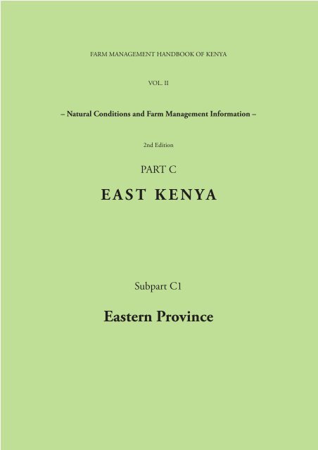
FARM MANAGEMENT HANDBOOK OF KENYAVOL. II– Natural Conditions and <strong>Farm</strong> <strong>Management</strong> Information –2nd EditionPART CEAST KENYASubpart C1<strong>Eastern</strong> <strong>Province</strong>
2This project was supported by the German Agency forTechnical Cooperation (GTZ)
Ministry of AgricultureFARM MANAGEMENT HANDBOOK OF KENYAVOL. II– Natural Conditions and <strong>Farm</strong> <strong>Management</strong> Information –2nd EditionPART CEAST KENYASubpart C1<strong>Eastern</strong> <strong>Province</strong>byDr. Ralph JaetzoldProf. emeritus of Geography,University of Trier / GermanyHelmut SchmidtFormer <strong>Farm</strong> <strong>Management</strong> Research <strong>Of</strong>ficerfrom the former German Agricultural Team of the GTZin the Ministry of Agriculture, NairobiDr. Berthold HornetzProf. of Agricultural Geography,University of Trier / GermanyDr. Chris ShisanyaProf. of Agroclimatology,Dept. of Geography<strong>Kenya</strong>tta University, NairobiContributions to the 1 st Edition by: C.M. Kang´e & J.G.M. Muasya – assessment of farm management data; Dr. Mechthild Kronen– soil requirements list; Prof. Dr. H. Kutsch – computing of crop-water relations for yield probabilities; F.N. Muchena, B.J.A.van der Pouw, W. Siderius and W.G. Sombroek – basic soil maps; H. Ritz – district climate tables; R. Swoboda – execution of Small<strong>Farm</strong> Survey; C.G. Wenner & S.N. Njoroge – soil conservation.Contributions to the 2 nd Edition by: G. Awinyo – digitizing of soil maps into GIS; Th. Buettel – support by analyzing remotesensing data; M. Fiebiger – rainfall data analysis, probability calculations, yield probabilities by simulation programs; Heike Hoeffler– project coordination in GTZ Nairobi; Ph. Karuri – assistance in the <strong>Farm</strong> Survey; Elizabeth Kimenyi & Anne Njoroge – coordinationof farm survey; M. Mueller – calculation and diagrams of growing periods, ENSO influence; Dr. Anne W. Muriuki & J.N.Qureshi – soil and fertiliser recommendation maps and information; Dr. Dorothy Mutisya – crops and fodder list; Birgit Schmidt– basics for maintaining and regaining soil fertility; Joshua Shivachi – analysing the <strong>Farm</strong> Survey data using SPSS software; J. Wieczorek– computerization of climatic and fertiliser maps, tables and diagrams for GIS and printing; W. Zettelmeyer – computingfarm data.4
<strong>Farm</strong> <strong>Management</strong> <strong>Handbook</strong>s of <strong>Kenya</strong>VOL. IVOL. IIPart II/MPart II/ASubpart A1Subpart A2Part II/BSubpart BlSubpart B2Part II /CSubpart C1Subpart C2VOL. IIIPart III/APart III/BVOL. IVVOL. VLabour Requirement Availability and Costs of MechanisationNatural Conditions and <strong>Farm</strong> <strong>Management</strong> InformationGeneral Part (Methodology)WEST KENYAWestern <strong>Province</strong>Nyanza <strong>Province</strong>CENTRAL KENYARift Valley <strong>Province</strong>, Middle and Southern PartCentral <strong>Province</strong>EAST KENYA<strong>Eastern</strong> <strong>Province</strong>, Middle and Southern PartCoast <strong>Province</strong><strong>Farm</strong> <strong>Management</strong> Information - Annual PublicationsAgriculture Land, Holdings and <strong>Farm</strong> StatisticsCosts and Prices, Gross Margins, Cash Flows and <strong>Farm</strong> ModelsProduction Techniques of Livestock EnterprisesProduction Techniques and Economics of Horticultural EnterprisesPublisher: Ministry of Agriculture, <strong>Kenya</strong>, in Cooperation with the German Agency for TechnicalCooperation (GTZ)VOL. II is supplemented by CD-ROMs with the information and maps in a GeographicalInformation System. Additionally there are wall maps of the Agro-Ecological Zones per district group(= the former large districts) for offices and schools.Vol. II/C1 Printed in Nairobi 2006Design & Layout by Jan Wieczorek, Trier, Germany5
ACKNOWLEDGEMENTfor the Support to the First EditionIn compiling this <strong>Handbook</strong>, we have relied on the support of many officers from a variety of institutionstoo numerous to mention, who made available their data and experience. We would like to thank them fortheir invaluable assistance.I would also like to thank my colleagues, the Research <strong>Of</strong>ficers, the District Land and <strong>Farm</strong> management<strong>Of</strong>ficers, for their cooperation, and a special thank you to those who typed the draft edition.Our particular thanks go to Prof. Dr. Ralph Jaetzold, University of Trier, for his selfless support in compilingthis handbook and for his assessment of the natural conditions including land and population. His deepunderstanding of the needs of agricultural extension officers and farmers was a great asset. Our thanks also toDr. H. Kutsch, University of Trier, who computerized a large and complex amount of information involvedin establishing the AEZs.Many thanks also to the staff of the Geographical Department of the University of Trier, Germany, for theirmajor effort in drawing up maps of outstanding quality, the centrepiece of the work.Helmut Schmidt<strong>Farm</strong> <strong>Management</strong> Research <strong>Of</strong>ficerNairobi, May 1982ACKNOWLEDGEMENTfor the Support to the Second EditionIn revising this <strong>Handbook</strong>, various personalities and institutions were relied upon to provide the necessarydata required to update the previous data sets. In this regard, we would like to sincerely thank them for theirinvaluable input in the exercise.Special thanks go to the Ministry of Agriculture staff who undertook the <strong>Farm</strong> Surveys to elucidate on thefundamental changes that have taken place in farming at the household level.We are indeed very grateful to the people of Germany, who despite their limited financial resources, havecontinued to support <strong>Kenya</strong>. <strong>Of</strong> importance here is the German Agency for Technical Cooperation (GTZ)and the German scientists who have been working for <strong>Kenya</strong> over the years. Last but not least, thanks to Mr.Reimund Hoffmann, the PSDA Coordinator, Nairobi, whose office ably managed the <strong>Handbook</strong> revisionproject.Chris ShisanyaElizabeth KimenyiProf. of AgroclimatologyAssistant Director of AgricultureDept. of GeographyFMD, MOA<strong>Kenya</strong>tta University, Nairobi<strong>Kenya</strong>Nairobi, January 2007 Nairobi, January 20076
PREFACE to the Second EditionInstitutional memory is of paramount importance for planning and development. For any research or agricultural extensionto be successful, information on the natural farming potential is equally important.In an effort to consolidate research - extension work of many years, the first edition of the <strong>Farm</strong> <strong>Management</strong> <strong>Handbook</strong>(FMHB) of <strong>Kenya</strong> Vol II (Natural conditions and farm management information), which described the conditions of the<strong>Kenya</strong>n farming community at that time, was produced in 1982/83. The handbook was in three parts i.e.:A – for Western <strong>Kenya</strong> (Western and Nyanza provinces)B – for Central <strong>Kenya</strong> (Central and Rift Valley provinces).C – for <strong>Eastern</strong> <strong>Kenya</strong> (<strong>Eastern</strong> and Coast provinces)For more than two decades, the handbook has proved very valuable to researchers, planners, extensionists, developers etc.This is a document that has been sought for enormously and hence the need to revise it in order to accommodate the changesthat have taken place in our country since the production of the first edition. Some of these include: changes in the administrativeboundaries, opening up of new farming areas due to population pressure, etc.This second edition has been produced on the basis of Provincial administrative boundaries for the six <strong>Province</strong>s i.e. Western,Nyanza, Rift Valley, Central, <strong>Eastern</strong> and Coast. The information will be availed in hard copies and in CD – ROMS tofacilitate updating any future changes.It is not possible to acknowledge the contribution of all the individuals who made this edition a reality but I need to mentionthe following:Thanks to the Ministry of Agriculture staff, especially the Agribusiness Department formerly <strong>Farm</strong> <strong>Management</strong> Divisionstaff at the headquarters (Mrs. E. W. Kimenyi, Mr. F. N. Nderitu, Mrs. A.W Njoroge, Mrs. A. W. Wanyama and Mr. P. TKaruri), and the District staff, for their selfless contribution; Prof. Chris Shisanya, leader of the revision team, for his tirelessefforts and guidance; Prof. Ralph Jaetzold for his enormous knowledge on the definition of the agroecological zones and hisgreat contribution to their mapping; Mr. George Awinyo (German Technical Cooperation (GTZ) – Private Sector Developmentin Agriculture (PSDA)) for his expertise and contribution in the area of Geographical Information Systems (GIS).I also wish to thank the GTZ who have facilitated the production of this edition both financially and by the use of theirpersonnel, specifically the late Prof. Werner von der Ohe who supported the idea of the revision, and Mr. Reimund Hoffmann(GTZ – Programme Manager Private Sector Development in Agriculture PSDA), for supporting and taking up thetask to completion.Dr. Wilson Songa, OGWAGRICULTURE SECRETARYNairobi, May 20077
TABLE OF CONTENTSAcknowledgement for the Support to the First Edition 5Acknowledgement for the Support to the Second Edition 5Preface to the First Edition 6Preface to the Second Edition 7List of Abbreviations 11Introduction to the Second Edition 121. GENERAL PART FOR EASTERN PROVINCE1.1 EXPLANATION OF THE EVALUATION OF THE NATURAL POTENTIAL1.1.1 The Agro-Ecological Zonation for <strong>Kenya</strong> 1) 15Table I: Agro-Ecological Zones of the Tropics in <strong>Kenya</strong> 16Table II: Subzones According to Growing Periods for Annual Crops 181.1.2 Major Soils in <strong>Eastern</strong> <strong>Province</strong> 20Table III: A Broad Estimate of the Dominant Characteristics of the Major SoilClassification Units in <strong>Kenya</strong> 231.1.3 Soil Requirements List for Crops in <strong>Eastern</strong> <strong>Province</strong> 24Table IV: Soil Requirements List for Crops in <strong>Eastern</strong> <strong>Province</strong> 241.2 PRESERVING THE NATURAL POTENTIAL FOR THE FUTURE OF KENYA1.2.1 Beware of Degrading the Areas of Natural Vegetation in the Agro-Ecological Zones of<strong>Eastern</strong> <strong>Province</strong> to Maintain Water, Firewood and Medicinal Resources as well as theGrazing Potential! 291.2.2 Maintenance, Replenishment and Improvement of Soil Fertility in <strong>Eastern</strong> <strong>Province</strong> 301.2.3 Physical Soil Conservation 35Page2. EASTERN PROVINCE, Southern Part2.1 INTRODUCTION 41Table V: Population Projections for <strong>Eastern</strong> <strong>Province</strong> Per District 41Table VI: Absolute Poor Households and Persons in <strong>Eastern</strong> <strong>Province</strong> Per District 422.2 THE TEMPERATURE BELTS 422.3 RAINFALL AND AGRO-ECOLOGICAL ZONES OF EASTERN PROVINCE 432.4 IMPORTANT SUBZONES IN THE DRIER AGRO-ECOLOGICAL ZONES OF EASTERNPROVINCE 432.5 THE POSSIBILITY OF ESTIMATING THE VARIATIONS AND FORECASTING A SEASONIN THE CRITICAL ZONE 5 OF EASTERN PROVINCE 45Table VII: How Much Deviation from the Normal is Caused by an ENSO orAnti-ENSO Season 47Table VIII: Climatic Yield Potentials of Seasonal Crops in ENSO, Normal andAnti-ENSO years 481)System Ralph Jaetzold. Method of calculation of growing periods and yield probabilities out of crop-soil waterrelations by Horst Kutsch, Berthold Hornetz and Chris Shisanya see General Part (Methodology) of Vol. II/M9
2.6 RUNOFF-HARVESTING AGRICULTURE TO AVOID FAMINES IN SEMI-ARID LANDS OF EASTERNPROVINCE 49Tables IX a & b: Distances for Runoff-Harvesting Agriculture for First and Second Rainy Seasons 512.7 THE IMPORTANCE OF FERTILISING AND NUTRIENT RECYCLINGIN EASTERN PROVINCE 53Table X: The Decrease (%) of pH and Available Nutrients in <strong>Eastern</strong> <strong>Province</strong>(During 5 Years of Maize Cultivation at the FURP Experimental Sites) 542.8 POSSIBLE CROPS AND VARIETIES IN EASTERN PROVINCE 55Table XI: Agro-Climatological Crop List for <strong>Eastern</strong> <strong>Province</strong> of <strong>Kenya</strong> 56Table XII: Bioclimatologically Suitable Grasses and Other Fodder Crops for the Agro-Ecological Zones in <strong>Eastern</strong> <strong>Province</strong> 742.9 POSSIBILITIES FOR AGROFORESTRY IN EASTERN PROVINCE 803. DISTRICT INFORMATION AND STATISTICS3.1 GENERAL REMARKS TO THE LAND USE POTENTIALS AND FERTILISERRECOMMENDATIONS OF THE DISTRICTS 833.2 EMBU & MBEERE DISTRICTS GROUPCONTENTS 853.3 MERU CENTRAL & MERU SOUTH DISTRICTS GROUPTABLE OF CONTENTS 1673.4 MERU NORTH & THARAKA DISTRICTS GROUPTABLE OF CONTENTS 2613.5 MACHAKOS & MAKUENI DISTRICTS GROUPTABLE OF CONTENTS 3553.6 KITUI & MWINGI DISTRICTS GROUPTABLE OF CONTENTS 46910
List of AbbreviationsAEZ = Agro-Ecological ZoneAEU = Agro-Ecological Unitadd. = additionala. o. = and othersa.s.l. = above sea levelav. = averageb. = beginning, beginbl. = blackbr = bimodal rainfallC. = Cooperativeca. = circa, aroundCAZRI =Central Arid Zone Research Institute(Jodhpur, India)CL = Coastal Lowlandcomp. = compositeDLC = Dry Land Composite Maizecv. = cultivar, cultivated varietye. = endE 0= evaporation of a water surfaceF. = <strong>Farm</strong>er, <strong>Farm</strong>ersFAOFood and Agriculture Organization of the=United Nationsf. i. = for instanceFor. = ForestFURPFertiliser Use Recommendation Project=of the GTZ (1986-91)GIS = Geographical Information Systemgr. = growing; with crop name: greenGTZGesellschaft für Technische Zusammenarbeit(the German Agency for Technical=Cooperation with Developing Countries)H = Highland; with crop name: hybridh. = heavyha = hectari = intermediate rainsi.e. = item est (latin) = it meansIL = Inner LowlandIRACC =Information Research and CommunicationCentreISFM = Integrated Soil Fertility <strong>Management</strong>KARI = <strong>Kenya</strong> Agriculture Research InstituteKCB = Katumani Composite Maize BKSS = <strong>Kenya</strong> Soil SurveyL = Lowland, lowerl = longLU = <strong>Kenya</strong>n Livestock unit of 300 kgM = Midlandm = mediumm. = mid, middlemat. = maturingmax. = maximummin. = minimumMSS = Marketing Support ServicesNARS = National Agricultural Research Stationnorm. = normallyO. = p = permanentpa = per annum (= per year)p., per. = periodPET = Potential Evapotranspirationpl. = plantingpr. = precipitationPSDA =Private Sector Development ofAgriculture (recent Project of GTZ)r. = rains, rainy seasonres. = resistantR. = Reserves = shortsec. = secondarySt., Stn. = StationTA = Tropical AlpineTCF = Total crop failuret = temperature; with yields: tonstr = trimodal rainfallU = Upperu = uncertainur = unimodal rainfallv = veryvar. = varietyy. = year< = less than> = more than~ = about, nearly, around& = and^ = followed by a...11
INTRODUCTION to the Second Edition1. In general, the <strong>Kenya</strong>n farmer is well informed as to the potential of his own land, the labour force of his familyand the production techniques to be used when planting crops cultivated for generations. In the past, this was aperfectly satisfactory situation, but today, the farmer is called on to feed a rapidly increasing population and earna major share of vital foreign currency through exports, i.e. he / she has to shoulder the cost of economic developmentin <strong>Kenya</strong>, in particular in the urban areas. Therefore the farmer is the most important person for thebasis and the future of the nation. Traditional farming methods are no longer capable of meeting all the demandsmade on the farming community; widespread application of scientific methods is required, but knowledge ofthese methods is obtained, compiled and stored elsewhere, out of reach of the farmer.The <strong>Handbook</strong> has been compiled primarily to assist the agriculture field advisor, who often is one of the mostimportant officers in rural development. Extension work is organised within political units, i.e. location, divisionand district, and therefore information has been compiled according to AEZs per district resp. districtgroups, which in some cases has led to repetition. The layout and approach of the book has to be seen in thiscontext.It is important that research is demand driven and not research for the sake of it. Agricultural research must begeared towards solving agricultural problems faced by the farming community. For agricultural research to haveany impcat, researchers must change tact and start doing research together with farmers.Information flow from research to the farmer, and vice versa, and among the various institutions involved inrural development is seriously hampered by the lack of a common source of reference.Output of agricultural produce could be considerably increased if the knowledge already accumulated in <strong>Kenya</strong>is available to the farmer. The work output of the planning officer could also be doubled and its quality substantiallyimproved if he had this knowledge on hand, which would go a long way towards improving the welfare ofthe rural population.The increasing demand for information and communication calls for increased efforts to make the informationaccumulated available.2. This transfer of “know-how” to those who need it is a major task and cannot be achieved by the Ministry ofAgriculture alone - it requires a joint effort. The <strong>Farm</strong> <strong>Management</strong> Division has now made a major effort toestablish and compile information required by the farmers and those who work for the farming community.This information was published in five volumes of the <strong>Farm</strong> <strong>Management</strong> <strong>Handbook</strong> of <strong>Kenya</strong> of which Vol.II “Natural Conditions and <strong>Farm</strong> <strong>Management</strong> Information” 1 is the centrepiece, first published in 1982/83.Though the document is still relevant, but out of print, there is need for updating the document, hence thepresent edition.1<strong>Farm</strong> management information which depends largely on financial facts had to be excluded, like gross margins, cash flows, farm models.It is published by the FMB occasionally and can be obtained from the Ministry of Agriculture, Kilimo House.12
3. The <strong>Farm</strong> <strong>Management</strong> Approach is the most reliable method yet developed to assist farming. It is thereforevery desirable that other institutions try to make use of the system.However, the information given cannot be blindly applied, but requires assessment for its relevance tothe actual case. Much of it, especially fertilizer recommendations, will be replaced within the next ten totwenty years. It is important to take note of these replacements.The information is given per district and per subzones of the Agro-Ecological Zones, but the diversity ofthe farms in any AEZ and the limitations of the data base make it essential to evaluate the data suppliedi. e. it is most important to read the accompanying explanations and to compare each subzone with thesoil pattern to adjust the information to the different Agro-Ecological Units.4. The Vol. II of the <strong>Farm</strong> <strong>Management</strong> <strong>Handbook</strong> consists of the following parts:a) A West, B Central, and C East <strong>Kenya</strong>, divided in seven smaller, better manageable subpartsby six provinces and a general partand it is supplemented byb) Large AEZ maps of the district groups printed in colour (scale mainly 1:250 000) as wallmaps for offices and schoolsc) A data bank and CD ROMs with a Geographical Information System (GIS) of allimportant agro-ecological information for each spot. All items are kept by the departmentcharged with <strong>Farm</strong> <strong>Management</strong> activities in the Ministry of Agriculture.5. The value of these books containing the natural conditions should not be overestimated.The yield potentialsof the Agro-ecological subzones are only a rough guide. First of all the soils of the Agro-ecologicalunits in the subzones must be carefully considered to evaluate their suitability and ability to improve andsustain their fertility, resp. Secondly the marked conditions play an important role in the decision onwhat is suitable at a certain place at present times. Therefore the agro-economic conditions must alwaysbe considered in analysing the natural potentials of the Agro-Ecological Zones for recommendations ordecisions. 3One of the different samples of reduced economic use of the natural potential of Agro-Ecological Zonesby worsening of the infrastructure is cotton. Mismanagement in the cotton cooperatives and the CottonBoard caused long delays and sometimes even reduced payments to the cotton farmers. This discouragedthe planting of cotton very severely, especially where small farmers had often occurred debts in production.So for many years there were large parts of the cotton zone without cotton in <strong>Kenya</strong> until a newinitiative by the government encouraged cotton planting even beyond the cotton zones. Former cottonfarmers have planted additional maize for market. The maize price has increased considererably since1990 due to population increase and famine. It should be kept high by the Government to encouragefarmers to plant enough to ensure national food security.A general problem is the the continued growing of maize in the sorghum and millet zones instead ofthe more drought-resistant sorghum and millet varieties, which require less water. The end result is cropfailure of maize, which leads to food insecurity and continued dependence on relief food. It is only if thealtitude is above 800 m that maize outyields sorghum and millets and as long as there is at least 250 mmof well distributed rainfall during the growing season.Due to social change and mobility, a farmer who feeds on sorghum and millet is considered impover-2It was impossible to assess the large amount of statistical data in detail. - Also there was not enough time and money to undertakea new differentiated farm survey. Only a few questions, mainly about the possible increase of yields by good farm managementcould be placed systematically by the Agriculture <strong>Of</strong>ficers in typical Agro-Ecological Units.3Jaetzold, R.: The Agro-ecological Zones of <strong>Kenya</strong> and their Agro-economical Dynamics. Materialien zur Ostafrikaforschung, Vol.6, Geographische Gesellschaft, University Trier 1987.13
ished in many countries. Due to changing eating habits, maize flour is also preferred to sorghum andmillet flour, which can be slightly bitter, and the demand and price for these small grains is generallydropping. Finally the loss by birds is less with maize than with most small grain cereal varieties, and thechildren who in former times had to chase the birds away have now to go to school. In a situation wheremaize fetches at least 50% more money than sorghum or bulrush millet, the advice of the agro-ecologiststo plant more sorghum and millet is not taken up in the marginal foot plains of the highlands ofEast and North East Africa. Therefore maize is planted as a staple food also beyond the economic limitsof maize cultivation in the AEZ 5.7. In the first edition of this handbook 1982/83, the main focus was to adjust agriculture to the differentclimate conditions in an optimal way. This goal has been achieved to a great extent. Hower, the gains arelikely to be eroded by the serious problem of decreasing soil fertility and the rapid population growthrates being experienced in rural <strong>Kenya</strong>. Urgent measures are therefore needed to address these problemsfor sustainable agricultural productivity in <strong>Kenya</strong>.8. <strong>Farm</strong>ers who migrate into the arid and semi-arid areas bring along with them inappropriateagricultural technologies. These drylands have fragile ecosystems that require land uses, whichmimic natural ecosystems such as shifting cultivation, agroforestry and nomadic pastoralism.These are land uses that are characterized by temporal and spatial dynamics and have in-builtrecovery mechanisms. Now it is necessary in this new edition to demonstrate to farmers the chancesand risks of farming in these drylands, i.e. for “chance -cropping”.Our best wishes are with the farmers.The editors and the authors.Nairobi and Trier, January 200514
1.1 EXPLANATION OF THE EVALUATION OF THE NATURAL POTENTIAL1.1.1 METHOD OF THE AGRO-ECOLOGICAL ZONATION by Ralph JaetzoldSimple agro-ecological zones were established by FAO in 1978 1 . They are suited to make decisions in internationaland long term agricultural policy. In order to give advice to farmers in the districts a more differentiatedsystem showing yield probabilities and risks as well had to be developed:1. The zone groups are temperature belts (Table I) defined according to the maximum temperature limitswithin the main crops in <strong>Kenya</strong> can flourish; cashew and coconuts for the lowlands, sugar cane andcotton for the lower midlands, Arabica coffee for the upper midlands (usually known as “Highlands”- the term ‘midlands’ is used here to denote their central importance), tea for the lower highlands, pyrethrumfor the upper highlands. The highest zone is high altitude rough grazing i.e. tropical alpine (orafro-alpine) vegetation. The threshold values of annual mean temperatures have been established alongsimilar lines to those of H.M.H. BRAUN 2 but supplemented by limiting factors for many crops e.g.mean minimum temperatures, frost, etc.2. The main zones (Table I) are based on their probability of meeting the temperature and water requirementsof the main leading crops i.e. climatic yield potential, calculated by computer (see General Part).The zones are roughly parallel with Braun’s climatic zones of the Precipitation/Evaporation Index,but there are differences according to the influence of the length and intensity of arid periods, a factoralso considered by the computer programme. In a first order the average annual precipitation iscompared with the average annual evapotranspiration.The name of the main zones refer to potentiallyleading crops, many of them can be grown in some other zones, too:Maize zones: LH 1-3; UM 1-4; LM 1-4 (+5); L 2-4 (+5)Hybrid maize in zones: LH 1-3; UM 1-3; LM 1-3Wheat in zones: UH 2-3; LH 2-4Unirrigated rice in zones: L 1-3; LM 1-2Irrigated rice in zones: L 1-6; (7); LM 1-6, (7)Sorghum in zones: UM (1-3), 4-5; LM (1-3), 4-5; L (1-3), 4-5Finger millet in zones: LH (1-3); UM (1-3), 4; LM (1-3), 4, (5); L (1-3), 4, (5)Groundnuts in zones: LM (1-2), 3-4; L (2-3), 4Cotton in zones: LM (2), 3-4; L (2), 3-41FAO (1978): Report on the Agro-ecological Zones Project. Methodology and Results for Africa. (= World Soil Resources Rep.,48/1), Rome.2<strong>Kenya</strong> Soil Survey, (1982): Exploratory Soil Map and Agro-Climatic Zones Map of <strong>Kenya</strong>, scale 1:1 000 000, Rep. E 1, Nairobi.15
( ) means that in these zones the crop is normally not competitive to related crops (f.i. dwarf millets tomaize)Livestock is possible in all zones. Decreasing stocking rates from 1 to 7 (from 0.4 ha up to more than25 ha per livestock unit of 300 kg)The colours assigned to the main zones become lighter at cooler higher zones altitudes (Table I). Additionallythey become more red in the drier climates. Rain starts earlier at higher altitudes. This is due tothe fact that with the same amount of water, the production of biomass is still less in cooler altitudinalclimates. Also, the chances to ripe a crop before the end of the rainy seasons become smaller in thesehigher belts because of the increasing length of growing periods. Therefore, the Ranching Zone whichcovers Zone 6 in the Lowlands occurs already in Zone 5 in the Lower Highlands and even in Zone 4 inthe Upper Highlands.3. For the necessary information to farmers, these main zones are divided into subzones according to theyearly distribution and the length of the growing periods on a 60% probability factor i.e. the givenlength of the growing period should be reached or surpassed in at least 6 out of 10 years (Table II).“Growing periods” are defined as seasons with enough moisture in the soil to grow most crops, startingwith a supply for plants to transpirate more than 0.5 ETo, coming up to > ETo (in the ideal case) duringthe time of peak demand, and then falling down in the maturity phase again (calculated by the computerprogramme WATBAL) 3 . The length is normally given in decades (i.e. a ten day period) for mediumsoils. Figures are also available for heavy and light soils 4 , and they are also considered in the computerprogrammes MARCROP 5 and WOFOST 6 for the yield potential.These programmes compare the water requirements curves of almost all the main crops (as providedby the FAO 1977 7 and 1979 8 ), re-calculated by H. KUTSCH for <strong>Kenya</strong>n varieties and adapted to thedifferent agro-climates, with the rainfall occurrences in <strong>Kenya</strong> from 1930 to 1990 9 , in decades (10 dayperiods), and their effects on the water supply to the root zone for 3 soil groups and 3 plant populationdensities. On this basis, an ecological land use potential has been drawn up for each subzone, showingclimatic yield expectations and chances.The length of the growing period is the key to selecting the right varieties of annual crops within an agroecologicalzone. The symbols used for the length of the growing periods are straightforward:vl = very longl = longm = mediums = shortvs = very short3WATBAL.MODULE 1. It was developed by H. Kutsch and H.J. Schuh (1983): Simplified computer-based modelling ofwater balance in defined crop stands.- In: L. Reiner & H. Geidel (eds.) (1983): Informationsverarbeitung Agrarwissenschaft.Miinchen.4Heavy soil means heavy loam; clay may have less available water for plants. Light soil means loamy sand.5=WATBAL.MODULE 2 & 3. Callibrated for <strong>Kenya</strong> by B. Hornetz (see Hornetz and Shisanya in General Part), based onthe mathematical approach of Kutsch and Schuh , described in the first edition of the <strong>Farm</strong> <strong>Management</strong> <strong>Handbook</strong> of <strong>Kenya</strong>(1982), Vol. II, Part A, p. 17-28.6See R. Rotter (1993): Simulation of the biophysical limitations to maize production under rainfed conditions in <strong>Kenya</strong>: Evaluationand application of the model WOFOST.- (= Materialien zur Ostafrika-Forschung, 12), Geographische Gesellschaft UniversitatTrier.7FAO (1977): Crop Water Requirements.- (= Irrigation and Drainage Paper, 24), Rome.8FAO (1979): Yield Response to Water.- (= Irrigation and Drainage Paper, 33), Rome.9If there were enough completely recorded years, the standard period 1961-90 was used. Recent data were not available in reasonablequantities or too expensive. Only for important stations they were used.17
These are further differentiated to give further information for choosing the variety with the most adequategrowing period by the use of combined terms like “short to medium”, “medium to long”, etc. (Table II).If it is not desirable to subdivide the growing period in this way, the letter “f” for “fully” occurs before thesymbol for the period.The growing period formula is put in brackets if there is a weak performance i.e. although the moisturecontent is sufficient for growth, the peak demand which is ETo is not satisfied in the right time.Where there are two rainy seasons per annum (bimodal rainfall areas), this is shown by a plus sign (+) betweenthe two growing periods to show the yearly pattern.If there is no distinct arid period of at least three decades (30 days) between humid growing periods, the sign“A” is introduced i.e. both periods are bridged together. Expressed in words, it means “... followed by”.TABLE II: SUBZONES ACCORDING TO GROWING PERIODS FOR ANNUAL CROPSFormula Cropping seasonsLength of growing periods 1exceeded in 6 out of 10 yrs.Samples of combination duringthe year in <strong>Kenya</strong>pnormally permanent more than 364 daysvl very long 285 – 364 daysvl/l very long to long 235 – 284 „l/vl long to very long 215 – 234 „l long 195 – 214 „l/m long to medium 175 – 194 „m/l medium to long 155 – 174 „m medium 135 – 154 „m/s medium to short 115 – 134 „s/m short to medium 105 – 114 „s short 85 – 104 „s/vs short to very short 75 – 84 „vs/s very short to short 55 – 74 „vs very short 40 – 54 „vu very uncertain min. gr. p. < 6 out of 10 y.Additional information:ur = unimodal rainfall,br = bimodal rainfall,tr = trimodal r.i = intermediate rains (at least 5 decades more than 0.25 ET0) 4( ) = weak performance of growing period (in most decades less rain than ET0)+ = distinct arid period between growing periodsA = no distinct arid period between growing periods (“followed by”)f = full, i.e. no subdivision of growing periods, for inst. fm means 115 - 174 days1Growing period = enough moisture for cereals and legumes from seed to physical maturity. Figures show the time in which rain andstored soil moisture allow evapotranspiration of more than 0.5 ET0 (in medium soils of at least 60 cm depth), enough for mostcrops to start growing. During main growing time they need more of course (about full potential evapotranspiration ET0).2Lowlands and Lower Midlands, in UM, LH and UH 65 - 74 days3Lowlands, in LM 45 - 54 days, in UM 50 - 64 days, in LH and UH 55 - 64 days4That means moisture conditions are above wilting point for most crops18
4. The climatic agro-ecological zones are printed on soil maps, derived from the <strong>Kenya</strong> Soil Survey Mapsof the Districts in the Fertilizer Use Recomm. Project of the GTZ, to show the mosaic of agro-ecologicalunits within the zones. In final maps the soil units were roughly shaded where experiments have shownwhich inputs are needed for higher fertility (see maps of Fertiliser Recommendations and <strong>Farm</strong> SurveyAreas).The soil should be considered as closely as possible. The Fertiliser Use Manual of KARI 10 makes the resultsof the FURP applicable for farmers. For many areas special reports from the <strong>Kenya</strong> Soil Survey alsoexist. The average yield expectations given for the Agro-ecological Zones of a district only show what isclimatically possible (on prevailing soils) when other conditions are optimized.5. Therefore, many other factors apart from soil and climate have to be considered such as technologicallystandard, possibilities of additional irrigation 11 and so on. From the given agro-ecologically land usepotential for each AEZ it has to be chosen carefully what is economically and sociologically reasonablefor the time being 12 .The agro-ecological zones are illustrated by rainfall and water requirement diagrams.The curves in the diagrams are calculated or if proper data are not available they are estimated foroptimum water requirements of crops from seeding to physical maturity. Harvest is later according toripening stage, but then the plants need little or even no water.10A.W. Muriuki and J.N Qureshi: Fertiliser Use Manual. A comprehensive guide on fertiliser use in <strong>Kenya</strong>. KARI Nairobi 2001.11Artificial irrigation possibilities are normally not yet considered in the land use potentials of Agro-ecological Zones, because theygo beyond the climatic natural potential. Nevertheless, we are able to calculate if requested decadically water requirements of irrigatedcrops for defined sites.12R. Jaetzold: The Agro-Ecological Zones of <strong>Kenya</strong> and their Agro-Economical Dynamics. (= Materialien zur Ostafrika-Forschung,6), Geographische Gesellschaft Universitat Trier 1987.19
1.1.2 MAJOR SOILS IN EASTERN PROVINCEAccording to the international FAO classificationAcrisolsAcrisols are acid soils with a low base status, which are strongly leached but less weathered than Ferralsols.They are developing mainly on basement rocks like granites, but also on colluvium from quarzites. The basesaturation (BSP) of the B horizon is less than 50 %; thus indicating low fertility.The most common type is called orthic, but they also appear as humic (with an umbric A horizon, richin humic substances) and ferralo-chromic (with ferralitic properties due to stronger weathering or highchroma).AndosolsAndosols are black, well drained, less weathered, mostly shallow soils which have developed on volcanicashes of Mt. <strong>Kenya</strong>, Nyambene and Chyulu Hills. Due to high fertility and sufficient rainfall in these areas,vegetation on these soils is performing well, so that the topsoil is enriched with organic/humic substances;therefore, they mainly appear as humic and mollic types.ArenosolsArenosols are coarse, weakly developed mostly sandy soils with an identifiable B horizon and a clay contentof less than 18 %. They are developing on colluvial substrates from basement rocks as well as on quarzites.In <strong>Eastern</strong> <strong>Province</strong> Arenosols appear mostly as ferralic types with high sesquioxide contents.They have a low fertility and are exhausted already after a few seasons of cultivation.CambisolsCambisols are brown (forest) soils with cambic B horizons as a major feature; layers are differentiated andchanging characteristically due to their (relatively) young age. In <strong>Eastern</strong> <strong>Province</strong> they are developingmainly on basement rocks (gneisses are dominating), in particular on and around exposed inselbergs, hillsand scarps; they also occur on other various parent materials like basic igneous rocks. Cambisols are lessweathered than most of the other soils of the humid tropics and contain quite high amounts of clay mineralswith high nutrient reserves (like illites and montmorillonites), minerals (like phosphate, potassium etc.) aswell as juvenile materials.Usually they appear as chromic types, but also calcic (on calcareous or petrocalcic materials), humic, nitohumicor nito-chromic (on igneous rocks).ChernosemsChernosems are poorly drained, calcareous and clayey soils which have developed on infills from limestoneand volcanic materials in the bottomlands. They occur particularly in the northern and north eastern partsof the greater Meru District. Due to high contents of montmorillonites with a high Cation ExchangeCapacity (CEC), macro- and micronutrients as well as organic/humic substances in the topsoil they possessa high fertility.The calcic type with a secondary accumulation of >15 % CaCO3 is most common.FerralsolsFerralsols normally are strongly weathered soils of the humid tropics with oxic horizons. Soil fertility is lowto very low due to low mineral contents, kaolinites (as clay minerals) and a low CEC of less than 16 me/100g of clay. They are developing mainly on basement rocks like granites, gneisses and quarzites, but also onigneous rocks (like trachytes, syenites, phonolites etc.). In the drylands of <strong>Eastern</strong> <strong>Province</strong> Ferralsols havedeveloped in former times under more humid conditions, in particular on the tertiary peneplains, which arestretching from the highlands of Central <strong>Kenya</strong> down to the coastal hinterlands.20
The most common types here are the orthic and rhodic ones (with red to dusky red oxic B horizons).FluvisolsFluvisols are recent alluvial soils of the floodplains with depositional rather than pedogenetic profiles andmostly a high fertility due to high amounts of organic/humic and mineral substances as well as loamy andsandy fractions.The common eutric type possesses a high base content with a BSP of more than 50 %.GleysolsGleysols are soils of the bottomlands and swamps with hydromorphic properties dominating within the upper50 cm. They develop on igneous as well as basement rocks, but also on alluvial and colluvial deposits.Most common is the dystric type with a low base status and a BSP less than 50 %. Mollic Gleysols containmollic A horizons, the vertic type has typical shrinking and swelling properties.HistosolsIn <strong>Eastern</strong> <strong>Province</strong> Histosols are organic (peat) soils of the Afro-/Tropical-Alpine Zones I and II on Mt.<strong>Kenya</strong>; they possess a low fertility due to imperfect drainage and a low base saturation of less than 50 %.LithosolsLithosols are shallow soils of less than 10 cm depth developed on hard rocks of different origin. Very oftenthey also appear as a result of strong soil erosion.LuvisolsLuvisols are strongly leached soils (lessivés), having argillic B horizons with a relatively high base status andBSP of more than 50 %. In <strong>Eastern</strong> <strong>Province</strong> they normally develop on basement rocks (mainly gneisses),but also on igneous rocks and colluvium; they mainly cover the wetter parts of the peneplains (like onthe footslopes SE of Mt. <strong>Kenya</strong>). In some parts of the region (like in the Makindu-Kibwezi area) they areassociated with Ferralsols.Most common are the chromic, ferralo-chromic, but also orthic and nito-ferric types.NitosolsNitosols or Nitisols develop on tertiary and even older basic igneous rocks (like basalts, tuffs etc.) andcontain emerging argillic horizons with prominent shiny clay skins. They are soils with normally highfertility due to high contents of montmorillonites (as dominating clay minerals), minerals and available soilwater as well as a high Cation Exchange Capacity (CEC).Almost all types of Nitosols are occurring in <strong>Eastern</strong> <strong>Province</strong>. The dystric type has a moderate fertility witha relatively low base status and a BSP of less than 50 %; the eutric type has a relatively high base status and aBSP of more than 50 %, but is also moderately fertile. The mollic and humic types are more fertile and havea mollic/humic A horizon.PhaeozemsPhaeozems are well drained, less weathered clayey soils (the clays consist mainly of montmorillonites) withhigh contents of organic/humic substances in the topsoil as well as a high CEC and plant-available soilwater; thus possessing a high fertility. In <strong>Eastern</strong> <strong>Province</strong> they have developed on tertiary basic igneousrocks like olivine basalts, phonolites and tuffs and occur mainly on the drier semihumid to semiarid highlevelsavannah plains NW of Mt. <strong>Kenya</strong> like in the Nanyuki-Timau area (Laikipia Plateau) and NW of theNyambene Ranges.The luvic type is dominating.21
PlanosolsPlanosols are soils with an albic E horizon, hydromorphic properties and a slowly permeable B horizon,developing on different parent materials of the bottomlands.They appear as dystric (with a low base status and BSP of less than 50 %) and eutric types (high base statusand BSP more than 50 %).RegosolsRegosols are weakly developed soils from unconsolidated materials like igneous and basement rocks, oftenassociated with Lithosols. In <strong>Eastern</strong> <strong>Province</strong> they usually appear on the footslopes of inselbergs, hills andscarps.Dystric types with a low base status and BSP less than 50 % are as common as eutric ones with a high basesaturation of more than 50 %.SolonetzSolonetz are sodic soils with natric B horizons developed on plio-pleistocene bay/marine sediments of theMarafa beds and are located from lower Kitui and Mwingi District down to the coastal areas of Kwale andKilifi Districts. They are infertile due to poor drainage, surface sealing and high sodicity.VertisolsVertisols (“Black Cotton Soils”) are dark montmorillonite-rich, poorly drained cracking clays of thebottomlands with peloturbation processes. The clay content is higher than 30 %. They develop on alluvialand colluvial materials (so called “secondary Vertisols”) as well as on basic rocks (like basalts; so called“primary Vertisols”). Usually they contain high amounts of CaCO3 and other minerals with a high CECdue to the montmorillonitic clay minerals.The predominant pellic type is characterized by a low chroma of less than 1.5.Reference:Landon, J.R. (Ed., 1991): Booker Tropical Soil Manual.-Longman Group, London, New York22
TABLE III: A BROAD ESTIMATE OF THE DOMINANT CHARACTERISTICS OF THE MAJOR SOIL CLASSIFICATION UNITS IN KENYAMajor soilclass,unitTexturesubsoilTexturetopsoilDepthOrg.matterContent oftopsoilpH (water) Drainage Workability FertilityWaterholdingcapacityFerralsols Clay clay variable variable variable good moderate to good low moderateLuvisols Clay variable variable variable above 5.5 moderate moderate to good low to moderate moderateAcrisols Clay variable variable variable below 5.5moderateto goodmoderate to good low moderateRemarksArenosols Sand sand variable low variable good good low to very lowlow to verylowNitosols Clay clay deepmoderate tohighvariable good good moderate to highmoderate tohighKikuyu Red loamPhaeozems Clay variable variable high above 5.5 good good high high Prairie soilsAndosols Clay clay deepmoderate tohighvariable good good high high Volcanic Ash soilsRendzinas Clay clay variable high above 5.5 good good high highCambisols Variable variable variable variable variable moderateto goodmoderate to good moderate to high variable young soilsFluvisols Variable variable variable variable variable variable variable moderate to high variable Alluvial soilVertisols Clay clay variablePlanosols Clay variable variablelow tomoderatelow tomoderatevariable poor poor moderate to high highvariable poor moderate to poor low to moderatemoderate tolowXerosols Clay variable variable variable above 5.5 variable variable variable variableBlack Cotton soilscracking clayVlei soilsnon saline or sodicsoils of dry region.Solonchaks Clay variable variable variable above 7 variable variable variable variable saline soilsSolonetz Clay variable variable variable above 7 poor poor low variable sodic (alkali)soilsRegosols Clay variable variablemoderate tohighvariable variable variable variable variableRankers Clay variable variable variable below 5.5 variable variable variable variableLithosols Rock variableveryshallowGleysols Clay clay variableGreyzems Clay variable variableHistosolsPeatclayvariable = more than 3 classesvariable variable variable variable variable very low very shallow soilsmoderate tohighmoderate tohighvariable poor poor variablevariablepeat variable very high below 5.5moderateto poormoderateto poormoderate moderatevariable moderate to highmoderate tohighmoderate tohighmoderate tohighpoorly drainedsoilspeat soilsH.M.H. Braun23
TABLE IV: SOIL REQUIREMENTS LIST FOR CROPS IN KENYACrops Preferred texture pH Drainage RemarksGRAIN CROPSMaize(Zea mays)Wheat(Triticum aestivum)Durum wheat(Triticum durum)Triticale(Triticum x secale)Barley(Hordeum vulgare)light to medium 5.5-8.0light to medium 6.5-8.0light to medium 6.5-8.0Free drainingsoilsModerately wellto well drainedsoilsWell drainedsoils.medium to heavy 6.5-8.0 Well drained soilsmedium 6.5-8.0 Well drained soilsNot on very acid soils,not on water logging soilsat least moderately fertilesoils.In waterloggingconditions very pooryields, moderately tohighly fertile soils.Moderately droughttolerant.Tolerates salinity,moderately droughttolerantIntolerant ofwaterlogging, toleratessalinity (-1%),moderately fertile soilsOats(Avena sativa)medium 6.5-8.0Moderatelydrained soilsAlso on poor soilsFoxtail millet(Setaria italica)medium 5.0-8.0 Well drained soilsQuickly growing but notvery drought tolerantProso millet(Panicum miliaceum)Bulrush millet(Pennisetum typhoides)medium 5.0-8.0 Well drained soilslight to medium 5.0-8.0 Well drained soilsSome varieties droughttolerantDrought tolerant andtolerates salinityFinger millet(Eleusine coracana)medium 6.5-8.0Moderatelydrained soilsTurcana varieties droughttolerantSorghum(Sorghum vulgare)medium to heavy 4.5-8.5Moderately wellto well drainedsoilsLow to moderately fertilesoilsLEGUMINOUSCROPSTepary beans(Phasolous acutifolius)medium 6.0-7.5 Well drained soils Drought tolerantCow peas(Vigna unguiculata)light 5.0-7.5Free drainingsoilsDrought tolerantMoth beans(Vigna aconitifolia)Green grams(Vigna aureus)Black grams(Vigna mungo)medium to light 6.0-7.5 Well drained soils Drought tolerantmedium 6.0-7.5 Well drained soils Drought tolerantmedium 6.0-7.5 Well drained soils Drought tolerant24
TABLE IV: ContinuedCrops Preferred texture pH Drainage RemarksChick peas = Yellowgrams (Cicer arietinum)heavy (“BlackCotton soils “)5.0-7.5Moderately towell drained soilsFairly drought tolerantBeans(Phaseolus vulgaris)medium 6.0-7.5Free drainingsoilsNot drought tolerant,need moist soilthroughout the growingperiod.Bonavist beans=Njahe(Dolichos lablab)Trop.lima beans(Phaseolus lunatus)medium 6.0-7.5 Well drained soilsvarious 6.0-7.0 Well drained soilsVery drought tolerantGrows well also oninfertile soilsHorse beans(Vicia equine)medium 5.5-7.5Moderately towell drained soilsDrought tolerantHorse grams()medium 5.5-7.5Moderately towell drained soilsDrought tolerantGroundnuts(Arachis hypogea)light 6.2-7.5Well drainedto somewhatexcessivelydrained soilsUntil harvesting thesoil must be moist, butsensitive to impededdrainage; moderatelyfertile soils.Bambarra groundnuts(Voandzeia subterranea)light 6.2-7.5 Well drained soilsSoil aeration must beadequate, not on heavysoils with pans; thrivebetter than groundnuts onpoor soils.Garden peas(Pisum sativum)medium5.5-7.5(seebeans)Well drained soilsSome N good for startPigeon peas(Cajanus cajan)light5.0-7.5No info.Free drainingFairly drought tolerantSoya beans(Glycine max.)medium5.5-7.5(opt.6.0-6.5)Moderately wellto well drainedsoilsModerately fertile soilsOIL SEED CROPS(Helianthus annuus)medium (heavy) 6.0-8.0Moderatelydrained soilsVery drought tolerantLinseed(Linum usitatissium)medium 5.5-7.5Moderatelydrained soilsDrought tolerantRai(Brassica juncea)medium to heavy 6.0-8.0Moderatelydrained soilsDrought tolerantRapeseed(Brassica napus)medium 5.5-7.0Moderatelydrained soilsNot drought tolerantSimsim (Sesamumindicum)light to medium 6.0-7.5Free drainingsoilsModerately droughttolerant25
TABLE IV: ContinuedCrops Preferred texture pH Drainage RemarksCarthamustinctorius)medium 6.0-8.0Moderatelydrained soilsTolerates salinity,moderately droughttolerantCastor(Ricinus communis)medium 6.0-7.5Free drainingsoilsModerately droughttolerant, not on salinesoils.TUBER CROPSSweet potatoes(Ipomea batatas)various (widerange; swamps toeroded areas)variousVarious butplanted on ridgesin swampsDrought tolerant, needmoderately fertile soilsPotatoes(Dolanum tuberosum)light to medium 4.5-8.0Free drainingsoilsNot so drought tolerant,need good supply ofnutrientsCassava(Manihot esculenta)light to mediumvariousFree drainingsoilsVery drought tolerant,not on very stony orshallow soils, sensitive toimpeded drainage, thrivesalso on less fertile soilsTaro-Cocoyam(Colocasia antiquorum)light to medium 4.5-8.0TolerateswaterloggingGrows esp. well onriverbanks, demands afertile soilWhite Guinea yam(Dioscorea rotundata)Greater yam(D.alata)Yellow Guinea yam(D.cayenensis)Buffalo gourds(Cucurbita foetidissima)Marama beans(Tylosema esculenteum)Vigna(Vigna lobatifolia)medium 4.5-7.0Moderately toweakly drainedsoils“ “ “ ““ “ “ “Moderately fertile soils.light 6.0-7.5 Well drained soils Very drought tolerantmedium 6.0-7.5 Well drained soils Very drought tolerantlight to medium 6.0-7.5 Well drained soils Very drought tolerantFIBRE CROPSCotton(Gossypium hirsutum)medium to heavy 6.0-8.0Well drainedsoils, sensitive toimpeded drainageTolerates salinity (0,5-=0,6%); moderately tohigh fertile soils; shouldcontain borFlax(Linum usitatissimum)medium 5.5-7.5Moderatelydrained soils(Phormium tenax)medium 5.5-7.5Moderatelydrained soils26
TABLE IV: ContinuedCrops Preferred texture pH Drainage RemarksSisal (Agave sisalana) medium 5.5-7.5Well tomoderatelydrained soilsOn heavy soils it isnecessary to formcambered beds or to digditches for drainage.OTHER CASH CROPS AND FRUITSAvocadoes(Persea americana)medium 6.0-7.5 Well drained soils Not on saline soilsBananas(Musa paradisiaca)light to medium 5.0-7.0Well tomoderately welldrained soils.Best places are fertilevolcanic or alluvialsoils.soil aeration must beadequate, moderately tohighly fertile soils.Cashew nuts(Anacardiumoccidentale)light 5.0-7.5UnimpededdrainageOn dry and steep slopesgood against soil erosion;thrive also on poor soils.Citrus(Citrus spp.)light to medium 5.0-7.0 Well drained soilsSoil aeration must beadequate, sensitiveto impeded drainage,moderately to highlyfertile soils.Coconuts(Cocos nucifera)light 4.0-7.0Free drainingsoilsTolerate high salinity (-1%), soil aeration mustbe adequate. In aridregions ground watershould be available in1-2,5m depth.Coffee/Arabica(Coffea arabica)medium 5.3-6.0Free drainingsoilsSoils must allowreasonable waterretention; very sensitiveto CaCO 3 (more thanearth)moderately tohighly fertile soilsCoffee/Robusta(Coffea canephora var.robusta )Deciduous fruit trees(apples, peaches, pears)medium 5.0-6.0 Well drained soilsmedium 4.5-7.0 Well drained soilsGrows well in a widerange of various soils ifthey are well drained;sensitive to CaCO 3 andCaSO 4 like Arabicacoffee.If the soil is deep theytolerate also lighter orheavier soils.Macadamia nuts(Macadamia spp.)medium 5.0-6.0Free drainingsoils27
TABLE IV: ContinuedCrops Preferred texture pH Drainage RemarksPyrethrum(Chrysanthemumcinerariaefolium)medium 5.6-7.5 Well drained soilsSugarcane(Saccharum spp.)light to medium 5.0-7.0Moderately wellto well drainedsoilsSensitive to waterlogging;groundwatershould be below1mdepth. On heavy soilscambered beds, ditches orfurrows must be formedfor drainage. Moderatelyfertile soilsTea (Camellia sinensis)medium4.0-6.0(4.5-5.5)Free drainingsoilsSoil with good waterretaining capacity isessential, very sensitiveto CaCO 3 (0%) andCaS0 4 (0%),grows alsoon less fertile soilsTobacco(Nicotiana tabacum)medium(5.0) 5.5-6.5Well drained soilsNot on heavy or/andsaline soils, very sensitiveto CaCO 3 (>1% of the 4Tung Oil(Aleurites fordii)Ye-eb nuts(Cordeauxia edulis)medium 4.5-6.5 Well drained soilsmedium No info. Well drained soils Very drought tolerant28
1.2 PRESERVING THENATURALPOTENTIALFORTHEFUTUREOFEASTERNPROVINCE1.2.1 BEWAREOFDEGRADINGTHEAREASOFNATURALVEGETATIONINTHEAGRO-ECO-LOGICALZONESOFEASTERNPROVINCETOMAINTAINWATER,FIREWOODANDME-DICINAL RESOURCES AS WELL AS THE GRAZING POTENTIAL!The Agro-Ecological Zones 0-3 are originally zones of forest according to the natural vegetation. AEZ 0corresponds to everwet evergreen rainforest, AEZ 1 to evergreen rainforest, AEZ 2 to seasonal rainforest becauseof one or two dry months. AEZ 3 has three to five dry months, it corresponds to seasonal semi-deciduousmoist forest or a high grass - broad leaved trees savannah which might be caused edaphically on waterloggingsoils (mbugas) or very poor leached senile soils, both unsuitable for most trees; on other soils it might be asecondary vegetation caused by fire. The grass - tall as a man - is supressing young trees, and if it is set ablaze,it produces a lot of heat that kills most of the trees.AEZ 4 corresponds to woodland, it is either deciduous in subzones with unimodal rainfall as in West <strong>Kenya</strong>and in Tanzania, or hard-leaved evergreen in bimodal rainfall subzones with two dry seasons as in East <strong>Kenya</strong>,where plants by hard or hairy leaves try to avoid loosing them two times a year. The grass grows to about1 m tall.Forests (and woodlands) are necessary also for the agriculture outside, because they minimize quick surfacerunoffand store water in their deep, unhardened soils to supply it to wells, creeks and streams during the dryseasons. Therefore it is imperative that forests be protected. Forest protection is necessary for other reasonstoo: Firewood collection (not cutting!), timber, medical plants and genetic resources. A network of forestreserves is necessary to conserve biodiversity.A network of protected areas is also a must for the drier Agro-Ecological Zones 4-6.The correspondingnatural vegetation in AEZ 5 is short grass savannah with small leaved thorny trees and bushes. There is moregrass on fine coarse soil of volcanic ashes on the Laikipia Plateau and more bush on red loams or stony soils.Zone 6 is bushland with very short but still perennial grass and therefore suitable for ranching - if the grass(the standing hay for the dry season) is not reduced due to overgrazing. In Zone 7, only annual grasses andherbs grow and can only be used intermittently with a base in Zone 6.Good management of the remaining natural vegetation by farmers especially herders is important: In AEZ 3it is necessary to avoid bush burning which kills the regrowth of trees and ecologically valuable bushes. Butthe main danger here is overgrazing which threatens the balance between grass and bushes. Bush encroachmentcan actually reduce the grazing potential. This is the same danger in AEZ 4 and 5 but with shrubbyspecies (e.g. shrub encroachment, thorny species in AEZ 5). In the first stage, poisonous or bitter herbs notpalatable to livestock thrive abundantly, leading to what can correctly be referred to as some sort of ‘’greendegradation’’.In AEZ 6 the eradication of grass by overgrazing promotes at first the dwarf shrubs (e.g. dwarf shrub encroachment),then in the favourable subzones thorny low shrubs grow. The grazing potential here has severelydecreased and only goats as browsers remain. In the final stage, due to overuse and soil denudation,the shrubs disappear and desertification sets in. Some efforts are being made to practise reseeding in fencedplots and this has in some instances proved successful. Originally semi-desert indicates Zone 7, full desertZone 8.29
1.2.2 MAINTENANCE, REPLENISHMENT AND IMPROVEMENT OFSOIL FERTILITY IN KENYASoil fertility depletion has been described as the major biophysical root cause of the declining per-capitafood availability in smallholder farms in sub-Saharan Africa (SSA), with a decline from 150 to 130 kg perperson over the past 35 years in production 1) . In the densely populated Western <strong>Province</strong> it went down to 60kg for cereals! Emerging evidence attributes this to insufficient nutrient inputs relative to exports, primarilythrough harvested products, leaching, gaseous losses and soil erosion. This results in yields that are about2-5 times lower than potential. Adequate and better solutions to combat nutrients depletion where known,are often limited in application because of the dynamics and heterogeneity of the African agro-ecosystemsin terms of biophysical and socio-economic gradients. This calls for system-specific or flexible recommendations,rather than monolithic technical solutions such as blanket fertilisation recommendations.Despite diversity of approaches and solutions and the investment of time and resources by a wide rangeof institutions, soil fertility degradation continues to prove to be a substantially intransigent problem, andas the single most important constraint to food security in the continent 2) . For example, soil loss througherosion is estimated to be 10 times greater than the rate of natural formation. Return to investment insoil fertility has not been commensurate to research outputs 3) . <strong>Farm</strong>ers are only likely to adopt sound soilmanagement if they are assured of return on their investment. Integrated soil fertility management (ISFM)is now regarded as a strategy that helps low resource endowed farmers, mitigate many problems and thecharacteristics of poverty and food insecurity by improving the quantity and quality of food, income andresilience of soil productive capacity.Essentially, ISFM is the adoption of a systematic conscious participatory and broad knowledge intensiveholistic approach to research on soil fertility and that embraces the full range of driving factors and consequencessuch as biological, physical, chemical, social, economic and political aspects of soil fertility degradation.The approach advocates for careful management of soil fertility aspects that optimise productionpotential through incorporation of a wide range of adoptable soil management principles, practices andoptions for productive and sustainable agroecosystems. It entails the development of soil nutrient managementtechnologies for adequate supply and feasible share of organic and inorganic inputs that meet thefarmers’ production goals and circumstances. The approach includes other important aspects of the soilcomplex; soil life, structure and organic matter content. The approach integrates the roles of soil and waterconservation; land preparation and tillage; organic and inorganic nutrient sources; nutrient adding andsaving practices; pests and diseases; livestock; rotation and intercropping; multipurpose role legumes andintegrating the different research methods and knowledge systems. The approach also includes a social andeconomic dimension.The increasing adoption of ISFM as a long-term perspective and holistic approach derives its success fromthe emergence of a consensus on its guiding principles. This paradigm is closely related to the wider conceptsof Integrated Natural Resources <strong>Management</strong> (INRM), thereby representing a significant step beyond theearlier, narrower concept and approach of nutrient replenishment/recapitalization for soil fertility enhancement2) . ISFM thereafter embraces the full range of multiple options (MPOs) and driving factors and consequences(namely: biological, physical, chemical, socio-cultural, economic and political), of soil degradationin different farming systems and land types. The ISFM MPOs may include:a) Integrated Nutrient <strong>Management</strong> (INM), which is the technical backbone of ISFM approach. Itentails integrated use of organics as well as inorganic sources of plant nutrients; as well as the entirety of possible combinations of nutrient-adding practices and nutrient saving techniques. Thelatter INM is perceived as the judicious manipulation of nutrient inputs, outputs and internalflows to achieve productive and sustainable agricultural systems 4) .b) Integrating the beneficial and deleterious effects of the relationship between abiotic factors (includingtillage, soil and water management) and biotic stresses (including integrated pest and diseasemanagement; integrated crop management).c) Integration of crop and livestock production.30
d) Integration and greater productive use of local and indigenous knowledge, innovations,practicesand resources and science knowledge based-management system.e) Integration of policy and institutional framework, as well as on-site and off-site (landscape)effects.Fertiliser is a term used to refer to any inorganic or organic material, natural or synthetic in origin that isadded to soil or other growing media to supply plant nutrients. Inorganic or mineral fertilisers originatefrom ores, air, sediments or ashes. Organic fertilisers originate from organic materials such as animal or humanwaste and compost. Fertilisers may be in solid, liquid or gaseous forms. The mineral nutrient contentand solubility of a fertiliser in water determines its efficiency. Plant fertiliser use efficiency is influenced byclimate (e.g. temperature and rainfall) and soil factors such as soil pH, mineral content and humus 5 . Generally,the nutrient content of organic fertilisers is usually lower than that of inorganic fertilisers but it is morestable and not so much endangered by outwash or insoluble fixation (phosphorus to iron).Most inorganic fertilisers are mined from ores or sedimentary deposits, except for those that contain nitrogen(N) which is synthesized with high energy input from the air. Because of the high element concentrationand high solubility of the inorganic fertilisers, their beneficial effects on plant growth are quick and easy torecognise. There are two types of mineral fertilisers on the <strong>Kenya</strong>n market: straight and compound. Straightfertilisers contain one nutrient while compound fertilisers contain two or more nutrients. Every inorganicfertiliser has a particular grade. The fertiliser grade refers to the percent nutrient content of nitrogen, phosphorusand potassium. Nitrogen is expressed in % N, phosphorus as % phosphate (P 2O 5) and potassiumas % potassium oxide (K 2O). It is mandatory that this N-P-K (i.e. N-P 2O 5-K 2O) information be displayedon the outside of each fertiliser bag. For example, the fertiliser 17-17-17 contains 17% nitrogen, 17% P 2O 5and 17% K 2O, the remaining 49% is filler material.. The remaining 49 kg in the fertiliser is filler material.Important inorganic fertilisers found in the <strong>Kenya</strong>n market include: Diammonium phosphate (DAP), compoundfertilizers (NPK: 20-20-0), Ammonium sulphate (SA), Calcium ammonium nitrate (CAN), Urea,Single Super Phosphate (SSP), Triple Super Phosphate (TSP), Phosphate rock, Muriate of Potash (MOP),Sulphate of Potash, Lime (calcium carbonate).Some common organic fertilisers used in replenishing soil fertility in <strong>Kenya</strong> include bone meal, crop residues(e.g. maize stover, bean trash, napier grass trash, tree/hedge cuttings) animal manure (e.g. cattle, sheep,goat, pig, poultry) and compost 6) . The nutrient contents in manure vary enormously depending on thesource, method of processing, application and storage. Herbaceous legumes too are commonly used as greenmanure in <strong>Kenya</strong>. Usually, the legume is grown in pure stand and cut just before full bloom (or floweringstage), while the N content is at or near the maximum. After wilting the leaves, the green manure is incorporatedwith the soil to facilitate decomposition. Grain legumes can also contribute to a soil’s nitrogen budgetwhen included as part of the rotation because of the nitrogen left behind in the roots and residue remainingafter removal of the seed. In addition to herbaceous legumes, several tree species also fix nitrogen therebysubstantially increasing the nitrogen capital of the soils. The most notable ones used for agroforestry are fastgrowing and belong to the following genera: Leucaena, Calliandra, Erythrina, Gliricidia and Sesbania. Slowgrowing nitrogen fixing trees include: Albizia, Inga, Acacia and Faidherbia albida. Some soils need inoculationwith the nitrogen fixing bacteria which make nodules on the roots of the Leguminosae family. Anothergreen manure shrub worth mentioning is Tithonia diversifolia. Although not a legume itself, Tithonia isconsidered an excellent green manure because of its ability to accumulate plant nutrients quickly, its rapiddecomposition. Green manuring with Tithonia is being promoted vigorously in Western <strong>Kenya</strong> and Nyanzaprovinces to improve soil fertility in nutrient depleted soils and with promising results, particularly in maizeand vegetable production.Improved fallow systems offer a quick way to regenerate soil fertility because they require shorter fallow periodsthan natural fallow and the only investment required is seed. The plant species of choice should be fastgrowing high nitrogen fixers. Where soil fertility has declined tremendously, the performance of improvedfallow can be increased by supplying the other limiting nutrients (other than nitrogen e.g. potassium andphosphorus) to the improved fallow. In Western <strong>Kenya</strong>, for example, it has been proved scientifically thatfields sown to maize and beans in which the improved fallow was Crotolaria gramiana or Tephrosia vogelii31
was used had higher economic return than where natural fallow was used or the continuous cropped fields 6) .The improved fallow was most beneficial when phosphorus (a limiting nutrient in the region) was appliedat the time of planting the fallow. Extending improved fallow systems for soil fertility improvement shouldbe reasonably easy in <strong>Kenya</strong> given that many smallholder farmers know the value of leaving land to fallownaturally. But with small and diminishing acreage per farm in Western <strong>Province</strong>, for example, there is almostno land left to regenerate in a fallow period.Conventional wisdom maintains that food security in Africa and <strong>Kenya</strong> in particular will be achieved bypresenting smallholder farmers with a “basket” of crop and land management options from which they maychoose the practices that best suit their site-specific needs and socio-economic conditions 7) . Several different,and often competing, soil fertility management “recommendations” for maize-legume intercrops are offeredto farmers in <strong>Kenya</strong> through a variety of outreach activities.These options include “Green Revolution” fertiliser technologies (FURP), soil nutrient replenishmentwith rock phosphate (PREP), fortified composting (COMP), relay intercropping with Lablab purpureus(LABLAB), staggered-row intercropping (MBILI) and short-term improved Crotolaria grahamiana fallows(IMPFAL). These management options have been examined in western <strong>Kenya</strong> along with maize controlreceiving no external inputs over three growing seasons 7 . Data were collected on crop yield, input costs, labourrequirements and crop returns. Averaged over three seasons, production costs were (PREP = $119/ha)> (FURP = $101) > (MBILI = $98) > (COMP = $95) > (LABLAB = $74) > (IMPFAL = $67) > (No inputs= $62). Average maize yield (LSD 0.05= 0.2) ranged between 1.5 t/ha (No inputs) and 2.8 t/ha (MBILI).Average legume yields (LSD 0.05= 27) ranged between 203 kg/ha (No input bean) to 500 kg/ha (MBILIbean). Overall benefit cost ratios (LSD 0.05= 0.17) were FURP (2.22) = No inputs (2.28) < COMP (2.48)= LABLAB (2.52) < IMPFAL (3.03) < MBILI (3.44). Clearly all these “recommended” technologies offerpotential to many farmers in West <strong>Kenya</strong>, and <strong>Kenya</strong> at large, but the ability of farmers to provide the necessaryinput costs and labour remains uncertain. Perhaps it is time we focussed attention upon how farmers’“basket of options” is filled rather than how full it has become.NOTES:1Nandwa, S.M. (2003): Perspectives on soil fertility in Africa. In: Gichuru et al. (Eds.). Soil fertility <strong>Management</strong> in Africa: A RegionalPerspective. Academy Science Publishers (ASP) & Tropical Soil Biology and Fertility of CIAT (TSBF), Nairobi, pp. 1-50.2Sanchez, P.A. and Leaky, R.R.B. (1997): Landuse transformation in Africa: Three determinants for balancing food securitywith natural resource utilization. European Journal of Agronomy, 7: 1-9.3African Highlands Initiative (AHI) (1997): Phase 1 Report. ICRAF, Nairobi.4Smaling, E.M.A., Fresco, L.O. and De Jager, A. (1996): Classifying, monitoring and improving soil nutrient stocks and flowsin African Agriculture. Ambio, 25: 492-496.5Humus can store the given nutrients 25 times better than a senile tropical soil, thus preventing the outwash by heavy rains.6Muriuki, A.W. and Qureshi, J.N. (2001): Fertiliser Use Manual: A comprehensive guide on fertiliser use in <strong>Kenya</strong>. <strong>Kenya</strong> AgriculturalResearch Institute (KARI), Nairobi, p. 149.7Woomer, P.L. (2004): Cost and return on soil fertility management options in western <strong>Kenya</strong>. Abstracts of the InternationalSymposium of the African Network for Soil Biology and Fertility (AfNET) of TSBF institute of CIAT, Yaounde, Cameroon, May17-21, 2004, pp. 147-148.32
1.2.3 PHYSICAL SOIL CONSERVATIONBy C. G. Wenner and S.N. NjorogeClassification of landThe land of a farm can be classified as to slope and soil, with the different classifications needing differentconsiderations:1) Flatland, sloping less than 2%, can usually be farmed without any special soil conservation measuresexcept contour farming.2) On gentle slopes between 2 and 12% terracing is not obligatory according to the present AgricultureAct, but terracing is usually desirable on slopes exceeding 5%. In semi-arid areas and in areas witherodible soils, even slopes less than 5% (2 – 5%) usually need to be terraced.3) On slopes exceeding 12%, but not exceeding 55%, terraces (preferably developed bench terraces)should be used if the depth of the soil is more than about 0.75m. For very steep slopes modified benchterraces are recommended, i.e. narrow ledges cut into the slope, suitable for fruit trees, fodder trees, foresttrees and coffee.4) Slopes exceeding approximately 55% should be covered with grass and/or forest. Under certainconditions it might be permissible to cultivate tea, sugar cane or bananas with a layer of trash on theground.5) Soils which are rocky, stony or shallow, should be used as pasture or for forest or they should havestone terraces.Soil conservation in generalThe basic protection of soil against erosion is good farm management:1) Ploughing and planting along the contour2) Rotation of crop and grass3) Manure favouring the growth of crops4) Leaving crop residue on the groundOn slopes, good farm management by itself is not sufficient and it has to be combined with terraces.TerracesTerraces can be made by machinery or, usually, by hand.Terraces made by machineryMechanised soil conservation can only be used on slopes which are not too steep (preferably 2 – 12%). Twotypes of terraces are used:1) The channel terrace2) The ridge terraceThe V-shaped terrace, on one or both sides of a ridge, will usually be filled up by sediment and will thusdevelop into a bench terrace. But this could as well have developed from a grass strip.Terraces made by handTerraces can develop from:1) unploughed strips2) Grass planted in one or two rows3) Trash lines laid along the terrace lineIn the strips, water flows will be distributed between the grass stems and most of the water will be infiltratedinto the ground.To hasten the formation of a bench terrace you can make a ridge by digging a channel (2 feet wide, 2 -3 feetdeep) and throwing the soil uphill, using the so-called “Fanya Juu” method.Bench terraces are usually preferable to channel terraces, as the benches change the degree of slope. They alsoretain eroded soil, moisture and nutrients.34
Length of terracesTerraces should not, if possible, be many hundreds of metres long. More than 400 m should be avoided.Gradient of terracesTerraces can be level or graded. Level terraces should be constructed on gentle slopes in permeable soils indry areas. For graded terraces the following gradients are recommended: in erosion resistant soils (clay) 1%,normally 0.5% and in erodible soils (silty, sandy) 0.25%.35
Vertical interval between terracesThe vertical interval (V.I) between terraces depends on the slope and has been calculated in three differentways in <strong>Kenya</strong>:A/ The ordinary formula-V.I. (in feet) = ( (% of slope/4) + 2) x 0.3B/ The bench formula-V.I. (in feet) = ( (% of slope/8) + 4) x 0.3C/A constant V.I. of 5-6 or2.5-3 feet (1.5-1.8 or 0.75-0.90m).The method selected depends on the slope:5-12% A, B or C,but the horizontal interval is preferably not greater than 80 Feet (24m) on erodible soils.12-35% B or C35-55% C or modified bench terraces.As shown above, a constant vertical interval (method C), corresponding to the eye height of a man can beused on slopes between 5% and 55%. The vertical interval will vary with the eye height of the person settingout of the terraces, i.e between 5 and 6 feet (1.5 and 1.8m). Such variation can be disregarded in setting outterraces. If terraces are needed on slopes between 2% and 5%, see table. The vertical intervals will then beless than the height of a person, because the horizontal interval should be a maximum of 24 m (80 feet):SlopeVertical intervalHorizontal interval%in meters in feet in meters in feet2 0.5 1.7 24 803 0.7 2.3 24 804 1.0 3.3 24 805 1.2 4.0 24 80Horizontal interval between terracesThe horizontal interval (H.I.) between terrace edges (grass strips) is calculated as H.I. =(V.I. x 100)/% ofslopeIf the V.I. is expressed in feet, the H.I. will be in feet.If the V.I. is expressed in meters, the H.I. will be in meters.CUTOFF DRAINSIn generalLarge water flows coming from outside a farm have to be diverted from the farm by a cut off drain, e.g.collecting water from a hillside, or preventing water from a plateau from flowing down a terraced slope, ortaking care of water from a roadside ditch .Cutoff drains should be dug only when there is evidence of large water flows which cannot be stoppedthrough normal terracing. Below the banks of terraces channels can be excavated instead of making cutoffdrains.In the survey of a cutoff drain, you should start with the outlet point. If you cannot discharge the water in asafe way do not dig any cutoff drain. Before measuring and setting out the pegs, you should walk along theproposed cutoff drain, checking that the drain is properly sited regarding houses, cultivation, rocky groundetc.Do not dig any cut off drain if the farmers do not agree to do terracing below the drain and to maintain thethe channel by removing the soil sedimentation. Special forms should be used.Length of cutoff drainsAs in terracing cutoff drains should usually not be larger than 400m. If it is difficult to find a natural waterwaywithin 400m, it might be better to make the cutoff drain essentially longer than 400 m instead of36
digging an expansive artificial waterway.Gradient of cutoff drainsThe same as for graded terraces (see previous page)Intervals between cutoff drainsUsually one cutoff drain only needed on a slope. Only on very long slopes might an extra cutoff drain bedug in exceptional cases.Size of cutoff drainsFor the design of cutoff drains and the approximate dimensions of the cutoff channel see the figure belowon this page. A cutoff drain dug by hand is often 5 feet (1.5 m) wide at the top, 3 feet (0.9 m) wide at thebottom and 2 feet (0.6 m) deep, giving a cross-section of 0.7 m 2 . A cutoff drain constructed by a motorgrader often has a V-shaped cross-section and is made 6-8 feet wide (1.8-2.4 m) and 2.5 feet deep (0.75 m),giving a cross-section of 0.7-0.9 m 2 .In semi-arid overgrazed areas cutoff drains, especially in silt and sandy soils, are useless without grazingcontrol and establishment of grass cover on the ground round the gullies.ARTIFICIAL WATERWAYSIn generalThe water from cutoff drains as well as from terraces should be discharged into natural watercources (rivers)or onto nonerodible areas such as stony ground or permanent pasture with a good grass cover. If it is notpossible to find such an outlet point within a reasonable distance, the excess water has to be taken downthe slope by an artificial waterway, covered with grass. A difficulty in constructing waterways is that protectivegrass cannot be established in the first year or two. Consequently it would be reasonable to constructthe artificial waterways and plant grass two years before the construction of the cutoff drains and terraces.Another way is to remove the grass before excavating the waterway and afterwards replace the grass as shownin the figure below on the next page.37
A waterway should be wide (5 feet at least) and shallow (1 feet deep) to minimize erosion.Width of waterwaysThe width can be varied depending on the size of the catchment area and the steepness of the slope. Thenecessary width in feet of an artificial waterway in erodible soils can be read from the table below:Catchment area of theSteepness of the slopewaterways in acresless than 6% 6 - 12% more than 12%5 5 6 810 6 8 1015 7 11 1720 8 15 2330 9 23 3440 12 30 4450 16 38 56In erosion resistant soils such as clay and clay loam, the width as shown in the table can be much less, butnot less than 5 feet. If the central 1/3 of the waterway is covered with stones, the width as shown in the tablecan be decreased by about a half.Experience has shown that farmers hesitate to accept even half of the widths recommended. An alternativethen is to construct check dams as recommended for the floor in gully control (see figure on the nextpage).Depth of waterwaysThe depth of a waterway is related to the width in the following way:Width up to 10 feet 10 - 20 feet more than 20 feetDepth 1 foot 1 1/4 feet 1 1/2 feet38
2. EASTERN PROVINCE, Southern Part2.1 INTRODUCTIONComprising of six Embu-Meru districts, four Ukambani districts and three Cushitic districts, <strong>Eastern</strong> <strong>Province</strong>is the most diverse and complex topographic region in <strong>Kenya</strong>. Extending between 38° 15’ E and 39°30’E as well as 1° N and 3° S <strong>Eastern</strong> <strong>Province</strong> is characterized by imposing landscapes, wonderful wilderness,mountains, rivers and peculiar landforms. It is one of the most important touristic destinations in<strong>Kenya</strong>. Excluding the three Cushitic districts [entirely pastoral] namely: Moyale, Isiolo and Marsabit, themain part is covered in the <strong>Farm</strong> <strong>Management</strong> <strong>Handbook</strong>. It contains many agro-ecological zones and subzones.According to the 1999 census <strong>Eastern</strong> <strong>Province</strong> had a total of 4,631,779 persons. The low averagepopulation density of 30 persons/km 2 is partly attributed to its expansiveness and predominant agro-sahelconditions. However many pockets of high population density exceeding 250 persons/km 2 exist in Embu,Meru C., Meru N., Meru S. and Machakos districts indicating a likelihood of potential population pressurewhich could result into significant land use changes (availability, accessibility, intensification, etc), (see TableV). Poverty 1) is prevalent and persistent throughout the province as shown in Table VI, comprising 47% ofthe population.<strong>Farm</strong>ing activities in the southern arable parts of the <strong>Province</strong> are strongly influenced by altitude. Below 550m, it is normally too dry while above 2200 m on the windward side it is too cold and wet. On the leewardside, cultivation may go up to 2800 m because of more sunshine, as is the case on the northern slopes ofMt. <strong>Kenya</strong>.The fertility is very contrasting between the young volcanic areas of Mt. <strong>Kenya</strong> or the Nyambene Ranges,rich in nutrients, and the poor leached senile soils on the uplifted peneplains of an eroded 600 Mill. yearsold folded zone mainly consisting of gneiss. Improved living conditions in this area, i.e. access to water, haveled to more population pressure here. The soils have become exhausted; droughts are frequent, leading tocrop failures, estimated in between 30 and 50 % of all the seasons in AEZ 5.The fertility of the soils in climatically favourable volcanic areas is decreasing rapidly because of recurrentpermanent use over many years with almost no recycling of nutrients back to the soils (see specialchapter 2.7). The other volcanic areas in the south have little positive influence. The Yatta Plateau is tooyoung to be deeply weathered, and the area around the Chyulu Hills is too dry, but the volcanic ashes containvaluable nutrients for grasses. Reseeding of grass in fenced plots could be a profitable enterprise to raiselivestock as the Kiboko Range Research Station and already many progressive farmers in Zone 5 show.TABLE V: POPULATION PROJECTIONS FOR EASTERN PROVINCE PER DISTRICT(Source: CBS, Analytical Report on Population Projections Vol. VII. p.32)DISTRICT 2000 2001 2002 2003 2004 2005 2006 2007 2008 2009 2010EMBU 289,965 292,672 295,210 297,574 299,759 301,761 303,313 304,802 306,224 307,579 308,865ISIOLO 106,719 109,625 112,514 115,381 118,222 121,032 123,699 126,374 129,055 131,740 134,429KITUI 539,443 547,138 554,582 561,762 568,663 575,273 581,080 586,811 592,462 598,028 603,505MAKUENI 811,035 826,824 842,338 857,548 872,427 886,947 900,310 913,628 926,893 940,096 953,227MACHAKOS 953,049 971,603 989,832 1,007,705 1,025,190 1,042,252 1,057,955 1,073,605 1,089,193 1,104,707 1,120,137MARSABIT 127,696 130,182 132,624 135,019 137,362 139,648 1,417,52 143,849 145,937 148,016 150,083MBEERE 179,075 181,814 184,474 187,051 189,539 191,934 194,065 196,173 198,258 200,317 202,350MERU CENTRAL 522,581 530,575 538,339 545,858 553,119 560,108 566,325 572,478 578,561 584,571 590,503MOYALE 56,020 56,877 57,709 58,515 59,293 60,042 60,709 61,368 62,021 62,665 63,301MWINGI 318,325 323,268 328,073 332,731 337,233 341,571 345,440 349,270 353,060 356,805 360,504MERU NORTH 636,040 649,698 663,170 676,433 689,463 702,236 714,115 725,981 737,826 749,641 761,419THARAKA 106,340 108,624 110,876 113,094 115,272 117,408 119,394 121,378 123,358 125,334 127,303NITHI (MERU S.) 213,012 213,644 214,121 214,439 214,597 214,595 214,247 213,829 213,342 212,784 212,155EASTERN 4,859,300 4,942,544 5,023,862 5,103,110 5,180,139 5,254,807 5,322,404 5,389,546 5,456,190 5,522,283 5,587,78141
TABLE VI: ABSOLUTE POOR HOUSEHOLDS AND PERSONS IN EASTERN PROVINCEPER DISTRICT (District Households below poverty 1) line 1999 Individuals below poverty 1) line 1999EMBU 25,489 136,963MBEERE 9,009 49,656MERU CENTRAL 38,775 253,755MERU SOUTH 57,574 379,850MERU NORTH 74,320 446,363THARAKA 11,968 59,811MACHAKOS 14,775 84,164MAKUENI 47,978 245,611KITUI 4,112 26,329MWINGI 23,482 149,582MOYALE 47,738 297,388ISIOLO 8,074 49,721MARSABIT 18,743 101,148EASTERN 382,037 2,280,3411)meet their basic needs including land, employment, food, shelter, education, health etc” cited from Poverty Reduction Strategy Paper(September, 2001) p.13, CBS.2.2 THE TEMPERATURE BELTSThe annual mean temperature in the Lowland Zone has remarkably increased due to the global warmingduring the period since the first edition of the <strong>Farm</strong> <strong>Management</strong> <strong>Handbook</strong> in 1983. The 0.5°C increasecounts for approximately 100 m of rise from the limits of this thermal belt. The Lowland Zone has extendedconsiderably in Mbeere, Tharaka, Mwingi, Kitui and Makueni districts. This fact endangers the cultivationof the Makueni Dryland Composite Maize here by increase in heat and favours the lowland varieties. Evendate palms may grow here at present.The increase in the Lower Midland Zones is a bit less due to the frequent presence of overcast clouds. It is0.35°C as measurements at Makindu Meteorological Station demonstrate: The annual mean temp. 1937-68was 22.58°C, 1981-2000 22.93°C. This means that the upper limit for cotton here has gone up by about60 m and the old lower limit for coffee in the Upper Midland Zone is faced with more diseases and qualityproblems.The temperature in the Highland and Upper Midland Zone has not changed significantly. The mean maximarose 0.2°C, but this was almost compensated by a decrease of the minimum temperatures.It has to be kept in mind, however, that the threshold mean temperature of 18°C for the upper boundaryof the coffee zones is a conventional figure for the climatological system only. In fact due to local conditionsand new coffee varieties, coffee may grow at higher altitudes. Additionally, it has to be considered thatmicroclimatic effects are affecting the zonal temperatures. The vicinity of forests can decrease the meanmaxima through shade and the evaporative consumption of calories by the trees. The night time down flowof heavy cold air from Mt. <strong>Kenya</strong> may accumulate in a hole and decrease the mean minimum temperatureby almost 3°C as a comparison of the June figures of Embu Met. Station and Mariene Coffee ResearchSubstation shows: 13.3°C to 10.5°C, even though both stations have approximately the same altitude. Inaddition, the temperatures of the Meru Met. Station are too low for the belt with an average of 18°C at1555 m . The actual limit of the Coffee Zone here is about 150 m higher according to the mean minimumtemperatures of 12.6°C.42
2.3 RAINFALL AND AGRO-ECOLOGICAL ZONES OF EASTERN PROVINCEThe average annual rainfall increases from less than 400 mm in the low eastern plains to more than 2200mm at the southeastern windward side of Mt. <strong>Kenya</strong> in 2200 – 2700 m, the main altitude for condensationand rain from the clouds of the SE Trade winds.The distribution of rainfall is typically bimodal with two distinct rainy seasons, the first one with its peak inApril and the second with the peak in November; the intervening dry season is distinct, except in the mistyand cloudy altitudes above 1800 m, and northwest of Mt. <strong>Kenya</strong> where middle rains induced from Western<strong>Kenya</strong> occur.The March-May (first rainy season) is more intense and reliable around Mt. <strong>Kenya</strong> and the NyambeneRangess. To the South of the <strong>Province</strong>, the October-December (second rainy season) is longer than the firstone. Therefore we avoid here the common terms long and short rains (because the short rains are the longones) and say first and second rainy season to avoid confusion.The pattern of the Agro-Ecological Zones is typical for the <strong>Eastern</strong> part of the <strong>Kenya</strong>n Highlands. It startson Mt. <strong>Kenya</strong> with the Tropical Alpine Zones TA I and II. They are National Park now but some parts ofTA I could possibly be opened up for seasonal grazing stock from the over-populated zones below theforest. The forest reserves are mainly situated in steep wet areas unsuitable for agricultural use (UH 0 andLH 0). The Agro-Ecological Zones LH 1, UM 1-4, LM 3-5 and IL 5-6 occur at descending altitudes towardsthe footplains.There is a more complicated situation at the northwestern side of Mt. <strong>Kenya</strong>: The two growing periods areconnected by the western middle rains, but here they are already weak, therefore called intermediate rainsonly, and their occurrence is unreliable. That may cause severe dry spells, especially when the growing maizeneeds most water during its tasseling stage.A problem in the zone 5 is the low, unreliable rainfall, supporting a growing period only for a very shorttime (see special diagrams). To a certain extent a drought or a chance of better rainfall are predictable heredue to the El Nino-Southern Oscillation System (see chapter „The Possibility of Estimating the Variationsand Forecasting a Season in the Critical Zone 5“).2.4 IMPORTANT SUBZONES IN THE DRIER AGRO-ECOLOGICAL ZONESOF EASTERN PROVINCEThe drier the climate is, the more subzones become more important than the main zones. This is because thelength and intensity of the cereal growing period are the predominant factors for the agricultural production.Therefore, in the transitional AEZ 4 and the semi-arid AEZ 5, names are given to the Agro-EcologicalSubzones, announcing the main staple food crops cultivable by the natural conditions.The climatic growing periods shown by the subzones are very important as a key for choosing the right varietiesaccording to the length of the growing period. For the Agro-Ecological Units it is possible to deliverthe growing periods more exactly by regarding the local plant available water storage capacity of the soils.This information will be provided in a GIS.Some important typical samples: The Zone UM 4 vl = Upper Midland Maize-Sunflower Zone with a very longgrowing period is in the unimodal rainfall regime west of the Rift the main maize subzone, rich in yields. InEast <strong>Kenya</strong> there is the bimodal UM 4 s+s = Upper Midland Maize-Sunflower Zone with two short growing periods.It may be called the two seasons early maturing maize subzone well suitable for Katumani Composite.LM 4 s/vs + s/vs = Marginal Cotton Zone with two short to very short growing periods which may be called two43
seasons very early maturing maize subzone well suitable for Dryland Composite maize which needs 75 days tophysical maturity, and s/vs means there are at least 75 – 84 days growing period in 6 out of 10 years.LM 5 vs + vs/s = Livestock-Millet Zone with a very short and a very short to short growing period could benamed second season marginal very early maturing maize subzone because in the warmer second rainy season,the growth of maize is quicker than in the first one, therefore Dryland Composite may reach its physicalmaturity already in less than 75 days.LM 5 vu + vs = Livestock-Millet Zone with a very uncertain and a very short growing period. This subzone couldbe named second season minor millets subzone and is the driest one in <strong>Eastern</strong> <strong>Province</strong>. It forms the marginalbelt of rainfed agriculture in the Southeast. Very uncertain warns that in less than 6 out of 10 seasons there isenough rain for a minimum growing period of 40 days, necessary to get at least anything to eat; it means in50 % or more of the seasons occur crop failures even with the lowest demanding crops like hog millet.Other subzones can be named in a similar way according to their growing periods.There is a more complicatedsituation at the northwestern side of Mt. <strong>Kenya</strong>: The two growing periods are connected by thewestern middle rains, but here they are already weak, therefore called intermediate rains only, and thereoccurrence is unreliable. That may cause bad dry spells, especially when the growing maize need most waterduring its tusseling stage.A problem in the zone 5 is the low, unreliable rainfall, supporting a growing period only for a very shorttime (see special diagrams). To a certain extend a drought or a chance of better rainfall are predictable heredue to the El Nino-Southern Oscillation System (see chapter „The Possibility of Estimating the Variationsand Forecasting a Season in the Critical Zone 5“).44
2.5 THE POSSIBILITY OF ESTIMATING THE VARIATIONS AND FORECASTING ASEASON IN THE CRITICAL ZONE 5The variability of rainfall becomes a serious problem towards the semi-arid <strong>Eastern</strong> midlands and lowlandsdue to the increasing population pressure. To show the farmers clearly the risks and chances for well adjustedways of land use, new diagrams of growing periods were developed by Martin Mueller, Berthold Hornetzand Ralph Jaetzold (Fig. 2.5.1). They also give the Government and NGOs a guideline on how often supportcould be necessary. Although they show the conditions in the past years, they give a picture and a quantification(Tables VII & VIII) of the probable conditions in the coming years 1) because the cycles repeat more orless periodically due to the El Niño – Southern Oscillation System (ENSO). This is especially the case in theMwingi, Kitui and Makueni districts, therefore we have used examples mainly from these districts.The new research results about the influence of this ENSO System open the possibility to forecast in East<strong>Kenya</strong> the intensity of many rainy seasons before they start, due to the air pressure differences between theeastern and western parts of the Pacific ocean (Tahiti and Darwin/Australia). One or two months before theonset of a rainy season a small difference (Southern Oscillation Index SOI < 1.05) is already indicating anENSO-season with more rain, a big difference (SOI > 2.33) an Anti-ENSO season with less rain, especiallyfor the 2 nd rainy season (although not always, see Table VII). This enables farmers and policy makers tomake informed decisions based on the expected weather patterns as Prof. Shisanya, Prof. Hornetz and theirstudents have shown. 2) It is the responsibility of the Government to disseminate this vital information fromthe Met. Department to the media that is available to the local authorities and farmers well in advance inorder for the advice given in the <strong>Farm</strong> <strong>Management</strong> <strong>Handbook</strong> to be efficiently utilised.The analysis of the typical sample Makindu (Fig. 2.5.1 & Tables VII &VIII) shows some general aspectsof the influence of the El Niño-Southern Oscillation system: The frequency of the mainly good ENSOyears has significantly increased during the last 4 decades of the 20 th century, probably a positive effect ofthe global warming. Fortunately the frequency of the mainly drier Anti-ENSO years has not significantlyincreased.1) The global climatic change is not so important here. It concerns mainly the increase of temperature, the rainfalls increase a bit and the variabilityto a certain extent (see text).2) Shisanya, C.A. (1996): Chances and Risks of Maize and Bean Growing in the Semi-arid Areas of South-East <strong>Kenya</strong> during expected deficient,normal and above normal rainfall of the Short Rainy Seasons. (= Mat. zur Ostafrika-Forschung 14), Geographische Gesellschaft University ofTrier, p. 137 and 240.45
46Fig. 2.5.1: RISKS AND CHANCES IN SUBZONE LM 5 vu + vs/s growing period and a very short to short second one). Sample MAKINDU
TABLE VII: HOW MUCH DEVIATION FROM THE NORMAL IS CAUSED BY AN ENSO OR ANANTI ENSO SEASON at Makindu, a typical station in southeast <strong>Kenya</strong>First Rainy SeasonSecond Rainy SeasonNormal ENSO Anti-ENSO Normal ENSO Anti-ENSOOccuring1930 - 200032 out of 71=45%20 out of 71=28%19 out of 71=27%30 out of 70=43%17 out of 70=24%18 out of 70=26%Occuring1961 - 200013 out of 40= 32 %15 out of 40= 38 %12 out of 40= 30 %13 out of 40= 32 %15 out of 40= 38 %12 out of 40= 30 %Median rainfallin growing period 168 mm 155 mm 1) 100 mm 265 mm 285 mm 190 mmMedian length ofgrowing period50 days 50 days 35 days 60 days 72 days 50 days1)Less than in normal seasons but better distributed.In the first rainy season, the effect of an ENSO year is almost nothing because then the influence is alreadycoming to its end after starting in August. It brings no more rainfall than in the normal season (in the sampleit is accidentally even a bit less), and also the length of the agro-humid growing period is the same. Thereforealso the percentage of crop failures is almost similar too, only a bit lower.But the influence of an Anti-ENSO year is in the first rainy season much more evident and important, evendangerous: The median rainfall and the length of the growing period drop at Makindu in 3 out of 4 seasonsbelow the minimum for the least demanding crops (minor millets). The percentage of crop failures raisesfrom 44 % in normal seasons to 72 %! 13 of the 18 Anti-ENSO seasons got less rainfall than the normalones. An indicated Anti-ENSO season almost doubles the danger of a coming hunger problem! It is wisetoo to sell a part of the livestock before many animals starve and die.In the second rainy season the positive effect of an ENSO situation is visible here: Although the increase ofthe median rainfall is small (8 %) and just 11 out of 17 seasons got more than the median of the normalones, the length of the growing period is 20 % longer, here 72 instead of 60 days. This is an important differencein the Livestock-Millet Zone 5, because then maize (DLC) has a good chance, it is the higher yieldingand more preferred food crop. Only one out of 17 ENSO seasons suffered a total crop failure, a low probabilityof 6 % (instead of 37 % in the “normal” seasons).The negative influence of an Anti-ENSO situation is less significant than in the first rainy season. The medianrainfall drops at our typical sample to 190 mm only and the length of growing period to 50 days (min.in 10 out of 15 seasons). But according to the probability it is better to plant minor millet then instead ofexpecting a crop failure with maize.Similar observations were made with different leguminous crops like drought-resistant tepary beans andgreen grams as well as drought-susceptible mwezi moja beans at NRRC Kiboko near Makindu (AEZ:LM 5- 6 3) ): Calculations with the crop simulation model MARCROP from 1959 till 1991 showed thattotal crop failures (TCF) for the fast growing tepary beans occurred in 13-14 % of the second rainy seasonsunder normal and Anti-ENSO conditions, but none in ENSO seasons; for green grams this risk is about21 % under normal, 38 % under Anti-ENSO and only 11 % under ENSO conditions. For the high yieldingand fast growing mwezi moja beans there is a risk for TCF of about 57 % under normal and 62 % underAnti-ENSO conditions – however, only 22 % in ENSO seasons.3)HORNETZ, B., SHISANYA, C.A. and N.M. GITONGA (2001): Crop water relationships and thermal adaption ofKathika beans (Phaseolus vulgaris L.) and green grams (Vigna radiata L. Wilczek) with special reference totemporal patterns of potential growth in the drylands of SE <strong>Kenya</strong>.- Journal of Arid Environments, 48, 591-601.47
TABLE VIII: CLIMATIC YIELD POTENTIALS OF SEASONAL CROPS 1) IN ENSO,NORMAL AND ANTI-ENSO YEARS (SECOND RAINY SEASON) 2)LM 5 (vu) + vs/s (calc. for station 9237000 Makindu Met. St. with different soils 3) )Crop VarietySoilTotal crop failuresout of 10 yearsEstimated average yield(in kg/ha)ENSONormalAnti-ENSOENSONormalAntiENSOMaize Ferralsol 0 0 0 1580 1380 1050(Dryland Comp.) Luvi-/Acrisol 0 1 1 1130 1100 700Bulrush millet Ferralsol 1 1 1960 1920 1320(Serere Comp. ll) Luvi-/Acrisol 1 2 3 1720 1640 1080Sorghum Ferralsol 0 0 0 1670 1640 1050(KARI/Mtama-1) Luvi-/Acrisol 0 1 1 1470 1430 920Tepary beans Ferralsol 1 1 1 780 670 560Luvi-/Acrisol 1 2 3 750 550 400Beans Ferralsol 2 4 5 720 540 470(Rosecoco) Luvi-/Acrisol 3 4 7 530 340 230Cowpeas Ferralsol 1 2 4 1060 900 590(K 80) Luvi-/Acrisols 1 3 4 880 650 520Soyabeans Ferralsol 0 1 1 1680 1500 1030(Nyala) Luvi-/Acrisol 1 2 2 1330 1250 900Groundnuts Ferralsol 1 4 5 750 750 500(Makulu Red) Luvi-/Acrisol 3 4 6 620 680 4601)Crops listed acc.to yield calculations with MARCROP model of HORNETZ (2001; see Method. in Vol. II/M).2)3)Well manured, fertilized and protected. Water loss as surface runoff is stopped by contour ridges calculatedwith MARCROP.48
2.6 RUNOFF-WATER HARVESTING IN AGRICULTURE TO AVOID FAMINESIN SEMI-ARID LANDSIf the field is a bit slopy, the runoff can be caught by ridges (matutas) which are made parallel to the contourlines. They have to be about 25 cm high and 50 cm wide. According to the expected rainfall and to the waterrequirement of the crop, the distance between the ridged rows has to be wider the lower the rainfall is andthe higher the water requirement , which has to be fulfilled by the harvested water from the runoff surface(Table IXa & IXb). It is at the average about 30 % of the rainfall. Different shapes are suitable for differentareas and purposes (Fig.2.6.1 & 2.6.2).This widened matuta system protects also from soil denudation. Tie-ridging with short blocking ridges rectangularto the rows might be necessary to avoid water-concentration at the lowest point of a long ridgewhich might cause a break through of the water, causing an erosion channel. Holes for higher demandingcrops like bananas (Fig. 2.6.1) collect higher amounts of water, and ridges like half moons (Fig. 2.6.2) avoidtoo long ridges.Fig. 2.6.1: Runoff-water harvesting agriculture49
The rotting crop residues have a mulching and composting effect to help maintaining the fertility. Fertilizerwill not be washed away.The system can also be used for fodder plants and grass. It is most necessary in Zone 5 and may go even inZone 6, especially for fodder and grass but even for some subsistence crops. Unfortunately most of the veryeastern parts are flat and sandy, it means this system cannot work there. It functions best if the slopes aregentle and a compact subsoil has a slow infiltration rate for the rain water. At these places it is helpful to soiland water conservation.Fig. 2.6.2: Runoff -water harvesting agricultureThe runoff-catching system should not be applied when an El Niño season is announced (see previous chapter)because heavy rains are then expected which may break the ridges and cause erosion.50
TABLE IXa: DISTANCES FOR RUNOFF-WATER HARVESTING AGRICULTUREFIRST RAINY SEASON (start normally end of March)AEZ & Subzone Maize variety a) Suggestedintercrop b)Distance of ridgedrows c)Plant distance inrow c)UM 3-4 H 511, 5.. or EMCO 92 SR - 83 cm (2 ¾ feet) 30 cm (1 foot)UM 4s + s Katumani comp. B Early mat. beans 75 cm (2 ½ feet) 30 cm (1 foot)s/vs + s/vsKatumani comp. BVery early mat.beans83 cm (2 ¾ feet) 30 cm (1 foot)LM 4s/vs + s Katumani comp. B Dolichos beans 90 cm (3 feet) 30 cm (1 foot)s/vs + vs/s Katumani comp. B Dolichos beans 90 cm (3 feet) 30 cm (1 foot)vs/s + s/vs Dryland composite Cowpeas 105 cm (3 ½ feet) 30 cm (1 foot)vs + s/vsvu + s/vsLM 5vs + vs/svs + vsvu + /vs/svs + vuvu + vsDryland comp. or dwarfsorghumIn 1 st rainy season onlysuited for dwarf sorghumDryland comp. or dwarfsorghumDryland comp. or dwarfsorghumIn 1 st rainy season onlysuited for milletsDryland comp. or dwarfsorghumIn 1 st rainy season onlysuited for milletsBlack grams 125 cm (4 ¼ feet) 30 cm (1 foot)- 120 cm (4 feet) 20 cm (2/3 foot)Green grams 125 cm (4 ¼ feet) 30 cm (1 foot)Green grams 125 cm (4 ¼ feet) 36 cm (1 ¼ foot)- Depends on kind of millet and variety d)Green grams 150 cm (5 feet) 45 cm (1 ½ foot)- Depends on kind of millet and variety e)L5vs + vuDryland comp. or dwarfsorghumChick peas orTepary beans150 cm (5 feet) 45 cm (1 ½ foot)vu + vsIn 1 st rainy season onlysuited for millets- Depends on kind of millet and variety e)a)Practice dry planting, or if late, the seeds should be soaked in water about 20 hours before planting, especiallywhere the growing period is very short.b)If the April rains are below normal, the intercrops should be uprooted and used as a spinach. Completemulching of unshaded interrows from mid May onward is important.c)<strong>Farm</strong>ers should also try the next closer and wider spacing of the resp. AEZ to meet rainfall variability. In wetyears the wide spaced plots give less yields but in dry years more than the normal spaced ones. This helps tod)Bulrush millet (if possible awned var.) 120 x 20 cm, very early mat. foxtail or Proso millet 45 x 10 cme)Bulrush millet (if possible awned var.) 120 x 25 cm, very early mat. foxtail or Proso millet 60 x 10 cm51
TABLE IXb: DISTANCES FOR RUNOFF-WATER HARVESTING AGRICULTURESECOND RAINY SEASON (start normally end of October)AEZ & Subzone Maize variety a) Suggestedintercrop b)Distance of ridgedrows c)Plant distance inrow c)UM 3-4 H 511, 5.. or EMCO 92 SR - 83 cm (2 ¾ feet) 30 cm (1 foot)UM 4s + s Katumani comp. B Early mat. beans 75 cm (2 ½ feet) 30 cm (1 foot)s/vs + s/vsKatumani comp. BVery early mat.beans83 cm (2 ¾ feet) 30 cm (1 foot)LM 4s/vs + s Katumani comp. B E. mat. beans 75 cm (2 ½ feet) 30 cm (1 foot)s/vs + vs/s Dryland composite Cowpeas 105 cm (3 ½ feet) 30 cm (1 foot)vs/s + s/vs Katumani comp. B Cowpeas 90 cm (3 feet) 30 cm (1 foot)vs + s/vs Dryland composite Cowpeas 90 cm (3 feet) 30 cm (1 foot)vu +s/vs Dryland composite Cowpeas 90 cm (3 feet) 30 cm (1 foot)LM 5vs + vs/s Dryland comp. Cowpeas 105 cm (3 ½ feet) 30 cm (1 foot)vs+vsDryland comp. or dwarfsorghumGreen grams 125 cm (4 ¼ feet) 36 cm (1 ¼ foot)vu + vs/s Dryland comp. Green grams 105 cm (3 ½ feet) 30 cm (1 foot)vs+vuvu+vsL5vs+vuvu+vsIn 2 nd rainy season onlysuited for milletsDryland comp. or dwarfsorghumIn 2 nd rainy season onlysuited for milletsDryland comp. or dwarfsorghum- Depends on kind of millet and variety d)- 150 cm (5 feet) 45 cm (1 ½ foot)Chick peas orTepary beansDepends on kind of millet and variety d)- 150 cm (5 feet) 45 cm (1 ½ foot)a)Practice dry planting, or if late, the seeds should be soaked in water about 20 hours before planting, especiallywhere the growing period is very short.b)If the April rains are below normal, the intercrops should be uprooted and used as a spinach. Completemulching of unshaded interrows from mid May onward is important.c)<strong>Farm</strong>ers should also try the next closer and wider spacing of the resp. AEZ to meet rainfall variability. In wetyears the wide spaced plots give less yields but in dry years more than the normal spaced ones. This helps tod)Bulrush millet (if possible awned var.) 120 x 25 cm, very early mat. foxtail or Proso millet 60 x 10 cm52
2.7 THE IMPORTANCE OF FERTILISING AND NUTRIENT RECYCLING INEASTERN PROVINCESoils in the <strong>Eastern</strong> <strong>Province</strong> of <strong>Kenya</strong> are highly variable due to the geological conditions of the area. Inthe northwestern and southwestern parts of the province soils on volcanic deposits, mainly basaltic lava, aredominating due to tectonic activities associated with the uplifting and rifting of the Rift Valley system duringtertiary, pleistocene and recent times. On and around Mt. <strong>Kenya</strong>, Nyambene Ranges and Chyulu HillsNitosols, Andosols and Phaeozems are developing on those volcanic layers. Due to their high contents ofnutrients, primary minerals and montmorillonitic clay minerals these juvenile soils (in most areas combinedwith favourable rainfall conditions) possess a high fertility. Population density within the rural areas is veryhigh. Therefore, cultivation of cash and food crops is very intensive outside the protected areas (Forest andGame Reserves, National Parks). Permanent cropping and lack of resources for replenishing soil nutrients isleading to serious soil degradation particularly in the smallholder farming areas.The pedological situation outside the volcanic areas is different, because here strongly weathered soils likeFerralsols, Acrisols and Luvisols are dominating on basement rocks (like in the Machakos and Kitui Hills)and on the tertiary peneplains of the eastern and southeastern drylands. In the climatically favoured hilly/mountainous areas population density was increasing rapidly from the beginning of the colonial era, initiatedalso by the reservation politicy. This led to continuous cultivation, finally strong degradation, nutrientdepletion and soil erosion in the hilly areas. As a consequence many people were forced to migrate to thesemiarid and arid plateaus where they started permanent cultivation and grazing, thus leading again to soildegradation.Inorganic fertilizers can increase the yields of food crops considerably, as the Fertilizer Use RecommendationProject (FURP, 1987-1992) and the Fertilizer Extension Project (FEP, 1993-1994) have shown. But for sustainablefarm management it is necessary to combine it with nutrient recycling by any kind of farm manure,biomass from hedges/trees, crop residues, even human excrements (under hygienic control!) and ashes ofcooking fires. The addition of cost-effective microbiological substrates like EM (Effective Microorganisms),rhizobia and mycorrhizae to farm manure or soils directly is delivering reasonable results to soil fertility (seee.g. Hornetz/Shisanya/Gitonga, 2000) 1) .The figures in Table 2.3 (and also others from the FURP experiments) demonstrate that continuous cultivationeven on fertile Nitosols is depressing the pool of macro- and micronutrients like potassium in the soil.PH-figures are lowered too by the exhaustion of calcium, magnesium and other micronutrients by croproots. Similar observations were made on Ferralsols at NRRC Kiboko (on-station-experiments), where potassiumwas decreased by as much as 50 % within four cropping seasons (Hornetz, 1997) 2) .Artificial fertilizers seem to accelerate the decrease of pH as well as the diminishing of the other nutrientsbecause of the intensification of crop growth (Table 2.3). During the FURP experiments at Embu A.R.S.the loss of potassium, for instance, was up to four times higher with NP fertilizer than without (see Control).Potassium could be given artificially too (if payable by the smallholders), but the vanished micronutrientsnormally cannot be added because most of them are not yet known or measured consequently. Altogetherthe permanent cultivation without nutrient recycling means depletion of vital natural resources byagromining.Additional farm yard manure in some cases increases the loss of nutrients due to its high N content, whichfavours crop growth. In any case manuring must be supplemented as much as possible with other organicmaterials and ashes for effective recycling of nutrients.53
TABLE X: THE DECREASE (%) OF PH AND AVAILABLE NUTRIENTS IN EASTERN KENYA(during 5 years of maize cultivation at the FURP experimental sites)Treatment FURP Site Soil AEZ pH K Ca MgControlEmbu A.R.S.(Embu Distr.)-----------------Tunyai(Tharaka D.)HumicNitosols---------FerralsolsUM 2---------LM 4-1.6 %-----------11.3 %-13.2 %-----------45.0 %-30.7 %------------32.0 %-8.1 %-----------31.4 %P: 0 kg/haN: 75 kg/haEmbu A.R.S.(Embu Distr.)-----------------Tunyai(Tharaka D.)HumicNitosols----------FerralsolsUM 2---------LM 4-9.1 %-----------9.4 %-17.7 %-----------40.4 %-48.4 %------------42.1 %-27.9 %-----------36.1 %P: 75 kg/haN: 0 kg/haEmbu A.R.S.(Embu Distr.)-----------------Tunyai(Tharaka D.)HumicNitosols----------FerralsolsUM 2---------LM 4-5.7 %----------11.1 %-31.6 %----------44.9 %-29.4 %-----------15.8 %-13.9 %-----------2.9 %P: 75 kg/haN: 75 kg/haEmbu A.R.S.(Embu Distr.)-----------------Tunyai(Tharaka D.)HumicNitosols----------FerralsolsUM 2---------LM 4-2.6 %-----------6.3 %-48.9 %-----------35.0 %-24.1 %------------9.1 %-12.1 %-----------11.8 %Meanwhile a lot of research has been done on the management of soil fertility in the <strong>Kenya</strong>n highlands. Anumber of studies describes the positive impact of the use of biomass from mucuna, crotalaria, tithonia,calliandra and leucaena hedges/trees as well as manure for soil fertility improvement (e.g. MUGENDI et al.,1999; MUTUO et al., 2000; all cited in: MUCHERU et al., 2003) 3) . In on-station-/off-farm-experimentson humic Nitosols at Chuka, Meru South District (UM 2), MUCHERU et al. (2003) 3) found out, thatgrain yields of maize H 513 were increased up to three times (compared to the control) when using cattlemanure or the pruning materials of the mentioned plants solely or in combination with small amounts (30kg/ha) of inorganic N fertilizer; best results were obtained over four seasons by tithonia and tithonia plus 30kg/ha of inorganic N (4.7 t/ha and 4.8 t/ha, respectively.). The hedges were also decreasing the rate of soilerosion. After introducing the new technologies in farmers’ field days similar experiments were performedby farmers. The results demonstrate that yields of maize H 513 generally improved as a result of using theintroduced fertilizing measures; however, the improvements of grain yields varied significantly with the differencesin the day-to-day management of the materials by the farmers (e.g. requirement of labour).Other technologies to prevent soil erosion were introduced into the smallholder farming systems severalyears ago like Fanya Juu terraces, Matuta ridges, contour ploughing and strip farming. Those soil and waterconserving measures are practised widely in <strong>Eastern</strong> <strong>Kenya</strong> and are working very effectively particularly inthe hilly/mountainous areas. They can be combined with techniques of organic and inorganic fertilizing inorder to maintain soil fertility as a whole.1)HORNETZ, B., SHISANYA, C.A. and N.M. GITONGA (2000): Studies on the ecophysiology of locally suitablecultivars of food crops and soil fertility monitoring in the semi-arid areas of Southeast <strong>Kenya</strong> .- (= Materialienzur Ostafrika-Forschung, Heft 23), Trier, 133pp.2)HORNETZ, B. (1997): Ressourcenschutz und Ernährungssicherung in den semiariden Gebieten <strong>Kenya</strong>s.- ReimerVerlag, Berlin, 301pp.3)MUCHERU, M., MUGENDI, D., KANGAI, R., MUGWE, K.J. and A. MICHENI (2003): Organic resources for soilfertility management in <strong>Eastern</strong> <strong>Kenya</strong>.- In: SAVALA, C.E.N. et al. (Eds., 2003): Organic resource managementin <strong>Kenya</strong>: Perspectives and guidelines.- FORMAT Nairobi, 184pp.54
2.8 POSSIBLE CROPS AND VARIETIES IN EASTERN PROVINCETo have the right seed at the right time on the right place is the basis of agriculture development. Thereforemany crops and varieties are listed here. Most of them are commercially available, although this means theyare very difficult to get for the poor farmers in areas far from big centers. Many seed centers with creditfacilities are necessary.In the Table XI the differentiation of the growing period to physical maturity and harvest was only madefor the main food crop maize because for other crops the data are unknown or scattered resp. not so important.The chapter includes additionally a Table XII with fodder crops. As natural grazing becomes scarce (and therest is destroyed by overuse), planting of grasses, legumes, fodder trees and shrubs is an esseential task forsurvival.Several listed varieties are in experimental stage, not yet available. Others are mentioned here as possibilitiesfor the future. They are either already successful in other countries or have a promising potential so thatexperiments with them should be done or repeated. One of these are the buffalo gourds (Cucurbita foetidissima)from Arizona. The tubers and seeds are a native food for the Indians living in the semi-desert there.Because of its mentioning already in the first edition of the <strong>Farm</strong> <strong>Management</strong> <strong>Handbook</strong>, the buffalogourd was planted 1983 in the Makueni Kampi ya Mawe Station. The trial was soon neglected because thissubtropical plant did not flower under tropical seasonal constant daylight duration. But digging it out inAugust 1984, it had already produced remarkable tubers. They would increase season by season until theyare needed in a drought when other crops fail. The starchy tubers are bitter but this bitterness can be washedout by salty water. Research is going on at the Department of Agriculture, University of Tucson, Arizona.Another native tuber crop are the Marama beans (Tylosema esculentum) of the Kalahari which have alsoedible seeds.Very early maturing foxtail and hog millets and moth beans are bred in the Central Arid Zone Research Institute(CAZRI) in Jodhpur, India, as well as rai (Brassica juncea), an oil seed crop related to rapeseed. Theseare crops for the fringe of the semi-desert, growing with 150 – 180 mm in two months or less. The yieldpotential cannot be high with such a short vegetative cycle, but they are security crops if the rainy seasonsbecome too short.In the AEZ-potentials for the districts of <strong>Kenya</strong>, all the crops that have yet to be established are denoted initalics to indicate that there is still room for their introduction.55
TABLE XI: AGRO-CLIMATOLOGICAL CROP LIST FOR EASTERN PROVINCE OF KENYAGrowing period Crop/variety 1) (or place of breeding) Av. No. of days to Altitudes according Required well Opt. yields 4)(approx.) phys. maturity / to growing periods distributed raintoharvest (m asl) 2) fall in growing(Range according period resp. p. yr.to altitudes) (mm; min.-opt.) 3)GRAIN CROPSShort to very short MAIZE/v.e.mat.: Dryland Composite 70 – 84 / 85 - 104 700 – 1400 240 – 430 2 500 kg/haMAIZE/e.mat.: LAGROTECH 85 – 104 / 105 - 114 0 – 1500 240 – 450 2 300 kg/haShort MAIZE/e.mat.: Katumani CB 85 – 104 /105 – 114 700 – 1500 260 –450 3 500 kg/haMaseno Double Cobber; Maseno 77 85 – 104 / " - " 1000 – 1600 500 – 750 4 000 kg/haDouble 78 CobberDH 01; DH 02; DH 03 – 5; DH 08 85 – 104 / " - " 900 – 1600 300 – 600 3 800 kg/haPH 1 80 – 110 / 110 – 130 1000 – 1500 400 – 700 4 500 kg/haPH 4 80 – 115 / 115 – 130 1000 – 1500 450 – 750 5 400 kg/haShort to medium MAIZE/e.mat.: KH 634A 90 – 110 / 110 - 130 1400 – 1800 450 – 700 5 000 kg/haMAIZE/m.mat.: KSTP 94 105 – 114 / 115 - 134 1350 – 1800 500 – 750 4 000 kg/haCoast composite 105 – 114 / " - " 0 – 1800 550 – 700 3 000 kg/ha *1Medium to short MAIZE/m.mat.: EMCO 92 SR 120 – 150 / 135 – 160 1300 – 1900 450 – 700 5 500 kg/ha *2PAN 67 120 – 150 / 135 – 160 800 – 1800 500 – 750 7 500 kg/ha *3PAN 5243 120 – 150 / " - " 800 – 1800 500 – 750 7 000 kg/ha *4PAN 5195; PAN 5355 120 – 150 “ 1000 –1800 500 – 700 5 000 kg/haMAIZE/m.mat.: H511, 512 120 – 150 / " - " 1000 – 1500 500 – 750 5 000 kg/haH513; 515; 516 120 –150 / " - " 1200 – 1600 550 – 800 6 000 kg/haH 518 120 – 150 / " - " 1400 – 1700 450 – 700 7 000 kg/haMAIZE/m.mat.: MU99301 (Muguga 1) 120 – 150 / " - " 1800 – 2200 600 – 950 7 000 kg/haMedium MAIZE/m.mat.: PHB 30H83 135 – 154 / 150 - 170 1000 – 2000 500 – 1600 8 000 kg/haMAIZE/m.mat.: PAN 99; WH 501 135 –154 / " - " 1000 – 2000 500 – 750 7 000 kg/haMAIZE/m.mat.: WH 904;WH509; H519; 150 – 180 / 170 - 200 1000 – 1700 500 – 750 6 000 kg/haH523 (MLZ029); H522 (MLZ026)MAIZE/m.mat.: H520, H521 (MZ058) 150 – 160 / 170 - 180 1400 – 1700 500 – 750 4 000 kg/haMedium to long MAIZE/l.mat.: H612; H613 160 – 180 / 190 – 230 1500 – 2100 600 – 950 6 000 kg/haH614 " - " / " - " " - " " - " 7 000 kg/haLong to medium MAIZE/l.mat.: H611 180 – 200 / 225 - 245 1800 – 2100 600 – 900 5 900 kg/haMAIZE /l.mat.: H614D; H625; H626 180 – 220 / 225 - 270 1500 –2100 600 – 950 8 000 kg/haH627, H628, KH600 -11D " - " / " - " " - " " - " 9 000 kg/ha56
Growing period Crop/variety 1) (or place of breeding) Av. No. of days to Altitudes according Required well Opt. yields 4)(approx.) phys. maturity / to growing periods distributed raintoharvest (m asl) 2) fall in growing(Range according period resp. p. yr.to altitudes) (mm; min.-opt.) 3)PAN691; PAN683; H611D; WH699 180 – 230 / 230 - 270 1700 – 2400 700 – 1100 7 000 kg/haMAIZE/l.mat.: H629; 6210; 6211 180 – 240 / 230 - 275 1500 – 2100 600 – 950 9 000 kg/haH6212 180 – 240 / " - " 1500 – 2100 600 – 980 10 000 kg/haMAIZE/l.mat.: KH600-15A; 16A; H612D 180 – 240 / " - " 1800 – 2500 700 – 1100 7 000 kg/haMAIZE/l.mat.: H6213 160 – 190 / 190 – 220 1600 – 2200 700 – 1100 9 500 kg/ha *5MAIZE/l.mat.: H613D 180 – 230 / 190 – 270 1500 – 2100 700 – 1100 8 000 kg/haMAIZE/l.mat.: H613B 190 – 250 / 240 - 285 2000 – 2300 700 – 1100 7 000 kg/haLong MAIZE/l.mat.: H 611 200 – 220 / 245 – 270 2100 – 2400 600 – 900 5 800 kg/haMAIZE/l.mat.: H 611B, 611C 210 – 240 / 225 - 285 > 2300 (if frost free) 600 – 950 5 500 kg/haLong to very long MAIZE/v.l. mat.: High Alt. Composite 210 – 240 / 250 – 280 2400 – 2700 (if frost free) 650 – 1000 6 000 kg/haMedium to short WHEAT/e.mat.: <strong>Kenya</strong> Tembo;K.Fahari; 110 – 125 1800 – 2100 350 – 530 3 300 kg/haK.Kiboko;K.Ngiri;K.Nungu; K. Nyangumi;K.Kifaru; K. Zebadi;K 6927-1(=K.Paa);K6928-1(= K.Kongoni)Medium WHEAT/e.mat.: <strong>Kenya</strong> Tembo;K.Fahari; 115 – 130 2100 – 2400 350 – 530 3 300 kg/ha“ “ : Bounty 115 – 130 2100 – 2400 400 – 620 4 000 kg/haWHEAT / m.mat.:<strong>Kenya</strong> Kongoni 120 – 140 2100 – 2400 350 – 600 3 600 kg/ha<strong>Kenya</strong> Mbuni;K.Pasa 120 –145 1800 – 2400 350 – 600 6 000 kg/haWHEAT/m.-l.mat.: K.Tumbili; Tausi; 120 – 210 1800 – 3000 350 – 600 2 880 kg/haMamba; Africa MayoWHEAT/m.mat.: K.Leopard; Fanfare 125 – 140 1800 – 2100 450 – 650 4 000 kg/ha“ “ “ 130 – 145 2100 – 2400 430 – 630 4 000 kg/ha“ “ “ 125 – 140 2400 – 2800 400 – 620 4 000 kg/ha<strong>Kenya</strong> Kwale; <strong>Kenya</strong> Popo 130 – 145 2100 – 2400 350 – 600 2 880 kg/ha<strong>Kenya</strong> Yombi 130 – 145 1800 – 2100 400 – 650 3 330 kg/haWHEAT/l.mat.: K.Tembo; K.Fahari; 140 – 165 2400 – 2800 350 – 550 3 700 kg/haK.Kifaru; K.Ngiri; K 6928-1K.Kiboko;K.Ngiri;K.Nungu; K. Nyangumi;K.Kifaru; K. Zebadi;K 6927-1(=K.Paa);K6928-1(=K.Kongoni)WHEAT/l.mat.: <strong>Kenya</strong> Heroe 140 – 155 2100 – 2400 350 – 600 3 510 kg/ha<strong>Kenya</strong> Kudu 140 – 155 2100 – 2400 450 – 650 4 000 kg/haMedium to long <strong>Kenya</strong> Kudu 155 – 175 2400 – 2800 450 – 650 4 000 kg/haWHEAT/ l.mat.: K.Bongo 160 – 180 2200 – 2400 500 – 750 3 500 kg/ha57
Growing period Crop/variety 1) (or place of breeding) Av. No. of days to Altitudes according Required well Opt. yields 4)(approx.) phys. maturity to growing periods distributed rain-(Range according (m asl) 2) fall in growingto altitudes) period resp. p. yr.(mm; min.-opt.) 3)Long WHEAT/ l.mat.: K.Bongo 180 –200 2400 – 2800 500 – 750 3 500 kg/haMedium to short DURUM WHEAT/m.mat.: K.Mwewe; 115 – 125 1800 – 2100 400 – 600 3 000 kg/haK.Njiwa, K. Kungewa“ “ 125 – 140 2100 – 2500 400 – 600 3 000 kg/haMedium TRITICALE/l.mat.: T 50 125 – 155 1600 – 2100 450 – 650 4 500 kg/ha *6“ “ 140 – 155 2100 – 2400 400 – 620 4 200 kg/ha“ “ 155 – 175 2400 – 2800 400 – 620 4 200 kg/haVery short to short BARLEY/v.e.mat.: (Kashmir) 55 – 75 1300 – 1800 150 – 300 2 000 kg/haShort “ “ 75 – 115 1800 – 2800 180 – 350 2 000 kg/haMedium to short BARLEY/ e.mat.: Tumaini for malting 110 – 125 2100 – 2400 300 – 500 3 500 kg/haBARLEY/m.mat.: Proctor & <strong>Kenya</strong> 125 – 145 2100 – 2400 400 – 600 4 500 kg/haResearch for malting, B 106 ( stock feed)Medium BARLEY/ m.mat.: Ngao 120 – 150 1500 – 1800 180 – 350 3 240 kg/haKarne 120 – 150 1800 – 2100 400 – 600 4 050 kg/haSabini 120 – 150 > 2100 400 – 600 3 780 kg/ha“ 135 – 155 2400 – 2800 400 – 600 4 500 kg/haBima 135 – 155 1800 – 2400 400 – 600 4 500 kg/haAhadi 135 – 155 > 2400 400 – 600 4 000 kg/haBahati 130 – 150 1500 – 1800 350 – 600 5 140 kg/haOATS/m.mat.: Suregrain, ALL 6 130 – 145 1900 – 2400 400 – 620 2 500 kg/ha“ “ “ “ 145 –165 2400 – 2800 400 – 620 2 500 kg/haShort to very short FINGER MILLET/ e.mat.:Kat/FM1 75 – 90 250– 1150 230 – 500 1 000 kg/haShort FINGER MILLET/ m.mat.:Ekalakala 90 – 110 0 – 2100 230 – 500 2 800 kg/haMedium FINGER MILLET/m.mat.: P224; Gulu E; 90 – 120 1150 – 1750 380 – 800 2 000 kg/haLanet/FM 1Local 100 – 160 0 – 2400 500 – 900 3 500 kg/haVery short to short PEARL MILLET/e.mat.:Kat/PM3 60 – 90 250 –1150 160 – 290 1 800 kg/haPEARL MILLET/e.mat.:Kat/PM1; 60 – 90 250 – 1150 220 – 320 2 300 kg/haKat/PM258
Growing period Crop/variety 1) (or place of breeding) Av. No. of days to Altitudes according Required well Opt. yields 4)(approx.) phys. maturity to growing periods distributed rain-(Range according (m asl) 2) fall in growingto altitudes) period resp. p. yr.(mm; min.-opt.) 3)Very short PROSO MILLET/v.e.mat.: Serere 1 45 – 55 0 – 800 200 – 280 2 800 kg/ha“ “ 55 – 65 800 – 1300 200 – 280 2 800 kg/haKat/Pro 1 (grey in colour) 60 – 90 250 – 1150 220 – 320 2 300 kg/haShort to very short PROSO MILLET/e.mat.:Kat Pro 1 (cream) 75 – 85 0 – 1500 220 – 320 1 800 kg/haShort BULRUSH MILLET/e.mat.:local 70 – 90 0 – 1250 220 – 400 2 000 kg/haBULRUSH MILLET/e.mat.: 75 – 90 0 – 1250 250 – 450 4 000 kg/haSerere Comp. II, 2A, 3A, 6A, 26/9, 26/19Very short FOXTAIL MILLET/v.e.mat.: 45 – 55 0 – 800 160 – 290 1 800 kg/ha(Jodhpur, India, Central Arid Z. Res. Inst.)“ “ 55 – 75 800 – 1300 160 – 290 1 800 kg/haVery short to short FOXTAIL MILLET/e.mat.: ISe 285 50 – 65 0 – 800 220 – 320 3 000 kg/ha“ “ 65 – 80 800 – 1300 220 – 320 3 000 kg/ha“ “ 80 – 95 1300 – 1800 220 – 320 3 000 kg/haShort FOXTAIL MILLET/e.mat.:Kentom 223 F 190 - 100 1300 - 1700 220 – 320 1 000 kg/haShort to medium FOXTAIL MILLET/m.mat.:Kat/Fox-1 90 – 120 250 – 1500 380 – 800 1 800 kg/haVery short HOG MILLET/v.e mat.: (Jodhpur) 40 – 50 0 – 800 160 – 290 1 500 kg/ha“ “ 50 – 70 800 – 1300 160 – 290 1 500 kg/haShort to very short SORGHUM/v.e.mat.: IS 8595 75 – 105 0 – 1500 200 – 430 3 800 kg/haShort SORGHUM/e.mat.: Serena 85 – 110 0 – 1500 220 – 480 ca. 3 500 kg/haSORGHUM/e.mat.: Seredo 90 – 105 250 – 1750 320 – 590 2 700 kg/haKARI Mtama-1 90 – 105 250 – 1800 230 – 450 3 400 kg/haGadam 90 – 115 0 – 1500 230 – 450 2 000 kg/haShort to medium SORGHUM/m.mat.:2KX 17;IS 76 90 – 120 250 – 1500 230 – 450 2 300 kg/haLong to very long SORGHUM/v.l.mat.: BJ 28; E 1291 210 – 230 1750 – 2400 620 – 1000 2 500 kg/haIkinyaluka 210 – 230 1750 – 2400 620 – 1000 3 000 kg/haIS 6518 240 – 260 1750 – 2400 620 – 1000 3 400 kg/ha59
Growing period Crop/variety 1) (or place of breeding) Av. No. of days to Altitudes according Required well Opt. yields 4)(approx.) phys. maturity to growing periods distributed rain-(Range according (m asl) 2) fall in growingto altitudes) period resp. p. yr.(mm; min.-opt.) 3)Short to medium RICE/e.mat.: Sindano 90 – 130 < 1300 750 – 1 070* 8 000 kg/haMedium RICE/ m.mat.: Basmati 217* 120 – 160 < 1300 800 – 2000* 4 600 kg/haFaya S.L. 120 – 160 < 1300 800 – 1 200* 9 000 kg/haBasmati 370 120 – 160 < 1300 800 – 2000* 5 300 kg/haIR 2035 –25-2, IR 8, IR 22* 120 – 160 < 1300 800 – 2000* 5 500 kg/haIR 2793- 80-1, IR 257* 120 – 160 < 1300 800 – 2000* 6 400 kg/haBW 96 120 – 160 < 1300 800 – 2000* 9 000 kg/haUP 254 120 – 160 < 1300 800 – 2000* 6 400 kg/haAD 9246 120 – 160 < 1300 800 – 2000* 5 100 kg/haIR 19090 120 – 160 < 1300 800 – 2000* 5 800 kg/haRICE/m.mat.: Ci cong Ai; TGR 78; 120 – 160 < 1300 800 – 2000* 5 000 kg/haBW 196; WaBis 675 (low swampy areas) *irrigation water included*resistant to blastShort to medium GRAIN AMARANTH/ 90 – 180 0 – 2900 190 – 800 3 000 kg/hadiff. species and var.Medium to long QUINOA/var.Sajama (Bolivia) 150 – 180 2300 – 3200 300 – 800 3 500 kg/haLEGUMINOUS CROPSVery short to short TEPARY BEANS/v.e. mat.: 55 – 60 0 – 800 160 – 250 1 200 kg/ha“ “ “ 60 – 75 800 – 1500 180 – 300 1 500 kg/haTEPARY BEANS /e. mat.: Kiboko 76 – 80 800 – 1300 200 – 320 1 600 kg/haVery short to short BEANS/v.e.mat.: Kat/Bean 1(Katheka); 60 – 65 900 -1600 230 – 430 1 200 kg/haKat/Bean 9 62 – 68 >1200 230 – 430 1 000 kg/haShort to very short BEANS/e. mat.: Mwitemania(GLP X92/TBR 22/TBR 22) 60 – 90 900 – 1600 230 – 430 1 200 kg/haKat/Bean 2; Kat X 69 60 – 90 1200 – 1800 200 – 400 1 000 kg/haKat X 56 60 – 90 900 – 1600 230 – 430 1 500 kg/haMwezi moja (GLP 1004 / TBM31) 65 – 90 1000 – 1600 230 – 430 1 450 kg/haRosecoco (GLP 2 / TBR11) 70 – 90 1000 – 2000 250 – 450 1 800 kg/ha60
Growing period Crop/variety 1) (or place of breeding) Av. No. of days to Altitudes according Required well Opt. yields 4)(approx.) phys. maturity/ to growing periods distributed rain-(Range according (m asl) 2) fall in growingto altitudes) period resp. p. yr.(mm; min.-opt.) 3)Short BEANS/e.mat.: Red Haricot (Wairimu) 75 – 90 1500 – 2000 250 – 450 1 000 kg/ha(GLP – 528 / TBH21)New Mwezi Moja (GLP – X1127 / 75 – 90 1000 – 1500 230 – 430 1 000 kg/ha *7TBM22)KK 8, KK 15; KK 20, KK 22 75 – 90 1500 – 1800 250 – 450 1 800 kg/ha*8Kat X 56 (Katex 56) 75 – 90 900 – 1800 230 – 430 1 500 kg/haShort to medium BEANS/m.mat.: Canadian Wonder 90 – 105 1200 – 1800 250 – 450 1 300 kg/ha(GLP-24 / TBC21)Pinto Bean (GLP- 92) 90 – 115 1000 – 1500 200 – 270 1 200 kg/haShort to medium BEANS/m.mat.: Cuarentino a.o 90 – 110 800 – 1500 250 – 450 2 500 kg/haMedium to short “ “ 110 – 130 1500 – 1800 250 – 450 2 500 kg/haMedium “ “ 130 – 160 1800 – 2400 (if no frost) 250 – 450 2 500 kg/haShort to medium HORSE BEANS 100 – 140 0 – 1800 400 – 750 2 500 kg/haMedium to long “ “ 140 – 180 1800 – 2700 400 – 700 2 000 kg/haShort to medium TROPICAL LIMA BEANS 90 – 270 0 – 2400 400 – 1200 ca. 4 000 kg/haDifferent varietiesVery short to short COWPEAS/v.e.mat.: HB 48/10E; 60 – 75 0 – 1200 190 – 300 1 200 kg/haKVU – 419 (Kunde 419);KCP 022MTW 63; MTW 610 6) 60 - 75 0 – 1000 190 – 380 1 500 kg/haCOWPEAS/v.e mat.: Katuli 70 – 90 0 – 1500 200 – 400 1 900 kg/haShort to very short COWPEAS/e.mat.: KVU 27-1 75 – 90 600 – 1200 200 – 400 1 500 kg/haMachakos 66 (M66) 75 – 90 1200 – 1500 220 – 450 1 500 kg/haKatumani (K 80) 75 – 90 < 1500 220 – 450 1 800 kg/haKunde 1 75 – 90 < 2000 220 – 450 1 200 kg/haICV11 75 – 90 0 – 1500 200 – 400 2 200 kg/haVery short to short MOTH BEANS (Jodhpur 60 – 90 0 – 1500 180 – 400 1 600 kg/haCentral Arid Zone Res. Inst., India) 7)GREEN GRAMS/ v.e.mat.:KVR 26 60 – 65 0 – 1600 300 – 600 990 kg/ha61
Growing period Crop/variety 1) (or place of breeding) Av. No. of days to Altitudes according Required well Opt. yields 4)(approx.) phys. maturity to growing periods distributed rain-(Range according (m asl) 2) fall in growingto altitudes) period resp. p. yr.(mm; min.-opt.) 3)Short GRAMS/e.mat.: KVR 22 80 – 90 0 – 1600 400 – 650 1 260 kg/haBLACK GRAMS 85 – 100 0 – 1200 200 – 400 1 500 kg/ha“ “ 100 – 110 1200 – 1600 200 – 400 1 500 kg/haGREEN GRAMS / m.mat. 100 – 110 0 – 1200 190 – 400 1 500 kg/ha“ “ “ 110 – 120 1200 – 1400 200 – 400 1 500 kg/haLong to very long HORSE GRAMS 210 – 240 0 – 1500 180 – 350 1 500 kg/haShort to very short MUNG BEANS/e.mat.: Kat. Dengu 22 75 – 90 0 – 1600 200 – 400 1 000 kg/haKat.Dengu 26 75 – 90 0 – 1600 200 – 400 1 300 kg/haShort DOLICHOS BEANS/e.mat.: Kat/DL – 1 90 – 105 0 – 2000 200 – 700 2 000 kg/haShort to medium DOLICHOS BEANS/m.mat.: Kat/ DL-2 105 – 120 0 – 2000 230 – 730 2 500 kg/haKat/DL –3 105 – 120 0 – 2000 250 – 750 2 800 kg/haMedium to long CLIMBING BEANS/ m.mat.:Flora 120 – 150 1500 – 2200 450 – 1500 2 000 kg/haVuninkingi; Umubano, NgwiuinurareShort to medium FIELD OR GARDEN PEAS 90 – 120 1800 – 2300 250 – 450 3 000 kg/haMedium to short “ “ 120 – 140 2300 – 2700 250 – 450 3 000 kg/haShort PIGEON PEAS/e.mat.:Kat/Mbaazi 3 90 –105 0 – 1500 400 – 650 1 500 kg/haMbaazi-1 (ICPL 87091) 90 – 120 600 – 900 370 – 600 1 800 kg/haShort to medium PIGEON PEAS/e.mat.: 422; 423 110 – 130 0 – 1500 370 – 600 1 400 kg/haMedium to short PIGEON PEAS/m.mat.: Composite 120 – 140 0 – 1500 400 – 650 2 000 kg/haMedium to long PIGEON PEA/m.mat.: Katumani 60/8 120 – 150 0 – 1800 400 – 650 2 000 kg/haICEAP 00040 (Kat/Mbaazi 2) 120 – 180 900 – 1800 400 – 800 2 000 kg/haICEAP 00068 120 – 180 0 – 1500 400 – 650 2 000 kg/haKat 60/8 135 – 150 0 – 1800 400 – 650 2 000 kg/haLong PIGEON PEA/ l.mat.: Kat 81/3/3 165 – 180 900 – 1800 400 – 800 2 000 kg/haKat 777 170 – 185 600 – 1500 400 – 800 1 500 kg/ha62
Growing period Crop/variety 1) (or place of breeding) Av. No. of days to Altitudes according Required well Opt. yields 4)(approx.) phys. maturity to growing periods distributed rain-(Range according (m asl) 2) fall in growingto altitudes) period resp. p. yr.(mm; min.-opt.) 3)Long to very Long PIGEON PEAS/l.mat.: (bimodal) 180 – 260 0 – 1500 500 – 800 2 300 kg/haShort CHICK PEAS = YELLOW GRAMS 85 – 100 0 – 1500 200 – 390 1 500 kg/haShort to very short SOYA BEANS/v. /v.e. mat.: Nyala, Gazelle 75 – 100 800 – 1500 350 – 500 2 500 kg/haShort SOYA BEANS/e.mat.: Black Hawk 80 – 110 0 – 1200 350 – 680 2 300 kg/haShort to medium ‘’ “ 110 – 130 1200 – 1800 350 – 600 2 300 kg/haSOYA BEANS/e.mat.: Magoye, 100 – 120 0 – 1800 450 – 700 3 900 kg/haTGX 1869, TGX 1893Medium SOYA BEANS/m.mat.: Hill 130 – 150 0 – 2000 400 – 750 2 000 kg/haPerry – 41 130 – 150 0 – 2000 400 – 750 1 800 kg/haRed Tanner 130 – 150 0 – 2000 400 – 750 1 800 kg/haComposite; EAI 3600 130 – 150 0 – 2000 400 – 750 1 700 kg/haMedium to very long TARWI (Lupinus mutabilis) 8) 150 – 330 1800 – 3600 450 – 1500 2 800 kg/haPerennial MARAMA BEANS (Tylosema > 365 0 – 1800 200 – 500 7 000 kg/ha *10esculentum, Namibia) 9)Very short BAMBARRA GROUNDNUTS/ 60 –70 0 – 800 200 – 400 1 000 kg/ha *11v.e.mat.: (North Cameroon) 5)Very short to short “ “ 70 – 80 800 – 1500 200 – 400 1 000 kg/ha *11Short BAMBARRA GROUNDNUTS/ 80 – 100 0 – 800 300 – 600 1 500 kg/ha *11e. mat. (Zambia)Short to medium “ “ 100 – 120 800 – 1500 300 – 600 1 500 kg/ha *11Short GROUNDNUTS/e.mat.: Manipintar 90 – 100 0 – 1500 500 – 700 2 450 kg/haGROUNDNUTS/e.mat.:Texas Peanut 90 – 100 0 – 1500 500 – 700 1 360 kg/haGROUNDNUTS/e.mat.:Bukene 90 – 100 0 – 1500 500 – 700 1 530 kg/haGROUNDNUTS/e.mat.:Makulu Red 90 – 100 0 – 1500 500 – 700 2 720 kg/haShort to medium GROUNDNUTS/e.mat.:Red Valencia 90 – 120 0 – 1500 280 – 550 1 800 kg/ha63
Growing period Crop/variety 1) (or place of breeding) Av. No. of days to Altitudes according Required well Opt. yields 4)(approx.) phys. maturity to growing periods distributed rain-(Range according (m asl) 2) fall in growingto altitudes) period resp. p. yr.(mm; min.-opt.) 3)Medium to short GROUNDNUTS/m.mat.: Spanish 100 – 135 0 – 1500 300 – 600 2 200 kg/haMedium GROUNDNUTS/m.mat.:Serere 116 (white) 120 – 150 0 – 1500 500 – 700 1 250 kg/haGROUNDNUTS/l.mat.: Mwitunde 130 – 160 0 – 1500 350 – 650 2 500 kg/ha(partly rosette resistant)OIL SEED CROPSShort SUNFLOWER/e.mat.: Issanka 80 – 90 0 – 1500 200 – 400 1 200 kg/ha252 90 – 110 0 – 1800 250 – 500 1 600 kg/haHybrid S 345 85 – 110 0 – 1500 280 – 550 1 900 kg/haShort to medium SUNFLOWER/m.mat.: Vympel, Mayok 110 – 120 0 – 1500 300 – 600 1 900 kg/haSUNFLOWER/m.mat.: H 001 120 – 135 1500 – 2300 300 – 600 1 900 kg/haH 8998 120 – 125 900 – 2200 350 – 650 3 000 kg/haMedium to short SUNFLOWER/m.mat.: Hybrid S 301 A 120 – 135 0 –1800 350 – 650 2 800 kg/haMedium SUNFLOWER/m.mat.: Comet 125 – 150 1000 – 2600 300 – 600 1 900 kg/haPAN 7352 120 – 150 1000 – 2200 300 – 600 1 900 kg/haH 894 125 – 135 1500 – 2400 350 – 650 2 000 kg/haH 067 130 – 140 1500 – 2400 350 – 650 2 000 kg/ha<strong>Kenya</strong> Fedha; <strong>Kenya</strong> Shaba 130 – 135 1000 – 2300 300 – 600 3 000 kg/haH 893; H 898; H 903 130 – 135 1500 – 2400 350 – 650 2 000 kg/haMedium to long SUNFLOWER/m.mat.: <strong>Kenya</strong> White 140 – 175 1500 – 2300 350 – 700 2 200 kg/haMedium LINSEED 120 –150 1800 – 2700 300 – 600 1 400 kg/haVery short to short RAI / v.e.mat.: (Jodhpur, CAZRI) 60 – 80 800 – 2000 180 – 380 ?(Brassica juncea, also for mustard)Short to medium RAPESEED/e.mat.: Target 120 – 135 1800 – 2700 250 – 500 1 350 kg/haMedium RAPESEED/m.mat.: Midas, SV 69/1229; 125 – 140 1800 – 2700 300 – 600 1 850 kg/haSV Gullel.mat.: Nilla, SV 71/1225 140 – 155 1800 – 2700 350 – 700 2 100 kg/haMedium SAFFLOR 120 – 150 1200 – 1800 250 – 400 2 000 kg/ha64
Growing period Crop/variety 1) (or place of breeding) Av. No. of days to Altitudes according Required well Opt. yields 4)(approx.) phys. maturity to growing periods distributed rain-(Range according (m asl) 2) fall in growingto altitudes) period resp. p. yr.(mm; min.-opt.) 3)Medium CASTOR/Dwarf 130 – 170 500 – 1500 350 – 800 1 200 kg/haPerennial CASTOR/C-15 more than 365 0 – 2100 400 – 650 1 200 kg/haMedium SIMSIM/m.mat.:Black (Coast region); 120 – 140 0 – 1500 400 – 500 750 kg/haWhite (Western region)Morada 120 – 140 0 – 1500 400 – 500 900 kg/haROOTS/TUBER CROPSVery short to short SWEET POTATOES/e.mat. local 60 – 90 0 – 1800 350 – 650 8 000 kg/haMedium to per. “ “ /m.mat. local 120 – 180 0 – 1800 500 – 900 20 000 kg/haVery long to per. “ “ /l.mat. local 270 and more 0 – 1700 750 – 1250 35 000 kg/haShort to medium SWEET POTATOES/e.mat. KSP 20 90 – 120 250 – 1750 500 – 900 20 000 kg/ha(Wanjugu); KSP 11; CIP 42SPK 004 90 – 120 1300 – 2000 500 – 900 13 000 kg/haKEMB 10 90 – 120 1300 – 2000 500 – 900 16 000 kg/haSWEET POTATOES/m.mat.: Mtwapa 8 105 0 – 1500 500 – 900 10 000 kg/ha22/77 105 0 – 800 500 – 900 10 000 kg/haJayalo 120 0 – 2000 500 – 900 10 000 kg/haSimama; Japanese; Muibai; 90 – 180 < 2100 500 – 900 10 000 kg/haEx-Diani; MafutaMedium SWEET POTATOES/l.mat.: SPK 013 120 – 150 1200 – 1400 500 – 900 21 000 kg/haMugande 120 – 150 1300 – 2000 500 – 900 15 000 kg/haLong to very long CASSAVA/e.mat. local 215 – 235 0 – 1500 500 – 1000 20 000 kg/haPerennial CASSAVA/l.mat.: Kaleso (4610/27), 365 – 540 < 1500 500 – 1000 25 000 kg/haI 2200; Tereka; Serere; CK 1;TMS 60142; BAOKME 1; Muchericheri 365 – 420 250 – 1500 500 – 1000 20 000 kg/haKME 61 380 – 420 250 – 1500 500 – 1000 35 000 kg/ha65
Growing period Crop/variety 1) (or place of breeding) Av. No. of days to Altitudes according Required well Opt. yields 4)(approx.) phys. maturity to growing periods distributed rain-(Range according (m asl) 2) fall in growingto altitudes) period resp. p. yr.(mm; min.-opt.) 3)Perennial SS 4 and Migyera *12 365 – 420 < 1500 35 000 kg/haMM 96/1871, MM 96/4466, MM 96/ 5280,MM 95/0183 *13Short POTATOES/e.mat.: Roslin Tana; 60 – 90 1500 – 2300 350 – 630 35 000 kg/haRoslin Bvumbwe; Roslin Eburu (B53)Kerr’s Pink; Feldesloha 60 – 90 < 1500 350 – 630 25 000 kg/ha<strong>Kenya</strong> Dhamana; <strong>Kenya</strong> Chaguo 60 – 90 > 2300 350 – 630 30 000 kg/haAnett 75 – 90 > 1500 350 - 630 30 000 kg/haShort to medium POTATOES/e.mat. 100 – 130 1800 – 2900 (if frost free) 350 – 630 20 000 kg/haMedium POTATOES/m.mat.: <strong>Kenya</strong> Baraka 78 – 120 > 2300 350 – 630 30 000 kg/haTigoni; Asante 90 – 120 > 2300 350 – 630 35 000 kg/haMedium to long POTATOES/m.mat.:Desiree; Dutch robijn 120 – 150 1600 – 2600 350 – 630 35 000 kg/ha<strong>Kenya</strong> Akiba, B 53 a.o. 140 – 170 1800 – 2900 450 – 750 35 000 kg/haShort to long YAM BEAN (Mexico) 90 – 270 0 – 1800 500 – 1500 60 000 kg/haLong to very long TARO, COCOYAMS/Colocasia esculenta 180 – 300 900 – 1800 1250 – 2000 15 000 kg/haPerennial TARO / perennial var. more than 365 0 – 1800 1300 – 2300 20 000 kg/haLong to perennial WHITE GUINEA YAM 180 – 300 0 – 1800 1000 – 1500 30 000 kg/haVery long to perennial GREATER YAM 240 – 300 0 – 1800 1400 – 1800 45 000 kg/ha“ “ YELLOW GUINEA YAM 300 and more 0 – 1800 1200 – 1800 40 000 kg/haPerennial MARAMA BEANS (Namibia) 9) > 365 0-1800 200 – 500 ? *1466
Growing period Crop/variety 1) (or place of breeding) Av. No. of days to Altitudes according Required well Opt. yields 4)(approx.) phys. maturity to growing periods distributed rain-(Range according (m asl) 2) fall in growingto altitudes) period resp. p. yr.(mm; min.-opt.) 3)FIBRE CROPSMedium to long COTTON/e.mat.: UKA 59/240 120 – 150 0 – 1200(W-1400) 500 – 700 1 945 kg/haCOTTON / BPA 75 120 – 150 0 – 1200(W-1400) 500 – 700 2 150 kg/haKSA 81M; HART 89M 120 – 150 0 - 1200 (W-1400) 500 – 700 2 000 kg/haVery long to long COTTON/bimodal var. BPA; N 26 240 – 300 0 – 1250 550 – 700 1 800 kg/haMedium to long FLAX 150 – 220 1800 – 2700 450 – 900 1 700 kg/haShort to medium KENAF 70 – 140 0 – 2000 500 – 700 3 000 kg/haPerennial SISAL 11648 (hybrid) > 365 0 - 1800 > 600 2 500 kg/haSISAL/local > 365 0 – 1800 550 – 900 800 – 2500 kg/haHORTICULTURE CROPSShort FRENCH BEANS/e.mat.:I.Kutuless (J12) 45 – 60 1000 – 1800 350 – 680 5 000 kg/haShort SNOW PEAS/e.mat.:Mammoth melting sugar; 60 – 70 1500 – 2600 150 – 210 4 000 kg/haDwarf grey sugar; Oregon sugar pod;Sugar snap; ToledoVery short OKRA/e.mat.: Pusa sawani; Clemson 40 – 54 0 – 1600 400 8 000 kg/haSpineless; Green emerald; White velvet;Dwarf long pod greenSQUASH/e.mat.: Ambassador F1H, 51 – 53 0 – 1000 250 15 000 kg/haAristocrat F1HShort CABBAGES/e.mat.:Golden acre 56 – 70 800 – 2000 500 40 000 kg/haCopenhagen market; Red acre 63 – 70 800 – 2000 500 50 000 kg/haGloria F1 (Hybrid); Glory of Enkhuizen 70 – 84 800 – 2000 500 50 000 kg/haSugar loaf 77 – 91 800 – 2000 500 60 000 kg/haShort to medium CABBAGES/m.mat.:Fortuna;K–Y cross; 91 – 112 800 – 2000 500 100 000 kg/haRed rockPrize drumhead 105 – 112 800 – 2000 500 60 000 kg/haTristar 98 – 119 800 – 2000 500 90 000 kg/ha67
Growing period Crop/variety 1) (or place of breeding) Av. No. of days to Altitudes according Required well Opt. yields 4)(approx.) phys. maturity to growing periods distributed rain-(Range according (m asl) 2) fall in growingto altitudes) period resp. p. yr.(mm; min.-opt.) 3)Very short to short LETTUCE/e.mat.: Butter Head; 45 – 90 800 – 2300 400 – 600 10 000 kg/haLeaf Lettuce; Romaine LettuceMedium to long ONIONS/l.mat.:Red Creole; Red 150 – 180 0 – 1900 500 – 700 17 000 kg/haTropicana; Tropicana F1 Hybrid; WhiteCreole; Texas Early Grano; Green Bunching;Bombay red; Yellow Granex F1 HybridLEEK: Broad Flat, Italian Giant, Bulgars 120 – 180 500 – 2500 500 – 700 10 000 kg/haGiant, MusselburghVery short to short TOMATOES/ v.e.mat.: M-82 53 – 65 500 – 2000 300 – 500 57 000 kg/haShort TOMATOES/e.mat.: Cal-J; Money maker; 65 – 80 500 – 2000 300 – 500 32 000 kg/haMarglobe; Super marmande; Elgon Ndume; 73 000 kg/haEarly Beauty; Capitan; Tropic; Kenton 1; Kenton 2Short to medium TOMATOES/ e.mat.:Roma VF; 90 – 120 500 – 2000 300 – 500 34 000 kg/haRubino; Parmamech; Parma VF; Nema 1401; 100 000 kg/haPicardor; Spectrum; Nema 1400; Nema 1200;Sun Marzano; Rutgers 10X Hybrid; Roma Nova; Rio Grande;Ponderosa; Hot Set; Best of all; BWN 21; Zawadi; Fortune MakerVery short to short CHERRY TOMATOES/e.mat.: 65 – 72 500 – 2000 300 – 500 30 000 kg/haSuper sweet 100 F1; Cherry sweet 100 F1;Girl’s sweet; Sugar Pearl ; Sweetie;Manhatten (S 900) F1; Cherry King F1;Short to medium CARROTS/m.mat.:Chantenay 90 – 120 500 – 2000 300 – 500 4 000 kg/haNantes 90 – 120 500 – 2000 300 – 500 8 000 kg/haOxheart 90 – 120 500 – 2000 300 – 500 20 000 kg/haVery short to short GARDEN PEAS/e.mat.: Green feast; 56 – 84 > 750 400 – 500 4 000 kg/haAlderman; Onward; EarlicropShort MAIZE BABY CORN/e.mat.:Panar; 90 – ? up to 2400 ? 10 000 kg/haBaby AsianKalahari; Silver Queen; Early extra sweet;Early Sunglow; Kandy Corn68
Growing period Crop/variety 1) (or place of breeding) Av. No. of days to Altitudes according Required well Opt. yields 4)(approx.) phys. maturity to growing periods distributed rain-(Range according (m asl) 2) fall in growingto altitudes) period resp. p. yr.(mm; min.-opt.) 3)Short CUCUMBER/e.mat.: Ashley; Poinsett; 50 – 80 up to 1700 500 25 000 kg/haLong fellow; Hybrid Victory; Palomer;London Long Green; Woodland Crisp;Early Fortunes; ColoradoShort TURNIPS/e.mat.: Purple Top White Globe; 56 – 70 > 900 400 – 600 20 000 kg/haSnow-ball; Red Top White Globe; Golden BallShort CHILLIES (Hot pepper)/e.mat.: Jwala; 56 – 70 0 – 2000 600 – 750 3 500 kg/haCayenne Long Slim; Anaheim M.; Red Chilli;Jalapeno M.; Fresno;Short CAPSICUMS/e.mat.:Yolo wonder; 56 – 84 0 – 2000 600 – 750 10 000 kg/haCalifornia Wonder; Keystone Resistant Giant;Emerald Giant; Ruby Giant ; Mercury;OTHER CASH CROPS AND FRUITSPerennial MACADAMIA/ MRG –20 Dur. to 1 st harvest: 5yrs 1400 – 1550 750 – 1200 46 kg/tree/year“ MACADAMIA/EMB – 1 Dur. to 1 st harvest: 5yrs 1500 – 1750 750 – 1200 42 kg/tree/year“ MACADAMIA/EMB – 3 Dur. to 1 st harvest; 5yrs 1750 – 1900 750 – 1200 42 kg/tree/year“ MACADAMIA/KRG- 15 Dur. to 1 st harvest: 5yrs 1500 – 1750 750 – 1200 40 kg/tree/year“ MACADAMIA/ MRG 2; KMB 4; Dur. to 1 st harvest: 5 yrs 1500 – 1650 750 – 1200 40 kg/tree/yearMRG 25; TTW 2“ MACADAMIA/ MFU 2; MRU 24; Dur. to 1 st harvest: 5 yrs 1650 – 1900 750 – 1200 40 kg/tree/yearKMB 25; MRU 25;“ TEA/AHP S15/10 Dur. to 1 st harvest: 4yrs 1100 – 2200 1250 – 1800 5 000 kg/ha“ TEA/TRF 6/8; 7/14; 11/4; 303/178 Dur. to 1 st harvest: 3-4yrs 1600 – 2300 1250 – 1800 3 500 kg/ha“ TEA/TRF 7/3 Dur. to 1 st harvest: 3-4yrs 1600 – 2300 1250 – 1800 3 000 kg/ha“ TEA/TRF 12/12 Dur. to 1 st harvest: 3-4yrs 1600 – 2300 1250 – 1800 3 800 kg/ha“ TEA/TRF 12/19 Dur. to 1 st harvest: 3-4yrs 1600 – 2300 1250 – 1800 3 900 kg/ha“ TEA/TRF 31/8; 303/259 Dur. to 1 st harvest: 3-4yrs 1600 – 2300 1250 – 1800 4 200 kg/ha“ TEA/AHP PMC 61; 2; 3; 45; 46; 51; 59 Dur. to 1 st harvest: 4yrs 1100 – 2200 1250 – 1800 3 000 kg/haAHPCG 29E30; AHP KP 47/7AHP MN 11/9669
Growing period Crop/variety 1) (or place of breeding) Av. No. of days to Altitudes according Required well Opt. yields 4)(approx.) phys. maturity to growing periods distributed rain-(Range according (m asl) 2) fall in growingto altitudes) period resp. p. yr.(mm; min.-opt.) 3)Perennial TEA/AHP PMC 67; AHP CA 609; Dur. to 1 st harvest: 4yrs 1100 – 2200 1250 – 1800 2 000 kg/haAHP MN 11/96; AHP CG 17/81;AHP MN2 10/51“ TEA/AHP SKM 30/52; AHP SC 12/28; Dur. to 1 st harvest: 4yrs 1100 – 2200 1250 – 1800 5 000 kg/haAHP CHM 61/60; AHP SF 186;AHP SC 12/29; 20/13; 31/37; 11/1; 11/9“ TEA/TRF 31/11 Dur. to 1 st harvest: 3-4yrs 1600 – 2300 1250 – 1800 3 200 kg/ha“ TEA/ TRF 303/259; 56/89; 303/999; Dur. to 1 st harvest:.3-4yrs 1600 – 2300 1250 – 1800 3 000 kg/haTRF 303/179; 303/186; 337/138; 337/3;TRF 338/13; 347/26; 347/314“ TEA /TRF 7/9; 303/178 Dur. to 1 st harvest: 3-4yrs 1600 – 2300 1250 – 1800 3 600 kg/ha“ TEA/TRF 108/82; 100/5; 54/40; 303/152 Dur. to 1 st harvest:.3-4yrs 1600 – 2300 1250 – 1800 3 100 kg/ha“ TEA/AHP CG 28U864; 28V929 Dur. to 1 st harvest: 4yrs 1100 – 2200 1250 – 1800 4 000 kg/ha“ TEA/AHP S 1/99 Dur. to 1 st harvest: 4yrs 1100 – 2200 1250 – 1800 2 000 kg/ha“ TEA/ TRF 303/216 Dur. to 1 st harvest: 3-4yrs 1600 – 2300 1250 – 1800 3 900 kg/ha“ TEA/TRF 303/577 Dur. to 1 st harvest:.3-4yrs 1600 – 2300 1250 – 1800 4 300 kg/ha“ TEA/TRF 303/231; 303/1199 Dur. to 1 st harvest: 3-4yrs 1600 – 2300 1250 – 1800 3 400 kg/ha“ TEA/ TRF 303/156 Dur. to 1 st harvest: 3-4yrs 1600 – 2300 1250 – 1800 3 300 kg/ha“ TEA/GW EJULU-LGWK6/8; TRF 301/5 Dur. to 1 st harvest: 3-4yrs 1600 – 2300 1250 – 1800 4 000 kg/ha“ TEA/TRF 301/4 Dur. to 1 st harvest: 3-4yrs 1600 – 2300 1250 – 1800 4 100 kg/ha“ COFFEE/Arabica local var. Dur. to.1 st harvest: 3-4yrs 1200 – 1900(E) 960 – 1500 1 800 kg/ha1500 – 2100 (W)“ COFFEE/Arab. K7; SL28; SL 34; Ruiru 11 Dur. to 1 st harvest:.2-3yrs 1400 – 2000 > 1000 (E. of RV), 2 000 kg/ha> 1150 (in and W.of Rift V.)“ PYRETHRUM/4743 Duration to peak prod. 1800 – 2100 950 – 1300 600 kg/ha9 – 10 months“ PYRETHRUM/Ks/70/64 Duration to peak prod. 1700 – ? 950 – 1300 1 000 kg/ha9 – 10 months“ PAWPAW/Honey Dew; Kifu; Mountain; Dur. to 1 st harvest: 9 m. 0 – 1900 1000 – 1500 35 000 kg/haSolo; Sunrise; Waimanalo after transplanting“ PINEAPPLE/Wild Cayenne; Dur. to 1 st harvest: 18 - 1300 – 1800 750 – 1800 100 000 kg/haSmooth Cayenne 24 months (for canning, for localcons. also below 1300)“ AVOCADO: Fuerte, Dur. to 1 st harvest: 3 yrs. 1500 – 2000 1000 – 1500 27 000 kg/haHaas, Nabal, Puebla to full yield: 10 yrs.70
Growing period Crop/variety 1) (or place of breeding) Av. No. of days to Altitudes according Required well Opt. yields 4)(approx.) phys. maturity to growing periods distributed rain-(Range according (m asl) 2) fall in growingto altitudes) period resp. p. yr.(mm; min.-opt.) 3)Perennial APPLE/e.mat.: Blenheim Orange; Winter Dur. to 1 st harvest: 7yrs 2000 – 3000 1000 – 1800 20 000 kg/haBanana; Scoops Early; Rome Beauty;Jonathan“ APPLE/l.mat.: Bramley’s Seedling; Dur. to 1 st harvest: 7 yrs 2000 – 3000 1000 – 1800 20 000 kg/haKing of Thompkin County“ PEACHES/ Texas; Hall’s Yellow 13-17; Dur. to 1 st harvest: 3-4yrs 1600 – 2300 1000 20 000 kg/haBabcock; Frandkin; Florida Sun“ PEARS Dur. to 1 st harvest: 3-4yrs 1600 – 2300 1000 24 000 kg/ha“ BANANAS/ sweet Dur. to 1 st harvest: 0 – 1800 1000 17 000 kg/haValery; Lacatan; Giant Cavendish ; 15 – 18 monthsPaz; Dwarf Cavendish; Wanjare ;Uganda Red; Muhato; Mukubu; Gitigi“ SWEET ORANGE/Washington Navel Dur. to 1 st harvest: 3-4yrs 1000 – 1800 > 900 26 000 kg/haHamlin; Valencia; Pineapple Dur. to 1 st harvest: 3-4yrs 1000 – 1800 > 900 26 000 kg/ha“ GRAPE FRUIT/ March Seedless; Dur. to 1 st harvest: 3-4yrs 0 – 1500 > 900 26 000 kg/haRed blushDuncan; Thomson Dur. to 1 st harvest: 3-4yrs 1000 – 1500 > 900 26 000 kg/ha“ MANDARIN/Satsuma; Kara Dur. to 1 st harvest: 3-4yrs 0 – 1500 > 900 26 000 kg/ha“ LIME/Mexican; Tahiti; Bears Dur. to 1 st harvest: 3-4yrs 0 – 1500 > 900 26 000 kg/ha“ LEMON/Eureka; Lisbon; Villafranca Dur. to 1 st harvest: 3-4yrs 1000 – 1500 > 900 30 000 kg/haRough Lemon Dur. to 1 st harvest: 3-4yrs 0 – 1500 > 900 30 000 kg/ha“ GUAVA/ Malherbe; Fan Retief; Dur. to 1 st harvest: -3yrs 0 – 2000 > 900 47 000 kg/haHong Kong Pink; Ruby X Supreme;Beau mont; WK-11-26; Kahua Kula“ MANGOES/ Apple; Kessington; Dur. to 1 st harvest: 4-5yrs 800 – 1500 650 – 1500 15 000 kg/haHaden Dodo; Vandyke; Tommy Atkins71
Growing period Crop/variety 1) (or place of breeding) Av. No. of days to Altitudes according Required well Opt. yields 4)(approx.) phys. maturity to growing periods distributed rain-(Range according (m asl) 2) fall in growingto altitudes) period resp. p. yr.(mm; min.-opt.) 3)Short WATERMELON/Charles Gray; Congo; 85 - 104 days up to 1500 400 – 600 20 000 kg/haFairfax; Sugar Baby; Chilean Black;Tiffan Hybrid; Honey Dew; Cresso F1;Crimson SweetShort to medium TOBACCO/ e.mat.:/Flue-cured Virginia/ 105 – 114 days to 1 st picking 900 – 1500 380 - 400 2 000 kg/haSpeight G 28; E2; NC95“ TOBACCO/ e.mat.:/Fire-cured/ 105 – 114 days to 1 st picking below 1400 380 - 400 2 000 kg/haHeavy WesternPerennial TUNG OIL more than 365 600 – 1500 700 – 1200 3 000 kg/ha“ YEHEB NUTS (bush) 10) “ “ 0 – 1000 200 – 400 ?“ NEEM trees 11) “ “ 0 – 700 300 – 1500 2 000 -20000 kg/hafruits“ JOJOBA Dur. to 1 st harvest: 4-5 yrs. 1800 – 2200 500 - 900 4 500 kg/ha nuts *15NOTES1)v.e.mat. = very early maturing variety For some crops, esp. wheat, it is wise to use several and new varieties to minimize the riskse.mat. = early “ “ (see recommendations of National Research Stations)m.mat. = medium “ “l.mat. = late “ “v.l.mat. = very late “ “2)Most suitable altitudes in <strong>Kenya</strong>. Growing periods increase upwards and decrease downwards beyond the noted ranges until ecological limits are reached.3)4)5)Landrace, available as TVsu 395 and 501 from I.I.T.A., Ibadan, Nigeria. It can bring a crop even with only two weeks of rain, but then with lower reliable(I.I.T.A.).- Wissenschaftl. Fachverlag, Giessen, Germany 19886)Major germplasm center at the International Institute of Tropical Agriculture/Ibadan, Nigeria7)Gives also very good fodder or hay (7-10 t hay/ha, see Nat. Ac. of Sc.: Trop. Legumes. Washington 1979, p. 77). Increases nitrogen in the soil.8)Information see Nat. Acad. of Science: Tropical Legumes. Washington 1979, p. 86-929)Tylosema esculentum, it produces tubers and beans. Information see Nat. Acad. of Science: Tropical Legumes. Washington 1979, p. 68-74. Seeds fromBotanical Garden, Windhoek, Namibia.72
10)Cordeauxia edulis from Somalia, gives nutritious nuts. Information see Nat. Acad. of Science: Tropical Legumes. Washington 1979, p. 103-10711)See Chapter 2.10 AgroforestrySPECIAL CROP PHYSIOLOGICAL ATTRIBUTES*1 Good heat and leaf rust tolerance*2 Streak resistance*3 Resistance to Maize Streak Virus, tolerant to low Nitrogen levels, drought tolerant, good husk cover.*4 Tolerant to Grey Leaf Spot, resist. to lodging, good husk cover.*5 Resistant to Folia diseases and pests. Good husk cover hence good storage. Sweet for roasting and ugali. Very popular.*6 Performs better than wheat in marginal areas and on acidic soils*7 “New release” but yields are much lower, more resistance, tolerant to anthracose*8 All these 5 varieties are resistant to bean root rot and bean stem maggot.*9 Nodulates well with indigenous soil bacteria (i.e. promiscuous). Adoption success story from Zimbabwe. Currently introduced in <strong>Kenya</strong>, but is susceptibleto Fusarium wilt at high altitudes, e.g. in Meru.*10 Very drought resistant, from Kalahari, big tubers much more important than the beans (see root crops).*11 Drought tolerant and thrives in poor soils*12 Both varieties are resistant to ACMD (mosaic virus)*13 All MM varieties promising for resistance to ACMD*14 Food security crop, very drought resistant (from Kalahari)*15 Nuts give technical wax. Jojoba (Simmondsia sinensis<strong>Eastern</strong> <strong>Province</strong> this can be found only at high altitudes of the leeward side of Mt. <strong>Kenya</strong>.Sources: <strong>Kenya</strong> National Crop Variety List, <strong>Kenya</strong> Plant Health Inspectorate Service (KEPHIS) 2003; <strong>Kenya</strong> Agricultural Research Institutes’ Annual Reports;Internet and international crop handbooks73
TABLE XII: BIOCLIMATOLOGICALLY SUITABLE GRASSES AND OTHER FODDER CROPS FORTHE AGRO- ECOLOGICAL ZONES IN EASTERN PROVINCEUPPER HIGHLAND ZONES (norm. above 2300 m a.s.l.)Grasses:Kikuyu grass (Pennisetum clandestinum) UH 1,(2)Rye grass (Lolium perenne), except in wheat areas (dangerous weed) UH 1,2,3,(4)Cocksfoot (Dactylis glomerata) UH 1,2,3,4Tall fescue (Festuca arundinacea) UH 1,2,3,4Blue grass (Andropogon gayanus) UH 1,2,3Cereals:Oats (Avena sativa) UH 1,(2)Fodder barley (Hordeum vulgare)/m.mat. var.B 106 UH 2Fodder barley (Hordeum vulgare)/e.mat. var.Amani UH 3,4Legumes:Lucerne (Medicago sativa)cv. Hunter river UH 1,2,3cv. Trifecta UH 1,2,3 <strong>Kenya</strong> white clover (Trifolium semipilosum) cv. Safari UH 1,2,3White clover (Trifolium repens)UH1,2,3Alsike clover (Trifolium hybridum) UH 1,2,3Tarwi (Lupinus mutabilis) UH 1,2,3Subterranean clover (Trifolium subterraneum) UH 3,4Purple vetch (Vicia benghalensis) UH 1,2,3Calopo (Calopogonium mucunoides) UH 1,2,3Glycine (Neonotonia wightii)cv. Cooper UH 1,2,3cv. Tinaroo UH 1,2,3Shrubby stylo (Stylosanthes scabra)cv. Seca UH 1,2,3cv. Fitzroy UH 1,2,3Common stylo (Stylosanthes guianensis)cv. Alupe Composite UH 1,2,3cv. Cook UH 1,2,3Trees and Shrubs:Calliandra (Calliandra calothyrsus) UH 2,3Leucaena (Leucaena leucocephala)cv. K8 UH 1,2,3cv. Peru UH 1,2,3cv. Cunningham UH 1,2,3LOWER HIGHLAND ZONES (norm. between 1 800 and 2 300 m a.s.l.)Grasses:Kikuyu grass (Pennisetum clandestinum) LH 1,2Napier grass (Pennisetum purpureum) in lower places (up to 2000m)cv. Clone 13 LH 1,2cv. Bana LH 1,2,3Nandi setaria ( Setaria sphacelata) LH 1,2,3Rhodes grass (Chloris gayana) in lower places up to 2000 mcv. Elmba Rhodes and Boma Rhodes LH 1,2,(3)74
Congo grass (Brachiara ruziziensis) LH 2,3Signal grass (Brachiaria decumbens) cv. Basilisk LH 1,2,3Urochloa (Urochloa mossambicensis) LH 1,2,3Paspalum (Paspalum dilatatum) LH 1,2,3Andropogon (Andropogon gayanus) LH 2,3Rye grass (Lolium perenne), not in wheat areas (weed) LH 1,2,3,(4)Root crops:Sweet potato vines (Ipomea batatas) LH 1, 2,3Fodder beets (Beta vulgaris)/cv. alba DC LH 1,2Fodder radish (Raphanus sativus) LH 1,2Yam bean (Pachyrhizus tuberosus), up to 2000 m LH 1,2,3Yam bean/var. with short veg.cycle LH 3,(4)Legumes:Common stylo (Stylosanthes guianensis), lower placescv. Alupe Composite LH 1,2,3cv. Cook LH 1,2,3Shrubby stylo (Stylosanthes scabra)cv. Seca LH 1,2,3cv. Fitzroy LH 1,2,3Green leaf desmodium (Desmodium intortum) LH 1,2Silver leaf desmodium (Desmodium uncinatum) LH 1,2,(3)Glycine (Neonotonia wightii)cv. Cooper LH 2,3,(4)cv. Tinaroo LH 2,3,(4)Caribean stylo (Stylosanthes hamata) cv. Verano LH 1,2,3Subterranean clover (Trifolium subterraneum) LH 3,4Calopo (Calopogonium mucunoides) LH 3Lucerne (Medicago sativa)cv. Hunter river LH 1,2 cv. Trifecta LH 1,2Purple vetch (Vicia benghalensis) LH 2,3Alsike clover (Trifolium hybridum) LH 1,2,3Tropical kudzu (Pueraria phaseoloides) LH 2,3,4Velvet bean (Mucuna pruriens) LH 3,4Lablab bean (Lablab purpureus)cv. Rongai LH 3,4cv. K1002 LH 3,4Jack bean (Canavalia ensiformis) LH 3,4Sunhemp (Crotalaria ochroleuca) LH 3,4Lupins (Lupinus albus) cv. Ultra LH 1,2Lupins (Lupinus angustifolia) LH 1,2Trees and shrubs:Calliandra (Calliandra calothyrsus) LH 2,3Leucaena (Leucaena leucocephala) 1)cv. K8 LH 1,2,3cv. Peru LH 1,2,3cv. Cunningham LH 1,2,3Leucaena tricandria LH 1,2,3 1)Leucaena leucocephala is attacked by the psyllid, Leucaena tricandria is resistant to it.75
UPPER MIDLAND ZONES (E of the Rift Valley between 1 300 and 1 800 m)Grasses:Napier grass (Pennisetum purpureum)cv. Bana UM 1,2,3,(4)cv. Bajra UM 1,2,3,(4)Nandi setaria ( Setaria sphacelata) in higher places UM 1,2,3,4Rhodes grass (Chloris gayana) in higher placescv. Pokot Rhodes UM 1,(2)cv. Mbarara Rhodes UM 1,2,(3)cv. Masaba Rhodes UM 1,2,(3)cv. Elmba Rhodes UM 2,3,(4)cv. Boma Rhodes UM 2,3,(4)Star grass (Cynodon dactylon) UM 1,2,3Maaai love grass (Eragrostis superba) UM 3,4Congo grass (Brachiaria ruziziensis) UM 2,3Signal Grass (Brachiaria decumens) cv. Basilisk UM 2,3Giant panicum (Panicum maximum)/var. Makueni UM 3,(4)Guinea grass (Panicum maximum) UM 1,2,3Coloured guinea grass (Panicum coloratum) UM 2,3Buffel grass, African Foxtail (Cenchrus ciliaris) UM 4,(5)Andropogon (Andropogon gaianus) UM 3,4,5Rye grass (Lolium perenne) UM 2,3,4,(5)Columbus grass (Sorghum halepense) UM 1,2, 3,Enteropogon (Enteropogon macrostachyus) UM 4,5Plume chloris (Chloris roxburghiana) UM 4,5Root crops:Sweet potato vines (Ipomea batatas) UM 1, 2,3,4Flemingia ( Flemingia vestita or congesta) 2) UM 1,2,3Yam bean (Pachyrhizus tuberosus) UM 1,2,3,(4)Psoralea patens/P.cinerea UM 3,4Legumes:Siratro (Macroptilium atropurpureum) UM 2,3,4Common stylo (Stylosanthes guianensis) UM 1,2Desmodium species UM 1,2Glycine (Neonotonia wightii)cv. Cooper UM 2,3,(4)cv. Tinaroo UM 2,3,(4) Townsville lucerne (Stylosanthes humilis) UM 2,3Barrel medic (Medicago truncatula) UM 3,4,(5)Moth bean (Vigna aconitifolia) UM 4,5Tropical kudzu (Pueraria phaseoloides) UM 1,2,3Shrubby stylo (Stylosanthes scabra)cv. Fitzroy UM 2,3,4,(5)cv. Seca UM 2,3,4,(5)cv. fruticosa 41219A UM 4Carribean stylo (Stylosanthes hamata) cv. Verano UM 3,4Lablab bean (lablab purpureus)cv. Rongai UM 3,4cv. K1002 UM 3,4Archer axillaris (Macrotyloma axillare) cv. Archer UM 1,2,32)Suitable cover legume between coffee rows.76
Velvet bean (Mucuna pruriens) UM 1,2,3,4Calopo (Calopogonium mucunoides) UM 3,4Purple vetch (Vicia benglanesis) UM 3,4Lupins (Lupinus albus) cv. Ultra UM 1,2,3Lupins (Lupinus angustifolia) UM 1,2,3Centro (Centrosema pascuorum)cv. cavalcade UM 4cv. virginianum UM 4Aeschynomene americana cv.Glenn UM 4Macrotyloma (Macrotyloma africanum) UM 3,4,5Alysicarpus rugosus cv. CPI 14384 UM 3,4Jack bean (Canavalia ensiformis) UM 3,4Sunhemp (Crotalaria ochroleuca) UM 3,4Desmanthus virgatus cv. CPI 144576 UM 3,4Trees and shrubs:Leucaena (Leucaena leucocephala) 1) , cv. Peru, K 8, Cunningham UM 2,3,4Leucaena tricandria UM 2,3,4Saltbush (Atriplex nummularia) UM 4,5,(6)Gao tree (Acacia albida) UM 4,5,(6) Algarrobo (Prosopis chilensis) UM 5,6Sesbania (Sesbania sesban) UM 1,2,3,4Mulberry (Morus alba) UM 1,2,3,4Calliandra (Calliandra calothyrsus) UM 1,2,3Cassia (Chamaecrista rotundifolia cv.Wynn) UM 3,4 L0WER MIDLAND ZONES (norm. between 800 and 1300/1500 m a.s.l)Grasses:Napier grass (Pennisetum purpureum)cv. Bana LM 1,2,3,(4)cv. Bajra LM 1,2,3,(4)Maasai love grass (Eragrostis superba) LM 3,4Guinea grass (Panicum maximum) LM 2,(3)Guinea grass (Panicum maximum)/cv. Makueni LM 3,(4)Buffel grass (Cenchrus ciliaris) LM 3,4,(5)Plume Chloris (Chloris roxburghiana) cv. horse tail grass LM 3,4,5,6Columbus grass (Sorghum halepense) LM 2,3,4Enteropogon (Enteropogon macrostachyus) LM 5,6Root crops:Sweet potato vines (Ipomea batatas) LM 2,3,4Psoralea patens/P.cinerea LM 3,4,(5)Legumes:Common stylo (Stylosanthes guianensis)cv. Alupe Composite LM 1,2cv. Cook LM 1,2Townsville stylo (Stylosanthes humilis) LM 2,3 Siratro (Macroptilium atropurpureum) LM 2,3,(4)Glycine (Neonotonia wightii) LM 2,3,(4)cv. Cooper LM 2,3,(4)cv. Tinaroo LM 2,3,(4)77
Centro (Centrosema pubescens) LM 2,3,4Moth bean (Vigna aconitifolia) LM 4,5Sunhemp (Crotalaria ochroleuca) LM 2,3Velvet bean (Mucuna pruriens) LM 2,3,4Lablab (Lablab purpureus)cv. Rongai LM 2,3,4cv. K1002 LM 2,3,4Lupins (Lupinus albus) cv. Ultra LM 2,3Jack bean (Canavalia ensiformis) LM 2,3,4Stylo (Stylosanthes guinanensis) cv. seca LM 4,5 cv. fruticosa 41219A LM 4,5Desmanthus virgatus cv. CPI 144576 (under experiment) LM 4,5Centro (Centrosema pascuorum) cv. cavalcade LM 4,5Centro (Centrosema pascuorum) cv. virginianum LM 4,5Macrotyloma (Macrotyloma africanum) LM 4,5Trees and shrubs:Leucaena (Leucaena leucocephala) 1)cv. Peru LM 3,4cv. K8 LM 3,4cv. Cunningham LM 3,4Leucaena diversifolia LM 2,3,4Leucaena tricandria LM 3,4Saltbush (Atriplex nummularia) LM 4,5,(6)Gao tree (Acacia albida) LM 4,5,(6) Algarrobo (Prosopis chilensis) LM 5,6 Sesbania (Sesbania sesban, improves the soil) LM 1,2,3,4Cassia (Chamaecrista cassia rotundifolia) cv Wynn LM 4,5Cassia siamea LM 2,3,4Gliricidia (Gliricidia sepium, improves the soil) LM 2,3,4INNER LOWLAND ZONES (norm. between 100 and 800 m a.s.l.) 3)Grasses:Maasai love grass (Eragrostis superba) and other Eragrostis species IL 4,(5)Buffel grass (Cenchrus ciliaris) IL 4,(5)Ex-Tozi (Rhodes grass) IL 5,6Root crops:Sweet potato vines (Ipomea batatas) L 2,3,4Vigna lanceolata L 2,3Winged beans (Psophocarpus tetragonolobus) L 2,3Psoralea patens/P.cinerea L 3,(4)Legumes:Common stylo (Stylosanthes guianensis) L 1,2Calopo (Calopogonium mucunoides) L 1,2,3 Archer axillaris (Macrotyloma axillare) cv Archer L 1,2,3,4Siratro (Macroptilium atropurpureum) L 2,3,(4)3)Only those plants suitablefor the Inner Lowland Zones 5 and 6 are mentioned, because these are only zones of this hot belt occuringin <strong>Eastern</strong> <strong>Province</strong>78
Glycine (Neonotonia wightii) esp. on heavy soils L 1,2,3Townsville stylo (Stylosanthes humilis) L 2,3Marama beans (Tylosema esculentum) IL 2,3,4,5Mauritius beans ( Mucuna aterrima) L 4,5Moth bean vines (Vigna aconitifolia) L 4,5Trees and shrubs:Saltbush (Atriplex nummularia) IL 4,5,6Gao tree (Acacia albida) IL 4,5,(6) Algarrobo (Prosopis chilensis) IL 5,6Cassia siamea L 2, 3,4Sources: <strong>Kenya</strong> National Crop Variety List, <strong>Kenya</strong> Plant Health Inspectorate Service (KEPHIS) 2003;<strong>Kenya</strong> Agricultural Research Institutes’ Annual Reports.79
2.9 POTENTIAL FOR AGROFORESTRY IN EASTERN PROVINCEPlanting of trees, bushes and shrubs by the farmers is a system, which has six benefits: Firewood, timber,fodder, fruits or nuts, green manure and medicine. In the Agro-Ecological Zones 1–3 it can replace partlythe forest ecosystem, which was the natural climax vegetation. But in agroforestry, one has to carefullyconsider if the accompanying crops require optimal light conditions or shade. Maize, for example, requiresmore light, and, therefore shading trees or bushes must be planted some distance from the maize rows. Onthe contrary, many vegetables and legumes require less light and can easily be grown in the shade and mixedwith higher plants. Another problem is the competition for water and nutrients or suppression by otherplants. For instance, some eucalyptus trees are very demanding in water and nutrients and their leaves don’tgive a good humus layer because they contain inhibitors for soil life and other plants. It is better to plantmacadamia nuts (in UM 2-3), mangoes (in LM 3–4) or other useful agroforestry trees (e.g. Grevillea robustaand Melia volkensii).Important are the bushes for green manuring which can be planted as hedges. Best results, which almosttripled the maize yields in experiments, were obtained with twigs and leaves of the Mexican tithonia (Tithoniadiversifolia) incorporated into the soil through biomass transfer technology (tested in Zone UM 2near Chuka, but it grows in LH 2–3, UM 3 and LM 1–3 too) 1 . One major advantage of tithonia is that itproduces large quantities of biomass and tolerates regular pruning, which is a favourable characteristic forits use for biomass transfer. Compared to many other plants, the biomass contains high levels of nutrients asshown in Table 1. Though tithonia is mainly found on the roadside, a lot of labour is required for collectingit. To reduce the labour, farmers can plant their own tithonia on their farms. Suitable places to grow tithoniaon the farm include external boundaries and along soil erosion control structures where they will also beuseful for controlling soil erosion especially if the land is sloping. It is advisable to plant it as near as possibleto places where crops will be planted in order to reduce labour for carrying the biomass.The biomass transfer of leucaena (Leucaena leucocephala and Leucaena tricandria, in LH 1–3, UM 2–4,LM 3-4) and calliandra (Calliandra calothyrsus, in LH 2–3, UM 1–3) also results in an impressive increasein maize yield 2 . Leucaena tricandria is generally a new species in <strong>Kenya</strong>, which was recently identified to beresistant to leucaena psyllid insect pest (Heterophylla cubana) by researchers at Embu. <strong>Farm</strong>ers are familiarwith Leucaena leucocephala that had been brought into the country earlier but was attacked by the psyllidand is no longer a very useful species in most areas of <strong>Kenya</strong>. The leaves of L. tricandria are rich in nutrientsand contain on average 3.7% nitrogen, 3.3% potassium, 0.26% phosphorus, 1.2% calcium and 0.3% magnesium3 . The leaves decompose faster than those of calliandra due to its lower tannin content.TABLE XIII: NUTRIENT COMPOSITION OF VARIOUS BIOMASSSpecies Nitrogen (%) Phosphorus (%) Potassium (%)Tithonia diversifolia 3.6 0.3 4.3Grevillea robusta 1.4 < 0.1 0.6Maize stover 0.9 0.1 0.4Bean stover 0.7 0.1 1.4Source: Mugendi, D. et.al. (2004: 49)Calliandra is a small leguminous tree belonging to the family Mimosoideae that originated from CentralAmerica. Prunings harvested from calliandra contain substantial amounts of nutrients in the leaves averaging:3.5% Nitrogen, 1.6% Potassium, 0.21% Phosphorus, 0.6% Calcium, and 0.24% Magnesium 3 . Becauseof its high tannin content, it decomposes slower than either tithonia or leucaena. Its response in termsof improving crop production has been observed to be slower and usually good response is obtained afterthe second season of incorporation.For medicine purposes, for instance, the neem tree (Azadirachta indica) or locally referred to as Marobaini,is the best example. It provides a biopesticide and helps in protection against malaria and about 40 other80
diseases 4 . Local doctors know many indigenous trees with medical value. It is therefore called the „healthmaker tree“. For farming purposes, the neem oil, cake and powder can be used as insecticides, fungicides andveterinary medicines 5 . The cake is obtained from pressing seed oil or crashing wood and bark. It is mixedwith shells to use as an organic fertiliser 4 .As fodder, there are many trees, bushes and shrubs suited for each Agro-Ecological Zone (see list in thegeneral part). Here below, we give only a few important examples:Leucaena (L. leucocephala, tricandria and diversifolia), tithonia and calliandra are typical for the humid andsemi-humid zones as described above. For farmers with livestock, it is possible to feed prunings to animalsand as a result get increased milk. Calliandra and leucaena is highly palatable fodder, rich in crude protein,which is desirable for high milk production. Research has shown that 3 kg of fresh prunings of calliandra orleucaena give the same milk response as 1 kg of dairy meal 3 . Because on average farmers feed 2 kg of dairymeal per day, it has been recommended that 6 kg of fresh biomass of calliandra or leucaena can be used tosubstitute for 2 kg of dairy meal. While feeding this amount, a farmer would need about 500 trees to feedone cow for one year. To improve soil fertility, manure from animals should be recycled to the farms. Thisis advantageous because the farmer will benefit from increased milk yields and improved manure quality.Sesbania (Sesbania sesban) and mulberry (Morus alba) are useful and grow well in the transitional Zone 4.For the semi-arid zones, the most suitable trees are the Gao tree (Acacia albida, in UM, LM and IL 4, 5, (6)), the saltbush (Atriplex nummularia, in UM, LM and IL 4-6), the algarrobo (Prosopis chilensis) and themesquite (Prosopis juliflora, both in UM, LM and L5& 6). The competition with crops for the limited rainwater has to be put into consideration.The above mentioned Australian saltbush is very suitable for the productivity restoration of denuded places.It thrives well even in semi-deserts. Livestock do not usually like eating much of it and hence it grows untila point in time when another drought is in place and no apparent forage is available, except its leaves. Thisis the time when livestock have no choice but to browse the leaves of the saltbush for survival. The yeheb(Cordeauxia edulis) is an evergreen shrub from the semi-deserts of Somalia and Ethiopia. It grows alreadywith 300mm average annual rainfall and gives a yield of 2000 kg nutritious nuts per ha which increases withhigher rainfall up to 20000 kg/ha at 1500 mm/year.For further information please contact:World Agroforestry Centre, P.O. Box 30677, Nairobi. Email: icraf@cgiar.org,Website: http://www.cgiar.org/icraf .Saroneem Biopesticides Ltd., P.O.Box 64373, Nairobi. Email: drocco@icipe.org(Involved in the promotion of the neem tree in agriculture)1 Mucheru, M., Mugendi, D. et al. 2003: Organic Resources for Soil Fertility <strong>Management</strong> in <strong>Eastern</strong> <strong>Kenya</strong>. In:Organic Resource <strong>Management</strong> in <strong>Kenya</strong>: Perspectives and Guidelines. Edited by Savala, C.E.N., Omare, M.N. &Woomer, P.L. - FORMAT, Nairobi, p. 26–33.2 Murithi, F.M. et al.1994: Report of a Survey on Agroforestry Technologies Used for Fodder Production and SoilFertility Improvement in Meru District, <strong>Kenya</strong>. National Agroforestry Regional Project, Regional Research Centre,Embu, <strong>Kenya</strong>.3 Mugendi, N., Mucheru-Muna, M., & Mugwe, J. (EDS.) (2004): Soil Fertility Extension Manual (Draft). Nairobi,90pp.4 Rocco, D.M. 2003: Production and Use of Products from the Neem Tree. In: Organic Resource <strong>Management</strong> in<strong>Kenya</strong>: Perspectives and Guidelines. Edited by Savala, C.E.N., Omare, M.N. & Woomer, P.L. FORMAT, Nairobi,p. 89–93.5 International Centre of Insect Physiology and Ecology (ICIPE), 1995: The Neem Tree. An Affordable, Efficient andEnvironmentally-Friendly Source of Pest Control Products. International Centre of Insect Physiology and Ecology,Nairobi, <strong>Kenya</strong>.81
3. DISTRICT INFORMATION AND STATISTICS3.1 GENERAL REMARKS TO THE LAND USE POTENTIALS AND FERTILISEREC-OMMENDATIONS OF THE DISTRICTSThe land use potentials given in the following pages are climatically based. Good husbandry, crop protectionand rotation are also essential, especially for combating diseases (for instance fungus in the wet climates) 1)and insect pests. The yield expectations given in the AEZ are only valid if these farm management standardsare optimal and the soils are suitable and well manured resp. fertilised.It must be remembered that the classification of yield potentials in > 80 % = very good, 60–80 % = good,40-60 % = fair and 20-40 % of the optimum = poor (under field conditions) is still a rough calculationor even only an estimate (for these crops for which exact water requirements are not yet available). Mainlythose crop varieties are listed who give the highest quantities of yields compared to a low risk (see Tables 5a,b,...). A fair potential of a high yielding maize variety can produce more than a good potential of an earlymaturing , more safe, but naturally less yielding one.The growing seasons and yield potentials are calculated for medium textured soils, if not otherwise stated.For heavy soils they are roughly 1-2 decades longer (if the agro-humid period is not weak), on light soilsabout one decade shorter. 2) There are very good volcanic soils in this region but also very poor ones whichneed considerable improvement. The soil maps and descriptions are derived from the district soil maps of the<strong>Kenya</strong> Soil Survey in the Fertiliser Use Recommendation Project of the GTZ. The symbols are simplified tomake it easier for non-specialists to use them. An introduction is given to the soils of each district group.The crop potentials are basically calculated by the computer program MARCROP (name from MARginalCROPs) of Berthold Hornetz 3) . The annual crops in the potentials are listed in the following order: cereals;pulses; tubers; oil seed; real cash crops; fruits and vegetables 4) . The perennial crops are listed more or lessaccording to their importance. The diagrams of the growing periods and the detailed tables of the yieldexpectations are prepared only for the marginal and semiarid zones near the fringe of rainfed cultivation(because of limited funds, space and time). They are included as an appendix after the driest AEZs (to whichthey belong) to visualise the risks and chances there. The calculation could not include cotton because thereexists no specific water requirement profile for the bimodal variety. The calculation of the growing periodsfor the subzones and diagrams is done by the more basically, related program WATBAL (name from WATerBALance) of B. Hornetz and H. Kutsch. As a more zonal climatic program, it does not consider the deeprooting of specific crops. Therefore it can be possible, that even with a too short growing period a specificcrop can yield something due to deep roots still reaching moisture. This is the reason that the potentialsin the text and yield tables are better than in the small tables below the diagrams of the growing periods.Explanations of both programs see Vol. II/M Methodology.Some new crops are recommended, e.g. the early and very early maturing varieties of the cereals foxtail andproso millet, or the perennial drought resistant crops buffalo gourds and Marama beans 5) . The informationavailable about them is still limited but they may be suitable for drier areas beyond the limits of reliablemaize cultivation. Although these new crops may not fit into the present nutrition patterns, customs willchange due the population pressure on food supplies. In the potentials they are printed in italics to indicatethat they are not yet commonly available.Very little information exists about pasture and forage apart from real rangeland (Pratt and Gwynne 1977) 6) .The recommendations given are therefore only a very rough guide, and fodder cultivation depends on manyfactors besides climate and soil. The main problems outside the largescale farming area and Maasailandare overgrazing and soil erosion, which are destroying the means of livelihood of coming generations. Thelivestock unit (LU) in our estimated stocking rates is 300 kg liveweight (a local bull or nine sheep or elevengoats). This is for smallholders with partly indigenous cattle a more realistic figure nowadays than the83
Standard Stock Unit (SSU) of 1000 lb (450 kg) introduced by the British. The LU corresponds to theTropical Livestock Unit (TLU) which means a local cow of the Tropics (250 kg, a bull has 300 kg).Some remarks to the Fertiliser Recommendation Tables: The increase of yield by the two fertilising elementsNitrogenium and Phosphorus is not sustainable. For such a productivity, for instance, every 1,000 kg ofmaize need a replacement 7) of 25 kg N (partly naturally: H 2NO 3synthesis by lightning, N fixing nodulationof rhizobias on beanroots), 4 kg P and 24 kg Potassium (K 2CO 3), additionally Calcium, Magnesium, andMicronutrients like Bor, Copper, Cobalt, Molybdenium and others. If in the tables these elements arenot marked, it means they were not yet in deficit during the years of the experiments of the FertiliserUse Recommendation Project of the GTZ and KSS 1987-92. But since this time, continuous cultivationwithout sufficient fertilising and manuring may have caused deficiencies.Cassava which is now gaining prominence and grown on infertile soils still needs some amount of fertilizerfor sustainability of yields per 10,000 kg 7) 30 kg N, 10 kg P, 70 kg K, 20 kg Ca and 10 kg Mg. Groundnutsare a demanding crop, 1,000 kg of unpeeled nuts need 60-70 kg N, 5-6 kg P, 40-50 kg K, 20-30 kg Ca and8-17 kg Mg plus micronutrients.The yield potentials given are for non-eroded and non-depleted soils. Theyields on eroded soils go down to a third 8) , on depleted soils they are even lower.Higher fertiliser rates as recommended may become uneconomic, at least after some years, because enforcedproduction by two fertilisers only brings the others more quickly to the yield limiting minimum content inthe soil. Recycling of taken nutrients by any way (even excrements) is the final answer to achieve sustainablesoil fertility for coming generations.1)Phytosanitary aspects could not be considered here, see special handbooks like that from IRACC mentioned below or the CropProtection <strong>Handbook</strong>.2)Heavy soil means heavy loam, clay may have less available water for plants.3)Details see Hornetz, B., Shisanya, Chr. & Gitonga, N.: Crop water relationships and thermal adaptation of kathika beans(Phaseolus vulgaris) and green grams (Vigna radiata) with special regard to temporal patterns of potential growth in the drylandsof SE-<strong>Kenya</strong>.- Journal of Arid Environments 48, 2001,4)It was impossible to list all vegetables which may be grown in each AEZ. Information about vegetables not mentioned maybe found in Vol. V of the <strong>Handbook</strong>, or obtained from IRACC: Small Holder <strong>Farm</strong>ing. <strong>Handbook</strong> for Self Employment.-Marketing Support Services Ltd., Nairobi 1997.5)Buffalo gourds and Marama beans produce big tubers after some seasons. Bitter substances may be washed out by salty water.Seeds contain protein and oil but there is little or no flowering in the Inner Tropics. Marama beans see Nat. Academy ofSciences: Tropical Legumes. Washington, D.C. 1979; Buffalo gourds see Nat. Academy of Science: Underexploited Plants withPromising Economic Value. Washington 1975. New information is obtainable in the internet. Seeds may be ordered from theexperimental stations: Very early mat. millet from Central Arid Zone Research Institute (C.A.Z.R.I.) in Jodhpur, India; buffalogourds from University of Tuscon, USA; Marama beans from Botanical Garden in Windhoek, Namibia.6) Pratt, D.J. and Gwynne, M.D. (Eds.): Rangeland <strong>Management</strong> and Ecology in East Africa. London 1977.7) Figures by chemical analyzis of the crop, averages printed in international handbooks. They are approximates, depending onvarieties too.8) Okoba, O.: <strong>Farm</strong>er´s indicators for soil erosion mapping and crop yield estimation in central highlands of <strong>Kenya</strong>. - Trop.Resource Man. Papers 62, Wageningen University 2005, T. 8 p. 88.84
EMBU & MBEERE 13.2 EMBU AND MBEERE DISTRICTS GROUPTABLE OF CONTENTSDistrict Page3.2.1 Natural Potential 3Introduction 3Annual Rainfall Map 4Table 1: Annual Rainfall 5Table 2: Temperature 6Table 3: Potential Evapotranspiration 6Seasonal Rainfall Maps 7Table 4: Climate in the Agro-Ecological Zones 9Agro-Ecological Zones Map 10Agro-Ecological Zones and Subzones (=Legend to the AEZ Map), with Land UsePotentials and Water Availability &Requirement Diagrams 11Tables 5 a-b: Climatic Yield Potentials in Marginal and Semiarid Zones 19Soil Map 21Soil Distribution, Fertility and Major Characteristics with Legend to the Soil Map 223.2.2 Population and Land 25Embu DistrictTable 6: Population in Embu District 26Table 7: Composition of Households in Embu District 27Table 8: Available Land Area in Embu District per AEZ and Household 29Mbeere DistrictTable 9: Population in Mbeere District 30Table 10: Composition of Households in Mbeere District 31Table 11: Available Land Area in Mbeere District per AEZ and Household 323.2.3 Agricultural Statistics 33Development and Trends of Major Cash Crops in Embu District 33Table 12: Tea 33Table 13: Coffee 34Table 14: Pyrethrum 34Development and Trends of Major Cash Crops in Mbeere District 35Table 15: Cotton 35Table 16: Tobacco 35Distribution of <strong>Farm</strong>ing Activities During the Year 36Tables 17 a-m: <strong>Farm</strong>ing Activities in the Agro-Ecological Zones 3685
2 EMBU & MBEERE3.2.4 <strong>Farm</strong> Survey 45Table 18: <strong>Farm</strong> Survey Sites Representative of the DominatingAgro-Ecological Subzones and Units 45<strong>Farm</strong> Survey Areas and Fertiliser Recommendations Map 46Tables 19 a-f: Assets, Land Use, <strong>Farm</strong>ing Intensity and Inputs 47Tables 20 a-f: Cropping Pattern 533.2.5 Introduction to the Actual Land Use Systems and to the Potential Intensificationby Better <strong>Farm</strong> <strong>Management</strong> in Dominating Agro-Ecological Subzones 60UM1 fl i m of the Tea and Coffee Zone 60Tables 21 a-f: Increase of Yields by Better <strong>Farm</strong> <strong>Management</strong> 61-71UM2 m i s/m of the Main Coffee Zone 62UM3 m/s + s of the Marginal Coffee Zone 64LM3 s + s of the Cotton Zone 66LM4 s/vs + vs/s of the Marginal Cotton Zone 68LM5 vs/s + vs of the Livestock-Millet Zone 703.2.6 Fertiliser and Manure Recommendations for Important Agro-Ecological Units 72Map of Important Agro-Ecological Units 73Tables 22 a-h: Fertiliser and Manure Recommendations: 74-81LH1 l/vl^m, MV2 and RB1 of the Tea Zone 74UM1flim,RB1 of the Tea and Coffee Zone 75UM2 m i s/m & m/sis,RB2 of the Main Coffee Zone 76UM3 m/s + s, RB2 and RB3 of the Marginal Coffee Zone 77LM3s+s,LB1 of the Cotton Zone 78LM3s+s,UU1 of the Cotton Zone 79LM4 s + s/vs & s/vs + s/vs, LB1 of the Marginal Cotton Zone 80LM4 s/vs + vs/s, UU1 and UQ1 of the Marginal Cotton Zone 8086
EMBU & MBEERE 33.1.1 NATURAL POTENTIALINTRODUCTIONEmbu and Mbeere Districts show the typical agro-ecological profile of the windward side of Mt. <strong>Kenya</strong>,from his cold and wet upper zones to the hot and dry lower zones in the Tana River Basin. The averageannual rainfall reflects this contrast: from more than 2200 mm at 2500 m to less than 600 mm near theTana River at 700 m. The variation is mainly due to the mountain but also to the „water recycling“ effectof the forest by evapotranspiration. Above 2500 m, rainfall decreases due to the lower moisture content ofthe colder air and the stronger influence of the trade wind system, but nevertheless the area is still very wet.Some herbaceous parts of the Tropical Alpine Zone (TA I) are in demand to open for seasonal grazing oflivestock for the farmers living below the forest, due to the demands of increasing land pressure. But the potentialof this moorlands is low and the ecosystem fragile. Therefore it is better it remains a National Park.The Upper Highlands are so wet and steep that forest is the best land use (UH 0). The same is true for theupper and northeastern parts of the Lower Highland Zones (LH 0). Even in the Tea-Dairy Zone LH 1precipitation is still 1800 mm per year on average. Compared to the Livestock-Millet Zones LM 5 and IL 5with 600-800 mm, it would seem that the potential there is about a half or a third of that of the Tea-DairyZone LH 1 or the Coffee-Tea Zone UM 1, but in fact, the climatic potential is already less than a tenth,and if the poor soils are considered, then the potential is even lower. The reason for this low potential is therapidly decreasing rainfall expectation during the agro-humid periods (i.e. the growing periods for annualcrops) which also decrease very quickly in length from permanent cropping possibilities at LH 1 and UM 1to less than 40 days in the 1st rainy season and about 50 days in the 2nd rainy season at the driest subzoneof IL 5. Rainfall expectation of the first rainy season in 10 years out of 15 exceeds 900 mm in LH 1 butdrops to only 150 mm in zones LM and IL 5, in the second rainy season the amounts drop from 670 to 150mm respectively. Very early maturing crops as proso millet and green grams should therefore be favoured inZone 5.A transitional strip exists between zones LM 4 and LM 5 in western Mbeere District by pedological reasons:On the good black soils found there, the maize of zone 4 can still be successfully cultivated unless they arewaterlogged where chick peas can be grown. On the red soils of the soil catena there, less demanding cropslike millet or sorghum should be chosen.The poor soils outside of the volcanic area are an increasing problem. For soil and land use see detailedstudies and maps 1:50,000 of R.F. VAN DE WEG and J.P. MBUVI (eds.): Soils of the Kindaruma Area.<strong>Kenya</strong> Soil Survey R 1, Nairobi 1975. Recent land use studies have been carried out in Mbeere District todeal with the problems caused by low, uncertain rainfall and low, decreasing fertility. The reports are in theagricultural offices.The colours in the seasonal rainfall maps give a first rough optical association of the possible land use. 250mm are the limit of a reasonable composite maize cultivation, 500 mm of a profitable hybrid maize cultivation,more than 1000 mm in a season becomes too wet for maize. For detailed information see the AEZmap, potentials, and the soil maps.87
4 EMBU & MBEERE88
EMBU & MBEERE 5TABLE 1: RAINFALL FIGURES FROM SELECTED STATIONS HAVING ATLEAST 15 YEARS OF RECORDSNo. andaltitudeName of StationAgro Ecol.Zone &SubzoneKind ofrecordsAnnualrainfallmmMonthly rainfall in mmJ F M A M J J A S O N D9037008 Embu District UM 3 Average 1065 24 25 98 277 163 31 24 30 23 123 192 551433 m m/s + s 66% rel. 1 930 8 6 79 215 98 16 12 21 11 101 176 319037039 Kiritiri LM 4 Av. 896 36 24 144, 231 67 5 3 4 9 82 206 861143 m s/vs + vs/s 66% 823 6 4 158 198 57 0 0 0 0 60 127 369037050 Embu Prov. Agr. UM 2 Av. 1230 25 27 90 300 225 28 44 43 42 145 202 601494 m m/s i s 66% 909 10 7 78 237 122 15 36 30 20 123 195 369037053 Kevote Prim. UM 2 Av. 1561 28 30 121 385 263 36 48 66 46 186 270 851524 m m i s/m 66% 1312 18 15 78 320 120 19 45 38 12 125 243 459037077 Embu LH 1 Av. 1894 36 38 126 378 322 77 145 113 71 236 271 821936 m Forest Station l/vl ^ m 66% 1375 13 12 47 313 225 50 115 80 34 201 240 459037103 Murinduko UM 4 Av. 1030 22 27 88 257 150 17 20 19 19 138 203 691352 m Exp. <strong>Farm</strong> s/m + s 66% 2 895 7 6 70 200 90 10 10 12 10 112 180 409037122 Runyenjes UM 2 Av. 1395 24 35 121 358 167 29 38 37 24 208 291 631478 m m i s/m 66% 1160 6 1 70 341 110 8 30 33 10 112 235 379037133 Kanyuambora LM 3 Av. 1149 34 40 126 340 100 7 3 7 13 104 297 781265 m s + s 66% 2 950 11 10 95 250 60 1 0 4 6 85 235 409037134 Kairuri UM 1 Av. 1677 16 41 97 402 290 68 87 77 58 235 246 621650 m Ngandori Loc. f l i m 66% 49037135 Kiambere LM 4 Av. 818 29 23 82 216 59 13 9 2 10 77 221 741189 m Market s/vs + vs/s 66% 688 14 3 51 143 28 0 0 0 0 28 129 509037140 Embu Njukiini UM 2 Av. 1229 23 32 101 298 210 28 36 38 35 191 188 481476 m Forest Station m/s i s 66% 2 1040 8 9 80 235 130 15 18 25 17 150 170 289037142 Kiangombe UM 3 Av. 1082 29 13 118 298 108 10 3 4 13 171 238 771770 m County Forest m/s + s 66% 2 940 10 5 90 230 65 2 0 0 5 110 195 409037144 UM 2 - 1 Av. 1612 29 55 178 436 122 31 37 33 25 198 350 1171500 m Sec. School 3 m i s/m 66% 49037146 Kindaruma IL 5 Av. 576 27 24 48 148 44 3 1 2 6 38 180 57793 m Dam Site vs + vs/s 66% 451 4 0 7 112 38 0 0 0 0 5 158 429037161 Ishiara LM 4 Av. 820 29 26 79 244 48 8 2 2 9 94 211 68840 m s/vs + vs/s 66% 2 685 14 5 50 160 23 0 0 0 0 65 130 409037164 Ena Tobacco LM 3 Av. 1040 34 28 72 296 104 8 6 3 10 116 274 901230 m Factory s + s 66% 2 910 12 7 58 235 65 2 0 0 2 90 190 559037169 Ngenge LM 3 Av. 886 23 18 80 269 106 9 11 3 11 125 177 551296 m Prim. School s + s 66% 2 800 7 6 70 210 65 1 2 0 1 100 155 309037171 Kambo UM 4 Av. 964 22 14 80 271 101 23 18 10 17 179 193 351230 m s/m + s 66% 2 830 7 5 60 210 60 10 5 0 6 120 170 209037172 Karurumo LM 3 Av. 930 46 39 74 216 88 13 14 2 7 104 239 871230 m Polytechnic s + s 66% 2 805 12 10 60 160 60 5 6 0 0 82 195 509037176 Kindaruma IL 5 Av. 678 32 28 81 176 50 6 1 1 8 60 174 61792 m Fisheries vs + vs/s 66% 2 570 5 0 15 130 40 1 0 0 0 30 152 459037177 Kalaba LM 4 Av. 998 20 25 106 319 88 13 9 4 12 116 218 681160 m s/vs + vs/s 66% 49037202 Embu UM 2 Av. 1232 16 14 109 323 157 31 21 37 41 203 236 691508 m Met. Station m/s i s 66% 512Estimate of this reliability by correlation, no detailed data available to GTZ for enough years.311 complete years available to GTZ only but important station.4Not calculated because not enough years available to GTZ.5Not calculated because not yet enough years, new station near old station 9037050.89
6EMBU & MBEERETABLE 2: TEMPERATURE DATANo. andaltitudeName ofStationAEZ 1Kind ofrecordsTemperature in°CJ F M A M J J A S O N D Yr.Beltlimits90372021508 mEmbuMet. StationUM 2Mean max. 24.4 26.0 26.3 24.8 23.7 22.2 20.8 21.7 24.7 25.8 23.6 23.8 24.0Mean temp. 18.3 19.6 20.1 20.1 19.3 17.8 16.7 16.9 18.7 19.9 18.6 18.3 18.7Mean min. 12.1 13.1 14.0 15.4 14.9 13.3 12.6 12.1 12.7 13.9 13.6 12.8 13.41650 mUM1200 mAbs. min. 9.0 7.9 10.5 12.7 11.2 9.5 9.4 8.5 8.6 9.4 8.5 8.7 9.59037176792 mKindarumaFisheriesIL 5Mean max. 30.8 37.8 33.3 31.8 31.0 30.5 29.5 30.0 28.1 33.0 30.2 29.3 31.3Mean temp. 23.2 27.4 25.7 25.4 24.5 23.8 23.1 23.5 22.7 25.7 24.3 23.2 24.4Mean min. 15.5 16.9 18.1 18.9 18.0 17.0 16.7 17.0 17.3 18.4 18.4 17.1 17.4830 mIL0mAbs. min 6.0 8.0 12.5 16.0 14.0 12.3 12.3 11.8 12.3 12.5 14.5 12.3 12.01AEZ = Agro-ecological zoneTABLE 3: AVERAGE POTENTIAL EVAPOTRANSPIRATIONAverage Potential Evapotranspiration PET in mmNo. and Name of Type 1)altitude Station AEZ J F M A M J J A S O N D YearAv. RainfallYearin mm%of PET9037202 Embu calc.1508 m Met. Station UM 29037039 Kiritiri interp.1143 m LM 49037135 Kiambere interp.1189 m Market LM 49037146 Kindaruma interp.793 m Dam Site LM 59037161 Ishiara, interp.840 m Market LM 49037176 Kindaruma interp.840 m Fisheries LM 5135 140 154 119 112 95 91 99 122 139 119 128 1453 1283 88%160 168 183 152 136 122 119 131 155 167 145 143 1781 845 47%160 167 181 149 133 120 117 129 152 164 142 142 1755 818 46%163 171 185 157 153 152 197 177 180 193 142 145 1975 576 29%161 170 183 155 150 148 151 172 174 189 139 143 1935 820 42%161 174 184 156 151 148 152 173 175 190 140 144 1947 678 35%1)Type of equation: calculated by formula of PENMAN & MCCULLOCH with albedo for green grass 0.2; seeMCCULLOCH (1965): Tables for the Rapid Computation of the PENMAN Estimate of Evaporation.- East AfricanAgricultural & Forestry Journal, Vol. 30, No.3, p. 286-295.AEZ = Agro-Ecol. Zone, explaining table see general part.90
EMBU & MBEERE 791
8 EMBU & MBEERE92
EMBU & MBEERE 9TABLE 4: CLIMATE IN THE AGRO-ECOLOGICAL ZONES & SUBZONESAgro-EcologicalZoneSubzoneAltitudein mAnn. meantemperaturein°CAnn. av.rainfallin mm66% reliabilityof rainfall 1)1 st rainy s.in mm2 nd rainy s.in mm60% reliability of cereal andlegumes growing period1 st rainy s. 2)in days2 nd rainy s.in daysTotal 3)in daysTA 0Rocks andGlaciersNationalParkTA I + IITrop.-AlpineMoor- andHeathlandsNationalParkUH 0Forest ZoneLH 0Forest ZoneLH 1Tea-DairyZoneForestReserveForestReservel/vl m 1900-2100 17.7-15.8 1750-2000 950-1100 550-620 210 or more 140-150 350-360UM 1Coffee-TeaZonem/l i m/s1600-1850 18.9-17.51400-1800 700-950 450-550 210 or more 130-150 330-350Very small, see Meru South DistrictUM 2Main CoffeeZoneUM 3MarginalCoffee ZoneUM 4Maize ZoneLM 3Cotton ZoneLM 4MarginalCotton ZoneLM 5Lower MidlandLivestock-MilletZoneIL 5Inner LowlandLivestockMillet Zonem i s/m1250-1500 600-720 400-450 140-170 110-120 290-3301400-1600 20.1-18.9m/s i s 1200-1250 580-600 380-400 125-135 105-115 265-290m/s + s 1280-1460 20.7-19.6 1000-1250 480-600 350-400 120-135 85-105 -s/m + s980-1100 420-500 330-350 105-115 85-105 -1200-1400 20.9-20-0s + s 960-980 380-450 300-330 85-105 85-105 -s + s 1070-1280 22.0-21.0 900-1100 350-480 300-350 85-105 80-95 - 4)s + s/vs800-900 300-370 250-310 85-105 75-85 - 4)980-1220 22.5-21.0s/vs + vs/s 780-900 280-340 200-260 75-85 55-75 - 4)vs/s + vs 830-1130 23.9-21.7 700-800 200-280 150-220 55-75 45-55 -vs + vs/s590-710 150-180 150-190 40-55 55-60 -600-850 25.4-24.0vs + vs 600-710 150-180 150-180 40-55 40-55 -1)Amounts surpassed normally in 10 of 15 years, falling during the agro-humid period which allows growing of mostcultivated plants.2)More if growing cycle of cultivated plants continues into the period of second rainy season.3)Only added if rainfall continues at least for survival (>0.25 PET) of certain long term crops, and this time is included.4)Cotton is planted from 2 nd rainy season to 1 st next year, together 165-200 days of growing, 160-190 resp. 130-160.93
10 EMBU & MBEERE94
EMBU & MBEERE 11AGRO-ECOLOGICAL ZONES AND SUBZONESTATA 0TAI+IIUHUH 0LHLH 0LH 1LH 1l/vl^m= TROPICAL ALPINE ZONES= Rocks and GlaciersNo land use, National Park= Tropical-Alpine Moor- and HeathlandsHere National Park, limited grazing potential= UPPER HIGHLAND ZONES= Forest ZoneToo wet, steep, and too important as a catchment area, therefore not cleared. Bamboo thickets.Forest Reserve= LOWER HIGHLAND ZONES= Forest ZoneThe same as UH 0 but many valuable timbers. Forest Reserve= Tea-Dairy Zone= Tea-Dairy Zonewith a long to very long cropping season followed by a medium one 1)(see Diagram Embu Forest Station)1)On medium soils; on heavy soils permanent cropping possibilities. Given potential refers to predominating heavy redloams.95
12 EMBU & MBEEREVery good yield potential (av. > 80% of the optimum)1 st rainy season, start norm. b. to mid of March: Peas, horse beans; cabbages, lettuce2 nd rainy season, start norm. mid of October: PeasGood yield potential (av. 60-80% of the optimum)1 st rainy season: Potatoes (e. of Feb.-July); carrots, leek, kales, endive2 nd rainy season: Lima beans;potatoes; cabbages, carrots, kales, lettuceWhole year, best planting time mid March: Tea (high quality); loquats, black wattleFair yield potential (av. 40-60% of the optimum)1 st rainy season: Late mat. maize like H 611, 612, 613 a.o.; m. mat. beans (end of July-Nov.)2 nd rainy season: E. mat. beans; leekWhole year: Pyrethrum (too wet); plumsGrassland and forageAround 0.5 ha/LU on secondary pasture of Kikuyu grass, suitable for grade dairy cows; clover forhigher productivityUMUM 1UM 1= UPPER MIDLAND ZONES= Coffee-Tea Zone= Coffee-Tea Zonewith a fully long cropping season, intermediate rains, and a medium oneVery good yield potential1 st rainy season, start norm. mid March: Cabbages, kales, leek, lettuce, carrots2 nd rainy season, start norm. mid Oct.: same vegetablesWhole year, best planting time mid March: Passion fruitGood yield potential1 st 2 nd cabbages (Aug.-Dec.), kales, onions, tomatoesWhole year: Tea, Arabica coffee; bananas, yams, mountain pawpaws, avocadoes, loquats, khat(=miraa)Fair yield potential1 st rainy season: Sweet potatoes, m. mat. beans, m. mat. Dolichos beans; tomatoes2 nd rainy season: M. mat maize H 511, 512, 513 a.o. (Sep.-Jan.), late mat. H 612, 614 a.o.Whole year: Citrus, taroGrassland and forage0.5 - 0.6 ha/LU on secondary pasture of Kikuyu grass; only about 0.15 ha/LU are needed if feedingNapier grass, banana stems and leaves, sweet potato vines, maize stalksUM 1m/l i m/sUM 2UM 2m i s/m= Coffee-Tea Zonewith a medium to long cropping season, intermediate rains, and a medium to short oneVery small, potential see Meru District= Main Coffee Zone= Main Coffee Zonewith a medium cropping season, intermediate rains, and a short to medium one 2)(See Diagram Embu Agricultural Research Station)Very good yield potential1 st 2 nd rainy season, start norm. mid Oct.: M. mat. beans (Sep./Oct.-Jan./Feb.), some vegetablesWhole year, best planting time mid March: Loquats, mountain pawpaws2)On medium soils; on heavy soils there is a long to medium and a medium to short cropping season. Given potential refersto predominating heavy red loams.96
EMBU & MBEERE 13Good yield potential1 st rainy season: M. mat. maize like H 511, 512, 513, 515, 516, 518; m. mat. beans; potatoes, sweetpotatoes;cabbages, kales, tomatoes, onions2 nd rainy season: M. mat. maize EMCO 92 S, Meru foxtail millet, e. mat. sorghum like 2 KX 17;cabbages, onions, tomatoesWhole year: Arabica coffee; bananas, citrus, avocadoes, passion fruitFair yield potential2 nd Whole year: Cassava, sugarcane (lower and wet places), khat (= miraa)Grassland and forage0.6 - 1.0 ha/LU on secondary pasture of star grass (Cynodon dactylon); only 0.2 ha/LU are neededif feeding Napier or Bana grass with banana leaves and other forage as Leucaena97
14 EMBU & MBEEREUM 3 = Marginal Coffee ZoneUM 3m/s + s= Marginal Coffee Zonewith a medium to short and a short cropping season 3)Good yield potential1 st rainy season, start. norm. end of March: Med. mat. maize like EMCO 92 SR, H 511, 512cabbages, e. mat. beans2 nd Whole year: Pineapples, best planting time end of MarchFair yield potential1 st kales, tomatoes2 nd rainy season: Katumani maize Comp. B, e. mat. sorghum like Seredo; e. mat beans;cabbages, kales, tomatoesavocadoes, citrus, pawpaws, cassavaGrassland and forage0.7 – 1.1 ha/LU on secondary high grass savanna with zebra grass (Hyparrhenia rufa)predominating but very little pasture remaining; overgrazed less stocking capacity.Only 0.23ha/LU are needed if feeding Napier or Bana grass and other forage.3)potential refers to predominating heavy red loams.98
EMBU & MBEERE 15UM 4 = Maize-Sunflower ZoneUM 4s/m + s= with a short to medium and a short cropping seasonGood yield potential1 st rainy season, start norm. end of March: E. mat. maize like DH 1-5, DH 8, e. mat. sorghumlike Seredo, foxtail millet 1 Se 285; m. mat. beans Canad. wonder, e. mat. like Rosecoco,2 nd IssankaWhole year, best planting time end of Oct.: Sisal, pineapplesFair yield potential1 st Meru foxtail millet; dolichos beans; sweer potatoes, Virginia tobacco; tomatoes, onions,cabbages2 nd rainy season: Katumani maize; Rosecoco beansWhole year: Cassava, castor, guavas, pawpaws, mangoes, Macadamia nuts like EMB 1Poor yield potential2 nd rainy season: E. mat. sweet potatoesWhole year: Bananas, citrusGrassland and forageAround 0.8-1.2 ha/LU on original high grass savanna with zebra grass (Hyparrhenia rufa) (Macroptilium atropurpureum), horse tamarind (Leucaena leucocephala) a.o.UM 4s + s= with two short cropping seasons 4)Crop potential almost the same as UM 4 s/m + s, but maize EMCO 92 SR, H 511 - 512 notrecommended any more except on very suitable soils. Stocking rates 0.8-1.5 ha/LU or lesswith additional forageLM = LOWER MIDLAND ZONESLM 3 = Cotton ZoneLM 3s + s= Cotton Zonewith two short cropping seasons 4)Good yield potential1 st rainy season, start norm. end of March: E. mat. maize like Katumani Comp. B or DH 01-5,II, 2-3 A, 6A; e. mat. beans like Mwezi moja, Rosecoco, KK 8, 15 or 22; e. mat. cowpeasK 80, chick peas on heavy black soils (late planted), dolichos beans, green grams; sweet2 nd rainy season: Dryland Composite maize, e. mat. sorghum like 2 KX 17, e. mat. bulrushmillet; e. mat. green grams KVR 26, cowpeas K 80, chick peas, mung beans Kat. Dengu26, pigeon peas (Oct.-Sep.), e. mat. soya beans like Gazelle; cotton bimodal var. on blacksoils (end of Sep.-Aug.)Whole year, best planting time end of Oct.: Sisal, castor like C-15Fair yield potential1 st rainy season: M. mat. beans like Cuarentino, dolichos beans (50-60%), groundnuts (in lightsoils), e. mat. soya beans; sweet potatoes; Virginia tobacco; tomatoes, onions2 nd rainy season: Katumani Comp. maize; dolichos beans, Mwezi moja beans; cotton bimodalWhole year: Cassava, pineapples, mangoes, guavas4)soils, good heavy ones occur especially in Northwestern parts. There H 511-518 fair and Katumani maize very good in 1 strainy season, cotton good from 2 nd to 1 st rainy season.99
16 EMBU & MBEEREPoor yield potential2 nd rainy season: Sweet potatoesWhole year: CitrusGrassland and forage0.8-1.5 ha/LU on high grass savanna withzebra grass (Hyparrhenia rufa) predominant ifnot overgrazed; only 0.25 ha/LU are needed if feeding Bana grass, Siratro (Macroptiliumatropurpureum), horse tamarind (Leucaena leucocephala)a.o.LM 4 = Marginal Cotton ZoneLM 4s + s/vs= Marginal Cotton Zonewith a short and a short to very short cropping seasonPotential almost the same as LM 3 s + s but cotton marginal (except on very suitable soils)and stocking rates a little bit lowerLM 4s/vs + vs/s= Marginal Cotton Zonewith a short to very short and a very short to short cropping season(See Diagram Kiritiri, more crops and possible yields on different soils see Tables 5a&b)Good yield potential1 st rainy season, start norm. end of March: E. mat. proso millet like Serere 1; Katheka beans;e. mat. cowpeas like MTW 63, e. mat. mung beans Kat. Dengu 26, e. mat. green grams likeKVR 26, tepary beans, moth beans, chick peas (on heavy black soils, late planted), e. mat.soya beans like Nyala2 nd rainy season , start norm. end of Oct.: Pearl millet Kat/PM 1-3; v. e. mat. cowpeas likeHB 48/10E, green grams KVR 26, mung beans Kat. Dengu 26, chick peas (on heavy blacksoils), e. mat. soya beans Nyala, tepary beans, moth beansWhole year: Buffalo gourds (Cucurbita foetidissima) 6) and Marama beans (Tylosemasculentum) 6) (on sandy soils); castorFair yield potential1 st rainy s.: Dryland Comp. maize, e. mat. pearl millet Kat. PM 1-3, e. mat. bulrush millet likeSerere Comp. II, v. e. mat. sorghum like IS 8595 or KARI Mtama 1, e. mat. foxtail milletdolichos beans; e. mat. groundnuts like Makulu Red (in light soils); sweet potatoes2 nd rainy season: Dryland Comp. maize, e. mat. foxtail millet like ISe 285; Katheka beans(Kat/Bean 1); pigeon peas (Oct.-Sep.), e. mat. cowpeas like HB 48/10E, black gramsWhole year: Sisal (50-60%), cassava, mangoesPoor yield potential1 st 2 nd rainy season: Cotton bimodal var. (beg. of Oct.-Aug.); Dryland Comp. maize, e. mat.sorghum;e. mat. groundnuts, sweet potatoesGrassland and forage1.5 – 3.0 ha/LU on mixed medium grass savanna with red oats grass (Themeda triandra)predominant; if degraded well improvable by saltbush (Atriplex nummularia) and horsetamarind (Leucaena) as palatable shrubs; additinal forage: fast growing fodder legumes likemoth beans100
EMBU & MBEERE 17LM 5 = Lower Midland Livestock-Millet ZoneLM 5vs/s + vs= Lower Midland Livestock-Millet Zonewith a very short to short and a very short cropping seasonGood yield potential1 st rainy season, start norm. end of March: Pearl millet Ka/PM 1,2,3, e. mat. foxtail millet like1Se 285 (~60%), e. mat. proso millet like Serere 1; moth beans (~60%), e. mat. green gramslike KVR 26, v. e. mat. cowpeas like HB 48/10E, MTW 63 & 610, e. mat. mung beans KatDengu 26, chick peas, e. mat. soya beans like Nyala (~60%), tepary beans, moth beans2 nd rainy season , start norm. end of Oct.: E. mat. proso millet like Serere 1, hog milletWhole year: Buffalo gourds 6) (light soils) and Marama beans 6)Fair yield potential1 st rainy season: Dryland Comp. maize (~50%), Katumani comp maize (~40%), e. mat.sorghum like Seredo, Serena or KARI Mtama 1; e. mat.dwarf sorghum (50-60%), e. mat.bulrush millet like Serere Comp.II o.a. (birds rejecting awned var.), e. mat. proso millet groundnuts like Makulu red, e. mat. cowpeas K 80, chickpeas (on heavy black soils, lateplanted), v. e. mat. bambarra groundnuts (on light soils)2 nd rainy season: Dryland Comp. maize (~40%), e. mat. foxtail millet like 1 Se 285, v. e. mat.sorghum IS 8595; black and green grams, e. mat. cowpeas, moth beans, chickpeas (onheavy black soils, late planted), tepary beans, mung beans Kat. Dengu 26Whole year: Sisal, castor C-15Poor yield potential2 nd rainy season: Katumani Comp. maize101
18 EMBU & MBEEREGrassland and forage>3.0 ha/LU on mixed short grass savanna with buffel grass (Cenchrus ciliaris) and horsetailgrass (Chloris roxburghiana) predominant; saltbush (Atriplex) best palatable shrub for reestablishingpasture on overgrazed and eroded places. Opuntia var. without prickles (also asvegetable and fruit)LM 5vs + vs= Lower Midland Livestock-Millet Zonewith two very short cropping seasonsVery small, potential see Machakos DistrictIL = INNER LOWLAND ZONESIL 5 = Inner Lowland Livestock-Millet ZoneIL 5vs + vs/s= Inner Lowland Livestock-Millet Zonewith a very short cropping season and a very short to short oneAnnual crops see in Appendix Diagram of Stn. Kindaruma Dam and Table 5c & d with yieldexpectations on locally better soils of this subzone.Good yield potential1 st rainy season: E. mat. proso millet like Serere 1; hog millet, e. mat. green grams like KVR26 (~65%)2 nd rainy season: E. mat. pearl millets Kat/PM1, PM2, PM3; proso millet Serere 1, e. mat.foxtail millet like 1Se 285, v. e. mat. cowpeas HB 48/10E, MTW 63, MTW 610; greengrams KVR 26, e. mat. mung beans like Kat. Dengu 26, chickpeas, e. mat. soya beansNyala (~60%), tepary beans, moth beans, Bambarra groundnutsWhole year: Buffalo gourds 6) (light soils), Marama beans 6) , yeheb nuts (Cordeauxia edulis) 5)Fair yield potential 7)1 st rainy season: Dryland Comp. maize (~40%), e. mat. pearl millets Kat/PM 1,2,3, e. mat.foxtail millet 1 Se 285, proso millet Kat/Pro1; mung beans Kat. Dengu 26, black grams,chickpeas, moth beans (50-60%), cowpeas K 80, HB 48/10E, MTW 63, MTW 610, v. e.mat. Bambarra groundnuts (on sandy soils), tepary beans, e. mat. soya beans like Nyala2 nd rainy season: Dryland Comp. maize (~55%), Katumani Comp. maize (~45%), e. mat.foxtail millet like Kat/FM1, proso millet Kat/Pro1, e. mat. bulrush millet like Serere Comp.II , v. e. sorghum IS 8595, e. mat. sorghum like Seredo, Serena or KARI Mtama 1; e. mat.cowpeas K 80, black grams, e. mat. Dolichos beans Kat/DL-1, e. mat. groundnuts likeMakulu redWhole year: Sisal (40-50%), castor, NeemGrassland and forage>4.0 ha/LU on short grass bushland with horsetail grass predominant, but mainly meagethornbushes now; saltbush (Atriplex) best palatable shrub to plant for better browsingpossibilities.IL 5vs + vs= Inner Lowland Livestock-Millet Zonewith two very short cropping seasons IL 5vs + vs/s on deep medium soils. On sandy soils fair yield potential inFair yield potential (on sandy soils)1 st and 2 nd rainy season: V. e. mat. proso and foxtail millet; v. e. mat. green gramslike KS 2010,v. e. mat. soya beans like Nyala, tepary and moth beans.Whole year: Buffalo gourds, Marama beans, yeheb nutsGrassland and forage>5.0 ha/LU on short grass bushland, originally with horsetail grass predominant, but severelyovergrazed and eroded; saltbush (Atriplex) suitable for re-establishing at least reasonablebrowsing conditions.5)From Somalia ;6)Still experimental anti-famine crops, therefore typed in italics. Plants produce after some seasonstubers. Bitterness may be washed out in salty water. ; 7) On predominating soils, see Table 5a, other soil see 5b.102
EMBU & MBEERE 19TABLES 5: CLIMATIC YIELD POTENTIALS IN MARGINAL AND SEMI-ARID SUBZONESTABLE 5a: CLIMATIC YIELD POTENTIALS OF SEASONAL CROPS 1) ON DOMINANTSOILS IN SUBZONE IL 5 vs + vs/s(calc. for medium chromic Cambisols 2) at station 9037146 Kindaruma Dam)First rainy season(start end of March till end of April)Second rainy season(start end of October till end of November)YieldPotential(in%ofOptimum) 3)Crop varietyEstim.averageyield(kg/ha) 3)Totalcropfailuresout of 10seasonsCrop varietyEstim.averageyield(kg/ha) 3)Totalcropfailuresout of 10seasonsVery good(80 – 100 %)Good(60 – 80 %)Fair(40 – 60 %)Proso millet (Serere I)Green grams (KVR 26)Maize (DLC)Finger millet (Kat/FM 1)E. mat. pearl millet (Kat/PM1, PM2)Pearl millet (Kat/PM 3)Proso millet (Kat/Pro 1)Foxtail millet (ISe 285)Tepary beansV.e. mat. cowpeas(HB48/10E)V.e. mat. cowpeas(MTW 63, MTW 610)E. mat. cowpeas (K 80)Moth beans (Jodhpur)Black gramsMung beans(Kat Dengu 26)ChickpeasSoyabeans (Nyala)Bambarra groundnuts(N Cameroon)16806201190490115090088017206606307808809106705707701400520111111111112111111Pearl millet (Kat/PM1, PM2)Pearl millet (Kat/PM3)Foxtail millet (ISe 285)Tepary beansV.e. mat. cowpeas (HB48/10E)V.e. mat. cowpeas (MTW 63,MTW 610)Moth beans (Jodhpur)Green grams (KVR 26)Mung beans (Kat Dengu 26)ChickpeasSoyabeans (Nyala)Bambarra groundnuts (N.Cameroon)Maize (DLC)Maize (KCB)Finger millet (Ekalakala)Finger millet (Kat/FM 1)Proso millet (Kat/Pro 1)Bulrush millet(Serere Comp. II)Foxtail millet (Kat/Fox-1)Sorghum (IS 8595)Sorghum SeredoSorghum (KARI Mtama-1)Sorghum (Serena)Cowpeas (K 80)Black gramsDolichos beans (Kat/DL-1)Groundnuts (Makululu Red)13801080258085096077010807506408901580640146016101260570103021207201770122015301380101082010901110000000000000000000000000000Poor(20 – 40 %)Groundnuts (MakululuRed)860 2 Sorghum (IS 76)9004305201221)Only crops listed with total crop failures (TCF) generally less than 33 % (yield estimates acc. to calculations with MARCROP modelof HORNETZ in Hornetz, B., Shisanya, Chr. & Gitonga, N.: Crop water relationships and thermal adaptation of kathika beans (Phaseolusvulgaris) and green grams (Vigna radiata) with special regard to temporal patterns of potential growth in the drylands of SE-<strong>Kenya</strong>.- Journalof Arid Environments 48, 2001, 591-601; see also Methodology in Vol. II/M of the handbook).2)Yield potentials on heavy Ferralsols are generally one level lower than on these medium soils; e.g. for second rainy season: Cowpeas (K80) produce about 640 kg/ha (compared to about 1010 kg/ha on this medium Cambisols).3)Well manured, fertilized and protected. Water loss as surface runoff has to be stopped by contour ridges. Calculated with MARCROP.103
20 EMBU & MBEERETABLE 5b: CLIMATIC YIELD POTENTIALS OF SEASONAL CROPS 1)ON LOCAL SOIL SPOTS IN SUBZONE IL 5 vs + vs/s(calc. for locally dominating loamy-clayey Arenosols 2) near stn. 9037146 Kindaruma Dam)First rainy season(start end of March till end of April)Second rainy season(start end of October till end of November)YieldPotential(in%ofOptimum)Crop varietyEstim.averageyield(kg/ha) 3)Total cropfailuresout of 10seasonsCrop varietyEstim.averageyield(kg/ha) 3)Total cropfailuresout of 10seasonsVery good(80 - 100 %)Good(60 – 80 %)Fair(40 – 60 %)Proso millet (Serere I)Foxtail millet (Ise 285)Tepary beansMoth beans (Jodhpur)Grams (KVR 26)Grams (Kat Dengu 26)Soyabeans (Nyala)1240120052067050041010202222212Tepary beansGrams (KVR 26)Maize (DLC)Finger millet (Kat/FM 1)Pearl millet (Kat/PM1, PM2)Pearl millet (Kat/PM3)Proso millet (Kat/Pro 1)Foxtail millet (Ise 285)Cowpeas (HB48/10E)Cowpeas (MTW 63, MTW610)Moth beans (Jodhpur)Grams (Kat Dengu 26)ChickpeasSoyabeans (Nyala)Bambarra groundnuts (N.Cameroon)7206501030570104082072015707405908905106201270490000000001100001Poor(20 – 40 %)Maize (DLC)Finger millet (Kat/FM 1)Pearl millet (Kat/PM1,PM2)Pearl millet (Kat/PM3)Proso millet (Kat/Pro 1)Cowpeas (HB 48/10E)Cowpeas (MTW 63,MTW 610)Cowpeas (K 80)Black gramsChickpeas7203108306505504405505303704603122133332Maize (KCB)Finger millet (Ekalakala)Bulrush millet (Serere Comp.I)Foxtail millet (Kat/Fox-1)Sorghum (IS 8595)Sorghum SeredoSorghum (KARI Mtama-1)Sorghum (Serena)Sorghum (IS 76)Cowpeas (K 80)Green gramsBlack gramsDolichos beans (Kat/DL-1)Groundnuts (Makululu Red)11308901510520132086010801010560620440560750710111111111111121)Only crops listed with total crop failures (TCF) generally less than 33 % (yield estimates acc. to calculations with MARCROP modelof HORNETZ in Hornetz, B., Shisanya, Chr. & Gitonga, N.: Crop water relationships and thermal adaptation of kathika beans (Phaseolusvulgaris) and green grams (Vigna radiata) with special regard to temporal patterns of potential growth in the drylands of SE-<strong>Kenya</strong>.-Journal of Arid Environments 48, 2001, 591-601; see also Methodology in Vol. II/M of the handbook).2)Yield potentials on stony loamy sands of the Arenosols during the second rainy season are only poor for most crops; in these cases TCF arequite high (30-33%). During the yield potentials are very poor for early maturing crops; risks of TCF are often more than33%.3)Well manured, fertilized and protected. Water loss as surface runoff has to be stopped by contour ridges. Calculated with MARCROP.104
EMBU & MBEERE 21105
22EMBU & MBEERESOIL DISTRIBUTION, FERTILITY AND MAJOR CHARACTERISTICSMt. <strong>Kenya</strong> forms the north-western corner of Embu district. Towards the southeast, the topography becomesmore level and the underlying volcanic bedrock gives the way mainly to different types of gneisses ofthe Basement System. The soils occur in broad zones which run southwest-northeast and they are mainlyheavy in the upper middle parts, mainly medium to heavy in the lower middle parts, and light to heavy inthe lower parts. Some “Inselbergs” have stony soils.On Mt. <strong>Kenya</strong>, mountain soils of units MV1 and MV2 occur. Normally soil unit MV2 is very suitable fortea cultivation. On the lower parts, volcanic foothill soils of units RB1, 2 and 3 have moderate to high fertilitybut tend to become exhausted by permanent cultivation without fertiliser and manure, a general problemin these densely populated districts.Footplateau soils (LB1, 2 and 3) are found around the boundary between both districts and in the southwesternpart of Mbeere district, with low to moderate natural fertility.The soil units UU1 and UI1 occupy most of the uplands. They are partly associated with hill complexes(HB3) and are of low to moderate fertility. The soil units UpFC, UF1 and UUC2 are also found onuplands but are more fertile. On the surrounding uplands south, east and west of Siakago poor soils of thehills (HB3), foothills (UQ1) and related uplands (UU1) occur.The dissected erosional plains in the south-eastern and very eastern part of the Mbeere district consist of soilunit PdUC1 of mainly low fertility.LEGEND TO THE SOIL MAP OF EMBU AND MBEERE DISTRICTS1. Explanation of the first character (physiography)MHRUUpLPdMountains (steep; slopes predominantly over 30%; relief intensity more than 300 m/km)Hills (hilly to steep; slopes predominantly over 16%; relief intensity up to 300 m/km)Volcanic Footridges (dissected lower slopes of major older volcanoes and older lava flows,undulating to hilly; slopes between 5 and 30%)UplandsUpland / Plain Transitional LandsPlateaus and High Level Structural PlainsDissected Erosional Plains2. Explanation of second character (lithology)BILQUVBasic and ultra-basic igneous rocks (basalts, nepheline phonolites; older basic tuffs includedIntermediate igneous rocks (andesites, phonolites, syenites, etc.)Limestone and calcitics MudstonesQuarzitesUndifferentiated Basement System rocks (predominantly gneisses)Undifferentiated or various igneous rocks106
EMBU & MBEERE 233. Soil descriptionMV1MV2HB2HB3RB1RB2RB3LB1LB2LB3UF1UI1UQ1UU1imperfectly drained, shallow to moderately deep, dark greyish brown, very friable, acid humicto peaty, loam to clay loam, with rock outcrops and ice in the highest parts– dystric HISTOSOLS, lithic phase; with LITHOSOLS and rock outcropswell drained, very deep, dark reddish brown to dark brown, very friable and smeary, clay loamto clay, with a thick acid humic topsoil; in places shallow to moderately deep and rocky– humic ANDOSOLS, partly lithic phasewell drained, shallow to moderately deep, very dark brown, firm, stony and rocky clay loam– LITHOSOLS; with verto-luvic PHAEOZENS, lithic phase and rock outcropsexcessively to well drained, shallow, reddish brown to dusky red, stony and rocky, friable sandyclay to clay, in places with humic topsoil– LITHOSOLS and humic CAMBISOLSwell drained, extremely deep, dark reddish brown to dark brown, friable and slightly smearyclay, with an acid humic topsoil– ando-humic NITISOLS; with humic ANDOSOLSwell drained, extremely deep, dusky red to dark reddish brown, friable clay, with a acid humictopsoil– humic NITISOLSwell drained, extremely deep, dusky red to dark reddish brown, friable clay; with inclusions ofwell drained, moderately deep, dark red to dark reddish brown, friable clay over rock, pisoferricor petroferric material– eutric NITISOLS; with nito-chromic CAMBISOLS and chromic ACRISOLS and LUVI-SOLS, partly lithic, pisoferric or petroferric phasewell drained, very deep, dark red, very friable clay– nito-rhodic FERRALSOLSwell drained, very deep, dark reddish brown to dark brown, friable to firm, clay; in places witha humic topsoil– verto-eutric NITISOLS; with mollic NITISOLSimperfectly drained, very deep, dark grey to black, firm to very firm, bouldery and stony,cracking clay; in places with a calcareous, slightly saline deeper subsoil– pellic VERTISOLS, stony phase and partly saline phasewell drained, very deep, dark red, friable to firm clay– nito-rhodic FERRALSOLSwell drained, very deep, dusky red to dark red, friable clay– nito-rhodic FERRALSOLSwell drained, shallow to deep, dark red to yellowish brown, loose loamy sand to friable sandyclay loam; in places rocky and stony– ferralic ARENOSOLS and ferralo-orthic LUVISOLS; partly lithic and stony phasewell drained, moderately deep to deep, dark red to yellowish red, friable, sandy clay loam toclay– rhodic and orthic FERRALSOLS; with ferralo-chromic/orthic/ferric ACRISOLS107
24EMBU & MBEEREUU3well drained, moderately deep to deep, dark red to yellowish red, friable to firm, sandy clay toclay, often with a topsoil of loamy sand– chromic LUVISOLS, with ferralo-chromic/orthic/ferric LUVISOLSUUC2UpFCPdUC1well drained, moderately deep to very deep, dark reddish brown to dark yellowish brown, friableto firm, sandy clay to clay, in many places with a topsoil of loamy sand to sandy loam– ferralo-chromic/orthic/ferric ACRISOLS; with LUVISOLS and FERRALSOLSComplex of:imperfectly drained, deep black, firm, cracking, moderately calcareous clay (70%)– pellic VERTISOLSand:well drained, shallow to deep, dark red, friable to firm, compact clay (30%)– chromic LUVISOLS, partly lithic phaseComplex of:well drained, shallow, dark red to yellowish red, friable to firm, stony, loamy sand to clay– chromic CAMBISOLS, paralithic and stony phase; with ferralic ARENOSOLS, lithic phaseNOTES for verbal definitions (of underlined words):mollic Nitisols and chromo-luvic Phaeozems: soils are equally importantmollic Nitisols, with chromo-luvic Phaeozems: Nitisols are prevalentin places: in 50% of the areadeeper subsoil: below 80 cm108
EMBU & MBEERE 253.2.2 POPULATION AND LANDEMBU DISTRICTEmbu District is one of the thirteen districts, which make up <strong>Eastern</strong> <strong>Province</strong>. It borders Mbeere Districtto the east and southeast, Kirinyaga District to the west and Tharaka District to the north. It occupies a totalof 729.4 km 2 , which is divided into six administrative divisions (Table 6). Runyenjes Division is the largestwith an area of 148.5 km 2 (20%) followed by Manyatta, Kyeni and Nembure occupying 14.7%, 14.4% and12.1% of the total area, respectively. Central Division is the smallest with 70.6 km 2 (9.8%). Forests, includingMt. <strong>Kenya</strong>, which accounts for 29% of this area, occupy about 30% of the total area of the district. Thearea occupied by Mt. <strong>Kenya</strong> Forest falls under parts of Manyatta, Runyenjes and Kyeni divisions. Since theforest area is uninhabited, it has been disaggregated from the rest of the area so that the population densitywithin divisions portrays the correct position.According to the 1999 Population and Housing Census, the district had a total population of 278,196people, which was growing at an annual growth rate of 1.7%. Using this growth rate, it is projected thatthis population increased to 293,144 in 2002. It was expected to further increase to 303,552, 314,330 and325,491 in the years 2004, 2006 and 2008, respectively. The district inter-censal growth rate dropped sharplyfrom a high rate of 3.08% per annum between 1979-1989 to moderate 1.7% per annum between 1989-1999. This sharp drop may be explained by various reasons, among them being a general decline in fertilityrate due to the increasing awareness of the importance of family planning. The HIV/AIDS pandemic hasplayed a major role in raising the mortality rates among the population, which in turn has significantly contributedto the moderate population growth rate. It is worth noting that this trend is not confined to EmbuDistrict alone, but in most districts of <strong>Eastern</strong>, Western, Central, Coast and Rift Valley <strong>Province</strong>s.The population densities in Embu District are relatively high, with Central Division having 743 persons/km 2in 1999 and expected to grow to 869 by the year 2008 (Table 6). This is mainly due to its urban characteristicsince it includes Embu Municipality. Runyenjes Division has the lowest density of 432 and is expectedto grow to 504 by the year 2008 (Table 6). The densities are high but are almost evenly distributed in therural settlement. The available agricultural land per household was 0.82 ha per household of 4.44 personsin 1979 compared to the 1999 figure of 0.6 ha for an equivalent number of persons per household, i.e. 4.40persons. In other words the available agricultural land per person is continuously decreasing, from 0.18 hain 1979 to 0.14 ha per person in 1999 (Tables 7 & 8). This decreasing trend has serious implications on percapita land productivity, particularly under the soil fertility depleted soils as found in Embu District.The poor are found throughout the district with no specific area having a marked concentration of thepoor in Embu Town where the trend is broken by the high concentration of poor slum dwellers and streetchildren. The poor are mainly the landless, farm labourers, single mothers, orphans and small holders withfarms as the only source of income or livelihood. The Report on Poverty in <strong>Kenya</strong> 2000 indicated that 56per cent of the population in Embu District is absolutely poor while 43.5 per cent of this was categorizedas chronically poor. This translates into 164,512 and 71,480 people for the overall poor and hardcore poor,respectively. According to the same source, the district contributes 0.95 per cent of the poor populationnationally.109
26EMBU & MBEERETABLE 6: POPULATION IN EMBU DISTRICT PER DIVISION, LOCATION ANDSUB-LOCATION (Source: Census 1999)DIVISION/LOCATION/SUB-LOCATIONMale Female TotalTotalHouseholdsArea inkm 2DensityCENTRAL 26237 26209 52446 14726 70.6 743MBETI NORTH 7820 7706 15526 3578 47.1 330Gatituri 2740 2676 5416 1238 10.7 506Itabua 3184 3099 6283 1449 30.1 209Kiangima 1896 1931 3827 891 6.3 607MUNICIPALITY 18417 18503 36920 11148 23.5 1571Dallas/Stadium 8486 8507 16993 5902 3.5 4855Kamiu 5937 5420 11357 3260 6.6 1721Njukiri 2416 2676 5092 1157 6.7 760Nthambo 1578 1900 3478 829 6.7 519KYENI 23468 24917 48385 10441 104.9 461KARURUMO 5979 5956 11935 2525 44.5 268Karurumo 2209 2293 4502 980 15.8 285Kasafari 563 573 1136 255 8.8 129Kathunguri 3207 3090 6297 1290 19.9 316KYENI NORTH 9738 10795 20533 4380 29.3 701Kathari 1654 1807 3461 831 5.1 679Kianguri 3240 3404 6644 1389 9.8 678Mufu 2234 2797 5031 1004 6.6 762Rukuriri 2610 2787 5397 1156 7.8 692KYENI SOUTH 7751 8166 15917 3536 31.1 512Kathnjuri 2295 2412 4707 1065 7 672Kigumo 3745 3880 7625 1662 16.9 451Nyagari 1711 1874 3585 809 7.2 498MANYATTA 34829 36503 71332 15523 107.1 666GATURI NORTH 5965 6287 12252 2825 18.5 662Kavutiri 3722 4041 7763 1855 11.5 675Kianjuki 2249 2246 4489 970 7 641NGANDORI 11084 11174 22258 5094 32.6 683Kairuri 1643 1594 3237 685 5 647Kariari 879 941 1820 447 2.2 827Kathangari 2227 2204 4431 989 6.5 682Kirigi 2687 2718 5405 1257 7.7 702Manyatta 2404 2458 4862 1178 6.6 737Mukangu 1244 1259 2503 538 4.6 544NGINDA 13453 14310 27763 5734 39.6 701Kibugu 4961 5326 10287 2317 15.5 664Mbuvori 4281 4531 8812 1679 11.4 773Nguviu 4211 4453 8664 1738 12.7 682RUGURU 4327 4732 9059 1870 16.4 552Kiamwinja 433 444 877 190 1.9 462Kiriari 1599 1827 3426 763 5.6 612Kithunguriri 2295 2461 4756 917 8.9 534NEMBURE 20323 21267 41590 8976 88.1 472GATURI SOUTH 6347 6510 12857 2793 22 584Ena East 1469 1500 2969 642 5.8 512Gatunduri 2653 2677 5330 1145 9 592Nembure 2225 2333 4558 1006 7.2 633KITHIMU 8439 8812 17251 3661 47.1 366Ena West (Rukira) 858 938 1796 406 3.5 513Kithegi 2869 2920 5789 1241 23.1 251Kithimu 4712 4954 9666 2014 20.5 472MAKENGI 5537 5945 11482 2522 19 604Kevote 2838 3082 5920 1354 11.1 533Makengi 2699 2863 5562 1168 7.9 704110
EMBU & MBEERE 27TABLE 6: ContinuedDIVISION/LOCATION/SUB-LOCATIONMale Female TotalTotalHouseholdsArea inkm 2DensityRUNYENJES 31374 32737 64111 13981 148.5 432KAGAARI NORTH 11964 12644 24608 5097 43 572Kanja 3319 3489 6808 1507 11.4 597Kianjokoma 2006 2110 4116 921 7.1 580Mbuinjeru 3711 3995 7706 1434 13.3 579Mukuuri 2928 3050 5978 1235 11.2 534KAGAARI SOUTH 8313 8378 16691 3510 73.9 226Gichera 1842 1850 3692 806 9.8 377Kawanjara 1637 1740 3377 766 7.3 463Kiringa 1439 1389 2828 568 24.6 115Nthangaiya 3395 3399 6794 1370 32.2 211RUNYENJES TOWN 11097 11715 22812 5374 31.6 722Gichiche 2665 2947 5612 1394 8.8 641Gikuuri 2465 2622 5087 1197 5.5 925Gitare 1608 1611 3219 724 4.4 732Kigaa 2981 3123 6104 1359 9.4 649Mbiruri 1348 1412 2760 700 3.4 789MT.KENYA FOREST 268 64 332 246 210.2 2TABLE 7: COMPOSITION OF HOUSEHOLDS IN EMBU DISTRICT PER DIVISION,LOCATION AND SUB-LOCATION (Source: Census 1999)DIVISION/LOCATION/SUB-LOCATIONPersons>15 years<strong>Farm</strong>er’s FamilyPersons< 15 yearsTotal personsTotal HouseholdsCENTRAL 2.22 1.34 3.56 14726MBETI NORTH 2.70 1.64 4.34 3578Gatituri 2.73 1.65 4.37 1238Itabua 2.70 1.63 4.34 1449Kiangima 2.68 1.62 4.30 891MUNICIPALITY 2.06 1.25 3.31 11148Dallas/Stadium 1.79 1.09 2.88 5902Kamiu 2.17 1.31 3.48 3260Njukiri 2.74 1.66 4.40 1157Nthambo 2.61 1.58 4.20 829KYENI 2.89 1.75 4.63 10441KARURUMO 2.95 1.78 4.73 2525Karurumo 2.86 1.73 4.59 980Kasafari 2.78 1.68 4.45 255Kathunguri 3.04 1.84 4.88 1290KYENI NORTH 2.92 1.77 4.69 4380Kathari 2.60 1.57 4.16 831Kiangungi 2.98 1.80 4.78 1389Mufu 3.12 1.89 5.01 1004Rukuriri 2.91 1.76 4.67 1156KYENI SOUTH 2.80 1.70 4.50 3536Kathanjuri 2.75 1.67 4.42 1065Kigumo 2.86 1.73 4.59 1662Nyagari 2.76 1.67 4.43 809MANYATTA 2.86 1.73 4.60 15523GATURI NORTH 2.70 1.63 4.34 2825Kavutiri 2.61 1.58 4.18 1855111
28 EMBU & MBEERETABLE 7: Continued<strong>Farm</strong>er’s FamilyDIVISION/LOCATION/SUB-LOCATIONPersons Persons>15 years < 15 yearsTotal personsTotal HouseholdsKianjuki 2.88 1.74 4.63 970NGANDOR 2.72 1.65 4.37 5094Kairuri 2.94 1.78 4.73 685Kariari 2.54 1.53 4.07 447Kathangari 2.79 1.69 4.48 989Kirigi 2.68 1.62 4.30 1257Manyatta 2.57 1.56 4.13 1178Mukangu 2.90 1.75 4.65 538NGINDA 3.02 1.82 4.84 5734Kibugu 2.77 1.67 4.44 2317Mbuvori 3.27 1.98 5.25 1679Nguviu 3.11 1.88 4.99 1738RUGURU 3.02 1.83 4.84 1870Kiamwinja 2.88 1.74 4.62 190Kiriari 2.80 1.69 4.49 763Kithunguriri 3.23 1.95 5.19 917NEMBURE 1.75 2.89 4.63 8976GATURI SOUTH 1.74 2.87 4.60 2793Ena East 1.74 2.88 4.62 642Nembure 1.75 2.90 4.66 1006KITHIMU 1.71 2.82 4.53 3661Ena West (Rukira) 1.78 2.94 4.71 406Kithegi 1.76 2.91 4.66 1241Kithimu 1.81 2.99 4.80 2014MAKENGI 1.72 2.84 4.55 2522Kevote 1.65 2.72 4.37 1354Makengi 1.79 2.97 4.76 1168RUNYENJES 1.73 2.86 4.59 13981KAGAARI NORTH 1.82 3.01 4.83 5097Kanja 1.70 2.81 4.52 1507Kianjokoma 1.68 2.78 4.47 921Mbuinjeru 2.03 3.35 5.37 1434Mukuuri 1.82 3.02 4.84 1235KAGAARI SOUTH 1.79 2.96 4.76 3510Gichera 1.73 2.85 4.58 806Kawanjara 1.66 2.75 4.41 766Kiringa 1.88 3.10 4.98 568Nthangaiya 1.87 3.09 4.96 1370RUNYENJES TOWN 1.60 2.64 4.24 5374Gichiche 1.55 2.56 4.11 1374Gikuuri 1.60 2.65 4.25 1197Gitare 1.68 2.77 4.45 724Kigaa 1.68 2.80 4.49 1359Mbiruri 1.49 2.46 3.94 700MT.KENYA FOREST 0.51 0.84 1.35 246112
EMBU & MBEERE 29TABLE 8: AVAILABLE LAND IN EMBU DISTRICT PER AEZ AND HOUSEHOLD(Source: Calculated from DAOs Reports)Division withouttownshipsTotal areain km 2Arable areain km 2Non -Arable landin km 2Available land perAGRO-ECOLOGICAL ZONES (AEZ)in km 2LH1UM1UM2UM3UM4LM3LM4Agriculturalland (in ha)perHouseholdPersonCENTRALwithout Embu46.2 38.9 7.3 6 13 18 1 1.1 0.24KYENI 104.9 64.1 40.8 11 15.9 10.1 21.2 4.2 0.65 0.14MANYATTA 107.1 77 30.1 25 40 12 0.50 0.11NEMBURE 88.1 56.8 31.4 11 33.3 10.8 2.0 0.64 0.14RUNYENJESwithout town116.9 81.6 35.3 7 18 15 12 5 21 4 0.92 0.18Total Rural Area 300.1 201.7 98.5 11 60.0 43.7 30.0 30.2 22.2 4.2 0.86 0.16MBEERE DISTRICTLocation and sizeMbeere District was curved off from Embu District in 1996. It shares common borders with Embu Districtto the north- west, Tharaka-Nithi to the north, Mwingi to the east, Machakos to the south and south eastand Kirinyaga to the west. The district has a total area of 2,097 km 2 and is subdivided into four administrativedivisions (Table 9 & 10). Gachoka is the largest division making up 38.4% of the total area, followedby Mwea with 24.2%, Evurore with 20%, while Siakago is the smallest Division covering only 17.4% ofthe district’s total area.PopulationThe 1999 National Population Census report shows that the divisions, which form Mbeere District, hada population of 170,953 in 37,036 households with a density of 82 persons/km 2 . The population in thedivisions was as follows: Gachoka had the highest population of 59,102, Mwea 40,680, Evurori 36,841 andSiakago 34,330. The population densities in these divisions were as follows: 74, 79, 90, and 93 persons/km 2 ,respectively. The population density varies with land productivity. Evurori and Siakago Divisions fall in themedium potential agro-ecological Zones (UM 3 – Marginal Coffee Zone, UM 4 – Sunflower-Maize Zone,LM 3 – Cotton Zone), hence the higher population density.The low population density in Gachoka Division(predominantly LM 4 – Marginal Cotton Zone), could be attributed to its large area size (806 km 2 )and the existence of a number of large farms in the area.Land useAbout 95,490 ha (56%) of the arable land are currently under cultivation; the remaining 44% are notenough for the necessary livestock and fallow period for replenishing soil fertility. The average farm size perfamily is less than 5.0 ha (Table 11). Most of the small- holdings are not being optimally utilized. This is113
30EMBU & MBEEREparticularly common on the upper eastern zones of the district, Evurori and Siakago divisions, where largetracts of land are left uncleared due to the marginal nature of the land. The district is covered by three mainagro-ecological zones, namely: Marginal Cotton Zone (LM 4), covering the upper parts of Gachoka Divisionand some parts of Siakago and Evurori Divisions; the Lower Midland Livestock-Millet Zone (LM 5),which covers the Central belt of the district extending to Mwea Plains and to the south west; and the LowlandLivestock-Millet Zone (IL 5), which covers the eastern parts of Siakago and Evurori Divisions. In thenorth-western part towards the border with Embu and Kirinyaga Districts, there are pockets of mediumpotential agroecological zones. These include the Cotton Zone (LM 3) in parts of Gachoka and Siakago Divisions,the Sunflower-Maize Zone (UM 4) and the Marginal-Coffee Zone (UM 3) around Siakago market.There is also the marginal Cotton-Millet-Livestock Zone on the south- western parts around Karaba.TABLE 9: POPULATION IN MBEERE DISTRICT PER DIVISION, LOCATION ANDSUB-LOCATION (Source: Census 1999)DIVISION / LOCATION /SUB-LOCATIONMale Female TotalNumber ofHouseholdsArea inkm 2DensityMBEERE 81885 89068 170953 37036 2097.0 82SIAKAGO 16656 17674 34330 7852 367.3 93GITIBURI 3400 3415 6815 1462 49.2 139Gitiburi 2445 2396 4841 1018 39.4 123Thura 955 1019 1974 444 9.8 201MUMINJI 3224 3918 7142 1489 103.7 69Gangara 1982 2442 4424 912 62.2 71Karambari 1242 1476 2718 577 41.5 65MUTITU 2852 3141 5993 1452 127.6 47Kirie 655 756 1411 297 28.2 50Mutitu 1280 1283 2563 756 71.2 36Nguthi 917 1102 2019 399 28.2 72NTHAWA 7180 7200 14380 3449 86.8 166Riandu 3901 3928 7829 1772 60.7 129Siakago 3279 3272 6551 1677 26.1 251EVURORE 16764 20077 36841 7677 410 90ISHIARA 5180 6376 11556 2424 135 86Evurore 3072 3711 6783 1488 46.5 146Kamarandi 2108 2665 4773 936 88.5 54KANYUAMBORA 4674 5250 9924 2117 46.5 213Ngura 2200 2530 4730 1026 222.1 21Nguthi 2474 2720 5194 1091 24.4 213KIANGOMBE 3143 3918 7061 1434 63.4 111Kariru 1076 1313 2389 469 27.1 88Kathera 2067 2605 4672 965 36.3 129NDURUMORI 3767 4533 8300 1702 165.1 50Iria-Itune 1955 2302 4257 850 98.3 43Thambu 1812 2231 4043 852 66.8 61Mbita 1655 1678 3333 682 26.5 126Nyangwa 4063 4167 8230 1765 53.5 154MAVURIA 8157 8983 17140 3654 211.1 81Kithunthiri 2762 3086 5848 1256 42.5 138Mavuria 2793 3154 5947 1191 77.9 76Gichiche 2602 2743 5345 1207 90.7 59MBETI SOUTH 6811 6884 13695 3321 169.4 81Gachoka 2661 2683 5344 1149 57.5 93Gachuriri 2209 2327 4536 1337 69.3 65Kiamuringa 1941 1874 3815 835 42.6 90MWEA 19693 20987 40680 8602 514.9 79KARABA 7621 8165 15786 3518 83.5 189Karaba 4022 4322 8344 1724 49.6 168Wachoro 3599 3843 7442 1794 33.9 220114
EMBU & MBEERE 31TABLE 9: ContinuedDIVISION / LOCATION /SUB-LOCATIONMale Female TotalNumber ofHouseholdsArea inkm 2DensityMAKIMA 6259 6563 12822 2681 342.7 37Makima 1745 1890 3635 797 42.7 85Mbondoni 2395 2430 4825 1041 134.1 36Mwea 2119 2243 4362 843 165.9 26RIAKANAU 5813 6259 12072 2403 88.7 136Gategi 2779 2892 5671 1069 24.7 230Riakanau 3034 3367 6401 1334 64 100TABLE 10: COMPOSITION OF HOUSEHOLDS IN MBEERE DISTRICT PERDIVISION, LOCATION AND SUB-LOCATION (Source: Census 1999)DIVISION / LOCATION /SUB-LOCATIONPersons < 15 years<strong>Farm</strong>er’s FamilyPersons15 years and overTotal personsNumber ofhouseholdsMBEERE 2.08 2.53 4.61 37036SIAKAGO 1.97 2.40 4.37 7852GITIBURI 2.10 2.56 4.66 1462Gitiburi 2.14 2.61 4.76 1018Thura 2.00 2.44 4.45 444MUMINJI 2.16 2.64 4.80 1489Gangara 2.18 2.67 4.85 912Karambari 2.12 2.59 4.71 577MUTITU 1.86 2.27 4.13 1452Kirie 2.14 2.61 4.75 297Mutitu 1.53 1.86 3.39 756Nguthi 2.28 2.78 5.06 399NTHAWA 1.88 2.29 4.17 3449Riandu 1.99 2.43 4.42 1772Siakago 1.76 2.15 3.91 1677EVURORE 2.16 2.64 4.80 7677ISHIARA 2.15 2.62 4.77 2424Evurore 2.05 2.51 4.56 1488Kamarandi 2.30 2.80 5.10 936KANYUAMBORA 2.11 2.58 4.69 2117Ngura 2.08 2.54 4.61 1026Nguthi 2.14 2.62 4.76 1091KIANG’OMBE 2.22 2.71 4.92 1434Kariru 2.29 2.80 5.09 469Kathera 2.18 2.66 4.84 965NDURUMORI 2.19 2.68 4.88 1702Iria-Itune 2.25 2.75 5.01 850Thambu 2.14 2.61 4.75 852GACHOKA 2.06 2.52 4.58 12905KIAMBERE 2.20 2.69 4.90 2208Gacabari 2.30 2.81 5.11 416Kiambere 2.24 2.74 4.98 981Riachina 2.11 2.58 4.69 811KIANJIRU 2.11 2.58 4.69 3722Kirima 2.08 2.54 4.62 1275Mbita 2.20 2.69 4.89 682Nyangwa 2.10 2.56 4.66 1765MAVURIA 2.11 2.58 4.69 3654Kithunthiri 2.10 2.56 4.66 1256Mavuria 2.25 2.75 4.99 1191115
32 EMBU & MBEERETABLE 10: ContinuedDIVISION / LOCATION /SUB-LOCATIONPersons < 15 years<strong>Farm</strong>er’s FamilyPersons15 years and overTotal personsNumber ofhouseholdsGichiche 1.99 2.44 4.43 1207MBETI SOUTH 1.86 2.27 4.12 3321Gachoka 2.09 2.56 4.65 1149Gachuriri 1.53 1.87 3.39 1337Kiamuringa 2.06 2.51 4.57 835MWEA 2.13 2.60 4.73 8602KARABA 2.02 2.47 4.49 3518Karaba 2.18 2.66 4.84 1724Wachoro 1.87 2.28 4.15 1794MAKIMA 2.15 2.63 4.78 2681Makima 2.05 2.51 4.56 797Mbondoni 2.09 2.55 4.63 1041Mwea 2.33 2.85 5.17 843RIAKANAU 2.26 2.76 5.02 2403Gategi 2.39 2.92 5.30 1069Riakanau 2.16 2.64 4.80 1334TABLE 11: AVAILABLE LAND AREA IN MBEERE DISTRICT PER AEZ ANDHOUSEHOLD (Source: Calculated from DAO’s Reports)DivisionwithouttownshipsTotal areaUnsuitable steepslopesin ’00 ha = km 2 in ’00 ha = km 2 AgriculturalTotal Area in Agro-Ecological Zones land (ha)Non-Agricultural landAEZperForest or Nat.reserve, lakes,swamps etc.Others (roads,homesteads,rivers)AgriculturallandIL5LM5LM4LM3UM4UM3 - 4HouseholdPersonGACHOKA 823 41 17 99 648 60 487 200 44 15 5.02 1.10MWEA 492 7 41 50 417 316 198 4.85 1.03EVUVORE 414 15 21 42 332 100 180 106 15 9 4.50 0.90SIAKAGO 388 12 21 36 297 40 72 94 99 17 45 3.79 0.87Total Rural Area 2097 75 100 227 1694 200 1055 600 158 32 54 4.8 0.99116
EMBU & MBEERE 333.2.3 AGRICULTURAL STATISTICS:Development and Trends of Major Cash Crops in Embu DistrictThe productive area of Embu district is comparatively small, probably about 40% of the total area. Theagricultural potential is approximately 32,100 ha spread over a range of agro-ecological zones. Family farmerscultivate around 3,300 ha of tea (almost a stable area since a decade) yielding approximately 7500 kg ofgreen leaves per hectare per annum with declining trend due to low inputs because of low tea prices. Thesmallholder coffee area covers approximately 8900 hectares producing about 850 kg/ha of clean coffee perannum with the same finished development of area and declining trend of yields as tea. In addition, smallamount of pyrethrum is grown in AEZ LH 1.TABLE 12: TEA AREA, PRODUCTION AND YIELD TRENDS IN EMBU DISTRICT(Source: Ministry of Agriculture, DAO’s Reports and CBS)YearArea(ha)Production(tons)Yield(kg/ha)1980/81 1,913 6,549 3,4231981/82 1,913 7,254 3,7921982/83 2,000 9,951 4,9761983/84 2,216 1,298 5861984/85 2,385 13,767 5,7721985/86 2,508 12,510 4,9881986/87 2,822 12,899 4,5711987/88 2,950 13,487 4,5721988/89 3,000 22,130 7,3771989/90 3,083 23,588 7,6511990/91 2,950 15,506 5,2561991/92 3,003 21,055 7,0111992/93 3,187 26,005 8,1601993/94 3,385 25,961 7,6691994/95 3,413 31,445 9,2131995/96 3,590 33,590 9,3571996/97 3,545 32,156 9,0711997/98 3,400 28,376 8,3461998/99 3,000 26,166 8,7221999/00 2,985 19,765 6,6212000/01 3,215 22,405 6,9692001/02 3,300 24,999 7,575117
34 EMBU & MBEERETABLE 13: COFFEE AREA, PRODUCTION AND YIELD TRENDS IN EMBU DISTRICT(Source: Ministry of Agriculture, DAO’s Reports and CBS)YearArea(ha)Production(tons)Yield(kg/ha)1980/81 3,090 2,698 8731981/82 3,275 2,700 8241982/83 3,350 2,698 8051983/84 3,450 2,790 8091984/85 3,925 2,854 7271985/86 4,135 3,578 8651986/87 4,165 3,096 7431987/88 4,225 4,048 9581988/89 4,250 3,953 9301989/90 4,300 3,350 7791990/91 4,444 3,400 7651991/92 4,459 3,140 7041992/93 8,604 7,330 8521993/94 8,924 5,765 6461994/95 8,926 11,275 1,2631995/96 8,995 8,545 9501996/97 9,000 9,747 1,0831997/98 9,005 9,158 1,0171998/99 8,900 10,733 1,2061999/00 8,996 7,458 8292000/01 8,996 8,243 9162001/02 9,001 6,102 6782002/03 8,957 7,604 849TABLE 14: PYRETHRUM AREA, PRODUCTION AND YIELD TRENDSIN EMBU DISTRICT (Source: Ministry of Agriculture, DAO’s Reports and CBS)YearArea(ha)Production(tons)Yield(kg/ha)1980/81 5.8 1.27 2191981/82 7.15 1.43 2001982/83 6.95 1.07 1541983/84 9.47 2.55 2691984/85 13.7 3.98 2911985/86 10.9 2.64 2421986/87 1.8 0.1 561987/88 3.9 0.2 511988/89 5 0.3 601989/90 6 0.3 501990/91 3 0.27 901991/92 3.5 0.2 571992/93 4 0.8 2001993/94 4 0.75 1881994/95 4 0.69 1731995/96 3.5 0.7 2001996/97 3 0.55 1831997/98 3 0.67 2231998/99 4.5 0.89 1981999/00 5 0.77 1542000/01 5 0.47 942001/02 4.8 0.76 1582002/03 3.5 0.4 114118
EMBU & MBEERE 35Development and Trends of Major Cash Crops in Mbeere DistrictThe district was hived off from the larger Embu district in 1996. The agricultural (cash crop) potential isspread over few agro-ecological zones and covers a very small area of the district only. The smallholder farmersin Mbeere district cultivate cotton on approximately 8,400 ha and harvest 550 kg/ha of seed cotton. Areaproduction and yield area almost stable as other cash crops. In some suitable areas of zone LM 3 tobacco isgrown under contract with major tobacco firms. Currently the tobacco crop covers some 3,340 ha of suitableland. Yields are above 7,500 kg/ha.TABLE 15: COTTON AREA, PRODUCTION AND YIELD TRENDS IN MBEERE DISTRICT(Source: Ministry of Agriculture, DAO’s Reports and CBS)YearArea(ha)Production(tons)Yield(kg/ha)1996/97 8,870 4,896 5521997/98 8,760 4,671 5331998/99 8,810 5,540 6291999/00 8,898 6,104 6862000/01 8,915 5,991 6722001/02 8,858 4,872 5502002/03 8,379 4,625 552TABLE 16: TOBACCO AREA, PRODUCTION AND YIELD TRENDS IN MBEEREDISTRICT (Source: Ministry of Agriculture, DAO’s Reports and CBS)YearArea(ha)Production(tons)Yield(kg/ha)1996/97 4,100 28,700 7,0001997/98 4,100 26,170 6,3831998/99 3,985 25,464 6,3901999/00 3,761 24,454 6,5022000/01 3,652 25,001 6,8462001/02 3,700 28,946 7,8232002/03 3,340 24,880 7,449119
36EMBU & MBEEREDISTRIBUTION OF FARMING ACTIVITIES DURING THE YEAR PER WEEK AND AGRO-ECOLOGI-CAL ZONES120
EMBU & MBEERE 37121
38 EMBU & MBEERETABLE 13f: DISTRIBUTION OF FARMING ACTIVITIES IN LM1Cotton122
EMBU & MBEERE 39123
40 EMBU & MBEERE124
EMBU & MBEERE 41125
42 EMBU & MBEERE126
EMBU & MBEERE 43127
44 EMBU & MBEERE128
EMBU & MBEERE 453.2.4 FARM SURVEY IN EMBU AND MBEERE DISTRICTSThe <strong>Farm</strong> Survey was conducted in six main agro-ecological zones and the respective dominant subzones inEmbu and Mbeere districts as shown in Table 18. The sample farm sizes were: 1.1 ha (UM 1), 1.1 ha (UM2), 1.7 ha (UM 3), 1.9 ha (LM 3), 2.8 ha (LM 4) and 1.98 ha (LM 5) (Table 19). The agro-ecological zoneLM 5 had the highest diversity of crops planted in any given year (Table 20). This is a reflection of farmers’desired to spread production risks. The use of farm inputs is widespread in the Upper Midlands but stillvery low in the Lower Midlands, and where applied, restricted to permanent crops. Maize and beans stillremain the most important and dominant annual crops in the six agro-ecological zones. However, the yieldsof the basic food crop maize have declined because of soil fertility depletion. In UM 1 on the Nitisols, forexample, the average yields during the 1 st rainy season according to the <strong>Farm</strong> Survey of 1977 were 2650kg/ha compared to 1965 kg/ha in 2004, even with more inputs of macronutrient fertilizers (Table 21b).One of the reasons behind this alarming decline is that the soils are deficient in important micronutrientsand land acreage has drastically reduced. During the 1977 <strong>Farm</strong> Survey, the average maize land in UM 1 perperson was 0.05 ha compared to 0.025 ha during the 2004 <strong>Farm</strong> Survey. The implication of this is that themaize production per head is only now a mere quarter, which can hardly meet the daily food requirementsof a family. The future survival of the population will very much depend on how they strictly adhere to theregimen of recycling nutrients back into the soil. The potential of hybrid maize in UM 2 on Nitisols is morethan 5000 kg/ha as research at the Embu Agricultural Research Station has shown. The yield increase in UM2 could be attributed to a shift from local to hybrid maize and EMCO 92 SR.To increase agricultural output in the Upper Midlands through increased mineral and organic fertilizer useand plant protection, more extension service must be put in place too. Where the fields are still large, improvementof labour productivity through better animal draught equipment and in particular harnesses, theintroduction of better crop husbandry and plant protection, and expansion of fruit tree crops will to someextent help to improve the socio-economic conditions somewhat in the Lower Midlands. However, in orderto achieve a long lasting overall improvement in most of the Lower Midlands, a perennial crop, yieldingTABLE 18: FARM SURVEY AREAS IN EMBU AND MBEERE DISTRICTSDistrict No. in Agro-Ecological Unit <strong>Farm</strong> Survey Area<strong>Kenya</strong> AEZone Subzone Soil UnitEMBU 143 UM 1 f l i m RB 1144 UM 2 m i s/m RB 2145 UM 3 m/s + s RB 2 & 3MBEERE 146 LM 3 s + s UU 1147 LM 4 s/vs + vs/s UU 1 & UQ 1148 LM 5(-4) vs/s+vs PdUC lManyatta Division, Nginda Location,Nguviu Sub LocationNembure Division, Makengi Location,Makengi & Kevote Sub LocationNembure Division, Kithimu Location,Rukira Sub LocationSiakago Division, Nthawa Location,Riandu Sub LocationGachoka Division, Kianjiru Location,Nyangwa Sub LocationGachoka Division, Mavuria Location,Mavuria Sub Location129
46 EMBU & MBEERE130
EMBU & MBEERE 47TABLE 19a: ASSETS, LAND USE, FARMING INTENSITY AND INPUTS IN AEZ UM 2 OFEMBU DISTRICTSubzone: m i s/m, Soil Unit: RB 2RangeLandhaAssetsLivestock NumbersFamilyAdultsSurvey area 143 (Nguviu)CasuallabourersPeople on farmNumber ofchildren under14 yearsDairy ZebuSheep &GoatsPoultryAvg.0 1.22 2.63 0.3 2.53 8.9 2.73 1.03 1.97Avg.1 1.22 3.76 1 4 26.7 2.73 2.21 2.81Up. Qu. 1.68 4.25 1 4 10.5 3.25 1 3Lo. Qu. 0.55 0 0 0 0 2 0 0Land UseRangeAnn. CropshaPerm. CropshaPermanent pasture & Fodder CropshaFallowhaOther UsehaAvg.0 0.61 0.40 0.17 0.01 0.03Avg.1 0.61 0.40 0.31 - 0.1Up. Qu. 0.8 0.4 0.4 - 0.08Lo. Qu. 0.20 0.2 0.1 - 0.05RangeCroppingDiversityCrops/year<strong>Farm</strong>ing Diversity & Stocking IntensityStocking Rate<strong>Farm</strong> Land Permanent pasture & Fodder CropsTLU * /haTLU * /haTotal Dairy Zebu Total Dairy ZebuImprovedCattle %of totalcattleAvg.0 7.0 2.85 2.40 0.25 21.1 17.8 1.8 89.76Avg.1 7.0 - 3.44 0.83 - 14.4 3.5 90.93Up. Qu. 8.2 - 2.92 0.63 - 11.7 2.5 100Lo. Qu. 5 - 0 0 - - - 0* TLU: Tropical Livestock Unit is a KARI derived factor loading for animals stock in the tropics e.g. dairy =1.1, local breeds=1.0,cross breeds=1.05, sheep=0.11 and goats=0.09Improvedseed % ofareaInputs AppliedFertilizer applied as pure nutrientkg/haN P 2O 5K 2OManureappliedt/haPlant protectionRangeInsecticide Fungicidekg/ha kg/haAC AC PC AC PC AC PC AC PC AC PC AC PCAvg.0 33.8 36.9 56.9 23.6 36.4 - - 11.9 18.4 0.3 0.5 2.4 3.6Avg.1 63.5 55.4 85.4 39.3 60.6 - - 14.3 22.1 3.3 5.0 6.4 9.9Up. Qu. 70.6 25.1 50 25 50 - - 17.5 35 0 0 2.5 5Lo. Qu. 0 0 0 0 0 - - 7.2 7.2 0 0 0 0NOTES:Avg.0Avg.1Up. Qu./Lo.ACPC= average of all sample farms= average of farms, excluding zero entries= Upper/Lower Quartile, refers to individual farms, 50% of all sample cases lie between these= Annual crops= Perennial crops131
48 EMBU & MBEERETABLE 19b: ASSETS, LAND USE, FARMING INTENSITY AND INPUTS IN AEZ UM 1 OFEMBU DISTRICTSubzone: f l i m, Soil Unit: RB 1Survey area 144 (Kevole)RangeLandhaAssetsLivestock NumbersDairy Zebu Sheep &GoatsPoultry RabbitsFamilyAdultsCasuallabourersPeople on farmPermanentlabourersNumber ofchildren under14 yearsAvg.0 1.09 1.97 0 1.87 1.67 6.17 3.7 1.63 0.23 1.1Avg.1 1.09 2.46 0 3.11 5.56 46.25 3.7 2.33 1.17 1.65Up. Qu. 1.6 3 0 3.25 2 0 5 3 0 2Lo. Qu. 0.4 1 0 0 0 0 2 0 0 0RangeAnnual CropshaPermanent CropshaLand UsePermanent pasture & FodderCropshaFallowhaOther UsehaAvg.0 0.17 0.49 0.12 0.02 0.23Avg.1 0.17 0.49 0.14 0.05 0.31Up. Qu. 0.33 0.68 0.2 0 0.37Lo. Qu. 0.07 0.23 0.05 0 0<strong>Farm</strong>ing Diversity & Stocking IntensityRangeStocking RateImprovedCropping <strong>Farm</strong> Land Permanent pasture & Fodder Crops Cattle %DiversityTLU of totalCrops/year/haTLU * /haTotal Dairy Zebu Total Dairy Zebu cattleAvg.0 6.9 2.2 2.0 0 19.1 17.62 0 100Avg.1 6.9 - 2.6 0 - 19.82 0 100Up. Qu. 9 - 2.1 0 - 16.5 0 100Lo. Qu. 5 - 2.8 0 - 22 0 100*TLU: Tropical Livestock Unit is a KARI derived factor loading for animals stock in the tropics e.g. dairy =1.1, local breeds=1.0,cross breeds=1.05, sheep=0.11 and goats=0.09. Hence, sheep & goats=0.1Improvedseed % ofareaInputs AppliedFertilizer applied as pure nutrient kg/haManureappliedt/haPlant protectionRangeN P 2O 5K 2OInsecticide Fungicidekg/ha kg/haAC AC PC AC PC AC PC AC PC AC PC AC PCAvg.0 41.7 33.6 17.1 19.7 10.0 - - 43.9 22.4 5.99 3.0 13.9 7.1Avg.1 46.3 39.2 21.4 24.0 13.1 - - 43.9 24.0 7.99 4.3 16.2 8.9Up. Qu. 52.9 31.1 15.1 30.5 14.8 - - 49.6 24.1 3.9 1.9 13.2 6.4Lo. Qu. 13.2 9.7 3.0 4.1 1.3 - - 26.2 8.3 0 0 7.9 2.5NOTES:Avg.0Avg.1Up. Qu./Lo.ACPC= average of all sample farms= average of farms, excluding zero entries= Upper/Lower Quartile, refers to individual farms, 50% of all sample cases lie between these= Annual crops= Perennial crops132
EMBU & MBEERE 49TABLE 19c: ASSETS, LAND USE, FARMING INTENSITY AND INPUTS IN AEZ UM 3 OFEMBU DISTRICTSubzone: m/s + s, Soil Unit: RB 3Survey area 145 (Kithimu)AssetsPeople on farmRangeLivestock NumbersLandFamily Casual PermanentNumber ofhaAdults labourers labourerchildren underDairy Zebu Sheep Goats& Poultry Rabbits14 yearsAvg.0 1.72 1.7 0.23 2.57 13.5 0.5 2.63 0.23 0.2 1.77Avg.1 1.72 3.19 1.4 4.05 16.88 15 2.63 1 1 2.21Up. Qu. 2.8 3 0 4 20 0 4 0.25 0 2.25Lo. Qu. 0.88 0 0 0 6.5 0 2 0 0 1Land UseRangeAnn. CropshaPerm. CropshaPerm. pasture & Fodder CropshaFallowhaOther UsehaAvg.0 1.0 0.32 0.23 0.4 0.18Avg.1 1.0 0.41 0.3 3 0.07 0.49Up. Qu. 1.2 0.4 0.4 0 0.4Lo. Qu. 0.48 0.03 0 0 0.3<strong>Farm</strong>ing Diversity & Stocking IntensityRangeStocking RateImprovedCropping <strong>Farm</strong> Land Permanent pasture & Fodder Crops Cattle % ofDiversityTLU totalCrops/year/haTLU * /haTotal Dairy Zebu Total Dairy Zebu cattleAvg.0 6.1 1.3 1.1 0.1 10.1 8.1 4.38 88.1Avg.1 6.1 - 2.1 0.8 - 10.2 4.4 89.4Up. Qu. 7 - 1.2 0 - - - 100Lo. Qu. 4 - 0 0 - - - 0*TLU: Tropical Livestock Unit is a KARI derived factor loading for animals stock in the tropics e.g. dairy =1.1, local breeds=1.0,cross breeds=1.05, sheep=0.11 and goats=0.09. Hence, sheep & goats=0.1RangeImprovedseed % ofareaInputs AppliedFertilizer applied as pure nutrientkg/haN P 2O 5K 2OManureappliedt/haPlant protectionInsecticidekg/haFungicidekg/haAC AC PC AC PC AC PC AC PC AC PC AC PCAvg.0 60.5 9.5 29.1 12.6 38.7 - - 7.7 23.6 0.1 0.4 1.0 3.1Avg.1 75.5 17.8 41.9 21.0 49.5 - - 10.5 24.7 1.4 3.2 5.0 11.9Up. Qu. 68.8 16.7 50.0 16.7 50.0 - - 11.7 35.0 0 0 0 0Lo. Qu. 18.9 0 0 0 0 - - 0 0 0 0 0 0NOTES:Avg.0Avg.1Up. Qu./Lo.ACPC= average of all sample farms= average of farms, excluding zero entries= Upper/Lower Quartile, refers to individual farms, 50% of all sample cases lie between these= Annual crops= Perennial crops133
50 EMBU & MBEERETABLE 19d: ASSETS, LAND USE, FARMING INTENSITY AND INPUTS IN AEZ LM 3 OFMBEERE DISTRICTSubzone: S + S , Soil Unit UU 1Survey area 146 (Riandu)RangeLandhaAssetsLivestock NumbersDairy Cross Zebu Sheep &GoatsPoultry Rabbits B/hives PigsFamilyadultsCasuallabourersPeople on farmPerm.labourersNumber ofchildren under14 yearsAvg. 0 1.94 0.23 0.67 2.67 4.8 16.27 0.2 0.17 0.03 2.73 4.27 0.1 2.4Avg. 1 1.94 2.33 2.22 5 6.26 16.27 3 5 1 2.73 6.4 1 2.88Up. Qu. 2.85 0 1 4.5 6 20 0 0 0 3 3.25 0 3.25Lo. Qu 1.18 0 0 0 1.5 7.5 0 0 0 2 0 0 2Land UseRangeAnn. CropshaPerm. CropshaPermanent pasture & Fodder CropshaFallowhaOther UsehaAvg. 0 1.52 0.08 0.00 0.72 0.30Avg. 1 1.52 0.3 0.1 0.23 0.81Up. Qu. 1.7 0.1 0 0 0.33Lo. Qu. 0.95 0 0 0 0<strong>Farm</strong>ing Diversity and Stocking IntensityStocking RateRangeCroppingPermanent pasture & Fodder<strong>Farm</strong> LandImprovedDiversityCropsTLU/haCattle % ofCrops/yearTLU/hatotal cattleDairy Cross Zebu Total Dairy Cross Zebu TotalAvg. 0 5.6 0.1 0.4 1.4 3.1 - - - - 25.2Avg. 1 5.6 1.4 1.2 2.6 - 25.7 23.3 50 45.4Up. Qu. 7.3 0 0.4 1.6 - - - - 18.2Lo. Qu. 4 0 0 0 - - - - 0TLU: Tropical Livestock Unit is a KARI derived factor loading for animals stock in the tropics e.g. dairy =1.1, local breeds=1.0,cross breeds=1.05, sheep=0.11 and goats=0.09. Hence, sheep & goats=0.1Improvedseed used% of areaInputs AppliedFertilizer applied as pure nutrientkg/haN P 2O 5K 2OManureappliedt/haPlant protectionRangeInsecticide Fungicidekg/ha kg/haAC AC PC AC PC AC PC AC PC AC PC AC PCAvg. 0 6.8 4.5 - 9.3 - - - 2.2 - 0.1 2.5 0.5 10.4Avg. 1 18.6 6.5 - 21.4 - - - 2.8 14.5 1.3 6.8 1.2 6.4Up. Qu. 10.0 5.9 - 6.6 - - - 2.9 - 0 0 0.6 10Lo. Qu. 0 0 - 0 - - - 0.4 - 0 - 0 -NOTES:Avg.0= average of all sample farmsAvg.1= average of farms, excluding zero entriesUp. Qu./Lo. = Upper/Lower Quartile, refers to individual farms, 50% of all sample cases lie between theseAC= Annual cropsPC= Perennial crops134
EMBU & MBEERE 51TABLE 19e: ASSETS, LAND USE, FARMING INTENSITY AND INPUTS IN AEZ LM 4 OFMBEERE DISTRICTSubzone: s/vs + vs/s, Soil Unit: UQ 1Survey area 147 (Nyangwa)AssetsPeople on farmRangeLivestock NumbersLandFamily CasualNumber ofhaadults labourerschildren underDairy Cross Zebu Sheep Goats& Poultry DonkeysB/hives14 yearsAvg. 0 2.77 0 0.07 5.17 9.47 9.17 0.07 0.33 3.37 0.5 1.87Avg. 1 2.77 0 2 8.16 13.52 11.46 1 2 3.37 1.25 2.55Up. Qu. 3.48 0 0 7.5 11.75 12 0 0 5 1 3Lo. Qu 1.2 0 0 0 0 3 0 0 2 0 0RangeAnn. CropshaPerm. CropshaLand UsePermanent pasture & Fodder CropshaFallowhaOther UsehaAvg. 0 1.87 0.19 0.33 0.96 0.13Avg. 1 1.87 0.42 1.11 0.14 0.96Up. Qu. 2 0.06 0.45 0 0Lo. Qu. 1.06 0 0 0 0RangeCroppingDiversityCrops/year<strong>Farm</strong>ing Diversity & Stocking Intensity<strong>Farm</strong> LandTLU/haStocking RatePermanent pasture & Fodder CropsTLU/haImprovedCattle % oftotal cattleDairy Cross Zebu Total Dairy Cross Zebu TotalAvg. 0 7.1 0 0.03 1.90 2.2 - 0.21 15.5 18.5 1.34Avg. 1 7.1 0 0.8 3.00 - - 1.89 7.34 - 13.3Up. Qu. 9 0 0 2.2 - - 0 16.67 - 0Lo. Qu. 4 0 0 0 - - - - - 0TLU: Tropical Livestock Unit is a KARI derived factor loading for animals stock in the tropics e.g. dairy =1.1, local breeds=1.0,cross breeds=1.05, sheep=0.11 and goats=0.09Improvedseed used %of areaInputs AppliedFertilizer applied as pure nutrientkg/haN P 2O 5K 2OManureappliedt/haPlant protectionRangeInsecticide Fungicidekg/ha kg/haAC AC PC AC PC AC PC AC PC AC PC AC PCAvg. 0 19.1 2.4 24.4 4.2 - - - 3.2 32.2 0.3 2.7 0.9 8.8Avg. 1 57.4 5.6 24.4 15.6 - - - 4.2 18.2 0.4 1.6 1.2 5.2Up. Qu. 24.4 2.1 70.8 1.0 33.3 - - 4.4 - 0.5 16.7 1.0 -Lo. Qu. 0 0 - 0 - - - 0.1 - 0 - 0 -NOTES:Avg.0Avg.1Up. Qu./Lo.ACPC= average of all sample farms= average of farms, excluding zero entries= Upper/Lower Quartile, refers to individual farms, 50% of all sample cases lie between these= Annual crops= Perennial crops135
52 EMBU & MBEERETABLE 19f: ASSETS, LAND USE, FARMING INTENSITY AND INPUTS IN AEZ LM 5 (- 4)OF MBEERE DISTRICTSubzone: vs/s + vs, Soil Unit: Pd UC 1Survey area 148 (Mavuria)RangeLandhaAssetsLivestock NumbersDairy Zebu Sheep Goats& Poultry Pigs DonkeysB/HivesFamilyadultsCasualLabourersPeople on farmPerm.LabourersNumber ofchildren under14 yearsAvg. 0 1.98 2.70 3.78 7.56 58.26 0.30 0.04 0.19 3.30 0.81 0.11 2.22Avg. 1 1.98 3.65 3.92 7.85 62.92 8 1 5 3.30 1.57 1.5 2.31Up. Qu. 2.84 5 5 8 90 0 0 0 4 2 0 3Lo. Qu 1.2 0 3 2 15 0 0 0 3 0 0 1Land UseRangeAnn. CropshaPerm. CropshaPermanent pasture & Fodder cropshaFallowhaOther UsehaAvg. 0 1.66 0.21 0.21 0.04 0.17Avg. 1 1.66 0.32 0.22 0.52 0.22Up. Qu. 1.7 0.6 0.2 0.04 0.3Lo. Qu. 0.8 0.04 0.04 0.27 0.05<strong>Farm</strong>ing Diversity& Stocking IntensityRangeStocking RateImprovedCropping<strong>Farm</strong> Land Permanent pasture & Fodder Crops Cattle % ofDiversity Crops/TLU/haTLU/hatotalyearDairy Zebu Total Dairy Zebu Total cattleAvg. 0 13.5 1.5 1.9 3.7 14.5 18.4 36.6 41.7Avg. 1 13.5 2.0 2.0 - 18.1 17.7 - 49.4Up. Qu. 15 1.9 1.8 - 27.5 25 - 54.6Lo. Qu. 11 0 - - 0 - - 0TLU: Tropical Livestock Unit is a KARI derived factor loading for animals stock in the tropics e.g. dairy =1.1, local breeds=1.0,cross breeds=1.05, sheep=0.11 and goats=0.09. Hence, sheep & goats mixed =0.1Improvedseed used% of areaInputs AppliedFertilizer applied as pure nutrientkg/haN P 2O 5K 2OManureappliedt/haPlant protectionRangeInsecticide Fungicidekg/ha kg/haAC PC AC PC AC PC AC PC AC PC AC PCAvg. 0 36.0 6.8 27.4 30.7 - - - 1.8 7.3 - - - -Avg. 1 80.9 61.5 - 33.1 - - - 1.8 6.7 - - - -Up. Qu. 75.7 0 0 41.2 - - - 1.2 3.3 - - - -Lo. Qu. 0 0 0 12.5 - - - - - - - - -NOTES:Avg.0= average of all sample farmsAvg.1= average of farms, excluding zero entriesUp. Qu./Lo. = Upper/Lower Quartile, refers to individual farms, 50% of all sample cases lie between theseAC= Annual cropsPC= Perennial crops136
EMBU & MBEERE 53TABLE 20a: CROPPING PATTERNS IN AEZ UM 2 OF EMBU DISTRICTSubzone: m i s/m, Soil Unit: RB 2Survey area 143 (Nguviu)CropsAverage0haFirst Rainy SeasonAnnual & Bi-annual CropsAverage1haUpperQuartilehaLowerQuartilehaTotal Sample Area of 30 <strong>Farm</strong>sha %Arrow roots 0.00 0.02 0 0 0.02 0.11Beans 0.16 0.34 0.4 0 4.7 26.10Cassava 0.00 0.02 0 0 0.10 0.56Irish potatoes 0.01 0.11 0 0 0.34 1.89Kales 0.01 0.15 0 0 0.3 1.67Maize 0.23 0.34 0.4 0 6.82 37.87Maize & beans 0.15 0.25 0.22 0 4.52 25.10Napier grass 0.03 0.4 0 0 0.8 4.44Sweet potatoes 0.00 0.03 0 0 0.11 0.61Tomatoes 0.01 0.15 0 0 0.3 1.67Total Sample Area 0.61 18.01 100CropsAverage0haSecond Rainy SeasonAnnual & Bi-annual CropsAverage1haUpperQuartilehaLowerQuartilehaTotal Sample Area of 30 <strong>Farm</strong>sha %Arrow roots 0.00 0.02 0 0 0.02 0.12Beans 0.14 0.31 0.2 0 4.3 24.77Cassava 0.01 0.02 0 0 0.06 0.35Irish potatoes 0.01 0.11 0 0 0.34 1.96Kales 0.01 0.15 0 0 0.3 1.73Maize 0.21 0.32 0.4 0 6.42 36.98Maize & beans 0.18 0.29 0.33 0 5.52 31.80Sweet potatoes 0.01 0.03 0 0 0.10 0.58Tomatoes 0.01 0.15 0 0 0.3 1.73Total Sample Area 0.58 17.36 100CropsAverage0haAverage1haPerennial CropsUpperQuartilehaLowerQuartilehaTotal Sample Area of 30 <strong>Farm</strong>sha %Bananas 0.08 0.11 0.1 0 2.27 18.71Coffee 0.27 0.27 0.33 0.12 8.1 66.78Macadamia 0.05 0.09 0.06 0 1.43 11.79Mangoes 0.01 0.2 0 0 0.2 1.65Passion fruits 0.00 0.1 0 0 0.1 0.82Paw paws 0.00 0.02 0 0 0.03 0.25Total Sample Area 0.41 12.13 100NOTES:Avg.0Avg.1Up. Qu./Lo.= average of all sample farms= average of farms, excluding zero entries= Upper/Lower Quartile, refers to individual farms, 50% of all sample cases lie between these137
54 EMBU & MBEERETABLE 20b: ASSETS, LAND USE, FARMING INTENSITY AND INPUTS INAEZ UM 1 OF EMBU DISTRICTSubzone: f l i m, Soil Unit: RB 1Survey area 144 (Kevote)CropsAverage0haFirst Rainy SeasonAnnual & Bi-annual CropsAverage1haUpperQuartilehaLowerQuartilehaTotal Sample Area of 30 <strong>Farm</strong>sha %Beans 0.02 0.06 0.04 0 0.62 11.95Cabbages 0.01 0.04 0 0 0.26 5.01Carrots 0.00 0.05 0 0 0.1 1.93Cassava 0.00 0.00 0 0 0.00 0French beans 0.00 0.00 0 0 0.00 0Irish potatoes 0.01 0.04 0 0 0.11 2.12Kales 0.01 0.05 0 0 0.23 4.43Kales & I/potatoes 0.00 0.01 0 0 0.01 0.19Maize 0.10 0.13 0.11 0.03 3.11 59.92Maize & beans 0.01 0.13 0 0 0.4 7.71Sweet potatoes 0.00 0.05 0 0 0.15 2.89Tomatoes 0.01 0.05 0 0 0.2 3.85Total Sample Area 0.17 5.19 100CropsAverage0haSecond Rainy SeasonAnnual & Bi-annual CropsAverage1haUpperQuartilehaLowerQuartilehaTotal Sample Area of 30 <strong>Farm</strong>sha %Beans 0.07 0.14 0.08 0 2.06 71.03Cabbages 0.00 0.03 0 0 0.10 3.45Carrots 0.00 0.03 0 0 0.03 1.03Irish potatoes 0.00 0.03 0 0 0.09 3.10Maize 0.01 0.05 0 0 0.2 6.90Kales 0.00 0.04 0 0 0.07 2.41Maize & beans 0.00 0.05 0 0 0.05 1.72Tobacco 0.00 0.05 0 0 0.05 1.72Sweet potatoes 0.00 0.04 0 0 0.08 2.76Tomatoes 0.01 0.04 0 0 0.17 5.86Total Sample Area 0.09 2.9 100CropsAverage0haAverage1haPerennial CropsUpperQuartilehaLowerQuartilehaTotal Sample Area of 30 <strong>Farm</strong>sha %Avocado 0.00 0.07 0 0 0.07 0.38Bananas 0.06 0.06 0.08 0.01 1.66 8.92Coffee 0.20 0.22 0.29 0.08 6.03 32.42Macadamia 0.10 0.15 0.12 0 3.11 16.72Passion Fruits 0.04 1.15 0 0 1.15 6.18Tea 0.22 0.29 0.34 0.03 6.57 35.32Yams 0.00 0.00 0.00 0 0.01 0.05Total Sample Area 0.62 18.6 100NOTES:Avg.0Avg.1Up. Qu./Lo.= average of all sample farms= average of farms, excluding zero entries= Upper/Lower Quartile, refers to individual farms, 50% of all sample cases lie between these138
EMBU & MBEERE 55TABLE 20c: CROPPING PATTERNS IN AEZ UM 3 OF EMBU DISTRICTSubzone: m/s + s, Soil Unit: RB 3 Survey area 145 (Kithimu)CropsAverage0haFirst Rainy Season AnnualAnd Bi-annual CropsAverage1haUpperQuartilehaLowerQuartilehaTotal Sample Area of 30 <strong>Farm</strong>sha %Beans 0.24 0.39 0.4 0 7.1 23.78Irish potatoes 0.02 0.08 0.02 0 0.72 2.41Maize 0.56 0.67 0.8 0.2 16.8 56.26Maize & beans 0.16 0.39 0.25 0 4.68 15.67Napier grass 0.01 0.4 0 0 0.4 1.34Sweet potatoes 0.01 0.05 0 0 0.16 0.54Total Sample Area 1.0 29.86 100CropsAverage0haSecond Rainy SeasonAnnual & Bi-annual CropsAverage1haUpperQuartilehaLowerQuartilehaTotal Sample Area of 30 <strong>Farm</strong>sha %Beans 0.23 0.38 0.4 0 6.9 22.80Irish potatoes 0.02 0.08 0.02 0 0.72 2.38Maize 0.57 0.68 0.8 0.28 17 56.18Maize & beans 0.16 0.39 0.25 0 4.68 15.47Sweet potatoes 0.01 0.05 0 0 0.16 0.53Tobacco 0.03 0.8 0 0 0.8 2.64Total Sample Area 1.02 30.26 100CropsAverage0haAverage1haPerennial CropsUpperQuartilehaLowerQuartilehaTotal Sample Area of 30 <strong>Farm</strong>sha %Avocado 0.00 0.05 0 0 0.10 0.92Bananas 0.03 0.06 0.08 0 0.94 8.62Coffee 0.28 0.38 0.4 0 8.34 76.44Macadamia 0.04 0.17 0.03 0 1.21 11.09Paw paws 0.01 0.16 0 0 0.32 2.93Total Sample Area 0.36 10.91 100NOTES:Avg.0Avg.1Up. Qu./Lo.= average of all sample farms= average of farms, excluding zero entries= Upper/Lower Quartile, refers to individual farms, 50% of all sample cases lie between these139
56 EMBU & MBEERETABLE 20d: CR0PPING PATTERN IN AEZ LM 3 OF MBEERE DISTRICTSubzone: s + s, Soil Unit UU1Survey area 146 (Riandu)CropsAverage0haFirst Rainy SeasonAnnual & Bi-annual CropsAverage1haUpperQuartilehaLowerQuartilehaTotal Sample Area of 30 <strong>Farm</strong>sha %Beans 0.28 0.52 0.4 0 8.3 18.16Butternuts 0.01 0.2 0 0 0.2 0.44Cow peas 0.01 0.15 0 0 0.3 0.66Irish potatoes 0.00 0.1 0 0 0.1 0.22Kales 0.00 0.1 0 0 0.1 0.22Maize 0.66 0.83 0.8 0.35 19.9 43.54Maize & beans 0.46 0.77 0.65 0 13.8 30.20Millet 0.04 1.2 0 0 1.2 2.63Sorghum 0.03 0.3 0 0 0.9 1.97 0.01 0.2 0 0 0.2 0.44Tobacco 0.01 0.4 0 0 0.4 0.88Tomatoes 0.00 0.1 0 0 0.1 0.22Water melons 0.01 0.2 0 0 0.2 0.44Total Sample Area 1.52 45.7 100CropsAverage0haSecond Rainy SeasonAnnual & Bi-annual CropsAverage1haUpperQuartilehaLowerQuartilehaTotal Sample Area of 30 <strong>Farm</strong>sha %Beans 0.21 0.45 0.33 0 6.3 13.43Butternuts 0.01 0.2 0 0 0.2 0.43Cow peas 0.01 0.2 0 0 0.4 0.85Irish potatoes 0.00 0.1 0 0 0.1 0.21Kales 0.00 0.1 0.1 0.21Maize 0.44 0.57 0.65 0.15 13.1 27.93Maize & beans 0.39 0.69 0.6 0 11.7 24.95Millet 0.03 0.2 0 0 0.8 1.71Sorghum 0.01 0.2 0 0 0.4 0.85 0.03 0.5 0 0 1 2.13Tobacco 0.42 0.74 0.8 0 12.5 26.65Tomatoes 0.00 0.1 0 0 0.1 0.21Water melons 0.01 0.2 0 0 0.2 0.43Total Sample Area 1.56 46.9 100CropsAverage0haAverage1haPerennial CropsUpperQuartilehaLowerQuartilehaTotal Sample Area of 30 <strong>Farm</strong>sha %Bananas 0.03 0.23 0 0 0.9 30.30Mangoes 0.05 0.39 0 0 1.57 52.86Paw paws 0.02 0.13 0 0 0.5 16.84Total Sample Area 0.1 2.97 100NOTES:Avg.0Avg.1Up. Qu./Lo.= average of all sample farms= average of farms, excluding zero entries= Upper/Lower Quartile, refers to individual farms, 50% of all sample cases lie between these140
EMBU & MBEERE 57TABLE 20e: CROPPING PATTERNS IN AEZ LM 4 OF MBEERE DISTRICTSubzone: s/vs + vs/s, Soil Unit: UQ 1Survey area 147 (Nyangwa)CropsAverage0haFirst Rainy SeasonAnnual & Bi-annual CropsAverage1haUpperQuartilehaLowerQuartilehaTotal Sample Area of 30 <strong>Farm</strong>sha %Beans 0.13 0.44 0.13 0 4 7.10Cow peas 0.21 0.35 0.25 0 6.25 11.10Green grams 0.16 0.39 0.2 0 4.7 8.35Maize 0.6 0.9 0.8 0 18 31.97Maize & beans 0.56 0.89 0.8 0 16.9 30.02Maize & cow peas 0.07 0.4 0 0 2 3.55Maize & green grams 0.06 0.34 0 0 1.7 3.02Maize, beans &0.01 0.4 0 0 0.4 0.71cow peasMaize, beans,cow peas & sorghum0.04 1.15 0 0 1.15 2.04Millet 0.01 0.4 0 0 0.4 0.71Sorghum 0.01 0.2 0 0 0.4 0.71Tomatoes 0.01 0.4 0 0 0.4 0.71Total Sample Area 1.87 56.3 100CropsAverage0haSecond Rainy SeasonAnnual & Bi-annual CropsAverage1haUpperQuartilehaLowerQuartilehaTotal Sample Area of 30 <strong>Farm</strong>sha %Beans 0.13 0.42 0.13 0 3.8 6.68Cow peas 0.19 0.33 0.2 0 5.6 9.85Green grams 0.15 0.41 0.2 0 4.5 7.92Maize 0.65 0.98 0.8 0 19.6 34.48Maize & beans 0.55 0.87 0.8 0 16.5 29.02Maize & cow peas 0.07 0.4 0 0 2 3.52Maize & green grams 0.06 0.34 0 0 1.7 2.99Maize, beans &0.01 0.4 0 0 0.4 0.70cow peasMaize, beans cow peas& sorghum0.04 1.15 0 0 1.15 2.02Millet 0.01 0.1 0 0 0.2 0.35Sorghum 0.03 0.25 0 0 1 1.76Tomatoes 0.01 0.4 0 0 0.4 0.70Total Sample Area 1.9 56.85 100CropsAverage0haAverage1haPerennial CropsUpperQuartilehaLowerQuartilehaTotal Sample Area of 30 <strong>Farm</strong>sha %Avocado 0.00 0.01 0 0 0.01 0.17Bananas 0.01 0.08 0 0 0.33 5.49Citrus fruits 0.00 0.02 0 0 0.02 0.33Lemons 0.00 0.00 0 0 0.00 0.00Mangoes 0.09 0.46 0 0 2.78 46.26Passion fruits 0.00 0.05 0 0 0.05 0.83Paw paws 0.09 0.26 0.01 0 2.82 46.92Total Sample Area 0.19 6.01 100NOTES:Avg.0Avg.1Up. Qu./Lo.= average of all sample farms= average of farms, excluding zero entries= Upper/Lower Quartile, refers to individual farms, 50% of all sample cases lie between these141
58 EMBU & MBEERETABLE 20f: CROPPING PATTERNS IN AEZ LM 5 (- 4) OF MBEERE DISTRICTSubzone: vs/s+vs, Soil Unit: PdUC 1Survey area 148 (Mavuria)CropsAverage0haFirst Rainy SeasonAnnual & Bi-annual CropsAverage1haUpperQuartilehaLowerQuartilehaTotal Sample Area of 27 <strong>Farm</strong>sha %Beans 0.16 0.36 0.2 0 4.3 9.62Bulrush millet 0.01 0.10 0 0 0.30 0.67Cabbages & kales 0.00 0.1 0 0 0.1 0.22Cassava 0.07 0.08 0.1 0.00 1.8 4.03Chillies 0.00 0.1 0 0 0.1 0.22Cotton 0.01 0.2 0 0 0.2 0.45Cow peas 0.23 0.25 0.2 0.1 6.2 13.87Finger millet 0.02 0.08 0 0 0.42 0.94Green grams 0.04 0.08 0.1 0 1.16 2.60Kales 0.01 0.07 0 0 0.15 0.34Maize 0.66 0.85 1 0.2 17.8 39.83Maize & beans 0.32 0.36 0.4 0.2 8.6 19.24Millet 0.00 0.03 0 0 0.13 0.29Pigeon peas 0.01 0.08 0 0 0.3 0.67Sorghum 0.03 0.20 0 0 0.8 1.79 0.04 0.10 0.05 0 1.01 2.26Sweet potatoes 0.01 0.04 0 0 0.18 0.40Tomatoes 0.01 0.15 0 0 0.3 0.67Water melons 0.03 0.11 0.05 0 0.84 1.88Total Sample Area 1.66 44.69 100NOTES:Avg.0Avg.1Up. Qu./Lo.= average of all sample farms= average of farms, excluding zero entries= Upper/Lower Quartile, refers to individual farms, 50% of all sample cases lie between these142
EMBU & MBEERE 59TABLE 20f: CROPPING PATTERNS IN AEZ LM 5 (- 4) OF MBEERE DISTRICTSubzone: vs/s+vs, Soil Unit: PdUC 1Survey area 148 (Mavuria)CropsAverage0haSecond Rainy SeasonAnnual & Bi-annual CropsAverage1haUpperQuartilehaLowerQuartilehaTotal Sample Area of 27 <strong>Farm</strong>sha %Beans 0.16 0.36 0.2 0 4.28 9.64Bulrush millet 0.01 0.15 0 0 0.3 0.68Cabbages & kales 0.00 0.1 0 0 0.1 0.23Cassava 0.00 0.03 0 0 0.06 0.14Cow peas 0.29 0.32 0.4 0.16 7.91 17.82Finger millet 0.01 0.05 0 0 0.18 0.41Green grams 0.04 0.08 0.08 0 1.11 2.50Kales 0.01 0.07 0 0 0.15 0.34Maize 0.64 0.87 1 0 17.4 39.20Maize & beans 0.35 0.39 0.48 0.2 9.44 21.27Millet 0.00 0.04 0 0 0.09 0.20Pigeon peas 0.01 0.08 0 0 0.30 0.68Sorghum 0.03 0.25 0 0 0.75 1.69 0.04 0.12 0.05 0 1.1 2.48Sweet potatoes 0.01 0.04 0 0 0.18 0.41Tomatoes 0.01 0.15 0 0 0.3 0.68Water melons 0.03 0.12 0 0 0.74 1.67Total Sample Area 1.64 44.39 100CropsAverage0haAverage1haPerennial CropsUpperQuartilehaLowerQuartilehaTotal Sample Area of 27 <strong>Farm</strong>sha %Bananas 0.06 0.07 0.1 0.04 1.56 27.66Mangoes 0.09 0.13 0.12 0 2.41 42.73Passion fruits 0.01 0.08 0 0 0.30 5.32Paw paws 0.05 0.11 0.1 0 1.37 24.29Total Sample Area 0.21 5.64 100NOTES:Avg.0Avg.1Up. Qu./Lo.= average of all sample farms= average of farms, excluding zero entries= Upper/Lower Quartile, refers to individual farms, 50% of all sample cases lie between these143
60 EMBU & MBEERE3.2.5 INTRODUCTION TO THE ACTUAL LAND USE SYSTEMS AND POTENTIALINTENSIFICATION BY BETTER FARM MANAGEMENTA more detailed description can be found together with calculations of profitability in the <strong>Farm</strong> <strong>Management</strong>Guidelines of each district and in the KARI Fertilizer Use Manual (Muriuki and Qureshi, 2001).Subzone UM1 of the Coffee-Tea ZoneThis is the Coffee-Tea Zone with a full long cropping season, intermediate rains and a medium one as typified inNguviu Sub-location of Manyatta division, Embu district. The lengths of the growing period for the longand medium cropping season exceeded in 6 out of 10 years are 210 or more and 130 – 150 days, respectively.Average annual rainfall is between 1400-1800 mm. The 66% reliability of rainfall during the firstrainy season (March – May) and the second rainy season (October – December) is between 700-950 mmand 450-550 mm, respectively. The dominant soils have developed on Tertiary basic igneous rocks. The soilsare well- drained, extremely deep, dark reddish brown to dark brown (ando-humic Nitisols; with humicAndosols).The current actual land use activities in this Subzone involve the growing of cash crops, vegetables, fruitsand food crops. The most important cash crops at the moment in order of importance include: Tea, Frenchbeans, passion fruits, snow peas and coffee. It is not surprising that even though this is a Coffee - Tea Zone,coffee is ranked last in order of importance. This has been the general trend in all coffee producing areasof <strong>Kenya</strong>, where non-payment of farmers’ dues by the respective coffee cooperatives has led to a completeneglect of the crop by farmers. Recent efforts by the government to revamp the coffee industry are likelyto bear fruit. The important fruits in order of importance are passion fruits, bananas, mountain paw paws,avocadoes and loquats. Passion fruit production in this Subzone has increased in recent times. <strong>Of</strong> specialinterest is the high demand in the European market. The passion fruit is a short maturing crop (takes sevenmonths) and, unlike mangoes and avocados, it is not bulky. <strong>Farm</strong>er groups are currently harvesting anaverage of 780 kg/week, with producer prices ranging between USD 0.8 – 1.1 per kg. More profits couldbe realised by getting rid of exploitative middlemen and nurturing a relationship between the farmers andexporters. The category of vegetables according to the farmers ranking include: kales, tomatoes and Irishpotatoes. Most of the vegetables and fruits are sold in neighbouring markets and as far as Nairobi city. Themain food crops comprise maize, beans, yams, cassava and arrow roots.Pure and improved crosses of dairy cattle, mainly put under zero grazing, dominate livestock keeping enterprises.Some farmers do keep crossed bulls for serving their cows. Keeping of local chicken is also an importantlivestock enterprise in this Subzone. Majority of farmers in this zone apply inorganic fertilizers to theircash crops, particularly tea. This fertilizer is usually supplied to the farmers by the <strong>Kenya</strong> Tea DevelopmentAuthority and later deducted from their proceeds. For other crops, especially maize, farmers do apply farmyardand compost manure. The soil and water conservation measures put in place in this Subzone includeFanya juu terraces (fortified with Napier grass, agro-forestry trees planted within farms, especially Calliandracalothyrsus. (a multipurpose tree that provides fodder, improves soil fertility and protects soil against erosion),cut-off drains and grass strips especially in the coffee farms.144
EMBU & MBEERE 61TABLE 21a: INCREASE OF YIELDS BY BETTER FARM MANAGEMENT IN AGRO-ECOLOGICAL UNIT 1) UM 1, f l i m, RB 1Crop Yields 3)and InputsMaize localpure standYields 3) kg/haFertilizer:N kg/haP 2O 5kg/haK 2O kg/haManure t/haHybrid maizeYields 3) kg/haFertilizer:N kg/haP 2O 5kg/haK 2O kg/haManure t/haMaize localintercroppedwith beansYields 3) kg/haFertilizer:N kg/haP 2O 5kg/haK 2O kg/haManure t/haHybrid maizeinter-croppedwith beansYields 3) kg/haFertilizer:N kg/haP 2O 5kg/haK 2O kg/haManure t/haSurvey area 143 (Nguviu)AEZ: UM 1 TEA - COFFEE ZONESubzone: f l i m (Periods in days 2) : 1 st rainy season: 210 or more, 2 nd rainy season 130 - 150)Unit with predom. Soil: RB 1 = ando-humic NITISOLS; with ANDOSOLSReliable rainfall: 1 st rainy season: 700 - 950 2 nd rainy season: 450 - 550 mm in at least 10mmout 15 years<strong>Farm</strong>ers in Prod. Level<strong>Farm</strong>ers in Prod. LevelI=low II=med. 4) III=high 5) AEU Pot. 6) I=low II=med. 4) III=high 5) AEU Pot. 6)150021.99.4--181681.848.0--278697.195.2--ca. 5500nutrientsareadded bymanureetc.----2345-------ca. 5000if allnutrientsareaddedNOTES:1)Source: Small <strong>Farm</strong> Survey (2004)2)Figures of these cereals growing periods should be reached or surpassed in 6 out of 10 years; growing periods may be considered longer3)Achieved average yields with average rainfall4)<strong>Farm</strong>ers with medium inputs5)<strong>Farm</strong>ers with high inputs of fertilizer, insecticides, soil and water conservation6)Potential yield according to crop list and local climate of this Agro-Ecological Unit if soils are optimally fertilized, plus optimal cropmanagement145
62 EMBU & MBEERESubzone UM 2 m i s/m of the Main Coffee ZoneThis is the Main Coffee Zone with a medium cropping season, intermediate rains, and a short to medium croppingseason as typified by Makengi and Kevote Sub-locations in Nembure division, Embu district. The 60%reliability of the length of cereal and legume growing period during the 1 st and 2 nd rainy seasons is 135 – 155days, respectively. The average annual rainfall is between 1500 - 2400 mm. The 66% reliability of rainfallduring the first rainy season (March – May) and the second rainy season (October – February) is between600-720 mm and 400-450 mm, respectively. The dominant soils have developed on Tertiary basic igneousrocks. These soils are well- drained, extremely deep, dusky red brown to dark reddish brown, friable clay,with acid humic topsoil (humic Nitisols).During the <strong>Farm</strong> Survey conducted in February 2004, it was observed that the current actual land use activitiesin this Subzone turn from the growing of traditional cash crops to vegetables and fruits. The most importantcash crops at the moment in order of importance include: tea (although this zone is not optimal forit), macadamia nuts, passion fruits, bananas, avocados and coffee. It was observed that coffee trees had beenpruned back to allow for the growing of legume crops. This attests to the fact that farmers attach less valueto coffee as some years back when it was fetching good cash income. The category of vegetables according tothe farmers ranking include: cabbages, French beans, kales, tomatoes, Irish potatoes and onions. The importantfruits in order of importance are passion fruits, bananas, and avocados. The vegetables are consumed atthe household level and any excess is sold in local neighbouring markets. Most fruits and French beans aretransported and sold in Nairobi city through middlemen who take the bigger share of the income. The mainfood crops comprise maize and beans, which are normally intercropped. During the first rains, maize likeH511, 512, 514 and PIONEER are planted while the second rains planting material comprises KatumaniComp. B., Embu composite (EMCO).Pure and improved crosses of dairy cattle, mainly put under zero grazing, dominate livestock keeping enterprises.Some farmers do keep crossed bulls for serving theirs and neighbour cows. <strong>Farm</strong>ers are slowly adoptingthe rearing of dairy goats for milk production. The keeping of local chicken is increasingly becoming animportant livestock enterprise in this Subzone. Majority of farmers in this zone apply some amount organicfertilizers to their food crops in form of farm- yard and compost manure. The soil and water conservationmeasures put in place in this Subzone include: Poorly maintained fanya juu terraces (fortified with Napiergrass), a few cut-off drains and agro-forestry trees planted within farms, especially Calliandra calothyrsus,(a multipurpose tree that provides fodder, improves soil fertility and protects soil against erosion), cut-offdrains and grass strips especially in the coffee farms.146
EMBU & MBEERE 63TABLE 21b: INCREASE OF YIELDS BY BETTER FARM MANAGEMENT IN AGRO-ECOLOGICAL UNIT 1) UM 2, m i s/m, RB 2Crop Yields 3)and InputsMaize localpure standYields 3) kg/haFertilizer:N kg/haP 2O 5kg/haK 2O kg/haManure t/haHybrid maizeYields 3) kg/haFertilizer:N kg/haP 2O 5kg/haK 2O kg/haManure t/haMaize localintercroppedwith beansYields 3) kg/haFertilizer:N kg/haP 2O 5kg/haK 2O kg/haManure t/haHybrid maizeintercroppedwith beansYields 3) kg/haFertilizer:N kg/haP 2O 5kg/haK 2O kg/haManure t/haSurvey area144 (Kevote)AEZ: UM 2 MAIN COFFEE ZONESubzone: m i s/m (Period in days 2) : 1 st rainy season: 140 -170; 2 nd rainy season: 110-120)Unit with predom. Soil: RB 2= humic NITISOLSReliable rainfall: 1 st rainy season: 580 - 720mm<strong>Farm</strong>ers in Prod. Level2 nd rainy season: 380 - 450 mm in at least 10out of 15 years<strong>Farm</strong>ers in Prod. LevelI=low II=med. 4) III= high 5) AEU Pot. 6) I=low II=med. 4) III=high 5) AEU Pot. 6)- 3992 45005050--- 3379 466425 4030 40-- --ca. 7000 - 36563015--ca. 6000 - 25171520--40505050--32123232--ca. 5800ca. 5000NOTES:1)Source: Small <strong>Farm</strong> Survey (2004)2)Figures of these cereals growing periods should be reached or surpassed in 6 out of 10 years; growing periods may be considered longer3)Achieved average yields with average rainfall4)<strong>Farm</strong>ers with medium inputs5)<strong>Farm</strong>ers with high inputs of fertilizer, insecticides, soil and water conservation6)Potential yield according to crop list and local climate of this Agro-Ecological Unit if soils are optimally fertilized, plus optimal cropmanagement147
64 EMBU & MBEERESubzone UM 3 m/s + s of the Marginal Coffee ZoneThis is the Marginal Coffee Zone with a medium to short and a short cropping season as typified by KithimoSub-locations in Nembure division, Embu district. The l60 % reliability of lengths of the growing period forthe cereal and legume crops exceeded in 6 out of 10 years during the 1 st and 2 nd rainy seasons are 12 – 135,85 – 105, respectively. The average annual rainfall is between 1000-1250 mm. The 66% reliability of rainfallduring the first rainy season (March – May) and the second rainy season (October – December) is between480-600 mm and 350-400 mm, respectively. The dominant soils have developed on Tertiary basic igneousrocks. These soils are well- drained, extremely deep, dusky red to dark reddish brown, friable clay (eutricNitisols; with nito-chromic Cambisols; chromic Acrisols and Luvisols).The most important cash crops at the moment in order of importance include: Macadamia nuts tobaccoand coffee. Like in the Subzone UM 2, the coffee trees have been pruned back to allow for the growing oflegume crops. The category of vegetables according to the farmers ranking include: tomatoes, kales, andonions. The vegetables are consumed at the household level and any excess is sold in local neighbouringmarkets. Fruits grown in the order of importance: bananas, avocados and mountain paw paws. Most fruitsare transported and sold in Nairobi city. The main food crops comprise maize and beans, which are normallyintercropped, and sweet potatoes. During the first rains, hybrid maize varieties from the 5…series andPIONEER are planted while the second rains planting material comprises Katumani Comp. B. and Embucomposite (EMCO).Pure and improved crosses of dairy cattle, mainly put under zero grazing, dominate livestock keeping enterprises.Some farmers do keep crossed bulls for serving their cows. The keeping of local chicken is increasinglybecoming an important livestock enterprise in this Subzone. Bee keeping using log hives is still dominant inthis Subzone. A few farmers in this zone apply some amount organic fertilizers to their food crops in formof farm- yard and compost manure. The soil and water conservation measures put in place in this Subzoneincludes: Fanya juu terraces and contour grass strips, especially in the coffee farms. <strong>Farm</strong>ers usually plantNapier grass along the fanya juu terraces to fortify them and to provide fodder for their livestock.148
EMBU & MBEERE 65TABLE 21c: INCREASE OF YIELDS BY BETTER FARM MANAGEMENT IN AGRO-ECOLOGICAL UNIT 1) UM 3, m/s + s, RB 3Crop Yields 3)and InputsMaize localpure standYields 3) kg/haFertilizer:N kg/haP 2O 5kg/haK 2O kg/haManure t/haHybrid maizeYields 3) kg/haFertilizer:N kg/haP 2O 5kg/haK 2O kg/haManure t/haMaize localintercroppedwith beansYields 3) kg/haFertilizer:N kg/haP 2O 5kg/haK 2O kg/haManure t/haHybrid maizeinter-croppedwith beansYields 3) kg/haFertilizer:N kg/haP 2O 5kg/haK 2O kg/haManure t/HaSurvey area 145 (Kithimu)AEZ: UM 3 MARGINAL COFFEE ZONESubzone: m/s +s (Periods in days 2) : 1 st rainy season: 120 – 135, 2 nd rainy season: 85 – 105)Unit with predom. Soil: RB 3 = eutric NITISOLS; with nito-chromic CAMBISOLS andchromic ACRISOLS and LUVISOLS, partly lithic, piso-ferric or petro-ferric phaseReliable rainfall: 1 st rainy season: 480-600 mm2 nd rainy season: 350-400 mm in at least 10out of 15 years<strong>Farm</strong>ers in Prod. Level<strong>Farm</strong>ers in Prod. LevelI=low II=med. 4) III=high 5) AEU Pot. 6) I=low II=med. 4) III=high 5) AEU Pot. 6)-- 281316.421.8-13.3306425.025.0-17.5ca. 4500 188210.111.00236316.221.6-13.2289325.025.0-17.5ca. 4200NOTES:1)Source: Small <strong>Farm</strong> Survey (2004)2)Figures of these cereals growing periods should be reached or surpassed in 6 out of 10 years3)Achieved average yields with average rainfall4)<strong>Farm</strong>ers with medium inputs5)<strong>Farm</strong>ers with high inputs of fertilizer, insecticides, soil and water conservation6)Potential yield according to crop list and local climate of this Agro-Ecological Unit if soils are optimally fertilized, plus optimal cropmanagement149
66 EMBU & MBEERESubzone LM3s+s of the Cotton ZoneThis is the Cotton Zone with two short cropping seasons analysed in Riandu Sub-location, Siakago location,Siakago division of Mbeere district. The average annual rainfall is between 900-1100 mm. The 66% reliabilityof rainfall during the first rainy season (March – May) is between 350-480 mm and the second rainyseason (October – December) is between 300-350 mm. The 60% reliability of growing period during thefirst and second rains is similar, i.e. 85-105 days. The soils have been developed on undifferentiated BasementSystem rocks. These soils are well- drained, moderately deep- to deep, dark red to yellowish red (rhodicand orthic Ferralsols; with ferralo-chromic/orthic/ferric Acrisols) with less natural fertility than Nitisols.The current grown food crop mix in this Subzone consists of a variety of crops. The main subsistence foodcrops grown are: maize, pigeon peas, beans, cowpeas, sorghum, millets, cassava, and sweet potatoes. Intercroppingof legumes and cereals is still dominant. The vegetables grown mainly comprise of kales, tomatoes,butternut and Irish potatoes. The main fruits grown for cash are: bananas, mangoes, paw paws and watermelons.As can be seen from the list, this Subzone provides favourable climatic and edaphic conditions tosupport a variety of crops. With improved marketing outlets, and avoiding the exploitation from middlemen,the farmers could earn substantial amount of cash income from these crops.Seed material used for planting is of local variety. There is very little or no use of improved seed varieties andfarm inputs by the farmers. Most farmers indicated that they have no extra income to invest in improvedfarming technologies or purchase farm inputs. Note that although this is a cotton Subzone, its importancehas diminished due to the poor market prices of the crop. There is currently some evidence of the cropregaining its rightful place in terms of importance because of increased demand and hence improved marketprices. Fruit trees play a significant role here as household cash earners. The most important fruit treesinclude: mangoes paw paws, passion fruits, citrus, avocados and bananas. There is increased demand forgrafted varieties of these fruits and tissue culture bananas. The constraints experienced by farmers in accessingthese technologies include: lack of knowledge on where to procure the seedlings and the related highcosts. One has to travel all the way to Thika Horticultural Station or Jomo <strong>Kenya</strong>tta University of Agricultureand Technology (JKUAT) to buy these seedlings, making it an expensive venture. Livestock keepingmainly consists of local cattle breeds and goats. Most farmers keep several oxen and use them during landpreparation and transportation of produce from their farms after harvest.150
EMBU & MBEERE 67TABLE 21d: INCREASE OF YIELDS BY BETTER FARM MANAGEMENT IN AGRO-ECOLOGICAL UNIT 1) LM 3, s + s, UU1Crop Yields 3)and InputsMaize localpure standYields 3) kg/haFertilizer:N kg/haP 2O 5kg/haK 2O kg/haManure t/haHybrid maizeYields 3) kg/haFertilizer:N kg/haP 2O 5kg/haK 2O kg/haManure t/haMaize localintercroppedwith beansYields 3) kg/haFertilizer:N kg/haP 2O 5kg/haK 2O kg/haManure t/haHybrid maizeinter-croppedwith beansYields 3) kg/haFertilizer:N kg/haP 2O 5kg/haK 2O kg/haManure t/haSurvey area 146 (Riandu)AEZ: LM 3 COTTON ZONESubzone: s + s: (Periods in days2: 1 st rainy season 85-105, 2 nd rainy season 80-95)Unit with predom. Soil: UU1 = rhodic and orthic FERRALSOLS; with ferralo-chromic/othic/ ferric ACRISOLSReliable rainfall: 1 st rainy season: 350 - 2 nd rainy season: 300 - 350 mm in at least 10480 mmout of 15 years<strong>Farm</strong>ers in Prod. Level<strong>Farm</strong>ers in Prod. LevelI=low II=med. 4) III=high 5) AEU Pot. 6) I=low II=med. 4) III=high 5) AEU Pot. 6)128600-1-----1954 2250276911 13014 22 0-5 -6 -1270515178290815318ca. 4300 -----29131517-629991719-834501633--33381837-9ca. 4500ca. 4200NOTES:1)Source: Small <strong>Farm</strong> Survey (2004)2)Figures of these cereals growing periods should be reached or surpassed in 6 out of 10 years3)Achieved average yields with average rainfall4)<strong>Farm</strong>ers with medium inputs5)<strong>Farm</strong>ers with high inputs of fertilizer, insecticides, soil and water conservation6)Potential yield according to crop list and local climate of this Agro-Ecological Unit if soils are optimally fertilized, plus optimal cropmanagement151
68 EMBU & MBEERESubzone LM4 s/vs + vs/s of the Marginal Cotton ZoneThis is the Marginal cotton Zone with a short to very short to short cropping season as typified by Nyagwa Sublocation,Kianjiru Location in Gachoka division of Mbeere district. The average annual rainfall is between780-900 mm. The 66 % reliability of rainfall during the first rainy season (March – May) is between 280-340 mm and the second rainy season (October – December) is between 200-260 mm. The soils have beendeveloped mainly on quartzites (ferralic Arenosols and ferralo-orthic Luvisols), which means a low naturalfertility. During the <strong>Farm</strong> Survey conducted in February 2004, it was observed that a majority of the farmershave attempted to grow besides maize and beans, the following food crops which are well suited to theclimatic conditions in this Subzone: sorghum, millet, green grams and cowpeas. However, farmers need tobe encouraged to grow these drought tolerant crops on a larger scale instead of always attempting to growmaize, which more often fails. Cotton growing is very minimal in this Subzone because of the marginal conditionsand also lack of good price incentives for cotton. <strong>Farm</strong>ers in this Subzone are left with the alternativeof relying on fruit crops to generate cash income. The dominating fruit crops are: avocados, bananas, citrus,lemons, mangos, passion, and paw paws. <strong>Farm</strong>ers need to be assisted to access markets for their produce andthe road infrastructure, besides the main road, needs to be tremendously improved if benefits are to trickledown to the farmers. The use of farm inputs like fertiliser and manure is restricted to only a few farmers whohave some off-farm income. The majority of the poor farmers use very little or no farm inputs at all. Thereis evidence that many farmers are now adopting the growing of grafted fruits: mangoes, avocados, citrus andmountain paw paws. This enterprise is generating the much- needed income for a majority of households.Livestock keeping comprises mainly the local breeds of cattle, sheep and goats.152
EMBU & MBEERE 69TABLE 21e: INCREASE OF YIELDS BY BETTER FARM MANAGEMENT IN AGRO-ECOLOGICAL UNIT 1) LM 4, s/vs + vs/s, UQ 1Crop Yields 3)and InputsMaize localpure standYields 3) kg/haFertilizer:N kg/haP 2O 5kg/haK 2O kg/haManure t/haImprovedmaizeYields 3) kg/haFertilizer:N kg/haP 2O 5kg/haK 2O kg/haManure t/haMaize localintercroppedwith beansYields 3) kg/haFertilizer:N kg/haP 2O 5kg/haK 2O kg/haManure t/haImprovedmaize intercroppedwithbeansYields 3) kg/haFertilizer:N kg/haP 2O 5kg/haK 2O kg/haManure t/haSurvey area 147 (Nyangwa)AEZ: LM 4 MARGINAL COTTON ZONESubzone: s/vs + vs/s: (Periods in days 2) : 1 st rainy season: 75 - 85, 2 nd rainy season: 55 - 75)Unit with predom. Soil: UQ 1 = ferralic ARENOSOLS and ferralo-orthic LUVISOLS; partlylithic and stony phaseReliable rainfall: 1 st rainy season: 280 – 2 nd rainy season: 200 – 260 mm in at least 10340 mmout of 15 years<strong>Farm</strong>ers in Prod. Level<strong>Farm</strong>ers in Prod. LevelI=low II=med. 4) III=high 5) AEU Pot. 6) I=low II=med. 4) III=high 5) AEU Pot. 6)-----196653-10- 2079814-102671713-11ca. 3800 -----23581132-11ca. 3500 -----208153-9223753-112764 ca. 3500712-112586 ca. 3000814-11NOTES:1)Source: Small <strong>Farm</strong> Survey (2004)2)Figures of these cereals growing periods should be reached or surpassed in 6 out of 10 years3)Achieved average yields with average rainfall4)<strong>Farm</strong>ers with medium inputs5)<strong>Farm</strong>ers with high inputs of fertilizer, insecticides, soil and water conservation6)Potential yield according to crop list and local climate of this Agro-Ecological Unit if soils are optimally fertilized, plus optimal cropmanagement153
70 EMBU & MBEERESubzone LM 5 vs/s + vs of the Lower Midland Livestock-Millet ZoneThis is a the Lower Midland Livestock-Millet Zone with a very short to short and a very short cropping season,analysed in Mavuria Sub-location of Siakago division, Mbeere district. The average annual rainfall is between700-800 mm. The 66% reliability of rainfall during the first rainy season (March – May) is between200-280 mm and the second rainy season (October – December) is between 150-220 mm. The soils are acomplex of imperfectly drained, shallow, dark red to yellowish red (chromic Cambisols; with ferralic Arenosols).During the <strong>Farm</strong> Survey conducted in February 2004, it was observed that majority of the farmersdo not use any inputs to improve their farm productivity. Adoption of new farming technologies is almostnon-existent, due to the unavailability of extension service staff to offer advice to the farmers. It is encouragingto note that farmers have in their own way selected food crops that are well suited to their environment.The following subsistence food crops are grown: sorghum, finger, bulrush and pearl millets, maize, cowpeas,beans, cassava, sweet potatoes, pigeon peas and green grams. Maize is generally intercropped with these legumes,even though it is not very well suited in this Subzone. The vegetables grown include: kales, tomatoesand chillies. Fruits that are generating the much- needed income to the farmers are: water melons, mangoes,passion fruit, and paw paws. <strong>Farm</strong>ers in this Subzone are slowly embracing the benefits of biotechnology byadopting the planting of tissue culture bananas and grafted mangoes and passion fruit. This is however limitedto only a few farmers who earn some off-farm income, which enables them to afford these technologies.Livestock keeping comprises the local breed cattle, where the oxen dominate the stock. The oxen are mainlyused for land preparation and also transporting the farm produce. Existing soil conservation structures includecut off drains and fanya juu terraces, which are poorly maintained. As such, soil erosion is a real threatin this Subzone and urgent measures need to be undertaken to protect the soil resource, whose fertility isalready diminished to critical levels. This is not only a problem of soil erosion but of nutrient depletion. Thiscould be countered mainly by manure.154
EMBU & MBEERE 71TABLE 21f: INCREASE OF YIELDS BY BETTER FARM MANAGEMENT IN AGRO-ECOLOGICAL UNIT 1) LM 5, vs/s+vs, PdUC 1Crop Yields 3)and InputsMaize local purestandYields 3) kg/haFertilizer:N kg/haP 2O 5kg/haK 2O kg/haManure t/haHybrid maizeYields 3) kg/haFertilizer:N kg/haP 2O 5kg/haK 2O kg/haManure t/haMaize localintercroppedwith beansYields 3) kg/haFertilizer:N kg/haP 2O 5kg/haK 2O kg/haManure t/haHybrid maizeinter-croppedwith beansYields 3) kg/haFertilizer:N kg/haP 2O 5kg/haK 2O kg/haManure t/haSurvey area 148 (Mavuria)AEZ: LM 5 LIVESTOCK – MILLET ZONESubzone: vs/s + vs: (Periods in days 2) : 1 st rainy season: 55 - 75, 2 nd rainy season 45 - 55)Unit with predom. Soil: PdUC 1 = chromic CAMBISOLS, paralithic and stony phase; withARENOSOLS, lithic phaseReliable rainfall: 1 st rainy season: 200-280 2 nd rainy season: 150-220 mm in at least 10mmout of 15 years<strong>Farm</strong>ers in Prod. Level<strong>Farm</strong>ers in Prod. LevelI=low II=med. 4) III=high 5) AEU Pot. 6) I=low II=med. 4) III=high 5) AEU Pot. 6)- 6756750--5---2.09610--675913--3.4112527--7.1* 675- 6750--4---2.08880--677613--3.5105024--6.5*Thissubzoneis notsuitedforhybridmaize*NOTES:1)Source: Small <strong>Farm</strong> Survey (2004)2)Figures of these cereals growing periods should be reached or surpassed in 6 out of 10 years3)Achieved average yields with average rainfall4)<strong>Farm</strong>ers with medium inputs5)<strong>Farm</strong>ers with high inputs of fertilizer, insecticides, soil and water conservation6)Potential yield according to crop list and local climate of this Agro-Ecological Unit if soils are optimally fertilized, plus optimal cropmanagement?*Potential for local maize not known; no experimental results155
72 EMBU & MBEERE3.2.6 FERTILISER AND MANURE RECOMMENDATIONS FOR IMPORTANTAGRO-ECOLOGICAL UNITSThe Fertiliser Use Recommendation Project of the GTZ (1986 - 92) had three trial sites in the formerEmbu district, one on Nitisols at Kavutiri in UM 1, another in Embu Agricultural Research Station in UM2 on less acid Nitisols, and the third in Gachoka which is LM 3-4 on rhodic Ferralsol with poor fertility.For the other zones, subzones and units Muriuki and Qureshi showed which results from other districtscould be representative (see map of Fertiliser Recommendations and <strong>Farm</strong> Survey Areas) and made curvesfor fertiliser response 1 .Recommended rates of an AEU increase into a wetter subzone and decrease into a drier one if the soil unitextends there (see dark and light grey shades in the small maps). We have tend to lower the rates due to thelow financial basis of the smallholder farmers. The optimum can be calculated from the curve formulas inMuriuki & Qureshi Fertiliser Use Manual, KARI, Nairobi 2001. In the long run the maintenance amountmust be given to maintain the nutrient content. Some quantities for it can be seen at the end of this chapterand in the chapter 3.1 General Remarks.Higher recommendations are given in the Smallholder <strong>Farm</strong>ing <strong>Handbook</strong> of the IRACC and MSS, Nairobi1997, but the economic investment and risk is too high for the local farmers here. A rural small creditsystem for the inputs could help a lot. Where scientific sources for quantifying the rates are lacking, someconclusions could be taken from the difference of inputs and yields between the low and high productionlevels of the <strong>Farm</strong> Survey 2004/05. An empty column Other Nutrients Recommended does not mean thatthere is nothing necessary, it is because of lacking trials. Signs of deficiencies and methods of alleviating itsee Muriuki, A.W. and Qureshi, J.N. (2001), Table 1&2, p.22-23.Finally it must be mentioned again that fertilising alone will increase the yields only for some years. Themicronutrients not included in the fertiliser become exhausted. Manuring almost up to the full return of theextracted nutrients is a must in order to have a stable agrobiological system with continuous production 2 .On the other hand even macronutrients like potassium (K) which is not yet mentioned because there is stillenough in the soil, must be given in the long run because 1 t of maize needs 23 kg K, 1 t of sorghum even45 kg, 1 t of groundnuts 50 kg. Cassava is less demanding, only 7 kg K per t, but needs additionally 2 kg ofcobalt (Co) and 1 kg of magnesium (Mg) 3 .1 Muriuki, A.W. & Qureshi, J.N.: Fertiliser Use Manual. Nairobi kari 2001.2Southern China has parts with similar soils to <strong>Kenya</strong> and stabilized productivity there for hundreds of years by returning to thefields as much as possible, even the ashes, excrements and urea.3Figures in handbooks, from international experience.156
EMBU & MBEERE 73157
74 EMBU & MBEERETABLE 22a: FERTILISER AND MANURE RECOMMENDATIONS FOR AGRO-ECOLOGICAL UNITS LH1 l/vl^m, MV2 and RB1 of the TEA ZONECrop varieties andSeasonRecommendedFertiliser Rateskg/haAverage YieldIncrease if thisRate is Appliedkg/haAverage YieldIncrease if 5 t/haManure are Appliedkg/haOther NutrientsRecommendedFirst Rainy Season 1)Maize H613 & beans 50 N 500 maize 3) ca. 500 maize Potatoes 75 N + 50 P 7500 ca. 1500 Lime 4)Cabbages 50 P 15400 ca. 6500 Lime 4)Second Rainy Season 1)Maize - - ca. 900 Lime 4)Maize & beans - - ca. 700 maize Lime 4)Perennial cropsTea 2) 300N + 70 P +50 K 6000 -Sources: MURIUKI & QURESHI: Fertiliser Use Manual 2001, p. 128; KARI and GTZ: Fertil. Use Recomm.; Vol.6Embu District, Nairobi ca. 19951 Late maturing crops continue to next rainy season.2 See also recommendations of local Tea Authorities or Companies.3 Beans do not well, too wet and cold.4 Lime is very necessary due to very acid soils (except for tea), see Table 22 b.158
EMBU & MBEERE 75TABLE 22b: FERTILISER AND MANURE RECOMMENDATIONS FOR AGRO-ECOLOGICAL UNIT: , RB1 of the TEA-COFFEE ZONECrop varieties andSeasonRecommendedFertiliser Rateskg/haAverage YieldIncrease if thisRate is Appliedkg/haAverage YieldIncrease if 5 t/haManure are Appliedkg/haOther NutrientsRecommendedFirst Rainy Season 1)Maize H614 50 N + 25 P 400 * Maize & beans 25 P 360 maize 4) - LimePotatoes 50 N + 20 P 4500 ca. 1500 Cabbages 20 P 9950 ca. 5000 Second Rainy SeasonBeans 20 P 750 * Perennial cropsTea 2) 370 N + 75 P +50 Kca. 7000 -Coffee 3) 160 N + 150 P 900 * LimeSources: MURIUKI & QURESHI: Fertiliser Use Manual 2001, p. 132; KARI and GTZ: Fertil. Use Recomm., Vol.6Embu District, Nairobi ca. 1995, and conclusions from the <strong>Farm</strong> Survey 2004, area 1431 Late maturing crops continue to next rainy season.2 See also recommendations of local Tea Authorities or Companies.3 See also recent recommendations of local Coffee Cooperatives and Embu Agric. Res. Stn.4 .; * = no data available159
76 EMBU & MBEERETABLE 22c: FERTILISER AND MANURE RECOMMENDATIONS FOR AGRO-ECO-LOGICAL UNITS: UM2 m i s/m & m/s i s, RB2 of the MAIN COFFEEZONECrop varieties and SeasonAverage Yield Average YieldRecommendedIncrease if this Increase if 5 t/ha Other NutrientsFertiliser RatesRate is AppliedManure are Applied Recommended 3)kg/hakg/hakg/haFirst Rainy SeasonMaize H511 1) 75 N + 25 P 1160 ca. 600 -Maize H511 1) & beans (GLP2) 50 N + 25 P 1100 maize - -Second Rainy SeasonMaize H511 1) in subz. m i s/m 50 N + 25 P 915 600 -Maize KCB in subz. m/s i s 50 N + 25 P 700 500 -Maize & beans 25 P 420 maize - -Perennial cropsCoffee 2) 150 N + 100 P ca. 1000Napier grass (Bana) 50 N + 20 P ca. 1000 ca. 4000 -Sources: MURIUKI & QURESHI: Fertiliser Use Manual 2001, p. 132; KARI and GTZ: Fertil. Use Recomm., Vol.6,Embu District. Nairobi ca. 1995; experim. results from Embu ARS and Birgit Schmidt; conclusionsfrom the <strong>Farm</strong> Survey 2004, area 144.1 Variety used in FURP experiments, yield increase of H 513-516 or EMCO 92 SR might be higher.2 See also recent recommendations of Embu Agricultural Research Station.3 K and Mg after few years of cultivation if no manure is applied.160
EMBU & MBEERE 77TABLE 22d: FERTILISER AND MANURE RECOMMENDATIONS FOR AGRO-ECOLOGICAL UNITS UM3 m/s + s, RB2 and RB3 of theMARGINAL COFFEE ZONECrop varieties and SeasonRecommendedFertiliser Rateskg/haAverage YieldIncrease if thisRate is Appliedkg/haAverage YieldIncrease if 5 t/haManure are Appliedkg/haFirst Rainy SeasonMaize H513 or other H5... 75 N + 25 P 1200 ca. 900 -Maize & beans (GLP2) 50 N + 25 P 1050 maize - -Second Rainy SeasonMaize KCB 50 N + 25 P 630 ca. 500 -Maize & beans 25 P 400 maize - -Perennial cropsCoffee 1) 100 N + 80 P 700 * -Napier grass (Bana) 50 N + 20 P ca. 1000 ca. 3500 -Other NutrientsRecommended 2)Sources: MURIUKI & QURESHI: Fertiliser Use Manual 2001, p. 132; KARI and GTZ: Fertil. Use Recomm; Vol.6Embu District, Nairobi ca. 1995; conclusions from the <strong>Farm</strong> Survey 2004, area 145; IRACC: SmallHolder <strong>Farm</strong>ing <strong>Handbook</strong> 1997, p. 147; FMHB B Vol. II C, 1983, p. 73.1) See also recent recommendations of Embu Agricultural Research Station.2 K and Mg after few years of cultivation if no manure is applied.; * = no data available161
78 EMBU & MBEERETABLE 22e: FERTILISER AND MANURE RECOMMENDATIONS FOR AGRO-ECOLOGICAL UNIT LM3 s + s, LB1 of the COTTON ZONECrop varieties and SeasonRecommendedFertiliser Rateskg/haAverage YieldIncrease if thisRate is Appliedkg/haAverage YieldIncrease if 5 t/haManure are Appliedkg/haFirst Rainy SeasonMaize KCB 50 N + 25 P 400 ca. 500 -Maize KCB & beans 25 P 200 maize * -Second Rainy SeasonMaize KCB 50 N + 20 P 380 480 -Maize KCB & beans 25 P 180 maize * -From Second toFirst Rainy SeasonCotton 1) 120 N + 90 P ca. 1000 * -Other NutrientsRecommended 2)Sources: MURIUKI & QURESHI: Fertiliser Use Manual 2001, p. 132; KARI and GTZ: Fertil. Use Recomm. Vol.6Embu District, Nairobi ca. 19951 See also recent recommendations from the Cotton Board.2K and Mg after few years of cultivation if no manure is applied; * = no data available162
EMBU & MBEERE 79TABLE 22f: FERTILISER AND MANURE RECOMMENDATIONS FOR AGRO-ECOLOGICAL UNIT LM3 s + s, UU1 of the COTTON ZONECrop varieties andSeasonRecommendedFertiliser Rateskg/haAverage YieldIncrease if thisRate is Appliedkg/haAverage YieldIncrease if 5 t/haManure are Appliedkg/haFirst Rainy SeasonMaize KCB 20 N + 20 P 550 ca. 700 -Maize KCB & beans 20 P ca. 450 maize * -Second Rainy SeasonMaize KCB 20 N + 20 P 550 ca. 600 -Maize KCB & beans 20 P ca. 300 maize * -From Second toFirst Rainy SeasonCotton 1) 100 N + 90 P ca. 1000 * -Other NutrientsRecommended 2)Sources: MURIUKI & QURESHI: Fertiliser Use Manual 2001, p. 132; KARI and GTZ: Fertil. Use Recomm; Vol.6Embu District, Nairobi ca. 1995; conclusions from the <strong>Farm</strong> Survey 2004, area 146.1 See also recent recommendations from the Cotton Board.2 K and Mg after few years of cultivation if no manure is applied.; * = no data available163
80 EMBU & MBEERE164
EMBU & MBEERE 81TABLE 22g: FERTILISER AND MANURE RECOMMENDATIONS FOR AGRO-ECOLOGICAL UNITS LM4 s + s/vs and s/vs + vs/s, LB1of the MARGINAL COTTON ZONECrop varieties and SeasonFirst Rainy SeasonMaize KCB inSubzone s+ s/vsMaize DLC inSubzone s/vs + vs/sMaize & cowpeas M66 inSubzone s + s/vsSecond Rainy SeasonMaize DLC inSubzone s + s/vsRecommendedFertiliser Rateskg/haAverage YieldIncrease if thisRate is Appliedkg/haAverage YieldIncrease if 5 t/haManure are Appliedkg/ha- - 500 -- - 450 -20 Pca. 140 maize55 cowpeas* -30 N + 20 P 200 * -Sorghum 25 P 205 460 -Bulrush millet inSubzone s/vs + vs/s25 P 1100 830 -From Second toFirst Rainy SeasonCottonNo response inexp.- * -Cotton & sorghum 25 P 560 sorghum 1) * -Other NutrientsRecommendedSources: MURIUKI & QURESHI: Fertiliser Use Manual 2001, p. 132; KARI and GTZ: Fertil. Use Recomm; Vol.6Embu District, Nairobi ca. 19951) This intercropping proved successful in the FURP trials; * no data available; * = no data availableTABLE 22h: FERTILISER AND MANURE RECOMMENDATIONS FOR AGRO-ECOLOGICAL UNITS LM4 s + s/vs, UU1 and UQ1 of the MARGINALCOTTON ZONECrop varieties and SeasonRecommendedFertiliser Rateskg/haAverage YieldIncrease if thisRate is Appliedkg/haAverage YieldIncrease if 5 t/haManure are Appliedkg/haFirst Rainy SeasonMaize KCB 10 N + 20 P ca. 500 ca. 700 -Maize KCB & cowpeas 20 P 450 maize * -Pigeon peas (25 P) unecon. (50) *Second Rainy SeasonMaize KCB 10 N + 20 P ca. 500 600 -Maize DLC & cowpeas 20 P ca. 400 maize * -From Second toFirst Rainy SeasonCotton 1) 50 N + 50 P ca. 600 * -Other NutrientsRecommendedSources: MURIUKI & QURESHI: Fertiliser Use Manual 2001, p. 135; KARI and GTZ: Fertil. Use Recomm; Vol.6Embu District, Nairobi ca. 1995, and for comparison Vol.3 Meru District; * = no data available1 See also recent recommendations from the Cotton Board, but be carefully with quantities because water is the main limiting factor165
166
MERU CENTRAL & SOUTH 13.3 MERU CENTRAL AND MERU SOUTH DISTRICTS GROUPTABLE OF CONTENTSDistrict Page3.3.1 Natural Potential 3Introduction 3Annual Rainfall Map 4Table 1: Annual Rainfall 5Table 2: Temperature 5Table 3: Potential Evapotranspiration 6Seasonal Rainfall Maps 7Table 4: Climate in the Agro-Ecological Zones and Subzones 9Agro-Ecological Zones Map 11Agro-Ecological Zones and Subzones (= Legend to the AEZ Map), with Land UsePotentials and Water Availability &Requirement Diagrams 12Table 5: Climatic Yield Potentials for Food Crops in the Semi-arid Zone of Meru South D. 22Soil Map 23Soil Distribution, Fertility and Major Characteristics with Legend to the Soil Map 243.3.2 Population and Land 27Meru Central DistrictTable 6: Population in Meru Central District 28Table 7: Composition of Households in Meru Central District 32Table 8: Available Land Area in Meru Central District per AEZ and Household 36Meru South DistrictTable 9 Population in Meru South District 38Table 10: Composition of Households in Meru South District 40Table 11: Available Land Area in Meru South District per AEZ and Household 423.3.3 Agricultural Statistics 43Development and Trends of Major Cash Crops in Meru Central District 43Table 12: Tea 43Table 13: Coffee 43Table 14: Pyrethrum 43Development and Trends of Major Cash Crops in Meru South District 44Table 15: Tea 44Table 16: Coffee 44Table 17: Pyrethrum 44Distribution of <strong>Farm</strong>ing Activities During the Year 45Tables 18 a-q: <strong>Farm</strong>ing Activities in the Agro-Ecological Zones 45167
2 MERU CENTRAL & SOUTH3.3.4 <strong>Farm</strong> Survey 55Table 19: <strong>Farm</strong> Survey Sites Representative of the Dominating Agro-EcologicalSubzones and Units 55<strong>Farm</strong> Survey Areas and Fertiliser Recommendations Map 56Tables 20 a-g: Assets, Land Use, <strong>Farm</strong>ing Intensity and Inputs 57Tables 21 a-g: Cropping Pattern 643.3.5 Introduction to the Actual Land Use Systems and to the Potential Intensificationby Better <strong>Farm</strong> <strong>Management</strong> in Dominating Agro-Ecological Subzones 72LH1 & UM1 m/l i m of the Tea and Coffee Zones 72Tables 22 a-g: Increase of Yields by Better <strong>Farm</strong> <strong>Management</strong> 73-83LM3 s + s of the Cotton Zone 74LH3-4 f (m) i (s/vs) of the Wheat/Maize-Barley Zones 76UM5 vs/s + vs/s of the Livestock-Sorghum Zone 76UM2 m + s/m of the Main Coffee Zone 78LM3 s + s of the Cotton Zone 80LM4 s/vs + s/vs of the Marginal Cotton Zone 823.3.6 Fertiliser and Manure Recommendations for Important Agro-Ecological Units 84Map of Important Agro-Ecological Units 85LH1 m/l i m, MV 2 & RB 1 of the Tea Zone 86UM1 m/l i m, RB 1 of the Tea-Coffee Zone 86Tables 23 a-h: Fertiliser and Manure Recommendations: 87-93UM2 m + m & m + m/s, RB 2 of the Main Coffee Zone 88LM3 s/m + s/m & s+s,RB 3 and LBCof the Cotton Zone 89LM4 s + s/vs & s/vs + s/vs, UI 1 of the Marginal Cotton Zone 91LH3 f (m) i (s/vs), RB 5 of the Wheat/Maize Zone 92LH4 (m/s or s/m) i (vs/s), RB 5 of the Livestock-Barley Zone 92UM5 vs/s + vs/s, LB 11 of the Livestock-Sorghum Zone 92168
MERU CENTRAL & SOUTH 33.3.1 NATURAL POTENTIALINTRODUCTIONOn the south-eastern slope of Mt. <strong>Kenya</strong>, the main agro-ecological zones form the typical pattern from thehumid Tea-Dairy Zone LH 1 to the semi-humid Cotton Zone LM 3. However, the subzones and the diagramsshow that the contrast between wet and dry seasons becomes eastward more accentuated, which makes itmore difficult for permanent crops like coffee to survive. The result is that a higher rainfall, and careful waterand soil conservation are necessary to overcome the dry seasons for tea, coffee, bananas, cotton and othercrops which need more than one season for full growth. These conservation measures are also beneficial forthe annual crops, because the rainy seasons have high rainfall for a short time and then end abruptly.On the northern side of Mt. <strong>Kenya</strong> there are typical wheat and barley zones (UH 3, LH 3). The rainfall isvery scattered, due to the rain shadow of the mountain and the effects of the western <strong>Kenya</strong> rainfall pattern,and is hazardous for maize and other typical small-holder crops. For this reason, the area is more suitable forlarge-scale agriculture, especially in the higher zones where it is too cold for maize anyway.The volcanic soils round the mountain have a high natural fertility but the many years of cultivation withoutreturn of nutrients to the land have nevertheless caused an increasing exhaustion. This problem is even moreserious in the lower parts where acid granites and gneisses are the basement which means a low nutrientcontent by nature already.The colours in the rainfall maps give a first rough optical association of the possible land use. 250 mm perseason are the limit of successful composite maize cultivation, more than 500 mm are necessary for the highyielding hybrids. For detailed information see AEZ maps, potentials, and soil maps.169
4 MERU CENTRAL & SOUTH170
MERU CENTRAL & SOUTH 5TABLE 1: RAINFALLFIGURESFROMSELECTEDTYPICALSTATIONSHAVINGATLEAST 15 YEARS OF RECORDSNo. andaltitudeName ofStationAgro Ecol.ZoneSubzoneKind ofrecordsAnnualrainfallmmMonthly rainfall in mmJ F M A M J J A S O N D8937002 Timau, UH 3 Average 896 38 45 101 149 69 17 18 24 15 148 180 932499 m Marania fm + m/s 66% rel. 1 775 18 25 32 120 41 5 5 8 1 100 141 368937022 Nanyuki Met. LH 4 Av. 746 20 26 58 117 82 42 54 67 63 80 94 431947 m Stn. (Laik. D.) (s/m) i (vs/s) 66% 650 5 1 45 100 71 36 20 52 20 61 58 328937034 Ardencaple LH 4 Av. 664 17 18 47 106 94 44 50 69 44 69 71 302286 m <strong>Farm</strong> n. Timau (m/s)i + (vs/s) 66% 556 1 4 22 63 79 25 21 40 22 40 43 198937038 Meru UM 3 - 2 Av. 1378 51 39 119 303 141 11 12 7 17 209 317 1411585 m Forest Station m + m 66% 1130 25 12 60 250 90 3 0 1 3 128 275 558937040 Ontulili LH 3 Av. 917 26 26 54 159 126 63 64 78 63 91 120 472220 m Forest Station f(m)i (s/vs) 66% 2 775 30 1 43 130 100 46 30 61 20 70 80 358937065 Meru UM 2 Av. 1301 46 47 115 273 119 11 10 11 21 215 318 1161555 m Met. Station m + m 66% 1080 23 15 57 230 78 3 0 1 4 130 276 458937072 Giaki LM 3 Av. 1402 3 50 30 115 349 151 25 7 3 11 190 358 1131110 m Exp. <strong>Farm</strong> s/m + s/m 66% 2 1140 22 5 58 250 55 8 0 0 3 85 283 128937078 Muchene LH 3 Av. 1021 41 45 106 192 70 10 13 6 7 165 246 1202230 m Forest Station m + m/s 66% 2 870 17 20 60 145 30 3 3 1 1 125 160 459037011 Mujwa (Mayna) UM 3 Av. 1489 57 32 120 316 172 15 11 16 22 241 367 1311246 m Cath. Mission m/s + m/s 66% 1226 22 10 48 286 112 0 0 0 4 130 290 789037027 Chogoria UM 1 Av. 1709 24 38 143 379 198 23 23 34 22 253 281 1441624 m High School m/l + m/s 66% 2 1495 10 23 70 330 130 7 8 15 12 150 230 959037034 Chuka County UM 1 – 2 Av. 1572 45 32 171 387 173 18 25 26 29 209 339 1181494 m Council <strong>Farm</strong> m/l + m/s 66% 1230 23 2 80 305 115 5 18 10 12 145 303 609037074 Nkubu UM 2 – 1 Av. 1587 52 30 145 367 164 13 20 23 25 255 395 1391527 m Sec. School m + m/s 66% 1410 26 20 105 290 62 6 14 10 15 193 355 379037085 Mitunguu LM 3 Av. 1365 31 24 127 318 133 11 18 7 10 207 353 1261189 m Meru s + s 66% 1095 12 1 60 230 45 1 2 1 3 92 280 139037086 Wathine UM 1 – 2 Av. 1940 62 56 143 413 234 19 20 19 44 315 446 1691829 m Kithurine m + m 66% 1670 30 21 75 350 175 9 10 10 22 220 345 1259037102 Marimba LH 1 Av. 2128 72 74 182 449 233 21 15 21 38 349 470 2041844 m Agric. <strong>Farm</strong> m/l i m 66% 1805 44 50 98 390 186 18 5 13 18 275 368 1019037124 Mariene Coffee UM 2 Av. 1708 52 48 139 367 181 18 13 15 30 295 401 1501524 m Res. Sub.-Stn. m + m 66% 1406 20 28 69 321 120 5 8 8 17 172 340 989037150 Egoji UM 2 Av. 1455 44 28 150 313 143 13 17 17 17 235 364 1121350 m T.Tr. College m + m 66% 2 1250 15 13 102 240 62 6 11 10 12 185 325 339037185 Kanyakine UM 2 – 1 Av. 1719 54 29 194 420 155 7 9 16 26 261 370 1771380 m Abogeta F. Hqs. m+m 66% 2 1450 20 15 110 355 98 1 2 8 15 150 320 1009037186 Igwanjau UM 3 Av. 1469 46 47 116 383 117 14 6 11 11 250 338 1301280 m Sec. School m/s + m/s 66% 2 1255 15 20 45 305 80 7 2 3 3 145 295 789037191 Gaitu Scheme LM 3 Av. 1280 55 22 106 396 82 9 5 2 6 149 333 1151250 m Chaaria 4 s/m + s/m9037195 Mwangarimwe UM 2 Av. 1621 27 92 124 409 169 32 21 20 47 206 348 1251376 m m + s/m 66% 2 1390 15 40 80 320 100 11 10 10 23 92 275 129037198 Mumbuni Full LM 3 Av. 1363 45 22 103 373 97 7 4 9 20 210 339 1341180 m Prim. School s + s 66% 2 1093 15 1 55 245 40 1 0 1 5 95 275 209037214 Kaguru UM 1 - 2 Av. 1891 5 48 35 166 466 165 13 59 17 33 279 427 1851500 m <strong>Farm</strong>ers Tr. Sch. m+m 66% 2 1480 19 20 80 385 110 3 15 10 18 162 350 10512Estimate of this reliability by correlation, no detailed data available to GTZ for enough years.3Average too high due to some extraordinary wet years, ca. 1350 mm are realistic.411 years available to the GTZ only but important station.5Average too high due to some very wet years.171
6 MERU CENTRAL & SOUTHTABLE 2: TEMPERATURE DATANo. andaltitudeName ofStationAEZ 1Kind ofrecordsTemperature in°CJ F M A M J J A S O N D Yr.Beltlimits89370651555 mMeruMet.. Stn.UM 2Mean max. 23.4 24.7 25.7 24.1 22.8 22.1 21.5 22.1 24.4 25.1 22.8 22.7 23.5Mean temp. 17.4 18.3 19.4 19.2 18.3 17.1 16.7 17.1 18.4 19.3 18.0 17.4 18.0Mean min. 11.4 11.9 13.0 14.3 13.7 12.0 11.9 12.0 12.3 13.5 13.1 12.0 12.6Abs. min. 6.4 6.9 9.2 10.6 8.9 7.0 7.5 8.5 7.8 9.0 9.2 8.0 8.31560 m 2UM1150 m90371241524 mMarieneCoffee Res.Sub. Stn.UM 2Mean max. 24.2 25.4 25.6 24.2 22.9 21.8 20.9 21.5 24.1 24.6 22.9 23.2 23.4Mean temp. 17.9 18.5 18.9 18.5 17.4 16.2 15.7 16.1 17.4 18.5 17.9 17.6Mean min. 11.5 11.5 12.1 12.7 11.9 10.5 10.5 10.6 10.6 12.4 12.8 11.9 11.6Abs. min 3.0 7.6 7.0 5.5 7.5 5.0 2.5 4.2 4.4 7.2 6.6 8.5 5.81550 mUM1150 m1 AEZ = Agro-ecological zone2 The actual limit of the coffee zone is ca. 150 m higher according to the relatively high minimum temperature above 11°C.3 Extraordinary low mean temperature due to a local microclimate, therefore the larger area is still belonging to the UpperMidland Main Coffee Zone.TABLE 3: AVERAGE POTENTIAL EVAPOTRANSPIRATIONNo. andaltitudeName ofStationType 1)AEZ8937002 Timau, interp.2499 m Marania UH 38937022 Nanyuki Met. calc.1947 m Stn. (Laik. D.) LH 48937034 Ardencaple interp.2286 m <strong>Farm</strong> LH 48937065 Meru calc.1555 m Met. Station UM 28937072 Giaki interp.1110 m Exp. <strong>Farm</strong> LM 39037011 Mujwa (Mayna) interp.1246 m Cath. Mission LM 39037034 Chuka County interp.1494 m Council <strong>Farm</strong> UM 19037085 Mitunguu interp.1189 m Meru LM 39037102 Marimba interp.1844 m Agr. <strong>Farm</strong> LH 19037191 Gaitu Scheme interp.1250 m Chaaria LM 39037198 Mumbuni Full interp.1180 m Prim. School LM 3Average Potential Evapotranspiration PET in mm Av. Rainfall 2)J F M A M J J A S O N D YearYearin mm% ofPET128 125 142 115 114 100 96 103 120 138 105 110 1500 898 60%148 142 165 133 134 118 115 123 138 159 134 150 1660 746 45%140 134 150 125 126 110 107 115 130 150 125 130 1543 664 43%120 126 142 120 114 103 102 117 136 144 105 105 1438 1301 90%161 168 182 152 140 130 129 131 158 170 140 140 1800 1402 78%155 160 170 145 132 122 120 125 150 160 128 130 1687 1489 2 88%135 140 152 118 110 95 90 120 138 115 125 126 1438 1564 101%160 167 180 150 138 125 123 134 150 165 140 140 1772 1365 77%115 120 135 113 105 90 85 110 128 110 105 105 1324 2128 2 160%159 166 178 148 135 120 117 127 142 160 140 140 1732 1280 74%160 168 180 150 139 125 123 135 150 165 140 140 1775 1363 77%1) Type of equation: calc. = calculated by formula of PENMAN & MCCULLOCH with albedo for green grass 0.2; see MCCULLOCH(1965): Tables for the Rapid Computation of the PENMAN Estimate of Evaporation.- East African Agricultural & ForestryJournal, Vol. 30, No.3, p. 286-295; interp. = interpolated from neighbouring stations, considering altitude and rainfalldifference. AEZ = Agro-Ecol. Zone, explaining table see general part.2) The average annual rainfall is very high due to very heavy rains during the rainy seasons. Therefore the percentages ofpotential evapotranspiration covered are relatively high too, especially in zone 3. The problem is to conserve the waterwould mean zone 2, but due to the dry seasons of 2 and 4 arid months the sugar cane would not grow without additionalirrigation.172
MERU CENTRAL & SOUTH 7173
8 MERU CENTRAL & SOUTH174
MERU CENTRAL & SOUTH 9TABLE 4: CLIMATE IN THE AGRO-ECOLOGICAL ZONES & SUBZONESAgro-EcologicalZoneSubzoneAltitudein mAnn. meantemperaturein°CAnn. av.rainfallin mm66% reliabilityof rainfall 1)1 st rainy s.in mm2 nd rainy s.in mm60% reliability of cereal andlegumes growing period1 st rainy s. 2)in days2 nd rainy s.in daysTotal 3)in daysTA I + IITrop.-AlpineMoor- andHeathlandsNational ParkUH 0Forest ZoneForest ReserveUH 1Sheep andDairy ZoneForest Reserve, important as a catchment areaUH 2Pyrethrum-Wheat Zonel/m i mvl i2440-2740 13.7-11.7950-1600 450-700 400-550 175 or more 135-155 310-330Steep slopes, Forest ReserveUH 3Upper Wheat-Barley ZoneLH 0Forest ZoneLH 1Tea-DairyZoneLH 2Wheat/Maize-Pyrethrum ZoneLH 3Wheat/(Maize)-Barley Zonefm + m/s700-1000 280-500 280-400 115-175 115-135 -2230-2900 14.9-10.5(l/m) i f(s) 850-1000 420-550 220-270 175 or more 75-115 250-290l/vl m1830-2200 17.4-14.9Forest ReserveForest ReserveSmall, transitional and partly Forest Reservem/l i m 1700-2600 700-1100 600-900 165 or more 135-155 300-320m + m 1890-2130 17.0-15.4 1200-1800 450-650 400-580 135-155 135-155 -f(m) i750-900 350-400 180-220 115-175 75-85 190-260(s/vs)2070-2220 15.8-15.0m + m/s 700-1400 280-450 300-350 135-155 105-135 -LH 4Cattle-Sheep-Barley ZoneLH 5LowerHighlandRanching Zone(m/s) + s(m/s ors/m) i +br2070-2210 15.8-15.1700-850 250-300 260-300 115-130 85-105 -600-800 300-350 180-250 135-150 65-75 -Not suitable for rainfed agricultureUM 1Coffee-TeaZoneUM 2Main CoffeeZoneUM 3MarginalCoffee ZoneUM 4Maize Zone1400-1800 700-950 450-550 210 or more 130-150 330-360m/l i m 1520-1800 19.2-17.6 1650-2400 700-850 650-850 160 or more 135-155 295-310m/l i m/s 1500-1700 700-820 500-630 155-175 115-135 270-310m + m1500-2400 450-800 450-800 135-155 135-155 -1280-1680 20.6-18.2m + s/m 1250-1500 600-720 400-450 140-170 110-120 -m/s + sSmall, see Embu Districtm/s + m/s 1280-1520 20.6-19.2 1400-2200 420-750 250-450 75-115 75-115 -m/s + s/mVery smallfs + fs 1520-1770 19.3-18.0 750-1600 250-400 250-450 75-115 75-115 -175
10 MERU CENTRAL & SOUTHTABLE 4: Continued66% reliabilityAgro-Ann. mean Ann. av.60% reliability of cereal andAltitudeof rainfallEcological Subzonetemperature rainfalllegumes growing periodin mZonein°C in mm 1 st rainy s. 2 nd rainy s. 1 st rainy s. 2) 2 nd rainy s. Total 3)in mm in mm in days in days in daysUM 5Livestock- vs/s + vs/s 1520-1770 19.3-18.0 500-1100 230-300 240-300 65-75 65-75-Sorghum ZoneUM 6Upper MidlandRanching ZonebrNot suitable for rainfed agricultureLM 3Cotton ZoneLM 4MarginalCotton ZoneLM 5Lower MidlandLivestock-MilletZones/m + s/m1200-1600 400-500 550-600 105-115 105-115 - 4)s/m + s 910-1300 22.9-20.9 1200-1400 450-600 450-600 105-115 85-105 - 4)s + s 1000-1400 300-500 320-500 85-105 85-105 - 4)s + s/vs900-1050 330-370 270-380 85-105 75-85 - 4)s/vs + s/vs 760-1300 23.5-21.0 820-920 250-350 270-370 75-85 75-85 - 4)s/vs + vs/s 800-900 250-330 220-270 75-85 55-75 - 4)vs/s + vs/s 1300-1500 22.8-21.0 590-780 160-250 160-250 55-75 55-75 -vs/s + vs 750-820 24.0-23.5 700-800 200-270 150-210 55-75 45-55 -vs + vs 1150-1300 23.5-22.8 580-680 150180 150-180 45-55 45-55 -1)Amounts surpassed normally in 10 of 15 years, falling during the agro-humid period which allows growing of mostcultivated plants.2)More if growing cycle of cultivated plants continues into the period of second rainy season.3)Only added if rainfall continues at least for survival (>0.25 PET) of certain long term crops.4)Cotton is planted from 2 nd rainy season to 1 st next year, together 210-230 days of growing, 190-220, 170-220 resp. 150-170days.176
MERU CENTRAL & SOUTH 11177
12 MERU CENTRAL & SOUTHAGRO-ECOLOGICAL ZONES AND SUBZONESTA = TROPICAL-ALPINE ZONESTA O = Rocks and GlaciersNo land use, National ParkTA I = Tropical-Alpine Cattle and Sheep ZoneNational Park, but in parts controlled grazing should be allowed, although limited potentialTA II = Tropical-Alpine Sheep ZoneNational Park, very limited grazing potentialUH = UPPER HIGHLAND ZONESUH 0 = Forest ZoneToo wet, steep, and too important as a catchment area, therefore Forest Reserve. BamboothicketsUH 1 = Sheep and Dairy ZoneToo steep and too important as a catchment area, therefore Forest Reserve. Valuable timberUH 2 = Pyrethrum-Wheat ZoneToo steep and too important as a catchment area, therefore Forest Reserve. Valuable timberUH 3 = Upper Wheat-Barley ZoneUH 3fm + m/sUH 3(l/m) if (s)= Upper Wheat-Barley Zonewith a fully medium and a medium to short cropping seasonGood yield potential (av. 60-80% of the optimum)1 st rainy season, start norm. mid March: M. mat. wheat, m. mat. barley; green onions, cabbages2 nd rainy season, start norm. mid Oct.: E. mat. wheat and barley; green onions, cabbages, snowpeas (below 2600 m)Fair yield potential (av. 40-60% of the optimum)1 st (frost free sites: March -June), peas2 nd Pasture and forage1 - 2 ha /LU on natural grassland, well suitable for Merino Sheep and grade beef cattle. Cloverand fodder barley as additional forage.= Upper Wheat-Barley Zonewith a (weak) long to medium cropping season, intermediate rains 1) , and a (weak) fullyshort oneNo reliable good yield potentialFair yield potential1 st rainy season, start norm. mid March: Late mat. wheat, m. mat. barley, m. mat. potatoes likeWhole year: Pyrethrum (on deep soils)Pasture and forageAlmost as in UH 3 fm + m/sLH = LOWER HIGHLAND ZONESLH 1 = Tea-Dairy ZoneLH 1l/vl i m= Tea-Dairy Zonewith a long to very long cropping season, intermediate rains and a medium oneForest Reserve178
MERU CENTRAL & SOUTH 13LH 1LH 1m/l i m= Tea-Dairy Zonewith a long cropping season, intermediate rains, and a medium oneSmall, transitional, and partly Forest Reserve.Agric. potential see LH 1 m/l i m, but very good yield pot. of 1 st rainy season there is only goodhere because of too much rain.= Tea-Dairy Zonewith a medium to long cropping season, intermediate rains, and a medium oneVery good yield potential1 st rainy season, start norm. b./mid March:Peas 2) , cabbages2 nd rainy season, start norm. b. of Oct.: Peas 2)Good yield potential1 st rainy season: Potatoes, carrots, leek, kales, endive, lettuce2 nd rainy season: Potatoes, cabbages, carrots, kale, snow peasWhole year, best planting time mid March: Tea, loquatsFair yield potential1 st rainy season: Late mat. maize, horse beans, Trop. Lima beans (e. of March – Dec.)2 nd rainy season: Late mat. maize if planted end of Aug., m. mat. maize in Sept.; m. mat. beans(e. of July –Dec.), leek, lettuceWhole year: Pyrethrum; plumsPasture and forageAbout 0.5 ha/LU on secondary pasture of Kikuyu grass, suitable for grade dairy cows; Louisianawhite clover for higher productivity, Napier grass on lower places, green maize and fodder beetsas add. forage (many more see fodder list)LH 2 = Wheat/Maize-Pyrethrum ZoneLH 2m + m= Wheat/Maize-Pyrethrum Zonewith two medium cropping seasonsGood yield potential1 st rainy season, start norm. mid March: M. mat. wheat, m.mat. maize like KH600-18a, maizealmost all vegetables2 nd potatoes, almost all vegetablesWhole year: PyrethrumFair yield potential1 st rainy season: Late mat. maize, m. mat. beans; like Cuarentino2 nd rainy season: M. mat. beans, peasWhole year: Apples, pears, peaches, plums, strawberriesPasture and forage0.7-1 ha/LU on secondary pasture of Kikuyu grass: down to 0.45 ha/LU with Napier grass up to2 000 m, Nandi Setaria above that; green maize, fodder beets, Louisiana white clover as addit.forage (and many others, see fodder list)LH 3 = Wheat/(Maize) 3) – Barley ZoneLH 3f(m) i(s/vs)= Wheat/(Maize) 3) – Barley Zonewith a (weak) fully medium cropping season, intermediate rains, and a (weak) short tovery short one(See Diagram Kilord <strong>Farm</strong>)Good yield potential1 st rainy season, start norm. mid to end of March: E. mat. wheat (~60%), m. mat. barley likeBima179
14 MERU CENTRAL & SOUTHFair yield potential1 st rainy season: Late mat. maize (May-D.), m. mat. beans (lower places, fair to poor), peas; onions2 nd rainy season, start mid O.: V.e. mat. barleyWhole year: Avocadoes in lower places, peachesPasture and forage1-2 ha/LU on nat. grassland; 0.7-1.5 ha/LU on art. pasture of Rhodes grass (lower places); Banagrass ( up to 2000m), Nandi Setaria; fodder barley like B 106 in 1 st rainy season; glycine, yamkudzu, velvet beans, lablab beans, Jack beans, sunhemp; calliandra, Leucaena, TithoniaLH 3m+m/sor sm= Wheat/(Maize) 3) -Barley Zonewith a medium and a medium to short or short to medium cropping seasonGood yield potential1 st rainy season, start norm. end of March: E. mat. wheat, e.mat. barley, m.mat. wheat and barleygood to fairFair yield potential1 st green onions2 nd rainy season, start norm. mid O.: E. mat. wheat and barley; e. mat. beans (lower places), peas,kales, green onionsPasture and forageAlmost as in LH 3 f(m) i (s/vs) but additionally e. mat. fodder barley like Amani in in 2 nd rainyseason180
MERU CENTRAL & SOUTH 15LH 4 = Cattle-Sheep-Barley ZoneLH 4(m/s)+sLH 4(m/s ors/m) i +(vs/s)= Cattle-Sheep-Barley Zonewith a weak medium to short and a short cropping seasonFair yield potential1 st rainy season, start norm. end of March: E. mat. barely (50-60%), e. mat. wheat (40-50%);green onions2 nd rainy season, start norm. mid O.:E. mat. barley; green onionsPasture and forage2-4 ha/LU on nat. grassland, higher stocking rate on Elmba or Boma Rhodes (up to 2050 m).Add. forage is useful: E. mat. barley (both rainy season); yam bean, velvet beans, lablab beans,kudzu, sunhemp= Cattle-Sheep-Barley Zonewith a (weak) medium to short or short to medium cropping season, intermediate rains,and a (weak) very short to short oneFair yield pontential1 st rainy season, start nom. End of March: E. or m. mat. barley (50-60%), e. mat. wheat (40-50%); green onionsPoor yield potential1 st rainy season: Late mat. maize 4)2 nd rainy season, start norm. end of Oct.: V.e. mat. barleyPasture and forageLH 5 = Lower Highland Ranching ZoneLH 5br= Lower Highland Ranching Zonewith bimodal rainfall 1)Not suitable for rainfed agriculture (except for v. e. mat. barley in 1 st rainy season)Pasture and forageNormally 3 - 6 ha/LU on natural grass savanna; no proper forage. Severe erosion danger ifovergrazed, then stocking rate is much lessUM = UPPER MIDLAND ZONESUM 1 = Coffee-Tea ZoneUM 1UM 1m/l i m= Coffee-Tea Zonewith a fully long cropping season, intermediate rains and a medium oneVery small, potential see Embu District= Coffee-Tea Zonewith a medium to long cropping season, intermediate rains, and a medium oneVery good yield potential1 st 2 nd rainy season, start norm. mid Oct.: M. mat. beans, kales, carrotsWhole year: Passion fruitGood yield potential1 st onions; Meru foxtail millet ( May –S. in Gathano rains)2 nd tomatoesWhole year: Tea, Arabica coffee, bananas, mountain paw paws, yams, loquats, avocados, khat(=miraa)Fair yield potential1 st rainy season:M. mat. maize; tomatoes, snow peas2 nd rainy season: Late mat. maize (Aug.-F.)Whole year: Taro (near water good)181
16MERU CENTRAL & SOUTHUM 1m/l i m/sPasture and forageAbout 0.4 ha/LU, feeding Napier grass, banana leaves and stems, sweet potato vines and manyothers (see fodder list Table XII)= Coffee-Tea Zonewith a medium to long cropping season and a medium to short one(see Diagram Chuka)Very good yield potential1 st rainy season, start norm. mid March: Cabbages, kales, leek, lettuce, carrots2 nd rainy season, start norm. mid O.: Leek, lettuce, carrotsWhole year: Passion fruit, black wattleGood yield potential1 st 2 nd A; cabbages, kales, onions, tomatoesWhole year best pl. time mid March: Tea, Arabica coffee, bananas, mountain paw paws, passionfruit, yams, loquats, avocados, khat (=miraa)Fair yield potential1 st rainy season: Sweet potatoes; tomatoes2 nd Whole year: Citrus, loquatsPasture and foragePotential almost as UM 1 m/l i m182
MERU CENTRAL & SOUTH 17UM 2 = Main Coffee ZoneUM 2m+s/mUM 2m + m= Main Coffee Zonewith a medium and a short to medium season 5)Small, potential see Embu District= Main Coffee Zonewith two medium cropping seasonsGood yield potential1 st 301 A; cabbages, kales, tomatoes, onions2 nd rainy season, start norm. mid O.: E. mat. maize, e. mat. sorghum (lower pl.); m. mat. beans,Whole year: Arabica coffee 6) , bananas, mountain paw paws, loquats, avocados, passion fruits,citrus (lower places), dolichos beans (perennial var.)Fair yield potential2 nd rainy season: M. mat. maize; potatoes (higher placesWhole year: Cassava, yams (50-60%), sugar cane in lower valleysPasture and forageOriginally about 0.6 ha/LU on secondary pasture of star grass (Cynodon dactylon), down toabout 0.12 ha/LU feeding Napier or Bana grass, banana leaves and stems, sweet potato vines,maize stalksUM 3 = Marginal Coffee ZoneUM 3m/s+sUM 3m/s + m/sUM 3m/s + s/mUM 3m/s + s= Marginal Coffee Zonewith a medium to short and a short cropping season 7)Small, potential see Embu District= Marginal Coffee Zonewith two medium to short cropping seasons 8)(See Diagram Mayna)Good yield potential1 st rainy season, start norm. end of March: E. mat. maize like Katumani comp.B 10) , m. mat. maizeEMCO 92 SR, e.mat. sorghum like Serena (< 1500m) or KARI Mtama -1; e. mat. beans; e.2 nd rainy season, start norm. mid O.: Almost the same as in 1 st rainy season but due to higherrainfall normally about 10% higher yield expectations, m. mat. sorghum (60-70%)Whole year: Pineapples, perennial castorFair yield potential1 st rainy season: M. mat. maize H 511-518 10) , m. mat. sorghum (50-60%); m. mat. beans, sweetpotatoes, pigeon peas; kales, tomatoes2 nd rainy season: Same crops but normally about 10% higher yield expectationsWhole year: Arabica coffee (fair in higher places, poor in lower places, there add. Irrigation;paw paws, cassava, citrus, bananas (lower places poor); Macadamia nuts, mangoes, passionfruitsPasture and forage0.7-1.1 ha/LU on secondary high grass savanna of zebra grass (Hyparrhenia rufa) but almostnone is left; down to 0.25 ha/LU feeding Napier or Bana grass, sweet potato vines and otherforage (see fodder list).= Marginal Coffee Zonewith a medium to short and a short to medium cropping season= Marginal Coffee Zonewith a medium to short and a short cropping seasonVery small, potential see Embu District183
18 MERU CENTRAL & SOUTHUM 4 = Maize- Sunflower ZoneUM 4fs + fs= with two fully short cropping seasons 9)Good yield potential1 st rainy season, start norm. end of March: Katumani Comp. B. maize 10) (good to fair in higherplaces, fair in s/vs, there Dryland comp. better), e. mat. sorghum like Serena (lower places);2 nd rainy season, start norm. mid Oct.: Almost the same as in 1 st rainy seasonWhole year, best planting time end of Oct.: SisalFair yield potential1 st rainy season: M. mat. maize EMCO 92 SR or hybrids 5.. (fair to poor, recommended only ononions2 nd rainy season: Almost the same as in 1 st rainy seasonWhole year: Cassava, castor, pineapples (lower places), mangoesPasture and forage1-2 ha/Lu on open high grass savanna; down to about 0.3 ha/LU feeding Bana grass, fodderlegumes like siratro (Macroptilium atropurpureum), and planting fodder shrubs like horsetamarind (Leucaena leucocephala) or saltbush (Atriplex nummularia)UM 5 = Livestock-Sorghum ZoneUM 5vs/s +vs/s= Livestock –Sorghum Zonewith two very short to short cropping seasons184
MERU CENTRAL & SOUTH 19Fair yield potential1 st or 2 nd rainy seasons: V. e. mat. sorghum like IS 8595Poor yield potential1 st or 2 nd rainy seasons: V.e. mat. beans like Kat/Bean 9Pasture and forageMore than 2.5 ha/LU on nat. mixed grassland; down to about 0.5 ha/LU with forage like hay orsilage of fodder sorghum and fodder legumesUM 6 = Upper Midland Ranching ZoneUM 6br= Upper Midland Ranching Zonewith bimodal rainfallNot suitable for rainfed agriculturePasture and forageMore than 3 ha/LU on nat. short grass savanna; with vines of Marama beans and palatableshrubs like saltbush (Atriplex nummularia) as dry season forage much higher capacityLM = LOWER MIDLAND ZONESLM 3 = Cotton ZoneLM 3s/m +s/m= Cotton zonewith two short to medium cropping seasons(see Diagram Mayna)Transitional strip. Potential between LM 3 s+s and UM 3 m/s+m/s but excluding coffee andincluding millets, grams, cow peas and groundnutsLM 3s + s= Cotton zonewith two short cropping seasons 9)Very good yield potential1 st rainy season, start nom. End of March: E. mat. foxtail millet, e. mat. proso millet2 nd rainy season, start norm. mid Oct.: E. mat. foxtail or proso millet, e. mat. bulrush millet(awned var.) 11) Good yield potential1 st rainy season: E. mat. maize like Katumani Comp. B 10) or PH 1, PH 4, ratoon of m. mat.sorghum like 2522 nd rainy season: Katumani Comp. B maize 10) , e. mat. sorghum like Serere Comp. II, Serena (70-80%); green grams, cowpeas, v.e. mat. beans (higher places), e. mat. beans (lower places), e.black or dark reddish brown volcanic soils (~60%)Whole year: Best planting time end of Oct.: Sisal, castor like C 15, cassava (on deep light soils),pineapples (on deep heavy soils), avocados, guavasFair yield potential1 st rainy season: Med. Mat. maize like EMCO 92 SR or H 511-518 (on deep, heavy but welldrained soils): e. mat. dolichos beans, groundnuts (in light soils); e. mat. sweet potatoes,tomatoes, onions2 nd rainy season: M. mat. maize like EMCO 92 SR or H 511-518 (on deep soils); e. mat. dolichosbeans, e. mat. sweet potatoes; cotton bimodal variety on medium soils (e. of S./O.-Aug.)Whole year: Mangoes (but fungus diseases), Macadamia nuts, bananas, paw paws, passionfruitsPasture and forage0.6-1.0 ha/LU on high grass savanna with zebra grass (Hyparrhenia rufa) predominant; down toabout 0.2 ha/LU feeding bana grass, fodder legumes like siratro (Macroptilium atropupureum)or horse tamarind (Leucaena leucocephala) as a suitable palatable shrub185
20 MERU CENTRAL & SOUTHLM 4 = Marginal Cotton ZoneLM 4s+s/vsLM 4s/vs +s/vs= Marginal Cotton Zonewith a short and a short to very short cropping seasonSmall, potential see Embu District= Marginal Cotton Zonewith two short to very short cropping seasonsVery good yield potential2 nd Good yield potential1 st rainy seasons, start norm end of March: Dryland Comp. maize (60-70%), e. mat. bulrushmillet 11)Good yield potential1 st rainy season, start norm. end of March: Dryland Comp. maize (60-70%), e. mat. bulrushmillet11); e. mat. foxtail and proso millet, v.e. mat. dwarf sorghum; cowpeas, v.e. mat.moth beans, rai 12) .2 nd rainy season; Dryland Comp. maize, e. mat. sorghum, e. mat. bulrush millet 11) ; e. mat. beans;rai 12) , e. mat. onions, e. mat. bambarra groundnuts (on light soils), chick peas (late planted onheavy soils), green grams, moth beansWhole year: Buffalo gourds (on light soils) 13) , Marama beans 13) , perennial castor like C 15Fair yield potential1 st rainy season:E. mat. maize like Katumani Comp. B., e. mat. sorghum; e. mat. beans, chickpeas (on heavy soils), black and green grams, e. mat. soya beans, dolichos beans, e. mat.bambarra groundnuts on light soils, e. mat. sweet potatoes2 nd rainy season:E. mat.maize Katumani Comp. B on deep soils, m. mat. bulrush millet, e. mat.Whole year: Cotton (fair on deep black cotton soils, poor on medium and light soils), sisalPasture and forageOriginally 0.8-2 ha/LU on mixed medium grass savanna with red oats grass (Themeda triandra)predominant; if degraded well improvable by saltbush (Atriplex nummularia), Mesquite(Prosopis chilensis), and horse tamarind (Leucaena leucocephala) as palatable shrubs; Makueniguinea grass and legumes like moth bean vines as fodder allow higher stocking ratesLM 4s/vs +vs/s= Marginal Cotton Zonewith a short to very short and a very short to short cropping seasonVery small, potential see Embu DistrictLM 5 = Lower Midland Livestock-Millet ZoneLM 5vs/s +vs/sLM 5vs/s+vsLM 5vs + vs= Lower Midland Livestock-Millet Zonewith two very short to short cropping seasonsVery small, potential see Meru North District= Lower Midland Livestock-Millet Zonewith a very short to short and a very short cropping seasonVery small, potential see Embu District= Lower Midland Livestock-Millet Zonewith two very short cropping seasonsSmall, potential see Meru North District186
MERU CENTRAL & SOUTH 21End notes1)one period and <strong>Eastern</strong> <strong>Kenya</strong> with two shorter periods of rainfall.2)Pest danger3)Depending on farm scale, but maize ecologically less suitable4)A medium maturing variety for this rel. high altitude would be better but is not yet proofed, may be KH 600-18a5)On medium soils, on heavy soils there is a long to medium and a medium to short cropping season. Given potential refer tothe predominant heavy red loams.6)Very good yields on heavy deep soils with runoff-protection and mulching7)Given potential refers to predominant heavy red loams.8)On medium soils; heavy ones both seasons are of medium length. Given potential refers to predominant heavy red loams.9)On medium soils, on heavy soils short to medium cropping seasons. Potential refers to predominant friable clay.10)Although Katumani Comp. B has climatically a good yield potential here, it is on deep soils eventually more advisable toplant a hybrid maize variety of H 5.. series especially in 2nd rainy season (except in UM 4 s/vs+s/vs); because of its higherproductivity it may yield more, even if the climate is not so suitable for it. (But more fertiliser and manure is necessary.)11)Bird rejecting awned varieties recommended, available at ICRISAT, Hyderabad, India.187
22 MERU CENTRAL & SOUTHTABLE 5: CLIMATIC YIELD POTENTIALS FOR FOOD CROPS 1) IN THE SEMI-ARIDZONE OF MERU SOUTH DISTRICT (estimated by interpolation between stn.Kindaruma Dam of Mbeere District and stn. Gatunga of Tharaka District)First rainy season(start end of March till end of April)Second rainy season(start end of October till end of November)YieldPotential(in%ofOptimum)Good(60 – 80 %)Fair(40 – 60 %)Crop varietyTepary beansGrams (KVR 26)Maize (DLC)Finger millet (Kat/FM 1)Pearl millet(Kat/PM1, PM2)Proso millet (Serere 1)Foxtail millet (Ise 285)Cowpeas (HB48/10E)Moth beans (Jodhpur)Grams (Kat Dengu 26)ChickpeasSoyabeans (Nyala)Estim.averageyield(kg/ha) 2)72065010305701040145015707408905106201270Totalcropfailuresout of 10seasons000000010000Crop varietyProso millet (Serere I)Foxtail millet (Jodhpur)Grams (KVR 26)Estim.averageyield(kg/ha) 2)1220780440Totalcropfailuresout of 10seasons111Poor(20 – 40 %)Maize (KCB)Bulrush millet(Serere Comp. I)Foxtail millet (Kat/Fox-1)Sorghum (IS 8595)Sorghum SeredoSorghum (KARI Mtama-1)Sorghum (Serena)Cowpeas (K 80)Green gramsBlack gramsDolichos beans (Kat/DL-1)Groundnuts (MakululuRed)11301510520132086010801010620440560750710111111111112Maize (DLC)Pearl millet (Kat/PM1, PM2)Bulrush millet(Serere Comp. II)Foxtail millet (Jodhpur)Foxtail millet (ISe 285)Sorghum (Serena)Sorghum (IS 8595)Sorghum (Seredo)Sorghum (KARI/Mtama-1)Tepary beansCowpeas(MTW 63; MTW 610)Moth beans (Jodhpur)Green gramsBlack grams (Kat Dengu 26)Dolichos beans (Kat/DL-1)Chick peasSoyabeans (Nyala)560600920680940780940590750430440580360360570470850222223233332322221)Only crops listed with total crop failures (TCF) generally less than 33 % (acc. to yield calculations with MARCROP model of HORNETZ,2001; see Methodology in Vol. II/M).2)Well manured, fertilized and protected. Water loss as surface runoff is stopped by contour ridges, calculated with MARCROP.188
MERU CENTRAL & SOUTH 23189
24MERU CENTRAL & SOUTHSOIL DISTRIBUTION, FERTILITY AND MAJOR CHARACTERISTICSMt. <strong>Kenya</strong> and its foot-hills determine the physiography of the upper part of Meru Central District. Thismountain of olivine basalts and ashes occupy most of the district, followed by foot-hills. The northern andnorth-western boundary is taken up by plateaus of Tertiary basic igneous rocks. Non-dissected erosionalplains of the same parent rock occur in the north. The Meru South District stretches from the Mt. <strong>Kenya</strong>basalts to the foot-hills and lower, where erosional peneplains are dominant, surmounted by some inselbergsas relicts from the old mountain area.On the highest parts, soils of variable fertility (map unit MV1) are found. On slightly lower areas, soils ofunit MV2 of moderate to high fertility occur. The volcanic foot-hills are dominated by soils of unit RB1and RB2, which are of moderate to high fertility also but becoming exhausted by many years of cultivationwithout fertilizing and manuring.Plateau soils which are in general highly fertile (units LB11, LB13) make up the north-western boundary.Two small areas in Meru South consist of less fertile upland soil (unit UU1). Low to moderately fertile soil(UI1) can be found on foot-hills and lower–middle uplands.LEGEND TO THE SOIL MAP OF MERU CENTRAL AND SOUTH DISTRICTS1. Explanation of the first character (physiography)MHLRFUPnPdABMountains and Major ScarpsHills and Minor ScarpsPlateaus and High Level Structural PlainsVolcanic FootridgesFootslopesUplands (upper, middle and lower levels)Non-Dissected Erosional PlainsDissected Erosional PlainsFloodplainsBottomlands2. Explanation of second character (lithology)BILUVBasic and ultra-basic igneous rocks (basalts, nepheline phonolites; older basic tuffs included)Intermediate igneous rocks (andesites, phonolites, syenites, etc.)Limestone and calcitics MudstonesUndifferentiated Basement System rocks (predominantly gneisses)Undifferentiated or various igneous rocks190
MERU CENTRAL & SOUTH 253. Soil descriptionMV1MV2HB1HB2HU2LB1LB11LB13LBCRB1RB2RB3RB4imperfectly drained, shallow to moderately deep, dark greyish brown, very friable, acid humicto peaty, loam to clay loam, with rock outcrops and ice in the highest parts– dystric HISTOSOLS, lithic phase; with LITHOSOLS and rock outcropswell drained, very deep, dark reddish brown to dark brown, very friable and smeary, clay loamto clay, with a thick acid humic topsoil; in places shallow to moderately deep and rocky– humic ANDOSOLS, partly lithic phasewell drained, shallow, dark reddish brown, friable, rocky and stony, clay loam– chromic CAMBISOLS, lithic phase; with rock outcropswell drained, shallow to moderately deep, very dark brown, firm, stony and rocky clay loam– LITHOSOLS; with verto-luvic PHAEOZEMS, lithic phase and rock outcropssomewhat excessively drained, shallow, reddish brown, friable, rocky or stony, sandy clayloam– eutric REGOSOLS, lithic phase; with rock outcrops and calcic CAMBISOLSwell drained, very deep, dark red, very friable clay– nito-rhodic FERRALSOLSimperfectly drained, deep, very dark greyish brown, very firm, cracking clay– chromic VERTISOLSwell drained, deep, dark reddish brown to red, friable sandy clay to clay; in places shallow tomoderately deep– chromic and ferric LUVISOLS; with LITHOSOLSComplex of:moderately well drained, shallow, yellowish red to dark yellowish brown, friable, gravelly clayover petroplinthite or rock (50-70%)– IRONSTONE SOILS; with LITHOSOLSand:poorly drained, deep to very deep, dark brown to very dark greyish brown, mottled, firm tovery firm, cracking clay; in places moderately deep to very deep over petroplinthite– undifferentiated VERTISOLS and vertic GLEYSOLSwell drained, extremely deep, dark reddish brown to dark brown, friable and slightly smearyclay, with an acid humic topsoil– ando-humic NITISOLS; with humic ANDOSOLSwell drained, extremely deep, dusky red to dark reddish brown, friable clay, with a acid humictopsoil– humic NITISOLSwell drained, extremely deep, dusky red to dark reddish brown, friable clay; with inclusions ofwell drained, moderately deep, dark red to dark reddish brown, friable clay over rock, pisoferricor petroferric material– eutric NITISOLS; with nito-chromic CAMBISOLS and chromic ACRISOLS and LUVI-SOLS, partly lithic, pisoferric or petroferric phasewell drained, moderately deep to very deep, dark reddish brown, friable to firm clay; in placeswith an acid humic topsoil– nito-ferric LUVISOLS; with humic NITISOLS191
26 MERU CENTRAL & SOUTHRB5RB6FUCUI1UU1UU3UUC2PnB2AA2well drained, moderately deep to deep, dark reddish brown, friable to firm clay; with a humictopsoil– chromo-luvic PHAEOZEMS; in places very deep and overlying buried eutric NITISOLSwell drained, moderately deep, dark reddish brown, firm, cracking clay, with a humic topsoil– verto-luvic PHAEOZEMSComplex of:somewhat excessively drained to well drained, deep to very deep, dark red to dark yellowishbrown soils of varying consistence and texture; in places gravely– ferralic ARENOSOLS; with ferralo-chromic/orthic LUVISOLS and ACRISOLSwell drained, very deep, dusky red to dark red, friable clay– nito-rhodic FERRALSOLSwell drained, moderately deep to deep, dark red to yellowish red, friable, sandy clay loam toclay– rhodic and orthic FERRALSOLS; with ferralo-chromic/orthic/ferric ACRISOLSwell drained, moderately deep to deep, dark red to yellowish red, friable to firm, sandy clayto clay, often with a topsoil of loamy sand– chromic LUVISOLS, with ferralo-chromic/orthic/ferric LUVISOLSComplex of:well drained, shallow to deep, red to dark red, friable to firm, sandy clay loam to sandy clay;in places rocky– chromic and ferralo-chromic LUVISOLS ; with chromic CAMBISOLS, lithic phase androck outcropswell drained, very deep, dark reddish brown to dusky red, friable clay; in places bouldery– nito-rhodic FERRALSOLSwell drained, very deep, very dark greyish brown to dark yellowish brown, friable, stratified,micaceous, moderately sodic, loam to clay– calcaric FLUVISOLS, sodic phaseNOTES for definitions (of underlined words):1. mollic Nitisols and chromo-luvic Phaeozems: soils are equally important2. mollic Nitisols, with chromic-luvic Phaeozems: Nitisols are prevalent3. in places: in < 30% of the area4. in many places: in 30-50% of the area5. predominantly: in > 50% of the area6. deeper subsoil: below 80 cm192
MERU CENTRAL & SOUTH 273.3.2 POPULATION AND LANDMERU CENTRAL DISTRICTMeru Central District is one of the thirteen districts that form the <strong>Eastern</strong> <strong>Province</strong>. The district lies to theeast of Mt. <strong>Kenya</strong> whose peak cuts through the southwest border of the district It shares borders with LaikipiaDistrict to the west, Nyeri and Kirinyaga Districts to the south, Meru District to the south, TharakaDistrict to the east, Meru North and Isiolo Districts to the north. <strong>Of</strong> the total area (2,982 km 2 ), Mt. <strong>Kenya</strong>and Imenti Forests cover 1,030 km 2 and the remaining 1,952 km 2 is under human settlement. The districtcomprises of ten administrative divisions (Table 6).During the last Population and Housing Census of 1999, Meru Central had a total population of 498,880(Table 6). Out of this, a rural area equivalent to 1680 km 2 is suitable for agriculture as well as livestock production(Table 8). This translates to 56.3% of total area devoted for agricultural production. According tothe 2001 Population Projection, Mirigamieru West Division had the highest population of 62,539 peoplefollowed by Abothuguchi West Division with 59,544 and Mirigamieru East Division with 56,958. Thishigh population in Mirigamieru West Division is mainly attributed to the population concentration withinMeru Municipality and its environs. The high population in Abothuguchi West Division is attributed to thefact that much of the division is high potential, while the high population in Mirigamieru East Division isattributed to the fact that a section of Meru Municipality and its environs fall within the division.Abothoguchi Central Division had the least population of 31,020 people followed by Abothuguchi East Divisionwith 38,700 people and then Buuri Division, which is the third least populated with 42,356 people.Although Abothuguchi East Division has the second highest density of 537, it has the least populationbecause of its small size (57.8 km 2 ), while the low population for Abothuguchi East and Buuri Divisions,respectively is attributed to the fact that these divisions are mainly arid and semi arid lands (ASALs).The remaining four divisions namely Nkuene, Abogeta, Igoji and Timau had a population of over 47,000people. Except for Timau Division, the other three divisions have large areas comprising of high and mediumpotential agricultural land. Population in these divisions is to a large extent evenly distributed. TimauDivision is also expansive with large areas that are ASALs. Population in the ASALs is low while the highpotential areas carry large populations.The average population density for the district was 167 persons/km 2 in 1999, and is expected to rise to 191by the year 2008. Miriga Mieru W. has the highest population density of 1306 persons/km 2 , while Timauhas the lowest density of 72 persons/km 2 . The former holds 13.9 % of the district total population (Table6). Timau Division, on the other hand comprising of 22.8 % of the district’s size, holds only 9.8 % of itspopulation.This huge difference between the two divisions can be explained by the fact that Timau hostslarge-scale dairy and wheat farms of an average size of 680 ha. However, in the district the statistically averagehousehold of 4.1 persons (Table 7) on only 1.4 ha. <strong>Of</strong> land were available (i. e. 0.34 ha/person), (Table8). In 1979, these were 2.8 ha and 0.52 ha respectively. By 2009 these would have fallen to as little as 0.9 haand 0.22 ha respectively. This catastrophic situation needs more family planning as well as more fertilizingand manuring of land because maize yields per ha have been reduced to less than half during the last 25 yearsdue to exhaustion of soils (see Chapter 3.3.4)The density in all other divisions ranges from 513 persons/km 2 in Abothuguchi C. to 170 in Buuri and onaverage these divisions have 343 persons/km 2 . This high population density will put a lot of populationpressure on land. As population densities increase, this eliminates the ability of the people to derive theirlivelihood in a sustainable manner from land and natural resource endowment of the district. Rapid populationgrowth will narrow the scope for further expansion on production and lead to subdivision of landinto uneconomic units, soil erosion and declining yields. The district will be facing deforestation, depletionof water resources and loss of natural habitat. Population will encroach into the forests and marginal areashitherto unsettled.193
28MERU CENTRAL & SOUTHPockets of poverty in the district are found in the slums in the urban areas especially in Meru Town, Nkubu,Mitunguu, squatters in Timau Division, all divisions where there are large families with more than sixpeople, especially in ASALs. Families with small uneconomic parcels of land especially in ASALs are alsoamong the poor.TABLE 6: POPULATIONPERDIVISION,LOCATIONANDSUB-LOCATIONINMERUPER LOCATION AND SUB-LOCATION IN CENTRAL DISTRICT (Source: Census 1999)DIVISION/LOCATION& SUB-LOCATIONMale Female TotalNumber ofHouseholdsArea inkm 2 DensityMERU CENTRAL 248027 250853 498880 120265 2982 167TIMAU 25600 23518 49118 13769 680.7 72ONTULILI 6762 6116 12878 3595 68.8 187Kangaita 1341 1287 2628 636 11 239Katheri 2565 2515 5080 1279 18.7 272Antu Bamwitu 2856 2314 5170 1680 39.1 132KIRIMARA 5866 5690 11556 2979 43 269Kithithina 2562 2395 4957 1192 22.8 217Kiambogo 3304 3295 6599 1787 20.2 327NGUSISHI 5174 4803 9977 3253 166.2 60Mutarakwa 2914 2641 5555 1621 59.4 94Maritati 2260 2162 4422 1632 106.8 41KISIMA 7798 6909 14707 3942 402.7 37Ntirimiti 2451 2112 4563 1116 39.1 117Buuri 2551 2440 4991 1257 82.6 60Ngare Ndare 1216 1155 2371 684 130.1 18Mutunyi 1580 1202 2782 885 150.9 18ABOTHUGUCHI W. 29318 30505 59823 14318 147.1 407KIBIRICHIA 2605 2446 5051 1139 9.7 521Kimbo 2215 2119 4334 958 8.2 529Gathuine 390 327 717 181 1.5 478KIAMIOGO 3991 4081 8072 2202 16.8 480Kiamiogo 1580 1605 3185 699 14.1 226Mburugiti 2411 2476 4887 1503 2.7 1810NTUMBURI 2059 2294 4353 992 40.3 108Thiira 1127 1212 2339 543 23.5 100Barrier 932 1082 2014 449 16.8 120NTUGI 3901 4109 8010 1889 19.3 415Mboroga 1362 1462 2824 697 13.1 216Murinya 2539 2647 5186 1192 6.2 836KATHERI EAST 2245 2375 4620 1107 8.5 544Kirima Kiathi 770 822 1592 376 3 531Kianthumbi S. 599 626 1225 279 1.9 645Kinjo North 448 473 921 221 2 461Kinjo South 428 454 882 231 1.6 551KATHERI CENTRAL 3621 3863 7484 1828 11.5 651Kathita 876 878 1754 440 3.6 487Nkiriri North 771 867 1638 382 2.1 780Nkiriri South 1509 1652 3161 785 4.4 718Mwirangombe 465 466 931 221 1.4 665KATHERI WEST 2176 2119 4295 847 8.5 505Kathiranga N. 649 612 1261 145 3.1 407Kathiranga W. 544 493 1037 236 2.2 471Kathiranga C. 503 495 998 225 1.4 713Kathiranga E. 480 519 999 241 1.8 555GITHONGO WEST 2393 2612 5005 1133 7.8 642Kibaranyaki 636 662 1298 275 2.1 618Gikuune 1046 1152 2198 533 3.1 709Kaugu 711 798 1509 325 2.6 580GITHONGOEAST 1673 1791 3464 935 6.3 550Gakurwene 722 752 1474 492 1.2 1228194
MERU CENTRAL & SOUTH 29TABLE 6: ContinuedDIVISION/LOCATION& SUB-LOCATIONMale Female TotalNumber ofHouseholdsArea inkm 2 DensityKarugwa 515 580 1095 238 2.7 406Marathi 436 459 895 205 2.4 373KITHIRUNE EAST 2245 2267 4512 1138 9.1 496Nduruma 1232 1237 2469 660 5.3 466Nkandone 419 434 853 209 1.9 449Mbwinjeru 594 596 1190 269 1.9 626KITHIRUNE WEST 2409 2548 4957 1108 9.3 533Kioru 1001 1023 2024 446 4.1 494Murugi 1078 1145 2223 508 4 556Kiarago 330 380 710 154 1.2 592BUURI 20196 20321 40517 9819 238.4 170NAARI 7507 7597 15104 3443 44 343Gitimene 1578 1568 3146 699 11.5 274Muruguma 1958 2038 3996 910 9.1 439Maitei 2412 2467 4879 1163 16.6 294Runkuru 1559 1524 3083 671 6.8 453KIIRUA 4609 4455 9064 2503 70.4 129Kithima 1462 1034 2496 795 29.1 86Nkando 1346 1425 2771 668 28.5 97Kiirua 1801 1996 3797 1040 12.8 297RWARERA 2716 2689 5405 1367 79.8 68Mugae 495 399 894 253 22.8 39Kirwiro 392 374 766 208 20 38Mworoga 779 771 1550 392 14.7 105Kathwene 1050 1145 2195 514 22.3 98RUIRI 5364 5580 10944 2506 44.2 248Mutuma 1953 2063 4016 907 22.2 181Ncoroiboro 2117 2158 4275 959 15.2 281Kamutune 1294 1359 2653 640 6.8 390MIRIGA MIERU E. 28629 28329 56958 12331 168.7 338MULATHANKARI 5573 5594 11167 2369 14.9 749Nkabune 1466 1503 2969 607 6.6 450Kaaga 1804 1758 3562 787 3 1187Mukua 1157 1169 2326 479 2.2 1057Njoka 1146 1164 2310 496 3.1 745CHUGU 6405 6273 12678 2716 22.6 561Chungari 1989 2017 4006 845 4.9 818Runogone 1544 1574 3118 693 4.7 663Kithoka 2872 2682 5554 1178 13 427MUNITHU 4590 4774 9364 1949 15.8 593Kirimene 1599 1663 3262 691 3.9 836Gankere 1345 1282 2627 514 6.6 398Kauthene 1646 1829 3475 744 5.3 656THUURA 4875 4731 9606 2119 32.1 299Rwanyange 2175 2066 4241 921 16.2 262Kiamwitari 2700 2665 5365 1198 15.9 337GIAKI 3758 3782 7540 1712 44.1 171Mbeu 752 756 1508 346 10.8 140Kirimaitune 1214 1173 2387 526 13.4 178Kambereu 1105 1139 2244 523 10 224Kanjagi 687 714 1401 317 9.9 142KIBURINE 3428 3175 6603 1466 39.2 168Ciothirai 1029 975 2004 441 10.7 187Gachua 1367 1297 2664 587 11.4 234Mbirikene 1032 903 1935 428 17.1 113MIRIGA MIERU W. 34551 34918 69469 18658 53.2 1306NTIMA 4537 4729 9266 2953 5.1 1817Upper Igoki 3794 4131 7925 2497 4 1981Tuntu 743 598 1341 456 1.1 1219195
30MERU CENTRAL & SOUTHTABLE 6: ContinuedDIVISION/LOCATION& SUB-LOCATIONMale Female TotalNumber ofHouseholdsArea inkm 2DensityMUNICIPALITY 12529 11766 24295 6823 9.5 2557Township 3105 2382 5487 1339 0.9 6097Kaaga 4732 4930 9662 2694 5.1 1895Gakoromone 4692 4454 9146 2790 3.5 2613IGOKI 3715 3885 7600 2047 6.2 1226Gachanka 2004 2040 4044 1268 1.7 2379Lower Igoki 944 1059 2003 444 2.3 871Muringombugi 767 786 1553 335 2.2 706NTAKIRA 8433 8938 17371 4414 16.6 1046Kirugua 1551 1622 3173 687 2.9 1094Magundu 2735 2977 5712 1790 2 2856Nchaiure 1509 1607 3116 781 2.7 1154Ngonyi 1764 1849 3613 754 5.7 634Gitugu 874 883 1757 402 3.3 532NTHIMBIRI 5337 5600 10937 2421 15.8 692Mpuri 2608 2747 5355 1163 8 669Nthimbiri 1580 1616 3196 731 4.6 695Kainginyo 1149 1237 2386 527 3.2 746ABOTHUGUCHI C. 14347 15326 29673 6602 57.8 513MARIENE 2920 3342 6262 1425 10.7 585Nyweri 1311 1464 2775 621 4.8 578Mariene 1118 1328 2446 580 4 612Mugambone 491 550 1041 224 1.9 548GATIMBI 4844 4998 9842 2109 26.4 373Baragu 1342 1387 2729 570 5.3 515Ruiga 1729 1765 3494 738 9.8 357Nkuene 1773 1846 3619 801 11.3 320Kariene 6583 6986 13569 3068 20.7 656Kiria 1833 1845 3678 785 6.3 584KARIENE 3019 3249 6268 1443 7.9 793Gitauga 1731 1892 3623 840 6.5 557ABOTHUGUCHI E. 18049 18971 37020 8322 213.1 174MWANGANTHIA 6811 7131 13942 3166 54.7 255Gitie 1454 1590 3044 699 6.5 468Gatuune 1509 1529 3038 686 5 608Igane 1750 1838 3588 800 19.2 187Kiija 2098 2174 4272 981 24 178NDURUMA 7006 7468 14474 3236 69.5 208Gaitu 3650 3895 7545 1684 36 210Nkandone 1525 1628 3153 678 23.6 134Kaongo 1831 1945 3776 874 9.9 381KIAGU 4232 4372 8604 1920 88.9 97Makandume 1736 1783 3519 788 28.1 125Kathwene 1527 1579 3106 701 38 82Kiamuri 969 1010 1979 431 22.8 87NKUENE 26858 27696 54554 13113 131.4 415MIKUMBUNE 6072 6314 12386 2720 19.8 626Kigane 2307 2310 4617 971 6.4 721Mikumbune 3765 4004 7769 1749 13.4 580NKUENE 12857 13581 26438 6532 39.4 671Uruku 5565 5701 11266 2534 21.5 524Kathera 7292 7880 15172 3998 17.9 848MITUNGUU 7929 7801 15730 3861 72.2 218Ngonyi 3933 4086 8019 1779 21.7 370Kirindene 3996 3715 7711 2082 50.5 153ABOGETA 27991 28584 56575 12843 148.5 381Abogeta 5251 5442 10693 2285 27.8 385Upper Kiungone 5251 5442 10693 2285 27.8 385KITHANGARI 6164 6094 12258 2722 29.5 416196
MERU CENTRAL & SOUTH 31TABLE 6: ContinuedDIVISION/LOCATION& SUB-LOCATIONMale Female TotalNumber ofHouseholdsArea inkm 2DensityUpper Kithangari 3762 3837 7599 1652 19.2 396Ntharene 2402 2257 4659 1070 10.3 452IGOKI 9592 10055 19647 4449 38.3 513Upper Chure 4591 4895 9486 2120 21.8 435Mwichiune 2605 2638 5243 1204 9.3 564Kothine 2396 2522 4918 1125 7.2 683KANYAKINE 2684 2831 5515 1407 10.5 525Kanyakine 2684 2831 5515 1407 10.5 525NKACHIE 1829 1770 3599 833 20 180Igokine 440 459 899 201 3.5 257Kithakanaro 835 826 1661 380 9.6 173Maraa 554 485 1039 252 6.9 151KIRINGA 2471 2392 4863 1147 22.4 217Kairaa 803 777 1580 347 2.6 608Kithatu 1668 1615 3283 800 19.8 166IGOJI 22488 22685 45173 10490 113.1 399KARIA 4581 4640 9221 2143 20.8 443Nkunjumu 765 821 1586 306 4.5 352Kiangua 1062 1094 2156 524 3.9 553Karia 2754 2725 5479 1313 12.4 442IGOJI 6498 6467 12965 3152 24.7 525Gakiiri 1379 1392 2771 673 5.9 470Kuiri 1512 1599 3111 897 3.2 972Gikui 3607 3476 7083 1582 15.6 454KINORO 3103 3204 6307 1566 17.7 356Kiamweri 896 971 1867 477 4.4 424Kiroone 686 688 1374 318 6 229Kinoro 1521 1545 3066 771 7.3 420KIANJOGU 3969 4170 8139 1793 16.6 490Kianjogu 1358 1516 2874 635 5.9 487Mitune 1085 1163 2248 475 4.3 523Miruriiri 1526 1491 3017 683 6.4 471MWERU 4337 4204 8541 1836 33.3 256Kiathathi 2117 2137 4254 925 9.5 448Mweru 1465 1433 2898 593 8.8 329Mworoga 755 634 1389 318 15 93MT.KENYA FOREST 1030MT.KENYA FOREST 962Mt.<strong>Kenya</strong> 1 Forest 422.3Mt.<strong>Kenya</strong> 2 Forest 168.3National Park 371.4IMENTI FOREST 68Imenti Forest 68197
32MERU CENTRAL & SOUTHTABLE 7: COMPOSITION OF HOUSEHOLDS IN MERU CENTRAL DISTRICT PERDIVISION, LOCATION AND SUB-LOCATION (Source: Census 1999)DIVISION/LOCATION/SUB-LOCATIONPersons < 15years<strong>Farm</strong>er’s familyPersons 15years & overTotal personsNumber ofHouseholdsTIMAU 1.30 2.26 3.57 13769ONTULILI 1.31 2.27 3.58 3595Kangaita 1.51 2.62 4.13 636Katheri 1.45 2.52 3.97 1279Antu Bamwitu 1.12 1.95 3.08 1680KIRIMARA 1.42 2.46 3.88 2979Kithithina 1.52 2.64 4.16 1192Kiambogo 1.35 2.34 3.69 1787NGUSISHI 1.12 1.95 3.07 3253Mutarakwa 1.25 2.18 3.43 1621Maritati 0.99 1.72 2.71 1632KISIMA 1.36 2.37 3.73 3942Ntirimiti 1.49 2.60 4.09 1116Buuri 1.45 2.52 3.97 1257Ngare Ndare 1.27 2.20 3.47 684Mutunyi 1.15 2.00 3.14 885ABOTHUGUCHI W. 1.53 2.65 4.18 14318KIBIRICHIA 1.62 2.81 4.43 1139Kimbo 1.65 2.87 4.52 958Gathuine 1.45 2.51 3.96 181KIAMIOGO 1.34 2.33 3.67 2202Kiamiogo 1.66 2.89 4.56 699Mburugiti 1.19 2.06 3.25 1503NTUMBURI 1.60 2.79 4.39 992Thiira 1.57 2.73 4.31 543Barrier 1.64 2.85 4.49 449NTUGI 1.55 2.69 4.24 1889Mboroga 1.48 2.57 4.05 697Murinya 1.59 2.76 4.35 1192KATHERI EAST 1.52 2.65 4.17 1107Kirima Kiathi 1.55 2.69 4.23 376Kianthumbi S. 1.60 2.79 4.39 279Kinjo North 1.52 2.65 4.17 221Kinjo South 1.39 2.42 3.82 231KATHERI CENTRAL 1.50 2.60 4.09 1828Kathita 1.46 2.53 3.99 440Nkiriri North 1.57 2.72 4.29 382Nkiriri South 1.47 2.56 4.03 785Mwirangombe 1.54 2.67 4.21 221KATHERI WEST 1.85 3.22 5.07 847Kathiranga N. 3.18 5.52 8.70 145Kathiranga W. 1.60 2.79 4.39 236Kathiranga C. 1.62 2.82 4.44 225Kathiranga E. 1.51 2.63 4.15 241GITHONGO WEST 1.61 2.80 4.42 1133Kibaranyaki 1.72 3.00 4.72 275Gikuune 1.51 2.62 4.12 533Kaugu 1.70 2.95 4.64 325GITHONGOEAST 1.35 2.35 3.70 935Gakurwene 1.09 1.90 3.00 492Karugwa 1.68 2.92 4.60 238Marathi 1.59 2.77 4.37 205KITHIRUNE EAST 1.45 2.52 3.96 1138Nduruma 1.37 2.37 3.74 660Nkandone 1.49 2.59 4.08 209Mbwinjeru 1.62 2.81 4.42 269198
MERU CENTRAL & SOUTH 33TABLE 7: ContinuedDIVISION/LOCATION/SUB-LOCATIONPersons < 15years<strong>Farm</strong>er’s familyPersons 15years & overTotal personsNumber ofHouseholdsKITHIRUNE WEST 1.63 2.84 4.47 1108Kioru 1.66 2.88 4.54 446Murugi 1.60 2.78 4.38 508Kiarago 1.68 2.93 4.61 154BUURI 1.51 2.62 4.13 9819NAARI 1.60 2.78 4.39 3443Gitimene 1.64 2.86 4.50 699Muruguma 1.60 2.79 4.39 910Maitei 1.53 2.66 4.20 1163Runkuru 1.68 2.92 4.59 671KIIRUA 1.32 2.30 3.62 2503Kithima 1.15 1.99 3.14 795Nkando 1.52 2.63 4.15 668Kiirua 1.33 2.32 3.65 1040RWARERA 1.44 2.51 3.95 1367Mugae 1.29 2.24 3.53 253Kirwiro 1.34 2.34 3.68 208Mworoga 1.44 2.51 3.95 392Kathwene 1.56 2.71 4.27 514RUIRI 1.59 2.77 4.37 2506Mutuma 1.62 2.81 4.43 907Ncoroiboro 1.63 2.83 4.46 959Kamutune 1.51 2.63 4.15 640MIRIGA MIERU E. 1.69 2.93 4.62 12331MULATHANKARI 1.72 2.99 4.71 2369Nkabune 1.79 3.10 4.89 607Kaaga 1.65 2.87 4.53 787Mukua 1.77 3.08 4.86 479Njoka 1.70 2.96 4.66 496CHUGU 1.70 2.96 4.67 2716Chungari 1.73 3.01 4.74 845Runogone 1.64 2.86 4.50 693Kithoka 1.72 2.99 4.71 1178MUNITHU 1.75 3.05 4.80 1949Kirimene 1.72 3.00 4.72 691Gankere 1.87 3.24 5.11 514Kauthene 1.71 2.96 4.67 744THUURA 1.66 2.88 4.53 2119Rwanyange 1.68 2.92 4.60 921Kiamwitari 1.64 2.84 4.48 1198GIAKI 1.61 2.80 4.40 1712Mbeu 1.59 2.77 4.36 346Kirimaitune 1.66 2.88 4.54 526Kambereu 1.57 2.72 4.29 523Kanjagi 1.61 2.81 4.42 317KIBURINE 1.64 2.86 4.50 1466Ciothirai 1.66 2.88 4.54 441Gachua 1.66 2.88 4.54 587Mbirikene 1.65 2.87 4.52 428MIRIGA MIERU W. 1.36 2.36 3.72 18658NTIMA 1.15 1.99 3.14 2953Upper Igoki 1.16 2.01 3.17 2497Tuntu 1.07 1.87 2.94 456MUNICIPALITY 1.30 2.26 3.56 6823Township 1.50 2.60 4.10 1339Kaaga 1.31 2.28 3.59 2694Gakoromone 1.20 2.08 3.28 2790199
34 MERU CENTRAL & SOUTHTABLE 7: ContinuedDIVISION/LOCATION/SUB-LOCATIONPersons < 15years<strong>Farm</strong>er’s familyPersons 15years & overTotal personsNumber ofHouseholdsIGOKI 1.36 2.36 3.71 2047Gachanka 1.16 2.02 3.19 1268Lower Igoki 1.65 2.86 4.51 444Muringombugi 1.69 2.94 4.64 335NTAKIRA 1.44 2.50 3.94 4414Kirugua 1.69 2.93 4.62 687Magundu 1.17 2.03 3.19 1790Nchaiure 1.46 2.53 3.99 781Ngonyi 1.75 3.04 4.79 754Gitugu 1.60 2.77 4.37 402NTHIMBIRI 1.65 2.87 4.52 2421Mpuri 1.68 2.92 4.60 1163Nthimbiri 1.60 2.78 4.37 731Kainginyo 1.65 2.87 4.53 527ABOTHUGUCHI C. 1.64 2.85 4.49 6602MARIENE 1.60 2.79 4.39 1425Nyweri 1.63 2.84 4.47 621Mariene 1.54 2.68 4.22 580Mugambone 1.70 2.95 4.65 224GATIMBI 1.70 2.96 4.67 2109Baragu 1.75 3.04 4.79 570Ruiga 1.73 3.01 4.73 738Nkuene 1.65 2.87 4.52 801Kariene 1.62 2.81 4.42 3068Kiria 1.71 2.97 4.69 785KARIENE 1.59 2.76 4.34 1443Gitauga 1.58 2.74 4.31 840ABOTHUGUCHI E. 1.62 2.82 4.45 8322MWANGANTHIA 1.61 2.80 4.40 3166Gitie 1.59 2.76 4.35 699Gatuune 1.62 2.81 4.43 686Igane 1.64 2.85 4.49 800Kiija 1.59 2.76 4.35 981NDURUMA 1.63 2.84 4.47 3236Gaitu 1.64 2.84 4.48 1684Nkandone 1.70 2.95 4.65 678Kaongo 1.58 2.74 4.32 874KIAGU 1.64 2.84 4.48 1920Makandume 1.63 2.83 4.47 788Kathwene 1.62 2.81 4.43 701Kiamuri 1.68 2.91 4.59 431NKUENE 1.52 2.64 4.16 13113MIKUMBUNE 1.66 2.89 4.55 2720Kigane 1.74 3.02 4.75 971Mikumbune 1.62 2.82 4.44 1749NKUENE 1.48 2.57 4.05 6532Uruku 1.62 2.82 4.45 2534Kathera 1.39 2.41 3.79 3998MITUNGUU 1.49 2.59 4.07 3861Ngonyi 1.65 2.86 4.51 1779Kirindene 1.35 2.35 3.70 2082ABOGETA 1.61 2.80 4.41 12843ABOGETA 1.71 2.97 4.68 2285Upper Kiungone 1.71 2.97 4.68 2285KITHANGARI 1.64 2.86 4.50 2722Upper Kithangari 1.68 2.92 4.60 1652Ntharene 1.59 2.76 4.35 1070200
MERU CENTRAL & SOUTH 35TABLE 7: ContinuedDIVISION/LOCATION/SUB-LOCATIONPersons < 15years<strong>Farm</strong>er’s familyPersons 15years & overTotal personsNumber ofHouseholdsIGOKI 1.61 2.80 4.42 4449Upper Chure 1.63 2.84 4.47 2120Mwichiune 1.59 2.76 4.35 1204Kothine 1.60 2.77 4.37 1125KANYAKINE 1.43 2.49 3.92 1407Kanyakine 1.43 2.49 3.92 1407NKACHIE 1.58 2.74 4.32 833Igokine 1.63 2.84 4.47 201Kithakanaro 1.60 2.77 4.37 380Maraa 1.51 2.62 4.12 252KIRINGA 1.55 2.69 4.24 1147Kairaa 1.66 2.89 4.55 347Kithatu 1.50 2.60 4.10 800IGOJI 1.57 2.73 4.31 10490KARIA 1.57 2.73 4.30 2143Nkunjumu 1.89 3.29 5.18 306Kiangua 1.50 2.61 4.11 524Karia 1.52 2.65 4.17 1313IGOJI 1.50 2.61 4.11 3152Gakiiri 1.50 2.61 4.12 673Kuiri 1.27 2.20 3.47 897Gikui 1.64 2.84 4.48 1582KINORO 1.47 2.56 4.03 1566Kiamweri 1.43 2.48 3.91 477Kiroone 1.58 2.74 4.32 318Kinoro 1.45 2.52 3.98 771KIANJOGU 1.66 2.88 4.54 1793Kianjogu 1.65 2.87 4.53 635Mitune 1.73 3.00 4.73 475Miruriiri 1.61 2.80 4.42 683MWERU 1.70 2.95 4.65 1836Kiathathi 1.68 2.92 4.60 925Mweru 1.78 3.10 4.89 593Mworoga 1.60 2.77 4.37 318201
36MERU CENTRAL & SOUTHTABLE 8: AVAILABLE LAND AREA PER DIVISION 1) AND AEZ IN MERU CENTRALDISTRICT (Source: Calculated from DAOs Reports)Total area in km 2Divisionexcluding Mt.<strong>Kenya</strong> Forest& NationalParkTotal Area of Agro-ecological zones (AEZ)in km 2TA 1UH 1UH 2UH 3UH 4UH 5LH 1LH 2LH 3LH 4LH 5UM 1UM 2UM 3UM 4UM 5UM 6LM 3LM 4LM 5LM 6Timau 680.7 9 35 20 215 16.3 16.2 87.5 111.3 22 100 93.7 18.75Kibirichia 86.1 7 12.5 3.6 5 5 30 10AbothuguchiWest61 36 17.5 7.5Miriga MieruEast168.7 36.2 57.5 70 5Buuri 238.4 2 12.5 25 50 26.8 25 30.4 88.75Miriga MieruWest53.2 3 11 25 17.2AbothuguchiCentral57.8 9 37.5 20.3AbothuguchiEast213.1 23.1 182.5 7.5Nkuene 131.4 25 25 25 31.4 25Abogeta 148.5 37.5 21.5 39.5 25 25Igoji 113.1 35 25 25 16.1 12Total Area 1952 9 44 32.5 227.5 16.3 16.2 133.5 25 91.1 116.3 22 100 195.7 190.6 55 156.8 103.7 314.5 37.5 30.4 87.71)202
MERU CENTRAL & SOUTH 37MERU SOUTH DISTRICTMeru South was curved from the larger Meru in 1992. The district was formerly known as Tharaka Nithibut later it was renamed. Tharaka district was hived off in 1997. To the north it borders Meru Central, Tharakato the northeast, Embu and Mbeere to the southwest, and the peak of Mt <strong>Kenya</strong> to the west.The total area of the district is 1,092.9 km 2 , including 360 km 2 of Mt <strong>Kenya</strong> Forest. The district is dividedinto five administrative divisions, 25 locations and 76 sub-locations (Table 9). Chuka and Magumoni havethe largest number of locations followed by Igamba’ngombe and Mwimbi, while Muthambi has the least.With respect to sub-locations, Mwimbi has the largest number followed by Chuka and Magumoni, respectively.Igamba’ngombe and Muthambi have the least number of sub-locations.The 1999 Population and Housing Census recorded 100,226 males and 105,225 females (205,451 persons).The projections for the year 2008 are 112,250 males and 116,800 females (229,050 persons), whichrepresent 54 % and 56 % of the population, respectively. Efforts will need to be put in place immediately tocontrol the rising population. Based on the same period, Magumoni Division is the most densely populatedwith 528 persons/km 2 , while Igambang’ombe is the least populated division with 114 persons/km 2 . Chuka,Mwimbi and Muthambi have 327, 328 and 385 persons/km 2 , respectively (Table 9). The highly populateddivisions are located in the high agricultural potential areas such as Mwimbi, Chuka, Magumoni and Muthambi.Igamba Ng’ombe in the marginal agricultural zones is the least populated.The population density averages 188 persons/km 2 , however the spatial distribution across divisions is quiteremarkable. Statistically, an average of 4.3 persons/household (Table 10) and only 0.87 ha of available agriculturalland in 1999 prevailed (0.2 ha per person, Table 11).Poverty is one of the major development challenges the district is facing. It is manifested in various forms,and can be defined both in monetary and human capability terms. It has significantly reduced the disposableincomes of a large part of the district population over the years. These phenomena have impacted negativelyon the general welfare of the community particularly in terms of access to basic services, such as educationand health care. The Welfare Monitoring Survey II report showed that approximately 57 % of the districtpopulation live below the poverty line. Although this situation may hold, a number of factors have sinceemerged adversely affecting the status of the vulnerable groups and their needs in the district. According tothe Participatory Poverty Assessment reports, 72 % of the population in the district are considered to be inthe poverty bracket. These are found all over the district although a great portion is drawn from the marginalzones comprising of Igambang’ombe and Magumoni Divisions and the lower parts of Chuka, Muthambiand Mwimbi Divisions.The HIV/AIDS prevalence rate in the district is 30 % and has been attributed to slow response of behaviouralchange, irresponsible sex, breakdown of social structure and poverty, among others. The way forwardto contain the spread is through intensification of campaigns geared towards behavioural change, observanceof the society’s cultural beliefs, which are development oriented. Counselling to encourage voluntary testing,establishment of Home Based Care programmes need to be intensified. This includes training families andrelatives on the care of the affected/infected. Syndrome management, inventory of orphans, the infectedand widows/widowers, continued offering of services to deserving clients, e.g. ante-natal mothers and alsooffering anti-retroviral drugs to those infected. Establishment of recreation centres for people living withHIV/AIDS and of orphanage homes is necessary.203
38 MERU CENTRAL & SOUTHTABLE 9: POPULATION PER DIVISION, LOCATION AND SUB-LOCATION IN MERUSOUTH DISTRICT (Source: Census 1999)DIVISION/LOCATION/SUB-LOCATIONMale Female TotalNumber ofHouseholdsArea inkm 2 DensityMERU SOUTH 100226 105225 205451 46984 1092.9 188MUTHAMBI 15601 15938 31539 7194 84.8 372MUTHAMBI 3743 3928 7671 1826 16.6 462Iriga 896 890 1786 464 5.7 313Igamurathi 1739 1974 3713 842 7 530Weru 1108 1064 2172 520 3.9 557GITIJE 4966 4781 9747 2139 34.4 283Chamunga 2563 2456 5019 1089 9.2 546Kandungu 2403 2325 4728 1050 25.2 188MITHERU 6892 7229 14121 3229 33.8 418Karimba 3238 3517 6755 1519 18.5 365Gatua 3654 3712 7366 1710 15.3 481MAGUMONI 15880 16835 32715 7433 64.2 510Mwonge 2846 2993 5839 1334 9.6 608Mwonge 1105 1221 2326 551 3.7 629Kangoro 1102 1089 2191 452 3.4 644Kagumo 639 683 1322 331 2.5 529THUITA 5426 5656 11082 2447 18.2 609Njuri 957 1022 1979 412 3.1 638Nthambo 1699 1661 3360 723 7 480Kathatwa 2770 2973 5743 1312 8.1 709MUKUUNI 3793 3965 7758 1799 21.2 366Mukuuni 1050 1062 2112 477 4.3 491Kinoru 1404 1458 2862 702 11.3 253Karamani 1339 1445 2784 620 5.6 497RUBATE 1786 1946 3732 847 9.1 410Rubate 1059 1106 2165 492 4.1 528Kanthiri 727 840 1567 355 5 313KABUBONI 2029 2275 4304 1006 6.1 706Kabuboni 1216 1395 2611 603 3.5 746Kanyakini 813 880 1693 403 2.6 651MWIMBI 31715 32665 64380 14673 203.4 317KIERA 4447 4614 9061 2040 85.7 106Magutuni 4447 4614 9061 2040 85.7 106MURUGI 6747 6613 13360 3089 29.3 456Murugi 6747 6613 13360 3089 29.3 456MAARA 5421 5707 11128 2395 22.2 501Kiroo 1527 1551 3078 645 8.8 350Iruma 2679 2860 5539 1174 8.1 684Thigaa 1215 1296 2511 576 5.3 474CHOGORIA 7371 7637 15008 3523 29.9 502Chogoria 5692 5838 11530 2712 24.2 476Kiraro 1679 1799 3478 811 5.7 610GANGA 7729 8094 15823 3626 36.3 436Kirumi 3685 3880 7565 1733 18 420Mugumango 4044 4214 8258 1893 18.3 451CHUKA 26113 27404 53517 12596 169.6 316KIANG’ONDU 5921 6270 12191 3356 12.6 968Kiang’ondu 1881 1900 3781 889 5.8 652Township 2942 3223 6165 1972 3.3 1868Mucwa 1098 1147 2245 495 3.5 641GITARENI 3731 4166 7897 1800 20.6 383Gitareni 1377 1606 2983 690 4 746Karani 1002 1081 2083 469 5.3 393Kiamucii 1352 1479 2831 641 11.3 251KITHANGANI 1774 1905 3679 859 40.2 92Kithangani 444 505 949 240 7.1 134Weru 476 534 1010 231 7 144204
MERU CENTRAL & SOUTH 39TABLE 9: ContinuedDIVISION/LOCATION/SUB-LOCATIONMale Female TotalNumber ofHouseholdsArea inkm 2 DensityRianthiga 272 264 536 124 8.1 66Marembo 582 602 1184 264 18 66MUIRU 2348 2407 4755 1045 8.7 547Muiru 1298 1354 2652 598 4.2 631Nkuthika 1050 1053 2103 447 4.5 467KARINGANI 7727 7822 15549 3496 72.9 213Ndagani/Njaina 2242 2331 4573 1036 10.8 423Mariani 2083 2123 4206 997 43.1 98Karongoni 2033 2016 4049 888 13.6 298Rukindu 1369 1352 2721 575 5.4 504MUGWE 4612 4834 9446 2040 14.6 647Mugirirwa 2284 2444 4728 1049 7 675Kirege 2328 2390 4718 991 7.6 621IGAMBANG’OMBE 10917 12383 23300 5088 210.9 110KAMAINDI 1129 1403 2532 530 32.3 78Kamaindi 591 742 1333 279 18.8 71Igambang’ombe 538 661 1199 251 13.5 89MUTINO 3501 3955 7456 1583 66 113Mutino 1246 1363 2609 562 26.2 100Kanthanje 1507 1747 3254 656 23.9 136Kamonka 748 845 1593 365 15.9 100KAMWIMBI 2046 2408 4454 975 41.5 107Kamwimbi 881 963 1844 432 18.1 102Kiaritha 1165 1445 2610 543 23.4 112KAJUKI 2886 3244 6130 1302 49.8 123Kajuki 903 1014 1917 413 16.3 118Kamutiria 1000 1133 2133 446 11.9 179Makanyanga 983 1097 2080 443 21.6 96ITUGURURU 1355 1373 2728 698 21.3 128Mbogoni 513 513 1026 279 8.3 124Igamatundu 842 860 1702 419 13 131205
40 MERU CENTRAL & SOUTHTABLE 10: COMPOSITION OF HOUSEHOLDS IN MERU SOUTH DISTRICT PERDIVISION, LOCATION AND SUB-LOCATION (Source: Census 1999)DIVISION/LOCATIONAND SUB-LOCATION<strong>Farm</strong>er’s familyNumber ofHouseholdsPersons < 15yearsPersons 15years & overTotal personsMUTHAMBI 1.76 2.62 4.38 7194MUTHAMBI 1.69 2.51 4.20 1826Iriga 1.55 2.30 3.85 464Igamurathi 1.77 2.64 4.41 842Weru 1.68 2.50 4.18 520GITIJE 1.83 2.72 4.56 2139Chamunga 1.85 2.75 4.61 1089Kandungu 1.81 2.69 4.50 1050MITHERU 1.76 2.61 4.37 3229Karimba 1.79 2.66 4.45 1519Gatua 1.73 2.57 4.31 1710MAGUMONI 1.77 2.63 4.40 7433MWONGE 1.76 2.62 4.38 1334Mwonge 1.70 2.52 4.22 551Kangoro 1.95 2.90 4.85 452Kagumo 1.61 2.39 3.99 331THUITA 1.82 2.71 4.53 2447Njuri 1.93 2.87 4.80 412Nthambo 1.87 2.78 4.65 723Kathatwa 1.76 2.62 4.38 1312MUKUUNI 1.74 2.58 4.31 1799Mukuuni 1.78 2.65 4.43 477Kinoru 1.64 2.44 4.08 702Karamani 1.81 2.68 4.49 620RUBATE 1.77 2.63 4.41 847Rubate 1.77 2.63 4.40 492Kanthiri 1.78 2.64 4.41 355KABUBONI 1.72 2.56 4.28 1006Kabuboni 1.74 2.59 4.33 603Kanyakini 1.69 2.51 4.20 403MWIMBI 1.77 2.62 4.39 14673KIERA 1.79 2.65 4.44 2040Magutuni 1.79 2.65 4.44 2040MURUGI 1.74 2.58 4.33 3089Murugi 1.74 2.58 4.33 3089MAARA 1.87 2.78 4.65 2395Kiroo 1.92 2.85 4.77 645Iruma 1.90 2.82 4.72 1174Thigaa 1.75 2.61 4.36 576CHOGORIA 1.71 2.55 4.26 3523Chogoria 1.71 2.54 4.25 2712Kiraro 1.73 2.56 4.29 811GANGA 1.76 2.61 4.36 3626Kirumi 1.76 2.61 4.37 1733Mugumango 1.76 2.61 4.36 1893CHUKA 1.71 2.54 4.25 12596KIANG’ONDU 1.46 2.17 3.63 3356Kiang’ondu 1.71 2.54 4.25 889Township 1.26 1.87 3.13 1972Mucwa 1.82 2.71 4.54 495GITARENI 1.77 2.62 4.39 1800Gitareni 1.74 2.58 4.32 690Karani 1.79 2.65 4.44 469Kiamucii 1.78 2.64 4.42 641KITHANGANI 1.72 2.56 4.28 859Kithangani 1.59 2.36 3.95 240206
MERU CENTRAL & SOUTH 41TABLE 10: ContinuedDIVISION/LOCATIONAND SUB-LOCATION<strong>Farm</strong>er’s familyNumber ofHouseholdsPersons < 15yearsPersons 15years & overTotal personsWeru 1.76 2.61 4.37 231Rianthiga 1.74 2.58 4.32 124Marembo 1.80 2.68 4.48 264MUIRU 1.83 2.72 4.55 1045Muiru 1.78 2.65 4.43 598Nkuthika 1.89 2.81 4.70 447KARINGANI 1.79 2.66 4.45 3496Ndagani/Njaina 1.78 2.64 4.41 1036Mariani 1.70 2.52 4.22 997Karongoni 1.83 2.72 4.56 888Rukindu 1.90 2.83 4.73 575MUGWE 1.86 2.77 4.63 2040Mugirirwa 1.81 2.69 4.51 1049Kirege 1.92 2.85 4.76 991IGAMBANG’OMBE 1.84 2.74 4.58 5088KAMAINDI 1.92 2.86 4.78 530Kamaindi 1.92 2.86 4.78 279Igambang’ombe 1.92 2.85 4.78 251MUTINO 1.90 2.81 4.71 1583Mutino 1.87 2.77 4.64 562Kanthanje 2.00 2.96 4.96 656Kamonka 1.76 2.61 4.36 365KAMWIMBI 1.84 2.73 4.57 975Kamwimbi 1.72 2.55 4.27 432Kiaritha 1.93 2.87 4.81 543KAJUKI 1.89 2.81 4.71 1302Kajuki 1.87 2.77 4.64 413Kamutiria 1.92 2.86 4.78 446Makanyanga 1.89 2.81 4.70 443ITUGURURU 1.57 2.34 3.91 698Mbogoni 1.48 2.20 3.68 279Igamatundu 1.63 2.43 4.06 419207
42 MERU CENTRAL & SOUTHTABLE 11: AVAILABLE LAND AREA IN MERU SOUTH (NITHI) DISTRICT PER AEZ ANDHOUSEHOLD (Source: Calculated from DAOs Reports)Division/Location withoutTownships in km 2Total area in km 2Arable area inkm 2Non- arable areain km 2AGRO-ECOLOGICAL ZONE (AEZ) in km 2LH1UM1UM2UM3LM3LM4LM5Agriculturalland in haperhouseholdper personMUTHAMBI 84.8 64.2 20.6 1 20 14 5 19 3.2 0.89 0.21MUTHAMBI 16.6 12.84 4.12 4 2.8 1 3.8 0.64 0.70 0.18GITIJE 34.4 25.68 8.24 8 5.6 2 7.6 1.28 1.20 0.26MITHERU 33.8 25.68 8.24 1 8 5.6 2 7.6 1.28 0.80 0.18MAGUMONI 64.2 51.1 13.1 1 3 2 10 17 18 0.69 0.16MWONGE 9.6 7.665 1.965 1 1.5 2.55 2.7 0.58 0.13THUITA 18.2 14.308 3.668 2.8 4.76 5.04 0.59 0.13MUKUUNI 21.2 16.863 4.323 3.3 5.61 5.94 0.94 0.22RUBATE 9.1 7.154 1.834 1 1.4 2.38 2.52 0.85 0.19KABUBONI 6.1 5.11 1.31 3 2 1 1.7 1.8 0.51 0.12MWIMBI 203.4 129 74.4 7 23 51 26 22 0.88 0.20KIERA 85.7 54.18 31.248 2.94 9.66 21.42 10.92 8.4 2.73 0.60MURUGI 29.3 18.06 10.416 0.98 3.22 7.14 3.64 2.8 0.59 0.14MAARA 22.2 14.19 8.184 0.77 2.53 5.61 2.86 2.2 0.59 0.13CHOGORIA 29.9 19.35 11.16 1.05 3.45 7.65 3.9 3 0.55 0.14GANGA 36.3 23.22 13.392 1.26 4.14 9.18 4.68 5.6 0.64 0.15IGAMBANG’OMBE 210.9 169.3 41.6 54 29 12 43 31 3.33 0.73KAMAINDI 32.3 25.395 6.24 8.1 4.35 1.8 6.45 4.2 4.80 1.00MUTINO 66 52.483 12.896 16.74 8.99 3.72 13.33 10.68 3.32 0.70KAMWIMBI 41.5 33.86 8.32 10.8 5.8 2.4 8.6 5.6 3.48 0.76KAJUKI 49.8 40.632 9.984 12.96 6.96 2.88 10.32 6.72 3.13 0.66ITUGURURU 21.3 16.93 4.16 5.4 2.9 1.2 4.3 3.8 2.43 0.62Total Rural Area 1126.6 827.2 149.7 2 150 107 84 246 154.4 80 0.87 0.2208
MERU CENTRAL & SOUTH433.3.3 AGRICULTURAL STATISTICSDEVELOPMENT AND TRENDS OF MAJOR CASH CROPS INMERU CENTRAL DISTRICTMeru was one of the largest agricultural districts in the country until it was sub-divided into four districts.The agricultural potential of Meru Central covers only 168,000 ha. of land. Successful and productive rainfedagriculture is limited to this area and the outputs are among the highest in <strong>Kenya</strong>. Tea is cultivated bya large number of smallholders on approximately 3,000 ha. yielding 8,900 kg of green leaves per ha. perannum. The development has reached its peak. On the other hand, coffee is cultivated on 18,620 ha. by avery large number of smallholders harvesting roughly 16,412 kg of clean coffee per annum only. The productivityhas witnessed a downward trend since 1999 partly due to high inputs costs as well as low coffeeprices paid. A situation similar exists for pyrethrum since 1996 (see Chapter 2.3.4)TABLE 12: TEA AREA, PRODUCTION AND YIELD IN MERU C. DISTRICT (Source: Ministryof Agriculture, DAOs Reports and CBS)Year Area (ha) Productions (tons) Yield (kg/ha)1997/98 3,040 26,329 86611998/99 3,033 25,520 84141999/2000 2,998 26,649 88892000/2001 2,995 24,915 83192001/2002 3,000 26,703 89012002/03 3,015 26,924 8930TABLE 13: COFFEE AREA, PRODUCTION AND YIELD IN MERU C. DISTRICT (Source:Ministry of Agriculture, DAOs Reports and CBS)Year Area (ha) Productions (tons) Yield (kg/ha)1997/98 18,735 23,603 1,259.81998/99 18,641 14,525 7791999/2000 18,676 38,446 2,0582000/2001 18,650 10,426 5592001/2002 18,630 29,496 1,5672002/03 18,620 16,412 881.4TABLE 14: PYRETHRUM, AREA PRODUCTION AND YIELD IN MERU C. DISTRICT(Source: Ministry of Agriculture, DAOs Reports and CBS)Year Area (ha) Productions (tons) Yield (kg/ha)1996/97 100 109 10901997/98 120 101 8421998/99 115 95 8261999/2000 107 92 8602000/2001 100 89 8902001/2002 110 90 8182002/03 90 75 833209
44 MERU CENTRAL & SOUTHDEVELOPMENT AND TRENDS OF MAJOR CASH CROPS INMERU SOUTH/CHUKA DISTRICTAgriculturally potential land is only 55,000 ha (Table 11). Like Meru Central and North, the majorcash crops are tea and coffee. Tea is cultivated on approximately 2,000 ha. (almost stable) yielding up to2,500 kg/ha of green leaf per annum. Grown on over 6,000 ha and yielding 450 kg/ha per annum of cleancoffee, this cash is declining. Miraa (also known Khaat) is a significant cash crop although data unavailabilityhinders quantification. Pyrethrum is grown in small quantities.TABLE 15: TEA AREA, PRODUCTION AND YIELD IN MERU SOUTH DISTRICT (Source:Ministry of Agriculture, DAOs Reports and CBS)Year Area (ha) Productions (tons) Yield (kg/ha)1997/98 2,068 5,093 2,4631998/99 2,025 5,079 2,5081999/2000 1,989 4,982 2,5052000/2001 1,950 5,000 2,5642001/2002 2,000 5,106 2,5532002/03 1,875 4,708 2,511TABLE 16: COFFEE AREA, PRODUCTION AND YIELD IN MERU SOUTH DISTRICT(Source: Ministry of Agriculture, DAOs Reports and CBS)Year Area (ha) Productions (tons) Yield (kg/ha)1997/98 9,497 1,617 1701998/99 9,497 936 991999/2000 9,524 1,555 1632000/2001 9,524 807 852001/2002 9,501 1,685 1772002/03 9,477 843 89TABLE 17: PYRETHRUM AREA, PRODUCTION AND YIELD IN MERU SOUTH DISTRICT(Source: Ministry of Agriculture, DAOs Reports and CBS)Year Area (ha) Productions (tons) Yield (kg/ha)1997/98 30 6.5 2171998/99 20 6 3001999/2000 5 4 8002000/2001 10 3.2 3202001/2002 15 2.75 1832002/03 20 4 200210
MERU CENTRAL & SOUTH 45FARMING ACTIVITIES DURING THE YEAR PER WEEK AND AGRO-ECOLOGICAL ZONES211
46 MERU CENTRAL & SOUTH212
MERU CENTRAL & SOUTH 47213
48 MERU CENTRAL & SOUTH214
MERU CENTRAL & SOUTH 49215
50 MERU CENTRAL & SOUTH216
MERU CENTRAL & SOUTH 51217
52 MERU CENTRAL & SOUTH218
MERU CENTRAL & SOUTH 53219
54 MERU CENTRAL & SOUTH220
MERU CENTRAL & SOUTH 553.3.4 FARM SURVEY IN MERU CENTRAL AND MERU SOUTH DISTRICTSThe <strong>Farm</strong> Survey was conducted in seven main agro-ecological zones and the respective dominant subzonesin Meru Central and South districts as shown in Table 19. The sample farm sizes were: 1.05 ha (LH 1), 0.8ha (UM 2), 2.96 ha (UM 5), 1.59 ha resp. 1.71 (LM 3), and 4.84 ha (LM 4) (Table 19). Compared to the<strong>Farm</strong> Survey of 1978, there is evidence of a tremendous decrease in farm sizes over the years. For example,in 1978 the farm sizes in agro-ecological zones LH 1, UM 2 and LM 3 were 2.1 ha, 1.9 ha and 7.2 ha, respectively.The decrease in farm sizes has serious implications for food production in this area. The resultingland use intensification (Table 20) requires increased farm inputs to replenish the declining soil nutrients.The use of farm inputs is widespread in the Lower Highlands and Upper Midlands but very low in the LowerMidlands. There is an urgent need for farmers to recycle back to the soil all the ‘mined’ nutrients from thesoil. All crop residues, for example, should be recycled back into the soil.TABLE 19: FARM SURVEY AREAS IN MERU CENTRAL AND MERU SOUTHDISTRICTSDistrict No. in Agro-Ecological Unit <strong>Farm</strong> Survey Area<strong>Kenya</strong> AEZone Subzone Soil UnitMERUCENTRAL 149 LH 1 - UM1m/l i m RB 1150 LM 3 s + s LBC151 LH 3 - 4 f(m) i (s/vs) RB 5152 UM 5 vs/s + vs/s LB 11Abothuguchi West Division, Katheri CentralLocation, Kathita Sub LocationNkuene Division, Mitunguu Location,Kirendene Sub LocationTimau Division, Kirimara Location,Kithithina Sub LocationKibirichia Division, Ntumburi Location,Thiira Sub LocationMERUSOUTH153 UM 2 m + s/m RB 2154 LM 3 s+s RB3155 LM 4 s/vs + s/vs UI lChuka Division, Karingani Location,Karingani Sub LocationChuka Division, Karingani Location,Mariani Sub LocationIgambang’ombe Division, Kajuki Location,Makanyanga Sub LocationCabbages and Irish potatoes besides tea dominate the cropping enterprises in the Lower Highlands. In allthe surveyed agro-ecological zones, except for LM 4, the cattle reared are of improved quality (Table 20).Maize and beans still remain the most important and dominant annual crops in all the surveyed seven agroecologicalzones (Table 21).Dramatically is the yield decrease of food crops, esp. maize. For instance, inLM 3 the small farm survey 1978 showed an average of 3,320 kg/ha in the first rainy season and 3,378 kg/ha in the second one. The survey in 2004 revealed the very low average of between 695 and 887 kg/ha. Eventhe farmers with high production level had between 1,016 and 1,396 kg/ha only, a mere third of the yield in1978 (see Table 21f)! The main reason is the rapid decline in soil fertility that has taken place over the years.To reverse this trend is the main task of farm management. Increased use of fertilisers and manure with theobjective of maintaining soil fertility to increase food output per unit area, should be the immediate goal forthe intensively cultivated smallholdings in LH 1, UM 1-3 and LM 3-4. Specific advice on plant protectionand promotion of semi-zero grazing would be advantageous to the farmers. No mechanization other thanimproved hand tools is required. Manual labour will continue to play a significant role in food productionin all the AEZs.221
56 MERU CENTRAL & SOUTH222
MERU CENTRAL & SOUTH 57TABLE 20a: ASSETS, LAND USE, FARMING INTENSITY AND INPUTS IN AEZ LH 1 OFMERU CENTRAL DISTRICTSubzone: m/l i m, Soil Unit: RB 1RangeLandhaAssetsLivestock NumbersSurvey area 149 (Kathita)FamilyAdultsPeople on farmCasualLabourersNumber ofchildrenunder14 yearsDairy ZebuSheep &GoatsPoultry DonkeysAvg.0 1.05 3.1 0 1.53 3.03 0.07 2.47 2.3 0.67Avg.1 1.05 3.21 - 3.07 30.33 2 2.47 3 2.22Up. Qu. 1.69 4 0 2.25 0 0 3.25 3 1Lo. Qu. 0.5 2 0 0 0 0 1.75 0.75 0Land UseRangeAnn. Crops Perm. Crops Perennial pasture & Fodder Crops Fallow Other Usehahahaha haAvg.0 0.49 0.29 0.14 - 0.13Avg.1 0.49 0.32 0.18 - 0.16Up. Qu. 0.83 0.46 0.2 - 0.2Lo. Qu. 0.19 0.1 0.05 - 0.07RangeCroppingDiversityCrops/year<strong>Farm</strong>ing Diversity & Stocking IntensityStocking Rate<strong>Farm</strong> LandPerennial pasture & Fodder CropsTLU/haTLU/haTotalDairy Zebu Total TLU Dairy ZebuTLUImprovedCattle % oftotal cattleAvg.0 5.7 3.2 0 3.3 24.2 0 25.3 100Avg.1 5.7 3.3 0 - 20.0 0 100Up. Qu. 8 2.7 0 - 22 0 100Lo. Qu. 4 2.4 0 - - 0 100TLU: Tropical Livestock Unit is a KARI derived factor loading for animals stock in the tropics e.g. dairy =1.1, local breeds=1.0,cross breeds=1.05, sheep=0.11 and goats=0.09. Hence, sheep & goats mixed =0.1Improvedseed % ofareaInputs AppliedFertilizer applied as pure nutrientkg/haN P 2O 5K 2OManureapplied t/haPlant protectionRangeInsecticide Fungicidekg/ha kg/haAC AC PC AC PC AC PC AC PC AC PC AC PCAvg.0 18.9 38 -5 43 - - - 9.8 16.9 1.5 2.5 7.4 12.8Avg.1 21.9 38 5- 45 - - - 11.8 18.3 1.9 2.9 8.3 12.8Up. Qu. 26.2 34 - 34 - - - 10.3 18.4 1.2 2.2 5.3 9.4Lo. Qu. 6.5 - - - - - - 1.2 2.3 0.04 0.08 - -NOTES:Avg.0Avg.1Up. Qu./Lo. Qu.ACPC= average of all sample farms= average of farms, excluding zero entries= Upper/Lower Quartile, refers to individual farms, 50% of all sample cases lie between these= Annual crops= Perennial crops223
58 MERU CENTRAL & SOUTHTABLE 20b: ASSETS, LAND USE, FARMING INTENSITY AND INPUTS IN AEZ LM 3 OFMERU CENTRAL DISTRICTSubzone: s + s, Soil Unit: LBCRangeLandhaDairyAssetsLivestock NumbersZebuSheep &GoatsSurvey area 150 (Kirendeni)PoultryFamilyAdultsCasuallabourersPeople on farmPerennialLabourersNumber of childrenunder 14 yearsAvg.0 1.71 2.13 0.06 2.09 7.34 3.5 1.19 0.4 0.97Avg.1 1.71 2.72 1 3.94 13.82 3.5 2.38 1.1 1.94Up. Qu. 2.22 3.75 0 3 14.25 4.75 2 1 2Lo. Qu. 1 1 0 0 0 2 0 0 0Land UseRangeAnn. Crops Perm. Crops Perennial pasture & Fodder Crops Fallow Other Usehahahaha haAvg.0 0.68 0.82 0.10 0.02 0.09Avg.1 0.68 0.84 0.15 - 0.32Up. Qu. 0.95 1 0.19 - 0.08Lo. Qu. 0.06 0.23 0 - 0.71RangeCroppingDiversity Crops/year<strong>Farm</strong>ing Diversity & Stocking Intensity<strong>Farm</strong> LandTLU/haStocking RatePasture & FodderTLU/haDairy Zebu Total TLU Dairy Zebu Total TLUImprovedCattle % oftotal cattleAvg.0 5.6 1.4 0.04 1.5 2.9 0.1 3.2 97.3Avg.1 5.6 1.7 0.6 - 3.5 1.2 - 98Up. Qu. 8 1.9 0 - 4.1 0 - 100Lo. Qu. 3 1.1 0 - 4.9 0 - 70.8TLU: Tropical Livestock Unit is a KARI derived factor loading for animals stock in the tropics e.g. dairy =1.1, local breeds=1.0,cross breeds=1.05, sheep=0.11 and goats=0.09. Hence, sheep & goats=0.2RangeImproved seed% of areaInputs AppliedFertilizer applied as pure nutrientkg/haN P 2O 5K 2OManureapplied t/haPlant protectionInsecticidekg/haFungicidekg/haAC AC PC AC PC AC PC AC PC AC PC AC PCAvg.0 9.0 19 16 17 14 5 4 - - 1.1 0.9 1.6 1.3Avg.1 18.0 21 22 18 18 19 20 - - 2.6 2.6 2.5 2.5Up. Qu. 9.0 11 10 11 10 0 0 14.7 - 0.8 0.7 1.2 1.2Lo. Qu. 0 0 0 0 0 0 0 - - 0 0 0 0NOTES:Avg.0Avg.1Up. Qu./Lo. Qu.ACPC= average of all sample farms= average of farms, excluding zero entries= Upper/Lower Quartile, refers to individual farms, 50% of all sample cases lie between these= Annual crops= Perennial crops224
MERU CENTRAL & SOUTH 59TABLE 20c: ASSETS, LAND USE, FARMING INTENSITY AND INPUTS IN AEZ LH 3 – 4 OFMERU CENTRAL DISTRICTSubzone: f(m) i (s/vs), Soil Unit: RB5Survey area 151 (Kithithina)RangeLandhaDairyAssetsLivestock NumbersZebuSheep &GoatsDonkeysFamilyAdultsPeople on farmCasualLabourersNumber of childrenunder 14 yearsAvg.0 0.31 0.97 0.03 3.9 0.23 3.13 0.97 0.9Avg.1 0.31 2.42 1 9.75 3.5 3.13 1.81 3Up. Qu. 0.3 2 0 4.25 0 4.25 1.25 1Lo. Qu. 0.2 0 0 0 0 2 0 0RangeAnn. CropshaPerm. CropshaLand UsePerennial pasture & Fodder CropshaFallowhaOther UsehaAvg.0 0.30 0 0 0 0.01Avg.1 0.30 0 0 0 0.01Up. Qu. 0.3 0 0 0 0.01Lo. Qu. 0.2 0 0 0 0RangeCroppingDiversityCrops/year<strong>Farm</strong>ing Diversity & Stocking IntensityStocking Rate<strong>Farm</strong> LandTLU/haPerennial pasture & Fodder CropsTLU/haDairy Zebu Total TLU Dairy Zebu Total TLUImprovedCattle % oftotalcattleAvg.0 1.8 3.5 0.1 5.3 - - - 97Avg.1 1.8 8.7 3.3 - - - - 100Up. Qu. 2 7.3 0 - - - - 100Lo. Qu. 1 0 0 - - - - 0TLU: Tropical Livestock Unit is a KARI derived factor loading for animals stock in the tropics e.g. dairy =1.1, local breeds=1.0,cross breeds=1.05, sheep=0.11 and goats=0.09RangeImproved seed % ofareaInputs AppliedFertilizer applied as pure nutrientkg/haN P 2O 5K 2OManureappliedt/haPlant protectionInsecticidekg/haFungicidekg/haAC AC PC AC PC AC PC AC PC AC PC AC PCAvg.0 12.5 - - - - 4.6 - 3.4 - 5.2 -Avg.1 41.5 - - - - 5.5 - 14.6 - 15.5 -Up. Qu. 27.5 - - - - 5.3 - 0.8 - 10 -Lo. Qu. 0 - - - - 3.6 - 0 - 0 -NOTES:Avg.0Avg.1Up. Qu./Lo. Qu.ACPC= average of all sample farms= average of farms, excluding zero entries= Upper/Lower Quartile, refers to individual farms, 50% of all sample cases lie between these= Annual crops= Perennial crops225
60 MERU CENTRAL & SOUTHTABLE 20d: ASSETS, LAND USE, FARMING INTENSITY AND INPUTS IN AEZ UM 5 OF MERUCENTRAL DISTRICTSubzone: vs/s + vs/s, Soil Unit: LB 11Survey area 152 (Thiira)AssetsPeople on farmRangeLivestock NumbersCasual Number of childrenLand haSheep & Family AdultsDairy ZebuLabourers under 14 yearsGoatsAvg.0 2.96 2.94 0.87 5.55 3.77 5.68 1.45Avg.1 2.96 3.37 3.38 7.48 3.77 8.38 2.05Up. Qu. 3.6 4 1 7 5 7 2Lo. Qu. 1.2 1 0 0 2 0 0RangeAnn. CropshaPerm. CropshaLand UsePerennial pasture & Fodder Crops haFallowhaOther UsehaAvg.0 2.14 0 0.77 0 0.05Avg.1 2.17 - 1.01 0 0.43Up. Qu. 2.4 0 1.2 0 0Lo. Qu. 0.8 0 0.1 0 0.3RangeCroppingDiversityCrops/year<strong>Farm</strong>ing Diversity & Stocking Intensity<strong>Farm</strong> LandTLU/haStocking RatePerennial pasture & Fodder CropsTLU/haDairy Zebu Total TLU Dairy Zebu Total TLUImprovedCattle % oftotal cattleAvg.0 4.3 0.9 0.3 1.4 4.2 1.1 6.0 77.2Avg.1 4.3 0.8 1.1 - 3.7 3.3 - 83.7Up. Qu. 6 0.8 0.3 - 3.7 0.8 - 100Lo. Qu. 2 1.1 0 - - 0 - 40TLU: Tropical Livestock Unit is a KARI derived factor loading for animals stock in the tropics e.g. dairy =1.1, local breeds=1.0,cross breeds=1.05, sheep=0.11 and goats=0.09RangeImprovedseed % ofareaInputs AppliedFertilizer applied as pure nutrient kg/haN P 2O 5K 2OManureappliedt/haPlant protectionInsecticidekg/haFungicidekg/haAC PC AC PC AC PC AC PC AC PC AC PCAvg.0 3.5 - - - - - - 0.2 - 0.5 - 1.0 -Avg.1 7.8 - - - - - - 0.5 - 0.8 - 1.1 -Up. Qu. 6.2 - - - - - - 0.3 - 0.8 - 1.3 -Lo. Qu. 0 - - - - - - 0 - 0.0 - 1.3 -NOTES:Avg.0Avg.1Up. Qu./Lo. Qu.ACPC= average of all sample farms= average of farms, excluding zero entries= Upper/Lower Quartile, refers to individual farms, 50% of all sample cases lie between these= Annual crops= Perennial crops226
MERU CENTRAL & SOUTH 61TABLE 20e: ASSETS, LAND USE, FARMING INTENSITY AND INPUTS IN AEZ UM 2 OFMERU SOUTH DISTRICTSubzone: m + s/m, Soil Unit: RB 2RangeLandhaAssetsLivestock NumbersSurvey area 153 (Karongoni)FamilyAdultsPeople on farmCasualLabourersNumber ofchildren under14 yearsDairy ZebuSheep &GoatsPoultry Rabbits PigsAvg.0 0.80 1.47 0 3.5 2.7 0.3 0.77 3.87 13.3 1.6Avg.1 0.80 2.44 0 4.2 6.75 2.25 7.67 3.87 19 2.29Up. Qu. 1 3 0 5 6 0 0 5 15.25 2Lo. Qu. 0.4 0 0 1 0 0 0 2 0 0RangeAnn. CropshaPerm. CropshaLand UsePerennial pasture & Fodder CropshaFallowhaOther UsehaAvg.0 0.40 0.21 0.07 0.05 0.07Avg.1 0.40 0.28 0.20 0.8 0.12Up. Qu. 0.4 0.4 0.1 0 0.1Lo. Qu. 0.2 0.01 0 0 0.19RangeCroppingDiversityCrops/year<strong>Farm</strong>ing Diversity & Stocking Intensity<strong>Farm</strong> LandTLU/haStocking RatePasture & FodderTLU/haDairy Zebu Total TLU Dairy Zebu Total TLUImprovedCattle % oftotal cattleAvg.0 4.4 2.0 0 2.4 24.4 0 - 100Avg.1 4.4 3.3 0 - 13.4 0 - 100Up. Qu. 6 3.3 0 - - 0 - 100Lo. Qu. 3 0 0 - - - - 0TLU: Tropical Livestock Unit is a KARI derived factor loading for animals stock in the tropics e.g. dairy =1.1, local breeds=1.0,cross breeds=1.05, sheep=0.11 and goats=0.09. Hence, sheep & goats mixed =0.1Improvedseed % ofareaInputs AppliedFertilizer applied as pure nutrientkg/haN P 2O 5K 2OManureappliedt/haPlant protectionRangeInsecticide Fungicidekg/ha kg/haAC AC PC AC PC AC PC AC PC AC PC AC PCAvg.0 33.7 3.6 6.7 4.7 8.7 2.9 5.5 10.0 - 0.1 0.2 1.9 3.5Avg.1 45.9 5.6 8.1 8.2 11.8 29.5 42.1 11.1 15.9 2.0 2.8 3.0 4.2Up. Qu. 50.5 3.9 3.9 4.7 4.7 0 0 13.9 13.9 0 0 2.5 2.5Lo. Qu. 0 0 0 0 0 0 0 9.6 - 0 0 0 0NOTES:Avg.0Avg.1Up. Qu./Lo. Qu.ACPC= average of all sample farms= average of farms, excluding zero entries= Upper/Lower Quartile, refers to individual farms, 50% of all sample cases lie between these= Annual crops= Perennial crops227
62 MERU CENTRAL & SOUTHTABLE 20f: ASSETS, LAND USE, FARMING INTENSITY AND INPUTS IN AEZ LM 3 OFMERU SOUTH DISTRICTSubzone: s + s, Soil Unit: RB 3Survey area 154 (Mariani)RangeLandhaDairyZebuAssetsLivestock NumbersSheep &Poultry Rabbits PigsGoatsFamilyAdultsPeople on farmCasualLabourersNumber ofchildren under14 yearsAvg.0 1.59 1.47 0.1 3.7 6.07 0.63 0.07 2.47 4.57 2.43Avg.1 1.59 2.10 3 4.27 8.67 2.71 1 2.47 5.48 3.17Up. Qu. 2.05 2 0 5 10 0.5 0 3 5.25 4Lo. Qu. 0.55 0 0 2 0 0 0 2 1 0.75RangeAnn. CropshaPerm. CropshaLand UsePerennial pasture & Fodder CropshaFallowhaOther UsehaAvg.0 1.22 0.03 0.13 0 0.21Avg.1 1.22 0.3 0.44 0 0.31Up. Qu. 1.6 0 0.1 0.14 0.21Lo. Qu. 0.4 0 0.15 0 0RangeCroppingDiversityCrops/year<strong>Farm</strong>ing Diversity & Stocking Intensity<strong>Farm</strong> LandTLU/haStocking RatePerennial pasture & Fodder CropsTLU/haDairy Zebu Total TLU Dairy Zebu Total TLUImprovedCattle % oftotal cattleAvg.0 5.7 1.0 0.1 1.3 12.3 0.8 15.9 99Avg.1 5.7 1.5 1.9 - 5.3 6.8 - 100Up. Qu. 7 1.1 0 - 22 0 - 100Lo. Qu. 4 0 0 - - - - 0TLU: Tropical Livestock Unit is a KARI derived factor loading for animals stock in the tropics e.g. dairy =1.1, local breeds=1.0,cross breeds=1.05, sheep=0.11 and goats=0.09. Hence, sheep & goats mixed =0.1Improvedseed % ofareaInputs AppliedFertilizer applied as pure nutrientkg/haN P 2O 5K 2OManureappliedt/haPlant protectionRangeInsecticide Fungicidekg/ha kg/haAC AC PC AC PC AC PC AC PC AC PC AC PCAvg.0 11.4 2.9 - 4.2 - - - 2.0 - 0.8 - 1.0 -Avg.1 14.2 3.7 15.0 4.7 19.1 - - 2.1 8.7 2.2 9.1 2.1 8.4Up. Qu. 10.9 2.5 - 4.1 - - - 1 - 0.8 - 1.3 -Lo. Qu. 4.8 1.0 - 1.0 - - - 1.6 - 0 - 0 -NOTES:Avg.0Avg.1Up. Qu./Lo. Qu.ACPC= average of all sample farms= average of farms, excluding zero entries= Upper/Lower Quartile, refers to individual farms, 50% of all sample cases lie between these= Annual crops= Perennial crops228
MERU CENTRAL & SOUTH 63TABLE 20g: ASSETS, LAND USE & FARMING INTENSITY AND INPUTS IN AEZ LM 4 OFMERU SOUTH DISTRICTSubzone: s/vs + vs/s, Soil Unit: UI 1RangeLandhaDairyZebuAssetsLivestock NumbersSheep &GoatsPoultry Rabbits PigsSurvey area 155 (Makanyanga)FamilyAdultsPeople on farmCasuallabourersNumbers ofchildren under14 yearsAvg.0 4.84 0 6.03 16.67 14.2 0.27 0.1 4.1 0.8 2.27Avg.1 4.84 7.54 17.86 21.3 8 3 4.1 1.85 2.62Up. Qu. 7.6 0 9.5 20.25 21.25 0 0 5 1 3Lo. Qu. 1.75 0 1 6 0 0 0 3 0 1.75Land UseRangeAnn. Crops Perm. Crops Perennial pasture & Fodder Crops Fallow Other UsehahahahahaAvg.0 2.19 0.04 2.61 0 0Avg.1 2.19 0.08 2.70 0 0Up. Qu. 2.5 0.05 4 0 1.05Lo. Qu. 1.13 0 0.4 0 0.22RangeCroppingDiversityCrops/year<strong>Farm</strong>ing Diversity & Stocking Intensity<strong>Farm</strong> LandTLU/haStocking RatePerennial pasture & Fodder CropsTLU/haDairy Zebu Total TLU Dairy Zebu Total TLUImprovedCattle % oftotal cattleAvg.0 6.93 0 1.25 1.6 0 2.31 3.0 0Avg.1 6.93 0 1.56 - 0 2.80 - -Up. Qu. 9 0 1.25 - 0 2.38 - 0Lo. Qu. 6 0 0.57 - 0 2.5 - 0TLU: Tropical Livestock Unit is a KARI derived factor loading for animals stock in the tropics e.g. dairy =1.1, local breeds=1.0,cross breeds=1.05, sheep=0.11 and goats=0.09. Hence, sheep & goats mixed =0.1RangeImprovedseed % ofareaInputs AppliedFertilizer applied as pure nutrientkg/haN P 2O 5K 2OManureappliedt/haPlant protectionInsecticidekg/haFungicidekg/haAC AC PC AC PC AC PC AC PC AC PC AC PCAvg.0 5.3 0.1 4.0 0 0 - - 0.9 2.0 0.05 0.1 1.1 -Avg.1 12.2 2.4 - 0 0 - - 1.0 2.3 0.15 0.3 1.1 -Up. Qu. 8.9 0 0 0 0 - - 0.6 1.5 0.04 0.1 1.6 -Lo. Qu. 0 0 - 0 0 - - 0.4 0.5 0 0 0.5 -NOTES:Avg.0Avg.1Up. Qu./Lo. Qu.ACPC= average of all sample farms= average of farms, excluding zero entries= Upper/Lower Quartile, refers to individual farms, 50% of all sample cases lie between these= Annual crops= Perennial crops229
64MERU CENTRAL & SOUTHTABLE 21a: CROPPING PATTERNS IN AEZ LH1 OF MERU CENTRAL DISTRICTSubzone: m/l i m, Soil Unit: RB 1Survey area 149 (Kathita)CropsAverage 0haFirst Rainy SeasonAnnual & Bi-annual CropsAverage1haUpperQuartilehaLowerQuartilehaTotal Sample Area of 30 <strong>Farm</strong>sha %Beans 0.02 0.14 0 0 0.55 4.66Beans & Irish potatoes 0.01 0.08 0 0 0.15 1.27Cabbages 0.06 0.11 0.1 0 1.81 15.35Carrots 0.02 0.06 0.04 0 0.7 5.94Chewing cane 0.00 0.02 0 0 0.04 0.34 0.03 0.11 0.02 0 0.95 8.06French beans 0.01 0.2 0 0 0.4 3.39Irish potatoes 0.10 0.17 0.2 0 3.08 26.12Kales 0.01 0.06 0 0 0.23 1.95Maize 0.05 0.17 0.05 0 1.53 12.98Maize & beans 0.06 0.22 0.06 0 1.65 13.99Spring onions 0.00 0.1 0 0 0.1 0.85Red creoles 0.01 0.15 0 0 0.3 2.54Snow peas 0.01 0.2 0 0 0.2 1.70Tomatoes 0.00 0.1 0 0 0.1 0.85Total Sample Area 0.39 11.79 100Second Rainy SeasonAnnual & Bi-annual CropsAverage Average Upper Lower Total Sample Area of 30 <strong>Farm</strong>sCrops0 1 Quartile Quartileha ha ha haha %Beans 0.01 0.1 0 0 0.2 3.29Beans & Irishpotatoes0.01 0.08 0 0 0.15 2.47Cabbages 0.01 0.08 0.03 0 0.68 11.18Carrots 0.00 0.05 0 0 0.15 2.47Irish potatoes 0.06 0.14 0.06 0 1.73 28.45Kales 0.01 0.08 0 0 0.15 2.47Maize 0.05 0.21 0.01 0 1.49 24.51Maize & beans 0.04 0.12 0.06 0 1.23 20.23Spring onions 0.01 0.15 0 0 0.3 4.93Total Sample Area 0.2 6.08 100CropsAverage0haAverage1haPerennial CropsUpperQuartilehaLowerQuartilehaTotal Sample Area of 30 <strong>Farm</strong>sha %Avocado 0.00 0.05 0 0 0.05 0.58Bananas 0.01 0.03 0 0 0.16 1.85Coffee 0.01 0.2 0 0 0.2 2.32Tea 0.27 0.34 0.43 0.1 8.22 95.25Total Sample Area 0.29 8.63 100NOTES:Avg.0Avg.1Up. Qu./Lo.= average of all sample farms= average of farms, excluding zero entries= Upper/Lower Quartile, refers to individual farms, 50% of all sample cases lie between these230
MERU CENTRAL & SOUTH 65TABLE 21b: CROPPING PATTERNS IN AEZ LM 3 OF MERU CENTRAL DISTRICTSubzone: s + s, Soil Unit: LBCSurvey area 150 (Kirendeni)CropsAverage0haFirst Rainy SeasonAnnual & Bi-annual CropsAverage Upper1 Quartileha ha haLowerQuartileTotal Sample Area of 30 <strong>Farm</strong>sha %Asian vegetables 0.01 0.2 0 0 0.2 0.98Beans 0.14 0.35 0.2 0 4.6 22.47Cassava 0.03 0.41 0 0 0.82 4.01Cow peas 0.01 0.09 0 0 0.37 1.81French beans 0.04 0.24 0 0 1.42 6.94Green grams 0.05 0.23 0 0 1.58 7.72Karella 0.02 0.17 0 0 0.42 2.05Maize 0.12 0.28 0.2 0 3.7 18.08Maize & beans 0.12 0.34 0.2 0 3.24 15.83Maize & French0.01 0.4 0 0 0.4 1.95beansMaize & green grams 0.01 0.2 0 0 0.2 0.98Ndudhi 0.00 0.06 0 0 0.12 0.59Okra 0.06 0.5 0 0 1.5 7.33Pigeon peas 0.02 0.18 0 0 0.7 3.42Sorghum 0.01 0.4 0 0 0.4 1.95Tobacco 0.03 0.8 0 0 0.8 3.91Total Sample Area 0.68 20.47 100CropsAverage0haSecond Rainy SeasonAnnual & Bi-annual CropsAverage1haUpperQuartilehaLowerQuartilehaTotal Sample Area of 30 <strong>Farm</strong>sha %Brinjals 0.01 0.2 0 0 0.2 1.32Beans 0.08 0.31 0.08 0 2.5 16.45Cassava 0.03 0.8 0 0 0.8 5.26Cow peas 0.01 0.06 0 0 0.17 1.12Finger millet 0.00 0.03 0 0 0.03 0.20French beans 0.01 0.2 0 0 0.2 1.32Green grams 0.04 0.20 0 0 1.18 7.76Karella 0.02 0.25 0 0 0.5 3.29Maize 0.10 0.28 0.2 0 3.3 21.71Maize & beans 0.12 0.37 0.18 0 3.74 24.61Okra 0.01 0.1 0 0 0.2 1.32Pigeon peas 0.02 0.25 0 0 0.5 3.29Pigeon peas &0.01 0.2 0 0 0.4 2.63sorghumSorghum 0.01 0.21 0 0 0.43 2.83Sweet potatoes 0.00 0.08 0 0 0.15 0.99Tobacco 0.03 0.8 0 0 0.8 5.26Tomatoes 0.00 0.1 0 0 0.1 0.66Total Sample Area 0.5 15.2 100CropsAverage0haAverage1haPerennial CropsUpperQuartilehaLowerQuartilehaTotal Sample Area of 30 <strong>Farm</strong>sha %Avocado 0.00 0.06 0 0 0.06 0.25Bananas 0.61 0.66 0.93 0.2 17.25 71.70Mangoes 0.21 0.48 0.2 0 6.75 28.05Total Sample Area 0.82 24.06 100231
66 MERU CENTRAL & SOUTHTABLE 21c: CROPPING PATTERNS IN AEZ LH 3 – 4 OF MERU CENTRAL DISTRICTSubzone: f(m) i, (s/vs) Soil Unit: RB5Survey area 151 (Kithithina)CropsAverage0haFirst Rainy SeasonAnnual & Bi-annual CropsAverage1haUpperQuartilehaLowerQuartilehaTotal Sample Area of 30 <strong>Farm</strong>sha %Beans 0.00 0.05 0 0 0.1 1.15Beans & Irish potatoes 0.04 1.1 0 0 1.1 12.64Chewing cane 0.00 0.01 0 0 0.01 0.11Irish potatoes 0.01 0.09 0 0 0.44 5.06Maize 0.02 0.18 0 0 0.55 6.32Maize & beans 0.02 0.23 0 0 0.7 8.05Maize, beans & Irish0.19 0.23 0.2 0.1 5.6 64.37potatoesSnow peas 0.01 0.1 0 0 0.2 2.30Total Sample Area 0.29 8.7 100CropsAverage0haSecond Rainy SeasonAnnual & Bi-annual CropsAverage1haUpperQuartilehaLowerQuartilehaTotal Sample Area of 30 <strong>Farm</strong>sha %Irish potatoes 0.01 0.3 0 0 0.3 10.87Beans & Irish potatoes 0.01 0.4 0 0 0.4 14.49Maize, beans & Irish0.04 0.22 0 0 1.3 47.10potatoesWheat 0.03 0.25 0 0 0.76 27.54Total Sample Area 0.09 2.76 100CropAverage0haAverage1haPerennial CropsUpperQuartilehaLowerQuartilehaTotal Sample Area of 30 <strong>Farm</strong>sha %Bananas 0.0005 0.01 0 0 0.01 100Total Sample Area 0.0005 0.01 100NOTES:Avg.0Avg.1Up. Qu./Lo.= average of all sample farms= average of farms, excluding zero entries= Upper/Lower Quartile, refers to individual farms, 50% of all sample cases lie between these232
MERU CENTRAL & SOUTH 67TABLE 21d: CROPPING PATTERNS IN AEZ UM 5 OF MERU CENTRAL DISTRICTSubzone: vs/s + vs/s, Soil Unit: LB 11Survey area 152 (Thiira)CropsAverage0haFirst Rainy SeasonAnnual & Bi-annual CropsAverage1haUpperQuartilehaLowerQuartilehaTotal Sample Area of 30 <strong>Farm</strong>sha %Beans 0.01 0.4 0 0 0.4 0.64Chickpeas 0.00 0.1 0 0 0.1 0.16Cotton 0.01 0.2 0 0 0.2 0.32Dolichos 0.02 0.18 0 0 0.54 0.86Field peas 0.01 0.4 0 0 0.4 0.64Green grams 0.00 0.1 0 0 0.1 0.16Irish potatoes 0.2 0.34 0.2 0 4.46 7.12Maize & beans 1.14 1.41 1.2 0.4 35.2 56.23Maize & Irish potatoes 0.17 0.77 0 0 5.4 8.63Maize & Njahi 0.08 0.8 0 0 2.4 3.83Maize, beans & dolichos 0.02 0.6 0 0 0.6 0.96Maize, beans & cowpeas 0.03 0.8 0 0 0.8 1.28Njahi 0.03 0.27 0 0 0.8 1.28Total Sample Area 2.08 62.6 100CropsAverage0haSecond Rainy SeasonAnnual & Bi-annual CropsAverage1haUpperQuartilehaLowerQuartilehaTotal Sample Area of 30 <strong>Farm</strong>sha %Beans & Njahi 0.02 0.5 0 0 0.5 0.91Chickpeas 0.00 0.1 0 0 0.1 0.18Cotton 0.01 0.2 0 0 0.2 0.37Dolichos 0.03 0.3 0 0 0.9 1.65Field peas 0.02 0.6 0 0 0.6 1.10Green grams 0.00 0.1 0 0 0.1 0.18Irish potatoes 0.23 0.45 0.4 0 5.9 10.79Maize & beans 1.23 1.47 1.2 0.4 38.1 69.65Maize & Irish potatoes 0.12 0.6 0 0 3.6 6.58Maize & Njahi 0.04 0.6 0 0 1.2 2.19Maize, beans &0.02 0.6 0 0 0.6 1.10dolichosMaize, Beans & Njahi 0.03 0.8 0 0 0.8 1.46Njahi 0.05 0.47 0 0 1.4 2.56Total Sample Area 1.82 54.7 100NB: No Perennial Crops were reportedNOTES:Avg.0Avg.1Up. Qu./Lo.= average of all sample farms= average of farms, excluding zero entries= Upper/Lower Quartile, refers to individual farms, 50% of all sample cases lie between these233
68 MERU CENTRAL & SOUTHTABLE 21e: CROPPING PATTERNS IN AEZ UM 2 OF MERU SOUTH DISTRICTSubzone: m + s/m, Soil Unit: RB 2Survey area 153 (Karongoni)CropsAverage0haFirst Rainy SeasonAnnual & Bi-annual CropsAverage1haUpperQuartilehaLowerQuartilehaTotal Sample Area of 30 <strong>Farm</strong>sha %Beans 0.25 0.39 0.4 0 7.56 62.84Maize 0.09 0.18 0.13 0 2.55 21.20Maize & beans 0.06 0.22 0.16 0 1.72 14.30Sweet potatoes 0.00 0.1 0 0 0.1 0.83Tobacco 0.00 0.1 0 0 0.1 0.83Total Sample Area 0.40 12.03 100CropsAverage0haSecond Rainy SeasonAnnual & Bi-annual CropsAverage1haUpperQuartilehaLowerQuartilehaTotal Sample Area of 30 <strong>Farm</strong>sha %Beans 0.08 0.20 0.13 0 2.35 18.85Maize 0.26 0.37 0.4 0.19 8.16 65.44Maize & beans 0.05 0.20 0.12 0 1.62 12.99Soyabeans 0.01 0.12 0 0 0.24 1.92Sweet potatoes 0.00 0.1 0 0 0.1 0.80Total Sample Area 0.4 12.47 100CropsAverage0haAverage1haPerennial CropsUpperQuartilehaLowerQuartilehaTotal Sample Area of 30 <strong>Farm</strong>sha %Bananas 0.05 0.11 0.1 0 1.69 26.66Coffee 0.15 0.28 0.4 0 4.10 64.67Mangoes 0.01 0.13 0 0 0.40 6.31Paw paws 0.00 0.1 0 0 0.1 1.58Pumpkins 0.00 0.05 0 0 0.05 0.79Total Sample Area 0.21 6.34 100NOTES:Avg.0Avg.1Up. Qu./Lo.= average of all sample farms= average of farms, excluding zero entries= Upper/Lower Quartile, refers to individual farms, 50% of all sample cases lie between these234
MERU CENTRAL & SOUTH 69TABLE 21f: CROPPING PATTERNS IN AEZ LM 3 OF MERU SOUTH DISTRICTSubzone: s + s, Soil Unit: RB 3 Survey area 154 (Mariani)CropsAverage0haFirst Rainy SeasonAnnual & Bi-annual CropsAverage1haUpperQuartilehaLowerQuartilehaTotal Sample Area of 30 <strong>Farm</strong>sha %Beans 0.44 0.61 0.8 0 13.32 36.45Cow peas 0.01 0.2 0 0 0.2 0.55Maize 0.47 0.61 0.65 0.08 14.12 38.64Maize & beans 0.28 1.06 0.28 0 8.5 23.26Millet 0.01 0.4 0 0 0.4 1.09Total Sample Area 1.21 36.54 100CropsAverage0haSecond Rainy SeasonAnnual & Bi-annual CropsAverage1haUpperQuartilehaLowerQuartilehaTotal Sample Area of 30 <strong>Farm</strong>sha %Beans 0.41 0.56 0.65 0 12.42 34.58Cow peas 0.01 0.2 0 0 0.2 0.56Maize 0.48 0.66 0.65 0 14.42 40.14Maize & beans 0.29 0.97 0.28 0 8.7 24.22Tobacco 0.01 0.18 0 0 0.18 0.50Total Sample Area 1.2 35.92 100CropsAverage0haAverage1haPerennial CropsUpperQuartilehaLowerQuartilehaTotal Sample Area of 30 <strong>Farm</strong>sha %Avocado 0.03 0.06 0.05 0 0.98 24.87Bananas 0.06 0.08 0.05 0 1.66 42.13Coffee 0.02 0.3 0 0 0.6 15.23Mangoes 0.02 0.05 0.03 0 0.65 16.50Paw paws 0.00 0.01 0 0 0.05 1.27Total Sample Area 0.13 3.94 100NOTES:Avg.0Avg.1Up. Qu./Lo.= average of all sample farms= average of farms, excluding zero entries= Upper/Lower Quartile, refers to individual farms, 50% of all sample cases lie between these235
70 MERU CENTRAL & SOUTHTABLE 21g CROPPING PATTERNS IN AEZ LM 4 OF MERU SOUTH DISTRICTSubzone: s/vs + vs/s, Soil Unit: UI 1Survey area 155 (Makanyanga)First Rainy SeasonAnnual & Bi-annual CropsCropsAverage0haAverage1haUpperQuartilehaLowerQuartilehaTotal Sample Area of 30 <strong>Farm</strong>sha %Cow peas 0.34 0.58 0.6 0 9.8 19.37 0.05 1.6 0 0 1.6 3.16Finger millet 0.01 0.2 0 0 0.2 0.40Green grams 0.41 0.62 0.65 0 12.4 24.51Maize 0.05 0.35 0 0 1.4 2.77Maize & cotton 0.12 0.9 0 0 3.6 7.11Maize & cow peas 0.01 0.4 0 0 0.4 0.79Maize & green grams 0.03 0.33 0 0 1 1.98Maize, cotton &green grams0.01 0.4 0 0 0.4 0.79Maize, cow peas &green grams0.03 0.8 0 0 0.8 1.58Bulrush millet 0.25 0.49 0.4 0 7.4 14.62Millet & cow peas 0.05 0.53 0 0 1.6 3.16Millet & green grams 0.05 0.7 0 0 1.4 2.77Millet & sorghum 0.01 0.4 0 0 0.4 0.79Sorghum 0.17 0.5 0.25 0 5 9.88Sorghum & cotton 0.04 1.2 0 0 1.2 2.37Sorghum & cow peas 0.05 0.53 0 0 1.6 3.16Sorghum & green grams 0.01 0.4 0 0 0.4 0.79Total Sample Area 1.69 50.6 100Second Rainy SeasonAnnual & Bi-annual CropsCropsAverage0haAverage1haUpperQuartilehaLowerQuartilehaTotal Sample Area of 30 <strong>Farm</strong>sha %Beans 0.03 0.4 0 0 0.8 1.21Cotton & cow peas 0.04 1.2 0 0 1.2 1.82Cotton & millet 0.11 1.07 0 0 3.2 4.85Cow peas 0.12 0.44 0.13 0 3.5 5.30 0.04 1.2 0 0 1.2 1.82Green grams 0.19 0.52 0.2 0 5.7 8.64Maize 0.18 0.77 0.05 0 5.4 8.18Maize & cotton 0.25 1.3 0.4 0 8.6 13.03Maize & cow peas 0.06 0.6 0 0 1.8 2.73Maize & green grams 0.12 0.51 0.05 0 3.6 5.45Maize, cotton & cow peas 0.2 6 0 0 6 9.09Maize, cotton & green0.11 1.6 0 0 3.2 4.85gramsMaize, cow peas & greengrams0.04 1.2 0 0 1.2 1.82Bulrush millet 0.31 0.58 0.5 0 9.2 13.94Millet & cow peas 0.08 0.6 0 0 2.4 3.64Millet & green grams 0.03 0.5 0 0 1 1.52Millet & sorghum 0.04 0.6 0 0 1.2 1.82 0.03 0.8 0 0 0.8 1.21Sorghum 0.09 0.31 0.2 0 2.8 4.24Sorghum & cow peas 0.05 0.53 0 0 1.6 2.42Sorghum & green grams 0.05 0.4 0 0 0.8 1.21Sorghum & pigeon peas 0.03 0.8 0 0 0.8 1.21Total Sample Area 2.2 66.0 100236
MERU CENTRAL & SOUTH 71CropsAverage0haAverage1haPerennial CropsUpperQuartilehaLowerQuartilehaTotal Sample Area of 30 <strong>Farm</strong>sha %Cashew nuts 0.01 0.19 0 0 0.19 14.84Mangoes 0.03 0.08 0.06 0 1.05 82.03Oranges 0.00 0.01 0 0 0.01 0.78Paw paws 0.00 0.00 0 0 0.03 2.34Total Sample Area 0.04 1.28 100NOTES:Avg.0Avg.1Up. Qu./Lo.= average of all sample farms= average of farms, excluding zero entries= Upper/Lower Quartile, refers to individual farms, 50% of all sample cases lie between these237
72 MERU CENTRAL & SOUTH3.3.5 INTRODUCTION TO THE ACTUAL LAND USE SYSTEMS AND POTENTIALINTENSIFICATION BY BETTER FARM MANAGEMENTA more detailed description can be found together with calculations of rentability in the <strong>Farm</strong> <strong>Management</strong>Guidelines of each district and in the KARI Fertilizer Use Manual (Muriuki and Qureshi, 2001). Zone UM1 is not described here because it is similar to that in Embu district.Subzone LH 1 m/l i m of the Tea - Dairy ZoneThis is the Tea – Dairy Zone, with a medium to long cropping season, intermediate rains, and a medium oneas typified by Kathita sub-location of Meru Central district. Most of the cattle kept in this zone are of improvedtype. This has enhanced milk production and in return cash income for the majority of farmers. Avariety of crops besides tea are grown. These include: beans, Irish potatoes, cabbages, carrots, chewing sugarcane, cut flowers, French beans, kales, maize, onions, snow peas and tomatoes (Table 21). Most are veryhigh value crops, which can be readily sold in nearby markets and in Nairobi city. The main problem thatneeds to be addressed with regard to these high value crops is the exploitation of farmers by middlemen. Away out of this situation is for the farmers to form strong farmers groups, which can lobby for favourableprices and can sell their produce directly to the buyers without having to go through the middle- men. Theperennial crops grown include: tea, avocado, bananas and in lower places coffee. Coffee production hasbeen on the decline due to poor prices and the collapse of the marketing system. Maize and beans remainthe dominant food crops. With minimal inputs of 0.5 tons/ha of manure, farmers reported maize yields of3312 kg/ha against the agro-ecological unit potential of 5000 kg/ha (Table 22). It can be clearly seen fromthis that unless farmers use the required fertilizer inputs to replenish the soil nutrients, yields of the staplecrops like maize will continue declining at an alarming rate. This will in the near future mean inadequatefood to feed the population!238
MERU CENTRAL & SOUTH 73TABLE 22a: INCREASE OF YIELDS BY BETTER FARM MANAGEMENT IN AGRO-ECOLOGICAL UNIT 1) LH 1, m/l i m, RB 1Crop, Yields 3)and InputsMaize local purestandYields 3) kg/haFertilizer:N kg/haP 2O 5kg/haK 2O kg/haManure t/haHybrid maizeYields 3) kg/haFertilizer:N kg/haP 2O 5kg/haK 2O kg/haManure t/haMaize localintercroppedwith beansYields 3) kg/haFertilizer:N kg/haP 2O 5kg/haK 2O kg/haManure t/haHybrid maizeintercroppedwith beansYields 3) kg/haFertilizer:N kg/haP 2O 5kg/haK 2O kg/haManure t/haSurvey area 149 (Kathita)AEZ: LH 1 TEA – DAIRY ZONESubzone: m/l i m (Periods in days 2) : 1 st rainy season 165 or more, 2 nd rainy season 135 - 155)Unit with predom. Soil: RB 1= ando-humic NITISOLS; with humic ANDOSOLSReliable rainfall: 1 st rainy season: 700 – 1100mm2 nd rainy season: 600 - 900 mm in at least 10out of 15 years<strong>Farm</strong>ers in Prod. Level<strong>Farm</strong>ers in Prod. LevelI=low II=med. 4) III=high 5) AEU Pot. 6) I=low II=med. 4) III=high 5) AEU Pot. 6)157500-0.3161100-0.5- -184500-0.1309000-0.3331200-0.5* 599ca. 5000 720-00-000-0.31428-00-0.375000-0.51650-00-0.5*ca. 4500NOTES:1)Source: Small <strong>Farm</strong> Survey (2004)2)Figures of these cereals growing periods should be reached or surpassed in 6 out of 10 years; growing periods may be considered longer3)Achieved average yields with average rainfall4)<strong>Farm</strong>ers with medium inputs5)<strong>Farm</strong>ers with high inputs of fertilizer, insecticides, soil and water conservation6)Potential yield according to crop list and local climate of this Agro-Ecological Unit if soils are optimally fertilized, plus optimal cropmanagement* Potential for local maize not known; no experimental results239
74 MERU CENTRAL & SOUTHSubzone LM 3 s + s of the Cotton ZoneThis is a Cotton Zone with two short cropping seasons as found in Kirendeni sub-location of Meru Centraldistrict and Mariani Sub-location of Meru South district. Although this is a cotton zone, no farmer reportedgrowing this crop (Table 21). The reason for this is that the cotton industry in <strong>Kenya</strong> has been experiencingserious marketing problems which forced many ginneries to close down. In the absence of these, farmersfound it extremely difficult to market their crop and hence abandoned growing the crop. With current newmarketing incentives through AGOA, it is hoped that farmers will resume growing cotton in the near future.The current crop list in this zone include: Asian vegetables, beans, cassava, cowpeas, French beans, greengrams, maize, okra, tomatoes, pigeon peas, sorghum, finger millet, sweet potatoes and tobacco (Table 21).The diversification of crops by farmers is encouraging as a measure of spreading risk. The permanent cropsare avocado, bananas and mangoes. Maize and beans are the dominant staple food. The yields of maize arestill far below the agro-ecological unit potential (Table 22). <strong>Farm</strong>ers will have no choice but to increase thefertilizer and manure inputs used on their farms if the issue of food security is to be adequately addressed.240
MERU CENTRAL & SOUTH 75TABLE 22b: INCREASE OF YIELDS BY BETTER FARM MANAGEMENT IN AGRO-ECOLOGICAL UNIT 1) LM 3, s + s, LBCCrop, Yields 3)and InputsSurvey area 150 (Kirendeni)AEZ: LM 3 COTTON ZONESubzone: s + s (Periods in days 2) : 1 st rainy season 85 - 105, 2 nd rainy 85 - 105)Unit with predom. Soil: LBC = IRONSTONE SOILS; with LITHOSOLS andundifferentiated VERTISOLS and vertic GLEYSOLSReliable rainfall: 1 st rainy season:300 – 500 mm<strong>Farm</strong>ers in Prod. LevelMaize local purestandYields 3) kg/haFertilizer:N kg/haP 2O 5kg/haK 2O kg/haManure t/haImproved maizeYields 3) kg/haFertilizer:N kg/haP 2O 5kg/haK 2O kg/haManure t/haMaize localintercroppedwith beansYields 3) kg/haFertilizer:N kg/haP 2O 5kg/haK 2O kg/haManure t/haImproved maizeinter-croppedwith beansYields 3) kg/haFertilizer:N kg/haP 2O 5kg/haK 2O kg/haManure t/ha2 nd rainy season: 320 - 500 mm in at least 10out 15 of years<strong>Farm</strong>ers in Prod. LevelI=low II=med. 4) III=high 5) AEU Pot. 6) I=low II=med. 4) III=high 5) AEU Pot. 6)- 2238----22305050--- 1350 13745057--ca. 3500on bettersoils of thecomplex- 24382010--29445050--* - - -- - - - 1450----15055757--ca. 3800on bettersoils of thecomplexNOTES:1)Source: Small <strong>Farm</strong> Survey (2004)2)Figures of these cereals growing periods should be reached or surpassed in 6 out of 10 years3)Achieved average yields with average rainfall4)<strong>Farm</strong>ers with medium inputs5)<strong>Farm</strong>ers with high inputs of fertilizer, insecticides, soil and water conservation6)Potential yield according to crop list and local climate of this Agro-Ecological Unit if soils are optimally fertilized, plus optimal cropmanagement* Potential of local maize not known; no experimental results*241
76 MERU CENTRAL & SOUTHTABLE 22c: INCREASE OF YIELDS BY BETTER FARM MANAGEMENT IN AGRO-ECOLOGICAL UNIT 1) LH 3 - 4, f(m) i (s/vs), RB5Survey area 151 (Kithithina)No table is reasonable here because less than 8 farmers reported growing maize or maize andbeans. Most farmers intercrop maize, beans and Irish potatoes. All the farmers did not useSubzone UM 5, vs/s + vs/s of the Livestock – Sorghum ZoneThis is a Livestock – Sorghum Zone, with two very short to short cropping seasons occurring in Thiira Sub-locationin the Northeast of Meru Central district. It is surprising that whereas this is a sorghum zone, none ofthe farmers grew this crop because they come from maize zones (forced by population pressure) (Table 21).The farmers are still persistent on growing maize, even though it is not well suited for this zone. This explainsthe low maize yields reported by farmers (Table 22). The cropping matrix includes: beans, chickpeas, cotton,Dolichos beans, field peas, green grams, Irish potatoes and cowpeas (Table 21). No permanent crops werereported in this zone.242
MERU CENTRAL & SOUTH 77TABLE 22d: INCREASE OF YIELDS BY BETTER FARM MANAGEMENT IN AGRO-ECOLOGICAL UNIT 1) UM 5, vs/s + vs/s, LB 11Crop, Yields 3) andInputsMaize local purestandYields 3) kg/haFertilizer:N kg/haP 2O 5kg/haK 2O kg/haManure t/haHybrid maizeYields 3) kg/haFertilizer:N kg/haP 2O 5kg/haK 2O kg/haManure t/haMaize localintercroppedwith beansYields 3) kg/haFertilizer:N kg/haP 2O 5kg/haK 2O kg/haManure t/haHybrid maizeintercroppedwith beansYields 3) kg/haFertilizer:N kg/haP 2O 5kg/haK 2O kg/haManure t/haSurvey area 152 (Thiira)AEZ: UM 5 LIVESTOCK – SORGHUM ZONESubzone: vs/s+vs/s (Periods in days 2) : 1 st rainy season 65 - 75, 2 nd rainy season 65 - 75)Unit with predom. Soil: LB 11= chromic VERTISOLSReliable rainfall: 1 st rainy season:230 – 300 mm<strong>Farm</strong>ers in Prod. Level2 nd rainy season: 240-300 mm in at least 10out of 15 years<strong>Farm</strong>ers in Prod. LevelI=low II=med. 4) III=high 5) AEU Pot. 6) I=low II=med. 4) III=high 5) AEU Pot. 6)- - - - - -- 913 978 *- 1823NOTES:1)Source: Small <strong>Farm</strong> Survey (2004)2)Figures of these cereals growing periods should be reached or surpassed in 6 out of 10 years3)Achieved average yields with average rainfall4)<strong>Farm</strong>ers with medium inputs5)<strong>Farm</strong>ers with high inputs of fertilizer, insecticides, soil and water conservation6)Potential yield according to crop list and local climate of this Agro-Ecological Unit if soils are optimally fertilized, plus optimal cropmanagement* Potential of local maize not known; no experimental results1510--242020200.1ca. 3400243
78 MERU CENTRAL & SOUTHSubzone UM 2, m + s/m of the Main Coffee ZoneThis is the main Coffee Zone with a medium and a short to medium cropping season, analysed in Karongonisub-location of Meru South district. About 64% of the farmers reported growing coffee (Table 21). Thereis less diversification of crops grown in this zone than in LH 1 as seen in Table 21. The annual crops growninclude: beans, maize, sweet potatoes, soya beans, tobacco and pumpkins. The permanent crops include:coffee, bananas, mangoes and paw paws. Most farmers grow mono-cropped French beans as a high valuecash crop. Maize yields hardly reach half the agro-ecological unit potential of 4500 kg/ha due to insufficientuse of fertilizer inputs (Table 22).244
MERU CENTRAL & SOUTH 79TABLE 22e: INCREASE OF YIELDS BY BETTER FARM MANAGEMENT IN AGRO-ECOLOGICAL UNIT 1) UM 2, m + s/m, RB 2Crop Yields 3)and InputsMaize localpure standYields 3) kg/haFertilizer:N kg/haP 2O 5kg/haK 2O kg/haManure t/haHybrid maizeYields 3) kg/haFertilizer:N kg/haP 2O 5kg/haK 2O kg/haManure t/haMaize localintercroppedwith beansYields 3) kg/haFertilizer:N kg/haP 2O 5kg/haK 2O kg/haManure t/haHybrid maizeintercroppedwith beansYields 3) kg/haFertilizer:N kg/haP 2O 5kg/haK 2O kg/haManure t/haSurvey area 153 (Karongoni)AEZ: UM 2 MAIN COFFEE ZONESubzone: m + s/m: (Periods in days 2) : 1 st rainy season: 140 - 170, 2 nd rainy season 110 - 120)Unit with predom. Soil: RB 2 = humic NITISOLSReliable rainfall: 1 st rainy season:600 – 720 mm<strong>Farm</strong>ers in Prod. Level2 nd rainy season: 400 – 450 mm in at least 10out of 15 years<strong>Farm</strong>ers in Prod. LevelI=low II=med. 4) III=high 5) AEU Pot. 6) I=low II=med. 4) III=high 5) AEU Pot. 6)more interest in monocropped beans- - 2250 ca. 4500 - - -12--10NOTES:1)Source: Small <strong>Farm</strong> Survey (2004)2)Figures of these cereals growing periods should be reached or surpassed in 6 out of 10 years3)Achieved average yields with average rainfall4)<strong>Farm</strong>ers with medium inputs5)<strong>Farm</strong>ers with high inputs of fertilizer, insecticides, soil and water conservation6)Potential yield according to crop list and local climate of this Agro-Ecological Unit if soils are optimally fertilized, plus optimal cropmanagement245
80 MERU CENTRAL & SOUTHSubzone LM 3 s + s of the Cotton ZoneThis is a Cotton Zone with two short cropping seasons as found in Kirendeni sub-location of Meru Centraldistrict and Mariani Sub-location of Meru South district. Although this is a cotton zone, no farmer reportedgrowing this crop (Table 21). The reason for this is that the cotton industry in <strong>Kenya</strong> has been experiencingserious marketing problems which forced many ginneries to close down. In the absence of these, farmersfound it extremely difficult to market their crop and hence abandoned growing the crop. With current newmarketing incentives through AGOA, it is hoped that farmers will resume growing cotton in the near future.The current crop list in this zone include: Asian vegetables, beans, cassava, cowpeas, French beans, greengrams, maize, okra, tomatoes, pigeon peas, sorghum, finger millet, sweet potatoes and tobacco (Table 21).The diversification of crops by farmers is encouraging as a measure of spreading risk. The permanent cropsare avocado, bananas and mangoes. Maize and beans are the dominant staple food. The yields of maize arestill far below the agro-ecological unit potential (Table 22). <strong>Farm</strong>ers will have no choice but to increase thefertilizer and manure inputs used on their farms if the issue of food security is to be adequately addressed.246
MERU CENTRAL & SOUTH 81TABLE 22f: INCREASE OF YIELDS BY BETTER FARM MANAGEMENT IN AGRO-ECOLOGICAL UNIT 1) LM 3, s + s, Unit: RB 3Crop, Yields 3) andInputsMaize local purestandYields 3) kg/haFertilizer:N kg/haP 2O 5kg/haK 2O kg/haManure t/haImproved maizeYields 3) kg/haFertilizer:N kg/haP 2O 5kg/haK 2O kg/haManure t/haMaize localintercroppedwith beansYields 3) kg/haFertilizer:N kg/haP 2O 5kg/haK 2O kg/haManure t/haImproved maizeintercroppedwith beansYields 3) kg/haFertilizer:N kg/haP 2O 5kg/haK 2O kg/haManure t/haSurvey area 154 (Mariani)AEZ: LM 3 COTTON ZONESubzone: s + s (Periods in days 2) : 1 st rainy season 85 - 105, 2 nd rainy season 85 - 105)Unit with predom. Soil: RB 3= eutric NITISOLS; with nito- chromic CAMBISOLS andACRISOLS and LUVISOLS, partly lithic, pisoferric or petroferric phaseReliable rainfall: 1 st rainy season: 300 – 500mm<strong>Farm</strong>ers in Prod. Level2 nd rainy season: 320 - 500 mm in at least 10out 15 years<strong>Farm</strong>ers in Prod. LevelI=low II=med. 4) III=high 5) AEU Pot. 6) I=low II=med. 4) III=high 5) AEU Pot. 6)-55--1138610-2.5- 13271318-5.81308811-5.219041524-8.6*- 1138610-2.5ca. 3800 - 1814NOTES1)Source: Small <strong>Farm</strong> Survey (2004)2)Figures of these cereals growing periods should be reached or surpassed in 6 out of 10 years3)Achieved average yields with average rainfall4)<strong>Farm</strong>ers with medium inputs5)<strong>Farm</strong>ers with high inputs of fertilizer, insecticides, soil and water conservation6)Potential yield according to crop list and local climate of this Agro-Ecological Unit if soils are optimally fertilized, plus optimal cropmanagement*Potential for local maize not known; no experimental results1218-5.81688811-5.121951524-8.4*ca. 4000247
82 MERU CENTRAL & SOUTHSubzone LM 4 s/vs + s/vs of the Marginal Cotton ZoneThis is a Marginal Cotton Zone with two short to very short cropping seasons, as typified by Makanyanga Sublocationof Meru South district. This is a subzone with a large diversification of crops grown (Table 21).The crop list includes: maize, bulrush millet, finger millet, sorghum, cowpeas, green grams, cotton andsunflower. It is encouraging to note that many farmers grow cowpeas and millets, which are actual very wellsuited to this subzone. The yields of maize are still far below the agro-ecological unit potential (Table 22).<strong>Farm</strong>ers will have no choice but to increase the organic and artificial fertilizer inputs used on their farms ifthe issue of food security is to be adequately addressed. Much intercropping (Table 21g) is a step towardsmore ecological sustainable land use. The permanent crops include: cashew nuts, mangoes, oranges and pawpaws.248
MERU CENTRAL & SOUTH 83TABLE 22g: INCREASE OF YIELDS BY BETTER FARM MANAGEMENT IN AGRO-ECOLOGICAL UNIT 1) LM 4, s/vs + s/vs, UI 1Crop, Yields 3) andInputsMaize local purestandYields 3) kg/haFertilizer:N kg/haP 2O 5kg/haK 2O kg/haManure t/haImproved maizeYields 3) kg/haFertilizer:N kg/haP 2O 5kg/haK 2O kg/haManure t/haMaize localintercroppedwith beansYields 3) kg/haFertilizer:N kg/haP 2O 5kg/haK 2O kg/haManure t/haImproved maizeintercroppedwith beansYields 3) kg/haFertilizer:N kg/haP 2O 5kg/haK 2O kg/haManure t/haSurvey Area 155 (Makanyanga)AEZ: LM 4 MARGINAL COTTON ZONESubzone: s/vs + s/v s (Periods in days 2) : 1 st rainy season 75 - 85, 2 nd rainy season 55 - 75)Unit with predom. Soil: UI 1= nito - rhodic FERRALSOLSReliable rainfall: 1 st rainy season:250-330 mm<strong>Farm</strong>ers in Prod. Level2 nd rainy season: 220-270 mm in at least 10out 15 years<strong>Farm</strong>ers in Prod. LevelI=low II=med. 4) III=high 5) AEU Pot. 6) I=low II=med. 4) III=high 5) AEU Pot. 6)- 3375 - ca. 4000-KCB30.720--- - - ca. 2500DLC- - - - - -NOTES:1)Source: Small <strong>Farm</strong> Survey (2004)2)Figures of these cereals growing periods should be reached or surpassed in 6 out of 10 years3)Achieved average yields with average rainfall4)<strong>Farm</strong>ers with medium inputs5)<strong>Farm</strong>ers with high inputs of fertilizer, insecticides, soil and water conservation6)Potential yield according to crop list and local climate of this Agro-Ecological Unit if soils are optimally fertilized, plusoptimal crop management249
84MERU CENTRAL & SOUTH3.3.6 FERTILISER AND MANURE RECOMMENDATIONS FOR IMPORTANTAGRO-ECOLOGICAL UNITSThe Fertiliser Use Recommendation Project of the GTZ (1986 - 92) had two trial sites in the central andsouthern part of the former Meru district, one on Nitisols at Kaguru FTC in UM 2, the other in Mitunguuin LM 3 on Vertisols and nito-rhodic Ferralsol with low fertility. For the other zones, subzones and unitsMuriuki and Qureshi showed which results from other districts could be representative (see map of FertiliserRecommendations and <strong>Farm</strong> Survey Areas) and made curves for fertiliser response 1 .Recommended rates of an AEU increase into a wetter subzone and decrease into a drier one if the soil unitextends there (see dark and light grey shades in the small maps). We have tend to lower the rates due to thelow financial basis of the smallholder farmers. The optimum can be calculated from the curve formulas inMuriuki & Qureshi Fertiliser Use Manual, KARI, Nairobi 2001. In the long run the maintenance amountmust be given to maintain the nutrient content. Some quantities for it can be seen at the end of this chapterand in the chapter 3.1 General Remarks.Higher recommendations are given in the Smallholder <strong>Farm</strong>ing <strong>Handbook</strong> of the IRACC and MSS, Nairobi1997, but the economic investment and risk is too high for the local farmers here. A rural small creditsystem for the inputs could help a lot. Where scientific sources for quantifying the rates are lacking, someconclusions could be taken from the difference of inputs and yields between the low and high productionlevels of the <strong>Farm</strong> Survey 2004/05. An empty column Other Nutrients Recommended does not mean thatthere is nothing necessary, it is because of lacking trials. Signs of deficiencies and methods of alleviating itsee Muriuki, A.W. and Qureshi, J.N. (2001), Table 1&2, p.22-23.Finally it must be mentioned again that fertilising alone will increase the yields only for some years. Themicronutrients not included in the fertiliser become exhausted. Manuring almost up to the full return of theextracted nutrients is a must in order to have a stable agrobiological system with continuous production 2 .On the other hand even macronutrients which is not yet mentioned like potassium (K) because there is stillenough in the soil, must be given in the long run because 1 t of maize needs 23 kg K, 1 t of sorghum even45 kg, 1 t of groundnuts 50 kg. Cassava is less demanding, only 7 kg K per t, but needs additionally 2 kg ofcobalt (Co) and 1 kg of magnesium (Mg) 3 .1 Muriuki, A.W. & Qureshi, J.N.: Fertiliser Use Manual. Nairobi kari 2001.2Southern China has parts with similar soils to <strong>Kenya</strong> and stabilized productivity there for hundreds of years by returning to thefields as much as possible, even the ashes, excrements and urea.3Figures in handbooks, from international experience.250
MERU CENTRAL & SOUTH 85251
86 MERU CENTRAL & SOUTH252
MERU CENTRAL & SOUTH 87TABLE 23a: FERTILISER AND MANURE RECOMMENDATIONS FOR AGRO-ECOLOGICAL UNITS LH1 m/l i m, RB1 and MV2 of the TEA ZONECrop varieties andSeasonFirst Rainy Season 1)RecommendedFertiliser Rateskg/haAverage YieldIncrease if thisRate is Appliedkg/haAverage YieldIncrease if 5 t/haManure are Appliedkg/haOther NutrientsRecommendedMaize (H613) & beans 50 N 500 (maize) 3) ca. 500 (maize) Potatoes 50 N + 20 P 7500 ca. 1500 Lime 4)Cabbages 50 N + 20 P 11260 ca. 5000 Lime 4)Second Rainy Season 1)Maize - - ca. 900 Lime 4)Maize & beans - - ca. 700 (maize) Lime 4)Perennial cropsTea 2) 230 N + 50 P +40 K5700 -Sources: MURIUKI & QURESHI: Fertiliser Use Manual 2001, p. 128; conclusions from the <strong>Farm</strong> Survey 2004, area149.1)Late maturing crops continue to next rainy season.2)See also recommendations of local Tea Authorities or Companies.3)Beans do not well, too wet and cold.4)Lime is very necessary due to very acid soils (except for tea), see Table 23 b..TABLE 23b: FERTILISER AND MANURE RECOMMENDATIONS FOR AGRO-ECOLOGICAL UNIT , RB1 of the TEA-COFFEE ZONECrop varieties andSeasonFirst Rainy Season 1)RecommendedFertiliser Rateskg/haAverage YieldIncrease if thisRate is Appliedkg/haAverage YieldIncrease if 5 t/haManure are Appliedkg/haOther NutrientsRecommendedMaize (H614) 50 N + 25 P 400 * Maize & beans 25 P 350 (maize) 4) - LimePotatoes 50 N + 20 P 4500 ca. 1500 Cabbages 20 P 9940 ca. 5000 Second Rainy Season 1)Beans 20 P 750 * Perennial cropsTea 2) 370 N + 75 P +50 Kca. 7000 -Coffee 3) 180 N + 100 P ca. 1000 LimeSources: MURIUKI & QURESHI: Fertiliser Use Manual 2001, p. 132; KARI and GTZ: Fertil. Use Recomm., Vol.6Embu District, Nairobi ca. 1995, and conclusions from the <strong>Farm</strong> Survey 2004, area 143; FMHBVol. II C, 1983, p. 137.1)Late maturing crops continue to next rainy season.2)See also recommendations of local Tea Authorities or Companies.3)See also recent recommendations of local Coffee Cooperatives and Embu Agric. Res. Station.4).* = data not available253
88 MERU CENTRAL & SOUTHTABLE 23c: FERTILISER AND MANURE RECOMMENDATIONS FOR AGRO-ECOLOGICAL UNITS UM 2 m + m & m + s/m, RB 2 of the MAINCOFFEE ZONECrop varieties and SeasonRecommendedFertiliser Rateskg/HaAverage YieldIncrease if thisRate is Applied 1kg/HaAverage YieldIncrease if5 t/ha Manureare AppliedOther NutrientsRecommended 3)First rainy seasonMaize (H513 or other H5...) 75 N 1700 ca. 600 LimeMaize & beans 50 N 1180 maize ca. 550 maize LimeBeans (GLP2) 12 P 140 LimePotatoes (Annet) 50 N 6050 * -Cabbage (Sugar Loaf) 1) 25 P 5960 * -Second rainy seasonMaize (H513) 50 N 1165 ca. 600 -Maize & beans 50 N 1275 maize * LimePotatoes 50 N 5500Cabbage 20 P 3700Perennial cropsCoffee 2) 180 N + 100 P ca. 1000Napier grass (Bana) 50 N + 20 P ca. 1000 ca. 4000 -Sources: MURIUKI & QURESHI: Fertil. Use Manual 2001, p. 135; KARI & FURP: Fertil. Use Recomm. Vol. 3, Meru District,Nairobi 1995; experim. results from Embu ARS and BIRGIT SCHMIDT; conclu. from the <strong>Farm</strong> Survey 2004, area 153;FMHB Vol. II C, 1983, p. 140.1)Phosphate is very necessary here, without it very small yield only.2)See also recent recommendations of Embu Agricultural Research Station and Mariene Sub-Station.3)K and Mg after few years of cultivation if no manure is applied.; * = data not available254
MERU CENTRAL & SOUTH 89255
90 MERU CENTRAL & SOUTHTABLE 23d: FERTILISER AND MANURE RECOMMENDATIONS FOR AGRO-ECOLOGICAL UNIT UM3 m/s + m/s, RB3 of the MARGINAL COFFEEZONECrop varieties andSeasonRecommendedFertiliser Rateskg/haAverage YieldIncrease if thisRate is Applied 1)kg/haAverage YieldIncrease if 5 t/haManure are Appliedkg/haFirst Rainy SeasonHybrid maize 75 N + 25 P 1200 ca. 900 -Maize & beans 50 N + 25 P 1050 (maize) - -Second Rainy SeasonHybrid maize 50 N + 25 P ca. 900 ca. 700 -Maize & beans 25 P ca. 600 (maize) - -PermanentCoffee 2) up to 100 C.A.N. 2) 650 * -Napier grass (Bana) 50 N + 20 P 1000 ca. 3500 -Other NutrientsRecommendedSources: MURIUKI & QURESHI: Fertiliser Use Manual 2001, p. 135; conclusions from the <strong>Farm</strong> Survey 2004, area145; IRACC: Small Holder <strong>Farm</strong>ing <strong>Handbook</strong> 1997, p. 147.1)Double rates at cereals will bring almost double increase if climate is suitable and there are no pests and diseases.2)Up to 100 kg per 10 trees per year, down to 50 kg if rain is below average or annual average is less than 1200 mm.TABLE 23e: FERTILISER AND MANURE RECOMMENDATIONS FOR AGRO-ECOLOGICAL UNIT LM3 s + s, UI1 of the COTTON ZONECrop varieties andSeasonFirst Rainy Season 1)RecommendedFertiliser Rateskg/haAverage YieldIncrease if thisRate is Appliedkg/haAverage YieldIncrease if 5 t/haManure are Appliedkg/haOther NutrientsRecommendedMaize KCB 20 N + 25 P 500 ca. 650 Ca, K, MgMaize KCB & cowpeas 20 P 210 (maize) * “Second Rainy SeasonMaize KCB 25 N + 20 P 500 ca. 700 “Maize KCB & beans 20 P ca. 300 (maize) * “Biseasonal (2 nd to 1 st r.s.)Cotton 2) 120 N + 90 P ca. 1000 * “Sources: MURIUKI & QURESHI: Fertiliser Use Manual 2001, p. 135; KARI and GTZ: Fertil. Use Recomm, Vol. 3Meru District, Nairobi 1995; conclusions from the <strong>Farm</strong> Survey 2004, area 160; IRACC: Small Holder<strong>Farm</strong>ing <strong>Handbook</strong> 1997, p. 155.1)2)See also recent recommendations of the Cotton Board.* = data not available256
MERU CENTRAL & SOUTH 91TABLE 23f: FERTILISER AND MANURE RECOMMENDATIONS FOR AGRO-ECOLOGICAL UNIT LM4 s/vs + s/vs, UI1 of the MARGINAL COTTONZONECrop varieties andSeasonFirst Rainy Season 1)RecommendedFertiliser Rateskg/haAverage YieldIncrease if thisRate is Appliedkg/haAverage YieldIncrease if 5 t/haManure are Appliedkg/haOther NutrientsRecommendedMaize DLCnone, rainfall tooca. 400 -Maize & cowpeas risky* -Second Rainy SeasonMaize 15 N + 20 P 460 ca. 600 Ca, K, MgMaize & cowpeas 20 P 450 (maize) * “Biseasonal (2 nd to 1 st r.s.)Cotton 50 N + 50 P ca. 600 * “Sources: MURIUKI & QURESHI: Fertiliser Use Manual 2001, p. 135; KARI and GTZ: Fertil. Use Recomm, Vol. 3Meru District, Nairobi 1995; conclusions from the <strong>Farm</strong> Survey 2004, area 161; IRACC: Small Holder<strong>Farm</strong>ing <strong>Handbook</strong> 1997, p. 155; * = data not available257
92 MERU CENTRAL & SOUTH258
MERU CENTRAL & SOUTH 93TABLE 23g: FERTILISER AND MANURE RECOMMENDATIONS FOR AGRO-ECOLOGICAL UNITS LH3 f(m) i (s/vs) & LH4 (m/s or s/m) i (vs/s), RB5 ofthe WHEAT/MAIZE-BARLEY and CATTLE-SHEEP-BARLEY ZONECrop varieties andSeasonRecommendedFertiliser Rateskg/haAverage YieldIncrease if thisRate is Appliedkg/haAverage YieldIncrease if 5 t/haManure are Appliedkg/haOther NutrientsRecommendedFirst Rainy Season 1)Hybrid maize 75 N 950 ca. 800 *Potatoes - - ca. 5000 *Second Rainy SeasonBarleyNo fertiliserrecommended, uneconomicalca. 500Sources: MURIUKI & QURESHI: Fertiliser Use Manual 2001, p. 114; conclusions from the <strong>Farm</strong> Survey 2004, area151.* = data not availableTABLE 23h: FERTILISER AND MANURE RECOMMENDATIONS FOR AGRO-ECOLOGICAL UNIT UM5 vs/s + vs/s, LB11 of the LIVESTOCK-SORGHUM ZONECrop varieties andSeasonRecommendedFertiliser Rateskg/haAverage YieldIncrease if thisRate is Appliedkg/haAverage YieldIncrease if 5 t/haManure are Appliedkg/haOther NutrientsRecommendedFirst Rainy Season 1)Very early mat. sorghumKatheka beansSecond Rainy SeasonVery early mat. sorghumKatheka beansNo fertiliserrecommended, uneconomicalNo fertiliserrecommended, uneconomicalManurerecommendedfor sustainability,although yieldincrease dependsvery much on rainSource: Conclusions from the <strong>Farm</strong> Survey 2004, area 152.259
94 MERU CENTRAL & SOUTH260
MERU NORTH & THARAKA 13.4 MERU NORTH AND THARAKA DISTRICTS GROUPTABLE OF CONTENTSDistrict Page3.4.1 Natural Potential 3Introduction 3Annual Rainfall Map 4Table 1: Annual Rainfall 5Table 2: Temperature 6Table 3: Potential Evapotranspiration 6Seasonal Rainfall Maps 7Table 4: Climate in the Agro-Ecological Zones and Subzones 9Agro-Ecological Zones Map 10Agro-Ecological Zones and Subzones (=Legend to the AEZ Map), with Land UsePotentials and Water Availability &Requirement Diagrams 11Tables 5 a-d: Climatic Yield Potentials in Semi-arid Subzones 18Soil Map 22Soil Distribution, Fertility and Major Characteristics with Legend to the Soil Map 233.4.2 Population and Land 26Meru North DistrictTable 6: Population in Meru North District 27Table 7: Composition of Households in Meru North District 31Table 8: Available Land Area in Meru North District per AEZ and Household 35Tharaka DistrictTable 9 Population in Tharaka District 37Table 10: Composition of Households in Tharaka District 38Table 11: Available Land Area in Tharaka District per AEZ and Household 393.4.3 Agricultural Statistics 40Development and Trends of Major Cash Crops in Meru North District 40Table 12: Tea 40Table 13: Coffee 40Table 14: Pyrethrum 40Development and Trends of Major Cash Crops in Tharaka District 41Table 15a-c: Cotton, Passion fruit, Macadamia 41Distribution of <strong>Farm</strong>ing Activities During the Year 43Tables 16 a-q: <strong>Farm</strong>ing Activities in the Agro-Ecological Zones 43261
2 MERU NORTH & THARAKA3.4.4 <strong>Farm</strong> Survey 52Table 17: <strong>Farm</strong> Survey Sites Representative of the Dominating Agro-EcologicalSubzones and Units 52<strong>Farm</strong> Survey Areas and Fertiliser Recommendations Map 53Tables 18 a-f: Assets, Land Use, <strong>Farm</strong>ing Intensity and Inputs 54Tables 19 a-f: Cropping Pattern 623.4.5 Introduction to the Actual Land Use Systems and to the Potential Intensificationby Better <strong>Farm</strong> <strong>Management</strong> in Dominating Agro-Ecological Subzones 70UM1 m/l i m of the Tea and Coffee Zone 70Tables 20 a-h: Increase of Yields by Better <strong>Farm</strong> <strong>Management</strong> 71-85UM2 m + m of the Main Coffee Zone 72UM3 m/s + m/s of the Marginal Coffee Zone 74LM4 s/vs + s/vs of the Marginal Cotton Zone 76LM 5(-4) vs/s + vs/s of the Lower Midland Livestock-Mollet Zone 78LM4 s/vs + s/vs of the Marginal Cotton Zone 80LM5 vs/s + vs/s of the Lower Midland Livestock-Millet Zone 82IL5 vs + vs of the Inner Lowland Livestock-Millet Zone 843.4.6 Fertiliser and Manure Recommendations for Important Agro-Ecological Units 86Map of Important Agro-Ecological Units 87Tables 21 a-f: Fertiliser and Manure Recommendations: 88-92UM1 m/l i m, MV6 of the Tea and Coffee Zone 88UM2 m + m, MV6 of the Main Coffee Zone 88UM3 m/s + m/s, MV3 of the Marginal Coffee Zone 88LM3 s/m + s/m & s+s,RB3 of the Cotton Zone 90LM4 s/vs + s/vs, UI1 of the Marginal Cotton Zone 91IL5 vs + vs, UU3 of the Livestock-Millet Zone 92262
MERU NORTH & THARAKA 33.4.1 NATURAL POTENTIALINTRODUCTIONThe Nyambene Ranges are the backbone of this District group, being the watershed and the origin of thefertile volcanic soils within the right altitudes for good cash crops. Due to overpopulation, this zone has nomore space and the soils have become over-exploited and exhausted.The extension of cultivation into the zones lying within the rain shadow area north of the Nyambene Rangestowards Isiolo has now reached its limit. Zone 6 receives inadequate rainfall and the growing periods hereare too short for rainfed agriculture. Livestock keeping can still be practised here because the occurrance ofvolcanic ashes support nutritious grasses if they have not been overgrazed.The southeastern footplains belong mainly to the Tharaka District. Isolated mountains here are relicts of the600 Million years old folded zone which are almost completely eroded. The dominating basement gneissesof this area are less fertile and the application of manure is very necessary. The rainfall is not very low butis concentrated in the two rainy seasons which normally support only very short to short growing periods.This climatic situation is difficult for maize cultivation. Runoff-water catchment agriculture is a possibility(see Chapter 2.5), because it also preserves the shallow soils. The positive influence of ENSO years in thesecond season reaches Zone 5 here (see Chapter 2.4), but the negative influence of Anti-ENSO years is alsoexperienced here too.Livestock keeping is the second most important livelihood activity here, but overstocking poses a danger forthe restoration of the natural potential: On these shallow and stony soils, bush encroachment takes placevery quickly once the grass cover is destroyed, and useless thorny bushes become dominant. Effective growthof the more palatable bushes is regulated by too much browsing.The colours in the rainfall maps give a first rough optical association of the possible land use. Because of theconcentration of rainfall, some threshold figures are a bit higher compared to other districts. For detailedinformation, see AEZ maps, potentials, and soil maps.263
4 MERU NORTH & THARAKA264
MERU NORTH & THARAKA 5TABLE 1: RAINFALL FIGURES FROM SELECTED TYPICAL STATIONS HAVING ATLEAST 15 YEARS OF RECORDSNo. andaltitudeName ofStationAgro Ecol.ZoneSubzoneKind ofrecordsAnnualrainfallmmMonthly rainfall in mmJ F M A M J J A S O N D8937003 Isiolo LM 5-6 Average 633 36 36 88 128 33 5 5 5 5 63 151 781104 m (Isiolo District) vs + vs 66% 1 616 28 12 75 115 16 0 0 0 0 36 141 568937014 Mikinduri UM 2 Av. 1915 46 34 165 490 184 125 10 12 17 300 424 2171240 m Prim. School m + m 66% 2 1670 15 4 45 378 120 75 2 2 3 100 315 958937019 Miathene UM 1-2 Av. 1576 46 23 132 385 168 19 12 12 17 264 384 1531433 m m + m 66% 1360 15 1 32 310 55 0 2 0 0 56 298 398937021 Kianjai UM 3 Av. 1256 47 32 107 276 115 5 6 4 28 199 318 1171430 m m/s + m/s 66% 875 40 8 30 190 52 1 1 0 0 45 245 358937031 Tigania UM 4 - 3 Av. 1175 24 28 103 284 127 13 6 6 14 206 260 1051478 m Water Supply fs + fs 66% 765 9 3 52 150 40 0 0 0 0 40 145 438937041 Laare, UM 1-0 Av. 2177 53 40 174 503 258 19 35 23 23 369 443 2381775 m Nyambene m/l i m 66% 1610 12 20 49 350 60 1 10 0 11 150 395 27Ranges8937053 Mikinduri UM 2 - 1 Av. 2151 75 44 164 491 253 21 16 17 23 295 557 1951405 m m/l i m 66% 1840 30 14 95 398 152 1 3 6 0 140 420 1258937059 Maua, UM1-0 Av. 2602 46 45 186 650 274 49 42 58 49 424 608 1701600 m Nyambene m/l i m 66% 2 1900 17 6 55 485 250 35 30 25 30 215 450 115Ranges8937060 Muchii UM – LH 1 Av. 2304 48 43 178 615 280 28 28 34 44 415 462 1291905 m Mukuru m/l i m 66% 1846 18 5 51 464 253 20 22 13 26 210 369 898937066 Miathene UM 2 Av. 1519 31 47 138 372 132 7 4 9 20 285 368 1071350 m Sec. School m + m 66% 2 1295 11 5 35 302 45 0 0 0 0 65 280 258937071 Kiegoi LH 1 Av. 1804 34 23 101 300 287 56 66 59 42 267 455 1141920 m Prim. School m/l i m 66% 2 1595 12 3 35 205 158 30 35 32 25 140 365 858937086 Atheru Gaiti UM 1 Av. 2044 59 21 146 457 211 41 43 48 51 312 453 2001300 m Coffee Factory m/l i m 66% 17358937091 Akachiu UM 1 Av. 2293 56 14 137 527 205 34 49 52 53 341 550 2751420 m m/l i m 66% 2 1725 15 8 85 410 130 10 20 22 33 170 415 1508937092 Atheru Ruujine UM 2 – 1 Av. 1902 57 15 105 428 307 23 20 29 34 308 415 1611300 m Coffee Factory m/l i m 66% 2 1300 20 3 35 320 260 20 15 11 20 160 318 1109037160 Marimanti IL 5-4 Av. 871 29 20 83 268 82 6 2 2 4 86 219 76610 m W. Dev. Dep. vs/s + vs/s 66% 635 6 3 28 195 15 1 0 0 0 30 135 409037184 Tunyai LM 4 Av. 1152 35 14 136 305 75 7 3 2 11 154 285 124930 m Agric. Camp s/vs + s/vs 66% 2 780 11 2 50 265 25 0 0 0 0 80 165 609037187 Chiakariga LM 4 Av. 944 35 20 99 264 45 3 0 3 6 125 246 97850 m s/vs + s/vs 66% 2 695 7 3 32 193 10 1 0 0 1 48 160 509037221 Kiburine Tsetse LM 4 Av. 1090 77 16 108 250 94 10 5 3 13 145 260 110890 m Fly Res. Centre s/vs + s/vs 66% 2 735 20 10 40 190 20 1 0 0 1 70 162 559038010 Gatunga IL 5 Av. 811 27 14 75 230 78 6 1 1 1 73 237 68610 m Police Post vs/s + vs 66% 590 5 2 25 200 12 1 0 0 0 12 155 201 2Estimate of this reliability by correlation, no detailed data were available for enough years.265
6MERU NORTH & THARAKATABLE 2: TEMPERATURE DATANo. andaltitudeName ofStationAEZ 1Kind ofrecordsTemperature in°CJ F M A M J J A S O N D Yr.Beltlimits89370031104 mIsiolo(Isiolo D.)LM5-6Mean max. 30.8 32.3 31.7 30.1 29.9 29.5 28.9 29.4 30.8 30.9 28.6 29.0 30.2Mean temp. 23.3 24.3 24.7 24.0 23.9 23.2 22.6 23.0 23.9 24.3 22.6 22.3 23.5Mean min. 15.7 16.3 17.6 17.8 17.8 16.9 16.3 16.5 16.9 17.6 16.6 15.5 16.8Abs. min. 10.6 9.0 12.2 13.0 14.4 13.3 11.1 12.2 13.9 13.5 12.4 11.1 12.31500 mLM1000 m9037160610 mMarimantiWater Dev.Dep.IL 5Mean max. 31.9 33.8 34.6 33.1 32.2 31.7 31.0 31.3 33.2 34.2 30.0 30.9 32.3Mean temp. 25.2 26.8 27.8 27.3 26.5 25.5 25.2 25.4 26.6 27.7 25.2 24.9 26.2Mean min. 18.4 19.8 20.9 21.4 20.8 19.2 19.4 19.5 20.0 21.1 20.3 18.9 20.0Abs. min 13.9 12.6 17.0 17.4 17.0 14.5 14.5 15.5 14.6 17.2 16.4 14.1 15.4950 mIL0m1AEZ = Agro-ecological zoneTABLE 3: AVERAGE POTENTIAL EVAPOTRANSPIRATIONNo. andaltitudeName ofStationType 1)AEZ8937003 Isiolo interp.1104 m (Isiolo District) LM 5-68937019 Miathene interp.1433 m UM 1-28937021 Kianja interp.1430 m UM 38937041 Laare, interp.1775 m NyambeneRangesUM 1-09037160 Marimanti calc.610 m W. Dev. Dep. IL 5-49037184 Tunyai interp.930 m Agric. Camp LM 49037187 Chiakariga interp.850 m LM 49037221 Kiburine Tsetse interp.890 m Fly Res. Centre LM 49038010 Gatunga Interp.610 m Police Post IL 5Average Potential Evapotranspiration PET in mm Av. Rainfall 2)J F M A M J J A S O N D YearYearin mm% ofPET208 203 232 194 206 210 215 233 234 230 184 190 2534 633 25%133 140 155 135 122 110 110 122 140 150 115 116 1550 1576 102%139 150 165 143 133 120 119 132 152 160 125 126 1670 1256 75%115 126 135 115 110 93 90 95 120 133 110 108 1400 2177 155%163 171 199 160 158 159 173 194 207 211 141 139 2076 871 42%161 168 183 154 150 145 155 170 180 184 138 139 1952 1152 59%162 169 185 155 153 150 161 178 188 190 139 139 1969 944 48%162 169 188 155 150 142 150 172 182 190 139 139 1948 1090 56%165 175 200 165 160 160 175 195 210 215 140 140 2100 811 39%1)Type of equation: calc. = calculated by formula of PENMAN & MCCULLOCH with albedo for green grass 0.2; seeMCCULLOCH (1965): Tables for the Rapid Computation of the PENMAN Estimate of Evaporation.- East AfricanAgricultural & Forestry Journal, Vol. 30, No.3, p. 286-295; interp. = interpolated from neighbouring stations,considering altitude and rainfall difference.AEZ = Agro-Ecol. Zone, explaining table see general part.2)The average annual rainfall is very high due to very heavy rains during the rainy seasons. Therefore thepercentages of potential evapotranspiration covered are relatively high too, especially in zone 4. The problemmonth.266
MERU NORTH & THARAKA 7267
8 MERU NORTH & THARAKA268
MERU NORTH & THARAKA 9TABLE 4: CLIMATEINTHEAGRO-ECOLOGICALZONES & SUBZONESAgro-EcologicalZoneLH 1Tea-Dairy ZoneSubzoneAltitudein mAnn. meantemperaturein°CAnn. av.rainfallin mm66% reliabilityof rainfall 1)1 strainy s.in mm2 ndrainy s.in mmm/l i m 1830-2200 17.5-15.0 1700-2600 700-1100 600-90066% reliability of cereal andlegumes growing period1 strainy s. 2)in days165 ormore2 ndrainy s.in daysTotal 3)in days135-155 -LH 2Wheat/Maize-Pyrethrum zonem + m 1890-2130 17.0-15.4 1200-1800 450-650 400-580 135-155 135-155 -UM 1Coffe-Tea Zonem/l i m 1520-1800 19.2-17.6 1650-2400 700-850 650-850160 ormore135-155 -UM 2Main Coffee Zonem + m 1280-1680 20.6-18.2 1500-2400 450-800 450-800 135-155 135-155 -UM 3Marginal CoffeeZoneUM 4ZoneLM 3Cotton ZoneLM 4Marginal CottonZonem/s + m/s 1280-1520 20.6-19.2 1400-2200 420-750 350-730 115-135 115-135 -fs + fs 1520-1770 19.3-18.0 750-1600 250-400 250-450 75-115 75-115 -s + s 910-1280 22.9-20.6 1000-1400 300-500 320-500 85-105 85-105 -s/vs + s/vs 760-1220 23.7-21.0 800-1200 250-350 250-450 75-85 75-85 -vs/s + vs/svs/s + vs800-900 230-250 180-270 65-75 65-75 -Very small, see Mbeere DistrictLM 5Lower MidlandLivestock-MilletZonevs + vs/s 750-870 180-240 180-260 45-55 55-70 -800-1000 24.0-22.9vs + vs 650-850 180-230 170-250 45-55 55-70 -vu + vs/s 630-660 160-180 160-230 < 40 55-65 -vu + vs 600-700 150-180 150-200 < 40 40-55 -LM 6Lower MidlandRanching Zoneb r Not suitable for rainfed agriculture 4)vs/s + vs/s730-870 220-250 220-260 55-75 55-75 -IL 5Inner LowlandLivestock-MilletZonevs/s + vs 730-820 220-270 190-220 55-70 40-55 -550-900 26.0-24.1vs + vs 650-750 180-200 150-200 40-55 40-55 -vu + vs 500-750 130-190 140-190 < 40 40-55 -IL 6Inner LowlandRanching Zoneb rNot suitable for rainfed agriculture1)Amounts surpassed normally in 10 of 15 years, falling during the agro-humid period which allows growing of cereals andlegumes.2)More if growing cycle of cultivated plants continues into the period of second rainy season.3)Only added if rainfall continues at least for survival (> 0.2 PET) of most long term crops.4)Except on suitable places with runoff catching techniques (see Chapter 2.6)269
10 MERU NORTH & THARAKA270
MERU NORTH & THARAKA 11AGRO-ECOLOGICAL ZONES AND SUBZONESLHLH 1LH 1m/l i mLH 2LH 2m + mUMUM 1m/l i mUM 2UM 2m + m= LOWER HIGHLAND ZONES= Tea-Dairy Zone= Tea-Dairy Zonewith a medium to long cropping season, intermediate rains, and a medium oneVery good yield potential1 st rainy season, start norm. b. to mid March:Peas 1) , cabbages2 nd rainy season, start norm. b. of Oct.: Peas 1)Good yield potential1 st rainy season: Potatoes, cabbages, carrots, leek, kales, endive2 nd rainy season: Potatoes, cabbages, carrots, kalesWhole year, best planting time mid March: Tea, loquatsFair yield potential1 st rainy season: Late mat. maize H 611 2) ; beans, lettuce2 nd rainy season: Late mat. maize H 611 2) if planted end of Aug./b. of S.; leek, lettuceWhole year: Pyrethrum; plums; miraaPasture and forageAbout 0.2 ha/LU on secondary pasture of Kikuyu grass, suitable for grade dairy cows; Louisianawhite clover for higher productivity, Napier grass on lower places, green maize and fodderbeets as additional forage= Wheat/Maize-Pyrethrum Zone= Wheat/Maize-Pyrethrum Zonewith two medium cropping seasonsVery small, potential see Meru Central District= UPPER MIDLAND ZONES= Coffee – Tea Zonewith a medium to long cropping season, intermediate rains, and a medium oneVery good yield potential1 st rainy season, start norm. mid March: Finger millet; cabbages2 nd rainy season, start mid O.: LeekWhole year: Passion fruitGood yield potential1 st foxtail millet ( in Gathano rains) 3)2 nd tomatoesWhole year: Tea, coffee, bananas, miraa; mountain paw paws, yams, loquats, avocados, passionfruitFair yield potential1 st rainy season: M. mat. maize H511-18; tomatoes2 nd rainy season: Late mat. maize H612-14 (Aug. –F) 4) , H511-18 (O.-F.)Whole year: Taro (near water good)Pasture and forageAbout 0.2 ha/LU; feeding Napier grass, banana leaves and stems and sweet potato vines downto less than 0.1 ha/LU= Main Coffee Zone= Main Coffee Zonewith two medium cropping seasons271
12MERU NORTH & THARAKAGood yield potential1 st A; cabbages, kales, tomatoes, onions2 nd rainy season, start norm. mid O.: E. mat. maize, e. mat. sorghum (lower pl.); m. mat. beans,Whole year: Arabica coffee 6) , bananas, mountain paw paws, loquats, avocados, passion fruits,citrus (lower places), dolichos beans (perennial var.)Fair yield potential2 nd rainy season: M. mat. maize; potatoes (higher places)Whole year: Cassava, yams (50-60%), sugar cane in lower valleysPasture and forageOriginally about 0.6 ha/LU on secondary pasture of star grass (Cynodon dactlon), down toabout 0.12 ha/LU feeding Napier or Bana grass, banana leaves and stems, sweet potato vines,maize stalksUM 3UM 3m/s+m/sUM 3m/s+s/mUM 4UM 4fs + fs= Marginal Coffee Zone= Marginal Coffee Zonewith two medium to short cropping seasons 6)Good yield potential1 st rainy season, start norm. end of March: E. mat. maize like Katumani comp.B 8) , e. mat.onions, cabbages2 nd rainy season, start norm. mid O.: Almost the same as in 1 st rainy season but due to higherrainfall normally about 10% higher yield expectations, also m. mat. sorghum (60-70%)Whole year: Pineapples, perennial castor, Macadamia nuts, passion fruitFair yield potential1 st rainy season: M. mat. maize H 511-518 8) or EMCO 92 SR, m. mat. sorghum (50-60%); m.mat. beans, sweet potatoes, pigeon peas; kales, tomatoes2 nd rainy season: Same crops but normally about 10% higher yield expectationsWhole year: Arabica coffee (fair in higher places, poor in lower places, there add. IrrigationPasture and forage0.7-1.0 ha/LU on secondary high grass savanna of zebra grass (Hyparrhenia rufa); down to 0.1ha/LU feeding Napier or Bana grass, sweet potato vines a.o.= Marginal Coffee Zonewith a medium to short and a short to medium cropping seasonless= Maize- Sunflower Zone= with two fully short cropping seasons 7)Good yield potential1 st rainy season, start norm. end of March: Katumani Comp. B. maize 8) (good to fair in higherplaces, fair in s/vs, there Dryland comp. safe), e. mat. sorghum like Serena (lower places);HS 3452 nd rainy season, start norm. mid Oct.: Almost the same as in 1 st rainy seasonWhole year, best planting time end of Oct.: SisalFair yield potential1 st rainy season: Maize H511 – 5.. (fair to poor, recommended only on soils with good water 2 nd rainy season: Almost the same as in 1 st rainy seasonWhole year: Cassava, castor, pineapples (lower places), mangoes272
MERU NORTH & THARAKA 13Pasture and forage1-2 ha/Lu on open high grass savanna; down to about 0.2 ha/LU feeding Bana grass, fodderlegumes like siratro (Macroptilium atropurpureum), and planting fodder shrubs like horsetamarind (Leucaena leucocephala) or saltbush (Atriplex nummularia)LMLM 3LM 3s/m+s/mLOWER MIDLAND ZONES= Cotton Zone= Cotton zonewith two short to medium cropping seasons(see Diagram Mayna)Transitional strip. Potential between LM 3 s+s and UM 3 m/s+m/s but excluding coffee andincluding millets, grams, cow peas and groundnutsLM 3s + s= Cotton zonewith two short cropping season 7)Very good yield potential1 st rainy season, start nom. End of March: E. mat. foxtail millet like 1 Se 285, e. mat. prosomillet like Serere 12 nd rainy season, start norm. mid Oct.: E. mat. foxtail or proso millet, e. mat. bulrush millet(awned var.) 11) 273
14MERU NORTH & THARAKAGood yield potential1 st rainy season: E. mat. maize like Katumani Comp. B maize 10) , or PH 1, PH 4, ratoon of m.like Ekalakala, cow peas, green grams (spraying important), e. mat. soya beans; e. mat.2 nd rainy season: Katumani Comp. B maize 10) , e. mat. sorghum like Serere Comp. II, Serena(70-80%); green grams, cowpeas, v.e. mat. beans (higher places), e. mat. beans (lowercotton on deep black or dark reddish brown volcanic soils (~60%)Whole year: Best planting time end of Oct.: Sisal, castor like C 15, cassava (on deep lightsoils), pineapples (on deep heavy soils), passion fruits (higher places)Fair yield potential1 st rainy season: Maize H 511-5.. (on deep, heavy but well drained soils): e. mat. dolichosbeans, groundnuts (in light soils); e. mat. sweet potatoes, tomatoes, onions2 nd rainy season: Maize H 511-5.. (on deep soils); e. mat. dolichos beans, e. mat. sweet potatoes;cotton bimodal variety on medium soils (e. of S./O.-Aug.)Whole year: Mangoes (but fungus diseases), Macadamia nutsPasture and forageAbout 1.0 ha/LU on high grass savanna with zebra grass (Hyparrhenia rufa) predominant;down to about 0.2 ha/LU feeding Bana grass, fodder legumes like siratro (Macroptiliumatropupureum) or horse tamarind (Leucaena leucocephala), a. o.LM 4LM 4s/vs + s/vsLM 5LM 5vs/s + vs/s= Marginal Cotton Zone= Marginal Cotton Zonewith two short to very short cropping seasonsVery good yield potential2 nd Good yield potential1 st rainy season, start norm. end of March: Dryland Comp. maize (60-70%), e. mat. bulrushmillet 9) ;e. mat. foxtail and proso millet, v.e. mat. dwarf sorghum; cowpeas, v.e. mat.rai 10) .2 nd rainy season; Dryland Comp. maize, e. mat. sorghum, e. mat. bulrush millet 9) ; e. mat. Mwezimoja beans; rai 10) , e. mat. onions, e. mat. bambarra groundnuts (on light soils), chick peas(late planted on heavy soils), green grams, moth beansWhole year: Buffalo gourds (on light soils) 11) , Marama beans 14) , perennial castor like C 15Fair yield potential1 st rainy season: E. mat. Katumani Comp. B., e. mat. sorghum; e. mat. beans, chick peas (onheavy black soils), black and green grams, e. mat. soya beans, dolichos beans, e. mat.bambarra groundnuts on light soils, e. mat. sweet potatoes2 nd rainy season:E. mat.maize Katumani Comp. B on deep soils, m. mat. bulrush millet, e. mat.Whole year: Cotton (fair on deep black cotton soils, poor on medium and light soils), sisal,mangoes, paw pawsPasture and forageOriginally 1-2 ha/LU on mixed medium grass savanna with red oats grass (Themeda triandra)predominant; if degraded well improvable by saltbush (Atriplex nummularia), Mesquite(Prosopis chilensis), and horse tamarind (Leucaena leucocephala) as palatable shrubs; andMakueni guinea grass and legumes like moth bean vines as fodder, down to 0.13 ha/LU= Lower Midland Livestock-Millet Zone= Lower Midland Livestock-Millet Zonewith two very short to short cropping seasonsGood yield potential1 st rainy season, start norm. end of March: V.e mat. foxtail and proso millet, moth beans (~60%);Russian dwarf, v.e. mat. rai 10)2 nd rainy season, start norm. end of Oct.: The same as aboveWhole year: Buffalo gourds (light soils) and marama beans (Vigna lobatifolia) 12) , Opuntia var.without prickles (fruit and vegetable, also fodder).274
MERU NORTH & THARAKA 15Fair yield potential1 st or 2 nd rainy seasons: V.e. mat. dwarf sorghum (50-60%), e. mat. bulrush millet 9) ; black andgreen grams, cow peas, chickpeas (late planted on heavy black soils), v. e mat. bambarragroundnuts (on poor light soils), v. e. mat. tepary beans; v. e. mat. pumpkins, e. mat.onionsWhole year: Sisal (50-60%), castor C-15, cassava (~40%), mangoes, paw pawsPoor yield potential1 st or 2 nd rainy seasons: Dryland comp. maize (fair on very suitable soils)Pasture and forageMore than 3 ha/LU on mixed short grass savanna with Buffalo grass (Cenchrus ciliaris) andhorsetail grass (Chloris roxburghiana) predominant. Saltbush (Atriplex nummularia) bestpalatable shrub for re-establishing pasture on overgrazed and eroded places; down to about0.3 ha/LU with saltbush, Mesquite (Prosopis spec.), moth bean vines as hay, silage of foddersorghum for dry season a. o.LM 5vs/s + vsLM 5vs + vs= Lower Midland Livestock-Millet Zonewith a very short to short and a very short cropping seasonVery small, potential see Embu District= Lower Midland Livestock-Millet Zonewith two very short cropping seasonsGood yield potential1 st rainy season, start norm. b. of April: V.e. mat. foxtail and hog millet2 nd rainy season, strat norm. end of Oct.: The sameWhole year: Buffalo gourds (light soils) and marama beans 12)Fair yield potential1 st rainy season: E. mat. bulrush 11) , foxtail and proso millet; v.e. mat. dwarf sorghum (~40%);green grams, v. e. mat. cow peas (~40%), chickpeas (late planted on h. bl. soils groundnuts bambarra groundnuts (light soils); v.e. mat.pumpkins, v. e. mat. rai 10)2 nd rainy season: The same but less riskyWhole year: Sisal, castor vigna (Vigna lobatifolia) 12) , OpuntiaPasture and forage3-4.5 ha/LU on undestroyed nat. pasture, improvable as in LM 5 vs/s +vs/s about 20% lesscarrying capacity yield potentialLM 5vu + vs= Livestock-Millet Zone 13)(see Table 5a & b)Fair poor yield potential2 nd rainy season, start norm. end of Oct.:V.e. mat. hog millet; v.e. mat. grams (see Table 5c),moth beansWhole year: Marama beans 12)Poor yield potential1 st rainy season, start norm. end of March: V.e. mat. proso millet; v.e. mat. grams2 nd e. mat. pearl millet, v. e. and e. mat. proso millet, e. mat. bulrush millet, e. mat. foxtail millet,v.e. and e. mat. sorghum; e. mat. Katheka beans; v. e. mat. cow peas, green and black grams,e. mat. dolichos beans, chick peas; e. mat. ground nuts like Makulu Red, e. mat. soya beans( More crops and yield estimates on different soils see Table 5a and b)Pasture and forage4 ha/LU on undestroyed short grass bushland; down to ca. 0.8 ha/LU with additional fodder:moth bean vines and fodder sorghum leaves as hay or silage for the dry seasons; saltbush,Gao tree (Acacia albida), Mesquite & Algarrobo are suitable shrubs with nutritious leaves forbrowsing and palatable fruits.275
16 MERU NORTH & THARAKALM 5vu + vsLM 6LM 6brILIL 5IL 5vs/s + vs/sIL 5vs/s + vsIL 5vs + vsIL 5vu + vuIL 6IL 6br= Lower Midland Livestock-Millet Zonewith a very uncertain and a very short second cropping seasonGood yield potential2 nd rainy season: V. e. mat.foxtail and hog millet (good to fair)Whole year: Buffalo gourds (light soils), marama beans 12)Fair yield potential2 nd rainy season: V. e. mat. dwarf sorghum (40-50%), proso millet, e. mat. bulrush millet 9) , greengrams (40-50%), moth beans, v.e. mat. cow peas (40-50%), v.e. mat. bambarra groundnuts(poor sandy soils); v. e. mat. pumpkinsWhole year: Sisal (40-50%), castorRunoff-catching agriculture see Chapter 2.6Pasture and forage3-5 ha/LU on short grass bushland with horsetail grass (Chloris roxburghiana) predominant;down to 0.3 ha/LU with saltbush (Atriplex nummularia) as best palatable shrub, moth beanvines as hay and fodder sorghum as silage for dry seasons= Lower Midland Ranching Zone= Lower Midland Ranching Zonewith bimodal rainfallin Chapter 2.6). More than 4 ha/LU on short grass savanna up to 12 ha/LU in eroded bushland.Grazing rotation essential not to destroy grass cover. Saltbush, Mesquite and Algarrobo maybe planted as palatable shrubs.= INNER LOWLAND ZONES= Inner Lowland Livestock-Millet ZoneThis zone is situated at the upper limit of the Inner Lowland zones. Therefore the varieties ofthe lower midland zone LM 5 may still be planted.= Lowland Livestock-Millet Zonewith two very short to short cropping seasons(see Diagram of Marimanti in the Appendix)Crops almost as LM 5 vs/s + vs/s but ye-eb nut bushes 14) included in good yield potential.Stocking rate a bit lower, same fodder plants= Inner Lowland Livestock-Millet Zonewith a very short to short and a very short cropping season(see Diagram and Table 5c of Gatunga)Fair yield potential1 st rainy season, start end of March: V.e. mat. proso millet like Serere 1, e. mat. foxtail milletlike 1Se 285; e. mat. cowpeas lke MTW 638 & 610, v.e. mat. grams like KVR 262 nd rainy season, start end of O.:= Lowland Livestock-Millet Zonewith two very short cropping seasonsCrops almost as LM 5 vs +vs but ye-eb nut bushes 14) included in good yield potential= Lowland Livestock-Millet ZoneCrops almost as LM 5 vu + vs but ye-eb nut bushes 14) included in good yield potential. Stockingrate nearly equal, same fodder plants= Lowland Ranching Zone= Lowland Ranching Zonewith bimodal rainfallConditions as in LM 6 but stocking rate more than 4.5 ha/LU. Game cropping and gameranching with eland, oryx, gerenuk and Grant’s gazelle would give higher production per hathan cattle and oryx, gerenuk and the gazelle need no water for months276
MERU NORTH & THARAKA 17End notes1) Pest danger2) And other varieties of H6.. series (see Crop list), Table XI3) Small rains between the first and second rainy season4) If middle rains (Gathano rains) are occurring5) Very good yields on heavy soils with runoff- protection and mulching6) On medium soils; on heavy ones both seasons are of medium length. Given potentials refer to predominant heavy red loams7) On medium soils; on heavy soils short to medium cropping seasons. Potentials refer to predominant friable clay8) Although Katumani Comp. B has climatically a good yield potential here, it is on deep soils eventually more advisable to plant ahybrid maize variety of the H 511 series especially in 2nd rainy season (except in UM 4 s/vs+s/vs); because of its higher productivityit may yield more, even if the climate is not so suitable for it. (But the hybrids need more fertilizer and manure.)9) Bird rejecting awned varieties recommended, available at ICRISAT, Hyderabad, India.10) Oilseed (Brassica juncea), seeds obtainable at C.A.Z.R.I., Jodhpur, India11) After some seasons big tubers (bitter substances may be washed out in salty water); still experimental12) Tuber crop from Kalahari13) In Meru N, chromic Cambisols, stony, clay and clay loam (potential is for clay loam)14) Cordeauxia edulis from SomaliaCrops which are still experimental are written in italics.277
18 MERU NORTH & THARAKATABLES 5: CLIMATIC YIELD POTENTIALS IN SEMI-ARID SUBZONESTABLE 5a: CLIMATIC YIELD POTENTIALS OF SEASONAL CROPS 1) in IL5vs+ vs(calc. for station 8938010 Gatunga with locally occurring Ferralsols)First rainy season(start end of March till end of April)Second rainy season(start end of October till end of November)YieldPotential(in%ofOptimum)Crop varietyEstim.averageyield(kg/ha) 2)Totalcropfailuresout of 10seasonsCrop varietyEstim.averageyield(kg/ha) 2)Totalcropfailuresout of 10seasonsVery good(80 - 100 %)Good(60 – 80 %)Fair(40 – 60 %)Proso millet (Serere I)Foxtail millet (Ise 285)Hog millet (Jodhpur)Tepary beansCowpeas (HB48/10E)Cowpeas(MTW 63; MTW 610)Grams (KVR 26)147014607906505206505801112221Proso millet (Serere I)Foxtail millet (Jodhpur)Grams (KVR 26)1220780440111Poor(20 – 40 %)Maize (DLC)Pearl millet(Kat/PM1, PM2)Pearl millet (Kat/PM 3)Bulrush millet(Serere Comp. II)Cowpeas (K 80)Moth beans (Jodhpur)Black grams(Kat Dengu 26)Dolichos beans(Kat/DL-1)Chick peasSoyabeans (Nyala)94070055012506306303605605008902222222222Maize (DLC)Pearl millet (Kat/PM 3)Pearl millet (Kat/PM1, PM2)Bulrush millet(Serere Comp. II)Foxtail millet (Jodhpur)Foxtail millet (ISe 285)Sorghum (Serena)Sorghum (IS 8595)Sorghum (Seredo)Sorghum (KARI/Mtama-1)Tepary beansCowpeas (HB48/10E)Cowpeas(MTW 63; MTW 610)Moth beans (Jodhpur)Green gramsBlack grams (Kat Dengu 26)Dolichos beans (Kat/DL-1)Chick peasSoyabeans (Nyala)56047060092068094078094059075043035044058036036057047085022222232333332322221)Only crops listed with total crop failures (TCF) generally less than 33 % (acc. to yield calculations with MARCROP model of HORNETZ,2001; see Methodology in Vol. II/M).2)Well manured, fertilized and protected. Water loss as surface runoff is stopped by contour ridges, calculated with MARCROP.278
MERU NORTH & THARAKA 19TABLE 5b: CLIMATIC YIELD POTENTIALS OF SEASONAL CROPS 1) in IL5vs+ vs(calc. for station 8938010 Gatunga with locally occurring Luvisols)First rainy season(start end of March till end of April)Second rainy season(start end of October till end of November)YieldPotential(in%ofOptimum)Crop varietyEstim.averageyield(kg/ha) 2)Totalcropfailuresout of 10seasonsCrop varietyEstim.averageyield(kg/ha) 2)Totalcropfailuresout of 10seasonsVery good(80 - 100 %)Good(60 – 80 %)Fair(40 – 60 %)Proso millet (Serere I)Foxtail millet (Jodhpur)Foxtail millet (ISe 285)Hog millet (Jodhpur)Tepary beansGrams (KVR 26)11907501280700530490222232Poor(20 – 40 %)Maize (DLC)Pearl millet (Kat/PM1,PM2)Pearl millet (Kat/PM 3)Bulrush millet (SerereComp. II)Cowpeas (HB48/10E)Cowpeas(MTW 63; MTW 610)Moth beans (Jodhpur)Black grams(Kat Dengu 26)Dolichos beans(Kat/DL-1)Chick peasSoyabeans (Nyala)630580450108043053048033046035066033333332323Pearl millet (Kat/PM 3)Pearl millet (Kat/PM1, PM2)Proso millet (Serere I)Bulrush millet(Serere Comp. II)Foxtail millet (Jodhpur)Hog millet (Jodhpur)Moth beans (Jodhpur)Grams (KVR 26)Black grams (Kat Dengu 26)4603606608005404504203002503333333331)Only crops listed with total crop failures (TCF) generally less than 33 % (acc. to yield calculations with MARCROP model of HORNETZ,2001; see Methodology in Vol. II/M).2)Well manured, fertilized and protected. Water loss as surface runoff is stopped by contour ridges, calculated with MARCROP.279
20 MERU NORTH & THARAKATABLE 5c: CLIMATIC YIELD POTENTIALS OF SEASONAL CROPS 1) ON LESSSUITABLE SOILS OF SUBZONE LM5vu+ vs/s (calc. for station 8937003 IsioloMet. St. with locally occurring chromic Cambisols, loamy parts 2) )YieldPotential(in % ofOptimum)Very good(80 – 100 %)First rainy season(start end of March till end of April)Crop varietyEstim.averageyield(kg/ha) 3)Total cropfailuresout of 10seasonsSecond rainy season(start begin of November till begin of December)Crop varietyEstim.averageyield(kg/ha) 3)Total cropfailuresout of 10seasonsGood(60 – 80 %)Fair(40 – 60 %)Hog millet (Jodhpur)Tepary beansMoth beans (Jodhpur)Grams (KVR 26)Grams (Kat Dengu 26)71052065057041011111Poor(20 – 40 %)Proso millet (Serere I)Grams (KVR 26)74031021Maize (DLC)Maize (KCB)Finger millet (Kat/FM 1)Pearl millet (Kat/PM1, PM2)Pearl millet (Kat/PM 3)Proso millet (Kat Pro 1)Bulrush millet (Serere Comp. II)Foxtail millet (Ise 285)Foxtail millet (Kat/Fox-1)Sorghum (IS 8595)Sorghum (Serena)Sorghum (Seredo)Sorghum (KARI Mtama-1)Katheka beans (Kat/Bean 1)Cowpeas (HB48/10E)Cowpeas (MTW 63; MTW 610)Green gramsBlack gramsDolichos beans (Kat/DL-1)Chick peasGroundnuts (Makulu Red)Soyabeans (Nyala)68073026060047057010401060430104095074093041043054046053071053062076012111111111112221111321)Only crops listed with total crop failures (TCF) generally less than 33 % (acc. to yield calculations with MARCROP model of HORNETZ,2001; see Methodology in Vol. II/M).2)Crop potentials on locally occurring Ferralsols are generally similar.3)Well manured, fertilized and protected. Water loss as surface runoff is stopped by contour ridges. Calculated with MARCROP.280
MERU NORTH & THARAKA 21TABLE 5d: CLIMATIC YIELD POTENTIALS OF SEASONAL CROPS 1) ON POCKETS OFBEST SOILS OF SUBZONE LM5vu+vs/s (calc. for station 8937003 Isiolo Met.St. with locally occurring medium soils like eutric Cambisols 2) )YieldPotential(in % ofOptimum)Good(60 – 80 %)Fair(40 – 60 %)Poor(20 – 40 %)First rainy season(start end of March till end of April)Crop varietyProso millet (Serere I)Grams (KVR 26)Maize (DLC)Finger millet (Kat/FM 1)Pearl millet (Kat/PM1, PM2)Pearl millet (Kat/PM 3)Proso millet (Kat Pro 1)Bulrush millet(Serere Comp. II)Foxtail millet (Jodhpur)Foxtail millet ((Ise 285)Hog millet (Jodhpur)Tepary beansKatheka beans (Kat/Bean 1)Cowpeas (HB48/10E)Cowpeas(MTW 63; MTW 610)Moth beans (Jodhpur)Black gramsGrams (Kat Dengu 26)Dolichos b. (Kat/DL-1)Chick peasSoyabeans (Nyala)Bambarra groundnuts(W. Cameroon)Estim.averageyield(kg/ha) 3)1200470570210490380450850570830580320340260320470330290430330630270Second rainy season(start begin of November till begin of December)Totalcropfailures Crop varietyout of 10seasonsFoxtail millet (Jodhpur)Hog millet ((Jodhpur)Grams (KVR 26)1121111111133221313322Maize (DLC)Finger millet (Kat/FM 1)Finger millet (Ekalakala)Pearl millet (Kat/PM1, PM2)Pearl millet (Kat/PM3)Proso millet (Kat Pro 1)Bulrush millet (Serere Comp. II)Foxtail millet (Ise 285)Sorghum (IS 8595)Sorghum (Serena)Sorghum (Seredo)Sorghum (KARI/Mtama-1)Tepary beansKatheka beans (Kat/Bean 1)Cowpeas (HB48/10E)Cowpeas (MTW 63; MTW 610)Cowpeas (K 80)Moth beans (Jodhpur)Green gramsBlack gramsDolichos beans (Kat/DL 1)Grams (Kat Dengu 26)Chick peasBambarra groundnuts(W.-Cameroon)Soyabeans (Nyala)Maize (KCB)Sorghum (IS 76)Foxtail millet (Kat/Fox-1)Beans (Mwitemania)Beans (Mwezi moja)Beans (Rosecoco)Groundnuts (Makulu Red)Estim.averageyield(kg/ha) 3)10809407001080450127010408108701800155017301590123015506606306307907908806907409905507405301250Totalcropfailuresout of 10seasons1)Only crops listed with total crop failures (TCF) generally less than 33 % (acc. to calculations with MARCROP model of HORNETZ, 2001;see Methodology in Vol. II/M).2)Crop potentials on heavy soils are generally one level lower than on medium soils/eutric Cambisols; e.g. for : Prosomillets (Serere I) produce about 720 kg/ha (compared to about 1200 kg/ha on medium soils).3)Well manured, fertilized and protected. Water loss as surface runoff is stopped by contour ridges.1260580700350420550104000011111111111111111111111111113221281
22 MERU NORTH & THARAKA282
MERU NORTH & THARAKA 23SOIL DISTRIBUTION, FERTILITY AND MAJOR CHARACTERISTICSThe volcanic Nyambeni Range determines the physiography and soils of the upper parts of Meru Northdistrict. Non-dissected erosional plains of Tertiary basic igneous rocks occur in the north of this district andin the east of Tharaka district. They become dissected towards the southwest. Between those plains and thefoothills of Mt <strong>Kenya</strong> there are undulating uplands with inselbergs, both relicts of the old Mozambiquemountain belt erosion. The basement rocks here consist mainly of gneiss.On the highest parts of the Nyambeni Hills, mountain soils of variable fertility and vulnerable to erosionhave developed (MV4). The continuation to the northeast has more gentle landforms and a very fertile, deepvolcanic soil, enriched by volcanic ashes of Mt. <strong>Kenya</strong> which are not washed away here (mollic AndosolsMV6). Downward to the west a belt of fertile volcanic Nitisols occurs (MV 3), but to the northwest theybecome shallow and to the south there are steep slopes, continuing in minor scarps with humic Cambisols(HB 4) under forest they occur partly in paralithic phase which means they are difficult to protect againsterosion.The soils on the uplands are mainly of moderate to low fertility (UU3) or even low (UI 1) due to theiracid parent rocks and their age. The erosional plains in the north are fertile by minerals but dry and stonyor rocky. The bottomlands there have volcanic infill and would be fertile where the water logging could besolved.LEGEND TO THE SOIL MAP OF MERU NORTH AND THARAKA DISTRICTSMHLRFUPnPdABMountains and Major ScarpsHills and Minor ScarpsPlateaus and High Level Structural PlainsVolcanic FootridgesFootslopesUplands, h = Upper, m = Middle and l = Lower LevelsNon-Dissected Erosional PlainsDissected Erosional PlainsFloodplainsBottomlands2 Explanation of second character (lithology)BILUVBasic and ultra-basic igneous rocks (basalts, nepheline phonolites; older basic tuffs included)Intermediate igneous rocks (andesites, phonolites, syenites, etc.)Limestone and calcitic mudstonesUndifferentiated Basement System rocks (predominantly gneisses)Undifferentiated or various igneous rocks283
24MERU NORTH & THARAKA3. Soil descriptionMV3MV4MV6HB2HB4HU2HUCLBALBCRB3RB6well drained, very deep, dusky red to dark reddish brown, friable clay; in places moderatelydeep to deep– dystric and eutric NITISOLS; with humic CAMBISOLS, partly lithic phasewell drained, shallow to moderately deep, dark reddish brown, friable, rocky and stony claycloam, with a humic topsoil– humic CAMBISOLS, rocky and partly lithic phasewell drained, moderately deep, dark reddish brown, very friable and smeary clay cloam, witha humic topsoil– mollic ANDOSOLSwell drained, shallow to moderately deep, very dark brown, firm, stony and rocky, clay loam– LITHOSOLS; with verto-luvic PHAEOZENS, lithic phase and rock outcropssomewhat excessively drained, shallow to moderately deep, dark reddish brown, friable,gravely clay, with an acid humic topsoil– humic CAMBISOLS, partly paralithic phasesomewhat excessively drained, shallow, reddish brown, friable, rocky or stony, sandy clayloam– eutric REGOSOLS, lithic phase; with rock outcrops and calcic CAMBISOLSComplex of:excessively drained to well drained, shallow, dark red to brown, friable, sandy clay loam toclay; in many places rocky, bouldery and stony and in places with an acid topsoil– dystric REGOSOLS, lithic phase; with LITHOSOLS, humic CAMBISOLS, lithic phaseand rock outcropsAssociation of:well drained to moderately well drained, deep, very dark greyish brown, firm, cracking clay,with a (thick) humic topsoil– verto-luvic PHAEOZEMSand:well drained, deep, dark reddish brown to red, friable sandy clay to clay; in places shallow tomoderately deep– chromic and ferric LUVISOLS; with LITHOSOLSComplex of:moderately well drained, shallow, yellowish red to dark yellowish brown, friable, gravelly clayover petroplinthite or rock (50-70%)– IRONSTONE SOILS; with LITHOSOLSand:poorly drained, deep to very deep, dark brown to very dark greyish brown, mottled, firm tovery firm, cracking clay; in places moderately deep to very deep over petroplinthite– undifferentiated VERTISOLS and vertic GLEYSOLSwell drained, extremely deep, dusky red to dark reddish brown, friable clay; with inclusions ofwell drained, moderately deep, dark red to dark reddish brown, friable clay over rock, pisoferricor petroferric material– eutric NITISOLS; with nito-chromic CAMBISOLS and chromic ACRISOLS and LUVI-SOLS, partly lithic, pisoferric or petroferric phasewell drained, moderately deep, dark reddish brown, firm, cracking clay, with a humic topsoil– verto-luvic PHAEOZEMS284
MERU NORTH & THARAKA 25RV1UI1UU1UU3UUC2PnB1PnB2PnL1PnU1PdUC1PdUC2BV2swell drained, shallow to moderately deep, dark brown, firm, strongly calcareous, stony clayloam, with a rocky and bouldery surface; in many places saline and sodic; with inclusions ofrecent lava flows– chromic LUVISOLS, rhodic FERRALSOLS and luvic to ferralic ARENOSOLSwell drained, very deep, dusky red to dark red, friable clay– nito-rhodic FERRALSOLSwell drained, moderately deep to deep, dark red to yellowish red, friable, sandy clay loam toclay– rhodic and orthic FERRALSOLS; with ferralo-chromic/orthic/ferric ACRISOLSwell drained, moderately deep to deep, dark red to yellowish red, friable to firm, sandy clayto clay, often with a topsoil of loamy sand– chromic LUVISOLS, with ferralo-chromic/orthic/ferric LUVISOLSwell drained, moderately deep to very deep, dark reddish brown to dark yellowish brown, friableto firm, sandy clay to clay; in many places with a topsoil of loamy sand to sandy loam– ferralo-chromic/orthic/ferric ACRISOLS; with LUVISOLS and FERRALSOLSwell drained, shallow, very dark reddish brown, friable, slightly calcareous, stony and bouldery,clay loam to clay– chromic CAMBISOLS, lithic and bouldery phasewell drained, very deep, dark reddish brown to dusky red, friable clay; in places bouldery– nito-rhodic FERRALSOLSwell drained, moderately deep, dark reddish brown, friable clay– chromic CAMBISOLSwell drained, moderately deep to deep, dark red to strong brown, friable to firm, sandy clayloam to clay– ferric and chromic LUVISOLSComplex of:well drained, shallow, dark red to yellowish red, friable to firm, stony, loamy sand to clay– chromic CAMBISOLS, paralithic and stony phase; with ferralic ARENOSOLS, lithic phaseComplex of:well drained, shallow to moderately deep, dark red to yellowish brown, non-calcareous tomoderately calcareous, friable to firm, stony sandy clay loam, over petrocalcic material orquartz gravel– calcic CAMBISOLS, lithic or petrocalcic phase; with chromic LUVISOLSpoorly drained, deep, very dark greyish brown, firm, moderately to strongly calcareous,slightly sodic clay, with a humic topsoil– calcic CHERNOZEMS, sodic phaseNOTES for definitions (of underlined words):1. mollic Nitisols and chromo-luvic Phaeozems: soils are equally important2. mollic Nitisols, with chromic-luvic Phaeozems: Nitisols are prevalent3. in places: in < 30% of the area4. in many places: in 30-50% of the area5. predominantly: in > 50% of the area6. deeper subsoil: below 80 cm285
26MERU NORTH & THARAKA3.4.2. POPULATION AND LANDMERU NORTH DISTRICTMeru North was formerly known as Nyambene district. It is one of the thirteen districts that make up<strong>Eastern</strong> <strong>Province</strong>. It borders Meru Central District to the west and Tharaka District to the south. To thenortheast is Isiolo District while Tana River and Mwingi Districts borders it in the south- east. The districthas fifteen administrative divisions, which are further sub-divided into fifty- six locations and one hundredand thirty nine sub-locations (including the Meru National Park) (Table 6). The district has a total area of3,942 km 2 . Mutuati Division is the largest covering an area of 674.1 km 2 , while Igembe Southeast Divisionis the smallest with an area of 60.4 km 2 .The population of Meru North District grew by an average of 2.76 % per annum in the 1989-1999 decadefrom 459,947 in 1989 to 604,050 in 1999. The population is projected to grow from 656,194 in 2002, to693,435 in 2004, 732,788 in 2006 and 774,376 in 2008. In 1999, the district population density per km 2was calculated to be 153 persons. It is projected to increase from 166 in 2002 to 176, 186 and 196 in 2004,2006 and 2008, respectively.Laare Division has the highest population at 71,076 while Igembe South Division has the least populationof 19,781. With a population density of 957 persons per km 2 , Igembe Central Division is the most denselypopulated division in the district. The least populated division (excluding the Meru National Park) is Mutuati,which has a density of 91 persons per km2. The high population density in Igembe Central Divisioncan be attributed to the fact that Maua Town, the district headquarters, is in this division. Divisions in thenorthern grazing area (Tigania North, Igembe North, Laare and Mutuati) have lesser population densitydue to large tracts of grazing land and also because these are drought-prone areas. Divisions such as IgembeCentral, Tigania East and Uringu also have relatively high densities because of their suitability for farmingactivities. The spatial distribution of the available land per household and per person ranges from 0.24-3.0ha and 0.05-0.55 ha respectively (Tables 7 & 8).High population densities in the high potential areas have forced people to move to the less populated lowerareas, forested areas, steep hills, swamps and river banks, thus causing destabilization of the ecosystem.Furthermore, subdivision of arable land to small parcels has reduced the economic viability of land. Thereis therefore need to step up conservation measures and extension services so as to increase the agriculturalproductivity of the land.There are cases of high absolute levels of poverty in the district. These include the landless mostly foundin areas with high population density and the settlement schemes where they live as squatters; urban slumdwellers who are found in towns and market centres such as Maua, Laare, Kianjai, Mikinduri and Mutuati;child labourers persistently found in Miraa growing areas and towns; and street children and orphans.286
MERU NORTH & THARAKA 27TABLE 6: POPULATION PER DIVISION, LOCATION AND SUB-LOCATION IN MERUNORTH DISTRICT (Source: Census 1999)DIVISION/LOCATION &SUB-LOCATIONMale Female TotalNumber ofHouseholdsArea inkm 2DensityMERU NORTH DISTRICT 293385 310665 604050 119664 3942.3 153IGEMBE NORTH 28054 29992 58046 11139 280 207NJIA 7256 8967 16223 2839 147.2 110Njia Cia Mwendwa 3338 3686 7024 1260 82.3 85Itulu 2603 2889 5492 1031 6.5 845Kiolu Kia Muuti 1315 1492 2807 548 58.4 48KANGETA 4101 4453 8554 1731 11.8 725Kangeta 2827 3035 5862 1196 7.2 814Kalimbene 1274 1418 2692 535 4.6 585MUKULULU 4038 4348 8386 1545 9.7 865Nturuba 1736 1908 3644 652 5 729Liburu 2302 2440 4742 893 4.7 1009NKINYANGA 2828 3077 5905 1222 96.6 61Liliaba 2232 2523 4755 908 69.3 69Laikumu Kumu 596 554 1150 314 27.3 42MURINGENE 4990 5088 10078 1862 8.4 1200Thuuru 2697 2855 5552 1050 4.4 1262Kithare 2293 2233 4526 812 4 1132ANTUBEIGA 4841 4959 9800 1940 6.3 1556Burieruri 3663 3774 7437 1461 4.4 1690Ruungu 1178 1185 2363 479 1.9 1244IGEMBE CENTRAL 20798 21146 41944 9308 47.6 881MAUA 6219 6136 12355 3248 6.9 1791Kaibu 4124 3871 7995 2375 3.1 2579Amwathi 1281 1401 2682 540 2.4 1118Gitura 814 864 1678 333 1.4 1199ANTUBOCHIU 2507 2527 5034 1012 4.8 1049Anchenge 957 1017 1974 411 1.8 1097Buriemaria 1550 1510 3060 601 3 1020KITHETU 2107 2185 4292 801 5.3 810Kithaene 878 953 1831 333 1.7 1077Kathima 662 676 1338 258 2.8 478Ankurani 567 556 1123 210 0.8 1404LULUMA 2759 2785 5544 1449 4.2 1320Giteretu 901 912 1813 346 1.8 1007Makiri 1858 1873 3731 1103 2.4 1555KIEGOI 3062 3226 6288 1163 14.2 443Mboone 1312 1359 2671 488 4.1 651Ngundune 1750 1867 3617 675 10.1 358KANTIHIARI 4144 4287 8431 1635 12.2 691Kinyanka 1930 1983 3913 747 8.2 477Gituumi 2214 2304 4518 888 4 1130IGEMBE SOUTH 8978 9231 18209 3610 74.1 246KANUNI 2964 3247 6211 1219 6.5 956Athimba 1504 1633 3137 597 3.1 1012Kiunyene 1460 1614 3074 622 3.4 904KABULINE 3311 3349 6660 1329 13.1 508Ikuu 667 667 1334 278 2.8 476Amung’enti 1372 1437 2809 537 8.3 338Antuanthama 1272 1245 2517 514 2 1259KIGURU 2703 2635 5338 1062 54.5 98287
28MERU NORTH & THARAKATABLE 6: ContinuedDIVISION/LOCATION &SUB-LOCATIONMale Female TotalNumber ofHouseholdsArea inkm 2DensityKianda 1120 1078 2198 455 45.8 48Nkiene 855 829 1684 348 6.6 255Antuabui 728 728 1456 259 2.1 693IGEMBE S/WEST 10697 11094 21791 4105 77.6 281AKACHIU 3377 3456 6833 1296 24.9 274Amwambia 1798 1927 3725 713 6.3 591Auki 1579 1529 3108 583 18.6 167GIIKA 1670 1828 3498 587 29.5 119Ugoti 854 932 1786 321 12.8 140Marega 816 896 1712 266 16.7 103ATHI 3256 3405 6661 1338 14.8 450Kirindine 2256 2357 4613 905 5.7 809Nceeme 1000 1048 2048 433 9.1 225NDUGUTO 2394 2405 4799 884 8.4 571Tiira 1634 1630 3264 590 6.1 535Amunju 760 775 1535 294 2.3 667IGEMBE EAST 14584 13991 28575 5787 71.8 398KIENGU 5584 5505 11089 2160 17.7 626Antubetwe Njoune 1643 1647 3290 630 3.3 997Amakuu 2046 2189 4235 727 4.2 1008Kalingene 1895 1669 3564 803 10.2 349NGUYUYU 5050 4520 9570 2033 34.6 277Kanjoo 2078 1730 3808 879 19.2 198Nthambiro 1662 1577 3239 697 12.5 259Kitheo 1310 1231 2541 457 2.9 876MIORI 3950 3966 7916 1594 19.5 406Andiala 1429 1436 2865 596 2.9 988Nthare 837 784 1621 329 6.3 257Kaurine 1684 1746 3430 669 10.3 333IGEMBE S/EAST 9495 9205 18700 3859 60.4 310ATHIRU-GAITI 3983 3863 7846 1558 12.2 643Anjaru 1650 1705 3355 697 4.5 746Antubakiiru 2333 2158 4491 861 7.7 583KINDANI 1847 1719 3566 770 35.4 101Thaicu 1252 1225 2477 510 19.3 128Lakathi 595 494 1089 260 16.1 68KIRIMAMPIO 3665 3623 7288 1531 12.8 569Bwethaa 2097 2034 4131 876 10.3 401Thuuria 1568 1589 3157 655 2.5 1263LAARE 31967 33461 65428 12358 415 158AKIRANG’ONDU 12013 13046 25059 4569 59.4 422Kathelwa 4154 4622 8776 1619 43.4 202Machungulu 7859 8424 16283 2950 16 1018ANTUAMBUI 12945 13226 26171 5177 205.8 127Antuambui 7563 7869 15432 3207 194.2 79Nkanda 5382 5357 10739 1870 11.6 926NTUNENE 7009 7189 14198 2612 149.8 95Kirindara 3809 3738 7547 1480 6.1 1237 3200 3451 6651 1132 143.7 46NDOLELI Div. 27406 27324 54730 10934 238.3 230ATHIRURUNJINE 7167 7565 14732 2825 12.5 1179Thitha 7167 7565 14732 2825 12.5 1179288
MERU NORTH & THARAKA 29TABLE 6: ContinuedDIVISION/LOCATION &SUB-LOCATIONMale Female TotalNumber ofHouseholdsArea inkm 2DensityKAWIRU 8340 7854 16194 3418 81.5 199Kaene 6104 5775 11879 2398 23.5 505Baibariu 2236 2079 4315 1020 58 74ANTUBETWE KIONG 3717 3572 7289 1494 122.8 59Ruongo 2000 1952 3952 783 1.9 2080Ndoleli 677 538 1215 288 118.5 10Karichu 1040 1084 2124 423 2.4 885LUCIATI 8182 8333 16515 3197 21.5 768Kiani 2007 2016 4023 779 5.4 745Kiromwathi 2423 2461 4884 916 7.2 678Anjalu 1790 1811 3601 717 3.2 1125Miriki 1962 2045 4007 785 5.7 703MUTUATI 27763 28988 56751 10740 674.1 84KABACHI 16483 16872 33355 6307 436.4 76Amwathi-1 9917 10222 20139 3966 122.8 164Amwathi-2 6566 6650 13216 2341 313.6 42NAATHU 11280 12116 23396 4433 237.7 98Nkandone 5477 6030 11507 2038 69.5 166Naathu 5803 6086 11889 2395 168.2 71TIGANIA CENTRAL 21651 23410 45061 8815 119.4 377MIKINDURI WEST 7385 7678 15063 3175 35.8 421Anjuki 3787 3819 7606 1688 8.4 905Marega 2283 2573 4856 926 15.2 319Kiguru 1315 1286 2601 561 12.2 213KIGUCHWA 3918 4436 8354 1590 16.4 509Kiguchwa 2423 2735 5158 1012 9.4 549Abodii 1495 1701 3196 578 7 457MICII MIKURU 3854 4138 7992 1534 21.9 365Micii Mikuru 2969 3197 6166 1212 20.4 302Ametho 885 941 1826 322 1.5 1217MIKINDURI EAST 6494 7158 13652 2516 45.3 301Athwana 2133 2485 4618 838 9.8 471Akaiga 4361 4673 9034 1678 35.5 254URINGU 19176 19827 39003 7760 104.4 374KIMACHIA 4853 5001 9854 1868 28.8 342Ntombo 1649 1733 3382 648 10.3 328Amwari 1699 1706 3405 631 12.9 264Kamaroo 1505 1562 3067 589 5.6 548NKOMO 5872 6058 11930 2347 26 459Kunene 3009 3071 6080 1156 8.4 724Limauru 1328 1363 2691 557 8.2 328Kilenchune 1535 1624 3159 634 9.4 336MBEU 6601 6979 13580 2821 38.3 355Mbeu 1599 1756 3355 656 13.5 249Kieru 1736 1795 3531 754 7.5 471Kimerei 1971 2087 4058 837 8.7 466Kibuline 1295 1341 2636 574 8.6 307KIORIMBA 1850 1789 3639 724 11.3 322Kiorimba 899 797 1696 346 4.4 385Machegene 709 721 1430 289 3.9 367Kaboto 242 271 513 89 3 171TIGANIA NORTH 22873 26225 49098 9887 495.4 99289
30MERU NORTH & THARAKATABLE 6: ContinuedDIVISION/LOCATION &SUB-LOCATIONMale Female TotalNumber ofHouseholdsArea inkm 2DensityBUURI 3807 4302 8109 1676 329.6 25Lailuba 1273 1514 2787 580 33.2 84Maburwa 1243 1455 2698 545 59.2 46Lanjiru 830 933 1763 364 82.9 21Nturingwi 461 400 861 187 154.3 6MUTHARA 9877 11888 21765 4403 33.6 648Athinga 1703 2116 3819 767 7.1 538Athanja 3674 4509 8183 1672 11 744Kitharene 4500 5263 9763 1964 15.5 630KARAMA 6775 7478 14253 2818 105.8 135Ametho 2509 2815 5324 1101 94.9 56Uruu 1662 1913 3575 686 5 715Mbaranga 2604 2750 5354 1031 5.9 907ANTUANDURU 2414 2557 4971 990 26.4 188Antuanduru 2414 2557 4971 990 26.4 188TIGANIA WEST 15162 17104 32266 6572 135.2 239MITINTU 4696 5053 9749 2145 87.6 111Mituntu 1395 1364 2759 624 13.8 200Thau 1511 1756 3267 693 13.3 246Mumui 1790 1933 3723 828 60.5 62KIANJAI 5525 6244 11769 2286 22.6 521Kianjai 4111 4527 8638 1687 12.6 686Nairiri 1414 1717 3131 599 10 313MIATHENE 4941 5807 10748 2141 25 430Miathene 3384 4093 7477 1541 12.4 603Kiandu 1557 1714 3271 600 12.6 260TIGANIA EAST 14827 16117 30944 6066 108.6 285ANKAMIA 6940 7623 14563 2837 32.9 443Ankamia 3336 3778 7114 1390 11.7 608Amugaa 3604 3845 7449 1447 21.2 351THANKATHA 7887 8494 16381 3229 75.7 216Kunati 3161 3406 6567 1309 31 212Igarii 2276 2351 4627 855 29 160Giithu 2450 2737 5187 1065 15.7 330AKITHI 19658 23438 43096 8527 162.2 266AKITHI 14451 17492 31943 6409 144.6 221Ncooro 4137 5004 9141 1830 14.2 644Athwana 4188 5197 9385 1926 65.3 144Thinyaine 6126 7291 13417 2653 65.1 206KITHEO 5207 5946 11153 2118 17.6 634Mucuune 1693 1862 3555 661 5.1 697Kaliati 1762 1992 3754 709 7.3 514Kitheo 1752 2092 3844 748 5.2 739MERU N. N. PARK 296 112 408 197 878.2 0MERU N. N. PARK 296 112 408 197 878.2 0Meru N. N. Park 296 112 408 197 878.2 0290
MERU NORTH & THARAKA 31TABLE 7: COMPOSITION OF HOUSEHOLDS IN MERU NORTH DISTRICT PERDIVISION, LOCATION AND SUB-LOCATION (Source: Census 1999)DIVISION/<strong>Farm</strong>er’s familyLOCATION ANDNumber ofSUB-LOCATION Persons < 15 yearsPersons 15 yearsHouseholdsand aboveTotal personsIGEMBE NORTH 11139 2.43 2.78 5.21NJIA 2839 2.66 3.05 5.71Njia Cia Mwendwa 1260 2.60 2.98 5.57Itulu 1031 2.48 2.84 5.33Kiolu Kia Muuti 548 2.39 2.73 5.12KANGETA 1731 2.30 2.64 4.94Kangeta 1196 2.28 2.62 4.90Kalimbene 535 2.35 2.69 5.03MUKULULU 1545 2.53 2.90 5.43Nturuba 652 2.61 2.98 5.59Liburu 893 2.48 2.83 5.31NKINYANGA 1222 2.25 2.58 4.83Liliaba 908 2.44 2.80 5.24Laikumu Kumu 314 1.71 1.96 3.66MURINGENE 1862 2.52 2.89 5.41Thuuru 1050 2.46 2.82 5.29Kithare 812 2.60 2.98 5.57ANTUBEIGA 1940 2.35 2.70 5.05Burieruri 1461 2.37 2.72 5.09Ruungu 479 2.30 2.63 4.93IGEMBE CENTRAL 9308 2.10 2.41 4.51MAUA 3248 1.77 2.03 3.80Kaibu 2375 1.57 1.80 3.37Amwathi 540 2.32 2.65 4.97Gitura 333 2.35 2.69 5.04ANTUBOCHIU 1012 2.32 2.66 4.97Anchenge 411 2.24 2.56 4.80Buriemaria 601 2.37 2.72 5.09KITHETU 801 2.50 2.86 5.36Kithaene 333 2.56 2.94 5.50Kathima 258 2.42 2.77 5.19Ankurani 210 2.49 2.85 5.35LULUMA 1449 1.78 2.04 3.83Giteretu 346 2.44 2.80 5.24Makiri 1103 1.58 1.81 3.38KIEGOI 1163 2.52 2.89 5.41Mboone 488 2.55 2.92 5.47Ngundune 675 2.50 2.86 5.36KANTIHIARI 1635 2.40 2.75 5.16Kinyanka 747 2.44 2.80 5.24Gituumi 888 2.37 2.72 5.09IGEMBE SOUTH 3610 2.35 2.69 5.04Kanuni 1219 2.38 2.72 5.10Athimba 597 2.45 2.81 5.25Kiunyene 622 2.30 2.64 4.94KABULINE 1329 2.34 2.68 5.01Ikuu 278 2.24 2.56 4.80Amung’enti 537 2.44 2.79 5.23Antuanthama 514 2.28 2.61 4.90KIGURU 1062 2.34 2.68 5.03291
32MERU NORTH & THARAKATABLE 7: ContinuedDIVISION/<strong>Farm</strong>er’s familyLOCATION ANDNumber ofSUB-LOCATION Persons < 15 yearsPersons 15 yearsHouseholdsand aboveTotal personsKianda 455 2.25 2.58 4.83Nkiene 348 2.26 2.58 4.84Antuabui 259 2.62 3.00 5.62IGEMBE S/WEST 4105 2.47 2.83 5.31AKACHIU 1296 2.46 2.81 5.27Amwambia 713 2.44 2.79 5.22Auki 583 2.49 2.85 5.33GIIKA 587 2.78 3.18 5.96Ugoti 321 2.59 2.97 5.56Marega 266 3.00 3.44 6.44ATHI 1338 2.32 2.66 4.98Kirindine 905 2.38 2.72 5.10Nceeme 433 2.20 2.52 4.73NDUGUTO 884 2.53 2.90 5.43Tiira 590 2.58 2.95 5.53Amunju 294 2.43 2.79 5.22IGEMBE EAST 5787 2.30 2.64 4.94KIENGU 2160 2.39 2.74 5.13Antubetwe Njoune 630 2.43 2.79 5.22Amakuu 727 2.72 3.11 5.83Kalingene 803 2.07 2.37 4.44NGUYUYU 2033 2.19 2.51 4.71Kanjoo 879 2.02 2.31 4.33Nthambiro 697 2.17 2.48 4.65Kitheo 457 2.59 2.97 5.56MIORI 1594 2.32 2.65 4.97Andiala 596 2.24 2.57 4.81Nthare 329 2.30 2.63 4.93Kaurine 669 2.39 2.74 5.13IGEMBE S/EAST 3859 2.26 2.59 4.85ATHIRU-GAITI 1558 2.35 2.69 5.04Anjaru 697 2.24 2.57 4.81Antubakiiru 861 2.43 2.78 5.22KINDANI 770 2.16 2.47 4.63Thaicu 510 2.26 2.59 4.86Lakathi 260 1.95 2.24 4.19KIRIMAMPIO 1531 2.22 2.54 4.76Bwethaa 876 2.20 2.52 4.72Thuuria 655 2.25 2.57 4.82LAARE 12358 2.47 2.83 5.29AKIRANG’ONDU 4569 2.56 2.93 5.48Kathelwa 1619 2.53 2.89 5.42Machungulu 2950 2.57 2.95 5.52ANTUAMBUI 5177 2.36 2.70 5.06Antuambui 3207 2.24 2.57 4.81Nkanda 1870 2.68 3.07 5.74NTUNENE 2612 2.53 2.90 5.44Kirindara 1480 2.38 2.72 5.10 1132 2.74 3.14 5.88NDOLELI 10934 2.33 2.67 5.01ATHIRURUNJINE 2825 2.43 2.78 5.21292
MERU NORTH & THARAKA 33TABLE 7: ContinuedDIVISION/<strong>Farm</strong>er’s familyLOCATION ANDNumber ofSUB-LOCATION Persons < 15 yearsPersons 15 yearsHouseholdsand aboveTotal personsThitha 2825 2.43 2.78 5.21KAWIRU 3418 2.21 2.53 4.74Kaene 2398 2.31 2.64 4.95Baibariu 1020 1.97 2.26 4.23ANTUBETWE KIONG 1494 2.27 2.60 4.88Ruongo 783 2.35 2.69 5.05Ndoleli 288 1.97 2.25 4.22Karichu 423 2.34 2.68 5.02LUCIATI 3197 2.41 2.76 5.17Kiani 779 2.41 2.76 5.16Kiromwathi 916 2.49 2.85 5.33Anjalu 717 2.34 2.68 5.02Miriki 785 2.38 2.72 5.10MUTUATI 10740 2.46 2.82 5.28KABACHI 6307 2.47 2.82 5.29Amwathi-1 3966 2.37 2.71 5.08Amwathi-2 2341 2.63 3.01 5.65NAATHU 4433 2.46 2.82 5.28Nkandone 2038 2.63 3.01 5.65Naathu 2395 2.31 2.65 4.96TIGANIA CENTRAL 8815 2.38 2.73 5.11MIKINDURI WEST 3175 2.21 2.53 4.74Anjuki 1688 2.10 2.41 4.51Marega 926 2.44 2.80 5.24Kiguru 561 2.16 2.48 4.64KIGUCHWA 1590 2.45 2.80 5.25Kiguchwa 1012 2.38 2.72 5.10Abodii 578 2.58 2.95 5.53MICII MIKURU 1534 2.43 2.78 5.21Micii Mikuru 1212 2.37 2.72 5.09Ametho 322 2.64 3.03 5.67MIKINDURI EAST 2516 2.53 2.90 5.43Athwana 838 2.57 2.94 5.51Akaiga 1678 2.51 2.87 5.38URINGU 7760 2.34 2.68 5.03KIMACHIA 1868 2.46 2.82 5.28Ntombo 648 2.43 2.79 5.22Amwari 631 2.52 2.88 5.40Kamaroo 589 2.43 2.78 5.21NKOMO 2347 2.37 2.71 5.08Kunene 1156 2.45 2.81 5.26Limauru 557 2.25 2.58 4.83Kilenchune 634 2.32 2.66 4.98MBEU 2821 2.24 2.57 4.81Mbeu 656 2.38 2.73 5.11Kieru 754 2.18 2.50 4.68Kimerei 837 2.26 2.59 4.85Kibuline 574 2.14 2.45 4.59KIORIMBA 724 2.34 2.68 5.03Kiorimba 346 2.29 2.62 4.90Machegene 289 2.31 2.64 4.95Kaboto 89 2.69 3.08 5.76293
34MERU NORTH & THARAKATABLE 7: ContinuedDIVISION/<strong>Farm</strong>er’s familyLOCATION ANDNumber ofSUB-LOCATION Persons < 15 yearsPersons 15 yearsHouseholdsand aboveTotal personsTIGANIA NORTH 9887 2.31 2.65 4.97BUURI 1676 2.26 2.58 4.84Lailuba 580 2.24 2.57 4.81Maburwa 545 2.31 2.64 4.95Lanjiru 364 2.26 2.59 4.84Nturingwi 187 2.15 2.46 4.60MUTHARA 4403 2.30 2.64 4.94Athinga 767 2.32 2.66 4.98Athanja 1672 2.28 2.61 4.89Kitharene 1964 2.32 2.65 4.97KARAMA 2818 2.36 2.70 5.06Ametho 1101 2.25 2.58 4.84Uruu 686 2.43 2.78 5.21Mbaranga 1031 2.42 2.77 5.19ANTUANDURU 990 2.34 2.68 5.02Antuanduru 990 2.34 2.68 5.02TIGANIA WEST 6572 2.29 2.62 4.91MITINTU 2145 2.12 2.43 4.54Mituntu 624 2.06 2.36 4.42Thau 693 2.20 2.52 4.71Mumui 828 2.10 2.40 4.50KIANJAI 2286 2.40 2.75 5.15Kianjai 1687 2.39 2.73 5.12Nairiri 599 2.44 2.79 5.23MIATHENE 2141 2.34 2.68 5.02Miathene 1541 2.26 2.59 4.85Kiandu 600 2.54 2.91 5.45TIGANIA EAST 6066 2.38 2.72 5.10ANKAMIA 2837 2.39 2.74 5.13Ankamia 1390 2.39 2.73 5.12Amugaa 1447 2.40 2.75 5.15THANKATHA 3229 2.36 2.71 5.07Kunati 1309 2.34 2.68 5.02Igarii 855 2.52 2.89 5.41Giithu 1065 2.27 2.60 4.87AKITHI 8527 2.36 2.70 5.05AKITHI 6409 2.32 2.66 4.98Ncooro 1830 2.33 2.67 5.00Athwana 1926 2.27 2.60 4.87Thinyaine 2653 2.36 2.70 5.06KITHEO 2118 2.45 2.81 5.27Mucuune 661 2.51 2.87 5.38Kaliati 709 2.47 2.83 5.29Kitheo 748 2.40 2.74 5.14MERU N. N. PARK 197 0.97 1.11 2.07MERU N. N. PARK 197 0.97 1.11 2.07Meru N. N. Park 197 0.97 1.11 2.07294
MERU NORTH & THARAKA 35TABLE 8: AEZ AND AVAILABLE LAND IN MERU NORTH DISTRICTDivisionswithouttownshipNon-Agricultural landin , 00 ha = km 2 in haTotal area in agro-ecological zonesAEZsAgriculturalland perRangeland(NorthernGrazing Area)Land underdemarcationOthers (Urbanareas)Gazetted ForestsSwamps,marshlands &others)Non-agricultural landAgricultural landIL 6 brLM 6 brLM 5LM 4LM 3LH 1UM 1UM 2UM 3UM 4UM 5HouseholdPersonIgembe North 27.9 19.9 3.2 7.8 8.5 149.9 130.1 1800 12800 5400 1500 1000 1200 1700 800 1800 1.17 0.24Igembe Central 4.8 3.4 0.5 1.3 1.4 25.5 22.1 2380 1530 850 0.24 0.05Igembe South 7.4 5.3 0.8 2.1 2.2 39.7 34.4 3580 2730 1370 0.95 0.19Igembe S.W 7.7 5.5 0.9 2.2 2.3 41.5 36.1 530 2410 1550 860 2410 0.88 0.17Igembe East 7.2 5.1 0.8 2 2.2 38.4 33.4 1400 1880 1400 1250 1250 0.58 0.12Igembe S.E 6 4.3 0.7 1.7 1.8 32.3 28.1 120 3310 1660 950 0.73 0.15Laare 41.4 29.5 4.7 11.6 12.5 222.2 192.9 250 248 5020 1740 2980 1490 3230 1990 1.56 0.29Ndoleli 23.8 16.9 2.7 6.7 7.2 127.6 110.7 1790 10060 2910 2360 3810 2900 1.01 0.2Mutuati 67.3 47.9 7.6 18.8 20.2 360.8 313.3 27410 25320 630 630 6100 4270 3050 2.92 0.55Tigania C. 11.9 8.5 1.4 3.3 3.6 63.9 55.5 3040 1920 610 6370 0.63 0.12Uringu 10.4 7.4 1.2 2.9 3.1 55.9 48.5 3370 340 6730 0.63 0.12Tigania N. 490.4 35.2 5.6 13.8 14.8 265.1 230.2 4270 28470 12810 2280 280 1430 2.33 0.47Tigania W. 13.5 9.6 1.5 3.8 4.1 72.4 62.8 3350 3130 1120 5920 0.96 0.19Tigania E. 10.8 7.7 1.2 3 3.3 58.1 50.5 1260 5590 630 1260 2120 0.83 0.16Akithi 16.2 11.5 1.8 4.5 4.9 86.8 75.4 3170 8430 1050 1050 1890 630 0.88 0.17Meru N. Park 878.2Total Area 1624.9 217.7 34.6 85.5 92.1 1640 1424 8110 75448 71690 18930 22560 7480 2940 17140 41430 11360 5040 1.63 0.32295
36MERU NORTH & THARAKATHARAKA DISTRICTTharaka District covers an area of 1,569.5 km 2 and borders Meru Central District to the north, Meru NorthDistrict to the north- east, Mwingi District to the south east, Mbeere District to the south and Meru SouthDistrict to the east. The district is divided into three administrative divisions, namely Tharaka South, TharakaCentral and Tharaka North (Table 9 & 10). The smallest division is Tharaka South and the largest TharakaNorth. The district has 20 locations with Tharaka North having 7 locations and Tharaka South having5 locations while Tharaka Central has 8 locations. There are a total of 37 sub-locations in the district.During the 1999 Population and Housing Census, Tharaka District recorded a population of 100,992people. This was expected to grow at the rate of 3 % to 110,503 by 2002 and projected to reach 132,296by the year 2008. Pockets of high population density are those predominantly found in the higher potentialareas of Tharaka Central and South Divisions. According to Table 8, Tharaka Central Division has thehighest population density of 94.6 persons/km 2 . This was expected to have increased to approximately 110persons/km 2 by 2002 and to increase to 124 persons/km 2 by the year 2008. Tharaka South Division has thesecond highest population in the district while Tharaka North Division has the least population density.Relatively high population pockets are also found in the divisional headquarters of Chiakariga, Gatunga,Marimanti and Tunyai. The latter boasts of a well-developed and successful irrigation scheme. There is anexpected population upsurge in Marimanti, which is the district headquarters. The spatial distribution ofavailable land per AEZ per family and person is shown in Table 11.The least populated locations are bordering Tana River and Mwingi Districts and these are also the mostarid, sometimes going up to six consecutive seasons without harvest. Poverty is most prevalent in thee locations,which are always targeted for relief food distribution by the Government and NGOs. This resultsfrom the fact that people mainly rely on marginal farming and livestock rearing.The distribution of relief food and school-feeding programme, are some of the indicators of the extent ofpoverty. In the year 2000 alone, 42,500 people received relief food while 30,000-school going childrenbenefited from the school feeding programme. This translates to about 69 per cent of the population. Thistogether with the fact that on average, each family has more than six members and a morbidity rate of about18 % translates roughly to an overall poverty equivalent to that of Mwingi and other semi arid districts.Locations along the Tana River and bordering Mwingi District, constituting more than a quarter of thedistrict, are the most arid, inaccessible and have security problems hence being the worst hit by poverty.Due to dependence on unreliable and unpredictable means of livelihood, poverty is widespread standing at65 per cent in absolute terms. This has led to emigration of the youth in search of food and employmentleaving behind the weak and women. This has greatly affected the overall development of the district, asmost of the emigrants are the active labour force.The main source of livelihood of the people revolves around marginal farming and livestock rearing whichare greatly affected by long spells of drought, which at times lead to total crop failure and massive loss oflivestock. Despite the district being endowed with 10 permanent rivers, people have made no effort to makefull use of this potential. This is despite the soils and climate being very suitable for horticultural crops.296
MERU NORTH & THARAKA 37TABLE 9: POPULATION PER DIVISION, LOCATION AND SUB-LOCATION IN THARAKADISTRICT (Source: Census 1999)DIVISION/LOCATION& SUB-LOCATIONMale Female TotalNumber ofHouseholdsArea in km 2DensityTHARAKA 48196 52796 100992 20239 1569.5 64THARAKA SOUTH 11885 13289 25174 5238 305.4 82CHIAKARIGA 4017 4540 8557 1793 92 93Nkarini 1725 2004 3729 733 37.9 98Chiakariga 2292 2536 4828 1060 54.1 89TUNYAI 5266 5865 11131 2407 94.9 117Gakurungu 2040 2303 4343 870 34.6 126Tunyai 1456 1553 3009 665 32.6 92Kithino 1770 2009 3779 872 27.7 136KAMANYAKI 2602 2884 5486 1038 118.5 46Kamanyaki 1098 1197 2295 444 45.6 50Kamarandi 1504 1687 3191 594 72.9 44THARAKA CENTRAL 18624 20290 38914 7664 411.2 95MARIMANTI 3037 3094 6131 1296 87.1 70Marimanti 695 743 1438 279 18.9 76Kamatungu 869 814 1683 371 25.8 65Kithigiri 963 988 1951 441 22.8 86Kirangare 510 549 1059 205 19.8 53TURIMA 3144 3468 6612 1380 45.1 147Turima 1543 1716 3259 700 27.2 120Kathuura 1601 1752 3353 680 17.9 187NKONDI 2159 2310 4469 845 38.3 117Nkondi 1357 1428 2785 529 22.1 126Rukurini 802 882 1684 316 16.2 104NTUGI 1748 2042 3790 770 51.4 74Kanyuru 907 1033 1940 399 18 108Rukenya 841 1009 1850 371 33.4 55GITUMA 1319 1405 2724 486 72.3 38Gituma 731 804 1535 267 33.6 46Kaguma 588 601 1189 219 38.7 31MATAKIRI 2062 2214 4276 806 34.3 125Matakiri 1134 1216 2350 435 18.6 126Kereria 928 998 1926 371 15.7 123MWANYANI 2254 2512 4766 859 33 144Mwanyani 1309 1474 2783 465 16.6 168Tumbura 945 1038 1983 394 16.4 121KAROCHO 2901 3245 6146 1222 49.7 124Karocho 1585 1786 3371 657 25.4 133Ibote 1316 1459 2775 565 24.3 114THARAKA NORTH 17687 19217 36904 7337 852.9 43GATUE 2655 2852 5507 1099 92 60Gatunga 2655 2852 5507 1099 92 60KATHANGACHINI 1548 1587 3135 681 266.2 12Kathangachini 923 951 1874 423 167.2 11Twanthanju 625 636 1261 258 99 13MARAGWA 2792 2996 5788 1073 223.7 26Kamaguna 1325 1429 2754 497 140.1 20Kamwathu 1467 1567 3034 576 83.6 36GIKINGO 4380 4903 9283 1730 63.6 146Mukothima 1668 1839 3507 667 22.5 156Irunduni 2712 3064 5776 1063 41.1 141297
38 MERU NORTH & THARAKATABLE 9: ContinuedDIVISION/LOCATION& SUB-LOCATIONMale Female TotalNumber ofHouseholdsArea in km 2DensityKANJORO 2368 2614 4982 1138 152.6 33Kanjoro 1561 1778 3339 682 67.9 49Mauthini 807 836 1643 456 84.7 19NTORONI 1656 1791 3447 736 32 108Ntoroni 1656 1791 3447 736 32 108THITI 2288 2474 4762 880 22.8 209Thiti 1237 1323 2560 468 12.1 212Kirundi 1051 1151 2202 412 10.7 206TABLE 10: COMPOSITION OF HOUSEHOLDS IN THARAKA DISTRICT PER DIVISION,LOCATION AND SUB-LOCATION (Source: Census 1999)<strong>Farm</strong>er’s familyDIVISION / LOCATIONAND SUB-LOCATION Persons
MERU NORTH & THARAKA 39TABLE 10: ContinuedDIVISION / LOCATIONAND SUB-LOCATIONPersons
40 MERU NORTH & THARAKA3.4.3. AGRICULTURAL STATISTICSDEVELOPMENT AND TRENDS OF MAJOR CASH CROPS INMERU NORTH DISTRICTThe agricultural potential covers approximately 183,200 ha. Major cash crops are tea and coffee. Smallholder tea farmers cultivate roughly 5,000 ha yielding an average of more than 1,280 kg/ha of green leaf perannum. On the other hand, coffee covers 19,500 ha yielding 500 kg/ha of clean coffee per annum. Recentcoffee yields are decreasing because farmers have neglected this crop due to low prices paid. No statisticswere available for Miraa or Khaat and new emerging crops like Macadamia nuts and passion fruits.TABLE 12: TEA AREA, PRODUCTION AND YIELD (Source: Ministry of Agriculture, DAOsReports and CBS)Year Area (ha) Productions (tons) Yield (kg/ha)1996/97 3,018 6,797 2,2521997/98 3,000 6,954 2,3181998/99 3,500 6,978 1,9941999/2000 3,950 5,949 1,5062000/2001 4,000 6,448 1,6122001/2002 4,500 6,276 1,3952002/03 5,010 6,413 1,280TABLE 13: COFFEE AREA, PRODUCTION AND YIELD (Source: Ministry of Agriculture,DAOs Reports and CBS)Year Area (ha) Productions (tons) Yield (kg/ha)1997/98 18,735 23,603 1,259.81998/99 18,641 14,525 7791999/2000 18,676 38,446 2,0582000/2001 18,650 10,426 5592001/2002 18,630 29,196 1,5672002/03 18,620 16,412 881.4TABLE 14: PYRETHRUM AREA, PRODUCTION AND YIELD (Source: Ministry of Agriculture,DAOs Reports and CBS)Year Area (ha) Productions (tons) Yield (kg/ha)1996/97 15 5 3331997/98 17 6.7 3941998/99 25 6 2401999/2000 30 5.1 1702000/2001 32 4.5 1412001/2002 10 5 5002002/03 15 3 200300
MERU NORTH & THARAKA 41DEVELOPMENT AND TRENDS OF MAJOR CASH CROPS INTHARAKA DISTRICTTharaka district was hived off from the larger Tharaka Nithi district in 1996. Agricultural potential landis approximately 769,630 ha comprising of mainly infertile soils. Smallholder farmers cultivate cotton onabout 3,450 ha. Yields are low at 480 kg/ha of seed cotton. This is only 24 % of the optimum. The low yieldsin the marginal cotton zone of Tharaka district are mainly due to poor crop husbandry and infertile soils. Inaddition, the rainfall is not well distributed and in many years not adequate.TABLE 15a: COTTON AREA, PRODUCTION AND YIELD (Source: Ministry of Agriculture,DAOs Reports and CBS)Year Area (ha) Productions (tons) Yield (kg/ha)1997/98 3,760 1,980 5271998/99 3,890 1,799 4621999/2000 3,716 1,886 5082000/2001 3,510 1,699 4842001/2002 3,466 1,646 4752002/03 3,445 1,651 479TABLE 15b: PASSION FRUIT AREA, PRODUCTION AND YIELD (Source: Ministry ofAgriculture, DAOs Reports and CBS)Year Area (ha) Productions (tons) Yield (kg/ha)1998 25 160 6,4001999 20 150 7,5002000 15 100 6,6002001 20 130 6,5002002 87 125 1,4002003 25 150 6,0002004 30 120 4,0002005 40 130 3,200TABLE 15c: MACADAMIA AREA, PRODUCTION AND YIELD (Source: Ministry ofAgriculture, DAOs Reports and CBS)Year Area (ha) Productions (tons) Yield (kg/ha)1998 360 2,500 6,9441999 360 2,000 5,5552000 360 1,850 5,1392001 360 1,800 5,0002002 360 1,750 4,8612003 450 2,000 4,4442004 500 2,000 4,0002005 550 2,000 3,600301
42 MERU NORTH & THARAKA302
MERU NORTH & THARAKA 43DISTRIBUTION OF FARMING ACTIVITIES DURING THE YEAR PER WEEK AND AGRO-ECOLOGI-CAL ZONES303
44 MERU NORTH & THARAKA304
MERU NORTH & THARAKA 45305
46 MERU NORTH & THARAKA306
MERU NORTH & THARAKA 47307
48 MERU NORTH & THARAKA308
MERU NORTH & THARAKA 49309
50 MERU NORTH & THARAKA310
MERU NORTH & THARAKA 51311
52MERU NORTH & THARAKA3.4.4 FARM SURVEY IN MERU NORTH & THARAKA DISTRICTSThe <strong>Farm</strong> Survey was conducted in eight main agro-ecological zones and the respective dominant subzonesin Meru North and Tharaka districts as shown in Table 17. The sample farm sizes were: 0.59 ha (UM 1),0.92 ha (UM 2), 3.15 ha (UM 3), 1.21 & 1.45 ha (LM 4 in Meru North and Tharaka, respectively), 1.50,1.58 & 12.0 ha (LM 5 & IL 5 in Meru North and Tharaka, respectively) (Table 18). Compared to the <strong>Farm</strong>Survey of 1978, there is evidence of a tremendous decrease in farm sizes over the years, particularly in AEZUM 2. For example, in 1978 the average farm size in agro-ecological zone UM 2 was 1.9 ha compared to0.9 ha in 2004. This decrease in farm sizes has serious implications for food production in this area. Theresulting land use intensification (Tables 18 & 20) requires increased farm inputs to replenish the decliningsoil nutrients. The use of farm inputs is widespread in the Upper Midlands but very low in the Lower Midlands.There is an urgent need for farmers to recycle back to the soil all the ‘mined’ nutrients from the soil.All crop residues, for example, should be recycled back into the soil. Maize and beans dominate the croppingenterprises in the Upper Midlands.During the farm Survey of 2004, farmers reported higher maize yields (Table 20) in the Upper Midlands(dominant favourable soil types: mollic Andosols and eutric Nitisols) than those during the <strong>Farm</strong> Surveyof 1978. The high maize yields are as a result of high inputs of fertilizer by the farmers. The permanentcrops in the Upper Midlands in order of importance include: tea, miraa, coffee, bananas, macadamia nutsand mangoes. The semi-humid and transitional Lower Midlands LM 3 and 4 with poorer soils suffer froma decrease in maize yields. The semi-arid zone LM 5 is better suited for the millet and sorghum crops. Itis encouraging that a majority of farmers plant these crops, which are well suited to the unreliable rainfallthat characterises these zones. The dominant permanent crops in LM 3 and 4 include bananas, miraa andmangoes (Table 19).TABLE 17: FARM SURVEY AREAS IN MERU NORTH AND THARAKA DISTRICTSDistrictMERUNORTHTHARAKANo. in Agro-Ecological Unit<strong>Kenya</strong> AEZone Subzone Soil Unit156 UM 1 m/l i m MV 6157 UM 2 m + m MV 3158 UM 3 m/s + m/s RB 3159 LM 4 s/vs + s/vs PnB 2160 LM 4 - 5 s/vs + s/vs RB 6161 LM 4 m + s/m UI 1 & UU 1162 LM 4 s + s PdUC 1163 IL 5 (-4) s/vs + s/vs UU 3<strong>Farm</strong> Survey AreaIgembe Central Division., Maua Location,Gitura Sub LocationAkithi Division, Kitheo Location,Muchune Sub LocationUringu Division, Mbeu Location,Mbeu Sub LocationIgembe East Division, Nguyuyu Location,Kitheo Sub LocationIgembe East/Akithi Divisions,Nguyuyu/Athwana Locations,Wachathuriu/Kitheo Sub LocationsTharaka Central Division, Turima Location,Turima Sub LocationTharaka Central Division, Gituma Location,Gituma Sub LocationTharaka North Division, Kanjoro Location,Kanjoro Sub Location312
MERU NORTH & THARAKA 53313
54MERU NORTH & THARAKATABLE 18a: ASSETS, LAND USE, FARMING INTENSITY AND INPUTS IN AEZ UM 1 OFMERU NORTH DISTRICTSubzone: m/l i m, Soil Unit: MV 6Survey area 156 (Gitura)AssetsPeople on farmRangeLivestock NumbersLandFamily Casual Number of childrenhaSheep &Dairy ZebuPoultry Pigs Adults Labourers under 14 yearsGoatsAvg.0 0.59 1.37 0.57 1.97 1.2 0.03 2.9 0.83 2.17Avg.1 0.59 2.41 2.83 3.69 6 1 2.9 1.47 2.95Up. Qu. 0.68 2 0 4 0 0 4 1 3Lo. Qu. 0.16 0 0 0 0 0 2 0 0RangeAnn. CropshaPerm. CropshaLand UsePerennial pasture & Fodder CropshaFallowhaOther UsehaAvg.0 0.14 0.31 0.06 0.01 0.07Avg.1 0.14 0.32 0.15 0.09 0.22Up. Qu. 0.17 0.4 0.08 0 0.03Lo. Qu. 0 0.08 0 0 0.08RangeCroppingDiversityCrops/year<strong>Farm</strong>ing Diversity & Stocking IntensityStocking Rate<strong>Farm</strong> LandPerennial pasture & Fodder CropsTLU/haTLU/haDairy Zebu Total TLU Dairy Zebu Total TLUImproved Cattle% of totalcattleAvg.0 3.2 2.7 0.7 3.7 24.2 6.8 33.7 70.6Avg.1 3.4 4.7 4.2 - 29.8 16.4 100Up. Qu. 4 3.7 0 - 27.5 0 100Lo. Qu. 2 0 0 - - - 0TLU: Tropical Livestock Unit is a KARI derived factor loading for animals stock in the tropics e.g. dairy =1.1, local breeds=1.0,cross breeds=1.05, sheep=0.11 and goats=0.09. Hence, sheep & goats mixed =0.1RangeImprovedseed % ofareaInputs AppliedFertiliser applied as pure nutrientkg/haN P 2O 5K 2OManureappliedt/haPlant protectionInsecticidekg/haFungicidekg/haAC AC PC AC PC AC PC AC PC AC PC AC PCAvg.0 29.7 9.9 4.3 3.7 1.6 - - 24.8 10.9 - - 0.5 0.2Avg.1 46.9 28.3 15.7 10.7 5.9 - - 23.8 13.2 - - 4.1 2.3Up. Qu. 46.3 2.5 1.1 0.6 0.3 - - 11.3 4.8 - - 0 0Lo. Qu. 0 - 0 - 0 - - - - - - - 0NOTES:Avg.0Avg.1Up. Qu./Lo. Qu.ACPC= average of all sample farms= average of farms, excluding zero entries= Upper/Lower Quartile, refers to individual farms, 50% of all sample cases lie between these= Annual crops= Perennial crops314
MERU NORTH & THARAKA 55TABLE 18b: ASSETS, LAND USE, FARMING INTENSITY AND INPUTS IN AEZ UM 2 OFMERU NORTH DISTRICTSubzone: m + m, Soil Unit: MV 3Survey area 157 (Muchuuni)AssetsPeople on farmRangeLivestock NumbersNumber ofLandFamily Casual PerennialhaSheep &children underDairy Cross ZebuPoultry Adults Labourers LabourersGoats14 yearsAvg.0 0.90 1.8 0.03 0.03 2.27 6.87 4 0.03 0.17 2.1Avg.1 0.90 2.35 1 1 3.58 8.96 4 1 1.67 2.86Up. Qu. 1.21 3 0 0 4 10 6 0 0 3Lo. Qu. 0.4 0.75 0 0 0 0.75 2 0 0 0RangeAnn. CropshaPerm. CropshaLand UsePerennial pasture & Fodder CropshaFallowhaOther UsehaAvg.0 0.30 0.43 0.05 - 0.12Avg.1 0.30 0.46 0.09 - 0.16Up. Qu. 0.43 0.63 0.05 - 0.1Lo. Qu. 0.15 0.16 0 - 0.09<strong>Farm</strong>ing Diversity & Stocking IntensityStocking RateCropping<strong>Farm</strong> LandPerennial pasture & Fodder Crops ImprovedRange DiversityTLU/haTLU/haCattle % ofCrops/yearTotalTotal total cattleDairy Cross ZebuDairy Cross ZebuTLUTLUAvg.0 4.7 2.3 0.04 0.04 2.6 42.6 0.75 0.72 43.7* 96.6Avg.1 4.7 3.0 1.2 1.2 - 2.13 0.91 1.21 - 100Up. Qu. 6 0 0 0.7 - - 0 0.32 - 100Lo. Qu. 4 0 0 0 - - - 0 - 0TLU: Tropical Livestock Unit is a KARI derived factor loading for animals stock in the tropics e.g. dairy =1.1, local breeds=1.0,cross breeds=1.05, sheep=0.11 and goats=0.09RangeImprovedseed % ofareaInputs AppliedFertiliser applied as pure nutrientkg/haN P 2O 5K 2OManureapplied t/haPlant protectionInsecticidekg/haFungicidekg/haAC AC PC AC PC AC PC AC PC AC PC AC PCAvg.0 51.8 26 18 15 11 - - 6.5 4.6 0.3 0.2 1.0 0.7Avg.1 97.0 32 22 33 24 - - 7.3 5.2 2.0 1.4 3.6 2.6Up. Qu. 100 38 26 16 11 - - 7.1 4.8 0 0 1.5 1.0Lo. Qu. 0 5 5 0 0 - - 3.6 3.4 0 0 0 0NOTES:Avg.0= average of all sample farmsAvg.1= average of farms, excluding zero entriesUp. Qu./Lo. Qu. = Upper/Lower Quartile, refers to individual farms, 50% of all sample cases lie between theseAC= Annual cropsPC= Perennial crops 315
56MERU NORTH & THARAKATABLE 18c: ASSETS, LAND USE, FARMING INTENSITY AND INPUTS IN AEZ UM 3 OFMERU NORTH DISTRICTSubzone: m/s + m/s, Soil Unit: RB 3RangeLandhaAssetsLivestock NumbersDairy Cross Zebu Sheep &GoatsPoultry Pigs DonkeysSurvey area 158 (Mbeu)FamilyAdultsPeople on farmCasualLabourersPerennialLabourersNumber ofchildrenunder 14yearsAvg.0 3.15 0.13 2.43 0.37 3.63 12.97 1.7 0.03 5.27 4.43 0.23 2.53Avg.1 3.15 4 2.81 2.75 5.19 14.96 3.64 1 5.27 4.75 1.17 2.71Up. Qu. 3.6 0 3.25 0 6.25 15 2.25 0 6 6 0 3Lo. Qu. 1.6 0 1 0 0 2.75 0 0 4 2.75 0 1.75Land UseRangeAnn. Crops Perm. Crops Perennial pasture & Fodder Crops Fallow Other UsehahahahahaAvg.0 1.98 0.49 0.31 0.16 0.21Avg.1 1.98 0.57 0.59 1.20 0.21Up. Qu. 2.33 0.53 0.33 0.21 0.2Lo. Qu. 0.8 0.18 0.52 0 0.1<strong>Farm</strong>ing Diversity & Stocking IntensityStocking RateCropping<strong>Farm</strong> LandPerennial pasture & Fodder Crops ImprovedRange DiversityTLU/haTLU/haCattle % ofCrops/yearTotalTotal total cattleDairy Cross ZebuDairy Cross ZebuTLUTLUAvg.0 5.6 0.05 0.82 0.1 1.1 0.47 8.15 1.17 10.9 87.4Avg.1 5.6 1.4 1.0 0.9 - 7.49 5.02 4.68 - 93.0Up. Qu. 7 0 0.9 0 - 0 10.5 0 - 100Lo. Qu. 4 0 0.7 0 - - - - - -TLU: Tropical Livestock Unit is a KARI derived factor loading for animals stock in the tropics e.g. dairy =1.1, local breeds=1.0,cross breeds=1.05, sheep=0.11 and goats=0.09RangeImprovedseed % ofareaInputs AppliedFertiliser applied as pure nutrientkg/haN P 2O 5K 2OManureappliedt/haPlant protectionInsecticidekg/haFungicidekg/haAC AC PC AC PC AC PC AC PC AC PC AC PCAvg.0 9.2 2.2 8.5 2.1 8.1 0.5 1.9 1.3 5.0 0.3 1.2 0.4 1.5Avg.1 39.4 3.2 10.6 3.3 11.1 14.7 49.1 1.5 5.2 0.7 2.4 0.9 2.9Up. Qu. 0.9 3.7 16.2 3.2 14.3 0 0 1.7 7.6 0.2 0.9 0.6 2.9Lo. Qu. 0 0 0 0 0 0 0 0.3 1.1 0 0 0 0NOTES:Avg.0 = average of all sample farmsAvg.1 = average of farms, excluding zero entriesUp. Qu./Lo. Qu. = Upper/Lower Quartile, refers to individual farms, 50% of all sample cases lie between theseAC= Annual cropsPC= Perennial crops316
MERU NORTH & THARAKA 57TABLE 18d: ASSETS, LAND USE, FARMING INTENSITY AND INPUTS IN AEZ LM 4 OFMERU NORTH DISTRICTSubzone: s/vs + s/vs, Soil Unit: PnB 2Survey area 159 (Kitheo)AssetsPeople on farmRangeLivestock NumbersNumber ofLandFamily Casual PerennialhaSheep &children underDairy ZebuPoultry Pigs Adults Labourers LabourersGoats14 yearsAvg.0 1.21 0 3.68 4.57 7.07 0.07 3.82 1.21 0.04 3Avg.1 1.21 - 5.15 5.82 16.5 2 3.82 1.36 1 3.36Up. Qu. 1.64 0 6 6 13.75 0 5 1 0 4Lo. Qu. 0.69 0 0 1.25 0 0 2 1 0 2RangeAnn. CropshaPerm. CropshaLand UsePerennial pasture & Fodder CropshaFallowha.Other UsehaAvg.0 0.57 0.47 0.13 - 0.04Avg.1 0.57 0.47 0.73 - 0.12Up. Qu. 0.8 0.8 0 - 0.04Lo. Qu. 0.2 0.2 0 - 0.29RangeCroppingDiversityCrops/year<strong>Farm</strong>ing Diversity & Stocking Intensity<strong>Farm</strong> LandTLU/haStocking RatePerennial pasture & Fodder CropsTLU/haImprovedCattle % oftotalcattleDairy Zebu Total TLU Dairy Zebu Total TLUAvg.0 5.2 0 3.1 3.4 0 28.3 31.8 0Avg.1 5.2 0 4.3 - 0 9.2 - -Up. Qu. 6 0 3.7 - - - - 0Lo. Qu. 4 0 0 - - - - 0TLU: Tropical Livestock Unit is a KARI derived factor loading for animals stock in the tropics e.g. dairy =1.1, local breeds=1.0,cross breeds=1.05, sheep=0.11 and goats=0.09. Hence, sheep & goats mixed =0.1Improvedseed % ofareaInputs AppliedFertiliser applied as pure nutrientkg/haN P 2O 5K 2OManureappliedt/haPlant protectionRangeInsecticide Fungicidekg/ha kg/haAC AC PC AC PC AC PC AC PC AC PC AC PCAvg.0 3.2 0 0 0 0 - - 1.7 2.1 0 0 0 0Avg.1 44.3 0 0 0 0 - - 2.8 3.4 0 0 0 0Up. Qu. 0 0 0 0 0 - - 1.4 1.4 0 0 0 0Lo. Qu. 0 0 0 0 0 - - 0.0 0 0 0 0 0NOTES:Avg.0Avg.1Up. Qu./Lo. Qu.ACPC= average of all sample farms= average of farms, excluding zero entries= Upper/Lower Quartile, refers to individual farms, 50% of all sample cases lie between these= Annual crops= Perennial crops317
58MERU NORTH & THARAKATABLE 18e: ASSETS, LAND USE, FARMING INTENSITY AND INPUTS IN AEZ LM 5 (- 4)OF MERU NORTH DISTRICTSubzone: vs/s + vs/s, Soil Unit: RB 6Survey area 160 (Athwana)AssetsPeople on farmRangeLivestock NumbersNumber ofLandFamily CasualhaSheep &children underDairy ZebuPoultry Donkeys Adults labourersGoats14 yearsAvg.0 1.50 0.03 3.5 4.44 0 0.44 2.75 0.28 3.31Avg.1 1.50 1 4.31 6.17 - 1.75 2.75 1.8 3.31Up. Qu. 1.58 0 4 6 0 0.75 4 0 4.75Lo. Qu. 0.6 0 1 0 0 0 2 0 2RangeAnn. CropshaPerm. CropshaLand UsePerennial pasture & Fodder CropshaFallowhaOther UsehaAvg.0 1.08 0.04 0.18 - 0.20Avg.1 1.08 0.44 0.56 - 0.24Up. Qu. 1.2 0 0.18 - 0.2Lo. Qu. 0.56 0 0 - 0.04RangeCroppingDiversity Crops/year<strong>Farm</strong>ing Diversity& Stocking Intensity<strong>Farm</strong> LandTLU/haStocking RatePerennial pasture &Fodder CropsTLU/haImprovedCattle % oftotal cattleDairy Zebu Total TLU Dairy Zebu Total TLUAvg.0 7.0 0.02 2.3 2.6 0.2 19.9 22.6 0.9Avg.1 7.0 0.7 2.9 - 2.0 7.7 - 100Up. Qu. 8.75 0 2.9 - 0 22.2 - 0Lo. Qu. 4 0 1.7 - - - - 0TLU: Tropical Livestock Unit is a KARI derived factor loading for animals stock in the tropics e.g. dairy =1.1, local breeds=1.0,cross breeds=1.05, sheep=0.11 and goats=0.09. Hence, sheep & goats=0.1RangeImprovedseed % ofareaInputs AppliedFertilizer applied as pure nutrientkg/haN P 2O 5K 2OManureappliedt/haPlant protectionInsecticidekg/haFungicidekg/haAC AC PC AC PC AC PC AC PC AC PC AC PCAvg.0 0.9 0.01 0.3 0.03 0.70 - - 0.7 - 0.2 - 0 0Avg.1 28.9 0.33 0.8 0.85 2.09 - - 1.0 2.4 0.4 0.9 0 -Up. Qu. 0 0 - 0 - - - 0.8 - 0.3 - 0 0Lo. Qu. 0 0 - 0 - - - 0 - 0 - 0 0NOTES:Avg.0Avg.1Up. Qu./Lo. Qu.ACPC= average of all sample farms= average of farms, excluding zero entries= Upper/Lower Quartile, refers to individual farms, 50% of all sample cases lie between these= Annual crops= Perennial crops318
MERU NORTH & THARAKA 59TABLE 18f: ASSETS, LAND USE, FARMING INTENSITY AND INPUTS IN AEZ LM 4 OFTHARAKA DISTRICTSubzone: s/vs +s/vs, Soil Unit: UU3 Survey area 161 (Turima)AssetsPeople on farmRangeLivestock NumbersNumber ofLandFamily CasualhaSheep &children underDairy ZebuPoultry Pigs Adults labourersGoats14 yearsAvg.0 1.45 0.03 0.90 4.55 3.19 0.2 2.26 2.16 1.26Avg.1 1.45 1.00 3.50 5.88 8.25 2.5 2.26 4.79 3.0Up. Qu. 2.0 0 1 6 5.00 0 2 3 2Lo. Qu. 0.8 0 0 1 0 0 2 0 0RangeAnn. CropshaPerm. CropshaLand UsePerennial pasture & Fodder CropshaFallowhaOther UsehaAvg.0 1.1 0.06 0.25 - 0.04Avg.1 1.1 0.25 0.58 - -Up. Qu. 1.5 0 0.40 - 0.1Lo. Qu. 0.6 0 0.15 - 0.05RangeCroppingDiversityCrops/year<strong>Farm</strong>ing Diversity & Stocking Intensity<strong>Farm</strong> LandTLU/haStocking RatePerennial pasture &Fodder CropsTLU/haDairy Zebu Total TLU Dairy Zebu Total TLUImprovedCattle% of totalcattleAvg.0 3.3 0.02 0.5 0.8 0.2 4.1 7.0 3.2Avg.1 3.7 0.7 2.1 - 2.5 7.5 - 100Up. Qu. 4.0 0 0.13 - 0 1.3 - 0Lo. Qu. 3.0 0 0 - - - - 0TLU: Tropical Livestock Unit is a KARI derived factor loading for animals stock in the tropics e.g. dairy =1.1, local breeds=1.0,cross breeds=1.05, sheep=0.11 and goats=0.09. Hence, sheep & goats mixed =0.1RangeImprovedseed used% of areaInputs AppliedFertiliser applied as pure nutrientkg/haN P 2O 5K 2OManureappliedt/haPlant protectionInsecticidekg/haFungicidekg/haAC AC PC AC PC AC PC AC PC AC PC AC PCAvg.0 - - - - - - - 0.7 - - - - -Avg.1 - - - - - - - 5.1 - - - - -Up. Qu. - - - - - - - 0 - - - - -Lo. Qu. - - - - - - - 0 - - - - -NOTES:Avg.0Avg.1Up. Qu./Lo. Qu.ACPC= average of all sample farms= average of farms, excluding zero entries= Upper/Lower Quartile, refers to individual farms, 50% of all sample cases lie between these= Annual crops= Perennial crops319
60 MERU NORTH & THARAKATABLE 18g: ASSETS, LAND USE, FARMING INTENSITY AND INPUTS IN AEZ LM 5 OFTHARAKA DISTRICTSubzone: vs/s + vs/s, Soil Unit: PdUC 1RangeLandhaDairyZebuAssetsLivestock NumbersSheep &GoatsSurvey area 162 (Gituma)Poultry B/hives DonkeyFamilyAdultsPeople on farmCasuallaborersNumber ofchildren under14 yearsAvg.0 1.58 0 3.8 10.9 6.7 7.0 0.87 2.33 0.22 1.6Avg.1 1.58 - 6.65 12.6 9.1 13.1 4.33 2.41 2.17 2.3Up. Qu. 1.85 0 7.25 16.5 10.0 7.5 0 2.25 0 3Lo. Qu. 0.8 0 0 4 0 0 0 2 0 0RangeAnn. CropshaPerm. CropshaLand UsePerennial pasture & Fodder CropshaFallowhaOther UsehaAvg.0 1.35 0.03 0.09 - 0.11Avg.1 1.35 0.08 0.56 - 0.45Up. Qu. 1.60 0 0 - 0.25Lo. Qu. 0.60 0 0 - 0.2<strong>Farm</strong>ing Diversity & Stocking IntensityRangeStocking RateImprovedCropping<strong>Farm</strong> LandPerennial pasture & Fodder CattleDiversityTLU/haTLU/ha% of totalCrops/yearTotalTotalDairy ZebuDairy ZebucattleTLUTLUAvg.0 3.0 0 2.4 3.1 0 42* 45* -Avg.1 3.3 0 4.2 0 18.9 -Up. Qu. 4.0 0 3.9 - - -Lo. Qu. 2.0 0 0 - - -TLU: Tropical Livestock Unit is a KARI derived factor loading for animals stock in the tropics e.g. dairy =1.1, local breeds=1.0,cross breeds=1.05, sheep=0.11 and goats=0.09. Hence, sheep & goats mixed =0.1Improvedseed used% areaInputs AppliedFertilizer applied as pure nutrientkg/haN P 2O 5K 2OManureappliedt/haPlant protectionRangeInsecticide Fungicidekg/ha kg/haAC AC PC AC PC AC PC AC PC AC PC AC PCAvg.0 - - - - - - 1.0 - - - -Avg.1 - - - - - - 2.7 - - - -Up. Qu. - - - - - - 1.2 - - - -Lo. Qu. - - - - - - 0 - - - -NOTES:Avg.0Avg.1Up. Qu./Lo. Qu.ACPC= average of all sample farms= average of farms, excluding zero entries= Upper/Lower Quartile, refers to individual farms, 50% of all sample cases lie between these= Annual crops= Perennial crops320
MERU NORTH & THARAKA 61TABLE 18h: ASSETS, LAND USE, FARMING INTENSITY AND INPUTS IN AEZ IL 5 OFTHARAKA DISTRICTSubzone: vs + vs, Soil Unit: UU 3RangeLandhaAssetsLivestock NumbersSheep &PoultryGoatsSurvey area 163 (Kanjoro)FamilyAdultsPeople on farmCasuallaborersNumber ofchildren under14 yearsDairy ZebuB/hivesDonkeyAvg.0 12.0 0 2.6 18.4 15.1 1.3 0.4 3.4 1.7 2.6Avg.1 12.0 - 5.3 21.1 17.5 40.0 2.0 3.5 3.0 3.3Up. Qu. 16.0 0 4 30 27.0 0 0 4 3 4Lo. Qu. 3.2 0 0 5 4.8 0 0 2 0 1Land UseRangeAnn. Crops Perm. Crops Perennial pasture & Fodder Crops Fallow Other Usehahahaha haAvg.0 2.70 0.04 9.25 - -Avg.1 2.70 0.44 9.25 - -Up. Qu. 3.38 0 10.1 - -Lo. Qu. 1.20 0 1.35 - -RangeCroppingDiversityCrops/year<strong>Farm</strong>ing Diversity & Stocking Intensity<strong>Farm</strong> LandTLU/haStocking RatePerennial pasture & Fodder CropsTLU/haDairy Zebu Total TLU Dairy Zebu Total TLUImprovedCattle % oftotal cattlecattleAvg.0 3.97 0 0.2 0.4 0 3.3 5.5 -Avg.1 4.1 0 0.4 - 0 14.9 - -Up. Qu. 4.0 0 0.3 - 0 6.3 - -Lo. Qu. 4.0 0 0 - 0 0 - -TLU: Tropical Livestock Unit is a KARI derived factor loading for animals stock in the tropics e.g. dairy =1.1, local breeds=1.0,cross breeds=1.05, sheep=0.11 and goats=0.09. Hence, sheep & goats mixed =0.1Improved seed% of areaInputs AppliedFertiliser applied as pure nutrientkg/haN P 2O 5K 2OManureappliedt/haPlant protectionRangeInsecticide Fungicidekg/ha kg/haAC AC PC AC PC AC PC AC PC AC PC AC PCAvg.0 - - - - - - - 0.2 - - - - -Avg.1 - - - - - - - 2.3 - - - - -Up. Qu. - - - - - - - 0 - - - - -Lo. Qu. - - - - - - - 0 - - - - -NOTES:Avg.0Avg.1Up. Qu./Lo. Qu.ACPC= average of all sample farms= average of farms, excluding zero entries= Upper/Lower Quartile, refers to individual farms, 50% of all sample cases lie between these= Annual crops= Perennial crops321
62 MERU NORTH & THARAKATABLE 19a: CROPPING PATTERNS IN AEZ UM 1 OF MERU NORTH DISTRICTSubzone: m/l i m, Soil Unit: MV 6Survey area 156 (Gitura)CropsAverage0haFirst Rainy SeasonAnnual & Bi-annual CropsAverage1haUpperQuartilehaLowerQuartilehaTotal Sample Area of 30 <strong>Farm</strong>sha %Beans 0.01 0.08 0 0 0.08 2.03Maize 0.05 0.12 0.09 0 1.64 41.52Maize & beans 0.07 0.28 0.05 0 2.23 56.46Total Sample Area 0.13 3.95 100CropsAverage0haSecond Rainy SeasonAnnual & Bi-annual CropsAverage1haUpperQuartilehaLowerQuartilehaTotal Sample Area of 30 <strong>Farm</strong>sha %Beans 0.01 0.08 0 0 0.08 2.03Maize 0.05 0.12 0.09 0 1.64 41.52Maize & beans 0.07 0.28 0.05 0 2.23 56.46Total Sample Area 0.13 3.95 100CropsAverage0haAverage1haPerennial CropsUpperQuartilehaLowerQuartilehaTotal Sample Area of 30 <strong>Farm</strong>sha %Bananas 0.04 0.11 0.04 0 1.2 12.85Coffee 0.02 0.24 0 0 0.72 7.71Macadamia 0.02 0.13 0 0 0.5 5.35Miraa (Khaat) 0.18 0.25 0.24 0.03 5.4 57.82Tea 0.05 0.21 0.01 0 1.48 15.85Yams 0.00 0.04 0 0 0.04 0.43Total Sample Area 0.31 9.34 100NOTES:Avg.0Avg.1Up. Qu./Lo.= average of all sample farms= average of farms, excluding zero entries= Upper/Lower Quartile, refers to individual farms, 50% of all sample cases lie between these322
MERU NORTH & THARAKA 63TABLE 19b: CROPPING PATTERNS IN AEZ UM 2 OF MERU NORTH DISTRICTSubzone: m + m, Soil Unit: MV 3Survey area 157 (Muchuuni)CropsAverage0haFirst Rainy SeasonAnnual & Bi-annual CropsAverage1haUpperQuartilehaLowerQuartilehaTotal Sample Area of 30 <strong>Farm</strong>sha %Cabbages 0.00 0.08 0 0 0.08 0.94Maize 0.12 0.30 0.2 0 3.63 42.86Maize & beans 0.15 0.31 0.28 0 4.60 54.31Tomatoes 0.01 0.08 0 0 0.16 1.89Total Sample area 0.28 8.47 100CropsAverage0haSecond Rainy SeasonAnnual & Bi-annual CropsAverage1haUpperQuartilehaLowerQuartilehaTotal Sample Area of 30 <strong>Farm</strong>sha %Maize 0.12 0.28 0.2 0 3.65 44.90Maize & beans 0.15 0.32 0.22 0 4.48 55.10Total Sample Area 0.27 8.13 100CropsAverage0haAverage1haPerennial CropsUpperQuartilehaLowerQuartilehaTotal Sample Area of 30 <strong>Farm</strong>sha %Avocado 0.04 0.28 0 0 1.09 8.48Bananas 0.10 0.19 0.24 0.03 4.09 31.80Coffee 0.16 0.26 0.37 0.04 4.78 37.17Macadamia 0.09 0.15 0.09 0 1.62 12.60Tea 0.04 0.41 0 0 1.24 9.64Yams 0.00 0.01 0 0 0.04 0.31Total Sample Area 0.43 12.86 100NOTES:Avg.0Avg.1Up. Qu./Lo.= average of all sample farms= average of farms, excluding zero entries= Upper/Lower Quartile, refers to individual farms, 50% of all sample cases lie between these323
64 MERU NORTH & THARAKATABLE 19c: CROPPING PATTERNS IN AEZ UM 3 OF MERU NORTH DISTRICTSubzone: m/s + m/s, Soil Unit: RB 3 Survey area 158 (Mbeu)CropsAverage0haFirst Rainy SeasonAnnual & Bi-annual CropsAverage1haUpperQuartilehaLowerQuartilehaTotal Sample Area of 30 <strong>Farm</strong>sha %Arrow roots 0.01 0.4 0 0 0.4 0.67Beans 0.28 0.75 0.6 0 8.3 13.93Black beans 0.05 0.47 0 0 1.4 2.35Cassava 0.00 0.1 0 0 0.1 0.17Cotton 0.11 0.64 0 0 3.2 5.37French beans 0.00 0.1 0 0 0.1 0.17Green grams 0.00 0.1 0 0 0.1 0.17Ground nuts 0.11 0.57 0 0 3.4 5.70Maize 0.46 1.16 0.6 0 13.9 23.32Maize & beans 0.55 0.97 0.8 0 16.5 27.68Maize & groundnuts 0.03 0.8 0 0 0.8 1.34Pigeon peas 0.00 0.1 0 0 0.1 0.17Sugarcane 0.03 0.4 0 0 0.8 1.34Tobacco 0.34 0.74 0.65 0 10.3 17.28Tomatoes 0.01 0.2 0 0 0.2 0.34Total Sample Area 1.98 59.6 100CropsAverage0haSecond Rainy SeasonAnnual & Bi-annual CropsAverage1haUpperQuartilehaLowerQuartilehaTotal Sample Area of 30 <strong>Farm</strong>sha %Beans 0.27 0.89 0.5 0 8 15.50Black beans 0.05 0.47 0 0 1.4 2.71Dolichos lab lab 0.01 0.2 0 0 0.2 0.39French beans 0.00 0.1 0 0 0.1 0.19Ground nuts 0.18 0.76 0.05 0 5.3 10.27Maize 0.57 1.15 1.2 0 17.2 33.33Maize & beans 0.64 1.28 0.9 0 19.2 37.21Tomatoes 0.01 0.2 0 0 0.2 0.39Total Sample Area 1.72 51.6 100CropsAverage0haAverage1haPerennial CropsUpperQuartilehaLowerQuartilehaTotal Sample Area of 30 <strong>Farm</strong>sha %Avocado 0.02 0.25 0 0 0.5 3.31Bananas 0.38 0.5 0.43 0.08 11.5 76.16Coffee 0.01 0.1 0 0 0.2 1.32Macadamia 0.00 0.1 0 0 0.1 0.66Mangoes 0.05 0.32 0 0 1.6 10.60Woodlot 0.04 0.6 0 0 1.2 7.95Total Sample Area 0.5 15.1 100NOTES:Avg.0Avg.1Up. Qu./Lo.= average of all sample farms= average of farms, excluding zero entries= Upper/Lower Quartile, refers to individual farms, 50% of all sample cases lie between these324
MERU NORTH & THARAKA 65TABLE 19d: CROPPING PATTERNS IN AEZ LM 4 OF MERU NORTH DISTRICTSubzone: s/v s + s/v s, Soil Unit: PnB 2Survey area 159 (Kitheo)CropsAverage0haFirst Rainy SeasonAnnual & Bi-annual CropsAverage1haUpperQuartilehaLowerQuartilehaTotal Sample Area of 30 <strong>Farm</strong>sha %Beans 0.06 0.32 0 0 2.1 12.19Cassava 0.00 0.04 0 0 0.04 0.23Cow peas 0.00 0.02 0 0 0.02 0.12Ground nuts 0.02 0.28 0 0 0.56 3.25Maize 0.07 0.4 0 0 2 11.61Maize & beans 0.35 0.43 0.4 0.17 9.8 56.88Maize, beans & pigeon peas 0.01 0.4 0 0 1 5.80Pigeon peas 0.06 0.13 0.15 0 1.71 9.92Total Sample Area 0.57 17.23 100CropsAverage0haSecond Rainy SeasonAnnual & Bi-annual CropsAverage1haUpperQuartilehaLowerQuartilehaTotal Sample Area of 30 <strong>Farm</strong>sha %Beans 0.06 0.32 0 0 2.1 12.35Cassava 0.00 0.04 0 0 0.04 0.24Cow peas 0.00 0.02 0 0 0.02 0.12Ground nuts 0.02 0.28 0 0 0.56 3.29Maize 0.07 0.4 0 0 2 11.76Maize & beans 0.35 0.43 0.4 0.17 9.87 58.06Maize, beans & pigeon peas 0.01 0.4 0 0 0.5 2.94Pigeon peas 0.06 0.14 0.19 0 1.91 11.24Total Sample Area 0.57 17.0 100Average0haAverage1haPerennial CropsUpperQuartilehaLowerQuartilehaTotal Sample Area of 30 <strong>Farm</strong>sCropsha %Bananas* 0.04 0.08 0.07 0 1.65 11.80Miraa (Khaat)* 0.43 0.44 0.78 0.2 12.33 88.20Total Sample Area 0.47 13.98 100NOTES:Avg.0= average of all sample farmsAvg.1= average of farms, excluding zero entriesUp. Qu./Lo. = Upper/Lower Quartile, refers to individual farms, 50% of all sample cases lie between these* = partial irrigation325
66 MERU NORTH & THARAKATABLE 19e: CROPPING PATTERNS IN AEZ LM 5 (- 4) OF MERU NORTH DISTRICTSubzone: vs/s +vs/s, Soil Unit: RB 6 Survey area 160 (Athwana)CropsAverage0haFirst Rainy SeasonAnnual & Bi-annual CropsAverage1haUpperQuartilehaLowerQuartilehaTotal Sample Area of 30 <strong>Farm</strong>sha %Beans 0.41 0.43 0.4 0.13 13 41.32Bulrush millet 0.00 0.1 0 0 0.1 0.32Cowpeas 0.00 0.04 0 0 0.04 0.13Cotton 0.01 0.4 0 0 0.4 1.2Dolichos lab lab 0.03 0.15 0 0 1.02 3.24Finger millet 0.05 0.14 0.08 0 1.69 5.37Ground nuts 0.02 0.3 0 0 0.6 1.91Maize 0.43 0.46 0.4 0.16 12.66 40.24Maize & beans 0.02 0.3 0 0 0.6 1.91Pigeon peas 0.06 0.11 0.15 0 1.02 3.24Sorghum 0.02 0.09 0 0 0.53 1.68Sweet potatoes 0.01 0.2 0 0 0.2 0.64Total Sample Area 1.06 31.83 100CropsAverage0haSecond Rainy SeasonAnnual & Bi-annual CropsAverage1haUpperQuartilehaLowerQuartilehaTotal Sample Area of 30 <strong>Farm</strong>sha %Beans 0.41 0.44 0.4 0.13 12.08 38.96Bulrush millet 0.00 0.1 0 0 0.1 0.32Cotton 0.01 0.4 0 0 0.4 1.2Cow peas 0.00 0.04 0 0 0.04 0.13Dolichos lab lab 0.03 0.15 0 0 1.02 3.29Finger millet 0.04 0.14 0.01 1.13 3.64Ground nuts 0.02 0.3 0 0 0.6 1.93Maize 0.43 0.46 0.4 0.16 12.7 40.95Maize & beans 0.02 0.3 0 0 0.6 1.93Pigeon peas 0.06 0.11 0.15 0 2.01 6.48Sorghum 0.02 0.09 0 0 0.53 1.71Sweet potatoes 0.01 0.2 0 0 0.2 0.64Total Sample Area 1.05 31.44 100CropsAverage0haAverage1haPerennial CropsUpperQuartilehaLowerQuartilehaTotal Sample Area of 30 <strong>Farm</strong>sha %Bananas* 0.01 0.12 0 0 0.24 19.67Miraa (Khaat)* 0.02 0.34 0 0 0.58 47.54Total Sample Area 0.03 0.82 100NOTES:Avg.0= average of all sample farmsAvg.1= average of farms, excluding zero entriesUp. Qu./Lo. = Upper/Lower Quartile, refers to individual farms, 50% of all sample cases lie between these* = partial irrigation326
MERU NORTH & THARAKA 67TABLE 19f: CROPPING PATTERNS IN AEZ LM 4 OF THARAKA DISTRICTSubzone: s/v s +s/vs, Soil Unit: UU3Survey area 161 (Turima)CropsAverage0haFirst Rainy SeasonAnnual & Bi-annual CropsAverage1haUpperQuartilehaLowerQuartilehaTotal Sample Area of 30 <strong>Farm</strong>sha %Cassava 0.15 0.43 0.3 0 0.1 0.29Cotton 0.29 0.53 0.4 0 1.2 3.44Cow peas 0.04 0.21 0 0 4.2 12.03Green grams 0.20 0.52 0.4 0 4.3 12.32Maize & beans 0.16 0.6 0.2 0 5.8 16.62Millet 0.07 0.37 0 0 9.8 28.08Pigeon peas 0.00 0.1 0 0 2.2 6.30Sorghum 0.25 0.51 0.7 0 7.3 20.92Total Sample Area 1.16 34.9 100CropsAverage0haSecond Rainy SeasonAnnual & Bi-annual CropsAverage1haUpperQuartilehaLowerQuartilehaTotal Sample Area of 30 <strong>Farm</strong>sha %Cow peas 0.00 0.00 0 0 2.6 17.57Green grams 0.14 0.6 0 0 3.5 23.65Maize & beans 0.06 0.45 0 0 1.8 12.16Millet 0.04 0.33 0 0 2.4 16.22Pigeon peas 0.00 0.1 0 0 1.3 8.78Sorghum 0.24 0.67 0.4 0 3.2 21.62Total Sample Area 0.48 14.8 100CropsAverage0haAverage1haPerennial CropsUpperQuartilehaLowerQuartilehaTotal Sample Area of 30 <strong>Farm</strong>sha %Bananas 0.01 0.6 0 0 0.43 23.89Mangoes 0.05 0.8 0 0 1.27 70.56Oil palm 0.00 0.4 0 0 0.1 5.56Total Sample Area 0.06 1.8 100NOTES:Avg.0Avg.1Up. Qu./Lo.= average of all sample farms= average of farms, excluding zero entries= Upper/Lower Quartile, refers to individual farms, 50% of all sample cases lie between these327
68 MERU NORTH & THARAKATABLE 19g: CROPPING PATTERNS IN AEZ LM 5 OF THARAKA DISTRICTSubzone: vs/s + vs/s, Soil Unit: PdUC 1Survey area 162 (Gituma)CropsAverage0haFirst Rainy SeasonAnnual & Bi-annual CropsAverage1haUpperQuartilehaLowerQuartilehaTotal Sample Area of 30 <strong>Farm</strong>sha %Cassava 0.01 0.4 0 0 0.4 1.00Cow peas 0.1 0.27 0.2 0 3 7.52Green grams 0.26 0.40 0.4 0 7.67 19.22Maize 0.11 0.53 0 0 3.2 8.02Maize & beans 0.03 0.8 0 0 0.8 2.00Millet 0.60 0.95 0.53 0 18.07 45.28Sorghum 0.23 0.38 0.33 0 6.77 16.96Total Sample Area 1.34 39.91 100CropsAverage0haSecond Rainy SeasonAnnual & Bi-annual CropsAverage1haUpperQuartilehaLowerQuartilehaTotal Sample Area of 30 <strong>Farm</strong>sha %Cow peas 0.10 0.24 0.2 0 2.9 9.16Green grams 0.25 0.39 0.4 0 7.4 23.38Maize 0.08 0.35 0.01 0 2.45 7.74Maize & beans 0.03 0.8 0 0 0.8 2.53Millet 0.42 0.63 0.6 0 12.6 39.81Sorghum 0.18 0.34 0.3 0 5.5 17.38Total Sample Area 1.06 31.65 100CropsAverage0haAverage1haPerennial CropsUpperQuartilehaLowerQuartilehaTotal Sample Area of 30 <strong>Farm</strong>sha %Mangoes 0.02 0.04 0.02 0 0.60 68.18Paw paws 0.01 0.13 0 0 0.28 31.82Total Sample Area 0.03 0.88 100NOTES:Avg.0Avg.1Up. Qu./Lo.= average of all sample farms= average of farms, excluding zero entries= Upper/Lower Quartile, refers to individual farms, 50% of all sample cases lie between these328
MERU NORTH & THARAKA 69TABLE 19h: CROPPING PATTERNS IN AEZ IL 5 OF THARAKA DISTRICTSubzone: vs +vs, Soil Unit: UU 3Survey area 163 (Kanjoro)CropsAverage0haFirst Rainy SeasonAnnual & Bi-annual CropsAverage1haUpperQuartilehaLowerQuartilehaTotal Sample Area of 30 <strong>Farm</strong>sha %Cotton* 0.17 0.57 0 0 5.00 12.62Cow peas 0.25 0.83 0.4 0 7.44 18.77Green grams 0.23 0.38 0.4 0 6.90 17.41Maize 0.13 0.44 0.2 0 4 10.09Bulrush millet 0.30 0.48 0.4 0 9.13 23.04Pigeon peas 0.06 0.79 0 0 1.93 4.87Sorghum 0.17 0.33 0.2 0 5.23 13.20Total Sample Area 1.32 39.63 100CropsAverage0haSecond Rainy SeasonAnnual & Bi-annual CropsAverage1haUpperQuartilehaLowerQuartilehaTotal Sample Area of 30 <strong>Farm</strong>sha %Cow peas 0.29 0.39 0.4 0 8.74 10.76Green grams 0.47 0.59 0.6 0.18 14.20 17.49Maize 0.66 1.03 0.8 0 20.6 25.37Millet 0.71 0.48 0.8 0.4 21.27 26.20Pigeon peas 0.11 0.39 0 0 3.44 4.24Proso millet 0.01 0.20 0 0 0.20 0.25Sorghum 0.42 0.47 0.68 0.2 12.74 15.69Total Sample Area 2.70 81.19 100CropAverage0haAverage1haPerennial CropsUpperQuartilehaLowerQuartilehaTotal Sample Area of 30 <strong>Farm</strong>sha %Mangoes 0.04 0.44 0 0 1.20 100Total Sample Area 0.04 1.20 100NOTES:Avg.0= average of all sample farmsAvg.1= average of farms, excluding zero entriesUp. Qu./Lo. = Upper/Lower Quartile, refers to individual farms, 50% of all sample cases lie between these* = only a few farmers have recently tried planting it but yields are very low329
70 MERU NORTH & THARAKA3.4.5 INTRODUCTION TO THE ACTUAL LAND USE SYSTEMS AND POTENTIALINTENSIFICATION BY BETTER FARM MANAGEMENTThis introduction deals with the most important of the subzones because they are many and diverse. Amore detailed description can be found together with calculations of profitability in the <strong>Farm</strong> <strong>Management</strong>Guidelines of each district and in the KARI Fertilizer Use Manual (Muriuki and Qureshi, 2001).Subzone UM 1 m/l i m of the Coffee - Tea ZoneThis is the Coffee – Tea Zone with a medium to long cropping season, intermediate rains, and a medium one astypified by Gitura Sub-location of Meru North district. The annual staple crops grown are maize and beans.Maize yields are below the agro-ecological unit potential of the zone. For example, whereas the agro-ecologicalpotential yield of maize is 6500 kg/ha and 5500 kg/ha during the 1 st and 2 nd rainy seasons, respectively,the best farmers reported yields of 4500 kg/ha and 2500 kg/ha in these seasons under sole cropping (Table22). The inability to attain yields close to the agro-ecological unit potential is strongly linked to the declinein soil fertility that has been accelerating in this region. Unless the farmers urgently address the issue of replenishingtheir soil fertility, crop yields of the staple crop will continue declining. The measures to replenishsoil fertility will involve use of organic and inorganic fertilizers, soil conservation by building of terraces,among others. The Perennial crops grown in order of importance include: miraa, tea, bananas, coffee, macadamiaand yams (Table 21). Macadamia nuts are steadily increasing in importance in this zone and farmersreported better returns from it than coffee. Over 70 % of the cattle kept by farmers are of improved type(Table 20).330
MERU NORTH & THARAKA 71TABLE 20a: INCREASE OF YIELDS BY BETTER FARM MANAGEMENT IN AGRO-ECOLOGICAL UNIT 1) UM 1, m/l i m, MV 6Survey area 156 (Gitura)Crop, Yields 3)and InputsMaize localpure standYields 3) kg/haFertilizer:N kg/haP 2O 5kg/haK 2O kg/haManure t/haHybrid maizeYields 3) kg/haFertilizer:N kg/haP 2O 5kg/haK 2O kg/haManure t/haMaize localintercroppedwith beansYields 3) kg/haFertilizer:N kg/haP 2O 5kg/haK 2O kg/haManure t/haHybrid maizeintercroppedwith beansYields 3) kg/haFertilizer:N kg/haP 2O 5kg/haK 2O kg/haManure t/haAEZ: UM 1 COFFEE – TEA ZONESubzone: m/l i m (Periods in days 2) : 1 st rainy season 160 or more, 2 nd rainy season 135-155)Unit with predom. Soil: MV 6 mollic ANDOSOLSReliable rainfall: 1 st rainy season:700 – 850 mm2 nd rainy season: 650 – 850 mm in at least 10out of 15 years<strong>Farm</strong>ers in Prod. Level<strong>Farm</strong>ers in Prod. LevelI=low II=med. 4) III=high 5) AEU Pot. 6) I=low II=med. 4) III=high 5) AEU Pot. 6)- 4001995.3450014136.7ca. 6500 - 1650- - - - - -- 220787-4.53038119-5.0763.3ca. 5000 - 196676-3.82569774.3258098-4.4-ca. 5500ca. 4500NOTES:1)Source: Small <strong>Farm</strong> Survey (2004)2)Figures of these cereals growing periods should be reached or surpassed in 6 out of 10 years; growing periods may be considered longer3)Achieved average yields with average rainfall4)<strong>Farm</strong>ers with medium inputs5)<strong>Farm</strong>ers with high inputs of fertilizer, insecticides, soil and water conservation6)Potential yield according to crop list and local climate of this Agro-Ecological Unit if soils are optimally fertilized, plus optimal cropmanagement331
72MERU NORTH & THARAKASubzone UM 2 m + m of the Main Coffee ZoneThis is the Main Coffee Zone with two medium cropping seasons analysed in Muchuuni Sub-location of MeruNorth district. The annual staple food crops grown in both rainy seasons are maize, beans and cabbages(Table 21). The reported maize yields are below the agro-ecological unit potential, during the 1 st rainy season.For example, under sole cropping, during the 1 st season, farmers in production level III reported maizeyields of 3600 kg/ha against a potential of 5500 kg/ha. There is however improvement in the 2 nd rainy seasonwith farmers in the same production level reporting 6600 kg/ha against a potential of 7000kg/ha (Table22). The Perennial crops grown in order of importance are: coffee, bananas, macadamia, tea, avocados andyams. Even though this is a Main Coffee Zone, farmers are turning to growing tea in the zone because ofbetter income return as compared to coffee. Macadamia too is gaining importance in this zone because ofthe same reasons for growing tea. As the macadamia market improves, farmers are indeed expanding itsacreage on their farms at a much faster rate. Over 97 % of the cattle kept by the farmers is of the improvedtype (Table 20).332
MERU NORTH & THARAKA 73TABLE 20b: INCREASE OF YIELDS BY BETTER FARM MANAGEMENT IN AGRO-ECOLOGICAL UNIT 1) UM 2, m + m, MV 3Crop, Yields 3)and InputsMaize localmonocroppedYields 3) kg/haFertilizer:N kg/haP 2O 5kg/haK 2O kg/haManure t/haHybrid maizeYields 3) kg/haFertilizer:N kg/haP 2O 5kg/haK 2O kg/haManure t/haMaize localintercroppedwith beansYields 3) kg/haFertilizer:N kg/haP 2O 5kg/haK 2O kg/haManure t/haHybrid maizeintercroppedwith beansYields 3) kg/haFertilizer:N kg/haP 2O 5kg/haK 2O kg/haManure t/haSurvey area 157 (Muchuuni)AEZ: UM 2 MAIN COFFEE ZONESubzone: m + m (Periods in days 2) : 1 st rainy season 135 - 155, 2 nd rainy season 135-155)Unit with predom. Soil: MV 3 dystric and eutric NITISOLS; with humic CAMBISOLS, partlylithic phaseReliable rainfall: 1 st rainy season450 – 800 mm<strong>Farm</strong>ers in Prod. Level2 nd rainy season: 450 – 800 mm in at least 10out of 15 years<strong>Farm</strong>ers in Prod. LevelI=low II=med. 4) III=high 5) AEU Pot. 6) I=low II=med. 4) III=high 5) AEU Pot. 6)- - - - - -- 3563653515.17145225-10.83670813916.47175831-13.0ca. 5500 - 6438653515.1* 9735332-13.36613813916.412887532-14.0ca. 7000NOTES:1)Source: Small <strong>Farm</strong> Survey (2004)2)Figures of these cereals growing periods should be reached or surpassed in 6 out of 10 years; growing periods may be considered longer3)Achieved average yields with average rainfall4)<strong>Farm</strong>ers with medium inputs5)<strong>Farm</strong>ers with high inputs of fertilizer, insecticides, soil and water conservation6)Potential yield according to crop list and local climate of this Agro-Ecological Unit if soils are optimally fertilized, plus optimal cropmanagement* Potential for local maize not known; no experimental results*333
74MERU NORTH & THARAKASubzone UM 3, m/s + m/s, Marginal Coffee ZoneThis is the Marginal Coffee Zone with two medium to short cropping seasons as typified by Mbeu Sub-locationof Meru North district. About 87 % of the cattle kept by farmers are of improved type. There is an array ofcrops grown in this zone, an indication of farmers’ strategy to spread risk. The crops grown in both seasonsinclude: maize, beans, arrow roots, black beans, cassava, cotton, French beans, green grams, ground nuts,pigeon peas, sugar cane, tobacco, tomatoes and Dolichos lab lab (Table 21). Maize, though grown by almostevery farmer, has continued to record low yields. The reported maize yields are only about half of what theagro-ecological unit potential is in both rainy seasons. For example, farmers in production level III reportedmaize yields of 3500 kg/ha in both the 1 st and 2 nd rainy seasons, respectively, against a potential of 6000kg/ha and 5800 kg/ha, in the same seasons (Table 22). This decline has everything to do with declining soilfertility in the zone, which must be urgently addressed by farmers to ensure adequate food security for theirhouseholds.334
MERU NORTH & THARAKA 75TABLE 20c: INCREASE OF YIELDS BY BETTER FARM MANAGEMENT IN AGRO-ECOLOGICAL UNIT 1) UM 3, m/s + m/s, RB 3Crop, Yields 3)and InputsMaize localpure standYields 3) kg/haFertilizer:N kg/haP 2O 5kg/haK 2O kg/haManure t/haHybrid maizeYields 3) kg/haFertilizer:N kg/haP 2O 5kg/haK 2O kg/haManure t/haMaize localintercroppedwith beansYields 3) kg/haFertilizer:N kg/haP 2O 5kg/haK 2O kg/haManure t/haHybrid maizeintercroppedwith beansYields 3) kg/haFertilizer:N kg/haP 2O 5kg/haK 2O kg/haManure t/haSurvey area 158 (Mbeu)AEZ: UM 3 MARGINAL COFFEE ZONESubzone: m/s + m/s (Periods in days 2) : 1 st rainy 115 - 135, 2 nd rainy season 115 - 135)Unit with predom. Soil: RB 3 = eutric NITISOLS; with nito-chromic CAMISOLS and chromicACRISOLS and LUVISOLS, partly lithic, pisoferric or petroferric phaseReliable rainfall: 1 st rainy season:2 nd rainy season: 350 – 730 mm in at least 10420 – 750 mmout of 15 years<strong>Farm</strong>ers in Prod. Level<strong>Farm</strong>ers in Prod. LevelI=low II=med. 4) III=high 5) AEU Pot. 6) I=low II=med. 4) III=high 5) AEU Pot. 6)- - - ? - - - *- 2000--------213506 6000 - 20005-1 --- -21180* 546*-9 18 -2 7-- --- --180* 523**5 182 7----3534 580051--NOTES:1)Source: Small <strong>Farm</strong> Survey (2004)2)Figures of these cereals growing periods should be reached or surpassed in 6 out of 10 years; growing periods may be considered longer3)Achieved average yields with average rainfall4)<strong>Farm</strong>ers with medium inputs5)<strong>Farm</strong>ers with high inputs of fertilizer, insecticides, soil and water conservation6)Potential yield according to crop list and local climate of this Agro-Ecological Unit if soils are optimally fertilized, plus optimal cropmanagement* Potential for local maize not known; no experimental results335
76MERU NORTH & THARAKASubzone LM 4, s/vs + s/vs of the Marginal Cotton ZoneThis is the Marginal Cotton Zone with two short to very short cropping seasons analysed in Kitheo Sub-locationof Meru North district. There were no improved cattle reported kept by farmers (Table 20). The annualcrops grown over the two seasons in this zone include: maize, beans, cassava, cowpeas, groundnuts and pigeonpeas. The yields of maize, which is most important staple crop, have continued to decline. The maizeis normally intercropped with a legume, mainly beans. The farmers reported yields of 2700 kg/ha underintercrop system during the 1 st and 2 nd rainy seasons against a potential of 3500 kg/ha and 3600 kg/ha in thesame seasons (Table 22). Like explained elsewhere, the reduction in maize yields is a response to a declinein soil fertility in this zone. <strong>Farm</strong>ers will have to urgently put in place measures to replenish the soil fertilitynutrients. This will involve the use of organic and inorganic fertilizers and soil conservation measures. ThePerennial crops grown are mainly miraa and bananas. About 50 per cent of the farmers grow miraa in thiszone. These two Perennial crops are grown under partial irrigation conditions.336
MERU NORTH & THARAKA 77TABLE 20d: INCREASE OF YIELDS BY BETTER FARM MANAGEMENT IN AGRO-ECOLOGICAL UNIT 1) LM 4, s/vs + s/vs, PnB 2Crop, Yields 3)and InputsMaize local purestandYields 3) kg/haFertilizer:N kg/haP 2O 5kg/haK 2O kg/haManure t/haImproved maizeYields 3) kg/haFertilizer:N kg/haP 2O 5kg/haK 2O kg/haManure t/haMaize localintercroppedwith beansYields 3) kg/haFertilizer:N kg/haP 2O 5kg/haK 2O kg/haManure t/haImproved maizeintercroppedwith beansYields 3) kg/haFertilizer:N kg/haP 2O 5kg/haK 2O kg/haManure t/haSurvey area 159 (Kitheo)AEZ: LM 4 MARGINAL COTTON ZONESubzone: s/vs+ s/vs:(Periods in days 2) : 1 st rainy season: 75 - 85, 2 nd rainy season: 75 - 85)Unit with predom. Soil: PnB 2 = nito-rhodic FERRALSOLSReliable rainfall: 1 st rainy season:2 nd rainy season: 270 – 370 mm in at least 10250 – 350 mmout of 15 years<strong>Farm</strong>ers in Prod. Level<strong>Farm</strong>ers in Prod. LevelI=low II=med. 4) III=high 5) AEU Pot. 6) I=low II=med. 4) III=high 5) AEU Pot. 6)- - - * - - - *- - - - - -1893---02160---2.82719---2.8? *ca. 3500 1874---02160---2.82720---2.8ca. 3600NOTES:1)Source: Small <strong>Farm</strong> Survey (2004)2)Figures of these cereals growing periods should be reached or surpassed in 6 out of 10 years; growing periods may be considered longer3)Achieved average yields with average rainfall4)<strong>Farm</strong>ers with medium inputs5)<strong>Farm</strong>ers with high inputs of fertilizer, insecticides, soil and water conservation6)Potential yield according to crop list and local climate of this Agro-Ecological Unit if soils are optimally fertilized, plus optimal cropmanagement* Potential for local maize not known; no experimental results337
78MERU NORTH & THARAKASubzone LM 5 (- 4), vs/s + vs/s of the Lower Midland Livestock – Millet ZoneThis is the Lower Midland Livestock – Millet Zone with two very short to short cropping seasons as typified byAthwana Sub-location of Meru North district. Less than 1% of the cattle kept are of improved type (Table20). The annual crops grown are maize, beans, bulrush millet, cowpeas, Dolichos lab lab, finger millet,groundnuts, pigeon peas, sorghum and sweet potatoes (Table 21). It should be appreciated that the farmershave carefully selected their crops as a response to the deficient and unreliable rainfall typical of this zone.<strong>Farm</strong>ers mainly grow the local repeated hybrid maize variety intercropped with legumes. In good seasons,farmers in production level III reported an average maize yield of 2700 kg/ha (Table 22). The cash incomeearning crops in this zone are miraa, cotton and bananas. The miraa and banana crops are grown underpartial irrigation conditions.338
MERU NORTH & THARAKA 79TABLE 20e: INCREASE OF YIELDS BY BETTER FARM MANAGEMENT IN AGRO-ECOLOGICAL UNIT 1) LM 5 (- 4), vs/s +vs/s, RB 6Crop, Yields 3)and InputsMaize local purestandYields 3) kg/haFertilizer:N kg/haP 2O 5kg/haK 2O kg/haManure t/haImproved maizeYields 3) kg/haFertilizer:N kg/haP 2O 5kg/haK 2O kg/haManure t/haMaize localintercroppedwith beansYields 3) kg/haFertilizer:N kg/haP 2O 5kg/haK 2O kg/haManure t/haImproved maizeintercroppedwith beansYields 3) kg/haFertilizer:N kg/haP 2O 5kg/haK 2O kg/haManure t/haSurvey area 160 (Athwana)AEZ: LM 5 LIVESTOCK – MILLET ZONESubzone: vs/s +vs/s (Periods in days 2) : 1 st rainy 55 - 75, 2 nd rainy season: 55 - 75 days)Unit with predom. Soil: RB 6 verto- luvic PHAEOZEMSReliable rainfall: 1 st rainy season:2 nd rainy season: 160 – 250 mm in at least 10160 – 250 mmout 15 years<strong>Farm</strong>ers in Prod. Level<strong>Farm</strong>ers in Prod. LevelI=low II=med. 4) III=high 5) AEU Pot. 6) I=low II=med. 4) III=high 5) AEU Pot. 6)168800-0188100-1.7622500.030.1-2.40* 230300-0239100-1.7627000.030.1-2.40- - - ca. 3000 - - - ca. 3200- - - - - - -NOTES:1)Source: Small <strong>Farm</strong> Survey (2004)2)Figures of these cereals growing periods should be reached or surpassed in 6 out of 10 years; growing periods may be considered longer3)Achieved average yields with average rainfall4)<strong>Farm</strong>ers with medium inputs5)<strong>Farm</strong>ers with high inputs of fertilizer, insecticides, soil and water conservation6)Potential yield according to crop list and local climate of this Agro-Ecological Unit if soils are optimally fertilized, plus optimal cropmanagement*Potential for local maize not known; no experimental results*339
80MERU NORTH & THARAKASubzone LM 4 s/vs + s/vs of the Marginal Cotton ZoneThis is the Marginal Cotton Zone with two short to very short cropping seasons,occurring in Turima Sub-locationof Tharaka district. Most farmers in this zone use no inputs on their farms (Table 20). The annual cropsgrown are: bulrush millet, sorghum, maize, beans, green grams, cowpeas, cassava and cotton. This zone isnot well suited for maize (Table 22). It is encouraging to note that a majority of the farmers reported growingmostly the millets, sorghum and the pulses. The Perennial crops grown are mangoes, bananas and oilpalm. Only 3% of the cattle kept are of the improved type (Table 20).340
MERU NORTH & THARAKA 81TABLE 20f: INCREASE OF YIELDS BY BETTER FARM MANAGEMENT IN AGRO-ECOLOGICAL UNIT 1) LM 4, s/vs +s/vs, UU3Crop, Yields 3)and InputsMaize local purestandYields 3) kg/haFertilizer:N kg/haP 2O 5kg/haK 2O kg/haManure t/haImproved maizeYields 3) kg/haFertilizer:N kg/haP 2O 5kg/haK 2O kg/haManure t/haMaize localintercroppedwith beansYields 3) kg/haFertilizer:N kg/haP 2O 5kg/haK 2O kg/haManure t/haImproved maizeintercroppedwith beansYields 3) kg/haFertilizer:N kg/haP 2O 5kg/haK 2O kg/haManure t/haSurvey area 162 (Turima)AEZ: LM 4 MARGINAL COTTON ZONESubzone: s/vs +s/vs (Periods in days 2) : 1 st rainy season: 75 – 85, 2 nd rainy season: 75 – 85)Unit with predom. Soil: UU3 = chromic LUVISOLS, with ferralo-chromic/orthic/ferricLUVISOLSReliable rainfall: 1 st rainy season:2 nd rainy season: 270 – 370 mm in at least 10250 – 350 mmout 15 years<strong>Farm</strong>ers in Prod. Level<strong>Farm</strong>ers in Prod. LevelI=low II=med. 4) III=high 5) AEU Pot. 6) I=low II=med. 4) III=high 5) AEU Pot. 6)947---0.11017---0.2- * 795---0.11074---0.2- *- - - ca. 2500 - - - ca. 2500- 405---- 388---405- - - - - ----- *NOTES:1)Source: Small <strong>Farm</strong> Survey (2004)2)Figures of these cereals growing periods should be reached or surpassed in 6 out of 10 years; growing periods may be considered longer3)Achieved average yields with average rainfall4)<strong>Farm</strong>ers with medium inputs5)<strong>Farm</strong>ers with high inputs of fertilizer, insecticides, soil and water conservation6)Potential yield according to crop list and local climate of this Agro-Ecological Unit if soils are optimally fertilized, plus optimal cropmanagement* Potential for local maize not known; no experimental results341
82MERU NORTH & THARAKASubzone LM 5, vs/s + vs/s, Lower Midland Livestock – Millet ZoneThis is the Lower Midland Livestock – Millet Zone with two very short to short cropping seasons, as found inGituma Sub-location of Tharaka district. There are no improved cattle kept by farmers in this zone. <strong>Farm</strong>ersreported not using any inputs in their farming activities (Table 20). The annual crops grown in orderof importance are: millet, green grams, sorghum, maize, cowpeas and cassava (Table 21). Although farmersgrow maize in this subzone, it is not a suitable crop for this subzone (Table 22). The Perennial crops growninclude mangoes and paw paws.342
MERU NORTH & THARAKA 83TABLE 20g: INCREASE OF YIELDS BY BETTER FARM MANAGEMENT IN AGRO-ECOLOGICAL UNIT 1) LM 5, vs/s + vs/s, PdUC 1Crop, Yields 3)and InputsMaize localpure standYields 3) kg/haFertilizer:N kg/haP 2O 5kg/haK 2O kg/haManure t/haImprovedmaizeYields 3) kg/haFertilizer:N kg/haP 2O 5kg/haK 2O kg/haManure t/haMaize localintercroppedwith beansYields 3) kg/haFertilizer:N kg/haP 2O 5kg/haK 2O kg/haManure t/haImprovedmaizeintercroppedwith beansYields 3) kg/haFertilizer:N kg/haP 2O 5kg/haK 2O kg/haManure t/haSurvey area 161 (Gituma)AEZ: LM 5 LIVESTOCK – MILLET ZONESubzone: vs/s + vs/s (Periods in days 2) : 1 st rainy season: 55 – 75; 2 nd rainy season: 55- 75)Unit with predom. Soil: PdUC 1 = chromic CAMBISOLS, paralithic and stony phase; withferralic ARENOSOLS, lithic phaseReliable rainfall: 1 st rainy season:2 nd rainy season: 160 – 250 mm in at least 10160 – 250 mmout of 15 years<strong>Farm</strong>ers in Prod. Level<strong>Farm</strong>ers in Prod. LevelI=low II=med. 4) III=high 5) AEU Pot. 6) I=low II=med. 4) III=high 5) AEU Pot. 6)585---2138--0.3- * - - - *- - - * - -This is nota suitablearea formaize- - - ? - - *- - - * * - - *NOTES:1)Source: Small <strong>Farm</strong> Survey (2004)2)Figures of these cereals growing periods should be reached or surpassed in 6 out of 10 years; growing periods may be considered longer3)Achieved average yields with average rainfall4)<strong>Farm</strong>ers with medium inputs5)<strong>Farm</strong>ers with high inputs of fertilizer, insecticides, soil and water conservation6)Potential yield according to crop list and local climate of this Agro-Ecological Unit if soils are optimally fertilized, plus optimal cropmanagement.* Potential for local nor improved maize unknown; no experimental results343
84MERU NORTH & THARAKASubzone IL 5, vs + vs of the Inner Lowland Livestock – Millet ZoneThis is the Inner Lowland Livestock – Millet Zone with two very short cropping seasons found in Kanjoro Sublocationof Tharaka district. There are no improved cattle kept by farmers in this zone and farmers reportednot using any farm inputs (Table 20). The annual crops grown in order of importance are: millet, cowpeas,green grams, sorghum, cotton, maize and pigeon peas (Table 21). Although farmers grow maize in thissubzone, it is not a suitable crop there (Table 22). The Perennial crop grown by a few farmers and on betterplaces are mangoes for cash income.344
MERU NORTH & THARAKA 85TABLE 20h: INCREASE OF YIELDS BY BETTER FARM MANAGEMENT IN AGRO-ECO-LOGICAL UNIT 1) IL 5, vs +vs, UU 3Crop, Yields 3) andInputsMaize local purestandYields 3) kg/haFertilizer:N kg/haP 2O 5kg/haK 2O kg/haManure t/haImproved maizeYields 3) kg/haFertilizer:N kg/haP 2O 5kg/haK 2O kg/haManure t/haMaize localintercroppedwith beansYields 3) kg/haFertilizer:N kg/haP 2O 5kg/haK 2O kg/haManure t/haImproved maizeintercroppedwith beansYields 3) kg/haFertilizer:N kg/haP 2O 5kg/haK 2O kg/haManure t/haSurvey area 163 (Kanjoro)AEZ: IL 5 LOWLAND LIVESTOCK – MILLET ZONESubzone: vs + vs (Periods in days 2) : 1 st rainy season: 45 – 55; 2 nd rainy season: 45 –55)Unit with predom. Soil: UU 3= chromic LUVISOLS, with ferralo-chromic/ orthic/ferricLUVISOLSReliable rainfall: 1 st rainy season:2 nd rainy season: 150 – 180 mm in at least 10150 – 180 mmout 15 years<strong>Farm</strong>ers in Prod. Level<strong>Farm</strong>ers in Prod. LevelI=low II=med. 4) III=high 5) AEU Pot. 6) I=low II=med. 4) III=high 5) AEU Pot. 6)163----675----- Zone notsuitablefor maize- - - Zone notsuitablefor maize- - -- - -616 691 - Zone notsuitablefor maize- - - Zone notsuitablefor maizeZone notsuitablefor maize - - -Zone notsuitablefor maize - - -Zone notsuitablefor maizeZone notsuitablefor maizeNOTES:1)Source: Small <strong>Farm</strong> Survey (2004)2)Figures of these cereals growing periods should be reached or surpassed in 6 out of 10 years; growing periods may be considered longer3)Achieved average yields with average rainfall4)<strong>Farm</strong>ers with medium inputs5)<strong>Farm</strong>ers with high inputs of fertilizer, insecticides, soil and water conservation6)Potential yield according to crop list and local climate of this Agro-Ecological Unit if soils are optimally fertilized, plus optimal cropmanagement345
86MERU NORTH & THARAKA3.4.6 FERTILISER AND MANURE RECOMMENDATIONS FOR IMPORTANTAGRO-ECOLOGICAL UNITSThe Fertiliser Use Recommendation Project of the GTZ (1986 - 92) had one trial site in the southeasternpart of the former Meru district, Tunyai in LM 4 on rhodic Ferralsol with poor fertility. For the other zones,subzones and units Muriuki and Qureshi showed which results from other districts could be representative(see map of Fertiliser Recommendations and <strong>Farm</strong> Survey Areas) and made curves for fertiliser response 1 .Recommended rates of an AEU increase into a wetter subzone and decrease into a drier one if the soil unitextends there (see dark and light grey shades in the small maps). We have tend to lower the rates due tothe low financial basis of the smallholder farmers. The optimum can be calculated from the curve formulasin Muriuki & Qureshi Fertiliser Use Manual, KARI, Nairobi 2001. In the long run the maintenanceamount must be given to maintain the nutrient content. Some quantities for it can be seen in the chapter3.1 General Remarks.Higher recommendations are given in the Smallholder <strong>Farm</strong>ing <strong>Handbook</strong> of the IRACC and MSS, Nairobi1997, but the economic investment and risk is too high for the local farmers here. A rural small creditsystem for the inputs could help a lot. Where scientific sources for quantifying the rates are lacking, someconclusions could be taken from the difference of inputs and yields between the low and high productionlevels of the <strong>Farm</strong> Survey 2004/05. An empty column Other Nutrients Recommended does not mean thatthere is nothing necessary, it is because of lacking trials. Signs of deficiencies and methods of alleviating itsee Muriuki, A.W. and Qureshi, J.N. (2001), Table 1&2, p.22-23.Finally it must be mentioned again that fertilising alone will increase the yields only for some years. Themicronutrients not included in the fertiliser become exhausted. Manuring almost up to the full return of theextracted nutrients is a must in order to have a stable agrobiological system with continuous production 2 .On the other hand even macronutrients like potassium (K) which is not yet mentioned because there is stillenough in the soil, must be given in the long run because 1 t of maize needs 23 kg K, 1 t of sorghum even45 kg, 1 t of groundnuts 50 kg. Cassava is less demanding, only 7 kg K per t, but needs additionally 2 kg ofcobalt (Co) and 1 kg of magnesium (Mg) 3 .1 Muriuki, A.W. & Qureshi, J.N.: Fertiliser Use Manual. Nairobi kari 2001.2Southern China has parts with similar soils to <strong>Kenya</strong> and stabilized productivity there for hundreds of years by returning to thefields as much as possible, even the ashes, excrements and urea.3Figures in handbooks, from international experience.346
MERU NORTH & THARAKA 87347
88MERU NORTH & THARAKATABLE 21a: FERTILISER AND MANURE RECOMMENDATIONS FOR AGRO-ECOLOGICAL UNITS UM 1 m/l i m, MV 4 & 6 of the TEA and COFFEE ZONECrop varieties andSeasonRecommendedFertiliser RatesAverage YieldIncrease if thisRate is AppliedAverage YieldIncrease if 5 t/haManure is Appliedkg/ha kg/ha kg/haFirst rainy seasonHybrid maize 150 C.A.N. 1) , 75 DSP ca. 1100 ca. 550 *Maize & beans 50 N + 25 P ca. 800 * -Potatoes 75 N + 50 P ca. 7000 - -Cabbage 50 P ca. 15000 6500 -Second rainy seasonMore or less the sameOther NutrientsRecommendedPermanentTea 180 of 25:5:5 2) ca. 1200 * Copper, ZincCoffeeUp to 60 C.A.N. & 40A.S.N. or urea, 1 D.S.P. 3) ca. 1100 * K*Sources: IRACC: Small Holder <strong>Farm</strong>ing <strong>Handbook</strong> 1997, p. 147 & 174; conclusions from <strong>Farm</strong> Survey (2004),Area 156.1)Climatically not optimal for maize due to heavy rains and mist. Half of the nitrogeneous fertiliser should be applied atplanting and half after six weeks, otherwise most of it is washed away; * No data available2)One year after planting. Second year 280 kg, third 360 kg. See also recommendations of KTDC.3)Per 10 trees. C.A.N. twice, A.S.N. or urea once per year. Urea must be dug into the topsoil, since the nitrogen may be lostinto the air as ammonia. 100 gr Double Super Phosphate per tree before planting.348
MERU NORTH & THARAKA 89TABLE 21b: FERTILISER AND MANURE RECOMMENDATIONS FOR AGRO-ECOLOGICAL UNITS UM 2 m + m, MV 4 & 6 of the MAIN COFFEE ZONECrop varieties andSeasonRecommendedFertiliser RatesAverage YieldIncrease if thisRate is AppliedAverage YieldIncrease if 5 t/haManure is Appliedkg/ha kg/ha kg/haFirst rainy seasonHybrid maize 200 C.A.N. 1) , 100 DSP ca. 1500 ca. 600 *Maize & beans 50 N + 25 P ca. 1000 (maize) * -Potatoes 75 N + 50 P ca. 7000 - -Cabbage 50 P ca. 15000 6500 -Second rainy seasonMore or less the sameOther NutrientsRecommendedPermanentCoffeeUp to 60 C.A.N. & 40A.S.N. or urea, 1 D.S.P. 2) ca. 1200 * K*Sources: IRACC: Small Holder <strong>Farm</strong>ing <strong>Handbook</strong> 1997, p. 147; conclusions from <strong>Farm</strong> Survey (2004), Area156 & 157.1)Half of the nitrogeneous fertiliser should be applied at planting and half after six weeks, otherwise the heavy rains wash awaymost of it; * No data available2)Per 10 trees. C.A.N. twice, A.S.N. or urea once per year. Urea must be dug into the topsoil, since the nitrogen may be lostinto the air as ammonia. 100 gr Double Super Phosphate per tree before planting.TABLE 21c: FERTILISER AND MANURE RECOMMENDATIONS FOR AGRO-ECOLOGICAL UNITS UM 3 m/s + m/s, RB 3, MV 3 & 6 of the MARGINALCOFFEE ZONECrop varieties andSeasonRecommendedFertiliser RatesAverage YieldIncrease if thisRate is Applied 1)Average YieldIncrease if 5 t/haManure is Appliedkg/ha kg/ha kg/haFirst rainy seasonHybrid maize 75 N + 25 P ca. 1200 ca. 800 *Maize & beans 50 N + 25 P ca. 1000 (maize) * -Second rainy seasonHybrid maize 50 N + 25 P ca. 800 ca. 700 -Maize & beans 20 N + 25 P ca. 600 (maize) -PermanentCoffee Up to 100 C.A.N. 2) 650 * -Napier grass 50 N + 20 P ca. 1000 ca. 3500 *Other NutrientsRecommendedSources: IRACC: Small Holder <strong>Farm</strong>ing <strong>Handbook</strong> 1997, p. 147; conclusions from <strong>Farm</strong> Survey (2004), Area157.1)Double rates for cereals will bring almost double increase if climate is suitable and there are no pests and diseases.2)Per 10 trees per year, down to 50 kg if rain is below average or annual average is less than 1200 mm.; * No data available349
90MERU NORTH & THARAKATABLE 21d: FERTILISER AND MANURE RECOMMENDATIONS FOR AGRO-ECOLOGICAL UNITS LM 3 s + s, RB 3 of the COTTON ZONECrop varieties and SeasonRecommendedFertiliser RatesAverage YieldIncrease if thisRate is AppliedAverage YieldIncrease if 5 t/haManure is Appliedkg/ha kg/ha kg/haFirst rainy seasonMaize KCB 50 N + 20 P 1180 ca. 900 -Maize & beans 50 N + 20 P 250 *-Second rainy seasonMaize KCB 50 N + 20 P 650 ca. 700 -Maize & beans 50 N + 20 P 240 * -Other NutrientsRecommendedBiseasonal (2nd to 1st r.s.)CottonNo fertiliser recommendedfor economicalreasons.- * -Source: MURIUKI & QURESHI: Fertiliser Use Manual 2001, p. 126 & 137; conclusions from <strong>Farm</strong> Survey (2004),Area 159; IRACC: Small Holder <strong>Farm</strong>ing <strong>Handbook</strong> 1997, p. 155; * No data available350
MERU NORTH & THARAKA 91TABLE 21e: FERTILISER AND MANURE RECOMMENDATIONS FOR AGRO-ECOLOGICAL UNITS LM 4 s/vs + s/vs, UI 1 of the MARGINAL COTTONZONECrop varieties and SeasonRecommendedFertiliser RatesAverage YieldIncrease if thisRate is AppliedAverage YieldIncrease if 5 t/haManure is Appliedkg/ha kg/ha kg/haFirst rainy seasonMaize DLCnone, rainfall tooca. 400 -Maize & cowpeasrisky*-Other NutrientsRecommendedSecond rainy seasonMaize DLC 15 N + 20 P 460 ca. 600 Ca, K, MgMaize & Cowpeas 20 P 450 (maize) * “Biseasonal (2nd to 1st r.s.)Cotton 50 N + 50 P ca. 600 * “Source: MURIUKI & QURESHI: Fertiliser Use Manual 2001, p. 135; KARI and GTZ: Fertil. Use Recomm., Vol.3Meru District, Nairobi 1995; conclusions from <strong>Farm</strong> Survey (2004), Area 161; IRACC: Small Holder<strong>Farm</strong>ing <strong>Handbook</strong> 1997, p. 155; * No data available351
92MERU NORTH & THARAKATABLE 21f: FERTILISER AND MANURE RECOMMENDATIONS FOR AGRO-ECOLOGICAL UNITS IL 5 vs/s + vs/s & vs 1) + vs/s, UU 3 of the LIVESTOCK-MILLET ZONECrop varieties and SeasonRecommendedFertiliser RatesAverage YieldIncrease if thisRate is AppliedAverage YieldIncrease if 5 t/haManure is Appliedkg/ha kg/ha kg/haFirst rainy seasonSorghum in vs/s 20 N + 30 P ca. 500 ca. 500 -Maize DLC & cowpeasin vs/s30 P ca. 200 (maize) *-Second rainy seasonBulrush millet 40 P ca. 1800 ca. 900 *Sorghum 20 N + 30 P ca. 550 ca. 600 -Other NutrientsRecommendedSource: MURIUKI & QURESHI: Fertiliser Use Manual 2001, p. 132 & 137; conclusions from <strong>Farm</strong> Survey (2004),Area 163.1)In the very short cereals growing period vs, commercial fertilisers are uneconomical due to the climatic risk, and there isenough manure available.* No data available352
MERU NORTH & THARAKA 93353
354
MACHAKOS & MAKUENI 13.5 MACHAKOS AND MAKUENI DISTRICTS GROUPTABLE OF CONTENTSDistrict Page3.5.1 Natural Potential 3Introduction 3Annual Rainfall Map 4Table 1: Annual Rainfall 5Table 2: Temperature 7Table 3: Potential Evapotranspiration 7Seasonal Rainfall Maps 8Table 4: Climate in the Agro-Ecological Zonesand Subzones 10Agro-Ecological Zones Map 11Agro-Ecological Zones and Subzones (=Legend to the AEZ Map), with Land UsePotentials and Water Availability & Requirement Diagrams 12Tables 5 a-d: Climatic Yield Potentials in Marginal and Semi-arid Zones 23Appendix: Diagrams of Growing Periods in Semi-arid Zones Showing the Variability 27Soil Map 31Soil Distribution, Fertility and Major Characteristics with Legend to the Soil Map 323.5.2 Population and Land 37Machakos DistrictTable 6: Population in Machakos District 37Table 7: Composition of Households in Machakos District 43Table 8: Available Land Area in Machakos District per AEZ and Household 49Makueni DistrictTable 9 Population in Makueni District 52Table 10: Composition of Households in Makueni District 57Table 11: Available Land Area in Makueni District per AEZ and Household 633.5.3 Agricultural Statistics 65Development and Trends of Major Cash Crops in Machakos District 65Table 12: Coffee 65Table 13: Cotton 66Development and Trends of Major Cash Crops in Makueni District 66Table 14: Cotton 66Distribution of <strong>Farm</strong>ing Activities During the Year 67Tables 15 a-k: <strong>Farm</strong>ing Activities in the Agro-Ecological Zones 67355
2 MACHAKOS & MAKUENI3.5.4 <strong>Farm</strong> Survey 73Table 16: <strong>Farm</strong> Survey Sites Representative of the Dominating Agro-EcologicalSubzones and Units 73<strong>Farm</strong> Survey Areas and Fertiliser Recommendations Map 75Tables 17 a-g: Assets, Land Use, <strong>Farm</strong>ing Intensity and Inputs 76Tables 18 a-g: Cropping Pattern 833.5.5 Introduction to the Actual Land Use Systems and to the Potential Intensificationby Better <strong>Farm</strong> <strong>Management</strong> in Dominating Agro-Ecological Subzones 90UM3 s/m + s/m of the Marginal Coffee Zone 90Tables 19 a-g: Increase of Yields by Better <strong>Farm</strong> <strong>Management</strong> 91 - 103UM4 s + s of the Maize-Sunflower Zone 92UM5 vs/s + vs of the Livestock-Sorghum Zone 94LM4 vs/s + s/vs of the Marginal Cotton Zone 96LM3 s + s of the Cotton Zone 98LM5 vu + vs/s of the Livestock-Millet Zone 100LM5 vu + vs of the Livestock-Millet Zone 1023.5.6 Fertiliser and Manure Recommendations for Important Agro-Ecological Units 104Map of Important Agro-Ecological Units 105UM3 s/m + s/m, UU1 & 8 and UUC2 of the Marginal Coffee Zones 106UM4 s + s & s/vs + s/vs, UUC2 of the Maize-Sunflower Zone 106Tables 20 a-g: Fertiliser and Manure Recommendations: 107 - 112UM4 s + s, UU1 of the Maize-Sunflower Zone 108LM4 vs/s + vs/s, PdUC1 of the Marginal Cotton Zone 108LM4 vs/s + vs/s, UUC2 of the Marginal Cotton Zone 110LM5 vu + vs, UUA of the Livestock-Millet Zone 110LM5 vs + vs/s, UUC2 of the Livestock-Millet Zone 112356
MACHAKOS & MAKUENI 33.4.1 NATURAL POTENTIALINTRODUCTIONThe centre of Machakos District and the northwestern Makueni District mainly consist of hills and smallplateaus, rising to between 1800-2100 m. The district is surrounded by a large plateau that rises to about1700 m in the West and slopes down to 700 m in the Southeast. This undulating peneplain is broken byisolated mountains like Oldoinyo Sabuk in the Northwest, the volcanic outflow of the Yatta Plateau in theEast, and by a range of volcanic ashes, the Chyulu Hills, in the Southeast.Rainfall is regionally very different: The total annual averages range between 500 and 1300 mm; the 66 %rainfall reliability during the growing period of the first rainy season is
4 MACHAKOS & MAKUENI358
MACHAKOS & MAKUENI 5TABLE 1: RAINFALL FIGURES FROM SELECTED TYPICAL STATIONS HAVING ATLEAST 15 YEARS OF RECORDNo. andaltitudeName of StationAgro Ecol.ZoneSubzoneKind ofrecordsAnnualrainfallmmMonthly rainfall in mmJ F M A M J J A S O N D9137003 Malili UM 5-6 Average 635 40 36 78 159 70 9 3 4 9 40 122 651853 m Ranch Ltd. (vs/s) + vu 66%rel. 1 544 23 19 31 126 55 0 0 0 0 13 102 419137010 Machakos UM 4 Av. 915 54 55 120 207 77 12 6 6 9 54 192 1231640 m s + s 66% 767 21 17 60 151 35 1 0 0 0 22 155 879137012 Kiu UM 5 Av. 557 32 38 81 147 57 7 2 3 6 29 102 531461 m Primary School vs/s + vs 66% 463 4 14 43 82 28 0 0 0 0 11 64 319137014 Machakos UM 5 Av. 647 51 42 82 148 59 9 3 3 11 37 121 811650 m Potha Estate vs/s + vs 66% 532 20 19 34 103 40 2 0 0 0 12 113 449137020 Kangundo UM 2-3 Av. 984 60 55 122 210 71 6 3 7 5 72 250 1231785 m s/m + s/m 66% 748 25 3 55 171 3 2 0 5 1 50 176 1219137028 Machakos LM 3 Av. 834 47 46 107 177 71 9 3 4 6 50 199 1151097 m Matiliku s + s 66% 770 37 20 50 87 36 1 0 0 0 12 122 709137032 Sultan Hamud, UM 4 Av. 838 44 44 121 202 60 8 3 4 7 59 196 901388 m Kasikeu Sec. S. s + s 66% 2 772 35 20 55 95 30 1 0 0 0 13 120 609137042 Konza Kapiti UM 6 Av. 541 40 30 62 132 62 10 2 3 7 33 95 651707 m Estate Ltd. b r 66% 395 5 3 22 71 38 0 0 0 0 4 54 299137054 Donyo Sabuk UM 3 Av. 925 40 37 115 224 73 12 5 6 10 71 216 1161478 m Kianzavi F.C.S. Ltd. s/m + s/m 66% 775 8 14 55 166 35 3 0 0 2 26 176 519137055 Muka Mukuu UM 3 Av. 939 28 45 131 223 82 7 5 4 10 80 217 1071487 m <strong>Farm</strong>. Coop Society s/m + s/m 66% 2 785 5 16 65 165 40 2 0 0 2 30 177 479137056 Makueni LM 3 Av. 736 40 30 84 158 61 7 1 3 10 56 180 1081204 m Unoa Hill s + s 66% 558 28 13 65 96 29 0 0 0 0 14 103 719137058 Kabaa LM 4 Av. 753 31 31 97 173 54 9 3 3 10 60 193 891220 m Catholic Misson vs/s + vs/s 66% 583 9 0 77 90 13 0 0 0 0 19 110 459137065 Stony Athi UM 6 Av. 557 41 31 55 143 71 10 7 5 6 34 92 641615 m b r 66% 438 15 7 24 85 36 6 0 0 0 7 55 429137069 Makueni LM 5 Av. 690 41 37 79 118 44 4 1 3 3 45 205 110870 m Athi Camp vu + vs 66% 459 10 4 45 70 19 1 0 1 0 3 46 689137070 Ngelani Station UM 3 Av. 915 56 52 106 198 79 11 7 3 8 65 193 1371800 m Agric. Quarters s/m + s/m 66% 2 765 22 18 55 148 36 1 0 0 0 26 156 959137071 Machakos, UM 4 Av. 711 54 43 72 154 61 6 3 3 6 39 174 961494 m Makabete s + s 66% 590 32 15 50 83 33 0 0 0 0 3 145 339137073 Aim Ma UM 4 Av. 632 39 37 75 169 76 10 2 4 10 39 115 561778 m Kilungu Ltd. s/vs + vs/s 66% 543 20 14 49 115 64 0 0 0 1 16 78 369137074 Kithimani LM 4 Av. 754 39 29 103 160 63 9 2 4 7 57 202 791260 m vs/s + vs/s 66% 582 12 0 80 85 15 0 0 0 0 18 105 409137075 Makueni, LM 4-5 Av. 702 35 36 83 147 51 12 2 5 5 46 188 901120 m Kampi ya Mawe vs/s + vs/s 66% 601 2 13 19 102 32 2 1 1 2 6 166 709137078 Mbooni UM 2 Av. 1249 66 62 138 248 93 16 5 8 11 100 328 1741763 m m/s + m/s 66% 2 845 50 6 135 164 50 4 1 1 6 15 215 739137082 Rohet Lukenya UM 6 Av. 555 42 35 47 95 79 19 5 9 17 46 110 511529 m Ranching C.S. Ltd. b r 66% 491 20 10 35 87 65 12 0 0 10 18 48 149137089 Katumani Exp. UM 4 Av. 673 42 41 81 144 63 8 5 4 0 40 157 881600 m Res. Station s/vs + vs/s 66% 582 13 9 59 108 37 1 0 1 0 7 118 609137090 Donyo Sabuk, UM 4 Average 920 53 38 123 216 83 14 5 5 8 76 212 871295 m Ngoliba Estate s + s 66%rel. 1 795 15 26 85 158 50 5 0 0 0 48 145 439137091 Kilome LH 2 Av. 1035 49 48 128 263 118 18 13 9 18 44 230 971981 m m/s + m/s 66% 960 39 28 80 160 75 9 4 3 5 25 160 55359
6MACHAKOS & MAKUENITable 1: ContinuedNo. andaltitudeName of StationAgro Ecol.ZoneSubzoneKind ofrecordsAnnualrainfallmmMonthly rainfall in mmJ F M A M J J A S O N D9137098 Machakos UM 4 Av. 760 51 52 94 169 64 10 10 4 10 49 158 891573 m Dam s/vs + vs/s 66% 2 615 22 21 48 115 40 7 3 0 2 20 112 409137100 Nzau UM 3 Av. 1244 59 41 144 259 100 22 15 15 19 112 309 1491615 m Forest Station s/m + s/m 66% 844 45 3 39 172 53 5 4 3 10 16 195 659137103 Thika UM 4 Av. 867 41 36 111 233 67 13 5 5 9 64 207 761524 m Yatta Furrow s/vs + s/vs 66% 725 2 8 35 169 30 8 1 2 3 28 120 309137105 Uuni UM 4 Av. 885 45 40 108 194 56 14 3 4 9 66 260 861622 m Forest Station s + s 66% 750 32 20 38 160 25 8 0 0 0 21 155 299137107 B&T Malinda UM 6 Av. 487 35 35 52 126 53 12 8 5 10 30 76 451500 m Ranch, Lukenya b r 66% 410 17 10 38 75 24 7 0 0 1 6 40 159137108 Koma Rock UM 5-6 Av. 621 35 53 81 167 33 6 6 2 6 32 144 561530 m (vs/s) + vu 66% 530 17 15 45 100 17 1 0 0 0 7 98 189137112 Konza UM 4-5 Av. 613 36 40 51 160 57 6 3 2 5 57 119 771675 m s/vs + vs 66% 522 10 9 33 110 33 1 0 0 0 6 90 519137115 Rohet UM 6 Av. 573 28 46 60 119 68 25 9 9 14 33 106 561500 m Ranch b r 66% 5059137117 Matuu Scheme LM 5 Av. 629 32 23 71 154 49 13 2 2 8 49 171 551230 m Sites Yatta vs + vs/s 66% 2 510 2 1 22 110 22 7 0 0 2 23 115 209137119 Mwala LM 4 Av. 775 41 38 97 169 41 10 6 5 7 54 204 1031230 m Locat. Centre vs/s + s/vs 66% 2 600 12 2 77 89 10 1 0 0 0 17 116 559137121 Ngoliba LM 4 Av. 846 33 33 104 235 66 16 7 16 10 79 184 631350 m Scheme vs/s + s/vs 66% 2 710 3 5 34 170 30 10 2 5 4 35 100 259137143 Masii UM 4 Av. 739 39 30 77 165 42 9 3 6 13 48 203 1061335 m s + s 66% 2 565 11 1 28 138 20 5 0 0 3 16 140 369237000 Makindu LM 5 Av. 609 39 29 73 115 29 2 1 1 2 30 172 116997 m Met. Station vs + vs/s 66% 497 20 8 22 82 12 0 0 0 0 4 139 989237002 Kibwezi, DWA LM 5 Av. 659 46 29 81 122 29 4 3 2 4 26 177 136914 m Plantation Ltd. vs + vs/s 66% 547 7 4 28 72 11 0 0 0 0 1 135 1089237003 Simba LM 5 Av. 618 42 33 67 127 39 4 1 2 5 32 160 1061036 m Railway Station vu + vs 66% 538 3 0 27 76 23 0 0 0 0 2 134 529237018 Kiboko LM 6-5 Av. 566 51 32 53 108 25 2 1 1 4 27 145 109975 m Tsetse Station b r 66% 436 16 3 33 72 18 0 0 0 0 1 118 719237057 A.D.C. Nzai LM 4 Av. 749 68 46 99 131 69 7 2 3 6 47 183 881170 m Ranch, Man. Hse vs/s + vs/s 66% 2 600 4 15 40 94 35 1 0 0 2 5 140 659238003 Masongaleni LM 5 Av. 603 29 32 58 119 27 3 1 1 3 28 160 141855 m Railway Stn. vs + vs 66% 519 5 11 16 57 11 0 0 0 0 0 122 1059238007 Darajani LM 4 Av. 531 22 24 54 109 19 4 1 1 4 20 153 120784 m Railway Station vu + vs 66% 450 8 9 10 80 5 0 0 0 0 0 80 609238018 Bushwackers IL 5 Av. 2 589 44 21 66 90 53 2 1 4 8 29 171 102700 m Camp vu + vs 66% 5061 2Estimate of this reliability by correlation, no detailed data were available for enough years to GTZ.360
MACHAKOS & MAKUENI 7TABLE 2: TEMPERATURE DATANo. andaltitudeName ofStationAEZ 1)Kind ofrecordsTemperature in°CJ F M A M J J A S O N D Yr.Beltlimits91370891600 mKatumaniAgric. Res. Stn.UM 4Mean max. 25.8 27.1 26.4 25.1 24.2 23.0 22.1 22.6 25.1 26.3 24.1 24.2 24.7Mean temp. 19.8 20.7 20.9 20.4 19.3 17.5 16.9 17.1 18.7 20.1 19.6 19.3 19.2Mean min. 13.8 14.3 15.3 15.7 14.3 12.0 11.6 11.6 12.2 13.8 15.1 14.3 13.7Abs. min. 8.1 5.6 8.6 10.0 7.8 6.7 6.1 3.4 6.1 0.1 8.5 9.5 6.71800 mUM1300 m9237000997 mMakinduMet. StationLM 5Mean max. 29.0 30.7 30.8 29.5 28.3 27.4 26.4 26.8 28.6 29.8 28.5 27.6 28.6Mean temp. 23.2 24.3 24.6 24.0 22.6 21.1 20.1 20.5 21.9 23.4 23.3 22.7 22.6Mean min. 17.3 17.8 18.4 18.5 16.9 14.7 13.8 14.2 15.1 16.9 18.0 17.8 16.6Abs. min 12.3 12.7 10.6 12.4 11.1 9.8 8.8 9.2 10.9 11.7 12.2 12.1 11.21300 mLM750 m1)AEZ = Agro-ecological zoneTABLE 3: AVERAGE POTENTIAL EVAPOTRANSPIRATIONNo. andaltitudeName ofStationType 1)AEZ9137089 Katumani calc.1600 m Agric. Res. Stn. UM 49237000 Makindu calc.997 m Met. Station LM 5Average Potential Evapotranspiration PET in mmJ F M A M J J A S O N D YearAv. RainfallYear % ofin mm PET164 158 167 133 120 104 103 114 100 173 141 145 1622 673 41%172 174 195 165 150 133 137 153 122 207 168 159 1934 609 31%1)Type of equation: calculated by formula of PENMAN & MCCULLOCH with albedo for green grass 0.2; seeMCCULLOCH (1965): Tables for the Rapid Computation of the PENMAN Estimate of Evaporation.- East AfricanAgricultural & Forestry Journal, Vol. 30, No.3, p. 286-295.AEZ = Agro-Ecol. Zone, explaining table see general part.361
8 MACHAKOS & MAKUENI362
MACHAKOS & MAKUENI 9363
10 MACHAKOS & MAKUENITABLE 4: CLIMATEINTHEAGRO-ECOLOGICALZONES & SUBZONESAgro-EcologicalZoneLH 2Wheat/Maize-Pyrethrum zoneLH 3Wheat/Maize-Barley ZoneLH 4Cattle-Sheep-Barley ZoneUM 2Main Coffee ZoneUM 3Marginal CoffeeZoneUM 4ZoneUM 5Livestock-Sorghum ZoneUM 6Upper MidlandRanching ZoneLM 3Cotton ZoneLM 4Marginal CottonZoneSubzoneAltitudein mAnn. meantemperaturein°CAnn. av.rainfallin mm66% reliabilityof rainfall 1)1 strainy s.in mm2 ndrainy s.in mm66% reliability of cereal andlegumes growing period1 strainy s.in days2 ndrainy s.in daysTotal 2)in daysm + m/s 1830-2130 17.9-16.0 1000-1.300 300-500 300-500 135-155 135-155 > 250s/m + ss/vs + vs/sVery small, unimportantVery small, unimportantm + m/s980-1200 350-430 350-500 130-150 110-130 > 2401400-1770 20.5-18.1m/s + m/s 970-1100 350-410 350-450 115-130 110-130 > 225m/s + s/m1400-1830 20.5-17.9950-1050 350-400 350-400 110-130 105-115 -s/m + s/m 900-1000 300-390 300-390 105-115 100-110 -s + s800-950 250-350 250-350 85-105 85-105 -s/vs + s/vs1340-1830 20.9-17.9700-800 200-280 200-250 75-85 70-85 -vs/s + vs600-750 150-250 150-230 65-75 50-65 -(vs/s) + i1460-1710 20.2-18.6550-600 150-200 150-200 65-70 20-40 -b rNo rainfed agriculture possible except with runoff-water harvesting techniquess + s800-900 250-350 250-350 85-105 85-105 > 170 3)1160-1350 22.0-20.9s/vs +s/vs 750-900 250-300 250-300 75-85 75-85 > 150 3)s/vs + s/vs700-850 220-350 250-350 75-85 75-85 > 150 3)vs/s + s/vs1160-1280 22.0-21.3700-800 190-300 250-350 55-75 75-85 > 150 3)(vs/s) + vs/s650-750 180-300 200-300 55-70 55-75 -LM 5Lower MidlandLivestock-MilletZonevs + vs/s 600-800 150-250 180-250 45-55 55-75 -790-1220 24.0-21.6vu + vs/s 600-700 80-160 180-250 20-40 55-75 -vu + vs 600-700 50-160 150-220 20-40 45-55 -LM 6Lower MidlandRanching Zoneb rNo rainfed agriculture possible except with runoff-water harvesting techniquesIL 6Inner LowlandRanching Zoneb rNo rainfed agriculture possible except with runoff-water harvesting techniques1)Amounts surpassed normally in 10 of 15 years, falling during the agro-humid period which allows growing of cereals andlegumes.2)Only added if rainfall continues at least for survival (> 0.2 PET) of certain long term crops.3)From second to first rainy season of the following year, not counting the stop during the dry season.364
MACHAKOS & MAKUENI 11365
12 MACHAKOS & MAKUENIAGRO-ECOLOGICAL ZONES AND SUBZONESLH = LOWER HIGHLAND ZONESLH 2 = Wheat/Maize-Pyrethrum Zone (here Dairy-Potato Zone)LH 2m+m/s= Wheat/Maize-Pyrethrum Zone (resp. Dairy-Potato Zone)with a medium and a medium to short cropping seasonNo very good potentialGood yield potential (av. 60-80% of the optimum)1 st rainy season, start norm. end of March: M. mat. wheat like <strong>Kenya</strong> Tembo (~60%) 1) , m.mat. barely 1) lettuces, tomatoes2 nd rainy season, start norm. end of Oct.: M. mat. wheat (~70%), m. mat. barley, very latemat. maize (N.-July, ~60%); peas, potatoes; vegetables like aboveWhole year: Black wattle, plumsFair yield potential (av. 40-60% of the optimum)1 st rainy season: Finger millet; rapeseed, linseed; sweet potatoes2 nd S301A; m. mat. beans like (Red Cuarentino), sweet potatoesWhole year: Pyrethrum (~40%) 2) , tea (40-50%), apples, pears, avocados, passion fruitPasture and forageAbout 1 ha/LU on secondary pasture (originally montane forest), around 0.5 ha/LU onfor dairy cowsLH 3 = Wheat/Maize-Barley ZoneLH 3s/m +s= Wheat/Maize-Barley Zonewith a short to medium and a short cropping seasonVery small at Mua Hills. E. mat. wheat and barley in 1 st rainy season good 1) , m. mat. maizelike H 511-518 fair; plums good, pears fair; no tea possibilities, pyrethrum poor; most othercrops mentioned in LH 2 fairLH 4 = Cattle-Sheep-Barley ZoneLH 4s/vs+vs/s= Cattle-Sheep-Barley Zonewith a short to very short and a very short to short cropping seasonVery small. No good crop potentials except short to very short mat. barley varieties which arebred in Kashmir or LadakhUM = UPPER MIDLAND ZONESUM 2 = Main Coffee ZoneUM 2m+m/s= Main Coffee Zonewith a medium and a medium to short cropping seasonGood yield potential1 st rainy season, start norm. mid March: M. mat. Maize like H 511 - 518; m. mat. beans,tomatoes, onions2 nd rainy season, start norm. mid Oct.: E. mat. maize like Katumani Comp. B, Meru foxtailmillet, m. mat. sorghum like 2 KX 17; e. mat. beans, sweet potatoes (Aug./S.-Jan.); m.Whole year: Arabica coffee; bananas, citrus, avocados, passion fruit, loquats, mountain pawpaws, guavas (pink), Macadamia nutsFair yield potential2 nd Whole year: Cassava, sugar cane in lower and wet places (valleys), coffee on less suitablesoils; peaches, and apricots.366
MACHAKOS & MAKUENI 13Pasture & forage0.6-1.0 ha/LU on secondary pasture of star grass (Cynodon dactylon); down to about 0.2 ha/LU feeding Napier or Bana grass with banana leaves and other forageUM 2m/s+m/s= Main Coffee Zonewith two medium to short cropping seasonsVery small, yield potential in 1 st rainy season like UM 3 m/s + s/m, in 2 nd rainy season likeUM 2 m + m/s. Yields of perennial crops and stocking rates like UM 2 m + m/s less 10%.UM 3 = Marginal Coffee ZoneUM3ms/+s/m= Marginal Coffee Zonewith a medium to short and a short to medium cropping seasonGood yield potential1 st rainy season, start norm. mid of March: E. mat. maize like Katumani Comp. B (60-70%),e. mat. sorghum like KARI Mtama 1, ratoon of e. mat. sorghum from previous 2 nd rainy2 nd rainy season, start norm. end of Oct.: E. mat. foxtail and proso millet (70-80%), e. mat.Whole year: Pineapples (lower places), Macadamia nuts, castor, guavas (pink), sweetpotatoes367
14 MACHAKOS & MAKUENIFair yield potential1 st kales, tomatoes2 nd rainy season: Late mat. maize (N.-June), Katumani Comp.B maize; e. mat. beans (50-60%), sweet potatoes; cabbages, kales, tomatoespaw paws, passion fruits, citrus, in higher places peaches and apricots.Pasture & forage0.7-1.2 ha/LU on secondary high grass savanna with Zebra grass (Hyparrhenia rufa) andstar grass (Cynodon dactylon); down to ~0.2 ha/LU feeding Napier or Bana grass (if wellmanured), maize stalks, and other forageUM 3s/m+s/m= Marginal Coffee Zonewith two short to medium cropping seasonsGood yield potential1 st 2 nd rainy season, and whole year like UM 3 m/s + s/m. Fair yield potential similar as UM3 m/s+s/m but coffee and bananas mostly marginal; stocking rates on medium grasssavanna a bit less than aboveUM 4 = Sunflower-Maize ZoneUM 4s+s= with two short cropping seasons(see Diagram Makabete)368
MACHAKOS & MAKUENI 15Good yield potential1 st rainy season, start norm. end of March: Katumani maize (~60%), e. mat. sorghum likeKARI Mtama 1, ratoon of sorghum1,500 m) or 252 (above 1500m); tomatoes, onions2 nd rainy season, start norm. end of Oct.: The same, ratoon sorghum (N.-June)Whole year: SisalFair yield potential1 st rainy season: Finger millet; e. mat. cowpeas, bonavist beans (dolichos); sweet potatoes2 nd rainy season: The sameWhole year: Cassava (up to 1500 m), Macadamia nuts, pigeon peas, citrus, pineapples, pawpaws, castorPastor and forage1-2 ha/LU on high grass savanna with Zebra grass (Hyparrhenia rufa) predominant; about1 ha on art. pasture of Boma Rhodes; down to 0.25 ha/LU feeding Bana grass (if wellmanured) and planting horse tamarind (Leucaena leucocephala) and saltbush (Atriplexnummularia) as best palatable shrubsUM 4s/vs + s/vs= with two short to very short cropping seasonsGood yield potential1 st rainy season: V. e. mat. barley (above 1500 m), e. mat. sorghum like KARI Mtama 12 nd rainy season: Dryland comp. maize (~60%), e. mat. foxtail and proso millet, v. e. mat.70%)Whole year: SisalFair yield potential1 st rainy season: Dryland comp. maize (50-60%), Katumani maize (~40%), ratoon of e. mat.sorghum; e. mat. beans (40-50%), v. e. mat. cowpeas (50-60%, below 1500 m)2 nd rainy season: The same plus ratoon sorghum (50-60%, N.-June)Whole year: CastorPasture and forageStocking rates 10-20% less than UM 4 s+sUM 5 = Livestock-Sorghum ZoneUM5vs/s + vsUM 5(vs/s) + vu= Livestock-Sorghum Zonewith a very short to short and a very short cropping(see Diagram Potha Estate)Fair yield potential1 st rainy season, start norm, end of March: V. e. mat. sorghum like IS 8595, dwarf sorghum;rai (oilseed Brassicajuncea form Jodhpur)2 nd Poor yield potential1 st rainy season: Dryland comp. (30-40%) and Katumani maize (20-30%); v. e. mat. beanslike Katheka 1Pasture and forage1.8 - 3 ha/LU on short grass savanna with red oats grass (Themeda triandra) predominant.No forage cultivation necessary on good grassland soils, on degraded pastures and stonysoils saltbush (Atriplex numm.) and other fodder plants (see Table XII) advisable= Livestock-Sorghum zonewith a (weak) very short to short cropping season and a very uncertain oneFair yield potential1 st rainy season like UM 5 vs/s+vs but less a third2 nd rainy season too small and unreliable369
16 MACHAKOS & MAKUENIPoor yield potential1 st rainy season: Dryland comp. (20-30%) and Katumani maize (~20%); Katheka beans (20-30%)Pasture and forage2-5-4 ha/LU on short grass savanna with buffel grass (Cenchrus ciliaris) predominantUM 6 = Upper Midland Ranching ZoneUM 6b r= Upper Midland Ranching zonewith bimodal rainfallNo rainfed agriculture advisable. Limited irrigation near Athi RiverPasture and forageAbout 4 ha/LU on nearly treeless short grass savanna. Dominating black soils not suitablefor fodder shrubs. Especially short rains are diminishing considerably west of hillsides.LM = LOWER MIDLAND ZONESLM 3 = Cotton ZoneLM 3s+s= Cotton Zonewith two short cropping seasonsVery good yield potential2 nd rainy season, start norm. mid Oct.: E. mat. proso millet like Serere370
MACHAKOS & MAKUENI 17Good yield potential1 st rainy season, start norm, end of March: Dryland comp. maize, ratoon of e. mat. sorghum,millet; e. mat. beans, e. mat. cowpeas, chick peas (on heavy black soils), e. mat. grams2 nd rainy season: DLC maize, e. mat. sorghum like 2KX 17, e. mat. bulrush millet; greenWhole year, best planting time end of Oct.: Sisal, castor C-15, paw paws, guavasFair yield potential1 st rainy season: E. mat. maize like Katumani Comp. B; dolichos beans (50–60%), e. mat.groundnuts like Makulu Red in light soils, e. mat. soya beans; sweet potatoes; Virginiatobacco; tomatoes, onions2 nd rainy season: Katumani Comp. B maize, dolichos beans, e. mat. beans, e. mat. groundWhole year: Cassava, pineapples, mangoes, Macadamia nuts, bananas, lemons, passion fruitsPoor yield potential2 nd rainy season: Virginia tobacco; e. mat. sweet potatoesWhole year: CitrusPasture & forage0.8-1.9ha/LU on high grass savanna with Zebra grass (Hyparrhenia rufa) predominant, downto than 0.3ha/LU feeding Bana grass, Siratro (Macroptilium atropurpureum), horse tamarind(Leucaena leucocephala) a.o. (see Table XII)LM 3s/vs+s/vs= Cotton Zonewith two short to very short cropping seasonsSmall, potential nearly as LM 3 s+s less about 10%. First rains are smaller and less reliablethan 2 nd rainsLM 4 = Marginal Cotton ZoneLMs/vs+s/vs= Marginal Cotton Zonewith two short to very short cropping seasonsGood yield potential1 st rainy season, start norm. end of March: Dryland comp. Maize (on contour ridges, 60-70%), ratoon of e. mat. sorghum like Serena or v. e. mat. like IS 8595 (70-80%), e.mat. bulrush millet (awned var. preferred), e. mat. foxtail or proso millet (70-80%); e.mat. beans like Mwezi moja (~60%); v. e. mat. cowpeas, black and green grams, chickpumpkins2 nd rainy season, start norm. end of Oct.: The same but planting the sorghum (for ratoon innext r.)Whole year, best pl. time end of Oct.: Sisal, cassava, buffalo gourds (on sandy soils) andMarama beans (both still experimental), Vigna, castor C-15 (~60%)Fair yield potential1 st rainy season, Katumani maize (on contour ridges), m. mat. sorghum; e. mat. soya beans,dolichos beans, e. mat. bambarra groundnuts (on light poor soils); sweet potatoes;onions, tomatoes2 nd rainy season: The same and cotton bimodal var. (O.-Aug., on good soils, otherwise poor);pigeon peasWhole year: Macadamia nutsSafe yields in also dry years with runoff-catching agriculture (Fig. 2.6.1, p. 49).Pasture and forage2-3.5 ha/LU on mixed undestroyed medium grass savanna with Makueni guinea (panicummaximum) and Red oats grass (Themeda triandra) predominant; if degraded reseedingwith Maasai love grass, buffel grass and Makueni guinea, and planting salt bushes(Atriplex nummularia), horse tamarinds and Mesquiteshrubs, and applering acacias (Gao tree, Ac. albida) for fruits and leaves; silage of foddersorghum, vines of moth beans, and others (see Table XII)371
18 MACHAKOS & MAKUENILM 4vs/s+s/vsLM 4vs/s + vs/s= Marginal Cotton Zonewith a very short to short and a short to very short cropping seasonGood yield potential1 st rainy season, start norm. end of March: E. mat. proso millet like Serere 1; e. mat. foxtailmillet like 1Se 285; v. e. Katheka beans, v.e. mat. cow peas, v.e. mat. grams like KVR 26,tepary beans, v. e. mat. soya beans, v.e. mat. pumpkins2 nd rainy season, start e. of O./Nov. E. mat. foxtail or proso millet; v. e. mat. cowpeas, greengrams, Katheka beans, tepary beans, v.e. mat. soya beans like Nyala, chick peas (on h.black soils); v.e.mat. pumpkinsWhole year: Buffalo gourds and Marama beans (both on sandy soils, still exp.)Fair yield potential1 st rainy season: Dryland comp. Maize (~40%), v. e. mat. sorghum like KARI Mtama 1, e.mat. bulrush millet like Serere Comp. II; black grams, v. e. mat. cowpeas, chick peas (on2 nd rainy season: Dryland comp. maize (~50%), v.e. mat. sorghum like IS 8595 (50-60%,e. mat. bulrush millet (50-60%); pigeon peas (N.-Aug., 40-50%), Mwezi moja beans,dolichos beans, black grams; e. mat. soya beans, cotton (on very good soils 40-50%otherwise poor);sweet potatoes; tomatoes, onionsWhole year: Sisal, cassava (40-50%), castor C-15Pasture and forage2.5-4 ha/LU on medium to short grass savanna and bushland; if degraded improvable likeLM 4 s/vs+s/vs; down to 0.3 ha/LU with silage of fodder sorghum or hay of moth beansvines, fodder plants like in LM 4 s/vs+s/vs, and others (see Table XII)= Marginal Cotton Zonewith two very short to short cropping seasons(see Diagram Makueni, Kampi ya Mawe)Good yield potential1 st rainy season, start norm. e. of March: As in LM 4 vs/s +s/vs, see above2 nd rainy season, start norm. e. of Oct.: E. mat. proso millet like Serere 1;e. mat. foxtail milletlike 1 Se 285; Katheka beans, v.e. mat. cowpeas, v.e. mat. grams like KVR 26, teparybeans, moth beans; v.e. mat. pumpkinsWhole year: Buffalo gourds (on sandy soils) and Marama beans (both still exp.), Opuntia(spineless var. for fruits and vegetable, also fodder).Fair yield potential1 st rainy season: Dryland Comp. maize, e. mat. bulrush millet (bird repelling awned var.preferable), e. mat. sorghum, e. mat. proso millet like Sere 1 (50-60%), e. mat. foxtailmillet; black and green grams, v. e. mat. cowpeas, chick peas (on heavy black soils);2 nd rainy season: Dryland Comp. maize, e. mat. bulrush millet (nearly 60%), sorghum (nearly60%), e. mat. foxtail millet (nearly 60%); Mwezi moja beans (40-50%), black and greengrams (50-60%), moth beans (50-60%), v. e. mat. cowpeas (50-60%), chick peas (on h.bl. soils) (50-60%); railight soils) like Makulu Red.Whole year: Sisal, castor like C-15Poor yield potential2 nd rains: Katumani maize (~30%), cotton (N.- Aug. ~30%, only on patches of good soils),pigeon peasYields improve and risk of crop failure reduced by runoff-water harvesting agriculture (seeFig. 2.6.2, p. 50).Pasture and forage2.5-5 ha/LU depending on degradation on mixed short grass savanna or bushland with buffelgrass (Cenchrus ciliaris) and horsetail grass (Chloris roxburghiana) predominant. Down toabout 0.4 ha/LU with silage of fodder sorghum, hay of moth beans and other forage; saltbushbest palatable shrub to improve degraded pasture and to establish fodder reserves for dryseasons or year. Good potential for bee-keeping372
MACHAKOS & MAKUENI 19LM 5 = Livestock-Millet ZoneLM 5(vs/s) + vs/sLM 5vs+vs/s= Livestock-Millet Zonewith a weak very short to short and a very short to short cropping seasonVery small. Potential in 1 st rainy season ca. 10% less than in LM 4 vs/s + vs/s, cotton poor= Livestock-Millet Zonewith a very short and a very short to short cropping seasonGood yield potential1 st rainy season, start norm. end of March: V. e. mat. grams (on medium soils)2 nd rainy season, start norm. e. of Oct.: V.e. mat foxtail millet like 1Se 285, Katheka beans(Kat/Bean 1), tepary beans, v.e. mat. cow peas like MTW 610, grams like KVR 26, v.e.mat. soya beans like NyalaFair yield potential1 st rainy season, V.e.mat. proso millet; v.e. mat. cowpeas and green grams (KVR 26)2 nd rainy season: Dryland Comp. maize, e. mat. pearl millet, e. mat. proso millet (Kat Pro 1),e. mat. bulrush millet like Serere Comp. II, e. mat. sorghum like KARI Mtama-1, e. mat.beans like Rosecoco, e. mat. cowpeas like K80, e. mat. dolichos beans (Kat/DL-1), e.mat. groundnuts like Makulu Red; v.e. mat. pumpkins, e. mat. onionsWhole year: Sisal, castor, yeheb nutsPoor yield potential1 st rainy season: Dryland Comp. maize (high risk), diff. millets (see Table 5a); e.mat.dolichos beans, tepary beans and other pulses2 nd rainy season: Finger millet373
20 MACHAKOS & MAKUENIPasture and forageAs in LM 4 vs/s + vs/s but ca. 15% lower stocking rates in the 1 st rainy season. Grass seedingRange Res. Stn.)LM 5(vs)+vs/sLM 5vs+vs= Livestock-Millet Zonewith a weak very short and a very short to short cropping season(See Diagram Kibwezi and Tables 5a and b and using runoff-water harvesting techniques,see Fig. 2.6.2 in Chapter 2.6, p. 50))Good yield potential (except for green grams only on occuring Farralsols)2 nd rainy season, start end of Oct.: V. e. mat. foxtail millet; Katheka beans, v.e. mat. cowpeas,v.e mat. green grams (KVR 26), tepary bean, moth beans, v.e. mat. soya beans (Nyala),v.e. mat. rai (oilseed)Whole year: Buffalo gourds (on light soils) and Marama beans (both still exp.)Fair yield potential1 st rainy season, start end of March:, on Ferralsols: V.e. mat. proso millet, hog millet, greengrams (KVR 26)2 nd rainy season, on Ferralsols: Dryland Comp. maize, e. mat. proso millet (Kat Pro 1),e.Comp. II, e. mat. sorghum; v.e. mat. cowpeas (K 80), black grams, chick peas (on heavyblack soils); e. mat. dolichos beans, e. mat. beans, e. mat. groundnuts; v.e. mat. pumpkins,e. mat. onions; on Luvi- & Acrisols: Same cereals except DLC maize plus pulses fromgood potential (except KVR 26)Whole year: Castor C-15, sisal, e. mat. cassava, yeheb nutsPoor yield potential1 st rainy season, start norm. e. of March: V. e. mat. foxtail millet, v.e. mat. proso millet (onLuvi- & Acrisols); tepary beans (more crops see Tables 5a & b)2 nd Pasture and forage3.5-5.5 ha/LU on undisturbed natural pasture, if degraded well improvable with horsetailgrass (Chloris roxburghiana) and grazing rotation; down to less than 0.7 ha/LU withsaltbush, MesquiteAlgarrobo (Pr. chilensis), moth bean vines as hay,silage of fodder sorghum for dry seasons, and other fodder plants (see Table XII)= Livestock-Millet Zonewith two very short cropping seasonsFair poor yield potential1 st rainy season, start norm. e. of March: V.e. mat. foxtail and hog millet; v. e. mat. greengrams (KVR 26), v.e. mat. cowpeas, moth beans, chick peas (on h. bl. soils), v. e. mat.bambarra groundnuts (on light soils); v.e. mat. pumpkins2 nd rainy season, start e. of Oct.: same crops but less crop failuresWhole year: Buffalo gourds (on light soils) and Marama beans (both still exp.)Pasture and forageAlmost as in LM 5 (vs) + vs/s but ca. 15% lower stocking rate in 2 nd rainy seasonLM 5vu + vs/sLM 5vu + vs= Livestock-Millet ZoneSmall, potential see Tables 5c & d, Makindu, and this subzone in Kitui district (diagram ofMakindu in Chapter 2.5)= Livestock-Millet Zone 3) and a very short second oneFair to good yield potential2 nd rainy season, start norm. b. of Nov.: V. e. mat. foxtail and hog milletWhole year: Buffalo gourds (on light soils) and Marama beans (both still experimental)374
MACHAKOS & MAKUENI 21Fair yield potential2 nd rainy season: E. mat. bulrush millet (~40%), v. e. mat. sorghum (~40%); moth beans, v.e.mat. green grams (KVR 26), v.e. mat. cow peas, chick peas (on heavy black soils); v.e.mat. bambarra groundnuts (on light solis); v.e. mat. pumpkinsRisk of total crop failures of maize: 6 out 10 seasonsWhole year: Sisal (40-50%), castor, yeheb nutsPoor yield potential2 nd rainy season: V.e. mat. proso millet; e. mat dolichos beans; e. mat. onionsRunoff-catching agriculture see Fig. 2.6.2, p. 50Pasture and forage3.5-5.0 ha/LU, down to about 0.8 ha/LU with silage of fodder sorghum and hay of mothbean vines, grass and palatable shrubs as saltbush and others (see Table XII)LM 6 = Lower Midland Ranching ZoneLM 6b r= Ranching Zonewith bimodal rainfallsmall–scale irrigation possibilities4-5 ha/LU on undisturbed grass savanna375
22 MACHAKOS & MAKUENIIL = INNER LOWLAND ZONESIL 5 = Inner Lowland Livestock-Millet ZoneIL 5vu+vs= Inner Lowland Livestock-Millet ZoneVery small, potential nearly the same as in LM 5 vu + vs, few possibilities for irrigation andground water use (even for bananas) near Athi RiverIL 6 = Inner Lowland Ranching ZoneConditions as in LM 6 br, but at least 4.5 ha/LUEnd notes1) Not advisable to small scale farmers here2) Measured according to pyrethrine content which is low because of high air moisture and relatively low altitude3) It means the probability for a minimum growing period of at least 45 days is less than 60%. Cultivation is therefore too riskyexcept with special techniques ( see Fig. 2.6.2, p. 50)376
MACHAKOS & MAKUENI 23TABLES 5a-d: CLIMATIC YIELD POTENTIALS IN MARGINAL ANDSEMI-ARID SUBZONESTABLE 5a: CLIMATIC YIELD POTENTIALS OF SEASONAL CROPS 1) in LM5(vs)+ vs/s(calc. for station 9237002 Kibwezi Dwa Pl. with locally occurring Ferralsols)First rainy season(start end of March till end of April)Second rainy season(start end of October till end of November)YieldPotential(in%ofOptimum)Crop varietyEstim.averageyield(kg/ha) 2)Totalcropfailuresout of 10seasonsCrop varietyEstim.averageyield(kg/ha) 2)Totalcropfailuresout of 10seasonsVery good(80 - 100 %)Good(60 – 80 %)Foxtail millet (Ise 285)Tepary beansKatheka beans (Kat/Bean 1)Cowpeas (HB48/10E)Cowpeas(MTW 63; MTW 610)Moth beans (Jodhpur)Grams (KVR 26)Grams (Kat Dengu 26)Soyabeans (Nyala)199079073080093010307606501610001110000Fair(40 – 60 %)Proso millet (Serere I)Hog millet (Jodhpur)Grams (KVR 26)1020610440222Maize (DLC)Finger millet (Kat/FM 1)Pearl millet (Kat/PM1, PM2)Pearl millet (Kat/PM3)Proso millet (Kat Pro 1)Bulrush millet(Serere Comp. II)Sorghum (Seredo)Sorghum (KARI Mtama-1)Katheka beans (Kat X 56)Beans (Mwitemania)Beans (Mwezi moja)Beans (Rosecoco)Cowpeas (K 80)Green gramsBlack gramsDolichos beans (Kat/DL-1)ChickpeasGroundnuts (Makulu Red)10704901230960960194011501450750550590720100070078010408401220000000001111110001Poor(20 – 40 %)Maize (DLC)Pearl millet(Kat/PM1, PM2)Pearl millet (Kat/PM 3)Proso millet (Kat/Pro 1)Foxtail millet (Ise 285)Tepary beansMoth beans (Jodhpur)Black gramsGrams (Kat Dengu 26)Dolichos beans(Kat/DL-1)ChickpeasSoyabeans (Nyala)540550430430910400500340310450370790322223232333Maize (KCB)Finger millet (Ekalakala)Foxtail millet (Kat/Fox-1)Sorghum (IS 8595)Sorghum (Serena)Sorghum (IS 76)12401040590141013006501111111)Only crops listed with total crop failures (TCF) generally less than 33 % (acc. to yield calculations with MARCROP model of HORNETZ,2001; see Methodology in Vol. II/M).2)Well manured, fertilized and protected. Water loss as surface runoff is stopped by contour ridges, calculated with MARCROP.377
24 MACHAKOS & MAKUENITABLE 5b: CLIMATIC YIELD POTENTIALS OF SEASONAL CROPS 1) in LM5(vs)+ vs/s(calc. for station 9237002 Kibwezi Dwa Pl. with locally occurring Luvi-/Acrisols)First rainy season(start end of March till end of April)Second rainy season(start end of October till end of November)YieldPotential(in%ofOptimum)Very good(80 - 100 %)Good(60 – 80 %)Fair(40 – 60 %)Poor(20 – 40 %)Crop varietyProso millet (Serere 1)Foxtail millet (Ise 285)Tepary beansMoth beans (Jodhpur)Grams (KVR 26)Grams (Kat Dengu 26)Estim.averageyield(kg/ha) 2)630690290330340210Totalcropfailuresout of 10seasons233323Crop varietyFoxtail millet (Jodhpur)Grams (KVR 26)Finger millet (Kat/FM 1)Pearl millet (Kat/PM1, PM2)Pearl millet (Kat/PM3)Proso millet (Kat Pro 1)Bulrush millet(Serere Comp. II)Foxtail millet (Ise 285)Tepary beansKatheka beans (Kat/Bean 1)Katheka beans (Kat X 56)Cowpeas (HB48/10E)Cowpeas(MTW 63; MTW 610)Cowpeas (K 80)Moth beans (Jodhpur)Black gramsGrams (Kat Dengu 26)Dolichos beans (Kat/DL-1)ChickpeasSoyabeans (Nyala)Maize (DLC)Maize (KCB)Finger millet (Ekalakala)Foxtail millet (Kat/ Fox-1)Sorghum (Serena)Sorghum (IS 8595)Sorghum (IS 76)Sorghum (Seredo)Sorghum (KARI Mtama-1)Beans (Mwitemania)Green gramsGroundnuts (Makulu Red)Estim.averageyield(kg/ha) 2)1180670410103080080016301650670600630580720740890610550810700135093093078043098010605708501070330560850Totalcropfailuresout of 10seasons001111101212111111111111111113111)Only crops listed with total crop failures (TCF) generally less than 33 % (acc. to yield calculations with MARCROP model of HORNETZ,2001; see Methodology in Vol. II/M).2)Well manured, fertilised and protected. Water loss as surface runoff is stopped by contour ridges, calculated with MARCROP.378
MACHAKOS & MAKUENI 25TABLE 5c: CLIMATIC YIELD POTENTIALS OF SEASONAL CROPS 1) in LM5vu+ vs/s(calc. for station 9237000 Makindu Met. Stn. with locally occurring Ferralsols)First rainy season(start end of March till end of April)Second rainy season(start end of October till end of November)YieldPotential(in%ofOptimum)Very good(80 - 100 %)Good(60 – 80 %)Fair(40 – 60 %)Poor(20 – 40 %)Crop varietyProso millet (Serere I)Foxtail millet (Jodhpur)Foxtail millet (Ise 285)Hog millet (Jodhpur)Moth beans (Jodhpur)Grams (KVR 26)Grams (Kat Dengu 26)Estim.averageyield(kg/ha) 2)940580790500410380250Totalcropfailuresout of 10seasons2222323Crop varietyFoxtail millet (Jodhpur)Grams (KVR 26)Maize (DLC)Maize (KCB)Finger millet (Kat/FM 1)Pearl millet (Kat/PM1, PM2)Pearl millet (Kat/PM 3)Proso millet (Kat Pro 1)Bulrush millet(Serere Comp. II)Foxtail millet (Ise 285)Sorghum (Seredo)Sorghum (KARI Mtama-1)Tepary beansKatheka beans (Kat/Bean 1)Katheka beans (Kat X 56)Cowpeas (HB48/10E)Cowpeas(MTW 63; MTW 610)Cowpeas (K 80)Moth beans (Jodhpur)Green gramsBlack gramsGrams (Kat Dengu 26)Dolichos beans (Kat/DL-1)ChickpeasSoyabeans (Nyala)Bambarra groundnuts(N-Cameroon)Finger millet (Ekalakala)Foxtail millet (Kat/Fox-1)Sorghum (IS 8595)Sorghum (Serena)Sorghum (IS 76)Beans (Mwitemania)Beans (Mwezi moja)Beans (Rosecoco)Beans (New Mwezi moja)Groundnuts (Makulu Red)Estim.averageyield(kg/ha) 2)10806501360153043011609109101700169012301540630620660630760850880530730580970770142554093052012601160690410430570270730Totalcropfailuresout of 10seasons0000000000001222221310111222222333331)Only crops listed with total crop failures (TCF) generally less than 33 % (acc. to yield calculations with MARCROP model of HORNETZ,2001; see Methodology in Vol. II/M).2)Well manured, fertilised and protected. Water loss as surface runoff is stopped by contour ridges, calculated with MARCROP.379
26 MACHAKOS & MAKUENITABLE 5d: CLIMATIC YIELD POTENTIALS OF SEASONAL CROPS 1) in LM5(vs)+ vs/s(calc. for station 9237000 Makindu Met. Stn. with locally occurring Luvi-/Acrisols)First rainy season(start end of March till end of April)Second rainy season(start end of October till end of November)YieldPotential(in%ofOptimum)Very good(80 - 100 %)Good(60 – 80 %)Fair(40 – 60 %)Poor(20 – 40 %)Crop varietyProso millet (Serere 1)Foxtail millet (Jodhpur)Foxtail millet (Ise 285)Hog millet (Jodhpur)Grams (KVR 26)Estim.averageyield(kg/ha) 2)740420600390340Totalcropfailuresout of 10seasons33332Crop varietyMaize (DLC)Foxtail millet (Jodhpur)Foxtail millet (Ise 285)Tepary beansKatheka beans (Kat/Bean 1)Cowpeas (HB48/10E)Cowpeas(MTW 63; MTW 610)Moth beans (Jodhpur)Grams (KVR 26)Grams (Kat Dengu 26)Soyabeans (Nyala)Bambarra groundnuts(N-Cameroon)Maize (KCB)Finger millet (Ekalakala)Finger millet (Kat/FM 1)Pearl millet (Kat/PM1, PM2)Pearl millet (Kat/PM 3)Proso millet (Kat Pro 1)Bulrush millet(Serere Comp. II)Foxtail millet (Kat/Fox-1)Sorghum (Serena)Sorghum (IS 8595)Sorghum (IS 76)Sorghum (Seredo)Sorghum (KARI/Mtama-1)Katheka beans (Kat X 56)Cowpeas (K 80)Green gramsBlack gramsDolichos beans (Kat/DL-1)ChickpeasEstim.averageyield(kg/ha) 2)10709308405104804806006905304801110410116068037090070070014804208509205609601210540680450560740580Totalcropfailuresout of 10seasons10022222122213222223333113331111)Only crops listed with total crop failures (TCF) generally less than 33 % (acc. to yield calculations with MARCROP model of HORNETZ,2001; see Methodology in Vol. II/M).2)Well manured, fertilised and protected. Water loss as surface runoff is stopped by contour ridges, calculated with MARCROP.380
MACHAKOS & MAKUENI 27Appendix: Diagrams of Growing Periods in Semi-arid Zones Showing the Variability381
28 MACHAKOS & MAKUENI() Brackets mean it may be more but lack of rainfall records382
MACHAKOS & MAKUENI 29() Brackets mean it may be more but lack of rainfall records383
30 MACHAKOS & MAKUENI() Brackets mean it may be more but lack of rainfall records384
MACHAKOS & MAKUENI 31385
32 MACHAKOS & MAKUENISOIL DISTRIBUTION, FERTILITY AND MAJOR CHARACTERISTICSMost of Machakos district lies to the west of Yatta plateau, and the Tana River forms the boundary in thenortheast. Relief differences are great in some parts, but generally lessen towards the southeast. Apart fromthe Chyulu Hills and an area near Tala, the underlying geology is Basement System rocks. These rocks aremainly gneisses outcropping in a number of hills such as the Mua Hills, Machakos Hills etc; relicts of a veryold mountain belt.The soils of the mountains (unit MU1) have a variable fertility according to depth. The soils of the hills(HP1, HU2) have a variable fertility, too. On the associated footslopes soils are found which increase in claywith depth and they have a moderately low fertility (FUC). These soils are also found together with those ofthe uniform profile development and with humic topsoil (unit UU8). On the piedmont plains East of theChyulu Hills volcanic soils of unit YPC occur, rich in minerals but stony.In the northwest part of the district, a number of plateaus on top of basalts contain soils of unit LB8 witha moderate to high fertility, also soils with humic topsoil (LB16) with a high fertility. Soils with a markedtextural change below the topsoil (LB5) or a combination of soil units LB5 and LB8 occupy this area, too.On the undulating topography, of the uplands, the dominant soils have low natural fertility (UUC2). In thenorth they are associated with soils of unit UPFC having moderate to high natural fertility. In the southeastof the district an association occurs of unit UUA with low fertility to moderately fertile soils. In the northeastaround Kagonde, soils with a low fertility occur on the uplands (UUC2).Plains are found in a long fertile alluvial zone along the Athi River west of the Yatta plateau (AA1) and lowfertility in the area around Makindu (PnU2) and east of Mtito Andei (PnF1m). Soils of unit PdUC1 thedissected erosional plains are stony or sandy, while soils of unit UUA occur on the non-dissected erosionalplains and have a better topography but a low fertility due their age. Only one area of volcanic footsloperidges occurs near Tala (UU1). It has a moderate to high fertility.LEGEND TO THE SOIL MAP OF MACHAKOS AND MAKUENI DISTRICTSMHLFYUUpPnPdPvALaVphysiography)Mountains and Major ScarpsHills and Minor ScarpsPlateaus and High-Level Structural PlainsFootslopesPiedmont PlainsUplands, Upper, Middle and Lower LevelsUpland/Plain Transitional LandsNon-Dissected Erosional PlainsDissected Erosional PlainsVolcanic PlainsFlood plainsLava FlowsMinor Valleys386
MACHAKOS & MAKUENI 332 Explanation of second character (lithology)A Alluvial Sediments from Various SourcesB Basic and Ultra-Basic Igneous Rocks (basalts, nepheline phonolites; older basic tuffs included)F Gneisses Rich in Ferromagnesian Minerals and Hornblende GneissesN Biotite GneissesP Pyroclastic RocksQ QuartzitesR Quartz-Feldspar GneissesU Undifferentiated Basement System Rocks (predominantly Gneisses)U+ Undifferentiated Basement System Rocks with Volcanic Ash AdmixtureV Undifferentiated or Various Igneous Rocks3 Soil descriptionsMU1HP1HU2LB1LB6LB7LB8LB16LB17Somewhat excessively drained, shallow to moderately deep, reddish brown, rocky and stony, sandyclay loam:Eutric CAMBISOLS, partly lithic phase; with LITHOSOLS, orthic LUVISOLS, eutric REGOSOLSand Rock OutcropsWell drained, moderately deep to deep, black, very friable and smeary, very gravelly loam, with ahumic top soil:Mollic ANDOSOLSSomewhat excessively drained, shallow, reddish brown, friable, rocky or stony, sandy clay loam:Eutric REGOSOLS, lithic phase; with Rock Outcrops and calcic CAMBISOLSWell drained, very deep, dark red, very friable clay:Nito-rhodic FERRASOLSVerto-luvic PHAEOZEMS; with eutric PLANOSOLSsandy loam:Eutric PLANOSOLSclay; in places with a calcareous, slightly saline deeper subsoil; in places with a humic topsoil:Pellic VERTISOLS, stony phase and partly saline phase; with verto-orthic GREYZEMS and orthicRENDZINAScalcareous, cracking clay; in many places with a humic topsoil and a gravelly, calcareous deepersubsoil:Pellic VERTISOLS and orthic RENDZINASWell drained, shallow to deep, dark red, friable clay; in many places rocky and bouldery:Nito-rhodic FERRALSOSL and chromic CAMBISOLS, lithic and/or bouldery phase387
34 MACHAKOS & MAKUENILRAFUIFU2FUCFPCUN1UN3UQ1UU1UU8UUAUUC2Association of:cracking clay; in places saline; on gentle slopes:Pellic VERTISOLS, partly saline phase PLANOSOLSandunderlying a topsoil of gravelly sandy clay loam; on level higher parts:Eutric PLANOSOLSWell drained, very deep, yellowish red to dark reddish brown, loose, loamy coarse sand to friablesandy clay loam:Chromic LUVISOLS, rhodic FERRALSOLS and luvic to ferralic ARENOSOLSWell drained, very deep, dark red, loose coarse sand to friable sandy clay loam:Rhodic FERRALSOLS; with ferralic ARENOSOLS and ferralo-chromic LUVISOLSComplex of:somewhat excessively drained to well drained, deep to very deep, dark red to dark yellowish brownsoils of varying consistence and texture; in places gravelly:Ferralic ARENOSOLS; with ferralo-chromic/orthic LUVISOLS and ACRISOLSComplex of:well drained, shallow to deep, greyish brown to black, very friable and smeary, rocky or bouldery,gravelly, sandy clay loam to caly; with a humic topsoil:Mollic ANDOSOLS, rocky phase and haplic CHERNOZEMS, stony and partly lithic phaseNito-rhodic FERRALSOLSto clay; in places with an acid humic topsoil:Ferralo-orthic ACRISOLS; with dystric and humic CAMBISOLS and humic ACRISOLSWell drained, shallow to deep, dark red to yellowish brown, loose loamy sand to friable sandy clayloam; in places rocky and stony:Ferralic AERONOSOLS and ferralo-orthic LUVISOLS; partly lithic and stony phaseWell drained, moderately deep to deep, dark red to yellowish red, friable, sandy clay loam to clay:Rhodic and orthic FERRALSOLS; with ferralo-chromic/orthic/ferric ACRISOLSWell drained, moderately deep to very deep, reddish brown to dusky red, friable, sandy clay to clay;in places shallow, stony and rocky; in places with an acid humic topsoil:Rhodic FERRALSOLS; with humic CAMBISOLS and LITHOSOLSAssociation of:clay; on slopes:Chromic LUVISOLSandOrthic and xanthic FERRALSOLSWell drained, moderately deep to very deep, drk reddish brown to dark yellowish brown, friable toFerralo-chromic/orthic/ferric ACRISOLS and LUVISOLS; with FERRALSOLS388
MACHAKOS & MAKUENI 35UUC3UVAUpFCPnF1PnU2PnU+1PdUC1PvB2AA1AA5AA10LavaComplex of:well drained, shallow, black to very dark brown, very friable loam, with an acid humic topsoil; inplaces rocky:RANKERSandwell drained, moderately deep, dark brown, friable clay loam, with a very thick acid humic topsoil:Humic CAMBISOLSAssociation of:well drained to imperfectly drained, moderately deep to very deep, dusky red to very dark greyishsevere gully erosion and many rock outcrops:Eutric NITISOLS; with chromic CAMBISOLS, bouldery phase, VERTISOLS and Rock Outcropsand:clay loam:Chromic CAMBISOLS, lithic and bouldery phaseComplex of:Pellic VERTISOLSand:Chromic LUVISOLS, partly lithic phaseWell drained, deep to very deep, dusky red to dark red, friable sandy clay:Rhodic FERRALSOLSWell drained, deep to very deep, dark red to strong brown, friable sandy clay to clay:Rhodic and orthic FERRALSOLSloam to caly:Ferralic and nito-chromic LUVISOLSComplex of:Well drained, shallow to moderately deep, dark red to yellowish brown, non-calcareous to moderatelyCalcic CAMBISOLS, lithic or petrocalcic phase; with chromic LUVISOLSWell drained, extremely deep, dusky red to dark reddish brown, friable clay:Eutric NITISOLSWell drained to imperfectly drained, very deep, brown to dark brown, friable, micaceous, slightlycalcareous, sandy loam, to clay loam; in places with a saline-sodic deeper subsoil:Eutric FLUVISOLSsubsoil:Chromic VERTISOLS, saline-sodic phaseModerately well drained, shallow to moderately deep, dark brown, friable, strongly calcareous, sandyclay to clay loam, over petroclacic material:Calcic CAMBISOLS, petrocalcic phaseExcessively drained, exceedingly bouldry to stony, extremely rocky land:Boulders and Rock Outcrops389
36MACHAKOS & MAKUENIVCComplex of:in places calcareous and /or cracking; in places rocky and stony:GLEYSOLS, FLUVISOLS, CAMBISOLS, VERTISOLS etc.NOTES for definitions (of underlined words):1. mollic Nitisols and chromo-luvic Phaeozems: soils are equally important2. mollic Nitisols, with chromic-luvic Phaeozems: Nitisols are prevalent3. in places: in < 30% of the area4. in many places: in 30-50% of the area5. predominantly: in > 50% of the area6. deeper subsoil: below 80 cm390
MACHAKOS & MAKUENI 373.5.2 POPULATION AND LANDMACHAKOS DISTRICTMachakos District is one of the 13 districts that form <strong>Eastern</strong> <strong>Province</strong>. Divided into twelve administrativedivisions, the district borders Kitui and Mwingi Districts to the east, Makueni District to the south, Kajiadoto the west, Nairobi City and Thika District to the north-west, Murang’a and Kirinyaga Districts to thenorth and Mbeere District to the north-east. It has a total area of 6,281.4 km 2 . Out of this, 1982 km 2 onlyare suitable for agricultural production (arable land).According to the 1999 Housing and Population Census, the population of Machakos District was 906,644,compared to 548,038 in 1979. Using the district population growth rate of 3.09%, its population is projectedto rise to 1,229,142 in the year 2008. The district has a high population growth due to preferencefor a large family size, i.e. 4.9 persons/household; high rate of urbanization in Machakos Town, Athi River,Tala, Kangundo, Matuu and Masii markets; increased settlement in areas that are of marginal agriculturalpotential; and the subdivision of ranches thereby promoting sedentary small-scale farming practices, andfurther sub-division of land for settlement. The population is unevenly distributed. Population density is144 persons/km 2 . Kangundo division has the highest population density of 512 persons/km 2 followed byKathiani with 462 persons/km 2 , while Athi River has the lowest with 51 persons/km 2 (Table 6). The distributionin the rural areas is influenced by the availability of water and soils to sustain agriculture. Thereare large inter and intra-divisional variations in population density, and the divisions that consist of zones2 - 4 and relatively fertile soils have higher population densities than the rest of the district (Table 6 - 8).The typical characteristic of agriculture in this region, i.e. small farms, dominates the district. Within thiscontext, it should be remembered that land use potentials vary considerably in the district. For instance, 1ha of agricultural land in UM 3, i.e. Marginal Coffee Zone is equal to about 10 to 15 ha in LM 5, the LowerMidland Livestock-Millet Zone. Thus, these big differences can occur from location to location, dependingon the Agro-Ecological Zones. A district average of 6.79 ha per household (5.48 people) and 1.23 ha perperson was available in 1979. This can be compared with the 1999 figure of 3.37 ha per household, i.e. 4.40persons. In other words the available agricultural land per person is continuously decreasing, from 1.23 hain 1979 to 0.75 ha per person in 1999 (including the non-arable semi-arid zones).TABLE 6: POPULATION PER DIVISION, LOCATION AND SUB-LOCATION INMACHAKOS DISTRICT (Source: Census 1999)DIVISION/LOCATIONAND SUB-LOCATIONMale Female TotalNumber ofHouseholdsArea in km2 DensityMACHAKOS DISTRICT 442891 463753 906644 186297 6281.4 144CENTRAL 70999 72275 143274 32131 491.5 292MASAKU 8410 8014 16424 4579 4.8 3422Mjini 4892 4546 9438 3127 2.8 3371Eastleigh 3518 3468 6986 1452 2 3493MUPUTI 4967 5025 9992 1925 20.9 478Muputi 1741 1733 3474 655 9.5 366Kivandini 3226 3292 6518 1270 11.4 572KIMUTWA 7031 7161 14192 2876 193.4 73Kaathi 1382 1573 2955 516 15.2 194Kimutwa 3497 3502 6999 1450 20 350Kyanzasu 1471 1477 2948 541 16 184Konza 681 609 1290 369 142.2 9KIIMA KIMWE 9334 9359 18693 4969 16.1 1161Kiima Kimwe 976 1040 2016 368 3.6 560Muthini 4407 4434 8841 2817 1.6 5526Katoloni 2312 2228 4540 1140 4.6 987Manyani 757 748 1505 304 2.1 717Mbilini 882 909 1791 340 4.2 426MUMBUNI 20151 20787 40938 9015 48.3 848391
38 MACHAKOS & MAKUENITABLE 6: ContinuedDIVISION/LOCATIONAND SUB-LOCATIONMale Female TotalNumber ofHouseholdsArea in km2 DensityKasinga 4049 4328 8377 1593 12.5 670Upper Kiandani 4207 4201 8408 1956 7.4 1136Misakwani 3857 4117 7974 1573 10.6 752Mungala 3710 3782 7492 1473 8.6 871Lower Kiandani 4328 4359 8687 2420 9.2 944KATHEKA KAI 7456 6917 14373 2881 131.7 109Katheka Kai 1500 1469 2969 520 9.3 319Kitanga 1987 1784 3771 734 36.7 103Katelembu 2541 2460 5001 1006 31.3 160Mikuyu 1428 1204 2632 621 54.4 48MUTITUNI 5553 6202 11755 2510 11.2 1050Mutituni 2241 2317 4558 1007 2.7 1688Nduu 1556 1780 3336 683 5 667Kivutini 1756 2105 3861 820 3.5 1103MUA HILLS 3522 3530 7052 1384 50.5 140Mua Hills 1777 1793 3570 704 22 162Kyaani 622 622 1244 251 13.9 89Kyanda 1123 1115 2238 429 14.6 153NGELANI 4575 5280 9855 1992 14.6 675Ngelani 1597 1744 3341 705 6.6 506Nzoweni 1341 1622 2963 559 3.4 871Kamuthanga 1637 1914 3551 728 4.6 772KALAMA 19268 21732 41000 7789 330.2 124LUMBWA 5473 5714 11187 2087 185.9 60Muumandu 5473 5714 11187 2087 185.9 60KOLA 5574 6400 11974 2261 61 196Iuni 2039 2293 4332 842 27.5 158Katanga 3535 4107 7642 1419 33.5 228KALAMA 8221 9618 17839 3441 83.3 214Kiitini 3010 3415 6425 1249 33.2 194Kyangala 3120 3882 7002 1401 31.2 224Nziuni 2091 2321 4412 791 18.9 233KANGUNDO 44420 46818 91238 18065 178.2 512KIVAANI 6399 6721 13120 2544 36.7 357Iia-Itune 2065 2223 4288 808 12.8 335Ngumuti 2086 2198 4284 845 9.7 442Katitu 1310 1364 2674 529 7.9 338Miu 938 936 1874 362 6.3 297KAWETHEI 7568 8079 15647 2971 35.5 441Kawethei 1783 1820 3603 689 5.8 621Mbusyani 1639 1786 3425 672 6.9 496Kathaana 2503 2639 5142 960 15.9 323Mukunike 1643 1834 3477 650 6.9 504KANGUNDO 14123 14290 28413 5866 38.6 736Muisuni 3101 3047 6148 1401 5.9 1042Maiuni 2385 2155 4540 861 6.3 721Matetani 3246 3503 6749 1290 11.7 577Isinga 3219 3316 6535 1454 8.7 751Ndundune 2172 2269 4441 860 6 740KAKUYUNI 7513 8186 15699 3220 36.5 430Kathome 1562 1757 3319 652 7.9 420Kavilinguni 1727 1917 3644 770 8.3 439Kakuyuni 1935 2110 4045 857 8.1 499392
MACHAKOS & MAKUENI 39TABLE 6: ContinuedDIVISION/LOCATIONAND SUB-LOCATIONMale Female TotalNumber ofHouseholdsArea in km2 DensityKyevaluki 2289 2402 4691 941 12.2 385KANZALU 8817 9542 18359 3464 30.9 594Kikambuani 2950 3248 6198 1112 11.3 548Kitwi 3507 3756 7263 1456 12.4 586Mbilini 2360 2538 4898 896 7.2 680KATHIANI 45156 49940 95096 18997 205.8 462MITABONI 13006 14931 27937 5746 79.9 350Mitaboni 3183 3526 6709 1399 15.8 425Kinyau 2081 2315 4396 881 29.8 148Miumbuni 1962 2080 4042 795 11.6 348Mathunya 1734 2065 3799 765 7.2 528Ngiini 2294 2794 5088 1074 8.3 613Thinu 1752 2151 3903 832 7.2 542KATHIANI 10781 11723 22504 4836 38.7 581Lita 1628 1798 3426 740 6 571Mbee 2241 2319 4560 936 7.3 625Ngoleni 2407 2663 5070 1058 7 724Kaiani 2011 2154 4165 849 11.3 369Kathiani 2494 2789 5283 1253 7.1 744KAEWA 9678 10668 20346 3860 37 550Kaewa 2227 2474 4701 906 7 672Kalunga 1973 2132 4105 838 4.9 838Kithia 1715 1910 3625 708 5.4 671Kauti 2020 2211 4231 737 10.6 399Ithaeni 1743 1941 3684 671 9.1 405IVETI 11691 12618 24309 4555 50.2 484Iveti 1421 1588 3009 551 5.6 537Kaliluni 3726 3909 7635 1418 11.6 658Kombu 1913 2149 4062 806 5.2 781Kitunduni 1750 1803 3553 661 7.7 461Kaani 2881 3169 6050 1119 20.1 301MASINGA 35644 38834 74478 13959 1094.1 68MASINGA 7169 7780 14949 2793 191.2 78Masinga 2123 2139 4262 879 47 91Katulye 2027 2326 4353 714 59.4 73Mukusu 1946 2034 3980 781 50.7 79Musumaa 1073 1281 2354 419 34.1 69KANGONDE 6146 6982 13128 2292 190.8 69Kangonde 1688 1880 3568 611 75 48Musingini 1483 1748 3231 549 46.5 69Kikumini 1830 2071 3901 706 46.3 84Mikuyuni 1145 1283 2428 426 23 106KIVAA 7615 7836 15451 3184 272.4 57Kivaa 3610 3448 7058 1617 112.8 63Kaewa 1665 1785 3450 653 47.2 73Iiani 1314 1410 2724 511 60 45Kyondoni 1026 1193 2219 403 52.4 42IKAATINI 2901 3202 6103 1160 60.4 101Ikaatini 1067 1211 2278 423 20 114Itunduimuni 1834 1991 3825 737 40.4 95EKALAKALA 4934 5264 10198 1998 116.3 88Ekalakala 3216 3353 6569 1332 73.2 90Nzukini 1718 1911 3629 666 43.1 84393
40 MACHAKOS & MAKUENITABLE 6: ContinuedDIVISION/LOCATIONAND SUB-LOCATIONMale Female TotalNumber ofHouseholdsArea in km2 DensityKITHYOKO 6879 7770 14649 2532 263 56Eendei 1255 1488 2743 461 54.3 51Kithyoko 2157 2329 4486 806 58.1 77Miangeni 1600 1804 3404 589 69.8 49Thatha 1867 2149 4016 676 80.8 50MATUNGULU 49339 50392 99731 20084 634.3 157KYELENI 5437 5580 11017 2001 75 147Kyeleni 2308 2459 4767 888 30.2 158Kwosau 1507 1473 2980 494 12.3 242Nzambani 998 1005 2003 365 15.3 131Kituluni 624 643 1267 254 17.2 74KALANDINI 4234 4228 8462 1576 21.4 395Mbuni 1216 1155 2371 447 5 474Kalandini 3018 3073 6091 1129 16.4 371TALA 11124 11251 22375 4676 33.7 664Sengani 4205 4301 8506 1780 13.4 635Kyaume 3501 3484 6985 1556 6 1164Katine 3418 3466 6884 1340 14.3 481KOMA ROCK 4109 3704 7813 1601 244.8 32Matuu 1492 1481 2973 551 48.7 61Koma 737 497 1234 331 119.5 10Mukengesya 596 421 1017 250 51.2 20Kwale 1284 1305 2589 469 25.4 102MATUNGULU 9547 10204 19751 4035 43.5 454King’oti 2583 2656 5239 1034 12.2 429Kambusu 1876 2076 3952 813 5.8 681Mwatati 1493 1607 3100 629 4.9 633Katheka 1284 1374 2658 548 10.5 253Matheini 2311 2491 4802 1011 10.1 475NGULUNI 5316 5748 11064 2073 60.9 182Nguluni 1677 1781 3458 639 10.9 317Kithuani 1597 1748 3345 612 17.5 191Tala/Kithimani 2042 2219 4261 822 32.5 131KYANZAVI 9572 9677 19249 4122 155 124Kiboko 3757 3813 7570 1670 37.7 201Kianzabe 1568 1514 3082 626 41.6 74Kayata 1656 1677 3333 701 25.9 129Kwa Kumbu 908 928 1836 397 21.5 85Uamani 1683 1745 3428 728 28.3 121MAVOKO 27409 21527 48936 15569 957 51SETTLED AREA 12374 10684 23058 7664 75.9 304Athi River Township 11687 10009 21696 7512 38.1 569Athi River North 687 675 1362 152 37.8 36KATANI 6940 4555 11495 4290 174.9 66Ngelani 2451 1659 4110 1407 94.7 43Syokimau 3703 2281 5984 2511 38.5 155Katani 786 615 1401 372 41.7 34LUKENYA 8095 6288 14383 3615 706.2 20Kinanie 2436 1982 4418 1071 130 34Muthwani 2500 1834 4334 978 179.1 24Mathatani 3159 2472 5631 1566 397.1 14MWALA 42992 46219 89211 16685 481.5 185VYULYA 4767 4974 9741 1727 34.5 282394
MACHAKOS & MAKUENI 41TABLE 6: ContinuedDIVISION/LOCATIONAND SUB-LOCATIONMale Female TotalNumber ofHouseholdsArea in km2 DensityVyulya 4767 4974 9741 1727 34.5 282MASII 10651 11311 21962 4197 125.7 175Mbaani 1215 1295 2510 461 16.3 154Embui 1926 2024 3950 729 28.5 139Utithini 2531 2725 5256 1149 22.4 235Kithangaini 2843 2992 5835 1032 33.4 175Mithini 2136 2275 4411 826 25.1 176MWALA 14019 15101 29120 5362 176.4 165Kibau 2521 2599 5120 1024 22.9 224Maweli 1561 1711 3272 619 24.6 133Mathunthini 2088 2470 4558 836 21.2 215Kyawango 1266 1303 2569 460 36.5 70Mango 2242 2336 4578 845 23.7 193Myanyani 2189 2419 4608 821 31.2 148Kamwala 2152 2263 4415 757 16.3 271MBIUNI 13555 14833 28388 5399 144.9 196Kabaa 3447 3714 7161 1385 41.1 174Katitu 1996 2280 4276 832 16.2 264Makiliva 1453 1661 3114 571 11.2 278Mbiuni 1719 1911 3630 695 13.7 265Mumbuni 2453 2544 4997 857 31.2 160Ulaani 2487 2723 5210 1019 31.5 165NDITHINI 15856 16502 32358 6462 316.8 102MANANJA 4813 4849 9662 2045 63.3 153Mananja 2937 3082 6019 1247 28.8 209Kasuvilo 1876 1767 3643 798 34.5 106MUTHESYA 5546 6081 11627 2276 102.3 114Muthesya 2358 2656 5014 989 23.5 213Kikule 993 855 1848 337 50.5 37Kathukini 2195 2570 4765 950 28.3 168NDITHINI 5497 5572 11069 2141 151.2 73Kiateneni 2039 1952 3991 815 46.2 86Ndithini 2328 2674 5002 947 19 263Milaani 1130 946 2076 379 86 24YATHUI 31014 34553 65567 11926 533 123YATHUI 5143 5644 10787 1895 96.1 112Kyangulumi 2068 2130 4198 718 33.2 126Kyamatula 1942 2173 4115 750 28.9 142Kwakala 1133 1341 2474 427 34 73KIBAUNI 4100 4649 8749 1508 101.3 86Kitile 669 774 1443 230 17.1 84Kilala 1293 1385 2678 456 39 69Itumbule 903 1049 1952 349 14.5 135Mukaa 593 685 1278 241 16.3 78Kiunduani 642 756 1398 232 14.4 97IKALAASA 3848 4355 8203 1482 84.7 97Ndithini 791 905 1696 304 21.6 79Matulani 587 755 1342 243 28.8 47Ngungi 1254 1402 2656 492 14.8 179Kamuthwa 1216 1293 2509 443 19.5 129MIU 5257 6038 11295 2104 71 159Utithini 1689 1861 3550 681 21.5 165Ngamba 942 1127 2069 389 11.6 178395
42 MACHAKOS & MAKUENITABLE 6: ContinuedDIVISION/LOCATIONAND SUB-LOCATIONMale Female TotalNumber ofHouseholdsArea in km2 DensityKyawikyo 742 819 1561 298 10.3 152Kalamba 1152 1415 2567 440 16.7 154Kikulumi 732 816 1548 296 10.9 142WAMUNYU 5957 5931 11888 2298 96.7 123Kilembwa 1035 1005 2040 385 23.9 85Kambiti 1584 1502 3086 663 28.6 108Kyawango 1885 1876 3761 816 17.9 210Kaitha 1453 1548 3001 434 26.3 114MUTHETHENI 6709 7936 14645 2639 83.2 176Kalyambeu 1081 1289 2370 426 14.2 167Kang’ethe 1000 1177 2177 397 10.3 211Kionyweni 920 1137 2057 370 13.7 150Kyethivo 1504 1947 3451 621 17.7 195Nthaani 852 903 1755 336 8.3 211Nyaani 1352 1483 2835 489 19 149YATTA 60794 64961 125755 24630 1059 119KATANGI 4258 4761 9019 1740 90.5 100Katangi 2164 2416 4580 975 37.6 122Mekilingi 2094 2345 4439 765 52.9 84KYUA 4583 5240 9823 1714 144.6 68Kyua 2731 3041 5772 1028 87.8 66Syokisinga 1852 2199 4051 686 56.8 71KINYAATA 7173 8145 15318 2664 206 74Kinyaata 2202 2460 4662 855 60.8 77Maathingau 2748 3082 5830 969 87.5 67Makutano 2223 2603 4826 840 57.7 84IKOMBE 6889 7958 14847 2623 126.9 117Ikombe 3477 4032 7509 1356 76.3 98Kitheuni 1954 2309 4263 717 31 138Kyasioni 1458 1617 3075 550 19.6 157MATUU 11246 11601 22847 5089 123.7 185Matuu 3891 3858 7749 2370 19.2 404Katulani 1653 1874 3527 674 30.7 115Kaluluini 2945 2975 5920 1073 45.6 130Kakumini 2757 2894 5651 972 28.2 200KITHIMANI 10734 10617 21351 4097 151.7 141Kithimani 2858 2553 5411 1247 63.6 85Kambi ya Ndeke 2799 2978 5777 1004 47.5 122Kithendu 5077 5086 10163 1846 40.6 250NDALANI 9010 9199 18209 3661 132.6 137Ndalani 2510 2629 5139 1009 28.8 178Kivingoni 2898 3326 6224 1247 57.7 108Mamba 3602 3244 6846 1405 46.1 149MAVOLONI 6901 7440 14341 3042 83 173Mavoloni 2658 2718 5376 1088 39.1 137Kwandolo 2509 2835 5344 1184 28.3 189Kisiiki 1734 1887 3621 770 15.6 232396
MACHAKOS & MAKUENI 43TABLE 7: COMPOSITION OF HOUSEHOLDS IN MACHAKOS DISTRICT PER DIVISION,LOCATION AND SUB-LOCATION (Source: Census 1999)DIVISION/LOCATIONAND SUB-LOCATIONPersons < 15years<strong>Farm</strong>er’s familyPersons 15 years& overTotal personsNumber ofHouseholdsMACHAKOS DISTRICT 2.12 2.75 4.87 186297CENTRAL 1.94 2.52 4.46 32131MASAKU 1.56 2.03 3.59 4579Mjini 1.31 1.70 3.02 3127Eastleigh 2.09 2.72 4.81 1452MUPUTI 2.26 2.93 5.19 1925Muputi 2.31 3.00 5.30 655Kivandini 2.23 2.90 5.13 1270KIMUTWA 2.15 2.79 4.93 2876Kaathi 2.49 3.23 5.73 516Kimutwa 2.10 2.73 4.83 1450Kyanzasu 2.37 3.08 5.45 541Konza 1.52 1.97 3.50 369KIIMA KIMWE 1.64 2.12 3.76 4969Kiima Kimwe 2.38 3.09 5.48 368Muthini 1.37 1.77 3.14 2817Katoloni 1.73 2.25 3.98 1140Manyani 2.15 2.80 4.95 304Mbilini 2.29 2.98 5.27 340MUMBUNI 1.98 2.56 4.54 9015Kasinga 2.29 2.97 5.26 1593Upper Kiandani 1.87 2.43 4.30 1956Misakwani 2.21 2.86 5.07 1573Mungala 2.21 2.87 5.09 1473Lower Kiandani 1.56 2.03 3.59 2420KATHEKA KAI 2.17 2.82 4.99 2881Katheka Kai 2.48 3.22 5.71 520Kitanga 2.24 2.90 5.14 734Katelembu 2.16 2.81 4.97 1006Mikuyu 1.84 2.39 4.24 621MUTITUNI 2.04 2.65 4.68 2510Mutituni 1.97 2.56 4.53 1007Nduu 2.13 2.76 4.88 683Kivutini 2.05 2.66 4.71 820MUA HILLS 2.22 2.88 5.10 1384Mua Hills 2.21 2.86 5.07 704Kyaani 2.16 2.80 4.96 251Kyanda 2.27 2.95 5.22 429NGELANI 2.15 2.79 4.95 1992Ngelani 2.06 2.68 4.74 705Nzoweni 2.31 2.99 5.30 559Kamuthanga 2.12 2.75 4.88 728KALAMA 2.29 2.97 5.26 7789LUMBWA 2.33 3.03 5.36 2087Muumandu 2.33 3.03 5.36 2087KOLA 2.30 2.99 5.30 2261Iuni 2.24 2.91 5.14 842Katanga 2.34 3.04 5.39 1419KALAMA 2.26 2.93 5.18 3441Kiitini 2.24 2.91 5.14 1249Kyangala 2.18 2.82 5.00 1401397
44MACHAKOS & MAKUENITABLE 7: ContinuedDIVISION/LOCATIONAND SUB-LOCATIONPersons < 15years<strong>Farm</strong>er’s familyPersons 15 years& overTotal personsNumber ofHouseholdsNziuni 2.43 3.15 5.58 791KANGUNDO 2.20 2.85 5.05 18065KIVAANI 2.24 2.91 5.16 2544Iia-Itune 2.31 3.00 5.31 808Ngumuti 2.21 2.86 5.07 845Katitu 2.20 2.85 5.05 529Miu 2.25 2.92 5.18 362KAWETHEI 2.29 2.97 5.27 2971Kawethei 2.28 2.95 5.23 689Mbusyani 2.22 2.88 5.10 672Kathaana 2.33 3.03 5.36 960Mukunike 2.33 3.02 5.35 650KANGUNDO 2.11 2.74 4.84 5866Muisuni 1.91 2.48 4.39 1401Maiuni 2.29 2.98 5.27 861Matetani 2.28 2.95 5.23 1290Isinga 1.96 2.54 4.49 1454Ndundune 2.25 2.92 5.16 860KAKUYUNI 2.12 2.75 4.88 3220Kathome 2.22 2.88 5.09 652Kavilinguni 2.06 2.67 4.73 770Kakuyuni 2.05 2.67 4.72 857Kyevaluki 2.17 2.82 4.99 941KANZALU 2.31 2.99 5.30 3464Kikambuani 2.43 3.15 5.57 1112Kitwi 2.17 2.82 4.99 1456Mbilini 2.38 3.09 5.47 896KATHIANI 2.18 2.83 5.01 18997MITABONI 2.12 2.75 4.86 5746Mitaboni 2.09 2.71 4.80 1399Kinyau 2.17 2.82 4.99 881Miumbuni 2.21 2.87 5.08 795Mathunya 2.16 2.80 4.97 765Ngiini 2.06 2.68 4.74 1074Thinu 2.04 2.65 4.69 832KATHIANI 2.03 2.63 4.65 4836Lita 2.01 2.61 4.63 740Mbee 2.12 2.75 4.87 936Ngoleni 2.09 2.71 4.79 1058Kaiani 2.14 2.77 4.91 849Kathiani 1.84 2.38 4.22 1253KAEWA 2.29 2.98 5.27 3860Kaewa 2.26 2.93 5.19 906Kalunga 2.13 2.77 4.90 838Kithia 2.23 2.89 5.12 708Kauti 2.50 3.24 5.74 737Ithaeni 2.39 3.10 5.49 671IVETI 2.32 3.01 5.34 4555Iveti 2.38 3.08 5.46 551Kaliluni 2.34 3.04 5.38 1418Kombu 2.19 2.85 5.04 806Kitunduni 2.34 3.04 5.38 661398
MACHAKOS & MAKUENI 45TABLE 7: ContinuedDIVISION/LOCATIONAND SUB-LOCATIONPersons < 15years<strong>Farm</strong>er’s familyPersons 15 years& overTotal personsNumber ofHouseholdsKaani 2.35 3.05 5.41 1119MASINGA 2.32 3.01 5.34 13959MASINGA 2.33 3.02 5.35 2793Masinga 2.11 2.74 4.85 879Katulye 2.65 3.44 6.10 714Mukusu 2.22 2.88 5.10 781Musumaa 2.45 3.17 5.62 419KANGONDE 2.49 3.23 5.73 2292Kangonde 2.54 3.30 5.84 611Musingini 2.56 3.32 5.89 549Kikumini 2.40 3.12 5.53 706Mikuyuni 2.48 3.22 5.70 426KIVAA 2.11 2.74 4.85 3184Kivaa 1.90 2.47 4.36 1617Kaewa 2.30 2.98 5.28 653Iiani 2.32 3.01 5.33 511Kyondoni 2.40 3.11 5.51 403IKAATINI 2.29 2.97 5.26 1160Ikaatini 2.34 3.04 5.39 423Itunduimuni 2.26 2.93 5.19 737EKALAKALA 2.22 2.88 5.10 1998Ekalakala 2.15 2.79 4.93 1332Nzukini 2.37 3.08 5.45 666KITHYOKO 2.52 3.27 5.79 2532Eendei 2.59 3.36 5.95 461Kithyoko 2.42 3.14 5.57 806Miangeni 2.52 3.26 5.78 589Thatha 2.59 3.36 5.94 676MATUNGULU 2.16 2.80 4.97 20084KYELENI 2.40 3.11 5.51 2001Kyeleni 2.34 3.03 5.37 888Kwosau 2.63 3.41 6.03 494Nzambani 2.39 3.10 5.49 365Kituluni 2.17 2.82 4.99 254KALANDINI 2.34 3.03 5.37 1576Mbuni 2.31 3.00 5.30 447Kalandini 2.35 3.05 5.40 1129TALA 2.08 2.70 4.79 4676Sengani 2.08 2.70 4.78 1780Kyaume 1.95 2.54 4.49 1556Katine 2.24 2.90 5.14 1340KOMA ROCK 2.12 2.76 4.88 1601Matuu 2.35 3.05 5.40 551Koma 1.62 2.11 3.73 331Mukengesya 1.77 2.30 4.07 250Kwale 2.40 3.12 5.52 469MATUNGULU 2.13 2.76 4.89 4035King’oti 2.21 2.86 5.07 1034Kambusu 2.12 2.75 4.86 813Mwatati 2.14 2.78 4.93 629Katheka 2.11 2.74 4.85 548Matheini 2.07 2.68 4.75 1011399
46 MACHAKOS & MAKUENITABLE 7: ContinuedDIVISION/LOCATIONAND SUB-LOCATIONPersons < 15years<strong>Farm</strong>er’s familyPersons 15 years& overTotal personsNumber ofHouseholdsNGULUNI 2.32 3.01 5.34 2073Nguluni 2.36 3.06 5.41 639Kithuani 2.38 3.09 5.47 612Tala/Kithimani 2.26 2.93 5.18 822KYANZAVI 2.03 2.64 4.67 4122Kiboko 1.97 2.56 4.53 1670Kianzabe 2.14 2.78 4.92 626Kayata 2.07 2.69 4.75 701Kwa Kumbu 2.01 2.61 4.62 397Uamani 2.05 2.66 4.71 728ATHI RIVER 1.37 1.78 3.14 15569SETTLED AREA 1.31 1.70 3.01 7664Athi River Township 1.26 1.63 2.89 7512Athi River North 3.90 5.06 8.96 152KATANI 1.17 1.51 2.68 4290Ngelani 1.27 1.65 2.92 1407Syokimau 1.04 1.35 2.38 2511Katani 1.64 2.13 3.77 372LUKENYA 1.73 2.25 3.98 3615Kinanie 1.80 2.33 4.13 1071Muthwani 1.93 2.50 4.43 978Mathatani 1.56 2.03 3.60 1566MWALA 2.33 3.02 5.35 16685VYULYA 2.45 3.19 5.64 1727Vyulya 2.45 3.19 5.64 1727MASII 2.28 2.96 5.23 4197Mbaani 2.37 3.08 5.44 461Embui 2.36 3.06 5.42 729Utithini 1.99 2.58 4.57 1149Kithangaini 2.46 3.19 5.65 1032Mithini 2.32 3.02 5.34 826MWALA 2.36 3.07 5.43 5362Kibau 2.18 2.82 5.00 1024Maweli 2.30 2.99 5.29 619Mathunthini 2.37 3.08 5.45 836Kyawango 2.43 3.15 5.58 460Mango 2.36 3.06 5.42 845Myanyani 2.44 3.17 5.61 821Kamwala 2.54 3.29 5.83 757MBIUNI 2.29 2.97 5.26 5399Kabaa 2.25 2.92 5.17 1385Katitu 2.24 2.90 5.14 832Makiliva 2.37 3.08 5.45 571Mbiuni 2.27 2.95 5.22 695Mumbuni 2.54 3.29 5.83 857Ulaani 2.23 2.89 5.11 1019NDITHINI 2.18 2.83 5.01 6462MANANJA 2.06 2.67 4.72 2045Mananja 2.10 2.73 4.83 1247Kasuvilo 1.99 2.58 4.57 798MUTHESYA 2.22 2.89 5.11 2276Muthesya 2.21 2.86 5.07 989400
MACHAKOS & MAKUENI 47TABLE 7: ContinuedDIVISION/LOCATIONAND SUB-LOCATIONPersons < 15years<strong>Farm</strong>er’s familyPersons 15 years& overTotal personsNumber ofHouseholdsKikule 2.39 3.10 5.48 337Kathukini 2.18 2.83 5.02 950NDITHINI 2.25 2.92 5.17 2141Kiateneni 2.13 2.77 4.90 815Ndithini 2.30 2.98 5.28 947Milaani 2.38 3.09 5.48 379YATHUI 2.39 3.11 5.50 11926YATHUI 2.48 3.21 5.69 1895Kyangulumi 2.54 3.30 5.85 718Kyamatula 2.39 3.10 5.49 750Kwakala 2.52 3.27 5.79 427KIBAUNI 2.53 3.28 5.80 1508Kitile 2.73 3.54 6.27 230Kilala 2.56 3.32 5.87 456Itumbule 2.43 3.16 5.59 349Mukaa 2.31 2.99 5.30 241Kiunduani 2.62 3.40 6.03 232IKALAASA 2.41 3.13 5.54 1482Ndithini 2.43 3.15 5.58 304Matulani 2.40 3.12 5.52 243Ngungi 2.35 3.05 5.40 492Kamuthwa 2.46 3.20 5.66 443MIU 2.34 3.03 5.37 2104Utithini 2.27 2.94 5.21 681Ngamba 2.31 3.00 5.32 389Kyawikyo 2.28 2.96 5.24 298Kalamba 2.54 3.29 5.83 440Kikulumi 2.28 2.95 5.23 296WAMUNYU 2.25 2.92 5.17 2298Kilembwa 2.31 2.99 5.30 385Kambiti 2.03 2.63 4.65 663Kyawango 2.01 2.60 4.61 816Kaitha 3.01 3.91 6.91 434MUTHETHENI 2.42 3.13 5.55 2639Kalyambeu 2.42 3.14 5.56 426Kang’ethe 2.39 3.10 5.48 397Kionyweni 2.42 3.14 5.56 370Kyethivo 2.42 3.14 5.56 621Nthaani 2.27 2.95 5.22 336Nyaani 2.52 3.27 5.80 489YATTA 2.22 2.88 5.11 24630KATANGI 2.26 2.93 5.18 1740Katangi 2.04 2.65 4.70 975Mekilingi 2.53 3.28 5.80 765KYUA 2.49 3.24 5.73 1714Kyua 2.44 3.17 5.61 1028Syokisinga 2.57 3.34 5.91 686KINYAATA 2.50 3.25 5.75 2664Kinyaata 2.37 3.08 5.45 855Maathingau 2.62 3.40 6.02 969Makutano 2.50 3.24 5.75 840IKOMBE 2.46 3.20 5.66 2623401
48 MACHAKOS & MAKUENITABLE 7: ContinuedDIVISION/LOCATIONAND SUB-LOCATIONPersons < 15years<strong>Farm</strong>er’s familyPersons 15 years& overTotal personsNumber ofHouseholdsIkombe 2.41 3.13 5.54 1356Kitheuni 2.59 3.36 5.95 717Kyasioni 2.43 3.16 5.59 550MATUU 1.95 2.54 4.49 5089Matuu 1.42 1.85 3.27 2370Katulani 2.28 2.96 5.23 674Kaluluini 2.40 3.12 5.52 1073Kakumini 2.53 3.28 5.81 972KITHIMANI 2.27 2.94 5.21 4097Kithimani 1.89 2.45 4.34 1247Kambi ya Ndeke 2.50 3.25 5.75 1004Kithendu 2.40 3.11 5.51 1846NDALANI 2.16 2.81 4.97 3661Ndalani 2.22 2.88 5.09 1009Kivingoni 2.17 2.82 4.99 1247Mamba 2.12 2.75 4.87 1405MAVOLONI 2.05 2.66 4.71 3042Mavoloni 2.15 2.79 4.94 1088Kwandolo 1.96 2.55 4.51 1184Kisiiki 2.05 2.66 4.70 770402
MACHAKOS & MAKUENI 49TABLE 8: AVAILABLE LAND AREA IN MACHAKOS DISTRICT PER AEZ ANDHOUSEHOLD (Source: Calculated from DAO’s Reports)AGRO-ECOLOGICAL ZONE (AEZ) in kmAgricultural land2(in ha) perTotal areain km 2Agriculturalareain km 2Nonagriculturalland in km 2Division withoutTownshipsLH2LH3UM2UM3UM4UM5UM6LM3LM4LM5HouseholdPersonCENTRAL 298 199 99 50 149KANGUNDO 188 143 45 43 100KATHIANI 205.8 171.8 34 35 4 13 30 77 12 0.91 0.18MASINGA 1094.1 963 131 58 905 6.96 1.31MATUNGULU 634.3 560.2 74.1 12 14 81 315 90 28 20 2.81 0.57MAVOKO 957 753 204 12 19 3 56 300 344 19 5.08 1.68MWALA 481.5 398 83.5 3 19 76 61 153 86 2.40 0.45YATTA 1012 955 57 22 8 256 726 4.09 0.81Total Rural area 4870.7 4143 727.6 59 23 30 248 497 402 344 61 514 1737403
50 MACHAKOS & MAKUENIMAKUENI DISTRICTMakueni District was carved off from Machakos District in 1992.It is one of the thirteen districts that form <strong>Eastern</strong><strong>Province</strong> and one among the four that comprise the Ukambani Region. The district borders Kajiado District to thewest, Taita Taveta to the south, Kitui to the East and Machakos to the north. The district comprises sixteen divisionswith sixty locations and one hundred and eighty seven sub locations (Table 9). Mtito Andei, Makindu, Kibwezi andKathonzweni are the largest divisions and are situated in the low potential areas of the district. Tulimani, Mbooni, Kilunguand Mbitini Divisions are the smallest in that order.According to the 1999 Population and Housing Census, Makueni District registered a total population of 771,545people, which was projected to increase to 839,155 (2002), 938,605 (2006) and 992,667 (2008), respectively. Thusits population density was 97 persons/km 2 in 1999. The district is generally sparsely populated, except in Mbooniand Kilungu Divisions (UM 4 Sunflower-Maize Zone) which have fairly high population densities of about 400persons/km 2 (Table 9). The highest concentration of people is in the hilly areas of the district, which are rich innatural resource potential while the least concentration is in the low lying and semi-arid divisions. The high populationdensity and consequent scarcity of land have tended to push people out of their ancestral land in search ofsettlement in the lower regions of the district. This has forced the government to open up new settlement schemesin Kibwezi, Makindu, Mtito Andei and Nguu Divisions (namely: Kibwezi, Kiboko A, Kiboko B, Masongaleni andMikululo), to be found in the marginal agro-ecological zones LM 5 and LM 6 (Livestock-Millet Zone and LowerMidland Ranching Zones, respectively). There are more than 30,000 squatters in the district. Another contributingfactor to the variations in population densities within the divisions is the influence of upcoming centres in thedistrict. These centres offer both investment and employment opportunities. Examples of such are Wote, Kathonzweni,Matiliku, Kibwezi, Mtito Andei, Makindu and Mukuyuni, among others.Even though Makueni portrays relatively large sizes of agricultural land available per household compared to Machakosdistrict; estimated at 4.3 ha per household of 5.3 persons (Table 10) (i.e. 0.8 ha/person), low unreliable rainfall andshorter growing periods restrict optimal agricultural potential of the district.According to the Makueni District Poverty Reduction Strategy Paper (PRSP), the community view poverty as a state ofbeing unable to be self-reliant and the inability to bring up a family. The interaction of the poor in the community andthe environment has aggravated the poverty situation in the district. People burn charcoal for sale as a coping mechanism.About three-quarters of the people are poor and live below the poverty line. The majority of the poor are women,children and the disabled. HIV/AIDS epidemic is spreading rapidly district wide and this has led to increased povertylevels. The prevalence of HIV/AIDS infection increases with proximity to the Nairobi-Mombasa highway, where theprevalence is above 30%. The scourge of HIV/AIDS has had a devastating effect on the agriculture sector more than anyother. Over 80% of the rural population earn their living from agriculture with women contributing 80% of the labour.HIV/AIDS is the leading killer among the productive segment (ages 15-45 years), majority of who are women owingto the fact that they are more likely to contract it at an early age. The effect of this is that the productivity in all sectorshas fallen due to absenteeism, sick off and deaths.The residents of the district suffer three types of poverty: food poverty, which afflicts 71.43%, absolute poverty 73.51%and hardcore poverty 58.59%. Poverty in Makueni District is severest in Kalawa, Nguu and Kathonzweni Divisions(Agroecological Zones LM 5 and LM 6). Certain pockets of these divisions are very dry and are only suitable for smalllivestock keeping. The incidence of poverty and its intensity varies across the district and among women and men. Itis more severe among women, a factor attributed to inequality and limited access to and ownership of assets, incomegenerating opportunities, essential economic services and decision making. Unemployment in the district has led theyouthful productive population to migrate to urban centres leaving the less able and aged in the villages. This has led toa dependency syndrome, which aggravates the state of poverty in the district.404
MACHAKOS & MAKUENI 51TABLE 9: POPULATION PER DIVISION, LOCATION AND SUB-LOCATION IN MAKUENIDISTRICT (Source: Census 1999)DIVISION/LOCATIONAND SUB-LOCATIONMale Female TotalNumber ofHouseholdsArea inkm 2DensityMAKUENI DISTRICT 372639 398906 771545 144320 7965.8 97TULIMANI 15354 17353 32707 6301 126 260TULIMANI 15354 17353 32707 6301 126 260Mavindu 2490 3020 5510 1065 15.6 353Mbanya 1391 1681 3072 681 8.6 357Iiani 3476 3801 7277 1305 36.7 198Kalawani 4005 4397 8402 1639 36.4 231Itetani 2329 2565 4894 894 20.9 234Yandue 1663 1889 3552 717 7.8 455MBOONI 26348 29635 55983 10331 141.6 395MBOONI 14518 16348 30866 5888 62.4 495Mutitu 4194 4536 8730 1755 21.7 402Uthiuni 2141 2482 4623 886 7.6 608Kyuu 3767 4232 7999 1437 16.8 476Nzeveni 4416 5098 9514 1810 16.3 584KITHUNGO 5954 6760 12714 2315 46.4 274Kaliani 2216 2427 4643 809 21.3 218Uvuu 1434 1658 3092 618 6.7 461Ngai 2304 2675 4979 888 18.4 271KITUNDU 5876 6527 12403 2128 32.8 378Utangwa 2927 3209 6136 1062 15.4 398Kitundu 2949 3318 6267 1066 17.4 360KISAU 23804 26706 50510 9224 301.2 168KISAU 7212 8214 15426 2706 91.3 169Mukimwani 1793 2178 3971 711 21.5 185Muthwani 2006 2218 4224 711 26.6 159Ngoni 1944 2139 4083 730 20.9 195Mangani 1469 1679 3148 554 22.3 141KITETA 8963 10151 19114 3646 83.8 228Kakuswi 2106 2357 4463 865 20.2 221Ndituni 1486 1744 3230 587 14.9 217Ngiluni 2875 3198 6073 1083 29.3 207Kiambwa 2496 2852 5348 1111 19.4 276WAIA 7629 8341 15970 2872 126.1 127Sakai 1817 1965 3782 660 24.5 154Usalala 2448 2617 5065 974 34.3 148Nduluku 1852 2165 4017 727 35.9 112Kako 1512 1594 3106 511 31.4 99KALAWA 12673 13660 26333 4357 330 80KALAWA 3994 4205 8199 1387 96.2 85Malunda 1298 1288 2586 461 29 89Mbukoni 1050 1087 2137 374 14.6 146Kimeeni 865 985 1850 290 30.2 61Kalawa 781 845 1626 262 22.4 73KATHULUMBI 2839 3087 5926 998 89.2 66Kathulumbi 904 940 1844 304 31.4 59Syotuvali 1092 1202 2294 364 38.6 59Mutembuku 843 945 1788 330 19.2 93ATHI 2386 2697 5083 807 69 74Kavumbu 652 702 1354 208 19 71Miangeni 784 891 1675 268 21 80405
52 MACHAKOS & MAKUENIDIVISION/LOCATIONAND SUB-LOCATIONMale Female TotalNumber ofHouseholdsArea inkm 2DensityKinze 950 1104 2054 331 29 71KATANGINI 3454 3671 7125 1165 75.6 94Ititu 838 899 1737 303 18.3 95Ndauni 1027 1072 2099 329 16.9 124Thwake 882 906 1788 287 20.1 89Kathongo 707 794 1501 246 20.3 74KILOME 22319 23885 46204 8631 359.4 129KIIMA KIU 9626 9700 19326 3491 257.8 75Mavivye 2658 2932 5590 968 42.4 132Kiima Kiu 1991 2099 4090 853 39.1 105Ngaamba 4977 4669 9646 1670 176.3 55MUKAA 6962 7809 14771 2862 51.4 287Maiani 2632 2951 5583 1073 18.7 299Kilome 4330 4858 9188 1789 32.7 281KITAINGO 5731 6376 12107 2278 50.2 241Kitaingo 3817 4262 8079 1532 21.6 374Kiongwani 1914 2114 4028 746 28.6 141KILUNGU 31556 36185 67741 12740 178.3 380KITHEMBE 7053 7983 15036 2875 39.3 383Kauti 1839 2048 3887 739 12.8 304Nduu 2847 3199 6046 1169 14.4 420Ndiani 2367 2736 5103 987 12.1 422KIKOKO 8354 9570 17924 3433 33.2 540Kalongo 3910 4553 8463 1628 16.7 507Kithangathini 1700 1855 3555 688 6.1 583Kisekini 2744 3172 5916 1117 10.4 569ILIMA 8493 9847 18340 3372 57.6 318Wautu 2163 2410 4573 809 17.4 263Kyamuoso 4149 4803 8952 1638 26.9 333Ndolo 2181 2634 4815 925 13.3 362KILUNGU 3447 3914 7361 1376 22.1 333Musalala 3447 3914 7361 1376 22.1 333WATEMA 4209 4871 9080 1664 26.1 348Kasunguni 1207 1433 2640 473 9 293Mutucani 1126 1330 2456 444 4.9 501Nguluni 1177 1315 2492 455 7.1 351Kitandi 699 793 1492 292 5.1 293KAITI 22052 24055 46107 8529 239.8 192KEE 5704 6429 12133 2329 55.8 217Ikalyoni 1376 1688 3064 638 11.2 274Kivani 1586 1794 3380 646 17.5 193Kyamwalye 1349 1514 2863 563 9.7 295Makongo 1393 1433 2826 482 17.4 162OKIA 8842 9640 18482 3378 96.8 191Mukunyuni 3158 3417 6575 1248 22.9 287Nzuuni 1608 1832 3440 607 9.9 347Utaati 2954 3125 6079 1094 40.9 149Kyuasini 1122 1266 2388 429 23.1 103Kilala 7506 7986 15492 2822 87.2 178Kaumoni 1481 1553 3034 514 11.6 262KILALA 2517 2624 5141 977 23.1 223Iuani 2450 2708 5158 956 32 161Nthangu 1058 1101 2159 375 20.5 105KASIKEU 17370 18349 35719 6852 270.9 132406
MACHAKOS & MAKUENI 53TABLE 9: ContinuedDIVISION/LOCATIONAND SUB-LOCATIONMale Female TotalNumber ofHouseholdsArea inkm 2DensityKASIKEU 7593 8374 15967 2896 84.8 188Kasikeu 3270 3478 6748 1284 31.5 214Uvaleni 1744 1882 3626 665 15 242Wathini 2579 3014 5593 947 38.3 146KIOU 7183 6989 14172 2938 162.3 87Kiou 956 962 1918 332 8.5 226Kwale 1421 1322 2743 566 41.3 66Muani 3051 3282 6333 1020 32.2 197Sultan Hamud 1755 1423 3178 1020 80.3 40MUMELA 2594 2986 5580 1018 23.8 234Mumela 2594 2986 5580 1018 23.8 234MBITINI 23411 25318 48729 8947 229.7 212EMALI 4033 3737 7770 1962 58.9 132Emali 2069 1746 3815 1340 31.6 121Kwa Kakulu 863 887 1750 271 5.5 318Tutini 1101 1104 2205 351 21.8 101KAKUTHA 2842 3196 6038 1101 25.3 239Mungyani 815 919 1734 341 4.6 377Mandoni 747 840 1587 254 5.1 311Kithumani 567 626 1193 220 8.2 145Mwambwani 713 811 1524 286 7.4 206KAVUTHU 3116 3461 6577 1094 28.1 234Kavuthu 500 560 1060 172 7.8 136Vulueni 1037 1169 2206 364 10.4 212Masue 1579 1732 3311 558 9.9 334Kyemundu 3245 3448 6693 1101 34.4 195Kalini 1002 1005 2007 358 11.1 181KYEMUNDU 605 665 1270 167 5.8 219Mbeletu 612 641 1253 213 4.7 267Mwasangombe 398 445 843 145 5.7 148Yumbani 628 692 1320 218 7.1 186MULALA 6192 6836 13028 2149 51.9 251Iteta 1121 1318 2439 382 7.5 325Katune 1379 1456 2835 464 8 354Maatha 1297 1351 2648 422 15.6 170Matiku 1085 1188 2273 372 8.7 261Ngetha 1310 1523 2833 509 12.1 234MUTYAMBUA 3983 4640 8623 1540 31.1 277Katani 1029 1201 2230 389 12 186Mutiswa 1092 1356 2448 457 5 490Mutyambua 1862 2083 3945 694 14.1 280WOTE 20092 20261 40353 7744 362.7 111WOTE 17010 17066 34076 6694 310.1 110Unoa 4086 3718 7804 1881 53.7 145Kamunyolo 2557 2424 4981 1394 25.6 195Kambi Mawe 1407 1434 2841 454 30.7 93Kikumini 2472 2537 5009 783 58.7 85Kitonyoni 1005 1096 2101 334 28.9 73Muvau 2632 2746 5378 865 54.3 99Mumbuni 1984 2146 4130 698 38.9 106Itaa 867 965 1832 285 19.3 95KAKO 3082 3195 6277 1050 52.6 119407
54 MACHAKOS & MAKUENITABLE 9: ContinuedDIVISION/LOCATIONAND SUB-LOCATIONMale Female TotalNumber ofHouseholdsArea inkm 2DensityKako 3082 3195 6277 1050 52.6 119MATILIKU 18333 20534 38867 6893 240.6 162KALAMBA 8109 8832 16941 2982 100.2 169Nziu 2892 3098 5990 1051 37.9 158Ikangavya 2177 2455 4632 827 27.4 169Kalamba 3040 3279 6319 1104 34.9 181NZAUI 4982 5662 10644 1944 62 172Matiliku 2363 2709 5072 987 26.7 190Kawala 2619 2953 5572 957 35.3 158KITHUMBA 2575 2969 5544 1005 31.4 177Kithumba 2575 2969 5544 1005 31.4 177KILILI 2667 3071 5738 962 47 122Kilili 2667 3071 5738 962 47 122KATHONZWENI 31397 34341 65738 10798 880.7 75KATHONZWENI 8749 9421 18170 2986 183.4 99Kwakavisi 1866 2141 4007 626 47.6 84Thavu 2267 2388 4655 702 48.7 96Kavingoni 2096 2192 4288 676 43.2 99Ituka 2520 2700 5220 982 43.9 119MAVINDINI 6089 6622 12711 2010 145.5 87Mavindini 3669 4026 7695 1280 93.7 82Muusini 2420 2596 5016 730 51.8 97MBUVO 4250 4668 8918 1470 119 75Kiangini 2036 2237 4273 692 57.7 74Kituluni 2214 2431 4645 778 61.3 76KITISE 4103 4399 8502 1473 172.5 49Kitise 2795 2997 5792 1004 110 53Mwania 1308 1402 2710 469 62.5 43KANTHUNI 3658 4124 7782 1239 111.6 70Kanthuni 1358 1497 2855 451 41 70Ivinga-Nzia 1186 1296 2482 382 35.1 71Yekanga 1114 1331 2445 406 35.5 69KITHUKI 4548 5107 9655 1620 148.7 65Yinthungu 1220 1353 2573 436 39.3 65Kimundi 1128 1235 2363 390 26.4 90Kthuki 2200 2519 4719 794 83 57NGUU 9529 9722 19251 3345 350.3 55Nguu 1688 1618 3306 666 92.1 36Nthungui 914 974 1888 306 30.9 61Mukame-Ambeu 593 491 1084 274 44.6 24Musamukye 181 153 334 86 16.6 20MWEINI 2105 2205 4310 714 83.2 52Mweini 746 804 1550 251 29.1 53Yikivumbu 644 677 1321 205 21.4 62Vololo 715 724 1439 258 32.7 44ITHUMBA 4704 5046 9750 1608 125.4 78Mii 1108 1181 2289 346 37.7 61Masumba 732 814 1546 284 20.5 75Kakili 781 877 1658 267 16.8 99Kikumini 606 594 1200 211 20.2 59Mithumoni 1010 1090 2100 335 21.7 97Ndunguni 467 490 957 165 8.5 113408
MACHAKOS & MAKUENI 55TABLE 9: ContinuedDIVISION/LOCATIONAND SUB-LOCATIONMale Female TotalNumber ofHouseholdsArea inkm 2DensityWOLWA 1032 853 1885 357 49.6 38Thithi 461 401 862 201 15.8 55Mbukani 407 386 793 86 10.8 73Makasa 164 66 230 70 23 10MAKINDU 24917 25382 50299 9907 880.2 57Twaandu 3032 3263 6295 1105 119.9 53Ngaaka 930 1053 1983 349 36.5 54Kalii 1242 1327 2569 431 50.4 51Mitendeu 860 883 1743 325 33 53KIBOKO 4169 3996 8165 1708 381.3 21Kaasuvi 1683 1449 3132 809 164.3 19Milili 1078 1088 2166 392 116.6 19Kyale 1408 1459 2867 507 100.4 29MAKINDU 7491 7642 15133 3317 178 85Kiu 996 930 1926 413 34.9 55Manyatta 3108 3118 6226 1663 11.6 537Kai 1139 1193 2332 426 29 80Kisingo 1398 1489 2887 504 32.2 90Kamboo 850 912 1762 311 70.3 25NGUUMO 10225 10481 20706 3777 201 103Syumile 2379 2679 5058 795 68.8 74Ndovoini 1785 1778 3563 661 35 102Muuni 2923 2841 5764 1152 57.9 100Kaunguni 3138 3183 6321 1169 39.3 161KIBWEZI 39795 40441 80236 16282 944.8 85Kikumbulyu 16600 17286 33886 7304 403 84Ngandani 3367 3446 6813 1663 53.3 128Mikuyuni 3227 3223 6450 1716 22.9 282Mbui Nzau 1209 1309 2518 421 19.9 127Kalungu 1527 1595 3122 564 23.6 132Ndetani 1088 1129 2217 499 18.1 122Kathyaka 3143 3236 6379 1309 103.2 62Ngulu 3039 3348 6387 1132 162 39MASONGALENI 10109 10016 20125 4141 356.8 56Masimbani 4172 3974 8146 1893 146.1 56Masongaleni 2564 2599 5163 963 41 126Kyanguli 691 738 1429 285 21.6 66Ulilinzi 2682 2705 5387 1000 148.1 36UTITHI 9582 9763 19345 3522 127.1 152Thange 5344 5458 10802 1895 67.2 161Utithi 4238 4305 8543 1627 59.9 143KINYAMBU 3504 3376 6880 1315 57.9 119Kinyambu 3504 3376 6880 1315 57.9 119MTITO-ANDEI 33601 33062 66663 13354 931.2 72NGWATA 4805 4892 9697 1878 198.2 49Mukange 4805 4892 9697 1878 198.2 49KAMBU 4770 4800 9570 1731 100.8 95Kambu 3291 3303 6594 1179 38 174Kitengei 1479 1497 2976 552 62.8 47MTITO-ANDEI 10231 9800 20031 4553 344 58Kathekani 10231 9800 20031 4553 344 58NTHONGINI 8322 7935 16257 3096 165.2 98409
56 MACHAKOS & MAKUENITABLE 9: ContinuedDIVISION/LOCATIONAND SUB-LOCATIONMale Female TotalNumber ofHouseholdsArea inkm 2DensityMangelete 8322 7935 16257 3096 165.2 98NZAMBANI 5473 5635 11108 2106 123 90Muthingiini 5473 5635 11108 2106 123 90TSAVO WEST 86 17 103 83 474.1 0TSAVO WEST 86 17 103 83 474.1 0Tsavo West N. Park 86 17 103 83 474.1 0CHYULU GAME RES. 2 2 724.3CHYULU GAME RES. 2 2 724.3Chyulu Game Reserve 2 2 724.3TABLE 10: COMPOSITION OF HOUSEHOLDS IN MAKUENI DISTRICT PER DIVISION,LOCATION AND SUB-LOCATION (Source: Census 1999)DIVISION/LOCATIONAND SUB-LOCATIONPersons < 15 years<strong>Farm</strong>er’s familyPersons 15years &overTotal personsNumber ofHouseholdsMAKUENI DISTRICT 2.52 2.83 5.35 144320TULIMANI 2.45 2.74 5.19 6301TULIMANI 2.45 2.74 5.19 6301Mavindu 2.44 2.74 5.17 1065Mbanya 2.13 2.38 4.51 681Iiani 2.63 2.95 5.58 1305Kalawani 2.42 2.71 5.13 1639Itetani 2.58 2.89 5.47 894Yandue 2.34 2.62 4.95 717MBOONI 2.55 2.86 5.42 10331MBOONI 2.47 2.77 5.24 5888Mutitu 2.34 2.63 4.97 1755Uthiuni 2.46 2.76 5.22 886Kyuu 2.62 2.94 5.57 1437Nzeveni 2.48 2.78 5.26 1810KITHUNGO 2.59 2.90 5.49 2315Kaliani 2.71 3.03 5.74 809Uvuu 2.36 2.64 5.00 618Ngai 2.64 2.96 5.61 888KITUNDU 2.75 3.08 5.83 2128Utangwa 2.72 3.05 5.78 1062Kitundu 2.77 3.11 5.88 1066KISAU 2.58 2.89 5.48 9224KISAU 2.69 3.01 5.70 2706Mukimwani 2.63 2.95 5.59 711Muthwani 2.80 3.14 5.94 711Ngoni 2.64 2.96 5.59 730Mangani 2.68 3.00 5.68 554KITETA 2.47 2.77 5.24 3646Kakuswi 2.43 2.73 5.16 865Ndituni 2.59 2.91 5.50 587Ngiluni 2.64 2.96 5.61 1083Kiambwa 2.27 2.54 4.81 1111WAIA 2.62 2.94 5.56 2872Sakai 2.70 3.03 5.73 660410
MACHAKOS & MAKUENI 57TABLE 9: ContinuedDIVISION/LOCATIONAND SUB-LOCATIONPersons < 15 years<strong>Farm</strong>er’s familyPersons 15years &overTotal personsNumber ofHouseholdsUsalala 2.45 2.75 5.20 974Nduluku 2.60 2.92 5.53 727Kako 2.87 3.21 6.08 511KALAWA 2.85 3.20 6.04 4357KALAWA 2.79 3.12 5.91 1387Malunda 2.64 2.97 5.61 461Mbukoni 2.69 3.02 5.71 374Kimeeni 3.01 3.37 6.38 290Kalawa 2.93 3.28 6.21 262KATHULUMBI 2.80 3.14 5.94 998Kathulumbi 2.86 3.21 6.07 304Syotuvali 2.97 3.33 6.30 364Mutembuku 2.55 2.86 5.42 330ATHI 2.97 3.33 6.30 807Kavumbu 3.07 3.44 6.51 208Miangeni 2.95 3.30 6.25 268Kinze 2.93 3.28 6.21 331KATANGINI 2.88 3.23 6.12 1165Ititu 2.70 3.03 5.73 303Ndauni 3.01 3.37 6.38 329Thwake 2.94 3.29 6.23 287Kathongo 2.88 3.23 6.10 246KILOME 2.52 2.83 5.35 8631KIIMA KIU 2.61 2.93 5.54 3491Mavivye 2.72 3.05 5.77 968Kiima Kiu 2.26 2.53 4.79 853Ngaamba 2.72 3.05 5.78 1670MUKAA 2.43 2.73 5.16 2862Maiani 2.45 2.75 5.20 1073Kilome 2.42 2.72 5.14 1789KITAINGO 2.51 2.81 5.31 2278Kitaingo 2.49 2.79 5.27 1532Kiongwani 2.55 2.85 5.40 746KILUNGU 2.51 2.81 5.32 12740KITHEMBE 2.47 2.76 5.23 2875Kauti 2.48 2.78 5.26 739Nduu 2.44 2.73 5.17 1169Ndiani 2.44 2.73 5.17 987KIKOKO 2.46 2.76 5.22 3433Kalongo 2.45 2.75 5.20 1628Kithangathini 2.44 2.73 5.17 688Kisekini 2.50 2.80 5.30 1117ILIMA 2.56 2.88 5.44 3372Wautu 2.66 2.99 5.65 809Kyamuoso 2.58 2.89 5.47 1638Ndolo 2.45 2.75 5.21 925KILUNGU 2.52 2.83 5.35 1376Musalala 2.52 2.83 5.35 1376WATEMA 2.57 2.88 5.46 1664Kasunguni 2.63 2.95 5.58 473Mutucani 2.61 2.92 5.53 444Nguluni 2.58 2.90 5.48 455Kitandi 2.41 2.70 5.11 292KAITI 2.55 2.86 5.41 8529KEE 2.46 2.75 5.21 2329411
58 MACHAKOS & MAKUENITABLE 10: ContinuedDIVISION/LOCATIONAND SUB-LOCATIONPersons < 15 years<strong>Farm</strong>er’s familyPersons 15years &overTotal personsNumber ofHouseholdsIkalyoni 2.26 2.54 4.80 638Kivani 2.47 2.77 5.23 646Kyamwalye 2.40 2.69 5.09 563Makongo 2.76 3.10 5.86 482OKIA 2.58 2.89 5.47 3378Mukunyuni 2.48 2.79 5.27 1248Nzuuni 2.67 3.00 5.67 607Utaati 2.62 2.94 5.56 1094Kyuasini 2.62 2.94 5.57 429Kilala 2.59 2.90 5.49 2822Kaumoni 2.78 3.12 5.90 514KILALA 2.48 2.78 5.26 977Iuani 2.54 2.85 5.40 956Nthangu 2.71 3.04 5.76 375KASIKEU 2.46 2.76 5.21 6852KASIKEU 2.60 2.91 5.51 2896Kasikeu 2.48 2.78 5.26 1284Uvaleni 2.57 2.88 5.45 665Wathini 2.78 3.12 5.91 947KIOU 2.27 2.55 4.82 2938Kiou 2.72 3.05 5.78 332Kwale 2.28 2.56 4.85 566Muani 2.93 3.28 6.21 1020Sultan Hamud 1.47 1.65 3.12 1020MUMELA 2.58 2.90 5.48 1018Mumela 2.58 2.90 5.48 1018MBITINI 2.57 2.88 5.45 8947EMALI 1.87 2.09 3.96 1962Emali 1.34 1.51 2.85 1340Kwa Kakulu 3.04 3.41 6.46 271Tutini 2.96 3.32 6.28 351KAKUTHA 2.58 2.90 5.48 1101Mungyani 2.40 2.69 5.09 341Mandoni 2.95 3.30 6.25 254Kithumani 2.56 2.87 5.42 220Mwambwani 2.51 2.82 5.33 286KAVUTHU 2.83 3.18 6.01 1094Kavuthu 2.90 3.26 6.16 172Vulueni 2.86 3.20 6.06 364Masue 2.80 3.14 5.93 558Kyemundu 2.87 3.21 6.08 1101Kalini 2.64 2.96 5.61 358KYEMUNDU 3.58 4.02 7.60 167Mbeletu 2.77 3.11 5.88 213Mwasangombe 2.74 3.07 5.81 145Yumbani 2.85 3.20 6.06 218MULALA 2.86 3.20 6.06 2149Iteta 3.01 3.38 6.38 382Katune 2.88 3.23 6.11 464Maatha 2.96 3.32 6.27 422Matiku 2.88 3.23 6.11 372Ngetha 2.62 2.94 5.57 509MUTYAMBUA 2.64 2.96 5.60 1540Katani 2.70 3.03 5.73 389Mutiswa 2.52 2.83 5.36 457412
MACHAKOS & MAKUENI 59TABLE 10: ContinuedDIVISION/LOCATIONAND SUB-LOCATIONPersons < 15 years<strong>Farm</strong>er’s familyPersons 15years &overTotal personsNumber ofHouseholdsMutyambua 2.68 3.01 5.68 694WOTE 2.46 2.75 5.21 7744WOTE 2.40 2.69 5.09 6694Unoa 1.96 2.19 4.15 1881Kamunyolo 1.68 1.89 3.57 1394Kambi Mawe 2.95 3.31 6.26 454Kikumini 3.02 3.38 6.40 783Kitonyoni 2.97 3.33 6.29 334Muvau 2.93 3.29 6.22 865Mumbuni 2.79 3.13 5.92 698Itaa 3.03 3.40 6.43 285KAKO 2.82 3.16 5.98 1050Kako 2.82 3.16 5.98 1050MATILIKU 2.66 2.98 5.64 6893KALAMBA 2.68 3.00 5.68 2982Nziu 2.69 3.01 5.70 1051Ikangavya 2.64 2.96 5.60 827Kalamba 2.70 3.03 5.72 1104NZAUI 2.58 2.89 5.48 1944Matiliku 2.42 2.72 5.14 987Kawala 2.74 3.08 5.82 957KITHUMBA 2.60 2.92 5.52 1005Kithumba 2.60 2.92 5.52 1005KILILI 2.81 3.15 5.96 962Kilili 2.81 3.15 5.96 962KATHONZWENI 2.87 3.22 6.09 10798KATHONZWENI 2.87 3.22 6.09 2986Kwakavisi 3.02 3.38 6.40 626Thavu 3.13 3.51 6.63 702Kavingoni 2.99 3.35 6.34 676Ituka 2.51 2.81 5.32 982MAVINDINI 2.98 3.34 6.32 2010Mavindini 2.83 3.18 6.01 1280Muusini 3.24 3.63 6.87 730MBUVO 2.86 3.21 6.07 1470Kiangini 2.91 3.26 6.17 692Kituluni 2.81 3.16 5.97 778KITISE 2.72 3.05 5.77 1473Kitise 2.72 3.05 5.77 1004Mwania 2.72 3.05 5.78 469KANTHUNI 2.96 3.32 6.28 1239Kanthuni 2.98 3.35 6.33 451Ivinga-Nzia 3.06 3.43 6.50 382Yekanga 2.84 3.18 6.02 406KITHUKI 2.81 3.15 5.96 1620Yinthungu 2.78 3.12 5.90 436Kimundi 2.86 3.20 6.06 390Kthuki 2.80 3.14 5.94 794NGUU 2.71 3.04 5.76 3345Nguu 2.34 2.62 4.96 666Nthungui 2.91 3.26 6.17 306Mukame-Ambeu 1.86 2.09 3.96 274Musamukye 1.83 2.05 3.88 86MWEINI 2.85 3.19 6.04 714Mweini 2.91 3.26 6.18 251413
60 MACHAKOS & MAKUENITABLE 10: ContinuedDIVISION/LOCATIONAND SUB-LOCATIONPersons < 15 years<strong>Farm</strong>er’s familyPersons 15years &overTotal personsNumber ofHouseholdsYikivumbu 3.04 3.41 6.44 205Vololo 2.63 2.95 5.58 258ITHUMBA 2.86 3.21 6.06 1608Mii 3.12 3.50 6.62 346Masumba 2.57 2.88 5.44 284Kakili 2.93 3.28 6.21 267Kikumini 2.68 3.01 5.69 211Mithumoni 2.95 3.31 6.27 335Ndunguni 2.73 3.07 5.80 165WOLWA 2.49 2.79 5.28 357Thithi 2.02 2.27 4.29 201Mbukani 4.35 4.87 9.22 86Makasa 1.55 1.74 3.29 70MAKINDU 2.39 2.68 5.08 9907Twaandu 2.69 3.01 5.70 1105Ngaaka 2.68 3.00 5.68 349Kalii 2.81 3.15 5.96 431Mitendeu 2.53 2.84 5.36 325KIBOKO 2.25 2.53 4.78 1708Kaasuvi 1.82 2.05 3.87 809Milili 2.60 2.92 5.53 392Kyale 2.67 2.99 5.65 507MAKINDU 2.15 2.41 4.56 3317Kiu 2.20 2.47 4.66 413Manyatta 1.76 1.98 3.74 1663Kai 2.58 2.89 5.47 426Kisingo 2.70 3.03 5.73 504Kamboo 2.67 3.00 5.67 311NGUUMO 2.58 2.90 5.48 3777Syumile 3.00 3.36 6.36 795Ndovoini 2.54 2.85 5.39 661Muuni 2.36 2.65 5.00 1152Kaunguni 2.55 2.86 5.41 1169KIBWEZI 2.32 2.61 4.93 16282Kikumbulyu 2.19 2.45 4.64 7304Ngandani 1.93 2.17 4.10 1663Mikuyuni 1.77 1.99 3.76 1716Mbui Nzau 2.82 3.16 5.98 421Kalungu 2.61 2.93 5.54 564Ndetani 2.09 2.35 4.44 499Kathyaka 2.30 2.58 4.87 1309Ngulu 2.66 2.98 5.64 1132MASONGALENI 2.29 2.57 4.86 4141Masimbani 2.03 2.27 4.30 1893Masongaleni 2.53 2.83 5.36 963Kyanguli 2.36 2.65 5.01 285Ulilinzi 2.54 2.85 5.39 1000UTITHI 2.59 2.90 5.49 3522Thange 2.69 3.01 5.70 1895Utithi 2.48 2.78 5.25 1627KINYAMBU 2.47 2.77 5.23 1315Kinyambu 2.47 2.77 5.23 1315MTITO-ANDEI 2.35 2.64 4.99 13354NGWATA 2.43 2.73 5.16 1878Mukange 2.43 2.73 5.16 1878414
MACHAKOS & MAKUENI 61TABLE 10: ContinuedDIVISION/LOCATIONAND SUB-LOCATIONPersons < 15 years<strong>Farm</strong>er’s familyPersons 15years &overTotal personsNumber ofHouseholdsKAMBU 2.61 2.92 5.53 1731Kambu 2.64 2.96 5.59 1179Kitengei 2.54 2.85 5.39 552MTITO-ANDEI 2.07 2.33 4.40 4553Kathekani 2.07 2.33 4.40 4553NTHONGINI 2.48 2.78 5.25 3096Mangelete 2.48 2.78 5.25 3096NZAMBANI 2.49 2.79 5.27 2106Muthingiini 2.49 2.79 5.27 2106TSAVO WEST 0.58 0.66 1.24 83TSAVO WEST 0.58 0.66 1.24 83Tsavo West N. Park 0.58 0.66 1.24 83CHYULU GAME RES. 0.00 0.00 0.00 2CHYULU GAME RES. 0.00 0.00 0.00 2Chyulu Game Reserve 0.00 0.00 0.00 2415
62 MACHAKOS & MAKUENITABLE 10: Continued3.5.3 AGRICULTURAL STATISTICSDEVELOPMENT AND TRENDS OF MAJOR CASH CROPS INMACHAKOS DISTRICTThe district was once the largest but it has since been sub-divided and to create Makueni. The potential foragricultural is low, i.e. at about 183,200 ha since most of the district is semi-arid. Under rain-fed conditionsin small parts of the district Arabica coffee is cultivated on about 9,500 ha of by smallholders. The averagesmall farmer produces 900 kg/ha of clean coffee per annum. Despite of the fact that climate is not very suitablefor cotton growing some farmers in the district grow it. During the 2002/03 growing season 3,540 hawere planted with cotton yielding roughly 270 kg/ha of seed cotton. The production was low compared tothe eighties, therefore the government started a new cotton initiative in 2003.TABLE 12: COFFEE AREA, PRODUCTION AND YIELD IN MACHAKOS DISTRICT(Source: Ministry of Agriculture, DAO’s Reports and CBS)Year Area (ha) Productions (tons) Yield (kg/ha)1980/81 5,436 5,165 9501981/82 7,024 6,673 9501982/83 8,030 7,709 9601983/84 9,380 9,258 9871984/85 11,152 8,587 7701985/86 14,564 13,472 9251986/87 9,340 8,984 9621987/88 10,226 9,715 9501988/89 10,285 9,212 8961989/90 11,684 11,532 9871990/91 11,654 11,083 9511991/92 10,459 10,114 9671992/93 14,395 13,027 9051993/94 13,538 13,037 9631994/95 13,544 9,575 7071995/96 13,570 13,366 9851996/97 13,350 12,856 9631997/98 13,370 12,808 9581998/99 13,350 12,736 9541999/2000 13,370 12,782 9562000/2001 13,341 13,088 9812001/2002 12,000 11,028 9192002/2003 9,500 10,750 920416
MACHAKOS & MAKUENI 63TABLE 11: AVAILABLE LAND AREA IN MAKUENI DISTRICT PER AEZ ANDHOUSEHOLD (Source: Calculated from DAO’s Reports)Division withoutTownshipsAgriculturalAGRO-ECOLOGICAL ZONE (AEZ) in km 2 land (in ha)perTotal areain km 2Agricultural areain km 2Non-agriculturalland in km 2LH2LH3LH4UM2UM3UM4UM5UM6LM3LM4LM5LM6IL6HouseholdPersonMBOONI 141.6 73.0 68 16 3 28 26 0.72 0.13KISAU 301.2 244.2 57 42 83 53 25 41 2.66 0.49KILOME 394 349 45 3 2 21 144 59 70 5 90 3.65 0.69KILUNGU 178 120 58 13 4 41 62 0.95 0.18KAITI 239.8 188 51.8 28 95 27 38 2.21 0.41MBITINI 249 221 28 27 36 85 48 25 2.50 0.47KIBWEZI 944.8 776.8 168 13.6 14.2 635 104 10 4.81 0.98MTITO-ANDEI 931 725 206.1 8 5 9 11 40 113 283 256 5.47 1.10Total Rural area 3078.3 2452.8 681.9 40 5 9 9 198 499.6 112 70 137 259.2 1033 104 266417
64 MACHAKOS & MAKUENITABLE 13: COTTON AREA, PRODUCTION AND YIELD IN MACHAKOS DISTRICT(Source: Ministry of Agriculture, DAO’s Reports and CBS)Year Area (ha) Productions (tons) Yield (kg/ha)1980/81 27,388 5,618 2051981/82 28,000 3,500 1251982/83 30,000 3,000 1001983/84 30,175 19,613 6501984/85 32,000 6,880 2151985/86 12,000 2,400 2001986/87 12,000 1,320 1101987/88 5,150 1,700 3301988/89 7,500 1,500 2001989/90 6,900 897 1301990/91 1,300 104 801991/92 3,140 1,225 3901992/93 823 165 2001993/94 6,000 4,500 7501994/95 2,000 400 2001995/96 2,505 877 3501996/97 3,500 1,995 5701997/98 5,000 2,500 5001998/99 4,050 1,660 4101999/2000 1,050 494 4702000/2001 11,000 880 802001/2002 9,000 720 802002/2003 3,540 956 270DEVELOPMENT AND TRENDS OF MAJOR CASH CROPS IN MAKUENI DISTRICTThe agricultural potential of the district lies in livestock and a little smallholder farming and covers an estimatedarea of 624,500 ha. Compared to Machakos district, climate is even more marginal for cotton farming.However, it is estimated that smallholder farmers still plant a few hundred hectares. Yields range from80 to 270 kg/ha of seed cotton only.TABLE 13: COTTON AREA, PRODUCTION AND YIELD IN MAKUENI DISTRICT(Source: Ministry of Agriculture, DAO’s Reports and CBS)Year (Created 1994) Area (ha) Productions (tons) Yield (kg/ha)1994/95 1,200 204 1701995/96 1,250 200 1601996/97 1,350 284 2101997/98 500 115 2301998/99 900 234 2601999/2000 920 207 2252000/2001 810 138 1702001/2002 670 54 812002/03 454 123 271418
MACHAKOS & MAKUENI 653.5.4 FARM SURVEYInherently low fertile soils and an unfavourable climate make smallholder agriculture a rather risky enterprise in muchof Machakos and Makueni districts. The <strong>Farm</strong> Survey was conducted in seven main agro-ecological zones and the respectivedominant subzones in Machakos and Makueni districts as shown in Table 16. The sample farm sizes were: 0.86ha (UM 3), 1.42 ha (UM 4), 0.92 ha (UM 5), 5.45 ha (LM 3), 2.88 ha (LM 4), 5.37 ha (LM 5+) and 3.68 ha (LM5-) (Table 17). Compared to the <strong>Farm</strong> Survey of 1978, there is evidence of a tremendous decrease in farm sizes overthe years. For example, in 1978 the farm sizes in agro-ecological zones UM 2 – 4 averaged 5.6 ha. This decrease can beexplained in terms of the increasing population and the resulting subdivision of the land at the household level. Withthe reduced farm size (which means continuous maize cropping) and low application of farm inputs (Table 17), it is nowonder that crop yields, particularly of the staple maize crop are extremely low in the two districts (Table 19). There isan urgent need for farmers to address the problem of soil infertility if there is any hope of improving the crop yields inthe near future.In all the surveyed agro-ecological zones, the cattle kept are mainly of local zebu type (Table 17). Maize and beans stillremain the most important and dominant annual crops in all the surveyed seven agro-ecological zones (Table 18), evenin some areas where maize in particular is not suitable. A case in point here is AEZ LM 5 which is better suitable formillets. It is this mismatch of crops against the suitability of the agro-ecological zone that contributes to persistent cropfailures in these areas.TABLE 16: FARM SURVEY AREAS IN MACHAKOS AND MAKUENI DISTRICTSDistrict No. in Agro-Ecological Unit <strong>Farm</strong> Survey Area<strong>Kenya</strong> AEZone Subzone Soil UnitMACHAKOS 164 UM 3 s/m + s/m FUC Kangundo Division, Kangundo Location,Muisuni Sub Location165 UM 4 s + s UUC 2Central Division, Muvuti Location,Muvuti Sub Location166 LM 4 vs/s + vs/s AA 1167 LM 4 s + s UU 1MAKUENI 168 LM 3 s + s FUC169 LM 5 - 4 vu + vs/s PnU 2170 LM 5 vu + vs UUAYathui/Mwala Division, Kyawango Location,Kyawango Sub LocationCentral Division, Katheka-Kai Location,Katelembo Sub LocationMbitini Division, Mulala Location,Iteta Sub LocationMakindu Division, Nguumo Location,Muuni Sub LocationKibwezi Division, Masongaleni Location,Masongaleni Sub LocationThe yields of the basic food crop maize have generally declined because of soil fertility depletion and the vagaries ofweather. In the typical maize zone UM 4 on the rhodic Ferralsols, for example, the average yields during the 1 st rainyseason according to the <strong>Farm</strong> Survey of 1978 were 1756 kg/ha compared to 710 kg/ha in 2004 with insufficient inputs(Table 19) The reason behind this alarming decline is that the soils are deficient of important micronutrients and thefarmers are not using inputs to enhance crop yield. While appreciating that fertilizer inputs are expensive for a majorityof the farmers in this area, crop yields can only be improved by giving back to the soil what has been removed! Increasedbiomass production of “composting plants” like Tithonia, increased use of fertilizers and manure in order to maintainsoil fertility, and increased food output per unit area, is of immediate concern for the intensively cultivated smallholdingsof AEZs UM and LM 3 & 4. The mechanization of field activities using oxen or cows as a source of draught poweris one way of increasing yields and returns to those farmers who still have enough land. Planting of perennial foragesshould help to increase the output from livestock. A high yielding perennial cash crop that is drought resistant could bea basis for earning cash income in the Lower Midlands. It is interesting to note that a majority of farmers are growingmangoes in LM 4, which have a ready market in nearby market centres and Nairobi city. Some farmers have continuedto grow local mangoes in LM 5 but the quality is poor, though they could be used for the production of beverage concentrates.In LM 5 and IL 5 neem trees could be planted for use as bio-pesticide.419
66 MACHAKOS & MAKUENIDISTRIBUTION OF FARMING ACTIVITIES DURING THE YEAR PER WEEK AND AGRO-ECOLOGI-CAL ZONES420
MACHAKOS & MAKUENI 67421
68 MACHAKOS & MAKUENI422
MACHAKOS & MAKUENI 69423
70 MACHAKOS & MAKUENI424
MACHAKOS & MAKUENI 71425
72 MACHAKOS & MAKUENITABLE 17a: ASSETS, LAND USE, FARMING INTENSITY AND INPUTS IN AEZ UM 3 OFMACHAKOS DISTRICTSubzone: s/m + s/m, Soil Unit: UU 1 Survey area 164 (Muisuni)RangeLandhaDairyAssetsLivestock NumbersZebuSheep &GoatsPoultryFamilyAdultsPeople on farmCasuallabourersNumber of childrenunder 14 yearsAvg.0 0.86 1.20 0.87 1.67 4.67 2.93 1.0 2.33Avg.1 0.86 2.00 2.89 3.57 7.37 2.93 1.67 2.59Up. Qu. 0.86 2 2 3 7.25 4 2 4Lo. Qu. 0.40 0 0 0 0 2 0 1Land UseRangeAnn. Crops Perm. Crops Perennial pasture & Fodder Crops Fallow Other UsehahahahahaAvg.0 0.46 0.30 0.07 - 0.03Avg.1 0.46 0.34 0.22 - -Up. Qu. 0.60 0.20 0.06 - -Lo. Qu. 0.30 0.10 0 - -<strong>Farm</strong>ing Diversity & Stocking IntensityRangeStocking RateCroppingImproved<strong>Farm</strong> LandPerennial pasture & Fodder CropsDiversityCattle % ofTLU/haTLU/haCrops/yeartotal cattleDairy Zebu Total TLU Dairy Zebu Total TLUAvg.0 3.1 1.5 1.0 2.7 15.4 10.1 28.0 58.0Avg.1 3.2 2.6 3.4 - 8.6 11.2 - 91.7Up. Qu. 5 2.6 2.4 - 32.5 29.6 - 100Lo. Qu. 1 0 0 - - - - 0TLU: Tropical Livestock Unit is a KARI derived factor loading for animals stock in the tropics e.g. dairy =1.1, local breeds=1.0,cross breeds=1.05, sheep=0.11 and goats=0.09Improvedseed used %of areaInputs AppliedFertilizer applied as pure nutrientkg/haN P 2O 5K 2OManureappliedt/haPlant protectionRangeInsecticide Fungicidekg/ha kg/haAC AC PC AC PC AC PC AC PC AC PC AC PCAvg.0 - - - - - - - - - - - - -Avg.1 - - - - - - - - - - - - -Up. Qu. - - - - - - - - - - - - -Lo. Qu. - - - - - - - - - - - - -NOTES:Avg.0Avg.1Up. Qu./Lo. Qu.ACPC= average of all sample farms= average of farms, excluding zero entries= Upper/Lower Quartile, refers to individual farms, 50% of all sample cases lie between these= Annual crops= Perennial crops426
MACHAKOS & MAKUENI 73427
76 MACHAKOS & MAKUENITABLE 17b: ASSETS, LAND USE, FARMING INTENSITY AND INPUTS IN AEZ UM 4 OFMACHAKOS DISTRICTSubzone: s + s, Soil Unit: MU 1Survey area 165 (Muvuti)AssetsPeople on farmLivestock NumbersRangeFamily Casual Number of childrenLand haSheep &Dairy ZebuPoultry Adults labourers under 14 yearsGoatsAvg.0 1.42 0 1.8 3.97 108.0 2.97 0.80 2.63Avg.1 1.42 - 3.0 5.17 270.0 2.97 3.43 3.16Up. Qu. 1.85 0 3 6 12.75 4 0.25 3.25Lo. Qu. 0.50 0 0 0.75 0 2 0 1Land UseRangeAnn. Crops Perm. Crops Perennial pasture & Fodder Crops Fallow Other UsehahahahahaAvg.0 0.89 0.14 0.39 - -Avg.1 0.89 0.40 0.59 - -Up. Qu. 1.20 0 0.80 - -Lo. Qu. 0.40 0 0 - -<strong>Farm</strong>ing Diversity & Stocking IntensityRangeStocking RateCroppingImproved<strong>Farm</strong> LandPerennial pasture & Fodder CropsIntensityCattle % ofTLU/haTLU/haCrops/yeartotal cattleDairy Zebu Total TLU Dairy Zebu Total TLUAvg.0 1.1 0 1.5 1.7 0 5.8 7.8 0Avg.1 2.1 0 2.5 - 0 6.0 - -Up. Qu. 2.0 0 6.2 - - - - 0Lo. Qu. 0 0 0 - 0 0 - 0TLU: Tropical Livestock Unit is a KARI derived factor loading for animals stock in the tropics e.g. dairy =1.1, local breeds=1.0,cross breeds=1.05, sheep=0.11 and goats=0.09RangeImprovedseed used %areaInputs AppliedFertilizer applied as pure nutrient kg/haN P 2O 5K 2OManureapplied t/haPlant protectionInsecticidekg/haFungicidekg/haAC AC PC AC PC AC PC AC PC AC PC AC PCAvg.0 - - - - - - - - - - - - -Avg.1 - - - - - - - - - - - - -Up. Qu. - - - - - - - - - - - - -Lo. Qu. - - - - - - - - - - - - -NOTES:Avg.0Avg.1Up. Qu./Lo. Qu.ACPC= average of all sample farms= average of farms, excluding zero entries= Upper/Lower Quartile, refers to individual farms, 50% of all sample cases lie between these= Annual crops= Perennial crops428
MACHAKOS & MAKUENI 77TABLE 17c: ASSETS, LAND USE, FARMING INTENSITY AND INPUTS IN AEZ LM 4 OFMACHAKOS DISTRICTSubzone: vs/s + s/vs, Soil Unit: AA 1Survey area 166 (Kyawango)AssetsPeople on farmLivestock NumbersRangeFamily Casual Number of childrenLand haSheep &Dairy ZebuPoultry Adults labourers under 14 yearsGoatsAvg.0 2.88 2.17 1.73 7.57 13.90 3.37 3.07 1.57Avg.1 2.88 6.50 2.48 9.08 18.13 3.61 5.75 2.35Up. Qu. 3.5 3.25 3 11.25 23.25 4.25 3 2.25Lo. Qu. 1.03 0 0 1.75 0.75 2 0 0Land UseRangeAnn. Crops Perm. Crops Perennial pasture & Fodder Crops Fallow Other UsehahahahahaAvg.0 1.50 0.37 1.01 - -Avg.1 1.50 0.40 1.31 - -Up. Qu. 1.60 0.20 1.70 - -Lo. Qu. 0.95 0 0.08 - -<strong>Farm</strong>ing Diversity & Stocking IntensityRangeStocking RateImprovedCropping<strong>Farm</strong> LandPerennial pasture & Fodder Cattle % ofDiversityTLU/haTLU/hatotalCrops/yearDairy Zebu Total TLU Dairy Zebu Total TLU cattleAvg.0 3.5 0.6 0.42 1.4 1.4 1.0 3.3 55.6Avg.1 3.75 1.7 0.60 - 3.9 1.4 - 70.9Up. Qu. 4.25 2.5 2.14 - 4.3 3.6 - 3.8Lo. Qu. 2.0 0 0 - 0 0 - 0TLU: Tropical Livestock Unit is a KARI derived factor loading for animals stock in the tropics e.g. dairy =1.1, local breeds=1.0,cross breeds=1.05, sheep=0.11 and goats=0.09Improvedused seed% areaInputs AppliedFertilizer applied as pure nutrientkg/haN P 2O 5K 2OManureappliedt/haPlant protectionRangeInsecticide Fungicidekg/ha kg/haAC AC PC AC PC AC PC AC PC AC PC AC PCAvg.0 3.7 - 7.9 - - - 4.6 - - - - -Avg.1 - 11.1 - 17.0 - - - 5.0 - - - - -Up. Qu. - 5.6 - 15.7 - - - 5.3 - - - - -Lo. Qu. - 0 - 0 - - - 0.4 - - - - -NOTES:Avg.0Avg.1Up. Qu./Lo. Qu.ACPC= average of all sample farms= average of farms, excluding zero entries= Upper/Lower Quartile, refers to individual farms, 50% of all sample cases lie between these= Annual crops= Perennial crops429
78 MACHAKOS & MAKUENITABLE 17d: ASSETS, LAND USE, FARMING INTENSITY AND INPUTS IN AEZ UM 5 OFMACHAKOS DISTRICTSubzone: vs/s + vs, Soil Unit: LRASurvey area 167 (Katelembo)AssetsPeople on farmRange LandLivestock NumbersFamily Casual Number of childrenha Dairy Zebu Sheep & Goats Adults laborers under 14 yearsAvg.0 0.92 0 3.53 4.5 3.30 0.2 2.7Avg.1 0.92 0 4.42 6.75 3.30 1.0 3.2Up. Qu. 1.0 0 6.0 8.25 4 0 4.3Lo. Qu. 0.4 0 1.0 0 2 0 1Land UseRangeAnn. Crops Perm. Crops Perennial pasture & Fodder Crops Fallow Other Usehahahaha haAvg.0 0.79 0 0.08 - -Avg.1 0.79 0 0.59 - -Up. Qu. 0.90 0 0.10 - -Lo. Qu. 0.40 0 0 - -<strong>Farm</strong>ing Diversity & Stocking IntensityRangeStocking RateImprovedCropping<strong>Farm</strong> LandPasture & Fodder Cattle % ofDiversityTLU/haTLU/hatotalCrops/yearDairy Zebu Total TLU Dairy Zebu Total TLU cattleAvg.0 1.0 0 3.8 4.3 0 - - 0Avg.1 1.0 0 4.8 - 0 6.9 8.0 0Up. Qu. 1.0 0 15 - - - - 0Lo. Qu. 1.0 0 1 - 0 - - 0TLU: Tropical Livestock Unit is a KARI derived factor loading for animals stock in the tropics e.g. dairy =1.1, local breeds=1.0,cross breeds=1.05, sheep=0.11 and goats=0.09RangeImprovedused seed %areaInputs AppliedFertilizer applied as pure nutrientkg/haN P 2O 5K 2OManureapplied t/haPlant protectionInsecticidekg/haFungicidekg/haAC AC PC AC PC AC PC AC PC AC PC AC PCAvg.0 0 0.3 - 0.3 - - - 2.5 - - - - -Avg.1 0 10 - 10 - - - 4.0 - - - - -Up. Qu. 0 0 - 0 - - - 2.5 - - - - -Lo. Qu. 0 0 - 0 - - - 0 - - - - -NOTES:Avg.0Avg.1Up. Qu./Lo. Qu.ACPC= average of all sample farms= average of farms, excluding zero entries= Upper/Lower Quartile, refers to individual farms, 50% of all sample cases lie between these= Annual crops= Perennial crops430
MACHAKOS & MAKUENI 79TABLE 17e: ASSETS, LAND USE, FARMING INTENSITY AND INPUTS IN AEZ LM 3 OFMAKUENI DISTRICTSubzone: s + s, Soil Unit: FUCSurvey area 168 (Iteta)AssetsPeople on farmLivestock NumbersRange LandFamily Casual Number of childrenhaSheep &B/Dairy ZebuPoultry Rabbits Adults laborers under 14 yearsGoatshivesAvg.0 5.45 0.37 4.0 17.53 11.5 0.23 0.33 3.23 1.40 1.53Avg.1 5.45 5.50 5.5 17.53 19.2 2.33 10.0 3.23 3.23 2.56Up. Qu. 5.25 0 7.3 18.5 20 0 0 4 3 3Lo. Qu. 1.88 0 0 5 0 0 0 2 0 0Land UseRangeAnn. Crops Perm. Crops Perennial pasture & Fodder Crops Fallow Other UsehahahahahaAvg.0 4.01 0.04 1.41 - -Avg.1 4.01 0.40 1.69 - -Up. Qu. 2.85 0 2.40 - -Lo. Qu. 1.15 0 0.73 - -<strong>Farm</strong>ing Diversity & Stocking IntensityRangeStocking RateCropping<strong>Farm</strong> LandPerennial pasture & Fodder Crops Improved CattleDiversityTLU/haTLU/ha% of total cattleCrops/yearDairy Zebu Total TLU Dairy Zebu Total TLUAvg.0 3.1 0.1 0.7 1.1 0.3 2.8 4.3 8.5Avg.1 3.1 1.6 1.4 - 3.6 3.2 - 83.3Up. Qu. 3.0 0 1.6 - 0 3.0 - 0Lo. Qu. 3.0 0 0 - 0 0 - 0TLU: Tropical Livestock Unit is a KARI derived factor loading for animals stock in the tropics e.g. dairy =1.1, local breeds=1.0,cross breeds=1.05, sheep=0.11 and goats=0.09RangeImprovedseeds used% areaInputs AppliedFertilizer applied as pure nutrientkg/haN P 2O 5K 2OManureappliedt/haPlant protectionInsecticidekg/haFungicidekg/haAC AC PC AC PC AC PC AC PC AC PC AC PCAvg.0 - - - - - - - 14.8 - - - - -Avg.1 - - - - - - - 18.5 - - - - -Up. Qu. - - - - - - - 2.4 - - - - -Lo. Qu. - - - - - - - - - - - - -NOTES:Avg.0Avg.1Up. Qu./Lo. Qu.ACPC= average of all sample farms= average of farms, excluding zero entries= Upper/Lower Quartile, refers to individual farms, 50% of all sample cases lie between these= Annual crops= Perennial crops431
80 MACHAKOS & MAKUENITABLE 17f: ASSETS, LAND USE, FARMING INTENSITY AND INPUTS IN AEZ LM 5+ OFMAKUENI DISTRICTSubzone: vu + vs/s, Soil Unit: PnU 2Survey area 169 (Muuni)AssetsPeople on farmLivestock NumbersRange LandFamily Casual Number of childrenSheep &ha Dairy ZebuPoultry B/hives Adults labourers under 14 yearsGoatsAvg.0 5.37 0.07 3.27 11.8 12.67 0.79 5.03 0.8 3.10Avg.1 5.37 2 4.45 11.8 15.83 3.96 5.03 3.0 3.44Up. Qu. 3.90 0 6 15.75 15.75 0 6 1 4.25Lo. Qu. 2.8 0 0 6 4.5 0 3.75 0 1Land UseRangeAnn. Crops Perm. Crops Perennial pasture & Fodder Crops Fallow Other UsehahahahahaAvg.0 4.70 0.01 0.66 - -Avg.1 4.70 0.22 1.65 - -Up. Qu. 2.85 0 1.05 - -Lo. Qu. 1.8 0 1.0 - -<strong>Farm</strong>ing Diversity & Stocking IntensityRangeStocking RateCropping<strong>Farm</strong> LandPerennial pasture & Fodder Crops Improved Cattle %DiversityTLU/haTLU/haof total cattleCrops/yearDairy Zebu Total TLU Dairy Zebu Total TLUAvg.0 3.6 0.02 0.6 0.8 0.2 4.9 6.8 2.1Avg.1 3.6 0.7 1.39 - 4.27 8.6 - 50.0Up. Qu. 4.3 0 2.14 - 0 19.2 - 0Lo. Qu. 3.0 0 0 - 0 0 - 0TLU: Tropical Livestock Unit is a KARI derived factor loading for animals stock in the tropics e.g. dairy =1.1, local breeds=1.0,cross breeds=1.05, sheep=0.11 and goats=0.09. Hence, sheep & goats=0.2Improvedused seed% areaInputs AppliedFertilizer applied as pure nutrientkg/haN P 2O 5K 2OManureappliedt/haPlant protectionRangeInsecticide Fungicidekg/ha kg/haAC AC PC AC PC AC PC AC PC AC PC AC PCAvg.0. - - - - - - - 2.3 - - - - -Avg.1 - - - - - - - 3.2 - - - - -Up. Qu. - - - - - - - 2.8 - - - - -Lo. Qu. - - - - - - - 0 - - - - -NOTES:Avg.0Avg.1Up. Qu./Lo. Qu.ACPC= average of all sample farms= average of farms, excluding zero entries= Upper/Lower Quartile, refers to individual farms, 50% of all sample cases lie between these= Annual crops= Perennial crops432
MACHAKOS & MAKUENI 81TABLE 17g: ASSETS, LAND USE, FARMING INTENSITY AND INPUTS IN AEZ LM 5 OFMAKUENI DISTRICTSubzone: vu + vs, Soil Unit: PnU 2Survey area 170 (Masongaleni)AssetsPeople on farmLivestock NumbersRange LandFamily Casual Number of childrenSheep &ha Dairy ZebuPoultry Donkey Adults laborers under 14 yearsGoatsAvg.0 3.68 0.9 3.7 10.9 1.6 0.03 2.9 1.3 1.93Avg.1 3.68 3 4.3 12.2 9.6 1 3.0 2.1 2.9Up. Qu. 3.30 1 5 15.3 0 0 4 2 3Lo. Qu. 1.20 0 2 4.8 0 0 2 0 0Land UseRangeAnn. Crops Perm. Crops Perennial pasture & Fodder Crops Fallow Other UsehahahahahaAvg.0 2.45 0.3 0.82 - -Avg.1 2.45 0.45 0.91 - -Up. Qu. 1.60 0.50 1.20 - -Lo. Qu. 0.80 0.12 0.28 - -<strong>Farm</strong>ing Diversity & Stocking IntensityRangeStocking RateCroppingImproved<strong>Farm</strong> LandPerennial pasture & Fodder CropsDiversityCattle % ofTLU/haTLU/haCrops/yeartotal cattleDairy Zebu Total TLU Dairy Zebu Total TLUAvg.0 4.1 0.3 1.0 1.6 1.2 4.5 7.0 15.0Avg.1 4.3 1.3 1.7 8.9 11.5 - 50.0Up. Qu. 5.0 0.3 1.5 3.0 13.8 - 21.2Lo. Qu. 3.0 0 1.7 0 8.7 - 0TLU: Tropical Livestock Unit is a KARI derived factor loading for animals stock in the tropics e.g. dairy =1.1, local breeds=1.0,cross breeds=1.05, sheep=0.11 and goats=0.09. Hence, sheep & goats mixed =0.1Improvedused seed% areaInputs AppliedFertilizer applied as pure nutrientkg/haN P 2O 5K 2OManureappliedt/haPlant protectionRangeInsecticide Fungicidekg/ha kg/haAC AC PC AC PC AC PC AC PC AC PC AC PCAvg.0 - - - - - - - 1.7 - - - - -Avg.1 - - - - - - - 2.3 - - - - -Up. Qu. - - - - - - - 3.1 - - - - -Lo. Qu. - - - - - - - 0 - - - - -NOTES:Avg.0Avg.1Up. Qu./Lo. Qu.ACPC= average of all sample farms= average of farms, excluding zero entries= Upper/Lower Quartile, refers to individual farms, 50% of all sample cases lie between these= Annual crops= Perennial crops433
82 MACHAKOS & MAKUENITABLE 18a: CROPPING PATTERNS IN AEZ UM 3 OF MACHAKOS DISTRICTSubzone: s/m + s/m, Soil Unit: UU 1 Survey area 164 (Muisuni)CropsAverage0haFirst Rainy SeasonAnnual & Bi-annual CropsAverage1haUpperQuartilehaLowerQuartilehaTotal Sample Area of 30 <strong>Farm</strong>sha %Arrow Roots 0.00 0.20 0 0 0.2 1.51Beans 0.16 0.36 0.60 0.12 4.69 35.48Capsicum 0.00 0.2 0 0 0.2 1.51Cassava 0.01 0.20 0 0 0.4 3.03French beans 0.01 0.13 0 0 0.25 1.89Ground nut 0.00 0.05 0 0 0.05 0.38Kales 0.04 0.13 0.06 0 1.2 9.08Maize 0.20 0.40 0.60 0.20 5.06 38.28Onions 0.01 0.15 0 0 0.3 2.27Sweet potatoes 0.01 0.11 0 0 0.22 1.66Tomatoes 0.02 0.13 0.1 0 0.65 4.92Total Sample Area 0.46 13.22 100CropsAverage0haSecond Rainy SeasonAnnual & Bi-annual CropsUpperQuartileha haAverage1haLowerQuartileTotal Sample Area of 30 <strong>Farm</strong>sha %Arrow Roots 0.01 0.20 0 0 0.2 1.45Capsicum 0.01 0.15 0 0 0.3 2.17Cassava 0.01 0.2 0 0 0.4 2.89French Beans 0.01 0.13 0 0 0.25 1.81Ground nuts 0.00 0.05 0 0 0.05 0.36Kales 0.03 0.13 0.1 0 1.3 9.39Maize & Beans 0.35 0.39 0.60 0.18 10.69 77.24Onions 0.01 0.15 0 0 0.3 2.17Sweet potatoes 0.01 0.2 0 0 0.2 1.45Tomatoes 0.02 0.14 0 0 0.15 1.08Total Sample Area 0.46 13.84CropsAverage0haAverage1haPerennial CropsUpperQuartilehaLowerQuartilehaTotal Sample Area of 30 <strong>Farm</strong>sha %Avocado 0.01 0.03 0.01 0 0.30 4.49Bananas 0.02 0.05 0.02 0 0.55 8.23Coffee 0.18 0.22 0.2 0.10 5.26 78.74Guavas 0.00 0.01 0 0 0.06 0.90Macadamia 0.01 0.05 0.01 0 0.40 5.99Mangoes 0.00 0.02 0 0 0.10 1.50Passion fruits 0.00 0.01 0 0 0.01 0.15Total Sample Area 0.22 6.68 100NOTES:Avg.0Avg.1Up. Qu./Lo.= average of all sample farms= average of farms, excluding zero entries= Upper/Lower Quartile, refers to individual farms, 50% of all sample cases lie between these434
MACHAKOS & MAKUENI 83TABLE 18b: CROPPING PATTERNS IN AEZ UM 4 OF MACHAKOS DISTRICTSubzone: s + s, Soil Unit: MU 1Survey area 165 (Muvuti)CropsAverage0haFirst Rainy SeasonAnnual & Bi-annual CropsAverage1haUpperQuartilehaLowerQuartilehaTotal Sample Area of 30 <strong>Farm</strong>sha %Cassava 0.00 0.13 0 0 0.13 0.56Cow peas 0.02 0.16 0 0 0.63 2.72Maize & beans 0.68 0.73 0.93 0.4 20.46 88.38Pigeon peas 0.06 0.25 0.03 0 1.73 7.47Pumpkins 0.01 0.20 0 0 0.20 0.86Total Sample Area 0.77 23.15 100CropsAverage0haSecond Rainy SeasonAnnual & Bi-annual CropsAverage1haUpperQuartilehaLowerQuartilehaTotal Sample Area of 30 <strong>Farm</strong>sha %Cow peas 0.01 0.15 0 0 0.30 1.36Maize & beans 0.67 0.72 0.93 0.32 20.16 91.26Pigeon peas 0.05 0.20 0.11 0 1.63 7.38Total Sample Area 0.73 22.09 100CropsAverage0haAverage1haPerennial CropsUpperQuartilehaLowerQuartilehaTotal Sample Area of 30 <strong>Farm</strong>sha %Bananas 0.03 0.18 0 0 0.90 21.43Coffee 0.11 0.54* 0 0 3.20 76.19Paw paws 0.00 0.10 0 0 0.10 2.38Total Sample Area 0.14 4.2 100NOTES:Avg.0= average of all sample farmsAvg.1= average of farms, excluding zero entriesUp. Qu./Lo. = Upper/Lower Quartile, refers to individual farms, 50% of all sample cases lie between these* = Few farmers on higher favourable places435
84 MACHAKOS & MAKUENITABLE 18c: CROPPING PATTERNS IN AEZ LM 4 OF MACHAKOS DISTRICTSubzone: vs/s + s/vs, Soil Unit: AA 1Survey area 166 (Kyawango)CropsAverage0haFirst Rainy SeasonAnnual & Bi-annual CropsAverage1haUpperQuartilehaLowerQuartilehaTotal Sample Area of 30 <strong>Farm</strong>sha %Butter nuts 0.00 0.05 0 0 0.05 0.11Cow peas 0.27 0.35 0.37 0.05 8.08 17.93Green grams 0.01 0.2 0 0 0.2 0.44Maize & beans 0.98 1.05 1.2 0.68 29.4 65.25Water melons 0.04 1.2 0 0 1.20 2.66Pigeon peas 0.20 0.36 0.31 0 6.13 13.60Total Sample Area 1.5 45.06 100CropsAverage0haSecond Rainy SeasonAnnual & Bi-annual CropsAverage1haUpperQuartilehaLowerQuartilehaTotal Sample Area of 30 <strong>Farm</strong>sha %Cow peas 0.28 0.35 0.37 0.07 8.52 18.32Green grams 0.01 0.2 0 0 0.44 0.95Maize & beans 1.04 1.11 1.2 0.69 31.07 66.82Pigeon peas 0.22 0.36 0.31 0 6.47 13.91Total Sample Area 1.55 46.5 100CropsAverage0haAverage1haPerennial CropsUpperQuartilehaLowerQuartilehaTotal Sample Area of 30 <strong>Farm</strong>sha %Citrus 0.15 0.91 0 0 4.47 40.20Mangoes 0.18 0.68 0.01 0 5.45 49.01Oranges 0.01 0.4 0 0 0.40 3.60Paw paws 0.03 0.27 0 0 0.80 7.19Total Sample Area 0.37 11.12 100NOTES:Avg.0Avg.1Up. Qu./Lo.= average of all sample farms= average of farms, excluding zero entries= Upper/Lower Quartile, refers to individual farms, 50% of all sample cases lie between these436
MACHAKOS & MAKUENI 85TABLE 18d: CROPPING PATTERNS IN AEZ UM 5 OF MACHAKOS DISTRICTSubzone: vs/s + vs, Soil Unit: LRASurvey area 167 (Katelembo)CropsAverage0haFirst Rainy SeasonAnnual & Bi-annual CropsAverage1haUpperQuartilehaLowerQuartilehaTotal Sample Area of 30 <strong>Farm</strong>sha %Maize & beans 0.59 0.59 0.73 0.3 17.75 75.21Sorghum 0.20 0.8 0 0 5.85 24.79Total Sample Area 0.79 23.6 100CropsAverage0haSecond Rainy SeasonAnnual & Bi-annual CropsAverage1haUpperQuartilehaLowerQuartilehaTotal Sample Area of 30 <strong>Farm</strong>sha %Maize & beans 0.59 0.59 0.73 0.3 17.75 75.21Sorghum 0.20 0.8 0 0 5.85 24.79Total Sample Area 0.79 23.6 100NB: No Perennial Crops were reported in this Survey Unit.NOTES:Avg.0Avg.1Up. Qu./Lo.= average of all sample farms= average of farms, excluding zero entries= Upper/Lower Quartile, refers to individual farms, 50% of all sample cases lie between these437
86 MACHAKOS & MAKUENITABLE 18e: CROPPING PATTERNS IN AEZ LM 3 OF MAKUENI DISTRICTSubzone: s + s, Soil Unit: FUCSurvey area 168 (Iteta)CropsAverage0haFirst Rainy SeasonAnnual & Bi-annual CropsAverage1haUpperQuartilehaLowerQuartilehaTotal Sample Area of 30 <strong>Farm</strong>sha %Beans 0.34 0.42 0.45 0.1 10.2 12.36Cow peas 0.26 0.27 0.4 0.1 7.85 9.52Green grams 0.37 0.4 0.5 0.2 10.8 13.09Maize 0.90 1.08 1.2 0.18 27.25 33.03Bulrush millet 0.00 0.1 0 0 0.1 0.12Pigeon peas 0.86 1.61 1.3 0 25.7 31.15Sorghum 0.02 0.3 0 0 0.6 0.73Total Sample Area 2.75 82.5 100CropsAverage0haSecond Rainy SeasonAnnual & Bi-annual CropsAverage1haUpperQuartilehaLowerQuartilehaTotal Sample Area of 30 <strong>Farm</strong>sha %Beans 0.49 0.58 0.69 0.1 14.55 12.19Cow peas 0.31 0.32 0.4 0.1 9.17 7.68Green grams 0.24 0.30 0.25 0.06 7.08 5.93Maize 1.60 1.60 1.95 0.8 47.95 40.18Bulrush millet 0.00 0.1 0 0 0.1 0.08Pigeon peas 1.31 1.36 2.4 0.35 39.3 32.93Sorghum 0.04 0.3 0 0 1.2 1.01Total Sample Area 3.99 119.35 100CropsAverage0haAverage1haPerennial CropsUpperQuartilehaLowerQuartilehaTotal Sample Area of 30 <strong>Farm</strong>sha %Citrus 0.01 0.2 0 0 0.1 7.87Mangoes 0.03 0.52 0 0 1.16 91.34Oranges 0.00 0.12 0 0 0.01 0.79Total Sample Area 0.04 1.27 100NOTES:Avg.0Avg.1Up. Qu./Lo.= average of all sample farms= average of farms, excluding zero entries= Upper/Lower Quartile, refers to individual farms, 50% of all sample cases lie between these438
MACHAKOS & MAKUENI 87TABLE 18f: CROPPING PATTERNS IN AEZ LM 5 (-4) OF MAKUENI DISTRICTSubzone: vu + vs/s, Soil Unit: PnU 2 Survey area 169 (Muuni)CropsAverage0haFirst Rainy SeasonAnnual & Bi-annual CropsAverage1haUpperQuartilehaLowerQuartilehaTotal Sample Area of 30 <strong>Farm</strong>sha %Beans 0.30 0.47 0.4 0 8.4 8.36Cow peas 0.50 0.58 0.8 0.2 14.5 14.43Dolichos lab lab 0.01 0.40 0 0 0.4 0.40Finger millet 0.00 0.10 0 0 0.1 0.10Green grams 0.00 0.01 0 0 13.9 13.83Maize & beans 1.65 2.05 2.4 1.2 49.4 49.15Bulrush millet 0.01 0.20 0 0 0.2 0.20Pearl millet 0.04 0.65 0 0 1.3 1.29Pigeon peas 0.32 1.36 0 0 9.5 9.45Sorghum 0.10 0.25 0.2 0 2.8 2.79Total Sample Area 3.33 100.5 100CropsAverage0haSecond Rainy SeasonAnnual & Bi-annual CropsAverage1haUpperQuartilehaLowerQuartilehaTotal Sample Area of 30 <strong>Farm</strong>sha %Beans 0.54 0.58 0.65 0.2 16.15 11.47Cow peas 0.43 0.50 0.4 0.2 13 9.23Finger millet 0.01 0.13 0 0 0.4 0.28Green grams 0.38 0.42 0.4 0.2 11.4 8.09Maize & beans 2.12 2.12 2.85 1.4 63.6 45.15Bulrush millet 0.01 0.20 0 0 0.2 0.14Pearl millet 0.04 0.33 0 0 1.3 0.92Pigeon peas 1.04 1.74 2 0 31.3 22.22Sorghum 0.12 0.25 0.2 0 3.5 2.48Total Sample Area 4.69 140.85 100CropsAverage0haAverage1haPerennial CropsUpperQuartilehaLowerQuartilehaTotal Sample Area of 30 <strong>Farm</strong>sha %Avocado 0.00 0.09 0 0 0.09 26.47Bananas 0.00 0.04 0 0 0.04 11.76Mangoes 0.01 0.08 0 0 0.16 47.06Paw paws 0.00 0.01 0 0 0.05 14.71Total Sample Area 0.01 0.34 100NOTES:Avg.0Avg.1Up. Qu./Lo.= average of all sample farms= average of farms, excluding zero entries= Upper/Lower Quartile, refers to individual farms, 50% of all sample cases lie between these439
88 MACHAKOS & MAKUENITABLE 18g: CROPPING PATTERNS IN AEZ LM 5 OF MAKUENI DISTRICTSubzone: vu + vs, Soil Unit: PnU 2Survey area 170 (Masongaleni)CropsAverage0haFirst Rainy SeasonAnnual & Bi-annual CropsAverage1haUpperQuartilehaLowerQuartilehaTotal Sample Area of 30 <strong>Farm</strong>sha %Beans 0.81 0.87 0.9 0.38 24.0 37.59Cassava 0.02 0.20 0 0 0.6 0.94Cotton 0.01 0.15 0 0 0.3 0.47Cow peas 0.18 0.42 0.13 0 5.5 8.61Dolichos 0.00 0.10 0 0 0.1 0.16Finger millet 0.01 0.13 0 0 0.4 0.63Green grams 0.07 0.73 0 0 2.2 3.45Kales 0.01 0.20 0 0 0.2 0.31Maize & beans 0.73 0.75 0.9 0.4 21.8 34.14Bulrush millet 0.02 0.17 0 0 0.5 0.78Pigeon peas 0.26 0.56 0.4 0 7.9 12.37Sweet potatoes 0.01 0.09 0 0 0.35 0.55Total Sample Area 2.13 63.85 100CropsAverage0haSecond Rainy SeasonAnnual & Bi-annual CropsAverage1haUpperQuartilehaLowerQuartilehaTotal Sample Area of 30 <strong>Farm</strong>sha %Beans 0.69 0.79 0.8 0.18 20.6 28.26Cassava 0.02 0.25 0 0 0.5 0.69Cow peas 0.13 0.33 0.1 0 4 5.49Finger millet 0.01 0.13 0 0 0.4 0.55Green grams 0.12 0.88 0 0 3.5 4.80Maize 1.11 1.11 1.6 0.4 33.3 45.68Bulrush millet &0.01 0.15 0 0 0.3 0.41beansPigeon peas 0.33 0.71 0.65 0 10 13.72Sweet potatoes 0.01 0.10 0 0 0.3 0.41Total Sample Area 2.43 72.9 100CropsAverage0haAverage1haPerennial CropsUpperQuartilehaLowerQuartilehaTotal Sample Area of 30 <strong>Farm</strong>sha %Avocado 0.01 0.17 0 0 0.34 2.76Bananas 0.08 0.16 0.1 0 2.30 18.70Citrus 0.08 0.20 0.1 0 2.54 20.65Guavas 0.01 0.14 0 0 0.29 2.36Mangoes 0.15 0.26 0.16 0 4.37 35.53Oranges 0.05 0.14 0.02 0 1.53 12.44Paw paws 0.03 0.10 0.01 0 0.93 7.56Total Sample Area 0.41 12.3 100NOTES:Avg.0Avg.1Up. Qu./Lo.= average of all sample farms= average of farms, excluding zero entries= Upper/Lower Quartile, refers to individual farms, 50% of all sample cases lie between these440
MACHAKOS & MAKUENI 893.5.5 INTRODUCTION TO THE ACTUAL LAND USE SYSTEMS ANDPOTENTIAL INTENSIFICATION BY BETTER FARM MANAGEMENTDue to many subzones in this district group, this introduction deals with the more important one only. Amore detailed description can be found together with calculations of profitability in the <strong>Farm</strong> <strong>Management</strong>Guidelines of each district and in the KARI Fertilizer Use Manual (Muriuki and Qureshi, 2001).Subzone UM 3 s/m + s/m of the Marginal Coffee ZoneThis is a Marginal Coffee Zone with two short to medium cropping seasons, represented in Muisuni sub-locationof Machakos district. Average annual rainfall is between 900 - 1000 mm. The 66 % reliability of rainfallduring the first rainy season (March – May) and the second rainy season (October – February) is similar, i.e.300 – 390 mm. The dominant soils are rhodic and orthic Ferralsols (Table 19). The annual subsistence cropmix consists of the following in order of importance: maize, beans, kales, tomatoes, cassava, onions, sweetpotatoes, capsicum, arrow roots and ground nuts (Table 18). Maize is usually intercropped with beans. Nofarmer reported growing improved maize variety in this zone (Table 19). The yields of maize are generallyvery low because of soil infertility. The cash crops grown in this zone in order of importance are: coffee,French beans, bananas, macadamia nuts, avocados, mangoes, guavas and passion fruits (Table 18). Macadamiagrowing is increasingly becoming important in this zone because of better cash returns compared tocoffee.There is evidence of land conservation through terracing in this zone. Research has shown that a combinationof run off-harvesting and farmyard manure significantly increases grain yields in these semi-arid areas.<strong>Farm</strong>ers should therefore be encouraged to embrace these technologies if crop yields, particularly of cerealgrains and legumes, are to improve. During the Small <strong>Farm</strong> Survey that was conducted in February 2004,the farmers listed their critical problems as follows:1. Small land size: Due to the increasing human population, the land is increasingly becoming subdividedto units that are no longer economically viable.2. Low income: There are no viable income-generating enterprises available within their locality.3. High cost of inputs: The available farm inputs like fertilisers, pesticides and fungicides are expensive andhence out of reach to the majority of the farmers. This explains why a majority of them apply very littleor no inputs at all to their farming enterprises.4. Poor coffee prices: For a long time now, the market price of coffee has discouraged farmers from caringthe crop. Majority of the farmers have pruned back the crop and largely plant maize and legumes in whatwas once a purely sole cropped coffee plantation. Current attempts to revamp the coffee industry are yetto convince the farmers to revert back to its production.5. Inadequate off-farm income: Majority of farmers lack any other alternative income off their farms. In theabsence of income generating enterprises in the area, income levels are very low and poverty is real. Theconsequences of such conditions are detrimental to any sought of development of the area.6. Inadequate availability of pure breeds in livestock: Most farmers keep livestock breeds, which are of poorquality, hence fetching very low prices in markets. The dead weight of such breed of animals is very lowand discourages would be buyers from purchasing such animals. If any purchase does take place, then theprices offered are extremely very low. <strong>Farm</strong>ers are yet to embrace the need of improving their livestockthrough cross breeding.7. Inadequate market channels: Unavailability of market for farmers’ produce discourages many farmersfrom engaging in serious market oriented farming enterprises. This problem is compounded by the existingpoor road infrastructure. Most of the existing feeder roads are impassable, particularly during therainy season. This results in heavy losses of farm produce at this point in time. Cases of farmers sellingtheir farm produce at a throw away prices are very common in this area.441
90 MACHAKOS & MAKUENITABLE 19a: INCREASE OF YIELDS BY BETTER FARM MANAGEMENT IN AGRO-ECOLOGICAL UNIT 1) UM 3, s/m + s/m, UU 1Crop Yields 3) andInputsMaize local orKat. CB purestandYields 3) kg/haFertilizer:N kg/haP 2O 5kg/haK 2O kg/haManure t/haHybrid maizeYields 3) kg/haFertilizer:N kg/haP 2O 5kg/haK 2O kg/haManure t/haMaizeintercroppedwith beansYields 3) kg/haFertilizer:N kg/haP 2O 5kg/haK 2O kg/haManure t/haHybrid maizeintercroppedwith beansYields 3) kg/haFertilizer:N kg/haP 2O 5kg/haK 2O kg/haManure t/haSurvey area 164 (Muisuni)AEZ: UM 3 MARGINAL COFFEE ZONESubzone: s/m+ s/m (Periods in days 2) : 1 st rainy season: 105 – 115; 2 nd rainy season:100 – 110)Unit with predom. Soil: UU 1= rhodic and orthic FERRALSOLS; with ferralo-chromic/orthic/ferric ACRISOLSReliable rainfall: 1 st rainy season: 300 – 390 2 nd rainy season: 300 – 390 mm in at least 10mmout 15 years<strong>Farm</strong>ers in Prod. Level<strong>Farm</strong>ers in Prod. LevelI=low II=med. 4) III=high 5) AEU Pot. 6) I=low II=med. 4) III=high 5) AEU Pot. 6)1400---------beans190----1409---------beans335----2893?--?-----beans335----ca. 4500 980beansca. 800---------beans194----983---------beans252- - - - - -----1929*--*-----beans252----ca. 4000beansca. 700NOTES1)Source: Small <strong>Farm</strong> Survey (2004)2)Figures of these cereals growing periods should be reached or surpassed in 6 out of 10 years; growing periods may be considered longer3)Achieved average yields with average rainfall4)<strong>Farm</strong>ers with medium inputs5)<strong>Farm</strong>ers with high inputs of fertilizer, insecticides, soil and water conservation6)Potential yield according to crop list and local climate of this Agro-Ecological Unit if soils are optimally fertilized, plus optimal cropmanagement* Potential not known; no experimental results442
MACHAKOS & MAKUENI 91Subzone UM 4 s + s of the Sunflower - Maize ZoneThis is the Sunflower-Maize Zone with two short cropping seasons found in Muvuti sub-location of Machakosdistrict. The average annual rainfall is between 800 - 950 mm. The 66 % reliability of rainfall during the firstrainy season (March – May) and the second rainy season (October – February) is between 250 - 350 mm,respectively. The dominant soil type is eutric Cambisols (Table 19). The area is increasingly experiencingpopulation pressure. This explains why most of the farms are small in size (1.42 ha) (Table 17). The majorityof farmers are subsistent, relying mainly on the production for home consumption and disposing off anysurplus to the nearest local markets.During the Small <strong>Farm</strong> Survey conducted in February 2004, the majority of farmers interviewed apply verylittle or no farm inputs at all (Table 17). They rely mainly on using local seed material, which they have beenselecting for years. Use of manure is very limited because they keep very few animals due to land scarcity, andinorganic fertiliser is beyond their reach. This explains the low soil fertility status and hence low productivityof the farms. Even though most farms have bench terraces to conserve the soil, most of them are poorlymaintained, thus rendering them less effective in controlling soil erosion.The main subsistence food crops grown in order of importance are maize, beans, pigeon peas, cowpeas,cassava and pumpkins (Table 18). The yields of the staple maize crop are considerably low in this zonecompared to the agroecological unit potential (Table 19). The reason for the low yields is the decline insoil fertility, which is not being replenished by the farmers. This problem must be seriously addressed if thefood security situation in this zone is to be maintained in the coming years. The Perennial crops are coffee,bananas and paw paws. Some farmers are now growing improving their fruit trees by planting the graftedtypes and tissue culture bananas. This has considerably increased the productivity of these fruits thus earningsome extra cash for the household. Surprisingly, though this is a sunflower zone, very few farmers growthis crop. Most farmers indicated that they would wish to grow it but the constraints of access to seed andeventually market for the crop has discouraged them from engaging in this enterprise.443
92 MACHAKOS & MAKUENITABLE 19b: INCREASE OF YIELDS BY BETTER FARM MANAGEMENT IN AGRO-ECOLOGICAL UNIT 1) UM 4, s + s, MU 1Crop, Yields 3) andInputsMaize local/ KCBpure standYields 3) kg/haFertilizer:N kg/haP 2O 5kg/haK 2O kg/haManure t/haImproved maizeYields 3) kg/haFertilizer:N kg/haP 2O 5kg/haK 2O kg/haManure t/haMaize localIntercroppedwithbeansYields 3) kg/haFertilizer:N kg/haP 2O 5kg/haK 2O kg/haManure t/haImproved maizeintercroppedwith beansYields 3) kg/haFertilizer:N kg/haP 2O 5kg/haK 2O kg/haManure t/haSurvey area 165 (Muvuti)AEZ: UM 4 SUNFLOWER – MAIZE ZONESubzone: s + s (Periods in days 2) : 1 st rainy season: 85 – 105; 2 nd rainy season: 85 – 105days)Unit with predom. Soil: MU 1 =eutric CAMBISOLS, partly lithic phase; with LITHOSOLS,orthic LUVISOLS, eutric REGOSOLS and Rock OutcropsReliable rainfall: 1 st rainy season:250 - 350 mm2 nd rainy season: 250 – 350 mm in at least 10out of 15 years<strong>Farm</strong>ers in Prod. Level<strong>Farm</strong>ers in Prod. LevelI=low II=med. 4) III=high 5) AEU Pot. 6) I=low II=med. 4) III=high 5) AEU Pot. 6)- 427----977----* - 905----2186- - - ca. 3000 - - - ca. 3500- - - ? - - *- - - - - -NOTES:1)Source: Small <strong>Farm</strong> Survey (2004)2)Figures of these cereals growing periods should be reached or surpassed in 6 out of 10 years; growing periods may be considered longer3)Achieved average yields with average rainfall4)<strong>Farm</strong>ers with medium inputs5)<strong>Farm</strong>ers with high inputs of fertilizer, insecticides, soil and water conservation6)Potential yield according to crop list and local climate of this Agro-Ecological Unit if soils are optimally fertilized, plus optimal cropmanagement* Potential not known; no experimental results----*444
MACHAKOS & MAKUENI 93Subzone UM 5 vs/s + vs of the Livestock-Sorghum ZoneThis is the Livestock-Sorghum Zone with a very short to short and a very short cropping season typified byKatelembo sub-location of Machakos district. The average annual rainfall is between 600 - 750 mm. The66 % reliability of rainfall during the first rainy season (March – May) is between 150 - 250 mm and in thesecond rainy season (October – February) it is between 150 - 230 mm. The dominant soils are pellic Vertisols(Table 19). Majority of farmers produce for subsistence focusing on the growing of local maize varieties,beans and sorghum (Table 18). Cereal intercrops are common in this zone. Several reasons for intercroppingwere mentioned during field interviews. Spreading risk of crop failure due to low erratic rainfall and smallcropping land were noted as the main reasons. Inter-cropping as a risk spreading strategy addresses pests aswell as drought. The “poorer” farmers are more vulnerable to the shocks and stress resulting from the unpredictableclimatic conditions than the “richer” farmers. This has led to the abandonment of local sorghumvarieties due to lack of planting seed material. There is need for breeders and crop protection researchersto focus on a seed initiative that would reduce seed losses/shortages and provide the resource-poor farmerswith choice of more varieties. Such an initiative could include research on improved seed preservationtechnology(s). Crop protection research could explore the possibility of using the already available packagedinnovations from KARI. In addition, the possibility of introducing seed bulking among farmer field schoolsshould be explored. Livestock keeping could be a suitable source of income but it only comprises the localbreeds. The majority of farmers keep local breeds of oxen used in the ploughing of farms and for transportingproduce.445
94 MACHAKOS & MAKUENITABLE 19c: INCREASE OF YIELDS BY BETTER FARM MANAGEMENT IN AGRO-ECOLOGICAL UNIT 1) UM 5, vs/s + vs, LRACrop, Yields 3)and InputsMaize localpure standYields 3) kg/haFertilizer:N kg/haP 2O 5kg/haK 2O kg/haManure t/haImprovedmaizeYields 3) kg/haFertilizer:N kg/haP 2O 5kg/haK 2O kg/haManure t/haMaize localintercroppedwith beansYields 3) kg/haFertilizer:N kg/haP 2O 5kg/haK 2O kg/haManure t/haImprovedmaizeintercroppedwith beansYields 3) kg/haFertilizer:N kg/haP 2O 5kg/haK 2O kg/haManure t/haSurvey area 166 (Katelembo)AEZ: UM 5 LIVESTOCK – SORGHUM ZONESubzone: vs/s + vs (Periods in days 2) : 1 st rainy season: 65 – 75, 2 nd rainy season: 50 – 65 days)Unit with predom. Soil: LRA = pellic VERTISOLS, partly saline phase and eutricPLANOSOLSReliable rainfall: 1 st rainy season:150 – 250 mm2 nd rainy season: 150 – 230 mm in at least 10out 15 years<strong>Farm</strong>ers in Prod. Level<strong>Farm</strong>ers in Prod. LevelI=low II=med. 4) III=high 5) AEU Pot. 6) I=low II=med. 4) III=high 5) AEU Pot. 6)792----892----1125---2* 310----334- - - - - -479----1483---0.51667--0.8* 483--------666- - - - - -NOTES:1)Source: Small <strong>Farm</strong> Survey (2004)2)Figures of these cereals growing periods should be reached or surpassed in 6 out of 10 years; growing periods may be considered longer3)Achieved average yields with average rainfall4)<strong>Farm</strong>ers with medium inputs5)<strong>Farm</strong>ers with high inputs of fertilizer, insecticides, soil and water conservation6)Potential yield according to crop list and local climate of this Agro-Ecological Unit if soils are optimally fertilized, plus optimal cropmanagement* Potential not known; no experimental results----675----1125----*446
MACHAKOS & MAKUENI 95Subzone LM4 vs/s + s/vs of the Marginal Cotton ZoneThis is the Marginal Cotton Zone with a very short to short and a short to very short cropping season typified byKyawango sub-location of Machakos district. The average annual rainfall is between 700 - 800 mm. The66 % reliability of rainfall during the first rainy season (March – May) is between 190 - 300 mm and thesecond rainy season (October – February) is between 250 - 350 mm. (Table 19). The predominant soils areeutric Fluvisols (Table 19). There exist a few isolated soil conservation structures like bench terraces thoughneglected. During the Small <strong>Farm</strong> Survey conducted in February 2004, farmers reported growing the followingsubsistence food crops in order of importance: maize, beans, cowpeas, pigeon peas, water melons,green grams and butter nuts (Table 18). The use of farm inputs like fertilizer and manure is restricted toonly a few farmers who have some off-farm income. Majority of the farmers use very little farm inputs. Theperennial crops grown include fruit trees: mangoes, citrus, paw paws and oranges. There is evidence thatmany farmers are adopting the growing of grafted mangoes, avocados, citrus and pawpaws. This enterpriseis generating the much-needed income for a majority of households. Livestock keeping comprises mainlythe local breeds of cattle, sheep and the Galla goats. Access to markets by farmers has been identified as themost critical problem being experienced. This explains why the farm gate prices for most of their produceare very low.447
96MACHAKOS & MAKUENITABLE 19d: INCREASE OF YIELDS BY BETTER FARM MANAGEMENT IN AGRO-ECOLOGICAL UNIT 1) LM 4, vs/s + s/vs, AA 1Crop, Yields 3) andInputsMaize local/ DLCpure standYields 3) kg/haFertilizer:N kg/haP 2O 5kg/haK 2O kg/haManure t/haHybrid maizeYields 3) kg/haFertilizer:N kg/haP 2O 5kg/haK 2O kg/haManure t/haMaize local/ DLCintercroppedwith beansYields 3) kg/haFertilizer:N kg/haP 2O 5kg/haK 2O kg/haManure t/haHybrid maizeintercroppedwith beansYields 3) kg/haFertilizer:N kg/haP 2O 5kg/haK 2O kg/haManure t/haSurvey Area 167 (Kyawango)AEZ: LM 4 MARGINAL COTTON ZONESubzone: vs/s +s/vs (Periods in days 2) : 1 st rainy season: 75 – 85; 2 nd rainy season: 75 – 85)Unit with predom. Soil: AA 1 = eutric FLUVISOLSReliable rainfall: 1 st rainy season:190 – 300 mm2 nd rainy season: 250 – 350 mm in at least 10out of 15 years<strong>Farm</strong>ers in Prod. Level<strong>Farm</strong>ers in Prod. LevelI=low II=med. 4) III=high 5) AEU Pot. 6) I=low II=med. 4) III=high 5) AEU Pot. 6)135----634----1291----* 540----1605- - - - - -beans49---------beans239---------beans437---------NOTES:1)Source: Small <strong>Farm</strong> Survey (2004)2)Figures of these cereals growing periods should be reached or surpassed in 6 out of 10 years; growing periods may be considered longer due3)Achieved average yields with average rainfall4)<strong>Farm</strong>ers with medium inputs5)<strong>Farm</strong>ers with high inputs of fertilizer, insecticides, soil and water conservation6)Potential yield according to crop list and local climate of this Agro-Ecological Unit if soils are optimally fertilized, plus optimal cropmanagement* Potential not known; no experimental resultsbeans135-------------beans456---------2773----beans943---------*448
MACHAKOS & MAKUENI 97Subzone LM 3 s + s of the Cotton ZoneThis is the Cotton Zone with two short cropping seasons occurring in Iteta sub-location of Makueni district.The average annual rainfall is between 800 - 900 mm. The 66 % reliability of rainfall during the first rainyseason (March – May) is between 250 - 350 mm and the second rainy season (October – February) is between250 - 350 mm. The soils in this zone are ferralic Arenosols (Table 19). The existing soil conservationmeasures in this Subzone include terraces fortified by Napier grass to provide fodder for livestock.According to the Small <strong>Farm</strong> Survey conducted in February 2004, farmers grew the following annual foodcrops in order of importance: maize, pigeon peas, green grams, beans, cowpeas, sorghum and millet (Table18). Maize is intercropped with the legumes and the yields are relatively very low (Table 19). Seed materialused for planting is of local variety. There is very little or no use of improved seed varieties and farm inputsby the farmers. Most farmers indicated that they have no extra income to invest in improved farming technologiesor purchase farm inputs. Evidence of severe nitrogen deficit can be seen from the yield differencesunder sole crop and intercrop (Table 19). Under the intercrop, higher yields are obtained because of nitrogenaccumulation by legumes. Note that although this is a Cotton Zone, no farmer reported growing it.Its importance has diminished due to the poor market prices of the crop. Improved mangoes have replacedcotton in importance because the cash returns from it are much higher. Fruit trees play a significant rolehere as household cash earners. The most important fruit trees include: mangoes, citrus and oranges. There isincreased demand for grafted varieties of these fruits. Livestock keeping mainly consists of local cattle breedsand goats. Most farmers keep several oxen and use during land preparation and transportation of producefrom their farms after harvest.449
98 MACHAKOS & MAKUENITABLE 19e: INCREASE OF YIELDS BY BETTER FARM MANAGEMENT IN AGRO-ECOLOGICAL UNIT 1) LM 3, s + s, FUCCrop, Yields 3) andInputsMaize local/ KCBpure standYields 3) kg/haFertilizer:N kg/haP 2O 5kg/haK 2O kg/haManure t/haHybrid maizeYields 3) kg/haFertilizer:N kg/haP 2O 5kg/haK 2O kg/haManure t/haMaize local/ KCBintercroppedwith beansYields 3) kg/haFertilizer:N kg/haP 2O 5kg/haK 2O kg/haManure t/haMaize Var.H622intercroppedwithbeansYields 3) kg/haFertilizer:N kg/haP 2O 5kg/haK 2O kg/haManure t/haSurvey Area 168 (Iteta)AEZ: LM 3 COTTON ZONESubzone: s + s (Periods in days 2) : 1 st rainy season: 85 – 105; 2 nd rainy season: 85 – 105)Unit with predom. Soil: FUC = ferralic ARENOSOLS; with ferralo-chromic /orthicLUVISOLS and ACRISOLSReliable rainfall: 1 st rainy season:250 – 350 mm2 nd rainy season: 250 – 350 mm in at least 10out of 15 years<strong>Farm</strong>ers in Prod. Level<strong>Farm</strong>ers in Prod. LevelI=low II=med. 4) III=high 5) AEU Pot. 6) I=low II=med. 4) III=high 5) AEU Pot. 6)372----405----498----* 168----205- - - - - -1127---0.42110---0.62741---1.0* 200--------840- - - - - -NOTES:1)Source: Small <strong>Farm</strong> Survey (2004)2)Figures of these cereals growing periods should be reached or surpassed in 6 out of 10 years; growing periods may be considered longer3)Achieved average yields with average rainfall4)<strong>Farm</strong>ers with medium inputs5)<strong>Farm</strong>ers with high inputs of fertilizer, insecticides, soil and water conservation6)Potential yield according to crop list and local climate of this Agro-Ecological Unit if soils are optimally fertilized, plus optimal cropmanagement* Potential for local maize not known; no experimental results----217----931----**450
MACHAKOS & MAKUENI 99Subzone LM 5+ vu + vs/s of the Livestock-Millet ZoneThis is a Livestock-Millet Zone with very uncertain first rains and a very short to short cropping season, occurringin Muuni/Thande sub-Locations of Makueni district. The average annual rainfall is between 600 - 700 mm.The 66 % reliability of rainfall during the first rainy season (March – May) is between 80 - 160 mm and thesecond rainy season (October – February) is between 180 - 250 mm. The soils have been developed on nondissectederosional plains (rhodic and orthic Ferralsols) (Table 19). The “+” sign means that this zone tendstoward zone 4. Inspite of the very uncertain first rainy season, farmers try to plant maize because in 4 out of10 years, the growing period reaches 65 days or more. During the <strong>Farm</strong> Survey of 2004, it was observed thata majority of the farmers do not use any inputs to improve their farm productivity. Adoption of new farmingtechnologies is almost non-existent (Table 17). The farming enterprises are restricted to basically growingthe following crops in order of importance: maize, beans, cowpeas, green grams, pigeon peas, sorghum,finger and pearl millets and dolichos beans (Table 18). Maize is generally intercropped with these legumes.The low average yield of maize is compensated by a relatively large acreage. The yields are relatively higherwhen intercropped with beans because of nitrogen build up which is taken up by the maize crop. Livestockkeeping comprises the local breed cattle, where the oxen dominate the stock. The oxen are mainly used forland preparation and also transporting the farm produce.451
100MACHAKOS & MAKUENITABLE 19f: INCREASE OF YIELDS BY BETTER FARM MANAGEMENT IN AGRO-ECOLOGICAL UNIT 1) LM 5+, vu + vs/s, PnU 2Crop, Yields 3) andInputsMaize local purestandYields 3) kg/haFertilizer:N kg/haP 2O 5kg/haK 2O kg/haManure t/haImproved maizeYields 3) kg/haFertilizer:N kg/haP 2O 5kg/haK 2O kg/haManure t/haMaize local/ DLCintercroppedwith beansYields 3) kg/haFertilizer:N kg/haP 2O 5kg/haK 2O kg/haManure t/haImproved maizeintercroppedwith beansYields 3) kg/haFertilizer:N kg/haP 2O 5kg/haK 2O kg/haManure t/haSurvey area 169 (Thande)AEZ: LM 5 LIVESTOCK – MILLET ZONESubzone: vu + vs/s (Periods in days 2) : 1 st rainy season: 20 - 40, 2 nd rainy season: 55 - 75)Unit with predom. Soil: PnU 2 = rhodic and orthic FERRALSOLSReliable rainfall: 1 st rainy season:80 – 160 mm2 nd rainy season: 180 - 250 mm in at 10 outof 15 years<strong>Farm</strong>ers in Prod. Level<strong>Farm</strong>ers in Prod. LevelI=low II=med. 4) III=high 5) AEUPot. 6) I=low II=med. 4) III=high 5) AEUPot. 6)340 649 712 * 201 232 746 *------------- - - - - -1213 7)----1529 7)----1861 7)--------* 282--------465- - - - - -NOTES:1)Source: Small <strong>Farm</strong> Survey (2004)2)Figures of these cereals growing periods should be reached or surpassed in 6 out of 10 years; growing periods may be considered longer3)Achieved average yields with average rainfall4)<strong>Farm</strong>ers with medium inputs5)<strong>Farm</strong>ers with high inputs of fertilizer, insecticides, soil and water conservation6)Potential yield according to crop list and local climate of this Agro-Ecological Unit if soils are optimally fertilized, plus optimal cropmanagement7)These relatively high amounts seem to be not averages but yields of good seasons* Potential for local maize not known; no experimental results--------1834----*452
MACHAKOS & MAKUENI 101Subzone LM 5 vu + vs of the Livestock-Millet ZoneThis is the extremely harsh climatic environment of the Livestock-Millet Zone with very uncertain first rainsand a very short cropping season as typified by Masongaleni sub-location of Makueni district. The average annualrainfall is between 600 - 700 mm. The 66 % reliability of rainfall during the first rainy season (March– May) is between 50 - 160 mm and the second rainy season (October – February) is between 150 - 220mm. The soils have been developed on non-dissected erosion plains (rhodic and orthic Ferralsols) (Table19). During the Small <strong>Farm</strong> Survey conducted in 2004, it was observed that majority of the farmers do notuse any inputs to improve their farm productivity. Adoption of new farming technologies is minimal amongthe resource-poor farmers. The would definitely require support through some form of credit system. Thecrop diversity is restricted to growing the following crops in order of importance: beans, maize, pigeon peas,cowpeas, green grams, cassava, sweet potatoes, cotton, kales and dolichos beans (Table 18). Crop failure formaize in this zone is a frequent phenomenon. Despite the fact that the first rainy season is very uncertainand the second one has a very short but reliable growing period, the average yields of maize though low, aremuch higher in the first rainy season (Table 19). In 4 out of 10 seasons, enough rainfall is received for 60 ormore days of a growing period, but there are more total crop failures (which most farmers forget to includein the average). There is very little millet planted because these farmers have migrated from areas with notradition of millet growing. They still consider millet as a “poor mans” crop. The perennial crops comprise ofmangoes (Table 18). Livestock keeping comprises the local breed cattle, where the oxen dominate the stock.The households with oxen mainly use them for land preparation and also transporting the farm producefrom the farms after harvesting.453
102 MACHAKOS & MAKUENITABLE 19g: INCREASE OF YIELDS BY BETTER FARM MANAGEMENT IN AGRO-ECOLOGICAL UNIT 1) LM 5, vu + vs, PnU 2Crop, Yields 3) andInputsMaize local purestandYields 3) kg/haFertilizer:N kg/haP 2O 5kg/haK 2O kg/haManure t/haImproved maizeYields 3) kg/haFertilizer:N kg/haP 2O 5kg/haK 2O kg/haManure t/haMaize localintercroppedwith beansYields 3) kg/haFertilizer:N kg/haP 2O 5kg/haK 2O kg/haManure t/haImproved maizeintercroppedwith beansYields 3) kg/haFertilizer:N kg/haP 2O 5kg/haK 2O kg/haManure t/haSurvey area 170 (Masongaleni)AEZ: LM 5 LIVESTOCK – MILLET ZONESubzone: vu + vs (Periods in days 2) : 1 st rainy season: 20 – 40, 2 nd rainy season: 45 - 55 days)Unit with predom. Soil: PnU 2 = rhodic and orthic FERRALSOLSReliable rainfall: 1 st rainy season:50 – 160 mm2 nd rainy season: 150 -220 mm in at least 10out of 15 years<strong>Farm</strong>ers in Prod. Level<strong>Farm</strong>ers in Prod. LevelI=low II=med. 4) III=high 5) AEU Pot. 6) I=low II=med. 4) III=high 5) AEU Pot. 6)741----934----994 7)----188----282- - - - - -1200 7)---0.21398 7)---0.31557 7)---0.5? 283--------683- - - - - -NOTES:1)Source: Small <strong>Farm</strong> Survey (2004)2)Figures of these cereals growing periods should be reached or surpassed in 6 out of 10 years; growing periods may be considered longer3)Achieved average yields with average rainfall4)<strong>Farm</strong>ers with medium inputs5)<strong>Farm</strong>ers with high inputs of fertilizer, insecticides, soil and water conservation6)Potential yield according to crop list and local climate of this Agro-Ecological Unit if soils are optimally fertilized, plus optimal cropmanagement7)Amounts seem to be not averages but yields of good seasons? Potential for local maize not known; no experimental results----420----703----??454
MACHAKOS & MAKUENI 1033.5.6 FERTILISER AND MANURE RECOMMENDATIONS FOR IMPORTANTAGRO-ECOLOGICAL UNITSThe Fertiliser Use Recommendation Project of the GTZ (1986 - 92) had four trial sites in the former Machakosdistrict: one was located on Ferralsols at Kilome Upete in UM 3 and another in Katumani NationalDryland <strong>Farm</strong>ing Research Center in UM 4 on a mixture of Ferralsols and Cambisols, while the third was inMakutano which is within zone LM 3-4 on Acrilsols with low fertility and the fourth in Kampi-ya-Mawe onAcrisols and Arenosols in LM 4(-5). For the other zones, subzones and units Muriuki and Qureshi showedwhich results from other districts could be representative (see map of Fertiliser Recommendations and <strong>Farm</strong>Survey Areas) and made curves for fertiliser response 1 .Recommended rates of an AEU increase towards the wetter subzone and decrease into a drier subzone if thesoil unit extends there (see dark and light grey shades in the small maps). We have tended to lower the ratesdue to the low financial basis of the smallholder farmers. The optimum can be calculated from the curve formulasin Muriuki & Qureshi Fertiliser Use Manual, KARI, Nairobi 2001. In the long run the sustainableamount of nutrients must be applied to the soil in order to maintain the nutrient content. Some quantitiesfor it can be seen in the chapter 3.1 under General Remarks.Higher recommendations are given in the Smallholder <strong>Farm</strong>ing <strong>Handbook</strong> of the IRACC and MSS, Nairobi1997, but the economic investment and risk is too high for the local farmers here. A rural small creditsystem for the inputs could help the farmers a great deal if it was in place. Where scientific sources forquantifying the rates are lacking, some conclusions have been drawn from the difference of inputs and yieldsbetween the low and high production levels of the <strong>Farm</strong> Survey 2004/05. An empty column Other NutrientsRecommended does not mean that there is no fertiliser to be added, but it simply indicates lack of trialresults. Crop physical signs of nutrient deficiencies and methods of alleviating this are shown in Muriuki,A.W. and Qureshi, J.N. (2001), Table 1&2, p.22-23.Finally it must be mentioned again that fertilising of the soil alone will only increase the yields in the shortterm. The micronutrients that are not included in the fertiliser become exhausted sooner than later. Thus,manuring almost up to the full return of the extracted nutrients is inevitable in order to have a stable agrobiologicalsystem with continuous crop production 2 .On the other hand even macronutrients like potassium (K) which is not usually mentioned based on the assumptionthat it is still enough in the soil, must be applied in the long run because 1 t of maize needs 23 kgK, 1 t of sorghum even 45 kg, 1 t of groundnuts 50 kg. Cassava is less demanding, only 7 kg K per t, butneeds additionally 2 kg of cobalt (Co) and 1 kg of magnesium (Mg) 3 .1 Muriuki, A.W. & Qureshi, J.N.: Fertiliser Use Manual. Nairobi kari 2001.2Southern China has parts with similar soils to <strong>Kenya</strong> and stabilized productivity there for hundreds of years by returning to thefields as much as possible, even the ashes, excrements and urea.3Figures in handbooks, from international experience.455
104 MACHAKOS & MAKUENI456
MACHAKOS & MAKUENI 105457
106 MACHAKOS & MAKUENITABLE 20a: FERTILISER AND MANURE RECOMMENDATIONS FOR AGRO-ECOLOGICAL UNITS UM 3 s/m + s/m, UU1 & 8, UUC2of the MARGINAL COFFEE ZONECrop varietiesand SeasonFirst Rainy SeasonRecommendedFertiliser Rateskg/haAverage YieldIncrease if thisRate is Appliedkg/haAverage YieldIncrease if 5 t/haManure are Appliedkg/haKat. CB maize 50 N + 30 P 1769 310Maize & beans 40 N 520 maize 570 m., 100 b.Sorghum 40 N 820 -Second Rainy SeasonKat. CB maize 50 N + 30 P ca. 2000 1) 540Maize & beans 30 N 1275 maize 580 m., 40 b.PermanentCoffee 45 C.A.N. 2) ca.500 *Other NutrientsRecommendedCa, K, Mg aftersome croppingseasons withoutmanuringSources: MURIUKI & QURESHI: Fertiliser Use Manual 2001, p.138; KARI and GTZ: Fertiliser Use Recomm.,Vol.23 Machakos District, Nairobi 1994; conclusions from the <strong>Farm</strong> Survey 2004, area 164; IRACC:Small Holder <strong>Farm</strong>ing <strong>Handbook</strong> 1997, p.147.1)Climatic conditions are more favourable for maize in 2 nd rainy season2)Per 10 trees per year (see. IRACC 1997, p. 147)* No data availableTABLE 20b: FERTILISER AND MANURE RECOMMENDATIONS FOR AGRO-ECOLOGICAL UNITS UM 4 s + s & s/vs + s/vs, UUC2of the MAIZE- SUNFLOWER ZONECrop varieties and SeasonFirst Rainy SeasonRecommendedFertiliser Rateskg/haAverage YieldIncrease if thisRate is Appliedkg/haAverage YieldIncrease if 5 t/haManure are Appliedkg/haMaize KCB 20 N + 20 P ca.450 1) ca.300Maize & beans 20 P ca.400 maize *Sorghum (at s/vs) 30 N ca.380 1) *Second Rainy SeasonMaize KCB 30 N 330 1) ca.400Maize & beans not economical *170 SSP 2) +100 C.A.N. 3) ca.800 *Other NutrientsRecommendedCa, K, Mg aftersome croppingseasons withoutmanuringSources: MURIUKI & QURESHI: Fertiliser Use Manual 2001, p.138; KARI and GTZ: Fertiliser Use Recomm.,Vol.23 Machakos District, Nairobi 1994; conclusions from the <strong>Farm</strong> Survey 2004, area 165; IRACC:Small Holder <strong>Farm</strong>ing <strong>Handbook</strong> 1997, p.111.1)Under present prices fertilisers are not economical, response farming to the character of the seasonrecommended and manure.2)at planting3)top dressing; * No data available458
MACHAKOS & MAKUENI 107459
108 MACHAKOS & MAKUENITABLE 20c: FERTILISER AND MANURE RECOMMENDATIONS FOR AGRO-ECOLOGICAL UNIT UM 4 s + s, UU1 of the MAIZE-SUNFLOWERZONECrop varieties and SeasonRecommendedFertiliser Rateskg/haAverage YieldIncrease if thisRate is Appliedkg/haAverage YieldIncrease if 5 t/haManure are Appliedkg/haOther NutrientsRecommendedFirst Rainy SeasonMaize KCB 75 N + 25 P 1230 170 1) Lime, K, MgMaize & beans not economical *170 SSP 3) +100 C.A.N. 4) ca. 800 * 2)Second Rainy SeasonMaize KCB 25 N 223 * 2)Maize & beans not economical *170 SSP 3) +100 C.A.N. 4) ca. 800 *Sources: MURIUKI & QURESHI: Fertiliser Use Manual 2001, p.126 & 140; KARI and GTZ: Fertiliser UseRecomm., Vol.23 Machakos District, Nairobi 1994; conclusions from the <strong>Farm</strong> Survey 2004, area 167;IRACC: Small Holder <strong>Farm</strong>ing <strong>Handbook</strong> 1997, p.111.1)Together with 50N & 50P 1250 kg more yield2)Recommended for soil improvement and better water storage capacity in any case.3)at planting4)top dressing* No data availableTABLE 20d: FERTILISER AND MANURE RECOMMENDATIONS FOR AGRO-ECOLOGICAL UNIT LM 4 vs/s + vs/s, PdUC1 of the MARGINALCOTTON ZONECrop varieties and SeasonFirst Rainy SeasonRecommendedFertiliser Rateskg/haAverage YieldIncrease if thisRate is Appliedkg/haAverage YieldIncrease if 5 t/haManure are Appliedkg/haMaize DLC 30 N 440 ca.300Maize & cowpeas (30 P) 1) (200) 1) *Second Rainy SeasonMaize DLC 30 N 540 ca.400Maize & cowpeas not economical *Biseasonal (2 nd to 1 st r.s.)Cotton 150 DSP ca.500 *Pigeon peas 25 P 400 340Other NutrientsRecommendedCa, K, Mg aftersome croppingseasons withoutmanuringSources: MURIUKI & QURESHI: Fertiliser Use Manual 2001, p.138; KARI and GTZ: Fertiliser Use Recomm.,Vol.23 Machakos District, Nairobi 1994; conclusions from the <strong>Farm</strong> Survey 2004, area 166; IRACC:Small Holder <strong>Farm</strong>ing <strong>Handbook</strong> 1997, p.155; * No data available1)May be not economical460
MACHAKOS & MAKUENI 109461
110 MACHAKOS & MAKUENITABLE 20e: FERTILISER AND MANURE RECOMMENDATIONS FOR AGRO-ECOLOGICAL UNIT LM 4 vs/s + vs/s, UUC2 of the MARGINAL COTTONZONECrop varieties andSeasonFirst Rainy SeasonRecommendedFertiliser Rateskg/haAverage YieldIncrease if thisRate is Appliedkg/haAverage YieldIncrease if 5 t/haManure are Appliedkg/haMaize DLC 20 N 450 ca.300 1)Maize & cowpeas not economical -Second Rainy SeasonMaize DLC not economical, drought risk ca.400 1)Maize & cowpeas 20 P 420 maize -Biseasonal (2 nd to 1 st r.s.)Cotton150 SSP 2) +80 C.A.N. 3) *Pigeon peas 10 P 4) 30 4) -Other NutrientsRecommendedCa, K, Mg aftersome croppingseasons withoutmanuringSources: MURIUKI & QURESHI: Fertiliser Use Manual 2001, p.138; KARI and GTZ: Fertiliser Use Recomm., Vol.23Machakos District, Nairobi 1994; conclusions from the <strong>Farm</strong> Survey 2004, area 166; IRACC: SmallHolder <strong>Farm</strong>ing <strong>Handbook</strong> 1997, p.155.1)May be less but manuring is necessary for humus content and moisture storage capacity of the soil.2)at planting3)top dressing if the rainy season develops positive, otherwise uneconomical; * No data available4)May be uneconomicalTABLE 20g: FERTILISER AND MANURE RECOMMENDATIONS FOR AGRO-ECOLOGICAL UNIT LM 5 vu + vs, UUA of the LIVESTOCK-MILLETZONECrop varieties and SeasonRecommendedFertiliser Rateskg/haAverage YieldIncrease if thisRate is Appliedkg/haAverage YieldIncrease if 5 t/haManure are Appliedkg/haOther NutrientsRecommendedFirst Rainy SeasonSecond Rainy SeasonNo fertiliser because of very uncertain growing period.Fertiliser uneconomical because of very short and risky growing period.Manure recommended.Sources: MURIUKI & QURESHI: Fertiliser Use Manual 2001, p.138; KARI and GTZ: Fertiliser Use Recomm.,Vol.23Machakos District, Nairobi 1994; conclusions from the <strong>Farm</strong> Survey 2004, area 170462
MACHAKOS & MAKUENI 111TABLE 20f: FERTILISER AND MANURE RECOMMENDATIONS FOR AGRO-ECOLOGICAL UNIT LM 5 vs + vs/s, UUC2 of the LIVESTOCK-MILLETZONECrop varieties and SeasonRecommendedFertiliser Rateskg/haAverage YieldIncrease if thisRate is Appliedkg/haAverage YieldIncrease if 5 t/haManure are Appliedkg/haFirst Rainy SeasonFertiliser uneconomical because of very short and riskygrowing period. Manure recommended.Second Rainy SeasonMaize DLC 20 N ca.400 ca.350Maize & cowpeas 20 N ca.400 maize -Sorghum 30 N ca.350 -Other NutrientsRecommendedK & Mg aftersome croppingseasons withoutmanuringSources: MURIUKI & QURESHI: Fertiliser Use Manual 2001, p.138; KARI and GTZ: Fertiliser Use Recomm.,Vol.23 Machakos District, Nairobi 1994; conclusions from the <strong>Farm</strong> Survey 2004, area 170; IRACC:Small Holder <strong>Farm</strong>ing <strong>Handbook</strong> 1997.463
112 MACHAKOS & MAKUENI464
MACHAKOS & MAKUENI 113465
466 468
MWINGI & KITUI 13.6 MWINGI AND KITUI DISTRICTS GROUPTABLE OF CONTENTSDistrict Page3.6.1 Natural Potential 3Introduction 3Annual Rainfall Map 5Table 1: Annual Rainfall 6Seasonal Rainfall Maps 8Table 2: Temperature 12Table 3: Potential Evapotranspiration 12Table 4: Climate in the Agro-Ecological Zones and Subzones 14Agro-Ecological Zones Map 15Agro-Ecological Zones and Subzones (=Legend to the AEZ Map), with Land UsePotentials and Water Availability &Requirement Diagrams 16Tables 5 a-e: Climatic Yield Potentials in Semi-arid Zones 25Appendix: Diagrams of Growing Periods in Semi-arid Zones Showing the Variability 30Soil Map 37Soil Distribution, Fertility and Major Characteristics with Legend to the Soil Map 383.6.2 Population and Land 41Mwingi DistrictTable 6: Population in Mwingi District 41Table 7: Composition of Households in Mwingi District 45Table 8: Available Land Area in Mwingi District per AEZ and Household 49Kitui DistrictTable 9 Population in Kitui District 53Table 10: Composition of Households in Kitui District 58Table 11: Available Land Area in Kitui District per AEZ and Household 643.6.3 Agricultural Statistics 67Development and Trends of Major Crops in Mwingi District 67Table 12: Cotton 67Development and Trends of Major Cash Crops in Kitui District 68Table 13: Coffee 68Table 14: Cotton 69Distribution of <strong>Farm</strong>ing Activities During the Year 70Tables 15 a-k: <strong>Farm</strong>ing Activities in the Agro-Ecological Zones 703.6.4 <strong>Farm</strong> Survey 77Table 16: <strong>Farm</strong> Survey Sites Representative of the Dominating Agro-EcologicalSubzones and Units 77<strong>Farm</strong> Survey Areas and Fertiliser Recommendations Map 78467
2 MWINGI & KITUITables 17 a-f: Assets, Land Use, <strong>Farm</strong>ing Intensity and Inputs 79Tables 18 a-f: Cropping Pattern 853.6.5 Introduction to the Actual Land Use Systems and to the Potential Intensificationby Better <strong>Farm</strong> <strong>Management</strong> in Dominating Agro-Ecological Subzones 92LM4 vs/s + s/vs of the Marginal Cotton Zones 92Tables 19 a-f: Increase of Yields by Better <strong>Farm</strong> <strong>Management</strong> 93 - 103LM5+ vs + vs/s of the Livestock-Millet Zone 94LM5- vu + vs of the Livestock-Millet Zone 96UM3-4 s/m + s of the Transitional Marginal Coffee Zone 98LM4 s/vs + s of the Marginal Cotton Zone 100LM5 vu + vs/s of the Livestock-Millet Zone 1023.6.6 Fertiliser and Manure Recommendations for Important Agro-Ecological Units 104Map of Important Agro-Ecological Units 105Tables 20 a-d: Fertiliser and Manure Recommendations: 106 - 109UM3-4 s/m+s& UM4 s + s, UUC2of the Marginal Coffee & Maize-Sunflower Zones 106LM4 s/vs + s & vs/s + s/vs, UUC2 of the Marginal Cotton Zone 107LM5 vs + vs/s & vs + vs, UU3 of the Livestock-Millet Zone 108LM & IL5 vu + vs/s, UUA of the Livestock-Millet Zones 109468
MWINGI & KITUI 33.6.1 NATURAL POTENTIALINTRODUCTIONThe central part of Kitui and Mwingi Districts consists of an undulating plateau at about 1 100 m altitude,surmounted by ridges and hills which rise to 1 700 m. There are only two short or very short rainy seasonswith a 66% rainfall reliability during the growing period of 250 – 390 mm and 280 – 490 mm, dividedby two distinct dry seasons. The total annual average is between 750 and 1 150 mm. In view of the evapotranspirationand the water requirement curves of the leading crops, the rainfall is just enough for the agroecologicalzones class 4, i.e. UM 4 = Maize-Sunflower Zone in the Upper Midlands and LM 4 = MarginalCotton Zone in the Lower Midlands. Due to a localised, unfavourable anomaly of temperatures (Table 2),cotton can only be grown up to 1 200 m here, compared to 1 250 –1 500 m further west. On the otherhand, Zone UM 4 starts at such a low altitude that pigeon peas still grow and are widely planted, more sothan sunflowers, so that the name “Maize-Pigeon Pea Zone” would actually be more suitable.The highest hills catch some clouds from the southeast trade winds after the first rainy season, enabling coffeetrees to survive on certain favourable locations. This is therefore a mixed zone, UM 3-4.Downhill towards the Lower Midlands, the climate is too dry for a Cotton Zone (LM 3) and even the MarginalCotton Zone (LM 4), which is also too dry for successful maize cultivation. Cotton is grown in this zoneas a cash crop. The main area of the district, the peneplain around the central Upper Midlands, belongs tothe Livestock-Millet Zones (LM 5 and IL 5), where early maturing bulrush millet, proso and foxtail milletsshould be the leading grain varieties. Very early maturing sorghum is also possible there. At present, maizeis still widely planted, with subsequent crop failures and a high risk of famine 1) . To have at least somethingto eat in especially dry years in which the rains are insufficient even for sorghum and millets, new perennialcrops like buffalo gourds (from Arizona) and marama beans (from Kalahari) may be advisable. They haveedible seeds rich in protein and form big nutritious tubers after a few rainy seasons.Since almost all the area of Kitui and Mwingi districts is situated in the semi-arid to arid zones with uncertainrainfall conditions for rainfed farming, many diagrams of the growing periods were included to showthe risky variations between bad and good seasons. By receiving data of the ocean flow and air pressure teleconnections,the Meteorological Department can give an early warning for the second rainy season alreadyin August: If an Anti-ENSO situation is forecast, the median rainfall drops to almost half and the probabilityof a drought doubles, for instance at Mutomo it was from 350 mm to 185 mm in the last decades, andthe median growing period decreased from 60 to 50 days. In such a situation it is recommended that theminor millets and tepary beans be planted to get at least a crop, and a third of the livestock must be sold offbefore they become too emaciated and the prices decrease drastically.The chances in ENSO-years are not as clear as the increased risks in Anti-ENSO conditions. The rainfallis (apart of extremely heavy El Niño rains) is only a bit higher, and the growing period lasts about 10 dayslonger, but this could mean that maize growing is possible instead of the low yielding millet 2) . If the agrohumidconditions start already in October, then there is an 80% chance to get a good maize crop even witha higher yielding maize variety.In the first rainy season, the influence of the ENSO-System is less important. To get a broad picture of thechances, two additional maps of the seasonal rainfall, excluding the abnormal dry years without an agrohumidperiod were constructed for the whole district group.An increasing problem is the exhaustion of the soils which are already poor by nature. Boma manure is al-1) For the unreliability of rainfall see H.M.H.Braun: The Reliability of Rainy Seasons in Machakos and Kitui Districts. <strong>Kenya</strong> SoilSurvey M 12, Nairobi 1977.2) See C. Shisanya: Chances and risks of maize and beans growing in the semi-arid areas of South-East <strong>Kenya</strong> during expected deficient,normal and above normal rainfall of the short rainy seasons.(= Materialien zur Ostafrika-Forschung, H.23) GeographischeGesellschaft Universität Trier 1996, p. 133-137.469
4 MWINGI & KITUIready being used. In future it may become necessary to recycle even human sewage to the fields.In the Ranching Zone (IL 6), the annual average rainfall is between 350 and 550 mm; the 66% reliabilityduring the first rainy season is only 80-100 mm, during the second rainy season 130-150 mm.The maps of seasonal rainfall show the amount falling during the median (more representative than the average)growing period (including the grass growing period because large parts of the district have no agrohumidperiod). Additionally the rainfall of the ten day-decade before the growing period is taken into accounttoo because it is the time of building up the soil moisture to reach growing conditions.For development proposals and activities see the Reports on the integrated project in Mwingi District supportedby GTZ.470
MWINGI & KITUI 5471
6MWINGI & KITUITABLE 1: RAINFALL FIGURES FROM SELECTED TYPICAL STATIONS HAVING ATLEAST 15 YEARS OF RECORDSNo. andaltitudeName ofStationAgro Ecol.ZoneSubzoneKind ofrecordsAnnualrainfallmmMonthly rainfall in mmJ F M A M J J A S O N D9038000 Katse LM 5 Average 675 30 20 77 173 32 4 0 0 1 54 180 104750 m Dispensary vs/s + vs/s 66% rel. 1 618 0 0 19 124 10 0 0 0 0 19 160 619038001 Enziu IL 5 Av. 581 36 16 43 141 29 0 1 1 3 35 201 75680 m Dispensary vs + vs 66% 2 470 5 0 18 120 0 0 0 0 0 0 170 209038002 Muvukoni LM 5 Av. 513 22 22 54 133 32 0 0 0 1 33 127 89884 m Dispensary vs + vs 66% 398 8 0 22 103 0 0 0 0 0 0 116 479038003 Mwingi LM 4 Av. 726 30 25 100 141 32 2 2 2 3 43 246 1001036 m Mission vs + s/vs 66% 622 8 6 37 120 16 0 1 0 0 18 190 689038004 Tseikuru IL 5 Av. 585 29 12 62 135 32 0 0 0 0 43 196 75594 m Dispensary vs + vs 66% 472 6 0 20 100 8 0 0 0 0 8 141 179038005 Ngomeni IL 5 Av. 607 16 17 65 113 22 0 7 1 38 52 201 77716 m Dispensary vs + vs 66% 471 3 0 35 81 0 0 0 0 0 3 143 549038006 Tharaka LM 4 - 5 Av. 830 38 26 107 266 52 6 0 5 3 62 233 91914 m vs/s + vs/s 66% 570 4 0 46 184 10 0 0 0 0 23 131 319038007 LM 4 - 5 Av. 818 35 32 93 192 50 1 0 3 2 72 243 105747 m vs/s + vs/s 66% 591 14 0 79 159 3 0 0 0 0 31 133 669038008 Mwingi LM 4 - 5 Av. 722 39 35 79 151 28 2 1 1 4 42 236 1031052 m Agric. Stn. vs + vs/s 66% 614 4 1 28 142 9 0 0 0 0 13 170 649038013 Kamuwongo LM 5 Av. 654 29 16 65 162 14 0 0 0 0 52 205 89980 m Prim. School vs + vs/s 66% 2 560 3 0 22 145 5 0 0 0 0 19 150 609137076 Katiteni Ranch. LM 5 Av. 578 24 18 62 132 38 3 1 2 6 39 191 621250 m Coop. Society vs + vs 66% 500 13 0 45 110 30 0 0 0 0 5 162 319137092 Kyusyani LM 5 Av. 655 35 24 68 158 34 10 1 4 7 41 190 831025 m vu + vs/s 66% 2 561 5 6 10 120 10 0 0 0 1 2 165 629137094 Mutonguni LM 4 Av. 729 20 23 62 170 33 2 3 2 14 86 224 911077 m Day Sec. Sch. s/vs + s 66% 615 4 5 45 145 15 0 0 0 2 28 165 609137095 Ithookwe LM 3 Av. 1181 48 38 175 282 51 6 2 7 9 105 331 1271115 m Agric. Station s + s 66% 2 890 30 25 90 195 18 2 0 2 3 30 245 859137096 Tiva LM 5 Av. 621 17 30 79 129 48 3 1 3 3 40 190 781036 m Market vu + vs/s 66% 510 0 7 12 90 23 0 0 0 0 5 130 309138000 Kitui LM–UM 3-4 Av. 1079 41 30 130 250 57 5 3 6 7 88 319 1431158 m Agric. Stn. s/vs + s 66% 835 25 20 75 160 20 1 0 0 2 12 240 909138001 Mutomo LM 4 (-5) Av. 844 35 22 66 134 28 5 4 4 11 45 361 129914 m Agric. Stn. vu + vs/s 66% 562 9 0 9 75 15 0 0 0 0 0 200 419138002 Kitui Mulango LM 4 Av. 916 50 34 99 190 41 3 1 4 9 81 272 130960 m Afr. Inland Miss. s/vs + s 66% 2 710 30 22 60 100 15 1 0 0 2 10 220 859138003 Kitui LM–UM 3-4 Average 1003 35 30 113 245 51 4 1 5 9 79 281 1521158 m Sec. School s + s 66% 1 780 20 20 68 138 17 1 0 0 2 10 225 989138004 Zombe IL 5 Av. 734 33 27 88 122 24 3 1 2 5 39 287 103600 m vu + vs/s 66% 650 12 0 36 92 7 0 0 0 0 9 227 659138005 Migwani UM 4 Av. 793 15 23 79 197 37 2 1 2 6 74 251 1071200 m Health Centre s + s 66% 2 680 5 4 30 155 15 0 0 0 0 28 198 659138006 Kanziko IL 5 Av. 655 27 30 84 114 18 2 1 3 6 29 227 116690 m vu + vs 66% 480 6 0 15 64 13 0 0 0 0 4 193 809138007 Voo IL 5 Av. 523 21 16 61 111 16 1 0 2 2 42 141 108600 m Dispensary vu + vs 66% 333 1 0 10 76 4 0 0 0 0 3 84 529138008 Mui LM 4 - 5 Av. 796 36 15 92 159 29 4 2 4 7 55 282 111853 m vs + vs/s 66% 668 7 0 20 104 13 0 0 1 0 22 158 33472
MWINGI & KITUI 7Table 1: ContinuedNo. andaltitudeName ofStationAgro Ecol.ZoneSubzoneKind ofrecordsAnnualrainfallmmMonthly rainfall in mmJ F M A M J J A S O N D9138009 Nuu LM 5 Av. 659 31 13 57 127 21 1 1 2 7 52 240 107905 m vs + vs/s 66% 2 485 7 0 10 85 15 0 0 0 1 20 200 659138010 Mutha IL 5 Av. 635 32 20 72 141 12 1 0 4 8 18 233 93660 m vu + vs 66% 495 14 0 53 91 0 0 0 0 0 0 148 469138011 Endau IL 5 Av. 823 41 31 89 149 34 3 1 6 3 27 312 128517 m Dispensary vu + vs 66% 638 1 1 31 134 9 0 0 0 0 7 174 809138012 Mutito LM 4 Av. 790 22 19 70 144 29 2 2 2 3 71 302 124838 m vs + vs/s 66% 580 4 3 20 100 8 0 0 0 0 18 190 409138013 Ikanga LM 5 Av. 681 21 35 80 122 52 2 0 2 5 48 228 86853 m vs + s/vs 66% 565 4 14 11 95 15 0 0 0 1 1 205 659138014 Kitui UM 4 Av. 1033 41 40 116 260 52 6 2 5 11 80 310 1101180 m Water Dam s + s 66% 810 5 15 50 205 30 2 0 1 3 15 255 709138016 Kyome UM 4 Av. 792 30 27 75 201 55 4 4 4 8 74 235 751240 m Sec. School s + s 66% 2 679 8 5 28 157 20 0 0 0 1 28 190 509138018 Kiviuni LM 5 Av. 630 33 34 71 119 33 2 2 4 5 80 206 41785 m Prim. School vu + vs/s 66%³9138024 Inyuu IL 5 Av. 689 34 16 68 138 28 0 0 1 11 55 238 100715 m Dispensary vs + vs/s 66%³9138037 Kisasi LM 5 Av. 654 36 30 56 111 59 1 0 4 16 63 172 106995 m vs + vs/s 66%³9138040 Mutito UM 3 - 4 Av. 1031 66 37 82 218 45 7 6 4 12 98 293 1631328 m Forest Station s + s 66%³9138045 Kyawea UM 3 - 4 Av. 1029 33 26 73 304 70 8 7 7 14 105 271 1111450 m Forest Reserve s + s 66% 2 800 19 17 40 230 36 2 1 2 4 20 205 759138046 Kabonge UM 4 - 3 Av. 910 25 35 74 228 80 7 14 4 11 103 298 1311348 m Forest Reserve s + s 66% 2 706 15 22 41 170 38 1 2 0 3 20 230 809238006 Ikutha IL 5 Av. 680 41 19 66 133 19 1 4 2 3 43 234 113732 m Agric. Station vu + vs/s 66% 505 10 3 16 55 12 0 0 0 0 5 175 459238018 IL 5 Av. 589 44 21 66 90 53 2 1 4 6 29 171 102700 m Safari Camp vu + vs 66%1 2Estimate of this reliability by correlation, no detailed data available to GTZ for enough years.3Not calculated or estimated because not enough years available to GTZ.473
8 MWINGI & KITUI474
MWINGI & KITUI 9475
10 MWINGI & KITUI476
MWINGI & KITUI 11477
12MWINGI & KITUITABLE 2: TEMPERATURE DATANo. andaltitudeName ofStationAEZ 1)Kind ofrecordsTemperature in°CJ F M A M J J A S O N D Yr.Beltlimits91380001160 mKitui. D.C.(operatingsince 1961).LM 4Mean max. 27.7 29.7 29.8 27.9 26.4 25.7 24.9 25.4 27.3 28.4 26.8 26.1 27.2Mean temp. 21.9 23.2 23.6 22.6 21.4 20.1 19.2 19.6 20.7 21.8 21.8 21.4 21.4Mean min. 16.2 16.7 17.4 17.4 16.4 14.5 13.6 13.8 14.1 15.3 16.8 16.8 15.7Abs. min. 13.6 13.6 14.4 15.6 13.4 10.3 10.7 10.7 11.4 11.6 14.4 11.7 10.31230 mLM700 m91380141180 m Kitui Dam 2) UM 4Mean max. 27.5 28.8 28.3 26.7 25.9 24.9 24.3 24.9 26.6 27.7 26.3 26.2 26.5Mean temp. 20.2 21.6 22.1 21.6 20.3 18.7 17.9 18.6 19.7 21.4 21.2 20.2 20.3Mean min. 12.9 14.4 15.9 16.5 14.7 12.5 11.6 12.4 12.8 15.1 16.1 14.2 14.1Abs. min 7.9 6.9 9.7 10.9 7.8 6.1 4.5 6.7 5.8 8.6 12.2 10.8 4.5nottypical1)AEZ = Agro-ecological zone2)Local microclimate due to the dam and valley basin causes 1°C too low temperatures. Also the global warmingadds about 0.3°C.TABLE 3: AVERAGE POTENTIAL EVAPOTRANSPIRATIONNo. andaltitudeName ofStationType 1AEZ9038000 Katse interp.750 m Dispensary LM 59038004 Tseikuru interp.594 m Dispensary IL 59038005 Ngomeni interp.716 m Dispensary LM 59038007 interp.747 m LM 4-59038008 Mwingi interp.1052 m Agric. Stn. LM 5-49138000 Kitui interp.1158 m Agric. Stn. LM-UM3-49138001 Mutomo interp.914 m Agric. Stn. LM4(-5)9138002 Kitui Mulango interp.960 m Afr. Inl. Miss. LM 4Average Potential Evapotranspiration PET in mmJ F M A M J J A S O N D YearAv. RainfallYearin mm% ofPET167 170 194 160 145 146 145 164 178 200 146 147 1960 675 34%163 168 196 166 163 155 158 168 191 211 148 143 2030 585 29%162 164 193 164 160 151 152 162 185 208 145 140 1985 607 30%167 170 193 159 145 144 146 165 179 198 147 148 1958 818 42%167 168 187 155 140 124 122 140 161 180 151 152 1847 722 39%141 139 158 138 128 115 121 136 151 164 129 127 1646 1079 66%165 167 201 168 150 134 137 152 179 208 170 160 1992 844 42%165 163 182 157 145 132 137 150 163 195 163 161 1913 916 48%9138003 Kitui interp.1158 m Sec. School LM-UM 141 140 156 137 128 115 121 137 151 165 128 128 1646 1003 61%3-49138004 Zombe interp.600 m IL 59138005 Migwani interp.1200 m Health Centre UM 4176 181 208 175 162 154 158 168 193 212 173 163 2123 734 35%164 163 180 149 135 118 115 127 155 172 140 145 1763 793 45%478
MWINGI & KITUI 13Table 3: ContinuedNo. andaltitudeName ofStationType 1AEZ9138006 Kanziko interp.690 m IL 59138007 Voo interp.600 m Dispensary IL 59138008 Mui interp.853 m Chief’s Camp LM 4-59138010 Mutha interp.660 m IL 59138011 Endau interp.457 m Dispensary IL 59138014 Kitui calc.1180 m Water Dam UM 3-49238006 Ikutha interp.732 m Agric. Stn. IL 5Average Potential Evapotranspiration PET in mmJ F M A M J J A S O N D YearAv. RainfallYearin mm181 177 202 179 179 170 174 183 191 215 180 170 2201 655 30%184 181 207 179 174 167 172 179 193 217 183 173 2208 523 24%167 169 191 157 143 137 138 156 173 192 150 151 1925 796 42%180 177 202 174 170 163 167 176 188 216 180 171 2164 635 28%189 178 204 185 189 191 195 199 196 217 186 178 2306 823 36%141 140 157 137 126 114 120 136 150 164 128 127 1640 1033 63%179 176 201 177 175 165 169 180 190 214 178 168 2172 680 30%% ofPET1)Type of equation: calc. = calculated by formula of PENMAN & MCCULLOCH with albedo for green grass 0.2, seeMCCULLOCH (1965): Tables for the Rapid Computation of the PENMAN Estimate of Evaporation.- East AfricanAgricultural & Forestry Journal, Vol. 30, No.3, p. 286-295; interp. = interpolated from neighbouring stations,considering altitude and rainfall difference.AEZ = Agro-Ecol. Zone, explaining table see general part.479
14 MWINGI & KITUITABLE 4: CLIMATEINTHEAGRO-ECOLOGICALZONES & SUBZONESAgro-EcologicalZoneSubzoneAltitudein mAnn. meantemperaturein°CAnn. av.rainfallin mm66% reliabilityof rainfall 1)1 strainy s.in mm2 ndrainy s.in mm66% reliability of cereal andlegumes growing period1 strainy s.in days2 ndrainy s.in daysTotal 2)in daysUM 3-4Transitional Marg.Coffee ZoneUM 4Zones/m + s 1340-1620 20.2-18.6 900-1050 300-350 400-490 105-115 85-105 190-220s + s 1200-1550 21.0-19.0 850-1000 230-330 380-450 85-105 85-105 170-210LM 3Cotton Zones + sVery small and many steep slopes, mainly Forest ReserveLM 4Marginal CottonZones/vs + s800-1000 220-300 380-450 75-85 85-105 160-190 3)vs/s + s/vs 750-880 180-220 300-380 55-75 75-85 130-160 3)760-1280 24.0-20.9vs + s/vs 700-820 150-200 280-350 45-55 75-85 120-140 3)vu + s/vs 720-820 150-250 300-350 35-45 75-85 110-130 3)LM 5Lower MidlandLivestock-MilletZonevs + vs/s650-790 150-200 220-300 45-55 55-75 -vs + vs 600-780 160-200 150-220 45-55 45-55 -vu + vs/s 760-910 24.0-23.2 600-750 110-150 170-300 20-45 55-75 -(vs) + vs 600-650 110-160 130-180 35-50 40-55 -vu + vs 550-630 90-150 150-200 20-40 45-55 -LM 6Lower MidlandRanching Zoneb rNo rainfed agriculture possible except with runoff-catching techniquesIL 5Inner LowlandLivestock-MillettZonevu + vs/s450-550 100-160 150-220 35-50 40-55 -550-760 25.8-24.0vu + vs 500-700 100-130 150-300 20-40 40-55 -IL 6Inner LowlandRanching Zoneb rNo rainfed agriculture possible except with runoff-catching techniques1)Amounts surpassed normally in 10 of 15 years, falling during the agro-humid period which allows growing of most cultivatedplants.2)Only added if rainfall continues at least for survival of certain long term crops.3)From second to first rainy season of the following year, not counting the stop during the dry season.480
MWINGI & KITUI 15481
16MWINGI & KITUIAGRO-ECOLOGICAL ZONES AND SUBZONESUM = UPPER MIDLAND ZONESUM 3 = Marginal Coffee ZoneVery small (in pockets), mixed with UM 4UM 3-4s/m +s= Marginal Coffee Zone,transitional to Zone 4 with a short to medium and short croppingseasonGood yield potential (av 60–80% of the optimum)1 st rainy season, start norm, end of March: E. mat. maize like Katumani Comp. B, e. mat.e. mat. cabbages, onions2 nd rainy season, start norm, end of Oct.: V.e. mat. maize like Dryland composite (but less kgthan Katumani maize of its fair yield class), e. mat. foxtail and proso millet (70–80%);e.mat. sorghum and ratoon sorghumWhole year: Pineapples on deep soils, avocados, oranges, Macadamia nuts, sisalFair yield potential (av. 40 – 60% of the opt.)1 st rainy season: Finger millet; m. mat. beans, sweet potatoes; kales, tomatoes2 nd rainy season: E. mat. maize like KCB; e. mat. beans, cowpeas and pigeon peas (lowerplaces); cabbages, kales, tomatoesWhole year: Paw paws, citrus, passion fruits, bananas, mangoesPoor yield potential (av. 20–40% of the opt.)Whole year: Arabica coffeePasture and forage0.7–1.5 ha/LU on secondary high grass savanna with Zebra grass (Hyparrhenia rufa); downto about 0.2 ha/LU feeding Bana grass, maize stalks, fodder legumes, and planting horsetamarinds (Leucaena tricandria) or other forage (see Table XII)UM 4 = Sunflower – Maize ZoneUM 4s + s= with two short cropping seasonsGood yield potential1 st rainy season, start norm. end of March: Katumani maize (~60%), 1) Dryland Comp. maize,e. mat. foxtail and proso millet, v.e. mat. sorghum like IS 8595, ratoon of sorghum, e. mat.2 nd rainy season: start norm. end of Oct.: The same but additionally ratoon sorghum like 2KXWhole year: SisalFair yield potential1 st rainy season: Finger millet; m. mat. beans, dolichos beans; sweet potatoes; tomatoes2 nd Whole year: Cassava, paw paws, pineapples, citrus, Macadamia nuts, castorPasture and forage1– 1.5 ha/LU on high grass savanna with Zebra grass (Hyparrhenia rufa); down to ca. 0.2ha/LU feeding Bana grass (if well manured) and other forage (see Table XII), planting horsetamarind (Leucaena tricandria) and saltbush (Atriplex nummularia) as best palatable shrubsLM = LOWER MIDLAND ZONESLM 3 = Cotton ZoneVery small and many steep slopes. Potential nearly as LM 4 but Katumani Comp. B maize,sweet potatoes, beans and cotton good on the few patches of good soils482
MWINGI & KITUI 17LM 4 = Marginal Cotton ZoneLM 4s/vs + s= Marginal Cotton Zonewith a short to very short and a short cropping seasonVery good yield potential (av.>80% of the opt.)1 st rainy season, start norm. end of March: E. mat. proso millet like Serere 12 nd rainy season, start norm. end of Oct.: E. mat. proso milletWhole year, best planting time end of Oct.: Castor C – 15. sisal, buffalo gourds (light soils) 2and Marama beans 3) , Vigna lobatifolia 4)Good yield potential1 st rainy season: Dryland comp. maize, v. e. mat. sorghum like 8595, e. mat. like Serena,ratoon of sorghum, e. mat. bulrush millet (bird rejecting awned variety recommended fromI.C.R.I.S.A.T.) 5 ; v. e. mat. beans, tepary beans, v.e. mat. bambarra groundnuts (on sandypoor soils), v.e. mat. cowpeas, black and green grams, chick peas (esp. on heavy blackrai (oilseed Brassica juncea), e. mat. onions2 nd rainy season: The same but more reliable, plus ratoon sorghum 2KX17(e. of O. –b. ofpumpkinsWhole year, best planting time end of Oct.: Cassava (on light soils), mangoesFair yield potential1 st rainy season: Katumani Comp.B maize (~40% on medium soils, preventing runoff50 – 60%); e. mat. sweet potatoes; dolichos beans, v.e. mat. beans; v.e. mat. pumpkins,kales, tomatoes2 nd rainy season: Kat. C. B maize (~60%); e. mat. beans like Canadian Wonder and Mexican142; e. mat. sweet potatoes; cotton (2 nd to 1 st rainy season on deep black soils), e. mat.groundnuts like Makulu Red, e. mat. sweet potatoes, cotton (2 nd to 1 st rainy season on deepblack soils), e. mat. soya beans; cabbages, tomatoesWhole year: Cassava on less suitable medium soils, paw paws, custard apples, guavas, lemons,oranges483
18MWINGI & KITUIPoor yield potential1 st rainy season: Sweet potatoes near water to keep plant material (if well watered good yieldpotential)2 nd rainy season: Cotton on less suitable medium soils, tobacco (good yields with add. Irrigationin youth stage)Whole year: Bananas, avocados, cashew nutsPasture and forage1.5–2 ha/LU on undestroyed natural pasture with Red oats grass (Themeda triandra); if degradedwell improvable with Maasai love grass (Eragrostis superba) and grazing rotation; down toabout 0.2 ha/LU feeding Bana grass and leaves of horse tamarinds (Leucaena tricandria), add.forage like moth bean vines and fodder sorghum a.o. (see Table XIILM 4vs/s + s/vsLM 4vs+s/vs= Marginal Cotton Zonewith a very short to short and a short to very short cropping seasonGood yield potential1 st rainy season, start norm. end of March: E. mat. foxtail or proso millet2 nd rainy season, start norm. end of Oct.: Dryland composite maize (~60%), e. mat. sorghumlike Serena or v.e. mat. like IS 8595 (70–80%);e. mat. bulrush millet (bird rejecting awnedvariety recommended from I.C.R.I.S.A.T.)5), e. mat.foxtail or proso millet (70-80%), v.e. mat. bambarra groundnuts (70 – 80%, on sandy soils), v.e. mat. moth beans, v. e. mat.tepary beans (70–80%), v. e. mat. cowpeas, black and green grams, chick peas (esp. on(70–80%; e. mat. 60-70% but more kg/ha), v.e.mat. rai (oilseed); v.e. mat. pumpkins, e.mat. onionsWhole year, best planting time end of Oct.: Castor C–15, sisal, buffalo gourds (light soils) 2and Marama beans (light and medium soils) 3 , Vigna lobatifolia 4 , e. mat. cassava (on lightsoils)Fair yield potential1 st rainy season: V. e. mat. tepary beans, e. mat. groundnuts like Makulu Red, v.e. mat bambarragroundnuts, v.e. mat. cowpeas (40–50%), v.e. mat. moth beans (50–60%); green grams (40-rai (oilseed), v.e. mat. pumpkins2 nd rainy season: Katumani Comp. B maize (if runoff is prevented nearly 60%); dolichosbeans, e. mat. beans like Canadian Wonder or Mexican 142 (higher places); cotton (on deepblack soils), e. mat. groundnuts like Valencia, e. mat. soya beans; e. mat. sweet potatoes;cabbages, tomatoesWhole year: Cassava (on medium soils), mangoes, custard apples, guavas, lemons, pawpawsPoor yield potential1 st rainy season: Sweet potatoes (to keep plant material with add. watering during dry season,good yields if well watered)2 nd rainy season: Cotton (on medium soils)Whole year: Bananas, orangesPasture and forage1.6–3 ha/LU on undestroyed natural pasture; if destroyed, well improvable with Buffel grass(Cenchrus ciliaris) and grazing rotation; down to about 0.5ha/LU with saltbush (Atriplexnummularia), Mesquiteas palatable shrubs and Makueni guinea grass (Panicum maximum), fodder legumes like mothbean vines (hay) and fodder sorghum (silage) as add. forage, esp. in dry seasons= Marginal Cotton Zonewith a very short and a short to very short cropping season(see diagram Mwingi)Good yield potential2 nd rainy season, start norm. end of Oct.: Dryland composite maize (~60%), e mat. sorghumlike Serena or v.e. mat. like IS 8595 (70–80%), e. mat. bulrush millet(bird rejecting awnedvariety), e. mat. foxtail or proso millet (70–80%); v.e. mat. bambarra groundnuts (70-80%on sandy soils), v.e. mat. moth beans, v.e. mat. tepary beans (70-80%), v.e. mat. cowpeas,black and green grams, chick peas (esp. on heavy black soils), v. e. mat. Katheka 1 beansRussian dwarf like Issanka (60–70%); v.e. mat. pumpkins, e. mat. onionsWhole year, best planting time end of Oct.: Castor C–15, sisal, buffalo gourds (light soils) 2)and Marama beans (light and medium soils) 3) , Vigna lobatifolia 4) , e. mat. cassava (on lightsoils)484
MWINGI & KITUI 19Fair yield potential1 st rainy season, start b. of April: V.e. mat. foxtail millet; cowpeas for leaves, sweet potatoesnear water to keep plant materials (if well watered good yield pot.)2 nd rainy season: Katumani Comp.B maize (if runoff is prevented nearly 60%); dolichos beans,e. mat. beans like Canadian Wonder or Mexican 142 (higher places), pigeon peas; cotton(on deep black soils), e. mat. groundnuts like Valencia, e. mat. soya beans; e. mat. sweetpotatoes; cabbages, tomatoesWhole year: Cassava (on medium soils)Poor yield potential2 nd rainy season: Cotton (on medium soils)Whole year: Paw pawsPasture and forage1.8-3.5ha/LU on undestroyed natural pasture; if degraded well improvable with Buffel grass(Cenchrus ciliaris) and grazing rotation; down to about 0.6ha/LU with saltbush (Atriplex),Mesquite (Prosopis) and on good soils with horse tamarinds (Leucaena tricandria) as palatableshrubs, and legumes like moth bean vines (hay) and fodder sorghum (silage) as additionalforage, esp. in dry season.LM 4 (-5)vu+vs/s= Marginal Cotton Zonewith a very uncertain rainy season and a very short to short second cropping season(with a tendency to Zone 5)According to the annual average rainfall sum above 800mm (compared to a potentialevapotranspiration below 2000 mm), this area around Mutomo belongs to the Marginal Cotton rainy seasons which are the yield sensitive time of capsule forming for cotton. Local farmersexperienced that and are reluctant to plant cotton. Therefore the Zone is named LM 4(-5)because on the other hand the climate is not too dry for maize, Dry Land Comp. maize has afair chance in the second rainy season (see Table 5a). Therefore it is not yet a millet zone.485
20MWINGI & KITUIGood yield potential (on Cambisols, on Ferralsols fair, see Table 5b)2 nd rainy season, start normally middle to end of Oct.: E. mat. pearl millet (Kat./PM1, PM2,PM3); Proso millet (Kat. Pro 1), foxtail millet, (1 Se 285), tepary beans, moth beans,dolichos beans (Kat/DL-1); black and green grams (KVR 26, Kat. Dengu 26); chick peas(on heavy black soils); v.e. mat. pumpkins, e. mat. onionsWhole year, best planting time end of Oct.: Late mat. cassava (KME 1, Muchericheri); sisal,castor (C15); buffalo gourds, Marama beansFair yield potential1 st rainy season, start norm. middle to end of March (but very risky): Proso millet (Serere 1),foxtail millet (Ise 285); moth beans, grams (KVR 26, Kat. Dengu 26), chickpeas (on heavyblack soils)2 nd millet (Serere Comp. II), v.e. mat. sorghum (IS 8595), e. mat. sorghum (Serena, Seredo,KARI Mtama 1); v.e. mat. beans (Katheka b.=Kat/Bean 1), e.mat. beans (Mwitemania,Mwezi moja, Kat X 56), cow peas (MTW 63, MTW 610, K 80); e. mat sweet potatoes;e.mat. soya beans (Nyala), e. mat. groundnuts (Makulu Red); cabbages, tomatoesPoor yield potential1 st rainy season (very risky): DLC maize; tepary beans, v. e. mat. Katheka beans (Kat/Bean 1),v.e. mat. cow peas, e. mat. dolichos beans (Kat/DL-1), black grams2 nd rainy season: Cotton; pigeon peas, e. mat. beans (like Mwezi moja or Rosecoco), e. mat.More crop varieties and yield estimates on different soils, see Table 5 a & bPasture and forage2-4ha/LU on undestroyed nat. pasture; if degraded well improvable with buffel grass (Cenchrusciliaris) and grazing rotation; down to less than 0.5 ha/LU with saltbush (Atriplex), Mesquite(Prosopis) and on good soils with horse tamarinds (Leucaena tricandria) as palatable shrubs,fodder legumes like moth bean vines (hay) and fodder sorghum (silage) as add. forage, esp.in dry seasonsLM 5 = Livestock- Millet ZoneRunoff-water harvesting methods are especially important for agriculture (see Chapter 2.6)LM 5vs+vs/sLM 5vu+vs/s= Livestock-Millet Zonewith a very short and a very short to short cropping seasonGood yield potential1 st rainy season, start norm. b. of April : V.e. mat. foxtail and hog millet, cowpeas for leaves2 nd v.e. mat. rai (oilseed)Whole year: Buffalo gourds 2) , Marama beans 3) , Vigna lobatifolia 4) Opuntia var.withoutpricklesFair yield potential1 st rainy season: Nearly as LM 5 vs + vs2 nd rainy season: Dryland comp. maize, e. mat. bulrush millet(50-60%, awned varietyrecommended), v.e. mat. sorghum (50-60%); v. e. mat. bambarra groundnuts (on lightpoor soils) v. e. mat. tepary beans, v.e. mat. moth beans, v.e. mat. Katheka 1 beans (higher(in ENSO years all these crops have a good potential)Whole year: Castor C-15, sisal. cassavaPasture and forage2.5-4,5 ha/LU on undestroyed nat. pasture 7) , if degraded well improvable with horsetail grass(Chloris roxburghiana) and grazing rotation; down to about 0.5 ha/LU with saltbush (Atriplexnummularia) and Mesquitemoth bean vines (hay) andsilage of fodder sorghum for the dry season= Livestock-Millet Zone 6) and a very short to short cropping season(2 nd rains)Good yield potential2 nd rainy season, start norm. end of Oct.: E. mat. foxtail and hog milletrai (oilseed)Whole year: Buffalo gourds (light soils) 2) and Marama beans (light and medium soils) 3)486
MWINGI & KITUI 21Fair yield potential2 nd rainy season: Dryland Comp. maize (~40%), e. mat. proso millet (50-60%), e. mat. bulrushv.e. mat. tepary beans, v.e. mat. moth beans (50-60%), v.e. mat. cowpeas (40-50%), greenbeans like Nyala, v.e. mat. pumpkins, e. mat. onionsWhole year: Castor C-15, sisal, e. mat. cassava, neem treesPoor yield potential1 st rains season, start norm. b. of April: V.e. mat. foxtail and bulrush millet, v.e. mat. sorghum;e. mat. cowpeas, green grams2 nd rains: Katumani comp.B maize, pigeon peasPasture and forage3-5 ha/LU on undestroyed natural pasture, if degraded well improvable with horsetail grass(Chloris roxburghiana) and grazing rotation; down to about 0.6 ha/LU with saltbush (Atriplex),MesquiteAlgarrobo (Prosopis chilensis), moth bean vines (hay) silageof fodder sorghum for dry seasonsLM 5vu + vs= Livestock-Millet ZoneVery small, potential almost as in IL 5 vu + vs487
22 MWINGI & KITUIIL = INNER LOWLAND ZONESIL 5 = Inner Lowland Livestock-Millet ZoneIL 5(vs) + vs= Inner Lowland Livestock –Millet Zonewith a very short (weak) cropping season and a better very short second one(see Diagram Ngomeni and Table 5e)Fair yield potentialNo fair yields during the 1 st rainy season2 nd rainy season, start norm. end of Oct.: V.e. mat. foxtail millet like Ise 285; tepary beans,moth beans, v. e. mat. grams like KVR 26Whole year: Buffalo gourds 2) , Marama beans 3) , yeeb nuts, neem trees, Vigna lobatifolia,Opuntia var. without pricklesPoor yield potential1 st rainy season, start norm. end of March: V.e. mat. proso millet like Serere 1, v.e. mat. foxtailmillet like Ise 285, tepary beans, moth beans, grams like KVR 262 nd rainy season, DLC maize, v.e. mat. pearl millet like Kat PM 2, v.e. mat. proso millet likeKat pro 1, e. mat. sorghum like KARI Mtama 1, e. mat. bulrush millet like Serere Comp.II and black grams, v.e. mat. cowpeas like K 80, v.e. mat. groundnuts like Makulu Red(on sandy soils), dolichos beans like Kat/DL-1, chickpeas on heavy black soils, v.e. mat.pumpkinsWhole year: Sisal (40-50%), castorRunoff-catching agriculture see Chapter 2.6Pasture and forage3.5-5 ha/LU on undestroyed short grass bushland with horsetail grass (Chloris roxburghiana)predominant 7) ; down to about 0.8 ha/LU with saltbush (Atriplex) as best palatable shrub, mothbean vines (hay) and fodder sorghum as silage for dry seasons, others see Table XIIIL 5vu + vsIL 5vu+vs/s= Livestock-Millet Zone 6) and a very short cropping season (2 nd rains)Potential as above but cropping chances in 1 st rainy season very marginal, in 2 nd rainy seasonmore reliable. Stocking rates roughly the same but more fodder reserves necessary as palatableshrubs, silage of fodder sorghum, and hay of moth bean vines, others see Table XII.= Inner Lowland Livestock–Millet Zone nd rainyseason)(see Diagram Ikutha)Good yield potential2 nd rainy season, start end of Oct. E.mat.foxtail and hograi(oilseed)Whole year: Buffalo gourds 2) , Marama beans 3) , Vigna lobatifolia 4) , Opuntia var. withoutpricklesFair yield potential1 st rainy season: Nearly as in LM 5 vu + vs/s2 nd rainy season: Dryland comp. maize, e. mat. bulrush millet (50-60%, awned varietyrecommended), v.e. mat. sorghum (50-60%); v.e. mat. bambarra groundnuts (on light poorsoils), v. e. mat. tepary beans, v.e. mat. moth beans (50-60%), v. e. mat. cowpeas, greengrams, chick peas (on heavy black soils), v.e. mat. beans like Kat 1 (higher places, 40-years all these crops have a good potential)Whole year: Castor C-15, sisal, e. mat. cassava, neem trees, yeeb nutsPoor yield potentialAlmost as in LM 5 vu + vs/sPasture and forage2.5-5 ha/LU on undestroyed natural pasture 7) , if degraded well improvable with horsetail grass(Chloris roxburghiana) and grazing rotation; down to about 0.5 ha/LU with saltbush (Atriplexnummularia), Mesquitemoth bean vines (hay) andsilage of fodder sorghum for dry seasons488
MWINGI & KITUI 23IL 5vs + vs= Inner Lowland Livestock-Millet Zonewith two very short cropping seasonsGood yield potential1 st rainy season, start norm. b. of April: V.e. mat. foxtail and hog millet2 nd rainy season, start norm. end of Oct.: The sameWhole year: Buffalo gourds, Marama beans, Opuntia var. without prickles (fruit and vegetable,also fodder)Fair to poor yield potential1 st rainy season: E. mat. foxtail and proso millet,dwarf sorghum (~40%), v.e. mat. greengrams (40-50%), v.e. mat. moth beans, v.e. mat. tepary beans (40-50%), v.e. mat. cowpeasbambarra groundnuts (onlight poor soils); v.e. mat. pumpkins2 nd rainy season: The same but less riskyWhole year: Sisal, castor, Vigna lobatifoliaRunoff-water harvesting agriculture see Chapter 2.6Pasture and forageAbout 3-5 ha/LU on undestroyed short grass bushland with horsetail grass (Chlorisroxburghiana) predominant 7) ; down to about 0.6 ha/LU with saltbush (Atriplex) as bestpalatable shrub, moth bean vines hay and fodder sorghum as silage for dry seasons, and otherforage, see Table XII489
24 MWINGI & KITUIIL 6 = Inner Lowland Ranching ZoneIL 6br= Inner Lowland Ranching Zonewith bimodal rainfallStocking rate more than 4.5 ha/LU, especially in unsuitable bushland. Game cropping andgame ranching with eland, oryx, gerenuk, kudu could give higher production per ha than cattleand this game need no water for weeks during dry seasons1)Average yield may be only fair due to different rainfall reliability in UM 4 (see Map of First Rainy season)2)It produces after some seasons big tubers. Bitter substances can be washed out. From Arizona, cultivation inAfrica still experimental3)It produces beans and tubers, even in very dry years. From Kalahari, still experimental. For footnotes 3 & 4see Nat. Academy of Science: Tropical legumes. Washington 19794)It produces tubers, also in dry years. Still experimental5)International Crop Research Institute for the Semi-Arid Tropics, Hyderabad, India6)It means probability for minimum growing period of at least 45 days is less than 60%. Cultivation is thereforetoo risky except with special techniques (see Fig. 2.6.1 & 2.6.2 in Chapter 2.6)7)With present denudation of grasses and spread of dry thickets due to overgrazing up to 10 ha/LU are necessaryin LM 5490
MWINGI & KITUI 25TABLES 5a-e: CLIMATIC YIELD POTENTIALS IN SEMI-ARID SUBZONESTABLE 5a: CLIMATIC YIELD POTENTIALS OF SEASONAL CROPS 1)in LM 4 (-5) vu + vs/s(calc. for station 9138001 Mutomo with Medium Soils (e.g. Cambisols) 2) )First rainy season(start end of March till end of April)Second rainy season(start end of October till end of November)YieldPotential(in%ofOptimum)Crop varietyEstim.averageyield(kg/ha) 2)Total cropfailuresout of 10seasonsCrop varietyEstim.averageyield(kg/ha) 2)Total cropfailuresout of 10seasonsGood(60 – 80 %)Pearl millet (Kat/PM1,PM2)Pearl millet (Kat/PM 3)Proso millet (Kat Pro 1)Foxtail millet (Ise 285)Tepary beansKatheka b. (Kat/Bean1)Cowpeas (HB48/10E)Moth beans (Jodhpur)Black gramsGrams (KVR 26)Grams (Kat. Dengu 26)Dolichos beans (Kat/DL-1)ChickpeasBambarra groundnuts(N. Cameroon)14101100110019507607207501050890740660119095062000000000000000Fair(40 – 60 %)Proso millet (Serere I)Foxtail millet (Ise 285)Grams (KVR 26)Grams (Kat Dengu 26)Moth beans (Jodhpur)1390122052043069022233Maize (DLC)Finger millet (Ekalakala)Finger millet (Kat/FM 1)Bulrush millet(Serere Comp. II)Foxtail millet (Kat/Fox-1)Sorghum (IS 8595)Sorghum (Serena)Sorghum (IS 76)Sorghum (Seredo)Sorghum (KARI/Mtama-1)Beans (Kat X 56)Beans (Mwitemania)Beans (Mwezi moja)Cowpeas(MTW 63, MTW 610)Cowpeas (K 80)Green gramsSoyabeans (Nyala)Groundnuts (Makulu Red)1330125059023707801710158010001350170084048060089010407506901370000000000012311000Poor(20 – 40 %)Maize (DLC)Tepary beansKatheka b. (Kat/Bean 1)Cowpeas (HB48/10E)Cowpeas(MTW 63, MTW 610)Soyabeans (Nyala)Dolichos b. (Kat/DL-1)Black grams76043040041052041075056033333322Beans (Rosecoco)6904505403331)Only crops listed with total crop failures (TCF) generally less than 33 % (acc. to yield calculations with MARCROP model of HORNETZ,2001; see Methodology in Vol. II/M).2)Crop potentials on heavy soils are generally one level lower than on medium soils; e.g. for Second rainy season: Bulrush millet (SerereComp. II) produces about 1390 kg/ha (compared to about 2370 kg/ha on medium soils).491
26 MWINGI & KITUITABLE 5b: CLIMATIC YIELD POTENTIALS OF SEASONAL CROPS 1)in LM 4 (-5) vu + vs/s(calc. for station 9138001 Mutomo with with locally occurring Ferralsols 2) )First rainy season(start end of March till end of April)Second rainy season(start end of October till end of November)YieldPotential(in%ofOptimum)Crop varietyEstim.averageyield(kg/ha) 3)Total cropfailuresout of 10seasonsCrop varietyEstim.averageyield(kg/ha) 3)Total cropfailuresout of 10seasonsGood(60 – 80 %)Fair(40 – 60 %)Pearl millet (Kat/PM1,PM2)Pearl millet (Kat/PM 3)Proso millet (Kat Pro 1)Foxtail millet (Jodhpur)Foxtail millet (Ise 285)Tepary beansKatheka beans (Kat/Bean1)Cowpeas (HB 48/10E)Cowpeas (MTW 63; MTW610)Cowpeas (K 80)Moth beans (Jodhpur)Black gramsGrams (KVR 26)Grams (Kat Dengu 26)Dolichos beans (Kat/DL-1)ChickpeasSoyabeans (Nyala)Bambarra groundnuts (N.Cameroon)9207207209201360600540530650710720590580480780660490430222122233321121223Poor(20 – 40 %)Proso millet (Serere I)Foxtail millet (Jodhpur)Foxtail millet (Ise 285)Tepary beansCowpeas (HB48/10E)Cowpeas (MTW63;MTW 610)Moth beans (Jodhpur)Grams (KVR 26)Grams (Kat Dengu 26)Black gramsChickpeas73043067030024033039036025031033033333332333Maize (DLC)Maize (KCB)Finger millet (Ekalakala)Finger millet (Kat/FM 1)Foxtail millet (Kat/Fox-1)Bulrush millet (Serere Comp.II)Sorghum (Seredo)Sorghum (KARI/Mtama-1)Sorghum (Serena)Sorghum (IS 8595)Sorghum (IS 76)Beans (Kat X 56)Beans (Mwitemania)Green gramsGroundnuts (Makulu Red)920108082038051015208501050102011005405103205407702222222222333131)Only crops listed with total crop failures (TCF) generally less than 33 % (acc. to yield calculations with MARCROP model of HORNETZ,2001; see Methodology in Vol. II/M).2)On extremely leached Luvisols/Acrisols risk of TCF during the First rainy season is generally too high for cropping (>33%); during theSecond rainy season yield potentials on these soils are about one level lower than on Ferralsols.3)Well manured, fertilized and protected. Water loss as surface runoff is stopped by contour ridges.492
MWINGI & KITUI 27TABLE 5c: CLIMATIC YIELD POTENTIALS OF SEASONAL CROPS 1)in LM5 (-4)vs(orvs/s)+vs/s(calc. for station 9038007 Kyuso with locally occurring Ferralsols)First rainy season(start end of March till end of April)Second rainy season(start end of October till end of November)YieldPotential(in%ofOptimum)Crop varietyEstim.averageyield(kg/ha) 2)Total cropfailuresout of 10seasonsCrop varietyEstim.averageyield(kg/ha) 2)Total cropfailuresout of 10seasonsVery good(80 - 100 %)Good(60 – 80 %)Moth beans (Jodhpur)Grams (KVR 26)98065011Fair(40 – 60 %)Maize (DLC)Pearl millet (Kat/PM 3)Pearl millet(Kat/PM1,PM2)Proso millet (Serere I)Proso millet (Kat Pro 1)Foxtail millet (Jodhpur)Foxtail millet (ISe 285)Tepary beansCowpeas (HB 48/10E)Cowpeas(MTW 63; MTW 610)Moth beans (Jodhpur)Grams (KVR 26)Bambarra nuts(N-Cameroon, they growalso on very poor soils)105086011001560720101015504905006106404804002220101222223Maize (DLC)Finger millet (Kat/FM 1)Pearl millet (Kat/PM 3)Pearl millet (Kat/PM1, PM2)Proso millet (Kat Pro 1)Foxtail millet (ISe 285)Tepary beansCowpeas (HB 48/10 E)Cowpeas (MTW 63;MTW 610)Cowpeas (K 80)Black gramsGrams (Kat Dengu 26)Dolichos beans (Kat/DL-1)ChickpeasSoyabeans (Nyala)Bambarra groundnuts(N-Cameroon)11004408601100800172064060075075066053088072012605001111111222111111Poor(20 – 40 %)Bulrush millet(Serere Comp. II)Black gramsGrams (Kat Dengu 26)Dolichos beans(Kat/DL-1)ChickpeasSoybeans (Nyala)Groundnuts(Makulu Red)13303903505204308308202323333Maize (KCB)Finger millet (Ekalakala)Bulrush millet(Serere Comp. II)Foxtail millet (Kat/Fox-1)Sorghum (Serena)Sorghum (Seredo)Sorghum (KARI Mtama-1)Sorghum (IS 76)Sorghum (IS 8595)Green gramsGroundnuts (Makulu Red)11509101560570112087011007401340530840111111111111)Only crops listed with total crop failures (TCF) generally less than 33 % (acc. to yield calculations with MARCROP model of HORNETZ,2001; see Methodology in Vol. II/M).2)Well manured, fertilized and protected. Water loss as surface runoff is stopped by contour ridges, calculated with MARCROP.493
28 MWINGI & KITUITABLE 5d: CLIMATIC YIELD POTENTIALS OF SEASONAL CROPS 1)in LM 5 (-4) vs(or vs/s) + vs/s(calc. for station 9038007 Kyuso with locally occurring Luvi-/Acrisols)First rainy season(start end of March till end of April)Second rainy season(start end of October till end of November)YieldPotential(in%ofOptimum)Crop varietyEstim.averageyield(kg/ha) 2)Totalcropfailuresout of 10seasonsCrop varietyEstim.averageyield(kg/ha) 2)Totalcropfailuresout of 10seasonsVery good(80 - 100 %)Good(60 – 80 %)Fair(40 – 60 %)Proso millet (Serere I)Foxtail millet (Jodhpur)Foxtail millet (ISe 285)Hog millet (Jodhpur)119077012007102222Foxtail millet (ISe 285)Tepary beansCowpeas (HB 48/10 E)Cowpeas(MTW 63; MTW 610)Moth beans (Jodhpur)Grams (KVR 26)Grams (Kat Dengu 26)Bambarra nuts(N-Cameroon)132057049061070057042040012221112Poor(20 – 40 %)Maize (DLC)Pearl millet (Kat/PM 3)Pearl millet (Kat/PM1,PM2)Proso millet (Kat Pro 1)Bulrush millet(Serere Comp. II)Tepary beansMoth beans (Jodhpur)Grams (KVR 26)Grams (Kat Dengu 26)750560720660980300470340430333333323Maize (DLC)Maize (KCB)Finger millet (Kat/FM 1)Finger millet (Ekalakala)Pearl millet (Kat/PM 3)Pearl millet (Kat/PM1, PM2)Proso millet (Kat Pro 1)Bulrush millet(Serere Comp. II)Foxtail millet (Kat/Fox-1)Sorghum (Serena)Sorghum (Seredo)Sorghum (KARI Mtama-1)Sorghum (IS 76)Sorghum (IS 8595)Cowpeas (K 80)Green gramsBlack gramsDolichos beans (Kat/DL-1)ChickpeasSoyabeans (Nyala)Groundnuts (Makulu Red)81080029061070090051010104308305907405109005204504606105609805301212111211222131111231)Only crops listed with total crop failures (TCF) generally less than 33 % (acc. to yield calculations with MARCROP model of HORNETZ,2001; see Methodology in Vol. II/M).2)Well manured, fertilized and protected. Water loss as surface runoff is stopped by contour ridges, calculated with MARCROP.494
MWINGI & KITUI 29TABLE 5e: CLIMATIC YIELD POTENTIALS OF SEASONAL CROPS 1)in IL 5 (vs) + vs(calc. for station 9038005 Ngomeini with with locally 0ccurring Ferralsols 2) )First rainy season(start end of March till end of April)Second rainy season(start end of October till end of November)YieldPotential(in%ofOptimum)Crop varietyEstim.averageyield(kg/ha) 3)Total cropfailuresout of 10seasonsCrop varietyEstim.averageyield(kg/ha) 3)Total cropfailuresout of 10seasonsGood(60 – 80 %)Fair(40 – 60 %)Foxtail millet (Ise 285)Tepary beansMoth beansGrams (KVR 26)Grams (Kat. Dengu 26)131053078054044022111Poor(20 – 40 %)Proso millet (Serere I)Foxtail millet (Jodhpur)Foxtail millet (Ise 285)Hog millet (Jodhpur)Tepary beansGrams (KVR 26)Grams (Kat Dengu 26)Moth beans (Jodhpur)97063074053034038023045022323233Maize (DLC)Maize (KCB)Finger millet (Ekalakala)Finger millet (Kat/FM 1)Pearl millet (Kat/PM1,PM2)Pearl millet (Kat/PM3)Proso millet (Kat Pro 1)Bulrush millet (Serere Comp.II)Foxtail millet (Kat/Fox-1)Sorghum (IS 8595)Sorghum (Seredo)Sorghum (KARI Mtama-1)Sorghum (Serena)Sorghum (IS 76)Cowpeas (HB 48/10E)Cowpeas (MTW 63, MTW610)Cowpeas (K 80)Green gramsBlack gramsDolichos beans (Kat/DL-1)ChickpeasSoyabeansBambarra nuts (N.Cameroon)Groundnuts (Makulu Red)83085067034080063062012204009406408107605004705906103804906505704003305402221111122222333322213331)Only crops listed with total crop failures (TCF) generally less than 33 % (acc. to yield calculations with MARCROP model of HORNETZ,2001; see Methodology in Vol. II/M).2)On extremely leached Luvisols/Acrisols risk of TCF during the First rainy season is generally too high for cropping (>33%); only shortcycled crops (in particular Hog/Proso/Foxtail millets) have some chances, during the Second rainy season.3)Well manured, fertilized and protected. Water loss as surface runoff is stopped by contour ridges.495
30 MWINGI & KITUIAppendix: Diagrams of Growing Periods in Semi-arid Zones Showing the Variability() Brackets mean it may be more but lack of rainfall records496
MWINGI & KITUI 31Data of 1968 seem too high, therefore not included into zhe calculations() Brackets mean it may be more but lack of rainfall records497
32 MWINGI & KITUI() Brackets mean it may be more but lack of rainfall records498
MWINGI & KITUI 33() Brackets mean it may be more but lack of rainfall records499
34 MWINGI & KITUI() Brackets mean it may be more but lack of rainfall records500
MWINGI & KITUI 35() Brackets mean it may be more but lack of rainfall records501
36 MWINGI & KITUI() Brackets mean it may be more but lack of rainfall records502
MWINGI & KITUI 37503
38MWINGI & KITUISOIL DISTRIBUTION, FERTILITY AND MAJOR CHARACTERISTICSApart from the Yatta Plateau and the range of hills in the central part of the districts, topography is undulatingand gives way to plains towards the east. Various gneisses of the Basement System are bedrock andare exposed in the hills east of Kitui and Mutomo, and northeast of Endau. The soils occur in wide zonesrunning north/south, as determined by parent materials and climate; the latter becomes progressively drierto the east and the soils more sandy.The soils of the hills (map unit HUC) are usually shallow and stony. Occasionally they may be somewhatmore fertile (unit HU2) and occur also with the former unit in spots too small to be shown on the map. Onthe associated foothills, the soils are of moderately low to high fertility (unit FU122). The uplands also inthe western part of the district carry soils characterized by an increase of clay with depth, unit UU2 of lowfertility. To the east they are associated with soils forming the so-called red sand plain (unit PsU1). They arelow fertility and beyond rain-fed agriculture. Soils of the unit PsO 3occur near the eastern district boundary.They have a hardpan and are of low natural fertility. These soils are often found together with soils of low tomoderate fertility (unit PsO 4) but they are out of agricultural zones.Along the major water channels on the flat river basins, soils of moderate to high fertility occur (unit PtU1).These soils portray variable fertility and are associated with those of unit PtU2. The alluvial soils (AA1 andAA5) have a high fertility. Most of the soils in the plains are of low to moderately low fertility and show asodic/salinity hazard, especially in the bottomlands.LEGEND TO THE SOIL MAP OF MWINGI AND KITUI DISTRICTSHLFYUUpPnPdPsPtBLaVHills and Minor ScarpsPlateaus and High-Level Structural PlainsFootslopesPiedmont PlainsUplands, Upper, Middle and Lower LevelsUpland/Plain Transitional LandsNon-Dissected Erosional PlainsDissected Erosional PlainsSandy PlainsSedimentary Plains of Upper River TerracesBottomlandsLava FlowsMinor Valleys2 Explanation of second character (lithology)ABFOAlluvial Sediments from Various SourcesBasic and Ultra-Basic Igneous Rocks (basalts, nepheline phonolites; older basic tuffs included)Gneisses Rich in Ferromagnesian Minerals and Hornblende GneissesPlio-Pleistocene Bay Sediments504
MWINGI & KITUI 39RUCQuartz-Feldspar GneissesUndifferentiated Basement System Rocks (predominantly Gneisses)Complex3 Soil descriptionsHU2HUCLB17Somewhat excessively drained, shallow, reddish brown, friable, rocky or stony, sandy clay loam:Eutric REGOSOLS, lithic phase; with Rock Outcrops and calcic CAMBISOLSComplex of:excessively drained to well drained, shallow, dark red to brown, friable, sandy clay loam to clay; inmany places rocky, bouldery and stony and in places with an acid humic topsoil:Dystric REGOSOLS, lithicphase; with LITHOSOLS, humic CAMBISOLS, lithic phase and RockOutcropsWell drained, shallow to deep, dark red, friable clay; in many places rocky and bouldery:Nito-rhodic FERRASOLS and chromic CAMBISOLS, lithic and /or bouldery phaseFUIFU2YU5UU3UUAUC1UUC2UpFCWell drained, very deep, yellowish red to dark reddish brown, loose, loamy coarse sand to friablesandy clay loam:Chromic LUVISOLS, rhodic FERRALSOLS and luvic to ferralic ARENOSOLSWell drained, very deep, dark red, loose coarse sand to friable sandy clay loam: RhodicFERRALSOLS; with ferralic ARENOSOLS and ferralo-chromic LUVISOLSWell drained, very deep, dark red, friable, sandy clay to clay: Ferralo-chromic LUVISOLSoften with topsoil of loamy sand:Chromic LUVISOLS and ferralo-ferric/chromic/orthic LUVISOLSAssociation of:clay; on slopes:Chromic LUVISOLSandOrthic and xanthic FERRALSOLSComplex of:somewhat of somewhat excessively drained to well drained, shallow to very deep, dark reddish brownto yellowish brown, loose to friable, loamy sand to sandy clay loam; in places rocky and stony:Ferralic ARENOSOLS, with orthic FERRALSOLS, ACRISOLS a.o. partly lithic and stony phaseWell drained, moderately deep to very deep, drk reddish brown to dark yellowish brown, friable toFerralo-chromic/orthic/ferric ACRISOLS and LUVISOLS; with FERRALSOLSComplex of:Pellic VERTISOLSandChromic LUVISOLS, partly lithic phase505
40MWINGI & KITUIPnF1Well drained, deep to very deep, dusky red to dark red, friable sandy clay:Rhodic FERRALSOLSPnU2PdUC1PsO3PsO4PsU1PtU1PtU2AA1AA5BU2Well drained, deep to very deep, dark red to strong brown, friable sandy clay to clay:Rhodic and orthic FERRALSOLSComplex of:Well drained, shallow to moderately deep, dark red to yellowish brown, non-calcareous to moderatelyCalcic CAMBISOLS, lithic or petrocalcic phase; with chromic LUVISOLSmoderately sodic clay (hardpan), with a thin topsoil of sealing sandy loam:Luvi-orthic SOLONETZCalcaric GLEYSOLS, sodic phaseWell drained, deep to very deep, dark red to dusky red, friable, sandy loam to sandy clay loam,predominantly more acid:Ferralo-chromic ACRISOLS; with ferralic ARENOSOLS and ferric LUVISOLSloam to clay:Eutric CAMBISOLSWell drained, deep, dark reddish brown to reddish brown, friable, sandy clay loam to sandy clay, overpisocalcic material:Calcic LUVISOLS, pisocalcic phaseWell drained to imperfectly drained, very deep, brown to dark brown, friable, micaceous, slightlycalcareous, sandy loam, to clay loam; in places with a saline-sodic deeper subsoil:Eutric FLUVISOLSsubsoil:Chromic VERTISOLS, saline-sodic phasemoderately sodic clay, with a saline deeper subsoil:Chromic VERTISOLS, saline-sodic phaseNOTES for definitions (of underlined words):1. mollic Nitisols and chromo-luvic Phaeozems: soils are equally important2. mollic Nitisols, with chromic-luvic Phaeozems: Nitisols are prevalent3. in places: in < 30% of the area4. in many places: in 30-50% of the area5. predominantly: in > 50% of the area6. deeper subsoil: below 80 cm506
MWINGI & KITUI 413.6.2 POPULATION AND LANDMWINGI DISTRICTMwingi District is one of the 13 districts of <strong>Eastern</strong> <strong>Province</strong>. It was hived off from Kitui District in July1993. The district borders Kitui District to the south, Machakos District to the west, Mbeere and Tharaka_Nithito the north and Tana River District to the east. The district covers an area of approximately10,030 km 2 . It is divided into 9 administrative divisions namely: Central, Migwani, Nuu, Nguni, Kyuso,Mumoni Ngomeni, Mui and Tseikuru (Table 6). The divisions are further divided into 38 locations and129 sub-locations.According to the 1999 Population and Housing Census, Mwingi District had a population of 303,828. Thepopulation has been growing at an average annual growth rate of 3.1% and it is projected to be 364,905 inthe year 2005 and 399,904 by the year 2008. The district as a whole had a population density of 30 persons/km 2 in 1999. Migwani Division has the highest population density in the district. During the 1999 populationcensus, it had a population density of 101 persons/km 2 followed by Central with 69 persons/km 2 .Ngomeni had the lowest population density of 7 persons/km 2 . The high population density of MigwaniDivision is influenced by climate. Migwani Division is one of the most productive divisions in the district. Itdoes not have severe water problems as other divisions. The same applies to the Central Division, which alsohas a high population density of 69 persons/km 2 . Central Division density is also influenced by the MwingiTown, which has a high population. Ngomeni Division has a low population density because of climaticfactors coupled with insecurity and low infrastructure development. The same applies to Nuu, Tseikuru andNguni. The available agricultural land per household according to the 1999 population census was 15.52 haper household of 5.16. In other words the available agricultural land per person is ca. 3.0 ha. (Tables 7 & 8).This seeming large hectarage of land per person can be attributed to the large tracts of land in the extremelymarginal divisions, where the population densities are very low and most of the land is less productive.TABLE 6: POPULATION PER DIVISION, LOCATION AND SUB-LOCATION IN MWINGIDISTRICT (Source: Census 1999)DIVISION/LOCATIONAND SUB-LOCATIONMale Females TotalNumber ofHouseholdsArea in km 2DensityMWINGI DISTRICT 141778 162050 303828 58863 10030 30CENTRAL 39726 43961 83687 16912 1204.5 69MWINGI 15440 16542 31982 7311 291.4 110Mwingi 4592 4466 9058 2746 9 1006Ithumbi 1560 1720 3280 590 45.8 72Kivou 1634 1801 3435 608 34.2 100Enziu 2471 2868 5339 1021 98.7 54Kavuvwani 1982 2230 4212 765 39.5 107Kyanika 2379 2402 4781 1233 24.4 196Kanzui 822 1055 1877 348 39.8 47MUMBUNI 6213 6858 13071 2568 112.5 116Katalwa 1743 1883 3626 721 34 107Nzeluni 978 1124 2102 418 17 124Kisovo 1434 1650 3084 581 30.5 101Nzatani 1339 1421 2760 546 23.5 117Ilalambyu 719 780 1499 302 7.5 200KIOMO 7180 8367 15547 2753 362.8 43Kiomo 2455 2763 5218 884 61 86507
42 MWINGI & KITUITABLE 6: ContinuedDIVISION/LOCATIONAND SUB-LOCATIONMale Females TotalNumber ofHouseholdsArea in km 2DensityKairungu 1811 2128 3939 681 139.9 28Kyethani 2914 3476 6390 1188 161.9 39ENDUI 3056 3516 6572 1300 175.8 37Kathoka 1499 1784 3283 651 73.4 45Katitika 1008 1070 2078 413 60.5 34Nyaanya 549 662 1211 236 41.9 29WAITA 5151 5752 10903 1975 202.7 54Mwambui 1122 1253 2375 434 45.2 53Ikusya 1054 1272 2326 388 40.6 57Waita 1421 1556 2977 567 44 68Thonoa 1554 1671 3225 586 72.9 44KANZANZU 2686 2926 5612 1005 59.3 95Kanzanzu 1034 1158 2192 411 24.1 91Mathyakani 790 856 1646 305 18.5 89Kalisasi 862 912 1774 289 16.7 106MIGWANI 26150 30757 56907 10529 565.6 101MIGWANI 8171 9734 17905 3418 109.2 164Kyambo 1330 1520 2850 652 11.9 239Itoloni 1721 1949 3670 692 18 204Kaliluni 1258 1595 2853 527 22.3 128Nzauni 1900 2355 4255 757 22.4 190Muivu 1962 2315 4277 790 34.6 124NGUUTANI 7450 8853 16303 2837 153.4 106Nzawa 2404 2962 5366 946 43.5 123Ngongoni 2401 2921 5322 990 34.3 155Nzalae 2645 2970 5615 901 75.6 74THITANI 6106 7030 13136 2426 235.2 56Kavaini 1874 2199 4073 725 63.5 64Thaana 976 1145 2121 394 61.3 35Kanyaa 1616 1836 3452 715 14.4 240Yenzuva 878 973 1851 313 43 43Winzyieei 762 877 1639 279 53 31KYOME 4423 5140 9563 1848 67.8 141Thokoa 1105 1284 2389 468 16.7 143Kyome 1595 1777 3372 646 21.6 156Musuani 860 1011 1871 364 15.7 119Kasevi 863 1068 1931 370 13.8 140MUUMONI 17498 20109 37607 6991 1066.3 35THARAKA 2406 2611 5017 906 188.1 27Gakombe 1088 1181 2269 413 76 30Kanyengya 374 439 813 155 30.5 27Gaciongo 944 991 1935 338 81.6 24KANTHUNGU 2314 2664 4978 958 172.6 29508
MWINGI & KITUI 43TABLE 6: ContinuedDIVISION/LOCATIONAND SUB-LOCATIONMale Females TotalNumber ofHouseholdsArea in km 2DensityKanthungu 1118 1295 2413 459 88.6 27Kamaindi 754 832 1586 292 46.5 34Gatoroni 442 537 979 207 37.5 26KAKUYU 8213 9567 17780 3204 459.1 39Ikongo 835 1021 1856 358 101.2 18Musosya 1591 1885 3476 609 59.8 58Tyaa 1882 2176 4058 733 85.3 48Kakuyu 2811 3266 6077 1068 154.5 39Kyandali 1094 1219 2313 436 58.3 40KATSE 2984 3370 6354 1263 182.3 35Mukonga 580 669 1249 253 71.4 17Mbarani 1043 1179 2222 474 35.9 62Konyu 775 849 1624 300 48.3 34Kamathitu 586 673 1259 236 26.7 47MUTANDA 1581 1897 3478 660 64.2 54Mutanda 375 477 852 172 16.6 51Wangutu 591 646 1237 233 25.2 49Kaliwa 615 774 1389 255 22.4 62NUU 17258 19303 36561 7185 1694.2 22Nuu 3632 3996 7628 1545 284.4 27Ngaani 1483 1578 3061 671 93.4 33Nyaani 1233 1398 2631 513 104.9 25Mwambiu 916 1020 1936 361 86.1 22MUI 4203 4710 8913 1809 190.3 47Ngoo 1691 1983 3674 687 66.6 55Ngungi 960 1120 2080 442 39 53Ngiluni 1552 1607 3159 680 84.7 37KALITINI 3111 3389 6500 1318 179.5 36Kitise 1104 1155 2259 478 59.7 38Itiko 1001 1175 2176 430 56.7 38Yumbu 1006 1059 2065 410 63.1 33MUTYANGOMBE 2522 2792 5314 954 145.9 36Ngieni 1278 1416 2694 495 64.5 42Mwangeni 1244 1376 2620 459 81.4 32WINGEMI 3790 4416 8206 1559 894.1 9Malawa 1824 2072 3896 790 760 5Kyangati 1966 2344 4310 769 134.1 32KYUSO 15728 18544 34272 6291 804.4 43Kyuso 4485 5104 9589 1715 199.8 48Gai 2591 2892 5483 979 118.1 46Gaaei 1894 2212 4106 736 81.7 50KIMANGAO 4697 5762 10459 1939 256.3 41Kimu 1799 2158 3957 746 61.7 64509
44 MWINGI & KITUITABLE 6: ContinuedDIVISION/LOCATIONAND SUB-LOCATIONMale Females TotalNumber ofHouseholdsArea in km 2DensityMaseki 869 1203 2072 377 52.8 39Kiseuni 610 750 1360 259 67.6 20Kimangao 1419 1651 3070 557 74.2 41MIVUKONI 3505 4104 7609 1433 259.2 29Katuka 497 557 1054 195 38.1 28Twimyua 1403 1611 3014 590 84 36Kamula 837 950 1787 330 76.4 23Mataka 490 635 1125 185 35.3 32Manzuva 278 351 629 133 25.4 25KAMUWONGO 3041 3574 6615 1204 89.1 74Kamuwongo 1206 1308 2514 456 29.1 86Kyandoo 480 609 1089 207 14.8 74Itiva Nzou 659 806 1465 254 30.3 48Tulanduli 696 851 1547 287 14.9 104TSEIKURU 10765 12902 23667 4772 1326.1 18TSEIKURU 4113 4884 8997 1874 258.1 35Kaivirya 699 852 1551 329 53.5 29Ngongoni 416 484 900 170 40.4 22Nziitu 1324 1481 2805 641 64.7 43Ngalange 989 1189 2178 397 64.6 34Kasyathyuni 685 878 1563 337 34.9 45MUSAVANI 3474 4197 7671 1583 331 23Kaningo 549 633 1182 248 114.1 10Usueni 1255 1463 2718 549 72.4 38Kyenini 1085 1298 2383 493 87.9 27Ngereni 585 803 1388 293 56.6 25MUSYUNGWA 3178 3821 6999 1315 737 9Kyandani 1020 1221 2241 402 167.6 13Kathiani 880 1070 1950 361 79.6 24Kitovoto 1278 1530 2808 552 489.8 6NGUNI Division 9570 10845 20415 4018 1751.1 12NGUNI 4427 5040 9467 1862 277 34Mwasuma 1808 2086 3894 822 78.3 50Mathyakani 946 1056 2002 367 57.7 35Kyavyuka 1673 1898 3571 673 141 25UKASI 5143 5805 10948 2156 1474.1 7Mbuvu 2064 2326 4390 887 229.7 19Kamutiu 732 874 1606 315 72.6 22Ukasi 1335 1506 2841 552 397.6 7Mwalali 1012 1099 2111 402 774.2 3NGOMENI 5083 5629 10712 2165 1618.1 7Ngomeni 2665 3010 5675 1189 960.2 6Kavuti 633 744 1377 319 53.7 26510
MWINGI & KITUI 45TABLE 6: ContinuedDIVISION/LOCATIONAND SUB-LOCATIONMale Females TotalNumber ofHouseholdsArea in km 2DensityKalwa 735 858 1593 315 76.4 21Ikime 623 729 1352 274 362.9 4Kavaani 644 679 1323 281 467.2 3MITAMISYI 2418 2619 5037 976 657.9 8Mitamisyi 625 632 1257 275 261.1 5Kamusiliu 529 624 1153 207 50.8 23Ndtani 622 673 1295 226 69.2 19Kimela 642 690 1332 268 276.8 5TABLE 7: COMPOSITION OF HOUSEHOLDS IN MWINGI DISTRICT PER DIVISION,LOCATION AND SUB-LOCATION (Source: Census 1999)DIVISION/LOCATIONAND SUB-LOCATIONPersons
46 MWINGI & KITUITABLE 7: ContinuedWaita 2.61 2.64 5.25 567Thonoa 2.73 2.77 5.50 586KANZANZU 2.77 2.81 5.58 1005Kanzanzu 2.65 2.69 5.33 411Mathyakani 2.68 2.72 5.40 305Kalisasi 3.05 3.09 6.14 289MIGWANI 2.68 2.72 5.40 10529MIGWANI 2.60 2.64 5.24 3418Kyambo 2.17 2.20 4.37 652Itoloni 2.63 2.67 5.30 692Kaliluni 2.69 2.73 5.41 527Nzauni 2.79 2.83 5.62 757Muivu 2.69 2.73 5.41 790NGUUTANI 2.85 2.89 5.75 2837Nzawa 2.81 2.86 5.67 946Ngongoni 2.67 2.71 5.38 990Nzalae 3.09 3.14 6.23 901THITANI 2.69 2.73 5.41 2426Kavaini 2.79 2.83 5.62 725Thaana 2.67 2.71 5.38 394Kanyaa 2.40 2.43 4.83 715Yenzuva 2.93 2.98 5.91 313Winzyieei 2.92 2.96 5.87 279KYOME 2.57 2.61 5.17 1848Thokoa 2.53 2.57 5.10 468Kyome 2.59 2.63 5.22 646Musuani 2.55 2.59 5.14 364Kasevi 2.59 2.63 5.22 370MUUMONI 2.67 2.71 5.38 6991THARAKA 2.75 2.79 5.54 906Gakombe 2.73 2.77 5.49 413Kanyengya 2.60 2.64 5.25 155Gaciongo 2.84 2.88 5.72 338KANTHUNGU 2.58 2.62 5.20 958Kanthungu 2.61 2.65 5.26 459Kamaindi 2.70 2.74 5.43 292Gatoroni 2.35 2.38 4.73 207KAKUYU 2.75 2.80 5.55 3204Ikongo 2.57 2.61 5.18 358Musosya 2.83 2.88 5.71 609Tyaa 2.75 2.79 5.54 733Kakuyu 2.82 2.87 5.69 1068Kyandali 2.63 2.67 5.31 436KATSE 2.50 2.53 5.03 1263Mukonga 2.45 2.49 4.94 253512
MWINGI & KITUI 47TABLE 7: ContinuedMbarani 2.33 2.36 4.69 474Konyu 2.69 2.73 5.41 300Kamathitu 2.65 2.69 5.33 236MUTANDA 2.62 2.65 5.27 660Mutanda 2.46 2.50 4.95 172Wangutu 2.63 2.67 5.31 233Kaliwa 2.70 2.74 5.45 255NUU 2.53 2.56 5.09 7185Nuu 2.45 2.49 4.94 1545Ngaani 2.26 2.30 4.56 671Nyaani 2.55 2.58 5.13 513Mwambiu 2.66 2.70 5.36 361MUI 2.45 2.48 4.93 1809Ngoo 2.65 2.69 5.35 687Ngungi 2.34 2.37 4.71 442Ngiluni 2.31 2.34 4.65 680KALITINI 2.45 2.48 4.93 1318Kitise 2.35 2.38 4.73 478Itiko 2.51 2.55 5.06 430Yumbu 2.50 2.54 5.04 410MUTYANGOMBE 2.76 2.81 5.57 954Ngieni 2.70 2.74 5.44 495Mwangeni 2.83 2.88 5.71 459WINGEMI 2.61 2.65 5.26 1559Malawa 2.45 2.48 4.93 790Kyangati 2.78 2.82 5.60 769KYUSO 2.70 2.74 5.45 6291Kyuso 2.77 2.82 5.59 1715Gai 2.78 2.82 5.60 979Gaaei 2.77 2.81 5.58 736KIMANGAO 2.68 2.72 5.39 1939Kimu 2.63 2.67 5.30 746Maseki 2.73 2.77 5.50 377Kiseuni 2.61 2.65 5.25 259Kimangao 2.74 2.78 5.51 557MIVUKONI 2.64 2.67 5.31 1433Katuka 2.68 2.72 5.41 195Twimyua 2.54 2.57 5.11 590Kamula 2.69 2.73 5.42 330Mataka 3.02 3.06 6.08 185Manzuva 2.35 2.38 4.73 133KAMUWONGO 2.73 2.77 5.49 1204Kamuwongo 2.74 2.78 5.51 456Kyandoo 2.61 2.65 5.26 207Itiva Nzou 2.86 2.91 5.77 254513
48 MWINGI & KITUITABLE 7: ContinuedTulanduli 2.67 2.72 5.39 287TSEIKURU 2.46 2.50 4.96 4772TSEIKURU 2.38 2.42 4.80 1874Kaivirya 2.34 2.37 4.71 329Ngongoni 2.63 2.67 5.29 170Nziitu 2.17 2.20 4.38 641Ngalange 2.72 2.76 5.49 397Kasyathyuni 2.30 2.34 4.64 337MUSAVANI 2.40 2.44 4.85 1583Kaningo 2.37 2.40 4.77 248Usueni 2.46 2.49 4.95 549Kyenini 2.40 2.43 4.83 493Ngereni 2.35 2.39 4.74 293MUSYUNGWA 2.64 2.68 5.32 1315Kyandani 2.77 2.81 5.57 402Kathiani 2.68 2.72 5.40 361Kitovoto 2.52 2.56 5.09 552NGUNI 2.52 2.56 5.08 4018NGUNI 2.52 2.56 5.08 1862Mwasuma 2.35 2.39 4.74 822Mathyakani 2.71 2.75 5.46 367Kyavyuka 2.63 2.67 5.31 673UKASI 2.52 2.56 5.08 2156Mbuvu 2.46 2.49 4.95 887Kamutiu 2.53 2.57 5.10 315Ukasi 2.55 2.59 5.15 552Mwalali 2.61 2.65 5.25 402NGOMENI 2.46 2.49 4.95 2165Ngomeni 2.37 2.40 4.77 1189Kavuti 2.14 2.17 4.32 319Kalwa 2.51 2.55 5.06 315Ikime 2.45 2.49 4.93 274Kavaani 2.34 2.37 4.71 281MITAMISYI 2.56 2.60 5.16 976Mitamisyi 2.27 2.30 4.57 275Kamusiliu 2.76 2.81 5.57 207Ndtani 2.84 2.89 5.73 226Kimela 2.47 2.50 4.97 268514
MWINGI & KITUI 49TABLE 8: AVAILABLE LAND AREA IN MWINGI DISTRICT PER AEZ AND HOUSEHOLDTotal areain km 2Agriculturalareain km 2Non-agriculturalland in km 2Division withoutTownshipsAgricultural land (inAGRO-ECOLOGICAL ZONE (AEZ) in km 2 ha) perUM3-4UM4LM3LM4LM5IL5IL6HouseholdPersonMIGWANI 660.6 600 60.6 25 37 538 4.81 0.89MUUMONI 1452.3 1189.3 263 27 83 263 816.3 12.65 2.35NUU 1132.2 672 460.2 480 63 129 17.35 3.40KYUSO 915 770 145 125 600 45 10.54 1.96TSEIKURU 2017 1702 315 253 730 719 15.14 3.10NGUNI 3023.1 2713.1 310 1300 1298.1 115 32.65 6.44Total Rural area 9200.2 7646.4 1553.8 25 64 83 2479 3924.4 942 129515
50 MWINGI & KITUIKITUI DISTRICTKitui District is one of the 13 districts of <strong>Eastern</strong> <strong>Province</strong>. It is located in the southern part of <strong>Kenya</strong>. Itborders Machakos and Makueni districts to the west, Mwingi District to the north, Tana River Districtto the east and Taita Taveta District to the south. The district covers an area of approximately 20,402 km 2including 6,290.3 km 2 occupied by the uninhabited Tsavo National Park. The district is divided into 10administrative divisions namely: Central, Chuluni, Matinyani, Mwitika, Mutitu, Ikutha, Yatta, Mutonguni,Mutomo and Mutha (Table 6). The divisions are further divided into 57 locations and 187 sub-locations.From Table 9 it can be observed that Mutha Division is the largest while Matinyani and Mutonguni Divisionsare the smallest. Central Division, which hosts the District headquarter has the largest number of locationsand sub-locations while Mutitu Division has the lowest number of sub-locations. Table 9 also showspopulation density by division. Central, Matinyani and Mutonguni divisions had the highest densities of153, 151 and 148 persons/km 2 , respectively in 1999. Ikutha, Mwitika and Mutha Divisions had the lowestpopulation densities of 6.0, 8.0 and 9.0 persons/km 2 , respectively (Table 9). The low densities, coupled withvastness of the divisions make provision of essential services such as water, health and education expensive.An average household of 5.33 people had 23.94 ha land at its disposal, i.e. 4.43 ha per person in 1979. However,individual holdings differed considerably in size, e.g. in the Inner Lowland Ranching Zone IL 6, with263,800 ha, 193.44 ha per household was calculated. This scenario was more or less similar in 1999 and isstill valid today. The available agricultural land per household was 0.82 ha per household of 4.44 persons in1979 compared to the 1999 figure of 0.6 ha for an equivalent number of persons per household, i.e. 4.40persons. In other words the available agricultural land per person is continuously decreasing, from 0.18 hain 1979 to 0.14 ha per person in 1999 (Tables 10 & 11). Land potential largely determines the populationdensities between divisions. Mutonguni, Central and Matinyani Divisions have high densities due to highland potentials while the low population densities in Mwitika, Mutha, Yatta and Ikutha Divisions are attributedto low land potentials. Climatic conditions also influence the settlement patterns. Mwitika, Muthaand Ikutha Divisions experience harsh climatic conditions and have very low settlements. These areas alsoborder Tana River District in the eastern side and experience occasional banditry attacks.Kitui District has had a relatively high population growth since independence. Population size increasedfrom 216,547 persons in 1969 to 303,960 in 1979, 412,528 in 1989 and 515,422 in 1999. The populationis projected to increase to 628,591 in 2008. This projection is based on the 1999 population census, andassumes a growth rate of 2.23%. This trend is likely to create a negative impact on the economic welfareof over 60 per cent of the people who are currently below the poverty line. Poverty is a major developmentchallenge in the district. People in the district define poverty as the inability to meet basic needs, such asfood, shelter, clothing and medical services. The poor constitute about 66% of the total population. In otherwords, at least two in every three people are poor. The district is predominantly low potential (66%) with32%being medium potential and only 2% being of high agricultural potential. It is therefore evident thatmost divisions fall within the low to medium potential areas.A number of causes of poverty in the district have been identified, and these include:(a) Hostile climatic conditions: The climate of the district is hot and dry for the most part of theyear, characterised by unreliable and erratic rainfall pattern. This hinders intensive land use andother related development activities.(b) Low agricultural productivity: This is attributed to use of unproductive traditional farmingmethods, low soil fertility coupled with unpredictable weather, inadequate extension services,high cost of inputs and inadequate seeds. This has lead to food shortages, making the district aperpetual net importer of food and reliant on famine relief.(c) Large family sizes: The average family size in the district is 5.3 members. As a result more than50 % of the family income is spent on food. Other basic non-food items also claim a sizeablepercentage of this income thereby draining the family resources and leaving very little for otherinvestments.(d) High incidence of human diseases: The district has a very high disease prevalence rate e.g. malaria,respiratory diseases, diarrhoea, skin diseases, intestinal worms, urinary track infections, eye516
MWINGI & KITUI 51infections, dental diseases, ear infections and pneumonia. These are the top ten causes of morbidity,while malaria, anaemia, diarrhoea, bronco pneumonia and AIDS are the causes of high mortality.The diseases take a large share of the family resources in the form of drugs and other healthcare services.(e) Under-developed infrastructure: Most of the road network in the district are either earth roadsand are in very pathetic state and become impassable during the rainy season. This hinders tradingand marketing of farm produce as well as making access to hospitals and schools very difficult.<strong>Farm</strong>ers end up being exploited by middlemen, as they cannot access markets for their products.Electricity supply, which is limited to Kitui Town and a few other market centres, is essential forspurring economic activities.(f) Insecurity: The district borders Tana River District, which is prone to banditry attacks and cattlerustling. Agricultural and livestock activities have thus been affected. The eastern parts of Mwitikaand southern Mutomo Divisions are worst hit.(g) Poor marketing systems: The district has no properly organized markets. There are many marketcentres but farmers and traders lack storage facilities and access to market information. <strong>Farm</strong>erssell their products through agents (middlemen) at throwaway prices.(h) Unemployment: many students who complete schooling are unable to obtain gainful employmentdue to lack of opportunities in the area. Lack of crucial resources for production such aselectricity and credit due to lack of collateral security inhibit the development of opportunities forself-employment for those aspiring to do so. Lack of employment means lack of income necessaryfor meeting basic needs such as food, shelter, health, education and clothing.(i) Cultural practices: Cultural beliefs have negatively impacted technology adoption.The HIV/AIDS scourge has in the recent years slowly impeded development in the district. The prevalencerate in the district is 14%, while hospital bed occupancy by such patients in hospitals stands at 40%. Currently,the number of HIV/AIDS orphans is 1,450 while the total number of people who have tested positivefor HIV is 1,690. Despite over 90% awareness, the scourge continues to rise, and the effects are farreaching. The disease has weakened the economically productive population. The most affected age groupis between 15 and 49 who constitute the majority of the workforce. Prevalence of the scourge is highest inKitui and Mutomo Townships because of their proximity to the Kitui-Kibwezi-Mombasa highway. Otherurban centres that have high incidence rate include Mutitu, Kabati, Wikililye and Mutonguni. The scourgehas contributed significantly to high incidences of poverty. The greatest impact has been on the widows whoare left with the heavy burden of caring for their households. This explains the increasing number of femaleheadedhouseholds in the district. The number of AIDS orphans has also been on the increase, resulting ina rise in the number of families headed by orphans. Most of the orphans are forced to drop out of schooldue to lack of school fees. Others become street children as a coping mechanism. A large amount of familyresources is used for medication and other forms of care to the infected.517
52MWINGI & KITUITABLE 9: POPULATION PER DIVISION, LOCATION AND SUB-LOCATION IN KITUIDISTRICT (Source: Census 1999)DIVISION/LOCATIONAND SUB-LOCATIONMale Female TotalNumber ofHouseholdsArea in km 2DensityKITUI DISTRICT 243045 272377 515422 97196 20402 25YATTA 20019 21627 41646 7648 1175 35YATTA 8225 9150 17375 3177 300.6 58Nyanyaa 1043 1215 2258 432 32.7 69Makusya 1734 1966 3700 708 61.8 60Ilika 2699 2969 5668 1002 99.2 57Ndunguni 2749 3000 5749 1035 106.9 54KWA VONZA 3104 3053 6157 1376 470.4 13Mikuyuni 2254 2497 4751 946 149.9 32Kanyonyoni 850 556 1406 430 320.5 4KANYANGI 8690 9424 18114 3095 404 45Syomunyu 3524 3806 7330 1287 150.2 49Mandongoi 5166 5618 10784 1808 253.8 42KABATI 46534 53202 99736 18595 667.8 149KAUWI 7232 8270 15502 2912 132.9 117Kauwi 4918 5547 10465 2030 75.1 139Mutanda 839 941 1780 257 17.5 102Kivani 1575 1782 3357 625 40.3 83KALIA 3183 3465 6648 1282 18.8 354Kyondoni 1328 1443 2771 516 5.7 486Katheuni 852 919 1771 347 8.2 216Kalia 1003 1103 2106 419 4.9 430KIMUTHULA 3459 3933 7392 1311 50.7 146Kimuthula 2652 2969 5621 982 39.3 143Kasaini 807 964 1771 329 11.4 155KATHIVO 1757 1975 3732 687 35 107Kalindilo 870 1002 1872 346 15.2 123Kwa -Mulungu 887 973 1860 341 19.8 94USIANI 2458 2834 5292 946 38.9 136Yalatani 721 811 1532 278 17.1 90Usiani 1737 2023 3760 668 21.8 172MUTONGUNI 5977 7061 13038 2450 48.8 267Mithini 2209 2482 4691 869 20.1 233Kaimu 3768 4579 8347 1581 28.7 291MUTULU 2673 3082 5755 1071 13.5 426Maseki 492 633 1125 218 2.1 536Maini 708 822 1530 267 3.8 403Kathuma 1033 1106 2139 408 5 428Kitumbi 440 521 961 178 2.6 370KWA-MUTONGA 3204 3666 6870 1267 111.4 62Syokithumbi 620 700 1320 230 24.8 53Mutonga 1350 1488 2838 522 42.2 67Mithikwani 1234 1478 2712 515 44.4 61518
MWINGI & KITUI 53TABLE 9: ContinuedDIVISION/LOCATIONAND SUB-LOCATIONMale Female TotalNumber ofHouseholdsArea in km 2DensityKAKEANI 3182 3931 7113 1430 41.4 172Kangi 1348 1653 3001 609 9.7 309Kakeani 1834 2278 4112 812 31.7 130KAUMA 2519 2978 5497 950 19.1 288Musosya 1137 1338 2475 432 8.6 288Kauma 1382 1640 3022 518 10.5 288KALIMANI 2378 2566 4944 984 21.2 233Kyambusya 797 905 1702 339 10.6 161Kavuvuu 923 1028 1951 402 6.8 287Nzakame 658 633 1291 243 3.8 340MUSENGO 4873 5545 10418 1995 46.4 225Musengo 4378 4999 9377 1795 39 240Kakumuti 495 546 1041 200 7.4 141KATUTU 3539 3896 7435 1310 89.7 83Katutu 3559 3896 7455 1310 89.7 83CENTRAL 59069 64673 123742 24792 808.6 153KYANGWITHYA W 8189 8718 16907 3494 111 152Mbusyani 744 794 1538 326 6.7 230Tungutu 2974 3045 6019 1282 21.3 283Utooni 1729 1868 3597 783 31.1 116Mulutu 1799 2025 3824 732 28.2 136Ndumoni 943 986 1929 371 23.7 81KYANGWITHYA E 14419 16377 30796 5802 109.3 282Ivaini 1929 2349 4278 795 22.1 194Museve 2659 3142 5801 1065 31.5 184Kaveta 2155 2386 4541 862 8.3 547Misewani 2864 3030 5894 1193 11.5 513Mutune 1848 2218 4066 734 11.5 354Mulundi 2964 3252 6216 1153 24.4 255MALIKU 4888 5175 10063 1927 149.3 67Kavisuni 1856 1891 3747 709 48.4 77Maliku 1299 1423 2722 542 53.1 51Kathungi 1733 1861 3594 676 47.8 75TOWNSHIP 7848 7585 15433 4109 7.8 1979Kalundu 1286 1079 2365 804 0.4 5913Township 4836 4703 9539 2350 4 2385Manyengo 1726 1803 3529 955 3.4 1038MULANGO 7481 8083 15564 2870 65.5 238Kyangunga 1586 1759 3345 581 16.2 206Wikililye 3455 3623 7078 1374 25.3 280Wii 1031 1095 2126 370 11.8 180Kyambiti 1409 1606 3015 545 12.2 247KATULANI 3854 4439 8293 1582 46.8 177519
54 MWINGI & KITUITABLE 9: ContinuedDIVISION/LOCATIONAND SUB-LOCATIONMale Female TotalNumber ofHouseholdsArea in km 2DensityKatulani 2482 2895 5377 1059 36.4 148Kwa Muli 1372 1544 2916 523 10.4 280MIAMBANI 8632 9988 18620 3429 258.4 72Kenze 1501 1622 3123 613 65.6 48Mutula 1818 2096 3914 678 42.9 91Kamandio Malili 2329 2781 5110 952 60.8 84Munganga 1501 1773 3274 601 56.6 58Nzaaya 1483 1716 3199 585 32.5 98ITOLEKA 3758 4308 8066 1579 60.5 133Kavuta 1214 1390 2604 491 24 109Itoleka 2544 2918 5462 1088 36.5 150CHULUNI 34298 38043 72341 12977 521.5 139NZAMBANI 11000 12079 23079 4229 156.9 147Kyanika 4364 4704 9068 1643 26.5 342Maluma/Thumula 5239 5863 11102 1969 57.9 192Ngungi 1397 1512 2909 617 72.5 40NZANGATHI 3748 4133 7881 1497 86 92Nzangathi 3748 4133 7881 1497 86 92MBITINI 8360 9332 17692 3231 116.9 151Kanzau 1383 1534 2917 534 20.2 144Mbitini 3306 3582 6888 1303 47.1 146Katwala 2415 2810 5225 922 29.3 178Mosa 1256 1406 2662 472 20.3 131KISASI 5812 6306 12118 2149 59.7 203Ngangani 1859 2081 3940 593 9.9 398Kitungati 1878 2101 3979 750 22.4 178Masimbini 2075 2124 4199 806 27.4 153MBUSYANI 5378 6193 11571 1871 102 113Ngiluni 1178 1411 2589 490 45.4 57Mbusyani 1487 1799 3286 589 18 183Nguuni 1395 1571 2966 490 27.2 109Mukameni 1318 1412 2730 302 11.4 239MUTITU 11245 12615 23860 4988 837.2 28MUTITU 4201 4702 8903 1924 183.8 48Musukini 1322 1486 2808 611 41.4 68Kitoo 1629 1823 3452 752 37.5 92Masasini 515 556 1071 230 44.1 24Itiko 735 837 1572 331 60.8 26KALIKU 2566 2928 5494 1093 409.8 13Manyoeni 739 868 1607 330 199.8 8Kawala 863 986 1849 393 87.8 21Kavutei 446 514 960 189 72.6 13Kyaimu 518 560 1078 181 49.6 22520
MWINGI & KITUI 55TABLE 9: ContinuedDIVISION/LOCATIONAND SUB-LOCATIONMale Female TotalNumber ofHouseholdsArea in km 2DensityZOMBE 4478 4985 9463 1971 243.6 39Malatani 1501 1667 3168 660 101 31Thua 1760 1945 3705 757 82.1 45Ngungi 580 625 1205 269 29.9 40Kasunguni 637 748 1385 285 30.6 45MWITIKA 9246 10456 19702 3871 2836 7MALALANI 2484 2753 5237 1005 1224.4 4Makuka 386 484 870 173 219.3 4Malalani 678 760 1438 273 226.4 6Syou 619 645 1264 233 118.6 11Twambui 801 864 1665 326 660.1 3ENDAU 2741 2992 5733 1106 1291 4Kathua 478 486 964 144 99.9 10Yiuku 593 660 1253 247 58.2 22Ndetani 1186 1360 2546 516 184.5 14Katumbi 484 486 970 199 948.4 1MWITIKA 4021 4711 8732 1760 320.6 27Kikuu 1119 1301 2420 507 66.8 36Mwitika 893 1038 1931 376 91.3 21Katikoni 460 539 999 187 46.1 22Kavingo 769 924 1693 355 2.5 677Makongo 780 909 1689 335 113.9 15MUTOMO 36940 42895 79835 14869 5435.9 15MUTHA 2234 2436 4670 878 2876.2 2Kaatene 745 795 1540 268 100 15Kalambani 280 343 623 111 828.8 1Ngaani 1209 1298 2507 499 1947.4 1NDAKANI 2655 3156 5811 1062 512.4 11Isaa 633 743 1376 271 33.6 41KaliaKatune 818 1000 1818 319 292.9 6Ndakani 1204 1413 2617 472 185.9 14MATHIMA 3503 4179 7682 1447 231.4 33Mivuni 836 1017 1853 348 33.5 55Kiimani 669 771 1440 284 58.6 25Kivyuni 704 830 1534 261 39.1 39Kengo 646 783 1429 280 54.5 26Kiati 648 778 1426 274 45.7 31MUTOMO 3690 4167 7857 1301 124.3 63Kandae 592 611 1203 165 10.6 113Kitoo 1720 2013 3733 645 67.2 56Mwala 1378 1543 2921 491 46.5 63KIBWEA 4389 5112 9501 1934 187.8 51Kibwea 1900 2218 4118 755 99.8 41521
56 MWINGI & KITUITABLE 9: ContinuedDIVISION/LOCATIONAND SUB-LOCATIONMale Female TotalNumber ofHouseholdsArea in km 2DensityKawelu 2489 2894 5383 1179 88 61KYATUNE 5324 6204 11528 2134 264.4 44Yongela 981 1159 2140 395 30.8 69Ngwani 1412 1577 2989 575 51.9 58Kyatune 2265 2641 4906 895 105.2 47Ndatani 666 827 1493 269 76.5 20IKANGA 8024 8877 16901 3085 227.4 74Kathungu 3572 3902 7474 1386 69 108Ilusya 2802 3101 5903 1068 102.6 58Ithumula 1650 1874 3524 631 55.8 63VOO 4445 5441 9886 1874 421.9 23Nthunguni 1225 1526 2751 508 147.6 19Kyaango 1162 1407 2569 476 72.9 35Kyangini 509 610 1119 220 65.9 17Imale 453 557 1010 199 39.7 25Kasasi 1096 1341 2437 471 95.8 25KYAMATU 2676 3323 5999 1154 590.1 10Kyamatu 1077 1287 2364 455 68.4 35NZANZU 504 599 1103 194 65.3 17Muthungue 195 1437 1632 505 456.4 4IKUTHA 25694 28866 54560 9456 8120 7KANZIKU 2882 3443 6325 1126 199.6 32Kivandeni 811 942 1753 288 30.2 58Mwanianga 591 664 1255 231 26.5 47Kyanyaa 211 257 468 82 10.6 44Keutunda 910 1092 2002 373 56.2 36Kituvwi 359 488 847 152 76.1 11Simisi 2208 2557 4765 739 212.6 22Ilamba 288 339 627 107 96.1 7Simisi 844 1000 1844 270 59.3 31Ekani 1076 1218 2294 362 57.2 40KASAALA 2820 3215 6035 1058 149.1 40Uyini 968 1066 2034 358 57.8 35Kasaiani 977 1101 2078 342 43.2 48Nzamba 875 1048 1923 358 48.1 40IKUTHA 5696 6416 12112 2145 297.2 41Ngwate 1334 1453 2787 491 62.6 45Ndili 1262 1296 2558 493 55.6 46Maaini 326 322 648 115 19.2 34Ngawuni 466 534 1000 198 27.6 36Kyoani 1200 1461 2661 462 60.6 44Kiangu 1108 1350 2458 386 71.6 34MALUMA 3454 3664 7118 1249 295 24522
MWINGI & KITUI 57TABLE 9: ContinuedDIVISION/LOCATIONAND SUB-LOCATIONMale Female TotalNumber ofHouseholdsArea in km 2DensityMaluma 1791 1888 3679 680 173.6 21Muambani 987 1068 2055 333 70.6 29Monguni 676 708 1384 236 50.8 27KALIVU 3692 4088 7780 1190 302.1 26Kalivu 1433 1653 3086 533 124.4 25Makaie 1092 1203 2295 397 75 31Katilini 1167 1232 2399 260 102.7 23ATHI 4931 5483 10414 1949 374.1 28Kilawa 1313 1464 2777 567 63.4 44Kituti 2538 2871 5409 971 232.4 23Kisiio 1080 1148 2228 411 78.3 28TSAVO EAST 11 6290.3Tsavo East 11 6290.3TABLE 10:COMPOSITION OF HOUSEHOLDS IN KITUI DISTRICT PER DIVISION,LOCATION AND SUB-LOCATION (Source: Census 1999)DIVISION/LOCATION ANDSUB-LOCATIONPersons < 15 years<strong>Farm</strong>er’s familyPersons 15 years& overTotalNumber ofHouseholdsKITUI DISTRICT 2.52 2.78 5.30 97196YATTA 2.59 2.86 5.45 7648YATTA 2.60 2.87 5.47 3177Nyanyaa 2.48 2.74 5.23 432Makusya 2.48 2.74 5.23 708Ilika 2.69 2.97 5.66 1002Ndunguni 2.64 2.92 5.55 1035KWA VONZA 2.13 2.35 4.47 1376Mikuyuni 2.39 2.64 5.02 946Kanyonyoni 1.55 1.72 3.27 430KANYANGI 2.78 3.07 5.85 3095Syomunyu 2.71 2.99 5.70 1287Mandongoi 2.83 3.13 5.96 1808KABATI 2.55 2.82 5.36 18595KAUWI 2.53 2.79 5.32 2912Kauwi 2.45 2.71 5.16 2030Mutanda 3.29 3.64 6.93 257Kivani 2.55 2.82 5.37 625KALIA 2.46 2.72 5.19 1282Kyondoni 2.55 2.82 5.37 516Katheuni 2.42 2.68 5.10 347Kalia 2.39 2.64 5.03 419523
58 MWINGI & KITUITABLE 10: ContinuedDIVISION/LOCATION ANDSUB-LOCATIONPersons < 15 years<strong>Farm</strong>er’s familyPersons 15 years& overTotalNumber ofHouseholdsKIMUTHULA 2.68 2.96 5.64 1311Kimuthula 2.72 3.00 5.72 982Kasaini 2.56 2.83 5.38 329KATHIVO 2.58 2.85 5.43 687Kalindilo 2.57 2.84 5.41 346Kwa -Mulungu 2.59 2.86 5.45 341USIANI 2.66 2.94 5.59 946Yalatani 2.62 2.89 5.51 278Usiani 2.67 2.95 5.63 668MUTONGUNI 2.53 2.79 5.32 2450Mithini 2.56 2.83 5.40 869Kaimu 2.51 2.77 5.28 1581MUTULU 2.55 2.82 5.37 1071Maseki 2.45 2.71 5.16 218Maini 2.72 3.01 5.73 267Kathuma 2.49 2.75 5.24 408Kitumbi 2.56 2.83 5.40 178KWA-MUTONGA 2.58 2.85 5.42 1267Syokithumbi 2.73 3.01 5.74 230Mutonga 2.58 2.85 5.44 522Mithikwani 2.50 2.76 5.27 515KAKEANi 2.36 2.61 4.97 1430Kangi 2.34 2.59 4.93 609Kakeani 2.41 2.66 5.06 812KAUMA 2.75 3.04 5.79 950Musosya 2.72 3.01 5.73 432Kauma 2.77 3.06 5.83 518KALIMANI 2.39 2.64 5.02 984Kyambusya 2.38 2.64 5.02 339Kavuvuu 2.31 2.55 4.85 402Nzakame 2.52 2.79 5.31 243MUSENGO 2.48 2.74 5.22 1995Musengo 2.48 2.74 5.22 1795Kakumuti 2.47 2.73 5.21 200KATUTU 2.70 2.98 5.68 1310Katutu 2.70 2.99 5.69 1310CENTRAL 2.37 2.62 4.99 24792KYANGWITHYA W 2.30 2.54 4.84 3494Mbusyani 2.24 2.48 4.72 326Tungutu 2.23 2.46 4.70 1282Utooni 2.18 2.41 4.59 783524
MWINGI & KITUI 59TABLE 10: ContinuedDIVISION/LOCATION ANDSUB-LOCATIONPersons < 15 years<strong>Farm</strong>er’s familyPersons 15 years& overTotalNumber ofHouseholdsMulutu 2.48 2.74 5.22 732Ndumoni 2.47 2.73 5.20 371KYANGWITHYA E 2.52 2.79 5.31 5802Ivaini 2.56 2.82 5.38 795Museve 2.59 2.86 5.45 1065Kaveta 2.50 2.77 5.27 862Misewani 2.35 2.59 4.94 1193Mutune 2.63 2.91 5.54 734Mulundi 2.56 2.83 5.39 1153MALIKU 2.48 2.74 5.22 1927Kavisuni 2.51 2.77 5.28 709Maliku 2.39 2.64 5.02 542Kathungi 2.53 2.79 5.32 676TOWNSHIP 1.78 1.97 3.76 4109Kalundu 1.40 1.54 2.94 804Township 1.93 2.13 4.06 2350Manyengo 1.76 1.94 3.70 955MULANGO 2.58 2.85 5.42 2870Kyangunga 2.73 3.02 5.76 581Wikililye 2.45 2.70 5.15 1374Wii 2.73 3.02 5.75 370Kyambiti 2.63 2.90 5.53 545KATULANI 2.49 2.75 5.24 1582Katulani 2.41 2.67 5.08 1059Kwa Muli 2.65 2.93 5.58 523MIAMBANI 2.58 2.85 5.43 3429Kenze 2.42 2.67 5.09 613Mutula 2.74 3.03 5.77 678Kamandio Malili 2.55 2.82 5.37 952Munganga 2.59 2.86 5.45 601Nzaaya 2.60 2.87 5.47 585ITOLEKA 2.43 2.68 5.11 1579Kavuta 2.52 2.78 5.30 491Itoleka 2.38 2.64 5.02 1088CHULUNI 2.65 2.93 5.57 12977NZAMBANI 2.59 2.86 5.46 4229Kyanika 2.62 2.90 5.52 1643Maluma/Thumula 2.68 2.96 5.64 1969Ngungi 2.24 2.48 4.71 617NZANGATHI 2.50 2.76 5.26 1497Nzangathi 2.50 2.76 5.26 1497525
60 MWINGI & KITUITABLE 10: ContinuedDIVISION/LOCATION ANDSUB-LOCATIONPersons < 15 years<strong>Farm</strong>er’s familyPersons 15 years& overTotalNumber ofHouseholdsMBITINI 2.60 2.87 5.48 3231Kanzau 2.59 2.87 5.46 534Mbitini 2.51 2.78 5.29 1303Katwala 2.69 2.98 5.67 922Mosa 2.68 2.96 5.64 472KISASI 2.68 2.96 5.64 2149Ngangani 3.16 3.49 6.64 593Kitungati 2.52 2.79 5.31 750Masimbini 2.47 2.73 5.21 806MBUSYANI 2.94 3.25 6.18 1871Ngiluni 2.51 2.77 5.28 490Mbusyani 2.65 2.93 5.58 589Nguuni 2.88 3.18 6.05 490Mukameni 4.29 4.75 9.04 302MUTITU 2.27 2.51 4.78 4988MUTITU 2.20 2.43 4.63 1924Musukini 2.18 2.41 4.60 611Kitoo 2.18 2.41 4.59 752Masasini 2.21 2.44 4.66 230Itiko 2.26 2.49 4.75 331KALIKU 2.39 2.64 5.03 1093Manyoeni 2.31 2.56 4.87 330Kawala 2.23 2.47 4.70 393Kavutei 2.41 2.67 5.08 189Kyaimu 2.83 3.13 5.96 181ZOMBE 2.28 2.52 4.80 1971Malatani 2.28 2.52 4.80 660Thua 2.32 2.57 4.89 757Ngungi 2.13 2.35 4.48 269Kasunguni 2.31 2.55 4.86 285MWITIKA 2.42 2.67 5.09 3871MALALANI 2.48 2.74 5.21 1005Makuka 2.39 2.64 5.03 173Malalani 2.50 2.77 5.27 273Syou 2.58 2.85 5.42 233Twambui 2.43 2.68 5.11 326ENDAU 2.46 2.72 5.18 1106Kathua 3.18 3.51 6.69 144Yiuku 2.41 2.66 5.07 247Ndetani 2.34 2.59 4.93 516Katumbi 2.32 2.56 4.87 199526
MWINGI & KITUI 61TABLE 10: ContinuedDIVISION/LOCATION ANDSUB-LOCATIONPersons < 15 years<strong>Farm</strong>er’s familyPersons 15 years& overTotalNumber ofHouseholdsMWITIKA 2.36 2.60 4.96 1760Kikuu 2.27 2.51 4.77 507Mwitika 2.44 2.70 5.14 376Katikoni 2.54 2.80 5.34 187Kavingo 2.27 2.50 4.77 355Makongo 2.39 2.65 5.04 335MUTOMO 2.55 2.82 5.37 14869Mutha 2.53 2.79 5.32 878Kaatene 2.73 3.02 5.75 268Kalambani 2.67 2.95 5.61 111Ngaani 2.39 2.64 5.02 499NDAKANI 2.60 2.87 5.47 1062Isaa 2.41 2.67 5.08 271KaliaKatune 2.71 2.99 5.70 319Ndakani 2.63 2.91 5.54 472MATHIMA 2.52 2.79 5.31 1447Mivuni 2.53 2.80 5.32 348Kiimani 2.41 2.66 5.07 284Kivyuni 2.79 3.09 5.88 261Kengo 2.42 2.68 5.10 280Kiati 2.47 2.73 5.20 274MUTOMO 2.87 3.17 6.04 1301Kandae 3.46 3.83 7.29 165Kitoo 2.75 3.04 5.79 645Mwala 2.83 3.12 5.95 491KIBWEA 2.33 2.58 4.91 1934Kibwea 2.59 2.86 5.45 755Kawelu 2.17 2.40 4.57 1179KYATUNE 2.57 2.84 5.40 2134Yongela 2.57 2.84 5.42 395Ngwani 2.47 2.73 5.20 575Kyatune 2.60 2.88 5.48 895Ndatani 2.64 2.91 5.55 269IKANGA 2.60 2.88 5.48 3085Kathungu 2.56 2.83 5.39 1386Ilusya 2.63 2.90 5.53 1068Ithumula 2.65 2.93 5.58 631VOO 2.51 2.77 5.28 1874Nthunguni 2.57 2.84 5.42 508Kyaango 2.56 2.83 5.40 476Kyangini 2.42 2.67 5.09 220527
62 MWINGI & KITUITABLE 10: ContinuedDIVISION/LOCATION ANDSUB-LOCATIONPersons < 15 years<strong>Farm</strong>er’s familyPersons 15 years& overTotalNumber ofHouseholdsImale 2.41 2.66 5.08 199Kasasi 2.46 2.72 5.17 471KYAMATU 2.47 2.73 5.20 1154Kyamatu 2.47 2.73 5.20 455NZANZU 2.70 2.98 5.69 194Muthungue 1.54 1.70 3.23 505IKUTHA 2.74 3.03 5.77 9456KANZIKU 2.67 2.95 5.62 1126Kivandeni 2.89 3.20 6.09 288Mwanianga 2.58 2.85 5.43 231Kyanyaa 2.71 3.00 5.71 82Keutunda 2.55 2.82 5.37 373Kituvwi 2.65 2.93 5.57 152Simisi 3.06 3.38 6.45 739Ilamba 2.78 3.08 5.86 107Simisi 3.24 3.59 6.83 270Ekani 3.01 3.33 6.34 362KASAALA 2.71 2.99 5.70 1058Uyini 2.70 2.98 5.68 358Kasaiani 2.89 3.19 6.08 342Nzamba 2.55 2.82 5.37 358IKUTHA 2.68 2.96 5.65 2145Ngwate 2.70 2.98 5.68 491Ndili 2.46 2.72 5.19 493Maaini 2.68 2.96 5.63 115Ngawuni 2.40 2.65 5.05 198Kyoani 2.74 3.02 5.76 462Kiangu 3.02 3.34 6.37 386MALUMA 2.71 2.99 5.70 1249Maluma 2.57 2.84 5.41 680Muambani 2.93 3.24 6.17 333Monguni 2.79 3.08 5.86 236KALIVU 3.11 3.43 6.54 1190Kalivu 2.75 3.04 5.79 533Makaie 2.75 3.03 5.78 397Katilini 4.38 4.84 9.23 260ATHI 2.54 2.81 5.34 1949Kilawa 2.33 2.57 4.90 567Kituti 2.65 2.92 5.57 971Kisiio 2.58 2.85 5.42 411528
MWINGI & KITUI 63TABLE 11: AVAILABLE LAND AREA IN KITUI DISTRICT PER AEZ AND HOUSEHOLDTotal areain km 2Agriculturalareain km 2Non-agriculturalland in km 2Division/Location withouttownships & Nat. P.AGRO-ECOLOGICAL ZONE (AEZ) in kmAgricultural land (in2ha) perUM3-4UM4LM3LM4LM5IL5IL6HouseholdPersonYATTA 2631 2436 195 2 95 732 1607 60.40 11.08KABATI 667 554 113 2 86 360 106 2.99 0.56CHULUNI 470 317 153 9 294 14 2.45 0.45MWITIKA 2836 2434 402 25 55 486 237 1631 63.20 12.39MUTOMO 5495.9 5227.9 268 128 460 440 4199.9 35.41 6.64IKUTHA 8370 8070 300 598 7222 250 83.73 14.701)Total Rural area 20469.9 19038.9 1431 4 190 25 2167 2673 927 5830.9529
66 MWINGI & KITUI3.6.3 AGRICULTURAL STATISTICSDEVELOPMENT AND TRENDS OF MAJOR CASH CROPS IN MWINGI DISTRICTThere are only a few ha of the semihumid zone UM 3-4 which had a bit of coffee but due to the low pricesthe production has almost ceased now. For cotton there is only a limited area of Marginal Cotton Zone LM 4available. Increased prices have raised interest again. The government, in accordance with the AGOA USAinitiative to increase African production, has encouraged farmers during the last few years to plant cottoneven in the drier zone LM 5. Therefore the average yields of about 130 kg/ha for the district are very low, lessthan 7% of the optimum which is around 2000 kg/ha! The yields could be improved at least in the wetteryears by applying more organic manure into the fields.TABLE 12: COTTON AREA, PRODUCTION AND YIELD IN MWINGI DISTRICT(1997 – 2004) (Source: Ministry of Agriculture, DAOs Annual Reports and CBS)Year(Created 1997)Area (ha) Production (tons) Yield (kg/ha)1997 250 17.5 701998 230 16.8 731999 280 2.12 82000 150 0 02001 624 19.8 322002 650 91.6 1412003 730 90.1 1232004 1029 131.2 127530
MWINGI & KITUI 67DEVELOPMENT AND TRENDS OF MAJOR CASH CROPS IN KITUI DISTRICTThe natural conditions of the district are suitable for ranching and subsistence farming. The agriculturalpotential land is approximately 816,100 ha. Small hectareage of coffee are found near Kitui town in theAEZ-UM3-4 covering some 20 ha and yielding 100.4 kg/ha of clean coffee per annum. The Kitui ginneryginned fluctuating amounts of between 1,500-6,500 kg of seed cotton between 1974 and 1980, whichprobably reflects the varying levels of productive rainfall in the district. It is estimated that currently 2,000ha are under cotton producing an average of 308.5 kg of seed cotton per ha.TABLE 13: COFFEE AREA, PRODUCTION AND YIELD IN KITUI DISTRICT (Source:Ministry of Agriculture, DAO’s Annual Reports and CBS)Year Area (ha) Production (tons) Yield (kg/ha)1980/81 45 2.7 601981/82 50 1.5 301982/83 45 6.7 1491983/84 45 7.2 1601984/85 45 7.6 1691985/86 45 9 2001986/87 45 7.6 1691987/88 28.1 4.7 1671988/89 - - -1989/90 28.5 2.3 811990/91 28.5 2.3 811991/92 28 3.9 1391992/93 30 1.5 501993/94 21 1.68 801994/95 21 0.84 401995/96 20 1.5 751996/97 15 0.9 601997/98 14 1.4 1001998/99 14 1.4 1001999/00 15 1.95 1302000/01 20 1.4 702001/02 22 1.1 502002/03 18 0.9 50531
68MWINGI & KITUITABLE 14: COTTON AREA, PRODUCTION AND YIELD IN KITUI DISTRICT (Source:Ministry of Agriculture, DAO’s Reports and CBS)Year Area (ha) Production (tons) Yield (kg/ha)1980/81 7500 450 601981/82 8500 255 301982/83 8000 240 301983/84 8000 400 501984/85 9500 950 1001985/86 11000 880 801986/87 6580 592 901987/88 10000 700 701988/89 9000 8730 9701989/90 10000 9500 9501990/91 11000 1210 1101991/92 7666 1303 1701992/93 1200 251 2091993/94 1500 367 2451994/95 2000 1000 5001995/96 2000 966 4831996/97 2000 1500 7501997/98 1500 900 6001998/99 1500 280 187.51999/00 1800 756 4202000/01 1950 449 2302001/02 2000 560 2802002/03 1850 888 480532
MWINGI & KITUI 69DISTRIBUTION OF FARMING ACTIVITIES DURING THE YEAR PER WEEK AND AGRO-ECOLOGI-CAL ZONES533
70 MWINGI & KITUI534
MWINGI & KITUI 71535
72 MWINGI & KITUI536
MWINGI & KITUI 73537
74 MWINGI & KITUI538
MWINGI & KITUI 753.6.4 FARM SURVEY IN MWINGI AND KITUI DISTRICTSSoils with inherently depleted micro and macro- nutrients coupled with unreliable rainfall in space andtime makes rain-fed farming a difficult task in Kitui and Mwingi districts. The <strong>Farm</strong> Survey was conductedin six main agro-ecological zones and the respective dominant subzones in Kitui and Mwingi districts asshown in Table 26. The sample farm sizes were: 3.24 ha (UM 3 - 4), 2.83 & 2.97 ha (LM 4 in Mwingi andKitui, respectively), 7.01 ha (LM 5+), 9.51 ha (LM 5), and 5.0 ha (LM 5-) (Table 27). There has been nosignificant decrease in farm sizes since the last <strong>Farm</strong> Survey of 1978 because there was space for the growingpopulation, but this reserve is now going to be finished, and farmers need large plots for the livestock tocompensate for the frequent crop failures. In all the surveyed agro-ecological zones, the cattle kept are of localzebu type (Table 27). Efforts should be made to improve the livestock sector by establishing functioningmarkets where farmers could sell their animals. This could be the safety net out for the farmers, given thatcrop production enterprises have been constrained by the unfavourable rainfall conditions. Maize is still thedominant staple in all the surveyed six agro-ecological zones (Table 28), even though its suitability in mostof these AEZs is wanting! The widespread maize planting is due to the mistaken belief that that improvedmaize varieties like Katumani Comp. B and Makueni DLC will grow and yield better in these semi-arid andarid regions. The yield figures shown in Table 29 do not consider total crop failures and are also based on theassumption that farmers are able to plant in time, i.e. are able to make use of the entire vegetation period andthat the season performance is above normal. A campaign to create awareness among the farmers is neededin order for them to change their dietary habits to the more climatically suitable crops of sorghum, milletsand the drought tolerant pulses of green grams, pigeon peas and cowpeas.Oxen-drawn mechanisation of field activities that enable the farmers to make the best use of the total vegetationperiod and extension service advise which centres around farming recommendations for semi-aridand arid regions may help the farming population to produce what they need during most years. Concertedefforts should be made to intensify water - harvesting technologies which may help to start some irrigationactivities in this region.TABLE 16: FARM SURVEY AREAS IN MWINGI AND KITUI DISTRICTSDistrict No. in Agro-Ecological Unit <strong>Farm</strong> Survey Area<strong>Kenya</strong> AEZone Subzone Soil UnitMWINGI 171 LM 4 vs/s + s/vs UUC 2172 LM 4 - 5 vs/s + vs/s UU3173 LM 5 (vs) + vs PnU 2KITUI 174 UM 3 - 4 s/m + s HUC175 LM 4 s/vs + s UUC 2176 LM 5 vu + vs/s UUAMigwani Division, Migwani Location,Kaliluni and Kyamboa Sub LocationsKyuso Division, Kimangao Location,Kimangao/Kimu Sub LocationNgomeni Division, Ngomeni Location,Kavuti and Ikime Sub LocationsMatinyani Division, Kauma Location,Kauma Sub LocationChuluni Division, Kisasi Location,Ngangani Sub LocationMutomo Division, Kibwea Location,Uae Sub Location539
78 MWINGI & KITUI540
MWINGI & KITUI 79TABLE 17a: ASSETS, LAND USE, FARMING INTENSITY AND INPUTS IN AEZ LM 4 OFMWINGI DISTRICTSubzone: vs/s + s/vs, Soil Unit: UUC 2RangeLandhaDairyZebuAssetsLivestock NumbersSheep &GoatsPoultryDonkeySurvey area 171 (Kaliluni & Kyamboo)FamilyAdultsPeople on farmCasuallaborersNumber of childrenunder 14 yearsAvg.0 2.83 0.67 3.43 5.40 5.57 0.07 3.70 1.91 2.23Avg.1 2.83 3.33 3.81 6.00 15.18 1.00 3.70 2.12 2.58Up. Qu. 2.50 0 6 7 12.75 0 4 2 3Lo. Qu. 1.15 0 2 4 0 0 2 1 1RangeAnn. CropshaPerm. CropshaLand UsePerennial pasture & Fodder CropshaFallowhaOther UsehaAvg.0 1.39 0.08 0.42 - -Avg.1 1.39 0.13 0.42 - -Up. Qu. 1.76 0.10 0.50 - -Lo. Qu. 0.80 0 0.20 - -RangeCroppingDiversityCrops/year<strong>Farm</strong>ing Diversity & Stocking Intensity<strong>Farm</strong> LandTLU/haStocking RatePerennial pasture & FodderCrops TLU/haImprovedCattle % oftotal cattleDairy Zebu Total TLU Dairy Zebu Total TLUAvg.0 2.1 0.3 1.2 1.6 1.6 8.2 11.1 16.3Avg.1 2.42 1.30 1.35 - 24.8 25.8 - 69.4Up. Qu. 3.0 0 2.4 - 0 30 - 0Lo. Qu. 1.0 0 1.74 - 0 11.5 - 0TLU: Tropical Livestock Unit is a KARI derived factor loading for animals stock in the tropics e.g. dairy =1.1, local breeds=1.0,cross breeds=1.05, sheep=0.11 and goats=0.09. Hence, sheep & goats mixed =0.1RangeImprovedused seed% areaInputs AppliedFertilizer applied as pure nutrientkg/haN P 2O 5K 2OManureappliedt/haPlant protectionInsecticidekg/haFungicidekg/haAC AC PC AC PC AC PC AC PC AC PC AC PCAvg.0 - 2.0 - 2.4 - - - 2.3 - - - - -Avg.1 - 11.8 - 14.5 - - - 3.2 - - - - -Up. Qu. - 0 - - - - - 2.5 - - - - -Lo. Qu. - 0 - - - - - 0 - - - - -NOTES:Avg.0Avg.1Up. Qu./Lo. Qu.ACPC= average of all sample farms= average of farms, excluding zero entries= Upper/Lower Quartile, refers to individual farms, 50% of all sample cases lie between these= Annual crops= Perennial crops541
80MWINGI & KITUITABLE 17b: ASSETS, LAND USE, FARMING INTENSITY AND INPUTS IN AEZ LM 5 OFMWINGI DISTRICTSubzone: vs + vs/s, Soil Unit: UUC 3RangeLandhaDairyZebuAssetsLivestock NumbersSheep &GoatsPoultrySurvey area 172 (Kimangao & Kimu)DonkeyB/hivesFamilyAdultsPeople on farmCasuallaborersNumber ofchildren under14 yearsAvg.0 7.01 0 4.23 11.03 9.40 1.20 1.0 2.83 0.70 2.60Avg.1 7.01 - 5.29 11.82 9.72 1.71 30.0 2.83 3.50 2.79Up. Qu. 8.1 0 7.25 16.25 15.0 2.0 0 3 0 4Lo. Qu. 3.3 0 2 4.75 5.0 0 0 2 0 1.75RangeAnn. CropshaPerm. CropshaLand UsePerennial pasture & Fodder CropshaFallowhaOther UsehaAvg.0 3.51 0.29 3.21 - -Avg.1 3.51 0.30 3.56 - -Up. Qu. 3.60 0 4.50 - -Lo. Qu. 1.80 0 1.50 - -RangeCroppingDiversityCrops/year<strong>Farm</strong>ing Diversity & Stocking Intensity<strong>Farm</strong> LandTLU/haStocking RatePerennial pasture & FodderCropsTLU/haImprovedCattle % oftotal cattleDairy Zebu Total TLU Dairy Zebu Total TLUAvg.0 5.8 0 0.6 0.9 0 1.3 1.9 -Avg.1 5.8 0 0.8 - 0 9.8 - -Up. Qu. 7.0 0 0.9 - 0 12.9 - -Lo. Qu. 4.0 0 0.7 - 0 3.9 - -TLU: Tropical Livestock Unit is a KARI derived factor loading for animals stock in the tropics e.g. dairy =1.1, local breeds=1.0,cross breeds=1.05, sheep=0.11 and goats=0.09. Hence, sheep & goats mixed =0.1RangeImprovedused seed% areaInputs AppliedFertilizer applied as pure nutrientkg/haN P 2O 5K 2OManureappliedt/haPlant protectionInsecticidekg/haFungicidekg/haAC AC PC AC PC AC PC AC PC AC PC AC PCAvg.0 - - - - - - - 0.7 - - - - -Avg.1 - - - - - - - 4.2 - - - - -Up. Qu. - - - - - - - 0 - - - - -Lo. Qu. - - - - - - - 0 - - - - -NOTES:Avg.0Avg.1Up. Qu./Lo. Qu.ACPC= average of all sample farms= average of farms, excluding zero entries= Upper/Lower Quartile, refers to individual farms, 50% of all sample cases lie between these= Annual crops= Perennial crops542
MWINGI & KITUI 81TABLE 17c: ASSETS, LAND USE, FARMING INTENSITY AND INPUTS IN AEZ LM 5 OFMWINGI DISTRICTSubzone: vu + vs, Soil Unit: PnU 2Survey area 173 (Kavuti & Ikime)RangeLandhaAssetsDairy Zebu Sheep &GoatsLivestock NumbersPoultry DonkeyB/hivesFamilyAdultsPeople on farmCasuallabourersNumber ofchildren under14 yearsAvg.0 5.00 0 17.47 16.9 13.5 1.47 4.9 2.00 0.74 3.8Avg.1 5.00 - 17.47 16.9 13.5 2.44 10.5 1.97 2.10 4.1Up. Qu. 4.97 0 24.5 20.5 18.5 2 10 2 1 5Lo. Qu. 3.24 0 8 8 8 0 0 2 0 3RangeAnn. CropshaPerm. CropshaLand UsePerennial pasture & Fodder CropshaFallowhaOther UsehaAvg.0 4.74 0.12 0.14 - -Avg.1 4.74 0.13 2.40 - -Up. Qu. 4.80 0.17 0 - -Lo. Qu. 3.20 0.04 0 - -RangeCroppingIntensityCrops/year<strong>Farm</strong>ing Diversity & Stocking Intensity<strong>Farm</strong> LandTLU/haStocking RatePerennial pasture & Fodder CropsTLU/haImprovedCattle % oftotal cattleDairy Zebu Total TLU Dairy Zebu Total TLUAvg.0 3.9 0 3.5 -* 0 -* -* -Avg.1 3.9 0 4.5 - 0 28.4 -Up. Qu. 5.00 0 5.1 - - - -Lo. Qu. 3.00 0 2.5 - - - -TLU: Tropical Livestock Unit is a KARI derived factor loading for animals stock in the tropics e.g. dairy =1.1, local breeds=1.0,cross breeds=1.05, sheep=0.11 and goats=0.09. Hence, sheep & goats mixed =0.1RangeImprovedseed used% areaInputs AppliedFertilizer applied as pure nutrientkg/haN P 2O 5K 2OManureappliedt/haPlant protectionInsecticidekg/haFungicidekg/haAC AC PC AC PC AC PC AC PC AC PC AC PCAvg.0 - - - - - - - - - - - - -Avg.1 - - - - - - - - - - - - -Up. Qu. - - - - - - - - - - - - -Lo. Qu. - - - - - - - - - - - - -NOTES:Avg.0= average of all sample farmsAvg.1= average of farms, excluding zero entriesUp. Qu./Lo. Qu.= Upper/Lower Quartile, refers to individual farms, 50% of all sample cases lie between theseAC= Annual cropsPC= Perennial crops 543
82MWINGI & KITUITABLE 17d: ASSETS, LAND USE, FARMING INTENSITY AND INPUTS IN AEZ UM 3-4 OFKITUI DISTRICTSubzone: s/m + s, Soil Unit: HUCSurvey Area 174 (Kauma)RangeLandhaDairyZebuAssetsLivestock NumbersSheep &GoatsPoultry DonkeyFamilyAdultsPeople on farmCasual Number of childrenlabourers under 14 yearsAvg.0 3.24 0.20 3.53 4.67 16.03 0.07 2.0 3.2 2.13Avg.1 3.53 1.50 4.42 5.19 37.00 1.00 2.0 4.3 2.67Up. Qu. 3.00 0 5.25 5.25 18.75 0 2 5 3Lo. Qu. 1.0 0 1.75 2 0 0 1 0 1RangeAnn. CropshaPerm. CropshaLand UsePerennial pasture & Fodder CropshaFallowhaOther UsehaAvg.0 1.95 0.18 1.11 - -Avg.1 1.95 0.34 1.24 - -Up. Qu. 1.60 0.20 1.20 - -Lo. Qu. 0.80 0 0.20 - -RangeCroppingDiversityCrops/year<strong>Farm</strong>ing Diversity & Stocking Intensity<strong>Farm</strong> LandTLU/haStocking RatePerennial pasture & Fodder CropsTLU/haImprovedCattle % oftotal cattleDairy Zebu Total TLU Dairy Zebu Total TLUAvg.0 3.4 0.1 1.1 1.3 0.2 3.2 3.8 5.7Avg.1 3.7 0.7 1.8 3.4 9.0 50.0Up. Qu. 5.0 0 2.6 0 13.1 0Lo. Qu. 2.0 0 1.8 0 8.7 0TLU: Tropical Livestock Unit is a KARI derived factor loading for animals stock in the tropics e.g. dairy =1.1, local breeds=1.0,cross breeds=1.05, sheep=0.11 and goats=0.09. Hence, sheep & goats mixed =0.1RangeImprovedseed used% areaInputs AppliedFertilizer applied as pure nutrientkg/haN P 2O 5K 2OManureapplied t/haPlant protectionInsecticidekg/haFungicidekg/haAC AC PC AC PC AC PC AC PC AC PC AC PCAvg.0 - 11.4 - 17.8 - - - - - - - - -Avg.1 - - - - - - - - - - - - -Up. Qu. - - - - - - - 10.0 - - - - -Lo. Qu. - - - - - - - 0.7 - - - - -NOTES:Avg.0Avg.1Up. Qu./Lo. Qu.ACPC= average of all sample farms= average of farms, excluding zero entries= Upper/Lower Quartile, refers to individual farms, 50% of all sample cases lie between these= Annual crops= Perennial crops544
MWINGI & KITUI 83TABLE 17e: ASSETS, LAND USE, FARMING INTENSITY AND INPUTS IN AEZ LM 4 OFKITUI DISTRICTSubzone: s/vs +s, Soil Unit: UUC 2 Survey Area 175 (Ngangani)RangeLandhaDairyZebuAssetsLivestock NumbersSheep &GoatsPoultryDonkeyFamilyAdultsPeople on farmCasuallabourersNumber ofchildren under14 yearsAvg.0 2.97 0.10 2.57 5.43 0.17 0.23 2.80 2.98 1.40Avg.1 3.14 1.50 4.81 6.79 5.00 1.00 2.90 5.26 2.33Up. Qu. 3.00 0 4.25 8 0 0.25 4 2.63 2Lo. Qu. 0.98 0 0 1 0 0 2 0 0RangeAnn. CropshaPerm. CropshaLand UsePerennial pasture & Fodder CropshaFallowhaOther UsehaAvg.0 2.40 0.15 0.42 - -Avg.1 2.40 0.19 0.55 - -Up. Qu. 2.02 0.20 0.40 0.38 -Lo. Qu. 0.67 0.05 0.08 0.18 -RangeCroppingDiversityCrops/year<strong>Farm</strong>ing Diversity & Stocking Intensity<strong>Farm</strong> LandTLU/haStocking RatePerennial pasture & Fodder CropsTLU/haImprovedCattle % oftotal cattleDairy Zebu Total TLU Dairy Zebu Total TLUAvg.0 5.9 0.1 0.9 1.3 0.3 6.1 8.2 3.7Avg.1 5.9 0.7 2.0 7.2 21.0 1) 21.7Up. Qu. 8.0 0 4.4 0 55.3 1) 0Lo. Qu. 3.8 0 0 0 0 0TLU: Tropical Livestock Unit is a KARI derived factor loading for animals stock in the tropics e.g. dairy =1.1, local breeds=1.0,cross breeds=1.05, sheep=0.11 and goats=0.09. Hence, sheep & goats mixed =0.1RangeImprovedseed used% areaInputs AppliedFertilizer applied as pure nutrient kg/haN P 2O 5K 2OManureappliedt/haPlant protectionInsecticidekg/haFungicidekg/haAC AC PC AC PC AC PC AC PC AC PC AC PCAvg.0 ? ca. 20* - 0.3 - - 4.18 - - - - -Avg.1 - ca. 25* - 10.0 - - 7.81 - - - - -Up. Qu. - - - - - - 3.7 - - - - -Lo. Qu. - - - - - - 0 - - - - -NOTES:Avg.0= average of all sample farmsAvg.1= average of farms, excluding zero entriesUp. Qu./Lo. Qu.= Upper/Lower Quartile, refers to individual farms, 50% of all sample cases lie between theseAC= Annual cropsPC= Perennial crops? = May be this question was forgotten but yields in Tab. 19e indicate that improved maize is used. 545
84MWINGI & KITUITABLE 17f: ASSETS, LAND USE, FARMING INTENSITY AND INPUTS IN AEZ LM 5 OFKITUI DISTRICTSubzone: i + vs/s, Soil Unit: UUARangeLandhaDairyAssetsLivestock NumbersZebuSheep &GoatsPoultryB/hivesFamilyAdultsSurvey Area 176 (Uae)People on farmCasuallabourersNumber of childrenunder 14 yearsAvg.0 9.51 0.07 6.73 16.00 - 0.7 3.83 0.53 2.60Avg.1 9.51 2.0 6.97 17.14 - 10.0 3.83 1.14 3.55Up. Qu. 12.0 0 10 24.25 - 0 4.25 1 4Lo. Qu. 6.0 0 3 9 - 0 2 0 0RangeAnn. CropshaPerm. CropshaLand UsePerennial pasture & Fodder CropshaFallowhaOther UsehaAvg.0 4.24 0.06 0.23 - -Avg.1 4.24 0.09 1.36 - -Up. Qu. 5.30 0.10 0 - -Lo. Qu. 2.80 0 0 - -RangeCroppingDiversityCrops/year<strong>Farm</strong>ing Diversity & Stocking Intensity<strong>Farm</strong> LandTLU/haStocking RatePerennial pasture & FodderCrops TLU/haImprovedCattle % oftotal cattleDairy Zebu Sheep & Goats Dairy Zebu Sheep & GoatsAvg.0 5.1 0.01 0.71 0.34 0.32 - - 0.4Avg.1 5.1 0.23 0.73 0.36 1.62 5.1 2.5 13.3Up. Qu. 6.0 0 0.83 0.40 - - - 0Lo. Qu. 4.0 0 0.5 0.3 - - - 0TLU: Tropical Livestock Unit is a KARI derived factor loading for animals stock in the tropics e.g. dairy =1.1, local breeds=1.0,cross breeds=1.05, sheep=0.11 and goats=0.09. Hence, sheep & goats mixed =0.1RangeImprovedseed used% areaInputs AppliedFertilizer applied as pure nutrientkg/haN P 2O 5K 2OManureappliedt/haPlant protectionInsecticidekg/haFungicidekg/haAC AC PC AC PC AC PC AC PC AC PC AC PCAvg.0 - - - - - - - 1.4 - - - - -Avg.1 - - - - - - - 2.9 - - - - -Up. Qu. - - - - - - - 2.6 - - - - -Lo. Qu. - - - - - - - 0 - - - - -NOTES:Avg.0Avg.1Up. Qu./Lo. Qu.ACPC= average of all sample farms= average of farms, excluding zero entries= Upper/Lower Quartile, refers to individual farms, 50% of all sample cases lie between these= Annual crops= Perennial crops546
MWINGI & KITUI 85TABLE 18a: CROPPING PATTERNS IN AEZ LM 4 OF MWINGI DISTRICTSubzone: v s/s + s/v s, Soil Unit: UUC 2Survey Area 171 (Kaliluni & Kyamboo)CropsAverage0haFirst Rainy SeasonAnnual & Bi-annual CropsAverage1haUpperQuartilehaLowerQuartilehaTotal Sample Area of 30 <strong>Farm</strong>sha %Cotton 0.03 0.27 0 0 0.8 0.96Cow peas 0.03 0.18 0 0 0.9 1.08Green grams 0.02 0.17 0 0 0.5 0.60Maize 1.12 1.12 1.5 0.66 33.68 40.25Maize & Beans 1.08 1.16 1.5 0.6 32.43 38.75Pigeon peas 0.50 0.74 0.73 0 14.86 17.76Sorghum 0.02 0.26 0 0 0.51 0.61Total Sample Area 2.8 83.68 100CropsAverage0haSecond Rainy SeasonAnnual & Bi-annual CropsAverage1haUpperQuartilehaLowerQuartilehaTotal Sample Area of 30 <strong>Farm</strong>sha %Cow peas 0.03 0.18 0 0 0.9 1.14Green grams 0.02 0.17 0 0 0.5 0.64Maize 1.12 1.12 1.5 0.66 33.68 42.81Maize & Beans 1.08 1.16 1.5 0.6 32.43 41.22Pigeon peas 0.36 0.71 0.54 0 10.65 13.54Sorghum 0.02 0.26 0 0 0.51 0.65Total Sample Area 2.63 78.67 100CropsAverage0haAverage1haPerennial CropsUpperQuartilehaLowerQuartilehaTotal Sample Area of 30 <strong>Farm</strong>sha %Mangoes 0.03 0.06 0.04 0 0.98 61.25Bananas 0.00 0.04 0 0 0.08 5Citrus 0.00 0.1 0 0 0.1 6.25Paw paws 0.01 0.04 0 0 0.26 16.25Guavas 0.01 0.04 0 0 0.18 11.25Total Sample Area 0.05 1.6 100NOTES:Avg.0Avg.1Up. Qu./Lo.= average of all sample farms= average of farms, excluding zero entries= Upper/Lower Quartile, refers to individual farms, 50% of all sample cases lie between these547
86MWINGI & KITUITABLE 18b: CROPPING PATTERNS IN AEZ LM 5 OF MWINGIDISTRICTSubzone: v s + v s/s, Soil Unit: UUC 3Survey Area 172 (Kimangao)CropsAverage0haFirst Rainy SeasonAnnual & Bi-annual CropsAverage1haUpperQuartilehaLowerQuartilehaTotal Sample Area of 30 <strong>Farm</strong>sha %Bulrush Millet 0.03 0.4 0 0 0.8 0.93Cotton 0.16 0.52 0.4 0 4.7 5.48Cow peas 0.39 0.41 0.43 0.2 11.6 13.52Green grams 0.56 0.58 0.8 0.2 16.73 19.50Maize 0.77 0.97 1.05 0.55 23.2 27.04Maize & Beans 0.56 1.12 0.85 0 16.8 19.58Millet 0.15 0.35 0.4 0 4.53 5.28Pigeon peas 0.07 0.33 0 0 2.41 2.81Sorghum 0.17 0.31 0.4 0 5.03 5.86Total Sample Area 2.86 85.8 100CropsAverage0haSecond Rainy SeasonAnnual & Bi-annual CropsAverage1haUpperQuartilehaLowerQuartilehaTotal Sample Area of 30 <strong>Farm</strong>sha %Bulrush Millet 0.03 0.4 0 0 0.8 0.76Cotton 0.18 0.53 0.4 0 5.3 5.06Cow peas 0.43 0.46 0.5 0.2 12.8 12.23Green grams 0.58 0.60 0.85 0.4 17.43 16.65Maize 0.95 1.23 1.2 0.45 28.4 27.13Maize & Beans 0.73 1.45 1.2 0 21.8 20.83Millet 0.26 0.43 0.5 0 7.76 7.41Pigeon peas 0.07 0.30 0.03 0 2.13 2.03Sorghum 0.28 0.39 0.43 0 8.26 7.89Total Sample Area 3.51 104.86 100Perennial CropsAverage Average Upper Lower Total Sample Area of 30 <strong>Farm</strong>sCrops0 1 Quartile Quartileha ha ha haha %Mangoes 0.02 0.08 0.01 0 0.75 8.62Indigenous Trees(Melia volkanse)0.00 0.00 0 0 0.04 0.46Avocado 0.00 0.14 0.00 0 0.14 1.61Paw paws 0.26 0.77 0.06 0 7.45 85.63Passion Fruits 0.01 0.16 0 0.32 3.68Total Sample Area 0.29 8.7 100NOTES:Avg.0Avg.1Up. Qu./Lo.= average of all sample farms= average of farms, excluding zero entries= Upper/Lower Quartile, refers to individual farms, 50% of all sample cases lie between these548
MWINGI & KITUI 87TABLE 18c: CROPPING PATTERNS IN AEZ LM 5 OF MWINGI DISTRICTSubzone: vu + vs, Soil Unit: PnU 2Survey area 173 (Kavuti & Ikime)CropsAverage0haFirst Rainy SeasonAnnual & Bi-annual CropsAverage1haUpperQuartilehaLowerQuartilehaTotal Sample Area of 30 <strong>Farm</strong>sha %Bulrush millet 0.67 1 0.9 0 20 16Cow peas 0.89 0.99 1.2 0.8 26.6 21.28Green grams 0.83 0.86 1.2 0.6 24.8 19.84Maize & beans 1.55 1.61 2 1.2 46.6 37.28Sorghum 0.23 0.54 0.4 0 7 5.6Total Sample Area 4.17 125 100CropsAverage0haSecond Rainy SeasonAnnual & Bi-annual CropsAverage1haUpperQuartilehaLowerQuartilehaTotal Sample Area of 30 <strong>Farm</strong>sha %Bulrush millet 0.45 0.91 0.8 0 13.6 9.56Cow peas 1 1.03 1.3 0.7 30 21.10Green grams 1.07 1.07 1.4 0.8 32 22.50Maize & beans 2.09 2.17 2.8 1.6 62.8 44.16Sorghum 0.13 0.38 0.4 0 3.8 2.67Total Sample Area 4.74 142.2 100Perennial CropsAverage Average Upper Lower Total Sample Area of 30 <strong>Farm</strong>sCrop0 1 Quartile Quartileha ha ha haha %Indigenous Trees(Melia volkensii)0.12 0.13 0.17 0.04 3.7 100Total Sample Area 0.12 3.7 100NOTES:Avg.0Avg.1Up. Qu./Lo.= average of all sample farms= average of farms, excluding zero entries= Upper/Lower Quartile, refers to individual farms, 50% of all sample cases lie between these549
88MWINGI & KITUITABLE 18d: CROPPING PATTERNS IN AEZ UM3 - 4 OF KITUI DISTRICTSubzone: s/m + s, Soil Unit: HUCSurvey area 174 (Kauma)CropsAverage0haFirst Rainy SeasonAnnual & Bi-annual CropsAverage1haUpperQuartilehaLowerQuartilehaTotal Sample Area of 30 <strong>Farm</strong>sha %Cabbages 0.00 0.1 0 0 0.1 0.17Cassava 0.02 0.24 0 0 0.48 0.82Cow peas 0.01 0.1 0 0 0.4 0.68Kales 0.00 0.02 0 0 0.06 0.10Maize 0.94 0.94 1.2 0.6 28.06 47.94Maize & beans 0.82 0.82 1.2 0.4 24.51 41.88Onions 0.00 0.01 0 0 0.01 0.02Pigeon peas 0.10 0.39 0.2 0 3.08 5.26Sugar Cane 0.03 0.24 0 0 0.95 1.62 0.01 0.2 0 0 0.2 0.34Sweet potatoes 0.01 0.28 0 0 0.28 0.48Tomatoes 0.01 0.08 0 0 0.40 0.68Total Sample Area 1.95 58.53 100CropsAverage0haSecond Rainy SeasonAnnual & Bi-annual CropsAverage1haUpperQuartilehaLowerQuartilehaTotal Sample Area of 30 <strong>Farm</strong>sha %Cabbages 0.01 0.09 0 0 0.18 0.31Cow peas 0.04 0.24 0 0 1.2 2.06Kales 0.00 0.05 0 0 0.09 0.15Maize 1.03 1.03 1.2 0.8 30.88 52.96Maize & beans 0.71 0.74 0.9 0.35 21.44 36.77Onions 0.01 0.03 0 0 0.19 0.33Pigeon peas 0.13 0.43 0.2 0 3.88 6.65 0.01 0.2 0 0 0.2 0.34Tomatoes 0.01 0.06 0 0 0.25 0.43Total Sample Area 1.95 58.31 100CropsAverage0haAverage1haPerennial CropsUpperQuartilehaLowerQuartilehaTotal Sample Area of 30 <strong>Farm</strong>sha %Avocado 0.05 0.10 0.10 0 1.40 33.02Bananas 0.03 0.06 0.05 0 1.03 24.29Coffee 0.01 0.1 0 0 0.1 2.36Mangoes 0.02 0.24 0 0 0.89 20.99Oranges 0.03 0.09 0.00 0 0.76 17.92Paw paws 0.00 0.01 0 0 0.06 1.42Total Sample Area 0.14 4.24 100NOTES:Avg.0Avg.1Up. Qu./Lo.= average of all sample farms= average of farms, excluding zero entries= Upper/Lower Quartile, refers to individual farms, 50% of all sample cases lie between these550
MWINGI & KITUI 89TABLE 18e: CROPPING PATTERNS IN AEZ LM 4 OF KITUI DISTRICTSubzone: s/vs + s, Soil Unit: UUC 2Survey area 175 (Ngangani)CropsAverage0haFirst Rainy SeasonAnnual & Bi-annual CropsAverage1haUpperQuartilehaLowerQuartilehaTotal Sample Area of 30 <strong>Farm</strong>sha %Cassava 0.01 0.17 0 0 0.33 0.46Cotton 0.03 0.46 0 0 0.92 1.29Cow peas 0.08 0.18 0.11 0 2.35 3.29Finger millet 0.00 0.1 0 0 0.1 0.14Green grams 0.06 0.13 0.09 0 1.62 2.27Kales 0.01 0.15 0 0 0.3 0.42Maize 0.69 0.69 0.95 0.30 20.68 28.92Maize & beans 0.55 0.61 0.6 0.22 16.51 23.09Maize & cotton 0.16 1.2 0 0 4.8 6.71Maize & green grams 0.13 0.50 0.11 0 3.99 5.58Maize & pigeon peas 0.38 0.75 0.45 0 11.31 15.82Maize & sorghum 0.03 0.45 0 0 0.9 1.26Pigeon peas 0.20 0.47 0.2 0 6.11 8.55Pumpkins 0.02 0.19 0 0 0.75 1.05Sorghum 0.01 0.11 0 0 0.32 0.45Sweet potatoes 0.01 0.17 0 0 0.33 0.46Tomatoes 0.01 0.06 0 0 0.18 0.25Total Sample Area 2.38 71.5 100CropsAverage0haSecond Rainy SeasonAnnual & Bi-annual CropsAverage1haUpperQuartilehaLowerQuartilehaTotal Sample Area of 30 <strong>Farm</strong>sha %Cassava 0.01 0.14 0 0 0.43 0.60Cotton 0.03 0.46 0 0 0.92 1.27Cow peas 0.08 0.19 0.11 0 2.25 3.12Green grams 0.06 0.14 0.14 0 1.82 2.52Kales 0.01 0.15 0 0 0.3 0.42Maize 0.69 0.69 0.95 0.30 20.68 28.65Maize & beans 0.54 0.62 0.6 0.20 16.19 22.43Maize & cotton 0.16 1.2 0 0 4.8 6.65Maize & green grams 0.15 0.49 0.18 0 4.39 6.08Maize & pigeon peas 0.39 0.73 0.45 0 11.71 16.22Maize & sorghum 0.03 0.33 0 0 1 1.39Pigeon peas 0.20 0.47 0.2 0 6.11 8.46Pumpkins 0.02 0.22 0 0 0.65 0.90Sorghum 0.01 0.14 0 0 0.42 0.58Sweet potatoes 0.01 0.17 0 0 0.33 0.46Tomatoes 0.01 0.06 0 0 0.18 0.25Total Sample Area 2.4 72.18 100551
90MWINGI & KITUITABLE 18e: ContinuedCropsAverage0haAverage1haPerennial CropsUpperQuartilehaLowerQuartilehaTotal Sample Area of 30 <strong>Farm</strong>sha %Avocado 0.00 0.01 0 0 0.03 0.66Bananas 0.02 0.04 0.03 0 0.6 13.16Cashew Nuts 0.00 0.01 0 0 0.03 0.66Castard Apples 0.02 0.05 0.02 0 0.73 16.01Citrus 0.00 0.03 0 0 0.06 1.32Guavas 0.01 0.04 0 0 0.16 3.51Lemons 0.01 0.02 0.01 0 0.15 3.29Mangoes 0.06 0.07 0.07 0.01 1.74 38.16Nzambalao 0.00 0.02 0 0 0.02 0.44Oranges 0.02 0.03 0.03 0 0.59 12.94Paw paws 0.01 0.03 0.02 0 0.42 9.21Tangerines 0.00 0.01 0 0 0.03 0.66Total Sample Area 0.15 4.56 100NOTES:Avg.0Avg.1Up. Qu./Lo.= average of all sample farms= average of farms, excluding zero entries= Upper/Lower Quartile, refers to individual farms, 50% of all sample cases lie between these552
MWINGI & KITUI 91TABLE 18f: CROPPING PATTERNS IN AEZ LM 5+ OF KITUI DISTRICTSubzone: vu +vs/s, Soil Unit: UUASurvey area 176 (Uae)CropsAverage0haFirst Rainy SeasonAnnual & Bi-annual CropsAverage1haUpperQuartilehaLowerQuartilehaTotal Sample Area of 30 <strong>Farm</strong>sha %Cassava 0.00 0.05 0 0 0.1 0.13Cow peas 0.19 0.31 0.4 0.2 8.8 11.13Finger millet 0.00 0.05 0 0 0.05 0.06Green grams 0.38 0.44 0.4 0.2 11.5 14.54Maize 1.14 1.18 1.6 0.4 34.2 43.24Maize & beans 0.25 0.75 0.65 0 9.7 12.26Bulrush millet 0.15 0.34 0.25 0 4.4 5.56Pigeon peas 0.35 1.02 0.8 0 5 6.32Sorghum 0.16 0.37 0.25 0 4.9 6.19 0.01 0.4 0 0 0.4 0.51Sweet potatoes 0.00 0.05 0 0 0.05 0.06Total Sample Area 2.63 79.1 100CropsAverage0haSecond Rainy SeasonAnnual & Bi-annual CropsAverage1haUpperQuartilehaLowerQuartilehaTotal Sample Area of 30 <strong>Farm</strong>sha %Cow peas 0.41 0.46 0.6 0.2 12.3 9.93Green grams 0.51 0.55 0.8 0.2 15.3 12.35Maize 1.65 1.65 2.05 1.1 49.6 40.03Maize & beans 0.45 0.79 0.8 0 13.5 10.90Finger millet 0.19 0.47 0.4 0 5.6 4.52Pigeon peas 0.65 1.02 0.8 0 19.4 15.66Sorghum 0.26 0.37 0.4 0 7.8 6.30 0.01 0.4 0 0 0.4 0.32Total Sample Area 4.13 123.9 100CropsAverage0haAverage1haPerennial CropsUpperQuartilehaLowerQuartilehaTotal Sample Area of 30 <strong>Farm</strong>sha %Bananas 0.00 0.01 0.00 0 0.08 5.48Cashew nuts 0.00 0.00 0 0 0.00 0.00Custard apples 0.01 0.4 0 0 0.06 4.11Guavas 0.04 0.1 0.04 0 0.1 6.85Mangoes 0.00 0.09 0.00 0 1.11 76.03Paw paws 0.00 0.03 0 0 0.11 7.53Total Sample Area 0.05 1.46 100NOTES:Avg.0Avg.1Up. Qu./Lo.= average of all sample farms= average of farms, excluding zero entries= Upper/Lower Quartile, refers to individual farms, 50% of all sample cases lie between these553
92MWINGI & KITUI3.5.5 INTRODUCTION TO THE ACTUAL LAND USE SYSTEMS ANDPOTENTIAL INTENSIFICATION BY BETTER FARM MANAGEMENTA more detailed description can be found together with calculations of profitability in the <strong>Farm</strong> <strong>Management</strong>Guidelines of each district.Subzone LM 4, vs/s + s/vs of the Marginal Cotton ZoneThis is the Marginal Cotton Zone with a very short and a short to very short cropping season found in Kaliluniand Kyamboo Sub-locations of Mwingi district. The dominant soils are orthic/ferric Acrisols and Luvisols.The 66% rainfall reliability during the first rainy season is 180 – 220 mm and 300 – 380 mm in the secondrainy season (Table 19a). The average farm size in this zone is 2.83 ha and a majority of farmers do not useany farm inputs (Table 17a). The annual crops grown in order of importance are: maize, beans, pigeon peas,cowpeas, cotton and sorghum. Nitrogen deficit is the main factor contributing to the low maize yields inthis zone. There is a slight improvement in the maize yields when intercropped with beans, which accumulatenitrogen through biological nitrogen fixation with indigenous soil bacteria. Pigeon peas, which are alsogood accumulators of nitrogen, are the main cash crop and hence cash earner in this zone. More farmerscould attempt to grow the more drought tolerant crop varieties like bulrush millet Serere Comp. II or foxtailmillet ISe 285, among others. These two crops could be more suitable than even the maize that is continuouslygrown here. The only real cash crop grown is cotton. This crop is slowly regaining prominence in thiszone once more after many years of neglect due to improved market prices of the crop.The perennial crops grown in order of importance are: mangoes, paw paws, guavas, citrus and bananas(Table 18a). Fruit production could be improved through micro-water harvesting methods that enhancethe water supply to the fruit plants. <strong>Farm</strong>ers should also be encouraged to plant improved planting material,e.g. grafted paw paws, mangoes and tissue culture bananas (which take only 18 months to first fruit!).This would greatly improve the quality of the produce and hence fetch more cash income for the farmers.There is an urgent need to expose the farmers to fruit preservation technologies such as solar drying. Thiswould increase the shelf life of most of the produce, hence attracting a wider market from the source. Forexample, dried mangoes or mango crisps are currently on high demand in European markets. Many farmerskeep livestock of local zebu type, particularly oxen, for ploughing purposes. There is evidence of Napier grassgrowing along soil conservation structures to provide fodder for the livestock. Most farmers conserve cropresidues for feeding livestock during the long dry season.554
MWINGI & KITUI 93TABLE 19a: INCREASE OF YIELDS BY BETTER FARM MANAGEMENT IN MAIN AGRO-ECOLOGICAL UNIT 1) OF LM 4Subzone: vs/s + s/vs, Soil Unit: UUC 2Survey Area 171 (Kaliluni & Kyamboo)Crop, Yields 3) andInputsMaize local purestandYields 3) Kg/haFertilizer:N Kg/haP 2O 5Kg/haK 2O Kg/haManure t/haImproved maizelike DLCYields 3) Kg/haFertilizer:N Kg/haP 2O 5Kg/haK 2O Kg/haManure t/haMaize localIntercroppedwith beansYields 3) Kg/haFertilizer:N Kg/haP 2O 5Kg/haK 2O Kg/haManure t/haAEZ: LM 4 MARGINAL COTTON ZONESubzone: vs/s + s/vs (Periods in days 2) : 1 st rainy season: 55 – 75; 2 nd rainy season: 75 – 85)Unit with predom. Soil: UUC 2 = ferralo -chromic/ orthic/ferric ACRISOLS andLUVISOLS; with FERRALSOLSReliable rainfall: 1 st rainy season:190 – 300 mm<strong>Farm</strong>ers in Prod. Level2 nd rainy season: 250 – 350 mmin at least 10 out of 15 years<strong>Farm</strong>ers in Prod. LevelI=low II=med. 4) III=high 5) AEU Pot. 6) I=low II=med. 4) III=high 5) AEU Pot. 6)653---------1530----657---------1886----878---------1955----* 430----1950 -----* 1246----450---------1267----605---------1283----*1800*Improved maizeintercroppedwith beansYields 3) Kg/haFertilizer:N Kg/haP 2O 5Kg/haK 2O Kg/haManure t/ha------------------------------Notes1)Source: Small <strong>Farm</strong> Survey (2004)2)Figures of these cereals growing periods should be reached or surpassed in 6 out of 10 years3)Achieved average yields with average rainfall4)<strong>Farm</strong>ers with medium inputs5)<strong>Farm</strong>ers with high inputs of fertilizer, insecticides, soil and water conservation6)Potential yield according to crop list and local climate of this Agro-Ecological Unit if soils are optimally fertilized, plusoptimal crop management* Potential for local maize is not known, no experimental results555
94MWINGI & KITUISubzone LM 5+, vs + vs/s of the Livestock – Millet ZoneThis is the Livestock – Millet Zone with a very short and a very short to short cropping season as represented byKimangao and Kimu Sub-locations of Mwingi district. The dominant soils are humic Cambisols. The 66 %rainfall reliability during the first rainy season is 150 – 200 mm and 220 – 300 mm (Table 19b). The “+”sign means that there is a tendency towards zone 4. Therefore farmers plant maize even though the yields arevery low (Table 19b). The inhabitants of this zone (new immigrants from the more populated high potentialareas) have no tradition of growing the more drought resilient millet. The first rainy season gets higher yieldson average, even though the growing period expected in 6 out of 10 years is shorter. However, some seasonsare longer and result to good yields, apart from the serious nitrogen deficiency, which can be recognizedby the higher maize yields when intercropped with nitrogen accumulating beans. To optimise maize yields,manure should be applied, but not too much since it requires adequate water supply.The annual crops grown in order of importance are: maize, beans, green grams, cowpeas, sorghum, cotton,finger millet, pigeon peas and bulrush millet. The Perennial crops mainly consist of high value fruit, i.e. pawpaws, mangoes, passion fruits and avocados (Table 18b). <strong>Farm</strong>ers also grow indigenous trees, mainly Meliavolkensii, and earn cash income from it through sale of timber.556
MWINGI & KITUI 95TABLE 19b: INCREASE OF YIELDS BY BETTER FARM MANAGEMENT IN MAIN AGRO-ECOLOGICAL UNIT 1) OF ZONE LM 5+Subzone: vs + vs/s, Soil Unit: UUC 3 Survey Area 172 (Kimangao)Crop, Yields 3) andInputsMaize local purestandYields 3) Kg/haFertilizer:N Kg/haP 2O 5Kg/haK 2O Kg/haManure t/haImproved maizelike DLCYields 3) Kg/haFertilizer:N Kg/haP 2O 5Kg/haK 2O Kg/haManure t/haMaize localIntercroppedwith beansYields 3) Kg/haFertilizer:N Kg/haP 2O 5Kg/haK 2O Kg/haManure t/haAEZ: LM 5+ LIVESTOCK – MILLET ZONESubzone: vs + vs/s (Periods in days 2) : 1 st rainy season: 45–55; 2 nd rainy season: 55–75)Unit with predom. Soil: UUC 3 = RANKERS and humic CAMBISOLSReliable rainfall: 1 st rainy season:200 – 280 mm<strong>Farm</strong>ers in Prod. Level2 nd rainy season: 150 – 220 mmin at least 10 out of 15 years<strong>Farm</strong>ers in Prod. LevelI=low II=med. 4) III=high 5) AEU Pot. 6) I=low II=med. 4) III=high 5) AEU Pot. 6)378--------994-----740--------1336--------------------* *---1500 ----* 16-----280--------638-------------------*1100*Improved maizeintercroppedwith beansYields 3) Kg/haFertilizer:N Kg/haP 2O 5Kg/haK 2O Kg/haManure t/ha------------------------------Notes1)Source: Small <strong>Farm</strong> Survey (2004)2)Figures of these cereals growing periods should be reached or surpassed in 6 out of 10 years3)Achieved average yields with average rainfall4)<strong>Farm</strong>ers with medium inputs5)<strong>Farm</strong>ers with high inputs of fertilizer, insecticides, soil and water conservation6)Potential yield according to crop list and local climate of this Agro-Ecological Unit if soils are optimally fertilized, plusoptimal crop management* Potential for local maize is not known, no experimental results557
96MWINGI & KITUISubzone LM 5- vu + vs of the Livestock – Millet ZoneThe “-” abbreviation indicates a tendency toward zone 6. This subzone has a very uncertain first and a veryshort second cropping season. It is represented by Kavuti and Ikime Sub-locations of Mwingi district. ThisSubzone and the same of IL 5 the worst of zone 5, they represent the limit of rain-fed cultivation. The 66%reliability rainfall during the first rainy season is 90 – 150 mm and 150 – 200 mm in the second rainy season(Table 19c).<strong>Farm</strong>ers attempt to grow the following crops: maize, beans, cowpeas, green grams and bulrush millet (Table18c). This zone is however not suitable for growing maize. Crop failure is persistent in this zone. Livestockis therefore the mainstay of the economy of this zone, with average farm sizes of 5 ha. The perennial cropcomprises the indigenous tree Melia volkensii, which is exploited for timber.558
MWINGI & KITUI 97TABLE 19c: INCREASE OF YIELDS BY BETTER FARM MANAGEMENT IN AGRO-ECOLOGICAL UNIT 1) ZONE LM 5-, vu + vs, PnU 2AEZ: LM 5- LIVESTOCK – MILLET ZONECrop, Yields 3) andInputsReliable rainfall: 1 st rainy season:90 – 150 mmSurvey area 173 (Kavuti & Ikime)Subzone: vu + vs (Periods in days 2) : 1 st rainy season: 20 – 40; 2 nd rainy season: 45 – 55)Unit with predom. Soil: PnU 2 = rhodic and orthic FERRALSOLS<strong>Farm</strong>ers in Prod. Level2 nd rainy season: 150 – 200 mmin at least 10 out of 15 years<strong>Farm</strong>ers in Prod. LevelMaize local purestandYields 3) kg/haFertilizer:N kg/haP 2O 5kg/haK 2O kg/haManure t/haImproved maizeYields 3) kg/haFertilizer:N kg/haP 2O 5kg/haK 2O kg/haManure t/haMaize localintercroppedwith beansYields 3) kg/haFertilizer:N kg/haP 2O 5kg/haK 2O kg/haManure t/haImproved maizeintercroppedwith beansYields 3) kg/haFertilizer:N kg/haP 2O 5kg/haK 2O kg/haManure t/haI=low II=med. 4) III=high 5) AEU Pot. 6) I=low II=med. 4) III=high 5) AEU Pot. 6)-----440---------* -----490- - - - - -- 90 - * - 923- - - - - --------------*This zoneis notsuitablefor maize- *NOTES:1)Source: Small <strong>Farm</strong> Survey (2004)2)Figures of these cereals growing periods should be reached or surpassed in 6 out of 10 years3)Achieved average yields with average rainfall4)<strong>Farm</strong>ers with medium inputs5)<strong>Farm</strong>ers with high inputs of fertilizer, insecticides, soil and water conservation6)Potential yield according to crop list and local climate of this Agro-Ecological Unit if soils are optimally fertilized, plusoptimal crop management* Potential for local maize is not known; no experimental results559
98MWINGI & KITUISubzone UM 3-4, s/m + s of the Marginal Coffee ZoneThe Zone UM 3 is very small and transitional to Zone 4. Since the former leading cash crop coffee is currentlyinsignificant due to very low market prices, it is not necessary to analyse this separately. This Subzonein Kitui district is represented by Kauma Sub-location. The zone is well suited for the production of shortcycle cereals such as: e. mat. maize, sorghum and millets. Maize grows very well in the upper parts of the subzone.The legumes grown in order of rank include: beans, pigeon peas and cowpeas (Table 19d). It shouldbe pointed out here that cowpea is more susceptible to pest infestation and as such requires high inputs ofinsecticides, which unfortunately are beyond the reach of a majority of smallholder farmers. The fruit cropsgrown in order of importance include: avocados, bananas, mangos, oranges and paw paws. Fruit productioncould be improved through micro-water harvesting methods that enhance the water supply to the fruitplants. <strong>Farm</strong>ers should also be encouraged to plant improved planting material, e.g. grafted oranges, avocados,mangoes and tissue culture bananas (which take only 18 months to first fruit!). This would greatly improvethe quality of the produce and hence fetch more cash income for the farmers. There is an urgent needto expose the farmers to fruit preservation technologies such as solar drying. This would increase the shelflife of most of the produce, hence attracting a wider market from the source. For example, dried mangoesor mango crisps are currently on high demand in European markets. Vegetable production in this Subzoneis limited to the growing of kales, tomatoes and onions, mainly for home consumption. In some cases, thesurplus is sold for cash in nearby market centres. There is also a need to expose farmers to technologies ofdrying vegetables so as to increase their shelf life. Other important food crops suited to this subzone include:cassava and sweet potatoes. The latter is grown in river valleys where adequate water supply is assured. Thepopular cash crop currently grown is sunflower. It is encouraging to note that self help women groups havecome up to establish sunflower oil extraction facilities. Besides the extracted oil is being used for cookingpurposes in many of the households, it is a source of income too.<strong>Farm</strong>ers are practicing various soil and water conservation measures in this Subzone. Attention is also focusingon improving the soil fertility. The use of ox-plough in land preparation in this zone has the followingadvantages (if the farmers still has enough land):Land preparation costs to the farmer are minimised.A large acreage of land can be prepared within a short period of time.The resultant ridges after ploughing and during weeding help to conserve soil water, which becomesavailable to the crops.The use of Vetiver grass in fortifying Fanya juu structures is practiced in this zone. Besides serving as an erosioncontrol measure, it serves as fodder for animals during an extremely dry season. The agro-forestry treeLeuceana tricandria is appropriate for this Subzone. It can be used as a source of green manure for the soil aswell as a source of protein for livestock. Soil fertility improvement measures being practiced in this subzoneinclude: compost manure and the use of effective micro-organism (EM) technology, which enhances thebio-degradation of compost. If the above listed conservation measures are well implemented, the sustainabilityof land and eventually the livelihoods of the smallholder farmers in this subzone will significantlyimprove.560
MWINGI & KITUI 99TABLE 19d: INCREASE OF YIELDS BY BETTER FARM MANAGEMENT IN AGRO-ECOLOGICAL UNIT 1) UM 3 – 4, s/m + s, HUCAEZ: UM 3 - 4 TRANSITIONAL MARGINAL COFFEE ZONESurvey area 174 (Kauma)Crop, Yields 3) andInputsMaize local purestandYields 3) kg/haFertilizer:N kg/haP 2O 5kg/haK 2O kg/haManure t/haImproved maizeYields 3) kg/haFertilizer:N kg/haP 2O 5kg/haK 2O kg/haManure t/haMaize localintercroppedwith beansYields 3) kg/haFertilizer:N kg/haP 2O 5kg/haK 2O kg/haManure t/haImproved maizeintercroppedwith beansYields 3) kg/haFertilizer:N kg/haP 2O 5kg/haK 2O kg/haManure t/haSubzone: s/m + s (Periods in days 2) : 1 st rainy season: 105 - 115,2 nd rainy season: 85 - 105)Unit with predom. Soil: HUC = dystric REGOSOLS, lithic phase; with LITHOSOLS,humic CAMBISOLS, lithic phase and Rock OutcropsReliable rainfall: 1 st rainy season:300 -350 mm<strong>Farm</strong>ers in Prod. Level2 nd rainy season: 400 -490 mmin at least 10 out of 15 years<strong>Farm</strong>ers in Prod. LevelI=low II=med. 4) III=high 5) AEU Pot. 6) I=low II=med. 4) III=high 5) AEU Pot. 6)368----499----534- - - 2000onCambisols818----975--------1331---2.0* 183----* 195212----272----- - -----334- - - - - -----383----*2500onCambisols*NOTES:1)Source: Small <strong>Farm</strong> Survey (2004)2)Figures of these cereals growing periods should be reached or surpassed in 6 out of 10 years3)Achieved average yields with average rainfall4)<strong>Farm</strong>ers with medium inputs5)<strong>Farm</strong>ers with high inputs of fertilizer, insecticides, soil and water conservation6)Potential yield according to crop list and local climate of this Agro-Ecological Unit if soils are optimally fertilized, plusoptimal crop management* Potential for local maize is not known; no experimental results561
100MWINGI & KITUISubzone LM 4 s/vs + s of the Marginal Cotton ZoneThis is the Marginal Cotton Zone with a short to very short and a short cropping season as found in NganganiSub-location of Kitui district. It is dominated by soils of lower middle-level uplands. The soils are welldrained,moderately deep to deep, dark reddish brown to dark yellowish brown (Acrisols; with Luvisols andFerralsols). The rainfall variability in this subzone is high, and hence the reliability is low. The first rainyseason can rely only at an amount of more than 220 mm in 6 out of 10 seasons, the second rainy season at360 mm, that means 4 seasons will get less than that. The food crops grown in order of importance include:short cycle maize (Makueni DLC and local varieties), which is intercropped with pigeon peas, beans, cowpeasand green grams, sorghum and cotton. Other food crops grown are sweet potatoes, cassava, finger milletand pumpkins. There is a great diversification of crops in this subzone (Table 18e). The maize yields arehowever low when grown as sole cropping. Yields improve slightly when it is intercropped with a legume,perhaps because of the accumulation of nitrogen by the legume crop (Table 19e). The important fruit cropsgrown here in order of importance are: mangoes, custard apples, bananas, oranges, paw paws, guavas, citrus,tangerines and nzambalau (Table 18e). Cotton production had been relegated to the periphery due to poormarket prices. With the enactment of the USA initiative of African Growth and Opportunity Act (AGOA),where member countries are required to produce locally 75% of all the cotton exported to the USA, manysmallholder farmers are putting back their land under cotton production once more.562
MWINGI & KITUI 101TABLE 19e: INCREASE OF YIELDS BY BETTER FARM MANAGEMENT IN AGRO-ECOLOGICAL UNIT 1) LM 4, s/vs + s, UUC 2Crop, Yields 3) andInputsMaize local purestandYields 3) kg/haFertilizer:N kg/haP 2O 5kg/haK 2O kg/haManure t/haImproved maizeYields 3) kg/haFertilizer:N kg/haP 2O 5kg/haK 2O kg/haManure t/haAEZ: LM 4 MARGINAL COTTON ZONESurvey area 175 (Ngangani)Subzone: s/vs + s (Periods in days 2) : 1 st rainy season: 75 – 85; 2 nd rainy season: 85 – 105)Unit with predom. Soil: UUC 2= ferralo - chromic/ orthic /ferric ACRISOLS andLUVISOLS; with FERRALSOLSReliable rainfall: 1 st rainy season:220 – 300 mm<strong>Farm</strong>ers in Prod. Level2 nd rainy season: 360 – 430 mmin at least 10 out of 15 years<strong>Farm</strong>ers in Prod. LevelI=low II=med. 4) III=high 5) AEU Pot. 6) I=low II=med. 4) III=high 5) AEU Pot. 6)551----807----817----* 104----147- - - - - -----192----*Maize local 7)intercroppedwith beansYields 3) kg/haFertilizer:N kg/haP 2O 5kg/haK 2O kg/haManure t/haImproved maizeintercroppedwith beansYields 3) kg/haFertilizer:N kg/haP 2O 5kg/haK 2O kg/haManure t/ha21691010-0.42416 384830 4020 30-- --* 451----0.1528----0.2- - - - - -763----0.2*NOTES:1)Source: Small <strong>Farm</strong> Survey (2004)2)Figures of these cereals growing periods should be reached or surpassed in 6 out of 10 years3)Achieved average yields with average rainfall4)<strong>Farm</strong>ers with medium inputs5)<strong>Farm</strong>ers with high inputs of fertilizer, insecticides, soil and water conservation6)Potential yield according to crop list and local climate of this Agro-Ecological Unit if soils are optimally fertilized, plusoptimal crop management7)There is some improved maize included but it was not separated in the interviews of the farm survey (which is also a bit* Potential for local maize is not known; no experimental results563
102 MWINGI & KITUISubzone LM 5 vu + vs/s of the the Millet and Dryland Maize SubzoneThis is the subzone with a very uncertain first and a very short to short second cropping season. It is typicallyrepresented by Uae Sub-location in Kitui district and dominated by senile plateau soil over gneiss and migmatiteof moderate to low natural fertility (chromic Luvisol). The 66 % rainfall reliability during the firstrainy season is 110 – 150 mm and 170 – 300 mm in the second rainy season (Table 19f). Because of thelow rainfall, the traditional bulrush millet is the most reliable crop which is supplemented by a considerablelivestock population, therefore this subzone belongs to the Livestock-Millet Zone, although people hererank maize as the first food crop and put millet at the second place. With the new short to very short cyclemaize variety Dryland Composite 1 (Makueni Composite), which needs only 75 days to physical maturityand 250 mm of rain, they are at a two- third probability chance of success in the second rainy season. Assuch, we refer to this subzone as the Livestock-Millet-Dryland Maize subzone. Pastureland comprises threetimes the amount of cultivated land there, which demonstrates the importance of livestock. Cowpeas areranked at the 3 rd place in the crop list and are the best- suited legume in this AEU. The leaves might be driedas a vegetable for the dry season. Green grams and sorghum take the 4 th and 5 th place in the crop list. As theAEU is partly suitable for maize, it is the same for early maturing beans like Kat B 1. Situated at the limitof the lower midlands, it will not be too hot for beans but marginal anyhow, therefore they rank at place 6.They are followed by pigeon peas, which are marginal too (Table 18f).Apart from the locally severe water problems, the future main problem will be the exhaustion of the soilsthat have a very low nutrient storage capacity by nature. Applying manure, thus transferring nutrients fromthe 75% pastureland to the 25% agricultural land, can still compensate this loss of fertility. On average, 9.5ha are available per farming family. But in one generation this land available will decrease to about 5 ha perfamily, which means only two hectares remain for livestock, and this would be pasture for only one cow. Forfodder planting it is too dry except for the saltbush (Atriplex nummularia), Acacia and the vines of teparybeans, which would be a source of nitrogen fixation. Ox- ploughing will become very difficult due to lackof fodder for oxen. Some farmers have a few fruit crops: mangoes, paw paws, bananas, guavas and custardapples (Table 18f), mainly planted with a bit of water harvesting.564
MWINGI & KITUI 103TABLE 19f: INCREASE OF YIELDS BY BETTER FARM MANAGEMENT IN AGRO-ECOLOGICAL UNIT 1) LM 5+, vu +vs/s, UUASurvey area 176 (Uae)Crop, Yields 3) andInputsMaize local purestandYields 3) kg/haFertilizer:N kg/haP 2O 5kg/haK 2O kg/haManure t/haImproved maizeYields 3) kg/haFertilizer:N kg/haP 2O 5kg/haK 2O kg/haManure t/haMaize localintercroppedwith beansYields 3) kg/haFertilizer:N kg/haP 2O 5kg/haK 2O kg/haManure t/haImproved maizeintercroppedwith beansYields 3) kg/haFertilizer:N kg/haP 2O 5kg/haK 2O kg/haManure t/haAEZ: LM 5 LIVESTOCK – MILLET ZONESubzone: vu + vs/s (Periods in days 2) : 1 st rainy season: 20 – 45; 2 nd rainy season: 55 – 75)Unit with predom. Soil: UUA = chromic LUVISOLS; orthic and xanthic FERRALSOLSReliable rainfall: 1 st rainy season: 110 – 150mm<strong>Farm</strong>ers in Prod. Level2 nd rainy season: 170 – 300 mmin at least 10 out of 15 years<strong>Farm</strong>ers in Prod. LevelI=low II=med. 4) III=high 5) AEU Pot. 6) I=low II=med. 4) III=high 5) AEU Pot. 6)753----1125----1221---1* 58----206- - - - - -1296----1316----1832---2* 301--------313- - - - - -----1500---21800---2**NOTES:1)Source: Small <strong>Farm</strong> Survey (2004)2)Figures of these cereals growing periods should be reached or surpassed in 6 out of 10 years3)Achieved average yields with average rainfall4)<strong>Farm</strong>ers with medium inputs5)<strong>Farm</strong>ers with high inputs of fertilizer, insecticides, soil and water conservation6)Potential yield according to crop list and local climate of this Agro-Ecological Unit if soils are optimally fertilized, plusoptimal crop management* Potential for local maize is not known; no experimental results565
104 MWINGI & KITUI3.6.6 FERTILISER AND MANURE RECOMMENDATIONS FOR IMPORTANTAGRO-ECOLOGICAL UNITSThe Fertiliser Use Recommendation Project of the GTZ (1986 - 92) had two trial sites in the former Kituidistrict. But no reliable results came out. For most zones, subzones and units results from other districtscould be representative (see map of Fertiliser Recommendations and <strong>Farm</strong> Survey Areas), and curves forfertiliser response could be found 1 .Recommended rates of an AEU increase into the wetter subzone and decrease into the drier subzone if thesoil unit extends there (see dark and light grey shades in the small maps). We have tended to lower the ratesdue to the low financial basis of the smallholder farmers. The optimum can however be calculated from thecurve formulas in Muriuki & Qureshi Fertiliser Use Manual, KARI, Nairobi 2001. In the long run thesustainability amount must be applied to maintain the nutrient content. Some quantities for it can be seenin the chapter 3.1 under General Remarks.Higher recommendations are given in the Smallholder <strong>Farm</strong>ing <strong>Handbook</strong> of the IRACC and MSS, Nairobi1997, but the economic investment and risk is too high for the local farmers here. A rural small credit systemfor the inputs could help a great deal. Where scientific sources for quantifying the rates are lacking, someconclusions have been made from the difference in inputs and yields between the low and high productionlevels of the <strong>Farm</strong> Survey 2004/05. An empty column Other Nutrients Recommended does not mean thatthere is nothing to be applied. It simply means trial results are lacking. Signs of deficiencies in crops and themethods of alleviating can be found in Muriuki, A.W. and Qureshi, J.N. (2001), Table 1&2, p.22-23.Finally it must be mentioned again that fertilising alone will increase the yields only in the short term. Themicronutrients not included in the fertiliser become exhausted. Manuring almost up to the full return ofthe extracted nutrients is inevitable in order to have a stable agrobiological system with continuous production2 .On the other hand even macronutrients like potassium (K) which is not yet mentioned because there is stillenough in the soil, must be given in the long run because 1 t of maize needs 23 kg K, 1 t of sorghum even45 kg, 1 t of groundnuts 50 kg. Cassava is less demanding, only 7 kg K per t, but needs additionally 2 kg ofcobalt (Co) and 1 kg of magnesium (Mg) 3 .1 Muriuki, A.W. & Qureshi, J.N.: Fertiliser Use Manual. Nairobi kari 2001.2Southern China has parts with similar soils to <strong>Kenya</strong> and stabilized productivity there for hundreds of years by returning to thefields as much as possible, even the ashes, excrements and urea.3Figures in handbooks, from international experience.566
MWINGI & KITUI 105567
106 MWINGI & KITUITABLE 20a: FERTILISER AND MANURE RECOMMENDATIONS FOR AGRO-ECOLOGICAL UNITS UM 3-4 & 4 s/m + s & s + s, UUC 2 of the MARGINALCOFFEE ZONE and the MAIZE-SUNFLOWER ZONECrop varieties andSeasonRecommendedFertiliser RatesAverage YieldIncrease if thisRate is AppliedAverage YieldIncrease if 5 t/haManure is Appliedkg/ha kg/ha kg/haFirst rainy seasonMaize KCB 50 N + 30 P 2O 51500 in s/m,1400 in sca. 800 in s/m,ca. 600 in sMaize & beans 40 N + 30 P 700 (maize) * 100 C.A.N., 150 SSP 1)Second rainy seasonMaize KCB 50 N + 30 P ca. 1400 ca. 650Maize & beans 30 N 2) 1250 (maize) 3) *Other NutrientsRecommendedCa, K, Mg aftersome croppingseasons withoutmanuring“PermanentCoffee 50 C.A.N. 4) * * “Sources: MURIUKI & QURESHI: Fertiliser Use Manual 2001, p. 138 (extrapolated from Machakos District);conclusions from <strong>Farm</strong> Survey 2004, area 174; IRACC: Small Holder <strong>Farm</strong>ing <strong>Handbook</strong> 1997, p. 147.1)Maximum rates. Single Super Phosphate at planting, Calcium Ammonium Nitrate as top dressing.2)Phosphate remnants from 1 st rainy season in soil.3)Climatic conditions more favourable for maize & beans in 2 nd rainy season.4)Per 10 trees per year (acc. to IRACC 1997, p. 147); * No data available568
MWINGI & KITUI 107TABLE 20b: FERTILISER AND MANURE RECOMMENDATIONS FOR AGRO-ECOLOGICAL UNITS LM 4 s/vs + s & vs/s + s/vs, UUC 2 of the MARGINALCOTTON ZONECrop varieties andSeasonRecommendedFertiliser RatesAverage YieldIncrease if thisRate is AppliedAverage YieldIncrease if 5 t/haManure is Appliedkg/ha kg/ha kg/haOther NutrientsRecommendedFirst rainy seasonMaize DLC in s/vs 50 N + 20 P ca. 450 ca. 600 Ca, K, Mg aftersome croppingMaize DLC in vs/s none, too risky - -seasons withoutMaize & cowpeas inmanurings/vs20 P 400 (maize)Second rainy seasonMaize KCB in subz. s 20 N + 20 P ca. 500 ca. 650Maize DLC in s/vs 20 N + 20 P ca. 450 ca. 600Maize DLC &cowpeas20 P 400 (maize) *BiseasonalCotton 50 N + 50 P ca. 600 * ““Sources: MURIUKI & QURESHI: Fertiliser Use Manual 2001, p. 135 & 138 (extrapolated from Tharaka, Machakosand Makueni Districts); conclusions from <strong>Farm</strong> Survey 2004, area 171 & 175; IRACC: Small Holder<strong>Farm</strong>ing <strong>Handbook</strong> 1997, p. 155; * No data available569
108MWINGI & KITUITABLE 20c: FERTILISER AND MANURE RECOMMENDATIONS FOR AGRO-ECOLOGICAL UNITS LM 5 vs + vs/s & vs + vs, UU 3 of the LIVESTOCK-MILLET ZONECrop varietiesand SeasonFirst rainy seasonSorghum & milletRecommendedFertiliser RatesAverage YieldIncrease if thisRate is AppliedAverage YieldIncrease if 5 t/haManure is Appliedkg/ha kg/ha kg/haIn the very short growingperiod vs comm. fertilisersare uneconomical.ca. 500 *Other NutrientsRecommendedSecond rainy seasonIn vs/s:Maize DLC & cowpeas 1) 30 P ca. 200 (maize) ?Bulrush millet 2) 40 P ca. 1600 ca. 900Sorghum 20 N + 30 P ca. 500 ca. 550In vs growing period seefootnote 3) .*Sources: MURIUKI & QURESHI: Fertiliser Use Manual 2001, p. 132 (extrapolated from Gachoka); conclusionsfrom <strong>Farm</strong> Survey 2004, area 172 & 173.1)No nitrogenous fertiliser is necessary if cowpeas are inoculated with nitrogen accumulating rhizobia.2)Nitrogen ist most economically given by manure.3)In the very short cereals growing period vs, commercial fertilisers are uneconomical due to the climatic risk, and there isenough manure available; * No data available570
MWINGI & KITUI 109TABLE 20d: FERTILISER AND MANURE RECOMMENDATIONS FOR AGRO-ECOLOGICAL UNITS LM & IL 5 vu + vs/s, UUA of the LIVESTOCK-MILLETZONESCrop varietiesand SeasonFirst rainy seasonRecommendedFertiliser RatesIn the very uncertain growing period vucommercial fertilisers are uneconomical.Average YieldIncrease if thisRate is AppliedAverage YieldIncrease if 5 t/haManure is Appliedkg/ha kg/ha kg/haOther NutrientsRecommended*Second rainy seasonMaize DLC 30 P ca. 250 ca. 300 *Bulrush millet 40 P ca. 1000 ca. 600Sources: MURIUKI & QURESHI: Fertiliser Use Manual 2001, p. 132 (extrapolated from Gachoka); conclusionsfrom <strong>Farm</strong> Survey 2004, area 176; * No data available571