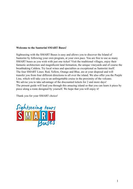
Welcome to the Santorini SMART Buses! Sightseeing with the ...
Welcome to the Santorini SMART Buses! Sightseeing with the ...
Welcome to the Santorini SMART Buses! Sightseeing with the ...

You also want an ePaper? Increase the reach of your titles
YUMPU automatically turns print PDFs into web optimized ePapers that Google loves.
<strong>Welcome</strong> <strong>to</strong> <strong>the</strong> San<strong>to</strong>rini <strong>SMART</strong> <strong>Buses</strong>!<br />
<strong>Sightseeing</strong> <strong>with</strong> <strong>the</strong> <strong>SMART</strong> <strong>Buses</strong> is easy and allows you <strong>to</strong> discover <strong>the</strong> Island of<br />
San<strong>to</strong>rini by following your own program, at your own pace. You are free <strong>to</strong> use as many<br />
<strong>SMART</strong> buses as you wish <strong>with</strong> just one ticket! Visit <strong>the</strong> traditional villages, enjoy <strong>the</strong>ir<br />
fantastic architecture and magnificent land formation, <strong>the</strong> unique vineyards and of course <strong>the</strong><br />
breathtaking Caldera. Try local wines and specialties as exceptional as San<strong>to</strong>rini itself.<br />
The four <strong>SMART</strong> Lines: Red, Yellow, Orange and Blue, are at your disposal and will<br />
transfer you from four different directions <strong>to</strong> all over <strong>the</strong> island. We also offer you <strong>the</strong> Purple<br />
Line, which will take you <strong>to</strong> an unforgettable cruise in <strong>the</strong> proximity of <strong>the</strong> volcano.<br />
We advise you <strong>to</strong> take advantage of <strong>the</strong> discounted tickets for 2 and more days!<br />
The present guide will lead you through this amazing island so that you can learn it piece by<br />
piece along a route designed by yourself. We hope that you will enjoy it!<br />
Thank you for your <strong>SMART</strong> choice!<br />
1
2<br />
LIST OF CONTENTS<br />
<strong>SMART</strong> <strong>Buses</strong> Line Itinerary 3<br />
Remarks 5<br />
About San<strong>to</strong>rini … 6<br />
Introduction 6<br />
<strong>SMART</strong> LINES GUIDE<br />
RED Line<br />
Episkopi Gonias 7<br />
Mesa Gonia 9<br />
Exo Gonia 12<br />
Pyrgos and San<strong>to</strong> Wines 15<br />
Vothonas 21<br />
Messaria 25<br />
Karterados 28<br />
Fira 32<br />
Monolithos 39<br />
Kamari 42<br />
ORANGE Line<br />
Perissa 49<br />
Perivolos 53<br />
Vlychada and Exomitis 56<br />
Akrotiri & Red Beach 57<br />
Megalochori 62<br />
San<strong>to</strong> Wines 15<br />
Fira 32<br />
Emporio 67<br />
YELLOW Line<br />
Oia 72<br />
Finikia 78<br />
Imerovigli 81<br />
Firostefani 87<br />
Fira 32<br />
PURPLE Line<br />
Cruise in <strong>the</strong> Caldera 90<br />
BLUE Line<br />
Ancient Thira 91<br />
About Kamari Tours 93<br />
Legend <strong>to</strong> <strong>the</strong> maps 94<br />
Useful phone numbers 96
LINES ITINERARY<br />
RED LINE<br />
Starting Point Pick Up / Drop Off Point Duration of Trip (min)<br />
Kamari Panagia Episkopi 5<br />
Mesa Gonia 10<br />
Exo Gonia 15<br />
Pyrgos 20<br />
San<strong>to</strong> Wines 25<br />
Vothonas 30<br />
Messaria 35<br />
Karterados 40<br />
Fira 45<br />
Fira Karterados 5<br />
Messaria 15<br />
Vothonas 20<br />
Monolithos 30<br />
Kamari 40<br />
ORANGE LINE<br />
Starting Point Pick Up / Drop Off Point Duration of Trip (min)<br />
Perissa Perivolos 5<br />
Exomitis 10<br />
Vlychada 15<br />
Akrotiri Village 20<br />
Akrotiri Excavations (closed) 25<br />
Megalochori 35<br />
San<strong>to</strong> Wines 40<br />
Fira 45<br />
Fira San<strong>to</strong> Wines 5<br />
Megalochori 10<br />
Akrotiri Village 25<br />
Akrotiri Excavations (closed) 30<br />
Emporio 40<br />
Perissa 45<br />
3
4<br />
YELLOW LINE<br />
Starting Point Pick Up / Drop Off Point Duration of Trip (min)<br />
Oia Finikia 5<br />
Imerovigli 20<br />
Firostefani 25<br />
Fira 30<br />
Fira Firostefani 5<br />
Imerovigli 10<br />
Finikia 25<br />
Oia 30<br />
BLUE LINE<br />
Starting Point Pick Up / Drop Off Point Duration of Trip (min)<br />
Kamari Ancient Thira 15<br />
Ancient Thira Kamari 15<br />
PURPLE LINE*<br />
Starting Point Pick Up / Drop Off Point Duration of Trip (min)<br />
Fira Athinios Port bus roundtrip 45<br />
Boat cruise 120<br />
* PURPLE Line: <strong>Sightseeing</strong> cruise in <strong>the</strong> bay of San<strong>to</strong>rini (Caldera). Our <strong>SMART</strong> boat will<br />
take you from <strong>the</strong> Athinios harbor <strong>to</strong> a picturesque cruise along <strong>the</strong> cliffs of San<strong>to</strong>rini. We will<br />
make a 20 minutes s<strong>to</strong>p at <strong>the</strong> beach of Thirassia Island where you can have a swim, and <strong>the</strong>n<br />
<strong>the</strong> boat will take you <strong>to</strong> <strong>the</strong> proximity of <strong>the</strong> volcano. During <strong>the</strong> sightseeing <strong>to</strong>ur you will<br />
have <strong>the</strong> opportunity <strong>to</strong> see from very close <strong>the</strong> cliffs of Caldera and take spectacular pictures.<br />
The duration of <strong>the</strong> trip is 45 minutes <strong>to</strong> and from Athinios Port <strong>with</strong> <strong>the</strong> PURPLE Line’s bus<br />
(round trip), plus 2 hours <strong>the</strong> boat cruise, 2hours and 45 minutes in <strong>to</strong>tal.<br />
LINES CONNECTIONS:<br />
Fira Town - Lines connected: RED, ORANGE, YELLOW and PURPLE<br />
Kamari – Lines connected: RED and BLUE<br />
San<strong>to</strong> Wines - Lines connected: RED and ORANGE
REMARKS:<br />
• The 11€ All Day ticket, as well as <strong>the</strong> tickets for 2-, 3-, 4-, 5- and 6-days are valid for <strong>the</strong><br />
RED, ORANGE and YELLOW Lines only. Those tickets do not valid for any o<strong>the</strong>r line.<br />
• For <strong>the</strong> BLUE Line <strong>to</strong> Ancient Thira a separate ticket of 10€ is required (round trip<br />
transportation). This ticket does not valid for any o<strong>the</strong>r line.<br />
• For <strong>the</strong> PURPLE Line a separate ticket of 13€ is required. This ticket covers <strong>the</strong> round trip<br />
transportation from Fira <strong>to</strong> Athinios Port and back <strong>with</strong> <strong>the</strong> PURPLE Line, and <strong>the</strong> non-s<strong>to</strong>p<br />
boat cruise along <strong>the</strong> Caldera. This ticket does not valid for any o<strong>the</strong>r line.<br />
Ticket sale points:<br />
• All Kamari Tours offices (Kamari- Fira-Perissa-Karterados)<br />
• O<strong>the</strong>r travel agencies and hotels in San<strong>to</strong>rini<br />
• <strong>SMART</strong> <strong>Buses</strong> (at <strong>the</strong> boarding)<br />
For more information please contact: 22860 32751<br />
GENERAL RULES:<br />
The bus schedules may change during <strong>the</strong> season. You will find more information at <strong>the</strong> sale<br />
points.<br />
The tickets are valid for <strong>SMART</strong> <strong>Buses</strong> transportation only.<br />
The tickets valid only for <strong>the</strong> dates written on.<br />
Pick-up and drop-off are only possible at <strong>the</strong> <strong>SMART</strong> <strong>Buses</strong> s<strong>to</strong>ps. The exact location of <strong>the</strong><br />
s<strong>to</strong>ps is described in <strong>the</strong> guide handed over <strong>to</strong> you, free of charge, <strong>with</strong> <strong>the</strong> purchase of <strong>the</strong><br />
ticket.<br />
The company-carrier is not responsible for any belongings left in <strong>the</strong> bus.<br />
The passengers are obliged <strong>to</strong> show valid ticket each time <strong>the</strong>y board on <strong>the</strong> <strong>SMART</strong> bus/<br />
boat.<br />
Drinking, eating and smoking are not allowed in <strong>the</strong> bus.<br />
REFUNDS<br />
Tickets are non-refundable. Full refund is guaranteed only in <strong>the</strong> case of a route cancelled<br />
by <strong>the</strong> company or when some changes will occur in <strong>the</strong> schedule due <strong>to</strong> reasons which are<br />
beyond <strong>the</strong> company’s control.<br />
5
ABOUT SANTORINI …<br />
THIRA – <strong>the</strong> sou<strong>the</strong>rnmost island of Cyclades, counts 73 km 2 , is 18 km long, 2-6 km wide<br />
and 568 m high.<br />
It lost physical contact <strong>with</strong> Thirassia and Aspronisi - but still form a harmonious circle known<br />
as Thira.<br />
It remains in strict relation <strong>with</strong> <strong>the</strong> volcanoes: Kameni, some 2 km off <strong>the</strong> western shore and<br />
<strong>the</strong> underwater Koloumbo, some 6.5 km off <strong>the</strong> eastern shore.<br />
It is known under <strong>the</strong> names of: Thira, Stroggili, Kallisti, San<strong>to</strong>rini.<br />
The extremely dry, yet explosive character of <strong>the</strong> island led it in <strong>the</strong> archaic past <strong>to</strong> loose more<br />
than half of its body, but did not calm it down. Successive explosions and earthquakes put<br />
Thira now and again in new trouble and it seems that, despite of frequent winds, <strong>the</strong>re is no<br />
way <strong>to</strong> extinguish its suicidal intentions.<br />
Thus, Thira remains a cauldron (Spanish Caldera) <strong>with</strong> <strong>the</strong> Kameni islands stuck in <strong>the</strong> middle<br />
and keeping this pot boiling…<br />
To those who dare <strong>to</strong> stay here is dedicated this booklet.<br />
INTRODUCTION<br />
San<strong>to</strong>rini actually consists of a group of five islands which form a crescent located in <strong>the</strong><br />
sou<strong>the</strong>rn Aegean Sea about 200 km SE from Greece’s mainland and 128 Nautical miles of<br />
Piraeus Port.<br />
The contrast of colors, light, earth and water makes San<strong>to</strong>rini <strong>the</strong> most treasured in <strong>the</strong> gallery<br />
of Greek islands. Many things have been written about this unique island and many more will<br />
be written in <strong>the</strong> years <strong>to</strong> come but San<strong>to</strong>rini will always remain <strong>the</strong> crown of <strong>the</strong> Cyclades. This<br />
is one of <strong>the</strong> most popular destinations in Greece because of its most impressive landscape. It<br />
has been said <strong>the</strong> sunsets in San<strong>to</strong>rini are <strong>the</strong> most spectacular in <strong>the</strong> world. This is San<strong>to</strong>rini<br />
seen through <strong>the</strong> eyes of people who know and love it.<br />
Transportation <strong>to</strong> and from San<strong>to</strong>rini is possible by ferry boats, high speed vessels and<br />
airplanes. On <strong>the</strong> island transportation is possible by car, moped or donkey…<br />
The island, <strong>with</strong> its picturesque villages, narrow alleys, traditional donkey rides, unique<br />
architecture, local delicacies (grapes, cherry <strong>to</strong>ma<strong>to</strong>es or <strong>to</strong>matakia, fava-beans and pistachios,<br />
<strong>to</strong> mention some of <strong>the</strong>m) and superb wines, gives <strong>the</strong> visi<strong>to</strong>r a sense of fulfillment, tranquility<br />
and refuge from <strong>the</strong> cares of <strong>the</strong> world.<br />
6
EPISKOPI GONIAS<br />
Please see <strong>the</strong> plan of Mesa Gonia<br />
<strong>SMART</strong> Bus S<strong>to</strong>p: On <strong>the</strong> square in front of <strong>the</strong> entrance <strong>to</strong> <strong>the</strong> church courtyard.<br />
Brief characteristics:<br />
The oldest Byzantine church of <strong>the</strong> island, Panagia Episkopi (built in 1115), is <strong>the</strong> pride of<br />
<strong>the</strong> locals.<br />
It was built on <strong>the</strong> ruins of a 6th century church. Marble pieces from <strong>the</strong> ruined church were<br />
used <strong>to</strong> build <strong>the</strong> new one. S<strong>to</strong>nes from Ancient Thira were also used <strong>to</strong> build <strong>the</strong> church<br />
of Panagia Episkopi. Originally it was <strong>the</strong> seat of <strong>the</strong> Orthodox Bishop. Following <strong>the</strong> 4th<br />
crusade <strong>the</strong> church it passed in<strong>to</strong> <strong>the</strong> hands of <strong>the</strong> Catholics (early 13th century). When <strong>the</strong><br />
Turks conquered San<strong>to</strong>rini in 1537, Panagia Episkopi returned <strong>to</strong> <strong>the</strong> Orthodox. The church is<br />
worth visiting not only because of its his<strong>to</strong>rical and architectural value, but also because of its<br />
picturesque location. It is approximately 10 minutes walking distance <strong>to</strong> <strong>the</strong> south from Mesa<br />
Gonia. Despite <strong>the</strong> s<strong>to</strong>rmy past: a disastrous fire in 1915, <strong>the</strong> earthquake in 1956 and <strong>the</strong>ft of<br />
most precious icons in 1982, <strong>the</strong> church is still one of <strong>the</strong> most important monuments of <strong>the</strong><br />
island. The one surviving icon from <strong>the</strong> Byzantine collection, Panagia Glikofilousa, is still in<br />
<strong>the</strong> church’s sanctuary.<br />
The church is one of <strong>the</strong> few of <strong>the</strong><br />
island that are open for visiting.<br />
Holy mass is given every Sunday<br />
before noon. There is small<br />
entrance fee of 0.50 €.<br />
Strolling around:<br />
Remember: Taking pho<strong>to</strong>graphs<br />
<strong>with</strong> flash is forbidden inside <strong>the</strong><br />
church!<br />
The church is <strong>the</strong> first one on<br />
San<strong>to</strong>rini built in Greek-cross<br />
style, <strong>with</strong> a central dome. You<br />
enter it by <strong>the</strong> western entrance.<br />
The first chamber is nar<strong>the</strong>x. From here you pass <strong>to</strong> <strong>the</strong> nave. You are facing <strong>the</strong> impressing<br />
icon-screen (templon). It is an example of keromasticha - marble combined <strong>with</strong> wax<br />
decoration. The icons you see were brought <strong>to</strong> <strong>the</strong> church after <strong>the</strong> old ones had been s<strong>to</strong>len<br />
about 26 years ago. The only one remaining after <strong>the</strong> robbery can be seen on a side of <strong>the</strong><br />
nave, covered <strong>with</strong> glass and under precise humidity control. Some of <strong>the</strong> marble pieces that<br />
were rescued from <strong>the</strong> previous church are: <strong>the</strong> central columns, <strong>the</strong> nor<strong>the</strong>rn entrance and<br />
<strong>the</strong> architraves.<br />
7
8<br />
CANAVA ROUSOS<br />
4<br />
6<br />
3<br />
5<br />
1<br />
EPISKOPI GONIAS<br />
1. PANAGIA EPISKOPI<br />
2. GRAVEYARD<br />
MESA GONIA<br />
3. CHURCH OF METAMORPHOSIS<br />
4. AG. TRIADA<br />
5. RUINED MANSION<br />
6. RUINED CAVES
The church interior was decorated <strong>with</strong> frescoes. Unfortunately, humidity more than <strong>the</strong> time,<br />
caused heavy damages <strong>to</strong> <strong>the</strong>m.<br />
While being on <strong>the</strong> courtyard of <strong>the</strong> church devote some time <strong>to</strong> enjoy <strong>the</strong> nice view of Kamari<br />
and Monolithos, as well as <strong>the</strong> gorgeous mountain of Prophet Elias <strong>to</strong> <strong>the</strong> southwest.<br />
On <strong>the</strong> back of <strong>the</strong> church is growing a carob tree, <strong>the</strong> fruits of which are considered a substitute<br />
of chocolate, popularly used as donkey food but also <strong>to</strong> treat diabetes.<br />
At <strong>the</strong> parking area, <strong>the</strong>re is a small sweet-water spring. Springs of sweet water are very scant<br />
in San<strong>to</strong>rini. Do not be mislead - this one collects rain water...<br />
No more than 80 m down <strong>the</strong> street <strong>to</strong>wards Mesa Gonia <strong>the</strong>re is a white church located <strong>with</strong>in<br />
a small graveyard, and one more spring of rain water nearby. Here you will find a bench where<br />
you can sit and contemplate <strong>the</strong> surroundings…<br />
Estimated time for sightseeing:<br />
15 min is enough.<br />
Where <strong>to</strong> eat:<br />
The nearest place <strong>to</strong> have refreshment is an ouzerie-tavern in Mesa Gonia.<br />
Nearest spot of <strong>to</strong>urist interest:<br />
Mesa Gonia (approximately 10 minutes walking <strong>to</strong> <strong>the</strong> north)<br />
MESA GONIA<br />
<strong>SMART</strong> Bus S<strong>to</strong>p: In front of <strong>the</strong> Canava Argyros.<br />
Brief characteristics:<br />
Once, Mesa Gonia was <strong>the</strong> center of San<strong>to</strong>rini’s wine production. Located on <strong>the</strong> “foot” of <strong>the</strong><br />
mountain, it is <strong>the</strong> nearest village <strong>to</strong> Kamari. In old maps Mesa Gonia is referred <strong>to</strong> as Ka<strong>to</strong><br />
Gonia (The Corner Below) in contrast <strong>to</strong> <strong>the</strong> nearby village Exo Gonia (previously called:<br />
Apano Gonia – The Corner Above).<br />
Two recognized old wineries are located in Mesa Gonia: Canava Roussos (established in 1836)<br />
and Canava Argyros (established in 1903). The his<strong>to</strong>ry of viticulture is as old as San<strong>to</strong>rini<br />
itself but <strong>the</strong> real boom falls <strong>to</strong> <strong>the</strong> 17th and <strong>the</strong> 19th century. Due <strong>to</strong> <strong>the</strong> specific climate<br />
(hot summers, strong winds and lack of rainfalls), <strong>the</strong> grapes of San<strong>to</strong>rini are very sweet and<br />
<strong>the</strong> wine is strong and of high quality. Since almost everybody on <strong>the</strong> island was cultivating<br />
grapes, kanaves (wine cellars) became an integral part of each house. In practice kanava is<br />
a cellar in which <strong>the</strong>y press <strong>the</strong> grapes and s<strong>to</strong>re <strong>the</strong> wine barrels. It must be shady and cool,<br />
and have a small window for ventilation. Usually kanava has two rooms – one in where no<br />
light can enter, equipped <strong>with</strong> two wine-presses (separate for red and for white grapes), and<br />
a second one – antechamber <strong>with</strong> windows that allow a good ventilation. However, <strong>the</strong>re<br />
is something more, not just wineries that make Mesa Gonia famous…His<strong>to</strong>ry of San<strong>to</strong>rini<br />
is a his<strong>to</strong>ry of reiterating volcanic eruptions and earthquakes. Within <strong>the</strong> last 2000 years 3<br />
remarkably dramatic earthquakes <strong>to</strong>ok place: The first in 1650 (accompanied by tremendous<br />
9
10<br />
eruption which came from <strong>the</strong> volcano Koloumbo),<br />
<strong>the</strong> second in 1707 and <strong>the</strong> third in 1956. There is<br />
no village in San<strong>to</strong>rini that escaped <strong>the</strong> serious<br />
damages which <strong>the</strong> last earthquake caused. But <strong>the</strong><br />
real memorial of that event is Mesa Gonia.<br />
Until <strong>the</strong> earthquake of 1956, Mesa Gonia was a<br />
lively, picturesque village. During <strong>the</strong> earthquake it<br />
was heavily destructed and has never been res<strong>to</strong>red.<br />
But even now a short stroll among <strong>the</strong> ruins will<br />
convince you that this place is still fascinating.<br />
After <strong>the</strong> earthquake <strong>the</strong> residents of <strong>the</strong> village<br />
moved down <strong>to</strong> Kamari village. However, more<br />
or less 30 families are faithful <strong>to</strong> Mesa Gonia and<br />
stubbornly remain on <strong>the</strong> post…<br />
Strolling around:<br />
Hint: Do not enter <strong>the</strong> ruins. In case you forget this<br />
warning, a big board near <strong>the</strong> Church of Aghia Triada<br />
will kindly remind you again…<br />
You start from <strong>the</strong> entrance <strong>to</strong> <strong>the</strong> village, next <strong>to</strong> <strong>the</strong><br />
Canava Argyros. It is one of <strong>the</strong> two oldest wineries on <strong>the</strong> island. The second one is Canava<br />
Roussos, located 50 m down <strong>the</strong> village, near <strong>the</strong> main road <strong>to</strong> Kamari. Canava Roussos is<br />
open for visiting and wine tasting.<br />
The narrow street will lead you in<strong>to</strong> <strong>the</strong> settlement, where ruined farm houses stay in contrast<br />
<strong>to</strong> lush flowers and shrubs. The church of Metamorphosis, that is <strong>the</strong> first church on your<br />
way, is an early XIX century structure. Have a look at <strong>the</strong> beautiful mosaic of white and black<br />
s<strong>to</strong>nes, which covers <strong>the</strong> front-yard, typical San<strong>to</strong>rini-style decoration. Ano<strong>the</strong>r church on<br />
your way, <strong>with</strong> <strong>the</strong> blue dome, is Aghia Triada. Behind it, slightly <strong>to</strong> <strong>the</strong> right, you will find<br />
ruined caves for keeping animals (so called mantra). Stay on <strong>the</strong> main avenue though. Some<br />
10 m fur<strong>the</strong>r, on a hill <strong>to</strong> <strong>the</strong> left, is located an abandoned archontiko. These architec<strong>to</strong>nically<br />
sophisticated buildings belonged <strong>to</strong> <strong>the</strong> landlords. You can continue your stroll <strong>to</strong>wards <strong>the</strong><br />
western end of <strong>the</strong> village, where few more caves are <strong>to</strong> be seen.<br />
After returning <strong>to</strong> Canava Argyros follow <strong>the</strong> left branch of <strong>the</strong> street, down <strong>to</strong> nearby located<br />
Canava Roussos. You can pay a visit <strong>the</strong>re and taste famous San<strong>to</strong>rini wines…<br />
Fur<strong>the</strong>r from Canava Roussos <strong>the</strong> street leads <strong>to</strong> <strong>the</strong> public road. Some 60 m down <strong>the</strong> road<br />
<strong>to</strong>wards Exo Gonia you will find a signpost <strong>to</strong><br />
Art Space of Argyros Canava Exhibition. This<br />
walk requires 5 minutes and by its end you will
have opportunity <strong>to</strong> find out more about <strong>the</strong> art and life on San<strong>to</strong>rini.<br />
Estimated time for sightseeing:<br />
20 minutes is enough <strong>to</strong> explore <strong>the</strong> settlement.<br />
Where <strong>to</strong> eat:<br />
In <strong>the</strong> area <strong>the</strong>re is only an ouzerie-tavern by <strong>the</strong> exit from <strong>the</strong> village.<br />
Nearest <strong>to</strong>urist interest spot:<br />
Episkopi Gonias (approx. 10 min <strong>to</strong> S), Exo Gonia (approx. 10 min <strong>to</strong> N, however walking <strong>to</strong><br />
<strong>the</strong> <strong>to</strong>p of <strong>the</strong> village requires ano<strong>the</strong>r 20-25 min)<br />
ARGYROS ESTATE<br />
Episkopi-Gonia,<br />
San<strong>to</strong>rini<br />
Tel: 22860 31489<br />
Fax: 22860 32285<br />
Email: margiros@otenet.gr<br />
www.argyrosestate.gr<br />
11
12<br />
EXO GONIA<br />
<strong>SMART</strong> Bus S<strong>to</strong>p: On <strong>the</strong> main road, opposite <strong>to</strong> <strong>the</strong> church of Aghios Charalambos.<br />
Brief characteristics:<br />
Exo Gonia is one of <strong>the</strong> few villages of San<strong>to</strong>rini that stay in contrast <strong>to</strong> <strong>the</strong> island’s busy<br />
summer life. Exo Gonia is considered <strong>the</strong> ideal village for those who wish <strong>to</strong> enjoy <strong>the</strong> silence<br />
of rustic surroundings far from <strong>the</strong> vigorous reality of <strong>the</strong> island. The village is located on a<br />
hill next <strong>to</strong> Mesa Gonia. Because of its location in his<strong>to</strong>rical times Exo Gonia was duly named<br />
Apano Gonia (The Corner Above). To <strong>the</strong> <strong>to</strong>p of <strong>the</strong> village leads a public road that has 9 sharp<br />
bends. Crowning glory of <strong>the</strong> village is <strong>the</strong> church of Aghios Charalambos, one of <strong>the</strong> biggest<br />
churches of <strong>the</strong> island, <strong>with</strong> imposing red domes. The church of Aghios Charalambos was<br />
built in 1941 on a site of a monastery which was dissolved in 1833. The view from <strong>the</strong> <strong>to</strong>p of<br />
<strong>the</strong> village allows you <strong>to</strong> admire<br />
<strong>the</strong> island from <strong>the</strong> sou<strong>the</strong>ast<br />
<strong>to</strong> <strong>the</strong> nor<strong>the</strong>ast: Prophet EIlias<br />
and Mesa Vouno <strong>with</strong> Kamari<br />
at its foot, Monolithos <strong>with</strong> <strong>the</strong><br />
airport and Fira on <strong>the</strong> rim of<br />
<strong>the</strong> Caldera. On <strong>the</strong> hill <strong>to</strong> <strong>the</strong><br />
southwest proudly dominates<br />
above Exo Gonia <strong>the</strong> his<strong>to</strong>rical<br />
village of Pyrgos<br />
Strolling around:<br />
While being at <strong>the</strong> <strong>to</strong>p of <strong>the</strong><br />
village, take a walk around <strong>the</strong><br />
church of Aghios Charalambos.<br />
Look at <strong>the</strong> beautiful mosaic<br />
cobbling on <strong>the</strong> courtyard.<br />
In <strong>the</strong> right corner of <strong>the</strong> courtyard,<br />
hidden among trees, <strong>the</strong>re is a monument, <strong>the</strong> tribute <strong>to</strong> those islanders who fell in <strong>the</strong> world<br />
war. Follow <strong>the</strong> stairs down <strong>to</strong> get <strong>to</strong> <strong>the</strong> ouzerie Metaxy Mas. From here you can turn left in<strong>to</strong><br />
a narrow street. More or less half way down, on <strong>the</strong> slope you will see ruined cave houses.<br />
On your right side (next <strong>to</strong> a garage), you will find a stairway leading down in<strong>to</strong> an even more<br />
interesting part of <strong>the</strong> village. Have a short stroll <strong>the</strong>re and admire <strong>the</strong> colorful and fantastic<br />
traditional architecture. About 40 m away <strong>the</strong>re is an old church of Aghios Theologos <strong>with</strong><br />
beautiful, red-and-white bell-<strong>to</strong>wer. Behind <strong>the</strong> church, <strong>to</strong> <strong>the</strong> right, <strong>the</strong>re is one more ruined<br />
cave house. From here you can follow <strong>the</strong> stairway up behind <strong>the</strong> church. You will reach a<br />
cobbles<strong>to</strong>ne street near <strong>the</strong> ouzerie Metaxy Mas. This loop will take you no more than 15
minutes. You can turn left behind <strong>the</strong><br />
tavern and follow <strong>the</strong> alleyway where<br />
you will see a few neoclassical mansion<br />
houses (so called archontika).<br />
If you pass <strong>the</strong> turn <strong>to</strong> <strong>the</strong> church of<br />
Aghios Theologos and follow <strong>the</strong><br />
narrow street down, you will soon get <strong>to</strong><br />
<strong>the</strong> main road. The small white church<br />
on <strong>the</strong> verge of <strong>the</strong> road looks as if it was<br />
about <strong>to</strong> slide down <strong>the</strong> entire slope.<br />
Option for <strong>to</strong>ugh hikers: Pass <strong>the</strong> church<br />
and go down <strong>the</strong> road until <strong>the</strong> next<br />
curve where you will find a signpost<br />
leading <strong>to</strong> <strong>the</strong> church of Aghios Vlasios.<br />
The trail <strong>to</strong> Aghios Vlasios initially<br />
leads in <strong>the</strong> north direction. You will see<br />
<strong>the</strong> San<strong>to</strong>rini airport from a distance.<br />
You can also enjoy a panoramic view<br />
of <strong>the</strong> island. With <strong>the</strong> small exception<br />
of a trash disposal area which will<br />
accompany you for a short while, <strong>the</strong><br />
trail passes through an uninhabited, rural<br />
area. The church of Aghios Vlasios, a<br />
typical island-style church, as almost of <strong>the</strong> island’s churches is closed. The trail also passes<br />
from a barn-yard. At <strong>the</strong> crossroads turn left and follow <strong>the</strong> road that will take you almost<br />
in front of Aghios Charalambos church. This walk will take you about 30 minutes but in <strong>the</strong><br />
hot summer days you may find it ra<strong>the</strong>r exhausting. However, it can be very romantic if you<br />
happen <strong>to</strong> be <strong>the</strong>re during sunset…<br />
If you wish <strong>to</strong> continue your walk along <strong>the</strong> main road, skipping <strong>the</strong> Aghios Vlasios church’s<br />
trail, descend <strong>to</strong> an old Canava (it is hard <strong>to</strong> miss <strong>the</strong> big inscription on its gate). There is an<br />
old cave <strong>with</strong> its front wall made of black lava s<strong>to</strong>nes and a narrow concrete passage next <strong>to</strong><br />
it. If you follow it up you will get very soon <strong>to</strong> <strong>the</strong> entrance <strong>to</strong> Art Space.<br />
Estimated time for sightseeing:<br />
In order <strong>to</strong> see <strong>the</strong> village 40 minutes are more than enough, unless you decide <strong>to</strong> extend your<br />
visit <strong>to</strong> Aghios Vlasios church’s route (this will take you approximately 30 more minutes).<br />
Where <strong>to</strong> eat:<br />
Exo Gonia offers attractions<br />
for your eyes, but still refuses<br />
<strong>to</strong> take care of your s<strong>to</strong>mach.<br />
Actually you can just count on<br />
refreshment served in ouzeritavern<br />
Metaxy Mas, close <strong>to</strong> <strong>the</strong><br />
church of Aghios Charalambos.<br />
Nearest <strong>to</strong>urist interest spot:<br />
Mesa Gonia (approximately 10<br />
minutes walking from <strong>the</strong> Art<br />
Gallery).<br />
13
14<br />
ART CENTER<br />
5<br />
KAMARI<br />
AG. VLASIOS TR.<br />
2<br />
4<br />
4<br />
5<br />
1<br />
METAXY<br />
MAS<br />
PYRGOS<br />
1<br />
2<br />
AG.VLASIOS<br />
TRAIL<br />
MESSARIA<br />
S<br />
EXO GONIA<br />
1. AG. CHARALAMBOS<br />
2. GRAVEYARD<br />
3. AG. VLASIOS<br />
4. AG. THEOLOGOS<br />
5. OLD CANAVA<br />
W<br />
E<br />
3<br />
N
PYRGOS AND SANTO WINES<br />
<strong>SMART</strong> Bus S<strong>to</strong>p:<br />
1. San<strong>to</strong> Wines, 1km west from Pyrgos village. Lines: RED, ORANGE<br />
2. First square (Soro<strong>to</strong>n Sq.) in Pyrgos. RED Line only.<br />
Brief characteristics:<br />
Picturesquely located on a round hill, some 360 m above <strong>the</strong> sea level. After <strong>the</strong> collapse of<br />
<strong>the</strong> medieval capital on Skaros, Pyrgos became <strong>the</strong> temporary capital of <strong>the</strong> island until 1800.<br />
Pyrgos has a long his<strong>to</strong>ry; it is believed <strong>to</strong> be one of <strong>the</strong> 6 settlements of Ancient Thira.<br />
During <strong>the</strong> Middle Ages, mainly during Latin rule up <strong>to</strong> <strong>the</strong> 16th century <strong>the</strong> island suffered<br />
a lot from pirate raids. The locals had <strong>to</strong> fortify <strong>the</strong>ir settlements. This is how <strong>the</strong> kastelia<br />
appeared on <strong>the</strong> island. Kastelia were built also in Skaros, Oia, Emporio and Akrotiri. The<br />
oldest known documentation about Kasteli of Pyrgos is dated back <strong>to</strong> <strong>the</strong> 16th century. Kastelia<br />
were built in strategic positions, highest and most inaccessible parts of <strong>the</strong> island so that<br />
<strong>the</strong>y were easy <strong>to</strong> defense and <strong>to</strong> survey <strong>the</strong> neighborhood. Because of limited space, sloping<br />
ground and <strong>the</strong>ir defensive character, <strong>the</strong> houses <strong>with</strong>in kastelia were densely packed, literally<br />
stuck one by ano<strong>the</strong>r. The outermost houses were also <strong>the</strong> outer walls of <strong>the</strong> fortification.<br />
The streets of kasteli (rymidia) were narrow and irregular, forming a labyrinth-like net. The<br />
fortified entrance <strong>to</strong> Kasteli of Pyrgos was on its western side and its defensive character was<br />
streng<strong>the</strong>ned by constructions <strong>with</strong> pots for hot oil which was spilt on enemies. The entrance<br />
<strong>to</strong> <strong>the</strong> kasteli is called Xeporta – <strong>the</strong> Outside Door.<br />
At times of Turkish domination on <strong>the</strong> island (1537-1821) pirate raids ceased gradually and<br />
<strong>the</strong> locals started <strong>to</strong> build <strong>the</strong>ir houses outside <strong>the</strong> kastelia. The new districts of once fortified<br />
settlements were growing dynamically, becoming continuation of maize-like character of<br />
kasteli…<br />
Kasteli of Pyrgos suffered severe<br />
damages during <strong>the</strong> 1956 earthquake.<br />
Until <strong>the</strong> earthquake, narrow alleyways<br />
of Kasteli were covered <strong>with</strong> plako<strong>to</strong><br />
(s<strong>to</strong>ne pavement). Later <strong>the</strong>y had been<br />
covered <strong>with</strong> concrete <strong>to</strong> smooth <strong>the</strong><br />
breakages and <strong>to</strong> cover telephone wiring.<br />
In some places, especially on <strong>the</strong> sides<br />
of footways you can spot fragments of<br />
original plako<strong>to</strong>.<br />
Contemporary Pyrgos is a vast, lively<br />
settlement covering <strong>the</strong> hill all around,<br />
far beyond <strong>the</strong> boundaries of Kasteli. It<br />
has more than 650 permanent residents.<br />
It also prides itself of having <strong>the</strong> highest<br />
15
location of all villages on San<strong>to</strong>rini. In Pyrgos you will find more than 40 churches. As almost<br />
all churches on San<strong>to</strong>rini, <strong>the</strong>y are opened only at special occasions like celebration of <strong>the</strong><br />
patron. That particular day wine and traditional food prepared by local housekeepers is served<br />
in <strong>the</strong> church and everybody is welcome <strong>to</strong> join <strong>the</strong> feast (panigiri).<br />
Ironically, despite <strong>the</strong> fairly high number of churches adorning Pyrgos <strong>with</strong> <strong>the</strong>ir white and<br />
blue domes and sophisticated bell-<strong>to</strong>wers, <strong>the</strong> regular holy mass takes place in <strong>the</strong> small Agios<br />
An<strong>to</strong>nios some 100 m behind <strong>the</strong> square, far down <strong>the</strong> hill<br />
16<br />
Strolling around:<br />
San<strong>to</strong> Wines:<br />
San<strong>to</strong> Wines is 1 km NW from Pyrgos village, by<br />
<strong>the</strong> main road <strong>to</strong> Fira. It is <strong>the</strong> largest winery on<br />
San<strong>to</strong>rini which operates since 1992 and is also<br />
<strong>the</strong> most modern winery facility on <strong>the</strong> island,<br />
built on five levels. The surrounding vineyards are<br />
spread at different levels which form traditional<br />
terraces. The winery is located at <strong>the</strong> edge of <strong>the</strong><br />
Caldera and <strong>the</strong>refore offers <strong>the</strong> visi<strong>to</strong>r not only<br />
interesting <strong>to</strong>ur <strong>to</strong> <strong>the</strong> winemaking area but also<br />
unforgotten wine tasting <strong>with</strong> <strong>the</strong> view <strong>to</strong> <strong>the</strong><br />
volcano.<br />
Pyrgos village:<br />
From <strong>the</strong> small square (Emmanouil Soro<strong>to</strong>u)<br />
where <strong>the</strong> Smart Bus will leave you follow <strong>the</strong><br />
main road in<strong>to</strong> <strong>the</strong> <strong>to</strong>wn <strong>to</strong> <strong>the</strong> main square<br />
(Stefanou Melekou). Start your stroll from<br />
paying a visit <strong>to</strong> <strong>the</strong> exhibition “The Vanishing<br />
San<strong>to</strong>rini” which you will find some 80 m down<br />
<strong>the</strong> square. The museum is located in old kanava. A short visit <strong>the</strong>re will give you a picture of<br />
<strong>the</strong> past everyday life of <strong>the</strong> islanders.<br />
In order <strong>to</strong> get <strong>to</strong> Kasteli follow <strong>the</strong> steps behind <strong>the</strong> post box at <strong>the</strong> Melekou square. On your<br />
way up you will have opportunity <strong>to</strong> buy local products and wine. For your convenience it is<br />
advisable <strong>to</strong> postpone <strong>the</strong> shopping until <strong>the</strong> return from kasteli. From here <strong>the</strong> best way <strong>to</strong> get<br />
up is following <strong>the</strong> blue arrows painted on <strong>the</strong> streets<br />
The first big church on your way is church of Christ. This church celebrates its panigiri on<br />
August 6th, only 9 days before <strong>the</strong><br />
celebration of <strong>the</strong> most important<br />
church in Pyrgos – <strong>the</strong> so called<br />
Theo<strong>to</strong>kaki (Church of Virgin Mary).<br />
For this reason meals served on August<br />
6 do not contain meat. Meat, which is<br />
scarce on San<strong>to</strong>rini, is preserved for<br />
<strong>the</strong> big feast in Theo<strong>to</strong>kaki that will<br />
take place a few days later.<br />
The arched gate <strong>to</strong> kasteli (Xeporta -<br />
Outside door) is above a square called<br />
Exoplateia. Once, noblemen of <strong>the</strong><br />
settlement ga<strong>the</strong>red around here <strong>to</strong><br />
vote. Have a look at <strong>the</strong> church of<br />
Aghios Nikolaos <strong>with</strong> a bell-<strong>to</strong>wer that<br />
is said <strong>to</strong> be one of <strong>the</strong> most beautiful
on this island. In front of <strong>the</strong> church stands a monument commemorating those islanders<br />
who died during <strong>the</strong> World War. On <strong>the</strong> opposite side you will see a neoclassic mansion <strong>with</strong><br />
beautiful ornaments. There are more mansions like this around <strong>the</strong> kasteli. They usually are<br />
distinguished from <strong>the</strong> surroundings not only by <strong>the</strong>ir size and sophisticated architecture, but<br />
also vivid colors. These houses are an architec<strong>to</strong>nic work-of-art that could be afforded only<br />
by <strong>the</strong> landlords. They appeared on<br />
<strong>the</strong> island during <strong>the</strong> more peaceful<br />
times, after pirate attacks finally<br />
ceased. Behind <strong>the</strong> mansion is <strong>the</strong><br />
church of Aghia Theodosia.<br />
If you wish <strong>to</strong> do something more<br />
extravagant, have a picture taken on<br />
a donkey in <strong>the</strong> square…<br />
After entering <strong>the</strong> kasteli, take a<br />
right turn. Just behind <strong>the</strong> corner<br />
is one of <strong>the</strong> biggest churches on<br />
San<strong>to</strong>rini – Eisodion tis Theo<strong>to</strong>kou<br />
(Presenatation of Saint Mary)<br />
dated from 17th century. In <strong>the</strong><br />
neighborhood is <strong>the</strong> ochre-painted<br />
church of Aghia Triada, formerly<br />
catholic, now it is housing a<br />
collection of liturgical objects and<br />
icons, <strong>the</strong> oldest of which is dated<br />
<strong>to</strong> 16th century. The museum is operating from March <strong>to</strong> Oc<strong>to</strong>ber and entrance is free of<br />
charge. You are actually at <strong>the</strong> <strong>to</strong>p of <strong>the</strong> Kasteli. Behind <strong>the</strong> Aghia Triada is a narrow passage<br />
<strong>to</strong> <strong>the</strong> small, white-washed Theo<strong>to</strong>kaki. It is dated from 10th century and is one of <strong>the</strong> oldest<br />
churches on this island. The view of <strong>the</strong> island from here is gorgeous and will repay you all<br />
your efforts which you put <strong>to</strong> get <strong>the</strong>re.<br />
Hint: The Kasteli is criss-crossed by countless narrow streets and stairways running in all<br />
possible directions but even if you have <strong>the</strong> impression of being lost, do not worry, <strong>the</strong> blue<br />
arrows will appear mercifully under your feet at <strong>the</strong> most unexpected moment…<br />
From <strong>the</strong> Stefanou Melekou square you can follow <strong>the</strong> plako<strong>to</strong> that runs <strong>to</strong> <strong>the</strong> east. Soon<br />
you will get on<strong>to</strong> a small parking area near a school. There are three streets going out from<br />
<strong>the</strong>re. The left one will take you back <strong>to</strong> <strong>the</strong> main square, <strong>the</strong> middle one leads <strong>to</strong> Kasteli. The<br />
right one is not paved and leads along <strong>the</strong> north-eastern walls of Kasteli. This is an option for<br />
<strong>to</strong>ugh hikers. The walk takes about 20 minutes and gives you opportunity <strong>to</strong> enjoy panoramic<br />
views of <strong>the</strong> island. On <strong>the</strong> foot of <strong>the</strong><br />
mountain of Profitis Ilias is a quarry of<br />
pumice s<strong>to</strong>ne (SE). Then, in a valley you<br />
can spot big, grey edifice of <strong>the</strong> church of<br />
Saint Nicolas dated from <strong>the</strong>18th century,<br />
lost among terraced fields. Like Episkopi<br />
Gonias, this church was raised <strong>with</strong> use<br />
of marble elements from Ancient Thira.<br />
Following <strong>the</strong> path still <strong>to</strong> <strong>the</strong> east you will<br />
easily find <strong>the</strong> red domes of <strong>the</strong> church of<br />
Aghios Charalambos on <strong>the</strong> very <strong>to</strong>p of<br />
Exo Gonia, and finally <strong>the</strong> long grey line<br />
of <strong>the</strong> airport. Your way now will turn<br />
left; up <strong>the</strong> rock is <strong>the</strong> white church of<br />
Aghios Chris<strong>to</strong>foros. Climb up <strong>the</strong> stairs,<br />
17
pass next <strong>to</strong> <strong>the</strong> church and continue your walk. Continue <strong>the</strong> walk until you get back <strong>to</strong> <strong>the</strong><br />
Church of Aghia Theodosia at <strong>the</strong> NW side of <strong>the</strong> Kasteli. From here you have only 5 minutes<br />
<strong>to</strong> <strong>the</strong> square of Stefanou Melekou. Well done!<br />
It is time <strong>to</strong> have a rest.<br />
Estimated time for sightseeing: To get <strong>to</strong> <strong>the</strong> <strong>to</strong>p of kasteli from <strong>the</strong> <strong>SMART</strong> bus s<strong>to</strong>p on <strong>the</strong><br />
first square of Pyrgos count 25 minutes. Add more time so you can better explore <strong>the</strong> kasteli,<br />
though.<br />
18<br />
Where <strong>to</strong> eat and do<br />
shopping:<br />
Within <strong>the</strong> romantic<br />
surroundings of Kasteli<br />
you can have a rest at<br />
Franco’s Café next <strong>to</strong><br />
Eisodion tis Theo<strong>to</strong>kou<br />
church or café-ouzerie<br />
Penelope just behind <strong>the</strong><br />
Church of Christ.<br />
The main square offers<br />
a choice between Café<br />
and tavern Kasteli. Down<br />
<strong>the</strong> street <strong>to</strong>wards <strong>the</strong><br />
Emmanouil Soro<strong>to</strong>u<br />
square (NW, direction <strong>to</strong><br />
Fira) is Mythos tavern<br />
and spaghetteria-pizzeria<br />
Mylos on <strong>the</strong> very square.<br />
If you follow <strong>the</strong> street fur<strong>the</strong>r down you can have dinner at Restaurant Pyrgos. This is an<br />
option for those who like <strong>to</strong> eat in style.<br />
Public <strong>to</strong>ilets (no offence) are down <strong>the</strong> main square, look for signposts.<br />
In Pyrgos you will easily find mini markets, bakery, and souvenir s<strong>to</strong>res by <strong>the</strong> main square.<br />
Where <strong>to</strong> eat and do shopping:<br />
There you will also find Kallisti Tavern. An excellent choice for Greek traditional cuisine.<br />
There are art galleries on <strong>the</strong> way up <strong>to</strong> Kasteli, <strong>the</strong> last one is in proximity of Xeporta, behind<br />
<strong>the</strong> church of St. Nicolas.<br />
Some 50 m fur<strong>the</strong>r down <strong>the</strong> public road, behind Mythos tavern you will find a s<strong>to</strong>re <strong>with</strong><br />
traditional products, but you can get <strong>the</strong>m also on <strong>the</strong> way leading <strong>to</strong> Kasteli, just behind <strong>the</strong><br />
tavern of <strong>the</strong> same name.<br />
Nearest <strong>to</strong>urist interest spot:<br />
1 km from Pyrgos (at <strong>the</strong> direction <strong>to</strong> Fira) <strong>the</strong>re is a winery San<strong>to</strong> Wines, which you can visit.<br />
If you get <strong>the</strong>re on afternoon, you may have opportunity <strong>to</strong> try San<strong>to</strong>rini wines while watching<br />
<strong>the</strong> sunset.<br />
If you like mountaineering, have a walk <strong>to</strong> Profitis Ilias. The <strong>to</strong>p of <strong>the</strong> mountain counts 568<br />
m above <strong>the</strong> sea level and is located 3 km away from Pyrgos (sic!). To get <strong>the</strong>re follow <strong>the</strong><br />
main road, pass next <strong>to</strong> <strong>the</strong> church of Aghios An<strong>to</strong>nios, follow for <strong>the</strong> next 100 m and look for<br />
a signpost “Profitis Ilias footway” on <strong>the</strong> left side of <strong>the</strong> road. Have a close look at <strong>the</strong> church<br />
Aghoi Apos<strong>to</strong>loi, <strong>the</strong> only preserved remainder of a 19th century school founded at this site<br />
by <strong>the</strong> monastery of Profitis Ilias, and enjoy your walk…
N<br />
E<br />
W<br />
S<br />
8<br />
10<br />
PYRGOS<br />
1. SOROTOY SQ.<br />
2. MELEKOY SQ.<br />
3. SCHOOL<br />
4. VANISHING SANTORINI<br />
5. AG. ANTONIOS<br />
6. AG. APOSTOLOI<br />
7. AG. NICOLAS<br />
8. AG. CHRISTOFOROS<br />
9. KASTELI ENTRANCE (XEPORTA)<br />
10. NORTH SIDE OF THE KASTELI<br />
4<br />
9<br />
PYRGOS 7<br />
6<br />
1<br />
FIRA 3<br />
MYLOS<br />
2<br />
MYTHOS<br />
TO SANTO WINES 1 km<br />
7<br />
4<br />
9<br />
SEE THE NEXT PAGE<br />
5<br />
PROFIT IS ILIAS<br />
10<br />
6<br />
19
20<br />
8<br />
4<br />
7<br />
1<br />
6<br />
3<br />
PYRGOS KASTELI<br />
1. CH. OF CHRIST<br />
2. AG. DIMITRIS<br />
3. AG. THEODOSIA<br />
4. AG. NICOLAS<br />
5. XEPORTA<br />
6. ISODION TIS THEOTOKOY<br />
7. AG. TRIADA<br />
8. THEOTOKAKI
VOTHONAS<br />
KALLISTI<br />
Pyrgos,<br />
San<strong>to</strong>rini<br />
Tel: 22860 34108<br />
Fax: 22860 33347<br />
<strong>SMART</strong> Bus S<strong>to</strong>p:<br />
1. <strong>Buses</strong> arriving from San<strong>to</strong> Wines: by <strong>the</strong> north entrance <strong>to</strong> <strong>the</strong> settlement (next <strong>to</strong> <strong>the</strong> s<strong>to</strong>p<br />
for public buses, in front of <strong>the</strong> school).<br />
2. <strong>Buses</strong> arriving from Messaria: 200 m down <strong>the</strong> main road, <strong>to</strong>wards Messaria. The bus will<br />
s<strong>to</strong>p on <strong>the</strong> first crossroads (by <strong>the</strong> parking area).<br />
Brief characteristics:<br />
Vothonas is ano<strong>the</strong>r example of a “river-bed” settlement. The village is located in a 5 km long<br />
galley. The settlement, which his<strong>to</strong>ry goes back <strong>to</strong> <strong>the</strong> 18th century, does not extend that far<br />
though. Vothonas, as o<strong>the</strong>r villages of this type, is densely built due <strong>to</strong> limited width of <strong>the</strong><br />
ravine. To gain more space <strong>the</strong> majority of dwellings are carved in <strong>the</strong> soft tephra (mix of<br />
pumice and volcanic ash). Because of <strong>the</strong>ir simplicity <strong>the</strong>se cave houses (so called hyposkafa)<br />
have been very popular on San<strong>to</strong>rini, especially among farmers, who were not well-off. Now<br />
<strong>the</strong>y belong <strong>to</strong> <strong>the</strong> most expensive dwellings on this island.<br />
Hyposkafa are quite narrow, but long. The front wall has door and windows on both sides<br />
of it. Most of <strong>the</strong> cave houses have one main room just behind <strong>the</strong> door and a smaller one<br />
(bedchamber) on <strong>the</strong> back. The wall sharing <strong>the</strong> two rooms has also openings analogous <strong>to</strong><br />
<strong>the</strong> front wall. The roofing is vaulted. A small kitchen is adjacent <strong>to</strong> <strong>the</strong> main room. Restroom<br />
is outside in <strong>the</strong> courtyard, where also <strong>the</strong> cistern for collecting rainwater is located. Water<br />
was always scarce on San<strong>to</strong>rini and <strong>the</strong>refore rain was <strong>the</strong> main source of sweet water on <strong>the</strong><br />
island.<br />
21
Hyposkafa, due <strong>to</strong> <strong>the</strong>ir vaulted roofing and flexible construction material have anti-seismic<br />
properties. Even more, porous pumice is a good isolating material, <strong>the</strong>refore ensures relatively<br />
stable temperatures inside <strong>the</strong> house. Last but not least, <strong>the</strong> only element connecting <strong>the</strong> house<br />
<strong>with</strong> <strong>the</strong> outside world was a narrow front wall, so that <strong>the</strong> dwelling was hard <strong>to</strong> find by pirates.<br />
While landlords had <strong>the</strong>ir kastelia, farmers had <strong>the</strong>ir own barricades <strong>with</strong>in hyposkafa.<br />
Many houses on San<strong>to</strong>rini are half-built – <strong>the</strong>y are carved in <strong>the</strong> rock, but <strong>the</strong>ir façade is not<br />
limited <strong>to</strong> <strong>the</strong> front wall, but is built, <strong>to</strong> make <strong>the</strong> construction more spacious. It is not difficult<br />
<strong>to</strong> spot both types of constructions in Vothonas.<br />
Strolling around:<br />
The nor<strong>the</strong>rn descent <strong>to</strong> <strong>the</strong> village<br />
is by a stairway from <strong>the</strong> public<br />
road, next <strong>to</strong> <strong>the</strong> public school.<br />
From this stairway you have a short<br />
walk <strong>to</strong> <strong>the</strong> yellow-colored church<br />
of Aghia Anna (left turn before an<br />
arch), or you can continue straight<br />
forward (pass through <strong>the</strong> arch),<br />
along street Ilia Anaplioti. This<br />
street runs along <strong>the</strong> galley. On<br />
both its sides you will see rocky<br />
walls, literally perforated <strong>with</strong><br />
numerous cave houses, so that<br />
hardly a piece of un<strong>to</strong>uched rock<br />
can be seen. After some 5 minutes<br />
of walking you will get <strong>to</strong> <strong>the</strong> end<br />
of <strong>the</strong> inhabited area where more hyposkafa can bee seen. Some of <strong>the</strong>m are abandoned and<br />
<strong>the</strong> surroundings gradually become wilder and greener. For next 60 m <strong>the</strong> way is dominated<br />
by wild nature, so that you will never get tired <strong>with</strong> this walk. It will take you <strong>to</strong> a church of<br />
Aghios Prokopios, which is carved in <strong>the</strong> rock.<br />
There is also ano<strong>the</strong>r church carved<br />
in <strong>the</strong> rock, which Vothonas is<br />
famous for. This one is called<br />
Panagia Sergena, or more popularly<br />
– Panagia tis Trypas. If you return<br />
from Aghios Prokopios, just by<br />
<strong>the</strong> first opportunity turn left and<br />
go <strong>to</strong> <strong>the</strong> west. From <strong>the</strong> nor<strong>the</strong>rn<br />
entrance, take a right turn before<br />
<strong>the</strong> arch and <strong>the</strong>n take ano<strong>the</strong>r right<br />
turn <strong>to</strong> <strong>the</strong> west, so that soon you<br />
will pass next <strong>to</strong> <strong>the</strong> salmon-colored<br />
church of Aghia Triada. Just below is<br />
one more church in a cave. Proceed<br />
<strong>to</strong> <strong>the</strong> west. Both streets finally<br />
will lead you <strong>to</strong> <strong>the</strong> big church of<br />
Panagia (faded salmon color). Have<br />
a look at <strong>the</strong> fascinating front walls<br />
of <strong>the</strong> cave houses around <strong>the</strong>re. Then proceed along <strong>the</strong> street SW, along <strong>the</strong> galley. There<br />
are roughly 300 m <strong>to</strong> go. The inhabited area ends here. The street leads now among mostly<br />
abandoned caves. A whitewashed church high up on <strong>the</strong> slope can make your heart beats faster,<br />
but this is not your final destination. Anyways, you can climb up <strong>the</strong> 85 steps leading <strong>to</strong> <strong>the</strong><br />
22
church of Aghios Georgios,<br />
because <strong>the</strong> view from<br />
above is fascinating! If you<br />
are visiting Vothonas shortly<br />
before sunset you will see<br />
far away in <strong>the</strong> gorge <strong>the</strong><br />
village sparkling white and<br />
orange in <strong>the</strong> evening sun.<br />
From Aghios Georgios<br />
<strong>the</strong> way becomes less<br />
comfortable; it soon turns<br />
in<strong>to</strong> a narrow trail laid <strong>with</strong><br />
small pumice s<strong>to</strong>nes. For<br />
this reason it is good <strong>to</strong> plan<br />
this walk some time sooner<br />
and take athletic shoes <strong>with</strong><br />
you. Flip-flops may spoil all<br />
<strong>the</strong> attraction… The church<br />
of Panagia tis Trypas (Virgin<br />
Mary in <strong>the</strong> Hole) was a<br />
shelter for <strong>the</strong> locals during<br />
pirate invasions. The church was dug in <strong>the</strong> rock 20 m above <strong>the</strong> ground, once <strong>the</strong> entrance <strong>to</strong><br />
it was by a ladder, which was pulled up after <strong>the</strong> people climbed it.<br />
Return <strong>to</strong> <strong>the</strong> village <strong>the</strong> same way as you came here. To find <strong>the</strong> exit from <strong>the</strong> village go<br />
<strong>to</strong>wards Aghia Triada, turn left after getting <strong>to</strong> <strong>the</strong> church courtyard and follow <strong>the</strong> passage<br />
about 50 m more. You will be at <strong>the</strong> sou<strong>the</strong>rn end of <strong>the</strong> village.<br />
While being in Vothonas it is recommended <strong>to</strong> extend your walk <strong>to</strong> <strong>the</strong> winery of<br />
Koutsogiannopoulous. The winery is about 1.5 km east from <strong>the</strong> center of <strong>the</strong> settlement,<br />
by <strong>the</strong> road Kamari-Messaria. The easiest way <strong>to</strong> get <strong>the</strong>re is <strong>to</strong> follow <strong>the</strong> street leading <strong>to</strong><br />
Aghios Prokopios, pass <strong>the</strong> church and continue until you get <strong>to</strong> <strong>the</strong> public road. Turn left and<br />
<strong>the</strong> winery is on right side of <strong>the</strong> road. You can have a <strong>to</strong>ur <strong>to</strong> <strong>the</strong> underground museum of <strong>the</strong><br />
winery that presents <strong>the</strong> his<strong>to</strong>ry of viticulture in a very specific and amusing way. The figures,<br />
movable and immovable are <strong>the</strong> second-<strong>to</strong>-none attraction of <strong>the</strong> exhibition. The winery is<br />
open for visits everyday from 10:00 <strong>to</strong> 20:00, <strong>the</strong> ticket allows you <strong>to</strong> both visit <strong>the</strong> museum<br />
(<strong>with</strong> an electronic guide) and <strong>to</strong> taste San<strong>to</strong>rini wines. Every week <strong>the</strong>re are also organized<br />
Greek Nights <strong>with</strong> traditional music and dance.<br />
Estimated time for sightseeing:<br />
From <strong>the</strong> north entrance of <strong>the</strong> settlement <strong>to</strong> Panagia tis Trypas is 20 minutes <strong>to</strong> go.<br />
Roughly 15 minutes are needed <strong>to</strong> get <strong>to</strong> Aghios Prokopios. For <strong>the</strong> route <strong>to</strong> <strong>the</strong> winery of<br />
Koutsogiannopoulos you should calculate an additional 15 minutes from Aghios Prokopios.<br />
Where <strong>to</strong> eat and do shopping:<br />
By <strong>the</strong> exit <strong>to</strong> <strong>the</strong> public road from <strong>the</strong> Aghios Prokopios route is tavern Kritikos, where<br />
specialties of Crete are served.<br />
More taverns are in Messaria, from <strong>the</strong> nor<strong>the</strong>rn village entrance follow <strong>the</strong> main road down,<br />
some 200 m <strong>to</strong> <strong>the</strong> crossroads.<br />
The nearest shopping facility is <strong>the</strong> super market on <strong>the</strong> main road leading <strong>to</strong> Messaria, more<br />
s<strong>to</strong>res are around <strong>the</strong> crossroads in Messaria.<br />
Nearest <strong>to</strong>urist interest spot:<br />
Messaria – 2 minutes walk.<br />
23
24<br />
3<br />
1<br />
6<br />
4 5<br />
WINDMILLS BY THE<br />
NORTH ENTRANCE<br />
PANAGIA TIS TRYPAS<br />
VOTHONAS<br />
1. AG. ANNA<br />
2. AG. PROKOPIOS<br />
3. MANSION NEAR AG. TRIADA<br />
4. AG. TRIADA<br />
5. CH. OF PANAGIA<br />
6. AG. GEORGIOS
MESSARIA<br />
<strong>SMART</strong> Bus S<strong>to</strong>p: Argyroy Street, in front of <strong>the</strong> ruined Saliveros mansion.<br />
Brief characteristics:<br />
One more example of<br />
settlements located in <strong>the</strong> gorge.<br />
For this reason <strong>the</strong> central part<br />
of <strong>the</strong> settlement is built up<br />
<strong>with</strong> traditional farm houses and<br />
mansions while on its rocky sides<br />
you encounter numerous cave<br />
houses. Existence of Messaria is<br />
mentioned in his<strong>to</strong>rical reports<br />
dated <strong>to</strong> <strong>the</strong> 17th century. The<br />
name of <strong>the</strong> village refers <strong>to</strong> its<br />
geographical location: in <strong>the</strong><br />
middle of <strong>the</strong> island (Greek:<br />
mesa = in <strong>the</strong> middle). Once<br />
(19th and early 20th century)<br />
Messaria was <strong>the</strong> industrial<br />
center of <strong>the</strong> island. Here operated <strong>the</strong> big Markezini knitting fac<strong>to</strong>ry and Venetzanos Winery.<br />
Contemporary Messaria is a lively village and centre of wine production, surrounded <strong>with</strong><br />
vineyards.<br />
Walking along <strong>the</strong> streets in Messaria does not require a long time, <strong>the</strong> village <strong>with</strong> its more<br />
or less 700 inhabitants is ra<strong>the</strong>r small and its size is naturally limited by <strong>the</strong> ravine in which is<br />
located. It is devoid of <strong>the</strong> harmony and beauty of Karterados, Finikia or Vothonas. The streets<br />
have a ra<strong>the</strong>r hard-up character and constantly barking dogs will convince you that you are<br />
nothing more than an intruder. Despite this, Messaria has some highlights that will catch your<br />
eye, and for this reason it is worth <strong>to</strong> devote some time for a visit.<br />
Strolling around:<br />
You start your visit in vicinity of <strong>the</strong> imposing, ruined mansion of family Saliveros. Just<br />
behind this is old winery of Venetsanos (<strong>with</strong> <strong>the</strong> long chimney). You can walk along <strong>the</strong><br />
narrow Danezi street where most of <strong>the</strong> houses here are contemporary structures, by <strong>the</strong> end<br />
though, near a church, <strong>the</strong>re are some abandoned cave houses.<br />
A more interesting route you can take if you turn right from Argyroy street and pass next <strong>to</strong><br />
<strong>the</strong> school. Go <strong>to</strong>wards an outstanding, colorful Argyros Mansion. This 19th century eclectic<br />
building suffered serious damages after <strong>the</strong> earthquake, but was res<strong>to</strong>red and currently is open<br />
for visits. Guided <strong>to</strong>urs are run from May <strong>to</strong> Oc<strong>to</strong>ber. Turn left behind <strong>the</strong> mansion and climb<br />
up <strong>the</strong> stairs <strong>to</strong> <strong>the</strong> courtyard of <strong>the</strong> church of Aghios Dimitris. It was built late in <strong>the</strong> 19th<br />
century. Adjacent <strong>to</strong> it is <strong>the</strong> white-domed church of Christ. On <strong>the</strong> left side you will encounter<br />
25
uins of <strong>the</strong> Markenzini knitting<br />
fac<strong>to</strong>ry set up in 1889.<br />
Return <strong>to</strong> <strong>the</strong> Argyros Mansion<br />
and go north so that you go under<br />
an arch and turn left <strong>to</strong> get next<br />
<strong>to</strong> <strong>the</strong> church of Christ. Follow<br />
<strong>the</strong> passage, on your right side<br />
you will soon see <strong>the</strong> church of<br />
Aghia Barbara, and next – <strong>the</strong><br />
big church of Aghia Irini <strong>with</strong><br />
its fancy bell-<strong>to</strong>wer. A few steps<br />
behind <strong>the</strong> church <strong>the</strong>re are ruined<br />
cave houses. Continue up <strong>the</strong><br />
street. It is about 100 m long. At<br />
its end, which is actually <strong>the</strong> exit<br />
from <strong>the</strong> densely built up village,<br />
on <strong>the</strong> left side of <strong>the</strong> street stays<br />
a ruined windmill. From here <strong>the</strong><br />
best thing <strong>to</strong> do is <strong>to</strong> return <strong>the</strong><br />
same way you have come. Behind <strong>the</strong> church of Christ turn left. This street runs parallel <strong>to</strong> <strong>the</strong><br />
previous one, but in <strong>the</strong> proximity of <strong>the</strong> slope so that you can see numerous hyposkafa dug<br />
in its walls. The nearest church on this way is raised just by <strong>the</strong> rocky wall. The first example,<br />
really worth seeing, are cave houses on <strong>the</strong> backside of <strong>the</strong> church which you encounter as<br />
soon as you turn in<strong>to</strong> this street. Fur<strong>the</strong>r up <strong>the</strong> street, on <strong>the</strong> left is an old, neglected mansion.<br />
You can try <strong>to</strong> get <strong>to</strong> <strong>the</strong> end of this street, but a better idea is <strong>to</strong> save your energy for nearby<br />
located Vothonas.<br />
Estimated time for sightseeing:<br />
To see traditional settlement 30 minutes is enough.<br />
Where <strong>to</strong> eat and do shopping:<br />
On <strong>the</strong> main crossing of Messaria <strong>the</strong>re is a tavern, cafeteria, and <strong>to</strong>wards <strong>the</strong> football square<br />
grill-souvlaki. More taverns are located along <strong>the</strong> road <strong>to</strong> Fira (north direction), as well as a<br />
pharmacy and books<strong>to</strong>re. In <strong>the</strong> vicinity you will find also a bakery and mini market. Following<br />
<strong>the</strong> road <strong>to</strong> <strong>the</strong> south (<strong>to</strong>wards Vothonas) you will find a big discount supermarket.<br />
Nearest <strong>to</strong>urist interest spot:<br />
Vothonas – 200 m south from <strong>the</strong> crossroads.<br />
26
N<br />
E<br />
W<br />
S<br />
MESSARIA<br />
1. SALIVEROS MANSION<br />
2. VENETSANOS WINERY<br />
3. ARGYROS MANSION<br />
4. KNITTING FACTORY<br />
5. AG. DIMITRIS<br />
6. CH. OF CHRIST<br />
7. AG. BARBARA<br />
8. AG. IRINI<br />
KARTERADOS<br />
5<br />
PHARMACY<br />
8<br />
7<br />
6<br />
5<br />
8<br />
M-M<br />
3<br />
KAMARI<br />
4<br />
SPORTS<br />
GROUND<br />
1<br />
A RGYROY ST.<br />
SCHOOL<br />
3<br />
2<br />
DANEZI ST.<br />
M-M<br />
VOTHONAS VOTHONAS 4<br />
27
28<br />
KARTERADOS<br />
<strong>SMART</strong> Bus S<strong>to</strong>p: Public bus s<strong>to</strong>p on <strong>the</strong> main road <strong>to</strong> Fira, just by <strong>the</strong> entrance <strong>to</strong><br />
Karterados.<br />
Brief characteristics:<br />
Karterados is a lively village located on <strong>the</strong> way from Messaria <strong>to</strong> Fira. The nearest beach is<br />
Monolithos, some 3 km down <strong>to</strong> <strong>the</strong> east.<br />
The his<strong>to</strong>ry of Karterados goes back as far as <strong>the</strong> mid 17th century. This is a typical excavated<br />
settlement. There are a number of settlements on San<strong>to</strong>rini which, like Karterados, are located<br />
in a so-called “river-bed”. They have a linear scheme, stretching along natural ravine. Steep<br />
sides of <strong>the</strong> ravine, which are mainly composed of tephra (mix of pumice and volcanic ashes)<br />
are ideal <strong>to</strong> dig caves. For poor peasants <strong>the</strong>se dwellings offered not just space <strong>to</strong> live, but also<br />
shelter during piracy attacks. Who would suppose that in 21st century <strong>the</strong>y will gain one more<br />
function – a <strong>to</strong>urist attraction…<br />
As <strong>the</strong> time passed by and <strong>the</strong> danger of pirate raids had decreased, along <strong>the</strong> ravine grew also<br />
built houses. Characteristic for <strong>the</strong>se settlements are houses which, wea<strong>the</strong>r built or dug, do not<br />
follow any architec<strong>to</strong>nic plan. They were built by <strong>the</strong> same people who were <strong>to</strong> live in <strong>the</strong>m.<br />
The only thing <strong>the</strong> builders had <strong>to</strong> consider<br />
was <strong>the</strong> limited space. Therefore <strong>the</strong> houses<br />
feature a multitude of irregular shapes.<br />
More recent his<strong>to</strong>ry added <strong>to</strong> this landscape<br />
deliberately designed mansions (see: OIA <strong>to</strong><br />
find out more about <strong>the</strong> mansions)<br />
Karterados is an amazingly colorful<br />
settlement where old, partly ruined cave<br />
houses stay in contrast <strong>to</strong> fascinating<br />
mansions and built farm houses of all<br />
possible forms. This is what real San<strong>to</strong>rini<br />
is about!<br />
A unique attraction of Karterados is <strong>the</strong><br />
church of Panagia Kokkini (Virgin Mary of<br />
Red). The s<strong>to</strong>ry says that for construction<br />
of this church red wine was used instead of<br />
water. At some, more dramatic moments in<br />
<strong>the</strong> his<strong>to</strong>ry of San<strong>to</strong>rini, wine was cheaper<br />
than sweet water. Whe<strong>the</strong>r red wine was<br />
used as a building component of <strong>the</strong> church<br />
of Panagia Kokkini or <strong>to</strong> quench <strong>the</strong> thirst of<br />
builders, <strong>the</strong> s<strong>to</strong>ry does not specify…
One is sure – you will not get bored while<br />
strolling in Karterados!<br />
Strolling around:<br />
Follow down <strong>the</strong> main street <strong>to</strong> its end.<br />
There is a square here <strong>with</strong> an old windmill<br />
and a monument dedicated <strong>to</strong> islanders<br />
killed during <strong>the</strong> war.<br />
Sou<strong>the</strong>rn Bound: Behind <strong>the</strong> square turn<br />
right and go down. The big church behind<br />
is under renovation and is dedicated <strong>to</strong><br />
Aghios Ioannis. Its vast grey edifice is<br />
easily discernible from <strong>the</strong> public road.<br />
Follow <strong>the</strong> street <strong>to</strong> approach <strong>the</strong> slopes<br />
(left turn, <strong>to</strong> <strong>the</strong> east). Surprisingly<br />
in Karterados <strong>the</strong>re are not <strong>to</strong>o many<br />
stairways. The streets are usually covered<br />
<strong>with</strong> concrete, which makes <strong>the</strong> stroll<br />
much easier. Follow <strong>the</strong> narrow street <strong>to</strong><br />
<strong>the</strong> east, which runs along <strong>the</strong> ravine. The<br />
Church of Aghios Zosimas, up by <strong>the</strong> slope<br />
is partly dug and partly built. It is dated <strong>to</strong><br />
end of <strong>the</strong> 17th century and once was in<br />
possession of <strong>the</strong> Profitis Ilias Monastery. The Monastery had <strong>to</strong> sell it at <strong>the</strong> beginning of<br />
19th century <strong>to</strong> finalize <strong>the</strong> establishment of a Greek School near Pyrgos. Along this way you<br />
will see numerous cave houses standing face <strong>to</strong> face <strong>with</strong> magnificent mansions and modern<br />
villas built on <strong>the</strong> opposite side of <strong>the</strong> street. The last cave on this way is standing out from <strong>the</strong><br />
surroundings because of its unusual blue color. A closer look will explain <strong>the</strong> phenomenon - it<br />
is used as a place of… carpenter’s workshop.<br />
Turn left behind <strong>the</strong> workshop, because as you have already discerned, you gone out of <strong>the</strong><br />
settlement. Some 5 minutes later you will get <strong>to</strong> a street that is again leading along <strong>the</strong> village.<br />
The view down, behind a tennis court will hold your breath for a while. This is <strong>the</strong> nor<strong>the</strong>rn<br />
part of Karterados that you should explore and you will not regret it!<br />
A big ochre church <strong>with</strong> twin<br />
<strong>to</strong>wers is <strong>the</strong> church of Analipsis.<br />
Behind that, more <strong>to</strong> <strong>the</strong> east,<br />
<strong>the</strong>re is a new church that catches<br />
<strong>the</strong> eye by its pastel pink color.<br />
Although painted already, is still<br />
under construction. In <strong>the</strong> colorful<br />
reality of Karterados this building<br />
looks like candy.<br />
In <strong>the</strong> far distance, at <strong>the</strong> Caldera<br />
is located Fira, <strong>the</strong> capital of<br />
San<strong>to</strong>rini. Go along <strong>the</strong> street <strong>to</strong><br />
<strong>the</strong> west (view <strong>to</strong> Fira on your<br />
right side) <strong>to</strong> see more of <strong>the</strong><br />
landscape and <strong>to</strong> return <strong>to</strong> <strong>the</strong><br />
centre of Karterados. The white<br />
church of Paniagia by <strong>the</strong> road<br />
is set among lush palm trees and<br />
simply calls for a picture.<br />
29
If you wish, have a seat in one<br />
of <strong>the</strong> taverns along <strong>the</strong> main<br />
street <strong>to</strong> do a favor also <strong>to</strong> your<br />
s<strong>to</strong>mach. Because as far as<br />
Karterados is concerned, it has<br />
still more surprises for your<br />
eyes!<br />
Nor<strong>the</strong>rn Bound: follow <strong>the</strong><br />
street up <strong>to</strong> <strong>the</strong> public road,<br />
but do not go that far. Turn<br />
right behind Hotel Cyclades<br />
(across <strong>the</strong> street you will see<br />
<strong>the</strong> office of Kamari Tours) and<br />
descend <strong>the</strong> street for about<br />
50 m <strong>to</strong>wards Villa Margarita.<br />
Take <strong>the</strong> first turn right, prior<br />
<strong>to</strong> <strong>the</strong> Villa and now go <strong>to</strong>wards<br />
<strong>the</strong> colorfully painted red and<br />
rose Villa Nicolas. It is easy <strong>to</strong><br />
spot it. Pass it and enjoy your<br />
walk along one more extremely<br />
narrow and picturesque passage<br />
of Karterados.<br />
Two minutes away from Villa<br />
Nicolas is <strong>the</strong> magnificent<br />
church of Analipsis. Around<br />
<strong>the</strong>re are also located mansion houses, neoclassical architecture and fantastic colors of which<br />
will satisfy everybody’s taste. Then continue along <strong>the</strong> same way that brought you <strong>to</strong> this<br />
point and turn left. Now you will have <strong>the</strong> “pastel church” just across <strong>the</strong> fence. Next one,<br />
just behind, is <strong>the</strong> white church of Panagia Kardiotissa. Across <strong>the</strong> street is an old windmill.<br />
Just behind it <strong>the</strong>re is a left turn, follow <strong>the</strong> passage for about 100 m more. This part of <strong>the</strong><br />
way you are is already at <strong>the</strong> outskirts of Karterados, so forgive <strong>the</strong> barking dogs and make<br />
few more steps so that you get literally on<strong>to</strong> <strong>the</strong> courtyard of <strong>the</strong> church of Panagia Kokkini.<br />
If you follow <strong>the</strong> street <strong>to</strong> <strong>the</strong> west and take <strong>the</strong> second turn left (first one will bring you <strong>to</strong> a<br />
private possession) you will soon get in proximity of Villa Margarita. From <strong>the</strong>re it is only 2<br />
minutes <strong>to</strong> <strong>the</strong> main street.<br />
Estimated time for sightseeing:<br />
All distances in Karterados are actually short, and <strong>to</strong> make each of <strong>the</strong> two suggested rounds<br />
roughly 20-30 minutes is enough. It is safer <strong>to</strong> count 30 additional minutes just <strong>to</strong> idle<br />
around…<br />
Where <strong>to</strong> eat and do shopping:<br />
Along <strong>the</strong> main road of Karterados <strong>the</strong>re is a variety of taverns serving good traditional food,<br />
also creperie and cafeteria. By <strong>the</strong> entrance <strong>to</strong> Karterados and across <strong>the</strong> street you will find<br />
a bakery and pastry s<strong>to</strong>re. At <strong>the</strong> main street of Karterados <strong>the</strong>re is also internet café. Next <strong>to</strong><br />
it is a mini-market. There is no s<strong>to</strong>re in Karterados where you can get traditional San<strong>to</strong>rini<br />
products, however you can ask in <strong>the</strong> mini-market next <strong>to</strong> <strong>the</strong> internet café. The owner can<br />
provide you <strong>with</strong> fava-beans, <strong>to</strong>matakia or wine from his family business.<br />
Nearest <strong>to</strong>urist interest spot:<br />
Fira, about 2km north from Karterados.<br />
30
KARTERADOS<br />
1. KAMARI TOURS OFFICE<br />
2. MINI MARKET INTERNET CAFÉ<br />
3. POLICE DEPARTMENT<br />
4. AG. IOANNIS<br />
5. SQUARE<br />
6. AG. ZOSIMAS<br />
7. CH. OF PANAGIA<br />
8. CH. OF ANALIPSIS<br />
9. NEW CHURCH<br />
10.PANAGIA KARDIOTISSA<br />
11.PANAGIA KOKKINI<br />
9<br />
7<br />
6<br />
11<br />
8<br />
31
32<br />
FIRA<br />
<strong>SMART</strong> Bus S<strong>to</strong>p for lines YELLOW, ORANGE , RED and PURPLE:<br />
By <strong>the</strong> main road <strong>to</strong> Pyrgos, next <strong>to</strong> <strong>the</strong> parking area of <strong>the</strong> supermarket Champion (approx.<br />
80 m down from <strong>the</strong> office of Kamari Tours.)<br />
Brief characteristics:<br />
Fira can be found on <strong>the</strong> west coast of <strong>the</strong> island, perched on <strong>the</strong> caldera cliffs.<br />
Fira was established by ex-inhabitants of <strong>the</strong> kasteli of Skaros, who after its damage in 1650<br />
were forced <strong>to</strong> look for new place <strong>to</strong> live (see: IMEROVIGLI for more information). In 1800<br />
<strong>the</strong> medieval capital on Skaros did not exist anymore. Its inhabitants moved it <strong>to</strong>ge<strong>the</strong>r <strong>with</strong><br />
<strong>the</strong>ir possessions <strong>to</strong> <strong>the</strong>ir new home in Fira.<br />
At <strong>the</strong> time Fira was being built, <strong>the</strong> piracy on San<strong>to</strong>rini has ceased but <strong>the</strong> island was still<br />
under Turkish occupation. Written notes dated <strong>to</strong> 1745 mention existence of look-out <strong>to</strong>wer<br />
in Fira, so called Goulas. In <strong>the</strong> same notes for <strong>the</strong> first time in his<strong>to</strong>ry appears <strong>the</strong> name of<br />
<strong>the</strong> village as FIRA.<br />
As o<strong>the</strong>rs located on <strong>the</strong> Caldera settlements, Fira has a linear scheme <strong>with</strong> central road<br />
running parallel <strong>to</strong> <strong>the</strong> rim of <strong>the</strong> Caldera. Fira is overlooking <strong>the</strong> volcano from an altitude of<br />
260 m. However, <strong>to</strong> be just, it has <strong>to</strong> be mentioned that <strong>the</strong> sou<strong>the</strong>rn district of Fira occupies<br />
much of <strong>the</strong> lower part of <strong>the</strong> Caldera and <strong>the</strong>refore is named Ka<strong>to</strong> Fira (<strong>the</strong> Lower Fira). This<br />
is <strong>the</strong> part where <strong>the</strong> City Hall is located. Here, on <strong>the</strong> slope of <strong>the</strong> Caldera, is embedded <strong>the</strong><br />
18th century church of Aghios Minas, as if defining <strong>the</strong> point from where your stroll along<br />
Fira should begin.<br />
Following <strong>the</strong> dramatic volcano eruption some 3500 years ago, part of <strong>the</strong> island disappeared<br />
under seas waters which are now splashing against <strong>the</strong> high cliffs of <strong>the</strong> Caldera. The true<br />
s<strong>to</strong>ry gave rise <strong>to</strong> a myth of Atlantis. The myth became an integral part of San<strong>to</strong>rini life and<br />
<strong>the</strong>refore <strong>the</strong> first hotel built on <strong>the</strong> Caldera in Fira <strong>to</strong>ok a name of Atlantis. Ka<strong>to</strong> Fira is also a<br />
seat of Orthodox metropolis, while <strong>the</strong> north<br />
part of <strong>the</strong> city is a seat of Catholic one.<br />
Long karavolades (about 566 steps<br />
featuring a huge zig-zag on <strong>the</strong> cliff) lead<br />
<strong>to</strong> Mesa Gialos, an old harbor of Fira<br />
where currently most of cruiser boats are<br />
anchoring. You will find <strong>the</strong>re also an old<br />
<strong>to</strong>ma<strong>to</strong> fac<strong>to</strong>ry. Fira is <strong>the</strong> only village on<br />
<strong>the</strong> Caldera that offers easy and comfortable<br />
way of transport on <strong>the</strong> <strong>to</strong>p: a cable car. The<br />
streets running along <strong>the</strong> line of <strong>the</strong> Caldera<br />
are covered <strong>with</strong> black and white s<strong>to</strong>nes<br />
(kalderimia) making <strong>the</strong> stroll in <strong>the</strong> village<br />
even more attractive. In Fira <strong>the</strong>re are a<br />
number of museums <strong>with</strong> exhibitions that
will give you detailed information about<br />
<strong>the</strong> island.<br />
Although heavily ruined after <strong>the</strong> 1956<br />
earthquake Fira quickly res<strong>to</strong>red its status<br />
quo and remains <strong>the</strong> most important center<br />
of <strong>the</strong> island, bursting <strong>with</strong> life for all<br />
seasons of <strong>the</strong> year.<br />
Strolling around:<br />
The main street of Fira will lead you <strong>to</strong> <strong>the</strong><br />
centre of <strong>the</strong> village, which is full of shops<br />
and traffic. If you decide <strong>to</strong> explore Fira<br />
just walking along it - be careful, because<br />
before you know it you will get <strong>to</strong> adjacent<br />
Firostefani…<br />
The cable car is located in <strong>the</strong> nor<strong>the</strong>rn<br />
part of Fira which is also <strong>the</strong> nor<strong>the</strong>rn border of <strong>the</strong> city. This is a catholic district; you will<br />
easily find <strong>the</strong> Dominican Convent <strong>with</strong> <strong>the</strong> medieval Rozario church (red bell-<strong>to</strong>wer). Next <strong>to</strong><br />
<strong>the</strong> Convent is <strong>the</strong> catholic ca<strong>the</strong>dral of St. John <strong>the</strong> Baptist. Holy masses are given everyday<br />
at 8:00, and on Sundays at 10:00. The sophisticated bell-<strong>to</strong>wer of this church is dominating<br />
over <strong>the</strong> city and catches an eye from a remarkable distance. Behind <strong>the</strong> Dominican Convent<br />
begin <strong>the</strong> suburbs of Fira, known as Firostefani. If you get on <strong>the</strong> Caldera and look <strong>to</strong> <strong>the</strong><br />
right you will see <strong>the</strong> red mansion of Petros Nomikos Conference Centre, where you can pay<br />
visit <strong>to</strong> see reproductions of wall-paintings from Akrotiri (for more details about <strong>the</strong> Centre<br />
see: FIROSTEFANI). Back from <strong>the</strong> Centre, on <strong>the</strong> <strong>to</strong>p of <strong>the</strong> hill was located goulas of Fira.<br />
Most likely it was raised <strong>the</strong>re before <strong>the</strong> settlement of Fira was build. It collapsed after <strong>the</strong><br />
earthquake in 1956. The current yellow building is an exact replica of <strong>the</strong> original goulas. It<br />
is now private possession.<br />
Megaron Gyzi, a museum located in an old mansion, is adjacent <strong>to</strong> Convent of Dominicans<br />
and remains under its care. It is definitely worth visiting, because <strong>the</strong> museum houses a rich<br />
exhibition of his<strong>to</strong>rical documents, old pho<strong>to</strong>graphs of San<strong>to</strong>rini, original engravings of maps,<br />
traditional costumes, and finally - paintings of known Greek and foreign painters on San<strong>to</strong>rini.<br />
The museum is open everyday from 10:30 <strong>to</strong> 20:00, <strong>with</strong> a break 13:00-17:00. On Sundays it<br />
is open from 10:30 <strong>to</strong> 16:30.<br />
Before you leave <strong>the</strong> Catholic district of Fira, pay a visit <strong>to</strong> <strong>the</strong> Archaeological Museum. It<br />
is located on <strong>the</strong> same square where you find <strong>the</strong> entrance <strong>to</strong> <strong>the</strong> cable-car. You will find a<br />
collection of sculptures and clay pottery mostly from Ancient Thira, but also from Akrotiri.<br />
The museum is open everyday except Mondays 8:30-15:00. There is a small entrance fee<br />
(Sundays free).<br />
To get <strong>to</strong> Ka<strong>to</strong> Fira you can ei<strong>the</strong>r<br />
follow kalderimi along <strong>the</strong> rim of<br />
<strong>the</strong> Caldera, or <strong>the</strong> one that is down<br />
<strong>the</strong> square where <strong>the</strong> Archaeological<br />
Museum is located. Practically, it<br />
is <strong>the</strong> one that is nearest <strong>to</strong> <strong>the</strong> main<br />
street and leads straight <strong>to</strong> Megaron<br />
Gyzi. There is lot <strong>to</strong> see around here.<br />
This kalderimi is probably one of <strong>the</strong><br />
most sophisticated on San<strong>to</strong>rini; <strong>the</strong><br />
small black and white s<strong>to</strong>nes compose<br />
fantastic mosaics. Along this narrow<br />
street are located little colorful houses,<br />
making you feel as if you were in a<br />
33
surroundings but also your private belongings…<br />
34<br />
fairy tale. No two houses <strong>the</strong> same!<br />
Every one built according <strong>to</strong> its own<br />
sophisticated architec<strong>to</strong>nical plan.<br />
Toge<strong>the</strong>r <strong>with</strong> <strong>the</strong>ir vivid colors<br />
<strong>the</strong>se houses simply catch your eye!<br />
But… trying <strong>to</strong> see all this in full<br />
season may be a challenge; more<br />
than <strong>the</strong> architecture, you will have<br />
<strong>to</strong> mind <strong>the</strong> myriad of people who<br />
came here for <strong>the</strong> same reason as<br />
you…<br />
Hint: Fira is full of attractions<br />
and for this reason is also full of<br />
people. Keep watching not only <strong>the</strong><br />
The gate <strong>to</strong> Ka<strong>to</strong> Fira is <strong>the</strong> huge, whitewashed Orthodox Ca<strong>the</strong>dral of Ypapanti built in<br />
1827. After <strong>the</strong> earthquake it turned in<strong>to</strong> ruins, following <strong>the</strong> fate of most o<strong>the</strong>r buildings<br />
on San<strong>to</strong>rini. A new church of Metamorphosis was built later on. In front of <strong>the</strong> Ca<strong>the</strong>dral<br />
is a Caldera view point. From here you can watch <strong>the</strong> cruise ships arriving and leaving from<br />
San<strong>to</strong>rini and small sail boats heading <strong>to</strong> <strong>the</strong> volcano and Thirassia.<br />
Near <strong>the</strong> rim of <strong>the</strong> Caldera, <strong>to</strong> <strong>the</strong> south, <strong>the</strong>re is a big tetragonal edifice of hotel Atlantis. And<br />
down, on <strong>the</strong> foot of Caldera in blue seas water is <strong>the</strong> lost Atlantis…<br />
Well, who knows…<br />
If you venture a walk from here along stairways on <strong>the</strong> cliff, you will pass next <strong>to</strong> hotels <strong>with</strong><br />
<strong>the</strong> most sophisticated traditional architecture. The entrance part is usually built, but you can<br />
be sure that most of <strong>the</strong> accommodation is hyposkafo (cave) <strong>with</strong> endless, narrow stairways.<br />
You will pass next <strong>to</strong> <strong>the</strong> church of Aghios Ioannis Par<strong>the</strong>nos <strong>with</strong> elegant red door- and<br />
window-lintels. On <strong>the</strong> sou<strong>the</strong>rnmost part of <strong>the</strong> Fira’s Caldera <strong>the</strong>re is a white-washed church<br />
of Aghios Minas, which dates <strong>to</strong> <strong>the</strong> 18 th century and has a characteristic dome <strong>with</strong> lantern,<br />
inspired by renaissance style.<br />
It is good moment <strong>to</strong> return down <strong>to</strong> <strong>the</strong> village and pay a visit <strong>to</strong> <strong>the</strong> Museum of Prehis<strong>to</strong>ric<br />
Thera on <strong>the</strong> back of <strong>the</strong> Orthodox Ca<strong>the</strong>dral. There are about 500 artifacts on permanent<br />
exhibition. There you can see <strong>the</strong> range of findings from Akrotiri, including some fragments<br />
of wall-paintings and those few pieces of jewellery found in <strong>the</strong> abandoned ancient settlement.<br />
The museum is open every day from 8:00 <strong>to</strong> 15:00, closed on Mondays. Entrance fee is 3<br />
Euro.<br />
Adjacent <strong>to</strong> <strong>the</strong> post-office, opposite <strong>to</strong> <strong>the</strong> office of Kamari Tours, is <strong>the</strong> Bellonio Cultural<br />
Centre. It hosts cultural shows, meetings and promotes cultural an artistic development of <strong>the</strong><br />
island. There is a well supplied library here also. Down <strong>the</strong> street is <strong>the</strong> bus terminal of Fira.<br />
The main street will lead you <strong>to</strong> a square <strong>with</strong> a statue commemorating those islanders who<br />
died in fight for independence. Do not idle <strong>to</strong>o long <strong>the</strong>re. Just for your knowledge, behind is<br />
<strong>the</strong> Tax Office…<br />
Some 600 m north-east from Fira is located a small village Kondochori. The attraction of<br />
Kon<strong>to</strong>chori is Emmanouil A. Lignos Folclore Museum set in <strong>the</strong>19 th century cave house.<br />
There you can see exhibition of San<strong>to</strong>rini art and old winery. There is a small entrance fee.<br />
Estimated time for sightseeing:<br />
From 1 hr <strong>to</strong> 5 hrs.<br />
Where <strong>to</strong> eat and do shopping:<br />
There is a verity of taverns, cafeterias and shops in Fira. The most interesting, which combine<br />
a good service <strong>with</strong> picturesque view of <strong>the</strong> caldera are <strong>to</strong> be found along <strong>the</strong> Golden Street
14 20<br />
15<br />
12<br />
FIRA<br />
1. HOSPITAL<br />
2. BELLONIO CULT. CENTER<br />
3. POST OFFICE<br />
4. KAMARI TOURS OFFICE<br />
5. PIRAEUS BANK (next 700m.)<br />
6. EUROBANK<br />
7. ALPHA BANK<br />
8. NATIONAL BANK<br />
9. PHARMACY<br />
10. CABLE CAR<br />
11. AG. MINAS<br />
12. AG. IOANNIS PARTHENOS<br />
13. PREHISTORIC MUSEUM<br />
14. ORTHODOX CATHEDRAL<br />
15. KALDERIMI<br />
16. ARCHEOLOGICAL MUSEUM<br />
17. ST. JOHN THE BAPTIST<br />
CATHEDRAL<br />
18. DOMINICAN CONVENT WITH<br />
THE ROZARIO CHURCH<br />
19. MEGARON GYZI<br />
20. PETROS NOMIKOS CONF.<br />
CENTRE<br />
21. GOULAS<br />
11<br />
17<br />
OLD PORT<br />
35
– <strong>the</strong> uppermost calderimi<br />
running along <strong>the</strong> very rim<br />
of <strong>the</strong> caldera.<br />
There, just opposite <strong>to</strong> <strong>the</strong><br />
Orthodox Ca<strong>the</strong>dral you<br />
will find <strong>the</strong> Archipelagos<br />
Restaurant. A few meters<br />
fur<strong>the</strong>r down <strong>to</strong> <strong>the</strong> north is<br />
Cafe Del Mar, a famous cafι<br />
bar <strong>with</strong> outstanding caldera<br />
view.<br />
There are numerous<br />
jewellery s<strong>to</strong>res and art<br />
galleries located along<br />
calderimia and in <strong>the</strong> center<br />
of Fira. Opposite Cafe Del Mar you will find Lalaounis Jewellery Shop. The uppermost<br />
calderimi running along <strong>the</strong> Caldera rim is actually called “<strong>the</strong> Gold Street”. Guess why…?<br />
By <strong>the</strong> entrance <strong>to</strong> <strong>the</strong> steps leading <strong>to</strong> <strong>the</strong> Old Port <strong>the</strong>re is Ras<strong>to</strong>ni Bar Restaurant and a few<br />
meters down from <strong>the</strong>re you will also find a traditional tavern Volcano.<br />
There are also numerous shops selling traditional products of San<strong>to</strong>rini. It is worth visiting <strong>the</strong><br />
one by <strong>the</strong> road leading <strong>to</strong> Kon<strong>to</strong>chori and Traditional Products S<strong>to</strong>re on <strong>the</strong> calderimi leading<br />
<strong>to</strong> Archaeological Museum. You will enjoy San<strong>to</strong>rini tradition while being offered a sample<br />
of wine and α pumice s<strong>to</strong>ne. Down along <strong>the</strong> main street you will find a local outdoor market,<br />
so that you can buy <strong>the</strong>se products straight from <strong>the</strong> farmer.<br />
And for <strong>the</strong> night, something that sounds “beyond cool” is Casablanca Soul bar. Inspired<br />
cocktails, timeless music and cool, happy people will keep your spirit up.<br />
Nearest <strong>to</strong>urist interest spot:<br />
Firostefani, Petros Nomikos Conference Centre – 1 km from Fira center (N).<br />
Kon<strong>to</strong>chori: 10 minutes walk from <strong>the</strong> main square.<br />
Karterados – 2 km <strong>to</strong> <strong>the</strong> south.<br />
ARCHIPELAGOS<br />
The Greek restaurant<br />
Fira - San<strong>to</strong>rini pc 84700<br />
Tel-Fax: 22860 23673<br />
Tel: 22860 24059<br />
info@archipelagos-san<strong>to</strong>rini.com<br />
36
CAFΕ DEL MAR<br />
Fira Caldera, San<strong>to</strong>rini Greece Tel: +30 6939 095 681<br />
ILIAS LALAOUNIS<br />
Ypapantis Street 84700 Fira, San<strong>to</strong>rini HELLAS Tel: 22860 25844 Fax: 22860 25842<br />
Emails: lalaounis@san.forthnet.gr And lalaounis_san<strong>to</strong>rini@otenet.gr<br />
RASTONI BAR RESTAURANT<br />
Fira, San<strong>to</strong>rini Tel: 22860 25117<br />
37
38<br />
VOLCANO TAVERNA<br />
Fira, San<strong>to</strong>rini Tel: 22860 22850<br />
CASABLANCA<br />
Fira, Jewllery Street<br />
Tel: 6946632799<br />
ΘΗΡΑΣ ART<br />
PAINTING<br />
CREATIONS<br />
TEL: 6974364183<br />
www.ilias-art.gr
MONOLITHOS<br />
<strong>SMART</strong> Bus S<strong>to</strong>p: In front of <strong>the</strong> Memories Hotel, on crossroads.<br />
Brief characteristics:<br />
Monolithos is stretched along<br />
<strong>the</strong> airport. The beach of<br />
Monolithos is a perfect place<br />
for families <strong>with</strong> children. The<br />
beach is organized and <strong>the</strong> sea<br />
here is relatively shallow. You<br />
will find here enough free space<br />
<strong>to</strong> relax on <strong>the</strong> black sand.<br />
The landmark of <strong>the</strong> region is a<br />
grey rock <strong>with</strong> <strong>the</strong> church of St.<br />
John <strong>the</strong> Baptist on <strong>the</strong> <strong>to</strong>p. The<br />
rock gave name <strong>to</strong> <strong>the</strong> village.<br />
Greek: Mono-lithos translates<br />
<strong>to</strong> “single rock”. Toge<strong>the</strong>r<br />
<strong>with</strong> mountain of Mesa Vouno<br />
and Profitis Ilias, this is a nonvolcanic<br />
formation. So <strong>the</strong>y stay<br />
in contrast <strong>to</strong> <strong>the</strong> rest of <strong>the</strong> island, which is covered <strong>with</strong> layers of volcanic ashes, gradually<br />
thickening <strong>with</strong> each of <strong>the</strong> 14 eruptions that <strong>to</strong>ok place <strong>with</strong>in last 3500 years.<br />
The first San<strong>to</strong>rini <strong>to</strong>ma<strong>to</strong> fac<strong>to</strong>ry was built 1925-26 in Monolithos. At <strong>the</strong> beginning of<br />
<strong>the</strong> 20th century, when worldwide interest <strong>to</strong> San<strong>to</strong>rini wine declined dramatically, farmers<br />
switched <strong>to</strong> growing <strong>to</strong>ma<strong>to</strong>es. Export of San<strong>to</strong>rini <strong>to</strong>ma<strong>to</strong>es soon became very profitable<br />
and <strong>to</strong>ma<strong>to</strong> fac<strong>to</strong>ries were needed,<br />
<strong>to</strong> ensure effective sale <strong>to</strong> <strong>the</strong> most<br />
distant destinations.<br />
By <strong>the</strong> mid 20th century <strong>the</strong>re were<br />
13 <strong>to</strong>ma<strong>to</strong> fac<strong>to</strong>ries on <strong>the</strong> island.<br />
Currently only one is still operating<br />
– in Monolithos.<br />
Apart from <strong>the</strong> above attractions<br />
Monolithos is stretched along <strong>the</strong><br />
sea shore, so what it has <strong>to</strong> offer is<br />
also beach, beach, beach….<br />
39
Strolling around:<br />
Monolithos has an organized<br />
black sandy beach that is<br />
more quiet and relaxing than<br />
adjacent Kamari.<br />
From <strong>the</strong> beach of Monolithos<br />
you can visit <strong>the</strong> church of St.<br />
John <strong>the</strong> Baptist on <strong>the</strong> rock.<br />
It will take you no more than<br />
10 minutes <strong>to</strong> walk <strong>the</strong>re.<br />
The <strong>to</strong>ma<strong>to</strong> fac<strong>to</strong>ry is by <strong>the</strong><br />
square. If you like <strong>to</strong> have a<br />
walk, go along <strong>the</strong> beach <strong>to</strong><br />
<strong>the</strong> north <strong>to</strong> see sophisticated<br />
forms of eroded volcanic<br />
rocks. You can find caves dug<br />
in <strong>the</strong>re as well.<br />
A walk <strong>to</strong> <strong>the</strong> south will take you <strong>to</strong> Gaia Winery, which is set in an old <strong>to</strong>ma<strong>to</strong> fac<strong>to</strong>ry. This<br />
one is though at fair distance, more than 3 km from <strong>the</strong> square.<br />
Estimated time for sightseeing:<br />
Depending how long you want <strong>to</strong> stay on <strong>the</strong> beach.<br />
Where <strong>to</strong> eat and do shopping:<br />
Along <strong>the</strong> beach are spread taverns offering tasty food and fresh fish. However distances<br />
between one and ano<strong>the</strong>r may seem quite considerable. If you do not like <strong>to</strong> walk, you will<br />
find something on <strong>the</strong> square. Also <strong>the</strong>re is a mini market <strong>the</strong>re.<br />
Where <strong>to</strong> eat and do shopping:<br />
Kamari – 4 km<br />
40<br />
CAPTAIN LOIZOS<br />
Restaurant,<br />
Grill House, Fish Tavern<br />
Monolithos, San<strong>to</strong>rini<br />
Tel-Fax: 22860 31063<br />
Mob: 6976 862825
MONOLITHOS<br />
1. TOMATO FACTORY<br />
2. CH OF ST. JOHN THE BAPTIST<br />
3. BLACK BEACH<br />
1<br />
2<br />
3<br />
41
42<br />
KAMARI<br />
<strong>SMART</strong> Bus S<strong>to</strong>p: for lines RED and BLUE in front of Kamari Tours Transfer Office<br />
(opposite <strong>to</strong> <strong>the</strong> football field)<br />
Brief characteristics:<br />
Picturesquely located where <strong>the</strong> sea meets <strong>the</strong> mountain, Kamari has become a focus of<br />
summer leisure. It is lively and bustling village, <strong>with</strong> <strong>the</strong> long, organized Black Beach. But<br />
you make <strong>the</strong> mistake thinking that Kamari has nothing more <strong>to</strong> offer. The site where this<br />
modern village is located has its long, long his<strong>to</strong>ry.<br />
You can find Kamari on <strong>the</strong> nor<strong>the</strong>rn site of Mesa Vouno. On <strong>to</strong>p of this mountain at <strong>the</strong> end of<br />
<strong>the</strong> 19th century were discovered <strong>the</strong> ruins of a city, known as Ancient Thira. Also an ancient<br />
cemetery stretching <strong>to</strong> <strong>the</strong> west from Ancient Thira <strong>to</strong>wards <strong>the</strong> mountain of Profitis Ilias was<br />
excavated <strong>the</strong>re.<br />
Ancient Thira is <strong>the</strong> first known settlement established after <strong>the</strong> catastrophic eruption of <strong>the</strong><br />
volcano in 17th BC. For <strong>the</strong> next 500 years after this eruption <strong>the</strong> island remained uninhabited.<br />
The first people that arrived <strong>to</strong> <strong>the</strong> abandoned island were presumably Spartans. They<br />
established <strong>the</strong>ir settlement on <strong>the</strong> <strong>to</strong>p of Mesa Vouno 385 m above <strong>the</strong> sea level and named it<br />
after <strong>the</strong>ir leader – Thira. It was also <strong>the</strong> first ancient capital of <strong>the</strong> island which held control<br />
over <strong>the</strong> six o<strong>the</strong>r settlements that were soon established on <strong>the</strong> island. Needless <strong>to</strong> say that<br />
Ancient Thira left firm trace of its existence not only in <strong>the</strong> island’s administration, but also<br />
in its…official name.<br />
Excavations on <strong>the</strong> foot of Mesa Vouno, in <strong>the</strong> NW part of <strong>the</strong> village of Kamari had been<br />
initiated in 19th century and brought <strong>to</strong> light remainders of an ancient settlement and its<br />
cemetery. His<strong>to</strong>ry of this settlement, called Ancient Oia, goes back <strong>to</strong> <strong>the</strong> 8th BC. The best<br />
known in Kamari sign of its existence is so called “kamara” <strong>to</strong> which <strong>the</strong> village owes its<br />
name. “Kamara” is a monumental arch, partly built and partly dug in <strong>the</strong> rock. Presumably in<br />
ancient times this place was cus<strong>to</strong>m where merchant ships were arriving <strong>to</strong> pay taxes. There<br />
is no doubt that Ancient Oia was <strong>the</strong><br />
harbor of Ancient Thira.<br />
In one of <strong>the</strong> caves of Mesa Vouno<br />
on side of Kamari, is a real rarity of<br />
this island – a natural spring of sweet<br />
water.<br />
The spring is duly called <strong>the</strong> Fountain<br />
of Life (Zoodochos Pigi). At <strong>the</strong><br />
entrance <strong>to</strong> <strong>the</strong> cave is a church by<br />
<strong>the</strong> same name. The church was built<br />
between years 1825-34. The spring is<br />
located 190 m above <strong>the</strong> sea level.<br />
Worth paying attention is also <strong>the</strong><br />
church of Panagia Mirtidiotissa by <strong>the</strong>
entrance <strong>to</strong> <strong>the</strong> village.<br />
After <strong>the</strong> 1956 earthquake army<br />
services built in Kamari rows<br />
of small stables (Greek: stavli),<br />
small shelters for animals that<br />
were held <strong>the</strong>re until <strong>the</strong> farmer’s<br />
possessions were res<strong>to</strong>red.<br />
Now, more than 50 years after<br />
<strong>the</strong> earthquake, Kamari offers<br />
everything that is needed <strong>to</strong><br />
spend an unforgotten summer<br />
on San<strong>to</strong>rini.<br />
Strolling around:<br />
The Black beach of Kamari is<br />
covered <strong>with</strong> pebbles. Water is<br />
crystal-clear here and <strong>the</strong> beach-front is well organized and offers <strong>to</strong>p-quality bathing. Scubadiving,<br />
wind-surfing, jet-ski is just some of <strong>the</strong> pleasures waiting for <strong>the</strong> most adventurous.<br />
By <strong>the</strong> main road, at <strong>the</strong> entrance <strong>to</strong> Kamari is <strong>the</strong> church of Panagia Mirtidiotissa. If you<br />
follow <strong>the</strong> road up <strong>to</strong> <strong>the</strong> mountain you will find <strong>the</strong> route <strong>to</strong> Ancient Thira. From Kamari this<br />
is a quite comfortable way, also available for cars. You are welcome <strong>to</strong> use <strong>the</strong> BLUE Line<br />
Smart Bus that can take you <strong>the</strong>re and back.<br />
A walk <strong>to</strong> <strong>the</strong> <strong>to</strong>p of Mesa Vouno takes approximately 40 minutes. Keep in mind that Ancient<br />
Thira is open for visits from 8:00 <strong>to</strong> 14.30, closed on Mondays. From <strong>the</strong> parking area at <strong>the</strong><br />
<strong>to</strong>p of <strong>the</strong> mountain <strong>to</strong> <strong>the</strong> entrance of excavations leads a trail that now and again is quite<br />
difficult, especially in hot summer days. There is a mini shop on <strong>the</strong> parking area where water<br />
and snacks are sold. If you have no water <strong>with</strong> you, it is good place and time <strong>to</strong> get some,<br />
because <strong>the</strong>re will be no such possibility after you get <strong>to</strong> <strong>the</strong> excavation site. There is no<br />
entrance fee. The site is about 800 m long but not its entire area is available for sightseeing.<br />
Just by <strong>the</strong> entrance <strong>to</strong> Ancient Thira you encounter <strong>the</strong> church of Aghios Stefanos which is<br />
<strong>the</strong> oldest church on this island. From this point <strong>to</strong> <strong>the</strong> ruins of <strong>the</strong> ancient city you will need<br />
10-15 minutes up <strong>the</strong> hill. Whilst visiting <strong>the</strong> excavations have a look also down <strong>the</strong> mountain.<br />
Kamari is stretching on its north side and Perissa<br />
on <strong>the</strong> south. On <strong>the</strong> return you can ei<strong>the</strong>r<br />
descend back <strong>to</strong> Kamari (by bus or on foot), or<br />
walk down <strong>to</strong> Perissa. The trail requires sport<br />
shoes but is very picturesque. It takes about 20<br />
minutes <strong>to</strong> go down <strong>to</strong> Perissa.<br />
Also <strong>the</strong> descent on foot <strong>to</strong> Kamari takes less<br />
time than <strong>the</strong> way up, one more proof that<br />
everything is relative…<br />
Near <strong>the</strong> street descending <strong>to</strong> Kamari you can<br />
find trail <strong>to</strong> Zoodochos Pigi (Lifegiving). The<br />
trail begins behind <strong>the</strong> second curve of <strong>the</strong><br />
street counting from Ancient Thira. Much easier<br />
though is <strong>to</strong> find <strong>the</strong> trail from <strong>the</strong> Kamari village.<br />
It begins behind <strong>the</strong> Antinea Hotel. The spring is<br />
in a shallow cave and you will have no problems<br />
finding it. From <strong>the</strong>re you can climb up <strong>the</strong> stairs<br />
and go along <strong>the</strong> slope of Mesa Vouno; this trail<br />
<strong>with</strong>out mistake will take you in <strong>the</strong> vicinity of<br />
Ancient Thira.<br />
Remnants of Ancient Oia can be found on <strong>the</strong><br />
43
sou<strong>the</strong>rnmost part of Kamari beach,<br />
by <strong>the</strong> mountain. Ancient “kamara” is<br />
carved on <strong>the</strong> foot of Mesa Vouno.<br />
Following <strong>the</strong> earthquake of 1956<br />
most of farmers from Mesa Gonia<br />
moved that time <strong>to</strong> Kamari <strong>to</strong> settle<br />
down <strong>the</strong>re. Rows of shelters for <strong>the</strong>ir<br />
animals (so called “stavli”) were built<br />
<strong>to</strong> temporarily keep <strong>the</strong>m <strong>the</strong>re, until<br />
new barns are fixed. The shelters are<br />
located near <strong>the</strong> football field, opposite<br />
<strong>to</strong> <strong>the</strong> Kamari Tours Transfer Office.<br />
Kamari has also two cinemas, one<br />
at <strong>the</strong> square and o<strong>the</strong>r some 200 m<br />
behind <strong>the</strong> village (open-air), on <strong>the</strong><br />
road <strong>to</strong>wards Fira. Across <strong>the</strong> street<br />
you can play mini-billards. When you<br />
continue <strong>to</strong> walk along <strong>the</strong> main street<br />
you will approach Episkopi Gonias, Byzantine church of <strong>the</strong> 12th century. To get <strong>the</strong>re follow<br />
<strong>the</strong> signpost by <strong>the</strong> road or turn up behind <strong>the</strong> gas-station.<br />
Estimated time for sightseeing:<br />
Ancient Thira: on foot - 40-45 minutes up, 30 minutes down, visiting <strong>the</strong> site: 1 hr at least<br />
Zoodochos Pigi – 20 minutes one way from Antinea.<br />
Where <strong>to</strong> eat and do shopping:<br />
There are a countless number of various taverns and restaurants, by <strong>the</strong> sea side and away<br />
from it, more or less noisy and more or less romantic, serving Greek food, Chinese, Indian and<br />
more. There are also cafeterias, grill-bars, creperies, pizzerias…You are in danger of starvation<br />
if you are not able <strong>to</strong> make decision in this wide assortment. Worth visiting are taverns at<br />
<strong>the</strong> south end of <strong>the</strong> Black Beach, like Zorbas or Atmosphere picturesquely located near <strong>the</strong><br />
Kamari Tours Office. International cuisine is served in Mythos tavern while traditional meals<br />
are offered in Salivaros.<br />
In Kamari <strong>the</strong>re is no problem <strong>to</strong> buy almost anything you wish, from souvenirs, art items,<br />
books, clo<strong>the</strong>s and shoe, <strong>to</strong>urist items <strong>to</strong><br />
cameras, memory cards, even volcanic<br />
candles. The s<strong>to</strong>res are spread along <strong>the</strong><br />
beach and all over <strong>the</strong> city.<br />
Lithos jewellery s<strong>to</strong>re you will find on <strong>the</strong><br />
beach, next <strong>to</strong> Kamari Tours office.<br />
Vic<strong>to</strong>ria Furs & Lea<strong>the</strong>r S<strong>to</strong>re is located<br />
down <strong>the</strong> street from Ag. Nektarios church<br />
<strong>to</strong> <strong>the</strong> beach.<br />
Nearest spot of interest at <strong>the</strong> walking<br />
distance:<br />
Perissa – 1hr walk across Mesa Vouno.<br />
Ancient Thira, Zoodochos Pigi.<br />
Episkopi Gonias – 2 km from Kamari.<br />
44
ACNCIENT THIRA<br />
7 5<br />
KAMARI<br />
1. KAMARI TOURS TRANSFER OFFICE<br />
2. PHARMACY<br />
3. BOOKSTORE, CINEMA<br />
4. AG. NEKTARIOS<br />
5. PANAGIA MIRTIDIOTISSA<br />
6. KAMARI TOURS MAIN OFFICE<br />
7. ANCIENT KAMARA<br />
8. ZOODOCHOS PIGI<br />
9. ANCIENT THIRA STREET<br />
4<br />
8<br />
KAMARI BEACH<br />
9<br />
45
46<br />
SILIA<br />
Cafe - Restaurant – Pool Bar<br />
Kamari San<strong>to</strong>rini Greece<br />
Tel, fax 22860 34122<br />
Email siliabar@otenet.gr<br />
LITHOS JEWLLERY<br />
Kamari & Oia Kamari Tel: 22860 31390 198<br />
Oia Tel: 22860 71000<br />
ELEMENT<br />
Επιλεγμένα Κοσμήματα από χρυσό και<br />
ασήμι, τουριστικά είδη και έντεχνα<br />
δημιουργήματα<br />
Kamari – San<strong>to</strong>rini (κεντρική πλατεία)<br />
22860 31190
AMALTHIA<br />
Kamari, San<strong>to</strong>rini<br />
PRINCE<br />
Kamari San<strong>to</strong>rini Tel: 22860 33122<br />
www.prince-barrestaurant.com<br />
ZORBAS TAVERN<br />
Manager: GOTSIS ANTONIO<br />
KAMARI, SANTORINI<br />
Mob: 6973741470<br />
47
48<br />
MYTHOS BAR<br />
RESTAURANT<br />
Tel: 22860 32760<br />
Travel ... <strong>with</strong> <strong>the</strong> taste… and<br />
enjoy different dishes and<br />
wines from all over <strong>the</strong> world.<br />
Tel: 22860 31368
PERISSA<br />
<strong>SMART</strong> Bus S<strong>to</strong>p: in front of <strong>the</strong> Kamari Tours office (next <strong>to</strong> <strong>the</strong> tavern Kyklades), about<br />
250 m from <strong>the</strong> main square.<br />
Brief characteristics:<br />
The south-east coast of San<strong>to</strong>rini, located on <strong>the</strong> foot of Mesa Vouno is of special interest <strong>to</strong> all<br />
who love leisure at <strong>the</strong> seaside. Approximately 4 km of organized black sandy beach remains<br />
<strong>to</strong> <strong>the</strong>ir disposal. The sea is clear and <strong>the</strong> bot<strong>to</strong>m has an interesting, volcanic form - shallow<br />
and slippery by <strong>the</strong> shore, where are prowling many Mediterranean fishes, suddenly drops in<strong>to</strong><br />
dark depth of <strong>the</strong> sea. The summer adventure begins in Perissa!<br />
Excavations conducted in <strong>the</strong> 19th century indicated that Perissa was built on <strong>the</strong> site of <strong>the</strong><br />
ancient city of Eleusina. At times of Hellenistic rule on this island (4th <strong>to</strong> 2nd centuries BC)<br />
<strong>the</strong> port of Eleusina was located at cape Exomitis (south from Perissa). The ancient settlement,<br />
according <strong>to</strong> information provided by archeological research, was abandoned around 7th<br />
century AD.<br />
In Perissa is located <strong>the</strong> church of Holy Cross (Timiou Stavrou) which is <strong>the</strong> biggest church<br />
of <strong>the</strong> island. Its five blue domes are visible from <strong>the</strong> public road leading <strong>to</strong> Perissa. The<br />
church was built in <strong>the</strong> 19th century. Originally its interior was covered all over <strong>with</strong> beautiful<br />
wall-paintings. Most of <strong>the</strong>m did not survive <strong>the</strong> 1956 earthquake. In Perissa <strong>the</strong>re was also<br />
excavated an old Christian basilica of Aghia Irini (6th century), <strong>the</strong> island’s patron saint.<br />
Santa (Aghia) Irini died here on exhale in <strong>the</strong> 4th century AD. They were Crusaders who at<br />
<strong>the</strong> beginning of <strong>the</strong> 13th century started calling <strong>the</strong> island after its patron. Thus Thera became<br />
San<strong>to</strong>rini.<br />
Perissa underwent its rapid development <strong>with</strong>in <strong>the</strong> past 30 years and is a good example of<br />
“<strong>to</strong>uristic metamorphosis”. Until mid-seventieth San<strong>to</strong>rini was a quiet, unknown island lost<br />
somewhere in <strong>the</strong> Cyclades. Perissa was a green, almost deserted land. A couple of houses<br />
scattered here and <strong>the</strong>re and <strong>the</strong> church of Holy Cross were <strong>the</strong> only signs of life here. From 1970<br />
<strong>the</strong> significance of San<strong>to</strong>rini as a <strong>to</strong>urist destination increased dramatically. To accommodate<br />
<strong>the</strong> constantly increasing influx of<br />
<strong>to</strong>urists, new hotels have sprung<br />
up like mushrooms after <strong>the</strong> rain.<br />
Putative economical profits offered<br />
by new industry attracted also locals,<br />
and soon number of permanent<br />
residents doubled.<br />
Today’s Perissa is a well known<br />
summer resort, offering sandy black<br />
beach, summer sports, a bunch<br />
of souvenir shops, bakeries and<br />
mini markets scattered all along<br />
<strong>the</strong> village. The blue domes of <strong>the</strong><br />
church of Holly Cross are not any<br />
49
50<br />
more alone. They sink in <strong>the</strong> sea of<br />
white houses and hotels.<br />
Perissa is a lively place during summer.<br />
The square of Perissa is <strong>the</strong> focus for<br />
main attractions of <strong>the</strong> village apart<br />
from <strong>the</strong> beach: The church of Holy<br />
Cross, Basilica of Aghia Irini, <strong>the</strong><br />
Museum of Minerals and Fossils<br />
and it is also a good starting point <strong>to</strong><br />
explore Ancient Thira on <strong>the</strong> <strong>to</strong>p of<br />
Mesa Vouno.<br />
Strolling around:<br />
The black, sandy beach of Perissa is<br />
a temptation in all its length. The beach is equipped in every amenity you need <strong>to</strong> spend<br />
unforgotten and relaxing day. You may have a problem <strong>to</strong> choose among numerous lively<br />
beach bars. The general rule is that if you order something in a beach bar, you can have an<br />
umbrella at your disposal all day long <strong>with</strong>out any additional charge. O<strong>the</strong>rwise you may<br />
be asked <strong>to</strong> pay around 7 Euro per umbrella. If you are looking for a quieter place, <strong>with</strong>out<br />
umbrellas and beach bars in <strong>the</strong> nearest proximity, <strong>the</strong>re is a chance you will find it near <strong>the</strong><br />
mountain. This part of <strong>the</strong> beach is called by <strong>the</strong> locals Kolata. If it is not satisfying, you will<br />
have <strong>to</strong> undertake a 3 km walk along <strong>the</strong> beach <strong>to</strong> Perivolos.<br />
On <strong>the</strong> beach are operating two diving centers, you will find also a water park nearby. Scubadiving,<br />
water ski, parachuting, windsurfing, jet-ski are at your disposal on <strong>the</strong> beach. In Perissa<br />
you can also try horse-riding.<br />
Have also a stroll <strong>to</strong> <strong>the</strong> square of Perissa. Here you will find <strong>the</strong> big church of Holy Cross.<br />
Some 50 m behind <strong>the</strong> church, at <strong>the</strong> foot of Mesa Vouno, are <strong>the</strong> ruins of Basilica of Aghia<br />
Irini. While at <strong>the</strong> square, step by <strong>to</strong> <strong>the</strong> small Museum of Minerals and Fossils, next <strong>to</strong> <strong>the</strong><br />
church of <strong>the</strong> Holy Cross. On exhibition are fossils found on San<strong>to</strong>rini, which are estimated<br />
<strong>to</strong> be from 50 thousand <strong>to</strong> 1.5 billion years old! The museum is open from 10:00 <strong>to</strong> 14:00<br />
everyday.<br />
Option for <strong>to</strong>ugh hikers: From <strong>the</strong> square leads a street <strong>to</strong>wards <strong>the</strong> mountain. If you follow<br />
it for <strong>the</strong> next 200 m you will get <strong>to</strong> <strong>the</strong> signpost for Ancient Thira. You can venture a walk<br />
up <strong>the</strong>re. The footpath from Perissa is quite steep. During hot summer days it may be quite<br />
exhausting, especially if you are not used <strong>to</strong> mountaineering. You need about 40 minutes <strong>to</strong><br />
get <strong>to</strong> <strong>the</strong> <strong>to</strong>p, and because <strong>the</strong> excavation area is closed after 14.30, you must start before<br />
noon.<br />
At <strong>the</strong> entrance <strong>to</strong> excavations <strong>the</strong>re is a church of Aghios Stefanos, <strong>the</strong> oldest church on<br />
San<strong>to</strong>rini, dated <strong>to</strong> <strong>the</strong> 5th century.<br />
From here <strong>the</strong>re is ano<strong>the</strong>r 10-15<br />
minutes walk <strong>to</strong> get up <strong>to</strong> <strong>the</strong> ancient<br />
city. It may seem difficult, but consider<br />
that <strong>the</strong>y were Spartans who founded<br />
this settlement!<br />
About one third of <strong>the</strong> way <strong>to</strong> Ancient<br />
Thira or just 10 minutes away from <strong>the</strong><br />
foot of <strong>the</strong> mountain where you have<br />
started climbing it up, <strong>the</strong>re is ano<strong>the</strong>r<br />
footway stretching <strong>to</strong> <strong>the</strong> east. This<br />
leads <strong>to</strong> <strong>the</strong> church of Panagia Katefiani.<br />
The church is built on <strong>the</strong> steep slope of
Mesa Vouno and is visible from a distance as a white<br />
spot in <strong>the</strong> middle of <strong>the</strong> mountain. Behind <strong>the</strong> church<br />
are caves. In medieval times this place offered refuge<br />
<strong>to</strong> <strong>the</strong> islanders during pirate attacks. It was also a<br />
refuge during so called “time of Evil” or in o<strong>the</strong>r words<br />
- terrible eruption of <strong>the</strong> volcano Koloumbo in 1650.<br />
Estimated time for sightseeing:<br />
<strong>Sightseeing</strong> is actually limited <strong>to</strong> <strong>the</strong> square and as<br />
such does not require more that 20-30 minutes.<br />
You will need 50 minutes <strong>to</strong> get <strong>to</strong> <strong>the</strong> excavations at<br />
<strong>the</strong> <strong>to</strong>p of Mesa Vouno. Return from <strong>the</strong>re takes 20-25<br />
minutes.<br />
Where <strong>to</strong> eat and do shopping:<br />
Perissa and Perivolos are <strong>the</strong> best places on San<strong>to</strong>rini<br />
<strong>to</strong> have something really traditional <strong>to</strong> eat. Numerous<br />
taverns offer a variety of meals, also international<br />
cuisine, for reasonable prices and <strong>with</strong>out additional<br />
charge for a sea view. However, if you are fed up <strong>with</strong> <strong>the</strong> sea, <strong>the</strong>re is also a variety of<br />
restaurants along <strong>the</strong> public road.<br />
Local wine you can get from a handler that is occupying <strong>the</strong> shade by <strong>the</strong> beach road, near<br />
<strong>the</strong> mountain.<br />
Fruits and vegetables from family business you can get some 200 m fur<strong>the</strong>r on, also on <strong>the</strong><br />
beach road. At mini-markets you can ask for local wine from barrels. It is poured in in<strong>to</strong><br />
plastic water-bottles at sale.<br />
There are markets and souvenir shops at <strong>the</strong> square, also along <strong>the</strong> main road. A bakery<br />
offering a wide assortment of fresh breads and pitas is about 1 km from <strong>the</strong> square, by <strong>the</strong><br />
public road. Just behind it you will find supermarket and post office.<br />
Nearest <strong>to</strong>urist interest spot:<br />
Ancient Thira – 50 minutes, opening hours 8:00-14:30, Mondays closed.<br />
Panagia Katefiani – 40 minutes <strong>to</strong> and back.<br />
Perivolos – about 20 minutes walk along <strong>the</strong> beach, starting from <strong>the</strong> foot of Mesa Vouno.<br />
THE BEACH BAR<br />
Perissa, San<strong>to</strong>rini<br />
51
52<br />
PERISSA BEACH<br />
6<br />
5<br />
3<br />
PERISSA<br />
1. SUPER MARKET , POST OFFICE , BAKERY<br />
2. KAMARI TOURS OFFICE<br />
3. CHURCH OF HOLY CROSS<br />
4. MUSEUM OF MINERALS AND FOSSILS<br />
5. BASILICA OF SANTA IRINI (EXCAVATIONS)<br />
6. PANAGIA KATEFIANI
FOINIKAS<br />
Perissa, San<strong>to</strong>rini<br />
Tel: 22860 83300<br />
PERIVOLOS<br />
<strong>SMART</strong> Bus S<strong>to</strong>p:<br />
1. Crossroads up from Mera Beach Bar, close <strong>to</strong> windmill.<br />
2. On <strong>the</strong> crossroads 100 m up from <strong>the</strong> old <strong>to</strong>ma<strong>to</strong> fac<strong>to</strong>ry.<br />
Brief characteristics:<br />
Perivolos is an extension of black sandy beach that begins in Perissa. Like Perissa, <strong>the</strong> beach<br />
is organized, not so crowded though. Along <strong>the</strong> beach you will find a variety of shops, mostly<br />
<strong>with</strong> beach items, beach bars and taverns. It offers also a wide range of water sports and beach<br />
volleyball. The sou<strong>the</strong>rnmost part of Perivolos beach is called Agios Giorgos. This is <strong>the</strong> most<br />
remote part of black beach, completely wild and quiet. The ancient port of Eleusina links<br />
Perivolos <strong>with</strong> Vlychada.<br />
Strolling around:<br />
If you spend your vacation on San<strong>to</strong>rini at <strong>the</strong> beginning of <strong>the</strong> season, <strong>the</strong>re is good chance<br />
that from a short walk along <strong>the</strong> beach you will return <strong>with</strong> hand-fulls of colorful scallops.<br />
Later on it will be much easier <strong>to</strong> collect pumice s<strong>to</strong>nes…<br />
By <strong>the</strong> sou<strong>the</strong>rn end of Perivolos you will find an old <strong>to</strong>ma<strong>to</strong> fac<strong>to</strong>ry. It is easy <strong>to</strong> distinguish<br />
because of its long chimney. From <strong>the</strong> 19th till mid 20th century <strong>the</strong>re were 13 such fac<strong>to</strong>ries<br />
operating on San<strong>to</strong>rini. They were producing world-wide renowned <strong>to</strong>ma<strong>to</strong> pasta from small<br />
San<strong>to</strong>rini <strong>to</strong>ma<strong>to</strong>es.<br />
Behind <strong>the</strong> fac<strong>to</strong>ry a road leads in land. If you follow it for <strong>the</strong> next 2 km you will get <strong>to</strong><br />
Emporio. If you do not wish <strong>to</strong> go <strong>the</strong>re, but still want have a walk, turn left at <strong>the</strong> crossroads<br />
53
<strong>to</strong> approach <strong>the</strong> hill. On its<br />
slopes here and <strong>the</strong>re you will<br />
see carved arches. These are<br />
remnants of ancient port of<br />
Eleusina, founded by P<strong>to</strong>lemies<br />
(4-2 century BC). Follow <strong>the</strong><br />
footway along <strong>the</strong> mountain. By<br />
<strong>the</strong> end of this trail is an ancient<br />
<strong>to</strong>mb which you can see close.<br />
The footway is about 1 km long<br />
and leads <strong>to</strong> Vlychada, so that<br />
you can go <strong>to</strong> <strong>the</strong> beach and chill<br />
down in <strong>the</strong> crystal clear sea<br />
waters of Vlychada.<br />
Estimated time for<br />
sightseeing:<br />
With a good wea<strong>the</strong>r you can spend all day on <strong>the</strong> beach, enjoying it. The walk along Eleusina<br />
does not require more than 15 minutes, but getting <strong>the</strong>re from <strong>the</strong> crossroads is ano<strong>the</strong>r 10<br />
minutes or so.<br />
Walk <strong>to</strong> Emborio takes about 30 minutes.<br />
Where <strong>to</strong> eat and<br />
do shopping:<br />
On <strong>the</strong> beach front <strong>the</strong>re are many taverns serving Greek and international food.<br />
Mini-markets are spread all along <strong>the</strong> sea front <strong>to</strong>o. Do not look for sophisticated souvenir<br />
s<strong>to</strong>res here, for <strong>the</strong>se you would ra<strong>the</strong>r go <strong>to</strong> Perissa. If you turn in<strong>to</strong> one narrow streets<br />
leading in land you have chance <strong>to</strong> find locals selling by <strong>the</strong> road traditional products from<br />
family business.<br />
Nearest <strong>to</strong>urist interest spot:<br />
Perissa: E along <strong>the</strong> coast Emporio – 2 km N<br />
54<br />
TAVERNA PERIVOLOS<br />
Perivolos, San<strong>to</strong>rini<br />
Tel: 22860 82007
PERIVOLOS AND VLYCHADA<br />
1. MERA BEACH BAR<br />
2. SALTY BEACH CLUB<br />
3. POPEYE TAVERN<br />
4. NOTOS SPA<br />
5. OLD TOMATO PASTA FACTORY<br />
5<br />
ANCIENT ELEUSINA<br />
55<br />
DUNES IN VLYCHADA
56<br />
VLYCHADA AND EXOMITIS<br />
Map – see Perivolos.<br />
<strong>SMART</strong> Bus S<strong>to</strong>p:<br />
1. On <strong>the</strong> crossroads, on <strong>the</strong> way <strong>to</strong> Paradisos tavern at Exomitis.<br />
2. In <strong>the</strong> village, in front of <strong>the</strong> old <strong>to</strong>ma<strong>to</strong> fac<strong>to</strong>ry.<br />
Brief characteristics:<br />
Vlychada is a small village and its inhabitants are mainly fishermen. Black sandy beach of<br />
Vlychada is a SW extension of Perivolos, no more than 2 km away from it. The pumice dunes<br />
fantastically sculptured by <strong>the</strong> wind are unusually picturesque. The beach is quiet but remains<br />
in proximity of Limanaki – <strong>the</strong> port of Vlychada, full of small boats floating one by ano<strong>the</strong>r.<br />
The attraction of <strong>the</strong> spot is <strong>the</strong> old <strong>to</strong>ma<strong>to</strong> fac<strong>to</strong>ry. At <strong>the</strong> beginning of <strong>the</strong> 20th century such<br />
<strong>to</strong>ma<strong>to</strong> fac<strong>to</strong>ries played significant role in <strong>the</strong> island’s industry. “Thera style <strong>to</strong>ma<strong>to</strong> pasta”<br />
was well recognized and desired worldwide due <strong>to</strong> <strong>the</strong> unique taste of San<strong>to</strong>rini’s <strong>to</strong>ma<strong>to</strong>es.<br />
San<strong>to</strong>rini <strong>to</strong>ma<strong>to</strong>es (called also baby <strong>to</strong>ma<strong>to</strong>es or <strong>to</strong>matakia) have an unusual sweet taste; this<br />
is due <strong>to</strong> <strong>the</strong> lack of water during <strong>the</strong>ir vegetation. At <strong>the</strong> beginning of <strong>the</strong> 20th century <strong>the</strong>ir<br />
cultivation was more profitable than <strong>the</strong> production of wines!<br />
In Vlychada you will also find a picturesque windmill overlooking <strong>the</strong> Limanaki.<br />
Vlychada’s is located at <strong>the</strong> sou<strong>the</strong>rnmost cap of San<strong>to</strong>rini, called Exomitis. In ancient times<br />
P<strong>to</strong>lemies set <strong>the</strong>ir naval base, Eleusina, in<br />
this area.<br />
Strolling around:<br />
The first <strong>SMART</strong> Bus s<strong>to</strong>p is some distance<br />
from <strong>the</strong> Vlychada port. Follow <strong>the</strong> sign <strong>to</strong><br />
Paradisos Tavern. Here is actually Exomitis<br />
– <strong>the</strong> sou<strong>the</strong>rnmost cap of San<strong>to</strong>rini. Here<br />
you can have a fresh fish for lunch. There is<br />
no passage <strong>to</strong> <strong>the</strong> Limanaki along <strong>the</strong> beach.<br />
To get <strong>the</strong>re you have ei<strong>the</strong>r take a bus or <strong>to</strong><br />
walk some 500 m along <strong>the</strong> street.<br />
Vlychada has <strong>to</strong> offer a picturesque black<br />
beach, at some distance from <strong>the</strong> Limanaki.<br />
Over <strong>the</strong>re you can hire a boat that will<br />
take you <strong>to</strong> <strong>the</strong> red and white beaches of<br />
San<strong>to</strong>rini, which are located more <strong>to</strong> <strong>the</strong><br />
west from Vlychada
If you want <strong>to</strong> have a break<br />
from <strong>the</strong> beach, take a walk<br />
along <strong>the</strong> street next <strong>to</strong> <strong>the</strong><br />
<strong>to</strong>ma<strong>to</strong> fac<strong>to</strong>ry. The street<br />
up from <strong>the</strong> fac<strong>to</strong>ry is about<br />
1.5 km long and leads <strong>to</strong><br />
<strong>the</strong> main road connecting<br />
Megalochori <strong>with</strong> Emporio. It<br />
is really scenic road. You can<br />
admire <strong>the</strong> hills, unusually<br />
sculptured by winds, from<br />
<strong>the</strong> windows of <strong>the</strong> <strong>SMART</strong><br />
bus. Some people call it<br />
lunar landscape. It makes<br />
an impression and <strong>the</strong>re<br />
are numerous hyposkafa<br />
(caves) hidden in <strong>the</strong> rocks.<br />
The street runs along Hill of<br />
Gavrilos (on <strong>the</strong> right side)<br />
and before it ends you will be able <strong>to</strong> count if <strong>the</strong>re are still 8 old windmills standing <strong>the</strong>re…<br />
Estimated time for sightseeing:<br />
Depending how long you wish <strong>to</strong> stay on <strong>the</strong> beach.<br />
Where <strong>to</strong> eat and do<br />
shopping:<br />
In Vlychada you should not have a problem <strong>to</strong> get fresh fish. Fish taverns are along <strong>the</strong> road,<br />
and you can eat watching <strong>the</strong> sea from above <strong>the</strong>re. First <strong>SMART</strong> bus s<strong>to</strong>p some 500 m before<br />
<strong>the</strong> harbor is near fish tavern Paradisos at Exomitis. Trail along Eleusina ends in front of <strong>the</strong><br />
tavern Merula.<br />
Dimitris and Fillipos tavern are located in Vlychada overlooking <strong>the</strong> Limanaki, down on <strong>the</strong><br />
beach <strong>the</strong>re is also <strong>the</strong> Limanaki Tavern.<br />
Nearest <strong>to</strong>urist interest spot:<br />
Perivolos and ancient Eleusina – 1.5-2 km NE (follow <strong>the</strong> road <strong>to</strong>wards Por<strong>to</strong> Villa)<br />
AKROTIRI & RED BEACH<br />
<strong>SMART</strong> Bus S<strong>to</strong>p:<br />
1. Akrotiri Village – at <strong>the</strong> main square, next <strong>to</strong> <strong>the</strong> mini-market.<br />
2. Akrotiri Excavation Site – <strong>the</strong> parking area opposite <strong>to</strong> excavations, which is approx.<br />
400 m away from <strong>the</strong> Red Beach.<br />
57
Brief characteristics:<br />
In Middle Ages Akrotiri was one of <strong>the</strong><br />
five fortified settlements on San<strong>to</strong>rini,<br />
financially <strong>the</strong> weakest one but <strong>the</strong> fact<br />
is also that for a long time Akrotiri was<br />
leading in <strong>the</strong> production of cot<strong>to</strong>n. In<br />
his<strong>to</strong>rical times <strong>the</strong> Kasteli of Akrotiri (also<br />
called Punta) was a vast structure inhabited<br />
by around 200 families. It has existed since<br />
<strong>the</strong> early 14th century. Originally it had<br />
two watch-<strong>to</strong>wers (goulades): one was at<br />
<strong>the</strong> <strong>to</strong>p of kasteli and <strong>the</strong> o<strong>the</strong>r one situated<br />
outside it. Time and earthquakes did not<br />
spare <strong>the</strong> fortification. Goulas in <strong>the</strong> kasteli<br />
did not <strong>with</strong>stand <strong>the</strong> terrible earthquake,<br />
and currently only <strong>the</strong> square-shaped base can be merely distinguished among o<strong>the</strong>r ruins.<br />
For those who are interested in his<strong>to</strong>ry, Akrotiri is known as a place of significant excavations.<br />
An ancient settlement, more than 3500 years old was brought <strong>to</strong> light from a long sleep from<br />
under a thick layer of volcanic ash. Surprisingly well preserved houses and equipment are<br />
silent witnesses of one of <strong>the</strong> most dramatic volcanic eruptions known in <strong>the</strong> his<strong>to</strong>ry of <strong>the</strong><br />
Earth. This his<strong>to</strong>ry has its roots in 17th century BC. Until that time San<strong>to</strong>rini was a circular<br />
island called Stroggili (Greek: stroggilos=round). At <strong>the</strong> site of <strong>to</strong>day’s Akrotiri was well<br />
developed Minoan civilization. The terrible eruption of <strong>the</strong> volcano located in <strong>the</strong> center of<br />
<strong>the</strong> island put an end <strong>to</strong> life on Stroggili. More than half of <strong>the</strong> island collapsed and sunk<br />
in<strong>to</strong> <strong>the</strong> seas waters. The ancient city got buried under volcanic ash. At some spots <strong>the</strong> layer<br />
of volcanic ash is more than 30 m thick! Wide-scale excavations started in 1967 by Spiros<br />
Marina<strong>to</strong>s who brought <strong>to</strong> light a surprisingly well preserved ancient settlement of houses<br />
decorated <strong>with</strong> outstanding wall-paintings. The inhabitants probably managed <strong>to</strong> escape from<br />
<strong>the</strong> island before <strong>the</strong> hell of <strong>the</strong> volcano’s eruption because so far no human bodies have been<br />
found. Almost complete lack of jewellery and <strong>to</strong>ols suggests that <strong>the</strong>y had enough time <strong>to</strong><br />
organize <strong>the</strong>ir escape.<br />
The splendid collection of findings from <strong>the</strong> site is <strong>to</strong> be seen in <strong>the</strong> Museum of Prehis<strong>to</strong>ric<br />
Thera in Fira, open everyday except Mondays. Also life-size reproductions of wall-paintings<br />
are exhibited in Petros Nomikos Conference Centre<br />
in Firostefani, by <strong>the</strong> exit from Fira.For <strong>the</strong> leisure<br />
visi<strong>to</strong>rs Akrotiri means also Red Beach, one of <strong>the</strong><br />
most fascinating beaches of San<strong>to</strong>rini, where <strong>the</strong> red<br />
cliffs meat <strong>the</strong> crystal clear blue sea...<br />
Strolling around:<br />
The small square of Akrotiri is your starting point.<br />
Pass next <strong>to</strong> <strong>the</strong> church of Aghios Epifanios. It has<br />
very nice courtyard and actually covers most of <strong>the</strong><br />
square area. Follow a narrow street named after<br />
Dimitris Roussos. Kasteli is on your right side.<br />
Choose one of <strong>the</strong> passages leading up <strong>the</strong>re. The<br />
distances are very short. The entrance <strong>to</strong> <strong>the</strong> kasteli<br />
is an arch-shaped gate. Be prepared for some more<br />
steep and narrow steps. You are almost at <strong>the</strong> <strong>to</strong>p.<br />
The white-washed church <strong>with</strong> light illuminations<br />
stretched around it is Ypapanti, also called Panagia<br />
Flevarotissa. Originally on <strong>the</strong> <strong>to</strong>p of kasteli was<br />
standing <strong>the</strong> church of Aghia Triada (Holy Trinity).<br />
58
However it turned in<strong>to</strong> ruins and a new<br />
church had <strong>to</strong> be built. Remnants of<br />
Aghia Triada are hard <strong>to</strong> distinguish<br />
among o<strong>the</strong>r ruins around Ypapanti.<br />
Ypapanti was built from <strong>the</strong> expenses<br />
of one of Akrotiri’s residents and is now<br />
in his private possession. It used <strong>to</strong> be<br />
open for visits, but after <strong>the</strong> robbery of<br />
3 most precious icons from <strong>the</strong> church<br />
collection, Ypapanti is now closed. It<br />
only opens for big celebrations.<br />
While descending from <strong>the</strong> <strong>to</strong>p, pass <strong>the</strong><br />
arched gate and keep going straight on<br />
<strong>the</strong> west so that you will get <strong>to</strong> <strong>the</strong> church<br />
of Aghia Theodosia. Aghia Theodosia is<br />
patron of <strong>the</strong> kastelia from Byzantine times. The church is relatively big. Its blue dome is well<br />
visible from <strong>the</strong> <strong>to</strong>p of kasteli. Its bell-<strong>to</strong>wer partly collapsed after <strong>the</strong> 1956 earthquake and<br />
has not been fixed <strong>the</strong>reafter.<br />
Continue your walk along <strong>the</strong> street, be prepared for more steps. About 50 m behind <strong>the</strong><br />
church of Aghia Theodosia <strong>the</strong>re is stairway turning left. Follow it. Now you get <strong>to</strong> <strong>the</strong> part of<br />
<strong>the</strong> settlement dominated by cave houses, so do not miss it. This is worth <strong>the</strong> effort. Actually<br />
it is only 5 minutes <strong>to</strong> go from <strong>the</strong> church of Aghia Theodosia.<br />
On your return you will have no problem <strong>to</strong> find <strong>the</strong> Roussou St. that will take you back <strong>to</strong><br />
<strong>the</strong> square.<br />
For <strong>to</strong>ugh hikers: If you want <strong>to</strong> walk near <strong>the</strong> excavations site or have a swim at <strong>the</strong> Red<br />
Beach you have <strong>to</strong> go roughly 1.5 km down from <strong>the</strong> village (or wait for <strong>the</strong> next <strong>SMART</strong><br />
bus). Behind <strong>the</strong> square, next <strong>to</strong> <strong>the</strong> mini-market, <strong>the</strong>re is a Spiros Marina<strong>to</strong>s street. If you<br />
follow it you will get near <strong>the</strong> sea shore. Excavations are behind <strong>the</strong> fence that is stretching<br />
along <strong>the</strong> road. The entrance gate is facing <strong>the</strong> sea. Excavations are currently closed for public;<br />
it will reopen as soon as <strong>the</strong> new canopy protecting <strong>the</strong> site is fixed.<br />
From excavation site <strong>to</strong> <strong>the</strong> Red Beach you can get ei<strong>the</strong>r following <strong>the</strong> street turning behind<br />
<strong>the</strong> parking or going along <strong>the</strong> sea. No more than 10 minutes away is little church of St.<br />
Nicolas, just by <strong>the</strong> rocks.<br />
Red Beach is behind <strong>the</strong> rock. The trail is not very long, but is covered <strong>with</strong> pebbles, that can<br />
severely influence your stability. Good shoes are a good idea here but even <strong>the</strong>n you are under<br />
risk of landing on <strong>the</strong> beach head over heels or in some o<strong>the</strong>r unorthodox way…<br />
The organized beach is at some distance from <strong>the</strong> place where you left <strong>the</strong> trail and <strong>to</strong>uched<br />
more stable ground. You may need 10 more minutes <strong>to</strong> snake among rocks and s<strong>to</strong>nes that<br />
are spread all over <strong>the</strong>re. Maybe for this reason some people decide <strong>to</strong> stay where <strong>the</strong>y are<br />
and watch <strong>the</strong> organized beach from <strong>the</strong><br />
distance. Look at <strong>the</strong> porous red pebbles<br />
under your feet and think of <strong>the</strong> volcano<br />
that has expelled <strong>the</strong>m from its depth<br />
thousands of years ago, burying <strong>the</strong><br />
ancient city of Akrotiri and sending <strong>the</strong><br />
greater part of <strong>the</strong> island under <strong>the</strong> seas<br />
waters…<br />
To make your life easier you can rent a<br />
boat from Akrotiri that will take you <strong>to</strong><br />
<strong>the</strong> Red and even <strong>to</strong> <strong>the</strong> White Beach.<br />
Estimated time for sightseeing:<br />
Within 30 minutes you will easily<br />
59
60<br />
3<br />
2<br />
1<br />
4<br />
AKROTIRI & RED BEACH<br />
1. AG. EPIFANIOS<br />
2. AG. TRIADA / GOULAS<br />
3. AG. THEODOSIA<br />
4. ENTRANCE TO KASTELI<br />
5. AG. NICOLAS<br />
RED BEACH
explore <strong>the</strong> Akrotiri village (escapade<br />
<strong>to</strong> Red beach not included…).<br />
Where <strong>to</strong> eat and do shopping:<br />
By <strong>the</strong> square and along <strong>the</strong> street<br />
you will find cafeteria, taverns also<br />
fish tavern at <strong>the</strong> very entrance <strong>to</strong><br />
<strong>the</strong> village. Taverns are also by <strong>the</strong><br />
sea shore and on this part of <strong>the</strong> road<br />
which leads from excavations <strong>to</strong> <strong>the</strong><br />
church of Aghios Nicolas.<br />
In <strong>the</strong> mini-market on <strong>the</strong> square you<br />
can get San<strong>to</strong>rini fava-beans, <strong>to</strong>matakia<br />
and local wines.<br />
Nearest <strong>to</strong>urist interest spot:<br />
Red Beach - about 1.5 km (<strong>the</strong> same direction as <strong>to</strong> <strong>the</strong> excavations)<br />
SANTORINI DIVE CENTER<br />
Easy access <strong>to</strong> alkl caldera dive spots<br />
from our caldera dive station<br />
(San<strong>to</strong>rini)<br />
Perissa & Akrotiri, San<strong>to</strong>rini<br />
Tel: 22860 83190<br />
www.divecenter.gr<br />
PANORAMA<br />
Cafι-Restaurant<br />
Manager:<br />
Maria Karamolegos<br />
Akrotiri, San<strong>to</strong>rini<br />
Tel: 22860 81183<br />
Mob: 6972 484236<br />
61
62<br />
MEGALOCHORI<br />
<strong>SMART</strong> Bus S<strong>to</strong>p:<br />
1. North end: <strong>SMART</strong> bus s<strong>to</strong>p is on <strong>the</strong> main road, by <strong>the</strong> north entrance <strong>to</strong> <strong>the</strong> village (near<br />
<strong>the</strong> bakery), <strong>the</strong> same place both for routes <strong>to</strong> San<strong>to</strong> Wines and <strong>to</strong> Akrotiri.<br />
2. South-western end:<br />
- routes <strong>to</strong> Akrotiri: on <strong>the</strong> main road, by <strong>the</strong> crossing <strong>with</strong> <strong>the</strong> street <strong>to</strong> Boutari Winery.<br />
- routes <strong>to</strong> San<strong>to</strong> Wines: on <strong>the</strong> opposite side of <strong>the</strong> road, by <strong>the</strong> front yard of <strong>the</strong> pottery<br />
studio.<br />
Brief characteristics:<br />
An extremely charming traditional settlement. Before you start <strong>the</strong> feast for your eyes, pay a<br />
visit <strong>to</strong> a bakery-pastry shop, up by <strong>the</strong> road. Get some traditional Greek sweets and <strong>the</strong>n you<br />
are ready for sightseeing.<br />
Do not be mislead by its name (Greek: Megalo Chorio = Big Village), <strong>the</strong> name does not refer<br />
<strong>to</strong> <strong>the</strong> size but <strong>to</strong> <strong>the</strong> wealthy past of <strong>the</strong> settlement. The fact is that in winter no more than<br />
200 people stay <strong>the</strong>re, in summer this number may double. Most of <strong>the</strong>m are farmers. The<br />
village is actually surrounded by vineyards. Because of <strong>the</strong> dry and windy climate <strong>the</strong> harvest<br />
of grapes used <strong>to</strong> be low. To resolve <strong>the</strong> problem of low yields at least partially, farmers use<br />
an elaborated and unique method of culture. They fold <strong>the</strong> branches of vines giving <strong>the</strong>m <strong>the</strong><br />
shape of a basket. This method protects <strong>the</strong> fruits from <strong>the</strong> burning sun and strong San<strong>to</strong>rini<br />
winds. It also helps <strong>to</strong> keep <strong>the</strong> humidity collected by hydroscopic soil from <strong>the</strong> night air. This<br />
technique once used, lead <strong>to</strong> a significant increase in grape production and that’s why is used<br />
on San<strong>to</strong>rini unchanged since <strong>the</strong> 18th century!<br />
To make things even better, fields on San<strong>to</strong>rini are terraced, <strong>to</strong> protect <strong>the</strong> soil from wind erosion.<br />
Ironically, <strong>the</strong> harsh, dry climate of <strong>the</strong> island is not only its curse. It is also its blessing. Fruits<br />
grown here, due <strong>to</strong> <strong>the</strong> volcanic<br />
soil and limited amounts of water<br />
(actually, during <strong>the</strong>ir vegetation<br />
<strong>the</strong> plants are never watered,<br />
because <strong>the</strong>re are no rainfalls and<br />
<strong>the</strong> island is absolutely dry) <strong>the</strong>y<br />
have a very unique taste. San<strong>to</strong>rini<br />
is famous not only for its wines,<br />
but also <strong>to</strong>ma<strong>to</strong>es, capers, splitpeas<br />
(fava) and white egg-plants,<br />
just <strong>to</strong> mention <strong>the</strong> most popular<br />
ones. Three well known wineries<br />
are operating in Megalochori. With<br />
all this Megalochori is a very quiet<br />
and neat place. While walking
along its main street, which<br />
is only 200 m long (<strong>the</strong> word<br />
“street” is an exaggeration)<br />
you may have impression<br />
that it is almost completely<br />
abandoned, especially during<br />
early afternoon hours. But<br />
<strong>the</strong>re are enough things <strong>to</strong> see<br />
and <strong>to</strong> admire on your way. So,<br />
do not hesitate, enter it!<br />
Strolling around:<br />
Your starting point – <strong>the</strong> north<br />
entrance:<br />
Before you proceed from <strong>the</strong><br />
square, where your adventure<br />
begins, <strong>to</strong> <strong>the</strong> village street,<br />
have a close look at <strong>the</strong> vines.<br />
Their circular form will<br />
impress you.<br />
Fur<strong>the</strong>r on, while already on <strong>the</strong> street, raise your head up <strong>to</strong> see pistachios, one of <strong>the</strong> most<br />
popular species of tree on this island.<br />
The black wall along <strong>the</strong> street is built from lava s<strong>to</strong>nes. Lava s<strong>to</strong>nes and circular branches of<br />
vines are widely used <strong>to</strong> decorate <strong>the</strong> walls around private possessions. Keep looking around<br />
<strong>to</strong> see <strong>the</strong>m on your way through Megalochori!<br />
About 50 m fur<strong>the</strong>r down <strong>the</strong> Sigala street (<strong>the</strong> main street), on its left side <strong>the</strong>re is a small<br />
ruined farmer’s house and a narrow footway just behind it. Follow it <strong>to</strong> see yellow archontiko<br />
and <strong>the</strong> church of Aghios Ioannis just in front of it. After <strong>the</strong> death of <strong>the</strong> last member of<br />
<strong>the</strong> family owning it, <strong>the</strong> structure turned in<strong>to</strong> ruin. In times of its glory you could admire<br />
collection of old, precious icons in <strong>the</strong>re.<br />
Continuing this way for ano<strong>the</strong>r 20-30 m you will get <strong>to</strong> <strong>the</strong> outer street of <strong>the</strong> village. Spend<br />
a couple of minutes <strong>to</strong> admire <strong>the</strong> fields around <strong>the</strong>re and take some shots of <strong>the</strong> church of<br />
Aghios An<strong>to</strong>nios. That is <strong>the</strong> one <strong>with</strong> blue dome and ochre colored walls, picturesquely<br />
located among trees and flowers, down <strong>the</strong> field. If you are looking well, you will also discern<br />
<strong>the</strong> white washed walls of cave houses.<br />
Having your sense of beauty fully satisfied at this moment, turn right and follow <strong>the</strong> street<br />
Archiepiskopou Par<strong>the</strong>niou Akyla. While descending it <strong>to</strong>wards Sigala, you will pass next <strong>to</strong><br />
<strong>the</strong> big, whitewashed church of Aghia Anargyri. Two twin <strong>to</strong>wers of this church are named<br />
Kosma and Damian in honor of <strong>the</strong><br />
saint martyrs (inscriptions visible<br />
from <strong>the</strong> main street). Next <strong>to</strong> it <strong>the</strong>re<br />
is <strong>the</strong> church of Zoodochos Pigi,<br />
<strong>with</strong> <strong>the</strong> blue dome and picturesque<br />
bell-<strong>to</strong>wer raised above <strong>the</strong> main<br />
street. Descend <strong>to</strong> <strong>the</strong> Sigala street,<br />
pass under <strong>the</strong> bell-<strong>to</strong>wer and keep<br />
looking around. Next spot worth your<br />
attention is ano<strong>the</strong>r archontiko, on <strong>the</strong><br />
left side of <strong>the</strong> street, decorated <strong>with</strong><br />
<strong>the</strong> national flag. This neoclassical<br />
building is in much better condition<br />
than <strong>the</strong> previous one and is a private<br />
possession.<br />
63
Not far away from <strong>the</strong>re by <strong>the</strong> right<br />
side of <strong>the</strong> street, <strong>the</strong>re is complex of<br />
abandoned farm houses, ruined mostly<br />
due <strong>to</strong> <strong>the</strong> earthquake. They are located<br />
just by <strong>the</strong> entrance <strong>to</strong> <strong>the</strong> main square.<br />
Definitely you will like <strong>to</strong> idle around<br />
for some time. You can contemplate <strong>the</strong><br />
area while having lunch <strong>the</strong>re. Isodia<br />
tis Theo<strong>to</strong>koy is <strong>the</strong> name of <strong>the</strong> church<br />
located by <strong>the</strong> square. Next <strong>to</strong> it stands a<br />
monument in honor of locals who fell in<br />
<strong>the</strong> world war. At <strong>the</strong> right back corner<br />
of <strong>the</strong> square you will find a narrow<br />
street (Makri Areopagi<strong>to</strong>y) leading up<br />
<strong>to</strong> <strong>the</strong> Gavala Family Winery (follow<br />
<strong>the</strong> signs). It is just around <strong>the</strong> corner and<br />
would be pity <strong>to</strong> miss it. Pay a visit <strong>to</strong> <strong>the</strong> winery, have a mini-<strong>to</strong>ur in its kanavas and try<br />
San<strong>to</strong>rini’s wines, all for a small charge (around 5 Euro). It is worth it!<br />
Leave <strong>the</strong> square passing under imposing bell-<strong>to</strong>wer and turn left behind it. It is no more<br />
than 50 m and you will be again at <strong>the</strong> outskirts street that encircles Megalochori. This time<br />
look down <strong>the</strong> field, slightly <strong>to</strong> <strong>the</strong> right. Thus you will spot <strong>the</strong> white-washed wall of dug<br />
in <strong>the</strong> rock church of Aghia Foteini. From here you can return back <strong>to</strong> <strong>the</strong> main street of<br />
Megalochori.<br />
If you venture 50 more meters up <strong>the</strong> hill you will have opportunity <strong>to</strong> admire Megalochori<br />
from above, which is an impressing view! A walk fur<strong>the</strong>r on will lead you <strong>to</strong> <strong>the</strong> spacious<br />
parking. From here you can see (from S <strong>to</strong> SE direction): <strong>the</strong> long hill of Gavrilos <strong>with</strong> old<br />
windmills on <strong>to</strong>p, Chalarovounia <strong>with</strong> just one windmill on its plain surface, and <strong>the</strong> Mountain<br />
of Profitis Ilias <strong>with</strong> <strong>the</strong> Monastery on its <strong>to</strong>p. The nor<strong>the</strong>rnmost village on a high hill is<br />
Pyrgos.<br />
Continuing <strong>the</strong> road down from <strong>the</strong> parking area will take you <strong>to</strong> one more tavern and <strong>to</strong> <strong>the</strong><br />
exit from <strong>the</strong> village. From <strong>the</strong>re you can catch <strong>SMART</strong> bus <strong>to</strong> ano<strong>the</strong>r destination<br />
Estimated time for sightseeing:<br />
The main street of Megalochori is 200 m long, <strong>the</strong>refore 20 minutes is enough <strong>to</strong> get through.<br />
However, if you want really enjoy it, have a stroll along numerous narrow passages leading<br />
deep in<strong>to</strong> Megalochori. Thus 1.5 hr you may spend here, <strong>with</strong>out getting bored! For visiting<br />
<strong>the</strong> winery consider 20 more minutes.<br />
Where <strong>to</strong> eat and do shopping:<br />
There are two picturesque taverns at <strong>the</strong> main square of Megalochori, serving nice traditional<br />
food.<br />
Some 30 m behind <strong>the</strong> square, following <strong>the</strong> main street of Megalochori, is located Vedema<br />
Precious Items s<strong>to</strong>re. Less particular people are welcome in <strong>the</strong> mini-market next <strong>to</strong> it…<br />
Art Centre Philochoria is beyond <strong>the</strong> corner from Vedema <strong>to</strong> <strong>the</strong> main parking.<br />
Nearest <strong>to</strong>urist interest spot:<br />
Megalochori is located at a fair distance from o<strong>the</strong>r villages, and walking along <strong>the</strong> busy<br />
public road is nei<strong>the</strong>r pleasant nor recommended in full season. It is much better <strong>to</strong> depend<br />
on bus transportation.<br />
64
MEGALOCHORI<br />
1. AG. IOANNIS<br />
2. AG. ANTONIOS<br />
3. AG. ANARGYRI<br />
4. CH. ZOODOCHOY PIGI<br />
5. ISODIA TIS THEOTOKOY<br />
6. AG. FOTEINI<br />
7. VEDEMA SHOP AND MINI MARKET<br />
8. POTTERY STUDIO<br />
1<br />
2<br />
3<br />
4<br />
6<br />
5<br />
65
ART CENTER<br />
PHILOCHORIA<br />
Megalochori, San<strong>to</strong>rini<br />
Tel-Fax: 22860 83281<br />
Mob: 6937 533897<br />
www.philochoria.gr<br />
See PYRGOS – page 15<br />
See page 32<br />
66<br />
RAKI<br />
Traditional Greek Tavern<br />
Megalochori Square<br />
Megalochori, San<strong>to</strong>rini<br />
Tel: 22860 81724<br />
SANTO WINES<br />
FIRA
EMPORIO<br />
<strong>SMART</strong> Bus S<strong>to</strong>p: on <strong>the</strong> main square of Emporio.<br />
Brief characteristics:<br />
Your current destination is <strong>the</strong> biggest village of San<strong>to</strong>rini and one of <strong>the</strong> five fortified medieval<br />
settlements. The kasteli of Emporio, apart from its defensive character, was an important trade<br />
center. All sorts of merchandize were sold here. The market place was most likely also very<br />
dynamic production place. All in all, <strong>the</strong> name of <strong>the</strong> village is a reminder of <strong>the</strong> past: Greek:<br />
emporio translates <strong>to</strong> “market place”.<br />
Due <strong>to</strong> its <strong>to</strong>pographic location <strong>the</strong> kasteli of Emporio was surveying <strong>the</strong> sou<strong>the</strong>rn part of <strong>the</strong><br />
island. Its structure was not different from that of Pyrgos and Akrotiri, <strong>with</strong> a tangle of narrow<br />
alleyways and tightly packed dwellings. Kasteli of Emporio gave shelter <strong>to</strong> more than 80<br />
families but, as all o<strong>the</strong>r kastelia, was inhabited mainly by noblemen.<br />
The characteristic element of fortification still preserved in Emporio is <strong>the</strong> 15th century<br />
goulas, adjacent <strong>to</strong> <strong>the</strong> Kasteli. Goulades were massive tetragonal structures which played a<br />
diverse role.<br />
At time of peace <strong>the</strong>y were used <strong>to</strong> s<strong>to</strong>re agricultural products, during piracy attacks <strong>the</strong>y<br />
offered shelter and were also a point of defense. Both goulas and kasteli of Emporio are quite<br />
well preserved and strolling around <strong>the</strong>re is really exciting adventure.<br />
The picture of <strong>the</strong> village is completed by ruined windmills on <strong>the</strong> nearby located hill of<br />
Gavrilos. Due <strong>to</strong> <strong>the</strong> windy character<br />
of <strong>the</strong> island, windmills have been a<br />
permanent element of Sa<strong>to</strong>rini landscape<br />
since at least <strong>the</strong> 14th century. They were<br />
used <strong>to</strong> grind barley and fava-beans.<br />
Later windmills had also baker’s oven<br />
at <strong>the</strong>ir lowest part. Windmills spread<br />
along <strong>the</strong> hill of Gavrilos are dated <strong>to</strong><br />
<strong>the</strong> 19th century.<br />
To <strong>the</strong> north of Emporio is located a<br />
relatively flat hill <strong>with</strong> ano<strong>the</strong>r broken<br />
windmill at <strong>the</strong> <strong>to</strong>p. This hill, called<br />
Chalarovounia, is also an excavation<br />
site. On Chalarovounia <strong>the</strong>re has been<br />
found pottery dated <strong>to</strong> <strong>the</strong> last period of<br />
habitation on <strong>the</strong> island before <strong>the</strong> big<br />
eruption of <strong>the</strong> volcano in 17th BC.<br />
Last but not least, by <strong>the</strong> entrance <strong>to</strong><br />
Emporio is located a small church of<br />
Aghios Nikolaos Marmaritis. Originally<br />
it was a Doric <strong>to</strong>mb dated from 3rd<br />
67
68<br />
century BC, six ages later it was<br />
converted in<strong>to</strong> a Christian monument<br />
dedicated <strong>to</strong> Saint Nicolas. It is built<br />
from grey marble, from which it <strong>to</strong>ok its<br />
name Marmaritis (Greek: marble).<br />
With all <strong>the</strong>se attractions and its approx.<br />
3000 permanent residents Emporio still<br />
refuses <strong>to</strong> become <strong>to</strong>urist destination.<br />
Strolling around:<br />
The square in Emporio is a quite busy<br />
place. At <strong>the</strong> back of <strong>the</strong> square <strong>the</strong>re is a<br />
statue dedicated <strong>to</strong> <strong>the</strong> locals who fell in<br />
<strong>the</strong> war. This is also a nice place where<br />
you can find a bench <strong>to</strong> sit among trees.<br />
By <strong>the</strong> side of <strong>the</strong> square is kalderimi that leads up <strong>to</strong> kasteli. You be sure <strong>to</strong> spot it easily,<br />
<strong>the</strong>re is signpost <strong>to</strong> <strong>the</strong> Traditional area and big mansion (currently it is a school) just behind it.<br />
Kasteli is only 3 minutes away from <strong>the</strong>re. Following this way you will pass next <strong>to</strong> <strong>the</strong> church<br />
of Evangelismos. Not even 30 years old, this edifice is at <strong>the</strong> <strong>to</strong>p list of <strong>the</strong> biggest churches<br />
of <strong>the</strong> island. Around here you can meet a local farmer selling wild capers. By <strong>the</strong> end of<br />
kalderimi <strong>the</strong> right turn will lead you <strong>to</strong> <strong>the</strong> kasteli, while <strong>the</strong> left turn – <strong>to</strong> <strong>the</strong> goulas.<br />
However, <strong>the</strong> best way <strong>to</strong> see <strong>the</strong> goulas close is by following <strong>the</strong> narrow path along <strong>the</strong><br />
children’s playground (behind cash machine) before <strong>the</strong> main square. Do not miss <strong>the</strong> ruins<br />
of hyposkafa (cave houses) on <strong>the</strong> right side of this way! Take <strong>the</strong> first turn left and <strong>the</strong>n right<br />
and in 5-8 minutes you will get in front of <strong>the</strong> goulas. The last 10 m of <strong>the</strong> pathway is quite<br />
steep, s<strong>to</strong>ny and slippery, so take care. On <strong>the</strong> <strong>to</strong>p of goulas was a church, still you can see<br />
fragments of its vaulted roof. The goulas was a multi-s<strong>to</strong>rey massive construction. It suffered<br />
from damages mostly due <strong>to</strong> <strong>the</strong> 1956 earthquake.<br />
Just a hint: Show a respect <strong>to</strong> <strong>the</strong> sign stuck in front of goulas and keep off <strong>the</strong> ruins.<br />
Some 50 m down from <strong>the</strong> goulas <strong>the</strong>re is a church of Aghia Kyriaki. It was built between <strong>the</strong><br />
15th and 16th century and its architec<strong>to</strong>nical<br />
pro<strong>to</strong>type was Theo<strong>to</strong>kaki, <strong>the</strong> 10th<br />
century church on <strong>to</strong>p of <strong>the</strong> kasteli in<br />
Pyrgos.<br />
From this point it is possible <strong>to</strong> walk<br />
around <strong>the</strong> goulas. Continue <strong>to</strong> go along<br />
<strong>the</strong> street that brought you <strong>to</strong> goulas so<br />
that in next 5 minutes you will be able <strong>to</strong><br />
see it from above. Fur<strong>the</strong>r on this street<br />
will also lead you <strong>to</strong> <strong>the</strong> kasteli.<br />
Kasteli of Emporio is an amazing place,<br />
quite well preserved and despite <strong>the</strong><br />
destructive earthquakes, neat and full of<br />
charm.<br />
Immediately after entering <strong>the</strong> kasteli you<br />
will get in<strong>to</strong> a real tangle of extremely<br />
narrow streets and passages, <strong>with</strong> tightly<br />
packed colorful, small houses of irregular<br />
shapes. From <strong>the</strong> church of Agios<br />
Giorgos follow <strong>the</strong> street up <strong>to</strong> <strong>the</strong> northwest<br />
and go through a passage under an<br />
arch. It will lead you in front of Panagia
Mesani, a church built in <strong>the</strong> 16th<br />
century, <strong>with</strong> a sophisticated bell<strong>to</strong>wer.<br />
Panagia Mesani is located in<br />
<strong>the</strong> center of kasteli, because of this<br />
takes its name (Greek: mesa = in <strong>the</strong><br />
middle). If you turn right in front<br />
of Panagia Mesani and follow <strong>the</strong><br />
passage you will get <strong>to</strong> <strong>the</strong> original<br />
entrance <strong>to</strong> <strong>the</strong> kastelli. In his<strong>to</strong>rical<br />
times this gate was <strong>the</strong> only way <strong>to</strong><br />
get in. In front of <strong>the</strong> gate <strong>the</strong>re is<br />
a square. Small church just opposite<br />
<strong>to</strong> it is Aghia Theodosia. The big<br />
church down <strong>to</strong> <strong>the</strong> left is Aghios<br />
Spiridion. Next <strong>to</strong> <strong>the</strong> gate you will<br />
see ruined cave houses. The passage<br />
behind it leads straight <strong>to</strong> <strong>the</strong> church of Aghios Georgios. Down <strong>to</strong> <strong>the</strong> east from Aghios<br />
Georgios is Metamorphosis of Sotiros, a 19th century church <strong>with</strong> a beautiful bell-<strong>to</strong>wer.<br />
Make sure your camera has enough memory because in this picturesque place you will keep<br />
it very busy. The fact is also that kasteli is a real labyrinth of narrow passages. Do not worry;<br />
just remember that <strong>the</strong> main square of Emporio is somewhere down <strong>to</strong> <strong>the</strong> SE…<br />
Option for <strong>to</strong>ugh hikers:<br />
Approximately 500 m from <strong>the</strong> main square of Emporio along <strong>the</strong> main road <strong>to</strong>wards<br />
Megalochori is located a little church of St. Nicolas Marmaritis. Half way <strong>to</strong> this church, on <strong>the</strong><br />
crossroads <strong>the</strong>re is a mini-church. Mini-churches are dedicated <strong>to</strong> victims of road accidents.<br />
Roads on San<strong>to</strong>rini belong <strong>to</strong> <strong>the</strong> most dangerous, especially during summer, when traffic is<br />
really busy. Fur<strong>the</strong>r on from this place you will encounter a ceramic workshop. Looking <strong>to</strong> <strong>the</strong><br />
north is <strong>the</strong> round hill of Chalarovounia <strong>with</strong> its single windmill protruding from its <strong>the</strong> <strong>to</strong>p.<br />
Not even 100 m from <strong>the</strong> church of St. Nicolas Marmaritis, in <strong>the</strong> direction back <strong>to</strong> Emporio,<br />
<strong>the</strong> road is cut by a village street. Turn right (follow <strong>the</strong> sign <strong>to</strong> Escape Café) if you want <strong>to</strong><br />
get on <strong>the</strong> hill of Gavrilos. According <strong>to</strong> <strong>the</strong> signpost you have approx. 1500 m <strong>to</strong> go, but you<br />
will enjoy it. The street leads among vineyards and flowery meadows. Look at <strong>the</strong> vines <strong>with</strong><br />
<strong>the</strong>ir characteristic circular shape (see: MEGALOCHORI <strong>to</strong> learn more about <strong>the</strong>m). On <strong>the</strong><br />
way you will have also opportunity <strong>to</strong> have a close look at <strong>the</strong> old windmills.<br />
There are 8 windmills standing along <strong>the</strong> hill. At <strong>the</strong> very end of <strong>the</strong> hill <strong>the</strong>re is a white little<br />
church, built just at <strong>the</strong> rim of a crag. This is Profitis Ilias o Chamilos (Low Prophet Elias) in<br />
contrary <strong>to</strong> Profitis Ilias o Psilos (High Prophet Elias) overlooking it from a far distance. If you<br />
turn back you spot it on <strong>the</strong> <strong>to</strong>p of <strong>the</strong><br />
high mountain. In front of it, slightly<br />
more <strong>to</strong> <strong>the</strong> W is Chalarovounia <strong>with</strong><br />
its characteristic single windmill.<br />
This hill seems <strong>to</strong> be actually<br />
crowned by white houses of Pyrgos,<br />
emerging just behind. A long beach<br />
on <strong>the</strong> eastern side of <strong>the</strong> hill of<br />
Gavrilos is <strong>the</strong> famous black beach<br />
of Perissa and Perivolos. Down by<br />
<strong>the</strong> hill you will see picturesquely<br />
terraced fields. Also <strong>the</strong> western side<br />
of <strong>the</strong> hill offers a spectacular view.<br />
The white village on <strong>the</strong> peninsula is<br />
called Akrotiri, while <strong>the</strong> small one<br />
69
70<br />
PERIVOLOS 5<br />
PERISSA<br />
HILL OF<br />
GAVRILOS<br />
9<br />
M-M<br />
SHOPPING PASSAGE<br />
8<br />
4<br />
2<br />
MEGALOCHORI 7<br />
SCHOOL<br />
6<br />
3<br />
M-M<br />
9<br />
3<br />
4<br />
5<br />
1<br />
1<br />
EMPORIO<br />
1. PANAGIA MESANI<br />
2. CASH MACHINE<br />
3. CH. OF EVANGELISMOS<br />
4. AG. KYRIAKI<br />
5. GOULAS<br />
6. KALDERIMI<br />
7. WAR MEMORIAL / SQUARE<br />
8. PHARMACY<br />
9. AG. NICOLAS MARMARITIS<br />
MINI CHURCH<br />
S<br />
CHALAROVOUNIA<br />
SEE THE NEXT PAGE<br />
W<br />
E<br />
N
EMPORIO - KASTELI<br />
1. CH. OF EVANGELISMOS<br />
2. PANAGIA MESANI<br />
3. AG. GEORGIOS<br />
4. AG. CHARALAMBOS<br />
5. METAMORPHOSIS TOY SOTIROS<br />
6. AG. THEODOSIA<br />
7. AG. SPIRYDION<br />
8. ENTRANCE TO THE KASTELI (picture:<br />
<strong>with</strong> <strong>the</strong> bell-<strong>to</strong>wer of AG. THEODOSIA)<br />
2<br />
3<br />
4<br />
7<br />
5<br />
8<br />
71
closer <strong>to</strong> you is Vlychada. See <strong>the</strong> original landscape created by wind and sea erosion. It is<br />
outstanding!<br />
At this point you may find a good idea <strong>to</strong> have a rest in <strong>the</strong> cafeteria mercifully set nearby…<br />
Estimated time for sightseeing:<br />
Minimum 40 minutes is needed <strong>to</strong> visit goulas and Kasteli but most likely you will spend<br />
more time idling around. The route <strong>to</strong> <strong>the</strong> church of Aghios Nikolaos Marmaritis requires<br />
10-15 minutes.<br />
Where <strong>to</strong> eat and do shopping:<br />
Actually <strong>the</strong>re are no taverns in Emporio. By <strong>the</strong> square you can get refreshment and grilled<br />
food in one of <strong>the</strong> ouzeries. There is also a bakery behind <strong>the</strong> corner of Perissa road, as well as<br />
a mini-market. For urgent circumstances <strong>the</strong>re is a pharmacy by <strong>the</strong> square…<br />
There is also cafeteria-pool bar at <strong>the</strong> <strong>to</strong>p of <strong>the</strong> hill of Gavrilos.<br />
Near <strong>the</strong> church of Aghios Nikolaos Marmaritis <strong>the</strong>re is a farmer’s s<strong>to</strong>re, where local products<br />
are sold.<br />
Nearest <strong>to</strong>urist interest spot:<br />
Church of St. Nicolas Marmaritis (approx. 500 m from <strong>the</strong> main square) and hill of Gavrilos<br />
(nearby).<br />
72<br />
OIA<br />
<strong>SMART</strong> Bus S<strong>to</strong>p: The first square before Oia Bus Terminal, near <strong>the</strong> Bakery.<br />
Brief characteristics:<br />
One of <strong>the</strong> five medieval fortified settlements of San<strong>to</strong>rini was located in Oia. It was named<br />
Kastro <strong>to</strong>u Aghiou Nikolaou (Castle of St. Nicolas) after an early 16th century church dedicated<br />
<strong>to</strong> <strong>the</strong> Saint. The Kasteli was located on <strong>the</strong> hardly accessible NW ridge of <strong>the</strong> Caldera, and<br />
dwellings <strong>with</strong>in <strong>the</strong> Kasteli were mostly hysposkafa, cut in <strong>the</strong> steep rocks of <strong>the</strong> Caldera.<br />
The settlement on old maps is also known as Pano Meria (<strong>the</strong> Upper Side). With <strong>the</strong> course of<br />
time <strong>the</strong> fortified settlement spread over <strong>to</strong> <strong>the</strong> west and east. In <strong>the</strong> oldest NW part was built<br />
a look-out <strong>to</strong>wer (goulas).<br />
After <strong>the</strong> 1956 earthquake Kastro <strong>to</strong>u Aghiou Nikolaou was severely damaged and currently<br />
only ruins of goulas are an evidence of its existence. Around <strong>the</strong>re are crammed one on ano<strong>the</strong>r<br />
cave houses, a part of <strong>the</strong> old fortification. At <strong>the</strong> very cliff, nearly hanged on <strong>the</strong> rocks, is <strong>the</strong><br />
old church Zoodochou Pigi.<br />
Next <strong>to</strong> it was <strong>the</strong> church of Panagia Platsani, hidden in a cave. According <strong>to</strong> a s<strong>to</strong>ry, icon<br />
of Virgin Mary was found in Crete and brought <strong>to</strong> Oia. Originally it was placed in one of<br />
<strong>the</strong> churches near goulas, but <strong>the</strong> icon in some unexplained way moved <strong>to</strong> <strong>the</strong> cave on <strong>the</strong>
verge of <strong>the</strong> cliff. The locals believed<br />
that Virgin Mary wanted <strong>to</strong> look at<br />
distant Crete, from were she was<br />
brought and <strong>the</strong>refore <strong>the</strong>y adopted <strong>the</strong><br />
cave for a church of Panagia Platsani.<br />
However, after <strong>the</strong> 1956 earthquake<br />
<strong>the</strong> cave collapsed. A new church was<br />
built on <strong>the</strong> square of Oia and <strong>the</strong> icon<br />
was moved <strong>the</strong>re. The new church<br />
of Panagia Platsani became also <strong>the</strong><br />
metropolis.<br />
It is said that Oia was built by <strong>the</strong><br />
captains and sailors. The peak of Oia’s<br />
development falls in <strong>the</strong> 18th-early<br />
20th centuries. Oia had two harbors<br />
during <strong>the</strong> 19th-early 20th century: Armeni – where you can descend 286 steps and Ammoudi<br />
<strong>with</strong> its 214 steps. From here <strong>the</strong> merchandize was shipped mostly <strong>to</strong> Russia and Alexandria.<br />
Most of nearly 80 churches in Oia are dated <strong>to</strong> years of its greatest marine prosperity. Most of<br />
<strong>the</strong> churches were raised by seamen who got rescued from a s<strong>to</strong>rm or by <strong>the</strong>ir families, waiting<br />
in agony for <strong>the</strong>ir return.<br />
Yet in <strong>the</strong> 19th century <strong>the</strong> main street<br />
of Oia, which is running along <strong>the</strong><br />
Caldera, had been paved <strong>with</strong> marble<br />
flags<strong>to</strong>nes, a sign of prosperity of <strong>the</strong><br />
village. Since <strong>the</strong>n this street is called<br />
Marmara. In <strong>the</strong> 18th century <strong>the</strong> piracy<br />
raids were already a past, people had<br />
no more need <strong>to</strong> live <strong>with</strong>in <strong>the</strong> hardly<br />
accessible fortifications. Frequent<br />
contacts <strong>with</strong> distant cultures found<br />
<strong>the</strong>ir reflection also in architecture.<br />
On San<strong>to</strong>rini, and especially in Oia<br />
(mostly in its western part called<br />
Sideras), appeared a new category of<br />
houses. They were built according <strong>to</strong><br />
well designed and thought-of plan, had <strong>the</strong>refore regular shapes and sophisticated ornaments.<br />
The earliest ones were based on <strong>the</strong> Italian Renaissance. Later on also <strong>the</strong> neoclassical and<br />
eclectic styles appeared. These houses called archontika or mansions belonged <strong>to</strong> <strong>the</strong> wealthiest<br />
inhabitants of <strong>the</strong> island. No wonder that most of <strong>the</strong>m were built in Oia, by captains of <strong>the</strong><br />
ships. For this reason here <strong>the</strong>y were called kapetanospitia (captain houses). Sailors were still<br />
dwelling in numerous caves dug in <strong>the</strong><br />
slopes of <strong>the</strong> Caldera.<br />
By <strong>the</strong> beginning of <strong>the</strong> 20th century<br />
Oia was densely populated. However<br />
<strong>the</strong> earthquake of 1956 caused severe<br />
damages <strong>to</strong> <strong>the</strong> village, most of <strong>the</strong> cave<br />
houses and beautiful mansions collapsed.<br />
By <strong>the</strong> end of <strong>the</strong> 20th century merely<br />
1000 people were living in Oia and more<br />
or less this number remains until <strong>to</strong>day.<br />
You can take your own <strong>to</strong>ur of his<strong>to</strong>ry in<br />
Oia by visiting <strong>the</strong> Maritime Museum. It<br />
was created in 1951 and severely damaged<br />
73
74<br />
during <strong>the</strong> earthquake five years<br />
later. However <strong>the</strong> owner, captain<br />
An<strong>to</strong>nis Dakoronias put all his<br />
efforts in<strong>to</strong> res<strong>to</strong>ring it.<br />
The museum is located in a 19th<br />
century mansion.<br />
Today’s Oia holds its post of <strong>the</strong><br />
wealthiest settlement on San<strong>to</strong>rini.<br />
It is <strong>the</strong> only village on <strong>the</strong> island<br />
that has drinkable tap water. The<br />
networks of water pipes supply<br />
Oia <strong>with</strong> water from desalination<br />
plant.<br />
Oia <strong>with</strong> nearby settlements and<br />
<strong>the</strong> island Thirassia comprise a<br />
separate Community on San<strong>to</strong>rini,<br />
independent of <strong>the</strong> Municipality<br />
of Fira.<br />
Strolling around:<br />
The <strong>SMART</strong> bus s<strong>to</strong>p is on <strong>the</strong> first square in Oia, just 50 m from public bus terminal. West<br />
from <strong>the</strong> bus terminal is Sideras focusing <strong>the</strong> finest examples of captain houses. Most of <strong>the</strong>m<br />
are abandoned and partly ruined now but <strong>the</strong>y are still <strong>the</strong> reminder about <strong>the</strong> wealth of <strong>the</strong>ir<br />
past owners. Look at <strong>the</strong> beautiful ornaments of anchors and frequently still readable initials<br />
of <strong>the</strong> family names. From Sideras you get out <strong>to</strong>wards Marmara, <strong>the</strong> main street elegantly<br />
covered <strong>with</strong> marble. It runs along <strong>the</strong> edge of <strong>the</strong> Caldera. The Caldera in Oia is densely built<br />
up <strong>with</strong> luxury hotels; however it is not difficult <strong>to</strong> spot old ruined cave houses in between.<br />
The two relatively big churches <strong>with</strong> blue domes raised on <strong>the</strong> Caldera one by ano<strong>the</strong>r are <strong>the</strong><br />
churches of St. Spiridion and of Resurection. In <strong>the</strong>ir proximity <strong>the</strong>re is a considerable number<br />
of o<strong>the</strong>r churches, <strong>the</strong>refore this part of <strong>the</strong> Caldera is called Monastiri.<br />
Following Marmara <strong>to</strong> <strong>the</strong> west you will get <strong>to</strong> a district called Lotza where <strong>the</strong> city hall<br />
is located. If you are interested in marine his<strong>to</strong>ry of Oia pay a visit <strong>to</strong> <strong>the</strong> nearby located<br />
Maritime Museum, follow <strong>the</strong> signs <strong>to</strong> get <strong>the</strong>re. The Maritime Museum is open everyday<br />
except Tuesdays, from 10:00 <strong>to</strong> 20:00 <strong>with</strong> a break from 14:00 <strong>to</strong> 17:00.<br />
In Lotza is located goulas. You will find it easily on <strong>the</strong> rim of <strong>the</strong> Caldera, next <strong>to</strong> a stairway<br />
which leads down <strong>to</strong> Ammoudi. By <strong>the</strong> sou<strong>the</strong>rnmost verge of <strong>the</strong> rock is <strong>the</strong> church of<br />
Zooodochos Pigi, once next <strong>to</strong> it was a cave church <strong>with</strong> <strong>the</strong> icon of Panagia Platsani. The<br />
neighborhood of goulas is currently <strong>the</strong> beloved place for watching sunsets. In summer<br />
though, you should be prepared<br />
for crowds of people, who<br />
massively ga<strong>the</strong>r all over <strong>with</strong><br />
one scope – <strong>to</strong> take pictures of <strong>the</strong><br />
evening sun. At evening hours Oia<br />
is probably turning in<strong>to</strong> one of <strong>the</strong><br />
most densely populated cities of<br />
<strong>the</strong> world!<br />
The southwestern borders of<br />
medieval fortifications reached as<br />
far as <strong>to</strong>o windmills which stay<br />
<strong>the</strong>re until <strong>to</strong>day. They are called<br />
Garbinoi Myloi after garbis – <strong>the</strong><br />
southwestern wind.
From goulas you can<br />
descend <strong>to</strong> Ammoudi,<br />
following 214 steps. The<br />
long zig-zag of stairways<br />
is called by <strong>the</strong> locals<br />
karavolades. Descending<br />
<strong>to</strong> Ammoudi gives you<br />
an opportunity <strong>to</strong> have<br />
close look at <strong>the</strong> cliffs of<br />
Caldera. You will pass<br />
next <strong>to</strong> cave houses dug<br />
in <strong>the</strong> steep rock. On right<br />
side down <strong>the</strong> slope is <strong>the</strong><br />
old church of St. Nicolas,<br />
built <strong>with</strong> red volcanic<br />
s<strong>to</strong>nes. However it is not<br />
<strong>the</strong> cliff that you can see<br />
from close now. The same<br />
way is frequently used by mules, which have also <strong>the</strong>ir physiological needs. So keep watching<br />
also your steps…<br />
To Ammoudi leads also a regular road that is passing next <strong>to</strong> an old quarry of pumice. The<br />
small harbor of Ammoudi is <strong>the</strong> place where from you can hire a boat that will take you <strong>to</strong><br />
Thirassia. There is also a small beach <strong>with</strong> red sand here.<br />
You can also get <strong>to</strong> <strong>the</strong> small beach of Armeni, which was <strong>the</strong> second harbor of Oia. You<br />
will find <strong>the</strong> stairways <strong>to</strong> Armeni at <strong>the</strong> eastern part of Marmara, some 150 m away from<br />
goulas. Armeni requires much more determination than Ammoudi, because - remember – <strong>the</strong><br />
karavolades here count 286 steps….<br />
By Marmara, on <strong>the</strong> way between Ammoudi and Armeni <strong>the</strong>re is a vast square duly called<br />
“balcony of Oia”. On its back is located a new church of Panagia Platsani, built after <strong>the</strong><br />
earthquake. This is also <strong>the</strong> metropolis of Pano Meria. The famous icon was moved here<br />
<strong>to</strong>ge<strong>the</strong>r <strong>with</strong> <strong>the</strong> old templon. The two o<strong>the</strong>r templons on its sides were added later, after <strong>the</strong><br />
new church was built.<br />
Estimated time for sightseeing:<br />
Walk from <strong>the</strong> bus terminus <strong>to</strong> Garbinoi Myloi takes 15-30 minutes, depending of <strong>the</strong> traffic.<br />
Descending <strong>to</strong> Ammoudi takes some 25 minutes. Twice as much <strong>to</strong> get up.<br />
Where <strong>to</strong> eat and do shopping:<br />
There is a great variety of taverns in Oia, offering traditional Greek, Italian or even Polish<br />
food. Those on <strong>the</strong> Caldera offer meals <strong>with</strong> <strong>the</strong> volcano view <strong>the</strong>refore <strong>the</strong> prices may shock<br />
you. There are also taverns down in <strong>the</strong> village, on <strong>the</strong> way <strong>to</strong> <strong>the</strong> bus terminus and along <strong>the</strong><br />
public road, which may be cheaper, although devoid of <strong>the</strong> thrill of being in <strong>the</strong> proximity of<br />
<strong>the</strong> volcano. There are also nice cafeterias, pizzerias and some s<strong>to</strong>res offering grilled food.<br />
Shopping in Oia is an exciting adventure. Numerous jewellery s<strong>to</strong>res, boutiques and art<br />
galleries will dazzle you. There is also a lively outdoor market along <strong>the</strong> Marmara where you<br />
can buy wines, fruits, fava-beans, capers, even prickly pears.<br />
Nearest <strong>to</strong>urist interest spot:<br />
Finikia – 10-15 minutes walk.<br />
Black beach of Perissa and Perivolos (<strong>with</strong> taverns) - about 2 km down <strong>the</strong> main street <strong>to</strong> <strong>the</strong><br />
S.<br />
75
AMMOUDI<br />
76<br />
10<br />
I<br />
LE<br />
ARMENI<br />
9<br />
C A<br />
D R A<br />
E<br />
V<br />
W<br />
8<br />
5<br />
11<br />
5<br />
MARMARA<br />
WC<br />
MARMARA<br />
2<br />
4<br />
3<br />
3<br />
1<br />
7<br />
M-M<br />
6<br />
CAR<br />
RENTAL<br />
PUBLIC<br />
BUS<br />
TERMINAL<br />
FINI KIA / FIRA<br />
M-M<br />
4<br />
THOLOS<br />
BAKERY<br />
6<br />
OIA<br />
1. PHARMACY<br />
2. MAIN SQUARE<br />
3. PANAGIA PLATSANI<br />
4. RUINED MANSION BY THE SQUARE<br />
5. MONASTIRI (ON THE CALDERA)<br />
6. MANSION IN SIDERAS<br />
7. MARITIME MUSEUM<br />
8. GOULAS<br />
9. ZOODOCHOS PIGI<br />
10. AG. NICOLAS<br />
11.GARBINOI MYLOI<br />
PARKING AREA<br />
11<br />
S<br />
W<br />
E<br />
N<br />
4 10<br />
9 8
SKALA<br />
RESTAURANT<br />
Manager: Stauros Sigalas<br />
Oia, San<strong>to</strong>rini<br />
Tel: 22860 71362<br />
Mob: 6972 215023<br />
SKIZA CAFE<br />
Oia, San<strong>to</strong>rini<br />
Tel: 22860 71569<br />
FEREDINI RESTAURANT<br />
Managers: Chris<strong>to</strong>s Markozanes,<br />
Stauros Sigalas<br />
Oia, San<strong>to</strong>rini<br />
Tel: 22860 71825<br />
77
78<br />
FINIKIA<br />
<strong>SMART</strong> Bus S<strong>to</strong>p: On <strong>the</strong> main road from Fira, by <strong>the</strong> east entrance <strong>to</strong> <strong>the</strong> village, next <strong>to</strong><br />
signpost “Traditional settlement”.<br />
Brief characteristics:<br />
Finikia is one of Oia’s districts. It is <strong>the</strong> first settlement before Oia village which you encounter<br />
arriving from Fira. Finikia is located in a gorge; <strong>the</strong>refore most of <strong>the</strong> dwellings <strong>the</strong>re are<br />
caves. Surprisingly, Finikia did not suffer very badly after <strong>the</strong> 1956 earthquake, so <strong>the</strong> village<br />
remains a lively picture of <strong>the</strong> past. As Oia is <strong>the</strong> village of seamen, Finikia is <strong>the</strong> village of<br />
farmers. The fields around Finikia are planted mainly <strong>with</strong> vines.<br />
Strolling around:<br />
Finikia is only 15 minutes away (walking distance) from Oia and it is one of those places<br />
that complete <strong>the</strong> picture of San<strong>to</strong>rini. The village is located down <strong>the</strong> main road, where <strong>the</strong><br />
land forms natural ravine. The houses are built tightly one by ano<strong>the</strong>r. To use more efficiently<br />
<strong>the</strong> limited space, in <strong>the</strong> wall of <strong>the</strong> ravine are dug <strong>the</strong> cave houses (hyposkafa). The streets<br />
are very narrow, <strong>with</strong> many steps, usually paved; some stretches are covered <strong>with</strong> concrete.<br />
The east entrance <strong>to</strong> Finikia from <strong>the</strong> main road Fira-Oia is marked by signpost “Traditional<br />
Settlement”. If you walk <strong>to</strong> Finikia village from Oia, you can get <strong>the</strong>re by <strong>the</strong> west entrance. You<br />
will have <strong>to</strong> pass along newer part of <strong>the</strong> village <strong>with</strong> houses representing typical contemporary<br />
architecture. At <strong>the</strong> crossroads continue straight on <strong>to</strong> <strong>the</strong> east and you will soon get in<strong>to</strong> a tangle<br />
of narrow stairways along<br />
which charming farm<br />
houses and old caves<br />
are densely located.<br />
This is <strong>the</strong> traditional<br />
settlement. The highlight<br />
of Finikia is <strong>the</strong> church<br />
of Saint Matrona. Once<br />
<strong>the</strong> church used <strong>to</strong> be<br />
salmon-colored, now <strong>the</strong><br />
color slightly faded. Next<br />
<strong>to</strong> it is growing a slender<br />
palm tree.
FINIKIA<br />
1. YPAPANTI<br />
2. AG. MATRONA<br />
3. AG. VASILIS<br />
4. GRAVEYARD<br />
5. AG. GEORGIOS<br />
1<br />
2<br />
5<br />
79
To <strong>the</strong> right from this<br />
church is ano<strong>the</strong>r one,<br />
dated <strong>to</strong> end of <strong>the</strong> 19th<br />
century. This is <strong>the</strong> church<br />
of Ypapanti, yellowcolored.<br />
The stroll in Finikia does<br />
not require more than<br />
20 minutes, because <strong>the</strong><br />
settlement is really small,<br />
however you may need<br />
some more time <strong>to</strong> get out<br />
of this maze. The tavern<br />
“To Krinaki”, near <strong>the</strong> exit,<br />
is waiting for exhausted<br />
guests…<br />
Finish your visit <strong>to</strong> Finikia<br />
by turning left at <strong>the</strong> crossroads and getting up <strong>to</strong> <strong>the</strong> main road Fira-Oia (S). The village up<br />
here is Perivolas, <strong>the</strong> gate <strong>to</strong> Oia. Almost immediately across <strong>the</strong> street you encounter <strong>the</strong><br />
picturesque church of Aghios Vasilis. Keep walking <strong>to</strong>wards Oia, do not miss <strong>the</strong> sign <strong>to</strong><br />
Desalination Plant which supplies <strong>the</strong> houses in Oia <strong>with</strong> drinkable water, <strong>the</strong>refore it is a<br />
pride of <strong>the</strong> Community.<br />
Fur<strong>the</strong>r on, on <strong>the</strong> left side of <strong>the</strong> street is <strong>the</strong> big church of Aghios Georgios. Until 1956 this<br />
church was <strong>the</strong> metropolis of Pano Meria.<br />
After <strong>the</strong> 1956 earthquake army services build houses <strong>to</strong> accommodate <strong>the</strong> villagers who lost<br />
<strong>the</strong>ir own possessions. These houses are located on <strong>the</strong> right side of <strong>the</strong> street along Perivolas.<br />
On <strong>the</strong> left side you can admire <strong>the</strong> Caldera.<br />
Estimated time for sightseeing:<br />
The stroll around Finikia requires about 30 minutes, but if you are going <strong>the</strong> walk <strong>the</strong>re from<br />
Oia you will need ano<strong>the</strong>r 15 minutes or so.<br />
Where <strong>to</strong> eat and do shopping:<br />
You will find one tavern by <strong>the</strong> entrance <strong>to</strong> <strong>the</strong> traditional settlement. By <strong>the</strong> main road <strong>to</strong> <strong>the</strong><br />
left and <strong>to</strong> <strong>the</strong> right from <strong>the</strong> signpost <strong>to</strong> Finikia <strong>the</strong>re are some more taverns. You will have no<br />
problem <strong>to</strong> find something on <strong>the</strong> way <strong>to</strong> Oia. There are also bakeries in Perivolas.<br />
Nearest <strong>to</strong>urist interest spot:<br />
Oia – 10-15 minutes walk.<br />
80
IMEROVIGLI<br />
<strong>SMART</strong> Bus S<strong>to</strong>p: The parking area by <strong>the</strong> crossroads <strong>to</strong> Oia.<br />
Brief characteristics:<br />
A village that you must see <strong>to</strong> believe that it can be true! Houses of unique architecture are<br />
hanging on a cliff 300 m above <strong>the</strong> sea level. Thousands of steps connect one <strong>with</strong> ano<strong>the</strong>r,<br />
competing for space <strong>with</strong> flowers. And all this in front of <strong>the</strong> gloomy rock of Skaros. For ages<br />
here was <strong>the</strong> capital of San<strong>to</strong>rini.<br />
As all fortified settlements on San<strong>to</strong>rini, this one was established <strong>to</strong> give shelter <strong>to</strong> <strong>the</strong> people<br />
constantly <strong>to</strong>rmented by pirates. San<strong>to</strong>rini was <strong>the</strong>ir favorite target and frequent attacks<br />
resulted in dramatic reduction in population number. The 16th century welcomed <strong>the</strong> island<br />
almost completely abandoned. It seems that <strong>the</strong> only safe place on San<strong>to</strong>rini in those ages was<br />
Skaros. The rock was densely covered<br />
<strong>with</strong> more that 200 houses. Its<br />
strategic location allowed survey of<br />
all of <strong>the</strong> Caldera. The only entrance<br />
<strong>to</strong> <strong>the</strong> kasteli was by a moving<br />
bridge accessible from <strong>the</strong> long and<br />
narrow street that runs along <strong>the</strong><br />
steep cliffs. No wonder that Kasteli<br />
of Skaros, established in <strong>the</strong> early<br />
13th century for next 600 years<br />
of its his<strong>to</strong>ry was never defeated.<br />
Decline of its glory came in 1650<br />
<strong>with</strong> <strong>the</strong> eruption of Koloumbo,<br />
<strong>the</strong> underwater volcano about 7 km<br />
nor<strong>the</strong>ast from Oia. The eruption<br />
was so dramatic, that in <strong>the</strong> his<strong>to</strong>ry<br />
of San<strong>to</strong>rini it is referred <strong>to</strong> as “<strong>the</strong><br />
time of Evil”. The settlement on<br />
Skaros suffered serious damages<br />
and although for 100 years<br />
<strong>the</strong>reafter some people were trying<br />
<strong>to</strong> stay faithful <strong>to</strong> it, <strong>the</strong> collapse of<br />
Skaros was irrevocable. By <strong>the</strong> end<br />
of <strong>the</strong> 18th century <strong>the</strong> migration<br />
from Skaros was completed. The<br />
rock remained all alone.<br />
At times of its glory Skaros was<br />
also a seat of <strong>the</strong> oldest monastery<br />
81
of San<strong>to</strong>rini – <strong>the</strong> Nunnery of St. Nicolaos,<br />
established <strong>the</strong>re in <strong>the</strong> mid 17th century. Not for<br />
long though because <strong>the</strong> eruption of Koloumbo<br />
did not spare even <strong>the</strong> monastery. A new edifice<br />
was built at <strong>the</strong> beginning of <strong>the</strong> 19th century<br />
on <strong>the</strong> ridge of <strong>the</strong> Caldera, at a fair distance<br />
<strong>to</strong> <strong>the</strong> south from Skaros, <strong>the</strong>re where you can<br />
see it now.<br />
As regards Imerovigli, <strong>the</strong> settlement was<br />
established in <strong>the</strong> 16th century. It is located 300<br />
m above <strong>the</strong> sea level, overlooking <strong>the</strong> rock of<br />
Skaros. Imerovigli owes its name <strong>to</strong> lookoutpost<br />
(vigla) that was on Skaros, just in front of<br />
<strong>the</strong> settlement. That was <strong>the</strong> place from where<br />
<strong>the</strong> day guards were constantly surveying <strong>the</strong><br />
sea and warning <strong>the</strong> islanders in case of danger.<br />
From a combination of words: Imeras (Greek:<br />
daily) and vigla (Italian: <strong>to</strong> watch) finally<br />
emerged Imerovigli.<br />
Strolling on <strong>the</strong> Caldera is breathtaking<br />
adventure. While being <strong>the</strong>re you may find<br />
answer <strong>to</strong> <strong>the</strong> question: why children are<br />
not allowed in <strong>the</strong> majority of hotels on <strong>the</strong><br />
Caldera…Strolling around:<br />
To get in front of Skaros from <strong>the</strong> bus s<strong>to</strong>p turn left<br />
and follow <strong>the</strong> street <strong>to</strong> <strong>the</strong> west. The church on your right is Aghios Ioannis Chrisos<strong>to</strong>mas.<br />
The church was built in 1972 <strong>to</strong> replace ano<strong>the</strong>r one that was located on <strong>the</strong> Caldera and<br />
collapsed after <strong>the</strong> earthquake. Across <strong>the</strong> street, some more meters up, you will see vivid red<br />
archontiko. Follow <strong>the</strong> street in a western direction (in case of doubt <strong>the</strong> sign <strong>to</strong> Oniro Suites<br />
will help you <strong>to</strong> find this way). From <strong>the</strong>re is no more than 100 m <strong>to</strong> <strong>the</strong> Caldera viewpoint.<br />
You will get <strong>to</strong> a square, <strong>with</strong> a statue commemorating islanders who died in <strong>the</strong> war and <strong>the</strong><br />
big church of Panagia Malteza. A s<strong>to</strong>ry says that an icon of Virgin Mary was found in Malta<br />
and brought by a seaman <strong>to</strong> San<strong>to</strong>rini. The original church of Panagia Malteza was raised in<br />
<strong>the</strong> 19th century in Imerovigli. It had imposing bell-<strong>to</strong>wer <strong>with</strong> 12 big bells. The rumor says<br />
that when <strong>the</strong>y were ringing, <strong>the</strong>ir sound was heard in Oia, 8 km away. The earthquake in 1956<br />
had destroyed everything. A new church was raised in place of <strong>the</strong> old one, unfortunately most<br />
of <strong>the</strong> bells turned in<strong>to</strong> pieces,<br />
and <strong>to</strong>day’s bell-<strong>to</strong>wer has<br />
only remaining four. Cladding<br />
<strong>with</strong> red volcanic s<strong>to</strong>nes is<br />
contemporary decoration.<br />
If you happen <strong>to</strong> find <strong>the</strong><br />
door open, get inside <strong>to</strong> see<br />
marvelous carved wooden icon<br />
screen <strong>with</strong> old silver-covered<br />
icons and <strong>the</strong> icon of Panagia<br />
Malteza under a glass cover.<br />
A narrow street will lead you<br />
from this square <strong>to</strong> <strong>the</strong> essence<br />
of Imerovigli – a high and<br />
steep cliff now covered <strong>with</strong><br />
<strong>the</strong> most exclusive and luxury<br />
hotels of shapes and colors<br />
82
that you will never forget.<br />
Keep watching <strong>the</strong> sides of <strong>the</strong><br />
footways because it is a good<br />
opportunity <strong>to</strong> find ruined<br />
caves. Before <strong>the</strong> earthquake<br />
<strong>the</strong>re were a fair number of<br />
people living in hyposkafa<br />
(cave houses - carved in<br />
<strong>the</strong> rock) on <strong>the</strong> Caldera in<br />
Imerovigli.<br />
From here you have full view<br />
<strong>to</strong> <strong>the</strong> Caldera. White village<br />
at <strong>the</strong> nor<strong>the</strong>rnmost cape of <strong>the</strong><br />
island is Oia and <strong>the</strong> one on<br />
<strong>the</strong> sou<strong>the</strong>rnmost is Akrotiri.<br />
The island across <strong>the</strong> sea, <strong>with</strong><br />
white crest of houses on <strong>the</strong><br />
<strong>to</strong>p is called Thirassia, once an<br />
integral part <strong>with</strong> San<strong>to</strong>rini. Small whitish island left <strong>to</strong> Thirassia is called Aspronisi. Cones of<br />
<strong>the</strong> active volcano – Palaia and Nea Kameni, are in <strong>the</strong> middle of this composition.<br />
The rock nearly at your feet is <strong>the</strong> gorgeous Skaros...<br />
For <strong>to</strong>ugh hikers: You can descent <strong>to</strong> Skaros following thousands of steps. This walk will<br />
cost you 30 minutes one way and complete dehydration if you have not got enough bottled<br />
water <strong>with</strong> you. You can find <strong>the</strong> way if you turn left following signs <strong>to</strong> Spilliotica. You will<br />
pass next <strong>to</strong> ruined caves (left side) immediately <strong>the</strong>reafter turn right down <strong>to</strong> <strong>the</strong> cliff. You<br />
have many steps and turns <strong>to</strong> follow before you get <strong>to</strong> <strong>the</strong> small church of Aghios Ioannis<br />
Apokefalis<strong>the</strong>is, built in 1966. There you can sit <strong>to</strong> recover because <strong>the</strong> worst is still waiting<br />
for you. You will have <strong>to</strong> walk along <strong>the</strong> narrow footway on <strong>the</strong> verge of a dreadful chasm.<br />
Good moment <strong>to</strong> think about <strong>the</strong> past and realize why this place had never been defeated. This<br />
way will lead you <strong>to</strong> a picturesque church of Theoskepasti, which is stuck in <strong>the</strong> front wall<br />
of Skaros.<br />
Hint: If you are <strong>with</strong> children, ei<strong>the</strong>r do not continue <strong>the</strong> walk behind <strong>the</strong> church of Ag.<br />
Ioannis, or hold <strong>the</strong>ir hands and keep an eye on <strong>the</strong>m. In any case do not try <strong>to</strong> surround <strong>the</strong><br />
rock, because footway disappears suddenly, and even if <strong>the</strong>re seems <strong>to</strong> exist a passage, it is<br />
full of rocks and holes, in <strong>the</strong> best case you will break your leg…<br />
From <strong>the</strong> church of Aghios Ioannis<br />
you can return <strong>to</strong> <strong>the</strong> stairways of<br />
<strong>the</strong> Caldera and walk <strong>to</strong> <strong>the</strong> south,<br />
<strong>to</strong>wards Fira. Thus you may get<br />
<strong>to</strong> <strong>the</strong> whitewashed church of St.<br />
Georgios. The church is raised<br />
at <strong>the</strong> very edge of <strong>the</strong> cliff. In<br />
its courtyard is a marble board<br />
commemorating a miracle that<br />
happed some 10 years ago in this<br />
place. According <strong>to</strong> it a young boy<br />
slipped from <strong>the</strong> cliff after trying<br />
<strong>to</strong> reach his jacket that fell down.<br />
He tumbled down from <strong>the</strong> steep<br />
rock. It is a real miracle that, apart<br />
from some scratches, he did not<br />
83
84<br />
get any serious injury! Fur<strong>the</strong>r on you<br />
will pass next <strong>to</strong> <strong>the</strong> church of Aghia<br />
Anastasia <strong>with</strong> its characteristic,<br />
square-shaped bell-<strong>to</strong>wer.<br />
Nunnery of St Nicolaos: Behind <strong>the</strong><br />
<strong>the</strong> church of Aghios Georgios try <strong>to</strong><br />
find way up <strong>to</strong> <strong>the</strong> plako<strong>to</strong> that runs<br />
along <strong>the</strong> upper line of <strong>the</strong> Caldera.<br />
From <strong>the</strong> distance you will see vivid<br />
red mansion house that is located by<br />
this street. You have no more stairs<br />
on your way and in next 5 minutes<br />
you will get <strong>to</strong> <strong>the</strong> Monastery. While<br />
approaching <strong>the</strong> Monastery have a<br />
look down <strong>the</strong> main building, on a cliff. You will discern magnificent whitewashed walls of<br />
hyposkafa. Fur<strong>the</strong>r on <strong>the</strong> way leads <strong>to</strong> Firostefani.<br />
Estimated time for sightseeing:<br />
From 25 minutes <strong>to</strong> 2 hours. Just getting from <strong>the</strong> parking area <strong>to</strong> <strong>the</strong> Caldera view point is no<br />
more than 10 minutes, if you want <strong>to</strong> visit Skaros you need additionally 1 hour. Getting <strong>to</strong> <strong>the</strong><br />
monastery from <strong>the</strong> main road is ano<strong>the</strong>r 10 minutes but if you are going <strong>to</strong> get <strong>the</strong>re walking<br />
along stairways of <strong>the</strong> Caldera you will need at least 30 minutes.<br />
Where <strong>to</strong> eat and do shopping:<br />
By <strong>the</strong> main street <strong>the</strong>re are a couple of taverns and a creperie. One more you will find<br />
behind <strong>the</strong> Church of Aghios Ioannis Chrysos<strong>to</strong>mas. And, of course, you can have romantic<br />
refreshment in one of cafeterias on <strong>the</strong><br />
Caldera. Consider that prices <strong>the</strong>re match<br />
<strong>the</strong> location…<br />
Mini-markets, bakery and Art Gallery<br />
are located along <strong>the</strong> street following <strong>the</strong><br />
direction from Fira <strong>to</strong> <strong>the</strong> turn <strong>to</strong>wards <strong>the</strong><br />
Caldera view. There are some more s<strong>to</strong>res<br />
<strong>with</strong> souvenirs and art items up <strong>the</strong>re.<br />
Right from <strong>the</strong> building where <strong>the</strong> minimarket<br />
and a tavern are located, you will<br />
find stairs down <strong>to</strong> a vast parking area.<br />
Here, on <strong>the</strong> back side of <strong>the</strong> building is<br />
a s<strong>to</strong>re where you can buy capers, favabeans,<br />
local wine and <strong>to</strong>matakia from<br />
family business. Also market near <strong>the</strong> Art<br />
Gallery, up <strong>the</strong> street <strong>to</strong>wards Oia sells<br />
traditional products of San<strong>to</strong>rini.<br />
Nearest <strong>to</strong>urist interest spot:<br />
Firostefani – 1.5 km south, 10-15 minutes<br />
walk along <strong>the</strong> public road or 30 minutes<br />
straying along <strong>the</strong> Caldera stairways.<br />
Fira – 2.5 km south, 20 minutes walk<br />
along <strong>the</strong> public road or 1 hour along <strong>the</strong><br />
Caldera stairways.
6<br />
IMEROVIGLI<br />
1. AG. IOANNIS CHRYSOSTOMOS<br />
2. PANAGIA MALTEZA<br />
3. AG. IOANNIS APOKEFALISTHEIS<br />
4. SKAROS<br />
5. AG. GEORGIOS<br />
6. AG. ANASTASIA<br />
7. ST. NICOLAS NUNNERY<br />
1<br />
4<br />
2<br />
7<br />
85
86<br />
PANTHEON DELUXE VILLAS HOTEL<br />
& RESTAURANT<br />
Imerovigli, San<strong>to</strong>rini<br />
Tel: 2286025570 Fax: 22860 25573<br />
www.pan<strong>the</strong>on-villas.gr
FIROSTEFANI<br />
<strong>SMART</strong> Bus S<strong>to</strong>p: Next <strong>to</strong> <strong>the</strong> church of Aghios Gerasimos.<br />
Brief characteristics:<br />
It is safe <strong>to</strong> say that Firostefani is suburbs of Fira. Located on <strong>the</strong> rim of <strong>the</strong> Caldera, merely<br />
20 m above <strong>the</strong> level of Fira, gained <strong>the</strong> title of Crown of Fira (Greek: stefani = crown). The<br />
border between <strong>the</strong> two villages is <strong>the</strong> Dominican Convent and vivid red mansion of Petros<br />
Nomikos Conference Centre, fur<strong>the</strong>r <strong>to</strong> <strong>the</strong> north.<br />
The catholic, north part of Firostefani, <strong>with</strong> <strong>the</strong> Dominican Convent is called Frankika.<br />
The Petros Nomikos Conference Centre is an imposing neoclassical building overlooking<br />
<strong>the</strong> Caldera. It is housing an exhibition of life-size reproductions of wall-painting from <strong>the</strong><br />
ancient settlement excavated in Akrotiri. Most of <strong>the</strong> scientific and business meetings as well<br />
as temporary exhibitions are held in Petros Nomikos.<br />
The landmark of Firostefani is <strong>the</strong> church of Aghios Gerasimos on <strong>the</strong> square and <strong>the</strong> catholic<br />
church of Panagia <strong>to</strong>n Aghion Theodoron. The latter one is <strong>the</strong> most advertised church of <strong>the</strong><br />
island, because it is presented on most of San<strong>to</strong>rini postcards…<br />
Strolling around:<br />
North walk: Main square of Firostefani is where <strong>the</strong> church of Aghios Gerasimos is located,<br />
surrounded by slim cypresses. From here you can get <strong>to</strong> <strong>the</strong> Caldera and turn right, following<br />
<strong>the</strong> plako<strong>to</strong> <strong>with</strong> traditional houses along it, or turn down and continue your walk among <strong>the</strong><br />
stairways on <strong>the</strong> Caldera. This way is much, much longer, because you will have <strong>to</strong> choose<br />
between many turns, ups downs and numerous steps, steep and flat, leading among buildings<br />
most sophisticated in form and color that will make you dizzy. This walk is one of <strong>the</strong> “musts”<br />
of this island. To find out about <strong>the</strong> real San<strong>to</strong>rini you just have <strong>to</strong> go <strong>to</strong> <strong>the</strong> Caldera. The view<br />
that will open <strong>to</strong> your eyes is something you have never seen before, and certainly, you will<br />
not find something like this anywhere else.<br />
At <strong>the</strong> point where you will not be able any more <strong>to</strong> find a passage <strong>to</strong> Imerovigli, climb up<br />
and get back <strong>to</strong> plako<strong>to</strong>. Most likely you will emerge near Ira Hotel. Continue your walk<br />
ei<strong>the</strong>r along <strong>the</strong> nearby located public road or <strong>the</strong> old cobbles<strong>to</strong>ne footway. They run parallel.<br />
At some places you may find this stretch quite messy, but anyways it is much nicer and safer<br />
than <strong>the</strong> busy road. Following it you will get in front of <strong>the</strong> Nunnery of St. Nicolas. From here<br />
begins Imerovigli.<br />
South walk: Following <strong>the</strong> Caldera line <strong>to</strong> <strong>the</strong> south you will get <strong>to</strong> Fira. Along <strong>the</strong> main road<br />
<strong>the</strong> distance is only 1 km. Walking at <strong>the</strong> Caldera will take much more time and effort but it<br />
is worth it. As <strong>the</strong> locals proudly say – this is <strong>the</strong> real place where <strong>the</strong> heart of San<strong>to</strong>rini beats.<br />
So, do not hesitate any more seconds!<br />
87
88<br />
1<br />
FIROSTEFANI<br />
1.PETROS NOMIKOS CONF. CENTRE<br />
2. PANAGIA TON THEODORON<br />
3. AG. GERASIMOS<br />
4. ST. NICOLAS NUNNERY<br />
2 3 4
About 80 m away from <strong>the</strong><br />
square, on <strong>the</strong> rim of <strong>the</strong><br />
Caldera <strong>the</strong>re is a church<br />
of Panagia <strong>to</strong>n Aghion<br />
Theodoron (next <strong>to</strong> <strong>the</strong><br />
Gaby Hotel). From here you<br />
will see <strong>the</strong> yellow-painted<br />
façade <strong>with</strong> <strong>the</strong> church bell<br />
<strong>to</strong>wer. To see its dome you<br />
should take a road at <strong>the</strong> back<br />
of <strong>the</strong> main square. It is only<br />
3 minutes walk and you will<br />
find yourself on a spacious<br />
square <strong>with</strong> great views <strong>to</strong><br />
<strong>the</strong> volcano. You can watch<br />
it through <strong>the</strong> picturesque<br />
bell-<strong>to</strong>wer of a white church<br />
<strong>with</strong> blue dome. Exactly as<br />
on <strong>the</strong> postcards… The most<br />
frequently pho<strong>to</strong>graphed church of Panagia <strong>to</strong>n Aghion Theodoron was built after <strong>the</strong> 1956<br />
earthquake in place of <strong>the</strong> older one. There is an icon brought here from Russia in <strong>the</strong> 16th<br />
century in <strong>the</strong> church. The icon quickly became famous for miracles which were happening<br />
in its presence.<br />
Following <strong>the</strong> Caldera line <strong>to</strong>wards Fira you will get <strong>to</strong> Petros Nomikos Conference Centre.<br />
The exhibition is opened from May <strong>to</strong> mid Oc<strong>to</strong>ber from 10:00 <strong>to</strong> 21:00. Before you go <strong>to</strong> see<br />
<strong>the</strong> reproductions of wall-paintings, spend a couple of minutes in <strong>the</strong> gallery featuring his<strong>to</strong>ry<br />
of Akrotiri and documentation on excavations. Most of <strong>the</strong> original wall-paintings have been<br />
moved <strong>to</strong> <strong>the</strong> National Museum in A<strong>the</strong>ns. Some original fragments of wall-paintings are part<br />
of exhibition in <strong>the</strong> Museum of Prehis<strong>to</strong>ric Thera in Fira.<br />
Estimated time for sightseeing:<br />
<strong>Sightseeing</strong>in Firostefani does not require more than 15 minutes. If you decide <strong>to</strong> walk along<br />
<strong>the</strong> Caldera <strong>to</strong> Imerovigli or <strong>to</strong> Fira, 30 minutes for each is <strong>the</strong> minimum or just 10 minutes<br />
along <strong>the</strong> public road.<br />
Where <strong>to</strong> eat and do shopping:<br />
A couple of taverns and cafeteria are some 20 m down from <strong>the</strong> square, by <strong>the</strong> main road from<br />
Fira. Behind <strong>the</strong> church of Aghios Gerasimos, turning right <strong>to</strong> plako<strong>to</strong>, you will find cafeteria<br />
Mylos (two picturesque windmills will help you <strong>to</strong> spot <strong>the</strong> place), and in front of it also<br />
Italian pizzeria-restaurant “Il Cantuccio”.<br />
A s<strong>to</strong>re <strong>with</strong> traditional products of San<strong>to</strong>rini is located by <strong>the</strong> square. A mini market and<br />
pastry s<strong>to</strong>re are also by <strong>the</strong> road <strong>to</strong> Fira.<br />
Nearest <strong>to</strong>urist interest spot:<br />
Imerovigli – 1.5 km<br />
Fira – 1 km<br />
See page 32<br />
FIRA<br />
89
90<br />
CRUISE IN THE CALDERA<br />
<strong>SMART</strong> Bus S<strong>to</strong>p:<br />
In front of Kamari Tours office in Fira*, direct connection <strong>to</strong> Athinios port for <strong>the</strong> non-s<strong>to</strong>p<br />
cruise in <strong>the</strong> Caldera.<br />
Pick-up for return from Athinios is at <strong>the</strong> same spot as drop-off.<br />
* Connection <strong>with</strong> Yellow, Red and Orange Line in Fira.<br />
Brief characteristics:<br />
The awe inspiring beauty of San<strong>to</strong>rini,<br />
also known as Thira, leaves every visi<strong>to</strong>r<br />
breathless. There have been many legends<br />
<strong>to</strong>ld about this mystical island that scientists<br />
can not explain, even <strong>to</strong> this day. The<br />
geological shape that has made this island so<br />
famous is a result of a tremendous eruption,<br />
which occurred around 3600 years ago.<br />
Before that San<strong>to</strong>rini was a circular island,<br />
named Stroggili (=round) and later-on also<br />
Kalllisti (<strong>the</strong> fairest one). The violent eruption<br />
of <strong>the</strong> volcano located in its center, sent more<br />
than half of <strong>the</strong> island <strong>to</strong> <strong>the</strong> bot<strong>to</strong>m of <strong>the</strong><br />
sea and created a biggest underwater crater<br />
(caldera, or just: pot) of <strong>the</strong> world. The main island, Thira, which covers an area of about 75<br />
km2, Thirasia - around 9 km2, uninhabited Aspronisi - just 100 m2, Palea Kameni - 500 m2<br />
(one inhabitant) and Nea Kameni - 3.4 km2 are <strong>the</strong> only lef<strong>to</strong>vers of <strong>the</strong> former Kallisti. The<br />
giant caldera of San<strong>to</strong>rini has depths of up <strong>to</strong> 400 m and extends 11 km NS and 7 km WE. It<br />
is surrounded by steep cliffs (reaching up <strong>to</strong> 300 m above <strong>the</strong> sea level) on three sides. The<br />
island slopes downward from <strong>the</strong> rim of <strong>the</strong> caldera <strong>to</strong> <strong>the</strong> surrounding Aegean Sea. On <strong>the</strong><br />
fourth side <strong>the</strong> lagoon is separated from <strong>the</strong> sea by islands of Thirassia and Aspronissi. All <strong>the</strong><br />
island’s harbors are in <strong>the</strong> lagoon, and <strong>the</strong>re are no ports on <strong>the</strong> outer perimeter of <strong>the</strong> island.<br />
The volcanic activity did not cease <strong>with</strong> that tremendous eruption in <strong>the</strong> 17th century BC. 14<br />
ano<strong>the</strong>r explosions occurred since <strong>the</strong>n. The latest one <strong>to</strong>ok place in 1950. Two small islands<br />
in <strong>the</strong> centre of <strong>to</strong>day’s Caldera are quietly waiting for <strong>the</strong>ir turn: Palea and Nea Kameni, <strong>the</strong><br />
cones of active volcano...<br />
<strong>Sightseeing</strong>:<br />
The very arrival <strong>to</strong> Athinios is an<br />
unforgotten adventure. The road<br />
descending <strong>the</strong> steep cliff features<br />
a huge zig-zag. If you suffer from<br />
acrophobia you better keep your<br />
eyes tightly closed...<br />
Our boat will pick you up from <strong>the</strong><br />
Athinios Port and sail <strong>to</strong> <strong>the</strong> north,<br />
along red cliffs of <strong>the</strong> Caldera.<br />
During this cruise you will have<br />
opportunity <strong>to</strong> see <strong>the</strong> cliffs close<br />
and distinguish horizontal lines<br />
which are layers of volcanic ashes<br />
built after subsequent eruptions of<br />
<strong>the</strong> volcano.
The boat will approach <strong>the</strong> magnificent<br />
rock of Skaros in Imerovigli. Along <strong>the</strong><br />
way from Imerovigli <strong>to</strong> Oia you will have<br />
opportunity <strong>to</strong> take pictures of numerous<br />
caves in <strong>the</strong> rocks of <strong>the</strong> Caldera. The<br />
boat will pass next <strong>to</strong> picturesque harbor<br />
Armeni and Ammoudi in Oia, <strong>the</strong>n it will<br />
turn <strong>to</strong> <strong>the</strong> west, approaching <strong>the</strong> island<br />
Thirassia which is actually <strong>the</strong> remnant<br />
of <strong>the</strong> western shore of <strong>the</strong> prehis<strong>to</strong>ric<br />
Stroggili. Thirassia has approximately 200<br />
inhabitants and only three villages.<br />
On <strong>the</strong> return <strong>the</strong> boat will pass next <strong>to</strong> <strong>the</strong><br />
volcano. The bigger island is called Nea<br />
Kameni (New Burnt) which is <strong>the</strong> youngest<br />
volcanic structure in Mediterranean. The<br />
youngest lavas on this island are no more<br />
than 60 years old! Smaller Palea Kameni is<br />
located just next <strong>to</strong> it. Around <strong>the</strong>ir shores<br />
are numerous hot springs, rich in sulphur.<br />
In proximity of <strong>the</strong> small harbor of Nea<br />
Kameni is a church of Ag. Taxiarchos.<br />
On <strong>the</strong> back side of <strong>the</strong> volcano is ano<strong>the</strong>r<br />
church, dedicated <strong>to</strong> Saint Nicolas.<br />
Looking at <strong>the</strong> black unfriendly lava of<br />
Kameni islands it is hard <strong>to</strong> believe that about 40 species of plants found here <strong>the</strong>ir Eldorado.<br />
And even more: in red, <strong>the</strong>rmal waters of Kameni was identified iron bacteria and it is strongly<br />
suggested that <strong>the</strong> same one can survive on Mars…<br />
Estimated duration of <strong>the</strong> trip:<br />
The cruise takes approximately 2 hours and despite <strong>the</strong> volcanic activity of <strong>the</strong> site, we<br />
promise <strong>to</strong> drop you off safe and sound at <strong>the</strong> harbor of Athinios.<br />
Bus transportation Fira - Athinios takes about 20-30 minutes one way.<br />
<strong>SMART</strong> Bus S<strong>to</strong>p:<br />
In front of <strong>the</strong> Kamari Tours<br />
Transfer office (opposite <strong>to</strong> <strong>the</strong><br />
football field). Drop-off and pickup<br />
for return from <strong>the</strong> excavations<br />
– parking area on <strong>the</strong> <strong>to</strong>p of Mesa<br />
Vouno.<br />
Brief characteristics:<br />
Ancient Tira is <strong>the</strong> second most<br />
important ancient site in San<strong>to</strong>rini<br />
after <strong>the</strong> Minoan City of Akr<strong>to</strong>iri.<br />
ANCIENT THIRA<br />
91
The excavations here, began in 1896<br />
by Baron Hiller von Gaertringen in<br />
<strong>the</strong> area of Mesa Vouno, brought <strong>to</strong><br />
light <strong>the</strong> ruins of <strong>the</strong> <strong>to</strong>wn founded<br />
by <strong>the</strong> exiled Spartan King Thiras.<br />
Mesa Vouno is 369 m high and is<br />
located at <strong>the</strong> SW end of <strong>the</strong> island.<br />
It predates <strong>the</strong> volcanic formation of<br />
<strong>the</strong> island and plunges steeply down<br />
<strong>to</strong> <strong>the</strong> sea, dividing <strong>the</strong> beaches of<br />
Kamari on <strong>the</strong> north and Perissa on<br />
<strong>the</strong> south.<br />
This naturally fortified high ground<br />
was a perfect place for <strong>the</strong> Spartan<br />
King and his followers <strong>to</strong> build<br />
<strong>the</strong>ir city.<br />
Founded in 11th century BC this settlement became ancient capital of <strong>the</strong> island. They built<br />
<strong>the</strong> road leading <strong>to</strong> Kamari, where <strong>the</strong>y had <strong>the</strong>ir port (Ancient Oia). Their second important<br />
port, ancient Eleusina, was located on <strong>the</strong> sou<strong>the</strong>rn part of Mesa Vouno. The excavations<br />
cover an area around 800 m long and 150 m wide. The public buildings were constructed from<br />
limes<strong>to</strong>ne blocks, a plentiful material on <strong>the</strong> island, while private houses were made of small<br />
s<strong>to</strong>nes. There was a great wall surrounding <strong>the</strong> city, part of which can be seen <strong>to</strong>day. Visi<strong>to</strong>rs<br />
can walk along narrow streets and see <strong>the</strong> marketplace in <strong>the</strong> centre of <strong>the</strong> <strong>to</strong>wn, <strong>the</strong> royal<br />
arcade and <strong>the</strong> amphi<strong>the</strong>atre, which was used also as <strong>the</strong> Parliament.<br />
See also: KAMARI – page 40.<br />
A leaflet <strong>with</strong> detailed description<br />
of <strong>the</strong> excavations site is available<br />
in Kamari Tours offices.<br />
Estimated time for sightseeing:<br />
Approximately 1 hour. Bus trip is<br />
about 15 min one way.<br />
Nearest <strong>to</strong>urist interest spot:<br />
Zoodochos Pigi – spring of sweet<br />
water in <strong>the</strong> cave, about 20 min<br />
walk from <strong>the</strong> parking area near<br />
excavations, <strong>to</strong> <strong>the</strong> N.<br />
92
HEAD OFFICE – KAMARI<br />
SANTORINI GR-84 700<br />
Tel. Centre : +30 22860 31390 kamari<strong>to</strong>urs@san.forthnet.gr<br />
Transfer Dept.: + 30 22860 32751 www.kamari<strong>to</strong>urs.gr<br />
Fax : + 30 22860 32750<br />
BRANCHES : KAMARI - FIRA – PERISSA – KARTERADOS<br />
KAMARI TOURS SERVICES :<br />
• Acommodation<br />
• Transfers<br />
• Tour & Cruises<br />
• Car rental<br />
• Tour-opera<strong>to</strong>rs representation<br />
• Group Tourism & Student Tourism<br />
• Cruise ships handlings & on shore excursions<br />
• Air charter handling<br />
• Conferences & Incentives<br />
• Wedding arrangements<br />
•<br />
V.I.P. services<br />
93
Jump <strong>with</strong> <strong>SMART</strong> <strong>Buses</strong><br />
from village <strong>to</strong> village!<br />
Explore each village<br />
as long as you like!<br />
Discover San<strong>to</strong>rini<br />
in one day <strong>with</strong><br />
<strong>SMART</strong> <strong>Buses</strong><br />
only for 11,00 €<br />
Ticket for 1 day<br />
11,00 €<br />
Including Lines:<br />
Red / Orange / Yellow<br />
Ticket for 2 days<br />
17,00 €<br />
Including Lines:<br />
Red / Orange / Yellow<br />
Ticket for 4 days<br />
27,00 €<br />
Including Lines:<br />
Red / Orange / Yellow<br />
Ticket for 1 day<br />
8,00 €<br />
Choosing ONE of<br />
<strong>the</strong> following Lines:<br />
Red / Orange / Yellow<br />
94<br />
Ticket for 3 days<br />
22,00 €<br />
Including Lines:<br />
Red / Orange / Yellow<br />
Ticket for 5 days<br />
32,00 €<br />
Including Lines:<br />
Red / Orange / Yellow<br />
Ticket for 1 Roundtrip<br />
ONLY for BLUE Line:<br />
ANCIENT THIRA<br />
10,00 €<br />
Ticket for 6 days<br />
36,00 €<br />
Including Lines:<br />
Red / Orange / Yellow<br />
Ticket for 1 Trip<br />
ONLY for PURPLE Line:<br />
SIGHTSEEING CRUISE<br />
13,00 €
Êüêêéíç Ðáñáëßá<br />
Red Beach<br />
5<br />
ÖçñÜ<br />
Fira<br />
5<br />
The lost<br />
Atlantis<br />
95
96<br />
LEGEND TO THE MAPS<br />
M-M<br />
<strong>SMART</strong> Bus s<strong>to</strong>p<br />
Cave house<br />
Mansion (archontiko)<br />
Church<br />
Church in a cave<br />
Ruins<br />
Windmill<br />
Canava / Winery<br />
Toma<strong>to</strong> fac<strong>to</strong>ry<br />
Café / Ouzerie<br />
Tavern / Restaurant<br />
Grill / Souvlaki<br />
Pizza / Creperie<br />
Mini-Market<br />
Traditional products sale<br />
Bakery<br />
Pastry s<strong>to</strong>re<br />
USEFUL PHONE NUMBERS:<br />
INTERNATIONAL ACCESS CODE FOR GREECE: +30<br />
Police<br />
22860 22649<br />
Hospital<br />
22860 23123<br />
Airport<br />
22860 31525<br />
Port Authority<br />
22860 22239<br />
Cus<strong>to</strong>ms<br />
22860 22230<br />
Post Office<br />
22860 22238<br />
Tourist Police<br />
171<br />
Taxi Station<br />
First Aid Stations:<br />
22860 22555<br />
22860 23951<br />
- Fira<br />
22860 22237<br />
- Emporio<br />
22860 81222<br />
- Kamari<br />
22860 31175<br />
- Oia<br />
22860 71227<br />
- Pyrgos<br />
22860 31207<br />
Left Luggage and Lockers Service<br />
(Fira)<br />
22860 22220