

Boondero NCR Management Statement (PDF File ... - Parks Victoria
Boondero NCR Management Statement (PDF File ... - Parks Victoria
Boondero NCR Management Statement (PDF File ... - Parks Victoria
- No tags were found...

You also want an ePaper? Increase the reach of your titles
YUMPU automatically turns print PDFs into web optimized ePapers that Google loves.
<strong>Boondero</strong>o Nature Conservation Reserve<strong>Management</strong> <strong>Statement</strong>Land Stewardship & BiodiversityDepartment of Sustainability and EnvironmentMay 2005
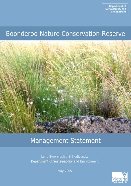
This <strong>Management</strong> <strong>Statement</strong> has been written by James Fitzsimons for theDepartment of Sustainability and Environment, <strong>Victoria</strong>.This <strong>Statement</strong> fulfils obligations by the State of <strong>Victoria</strong> to the Commonwealth ofAustralia, which provided financial assistance for the purchase of this reserve underthe National Reserve System program of the Natural Heritage Trust.©The State of <strong>Victoria</strong> Department of Sustainability and Environment 2005This publication is copyright. No part may be reproduced by any process except inaccordance with the provisions of the Copyright Act 1968.ISBN 1 74152 151 3Disclaimer:This publication may be of assistance to you but the State of <strong>Victoria</strong> and itsemployees do not guarantee that the publication is without flaw of any kind or iswholly appropriate for your particular purposes and therefore disclaims all liabilityfor any error, loss or other consequence which may arise from you relying on anyinformation in this publication.Cover:Bluebells Wahlenbergia sp., amongst Poa tussocks and basalt outcrops - <strong>Boondero</strong>oNature Conservation Reserve (Photo: James Fitzsimons)
<strong>Boondero</strong>o Nature Conservation ReserveThe generic management objectives for Nature Conservation Reserves as defined by <strong>Parks</strong><strong>Victoria</strong> (2003) are:Nature conservation reserves a) conserve and protect species, communities andhabitats of indigenous plants, animals and other organisms; b) provide for researchand study of the natural environment of the reserve where this is consistent with a)and there is minimal impact on the reserve; c) provide opportunities for appropriateenjoyment and recreation and education by the public where this does not conflictwith a); d) protect Aboriginal cultural sites and places; and e) protect historic featuresin specific reserves where noted.Nature Conservation Reserves are consistent with IUCN Protected Area Category Ia:Strict Nature Reserve (NRE 1996).As the purchased land was originally freehold, no Land Conservation Council(LCC), Environment Conservation Council (ECC) or <strong>Victoria</strong>n EnvironmentalAssessment Council (VEAC) recommendations apply.The Crown Land (Reserves) (Nature Conservation Reserve) Regulations 2004 regulatesactivities in the reserve.Natural Values and ConditionRefer to Figure 1 for the location of threatened species recorded in the Atlas of<strong>Victoria</strong>n Wildlife and the Flora Information System 1 .Vegetation TypesPlains Grassland is the main Ecological Vegetation Class (EVC) represented in thereserve 2 . Plains Grassland is considered endangered in the <strong>Victoria</strong>n Volcanic Plainsbioregion and patches of the size present in Mount Mercer <strong>NCR</strong> are very rare (Ross1999, Barlow 2000). The grasslands in the reserve also fall within the definition forthe Western (Basalt) Plains Grassland Community, which is listed as threatenedunder the <strong>Victoria</strong>n Flora and Fauna Guarantee Act 1988. This community was recentlynominated for listing as a threatened ecological community under the EnvironmentalProtection and Biodiversity Conservation Act 1999 (Cwth). Only around 0.5% of theoriginal extent of this community remains in the <strong>Victoria</strong>n Volcanic Plain bioregion(Barlow & Ross 2001).A number of fine-scale vegetation units have been identified on the property – GreybrownSoils Grassland, Plains Stony Knoll Grassland and Black Soils (Gilgai Plain)Grassland. Grey-brown Soils Grassland occupies approximately 85% of the site. Theproperty to the north also contains native grasslands, including small a small zone ofRed Soils Grassland (Barlow 2001).1Note this does not necessarily represent records for all threatened species on the reserve. Only thoserecorded in the DSE flora and fauna databases are displayed.2Note that as of September 2004, neither the Mount Mercer <strong>NCR</strong> nor the surrounding land had beenmapped as Plains Grassland EVC within the EVC_CMP100 geospatial data layer.2
<strong>Boondero</strong>o Nature Conservation ReserveEcological <strong>Management</strong> of Western (Basalt) Plains GrasslandsControl of biomass, particularly of exotic pasture grass species, may be considereddesirable for flora and fauna species requiring inter-tussock spaces for habitat. Thismay be achieved via a number of management options:- Grazing: Sheep grazing has been used as a management tool on a number ofreserves containing Western (Basalt) Plains Grasslands on the <strong>Victoria</strong>n VolcanicPlain. Historically, the <strong>Boondero</strong>o paddocks have been grazed by Merinowethers at about 4-6 dse/ha, although rates had been reduced in the few yearsprior to <strong>Boondero</strong>o’s purchase and reservation (Barlow 2001). Techniques such as‘crash (or pulse) grazing’ (the introduction of a large number of sheep for a shortperiod of time) can reduce the density and biomass of dominant grass species,thereby increasing inter-tussock spaces. In addition, grazing exclusion areas maybe used to monitor the impacts of grazing on the grassland vegetation.- Ecological Burning: Fire may be used as a management tool both to control exoticpasture species and promote the regeneration of indigenous flora species relianton the creation of inter-tussock spaces.<strong>Management</strong> objectives and targets (short-long term)- Actively manage the Western (Basalt) Plains Grassland using some of themanagement options described above to maintain species diversity, richness andstructural heterogeneity in the vegetation.- Monitor and research outcomes of management actions and adapt regimes as theneed arises.- Encourage ongoing research by universities and other scientific institutions intooptimal management techniques for maintaining and enhancing grasslandbiodiversity.FloraThe nationally endangered 3 Small Scurf-pea Cullen parvum has been recorded ingrassland just north of the reserve. Rye Beetle-grass Tripogon loliiformis (rare in<strong>Victoria</strong>) and Spurred Spear-grass Austrostipa gibbosa (formerly considered rare) havealso been recorded from the site. Refer to Appendix 1 for flora recorded in the<strong>Boondero</strong>o <strong>NCR</strong> on November 2000.<strong>Management</strong> objectives and targets (short-medium term)- Record flora in the <strong>Parks</strong> <strong>Victoria</strong> Environmental Information System and DSEFlora Information System (FIS), and encourage seasonal surveys.FaunaThe grasslands provide known habitat for the Fat-tailed Dunnart Sminthopsiscrassicaudata (near-threatened in <strong>Victoria</strong>) and potential habitat for the StripedLegless Lizard Delma impar (endangered in <strong>Victoria</strong>, nationally vulnerable). Brolga’sGrus rubicunda (vulnerable in <strong>Victoria</strong>) have been recorded on the site in the early1990s. Refer to Appendix 2 for fauna records from <strong>Boondero</strong>o <strong>NCR</strong>.3Threat status for flora and fauna follows DSE (2003a,b).3
<strong>Boondero</strong>o Nature Conservation Reserve<strong>Management</strong> objectives and targets (short-medium term)- Record fauna in the <strong>Parks</strong> <strong>Victoria</strong> Environmental Information System and Atlasof <strong>Victoria</strong>n Wildlife, and encourage seasonal survey programs.Biosites 4Two Biosites 5 are recorded on <strong>Boondero</strong>o <strong>NCR</strong>, these are:- Site # 1182 ‘Lethbridge Private’ (State significance)- Site # 3559 ‘<strong>Boondero</strong>o Private (Grass PPLE001)’Landscape context<strong>Boondero</strong>o <strong>NCR</strong> is bordered by a large (177 ha) intact native grassland paddock tothe north, separated by an unused road reserve. Tall Tree Road delineates thereserve’s southern and southwestern boundary. A paddock to south of Tall TreesRoad contained (lower quality) native grassland upon inspection in 2000-2001.Approximately 1.4 km of the reserve adjoins native vegetation (approximately 23%of the total boundary). An unused road reserve adjoins the northwestern boundaryof <strong>Boondero</strong>o <strong>NCR</strong>. Sections of Tall Tree Road adjoining <strong>Boondero</strong>o <strong>NCR</strong> to thesouthwest have stands of Blackwood Acacia melanoxylon.Grazing is the predominant land use in the area but more intensive agriculture, suchas cropping, is becoming increasingly prevalent.Nearby reserves in the bioregion include the Mount Mercer <strong>NCR</strong> (containingWestern (Basalt) Plains Grassland, also purchased through the National ReserveSystem) and the Inverleigh Flora Reserve (mostly Plains Grassy Woodland) (Figure2).Threatening ProcessesPest plantsTwo serious agricultural weeds are present at varying densities on the property -Serrated Tussock Nasella trichotoma and Chilean Needlegrass Nasella neesiana. Bothspecies are highly invasive and threaten grazing land in agricultural areas. A numberof environmental weeds, particularly exotic pasture species such as Oats Avena spp.and Toowoomba Canary-grass Phalaris aquatica, have the ability to alter the structureof Western (Basalt) Plains Grasslands and pose a threat to a number of flora andfauna species reliant on the grasslands. Spear Thistle Cirsium vulgare is prevalentaround the earthen banks of ‘Windmill Dam’, impacting on the aesthetics of thenative grassland.<strong>Management</strong> objectives and targets (short-long term)- Control the establishment and spread of Serrated Tussock and ChileanNeedlegrass on <strong>Boondero</strong>o <strong>NCR</strong> through spot spraying and encourage theestablishment of native grasses in their place.4‘Biosites’ are sites of biological conservation significance and their location and details are maintainedon a register by the Department of Sustainability and Environment.5Both Biosites have the same geographic coordinates and are possibly duplicates.4
<strong>Boondero</strong>o Nature Conservation Reserve- Re-establish native grass cover on the denuded banks of Windmill Dam andensure Spear Thistles are sprayed prior to seeding.- Increase cover of native grasses by controlling and reducing the extent of exoticpasture grasses through grazing or burning (see ‘Ecological <strong>Management</strong> ofWestern (Basalt) Plains Grasslands’).- Liaise with Golden Plains Shire to ensure the control of the environmental weedToowoomba Canary-grass, which occurs along Tall Tree Road adjoining<strong>Boondero</strong>o <strong>NCR</strong>, to prevent its spread into the reserve.Pest animalsFoxes and cats are likely to use the reserve, but the impact of predation on nativefauna in the reserve is unknown. However, they may pose a significant threat tosmall mammals (including Fat-tailed Dunnart), ground nesting or feeding birds andreptiles. Rabbits and hares are considered to be present in low densities based onscats, nests and tracks (Barlow 2001).<strong>Management</strong> objectives and targets (short-long term)- Control foxes and cats in order to maintain habitat values of the reserve for smallmammals and ground-dwelling birds.- Maintain rabbit and hare numbers at less than 5 per spotlight km.Physical Assets and BoundariesThree dams occur on the reserve - on the southwestern side of northern paddock(‘Bluestone Dam’), a large dam in the southern central section of the southernpaddock (‘Windmill Dam’), and a shallow dam in the southwestern corner of thesouthern paddock (‘Shallow Dam’). A flume runs from the Bluestone Dam southeastthrough the southern paddock to private land to the east. Fences are in fair to goodcondition on the southern, western and northern boundaries but poor in parts of theeastern boundary.<strong>Management</strong> objectives and targets (short-medium term)- Maintain dams required for stock water.- Liaise with adjoining landowners to ensure boundary fences are maintained in astock-proof condition.- Determine the importance of the flume to private properties to the east. Ifalternative water sources can be provided to these properties, consider removingthe flume to reduce weed establishment in this area.Heritage Values, Condition and RiskThere are no recorded places of heritage vale and there is no evidence of places withheritage value. The bluestone dam wall of ‘Bluestone Dam’ may have heritage valuesand further investigation of its Heritage Values is warranted.<strong>Management</strong> objectives and targets (short-long term)- If sites of heritage value are identified in the reserve, assess their condition andestablish management objectives.5
<strong>Boondero</strong>o Nature Conservation ReserveIndigenous Values, Condition and RiskThere are no recorded archaeological sites and no identified sites or features, and thepotential for sites is considered to be low.<strong>Management</strong> objectives and targets (short-long term)- Respect the aspirations and rights of the Traditional Owners and the LocalAboriginal Community in managing the reserve in accordance with relevantlegislation and <strong>Parks</strong> <strong>Victoria</strong>’s operational policies.- Work together with the Traditional Owners and the Local AboriginalCommunity to survey <strong>Boondero</strong>o <strong>NCR</strong> to identify the location of significantindigenous sites, places and objects.- If sites, places and objects are identified, assess their condition and seek guidancefrom these communities on future management.Visitor Services, Condition and RiskThere is currently no level of visitor services for <strong>Boondero</strong>o <strong>NCR</strong> (classified as “VeryBasic”). The provisional future level of service will be “Very Basic” (no facilities).Access is currently restricted to pedestrian access off Tall Tree Road, Lethbridge.While there is no data available, visitor numbers to the <strong>Boondero</strong>o <strong>NCR</strong> are likely tobe low (0-5000 p.a.) as the reserve has only been recently purchased.<strong>Management</strong> objectives and targets (short-long term)- Retain ‘Very Basic’ level of service; i.e. do not provide built facilities or accessroads accessible by the general public.- Maintain existing internal <strong>Management</strong> Vehicle Only (MVO) tracks whererequired. These MVO tracks will not be accessible for public vehicular access.MVO tracks may also be established along the unused road reserves adjoiningthe west and north of <strong>Boondero</strong>o <strong>NCR</strong>. These unused road reserves willeventually be added to the <strong>NCR</strong> (refer to Fig. 1).Signage: Provide locality signage for the reserve within two years and maintain it.ConsultationThis <strong>Management</strong> <strong>Statement</strong> has been prepared in consultation with Craig Bray andMark Urquhart (<strong>Parks</strong> <strong>Victoria</strong>).References and Further ReadingBarlow, T. (2001) An overview of the conservation values at ‘<strong>Boondero</strong>o’ Grassland,Meredith, <strong>Victoria</strong>. Unpublished report for the Department of Natural Resourcesand Environment. Ecology Australia, Melbourne.Barlow, T.J. and Ross, J.R. (2001) Vegetation of the <strong>Victoria</strong>n Volcanic Plain.Proceedings of the Royal Society of <strong>Victoria</strong> 113, xxv-xxviii.DSE (2003a) Advisory List of Threatened Vertebrate Fauna in <strong>Victoria</strong> – 2003. Departmentof Sustainability and Environment, Melbourne.6
<strong>Boondero</strong>o Nature Conservation ReserveDSE (2003b) Advisory List of Rare or Threatened Plants in <strong>Victoria</strong> – 2003. Department ofSustainability and Environment, Melbourne.Environment Australia (2000) Revision of the Interim Biogeographic Regionalisationfor Australia (IBRA) and Development of Version 5.1 Summary Report.Environment Australia, Canberra.http://www.deh.gov.au/parks/nrs/ibra/version5-1/summary-report/index.htmlFitzsimons, J.A., FitzSimons, P. & Ashe, C. (2004) Further strategic additions to<strong>Victoria</strong>’s public protected area system: 2002-2004. The <strong>Victoria</strong>n Naturalist 121,214-225.NRE (1996) IUCN Categories and Other Key Data for <strong>Parks</strong> and Conservation Reserves in<strong>Victoria</strong>. National <strong>Parks</strong> and Reserves Branch, National <strong>Parks</strong> Service,Department of Natural Resources and Environment, Melbourne.<strong>Parks</strong> <strong>Victoria</strong> (2003) Conservation Reserves <strong>Management</strong> Strategy. <strong>Parks</strong> <strong>Victoria</strong>,Melbourne.Ross, J. (1999) Identification of priority areas for protection and establishment ofprotected areas – <strong>Victoria</strong>n Volcanic Plain. Report for <strong>Parks</strong>, Flora and Fauna,Department of Natural Resources and Environment, Melbourne.Ross, J., Lowe, K.W., Boyle, C. & Moorrees, A. (2003) Biodiversity Action Planning:Landscape Plans for the Eastern zones in the <strong>Victoria</strong>n Volcanic Plain Bioregion.Department of Sustainability and Environment, Melbourne.7
<strong>Boondero</strong>o Nature Conservation ReserveTaxon Common Name <strong>Boondero</strong>o <strong>NCR</strong>SouthernPaddock*NorthernPaddock*Privateland tonorth –Harvey’sPaddockVic StatusFFGEPBCOxalis perennans Grassland Wood-sorrel + + +Plantago gaudichaudii Narrow Plantain + +Plantago varia Variable Plantain + +Poa labillardieri Common Tussock-grass + +Poa rodwayi Velvet Tussock-grass + +Poa sieberiana var. sieberiana Grey Tussock-grass + +Poa sieberiana var. hirtella Grey Tussock-grass + +Ptilotus spathulatus Pussytails + +Rumex dumosus Wiry Dock + +Schoenus apogon Common Bog-sedge + + +Solenogyne dominnii Solenogyne + + +Stipa bigeniculata Kneed Spear-grass + + +Stipa nodosa Knotty Spear-grass +Themeda triandra Kangaroo Grass + + +Tricoryne elatior Yellow Rush-lily +Tripogon loliiformis Rye Beetle-grass + rTriptilodiscus pygmaeus Common Sunray +Veronica gracilis Slender Speedwell + + +Wahlenbergia communis Tufted Blue-bell + +Wahlenbergia luteola Yellowish Bluebell + +Wahlenbergia stricta Tall Bluebell + + +Introduced SpeciesAcetosella vulgaris Sheep Sorrel + +Aira cupaniana Small Hair-grass + + +Arctotheca calendula Cape Weed + + +Arctotheca prostrata Creeping Bear's-ear +Anthoxanthum odoratum Sweet Vernal-grass + +Avena spp. Oats + +Briza minor Lesser Quacking-grass + +Bromus diandrus Great Brome +Bromus hordeaceus Soft Brome + +Cirsium vulgare Spear Thistle + + +Erodium botrys Big Heron's-bill + +Erodium cicutarium Common Heron's-bill +Holcus lanatus Yorkshire Fog + + +Hypochoeris radicata Flatweed + + +Lagurus ovatus Hare’s Tail + +Lolium perenne Perennial Rye-grass + + +Marrubium vulgare Horehound +Medicago spp Medic + +Nasella trichotoma Serrated Tussock + +Nasella hyalina Texan Needle-grass + +Nasella neesiana Chilean Needle-grass + +Parentucellia latifolia Common Bartsia +Phalaris aquatica Toowoomba Canary-grass + + +Plantago coronopus Buck's-horn Plantain + +9
<strong>Boondero</strong>o Nature Conservation ReserveTaxon Common Name <strong>Boondero</strong>o <strong>NCR</strong>SouthernPaddock*NorthernPaddock*Privateland tonorth –Harvey’sPaddockVic StatusFFGEPBCPseudognaphalium luteoalbum Jersey Cudweed + +Romulea rosea Common Onion-grass + +Rumex conglomeratus Clustered Dock +Sonchus asper Rough Sow-thistle +Trifolium angustifolium Narrow-leaf Clover + + +Trifolium dubium Suckling Clover + + +Trifolium subterraneum Subterranean Clover + + +Vulpia bromoides Squirrel-tail Fescue + + +Total no. recorded = 95Key: r (rare). Threat status follows DSE (2003b).No. of exotic species 22 (35%) 23 (40%) 24 (30%)No. of native species 40 35 57Total no. of species 62 58 81* Refer to Figure 1.10
<strong>Boondero</strong>o Nature Conservation ReserveAppendix 2: Provisional list of fauna recorded at <strong>Boondero</strong>o Nature ConservationReserve.Common Name Scientific Name SourceVictStatusFFGIndigenous SpeciesFat-tailed Dunnart Sminthopsis crassicaudata 1 nCommon Froglet Crinia signifera 1Southern Brown Tree Frog Litoria ewingii 1Spotted Marsh Frog Limnodynastes tasmaniensis 1White-lipped Snake Drysdalia coronoides 1Eastern Three-lined Skink Bassiana duperreyi 1Tussock Skink Pseudemoia pagenstecheri 1White's Skink Egernia whitii 1Common Blue-tongue Lizard Tiliqua scincoides 2Eastern Brown Snake Pseuonaja textilis 2White-lipped Snake Drysdalia coronoides 4Brown Falcon Falco berigora 2Richard’s Pipit Anthus novaeseelandiae 2Brolga Grus rubicunda 3 v LWhite-faced Heron Egretta novaehollandiae 4Stubble Quail Coturnix pectoralis 4Yellow-tailed Black-Cockatoo Calyptorhynchus funereus 4Singing Bushlark Mirafra javaninca 4Pacific Black Duck Anas superciliosa 4Magpie-lark Grallina cyanoleuca 4Australian Magpie Gymnorhina tibicen 4Little Raven Corvus melliori 4Masked Lapwing Vanellus miles 4EPBCIntroduced SpeciesBrown Hare Lepus capensis 1European Rabbit Oryctolagus cuniculus 1House Sparrow Passer domesticus 4Key: n (near threatened), v (vulnerable), L (listed as threatened under the Flora and Fauna Guarantee Act1988). Threat status follows DSE (2003a).Source:1<strong>Victoria</strong>n Fauna Site Database Ref: A0031249, Date: 01 January 1995, Collector: 13392Barlow (2001)3<strong>Victoria</strong>n Fauna Site Ref: A0103745, Date: 13 April 1991, Collector: 244Site inspection 12 December 2003 & additional records 16 April 2005. Observer: J. Fitzsimons (DSE)11


