February 2007 - American Bonanza Society
February 2007 - American Bonanza Society
February 2007 - American Bonanza Society

You also want an ePaper? Increase the reach of your titles
YUMPU automatically turns print PDFs into web optimized ePapers that Google loves.
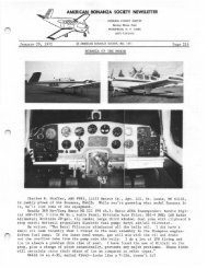
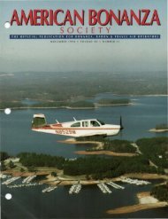
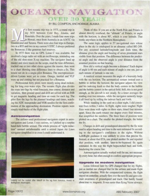
-\ r y first oceanic trip was in 1975, a round trip inBY BILL COMPTON. ANCHORAGE. ALASKA!my N35 between Cold Bay, Alaska, andHonolulu. Over the years, I made four more trips_ --!,Jo Hawaii, once from Australia in an A36TC viaGuadalcanal and Tarawa. There were also four trips 10 Europe,two in a B55 and two in my current V35TC. I always preferredthe <strong>Bonanza</strong>s; I like generous fuel reserves.In 1975 there was no GPS. Loran C was available, butinvolved a large radio set with an oscilloscope, reminding oneof the old shoe-store X-ray machine. The navigator lined upmaster and slave traces on the scope, read the time difference,tracked one or two other slaves against the master, then wentto a chart showing time difference lines to obtain a fix. Thiswould not do in a single-pilot <strong>Bonanza</strong>. The microprocessordrivenLorans were yet to come. Omega, inertial and VLFwere up and coming but not practical for a <strong>Bonanza</strong>.Professional ferry pilots were mostly usi ng dead reckoningfor long over-water trips. The oceanic flight plan dividesthe route into legs by wind forecasts. true course, distance andvariation, then ground speed and drift are solved with an E6Bto get magnetic heading and time en route for each leg. Thepilot flew the legs by the planned beadings and times, watchingthe ADF. transponder and VOR needles for the first confirmationof the approaching destination. Position reports weresimply read-backs of the flight plan.Ast.onavigationThe airlines used professional navigators expert in astronavigationand Loran. I was curious, so I picked up a surplushand-held bubble sextant. The whole process of "sight reduction"seemed unfathomable until a retired Japan Air Linesnavigator simplified it so even I could understand it.Think of this: If you are at the North Pole and Polaris isalmost directly overhead, the "altitude" of Polaris, or anglewith the horizon , is about 90' , which is your latitude. Thatwork~ anywhere in the orthem Hemisphere,The same logic applies to 57 navigational stars whoseplace in the sky is catalogued in an almanac called HO 249.For any assumed latitude/longitude and Zulu time, thealmanac gives the angle and bearing of seven prominent starsvisible from that position. The difference between the predictedangle and the observed angle is your distance from theassumed position on that bearing.How did a vertical angle become a distance? Each degreeof angle is 60 nm and each minute of angle is one nm, just aseach minute of latitude is one nm.A nautical sextant measures the angle of a heavenly bodywith the sea horizon. The aeronautical sextant instead uses abubble to define the horizon; the navigator adjusts his viewand his indexing knob so that the body centers in the bubbleand the bubble centers in the optical field. Still, this is not goodenough, as the aircraft is not steady. So a timer averages thereading over two minutes, whi le the navigator earnestly keepsit all lined up by rolling the indexer back and forth.While standing in the yard on a clear night, I did consistentfixes within 3 miles. In night, sights were tougher. Nightfixes were done with sights on three stars, timed four minutesapart. Since the earth rotates one degree every four Irtinutes,that simplified the numbers. The three lines of position wereplotted on a chart. The smaller the plotted triangle, the betterthe fix.Changes in drift and groundspeed detected by the fix wereused to adjust heading and time to the next estimated fix accordingto the navigator's confidence in the sights. WithoutLeftlRight guidance it was unlikely to cross that precise fix.Instead, at about that ETA, one plotted another fix and reportedthat position, with another, later-to-be-bypassed fix againestimated. In this way the flight hopscotched back and forth,bracketing the course line.Astronavigation actually worked well for me, not necessari1yeveryhour, but often enough to confirm appropriate progress.Looking out the cockpit ofter takeoff on the leg from Honolulu, Hawaii toBellingham. Washington.upg.ade to _ode.n navigationLoran followed later by GPS changed that for my fli ghts,just as inertial nav changed that for the airlines and made flightnavigators obsolete, With the computerized systems, the flightstayed on centerline, actually flew over the next fix and gave constantawareness of groundspeed and track. One hardly fussedabout true vs. magnetic. It was easier than flying Victor airways.Page 10072 www.bonanza.org ABS <strong>February</strong> <strong>2007</strong>