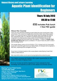
READ MORE - Field Studies Council
READ MORE - Field Studies Council
READ MORE - Field Studies Council

Create successful ePaper yourself
Turn your PDF publications into a flip-book with our unique Google optimized e-Paper software.
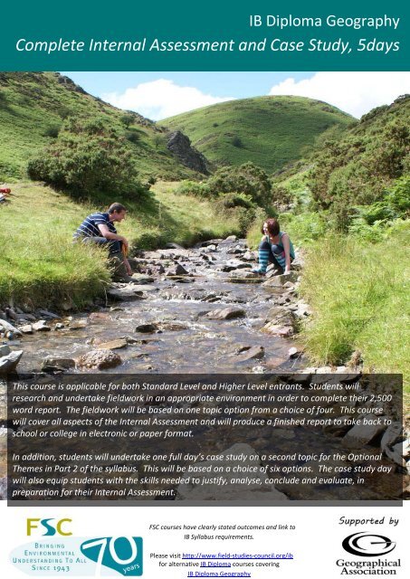
IB Diploma GeographyComplete Internal Assessment and Case Study, 5daysThis course is applicable for both Standard Level and Higher Level entrants. Students willresearch and undertake fieldwork in an appropriate environment in order to complete their 2,500word report. The fieldwork will be based on one topic option from a choice of four. This coursewill cover all aspects of the Internal Assessment and will produce a finished report to take back toschool or college in electronic or paper format.In addition, students will undertake one full day’s case study on a second topic for the OptionalThemes in Part 2 of the syllabus. This will be based on a choice of six options. The case study daywill also equip students with the skills needed to justify, analyse, conclude and evaluate, inpreparation for their Internal Assessment.FSC courses have clearly stated outcomes and link toIB Syllabus requirements.Please visit http://www.field-studies-council.org/ibfor alternative IB Diploma courses coveringIB Diploma Geography
pricescentresIB Diploma GeographyComplete Internal Assessment and Case Study, 5daysSelect ONE of the following topics as a Case StudyFreshwater (Discharge, stream flow and channel shape)This day links to Option A: Freshwater – issues and conflicts, in Part 2 of the syllabus. During this investigation students will study asmall scale drainage basin to explore the relationship between discharge, stream flow and channel shape. There will also beopportunities to observe landforms resulting from stream channel processes such as erosion, transportation and deposition.Freshwater (Floods and floodplain management)This day links to Option A: Freshwater – issues and conflicts, in Part 2 of the syllabus. During this investigation students will study asmall scale drainage basin to explore the natural and human causes and consequences of flooding. Students will then evaluate thecosts and benefits of alternative flood management strategies.Coastal marginsThis day links to Option B: Oceans and their coastal margins, in Part 2 of the syllabus. During this investigation students willundertake fieldwork to observe a number of different coastal management strategies and evaluate the effectiveness of these inaddressing coastal erosion. Students will also investigate beach dynamics and their interaction with local coastal managementstrategies.Extreme environments (Glaciation)This day links to Option C: Extreme environments, in Part 2 of the syllabus. During this investigation students will visit anenvironment glaciated during the last ice age to explore the features that have resulted from the processes of erosion anddeposition.Tourism in a rural areaThis day links to Option E: Leisure, sport and tourism, in Part 2 of the syllabus. During this investigation students will visit a ruraltourist honeypot site. The focus will be on assessing the impact of tourism in the area and reflecting on the management strategiesthat can be used to promote sustainable tourism for the future. Students will consider the need to balance the advantages oftourism with the need to minimise conflicts and environmental damage.Urban environments (Central Business District)This day links to Option G: urban environments, in Part 2 of the syllabus. During this investigation students will focus oninvestigating the structure of the central business district (CBD). <strong>Field</strong>work will be carried out to define the boundary of the centralbusiness district and de-limit different zones within it. This will link to patterns of retail activity and zoning of urban functions.External Recognition of QualityAll our centres have been awarded theQuality Badge by The <strong>Council</strong> for LearningOutside the Classroom. The badge isawarded to organisations that havedemonstrated that they consistentlydeliver high quality teaching and learningexperiences and manage risk effectively.This means that you will have to completeless paperwork when visiting our centresFSC Head office, Preston Montford, Montford Bridge, Shrewsbury, Shropshire, SY4 1HWTel: 01743 852100 Fax: 01743 852101 Email: enquiries@field-studies-council.org Website: www.field-studies-council.org<strong>Field</strong> <strong>Studies</strong> <strong>Council</strong> is a limited Company, registered in England and Wales No. 412621 and a Charity No. 313364. Registered Office; Preston Montford, Shrewsbury, Shropshire SY4 1HW
pricescentresIB Diploma GeographyComplete Internal Assessment and Case Study, 5daysLEARNING OUTCOMES/OBJECTIVESEXAMPLE LEARNING OBJECTIVES AND OUTCOMES: INTERNAL ASSESSMENTExample Learning Objectives• To understand therequirements of the InternalAssessment.• To investigate an area of thesyllabus in greater depththrough the collection ofprimary and secondaryinformation in relation to akey question.• To develop a range ofgeographical skills,knowledge, understandingand values in relation to ageographical topic.Potential Learning OutcomesAll students will:• Identify a clear fieldwork question and geographical context to their investigation.• Integrate annotated maps, aerial photographs and/or satellite images into their written report.• Carry out fieldwork in the outdoor classroom, collecting information for the Internal Assessment.• Demonstrate an awareness of safety issues and risk assessment in geographical fieldwork.• Describe and explain appropriate methods of collecting information.• Display primary information in a variety of formats.• Demonstrate a basic knowledge and understanding of the fieldwork investigation by interpretingand explaining the information.• Formulate a conclusion, based on the primary and secondary information collected.• Evaluate the information gathered and the conclusions drawn.• Produce a written report of no more than 2,500 words.• Organise and format the written report using the requirements specified in the IB syllabus.Most students will:• Use secondary data in the pre-fieldwork phase to justify and contextualise their fieldwork.• Use GIS information as part of their written report.• Justify the methods used to collect primary and secondary information and be aware ofalternatives.• Identify the most appropriate methods of displaying information and use these techniquescompetently and accurately.• Demonstrate a thorough knowledge and understanding of the fieldwork investigation byinterpreting and explaining the information.• Use an analytical rather than descriptive focus to their written report.• Use more sophisticated methods of analysis such as statistics as part of their written report.• Provide a concise summary of the findings of their fieldwork investigation and link this to theirinitial fieldwork question.• Critically evaluate the effectiveness of their research methodology and the validity of outcomes.• Suggest plausible ways of extending their fieldwork investigation in the future.Some students will:• Make a significant contribution to the planning stages of the fieldwork investigation.• Synthesise a range of geographical information in various forms and from various sources.• Critically evaluate the methods used to collect information.• Identify the most appropriate statistical test to use (where relevant) to analyse information anduse this technique competently and accurately.• Recognise that their conclusions may be partial, tentative or incomplete.• Demonstrate a thorough understanding of how limitations in research methodology may impactupon the reliability and validity of results and conclusions.FSC Head office, Preston Montford, Montford Bridge, Shrewsbury, Shropshire, SY4 1HWTel: 01743 852100 Fax: 01743 852101 Email: enquiries@field-studies-council.org Website: www.field-studies-council.org<strong>Field</strong> <strong>Studies</strong> <strong>Council</strong> is a limited Company, registered in England and Wales No. 412621 and a Charity No. 313364. Registered Office; Preston Montford, Shrewsbury, Shropshire SY4 1HW
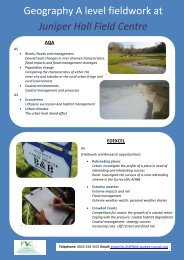
pricescentresIB Diploma GeographyComplete Internal Assessment and Case Study, 5daysEXAMPLE LEARNING OBJECTIVES AND OUTCOMES: Freshwater (Floods and floodplain management)Syllabus links: Part 2, Option A: Freshwater – issues and conflicts. Sub-topic 2 - Drainage basins and flooding. Sub-topic3 - Management issues and strategies.Example Learning Objectives• To consider how successfulflood management requiresan understanding of bothphysical and human aspects.• To evaluate the effectivenessof management strategiesdesigned to address riverflooding.• To develop case studyknowledge of floodmanagement strategies.Potential Learning OutcomesAll students will:• Outline a clear fieldwork question relating to river flooding.• Describe the geographical context to their investigation.• Use OS map extracts, aerial photographs and/or satellite imagery to identify geographicalcharacteristics of the drainage basin and possible survey locations.• Identify key risks involved with river fieldwork and suggest ways of managing these risks.• Describe the sampling strategy employed during the study.• Discuss the natural and human causes and consequences of a specific river flood.• Collect primary information (e.g. land use type and value, proximity to river corridor, flooddefence assessment) to answer their initial fieldwork question.• Observe a number of different flood defences and map their location.• Use appropriate methods to display primary information (e.g. choropleth maps, annotated basemaps, annotated photographs).Most students will:• Suggest appropriate fieldwork techniques to use to address their fieldwork question.• Justify the use of the chosen sampling strategy.• Explain the advantages and disadvantages of different flood defence strategies observed duringthe day.• Explain any anomalies in the information and relate these to the initial fieldwork question.Some students will:• Critically evaluate the methods used to collect the information and the resulting impact on thereliability and validity of the results and conclusions.• Evaluate different flood defence strategies in order to justify which strategy is the mostappropriate for a particular location.• Use information from the Catchment Management Plan to inform suggestions of how thedrainage basin should be managed in the future.FSC Head office, Preston Montford, Montford Bridge, Shrewsbury, Shropshire, SY4 1HWTel: 01743 852100 Fax: 01743 852101 Email: enquiries@field-studies-council.org Website: www.field-studies-council.org<strong>Field</strong> <strong>Studies</strong> <strong>Council</strong> is a limited Company, registered in England and Wales No. 412621 and a Charity No. 313364. Registered Office; Preston Montford, Shrewsbury, Shropshire SY4 1HW
pricescentresIB Diploma GeographyComplete Internal Assessment and Case Study, 5daysEXAMPLE LEARNING OBJECTIVES AND OUTCOMES: Coastal marginsSyllabus links: Part 2, Option B: Oceans and their coastal margins. Sub-topic 5 – Coastal margins.Example Learning Objectives• To consider how successfulcoastal managementrequires an understanding ofboth physical and humanaspects.• To evaluate the effectivenessof a costal managementstrategy.• To develop case studyknowledge of coastalmanagement strategies.Potential Learning OutcomesAll students will:• Outline a clear fieldwork question relating to coastal environments.• Describe the geographical context to their investigation.• Use OS map extracts, aerial photographs and/or satellite imagery to identify geographicalcharacteristics of the coastline and possible survey locations.• Identify key risks involved with coastal fieldwork and suggest ways of managing these risks.• Describe the sampling strategy employed during the study.• Collect primary information (e.g. wave type and frequency, beach profiles at managed andunmanaged sites, cost/benefit analyses) to answer their initial fieldwork question.• Observe a number of different coastal defences and map their location.• Use appropriate methods to display primary information (e.g. proportional symbols, annotatedmaps, beach profiles).Most students will:• Suggest appropriate fieldwork techniques to use to investigate the effectiveness of differentcoastal defence strategies.• Justify the use of the chosen sampling strategy.• Explain the advantages and disadvantages of different coastal defence strategies observedduring the day.• Compare and contrast the beach profiles in front of coastal defences with unmanaged locations.• Carry out an appropriate statistical test (e.g. Mann Whitney U) to support the initial fieldworkquestion.• Explain any anomalies in the information and relate these to the initial fieldwork question.Some students will:• Critically evaluate the methods used to collect the information and the resulting impact on thereliability and validity of the results and conclusions.• Explain how beach profile shape and size relates to the function of different coastal defences.• Evaluate different coastal defence strategies in order to justify which strategy is the mostappropriate for a particular location.• Use information from the Shoreline Management Plan to inform suggestions of how thecoastline should be managed in the future.FSC Head office, Preston Montford, Montford Bridge, Shrewsbury, Shropshire, SY4 1HWTel: 01743 852100 Fax: 01743 852101 Email: enquiries@field-studies-council.org Website: www.field-studies-council.org<strong>Field</strong> <strong>Studies</strong> <strong>Council</strong> is a limited Company, registered in England and Wales No. 412621 and a Charity No. 313364. Registered Office; Preston Montford, Shrewsbury, Shropshire SY4 1HW
pricescentresIB Diploma GeographyComplete Internal Assessment and Case Study, 5daysEXAMPLE LEARNING OBJECTIVES AND OUTCOMES: Tourism in a rural areaSyllabus links: Part 2, Option E: Leisure, sport and tourism. Sub-topic 6 – Leisure at the local scale: tourism.Example Learning Objectives• To consider the impact oftourism in an area.• To consider how tourism in arural area can be managed totake account of the needs ofdifferent people and theenvironment.• To develop case studyknowledge of tourism in arural area.Potential Learning OutcomesAll students will:• Outline a clear fieldwork question relating to rural tourism.• Describe the geographical context to their investigation.• Define the terms environmental carrying capacity and perceptual carrying capacity.• Use OS map extracts, aerial photographs and/or satellite imagery to identify geographicalcharacteristics that have led to the development of tourism in the area.• Identify key risks involved with rural fieldwork and suggest ways of managing these risks.• Collect primary information (e.g. footpath depth, soil compaction, vegetation cover, evidence ofmanagement) to answer their initial fieldwork question.• Describe the sampling strategy employed during the study.• Use appropriate methods to display primary information (e.g. kite diagrams, annotatedphotographs, footpath cross sections).• Use their primary and secondary information to assess the level of tourist impact.• Relate the general characteristics of environmental impact to their fieldwork location.• Suggest possible ways of managing the environmental impacts of tourism at their fieldworklocation.Most students will:• Suggest appropriate fieldwork techniques to use to investigate their fieldwork question.• Justify the use of the chosen sampling strategy.• Carry out an appropriate statistical test (e.g. Mann Whitney U) to support the initial fieldworkquestion.• Explain any anomalies in the information and relate these to the initial fieldwork question.• Recognise the need to balance maximum capacity with the needs of different stakeholders andthe environment.• Suggest appropriate management strategies that may be used to manage the impact of tourismat their fieldwork location in the future.Some students will:• Critically evaluate the methods used to collect the information and the resulting impact on thereliability and validity of the results and conclusions.• Compare and contrast different ways of presenting data (e.g. kite diagrams, annotatedphotographs, footpath cross sections) and select the most appropriate technique for theirinformation.• Justify the management strategies suggested to encourage sustainable tourism at their fieldworklocation.• Relate a general model of tourism development to their fieldwork location and use this to informsuggestions of how the area should be managed in the future.FSC Head office, Preston Montford, Montford Bridge, Shrewsbury, Shropshire, SY4 1HWTel: 01743 852100 Fax: 01743 852101 Email: enquiries@field-studies-council.org Website: www.field-studies-council.org<strong>Field</strong> <strong>Studies</strong> <strong>Council</strong> is a limited Company, registered in England and Wales No. 412621 and a Charity No. 313364. Registered Office; Preston Montford, Shrewsbury, Shropshire SY4 1HW