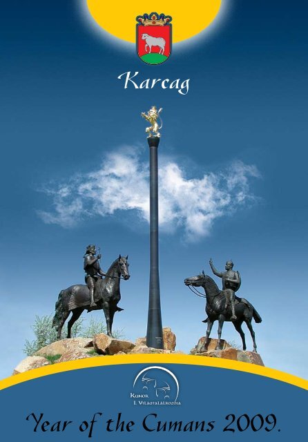
Year of the Cumans 2009. - Karcag
Year of the Cumans 2009. - Karcag
Year of the Cumans 2009. - Karcag
- No tags were found...

You also want an ePaper? Increase the reach of your titles
YUMPU automatically turns print PDFs into web optimized ePapers that Google loves.
<strong>Karcag</strong><strong>Year</strong> <strong>of</strong> <strong>the</strong> <strong>Cumans</strong> <strong>2009.</strong>
The town <strong>of</strong> <strong>Karcag</strong>in <strong>the</strong> year <strong>of</strong> <strong>the</strong> World Meeting <strong>of</strong> <strong>the</strong> <strong>Cumans</strong>The tribunal alliance originating from Inner Asia arrived to <strong>the</strong> East-European steppe in <strong>the</strong> middle <strong>of</strong><strong>the</strong> 11 th century. Russian records from 1071 place <strong>the</strong>m on <strong>the</strong> borders <strong>of</strong> <strong>the</strong> Kiev Principality; in 1078<strong>the</strong>y appeared as allies <strong>of</strong> <strong>the</strong> rebelling besenyos near <strong>the</strong> Lower Danube, in <strong>the</strong> territory <strong>of</strong> <strong>the</strong> ByzantineEmpire. In <strong>the</strong>ir 150-year European history <strong>the</strong>re are a lot <strong>of</strong> wars with Byzantium and <strong>the</strong>Russian principalities, some <strong>of</strong> which involved Hungary as well. As <strong>of</strong> 1095, <strong>Cumans</strong> continuouslyfought wars with shifting success against <strong>the</strong> Russian principalities neighbouring <strong>the</strong>ir territory from<strong>the</strong> north. In <strong>the</strong> year 1203 <strong>the</strong>y occupied Kiev, but in 1219, already as allies <strong>of</strong> <strong>the</strong> Russians, <strong>the</strong>ypicked up arms against Hungary. In 1223 ano<strong>the</strong>r Russian-Cuman alliance was established, this timeagainst <strong>the</strong> Mongolians. In this year, <strong>the</strong> allied forces were defeated in <strong>the</strong> battle fought near <strong>the</strong>river Kalka.They came to Hungary in 1091 for <strong>the</strong> first time, but László <strong>the</strong> 1 st defeated <strong>the</strong>m at <strong>the</strong> river Temesand successfully forced <strong>the</strong>m back also during <strong>the</strong>ir second attack. According to <strong>the</strong> historians, <strong>the</strong>setwo defeats contributed to <strong>the</strong> fact that <strong>the</strong> subsequent major Cuman campaigns avoided <strong>the</strong> HungarianKingdom for a long time. On <strong>the</strong> o<strong>the</strong>r hand, <strong>Cumans</strong> living in <strong>the</strong> Havasalföld regularly raidedTransylvania, so in 1211 András II resettled <strong>the</strong> German Knight Order to <strong>the</strong> Barcaság. The knights successfullydefended <strong>the</strong> country, but as a result <strong>of</strong> <strong>the</strong>ir strives to become independent, <strong>the</strong> king expulsed<strong>the</strong>m in 1224.After being defeated by <strong>the</strong> Mongolians in <strong>the</strong> year 1223, part <strong>of</strong> <strong>the</strong> <strong>Cumans</strong> moved to west. The<strong>Cumans</strong> orienting toward west friendly received <strong>the</strong> missionaries sent among <strong>the</strong>m. As a result <strong>of</strong> <strong>the</strong>operation <strong>of</strong> <strong>the</strong> Dominican friars, <strong>the</strong> Cuman sovereign Barc accepted Christianity in 1227, and <strong>the</strong>Cuman tribes living west to <strong>the</strong> Dnieper accepted <strong>the</strong> empery <strong>of</strong> <strong>the</strong> Hungarian king. (From this time<strong>the</strong> titles <strong>of</strong> <strong>the</strong> Hungarian emperor also include “King <strong>of</strong> <strong>the</strong> <strong>Cumans</strong>”) In order to continue <strong>the</strong> missionarywork and manage <strong>the</strong> church service among <strong>the</strong> christened <strong>Cumans</strong>, archbishop <strong>of</strong> Esztergom,Róbert established <strong>the</strong> Cuman bishopship in Milkó. Fifteen years after <strong>the</strong> battle lost near Kalka, <strong>the</strong>western attack <strong>of</strong> <strong>the</strong> Mongolians started. After occupying <strong>the</strong> Russian cities, <strong>the</strong> army <strong>of</strong> khan Batumoved against <strong>the</strong> <strong>Cumans</strong>, and following ano<strong>the</strong>r defeat, Kötöny (Ku<strong>the</strong>n), sovereign <strong>of</strong> <strong>the</strong> <strong>Cumans</strong>living in <strong>the</strong> East-European steppes requested asylum in <strong>the</strong> territory <strong>of</strong> <strong>the</strong> Hungarian Kingdom. Because<strong>of</strong> <strong>the</strong> danger <strong>of</strong> <strong>the</strong> Mongolian attack, but also his internal policy objectives, Béla <strong>the</strong> IV grantedasylum to Kötöny and his people. According to <strong>the</strong> chronicles, in Easter <strong>of</strong> 1239 some 40 thousand Cumanfamilies arrived to <strong>the</strong> territory <strong>of</strong> Hungary.The <strong>Cumans</strong> settled in <strong>the</strong> middle <strong>of</strong> <strong>the</strong> country, which later led to severe conflicts. Conflicts between<strong>the</strong> nomadic <strong>Cumans</strong> wandering with <strong>the</strong>ir “endless bunches <strong>of</strong> animals” and causing damagesto <strong>the</strong> goods <strong>of</strong> <strong>the</strong> farmers everywhere and <strong>the</strong> already settled Hungarians shortly became constant.By <strong>the</strong> spring <strong>of</strong> 1241, when <strong>the</strong> Mongolian attack started, <strong>the</strong> situation stretched to breaking-point,which led to an armed conflict and to murdering Kötöny and his family in Pest. After <strong>the</strong> death <strong>of</strong> <strong>the</strong>irruler, <strong>the</strong> <strong>Cumans</strong> left <strong>the</strong> country killing and destroying. Consequences <strong>of</strong> <strong>the</strong> Tatar Raid are wellknown.Thanks to King Béla <strong>the</strong> IV managing <strong>the</strong> rebuilding <strong>of</strong> <strong>the</strong> country, in <strong>the</strong> mid 1240’s <strong>the</strong> <strong>Cumans</strong>returned to Hungary, where <strong>the</strong>y were settled in <strong>the</strong> plains <strong>of</strong> Tiszántúl, Duna–Tisza köze and DunántúlFejér county. In <strong>the</strong> 13 th century <strong>the</strong> region inhabited by <strong>the</strong> <strong>Cumans</strong> spread from <strong>the</strong> Middle TiszaRegion to <strong>the</strong> river Temes, hence <strong>the</strong> origin <strong>of</strong> <strong>the</strong> name Nagykunság, which today occupies a smallerterritory in <strong>the</strong> Tiszántúl.<strong>Karcag</strong> – 2009
From <strong>the</strong> beginning, <strong>the</strong> <strong>Cumans</strong> were granted privileges. They organised independent, presumablyclan-based Cuman administrative units, so-called “chairs”. In <strong>the</strong> Middle Tisza Region, <strong>the</strong> Kolbazchair– <strong>the</strong> later Nagykun District, today’s Nagykunság – was formed from <strong>the</strong> territory <strong>of</strong> <strong>the</strong> clan Olas(‘Unite!’) by <strong>the</strong> end <strong>of</strong> <strong>the</strong> 14 th century.By <strong>the</strong> end <strong>of</strong> <strong>the</strong> 15 th century, <strong>the</strong> <strong>Cumans</strong> were transformed into Christian farmers, and by thattime <strong>the</strong>y probably spoke both languages, or most <strong>of</strong> <strong>the</strong>m became Hungarian. The only continuousCuman monument found in Hungary – a Cuman paternoster written down in <strong>the</strong> mid 18 th century – ledresearchers to <strong>the</strong> conclusion that in <strong>the</strong> 16 th century, when reformation started in Hungary, part <strong>of</strong><strong>the</strong>m still spoke <strong>the</strong>ir original language.<strong>Cumans</strong> presumably disappeared from <strong>the</strong> bigger part <strong>of</strong> <strong>the</strong> Tiszántúl after <strong>the</strong> battle at <strong>the</strong> LakeHód, and <strong>the</strong> remaining groups merged into <strong>the</strong> Hungarian population inhabiting <strong>the</strong> area. Only <strong>the</strong>Kolbász-chair in <strong>the</strong> Middle Tisza Region – also referred to “<strong>of</strong>ficially” as Cumania Maior or Nagykunságas <strong>of</strong> <strong>the</strong> middle <strong>of</strong> 16 th century – inhabited by <strong>the</strong> tribe (or clan) Olas survived <strong>the</strong> 150 years <strong>of</strong> <strong>the</strong>“Occupation”.Built into a settlement from a nomadic camp, <strong>Karcag</strong>újszállás first appears among <strong>the</strong> privilegedvillages <strong>of</strong> Kolbász-chair in <strong>the</strong> year 1506. When first mentioned, it was already a settlement litigatingfor its borders and astutely expanding <strong>the</strong>m. The settlement was presumably transformed into a villagein <strong>the</strong> mid 16 th century. According to scientist Gyula Németh (originating from <strong>Karcag</strong>), <strong>the</strong> Cumanword <strong>Karcag</strong> – or its original form “karszak” – referring to <strong>the</strong> founding head <strong>of</strong> <strong>the</strong> clan and means“corsak” (steppe fox).The suffix “újszállás” (‘new settlement’) attached to <strong>the</strong> word “kun” (‘Cuman’), accompanying ituntil <strong>the</strong> end <strong>of</strong> <strong>the</strong> 19 th century presumably refers to a winter settlement transformed into a village,and not necessarily to its reconstruction, although this meaning became relevant on several occasions,because during <strong>the</strong> 17 th century – in 1617-18, 1672, 1695 and 1711 – it was rebuilt by <strong>the</strong> inhabitantsfrom its ruins. The village was depopulated and rebuilt four times. Being <strong>the</strong> most resourceful settlement<strong>of</strong> <strong>the</strong> neighbourhood, it received not only <strong>the</strong> population <strong>of</strong> <strong>the</strong> neighbouring Cuman villages,but also acquired <strong>the</strong>ir lands, and eventually – after fur<strong>the</strong>r expanding its borders – by <strong>the</strong> end <strong>of</strong> <strong>the</strong>19 th century it became <strong>the</strong> fourth largest town (67. 300 kh) <strong>of</strong> <strong>the</strong> country after Hajdúböszörmény,Debrecen and Hódmezôvásárhely.The century full <strong>of</strong> woes and hardship completed <strong>the</strong> assimilation <strong>of</strong> <strong>the</strong> <strong>Cumans</strong>. The Cuman population– probably speaking both languages at that time – retiring to a fully Hungarian environment waseach time populated with a large number <strong>of</strong> new-comers, and by <strong>the</strong> end <strong>of</strong> <strong>the</strong> 17 th century, <strong>the</strong>original Cuman language were replaced by <strong>the</strong> Hungarian language. Today, <strong>the</strong> language <strong>of</strong> <strong>the</strong> <strong>Cumans</strong>living in Hungary is only preserved in a few vague monuments, <strong>the</strong> “Cuman paternoster” and afew almost unrecognisable verses. A number <strong>of</strong> geographical names originating from <strong>the</strong> Cuman languagehave been preserved, such as Bengecseg (‘heritage”), Orgonda (‘meadow hill’), <strong>the</strong> Cuman andHungarian Tarattyó (‘diverging river’), Érbuga (Er-buga = ‘heroic bull’), Táskond ( ‘place <strong>of</strong> flood’,flood-basin).Some <strong>of</strong> <strong>the</strong> ancient family names are also <strong>of</strong> Cuman origin: Csôreg (‘soldier’), a Kangur, Kocskor,Karacs (‘blackish’), Kecse. There are several o<strong>the</strong>r words in <strong>the</strong> Hungarian language considered to be <strong>of</strong>Cuman origin: boza = drink fermented from millet, komondor, balta, kalauz, daku = frock, árkány =headrope, buzogány, bicska, csôdör, tôzeg, bögöly etc.We mentioned earlier <strong>the</strong> privileges granted to <strong>the</strong> <strong>Cumans</strong> in <strong>the</strong> 13 th century and preserved while<strong>the</strong>y were royal subjects. According to <strong>the</strong>ir privileges, <strong>the</strong> communities living in <strong>the</strong> Cuman chairs weresubjects <strong>of</strong> <strong>the</strong> crown, <strong>the</strong>ir main judge and magistrate was <strong>the</strong> palatine to whom <strong>the</strong>y paid 3000 goldbullions a year (since Béla <strong>the</strong> IV). Verdicts in <strong>the</strong> cases <strong>the</strong>y’d brought to <strong>the</strong> court were made by <strong>the</strong>ir<strong>Karcag</strong> – 2009
own judges (and not for example <strong>the</strong> court-baron), <strong>the</strong>ir disputes with o<strong>the</strong>rs living in <strong>the</strong> county wereresolved by palatine, who also appointed <strong>the</strong>ir supreme captains. They elected <strong>the</strong>ir own magistratesand <strong>the</strong> priests <strong>of</strong> <strong>the</strong>ir congregations. They didn’t pay port and customs dues. In exchange <strong>the</strong>y had toserve as soldiers, but in <strong>the</strong> 15 th century <strong>the</strong>y already had to pay to <strong>the</strong> royal treasury products, animalsand money.The villages used <strong>the</strong>ir villages <strong>the</strong>mselves; <strong>the</strong>re were no landlords, so no manors were established,which means that <strong>the</strong> people living here bought <strong>of</strong>f statute-labour.After <strong>the</strong> end <strong>of</strong> <strong>the</strong> “Occupation”, <strong>the</strong> ordeal <strong>of</strong> <strong>the</strong> Jász and <strong>the</strong> Cuman people continued, as <strong>the</strong>irprivileges were lost. In spring 1702, <strong>the</strong> Court sold all three districts to <strong>the</strong> German Knight Order. Thelairdship <strong>of</strong> <strong>the</strong> three districts were taken over from <strong>the</strong> knights in 1731 by <strong>the</strong> Pest House <strong>of</strong> Invalids.As a result <strong>of</strong> <strong>the</strong> cooperation between <strong>the</strong> Jász and <strong>the</strong> Cuman people, and <strong>the</strong> material strength <strong>of</strong><strong>the</strong>ir communities, in 1744-45 <strong>the</strong>y were able to utilise <strong>the</strong> chance <strong>of</strong>fering itself, and to <strong>of</strong>ficially buy<strong>of</strong>f <strong>the</strong>ir old freedom on May 6 th 1745 by paying more than half a million Rhenish florins and by armingand sending to camp a thousand horse-soldiers.During <strong>the</strong> lairdship <strong>of</strong> <strong>the</strong> House <strong>of</strong> Invalids, on September 10 th 1734, <strong>Karcag</strong> became a markettownas a result <strong>of</strong> <strong>the</strong> permission to organise fairs. At that time it bought <strong>of</strong>f its borders as everlastingproperty for 43 200 Rhenish florins. Settlements <strong>of</strong> Jászság, Kiskunság and Nagykunság all celebrated<strong>the</strong> 250 th anniversary <strong>of</strong> <strong>the</strong> redemption. The Cuman Memorial Site was inaugurated in <strong>the</strong> summer <strong>of</strong>1995 as a tribute to <strong>the</strong> Cuman ancestors, <strong>the</strong> redemption ad <strong>the</strong> former Nagykun District, on <strong>the</strong> Kis-Hegyesbori Hill, in <strong>the</strong> ambit <strong>of</strong> <strong>Karcag</strong> near <strong>the</strong> main road Nr. 4.As <strong>the</strong> most populous settlement <strong>of</strong> <strong>the</strong> Nagykunság, <strong>Karcag</strong> became <strong>the</strong> centre <strong>of</strong> <strong>the</strong> district and<strong>the</strong> residence <strong>of</strong> <strong>the</strong> <strong>of</strong>fice <strong>of</strong> <strong>the</strong> Nagykun supreme captain for twenty five years. Later, during <strong>the</strong>counter-reformation, following all kinds <strong>of</strong> <strong>of</strong>fences and conflicts, <strong>the</strong> district <strong>of</strong>fices were moved from<strong>the</strong> Calvinist <strong>Karcag</strong> to Kunszentmárton inhabited by Catholics. The most populous market-town <strong>of</strong> <strong>the</strong>Nagykunság could regain its status as administrative centre only in <strong>the</strong> 1850’s, when it was designatedas <strong>the</strong> centre <strong>of</strong> <strong>the</strong> newly established “<strong>Karcag</strong> imperial and royal district”. After <strong>the</strong> restitution <strong>of</strong> <strong>the</strong>old administrative organisation, it actually had become <strong>the</strong> centre <strong>of</strong> <strong>the</strong> Nagykun District, until itbroke up and merged into Jász-Nagykun-Szolnok County in 1876. It must be noted that <strong>the</strong> nagykunpeople opposing <strong>the</strong> county tooth and nail also wanted to have <strong>the</strong> centre <strong>of</strong> an independent countyhere. It wasn’t <strong>the</strong>ir fault that it could not be achieved.The centre <strong>of</strong> <strong>the</strong> town is <strong>the</strong> huge main square established in 1825, which functioned as a marketplaceuntil <strong>the</strong> end <strong>of</strong> <strong>the</strong> 1960’s. The City Hall, <strong>the</strong> shops <strong>of</strong> <strong>the</strong> Greek traders, <strong>the</strong> butchery and <strong>the</strong> innwas located near <strong>the</strong> main square. When increasing its territory in 1825, <strong>the</strong>y planned to organise winterfairs here. The first Artesian well was established here on <strong>the</strong> 400-meter long square in 1893. Thesquare was paved and canalised in 1903-1904. Today, <strong>the</strong> city centre is decorated with a carefully maintainednice park, <strong>the</strong> dominating building <strong>of</strong> which is <strong>the</strong> Calvinist church.In <strong>the</strong> place <strong>of</strong> <strong>the</strong> Calvinist church <strong>the</strong>re has been a church since <strong>the</strong> beginning <strong>of</strong> <strong>the</strong> 17 thcentury. It is also a known fact that in 1633 a tower was added to <strong>the</strong> building erected around 1618,and in 1636 a bell was cast for <strong>the</strong> tower in Eperjes, and later it was surrounded by walls. The smallchurch living through difficult times and serving <strong>the</strong> Calvinist congregation for almost one and a halfcentury was about to collapse in 1743. The people <strong>of</strong> <strong>Karcag</strong> were about to start building a new“church”, despite <strong>the</strong> fact that building churches was prohibited for <strong>the</strong> reformed confessions. The initiativeresulted in a huge scandal. The construction was halted and <strong>the</strong> bishop <strong>of</strong> Eger was assigned toconduct an investigation <strong>of</strong> <strong>the</strong> case involving even <strong>the</strong> <strong>of</strong>fices in Vienna. Magistrate <strong>of</strong> <strong>Karcag</strong> headedto bribe <strong>the</strong> <strong>of</strong>ficials <strong>of</strong> <strong>the</strong> imperial capital with full carts, and achieved <strong>the</strong> diminishment <strong>of</strong> <strong>the</strong> punishmentand <strong>the</strong> continuation <strong>of</strong> <strong>the</strong> construction with huge breads from Debrecen, twists, honey-cakes<strong>Karcag</strong> – 2009
and turtles for <strong>the</strong> dining tables <strong>of</strong> <strong>the</strong> lords. The building erected as a result stood for fifty years. Whenits walls and arches were dangerously fractured in <strong>the</strong> 1790’s, <strong>the</strong> congregation started ano<strong>the</strong>r construction.The present church was built between 1793 and 1797, based on <strong>the</strong> design <strong>of</strong> and by KárolyRabl. Despite <strong>the</strong> major renovation in 1875 and several smaller ones carried out since, <strong>the</strong> building hasnot undergone significant changes. Major reconstructions were carried out in <strong>the</strong> tower, from <strong>the</strong>balcony <strong>of</strong> which a fire guard was monitoring <strong>the</strong> town.In 1866, a substantial couple had donated a pipe-organ to <strong>the</strong> church, which was fur<strong>the</strong>r improvedin 1906, thanks to a considerable donation. The latest renovation <strong>of</strong> <strong>the</strong> building, <strong>the</strong> pipe-organ and<strong>the</strong> tower-clock <strong>of</strong> <strong>the</strong> Calvinist congregation was carried out in several steps between 1989 and 2006.Church <strong>of</strong> <strong>the</strong> Catholic community built between 1771 and 1774 was also located on <strong>the</strong> mainsquare until <strong>the</strong> year 1901. With <strong>the</strong> increase <strong>of</strong> <strong>the</strong> Catholic congregation, a new, bigger building waserected (designed by István Wind) instead <strong>of</strong> <strong>the</strong> small old church. A statue <strong>of</strong> Saint István was erectedon <strong>the</strong> sou<strong>the</strong>rn side <strong>of</strong> <strong>the</strong> church.For <strong>the</strong> Catholic inhabitants <strong>of</strong> <strong>the</strong> town parcels were granted in 1770-71 on <strong>the</strong> right side <strong>of</strong> <strong>the</strong>Debrecen (today: Dózsa György) street, in <strong>the</strong> eastern part <strong>of</strong> <strong>the</strong> town. At <strong>the</strong> same time, <strong>the</strong> SzôlôsHill located near <strong>the</strong> road was also given to <strong>the</strong>ir disposal. The Catholics established <strong>the</strong>ir first cemeteryhere, and in 1850-52 <strong>the</strong>y built a way <strong>of</strong> cross to <strong>the</strong> funeral bell standing on <strong>the</strong> hill. From that timeforward, <strong>the</strong> name <strong>of</strong> <strong>the</strong> old Cuman hill was Kálvária hill. The stations, <strong>the</strong> statue and <strong>the</strong> belfry wererenovated in 1993.The elegant hall <strong>of</strong> <strong>the</strong> local tradesmen was built in 1903 in <strong>the</strong> place <strong>of</strong> <strong>the</strong> old Catholic church, in<strong>the</strong> entry <strong>of</strong> today’s Bajcsy-Zsilinszky street to <strong>the</strong> main square. Near <strong>the</strong> Trade corporation we can find<strong>the</strong> building <strong>of</strong> <strong>the</strong> Nimród Bio-hotel, Bio-restaurant and Bio-store completed in 2008.There is a nice park between <strong>the</strong> Calvinist church and <strong>the</strong> Bajcsy- Zsilinszky street. Its story began in1884, when <strong>the</strong> leader <strong>of</strong> <strong>the</strong> <strong>Karcag</strong> courthouse ordered <strong>the</strong> convicts to plant trees around <strong>the</strong> courthousebuilding. Building <strong>of</strong> <strong>the</strong> park later continued based on <strong>the</strong> plans <strong>of</strong> landscape-gardener GáborFogarasi, and <strong>the</strong> fresh and green park located near <strong>the</strong> muddy and dusty marketplace quickly becamepopular. It was named Kossuth square in 1892, and later <strong>the</strong> entire city centre was named after Kossuth.Parallel to <strong>the</strong> construction <strong>of</strong> <strong>the</strong> City Hall (1910-1912), landscape-gardener from Timisoara, FerencNiemetz established its final form. The statue <strong>of</strong> Lajos Kossuth was erected here in 1906, <strong>the</strong> monumentto <strong>the</strong> heroes <strong>of</strong> WWI in 1938, and <strong>the</strong> monument to <strong>the</strong> heroes <strong>of</strong> WWII in 1992. The series <strong>of</strong><strong>the</strong> statues is closed by <strong>the</strong> country flag built in 1935, <strong>the</strong>n dismantled <strong>the</strong>n erected again in 1996. Thebronze statue <strong>of</strong> <strong>the</strong> academician Gyula Németh (born in <strong>Karcag</strong>) and <strong>the</strong> Victoria Well symbolising <strong>the</strong>urbanisation and reconstructed in 2001 are located in <strong>the</strong> east side <strong>of</strong> <strong>the</strong> square, in <strong>the</strong> pedestrianprecinct.The oldest public statue <strong>of</strong> <strong>the</strong> town was erected by <strong>the</strong> nagykun towns near <strong>the</strong> Calvinist churcharound 1808-1809, in <strong>the</strong> memory <strong>of</strong> <strong>the</strong> visit <strong>of</strong> Palatine József to <strong>Karcag</strong> on July 16-17 th 1805. Its sitewas marked with a grey granite column by <strong>the</strong> City Protection Association in 1997.There are two o<strong>the</strong>r churches in <strong>the</strong> vicinity <strong>of</strong> Kossuth square. The Greek orthodox church was builtby <strong>the</strong> local Greek traders in <strong>the</strong> honour <strong>of</strong> Saint György around 1795-1798. The small congregationdoes not exist anymore, but this nice old building was renovated both inside and outside in 1991.The Israelite community <strong>of</strong> <strong>Karcag</strong> had been established in 1854, and in a few decades it developedinto a large community. The synagogue located in <strong>the</strong> Kertész József street was sanctified in 1899. By<strong>the</strong> year 2000, <strong>the</strong> size <strong>of</strong> <strong>the</strong> community considerable decreased, but <strong>the</strong>y renovated <strong>the</strong> church in <strong>the</strong>1990’s.The first references <strong>of</strong> <strong>the</strong> school operated in <strong>Karcag</strong> are from <strong>the</strong> middle <strong>of</strong> <strong>the</strong> 16 th century, but<strong>the</strong> first known written note is from 1676. Following <strong>the</strong> reconstruction in 1711, after <strong>the</strong> century <strong>of</strong><strong>Karcag</strong> – 2009
wars, <strong>the</strong>re are records about <strong>the</strong> school for <strong>the</strong> girls and <strong>the</strong> school for <strong>the</strong> boys. The nice old buildingbehind <strong>the</strong> Calvinist church (Kálvin street 2.) was built between 1813-1818 as a school for boys. Todayit is <strong>the</strong> building <strong>of</strong> <strong>the</strong> Calvinist Primary School. The Central school for girls was built in 1895 oppositeto <strong>the</strong> school for boys (Kálvin street 5.), where – since <strong>the</strong> introduction <strong>of</strong> <strong>the</strong> co-education – <strong>the</strong> lowergraders continue <strong>the</strong>ir studies. The tiered building near it is <strong>the</strong> former “farm-college”, where <strong>the</strong> primaryschool pupils <strong>of</strong> <strong>the</strong> farms surrounding <strong>the</strong> town until <strong>the</strong> end <strong>of</strong> <strong>the</strong> 1960’s were accommodatedfor <strong>the</strong> school-year. The farms do not exist anymore; <strong>the</strong> building is now <strong>the</strong> home <strong>of</strong> a local government<strong>of</strong>fice and <strong>the</strong> college <strong>of</strong> <strong>the</strong> Gábor Áron High School.The four-class high school grew out from <strong>the</strong> primary school in <strong>the</strong> 1850’s, which by 1908 – due to<strong>the</strong> support <strong>of</strong> <strong>the</strong> citizens <strong>of</strong> <strong>Karcag</strong> – developed into an eight-class institution granting a GCE decree.The building located in entry <strong>of</strong> Madarasi street to <strong>the</strong> main square was built in 1894-95 on <strong>the</strong> parceldonated by <strong>the</strong> city. Between 1948 and 2008 it operated as a state-owned secondary school. As <strong>of</strong> September2009 it will be returned to <strong>the</strong> Calvinist congregation. For <strong>the</strong> state-owned institution a newand modern building will be built in <strong>the</strong> territory <strong>of</strong> <strong>the</strong> Szentannai Sámuel Agricultural SecondarySchool. The predecessor <strong>of</strong> <strong>the</strong> agricultural secondary school was <strong>the</strong> farmer school founded in 1899(also with <strong>the</strong> support <strong>of</strong> <strong>the</strong> city). The principal <strong>of</strong> <strong>the</strong> school – after whom it is named – was a pioneer<strong>of</strong> <strong>the</strong> domestic saline soil improvement. History <strong>of</strong> <strong>the</strong> third secondary school <strong>of</strong> <strong>Karcag</strong> goes back to1890, when <strong>the</strong> industrial training school was organised. The Vocational School and College carrying<strong>the</strong> name <strong>of</strong> István Varró is located in <strong>the</strong> Varró street.There are two o<strong>the</strong>r primary schools located near <strong>the</strong> museum in <strong>the</strong> Kálvin street. The primaryschool located under Kálvin street 9 was named after Mihály Kováts (1724-1779), a hussar <strong>of</strong>ficer bornin <strong>Karcag</strong>, colonel <strong>of</strong> <strong>the</strong> Pulaski-legion, killed in <strong>the</strong> American war <strong>of</strong> independence, during <strong>the</strong> siege<strong>of</strong> Charleston. Mihály Kováts was commanded to <strong>the</strong> Prussian battlefield as one <strong>of</strong> <strong>the</strong> hussars <strong>of</strong> Jászkunságorganised in connection with <strong>the</strong> redemption. That’s where his several decades <strong>of</strong> military careertaking him to <strong>the</strong> American army fighting for <strong>the</strong>ir freedom and independence. The memory <strong>of</strong><strong>the</strong> soldier respected as a hero in <strong>the</strong> United States <strong>of</strong> America was first came to <strong>the</strong> fore in <strong>the</strong> 1930’s,<strong>the</strong>n in 1978, in connection with <strong>the</strong> celebrations related to <strong>the</strong> return <strong>of</strong> <strong>the</strong> Crown. A memorial tabletwas placed on <strong>the</strong> wall <strong>of</strong> <strong>the</strong> building identified as his birthplace in <strong>Karcag</strong>. After <strong>the</strong> house had beendismantled, a memorial site was established in <strong>the</strong> intersection <strong>of</strong> Bocskai street and Liliom street. In<strong>the</strong> honour <strong>of</strong> <strong>the</strong> death <strong>of</strong> <strong>the</strong> colonel (May 11 th ), <strong>the</strong> school carrying his name and <strong>the</strong> Mihály KovátsFellowship Association every year organise educational and sports contests and exhibition.The school under József Attila street 1, and <strong>the</strong> Nagykun Museum are named after István Györffy(1884-1939), pr<strong>of</strong>essor <strong>of</strong> ethnography born in <strong>Karcag</strong>, also referred to as “<strong>the</strong> scientist <strong>of</strong> <strong>the</strong> Hungarianpeople”. István Györffy conducted scientific research near <strong>the</strong> Kunság, in <strong>the</strong> Hajdúság, amongMatyos, Hungarians living in <strong>the</strong> valley <strong>of</strong> <strong>the</strong> Fekete Körös and Moldovan csangos, but he also reachedAsia Minor as a member <strong>of</strong> an expedition. He published a number <strong>of</strong> ethnographic and historic worksaddressing <strong>the</strong> Kunság, <strong>the</strong> <strong>Cumans</strong> and <strong>Karcag</strong>. His work, <strong>the</strong> Chronicle <strong>of</strong> <strong>the</strong> Nagykunság has beenpopular since its publication in 1922. In addition, his merit is that he directed <strong>the</strong> attention <strong>of</strong> his colleagues,students and friends to <strong>the</strong> Nagykunság and <strong>the</strong> ethnographic and historic research <strong>of</strong> <strong>the</strong><strong>Cumans</strong>. He conducted <strong>the</strong> first scheduled excavations near <strong>the</strong> town, and <strong>the</strong> establishment <strong>of</strong> collection<strong>of</strong> <strong>the</strong> Nagykun Museum is also <strong>the</strong> result <strong>of</strong> his encouragement.The Nagykun Museum carrying <strong>the</strong> name <strong>of</strong> István Györffy is located in <strong>the</strong> classicist house underKálvin street 4. The material collected by curate András Joó in 1906 was destroyed during World War II,its collection was restarted in 1951. It was a big leap, when in 1968 <strong>the</strong> Kálmán country-seat formerlyused as a hospital became available, and was granted to <strong>the</strong> disposition <strong>of</strong> <strong>the</strong> museum. The permanentexhibition dedicated to <strong>the</strong> economy <strong>of</strong> <strong>the</strong> Nagykunság, <strong>the</strong> Chronicle <strong>of</strong> Nagykunság was opened<strong>Karcag</strong> – 2009
here in <strong>the</strong> year 1973. In 2000, <strong>the</strong> exhibition was transformed into a historical and ethnographic exhibitionnamed Centuries <strong>of</strong> <strong>the</strong> <strong>Cumans</strong>. The o<strong>the</strong>r permanent exhibition introduces <strong>the</strong> work <strong>of</strong> IstvánGyörffy. The Museum Park surrounded by tilted iron fence houses <strong>the</strong> famous gastronomic event, <strong>the</strong><strong>Karcag</strong> sheep cooking contest organised every year in <strong>the</strong> last weekend <strong>of</strong> June. The museum has twoadditional exhibition sites (and permanent exhibitions). The Nagykunság country house is located underJókai street 16, where <strong>the</strong> visitor can familiarise with <strong>the</strong> typical furniture <strong>of</strong> a farmhouse <strong>of</strong> <strong>the</strong>end <strong>of</strong> 19 th and <strong>the</strong> beginning <strong>of</strong> 20 th century, as well as <strong>the</strong> everyday life <strong>of</strong> <strong>the</strong> <strong>Cumans</strong>. The exhibitionto <strong>the</strong> work <strong>of</strong> <strong>the</strong> Kossuth Award holder Sándor Kántor (1894-1989), master <strong>of</strong> pottery known throughoutEurope is established in ano<strong>the</strong>r nice old Cuman living house. The Kántor pottery established in <strong>the</strong>1930’s is located under Bethlen Gábor street 10. Today, <strong>the</strong> heirs <strong>of</strong> Kántor work in it.During <strong>the</strong> introduction <strong>of</strong> <strong>the</strong> buildings <strong>of</strong> <strong>the</strong> main square one could notice that due to <strong>the</strong> lessdurable construction materials generally used in <strong>the</strong> past, today’s architectural monuments were builtaround <strong>the</strong> end <strong>of</strong> 18 th and <strong>the</strong> beginning <strong>of</strong> 19 th century. The classicistic building <strong>of</strong> <strong>the</strong> Morgó restaurantrecalls <strong>the</strong> old times, <strong>the</strong> memories <strong>of</strong> outlaws and pandours. Today it is located in <strong>the</strong> junction <strong>of</strong>three streets (József Attila – Baross – Arany János), but its predecessor had been built on <strong>the</strong> edge <strong>of</strong><strong>the</strong> town, and was subsequently surrounded by <strong>the</strong> city. The foundation <strong>of</strong> <strong>the</strong> current building waslaid down around 1810. During <strong>the</strong> last two hundred years it was reconstructed several times, but untilrecently it was operated as a restaurant. There was also a legend that a tunnel leads from its basementto <strong>the</strong> o<strong>the</strong>r famous hideaway <strong>of</strong> <strong>the</strong> outlaws, to <strong>the</strong> Ágota Inn located in <strong>the</strong> edge <strong>of</strong> <strong>the</strong> town and<strong>the</strong> county.It worth taking a look to <strong>the</strong> former country road taking to <strong>the</strong> Ágota Inn. When <strong>the</strong> wea<strong>the</strong>r is dryenough, we can walk to <strong>the</strong> river Hortobágy and <strong>the</strong> Ágota Bridge. Prior to <strong>the</strong> regulation <strong>of</strong> <strong>the</strong> riverTisza, <strong>the</strong> landscape was pinned by brooks and streams, and a number <strong>of</strong> bridges helped <strong>the</strong> travellers.Tired <strong>of</strong> <strong>the</strong> permanent repairs <strong>of</strong> <strong>the</strong> wooden bridges, in 1805-1809, <strong>the</strong> Nagykun District erected asturdy stone bridge on <strong>the</strong> most relevant brook Zádor. Legend says that <strong>the</strong> lime used to conglutinate<strong>the</strong> stones was hydrated using bird eggs collected in <strong>the</strong> huge reed-plots, which made it that strong.The Zádor Bridge – just as its bro<strong>the</strong>r in Hortobágy – was built on nine arches, but a huge flood sweptfour <strong>of</strong> it. Following <strong>the</strong> regulation <strong>of</strong> <strong>the</strong> river Tisza, <strong>the</strong> waters dried up, and after <strong>the</strong> construction<strong>of</strong> <strong>the</strong> Szolnok-Debrecen railway line in 1857, <strong>the</strong> traffic <strong>of</strong> <strong>the</strong> road was also diminished. Today, <strong>the</strong>bridge is a monument, a memory <strong>of</strong> <strong>the</strong> history <strong>of</strong> transport and landscape. The field Zádor-lapos formspart <strong>of</strong> <strong>the</strong> Hortobágy nature reserve. A similar protected natural reserve can also be found in <strong>the</strong> westside <strong>of</strong> <strong>the</strong> ambit <strong>of</strong> <strong>Karcag</strong>. The Bócsai field used to be part <strong>of</strong> <strong>the</strong> former János Kara swamp. After <strong>the</strong>regulation <strong>of</strong> <strong>the</strong> rivers <strong>the</strong> swamp disappeared, and in <strong>the</strong> 1950’s a storage basin was established in itsdeepest section. This huge water surface – <strong>the</strong> region <strong>of</strong> <strong>the</strong> Kecseri Lake – was declared a protectedarea in 1989. Sou<strong>the</strong>rn gate <strong>of</strong> <strong>the</strong> Hortobágy National Park is on <strong>the</strong> Vágóhíd street, opposite to <strong>the</strong>Windmill. The building furnished as <strong>the</strong> farm houses <strong>of</strong> <strong>the</strong> Nagykunság houses an exhibition introducing<strong>the</strong> flora and fauna <strong>of</strong> <strong>the</strong> preserved areas.Third verse <strong>of</strong> <strong>the</strong> Hymn also reveals that not only large-scale stock-farming was pursued in <strong>the</strong> areaKunság, but also cereal was harvested by <strong>the</strong> <strong>Cumans</strong>, which was considered as a special Hungarianproduct already in <strong>the</strong> first half <strong>of</strong> <strong>the</strong> 19 th century. The lands produced corn <strong>of</strong> excellent quality rich ingluten, and famous bread and milk-loaf was produced from <strong>the</strong> flour <strong>of</strong> <strong>the</strong> Cuman corn. These products– toge<strong>the</strong>r with <strong>the</strong> honey-cake – were highly valued and sought for in <strong>the</strong> fairs <strong>of</strong> Debrecen ando<strong>the</strong>r towns. The corn was milled in <strong>the</strong> dry mills <strong>of</strong> <strong>the</strong> town; in <strong>the</strong> second half <strong>of</strong> <strong>the</strong> 19 th centurysixty one such mills were registered. More advanced – and more spectacular – windmills appeared as <strong>of</strong><strong>the</strong> 1840’s, but were superseded in <strong>the</strong> same century by <strong>the</strong> steam mills producing at industrial rate andin higher quality. Erstwhile, dozens <strong>of</strong> windmills were in operation, but only one has remained. Today,<strong>Karcag</strong> – 2009
<strong>the</strong> windmill <strong>of</strong> Gál Ferenc - Gál Szabó Lászlóné - Deák György (Vágóhíd street) is a monument <strong>of</strong> <strong>the</strong>industrial history and <strong>of</strong> <strong>the</strong> pr<strong>of</strong>essional skills <strong>of</strong> <strong>the</strong> wind-millers. The Kövesdaráló Exhibition Site and<strong>the</strong> mill history exhibition established in 2008 – and still under development – introduces <strong>the</strong> work <strong>of</strong><strong>the</strong> millers and <strong>the</strong> mill industry <strong>of</strong> <strong>Karcag</strong>.There are also areas in <strong>the</strong> ambit <strong>of</strong> <strong>Karcag</strong>, where corn or o<strong>the</strong>r agricultural products can hardly beproduced. The improvement <strong>of</strong> such saline soils and plant improvement are <strong>the</strong> main tasks <strong>of</strong> <strong>the</strong> ResearchInstitution established in 1947 (<strong>of</strong>ficial name: <strong>Karcag</strong> Institution <strong>of</strong> <strong>the</strong> Centre <strong>of</strong> AgriculturalSciences under <strong>the</strong> Debrecen University). During <strong>the</strong> past decades, associates <strong>of</strong> <strong>the</strong> institution not onlyhave carried out scientific work <strong>of</strong> international reputation, but also established a rare park around <strong>the</strong>central building. This little arboretum is <strong>the</strong> home <strong>of</strong> a number <strong>of</strong> rare plants.The depth <strong>of</strong> <strong>the</strong> ground hides treasures as well, just think about <strong>the</strong> reserves <strong>of</strong> gas and medicinalwaters explored in 1928 in <strong>the</strong> ambit <strong>of</strong> <strong>Karcag</strong> that has acquired European fame to Berekfürdô, whichhas become and independent village and <strong>the</strong> seventh Cuman settlement. In <strong>the</strong> 1950’s explorationswere carried out in <strong>Karcag</strong>, as well. During <strong>the</strong> past two decades, <strong>the</strong> city lido built afterwards weresupplied with an indoor swimming pool, show-pool, camping for tents and caravans, bungalows, andapartments, and a rheumatologic department started its operation next to <strong>the</strong> lido. Development <strong>of</strong><strong>the</strong> promising spa complex will continue in <strong>2009.</strong>The Nagykun Millennium Monument (2001) is located near <strong>the</strong> spa, in <strong>the</strong> former marketplace. Thetwo-figure equestrian statue portrays <strong>the</strong> meeting <strong>of</strong> <strong>the</strong> king Béla <strong>the</strong> IV and <strong>the</strong> Cuman sovereignKötöny arriving to <strong>the</strong> country border in 1239, thus reminding us to <strong>the</strong> occupation <strong>of</strong> <strong>the</strong> homelandby <strong>the</strong> <strong>Cumans</strong> arriving on <strong>the</strong> “people’s country road” and transformed into Hungarians.The city <strong>of</strong> <strong>Karcag</strong> awaits its guests with Cuman hospitality also in 2009, <strong>the</strong> year <strong>of</strong> <strong>the</strong> <strong>Cumans</strong>!<strong>Karcag</strong> – 2009
321456 71.) Nimrod Bio Hotel and Bio Restaurant 2.) Kossuth’s statue3.) The Country Flag 4.) Town Hall 5.) The Reformed Church6.) Gábor Áron Grammar School, <strong>the</strong> Secondary School <strong>of</strong> Health Studies and Students’ Hostel 7.) Victoria Well
2 3145106 71.) Catholic Church 2.) The Bust <strong>of</strong> Saint Stephen3.) Gábor Áron Grammar School 4.) Synagogue 5.) The Reformed Church6.) Orthodox Greek Church 7.) Nagykun Reformed Church Elementary School<strong>Karcag</strong> – 2009
213451.) The Bronze Statue <strong>of</strong> István Györffy2.) The relief <strong>of</strong> Sándor Szûcs 3.) The Statue <strong>of</strong> Gyula Németh 4.) The relief <strong>of</strong> István Varró5.) István Györffy Great Cumanian Museum 6.) István Mándoky Kongur’s relief611
12346 71251.) Cumanian Farmhouse 2.) The exhibition in <strong>the</strong> Pottery House3.) La Maison de l’Artisanat 4.) The exhibition in <strong>the</strong> Pottery House 5.) Museum <strong>of</strong> Pharmacyand Medical History 6.) The Cemetery Caretaker’s House (partly underground) 7.) Mill with Millstones<strong>Karcag</strong> – 2009
2143145 61.) Windmill 2.) The Cumanian Memorial Place3.) Reception House 4.) The Cumanian Memorial Place5.) Kálvária Hill 6.) Zádor Bridge<strong>Karcag</strong> – 2009
<strong>Karcag</strong> – 200915
16<strong>Karcag</strong> – 2009
SzékelykeresztúrOur twin townsBácskossuthfalvaSzepsiLongueauSchwarzheideLongueauSchwarzheideKrosnoOdrzańskieSzepsi<strong>Karcag</strong>BácskossuthfalvaSzékelykeresztúrKrosno Odrzańskie<strong>Karcag</strong> – 200917
SzékelykeresztúrThe town <strong>of</strong> Székelykeresztúr is located in Transylvania, in <strong>the</strong> southwest region <strong>of</strong> Udvarhely county, in <strong>the</strong>valley <strong>of</strong> Nagyküküllô, between <strong>the</strong> creeks Gagy and Fehérnyikó, at an altitude <strong>of</strong> 390-395 meters, close to<strong>the</strong> Héjasfalva-Székelyudvarhely branch railway line and <strong>the</strong> asphalted county road DJ 122. The territory <strong>of</strong><strong>the</strong> town is 5000 hectares, its population is 10 600 people.The region is beneficial for farming, due to <strong>the</strong> climate rich in sunshine and <strong>the</strong> wide valley <strong>of</strong> <strong>the</strong> river;this area was adequate for <strong>the</strong> primitive man to settle down here.The town and its vicinity have been populated for approximately 7000 years; <strong>the</strong> archaeological researchesrevealed <strong>the</strong> existence <strong>of</strong> a number <strong>of</strong> ancient cultures; <strong>the</strong>ir ancestors presumably arrived here in <strong>the</strong> 11 thcentury. The settlement was first mentioned in writing in 1332 as Sancta Crux (Holy Cross). Later it was mentionedin Hungarian as Kereszt Úr (Lord Cross), because <strong>of</strong> <strong>the</strong> personification <strong>of</strong> <strong>the</strong> Holy Cross. On <strong>the</strong> JézuskiáltóHill elevating above <strong>the</strong> town, a cross was erected in <strong>the</strong> memory <strong>of</strong> <strong>the</strong> 144 local victims <strong>of</strong> WorldWar I. It is known from Catholicchurch records that in 1829, <strong>the</strong>“restitution <strong>of</strong> <strong>the</strong> old woodencross” on <strong>the</strong> Jézuskiáltó Hill wasrequested. This means that <strong>the</strong> hillhas marked with a cross for atleast 200 years, but it is probablymuch older.Due to <strong>the</strong> large number <strong>of</strong>jigger-makers, <strong>the</strong> settlement alsowent by <strong>the</strong> name Szitáskeresztúr(Jigger Holy Cross); it was <strong>of</strong>ficiallynamed Székelykeresztúr in <strong>the</strong>middle <strong>of</strong> <strong>the</strong> 19 th century, after ithad been united with <strong>the</strong> neighbouringvillages <strong>of</strong> Imafalva,Keresztútfalva, Fiafalva and Betfalva.But <strong>the</strong> prefix “székely”(szekler) was first used already in1548. The reason this prefix was added to <strong>the</strong> name <strong>of</strong> <strong>the</strong> settlement was that a total <strong>of</strong> 42 settlements in<strong>the</strong> historic Hungary carries <strong>the</strong> name <strong>of</strong> <strong>the</strong> Holy Cross (Keresztúr).It was mentioned as a market-town (oppidum) already in 1495; at that time it was already <strong>the</strong> centre <strong>of</strong><strong>the</strong> independent Keresztúr-szék, and later <strong>the</strong> centre <strong>of</strong> <strong>the</strong> Keresztúr fiúszék. In 1559, Queen Isabella granteda charter to <strong>the</strong> town, which was later acknowledged by all sovereigns <strong>of</strong> Transylvania. The right to organisefairs was granted to <strong>the</strong> town as <strong>of</strong> 1590. All <strong>the</strong>se privileges made possible fur<strong>the</strong>r development towardsurbanisation. The spirit <strong>of</strong> reformation was given a positive reception here; after 1548 <strong>the</strong> population joinedto <strong>the</strong> Unitarian church founded in Transylvania, and soon school-master András Bora started organising asecondary school. However, <strong>the</strong> secondary school was established only in 1793. This school has been in operationever since, and carries <strong>the</strong> name <strong>of</strong> its former benefactor Balázs Orbán. The reformed communitystarted to streng<strong>the</strong>n in <strong>the</strong> second half <strong>of</strong> <strong>the</strong> 17 th century: in 1631 <strong>the</strong>y already had a school in operation,and soon <strong>the</strong>y built <strong>the</strong>ir own church in <strong>the</strong> centre <strong>of</strong> <strong>the</strong> town. In 1767, <strong>the</strong> Catholics were given back <strong>the</strong>irgothic church built in 1458, which is today one <strong>of</strong> <strong>the</strong> most famous historic monuments <strong>of</strong> <strong>the</strong> settlement. OnJuly 30 th 1849, <strong>the</strong> poet Sándor Petôfi arrived to <strong>the</strong> town to spend his last night in <strong>the</strong> Gyárfás mansion. Hismemory is preserved by a pear-tree, <strong>the</strong> legendary grave and three statues. Economy <strong>of</strong> Székelykeresztúr isdominated by agricultural cultivation and stock-farming, while <strong>the</strong> domestic and handicraft industries mainlyproduce for <strong>the</strong> local market. The first factory – a line factory – was built in 1901. The teacher school18Székelykeresztúr – 2009
founded in 1870 played an important role in <strong>the</strong> intellectuallife <strong>of</strong> <strong>the</strong> town. After terminating <strong>the</strong> teacher trainingin Hungary in 1925, <strong>the</strong> school was closed down in1955. Today <strong>the</strong> City Hall is operated in <strong>the</strong> building.The City Museum was founded in 1946 – using <strong>the</strong> collections<strong>of</strong> <strong>the</strong> Unitarian secondary school – and has beencarrying <strong>the</strong> name <strong>of</strong> dr. István Molnár, founder <strong>of</strong> <strong>the</strong> museumsince 1997. Its valuable ethnographic, historic, architectural,natural history and artistic collections make it one<strong>of</strong> <strong>the</strong> most relevant museums <strong>of</strong> Székelyföld. Its open-airethnographic section, <strong>the</strong> Szekler House <strong>of</strong> Kecset, <strong>the</strong>szekler (carved) gates, <strong>the</strong> collection <strong>of</strong> popular industrialstructures and an entire szekler house near <strong>the</strong> Nyikó attractlots <strong>of</strong> visitors.Natural medicinal spring <strong>of</strong> Székelykeresztúr located inSóskút is a popular destination for those suffering fromrheumatic diseases.Council <strong>of</strong> <strong>the</strong> town <strong>of</strong> SzékelykeresztúrP-ta Libeertaii nr. 27.4180 Cristuru SecuiescSzékelykeresztúrRomaniaPhone: 0040266206012Fax: 004066242709E-mail: <strong>of</strong>fice@keresztur.rowww.keresztur.roSzékelykeresztúr – 200919
BácskossuthfalvaThe settlement is situated in <strong>the</strong> middle <strong>of</strong> <strong>the</strong> formercounty <strong>of</strong> Bács – Bodrog, in <strong>the</strong> nor<strong>the</strong>rn region <strong>of</strong><strong>the</strong> present Bácska county. Founders <strong>of</strong> <strong>the</strong> settlementwere <strong>the</strong> Kumans emigrating from <strong>the</strong> region<strong>of</strong> Nagykunság in 1786. People living here are stillaware and proud <strong>of</strong> <strong>the</strong>ir Kuman origin. Bácskossuthfalvais located 17 km south <strong>of</strong> <strong>the</strong> border <strong>of</strong> Hungary,in <strong>the</strong> heart <strong>of</strong> Bácska, where „Ears and mellowhills are smiling in <strong>the</strong> landscape”, where <strong>the</strong> visitor isgreeted by <strong>the</strong> red-towered church. Every here and<strong>the</strong>re, <strong>the</strong> enchanting landscape continues in carefullycultivated black fields crossed by roads.Carters in <strong>the</strong> village greet <strong>the</strong> visiting guests bylifting <strong>the</strong>ir whips, while <strong>the</strong> courteous shopkeepersor <strong>the</strong> “old grannies” show <strong>the</strong>m <strong>the</strong> way. In <strong>the</strong>grasp <strong>of</strong> <strong>the</strong> Telecskai hills, one can hear <strong>the</strong> frogs’croaking in <strong>the</strong> Krivaj, and <strong>the</strong> lungs can’t get enough<strong>of</strong> <strong>the</strong> bland pressure <strong>of</strong> <strong>the</strong> bosket <strong>of</strong> shroud.For <strong>the</strong> people living here it has been a greatchallenge to reach <strong>the</strong> current settlement form withits approximately 5600 inhabitants and its own industryfrom <strong>the</strong> semi-nomadic, farming way <strong>of</strong> life <strong>of</strong> <strong>the</strong>large number <strong>of</strong> Avar graves found in <strong>the</strong> vicinity <strong>of</strong><strong>the</strong> Koplaló. Fate hasn’t always been good to <strong>the</strong> settlement:<strong>the</strong> villagers had to be relocated on several occasions, but <strong>the</strong> “headstrong Kuman people” alwaysstood <strong>the</strong>ir ground with dedication and endurance. The village is bordered by a swimming pool from northand by a 70-hectare artificial lake from <strong>the</strong> south.Both its natural characteristics and <strong>the</strong> establishedsystem <strong>of</strong> institutions provide a real value to <strong>the</strong> visitingguests, while its advanced hunting and winetourism represents a true value. Youth camps organisedevery summer have become world-famous.Tourists visiting <strong>the</strong> village may obtain informationabout <strong>the</strong> spectacles and services from <strong>the</strong> localtourist guide.We kindly await you and your family in Bácskossuthfalvato participate in our traditional events andto witness <strong>the</strong> incomparable atmosphere and beauty<strong>of</strong> our village.Local Community <strong>of</strong> BácskossuthfalvaBácskossuthfalva • 24340 Stara Pac –srski P út 67. • SerbiaPhone: 00381631732647 • Fax: 0038124741127staramoravica@stcable.co.yu • www.staramoravica.co.yu20Bácskossuthfalva – 2009
Szepsi – Moldava nad BodvouThe town <strong>of</strong> Szepsi is located southwestfrom Kosice, along <strong>the</strong> road E 571 leadingto Rozsnyó. This is <strong>the</strong> region, where<strong>the</strong> Kosice Plain ends and <strong>the</strong> SlovakKarst starts.Due to its significance and geographicallocation, <strong>the</strong> town has been anatural regional centre for a long time.It was a district centre until 1960. Today,<strong>the</strong> population <strong>of</strong> <strong>the</strong> town exceeds10 000, from which 49.1% areHungarian, 47.4% are Slovak and 3.5%belong to o<strong>the</strong>r minorities, accordingto <strong>the</strong> results <strong>of</strong> <strong>the</strong> latest census.The town is known for its traditionalism:several exhibitions <strong>of</strong> local historyand ethnography await <strong>the</strong> visitors.Szepsi is an important transportationjunction point: also fast trains stop in its railwaystation, international and long-distancebuses stop in <strong>the</strong> bus station. The Kosice airportis in 30 minutes from <strong>the</strong> town. There areseveral shopping centres, health centres, post<strong>of</strong>fice and hotel, as well as reputed restaurants,taverns and pensions. The InformationCentre satisfying <strong>the</strong> needs <strong>of</strong> <strong>the</strong> visitors withits broad range <strong>of</strong> services has been in operationfor almost 10 years.Somodi and Torna with <strong>the</strong> medieval ruinsabove <strong>the</strong>m are located west to Szepsi, followedby <strong>the</strong> beautiful Szádelô Valley, <strong>the</strong>n –beyond Szoroskô – by <strong>the</strong> former capital <strong>of</strong>Gömör County – Rozsnyó. North from it wefind Jászó with <strong>the</strong> famous Premonstratensianca<strong>the</strong>dral and <strong>the</strong> Jaszó Cave, followed by <strong>the</strong> town <strong>of</strong> Mecenzéf with <strong>the</strong> second largest population <strong>of</strong> <strong>the</strong>Kosice district, and <strong>the</strong> Stósz Bath located in a beautiful landscape. Kosice, one <strong>of</strong> <strong>the</strong> most famous towns <strong>of</strong><strong>the</strong> Highland and <strong>the</strong> capital <strong>of</strong> <strong>the</strong> county is located east to Szepsi.With its infrastructure and services, Szepsi is an ideal starting point for various local history and naturalsciences tours and excursions. For more information write to <strong>the</strong> following address:Infocentrum, Hlavná 58, 045 01 Moldava nad Bodvou • SlovakiaInfocentrum: +42155 48 99 421E-mail to: info@moldava.sk • www.moldava.skSzepsi – 200921
LongueauAt 28 metres above sea-level and at approximatelysixty kilometres from <strong>the</strong>sea, Longueau is situated in Picardie, aregion divided into three counties:Aisne, Oise and Somme. Our town lies inSomme county and it belongs to <strong>the</strong>built-up area <strong>of</strong> Amiens which comprises<strong>of</strong> 32 communities. On a surface <strong>of</strong> 342acres, Longueau has 5 246 inhabitants.20 centuries ago, <strong>the</strong> town was occupiedby <strong>the</strong> Romans who constructeda road that is still <strong>the</strong> most importantroad <strong>of</strong> <strong>the</strong> city. Longueau is <strong>the</strong> easterngate <strong>of</strong> <strong>the</strong> capital <strong>of</strong> Picardie. In <strong>the</strong>course <strong>of</strong> time, Longueau, from a villagecounting only a few houses, has beenexpanding into a city on <strong>the</strong> hill dominating <strong>the</strong> valley <strong>of</strong> <strong>the</strong> river Somme from <strong>the</strong> North and that <strong>of</strong> <strong>the</strong>river Avre from <strong>the</strong> West.The inhabitants made <strong>the</strong>ir living mostly by <strong>the</strong> extraction <strong>of</strong> peat and by fishing, thanks to <strong>the</strong> manylakes ; and by <strong>the</strong>ir culture. In 1846 <strong>the</strong> life <strong>of</strong> Longueau changed with <strong>the</strong> arrival <strong>of</strong> <strong>the</strong> railway and itspopulation doubled in a few years (from 250 to 650). It was a period <strong>of</strong> prosperity which lasted until <strong>the</strong> years<strong>of</strong> 1960’s.During <strong>the</strong> two world wars, Longueau played <strong>the</strong> role <strong>of</strong> a strategic centre and suffered enormously,both <strong>the</strong> population and <strong>the</strong> resources. Between 1939 et 1945, a huge number <strong>of</strong> bombs was dropped on <strong>the</strong>railway junction and its facilities, but unfortunately lots <strong>of</strong> <strong>the</strong>m landed on <strong>the</strong> houses. The modernisation <strong>of</strong><strong>the</strong> railway, <strong>the</strong> replacement <strong>of</strong> <strong>the</strong> steam trains by <strong>the</strong> electricity contributed to <strong>the</strong> decrease <strong>of</strong> <strong>the</strong> number<strong>of</strong> railway workers. At that time almost 30% <strong>of</strong> Longueau’s populationworked for <strong>the</strong> railway ; presently it is hardly 8%.Nowadays, when <strong>the</strong> railway ceased to be a main employer <strong>of</strong><strong>the</strong> inhabitants <strong>of</strong> Longueau, <strong>the</strong> city is an economic centre wherenumerous companies have been installed. City <strong>of</strong> <strong>the</strong> future,Longueau, right after Amiens, is <strong>the</strong> second most important community<strong>of</strong> <strong>the</strong> region. A wide variety <strong>of</strong> activites is <strong>of</strong>fered to <strong>the</strong>young and to <strong>the</strong> not-so-young people : sport, culture, hunting,fishing. The city’s bus lines allow us to enjoy a perfect visit inLongueau, while discovering all <strong>the</strong> attractions <strong>of</strong> <strong>the</strong> Amiens region.The closeness to <strong>the</strong> major city gives us <strong>the</strong> possibility to seeseveral places <strong>of</strong> interest: Amiens and its ca<strong>the</strong>dral (listed byUnesco), or, among o<strong>the</strong>rs, <strong>the</strong> house <strong>of</strong> Jules VERNE (decoratedwith <strong>the</strong> author’s painting <strong>of</strong> <strong>the</strong> city). At a distance <strong>of</strong> 80 kmwhich means one hour’s drive, one can visit <strong>the</strong> Bay <strong>of</strong> <strong>the</strong> Sommeriver (world heritage site).Longueau • 80330 Place Louis Pr<strong>of</strong>-BP 5Phone: 0322974392 • Fax: 0322974253E-mail: www.perso.wanadoo.fr/longueau-jumelage22Longueau – 2009
SchwarzheideGeneral Informationabout <strong>the</strong> Town <strong>of</strong> SchwarzheideLocation: Sou<strong>the</strong>rn region <strong>of</strong> BrandenburgProvince in Oberspreewald-Lausitz district,on <strong>the</strong> Lower Lausitz Plain, north to <strong>the</strong> riverSchwarze ElsterPopulation: ca.6350Territory: 3321 hectaresOwn since: January 11 th 1967Partner towns:Krosno Odrzanskie (Poland) since 2001<strong>Karcag</strong> (Hungary) since 2004Piano di Sorrento (Italy) since 2005Freemen:Dr. Hans-Hermann Dehmel (since 2005)Dr. Sokrates Giapapas (since 2004)Overview <strong>of</strong> Schwarzheide and its surroundings• 15 minutes by car to <strong>the</strong> Lausitz lakes• Living area surrounded by forests, lakes andfields, favourable from transportationpoint <strong>of</strong> view• Basic supply <strong>of</strong> <strong>the</strong> settlement is provided byvarious retail units, handicraft and servicecommercial units, as well as <strong>of</strong>fers in <strong>the</strong> area <strong>of</strong>medical industry• 4 kindergartens, one primary school,one high-grade centre, one high school• Diverse free-time activities: disco<strong>the</strong>que, movie<strong>the</strong>atre, c<strong>of</strong>fee-bar, bowling court, a number <strong>of</strong>associations, country museum• Hotels, restaurants, pensions• Lausitz EuroSpeedway is in 15 minutes distance• Dresden, capital <strong>of</strong> Saxony Province is only30 minutes awaySchwarzheide01987Ruhlandr Str.102.Phone: 03575285-0Fax: 035752 85-599E-mail: stadtverwaltung@schwarzheide.dewww.schwarzheide.deSchwarzheide – 200923
Krosno OdrzaňskieKrosno Odrzaňskie is a picturesque town near <strong>the</strong>river Oder, in <strong>the</strong> middle-east region <strong>of</strong> Lubuskievoivodina, in 30 km from <strong>the</strong> Polish-German border.The population <strong>of</strong> <strong>the</strong> 19 settlements in <strong>the</strong> administrativearea <strong>of</strong> Krosno Odrzaňskie (21 thousand hectares)is 19 thousand people.Krosno Odrzaňskie is one <strong>of</strong> <strong>the</strong> most ancientPolish towns. They celebrated <strong>the</strong> millennium <strong>of</strong> <strong>the</strong>first written mention (in <strong>the</strong> chronicles <strong>of</strong> Thietmar)<strong>of</strong> <strong>the</strong> town in 2005.From <strong>the</strong> historic monuments remained, <strong>the</strong>Piastowski Fortress built during <strong>the</strong> time <strong>of</strong> Henry <strong>the</strong>Bearded has a relevant role. The temple <strong>of</strong> St. Jadviga<strong>of</strong> Silesia (wife <strong>of</strong> Henry <strong>the</strong> Bearded), <strong>the</strong> temple <strong>of</strong>St. Andrew and <strong>the</strong> ruins <strong>of</strong> <strong>the</strong> forest walls from <strong>the</strong>14 th century also carry historical value.The interesting relief, <strong>the</strong> lakes, <strong>the</strong> forests (47 per cent <strong>of</strong> <strong>the</strong> territory) and <strong>the</strong> high-quality roads make<strong>the</strong> surroundings <strong>of</strong> Krosno Odrzaňskie an attractive destination for <strong>the</strong> tourists.The green hills and valley invite for hiking and biking.The nearby lakes in Łochowice and Osiecznica <strong>of</strong>fer a perfect summer vacation with <strong>the</strong>ir renovated lidoseasily accessible on safe bicycle tracks.Rich fauna and flora <strong>of</strong> <strong>the</strong> local forest<strong>of</strong>fer a nice place for successful huntingor collecting mushroom.The river Oder divides Krosno intotwo parts: <strong>the</strong> lower historic centre and<strong>the</strong> upper administrative and living centre.The two quarters are connected by<strong>the</strong> formidable bridge built more than ahundred years ago. The port located on<strong>the</strong> bank <strong>of</strong> <strong>the</strong> river – toge<strong>the</strong>r with <strong>the</strong>Piastowski Fortress and <strong>the</strong> esplanade –form a port-fortress complex.A great pedestrian precinct is locatedin <strong>the</strong> upper part <strong>of</strong> <strong>the</strong> town – <strong>the</strong>11 th Regiment Square. With its lake, waterfall,pathways and benches, this spaciousgreen square is an ideal venue for various cultural and tourist events.We expect everyone, who wishes to spend <strong>the</strong> holiday in <strong>the</strong> beautiful Polish countryside. Visit us, andfeel <strong>the</strong> atmosphere <strong>of</strong> this legendary milieu and its thousand years <strong>of</strong> history. We await you in KrosnoOdrzaňskie and its neighbourhood.Urząd Miasta w Krośnie Odrzaňskimul. Parkowa 1, 66-600 Krosno OdrzańskiePhone: 068 383 5017, fax: 068 383 5122E-mail: sekretariat@krosnoodrzanskie.plwww.krosnoodrzanskie.pl24Krosno Odrzaňskie – 2009
Cultural events in <strong>Karcag</strong>Kováts Mihály Memorial Days– wreathing, procession <strong>of</strong>hussars, commemorationKováts Mihály Primary SchoolMay 12 th – 14 th11 th sheep cooking contest Kálvin street, Museum Park, Kossuth square park June 26 th – 28 th18 th Cultural days <strong>of</strong> Nagykunság <strong>Karcag</strong> August 20 th – 23 rdExhibition <strong>of</strong> Kuman need leworkand bobbin laceKunság Cultural Festival– meeting <strong>of</strong> junior folkloreensembles <strong>of</strong> twin townsDéryné Centre <strong>of</strong> Education and YouthDéryné Centre <strong>of</strong> Education and YouthAugust 19 th– September 11 thAugust 20 thProcession <strong>of</strong> harvestmen <strong>Karcag</strong> city centre August 20 thConcert <strong>of</strong> <strong>the</strong> band”Ismerôs Arcok”Kossuth squareAugust 20 thFireworks Kossuth square August 20 th<strong>Karcag</strong> Feast <strong>of</strong> Bread – Meeting<strong>of</strong> millers, baking and cookingcontest <strong>of</strong> miller dishes,exhibition book presentationSzélmalmi Guest HouseAugust 21 stHarvestmen ball City Coliseum August 21 stHunters’ Day <strong>of</strong>Jász-Nagykun-Szolnok CountyMuseum Park and <strong>the</strong> area near <strong>the</strong> BarrackAugust 22 ndContest <strong>of</strong> fishermen Brick Factory Lake August 23 rdExhibition <strong>of</strong> Lajos Luka,master <strong>of</strong> wickerworkGyörffy István Nagykun MuseumAugust 23 rd– September1 st World Meeting <strong>of</strong> Kumans Zuglóger- Erzsébet garden September 26 th – 27 th15 th <strong>Karcag</strong> Horsemen Days Zuglóger October 10 th – 11 thwww.karcag.hu<strong>Karcag</strong> – 200925
Information <strong>of</strong> Public InterestLocal Authority5300 <strong>Karcag</strong>, Kossuth tér 1.Tel.: (59) 500-610E-mail: phkarcag@ph.karcag.huwww.karcag.huAmbulance:5300 <strong>Karcag</strong>, Zöldfa u. 48.Tel.: (59) 311-803 ill.104Police Station5300 <strong>Karcag</strong>, Kossuth tér 1.Tel.: (59) 500-250 ill. 107Fire Brigade5300 <strong>Karcag</strong>, Madarasi út 2.Tel.: (59) 503-111 ill. 105Gábor Kátai Hospital and Clinic5300 <strong>Karcag</strong>, Zöldfa u. 48.Tel.: (59) 507-111General Practitioners’ Offices5300 <strong>Karcag</strong>, Széchenyi sugárút 27.Tel.: (59) 311-233Pharmacies :Oroszlán Gyógyszertár5300 <strong>Karcag</strong>, Kórház u. 4.Tel.: (59) 503-222Kígyó Gyógyszertár5300 <strong>Karcag</strong>, Horváth Ferenc u. 1.Tel.: (59) 503-015Berek Patika5300 <strong>Karcag</strong>, Kiss Antal u. 3.Tel.: (59) 312-448Betánia Gyógyszertár5300 <strong>Karcag</strong>, Szabó József u. 14.Tel.: (59) 314-277Railway Station5300 <strong>Karcag</strong>, Vasút u. 101.Tel.: (59) 311-110Bus Terminal5300 <strong>Karcag</strong>, Széchenyi tér 5.Tel.: (59) 311-052Post Office5300 <strong>Karcag</strong>, Széchenyi sugárút 4.Tel.: (59) 311-214Petrol Stations:MOL5300 <strong>Karcag</strong>, Madarasi út 13.Tel.: (59) 400-028No. 4 expressway, tel.: (59) 312-315OMV5300 <strong>Karcag</strong>, Madarasi út 61.Tel.: (59) 311-800Cuman-Oleum Kft.5300 <strong>Karcag</strong>, Szivárvány u. 2/ATel.: (59) 314-422István Györffy Museum<strong>of</strong> Great Cumania5300 <strong>Karcag</strong>, Kálvin u. 4.Tel.: (59) 312-087E-mail: karcagimuzeum@kun-land.huDéryné Culturaland Youth Centre5300 <strong>Karcag</strong>, Dózsa György u. 5-7.Tel.: (59) 503-402E-mail: info@derynekarcag.huwww.derynekarcag.huCsokonai City Library5300 <strong>Karcag</strong>, Dózsa György u. 29.Tel.: (59) 503-152E-mail: vcsk@mail.vcsk.huwww.vcsk.huTOURINFORM Office5300 <strong>Karcag</strong>, Dózsa György u. 5-7.Tel.: (59) 503-225E-mail: karcag@tourinform.hu26<strong>Karcag</strong> – 2009
Kun-Mediátor Travel Office5300 <strong>Karcag</strong>, Táncsics körút 15.Tel.: (59) 401-049E-mail: kun-mediator@kun-mediator.huWindmill5300 <strong>Karcag</strong>, Vágóhíd u. 22.Tel.: (59) 311-411Windmill Inn5300 <strong>Karcag</strong>, Vágóhíd u. 1.Tel.: (59) 311-954Sándor Kántor ’s Pottery House5300 <strong>Karcag</strong>, Erkel Ferenc u. 1.Tel.: (59) 312-087Great Cumanian Folk House5300 <strong>Karcag</strong>, Jókai u. 16.Tel.: (59) 312-087Graveyard-keeper’s HouseÉszaki temetô, Külterület 3.Tel.: (59) 312-967Exhibition <strong>of</strong> Medical and PharmacyHistory5300 <strong>Karcag</strong>, Széchenyi sugárút 45.Tel.: 30/4577-309Mill with Millstones5300. <strong>Karcag</strong>, Kisújszállási út 18.Tel.: (59) 311-252Studio <strong>of</strong> Sándor Györffy5300 <strong>Karcag</strong>, Széchenyi sugárút 56.Tel.: (59) 503-382Sports Services Centre5300 <strong>Karcag</strong>, József A. u. 1.Tel.: (59) 311-954Introduction <strong>of</strong> <strong>Karcag</strong>: György ElekTranslation: Beneford Kft. BudapestCo-financed by <strong>the</strong> European Unionwithin <strong>the</strong> programme “Europe forCitizens” 2007 – 2013.Photos: Attila HangyásiPhoto archives <strong>of</strong> <strong>Karcag</strong> andits twin townsMap: Firbás –Map StudioEdited by: Katalin GaraiPublished by: dr. Sándor FazekasPublisher: Municipality <strong>of</strong> <strong>Karcag</strong>Prepared in <strong>the</strong> rinoceros GraphicStudio, <strong>Karcag</strong><strong>Karcag</strong> – 200927
4038393237573130854294536554751 355328 26 3433 18 4827 2449Ko suth Lajos tér3 162 4 515176,7 501452251011919202156124113Orvos- ésPatikatörténeti Kiállítás2223424346441Information <strong>of</strong> Public Interest1. The Cumanian Memorial Place2. The Reformed Church3. The Country Flag4. Cumanian Pieta5. Kossuth’s statue6. Nagykun Reformed ChurchElementary School7. Johann Calvin’s relief8. Ticket House9. István Györffy Great CumanianMuseum10. The Bronze Statue <strong>of</strong>28 István Györffy11. István Mándoky Kongur’s relief12. Sándor Kántor’s Potter House13. Cumanian Farmhouse14. Town Hall15. Heroes <strong>of</strong> <strong>the</strong> First World War16. Victoria Well17. The Statue <strong>of</strong> Gyula Németh18. Synagogue19. Catholic Church20. The Bust <strong>of</strong> Saint Stephen21. Post Office22. Museum <strong>of</strong> Pharmacy andMedical History23. Morgó Country Tavern24. Court25. <strong>Karcag</strong> Youth House26. Old People’s Home27. Gábor Áron Grammar School,<strong>the</strong> Secondary School <strong>of</strong> HealthStudies and Students’ Hostel28. Orthodox Greek Church29. Great Cumanian MillenniumMonument30. Town Thermal Bath and Spa31. Kátai Gábor Clinic Hospital32. The Cemetery Caretaker’s House(partly underground)33. Déryné Cultural andYouth Centre34. Tourinform <strong>of</strong>fice35. House <strong>of</strong> Handicrafts36. Csokonai Town Library37. Kálvária Hill38. Windmill39. Reception House40. Zádor Bridge41. Mill with Millstones42. Cumanian Riding Arena43. Sámuel Szentannai VocationalSecondary School for Farming,<strong>the</strong> Secondary School and <strong>the</strong>Dormitories44. The Research Institute <strong>of</strong> <strong>the</strong>Agricultural Centre <strong>of</strong> <strong>the</strong>Debrecen University45. Székely (Transylvanian) Gate46. The Railway Station47. Bus Terminal48. Market Hall49. Fire Brigade50. Police Station51. Kun-Mediátor Travel Agency52. Nimród Bio Hotel &Bio Restaurant53. Sárgaház Restaurant54. Orthovis Ltd.55. Kun-Sped Ltd.56. Kerekcipó Ltd.57. rinoceros Graphical Studio