Draft validation checklist - Hyndburn Borough Council
Draft validation checklist - Hyndburn Borough Council
Draft validation checklist - Hyndburn Borough Council

Create successful ePaper yourself
Turn your PDF publications into a flip-book with our unique Google optimized e-Paper software.
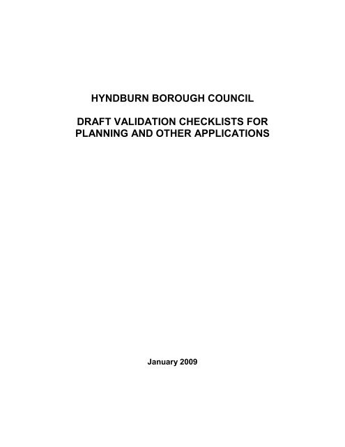
HYNDBURN BOROUGH COUNCILDRAFT VALIDATION CHECKLISTS FORPLANNING AND OTHER APPLICATIONSJanuary 2009
It is possible to attach all plans and statements and to pay the fee using thePlanning Portal service. Applicants will save time and money using this serviceas there is no need to print off documents or to post information to the localplanning authority.However, should applicants wish to still submit applications in written form therewill be a requirement for 3 copies of each document, plan and form. Ifapplications are submitted in written form an electronic version must also besubmitted. Cheques for the planning fee should be made payable to <strong>Hyndburn</strong><strong>Borough</strong> <strong>Council</strong>. A schedule of planning application fees can be found atwww.planningportal.gov.ukNote: Whilst the <strong>Council</strong> may validate an outline application it may nonethelessask for additional information within one month of receipt of the applicationshould the submission of such information subsequently be consideredfundamental to the assessment of an outline application.Applications should be sent to:<strong>Hyndburn</strong> <strong>Borough</strong> <strong>Council</strong>Planning and TransportationScaitcliffe HouseOrmerod StreetAccringtonLancashireBB5 0PFApplicants and agents are advised that applications will be returned in fullif after 21 days requested information has not been submitted to the localplanning authority. Such an application would be incomplete and thereforenot valid for registration purposes.3
FULL AND OUTLINE APPLICATIONS (INCLUDING HOUSEHOLDER APPLICATIONS)1A. NATIONAL COMPULSORY REQUIREMENTSPLANNINGAPPLICATIONS1. FULLAPPLICATION:New building,extension orengineeringworks2. FULLAPPLICATION:Change of usewith noexternalbuilding/extension/engineeringworks3. FULLAPPLICATION:Change of usewith externalbuilding/extension/engineeringworks4. FULLAPPLICATION:HouseholderApplication5. OUTLINEPLANNINGAPPLICATIONS1. Completedstandard planningapplication formsigned & datedYesSee Note N1YesSee Note N1YesSee Note N1YesSee Note N1YesSee Note N12. Correct Fee YesSee Note N2YesSee Note N2YesSee Note N2YesSee Note N2YesSee Note N23. Completedcertificates A, B, C, orD (inc. AgriculturalHoldings Cert)YesSee Notes N3, N4& N5YesSee Notes N3,N4 & N5YesSee Notes N3,N4 & N5YesSee Notes N3,N4& N5YesSee Notes N3, N4& N54. Location plan at1:1250 or 1:2500 scaleYesSee Note N6YesSee Note N6YesSee Note N6YesSee Note N6YesSee Note N64
5. Site/block plan ofthe site at 1:200 or1:500YesSee Note N7YesSee Note N7YesSee Note N7YesSee Note N7YesSee Note N76. Existing &proposed floor plans1:50 or 1:100YesSee Note N8YesSee Note N8YesSee Note N8YesSee Note N8Only if Layout forapproval.Illustrative layoutneeded in allcases.7. Existing &proposed elevations(including roof plans)1:50 or 1:100YesSee Note N9NoYesSee Note N9YesSee Note N9Only ifAppearance forapproval8. Existing &proposed sitesections and finishedfloor levels at 1:50 or1:100YesSee Note N10NoYesSee Note N10YesSee Note N10Only if Layout,Scale orAppearance forapproval9. Design & AccessStatementYes No Yes No (Unless in aConservationArea)Yes5
10. EnvironmentalStatementSee Note N12 See Note N12 See Note N12 No See Note N126
1B. ADDITIONAL LOCAL REQUIREMENTSPLANNINGAPPLICATIONS1. FULLAPPLICATION:New building,extension orengineeringworks2. FULLAPPLICATION:Change of usewith no externalbuilding/extension/engineeringworks3. FULLAPPLICATION:Change of usewith externalbuilding/extension/engineeringworks4. FULLAPPLICATION:HouseholderApplication5. OUTLINEPLANNINGAPPLICATIONS11. Details of anypre-applicationdiscussionYesSee Note L1YesSee Note L1YesSee Note L1YesSee Note L1YesSee Note L112. Flood RiskAssessment13. Supportingplanningstatement14. Parkingarrangements &cycle storage15. Refusestorage/recyclingSee Note L7 See Note L7 See Note L7 See Note L7 See Note L7See Note L2 See Note L2 See Note L2 No See Note L2See Note L5 See Note L5 See Note L5 Only if existingarrangements areaffected.See Note L5Only if layoutapplied forSee Note L5See Note L18 See Note L18 See Note L18 No Only if layoutapplied forSee Note L187
16.Landscapingproposals17.ContaminatedLand Survey18. TransportAssessment19. GreenTravel Plan20. RetailImpactAssessment21. Planningobligations22Statement ofCommunityInvolvementSee Note L13 No See Note L13 No Only if landscapingapplied for.See Note L13See Note L8 No See Note L8 No See Note L8Depends on scaleSee Note L3Depends on scaleSee Note L4Depends on scaleSee Note L6Depends on scaleSee Note L3Depends on scaleSee Note L4Depends on scaleSee Note L6Depends on scaleSee Note L3Depends on scaleSee Note L4Depends on scaleSee Note L6NoNoNoYes if layoutand/or accessapplied for.See Note L3NoDepends on scaleSee Note L6See Note L26 See Note L26 See Note L26 No See Note L26See Note L27 See Note L27 See Note L27 No See Note L2723. Tree Survey See Note L12 No See Note L12 See Note L12 See Note L1224. Structural See Note L9 YesNo No See Note L9SurveySee Note L925. EcologicalSurveySee Note L15 See Note L15 See Note L15 No See Note L158
26. EnergyStatement27. Ventilation/extractiondetails28. NoiseImpactAssessment29. Air QualityAssessment30. UtilitiesStatement31. Details ofany lightingscheme32.Photographs &Photomontage33. PastureManagementPlanDepends on scaleSee Note L25Depends on scaleSee Note L25Depends on scaleSee Note L25See Note L21 See Note L21 See Note L21 No NoNoDepends on scaleSee Note L25See Note L19 See Note L19 See Note L19 No See Note L19See Note L20 See Note L20 See Note L20 No See Note L20See Note L10 See Note L10 See Note L10 No See Note L10See Note L22 See Note L22 See Note L22 No See Note L22See Note L23 No See Note L23 No If appearanceapplied forSee Note L23See note L24 See Note L24 See Note L24 No See Note L2434. Open Space See note L14 No See note L14 No See Note L1435. EnergyStatementSee note L25 No See Note L25 No See Note L259
36. DrainageAssessmentSee Note L11 See Note L11 See Note L11 No See Note L1137.ArchaeologicalAssessment38 ListedBuildings/ConservationAreaAssessmentSee Note L15 No See Note L15 No See Note L15See Note L17 See Note L17 See Note L17 See Note L17 See Note L1710
RESERVED MATTERS APPLICATIONS1A. NATIONAL COMPULSORY REQUIREMENTSRESERVED MATTERS APPLICATIONS1. Correct fee Yes - See Note N22. Completed application form signed & dated Yes – See Note N13. Completed Certificate A, B, C or D &Agricultural Holdings CertificateNo4. Location to 1:1250 or 1:2500 scale Yes – See Note N65. Site/block plan to a scale not smaller than1:5006. Existing & proposed floor plans at a scale notsmaller than 1:1007. Existing & proposed elevations including roofplans at a scale not smaller than 1:1008. Existing & proposed site sections & finishedfloor levels at a scale not smaller than 1:100Yes - See Note N7Only if layout for approvalOnly if appearance forapprovalOnly if layout, scale orappearance for approval9. Design & Access Statement No10. Environmental Statement No11
RESERVED MATTERS APPLICATIONS1B. ADDITIONAL LOCAL REQUIREMENTSRESERVED MATTERSAPPLICATIONS11. Details of any pre-application Yesdiscussion12. Flood Risk Assessment If not approved at outline stage See13. Parking Arrangements/cyclestorageNote L7If not approved at outline stage SeeNote L514. Refuse storage/recycling details If not approved at outline stage SeeNote L1815. Landscaping proposals/TreesurveyIf not approved at outline stage SeeNotes L12 & L1316. Contaminated Land Survey If not approved at outline stage SeeNotes L817. Green Travel Plan If not approved at outline stage SeeNotes L418. Ecological Survey If not approved at outline stage SeeNotes L1519. Energy Statement If not approved at outline stage SeeNotes L2520. Noise Impact Assessment If not approved at outline stage SeeNotes L1921. Air Quality Assessment If not approved at outline stage SeeNotes L2022. Utilities Statement If not approved at outline stage SeeNotes L1023. Details of any lighting scheme If not approved at outline stage SeeNotes L2224. Photographs & Photomontage Only if appearance applied for SeeNote L2325. Pasture Management Plan If not approved at outline stage SeeNotes L2426. Open Space If not approved at outline stage SeeNotes L1412
27. Energy Statement If not approved at outline stage SeeNotes L2528. Drainage Assessment If not approved at outline stage SeeNotes L1129. Archaeological Assessment If not approved at outline stage SeeNotes L1630 Listed Buildings/Conservation Area AssessmentIf not approved at outline stage SeeNotes L1713
LISTED BUILDING AND CONSERVATION AREA CONSENT APPLICATIONS1A NATIONAL COMPULSORY REQUIREMENTSLISTED BUILDING &CONSERVATION AREACONSENT1. Completed applicationform, signed & dated2. Completed copies ofCertificates A, B, C or D3. Location plan to 1:1250or 1:2500 scale4. Site/block plan of thesite at a scale not smallerthan 1:5005 Existing & proposedfloor plans at a scale notsmaller than 1:1006. Existing & proposedelevations including roofplans at a scale notsmaller than 1:1007. Existing & proposedsite sections & finishedfloor levels at a scale notsmaller than 1:1007. Design & AccessStatementLISTED BUILDINGCONSENT –ALTERATIONS,EXTENSION ORDEMOLITIONYesSee Note N1YesSee Notes N3, N4 & N5YesSee Note N6YesSee Note N7YesSee Note N8YesSee Note N9YesSee Note N10YesCONSERVATIONAREA CONSENTFOR DEMOLITIONYesSee Note N1YesSee Notes N3, N4 &N5YesSee Note N6Yes, sufficient toidentify proposedworksSee Note N7NoSufficient to identifyproposed worksSee Note N9Sufficient to identifyproposed worksSee Note N10No14
1B ADDITIONAL LOCAL REQUIREMENTSLISTED BUILDING &CONSERVATION AREA CONSENTLISTEDBUILDING8. Sections through the building May berequired.Please checkprior tosubmission9. Detailed plans to a scale notsmaller than 1:20. showing all newdoors, windows, shop-fronts,panelling, fireplaces, plastermoulding & other decorativedetails10. Details of any pre-applicationdiscussion11. Structural survey of thebuilding12. Supporting planning, heritageand method StatementMay berequired.Please checkprior tosubmissionYesMay berequired.Please checkprior tosubmissionYesCONSERVATIONAREA CONSENTMay be required.Please check prior tosubmission.NoYesYes if instability isreason for demolitionMay be required.Please check prior tosubmission.13. Photographs May be required May be required15
APPLICATIONS FOR ADVERTISEMENT CONSENT1A. NATIONAL COMPULSORY REQUIREMENTSADVERTISEMENT CONSENTADVERTISEMENT1. Advertisement application form, signed & dated Yes - See Note N12. Correct Fee Yes – See Note N23. Location plan to 1:1250 or 1:2500 scale Yes – See Note N64. Plans and elevations to a scale of 1:50 or 1:100,showing size & position of advertisements onbuilding or land, height above ground level,amount of projection, sections, materials,colours, method of fixingYes – See Notes N7 &N95. Details of method of illumination Required for illuminatedadvertisements. SeeNote L226. Supporting statement addressing amenity &public safetyYes. See Note L216
APPLICATIONS FOR A LAWFUL DEVELOPMENT CERTIFICATE FOR ANEXISTING USE, OPERATION OR ACTIVITY (S191 APPLICATION)1A. NATIONAL COMPULSORY REQUIREMENTSThe burden of proof in a Lawful Development Certificate application is firmly withthe applicant and therefore sufficient and precise information should be provided.191 APPLICATION S191Application1. Completed form Yes2. Correct Fee Yes3. Location plan to a scale of 1:1250 or 1:2500 with north Yespoint & site edged red4. Such evidence verifying the information included in the Yesapplication as can be provided1B. ADDITIONAL LOCAL REQUIREMENTS FOR S191 APPLICATIONSAdditional information sufficient to prove the Lawful Use/activity/operation. Thismay include the following:191 APPLICATION S191 Application5. Existing elevations at a scale of 1:50 or 1:100 Seek advice at preapplicationstage6. Existing floor plans at a scale of 1:50 or 1:100 Seek advice at preapplicationstage7. Existing site survey plan at 1:50 or 1:100 Seek advice at preapplicationstage8. Additional information in the form ofsupporting information or swore affidavitsSeek advice at preapplicationstage9. Dated photographs Seek advice at preapplicationstage17
APPLICATIONS FOR A LAWFUL DEVELOPMENT CERTIFICATE FOR APROPOSED USE OR DEVELOPMENT (S192 APPLICATIONS)1A. NATIONAL COMPULSORY REQUIREMENTS FOR s. 192 APPLICATIONS192 APPLICATION S192Application1. Completed form Yes2. Correct Fee Yes3. Location plan to a scale of 1:1250 or 1:2500 with north Yespoint & site edged red4. Such information sufficient to illustrate the proposed Yeswork or explain the proposed use1B. ADDITIONAL LOCAL REQUIREMENTS FOR S192 APPLICATIONSelevations at a scale of 1:50 or 1:1007. Planning statement to explain the proposed workor explain the existing and proposed uses192 APPLICATION S192 Application5. Existing site survey plan at 1:50 or 1:100 Seek advice at preapplicationstage6. Existing and proposed site plans, floor plans and Seek advice at preapplicationstageSeek advice at preapplicationstage18
NOTES TO ACCOMPANY CHECKLISTSNATIONAL REQUIREMENTSN1COMPLETED APPLICATION FORMAll of the relevant questions should be answered and if not relevant to theapplication, then the words “not applicable” should be inserted for clarity.See also ownership certificates below.N2CORRECT FEEWhere it is necessary to pay a fee for the application, this can either be paid bycheque, cash or on-line. Cheques should be made payable to <strong>Hyndburn</strong> <strong>Borough</strong><strong>Council</strong>. A planning application will not be considered valid until the appropriatefee has been received.N3OWNERSHIP CERTIFICATESUnder the 1990 Act all applications must be accompanied by the relevantcertificates concerning the ownership of the application site. This applies to allapplications except those for the approval of reserved matters, discharge orvariation of conditions, works to protected trees and consent to displayadvertisements.For this purpose an ‘owner’ is anyone with a freehold interest, or leaseholdinterest the unexpired term of which is not less than 7 years.• Certificate A must be completed when the applicant is the sole owner ofthe site.• Certificate B must be completed when the owner of the site is known tothe applicant• Certificate C and D must be completed when some or none of the ownersof the site are known.N4AGRICULTURAL HOLDINGS CERTIFICATEThis certificate is required whether or not the site includes an agricultural holdingand all tenants must be notified prior to the submission of an application. ThisCertificate follows the Ownership Certificates at Question 25 of the planningapplication form. This certificate is not required for the submission of anapplication for reserved matters, a renewal of temporary planning permission, thedischarge or variation of conditions, works to protected trees, or consent todisplay advertisements.19
N5ARTICLE 6 NOTICESIf certificate B has been completed (see Note N3) a copy of the Article 6 noticemust be served on all the owners of the site in question. This may be requiredwhere Certificate C has been served or when some of the owners are known.For this purpose an ‘owner’ is anyone with a freehold interest, or leaseholdinterest the unexpired term of which is not less than 7 years.N6LOCATION PLANAll applications must be accompanied by an up to date standard location plan toOrdnance Survey quality at a scale of 1:1250 or 1:2500 with north point. Thelocation plan should show at least two named roads and surrounding buildings.The surrounding buildings should be named or numbered to ensure it is clearwhere the exact location of the application site is. On the location plan, theapplication site must be clearly marked with a red line and should include all theland required to carry out the proposed development. On the location plan, anyother land in the control or ownership of the applicant which is close to oradjacent to the application site, should be marked with a blue line. An appropriatelocation plan may be purchased from Development Control, Scaitcliffe House,Ormerod Street Accrington, Lancashire, BB5 0PFN7SITE PLANAll applications should include a site plan at a scale of either 1:500 or 1:200. Thesite plan should accurately show:• The direction of north,• The proposed development in relation to the site boundaries and otherexisting buildings on site, with written dimensions including those to theboundaries,• All the buildings, roads and footpaths on land adjoining the site includingaccess arrangements,• The species, position and spread of all trees within 12 metres of anyproposed building works,• The extent and type of any hard surfacing,• Boundary treatment including walls/fencing where this is proposed.N8DRAWINGS INCLUDING FLOOR PLANSThe drawings should be drawn at a scale, preferably 1:50 or 1:100 and shouldexplain the proposal in detail. The submitted drawings should show details of theexisting buildings and those for the proposed development. The proposeddevelopment should be shown in context with any adjacent buildings (includingproperty numbers where appropriate).N9ELEVATIONS20
The drawings of the elevations should be drawn to a scale, preferably 1:50 or1:100 and all sides of the proposal must be shown. Where a proposed elevationadjoins another building or is in close proximity (2 metres), the drawing shouldclearly show the relationship between the two and detail the positions of anyopenings on each property.N10SECTION DRAWINGSSection drawings should be drawn at a scale of 1:50 or 1:100, showing a crosssection through the proposed building(s) and must be submitted in the followingcases:i) Where a proposal involves a change in ground levels – drawings should besubmitted to show both existing and finished levels.ii) On sloping sites – full information is required concerning alterations to levels,the way in which a proposal sits within the site and in particular the relative levelsbetween existing and proposed buildings.Wherever possible, the drawings should contain existing site levels and finishedfloor levels (with levels related to a fixed datum point off-site) and also show theproposals in relation to adjoining buildings. Section drawings may also berequested in other cases by the planning officer. The drawings may take the formof contours, spot levels or cross/long sections as appropriate.N11DESIGN AND ACCESS STATEMENTThe design and access statement should cover several key aspects, including:1. details of the use or uses proposed2. the amount of development3. the layout of the development4. the scale of the development5. any landscaping of the site6. the appearance of the development7. the access to the development and any parking arrangementsAdditional information is also required for outline applications, even if layout,scale and access are reserved. As a minimum outline applications shouldalways include information on:1. Use – the use or uses proposed and any distinct development zoneswithin the site identified,2. Amount of development – amount proposed for each use,3. Indicative layout – including separate zones proposed within the siteboundary as appropriate,4. Scale parameters – an indication of the upper and lower limits for height,width and length of each building,21
5. Indicative access points – an area or areas in which the access point orpoints will be located.• DCLG Circular 01/2006: Guidance on the Changes to the DevelopmentControl System• CABE: Design and Access Statements – How to write, read and use them.2006.• PPS1: Delivering Sustainable Development.• DCLG/Department for Transport: ”Manual for Streets” 2007.Further guidance is available from CABE – www.cabe.org.ukN12ENVIRONMENTAL STATEMENTThe Town and Country Planning (Environmental Impact Assessment) (Englandand Wales) Regulations 1999 require a developer to prepare an EnvironmentalStatement to enable the local planning authority to give proper consideration tothe likely environmental effects of the proposal.Environmental Impact Statements (EIA) are required for major developmentsover a certain size or where there would be a significant impact on the localenvironment. The Regulations provide a <strong>checklist</strong> of matters to be considered forinclusion in the Environmental Statement and require the developer to describethe likely significant effects of a development on the environment and to set outany proposed mitigation measures.The applicant may submit an application to the <strong>Council</strong> for a Screening Opinionfor a definitive decision as to whether an EIA is required.• Town and Country Planning (Environmental Impact Assessment) (Englandand Wales) Regulations 1999.• Circular 02/99: Environmental Impact Assessment.22
LOCAL REQUIREMENTSAdditional information may also be required by the <strong>Council</strong> prior to the <strong>validation</strong>of the application depending on the nature and type of application or the natureof the character of the area within which the application site is located. Applicantsor agents are advised to seek advice on the need for such additional informationwith the local planning authority at the pre-submission stage. Such informationcould include:L1DETAILS OF ANY PRE-APPLICATION DISCUSSIONSWe positively encourage all prospective applicants to discuss their proposals withus before they submit their applications. Such pre-application discussions willensure that the application has the best chance of success and that theinformation required is identified at the outset thus speeding up the decisionmaking process. General guidance on the submission of an application can beobtained during normal office hours but for larger schemes we recommendarranging a meeting for more detailed discussions with the Planning CaseOfficer.For major schemes the <strong>Council</strong> is able to provide a team approach to preapplicationdiscussions involving officers from other departments and also fromother organisations where appropriate. The Planning Case Officer will be able toadvise on relevant development plan policies and how the development would bejudged against those policies, and in many cases be able to give an informalview on proposed developments although the final outcome on any applicationcan only be made following full consideration of a formal application.Applications for Major proposals (10 dwellings or more or 1000m 2 floorspace andabove or, in the case of outline applications sites of 0.5ha or more) must havebeen the subject of pre-application discussions prior to submission. If no suchdiscussions have taken place the application will be treated as invalid.If an application is submitted following pre-application discussions with the localplanning authority, all correspondence should be submitted as backgroundinformation to the application, especially if any pre-application consultations havebeen carried out with other statutory consultees. It may be sufficient to includethis information on the planning application forms if consultation is minimal. Astatement of community involvement will also be required in cases of Majorapplications.L2SUPPORTING PLANNING STATEMENTThe information provided should explain how the proposal relates in policy termsto national, regional, strategic and local level. Statements will be required in23
support of all “major” developments and for developments not in accordance withthe development plan as well as other developments if specified in preapplicationadvice.L3TRANSPORT ASSESSMENTTransport Assessments (TA) are required for all major residential or commercialdevelopments. A simple assessment will be required for all developments over500m 2 gross floor area. A full TA will be necessary for developments over1000m 2 . The full TA thresholds are set out in the Joint Lancashire StructurePlan 2001-16. A Transport Assessment will include all existing vehicular andpedestrian movements to and from a site, together with servicing, manoeuvringand car parking arrangements. It should describe and analyse existing transportconditions, hoe the development would affect those conditions and anymeasures proposed to overcome any problems.• PPG13: Transport• Joint Lancashire Structure Plan 2001-16 “SPG Access and Parking” and“Parking Standards”.• Department for Transport: “Guidance on Transport Assessment”. March2007.Contact: David Law, Lancashire County <strong>Council</strong>, Highways, Willows Lane Depot, Willows Lane,Accrington, BB5 0RT (Telephone: 01254 770965 E-mail: David.Law@lancashire.gov.ukL4GREEN TRAVEL PLANA Green Travel Plan should outline the way in which the transport implications ofthe development are going to managed in order to ensure the minimumenvironmental, social and economic impacts. It should seek to promote moresustainable methods of transport other than the private car.A Green Travel Plan should be submitted with all larger retail, employment,leisure and educational schemes and wherever specified during pre-applicationdiscussions. Thresholds for Travel Plans are set out in the Joint LancashireStructure Plan 2001-16• PPG13: Transport• Joint Lancashire Structure Plan 2001-16 “SPG Access and Parking” and“Parking Standards”.Contact: Jane Swindlehurst, Business TravelWise Team, Lancashire County <strong>Council</strong>, P.O. Box9, Guild House, Cross Street, Preston, PR1 8RD (Tele 01772 532415). www.lancashire.gov.uk.L5PARKING ARRANGEMENTS AND CYCLE STORAGE24
All applications will be required to provide details of existing and proposedparking provision. Applications will be considered against maximum parkingstandards as contained in the Joint Lancashire Structure Plan.• PPG13: Transport• Joint Lancashire Structure Plan 2001-16 “SPG Access and Parking” and“Parking Standards”.L6RETAIL ASSESSMENT/TOWN CENTRE IMPACT ASSESSMENTREPORTPPS 6: Planning for Town Centres sets out government guidance on proposedretail developments. Assessments are required for all edge of centre and out ofcentre retail proposals over 200m 2 . The Assessment should address all the testsset out in PPS6 including the need, both quantitative and qualitative, for thedevelopment, the appropriateness of the scale of the development and its impacton town centres, the accessibility of the site and should show that a sequentialapproach to site selection has been followed. The sequential approach to siteselection should also apply to significant leisure and office developments.• PPS 6: Planning for Town CentresL7FLOOD RISK ASSESSMENTSFor all developments within areas of the borough identified as having floodingpotential or for all “Major” applications, regardless of the location of the site, aFlood Risk Assessment will be required. Such areas have been identified by theEnvironment Agency and may be viewed at www.pipernetworking.com.Assessments should address the issue of flood risk to both property and peopleand be carried out in accordance with guidance set out in PPG25: Developmentand Flood Risk.• PPS25: Development and Flood Risk• Preparing for Floods (DETR 2002)Contact: Phillip Carter, Planning Liaison Officer, Environment Agency, PO Box 519, SouthPreston, Lancashire, PR5 8GD (Tele 01772 714219) E-mail philip.carter@environmentagency.gov.uk.L8CONTAMINATED LAND SURVEYA survey of the application site may be required to establish the degree ofcontamination and remedial measures may be necessary. Contamination mayresult from a previous use of the site or from migrating landfill gas. Details ofpotentially contaminated sites within the borough are set out in the <strong>Council</strong>’sContaminated Land Inspection Strategy carried out in June 2001 (updated 2004).The <strong>Council</strong> will normally expect a Phase I Desk Study to be submitted for any25
application which results in a sensitive end use on a site where such a site is ormay be contaminated by virtue of previous uses. If the site is known or identifiedas having high levels of contamination on site, a Phase II Intrusive InvestigationSurvey may also be required.• PPS23: Planning and Pollution Control & AnnexesContact: Nicola Briggs, <strong>Hyndburn</strong> <strong>Borough</strong> <strong>Council</strong>, Environmental Health, 20 Cannon Street,Accrington, Lancashire, BB5 1NJ. (Tele 01254 3806230) E-mailnicola.briggs@hyndburnbc.gov.uk.L9STRUCTURAL SURVEYAll applications for the conversion of barns or other buildings outside the urbanareas will require a Structural Survey. This must be carried out by a competentperson and give an appraisal of the structural stability of the building, identifyclearly any re-building works and include a schedule of works necessary to carryout the conversion.L10UTILITIES STATEMENTUtilities statements should demonstrate that:• the availability of utility services has been examined and that the proposalwould not result in undue stress on the delivery of those services to the widercommunity• the proposals incorporate any utility company requirements for substations,telecommunications equipment or similar structures• service routes have been planned to avoid as far as possible the potential fordamage to trees & archaeological remains.Utilities statements may be required to accompany applications for residentialdevelopments of 10 or more dwellings, or the creation of 1000 square metres ormore of floor space.Contact: Lesley Johnson, United Utilities,Lingley Mere Business Park, Lingley GreenAvenue,Great Sankey, Warrington, WA5 3LP. E-mail Lesley.Johnson@uupplc.co.ukL11DRAINAGE ASSESSMENTDetails of how the site will be drained, including foul and surface water drainageshould form part of the application. This is of particular importance in areasoutside the mains drainage area. Larger development schemes shouldinvestigate the use of Sustainable Urban Drainage Systems.• Circular 03/99 Planning Requirement in respect of the Use of Non-MainsSewerage incorporating Septic Tanks in New Development• PPS23: Planning and Pollution Control & Annexes26
Contact: Philip Carter, Planning Liaison Officer, Environment Agency, PO Box 519, SouthPreston, Lancashire, PR5 8GD (Tele 01772 714219) E-mail philip.carter@environmentagency.gov.uk.L12TREE SURVEYA Tree Survey, including a Tree Constraints Plan and a Tree Protection Planmust be provided for all developments which impact on significant trees either onthe application site or on an adjoining site. Where trees are protected by a TreePreservation Order such a survey is essential. The location of any trees withinadjacent properties that may be affected by the application should also beshown. The Tree Survey will include a plan with trees and their canopiesaccurately plotted, a schedule of the species and condition of each tree, withrecommendations for work. Plans should identify trees to be felled and/or prunedand a statement of measures to protect retained trees during construction shouldbe included.• British Standard 5837:2005 – Trees in Relation to Construction –RecommendationsContact: Philip Johnson, Trees and Woodlands Officer, Planning and Transportation, <strong>Hyndburn</strong><strong>Borough</strong> <strong>Council</strong>, Scaitcliffe House, Ormerod Street, Accrington, Lancashire, BB5 0PF. (Tele01254 380178). Philip.johnson@hyndburnbc.gov.ukL13LANDSCAPING PROPOSALSLandscaping is an important constituent of the development of a site and detailedhard and soft landscaping should be given as much consideration as the otherelements of the overall design of the site. Reference should be made to thelandscaping of the site within the Design & Access Statement. Although in someinstances it is possible to deal with the detailed landscape design by planningcondition, where the site is in a prominent location or in areas of high townscapevalue or in rural areas a Landscaping Scheme, including species and numbers ofplants and a schedule of surfacing materials should be submitted with theapplication. Existing trees and other vegetation should be retained whereverpracticable and protected during the construction of the proposed development.Landscaping schemes should include:• proposed ground levels, means of enclosure, car parking layouts, othervehicle and pedestrian access and circulation areas, hard surfacingmaterials, structures including street furniture.• proposed and existing functional services above and below ground, (e.g.drainage, power/communication cables, manholes)• planting plans, schedules of plants, noting species, plant sizes & proposednumbers/planting densities where appropriate27
• existing vegetation to be retained, together with measure for its protectionduring the construction process.• details of long term maintenance and management.Contact: Philip Johnson, Trees and Woodlands Officer, Planning and Transportation, <strong>Hyndburn</strong><strong>Borough</strong> <strong>Council</strong>, Scaitcliffe House, Ormerod Street, Accrington, Lancashire, BB5 0PF. (Tele01254 380178). Philip.johnson@hyndburnbc.gov.ukL14OPEN SPACE PROPOSALSApplications for residential developments should include proposals for theprovision of appropriate areas of open space, including amenity space, playingfields and play space. In some cases where there is an abundance of openspace in the locality it might be appropriate, in lieu of the provision of on-siteopen space for a developer to make a financial contribution towards theprovision, enhancement or maintenance of existing nearby open space and playareas. Provision should be made in accordance with the <strong>Council</strong>’s Policy onOpen Space and the application should include details of long term maintenanceand management of any on-site open space to be provided.Contact: Andrew Hayhurst, Works Services - Parks and Open Spaces Officer, <strong>Hyndburn</strong><strong>Borough</strong> <strong>Council</strong>, , Accrington, Lancashire, BB5 0RT. (Tele 01254 380178).andrew.hayhurst@hyndburnbc.gov.ukL15ECOLOGICAL SURVEYEcological Surveys are required where a development impacts on any SSSI orSites of Local/Natural Biological Importance, Biological Heritage Sites or WildlifeLinks or Corridors. These sites are shown in the Proposals Map of the <strong>Hyndburn</strong><strong>Borough</strong> Local Plan but, since the approval of the Plan, additional sites havebeen identified. In addition a survey should assess the implications of theproposed development upon the wildlife present within the locality, including anymeasures for mitigating the impact. Barn conversions, in particular, will require asurvey to identify the existence of habitats. Surveys and remediation measuresmust be in line with the Key Principles and the Government’s Objectives as setout in PPS 9: Biodiversity and Geological Conservation.• PPS 9: Biodiversity and Geological Conservation.Contact: Sarah Manchester, Ecologist, - Natural and Historic Environment Service, EnvironmentDirectorate, Lancashire County <strong>Council</strong>, P.O. Box 9, Guild House, Cross Street, Preston, PR18RD (Tele 01772 531551). E-mail: Sarah.Manchester@lancashire.gov.ukL16ARCHAEOLOGICAL ASSESSMENTWhere an application affects any known or suspected archaeological site anArchaeological Assessment prepared by a competent person must be submitted.28
• PPG15:Planning and the Historic Environment – paragraphs 3.16 – 3.19Contact: Reg Morley, Special Advisory Services Team Leader, Environment Directorate,Lancashire County <strong>Council</strong>, P.O. Box 9, Guild House, Cross Street, Preston, PR1 8RD (Tele01772 531551). E-mail: reg.morley@lancashire.gov.ukL17LISTED BUILDING AND CONSERVATION AREA ASSESSMENTSA written statement which includes a schedule of works to the listed building andan analysis of the significance of archaeology, history and character of thebuilding/structure, the principles of and justification for the proposed works andtheir impact on the special character of the listed building or structure, its settingand the setting of adjacent listed buildings may be required. The scope anddegree of detail necessary in the written justification will vary according to theparticular circumstances of each application.• PPG15:Planning and the Historic Environment – paragraphs 3.16 – 3.19and paragraphs 4.25 – 4.49Contact: Carolyn Baker, Senior Planner, Planning and Transportation, <strong>Hyndburn</strong> <strong>Borough</strong><strong>Council</strong>, Scaitcliffe House, Ormerod Street, Accrington, Lancashire, BB5 0PF. (Tele 01254380148). E-mail carolyn.baker@hyndburnbc.gov.uk.L18REFUSE STORAGE FACILITIES/RECYCLING DETAILSAll proposals which will include the creation new dwellings or new retail,business, industrial developments will be required to submit details of theproposed facilities for the storage & collection of refuse, as well as for theprovision of recycling facilities.Contact: Steve Riley, Waste Services Manager, Works Services, <strong>Hyndburn</strong> <strong>Borough</strong> <strong>Council</strong>,Willows Lane Depot, Willows Lane, Accrington, Lancashire, BB5 0RT. (Tele 01254 356220 ). E-mail steve.riley@hyndburnbc.gov.uk.L19NOISE IMPACT ASSESSMENTProposals which raise issues of noise disturbance or are considered to be noisesensitive development should be supported by a Noise Impact Assessmentprepared by a competent person. A Noise Impact Assessment should includeinformation, including measurements, of existing and proposed noise levels andalso recommend, where appropriate, mediation measures.• PPG24: Planning and NoiseContact: Richard Roberts, <strong>Hyndburn</strong> <strong>Borough</strong> <strong>Council</strong>, Environmental Health, 20 Cannon Street,Accrington, Lancashire, BB5 1NJ. (Tele 01254 3806230) E-mailrichard.roberts@hyndburnbc.gov.uk.29
L20AIR QUALITY ASSESSMENTProposals which impact on air quality or are potential pollutants should besupported by an Air Quality Assessment prepared by a competent person. TheAssessment should provide information on existing and proposed air quality andinclude mitigation measures where appropriate.• PPS23: Planning and Pollution ControlContact: Nicola Briggs, <strong>Hyndburn</strong> <strong>Borough</strong> <strong>Council</strong>, Environmental Health, 20 Cannon Street,Accrington, Lancashire, BB5 1NJ. (Tele 01254 3806230) E-mailnicola.briggs@hyndburnbc.gov.uk.L21VENTILATION/EXTRACTION DETAILSApplications for hot food takeaways, restaurants or launderettes should containdetails of any measures required to ameliorate the impacts of these uses. Detailsof the ventilation and extraction systems will be required for all applicationsinvolving the use of premises for purpose within the Classes A3 & A5, as definedby the Town & Country Planning (Use Classes Order) (Amended 2006).The details should either include elevational drawings of the ducting & flues andfilters proposed or in the case of non listed buildings &/or sites outsideconservation areas written details of what would be provided including likely size,materials and position of flues. In the case of the latter planning conditions willbe imposed if the application is approved.Contact: Nicola Briggs, <strong>Hyndburn</strong> <strong>Borough</strong> <strong>Council</strong>, Environmental Health, 20 Cannon Street,Accrington, Lancashire, BB5 1NJ. (Tele 01254 3806230) E-mailnicola.briggs@hyndburnbc.gov.uk.L22LIGHTING SCHEME INCLUDING A LIGHT POLLUTION ASSESSMENTDetails of a lighting scheme will be required on applications for consent to displayan advertisement, where it is proposed to illuminate the advertisement. Detailswill also be required for riding arenas, the lighting of sports pitches and buildings.L23PHOTOGRAPHS AND PHOTOMONTAGESThese can provide useful background information and can help to show largedevelopments can be satisfactorily integrated within the street scene.Photographs should be provided if the proposal involves the demolition of anexisting building or development affecting a conservation area or a listedbuilding. Photomontages will be required for applications for wind turbines.L24PASTURE MANAGEMENT PLAN30
These will be required for applications for equine related development includingstables. Such a document should detail the number of horses to be kept on theland, the amount of land available for horse grazing and measures to ensure thatthe land does not become churned up.• British Horse Society (Pasture Management)• Countryside Agency: “Horses in the Countryside”• Countryside Agency: “Horse Pasture Management Study”L25ENERGY STATEMENTFor major planning applications (10 or more dwellings or 1000m 2 or more) therewill be a requirement to submit an Energy Statement. The statement shouldpredict the energy demands of the proposed development and examine possiblesources of on-site renewable energy with a view to showing how at least 10% ofthe energy requirements of the development can be provided for by on-siterenewables.• PPS1: Delivering Sustainable Development• Supplement to PPS1: Planning and Climate Change• PPS 22: Renewable Energy.L26PLANNING OBLIGATIONSApplicants should clarify in pre-application discussions with the local planningauthority any required planning obligations. Where such requirements havebeen identified a Heads of Terms document should be submitted with theplanning application for inclusion in a Section 106 Agreement or a UnilateralUndertaking.• Circular 05/2005: Planning Obligations• DCLG – Planning Obligations: Practice Guidance. July 2006• Lancashire Planning Officers: Planning Obligations in Lancashire PolicyPaper. June 2006L27STATEMENT OF COMMUNITY INVOLVEMENTApplications may need to be supported by a statement setting out how theapplicant has complied with the requirements for pre-application consultation setout in the local planning authority’s adopted Statement of CommunityInvolvement and demonstrating that the views of the local community have beensought and taken into account in formulating the development proposals.• <strong>Hyndburn</strong> <strong>Borough</strong> <strong>Council</strong>: Statement of Community Involvement• A Companion Guide to PPS12: Creating Local Development Frameworks31