

Aerial Ropeways - Environmental Clearance
Aerial Ropeways - Environmental Clearance
Aerial Ropeways - Environmental Clearance

You also want an ePaper? Increase the reach of your titles
YUMPU automatically turns print PDFs into web optimized ePapers that Google loves.
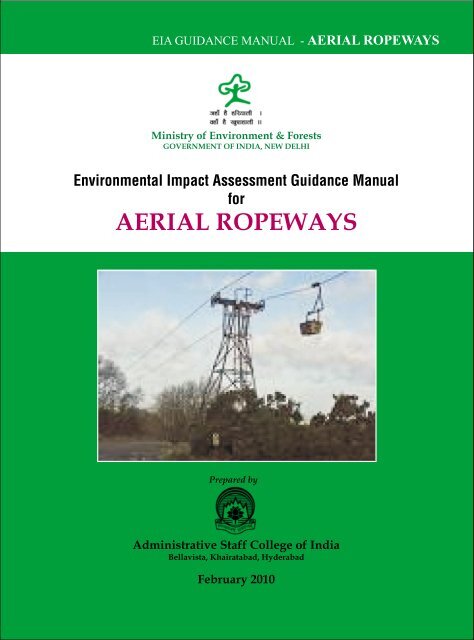
EIA GUIDANCE MANUAL - AERIAL ROPEWAYSMinistry of Environment & ForestsGOVERNMENT OF INDIA, NEW DELHI<strong>Environmental</strong> Impact Assessment Guidance ManualforAERIAL ROPEWAYSPrepared byAdministrative Staff College of IndiaBellavista, Khairatabad, HyderabadFebruary 2010
<strong>Environmental</strong>Impact Assessment Guidance Manualfor<strong>Aerial</strong><strong>Ropeways</strong>
Siripurapu K. RaoM.A. (Cantab), Ph.D. (Cantab)DIRECTOR GENERALLeadership through LearningAcknowledgements<strong>Environmental</strong> Impact Assessment (EIA) is a planning tool generally accepted as an integral componentof sound decision-making. EIA is to give the environment its due place in the decision-making process byclearly evaluating the environmental consequences of the proposed activity before action is taken. Earlyidentification and characterization of critical environmental impacts allow the public and the governmentto form a view about the environmental acceptability of a proposed developmental project and whatconditions should apply to mitigate or reduce those risks and impacts.<strong>Environmental</strong> <strong>Clearance</strong> (EC) for certain developmental projects has been made mandatory by the Ministryof Environment & Forests through its Notification issued on 27.01.1994 under the provisions of Environment(Protection) Act, 1986. Keeping in view a decade of experience in the <strong>Environmental</strong> <strong>Clearance</strong> processand the demands from various stakeholders, the Ministry of Environment and Forests (MoEF) issuedrevised Notification on EC process in September 2006 and amended it in December 2009.It was considerednecessary by MoEF to make available EIA guidance manuals for each of the development sector.Accordingly, at the instance of the MoEF, the Administrative Staff College of India, with the assistance ofexperts, undertook the preparation of sector specific Terms of Reference (TOR) and specific guidancemanual for <strong>Aerial</strong> <strong>Ropeways</strong>. I wish to thank Mr. J M Mauskar, IAS, Additional Secretary, Govt. of IndiaMoEF for his continuing support during the preparation of the manuals. I wish to place on record also mysincere thanks to Dr. B Sengupta, former Member Secretary, Central Pollution Control Board and Chairmanof the Core Committee for his help in the preparation of the manuals. His suggestions helped us a greatdeal in improving the technical quality of the manuals. Mr M Parabrahmam, Former advisor MoEF andChairman of the Peer Committee II for this project, has given constant guidance to the ASCI project team.His vast experience has been immensely helpful in preparing these manuals. I would like to thank theofficials of the Ministry, Dr. Nalini Bhat and Dr. T Chandini, for coordinating the project from the Ministryside and for providing guidance whenever needed. My thanks are also due to Dr. Bharat Bhushan andDr. A Senthil Vel of MoEF for the valuable inputs they had given during our interactions with the Officialsat Delhi and Hyderabad.I thank Dr. Valli Manickam, Member of Faculty of ASCI, who, drawing on her experience, prepared theEIA guidance manual for the <strong>Aerial</strong> <strong>Ropeways</strong>. The efforts put by her are commendable.I would like to thank all the Peer and Core Committee members for having given a valuable feed back inthe preparation of the manual. I hope the manuals would prove to be useful to the community at largeand to the experts working in this area in particular.26 February, 2010 S.K. RaoADMINISTRATIVE STAFF COLLEGE OF INDIABella Vista, Raj Bhavan Road, Hyderabad-500 082 (India)Tel: +91-40-2331-0852, Fax: 2332-1401 Email: skrao@asci.org.in
CONTENTSChapter No. Title Page no.Chapter 1Chapter 2Chapter 3Chapter 4ForewordAcknowledgementsTeamviiCore CommitteeviiiPeer Committee IixAbbreviationsxList of TablesxiList of AnnexuresxiiLists of FiguresxiiiAbout the ManualxivIntroduction1.0 Preamble 11.1 General Information on <strong>Aerial</strong> <strong>Ropeways</strong> 11.2 <strong>Environmental</strong> <strong>Clearance</strong> Process 21.3 Terms of Reference 31.4 Validity of <strong>Environmental</strong> <strong>Clearance</strong> 31.5 Post <strong>Environmental</strong> <strong>Clearance</strong> Monitoring 31.6 Transferability of <strong>Environmental</strong> <strong>Clearance</strong> 41.7 Generic Structure of <strong>Environmental</strong> ImpactAssessment Document 71.8 Profile of Project Proponent / Company 7Project Description2.0 Background of the Project 92.1 Description of the Project 92.2 Manpower Requirement 102.3 Project Implementation Schedule 10Analysis of Alternatives (Technology and Site)3.0 General 113.1 Alternate Site 113.2 Technology 11Description of Environment4.0 Introduction 134.1 Land Environment 134.2 Air Environment 134.3 Noise Environment 144.4 Water Environment 144.5 Biological Environment 154.6 Socio Economic and Health 154.7 Solid Waste 15Administrative Staff College of India, Hyderabadv
EIA Guidance Manual – Asbestos Based IndustriesChapter 5Chapter 6Chapter 7Chapter 8Chapter 9Chapter 10Chapter 11Chapter 12Anticipated Impact and Mitigation Measures5.0 Introduction 175.1 Land Environment 175.4 Water Environment 175.2 Air Environment 185.3 Noise Environment 185.5 Biological Environment 185.6 Socio Economic and Health 195.7 Solid Waste Environment 20<strong>Environmental</strong> Monitoring Program6.0 General 21Additional Studies7.0 General 237.1 Items Identified by the Proponent 237.2 Items Identified by the Regulatory Authority 237.3 Items Identified by the Public and other Stakeholders 237.4 Risk Assessment and Disaster Management Plan 237.5 Natural Resource Conservation 297.6 R&R Action Plan 29Project Benefits8.0 General 31<strong>Environmental</strong> Cost Benefit Analysis9.0 General 33<strong>Environmental</strong> Management Plan10.0General 3510.1Components of EMP 3510.2<strong>Environmental</strong> Cell 3510.3Managements Issues with Reference toSafety of Passengers Using Ropeway 36Summary and Conclusion11.0 General 39Disclosure of the Consultants Engaged12.0General 41Bibliography 45Glossary 46Tables 49Annexures 53Questionnaire 79viAdministrative Staff College of India, Hyderabad
TeamProject CoordinationMinistry of Environment& ForestsDr. Nalini BhatAdvisor,Ministry of Environment and ForestsDr. T ChandiniDirector,Ministry of Environment and ForestsChairman, Core Committee &Peer Committee IChairman, Peer Committee IIProject Coordination TeamASCIDr. B. SenguptaFormer Member Secretary, CPCBShri. M. ParabrahmamFormer Advisor, MoEFProf. VS CharyDirectorCentre for Energy, EnvironmentUrban Governance, and Infrastructure DevelopmentAdministrative Staff College of IndiaShri. G Bala SubramanyamAdvisorEnvironment Area, ASCI, HyderabadDr. Valli ManickamArea ChairpersonEnvironment Area, ASCI& Project CoordinatorAdministrative Staff College of India, Hyderabadvii
EIA Guidance Manual – Asbestos Based IndustriesCore CommitteeDr. B. SenguptaFormer Member SecretaryCentral Pollution Control Board, New DelhiChairmanShri. M. ParabrahmamFormer Advisor, Ministry of Environment & Forests, New DelhiChairmanKarnataka Pollution Control BoardDr. M. S. NarayananFormer Chairman, Coal India, New DelhiDr. S. R. WateHead, EIA Division NEERI, NagpurProf. P. G. SastryFormer Chairman EAC (River Valley Projects), MoEFMember SecretaryRajasthan Pollution Control BoardMrs. Rohini DeviDirector, HTCC, Sg -'G' ASLRepresentative of DRDO, HyderabadDr. M. IrulappanGeneral Manager (Com),Representative of Airport Authority of India, New DelhiShri. V. K. SharmaHead, Environment Division,Representative of NHAI, New DelhiShri A. K. DebnathCG M, Central Mine Plan & Design Institute, RanchiMs. Sarita SawhnyRepresentative of Confederation of Indian Industry, New DelhiviiiAdministrative Staff College of India, Hyderabad
Peer Committee IDr. B. SenguptaFormer Member SecretaryCentral Pollution Control Board, New DelhiChairmanRepresentative of CPCBRegional office, BangaloreShri G. V. Raghava RaoFormer Superintending Engineer, AP Pollution Control BoardDr. P.M. RajuRepresentative of Vishakapatnam Port TrustShri. G. Udaya BhaskarGM-Env, Essar Group, MumbaiShri N. V. Bhasakara RaoAP Pollution Control BoardDr. Swarna Subba RaoDirector, Survey of India, HyderabadShri. P. Janardhan ReddySPEQUEL, HyderabadEr. Nanda KumarEnergy Conservation Mission, Institute of Engineers, HyderabadShri. V.K. SharmaHead of Environment Division,National Highway Authority of India, New DelhiThe Chief Planning OfficerHyderabad Urban Development AuthorityRepresentative of GMRSamshabad International Airport LtdAdministrative Staff College of India, Hyderabadix
EIA Guidance Manual – Asbestos Based IndustriesABBREVIATIONSASCI - Administrative Staff College of IndiaCPCB - Central Pollution Control BoardCRZ - Coastal Regulation ZoneCSR - Corporate Social ResponsibilityCGWB - Central Ground Water BoardEAC - Expert Appraisal CommitteeEIA - <strong>Environmental</strong> Impact AssessmentEC - <strong>Environmental</strong> <strong>Clearance</strong>ETP - Effluent Treatment PlantEMP - <strong>Environmental</strong> Management PlanDMP - Disaster Management PlanIA - Impact AssessmentMoEF - Ministry of Environment and ForestsR O - Regional officesR&R - Rehabilitation and ResettlementSEAC - State Expert Appraisal CommitteeSPCBs - State Pollution Control BoardsSTP - Sewage Treatment PlantTOR - Terms of ReferencexAdministrative Staff College of India, Hyderabad
List of TablesTable No. Title Page No.Table 4.1 Description of soil sampling locations 49Table 4.2 Analysis of soil samples 49Table 4.3 Description of ground water sampling locations 49Table 4.4 Analysis of Ground water 49Table 4.5 Description of surface water sampling locations 50Table 4.6 Analysis of surface water 50Table 4.7 Description of Ambient air quality monitoring stations 50Table 4.8 Analysis of Ambient air quality 50Table 4.9 Description of noise monitoring stations 51Table 4.10 Demographic Profiles 51Administrative Staff College of India, Hyderabadxi
EIA Guidance Manual – Asbestos Based IndustriesList of AnnexuresAnnexure No. Title Page No.Annexure 1 TOR for aerial ropeways 53Annexure 2 National Landuse / Land Cover Classification 63Annexure 3Sampling, Frequency & Method of BaselineEnvironment Monitoring 64Annexure 4 Criteria for raw water used for organized 66community water supplies (surface andground water) primary parametersAnnexure 5 National Ambient Air Quality Standards 68Annexure 6Ambient Air Quality Standards in respect of Noise 70Annexure 7 List of critically polluted industrial cluster/area 71identified by CPCBAnnexure 8 Indian standards on wire ropes and wire products 74Annexure 9 Testing of carrier 76Annexure 10 Safety conditions 77xiiAdministrative Staff College of India, Hyderabad
List of FiguresFigure No. Title Page No.Figure 1.1Figure 1.2Prior <strong>Environmental</strong> clearance process for categoryA projects 7Prior <strong>Environmental</strong> clearance process for categoryB projects 8Administrative Staff College of India, Hyderabadxiii
EIA Guidance Manual – Asbestos Based IndustriesABOUT THE MANUAL<strong>Environmental</strong> Impact Notification S.O.1533 (E), dt.14th September 2006,as amended 2009, issuedunder Environment (Protection) Act 1986, has made it mandatory to obtain environmentalclearance for scheduled development projects. The notification has classified projects under twocategories 'A' & 'B'. Category A projects (including expansion and modernization of existingprojects) require clearance from Ministry of Environment and Forest (MoEF), Govt. of India (GoI)and for category B from State <strong>Environmental</strong> Impact Assessment Authority (SEIAA), constitutedby Government of India.The existing manual on <strong>Environmental</strong> Impact Assessment (EIA) of MoEF, is common for all thesectors requiring prior environmental clearance. Considering the diversity in all sectors relatedto infrastructure and industrial development projects, MoEF launched a program for developmentof sector specific technical EIA guidance manuals. The EIA guidance manual will help the projectproponent/consultant in the preparation of the EIA report. It also helps the regulatory authorityto review the report as well as the public to become aware of the related environmental issues.This EIA guidance manual accordingly addresses the related environmental concerns for thespecific sector - "<strong>Aerial</strong> <strong>Ropeways</strong>". This manual consists of terms of reference (TOR), manualand questionnaire.The sector specific manual consists of twelve chapters, which correspond to the generic structuregiven as per EIA notification 2006, as amended Dec 2009.Chapter 1: IntroductionThis chapter contains the general information on the aerial ropeway projects, major sources ofenvironmental impact in respect of aerial ropeway projects and details of the environmentalclearance process.Chapter 2: Project DescriptionIn this chapter the proponent should furnish detailed description of the proposed project, suchas the type of the project, need for the project, project location, land availability, utilities (powerand water supply) and infrastructure facilities such as roads and other requirements. The projectimplementation schedule, estimated cost of development should also be included.Chapter 3: Analysis of Alternatives (Technology and Site)This chapter gives details of various alternatives both in respect of location of site and technologiesto be deployed, in case the initial scoping exercise considers such a need.Chapter 4: Description of EnvironmentThis chapter should cover baseline data in the project area and study area.Chapter 5: Impact Analysis and Mitigation MeasuresThis chapter describes the anticipated impact on the environment and mitigation measures. Themethod of assessment of impact including studies carried out, modelling techniques adopted toassess the impact where pertinent should be elaborated in this chapter. It should give the detailsof the impact on the baseline parameters, both during the construction and operational phasesand suggests the mitigation measures to be implemented by the proponent.xivAdministrative Staff College of India, Hyderabad
Chapter 6: <strong>Environmental</strong> Monitoring ProgramThis chapter should cover the planned environmental monitoring program. It should also includethe technical aspects of monitoring the effectiveness of mitigation measures.Chapter 7: Additional StudiesThis chapter should cover the details of the additional studies required in addition to thosespecified in the ToR and which are necessary to cater to more specific issues applicable to theparticular project.Chapter 8: Project BenefitsThis chapter should cover the benefits accruing to the locality, neighbourhood, region and nationas a whole. It should bring out details of benefits by way of improvements in the physicalinfrastructure, social infrastructure, employment potential and other tangible benefits.Chapter 9: <strong>Environmental</strong> Cost Benefit AnalysisThis chapter should cover on <strong>Environmental</strong> Cost Benefit Analysis of the project.Chapter 10: <strong>Environmental</strong> Management PlanThis chapter should comprehensively present the <strong>Environmental</strong> Management Plan (EMP), whichincludes the administrative and technical setup, summary matrix of EMP, the cost involved toimplement the EMP, both during the construction and operational phase and provisions madetowards the same in the cost estimates of project construction and operation. This chapter shouldalso describe the proposed post-monitoring scheme as well as inter-organizational arrangementsfor effective implementation of the mitigation measures.Chapter 11: Summary and ConclusionsThis chapter gives the summary of the full EIA report condensed to ten A-4 size pages at themaximum. It should provide the overall justification for implementation of the project and shouldexplain how the adverse effects have been mitigated.Chapter 12: Disclosure of ConsultantsThis chapter should include the names of the consultants engaged with their brief resume andnature of consultancy rendered.This manual is meant to provide general guidance for preparation of EIA report. The contents ofthe manual are to be considered as version 1.0 (2010). An updation / revision of the manual willbe taken up as per the requirements. In case of interpretation of any question related to law, theprovisions of the original law and the Rules made thereunder with various Governmentdirections/resolutions will have to be read and followed. In case of amendment to the originalAct/Rules /Notifications made thereunder, the provisions as amended from time to time shallbe applicable.Administrative Staff College of India, Hyderabadxv
1.0 PreambleEnvironment plays a vital role in over all development of the country. Recognizing theimportance of environment, Ministry of Environment and Forest, Government of India hadformulated policies and procedures governing the industrial and other developmental activitiesto prevent indiscriminate exploitation of natural resources and to promote integration ofenvironmental concern in developmental projects.This manual provides information and guidance on <strong>Environmental</strong> Impact Assessment in aerialropeway projects. It is intended as a resource for those who are involved in EIA practice. Particularemphasis is given to concepts, procedures and tools that are used currently or are potentiallyrelevant in preparing environmental impact assessment reports for clearance from regulatoryagencies. EIA is a technical exercise, to predict environmental impact, assess their significance,and provide recommendations for their mitigation. The assessment covers construction andoperation of the development and future expansion. EIA report covers a wide range of technicaldisciplines and covers areas such as noise and vibration, air quality, ecology, water quality &hydrology, archaeology & cultural heritage, landscape & visual character, sustainability and socioeconomics.The EIA report will describe how the project has been improved through the EIAprocess and what alternatives were considered.1.1 General Information on <strong>Aerial</strong> <strong>Ropeways</strong><strong>Aerial</strong> ropeway development may have a wide range of impact on the environment throughactivities like construction work, reclamation, excavation and other related activities. <strong>Aerial</strong>ropeway development and operation should therefore be planned with careful consideration oftheir environmental impact. The preparation of EIA report and implementation of EMP is essentialfor effectively managing these adverse effects. <strong>Aerial</strong> ropeways are particularly important inregions where the facility of surmounting natural barriers gives them an advantage over railwaysor road in high altitude regions. The choice of a particular type depends upon the length andtopography of the route, the type and intensity of traffic and the relative inaccessibility of thesite.Passenger Ropeway Categories Include:- aerial tramways (single and double reversible) which are defined as <strong>Ropeways</strong> on whichpassengers are transported in cable-supported carriers and are not in contact with the ground orsnow surface, and in which the carrier(s) reciprocate between terminals. <strong>Aerial</strong> tramway systemsmay have a single carrier, or group of carriers, that move back and forth on a single path of travel;or, two carriers, or groups of carriers, oscillating between terminals on two (usually very nearlyparallel) paths of travel. The systems may be monocable or bicable.1INTRODUCTION
EIA Guidance Manual – <strong>Aerial</strong> <strong>Ropeways</strong>- aerial lifts (detachable lifts, chair lifts, and similar equipment) which are defined as <strong>Ropeways</strong>on which passengers are transported in cabins or on chairs and that circulate in one directionbetween terminals without reversing the travel path.- surface lifts (T-bar lifts, J-bar lifts, platter lifts, and similar equipment) which are defined as<strong>Ropeways</strong> on which passengers are propelled by means of a circulating overhead wire ropewhile remaining in contact with the ground or snow surface. Connection between the passengersand the wire rope is by means of a device attached to, and circulating with, the haul rope, knownas a "towing device."1.2 <strong>Environmental</strong> <strong>Clearance</strong> ProcessThe objective of the EIA Notification, 2006 and its amendments of Dec, 2009 is to set proceduresof environmental clearance before establishment of identified nature and size. The suitability ofsite proposed for a proposed development is one of primary concerns in according environmentalclearance to a project.All aerial ropeway projects as per the EIA notification of 2006 and its amendments of Dec, 2009fall under:Project Activity Category With Threshold Limit GeneralA BConditions (GC)Apply*7(g) <strong>Aerial</strong> <strong>Ropeways</strong> All projects located All projects exceptat altitude of covered in column 31000 mts and aboveAll projects located innotified ecologicalsensitive areas* "Any project or activity specified in Category 'B' will be treated as Category 'A' if located inwhole or in part within 10 km from the boundary of: (i) Protected areas notified under theWildlife (Protection) Act, 1972; (ii) Critically polluted areas as identified by the CentralPollution Control Board from time to time; (iii) Eco-sensitive areas as notified under section3 of the Environment (Protection) Act, 1986, such as, Mahabaleswar Panchangi, Matheran,Pachmarhi, Dahanu, Doon Valley and (iv) inter-state boundaries and international boundariesProvided that the requirement regarding distance of 10km of the inter-state boundaries canbe reduced or completely done away with by an agreement between the respective states orU.Ts sharing the common boundary in the case the activity does not fall within 10 kilometersof the areas mentioned at item (i), (ii) and (iii) aboveThis manual addresses the important issues to be discussed in the environmental impactassessment of aerial ropeway projects. Fig.1 shows the EIA clearance process for the aerial ropeway2Administrative Staff College of India, Hyderabad
Introductionprojects. The EIA report should incorporate the page numbers of various chapters, sections andsub-sections, tables, appendices, drawings and figures etc., with titles should be clearly indicatedunder the heading contents.11.3 Terms of ReferenceThe terms of reference (TOR) pertinent to preparation of EIA study reports for construction ofaerial ropeways is given as Annexure 1 to this EIA guidance Manual. In addition, the proponentis required to identify specific issues, if any, pertinent to the project and include those issues alsoin the TOR for preparation of EIA and EMP report upon approval of the TOR by the ExpertAppraisal Committee.The projects involving clearance under Coastal Regulation Zone Notification, 1991 shallsubmit with the application a CRZ map duly demarcated by one of the authorizedagencies, showing the project activities, w.r.t. C.R.Z (at the stage of TOR) and therecommendations of the State Coastal Zone Management Authority (at the stage of EC).Simultaneous action shall also be take to obtain the requisite clearance under theprovisions of the CRZ notification, 1991 for the activities to be located in the CRZThe projects to be located within 10km of the National Parks, Sanctuaries, BiosphereReserves, Migratory corridors of wild animals, the project proponent shall submit themap duly authenticated by Chief Wildlife Warden showing these features vis-à-vis theproject location and the recommendations or comments of the Chief Wildlife Wardenthereon (at the stage of EC)All correspondence with the Ministry of Environment & Forests including submission"of application for TOR/<strong>Environmental</strong> <strong>Clearance</strong>, subsequent clarifications, as may berequired from time to time, participation in the EAC meeting on behalf of the projectproponent shall be made by the authorized signatory only. The authorized signatoryshould also submit a document in support of his claim of being an authorized signatoryfor the specific project"Ref:- EIA amendment 20091.4 Validity of <strong>Environmental</strong> <strong>Clearance</strong>The prior environmental clearance granted is valid for a period of five years. The regulatoryauthority concerned may extend this validity period by a maximum period of five years.1.5 Post <strong>Environmental</strong> <strong>Clearance</strong> MonitoringFor category A projects, it shall be mandatory for the project proponent to make public theenvironmental clearance granted for their project along with the environmental conditions andsafeguards at their cost by prominently advertising it at least in two local newspapers of thedistrict or state where the project is located and in addition, this shall also be displayed in theproject proponent's website permanently.Administrative Staff College of India, Hyderabad3
EIA Guidance Manual – <strong>Aerial</strong> <strong>Ropeways</strong>For category B projects, irrespective of its clearance by MoEF/SEIAA, the project proponent shallprominently advertise in the newspapers indicating that the project has been accordedenvironmental clearance and the details of MoEF website where it is displayed.The project management should submit half-yearly compliance reports in respect of the stipulatedprior environmental clearance terms and conditions on 1st June and 1st December of each calendaryear. All such reports should be public documents.1.6 Transferability of <strong>Environmental</strong> <strong>Clearance</strong>A prior environmental clearance granted for a specific project or activity to an applicant may betransferred during its validity to another legal person entitled to undertake the project or activityon application by the transferor or the transferee with a written "no objection" by the transferor,to, and by the regulatory authorities concerned, on the same terms and conditions under whichthe prior environmental clearance was initially granted, and for the same validity period.4Administrative Staff College of India, Hyderabad
Introduction1Figure 1.1: Prior <strong>Environmental</strong> <strong>Clearance</strong> Process for Category A projectsAdministrative Staff College of India, Hyderabad5
EIA Guidance Manual – <strong>Aerial</strong> <strong>Ropeways</strong>Figure 1.2: Prior <strong>Environmental</strong> <strong>Clearance</strong> Process for Category B projects6Administrative Staff College of India, Hyderabad
damages. It is, I think, completely uncontroversial to suggest that "...a judgment must beread in the light of the facts of the case in which it was given" (Smith and Bailey, The ModernEnglish Legal System, 2 nd edn, page 374). This is, of course, no more than a modern echoof an old principle, well expressed by Lord Halsbury LC in the well-known older case of Quinnv Leathem [1901] AC 495, 506, when he stated (in an observation of "a general character")that "every judgment must be read as applicable to the particular facts proved, or assumed tobe proved, since the generality of the expressions which may be found there are not intendedto be expositions of the whole law, but governed and qualified by the particular facts of thecase in which such expressions are to be found". I would regard it as equally uncontroversial tosuggest that, in the quest to discover the meaning of a judgment, as in the case of any otherdocument or written instrument, particular passages should be taken in their context, both withregard to the "factual matrix" (to borrow Lord Wilberforce's famous formulation in a notentirely dissimilar context in Reardon Smith Line Ltd v Hansen-Tangen [1976] 3 All ER570, 573), as well as the known legal framework within which the particular issue has arisen.[44] Taking the factual context first, it is clear that, as regards the question of damages,the three issues which gave rise to GOJ's dissatisfaction with and subsequent challenge tothe arbitrators' award were those identified (in para. [14] above) as grounds (d), (f) and (h). As Ihave already recounted (at paras, [16] and [17] above), grounds (d) and (f) were conceded byNTCS and the impact of these concessions on the quantum of damages awarded by thearbitrators was reflected in GOJ's attorneys' open letter to NTCS’ attorneys dated 16 June 2004and in the 17 June 2004 joint letter to the Registrar. Thereafter, save with regard to ground(h) (the mitigation point), which remains to be determined, the quantum of damages have
2.0 Background of the ProjectThe background of the project gives broad description of the area in which construction ofaerial ropeway is proposed. It will highlight briefly the current existing scenario and theneed for the construction of aerial ropeway in this area.2.1 Description of the ProjectThe following should be given by the proponent in this chapter: The description of the project should include: the selection of the terminal locations the alignment selected giving proper reasons tower locations and angle stations emergency rescue construction methods types of cable car systems to be usedPROJECT DESCRIPTION 22ii.Location (use maps showing general location, specific location, project boundary andproject site layout showing its alignment).Essential Maps to be providedDetailed layout plan of proposed project development, access/approach roads, landscape,and waste disposal etc; to be given. Layout plan of proposed development of built up areaswith covered construction such as rest rooms, emergency care management, DG set rooms,etc; are to be given.A map of the project area and 10 km area from boundary of the proposed / existing projectarea, delineating project areas notified under the wild life (Protection) Act, 1972/criticallypolluted areas as notified by the CPCB from time to time /notified eco-sensitive areas/interstate boundaries and international boundariesA map covering aerial distance of a 15 km from the proposed project boundary delineatingenvironmental sensitive areas as specified in column no 9(iii), Form I of EIA notificationdated 14th Sept 2006Land use map of the study area to 1:25,000 scale based on recent satellite imagery of theproject area and 500meter from the proposed project boundary delineating the croppingpattern, wastelands, forest area and built up areas, water bodies, human habitation andother specific features such as railway tracks, ports, airports, roads, major industries etc.
ANALYSIS OF ALTERNTIVES (Technology and Site)33.0 GeneralClear description of each alternative, and summary of the impact - adverse and positive witheach site and technology, and selection of alternatives are to be explained in detail. Thefollowing points should be included in this section: - Description of various alternatives like locations or layouts Description of each alternative Summary of adverse / positive impact of each alternative Selection of alternative33.1 Alternate SiteDifferent alignments are to be studied with their drawbacks examined in detail in terms ofengineering feasibility, practicality of construction and operation, landscape, visual andenvironmental impact. Out of the various alternatives, the reasons for selecting the proposed siteshould be given in this section. The benefits and drawbacks of each alignments are to be clearlymentioned with reference to technical studies and environmental aspects.Alternative site analysisAlternate 1 Alternate 2 Alternate 3Heritage / culturalVisual ImpactTraffic / parking / accessNoiseSocio - economicVegetationWild lifeOthers3.2 TechnologyThe type of aerial ropeway systems to be used in this project is to be detailed out. The reasons forselecting the proposed type along with the comparison with other types and its advantages areto be highlighted.
EIA Guidance Manual – <strong>Aerial</strong> <strong>Ropeways</strong>Baseline data of ground water including data of pH, dissolved solids, suspended solids, coliformbacteria, oil is to be collected for one season. Usage purpose of ground water, if any, is to beindicated. If ground water is being utilized details of the requirements and availability and itsuse are to be given.Baseline data on location of surface water like water bodies, lakes, their dimensions, presentquality and their utility is to be provided. Details of the water bodies in the project area should bedescribed specifically. Water quality is to be monitored for one season. Ground water, surfacewater and wastewater generated in the study area is to be collected as per CPCB norms (Annexure3). The baseline data of ground water and surface water quality for the season is to be established.The description of the water sampling locations may be given as in Table 4.3 for ground waterand Table 4.5 for surface water sampling points and the results to be presented as shown in Table4.4 and 4.6 respectively. Central Pollution Control Board (CPCB) has stipulated criteria for rawwater usages, use based classification of surface water are to be followed (Annexure 4).4.3 Air EnvironmentThe climatic data procured from secondary sources is very important for identifying the seasonand period of monitoring primary data. The methodology to be adopted for collection of climaticdata specific to the site is to compile the mean monthly normals of atmospheric parameters, fromprevious 10yrs data recorded by the nearest IMD station. Wind Roses for each month giving thewind direction speed are to be collected and presented. Most probable wind speed class andwind direction at the nearest IMD site is to be estimated from this. The cloud cover details alongwith the humidity in the region are to be mentioned clearly. Site specific data for one seasonshowing wind speed, temp, wind direction, cloud cover, relative humidity are to be compiledand presented in tabular form.Baseline data of air pollutant parameters extending an area of 500meters from the project shouldbe monitored at a number of locations. Baseline monitoring of ambient air parameters namelyParticulate Matter PM 10 and PM2.5, carbon monoxide (CO), SOx and NOx and other parametersshould be monitored. One season data is to be monitored other than monsoon as per the CPCBNorms. Sampling locations are to be located as per CPCB norms. Number and locations ofAmbient Air quality monitoring (AAQM) stations are decided based on the nature of project,meteorological conditions, topography, selected pollution pockets in the area and likely impactareas. The monitoring locations for air quality are to be given as shown in Table 4.7 and monitoringresults should be presented as in Table 4.8. The values should be compared with National AmbientAir Quality Standards (Annexure 5). The monitoring locations are to be shown on the area map.4.4 Noise EnvironmentBaseline data on noise pollution at the project area and the neighborhood up to 500 meters ornearest residential areas is to be monitored as per the CPCB norms. Daytime and nighttime datashould be collected and presented. The details of noise levels are to be given as indicated in Table4.9. The Ambient Air Quality with reference of Noise is presented in Annexure 6.14Administrative Staff College of India, Hyderabad
Description of the Environment4.5 Biological EnvironmentDetails of secondary data on the existing flora and fauna in the study area, carried out by institutionunder the relevant discipline (such as BSI, ZSI, WII, etc) should be included in the list of flora andfauna along with the classification as per Schedule given in the Wild Life Protection Act, 1972(for fauna) and in the Red Book Data (flora) and a statement clearly specifying whether the studyarea forms a part of an ecologically sensitive area or migratory corridor of any endangered fauna.The list of critically polluted areas / industrial clusters as identified by CPCB is given as Annexure7.The data should include the dominant species in the area, their densities and distribution andany important specimens that are present. Any species of commercial value (timber) should alsobe mentioned.44.6 Socio-Economic EnvironmentBaseline data at the project area should include the demography, telecommunications,archaeological sites, particularly on settlements, health status of the communities, existinginfrastructure facilities of the proposed area and area of impact due to the proposed activity.Present employment and livelihood of these populations, awareness of the population about theproposed activity should also be included. The demographic details are to be presented as shownin Table 4.10.4.7 Solid WasteDetails of authorized municipal solid waste facilities and hazardous waste disposal facilities inthe area should be inventorized, in case if it is proposed to utilize the same.Administrative Staff College of India, Hyderabad15
5ANTICIPATED IMPACT ANDMITIGATION MEASURES5.0 IntroductionThis chapter should describe the likely impact of the project on each of the environmentalparameters, methods adopted for assessing the impact such as model studies (Annexure 8),details of mitigation measure proposed to reduce adverse affects of the project, and conservationof natural resources. The identification of specific impact followed with mitigation measuresshould be done for different stages.55.1 Land EnvironmentAnticipated ImpactSome of the anticipated impact, especially during the construction phase which need to beaddressed, are There may be a change in the topography and drainage pattern Top soil erosion Soil contamination due to project activities Loss of productive soil and impact on natural drainage patternMitigation MeasuresSome mitigation measures are identified and given below. These measures may be used whereverapplicable Natural drainage patterns can often be maintained by preparing sodden waterwaysor installing culverts. Engineering plans can be drawn to reduce the area of earth cuts on fills below whatmight otherwise be acceptable, provide physical support for exposed soil or rock faces,concentrate or distribute - as appropriate the weight loading of foundations to areasor state better able to support that weight, The topsoil stockpile is to be protected or can be utilized.5.2 Water EnvironmentAnticipated ImpactImpact of water resources due to shifting of water courses, if anyImpact of water withdrawal on surface water / ground water resources-Impact onexploitation of surface / ground waterWaste water from washing of cable cars
7ADDITIONAL STUDIES7.0 GeneralTOR to be adopted for aerial ropeway projects as commonly applicable is prepared and attachedto this manual as Annexure 1. It may however, be necessary consider specific issues asapplicable to individual projects. The proponent or the regulatory authority may either identifysuch issues during the scoping process or other stakeholders including the public during publicconsultation. The EIA report and EMP should therefore address such issues also7.1 Items Identified by the ProponentThe proponent may be able to identify issues beyond those included in the common TOR as maybe specifically considered by him important from environmental point of view. In such cases theproponent shall include such issues as additional studies under TOR and pursue them in the EIAstudy after the regulatory authority approves TOR.77.2 Items Identified by the Regulatory AuthorityDuring the scoping process, the regulatory authority may direct specific issues, beyond those isincluded in the TOR proposed by the proponent, as may be specifically considered importantfrom environmental point of view. In such cases the proponent should pursue those issues asadditional studies in the EIA report after the regulatory authority approves TOR.7.3 Items Identified by the Public and Other StakeholdersAfter completion of the public consultation, the applicant shall address all the materialenvironmental concerns expressed during the process, and make appropriate changes in thedraft EIA and EMP. The final EIA report, so prepared, shall be submitted by the applicant to theconcerned regulatory authority for appraisal. The applicant may alternatively submit asupplementary report to draft EIA and EMP addressing all the concerns expressed during thepublic consultation. A statement of the issues raised by the public and the comments of theapplicant shall also be prepared in the local language and in English and annexed to theproceedings.7.4 Risk Assessment and Disaster Management Plan<strong>Ropeways</strong> are liable to suffer from environmentally induced threats, risks and hazards as well ashuman -caused occurrences.Disasters due to technical failures and natural causes should be identified. Natural disastersinclude earthquakes, landslides, rock falls, storms, avalanches, lightening etc and technical failuresmay include rope with broken wires in service, drive / return sheave shaft failure / tensionsystem failure, mount assembly parts failure, over speeding of ropeway / brake failure, rollback,
EIA Guidance Manual – <strong>Aerial</strong> <strong>Ropeways</strong>slippage / fall of cabin, entanglement of cabin, swinging of cabin resulting in fall of passengersoutside cabin, cabin derailment at station etc. while accidents include fire in fuel storage areas.Personnel for disaster failure need to identified and properly documented in the disastermanagement plan. The various cells - technical, team for rescue (trained and skilled operators)are to be clearly indicated.Risk Assessment: identify all potentially hazardous scenarios associated with the fuel storage at sitethat will impose risk to cable car passengers and workers during construction andoperational phases; conduct Quantitative Risk Assessment to assess the associated risk and express therisks in both individual and societal terms; identify practicable and cost effective risk mitigation measures if required.The following are the issues to be addressed with reference to technical and natural failures:Reason Prevention Action required to be takenSocketing failure Proper material used, Maintenance guidelines to be followeddesign of socket andregularlyperiodic inspectionSplicing failure Periodic inspection Training manpower, tools and tacklesFall / slippage of cabin Components to be replaced Replacement at proper time(Grip failure, Hanger as per life cycles intervals to be donefailure, failure of joints,overloading)Cabin door opening Simple precaution like Seat fasteners for seats to(collisions, jerking, locking before leaving, prevent falling of passengerscomponent failure )cabin follow rulesMount assembly parts failure, Continuous monitoring, life Life cycle monitoringtower failurecycle of components to be(rusting, over-usage,ascertaineddeterioration, natural calamity)to check for fatigue or whether a continuous uphill Prevent water retention andcorrosion of the anchor load imposed by the subtended resultant corrosionbolts on a sample tower angle of the haul rope on anyvertical tower might lead toexcessive fluctuating loads onthe anchor bolts;Hitting of cabin Proper signage, proper Training of operators, proper(Improper demarcation of demarcation and cordoning maintenancearea, improper passenger of cabin, training ofmanagement)operatorsElectrocution (Lighting) Proper rope earthing Periodic monitoringEntanglement of cabin Install and monitor Wind Periodic inspection of catenary wire,(High wind, breakage of speed, monitoring condition of wirescatenary wire)Natural causes like Earthquake resistant Early warning systemsearthquakes, landslides,constructions, properwind storm, hailstorm, flood, retention of landslide pronejungle fireareas, early warning systems24Administrative Staff College of India, Hyderabad
EIA Guidance Manual – <strong>Aerial</strong> <strong>Ropeways</strong>d) temperature, wind, and weather conditions;e) record of compliance with daily operational inspection including signs, loading andunloading zones;f) accidents, malfunctions, or abnormal occurrences during operation;g) signature of the operator.Maintenance log should be maintained wherein the actual execution of maintenance work shallbe recorded. The log will state the components serviced, and the condition of the components. Arecord shall be kept of replacement of components.Rescue of Passengers Along the LineWhen designing an installation, suitable means for rescue should be provided (ladders, capstan,etc.) to facilitate the rescue of passengers who might remain trapped along the line on account ofunforeseen stopping of the installation in a reasonably short time.The chosen rescue equipment should be such that the rescue operation can be carried out in asame manner even at the most critical points of the route i.e. over water spread, rugged terrain,high elevation above the ground etc.The areas exposed to the dangers of natural forces (landslides, rock falls, storms, earthquakesetc.) should be avoided as far as possible. In areas were wind speed are unpredictable properprecautions are to be taken. Under normal conditions, the following equation has to be consideredfor wind pressure:For empty vehicles: p=120kgf/m 2For passenger vehicles: p=30kgf/m 2 .The maximum speed of the vehicle needs to be determined based on the safety of travel. Themaximum speeds for the various types of vehicles are given below: any deviation from thesenorms has to be agreed upon by the inspecting authority:26Administrative Staff College of India, Hyderabad
<strong>Environmental</strong> Monitoring ProgramType of cable:Continuous to and for Attended cabins: 10m/s in long spans andmovement bicable7.5 m/s over trestlesropeways for passengers Unattended cabins: 6m/s in long spans and(IS5230:2003 reaffirmed 2008) 4 m/s over trestlesContinuous movement of Systems with closed 6m/smonocable with automatic gondolas having lockedgrips (IS 5229:1998)doorsChairlift and systemwith open gondolaswith adequate protection 5m/sOthers3 m/sContinuous movement of Vehicle in station
EIA Guidance Manual – <strong>Aerial</strong> <strong>Ropeways</strong>5. lay of wire rope;6. minimum breaking force;7. type of lubrication.The strength of the wire rope upon which the designer shall base the ropeway calculationsincluding design factor of safety will not be more than the minimum breaking force.The nominal breaking strength of the wire rope at the time of putting into service should not beless than five times the maximum axial tension met with in service calculated for the mostunfavourable conditions which may occur by the combination of the following factors: (IS 10891part1)a. counter weightb. components of the ropeway and that of the loaded vehicles considered conventionallyas uniformly distributed along the rope,c. the frictional resistance in the tensioning device,d. resistance to motion exerted by the line rollerse. adequate amount of tension to limit the sag in the wire rope caused by its self weightand load supported by it.The specification for track strand should include the following:a) nominal diameter and tolerances;b) number, type/profile, and arrangement of wires;c) minimum values for tensile strength, torsion and ductility for wires;d) lay length (outside wires) of track strand;e) minimum breaking force;f) type of lubrication.Similarly the strength of track strand on which the designer should base all calculations shouldnot be more than the minimum breaking force shown on the specification. The aggregate tensilestrength for individual wires should not be exceeded when calculating the minimum breakingforce of the track strand:Generally a rope should be withdrawn from service when it is considered that:a) The loss of strength in the rope due to wear or corrosion or both is approaching onesixth of the original strength;b) The loss of strength in the rope due to fatigue, surface embrittlement or cracked andbroken wires of any kind is approaching one-tenth of the original strength;c) The outer wires have lost about one-third of their depth as result of any kind ofdeterioration;28Administrative Staff College of India, Hyderabad
<strong>Environmental</strong> Monitoring Programd) The outer wires are becoming loose and displaced for any reason;e) The rope has become kinked, distorted or damaged and the damaged piece cannot beremoved; andf) Examination of the rope leaves any doubt as to its safety for any reason whatsoever.Carrier testing is to be performed to confirm design calculations. Carrier tests will simulate as aminimum the maximum design for carrier loads including restraining bars, foot rests, bubbles,etc. Carrier tests will help verify the carriers' ability to support a vertical load during the testingby arranging loads to simulate individual passenger positions. The details of the methods oftesting are given in Annexure 10.In designing trestles the following loads need to be considered:a. The weight of the trestle and the whole pressure exerted by the ropesb. The whole of the stresses due to friction which occurs during the motion of the carryinghauling rope. These stresses can be determined with a sufficient margin of safety as2.5% of the load on the rollersc. Weight of vehicles traveling with maximum load andd. Load due to wind77.5Natural Resource ConservationWater conservation measures should be addressed.Reforestation / Re-plantation measures to be undertakenTop soil conservation measures to be addressed7.6 R&R Action PlanDetailed R&R plan with data on the existing socio-economic status of the population in the studyarea and broad plan for the resettlement of the displaced population, site for the resettlementcolony, alternative livelihood concerns/employment and rehabilitation of the displaced people,civil and housing amenities being offered, etc. and the schedule of the implementation of theproject specific R&R Plan. Details of provisions (capital & recurring) for the project specific R&RPlanSpecific studies requirement depending on the site and activity proposed should be discussed.National Policy on Resettlement and Rehabilitation for project affected families-2003 (publishedin the gazette of India, extraordinary part-i, section 1, no- 46, dated 17th February, 2004)gives thedetails of the national R&R policy.Administrative Staff College of India, Hyderabad29
8PROJECT BENEFITSGeneral 8.0This chapter should include benefits accruing to the locality, neighborhood, region and nationas a whole. It should bring out details of benefits by way of:Improvements in the physical infrastructure by way addition of project infrastructure, Improvements in the social infrastructureEmployment potential - skilled; semi-skilled and unskilled labour both during constructionand operational phases of the project with specific attention to employment potential of thelocal populationTourism will be encouraged8
9.0 GeneralENVIRONMENTAL COST BENEFIT ANALYSISIf recommended by the State Expert Appraisal Committee, this chapter should include theenvironmental cost benefit analysis of the project.99
10ENVIRONMENTAL MANAGEMENT PLAN10.0 GeneralIn practice, mitigation is emphasized in the EIA process following impact identification andprediction, and recommended measures will be an important part of the EIA report. Thesemeasures will be incorporated into the terms and conditions of project approval and implementedduring the <strong>Environmental</strong> management stage of the EIA process. The objectives of environmentalmanagement are to:Ensure the mitigation measures are implementedEstablish systems and procedures for this purposeMonitor the effectiveness of mitigation measures andTake any necessary action when unforeseen impact occur10.1 Components of EMPThe EMP should contain the following:Summary of potential impact & recommended mitigation measures. Allocation ofresources and responsibilities for plan implementationAdministrative and technical setup for management of environmentInstitutional arrangements proposed with other organizations/Govt. authorities foreffective implementation of environmental measures proposed in the EIASafe guards/mechanism to continue the assumptions/field conditions made in the EIA<strong>Environmental</strong> specifications for contractors should cover the required safeguards duringthe design and construction stage1010.2 <strong>Environmental</strong> CellIt is desirable for the proponent to set up a separate environmental cell to oversee implementationof the EMP and evaluate the results of monitoring. Survey and analysis is to be carried outperiodically. It is necessary to establish a multidisciplinary internal environmental audit team forcompliance review.The report should provide details of maintenance of equipment with respect to- air pollution- noise pollution- safety of the transport along the ropeway
EIA Guidance Manual – <strong>Aerial</strong> <strong>Ropeways</strong>10.3 Management Issues with Reference to Safety of Passengers Using theRopewayPeople riding chair lifts and aerial ropeways are subject to a degree of risk in the event of amalfunction or failure of a critical component. Accordingly, their is a need to take all practicablesteps to ensure the equipment is maintained in good working order; a methodical approach toinspection and maintenance of chair lifts and aerial ropeways over the life of the plant must be inplace.The maintenance program requirements must be identified during the hazard identification, riskassessment and risk control process as required by the Occupational Health and Safety (Plant)Regulations. These requirements should address any information provided by the designer ormanufacturer and also incorporate requirements that may be unique to the particular chairlift oraerial ropeway.The maintenance program must include systems to identify potential safety issues so that necessarycorrective action can be taken before the failure of a component.The comprehensive maintenance program developed should be properly documented andimplemented which includes relevant daily, weekly, monthly and annual or seasonal maintenanceactivities. Procedures for addressing all components subject to load, wear, corrosion or fatiguemust be included:the types of lubricants required and frequency of application;the types of non-destructive testing required and frequency of testing;destructive testing and frequency of testing;the definitions and measurements to determine excessive wear and replacement criteria;the recommended frequency of service to specific parts and details of the servicerequired;Regular inspections must address:fire safetynoiseride access by passengers, maintenance and operational staff;safety during the ride;fundamental mechanical and electrical safety;The types of inspection activities must include the following:commissioning inspection including load test runs;pre-season inspection;daily and periodic maintenance inspections;annual inspection;periodic major inspection of critical components;36Administrative Staff College of India, Hyderabad
<strong>Environmental</strong> Management PlanProcedures must be regularly recorded and maintained for:daily start-up, running and shut-down;daily and periodic maintenance; andenvironmental conditions10Administrative Staff College of India, Hyderabad37
11SUMMARY AND CONCLUSION11.0 GeneralIt should be a summary of the full EIA report condensed to 10 A-4 size pages at the maximum.It should necessarily cover in brief the following chapters of the full EIA report: -1. Introduction2. Project description3. Analysis of alternative4. Description of the environment5. Anticipated impact and mitigation measures6. <strong>Environmental</strong> monitoring program7. Additional studies8. Project benefits9. <strong>Environmental</strong> cost benefit analysis10. <strong>Environmental</strong> management plan11. Summary and conclusion12. Disclosure of the consultant engaged11
12DISCLOSURE OF CONSULTANT ENGAGED12.0 GeneralThe EIA consultants shall have accreditation with Quality Control of India (QCI)/NationalAccreditation Board of Education and Training (NABET) as per office memorandum dated2nd December 2009 of MoEF. This chapter shall include the names of the consultants engagedwith their brief resume and nature of consultancy rendered. The consultants shall include thecopy of the accreditation certificate and data provided by the other organizations/ laboratoriesincluding their status of approvals etc.12
BIBLIOGRAPHYAmerican National Standard Institute (ANSI). ANSI B77.1 -2006. For Passenger Tramways - <strong>Aerial</strong>Tramways, <strong>Aerial</strong> Lifts, Surface Lifts and Tows:- Safety RequirementsBritish Standard BS 2763:1982. Specification for Round Carbon Steel Wire for Wire Ropes.British Standard BS 5555:1993. Specification for SI Units and Recommendations for the Use ofTheir Multiples and of Certain Other UnitsCode of practice on the design, manufacture and installation of aerial ropeways, Electrical andMechanical Services Division (EMSD), The Government of the Hong Kong Special AdministrativeRegion, 2002 edition (First Revision), pages 1-51.Debasish Basak, "Non-destructive Evaluation of Drive Rope: A Case Study", NondestructiveTesting & Evaluation, Taylor & Francis, UK, Vol. 20, No. 4, December, 2005, pp 221-229.Geotechnical Manual for Slopes, 2nd Edition (1997) Geotechnical Engineering Office of CivilEngineering DepartmentH.R. Weischedel and C.R. Chaplin, "The Inspection of Offshore Wire Ropes: The State of the Art",24 th Annual Offshore Technology Conference (OTC) Houston, Texas, May 4-7, 1992, paper numberOTC 6969, 227-239.Indian Standard : Codes of Practice (various) for the Construction of <strong>Aerial</strong> <strong>Ropeways</strong>: IS 5228; IS5229; IS 5230(1969).Ministry of Environment and Forests' EIA Notification New Delhi, the 27 th January 1994 (Asamended up to 14 th Sep 2006), CRZ Notification (19th February 1991 as amended up to August2000). (www.envfor.nic.in)Pollution control Acts, Rules and Notifications issued thereunder (Pollution Control Law Series),CPCB (www.cpcb.nic.in)Administrative Staff College of India, Hyderabad45
EIA Guidance Manual – <strong>Aerial</strong> <strong>Ropeways</strong>GLOSSARYactual (measured) breaking force: breaking force obtained to part a wire rope or strand duringthe breaking test.aerial lift: <strong>Ropeways</strong> on which passengers are transported in cabins or on chairs and that circulatein one direction between terminals without reversing the travel path.aerial tramway: <strong>Ropeways</strong> on which passengers are transported in cable-supported carriers andare not in contact with the ground or snow surface, and in which the carrier(s) reciprocate betweenterminals. Also called a reversible.auxiliary power unit (APU): Generic term to generally describe a gas or diesel engine generallyused as a backup to the prime mover. It can be designated as a prime mover or evacuation powerunit depending upon use and configuration. On aerial tramways an APU can power the rescuedrive.bicable system: A system that uses track cable(s) to support the carriers and separate haul rope(s)to control motion of the carrierscarrier: The structural and mechanical assemblage in or on which the passenger(s) of a ropewaysystem are transported. Unless qualified, the carrier includes, for example, the carriage or grip,hanger, and cabin or chair.conveyor: An outdoor transportation system wherein passengers are transported uphill on aflexible moving element (conveyor belt).deropement: The term used when a rope or cable leaves its operating position relative to thegroove of a sheave, carriage wheel, or saddle.design capacity: The number of passengers per hour (pph) established by the designer as thecurrent ultimate operating capability of the facility in the direction specified.detachable grip lift: A ropeway system on which carriers circulate around the system alternatelyattaching to and detaching from a moving haul rope(s). The ropeway system may be monocableor bicable.factor of safety (wire rope): The ratio of the nominal breaking strength of the rope and themaximum static design tension of the rope.fixed grip lift: Ropeway system on which carriers remain attached to a haul rope. The ropewaysystem may be either continuous or intermittently circulating, and either monocable or bicable.46Administrative Staff College of India, Hyderabad
Disclosure of Consultant Engagedgondola: Name used to describe an aerial lift using cabins; - A cabin used on an aerial lift.hanger: Structural element connecting a cabin, chair, or other passenger-carrying device to thetrack cable carriage or haul rope grip.haul rope: A wire rope used on a ropeway that provides motion to carrier(s) and is powered bythe drive sheave.line: indicates the path of a wire rope on the up-going or return side of a ropewaymonocable system: A system that uses a single haul rope to both support and control motion ofthe carriers.sheaves: Pulleys or wheels grooved for rope.stop gate: A type of automatic stopping device that, when actuated by a passenger's weight,contact, or passage, will automatically stop the tramway.surface lift: <strong>Ropeways</strong> on which passengers are propelled by means of a circulating overheadwire rope while remaining in contact with the ground or snow surface. Connection between thepassengers and the wire rope is by means of a device attached to, and circulating with, the haulrope, known as a "towing device."towing device: A carrier, fixed or detachable, used on surface lifts and tows to pull passengers.Classification or description is by the device configuration and action of the extension element(i.e., handle, button, J-bar, T-bar, platter, etc.).tow path: The path along which a passenger is towed on a surface lift or tow from the load pointto a point beyond the stop gate equal to 150% of the distance required to stop the empty surfacelift or tow operating at full speed.Administrative Staff College of India, Hyderabad47
TABLES
TablesTable No. 4.1 Description of Soil Sampling LocationsStation Location Distance & Project area/ <strong>Environmental</strong>Direction from study area settingproject areaTable No. 4.2 Analysis of Soil SamplesStation No Parameters Unit Result StandardsSS1 SS2 SS31.2.3.Table No. 4.3 Description of Ground Water Sampling LocationsStation Location Distance & Project area/ <strong>Environmental</strong>Direction from study area settingproject areaTable No. 4.4 Analysis of Ground WaterStation No Parameters Unit Result StandardsGW1 GW2 GW31.2.3.Administrative Staff College of India, Hyderabad49
EIA Guidance Manual– <strong>Aerial</strong> <strong>Ropeways</strong>Table No. 4.5 Description of Surface Water Sampling LocationsSWStation Location Distance & Project area/ <strong>Environmental</strong>Direction from study area settingproject areaTable No. 4.6 Analysis of Surface WaterStation No Parameters Unit Result Standards1.2.3.SW1 SW2 SW3Table No. 4.7 Description of Ambient Air Quality Monitoring StationsStation Location Distance & Project area/ <strong>Environmental</strong>Direction from study area settingproject areaTable No. 4.8 Analysis of Ambient Air Quality50Administrative Staff College of India, Hyderabad
TablesTable No. 4.9 Description of Noise Monitoring StationsS. No Locations Environ- Average Average Day time Day timemental Day noise Night (6.00 A.M. to (10.00 P.M. tosetting* level (dBA) noise level 10.00 P.M) to 6.00 A.M)Standard Standard(L eqin dBA) (L eqin dBA)*Industrial area/ Commercial area /Residential area /Silence zoneTable No. 4.10 Demographic ProfileParticulars With in the project site With in 1 km fromthe project boundaryPopulationNo. of villagesNumber of householdsvillage-wiseAdministrative Staff College of India, Hyderabad51
ANNEXURES
AnnexuresObjectiveAnnexure 1Terms of Reference (TOR) for <strong>Aerial</strong> <strong>Ropeways</strong>Terms of Reference (TOR) for preparation of <strong>Environmental</strong> Impact Assessment (EIA) for aerialropeways projects, as per the EIA notification, 2006 has been devised to improve the quality ofthe reports and facilitate the decision making transparent and easy. TOR will help the projectproponents and consultants to prepare report with relevant project specific data, which areinformative, compact and easy to comprehend TOR for aerial ropeway projects is expected tocover all environment related features.General Information<strong>Aerial</strong> ropeway development may have a wide range of impacts on the environment throughactivities like construction work, dredging, reclamation, landfills, excavation and other relatedactivities. <strong>Aerial</strong> ropeway development and operation should therefore be planned with carefulconsideration of their environmental impact. The preparation of EIA report and implementationof EMP is essential for effectively managing these adverse effects.The aerial ropeway projects as per the EIA notification of 2006 fall under Category 'B' and underCategory A if located above 1000mts altitude or in ecologically sensitive areas.Project Activity Category With Threshold Limit GeneralConditions (GC)ABApply*7(g) <strong>Aerial</strong> All projects located at All projects<strong>Ropeways</strong> altitude of 1000 mts except covered inand above column 3All projects located innotified ecologicalsensitive areas* "Any project or activity specified in Category 'B' will be treated as Category 'A' if located inwhole or in part within 10 km from the boundary of: (i) Protected areas notified under theWildlife (Protection) Act, 1972; (ii) Critically polluted areas as identified by the CentralPollution Control Board from time to time; (iii) Eco-sensitive areas as notified under section3 of the Environment (Protection) Act, 1986, such as, Mahabaleswar Panchangi, Matheran,Pachmarhi, Dahanu, Doon Valley and (iv) inter-state boundaries and international boundariesProvided that the requirement regarding distance of 10km of the inter-state boundaries canbe reduced or completely done away with by an agreement between the respective states orU.Ts sharing the common boundary in the case the activity does not fall within 10 kilometersof the areas mentioned at item (i), (ii) and (iii) aboveAdministrative Staff College of India, Hyderabad53
EIA Guidance Manual– <strong>Aerial</strong> <strong>Ropeways</strong>The report should incorporate the page numbers of various chapters, sections and sub-sections,tables, appendices, drawings and figures etc., with titles should be clearly indicated under theheading contents.1.0 IntroductionThis chapter should cover the following Purpose of the project, brief description of the project-name, nature, size, location ofthe project, its importance Land description-plot/survey numbers/village, tehsil, district, state & content of theland Right of Way (ROW) details & alignment. Profile of the project proponent, name and contact address with email. Whether the project attracts the provisions of general condition of the EIA notification2006. If so, applicability should be discussed. Whether the project attracts the provisions of CRZ notification. If so, applicabilityshould be discussed. The proponent should confirm that the project meets the central/state/localenvironmental regulations and standards applicable for the project. Any litigation pending against the proposed project and/or any direction/order passesby any court of law against the project, if so, details thereof should be provided In case of expansion/modernization of the project, the environmental compliance statusfor the existing project should be explained.2.0 Project DescriptionThis chapter should cover the broader details of the basic activities, location, and layoutand implementation schedule of the project.Type of the project-new, expansion, modernization.Need for the project.Relevance of the project in the light of the existing development plans of the region.Project coverage, master plan. Length of the proposed aerial rope way. Details of ROW.Height from MSL. Designed peak capacity of population.Description of the project site, geology, topography, transport and connectivity,demographic aspects, socio-cultural and economic aspects, villages, settlements.Technologies involved for design, construction, equipment and operation.Use of existing public infrastructure - road, railway and networks, water supply, electricpower etc.Details of the land acquisition, rehabilitation of communities/villages present statusof such activities.Resources, manpower and time frame etc - required for the project implementation54Administrative Staff College of India, Hyderabad
AnnexuresEssential Maps to be provided with Application Alignment map clearly demarcating location of structures and ROW of the proposedprojectA map of the project area and 10 km area from boundary of the proposed / existingproject area, delineating project areas notified under the wild life (Protection) Act,1972/critically polluted areas as identified by the CPCB from time to time /notifiedeco-sensitive areas/inter state boundaries and international boundariesA map covering aerial distance of a 15 km from the proposed project boundarydelineating environmental sensitive areas as specified in column no 9(iii), Form I ofEIA notification dated 14th Sept 2006Landuse map of the study area to 1:25,000 scale based on recent satellite imagery ofthe project area and 10 km from the proposed project boundary delineating the croppingpattern, wastelands, forest area and built up areas, water bodies, human habitationand other specific features such as railway tracks, ports, airports, roads, major industriesetc.Area drainage contour map of the project area and 500meters from the proposed projectarea should be clearly indicated. In case of any proposed diversion of nallah/ canal/river, should also be shown in the map.Detailed ground surveyed map in 1:5000 scale showing the existing features fallingwithin the right of way namely trees, structures including archaeological and religious,monuments wild life corridors etc3.0 Analysis of Alternatives (Technology and Site)Incase, the scoping exercise results in need for alternatives this chapter should cover:Description of various alternatives like locations or alignmentsDescription of each alternativeSummary of adverse / positive impact of each alternativeSelection of alternative4.0 Description of the Environment<strong>Environmental</strong> data to be considered in relation to aerial ropeway development include (a) land,(b) air, (c) noise, (d) water, (e) biological, (f) socio-economic and health environment and (g) solidwaste.Study Area:Primary data by measurements, field surveys and secondary data from secondary sources are tobe collected in the study area within 500meters from the project boundary. Beyond 500 metersand upto 15 kms, only secondary data is to be collected. Primary data should cover one seasonother than monsoon and secondary data for one full year.Administrative Staff College of India, Hyderabad55
EIA Guidance Manual– <strong>Aerial</strong> <strong>Ropeways</strong>Map of the study area clearly delineating the location of various monitoring stations (air, noise,water and soil) superimposed with location of habitats are to be shown. Monitoring should bedone as per CPCB guidelines.4.1 Land EnvironmentData on the land availability is to be ascertained from local authorities, revenue records etc.justification for the proposed quantum of the area is to be given. Baseline data to be given ondescription of existing situation of the land at the proposed project area including description ofterrain, hill slopes, inland topography, slope and elevation. Study of land use pattern, habitationcropping pattern, forest cover, environmentally sensitive places etc, by employing remote sensingtechniques and also through secondary data sources.Baseline data to be provided on rock types, regional tectonic setting (reported fractures/faulting/folding, warping), and history of any volcanic activity, seismicity and associated hazards.Soil data including type, classification, characteristics, soil properties etc., are important fromengineering considerations for design of structures, porosity and permeability, sub soilpermeability, etc.4.2 Air EnvironmentClimate and meteorology (max and min temperatures, relative humidity, rainfall,barometric pressure, and history of cyclones and snowfall); the nearest IMDmeteorological station from which climatological data (10 years) have been obtainedto be indicatedWind rose (wind direction and speed, 24 hourly data)One season data is to be monitored other than monsoon as per the CPCB norms.Sampling locations are to be located as per CPCB norms.Baseline monitoring of ambient air parameters namely PM10, PM2.5, Sox, NOx, COand other parameters should be monitored.4.3 Noise EnvironmentBaseline data on noise pollution at the project area and the neighborhood up to 500 meters andenvironmentally sensitive receptors should be monitored as per the CPCB norms.4.4 Water EnvironmentWater quality from all sources such as groundwater, municipal water, surface water need to meetthe water quality norms prescribed for drinking water. Baseline data of ground water includingdata of pH, dissolved solids, suspended solids, BOD should be collected for one season. Usagepurpose of ground water, if any, is to be indicated.56Administrative Staff College of India, Hyderabad
AnnexuresBaseline data on location of surface water like water bodies, lakes, present quality and theirutility to be provided. Details of the water bodies in the project area should be described specifically.Water quality is to be monitored for one season.4.5 Biological EnvironmentDetails of secondary data on the existing flora and fauna in the study area, carried out by institutionunder the relevant discipline (such as BSI, ZSI, WII, etc) should be included in the list of flora andfauna along with the classification as per Schedule given in the Wild Life Protection Act, 1972(for fauna) and in the Red Book Data (flora) and a statement clearly specifying whether the studyarea forms a part of an ecologically sensitive area or migratory corridor of any endangered fauna.The Baseline status of flora and fauna includes the following: -General Type and dominant speciesDensities and distributionHabitat valueHistorically important specimenIntroduced speciesRare and endangered species (location, distribution and conditions)Timber ValueCommercially valued species4.6 Socio Economic and Health environmentBaseline data at the project area should include the demography, telecommunications,archaeological sites, particularly on settlements, health status of the communities, existinginfrastructure facilities of the proposed area and area of impact due to the proposed activity.Present employment and livelihood of these populations, awareness of the population about theproposed activity should also be included.4.7 Solid WasteDetails of authorized municipal solid waste facilities, in the area should be inventorized, in caseif it is proposed to utilize the same.5.0 Anticipated Impact and Mitigation MeasuresThis chapter should describe the likely impact of the project on each of the environmentalparameters, methods adopted for assessing the impact such as model studies, empirical methods,reference to existing similar situations, reference to previous studies, details of mitigation measureproposed to reduce adverse affects of the project, best environmental practices and conservationof natural resources. The identification of specific impact followed with mitigation measuresshould be done for different stages.Administrative Staff College of India, Hyderabad57
EIA Guidance Manual– <strong>Aerial</strong> <strong>Ropeways</strong>5.1 Land EnvironmentAnticipated Impact:Some of the anticipated impact, which need to be addressed, areEstimation of anticipated impact on the surrounding land use pattern, on infrastructurelike housing, ground water, surface water, road network, environmentally sensitiveplaces etc,Impact on public utilities arising out of the utilities for the project activitiesStudy of the problem of land slides and assessment of soil erosion potential and theimpactImpact of project construction / operation on the landslides, surface drainage etc., areto be estimated.Mitigation MeasuresProper mitigation measures have to be suggested.Improvement of road network infrastructure to handle the increase in traffic & truckparking arrangementsSelection of suitable local plant species for greenbelt development5.2 Air EnvironmentAnticipated Impact:Anticipated impact during construction stage and operation stage should be predicted. Theimmediate surroundings may have a greater impact. The existing surrounding features up to 1km and impact on them should be addressed separately. It is necessary to predict point sourceemissions and study air emissions from the vehicular traffic.Mitigation Measures:Mitigative measures are to be proposed during the construction stage as well as the operationalstage of the project. Some measures include: -Mitigative measures to lower the emissions during loading, un-loading, transportationand storage of construction materials5.3 Noise EnvironmentAnticipated Impact:Impact of vibrations on the surrounding environment including damage to materials/structuresNoise due to demolition / construction activities58Administrative Staff College of India, Hyderabad
AnnexuresImpact due to noise levels generated by existing and proposed activities in relation tohuman environment and wildlife including avi-faunaImpact due to present and future transportation activities by roadImpact of noise levels on auditory function, i.e. hearing activityOperation of DG setsMitigation Measures:Identification and adoption of mitigating measures for noise abatement including noise barriersfor point sources and line sources and also measures to minimize effect of vibrations due todemolition and while new construction.5.4 Water EnvironmentAnticipated Impact:Impact on water resources due to shifting of surface watercourses, if anyImpact of water withdrawal on surface water / ground water resources-Waste water generationMitigation Measures:Rainwater harvesting to maintain the water levelWater conservation in landscapeSTP for collection, treatment and disposal of sewage5.5 Biological EnvironmentAnticipated Impact:Loss of forest coverHabitat fragmentation and blocking of migratory corridors due to project activitiesLoss of plants of economic importance.Impact on the free movement of animalsMitigation Measures:Mitigating measures to compensate the loss of forest cover by replantationRestoration / Regeneration of rare plants of economic importance including medicinalplants speciesEfforts should be taken to bypass the reserved forest and other ecological sensitivearea, so as to cause no disturbance to the ecology of the areaMeasures for safe passage of animalsAdministrative Staff College of India, Hyderabad59
EIA Guidance Manual– <strong>Aerial</strong> <strong>Ropeways</strong>5.6 Socio-Economic and HealthAnticipated Impact:Details of public and private land in the proposed and immediate surroundings, socioeconomicstatus of the of the affected owners of the private lands should be properlycompiledImpact of the project on socio cultural aspects should be assessedImpact on any historical sites if present in the area should be reported.Impact on local infrastructure i.e. on connecting loads, parking areas, water supply,sanitation, garbage disposal etc especially during peak tourism daysMitigation Measures:Mitigating measures should take into account the needs of the people based on primarydata as obtained through need assessment survey/study.In plantation work, local species especially fruit bearing trees/orchads based onprimary survey should be planted by involving local peopleLocal people especially the woman and women self help group should be involved inselecting alternative location to be made available to the affected people if applicable.5.7 Solid WasteAnticipated Impact:Impact due to non-hazardous generated during the construction and operational stages shouldbe assessed.Mitigation Measures:Mitigation measures to comply the norms should be planned. Options for minimization of solidwaste and environmentally compactable / recycling of waste to conserve natural resources shouldbe planned. Management and disposal of temporary structures, made during construction phaseshould be planned.6.0 <strong>Environmental</strong> Monitoring ProgramThis chapter should include details of environmental monitoring program. It should include thetechnical aspects of monitoring the effectiveness of mitigation measures (including measurementmethodologies, data analysis, reporting schedules, emergency procedures, detailed budget andprocurement schedules).Summary matrix of environmental monitoring, during construction and operationstageRequirement of monitoring facilities60Administrative Staff College of India, Hyderabad
AnnexuresFrequency, location, parameters of monitoringCompilation and analysis of data, comparison with baseline data andPlantation monitoring program7.0 Additional Studies7.1 Public ConsultationPublic hearing with the issues raised by the public and the response of the project proponent intabular form should be discussed.7.2 Risk Assessment and Disaster Management PlanActivities associated with aerial ropeway construction and operations also give rise to associatedhazards and accidents. It is therefore desirable that based on the categories of hazards prevailingat the project site, risk assessment may be carried out by specialists in the field andrecommendations may be implemented.Risk assessment should be carried out for seismicity, slope stability, soil erodibility, and floodhazard.Disaster Management Plan must include emergency planning, emergency procedures, and detailson safety measures adopted for the ropeway.7.3 Natural Resource Conservation and OptimizationWater conservation measures should be addressed. Energy efficiency measures in the activityare to be drawn up.7.4 R&R Action PlanDetailed R&R plan with data on the existing socio-economic status of the population in the studyarea and broad plan for the resettlement of the displaced population, site for the resettlementcolony, alternative livelihood concerns/employment and rehabilitation of the displaced people,civil and housing amenities being offered, etc. and the schedule of the implementation of theproject specific R&R Plan. Details of provisions (capital & recurring) for the project specific R&RPlanSpecific studies requirement depending on the site and activity proposed should be discussed8.0 Project BenefitsThis chapter should include benefits accruing to the locality, neighbourhood, region and nationas a whole. It should bring out details of benefits by way of:Improvements in the physical infrastructure by way addition of project infrastructure, Improvements in the social infrastructure like roads, railways, housing, water supply,electrical power, drainage, improved environmental conditions, etc.Administrative Staff College of India, Hyderabad61
EIA Guidance Manual– <strong>Aerial</strong> <strong>Ropeways</strong>Employment potential - skilled; semi-skilled and unskilled labour both duringconstruction and operational phases of the project with specific attention toemployment potential of the local population as well as necessity for imparting anyspecialized skills to them to be eligible for such employment in the project on a longterm basis i.e., during operational and maintenance stages of the project andOther tangible benefits like improved standards of living, health, education etc.9.0 <strong>Environmental</strong> Cost Benefit AnalysisIf recommended by the State Expert Appraisal Committee, this chapter should include theenvironmental cost benefit analysis of the project.10.0 <strong>Environmental</strong> Management Plan (EMP)Summary of potential impact & recommended mitigation measuresAllocation of resources and responsibilities for plan implementationAdministrative and technical setup for management of environmentInstitutional arrangements proposed with other organizations/Govt. authorities foreffective implementation of environmental measures proposed in the EIASafe guards/mechanism to continue the assumptions / filed conditions made in theEIA <strong>Environmental</strong> specifications for contractors should cover the required safeguardsduring the design and construction stage11.0 Summary and Conclusion (Summary EIA)It should be a summary of the full EIA report condensed to 10 A-4 size pages at the maximum. Itshould necessarily cover in brief the following chapters of the full EIA report: -Introduction/ Project description /Analysis of alternative / Description of the environment /Anticipated environmental impact and mitigation measures / <strong>Environmental</strong> monitoring program/Additional studies / Project benefits / <strong>Environmental</strong> cost benefit analysis / <strong>Environmental</strong>management plan / Summary and conclusion / Disclosure of the consultant engaged12.0 Disclosure of Consultants EngagedThis chapter should include the names of the consultants engaged with their brief resume andnature of consultancy rendered.62Administrative Staff College of India, Hyderabad
AnnexuresAnnexure - 2Land Use / Land Cover Classification SystemLevel -I Level -II Level -III1. Built - up land 1.1. Built -up land 1.1.1. Urban (towns & cities)2. Agricultural land 2.1. Crop land 2.1.1. Irrigated crop land(i) kharif2.1.2. Unirrigated crop land(ii) rabi(iii) double cropped2.2. Fallow 2.2.1. Fallow2.3. Plantation 2.3.1. Types of plantation,casuarina, coconut, tea etc.3. Forest 3.1 evergreen/semi-evergreen 3.1.1. Dense / closed3.1.2. Open3.2. Deciduous3.3. Degraded scrub land3.4. Forest blank 3.4.1. Degraded forest3.4.2. Forest blank3.5. Forest plantation 3.5.1. Types of plantatin eg. teak,sal etc.3.6. Mangrove4. Wastelands 4.1. Salt affected land4.2. Water logged land4.3. Marshy / swampy land4.4. Gullied / ravinous land4.5. Land with or withoutscrub4.6. Sandy area Minimum mappable unit IS 2.25(coastal & desertic)hectares on 1:50,000 scale4.7. Barren rocky / stonywaste / sheet rock areas5. Water bodies 5.1. River / stream5.2 Lake/reservoir/tank/canal6. Others 6.1. Shifting cultivation 6.1.1. Current6.1.2. Old / abandoned6.2.grassland / grazing land 6.2.1. Grassland / grazing land6.3. Snow covered/glacialarea6.3.1. Snow covered / glacial area6.4. Mining area 6.4.1. Mining dumpsNote: Land use / Land cover categories at different levels and corresponding scales for mappingare as follows:Level - I - categories - 1:1000,000 scaleLevel - II - categories - 1:250,000 scaleLevel - III - categories - 1:50,000 scale and 1:25,000 scale(Sources: Description and classification of land use / land cover : NRSA - TR - LU & CD - 01 -90)Administrative Staff College of India, Hyderabad63
EIA Guidance Manual– <strong>Aerial</strong> <strong>Ropeways</strong>Annexure - 3Sampling, Frequency & Method ofBaseline Environment MonitoringAttributes Sampling Measurement RemarksMethodA. Air Environment Network FrequencyMeteorological 1 site in the 1 hourly Mechanical/automatic IS 5182 Part 1-20 Wind speed project area continuous weather station Site specific primary Wind directiondata is essential Maximum temperatureMax / Min Minimum temperatureThermometer Relative humidityHygrometer RainfallSecondary data Solar radiationfrom IMD Cloud coverRain gauge <strong>Environmental</strong> As per IMD CPCB guidelinesLapse RatespecificationsAs per IMDspecificationsMini Sonde/SODARPollutants SPM Nos. of 24 hourly As per CPCB guidelines Monitoring Networksampling twice a weeklocation tobe decided Minimum onelocations in upwindside, two sites inownwind side /impact zone RSPM @4 hourly All the sensitiveTwice a week,receptors needOne nonto be coveredmonsoonfor core zone andseasonbuffer zone SO 2 NOx8 hourly,twice a week64Administrative Staff College of India, Hyderabad
AnnexuresAttributes Sampling Measurement RemarksMethodB. Noise Network Frequency Hourly Identified Once in Noise level meter IS:4954-1968 asequivalent study area season adopted by CPCBnoise levelsC. WaterParameters for Set of Samples for waterwater quality grab samples quality should be pH, temperature, for ground collected and analysedturbidity, magnesium and surface as per :hardness, total alkalinity, water IS : 2488 (Part 1-5)chloride, sulphate,methods for samplingnitrate, fluoride, sodium,and testing of Industrialpotassium, salinityeffluents Total nitrogen, total Standard methodsphosphorus, for examination ofDO, BOD, CODwater and waste Heavy metalswater analysis Total coliforms,published by Americanfaecal coliforms Public Health Phyto planktonAssociation.D. Land environmentSoil Sample from Collected and analysed Analysis be done as Organic Matter villages (soil One season as per soil analysis per BIS specifications Texture samples be reference pHcollected as Electrical conductivity per BIS Permeabilityspecifica- Water holding capacity tions) PorosityAdopted from: EIA manual 2001, Ministry of Environment and forests, New DelhiAdministrative Staff College of India, Hyderabad65
EIA Guidance Manual– <strong>Aerial</strong> <strong>Ropeways</strong>Annexure - 4Criteria for Raw Water Used for Organized Community WaterSupplies (surface and ground water) Primary ParametersParameters Range/Limiting Value NoteUse with onlydisinfectionUse afterconventionaltreatment1. pH 6.5 to 8.5 6.0 to 9.0 To ensure prevention of corrosionin treatment plant and distribution system and interference incoagulation andchlorinating.2. Colour Pt. < 10 < 50 Color may not get totally removedscale Hz Unitsduring treatment3. Suspended < 10 < 50 High SS may increase the cost ofSolids mg/ltreatment.4. Odour, dilution < 3 < 10 May not be tackled duringfactortreatment.5. DO, (%saturation) 90-100 80-120 May imply higher chlorinedemand.6. BOD, mg/l < 3 < 5 Same as above.7. TKN, mg/l < 1 < 3 Same as above.8. Ammonia, mg/l < 0.05 < 1 Same as above.9. Faecal coliform < 200 < 2000 Not more than 20%MPN/100 mlsamples show greaterthan limit.10. EC, µm/hos/cm < 2000 < 2000 High conductivity impliesdissolved high solids makingwater unpalatable.11. Chloride, mg/l < 300 < 300 May cause physiological impactand unpalatable taste.12. Sulphates, mg/l < 250
AnnexuresParameters Desirable Acceptable NoteDissolved Iron mg/l < 0.3 < 0.5 Affect taste and cause stainsCopper, mg/l -- < 1.0 May cause live damageZinc, mg/l -- < 5.0 Cause bitter stringent tasteArsenic, mg/l < 0.01 < 0.05 Cause hyperkeratosis & skincancerCadmium, mg/l < 0.001 < 0.005 ToxicTotal Chromium, mg/l < 0.05 < 0.05 ToxicLead, mg/l < 0.05 < 0.05 Physiological abnormalitySelenium, mg/l < 0.01 < 0.01 Toxic symptoms similar toarsenicMercury, mg/l < 0.005
EIA Guidance Manual– <strong>Aerial</strong> <strong>Ropeways</strong>Annexure - 5National Ambient Air Quality Standards68Administrative Staff College of India, Hyderabad
Annexures* Annual arithmetic mean of minimum 104 measurements in a year at a particular site takentwice a week 24 hourly at uniform intervals** 24 hourly or 08 hourly or 01 hourly monitored values, as applicable, shall be complied with98% of the time in a year. 2% of the time, they may exceed the limits but not on two consecutivedays of monitoring.Note:Whenever and wherever monitoring results on two consecutive days of monitoring exceed thelimits specified above for the respective category, it shall be considered adequate reason to instituteregular or continuous monitoring and further investigation(Source: National Ambient Air Quality Standards, CPCB Notification dated 18th November 2009)Administrative Staff College of India, Hyderabad69
EIA Guidance Manual– <strong>Aerial</strong> <strong>Ropeways</strong>Annexure - 6Noise Ambient Air Quality StandardsArea code Category of area Limits in db (A) LeqDay timeNight timeNote:A Industrial area 75 70B Commercial area 65 55C Residential area 55 45D Silence zone 50 401. Day time shall mean from 6.00 a.m. to 10.00 p.m.2. Night time shall mean from 10.00 p.m. to 6.00 a.m.3. Silence zone is an area comprising not less than 100 meters around hospitals, educationalinstitutions, courts, religious places or any other area, which is declared as such by thecompetent authority.4. Mixed categories of areas may be declared as one of the four above mentioned categoriesby the competent authority.* dB(A) Leq denotes the time weighted average of the level of sound in decibels on scale A whichis relatable to human hearing.A "decibel" is a unit in which noise is measured."A", in dB(A) L eq, denotes the frequency weighting in the measurement of noise and correspondsto frequency response characteristics of the human ear.L eq: It is an energy mean of the noise level over a specified period.(Source: Noise pollution (Regulation and control) Rules, 2000)70Administrative Staff College of India, Hyderabad
AnnexuresAnnexure 7List of Critically Polluted IndustrialCluster/Area Identified by CPCBS. No. Critically Polluted Industrial Area and CEPI Industrial Clusters/Potential Impact Zones1 Ankleshwar (Gujarat) CEPI-88.50 (Ac_Wc_Lc) GIDC Ankleshwar and GIDC, Panoli2 Vapi (Gujarat) CEPI-88.09 (Ac_Wc_Lc) GIDC Vapi3 Ghaziabad (Uttar Pardesh) CEPI-87.37 (Ac_Wc_Lc) Sub-cluster A• Mohan nagar Industrial area• Rajinder nagar Industrial area• Sahibabad Industrial areaSub-cluster B• Pandav nagar Industrial area• Kavi nagar Industrial area• Bulandshahar Road Industrial area• Amrit nagar• Aryanagar Industrial areaSub-cluster C• Merrut road Industrial areaSub-cluster D• Loni Industrial area• Loni Road Industrial area• Roop Nagar Industrial areaSub-cluster E• Hapur Road Industrial area• Dasna• PhikuaSub-cluster F (other scattered Industrial areas)• South side of GT road• Kavi Nagar• Tronica city• Anand Nagar• Jindal Nagar• Prakash Nagar• Rural Industrial estate4 Chandrapur (Maharashtra) CEPI-83.88 (Ac_Wc_Lc) Chandrapur (MIDC Chandrapur, Tadali, Ghuggus, Ballapur)5 Korba (Chhatisgarh) CEPI-83.00 (Ac_Ws_Lc) a) Industrial areas and their townships of NTPC, BALCO, CSEB(East) & CSEB (West)b) Korba town6 Bhiwadi (Rajassthan) a) RIICO Industrial areas Phase I to IVCEPI-82.91 (Ac_Wc_Ls) b) Bhiwadi townc) Other surrounding industrial areas: Chopanki, RampuraMundana, Khuskhera Phase I to III.7 Angul Talcher (Orissa) a) MCL Coal Mining Area, Angul – Talcher regionCEPI-82.09 (Ac_Wc_Lc) b) Industrial Area (60 km x 45 km)Following blocks of Angul District:- Kohina block- Talcher block- Angul block- Chhendipada block- Banarpal blockAndOdapada block of Dhenkamal District8 Vellore (North Arcot) (Tamilnadu) Ranipet, SIPCOST Industrial ComplexCEPI-81.79 (Ac_Wc_Lc)9 Singurauli (Uttar Pradesh) Sonebhadra (UP)CEPI-81.73 (Ac_Wc_Ls) • Dala-Tola• Obra• Renukoot• Anpara• Renusagar• Kakri• Dudhichuwa• Bina• Khadia• Shakti Nagar• Rihand Nagar• BijpurSigrauli (Madhya Pradesh)Vindhyachal Nagar and Jayant, Nigahi, Dudhichua, Amlohri & JhingurdahtownshipsAdministrative Staff College of India, Hyderabad71
EIA Guidance Manual– <strong>Aerial</strong> <strong>Ropeways</strong>S. No. Critically Polluted Industrial Area and CEPI Industrial Clusters/Potential Impact Zones10 Ludhiana (Punjab) Ludhiana Muncipal limits covering industrial clusters:CEPI-81.66 (Ac_Wc_Ls) • Focal Point Along with NH_I_Tota Eight Phase• Industrial Area-B-From Sherpur chowk to Gill road & Gillroad to Miller Kotla road (left Side of Road)• Mixed Industrail Area – Right side of Gill road• Industrial area – C (near Jugiana Village)• Industrial Area A & Extension: Area between old GT Roadand Ludhiana by pass road• Industrial Estate : Near Dholwal chowk• Mixes Industrial Area (MIA) Miller gunj• MIA-By pass road• Bahdur Industrial Area• Tejpur industrial Complex.11 Nazafgarh drain basin, Delhi Industrial areas : Anand Parvat, Naraina, Okhla and WazirpurCEPI-79.54 (As_Wc_Lc)12 NOIDA (Uttar Pradesh) Territorial jurisdiction of :CEPI-78.90 (Ac_Wc_Lc) • Noida Phase - 1• Noida Phase - 2• Noida Phase – 3• Surajpur Industrial Area• Greater Noida Industsrial Area• Village-Chhaparaula13 Dhanbad (Jharkhand) Four blocks of Dhanbad district:CEPI-78.63 (Ac_Ws_Lc) • Sadar (Dhanbad Municipality)• Jharia (Jharia Municipality, Sindri Industrial Area)• Govindpur (Govindpur Industrial Estate)• Nirsa14 Dombivalli (Maharashtra) MIDC Phase-I, Phase-IICEPI-78.41(Ac_Wc_Ls)15 Kanpur (UttarPradesh) • Industrial areas:CEPI-78.09 (Ac_Wc_Ls) • Dada Nagar• Panki• Fazalganj• Vijay Nagar• Jajmau16 Cuddalore (Tamilnadu) SIPCOT Industrial Complex, Phase I & IICEPI-77.45 (As_Wc_Lc)17 Aurangabad (Maharashtra) MIDC Chikhalthana, midc Waluj, MIDC Shendra, and Paithan RoadCEPI-77.44 (Ac_Wc_Ls)industrial area18 Faridabad (Haryana) • Sector 27 - A, B, C, DCEPI-77.07 (Ac_Ws_Lc) • DLF Phase – 1, Sector 31, 32• DLF Phase – 2, Sector 35• Sector 4, 6, 24, 25, 27, 31, 59• Industrial area Hatin• Industrial Model town Ship19 Agra (Uttar Pradesh) Nunihai Industraial Estate, Rambag Nagar,CEPI-76.48 (As_Wc_Ls)UPSIDC Industrial Area, and Runukata Industrial Area20 Manali (Tamilnadu) Manali Industrial AreaCEPI-76.32 (Ac_Ws_Ls)21 Haldia (West Bengal) 5 km wide Strip (17.4 x 5.0 km) of industrial area on the southern sideCEPI-75.43 (As_Wc_Ls)of the confluence point of Rivers Hugli and Rupnarayan, coveringHaldia Municipa Area & Sutahata Block-I and II22 Ahmedabad (Gujarat) • GIDC OdhavCEPI-75.28 (Ac_Ws_Ls) • GIDC Naroda23 Jodhpur (Rajasthan) • Industrial areas including Basni Areas (Phase-I & II),CEPI-75.19 (As_Wc_Ls)Industrial Estate, Light & Heavy industrial areas, industrialareas behind new Power House, Mandore, Bornada,Sangariya and Village Tanwda & Salawas.• Jodhpur city24 Greater Coach (Kerala) Eloor-Edayar Industrail Belt,CEPI-75.08 (As_Wc_Ls)Ambala Mogal Industrial areas25 Mandi Gobind Garh (Punjab) CEPI-75.08 (Ac_Ws_Lc) Mandi Govindgarh municipal limit and Khanna area26 Howrah (West Bengal) a) Liluah-Bamangachhi Region, HowrahCEPI-74.84 (As_Ws_Lc) b) Jalah Industrial Complex-1, Howrah27 Vatva (Gujarat) GIDC Vatva, Narol Industrial AreaCEPI-74.77 (Ac_Wc_Ls)(Villages Piplaj, Shahwadi, Narol)72Administrative Staff College of India, Hyderabad
AnnexuresS. No. Critically Polluted Industrial Area and CEPI Industrial Clusters/Potential Impact Zones28 Ib Valley (Orissa) Ib Valley of Jharsuguda (Industrial and Mining area)CEPI-74.00 (Ac_Ws_Ls)29 Varansi-Mirzapur (Uttar Pradesh) • Industrial Estate, MirzapurCEPI-73.79 (As_Wc_Ls) • Chunar• Industrial Estate, Chandpur Varanasi• UPSIC, Industrial Estate, Phoolpur• Industrial Area, Ramnagar, Chandaull30 Navi Mumbai (Maharashtra) TTC Industrial Area, MIDC, Navi MumbaiCEPI-73.77 (Ac_Ws_Ls)(including Blocks-D, C, EL, A, R, General, Kalva)31 Pali (Rajasthan) a) Existing industrial areas: Mandia Road, Puniyata Road, SumerpurCEPI-73.73 (As_Wc_Ls) b) Pali town32 Mangalore (Karnataka) Baikampady Industrial AreaCEPI-73.68 (Ac_Ws_Ls)33 Jharsuguda (Orissa) Ib Valley of Jharsuguda (Industrial and Mining area)CEPI-73.34 (Ac_Ws_Ls)34 Coimbatore (Tamil Nadu) SIDCO, Kurichi Industrial ClustersCEPI-72.38 (Ac_Ws_Ln)35 Bhadravati (Karnataka) KSSIDC Industrial AreaCEPI-72.33 (Ac_Ws_Ln)Mysore Paper Mill & VISL Township Complex36 Tarapur (Maharashtra) MIDC TarapurCEPI-72.01 (Ac_Ws_Ls)37 Panipat (Haryana) Panipat Municipal limit and its industrial clustersCEPI-71.91 (As_Ws_sc)38 Indore (Madhya Pradesh) Following 09 industrial areas:CEPI-71.26 (As_Ws_Ls) • Sanwer Road• Shivaji Nagar• Pologround• Laxmibai Nagar• Scheme No. 71• Naviakha,• Pipliya• Palda• Rau• Indore city• Other surrounding industrial areas : Manglia, Rajoda,Barlal, Asrawad, Tejpur Gadwadi39 Bhavnagar (Gujarat) GIDC Chitra, BhavnagarCEPI-70.99 (As_Ws_Ls)40 Vishakhapatnam (Andhra Pradesh) Bowl areaCEPI-70.82 (As_Ws_Ls)(the area between Yarada hill range in the south to Simhachalam hillrange in the north and sea on the east and the present NH-5 in theWest direcdtion)41 Junagarh (Gujarat) Industrial Areas:CEPI-70.82 (As_Ws_Ls) • Sabalpur• Jay Bhavani• Jay Bhuvneshwari• GIDC Junagarh (I&II)42 Asansole (West Bengal) Burnpur area surrounding IISCOCEPI-70.20 (As_Ws_Ls)43 Patancheru- -Bollaram Industrial Area:(Andhra Pradesh) • PatancheruCEPI-70.07 (As_Ws_Ls) • BollaramNote: Names of identified industrial clusters/ potential impact zones are approximate location based on rapid survey andassessment and may alter partially subject to the detailed field study and monitoring. Detailed mapping will be made availableshowing spatial boundaries of the identified industrial clusters including zone of influence/buffer zone, after in depth fieldstudy.Aggregated Comprehensive <strong>Environmental</strong> Pollution Index (CEPI) scores of 70 and above are considered as critically pollutedindustrial clusters/ areas.Source: Ecological Impact Assessment Series: EIAS/5/2009-10Details of Critically Polluted Industrial Areas and Clusters/ Potential Impact Zone in terms of the OfficeMemorandum no. J-11013/5/2010-IA.II(I) dated 13.1.2010Administrative Staff College of India, Hyderabad73
EIA Guidance Manual– <strong>Aerial</strong> <strong>Ropeways</strong>Annexure - 8Indian Standards on Wire Ropes and Wire ProductsS No.Title<strong>Aerial</strong> ropeways for transportation of passengers - continuous movement monocable withautomatic grips - code of practice for design and constuction1804: 1982 Fibre cores for steel wire ropes2265: 1978 Galvanized steel wire strand for signalling purposes2315:1978 Thimbles for wire ropes2361:1994 Buldog grips - specificiation2363: 1979 Drop forged sockets for wire ropes for general engineeringpurposes3121:1981 Rigging screws and stretching screws3626:1978 Locked coil winding ropes:Part 1: 1974Part 2: 1974Socketing with zincSocketing with white metal5245 Methods for splicing of wire ropesPart 1: 1969Part 2: 1971Hand splicing of wire ropesWire rope sling legs with ferrule-secured eye terminal10891 Part 1: 1984 Steel wire ropes for aerial ropeways: part1 Haulage ropesContinuous movement monocable repoways with fixed grips intended for transportationof passengers - code of pratice for construction6594:1977 Technical supply conditions for steel wire ropes and strands10887: 1983 Steel wire rope for winches and ropeways used in forestry andagriculture10891 Steel wire rope for winches and ropeways used in forestry andagriculturePart1: 1984Part2: 1986Haulage ropesTrack ropes3973: 1984 Code of practice for selection, installation and maintenance ofwire ropesContinuous to and fro movement bicable ropeways intended for transportation of passengers- code of practice for construction74Administrative Staff College of India, Hyderabad
Annexures1804: 1996 Steel wire rope - fibre main core - specification2266: 1989 Steel wire ropes for general engineering purposes specification2363: 1981 Glossary of terms relating to wire ropes5245 (part 1): 1969 Methods for splicing of wire ropes: part 1 hand splicing of wireropes1855:1977 Stranded wire ropes for winding and man riding haulagesin mines1856 :1977 Specifcation for steel wire ropes for haulage purposes3626:2001 Locked coil winding ropes - specification3937 Recommendations for socketing of wire ropes:Part 1 : 1974Part 2 : 1974Part 3 : 1994Sicketing with zincSocketing with white metalSocketing with resinsAdministrative Staff College of India, Hyderabad75
EIA Guidance Manual– <strong>Aerial</strong> <strong>Ropeways</strong>Annexure - 9Testing of CarrierMETHOD #1Sometimes referred to as signature testing, actual data is used to determine what testing is requiredfor fatigue testing. Determined by testing with independent certification the dynamic stress rangeand mean frequency of the frequencies produced by operation of a carrier on actual installations.The following tests shall be performed on the same carrier so that the test carrier will receive atotal of 5 million cycles.Test #1 Test #2- Upper Limit - Maximum stress produced - Upper Limit - Maximum stress produced byby a loaded carrier.an empty carrier.- Lower Limit - minimum stress produced - Lower Limit - minimum stress produced byby a loaded carrier.an empty carrier.Test for four million (4,000,000) cycles at Test for one million (1,000,000) cycles atrecorded frequency betweendeveloped frequency between Upper LimitUpper Limit and Lower Limit. and Lower Limit.METHOD #2Testing is accomplished by using values assigned or measured weights for the loads to be used infatigue testing. Measure and record the following weights:- Grip Weight, Maximum of specified sizes.- Hanger Weight, Maximum of specified sizes.- Chair/Cabin Weight, Maximum of specified sizes and extras, i.e. restraining bar, foot rest, bubble,etc.- Passenger Weight, 170 pounds (77.1 kilograms) per passenger to maximum specified capacity ofChair/Cabin.- Weight (dead plus live) = Grip Weight + Hanger Weight + Chair/Cabin Weight + Passenger Weight- Weight (dead) = Grip Weight + Hanger Weight + Chair/Cabin WeightThe following tests shall be performed on the same carrier so that the test carrier will receive a total of5 million cycles.Test #1 Test #2- Upper Limit 2.5 x Weight (dead plus live) - Upper Limit 2.5 x Weight (dead)- Lower Limit 0.5 x Weight (dead plus live) - Lower Limit 0.5 x Weight (dead)Test for four million (4,000,000) cycles at Test for one million (1,000,000) cycles atapproximately 200 cycles/minute between approximately 200 cycles/minute betweenUpper Limit and Lower Limits.Upper Limit and Lower Limits.76Administrative Staff College of India, Hyderabad
AnnexuresAnnexure - 10Safety ConditionsColumn, including foundations and anchor bolts: Visual inspection for deterioration of the foundation or possible deterioration of thesupporting ground Inspection of the grout between the tower base and the foundation to identify anydeterioration in the condition of the grout and it's effective weatherproofing Testing of the anchor bolts and tower base plates or welds for corrosion and crackingusing non-destructive testing or other appropriate test systems Sheave assembly tower crossheads, rope lifting frame, and service platform, access ladderand rungs: Non-destructive testing to detect internal corrosion. Crack detection on load critical welds. Replacing, or where appropriate re-tensioning, of any bolts in the tower column, towercrossheads or frames Chair, Hanger and Rope Grip assembly Ropes Haul Rope Counterweight Tension Rope Guy Ropes or Stays Rope Tensioning Equipment Communication and safety systems including emergency stop Drives Main Drive Standby Drive Rescue Drive Integrity of power source for all drives Sheave assemblies and rope guiding equipment Line sheave assemblies, sheave bearings and liners Bull wheels Drive and return sheaves, bearings and liners Rope guiding equipment Alignment Brakes Service Brake Emergency Brake Anti-rollback systems Backstops and anti-rollback brakes Loading and unloading stations and equipment Safety Gates Fire fighting equipment Inspection and testing requirements in accordance with Australian Standards Electrical systems and equipment Earthing systems Control and monitoring devices Emergency evacuation - procedures and equipment Corrosion protection Control of water condensation and drainage, and identification and elimination of waterretention areas.Administrative Staff College of India, Hyderabad77
QUESTIONNAIRE
QuestionnaireQUESTIONNAIRE FOR ENVIRONMENTAL APPRAISAL(FOR AERIAL ROPEWAY PROJECTS)Note 1: All information to be given in the form of Annexures should be properly numbered and formpart o this proformaNote 2: No abbreviations to be used – Not available or not applicable should be clearly mentionedI. General Information1.1 Name of the project :(a) Name of the authorized signatory :(b) Mailing Address :E-mail :Telephone :Fax No. :(c) Does the proposal relate to new project/ :expansion/modernization1.2 Site Information(a) Location of airport:Village(s) Tehsil District State(b)Geographical information• Latitude :• Longitude :• Total area envisaged for setting up of project (in ha) :• Nature of terrain (hilly, valley, plains, coastal plains etc) :• Seismic zone classification :Administrative Staff College of India, Hyderabad79
EIA Guidance Manual– <strong>Aerial</strong> <strong>Ropeways</strong>1.3 <strong>Environmental</strong> sensitivity details within 10 km from the boundary of the project for applicabilityof “General Condition (GC)” as per EIA notification dated 14.9.2006 and amendments as on dateS.No Item Name <strong>Aerial</strong> Distance(in Km)1 Protected areas notified under thewild life (Protection) Act, 19722 Critically polluted areas as identifiedby the CPCB3 Eco-sensitive areas notifiedunder section 3 of the E (P) Act 19864 Inter-state boundaries andinternational boundaries1.4 <strong>Environmental</strong> sensitivity areas as mentioned at column 9(III) of EIA Notification 2006S.No. Areas Name/ <strong>Aerial</strong> distance (withinIdentity 15 km) Proposed projectlocation boundary1 Areas protected under international conventions, nationalor local legislation for their ecological, landscape, culturalor other related value2 Areas which are important or sensitive for ecologicalreasons – Wetlands, watercourses or other water bodies,coastal zone, biospheres, mountains, forests3 Areas used by protected, important or sensitive speciesof flora or fauna for breeding, nesting, resting, migrationetc4 Inland, coastal, marine or underground waters5 State, National boundaries6 Routes or facilities used by the public for access torecreation or other tourist, pilgrim areas7 Defense installations8 Densely populated for built-up area9 Areas occupied by sensitive man-made land uses(hospitals, schools, places of worship, community facilities)10 Areas containing important, high quality or scarceresources (ground water resources, surface resources, forestry,agriculture, fisheries, tourism, minerals)11 Areas already subjected to pollution or environmentaldamage (those where existing legal environmental standardsare exceeded)12 Areas susceptible to natural hazard which could causethe project to present environmental problems(earthquakes, subsidence, land slides, erosion, flooding orextreme or adverse climatic conditions)* 0.5 km from Railway lines/National / State Highway should be maintained80Administrative Staff College of India, Hyderabad
QuestionnaireDescription of the flora/vegetation in the project areaDescription of fauna (non-domesticated) in the project area1.5 Baseline DataMeteorological dataAmbient air quality dataWater quality dataHuman SettlementWith in the project siteWith in 1 km from theproject boundaryPopulation*No. of villagesNumber of households village-wiseAdministrative Staff College of India, Hyderabad81
EIA Guidance Manual– <strong>Aerial</strong> <strong>Ropeways</strong>1.6 Current land use of the proposed project site Area(in ha) :Level –I1. Built – up land2. Agricultural land3. Forest4. Wastelands5. Water bodies6. OthersTotal2.0 Alternate Routes/Alignments considered<strong>Environmental</strong> ImpactReason for selecting theproposed Route/Alignment:Alternate Alternate Alternate Alternateroute 1 route 2 route 3 route 43.0 Site PlanningDoes the site preparation require cutting of trees?YesNoIf yes, please furnish the following details:1. How many trees are proposed to be cut?2. Species of the above trees3. Are there any protected/endangered species?YesYesNoNoIf yes, provide detailsDoes the project have any adverse effect on biodiversity?If so, details of flora and fauna so affected:82Administrative Staff College of India, Hyderabad
Questionnaire4.0. Project Details (A summary of project proposal shall be enclosed).A. Length of New alignment proposed (kms)B. Width of the new alignment (metres)Total length of the alignment (kilometres)5.0Raw Material required during constructionS.No Item Quantity Mode of Transport(Tonnes)SourceBricksSandCementBitumenDieselOthers(Please specify)6.0. Water required during construction (cu.m/day):6.1. Water Requirement (cu.m / day)Sl. Purpose Average Peak Source Type treated/ RemarksNo. Demand Demand Untreated/Fresh/Recycled1 RopewayDevelopment2 Dust Suppression3 Drinking4 Others(please Specify)Total6.2. Source of Raw Water Supply (Net)S.No Source Cum/hr Cum/day1 Sea2 River3 Ground water4 Rainwater harvesting5 Municipal water supply6 OthersAdministrative Staff College of India, Hyderabad83
EIA Guidance Manual– <strong>Aerial</strong> <strong>Ropeways</strong>6.3. Solid Waste:A. Solid waste generated during development/ operation of ropeway (Tonnes / day)1. Plastic wastes2. Domestic wastes3. Others (please specify)Total:7.0 Green belt development:A. Total area of project ( in ha)B. Area already afforested ( for existing projects), in haC. Area proposed to be afforested (in ha )D. Width of green belt (minimum, in m.)along with alignmentE. Trees planted and proposedNOs1. Planted2. Proposed3. List of species8.0 Rehabilitation & Resettlement Plan including vocational training and other avenues ofemployment:A. Population to be displaced:S.No. Name of Population Land outsets Land+ Home OusteesVillage only / stead onlyHomesteadB. Rehabilitation Plan for Oustees.C. Site where the people are proposed to be resettled84Administrative Staff College of India, Hyderabad
QuestionnaireD. Compensation packageE. Agency / Authority responsible for their resettlement9.0 <strong>Environmental</strong> Management Plana. Details of Pollution Control Systems:AirWaterNoiseSolid WasteExistingProposedb. Expenditure on environmental measures:S.No Capital cost Annual recurring cost1 Pollution control (providebreak-up separately)2 Pollution monitoring(provide break-up separately)3 Fire fighting & emergencyhandling4 Green Belt5 Training in the area ofenvironment & occupationalhealth6 Others (specify)Existing Proposed Existing Proposedc. Details of organizational set up/cell for environmental management and monitoring:d. Details of community welfare/peripheral development programmes envisaged/being undertakenby the project proponent:Administrative Staff College of India, Hyderabad85
EIA Guidance Manual– <strong>Aerial</strong> <strong>Ropeways</strong>10. Compliance with environmental safeguards (for existing units)a. Status of the compliance of conditions of <strong>Environmental</strong> Yes No<strong>Clearance</strong> issued by MoEF, if any enclosedb. Status of compliance of ‘Consent to Operate’ issued by Yes NoSPCB, if any, enclosedc. Latest ‘<strong>Environmental</strong> Statement’ enclosed Yes No11. Public Hearing(a)(b)(c)(d)(e)(f)Date of AdvertisementNewspapers in which the advertisement appearedDate of public hearing (DD/MM/YYYY)Public Hearing Panel chaired by & members presentNo. of people attended the public hearing meetingand number of people from the lease area.Summary/details of public hearing in tabular form.Issues raised by the Response/Commitment of Suggestions made by thePublic Project Proponents Public Hearing PanelDate ............................Name and Signature of the Competent Officer/authorityE-mail:Phone and Fax nos:Given under the seal of organization on behalf of whom the applicant is signingNote:The project authorities are earnestly advised in their own interest to provide complete information onpoints, which they think are relevant to their proposal. Non-supply of required information may result inconsiderable delay in according environmental clearance.All correspondence with MoEF shall be made by the authorized signatory only. The authorized signatoryshould also submit a document in support of his claim of being an authorized signatory for the specificproject (refer notification No. SO. 3067 (E) dated 1 st December 2009)86Administrative Staff College of India, Hyderabad


