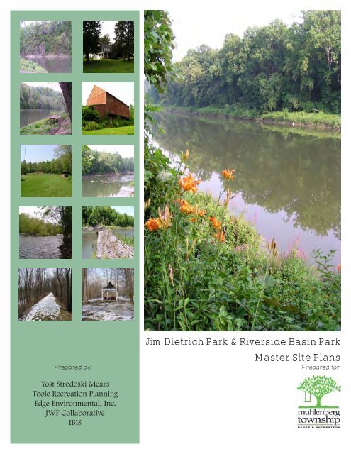
Jim Dietrich Park & Riverside Basin Park Master Site ... - Berks County
Jim Dietrich Park & Riverside Basin Park Master Site ... - Berks County
Jim Dietrich Park & Riverside Basin Park Master Site ... - Berks County

You also want an ePaper? Increase the reach of your titles
YUMPU automatically turns print PDFs into web optimized ePapers that Google loves.
<strong>Jim</strong> <strong>Dietrich</strong> <strong>Park</strong> & <strong>Riverside</strong> <strong>Basin</strong> <strong>Park</strong><br />
<strong>Master</strong> <strong>Site</strong> Plans<br />
Prepared by: Prepared for:<br />
Yost Strodoski Mears<br />
Toole Recreation Planning<br />
Edge Environmental, Inc.<br />
JWF Collaborative<br />
IBIS
<strong>Jim</strong> <strong>Dietrich</strong> <strong>Park</strong> and<br />
<strong>Riverside</strong> <strong>Basin</strong> <strong>Park</strong><br />
<strong>Master</strong> <strong>Site</strong> Plans<br />
Muhlenberg Township<br />
<strong>Berks</strong> <strong>County</strong>, PA<br />
August 2007<br />
Prepared for:<br />
Muhlenberg Township Board of Commissioners<br />
Natale DeLuca, President<br />
Roger Voit, Vice President<br />
Michael J. Gustantino<br />
Randall Madara<br />
James Murray<br />
Muhlenberg Township <strong>Park</strong>s and Recreation<br />
Steven Landes, Director<br />
Karen Regenfuse, Recreation Supervisor<br />
Study Committee<br />
Lance Weyandt Russell P. Swavely Janelle Leib<br />
Glenn Wenrich James Buerger Matthew F. McGough<br />
Erik P. Grunzig Frederick Hatt Carol Hunsberger<br />
Joseph Schmidt Gary Noecker Andy Russo<br />
Madeline Cantu’ Robert Wike Larry Snow<br />
Gary Swavely, Jr. Esq. Tony Papola Robert McWilliams<br />
Rick Frank <strong>Jim</strong> Christian Michael Hughes<br />
Michael Rowley Rick Hoffmaster Joan Vogel<br />
Kim Olson Daniel Houck Lynn Scheirer<br />
Harold George Rita Lesher<br />
Prepared by:<br />
Yost Strodoski Mears<br />
Toole Recreation Planning<br />
Edge Environmental, Inc.<br />
JWF Collaborative, Inc.<br />
IBIS<br />
This project was funded in part by a grant from the Community Conservation Partnerships Program,<br />
Keystone Recreation, <strong>Park</strong> and Conservation Fund administered by the Bureau of Recreation and<br />
Conservation, Pennsylvania Department of Conservation and Natural Resources<br />
<strong>Jim</strong> <strong>Dietrich</strong> <strong>Park</strong> and <strong>Riverside</strong> <strong>Basin</strong> <strong>Park</strong> <strong>Master</strong> <strong>Site</strong> Plan acknowledgements
<strong>Jim</strong> <strong>Dietrich</strong> <strong>Park</strong> and <strong>Riverside</strong> <strong>Basin</strong> <strong>Park</strong><br />
<strong>Master</strong> <strong>Site</strong> Plans<br />
TABLE OF CONTENTS<br />
Muhlenberg Township<br />
<strong>Berks</strong> <strong>County</strong>, PA<br />
CHAPTER 1 – PLANNING THE PARKS<br />
Introduction .........................................................................................................................................1-2<br />
<strong>Berks</strong> <strong>County</strong> and Muhlenberg Township.........................................................................................1-2<br />
<strong>Master</strong> <strong>Site</strong> Planning Process .............................................................................................................1-5<br />
CHAPTER 2 – PUBLIC PARTICIPATION<br />
Muhlenberg Township Study Committee..........................................................................................2-2<br />
Key Person Interviews ........................................................................................................................2-6<br />
Community Wide Survey ...................................................................................................................2-7<br />
Goals for <strong>Jim</strong> <strong>Dietrich</strong> <strong>Park</strong> and <strong>Riverside</strong> <strong>Basin</strong> <strong>Park</strong> .....................................................................2-7<br />
Vision and Mission for <strong>Jim</strong> <strong>Dietrich</strong> <strong>Park</strong> and <strong>Riverside</strong> <strong>Basin</strong> <strong>Park</strong>...............................................2-8<br />
CHAPTER 3 – INVENTORY AND ANALYSIS<br />
Introduction .........................................................................................................................................3-2<br />
History and Ownership .......................................................................................................................3-3<br />
Inventory and Analysis .......................................................................................................................3-4<br />
<strong>Jim</strong> <strong>Dietrich</strong> <strong>Park</strong> <strong>Site</strong> Analysis..........................................................................................................3-4<br />
<strong>Riverside</strong> <strong>Basin</strong> <strong>Park</strong> <strong>Site</strong> Analysis..................................................................................................3-10<br />
<strong>Site</strong> Analysis Conclusions ................................................................................................................3-17<br />
Best <strong>Park</strong> <strong>Site</strong> Analysis.....................................................................................................................3-19<br />
Applicable Laws and Regulations....................................................................................................3-19<br />
CHAPTER 4 – ALTERNATIVE DESIGNS<br />
Introduction .........................................................................................................................................4-2<br />
<strong>Jim</strong> <strong>Dietrich</strong> <strong>Park</strong> Alternatives ...........................................................................................................4-2<br />
<strong>Riverside</strong> <strong>Basin</strong> <strong>Park</strong> Alternatives............................................................................................. 4-7<br />
<strong>Jim</strong> <strong>Dietrich</strong> <strong>Park</strong> – Pre-Final <strong>Master</strong> <strong>Site</strong> Plan...............................................................................4-13<br />
<strong>Riverside</strong> <strong>Basin</strong> <strong>Park</strong> – Pre-Final <strong>Master</strong> <strong>Site</strong> Plan ................................................................. 4-16<br />
CHAPTER 5 –MASTER PLAN<br />
Introduction .........................................................................................................................................5-2<br />
<strong>Park</strong> Design Concept...........................................................................................................................5-2<br />
<strong>Jim</strong> <strong>Dietrich</strong> <strong>Park</strong> <strong>Master</strong> <strong>Site</strong> Plan ....................................................................................................5-2<br />
<strong>Riverside</strong> <strong>Basin</strong> <strong>Park</strong> <strong>Master</strong> <strong>Site</strong> Plan...................................................................................... 5-7<br />
Common Features.................................................................................................................... 5-12
CHAPTER 6 – OPERATIONS, MANAGEMENT, AND FINANCING<br />
Introduction .........................................................................................................................................6-2<br />
Purpose of the Operations and Management Plan.............................................................................6-2<br />
Recreation Opportunities........................................................................................................... 6-3<br />
The Foundation for Muhlenberg Township’s <strong>Park</strong> Management ....................................................6-7<br />
Modeling <strong>Jim</strong> <strong>Dietrich</strong> <strong>Park</strong> and <strong>Riverside</strong> <strong>Basin</strong> <strong>Park</strong> Development and Operation............... 6-9<br />
Muhlenberg Township <strong>Park</strong> Maintenance Management ................................................................6-10<br />
Estimating a Maintenance Budget....................................................................................................6-14<br />
Recommendations for <strong>Jim</strong> <strong>Dietrich</strong> <strong>Park</strong> and <strong>Riverside</strong> <strong>Basin</strong> <strong>Park</strong> ...................................... 6-36<br />
CHAPTER 7 – COSTS<br />
Introduction .........................................................................................................................................7-2<br />
<strong>Jim</strong> <strong>Dietrich</strong> <strong>Park</strong> Development Costs...............................................................................................7-4<br />
<strong>Riverside</strong> <strong>Basin</strong> <strong>Park</strong> Development Costs............................................................................... 7-23<br />
APPENDIX A<br />
Buildings and Structures Evaluation.................................................................................................. A1<br />
APPENDIX B<br />
Traffic Analysis..........................................................................................................................B1<br />
APPENDIX C<br />
Shooting Range Report and Recommendation.................................................................................. C1<br />
APPENDIX D<br />
Dog <strong>Park</strong> Rules D1<br />
MAPS<br />
<strong>Jim</strong> <strong>Dietrich</strong> <strong>Park</strong> Slope Analysis.......................................................................................................3-8<br />
<strong>Jim</strong> <strong>Dietrich</strong> <strong>Park</strong> <strong>Site</strong> Analysis..........................................................................................................3-9<br />
<strong>Riverside</strong> <strong>Basin</strong> <strong>Park</strong> Slope Analysis ...................................................................................... 3-15<br />
<strong>Riverside</strong> <strong>Basin</strong> <strong>Park</strong> <strong>Site</strong> Analysis..................................................................................................3-16<br />
<strong>Jim</strong> <strong>Dietrich</strong> <strong>Park</strong> Conceptual Alternative A............................................................................. 4-3<br />
<strong>Jim</strong> <strong>Dietrich</strong> <strong>Park</strong> Conceptual Alternative B .....................................................................................4-6<br />
<strong>Riverside</strong> <strong>Basin</strong> <strong>Park</strong> Conceptual Alternative A ....................................................................... 4-8<br />
<strong>Riverside</strong> <strong>Basin</strong> <strong>Park</strong> Conceptual Alternative B..............................................................................4-11<br />
<strong>Jim</strong> <strong>Dietrich</strong> <strong>Park</strong> Pre-Final <strong>Master</strong> Plan................................................................................. 4-15<br />
<strong>Riverside</strong> <strong>Basin</strong> <strong>Park</strong> Pre-Final <strong>Master</strong> Plan....................................................................................4-17<br />
<strong>Jim</strong> <strong>Dietrich</strong> <strong>Park</strong> Final <strong>Master</strong> Plan ......................................................................................... 5-3<br />
<strong>Riverside</strong> <strong>Basin</strong> <strong>Park</strong> Final <strong>Master</strong> Plan.............................................................................................5-8<br />
<strong>Jim</strong> <strong>Dietrich</strong> <strong>Park</strong> Phasing Plan ............................................................................................... 7-22<br />
<strong>Riverside</strong> <strong>Basin</strong> <strong>Park</strong> Phasing Plan ..................................................................................................7-38
Chapter 1 – Planning the <strong>Park</strong>s
Introduction<br />
Muhlenberg Township is presented with the unique opportunity to develop two new significant park sites to<br />
complement its existing park system. Through the Township’s commitment to parks and recreation and its<br />
foresight to seize unique opportunities, two significant riverfront properties totally over 270 acres will be<br />
available to citizens for generations to come. This master plan of <strong>Jim</strong> <strong>Dietrich</strong> <strong>Park</strong> and <strong>Riverside</strong> <strong>Basin</strong> <strong>Park</strong><br />
will formalize a vision for the parks, creating flagship recreation facilities for the municipality and major<br />
destinations along the 128 mile Schuylkill River National and State Heritage Area.<br />
The two diverse park sites are a significant step in the preservation of natural areas in the urbanized Reading<br />
area and will provide many opportunities to access the Schuylkill River. <strong>Riverside</strong> <strong>Basin</strong> <strong>Park</strong> in the<br />
southwest corner of the municipality is a 142-acre site surrounding the current Muhlenberg Township<br />
Recreation Building. The site consists of 137.6-acres of a former desilting basin property, 2.86-acres of the<br />
Muhlenberg Township Recreation Building Property, and 1.75-acres of the existing Kelly’s Lock<br />
Overlook along the banks of the Schuylkill River. <strong>Jim</strong> <strong>Dietrich</strong> <strong>Park</strong> consists of approximately 109-acres<br />
of agricultural land in the northwest corner of the Township. This site contains over one-half-mile of<br />
frontage along the Schuylkill River. This park master planning project explored the development options for<br />
the two sites concurrently, to determine how to best serve the recreation needs of residents living in<br />
Muhlenberg.<br />
<strong>Berks</strong> <strong>County</strong> and Muhlenberg Township<br />
<strong>Berks</strong> <strong>County</strong> is located in eastern Pennsylvania. Surrounding counties include Schuylkill, Lancaster,<br />
Lebanon, Montgomery, and Chester counties. The 2000 U.S. Census for <strong>Berks</strong> <strong>County</strong> documented<br />
373,638 residents in 76 municipalities. Muhlenberg Township is a township of the first class located in<br />
the center of <strong>Berks</strong> <strong>County</strong>.<br />
Muhlenberg Township is an older suburban community that is nearly fully developed, located north of the<br />
City of Reading. Its population has grown in an inconsistent manner over the past several decades and<br />
totaled 16,305 residents in the 2000 U.S. Census. A demographic profile of Muhlenberg Township is<br />
provided on page 1-3.<br />
<strong>Jim</strong> <strong>Dietrich</strong> <strong>Park</strong> and <strong>Riverside</strong> <strong>Basin</strong> <strong>Park</strong> <strong>Master</strong> <strong>Site</strong> Plan Chapter 1-2
The Schuylkill River National and State Heritage Area<br />
The Schuylkill River National and State<br />
Heritage Area is designated throughout the<br />
watershed of the Schuylkill River and<br />
Muhlenberg Township is located in the<br />
Greater Reading portion of the Heritage<br />
Area. The mission of the Schuylkill River<br />
National and State Heritage Area is to<br />
“Conserve, interpret and develop the<br />
historical, cultural, natural and recreation<br />
resources related to the industrial and<br />
cultural heritage of the Schuylkill River<br />
Valley of Southeastern Pennsylvania”.<br />
The Schuylkill River Greenway<br />
Association manages the Schuylkill River<br />
Valley National Heritage Area and<br />
coordinates the many projects associated<br />
with the greenway such as the Water Trail,<br />
Land Trail, and Bird Trail. <strong>Jim</strong> <strong>Dietrich</strong><br />
<strong>Park</strong> and <strong>Riverside</strong> <strong>Basin</strong> <strong>Park</strong> offer<br />
unique settings to interpret the history of<br />
the river and the history that evolved from<br />
it, enjoy the rivers natural setting, and<br />
preserve significant open space along this<br />
diverse corridor.<br />
Muhlenberg Township <strong>Park</strong>s and Recreation<br />
Muhlenberg Township has a professional <strong>Park</strong>s and Recreation Department that oversees 11 park and<br />
recreation sites, including a linear park along the Laurel Run which terminates in <strong>Riverside</strong> <strong>Basin</strong> <strong>Park</strong>.<br />
A master plan for the 2.5-mile Muhlenberg Rail Trail was completed in 2003 providing a north-south<br />
pedestrian corridor through the heart of the urban area, parallel to Kutztown Road. The Department<br />
offers year-round leisure programs for residents, coordinates special community events, and undertakes<br />
planning projects such as this master plan.<br />
Muhlenberg Township Demographic Profile<br />
Population Statistics:<br />
2000 Population: 16,305, a 29-percent increase since 1990*<br />
Gender: 51.7-percent female and 48.3-percent male<br />
Race/Ethnicity: 96.2 percent Caucasian<br />
Median Age: 43.3, older than <strong>Berks</strong> <strong>County</strong>’s median of 37.4<br />
2010 Population<br />
Projection: 17,291, a growth rate of 6.05-percent<br />
<strong>Jim</strong> <strong>Dietrich</strong> <strong>Park</strong> and <strong>Riverside</strong> <strong>Basin</strong> <strong>Park</strong> <strong>Master</strong> <strong>Site</strong> Plan Chapter 1-3
Households and Housing:<br />
Family<br />
Households: 4,633 or 69.8-percent of the 6,960 total households<br />
Persons Per<br />
Household: 2.40 down from 2.44 in 1990<br />
Owner Occupied: 84.0-percent, a decrease from 85.8% in 1990.<br />
Housing Units: 6,960<br />
Median House<br />
Value: $101,500 compared to $82,900 in 1990.<br />
Socio-Economic Characteristics:<br />
1999 Median<br />
Income: $44,627 Household, $51,764 Family, $21,624 per Capita. These are higher than the<br />
state but lower than the <strong>County</strong>.<br />
Families<br />
In Poverty: 2.6-percent lower than <strong>Berks</strong> <strong>County</strong>’s rate of 6.3-percent and Pennsylvania’s rate<br />
of 7.8-percent.<br />
Employment: 28-percent are employed in manufacturing, 17.2% in education, health and social<br />
services, and 13% in retail. Employment in manufacturing and retail is higher than<br />
elsewhere in the county of state. Employment in professional jobs and construction<br />
is lower than the state or county.<br />
Education: 79.8-percent of the population over 25 have a high school diploma or higher; 15.9-<br />
percent have a bachelor’s degree or higher.<br />
*The incorporation of Temple Borough into Muhlenberg Township in large part is reflected in the<br />
population growth between 1990 and 2000.<br />
Demographic Profile Summary:<br />
Muhlenberg Township is a homogeneous Caucasian community with less that five percent minority<br />
population. The Township has less families living in poverty than the <strong>County</strong> as a whole and the per capita<br />
income is higher than that of the <strong>County</strong>. Education attainment levels are slightly lower than the State as a<br />
whole. Attaining an education of a high school diploma is higher than <strong>Berks</strong> <strong>County</strong> (78.0%), while the<br />
percent of the population with a bachelor’s degree or higher is lower in Muhlenberg Township than <strong>Berks</strong><br />
<strong>County</strong> (18.5%). There is a lower number of people 14 years old or younger (2,699) than over 65 years old<br />
(3,784) living in the Township.<br />
Muhlenberg Township has been experiencing the development pressure of this region of the state. The<br />
Township had a higher rate of population growth (29%) than the <strong>Berks</strong> <strong>County</strong> (11%) during the 1990’s. This<br />
is about ten times the growth rate of Pennsylvania (3%) during this same time. While residential growth was<br />
significant, the Township experienced the loss of major corporations including Agere, NGK Metals, and<br />
Empire Steel, as well as the Dana Corporation, located in Reading, during the economic downturn at the<br />
closing of the century. These closures affected many Muhlenberg residents who had once been employed by<br />
these companies. Muhlenberg Township is nearly fully developed, and residential growth is expecting to<br />
level off by about the year 2010.<br />
<strong>Jim</strong> <strong>Dietrich</strong> <strong>Park</strong> and <strong>Riverside</strong> <strong>Basin</strong> <strong>Park</strong> <strong>Master</strong> <strong>Site</strong> Plan Chapter 1-4
<strong>Master</strong> <strong>Site</strong> Planning Process<br />
The planning process for both the <strong>Jim</strong> <strong>Dietrich</strong> <strong>Park</strong> and the <strong>Riverside</strong> <strong>Basin</strong> <strong>Master</strong> <strong>Site</strong> Plans were<br />
designed to create a vision for the sites that will be relevant from the local perspective. The vision should<br />
expose the sites’ opportunities while protecting their natural resources. The process included four parts:<br />
1. Inventory and Assessment<br />
2. Public Participation<br />
3. Development of Conceptual Alternative Designs<br />
4. Final Design<br />
1. Inventory and Assessment<br />
The development of the designs for both parks was guided by the analysis of the sites’ natural resources<br />
and characteristics. Ecologists, recreation planners, recreation professionals, and landscape architects<br />
visited the site throughout the planning process to evaluate the site characteristics both natural and manmade,<br />
observe site opportunities, and identify concerns and development restrictions. Chapter 3 –<br />
Inventory and Analysis documents the findings of the inventory and assessment phase of the planning<br />
process.<br />
2. Public Participation<br />
To assure that the design for the park meets the needs of the community, broad citizen input was critical.<br />
Input from local citizens was gathered in three ways: working with a park study committee, conducting key<br />
person interviews with residents having specific recreation interests, and presenting the project at public<br />
meetings. In addition to the specific input received for the park sites, the Township also completed the<br />
Recreation, <strong>Park</strong>s and Open Space Plan which looked at the overall health of the Township’s park system.<br />
This plan included a community wide random survey of households and a newsletter survey distributed to<br />
every household in the Township recreation newsletter. The input received as part of the Recreation, <strong>Park</strong>s<br />
and Open Space Plan provided valuable insight into the communities recreation needs. Public participation<br />
is documented in Chapter 2.<br />
<strong>Park</strong> Study Committee<br />
The <strong>Park</strong> Study Committee was formed to help steer the development of the master site plan and work<br />
with the park design consultants. The committee consisted of members of the Muhlenberg Township<br />
<strong>Park</strong>s and Recreation Board, <strong>Berks</strong> <strong>County</strong> Planning Commission, Muhlenberg Township Planning<br />
Commission, Schuylkill River Greenway Association, <strong>Berks</strong> <strong>County</strong> Conservancy, Women’s Club, Arts<br />
Board, local athletic clubs, Rotary, and residents. The committee provided input at the outset of the<br />
project by brainstorming goals for the park site and discussing recreation opportunities that should be<br />
explored through the design process. The committee provided input throughout the planning process,<br />
participating in a design charrette, reviewing the site analysis, conceptual alternatives for the sites’<br />
development, the pre-final designs, and the final master plans.<br />
Key Person Interviews<br />
The consulting team conducted a series of key person interviews with key stakeholders for the park.<br />
Interviewees included first responders, school teachers, sports clubs, area church groups, local historians,<br />
and neighbors. Each provided input on various aspects of recreation and provided valuable input in the<br />
design process<br />
<strong>Jim</strong> <strong>Dietrich</strong> <strong>Park</strong> and <strong>Riverside</strong> <strong>Basin</strong> <strong>Park</strong> <strong>Master</strong> <strong>Site</strong> Plan Chapter 1-5
Public Meetings<br />
Three public meetings were held to involve the public in the master plan process. The first meeting<br />
brainstormed ideas for the parks. The second meeting was held to present the pre-final plans, seek input<br />
on the designs, and provide opportunity for residents to voice their thoughts and concerns regarding the<br />
proposed designs. A final meeting was held at the conclusion of the master plan process to present the<br />
final designs to the public at a regularly scheduled meeting of the Muhlenberg Township Board of<br />
Commissioners.<br />
3. Development of Conceptual Alternative Designs<br />
Two conceptual alternative designs for both <strong>Jim</strong> <strong>Dietrich</strong> <strong>Park</strong> and <strong>Riverside</strong> <strong>Basin</strong> <strong>Park</strong> were developed<br />
as part of the planning process. The alternatives were composed to achieve various park goals and<br />
explore park development opportunities. The alternative for each park complimented the facilities of the<br />
other park. Following review of the alternative designs, a Pre-Final <strong>Master</strong> Plan for each park was<br />
developed.<br />
4. Final Design<br />
This phase of the planning process involved the preparation of a detailed park design and determination of<br />
development costs. The final design was developed in collaboration with the study committee.<br />
Conclusion<br />
<strong>Jim</strong> <strong>Dietrich</strong> <strong>Park</strong> and <strong>Riverside</strong> <strong>Basin</strong> <strong>Park</strong> preserves a significant acreage of open space in the west<br />
portion of Muhlenberg Township. The diverse setting of each park offer tremendous opportunity for<br />
numerous active and passive recreational pursuits, connected by the Schuylkill River. The planning<br />
process undertaken explored the long-term vision for each property that reflected the goals of the<br />
community.<br />
<strong>Jim</strong> <strong>Dietrich</strong> <strong>Park</strong> and <strong>Riverside</strong> <strong>Basin</strong> <strong>Park</strong> <strong>Master</strong> <strong>Site</strong> Plan Chapter 1-6
Chapter 2 – Public Participation
Public participation was a key component of the <strong>Jim</strong> <strong>Dietrich</strong> <strong>Park</strong> and <strong>Riverside</strong> <strong>Basin</strong> <strong>Park</strong> <strong>Master</strong> <strong>Site</strong><br />
Plans planning process. Public participation was important for the following reasons:<br />
1. Local residents and authorities have local insights and useful information to contribute to the<br />
development of the master plans.<br />
2. It provided a forum in which concerns and ideas could be identified, aired, and addressed.<br />
3. Stewardship and trust are established through community interaction and involvement.<br />
Public input was gathered by working with the Muhlenberg Township <strong>Park</strong> Study Committee, completing<br />
key person interviews, and holding public forums to brainstorm ideas. The master plans also benefited<br />
from the input received by a concurrent study; the Muhlenberg Township Recreation, <strong>Park</strong>s and Open<br />
Space Plan. This Plan looked at the overall Township recreation and open space needs and included a<br />
community-wide citizen opinion survey.<br />
Muhlenberg Township Study Committee<br />
The goals and objectives for both <strong>Jim</strong> <strong>Dietrich</strong> <strong>Park</strong> and <strong>Riverside</strong> <strong>Basin</strong> <strong>Park</strong> were discussed at a Study<br />
Committee meeting on January 14, 2004 with the study committee established for the master plan project.<br />
The group focused on brainstorming a series of questions that were designed to define the type of parks<br />
that will meet the existing and future recreation needs of Muhlenberg Township residents while being<br />
compatible with the park sites. The brainstorming exercise provided guidance to the planning process and<br />
all ideas, no matter how extravagant were welcome and encouraged. The ideas presented were not final<br />
decisions or recommendations as final park programs. The questions and discussions are outlined below:<br />
Question No. 1: Who are the potential park users?<br />
� Rotary Club<br />
� Lions Club<br />
� Women’s Club<br />
� Scouts<br />
� Athletic Groups<br />
� Schools – Athletics and<br />
Environmental Education<br />
� Walkers<br />
� Bikers<br />
� Church groups<br />
� Seniors<br />
� Shooting clubs<br />
� Boaters – canoeists<br />
� Fisherman<br />
� Frisbee golfers<br />
� <strong>Park</strong> program participants<br />
� Persons with disabilities<br />
� Dogs<br />
� Everyone in the Township<br />
Question No. 2: What facilities would you like to see at the <strong>Jim</strong> <strong>Dietrich</strong> <strong>Park</strong> and <strong>Riverside</strong> <strong>Basin</strong> <strong>Park</strong>?<br />
� Youth soccer fields w/ lights<br />
� Youth baseball fields w/ lights<br />
� Skateboard area<br />
� In-line skate rink<br />
� Recreation center<br />
� Boat launch area<br />
� Picnic areas<br />
� Nature trails<br />
� Amphitheater<br />
� Gymnasium<br />
� Basketball courts<br />
� Disc golf<br />
� Paintball<br />
� Football field<br />
� Shooting range<br />
� Museum<br />
- River artifacts<br />
- Fairgrounds race track<br />
- River transportation<br />
- Consider opportunities associated<br />
with the <strong>Dietrich</strong> house<br />
� Interpretative areas<br />
<strong>Jim</strong> <strong>Dietrich</strong> <strong>Park</strong> and <strong>Riverside</strong> <strong>Basin</strong> <strong>Park</strong> <strong>Master</strong> <strong>Site</strong> Plan Chapter 2-2
� Dog park<br />
� Splash park<br />
� Pavilion<br />
� Ice skating<br />
� Concession building<br />
� Terrain area<br />
- BMX<br />
- Mountain bikes<br />
- Non-motorized vehicles<br />
� Restrooms<br />
� Paved trails<br />
� Lights<br />
� Equestrian facilities<br />
� Environmental education<br />
� Driving range<br />
� Open lawn activities<br />
� Lacrosse<br />
� Destination playground<br />
� Fishing – access for seniors/ADA<br />
access<br />
� Performing arts<br />
� Drinking fountains<br />
� Linkage to other parks<br />
Question No. 3: What are the opportunities and concerns about <strong>Jim</strong> <strong>Dietrich</strong> <strong>Park</strong>?<br />
� Developable slopes.<br />
� Cottages – privately owned, license through 2007, will be removed by residents.<br />
� Limited access.<br />
� Small pond – 1-4” of standing water.<br />
� Currently used by dog walkers.<br />
� Canadian geese.<br />
� Traffic concerns.<br />
� Acquisition of out-parcel at river.<br />
� Rumor of golf course adjacent property – Reed Farm.<br />
� Will facilities draw from outside the community?<br />
� Meet needs of Township youth before regional attractions.<br />
Question No. 4: What are the opportunities and concerns about <strong>Riverside</strong> <strong>Basin</strong> <strong>Park</strong>?<br />
� Agreement of sale limitations.<br />
� View shed restrictions.<br />
� Lack of soil for seed bed.<br />
� Mushroom manure used for topsoil.<br />
� Impacts to River Road.<br />
� Shooting Range – 32 groups per year use facility, noise associated w/ range, the State looked<br />
at the shooting range as a temporary facility.<br />
� Berms – used for walking trails.<br />
� Reuse existing buildings and facilities.<br />
� Develop lighted fields here in lieu of <strong>Dietrich</strong>.<br />
Public Meeting No. 1<br />
In addition to initial input provided by the Study Committee, a public meeting was held early in the<br />
master plan process to seek input. The public meeting was held on March 31, 2004 at the Muhlenberg<br />
Township Municipal Building. Attendees provided a local perspective into the recreation need of the<br />
community and potential use of the parks. At the meeting, attendees were divided into four groups and<br />
were asked a series of four questions. The outcomes are summarized below:<br />
<strong>Jim</strong> <strong>Dietrich</strong> <strong>Park</strong> and <strong>Riverside</strong> <strong>Basin</strong> <strong>Park</strong> <strong>Master</strong> <strong>Site</strong> Plan Chapter 2-3
1. What are the opportunities you see for the two parks?<br />
� Keep cabins<br />
� <strong>Dietrich</strong> farm period museum<br />
� Athletic Fields with lights<br />
� Boat launch<br />
� Keep basin as nature preserve<br />
� Develop <strong>Dietrich</strong> for active<br />
recreation and keep <strong>Riverside</strong><br />
<strong>Basin</strong> natural<br />
� Keep the shooting range<br />
� Felix Dam restored to allow<br />
water sports<br />
� Laurel Run aqueduct<br />
� Connectivity with trails<br />
� Historic interpretation of canal<br />
� Skate park<br />
2. What are the concerns regarding the two parks?<br />
� Access/<strong>Park</strong>ing<br />
� Costs<br />
� Security<br />
� Last natural areas in<br />
Muhlenberg Township<br />
� Loss of cabins<br />
� Impact on birds and wildlife<br />
� Keeping the shooting range<br />
3. What ideas do you have specific for <strong>Riverside</strong> <strong>Basin</strong> <strong>Park</strong>?<br />
� Ice skating<br />
� Preserve natural setting<br />
� Volunteers for vegetation<br />
maintenance<br />
4. What ideas do you have specific for <strong>Jim</strong> <strong>Dietrich</strong> <strong>Park</strong>?<br />
� Allow cabins to remain<br />
� Rebuild Felix Dam<br />
� Boating activities/water sports<br />
� Baseball<br />
� Fishing<br />
� Schuylkill River Greenway Hub<br />
Design Charrette<br />
� Concession/restroom buildings<br />
� Special handicapped facilities<br />
� Swimming area in river<br />
� Basketball courts<br />
� Amphitheater<br />
� Ice skating pond<br />
� Inline hockey rink<br />
� Natural areas for hiking and<br />
biking<br />
� Indoor/outdoor community<br />
center<br />
� Fishing dock<br />
� “Community Days” area<br />
� Contamination of river<br />
banks/farmland<br />
� Loss of bungalow revenue<br />
� Not enough room for nonscheduled<br />
activities<br />
� Loss of privacy for neighbors<br />
� Vandalism<br />
� Sledding area<br />
� Maintain berm<br />
� Boating and river sports<br />
� Connect to berm<br />
� Youth football/soccer fields<br />
� Amphitheater<br />
� Pavilion rental<br />
� Preserve and use farmhouse<br />
Following the brainstorming sessions with the Study Committee and general public, a subsequent meeting<br />
was held with the Study Committee to discuss the outcome of the public meeting. The study committee<br />
then participated in a design charrette. The committee was divided into two groups for two brainstorming<br />
sessions. In the first session, the group was asked to develop a “best use” concept/program for each park<br />
site. The program for each park is documented below:<br />
<strong>Jim</strong> <strong>Dietrich</strong> <strong>Park</strong> and <strong>Riverside</strong> <strong>Basin</strong> <strong>Park</strong> <strong>Master</strong> <strong>Site</strong> Plan Chapter 2-4
<strong>Jim</strong> <strong>Dietrich</strong> <strong>Park</strong> - Best Use Program<br />
� Group No. 1<br />
- A balance of active and passive facilities with active facilities located near the road.<br />
- Reuse of the house for meetings and environmental education.<br />
- Provide a boat launch.<br />
- Develop a trail system with multiple loops.<br />
- Develop picnic areas.<br />
- Keep some cottage for future rentals by the community.<br />
� Group No. 2<br />
- Develop soccer and baseball fields near the road.<br />
- Develop additional fields in the floodplain.<br />
- Keep rear portion of property for trails and passive recreation.<br />
- Develop parking in the front along the road.<br />
- Maintain the natural buffer.<br />
- Divide proposed fields with vegetation to break up areas (group like fields together).<br />
<strong>Riverside</strong> <strong>Basin</strong> <strong>Park</strong> - Best Use Program<br />
� Group No. 1<br />
- Develop youth athletic fields.<br />
- Develop a boat launch<br />
- Develop passive low impact recreation (picnic, horseshoes, tennis)<br />
- Develop trails<br />
- Develop natural, native gardens<br />
- Decrease noise from the shooting range.<br />
� Group No. 2<br />
- Develop “overflow fields” in the basin (fields that do not fit at <strong>Jim</strong> <strong>Dietrich</strong> <strong>Park</strong>).<br />
- Keep natural.<br />
- Maintain existing berms.<br />
- Utilize existing buildings for meeting rooms.<br />
- Develop indoor gym space.<br />
In a second brainstorming session, each group was assigned one park site and asked to place specific<br />
facilities at each park. The groups suggested the following facilities:<br />
<strong>Jim</strong> <strong>Dietrich</strong> <strong>Park</strong> – Facility Concepts<br />
- Develop parking areas along the road and near the existing cabins to the south.<br />
- Develop a loop road to facilitate movement<br />
- Develop a day camp and environmental education facility<br />
<strong>Jim</strong> <strong>Dietrich</strong> <strong>Park</strong> and <strong>Riverside</strong> <strong>Basin</strong> <strong>Park</strong> <strong>Master</strong> <strong>Site</strong> Plan Chapter 2-5
- Re-use the farmhouse as a museum.<br />
- Develop athletic fields at the front near the road (soccer, football).<br />
- Develop baseball/softball in the central portion of the site.<br />
- Provide playground areas.<br />
- Develop the floodplain area with hiking/bicycle trails, fishing areas, boat launch, picnic areas,<br />
and dog walking areas.<br />
- Develop restrooms to accommodate the needs.<br />
<strong>Riverside</strong> <strong>Basin</strong> <strong>Park</strong> – Facility Concepts<br />
- Develop a trail system with a hierarchy of loop trails. Maintain the existing trails on the berms.<br />
- Do not develop athletic fields now. Allow for future field development as necessary.<br />
- Develop athletic fields at <strong>Dietrich</strong> <strong>Park</strong> to take advantage of the good soils. Develop hard courts<br />
at <strong>Riverside</strong> basin since the soil quality is poor.<br />
- Develop a measured jogging trail.<br />
- Connect the two parks. Consider improvements to River Road.<br />
- Provide natural areas and meadows in the existing clearings.<br />
- Provide picnic opportunity, dog walking area, sledding hill, restrooms, basketball, and<br />
playground areas.<br />
- Designate fishing areas and boat launch along the river.<br />
- Consider development of an amphitheater.<br />
The two study committee meetings and public meeting documented above provided the designers with<br />
guidelines for the park development. Additional meetings held with the Study Committee and the general<br />
public are documented throughout this report.<br />
Key Person Interviews<br />
The consulting team conducted a series of key person interviews to obtain input regarding the <strong>Jim</strong> <strong>Dietrich</strong><br />
<strong>Park</strong> and <strong>Riverside</strong> <strong>Basin</strong> <strong>Park</strong> properties and the concept of developing these public parks. Input was<br />
gathered from first responders, school teachers, local athletic groups and clubs, area church groups, local<br />
historians, citizens, Schuylkill River Greenway representatives, Township officials, and others familiar with<br />
the history and resources of the sites.<br />
The interviews resulted in a variety of facility development ideas noted below:<br />
� Develop more multi-purpose athletic fields (soccer, field hockey, etc) and baseball fields.<br />
� Develop a football field.<br />
� Develop access and riverfront recreation opportunities.<br />
� Develop walking trails.<br />
� Protect the natural resources, particularly at <strong>Riverside</strong> <strong>Basin</strong> <strong>Park</strong>.<br />
� Develop year round recreation opportunities.<br />
<strong>Jim</strong> <strong>Dietrich</strong> <strong>Park</strong> and <strong>Riverside</strong> <strong>Basin</strong> <strong>Park</strong> <strong>Master</strong> <strong>Site</strong> Plan Chapter 2-6
Community Wide Survey<br />
Concurrent with the master plan development, the Township was completing a Recreation, <strong>Park</strong>s and Open<br />
Space Plan which looked at the overall health and direction of the Township’s park and recreation system.<br />
This plan included a random community wide survey of households and a newsletter survey distributed to<br />
every household in the Township recreation newsletter. Although not specific to the subject sites, the input<br />
received as part of the Recreation, <strong>Park</strong>s and Open Space Plan provided valuable insight into the overall<br />
communities recreation needs. Information from the survey, pertinent to this master plan study, includes<br />
citizens’ desire for the following:<br />
� Increased Schuylkill River access.<br />
� Increased trail system.<br />
� Protection of natural resources.<br />
� Development of athletic fields.<br />
� Programming for seniors.<br />
� Development of special events area.<br />
In addition to overall ideas listed above, the survey asked respondents to name “One thing to improve parks<br />
and recreation”. The following is a list of ideas, generated from the survey question, which could be<br />
incorporated in to the master plan.<br />
� Develop lighted soccer fields.<br />
� Develop an off-leash dog park.<br />
� Improve River Road and access to the Schuylkill River.<br />
� Develop a place for teens.<br />
� Develop a toddler friendly playground.<br />
� Provide more picnic pavilions.<br />
� Develop an ice skating area.<br />
Goals for <strong>Jim</strong> <strong>Dietrich</strong> <strong>Park</strong> and <strong>Riverside</strong> <strong>Basin</strong> <strong>Park</strong><br />
The brainstorming sessions with the study committee, public, and input received from key person interviews<br />
was translated into specific goals for <strong>Jim</strong> <strong>Dietrich</strong> and <strong>Riverside</strong> <strong>Basin</strong> <strong>Park</strong>s.<br />
Goal 1: Capitalize on each sites’ unique characteristics.<br />
Objectives:<br />
Respect the existing wooded areas within <strong>Riverside</strong> <strong>Basin</strong>. Develop facilities and activity areas that<br />
have low impact on the environment and natural resources. Utilize the good soils within the <strong>Dietrich</strong><br />
<strong>Park</strong> for fields and active recreation.<br />
Reuse the existing buildings and structures, as appropriate, for recreational use.<br />
Provide environmental education opportunities within the <strong>Riverside</strong> <strong>Basin</strong> site to create public<br />
awareness and understanding of the desilting basins, Schuylkill River, and site resources,<br />
encouraging respect and stewardship among users.<br />
Concentrate the proposed use and activity areas of each site in the existing open areas, preserving the<br />
woodlands and riparian corridors.<br />
Maximize connections to the Schuylkill River.<br />
Goal 2: Develop the <strong>Park</strong> sites to accommodate a wide variety of users.<br />
Objectives:<br />
Provide a variety of self directed passive recreation opportunities that can be enjoyed by users<br />
throughout their lifetime.<br />
<strong>Jim</strong> <strong>Dietrich</strong> <strong>Park</strong> and <strong>Riverside</strong> <strong>Basin</strong> <strong>Park</strong> <strong>Master</strong> <strong>Site</strong> Plan Chapter 2-7
Provide environmental educational opportunity targeted at school groups.<br />
Provide facilities that appeal to citizens of all ages, interests, and abilities.<br />
Provide athletic fields to meet the needs of the community.<br />
Create a year-round park that allows for winter sports as well as popular summer recreation<br />
activities.<br />
Provide facilities to accommodate various group sizes.<br />
Goal 3: Involve Muhlenberg Township residents in the master plan.<br />
Objectives:<br />
Utilize the results of the public participation process to determine the facilities to be included in the<br />
park.<br />
Build relationships with citizens through the process to help create stewardship for the park.<br />
Gather public input by making citizens “part of the process” so their ideas and concerns are<br />
incorporated into the park design and they in turn support development of the park.<br />
Vision and Mission for <strong>Jim</strong> <strong>Dietrich</strong> <strong>Park</strong> and <strong>Riverside</strong> <strong>Basin</strong> <strong>Park</strong><br />
Vision<br />
<strong>Jim</strong> <strong>Dietrich</strong> <strong>Park</strong> and <strong>Riverside</strong> <strong>Basin</strong> <strong>Park</strong> offer the Muhlenberg Township park and recreation system a<br />
future rich with intriguing possibilities – of which their potential and benefits appear to be endless. <strong>Jim</strong><br />
<strong>Dietrich</strong> <strong>Park</strong> and <strong>Riverside</strong> <strong>Basin</strong> <strong>Park</strong>s are models of conservation and public recreation for people who<br />
live, work and visit here. Together they serve as the hub of Muhlenberg Township’s riverfront park<br />
system. They offer public access to a rich variety of land and river based recreation opportunities,<br />
premiere community sports facilities, indoor recreation and special events space. As inviting and secure<br />
destinations, the parks’ success is rooted in high quality facilities, programming and maintenance. The<br />
parks enhance the quality of life for the entire region and serves as a catalyst for economic development.<br />
Mission<br />
Muhlenberg Township will undertake a generational and collaborative approach to developing <strong>Jim</strong><br />
<strong>Dietrich</strong> <strong>Park</strong> and <strong>Riverside</strong> <strong>Basin</strong> <strong>Park</strong>. With a clear vision and the determination to create a vibrant<br />
riverfront park system, Muhlenberg Township will plan, design, develop, program and maintain these<br />
parks with the spirit and resources necessary to create the priceless legacy of riverfront parks.<br />
<strong>Jim</strong> <strong>Dietrich</strong> <strong>Park</strong> and <strong>Riverside</strong> <strong>Basin</strong> <strong>Park</strong> <strong>Master</strong> <strong>Site</strong> Plan Chapter 2-8
Chapter 3 – Inventory and Analysis
Introduction<br />
<strong>Jim</strong> <strong>Dietrich</strong> <strong>Park</strong> and <strong>Riverside</strong> <strong>Basin</strong> <strong>Park</strong> provide a diverse natural setting, each with unique qualities.<br />
From the fertile agricultural fields at <strong>Jim</strong> <strong>Dietrich</strong> <strong>Park</strong> to the successional woodland growth within the<br />
<strong>Riverside</strong> <strong>Basin</strong> <strong>Park</strong> desilting basins, the sites, connected by the Schuylkill River, offer landscapes for<br />
recreation, relaxation, and exploration of nature. The master site plans were developed to provide a blueprint<br />
for the future of each site. An extensive inventory and analysis was completed to gain an understanding of<br />
each site’s natural resources, built structures, and recreation opportunities. This inventory and analysis is<br />
critical for the following reasons:<br />
Context<br />
To evaluate the sites’ natural resources and determine appropriate protection and enhancement<br />
strategies.<br />
To evaluate the sites’ man-made resources and determine the potential for re-use.<br />
To evaluate the ability of the parks’ natural resources to sustain and thrive with the introduction of<br />
recreation opportunities and public use.<br />
To explore the natural resources that contribute to the park user’s experience.<br />
Good design is born of good analysis.<br />
To become familiar with the context of the region and the sites.<br />
Development costs are greatly influenced by the ease of construction and compatibility of the<br />
proposed development with the natural systems of the park.<br />
To understand each site within the context of its’ immediate location and location within the<br />
Township and the Schuylkill River Greenway.<br />
<strong>Jim</strong> <strong>Dietrich</strong> <strong>Park</strong> is a 109.25-acre parcel bordered by the Schuylkill River on two sides, located in the<br />
northwest corner of the Township. <strong>Riverside</strong> <strong>Basin</strong> <strong>Park</strong> is located, about two miles downstream on the<br />
Schuylkill River from <strong>Jim</strong> <strong>Dietrich</strong> <strong>Park</strong>, across the river from the Reading Regional Airport.<br />
<strong>Jim</strong> <strong>Dietrich</strong> <strong>Park</strong> and <strong>Riverside</strong> <strong>Basin</strong> <strong>Park</strong> <strong>Master</strong> <strong>Site</strong> Plan Chapter 3-2
History and Ownership<br />
<strong>Jim</strong> <strong>Dietrich</strong> <strong>Park</strong> – <strong>Jim</strong> <strong>Dietrich</strong> <strong>Park</strong> is a 109-acre undeveloped site owned by Muhlenberg Township<br />
with frontage on Stoudt’s Ferry Bridge Road. The site is named for the only child of Faye <strong>Dietrich</strong> who<br />
sold 80 acres of the property to the Township in 1997. In 2004, during the master plan process, an<br />
additional 29-acres north of the <strong>Dietrich</strong> Farm, was acquired by the Township for incorporation into the<br />
park thru the mandatory dedication process. In addition to large expanses of cultivated fields, the<br />
property contains a residential structure, barn, and out buildings. Additionally, approximately 30<br />
privately owned water front cabins exist on the property that are licensed to remain until October 2007, at<br />
which time, they must be completely removed and the area restored by their owners.<br />
<strong>Riverside</strong> <strong>Basin</strong> <strong>Park</strong> – <strong>Riverside</strong> <strong>Basin</strong> <strong>Park</strong> is a 140-acre site was being acquired by the Township<br />
from the Commonwealth of Pennsylvania under the terms of an agreement that restricts the future use of<br />
the property to recreation and other municipal purposes. The majority of the site is contained in two large<br />
earthen berms formerly used for desilting operations along the Schuylkill River in the 1950’s. The site<br />
acreage contains several small developed park areas: Laurel Run <strong>Park</strong>, Pioneer Grove, and Kelly’s Lock,<br />
which were built and maintained by Muhlenberg Township public recreation areas. The <strong>Riverside</strong> <strong>Basin</strong><br />
property surrounds the three acre site of the Muhlenberg Township Recreation Building.<br />
<strong>Jim</strong> <strong>Dietrich</strong> <strong>Park</strong> and <strong>Riverside</strong> <strong>Basin</strong> <strong>Park</strong> <strong>Master</strong> <strong>Site</strong> Plan Chapter 3-3
Inventory and Analysis<br />
A comprehensive inventory and analysis was completed at the outset of the project to evaluate the physical<br />
characteristics of each park site. The sites were field viewed by a group of professionals assembled for the<br />
analysis. Analysis for each park was completed by the following professionals:<br />
Landscape Architects<br />
Recreation Planner<br />
Ecologists<br />
Architect<br />
Traffic Engineer<br />
Shooting Range Expert<br />
Each professional provided input on the site analysis and conclusions. A wetland delineation report was<br />
completed for both park sites. The report documents no wetlands found beyond the banks of the Schuylkill<br />
River. Existing buildings and structures assessment (Appendix A) was completed by an Architect. Traffic<br />
analysis (Appendix B) considered the affects of increased traffic on both park sites. A summary of the<br />
shooting range evaluation (Appendix C) was completed to determine the compatibility of this venue in a<br />
public park setting.<br />
The findings of the inventory and analysis for each park site are summarized below. The summary discusses<br />
each park in general followed by an itemized description of each area within the park. The areas, designated<br />
with letters correspond to the letter symbol located on the site analysis map for each site. A <strong>Site</strong> Analysis<br />
Map and a separate slope analysis map of each park follow the narrative description.<br />
<strong>Jim</strong> <strong>Dietrich</strong> <strong>Park</strong> <strong>Site</strong> Analysis<br />
Adjacent Land Uses<br />
Northern Boundary: Agriculture/Residential<br />
Southern Boundary: Schuylkill River<br />
Western Boundary: Schuylkill River<br />
Eastern Boundary: Residential<br />
General Findings<br />
109.25 acres<br />
<strong>Site</strong> consists of two linear pieces perpendicular to each other, one 800 feet wide by 4000 feet long<br />
and the other 700 feet wide by 1500 feet long, with 0.68 miles of frontage on the Schuylkill River<br />
and 850 feet of frontage of Stoudt’s Ferry Bridge Road.<br />
The site is located in the northwest corner of the Township. Stoudt’s Ferry Bridge Road is the<br />
only road that provides access to the park. The Stoudt’s Ferry Bridge Road terminates at the<br />
River.<br />
Stoudt’s Ferry Bridge Road borders the northern and eastern boundaries. Adequate sight distance<br />
exists along the eastern boundary except along approximately 100 feet of the property at the<br />
southern boundary corner, where site distance is limited.<br />
<strong>Jim</strong> <strong>Dietrich</strong> <strong>Park</strong> and <strong>Riverside</strong> <strong>Basin</strong> <strong>Park</strong> <strong>Master</strong> <strong>Site</strong> Plan Chapter 3-4
Area A<br />
Area B<br />
A gravel lane from Stoudt’s Ferry Bridge Road along the northern boundary line, provides access<br />
to all farm structures and cottages.<br />
Residential lands exist east of Stoudt’s Ferry Bridge Road and are very visible from the site.<br />
Buckingham Drive is a residential cul-de-sac approximately 180-feet south of the park’s existing<br />
access drive.<br />
Other than the agricultural fields, there are two distinct ecological communities at the <strong>Park</strong>: the<br />
floodplain forest at the eastern end, and the forest edge and wooded peninsulas at the southeastern<br />
corner.<br />
- The floodplain forest is characteristic of a mature northern riparian forest, with some upland<br />
species on its higher elevations. All vegetation layers—tree, understory, and herbs—are<br />
present, indicating that it has not been disturbed recently. Larger than a forest island, the size<br />
and plant diversity of this area provide good habitat for birdlife, and possibly some aquatic<br />
mammals, such as muskrats or minks. Its visibility from the house and barn make it<br />
accessible for bird attraction and observation.<br />
- The forest at the southeastern corner is the edge of an oak-hickory forest. Its diverse tree,<br />
understory, and herbaceous vegetation continue into the two wooded peninsulas that extend<br />
into the adjoining field. Forest edges are often rich in birdlife diversity, containing species<br />
from both the forest and nearby fields.<br />
An eastern red cedar hedgerow extends along the north side of the access drive.<br />
The site was viewed for the presence of wetlands. No wetlands were found beyond the banks of<br />
the Schuylkill River.<br />
Adjacent residential properties exist and are visible in the southeast corner.<br />
Generally, the site is open and divided into unique areas by hedgerows.<br />
Previous use of the site was a fruit tree orchard.<br />
Upland site soils consist of Birdsboro-Duffield silt loam (BmB). These soils have limited<br />
development restrictions with slight to moderate erosion potential. Soils along the rivers edge<br />
and tributary drainage ways are Duffield silt loam (DfC2). Duffield soils contain bedrock near<br />
the surface and rock ledges are generally more numerous. Soil immediately adjacent to the river<br />
and throughout its floodplain consists of Philo Loam – coal over wash (Ph). This soil only occurs<br />
along the Schuylkill River. The surface is generally covered by 12 to 36 inches of fine black coal<br />
chips.<br />
10-acres open rectangular shape.<br />
Separated from Area B by sloped wooded hedgerow.<br />
Gentle sloping from 1 to 6-percent.<br />
Rock outcrops visible.<br />
Residential visible through thin hedgerow to the south.<br />
Stoudt’s Ferry Bridge Road borders the area to the east.<br />
Approximately 5-acres.<br />
Moderately sloped from 3 to 10-percent.<br />
<strong>Jim</strong> <strong>Dietrich</strong> <strong>Park</strong> and <strong>Riverside</strong> <strong>Basin</strong> <strong>Park</strong> <strong>Master</strong> <strong>Site</strong> Plan Chapter 3-5
Area C<br />
Area D<br />
Area E<br />
A deep drainage draw parallels the eastern end of the area.<br />
Rock outcrops are visible.<br />
Residential visible through hedgerow to the south.<br />
Steep wooded hedgerow separates Areas B and C.<br />
Approximately 23-acres.<br />
Gently to moderately sloped land from 3-percent in the upland to 12-percent approaching the<br />
river.<br />
The Schuylkill River and associated 100-year flood plain parallel the southern boundary. The<br />
flood plain is approximately 250 wide.<br />
Approximately 16 cottages line the rivers edge.<br />
A steep 10- foot (+/-) drop exists between the cottage and the rivers water surface. Numerous<br />
docks and ramps exist to accommodate the grade.<br />
A narrow aggregate/earthen drive provides access to the cottages. The drive splits Area C.<br />
Approximately 18-acres.<br />
Gently sloping land from 3 to 12-percent slopes.<br />
Farm buildings and structures includes stately residence, bank barn, shed carport and small<br />
miscellaneous structures. Access to the buildings is from the aggregate drive. (see architectural<br />
analysis for review of structures) Septic fields for residence are located south of the residence in<br />
the floodplain. Water supply for the complex is located in the shed/carport building.<br />
Evidence of a second residence is noted northeast of the bank barn. The residence was removed,<br />
but utilities remain in that area.<br />
Structures are located at the edge of the 100-year flood plain.<br />
A large closed depression with standing water was observed north of the residence.<br />
Significant views from the residence to the surrounding riparian woodland, Schuylkill River, and<br />
hills beyond are provided from the farmhouse complex.<br />
Approximately 10-acres<br />
The area is slightly sloped, generally less than 2-percent.<br />
The majority of the acreage is wooded.<br />
The area is completely covered by the 100-year floodplain.<br />
Approximately 15 cottages line the rivers edge at the western end.<br />
A steep 10- foot (+/-) drop exists between the cottage and the rivers water surface. Numerous<br />
docks and ramps exist to accommodate the grade.<br />
The parks main access drive terminates at the cottages. The adjacent residential properties to the<br />
north gain access from the main access drive. The residences are close to and visible from the<br />
access drive.<br />
<strong>Jim</strong> <strong>Dietrich</strong> <strong>Park</strong> and <strong>Riverside</strong> <strong>Basin</strong> <strong>Park</strong> <strong>Master</strong> <strong>Site</strong> Plan Chapter 3-6
Area F<br />
The cottages, separated from the balance of the park by woodland, are very secluded.<br />
The cottages overlook the river to a steep rock ledge on the western shore.<br />
Approximately 28-acres.<br />
The area is slightly sloped, generally 2-percent.<br />
The majority of the acreage is agricultural fields.<br />
The area is bordered on the east by a proposed subdivision, on the west by existing residential,<br />
and on the north by Stoudt’s Ferry Bridge Road (approx. 850 ft.).<br />
Slopes increase in northwest corner to approximately 8%.<br />
<strong>Jim</strong> <strong>Dietrich</strong> <strong>Park</strong> and <strong>Riverside</strong> <strong>Basin</strong> <strong>Park</strong> <strong>Master</strong> <strong>Site</strong> Plan Chapter 3-7
<strong>Riverside</strong> <strong>Basin</strong> <strong>Park</strong> <strong>Site</strong> Analysis<br />
Adjacent Land Uses<br />
Northern Boundary: Schuylkill River<br />
Southern Boundary: Industrial/Residential<br />
Western Boundary: National Guard Armory<br />
Eastern Boundary: Residential<br />
General Findings<br />
142.21-acres total (137.6-acres former desilting basin property, 2.86-acres Muhlenberg Township<br />
Recreation Building Property, 1.75-acres Kelly’s Lock Overlook)<br />
The majority of the acreage is located within two 20 to 30 foot high earthen berms created by the<br />
Commonwealth of Pennsylvania for use as desilting basins for the Schuylkill River. River Road<br />
parallels the berms to the west. The Schuylkill River is the property’s western border. Two<br />
Township parks, Kelly’s Lock Overlook and Pioneer Grove, exist between the Schuylkill River<br />
and River Road. Laurel Run <strong>Park</strong> exists in the north end of the park.<br />
The property contains approximately 0.58 miles of river frontage.<br />
The site was viewed for the presence of wetlands. No wetlands were found beyond the banks of<br />
the Schuylkill River.<br />
The vegetation of the desilting basins is characteristic of a young successional forest. Lower<br />
elevations are dominated by a few tree species that tolerate poor soils and wet conditions. As<br />
elevations increase, soil conditions and drainage improve allowing for greater abundance and<br />
diversity of plant species in the tree, understory, and herbaceous layers. The basin floors would<br />
benefit from thinning of the current tree stand to allow for regrowth of understory plants.<br />
Minimal diversity of the plant community, especially on the basin floors, provides marginal<br />
habitat for birds, mammals, reptiles, and amphibians. Songbird abundance will increase with the<br />
greater plant diversity found on the higher elevations. In that respect, multiflora rose, normally an<br />
invasive plant is one of the few plant species now providing cover for birds.<br />
The berms create a barrier to the surrounding lands. Berms taper to grade on the eastern side of<br />
the property for access. The top of each berm is approximately 5-feet wide and maintained as<br />
lawn for walking. A 1.9-mile loop trail is available utilizing the large basin berm. Berms are<br />
smooth and flowing creating a nice trail experience.<br />
The bottom of each basin is irregularly sloped and contains standing pools of water. Each basin<br />
contains a large concrete outlet structure. The structures are developed to drain standing water<br />
from the top of berm elevation. No drainage structures are provided to outlet routine<br />
precipitation. Rainwater runoff infiltrates into the ground surface.<br />
The Schuylkill River borders the site to the west. The National Guard Armory borders the site to<br />
the southwest. Residential properties, very visible from the site, border the short eastern<br />
boundary. Large industrial buildings and uses border the sites south and east boundary and their<br />
large buildings and parking areas are very visible from the park site.<br />
River Road provides primary access to Kelly’s Lock Overlook, Laurel Run <strong>Park</strong>, Pioneer Grove,<br />
and the Recreation Building. Sofianos Road provides access to the at-grade portion of the basins.<br />
<strong>Jim</strong> <strong>Dietrich</strong> <strong>Park</strong> and <strong>Riverside</strong> <strong>Basin</strong> <strong>Park</strong> <strong>Master</strong> <strong>Site</strong> Plan Chapter 3-10
Area A<br />
Both roads are Township Roads. The property contains some road frontage on Leizes Bridge<br />
Road, a state road, although access is improbable due to steep slope and nearby street<br />
intersections.<br />
The desilting basins are characterized by low-organic soils, infiltration drainage, and sharp<br />
contrasts in topography.<br />
The majority of the site soils within the desilting basins are Made Land Limestone Materials<br />
(MdB). This soil has been moved or disturbed by excavation or filling so that the natural soil<br />
horizon has been destroyed. Some unaltered soil in the upper reaches of the main basin is<br />
Duffield silt loam (DfB2). Major limitations of this soil type are hazard of erosion and hazard<br />
caused by sinkholes. Upper portions of Laurel Run <strong>Park</strong> contain Duffield and Hagerstown Soils<br />
(DhC3). Soil erosion is a concern, as most of the original soil has been eroded away. The Laurel<br />
Run corridor is Melvin Silt Loam (Ml), typical of soils along streams. Flooding and wetness is<br />
the main concern. Soils west of River Road are Philo Loam-coal over wash (Ph). This soil only<br />
occurs along the Schuylkill River. The surface is generally covered by 12 to 36 inches of fine<br />
black coal chips.<br />
The site has undergone a series of changes beginning with the <strong>Riverside</strong> Golf Course. The<br />
National Guard Armory property was part of the course and the Recreation Building was the<br />
former clubhouse. In 1949, the desilting basin project was completed creating the two desilting<br />
basins with a 30-foot grade change between the two basins on the former golf course. The basins<br />
were never used and since the 1950’s the basins have re-vegetated into natural areas. The<br />
Recreation Building was purchased by the Twp in 1968 and opened for community use in 1970.<br />
Laurel Run <strong>Park</strong>, the Township’s first community park, was established in the late 1960’s.<br />
A municipal shooting range is located within the larger berm. This activity presents safety<br />
concerns as well as environmental concerns associated with the spent lead material from the use.<br />
A shooting range is not compatible with a public park and should be immediately closed as<br />
recommended in the Shooting Range Report and Recommendations (Appendix C).<br />
The flyway for the reading Municipal Airport occupies the southeastern edge of the site.<br />
Numerous planes were noted during site visits, just above the treetops.<br />
Approximately 40-acres.<br />
Irregularly sloped wooded area. Overall, the basin bottom is generally flat with some severe<br />
periodic grade changes throughout.<br />
Thirty –foot high earthen berms protect the southern and western sides. Large-scale industrial<br />
buildings are prominent along the eastern border.<br />
An existing shooting range and associated earthen berm border the northern section.<br />
An aggregate access drive parallels the eastern border and terminates at the shooting range.<br />
Vehicular access is provided from Sofianos Road. The existing access point is offset<br />
approximately 100 feet from Lowrie Street, creating an offset intersection.<br />
West End Road, an unopened, unimproved right of way, borders the southeast corner of the site.<br />
Pools of standing water were noted throughout.<br />
Cleared trails meander throughout the basin bottom.<br />
The southern corner of the site is within the airport flyway zone.<br />
<strong>Jim</strong> <strong>Dietrich</strong> <strong>Park</strong> and <strong>Riverside</strong> <strong>Basin</strong> <strong>Park</strong> <strong>Master</strong> <strong>Site</strong> Plan Chapter 3-11
Area B<br />
Area C<br />
Area D<br />
Area E<br />
Approximately 8-acres.<br />
Gently sloping to level land.<br />
The main feature of this area is the existing shooting range. The range is bound by the basin<br />
berm to the west. A created earthen berm is developed south and east of the range to collect<br />
bullets. The range is approximately 300’ x 200’. Weapons are fired from north to south into the<br />
earthen berm. A second informal range occurs in the open lawn east of the formal range. Shot<br />
gun shells and archery arrows litter was noted.<br />
The shooting range is immediately east of the Recreation Building, separated by a twenty-five<br />
foot high basin berm.<br />
The large basin outlet structure is located within the shooting range berm.<br />
The main access drive terminates into the shooting range. A former trail spur that connected to<br />
the access drive has been lost due to recent construction activity on the corner of the adjacent<br />
industrial site.<br />
Approximately 30-acres.<br />
Irregularly sloped wooded area. Overall, the basin bottom is generally flat with some severe<br />
periodic grade changes throughout. Slopes vary widely from 5 to 40 percent.<br />
Thirty foot high earthen berms protect the western sides. Large-scale industrial buildings are<br />
prominent along the eastern border.<br />
Residential properties are very visible and very close along the eastern border. Some<br />
encroachments were noted.<br />
Pools of standing water were noted throughout.<br />
Cleared trails meander throughout the basin bottom.<br />
Approximately 14-acres<br />
Irregularly sloping wooded area completely enclosed and isolated by earthen berms. Slopes vary<br />
widely from 5 to 40 percent.<br />
The berms completely loop the area and maintain an at-grade access from the Recreation<br />
Building. A 3/4 mile loop is created at the top of berm.<br />
Laurel Run <strong>Park</strong> facilities include a community building, picnic pavilion, restroom building, lawn<br />
area, and two basketball courts. Laurel Run bisects the park. A wooden footbridge is provided<br />
across Laurel Run. The basketball courts and adjacent lawn area are depressed causing damage<br />
to the courts and encourage wet lawn areas. This area has been flooded in the past for the annual<br />
fishing rodeo. The court area is not ADA accessible. The majority of the improvements are in<br />
the 100-year floodplain.<br />
Annual activities at the park include the Rotary fishing rodeo, egg hunt, turkey trot race, hayride,<br />
and basketball leagues.<br />
The lower desilting basin berm defines the southern end.<br />
<strong>Jim</strong> <strong>Dietrich</strong> <strong>Park</strong> and <strong>Riverside</strong> <strong>Basin</strong> <strong>Park</strong> <strong>Master</strong> <strong>Site</strong> Plan Chapter 3-12
Area F<br />
Area G<br />
The existing access drive contains adequate sight distance.<br />
Residential properties are visible from to the east.<br />
A large open area of lawn and mature canopy trees exists at the northeast end of the area which<br />
transitions up to the large basin embankment.<br />
Approximately 8-acres.<br />
A long linear portion of the park located between River Road and the Schuylkill River. Width<br />
varies from 50’ to 350’.<br />
The area offers approximately 0.58 miles of river frontage.<br />
The majority of the area is within the 100-year floodplain.<br />
The Kelly’s Lock Overlook is located at the southern end and contains a scenic overlook to the<br />
River. A sign with historical information on the Lock’s history is provided. The stone structure<br />
is complimented with shaded seating and guide rail. A small parking area is provided. Sight<br />
distance from the southern exit is questionable due to the horizontal curve.<br />
Pioneer Grove anchors the northern end and is developed with narrow gravel loop drive, unique<br />
picnic pavilion, and picturesque shade trees. Sight distance at either entrance is adequate.<br />
Northern access is offset 150 feet from the entrance to the Recreation Building.<br />
The Muhlenberg Township Authority owns approximately 1.4 acres of land north of Pioneer<br />
Grove situated between the Schuylkill River and River Road. The south half of the acreage is<br />
over grown woodland while the north half is maintained as a mowed lawn used for parking,<br />
providing access to the river. The Authority parcel is separated from Pioneer Grove by two<br />
residential properties and the deep eroded channel carrying Laurel Run.<br />
Residential homes are located north of this area. New home construction was noted south of<br />
Kelly’s Lock Overlook.<br />
River Road bisects the area from the balance of the park.<br />
The park area between the two parks is long and linear and relatively level to River Road.<br />
Mature shade trees provide filtered cover.<br />
Access to the river is difficult due to steep slopes. A small trail at the southern end provides a<br />
gradual decent to the waters edge.<br />
Islands below the lock create fast moving river current. This current represents the only Class II<br />
rapids on the Schuylkill River, a spot frequented by kayakers and whitewater canoeists.<br />
Residents use the flat areas at the waters edge for fishing. Direct access is undefined.<br />
Approximately 8-acres.<br />
The area is defined by River Road to the west and the desilting basin berm to the east.<br />
The area immediately surrounding the building is level. The area behind the maintenance shed is<br />
gently sloping to the steep embankment adjacent to River Road.<br />
The Muhlenberg Township Recreation Building is situated in the center of this area. A long<br />
narrow access drive connects River Road to the building and associated maintenance shed.<br />
- The building and maintenance shed are perched approximately 35 feet above River Road.<br />
<strong>Jim</strong> <strong>Dietrich</strong> <strong>Park</strong> and <strong>Riverside</strong> <strong>Basin</strong> <strong>Park</strong> <strong>Master</strong> <strong>Site</strong> Plan Chapter 3-13
- The maintenance shed houses mowers and maintenance equipment. The first floor of the<br />
building is dedicated to maintenance offices and workshops. The second floor is developed<br />
as meeting and assembly rooms. The third floor is office and storage. (See Appendix A)<br />
- The access drive grade is approximately 10-percent at its upper reaches.<br />
- <strong>Park</strong>ing is provided along the access drive, perpendicular to the travel lanes of traffic.<br />
Additional parking is available in front of the building and between the building and storage<br />
shed.<br />
- Accessible parking spaces are provided to the rear of the building and to the buildings<br />
second floor.<br />
- The step at the rear door precludes ADA access.<br />
An earthen trail extends south beyond the maintenance shed and terminates in a turnaround at the<br />
National Guard Armory. Half of the turnaround is located on Armory property. An Armory<br />
storage yard with barbed wire fence is adjacent to the turnaround.<br />
- Stockpiles of wood, mulch, and Township equipment are stored along portions of the trail.<br />
Access to the top of the lower basin berm is readily available east of the building.<br />
The southern tip of this area is located in the airport flyway zone.<br />
<strong>Jim</strong> <strong>Dietrich</strong> <strong>Park</strong> and <strong>Riverside</strong> <strong>Basin</strong> <strong>Park</strong> <strong>Master</strong> <strong>Site</strong> Plan Chapter 3-14
<strong>Site</strong> Analysis Conclusions<br />
<strong>Jim</strong> <strong>Dietrich</strong> <strong>Park</strong> <strong>Site</strong> Analysis Conclusions<br />
General<br />
The sites acreage and open area provides tremendous opportunity for a variety of uses.<br />
The long narrow site and terraces provide natural separation of potential uses. Active facilities<br />
near the road frontage transitioning to more passive facilities toward the homestead and river<br />
form a natural relationship.<br />
The frontage along the Schuylkill River provides unique recreation and scenic opportunity. The<br />
riparian woodlands should be preserved to maintain its ecological function. Additional riparian<br />
fortification should be provided to enhance the value of the waters edge.<br />
The eastern red cedar hedgerow extending along the north side of the access drive could be<br />
improved by increasing plant diversity—adding native shrubs, saplings, and forbs—it could serve<br />
as a corridor to connect the floodplain community with the forest community of the southeastern<br />
corner.<br />
Surrounding residential lands should be respected in the design. Adequate buffer is required.<br />
The existing hedgerows and steep slopes should be respected.<br />
The existing access drive along the property boundary defines the northern edge of the site and<br />
reduces the potential pedestrian/vehicular conflicts.<br />
The site soils pose little development restrictions. Erosion potential and depth to bedrock should<br />
be considered in the design.<br />
The majority of the site offers gentle slopes with few development restrictions.<br />
The Schuylkill River and associated 100-year flood plain should be respected and explored in the<br />
design.<br />
The rivers history, riparian corridor, and sites previous farming/orchard uses could be interpreted<br />
through design.<br />
Consideration should be given to preserving the structurally sound cottages for potential reuse.<br />
The steep banks along the river should be investigated to find accessible access points to the<br />
waters edge.<br />
The farm buildings and miscellaneous structures appear structurally sound and should be<br />
considered for reuse. Potential house and barn reuse opportunities should consider a museum,<br />
scout camp headquarters, offices, caretaker’s quarters, and amphitheater.<br />
Significant views from the residence to the surrounding riparian woodland, Schuylkill River, and<br />
hills beyond should be maximized to enhance the scenic experience.<br />
<strong>Riverside</strong> <strong>Basin</strong> <strong>Park</strong> <strong>Site</strong> Analysis Conclusions<br />
General<br />
The total acreage provides large areas for potential development. The acreage is divided by the<br />
large man made berms. The berms are a barrier throughout the site. The berms also offer<br />
<strong>Jim</strong> <strong>Dietrich</strong> <strong>Park</strong> and <strong>Riverside</strong> <strong>Basin</strong> <strong>Park</strong> <strong>Master</strong> <strong>Site</strong> Plan Chapter 3-17
tremendous opportunity for a trail system that completely encircles the park and scenic view<br />
sheds.<br />
The vegetation within the site provides a 40-year-old natural preserve, a significant holding<br />
within the Township. The successional growth has a good start for a natural oasis within the<br />
Township linked to the Schuylkill River and the Laurel Run Greenway.<br />
<strong>Riverside</strong> <strong>Basin</strong> <strong>Park</strong> is essentially a stand of mature trees with limited understory growth and no<br />
“next generation.” The strip of vegetation on the riverbank provides some cover for birds and<br />
small mammals, but the open space between it and River Road isolate it from the forest to the<br />
east of River Road. Planting native shrubs and herbaceous plants within that open area can<br />
provide a corridor of habitat and connect the two areas.<br />
The basin bottoms provide relatively open areas for development. The berms protect the<br />
potential uses from the surrounding lands.<br />
The existing Recreation Building location is a key area that provides access from River Road,<br />
serves as a trailhead to each basin embankment trail, and is easily accessible to the existing parks.<br />
The Muhlenberg Township Recreation Building should be maximized for recreational and<br />
community use. Consideration should be given to developing a centralized maintenance facility,<br />
separated from recreational facilities.<br />
The Schuylkill River provides recreational and scenic opportunity.<br />
Adjacent residential uses should be buffered as necessary.<br />
The flyway for the Reading Municipal Airport should be respected.<br />
Incorporation of the existing parks into one unified design should be explored.<br />
The significant alteration of the soil horizon will have a financial impact on potential<br />
development within the basins. Previous operations have stripped the topsoil. Adequate topsoil<br />
is required for proper seedbed establishment if turf is to be proposed.<br />
The area and its association with the river have a significant history. The river’s history including<br />
desilting operations, locks, transportation and impacts on the local economy should be<br />
interpreted.<br />
The existing shooting range and associated earthen berm has raised safety concerns and will<br />
require further evaluation to determine its impact on the park. The shooting range consultant<br />
recommends immediate closure of the current facility due to safety conditions (See Appendix C)<br />
Vehicular access from Sofianos Road should be redesigned to align with the existing street<br />
network, if this access point is maintained. The existing drive, paralleling the boundary, limits<br />
potential vehicular/pedestrian conflict.<br />
West End Road should be considered for reuse for either vehicular or pedestrian access.<br />
Drainage within the basin embankments should be developed to provide positive flow to<br />
eliminate the standing water pools. Additional outlets through the basin berms should be<br />
considered.<br />
Laurel Run <strong>Park</strong> facilities should be improved to address the concerns listed above. The park<br />
should also develop a trailhead for the Laurel Run Linear <strong>Park</strong>.<br />
A safe pedestrian crossing of River Road should be developed.<br />
The existing riparian corridor should be enhanced for ecological and scenic value.<br />
An accessible trail along the river edge should be developed.<br />
<strong>Jim</strong> <strong>Dietrich</strong> <strong>Park</strong> and <strong>Riverside</strong> <strong>Basin</strong> <strong>Park</strong> <strong>Master</strong> <strong>Site</strong> Plan Chapter 3-18
General <strong>Site</strong> Conclusions for <strong>Jim</strong> <strong>Dietrich</strong> <strong>Park</strong> and <strong>Riverside</strong> <strong>Basin</strong> <strong>Park</strong><br />
Both sites contain significant frontage along the Schuylkill River. Approximately two river miles<br />
separate each park. Future planning efforts should strive to make the connection between parks<br />
and provide recreation destinations along the Schuylkill River Greenway and Water Trail.<br />
Each park offers significant contiguous acreage of developable land providing tremendous<br />
recreation opportunities.<br />
The sites cater to the Townships western edge.<br />
Best <strong>Park</strong> <strong>Site</strong> Analysis<br />
Each park site offers tremendous opportunity for community recreation. The challenge of this master<br />
plan process was to determine which park site would best suite each proposed park facility. The<br />
information gathered during the site inventory and analysis helped guide the decision making process.<br />
Each site offers unique qualities and characteristics as discussed below.<br />
<strong>Jim</strong> <strong>Dietrich</strong> <strong>Park</strong> is well suited to provide the desired active recreation facilities as determined in the<br />
needs assessment. The site’s gently rolling slopes are conducive to the development of traditional athletic<br />
fields and courts. Generally, athletic fields require open, gentle slopes and good soils. The fertile<br />
agricultural fields will readily convert to athletic fields and be most adept to strong turf grass<br />
establishment. The existing hedgerows serve as natural divides between areas, separating proposed uses.<br />
The open site serves as a blank slate for development. The existing farmhouse complex, tucked deep into<br />
the site, lends to a more historical and cultural context. The frontage along the river, wooded shoreline,<br />
and natural setting provide the additional diversity, typical of a community park.<br />
<strong>Riverside</strong> <strong>Basin</strong> <strong>Park</strong> offers a wooded oasis, a rare find within the confines of Muhlenberg Township.<br />
This 40-year old successional forest has transformed the scar of the former desilting basin into a tranquil,<br />
natural setting. The basin bottom, devoid of topsoil, and covered with a layer of coal over wash, hinders<br />
development and increases construction costs. Athletic field construction would require extensive<br />
clearing and grubbing of the basin bottoms, destroying what nature has spent 40 years to create. Topsoil<br />
import and/or extensive soil amendments will be required to develop an acceptable seed bed. The basin<br />
berms protect the existing environment and tell the story of the site and its relationship to the river.<br />
Overall, each site offers a unique setting for a variety of park uses. Generally, typical park construction<br />
activities are better suited for the <strong>Jim</strong> <strong>Dietrich</strong> <strong>Park</strong>, while the natural areas within <strong>Riverside</strong> <strong>Basin</strong> <strong>Park</strong><br />
promote more passive recreation pursuits.<br />
Applicable Laws and Regulations<br />
As public parks, <strong>Jim</strong> <strong>Dietrich</strong> <strong>Park</strong> and <strong>Riverside</strong> <strong>Basin</strong> <strong>Park</strong> must comply with numerous laws and<br />
regulations. Some of the laws and regulations applicable in consideration of park development are noted<br />
below but the list is not intended to be all-inclusive.<br />
Public playgrounds should meet the guidelines of the Consumer Product Safety Commission (CPSC)<br />
Guidelines for Public Playground Safety. These guidelines establish the “standard of care” for public<br />
playground design, layout, and maintenance<br />
The safety surfacing in playgrounds shall meet the requirements of the American Society for Testing<br />
and Materials F1487-05. Playground safety surfacing material and depth must comply with this<br />
standard.<br />
<strong>Jim</strong> <strong>Dietrich</strong> <strong>Park</strong> and <strong>Riverside</strong> <strong>Basin</strong> <strong>Park</strong> <strong>Master</strong> <strong>Site</strong> Plan Chapter 3-19
Public areas of the park including parking areas, trails, picnic pavilions, picnic tables, restrooms,<br />
playgrounds, overlooks, and other areas must be accessible to physically challenged and visually<br />
impaired visitors to comply with the requirements of the Americans with Disabilities Act.<br />
Protection of wetland areas and streams are regulated under Section 401 of the Federal Clean<br />
Water Act. The Pennsylvania Department of Environmental Protection (DEP) (Chapter 105) via<br />
General Permits regulates minor disturbance of wetlands and streams. Improvements in the area<br />
of the wetlands or encroachment of the wetlands will require a permit from DEP.<br />
The disturbance of earth is regulated both locally and at the state level. A General NPDES Permit<br />
for Stormwater Discharges Associated With Construction Activities is required for earth<br />
disturbance activities which disturb five or more acres or propose earth disturbance activities with<br />
a point source discharge to surface waters of the Commonwealth that disturb from one to less<br />
than five acres. Construction activities that are not eligible for coverage under the general permit<br />
(PA Code Chapter 92) must utilize the Individual NPDES Permit Application for Stormwater<br />
Discharges Associated with Construction Activities. These activities include, but are not limited<br />
to construction activities that require an NPDES Permit and which may affect existing water<br />
quality standards or threatened or endangered species and habitat, or construction activities that<br />
have the potential for toxic discharge. An approved Erosion and Sedimentation Control Plan is<br />
required for the disturbance of soil in areas of 0.5 acres of more.<br />
Federal and State agencies regulate the protection of endangered species. An environmental<br />
review of the Pennsylvania Natural Diversity Inventory (PNDI) listing is required to verify if<br />
there are animal or plant species of special concern. This review is initiated through wetland and<br />
stream encroachment permits, NPDES permits, and sewage planning module permits.<br />
Pennsylvania Department of Environmental Protection Sewage Planning Module permits are<br />
required for the expansion and/or development of sewage facilities. A sewage planning module<br />
will be required as new restroom facilities are developed in the park.<br />
Laws of the Commonwealth protect significant historic areas and structures. If historic areas and<br />
structures are affected by park modifications or development or if improvements reveal areas of<br />
historic significance, a review by the Pennsylvania Historical and Museum Commission will be<br />
required.<br />
Development of park improvements may require the approval of the local municipality and the<br />
review of the <strong>County</strong> Planning agency. Land Development Plans are required for improvement<br />
of one lot or two or more contiguous lots for any purpose involving a single nonresidential<br />
building. The need for land development plan approval will be based on the scope of the<br />
improvement project and the municipality’s interpretation of their Subdivision and Land<br />
Development Ordinance. As improvement projects are contemplated, Muhlenberg Township<br />
should be consulted to determine the need for Land Development Plan processing and approval.<br />
The development of property, buildings, and structures is regulated by municipal building codes.<br />
As improvements are contemplated they should be discussed with the municipality.<br />
Pennsylvania Department of Labor & Industry requires Occupancy Permits for structure for fire<br />
and panic safety requirements. All new buildings and building renovations will require Labor &<br />
Industry approval prior to occupancy. The proposed pavilions will not require Labor & Industry<br />
approval but restrooms will.<br />
The access to or improvements within the right-of-way of Pennsylvania Department of<br />
Transportation (PennDOT) roadways requires a Highway Occupancy Permit issued by PennDOT.<br />
<strong>Jim</strong> <strong>Dietrich</strong> <strong>Park</strong> and <strong>Riverside</strong> <strong>Basin</strong> <strong>Park</strong> <strong>Master</strong> <strong>Site</strong> Plan Chapter 3-20
Chapter 4 – Alternative Designs
Introduction<br />
The designs for <strong>Jim</strong> <strong>Dietrich</strong> <strong>Park</strong> and <strong>Riverside</strong> <strong>Basin</strong> <strong>Park</strong> were developed with consideration of the goals<br />
and objectives established by the Study Committee; the analysis of the two sites, the Township character, and<br />
recreation use patterns; and input received from the public participation process. Two conceptual alternatives<br />
were developed for each site. These alternatives were reviewed with the Study Committee. Comments and<br />
input from the Study Committee guided the development of a third alternative, the Pre-Final <strong>Master</strong> <strong>Site</strong><br />
Plan. Conceptual Alternative A and B and the Pre-Final <strong>Master</strong> <strong>Site</strong> Plan for each site are summarized<br />
below, followed by the plans that illustrate the development concepts.<br />
<strong>Jim</strong> <strong>Dietrich</strong> <strong>Park</strong> <strong>Master</strong> Plan<br />
<strong>Jim</strong> <strong>Dietrich</strong> <strong>Park</strong> Conceptual Alternative A<br />
Conceptual Alternative A maximizes the diversity of active and passive recreation on the site. Protection of<br />
the site’s natural features and access to the Schuylkill River are important in this design. Features of<br />
Conceptual Alternative A are listed below followed by advantages and disadvantages of each design.<br />
Recreation Facilities and Areas:<br />
A centralized hub of activity is developed in the western central portion of the site with an<br />
environmental education center, an age segregated playground, three basketball courts, an inline<br />
hockey court, a skate park, two volleyball courts, and various pavilions.<br />
The existing farm house is reused as a museum. The barn is renovated for day camp use.<br />
A small pond is developed near the area of standing water. A gazebo is developed adjacent to the<br />
pond.<br />
A community lawn is located in the center of the park, along with several picnic pavilions and a<br />
volleyball court. This area serves as a transition between the active hub and the proposed athletic<br />
fields.<br />
The eastern portion of the site contains two youth baseball/softball fields, an adult<br />
baseball/softball field, and two multi-purpose fields, one of which will accommodate a football<br />
field.<br />
Boat launches in the northwest corner and in the center of the park provide access to the<br />
Schuylkill River.<br />
Native meadow grasses are established within the designated 100 year floodplain to strengthen<br />
the riparian corridor. Five small picnic areas are located within the meadow along the river,<br />
while a larger area is located adjacent to the southern boat launch.<br />
A comprehensive trail system is developed throughout the park. The majority of the trails are<br />
proposed as aggregate trails. Hard surface trails are developed within the hub area. Within each<br />
of these parts are multiple loop trails of varying degrees of difficulty. The trail system connects<br />
the various park facilities and explores the natural areas of the site.<br />
Support Facilities:<br />
Access to the park is from Stoudt’s Ferry Bridge Road. The main access drive aligns with the<br />
existing access drive.<br />
<strong>Park</strong>ing is available in five locations on the site. The main parking area is located between the<br />
pond and the centralized hub, while a second major parking area is located directly adjacent to the<br />
community lawn. Three smaller areas are available near the youth ballfields, adult ballfields, and<br />
multi-purpose fields.<br />
<strong>Jim</strong> <strong>Dietrich</strong> <strong>Park</strong> and <strong>Riverside</strong> <strong>Basin</strong> <strong>Park</strong> <strong>Master</strong> <strong>Site</strong> Plan Chapter 4 - 2
Advantages:<br />
Restroom buildings are located throughout the site, near the multi-purpose fields, near the<br />
southern boat launch, and within the centralized hub.<br />
Interpretive signage is located along the trail system to highlight important issues or features of<br />
the site and region.<br />
The majority of the site’s natural resources are preserved, with limited disturbance for proposed<br />
amenities.<br />
The riparian corridor and 100 year flood plain are stabilized with plantings and native grass<br />
meadows.<br />
The design utilizes the existing clearings for facilities.<br />
The existing buildings, structures, and roadways are reused.<br />
Restrooms and parking areas are conveniently located near activity areas and facilities.<br />
Pedestrian and vehicular traffic is separated, minimizing conflicts and enhancing safety.<br />
The site is developed to accommodate a wide range of users and create an open area for self-directed<br />
or group activities. Facilities for both active and passive recreation activities are provided. A variety<br />
of athletic fields and courts are developed.<br />
Diverse opportunities are created for walking and enjoying the natural setting of the park.<br />
The trail system is developed with varying degrees of difficulty to challenge users of all abilities.<br />
Disadvantages:<br />
The much needed football field overlaps a multipurpose field, restricting use.<br />
Active hard courts are developed adjacent to the more passive and cultural features such as<br />
environmental education center and museum.<br />
The activity hub is located deep in the site.<br />
The western boat launch has no parking area.<br />
The community lawn is not large enough to accommodate large events such as Community Days. A<br />
larger event area is desired.<br />
<strong>Jim</strong> <strong>Dietrich</strong> <strong>Park</strong> Conceptual Alternative B<br />
Conceptual Alternative B maximizes the amount of multi-purpose athletic fields throughout the park. The<br />
proposed facilities offer opportunities for active recreation, interaction with the river, and the enjoyment of<br />
nature. Features of Conceptual Alternative B are noted below, followed by a discussion of advantages and<br />
disadvantages of the design.<br />
Recreation Facilities and Areas:<br />
Five multi-purpose (225’ x 360’) fields, a designated football field with bleachers, and one 250’<br />
outfield softball field with overlapping multi-purpose field are proposed throughout the central<br />
and eastern portion of the park.<br />
A centralized hub of activity is developed in the western portion of the site near the farm house<br />
and structures containing two basketball courts, two volleyball courts, an inline hockey court, an<br />
age segregated playground, and a memorial orchard.<br />
The farm house and barn area is renovated as a hostel.<br />
Two boat launches provide access for boaters, rafters, kayakers, and canoeists. One launch is<br />
located in the northwest corner of the site and is developed with a comfort station. The second is<br />
in the south central portion of the site. This location is equipped with a pavilion/concession<br />
building, picnic area and a tot lot.<br />
<strong>Jim</strong> <strong>Dietrich</strong> <strong>Park</strong> and <strong>Riverside</strong> <strong>Basin</strong> <strong>Park</strong> <strong>Master</strong> <strong>Site</strong> Plan Chapter 4 - 4
River access is provided strategically along the river frontage. These areas are intended for<br />
fishing and interaction with the river from the bank.<br />
A total of 10 picnic pavilions are located along the river, as well as a pavilion on the eastern edge<br />
of the site, a picnic area above the boat launch, and two pavilions with the centralized hub.<br />
A trail system travels throughout the site, encircling the clusters of multi-purpose fields with a<br />
hard surface trail. On the western side of the site, a soft surface trail traverses the woodland.<br />
This trail system connects the features of the park and allows users to interact with the river and<br />
other natural features of the site.<br />
Support Facilities:<br />
Advantages:<br />
Access to the park is from Stoudt’s Ferry Bridge Road, utilizing the existing access drive<br />
alignment.<br />
<strong>Park</strong>ing is located throughout the park, convenient to the proposed athletic fields, activity hub,<br />
and near the boat launches. The parking along Stoudt’s Ferry Bridge Road relate directly to the<br />
six fields that make up the majority of the site. Each field has a small, adjacent parking area, with<br />
the western most field and the football field having slightly larger capacities.<br />
Three restroom buildings are located throughout the site. One is located near the formal football<br />
field, a restroom/concession building is located near the western most multi-purpose field, and a<br />
large restroom facility is located near the age segregated playground.<br />
The large grouping of rectangular athletic fields can accommodate large scale community events.<br />
The design maintains the existing wooded areas and hedgerows.<br />
The existing buildings, structures, and roadways are reused.<br />
Restrooms and parking areas are conveniently located near activity areas and facilities.<br />
Pedestrian and vehicular traffic is separated, minimizing conflicts and enhancing safety.<br />
The design compliments Alternative B for <strong>Riverside</strong> <strong>Basin</strong> <strong>Park</strong>, which proposes a baseball/softball<br />
complex.<br />
Disadvantages:<br />
River access is provided in two locations with convenient parking and comfort facilities.<br />
A designated football field is provided, addressing an immediate need in the community.<br />
Some activities are proposed in the riparian corridor and floodplain.<br />
The athletic fields are weighted to rectangular fields. Only one softball field is proposed. This<br />
design works with Alternative B for <strong>Riverside</strong> <strong>Basin</strong> <strong>Park</strong> which develops a baseball/softball<br />
complex.<br />
Natural, passive spaces are limited to the northwestern corner of the site.<br />
Game courts are limited and grouped deep in the site, near adjacent neighbors.<br />
The picnic pavilion is located very close to Stoudt’s Ferry Bridge Road.<br />
<strong>Jim</strong> <strong>Dietrich</strong> <strong>Park</strong> and <strong>Riverside</strong> <strong>Basin</strong> <strong>Park</strong> <strong>Master</strong> <strong>Site</strong> Plan Chapter 4 - 5
<strong>Riverside</strong> <strong>Basin</strong> <strong>Park</strong> <strong>Master</strong> Plan<br />
<strong>Riverside</strong> <strong>Basin</strong> <strong>Park</strong> Conceptual Alternative A<br />
Conceptual Alternative A emphasizes protection of the site’s natural features and environmental education,<br />
signage, and interpretative exhibits along the park trails. Features of Conceptual Alternative A are listed<br />
below.<br />
Recreation Facilities and Areas:<br />
The majority of the site is maintained as a natural area. The existing vegetation is maintained and<br />
enhanced with native plantings to encourage wildlife habitat. Natural depressions are maintained<br />
as shallow water wetlands. The area is developed as an outdoor classroom with environmental<br />
education opportunities.<br />
The Recreation Building is enhanced with new vehicular drop-off and turn around, expanded and<br />
relocated parking, and relocated maintenance area. Maintenance from the buildings first floor is<br />
relocated to the new structure proposed to the south.<br />
A themed destination playground is located in the center of the park. A paved sitting/viewing<br />
area is designed around the playground designed to mimic and interpret the Schuylkill River,<br />
Felix Dam and desilting basins.<br />
Three multi-purpose fields are located in the southern most portion of the site, taking advantage<br />
of the open clearings and level slopes. Each field measures 300’ x 160’.<br />
A dog park is located south of the playground. This dog park would include separate fenced<br />
areas for large and small dogs, as well as a pet waste disposal system.<br />
Three small picnic areas are located on the eastern side of the park, along the soft surface trail, a<br />
small pavilion is located near the themed playground, two medium sized pavilions are located<br />
with in the natural area on the western side of the site, and a large pavilion is located adjacent to<br />
the three multi-purpose fields.<br />
Laurel Run <strong>Park</strong> is enhanced with trails, signage and expanded sledding hill.<br />
Pioneers Grove and Kelly’s Lock are improved with a trail along the river connecting to the<br />
desilting basin parcel. River access is developed, but not intended to support large boats that are<br />
loaded and unloaded by trailer. Fishing and canoe put-in are the intended uses.<br />
A trail system is created in the park that combines hard surface trails and soft surface trails. The<br />
hard surface trail (1.9 miles) runs throughout the site with the soft surface trails connecting many<br />
of the site’s features.<br />
Support Facilities:<br />
Access to the park is from Sofianos Road to the south and River Road to the north.<br />
<strong>Park</strong>ing is available in three locations on the site. From Sofianos Road, two parking areas are<br />
accessible. One is located adjacent to the three multi purpose fields and the large pavilion, while<br />
the other is located adjacent to the themed playground. <strong>Park</strong>ing from River Road is located near<br />
the Recreation Building.<br />
One restroom building is located central to the site, within the paved viewing area adjacent to the<br />
themed playground. The existing restrooms are maintained in Laurel Run <strong>Park</strong>.<br />
Interpretive signage is located along the trail system to highlight historic and natural features.<br />
<strong>Jim</strong> <strong>Dietrich</strong> <strong>Park</strong> and <strong>Riverside</strong> <strong>Basin</strong> <strong>Park</strong> <strong>Master</strong> <strong>Site</strong> Plan Chapter 4 - 7
Advantages:<br />
The existing Recreation Building is enhanced by moving the parking to the other side of the<br />
building and creating a drop off where the parking is currently located.<br />
The maintenance building is located west of the Recreation Building, accessible through the<br />
parking area and gate. The maintenance functions would be removed from the bottom floor of<br />
the Recreation Building and into this maintenance-only building.<br />
Natural area and habitat enhancements, tree plantings, and bird boxes, are located within the<br />
eastern side of the site.<br />
The site’s natural resources are preserved, with limited disturbance for proposed amenities. Habitat<br />
is enhanced and promoted.<br />
The design integrates and preserves the existing building and parking areas and utilizes the existing<br />
clearings for roads and parking areas.<br />
The playground offers educational opportunity to translate the significance of the river and basins to<br />
youth.<br />
Disadvantages:<br />
Maintenance is separated from the public portion of the site.<br />
<strong>Park</strong>ing areas are conveniently located near activity areas and facilities.<br />
Pedestrian and vehicular traffic is separated, minimizing conflicts and enhancing safety.<br />
Facilities for self-directed or group interpretation are provided for nature and history enthusiasts.<br />
Diverse opportunities are created for walking and enjoying the natural setting of the park.<br />
The trail system is developed with varying degrees of difficulty to challenge users of all abilities.<br />
The site proposes limited active facilities.<br />
The basketball court remains in the floodplain and will require on-going maintenance.<br />
Significant upgrades are required to improve the Recreation Building to current codes for public use.<br />
The proposed opening in the basin berm is narrow and can become a security issue.<br />
Connection between the Recreation Building and the river across River Road is weak.<br />
Laurel Run <strong>Park</strong> remains isolated from the balance of the site.<br />
The multi-purpose athletic fields will require soil modification/amendments so that a seed bed<br />
can be established for turf.<br />
<strong>Riverside</strong> <strong>Basin</strong> <strong>Park</strong> Conceptual Alternative B<br />
Conceptual Alternative B divides <strong>Riverside</strong> <strong>Basin</strong> <strong>Park</strong> into two distinctly different areas. The eastern<br />
portion of the site is developed into a natural area, with the balance of the site developed with active facilities.<br />
The design offers maximum opportunities for both active and passive recreation, as well as the enjoyment of<br />
nature. Features of Conceptual Alternative B are noted below, followed by a discussion of advantages and<br />
disadvantages of the design.<br />
Recreation Facilities and Areas:<br />
The highlight of the park is the development of a new community center adjacent to the location<br />
of the existing Recreation Building. The existing Recreation Building is razed to accommodate<br />
parking for the proposed community center.<br />
A maintenance facility is located further south of its current location.<br />
<strong>Jim</strong> <strong>Dietrich</strong> <strong>Park</strong> and <strong>Riverside</strong> <strong>Basin</strong> <strong>Park</strong> <strong>Master</strong> <strong>Site</strong> Plan Chapter 4 - 9
The main basin berm is breached to connect the community center and the proposed activities<br />
within the basins.<br />
A centralized activity hub is centered within the two basin berms and is adjacent to the<br />
community center. The activities include three basketball courts, two inline hockey courts, a<br />
skate park, an age segregated playground, and an amphitheater.<br />
South of the centralized hub is a baseball/softball area. Two adult baseball/softball fields (325’<br />
outfield) and three youth baseball/softball fields (250’ outfield) are proposed. A multi-purpose<br />
field (360’ x 195’) overlaps the large baseball field.<br />
Adjacent to the community center is the community lawn, an open area intended for organized<br />
events and passive recreation.<br />
The eastern portion of the site preserves and enhances the natural area. Native plantings and wild<br />
life habitat enhancements are proposed. A pond is proposed in the center of the more natural<br />
eastern portion of the site. An observation deck and wildlife blind allows users to interact with<br />
the pond and natural area.<br />
Pavilions are located throughout the site. The northeast corner has a medium pavilion, while<br />
there is a smaller pavilion near the pond. Another small pavilion is located in the center of the<br />
park, south of the community center. Medium pavilions are also located within the centralized<br />
hub and the baseball/softball area.<br />
Laurel Run <strong>Park</strong> improvements include replacing the basketball court with a picnic area including<br />
a pavilion and a lawn volleyball court. A sledding hill is located in the northeast corner of the<br />
site, taking advantage of existing topographic conditions.<br />
The river frontage proposes a hard surface trail from north to south connecting Pioneer Grove and<br />
Kelly’s Lock. River access is provided along the trail. These areas are intended for fishing and<br />
interaction with the river.<br />
A trail system is created in the park that combines hard surface trails and soft surface trails. The<br />
soft surface trail runs throughout the natural east side of the site with the hard surface trails<br />
connecting the many of the features of the more developed southern portion. An accessible<br />
wooded trail is proposed near the community center.<br />
Support Facilities:<br />
Advantages:<br />
Access to the park is from Sofianos Road to the south and River Road to the north.<br />
The main parking area is located along the baseball/softball area and extends up to a drop off area<br />
near the centralized hub.<br />
A new centralized drop-off and 200 car parking area will serve the community center and the<br />
park hub from River Road. At the access point for this parking area, a traffic calming boulevard<br />
is proposed. The boulevard will assist pedestrian crossing. This makes the intersection safer and<br />
visually pleasing.<br />
Restrooms are available on site. The amphitheater building will include bathrooms and a<br />
restroom/concession building is located in the baseball/softball area. Also within this area is a<br />
storage pavilion.<br />
The maintenance functions will be removed from the ground floor of the existing Recreation<br />
Building to a new maintenance complex located south of the 200 car parking area.<br />
The baseball complex will go a long way to meet the community need. This alternative compliments<br />
Alternative B for the <strong>Jim</strong> <strong>Dietrich</strong> <strong>Park</strong>, which maximizes rectangular athletic fields. The two plans<br />
together provide significant athletic fields.<br />
<strong>Jim</strong> <strong>Dietrich</strong> <strong>Park</strong> and <strong>Riverside</strong> <strong>Basin</strong> <strong>Park</strong> <strong>Master</strong> <strong>Site</strong> Plan Chapter 4 - 10
The community center will anchor the complex. Breaching the basin berm connects the community<br />
center with the activities within the berm.<br />
Disadvantages:<br />
Maintenance is separated from the public portion of the site.<br />
<strong>Park</strong>ing areas are conveniently located near activity areas and facilities.<br />
Pedestrian and vehicular traffic is separated, minimizing conflicts and enhancing safety.<br />
The site balances the active and passive recreation opportunities.<br />
The pin-wheel configuration of the baseball fields no not accommodate solar orientation and will<br />
require lights.<br />
A large area will require clearing and grubbing to develop the active facilities. This will reduce the<br />
value of the existing expanse of woodland and habitat.<br />
Development of fields may be expensive due to the limited amount of topsoil believed to be on<br />
site.<br />
<strong>Park</strong>ing area for the new community center is distant from the building.<br />
Laurel Run <strong>Park</strong> remains isolated from the balance of the site.<br />
Study Committee Review of Alternatives<br />
The two conceptual alternatives for both <strong>Jim</strong> <strong>Dietrich</strong> <strong>Park</strong> and <strong>Riverside</strong> <strong>Basin</strong> <strong>Park</strong> were presented to the<br />
Study Committee on May 12, 2004. The Study Committee provided the following input, which was used to<br />
guide the development of the Pre-Final Design for the <strong>Jim</strong> <strong>Dietrich</strong> <strong>Park</strong> <strong>Master</strong> Plan and the <strong>Riverside</strong> <strong>Basin</strong><br />
<strong>Park</strong> <strong>Master</strong> Plan. In general, Alternative A for each park was well received.<br />
<strong>Jim</strong> <strong>Dietrich</strong> <strong>Park</strong><br />
The committee preferred Alternative A with rectangular athletic fields in the front and baseball<br />
focused on the additional 29-acre parcel.<br />
Appropriate linings will be required on ponds. A water well will likely be required to maintain a<br />
constant water level. The ponds may be used for ice-skating.<br />
A pond and community lawn should be included in the design.<br />
<strong>Park</strong>ing was shown at approximately 50 spaces per athletic field. Representatives from the local<br />
athletic association favored approximately 60 spaces per field.<br />
The design to overlap the baseball fields with multi-purpose fields was acceptable.<br />
A concern was raised regarding development of the court and teen area deep into the site. A<br />
suggestion was made to provide an on site care-taker to provide surveillance at the site.<br />
Football needs were discussed. One field will accommodate practice and games.<br />
A large loop trail at the perimeter <strong>Jim</strong> <strong>Dietrich</strong> <strong>Park</strong> was suggested.<br />
<strong>Riverside</strong> <strong>Basin</strong> <strong>Park</strong><br />
The committee preferred the less developed, more natural design. <strong>Riverside</strong> <strong>Basin</strong> <strong>Park</strong> shall<br />
remain natural with no athletic fields.<br />
Lights would be better suited for <strong>Riverside</strong> <strong>Basin</strong> <strong>Park</strong>; however, <strong>Jim</strong> <strong>Dietrich</strong> <strong>Park</strong> is developed<br />
with more facilities.<br />
The design to overlap the baseball fields with multi-purpose fields was acceptable.<br />
<strong>Jim</strong> <strong>Dietrich</strong> <strong>Park</strong> and <strong>Riverside</strong> <strong>Basin</strong> <strong>Park</strong> <strong>Master</strong> <strong>Site</strong> Plan Chapter 4 - 12
An amphitheater is desired. <strong>Riverside</strong> <strong>Basin</strong> <strong>Park</strong> was suggested as the location for an<br />
amphitheater.<br />
The dog park at <strong>Riverside</strong> <strong>Basin</strong> <strong>Park</strong> was favorably received.<br />
At this point in the master planning process, an additional 29 acres of land adjacent to the <strong>Jim</strong> <strong>Dietrich</strong><br />
<strong>Park</strong> was secured by the Township for incorporation into the park. The land is in cultivated fields with<br />
gentle slope. The additional land was incorporated into the Pre-Final design for <strong>Jim</strong> <strong>Dietrich</strong> <strong>Park</strong>.<br />
Pre-Final <strong>Master</strong> <strong>Site</strong> Plan<br />
The Pre-Final <strong>Master</strong> <strong>Site</strong> Plan for each park was developed based on the Study Committee discussion of the<br />
two conceptual alternatives for each park. The Pre-Final <strong>Master</strong> <strong>Site</strong> Plan closely aligns with Conceptual<br />
Alternative A in both cases, providing one actively developed park and one natural park. <strong>Jim</strong> <strong>Dietrich</strong> <strong>Park</strong><br />
was expanded 29 acres to the north, providing additional area for park development.<br />
<strong>Jim</strong> <strong>Dietrich</strong> <strong>Park</strong> Pre-Final <strong>Master</strong> <strong>Site</strong> Plan<br />
Recreation Facilities and Areas:<br />
A baseball/softball hub is developed on the northern portion of the additional 29 acres received<br />
for development. The facilities includes:<br />
- One adult baseball/softball field (325’ outfield).<br />
- Two youth baseball/softball fields (250’ outfield).<br />
- A batting cage.<br />
- A multi purpose field overlapping both youth outfields.<br />
- A restroom/concession/storage building.<br />
Hard court activities are concentrated to the southern portion of the additional 29 acre. The<br />
activity area includes:<br />
The dog park at <strong>Riverside</strong> <strong>Basin</strong> <strong>Park</strong> was favorably received.<br />
- A skate park.<br />
- Four basketball courts.<br />
- A medium picnic pavilion.<br />
- A small picnic pavilion.<br />
- Two tennis courts.<br />
A park hub is developed in the center of the park, directly south of the hard court area. Proposed<br />
facilities includes:<br />
- A community lawn (two multi-purpose fields @ 360’ x 225’).<br />
- An age segregated playground.<br />
- Two lawn volleyball courts.<br />
- A pavilion/stage anchoring the eastern end of the community lawn.<br />
- A large picnic pavilion anchoring the southern end of the community lawn, overlooking the<br />
river.<br />
A multi purpose field area is located on the eastern portion of the site. The facilities include:<br />
<strong>Jim</strong> <strong>Dietrich</strong> <strong>Park</strong> and <strong>Riverside</strong> <strong>Basin</strong> <strong>Park</strong> <strong>Master</strong> <strong>Site</strong> Plan Chapter 4 - 13
- A football field with bleachers.<br />
- Two multi purpose fields (225’ x 360’).<br />
- A restroom/concession/storage building.<br />
- A small pavilion.<br />
The area of the <strong>Dietrich</strong> farmhouse creates a formalized estate setting. The farm house and<br />
structures are reused in the design. This area includes:<br />
The dog park at <strong>Riverside</strong> <strong>Basin</strong> <strong>Park</strong> was favorably received.<br />
- A wedding pavilion.<br />
- A pond.<br />
- A great lawn.<br />
- Large pavilion.<br />
- A fruit tree orchard.<br />
- Native meadows.<br />
The riverfront development includes:<br />
- A boat launch with trailer parking south central portion of the site.<br />
- A boat launch with trailer parking western portion of the site.<br />
- A concession/restroom building.<br />
- A comfort station.<br />
- Seven small picnic shelters along the river south off the community lawn, utilizing the<br />
existing cabin clearings.<br />
- Riparian plantings and fortifications.<br />
- Three river access points in addition to the boat launch areas.<br />
A hierarchy of trails is provided throughout the site.<br />
- Hard surface trails are used throughout the majority of the site with the exception of soft<br />
surface trails along the river and in the more natural area.<br />
- The trail system encircles the features and connects the different areas of the park.<br />
Support Facilities:<br />
Access to the park is from Stoudt’s Ferry Bridge Road.<br />
The main access drive uses the existing drive along the northern property line.<br />
<strong>Park</strong>ing is available at five different locations on site, which include:<br />
- 130 spaces adjacent to the two multi-purpose fields on the east edge of the site.<br />
- 85 spaces adjacent to the football field.<br />
- 140 spaces in connection with the community lawn/boat launch and trailer parking area<br />
- 50 spaces near the existing <strong>Dietrich</strong> farmhouse.<br />
- 220 spaces with 50 spaces of overflow parking adjacent to the hard court area and the<br />
baseball/softball area.<br />
- Eight boat trailer parking spaces at the western boat launch.<br />
- Eight boat trailer parking spaces at the southern boat launch.<br />
<strong>Jim</strong> <strong>Dietrich</strong> <strong>Park</strong> and <strong>Riverside</strong> <strong>Basin</strong> <strong>Park</strong> <strong>Master</strong> <strong>Site</strong> Plan Chapter 4 - 14
� Restroom buildings are located throughout the site, near the multi-purpose fields, near the<br />
southern boat launch, and within the baseball/softball area.<br />
Information kiosks are in two locations in the park. They are located at the entrance to the hard<br />
court area and near the batting cage.<br />
<strong>Riverside</strong> <strong>Basin</strong> <strong>Park</strong> Pre-Final <strong>Master</strong> <strong>Site</strong> Plan<br />
Recreation Facilities and Areas:<br />
The Recreation Building is maintained. Improvements includes:<br />
<strong>Park</strong>ing is available at five different locations on site, which include:<br />
- Relocate the maintenance facilities to open the first floor for public use.<br />
- Circular drop-off, entrance plaza.<br />
- Expanded parking to the south.<br />
- Relocate maintenance building and facilities south the parking area, outside of the public<br />
view.<br />
- Breach the basin embankment to connect the recreation building with the balance of the park.<br />
A centralized hub is located just south of the Recreation Building. This area includes:<br />
- Theme destination “boundless” playground with water feature. Playground will be<br />
completely accessible to the disabled. A large plaza for caregivers to oversee the playground.<br />
The playground will have a river theme to convey the story of the river, locks, dam, and<br />
desilting basins in a creative and interactive way.<br />
- An amphitheater building with restrooms.<br />
- A community lawn/viewing area for the amphitheater.<br />
- A medium pavilion.<br />
A large picnic unit is located at the southern end of the site. This unit includes:<br />
- A large pavilion.<br />
- Two sand volleyball courts.<br />
- Two horseshoe pits.<br />
- An informal ballfield/multi-purpose field.<br />
- Trail head signage.<br />
A dog park. The dog park includes a segregated fenced area for large and small dogs.<br />
A smaller picnic unit is located just north of the dog park. This unit includes:<br />
- A large pavilion.<br />
- A sand volleyball court.<br />
- Two horseshoe pits.<br />
A natural picnic area is also centrally located on site. This area includes a medium pavilion set<br />
on the edge of a forest and meadow. It also provides easy access to natural trails.<br />
Laurel Run <strong>Park</strong> is improved with new trails to connect to other portions of the park, an expanded<br />
sledding hill to take advantage of the existing north facing slopes. The existing basketball court<br />
is replaced with an open lawn area to maximize picnic opportunity and informal recreation.<br />
<strong>Jim</strong> <strong>Dietrich</strong> <strong>Park</strong> and <strong>Riverside</strong> <strong>Basin</strong> <strong>Park</strong> <strong>Master</strong> <strong>Site</strong> Plan Chapter 4 - 16
The river front parcel is developed with a hard surface trail running north to south parallel to the<br />
river. Three stabilized river access points are developed for fishing and informal small craft<br />
(canoe, kayak) launch.<br />
Throughout the site natural areas are found. Large natural areas remain undisturbed. These areas<br />
consist of both forest and meadow. Existing ponds are also maintained in these areas. In the<br />
natural area on the east side of the site are two small observation decks and wildlife blind.<br />
A hierarchy of trails is provided throughout the site. Hard surface trails are developed on top of<br />
the basin berms to encircle the entire site, with soft surface trails connecting the features back to<br />
the main hard surface loop. The trails are provided with interpretive signage to highlight natural<br />
features and tell the site’s history and context along the river.<br />
Support Facilities:<br />
Access to the park is from Sofianos Road to the south and River Road to the north.<br />
<strong>Park</strong>ing is available in three locations on the site. From Sofianos Road, two parking areas are<br />
accessible. One is located adjacent to the large picnic unit, while the other is located adjacent to<br />
the themed playground. <strong>Park</strong>ing from River Road is located near the Recreation Building.<br />
One restroom building is located central to the site, within the amphitheater building, serving the<br />
playground, amphitheater, and natural area. A second restroom is located between two the large<br />
picnic unit and the dog park serving the southern portion of the site.<br />
The existing Recreation Building is enhanced by moving the parking to the other side of the<br />
building and creating a drop off where the parking is currently located.<br />
The maintenance building is to be located west of the Recreation Building, accessible through the<br />
parking area and gate. Maintenance functions are removed from the bottom floor of the<br />
Recreation Building and a separate maintenance building is developed.<br />
Throughout the site, natural areas are maintained and modified to improve habitat and aesthetic<br />
value. The natural area will be enhanced with habitat improvements, native tree and shrub<br />
plantings, meadow plantings, and shallow water wetland provisions.<br />
Study Committee Review to Review Pre-Final <strong>Master</strong> <strong>Site</strong> Plans<br />
On June 9, 2004 the Pre-Final <strong>Master</strong> <strong>Site</strong> Plan was presented to the <strong>Park</strong> Study Committee. The plans<br />
were generally well received with minor comments, as highlighted below.<br />
A suggestion was made to continue the proposed boulevard along the entire length of the access<br />
drive at <strong>Jim</strong> <strong>Dietrich</strong> <strong>Park</strong>.<br />
A suggestion was made to tie the access drive into the adjacent proposed subdivision at <strong>Jim</strong><br />
<strong>Dietrich</strong> <strong>Park</strong>. This idea was not pursued as park traffic through the neighborhood could cause<br />
additional concerns.<br />
The committee recommends lights at the fields and courts at <strong>Jim</strong> <strong>Dietrich</strong> <strong>Park</strong>.<br />
The idea of environmental educational opportunities throughout both parks was well received.<br />
The parks provide facilities that the broad community can enjoy.<br />
Public Meeting to Review the Pre-Final <strong>Master</strong> <strong>Site</strong> Plans<br />
The input received from the committee was incorporated into the plans and presented to interested<br />
citizens at a public meeting at the Township Municipal Building on July 14, 2004. Approximately 18<br />
citizens plus members of the Study Committee observed the presentation of the Pre-Final <strong>Master</strong> <strong>Site</strong><br />
Plan and offered the following comments.<br />
<strong>Jim</strong> <strong>Dietrich</strong> <strong>Park</strong> and <strong>Riverside</strong> <strong>Basin</strong> <strong>Park</strong> <strong>Master</strong> <strong>Site</strong> Plan Chapter 4 - 18
A suggestion was made to maintain the existing cabins at <strong>Jim</strong> <strong>Dietrich</strong> <strong>Park</strong>. The cabins are<br />
scheduled for removal in 2007 as part of the agreement for their use. The agreement will be<br />
upheld.<br />
A suggestion was made to tie the access drive into Stoudt’s Ferry Bridge Road to the north of the<br />
baseball fields. This idea was not pursued due to enhanced security and the configuration of the<br />
road and practicality for parking.<br />
Lights at the fields were recommended.<br />
The silt within the basins was questioned. Township representatives noted very little silt exists in<br />
either basin, as they saw limited use during desilting operations. Remediation efforts will be<br />
required.<br />
Concern over the existing deer population was raised.<br />
Pedestrian connections should be developed to the adjacent residential neighborhoods.<br />
Traffic issues concerning each park remain a concern. The need for traffic lights was questioned<br />
at Tuckerton Road and Route 61 and Tuckerton and Stoudt’s Ferry Bridge Road. Direct access to<br />
Route 222 was suggested. Concern over the speed limits on Stoudt’s Ferry Bridge Road was<br />
raised.<br />
How will the park be patrolled at night? Policies will be established and enforced by the<br />
Township.<br />
The Township was urged to encourage the State to rebuild Felix Dam. The dam as it exists in a<br />
half deteriorated state is a hazard and the State of Pennsylvania will control its outcome. The<br />
Township has no control over the future of the dam and remains neutral on the issue.<br />
<strong>Jim</strong> <strong>Dietrich</strong> <strong>Park</strong> and <strong>Riverside</strong> <strong>Basin</strong> <strong>Park</strong> <strong>Master</strong> <strong>Site</strong> Plan Chapter 4 - 19
Chapter 5 – <strong>Master</strong> Plan
Introduction<br />
The master plans for <strong>Jim</strong> <strong>Dietrich</strong> <strong>Park</strong> and <strong>Riverside</strong> <strong>Basin</strong> <strong>Park</strong> were developed in their final form after<br />
careful consideration of the input from the study committee, public meetings, conceptual alternative plans,<br />
key person interviews, and input received throughout the planning process. The following facilities and<br />
activity areas are proposed for <strong>Jim</strong> <strong>Dietrich</strong> <strong>Park</strong> and <strong>Riverside</strong> <strong>Basin</strong> <strong>Park</strong> as shown on the <strong>Master</strong> Plans on<br />
pages 5-3 and 5-8 respectively.<br />
<strong>Park</strong> Design Concept<br />
The designs for <strong>Jim</strong> <strong>Dietrich</strong> <strong>Park</strong> and <strong>Riverside</strong> <strong>Basin</strong> <strong>Park</strong> develop facilities and create areas that target<br />
community recreation needs, consider and accommodate special events, and provide opportunities for historic<br />
and natural interpretation of the sites and their connection to the Schuylkill River. The designs maximize the<br />
development of recreation facilities while retaining and enhancing natural resources. The designs provide<br />
facilities for athletic teams, families, seniors, adults, teens, youth, tots, and community events.<br />
The facilities are distributed between the two park sites, as appropriate, based on land characteristics and<br />
natural setting. <strong>Jim</strong> <strong>Dietrich</strong> <strong>Park</strong> emerged as a more active facility, accommodating a variety of athletic<br />
fields and game courts, while maintaining the existing homestead for cultural and civic events. The riverfront<br />
is enhanced for passive recreation with controlled points of access to the river. Trails explore the site<br />
providing walking opportunities and river access.<br />
<strong>Riverside</strong> <strong>Basin</strong> <strong>Park</strong> is retained as a more natural park, preserving the large stand of vegetation for future<br />
generations to experience. The majority of the succession woodland is maintained for habitat and natural<br />
setting, while providing complimentary leisure components and special event areas to make it a unique<br />
destination for families, tots, youth, walkers, hikers, bicycles, and nature enthusiasts. Trails are located<br />
throughout the park, making it a destination for walking and trail activities.<br />
<strong>Jim</strong> <strong>Dietrich</strong> <strong>Park</strong><br />
Recreation Facilities<br />
Multipurpose Fields: Two full size (225’ x 360’) fields are developed on the eastern edge of the park, along<br />
Stoudt’s Ferry Bridge Road. The recommended thirty-foot minimum clearance on all sides has been<br />
provided. The preferred north-south orientation is accommodated for all fields. The fields should be<br />
developed with 1.5-2 percent slopes for positive surface drainage.<br />
Soil tests should be performed to determine the soil amendment requirements for turf grass development<br />
and proper field drainage for the soccer fields and all other athletic fields. Lighting is proposed for the<br />
soccer fields to extend the hours of play. Developed as flat fields, the soccer fields could accommodate<br />
other sports as noted in the table below. All field sizes are in accordance with the layout requirements and<br />
standards of the National Federation of State High School Association.<br />
Field Type Field Size Minimum Sideline<br />
Clearances<br />
Field Hockey 180’ x 300’ 15’, 30’ on player’s side<br />
Soccer 225’ x 360’ 10’<br />
Football 160’ x 360’ 25’<br />
Lacrosse 180’ x 330’ 18’<br />
<strong>Jim</strong> <strong>Dietrich</strong> <strong>Park</strong> and <strong>Riverside</strong> <strong>Park</strong> <strong>Master</strong> Plans Chapter 5 - 2
Football Field: A football field has been developed in the southeast portion of the park. The field is regulation<br />
size at 360 x 160’. Bleachers are provided on the west side of the field for spectator viewing of field<br />
activities. Field lighting is proposed. A pavilion and a restroom/concession/storage building are located<br />
adjacent to the field. <strong>Park</strong>ing is accessed from the park access drive and includes drop-off area, turn-a-round<br />
loop, and handicap park spaces.<br />
Community Lawn: An area approximately 375 x 525-feet has been designated as a community lawn. The<br />
lawn is located adjacent to a stage/pavilion and a large pavilion and in close proximity to the playgrounds and<br />
picnic areas. The eastern most pavilion can serve as a stage for evening performances. The area and<br />
associated amenities will serve large events such as Muhlenberg Community Days and summer concert<br />
series. The lawn can also accommodate two full size soccer fields with the preferred north-south orientation.<br />
The overall area should be developed with 1.5-2 percent slopes.<br />
Great Lawn: This area is a formal lawn bordered by a fruit tree orchard, reminiscent of the sites past use,<br />
along with a wedding pavilion, a large pavilion, and a small pavilion. A pond will be developed to the east of<br />
the great lawn. A parking area with a drop off/turn around is convenient to the wedding pavilion and great<br />
lawn.<br />
Game Court Hub: A centrally located hub of hard surface courts will be developed north of the entry drive.<br />
This hub, geared for teens, will include a skate park, four basketball courts, a pavilion, and sitting/gathering<br />
areas. The courts are described below:<br />
Skate <strong>Park</strong>: The skate park proposes a modular ramp system. An 8-foot high fence is proposed with<br />
one gate to control access and secure the area. “No Skate” zones should be delineated and<br />
various areas defined to challenge different skill levels and abilities. It is important to note that<br />
there are no specific design standards and/or criteria in developing such parks. Each park must be<br />
tailored to meet the individual needs and budget of the community and its skateboarders.<br />
Therefore, it is imperative that the local skateboarders be involved in the design and development<br />
of the skateboard park. Lighting is proposed for the skate park.<br />
Basketball Courts: The four basketball courts are developed at 50’ x 84’, which meets the minimum<br />
layout requirements of the National Federation of State High School Associations. A ten-foot<br />
unobstructed area is provided on all sides, as recommended. The court should be developed with<br />
1.25-1.5 percent slope for proper surface drainage with a north-south orientation. Lighting is<br />
proposed for the courts. A small pavilion with restrooms is proposed near the courts for resting and<br />
gathering in a shaded area between games.<br />
Baseball/Softball Complex: The baseball/softball complex includes two youth baseball/softball fields (60’<br />
baselines, 250’ outfields) and one adult baseball/softball field (90’ baseline, 325’ sidelines, 350’<br />
centerfield pocket). The complex includes field lights, a batting cage, information kiosk, and<br />
restroom/concession/storage building. An overlapping multipurpose field (360’ x 225’) is proposed<br />
within the outfield of the two youth fields. A 220-car parking area is developed south of the baseball<br />
complex. This parking area provides a drop off/turn around area and 50 overflow spaces for days of<br />
heavy use.<br />
Tennis Courts: Two tennis courts are proposed on the northern portion of the site. The courts are developed<br />
at the standard size of 36’ x 78’ with 12’ clearance on the sides, 12’ between and 21’ clearance on the ends.<br />
The court pavement should be developed with a one-percent slope. The courts are shown with the preferred<br />
north-south orientation. Lighting is proposed for the courts.<br />
Volleyball Courts: Two courts are developed with the preferred north-south orientation for recreational and<br />
league use. The courts are conveniently located near the parking area and youth playground. The courts are<br />
developed to standard size of 30' x 60' with 20’ between courts. A sand playing surface is proposed, and<br />
should extend 10' beyond the limits of the court on all sides.<br />
<strong>Jim</strong> <strong>Dietrich</strong> <strong>Park</strong> and <strong>Riverside</strong> <strong>Park</strong> <strong>Master</strong> Plans Chapter 5 - 4
Playgrounds: An age-segregated playground is developed within the park adjacent to the community lawn.<br />
The playground includes a tot lot for ages two to five years old and a youth playground for ages six to twelve<br />
years old. The tot lots and youth playground must be developed within areas of safety surfacing and located<br />
as recommended for safe play. Reference should be made to the following:<br />
� American Society for Testing and Materials F1487-05.<br />
� Consumer Product Safety Commission Guidelines for Public Playground Safety.<br />
The playgrounds should be accessible to physically challenged children via accessible pathways and play<br />
equipment and should offer play options for physically challenged children. The playground must comply<br />
with the Americans with Disabilities Act (ADA).<br />
Picnic Areas: Picnic areas are provided along the Schuylkill River. These picnic areas typically consist of<br />
a small pavilion, adjacent open lawn areas, and horseshoe pits and are provided with picnic tables, grills,<br />
and trash receptacles.<br />
Trails: A soft and hard surface trail system has been developed throughout the park to link the various<br />
park facilities and provide walking, jogging, bicycling, and in-line skating opportunities. An eight to tenfoot<br />
wide paved trail system encircles most facilities providing a variety of loop options. Soft surface<br />
trails are located in proximity to the river frontage and the southwestern wooded area to provide a more<br />
natural experience. River access points are developed at strategic locations to provide controlled access<br />
to the waters edge. The soft surface trails are proposed at six-foot wide with stone dust surface, where<br />
appropriate. The trails explore the site and offer a variety of experiences and degrees of difficulty. The<br />
idea of designating a cross country trail loop for use by the school district was discussed and could be<br />
implemented in partnership with the school district.<br />
Trails loops sections will be developed with mile markers and benches periodically placed for resting and<br />
enjoying the park setting. Paved and stone dust trail systems are developed to comply with ADA<br />
requirements and will be accessible to security, maintenance, and emergency vehicles. Removable<br />
bollards should be placed at all walk entries to limit access to authorized vehicles.<br />
Buildings and Structures<br />
Chapter 6 – Operations, Management and Financing explores three options for the reuse of the <strong>Dietrich</strong><br />
farmhouse and barn. Each option has revenue implications and some options require facility expansions.<br />
The <strong>Master</strong> Plan depicts how these facilities could be expanded if necessary.<br />
<strong>Dietrich</strong> Farmhouse, Barn and Accessory Structures: The <strong>Dietrich</strong> farmhouse has been expanded with a large<br />
multi-purpose addition on the western side. The expansion will serve large events and gatherings such as<br />
weddings and reunions and be available for community rental. The expansion will be fully accessible per the<br />
ADA. The house should also serve as a memorial to the <strong>Dietrich</strong> family for their contribution to the<br />
Township. A unique tribute to the family and <strong>Jim</strong> <strong>Dietrich</strong> should be developed within the homestead<br />
setting. The grounds surrounding the house will be developed with gardens and outdoor event plazas to<br />
maximize the visual setting and outdoor use. The grounds may be used for cultural events such as Arts in the<br />
<strong>Park</strong>, Music in the <strong>Park</strong>, and other small, outdoor performances.<br />
The barn is expanded and public use is suggested for the upper level. The lower level should be renovated to<br />
accommodate park maintenance equipment and material storage. The stone wall surrounding the barnyard<br />
should be maintained and repaired as necessary to provide a vernacular structure to screen maintenance<br />
operations.<br />
The small shed containing the water well is renovated to have a “farm vernacular” aesthetic and would house<br />
any mechanical equipment associated with the pond.<br />
Boat House: A boathouse concession building is developed southeast of the community park area. The<br />
building will serve as the headquarters for paddle boat/canoe/kayak concessions. The boathouse will have an<br />
<strong>Jim</strong> <strong>Dietrich</strong> <strong>Park</strong> and <strong>Riverside</strong> <strong>Park</strong> <strong>Master</strong> Plans Chapter 5 - 5
area for storage and training for water sports/activities. Restrooms are includes and designed to be open to<br />
the public during normal park hours. Outdoor boat storage for rental boats is provided with convenient<br />
access to the boat launch. A separate boat storage area is proposed for rent for convenient storage for<br />
residents.<br />
Comfort Station: A comfort station is developed at the waters edge in the western portion of the site. The<br />
building will serve as a water trail head for paddlers on the river. The building is proposed as an open shelter<br />
with restrooms at one end. River signage and orientation mapping is provided. The structure could serve as a<br />
primitive campsite for overnight paddlers who have coordinated their trip with the Township.<br />
Restroom/Concession/Storage Buildings: Two restroom/concession/storage buildings are proposed to<br />
accommodate the active fields and court areas. One restroom/concession/storage building is conveniently<br />
located between the football field and multi purpose fields at the entrance to the park site. A second facility is<br />
located in the baseball complex, convenient for the teen hub as well as the baseball complex. The restrooms<br />
should be designed to align with the Restroom Equity Regulations Act of 1990. The concession amenities<br />
have not been defined. Many concessions are developed as a “plug-in” facility without areas for food<br />
preparations while others have grills, fryers, and ventilation systems that can be rented or leased to<br />
concessionaires interested in serving food and drink. The facility design and use should be developed to<br />
comply with the local health department requirements for food handling and preparation. Depending upon<br />
the level of improvements, permits may be required. The building shall be designed to comply with the<br />
ADA.<br />
Pavilions: Open pavilions of various sizes are proposed throughout the park. Pavilions are proposed to<br />
complement other use area. Pavilions are proposed as follows:<br />
Small Pavilion at Football Field: A small pavilion (12-30 people) is located adjacent to the bleachers<br />
to serve teams and spectators.<br />
Large Pavilion/Stage at the Community Lawn: A large pavilion (75-100+ people) is located near the<br />
community lawn, tot lot, and youth playground to act as a stage for large events and provide shade<br />
and picnic opportunity for typical park use.<br />
Large Pavilion at the Community Lawn: A large pavilion is located at the community lawns to<br />
provide a shaded resting and gathering space. The pavilion anchors the southern end of the<br />
community lawn with views to the Schuylkill River.<br />
Grande Pavilion and Wedding Pavilion at the Great Lawn: These two medium size (25-75 people)<br />
pavilions provide ample space for ceremonies. These pavilions, along with the great lawn, the<br />
orchard, and the pond create a great setting for a wedding or other special occasion.<br />
Small Pavilion at the Teen Hub: A small pavilion is provided at the teen hub to provide users a<br />
sheltered meeting/gathering space. Its proximity to the baseball complex also allows the pavilion to<br />
function as a team meeting place and shaded area for court users to rest.<br />
Access to the medium and large pavilions will have controlled vehicular access for event set-up and<br />
drop-off via paved trails. Access will require coordination with park staff to remove the re-moveable<br />
bollards at trail access points to permit controlled access.<br />
Support Facilities<br />
Access Drive and <strong>Park</strong>ing: The existing access drive is re-used as the main access drive to the park to<br />
minimize impacts and intrusions to the recreation facilities. The drives location parallel to the northern<br />
property line, reduces conflicts between pedestrians and vehicles. The drive is widened to accommodate two<br />
lanes of traffic. The drive is divided by an island at the western end where it terminates in a vehicular<br />
turnaround. The island will serve as a traffic calming device and to help aid pedestrian crossings between<br />
the community lawn and baseball/softball/game court area.<br />
<strong>Jim</strong> <strong>Dietrich</strong> <strong>Park</strong> and <strong>Riverside</strong> <strong>Park</strong> <strong>Master</strong> Plans Chapter 5 - 6
<strong>Park</strong>ing facilities for <strong>Jim</strong> <strong>Dietrich</strong> <strong>Park</strong> are developed along the main access drive convenient to the proposed<br />
facilities. <strong>Park</strong>ing in the area of the baseball/softball complex includes 220 spaces with 50 overflow spaces.<br />
This parking area will also serve the teen hub and the tennis courts and can serve as overflow parking for<br />
large events. Four parking areas are located on the south side of main access drive. A 130 space area is<br />
proposed adjacent to the multipurpose fields, and an 85 space area serves the football field. A parking area,<br />
adjacent to the tot lot and youth playground, accommodates 140 spaces. The farmhouse complex is<br />
developed with a 90 car parking area to serve events at the farmhouse, community lawn and great lawn. A<br />
total of 665 spaces and 50 overflow spaces are developed throughout the park. <strong>Park</strong>ing should be developed<br />
in accordance with applicable ordinances and include the appropriate amount of handicap parking spaces.<br />
Water Access: Two boat launches are proposed at the extents of the property frontage along the river. The<br />
boat launch in the north western corner of the site is accessed via an aggregate drive beginning at the<br />
vehicular turnaround. A turnaround, boat ramp and eight boat trailer parking spaces are provided in close<br />
proximity to the comfort station. The second boat launch is located in the south central portion of the site.<br />
The access extends from the adjacent 140 space parking area to include eight boat trailer parking spaces, boat<br />
ramp, and turnaround. This area will also serve the boathouse and boat concession area. Each launch will<br />
serves as a water trail stop along the Schuylkill River. There are also four stabilized landings for pedestrians<br />
to access the river along the banks for fishing and wildlife viewing.<br />
Utilities: Currently, public water and sewer do not serve the park site. The existing farmhouse complex is<br />
served by on-site sewer and water. Public water exists within the right-of-way for Stoudt’s Ferry Bridge<br />
Road. Public water is proposed to provide water for drinking fountains, restrooms, and concession stands<br />
throughout the park. On-lot sewage disposal is proposed for the restroom buildings proposed for the<br />
park. The parking areas, sports fields and courts, concession/restroom buildings, pavilions, community<br />
lawn special events, and farmhouse complex structures will require electricity. The park is envisioned for<br />
night use. Sport fields and courts will be lighted. Associated facilities such as parking area, restrooms<br />
and trails serving night-use facilities require lights. Security lighting will be required for the pavilions,<br />
entry drive, and parking areas beyond normal park hours.<br />
<strong>Riverside</strong> <strong>Basin</strong> <strong>Park</strong><br />
The following narrative describes the proposed facilities for <strong>Riverside</strong> <strong>Basin</strong> <strong>Park</strong>. Prior to the initiation of<br />
any public improvements to the site the Shooting Range Report and Recommendations (Appendix C) must<br />
be addressed. The report states the range should be closed immediately. Based on the master plan which<br />
does not include a shooting range the immediate closure should be followed by the permanent removal of the<br />
shooting range facilities from the site and an environmental evaluation of site contamination from spent lead<br />
material resulting from the use. Remediation recommended by the environmental evaluation should occur<br />
prior to development of public facilities.<br />
Recreation Facilities<br />
Community Lawn and Viewing Area: Centrally located adjacent to the playground is the community lawn and<br />
amphitheater lawn viewing area. The oval shaped area is approximately 300’ x 350’ and is intended as a<br />
viewing area for the proposed amphitheater building and open area for special events associated with the<br />
community building. The formal lawn area is gently sloping and situated so viewers backs face the setting<br />
sun.<br />
<strong>Jim</strong> <strong>Dietrich</strong> <strong>Park</strong> and <strong>Riverside</strong> <strong>Park</strong> <strong>Master</strong> Plans Chapter 5 - 7
Destination Playground: The proposed playground is<br />
situated near the active hub of the park, close to the<br />
community lawn and community building. A premier<br />
destination playground is proposed with interpretive<br />
opportunity to tell the story of the desilting basins and<br />
their role within the Schuylkill River watershed.<br />
Opportunities to explore the desilting operations, basins,<br />
locks, dam, canal, and related features can be convey<br />
children through creative design. A water feature/splash<br />
pad should be incorporated to refresh visitors on hot<br />
summer days and play on the river theme. A shaded plaza<br />
area, representing the urban development adjacent to the<br />
river is developed with shade trees, benches and tables to<br />
provide shaded comfort for caregivers and park users. A<br />
small storytelling shelter is provided. The site will also be<br />
age segregated and designed as a “Boundless Playground”<br />
and be fully accessible to children with disabilities.<br />
Dog <strong>Park</strong>: A 2.5 acre dog park is proposed south of the<br />
community lawn within an existing clearing. This dog<br />
park will consist of two areas, one area for large dogs and<br />
one area for small dogs. Each area is defined with and<br />
separated by fencing. One entrance for each area, with a<br />
small vestibule for leashing and unleashing pets is<br />
Boundless Playground<br />
Boundless Playgrounds projects benefit<br />
children with and without disabilities by<br />
providing opportunities for all children to play<br />
together side by side. For children who use<br />
wheelchairs or other means of physical<br />
support, playgrounds can be very humiliating<br />
places since they usually must abandon their<br />
special equipment and crawl onto the<br />
playground equipment. Building on the farreaching<br />
vision of the Americans with<br />
Disabilities Act, Boundless Playgrounds play<br />
environments reach even higher to ensure that<br />
children and adults with and without<br />
disabilities can experience all the excitement<br />
and learning of the playground together.<br />
Boundless Playgrounds enable all children --<br />
including those with physical, developmental,<br />
cognitive and sensory disabilities -- to<br />
experience independent, self-directed play,<br />
each at his or her own highest level of ability.<br />
Boundless Playgrounds goal is to facilitate<br />
imaginative, interactive dramatic social play at<br />
each child's highest level of ability<br />
proposed, oriented to the parking area. The entrance space is developed with signage displaying rules and<br />
regulations for the dog park and equipped with pet waste disposal system.<br />
Informal Open Fields: An informal baseball/softball field and overlapping multipurpose field have been<br />
developed in the southern portion of the park. The fields are situated within an existing clearing in the<br />
vegetation. These fields are intended to provide a variety of opportunities for informal recreation. The fields<br />
are provided in conjunction with the adjacent picnic area to provide one large picnic unit that can<br />
accommodate large group rentals and a variety of informal recreation associated with group picnics.<br />
Natural Areas: The majority of the area contained within the desilting basin embankments is maintained and<br />
designated as a natural area. The existing vegetation is maintained and fortified with native plantings.<br />
Existing clearings are stabilized with native meadow grasses and plantings. Natural depressions with<br />
standing water are maintained and enhanced for wildlife value. These natural areas are accessed by hard and<br />
soft surface trails. These trails will be provided with interpretive signage, providing the user with self<br />
directed information about the areas past, present, and future.<br />
The wooded area between the community lawn and informal fields is maintained as a natural area. This<br />
mostly forested area also contains two ponds, a planted meadow and is accessed by a soft surface trail.<br />
The smaller, northern desilting basin is maintained as a natural area. This area is targeted for the Township’s<br />
long-term vision for a new community center complex. This idea was explored and documented on<br />
Conceptual Alternative B.<br />
The eastern side of the large desilting basin, is maintained as a natural area habitat. As noted above, the area<br />
will be maintained and enhanced to provide food and shelter for wildlife, and aesthetic value for park users.<br />
Closed depressions are maintained to provide water. Wildlife blinds and observation areas are placed along<br />
the nature trail. Signage is developed along the trail to highlight the area’s important natural, historical, and<br />
cultural features.<br />
<strong>Jim</strong> <strong>Dietrich</strong> <strong>Park</strong> and <strong>Riverside</strong> <strong>Park</strong> <strong>Master</strong> Plans Chapter 5 - 9
Picnic Areas: Picnic areas are provided throughout the park. These picnic areas are placed near a picnic<br />
pavilion and typically consist of adjacent open lawn areas, volleyball courts, horseshoe pits, picnic tables,<br />
grills, and trash receptacles.<br />
Riverfront Improvements: The area between the Schuylkill River and River Road is improved with a hard<br />
surface trail located on the banks of the river from Kelly’s Lock to Pioneer Grove. Stabilized river access<br />
points at convenient locations are provided along the trail. Connections from Pioneer Grove to the existing<br />
recreation building are proposed.<br />
Laurel Run <strong>Park</strong> Improvements: Laurel Run <strong>Park</strong> improvements include replacing the basketball court<br />
with an open lawn picnic area including a pavilion and a lawn volleyball court. A sledding hill is located<br />
in the northeast corner of the site, taking advantage of the north facing sloped lawn.<br />
Trails: A comprehensive trail system is developed for the park, highlighted by a 1.9 mile hard surface<br />
loop trail traveling the top of the existing desilting basin berms. The top of the existing narrow berms are<br />
lowered to provide a 12-wide trail tread and three-foot wide cleared shoulders on each side. Guide rail<br />
may be required at steep drop-offs. The trails offer a relatively level slope and commanding views of the<br />
park. Transition trails are provided from the top of the berms to the basin bottom and connect to soft<br />
surface trails that meander through the park and natural areas. The trails link facilities and provide<br />
walking, jogging, and bicycling opportunities. The soft surface trails are proposed at six-foot wide with<br />
stone dust surface where appropriate. Where the topography is steep and/or erosion is a concern an<br />
earthen trail may be more appropriate. The trails explore the site and offer a variety of experiences and<br />
degrees of difficulty. All earthen trails and trails near sensitive natural resources should be located in the<br />
field to minimize disruption to vegetation, removal of mature trees, and other negative impacts.<br />
Trails loop sections will be developed with mile markers and benches periodically placed for resting and<br />
enjoying the park setting. Paved and stone dust trail systems are developed to comply with ADA<br />
requirements and will be accessible to security, maintenance, and emergency vehicles. Removable<br />
bollards should be placed at all trail entries to limit access to authorized vehicles.<br />
Buildings and Structures<br />
Community Building: The existing Recreation Building is expanded and converted into a community building<br />
with year-round recreation facilities for people of all ages and interests. A community building would<br />
include a gymnasium, fitness and wellness facilities, meeting rooms, and other facilities desired by the public.<br />
Renovations include new parking and drop-off/turn around area, entrance plaza. The existing maintenance<br />
facilities within the building’s first floor are relocated to a new maintenance facility to the south. This<br />
relocation will allow first floor space to be open to the public. The renovation must comply with the local<br />
building codes and requirements. The building shall be designed to comply with the ADA.<br />
Gymnasium: A new gymnasium building is proposed south of the recreation building. The structure is<br />
developed to house two basketball courts, locker rooms, and administrative office space. A separate parking<br />
area is developed that can serve as overflow for the community center building on heavy use days.<br />
Maintenance Building: A new maintenance facility is located in the wooded area south of the proposed<br />
gymnasium, north of the Armory. This area is removed from the public eye and offers ample area for a three<br />
bay garage building with office space, maintenance and storage yard, and storage shed areas. The building is<br />
convenient to the park activities, but hidden from public view.<br />
Amphitheater Building: The amphitheater building anchors the eastern end of the community lawn, ideally<br />
oriented for the setting sun. The eastern end of the building is developed with restrooms to serve the events<br />
and daily park users visiting the playground, natural area, and trails. The facility design should compliment<br />
the formal lawn. The level of facility development will be determined by the proposed level of programming<br />
and activities. The building shall be designed to comply with the ADA.<br />
<strong>Jim</strong> <strong>Dietrich</strong> <strong>Park</strong> and <strong>Riverside</strong> <strong>Park</strong> <strong>Master</strong> Plans Chapter 5 - 10
Restroom Building: A single restroom building is developed between the informal open field area and the dog<br />
park. The facility, adjacent to the parking area will serve those adjacent uses as well as serve as a trail head<br />
for the trail system.<br />
Pavilions: Four open pavilions of various sizes are proposed for the park. Pavilions are proposed to<br />
complement other use areas. Pavilions are proposed as follows:<br />
� Large Pavilions: Two large picnic pavilions (75-100+ people) are proposed within the defined picnic<br />
areas. The pavilions are complimented with accessories such as volleyball courts, horseshoe pits,<br />
tables, trash receptacles and benches.<br />
� Medium Pavilion at the Community Lawn: A medium pavilion (25-75 people) is located at the<br />
southern end of the community lawn. The shelter will compliment the amphitheater structure and<br />
provide additional shade and space for picnic opportunity and special events.<br />
� Small Pavilion: A small pavilion (12-30 people) is designated at the entrance to the eastern natural<br />
area. The pavilion will provide a more natural setting for picnic opportunity and can serve as an<br />
outdoor classroom for school groups and nature walks.<br />
Future Community Center: Future long term planning within the Township identifies the need for a new<br />
community center building. Although not formalized within this master plan process, the smaller of the two<br />
desilting basins located in the northern portion of the site is set aside for that potential. The location and<br />
access to River Road, proximity to the existing recreation building and maintenance facility and setting<br />
provided by the basin provide ample opportunity for a first class community center complex located within a<br />
destination park. Additional planning and study is required to determine the feasibility of a new building as<br />
well as the size and scope of the facility and proposed features.<br />
Support Facilities<br />
Access Drives and <strong>Park</strong>ing: The existing access drive from Sofianos Road is re-used for the main access drive<br />
to the park to minimize impacts and intrusions to the recreation facilities. The drive, bordering the property<br />
line, reduces conflicts between pedestrians and vehicles. The entrance is re-located to align with Lowrie<br />
Street. The drive is widened to accommodate two lanes of traffic. The drive terminates near the active park<br />
hub in a parking area with vehicular turnaround. Approximately 120 parking spaces are provided in the<br />
parking area. A smaller, 35-car parking area is provided south of the main parking area along the access<br />
drive to serve the large picnic unit and trailhead at the southern corner of the site.<br />
The existing access drive from River Road to the Recreation Building is re-used for access to the Community<br />
Building. River Road is developed with a traffic calming island to highlight the entrance to the park, slow<br />
traffic and provide a safe crossing for pedestrians. The community building area is served by approximately<br />
90 parking spaces divided into two separate areas serving both facilities. <strong>Park</strong>ing should be developed in<br />
accordance with applicable ordinances and includes handicap parking spaces.<br />
Water Access: Three stabilized landings for pedestrians to access the river are developed along the banks of<br />
the Schuylkill River for fishing and wildlife viewing. The banks of the river are steep along most of the<br />
frontage and do not lend to a formalized boat launch, however, accommodations should be made for informal<br />
canoe/kayak access.<br />
Utilities: Public water and sewer serve the Recreation Building and Laurel Run <strong>Park</strong> and extension of<br />
these services are anticipated to serve the central hub of the park and the amphitheater. The restroom at<br />
the large picnic area could be developed with a composting restroom which is compatible with the usage<br />
levels typical of picnic, trial users, and dog park visitors. The parking areas, restrooms, and amphitheater<br />
structure will require electricity. The park is envisioned as a dawn to dusk facility with lighting limited to<br />
security lighting. Security lighting will be required for the pavilions, entry drive, and parking areas.<br />
<strong>Jim</strong> <strong>Dietrich</strong> <strong>Park</strong> and <strong>Riverside</strong> <strong>Park</strong> <strong>Master</strong> Plans Chapter 5 - 11
Common Features<br />
In addition to the specific facilities for each park listed above, the following features are common to both park<br />
sites. Utilizing common design themes and a similar vocabulary of elements will help unify the two park<br />
sites.<br />
Buildings and Structures: Implementation of the park master plan recommendations will require the<br />
renovation of existing buildings and the development of new buildings. The architecture of park<br />
structures at <strong>Jim</strong> <strong>Dietrich</strong> <strong>Park</strong> and <strong>Riverside</strong> <strong>Basin</strong> <strong>Park</strong> can be a unifying factor within the park if<br />
buildings are developed with similar design and complementary qualities. All buildings and structures<br />
whether new or renovated must be developed under the guidance of a registered architect and must<br />
comply with various local, State, and Federal codes and guidelines. Restrooms should be designed to<br />
align with the Restroom Equity Regulations Act of 1990. Structures serving food and beverage should be<br />
developed to comply with the local health department requirements for food handling and preparation.<br />
<strong>Park</strong> architecture guidelines noted below are recommendations to guide the renovation and development<br />
of park structures.<br />
<strong>Park</strong> Architecture Guidelines<br />
Unifying Design – Buildings throughout the park should be similar in design and detail,<br />
while responding to function and site characteristics. Building materials should be<br />
incorporated in other park elements, i.e. stone used for site walls or sign bases.<br />
Building Style– The historic value of existing buildings and structures shall be observed<br />
and highlighted in the design. Building materials and an earth tone color pallet that<br />
blends with the surrounding landscape should be considered for non-historic buildings.<br />
Complement the <strong>Park</strong> Setting – The buildings should relate to the topography and<br />
character of the setting, becoming an integral part of the park site and not forced upon<br />
the landscape.<br />
Human Scale – The buildings should be human scale with wide roof overhangs to protect<br />
spaces open from the elements.<br />
Vandal Resistant – Interior and exterior materials should be vandal resistant. Restrooms<br />
should have stainless steel fixtures, pavilion trusses should be closed to the public, and<br />
security lighting should be installed.<br />
Expandable – The <strong>Dietrich</strong> farmhouse and barn and the <strong>Riverside</strong> <strong>Basin</strong> facilities should<br />
be built with expansion opportunities preserved as future needs arise.<br />
ADA Compliance – Public buildings must comply with the Americans with Disabilities<br />
Act requirements.<br />
Green Materials – The use of green materials should be encouraged where appropriate.<br />
Playgrounds: Play is the work of children. Through play, children learn skills to develop into happy and<br />
well-adjusted human beings. Playgrounds provide a valuable resource for this process. Playgrounds<br />
typically focus on the narrow gross motor skills: running, climbing, and swinging. Important skills such<br />
as socialization, language, creativity, and conceptualization are less likely to be developed on play<br />
equipment typically available such as swings, climbers, seesaws, and merry-go-rounds.<br />
<strong>Jim</strong> <strong>Dietrich</strong> <strong>Park</strong> and <strong>Riverside</strong> <strong>Park</strong> <strong>Master</strong> Plans Chapter 5 - 12
What is a Good Playground?<br />
Play is the work of children. Through play, children learn skills to develop into happy and well-adjusted human<br />
beings. Playgrounds provide a valuable resource for this process. Playgrounds typically focus on the narrow<br />
gross motor skills: running, climbing, and swinging. Important skills such as socialization, language, creativity,<br />
and conceptualization are less likely to be developed on play equipment typically available such as swings,<br />
climbers, seesaws, and merry-go-rounds.<br />
Elements of a Good Playground – Play areas designed according to the development needs of specific age groups:<br />
(2-5 year olds, 6-12 year olds). Playground equipment must conform to the Consumer Product Safety<br />
Commission guidelines. This includes safe equipment, design for safety through proper layout, and safe surfaces.<br />
Playgrounds should be designed and located within the spirit and standards of the Americans with Disabilities<br />
Act.<br />
Superstructure - A play superstructure provides a wide range of experiences not possible in traditional equipment<br />
with a singular purpose. Every time a child steps onto a superstructure, a variety of choices are presented.<br />
Components of superstructures include decks, bridges, ladders, and climbers. Superstructures are sized to<br />
accommodate numerous children at once.<br />
Tire Swing - In contrast to the traditional belt swing, tire swings can accommodate up to three children at once.<br />
This encourages children to develop a sense of cooperation and teamwork.<br />
Sand Area - Children love to play in sandboxes. Sand play fosters cooperative and creative play.<br />
Dramatic Play Structures – Structures that resemble items such as houses, town buildings, trains, cars, etc., provide<br />
the vehicle for children to develop linguistic and conceptual skills. These structures encourage imagination and<br />
social skills. They become props for adventures and activities.<br />
Paths and Walkways - Paths for tricycles, in-line skates, or wheelchairs provide a way for children to experience<br />
independence. Paths with curves provide physical and cognitive challenges for balancing, steering, and turning,<br />
and a sense of the body in motion.<br />
Trees and Gardens - Trees and shade are essential components of a playground. Relief from the hot summer sun<br />
is important. When supervision is possible, gardens provide learning landscapes for appreciation of the<br />
environment and nature.<br />
Sitting Areas - Benches and shade are necessary for people using a playground. Adults supervising children need<br />
a relaxing place to sit. Sitting areas provide a gathering place for socialization and story telling. Seating can be<br />
imaginative with cutouts in hills, walls designed for seating, etc.<br />
Amenities and Support Facilities – Playgrounds should have drinking fountains, trash receptacles, and nearby bike<br />
racks. If the playground is to have a supervised recreation program longer than three hours, it should be located<br />
with convenient access to restrooms.<br />
Water Play Features - Water play is a favorite activity of pre-schoolers. Where supervision is provided a water<br />
play area would be an asset. Water spray fountains near sand play areas add to the imaginative play<br />
opportunities.<br />
Storage Facilities - Storage facilities are necessary for recreation leaders to store materials and equipment on site.<br />
Signage System: A comprehensive signage and wayfinding system is important for both <strong>Jim</strong> <strong>Dietrich</strong> <strong>Park</strong><br />
and <strong>Riverside</strong> <strong>Basin</strong> <strong>Park</strong> to guide visitors to the park sites and inform and direct visitors once they are at<br />
the parks. Wayfinding means knowing where you are, knowing your destination, following the best<br />
route, recognizing your destination, and finding your way back (Carpman Grant Associates,<br />
wayfinding.com). As large community parks, visitors will be traveling from a wide area to visit <strong>Jim</strong><br />
<strong>Dietrich</strong> <strong>Park</strong> for athletic tournaments and special events and to both park sites for river access as<br />
destinations within the Schuylkill River Greenway. Clear informative signs located along major travel<br />
routes will be necessary to guide visitors to the destination. Once in the parks, effective signage must be<br />
provided that directs visitors to the park’s many recreation and environmental education destinations.<br />
“You Are Here” maps, available at the Main buildings and kiosks in various locations will greatly aid<br />
visitor orientation. A comprehensive system of signs should be developed for <strong>Jim</strong> <strong>Dietrich</strong> <strong>Park</strong> and<br />
<strong>Riverside</strong> <strong>Basin</strong> <strong>Park</strong>.<br />
<strong>Jim</strong> <strong>Dietrich</strong> <strong>Park</strong> and <strong>Riverside</strong> <strong>Park</strong> <strong>Master</strong> Plans Chapter 5 - 13
<strong>Park</strong> Signage System for <strong>Jim</strong> <strong>Dietrich</strong> <strong>Park</strong> and <strong>Riverside</strong> <strong>Basin</strong> <strong>Park</strong><br />
Sign Type Sign Purpose Sign Location<br />
Regional <strong>Park</strong> Signs Direct visitors to the park. Strategic locations along State and other local<br />
roads that lead to the parks.<br />
<strong>Park</strong> Entrance Signs Identify the park’s main entrances. Entrances to activity areas.<br />
Information Kiosks Provide information about the parks such as<br />
park policies, park and trail maps, special<br />
events and program calendar, etc.<br />
At activity areas and major trailheads.<br />
Directional Signs Identify direction and distance to points of<br />
interest.<br />
At trailheads and activity area access points.<br />
Trail signs – trail Identify official trails of the park. At all trail intersections to guide users and<br />
blazes and<br />
directional signs<br />
identify cross trails.<br />
Mile Markers Identify location on a trail (mile indication<br />
visible from both sides of the marker).<br />
Facilitate safety on the trail by providing a<br />
trail location system.<br />
At one-quarter mile intervals along trails.<br />
Interpretative Signs Provide environmental education, historic, At points of interest in the park and along the<br />
cultural and general interest information. trails.<br />
<strong>Park</strong> Boundary Identify the park property. (Bollard painted Along the park boundary line.<br />
Bollards<br />
one color on the park side and a second<br />
color on the private property side to identify<br />
park boundary.)<br />
Traffic Signs Warn motorists of park activity areas and<br />
trail/road crossings.<br />
Along the entrance drives.<br />
Safety Signs Warn visitors of safety issues. Strategically located as necessary.<br />
The table below offers guidelines for development of signs in a park setting.<br />
<strong>Park</strong> Sign Guidelines<br />
Vandal Resistant Utilize materials such as phenolic resin panels (no frame required) or fiberglass embedded<br />
panels (frame required) which resist abrasions, graffiti, solvents, etc.<br />
Weather Resistant Utilize materials that will not fade or otherwise degrade from sunlight, moisture, or the<br />
freeze/thaw cycle.<br />
Meet PennDOT Along PennDOT roadways use standard signs.<br />
Regulations<br />
Promote Consistent Develop a “family” of graphics (logo, font, colors, etc.) that will be used on signs<br />
Image<br />
throughout the park to unify the park. Work with professional graphic artists to create a<br />
layout template for each sign type and park logo.<br />
Graphics Utilize maps, graphic illustrations and photographs, and text to communicate the intended<br />
message.<br />
Positive Message Research indicates that positive messages are far more effective in reducing depreciative<br />
activities (littering) than negatively worded messages. 1<br />
Sign Illumination <strong>Park</strong> identification signs located at the main entrances should be illuminated so they are<br />
visible at night, fostering awareness of the parks.<br />
Historic, Cultural and Environmental Education Landscapes and Interpretive Stations: The master plan<br />
promotes interpretive outdoor historic, cultural, and environmental educations stations. The existing open<br />
fields/meadows, Laurel Run and Schuylkill River, associated riparian corridors, floodplain, shallow water<br />
pools, and hedgerow vegetation will provide opportunities to learn about these eco-systems. Boardwalk,<br />
bridge crossings, decks and wildlife blinds for natural area observation are proposed to access these features<br />
1<br />
Recreation Research Update, Pacific Southwest Research Station – Wildland Recreation and Urban Cultures, October 1999 No. 31 (USDA<br />
Forest Service).<br />
<strong>Jim</strong> <strong>Dietrich</strong> <strong>Park</strong> and <strong>Riverside</strong> <strong>Park</strong> <strong>Master</strong> Plans Chapter 5 - 14
and provide opportunities for education. Additional environmental education opportunities in the park<br />
landscape include the woodlands, site geology, invasive species control, and wildlife habitats.<br />
Interpretation of the Schuylkill River and associated features such as the desilting basins, locks, dams, and<br />
other elements all tell stories of how the river impacted the historic and industrial development of the<br />
area. These stories should be preserved and told on-site, so future generations gain a better understanding<br />
of the river’s impact on the Township’s evolution.<br />
Schuylkill River Greenway: The two park sites are connected by the Schuylkill River. The Schuylkill River<br />
Greenway is a vision to create a connected system of open green space along the Schuylkill River Valley.<br />
The Schuylkill River corridor is targeted as a greenway and principal component of an interconnected,<br />
regional open space and trail network. Rediscovery of the river and a better understanding of its role in the<br />
community and ecosystem can contribute to stewardship and quality of life for the people and wildlife<br />
connected to it. The parks should serve as trailheads for the regional water trail and provide safe, convenient<br />
facilities for water travelers. Laurel Run Greenway and Trail connects <strong>Riverside</strong> <strong>Basin</strong> <strong>Park</strong> and the<br />
Muhlenberg Rail Trail. This proposed greenway/trail network accesses major population hubs within the<br />
Township and should be promoted in future planning efforts.<br />
Trail Linkages: While the two parks are connected by the Schuylkill River, pedestrian/bicycle connections<br />
between the sites are more challenging. The Muhlenberg Township Open Space, Greenways and Trails<br />
Report identify several trails that link to and connect these park sites.<br />
The Schuylkill River Trail is proposed along the eastern bank of the Schuylkill River throughout<br />
Muhlenberg Township. The trail is a regional effort as part of the Schuylkill River Greenway as will<br />
as part of a comprehensive trail system for the Township. Muhlenberg Township should become<br />
actively involved in the Schuylkill River Heritage Corridor and the Schuylkill River Greenway<br />
Association to promote development of the regional tail link within the municipality.<br />
Property ownership, land configuration, and physical constraints limit the potential for a continuous<br />
trail along the river. Although there is significant public ownership of riverfront parcels and access<br />
easements may be possible on some private lands, the use of local road right-of-way may be<br />
necessary in some areas to provide a continuous trail.<br />
Stoudt’s Ferry Bridge Road Trail is an on-road bike lane corridor that will create loop trail<br />
opportunities and a connection between the two parks. Stoudt’s Ferry Bridge Trail’s northern<br />
terminus is <strong>Jim</strong> <strong>Dietrich</strong> <strong>Park</strong>. The trail extends as a bike lane from the park, south along Stoudt’s<br />
Ferry Bridge Road to connect to River Road and the Schuylkill River Trail via Birch Street,<br />
Eisenbrown Road, and Leisz’s Bridge Road.<br />
Laurel Run Trail exists along the Laurel Run stream corridor in a portion of the municipality and is<br />
proposed to extend from Reading Crest <strong>Park</strong> to Bellevue Road, just short of a connection to <strong>Riverside</strong><br />
<strong>Basin</strong> <strong>Park</strong>. The connection across Leisz’s Bridge Road does not appear feasible to connect to<br />
<strong>Riverside</strong> <strong>Basin</strong> <strong>Park</strong>. As roadway improvements are made in the future to Leisz’s Bridge Road in<br />
the area of the park site, opportunities to create a trail connection should be explored as possible. If<br />
this connects could be achieved trails linkages from <strong>Jim</strong> <strong>Dietrich</strong> <strong>Park</strong> and <strong>Riverside</strong> <strong>Basin</strong> <strong>Park</strong><br />
would be extended further throughout the community with looping trails.<br />
Stormwater Management: Stormwater facilities will be required to accommodate the stormwater runoff from<br />
the parks. Stormwater, collection, and conveyance facilities shall be designed to comply with the <strong>Berks</strong><br />
<strong>County</strong> and Muhlenberg Township Stormwater Management Ordinances. Best Management Practice<br />
principles should be incorporated into the stormwater management design as possible. Stormwater<br />
management facilities, such as detention and retention facilities, to reduce peak flows are not accommodated<br />
on the park plans due to the proximity to the river. Direct discharge to the river is assumed as each park has<br />
direct access to the river for stormwater discharge. One stormwater management facility is proposed at <strong>Jim</strong><br />
<strong>Dietrich</strong> <strong>Park</strong> in the northern corner, as those proposed improvements may increase flows on an adjacent<br />
landowner prior to the discharge into the river.<br />
<strong>Jim</strong> <strong>Dietrich</strong> <strong>Park</strong> and <strong>Riverside</strong> <strong>Park</strong> <strong>Master</strong> Plans Chapter 5 - 15
Best Management Practices: The sites’ natural resources are valuable assets and should be protected.<br />
Development of the parks as conceived in this master plan will involve earthwork and construction activities.<br />
Best Management Practices are encouraged throughout the construction process to protect the resources and<br />
stabilize them through creative design. Best Management Practices will promote a stable future for the site.<br />
Examples of Best Management Practices are noted below.<br />
Constructed<br />
Treatment<br />
Wetlands<br />
Critical Area<br />
Planting<br />
Best Management Practices<br />
BMP Purpose Application<br />
Remove a wide variety of pollutants such as<br />
suspended solids, nutrients, and organic<br />
pollutants.<br />
Stabilize slope, improve wildlife habitat,<br />
slow storm water run-off<br />
Filter Strip To trap sediment and convey run-off from<br />
paved surfaces to storm water channels and<br />
reduce run-off velocity<br />
Grass Swales Run-off conveyance, pollution, and<br />
sediment filtering device and increased<br />
ground water infiltration.<br />
Level Spreader To reduce the erosion effects of<br />
concentrated run-off and promote<br />
Stream bank<br />
Stabilization<br />
Minimize <strong>Site</strong><br />
Clearing<br />
Reduce Impervious<br />
Infrastructure<br />
Best Management<br />
Plan for<br />
Construction<br />
Activities<br />
infiltration<br />
Protect critical sections of a stream bank<br />
where standard vegetative practices are not<br />
feasible or offer insufficient protection.<br />
Minimize disruption to the site’s natural<br />
systems and preserve the natural stabilizing<br />
and filtering vegetation of the site.<br />
Reduce storm water run-off and promote<br />
infiltration.<br />
To prevent soil erosion, sediment, and other<br />
pollutants from entering springs, streams,<br />
ponds, etc.<br />
Shallow water-filled basins planted with<br />
emergent plant vegetation. Place at<br />
stream/drainage-way outfall to water<br />
bodies.<br />
Areas of erodable soils and/or steep slope<br />
and at the edge of the stream and perimeter<br />
of pond.<br />
Adjacent to impervious surfaces and on<br />
gentle slopes with sheet flow. Adjacent to<br />
springs, streams, and ponds to filter<br />
sediment.<br />
Where natural drainage ways can be<br />
incorporated into the storm water design in<br />
lieu of piped conveyance.<br />
Adjacent to paved surfaces and at pipe and<br />
channel discharge points.<br />
Banks of springs, streams or swales that<br />
need to be stabilized due to unstable soil<br />
and steep banks.<br />
Where development is proposed.<br />
Where development is proposed. Reduce<br />
driveway width, parking area dimensions,<br />
and paved areas to minimum dimensions.<br />
Utilize coarse aggregate porous surface in<br />
lieu of impervious pavement. Utilize<br />
stabilized turf for overflow parking.<br />
Where development is proposed. Utilize<br />
during construction and post- construction<br />
period.<br />
Landscaping: Landscaping should be introduced to solve problems and enhance the visual image and<br />
functions of the parks. Buffers should be established between public use areas and sensitive natural resource<br />
areas. Native plant material should be used to enhance wildlife habitat, provide a food source for wildlife,<br />
and lower maintenance costs. Additionally, native plant material should be provided to create a living<br />
laboratory for learning about the environment. Landscaping should be placed to buffer incompatible uses,<br />
direct visitors to public areas and away from sensitive areas, and transition from high use areas to natural<br />
areas.<br />
Well designed landscaping can lower maintenance requirements. Elements such as signs and light posts, and<br />
rock boulders placed throughout the park should be placed within landscaped areas. Mow lines should be<br />
established which reduce mowing, especially outside of activity areas. Lawn areas should be eliminated<br />
adjacent to water bodies to reduce the effects of excessive foraging by Canadian Geese. Meadows along<br />
<strong>Jim</strong> <strong>Dietrich</strong> <strong>Park</strong> and <strong>Riverside</strong> <strong>Park</strong> <strong>Master</strong> Plans Chapter 5 - 16
oads should have a mowed edge (the width of a mower deck) to delineate managed parkland. Entrances to<br />
the main activity areas should be attractively landscaped with a signature design that designates the area as<br />
the entrance to a park facility.<br />
The use of native plant material should be promoted throughout the park. Plant material native to <strong>Berks</strong><br />
<strong>County</strong> is adapted to the geographic location and, as a result, will require less maintenance, withstand the<br />
extremes in climate change, be less susceptible to disease and pests, and propagate naturally. Native plant<br />
material will provide needed habitat and food for small mammals and birds. The introduction of native plants<br />
and enhancement of native plant areas will help reduce the opportunity for exotic species to establish a<br />
foothold on the site. Native plant material is readily available from low cost sources such as the Pennsylvania<br />
Game Commission and <strong>County</strong> Conservation District.<br />
Meadow: The use of native wild flowers and warm season grasses is recommended throughout the park as<br />
shown to provide visual interest, provide cover and food for wildlife, and lower the ongoing maintenance cost<br />
of mowing. The use of species native to <strong>Berks</strong> <strong>County</strong> is suggested. Patience is required when establishing<br />
warm season grasses and wildflowers. Many wildflowers will not bloom until their second year of growth.<br />
Four to eight-foot wide strips of maintained lawn areas should be provided adjacent to the meadow areas to<br />
create a visually pleasing transition to the meadow. Because wildflowers and native grasses have a different<br />
appearance in the landscape, it is a good idea to inform park visitors about their use and the landscape and<br />
environmental goals for the site. Signs should be placed in the meadows and native grass areas to describe<br />
the planting, growing process, and environmental benefits.<br />
Sustainability and Green Design Considerations for <strong>Park</strong> Development: Sustainability is a widely accepted<br />
concept that is often integrated into park development. Sustainability recognizes the impact of human actions<br />
on the natural world and promotes actions that align with conservation principles.<br />
Sustainable design is a concept that recognizes human civilization is an integral part<br />
of the natural work and nature must be preserved and perpetuated if the human<br />
community is to sustain itself indefinitely. Sustainable design is the philosophy that<br />
human development should exemplify the principles of conservation, and encourage<br />
the application of those principles in our daily lives. 2<br />
<strong>Park</strong>s present opportunities to demonstrate and share environmental concepts and educate the general public<br />
about their role in the environment. Many park sites have embraced the concept of sustainability and have<br />
been developed with a sustainable site design approach that incorporates strategies that are ecologically based<br />
and compatible with the natural systems of the site. Sustainable park development additionally strives to<br />
repair and restore site systems and respect the function and process of the natural world. Andropogon<br />
Associates, Ltd developed the “Valdez Principles for <strong>Site</strong> Design” which promote a sustainable ecological<br />
model for site development. 3 The principles include:<br />
Recognition of Context<br />
Treatment of Landscapes as Interdependent and Interconnected<br />
Integration of the Native Landscape with Development<br />
Promotion of Biodiversity<br />
Reuse of Already Disturbed Areas<br />
Making a Habit of Restoration<br />
2<br />
Guiding Principles of Sustainable Design (Denver Service Center: United States Department of the Interior, National <strong>Park</strong> Service, 1993), p.4.<br />
3<br />
Guiding Principles of Sustainable Design (Denver Services Center: United States Department of the Interior, National <strong>Park</strong> Service, 1993), p.<br />
41.<br />
<strong>Jim</strong> <strong>Dietrich</strong> <strong>Park</strong> and <strong>Riverside</strong> <strong>Park</strong> <strong>Master</strong> Plans Chapter 5 - 17
The development of the two park sites provides an opportunity to incorporate green design techniques and<br />
features. Integration of green design principals and products for construction and rehabilitation of park sites<br />
is encouraged to minimize the impact on natural resources and promote sustainable development.<br />
Green Design Considerations<br />
Consideration Intent Application<br />
Erosion and Reduce negative impact on air and Provide erosion control measures and best<br />
sedimentation water quality<br />
management practices (BMP’s) during new<br />
control<br />
construction activities.<br />
Eliminate impact to steep slope areas.<br />
Reduce site Limit development to appropriate sites Construct improvements within existing clearings or<br />
disturbance to reduce the impact on the landscape<br />
and habitat.<br />
developed areas.<br />
Develop Limit erosion attributed to<br />
Develop trails that follow the contour of the land. Use<br />
sustainable inappropriate trail placement. switchbacks to navigate steep terrain, where<br />
trails<br />
necessary. Eliminate highly erodable trails.<br />
Stormwater Limit disruption and pollution of Minimize crossings at water courses. Where crossings<br />
management natural water courses, reduce are necessary, provide measures for efficient passage<br />
increased runoff and promote of water.<br />
infiltration.<br />
Utilize porous pavement to promote infiltration of<br />
stormwater runoff.<br />
Size parking areas to meet park need and provide turf<br />
overflow parking for high use occurrences and special<br />
events.<br />
Reduce heat Minimize impact of microclimate. Provide plantings in the large, expansive parking areas<br />
islands<br />
to break up the hard surface and promote infiltration.<br />
Dawn to dusk policy where appropriate.<br />
Reduce light Improve night sky visibility and Limit lighting within the park. Where night lighting is<br />
pollution reduce impact on nocturnal<br />
necessary for safety and security, provide shields or<br />
environments.<br />
specify full cut-off fixtures and only specify the<br />
necessary lumens.<br />
Innovative Reduce the generation of wastewater Provide self mulching or other environmentally<br />
wastewater<br />
treatment<br />
and potable water demand<br />
friendly treatment alternatives.<br />
Recycled Limit the use of consumptive building Utilize recycled plastic and building materials in new<br />
building<br />
materials<br />
materials<br />
construction.<br />
Local materials Support the local economy and reduce Purchase products locally produced.<br />
and suppliers the environmental impact resulting<br />
from transportation<br />
Maximize solar Reduce electric needs through proper Orient buildings to take advantage of natural light and<br />
orientation building orientation.<br />
heat.<br />
<strong>Jim</strong> <strong>Dietrich</strong> <strong>Park</strong> and <strong>Riverside</strong> <strong>Park</strong> <strong>Master</strong> Plans Chapter 5 - 18
Consideration<br />
Green Design Considerations, continued<br />
Intent Application<br />
Energy Minimize use of fossil fuels. Install a ground source geothermal heat pump system<br />
consumption<br />
for heating and cooling of buildings.<br />
Plant deciduous trees to cool buildings in the summer<br />
and allow solar access in winter.<br />
Layout and orient buildings and outdoor use areas to<br />
take advantage of cooling summer breezes.<br />
Connect park sites to regional trail systems so that<br />
non-motorized transportation modes can be used to<br />
access the site.<br />
Install solar powered amenities/features.<br />
Promote water Reduce water use to lower burden on Select native and drought tolerant plants to reduce<br />
conservation supply.<br />
watering and maintenance demands.<br />
Mulch landscape areas to retain moisture and<br />
minimize the need to water plants.<br />
Use water Maximize water collection to reduce Collect rainwater and runoff in rain barrels for<br />
efficiently burden on supply.<br />
watering landscaping and maintenance needs.<br />
Direct rainwater to rain gardens to promote<br />
groundwater recharge.<br />
Use high efficiency fixtures and composting toilets to<br />
reduce demand.<br />
Use re-circulating and water treatment systems for<br />
splash pads and spray features.<br />
Emphasize and Reduce the amount of new materials Reuse existing buildings, materials and infrastructure.<br />
promote<br />
recycling<br />
required and lower the demand for<br />
new materials to be produced.<br />
Build with salvaged materials whenever available,<br />
Participate in Employ the Leadership in Energy and Use the LEED project checklist for all aspects of<br />
LEED system. Environmental Design (LEED) Green design from erosion & sedimentation control to green<br />
Building Rating System on site as the<br />
national standard for Green Design.<br />
power and materials.<br />
<strong>Jim</strong> <strong>Dietrich</strong> <strong>Park</strong> and <strong>Riverside</strong> <strong>Park</strong> <strong>Master</strong> Plans Chapter 5 - 19
Chapter 6 – Operations, Management, and Financing
Introduction<br />
Muhlenberg Township has made the monumental achievement of the preservation of two riverfront properties<br />
in the last ten years, the <strong>Dietrich</strong> Farm and <strong>Riverside</strong> <strong>Basin</strong>. These two properties will become the flagship parks<br />
for Muhlenberg Township as well as significant destinations along the 128 mile Schuylkill River National and<br />
State Heritage Area: <strong>Jim</strong> <strong>Dietrich</strong> <strong>Park</strong> and <strong>Riverside</strong> <strong>Basin</strong> <strong>Park</strong>. They will be the largest parks in the<br />
community and serve the highest priority needs identified by the citizens: conservation of the community’s<br />
natural resources, riverfront recreation, trails, sports fields, indoor recreation space and lifetime recreation<br />
facilities. <strong>Jim</strong> <strong>Dietrich</strong> <strong>Park</strong> and <strong>Riverside</strong> <strong>Basin</strong> <strong>Park</strong> (JD&RBP) will enrich the Township by serving as a<br />
catalyst for economic development as well as for serving people who live, work and visit here.<br />
Purpose of the Operation and Management Plan<br />
Muhlenberg Township has wisely chosen to plan for the maintenance and management of the parks during the<br />
master planning phase. Advance planning will help to insure that the parks will be safe, clean, attractive<br />
community destinations, reflecting the values and resources of the community.<br />
Maintenance is the single largest recurring expenditure in parks and recreation. Over the lifetime of a<br />
park, about 75 percent of its cost is in maintenance while only about 25 percent is in acquisition,<br />
development, design and construction (Lay, 1978). 1<br />
This operations and maintenance plan sets forth a strategy for managing the parks once they are<br />
developed. The plan should serve as a working document to be used, based upon the history of park<br />
maintenance in recent years, and revised as the parks are improved through the phases proposed.<br />
Recreation opportunities and maintenance functions will be addressed in this chapter<br />
Economic Development and <strong>Park</strong>s<br />
Developers for new condominiums along the Schuylkill River in Conshohocken are advertising them on the basis of the<br />
convenient access to bike trails and the Schuylkill River. (2006)<br />
When a potential business sent officials to look at the former Pennsylvania House plant in Lewisburg, PA, the officials<br />
saw the newly developed premiere park/playground and the rejuvenated state-of-the-art public pool next door. A few<br />
weeks later, the officials returned with their families to enjoy the recreation facilities as part of their exploration of<br />
locating there (2006).<br />
Pella Windows chose not to locate a plant with hundreds of jobs in Bedford <strong>County</strong>, citing the lack of recreational<br />
opportunities for their workers as a main factor in their decision to locate elsewhere (2005). In 2006, REI chose to<br />
locate their east coast distribution plan there citing the outdoor recreation opportunities in Bedford <strong>County</strong> as a decision<br />
factor.<br />
The York Heritage Rail Trail generates over $10,000,000 in the local economy annually through the spending of those<br />
who use the trail and the businesses that emerged to provide support services. (2004)<br />
Public Support for Planning the <strong>Park</strong>s<br />
A major factor in the successful operation and management of parks is the level of public support. The<br />
Township has been assessing public recreation needs for the last several years through this project as well<br />
as in the Comprehensive <strong>Park</strong>, Recreation and Open Space Plan, Pathways to Prosperity. The<br />
assessment included key person interviews, focus groups, public meetings, and a citizens’ study<br />
committee for each project. In addition, the <strong>Park</strong>s & Recreation Department conducted two public<br />
opinions surveys. One survey was a random sample of households in Muhlenberg while the other was a<br />
survey distributed through the <strong>Park</strong>s & Recreation Department’s newsletter which goes to every residence<br />
in the Township. Overall conservation, trails, riverfront recreation, and sports fields needed by athletic<br />
organizations ranked the highest among community needs.<br />
1 Lay, Francis. 1978. Management of Grounds or <strong>Site</strong> Operations Manual, Manual of <strong>Site</strong> Management, Environmental Design Press. p4.<br />
<strong>Jim</strong> <strong>Dietrich</strong> <strong>Park</strong> and <strong>Riverside</strong> <strong>Basin</strong> <strong>Park</strong> <strong>Master</strong> Plans Chapter 6 - 2
The survey findings from the Recreation News survey and the direct mail survey of selected households<br />
in the Township indicated public support for developing trails, creating riverfront parks, and protecting<br />
natural resources. About four out of five respondents in the household survey stated that protecting<br />
natural resources should be a priority. Three out of five stated that providing riverfront recreation and<br />
trails should be a departmental focus. Newsletter respondents indicate that their preferred focus for the<br />
<strong>Park</strong>s & Recreation Department in the future would be creating riverfront parks (47%), developing trails<br />
(46%), and protecting natural resources (42%).<br />
In terms of the needs of major providers of parks and recreation services in the community, the public<br />
participation process found that there is a great need for sports fields and indoor recreation facilities<br />
principally a gymnasium in the community. There are not enough sports fields to meet the present needs<br />
much less the growing needs projected resulting from expanding sports leagues and year round play. The<br />
Township has less gym time available now than they had twenty years ago.<br />
Recreation Opportunities<br />
By securing a grant from the Pennsylvania Department of Conservation and Natural Resources to<br />
undertake this park master plan, Muhlenberg Township seized the opportunity to investigate how <strong>Jim</strong><br />
<strong>Dietrich</strong> <strong>Park</strong> and <strong>Riverside</strong> <strong>Basin</strong> <strong>Park</strong> could offer a wide range of recreation opportunities to serve<br />
people who live, work, and visit here. The primary goal was to develop a community based plan that<br />
would serve the people of Muhlenberg Township throughout their life time through park designs that<br />
would foster a wide variety of organized and self-directed uses. Another major goal was to investigate<br />
how the parks could play a role in tourism and economic development to spur economic development in<br />
the community. An offshoot of this idea was to explore potential ideas for how the park could generate<br />
revenues to offset operating costs.<br />
As the process unfolded, many organizations and citizens provided input and ideas. Through a series of<br />
meetings and public conversations, the <strong>Jim</strong> <strong>Dietrich</strong> <strong>Park</strong> and <strong>Riverside</strong> <strong>Basin</strong> <strong>Park</strong> Study Committee,<br />
municipal officials, regional recreation and conservation associations, community organizations, citizens,<br />
and the planning team carved out a consensus on how <strong>Jim</strong> <strong>Dietrich</strong> <strong>Park</strong> and <strong>Riverside</strong> <strong>Basin</strong> <strong>Park</strong> could<br />
be developed to serve the public most effectively. The parks’ mission, vision, and guiding principles will<br />
set the “ground rules” that underlie how the parks are planned, developed, and operated. The range of<br />
public recreation desires and opportunities are listed below.<br />
Natural Resource Conservation: <strong>Jim</strong> <strong>Dietrich</strong> <strong>Park</strong> and <strong>Riverside</strong> <strong>Basin</strong> <strong>Park</strong> preserve important and valuable<br />
resources as public parkland. The parks provide access to the Schuylkill River. Muhlenberg Township has been<br />
fortunate in retaining riverfront access. In many communities in the urban northeastern United States, local river<br />
access is blocked from public use as the result of railroads, highways and other industrial development. <strong>Jim</strong><br />
<strong>Dietrich</strong> <strong>Park</strong> and <strong>Riverside</strong> <strong>Basin</strong> <strong>Park</strong> offer value to citizens whether they use the parks or not. They offer<br />
scenic beauty, preservation of natural resources, and potential connections to other parks and trails systems in<br />
the region.<br />
Natural Resource Protection<br />
79 percent of the survey respondents indicated that protecting natural resources in Muhlenberg Township should be<br />
a priority.<br />
Trails and Trail Hubs: About 53 percent of the survey respondents indicated that they go to the township parks to<br />
use the park trails. Walking is the chief form of exercise in the United States. The Center for Disease Control<br />
has called upon communities to develop safe and attractive pathways for people to use throughout their lifetime.<br />
This will help people of all ages to engage in a healthy activity that will extend their lives and enable them to be<br />
healthier, happier, and more productive citizens. The parks could serve as trail hubs for the regional trail<br />
network.<br />
<strong>Jim</strong> <strong>Dietrich</strong> <strong>Park</strong> and <strong>Riverside</strong> <strong>Basin</strong> <strong>Park</strong> <strong>Master</strong> Plans Chapter 6 - 3
<strong>Jim</strong> <strong>Dietrich</strong> <strong>Park</strong> and <strong>Riverside</strong> <strong>Basin</strong> <strong>Park</strong> have the potential to be main trail hubs along the 128 mile long<br />
Schuylkill River greenway. This is important for residents as well as serving as a catalyst for tourism in the<br />
region. Connections with the City of Reading with its riverfront revitalization plans has the potential to create<br />
significant riverfront recreation opportunties for people who live and visit here in terms of providing important<br />
and convenient access for people using the river and seeking destinations for their water journeys.<br />
Trails<br />
75 percent of the survey respondents indicated that they wanted to see more trails developed within the next five<br />
years. Creating walking and biking paths along the river was important to 81 percent of the respondents.<br />
Athletic Facilities: <strong>Jim</strong> <strong>Dietrich</strong> <strong>Park</strong> will serve as a premiere sports complex with ball fields and game courts. It<br />
will offer space for both games and practice along with the support facilities needed for leagues. This includes<br />
parking, restrooms, and lights. The design and construction of fields are intended to be of a high caliber in order<br />
to attract tournaments and sports camps for revenue generating purposes. Lighting is proposed for the playing<br />
fields and game courts as well as for park security. Muhlenberg Township needs a football field, and baseball,<br />
and soccer fields as soon as possible. Field lighting would help in sports that play in seasons with limited<br />
daylight.<br />
<strong>Riverside</strong> <strong>Basin</strong> <strong>Park</strong> will have informal open fields, and game courts for horseshoes and volleyball. The<br />
purpose of these sports facilities is to serve the casual users and groups enjoying outdoor outings. This<br />
configuration of sports facilities for both scheduled and drop-in use will accommodate recreation demand by<br />
organized sports and the general public. Long term other sports, including lacrosse and rugby, are emerging<br />
elsewhere in the state. They may eventually present themselves in Muhlenberg. All require sports fields and<br />
often request fields’ already in use and permitted for existing sports. It is important to recognize this trend as<br />
over time, it is projected that the Township may need more fields than presently exist or are being designed.<br />
Sports Fields<br />
Even the general public recognizes the need for community sports fields. About 72 percent of the survey<br />
respondents stated that more fields should be developed in Muhlenberg Township, a high response in random<br />
sample surveys. About 62 percent said the fields should be built within five years. Since less than about 10 percent<br />
of the population engages in organized sports at any one time, this finding is notable.<br />
Special Events Space: Both parks offer the potential for both public and private special events space. This is one<br />
of the most significant aspects of the parks for Muhlenberg Township. Prior to these parks, the Township hosted<br />
its major public event Muhlenberg Township Community Days at the mall and then a neighborhood park. This<br />
event attracts the largest participation in parks and recreation department activities and reaches the widest range<br />
of participants of all ages and interests. The parks will now provide a more appropriate setting for a municipal<br />
recreation special event. For private events, the parks have facilities that can be rented including pavilions,<br />
picnic groves, sports facilities, and potentially the park buildings for social and corporate events. Hosting more<br />
special events along the river will attract more park visitors, generate revenues, and create a powerful tool in<br />
attracting people and business to the Township by providing a “lot of things to do” here.<br />
Special Event Participation<br />
According to the community recreation survey, special events ranked as the activity with the highest participation.<br />
About one of every two respondents indicating that they participate in the Township’s special events and another 16<br />
percent would like to participate.<br />
Picnic Areas and Pavilions: The park designs offer 12 pavilions and picnic areas including two major picnic units<br />
with a complement of associated facilities for enjoyable group outings. The areas include full-service outdoor<br />
recreation and support facilities including pavilions, picnic tables, benches, grills, volleyball courts, and<br />
<strong>Jim</strong> <strong>Dietrich</strong> <strong>Park</strong> and <strong>Riverside</strong> <strong>Basin</strong> <strong>Park</strong> <strong>Master</strong> Plans Chapter 6 - 4
horseshoe pits along with important landscape features such as scenic views and river access. The picnic areas<br />
also include restrooms and concessions for food and rentals for boats and bikes. One of the pavilions is to be<br />
designed for use as a wedding pavilion to take advantage of the beautiful scenery and riverfront views<br />
Picnic Areas and Pavilions<br />
About 69 percent of the survey respondents thought that picnic pavilions should be developed within the next five<br />
years.<br />
Skate <strong>Park</strong>: The skate park in <strong>Jim</strong> <strong>Dietrich</strong> <strong>Park</strong> can be managed as a facility with operating hours and paid staff<br />
or as a facility open to the public that is open just as basketball and tennis courts are. Municipalities vary in their<br />
approaches and opinions. Muhlenberg Township should decide which approach works best for this community.<br />
Skate <strong>Park</strong><br />
Both teens and adults expressed the opinion that teens need alternative facilities to traditional sports facilities. This<br />
included a skate park and year-round gathering places. The survey found that about 49 percent of the respondents<br />
thought that a skate park should be developed within five years, a relatively high finding among the general public.<br />
Fitness/Wellness: Fitness extends lives, improves self-image, reduces health care costs, reduces isolation, and<br />
makes people happier. According to the U.S. Surgeon General, the top public health issue is the lack of activity<br />
among the American public. One of the most important things that communities can do to help in this cause is<br />
to provide attractive, accessible areas for people to walk, jog, and run. The riverfront trails, new opportunties for<br />
fishing and boating; active play with dogs in the dog park; playgrounds; game courts for basketball, tennis, and<br />
volleyball; fishing and boating areas; social gathering areas; and nature study areas all offer possibilities for<br />
active living.<br />
Family Play: According to a survey by Money magazine, traditional goals for health and money are taking a<br />
back seat to the desire to spend more time with the people we love 2 . The top goals for 2006 among those<br />
surveyed included:<br />
� Spend more time with family and friends (30%)<br />
� Get healthier (19%)<br />
� Manage money better (18%)<br />
� Pursue enjoyable activities (17%)<br />
� Improve career (12%)<br />
The plan for Muhlenberg’s newest parks addresses this public desire. The playground, separated for preschoolers<br />
and youth, is expected to be a destination for people of all ages from young children to grandparents<br />
for visits with their grandchildren. Expected playground visitors include citizens using the tot lot on a daily<br />
basis, people in the groups reserving pavilions, day care centers, school groups, and families coming to the parks<br />
for general leisure or team sports. It should be a unique design that could only be in the Muhlenberg Township<br />
and nowhere else in Pennsylvania. A design tied to the strong heritage and values of the area will foster<br />
community stewardship and provide lifetime memories for park visitors based upon the sense of place the<br />
playground will provide.<br />
Playgrounds<br />
The need for more playgrounds was documented in the survey when about seven out of ten respondents indicated<br />
that they would like to see more playgrounds in the community within the next five years. Playgrounds and picnic<br />
pavilions ranked high as preferred recreation facilities right after paths and natural areas.<br />
<strong>Jim</strong> <strong>Dietrich</strong> <strong>Park</strong> and <strong>Riverside</strong> <strong>Basin</strong> <strong>Park</strong> <strong>Master</strong> Plans Chapter 6 - 5
Amphitheater in <strong>Riverside</strong> <strong>Basin</strong> <strong>Park</strong>: The amphitheater and viewing area will provide the venue for cultural and<br />
performing arts. The area has the potential to be a “signature” piece in the Muhlenberg Township park system.<br />
Consideration should be given to its design as a focal point that is important in appearance both when it is in use<br />
for performances and not in actual use, which is most of the time. It offers the opportunity for a separate group<br />
to work on the planning, development, operation, and funding for the performing arts much in the same vein<br />
that community sports organizations organize league play and do fundraisers.<br />
Boating and Fishing Areas: <strong>Jim</strong> <strong>Dietrich</strong> <strong>Park</strong> and <strong>Riverside</strong> <strong>Basin</strong> <strong>Park</strong> will offer fishing and boating<br />
opportunities. <strong>Jim</strong> <strong>Dietrich</strong> <strong>Park</strong> will have five river access points. <strong>Riverside</strong> <strong>Basin</strong> <strong>Park</strong> will have three river<br />
access points. The access will also offer the potential for concessions for boat and perhaps rentals for both land<br />
and water trails.<br />
Recreation Building: An indoor recreation facility continues to be a pressing need in Muhlenberg Township.<br />
Year round facilities for people of all ages and interests are important. The Recreation Building is a busy place<br />
now even with the constraints of the facility based upon its size, design and amenities. Most importantly, it is<br />
without a gym, fitness and wellness facilities and large multi-purpose spaces. It also houses the maintenance<br />
shop which might be better located elsewhere in order to maximize space for indoor recreation. The plan<br />
establishes a “footprint” for expanding the Recreation Building over time. For the immediate future, the<br />
building should be assessed by an architect skilled with recreational facility design to recommend improvements<br />
in three phases. The phases could include improvements in:<br />
� Phase I: facility improvements of a modest nature to improve the appearance and function of the<br />
building as it is now.<br />
� Phase II: major renovation and rehabilitation of the building primarily within the current structure.<br />
� Phase III: new construction of additional rooms and facilities such as a gym, large multipurpose room<br />
and so on. The concept would be to add on facilities over time using the current Recreation Building as<br />
the hub. This is important in terms of the establishment of community recreation centers in<br />
Pennsylvania now. It is likely that there would be the most support with the least contention by working<br />
with in the current structure and grounds.<br />
Gyms<br />
More gym time was available in Muhlenberg Township in 1985 than in 2006. During that time participation in<br />
basketball has dramatically increased and sports such as soccer and softball need indoor training space.<br />
<strong>Dietrich</strong> Farm Buildings: The <strong>Dietrich</strong> farm buildings have significant resource potential in terms of recreational<br />
use and revenue generation. The <strong>Dietrich</strong> homestead has tremendous charm and presence the site. With<br />
improvements, it could be operated as a community recreation building, facility rental space for community<br />
activities, special event rentals for weddings and social gatherings, a youth hostel, and/or cultural or<br />
environmental resource center. The barn on site could be used for environmental education, recreation center,<br />
alternative school, community hub for identified aged groups or activities, birthday/sports party center, and so<br />
on.<br />
Dog <strong>Park</strong>: The dog park in <strong>Riverside</strong> <strong>Basin</strong> <strong>Park</strong> will provide a new recreation amenity in Muhlenberg<br />
Township. Dog parks have become a very popular recreation facility in parks nationwide.<br />
Dog <strong>Park</strong>s<br />
In the community recreation survey, two out of five respondents indicated that building a dog park is important.<br />
Self-Directed Activities: With the hectic lives we all lead, having a place to go on our own is important. <strong>Jim</strong><br />
<strong>Dietrich</strong> <strong>Park</strong> and <strong>Riverside</strong> <strong>Basin</strong> <strong>Park</strong> offer an important respite for people to enjoy on their own terms at their<br />
own pace whenever they want. These parks are especially important in terms of the beautiful views, river<br />
<strong>Jim</strong> <strong>Dietrich</strong> <strong>Park</strong> and <strong>Riverside</strong> <strong>Basin</strong> <strong>Park</strong> <strong>Master</strong> Plans Chapter 6 - 6
access, natural areas, and water recreation potential. Having these parks available will be the catalyst for a new<br />
programming service to be provided by the Department: developing a program to inform residents about<br />
facilities in the community that they can enjoy on their own as well as how to do lifetime recreation activities<br />
such as canoeing, kayaking, hiking, establishing daily active fitness programs outdoors, and so on.<br />
Restrooms: Support facilities are important to park visitors. Restrooms are also the standard by which<br />
park visitors judge the entire park system. Clean, bright restrooms are crucial to positive public perception<br />
about parks in terms of desirability and safety. If the restrooms are clean, people tend to value the park.<br />
The importance of the design and maintenance of this facility cannot be overstated.<br />
The Foundation for Muhlenberg Township’s <strong>Park</strong> Management<br />
It is crucial for the Township to look at parks as a system. With the development of the largest and most<br />
significant parks, <strong>Jim</strong> <strong>Dietrich</strong> <strong>Park</strong> and <strong>Riverside</strong> <strong>Basin</strong> <strong>Park</strong>, on the drawing board, it would be easy to render<br />
the other parks somehow less important. For this reason the following core values and principles have been<br />
developed. They provide a global perspective for the parks and recreation system as a whole which will serve as<br />
the foundation for the management of all township parks including <strong>Jim</strong> <strong>Dietrich</strong> <strong>Park</strong> and <strong>Riverside</strong> <strong>Basin</strong> <strong>Park</strong>.<br />
In the past, park maintenance was largely a functional approach to identified tasks such as the grass needs to be<br />
cut, the litter picked up, and others. However, <strong>Jim</strong> <strong>Dietrich</strong> <strong>Park</strong> and <strong>Riverside</strong> <strong>Basin</strong> <strong>Park</strong> offer the opportunity<br />
to take a step back to figure out how these parks can contribute not only to parks and recreation but also to the<br />
central role they play in the overall quality of life and ultimate revitalization of the Muhlenberg community.<br />
This will spur the evolution of park maintenance from task performance into premier management. For this<br />
evolution to be viable, park management needs to be rooted in a system of core values. Work sessions with the<br />
<strong>Park</strong>s and Recreation Department management team, township officials, and citizen participation through the<br />
Study Committee contributed to the formulation of the core values and guiding principles for <strong>Jim</strong> <strong>Dietrich</strong> <strong>Park</strong><br />
and <strong>Riverside</strong> <strong>Basin</strong> <strong>Park</strong>.<br />
Core Values and Guiding Principles<br />
The following statements include the core values and guiding principles upon which the management plan for<br />
<strong>Jim</strong> <strong>Dietrich</strong> <strong>Park</strong> and <strong>Riverside</strong> <strong>Basin</strong> <strong>Park</strong> is based.<br />
Core Values: Plan Foundation<br />
1. The plan will be Muhlenberg-centric. That is, the plan will focus on the overall good of Muhlenberg<br />
Township and the citizens, rising above individual or special interests, for the long-term invigoration of<br />
the community through parks and recreation.<br />
2. The plan will focus on taking the parks and recreation system that is rooted in the past into a great park<br />
system of the 21 st century using <strong>Jim</strong> <strong>Dietrich</strong> <strong>Park</strong> and <strong>Riverside</strong> <strong>Basin</strong> <strong>Park</strong> as a primary vehicle.<br />
Guiding Principles: Muhlenberg Township’s <strong>Park</strong>s & Open Space as a System<br />
The following statements comprise the guiding principles to channel the development and operation<br />
of holistically with all township parks and other regional park, recreation, trail, and natural resource<br />
connections.<br />
1. The missions, enhancements, and opportunities for public use of all areas of Muhlenberg<br />
Township’s parks and recreation system will be regularly communicated by newsletters, website,<br />
and other methods to ensure widespread awareness and understanding of the system’s many<br />
public, environmental, and heritage benefits.<br />
<strong>Jim</strong> <strong>Dietrich</strong> <strong>Park</strong> and <strong>Riverside</strong> <strong>Basin</strong> <strong>Park</strong> <strong>Master</strong> Plans Chapter 6 - 7
2. All of the township-owned open space assets (parks, recreation facilities, natural areas, trails, and<br />
greenways) will be managed as an integrated system that is interconnected by physical linkages,<br />
management, operational, and programmatic policies.<br />
3. Muhlenberg Township will seek out, encourage, and participate in partnerships with other public<br />
agencies, non-profit and educational organizations, the business and corporate community,<br />
volunteer organizations, and other individuals and groups that can provide funding, advocacy, or<br />
stewardship assistance or whose open space properties, programs, or activities can enhance the<br />
effectiveness of the Township’s park, recreation, and open space system. Opportunities at each<br />
site will be identified, encouraged, and publicized for volunteer involvement such as<br />
improvement projects, ongoing stewardship activities, “friends” groups, fundraising, and special<br />
events.<br />
4. The public open space system will use trails and greenways (open space connectors) to link parks,<br />
natural areas (open space nodes), and community destinations into a continuous network of open<br />
space resources.<br />
5. Large, distinctive landscape and natural areas, such as the riverfront, will be showcased in the<br />
Muhlenberg Township parks and recreation system in order to protect and promote the<br />
community’s special character and sense of place permanently.<br />
6. Trails, greenways, and natural areas will function as interpretive or programming areas.<br />
7. The Muhlenberg Township park and recreation system, including events, activities, and<br />
programs, will be accessible to all residents and visitors, providing reasonable accommodation<br />
through physical access as appropriate to the individual sites’ physical features, mission, and<br />
landscape character, and educational and interpretive materials.<br />
8. The <strong>Park</strong>s and Recreation Department will work to ensure that all park and recreation sites<br />
provide the appropriate recreation opportunities and conservation of resources in keeping with the<br />
department’s overall vision and mission. The mission of each individual site, and the facilities<br />
and programs offered, will enhance and coordinate with missions, programs, and facilities at the<br />
other sites within the system.<br />
9. The <strong>Park</strong>s and Recreation Department will collaborate with overall township planning as<br />
appropriate, the Public Works Department, and other state, regional, county, and community<br />
organizations.<br />
10. Staff, equipment, scheduling, and programming will be coordinated Department-wide to ensure<br />
the most efficient use of funding, personnel, and management resources.<br />
11. The Muhlenberg Township parks and recreation system will be interpreted and promoted to<br />
educate the public about the system’s unique resources.<br />
12. Development of facilities and programming of activities at each municipal park, recreation<br />
facility and trail, as well as system-wide land maintenance and management policies will be<br />
sensitive to natural, scenic, and heritage features.<br />
13. The Muhlenberg Township park and recreation system will be a model for responsible land<br />
management policies, utilizing and demonstrating best management practices at each facility<br />
within the system to preserve and protect the most sensitive and desirable landscape resources.<br />
14. Sufficient capital and operating funds shall be consistently provided to safely, efficiently, and<br />
effectively manage and maintain the community park and recreation system with general access<br />
to open space properties free of charge but special use facilities and programs fee-based as<br />
appropriate.<br />
<strong>Jim</strong> <strong>Dietrich</strong> <strong>Park</strong> and <strong>Riverside</strong> <strong>Basin</strong> <strong>Park</strong> <strong>Master</strong> Plans Chapter 6 - 8
Modeling <strong>Jim</strong> <strong>Dietrich</strong> <strong>Park</strong> and <strong>Riverside</strong> <strong>Basin</strong> <strong>Park</strong> Development and<br />
Operation<br />
Based upon the core values and guiding principles of the municipal park, recreation and open space<br />
system, Muhlenberg Township could consider adopting the model of great park systems in the United<br />
States in order to achieve its own status in this classification. This would be in concert with the<br />
recommendations and strategies of Pathways to Prosperity by including:<br />
1. Mission Statement - Strive to achieve the mission statement for the parks that are based on the<br />
department’s mission. The mission statement for the <strong>Park</strong>s and Recreation Department is shown<br />
in Figure 1.<br />
2. Show Leadership - Demonstrate strong leadership to articulate the potential and importance of<br />
<strong>Jim</strong> <strong>Dietrich</strong> <strong>Park</strong> and <strong>Riverside</strong> <strong>Basin</strong> <strong>Park</strong> in a strategic and assertive fashion.<br />
3. Listen and Respond to the Community - Be highly responsive to community needs. Continue<br />
to involve key stakeholders in the park planning, design and development process and in<br />
managing the parks.<br />
4. Build Muhlenberg Township’s Constituency for the <strong>Park</strong>s - Develop a base of public<br />
supporters with individuals, community organizations, business, social service organizations, the<br />
schools, and other private and public organizations.<br />
5. Work with others! Cooperate fully with other community organizations and boards for <strong>Jim</strong><br />
<strong>Dietrich</strong> <strong>Park</strong> and <strong>Riverside</strong> <strong>Basin</strong> <strong>Park</strong>.<br />
6. Adopt a Business-like Approach for Operating the <strong>Park</strong>s - Collect data, document facts, and<br />
figures, use organizations for data collection, report, and disseminate facts, and figures to key<br />
stakeholders.<br />
7. Implement the <strong>Park</strong> Plans - Carry out the actions to be accomplished with a schedule for<br />
implementation, who will be responsible including potential partners, and how Muhlenberg<br />
Township will secure the resources to undertake the action.<br />
8. Establish accountability - Adopt practices that insure accountability of tax dollars and other<br />
resources, and that document the clear benefits of <strong>Jim</strong> <strong>Dietrich</strong> <strong>Park</strong> and <strong>Riverside</strong> <strong>Basin</strong> <strong>Park</strong> to<br />
Muhlenberg Township elected and appointed officials, the citizens, community groups, the<br />
business community, and state and regional organizations such as the Schuylkill River National<br />
and State Heritage Area, and Pennsylvania Department of Conservation and Natural Resources.<br />
9. Be action-oriented - Move quickly and take advantage of emerging opportunities and changing<br />
needs. Make the case to move ahead with park development strategically on the basis that the<br />
parks are tied directly to the future revitalization of the Township.<br />
Figure 1<br />
Muhlenberg Township <strong>Park</strong>s and Recreation Department Mission Statement<br />
The <strong>Park</strong>s and Recreation Department is a professionally managed, multi-faceted public service of<br />
Muhlenberg Township. Our mission is based upon our passion for enriching the lives of the people who live,<br />
work, or visit here through recreation, creating a livable community, and maintaining a safe, clean and<br />
attractive environment. We consistently strive to provide enjoyable experiences for our citizenry through<br />
caring, authentic service, quality facilities, and programs. The following points guide us:<br />
<strong>Jim</strong> <strong>Dietrich</strong> <strong>Park</strong> and <strong>Riverside</strong> <strong>Basin</strong> <strong>Park</strong> <strong>Master</strong> Plans Chapter 6 - 9
� To manage the <strong>Park</strong>s and Recreation Department in the best interests of the community and in a<br />
manner that contributes to its revitalization.<br />
� To exceed customer expectations of our citizens and businesses by understanding, anticipating, and<br />
fulfilling their needs.<br />
� To provide a rewarding and challenging professional experience for our employees.<br />
We are committed to delivering the benefits of parks and recreation to our community including the following:<br />
Economic benefits of attracting and retaining businesses in Muhlenberg Township; increasing property<br />
values through parks, trails, natural resource conservation and scenic beauty; and contributing to more<br />
productive work forces.<br />
Environmental benefits of protecting natural areas, the Schuylkill River, open space, enhancing water and air<br />
quality, and contributing to overall community livability.<br />
Social benefits of building strong families, reducing alienation and loneliness, promoting racial and cultural<br />
harmony, providing equitable opportunities to all people in the community regardless of their financial<br />
abilities, and providing positive alternatives to anti-social behavior.<br />
Individual benefits of strengthening self-esteem and self-image, improving fitness and wellness, and reducing<br />
stress.<br />
Muhlenberg Township <strong>Park</strong> Maintenance Management<br />
Maintenance operations represent significant recurring costs. The investment of nearly $14 million dollars<br />
in capital development of <strong>Jim</strong> <strong>Dietrich</strong> and <strong>Riverside</strong> <strong>Basin</strong>s <strong>Park</strong>s over time will require additional<br />
maintenance well beyond the current level of care. Just as park development will be phased in,<br />
maintenance requirements would be added commensurately. These parks will more than double the size<br />
of the township’s park system. They will also introduce a variety of recreation facilities and natural<br />
resource management requirements not currently supported by Muhlenberg’s maintenance system. A<br />
<strong>Park</strong>s Superintendent with expertise in natural resource management will be needed to manage these<br />
parks at the quality warranted by the investment.<br />
The new parks mandate that maintenance support be sufficient to protect the capital investment, offer<br />
quality recreation experiences to park visitors, and provide the level of service that the citizens expect.<br />
The appearance of township parks in terms of cleanliness, attractiveness, and safety plays a significant<br />
role in the citizens’ positive perception of overall township services, the quality of life here, and the<br />
Muhlenberg Township government - especially the <strong>Park</strong>s and Recreation Department. <strong>Park</strong>s are<br />
frequently one of the few contacts people have with municipal services. They often provide the standard<br />
by which citizens judge their satisfaction with their local government. The quality of the parks will play a<br />
strong role in the overall economic development strategy of the Township. The magnitude of these two<br />
parks in terms of the riverfront, natural resources, facilities, buildings, trails, and regional connections<br />
warrants top quality maintenance of facilities and natural resources.<br />
Maintenance Management Protects the Investment<br />
Maintenance management is the process by which Muhlenberg Township plans, directs, and controls the<br />
care of parks and recreation facilities. <strong>Jim</strong> <strong>Dietrich</strong> and <strong>Riverside</strong> <strong>Basin</strong> <strong>Park</strong>s should reflect the level of<br />
service, appearance of the park desired, and the reality of fiscal and human resource limitations. With a<br />
maintenance plan in place, there will be a clearly defined direction for the maintenance goals and<br />
operations. Making a repair in an emergency (unscheduled basis) costs seven times as much as it does to<br />
perform the task on a routine basis. It is far more efficient and effective to perform park maintenance on a<br />
planned and scheduled basis. On-going maintenance also prevents the need for costly rehabilitation that<br />
results from deferred maintenance.<br />
<strong>Jim</strong> <strong>Dietrich</strong> <strong>Park</strong> and <strong>Riverside</strong> <strong>Basin</strong> <strong>Park</strong> <strong>Master</strong> Plans Chapter 6 - 10
Maintenance Challenges and Opportunities<br />
There are several challenges in maintaining the new parks. They represent a major long-term undertaking.<br />
Responsibilities will include the regular maintenance tasks now performed such as litter pick-up, mowing,<br />
trimming, sports field maintenance, custodial services for the restrooms and pavilions and so on. The<br />
parks will require the management of natural resources as well as new types of facilities such as boating<br />
and a higher level of building management focused on revenue generation as well as public service. Other<br />
tasks include citizen outreach, volunteer supervision, issuing of permits and facility scheduling,<br />
programming, budgeting, personnel, procurement, and a host of other unforeseeable tasks.<br />
Allocation of Resources<br />
Since the <strong>Jim</strong> <strong>Dietrich</strong> <strong>Park</strong> and <strong>Riverside</strong> <strong>Basin</strong> <strong>Park</strong> development will more than double the size of the<br />
current park system and expand the true nature of the system exponentially, allocating sufficient human<br />
and financial resources to do the job is a challenge. <strong>Park</strong> development will be phased in over time thus<br />
enabling Muhlenberg Township to build maintenance capacity over time as well.<br />
Need for Partnerships<br />
While Muhlenberg Township will undertake the lion’s share of the development and operation of <strong>Jim</strong><br />
<strong>Dietrich</strong> <strong>Park</strong> and <strong>Riverside</strong> <strong>Basin</strong> <strong>Park</strong>, the Township cannot, nor should be expected to, do all park<br />
maintenance, management and programming on its own. Partnerships should be considered for the ball<br />
fields, natural areas, riverfront, environmental education, a cross country course, the amphitheatre, and<br />
the parks in general. Groups such as organized sports, adopt-a-park, performing arts, environmental<br />
groups, trail users, and neighborhood watches can provide valuable resources while building community<br />
stewardship for the parks. Some partnerships that are readily identifiable include the Muhlenberg Soccer<br />
Association, Muhlenberg Township Athletic Association, Schuylkill River National and State Heritage<br />
Area, the Muhlenberg School District, the City of Reading, and <strong>Berks</strong> <strong>County</strong>. It is important to recognize<br />
that partnerships take work, some more than others. Work with existing partners such as the community<br />
sports organizations is already ongoing. However, developing and sustaining partnerships with new<br />
organizations will require additional staff time and should be phased in to make sure that the partnership<br />
can be supported over time.<br />
Volunteers<br />
Muhlenberg Township is blessed with volunteers in parks and recreation in the form of the organized sports<br />
associations. Volunteers are often considered the means to managing parks and recreation at the least cost.<br />
Although volunteers are important, they are not free. Volunteers for defined tasks or programs often require<br />
recruiting, training, supervision, coordination, support, and recognition. Someone has to be in charge of<br />
overseeing volunteers and volunteer organizations.<br />
Policies need to guide volunteerism to mesh with the public good and the fact that the parks belong to the<br />
community not to individual groups. As the parks are developed and before they are officially open, effective<br />
policies need to be in place regarding park operations and use. This will go a long way in facility care,<br />
preventing user conflicts and assuring equitable use of public space. It is also important to note that volunteers<br />
are not substitutes for park maintenance expertise and staff. <strong>Jim</strong> <strong>Dietrich</strong> <strong>Park</strong> and <strong>Riverside</strong> <strong>Basin</strong> <strong>Park</strong> will<br />
require reliable, dependable, knowledgeable workers in the area of sports turf management, natural resource<br />
management, park security, and related services. Volunteers usually cannot perform to the level required due to<br />
their time limitations and demands in their own lives.<br />
Funding Challenges<br />
The major challenge for this park is the ongoing funding for operations and maintenance. Getting funding<br />
to build new facilities is relatively easier than getting support to pay for park maintenance and operations.<br />
While <strong>Jim</strong> <strong>Dietrich</strong> <strong>Park</strong> and <strong>Riverside</strong> <strong>Basin</strong> <strong>Park</strong> will require additional funding, the parks also offer the<br />
potential for more partnerships and fundraising opportunties than the other parks do. Revenues from the<br />
<strong>Jim</strong> <strong>Dietrich</strong> <strong>Park</strong> and <strong>Riverside</strong> <strong>Basin</strong> <strong>Park</strong> <strong>Master</strong> Plans Chapter 6 - 11
park buildings, the potential concessions, and new programs all can contribute to offsetting park operating<br />
costs.<br />
Key Elements of a Successful Maintenance Management Plan<br />
To put into practice a planned maintenance management program, the following steps are needed:<br />
� Adoption of the proposed mission statement for the parks.<br />
� Allocation of sufficient resources both human and financial<br />
� Development and establishment of park policies.<br />
� An effective working relationship with community groups and other partners who will use the<br />
park.<br />
Maintenance Goals<br />
The goal of park maintenance is to provide a clean, orderly and attractive appearance of <strong>Jim</strong><br />
<strong>Dietrich</strong> <strong>Park</strong> and <strong>Riverside</strong> <strong>Basin</strong> <strong>Park</strong> for the conservation and natural and cultural resources<br />
as well as the healthful, safe, and enjoyable use by the community through implementation of an<br />
efficient and effective management program.<br />
Maintenance Guidelines<br />
To achieve the goal for <strong>Jim</strong> <strong>Dietrich</strong> <strong>Park</strong> and <strong>Riverside</strong> <strong>Basin</strong> <strong>Park</strong> maintenance, Muhlenberg<br />
Township will adhere to the following maintenance guidelines.<br />
1. All maintenance tasks will be performed as quickly and economically as possible without any<br />
loss in efficiency.<br />
2. All equipment and materials will be operated and maintained in such as way as to insure safe,<br />
effective use, and long life.<br />
3. Preventive maintenance will be used in a continuing effort to avoid major problems and correct<br />
minor ones.<br />
4. Maintenance tasks will be accomplished in a way that does not endanger the health or safety of<br />
the employees or the public.<br />
5. Work will be scheduled in such a manner as to avoid duplication of effort and make the most use<br />
of the resources of Muhlenberg Township and community organizations.<br />
6. All maintenance will be accomplished in a manner displaying respect and concern for the<br />
environment as well as public and private property.<br />
7. All maintenance work will be performed with a sense of pride.<br />
Maintenance Standards<br />
Maintenance standards set forth the level of care, park and recreation facilities receive. The National<br />
Recreation and <strong>Park</strong> Association 2 offer a maintenance standard classification system with six modes.<br />
Modes refer to the “way of maintenance” ranging from most intensive to least intensive. The beauty of<br />
the system of modes is that maintenance is planned at an appropriate level for the facility. The modes are<br />
not a measure of a grade such as a Grade A being excellent versus a Grade C being average. The modes<br />
reflect the level of maintenance suitable for the specific park, natural area, or recreation facility. It is<br />
perfectly acceptable and it makes a good deal of sense to establish different modes of maintenance for<br />
different parks and even within parks. It enables a community to direct resources towards where the need<br />
2 National Recreation and <strong>Park</strong> Association. (1986). <strong>Park</strong> Maintenance Standards. Alexandria, VA. 59p.<br />
<strong>Jim</strong> <strong>Dietrich</strong> <strong>Park</strong> and <strong>Riverside</strong> <strong>Basin</strong> <strong>Park</strong> <strong>Master</strong> Plans Chapter 6 - 12
is greatest and the benefit the most. Given the nature of the area, <strong>Jim</strong> <strong>Dietrich</strong> <strong>Park</strong> and <strong>Riverside</strong> <strong>Basin</strong><br />
<strong>Park</strong> and the resources available, park maintenance should feature a combination of modes. The modes<br />
range as follows:<br />
� Mode I - State of the Art Maintenance is usually reserved for high quality diverse landscapes.<br />
This is usually reserved for high traffic, high visitation areas of significance such as public<br />
squares and municipal buildings. In <strong>Jim</strong> <strong>Dietrich</strong> <strong>Park</strong>, the wedding pavilion would be an example<br />
of a Mode I standard of care.<br />
� Mode II - High Level Maintenance is associated with well-developed public areas. This is the<br />
recommended maintenance level for most organizations.<br />
� Mode III - Moderate Level Maintenance is associated with areas that have moderate to low level<br />
of development and visitation or that, because of budget restrictions cannot afford a higher level<br />
of maintenance.<br />
� Mode IV - Moderately Low Level Maintenance is associated with locations with budget<br />
restrictions that cannot afford a higher level of care.<br />
� Mode V - High Visitation Natural Areas in which size and visitor frequency determines level of<br />
care. Focus is on the maintenance of developed areas such as parking lots, buildings, entrances,<br />
trail heads and other locations of high visibility.<br />
� Mode VI - Minimum Level Maintenance is reserved for large undeveloped areas.<br />
By assigning the combination modes to <strong>Jim</strong> <strong>Dietrich</strong> <strong>Park</strong> and <strong>Riverside</strong> <strong>Basin</strong> <strong>Park</strong>, forecasting the<br />
maintenance requirements and costs, can be achieved with time and experience. This information would<br />
be used to chart the workload and costs over a year to determine how they should be adjusted for<br />
planning, operational, and budgeting purposes.<br />
In keeping with Muhlenberg Township’s investment in the parks, the following standards are based on a<br />
combination of modes:<br />
Turf Care - Turf care for the park would include: ball fields and general park areas<br />
� Sports fields - Mode I - In Mode I, problems with disease and pests would be anticipated and<br />
prevented through a scheduled program of disease and pest control. If damage appears,<br />
corrective action would be taken.<br />
� Sports fields - Mode II - Mowed every five working days typically with variation given to<br />
rainy and dry season with frequency up to every three days. Aeration is done at least four<br />
times annually. Seeding, fertilization, and weed control are practiced with a goal of under five<br />
percent weeds. Mode I maintenance would include the presence of irrigation systems, usually<br />
electric and built in.<br />
� <strong>Park</strong> areas - Mode II - Mowed every five working days, only receive annual aeration. Weed<br />
control is done through pre-emergent products and seeding done when bare spots appear.<br />
Litter Control - Mode I - Litter is picked up daily during peak season, twice a week during non-peak.<br />
Pruning - Mode III - Pruning would be done when the health or appearance of the tree or shrub would<br />
require it. A policy on forestry management should be developed for long-term care of the woodlands<br />
and natural areas.<br />
Disease and Insect Control - Modes would vary by facilities.<br />
� Sports fields - Mode I - In Mode I, problems with disease and pests would be anticipated and<br />
prevented through a scheduled program of disease and pest control. If damage appears,<br />
corrective action would be taken.<br />
<strong>Jim</strong> <strong>Dietrich</strong> <strong>Park</strong> and <strong>Riverside</strong> <strong>Basin</strong> <strong>Park</strong> <strong>Master</strong> Plans Chapter 6 - 13
� Natural Areas - Mode V working towards Mode I - Disease and insect control is done only to<br />
insure public safety or when a serious problem discourages public use in initial stages of park<br />
development. As a recommendation of Pathways to Prosperity, and the <strong>Park</strong>s and<br />
Recreation Department will pursue the development of a model natural resource management<br />
system as part of the development of a formal park maintenance management system. This<br />
could be moved up in time should Muhlenberg Township be able to secure a grant and/or a<br />
partner to establish the model management systems.<br />
� <strong>Park</strong> Areas - Mode III - When the health or survival of plan materials is threatened or there is<br />
an issue of comfort of park visitors control measures may be taken. Disease and insect control<br />
is done usually on a complaint basis.<br />
Lighting - Mode I - When fixtures are observed as not working, they would be replaced. Consider a<br />
regular replacement schedule according to manufacturer’s guidelines.<br />
Viewing Area/Amphitheater - Mode I and Mode II - Since the viewing area will bring in citizens that<br />
would not use the park otherwise, its appearance is crucial to the image of the park overall. During<br />
the season of peak use it should be maintained at a Mode I level. During the off season, it can be<br />
moved into Mode II care.<br />
Surfaces and Trails - Mode I - Before appearance has noticeably deteriorated the surfaces should be<br />
cleaned, and repaired in the main park hub areas. Repairs - Mode II - When safety, appearance or<br />
function is an issue, repairs are made in the more remote areas of the park.<br />
Inspections - Mode I - <strong>Park</strong> inspection of the active areas and all areas that are revenue producers<br />
should be done daily during peak season. Mode II along the riverfront should be inspected weekly.<br />
Mode V should be done every other week in the <strong>Riverside</strong> <strong>Basin</strong> <strong>Park</strong> natural areas.<br />
Floral Planting - Mode V - Floral planting should only be introduced where there is a community<br />
group to maintain them in accordance with a written agreement. Mode II in certain areas of the parks<br />
requires floral plantings such as at the Wedding Gazebo and the <strong>Dietrich</strong> House. Higher fees can be<br />
charged for areas featuring flowers and gardens.<br />
Restrooms - Mode I - Should be done at least once per day. Special events or times of high use may<br />
warrant more than one service per day.<br />
Estimating a Maintenance Budget<br />
In order to estimate a budget for maintaining <strong>Jim</strong> <strong>Dietrich</strong> <strong>Park</strong> and <strong>Riverside</strong> <strong>Basin</strong> <strong>Park</strong>, projections<br />
should be made based upon national standards; local experience; and cost tracking for labor, materials and<br />
equipment. The Department has the foundation in place for a planned maintenance management system.<br />
The foundation includes personnel policies, complete inventories with codes, numbers and values, job<br />
codes, location codes. The job codes have 20 different categories with 106 tasks. The location codes have<br />
six categories with 33 sites. The administrative pay code has nine items.<br />
While this is the necessary foundation for the system, it is humanly impossible to manage the data on<br />
paper. The Department does generate reports on where maintenance hours are spent by category such as<br />
athletic fields etc. In some years, the maintenance division operates without the equivalent of nearly one<br />
full-time worker because of vacation, sick time, worker’s compensation, and holiday time. The<br />
maintenance workload/cost tracking system should be computerized to make the tracking and data<br />
treatment easier. This would help to project costs by parks, recreation facilities, and tasks to assist the<br />
Department in making more informed decisions about allocating resources.<br />
In any mathematical estimation, adjustments need to be made as more specific information about work<br />
hours; task time and equipment become known through the township’s experience. The following<br />
information is presented as an estimate and departure point for formalizing a maintenance management<br />
<strong>Jim</strong> <strong>Dietrich</strong> <strong>Park</strong> and <strong>Riverside</strong> <strong>Basin</strong> <strong>Park</strong> <strong>Master</strong> Plans Chapter 6 - 14
plan. This is based upon the maintenance standards presented above and information provided by the<br />
Muhlenberg Township <strong>Park</strong>s and Recreation Department.<br />
Cost Basis<br />
The maintenance wage rates ranges are set as shown in Table 1<br />
Table 1<br />
Muhlenberg Township <strong>Park</strong>s & Recreation Department<br />
Maintenance Wage Rates<br />
Position Hourly Rate Benefits/Payroll Taxes Total Hourly Rate<br />
<strong>Park</strong> Maintenance Foreman $23.50 $11.50 $35.00<br />
Mechanic/Crew Leader $17.35 $8.65 $26.00<br />
Laborer/Truck Driver $16.35 $8.60 $25.00<br />
Part-time laborer $9.00 (estimated) $2.00 $11.00<br />
Seasonal Laborer $8.00 $2.00 $10.00<br />
Equipment rates are projected based on Penn DOT specifications at $12 per hour for small equipment and<br />
$33 per hour for major equipment. Equipment costs are estimated and should be changed in accordance<br />
with the township’s method for equipment depreciation and operational costs. Establishing real costs for<br />
park maintenance helps in negotiating agreements, establishing facility use policies, and setting program<br />
fees.<br />
An important note on the estimate: The estimate is based upon all costs including labor, equipment and<br />
materials. While there are alternatives such as the use of volunteers, in-kind donations from the<br />
municipality, it is important to project these costs based upon actual costs for staff and equipment.<br />
Dependability and quality are essential for <strong>Jim</strong> <strong>Dietrich</strong> <strong>Park</strong> and <strong>Riverside</strong> <strong>Basin</strong> <strong>Park</strong>. Many estimates of<br />
real costs are done without including all of the costs just to make them look better on paper. Muhlenberg<br />
Township wants to work with projections reflecting the real world of municipal parks. The budgets are<br />
presented separately for each park. Table 2 presents the maintenance estimate for <strong>Jim</strong> <strong>Dietrich</strong> <strong>Park</strong>.<br />
Table 3 presents the estimated budget for <strong>Riverside</strong> <strong>Basin</strong> <strong>Park</strong>.<br />
Table 2<br />
<strong>Jim</strong> <strong>Dietrich</strong> <strong>Park</strong><br />
Maintenance Task Budget: Labor and Equipment<br />
Maintenance<br />
Task<br />
Mowing – General Lawn Areas<br />
Units Units/Hour<br />
Total<br />
Hours/Task<br />
Frequency x Hours<br />
Hourly<br />
Rate<br />
Total Cost<br />
Labor 26 Acres 2 Acre/hr 13 30 X 13 = 290 $26 7,540<br />
Equipment “ “ “ “ $33 9,570<br />
Total Mowing – general lawn<br />
Mowing – Meadow<br />
17,110<br />
Labor 4 Acres 1 acre/1.25 hrs. 5 1 X 5 = 5 $26 130<br />
Equipment “ “ “ “ $33 165<br />
Total Mowing - meadow<br />
Photo Garden<br />
295<br />
Labor 5,000 s.f. 1,000/3.6 hrs. 18 30 X 18 = 540 $11 5,940<br />
Total Garden 5,940<br />
<strong>Jim</strong> <strong>Dietrich</strong> <strong>Park</strong> and <strong>Riverside</strong> <strong>Basin</strong> <strong>Park</strong> <strong>Master</strong> Plans Chapter 6 - 15
Table 2 (continued)<br />
<strong>Jim</strong> <strong>Dietrich</strong> <strong>Park</strong><br />
Maintenance Task Budget: Labor and Equipment<br />
Maintenance<br />
Task<br />
Trimming<br />
Units Units/Hour<br />
Total<br />
Hours/Task<br />
Frequency x Hours<br />
Hourly<br />
Rate<br />
Total Cost<br />
Labor<br />
Homestead<br />
area<br />
1,000 lf/hr 2 30 X 2 = 60 $11 660<br />
Equipment “ “ “ “ $12 720<br />
Labor Playground 1,000 lf/hr 2 30 X 2 = 60 $11 660<br />
Equipment<br />
Boat<br />
“ “ “ $12 720<br />
Labor<br />
Concession<br />
area<br />
1,000 lf/hr 2 30 X 2 = 60 $11 660<br />
Equipment “ “ “ “ $12 720<br />
Labor<br />
Pavilions &<br />
<strong>Park</strong>ing<br />
1,000 lf/hr 2 30 X 2 = 60 $11 660<br />
Equipment<br />
Upper field<br />
“ “ “ $12 720<br />
Labor<br />
& game<br />
court area<br />
1,000 lf/hr 2 30 X 2 = 60 $11 660<br />
Equipment “ “ “ $12 720<br />
Total Trimming 6,900<br />
Flat Fields: Multipurpose Fields, Football Field and Community Lawn<br />
Mow flat fields – 6 fields<br />
Labor 6 fields 1 field/2 hrs 12 30 X 12= 360 $26 9,360<br />
Equipment “ “ “ “ $33 11,880<br />
Total mowing of flat fields<br />
Seed flat fields – 6 fields<br />
21,240<br />
Labor 6 fields 1 field/3 hrs 18 1 X 18= 18 $35 630<br />
Equipment “ “ “ “ $33 594<br />
Total seeding flat fields<br />
Fertilize flat fields – 6 fields<br />
1,224<br />
Labor 6 fields 1 field/1 hr 6 2 X 6= 12 $26 312<br />
Equipment “ “ “ “ $33 396<br />
Total fertilization of flat fields 708<br />
Field Turf Aeration , repair, regrade – 3 multipurpose fields, 1 football field, 2 community lawn fields = 6<br />
Labor 6 fields 1 field/6 hrs. 36 4 X 36 = 144 $35 5,040<br />
Equipment “ “ “ “ $33 4,752<br />
Total Aeration 9,792<br />
Picking up trash and restoring desirable appearance of flat fields & surrounding areas – fields, fan and player areas<br />
Labor 6 fields 1 field/2 hrs 12 26 X 12 = 312 $11 3,432<br />
Total 3,432<br />
Line fields – line football field, two multi-purpose fields and the overlapping flat field = 4 fields<br />
4<br />
1 field/2.5<br />
hrs.<br />
10 NA NA NA<br />
League<br />
task<br />
<strong>Jim</strong> <strong>Dietrich</strong> <strong>Park</strong> and <strong>Riverside</strong> <strong>Basin</strong> <strong>Park</strong> <strong>Master</strong> Plans Chapter 6 - 16
Table 2 (continued)<br />
<strong>Jim</strong> <strong>Dietrich</strong> <strong>Park</strong><br />
Maintenance Task Budget: Labor and Equipment<br />
Maintenance<br />
Task<br />
Baseball Fields<br />
Units Units/Hour<br />
Total<br />
Hours/Task<br />
Frequency x Hours<br />
Hourly<br />
Rate<br />
Total Cost<br />
Repair, regrade baseball fields – 3 fields<br />
Labor 3 fields 1 field/8 hrs 24 1 X 24= 24 $35 $840<br />
Equipment “ “ “ “ $33 792<br />
Total regrade, repair<br />
Mow baseball fields – 3 fields<br />
1632<br />
Labor 3 fields 1 field/2 hrs 6 30 X 6= 180 $26 4,680<br />
Equipment “ “ “ “ $33 5,940<br />
Total mowing<br />
Seed baseball fields – 3 fields<br />
10,620<br />
Labor 3 fields 1 field/3 hrs 9 1 X 9= 9 $35 315<br />
Equipment “ “ “ “ $33 297<br />
Total seeding<br />
Fertilize baseball fields – 3 fields<br />
612<br />
Labor 3 fields 1 field/1 hr 3 2 X3= 6 $26 156<br />
Equipment “ “ “ “ $33 198<br />
Total fertilizing<br />
Drag baseball fields<br />
16 weeks X 3 times<br />
354<br />
Labor 3 fields 1 field/.75 hrs 2.25 weekly = 48<br />
48 X 2.25 = 108<br />
$11 1,188<br />
Equipment “ “ “ “ $33 3,564<br />
Total dragging 4,752<br />
Removing trash and restoring desirable appearance - baseball fields & surrounding area<br />
Labor 3 fields 1 field/2 hrs 6 4 X 6 = 48 $11 528<br />
Equipment<br />
Total cleaning<br />
Line and rake fields<br />
“ “ “ “ $12 576<br />
Labor 3 fields 1 field/1.25 hrs 3.75 League<br />
Equipment<br />
Tennis Courts<br />
“ “ “ task<br />
Annual Prep - Labor –<br />
sweep, repair, clean<br />
2 courts 1 court/6 hrs 12 1 X 12 = 12 $11 132<br />
Routine 2 courts 1 court/1 hr 2 6 X 2 = 12 $11 132<br />
Total tennis courts<br />
Basketball Courts<br />
264<br />
Annual Prep - Labor –<br />
sweep, repair, clean<br />
4 courts 1 court/5 hrs 20 1 X 20 = 20 $11 220<br />
Routine 4 courts 1 court/1 hr 4 6 X 4 = 24 $11 264<br />
Total basketball courts<br />
Skate <strong>Park</strong><br />
484<br />
Annual Prep 1<br />
1 skate park/16<br />
hrs<br />
16 1 X 16 = 16 $26 416<br />
Routine 1 1 skate park/4 hr 30 30 X 4 = 120 $35 4,200<br />
Total skate park 4,616<br />
<strong>Jim</strong> <strong>Dietrich</strong> <strong>Park</strong> and <strong>Riverside</strong> <strong>Basin</strong> <strong>Park</strong> <strong>Master</strong> Plans Chapter 6 - 17
Table 2 (continued)<br />
<strong>Jim</strong> <strong>Dietrich</strong> <strong>Park</strong><br />
Maintenance Task Budget: Labor and Equipment<br />
Maintenance<br />
Task<br />
Volleyball Courts<br />
Units Units/Hour<br />
Total<br />
Hours/Task<br />
Frequency x Hours<br />
Hourly<br />
Rate<br />
Total Cost<br />
Annual Prep - Labor –<br />
rake, fill, net placement<br />
2 courts 1 court/10 hrs 20 1 X 20 = 20 $11 220<br />
Routine 2 courts 1 court/2 hr 4 6 X 4 = 24 $11 264<br />
Total volleyball courts<br />
Horseshoe Pits<br />
484<br />
Annual Prep - Labor –<br />
rake, fill, net placement<br />
2 pits 1 pit/8 hrs 16 1 X 16 = 16 $11 176<br />
Routine 2 courts 1 pit/2 hr 4 6 X 4 = 24 $11 264<br />
Total horseshoe pits<br />
Playgrounds – tot & youth<br />
440<br />
Annual Prep - Labor – 2 10K sf / 12 hrs 24 1 X 24 = 24 $26 624<br />
Routine 2 10K sf/2 hrs 4 40 X 4 = 160 $35 5600<br />
Total playgrounds 6224<br />
Boat House, Concessions, Boat Storage Area, Boat Trailer <strong>Park</strong>ing<br />
Maintenance will be a function of boathouse staff<br />
Dog <strong>Park</strong> Care, Litter Control & Pet Waste<br />
Pick-up Focus Points 16 hours 16 40 X 16 = 640 $11 7,040<br />
Labor 44 barrels 1/1/6 hr. 7.5 hr. 120 X 7.5 =900 $11 9,900<br />
Equipment ″ ″ ″ 900 $33 29,700<br />
Total Litter Control<br />
Tree & Shrub Care<br />
46,640<br />
Contract<br />
Trails<br />
<strong>Park</strong> Area Cyclic $5,000<br />
Bituminous Trail & River Access Points<br />
Annual Prep -Labor 2.77 mi 1/18 hr<br />
2.77 X 18 =<br />
49.86 /50<br />
1 X 50 = 50 $26 1300<br />
Equipment “ “ “ “ $33 1650<br />
Routine Labor 2.77 1/ 5 hr<br />
2.77 X 5 =<br />
13.75/14<br />
4 X 14 = 64 $26 1664<br />
Total Trail - Bituminous<br />
Aggregate Trail<br />
4614<br />
Annual Prep -Labor .8 mi 1 mi/72 hr<br />
.8 X 72 =<br />
57.6/58<br />
1 X 58 = 58 $11 638<br />
Routine Labor .8 mi 1 mi/20 hr .8 X 20 = 16 4 X 16 = 64 $11 704<br />
Total Aggregate<br />
TOTAL Trail - Aggregate<br />
Paved Surfaces<br />
1342<br />
Inspection, Sweeping,<br />
Cleaning - labor<br />
25,000 sy 1,000/.1 hr.<br />
25K sy X .1 =<br />
2.5 hrs<br />
6 X 2.5 = 15 hrs. $26 390<br />
Equipment 25,000 sy 1,000/.1 hr.<br />
25K sy X .1 =<br />
2.5 hrs<br />
6 X 2.5 = 15 hrs. $33 495<br />
Total paved surfaces<br />
Pond<br />
885<br />
Pond – wedding area 1 acre 1/7.2 hr. 1 X 7.2 = 7.2 7.2 X 10 = 72 $35 2,520<br />
Canada Geese Control <strong>Park</strong> area contract $7,000<br />
<strong>Jim</strong> <strong>Dietrich</strong> <strong>Park</strong> and <strong>Riverside</strong> <strong>Basin</strong> <strong>Park</strong> <strong>Master</strong> Plans Chapter 6 - 18
Table 2 (continued)<br />
<strong>Jim</strong> <strong>Dietrich</strong> <strong>Park</strong><br />
Maintenance Task Budget: Labor and Equipment<br />
Maintenance<br />
Task<br />
Picnic Facilities<br />
Units Units/Hour<br />
Total<br />
Hours/Task<br />
Frequency x Hours<br />
Hourly<br />
Rate<br />
Total Cost<br />
Pavilions<br />
Annual Preparation<br />
9 1/17 hrs 9 X 17 = 153 1 X 153 = 153 $11 1,683<br />
Routine 9 1/.5 hr 9 X .5 = 4.5 30 X 4.5 = 75 $11 825<br />
Picnic Tables<br />
Annual Preparation<br />
64 1/5 hr 64 X 5 = 320 1 X 320 = 320 $11 3520<br />
Routine 64 1/.25 hr 64 X .25 = 16 30 X 16 = 480 $11 5280<br />
Grills - Annual Preparation 11 1/5 hr 64 X 5 = 320 1 X 320 = 320 $11 3520<br />
Routine 64 1/.25 hr 64 X .25 = 16 30 X 16 = 480 $11 5280<br />
Bicycle Racks<br />
Annual Preparation<br />
3 1/5 hr 3 X 5 = 15 1 X 15 = 15 $11 165<br />
Routine 3 1.25 3 X .25 = .75 30 X .75 = 225 $11 2475<br />
<strong>Park</strong> Benches<br />
Annual Preparation<br />
52 1 / 4 hr 52 X 4 = 208 1 X 208 = 208 $11 2288<br />
Routine 52 1/.25 hr 52 X .25 = 13 30 X 13 = 390 $11 4290<br />
Total Picnic Facilities<br />
Restrooms<br />
About two hours per<br />
day X 182 peak<br />
days = 364 + 26 non<br />
29326<br />
Routine 2 restrooms 350 SF/11 hr/mo<br />
2,000 SF / 55<br />
hrs/mo<br />
peak weeks X 2<br />
hr/once per week =<br />
52.<br />
52 + 364 hours =<br />
416 hours<br />
$10 4,160<br />
House and Barn<br />
Recommendation: develop<br />
a maintenance impact<br />
Maintenance and<br />
statement for the building<br />
Operation<br />
plan during the design<br />
phase of building planning.<br />
Sub-Total Labor $92,724<br />
Sub-Total Equipment $65,302<br />
Sub-Total Contracts $12,000<br />
Total $169,726<br />
The total estimated cost of park maintenance for labor and equipment without the buildings is estimated at<br />
$169,726. This is about $2,121 per acre which falls within a normal average range for park maintenance<br />
with the number and type of facilities proposed for this park.<br />
<strong>Jim</strong> <strong>Dietrich</strong> <strong>Park</strong> and <strong>Riverside</strong> <strong>Basin</strong> <strong>Park</strong> <strong>Master</strong> Plans Chapter 6 - 19
Table 3<br />
<strong>Riverside</strong> <strong>Basin</strong> <strong>Park</strong><br />
Maintenance Task Budget: Labor and Equipment<br />
Maintenance<br />
Task<br />
Units Units/Hour<br />
Total<br />
Hours/Task<br />
Frequency x Hours<br />
Hourly<br />
Rate<br />
Total Cost<br />
Mowing – General Lawn Areas = 20 % of park area<br />
Labor 26 Acres 2 Acre/hr 13 30 X 13 = 290 $26 $7,540<br />
Equipment “ “ “ “ $33 9,570<br />
Total Mowing<br />
Trimming<br />
17,110<br />
Labor<br />
Amphiitheater<br />
1,000 lf/hr 4 30 X 4 = 120 $11 1,320<br />
Equipment “ “ “ “ $12 1,440<br />
Labor Playground 1,000 lf/hr 2 30 X 2 = 60 $11 660<br />
Equipment “ “ “ $12 720<br />
Labor<br />
Pavilions &<br />
<strong>Park</strong>ing<br />
1,000 lf/hr 4 30 X 4 = 120 $11 1,320<br />
Equipment<br />
Rec.<br />
“ “ “ $12 1,440<br />
Labor<br />
Building<br />
Complex<br />
1,000 lf/hr 4 30 X 4 = 1200 $11 13,200<br />
Equipment “ “ “ $12 14,400<br />
Total Trimming 34,500<br />
Flat Fields: Multipurpose Field<br />
Mow flat field – 1 fields<br />
Labor 1 fields 1 field/2 hrs 2 30 X 2= 60 $26 1,560<br />
Equipment “ “ “ “ $33 1,980<br />
Total mowing of flat fields<br />
Seed flat fields – 1 field<br />
3,540<br />
Labor 1 fields 1 field/3 hrs 3 1 X 3= 3 $35 105<br />
Equipment “ “ “ “ $33 99<br />
Total seeding<br />
Fertilize flat field – 1 field<br />
204<br />
Labor 1 field 1 field/1 hr 1 2 X 1= 1 $26 26<br />
Equipment “ “ “ “ $33 33<br />
Total fertilization of flat fields 59<br />
Field Turf Aeration , repair, regrade – 3 multipurpose fields<br />
Labor 1 fields 1 field/6 hrs. 6 1 X 6 = 6 $35 210<br />
Equipment “ “ “ “ $33 198<br />
Total Aeration 408<br />
Clean flat field & surrounding areas – field, fan and player areas<br />
Labor<br />
Total flat field cleaning<br />
Youth Baseball Field<br />
1 fields 1 field/2 hrs 2 26 X 2 = 52 $11 572<br />
Repair, regrade youth baseball field – 1 field<br />
Labor 1 fields 1 field/8 hrs 8 1 X 8= 8 $35 280<br />
Equipment “ “ “ “ $33 264<br />
Total regrade, repair<br />
Mow baseball field – 1 field<br />
544<br />
Labor 1 field 1 field/2 hrs 2 30 X 2= 60 $26 1,560<br />
Equipment “ “ “ “ $33 1,980<br />
Total mowing 3,540<br />
<strong>Jim</strong> <strong>Dietrich</strong> <strong>Park</strong> and <strong>Riverside</strong> <strong>Basin</strong> <strong>Park</strong> <strong>Master</strong> Plans Chapter 6 - 20
Table 3 (continued)<br />
<strong>Riverside</strong> <strong>Basin</strong> <strong>Park</strong><br />
Maintenance Task Budget: Labor and Equipment<br />
Maintenance<br />
Task<br />
Seed baseball field – 1 field<br />
Units Units/Hour<br />
Total<br />
Hours/Task<br />
Frequency x Hours<br />
Hourly<br />
Rate<br />
Total Cost<br />
Labor 1 field 1 field/3 hrs 3 1 X 3= 3 $35 105<br />
Equipment “ “ “ “ $33 99<br />
Total seeding<br />
Fertilize baseball field – 1 field<br />
204<br />
Labor 1 fields 1 field/1 hr 1 2 X1= 2 $26 52<br />
Equipment “ “ “ “ $33 66<br />
Total fertilization of baseball field<br />
Clean youth baseball & surrounding area<br />
118<br />
Labor 1 fields 1 field/2 hrs 2 4 X 2 = 8 $11 88<br />
Equipment “ “ “ “ $12 96<br />
Total cleaning of youth baseball field and surrounding area<br />
Volleyball Courts<br />
184<br />
Annual Prep - Labor –<br />
rake, fill, net placement<br />
2 courts 1 court/10 hrs 20 1 X 20 = 20 $11 220<br />
Routine 2 courts 1 court/2 hr 4 6 X 4 = 24 $11 264<br />
Total volleyball courts<br />
Horseshoe Pits<br />
484<br />
Annual Prep - Labor –<br />
rake, fill, net placement<br />
2 pits 1 pit/8 hrs 16 1 X 16 = 16 $11 176<br />
Routine 2 courts 1 pit/2 hr 4 6 X 4 = 24 $11 264<br />
Total horseshoe pits<br />
Playgrounds – tot & youth<br />
440<br />
Annual Prep - Labor – 2 10K sf / 12 hrs 24 1 X 24 = 24 $26 624<br />
Routine 2 10K sf/2 hrs 4 40 X 4 = 160 $35 5,600<br />
Total playgrounds 6,224<br />
Dog <strong>Park</strong> Care, Litter Control, Pet Waste,<br />
Pick-up Focus Points 16 hours 16 40 X 16 = 640 $11 7,040<br />
Labor 16 barrels 1/1/6 hr. 2.7 120 X 2.7 =324 $11 3,564<br />
Equipment ″ ″ ″ “ $33 10,692<br />
Dog <strong>Park</strong> Maintenance 1 1 area/4 hours 4 52 X 4 = 208 $11 2,288<br />
Annual Dog park turf care 0<br />
Labor 1: 2 acres 1 area/8 hours 2 8 X 2 = 16 $26 416<br />
Equipment 1 fields 1 field/2 hrs 2 8 X 2 = 16 $33 528<br />
Total Litter Control<br />
Trails<br />
24,528<br />
Bituminous Trail & River Access Points<br />
Annual Prep -Labor 3 mi 1/18 hr 3 X 18 = 54 1 X 54 = 54 $26 1,404<br />
Equipment “ “ “ “ $33 1,782<br />
Routine Labor 2.77 1/ 5 hr 3 X 5 = 15 4 X 15 = 60 $26 1,560<br />
Total Trail - Bituminous<br />
Aggregate Trail<br />
4,746<br />
Annual Prep -Labor 1.9 mi 1 mi/72 hr<br />
1.9 X 72 =<br />
136.8/137<br />
1 X 137 = 137 $11 1,507<br />
Routine Labor .8 mi 1 mi/20 hr 1 X 20 = 20 4 X 20 = 80 $11 880<br />
Total Trail - Aggregate<br />
TOTAL Trails<br />
2,387<br />
<strong>Jim</strong> <strong>Dietrich</strong> <strong>Park</strong> and <strong>Riverside</strong> <strong>Basin</strong> <strong>Park</strong> <strong>Master</strong> Plans Chapter 6 - 21
Table 3 (continued)<br />
<strong>Riverside</strong> <strong>Basin</strong> <strong>Park</strong><br />
Maintenance Task Budget: Labor and Equipment<br />
Maintenance<br />
Task<br />
Picnic Facilities<br />
Units Units/Hour<br />
Total<br />
Hours/Task<br />
Frequency x Hours<br />
Hourly<br />
Rate<br />
Total Cost<br />
Pavilions<br />
Annual Preparation<br />
5 1/17 hrs 5 X 17 = 85 1 X 85 = 85 $11 935<br />
Routine 5 1/.5 hr 5 X .5 = 2.5 30 X 2.5 = 75 $11 825<br />
Picnic Tables<br />
Annual Preparation<br />
39 1/5 hr 39 X 5 = 195 1 X 195 = 195 $11 2,145<br />
Routine 39 1/.25 hr<br />
39 X .25 = 10<br />
(approx.)<br />
30 X 10 = 300 $11 3,300<br />
Grills -<br />
Annual Preparation<br />
8 1/5 hr 8 X 5 = 40 1 X 40 = 40 $11 440<br />
Routine 8 1/.25 hr 8 X .25 = 2 30 X 2 = 460 $11 5,060<br />
Bicycle Racks<br />
Annual Preparation<br />
5 1/5 hr 5 X 5 = 25 1 X 25 = 25 $11 275<br />
Routine 5 1/.25 1 X .25 = .25 5 X .25 = 21.25/22 $11 242<br />
<strong>Park</strong> Benches<br />
Annual Preparation<br />
42 1 / 4 hr 42 X 4 = 168 1 X 68 = 168 $11 1,848<br />
Routine 42 1/.25 hr 52 X .25 = 13 15 X 13 = 195 $11 2,145<br />
Total Picnic Facilities 17,215<br />
Amphitheater – consider<br />
Recommendation: develop<br />
starting a private non-profit<br />
a maintenance impact<br />
organization to develop<br />
statement for the building<br />
and operate the<br />
plan during the design<br />
amphitheater/<br />
phase of building planning.<br />
Recommendation: develop<br />
Recreation Building and<br />
other potential buildings.<br />
Natural Resource Management<br />
a maintenance impact<br />
statement for the building<br />
plan during the design<br />
phase of building planning.<br />
Canada Geese Control <strong>Park</strong> area contract $7,000<br />
Native species removal,<br />
control<br />
<strong>Park</strong> area contract $7,000<br />
Forestry Management <strong>Park</strong> area contract $5,000<br />
Habitat and Bird Blinds<br />
Restrooms<br />
<strong>Park</strong> area<br />
About two hours per<br />
$10,000<br />
Routine<br />
One large<br />
restroom to<br />
serve<br />
amphitheater<br />
& park<br />
350 SF/11 hr/mo<br />
2,000 SF / 55<br />
hrs/mo<br />
day X 182 peak<br />
days = 364 + 26 non<br />
peak weeks X 2<br />
hr/once per week =<br />
52.<br />
52 + 364 hours =<br />
416 hours<br />
$10 4,160<br />
Sub-Total Labor $71,380<br />
Sub-Total Equipment $45,299<br />
Sub-Total Contracts $39,000<br />
TOTAL $155,679<br />
<strong>Jim</strong> <strong>Dietrich</strong> <strong>Park</strong> and <strong>Riverside</strong> <strong>Basin</strong> <strong>Park</strong> <strong>Master</strong> Plans Chapter 6 - 22
Cyclic Maintenance<br />
In addition to daily, monthly, seasonal, and annual repairs, the park requires cyclic maintenance as shown in<br />
Table 4. Cyclic maintenance deals with the normal replacement of a capital item such as a roof. Cyclic repairs<br />
are a function of weather, use, and other circumstances such as natural events. The cyclic repairs are shown in<br />
the following table. Because the time frame is years away, projecting actual costs is not possible. The American<br />
Public Works Association recommends budgeting two to four percent of the development costs annually to<br />
establish as a capital reserve account for cyclic repairs. Advances in technology will also impact the future costs<br />
based upon changes in design and materials.<br />
Additional Management Requirements<br />
Table 4<br />
<strong>Jim</strong> <strong>Dietrich</strong> and <strong>Riverside</strong> <strong>Basin</strong> <strong>Park</strong>s<br />
Cyclic Repairs<br />
Item Time frame<br />
Pavilions 20 years<br />
Re-Roofing 25-30 years<br />
Re-paving ( if it is sealed 15 years<br />
regularly, re-paving might not<br />
be necessary)<br />
Playgrounds 10 years<br />
Furniture 15 Years<br />
In addition to park maintenance, <strong>Jim</strong> <strong>Dietrich</strong> <strong>Park</strong> and <strong>Riverside</strong> <strong>Basin</strong> <strong>Park</strong> will require additional<br />
management services. Because of the significant nature of the parks, the following management tactics<br />
can be considered:<br />
Merge <strong>Park</strong>s and Recreation – Return park maintenance to the <strong>Park</strong>s and Recreation Department. With the<br />
doubling of the park system, park maintenance is a major function that needs to be housed in <strong>Park</strong>s and<br />
Recreation for maximum efficiency and effectiveness.<br />
<strong>Park</strong> Superintendent – This position would tap a person skilled in natural resource management,<br />
conservation, and park management. The person would be responsible for oversight of park development,<br />
park management planning, resource conservation, concession management, facility scheduling, permits,<br />
and site coordination. The Superintendent should have knowledge and experience in natural<br />
resource management and park maintenance.<br />
Development Director – With Township efforts focusing on economic development and revitalization, a<br />
Development Director could be considered as a township function with a major focus on park and<br />
recreation facility development as a tool to attract/retain businesses. The Development Director would be<br />
responsible for assisting with township efforts in attracting partnerships, investment, grants, gift,<br />
donations, bequests and other forms of private sector investment in the parks.<br />
Special Event Manager and Promoter – Should the <strong>Dietrich</strong> Homestead be established as a special event<br />
space for weddings, social gatherings, and so on, an event manager would be needed. The event manager<br />
would run the rental operation as well as promote and advertise the facility.<br />
<strong>Park</strong> Rangers – <strong>Park</strong> Rangers would be interpretive rangers providing a friendly presence in the parks by<br />
serving as the ambassadors of Muhlenberg Township. They could provide interpretive programs and<br />
environmental education and also carry out some of the park maintenance tasks such as litter pick up.<br />
<strong>Site</strong> Watch – <strong>Site</strong> Watch is a program successfully developed by Upper Dublin Township in Montgomery<br />
<strong>County</strong>. <strong>Site</strong> Watch staff serve as the Township’s presence in the parks from a more regulatory<br />
perspective than park rangers would. Upper Dublin’s program is jointly funded by the School District and<br />
<strong>Jim</strong> <strong>Dietrich</strong> <strong>Park</strong> and <strong>Riverside</strong> <strong>Basin</strong> <strong>Park</strong> <strong>Master</strong> Plans Chapter 6 - 23
the Township. However the Township raises its <strong>Site</strong> Watch budget through fees and charges for organized<br />
sports groups that receive permits to use sports fields. Since <strong>Site</strong> Watch began field, quality has improved<br />
dramatically, field conflicts have been reduced and the complaints have decreased. With the changes, the<br />
quality of the experience of park visitors has been enhanced.<br />
Concession Staff/Contractors – Should the Township embark on boat rentals and food concessions, there<br />
would be a need for either contracts with private vendors or staff to operate an in-house operation.<br />
Consideration should be given to developing an agreement with a professional restaurateur to operate the<br />
food concession/ restaurant area as very high quality operation that would become a riverfront<br />
destination. Tourism research among baby-boomers shows that tourists want to eat in different venues,<br />
buy unusual products, and learn about nature and heritage.<br />
Formalized Maintenance Management System – In accordance with the recommendations of Pathways to<br />
Prosperity, Muhlenberg Township needs to develop a formalized maintenance management system. This<br />
includes a workload/cost tracking system that is supported through computer software to produce real<br />
time information for decision-making, management, the allocation of resources and setting policy such as<br />
fees and charges.<br />
Dog <strong>Park</strong> Management and Maintenance - The dog park <strong>Riverside</strong> <strong>Basin</strong> <strong>Park</strong> requires special attention<br />
and management. Typically a group of interested citizens steps up to propel the development of a<br />
community dog park. They help to plan and manage it. People who use dog parks serve as the peer<br />
regulating group to insure proper use of the dog park and to report any issues that need municipal<br />
attention. Many times a dog park “friends group” will be formed with membership fees going to support<br />
maintenance and programming of the park. As will be expected in <strong>Riverside</strong> <strong>Basin</strong> <strong>Park</strong>, human park<br />
visitors will be responsible for picking up their pet’s waste. Muhlenberg Township’s <strong>Park</strong> Maintenance<br />
will maintain the dog park grounds. The crews will mow the grass, trim the trees, irrigate, repair gates, fill<br />
in holes, and repair water faucets. The park will be closed for four hours every week for maintenance.<br />
When necessary, the maintenance crews will close the area for aerating, fertilizing, and reseeding. This<br />
would require the dog park closing for about two days every year.<br />
<strong>Park</strong> visitors are responsible for one of the most important maintenance activities -- cleaning up after their<br />
dogs. Dog owners clean up after their own dogs; some even clean up after other dogs. <strong>Park</strong> visitors<br />
working together to keep the park as clean as possible should be everyone's goal. Sample dog park rules<br />
are in Appendix A.<br />
Budget<br />
The budget for <strong>Jim</strong> <strong>Dietrich</strong> <strong>Park</strong> and <strong>Riverside</strong> <strong>Basin</strong> <strong>Park</strong> is discussed below from two perspectives:<br />
projected expenditures and potential revenues. Both parks will require funding from the Township for<br />
operations and maintenance. However, the parks also have the potential to generate revenues that will<br />
help to reduce the amount of support needed from the Township. <strong>Jim</strong> <strong>Dietrich</strong> <strong>Park</strong> offers a greater<br />
potential for revenue generation through its extensive facilities than <strong>Riverside</strong> <strong>Basin</strong> <strong>Park</strong> which is<br />
primarily for passive recreation.<br />
Projected Operating Budget<br />
Tables 5 and 6 present the projected budget for the parks based upon the master plans. These two parks<br />
can be set up as cost centers as a pilot project, for a review of how to develop and analyze data about<br />
individual parks and tasks as part of a computerized workload/cost tracking system. The phasing in of<br />
facilities over time would result in maintenance costs ranging from a basic level that would increase as<br />
more facilities were added. <strong>Park</strong>s usually evolve over time. A well-known and highly regarded example is<br />
New York City’s Central <strong>Park</strong> which is about 150 years old and has had many phases of development<br />
with revitalization ongoing. The operating costs for the buildings need to be developed in conjunction<br />
with the development of a building plan or a feasibility studies for identified purposes.<br />
<strong>Jim</strong> <strong>Dietrich</strong> <strong>Park</strong> and <strong>Riverside</strong> <strong>Basin</strong> <strong>Park</strong> <strong>Master</strong> Plans Chapter 6 - 24
Table 5<br />
<strong>Jim</strong> <strong>Dietrich</strong> <strong>Park</strong><br />
Projected Operating Budget<br />
Personnel – wages and benefits $93,428<br />
Equipment 64,508<br />
Insurance part of Township coverage 0<br />
Patrolling – by Township police 0<br />
<strong>Park</strong> Material and Supplies 30,000<br />
Tree Care Contract 5,000<br />
Canada Geese Deterrence Contract 7,000<br />
<strong>Park</strong> Lighting – depends on final configuration; to be offset by user fees TBD<br />
Employee Training 2,000<br />
Sub-Total 192,026<br />
Contingency 10,000<br />
TOTAL $212,026<br />
CIP Reserve Budget – 2% of development costs annually in fund dedicated to cyclic<br />
repairs and park improvements.<br />
Building Maintenance – should be determined based upon a feasibility study for the<br />
Farmhouse in the proposed phases. Operating costs should be based on the actual<br />
building program and determined in conjunction with the feasibility study. Long term,<br />
the majority of the costs of a community recreation building are in operations.<br />
Ranges from $38,000<br />
in Phase 1 to $222,000<br />
annually for all phases<br />
TBD<br />
Table 6<br />
<strong>Riverside</strong> <strong>Basin</strong> <strong>Park</strong><br />
Projected Operating Budget<br />
Personnel – wages and benefits $71,380<br />
Equipment 45,299<br />
Insurance 0<br />
Patrolling – 0<br />
<strong>Park</strong> Material and Supplies 20,000<br />
Canada Gees Control 7,000<br />
Tree Care Contract 10,000<br />
Invasive Species Removal and Control 7,000<br />
Habitat & Bird Blinds 5,000<br />
<strong>Park</strong> Lighting – depends on final configuration; to be offset by user fees TBD<br />
Employee Training & Subscriptions, Memberships 1,400<br />
Sub-Total 167,079<br />
Contingency 8,353<br />
TOTAL $175,432<br />
CIP Reserve Budget – 2% of development costs annually in fund dedicated to cyclic<br />
repairs and park improvements.<br />
Building Maintenance – should be determined based upon a feasibility study for the<br />
community building. Operating costs should be based on the actual building program and<br />
determined in conjunction with the feasibility study. Long term, the majority of the costs of<br />
a community building are in operations.<br />
Ranges from<br />
$34,000 in Phase 1<br />
to $156,000 annual<br />
for all phases.<br />
TBD<br />
<strong>Jim</strong> <strong>Dietrich</strong> <strong>Park</strong> and <strong>Riverside</strong> <strong>Basin</strong> <strong>Park</strong> <strong>Master</strong> Plans Chapter 6 - 25
Potential Revenues<br />
<strong>Jim</strong> <strong>Dietrich</strong> <strong>Park</strong> offers the most potential for revenue as it has the more highly developed park facilities<br />
and the asset of two major buildings, the <strong>Dietrich</strong> farmhouse and barn. While both would need to be<br />
assessed and designed for the service they will ultimately support, this plan presents some options and<br />
ideas for consideration.<br />
Potential Sources of Revenues<br />
There are four broad categories that cover revenue generation for parks and recreation. They include:<br />
� Compulsory Resources: tax allocation from the general fund, mandatory dedication of parkland<br />
for residential and commercial development (including redevelopment), and dedicated fees from<br />
such things as cable television and fines for vandalism.<br />
� Fees and Charges: Fees charged for programs, admissions, events, and facility use fees<br />
� Rentals, Licenses, and Permits: Rentals of equipment or facilities, licenses to sell products in<br />
parks, permits for facility use, and advertising in parks.<br />
� Grants, Gifts, and Bequests: Sponsorships; partnerships; bequests; donations; state, county,<br />
federal and private grants; park friends organizations; private fundraising efforts for recreation<br />
facilities or park purposes.<br />
In order to project potential revenues, a review of the revenue sources and trends from the last five years<br />
will help to make projections about where the Township is and the possible directions with the addition of<br />
the two new parks.<br />
Compulsory Resources<br />
Township taxes serve as the primary source of operating funds for park maintenance. Another important<br />
compulsory resource for capital development for parks and recreation is the Mandatory Dedication of<br />
<strong>Park</strong>land Ordinance.<br />
Willingness to Pay for <strong>Park</strong>s and Recreation<br />
In a direct mail survey through the Recreation Newsletter that went to every household in Muhlenberg<br />
Township, citizens were asked their opinion about paying more for parks and recreation.<br />
44 percent of the respondents were willing to pay more taxes ranging from $15 to $40 annually for parks<br />
and recreation<br />
21 percent indicated that they were not sure if they would and needed more information before they<br />
could decide about how willing they were to pay more taxes for parks and recreation<br />
25 percent indicated that they were not willing to pay any more in taxes.<br />
Under the Pennsylvania Municipalities Planning Code, Muhlenberg Township has adopted a Mandatory<br />
Dedication of <strong>Park</strong>land Ordinance which has provisions for developers to offer a fee-in-lieu of dedication<br />
of parkland. Adding mandatory dedication of parkland/fees-in-lieu of dedication requirements to<br />
industrial and commercial development/redevelopment should be considered in Muhlenberg Township.<br />
Examples of Fees-in-Lieu of Dedication from Commercial Development<br />
Plymouth Township in Montgomery <strong>County</strong> generated over $1.5 million from fees-in-lieu of the<br />
dedication of parkland from two properties that were re-developed as commercial areas.<br />
Chester <strong>County</strong> generated over $200,000 in fees-in-lieu of dedication for commercial development in<br />
their community.<br />
South Middletown Township in Cumberland <strong>County</strong> obtained a donation of $150,000 from Wal-Mart<br />
when Wal-Mart built a store in this community.<br />
<strong>Jim</strong> <strong>Dietrich</strong> <strong>Park</strong> and <strong>Riverside</strong> <strong>Basin</strong> <strong>Park</strong> <strong>Master</strong> Plans Chapter 6 - 26
At present, Muhlenberg Township spends about 47 percent of the parks and recreation budget on park<br />
maintenance. <strong>Park</strong> maintenance is the single largest recurring expenditure in a parks and recreation<br />
budget. The annual cost of current park maintenance is complex in Muhlenberg Township for a number<br />
of factors:<br />
� The Township has a total of 317 acres of parkland and the 48 acre Henry Hartman natural area<br />
which is kept as a natural area and not maintained.<br />
� The actual active areas maintained cover about 107 acres in the developed parks. Maintenance on<br />
<strong>Jim</strong> <strong>Dietrich</strong> <strong>Park</strong> is basic at this time and consists primarily of grass mowing because is has not<br />
yet been developed. The active park acreage, <strong>Jim</strong> <strong>Dietrich</strong> <strong>Park</strong> acreage and a portion of<br />
<strong>Riverside</strong> <strong>Basin</strong> is approximate 207 acres, the base on which to estimate the present per acre cost<br />
of park maintenance in Muhlenberg Township.<br />
� Present per acre maintenance costs are estimated based on the 207 acres of park land that include<br />
the active parks and 100 acres representing a portion of <strong>Jim</strong> <strong>Dietrich</strong> <strong>Park</strong> and <strong>Riverside</strong> <strong>Basin</strong><br />
<strong>Park</strong> that require some level of care in their undeveloped state. The $350,000 annual maintenance<br />
budget divided by 207 acres equates to about $1,690 per acre. This is on the lower side of the<br />
average of about $1,600 to $3,000 per acre for park maintenance in other similar suburban<br />
municipalities in Pennsylvania. It also reflects bare bone maintenance at <strong>Jim</strong> <strong>Dietrich</strong> <strong>Park</strong> and<br />
<strong>Riverside</strong> <strong>Basin</strong> <strong>Park</strong>. Maintenance of natural areas still has a cost even though natural areas are<br />
undeveloped. According to budgets analyzed in parks or park systems that manage natural areas<br />
such as PPL and Montgomery <strong>County</strong>, the per acre cost of park maintenance of natural areas is<br />
about $500 annually.<br />
With the addition of <strong>Jim</strong> <strong>Dietrich</strong> <strong>Park</strong> and <strong>Riverside</strong> <strong>Basin</strong> <strong>Park</strong>, the township maintenance budget is<br />
under-funded. The 366 acres of total park land in the Township breaks out roughly into 207 active acres<br />
and 136 passive acres. At $1,690 per active acre, the budget would be $383,630 annually. With a $500<br />
per passive acre guideline, the Township’s 136 passive acres would require a budget of $68,000.<br />
Combined the total maintenance required at the present level of service would be $451,630. With a<br />
maintenance budget of $350,000, park maintenance is presently under-funded by about $101,000. This is<br />
based on present park maintenance levels and the addition of the <strong>Jim</strong> <strong>Dietrich</strong> <strong>Park</strong> and <strong>Riverside</strong> <strong>Basin</strong><br />
<strong>Park</strong>. The point is to show that there is already a shortfall in maintenance funding. Projected maintenance<br />
costs for <strong>Jim</strong> <strong>Dietrich</strong> <strong>Park</strong> and <strong>Riverside</strong> <strong>Basin</strong> <strong>Park</strong> shown in Tables 2 and 3 total $326,405 based on a<br />
desirable level of park maintenance.<br />
Fees and Charges<br />
Table 7 presents the revenues from fees and charges for 2000 through 2005. The fees have generally<br />
come in at about $50,000 annually. The Township is moving ahead towards more fee based programs.<br />
Table 7<br />
Muhlenberg Township <strong>Park</strong>s and Recreation Department<br />
Operating Revenue Sources 2000-2005<br />
Item 2000 2001 2002 2003 2004 2005<br />
Actual Actual Actual Actual Actual Actual<br />
Muhlenberg Community Days & $20,536 $21,862 $22,344 $18,289 $21,545 $27,122<br />
Temple Halloween Parade<br />
Arts Programs $12,366 $12,198 $9,751 $9,327 $9,235 $11,480<br />
Recreation Programs $20,090 $16,260 $21,994 $14,904 $15,503 $23,126<br />
Total $52,992 $50,320 $54,089 $42,520 $49,500 $61,728<br />
The addition of the facilities in the two parks will also provide more opportunities for revenue generation.<br />
These include the following:<br />
<strong>Jim</strong> <strong>Dietrich</strong> <strong>Park</strong> and <strong>Riverside</strong> <strong>Basin</strong> <strong>Park</strong> <strong>Master</strong> Plans Chapter 6 - 27
Programs – The creation of new programs such as environmental education, camps, special events,<br />
lifetime fitness and wellness activities, and tournaments will be possible. Using the barn as the hub for<br />
environmental education and camps, the Township could provide:<br />
� Environmental Education Programming – Environmental education programming in<br />
partnership with the school district and community environmental education programs. This<br />
would require an additional staff person, perhaps in conjunction with the School District. Table 8<br />
presents a sample budget of a nature center with woodland and water features as well as a small<br />
building that serves as a nature center (with very limited indoor space). Most programs are<br />
conducted outdoors. Nature centers typically raise most of their revenues through fees and<br />
charges. As shown in Table 8, the Churchville Nature Center in Bucks <strong>County</strong> leverages every<br />
tax dollar to generate another two dollars in revenue. This would be a good rule of thumb for the<br />
consideration of a nature area in <strong>Jim</strong> <strong>Dietrich</strong> <strong>Park</strong> and <strong>Riverside</strong> <strong>Basin</strong> <strong>Park</strong>.<br />
Table 8<br />
Example of A Nature Center Budget<br />
Churchville Nature Center<br />
Revenue<br />
Government $139,800<br />
Individuals $38,000<br />
Special Events $68,200<br />
Fee for Service $179,000<br />
Total Revenue $425,000<br />
Public attendance in Churchville Nature Center programs is about 12,000 annually. These programs<br />
include:<br />
� Natural History Trips � Lenape public programs<br />
� Campfire programs � Travelogue and socials<br />
� Sunday family programs � Earth Day<br />
� Bird walks � Maple Sugar<br />
� Live animal programs � Pumpkin Festival<br />
� Workshops � Miscellaneous other programs<br />
� Nature Clubs<br />
The Sunday family programs and nature clubs are among the most popular activities. This example of<br />
programs and participation provides a good comparison for establishing a nature based program in<br />
<strong>Jim</strong> <strong>Dietrich</strong> <strong>Park</strong> and <strong>Riverside</strong> <strong>Basin</strong> <strong>Park</strong>. The Churchville numbers could set a direction with full<br />
recognition that it will take many years to get to this level. But based upon the level of interest in<br />
among the Muhlenberg citizens in the survey findings, this area appears to be a promising one in<br />
terms conservation, public service, and revenue generation.<br />
On site programs for school children serve about 4,000 annually. An alliance with the Muhlenberg<br />
School District could prove to be fruitful for both entities. Since the School District is required by<br />
state law to have an environmental education curriculum, they could benefit by having nature based<br />
programs so close to the school district campus at <strong>Jim</strong> <strong>Dietrich</strong> <strong>Park</strong> and <strong>Riverside</strong> <strong>Basin</strong> <strong>Park</strong>. As<br />
another example, Robbins <strong>Park</strong> in Upper Dublin Township is rooted in a partnership between Upper<br />
Dublin Township and the Upper Dublin School District. The environmental education director is<br />
jointly funded by the School District and the Township at a75/25 percent rate. The person teaches in<br />
the school district for nine months and works at Robbins <strong>Park</strong> during the summer.<br />
<strong>Jim</strong> <strong>Dietrich</strong> <strong>Park</strong> and <strong>Riverside</strong> <strong>Basin</strong> <strong>Park</strong> <strong>Master</strong> Plans Chapter 6 - 28
� Camps – With the indoor facilities that are available at both sites, camps during summer and school<br />
holidays offer potential for enhanced public service and revenue generation. A summer camp over six<br />
weeks with 100 children paying $125 per week would generate $12,500 not including expenses.<br />
Weekly special themed camps could also be offered. Extras charges for transportation and before and<br />
after camp care could add revenues and service.<br />
� Special Events – <strong>Jim</strong> <strong>Dietrich</strong> <strong>Park</strong> could become the home for Community Days. This would be a<br />
great advance for the public park system: getting its major event housed in an adequate township<br />
facility. Other special events could be nature based such as fall festivals, Maple Sugaring, River Fests,<br />
hosting the Schuylkill River Sojourn, participating in larger greenway events as a host site and others<br />
that would emerge. Events attract people to the area who in turn spend money in the community.<br />
They provide a positive image of the Township. Research also shows that the decision to move to a<br />
community many times is influenced by the person’s first contact there, frequently through recreation.<br />
� Fitness and Wellness Activities – Again, a partnership with the Muhlenberg School District could be<br />
valuable in fostering active healthy lifestyles among the citizens. School districts must have a well<br />
ness plan in place in their curricula by 2007. <strong>Jim</strong> <strong>Dietrich</strong> <strong>Park</strong> and <strong>Riverside</strong> <strong>Basin</strong> <strong>Park</strong> offer the<br />
potential for many lifetime fitness and wellness opportunties including walking, hiking, running,<br />
cross country running, kayaking, canoeing, family play, drop-in sports, getting active outdoors in<br />
beautiful scenery year round, programs that reduce isolation and promote sociability, and serve<br />
people of all ages from tots right on up. Since many people do not know how to kayak, canoe, etc, the<br />
Department is in the position to help people learn how to do these activities as well as where to do<br />
them.<br />
� Leagues – Muhlenberg Township could run spring, summer, and fall leagues in the parks. These<br />
could include basketball, volleyball, and adult sports leagues.<br />
� Tournaments – With lights, fields, concession stands, indoor facilities, and pavilions, <strong>Jim</strong> <strong>Dietrich</strong><br />
<strong>Park</strong> offers the potential to host tournaments. Tournaments could use all of the fields in the Township<br />
and perhaps in the broader region and use <strong>Jim</strong> <strong>Dietrich</strong> <strong>Park</strong> as the home base. Some tournaments<br />
have entry fees as high as $400/team depending upon the number of games played and the quality of<br />
the tournament and facilities. While the Township does not currently offer tournaments, consideration<br />
could be given to this area of programming. Tournaments also have sponsorship potential.<br />
� Exhibitions – Photography exhibits, flower shows, art shows, decoy shows, and other types of<br />
exhibits could generate fees and charges from both exhibitors and admission fees.<br />
<strong>Jim</strong> <strong>Dietrich</strong> <strong>Park</strong> and <strong>Riverside</strong> <strong>Basin</strong> <strong>Park</strong> <strong>Master</strong> Plans Chapter 6 - 29
Annual Calendar of Riverfront Events in Hartford, Connecticut<br />
Fundraising<br />
� 16 th Annual Riverfront Golf Classic<br />
� Big ‘Mo – a special event celebrating the “big momentum” of recapturing the river<br />
Athletic Events<br />
� Big Bass Tournament series<br />
� Capital Cities Dirt Triathlon<br />
� Chevrolet Soccer Shoot-out<br />
� Connecticut First Tee Program’ Genesis Adventure Race<br />
� Pop Warner Football<br />
� Riverfront Head Race<br />
� <strong>Riverside</strong> Cricket Matches<br />
� Xterra 5K Scramble<br />
Entertainment<br />
� Air Force Liberty Pops Band<br />
� Brass Connections<br />
� Black Sea Salsa<br />
� El Caique<br />
� Orquesta Tributo<br />
� Pilobus<br />
� Guitar Under the Stars<br />
Festivals<br />
� Riverfest<br />
� Hartford Hip Hop Back to School Festiva;<br />
� Dragon Boat Festival<br />
� Festa Italiana<br />
� Pipes in the Valley<br />
Youth Programs<br />
� High School Rowing<br />
� Riverfront Adventure Challenge Course<br />
� Sporting Chance for Youth Day<br />
� Riverfront Youth Employment/Science Camp<br />
� Fly Fishing Camp<br />
� Two Rivers Magnet School<br />
…and More<br />
� Over a dozen charity walks<br />
� Hartford Concours D’Elegance ( automotive show)<br />
� Lunchtime concert series<br />
� Perfect Attendance Celebration<br />
� United Way Day of Caring<br />
<strong>Jim</strong> <strong>Dietrich</strong> <strong>Park</strong> and <strong>Riverside</strong> <strong>Basin</strong> <strong>Park</strong> <strong>Master</strong> Plans Chapter 6 - 30
Rentals, Leases, and Permits<br />
Rentals<br />
Muhlenberg Township has a Rental Policy for:<br />
� Laurel Run <strong>Park</strong>.<br />
� <strong>Park</strong>s with restroom facilities: Cherokee Ranch Playground, Hyde <strong>Park</strong> Playground, Stoudt’s Ferry<br />
Playground, and Temple Playground.<br />
� <strong>Park</strong>s without restroom facilities: Felix Dam, Laurelain, Pioneer Grove, Reading Crest Playground, and<br />
South Temple Playground.<br />
� Alcohol permits are available for $25 per day for use in Laurel Run <strong>Park</strong>, Pioneer Grove, and Felix Dam.<br />
The fact that Muhlenberg Township allows alcohol permits will help to boost the income and rentals on<br />
park properties.<br />
Fees range from $40 to $200 for a park rental depending on day of the week, group size, and place of<br />
residence. The Township waives fees weekdays for governmental organizations, senior citizens groups, and<br />
Township youth groups.<br />
Table 9 shows Muhlenberg Township’s revenues for rentals for 2000-2005. The table shows that field use<br />
fees are low, in line with the municipal policy of not charging youth groups, senior adults, or governmental<br />
organizations on weekdays.<br />
Table 9<br />
Muhlenberg Township <strong>Park</strong>s and Recreation Department<br />
Revenue Sources for Rentals 2000-2005<br />
Item 2000 2001 2002 2003 2004 2005<br />
Facility Fees &<br />
Miscellaneous<br />
Actual Actual Actual Actual Actual Actual<br />
Recreation Building $14,687 $13,782 $19,412 $22,690 $20,354<br />
C. E. Cole 0 200 210 0 0<br />
<strong>Park</strong>s 4,740 6,077 7,569 7,772 9,250<br />
Athletic Fields 340 726 392 698 352<br />
TOTAL $19,767 $20,785 $27,583 $29,867 $31,160 $29,956<br />
Revenue sources in parks and recreation typically come from programs, ice rinks, swimming pools,<br />
recreation centers, camp grounds, golf courses, and community building space for social group rentals<br />
and meetings. Most parks require financial support. <strong>Jim</strong> <strong>Dietrich</strong> <strong>Park</strong> and <strong>Riverside</strong> <strong>Basin</strong> <strong>Park</strong> have the<br />
potential for several new types of revenue generators in addition to the programs listed above. These<br />
include:<br />
� The <strong>Dietrich</strong> Farmhouse<br />
Option 1: The <strong>Dietrich</strong> Farmhouse could be used for community recreation space and rental facility<br />
for special events. The two story building with its charming features and riverfront setting provides a<br />
cultural heritage landscape that is exceptional, especially since it can be available for public use. It<br />
offers the potential for community recreation programming, meeting space, and special event space.<br />
To accommodate social events such as weddings, the building would need to be expanded or another<br />
building added on. Similar examples in park systems in Pennsylvania include:<br />
� The Willows in Radnor Township, Delaware <strong>County</strong>.<br />
� Curtis Hall in Cheltenham Township Montgomery <strong>County</strong><br />
<strong>Jim</strong> <strong>Dietrich</strong> <strong>Park</strong> and <strong>Riverside</strong> <strong>Basin</strong> <strong>Park</strong> <strong>Master</strong> Plans Chapter 6 - 31
� Prophecy Creek, in Whitpain Township Montgomery <strong>County</strong> (most similar to the <strong>Dietrich</strong><br />
site and homestead.)<br />
� Aldie Mansion, owned by the Heritage Conservancy, in Doylestown, Bucks <strong>County</strong>.<br />
<strong>Jim</strong> <strong>Dietrich</strong> <strong>Park</strong> offers the possibility for a type of wedding setting that is not available close to the<br />
Muhlenberg community. According to Cost of a Wedding 3 , a couple in the Muhlenberg area spends<br />
about $25,000 on a wedding including $12,871 on the reception. The <strong>Dietrich</strong> farmhouse, riverfront,<br />
and scenery could be a very desirable location for a wedding or other social events of this caliber.<br />
Research for this project found that the sites in other communities referenced above are booked<br />
literally years in advance.<br />
Based on the cost of a wedding in this area, potential rental fee for the site could be about $4,000 per<br />
day. If the site were rented for 10 weddings annually, this would generate about $40,000. This is a<br />
projection based on wedding costs in the area and similar public rental facilities elsewhere. Further<br />
study would be needed to determine solid revenue figures. Revenue projections would be based on<br />
the nature of the building improvements, the capacity of the facility and its appearance.<br />
Option 2: The <strong>Dietrich</strong> Farmhouse could be developed as a hostel for travelers along the Schuylkill<br />
River Heritage area. This option would provide a residence for on-site hostel manager(s) who would<br />
also serve and environment educators and program specialists on-site in return for their lodging. This<br />
would provide the Township with an on-site presence in the park, and environmental program staff<br />
with no salary requirements, and the potential to generate income as a hostel. Bucks <strong>County</strong> operates<br />
the Weisel Youth Hostel under such an arrangement. Their hostel caretakers are a couple who teach<br />
in the local school district and have expertise in environmental programs and working with youth.<br />
Option 3: Develop the <strong>Dietrich</strong> Farmhouse as a community building with rental space for meetings.<br />
Without the expansion or upgrades needed for special events on the scale of weddings, the <strong>Dietrich</strong><br />
farmhouse could serve as a program space for the community. It could be dedicated to an identified<br />
function such as the arts. As an example, Whitemarsh Township in Montgomery <strong>County</strong> houses their<br />
50 year old arts center in an old two story farmhouse occupying only the first floor. Adjoining the<br />
house is a barn that the Whitemarsh <strong>Park</strong>s and Recreation Department uses as its pre-school hub and<br />
for special events for the arts group. Revenues from programs and events could potentially be<br />
generated. If the building becomes linked to an identified community group such as an arts group, the<br />
Township would have to come to terms with the group regarding expenses and revenues.<br />
Option 4: Consider issuing a Request for Proposals for commercial use of the farmhouse. This could<br />
provide a viable way to make use of the house with minimal Township investment. A considerable<br />
amount of investigation and consideration would be required to insure the development of a sound<br />
RFP that would benefit the Township through a non-Township operation of the house.<br />
Examples: Alternative Approaches to Facility Development and Operation<br />
The Fairmount <strong>Park</strong> Commission in Philadelphia chose to issue RFP’s and negotiate with private sector to operate the<br />
Fairmount <strong>Park</strong> mansions and buildings rather than have the Commission operate the buildings. Proposed purposes<br />
included restaurants, bed and breakfasts, museums, and businesses. A restaurant opened in the former water works site on<br />
the Schuylkill River.<br />
Bolder, Colorado developed a policy in which the City would provide land for facilities but would not develop or operate<br />
facilities. The City issued RFP’s to solicit business proposals for recreation facilities to be developed and operated<br />
commercially. Facilities included skate parks, golf courses, swimming pools, and so on.<br />
3 www.costofwedding.com.<br />
<strong>Jim</strong> <strong>Dietrich</strong> <strong>Park</strong> and <strong>Riverside</strong> <strong>Basin</strong> <strong>Park</strong> <strong>Master</strong> Plans Chapter 6 - 32
� The <strong>Dietrich</strong> Barn<br />
Option 1: The <strong>Dietrich</strong> Barn could be renovated as an indoor recreation space for Township parks<br />
and recreation activities, programs, and events. Revenues could be generated from the programs.<br />
Option 2: The <strong>Dietrich</strong> Barn could become an Environmental Center for the Township parks and<br />
recreation system. This could be the hub for environmental programming. It could house staff on site,<br />
host indoor programs and provide some respite from the weather. Programs could generate revenues<br />
and Muhlenberg could strive for a ratio of leveraging two dollars for every dollar supported by the<br />
Township after growing the center over several years.<br />
Option 3: The <strong>Dietrich</strong> Barn could become an Alternative Education <strong>Site</strong>. Research for this project<br />
found an innovative use for a similar barn in Middletown Township, Bucks <strong>County</strong>. A barn in the<br />
Township’s major community park houses a charter school. The school serves youth-at-risk. In<br />
addition to classrooms, it features an indoor ropes course, a state of the art music recording studio, art<br />
rooms, and outdoor facilities. These include lighted sports fields, a skateboard park, and trails. The<br />
entire facility was developed and is operated through public private partnerships. The Charter school<br />
renovated the barn and provides staff that also offers recreational activities for the teens in the<br />
community during non-school hours. The Township pays utilities. A private donor provided a major<br />
donation supported by other contributors for the skateboard park. The emphasis of the park is on teens<br />
and sports. While an alternative school may prove not suitable for this location, ideas from the<br />
school/barn have merit for consideration in Muhlenberg. Using the barn as a teen hub could be<br />
considered. As a venue for teen music events, the barn is removed from neighbors and noise should<br />
not be a problem. Aspect of the Middletown barn’s facilities mesh with the needs identified by teens<br />
in the planning process: music, non-sports facilities, and a place to hang out with friends. Music is<br />
such as big interest among the teens for two reasons: they both love it and it is the focal point of<br />
bringing kids together. The state of the art recording studio could also offer a potential partnership<br />
with the school district. It could also be designed as a black box theater for community performing<br />
arts.<br />
� The Boathouse<br />
Option 1: The boathouse would be a new building constructed for the purpose of storing and renting<br />
non-motorized motor craft such as canoes, kayaks, and paddleboats. Research in the areas regarding<br />
boat rentals show that they are primarily operated by the parks and recreation staff. This includes<br />
Montgomery <strong>County</strong> and Bucks <strong>County</strong>. Such operations are challenging and consideration could be<br />
given to leasing the facility to a concessionaire. In either case, revenues should be anticipated.<br />
Revenues from the boat concession in Green Lane <strong>Park</strong>, Montgomery <strong>County</strong> generate about $80,000<br />
annually. The paddle boats generate abut $10,750 annually in Hugh Moore <strong>Park</strong> in Easton. The Hugh<br />
Moore <strong>Park</strong> example is particularly relevant to this project as Hugh Moore <strong>Park</strong> is on the Lehigh<br />
River and is a smaller but similar type of operation to <strong>Jim</strong> <strong>Dietrich</strong> <strong>Park</strong>.<br />
Peace Valley <strong>Park</strong> – Bucks <strong>County</strong> <strong>Park</strong> in New Britain Township<br />
Boat Rental – Boat rental include paddle boats, row boats, canoes, kayaks, sun fish, and day sailors. Annual revenues total<br />
$77,000. The staff of 14 includes a full time manager, a full-time assistant manager, and 12 part-time employees from April<br />
through October 15. Their staffing costs are $38,000. The Bucks <strong>County</strong> Department of <strong>Park</strong>s and Recreation operates this<br />
rental in-house with the philosophy that it is a public service, not a major revenue generator.<br />
Option 2: Boathouse in Partnership, potentially as a Bike and Boathouse. For example, the Wildlands<br />
Conservancy offers a Bike and Boat concession along the Lehigh River in Allentown, PA. There are<br />
two locations which house both bikes and boats. Renters can rent a bike one way and then rent a boat<br />
to go back. The conservancy also offers a host of programs and events for both the public and the<br />
school district. The goal is to get every child in Allentown on the river at least once in their school<br />
years. This is a reasonable and achievable goal in the Muhlenberg School District. It would be an<br />
important tool in creating the next generations of stewards for the Schuylkill River and the<br />
<strong>Jim</strong> <strong>Dietrich</strong> <strong>Park</strong> and <strong>Riverside</strong> <strong>Basin</strong> <strong>Park</strong> <strong>Master</strong> Plans Chapter 6 - 33
environment. This could be done in partnership with the City of Reading to create a great water trail<br />
and a fine program with multi-modal recreation opportunties.<br />
Boathouse Design – As with any park building, the boathouse structure can range from rudimentary<br />
through high-design. As a potential tourism attraction, it is suggested that the boathouse be designed<br />
in a way that is memorable and talked about long after the park visit. An example is the boathouse in<br />
Pawtucket, Rhode Island that is treasured by the community. The concept is for it to be a park<br />
attraction in addition to being a functional building. Creative, possibly whimsical, and memorable<br />
does not necessarily equate to high cost. It is all about concept and design. Consideration could be<br />
given to creating an outside patio for people to have a light menu with the beautiful riverfront setting.<br />
A potential partnership with a restaurant might be possible. Riverfront restaurants are usually very<br />
desirable destinations.<br />
� Pavilions – The 12 pavilions in <strong>Jim</strong> <strong>Dietrich</strong> <strong>Park</strong> and <strong>Riverside</strong> <strong>Basin</strong> <strong>Park</strong> range in size from small<br />
to large and include two special pavilions: the wedding gazebo and the pavilion attached to the<br />
concession stand.<br />
� Dog <strong>Park</strong> – Muhlenberg Township should consider undertaking the design, development, and<br />
operation of the Dog <strong>Park</strong> as a special facility as a public private partnership not solely to be operated<br />
by the Township.<br />
Leases<br />
Muhlenberg Township now leases land at <strong>Jim</strong> <strong>Dietrich</strong> <strong>Park</strong> for the riverfront cottages. The property rental<br />
income from <strong>Jim</strong> <strong>Dietrich</strong> <strong>Park</strong> is temporary through 2007 when the cabins will cease to exist.<br />
Future leases could include leases for concessions for the boat and bike rental, food, or restaurant, and<br />
possibly the barn should a suitable partner emerge with a function such as education that is compatible with<br />
parks and recreation and that could benefit the parks and recreation system<br />
Permits<br />
Permits are issued for ballfields and pavilions. No fees are charged for youth groups. Senior adults and<br />
governmental entities do not pay permit fees for facility use weekdays. The trend statewide is to charge a<br />
field use for all players using sports fields. These fees are re-invested into sports field maintenance. As an<br />
example, Whitemarsh Township in Montgomery <strong>County</strong> increased its field use fees from $1,115 in 2001 to<br />
over $10,000 in 2006 with minimal facilities (basically one 27 acre park). Since charging field use fees is a<br />
contentious issue in many municipalities, the process of moving ahead with field use fees must be wellplanned<br />
out, collaborative, and be based on facts and figures, including the strategy to invest the fees in field<br />
care.<br />
Grants, Gifts and Bequests<br />
Grants<br />
Muhlenberg Township has undertaken a strategic method to securing grants by retaining a consultant to<br />
generate federal grants through legislative initiatives. So far the Township has secured a $350,000<br />
planning grant for community revitalization for the Route 222 Central Corridor Concept, about $600,000<br />
for the Rail Trail and $200,000 from HUD to help revitalize the NGK metals site. While securing state<br />
and federal grants are difficult due to the influence of the War in Iraq and the Hurricane Katrina recovery,<br />
this represents the Township’s best chance at getting maximum grant funding. Traditional routes through<br />
Growing Greener and the Keystone Community Grant program can yield funds for park development,<br />
conservation and trails. Nevertheless, the state program with the most support for park projects, the<br />
Keystone Community Grant Program, will enable the Township to secure about $150,000 in a single<br />
grant round, a great help but far short of the projected development cost for the parks.<br />
<strong>Jim</strong> <strong>Dietrich</strong> <strong>Park</strong> and <strong>Riverside</strong> <strong>Basin</strong> <strong>Park</strong> <strong>Master</strong> Plans Chapter 6 - 34
Table 9<br />
<strong>Jim</strong> <strong>Dietrich</strong> <strong>Park</strong><br />
Potential Revenue Sources<br />
Item Projection<br />
Pavilion rentals 7 @$50 avg. for 40 days $14,000<br />
Field use fees 500 @ $10 per player 5,000<br />
Concessions - boat 3,000<br />
food 3,000<br />
Skate park fees 7,000<br />
Boat trailer parking 40 spaces for 60 rental days @ $5/day 12,000<br />
Seasonal storage for boats 40 spaces for the season @ $75 3,000<br />
Friends 100 @$25 2,500<br />
Sponsorships 5,000<br />
Potential program fees from 16 programs and one river fest special events.<br />
15,000<br />
Could go higher with more events.<br />
Special use facilities*<br />
<strong>Dietrich</strong> Homestead: 10 weddings/events @$4,000<br />
$40,000<br />
* Barn: rentals, parties<br />
5,000<br />
In-kind contributions: sports clubs, SRGA programs, School District in-kind<br />
TOTAL Projections $118,500<br />
*Operating cost of buildings should be projected during the architectural planning phase for the home<br />
and the barn. Rental income will depend on the renovations and additions to the buildings, capacity,<br />
appearance, and other factors to be determined.<br />
Table 10<br />
<strong>Riverside</strong> <strong>Basin</strong> <strong>Park</strong><br />
Potential Revenue Sources<br />
Item Projection<br />
Pavilion rentals 5 pavilions @ $40 avg for 40 days = $8,000<br />
Field use fees - informal fields 0<br />
Friends - part of <strong>Dietrich</strong>’s friends group to be promoted as Riverfront <strong>Park</strong><br />
0<br />
Friends<br />
Sponsorships – corporate sponsorship for environmental education 3,000<br />
Potential program fees from programs, environmental education and special<br />
8,000<br />
events. Could go higher with more events.<br />
Dog <strong>Park</strong> – Public private partnership Goal: Offset<br />
operating<br />
costs<br />
Amphitheater - Public private partnership, if at all possible Goal: Offset<br />
operating<br />
costs and to<br />
generate<br />
income<br />
Recreation Building and potential additional facilities To be<br />
determined as<br />
part of a<br />
feasibility<br />
study<br />
TOTAL Projections $19,000<br />
<strong>Jim</strong> <strong>Dietrich</strong> <strong>Park</strong> and <strong>Riverside</strong> <strong>Basin</strong> <strong>Park</strong> <strong>Master</strong> Plans Chapter 6 - 35
Creative Revenue Sources<br />
The Metropolitan District Commission and Riverfront Recapture in Hartford, Connecticut forged a partnership in 1998 that is a<br />
model of river parks management: Responding to a growing awareness that the river is a regional resource, MDC increased the<br />
water rate for every household by $6 which goes to the support of riverfront maintenance and rangers.<br />
Counties in Pennsylvania that have hotel tax are designating park, recreation, and open space projects for grants supported by<br />
the proceeds of the hotel tax. The rational is that creating more attractions leads to increased overnight stays in area hotels.<br />
Recommendations for <strong>Jim</strong> <strong>Dietrich</strong> <strong>Park</strong> and <strong>Riverside</strong> <strong>Basin</strong> <strong>Park</strong><br />
Figure 3 presents the recommended organizational structure for the Muhlenberg Township <strong>Park</strong>s and<br />
recreation Department. Now that the park system has more than doubled in size, it is essential to<br />
transfer park maintenance from Public Works back to the <strong>Park</strong>s & Recreation Department.<br />
<strong>Jim</strong> <strong>Dietrich</strong> <strong>Park</strong> and <strong>Riverside</strong> <strong>Basin</strong> <strong>Park</strong> <strong>Master</strong> Plans Chapter 6 - 36
<strong>Park</strong> maintenance has been focused on taking care of active recreation parks. The new acreage being<br />
folded into the system is a departure from park maintenance historically in Muhlenberg: these two parks<br />
have significant natural resources. This will require a new set of maintenance skills. It is also expected<br />
that the ballfields will be developed as premier facilities in order to attract tournaments and camps as<br />
revenue generators. Therefore the sports turf management program should be stepped up as well in order<br />
to keep the fields in top condition.<br />
While routine maintenance has been the focus on parks, the Muhlenberg Township <strong>Park</strong>s and Recreation<br />
Department could consider a broader view of park care. A holistic perspective on the parks would<br />
incorporate park planning, use policies, maintenance, and facility management. Since maintenance costs<br />
will increase for the new parks and recreation facilities, looking at the organizational structure for park<br />
maintenance is warranted. Instead of adding additional staff in the mechanic, laborer, or incentive<br />
positions under the union contract, the Department should establish a professional <strong>Park</strong> Superintendent<br />
position. The qualifications could be similar to a college campus buildings and grounds manager. Specific<br />
knowledge, skills, and expertise in grounds maintenance could result in enhanced public service through<br />
improved public facilities and cost savings by developing a park maintenance program that is based on<br />
science and technology rather than through general knowledge of task performance. This position could<br />
be launched as a <strong>Park</strong> Superintendent. <strong>Park</strong> maintenance should be moved from Public Works and<br />
restored within the <strong>Park</strong>s and Recreation Department.<br />
The following strategies for enhancing the operation, management and financing <strong>Jim</strong> <strong>Dietrich</strong> <strong>Park</strong> and<br />
<strong>Riverside</strong> <strong>Basin</strong> <strong>Park</strong> could be considered:<br />
A. Plan for increased funding for parks and recreation to support the investment in the development<br />
of <strong>Jim</strong> <strong>Dietrich</strong> <strong>Park</strong> and <strong>Riverside</strong> <strong>Basin</strong> <strong>Park</strong>. Recommend a budget appropriation<br />
commensurate with maintaining the parks at the level desired by the community and with respect<br />
to the resources available. This could be phased in as the parks are developed over time.<br />
B. Consider each special function in the park as a cost/revenue center. These include the boat<br />
launches and parking, concessions, <strong>Dietrich</strong> Farmhouse, the barn, the sports fields, amphitheater,<br />
dog park, skate park, recreation building, and pavilions. This will enable the Department to plan<br />
the operation, management, revenues, and budgeting for these unique features with the goal of<br />
offsetting park operating costs.<br />
C. Think Important! Muhlenberg Township has several independent riverfront parks, the largest<br />
being <strong>Jim</strong> <strong>Dietrich</strong> <strong>Park</strong> and <strong>Riverside</strong> <strong>Basin</strong> <strong>Park</strong>. They are significant for three reasons:<br />
conservation, recreation, and economic development. These parks are significant regionally,<br />
statewide, and nationally as part of the national heritage corridor. Strategic planning, promotion<br />
and how these parks are discussed publicly needs to take this significance into account.<br />
D. Think locally and act regionally. Working with other partners is essential including the City of<br />
Reading.<br />
E. Forge partnerships. A good example would be the potential Boat and Bike Ride in collaboration<br />
with the City of Reading and potentially the Wildlands Conservancy as a contractor since they are<br />
already successfully doing this on the Lehigh River.<br />
F. Act with urgency to get started and then operate with patience as the riverfront development in<br />
Muhlenberg and the Reading area will be a multi-generational project.<br />
G. Develop the formal maintenance management plan.<br />
H. Review Township rules and regulations to determine if they require modification for <strong>Jim</strong> <strong>Dietrich</strong><br />
<strong>Park</strong> and <strong>Riverside</strong> <strong>Basin</strong> <strong>Park</strong>. Regulations are in place to govern hours of park operation as well<br />
as for alcohol permitting to enable the Township to generate revenues in the parks through<br />
facilities and rentals for special events. Since there will be a charge for facility use, programs and<br />
services, the cost of these items should be established and then residents give a discount.<br />
<strong>Jim</strong> <strong>Dietrich</strong> <strong>Park</strong> and <strong>Riverside</strong> <strong>Basin</strong> <strong>Park</strong> <strong>Master</strong> Plans Chapter 6 - 37
<strong>Park</strong> Opening and Closure<br />
Consideration should be given to closing the parks with gates to deter park use during non-operating hours. This<br />
should be an official function of the Police Department as a security measure to both protect the properties as well as<br />
citizens. This is the most cost effective and guaranteed way to insure park closure. An alternative would be to contract<br />
with a private security firm to open and close park gates but this would be an added expense.<br />
I. Create a position for a <strong>Park</strong> Superintendent to handle the day to day operation of the parks. The<br />
role of the <strong>Park</strong>s and Recreation Director should be to be out and about creating partnerships and<br />
opportunities for the riverfront park development, programming and operation. The Director<br />
should be the public face for Muhlenberg’s riverfront parks.<br />
Qualifications for <strong>Park</strong> Superintendent<br />
Education: Bachelor’s Degree in environmental sciences, agronomy, horticulture, forestry, or a related field. Knowledge<br />
of environmentally sound management practices and materials. Computer software expertise for automated<br />
maintenance management, information production, reporting, and decision-making. Experience: Five years of<br />
supervisory experience in park management, natural resource management, or a related position that involves a<br />
combination of resource and facility management in a public service setting. Skills: ability to develop and implement<br />
natural resource and maintenance management systems that incorporate planning, directing, controlling and<br />
evaluating park, facility and natural resource systems. Aptitude: Leadership ability to motivate a skilled work force.<br />
Strong interpersonal and communication skills that will foster and inspire public stewardship of the Township parks and<br />
natural resources.<br />
J. Work towards the addition of four additional maintenance workers over time as the parks are<br />
developed. At a typical rate of $25 per hour with salary and benefits, these parks will add about<br />
6,500 work hours annually at a conservative estimate. Using lower salaries/wages, more hours<br />
required would result. Consideration should be given to retaining a person with expertise in<br />
conservation, environmental education, and park maintenance for an upper level position with in<br />
the <strong>Park</strong>s and Recreation Department.<br />
K. Begin to program <strong>Jim</strong> <strong>Dietrich</strong> <strong>Park</strong> and <strong>Riverside</strong> <strong>Basin</strong> <strong>Park</strong> aggressively. Getting people to the<br />
parks will create enthusiasm and understanding of these community treasures thus building<br />
stewardship for river based recreation.<br />
L. Bring in specialists with expertise in commercial rental of facilities to design improvements for<br />
the park buildings to serve a dual function: public recreation and revenue generation for social<br />
gathering and corporate events. Higher quality design and amenities will command higher rental<br />
fees.<br />
M. Develop mission statements and management plans for the unique facilities in the parks such as<br />
the skate park. Skate parks are managed both as supervised fee based facilities as well as facilities<br />
that are open to the public at will without charge. The revenues are used to offset the cost of skate<br />
park attendants. Rules for safety are strictly enforced.<br />
Table 10<br />
Skate <strong>Park</strong> Revenues<br />
Middletown Township, Bucks <strong>County</strong>, PA<br />
2001 2002 2003 2004 2005<br />
Skate <strong>Park</strong> fees New in<br />
2002<br />
$16,500 $13,165 $9,401 $10,000<br />
N. Strive to dedicate at least $3,000 per acre for park maintenance in <strong>Jim</strong> <strong>Dietrich</strong> <strong>Park</strong>, $3,000 per<br />
acre in the active areas of <strong>Riverside</strong> <strong>Basin</strong> <strong>Park</strong> and $500 per acre in the natural areas of each<br />
park. Use fees and charges to help cover maintenance costs.<br />
O. Contracting special services such as tree care, janitorial, invasive species removal, and others may<br />
be an effective way to get the work done without adding staff.<br />
<strong>Jim</strong> <strong>Dietrich</strong> <strong>Park</strong> and <strong>Riverside</strong> <strong>Basin</strong> <strong>Park</strong> <strong>Master</strong> Plans Chapter 6 - 38
P. Develop a promotional strategy to:<br />
� Advertise the parks with the self-directed as well as programmed activities<br />
� Advertise the special use facilities when available for rental.<br />
� Educate citizens and officials about the regional importance of the riverfront parks, especially<br />
from an economic development perspective.<br />
Q. Investigate the alternative programs already in use by other organizations including:<br />
� <strong>Site</strong> Watch in Upper Dublin<br />
� The York <strong>County</strong> Ambassadors Program for volunteers trail and park “eyes and ears”<br />
� Riverfront Recapture in Hartford for their Riverfront Rangers program<br />
� The Willows in Radnor, PA for their wonderful rental facility as a model for the <strong>Dietrich</strong><br />
Homestead.<br />
� Aldie Mansion, the home of the Heritage Conservancy in Doylestown for the same reason as<br />
the Willows.<br />
� Wildlands Conservancy in Emmaus for their successful Boat and Bike Ride<br />
� Reading redevelopment to determine where partnerships regarding the river could be forged.<br />
� Schuylkill River Heritage Greenway to make the Muhlenberg parks an identified destination<br />
in the corridor.<br />
For any of these that prove fruitful and that merit further consideration, consider applying for<br />
either a RecTAP grant or a Peer Study under PRPS and PADCNR respectively to flesh the<br />
program out for <strong>Jim</strong> <strong>Dietrich</strong> <strong>Park</strong> and <strong>Riverside</strong> <strong>Basin</strong> <strong>Park</strong>. Consider all of Muhlenberg<br />
Township’s parks along the river as the collective Muhlenberg Riverfront <strong>Park</strong>s.<br />
R. Pursue the recommendations in Pathways to Prosperity to secure funding to launch major<br />
development in these parks. Consider this as an investment in Muhlenberg Township’s future<br />
rejuvenation and return to prosperity.<br />
Kick Starting <strong>Jim</strong> <strong>Dietrich</strong> <strong>Park</strong> and <strong>Riverside</strong> <strong>Basin</strong> <strong>Park</strong> Development<br />
Muhlenberg Township has already achieved the important success of acquiring <strong>Jim</strong> <strong>Dietrich</strong> <strong>Park</strong> and<br />
<strong>Riverside</strong> <strong>Basin</strong> <strong>Park</strong>. Now citizens are anxious to get to use the parks while community sports<br />
organizations desire immediate use of the parks for their growing number of participants and sports.<br />
While it would be most desirable to have a step by step guide to get the parks up and running, it is<br />
important to note that launching two new parks is a major, complex public works project. Until a large<br />
amount of funding is available for the capital development cost of about $15 million, the following steps<br />
are suggested to get the parks up and running for the least cost and maximum value.<br />
1. Develop the construction documents for the master plan or designated phase(s).<br />
2. Determine the phases for park development based on $240,000 of annual Township investment in<br />
the CIP and about $200,000-300,000 in DCNR grant funds over the next five years as the basic<br />
level of funding which would be about $1.5 million over five years. For every facility that is<br />
developed or major improvement made, use the Maintenance Impact Statement adopted as a tool<br />
in Pathways to Prosperity to determine the staffing and financial requirement needed to operate<br />
and maintain the facility developed or improvement made. Unless the resources are available to<br />
maintain the improvement, do not undertake the improvement.<br />
3. Negotiate with community sports organizations to determine their potential level of investment in<br />
cash and in-kind services.<br />
4. Determine the level of investment the Township will undertake in developing these parks.<br />
Consider a major investment to develop as much of these parks as possible in order to meet<br />
public recreation needs and use the parks as a tool to improve the quality of life in Muhlenberg<br />
<strong>Jim</strong> <strong>Dietrich</strong> <strong>Park</strong> and <strong>Riverside</strong> <strong>Basin</strong> <strong>Park</strong> <strong>Master</strong> Plans Chapter 6 - 39
that will serve to attract new businesses and residents. Continue to use the outside financial<br />
advisors to pursue grants for <strong>Jim</strong> <strong>Dietrich</strong> <strong>Park</strong> and <strong>Riverside</strong> <strong>Basin</strong> <strong>Park</strong> at the federal and state<br />
levels of government.<br />
5. Prioritize the facilities of highest importance to the community: sports fields and trails and the<br />
support facilities needed for park visitors such as parking and restrooms. This would get the most<br />
immediate use in place providing both high public visibility and a popular success for<br />
Muhlenberg Township.<br />
6. Move park maintenance back into the <strong>Park</strong>s & Recreation Department. Hire a <strong>Park</strong><br />
Superintendent.<br />
7. Promote and advertise what citizens can do in the park at their own discretion such as walking,<br />
nature viewing, river watching, relaxation, getting away from it all, fitness and wellness and so<br />
on. This will get people into the parks as soon as possible. Develop a strategic marketing plan to<br />
promote <strong>Jim</strong> <strong>Dietrich</strong> <strong>Park</strong> and <strong>Riverside</strong> <strong>Basin</strong> <strong>Park</strong> as much as possible to build public<br />
awareness. This should include both services for Muhlenberg citizens as well as for tourism as a<br />
hub of the Schuylkill River National Heritage Area.<br />
8. Use port-a-potties until restrooms can be installed. Get the highest quality units as possible and<br />
install them within a wooden framework to reduce the “portable” nature of these units to make<br />
them both more secure and more appealing for use.<br />
9. Begin to plan and implement programs in the parks in conformance with the capacity of existing<br />
staff to add programs. Try to get a major community event held on site as soon as the minimal<br />
supporting elements of the park can be provided such as parking.<br />
<strong>Jim</strong> <strong>Dietrich</strong> <strong>Park</strong> and <strong>Riverside</strong> <strong>Basin</strong> <strong>Park</strong> <strong>Master</strong> Plans Chapter 6 - 40
Chapter 7 – Costs
Introduction<br />
The development of <strong>Jim</strong> <strong>Dietrich</strong> <strong>Park</strong> and <strong>Riverside</strong> <strong>Basin</strong> <strong>Park</strong> will be an investment in the recreation<br />
opportunities for residents of Muhlenberg Township. These opportunities will require the investment of<br />
significant capital expenditures. The development of the park will occur in phases over several years. To<br />
guide the development of the park, cost estimates have been prepared to correspond to the various phases of<br />
development as determined by the Study Committee.<br />
<strong>Jim</strong> <strong>Dietrich</strong> <strong>Park</strong> proposes 9 phases of development while <strong>Riverside</strong> <strong>Basin</strong> <strong>Park</strong> proposes 8 phases. All costs<br />
provided in this plan are estimates based on the findings of this master plan and knowledge of similar park<br />
development. The proposed phases are based on logical sequence of construction and park function. These<br />
phases should be viewed as recommendations for development phasing. As funding is available or needs<br />
change in the community, the sequence of development may change. Not included in the cost estimates is an<br />
escalation cost between phases so that each phase can be compared and evaluated on an equal basis. As the<br />
park is developed, consideration should be given to escalation costs over the base cost provided herein.<br />
Design and engineering fees have been estimated and are included in the cost breakdowns.<br />
The following estimates of probable construction costs have been completed using DCNR format for use<br />
in future grant-funding applications. Costs are based on Pennsylvania prevailing wages for year 2006<br />
construction prices. A fifteen percent contingency is included in each cost. No increase or adjustments<br />
for inflation has been accounted for between phases. A Phasing Plan for each park follows the<br />
construction cost opinions.<br />
A summary of the costs for each park is outlined below:<br />
<strong>Jim</strong> <strong>Dietrich</strong> <strong>Park</strong><br />
Probable Construction Cost Opinions<br />
Phase 1 $1,937,857<br />
Phase 2 $2,202,303<br />
Phase 3 $977,237<br />
Phase 4 $1,625,493<br />
Phase 5 $1,512,555<br />
Phase 6 $794,396<br />
Phase 7 $2,681,765<br />
Phase 8 $1,410,701<br />
Phase 9 $1,379,304<br />
TOTAL $14,521,611<br />
<strong>Riverside</strong> <strong>Basin</strong> <strong>Park</strong><br />
Probable Construction Cost Opinions<br />
Phase 1 $1,646,024<br />
Phase 2 $1,274,861<br />
Phase 3 $843,692<br />
Phase 4 $460,409<br />
Phase 5 $547,377<br />
Phase 6 $513,615<br />
Phase 7 $535,933<br />
Phase 8 $2,470,007<br />
TOTAL $8,291,918<br />
<strong>Jim</strong> <strong>Dietrich</strong> <strong>Park</strong> and <strong>Riverside</strong> <strong>Basin</strong> <strong>Park</strong> <strong>Master</strong> <strong>Site</strong> Plan Chapter 7 - 2
Construction Cost Opinion Assumptions<br />
The Construction Cost Opinions on the following pages do not include the following items:<br />
Utility service connection fees<br />
Utility service upgrades or distribution<br />
Utility location and/or relocation<br />
Excavation or removal of rock or unsuitable materials<br />
Remediation of soils and soil amendments<br />
Import of topsoil<br />
Construction management<br />
Construction inspections fees<br />
Dumping/hauling fees<br />
Interpretive signage design<br />
Off site improvements<br />
YSM is not a construction contractor and therefore probable constructions cost opinions are based solely<br />
upon our experience with construction. This requires YSM to make a number of assumptions as to actual<br />
conditions which will be encountered on the site; the specific decisions of other design professionals<br />
engaged; the means and methods of construction the contractor will employ; contractors' techniques in<br />
determining prices and market conditions at the time, and other factors over which YSM has no control.<br />
<strong>Jim</strong> <strong>Dietrich</strong> <strong>Park</strong> and <strong>Riverside</strong> <strong>Basin</strong> <strong>Park</strong> <strong>Master</strong> <strong>Site</strong> Plan Chapter 7 - 3
Commonwealth of Pennsylvania<br />
Department of Conservation and Natural Resources<br />
Bureau of Recreation and Conservation<br />
PROBABLE COSTRUCTION COST OPINION<br />
<strong>Jim</strong> <strong>Dietrich</strong> <strong>Park</strong> Phase 1<br />
Grantee: Muhlenberg Township Date Prepared 11/2/2006<br />
Project Title: <strong>Jim</strong> <strong>Dietrich</strong> <strong>Park</strong> <strong>Master</strong> Plan DCNR Project No.<br />
Item No. Work Item No. of Units Unit Cost Total Cost<br />
1 Demolition/<strong>Site</strong> Preperation $11,000<br />
A. Clear and Grub 2 AC $5,500 $11,000<br />
2 Earthwork $178,750<br />
A. Strip/Stockpile/Replace Topsoil 6,500 CY $3 $16,250<br />
B. Grading Operations 50,000 CY $3 $162,500<br />
3 Erosion Control Measures $55,000<br />
A. Erosion Control 11 AC $5,000 $55,000<br />
4 10' Bituminous Trail (2,820 lf) $62,960<br />
A. Excavation 1,100 CY $3 $3,300<br />
B. 1" ID2 Wearing Course 3,140 SY $5 $15,700<br />
C. 2" ID2 Binder Course 3,140 SY $5 $15,700<br />
D. 6" 2A Coarse Aggregate 3,140 SY $9 $28,260<br />
5 Football Field $39,650<br />
A. Excavation Fine Grade and Compaction 1,000 CY $3 $3,250<br />
B. Goals 1 Pair $4,000 $4,000<br />
C. Players Benches 4 EA $600 $2,400<br />
D. Bleachers 1 LS $10,000 $10,000<br />
E. Irrigation 1 LS $20,000 $20,000<br />
6 Concrete Walks/Plaza Areas $46,035<br />
A. Concrete Pavement 5,580 SF $6 $33,480<br />
B. Decorative Concrete (Assume 25% of total) 1,395 SF $9 $12,555<br />
7 Access Drive and <strong>Park</strong>ing $153,475<br />
A. 1" ID2 Wearing Course 7,530 SY $5 $37,650<br />
B. 2" ID2 Binder Course 7,530 SY $5 $37,650<br />
C. 8" Coarse Aggregate 7,530 SY $10 $75,300<br />
D. Handicap parking striping and signage 3 SP $250 $750<br />
E. Concrete Curb Stops 85 EA $25 $2,125<br />
8 Signage $8,000<br />
A. Entrance Sign 1 LS $8,000 $8,000<br />
9 Stormwater Facilities $55,000<br />
A. Stormwater Facilities 11 AC $5,000 $55,000<br />
10 Water Line $82,000<br />
A. Water Meter 1 LS $12,000 $12,000<br />
B. Water Pipe and Appurt 1400 LF $50 $70,000<br />
11 Sanitary Sewer $33,000<br />
A. Septic Field 1 EA $12,000 $12,000<br />
B. Sanitary Sewer Pipe 600 LF $35 $21,000<br />
12 <strong>Site</strong> Amenities $10,450<br />
A. Picnic Tables 4 EA $1,200 $4,800<br />
B. Benches 2 EA $1,200 $2,400<br />
C. Trash Receptacle 2 EA $1,000 $2,000<br />
E. Bicycle Rack 0 EA $500 $0<br />
F. Bollards 2 EA $250 $500<br />
G. Grills 1 EA $400 $400<br />
H. Pet Waste Disposal 2 EA $175 $350
13 Buildings and Pavilions $252,400<br />
A. Small Picnic Pavilion with Pad 1 EA $2,400 $2,400<br />
B. Restroom/Storage/Concession Building 1 EA $250,000 $250,000<br />
14 <strong>Site</strong> Electrical $337,000<br />
A. <strong>Site</strong> Electric and distribution 1 LS $200,000 $200,000<br />
B. Football Field Lighting 1 EA $75,000 $75,000<br />
C. <strong>Park</strong>ing area lighting 1 LS $50,000 $50,000<br />
D. Low level trail lighting 1 LS $12,000 $12,000<br />
15 Landscaping $43,050<br />
A. Lawn Seeding 270,000 SF $0.07 $18,900<br />
B. Meadow Seeding 30,000 SF $0.13 $3,900<br />
C. Evergreen Trees 12 EA $250 $3,000<br />
D. Shade Trees 25 EA $350 $8,750<br />
E. Flowering Trees 12 EA $250 $3,000<br />
F. Shrubs 50 EA $50 $2,500<br />
G. Perennials / Grasses 1 LS $3,000 $3,000<br />
16 Contingency $205,166<br />
A. 15% Contingency 1 LS $205,166 $205,166<br />
17 Bond Mobilization and Layout $188,752<br />
A. Bond Mobilization and Layout (12%) 1 LS $188,752 $188,752<br />
18 Professional Fees $176,169<br />
A. Design and Engineering (10%) 1 LS $176,169 $176,169<br />
Total $1,937,857<br />
Cost estimate does not include any utility connection fees, utility location and/or relocation, improvements to<br />
Stoudt's Ferry Bridge Road, demolition of the existing cottages, electric system or distribution, soil ammendments,<br />
rock excavation, and construction inspection fees.<br />
YSM is not a construction contractor and therefore probable construction cost opinions are based solely upon our experience with construction. This<br />
requires YSM to make a number of assumptions as to actual conditions which will be encountered on the site; the specific decisions of other design<br />
professionals engaged; the means and methods of construction the contractor will employ; contractors' techniques in determining prices and market<br />
conditions at the time, and other factors over which YSM has no control. Given these assumptions which must be made, YSM states that the above<br />
probable construction cost opinion is a fair and reasonable estimate for construction costs.
Commonwealth of Pennsylvania<br />
Department of Conservation and Natural Resources<br />
Bureau of Recreation and Conservation<br />
PROBABLE COSTRUCTION COST OPINION<br />
<strong>Jim</strong> <strong>Dietrich</strong> <strong>Park</strong> Phase 2<br />
Grantee: Muhlenberg Township Date Prepared 11/2/2006<br />
Project Title: <strong>Jim</strong> <strong>Dietrich</strong> <strong>Park</strong> <strong>Master</strong> Plan DCNR Project No.<br />
Item No. Work Item No. of Units Unit Cost Total Cost<br />
1 Demolition/<strong>Site</strong> Preperation $11,000<br />
A. Clear and Grub 2 AC $5,500 $11,000<br />
2 Earthwork $135,000<br />
A. Strip/Stockpile/Replace Topsoil 8,500 CY $3 $21,250<br />
B. Grading Operations 35,000 CY $3 $113,750<br />
3 Erosion Control Measures $5,000<br />
A. Erosion Control 1 AC $5,000 $5,000<br />
4 10' Bituminous Trail (1,700 lf) $38,095<br />
A. Excavation 665 CY $3 $1,995<br />
B. 1" ID2 Wearing Course 1,900 SY $5 $9,500<br />
C. 2" ID2 Binder Course 1,900 SY $5 $9,500<br />
D. 6" 2A Coarse Aggregate 1,900 SY $9 $17,100<br />
5 Basketball Courts (4) $116,200<br />
A. Fine Grading and Compaction 1,200 CY $3 $3,900<br />
B. Stone Base 3,600 SY $9 $32,400<br />
C. Binder Coarse 3,600 SY $5 $18,000<br />
D. Wearing Coarse 3,600 SY $5 $18,000<br />
E. Color Coat 3,600 SY $4 $13,500<br />
F. Chain Link Fence 600 LF $34 $20,400<br />
G. Posts/Goals and Nets 8 EA $1,250 $10,000<br />
6 Tennis Courts (2) $55,978<br />
A. Fine Grading and Compaction 300 CY $3 $975<br />
B. Stone Base 1,500 SY $9 $13,500<br />
C. Binder Coarse 1,500 SY $5 $7,500<br />
D. Wearing Coarse 1,500 SY $5 $7,500<br />
E. Color Coat 1,500 SY $4 $5,625<br />
F. Paint 2 CT $250 $500<br />
G. 10 Foot High Fencing 456 LF $38 $17,328<br />
H. Gates 2 EA $125 $250<br />
I. Post and Nets 2 SET $1,400 $2,800<br />
J. Practice Wall 1 LS $0 $0<br />
7 Skate <strong>Park</strong> $187,100<br />
A. Fine Grading and Compaction 400 CY $3 $1,300<br />
B. Stone Base 2,250 SY $9 $20,250<br />
C. Binder Coarse 2,250 SY $5 $11,250<br />
D. Wearing Coarse 2,250 SY $5 $11,250<br />
E. Modular Skate <strong>Park</strong> Equipment 1 LS $120,000 $120,000<br />
F. 10 Foot High Fencing 600 LF $38 $22,800<br />
G. Gates 2<br />
EA $125 $250<br />
8 Concrete Walks/Plaza Areas $345,098<br />
A. Concrete Pavement 41,830 SF $6 $250,980<br />
B. Decorative Concrete (Assume 25% of total) 10,458 SF $9 $94,118
9 Access Drive and <strong>Park</strong>ing $209,800<br />
A. 1" ID2 Wearing Course 10,290 SY $5 $51,450<br />
B. 2" ID2 Binder Course 10,290 SY $5 $51,450<br />
C. 8" Coarse Aggregate 10,290 SY $10 $102,900<br />
D. Handicap parking striping and signage 5 SP $250 $1,250<br />
E. Concrete Curb Stops 110 EA $25 $2,750<br />
10 Signage $10,000<br />
A. Information Kiosk 1 LS $8,000 $8,000<br />
B. Wayfinding/Directional Signage 1 LS $2,000 $2,000<br />
11 Stormwater Facilities $50,000<br />
A. Stormwater facilities 10 AC $5,000 $50,000<br />
12 Water Line $75,000<br />
A. Water Pipe and Appurt 1500 LF $50 $75,000<br />
13 <strong>Site</strong> Amenities $28,950<br />
A. Picnic Tables 6 EA $1,200 $7,200<br />
B. Benches 8 EA $1,200 $9,600<br />
C. Trash Receptacle 4 EA $1,000 $4,000<br />
D. Water Fountain 1 EA $5,000 $5,000<br />
E. Bicycle Rack 2 EA $500 $1,000<br />
F. Bollards 4 EA $250 $1,000<br />
G. Grills 2 EA $400 $800<br />
H. Pet Waste Disposal 2 EA $175 $350<br />
14 Pavilions $56,000<br />
A. Med. Picnic Pavilion with Pad 1 EA $32,000 $32,000<br />
B. Small Picnic Pavilion with Pad 1 EA $24,000 $24,000<br />
15 <strong>Site</strong> Electrical $170,000<br />
A. <strong>Site</strong> Electric and distribution 1<br />
LS $12,000 $12,000<br />
B. Basketball court lighting 4 EA $13,000 $52,000<br />
C. Tennis court lighting 1 LS $16,000 $16,000<br />
D. Skate <strong>Park</strong> lighting 1 LS $24,000 $24,000<br />
E. <strong>Park</strong>ing area lighting 1 LS $50,000 $50,000<br />
F. Low level trail lighting 1 LS $16,000 $16,000<br />
16 Landscaping $61,200<br />
A. Lawn Seeding 260,000 SF $0.07 $18,200<br />
B. Meadow Seeding 120,000 SF $0.13 $15,600<br />
C. Evergreen Trees 24 EA $250 $6,000<br />
D. Shade Trees 36 EA $350 $12,600<br />
E. Flowering Trees 24 EA $250 $6,000<br />
F. Shrubs 36 EA $50 $1,800<br />
G. Perennials / Grasses 1 LS $1,000 $1,000<br />
17 Contingency $233,163<br />
A. 15% Contingency 1 LS $233,163 $233,163<br />
18 Bond Mobilization and Layout $214,510<br />
A. Bond Mobilization and Layout (12%) 1 LS $214,510 $214,510<br />
19 Professional Fees $200,209<br />
A. Design and Engineering (10%) 1 LS $200,209 $200,209<br />
Total $2,202,303<br />
Cost estimate does not include any utility connection fees, utility location and/or relocation, improvements to<br />
Stoudt's Ferry Bridge Road, demolition of the existing cottages, electric system or distribution, soil ammendments,<br />
rock excavation, and construction inspection fees.<br />
YSM is not a construction contractor and therefore probable construction cost opinions are based solely upon our experience with construction. This
Commonwealth of Pennsylvania<br />
Department of Conservation and Natural Resources<br />
Bureau of Recreation and Conservation<br />
PROBABLE COSTRUCTION COST OPINION<br />
<strong>Jim</strong> <strong>Dietrich</strong> <strong>Park</strong> Phase 3<br />
Grantee: Muhlenberg Township Date Prepared 11/2/2006<br />
Project Title: <strong>Jim</strong> <strong>Dietrich</strong> <strong>Park</strong> <strong>Master</strong> Plan DCNR Project No.<br />
Item No. Work Item No. of Units Unit Cost Total Cost<br />
1 Demolition/<strong>Site</strong> Preperation $11,000<br />
A. Clear and Grub 2 AC $5,500 $11,000<br />
2 Earthwork $66,875<br />
A. Strip/Stockpile/Replace Topsoil 7,250 CY $3 $18,125<br />
B. Grading Operations 15,000 CY $3 $48,750<br />
3 Erosion Control Measures $50,000<br />
A. Erosion Control 10 AC $5,000 $50,000<br />
4 10' Bituminous Trail (2,550 lf) $56,850<br />
A. Excavation 995 CY $3 $2,985<br />
B. 1" ID2 Wearing Course 2,835 SY $5 $14,175<br />
C. 2" ID2 Binder Course 2,835 SY $5 $14,175<br />
D. 6" 2A Coarse Aggregate 2,835 SY $9 $25,515<br />
5 Multi-Purpose Fields (2 - 225' x 360') $66,050<br />
A. Excavation Fine Grade and Compaction 5,000 CY $3 $16,250<br />
B. Goals and Corner Markers 2 Field $2,500 $5,000<br />
C. Players Benches 8 EA $600 $4,800<br />
D. Irrigation 2 Field $20,000 $40,000<br />
6 Access Drive and <strong>Park</strong>ing $106,250<br />
A. 1" ID2 Wearing Course 5,075 SY $5 $25,375<br />
B. 2" ID2 Binder Course 5,075 SY $5 $25,375<br />
C. 8" Coarse Aggregate 5,075 SY $10 $50,750<br />
D. Handicap parking striping and signage 6 SP $250 $1,500<br />
E. Concrete Curb Stops 130 EA $25 $3,250<br />
7 Aggregate Access Drive and <strong>Park</strong>ing $50,750<br />
A. 8" Coarse Aggregate 5,075 SY $10 $50,750<br />
8 Stormwater Facilities $50,000<br />
A. Stormwater Facilities 10 AC $5,000 $50,000<br />
9 <strong>Site</strong> Amenities $7,650<br />
A. Picnic Tables 0 EA $1,200 $0<br />
B. Benches 4 EA $1,200 $4,800<br />
C. Trash Receptacle 2 EA $1,000 $2,000<br />
D. Water Fountain 0 EA $5,000 $0<br />
E. Bicycle Rack 0 EA $500 $0<br />
F. Bollards 2 EA $250 $500<br />
G. Pet Waste Disposal 2 EA $175 $350<br />
10 <strong>Site</strong> Electrical $206,000<br />
A. <strong>Site</strong> Electric and distribution 1<br />
LS $10,000 $10,000<br />
B. Multi-Purpose Field Lighting 2 EA $75,000 $150,000<br />
C. <strong>Park</strong>ing area lighting 1 LS $40,000 $40,000<br />
D. Low level trail lighting 1 LS $6,000 $6,000
11 Landscaping $18,325<br />
A. Lawn Seeding 350 SF $0.07 $25<br />
B. Meadow Seeding 0 SF $0.13 $0<br />
C. Evergreen Trees 18 EA $250 $4,500<br />
D. Shade Trees 18 EA $350 $6,300<br />
E. Flowering Trees 18 EA $250 $4,500<br />
F. Shrubs 40 EA $50 $2,000<br />
G. Perennials / Grasses 1 LS $1,000 $1,000<br />
12 Contingency $103,462<br />
A. 15% Contingency 1 LS $103,462 $103,462<br />
13 Bond Mobilization and Layout $95,185<br />
A. Bond Mobilization and Layout (12%) 1 LS $95,185 $95,185<br />
14 Professional Fees $88,840<br />
A. Design and Engineering (10%) 1 LS $88,840 $88,840<br />
Total $977,237<br />
Cost estimate does not include any utility connection fees, utility location and/or relocation, improvements to<br />
Stoudt's Ferry Bridge Road, demolition of the existing cottages, electric system or distribution, soil ammendments,<br />
rock excavation, and construction inspection fees.<br />
YSM is not a construction contractor and therefore probable construction cost opinions are based solely upon our experience with construction. This<br />
requires YSM to make a number of assumptions as to actual conditions which will be encountered on the site; the specific decisions of other design<br />
professionals engaged; the means and methods of construction the contractor will employ; contractors' techniques in determining prices and market<br />
conditions at the time, and other factors over which YSM has no control. Given these assumptions which must be made, YSM states that the above<br />
probable construction cost opinion is a fair and reasonable estimate for construction costs.
Commonwealth of Pennsylvania<br />
Department of Conservation and Natural Resources<br />
Bureau of Recreation and Conservation<br />
PROBABLE COSTRUCTION COST OPINION<br />
<strong>Jim</strong> <strong>Dietrich</strong> <strong>Park</strong> Phase 4<br />
Grantee: Muhlenberg Township Date Prepared 11/2/2006<br />
Project Title: <strong>Jim</strong> <strong>Dietrich</strong> <strong>Park</strong> <strong>Master</strong> Plan DCNR Project No.<br />
Item No. Work Item No. of Units Unit Cost Total Cost<br />
1 Demolition/<strong>Site</strong> Preperation $24,000<br />
A. Clear and Grub 2 AC $5,500 $11,000<br />
B. Remove Access Drive to Southern Cottages 1 LS $13,000 $13,000<br />
2 Earthwork $220,000<br />
A. Strip/Stockpile/Replace Topsoil 10,000 CY $3 $25,000<br />
B. Grading Operations 60,000 CY $3 $195,000<br />
3 Erosion Control Measures $65,000<br />
A. Erosion Control 13 AC $5,000 $65,000<br />
4 8' Aggregate Trail (850 lf) $10,175<br />
A. Excavation 225 CY $3 $675<br />
B. 1" Stone Dust Choke Course 760 SY $4 $2,660<br />
C. 6" 2A Coarse Aggregate 760 SY $9 $6,840<br />
5 10' Bituminous Trail (1,800 lf) $40,100<br />
A. Excavation 700 CY $3 $2,100<br />
B. 1" ID2 Wearing Course 2,000 SY $5 $10,000<br />
C. 2" ID2 Binder Course 2,000 SY $5 $10,000<br />
D. 6" 2A Coarse Aggregate 2,000 SY $9 $18,000<br />
7 Multi-Purpose Fields (2 - 225' x 360') $51,375<br />
A. Excavation Fine Grade and Compaction 3,500 CY $3 $11,375<br />
B. Irrigation 2 Field $20,000 $40,000<br />
8 Youth Playground (Ages 5-12) $75,356<br />
A. Play Equipment 1 EA $48,000 $48,000<br />
B. Play Equipment Installation 1 LS $12,000 $12,000<br />
C. Excavation Fine Grade and Compaction 240 CY $3 $792<br />
D. Concrete Curbing Edging 274 LF $18 $4,932<br />
E. Underdrain 110 LF $10 $1,100<br />
F. Safety Surface (Mulch) 157 CY $27 $4,239<br />
G. Stone Base and Filter Fabric 477 SY $9 $4,293<br />
9 Tot Lot (Ages 2-5) $51,869<br />
A. Play Equipment 1 LS $30,000 $30,000<br />
B. Play Equipment Installation 1 LS $7,500 $7,500<br />
C. Excavation Fine Grade and Compaction 223 CY $3 $736<br />
D. Concrete Curbing Edging 250 LF $18 $4,500<br />
E. Underdrain 115 LF $10 $1,150<br />
F. Safety Surface (Mulch) 147 CY $27 $3,969<br />
G. Stone Base and Filter Fabric 446 SY $9 $4,014<br />
10 Concrete Walks/Plaza Areas $63,649<br />
A. Concrete Pavement 7,715 SF $6 $46,290<br />
B. Decorative Concrete (Assume 25% of total) 1,929 SF $9 $17,359
11 Access Drive and <strong>Park</strong>ing $112,300<br />
A. 1" ID2 Wearing Course 5,440 SY $5 $27,200<br />
B. 2" ID2 Binder Course 5,440 SY $5 $27,200<br />
C. 8" Coarse Aggregate 5,440 SY $10 $54,400<br />
D. Handicap parking striping and signage 4 SP $250 $1,000<br />
E. Concrete Curb Stops 100 EA $25 $2,500<br />
12 Stormwater Facilities $65,000<br />
A. Stormwater Facilities 13 AC $5,000 $65,000<br />
13 Water Line $5,000<br />
A. Water Pipe and Appurt 100 LF $50 $5,000<br />
14 <strong>Site</strong> Amenities $41,425<br />
A. Picnic Tables 12 EA $1,200 $14,400<br />
B. Benches 12 EA $1,200 $14,400<br />
C. Trash Receptacle 4 EA $1,000 $4,000<br />
D. Water Fountain 1 EA $5,000 $5,000<br />
E. Bicycle Rack 1 EA $500 $500<br />
F. Bollards 4 EA $250 $1,000<br />
G. Grills 4 EA $400 $1,600<br />
H. Pet Waste Disposal 3 EA $175 $525<br />
15 Pavilions $74,000<br />
A. Large Picnic Pavilion with Pad 1 EA $42,000 $42,000<br />
B. Pavilion/Stage 1 EA $32,000 $32,000<br />
16 <strong>Site</strong> Electrical $194,000<br />
A. <strong>Site</strong> Electric and distribution 1<br />
LS $8,000 $8,000<br />
B. Athletic Field Lighting 2 EA $75,000 $150,000<br />
C. <strong>Park</strong>ing area lighting 1 LS $24,000 $24,000<br />
D. Low level trail lighting 1 LS $12,000 $12,000<br />
17 Landscaping $54,050<br />
A. Lawn Seeding 430,000 SF $0.07 $30,100<br />
B. Meadow Seeding 15,000 SF $0.13 $1,950<br />
C. Evergreen Trees 6 EA $250 $1,500<br />
D. Shade Trees 40 EA $350 $14,000<br />
E. Flowering Trees 12 EA $250 $3,000<br />
F. Shrubs 50 EA $50 $2,500<br />
G. Perennials / Grasses 1 LS $1,000 $1,000<br />
18 Contingency $172,095<br />
A. 15% Contingency 1 LS $172,095 $172,095<br />
19 Bond Mobilization and Layout $158,327<br />
A. Bond Mobilization and Layout (12%) 1 LS $158,327 $158,327<br />
20 Professional Fees $147,772<br />
A. Design and Engineering (10%) 1 LS $147,772 $147,772<br />
Total $1,625,493<br />
Cost estimate does not include any utility connection fees, utility location and/or relocation, improvements to<br />
Stoudt's Ferry Bridge Road, demolition of the existing cottages, electric system or distribution, soil ammendments,<br />
rock excavation, and construction inspection fees.<br />
YSM is not a construction contractor and therefore probable construction cost opinions are based solely upon our experience with construction. This<br />
requires YSM to make a number of assumptions as to actual conditions which will be encountered on the site; the specific decisions of other design<br />
professionals engaged; the means and methods of construction the contractor will employ; contractors' techniques in determining prices and market<br />
conditions at the time, and other factors over which YSM has no control. Given these assumptions which must be made, YSM states that the above<br />
probable construction cost opinion is a fair and reasonable estimate for construction costs.
Commonwealth of Pennsylvania<br />
Department of Conservation and Natural Resources<br />
Bureau of Recreation and Conservation<br />
PROBABLE COSTRUCTION COST OPINION<br />
<strong>Jim</strong> <strong>Dietrich</strong> <strong>Park</strong> Phase 5<br />
Grantee: Muhlenberg Township Date Prepared 11/2/2006<br />
Project Title: <strong>Jim</strong> <strong>Dietrich</strong> <strong>Park</strong> <strong>Master</strong> Plan DCNR Project No.<br />
Item No. Work Item No. of Units Unit Cost Total Cost<br />
1 Demolition/<strong>Site</strong> Preperation $27,500<br />
A. Clear and Grub 5 AC $5,500 $27,500<br />
B. Remove Existing Cottages 0 LS $0 $0<br />
2 Earthwork $80,000<br />
A. Strip/Stockpile/Replace Topsoil 6,000 CY $3 $15,000<br />
B. Grading Operations 20,000 CY $3 $65,000<br />
3 Erosion Control Measures $65,000<br />
A. Erosion Control 13 AC $5,000 $65,000<br />
4 8' Aggregate Trail (1,550 lf) $18,465<br />
A. Excavation 405 CY $3 $1,215<br />
B. 1" Stone Dust Choke Course 1,380 SY $4 $4,830<br />
C. 6" 2A Coarse Aggregate 1,380 SY $9 $12,420<br />
5 10' Bituminous Trail (900 lf) $20,050<br />
A. Excavation 350 CY $3 $1,050<br />
B. 1" ID2 Wearing Course 1,000 SY $5 $5,000<br />
C. 2" ID2 Binder Course 1,000 SY $5 $5,000<br />
D. 6" 2A Coarse Aggregate 1,000 SY $9 $9,000<br />
6 Volleyball Courts (2) $15,746<br />
A. Sand 800 SY $9 $6,800<br />
B. Timber Edging 340 LF $7 $2,380<br />
C. Excavation Backfill and Compaction 150 CY $3 $488<br />
D. Net and Posts 2 SET $1,200 $2,400<br />
E. Geotextile Material 889 SY $2 $1,778<br />
F. Underdrain 190<br />
LF $10 $1,900<br />
7 Access Drive and <strong>Park</strong>ing $114,750<br />
A. 1" ID2 Wearing Course 5,650 SY $5 $28,250<br />
B. 2" ID2 Binder Course 5,650 SY $5 $28,250<br />
C. 8" Coarse Aggregate 5,650 SY $10 $56,500<br />
D. Handicap parking striping and signage 2 SP $250 $500<br />
E. Concrete Curb Stops 50 EA $25 $1,250<br />
8 Signage $5,000<br />
A. Wayfinding/Directional Signage 1 LS $5,000 $5,000<br />
9 Stormwater Facilities $30,000<br />
A. Stormwater Facilities 6 AC $5,000 $30,000<br />
10 Water Line $40,000<br />
A. Water Pipe and Appurt 800 LF $50 $40,000<br />
11 Sanitary Sewer $19,000<br />
A. Septic Field 1 EA $12,000 $12,000<br />
B. Sanitary Sewer Pipe 200 LF $35 $7,000
12 <strong>Site</strong> Amenities $41,225<br />
A. Picnic Tables 20 EA $1,200 $24,000<br />
B. Benches 4 EA $1,200 $4,800<br />
C. Trash Receptacle 4 EA $1,000 $4,000<br />
D. Water Fountain 1 EA $5,000 $5,000<br />
E. Bicycle Rack 0 EA $500 $0<br />
F. Bollards 2 EA $250 $500<br />
G. Horseshoe pits 2 EA $1,000 $2,000<br />
H. Grills 1 EA $400 $400<br />
I. Pet Waste Disposal 3 EA $175 $525<br />
13 Buildings and Pavilions $514,400<br />
A. Small Picnic Pavilion with Pad 6 EA $2,400 $14,400<br />
B. Boathouse Building Allowance 1 EA $500,000 $500,000<br />
14 <strong>Site</strong> Electrical $17,000<br />
A. <strong>Site</strong> Electric and distribution 1<br />
LS $5,000 $5,000<br />
B. Low level lighting 1 LS $12,000 $12,000<br />
15 Landscaping $59,450<br />
A. Lawn Seeding 175,000 SF $0.07 $12,250<br />
B. Meadow Seeding 260,000 SF $0.13 $33,800<br />
C. Evergreen Trees 6 EA $250 $1,500<br />
D. Shade Trees 24 EA $350 $8,400<br />
E. Flowering Trees 6 EA $250 $1,500<br />
F. Shrubs 40 EA $50 $2,000<br />
G. Perennials / Grasses 0 LS $1,000 $0<br />
16 Contingency $160,138<br />
A. 15% Contingency 1 LS $160,138 $160,138<br />
17 Bond Mobilization and Layout $147,327<br />
A. Bond Mobilization and Layout (12%) 1 LS $147,327 $147,327<br />
18 Professional Fees $137,505<br />
A. Design and Engineering (10%) 1 LS $137,505 $137,505<br />
Total $1,512,555<br />
Cost estimate does not include any utility connection fees, utility location and/or relocation, improvements to<br />
Stoudt's Ferry Bridge Road, demolition of the existing cottages, electric system or distribution, soil ammendments,<br />
rock excavation, and construction inspection fees.<br />
YSM is not a construction contractor and therefore probable construction cost opinions are based solely upon our experience with construction. This<br />
requires YSM to make a number of assumptions as to actual conditions which will be encountered on the site; the specific decisions of other design<br />
professionals engaged; the means and methods of construction the contractor will employ; contractors' techniques in determining prices and market<br />
conditions at the time, and other factors over which YSM has no control. Given these assumptions which must be made, YSM states that the above<br />
probable construction cost opinion is a fair and reasonable estimate for construction costs.
Commonwealth of Pennsylvania<br />
Department of Conservation and Natural Resources<br />
Bureau of Recreation and Conservation<br />
PROBABLE COSTRUCTION COST OPINION<br />
<strong>Jim</strong> <strong>Dietrich</strong> <strong>Park</strong> Phase 6<br />
Grantee: Muhlenberg Township Date Prepared 11/2/2006<br />
Project Title: <strong>Jim</strong> <strong>Dietrich</strong> <strong>Park</strong> <strong>Master</strong> Plan DCNR Project No.<br />
Item No. Work Item No. of Units Unit Cost Total Cost<br />
1 Demolition/<strong>Site</strong> Preperation $33,000<br />
A. Clear and Grub 6 AC $5,500 $33,000<br />
2 Earthwork $45,000<br />
A. Strip/Stockpile/Replace Topsoil 5,000 CY $3 $12,500<br />
B. Grading Operations 10,000 CY $3 $32,500<br />
3 Erosion Control Measures $75,000<br />
A. Erosion Control 15 AC $5,000 $75,000<br />
4 8' Aggregate Trail (950 lf) $11,523<br />
A. Excavation 320 CY $3 $960<br />
B. 1" Stone Dust Choke Course 845 SY $4 $2,958<br />
C. 6" 2A Coarse Aggregate 845 SY $9 $7,605<br />
5 Aggregate Access Drive and <strong>Park</strong>ing $42,900<br />
A. 8" Coarse Aggregate 4,290 SY $10 $42,900<br />
6 Signage $2,500<br />
A. Wayfinding/Directional Signage 1 LS $2,500 $2,500<br />
7 Stormwater Facilities $25,000<br />
A. Stormwater Facilities 5 AC $5,000 $25,000<br />
8 Water Line $75,000<br />
A. Water Pipe and Appurt 1500 LF $50 $75,000<br />
9 Sanitary Sewer $20,750<br />
A. Septic Field 1 EA $12,000 $12,000<br />
B. Sanitary Sewer Pipe 250 LF $35 $8,750<br />
10 <strong>Site</strong> Amenities $47,425<br />
A. Picnic Tables 6 EA $1,200 $7,200<br />
B. Benches 6 EA $1,200 $7,200<br />
C. Trash Receptacle 3 EA $1,000 $3,000<br />
D. Water Fountain 1 EA $5,000 $5,000<br />
E. Bicycle Rack 0 EA $500 $0<br />
F. Bollards 2 EA $250 $500<br />
G. Stabilized River Access 4 EA $6,000 $24,000<br />
H. Pet Waste Disposal 3 EA $175 $525<br />
11 Buildings $125,000<br />
A. Comfort Station 1 EA $125,000 $125,000<br />
12 <strong>Site</strong> Electrical $0<br />
A. <strong>Site</strong> Electric and distribution 1<br />
LS $0 $0<br />
B. <strong>Park</strong>ing area lighting 1 LS $0 $0<br />
C. Low level trail lighting 1LS $0 $0
13 Landscaping $57,600<br />
A. Lawn Seeding 30,000 SF $0.07 $2,100<br />
B. Meadow Seeding 300,000 SF $0.13 $39,000<br />
C. Evergreen Trees 18 EA $250 $4,500<br />
D. Shade Trees 18 EA $350 $6,300<br />
E. Flowering Trees 18 EA $250 $4,500<br />
F. Shrubs 24 EA $50 $1,200<br />
G. Perennials / Grasses 0 LS $1,000 $0<br />
14 Contingency $84,105<br />
A. 15% Contingency 1 LS $84,105 $84,105<br />
15 Bond Mobilization and Layout $77,376<br />
A. Bond Mobilization and Layout (12%) 1 LS $77,376 $77,376<br />
16 Professional Fees $72,218<br />
A. Design and Engineering (10%) 1 LS $72,218 $72,218<br />
Total $794,396<br />
Cost estimate does not include any utility connection fees, utility location and/or relocation, improvements to<br />
Stoudt's Ferry Bridge Road, demolition of the existing cottages, electric system or distribution, soil ammendments,<br />
rock excavation, and construction inspection fees.<br />
YSM is not a construction contractor and therefore probable construction cost opinions are based solely upon our experience with construction. This<br />
requires YSM to make a number of assumptions as to actual conditions which will be encountered on the site; the specific decisions of other design<br />
professionals engaged; the means and methods of construction the contractor will employ; contractors' techniques in determining prices and market<br />
conditions at the time, and other factors over which YSM has no control. Given these assumptions which must be made, YSM states that the above<br />
probable construction cost opinion is a fair and reasonable estimate for construction costs.
Commonwealth of Pennsylvania<br />
Department of Conservation and Natural Resources<br />
Bureau of Recreation and Conservation<br />
PROBABLE COSTRUCTION COST OPINION<br />
<strong>Jim</strong> <strong>Dietrich</strong> <strong>Park</strong> Phase 7<br />
Grantee: Muhlenberg Township Date Prepared 11/2/2006<br />
Project Title: <strong>Jim</strong> <strong>Dietrich</strong> <strong>Park</strong> <strong>Master</strong> Plan DCNR Project No.<br />
Item No. Work Item No. of Units Unit Cost Total Cost<br />
1 Demolition/<strong>Site</strong> Preperation $55,000<br />
A. Clear and Grub 10 AC $5,500 $55,000<br />
2 Earthwork $220,000<br />
A. Strip/Stockpile/Replace Topsoil 10,000 CY $3 $25,000<br />
B. Grading Operations 60,000 CY $3 $195,000<br />
3 Erosion Control Measures $75,000<br />
A. Erosion Control 15 AC $5,000 $75,000<br />
4 8' Aggregate Trail (1,400 lf) $16,658<br />
A. Excavation 365 CY $3 $1,095<br />
B. 1" Stone Dust Choke Course 1,245 SY $4 $4,358<br />
C. 6" 2A Coarse Aggregate 1,245 SY $9 $11,205<br />
5 10' Bituminous Trail (3,400 lf) $76,175<br />
A. Excavation 1,325 CY $3 $3,975<br />
B. 1" ID2 Wearing Course 3,800 SY $5 $19,000<br />
C. 2" ID2 Binder Course 3,800 SY $5 $19,000<br />
D. 6" 2A Coarse Aggregate 3,800 SY $9 $34,200<br />
6 Great Lawn (195' x 480') $5,850<br />
A. Excavation Fine Grade and Compaction 1,800 CY $3 $5,850<br />
7 Access Drive and <strong>Park</strong>ing $90,700<br />
A. 1" ID2 Wearing Course 4,435 SY $5 $22,175<br />
B. 2" ID2 Binder Course 4,435 SY $5 $22,175<br />
C. 8" Coarse Aggregate 4,435 SY $10 $44,350<br />
D. Handicap parking striping and signage 3 SP $250 $750<br />
E. Concrete Curb Stops 50 EA $25 $1,250<br />
8 Signage $9,000<br />
A. Entrance Sign 1 LS $4,000 $4,000<br />
B. Wayfinding/Directional Signage 1 LS $5,000 $5,000<br />
9 Stormwater Facilities $75,000<br />
A. Stormwater Facilities 15 AC $5,000 $75,000<br />
10 Pond $343,000<br />
A. Excavation 18000 CY $4 $63,000<br />
B. Impervious Lining 80000 SF $3 $200,000<br />
C. Outlet Structure and Clay Core 1 LS $60,000 $60,000<br />
D. Aerator 1 LS $12,000 $12,000<br />
E. Water Well 1 LS $8,000 $8,000<br />
11 <strong>Site</strong> Amenities $48,950<br />
A. Picnic Tables 16 EA $1,200 $19,200<br />
B. Benches 16 EA $1,200 $19,200<br />
C. Trash Receptacle 8 EA $1,000 $8,000<br />
D. Water Fountain 0 EA $5,000 $0<br />
E. Bicycle Rack 0 EA $500 $0<br />
F. Bollards 4 EA $250 $1,000<br />
G. Grills 3 EA $400 $1,200<br />
H. Pet Waste Disposal 2 EA $175 $350
12 Buildings and Pavilions $752,000<br />
A. Med. Picnic Pavilion with Pad 1 EA $32,000 $32,000<br />
B. Large Picnic Pavilion with Pad 1 EA $42,000 $42,000<br />
C. Farmhouse Renovation Allowance 1 LS $500,000 $500,000<br />
D. Barn Renovation Allowance 1 LS $150,000 $150,000<br />
E. Wedding Pavilion 1 EA $28,000 $28,000<br />
13 <strong>Site</strong> Electrical $56,000<br />
A. <strong>Site</strong> Electric and distribution 1<br />
LS $20,000 $20,000<br />
B. <strong>Park</strong>ing area lighting 1 LS $16,000 $16,000<br />
C. Low level trail lighting 1 LS $20,000 $20,000<br />
14 Landscaping $69,500<br />
A. Lawn Seeding 350,000 SF $0.07 $24,500<br />
B. Meadow Seeding 180,000 SF $0.13 $23,400<br />
C. Evergreen Trees 0 EA $250 $0<br />
D. Shade Trees 16 EA $350 $5,600<br />
E. Flowering Trees 40 EA $250 $10,000<br />
F. Shrubs 60 EA $50 $3,000<br />
G. Perennials / Grasses 1 LS $3,000 $3,000<br />
15 Contingency $283,925<br />
A. 15% Contingency 1 LS $283,925 $283,925<br />
16 Bond Mobilization and Layout $261,211<br />
A. Bond Mobilization and Layout (12%) 1 LS $261,211 $261,211<br />
17 Professional Fees $243,797<br />
A. Design and Engineering (10%) 1 LS $243,797 $243,797<br />
Total $2,681,765<br />
Cost estimate does not include any utility connection fees, utility location and/or relocation, improvements to<br />
Stoudt's Ferry Bridge Road, demolition of the existing cottages, electric system or distribution, soil ammendments,<br />
rock excavation, and construction inspection fees.<br />
YSM is not a construction contractor and therefore probable construction cost opinions are based solely upon our experience with construction. This<br />
requires YSM to make a number of assumptions as to actual conditions which will be encountered on the site; the specific decisions of other design<br />
professionals engaged; the means and methods of construction the contractor will employ; contractors' techniques in determining prices and market<br />
conditions at the time, and other factors over which YSM has no control. Given these assumptions which must be made, YSM states that the above<br />
probable construction cost opinion is a fair and reasonable estimate for construction costs.
Commonwealth of Pennsylvania<br />
Department of Conservation and Natural Resources<br />
Bureau of Recreation and Conservation<br />
PROBABLE COSTRUCTION COST OPINION<br />
<strong>Jim</strong> <strong>Dietrich</strong> <strong>Park</strong> Phase 8<br />
Grantee: Muhlenberg Township Date Prepared 11/2/2006<br />
Project Title: <strong>Jim</strong> <strong>Dietrich</strong> <strong>Park</strong> <strong>Master</strong> Plan DCNR Project No.<br />
Item No. Work Item No. of Units Unit Cost Total Cost<br />
1 Demolition/<strong>Site</strong> Preperation $60,500<br />
A. Clear and Grub 11 AC $5,500 $60,500<br />
2 Earthwork $220,000<br />
A. Strip/Stockpile/Replace Topsoil 10,000 CY $3 $25,000<br />
B. Grading Operations 60,000 CY $3 $195,000<br />
3 Erosion Control Measures $60,000<br />
A. Erosion Control 12 AC $5,000 $60,000<br />
4 10' Bituminous Trail (3,200 lf) $71,375<br />
A. Excavation 1,245 CY $3 $3,735<br />
B. 1" ID2 Wearing Course 3,560 SY $5 $17,800<br />
C. 2" ID2 Binder Course 3,560 SY $5 $17,800<br />
D. 6" 2A Coarse Aggregate 3,560 SY $9 $32,040<br />
5 Adult Baseball Field (350-foot outfield) $95,520<br />
A. Excavation Fine Grade and Compaction 3,000 CY $3 $9,750<br />
B. Infield Mix 390 TON $18 $7,020<br />
C. Backstop 1 LS $8,500 $8,500<br />
D. Players Benches 4 EA $600 $2,400<br />
E. Bases 1 SET $500 $500<br />
F. Outfield Fencing 600 LF $36 $21,600<br />
G. Foul Post 1 PR $2,750 $2,750<br />
H. Irrigation 1 Field $25,000 $25,000<br />
I. Sideline Fencing 500 LF $36 $18,000<br />
6 Batting Cage<br />
A. Batting Cage 1 LS $0 $0<br />
7 Concrete Walks/Plaza Areas $33,000<br />
A. Concrete Pavement 4,000 SF $6 $24,000<br />
B. Decorative Concrete (Assume 25% of total) 1,000 SF $9 $9,000<br />
8 Access Drive and <strong>Park</strong>ing $104,700<br />
A. 1" ID2 Wearing Course 5,035 SY $5 $25,175<br />
B. 2" ID2 Binder Course 5,035 SY $5 $25,175<br />
C. 8" Coarse Aggregate 5,035 SY $10 $50,350<br />
D. Handicap parking striping and signage 5 SP $250 $1,250<br />
E. Concrete Curb Stops 110 EA $25 $2,750<br />
9 Signage $28,000<br />
A. Information Kiosk 1 LS $5,000 $5,000<br />
B. Entrance Sign 1 LS $8,000 $8,000<br />
C. Wayfinding/Directional Signage 1 LS $15,000 $15,000
10 Stormwater Facilities $60,000<br />
A. Stormwater Facilities 12 AC $5,000 $60,000<br />
11 Water Line $40,000<br />
A. Water Pipe and Appurt 800 LF $50 $40,000<br />
12 <strong>Site</strong> Amenities $22,950<br />
A. Picnic Tables 4 EA $1,200 $4,800<br />
B. Benches 4 EA $1,200 $4,800<br />
C. Trash Receptacle 2 EA $1,000 $2,000<br />
D. Water Fountain 1 EA $5,000 $5,000<br />
E. Bicycle Rack 1 EA $500 $500<br />
F. Bollards 2 EA $250 $500<br />
G. Flagpole 1 EA $5,000 $5,000<br />
H. Pet Waste Disposal 2 EA $175 $350<br />
13 <strong>Site</strong> Electrical $139,000<br />
A. <strong>Site</strong> Electric and distribution 1<br />
LS $16,000 $16,000<br />
B. Adult Baseball Field Lighting 1 EA $75,000 $75,000<br />
C. <strong>Park</strong>ing area lighting 1 LS $40,000 $40,000<br />
D. Low level trail lighting 1 LS $8,000 $8,000<br />
14 Landscaping $60,650<br />
A. Lawn Seeding 260,000 SF $0.07 $18,200<br />
B. Meadow Seeding 220,000 SF $0.13 $28,600<br />
C. Evergreen Trees 9 EA $250 $2,250<br />
D. Shade Trees 16 EA $350 $5,600<br />
E. Flowering Trees 16 EA $250 $4,000<br />
F. Shrubs 40 EA $50 $2,000<br />
G. Perennials / Grasses 0 LS $1,000 $0<br />
15 Contingency $149,354<br />
A. 15% Contingency 1 LS $149,354 $149,354<br />
16 Bond Mobilization and Layout $137,406<br />
A. Bond Mobilization and Layout (12%) 1 LS $137,406 $137,406<br />
17 Professional Fees $128,246<br />
A. Design and Engineering (10%) 1 LS $128,246 $128,246<br />
Total $1,410,701<br />
Cost estimate does not include any utility connection fees, utility location and/or relocation, improvements to<br />
Stoudt's Ferry Bridge Road, demolition of the existing cottages, electric system or distribution, soil ammendments,<br />
rock excavation, and construction inspection fees.<br />
YSM is not a construction contractor and therefore probable construction cost opinions are based solely upon our experience with construction. This<br />
requires YSM to make a number of assumptions as to actual conditions which will be encountered on the site; the specific decisions of other design<br />
professionals engaged; the means and methods of construction the contractor will employ; contractors' techniques in determining prices and market<br />
conditions at the time, and other factors over which YSM has no control. Given these assumptions which must be made, YSM states that the above<br />
probable construction cost opinion is a fair and reasonable estimate for construction costs.
Commonwealth of Pennsylvania<br />
Department of Conservation and Natural Resources<br />
Bureau of Recreation and Conservation<br />
PROBABLE COSTRUCTION COST OPINION<br />
<strong>Jim</strong> <strong>Dietrich</strong> <strong>Park</strong> Phase 9<br />
Grantee: Muhlenberg Township Date Prepared 11/2/2006<br />
Project Title: <strong>Jim</strong> <strong>Dietrich</strong> <strong>Park</strong> <strong>Master</strong> Plan DCNR Project No.<br />
Item No. Work Item No. of Units Unit Cost Total Cost<br />
1 Demolition/<strong>Site</strong> Preperation $44,000<br />
A. Clear and Grub 8 AC $5,500 $44,000<br />
2 Earthwork $130,000<br />
A. Strip/Stockpile/Replace Topsoil 6,500 CY $3 $16,250<br />
B. Grading Operations 35,000 CY $3 $113,750<br />
3 Erosion Control Measures $45,000<br />
A. Erosion Control 9 AC $5,000 $45,000<br />
4 10' Bituminous Trail (1,700 lf) $38,095<br />
A. Excavation 665 CY $3 $1,995<br />
B. 1" ID2 Wearing Course 1,900 SY $5 $9,500<br />
C. 2" ID2 Binder Course 1,900 SY $5 $9,500<br />
D. 6" 2A Coarse Aggregate 1,900 SY $9 $17,100<br />
5 Youth Baseball/Softball Fields (2 - 250-foot outfield) $109,350<br />
A. Excavation Fine Grade and Compaction 4,600 CY $3 $14,950<br />
B. Infield Mix 400 TON $18 $7,200<br />
C. Backstop 2 LS $8,500 $17,000<br />
D. Players Benches 8 EA $600 $4,800<br />
E. Bases 2 SET $500 $1,000<br />
F. Irrigation 2 Field $25,000 $50,000<br />
G. Sideline Fencing 400 LF $36 $14,400<br />
6 Concrete Walks/Plaza Areas $56,265<br />
A. Concrete Pavement 6,820 SF $6 $40,920<br />
B. Decorative Concrete (Assume 25% of total) 1,705 SF $9 $15,345<br />
7 Stormwater Facilities $40,000<br />
A. Stormwater Facilities 8 AC $5,000 $40,000<br />
8 Water Line $4,000<br />
A. Water Pipe and Appurt 80 LF $50 $4,000<br />
9 Sanitary Sewer $40,000<br />
A. Septic Field 1 EA $12,000 $12,000<br />
B. Sanitary Sewer Pipe 800 LF $35 $28,000<br />
10 <strong>Site</strong> Amenities $10,075<br />
A. Picnic Tables 3 EA $1,200 $3,600<br />
B. Benches 4 EA $1,200 $4,800<br />
C. Trash Receptacle 1 EA $1,000 $1,000<br />
D. Water Fountain 0 EA $5,000 $0<br />
E. Bicycle Rack 0 EA $500 $0<br />
F. Bollards 2 EA $250 $500<br />
G. Pet Waste Disposal 1 EA $175 $175<br />
11 Buildings $250,000<br />
A. Restroom/Storage/Concession Building 1 EA $250,000 $250,000
12 <strong>Site</strong> Electrical $164,000<br />
A. <strong>Site</strong> Electric and distribution 1 LS $8,000 $8,000<br />
B. Youth Softball/Baseball Field Lighting 2 EA $75,000 $150,000<br />
C. Low level trail lighting 1 LS $6,000 $6,000<br />
13 Landscaping $42,750<br />
A. Lawn Seeding 350,000 SF $0.07 $24,500<br />
B. Meadow Seeding 60,000 SF $0.13 $7,800<br />
C. Evergreen Trees 9 EA $250 $2,250<br />
D. Shade Trees 12 EA $350 $4,200<br />
E. Flowering Trees 12 EA $250 $3,000<br />
F. Shrubs 20 EA $50 $1,000<br />
G. Perennials / Grasses 0 LS $0 $0<br />
14 Contingency $146,030<br />
A. 15% Contingency 1 LS $146,030 $146,030<br />
15 Bond Mobilization and Layout $134,348<br />
A. Bond Mobilization and Layout (12%) 1 LS $134,348 $134,348<br />
16 Professional Fees $125,391<br />
A. Design and Engineering (10%) 1 LS $125,391 $125,391<br />
Total $1,379,304<br />
Cost estimate does not include any utility connection fees, utility location and/or relocation, improvements to<br />
Stoudt's Ferry Bridge Road, demolition of the existing cottages, electric system or distribution, soil ammendments,<br />
rock excavation, and construction inspection fees.<br />
YSM is not a construction contractor and therefore probable construction cost opinions are based solely upon our experience with construction. This<br />
requires YSM to make a number of assumptions as to actual conditions which will be encountered on the site; the specific decisions of other design<br />
professionals engaged; the means and methods of construction the contractor will employ; contractors' techniques in determining prices and market<br />
conditions at the time, and other factors over which YSM has no control. Given these assumptions which must be made, YSM states that the above<br />
probable construction cost opinion is a fair and reasonable estimate for construction costs.
Commonwealth of Pennsylvania<br />
Department of Conservation and Natural Resources<br />
Bureau of Recreation and Conservation<br />
PROBABLE COSTRUCTION COST OPINION<br />
<strong>Riverside</strong> <strong>Basin</strong> <strong>Park</strong> Phase 1<br />
Grantee: Muhlenberg Township Date Prepared 11/2/2006<br />
Project Title: <strong>Riverside</strong> <strong>Basin</strong> <strong>Master</strong> Plan DCNR Project No.<br />
Item No. Work Item No. of Units Unit Cost Total Cost<br />
1 Demolition/<strong>Site</strong> Preperation $33,000<br />
A. Clear and Grub 6 AC $5,500 $33,000<br />
2 Earthwork $127,500<br />
A. Spread Stockpiled Topsoil 12,000 CY $3 $30,000<br />
B. Grading Operations 30,000 CY $3 $97,500<br />
3 Erosion Control Measures $105,000<br />
A. Erosion Control Facilities 21 Acre $5,000 $105,000<br />
4 8' Aggregate Trail (600 lf) $7,168<br />
A. Excavation 160 CY $3 $480<br />
B. 1" Stone Dust Choke Course 535 SY $4 $1,873<br />
C. 6" 2A Coarse Aggregate 535 SY $9 $4,815<br />
5 10' Bituminous Trail (9,550 lf) $249,903<br />
A. Excavation/Fine Grade and Compact 3,715 CY $5 $16,718<br />
B. Grade Down Top of Existing Berm 7,000 CY $5 $31,500<br />
C. 1" ID2 Wearing Course 10,615 SY $5 $53,075<br />
D. 2" ID2 Binder Course 10,615 SY $5 $53,075<br />
E. 6" 2A Coarse Aggregate 10,615 SY $9 $95,535<br />
6 Dam Culvert $208,250<br />
A. Excavation 2,750 CY $3 $8,250<br />
B. Concrete wing walls 1 LS $100,000 $100,000<br />
C. Pedestrian bridge 1 LS $100,000 $100,000<br />
7 Access Drive and <strong>Park</strong>ing $62,800<br />
A. 1" ID2 Wearing Course 3,115 SY $5 $15,575<br />
B. 2" ID2 Binder Course 3,115 SY $5 $15,575<br />
C. 8" Coarse Aggregate 3,115 SY $10 $31,150<br />
D. Handicap parking striping and signage 2 SP $250 $500<br />
8 Signage $28,000<br />
A. Information Kiosk 1 LS $5,000 $5,000<br />
B. Entrance Sign 1 LS $8,000 $8,000<br />
C. Wayfinding/Directional Signage 1 LS $15,000 $15,000<br />
9 Stormwater Facilities $105,000<br />
A. Stormwater Facilities 21 AC $5,000 $105,000<br />
10 Water Line $0<br />
A. Water Well 0 LS $12,000 $0<br />
B. Water Pipe and Appurt 0 LF $45 $0<br />
11 Sanitary Sewer $0<br />
A. Septic Field 0 EA $15,000 $0<br />
B. Sanitary Sewer Pipe 0 LF $35 $0
12 <strong>Site</strong> Amenities $27,520<br />
A. Picnic Tables 6 EA $1,200 $7,200<br />
B. Benches 6 EA $1,200 $7,200<br />
C. Trash Receptacle 2 EA $1,000 $2,000<br />
D. Water Fountain 1 EA $5,000 $5,000<br />
E. Bicycle Rack 2 EA $500 $1,000<br />
F. Bollards 4 EA $130 $520<br />
G. Trail bollards/Mile Markers 8 EA $400 $3,200<br />
H. Pet Waste Disposal 8 EA $175 $1,400<br />
13 Buildings $85,000<br />
A. Self Composting Restroom Building 1 EA $85,000 $85,000<br />
14 <strong>Site</strong> Electrical $95,000<br />
A. <strong>Site</strong> Electric and distribution 1 LS $80,000 $80,000<br />
B. <strong>Park</strong>ing Area Lights 1<br />
LS $15,000 $15,000<br />
15 Landscaping $27,650<br />
A. Lawn Seeding 260,000 SF $0.07 $18,200<br />
B. Meadow Seeding 0 SF $0.13 $0<br />
C. Evergreen Trees 12 EA $250 $3,000<br />
D. Shade Trees 12 EA $350 $4,200<br />
E. Flowering Trees 6 EA $250 $1,500<br />
F. Shrubs 15 EA $50 $750<br />
16 Contingency $174,269<br />
A. 15% Contingency 1 LS $174,269 $174,269<br />
17 Bond Mobilization and Layout $160,327<br />
A. Bond Mobilization and Layout (12%) 1 LS $160,327 $160,327<br />
18 Professional Fees $149,639<br />
A. Design and Engineering (10%) 1 LS $149,639 $149,639<br />
Total $1,646,024<br />
Cost estimate does not include any utility connection fees, utility location and/or relocation, improvements to River<br />
Road, lead remediation associated with the shooting range, toxic soil removal, recreation building renovation,<br />
Maintenance garage building, electric system or distribution, soil ammendments beyond spreading topsoil, rock<br />
excavation, and construction inspection fees.<br />
YSM is not a construction contractor and therefore probable construction cost opinions are based solely upon our experience with construction. This<br />
requires YSM to make a number of assumptions as to actual conditions which will be encountered on the site; the specific decisions of other design<br />
professionals engaged; the means and methods of construction the contractor will employ; contractors' techniques in determining prices and market<br />
conditions at the time, and other factors over which YSM has no control. Given these assumptions which must be made, YSM states that the above<br />
probable construction cost opinion is a fair and reasonable estimate for construction costs.
Commonwealth of Pennsylvania<br />
Department of Conservation and Natural Resources<br />
Bureau of Recreation and Conservation<br />
PROBABLE COSTRUCTION COST OPINION<br />
<strong>Riverside</strong> <strong>Basin</strong> <strong>Park</strong> Phase 2<br />
Grantee: Muhlenberg Township Date Prepared 11/2/2006<br />
Project Title: <strong>Riverside</strong> <strong>Basin</strong> <strong>Master</strong> Plan DCNR Project No.<br />
Item No. Work Item No. of Units Unit Cost Total Cost<br />
1 Demolition/<strong>Site</strong> Preperation $35,500<br />
A. Clear and Grub 5 AC $5,500 $27,500<br />
B. Demolish Shooting Range 1 LS $8,000 $8,000<br />
2 Earthwork $48,250<br />
A. Spread Stockpiled Topsoil 5,000 CY $3 $12,500<br />
B. Grading Operations 11,000 CY $3 $35,750<br />
3 Erosion Control Measures $35,000<br />
A. Erosion Control Facilities 7 Acre $5,000 $35,000<br />
4 8' Aggregate Trail (450 lf) $5,360<br />
A. Excavation 120 CY $3 $360<br />
B. 1" Stone Dust Choke Course 400 SY $4 $1,400<br />
C. 6" 2A Coarse Aggregate 400 SY $9 $3,600<br />
5 Concrete Pavement $0 $36,878<br />
A. Concrete Pavement 4,470 SY $6 $26,820<br />
B. Decorative Concrete (Assume 25% of total) 1,118 SY $9 $10,058<br />
6 10' Bituminous Trail (3,000 lf) $100,130<br />
A. Excavation/Fine Grade and Compact 1,170 CY $5 $5,265<br />
B. Grade Down Top of Existing Berm 7,000 CY $5 $31,500<br />
C. 1" ID2 Wearing Course 3,335 SY $5 $16,675<br />
D. 2" ID2 Binder Course 3,335 SY $5 $16,675<br />
E. 6" 2A Coarse Aggregate 3,335 SY $9 $30,015<br />
7 Access Drive and <strong>Park</strong>ing $120,500<br />
A. 1" ID2 Wearing Course 5,950 SY $5 $29,750<br />
B. 2" ID2 Binder Course 5,950 SY $5 $29,750<br />
C. 8" Coarse Aggregate 5,950 SY $10 $59,500<br />
D. Handicap parking striping and signage 6 SP $250 $1,500<br />
8 Signage $5,000<br />
A. Information Kiosk 1 LS $5,000 $5,000<br />
9 Stormwater Facilities $25,000<br />
A. Stormwater Facilities 5 AC $5,000 $25,000<br />
10 Water Line $60,000<br />
A. Water Well 0 LS $12,000 $0<br />
B. Water Pipe Ext from Rec Bldg 1200 LF $50 $60,000<br />
11 Sanitary Sewer $21,000<br />
A. Septic Field 0 EA $15,000 $0<br />
B. Sanitary Sewer Ext from Rec Bldg 600 LF $35 $21,000
12 <strong>Site</strong> Amenities $36,000<br />
A. Picnic Tables 8 EA $1,200 $9,600<br />
B. Benches 8 EA $1,200 $9,600<br />
C. Trash Receptacle 5 EA $1,000 $5,000<br />
D. Water Fountain 1 EA $5,000 $5,000<br />
E. Bicycle Rack 0 EA $500 $0<br />
F. Bollards 4 EA $250 $1,000<br />
G. Flagpole 1 EA $5,000 $5,000<br />
H. Trail bollards/Mile Markers 0 EA $400 $0<br />
I. Grills 2 EA $400 $800<br />
J. Pet Waste Disposal 0 EA $175 $0<br />
13 Buildings and Pavilions $282,000<br />
A. Med. Picnic Pavilion with Pad 1 EA $32,000 $32,000<br />
B. Amphitheater w/ Restrooms 1 EA $250,000 $250,000<br />
14 <strong>Site</strong> Electrical $67,000<br />
A. <strong>Site</strong> Electric and distribution 1 LS $12,000 $12,000<br />
B. <strong>Site</strong> Electric and distribution 1 LS $30,000 $30,000<br />
C. <strong>Site</strong> Electric and distribution 1<br />
LS $25,000 $25,000<br />
15 Landscaping $22,200<br />
A. Lawn Seeding 175,000 SF $0.07 $12,250<br />
B. Meadow Seeding 0 SF $0.13 $0<br />
C. Evergreen Trees 6 EA $250 $1,500<br />
D. Shade Trees 12 EA $350 $4,200<br />
E. Flowering Trees 12 EA $250 $3,000<br />
F. Shrubs 25 EA $50 $1,250<br />
16 Contingency $134,973<br />
A. 15% Contingency 1 LS $134,973 $134,973<br />
17 Bond Mobilization and Layout $124,175<br />
A. Bond Mobilization and Layout (12%) 1 LS $124,175 $124,175<br />
18 Professional Fees $115,896<br />
A. Design and Engineering (10%) 1 LS $115,896 $115,896<br />
Total $1,274,861<br />
Cost estimate does not include any utility connection fees, utility location and/or relocation, improvements to River<br />
Road, lead remediation associated with the shooting range, toxic soil removal, recreation building renovation,<br />
Maintenance garage building, electric system or distribution, soil ammendments beyond spreading topsoil, rock<br />
excavation, and construction inspection fees.<br />
YSM is not a construction contractor and therefore probable construction cost opinions are based solely upon our experience with construction. This<br />
requires YSM to make a number of assumptions as to actual conditions which will be encountered on the site; the specific decisions of other design<br />
professionals engaged; the means and methods of construction the contractor will employ; contractors' techniques in determining prices and market<br />
conditions at the time, and other factors over which YSM has no control. Given these assumptions which must be made, YSM states that the above<br />
probable construction cost opinion is a fair and reasonable estimate for construction costs.
Commonwealth of Pennsylvania<br />
Department of Conservation and Natural Resources<br />
Bureau of Recreation and Conservation<br />
PROBABLE COSTRUCTION COST OPINION<br />
<strong>Riverside</strong> <strong>Basin</strong> <strong>Park</strong> Phase 3<br />
Grantee: Muhlenberg Township Date Prepared 11/2/2006<br />
Project Title: <strong>Riverside</strong> <strong>Basin</strong> <strong>Master</strong> Plan DCNR Project No.<br />
Item No. Work Item No. of Units Unit Cost Total Cost<br />
1 Demolition/<strong>Site</strong> Preperation $11,000<br />
A. Clear and Grub 2 AC $5,500 $11,000<br />
2 Earthwork $27,000<br />
A. Spread Stockpiled Topsoil 3,000 CY $3 $7,500<br />
B. Grading Operations 6,000 CY $3 $19,500<br />
3 Erosion Control Measures $20,000<br />
A. Erosion Control 4 AC $5,000 $20,000<br />
4 Concrete Pavement $81,000<br />
A. Concrete Pavement 9,000 SY $6 $54,000<br />
B. Decorative Concrete (Assume 25% of total) 3,000 SY $9 $27,000<br />
5 Tot Lot $151,621<br />
A. Play Equipment 1 EA $50,000 $50,000<br />
B. Play Equipment Installation 1 LS $12,500 $12,500<br />
C. Excavation Fine Grade and Compaction 370 CY $3 $1,221<br />
D. Concrete Curbing Edging 500 LF $18 $9,000<br />
E. Underdrain 200 LF $10 $2,000<br />
F. Poured in Place Safety Surface 4,000 SF $9 $35,200<br />
G. Stone Base and Filter Fabric 2200 SY $9 $18,700<br />
H. Theme Custom Feature Allowance 1 LS $15,000 $15,000<br />
I. Water Feature 1 LS $8,000 $8,000<br />
6 Youth Playground $169,370<br />
A. Play Equipment 1 EA $60,000 $60,000<br />
B. Play Equipment Installation 1 LS $15,000 $15,000<br />
C. Excavation Fine Grade and Compaction 400 CY $3 $1,320<br />
D. Concrete Curbing Edging 600 LF $18 $10,800<br />
E. Underdrain 200 LF $10 $2,000<br />
F. Poured In Place Safety Surface 5,000 SF $9 $44,000<br />
G. Stone Base and Filter Fabric 2500 SY $9 $21,250<br />
H. Theme Custom Feature Allowance 1 LS $15,000 $15,000<br />
7 Stormwater Facilities $20,000<br />
A. Stormwater Facilities 4 AC $5,000 $20,000<br />
8 <strong>Site</strong> Amenities $23,000<br />
A. Picnic Tables 8 EA $1,200 $9,600<br />
B. Benches 8 EA $1,200 $9,600<br />
C. Trash Receptacle 2 EA $1,000 $2,000<br />
D. Water Fountain 0 EA $5,000 $0<br />
E. Bicycle Rack 2 EA $500 $1,000<br />
F. Bollards 0 EA $250 $0<br />
G. Trail bollards/Mile Markers 0 EA $400 $0<br />
H. Grills 2 EA $400 $800<br />
I. Pet Waste Disposal 0 EA $175 $0
9 Pavilions $56,000<br />
A. Small Picnic Pavilion with Pad 1 EA $24,000 $24,000<br />
B. Med. Picnic Pavilion with Pad 1 EA $32,000 $32,000<br />
10 <strong>Site</strong> Electrical $27,000<br />
A. <strong>Site</strong> Electric and distribution 1 LS $12,000 $12,000<br />
B. Picnic Pavilion Lights 1 LS $3,000 $3,000<br />
C. Walkway Lights 1 LS $4,000 $4,000<br />
D. Playground Lights 1<br />
LS $8,000 $8,000<br />
11 Landscaping $9,500<br />
A. Lawn Seeding 40,000 SF $0.07 $2,800<br />
B. Meadow Seeding 0 SF $0.13 $0<br />
C. Evergreen Trees 0 EA $250 $0<br />
D. Shade Trees 12 EA $350 $4,200<br />
E. Flowering Trees 6 EA $250 $1,500<br />
F. Shrubs 20 EA $50 $1,000<br />
G. Habitat Enhancement Allowance 0 LS $15,000 $0<br />
H. Perennials / Grasses 0 LS $2,500 $0<br />
12 Contingency $89,324<br />
A. 15% Contingency 1 LS $89,324 $89,324<br />
13 Bond Mobilization and Layout $82,178<br />
A. Bond Mobilization and Layout (12%) 1 LS $82,178 $82,178<br />
14 Professional Fees $76,699<br />
A. Design and Engineering (10%) 1 LS $76,699 $76,699<br />
Total $843,692<br />
Cost estimate does not include any utility connection fees, utility location and/or relocation, improvements to River<br />
Road, lead remediation associated with the shooting range, toxic soil removal, recreation building renovation,<br />
Maintenance garage building, electric system or distribution, soil ammendments beyond spreading topsoil, rock<br />
excavation, and construction inspection fees.<br />
YSM is not a construction contractor and therefore probable construction cost opinions are based solely upon our experience with construction. This<br />
requires YSM to make a number of assumptions as to actual conditions which will be encountered on the site; the specific decisions of other design<br />
professionals engaged; the means and methods of construction the contractor will employ; contractors' techniques in determining prices and market<br />
conditions at the time, and other factors over which YSM has no control. Given these assumptions which must be made, YSM states that the above<br />
probable construction cost opinion is a fair and reasonable estimate for construction costs.
Commonwealth of Pennsylvania<br />
Department of Conservation and Natural Resources<br />
Bureau of Recreation and Conservation<br />
PROBABLE COSTRUCTION COST OPINION<br />
<strong>Riverside</strong> <strong>Basin</strong> <strong>Park</strong> Phase 4<br />
Grantee: Muhlenberg Township Date Prepared 11/2/2006<br />
Project Title: <strong>Riverside</strong> <strong>Basin</strong> <strong>Master</strong> Plan DCNR Project No.<br />
Item No. Work Item No. of Units Unit Cost Total Cost<br />
1 Demolition/<strong>Site</strong> Preperation $22,000<br />
A. Clear and Grub 4 AC $5,500 $22,000<br />
2 Earthwork $29,875<br />
A. Spread Stockpiled Topsoil 3,500 CY $3 $8,750<br />
B. Grading Operations 6,500 CY $3 $21,125<br />
3 Erosion Control Measures $30,000<br />
A. Erosion Control 6 AC $5,000 $30,000<br />
4 8' Aggregate Trail (800 lf) $9,568<br />
A. Excavation 210 CY $3 $630<br />
B. 1" Stone Dust Choke Course 715 SY $4 $2,503<br />
C. 6" 2A Coarse Aggregate 715 SY $9 $6,435<br />
5 Volleyball Court $9,021<br />
A. Sand 450 SY $9 $3,825<br />
B. Timber Edging 260 LF $7 $1,820<br />
C. Excavation Backfill and Compaction 85 CY $3 $276<br />
D. Net and Posts 1 SET $1,200 $1,200<br />
E. Geotextile Material 450 SY $2 $900<br />
F. Underdrain 100<br />
LF $10 $1,000<br />
6 Dog <strong>Park</strong> $80,000<br />
A. Fencing 2,000 LF $38 $76,000<br />
B. Signage and Amenities 1 LS $4,000 $4,000<br />
7 Stormwater Facilities $30,000<br />
A. Stormwater Facilities 6 AC $5,000 $30,000<br />
8 Water Line $25,000<br />
A. Water Pipe and Appurt 500 LF $50 $25,000<br />
9 <strong>Site</strong> Amenities $17,700<br />
A. Picnic Tables 4 EA $1,200 $4,800<br />
B. Benches 2 EA $1,200 $2,400<br />
C. Trash Receptacle 2 EA $1,000 $2,000<br />
D. Water Fountain 1 EA $5,000 $5,000<br />
E. Horseshoe Pits 2 EA $1,000 $2,000<br />
F. Trail bollards/Mile Markers 0 EA $400 $0<br />
G. Grills 2 EA $400 $800<br />
H. Pet Waste Disposal 4 EA $175 $700<br />
10 Pavilions $42,000<br />
A. Large Picnic Pavilion with Pad 1 EA $42,000 $42,000<br />
11 <strong>Site</strong> Electrical $6,000<br />
A. <strong>Site</strong> Electric and distribution 1 LS $3,000 $3,000<br />
B. Pavilion Lighting 1 LS $3,000 $3,000
12 Landscaping $23,800<br />
A. Lawn Seeding 180,000 SF $0.07 $12,600<br />
B. Meadow Seeding 0 SF $0.13 $0<br />
C. Evergreen Trees 6 EA $250 $1,500<br />
D. Shade Trees 12 EA $350 $4,200<br />
E. Flowering Trees 12 EA $250 $3,000<br />
F. Shrubs 50 EA $50 $2,500<br />
G. Habitat Enhancement Allowance 0 LS $15,000 $0<br />
H. Perennials / Grasses 0 LS $2,500 $0<br />
13 Contingency $48,745<br />
A. 15% Contingency 1 LS $48,745 $48,745<br />
14 Bond Mobilization and Layout $44,845<br />
A. Bond Mobilization and Layout (12%) 1 LS $44,845 $44,845<br />
15 Professional Fees $41,855<br />
A. Design and Engineering (10%) 1 LS $41,855 $41,855<br />
Total $460,409<br />
Cost estimate does not include any utility connection fees, utility location and/or relocation, improvements to River<br />
Road, lead remediation associated with the shooting range, toxic soil removal, recreation building renovation,<br />
Maintenance garage building, electric system or distribution, soil ammendments beyond spreading topsoil, rock<br />
excavation, and construction inspection fees.<br />
YSM is not a construction contractor and therefore probable construction cost opinions are based solely upon our experience with construction. This<br />
requires YSM to make a number of assumptions as to actual conditions which will be encountered on the site; the specific decisions of other design<br />
professionals engaged; the means and methods of construction the contractor will employ; contractors' techniques in determining prices and market<br />
conditions at the time, and other factors over which YSM has no control. Given these assumptions which must be made, YSM states that the above<br />
probable construction cost opinion is a fair and reasonable estimate for construction costs.
Commonwealth of Pennsylvania<br />
Department of Conservation and Natural Resources<br />
Bureau of Recreation and Conservation<br />
PROBABLE COSTRUCTION COST OPINION<br />
<strong>Riverside</strong> <strong>Basin</strong> <strong>Park</strong> Phase 5<br />
Grantee: Muhlenberg Township Date Prepared 11/2/2006<br />
Project Title: <strong>Riverside</strong> <strong>Basin</strong> <strong>Master</strong> Plan DCNR Project No.<br />
Item No. Work Item No. of Units Unit Cost Total Cost<br />
1 Demolition/<strong>Site</strong> Preperation $44,000<br />
A. Clear and Grub 8 AC $5,500 $44,000<br />
2 Earthwork $91,250<br />
A. Spread Stockpiled Topsoil 4,000 CY $3 $10,000<br />
B. Grading Operations 25,000 CY $3 $81,250<br />
3 Erosion Control Measures $40,000<br />
A. Erosion Control 8 AC $5,000 $40,000<br />
4 8' Aggregate Trail (4,200 lf) $50,175<br />
A. Excavation 1,100 CY $3 $3,300<br />
B. 1" Stone Dust Choke Course 3,750 SY $4 $13,125<br />
C. 6" 2A Coarse Aggregate 3,750 SY $9 $33,750<br />
5 Informal Multi-Purpose/Softball Fields $10,400<br />
A. Excavation Fine Grade and Compaction 1,600 CY $3 $5,200<br />
B. Infield Mix 0 TON $18 $0<br />
C. Backstop 1 LS $4,000 $4,000<br />
D. Players Benches 2 EA $600 $1,200<br />
E. Bases 0 SET $500 $0<br />
F. Outfield Fencing 0 LF $33 $0<br />
G. Foul Post 0 PR $2,750 $0<br />
H. Sideline Fencing 0 LF $34 $0<br />
6 Volleyball Courts $16,923<br />
A. Sand 900 SY $9 $7,650<br />
B. Timber Edging 360 LF $7 $2,520<br />
C. Excavation Backfill and Compaction 170 CY $3 $553<br />
D. Net and Posts 2 SET $1,200 $2,400<br />
E. Geotextile Material 900 SY $2 $1,800<br />
F. Underdrain 200<br />
LF $10 $2,000<br />
7 Signage $3,000<br />
A. Wayfinding/Directional Signage 1 LS $3,000 $3,000<br />
8 Stormwater Facilities $30,000<br />
A. Stormwater Facilities 6 AC $5,000 $30,000<br />
9 <strong>Site</strong> Amenities $21,150<br />
A. Picnic Tables 6 EA $1,200 $7,200<br />
B. Benches 6 EA $1,200 $7,200<br />
C. Trash Receptacle 2 EA $1,000 $2,000<br />
D. Water Fountain 0 EA $5,000 $0<br />
E. Bicycle Rack 0 EA $500 $0<br />
F. Bollards 0 EA $250 $0<br />
G. Horseshoe Pits 2 EA $1,000 $2,000<br />
H. Trail bollards/Mile Markers 4 EA $400 $1,600<br />
I. Grills 2 EA $400 $800<br />
J. Pet Waste Disposal 2 EA $175 $350
10 Buildings and Pavilions $42,000<br />
A. Large Picnic Pavilion with Pad 1 EA $42,000 $42,000<br />
11 <strong>Site</strong> Electrical $6,000<br />
A. <strong>Site</strong> Electric and distribution 1 LS $3,000 $3,000<br />
B. Pavilion Lights 1<br />
LS $3,000 $3,000<br />
12 Landscaping $31,450<br />
A. Lawn Seeding 270,000 SF $0.07 $18,900<br />
B. Meadow Seeding 45,000 SF $0.13 $5,850<br />
C. Evergreen Trees 0 EA $250 $0<br />
D. Shade Trees 6 EA $350 $2,100<br />
E. Flowering Trees 6 EA $250 $1,500<br />
F. Shrubs 12 EA $50 $600<br />
G. Habitat Enhancement Allowance 1 LS $2,500 $2,500<br />
H. Perennials / Grasses 1 LS $0 $0<br />
13 Contingency $57,952<br />
A. 15% Contingency 1 LS $57,952 $57,952<br />
14 Bond Mobilization and Layout $53,316<br />
A. Bond Mobilization and Layout (12%) 1 LS $53,316 $53,316<br />
15 Professional Fees $49,762<br />
A. Design and Engineering (10%) 1 LS $49,762 $49,762<br />
Total $547,377<br />
Cost estimate does not include any utility connection fees, utility location and/or relocation, improvements to River<br />
Road, lead remediation associated with the shooting range, toxic soil removal, recreation building renovation,<br />
Maintenance garage building, electric system or distribution, soil ammendments beyond spreading topsoil, rock<br />
excavation, and construction inspection fees.<br />
YSM is not a construction contractor and therefore probable construction cost opinions are based solely upon our experience with construction. This<br />
requires YSM to make a number of assumptions as to actual conditions which will be encountered on the site; the specific decisions of other design<br />
professionals engaged; the means and methods of construction the contractor will employ; contractors' techniques in determining prices and market<br />
conditions at the time, and other factors over which YSM has no control. Given these assumptions which must be made, YSM states that the above<br />
probable construction cost opinion is a fair and reasonable estimate for construction costs.
Commonwealth of Pennsylvania<br />
Department of Conservation and Natural Resources<br />
Bureau of Recreation and Conservation<br />
PROBABLE COSTRUCTION COST OPINION<br />
<strong>Riverside</strong> <strong>Basin</strong> <strong>Park</strong> Phase 6<br />
Grantee: Muhlenberg Township Date Prepared 11/2/2006<br />
Project Title: <strong>Riverside</strong> <strong>Basin</strong> <strong>Master</strong> Plan DCNR Project No.<br />
Item No. Work Item No. of Units Unit Cost Total Cost<br />
1 Demolition/<strong>Site</strong> Preperation $22,000<br />
A. Clear and Grub 4 AC $5,500 $22,000<br />
2 Earthwork $18,000<br />
A. Spread Stockpiled Topsoil 2,000 CY $3 $5,000<br />
B. Grading Operations 4,000 CY $3 $13,000<br />
3 Erosion Control Measures $60,000<br />
A. Erosion Control 12 AC $5,000 $60,000<br />
4 8' Aggregate Trail (4,850 lf) $57,718<br />
A. Excavation 1,260 CY $3 $3,780<br />
B. 1" Stone Dust Choke Course 4,315 SY $4 $15,103<br />
C. 6" 2A Coarse Aggregate 4,315 SY $9 $38,835<br />
5 Stormwater Facilities $60,000<br />
A. Stomwater Facilities 12 EA $5,000 $60,000<br />
6 <strong>Site</strong> Amenities $27,100<br />
A. Picnic Tables 0 EA $1,200 $0<br />
B. Benches 4 EA $1,200 $4,800<br />
C. Trash Receptacle 0 EA $1,000 $0<br />
D. Water Fountain 0 EA $5,000 $0<br />
E. Bicycle Rack 0 EA $500 $0<br />
F. Bollards 0 EA $250 $0<br />
G. Trail bollards/Mile Markers 4 EA $400 $1,600<br />
H. Interpretive Stations 4 EA $5,000 $20,000<br />
I. Pet Waste Disposal 4 EA $175 $700<br />
7 Buildings $36,000<br />
A. Wildlife Blind 3 EA $12,000 $36,000<br />
8 Landscaping $81,700<br />
A. Lawn Seeding 95,000 SF $0.07 $6,650<br />
B. Meadow Seeding 400,000 SF $0.13 $52,000<br />
C. Evergreen Trees 12 EA $250 $3,000<br />
D. Shade Trees 3 EA $350 $1,050<br />
E. Flowering Trees 6 EA $250 $1,500<br />
F. Shrubs 50 EA $50 $2,500<br />
G. Habitat Enhancement Allowance 1 LS $15,000 $15,000<br />
H. Perennials / Grasses 0 LS $2,500 $0<br />
9 Contingency $54,378<br />
A. 15% Contingency 1 LS $54,378 $54,378<br />
10 Bond Mobilization and Layout $50,027<br />
A. Bond Mobilization and Layout (12%) 1 LS $50,027 $50,027<br />
11 Professional Fees $46,692<br />
A. Design and Engineering (10%) 1 LS $46,692 $46,692<br />
Total $513,615
Cost estimate does not include any utility connection fees, utility location and/or relocation, improvements to River<br />
Road, lead remediation associated with the shooting range, toxic soil removal, recreation building renovation,<br />
Maintenance garage building, electric system or distribution, soil ammendments beyond spreading topsoil, rock<br />
excavation, and construction inspection fees.<br />
YSM is not a construction contractor and therefore probable construction cost opinions are based solely upon our experience with construction. This<br />
requires YSM to make a number of assumptions as to actual conditions which will be encountered on the site; the specific decisions of other design<br />
professionals engaged; the means and methods of construction the contractor will employ; contractors' techniques in determining prices and market<br />
conditions at the time, and other factors over which YSM has no control. Given these assumptions which must be made, YSM states that the above<br />
probable construction cost opinion is a fair and reasonable estimate for construction costs.
Commonwealth of Pennsylvania<br />
Department of Conservation and Natural Resources<br />
Bureau of Recreation and Conservation<br />
PROBABLE COSTRUCTION COST OPINION<br />
<strong>Riverside</strong> <strong>Basin</strong> <strong>Park</strong> Phase 7<br />
Grantee: Muhlenberg Township Date Prepared 11/2/2006<br />
Project Title: <strong>Riverside</strong> <strong>Basin</strong> <strong>Master</strong> Plan DCNR Project No.<br />
Item No. Work Item No. of Units Unit Cost Total Cost<br />
1 Demolition/<strong>Site</strong> Preperation $40,000<br />
A. Clear and Grub 6 AC $5,500 $33,000<br />
B. Demolish Basketball Courts 1 LS $7,000 $7,000<br />
2 Earthwork $90,000<br />
A. Spread Stockpiled Topsoil 10,000 CY $3 $25,000<br />
B. Grading Operations 20,000 CY $3 $65,000<br />
3 Erosion Control Measures $30,000<br />
A. Erosion Control 6 AC $5,000 $30,000<br />
4 8' Aggregate Trail (7,100 lf) $84,488<br />
A. Excavation 1,850 CY $3 $5,550<br />
B. 1" Stone Dust Choke Course 6,315 SY $4 $22,103<br />
C. 6" 2A Coarse Aggregate 6,315 SY $9 $56,835<br />
5 10' Bituminous Trail (1,500 lf) $34,933<br />
A. Excavation/Fine Grade and Compact 585 CY $5 $2,633<br />
C. 1" ID2 Wearing Course 1,700 SY $5 $8,500<br />
D. 2" ID2 Binder Course 1,700 SY $5 $8,500<br />
E. 6" 2A Coarse Aggregate 1,700 SY $9 $15,300<br />
6 Stormwater Facilities $30,000<br />
A. Stormwater Facilities 6 AC $5,000 $30,000<br />
7 <strong>Site</strong> Amenities $37,700<br />
A. Picnic Tables 4 EA $1,200 $4,800<br />
B. Benches 6 EA $1,200 $7,200<br />
C. Trash Receptacle 2 EA $1,000 $2,000<br />
D. Water Fountain 0 EA $5,000 $0<br />
E. Bicycle Rack 0 EA $500 $0<br />
F. Bollards 0 EA $250 $0<br />
G. Trail bollards/Mile Markers 6 EA $500 $3,000<br />
H. Interpretive Stations 4 EA $5,000 $20,000<br />
I. Pet Waste Disposal 4 EA $175 $700<br />
8 Landscaping $31,150<br />
A. Lawn Seeding 260,000 SF $0.07 $18,200<br />
B. Meadow Seeding 0 SF $0.13 $0<br />
C. Evergreen Trees 0 EA $250 $0<br />
D. Shade Trees 12 EA $350 $4,200<br />
E. Flowering Trees 15 EA $250 $3,750<br />
F. Shrubs 50 EA $50 $2,500<br />
G. Habitat Enhancement Allowance 1 LS $2,500 $2,500<br />
H. Perennials / Grasses 0 LS $2,500 $0<br />
9 Contingency $56,741<br />
A. 15% Contingency 1 LS $56,741 $56,741
10 Bond Mobilization and Layout $52,201<br />
A. Bond Mobilization and Layout (12%) 1 LS $52,201 $52,201<br />
11 Professional Fees $48,721<br />
A. Design and Engineering (10%) 1 LS $48,721 $48,721<br />
Total $535,933<br />
Cost estimate does not include any utility connection fees, utility location and/or relocation, improvements to River<br />
Road, lead remediation associated with the shooting range, toxic soil removal, recreation building renovation,<br />
Maintenance garage building, electric system or distribution, soil ammendments beyond spreading topsoil, rock<br />
excavation, and construction inspection fees.<br />
YSM is not a construction contractor and therefore probable construction cost opinions are based solely upon our experience with construction. This<br />
requires YSM to make a number of assumptions as to actual conditions which will be encountered on the site; the specific decisions of other design<br />
professionals engaged; the means and methods of construction the contractor will employ; contractors' techniques in determining prices and market<br />
conditions at the time, and other factors over which YSM has no control. Given these assumptions which must be made, YSM states that the above<br />
probable construction cost opinion is a fair and reasonable estimate for construction costs.
Commonwealth of Pennsylvania<br />
Department of Conservation and Natural Resources<br />
Bureau of Recreation and Conservation<br />
PROBABLE COSTRUCTION COST OPINION<br />
<strong>Riverside</strong> <strong>Basin</strong> <strong>Park</strong> Phase 8<br />
Grantee: Muhlenberg Township Date Prepared 11/2/2006<br />
Project Title: <strong>Riverside</strong> <strong>Basin</strong> <strong>Master</strong> Plan DCNR Project No.<br />
Item No. Work Item No. of Units Unit Cost Total Cost<br />
1 Demolition/<strong>Site</strong> Preperation $26,000<br />
A. Clear and Grub 2 AC $5,500 $11,000<br />
B. Demolish Storage/Maintenance building 1 LS $15,000 $15,000<br />
2 Earthwork $49,000<br />
A. Spread Stockpiled Topsoil 4,000 CY $3 $10,000<br />
B. Grading Operations 12,000 CY $3 $39,000<br />
3 Erosion Control Measures $40,000<br />
A. Erosion Control 8 AC $5,000 $40,000<br />
4 8' Aggregate Trail (700 lf) $8,368<br />
A. Excavation 185 CY $3 $555<br />
B. 1" Stone Dust Choke Course 625 SY $4 $2,188<br />
C. 6" 2A Coarse Aggregate 625 SY $9 $5,625<br />
5 Concrete Pavement $5,528<br />
A. Concrete Pavement 670 SY $6 $4,020<br />
B. Decorative Concrete (Assume 25% of total) 168 SY $9 $1,508<br />
6 10' Bituminous Trail (2,700 lf) $61,725<br />
A. Excavation/Fine Grade and Compact 1,050 CY $5 $4,725<br />
B. 1" ID2 Wearing Course 3,000 SY $5 $15,000<br />
C. 2" ID2 Binder Course 3,000 SY $5 $15,000<br />
D. 6" 2A Coarse Aggregate 3,000 SY $9 $27,000<br />
7 Access Drive and <strong>Park</strong>ing $264,250<br />
A. 1" ID2 Wearing Course 11,050 SY $5 $55,250<br />
B. 2" ID2 Binder Course 11,050 SY $5 $55,250<br />
C. 8" Coarse Aggregate 11,050 SY $10 $110,500<br />
D. Handicap parking striping and signage 5 SP $250 $1,250<br />
E. River Road Traffic Calming Improvements 1 LS $42,000 $42,000<br />
8 Signage $13,000<br />
A. Entrance Sign 1 LS $8,000 $8,000<br />
B. Wayfinding/Directional Signage 1 LS $5,000 $5,000<br />
9 Stormwater Facilities $40,000<br />
A. Stormwater Facilities 8 AC $5,000 $40,000<br />
10 Water Line $8,000<br />
A. Water Pipe and Appurt 1 LS $8,000 $8,000
11 <strong>Site</strong> Amenities $56,250<br />
A. Picnic Tables 3 EA $1,200 $3,600<br />
B. Benches 6 EA $1,200 $7,200<br />
C. Trash Receptacle 2 EA $1,000 $2,000<br />
D. Water Fountain 0 EA $5,000 $0<br />
E. Bicycle Rack 2 EA $500 $1,000<br />
F. Bollards 2 EA $250 $500<br />
G. Stabilized Creek Access 4 EA $5,000 $20,000<br />
H. Trail bollards/Mile Markers 4 EA $400 $1,600<br />
I. Interpretive Stations 4 EA $5,000 $20,000<br />
J. Pet Waste Disposal 2 EA $175 $350<br />
12 Buildings $1,150,000<br />
A. Maintenance Building Allowance 1 EA $250,000 $250,000<br />
B. Gymnasium 1 EA $500,000 $500,000<br />
C. Community Building Renovations Allowance 1 EA $400,000 $400,000<br />
13 Landscaping $21,250<br />
A. Lawn Seeding 60,000 SF $0.07 $4,200<br />
B. Meadow Seeding 0 SF $0.13 $0<br />
C. Evergreen Trees 18 EA $250 $4,500<br />
D. Shade Trees 18 EA $350 $6,300<br />
E. Flowering Trees 15 EA $250 $3,750<br />
F. Shrubs 50 EA $50 $2,500<br />
14 Contingency $261,506<br />
A. 15% Contingency 1 LS $261,506 $261,506<br />
15 Bond Mobilization and Layout $240,585<br />
A. Bond Mobilization and Layout (12%) 1 LS $240,585 $240,585<br />
16 Professional Fees $224,546<br />
A. Design and Engineering (10%) 1 LS $224,546 $224,546<br />
Total $2,470,007<br />
Cost estimate does not include any utility connection fees, utility location and/or relocation, improvements to River<br />
Road, lead remediation associated with the shooting range, toxic soil removal, recreation building renovation,<br />
Maintenance garage building, electric system or distribution, soil ammendments beyond spreading topsoil, rock<br />
excavation, and construction inspection fees.<br />
YSM is not a construction contractor and therefore probable construction cost opinions are based solely upon our experience with construction. This<br />
requires YSM to make a number of assumptions as to actual conditions which will be encountered on the site; the specific decisions of other design<br />
professionals engaged; the means and methods of construction the contractor will employ; contractors' techniques in determining prices and market<br />
conditions at the time, and other factors over which YSM has no control. Given these assumptions which must be made, YSM states that the above<br />
probable construction cost opinion is a fair and reasonable estimate for construction costs.
Appendix A – Buildings and Structures Evaluation
JWF COLLABORATIVE, INC. ARCHITECTS<br />
FACILITIES PLANNING<br />
JAMES W. FORD, JR. RA NCARB<br />
March 9, 2004<br />
Mr. Chuck Strodoski, RLA<br />
YOST STRODOSKI MEARS<br />
27 East Philadelphia Street<br />
York, PA 17401<br />
RE: <strong>Jim</strong> <strong>Dietrich</strong> <strong>Park</strong> & <strong>Riverside</strong> <strong>Basin</strong> Building Inspections<br />
Muhlenberg Township, <strong>Berks</strong> <strong>County</strong>, PA<br />
Dear Mr. Strodoski:<br />
On March 5, 2004, I performed an inspection of the existing residential structure, barn and out buildings at <strong>Jim</strong><br />
<strong>Dietrich</strong> <strong>Park</strong>, and on the same day performed an inspection of the Recreation Building at <strong>Riverside</strong> <strong>Basin</strong>.<br />
The inspections were performed in the presence of Mr. <strong>Jim</strong> Hartman, from the township, and yourself.<br />
The purpose of the inspections was to assess the structural conditions and code compliance of the structures<br />
and recommend potential uses for the structures for incorporation into the <strong>Master</strong> <strong>Site</strong> Plans for the two (2)<br />
sites.<br />
JIM DIETRICH PARK<br />
The Farmhouse<br />
The existing farmhouse is a two (2) story wood frame, stucco over stone structure with a poured-in-place<br />
concrete porch along the entire front (south) façade. Evidence indicates a wood frame addition and enclosed<br />
porch were added at the rear (north) of the main house. The exterior of the farmhouse is cement stucco over<br />
stone on the main house, and ship-lap wood siding on the later additions. The windows are wood doublehung,<br />
with some having aluminum storm panels. The roof is a hipped configuration with a pitch approximately<br />
6 in 12. The roof surface is fiberglass shingles that appear to have been installed within the last five (5) years.<br />
The existing roof dormers are wood-framed with wood siding and wood windows. The dormers need<br />
painting with possible replacement of sills and trim. The interior of the house is generally in very good<br />
condition, considering the age of the structure. The majority of the walls are covered with wallpaper.<br />
However, by pealing back paper in some areas, it appears the plaster beneath is in very good condition. No<br />
plaster cracks seen on any walls or ceilings. The wood trim and base are painted, except the area around the<br />
main stairway, which is stained. The main living room has two (2) fireplaces located at opposite ends of the<br />
room. The bathrooms and kitchen all have the original porcelain and/or cast iron fixtures. The basement is<br />
completely below grade with access to the exterior by way of stairs covered by a Bilco Door unit. The<br />
basement stone walls are in very good condition with little mortar loss. There was no sign of water or<br />
moisture. The wood hand-hewn beams and columns are in good condition with some insect boring. Four (4)<br />
inch steel lally columns have been installed where there are long beam spans. The electrical service is<br />
antiquated and should be replaced. The wire distribution system throughout the house should be fully<br />
inspected for code compliance, with the antiquated components replaced. The attic is accessible by way of a<br />
winding stairway centrally located in the house. The exposed roof framing and wood plank sheathing are in<br />
good condition. Over the main house area some of the wood plank sheathing has been replaced with<br />
plywood. There was no sign of water damage. The structure is heated with an oil-fired hot water boiler with<br />
domestic hot water coil. The boiler is a newer model, not an old cast-iron sectional boiler.<br />
Page 2<br />
33 Red Hill Road, Newport, PA 17074 Phone/Fax: (717) 567-9360
Proposed Recommendations and Usages<br />
In general discussions with Mr. Hartman, it is the intent of the township to retain the existing farmhouse for<br />
community and recreational uses in conjunction with the proposed new township park. He indicated the<br />
previous Owner envisioned the house to be used as a partial museum and for scout-related and community<br />
functions. With the general public using the building, a second exit out of the second floor (besides the main<br />
stairway) would be required for fire exit. This other exit could occur through a window to an exterior steel fire<br />
escape (stairway).<br />
The Barn<br />
The existing barn is a two (2) story, bank-type structure with on-grade access on the upper level from the<br />
north, and on-grade access to the lower level from the south. On the east façade is an attached concrete<br />
block, wood-framed shed-type structure partially below grade. The barn is constructed with heavy-timber<br />
framing, and has stone foundations and end walls. The west and east façades are constructed of wood<br />
framed walls clad with vertical wood board siding. Some siding is deteriorated and/or missing. The upper<br />
level is cantilevered over the lower level approximately five (5) feet. The lower level has a concrete floor, with<br />
all walls constructed of stone. There is no sign of water or moisture inside the lower level. The interior of the<br />
upper level is completely open, with only vertical supports and lateral bracing protruding into the space. The<br />
upper level floor consists of 8” – 12” wide wood plank, in rough, worn condition with tongue-and-groove pine<br />
flooring (laid diagonally) over. The roof framing over the entire barn is exposed wood rafters spaced<br />
approximately 40” o.c.. The exterior roof surface material is prefinished aluminum or steel, with a portion of<br />
the roof (at the east end) appearing to have been installed in the last ten (10) years.<br />
Proposed recommendations and Usages<br />
In general discussions with Mr. Hartman, it is the intent of the township to retain the existing barn for<br />
community and recreational uses in conjunction with the proposed new township park. He indicated that at<br />
this early stage in the development of the master plan for the park, there are no suggested usages for the<br />
barn. It was discussed that the barn could be used in conjunction with the township community fair, arts and<br />
crafts festivals, and entertainment concerts. Also, the lower level of the barn could be used for scout-related<br />
outdoor activities. It is the intent of the township to retain the original character of the barn as much as<br />
possible, and any improvements done to the barn would be minor. The physical layout of the upper level of<br />
the barn would be ideal for use as a large multi-purpose area for picnics, assemblies, and concerts. To<br />
provide the above uses additional ancillary spaces such as restrooms, locker and/or changing areas should<br />
be provided. In addition, the large sliding doors on the north façade (upper level) would be replaced and/or<br />
renovated to easily open-up the upper (north) wall. The only renovation work required for the upper level<br />
would be removing the tongue-and-groove pine flooring, and replacing any damaged and/or deteriorated<br />
plank flooring below. Lighting would be provided depending upon final usage of the building. If restrooms are<br />
provided, they could be constructed on the upper level, or in the attached shed area on the east façade.<br />
The Remaining Out Buildings<br />
There are two (2) wood-frame sheds located in close proximity to the barn. The structures are not worth<br />
salvaging and should be demolished.<br />
One-hundred forty feet north of the barn is a wood-frame shed that houses the water supply equipment for the<br />
farm, and was previously used for storing farm equipment. The foundation walls are of stone and brick and<br />
are in good condition. On the north façade is an attached wood-framed lean-to that is in poor condition, and<br />
should be removed. The shed is constructed with residential type roof and wall framing and has a plaster<br />
ceiling. The walls are clad on the exterior with ship-lap wood siding. Some siding is deteriorated and/or<br />
missing. The level of the concrete floor at the rear of the structure is approximately 14” higher than the level of<br />
the concrete floor at the front of the building.<br />
Page 3
Proposed recommendations and Usages<br />
In general discussions with Mr. Hartman, it is the intent of the township to retain the existing shed for use in<br />
conjunction with the proposed new township park. He indicated that at this early stage in the development of<br />
the master plan for the park, there are no suggested usages for the shed. However, it was discussed that<br />
perhaps the shed could be use for maintenance and utility purposes. Renovation work required for the shed<br />
would include replacing any damaged and/or deteriorated roof sheathing and framing members, and siding.<br />
Replacement of roof surface material and sliding door. Lighting and power wiring would be provided<br />
depending upon final usage of the building.<br />
RIVERSIDE BASIN<br />
Recreation Building<br />
The existing Recreation Building is a three (3) story masonry wall-bearing, wood frame, concrete block-faced<br />
structure approximately 135’ in length x 35’ in depth. The structure is built into an earth bank, with the lower<br />
level exposed to the northwest, and the second floor level exposed to the southeast. The third floor is woodframe<br />
construction with the exterior walls clad with horizontal wood ship-lap siding. The windows are wood<br />
double-hung with aluminum storm panels. The shingled roof is a pitched configuration with gable ends. Pitch<br />
is approximately 4 in 12. The lower level is presently occupied by the township maintenance department and<br />
consists of rooms/offices at the northeast end of the building, a tractor and equipment storage room and<br />
mechanical equipment repair and service area in the middle of the building, and a wood shop and storage<br />
area at the southeast end of the building. Overhead doors provide access to the wood shop, equipment<br />
repair and service area. The second floor consists of a series of open meeting and conference rooms with a<br />
common kitchen, all presently used for community and recreation-related activities. Access to the second<br />
floor level is on-grade along the southeast façade of the building. There is a stairway at the southwest end of<br />
the building that leads to the first floor and exterior. The third floor consists of a series of rooms at the<br />
northeast end of the building presently used by the police department. The remaining area is used for<br />
mechanical equipment and storage. Access to the third floor is by way of a single stairway that is open to the<br />
second floor and terminates in a common circulation space. The building has a hot-water heating system with<br />
the boiler located on the lower level. For the present uses, the electrical service and wire distribution systems<br />
are adequate.<br />
Proposed Recommendations and Usages<br />
In general discussions with Mr. Hartman, it is the intent of the township to relocate the maintenance<br />
department to a more central location in the township, and utilize the vacated space for recreation-related<br />
functions, possibly additional meeting room space. The second floor usage would remain. Presently the third<br />
floor does not meet PA Department of Labor and Industry Fire and Panic Regulations in that only one means<br />
of exit is provided. The third floor should have two (2) means of exit in case of fire, with one of those exits<br />
being a fire-rated enclosure (protected stairway). It would not be cost effective to construct a fire-rated<br />
stairway from the third floor considering the small area of usage. It is recommended the third floor be used for<br />
mechanical space, and the police department be relocated to renovated office space on the lower level at the<br />
northeast end of the building. On the second floor there is no clear means of egress (corridor) connecting the<br />
small meeting rooms and kitchen at the northeast end of the building. A corridor can be realized by<br />
constructing partitions to close off the rooms and provide a clear direction for exit. On the lower level, the<br />
large open shop areas can be renovated for usage as meeting and conference rooms. With additional<br />
meeting and conference rooms, ancillary spaces such as restrooms, locker and/or coatrooms should be<br />
provided. In addition, HVAC and electrical modifications will be required on the lower level to accommodate<br />
the new usages.<br />
Page 4
Very truly yours,<br />
JWF COLLABORATIVE, INC.<br />
James W. Ford, Jr., RA NCARB<br />
President<br />
JWF/mjf<br />
cc: File 0408
Appendix B – Traffic Analysis
Appendix C – Shooting Range Report and Recommendation
SUMMARY<br />
SHOOTING RANGE AT RIVERSIDE PARK<br />
MUHLENBERG TOWNSHIP, PENNSYLVANIA<br />
REPORT AND RECOMMENDATIONS<br />
Muhlenberg Township is the home of an existing shooting range in the mostly<br />
undeveloped <strong>Riverside</strong> <strong>Basin</strong> <strong>Park</strong>. As part of the current park planning effort, the<br />
range has been evaluated. It has been found to be too extremely dangerous in its<br />
current condition. It is recommended that the range be closed immediately until ALL of<br />
the normal safety measures are implemented. A better solution is that it should be<br />
removed from the site permanently.<br />
SITE ANALYSIS AND SAFETY CONCERNS<br />
On May 7, 2004, the author and other members of the planning team conducted a site<br />
inspection. The following was observed.<br />
(1) There is no safety fencing to isolate the range from the remainder of the<br />
park. The following are examples of this extremely unsafe condition.<br />
a. Part of the team accessed the site by walking over the basin’s berm from<br />
the adjacent township’s recreation building (only 150 feet from the<br />
range).<br />
b. While at the range, the team observed a jogger using the top of the berm<br />
clearly within the area where stray shots could have caused injury or<br />
death.
2<br />
(2) The earth backstop behind the target area was of insufficient height to block<br />
stray shots as was evidenced by shot damage observed on a tree behind the<br />
range’s targets at or above the height of the berm top.<br />
(3) There is no baffling on the firing line to block errant shots. Basically, the<br />
range needs to be baffled so that the shooter cannot see over the protective<br />
berms.<br />
(4) The skeet range, which has been closed for sometime, must have a 900-foot<br />
safety zone. This distance is not available and, therefore, this activity must<br />
remain closed permanently.<br />
(5) Noise is normally a major problem with firing ranges. Due to the proximity of<br />
the Redding Airport flight path directly over the park, this is not a major<br />
concern.<br />
(6) The use of the current range is basically for two groups: sportsmen from the<br />
Muhlenberg Area Shooting Association, with a total of 429 users on 178 days;<br />
and law enforcement agencies on 88 days. Although the range was used for<br />
up to 266 days in 2003, it probably served only 1,000 people. A typical<br />
soccer field, costing only a fraction of what a range costs, would serve 3,000<br />
or more people and require slightly less space.<br />
To reiterate, the range is extremely unsafe! As stated in the opening paragraph, the<br />
range should be immediately closed for all use. It should remain closed until all<br />
standard safety measures are installed.<br />
MINIMUM RENOVATION REQUIRED<br />
The major items needing attention are as follows.
3<br />
(1) Install secure fencing (6-foot minimum height) from behind the firing line and<br />
outside all safety/buffer berms. This will be a minimum of 900± linear feet.<br />
(2) Close and fence off the berm trail.<br />
(3) Complete the berm on all three sides to at least a minimum elevation of 300<br />
feet and, preferably, higher to a minimum of 305-foot elevation.<br />
(4) Establish a covered and baffled firing line, which prevents any shots from<br />
leaving the firing range, i.e., the combination of berms and baffles is such<br />
that the shooter cannot see over the berms.<br />
In addition, it is desirable to provide a small meeting/scoring space together with<br />
adequate toilet facilities.<br />
RANGE COMPATIBILITY WITH OTHER PARK FUNCTIONS<br />
There is no question that having an outdoor firing range in the middle of a suburban<br />
park is not desirable. The following alternatives have been considered.<br />
Option 1 – Build an indoor range on the site. This is the most expensive alternative.<br />
Option 2 – Build an open-air range on another more compatible site. An existing<br />
Township-owned site off Mount Laurel Road was explored and found technically<br />
suitable. It is, however, in a beautifully wooded (possibly a virgin, never timbered) site.<br />
This is an expensive option, but could result in an extremely good combination target<br />
and skeet/trap range.
Option 3 – Acquire and remodel a large abandoned warehouse. This option would<br />
provide at a much more modest cost all of the necessary facilities for secure and safe<br />
4<br />
target shooting. It would also permit extending the use into night hours, provide toilets,<br />
adequate parking, and probably meeting space.<br />
Option 4 – Remove the facilities and, since the firing range serves many agencies and<br />
we assume club members from outside the Township, let a county or regional agency<br />
take on the responsibility at another location.<br />
RECOMMENDATION<br />
Option 4 is, of course, the least expensive solution; however, if the Township desires to<br />
continue to provide range facilities, then Option 3 is recommended.
Appendix D – Dog <strong>Park</strong> Rules
Satellite Beach, Florida<br />
Dog <strong>Park</strong> Rules<br />
<strong>Park</strong> patrons are required to follow these rules and to promptly comply with any<br />
request made by the park monitor or volunteer staff on duty.<br />
Violators are subject to removal and suspension from the park.<br />
YES NO<br />
Dogs ' Up to 3 dogs per adult per visit<br />
' Current county license and shots (rabies, distemper,<br />
parvovirus, or protective vaccine titer)<br />
' Collar and current tags (rabies &/or county license)<br />
' Off-leash in park; on-leash everywhere else<br />
' Under voice control of owner at all times<br />
Owners ' Owners are responsible and liable for their dogs.<br />
' Keep dog's leash in-hand while in the park.<br />
' Stay with dog at all times and monitor behavior.<br />
' Immediately leash and remove a problem dog (aggression,<br />
mounting, etc.) from the park.<br />
' Quickly stop your dog from digging and fill any holes with<br />
dirt.<br />
' Quickly clean up after your dog and dispose of the waste.<br />
Period. (Don't even think about leaving it for others to clean<br />
up!)<br />
' Honor other patrons' requests regarding their dogs.<br />
' Keep park gates closed at all times.<br />
Children<br />
<strong>Park</strong> &<br />
Equipment<br />
' Turn off running water.<br />
' Ages 1-5 must be within arm's length of parent at all<br />
times.<br />
' Ages 6-13 must be under strict adult supervision at all<br />
times.<br />
' Ages 14-17 can enter park unaccompanied if their parents'<br />
signed Release Agreement is on file.<br />
' Only dogs and humans are allowed in park.<br />
' Equipment is for use by dogs only.<br />
' Small dog area is reserved for dogs up to 25 pounds.<br />
(Small dogs are also allowed in large dog area, but large<br />
dogs are not allowed in small dog area.)<br />
' Puppies under 4<br />
months<br />
' Dogs in heat<br />
' Aggressive dogs<br />
' Sick dogs<br />
' Dogs with parasites<br />
(worms, fleas, or<br />
ticks)<br />
' Too many children<br />
and dogs to properly<br />
supervise.<br />
(One adult to<br />
supervise several<br />
children, an infant,<br />
and the family dog is<br />
not enough. Make<br />
sure you can take care<br />
of every creature you<br />
bring into the park.)<br />
' Smoking in the park<br />
' Food or treats for<br />
dogs or humans<br />
' Glass containers<br />
' Alcohol<br />
' Children's toys<br />
' Human sports (e.g.,<br />
football, base-ball,
ikes, skateboards,<br />
roller- blades, etc.)<br />
WARNING: The Dog <strong>Park</strong> is NOT a safe place for children. Therefore, it is strongly<br />
urged that small children not be brought into the park. The Dog <strong>Park</strong> was created as a<br />
place for people to enjoy their dogs off-leash. There are plenty of other parks where<br />
children can safely play and socialize.<br />
The Dog <strong>Park</strong> is not a petting zoo or a place to “get the child over his/her fear of dogs.”<br />
While most dogs are curious and friendly, not all dogs are child-friendly. Some have<br />
strong prey-chasing instincts and may mistake a baby for a small, injured creature. A<br />
running, screaming child attracts attention and becomes a target for many dogs, because<br />
the child resembles an injured animal or running prey. Herding breeds may nip children<br />
in an attempt to round them up. Children are just the right height to make direct eye<br />
contact with dogs, placing them at great risk from dogs which consider this a<br />
confrontational challenge. Children are easily run over and knocked down by running or<br />
playful dogs. Dogs can jump high enough to investigate babies in front- and backpacks.<br />
Children may pick up fleas and may contract intestinal parasites where dog urine and<br />
feces are present.<br />
If you still decide to bring your child into the Dog <strong>Park</strong>—which you do at your own<br />
risk—please observe these safety precautions: Do not allow your child to wildly wave<br />
his/her arms around. Do not allow your child to run and scream. Do not allow your child<br />
to play with toys in the park. Do not allow your child to approach or pet a dog without the<br />
owner's presence and permission. Before coming to the park, teach your child what<br />
experts suggest in an emergency situation: Never run. Hide face, fold arms, and stand still<br />
“like a tree”; or lie down, tuck arms and legs into the body, and lie still “like a log.” Wait<br />
until the dog leaves or help arrives.<br />
“Petiquette” and Precautions<br />
[1] Always clean up after your dog! Always, always scoop the poop right away! It's easy to forget, and all<br />
eyes will be on you! This is the single most important thing owners can do to insure the ongoing<br />
success of the Dog <strong>Park</strong>. If dog waste is left on the ground, it will cling to the wheels of Public Works<br />
equipment and be carried to other recreational fields used by children—an unacceptable situation.<br />
[2] Visiting the Dog <strong>Park</strong>:<br />
Keep your dog on-leash until you enter the double-gated entry area. Once inside the park, all dogs should be<br />
off-leash, since leashed dogs may feel threatened and growl or bark when approached by off-leash dogs.<br />
Keep the park gates closed, and watch for dogs on the other side when you are entering or leaving, so that<br />
they do not escape. Watch your dog to prevent him/her from escaping the off-leash area.<br />
Supervise your dog closely at all times to help prevent aggression and other inappropriate behavior.
Ask the owner's permission to approach a dog before befriending it.<br />
Use caution when permitting curious dogs to greet yours, both within and outside the Dog <strong>Park</strong>.<br />
Use caution when using toys and other objects to play with your dog. Dominance issues may arise which<br />
could cause your pet to become unusually aggressive and bite someone.<br />
Because the first dog-park visit can be a little stressful for the novice user (human and dog), first-time<br />
visitors might consider visiting the park at non-peak times (mid-day Monday through Friday). Peak times<br />
are Monday through Friday in the early morning or late afternoon until dark and all day on Saturdays and<br />
Sundays. It may take of couple of tries, or even a few weeks of visits, before your dog comes out of his/her<br />
shell. If you give your dog a little time, however, you may be pleasantly surprised (even amazed) by the<br />
change, and you will have a healthier, friendlier, and more playful dog.<br />
[3] Aggression and Mounting:<br />
Do not bring dogs with known aggressive tendencies into the Dog <strong>Park</strong>. You are risking harm to others and<br />
creating a potential liability for yourself.<br />
Dog fights in dog parks are rarely a problem, because dogs consider it to be neutral territory. This is<br />
because, since all of them are visitors, none of the dogs is protecting its own turf. However, if a fight does<br />
break out, owners are responsible for immediately breaking it up. The safest way to break up a dog fight is<br />
to pull the dogs apart from behind. If any dog remains unruly, the owner must immediately leash and<br />
remove the dog from the park.<br />
Mounting can initiate a potentially harmful situation. The owner of any dog displaying mounting behavior<br />
must immediately leash and remove the dog from the situation.<br />
[4] Injury: If your dog inflicts an injury, give your name and phone number to the other owner before<br />
leaving the area. Owners are legally and financially responsible for their dogs' behavior.