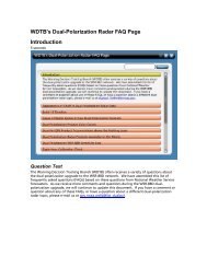
Dual-Polarization Radar Data Guide
Dual-Polarization Radar Data Guide
Dual-Polarization Radar Data Guide
- No tags were found...

Create successful ePaper yourself
Turn your PDF publications into a flip-book with our unique Google optimized e-Paper software.
WDTB <strong>Dual</strong>-Pol Primer FY103. Cold Season <strong>Dual</strong>-Pol <strong>Radar</strong> SignaturesJobsheet 3.2: Precipitation Type in Similar Reflectivity Cores:Dry SnowIntroduction: Unfortunately, good snow storms in central Oklahoma are rare enough that we don’tpresently have KOUN data processed into AWIPS for winter precip that involves just snow. Thus, manyof the cold season precipitation job sheets will ask you to look at images on the jobsheet rather than theWES. For this first cold season jobsheet, the event we have is a freezing rain event so there won’t beany dry snow signatures near the surface. However, there is normally dry snow at some altitude for mostcold season precipitation events, so we’ll be looking above the warm nose you identified in 3.1 to find it.Objectives: Identify dual-pol base data signatures of dry snow in the cold season.Case <strong>Data</strong>: 27 January 2009 winter storm case from central Oklahoma.Instructions:1. Follow the steps 1-4 in Jobsheet 1.1 for loading D2D for the dual-pol primer jobsheets. Here arethe steps, in brief:a. Open a terminal window on your WESb. Change directory to the dual_pol primer case, i.e. cd /data/awips/dualpol_primerc. Start the launcher script, i.e. ./dualpol_primer.cshd. Type in 3.2 from the list of optionse. After ~1 minute, the new windows will close to be replaced by a “Start D-2D” window.f. Click ok in the “Start D-2D” window and the subsequent window that pops up.2. Open the procedure “<strong>Dual</strong>-pol Primer” and select the bundle “Jobsheet 3.2”. This will give youthese products loaded into the following 4-panel layout, as well as the ability to do environmentalsampling:1. All-Tilts reflectivity (Z) paired with storm-relative mean radial velocity (SRM)2. All-Tilts differential reflectivity (ZDR) paired with base mean radial velocity (V)3. All-Tilts specific differential phase shift (KDP) paired with hydrometeor classification(HCA)4. All-Tilts correlation coefficient (CC) with velocity spectrum width (SW)3. Focus on the 1722 UTC All-Tilts. The area of interest is northwest of the radar, beyond themelting layer characterized by a ring of CC values less than 0.95 surrounding the radar.4. Note that CC/ZDR/KDP data will be unusable for some elevation angles. When you see ZDRturn red all of a sudden or if CC goes all dark purple, you know the data are worthless and shouldbe skipped over. This is an issue with the research data and will not occur with the WSR-88D.Question 1: Ensure cursor sampling is turned on so you can see what the 12 UTC raobtemperatures are. Northwest of KOUN roughly between 295-315 azimuth on the 2.4 deg tilts, useCC to determine the height (AGL) of the top and bottom of the melting layer. Use your skillsobtained from Jobsheet 3.1 to identify the melting layer.Answer: It’s nearly always best to use CC to identify the melting layer. Using CC, we found the bottom ofthe melting layer to be around 5.6 kft AGL, and the top around 7.0 kft AGL.Question 2: Where the radar identifies the melting layer between 295-315 azimuth on the 2.4 degtilts, what is the 12 Z raob temperature at the top and bottom of it?23