Zephyr: A High Altitude Long Endurance Unmanned Air Vehicle ...
Zephyr: A High Altitude Long Endurance Unmanned Air Vehicle ...
Zephyr: A High Altitude Long Endurance Unmanned Air Vehicle ...
- No tags were found...

Create successful ePaper yourself
Turn your PDF publications into a flip-book with our unique Google optimized e-Paper software.
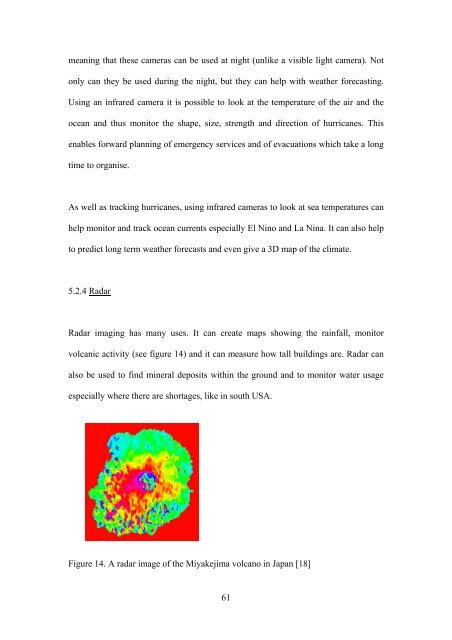
meaning that these cameras can be used at night (unlike a visible light camera). Notonly can they be used during the night, but they can help with weather forecasting.Using an infrared camera it is possible to look at the temperature of the air and theocean and thus monitor the shape, size, strength and direction of hurricanes. Thisenables forward planning of emergency services and of evacuations which take a longtime to organise.As well as tracking hurricanes, using infrared cameras to look at sea temperatures canhelp monitor and track ocean currents especially El Nino and La Nina. It can also helpto predict long term weather forecasts and even give a 3D map of the climate.5.2.4 RadarRadar imaging has many uses. It can create maps showing the rainfall, monitorvolcanic activity (see figure 14) and it can measure how tall buildings are. Radar canalso be used to find mineral deposits within the ground and to monitor water usageespecially where there are shortages, like in south USA.Figure 14. A radar image of the Miyakejima volcano in Japan [18]61