2007 - Centre for Ecological Sciences - Indian Institute of Science
2007 - Centre for Ecological Sciences - Indian Institute of Science
2007 - Centre for Ecological Sciences - Indian Institute of Science
- No tags were found...

Create successful ePaper yourself
Turn your PDF publications into a flip-book with our unique Google optimized e-Paper software.
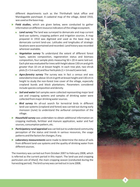
different departments such as the Thirthahalli taluk <strong>of</strong>fice andMandagadde panchayat. A cadastral map <strong>of</strong> the village, dated 1910,was used as the base map.Field studies, which are given below, were conducted to gatherin<strong>for</strong>mation on different resource indicators <strong>of</strong> the village ecosystem.Land survey The land was surveyed to demarcate and map currentland-use systems, cropping pattern and irrigation sources. A mapprepared in 1910 was digitized and used as the base map todemarcate current land-use. Latitudes and longitudes <strong>of</strong> strategiclocations were ascertained and recorded. Land history was recordedwherever available.Vegetation survey To understand the extent <strong>of</strong> different <strong>for</strong>esttypes, species composition, regeneration status and biomasscomposition, four sample plots measuring 50 × 20 m were laid out.Each plot was evaluated <strong>for</strong> trees with height above 130 cm and girthgreater than 10 cm at breast height. In each tree plot, two shrubplots (5 × 5 m each) and four herb plots (1 × 1m each) were laid.Agro-<strong>for</strong>estry survey The survey was in fact a census and wasextended to trees above 10 cm in girth at breast height and 130 cm inheight to study the non-<strong>for</strong>est tree cover <strong>of</strong> the village, especiallycropland bunds and block plantations. Parameters consideredinclude species composition and density.Soil and water Soil samples were collected representing major landuse and cropping systems and samples <strong>of</strong> drinking water werecollected from major drinking water sources.Bird survey An all-out search <strong>for</strong> terrestrial birds in differentland-use systems (cropland and <strong>for</strong>est) was carried out during earlymonsoon (June) to understand the avifaunal composition <strong>of</strong> thevillage.Household survey was undertaken to obtain additional in<strong>for</strong>mation oncropping methods, fertilizer and manure application, water and fuelsources, consumption pattern, etc.Participatory rural appraisal was carried out to understand communityperception <strong>of</strong> the status and trends in various resources, the usagepatterns and the factors <strong>for</strong> changes, if any.Laboratorymeasurements were made to determine the status <strong>of</strong> soilsfrom different land-use systems and the quality <strong>of</strong> drinking water fromdifferent sources.The inventory was carried out from October <strong>2007</strong> to February 2008, whichis referred as the current period in this report. The land-use and croppingparticulars are <strong>of</strong> kharif, the main cropping season (conducted during theharvesting period). The bird survey was carried out in June 2008.5