Newlands Cross Upgrade EIS - European Investment Bank
Newlands Cross Upgrade EIS - European Investment Bank
Newlands Cross Upgrade EIS - European Investment Bank

You also want an ePaper? Increase the reach of your titles
YUMPU automatically turns print PDFs into web optimized ePapers that Google loves.
Kildare<br />
County Council<br />
South Dublin<br />
County Council<br />
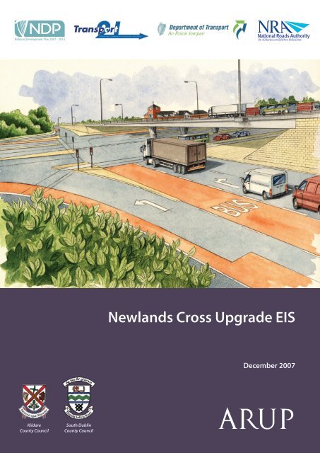
<strong>Newlands</strong> <strong>Cross</strong> <strong>Upgrade</strong> <strong>EIS</strong><br />
December 2007
South Dublin County Council<br />
N7 <strong>Newlands</strong> <strong>Cross</strong> <strong>Upgrade</strong><br />
Environmental Impact Statement<br />
December 2007<br />
Arup Consulting Engineers<br />
50 Ringsend Road, Ballsbridge, Dublin 4<br />
Tel +353 1 233 4455 Fax +353 1 668 3169<br />
www.arup.ie<br />
Job number D 4556/11
South Dublin County Council N7 <strong>Newlands</strong> <strong>Cross</strong> <strong>Upgrade</strong><br />
Environmental Impact Statement<br />
Arup Consulting Engineers<br />
PREFACE<br />
The Environmental Impact Statement (<strong>EIS</strong>) for the <strong>Newlands</strong> <strong>Cross</strong> <strong>Upgrade</strong> consists of the following<br />
documents:<br />
Non Technical Summary<br />
Environmental Impact Statement (Main Text) including Non-Technical Summary and Appendices<br />
ACKNOWLEDGEMENTS<br />
This Environmental Impact Statement has been prepared by Arup consulting Engineers and their specialist<br />
environmental sub-consultants for South Dublin County Council. The assessment team draw primarily on<br />
in-house resources in traffic; construction activities; geology; soils; groundwater; air quality; climate;<br />
surface water and drainage; material assets and utilities. Specialist technical contribution was provided in:<br />
Archaeology, Architecture and Cultural Heritage by Margaret Gowen and Co. Ltd.<br />
Ecological Assessment by Natura Environmental Consultants<br />
Golf Design by Spring Golf Design<br />
Landscape and Visual by Mitchell and Associates<br />
Noise and Vibration by AWN Consulting Ltd.<br />
Photomontages by Modelworks<br />
Socio-Economic Assessment by Optimize<br />
<strong>EIS</strong> DISPLAY LOCATIONS<br />
Members of the public may inspect copies of the <strong>EIS</strong> document, including the Non-Technical Summary<br />
during normal office hours at the following location:<br />
South Dublin County Council<br />
County Hall<br />
Town Centre<br />
Tallaght<br />
Dublin 24<br />
SDCC Clondalkin Civic Centre<br />
Clondalkin Village<br />
Dublin 22<br />
December 2007<br />
Kildare County Council<br />
Aras Chill Dara<br />
Devoy Park<br />
Naas<br />
Co. Kildare<br />
Kildare County Council<br />
National Roads Design Office<br />
Maudlins<br />
Naas<br />
Co. Kildare<br />
The Non-Technical Summary is available for €10 from the above address. Complete copies of the <strong>EIS</strong><br />
document can be purchased in hard copy for €50 and on compact disc for €10. This <strong>EIS</strong> will also be<br />
uploaded on the SDCC website www.sdcc.ie
South Dublin County Council N7 <strong>Newlands</strong> <strong>Cross</strong> <strong>Upgrade</strong><br />
Environmental Impact Statement<br />
PREFACE<br />
TABLE OF CONTENTS<br />
NON TECHNICAL SUMMARY<br />
GLOSSARY<br />
1. INTRODUCTION........................................................................................................................1<br />
1.1 Introduction ................................................................................................................................1<br />
1.2 Purpose of this Report ...............................................................................................................1<br />
1.3 Scope .........................................................................................................................................1<br />
1.4 Planning Approval Process........................................................................................................1<br />
1.5 <strong>EIS</strong> Methodology........................................................................................................................2<br />
1.6 <strong>EIS</strong> Format.................................................................................................................................3<br />
1.7 Review of Study Area ................................................................................................................4<br />
1.8 Consultation Process .................................................................................................................4<br />
1.9 Study and Design Team ............................................................................................................5<br />
1.10 Difficulties Encountered during Study........................................................................................6<br />
2. PLANNING POLICY CONTEXT................................................................................................7<br />
2.1 Introduction ................................................................................................................................7<br />
2.2 National Development Plan 2000 – 2006 5 .................................................................................7<br />
2.3 National Development Plan 2007 – 2013 6 .................................................................................8<br />
2.4 National Spatial Strategy 2002 – 2020 7 .....................................................................................9<br />
2.5 Strategic Planning Guidelines for the Greater Dublin Area 1999 8 .............................................9<br />
2.6 DTO “Platform for Change” – Strategy 2000 – 2016 9 ..............................................................10<br />
2.7 South Dublin County Council Development Plan 2004 – 2010, and Variation 10 .....................11<br />
2.8 Transport 21 12 ..........................................................................................................................12<br />
2.9 Other Policy Documents ..........................................................................................................12<br />
3. BACKGROUND TO PROJECT / ALTERNATIVES................................................................15<br />
3.1 Introduction ..............................................................................................................................15<br />
3.2 Need for the Proposed Scheme...............................................................................................15<br />
3.3 Adjacent Land Uses.................................................................................................................16<br />
3.4 Existing Junction Layout ..........................................................................................................17<br />
3.5 Alternatives Considered...........................................................................................................17<br />
3.6 Detailed Consideration of Overpass and Underpass Options .................................................19<br />
3.7 Construction.............................................................................................................................20<br />
3.8 Planning Constraints................................................................................................................24<br />
3.9 Noise and Vibration..................................................................................................................24<br />
3.10 Air Quality & Climate................................................................................................................36<br />
3.11 Landscape and Visual..............................................................................................................42<br />
3.12 Socio-Economic Impact ...........................................................................................................50<br />
3.13 Surface Water and Drainage ...................................................................................................62<br />
3.14 Economics................................................................................................................................64<br />
3.15 Conclusions and Recommendations .......................................................................................65<br />
4. THE PROPOSED SCHEME ....................................................................................................67<br />
4.1 Introduction ..............................................................................................................................67<br />
4.2 Scheme Design Overview........................................................................................................67<br />
4.3 Scheme Construction...............................................................................................................74<br />
Arup Consulting Engineers<br />
December 2007 Page i
South Dublin County Council N7 <strong>Newlands</strong> <strong>Cross</strong> <strong>Upgrade</strong><br />
Environmental Impact Statement<br />
5. TRAFFIC AND TRANSPORT .................................................................................................83<br />
5.1 Introduction ..............................................................................................................................83<br />
5.2 Outline Process........................................................................................................................83<br />
5.3 Existing Junction Layout ..........................................................................................................83<br />
5.4 Other Committed Transport Schemes .....................................................................................85<br />
5.5 Operation of Proposed <strong>Newlands</strong> <strong>Cross</strong> Junction...................................................................85<br />
5.6 Area-wide Modelling ................................................................................................................86<br />
5.7 ‘Do Minimum and ‘Do Something’ Scenarios ..........................................................................87<br />
5.8 Traffic Capacity Analysis..........................................................................................................88<br />
5.9 Cost Benefit Analysis ...............................................................................................................93<br />
5.10 Construction Traffic..................................................................................................................93<br />
5.11 Conclusions..............................................................................................................................94<br />
6. SOILS, GEOLOGY AND HYDROGEOLOGY.........................................................................95<br />
6.1 Introduction ..............................................................................................................................95<br />
6.2 Methodology.............................................................................................................................95<br />
6.3 Existing Soils, Geology and Hydrogeology..............................................................................96<br />
6.4 Predicted Impacts ....................................................................................................................99<br />
6.5 Mitigation Measures...............................................................................................................101<br />
6.6 Residual Impacts ...................................................................................................................102<br />
7. LANDSCAPE AND VISUAL ASSESSMENT........................................................................105<br />
7.1 Introduction ............................................................................................................................105<br />
7.2 Methodology...........................................................................................................................105<br />
7.3 Receiving Environment ..........................................................................................................106<br />
7.4 Predicted Impacts ..................................................................................................................109<br />
7.5 Mitigation Measures...............................................................................................................114<br />
7.6 Residual Impact .....................................................................................................................116<br />
7.7 Difficulties in compiling specified information ........................................................................116<br />
8. NOISE & VIBRATION ...........................................................................................................117<br />
8.1 Introduction & Methodology ...................................................................................................117<br />
8.2 Description of Existing Conditions .........................................................................................118<br />
8.3 Operational Noise Impact ......................................................................................................122<br />
8.4 Description of Mitigation Measures........................................................................................127<br />
8.5 Construction Noise Impacts and Mitigation Measures...........................................................128<br />
8.6 Residual Impacts ...................................................................................................................132<br />
8.7 Vibration .................................................................................................................................132<br />
9. AIR QUALITY ........................................................................................................................137<br />
9.1 Introduction ............................................................................................................................137<br />
9.2 Air Quality Standards and Other Relevant Guidance ............................................................137<br />
9.3 Assessment Methodology......................................................................................................141<br />
9.4 Description of the Receiving Environment.............................................................................146<br />
9.5 Predicted Impact on Air Quality .............................................................................................149<br />
9.6 Air Quality Mitigation ..............................................................................................................154<br />
9.7 Air Quality Residual Impact....................................................................................................155<br />
10. CLIMATE ...............................................................................................................................157<br />
10.1 Introduction ............................................................................................................................157<br />
10.2 The Kyoto Protocol ................................................................................................................157<br />
10.3 Receiving Environment ..........................................................................................................157<br />
10.4 Assessment Methodology......................................................................................................158<br />
10.5 Predicted Climatic Impacts of the Proposed Scheme............................................................158<br />
Arup Consulting Engineers<br />
December 2007 Page ii
South Dublin County Council N7 <strong>Newlands</strong> <strong>Cross</strong> <strong>Upgrade</strong><br />
Environmental Impact Statement<br />
10.6 Mitigation................................................................................................................................159<br />
10.7 Residual Impact .....................................................................................................................159<br />
11. ECOLOGY .............................................................................................................................161<br />
11.1 Introduction ............................................................................................................................161<br />
11.2 Methodology...........................................................................................................................161<br />
11.3 Existing Environment .............................................................................................................162<br />
11.4 Predicted Impacts ..................................................................................................................167<br />
11.5 Mitigation Measures...............................................................................................................168<br />
11.6 Residual Impacts ...................................................................................................................171<br />
12. ARCHAEOLOGY, ARCHITECTURE AND CULTURAL HERITAGE...................................173<br />
12.1 Introduction ............................................................................................................................173<br />
12.2 Methodology...........................................................................................................................173<br />
12.3 Existing Environment .............................................................................................................175<br />
12.4 Predicted Impacts ..................................................................................................................195<br />
12.5 Mitigation Measures...............................................................................................................196<br />
12.6 Residual Impacts ...................................................................................................................198<br />
13. COMMUNITY AND MATERIAL ASSETS.............................................................................201<br />
13.1 Introduction ............................................................................................................................201<br />
13.2 Community.............................................................................................................................201<br />
13.3 Property and Material Assets.................................................................................................215<br />
13.4 Summary................................................................................................................................220<br />
14. SURFACE WATER AND DRAINAGE ..................................................................................221<br />
14.1 Introduction ............................................................................................................................221<br />
14.2 Methodology...........................................................................................................................221<br />
14.3 Existing Environment .............................................................................................................221<br />
14.4 Predicted Impacts ..................................................................................................................226<br />
14.5 Mitigation Measures...............................................................................................................231<br />
14.6 Residual Impacts ...................................................................................................................232<br />
14.7 Conclusion .............................................................................................................................233<br />
15. SUMMARY OF MITIGATION MEASURES, RESIDUAL IMPACTS AND INTERACTION<br />
EFFECTS...............................................................................................................................235<br />
15.1 Introduction ............................................................................................................................235<br />
15.2 Summary of Mitigation Measures ..........................................................................................235<br />
15.3 Summary of Residual Impacts...............................................................................................245<br />
15.4 Interaction of Effects ..............................................................................................................247<br />
Arup Consulting Engineers<br />
December 2007 Page iii
South Dublin County Council N7 <strong>Newlands</strong> <strong>Cross</strong> <strong>Upgrade</strong><br />
Environmental Impact Statement<br />
FIGURES<br />
Chpt Figure # Figure Name<br />
1 1.1 Proposed Scheme Location<br />
1.2 Proposed Scheme Plan<br />
1.3 Artists Impression of Proposed Scheme (No. 1)<br />
1.4 Artists Impression of Proposed Scheme (No. 2)<br />
1.5 Environmental Impact Assessment Approach<br />
2 N/A<br />
3 3.1 Existing Land Use<br />
3.2 Existing Junction Layout<br />
3.3 Underpass Scheme Plan<br />
3.4 Artists Impression – Underpass<br />
3.5a Traffic Management Overpass - 1 of 2<br />
3.5b Traffic Management Overpass - 2 of 2<br />
3.5c Traffic Management Underpass Phase 1 - 1 of 2<br />
3.5d Traffic Management Underpass Phase 1 - 2 of 2<br />
3.5e Traffic Management Underpass Phase 2 - 1 of 2<br />
3.5f Traffic Management Underpass Phase 2 - 2 of 2<br />
3.6 Visual Assessment Key Plan<br />
3.7 Overpass Context Section A-A at Chainage 800<br />
3.8 Overpass Context Section B-B at Chainage 1,000<br />
3.9 Underpass Context Section A-A at Chainage 800<br />
3.10 Underpass Context Section B-B at Chainage 1000<br />
3.11a Options Selection Matrix- Ranking Explanation<br />
3.11b Options Selection Matrix- Construction Phase<br />
3.11c Options Selection Matrix- Operational Phase<br />
4 4.1 Proposed Scheme Layout - Keyplan<br />
4.2 Proposed Scheme Layout - 1 of 4<br />
4.3 Proposed Scheme Layout - 2 of 4<br />
4.4 Proposed Scheme Layout - 3 of 4<br />
4.5 Proposed Scheme Layout - 4 of 4<br />
4.6 Section A-A at Chainage 800<br />
4.7 Section B-B at Chainage 1,000<br />
4.8 Longitudinal Section<br />
4.9 Permanent & Temporary Landtake<br />
4.10 Construction Methodology : Stage 1<br />
4.11 Construction Methodology : Stage 2<br />
4.12 Construction Methodology : Stage 3<br />
4.13 Construction Methodology : Stage 4<br />
4.14 Construction Methodology : Stage 5<br />
4.15 Construction Methodology : Stage 6<br />
4.16 Construction Methodology : Stage 7<br />
5 5.1 Existing Flows (2005) - AM Peak Hour<br />
5.2 Existing Flows (2005) - PM Peak Hour<br />
5.3 Existing Bus Facilities<br />
5.4 Bus Routes passing through Existing Junction<br />
5.5 Existing Cycle Facilities<br />
5.6 Existing Pedestrian <strong>Cross</strong>ings<br />
5.7 Proposed Signal Control Operation<br />
5.8 Proposed Bus Facilities<br />
5.9 Proposed Cycle Facilities<br />
5.10 Proposed Pedestrian <strong>Cross</strong>ings<br />
5.11 Do Minimum 2010 & 2025 AADTs<br />
5.12 Do Something 2010 & 2025 AADTs<br />
Arup Consulting Engineers<br />
December 2007 Page iv
South Dublin County Council N7 <strong>Newlands</strong> <strong>Cross</strong> <strong>Upgrade</strong><br />
Environmental Impact Statement<br />
Chpt Figure # Figure Name<br />
5.13 Do Minimum 2010 & 2025 (PCU’s) AM Peak<br />
5.14 Do Something 2010 & 2025 (PCU’s) AM Peak<br />
5.15 Do Minimum 2010 & 2025 (PCU’s) PM Peak<br />
5.16 Do Something 2010 & 2025 (PCU’s) PM Peak<br />
6 N/A<br />
7 7.1 Topography Map<br />
7.2 Existing Vegetation Map<br />
7.3 Landuse Map<br />
7.4 Pedestrian Map<br />
7.5 Vehicular Movement<br />
7.6 Visual Analysis Map<br />
7.7 Camera Location Map<br />
7.8 View 1 Existing<br />
7.9 View 1 Proposed<br />
7.10 View 2 Existing<br />
7.11 View 2 Proposed<br />
7.12 View 3 Existing<br />
7.13 View 3 Proposed<br />
7.14 View 4 Existing<br />
7.15 View 4 Proposed<br />
7.16 View 5 Existing<br />
7.17 View 5 Proposed<br />
7.18 View 6 Existing<br />
7.19 View 6 Proposed<br />
7.20 View 7 Existing<br />
7.21 View 7 Proposed<br />
7.22 View 8 Existing<br />
7.23 View 8 Proposed<br />
7.24 Mitigation at Golf Course<br />
8 8.1 Survey Locations S01 to S06 and V01<br />
8.2 Schematic of Model<br />
8.3 Receiver Locations R01 to R25<br />
8.4 Noise Mitigation Measures - With Proposed Road<br />
9 9.1 Baseline Air Quality Monitoring Locations<br />
9.2 DMRB Receptor Locations<br />
9.3 Breeze Receptor Locations<br />
9.4 NO2 Isopleth in 2010<br />
9.5 NO2 Isopleth in 2025<br />
10 N/A<br />
11 11.1 Habitat Map<br />
12<br />
12.1 RMP map showing recorded archaeological sites, protected structures,<br />
architectural and cultural heritage constraints.<br />
12.2 Down Survey map, 1656<br />
12.3 Rocque’s 1760 map of Dublin<br />
12.4 Taylor’s map of County Dublin, 1816<br />
12.5 (a & b) Map of proposed junction upgrade, with 1st Edition Ordnance Survey (1843)<br />
overlaid<br />
12.6 2 nd Edition Ordnance Survey (1874), showing approximate location proposed<br />
Arup Consulting Engineers<br />
December 2007 Page v
South Dublin County Council N7 <strong>Newlands</strong> <strong>Cross</strong> <strong>Upgrade</strong><br />
Environmental Impact Statement<br />
Chpt Figure # Figure Name<br />
scheme<br />
12.7<br />
3 rd Edition Ordnance Survey (1912), showing approximate location proposed<br />
scheme<br />
12.8<br />
Location of geotechnical trial pits excavated along south side of N7 <strong>Newlands</strong><br />
<strong>Cross</strong> (2006)<br />
13 13.1 Pedestrian and Cyclist flows<br />
14 14.1 Regional Surface Water Catchments<br />
14.2 Existing Surface Water Drainage<br />
14.3 Proposed Surface Water Drainage<br />
Arup Consulting Engineers<br />
December 2007 Page vi
South Dublin County Council N7 <strong>Newlands</strong> <strong>Cross</strong> <strong>Upgrade</strong><br />
Environmental Impact Statement<br />
PLATES<br />
Chpt Plate # Plate Name<br />
3 3.1 View looking east along the N7 roadway towards the junction<br />
3.2 View looking west along the N7 roadway towards the junction<br />
3.3 View looking south towards junction from the Fonthill Road<br />
3.4 View looking north towards junction from the Belgard Road<br />
3.5 View showing the visual dominant feature of the Bewleys Hotel<br />
3.6 View showing the low visual amenity value along this section of the N7 road<br />
corridor<br />
12 12.1 Rear façade of Mooreenaruggan House (ID 1), facing north<br />
12.2 View of <strong>Newlands</strong> Villa (ID 2), facing southeast<br />
12.3 View of farm building (ID 3), facing north<br />
12.4 View of St Brigid’s Cottages (ID 4), facing north-northwest<br />
12.5 Mid-19 th century derelict cottage (ID 5), facing south<br />
12.6 ID 6 facing east-southeast<br />
12.7 View of mid-20 th century terrace (ID 7)<br />
12.8 ID 8<br />
12.9 ID 9<br />
12.10 ID 10<br />
12.11 ID 11 & 12<br />
12.12 ID 13<br />
12.13 ID 15<br />
12.14 ID 17<br />
12.15 Roadside memorial (date 1923)<br />
12.16 Roadside memorial (date 1997)<br />
12.17 View south along Belgard Road<br />
12.18 Field to west of derelict cottage, facing west-southwest<br />
12.19 Unoccupied plot to north of Mooreenaruggan House, facing south<br />
12.20 Wasteland on north side of N7 East, facing north<br />
12.21 Mature trees in median, south boundary of original Dublin / Naas road, facing<br />
east<br />
12.22 View along northern boundary of <strong>Newlands</strong> Golf Course, facing west<br />
12.23 View of western pasture field south of N7 road, facing east<br />
12.24 View of eastern pasture field south of N7 road, facing <strong>Newlands</strong> Villa to east<br />
12.25 Gate and stone pillar associated with Mooreenaruggan House, facing west<br />
12.26 View west along landscaped area north of N7 road<br />
12.27 Veronica Guerin memorial at Boot Road junction<br />
12.28 West gable of farm building (ID 3), showing masonry lower courses and<br />
blocked doorway<br />
12.29 Later extensions to <strong>Newlands</strong> Villa (ID 2), showing extent of fire damage.<br />
Arup Consulting Engineers<br />
December 2007 Page vii
South Dublin County Council N7 <strong>Newlands</strong> <strong>Cross</strong> <strong>Upgrade</strong><br />
Environmental Impact Statement<br />
APPENDICES<br />
Appendix A1 Introduction<br />
Arup Consulting Engineers<br />
N/A<br />
Appendix A2 Planning and Policy<br />
Appendix A3<br />
Appendix A4<br />
Appendix A5<br />
Appendix A6<br />
Appendix A7<br />
Appendix A8<br />
Appendix A9<br />
Appendix A10<br />
N/A<br />
Background to the Project<br />
N/A<br />
The Proposed Scheme<br />
N/A<br />
Traffic and Transport<br />
A5.1 Traffic Modelling Methodology Report<br />
A5.2 Model Validation Report<br />
Soils, Geology and Hydrogeology<br />
N/A<br />
Landscape and Visual Assessment<br />
N/A<br />
Noise and Vibration<br />
A8.1 Summary of Traffic Speeds as used in the Noise<br />
Model<br />
Air Quality<br />
A9.1 AADTs used for DMRB Modelling<br />
A9.2 Input Data for Breeze Roads Assessment (2010)<br />
A9.3 Input Data for Breeze Roads Assessment (2025)<br />
A9.4 2010 Queuing Links<br />
A9.5 2025 Queuing Links<br />
Climate<br />
N/A<br />
December 2007 Page viii
South Dublin County Council N7 <strong>Newlands</strong> <strong>Cross</strong> <strong>Upgrade</strong><br />
Environmental Impact Statement<br />
Appendix A11<br />
Appendix A12<br />
Appendix A13<br />
Appendix A14<br />
Appendix A15<br />
Arup Consulting Engineers<br />
Ecology<br />
A11.1 Site Evaluation Scheme<br />
A11.2 Terrestrial Sites<br />
A11.3 Details of Potential Tree Bat Roosts<br />
Archaeology, Architecture and Cultural Heritage<br />
A12.1 Summary Tables of Properties/Structures within<br />
Receiving Environment<br />
A12.2 Records of National Museum of Ireland Stray Finds<br />
pertaining to the Townlands along the route<br />
A12.3 National Monuments Legislation (1930-2004)<br />
A12.4 Architectural Heritage (National Inventory) and Historic<br />
Monuments (Miscellaneous Provisions) Act, 1999<br />
A12.5 Standards and Guidelines<br />
A12.6 Impact Rating: Archaeological Heritage<br />
A12.7 Previous Archaeological Investigations in the<br />
Surrounding Area<br />
Community and Material Assets<br />
A13.1 Summary Table of Impacts<br />
Surface Water and Drainage<br />
N/A<br />
Summary of Mitigation Measures, Residual Impact and<br />
Interaction of Effects<br />
N/A<br />
December 2007 Page ix
South Dublin County Council N7 <strong>Newlands</strong> <strong>Cross</strong> <strong>Upgrade</strong><br />
Environmental Impact Statement<br />
Arup Consulting Engineers<br />
December 2007 Page x
South Dublin County Council N7 <strong>Newlands</strong> <strong>Cross</strong> <strong>Upgrade</strong><br />
Environmental Impact Statement<br />
NTS1. INTRODUCTION<br />
Arup Consulting Engineers<br />
South Dublin County Council (SDCC) proposes to upgrade the <strong>Newlands</strong> <strong>Cross</strong> N7 Naas<br />
Road / Belgard / Fonthill Road (R113) at grade junction to a grade separated junction,<br />
resulting in the creation of an overpass. The N7 Mainline will be raised up over its existing<br />
level. The Belgard / Fonthill Road (R113) would remain at the level at which they are<br />
currently. This would result in the N7 Mainline creating a bridge over the Belgard / Fonthill<br />
Road (R113). The proposed interchange upgrade would take approximately two years to<br />
construct and would involve constructing embankments for the N7 Mainline to travel over the<br />
Belgard / Fonthill Road (R113). At its highest the N7 Mainline would be approximately 9 m<br />
over the Belgard / Fonthill Road (R113). Please see Figure 1.2.<br />
The proposed interchange is a conventional grade separation with four ramps connecting the<br />
N7 Mainline via two junctions on the Belgard / Fonthill Road (R113). Traffic signals will be<br />
installed at the two points where the ramps meet the minor road, with dedicated right turning<br />
lanes provided for the Belgard / Fonthill Road (R113). Other works include the upgrade of the<br />
existing priority junction for <strong>Newlands</strong> Golf Club and adjacent residential access to a single<br />
signalised junction, as well as construction of a parallel access road to provide access to lands<br />
to the east of Belgard Road. Footpath and cyclepath facilities are also included for.<br />
The Environmental Impact Statement (<strong>EIS</strong>) methodology is a systematic analysis of the<br />
proposed upgrade in relation to the existing environment and follows guidelines published by<br />
the Environmental Protection Agency (EPA). The overall methodology for <strong>EIS</strong> preparation is:<br />
• Basis for Assessment;<br />
• Impact Assessment and Mitigation;<br />
• Significance of Environmental Issues.<br />
NTS2. PLANNING AND POLICY<br />
This <strong>EIS</strong> has been prepared as part of the statutory development consent procedure for the<br />
proposed <strong>Newlands</strong> <strong>Cross</strong> Junction <strong>Upgrade</strong> having regard to the <strong>European</strong> Community<br />
Environmental Assessment Directive 85/EEC/337 as transposed into Irish Law by the Roads<br />
Act 1993 (and its subsequent amendments) and the Regulations made thereunder, and the<br />
<strong>European</strong> Communities Environmental Impact Assessment (EIA) Regulations 1989 – 2006<br />
(SI No. 168 of 2006).<br />
Under the Roads Act 1993 (as Amended) and the Regulations made thereunder, a road<br />
authority (in this case South Dublin County Council) is obliged to prepare an <strong>EIS</strong> – a<br />
statement of the likely effects on the environment – in respect of certain types of proposed<br />
road developments including major junction upgrades.<br />
The need for the upgraded junction on the N7 at <strong>Newlands</strong> <strong>Cross</strong> is in accordance with<br />
<strong>European</strong>, National and Regional Development strategies including:<br />
• National Development Plan 2000 – 2006<br />
• National Development Plan 2007 – 2013<br />
• National Spatial Strategy 2002 – 2020<br />
• Strategic Planning Guidelines for the Greater Dublin Area<br />
• The DTO ‘A Platform for Change Strategy 2000 – 2016<br />
• South Dublin County Council Development Plan 2004 - 2010<br />
• Transport 21<br />
December 2007 Page NTS1
South Dublin County Council N7 <strong>Newlands</strong> <strong>Cross</strong> <strong>Upgrade</strong><br />
Environmental Impact Statement<br />
Arup Consulting Engineers<br />
On a local level, the proposed upgrading of the <strong>Newlands</strong> <strong>Cross</strong> Junction is a specific<br />
objective (No. 52) of the South Dublin County Development Plan 2004 – 2010.<br />
NTS3. BACKGROUND TO THE PROJECT/ALTERNATIVES<br />
Once the Red Cow Interchange has its upgrade completed as part of the M50 Widening,<br />
<strong>Newlands</strong> <strong>Cross</strong> will pose a significant constraint on what is a major national road upgraded<br />
to a high quality. With this in mind South Dublin County Council and the NRA propose to<br />
address this constraint at <strong>Newlands</strong> <strong>Cross</strong>. This project will represent a major positive impact<br />
on the policies of the National Development Plan 2007-2013, Transport 21 and other policies.<br />
The Naas Road is a primary transportation corridor servicing the area. In addition, the N7<br />
National Primary Route has been identified in the National Spatial Strategy as a<br />
Transportation Corridor linking the Metropolitan areas of the Greater Dublin and Mid-East<br />
Regions with the Metropolitan areas of Limerick and Cork. Since March 2003, the R110 east<br />
of the M50 Red Cow Interchange has become a Strategic Route and as such is managed by the<br />
Dublin Region Traffic Management Centre, as agreed by the four Dublin Local Authorities. It<br />
is proposed to add the section of the N7 from Red Cow to Newland <strong>Cross</strong> to the Strategic<br />
Route at a later date.<br />
<strong>Newlands</strong> <strong>Cross</strong> is located in the suburb of Clondalkin with a diverse mixed use urban setting<br />
which includes an array of residential, retail, community, agricultural and amenity land uses.<br />
The ‘Do-Minimum’ Option assumes that the <strong>Newlands</strong> <strong>Cross</strong> Interchange is not upgraded to a<br />
grade separated junction i.e. that the existing N7 Mainline and Belgard / Fonthill Road (R113)<br />
would remain at the level at which they are currently. The ‘Do-Minimum’ Option is likely to<br />
lead to increasingly significant pressure on the existing road and regional road network and<br />
would limit the development capacity of the local area.<br />
An initial feasibility study examined at grade and grade separated options for an upgrade of<br />
the junction and concluded that grade separation was required. Some initial conclusions were<br />
also reached on the format of the junction that would be provided within the grade separation<br />
scheme.<br />
A further assessment was undertaken in relation to the alignment options for grade separation.<br />
This was carried out under the following three headings in order to narrow down the number<br />
of options for further assessment:<br />
a) Mainline Road: A review was carried out to assess whether the N7 or the R113 should be<br />
the mainline. It was decided that the N7 should be the mainline based on its importance as<br />
a National Primary Road.<br />
b) Vertical Alignment: A review was carried out to assess vertical alignment options.<br />
Overpass, underpass and half and half options were examined. On the basis of the review<br />
undertaken it was decided to discount half and half and continue with overpass and<br />
underpass<br />
c) Horizontal Alignment: A review was undertaken to assess horizontal alignment options.<br />
The constraints identified above ruled out a large scale realignment of the N7 and also<br />
steered the scheme towards land take to the south of the existing public road corridor.<br />
This process concluded that a grade separation of the N7 mainline from the remainder of the<br />
junction was a feasible junction layout. This layout could be progressed as either an underpass<br />
or an overpass. Further assessment of both options was then carried out to minimise land take<br />
and analysis was undertaken to validate these scheme design refinements. The assessment was<br />
carried out under a number of criteria (i.e. Construction, environmental, economic etc.) to<br />
enable the full consideration of the likely effects of each option.<br />
December 2007 Page NTS2
South Dublin County Council N7 <strong>Newlands</strong> <strong>Cross</strong> <strong>Upgrade</strong><br />
Environmental Impact Statement<br />
Arup Consulting Engineers<br />
The findings of this assessment process highlighted the following issues. Firstly, there are<br />
significant construction issues with the Underpass Option when compared with the Overpass<br />
Option. To construct the Underpass, approximately 6 metres of bedrock would need to be<br />
excavated, which given the location of the junction, would be a time consuming and onerous<br />
task. As a result of this issue construction of the underpass could take approximately 1 year<br />
longer. This increased duration in turn has a number of knock on effects with regard to traffic<br />
disruption, severance, noise and dust. On a national road of such importance these issues<br />
equate to significant impacts.<br />
Conversely, the Overpass Option has greater operational impacts. Noise levels will increase<br />
slightly at approximately 5 No. receptors. However, this impact can be mitigated back to at<br />
least existing levels. There will also be an increased visual impact with the overpass option<br />
particularly at a number of residences along the northern boundary east of the junction, at<br />
Bewleys Hotel and at the Golf Club. These impacts can also be mitigated somewhat through a<br />
combination of materials selection and landscape design. Following mitigation, the impact<br />
will be moderate and neutral.<br />
In addition, there is a significant difference in the cost for construction of both options. The<br />
Overpass will cost approximately €53 million whereas the Underpass will cost approximately<br />
€78.7 million.<br />
Therefore, having considered the environmental impacts, engineering characteristics and the<br />
economics of both options it was recommended that the overpass was the preferred junction<br />
choice.<br />
NTS4. THE PROPOSED SCHEME<br />
Chapter 4 presents an overview of the proposed scheme. Information on the design process<br />
and scheme construction is provided. The proposed scheme will grade separate the N7<br />
mainline traffic with the Belgard / Fonthill Road (R113) traffic at <strong>Newlands</strong> <strong>Cross</strong> by carrying<br />
the N7 mainline (3+3 lanes) over the at-grade R113. The junction has been designed to<br />
minimise the amount of permanent and temporary land take. In general all third party landtake<br />
is on the south side of the junction, principally from <strong>Newlands</strong> Golf Club and from private<br />
holdings on the east side of Belgard Road. In order to limit land take to the south, the scheme<br />
was brought as tight as possible up to the road boundary to the north of the existing junction.<br />
The permanent and temporary landtake associated with the scheme is illustrated in Figure 4.9.<br />
The cross section of the mainline N7 is illustrated on Figure 4.6 and 4.7 at Bewleys Hotel and<br />
immediately east of the junction respectively. Interchange ramps on all four sides of the<br />
junction will allow full access between the N7 and the R113. On Fonthill Road South it is<br />
proposed to increase the current 4 lane provision to 5 lanes with minimal third party land<br />
acquisition. A key feature of the upgrade of the Service Road will be the closing off of all<br />
existing direct accesses to and from the N7 and their replacement with a single merge onto the<br />
N7. A new junction on the Belgard Road will provide access to the <strong>Newlands</strong> Golf Club,<br />
houses on the Old Belgard Road and a private residence.<br />
The proposed scheme will retain a dedicated westbound bus lane on the N7 up to <strong>Newlands</strong><br />
<strong>Cross</strong>. The existing eastbound bus lane will be retained in the new scheme up to the Boot<br />
Road merge. The Belgard Road northbound bus lane will be retained as per its current form in<br />
the new scheme. Throughout the scheme all existing pedestrian and cycle routes have been<br />
retained. There is full and controlled pedestrian access through the junction. An off-road<br />
cycle track will be provided on the outbound diverge to replace the existing similar facility.<br />
This will connect to a proposed on-road cycle track on Belgard Road, replacing the existing<br />
similar facility. Also on-road cycle tracks will be provided on the Service Road, again to<br />
reinstate what is currently there.<br />
December 2007 Page NTS3
South Dublin County Council N7 <strong>Newlands</strong> <strong>Cross</strong> <strong>Upgrade</strong><br />
Environmental Impact Statement<br />
Arup Consulting Engineers<br />
The existing boundary treatment has been retained as far as practicable throughout the<br />
scheme. Safety Fences and Barriers are proposed at locations as required under the NRA<br />
DMRB. The various utility companies have been consulted to determine the location of<br />
existing services in the vicinity of the junction. All utility diversions will occur within the<br />
extent of the permanent landtake for the scheme and will be lowered or protected as<br />
appropriate.<br />
The proposed scheme street lighting will have an improved performance compared to the<br />
existing installation as it will use more modern lantern types and control gears. The lighting<br />
columns will be a maximum 14m in height, and lanterns will not exceed 400 watts in line with<br />
those currently in existence at the junction. To minimise the light pollution, it is proposed that<br />
all the lanterns will be flat glass, full cut-off type.<br />
The scheme drainage design includes for carrier drains and filter drains for both surface water<br />
drainage and subgrade drainage respectively to ensure separation of both. Petrol/Oil<br />
interceptors, silt traps and spill containment will also be provided.<br />
The scheme construction is estimated to take approximately 22 months to complete. It is<br />
anticipated that construction work would commence in 2009 with an opening date in late<br />
2010. It is anticipated that approximately 100 people could be employed on the scheme<br />
construction works. An outline construction method has been developed indicating feasible<br />
temporary traffic arrangements to ensure that the scheme can be built within the site<br />
constraints.<br />
The proposed scheme will be constructed in a manner which will minimise, as much as<br />
possible, any disturbance to the local residents and road users. To minimise inconvenience to<br />
the road user, all existing traffic movements at the junction will be facilitated within the<br />
proposed overall temporary traffic management scheme. In addition, access to existing<br />
residential areas, business premises and public facilities will be maintained during<br />
construction. In order to minimise disruption to existing traffic, a Traffic Management Plan<br />
for construction traffic will be developed whereby construction vehicles would be confined to<br />
appropriate roads and safe access and egress points would be identified along the extent of the<br />
scheme. All construction activities will be separated from public traffic. All construction<br />
works will be undertaken in a clearly delineated site area which will have specific entry and<br />
exit points for construction related traffic onto the public road network.<br />
A construction compound will be located within the lands being made available to the<br />
contractor. The site offices will be located to the south of the N7. Material and equipment<br />
storage will be located within the body of the construction site. The construction compound<br />
will be fully engineered with appropriate services and will be fenced off for security purposes.<br />
Access to the compound will be restricted to site personnel and authorised visitors only.<br />
Construction methods and phasing will also be developed to minimise noise, air quality and<br />
other impacts on the community. Construction works will also be undertaken in a manner<br />
which will minimise impact on the environment including residential properties, amenity<br />
areas, water features, flora and fauna habitat and archaeological and architectural sites.<br />
In line with the principles of sustainable development, the scheme will seek to minimise the<br />
amount of materials brought into the construction site. This will be achieved by re-using as<br />
much of the materials generated during construction as possible, provided that they satisfy the<br />
specified engineering standards.<br />
December 2007 Page NTS4
South Dublin County Council N7 <strong>Newlands</strong> <strong>Cross</strong> <strong>Upgrade</strong><br />
Environmental Impact Statement<br />
NTS5. TRAFFIC AND TRANSPORT<br />
Arup Consulting Engineers<br />
The purpose of this transportation assessment is to quantify the effect of the proposed scheme<br />
in terms of its operational performance, value for money and its effect on the transport<br />
network in Dublin. The steps in the process were traffic data collection, preparation of an<br />
existing (2005) area-wide traffic assignment model, preparation of forecast Opening Year and<br />
Design Year models, and preparation of LINSIG capacity model of the N7 / R113 junction<br />
proposals in order to test the junction layout.<br />
The scheme developed for <strong>Newlands</strong> <strong>Cross</strong> is based on a grade separated interchange – with a<br />
free flow N7 passing over an at-grade R133 / N7 slip roads junction. The at-grade layout<br />
consists of two adjacent signal controlled junctions, which will operate as a single entity to<br />
ensure co-ordination of signal timings and hence movements through the junction.<br />
Capacity analysis was undertaken which indicated that without the scheme in place (the Do-<br />
Minimum scenario), significant delay and congestion is forecast to occur. With the scheme in<br />
place (Do-Something), the at-grade signal controlled junction has appropriate capacity to<br />
ensure that queuing does not occur on key links (eg. N7 off-slip roads, R113 link across N7<br />
mainline). N7 through-traffic will operate under ‘free-flow’ conditions and will not be<br />
affected by operation of the R113 / N7 junction.<br />
The cost benefit analysis for the <strong>Newlands</strong> <strong>Cross</strong> scheme proposals demonstrates clearly that<br />
significant economic travel benefits would accrue from the proposed Scheme, by far the<br />
largest element of the benefits being the value of the time savings resulting from the reduction<br />
in traffic congestion on the network.<br />
The impact of construction traffic will not be significant when compared to the levels of<br />
general vehicle traffic at the junction.<br />
NTS6. SOILS, GEOLOGY AND HYDROGEOLOGY<br />
<strong>Newlands</strong> cross junction is located in an area underlain by man made fill, glacial drift deposits<br />
and limestone bedrock. An understanding of the sub-surface conditions was built up using a<br />
scheme specific ground investigation. This information was supplemented by desk study<br />
information gathered from public sources including the Geological Survey Ireland, Ordinance<br />
Survey Ireland and the Environmental Protection Agency.<br />
Impacts predicted for this development include potential contamination of soils and<br />
groundwater / bedrock aquifer during construction and operation, the excavation of surficial<br />
and rock deposits, disposal and reuse of excavated material, and the compaction of sub-grade<br />
materials.<br />
Mitigation measures include appropriate controls and working methods to prevent spills and<br />
dust generation from plant/tanks, appropriate profiling, falls and drainage of earthworks<br />
operations to promote safe run-off, appropriate foundation construction techniques to<br />
minimise noise, vibration and soil/groundwater contamination, maximum reuse of excavated<br />
material where appropriate, minimum handling and suitable storage of soils intended for<br />
reuse, and capping of placed fill material to minimise dust generation and dermal contact.<br />
If the recommended mitigation measures are followed, it is anticipated that there will be no<br />
significant residual negative impacts on the soil, geological or hydrogeological environment.<br />
December 2007 Page NTS5
South Dublin County Council N7 <strong>Newlands</strong> <strong>Cross</strong> <strong>Upgrade</strong><br />
Environmental Impact Statement<br />
NTS7. LANDSCAPE AND VISUAL ASSESSMENT<br />
Arup Consulting Engineers<br />
This section of the study deals with the visual and landscape impact of the <strong>EIS</strong> for the<br />
proposed upgrade of the junction at <strong>Newlands</strong> <strong>Cross</strong>, Clondalkin, to provide a grade-separated<br />
junction, resulting in the creation of an overpass.<br />
The subject site is located on the N7 Naas Road at the junction with the Belgard Road and<br />
Fonthill Road (R113).<br />
Tree planting along the roadway itself is confined to some isolated lines of tree planting along<br />
the median to the east of the road junction, while there are no trees planted on the grassed<br />
median to the west. There are other areas of significant tree planting adjacent to the road<br />
corridor, in particular along the boundary of the <strong>Newlands</strong> Golf Course.<br />
The general road corridor itself has a low level of visual amenity. To the north of the N7<br />
mainline road corridor is the southern edge of the Clondalkin area, consisting primarily of<br />
residential housing with local services in the form of schools, shopping centres, sports<br />
grounds etc. To the south, the land is primarily open space in the form of agricultural land to<br />
the east and a golf course to the west. The junction is visually dominated by the Bewley's<br />
Hotel development with its ‘clock tower’ block facing onto the N7. Views toward the existing<br />
route corridor are primarily confined to short distance views from the Fonthill Road / Belgard<br />
Road (R113) and along the N7 Mainline corridor itself from the east and the west.<br />
The highest level of the proposed overpass will be approximately 9 metres over existing<br />
ground levels. The construction will be of pre-cast concrete beams supporting an in-situ<br />
concrete deck slab. The approach embankments will be constructed using reinforced earth and<br />
facing panels. Other elements that will form part of the completed scheme will include:<br />
• Lighting<br />
• Signage<br />
• Crash barriers<br />
• Noise barriers<br />
• Landscape planting / visual buffering<br />
During the construction stage the works will have a significant and negative visual impact due<br />
to elements associated with construction works of this type.<br />
The landscape impact during the construction phase will also be significant and negative. The<br />
impact will be caused by the removal of the existing trees along the median to the east of the<br />
junction as well as the removal of existing vegetation as necessary as part of the land take for<br />
the development.<br />
The visual impact during construction phase will be mitigated somewhat by appropriate site<br />
management measures and work practices being implemented.<br />
The landscape impact will be mitigated by the implementation of proper tree protection<br />
measures during construction, including ensuring all trees to be retained are clearly marked on<br />
all relevant plan drawings. All vegetation removed will be replaced, where appropriate, with<br />
similar native species.<br />
The proposed grade separated intersection will be viewed as a raised platform with access<br />
ramps aligned along the axis road in an east – west direction. The ramps will be elevated to a<br />
maximum height of 9 metres over grade. The completed overpass structure will consist of a<br />
road carriageway on precast concrete beams supported on concrete columns. The anticipated<br />
views of the structure are illustrated in photomontages presented in Figures 7.8, 7.9, 7.10,<br />
7.11, 7.16, 7.17, 7.22, 7.23.<br />
December 2007 Page NTS6
South Dublin County Council N7 <strong>Newlands</strong> <strong>Cross</strong> <strong>Upgrade</strong><br />
Environmental Impact Statement<br />
Arup Consulting Engineers<br />
The existing road corridor has low visual amenity value. The proposed overpass scheme will<br />
also offer little in the way of visual amenity. However with the reduction of visual clutter<br />
caused by traffic stopped at the junction there will be a slight improvement in the extremely<br />
localised visual amenity quality at the junction.<br />
The primary significant and negative visual impacts will be during the construction phase and<br />
will be short term. However on completion of the works the visual impact generally will be<br />
moderate and neutral with a localised moderate and negative visual impact to the rear of the<br />
houses backing on to the north-eastern portion of the overpass. The proposed scheme will be<br />
seen as a natural improvement to the existing road system, improving traffic flow in the area<br />
and reducing the visual clutter, caused by traffic build up, that exists at present at the junction.<br />
NTS8. NOISE AND VIBRATION<br />
This section assesses the impacts of noise and vibration associated with both the construction<br />
and operational phases of the proposed <strong>Newlands</strong> <strong>Cross</strong> junction upgrade.<br />
This noise assessment follows the standard practice of adopting the traffic noise design goal<br />
contained within the NRA document Guidelines for the Treatment of Noise and Vibration in<br />
National Road Schemes.<br />
The existing noise climate was surveyed and was found to be typical of an urban area with a<br />
major route nearby. In addition, established prediction techniques were used to assess noise<br />
levels resulting from both the construction and operational phases of the project.<br />
During the construction phase of the project there will be an impact on nearby residential and<br />
business properties due to noise emissions from construction activities. The application of a<br />
Noise and Vibration Management Plan and the Plan for Control of Noise and Vibration will<br />
ensure that noise impact is kept to a minimum consistent with efficient construction practices<br />
With regard to operational noise, there are a number of locations where the proposed scheme<br />
meets the three conditions that must be satisfied before noise mitigation measures are deemed<br />
necessary. In these instances, mitigation measures have been specified. Once mitigation<br />
measures have been assessed all locations comply with the adopted criterion.<br />
A review of construction and operational vibration impacts was also carried out and it is<br />
concluded that the proposed overpass is not expected to give rise to vibration that is either<br />
significantly intrusive or capable of giving rise to structural or even cosmetic damage.<br />
NTS9. AIR QUALITY<br />
An air quality impact assessment of the proposed <strong>Newlands</strong> <strong>Cross</strong> overpass was undertaken<br />
for both the construction and operational phases of the scheme. The assessment focused on<br />
traffic-related pollutants nitrogen dioxide (NO2), particulate matter (PM10 and PM2.5), carbon<br />
monoxide (CO) and volatile organic compounds (VOCs). The potential impact of construction<br />
dust was also addressed.<br />
Information on the existing air quality in the vicinity of the site was obtained from an ambient<br />
air monitoring survey undertaken by Bord na Móna and from Environmental Protection<br />
Agency (EPA) air quality monitoring data.<br />
The impact of the proposed development on air quality was assessed for both the construction<br />
and operational phases by considering the pollutant background concentrations and emissions<br />
from traffic movement associated with the proposed scheme.<br />
An air dispersion model was created using the Breeze ROADS software package in order to<br />
quantify the operational impact of the proposed development on existing air quality. The<br />
December 2007 Page NTS7
South Dublin County Council N7 <strong>Newlands</strong> <strong>Cross</strong> <strong>Upgrade</strong><br />
Environmental Impact Statement<br />
Arup Consulting Engineers<br />
predicted concentration levels were compared to the relevant air quality standards (AQS). The<br />
results of modelling indicate that emissions to atmosphere will be within the relevant ambient<br />
AQSs.<br />
During the construction phase, the potential for significant dust emissions during construction<br />
arises during site clearance and excavation in dry weather. Construction dust emissions will be<br />
controlled via a construction environmental management plan.<br />
Provided the appropriate mitigation measures are undertaken, the proposed scheme is not<br />
predicted to have a residual impact on air quality.<br />
NTS10. CLIMATE<br />
The impact of the proposed development on climate was considered for both macro-climate<br />
and micro-climate. The climate of a large geographic area (global) is defined as macroclimate.<br />
The climate in the immediate local area of a development is known as the microclimate.<br />
The potential macro-climatic impact of the proposed development was considered in relation<br />
to carbon dioxide (CO2) emissions and Ireland’s obligations under the Kyoto Protocol<br />
(Framework Convention On Climate Change, 1997; Framework Convention On Climate<br />
Change Ireland, 1999). The Design Manual for Roads and Bridges (DMRB) screening<br />
spreadsheet was used to calculate CO2 emissions associated with the proposed scheme.<br />
The potential micro-climatic impacts of the proposed development were assessed in relation to<br />
existing micro-climatic conditions, the size of the proposed development and the nature of use<br />
of the surrounding environment.<br />
The CO2 emissions generated as a result of the proposed development will not be significant<br />
in terms of Ireland’s commitment under the Kyoto protocol.<br />
The results of the micro-climatic assessment show that the impacts will not be significant.<br />
There are no residual impacts on climate predicted as a result of the proposed development.<br />
NTS11. ECOLOGY<br />
Three ecological sites containing some semi-natural habitat are located along the southern<br />
boundary of the existing N7 Naas Road at <strong>Newlands</strong> <strong>Cross</strong>, Dublin. Habitats present include,<br />
mixed woodland, immature woodland, scattered trees and parkland and managed grassland.<br />
These sites are of moderate to low ecological value but of some local importance for wildlife.<br />
No watercourses are directly impacted by the proposed road upgrade.<br />
Badger foraging signs were recorded in the ecological sites and one disused badger sett was<br />
found along the boundary of the proposed land take area. A number of mature trees show<br />
potential to act as bat roosts.<br />
There will be minor temporary negative impacts to ecological sites during construction along<br />
lands located south of the existing road. There will be temporary loss of habitat within the<br />
working area inside the CPO line. Habitats that are damaged and disturbed will be left to<br />
regenerate naturally or will be rehabilitated and landscaped, as appropriate, once construction<br />
is complete.<br />
There will be minor temporary negative impacts on fauna during the construction stage as a<br />
result of disturbance to habitats, and from noise, light, the use of machinery, and presence of<br />
people. These impacts will be reduced following construction but there will be some ongoing<br />
disturbance during operation.<br />
December 2007 Page NTS8
South Dublin County Council N7 <strong>Newlands</strong> <strong>Cross</strong> <strong>Upgrade</strong><br />
Environmental Impact Statement<br />
Arup Consulting Engineers<br />
Mitigation measures will be put in place during the site clearance phase to protect large<br />
mammals such as badgers from entering the junction. Mammal proof fencing will be erected<br />
along the southern boundary of the temporary works line.<br />
A bat activity survey will be conducted during the spring (from April onwards depending on<br />
weather conditions) to assess the use of the area by bats. Trees identified as having high<br />
potential as bat roosts will be re-examined by a bat specialist before tree-felling commences.<br />
Tree-felling should be undertaken from August through to October and early November when<br />
bats are capable of flight and may avoid injury or death during felling. Trees identified as<br />
confirmed bat roosts will require a licence from the National Parks and Wildlife Services<br />
before felling.<br />
During the operational phase the proposed road development is expected to have a neutral<br />
impact overall. In the short term, however, there will be a minor negative impact for woodland<br />
habitat in terms of habitat loss. In the longer term replacement planting and habitat creation<br />
will reduce this impact to the extent that the overall impact will be considered neutral.<br />
NTS12. ARCHAEOLOGY, ARCHITECTURE AND CULTURAL HERITAGE<br />
This chapter assesses the archaeological and historical landscape with respect to the proposed<br />
upgrade of the N7 <strong>Newlands</strong> <strong>Cross</strong>. The proposed upgrade works extend south along the<br />
Belgard Road (R113), northwest along Fonthill Road (R113), and east-northeast and westsouthwest<br />
along the N7 mainline. Field inspection took place throughout the study area and all<br />
findings are discussed in detail in the report.<br />
Architectural Heritage<br />
Consultation regarding the predicted impacts and the proposed mitigation took place with the<br />
Planning Department of South Dublin County Council and the Architectural Advisory Unit of<br />
the Department of the Environment, Heritage and Local Government on the 29 th and 30 th<br />
November 2007.<br />
There will be a moderate indirect impact on a protected structure, a 19 th century farmhouse<br />
(<strong>Newlands</strong> Villa, RPS 174; ID 2) that is already in a state of disrepair. The structure is<br />
currently unoccupied and in a poor state of repair, having been badly damaged by vandalism<br />
and fire. Much of the roof on the rear of the property is gone and there has been some collapse<br />
in the later extension to the east. The structure has suffered serious dilapidation since its<br />
inclusion in the Record of Protected Structures. Given these special circumstances,<br />
consideration should be given by the Planning Authority to the possibility of its removal from<br />
the Record of Protected Structures. It is proposed, given its current state of decline, that a<br />
‘record of the past’ will be carried out in advance of the proposed works.<br />
A second protected structure, a late 19 th century farm building (RPS 172; ID 3), is currently in<br />
good condition and it is the stated preference of South Dublin County Council (SDCC) in this<br />
instance that every effort be made to keep works and traffic away from the farm building to<br />
avoid endangering it. It is also proposed that a ‘record of the past’ will be carried out in<br />
advance of the proposed upgrade works.<br />
Cultural Heritage<br />
Three items of cultural heritage interest, all roadside memorials, will be directly impacted by<br />
the proposed works. It is proposed that these memorials are removed prior to construction of<br />
the road and reinstated in a location deemed suitable and safe by South Dublin County<br />
Council following completion of the upgrade works.<br />
December 2007 Page NTS9
South Dublin County Council N7 <strong>Newlands</strong> <strong>Cross</strong> <strong>Upgrade</strong><br />
Environmental Impact Statement<br />
Arup Consulting Engineers<br />
Archaeological Heritage<br />
Two recorded archaeological sites (sites of) will potentially be directly impacted by the<br />
proposed upgrade (DU021-014, Gateway & Date Stone and DU021-016, Road). There are no<br />
visible upstanding remains associated with these RMP sites, as the current road network and<br />
<strong>Newlands</strong> <strong>Cross</strong> have previously truncated these sites. Landscaping associated with the<br />
present <strong>Newlands</strong> <strong>Cross</strong> Golf Club has also obscured any surface traces of the old road<br />
(DU021-016) and its exact location, where it runs through the former <strong>Newlands</strong> Demesne.<br />
Given the presence of these two recorded archaeological sites (sites of) and the potential for<br />
discovery of previously unknown sites or features in the area of the proposed upgrade works,<br />
it is proposed that all greenfield areas are subjected to blanket linear test excavation.<br />
Monitoring of all earth-moving works by a licensed archaeologist will take place, where safe<br />
and practical, at the preconstruction, site preparation and construction stage where blanket<br />
archaeological test excavation will not be achievable along the existing N7 road and <strong>Newlands</strong><br />
<strong>Cross</strong>. This will occur so all archaeological material is recognised and appropriately recorded,<br />
within the zone of archaeological potential that surrounds the two recorded, now levelled,<br />
archaeological sites. All due regard will be given to health and safety during this process,<br />
which may override the requirement for monitoring.<br />
All archaeological works will be carried out with reference to the NRA guidelines under<br />
licence to the National Monuments Section and the National Museum of Ireland or subject to<br />
Ministerial directions. The exact strategy to be employed will be agreed with the NRA<br />
Archaeologist and the National Monuments Section of the Department of Environment,<br />
Heritage and Local Government.<br />
NTS13. COMMUNITY AND MATERIAL ASSETS<br />
The upgrade proposed for <strong>Newlands</strong> <strong>Cross</strong> will have a net positive overall impact on the local<br />
community. Community impacts are assessed from four perspectives, namely:<br />
1. Journey characteristics<br />
2. Severance<br />
3. Journey amenity and general amenity<br />
4. Economic<br />
In terms of journey characteristics, the proposed interchange will improve capacity of the N7<br />
Naas Road traffic considerably in combination with ongoing improvements to the Red Cow<br />
Interchange and the M50. Local journeys - by pedestrians, cyclists or vehicles - across the<br />
interchange, involving Fonthill Road South or Belgard Road (R113), will also be shorter than<br />
before. Journey time reliability will be improved similarly.<br />
Severance involves the separation of people from community facilities. In the case of this<br />
scheme, severance is distinct from journey time and journey amenity in that there are no<br />
community facilities in the immediate vicinity south of the Naas Road, aside from the golf<br />
course which is typically accessed by car. The main existing severance element applies to a<br />
small number of householders on Belgard Road who may wish to access community facilities<br />
in Clondalkin. In this case, the impact of the interchange will be positive.<br />
Journey amenity, i.e. the relative pleasantness of journeys, will be significantly improved by<br />
the interchange due to reduced delays and the greater separation of traffic and pedestrians.<br />
Cycle journeys will also be more agreeable and safer. The construction of the scheme will<br />
have an adverse impact on the amenity of the golf course in terms of the impact on the hole 6<br />
and 7 and the loss the existing tree screening. With the proposed mitigations in place the<br />
December 2007 Page NTS10
South Dublin County Council N7 <strong>Newlands</strong> <strong>Cross</strong> <strong>Upgrade</strong><br />
Environmental Impact Statement<br />
Arup Consulting Engineers<br />
scheme will not have any significant detrimental effects on the playing of the course or it’s<br />
amenity.<br />
The proposed interchange will have a significant positive economic impact on a large number<br />
of businesses in the local area (and regionally) due to improved journey time. A small<br />
number of businesses on the north side of the Naas Road could be aversely impacted by loss<br />
of driver familiarity and delays to access caused by the need to cross one set of traffic lights.<br />
Where possible, the upgrade of <strong>Newlands</strong> <strong>Cross</strong> has been designed to avoid all properties. In<br />
certain instances, land take has been unavoidable. It is these instances, where it is proposed to<br />
acquire land from properties they are assessed in this study. The impacts vary and include<br />
minor, moderate and major impacts at various properties. Access to all existing properties<br />
will be maintained at all times during the construction phase. This may require temporary<br />
alternate access arrangements at some locations. All access will be re-instated upon<br />
completion of construction. Mitigation measures in the form of compensation are not part of<br />
the <strong>EIS</strong> and are therefore not considered further in this study.<br />
NTS14. SURFACE WATER AND DRAINAGE<br />
<strong>Newlands</strong> <strong>Cross</strong> is located within the Camac River catchment and in proximity to the Dodder<br />
River Catchment. Both of these rivers are tributaries of the Liffey River. Both of these rivers<br />
are noted for their amenity and ecological value within the Greater Dublin Metropolitan Area.<br />
There are no culverted watercourses in the vicinity of <strong>Newlands</strong> <strong>Cross</strong> and the proposed<br />
junction upgrade will not change this. The existing drainage for the N7 at <strong>Newlands</strong> <strong>Cross</strong><br />
enters the Camac River catchment via two outfalls; Fonthill Road drains directly to the Camac<br />
River and an outfall at the corner of the Belgard Road and N7. This outfall flows into<br />
Ballymount Park’s surface water system which subsequently feeds into the Camac River in<br />
Walkinstown.<br />
The proposed junction upgrade will increase the impermeable road surface which will<br />
subsequently increase surface water flow to the river system. The new drainage system will<br />
incorporate flow attenuation measures to maintain the current flow rate in accordance with<br />
design storm return period standards outlined by South Dublin County Council and the NRA.<br />
The potential pollution of surface water during the construction phase will be mitigated by the<br />
provision of appropriate controls and working methods. These methods will be addressed by<br />
the contract documents and includes the bunding around diesel/petrol storage tanks and<br />
vehicle maintenance. Petrol interceptors, silt traps and emergency spill facilities will be<br />
incorporated into the drainage scheme to contain any accidental spillages and runoff from the<br />
paved areas associated with the proposed junction upgrade during the operational phase.<br />
NTS15. INTERACTION OF EFFECTS<br />
This section addresses the environmental aspects that are not specifically addressed in the<br />
individual specialist sections of the <strong>EIS</strong> and also the environmental aspects that are considered<br />
to be interactions between specialist subjects.<br />
Only topics, which could be logically linked to the proposed upgrade have been considered<br />
and examined in detail. Accordingly, where a topic is not mentioned, it has been concluded<br />
that no potential for impact exists.<br />
Human Beings and Health are addressed throughout the <strong>EIS</strong>, but not specifically in one<br />
section, e.g., the economic and social considerations are detailed in the Material Assets<br />
Chapter. The effects of the development on Human Beings with regard to Traffic & Transport,<br />
Noise & Vibration, Landscape & Visual, Air Quality and Climate are also addressed in their<br />
respective chapters.<br />
December 2007 Page NTS11
South Dublin County Council N7 <strong>Newlands</strong> <strong>Cross</strong> <strong>Upgrade</strong><br />
Environmental Impact Statement<br />
Arup Consulting Engineers<br />
The following interactions of environmental effects have been considered:<br />
Traffic, Air Quality, Climate and Noise & Vibration<br />
Traffic and Community<br />
Landscape and Noise & Vibration<br />
Landscape and Community<br />
Landscape and Ecology<br />
Noise & Vibration and Archaeological, Architectural and Cultural Heritage<br />
Noise & Vibration and Community<br />
Climate and Air Quality<br />
Ecology and Surface Water & Drainage<br />
The cumulative impact of the above interactions has been addressed in the specific specialist<br />
chapters.<br />
NTS16. VIEWING AND PURCHASING OF <strong>EIS</strong><br />
The Environmental Impact Statement will be on display and available for inspection for not<br />
less than six weeks at the following locations as detailed in the newspaper advertisements to<br />
be published:<br />
South Dublin County Council<br />
County Hall<br />
Town Centre<br />
Tallaght<br />
Dublin 24<br />
Kildare County Council<br />
Aras Chill Dara<br />
Devoy Park<br />
Naas<br />
Co. Kildare<br />
SDCC Clondalkin Civic Centre<br />
Clondalkin Village<br />
Dublin 22<br />
Kildare County Council<br />
National Roads Design Office<br />
Maudlins<br />
Naas<br />
Co. Kildare<br />
A copy of the Environmental Impact Statement may be purchased for the fees listed below<br />
from Kildare County Council, National Roads Design Office, Maudlins, Naas Co.Kildare :-<br />
• Non-Technical Summary €10.<br />
• Full <strong>EIS</strong> €50<br />
December 2007 Page NTS12
South Dublin County Council N7 <strong>Newlands</strong> <strong>Cross</strong> <strong>Upgrade</strong><br />
Environmental Impact Statement<br />
Arup Consulting Engineers<br />
• Compact disc of full <strong>EIS</strong> and the non technical summary €10.<br />
This <strong>EIS</strong> will also be uploaded on the SDCC website www.sdcc.ie.<br />
Written submissions in relation to the likely effects on the environment of the proposed road<br />
development may be made to An Bord Pleanála (Strategic Infrastructure Division), 64<br />
Marlborough Street, Dublin 1 prior to the date specified in the newspaper notices to be<br />
published.<br />
NTS17. WHAT HAPPENS NEXT?<br />
Construction of the Scheme is dependant on approval issuing from An Bord Pleanála (the<br />
Board).<br />
The Board may, at its absolute discretion, hold an Oral Hearing in relation to the likely effects<br />
on the environment of the proposal. Evidence in relation to the likely effects on the<br />
environment may be given at any oral hearing that takes place.<br />
Before making its decision on the application for approval of the proposed road development,<br />
the Board must consider the Environmental Impact Statement, any additional information<br />
furnished under Section 51(4) of the Roads Act 1993 as amended, any information submitted<br />
at the request of the Board including any revised environmental impact statement or any<br />
further submission or observation made on foot of any request or further advertisement<br />
required by the Board, any written submissions made to it and not withdrawn and, where an<br />
oral hearing is held, the report and any recommendations of the inspector holding the oral<br />
hearing where evidence was given in relation to the likely effects on the environment of the<br />
proposal.<br />
The Board may approve the proposed road development or any part thereof, with or without<br />
modifications or conditions or may refuse to approve the proposed road development or any<br />
part thereof.<br />
The Board’s decision will be published in one or more newspaper circulating in the area.<br />
December 2007 Page NTS13
South Dublin County Council N7 <strong>Newlands</strong> <strong>Cross</strong> <strong>Upgrade</strong><br />
Environmental Impact Statement<br />
Arup Consulting Engineers<br />
December 2007 Page NTS14
South Dublin County Council N7 <strong>Newlands</strong> <strong>Cross</strong> <strong>Upgrade</strong><br />
Environmental Impact Statement<br />
GLOSSARY<br />
AADT Annual Average Daily Traffic (total annual flows divided by<br />
365).<br />
ABP An Bord Pleanála<br />
AOD Above Ordnance Datum (Malin).<br />
Aquifer Rocks and Soils which transmit water with ease through their<br />
pores and fractures.<br />
AQS Air Quality Standards<br />
Asphalt Road surfacing material<br />
At Grade Road junction at which no road passes over another.<br />
Average Return Interval The average returning period for a flooding event of a certain<br />
magnitude i.e. a 1 in 100 ARI flood event potentially occurs<br />
once a century.<br />
Blacktop Generic description of bitumen macadam and asphalt<br />
Boulder Clay Dublin Boulder Clay was deposited below the ice sheet during<br />
the last glaciation, and generally consists of variable amounts of<br />
gravel embedded in a firm to very stiff clayey, silty matrix.<br />
Water saturated granular materials occur locally within the<br />
Boulder Clay as lenses and pockets.<br />
Carbon Dioxide (CO2) Colourless odourless gas produced by the combustion of<br />
carbonaceous material and is considered the least harmful of the<br />
major gases, for a given volume, but is the largest contributor to<br />
total “greenhouse” gases in the atmosphere.<br />
Carbon Monoxide (CO) Colourless, almost odourless flammable gas produced by the<br />
incomplete combustion of carbonaceous materials. It is<br />
preferentially absorbed into the blood in the place of oxygen.<br />
Carriageway That part of the road used by vehicular traffic.<br />
Capacity Capacity of a facility is the maximum number of vehicles which<br />
can use it in an hour.<br />
CO Carbon Monoxide<br />
Compact Diamond Shaped Interchange A conventional grade separated junction with four ramps<br />
connecting the mainline to the secondary road at two junctions<br />
on the secondary road.<br />
CPO Compulsory Purchase Order<br />
Cost Benefit Analysis Primarily an indication of whether a project is economically<br />
viable; i.e. whether economic benefits resulting from the<br />
Arup Consulting Engineers<br />
December 2007
South Dublin County Council N7 <strong>Newlands</strong> <strong>Cross</strong> <strong>Upgrade</strong><br />
Environmental Impact Statement<br />
Arup Consulting Engineers<br />
provision of a scheme outweigh the costs to construct and<br />
maintain it.<br />
CRF Congestion Reference Flow. An estimate of the Annual Average<br />
Daily Traffic (AADT) flow at which the carriageway is likely to<br />
be ‘congested’ in the peak periods on an average day<br />
Cumulative Effect Those effects which result from the combined effects of an<br />
action or actions upon a resource or area as a consequence of the<br />
proposals or other effects caused by agents beyond those of the<br />
proposals either occurring in the past, present as well as<br />
reasonably foreseeable actions.<br />
dB (Decibel) The basic unit used for sound measurement. Decibels are<br />
measured on a linear scale which defines a logarithmic<br />
amplitude scale, thereby compressing a wide range of amplitude<br />
values into a small set of numbers.<br />
dB(A) or dBL A frequency weighting applied to sound measurements which<br />
approximates to the frequency response of the human ear.<br />
dBLA10,(18hr)<br />
The A-weighted sound level exceeded for 10% of an 18hr<br />
period. This index is used in the UK for measurement of road<br />
traffic noise for which the period is taken from 0600 to 2400<br />
hours.<br />
Deck Slab The deck slab refers to the concrete structure directly supporting<br />
the carriageway running surface on the bridge deck and which<br />
enables load to be transferred from the carriageway into the<br />
supporting bridge beams.<br />
Degree of Saturation The relation between traffic volume and facility capacity<br />
expressed in a percentage.<br />
Design Year The year for which a roadway facility is designed, normally 15<br />
years after planned completion, taking into consideration<br />
projected volumes of traffic.<br />
District A geographic area over which environmental effects are<br />
anticipated to be of significance. Such areas are not analogous<br />
to the boundaries of local authority areas, but represent arbitrary<br />
areas which are more extensive than local areas but not as large<br />
as a county area.<br />
DMRB Design Manual for Roads and Bridges, UK.<br />
Documentary Research Study of published, unpublished and cartographic sources to<br />
supplement knowledge of known or potential archaeological<br />
sites/features.<br />
Do-Minimum The existing <strong>Newlands</strong> <strong>Cross</strong> Scheme together with the transport<br />
proposals (other than the <strong>Newlands</strong> <strong>Cross</strong> upgrade) which it is<br />
December 2007
South Dublin County Council N7 <strong>Newlands</strong> <strong>Cross</strong> <strong>Upgrade</strong><br />
Environmental Impact Statement<br />
Arup Consulting Engineers<br />
anticipated will be completed and operational by the specified<br />
year.<br />
Do-Something The Do-Something transportation scenario for each of the design<br />
years 2010 and 2025 was based on the upgrading of the N7<br />
<strong>Newlands</strong> <strong>Cross</strong> at grade junction with the Belgard / Fonthill<br />
Road (R113) to a grade separated junction in the form of an<br />
overpass with the N7 above the R113. The public and other<br />
transport proposals contained in the DTO’s Platform for Change<br />
Strategy, which are anticipated to be completed and operational<br />
by each year, were also included in this scenario.<br />
DTI Dublin Transportation Initiative<br />
DTO Dublin Transportation Office<br />
Duration Period over which the forecast effect resulting from the<br />
proposals is anticipated to occur.<br />
Dust A heterogenous material differing in size, shape, density and<br />
chemical composition. The properties and behaviour of dusts<br />
differ accordingly. The term dust has been used in this study to<br />
describe particles produced by construction activities. They are<br />
inert in nature and are distinct from 'particulate matter' a term<br />
used to describe combustion particles.<br />
EIA Environmental Impact Assessment.<br />
<strong>EIS</strong> Environmental Impact Statement.<br />
EPA Environmental Protection Agency<br />
EU <strong>European</strong> Union.<br />
EU Directives Membership of the <strong>European</strong> Union by Ireland imposes<br />
obligations to comply with Directives issued by the <strong>European</strong><br />
Commission.<br />
Fauna Collective term used to group all animal life of a region.<br />
Findspot Location of an archaeological find.<br />
Free Flow A link where traffic is not required to stop at any time.<br />
Free-field Noise Level A sound level measured or calculated at a point not influenced<br />
by significant reflections of sound from buildings or other<br />
surfaces.<br />
Flora Collective term used to group all plants of region.<br />
Glacial Sand & Gravel Sands and gravels deposited in glacial environments by glacial<br />
or sub-glacial streams (see also fluvio-glacial deposits).<br />
December 2007
South Dublin County Council N7 <strong>Newlands</strong> <strong>Cross</strong> <strong>Upgrade</strong><br />
Environmental Impact Statement<br />
Grade-Separated Road junction at which at least one road passes over another.<br />
Groundwater Water that occupies pores and crevices in rock and soil, below<br />
the surface and above a layer of impermeable material, (see<br />
aquifer).<br />
GSI Geological Survey of Ireland.<br />
Ha Hectare.<br />
Habitat The dwelling place of a species or community, providing a<br />
particular set of environmental conditions (e.g., forest floor, sea<br />
shore).<br />
Hard Shoulder Surfaced strip alongside a road for use by vehicles in the event<br />
of an emergency.<br />
HGV Heavy Goods Vehicle.<br />
Hydrocarbons (HCs) Chemical compounds made up of hydrogen and carbon atoms<br />
and some of which are carcinogenic or toxic.<br />
Impact The degree of change in an environment resulting from a<br />
development 1 .<br />
Inert Material Excavated in situ material which would have no toxic effect on<br />
areas where it may be deposited.<br />
In-Situ Meaning: in place. In relation to archaeology it refers to the<br />
preservation of archaeological sites/features without any<br />
disturbance.<br />
Interaction The nature of a combination of environmental effects upon a<br />
resource or area. Such effects may also be caused by agents<br />
beyond those of the proposals either occurring in the past,<br />
present as well as reasonably foreseeable actions.<br />
Interchange Road junction, generally grade separated.<br />
Invert The lowest visible surface, the floor of a culvert, drain, sewer or<br />
tunnel.<br />
IRR Internal Rate of Return, used in Cost Benefit Analysis.<br />
Lday<br />
Lden<br />
Levening<br />
Arup Consulting Engineers<br />
The A-weighted long term average sound level as defined in<br />
ISO1996-2: 1987, determined over all the day periods of a year. 2<br />
The day-evening-night composite noise indicator adopted by the<br />
EU for the purposes of assessing overall annoyance. 3<br />
The A-weighted long term average sound level as defined in<br />
ISO1996-2:1987, determined over all the evening periods of a<br />
year. 4<br />
December 2007
South Dublin County Council N7 <strong>Newlands</strong> <strong>Cross</strong> <strong>Upgrade</strong><br />
Environmental Impact Statement<br />
Lnight<br />
Arup Consulting Engineers<br />
The A-weighted long term average sound level as defined in<br />
ISO1996-2:1987, determined over all the night periods of a<br />
year. 5<br />
Landtake The land which may be required either temporarily or<br />
permanently for the construction and operation of the scheme.<br />
Landuse The activities which take place within a given area of space 6 .<br />
Lane Drop A lane drop refers to a carriageway arrangement where one or<br />
more lanes of the upstream carriageway becomes the diverging<br />
connector road (diverge lane).<br />
Lane Gain A lane gain refers to a carriageway arrangement where a<br />
merging connector road (merge lane) becomes a lane or lanes of<br />
the downstream main carriageway.<br />
Limit Value Specified in <strong>European</strong> Union air quality Directives as a<br />
concentration of a pollutant which must not be exceeded in order<br />
to protect human health.<br />
Low Noise Surface Tyre rolling noise is determined by the structure and texture of<br />
the road surface, as well as by the tyre design. A low noise road<br />
surface is defined as a surface which offers tyre rolling noise<br />
reduction when compared to that of a conventional Hot Rolled<br />
Asphalt surface. Where a low noise road surface is specified, a<br />
performance specification will be provided which states the<br />
requirements for reduction in noise in dB compared to an<br />
equivalent conventional Hot Rolled Asphalt surface.<br />
LRT / Luas / Metro Light Rail Transit known as Luas and Metro.<br />
Mainline On the N7, the main carriageways.<br />
Methodology The specific approach or techniques used to analyse impacts or<br />
describe environments 7 .<br />
MOVA Microprocessor Optimised Vehicle Actuation<br />
MOVA is a sophisticated strategy using the computing power of<br />
microprocessors to assess the best signal timings using inputs<br />
from embedded loop detectors, given the physical layout of the<br />
junction, the signal stages available and the traffic conditions at<br />
the time. MOVA is extremely flexible, and the signal timings<br />
can vary widely as the traffic conditions change.<br />
Monitoring The repetitive and continues observation, measurement and<br />
evaluation of environmental data to follow changes over a period<br />
of time to assess the efficiency of control measures 8 .<br />
NHA Natural Heritage Area, an area of nature conservation interest for<br />
which legislation is proposed to provide statutory backing.<br />
Nitric Oxide (NO) A colourless toxic gas which is fairly reactive and readily<br />
oxidised to NO2.<br />
December 2007
South Dublin County Council N7 <strong>Newlands</strong> <strong>Cross</strong> <strong>Upgrade</strong><br />
Environmental Impact Statement<br />
Nitrogen Oxides (NOx) Oxides of nitrogen are compounds containing nitrogen and<br />
oxygen such as nitrogen dioxide and nitric oxide.<br />
Nitrogen Dioxide (NO2) A stable toxic gas which may exacerbate respiratory diseases.<br />
NRA National Roads Authority.<br />
NPV Net Present Value, used in the Cost-Benefit Analysis.<br />
OD Ordnance Datum.<br />
Open Year The year for which a roadway facility is proposed to open upon<br />
completion of construction.<br />
OPW Office of Public Works.<br />
OSI Ordinance Survey of Ireland.<br />
Partial Free Flow Traffic has a requirement to stop (usually due to traffic lights or<br />
yield lines) on or one or more approaches.<br />
Particulate Matter Emissions associated principally with diesel vehicles and are<br />
carbon particles onto which a wide range of other compounds<br />
are adsorbed. The carbon particles are produced as the direct<br />
result of combustion of fuel and are distinct from dust particles<br />
generated due to construction activities.<br />
Parts per Million (ppm) Volumetric measure of the number of parts of a<br />
substance/compound in a million parts.<br />
Parts per Billion (ppb) Volumetric measure of the number of parts of a<br />
substance/compound in a billion parts.<br />
PCU Passenger Car Unit.<br />
Peak Hour Hour in the day with the most traffic. There are usually a<br />
morning (AM) peak and afternoon (PM) peak.<br />
pH The measure of the acidity or alkalinity of a substance.<br />
Piling Process of placing into the ground a timber, steel or reinforced<br />
concrete post, usually vertical, to carry vertical or horizontal<br />
load.<br />
PM10<br />
Arup Consulting Engineers<br />
Particulate matter measuring less than 10 microns in diameter.<br />
pNHA Proposed National Heritage Area. These designations are<br />
‘proposed’ until the formal designation process is complete.<br />
From the date they are formally proposed, NHAs are legally<br />
protected from damage under the Wildlife (Amendment) Act,<br />
2000 9<br />
Pollution Any release to the environment which has a subsequent adverse<br />
effect on the environment or man 10 .<br />
December 2007
South Dublin County Council N7 <strong>Newlands</strong> <strong>Cross</strong> <strong>Upgrade</strong><br />
Environmental Impact Statement<br />
PVB Present Value Benefits, used in Cost Benefit Analysis.<br />
QBC Quality Bus Corridor.<br />
Receptor Any element in the environment which is subject to impacts 11 .<br />
Reinforced Earth Reinforced Earth is a mechanically stabilized earth and is a soil<br />
constructed with artificial reinforcing. Steel grids or meshes and<br />
several types of geosynthetics can be used for reinforcement.<br />
Response Actions taken to ameliorate and enhance the consequence effects<br />
from design.<br />
Runoff Water draining across a surface usually following precipitation.<br />
Site Installations Installations would include temporary offices, canteen, work<br />
shops and other facilities necessary for the running of a<br />
construction site.<br />
SO2<br />
Arup Consulting Engineers<br />
Sulphur dioxide<br />
Statutory Consultees Organisations and authorities stipulated by legislation to be<br />
notified by a competent authority if an application is made which<br />
might give that organisation a cause for concern 12 .<br />
Storage Length The length of a facility which can be used to stack vehicles<br />
without obstructing other traffic movements.<br />
Sub-structure Sub-structure refers to any structural elements of the bridge<br />
which act as a foundation or support for the bridge deck, namely<br />
the bridge piers and abutments.<br />
Timescale The period in which the forecast effect is anticipated to occur,<br />
typically represented as immediate, short term, medium term or<br />
long term.<br />
TRL Transport Research Laboratory, UK.<br />
Volatile Organic Compounds (VOCs) Organic compounds which evaporate and contribute to (air<br />
pollution through production of secondary pollutants such as<br />
ozone).<br />
VMS Variable Message Signage<br />
December 2007
South Dublin County Council N7 <strong>Newlands</strong> <strong>Cross</strong> <strong>Upgrade</strong><br />
Environmental Impact Statement<br />
1 Environmental Protection Agency (2003). Advice Notes on Current Practice in the Preparation of Environmental<br />
Impact Statements. Environmental Protection Agency, Wexford.<br />
2 National Roads Authority (2004). Draft Guidelines for the Treatment of Noise and Vibration in National Road Schemes.<br />
National Roads Authority, Dublin.<br />
3 National Roads Authority (2004). Draft Guidelines for the Treatment of Noise and Vibration in National Road Schemes.<br />
National Roads Authority, Dublin.<br />
4 National Roads Authority (2004). Draft Guidelines for the Treatment of Noise and Vibration in National Road Schemes.<br />
National Roads Authority, Dublin.<br />
5 National Roads Authority (2004). Draft Guidelines for the Treatment of Noise and Vibration in National Road Schemes.<br />
National Roads Authority, Dublin.<br />
6 Environmental Protection Agency (2003). Advice Notes on Current Practice in the Preparation of Environmental<br />
Impact Statements. Environmental Protection Agency, Wexford.<br />
7 Environmental Protection Agency (2003). Advice Notes on Current Practice in the Preparation of Environmental<br />
Impact Statements. Environmental Protection Agency, Wexford.<br />
8 Environmental Protection Agency (2003). Advice Notes on Current Practice in the Preparation of Environmental<br />
Impact Statements. Environmental Protection Agency, Wexford.<br />
9 Act 38 of 2000, Wildlife (Amendment) Act, 2000, The Stationary Office, Dublin<br />
10 Environmental Protection Agency (2003). Advice Notes on Current Practice in the Preparation of Environmental<br />
Impact Statements. Environmental Protection Agency, Wexford.<br />
11 Environmental Protection Agency (2003). Advice Notes on Current Practice in the Preparation of Environmental<br />
Impact Statements. Environmental Protection Agency, Wexford.<br />
12 Environmental Protection Agency (2003). Advice Notes on Current Practice in the Preparation of Environmental<br />
Impact Statements. Environmental Protection Agency, Wexford.<br />
Arup Consulting Engineers<br />
December 2007
South Dublin County Council N7 <strong>Newlands</strong> <strong>Cross</strong> <strong>Upgrade</strong><br />
Environmental Impact Statement<br />
1. INTRODUCTION<br />
1.1 Introduction<br />
This Environmental Impact Statement (<strong>EIS</strong>) is a statement of the potential effects on the<br />
environment which may result from the proposed grade separated interchange at the N7<br />
<strong>Newlands</strong> <strong>Cross</strong> Junction in Clondalkin, County Dublin. This <strong>EIS</strong> has been prepared on behalf<br />
of South Dublin County Council by Arup Consulting Engineers (hereafter referred to as Arup)<br />
with specialist input from sub-consultants.<br />
Arup Consulting Engineers<br />
The location of the proposed upgrade of the N7 <strong>Newlands</strong> <strong>Cross</strong> Junction is indicated in<br />
Figure 1.1.<br />
The proposed upgrading of the N7 Mainline / Belgard / Fonthill Road (R113) at grade<br />
junction to a grade separated junction will result in the creation of an overpass. The N7<br />
Mainline will be raised up over its existing level. The Belgard / Fonthill Road (R113) would<br />
remain at the level at which they are currently. This would result in the N7 Mainline creating a<br />
bridge over the Belgard / Fonthill Road (R113). The proposed interchange upgrade would take<br />
approximately two years to construct and would involve constructing embankments for the N7<br />
Mainline to travel over the Belgard / Fonthill Road (R113). At its highest the N7 Mainline<br />
would be approximately 9 m over the Belgard / Fonthill Road (R113). A plan of the proposed<br />
interchange upgrade is illustrated in Figure 1.2 and artistic impressions of the proposed<br />
scheme are illustrated in Figures 1.3 and 1.4.<br />
1.2 Purpose of this Report<br />
1.3 Scope<br />
This Environmental Impact Statement (<strong>EIS</strong>) has been prepared as part of the statutory<br />
development consent procedure for the proposed plan to upgrade the N7 <strong>Newlands</strong> <strong>Cross</strong><br />
Junction to a grade separated interchange in accordance with the Roads Act 1993 1 (Section<br />
50) and its subsequent amendments 23 (including the EC Environmental Impact Assessment<br />
(Amendment) Regulations 1999 4 ), and highlights the proposed mitigation measures, where<br />
applicable.<br />
The <strong>EIS</strong> is a statement of the likely effects of the proposed development on the environment<br />
and identifies a suite of potential mitigation measures.<br />
1.4 Planning Approval Process<br />
This <strong>EIS</strong> has been prepared in accordance with the provisions of the Roads Act 1993 (as<br />
amended).<br />
The Environmental Protection Agency (EPA) of Ireland outlines the process of preparation<br />
and the content required for an <strong>EIS</strong> in two guidance documents:<br />
• EPA Guidelines on the Information to be contained in Environmental Impact Statements,<br />
March 2002 5 ;<br />
• EPA Advice Notes on Current Practice (in the preparation of Environmental Impact<br />
Statements) September 2003 6 .<br />
Due cognisance was also paid to the UK Highways Agency Environmental Assessment<br />
Design Manual for Roads and Bridges 7 .<br />
December 2007 Page 1
South Dublin County Council N7 <strong>Newlands</strong> <strong>Cross</strong> <strong>Upgrade</strong><br />
Environmental Impact Statement<br />
1.5 <strong>EIS</strong> Methodology<br />
Arup Consulting Engineers<br />
1.5.1 Introduction<br />
The <strong>EIS</strong> methodology is a systematic analysis of the proposed upgrade in relation to the<br />
existing environment. The overall methodology for <strong>EIS</strong> preparation is:<br />
• Basis for Assessment;<br />
• Impact Assessment and Mitigation;<br />
• Significance of Environmental Issues<br />
1.5.2 Basis for Assessment<br />
The impact assessment examined the existing conditions of the proposed development area for<br />
each element of assessment, as outlined in Chapter 3, and then determined the potential<br />
impacts associated with the construction and operational phases.<br />
The impact assessment compares a range of scenarios;<br />
• The Do-Minimum Scenario assumes that the junction is maintained in its current state<br />
with traffic scenarios for 2010 and 2025;<br />
• The Do-Something Scenario assumes that the planned upgrade takes place examining the<br />
traffic scenarios for 2010 and 2025.<br />
The geographical area of investigation for this <strong>EIS</strong> incorporated the extent of the likely<br />
construction footprint and likely final upgrade footprint. The area of assessment for each<br />
environmental assessment is discussed in the relevant chapter.<br />
1.5.3 Impact Assessment and Mitigation<br />
The preparation of this <strong>EIS</strong> was an iterative process, incorporating the design development<br />
process. This approach adopted in the assessment and preparation of the <strong>EIS</strong> was generally<br />
based on that recommended in the EPA Guidelines on the information to be contained in<br />
Environmental Impact Statements, as outlined in Figure 1.5.<br />
A preliminary design was developed and the potential impacts of the proposal on the receiving<br />
environment were identified along with mitigation measures where necessary.<br />
1.5.4 Significance of Environmental Issues<br />
The assessment of potential impact or effects significance, the probability, duration,<br />
magnitude and intensity of the impacts were considered in relation to the existing<br />
environmental conditions. Detailed methodologies used for each specific environmental<br />
assessment are included in the relevant chapters outlined in Section 1.9.<br />
Where no impact was predicted, the design of the grade separated interchange remained<br />
unchanged. In the case where significant negative impacts were predicted, mitigation<br />
measures were devised to minimise, avoid or negate that impact. Where feasible these<br />
mitigation measures were then incorporated into the final design of the proposed project.<br />
December 2007 Page 2
South Dublin County Council N7 <strong>Newlands</strong> <strong>Cross</strong> <strong>Upgrade</strong><br />
Environmental Impact Statement<br />
1.6 <strong>EIS</strong> Format<br />
Arup Consulting Engineers<br />
The format used in this <strong>EIS</strong> document seeks to enable the reader to access the issues of<br />
interest as easily as possible. The <strong>EIS</strong> document has been divided accordingly:<br />
• Non-Technical Summary; Main Text; Figures; Plates and Appendices.<br />
The Main Text of the <strong>EIS</strong> has been further divided into the following categories:<br />
• Chapter 1 – Introduction<br />
• Chapter 2 – Planning Policy Context<br />
• Chapter 3 – Background to the Project / Alternatives<br />
• Chapter 4 – The Proposed Scheme<br />
• Chapter 5 – Traffic and Transport<br />
• Chapter 6 – Soils, Geology and Hydrogeology<br />
• Chapter 7 – Landscape and Visual Assessment<br />
• Chapter 8 – Noise and Vibration<br />
• Chapter 9 – Air Quality<br />
• Chapter 10 – Climate<br />
• Chapter 11 – Ecology<br />
• Chapter 12 – Archaeological, Architectural and Cultural Heritage<br />
• Chapter 13 – Community and Material Assets<br />
• Chapter 14 – Surface Water and Drainage<br />
• Chapter 15 – Summary of Mitigation Measures, Residual Impacts and Interaction of<br />
Effects<br />
Each element of the environment is generally described under the following headings<br />
appearing in each chapter:<br />
• Introduction;<br />
• Methodology;<br />
• Existing Environment;<br />
• Predicted Impacts;<br />
• Mitigation Measures;<br />
• Residual Impacts.<br />
December 2007 Page 3
South Dublin County Council N7 <strong>Newlands</strong> <strong>Cross</strong> <strong>Upgrade</strong><br />
Environmental Impact Statement<br />
1.7 Review of Study Area<br />
Arup Consulting Engineers<br />
1.7.1 Available Mapping<br />
In order to identify potential environmental and planning constraints existing in the area of<br />
interest a number of sources were consulted. As a first step, 6 inch mapping and 1:50,000<br />
Discovery Series mapping from the Ordnance Survey (OS) were used to identify the major<br />
features with relevance to the proposed upgrade. South Dublin County Council provided Arup<br />
with available mapping and aerial photography.<br />
1.7.2 Site Visit<br />
Field reconnaissance was carried out to compliment the available mapping to gain information<br />
on the study area. The site visit took place in November 2007 by Arup personnel. The study<br />
area was inspected in a detailed manner on foot.<br />
1.7.3 Background Studies<br />
A review of current local, regional and national planning documents and transportation<br />
strategies was completed.<br />
1.8 Consultation Process<br />
Consultation for the proposed interchange is undertaken in two phases:<br />
1. Public Consultation<br />
• Undertaken during the preparation of the <strong>EIS</strong>.<br />
2. Formal Consultation<br />
• Undertaken as part of the statutory process, following the submission of the proposed<br />
interchange upgrade by South Dublin County Council.<br />
Statutory bodies were consulted regarding the proposed junction upgrade where necessary by<br />
the project team specialists and are indicated in the relevant chapter. The array of subconsultant<br />
specialists that are part of the project team are outlined in Section 1.9.<br />
1.8.1 Public Consultation<br />
A public consultation was held in the Lynch Green Isle Hotel on Tuesday 12 September 2007,<br />
between 2pm and 8pm. This was advertised by South Dublin County Council in both local<br />
and national press in the days previous to the consultation. The purpose of the public<br />
consultation was to display the two options for the emerging preferred layout of the Scheme,<br />
to provide either an overpass or an underpass whereby the N7 Mainline would either pass over<br />
or under the Belgard / Fonthill Road (R113), and allow members of the public to comment.<br />
On the day 28 people attended, including a local TD, members of the Golf Course at<br />
<strong>Newlands</strong> <strong>Cross</strong>, local business owners and other interested parties. In addition the drawings<br />
were displayed for a further 2 week period in SDCC Offices in Clondalkin and Tallaght.<br />
Members of the public and interested parties were invited to return comments / preferences for<br />
the proposed scheme by 12 October 2007.<br />
1.8.2 Consultation Response<br />
There were 12 submissions received following the public consultation. Two of these<br />
submissions were submitted by or on behalf of <strong>Newlands</strong> <strong>Cross</strong> Golf Club, and included a<br />
four hundred signature petition in favour of the underpass option (two of the signatories were<br />
in favour of the overpass). Two of the twelve submissions stated that they had no preference<br />
December 2007 Page 4
South Dublin County Council N7 <strong>Newlands</strong> <strong>Cross</strong> <strong>Upgrade</strong><br />
Environmental Impact Statement<br />
Arup Consulting Engineers<br />
for either option. One submission was in favour of the overpass, and nine of the submissions<br />
were in favour of the underpass. People were primarily in favour of the underpass option for<br />
aesthetic reasons – eight of the submissions in favour of the underpass stated that it was the<br />
less visually intrusive option. Other issues regarding privacy, noise, safety, life span of the<br />
structure and incorporation of Metro West were all brought up in favour of the underpass.<br />
Issues of visibility and pedestrian safety under a bridge structure as well as speed of vehicles<br />
on the route were also raised in submissions. Other areas of concern regarding the upgrade<br />
included provisions for cyclists and buses, impact on golf course and local businesses, and the<br />
service road.<br />
1.8.3 Statutory Consultation<br />
Statutory consultation is required to be undertaken after the Environmental Impact Statement<br />
has been submitted to An Bord Pleanala and details of this statutory consultation will be<br />
advertised in accordance with the provisions of the Roads Act 1993 (as amended).<br />
The Environmental Impact Statement will be available for inspection on the South Dublin<br />
County Council website (http://www.sdcc.ie/) and at the following locations;<br />
South Dublin County Council<br />
County Hall<br />
Town Centre<br />
Tallaght<br />
Dublin 24<br />
South Dublin County Council<br />
Clondalkin Civic Centre<br />
Clondalkin Village<br />
Dublin 22<br />
Kildare County Council<br />
Aras Chill Dara<br />
Devoy Park<br />
Naas<br />
Co. Kildare<br />
Kildare County Council<br />
National Roads Design Office<br />
Maudlins<br />
Naas<br />
Co. Kildare<br />
1.9 Study and Design Team<br />
Arup working with South Dublin County Council, the National Roads Authority and the<br />
Kildare National Roads Design Office, were commissioned to undertake the planning and<br />
initial design of the proposed grade separated interchange at the N7 <strong>Newlands</strong> <strong>Cross</strong> Junction.<br />
In preparation of the <strong>EIS</strong>, the following work was carried out by Arup:<br />
• Background;<br />
• Scheme Description;<br />
• Scheme Construction;<br />
• Traffic and Transportation;<br />
December 2007 Page 5
South Dublin County Council N7 <strong>Newlands</strong> <strong>Cross</strong> <strong>Upgrade</strong><br />
Environmental Impact Statement<br />
Arup Consulting Engineers<br />
• Air Quality;<br />
• Climate;<br />
• Soils, Geology, Hydrology and Hydrogeology;<br />
• Site Utilities and Services;<br />
• Surface Water and Drainage.<br />
A range of specialist environmental sub-consultants contributed to this assessment and are<br />
outlined in Table 1.1.<br />
Table 1.1 Specialist Sub-Consultants<br />
Specialist Environmental Area Sub-Consultant<br />
Landscape and Visual Mitchell & Associates<br />
Noise and Vibration AWN Consultants<br />
Archaeological, Architectural and Cultural<br />
Heritage<br />
Margaret Gowen & Co.<br />
Ecology Natura Environmental Consultants<br />
Socio-Economic Optimize<br />
Golf Course Planning Arthur Spring Golf<br />
Photo Montages Modelworks<br />
1.10 Difficulties Encountered during Study<br />
No particular difficulties were encountered in the preparation of this <strong>EIS</strong>.<br />
Any technical constraints or limitations associated with the assessment of an environmental<br />
aspect are outlined in the relevant <strong>EIS</strong> chapter.<br />
References<br />
1 Roads Act (1993). (SI No. 14 of 1993) Government Publications, Dublin, Ireland.<br />
2<br />
Roads (Amendment) Act (1998). (SI No. 23 of 1998) Government Publications, Dublin,<br />
Ireland.<br />
3 Roads Act (2007). (SI No. 34 of 2007) Government Publications, Dublin, Ireland.<br />
4EC (Environmental Impact Assessment) (Amendment) Regulations (1999). (SI No. 93 of<br />
1999) Government Publications, Dublin, Ireland.<br />
5 CAAS Environmental Services Ltd., (2002). EPA Guidelines on the information to be<br />
contained in Environmental Impact Statements, March 2002, Environmental Protection<br />
Agency, Co. Wexford, Ireland.<br />
6 CAAS Environmental Services Ltd., (2003). EPA Advisory Notes on Current Practice (in the<br />
preparation of Environmental Impact Statements), September 2003, Environmental Protection<br />
Agency, Co. Wexford, Ireland.<br />
7 UK Highways Agency (2007). “Design Manual for Roads and Bridges”. Volume 11. 2007.<br />
December 2007 Page 6
South Dublin County Council N7 <strong>Newlands</strong> <strong>Cross</strong> <strong>Upgrade</strong><br />
Environmental Impact Statement<br />
2. PLANNING POLICY CONTEXT<br />
2.1 Introduction<br />
This <strong>EIS</strong> has been prepared as part of the statutory development consent procedure having<br />
regard to the <strong>European</strong> Community Environmental Assessment Directive 85/EEC/337 as<br />
transposed into Irish Law by the Roads Acts 1993 1 (and subsequent amendments 23 ) and the<br />
Regulations made thereunder, and the <strong>European</strong> Communities Environmental Impact<br />
Assessment (EIA) Regulations 1989 – 2006 4 .<br />
Arup Consulting Engineers<br />
Under the Roads Act 1993 (as amended) and the Regulations made thereunder, a road<br />
authority (in this case South Dublin County Council) is obliged to prepare an <strong>EIS</strong> – a<br />
statement of the likely effects on the environment – in respect of the proposed development.<br />
The proposed development must also be cognisant of planning policies and guidelines that are<br />
relevant to the scope of the proposed development.<br />
The development of Dublin’s road network was identified in the National Development Plan<br />
as part of the Economic and Social Infrastructure Operational Programme. As part of the<br />
integrated transportation network servicing the capital city and its urban hinterland, the<br />
proposed upgrade of the N7 <strong>Newlands</strong> <strong>Cross</strong> Junction falls within the scope of National,<br />
Regional and Local planning policies as well as the expansion and development policies of the<br />
South Dublin County Council. Planning and policy documents relevant to the proposed<br />
scheme are:-<br />
• National Development Plan 2000 – 2006<br />
• National Development Plan 2007 – 2013<br />
• National Spatial Strategy 2002 – 2020<br />
• Strategic Planning Guidelines for the Greater Dublin Area<br />
• The DTO ‘A Platform for Change Strategy 2000 – 2016<br />
• South Dublin County Council Development Plan 2004 - 2010<br />
• Transport 21<br />
2.2 National Development Plan 2000 – 2006 5<br />
The National Development Plan (NDP) 2000 – 2006 states that Ireland has a significant<br />
infrastructural deficit, which threatens to inhibit the achievement of its economic and<br />
employment potential. The NDP was therefore designed to underpin the development of a<br />
dynamic competitive economy over the period 2000 to 2006. The plan aimed to build on the<br />
unprecedented economic progress, which was experienced during recent years, and to<br />
strengthen the foundations for further strong and sustainable progress in the years ahead.<br />
The NDP states that “Cities and larger urban areas are the primary engines of growth in<br />
modern economies. In order for them to reach their full potential they need to have efficient<br />
public transport systems. This is not the case in Ireland especially in Dublin and surrounding<br />
areas. If not addressed, poor public transport infrastructure will become a constraint on<br />
growth. Our under developed public transport system, with a consequent over-reliance on<br />
private cars, is also contributing to increased pollution which is an issue of concern given our<br />
commitment under the Kyoto Protocol”.<br />
The NDP, under the ‘Strategy for Transport in the Greater Dublin Area’, included the<br />
allocation of €2,012 million between 2000 and 2006 for public transport and traffic<br />
December 2007 Page 7
South Dublin County Council N7 <strong>Newlands</strong> <strong>Cross</strong> <strong>Upgrade</strong><br />
Environmental Impact Statement<br />
Arup Consulting Engineers<br />
management and substantial additional resources were also be made available for roads<br />
investment. The objectives of this unprecedented level of investment were:<br />
• To address the projected growth in traffic through a combination of investment in<br />
transport infrastructure and facilities and demand management measures;<br />
• To reduce the relative attraction of commuting to work by private car, thereby curtailing<br />
congestion and vehicular emissions;<br />
• To increase accessibility for all, particularly mobility impaired and disabled people;<br />
• To better reflect evolving commuter travel patterns by providing for spatial distribution of<br />
public transport which addresses the requirements of the Strategic Planning Guidelines;<br />
To support sustainable development the NDP strategy for the Greater Dublin Area was to<br />
concentrate investment on:<br />
• Developing, extending and increasing the capacity of the bus network;<br />
• Implementation of non-national road projects of particular relevance to the achievement<br />
of the Dublin Transport Initiative Strategy objectives;<br />
• Provision of further cycle infrastructure and facilities;<br />
• Implementation of traffic management measures (including measures to respond to the<br />
needs of mobility impaired and disabled people).<br />
In relation to Traffic Management, €254 million will be provided to create an appropriate<br />
traffic environment to facilitate public transport, improve cycling facilities and improve traffic<br />
flow, including:<br />
• Provision of additional Quality Bus Corridors;<br />
• Further development of the cycle network;<br />
• Improved traffic signalling;<br />
• Through the provision of bus priority and cycle routes and improved pedestrian facilities<br />
for the entire scheme the road development contributes significantly toward the<br />
achievement of the objectives of the NDP for the area.<br />
2.3 National Development Plan 2007 – 2013 6<br />
The NDP 2000-2006 has very significantly enhanced infrastructural priorities whilst making<br />
an important contribution in other areas. Projects initiated by the NDP 2000 – 2006 are<br />
ongoing and have been reaffirmed and integrated into the new NDP. The new NDP 2007 –<br />
2013 builds on this foundation to deliver a much more ambitious level of investment and<br />
consequent further major improvement in areas of key importance to competitiveness and<br />
quality of life. The NDP 2007 – 2013 sets out the economic and social investment priorities<br />
needed to realise the vision of a better quality of life for all. This better quality of life will be<br />
achieved by supporting the continued development of a dynamic and internationalised<br />
economy and society with a high commitment to international competitiveness, social justice<br />
and environmental sustainability.<br />
<strong>Investment</strong> in economic infrastructure is a key element in the promotion of competitiveness<br />
and the generation of sustainable economic growth and employment. It also contributes to<br />
regional development and assists environmental sustainability. A good transport infrastructure<br />
is crucial to the promotion of national competitiveness and sustainable development. It is<br />
critical that enterprises are able to efficiently move goods both internally and to and from<br />
December 2007 Page 8
South Dublin County Council N7 <strong>Newlands</strong> <strong>Cross</strong> <strong>Upgrade</strong><br />
Environmental Impact Statement<br />
Arup Consulting Engineers<br />
external markets. It is also vital that the workforce has access to reliable and efficient means<br />
of transport which is environmentally sustainable.<br />
To this effect the government has allocated €32.9 billion to the further development of<br />
transportation infrastructure over the next seven years; €17.6 billion to the road network, and<br />
€12.9 billion to public transport. Key objectives of the NDP 2007 - 2013 are directly related to<br />
the development of infrastructure in South Dublin, which the proposed scheme must be<br />
cognisant of;<br />
• To deliver a radically upgraded public transport system in line with the timetable in<br />
Transport 21 especially in the Greater Dublin Area, but with significant impacts in other<br />
areas;<br />
• To invest in the development of the strategic non-national roads which will complement<br />
the national roads investment;<br />
• Phased development of the Metro West line.<br />
2.4 National Spatial Strategy 2002 – 2020 7<br />
The National Spatial Strategy is a twenty year planning framework with the aim of achieving<br />
a greater balance of social, economic and physical development and population growth<br />
between regions, resulting in an improved quality of life for the island's inhabitants, a strong,<br />
competitive economic position and a high quality environment.<br />
The NSS recognises that much of Ireland's recent prosperity has been generated within the<br />
Greater Dublin Area (GDA) and that Dublin's role in the economic well being of the country<br />
remains pivotal. The strategy states that it is essential for balanced regional development, the<br />
performance of the Greater Dublin Area is built upon, so that its success, competitiveness and<br />
national role are sustained into the future.<br />
It is essential to the NSS that Dublin can maintain and improve its <strong>European</strong> and world<br />
competitiveness in attracting investment and encouraging people to live in the city area. The<br />
continuing economic health of the Greater Dublin Area is critically dependent on a number of<br />
factors notably the continued development of its transportation infrastructure. It is essential<br />
that a fully integrated and sustainable transportation network facilitates the Dublin Area to<br />
provide greater and more efficient access on a regional and national scale.<br />
2.5 Strategic Planning Guidelines for the Greater Dublin Area 1999 8<br />
The unprecedented economic development of Dublin City and the surrounding counties in<br />
recent years has had a profound impact on the Greater Dublin Area, bringing significant<br />
benefits in terms of employment and higher standards of living. An important manifestation of<br />
economic growth is the physical development necessary for that growth, which in recent years<br />
has placed great pressure on resources, the environment, on infrastructure, services and<br />
facilities of the Greater Dublin Area.<br />
Aware that the problems in the Greater Dublin Area were intensifying, and for the creation of<br />
practical solutions to meet the requirements of future development, the local authorities of<br />
Dublin and surrounding counties and regional authorities together with other statutory<br />
interests produced an agreed planning and development framework that:<br />
• addresses the established needs of the present;<br />
• provides for anticipated trends in population and economic activity to 2011;<br />
• manages the resources of the area in a sustainable way; and<br />
• offers an environmental vision for the future.<br />
December 2007 Page 9
South Dublin County Council N7 <strong>Newlands</strong> <strong>Cross</strong> <strong>Upgrade</strong><br />
Environmental Impact Statement<br />
Arup Consulting Engineers<br />
An adequate transportation system is a pre-requisite for the future development of the Greater<br />
Dublin Area. The existing road network is inadequate to meet current needs and requires<br />
interventions to increase capacity to facilitate future growth. This includes both public<br />
transport and the road system.<br />
As a consequence of the intensification of traffic problems within Dublin and its surrounding<br />
hinterland, a number of areas of transportation infrastructure have been identified for<br />
investment. The M7/N7 is identified in the SPGGDA as one of four priority Transportation<br />
Corridors for investment.<br />
2.6 DTO “Platform for Change” – Strategy 2000 – 2016 9<br />
The Final Report of the Dublin Transportation Initiative (DTI), published in 1995,<br />
recommended an integrated transportation strategy for the Greater Dublin Area for the period<br />
up to 2011. The Government decided that this strategy should form the planning framework<br />
for the future development of the transport network in the Greater Dublin Area. It was<br />
recognised that the Strategy would form the first phase of an ongoing transportation planning<br />
process and consequently the Dublin Transportation Office (DTO) was set up in 1995 as the<br />
vehicle to take this process forward.<br />
In September 2000 the DTO published its document ‘A Platform for Change’ outlining its<br />
transport strategy for the period 2000 - 2016. This was subsequently updated in November<br />
2001. This strategy supports and complements the strategic land use planning framework<br />
described in the Strategic Planning Guidelines for the Greater Dublin Area (SPGGDA) jointly<br />
published by the local authorities and the Department of the Environment and Local<br />
Government in February 1999. These guidelines were enhanced and focused further in the<br />
Regional Planning Guidelines for the Greater Dublin Area 2004 – 2016 (RPGGDA) published<br />
in July 2004. The overall strategy from both documents was furthermore incorporated into the<br />
Development Plans of the individual local authorities.<br />
The DTO Strategy seeks to “transform the transportation system in the Greater Dublin Area”.<br />
Some of the benefits of the Strategy will be to reduce average journey times, polluting<br />
emissions and accidents. The DTO transportation strategy comprises two interdependent<br />
elements, firstly infrastructure and service improvements and secondly demand management.<br />
Infrastructure and service improvements are proposed ‘to increase the supply of transport,<br />
including substantial expansion of the public transport network (including LUAS, METRO,<br />
DART and bus services), some strategic road construction and traffic management’.<br />
The DTO Strategy promotes the development of non-national orbital roads within the Dublin<br />
Metropolitan Area, which would include the upgrade of the N7 Junction with the Belgard /<br />
Fonthill Road (R113) at <strong>Newlands</strong> <strong>Cross</strong>.<br />
The DTO Strategy also promotes demand management ‘to reduce the growth in travel<br />
through the application of complementary land use and other policies while maintaining<br />
economic progress.’ Demand management is ‘designed to encourage the transfer of trips,<br />
especially at peak periods, from the private car to more sustainable modes of transport (such<br />
as public transport, cycling and walking)’. Possible mechanisms for demand management<br />
include land use policies, economic/fiscal instruments, parking control, mobility management,<br />
information technology measures and reorganisation of work.<br />
The Strategy is an integrated one and ‘will only be effective when both elements<br />
(infrastructure/service improvements and demand management) are implemented together in<br />
a coherent way’. The Scheme is not therefore based on a policy of predict and provide but<br />
comprises an integral part of the overall transportation strategy to promote a balanced<br />
transport system in the Greater Dublin Area.<br />
December 2007 Page 10
South Dublin County Council N7 <strong>Newlands</strong> <strong>Cross</strong> <strong>Upgrade</strong><br />
Environmental Impact Statement<br />
2.7 South Dublin County Council Development Plan 2004 – 2010, and<br />
Variation 10<br />
Arup Consulting Engineers<br />
The South Dublin County Development Plan outlines South Dublin County Council’s policies<br />
and objectives for the sustainable development of the County from 2004 to 2010. The<br />
Development Plan directs the ongoing development and improvement in a sustainable manner<br />
the social, economic, cultural and environmental assets of the county. The South Dublin<br />
Development Plan 2004 – 2010 has been prepared in accordance with the requirements of the<br />
Planning and Development Act 2000 (as Amended) and associated Planning and<br />
Development Regulations 2001 to 2005 and replaces the South Dublin County Development<br />
Plan 1998. One of the key aims of the Development Plan is the continued development and<br />
upgrading of infrastructure to improve mobility in the county and subsequently the greater<br />
Dublin Metropolitan Area;<br />
Aim 7.2 “To promote ease of movement within, and access to South Dublin, by integrating<br />
land use planning with a high quality, sustainable and integrated transport system for people<br />
and goods within the County.”<br />
As part of the Dublin Metropolitan Area which is the focal point of the national road and rail<br />
network, South Dublin County has two of the four key road corridors in the State, the N4 to<br />
Galway and Sligo and the N7 to Cork and Limerick. Additionally, the M50 Motorway is<br />
routed through the eastern edge of the County and forms part of the strategic Euro Route<br />
connecting Belfast to Rosslare, and links Tallaght to Blanchardstown and Dublin Airport.<br />
As part of the Development Plans policy for the Integration of Land-use and Transportation,<br />
the N7 Naas Road has been designated as one of four major roads requiring improvement. The<br />
upgrading of the <strong>Newlands</strong> <strong>Cross</strong> Junction will be an important component in the continued<br />
development of one of the nation’s most important routes. The junction upgrade will provide a<br />
free flowing route between the Red Cow M50 interchange and Limerick.<br />
This policy also recommends that consideration be given for the development of the area<br />
adjoining the southern side of the Naas Road between the Belgard Road in the west and the<br />
M50 Motorway in the east. This area would be served by the upgraded <strong>Newlands</strong> <strong>Cross</strong><br />
Junction and is currently zoned as part of the Green Belt separating Clondalkin and Tallaght.<br />
The use of this land for development would reduce the need for further development on the<br />
fringes of the built up area to the south of the Tallaght Integrated Framework area 11 .<br />
There are two specific transportation policies devoted to the continued development and<br />
improvement of the road network within the county;<br />
Policy 7.7.1. “It is the policy of the Council to implement the road objectives set out in the Six<br />
Year Road Programme of this Plan, to implement the other road objectives shown in the Plan<br />
in the longer term, and to improve the existing roads of the County where necessary.”<br />
And<br />
Policy 7.7.2. “It is the policy of the Council to protect all National Routes from frontage<br />
access and to keep the number of junctions to a minimum consistent with good traffic<br />
management.”<br />
The National Routes that traverse the county are strategically important to the economic and<br />
social development of the County, Greater Dublin Metropolitan Area and the State.<br />
Consequently the implementation of these policies is considered an integral part of a balanced<br />
transportation strategy required to achieve sustainable development of an efficient road<br />
network, and is cognisant of the objectives of the Dublin Transportation Office. These policies<br />
December 2007 Page 11
South Dublin County Council N7 <strong>Newlands</strong> <strong>Cross</strong> <strong>Upgrade</strong><br />
Environmental Impact Statement<br />
Arup Consulting Engineers<br />
will be administered jointly by South Dublin County Council and the National Roads<br />
Authority. To further the implementation of these policies, South Dublin County Council is<br />
currently in the process of developing a Masterplan for the Naas Road including the areas<br />
from <strong>Newlands</strong> <strong>Cross</strong> to Kylemore which will be published in Spring 2008.<br />
As part of the ongoing improvement of the county’s road network South Dublin County<br />
Council have approved a Variation to the Development Plan specifically for the N7 <strong>Newlands</strong><br />
<strong>Cross</strong> Junction to be upgraded to a grade separated junction. The variation is outlined in Local<br />
Objective 52 in Chapter 14 of the development plan. The original objective stated “Construct<br />
a grade-separated junction at <strong>Newlands</strong> <strong>Cross</strong>, to include an appropriate local traffic and<br />
segregated pedestrian facility at ground level with the N7 through traffic below grade.”<br />
Variation No. 4 of the Development was adopted on 12 November 2007 and states "Construct<br />
a grade separated junction at <strong>Newlands</strong> <strong>Cross</strong> and that this Council favours an underpass on<br />
the N7 at <strong>Newlands</strong> <strong>Cross</strong> on the grounds that it may have less environmental impact than an<br />
overpass."<br />
Through its County Development Plan, South Dublin County Council is advancing the<br />
improvement of its local and national road infrastructure as an integral component of the<br />
county’s sustainable development. The upgrading of <strong>Newlands</strong> <strong>Cross</strong> Junction to a grade<br />
separated interchange complies with all the policies and aims of the South Dublin County<br />
Development Plan and its Variation.<br />
2.8 Transport 21 12<br />
Transport 21, announced by the Department of Transport in November 2005, sets out a 10year<br />
transport investment framework costing just over €34 billion from 2006 to 2015 covering<br />
investment in national roads, public transport and regional airports. Whilst the Transport 21<br />
investment programme extends beyond the National Development Plan (NDP 2000 - 2006),<br />
the transport investments set out in the NDP are derived from, and form part of, the overall<br />
investment framework under Transport 21.<br />
Transport 21 takes account of the major economic, social and demographic changes in Ireland<br />
over the past decade, the impact of these changes on transport demand, the strategic policies<br />
developed for areas relating to and impacting on transport, the National Spatial Strategy<br />
(NSS) and the need to provide a modern transport network for the future. A core aspect of the<br />
approach is the enhancement of connectivity at national, regional and local levels. The<br />
availability of an efficient, predictable and sustainable national transport network is a key<br />
factor underpinning economic growth and competitiveness and in improving quality of life.<br />
All the projects included in Transport 21 must comply with the Department of Finance Capital<br />
Appraisal and Value for Money Guidelines.<br />
The sustainability of Dublin’s road network is supported by the objectives of Transport 21 and<br />
is therefore a further consideration in the implementation of the proposed scheme which will<br />
enhance the road network for local access and provide a more efficient connection to the N7<br />
and subsequently the M50.<br />
2.9 Other Policy Documents<br />
2.9.1 National Climate Change Strategy (Ireland) 2000 13<br />
The National Climate Change Strategy provides a framework for the achievement of a<br />
reduction in greenhouse gas (GHG) emissions in the most efficient and equitable manner<br />
while continuing to support national economic development. The strategy also aims to prepare<br />
Ireland for more ambitious commitments that will be required after 2012. The Strategy<br />
proposed a coordinated set of measures that will contribute to national reductions in GHG<br />
December 2007 Page 12
South Dublin County Council N7 <strong>Newlands</strong> <strong>Cross</strong> <strong>Upgrade</strong><br />
Environmental Impact Statement<br />
Arup Consulting Engineers<br />
emissions. In relation to the transport sector, the Strategy proposed the following measures to<br />
control GHG emissions:<br />
• Fuel Efficiency Measures: These include amongst others, agreements with car<br />
manufacturers to produce more efficient engines, introduction of vehicle registration tax<br />
based on engine size, roadworthiness, testing of private vehicles, fuel switching towards<br />
the most CO2 efficient alternatives and speed reductions;<br />
• Modal Shift: <strong>Investment</strong> in and use of public transportation including light and suburban<br />
rail, bus services, public transport integration, integrated traffic management, regional<br />
public transport, road investment and improvements in freight by improving the rail<br />
network;<br />
• Demand Management: This may include fuel tax measures, better integration of land use<br />
and transport planning, preparation of a national spatial strategy, development of regional<br />
planning guidelines, increasing residential density, vehicle restraint and road pricing.<br />
According to the Strategy, the road network forms the primary mode of national internal<br />
transport and is a vital resource for the future economic and social development of the country<br />
at local, regional and national levels. However, compared to EU standards, the quality of the<br />
national road infrastructure is poor. The Strategy therefore supports the National Development<br />
Policies, which aim to bring the road network up to an acceptable standard and to do so as an<br />
integral component of a nationally integrated transport investment programme.<br />
By providing the upgraded junction and improving the N7 at <strong>Newlands</strong> <strong>Cross</strong>, the proposed<br />
scheme is consistent with the National Climate Change Strategy (Ireland) 2000.<br />
2.9.2 Sustainable Development: A Strategy for Ireland 1997 14<br />
To implement the establishment of a relationship between the national economy and the<br />
environment, a National Sustainable Development Strategy was prepared in 1997 that<br />
“addresses all areas of Government Policy and of economic and social activity, which impact<br />
on the environment”. Its aim was to “to ensure that economy and society in Ireland can<br />
develop to their full potential within a well protected environment, without compromising the<br />
quality of that environment and with responsibility towards present and future generations and<br />
the wider international community”. It sought to re-orientate policies as necessary to ensure<br />
that the strong growth Ireland enjoys and seeks to maintain, will be environmentally<br />
sustainable. The government is committed to renew the policies contained within the 1997<br />
document and its review document “Making Irelands Development Sustainable 2002” 15 with a<br />
new publication in 2007.<br />
According to the Strategy, all development has an impact on the environment. Sustainable<br />
development cannot eliminate such effects altogether. It aspires however, to change the<br />
balance of impacts from negative to positive, pursuing policy choices which promote<br />
economic efficiency with less intensive natural resource use and less stress on the<br />
environment.<br />
The Strategy focuses on specific strategic sectors including the transport sector. The Strategy<br />
sets out an agenda to “green” Irish transportation centred on:<br />
• Making transportation more efficient;<br />
• Reducing the environmental impact and the intensity of transport;<br />
• Support the examination and implementation of the internalisation of external costs of<br />
transport at EU and International levels.<br />
The upgrading of the <strong>Newlands</strong> <strong>Cross</strong> Junction contributes towards the first two objectives<br />
through the provision of an improved road infrastructure and a high quality cycle network.<br />
December 2007 Page 13
South Dublin County Council N7 <strong>Newlands</strong> <strong>Cross</strong> <strong>Upgrade</strong><br />
Environmental Impact Statement<br />
References<br />
1 Roads Act (1993). (SI No. 14 of 1993) Government Publications, Dublin, Ireland.<br />
2 Roads (Amendment) Act (1998). (SI No. 23 of 1998) Government Publications, Dublin, Ireland.<br />
3 Roads Act (2007). (SI No. 34 of 2007) Government Publications, Dublin, Ireland.<br />
4 EC (Environmental Impact Assessment) (Amendment) Regulations (2006). (SI No. 168 of 2006)<br />
Government Publications, Dublin, Ireland.<br />
5 National Development Plan 2000-2006. Government Publications, Dublin, Ireland.<br />
6 National Development Plan 2007-2013. Government Publications, Dublin, Ireland.<br />
7 National Spatial Strategy 2002-2020. Government Publications, Dublin, Ireland.<br />
8<br />
Dublin Corporation (1999). Strategic Planning Guidelines for the Greater Dublin Area. Dublin<br />
Corporation, Dublin, Ireland.<br />
9<br />
Dublin Transportation Office (2001). Platform for Change, Strategy 2000-2016. DTO, Dublin,<br />
Ireland.<br />
10<br />
South Dublin County Council (2004). South Dublin County Development Plan 2004-2010.<br />
SDCC, Tallaght, Ireland.<br />
11<br />
South Dublin County Council (2004). Tallaght Integrated Area Plan Annual Report. SDCC,<br />
Tallaght, Ireland.<br />
12 Transport 21 (2005). Transport 21 Website www.transport21.ie<br />
13 Department of the Environment and Local Government (1997). National Climate Change<br />
Strategy. Government Publications, Dublin, Ireland.<br />
14 Department of the Environment and Local Government (1997). Sustainable Development: A<br />
Strategy for Ireland. Government Publications, Dublin, Ireland.<br />
15 Department of the Environment and Local Government (2002). Making Ireland’s Development<br />
Sustainable – 2002. Government Publications, Dublin, Ireland.<br />
Arup Consulting Engineers<br />
December 2007 Page 14
South Dublin County Council N7 <strong>Newlands</strong> <strong>Cross</strong> <strong>Upgrade</strong><br />
Environmental Impact Statement<br />
3. BACKGROUND TO PROJECT / ALTERNATIVES<br />
3.1 Introduction<br />
As indicated in Chapter 1, South Dublin County Council propose to grade separate the N7<br />
<strong>Newlands</strong> <strong>Cross</strong> Junction in accordance with the South Dublin County Development Plan<br />
policies. As outlined in Chapter 2, a number of relevant strategic policies support the<br />
justification for the proposed junction upgrade.<br />
3.2 Need for the Proposed Scheme<br />
Arup Consulting Engineers<br />
The upgrade of the M50 has commenced with the upgrade of the Red Cow Roundabout<br />
proposed to be complete by 2008. In recent years the N7 mainline has been designated a<br />
strategic interurban route, in accordance with national and local objectives by the NRA. In<br />
addition, the National Development Plan 2007-2013 and Transport 21 identified the following<br />
transport objectives:<br />
• to improve reliability of the road network by remedying traffic capacity deficiencies and<br />
reducing absolute journey times and journey varience;<br />
• to improve internal road network between regions and within regions, enhance<br />
competitiveness of the economy and foster balanced regional development;<br />
• to facilitate better access to and from the main ports and airports with the main objective<br />
of reducing the effects of peripherality;<br />
• contribute to sustainable transport policies, facilitating continued economic growth and<br />
regional development while ensuring a high degree of environmental protection; and<br />
• help achieve the objectives of the Governments Road Safety Strategy in relation to the<br />
reduction of fatalities and serious injuries arising from traffic accidents.<br />
The following road schemes are either complete and open or have passed through the planning<br />
stage:<br />
• N7 Naas Road Widening<br />
• M7 Monasterevin Bypass<br />
• M7 Kildare Bypass<br />
• M7/M8 Portlaoise to Cullahill and Portlaoise to Castletown<br />
• N7 Castletown to Nenagh<br />
• N7 Limerick to Nenagh<br />
Once the Red Cow Interchange has its upgrade completed as part of the M50 Widening,<br />
<strong>Newlands</strong> <strong>Cross</strong> will pose a significant constraint on what is a major national road upgraded<br />
to a high quality. With this in mind South Dublin County Council and the NRA propose to<br />
address this constraint at <strong>Newlands</strong> <strong>Cross</strong>. This project will represent a major positive impact<br />
on the policies of the National Development Plan 2007-2013 and Transport 21, in addition to<br />
the other policy documents outlined in Chapter 2.<br />
As one of the primary transportation corridors servicing the area, the (Naas Road) N7 has<br />
significant importance. In addition, the N7 National Primary Route has been identified in the<br />
National Spatial Strategy as a Transportation Corridor linking the Metropolitan areas of the<br />
Greater Dublin and Mid-East Regions with the Metropolitan areas of Limerick and Cork.<br />
December 2007 Page 15
South Dublin County Council N7 <strong>Newlands</strong> <strong>Cross</strong> <strong>Upgrade</strong><br />
Environmental Impact Statement<br />
Arup Consulting Engineers<br />
Since March 2003, the R110 east of the M50 Red Cow Interchange has become a Strategic<br />
Route and as such is managed by the Dublin Region Traffic Management Centre, as agreed by<br />
the four Dublin Local Authorities. It is proposed to add the section of the N7 from Red Cow to<br />
Newland <strong>Cross</strong> to the Strategic Route at a later date.<br />
“A Platform for Change” was published by the Dublin Transportation Office (DTO) in 2001.<br />
This is the transportation strategy for the Greater Dublin Metropolitan Area. The N7<br />
Transportation Corridor has been included within the strategy as a constituent route within the<br />
Quality Bus Network. It will facilitate public transport movements along the Naas Road (N7),<br />
through the creation of a Quality Bus Corridor (QBC) and bus priority measures. The<br />
proposed Naas Road QBC will provide interchange links with the orbital QBC at <strong>Newlands</strong><br />
<strong>Cross</strong>.<br />
An assessment of the strategic traffic impact of the proposed improvements at <strong>Newlands</strong><br />
<strong>Cross</strong> in the context of the overall development of the road network is given in Chapter 5.<br />
3.3 Adjacent Land Uses<br />
Figure 3.1 shows the area surrounding the junction. The lands along the Naas Road (N7) to<br />
the west of Newland <strong>Cross</strong> have not been intensively developed. On the northern side of the<br />
road these lands include Corkagh Park, part of which is taken up by the Camac Valley<br />
Caravan and Camping Park, and is zoned in the South Dublin County Council Development<br />
Plan 2004 - 2010 as Objective F “To preserve and provide for open space and recreational<br />
amenities”. The residential areas of Newland Manor and Bushfield are located to the east of<br />
Corkagh Demesne. These are low to medium density developments consisting of apartments,<br />
duplexes, terraced and semi-detached dwellings .This area is zoned Objective A “To protect<br />
and/or improve Residential Amenity”. A triangular portion of land located on the western side<br />
of Newland <strong>Cross</strong> contains the Bewleys Hotel and a car dealership. This area of land is zoned<br />
Objective LC “To protect, provide for and/or improve Local Centre facilities”. Newland Golf<br />
Course and the Roadstone quarry are located on the southern side of the road. The principal<br />
zoning in this location is Objective B “To protect and improve Rural Amenity and to provide<br />
for the development of Agriculture”.<br />
Along the northern side of the Naas Road (N7), between Newland <strong>Cross</strong> and the Red Cow<br />
Roundabout, there has been extensive development. Immediately to the east of Newland <strong>Cross</strong><br />
is Michael Tynan Motor Showrooms. This development adjoins the Newland housing estate<br />
which is a residential area of low density detached and semi-detached dwellings.<br />
Further east is St. Brigid’s Cottages. Both areas are zoned Objective A “To protect and/or<br />
improve Residential Amenity”. The land on both sides of St. Brigid’s Cottages is zoned<br />
Objective E “To provide for Enterprise and Employment and related uses”. Much of this<br />
development is at low densities, with potential for redevelopment, and there is one large<br />
greenfield site directly to the west of the Cottages. These areas contain a mixture of uses<br />
which range from restaurant to warehousing to light industrial.<br />
Between the N7 and the Convent Road, off Fonthill Road (R113) is <strong>Newlands</strong> Retail Centre<br />
which includes a Londis supermarket, sports shop, beauty salon, Carroll & Roche Subaru<br />
specialists and a take-away and public house. South of the N7 across from St Brigid’s<br />
Cottages is Heiton Buckley’s Builders Providers. Moving west towards the junction there are<br />
farm buildings, a derelict property and a number of memorial plaques. Much of the land here<br />
is undeveloped and in private ownership. A parcel of land on the corner of the N7 and the<br />
Belgard Road is in South Dublin County Council ownership.<br />
On the east of the Belgard Road (R113) is a private house (Mooreen House), beside that<br />
another property is under construction. Further south along the Belgard Road are a number of<br />
private residences and a Fire Station. Across the Belgard Road to the west is the entrance to<br />
December 2007 Page 16
South Dublin County Council N7 <strong>Newlands</strong> <strong>Cross</strong> <strong>Upgrade</strong><br />
Environmental Impact Statement<br />
Arup Consulting Engineers<br />
the Roadstone lands, coming north towards the junction is the entrance to <strong>Newlands</strong> Golf<br />
Club.<br />
3.4 Existing Junction Layout<br />
Figure 3.2 shows the existing junction layout. Over the last number of years the Naas Road<br />
has been widened to three lanes plus hard shoulders from Naas to Newland <strong>Cross</strong>. Between<br />
Newland <strong>Cross</strong> and the Red Cow there are three lanes inbound and three lanes and a bus lane<br />
outbound.<br />
All movements at Newland cross are permitted and signalised. Pedestrians are permitted to<br />
traverse across the northern, eastern and southern approaches. No facility is provided for<br />
pedestrians traversing across the western approach.<br />
Separate right turn stages are provided for eastbound and westbound N7 right turns. During<br />
the AM Peak the junction operates with 5 stages, one of which allows both N7 right turns to<br />
run concurrently and one of which allows the N7 westbound traffic to turn right whilst the<br />
straight ahead movements simultaneously occur. The westbound right turn lane is a single<br />
turning lane whereas the eastbound right turn lane is a dual turning lane. There are 3 through<br />
lanes with a short left turn filter lane in each direction along the N7.<br />
The southbound Fonthill approach comprises of two through lanes, a right turn lane and a<br />
short left turn filter lane. The northbound Belgard approach provides for one through lane, a<br />
shared through/right turn lane, a right turn lane and a short left turn slip lane. The Fonthill<br />
Road approach and Belgard approaches are facilitated in different signal stages.<br />
3.5 Alternatives Considered<br />
3.5.1 Introduction<br />
This section presents the options which were developed for consideration in order to meet the<br />
stated objectives of the scheme.<br />
The ‘Do-Minimum’ Option assumes that the <strong>Newlands</strong> <strong>Cross</strong> Interchange is not upgraded to a<br />
grade separated junction i.e. that the existing N7 Mainline and Belgard / Fonthill Road (R113)<br />
would remain at the level at which they are currently.<br />
Under this option the existing residential, commercial and amenity areas and planned local<br />
development would be serviced by the existing road network and public transport provision<br />
while also remaining as a Transportation Corridor linking the Metropolitan areas of the<br />
Greater Dublin and Mid-East Regions with the Metropolitan areas of Limerick and Cork.<br />
The ‘Do-Minimum’ Option is likely to lead to increasingly significant pressure on the existing<br />
road and regional road network and would limit the development capacity of the local area.<br />
Once the Red Cow Roundabout is upgraded as part of the M50 Widening, the existing<br />
junction layout would also pose a significant constraint on what is a major national road<br />
upgraded to a high quality.<br />
Further, the existing junction is not considered to have sufficient capacity to accommodate<br />
future traffic flow or planned development requirements<br />
The ‘Do-Minimum’ Option is therefore not considered viable for the continued development<br />
of the <strong>Newlands</strong> <strong>Cross</strong> area.<br />
Consideration was also given to alternatives to upgrading the N7. Assuming that the Do<br />
Minimum Option is not acceptable i.e. that additional transportation capacity is needed along<br />
this corridor, these alternatives include the provision of increased public transport capacity to<br />
December 2007 Page 17
South Dublin County Council N7 <strong>Newlands</strong> <strong>Cross</strong> <strong>Upgrade</strong><br />
Environmental Impact Statement<br />
Arup Consulting Engineers<br />
reduce demand on the N7 corridor in this location or an alternative road corridor or alignment<br />
so as to provide additional road capacity.<br />
In terms of public transport, existing provision includes mainline rail from the south west and<br />
suburban rail (Kildare Line), LUAS from Tallaght to City West and the N7 Quality Bus<br />
Corridor (QBC). In the future this will be augmented by the extension of the LUAS line and<br />
the provision of Metro West together with the improvement of the Kildare Line. These<br />
improvements have been included in the transportation modelling exercise carried out for this<br />
<strong>EIS</strong> and are not sufficient to shift sufficient demand along the corridor away from road traffic.<br />
In terms of other road improvement options, consideration was given previously to creating an<br />
alternative to the existing N7 connecting the south west with the M50. However this was not<br />
developed further and significant investment has now gone into the improvement of the N7 to<br />
the west of <strong>Newlands</strong> <strong>Cross</strong> and at the M50 Red Cow Interchange (ongoing). There is also the<br />
possibility of creating a local realignment of the N7. A review of this has shown that this<br />
would be very difficult as it would have a significant impact on <strong>Newlands</strong> Golf Course<br />
and the Roadstone landholdings further west. This has therefore been discounted.<br />
The other options considered assume that the junction will be upgraded in some form, giving<br />
consideration to the following key constraints/inputs:<br />
a. Recognise the importance of the N7 as a key National Primary Road within the National<br />
and Greater Dublin Road Network<br />
b. Provide sufficient capacity to cater for forecasted future traffic demand<br />
c. Minimise land take and impact on adjacent properties<br />
A number of initial options were explored as part of the process of determining what feasible<br />
improvements could be made to the existing Newland <strong>Cross</strong> junction (See Section 3.5.2<br />
below).<br />
One feasible junction layout emerged from this process i.e. a grade separation of the N7<br />
mainline from the remainder of the junction. This layout could be progressed as either an<br />
underpass or an overpass. These options are addressed in greater detail Section 3.6.<br />
3.5.2 Initial Options Considered<br />
An initial feasibility study examined at grade and grade separated options for an upgrade of<br />
the junction and concluded that grade separation was required. Some initial conclusions were<br />
also reached on the format of the junction that would be provided within the grade separation<br />
scheme. At this stage a SPUI (Single Point Urban Interchange) layout was identified as a<br />
suitable junction format.<br />
A further assessment was undertaken in relation to the alignment options for grade separation.<br />
This was carried out under the following three headings in order to narrow down the number<br />
of options for further assessment:<br />
a. Mainline Road: A review was carried out to assess whether the N7 or the R113 should<br />
be the mainline. It was decided that the N7 should be the mainline based on its<br />
importance as a National Primary Road.<br />
b. Vertical Alignment: A review was carried out to assess vertical alignment options.<br />
Overpass, underpass and half and half options were examined. On the basis of the review<br />
undertaken it was decided to discount half and half and continue with overpass and<br />
underpass<br />
c. Horizontal Alignment: A review was undertaken to assess horizontal alignment options.<br />
The constraints identified above ruled out a large scale realignment of the N7 and also<br />
steered the scheme towards land take to the south of the existing public road corridor.<br />
December 2007 Page 18
South Dublin County Council N7 <strong>Newlands</strong> <strong>Cross</strong> <strong>Upgrade</strong><br />
Environmental Impact Statement<br />
Arup Consulting Engineers<br />
Based on the way forward identified in this assessment, a more detailed examination was<br />
made of a family of options involving an N7 mainline grade separation, maintaining roughly<br />
the same alignment as the existing N7 and a SPUI junction layout. This examination included<br />
a detailed review of structural options for overpass and underpass options. At this stage also a<br />
construction cost estimate was prepared for each of these options.<br />
In order to progress the development of options, a traffic modelling exercise was carried out in<br />
parallel to assist with the definition of the key geometric parameters for the scheme. This<br />
modelling exercise involved the use of the Dublin Transportation Office Strategic Model and<br />
provided demand flows for an assumed opening year of 2009 and an assumed design year of<br />
2024.<br />
Based on these design flows determined, the initial conclusions regarding the format of the<br />
junction were reviewed and a direct comparison was made between a SPUI format and a<br />
conventional Diamond format, using traffic modelling tools, including PARAMICS<br />
Microsimulation. Other parameters were also considered including landtake and structural<br />
design. The results of this comparison identified that a diamond format was preferred to a<br />
SPUI format for the upgrade of this junction.<br />
Further refinement of the underpass and overpass options was then carried out to minimise<br />
land take and further traffic analysis was undertaken to validate these scheme design<br />
refinements.<br />
At this stage in the project, a requirement was introduced to assess the impact of Metro West<br />
on the scheme. Consultation with RPA and their consultants Jacobs Engineering was carried<br />
out and it was confirmed during this process that the <strong>Newlands</strong> <strong>Cross</strong> <strong>Upgrade</strong> scheme should<br />
be examined with a view to accommodating Metro West through the junction. Following a<br />
further period of technical assessment and consultation it was agreed with RPA that the<br />
preferred scheme for accomodating Metro West was on the basis of an alignment that passed<br />
on the eastern side of the junction.<br />
As mentioned earlier, this process concluded that a grade separation of the N7 mainline from<br />
the remainder of the junction was a feasible junction layout. This layout could be progressed<br />
as either an underpass or an overpass and is discussed in greater detail in the next section.<br />
3.6 Detailed Consideration of Overpass and Underpass Options<br />
The overpass options will result in the mainline (N7) being elevated over the existing level of<br />
the road as depicted in Figures 1.2, 1.3 and 1.4. The Belgard Road and Fonthill Road South<br />
(R113) would remain at the level at which they are presently. This would result in the N7<br />
creating a bridge over the R113. At its highest the road level of the overpass would be<br />
approximately 9 metres over the R113.<br />
The underpass option would result in the mainline (N7) being dropped below the existing<br />
level of the road into a trench of approximately 9 metres depth as depicted on Figures 3.3 and<br />
3.4. The Belgard Road and Fonthill Road (R113) would remain at the level that they are<br />
presently at, which would result in a bridge over the N7.<br />
The main difference between these two options is the Construction Methodology (see Section<br />
3.6.1.2). The permanent and temporary landtake associated with both options is the same and<br />
is depicted in Figure 4.9 (See Chapter 4).<br />
An assessment was carried out on both the Overpass and Underpass Options under a number<br />
of criteria to enable the full consideration of the likely effects of each option. The criteria are<br />
addressed in detail in Sections 3.9 – 3.13 and include the following:<br />
• Environmental Impacts:<br />
o Noise & Vibration<br />
December 2007 Page 19
South Dublin County Council N7 <strong>Newlands</strong> <strong>Cross</strong> <strong>Upgrade</strong><br />
Environmental Impact Statement<br />
Arup Consulting Engineers<br />
o Air Quality & Climate<br />
o Landscape & Visual<br />
o Socio-Economic<br />
o Water Resources and Drainage<br />
• Economics<br />
It was determined that the assessment of the environmental impacts should only focus on<br />
those impacts that would be different or more / less pronounced depending on the option<br />
chosen. A screening exercise was undertaken to identify those impacts. For example, in<br />
considering the Cultural Heritage and Archaeological Impacts, specialists from Margaret<br />
Gowan & Company were consulted. They acknowledged that while both alternatives would<br />
result in impacts on Cultural Heritage and Archaeology these impacts would be similar in<br />
magnitude of effect for both schemes and are therefore not addressed in this assessment.<br />
Similarly, consultations were also conducted with specialists regarding the potential impacts<br />
of both options on Operational Traffic, Soils, Geology, Hydrology, Hydrogeology and<br />
Ecology. These elements have also been excluded from this report as the impacts are similar<br />
in magnitude of effect for both schemes.<br />
3.7 Construction<br />
3.7.1 Introduction<br />
Construction of both schemes can be divided into the following principal activities:-<br />
• Construction of the temporary traffic diversions to the N7;<br />
• Construction of the overpass / underpass structure;<br />
• Construction of the N7 approach embankments/cuttings and road pavements;<br />
• Construction of the on (merge) and off (diverge) slip roads from the N7 mainline;<br />
• Alterations to the Fonthill Road South and the Belgard Road on the approaches to the<br />
junction;<br />
• Reinstatement and landscaping of the scheme.<br />
This section provides an outline of the general activities and issues associated with the<br />
construction of the proposed scheme including:-<br />
• Construction constraints;<br />
• Construction programme, staging and working hours;<br />
• Construction compound;<br />
• Generation, reuse and disposal of excavated material;<br />
• Construction traffic and access;<br />
• Preparatory works;<br />
• Public traffic management;<br />
• General construction methods.<br />
• Environmental Impacts associated with construction<br />
December 2007 Page 20
South Dublin County Council N7 <strong>Newlands</strong> <strong>Cross</strong> <strong>Upgrade</strong><br />
Environmental Impact Statement<br />
Arup Consulting Engineers<br />
Many of the items listed above are similar to both of the proposed schemes and therefore are<br />
not discussed in this report. Those issues which are not similiar to both schemes are addressed<br />
in the following sections.<br />
3.7.2 Construction Methodology<br />
The following sections describe how both of these options would be constructed.<br />
3.7.2.1 Option 1 – Overpass<br />
The Overpass option would be constructed in seven stages as follows as depicted in Figures<br />
4.10 – 4.16 inclusive:<br />
Stage 1: Temporary traffic diversions will be constructed offline and to the south of the<br />
proposed overbridge location. This will include the construction of as much of the permanent<br />
works as is feasible. The temporary diversions will facilitate the diversion of the Naas Road<br />
(N7) from its current alignment and enable construction works to commence to the north of<br />
the scheme. Temporary traffic lights and road markings will also be installed for traffic<br />
management purposes at this time.<br />
Stage 2: The abutment walls and the bridge piers in the central island will be constructed.<br />
Reinforced soil approach embankments will also be constructed at this time.<br />
Stage 3: Precast beams will be lifted into place during a series of overnight road closures.<br />
Glass fibre reinforced concrete permanent formwork will be placed between precast beams, to<br />
enable the construction of the deck slab to proceed above the live traffic on the<br />
Fonthill/Belgard Road (R113) beneath.<br />
Stage 4: The Reinforced Concrete deck slab and parapet edge beams will be cast. Deck<br />
surfacing, lighting and drainage will be added to the overbridge structure<br />
The road pavement on the approach embankments will be constructed together with the<br />
drainage, lighting, noise barriers (where required) and central reserve vertical concrete barrier.<br />
Stage 5: Traffic will be redirected onto the overbridge structure. The temporary westbound<br />
diversion to the south of the overbridge will be removed and the final highway arrangement<br />
for the westbound merge and diverge lanes will be constructed. The highway arrangement to<br />
the north of the overbridge structure will also be constructed.<br />
Stage 6: All remaining highway upgrade works will be completed including the landscaping,<br />
lighting and drainage elements.<br />
Stage 7: Final Highway Scheme Arrangement<br />
3.7.2.2 Option 2 – Underpass<br />
This Underpass would be constructed in seven stages as follows:<br />
Stage 1: Construct the temporary road diversion to the south of the underpass to facilitate the<br />
temporary diversions of the eastbound and westbound carriageways. Traffic management<br />
measures will also be addressed at this time.<br />
Stage 2: Construct a Secant Piled Wall to the underpass. The bridge deck to carry the<br />
Fonthill/Belgard Road (R113) over the underpass is to be built in two stages and the<br />
excavation is to use the top-down construction method.<br />
Excavation for the underpass will commence at the remote eastern and western ends of the<br />
project. At these locations the underpass will be constructed in open cut and utilise reinforced<br />
concrete retaining walls. As much of the excavation as possible will take place within the<br />
vicinity of the Secant Piled Walls but stopping within a safe distance of the bridge structure.<br />
December 2007 Page 21
South Dublin County Council N7 <strong>Newlands</strong> <strong>Cross</strong> <strong>Upgrade</strong><br />
Environmental Impact Statement<br />
Arup Consulting Engineers<br />
Permanent ground anchors will be installed as excavation proceeds and construction of the<br />
permanent base slab will commence.<br />
The precast prestressed concrete beams for the bridge deck and the permanent GRC formwork<br />
panels will be placed and the reinforced concrete in-situ deck slab will be cast. The surfacing,<br />
parapets, drainage and other finishes for the underpass bridge deck will also be put in place.<br />
Stage 3: The Fonthill / Belgard Road (R113) through traffic will be diverted onto the<br />
completed eastern half of the bridge deck. Construction of the secant piled wall, which will<br />
form the sub-structure for the western half of the bridge deck, will commence.<br />
The precast beams of the bridge deck and the permanent formwork panels will be placed and<br />
the RC deck slab will be cast.<br />
Excavation for the underpass at the remote eastern and western ends of the project will<br />
continue. This excavation will be in open cut with RC retaining walls. Excavation within the<br />
vicinity of the secant piled walls will also continue and again will stop within a safe distance<br />
of the bridge structure. Permanent ground anchors will be installed as excavation proceeds and<br />
construction of the permanent base slab will commence.<br />
The surfacing, parapets, drainage and other finishes for the remainder of the underpass bridge<br />
deck will also be put in place.<br />
Stage 4: Excavation of the underpass beneath and immediately either side of the bridge deck<br />
will commence with ground anchors installed where appropriate as the excavation proceeds.<br />
The base slab to the underpass as well as the road pavement, drainage, safety barriers, and<br />
lighting will be constructed. Fascia panels and other finishes to the carriageway will be<br />
installed.<br />
Stage 5: Eastbound and westbound traffic will be diverted back onto the re-aligned Naas<br />
Road (N7) to provide free flowing traffic beneath the junction. Contra flow operations on the<br />
bridge deck will also be removed when the bridge deck is complete.<br />
Stage 6: The westbound diversion to the south of the underpass will be removed and the final<br />
highway arrangement for the westbound merge and diverge lanes will be completed. The<br />
highway arrangements to the north of the underpass structure will be completed in phases to<br />
facilitate traffic movements.<br />
Stage 7: All remaining highway upgrade works will be completed in stages to the Fonthill<br />
Road, Belgard Road and to the at-grade junction on the bridge deck. All landscaping, lighting<br />
and drainage elements will also be finalised at this time.<br />
3.7.3 Construction Duration<br />
It is estimated that the construction of the Overpass could take up to 2 years.<br />
However, the Underpass Option could take up to 3 years to construct as it would involve<br />
removing a significant quantity of rock to allow the mainline N7 to be placed under the<br />
Fonthill/Belgard Road (R113).<br />
3.7.4 Construction Traffic<br />
It is estimated that at its busiest there will be approximately 20 HGV vehicles per hour<br />
arriving at the site (worst case scenario) for the overpass scheme. The underpass will generate<br />
a greater number of additional movements resulting from the excavation of the rock and the<br />
piling activities.<br />
The speed limit on the temporary road layout during construction will be 60 km/hr during<br />
construction. It is likely that there will be 2 No. entry and 2 No. exit points for construction<br />
traffic in both directions. For the eastbound approach into Dublin it is estimated that there will<br />
December 2007 Page 22
South Dublin County Council N7 <strong>Newlands</strong> <strong>Cross</strong> <strong>Upgrade</strong><br />
Environmental Impact Statement<br />
Arup Consulting Engineers<br />
be an entry point at the most western point of the works with an exit just before <strong>Newlands</strong><br />
<strong>Cross</strong> Junction.<br />
The second entry point will be the other side of the junction with an exit close to the most<br />
easterly point of the works. There will be a similiar arrangement for traffic coming from<br />
Dublin travelling westbound i.e. the first entry close to the most easterly point of the works,<br />
exiting in advance of the junction and the second entry just beyond the junction, exiting at the<br />
western most point of the works.<br />
3.7.5 Traffic Management during Construction<br />
A number of traffic management measures will be implemented during the phasing of<br />
construction works for both options as follows.<br />
3.7.5.1 Option 1 – Overpass<br />
Temporary traffic diversions will be constructed offline and to the south of the proposed<br />
overbridge location to facilitate the diversion of the Naas Road (N7) from its current<br />
alignment while existing traffic flow is maintained. Temporary traffic lights, barriers and road<br />
markings will also be put in place. All existing traffic movements will be accommodated<br />
within the temporary traffic phasing.<br />
There will be a number of overnight closures when the precast beams are being lifted into<br />
place. These closures will occur to the east and west spans of the bridge deck. Traffic,<br />
pedestrian and cycle movement through the junction will be facilitated during this period.<br />
Once constructed all mainline N7 traffic will be diverted onto the overbridge structure. The<br />
temporary diversions will be removed and final highway arrangements for the merge and<br />
diverge lanes will be constructed in stages to facilitate relevant left, right and through turning<br />
movements. Left, right and through turning movements will also be accommodated while<br />
remaining upgrade works are carried out on the Fonthill / Belgard Road (R113).<br />
Traffic management during construction is depicted on Figure 3.5a and 3.5b.<br />
3.7.5.2 Option 2 – Underpass<br />
Initially, traffic flow will be maintained through the junction as per the existing layout while<br />
offline works such as temporary traffic barriers, site compounds, temporary road diversions<br />
for eastbound and westbound carriageways and utilities, road markings and temporary traffic<br />
lights are put in place.<br />
While the underpass is being constructed mainline traffic will be diverted to the north and<br />
south of the proposed N7 mainline. The Fonthill / Belgard Road (R113) traffic will be<br />
diverted through the junction using a contraflow system. The traffic will be diverted in two<br />
stages to facilitate construction of the bridge in two halves. Once the eastern half of the bridge<br />
deck carrying the Fonthill / Belgard Road (R113) over the N7 mainline is complete then the<br />
Fonthill / Belgard Road (R113) traffic will be diverted onto that portion of the completed<br />
bridge in order that the western half of the bridge can be constructed.<br />
Once the bridge deck is complete the contraflow system on the Fonthill / Belgard Road<br />
(R113) will be removed. The traffic will also be diverted back onto the Naas Road (N7)<br />
following completion of the re-alignment. The temporary diversions will be removed and<br />
final highway arrangements for the merge and diverge lanes will be constructed in stages to<br />
facilitate relevant left, right and through turning movements. Left, right and through turning<br />
movements will also be accommodated while remaining upgrade works are carried out on the<br />
Fonthill / Belgard Road (R113).<br />
Traffic management for the N7 mainline during construction of the Underpass is depicted on<br />
Figure 3.5c, 3.5d, 3.5e and 3.5f.<br />
December 2007 Page 23
South Dublin County Council N7 <strong>Newlands</strong> <strong>Cross</strong> <strong>Upgrade</strong><br />
Environmental Impact Statement<br />
3.8 Planning Constraints<br />
Arup Consulting Engineers<br />
The <strong>Newlands</strong> <strong>Cross</strong> junction is within the administrative area of South Dublin County<br />
Council. Therefore the upgrade works are subject to the requirements of the South Dublin<br />
County Council, County Development Plan 2004 – 2010.<br />
Specific Local Objective No. 52 of this plan specifies the following with regard to the upgrade<br />
of <strong>Newlands</strong> <strong>Cross</strong>:<br />
"Construct a grade-separated junction at <strong>Newlands</strong> <strong>Cross</strong>, to include an<br />
appropriate local traffic and segregated pedestrian facility at ground level with<br />
the N7 through traffic below grade."<br />
To facilitate consideration of alternative options for the junction, the following variation was<br />
made to the Development Plan on 12 th November 2007:<br />
“Construct a grade-separated junction at <strong>Newlands</strong> <strong>Cross</strong> and that this<br />
Council favours an underpass on the N7 at <strong>Newlands</strong> <strong>Cross</strong> on the<br />
grounds that it may have less environmental impact than an overpass.”<br />
3.9 Noise and Vibration<br />
AWN Consulting were commissioned by Arup Consulting Engineers to carry out a desk-study<br />
addressing the noise and vibration impacts for the various options of the proposed<br />
development. The findings of their report is outlined in the following sections:<br />
3.9.1 Executive Summary<br />
This report assesses and compares the Noise and Vibration impact associated with the two<br />
options for the construction and operational phases of the proposed <strong>Newlands</strong> <strong>Cross</strong> upgrade.<br />
This noise assessments follow the standard practice of adopting the traffic noise design goal<br />
contained within the National Roads Authority (NRA) guidance document entitled Guidelines<br />
for the Treatment of Noise and Vibration in National Road Schemes 1 .<br />
The operational noise impact associated with the overpass option will result in mitigation<br />
being required at five of the twenty-five receivers assessed. Mitigation measures have been<br />
specified such that the predicted Do Something levels are less then or equal to the predicted<br />
Do Nothing levels. The degree of impact associated with the overpass option is ‘neutral’.<br />
The operational noise impact associated with the Underpass option will result in mitigation<br />
being required at none of the twenty-five receivers assessed. The predicted Do Something<br />
levels are less then or equal to the predicted Do Nothing levels. The degree of impact<br />
associated with the underpass option is ‘neutral to slightly positive’.<br />
Note that the use of a low noise surface, that will offer a minimum of a 3.5dB reduction<br />
compared to hot rolled asphalt, has been assumed in both scenarios.<br />
In respect of construction noise, the noise level limits set out in the NRA Guidelines are<br />
adopted. Regardless of the final choice of the road configuration, mitigation measures will be<br />
necessary to limit construction noise levels to these values. However it is noted that<br />
construction programme for the Underpass option will involve more sources of vibration (i.e.<br />
increased rock-breaking) than the Overpass option.<br />
December 2007 Page 24
South Dublin County Council N7 <strong>Newlands</strong> <strong>Cross</strong> <strong>Upgrade</strong><br />
Environmental Impact Statement<br />
Arup Consulting Engineers<br />
3.9.2 Introduction<br />
AWN Consulting Limited has been commissioned by Arup Consulting Engineers to assess the<br />
Noise & Vibration impacts of the two options for the <strong>Newlands</strong> <strong>Cross</strong> upgrade scheme.<br />
The options assessed are as follows:<br />
Option 1 – Overpass with a low-noise road surface on the mainline, and<br />
Option 2 – Underpass with a low-noise road surface on the mainline.<br />
3.9.3 Methodology & Standards<br />
3.9.3.1 Methodology<br />
The noise levels associated with the operational phase of the proposed development were<br />
predicted in accordance with guidance set out in Calculation of Road Traffic Noise (CRTN) 2 ,<br />
giving results in the form of LA10(18hour) values. These are then converted to Lden values in<br />
accordance with the procedures detailed in the NRA guidance. The derived values for Lden<br />
should be rounded to the nearest whole number, with 0.5 being rounded up.<br />
The predicted values are then assessed against the three conditions set out in Section 3.8.1.3.2<br />
in order to assess the need for mitigation measures.<br />
3.9.3.2 Standards & Guidelines<br />
For new roads in Ireland, it is standard practice to adopt the traffic noise design goal contained<br />
within the NRA guidance document Guidelines for the Treatment of Noise and Vibration in<br />
National Road Schemes 1<br />
This document specifies that the Authority (i.e. NRA) considers it appropriate to set the<br />
following design goal for Ireland:<br />
• day-evening-night 60dB Lden (free-field residential façade criterion)<br />
This design goal represents a more onerous limit value than those that have typically been<br />
employed in Ireland to date (Prior to publication of the NRA guidance, best practice in Ireland<br />
has involved a design goal of 68dB(A) L10(18hour) based on UK guidance 3 ). Note that this<br />
design goal applies only at residential dwellings. The application of this criterion at any nonresidential<br />
locations in the vicinity of the scheme is at the discretion of the developer.<br />
Noise mitigation measures are deemed necessary whenever all of the following three<br />
conditions are satisfied:<br />
(a) the combined expected maximum traffic noise level, i.e. the relevant noise level, from the<br />
proposed road scheme together with other traffic in the vicinity is greater than the design<br />
goal, and;<br />
(b) the relevant noise level is at least 1dB more than the expected traffic noise level without<br />
the proposed road scheme in place, and;<br />
(c) the contribution to the increase in the relevant noise level from the proposed road scheme<br />
is at least 1dB.<br />
These conditions will ensure that mitigation measures arising out of this process are based<br />
upon the impact of the scheme under consideration.<br />
This Design Goal in the NRA Guidelines is applicable to new road schemes only. In <strong>EIS</strong><br />
terms, this means that it is to be applied to existing receptors in respect of both the opening<br />
year and the design year (i.e. 15 years after projected year of opening).<br />
Note in this case, a case design year of 2025 has been assessed.<br />
December 2007 Page 25
South Dublin County Council N7 <strong>Newlands</strong> <strong>Cross</strong> <strong>Upgrade</strong><br />
Environmental Impact Statement<br />
Arup Consulting Engineers<br />
It is stated that the Authority acknowledges that it may not always be sustainable to achieve<br />
this design goal. In such circumstances, nevertheless, a structured approach should be taken<br />
in order to ameliorate as far as practicable road traffic noise through the consideration of<br />
measures such as alignment changes, barrier type (e.g. earth mounds) or low noise road<br />
surfaces.<br />
3.9.4 Operational Noise Impact<br />
3.9.4.1 Introduction<br />
A computer-based prediction model has been prepared in order to quantify the traffic noise<br />
level associated with the operational phase of the proposed road scheme. This section<br />
discusses the methodology behind the noise modelling process and presents the results of the<br />
modelling exercise.<br />
3.9.4.2 Brüel & Kjær Type 7810 Predictor<br />
Proprietary noise calculation software was used for the purposes of this impact assessment.<br />
The selected software, Brüel & Kjær Type 7810 Predictor, calculates traffic noise levels in<br />
accordance with CRTN guidance.<br />
Brüel & Kjær Type 7810 Predictor is a proprietary noise calculation package for computing<br />
noise levels in the vicinity of noise sources. Predictor predicts noise levels in different ways<br />
depending on the selected prediction standard. In general, however, the resultant noise level is<br />
calculated taking into account a range of factors affecting the propagation of sound, including:<br />
• the magnitude of the noise source in terms of sound power or traffic flow and average<br />
velocity;<br />
• the distance between the source and receiver;<br />
• the presence of obstacles such as screens or barriers in the propagation path;<br />
• the presence of reflecting surfaces;<br />
• the hardness of the ground between the source and receiver.<br />
3.9.4.3 Prediction of Traffic Noise<br />
Noise emissions during the operational phase of the project have been modelled using<br />
Predictor in accordance with CRTN and with application of the relevant conversion factors as<br />
detailed in the NRA Guidance. The CRTN method of predicting noise from a road Scheme<br />
consists of the following five elements:<br />
• divide the road Scheme into segments so that the variation of noise within this segment is<br />
small;<br />
• calculate the basic noise level at a reference distance of 10 metres from the nearside<br />
carriageway edge for each segment;<br />
• assess for each segment the noise level at the reception point taking into account distance<br />
attenuation and screening of the source line;<br />
• correct the noise level at the reception point to take account of site layout features<br />
including reflections from buildings and facades, and the size of source segment;<br />
• combine the contributions from all segments to give the predicted noise level at the<br />
receiver location for the whole road Scheme.<br />
December 2007 Page 26
South Dublin County Council N7 <strong>Newlands</strong> <strong>Cross</strong> <strong>Upgrade</strong><br />
Environmental Impact Statement<br />
Arup Consulting Engineers<br />
Note that all calculations are performed to one decimal place. For the purposes of comparison<br />
with the design goal of 60dB Lden, the relevant noise level is to be rounded to the nearest<br />
whole number in accordance with guidance given in the NRA document.<br />
3.9.4.4 Input to the Noise Model<br />
The noise model was prepared using the following data:<br />
• road alignments, topographical data and Ordnance Survey mapping supplied by Arup<br />
Consulting Engineers;<br />
• traffic flow data supplied by Arup Consulting Engineers;<br />
• traffic speeds as advised by Arup Consulting Engineers.<br />
3.9.4.5 Output of the Noise Model<br />
Predictor calculates noise levels for a set of receiver locations specified by the user. The<br />
results include an overall level Lden in dB.<br />
3.9.4.6 Calibration<br />
The purpose of noise model calibration is to ensure that the software is correctly interpreting<br />
the input data and providing results that are valid for the scenario under consideration. The<br />
CRTN prediction methodology has itself been previously validated.<br />
Given the nature of the scale of the Scheme in question, it was decided that the most<br />
appropriate mechanism for calibration would be to compare the output of the Predictor model<br />
with the output of another CRTN package, i.e. the National Physical Laboratory’s (NPL) html<br />
utility.<br />
The input data for a number of critical receptors was retrieved from the Predictor model and<br />
input to the NPL utility. The results from the two models were compared below in Table 3.1<br />
in order to ensure that the variance was no greater than ±3dB(A) at any of the assessment<br />
locations.<br />
Table 3.1: Comparison of Predicted Values for LA10(1 hour) at Assessment Locations<br />
Receiver<br />
Location<br />
Reference<br />
NPL<br />
LA10 dB<br />
Predictor<br />
LA10 dB<br />
Difference<br />
dB<br />
R01 78 76 -2<br />
R10 73 73 0<br />
R17 71 72 +1<br />
R19 72 72 0<br />
3.9.4.7 Choice of Receiver Locations<br />
Free-field traffic noise levels have been predicted at twenty-five locations in the vicinity of the<br />
proposed and existing roads.<br />
The (national) coordinates of all locations are provided in Table 3.2. These receiver locations<br />
are illustrated in Figure 8.3 (Noise & Vibration Chapter).<br />
December 2007 Page 27
South Dublin County Council N7 <strong>Newlands</strong> <strong>Cross</strong> <strong>Upgrade</strong><br />
Environmental Impact Statement<br />
Arup Consulting Engineers<br />
Table 3.2: Details of Receiver Locations<br />
Receiver Location Existing Height Above National Grid Reference<br />
Reference<br />
Ground (m) E N<br />
R01 1.8 308,121 230,748<br />
R02 1.8 308,108 230,741<br />
R03 4 307,690 230,579<br />
R04 4 307,612 230,546<br />
R05 4 307,525 230,516<br />
R06 4 307,461 230,487<br />
R07 4 307,430 230,476<br />
R08 4 307,294 230,433<br />
R09 4 307,268 230,461<br />
R10 4 307,023 230,350<br />
R11 4 307,004 230,368<br />
R12 4 306,946 230,370<br />
R13 4 306,918 230,360<br />
R14 4 306,888 230,350<br />
R15 4 306,855 230,373<br />
R16 4 306,802 230,276<br />
R17 4 306,732 230,226<br />
R18 4 306,670 230,186<br />
R19 4 306,638 230,170<br />
R20 4 306,591 230,155<br />
R21 4 306,554 230,152<br />
R22 4 306,542 230,133<br />
R23 4 306,514 230,112<br />
R24 4 307,536 230,277<br />
R25 4 307,453 230,225<br />
3.9.4.8 Traffic Noise Prediction for 2010 and 2025<br />
A total of six scenarios have been considered as follows:<br />
• Year 2010 – Do Minimum;<br />
• Year 2010 – Do Something - Overpass;<br />
• Year 2010 – Do Something - Underpass;<br />
• Year 2025 – Do Minimum;<br />
• Year 2025 – Do Something - Overpass;<br />
• Year 2025 – Do Something - Underpass.<br />
The results of the traffic noise predictions for all scenarios are presented in Table 3.3 and 3.4.<br />
December 2007 Page 28
South Dublin County Council N7 <strong>Newlands</strong> <strong>Cross</strong> <strong>Upgrade</strong><br />
Environmental Impact Statement<br />
Arup Consulting Engineers<br />
Table 3.3: Predicted Noise Levels for Years 2010 and 2025 for 'Do-Minimum' and 'Do-Something<br />
- Overpass' Scenarios<br />
Receiver<br />
Location<br />
Opening Year 2010 Design Year 2025<br />
Predicted Noise Level Predicted Noise Level<br />
Do<br />
Minimum<br />
Do<br />
Something<br />
Mitigation<br />
Required?<br />
Do Minimum<br />
Do<br />
Something<br />
Lden<br />
Lden<br />
Lden<br />
Lden<br />
Mitigation<br />
Required?<br />
R01 76 75 No 76 75 No<br />
R02 75 75 No 76 76 No<br />
R03 69 70 Yes 69 70 Yes<br />
R04 68 70 Yes 68 70 Yes<br />
R05 68 70 Yes 69 71 Yes<br />
R06 69 70 Yes 70 71 Yes<br />
R07 69 69 No 69 70 Yes<br />
R08 72 72 No 73 72 No<br />
R09 69 69 No 70 70 No<br />
R10 73 72 No 74 73 No<br />
R11 70 69 No 71 70 No<br />
R12 69 69 No 70 69 No<br />
R13 69 69 No 70 69 No<br />
R14 70 69 No 70 69 No<br />
R15 64 63 No 65 64 No<br />
R16 72 71 No 72 72 No<br />
R17 72 71 No 73 72 No<br />
R18 72 71 No 73 72 No<br />
R19 72 70 No 73 71 No<br />
R20 70 69 No 71 69 No<br />
R21 67 65 No 68 66 No<br />
R22 68 67 No 69 68 No<br />
R23 68 66 No 69 67 No<br />
R24 69 69 No 70 70 No<br />
R25 68 68 No 69 68 No<br />
December 2007 Page 29
South Dublin County Council N7 <strong>Newlands</strong> <strong>Cross</strong> <strong>Upgrade</strong><br />
Environmental Impact Statement<br />
Arup Consulting Engineers<br />
Table 3.4: Predicted Noise Levels for Years 2010 and 2025 for 'Do-Minimum' and 'Do-Something<br />
- Underpass' Scenarios<br />
Receiver<br />
Location<br />
Overpass:<br />
Opening Year 2010 Design Year 2025<br />
Predicted Noise Level Predicted Noise Level<br />
Do<br />
Do Mitigation Do<br />
Do Mitigation<br />
Minimum Something Required? Minimum Something Required?<br />
Lden<br />
Lden<br />
R01 76 75 No 76 76 No<br />
R02 75 75 No 76 76 No<br />
R03 69 69 No 69 69 No<br />
R04 68 68 No 68 68 No<br />
R05 68 66 No 69 66 No<br />
R06 69 67 No 70 68 No<br />
R07 69 67 No 69 67 No<br />
R08 72 71 No 73 71 No<br />
R09 69 69 No 70 69 No<br />
R10 73 70 No 74 70 No<br />
R11 70 68 No 71 68 No<br />
R12 69 67 No 70 67 No<br />
R13 69 67 No 70 68 No<br />
R14 70 67 No 70 68 No<br />
R15 64 62 No 65 63 No<br />
R16 72 70 No 72 70 No<br />
R17 72 71 No 73 71 No<br />
R18 72 71 No 73 71 No<br />
R19 72 70 No 73 71 No<br />
R20 70 69 No 71 69 No<br />
R21 67 65 No 68 66 No<br />
R22 68 67 No 69 67 No<br />
R23 68 66 No 69 66 No<br />
R24 69 67 No 70 68 No<br />
R25 68 66 No 69 67 No<br />
The combined expected maximum traffic noise level from the proposed overpass scheme<br />
together with other traffic in the vicinity (i.e. Do Something – Overpass scenario) is greater<br />
than 60dB Lden at all twenty-five of the receptors assessed.<br />
The Do Something levels for twenty of these receptors is less than or equal to the predicted<br />
Do Nothing levels. Therefore Condition (b) of the Design Goals (refer to Section 3.8.1.3.2) is<br />
not satisfied and no mitigation measures are required at these receptors.<br />
Mitigation measures will be required for the remaining five receptor groups (i.e. R03, R04,<br />
R05, R06 and R07).<br />
The proposed mitigation for Locations R03, R04, R05, R06 and R07 consists a 1.5m high and<br />
325m long barrier along the northern side of the N7 overpass. Barriers should be constructed<br />
in accordance with the NRA Guidance Document ‘Manual of Contract Documents for Road<br />
Works 4 .<br />
Lden<br />
Lden<br />
December 2007 Page 30
South Dublin County Council N7 <strong>Newlands</strong> <strong>Cross</strong> <strong>Upgrade</strong><br />
Environmental Impact Statement<br />
Arup Consulting Engineers<br />
With this mitigation in place the predicted Do Something levels are less than or equal to the<br />
predicted Do Nothing levels. The degree of impact associated with the overpass option is<br />
‘neutral’.<br />
Underpass:<br />
The combined expected maximum traffic noise level from the proposed underpass scheme<br />
together with other traffic in the vicinity (i.e. Do Something – Underpass scenario) is greater<br />
than 60dB Lden at all twenty-five of the receptors assessed.<br />
The Do Something levels for all twenty-five receptors is less than or equal to the predicted Do<br />
Nothing levels. Therefore Condition (b) of the Design Goals (refer to Section 3.8.1.3.2) is not<br />
satisfied and no mitigation measures are required.<br />
The degree of impact associated with the underpass option is ‘neutral to slightly positive’.<br />
3.9.5 Construction Noise Impacts and Mitigation Measures<br />
3.9.5.1 Standards & Guidelines<br />
The NRA guidance document specifies noise levels that it typically deems acceptable in terms<br />
of construction noise. These limits are set out in Table 3.5. Note that these values are<br />
indicative only; it may be appropriate to apply more stringent limits in areas where preexisting<br />
noise levels are low.<br />
Table 3.5: Maximum Permissible Noise Levels at the Façade of Nearby Dwellings During<br />
Construction<br />
Days & Times LAeq (1hr) dB LAmax dB(A)<br />
Monday to Friday<br />
07:00 to 19:00hrs<br />
70 80<br />
Monday to Friday<br />
19:00 to 22:00hrs<br />
60* 65*<br />
Saturday<br />
08:00 to 16:30hrs<br />
65 75<br />
Sundays and <strong>Bank</strong> Holidays<br />
08:00 to 16:30hrs<br />
60* 65*<br />
* Construction activity at these times, other than that required in respect of emergency<br />
works, will normally require the explicit permission of the relevant local authority<br />
3.9.5.2 Assessment of Construction Noise for Options 1 and 2<br />
Construction noise prediction calculations have generally been prepared in order to establish<br />
typical noise levels at stated distances from the proposed schemes.<br />
A variety of items of plant will be in use throughout the construction works for both option,<br />
such as hydraulic breakers, wheeled loaders, tracked excavators, dozers, dump trucks, asphalt<br />
spreaders, vibratory rollers, road rollers, generators and compressors.<br />
It is noted that the underpass option will involve a significant amount of rock-breaking<br />
activity. However this may be screened to some extent by the underpass itself as the site<br />
investigations show that the rock is located 3m below the surface.<br />
Table 3.6 summarises the predicted maximum expected noise levels at the stated distances<br />
back from construction works.<br />
It should be noted that the predicted noise levels referred to in this section are indicative only<br />
and are intended for comparison with the construction noise criteria. It should also be noted<br />
December 2007 Page 31
South Dublin County Council N7 <strong>Newlands</strong> <strong>Cross</strong> <strong>Upgrade</strong><br />
Environmental Impact Statement<br />
Arup Consulting Engineers<br />
that the predicted maximum expected levels (i.e. at 10m from constructions works) are<br />
expected to occur for only short periods of time at a very limited number of properties.<br />
Furthermore, given that current traffic noise levels are typically of the order of the maximum<br />
expected values for construction activities, it is anticipated that these activities will not be<br />
excessively intrusive.<br />
Table 3.6: Construction Noise Levels at Stated Distances<br />
Item of Plant (BS5228 Ref.)<br />
Highest predicted noise level at stated distance from edge of works<br />
(dB LAeq(1hr))<br />
10m 20m 40m 60m 100m<br />
Rock breaker (C.2.11) 81 75 69 65 61<br />
Breaking Road Surface (C.8.12) 72 66 60 56 52<br />
Wheeled loader (C.3.51)* 68 62 56 52 48<br />
Tracked excavator (C.3.43)* 69 63 57 53 49<br />
Dozer (C.3.30)* 70 64 58 54 50<br />
Dump truck (C.3.60)* 66 60 54 50 46<br />
Vibratory roller (C.3.116) 72 66 60 56 52<br />
Asphalt Spread (C.8.24) 76 70 64 60 56<br />
Diesel Hoist (C.7.98) 70 64 58 54 50<br />
Compressor (C.7.27) 67 61 55 51 47<br />
Generator (C.7.49) 71 65 59 55 51<br />
Road Roller (C.3.114) 74 68 62 58 54<br />
HGV Movements (20 per hour) 59 56 53 52 49<br />
*Assume noise control measures as outlined in Table B1 of BS 5228 Part 1 i.e. fit acoustic exhaust<br />
Because of the nature of the works and the necessity to keep the <strong>Newlands</strong> <strong>Cross</strong> junction<br />
(which is among the busiest in Ireland) operational during the day, there will be occasions<br />
when the NRA noise guidance limits may be exceeded. Mitigation measures will be<br />
incorporated into the Contract documents to reduce the impact of construction noise at<br />
sensitive receptors.<br />
Regardless of the final choice of the road configuration, mitigation measures will be necessary<br />
to limit construction noise levels to these values.<br />
3.9.5.3 Mitigation Measures for Options 1 and 2<br />
The contractor will be required to develop and agree the following documents relating to the<br />
control of noise and vibration prior to the commencement of construction activities:<br />
• The ‘Noise and Vibration Management Plan’ (forming part of the General Environment<br />
Plan and dealing specifically with noise and vibration monitoring), and;<br />
• The ‘Plan for Control of Noise and Vibration’ which will be part of the Method Statement<br />
for each area of the Works.<br />
The former will deal with procedures for construction noise monitoring and reporting,<br />
whereas the latter will contain a detailed appraisal of construction noise generation and<br />
control. The contractor will be obliged to present noise predictions for all relevant activities<br />
for comparison with the construction noise limits.<br />
Where it is anticipated that construction noise levels may exceed the limits, or activities may<br />
occur outside the periods for which the NRA have recommended any such limits, the<br />
contractor will be obliged to present clear justification and details of mitigation measures<br />
December 2007 Page 32
South Dublin County Council N7 <strong>Newlands</strong> <strong>Cross</strong> <strong>Upgrade</strong><br />
Environmental Impact Statement<br />
Arup Consulting Engineers<br />
proposed. Where night-time works are required, the Contractor will be required to get<br />
approval from South Dublin County Council /NRA. Once approval has been obtained the<br />
contractor will also be obliged to notify local residents likely to be affected of the nature,<br />
duration and extent of the works.<br />
Other specific steps that must be followed by the contractor are laid out below.<br />
• The Contractor will be required to provide suitably qualified personnel to ensure<br />
compliance with the requirements and procedures stated in the Contract.<br />
• At all Sites and Working Areas and at all times the Contractor will be required to employ<br />
Best Practicable Means as set out BS5228 Part 1, to minimise noise and vibration from all<br />
construction activities.<br />
• The Contractor will also be required to design and implement such suppression measures<br />
deemed necessary to comply with:<br />
o Best Practicable Means;<br />
o The contractual minimum requirements for noise and vibration as defined;<br />
o Noise and vibration control measures agreed as part of the <strong>EIS</strong> or Statutory<br />
Procedures.<br />
The generic measures that the Contractor will consider in pursuance of Best Practicable<br />
Means are presented in the following order of priority:<br />
(i) Noise and vibration control at source: for example, the selection of quiet and low<br />
vibration equipment, location of equipment on site, control of working hours, and the<br />
provision of acoustic enclosures;<br />
(ii) Screening: for example local screening of equipment or perimeter hoarding;<br />
(iii) Noise insulation;<br />
Specific measures that the Contractor will consider in respect of control of noise at source or<br />
through screening will include the careful selection of equipment, construction methods and<br />
programming with the objective of reducing noise and vibration wherever possible. Only<br />
equipment, including road vehicles, conforming with the relevant national or international<br />
standards and directives on noise and vibration emissions will be used.<br />
Additional measures will include:<br />
(i) use of hoardings or specific noise barriers, where practicable and necessary, to<br />
provide acoustic screening. These should be erected, where practicable, prior to any<br />
construction activities being undertaken in the Working Areas;<br />
(ii) location of equipment, as far as is reasonably practicable, away from adjacent<br />
occupied buildings or as close as possible to noise barriers or hoardings where these<br />
are located between the equipment and the buildings;<br />
(iii) provision of properly lined and sealed acoustic covers for all compressors where work<br />
is being carried out, which shall be kept closed whenever the machines are in use;<br />
(iv) use, where practicable, of solid doors and gates which shall not be located opposite<br />
occupied noise-sensitive buildings. The mechanisms and procedures for opening<br />
doors/gates shall minimise noise, as far as reasonably practicable. The operation of<br />
gates in hoardings and fencing shall be controlled to minimise the time they are open<br />
for the passage of vehicles and thereby to minimise stray noise emissions from the<br />
Working Areas. The number of access points will be minimised;<br />
December 2007 Page 33
South Dublin County Council N7 <strong>Newlands</strong> <strong>Cross</strong> <strong>Upgrade</strong><br />
Environmental Impact Statement<br />
Arup Consulting Engineers<br />
(v) erection of permanent noise barriers (both wayside and earthwork barriers) – those<br />
being constructed as part of the works to provide noise reduction for the operation of<br />
the motorway – as early as practicable in the construction process to provide<br />
additional protection against construction noise;<br />
(vi) regular maintenance of all equipment such that it continues to meet relevant national<br />
or international standards, directives and recommendations on noise and vibration<br />
emissions;<br />
(vii) operation of equipment, whatever practicable, in the mode of operation that minimises<br />
noise emissions;<br />
(viii) shutting down equipment which is in intermittent use in the intervening periods<br />
between work or throttling down to a minimum;<br />
(ix) prohibition of works vehicles waiting or queuing on the public highway, with engines<br />
running;<br />
(x) construction of temporary infrastructure laid to convey materials and personnel (such<br />
as haul roads) in a form which minimises the noise and vibration generated during its<br />
operation;<br />
(xi) where practicable, rotary drills and bursters actuated by hydraulic or electrical power<br />
shall be used for excavating hard material;<br />
(xii) handling all materials, particularly steelwork, in a manner which minimises noise.<br />
Measures to reduce noise may include, but are not to be limited to, storage of<br />
materials as far as possible away from noise sensitive receivers/receptors and use of<br />
resilient mats around steel handling areas, and;<br />
(xiii) all audible warning systems and alarms will be designed, where reasonably<br />
practicable, to minimise noise. Non-audible warning systems where practicable will<br />
be utilised in preference.<br />
3.9.5.4 Working Hours<br />
Normal working times will be 07:00 to 19:00hrs Monday to Saturday. Works other than the<br />
pumping out of excavations, security and emergency works will not be undertaken outside<br />
these working hours without the written permission of the Contracting Authority. This<br />
permission, if granted, can be withdrawn at any time should the working regulations be<br />
breached.<br />
Works other than the pumping out of excavations, security and emergency works will not be<br />
undertaken at night and on Sundays without the written permission of the Contracting<br />
Authority. Night is defined as 19:00 to 07:00hrs.<br />
When overtime and shift work is permitted the noise limits outlined in Table 3.5 will apply.<br />
3.9.5.5 Emergency Work<br />
The emergency work referred to above may include the replacement of warning lights, signs<br />
and other safety items on public roads, the repair of damaged fences, repair of water supplies<br />
and other services which have been interrupted, repair to any damaged temporary works and<br />
all repairs associated with working on public roads.<br />
3.9.6 Vibration<br />
3.9.6.1 Introduction<br />
This section deals with the potential for vibration during both construction and operational<br />
phases of the proposed development.<br />
December 2007 Page 34
South Dublin County Council N7 <strong>Newlands</strong> <strong>Cross</strong> <strong>Upgrade</strong><br />
Environmental Impact Statement<br />
Arup Consulting Engineers<br />
The potential for vibration at neighbouring sensitive locations during construction is typically<br />
limited to demolition, excavation works, rock-breaking operations and lorry movements on<br />
uneven road surfaces. The more significant of these is the vibration from excavation and<br />
rock-breaking operations, therefore it is likely that the Underpass option will have the greater<br />
impact.<br />
The NRA guidance document recommends vibration level limits, set out in Table 3.7, in order<br />
to ensure that there is little to no cosmetic damage to buildings from construction activities.<br />
Table 3.7: Allowable Vibration Levels During Construction Phase<br />
Allowable vibration velocity (Peak Particle Velocity) at the closest part of any<br />
sensitive property to the source of vibration, at a frequency of<br />
Less than 10Hz 10 to 50Hz<br />
50 to 100Hz<br />
(and above)<br />
8 mm/s 12.5 mm/s 20 mm/s<br />
3.9.6.2 Potential Vibration Impacts – Operation Phase for Options 1 and 2<br />
As a vehicle travels along a road, vibration can be generated in the road and subsequently<br />
propagate towards nearby buildings. Such vibration is generated by the interaction of a<br />
vehicle’s wheels and the road surface and by direct transmission through the air of energy<br />
waves. Some of these waves arise as a function of the size, shape and speed of the vehicle,<br />
and others from pressure fluctuations due to engine, exhaust and other noises generated by the<br />
vehicle.<br />
It has been found that ground vibrations produced by road traffic are unlikely to cause<br />
perceptible structural vibration in properties located near to well-maintained and smooth road<br />
surfaces. Problems attributable to road traffic vibration can therefore be largely avoided by<br />
maintenance of the road surface.<br />
Ground vibration from additional traffic due to the development under consideration would be<br />
expected to be orders of magnitude less than that required to cause cosmetic or structural<br />
damage to buildings or lead to disturbance of occupiers, hence mitigation measures are not<br />
required in respect of the operational phase.<br />
3.9.6.3 Potential Vibration Impacts – Construction Phase for Options 1 and 2<br />
The potential for vibration at neighbouring sensitive locations during construction is typically<br />
limited to demolition, excavation works, rock-breaking operations and lorry movements on<br />
uneven road surfaces. The more significant of these is the vibration from excavation and<br />
rock-breaking operations; the method of which will be selected and controlled to ensure there<br />
is no likelihood of structural or even cosmetic damage to existing neighbouring dwellings.<br />
A significant amount of rock-breaking and piling will be required for the underpass option and<br />
it is understood that rock-breaking or piling will not be required for the overpass option.<br />
Measures shall be taken to minimize vibration due to plant and machinery on the site and no<br />
machine that uses the dropping of heavy weights for the purpose of demolition shall be<br />
permitted.<br />
December 2007 Page 35
South Dublin County Council N7 <strong>Newlands</strong> <strong>Cross</strong> <strong>Upgrade</strong><br />
Environmental Impact Statement<br />
3.10 Air Quality & Climate<br />
Arup Consulting Engineers<br />
An Air Quality and Climate assessment of the two options was conducted by Arup water<br />
specialists. The following sections outline their findings with regard to the impacts of both<br />
options on water resources in and around <strong>Newlands</strong> <strong>Cross</strong>.<br />
3.10.1 Introduction<br />
The likely impact on ambient air quality associated with the various options proposed for the<br />
<strong>Newlands</strong> <strong>Cross</strong> <strong>Upgrade</strong> is assessed in this section of the report. The assessment focuses on<br />
traffic related pollutants - nitrogen dioxide (NO2) and particulate matter (PM10).<br />
3.10.2 Air Quality Standards and Other Relevant Guidance<br />
The Air Quality Standards Regulations 2002 (S.I. No. 271 of 2002) establish the limit values<br />
in Ireland for nitrogen dioxide (NO2) and particulate matter (PM10). These regulations are<br />
based on the EU Directives 1999/30/EC and 2000/69/EC. The limit values relevant to this<br />
assessment are shown in Table 3.8 below.<br />
Since these directives were issued the EU has proposed the Directive of the <strong>European</strong><br />
Parliament and of the Council on Ambient Air Quality and Cleaner Air for Europe (2005) 5 .<br />
The most significant change recommended in this proposed Directive is the replacement of the<br />
indicative Stage 2 limit values for PM10 (20μg/m 3 ) with the Stage 1 limit of 40μg/m 3 . The<br />
limits specified in the proposed Directive are included in Table 3.8.<br />
Table 3.8: Irish AQS Regulations 2002 (No. 271 of 2002) and Other Relevant Guidance<br />
Pollutant<br />
NO2<br />
PM10<br />
Limit value<br />
for the<br />
protection of:<br />
human health<br />
human health<br />
a: Air Quality Standard, 2002<br />
b: Proposed Directive, 2005<br />
Averaging<br />
period<br />
Limit<br />
value<br />
(μg/m 3 )<br />
1-hour 200<br />
Basis of<br />
application of<br />
limit value<br />
≤18 exceedances<br />
p.a. (99.79 %ile)<br />
Limit value<br />
attainment date<br />
1 January 2010<br />
Calendar year 40 Annual mean 1 January 2010<br />
24-hours 50<br />
≤7 exceedances<br />
p.a. (98.08 %ile)<br />
Calendar year 20 a /40 b Annual mean<br />
1 January 2010<br />
(Stage 2)<br />
1 January 2010<br />
(Stage 2)<br />
There are no national or EU limits for dust deposition. However, the TA Luft Technical<br />
Instructions on Air Quality (2001) 6 provide a guideline for the rate of dust deposition of<br />
350mg/m 2 /day averaged over one month. The Environmental Protection Agency (EPA)<br />
concurs, in the document “Environmental Management Guidelines. Environmental<br />
Management in the Extractive Industry (Non-Scheduled Minerals)” (2006) 7 , that this<br />
guideline may be applied.<br />
3.10.3 Description of Scheme<br />
Two options are proposed for the <strong>Newlands</strong> <strong>Cross</strong> <strong>Upgrade</strong> – overpass and underpass.<br />
The overpass option would result in the Naas Road (N7) being elevated over the existing level<br />
of the road. The Fonthill / Belgard Road (R113) would remain at the level at which they are<br />
presently. This would result in the mainline N7 creating a bridge over the Fonthill / Belgard<br />
Road (R113). The opening year for this option would be 2010.<br />
December 2007 Page 36
South Dublin County Council N7 <strong>Newlands</strong> <strong>Cross</strong> <strong>Upgrade</strong><br />
Environmental Impact Statement<br />
Arup Consulting Engineers<br />
The underpass option would result in the Naas Road (N7) being dropped below the existing<br />
level of the road into a trench of approximately 9 metres depth. The Fonthill / Belgard Road<br />
(R113) would remain at the level that they are presently at, which would result in a bridge<br />
over the mainline N7. For this option, the entire width of the underpass would have to be<br />
excavated. The opening year for this option would be 2011.<br />
3.10.4 Background Air Quality<br />
The Environmental Protection Agency (EPA) publication Air Quality in Ireland 2006 (2007) 8<br />
describes the air quality zoning adopted in Ireland under the Air Quality Framework Directive<br />
(CEC, 1996) as follows:<br />
• Zone A (Dublin Conurbation);<br />
• Zone B (Cork Conurbation);<br />
• Zone C (16 Cities and Towns with population greater than 15,000); and<br />
• Zone D (Rural Ireland: areas not in Zones A, B and C).<br />
The location of the proposed scheme site falls under Zone A. Background levels from 2006 air<br />
quality monitoring of NO2 and PM10 provided by the EPA are presented in Table 3.9.<br />
Concentrations of each pollutant recorded in Zone A are averaged to represent typical<br />
background levels.<br />
The UK DEFRA Year Adjustment Calculator 9 was used to predict concentrations of each<br />
pollutant for the opening year 2010 (overpass option) and the opening year 2011 (underpass<br />
option). None of these predicted concentrations exceeds the relevant Air Quality Standards<br />
(AQS). Predicted pollutant background concentrations are included in Table 3.9 below.<br />
No Special Areas of Conservation (SACs) or National Heritage Areas (NHAs) are located<br />
within 200m of the proposed scheme which is the limit of influence recommended by the<br />
Design Manual for Roads and Bridges (DMRB). Total oxides of nitrogen (NOx) was therefore<br />
excluded from the assessment as the AQS for NOx is for the protection of vegetation only.<br />
Table 3.9: Annual Mean Background Pollutant Concentrations for Zone A (EPA, 2007)<br />
Adjusted using UK DEFRA Year Adjustment Calculator<br />
Year<br />
Annual Average<br />
NO2<br />
µg/m³<br />
Annual Average<br />
PM10<br />
µg/m³<br />
Measured 2006 27.8 17.8<br />
Predicted 2010 24.47 16.3<br />
Predicted 2011 23.9 16.1<br />
Limit value - 40 20/40<br />
Applicable From - 2010 2010<br />
3.10.5 Air Quality Assessment Methodology<br />
The assessment follows the methodology outlines in the National Roads Authority (NRA)<br />
“Guidelines for the Treatment of Air Quality During the Planning and Construction of<br />
National Road Schemes” (2006) 10 .<br />
December 2007 Page 37
South Dublin County Council N7 <strong>Newlands</strong> <strong>Cross</strong> <strong>Upgrade</strong><br />
Environmental Impact Statement<br />
Arup Consulting Engineers<br />
3.10.5.1 Construction Phase<br />
The difference in construction traffic associated with both options is negligible; therefore a<br />
qualitative assessment of construction dust emissions only was undertaken for the purpose of<br />
this report.<br />
3.10.5.2 Operational Phase<br />
As the proposed schemes will be grade separated, Breeze ROADS software was used to assess<br />
the impact on air quality. Breeze ROADS is a dispersion modelling software package<br />
specifically designed for grade-separated junctions. As such it takes account of elevations<br />
associated with the junctions. Both opening years 2010 and 2011 were assessed.<br />
The CAL3QHCR dispersion model, a feature of the Breeze ROADS package, was used for<br />
the purpose of this assessment. This dispersion model processes up to a year of hourly<br />
meteorological, vehicular emissions, and traffic volume and signalisation data in one model<br />
run.<br />
The Breeze ROADS model can be used with two types of link - free flowing and queuing.<br />
Both types of links have been used for the purpose of this assessment. All of the junctions<br />
which are signalised have been classified as queuing links, all other road sections have been<br />
classified as free flowing links.<br />
Breeze ROADS was used with CAL3QHCR to predict kerbside PM10 and NO2 concentrations<br />
in the vicinity of the proposed interchange, where the impact of emissions from road vehicles<br />
is expected to be greatest. The background concentrations of each pollutant were then added<br />
to the calculated concentrations, to assess the cumulative impact (refer to Section 3.9.2.3).<br />
Receptors were selected based on their sensitivity and their proximity to the proposed<br />
interchange (refer to Figure 9.3 (Air Quality & Climate Chapter).<br />
The National Atmospheric Emissions Inventory (NAEI) 11 provides a method for calculating<br />
vehicle emission factors (g/vehicle per km) by applying year factors and speed factors to a<br />
standard set of emission factors. This is calculated for a vehicle mix including both light good<br />
vehicles (LGVs) and heavy good vehicles (HGVs). It was considered that the accuracy of this<br />
method was suitable for the purposes of this study, because it is based on the same EU vehicle<br />
emission standards as apply to Ireland. The calculated emission factors for the proposed<br />
interchange are shown below in Table 3.10 below. AADTs for 2010 were used for the purpose<br />
of this assessment as 2011 data was unavailable. This was considered acceptable as the<br />
difference between 2010 and 2011 AADTs would be expected to be small and would not<br />
affect the conclusions in terms of BREEZE ROADS modelling.<br />
December 2007 Page 38
South Dublin County Council N7 <strong>Newlands</strong> <strong>Cross</strong> <strong>Upgrade</strong><br />
Environmental Impact Statement<br />
Arup Consulting Engineers<br />
Table 3.10: Emission Factors (g/veh-km) used for Breeze ROADS Assessment<br />
Road Section NOX 1 PM10<br />
R113 Fonthill Road eastbound on slip 0.5256 0.0182<br />
R113 Fonthill Road south and westbound 0.9751 0.034<br />
R113 Fonthill Road northbound 0.509 0.0136<br />
R113 Fonthill Road southbound 0.8243 0.0304<br />
R113 Fonthill Road westbound 1.3018 0.0418<br />
N7 eastbound of junction after merge with eastbound on slip 0.5436 0.0144<br />
N7 westbound east of junction 1.0253 0.0352<br />
N7 southbound off-slip diverge 0.7004 0.0216<br />
N7 east of junction westbound 1.7457 0.0525<br />
N7 east of junction turning north 0.8411 0.0308<br />
R113 Belgard Road westbound on-slip 0.7556 0.0227<br />
R113 Belgard Road northbound 0.8662 0.0314<br />
R113 Belgard Road turning east 1.0337 0.0354<br />
R113 Belgard Road southbound 0.5483 0.0142<br />
R113 Belgard road northbound before west and eastbound turns 0.5516 0.0141<br />
N7 westbound west of junction after joining westbound slip 0.677 0.0163<br />
N7 eastbound off-slip 0.8016 0.0236<br />
N7 west of junction eastbound 1.5028 0.0467<br />
N7 west of junction southbound 1.1594 0.0384<br />
R113 Belgard Road northbound and N7 east of junction northbound 0.8578 0.0312<br />
R113 Belgard Road eastbound and N7 west of junction eastbound 1.151 0.0382<br />
N7 west of junction southbound and R113 Fonthill Road southbound 0.9667 0.0338<br />
N7 east of junction westbound and R113 Fonthill Road westbound 1.419 0.0447<br />
N7 eastbound west of junction (at grade) 0.7489 0.0171<br />
N7 eastbound west of junction (rising ramp) 0.8918 0.0244<br />
N7 eastbound above the junction (bridge) 0.8918 0.0244<br />
N7 eastbound east of junction (falling ramp) 0.8918 0.0244<br />
N7 eastbound east of junction (at grade) 0.9704 0.0263<br />
N7 westbound west of junction (at grade) 0.8261 0.0182<br />
N7 westbound west of junction (falling ramp) 1.032 0.029<br />
N7 westbound above the junction (bridge) 1.032 0.029<br />
N7 westbound east of junction (rising ramp) 1.032 0.029<br />
N7 westbound east of junction (at grade)<br />
1<br />
All NOx emissions assumed to be 100% NO2<br />
0.7962 0.0178<br />
A full year’s data from the Met Éireann weather station at Dublin Airport was used in<br />
modelling the interchange 12 .<br />
3.10.5.3 Index of Overall Change in Exposure<br />
A calculation of the index of overall change in exposure was carried out along the route<br />
corridor using the emission rates which are input into Breeze ROADS. The junction and link<br />
roads for the do-minimum (DM) scenario (without the proposed development) and the dosomething<br />
(DS) scenario (with the underpass or the overpass) were assessed. Emission rates<br />
are based on traffic composition, flow and speed.<br />
The NRA guidelines state that “a significant change can be considered to be an increase or<br />
decrease in traffic emissions of 10% or more”. Therefore, only the road sections which<br />
experience an increase or decrease of 10% in traffic emissions of NOX and PM10 were<br />
assessed (refer to Table 3.11). The NOX and PM10 emission factors for each of these links was<br />
December 2007 Page 39
South Dublin County Council N7 <strong>Newlands</strong> <strong>Cross</strong> <strong>Upgrade</strong><br />
Environmental Impact Statement<br />
Arup Consulting Engineers<br />
multiplied by the number of properties identified within 50m of the route corridor and the<br />
index of overall change in exposure detailed.<br />
3.10.6 Predicted Impact on Air Quality<br />
3.10.6.1 Construction Year (2009)<br />
The underpass option is expected to generate significantly higher quantities of dust owing to<br />
the extensive excavation works required. Dust emissions are likely to result from the<br />
following activities:<br />
• Site earthworks;<br />
• Windblow from temporary stockpiles;<br />
• Handling of construction materials;<br />
• Landscaping; and<br />
• Construction traffic movements.<br />
Construction dust is a public nuisance rather than a public health issue. Nonetheless, the<br />
quantities generated as a result of the underpass option are likely to require more stringent site<br />
management and mitigation than the overpass option.<br />
3.10.6.2 Opening Years (2010 & 2011)<br />
Breeze ROADS Assessment:<br />
The total predicted pollutant concentrations including the output values from the Breeze<br />
ROADS model combined with the background concentrations for the opening years, 2010 and<br />
2011 are presented in Table 3.11 below. The model output values are representative of the<br />
worst case receptor values.<br />
Worst case concentrations of NO2 and PM10 are slightly lower for the underpass option in the<br />
opening year due to the predicted lower background concentrations and the elevations<br />
associated with this option.<br />
All predicted pollutant concentrations comply with the relevant Air Quality Standard (AQS) at<br />
all receptors for both the underpass and overpass options.<br />
Table 3.11: Predicted Concentrations including Background Concentrations for<br />
Underpass and Overpass Options<br />
Pollutant NO2<br />
(µg/m 3 )<br />
Overpass (Opening Year 2010) Underpass (Opening Year 2011)<br />
PM10<br />
(µg/m 3 )<br />
NO2<br />
(µg/m 3 )<br />
PM10<br />
(µg/m 3 )<br />
Limit Value 40 20/40 a 40 20/40<br />
Background<br />
concentration<br />
Predicted<br />
Concentration<br />
Total<br />
Concentration<br />
% Increase in<br />
concentration<br />
a: Existing/proposed<br />
24.5 16.3 23.9 16.1<br />
1.7 0.22 1.6 0.2<br />
26.2 16.5 25.5 16.3<br />
7 1 7 1<br />
December 2007 Page 40
South Dublin County Council N7 <strong>Newlands</strong> <strong>Cross</strong> <strong>Upgrade</strong><br />
Environmental Impact Statement<br />
Arup Consulting Engineers<br />
Overall Change in Exposure:<br />
The option with the greatest overall increase in exposure is the overpass option (Refer to Table<br />
3.12 and 3.13).<br />
Table 3.12: Assessment of Emission Rates for DM 2010 and DS 2010 Overpass Option<br />
Road Section<br />
DM 2010<br />
NOx PM10<br />
DS 2010<br />
NOx PM10<br />
Index of Change<br />
NOx PM10<br />
N7 eastbound west of junction (at grade) 0 0 0.7489 0.0171 37 1<br />
N7 eastbound west of junction (rising ramp) 0 0 0.8918 0.0244 45 1<br />
N7 eastbound above the junction (bridge) 0 0 0.8918 0.0244 45 1<br />
N7 eastbound east of junction (falling ramp) 0 0 0.8918 0.0244 45 1<br />
N7 eastbound east of junction (at grade) 0 0 0.9704 0.0263 49 1<br />
N7 westbound west of junction (at grade) 0 0 0.8261 0.0182 41 1<br />
N7 westbound west of junction (falling ramp) 0 0 1.032 0.029 52 1<br />
N7 westbound above the junction (bridge) 0 0 1.032 0.029 52 1<br />
N7 westbound east of junction (rising ramp) 0 0 1.032 0.029 52 1<br />
N7 westbound east of junction (at grade) 0 0 0.7962 0.0178 40 1<br />
Overall Index of Change in Exposure 456 12<br />
Table 3.13: Assessment of Emission Rates for DM 2011 and DS 2011 Underpass Option<br />
Road Section<br />
DM 2011<br />
NOx PM10<br />
DS 2011<br />
NOx PM10<br />
Index of Change<br />
NOx PM10<br />
N7 eastbound west of junction (at grade) 0 0 0.6925 0.0155 35 1<br />
N7 eastbound west of junction (rising ramp) 0 0 0.8217 0.0221 41 1<br />
N7 eastbound above the junction (bridge) 0 0 0.8217 0.0221 41 1<br />
N7 eastbound east of junction (falling ramp) 0 0 0.8217 0.0221 41 1<br />
N7 eastbound east of junction (at grade) 0 0 0.8922 0.0237 45 1<br />
N7 westbound west of junction (at grade) 0 0 0.7624 0.0165 38 1<br />
N7 westbound west of junction (falling ramp) 0 0 0.8709 0.0229 44 1<br />
N7 westbound above the junction (bridge) 0 0 0.8709 0.0229 44 1<br />
N7 westbound east of junction (rising ramp) 0 0 0.8709 0.0229 44 1<br />
N7 westbound east of junction (at grade) 0 0 0.7347 0.0161 37 1<br />
Overall Index of Change in Exposure 408 10<br />
3.10.6.3 Overall Air Quality Impact<br />
The air quality assessments of both options have shown that all air quality standards are<br />
complied with and that the impact on air quality as a result of both options is largely similar.<br />
The construction phase of the underpass is likely to generate more construction dust, however<br />
the impact of traffic emissions associated with both options will not differ significantly.<br />
3.10.7 Recommendations for Air Quality Monitoring<br />
As NO2 and PM10 are predicted to comply with the relevant Air Quality Standards for both<br />
options no air quality monitoring of these pollutants is recommended. However, as dust is<br />
likely to be generated during the construction phase of both options, dust deposition<br />
monitoring in the vicinity of the development site, using the Bergerhoff method (German<br />
Standard VD 2119, 1972) and comparison with the TA Luft guidelines is recommended.<br />
December 2007 Page 41
South Dublin County Council N7 <strong>Newlands</strong> <strong>Cross</strong> <strong>Upgrade</strong><br />
Environmental Impact Statement<br />
Arup Consulting Engineers<br />
3.10.8 Climate Introduction<br />
The impact of the proposed development on climate was considered for both the overpass and<br />
underpass.<br />
3.10.9 Climate Assessment Methodology<br />
The potential impacts of the proposed options were assessed in relation to existing microclimatic<br />
conditions, the size of the proposed development and the nature of use of the<br />
surrounding environment. The climate in the immediate local area of a development is known<br />
as the micro-climate.<br />
3.10.10 Predicted Climatic Impacts<br />
3.10.10.1 Modification of the Existing Heat Balance<br />
Mesoscale meteorological modelling results indicate that heat islands in US cities may lead to<br />
1.5-3ºC increase in temperature relative to the suburbs in the afternoon in summer. Relative<br />
to the size and nature of both proposed options, only an imperceptible heat island effect is<br />
envisaged.<br />
3.10.10.2 Moisture<br />
Neither of the proposed options will have a significant impact on the micro-climate due to a<br />
decrease in evaporation, since the site is already developed and artificially drained.<br />
3.10.10.3 Airflow<br />
Both options will increase the macro-roughness in the area slightly, which will increase air<br />
turbulence. There will be some sheltering in the lee of the structure for the overpass option<br />
and along the length of the section where the N7 and R113 cross for the underpass option.<br />
However, due to the distance between the structure and the nearest sensitive receiver no<br />
impact is envisaged.<br />
3.10.10.4 Shading<br />
The proposed overpass option is expected to slightly modify shading in the vicinity of the<br />
development. However, the shading effect will be concentrated on the road below and not in<br />
the vicinity of sensitive receptors.<br />
The impact on climate associated with both the underpass and overpass option will not be<br />
significant.<br />
3.11 Landscape and Visual<br />
Mitchell & Associates were commissioned by Arup Consulting Engineers to carry out a deskstudy<br />
addressing the landscape / visual aspects for both options of the proposed development.<br />
The findings of their report is outlined in the following sections:<br />
3.11.1 Introduction<br />
This section of the report deals with the visual and landscape impact of the two proposed<br />
options (overpass and underpass) for the upgrade of the junction between the N7, the Belgard<br />
Road and the Fonthill Road at <strong>Newlands</strong> <strong>Cross</strong>.<br />
The visual assessment of the site was carried out in October 2007. Information for the site<br />
and surrounds was gathered from Ordnance Survey maps, a site topographical survey, aerial<br />
photography and on-site observations. The visual assessment of the proposed options was<br />
December 2007 Page 42
South Dublin County Council N7 <strong>Newlands</strong> <strong>Cross</strong> <strong>Upgrade</strong><br />
Environmental Impact Statement<br />
Arup Consulting Engineers<br />
made from the proposed plan, section and detail drawings of the scheme and from the written<br />
description of the project.<br />
3.11.2 Assessment Methodology<br />
The system of evaluation normally used in the preparation of the visual and landscape impact<br />
assessment of an Environmental Impact Statement is utilised. The assessment methodology is<br />
therefore based on the following:<br />
• Guidelines on the information to be contained in Environmental Impact Statements<br />
prepared by the Environmental Protection Agency (EPA, 2002) 13 .<br />
• Advice Notes on Current Practice in the preparation of Environmental Impact Statements<br />
(Environmental Protection Agency (EPA), September 2003) 14 .<br />
• NRA Guidelines – ‘A Guide to Landscape Treatments for National Road Schemes in<br />
Ireland’ 15<br />
3.11.3 Definition of Visual Impacts<br />
The following terminology is taken from the EPA Advice Notes on Current Practice and is<br />
used for this visual assessment.<br />
The degree of impact is described as:<br />
Imperceptible: An impact capable of measurement but without noticeable consequences.<br />
Slight: An impact which causes changes in the character of the environment which are not<br />
significant or profound.<br />
Moderate: An impact that alters the character of the environment in a manner that is<br />
consistent with the existing and emerging trends.<br />
Significant: An impact which, by its magnitude, duration or intensity alters an important<br />
aspect of the environment.<br />
Profound: An impact which obliterates all previous characteristics.<br />
The nature of the impact may be described as:<br />
Neutral: Represents a change which does not affect the quality of the environment.<br />
Positive: Represents a change which improves the quality of the environment.<br />
Negative: Represents a change which reduces the quality of the existing environment.<br />
The period of impact is described as:<br />
Temporary Impact: Impact lasting for one year or less.<br />
Short Term Impact: Impact lasting for one to seven years<br />
Medium Term Impact: Impact lasting for seven to fifteen years.<br />
Long Term Impact: Impact lasting fifteen to sixty years<br />
Permanent Impact: Impact lasting over sixty years<br />
December 2007 Page 43
South Dublin County Council N7 <strong>Newlands</strong> <strong>Cross</strong> <strong>Upgrade</strong><br />
Environmental Impact Statement<br />
Arup Consulting Engineers<br />
3.11.4 Receiving Environment<br />
The subject site is located on the Naas Road (N7) at the junction with the Fonthill / Belgard<br />
Road (R113).<br />
It is a heavily trafficked crossroads being a National Road servicing the south and south-west<br />
of the country, the commuter belt to the south west of Dublin as well as taking the large<br />
volumes of traffic using the north to south link between the Clondalkin and Tallaght areas.<br />
3.11.5 Topography<br />
The ground levels on this sector of the Naas roadway (N7) are similar to the surrounding<br />
lands, i.e. the existing road is generally on-grade. The road level rises gradually in an east -<br />
west direction from ground levels at approximately 74 metres O.D. rising to a height of<br />
approximately 90 metres O.D. at the western end of the subject roadway corridor.<br />
3.11.6 Existing Vegetation<br />
Tree planting along the Naas roadway (N7) itself is confined to some isolated lines of tree<br />
planting along the median to the east of the road junction, while there are no trees planted on<br />
the grassed median to the west.<br />
There are other significant stands of trees on the adjacent lands to the north and south of the<br />
N7 road corridor as follows:<br />
• Tree planting along the boundaries of <strong>Newlands</strong> Golf Course to the south-west of the<br />
crossroads.<br />
• Tree planting along the boundaries of the derelict site immediately to the south-east of the<br />
crossroads.<br />
• Tree planting to the boundary of the large residence south of the junction along the<br />
Belgard Road (R113).<br />
• Tree planting located along the boundaries between the two open spaces to the north-west<br />
and the Naas road corridor (N7).<br />
• Tree planting on the open space located immediately to the north east of the junction.<br />
• The tree planting in the rear gardens of the houses located to the north- east backing on to<br />
the Naas Road corridor (N7).<br />
3.11.7 Land Use<br />
To the north of the N7 road corridor lies the southern edge of the Clondalkin area, consisting<br />
primarily of residential housing with local services in the form of schools, shopping centres,<br />
sports grounds etc.<br />
Located immediately to the north of the Naas Road / Fonthill Road junction are Bewleys<br />
Hotel and a car showroom to the west of the Fonthill Road. Further to the west there are two<br />
linear strips of open space divided by Boot Road, servicing the residential housing estates of<br />
Bushfield behind. Further west is the high visual amenity area of Corkagh Demesne with its<br />
fishing lakes, sports facilities, walks etc.<br />
To the east of the Fonthill Road there is a small open space linking on to the residential area<br />
to the north-west. There is also a small retail centre and a garden centre located along the<br />
Fonthill Road to the north of the crossroads. To the east of the open space there is an existing<br />
office development, a car showroom, a row of mature residential two-storey housing and an<br />
industrial development accessed off a slip road off the N7. Further to the east is an existing<br />
agricultural open space (zoned for Objective E “To provide for Enterprise and Employment<br />
and Related Uses” in the South Dublin County Council Development Plan 2004 – 2010) and<br />
December 2007 Page 44
South Dublin County Council N7 <strong>Newlands</strong> <strong>Cross</strong> <strong>Upgrade</strong><br />
Environmental Impact Statement<br />
Arup Consulting Engineers<br />
at the eastern end of the proposed route upgrade there is a small enclave of residential<br />
cottages.<br />
There is a green belt to the south of the Naas Road (N7) mainline which separates Clondalkin<br />
and the Kilnamanagh / Tallaght areas. To east of the Belgard Road the land is primarily in<br />
agricultural production, with a small area of industrial development fronting onto the N7.<br />
There is a small derelict site located immediately to the south east of the Naas Road / Belgard<br />
Road junction. Further to the south along the Belgard Road there is a large single residence<br />
with a substantial sized garden and further to the south are a line of residential houses fronting<br />
on to the Belgard Road.<br />
To the southwest of the crossroads is <strong>Newlands</strong> Golf Course, to the south of which is an area<br />
of land in agricultural production while to the west is an existing quarry.<br />
3.11.8 Circulation<br />
3.11.8.1 Pedestrian Movement<br />
The majority of pedestrian circulation is confined to the residential areas to the north of the<br />
Naas road corridor (N7). The housing estates in this area have pedestrian connections onto the<br />
Fonthill Road and to the N7 mainline where the bus corridors are located.<br />
The footpath located on the north side of the N7 road corridor links on to the open spaces and<br />
the residential area off Boot Road to the west and the existing commercial and residential<br />
developments to the east of the junction.<br />
There are pedestrian traffic lights located at the cross roads itself.<br />
The footpath to the south of the N7 road corridor terminates at the bus stop to the west of the<br />
junction and continues along a portion of the N7 road corridor to the east.<br />
To the south the pedestrian movement is confined to the Belgard Road, which services the<br />
residential area of Kilnamanagh located further to the south.<br />
There are existing cycle paths located along both the Belgard Road and the Fonthill Road.<br />
3.11.8.2 Vehicular Movement<br />
The primary vehicular movement is along the N7 road corridor, linking Dublin City with the<br />
south of the country and is a heavily trafficked route. The other major vehicular route is the<br />
north – south link between the Clondalkin and Tallaght areas along the Fonthill Road and the<br />
Belgard Road respectively.<br />
The high usage of this two routes results in regular traffic build up at the junction.<br />
3.11.9 Visual Analysis<br />
The N7 road corridor itself consists of a two three lane roadways with a grassed median<br />
between them. To the north-east of the N7 there is a slip road which services the commercial<br />
and residential developments located in this area.<br />
The general road corridor itself has a low level of visual quality (see Plates 3.5 and 3.6).<br />
A small derelict parcel of land located adjacent to the south-west corner of the crossroads,<br />
now overgrown with invasive vegetation, emphasises the low level of visual amenity at the<br />
junction.<br />
The junction is visually dominated by the Bewleys Hotel development with its ‘clock tower’<br />
feature facing onto the N7 (See Plates 3.5 and 3.6).<br />
December 2007 Page 45
South Dublin County Council N7 <strong>Newlands</strong> <strong>Cross</strong> <strong>Upgrade</strong><br />
Environmental Impact Statement<br />
Arup Consulting Engineers<br />
The other primary elements of visual significance are the existing lighting standards along the<br />
N7 road corridor and the high volumes of traffic which regularly backs up at the junction (See<br />
Plates 3.1, 3.2, 3.3 and 3.4).<br />
There are areas with a higher level of visual amenity in the adjacent area such as the open<br />
spaces to the north-east, the open space to the west and the <strong>Newlands</strong> Golf Course to the south<br />
west. While further to the north-west the high visual amenity area of Corkagh Demesne is<br />
located.<br />
Views toward the existing route corridor are primarily confined to short distance views from<br />
the Fonthill Road, The Belgard Road and along the N7 mainline corridor itself - from the east<br />
and the west and from a small portion of <strong>Newlands</strong> Golf Course to the south.<br />
There are also views towards the road corridor from Bewleys Hotel and the car showrooms to<br />
the north-west and from the office development, car showrooms and the first floor levels of<br />
the housing backing onto the N7 to the north-east.<br />
There is a long distance view towards the site from Ballymount Road to the south, where<br />
Bewleys Hotel can be seen in the distance.<br />
3.11.10 Characteristics of the Proposal:<br />
The two options considered are as follows:<br />
3.11.10.1 Option 1 – Overpass<br />
This will result in a bridge structure being installed over the existing road junction with the<br />
Fonthill / Belgard Road (R113) remaining at existing grade and passing underneath the bridge.<br />
The highest level of the proposed overpass would be approximately 9 metres over existing<br />
ground levels. The construction will be of pre-cast concrete beams supporting an in-situ<br />
concrete deck slab. The approach embankments will be constructed using reinforced earth and<br />
facing panels.<br />
Diversion of the traffic during the construction phase will require the temporary land-take of a<br />
portion of the lands to the south of the road corridor to include lands along the northern<br />
boundary of <strong>Newlands</strong> Golf Course, the derelict site immediately to the south-east of the<br />
crossroads, the agricultural lands to the east of the Belgard Road and at the corner of the<br />
residential property located further east.<br />
To the north of the road corridor temporary land-take will include a portion of the open space<br />
located adjacent to Boot Road and at the grass verge separating the N7 roadway and the<br />
access road to the developments to the east.<br />
All trees in these locations will be required to be removed.<br />
There will also be land required for a site compound which will be located on the open space<br />
to the west of Boot Road, to the south of Green Park housing estate.<br />
This will result in the removal of some tree planting in this location.<br />
Construction of the overpass will take approximately two years to completion.<br />
3.11.10.2 Option 2 – Underpass<br />
This option will result in a ‘tunnel’ being constructed under the junction of the Fonthill /<br />
Belgard Road (R113) to a depth of approximately 9 metres below existing ground level.<br />
The temporary land take will be similar to Option 1 and it will take approximately three years<br />
to construct this option.<br />
December 2007 Page 46
South Dublin County Council N7 <strong>Newlands</strong> <strong>Cross</strong> <strong>Upgrade</strong><br />
Environmental Impact Statement<br />
Arup Consulting Engineers<br />
3.11.11 Construction Impacts and Mitigationn<br />
3.11.11.1 Construction Impacts<br />
During the construction stage both options will have a significant and negative visual impact.<br />
The primary landscape impact will be caused by the removal of the existing tree planting<br />
along the northern boundaries of the <strong>Newlands</strong> Golf Course and the agriculture land to the<br />
east, to allow for the temporarily diverted traffic. To the north of the road corridor the<br />
temporary traffic diversion will require the removal of some of the tree planting along the<br />
edge of the open space located at Boot Road and the removal of the grass verge to the east of<br />
the junction.<br />
Visual impact will be caused by the following elements associated with construction work:<br />
• Removal of existing tree planting / vegetation<br />
• Dusting<br />
• Construction Traffic<br />
• Site Huts<br />
• Building materials<br />
• Ground Disturbance / temp works<br />
• Site Hoarding/ Security Fencing<br />
• Construction Work/ Cranes<br />
The visual impacts due to construction will be short term and will terminate upon completion<br />
of the development.<br />
3.11.11.2 Mitigation (Construction Phase)<br />
Visual Impact:<br />
The visual impact during construction phase will be partially mitigated somewhat by<br />
appropriate site management measures and work practices to ensure the site is kept tidy, dust<br />
is kept to a minimum, and that public areas are kept free from building material and site<br />
rubbish. Appropriate site hoardings will be put in place around the perimeter of the site. Car<br />
parking will be provided for construction staff on site to prevent parking on the surrounding<br />
road network.<br />
In general the visual impact will be seen as an unavoidable part of construction works. The<br />
impact will be temporary and to ensure the time frame for construction is as short as possible,<br />
taking into account health and safety issues, proper site management procedures will be<br />
implemented to ensure that the works are completed on programme.<br />
Landscape Impact:<br />
Tree protection measures will be implemented to protect the trees, located on, or adjacent to,<br />
the site, that will not be removed.<br />
The removal of the existing trees will be mitigated, after the construction works are<br />
completed, by their replacement with trees of similar species.<br />
December 2007 Page 47
South Dublin County Council N7 <strong>Newlands</strong> <strong>Cross</strong> <strong>Upgrade</strong><br />
Environmental Impact Statement<br />
Arup Consulting Engineers<br />
3.11.12 Operation Impacts and Mitigation<br />
3.11.12.1 Impacts of the Proposed Development<br />
In visual/landscape terms the proposed development will impact in varying degrees upon three<br />
inter-related aspects as follows:-<br />
1.) The perceived character of the area<br />
2.) Impact on the existing views<br />
3.) Its visual amenity<br />
Perceived Character:<br />
The character of the existing road corridor is generally considered as having little or no visual<br />
amenity value and is seen as a necessary element of infrastructure to cater for the volumes of<br />
traffic that exist at present.<br />
3.11.12.2 Impact of the Proposed Development – Option 1 (Overpass)<br />
The grade separated interchange will be viewed as a raised platform with access ramps<br />
aligned along the axis of the existing road in an east – west direction. The ramps will be<br />
elevated to a maximum height of 9 metres over grade (See Figures 3.6, 3.7 and 3.8).<br />
The completed overpass structure will consist of a road carriageway on precast concrete<br />
beams supported on concrete columns.<br />
The following visual elements will form part of the completed overpass.<br />
• Selected facing panels to the side walls of the elevated roadway.<br />
• Galvanised steel crash barriers 1.25 metres high to the sides of the proposed overpass.<br />
• The median will consist of an insitu concrete barrier approximately one metre in height,<br />
typical of motorway construction.<br />
• Lighting columns (not designed to date) will be located along the edge of the roadway.<br />
• Noise barriers may be used on the sides of the overpass in certain locations. (The use of<br />
acoustic barriers will be dependent on the results from the noise consultant<br />
recommendations).<br />
• Typical motorway / NRA road signage at the required locations along the road corridor.<br />
• A new two-metre high stone boundary wall along the northern boundary of <strong>Newlands</strong><br />
Golf Course with mounding and tree planting behind.<br />
• A new two-metre high stone boundary wall along the boundary of the agricultural land to<br />
the south east with new tree planting behind.<br />
The visual impact will be extremely localised given the scale and extent of the road corridor.<br />
Once the tree planting has established along the boundary of the golf course the visual impact<br />
will be moderate and neutral.<br />
The development will be seen as a natural improvement to the road system and will be<br />
compatible with other major intersections along the N7. Due to the localised nature of the<br />
development the only housing group to be affected by a moderate and negative visual impact<br />
will be the row of two-storey houses located to the north-east backing onto the N7. There will<br />
also be a localised visual impact on a small area of the <strong>Newlands</strong> Golf Course to the south.<br />
In addition the improvement of traffic flow through the junction will greatly reduce the visual<br />
and environmental impact caused by existing excessive slow moving traffic at the junction.<br />
December 2007 Page 48
South Dublin County Council N7 <strong>Newlands</strong> <strong>Cross</strong> <strong>Upgrade</strong><br />
Environmental Impact Statement<br />
Arup Consulting Engineers<br />
3.11.12.3 Impact of the proposed development Option 2 (Underpass)<br />
This option consists of a tunnel at a maximum of 9 metres below existing ground levels and<br />
accessed by two ramps into the ground in and east-west axis along the existing N7 route (see<br />
Figures 3.6, 3.9 and 3.10).<br />
The following visual elements will form part of the completed underpass:<br />
• Selected precast facing panels to the sides of retaining structures along the sides of<br />
approach ramps.<br />
• Galvanised steel crash barriers 1.25 metres high to the sides of the Fonthill / Belgard<br />
roadway (R113) above the proposed tunnel.<br />
• Lighting columns (not designed to date) will be located along the edge of the roadway.<br />
• Typical motorway / NRA road signage at the required locations along the road corridor.<br />
• A new two metre high wall along the northern boundary of <strong>Newlands</strong> Golf Course with<br />
tree planting behind to replace the tree planting removed during construction.<br />
• A new two-metre high stone wall along the boundary of the agricultural land to the south<br />
east with new tree planting behind.<br />
The visual impact of this option will be slight and positive, there will be no significant<br />
elements above the existing ground level and views into the openings for the ramps will be<br />
extremely localised and will not be visible from surrounding areas.<br />
Similar to Option 1 the development will greatly improve traffic flow at the junction reducing<br />
the visual clutter caused by traffic stopped at the junction on a daily basis.<br />
3.11.12.4 Mitigation Measures ( Operational Phase )<br />
Reduction of visual impact of the proposed options will be achieved by the following<br />
methods:<br />
1. The elevational treatment of the retaining structures – selection of materials and colours to<br />
compliment the surrounding built environment.<br />
2. Insertion of a high quality landscape design as visual buffering to include a planted<br />
mound along the northern boundary of the golf course (mound to be part of Option 1<br />
mitigation measures only).<br />
3. Retention, where possible, of the existing tree planting on or adjacent to the site.<br />
4. Consistency in the appearance of the selected materials along the road corridor – road<br />
signage, lighting, barriers etc.<br />
5. Reinstatement and repair of any damaged footpath / road surfaces, boundaries etc.<br />
6. Through the design of the acoustic barrier, if required, along the road edge to incorporate<br />
a high quality finish on elevation.<br />
3.11.13 Summary<br />
The primary significant and negative visual impacts will be during the construction phase and<br />
will be short term – ceasing, in the worst case, three years after construction commences.<br />
However on completion of the works and with the establishment of the proposed planting, the<br />
visual impact will be generally moderate and neutral, with the exception of the localised<br />
moderate and negative visual impact to the rear of the houses backing on to the N7, in the case<br />
of option 1 (the overpass) and slight and positive in the case of option 2 (the underpass). Both<br />
options will be seen as a natural improvement to the existing road system, improving traffic<br />
December 2007 Page 49
South Dublin County Council N7 <strong>Newlands</strong> <strong>Cross</strong> <strong>Upgrade</strong><br />
Environmental Impact Statement<br />
Arup Consulting Engineers<br />
flow in the area and reducing the visual clutter, caused by traffic build up, that exists at<br />
present at the junction.<br />
3.12 Socio-Economic Impact<br />
Optimize Consultants were commissioned by Arup Consulting Engineers to carry out a deskstudy<br />
addressing the socio-economic impacts for both options of the proposed development.<br />
The findings of their report is outlined in the following sections:<br />
3.12.1 Introduction<br />
A new interchange is proposed for the <strong>Newlands</strong> <strong>Cross</strong> junction in Clondalkin. The existing<br />
signalised junction is the cause of much delay to traffic on the Naas Road (N7) and on the<br />
Fonthill / Belgard Roads (R113). Delays also affect cyclists and pedestrians, although<br />
severance is limited by the small amount of residential housing and the absence of many<br />
community facilities south of the N7.<br />
Improvements to the Red Cow Interchange between the N7 and M50 are currently underway.<br />
Additional lanes are also in the process of being added to the M50. The proposed <strong>Newlands</strong><br />
interchange will complement these developments by reducing delay and congestion in the<br />
area.<br />
The community impacts associated with the two alternative options for the interchange, i.e. an<br />
overpass or underpass options, are examined in this route assessment. In either case,<br />
improved journey times are expected to benefit businesses and people living and working in<br />
South Dublin. Journey amenity will also improve. The chapter examines journey patterns<br />
and identifies amenities in the area, including that of <strong>Newlands</strong> Golf Club.<br />
3.12.2 Community<br />
3.12.2.1 Objectives and Methodology<br />
The purpose of the Community Assessment of the Options Report is to identify the potential<br />
impacts on local people and businesses in the vicinity of the two alternative options for the<br />
proposed interchange.<br />
The assessment of the impacts for the two alternatives, the With Scheme Scenario, is<br />
compared with that of the Do-Minimum (without) Scenario. It is important to understand that<br />
Do-Minimum does not exclude other confirmed or proposed developments going ahead and<br />
impacts of the scheme itself will be incremental to these.<br />
Relevant information consulted in the preparation of this report has included:<br />
• Demographic data currently published based on the 2006 Census together with<br />
comparison with more detailed data from the 2002 Census;<br />
• Drawings and photographs of the proposed interchange provided by ARUP;<br />
• Temporary construction diversion lay-out provided by ARUP;<br />
• Dublin street map and Ordnance Survey 1:50,000 map No. 50;<br />
• A review of secondary sources such as the South Dublin County Development Plan.<br />
The community assessment of the road has been undertaken broadly in line with guidelines<br />
provided by the EPA Advice Notes on Current Practice in the Preparation of Environmental<br />
Impact Statements (2003) 13 , EPA Guidelines on the Information to be contained in<br />
Environmental Impact Statements (2002) 14 and the NRA Environmental Impact Assessment<br />
of National Road Schemes - A Practical Guide (2006) 16 . In addition, reference is made to the<br />
guidelines provided on Community Effects in Part 8, Section 3 of the UK Department of<br />
December 2007 Page 50
South Dublin County Council N7 <strong>Newlands</strong> <strong>Cross</strong> <strong>Upgrade</strong><br />
Environmental Impact Statement<br />
Arup Consulting Engineers<br />
Transport Publication Design Manual for Roads and Bridges Volume 11 (DMRB et. al. 1993,<br />
updated 2000) 17 .<br />
3.12.2.1.1 Treatment of Impacts<br />
Impacts can be Positive, Negative or Neutral. Their significance is assigned as Imperceptible,<br />
Slight, Moderate, Significant and Profound. Significance depends, among other<br />
considerations, on the nature of the environment affected, the duration of an impact, and the<br />
probability of its occurrence. It often follows that impacts of a socio-economic nature are a<br />
function of:<br />
a) the scale of the impact itself,<br />
b) the numbers of people likely to be affected, and<br />
c) the impact on vulnerable or sensitive groups.<br />
A study of socio-economic impacts generally addresses impacts at the community level rather<br />
than for individuals or identifiable properties. Impacts are presented as they would affect the<br />
most affected subset of the population, although clarification is provided in the text as to the<br />
absolute numbers affected. The assessment of impacts at a local level has focused on the<br />
communities adjacent to, or in the general environs of, the Scheme. Particular emphasis has<br />
been given to the impacts on local vehicle journeys, pedestrians, cyclists and local residents in<br />
terms of the following four headings:<br />
Journey characteristics: an assessment of the impact of the proposed route on journey time,<br />
journey time reliability and travel patterns.<br />
Community severance: an assessment of the impact of the proposed route with regard to<br />
community severance, including impacts on the use of community facilities, particularly those<br />
used by older people, children or other vulnerable groups. The category includes both new<br />
severance and relief from existing severance.<br />
Amenity: An assessment of the impact on journey amenity arising from traffic conditions and<br />
people’s exposure to traffic (i.e. safety, noise, dirt, air quality). The category also includes<br />
impacts on sites used for amenity purposes and general impacts on local quality of life.<br />
Economic impacts: an evaluation of the proposed interchange in the context of economic<br />
prospects and employment.<br />
3.12.2.1.2 Journey Characteristics<br />
New roads have an inevitable effect on local journey patterns, length and duration for vehicle<br />
journeys, journeys by public transport, bicycle and for pedestrians. Each is discussed in turn<br />
in the report.<br />
Assessment of journey patterns, length and duration is inevitably dependent on precisely<br />
where an individual journey originates and ends, when it is undertaken (e.g. within or outside<br />
peak hours) and by whom it is undertaken, e.g. vulnerable groups. Impacts have been<br />
assessed in accordance with the significance criteria outlined in Table 3.14, with positive<br />
impacts resulting from a decrease, and negative impacts resulting from an increase in journey<br />
length or duration.<br />
December 2007 Page 51
South Dublin County Council N7 <strong>Newlands</strong> <strong>Cross</strong> <strong>Upgrade</strong><br />
Environmental Impact Statement<br />
Arup Consulting Engineers<br />
Table 3.14: Criteria used in the assessment of changes in Journey Length or Duration<br />
Impact level Significance criteria<br />
Imperceptible No appreciable change to present journeys, i.e.
South Dublin County Council N7 <strong>Newlands</strong> <strong>Cross</strong> <strong>Upgrade</strong><br />
Environmental Impact Statement<br />
Arup Consulting Engineers<br />
These factors have been taken into account in providing the above definitions of impact<br />
significance. Facilities of particular relevance to sensitive groups would include schools,<br />
surgeries, hospitals, churches, post offices and shops.<br />
b) New severance<br />
New or increased severance is a negative impact that can occur whenever either a new road, or<br />
increased traffic on an existing road, forms a barrier between people and community facilities<br />
(Refer to Table 3.16 for Criteria used in the Assessment of New/Increased Severance).<br />
Table 3.16: Criteria used in the assessment of New/Increased Severance<br />
Impact level<br />
Note: Table is based on DMRB Guide for urban roads carrying >8000 AADT<br />
It is worth adding that above a certain threshold, people may be deterred from making certain<br />
casual journeys to an extent that an element of psychological severance arises. In such<br />
instances, people’s accessibility is restricted or communities become identified by their<br />
containment within certain road boundaries. The consequence of these impacts is difficult to<br />
measure, but is likely to be felt especially by older citizens or others who might experience<br />
social isolation.<br />
3.12.2.1.4 Amenity<br />
Significance criteria<br />
Imperceptible Journey patterns maintained<br />
Slight Present journey patterns likely to be maintained, albeit with some<br />
hindrance to movement.<br />
Moderate<br />
Some residents, particularly children and elderly people, are likely to<br />
encounter some severance, perhaps due to a need to access pedestrian<br />
crossings.<br />
At grade crossing of a road carrying and additional 8000-16000 vehicles<br />
AADT.<br />
Significant<br />
Most residents are likely to encounter severance which, in some cases,<br />
will cause them to make less frequent use of particular community<br />
facilities.<br />
At grade crossing of a road carrying an additional 16,000 vehicles or more<br />
AADT<br />
Profound<br />
People are likely to be deterred from making more important trips to an<br />
extent sufficient to induce a re-organisation of their habits.<br />
<strong>Cross</strong>ing of a road carrying >16,000 vehicles AADT when unassisted by<br />
signalised lights.<br />
The amenity or pleasantness of a journey can be described as being concerned with:<br />
• changes in the degree and duration of people’s exposure to traffic, i.e. proximity,<br />
anxiety/safety, noise, dirt and air quality; and<br />
• the impact of the road itself – primarily any visual introduction associated with the<br />
scheme and its structures.<br />
Aspects such as the level of traffic on a road, the location of footpaths/cycle-paths, or the<br />
nature of any crossings/junctions to be negotiated are of particular importance when assessing<br />
amenity, as are the number and types of journeys affected. Changes in the amenity of a<br />
journey can also affect journey patterns which are dealt with under the heading of Journey<br />
Characteristics.<br />
December 2007 Page 53
South Dublin County Council N7 <strong>Newlands</strong> <strong>Cross</strong> <strong>Upgrade</strong><br />
Environmental Impact Statement<br />
Arup Consulting Engineers<br />
In addition, environmental impacts that affect the pleasantness of journeys, such as pollution,<br />
noise and visual impacts, can also affect the quality of life of people living in the vicinity. So<br />
too can impacts on particular community facilities and recreational sites. Although<br />
interactions exist between journey amenity or quality of life impacts and other physical<br />
impacts, these impacts do have a socio-economic dimension. Quantification of their specific<br />
magnitude may be dealt with in other sections of the <strong>EIS</strong>.<br />
Included, in the definition of community facilities are golf courses. <strong>Newlands</strong> Golf Club is a<br />
specific amenity that is located in the study area. Potential impacts on the golf club, as they<br />
affect both its business and its role as a community facility, are identified and dealt with<br />
below under each of the impact headings.<br />
3.12.2.1.5 Economic Impacts<br />
Economic and employment impacts will occur at both regional and local levels, and can be<br />
either positive or negative. These impacts are difficult to quantify, at least in the case of road<br />
development. Much road development is proposed with the intention of improving the<br />
business environment, particularly in relation to reducing journey time and improving journey<br />
time reliability for commercial goods or for travel and commuting by employees. However,<br />
there can also be negative impacts in relation to loss of passing trade to businesses such as<br />
newsagents, grocery stores, filling stations and guest houses.<br />
Here, ‘slight’ impacts are broadly defined as those to which a small effect on the business<br />
environment can be attributed to the Scheme. ‘Moderate’ economic impacts are defined as<br />
those to which a somewhat greater effect on the business environment can be identified.<br />
‘Significant’ impacts would be such as to substantially affect business performance or to<br />
influence the location decisions of new business. In that businesses require employees, there<br />
are implications for employment and for settlement patterns and residential development.<br />
3.12.2.2 Existing Environment<br />
3.12.2.2.1 Demographic Profile<br />
Population growth in west Dublin (See Table 3.17) corresponds to a well-documented<br />
outward expansion of the city in response to local employment opportunities in commercial<br />
estates and business parks, such as Citywest, together with the search for more affordable<br />
housing on the periphery of the city. Suburbs such as Lucan have experienced considerable<br />
demographic growth over the last ten years. Expansion has also extended to County Kildare<br />
and towns to the west such as Naas and Newbridge. This population growth, together with the<br />
expansion of local businesses in line with Leinster’s economic growth, has contributed to a<br />
significant increase in traffic, including commuter traffic.<br />
December 2007 Page 54
South Dublin County Council N7 <strong>Newlands</strong> <strong>Cross</strong> <strong>Upgrade</strong><br />
Environmental Impact Statement<br />
Arup Consulting Engineers<br />
Table 3.17: Population - Local Electoral Divisions<br />
Electoral division 2006 2002 Percent change<br />
Clondalkin Ballymount 2,033 2,011 1.1<br />
Clondalkin Cappaghmore 1,927 1,609 19.8<br />
Clondalkin Dunawley 10,876 10,710 1.5<br />
Clondalkin Monastry 10,346 9,363 10.5<br />
Clondalkin Moorfield 5,853 6,246 -6.3<br />
Clondalkin Rowlagh 4,179 4,504 -7.2<br />
Clondalkin Village 8,715 8,515 1.4<br />
Lucan Esker 25,778 20,807 23.9<br />
Newcastle 2,633 2,355 11.8<br />
Tallaght Kingswood 3,959 4,250 6.8<br />
Tallaght Belgard 1,849 1,970 -6.1<br />
Total local EDs<br />
78,148 72,340 5.2%<br />
South Dublin<br />
246,919<br />
Not all local districts have shared in the population growth. A number of residential estates in<br />
the area were built between the sixties and eighties and have experienced a stabilisation or<br />
gradual loss of people as their populations have aged. The area south of the N7 Naas Road<br />
has been largely free of development and is a remnant of one of the “green wedges” intended<br />
to provide green space between the 1960s new towns of Tallaght and Clondalkin.<br />
3.12.2.2.2 Current traffic Conditions<br />
238,835<br />
3.4%<br />
The current signalised junction at <strong>Newlands</strong> <strong>Cross</strong> is a source of much peak hour congestion<br />
due to the heavy traffic carried by the Naas Road (N7), the Fonthill / Belgard Road (R113).<br />
This congestion affects access and journey times to local homes and business, for longer<br />
journeys across the city, and for regional trips. It also interferes with emergency services,<br />
especially in that a fire station is located one kilometre south along the Belgard Road.<br />
The N7 carries considerable commuter traffic as well as providing the primary regional access<br />
between Dublin and the South West. The road is also a Quality Bus Corridor. Some morning<br />
westbound traffic is destined for the Citywest Business Park. Much of the eastbound traffic<br />
continues into Dublin City, although a sizeable proportion also joins the M50. Some traffic is<br />
destined for the park-and-ride facility at the Red Cow Luas station. The Red Cow Interchange<br />
itself is a notorious source of delay, but improvements to this major junction are underway<br />
and would be complemented by an interchange at <strong>Newlands</strong> <strong>Cross</strong>.<br />
Currently, the M50 represents the main continuous southern orbital route for Dublin.<br />
However, a significant volume of traffic in Tallaght, Clondalkin and Lucan uses a parallel<br />
outer route comprising the Belgard to Fonthill Road (R113) (via Fonthill Road South) even<br />
though regular delays are experienced in Clondalkin and at <strong>Newlands</strong> <strong>Cross</strong>. This route<br />
carries considerable commuting and commercial traffic due to the presence of sizeable<br />
business and industrial parks located on Belgard Road, in Ballyowen and the Fox and Geese<br />
area. Traffic lights and a signalised pedestrian crossing a short distance to the north of<br />
<strong>Newlands</strong> <strong>Cross</strong> add to congestion.<br />
Further out, the Outer Ring Road carries traffic between N7 and Lucan. The route provides a<br />
further (partial) orbital alternative for local traffic and will link to the N81 in Tallaght.<br />
However, even once this connection is complete, the amount of businesses and homes in the<br />
<strong>Newlands</strong> catchment area will ensure that there will continue to be a high volume of traffic on<br />
other connecting roads such as the Fonthill / Belgard Road (R113).<br />
The existing <strong>Newlands</strong> <strong>Cross</strong> junction features signalised crossings on the south and east<br />
sides. A good number of crossings are made by cyclists, although the only cycle lane is<br />
December 2007 Page 55
South Dublin County Council N7 <strong>Newlands</strong> <strong>Cross</strong> <strong>Upgrade</strong><br />
Environmental Impact Statement<br />
Arup Consulting Engineers<br />
provided on the Belgard Road southbound. Curiously, there is no cycle lane or the<br />
northbound carriageway of Belgard Road despite the presence of sufficient space for such a<br />
facility. In comparison, there are few pedestrian crossings given the absence of much<br />
housing, community facilities or employment in the area immediately south of the Naas Road.<br />
The westbound bus stop on the west side of the junction provides one of the main reasons for<br />
pedestrian crossings of the road. Bus users alighting from (arriving at) the stop who are<br />
heading to (arriving from) Clondalkin must cross both Belgard Road and the Naas Road via<br />
five sets of lights (six if they are heading to the west side of the Fonthill Road). Although a<br />
few of these crossings involve single lane slip roads, the waiting time is inevitably long. Most<br />
pedestrians observed during the fieldwork for this report did not wait for each light change<br />
and a few crossed on the west side of <strong>Newlands</strong> <strong>Cross</strong> where there is no signalised crossing at<br />
all.<br />
3.12.2.2.3 Community Facilities<br />
Residential areas:<br />
The large residential suburb of Clondalkin is located to the north of <strong>Newlands</strong> <strong>Cross</strong>.<br />
However, the only residential area in the immediate vicinity of the junction is an estate to the<br />
east of Fonthill Road South comprising <strong>Newlands</strong> Road, <strong>Newlands</strong> Drive, <strong>Newlands</strong> Avenue<br />
and <strong>Newlands</strong> Park. The estate is served by a bus route. Other residential estates are served<br />
by distributor roads linking onto Fonthill Road, Boot Road or Convent Road. Signalised<br />
pedestrian lights link <strong>Newlands</strong> Road with the west side of Fonthill Road at the traffic lights<br />
beside a retail centre. The pedestrian lights themselves are located on the north and east of the<br />
junction where demand is greatest, but not on the southern approach. Nevertheless, a number<br />
of pedestrians were observed crossing the Fonthill Road between the traffic lights and the<br />
Naas Road and many were not prepared to wait for the full light sequence.<br />
Community facilities:<br />
There are few community facilities in the immediate vicinity of <strong>Newlands</strong> <strong>Cross</strong>. Most such<br />
facilities are located in Clondalkin Village and the centre of Tallaght. St. Josephs Parish<br />
Church and St. Joseph’s Primary School are located on Convent Road in Clondalkin Village<br />
along with a secondary school. Another church and secondary school are located on St John’s<br />
Drive. Each of these churches and schools is situated a short distance from <strong>Newlands</strong> <strong>Cross</strong><br />
junction, but there is no significant interaction between these and the junction given that so<br />
few people live south of the junction.<br />
There is a small shopping centre immediately to the north of the junction on the east side of<br />
Fonthill Road South. This centre contains a Londis store, hair/beauty salons, restaurants, a<br />
stationers, a betting shop, small furniture store and a car dealers. A garden centre is located<br />
just across <strong>Newlands</strong> Road, while a Statoil petrol station and associated grocery store is<br />
located on the opposite side of the Fonthill Road. An Aldi store has recently opened to the<br />
west of the junction on a cul-de-sac off the Fonthill Road beside the Naas Road. Bewleys<br />
Hotel is located <strong>Newlands</strong> <strong>Cross</strong> with an entrance off the same road.<br />
The area to the south-west of the junction is taken up by the <strong>Newlands</strong> Golf Club. There are<br />
no other community facilities on the southern side of the Naas Road for at least a kilometre<br />
and a half along Belgard Road.<br />
Golf course:<br />
The Club is long established, has a sizeable membership and was quite busy on the weekday<br />
afternoon when it was visited for this assessment. Enquiries suggest that members normally<br />
time their arrival to allow for peak traffic periods, but problems with journey times for those<br />
unfamiliar with the area have led to a discontinuation of tournaments for outsiders at busy<br />
traffic times.<br />
December 2007 Page 56
South Dublin County Council N7 <strong>Newlands</strong> <strong>Cross</strong> <strong>Upgrade</strong><br />
Environmental Impact Statement<br />
Arup Consulting Engineers<br />
3.12.2.3 Predicted impacts of proposed Interchange<br />
3.12.2.3.1 Journey Characteristics<br />
Do minimum option:<br />
In the absence of the interchange, traffic volumes on existing roads in the vicinity will<br />
continue to increase and congestion is likely to get worse. Given the importance of the Naas<br />
Road (N7) as a regional link, together with the number of businesses in the area and the<br />
volume of commuting traffic, this congestion will have a significant adverse impact on<br />
journey time and journey time reliability.<br />
Do-Something option:<br />
In terms of Journey Characteristics, there is no particular distinction between the choice of<br />
either an overpass or underpass option. In either case, the interchange will greatly facilitate<br />
the flow of traffic in both the east-west and north-south directions.<br />
The improved flow would be complemented by the road improvements already underway at<br />
the Red Cow Interchange and on the M50. Without these road improvements, the existing<br />
congestion at <strong>Newlands</strong> would simply be displaced elsewhere. The future connection<br />
between the Blessington Road (N81) and the Galway Road (N4) that will be provided by the<br />
Outer Ring Road will moderate the growth in traffic on orbital alternatives. Nevertheless, the<br />
Fonthill /Belgard Road (R113) will continue to carry a substantial volume of traffic due to the<br />
large amount of residential development in the area and the number of local businesses.<br />
The two sets of traffic lights on the Fonthill Road will continue to induce some peak hour<br />
congestion on this road. In addition, traffic lights will be needed at the interchange to permit<br />
N7 traffic to join the Fonthill / Belgard Road (R113). Urgent journeys by emergency service,<br />
specifically by the Fire Service located on the Belgard Road, will also be facilitated by the<br />
interchange. For local vehicle journeys, the improved journey time and time reliability<br />
represents a moderate positive impact for both alternatives.<br />
A moderate positive impact is anticipated for pedestrian and cycle journey time and journey<br />
time reliability too. Pedestrians heading to and from the bus stop will benefit most given the<br />
number of signalised lights that they must currently negotiate. However, all pedestrians will<br />
benefit from much reduced waiting times. Cyclists will benefit from reduced waiting times up<br />
to a level experienced by vehicle traffic.<br />
Construction:<br />
During construction temporary diversions of Naas Road (N7) traffic will be accommodated to<br />
the north and south of the existing lanes. Pedestrian pavements across the Naas Road could<br />
run parallel to the lanes for the Fonthill / Belgard Road (R113), but could also be diverted<br />
elsewhere possibly to a footbridge with possible implications for journey time. Of the two<br />
alternatives, the underpass has the greater negative impact as it will require another year to<br />
complete and could require further temporary bridging across the excavation to be put in place<br />
for Fonthill / Belgard Road (R113) traffic. For both alternatives, it is likely that construction<br />
will itself induce additional delays at some stage, although the time over which these delays<br />
are significant should be much shorter than the full construction period. Furthermore, ongoing<br />
improvements to the Red Cow interchange and to the M50 will be complete by this<br />
time, reducing the cumulative impact on journey times for N7 traffic.<br />
Overpass or underpass alternatives:<br />
Selection of either an overpass or underpass is unlikely to make any significant difference to<br />
journey times. The only significant difference occurs in the relative construction times, being<br />
longer for the underpass alternative.<br />
December 2007 Page 57
South Dublin County Council N7 <strong>Newlands</strong> <strong>Cross</strong> <strong>Upgrade</strong><br />
Environmental Impact Statement<br />
Arup Consulting Engineers<br />
3.12.2.3.2 Severance<br />
Do-minimum option:<br />
Although safe pedestrian crossings of the Naas Road (N7) west of the pedestrian bridge at the<br />
Red Cow are confined to the signalised crossing at <strong>Newlands</strong> <strong>Cross</strong> junction, significant<br />
severance along the road is reduced by the absence of community facilities in the area south of<br />
the road with the exception of the golf club. Severance is experienced by householders on the<br />
east side of Belgard Road who may wish to access facilities in Clondalkin, but only around a<br />
dozen houses are affected. In addition, a level of severance would apply to bus users who are<br />
returning from visits from similar social facilities in town. The direct causes of the severance<br />
are the long crossing delay and the contribution of heavy traffic to poor journey amenity.<br />
A high proportion of the cycle journeys which involve crossing of the Naas Road at <strong>Newlands</strong><br />
junctions are undertaken for the purpose of commuting. Some journeys continue to the Luas<br />
station at the Red Cow for work or non-work purposes, although an alternative crossing<br />
option is provided by a footbridge nearer the station. A minority of cycle journeys may be<br />
destined for community facilities such as colleges in Tallaght. The latter would also be true of<br />
some local vehicular journeys, including journeys made to the golf course. In these cases, a<br />
degree of severance is again introduced by the long crossing delay or poor journey amenity.<br />
Do-Something option:<br />
The proposed interchange would provide significant relief from severance, but there is no<br />
significant difference between the overpass or underpass alternatives in this respect. In both<br />
cases, the design would allow pedestrians to cross on each side of the interchange. Cyclists<br />
too would incur fewer delays. The volume of traffic directly encountered by pedestrians at the<br />
signalised crossings would be reduced by the displacement of N7 traffic overhead or below,<br />
while the number of signalised lights encountered, and the associated delay, would also be<br />
reduced. These benefits are, though, tempered by the rather small number of crossings<br />
undertaken to access community facilities. The few households located south of the Naas<br />
Road, and the few community facilities in the vicinity, means that the benefits in terms of<br />
reduced severance are judged to be slight positive.<br />
The more freely flowing traffic at the southern end of Fonthill Road, together with the<br />
predicted increase in traffic up to 2010, could make it more difficult for pedestrians to cross<br />
this road away from the pedestrian lights. However, crossing of the road at this point is not<br />
advisable and use of the pedestrian lights is safer.<br />
Construction:<br />
During construction the needs of local people, driving north-south (or vice versa) or<br />
journeying on bicycle or on foot will need to be considered as above for Journey<br />
Characteristics. The splitting of eastbound traffic into two lanes could make crossing more<br />
difficult and time-consuming. Additional lanes for right turning and construction traffic will<br />
also be necessary. The relative magnitude of the impacts depends on the delay experienced<br />
compared with the status-quo, but seems likely to be adverse in comparison. As before, any<br />
impacts will be exaggerated for the underpass alternative due to the longer construction<br />
period.<br />
Overpass or underpass alternatives:<br />
Selection of either an overpass or underpass alternative seems unlikely to make any difference<br />
to severance. Additional severance is likely to be experienced at the construction stage and, in<br />
this respect, impacts would be greater for the underpass alternative given the longer<br />
construction time.<br />
December 2007 Page 58
South Dublin County Council N7 <strong>Newlands</strong> <strong>Cross</strong> <strong>Upgrade</strong><br />
Environmental Impact Statement<br />
Arup Consulting Engineers<br />
3.12.2.3.3 Amenity<br />
Do-minimum option:<br />
Under a Do-minimum option, journey amenity, which is currently very poor, will continue to<br />
decline as traffic volumes increase with correspondingly high congestion, noise and poor air<br />
quality. Improvements to the Red Cow Interchange may reduce congestion only slightly in<br />
the vicinity of <strong>Newlands</strong> <strong>Cross</strong>. Cyclist amenity will continue to be severely affected by the<br />
difficulty of crossing two busy lanes of traffic to make right hand turns. Pedestrian crossings<br />
of the Naas Road, although safer than cyclist crossings given the presence of signalised<br />
facilities, will be unpleasant for the same environmental reasons and journey amenity will be<br />
exacerbated by the prolonged light sequence.<br />
Do-Something option – Journey Amenity:<br />
From the perspective of journey amenity, both alternatives have a positive impact, but that for<br />
the underpass option is relatively greater due to the lower level of exposure to traffic for<br />
cyclists and pedestrians and for people waiting at the westbound bus stop.<br />
Under both alternatives, the presence of the interchange will relieve congestion along the Naas<br />
Road (N7) in the vicinity of the junction, complementing road improvements elsewhere in the<br />
area. Delays due to traffic lights at the junction for Fonthill / Belgard Road (R113) traffic will<br />
be shorter and congestion will be less on the approach roads on both sides of the interchange.<br />
Pedestrian crossings of the Naas Road will be quicker and more agreeable as there will be less<br />
contact with traffic. The number of crossings will be fewer than at present and involve shorter<br />
waits. The interchange design will also allow for pedestrian crossings on all sides of the<br />
interchange so reducing the need for pedestrians to make unnecessary crossings of the Fonthill<br />
Road and Belgard Road. Right hand turns by cyclists from Fonthill Road onto the Naas Road<br />
west (or vice versa from the opposite direction) will be significantly safer, implying a<br />
improvement in journey amenity.<br />
Local access by car for journeys along Fonthill Road, not involving <strong>Newlands</strong> <strong>Cross</strong>, should<br />
become easier given the reduction in congestion. Cyclists will need to edge along the inside<br />
of queuing traffic on Fonthill Road less frequently than before, and for a lesser distance, with<br />
consequent improvements in journey amenity and safety.<br />
Overpass or underpass alternative:<br />
Both alternatives have a positive impact on journey amenity, being slight positive for the<br />
overpass and moderate positive for the underpass option. This is likely to be greater for the<br />
underpass alternative given the reduced visual exposure to traffic, although impacts in the case<br />
of the overpass option could be minimised by providing an attractive clean environment for<br />
pedestrians with wide footpaths to allow maximum separation from traffic.<br />
Do-something option – General Amenity:<br />
The freer flow of traffic will contribute to reduced noise and improved air quality for many<br />
properties on Rockfield Drive and <strong>Newlands</strong> Road compared with the Do-minimum scenario.<br />
However, a number of properties on <strong>Newlands</strong> Road could be affected by visual intrusion<br />
from an overpass alternative even after allowing for mitigating screening. A modest degree of<br />
adverse visual impact and noise would also extend to immediate environment, including the<br />
start of Fonthill Road South. Visual impacts would be less for the underpass alternative (see<br />
relevant chapter).<br />
Construction:<br />
The period of construction will involve a deterioration in journey amenity in the vicinity,<br />
although this deterioration will be short-term and its extent dependent on the nature of<br />
construction and the degree to which pedestrians and cyclists are separated from traffic.<br />
December 2007 Page 59
South Dublin County Council N7 <strong>Newlands</strong> <strong>Cross</strong> <strong>Upgrade</strong><br />
Environmental Impact Statement<br />
Arup Consulting Engineers<br />
However, the diversion of pedestrians to another point, possibly a footbridge, would reduce<br />
the amenity impact. The difference between impacts under either the overpass or underpass<br />
options will depend on the lane management and ease of crossing access for R113 traffic,<br />
pedestrians and cyclists.<br />
A number of householders on <strong>Newlands</strong> Road and one occupant on Belgard Road are also<br />
likely to be affected by noise, dust or visual intrusion, although this could be limited to a<br />
moderate adverse impact in comparison with the prevailing impact of high traffic volumes.<br />
Further details of these impacts can be found in Noise and Visual Impacts chapters.<br />
Overpass or underpass alternatives:<br />
Of the two alternatives, longer adverse journey amenity impacts apply to the underpass option<br />
given the relative duration of construction. However, on opening, the underpass would have<br />
the lesser impact given the visual separation of traffic.<br />
The underpass also has a lesser visual impact on a modest number of nearby properties,<br />
although this is moderated by the long garden length of these properties. Mitigation measures<br />
should eliminate relative differences in noise impacts. A lesser visual impact, and probably<br />
noise impact, on the immediate surroundings would also apply to the underpass alternative.<br />
3.12.2.3.4 Economic<br />
Do-minimum option:<br />
Continued congestion in the vicinity of <strong>Newlands</strong> <strong>Cross</strong> with its associated impact on journey<br />
time and journey time reliability will adversely affect both local businesses and other<br />
businesses in Dublin, Naas/Newbridge or regionally. The impact on local businesses will be<br />
worse as a consequence of their more frequent use of <strong>Newlands</strong> <strong>Cross</strong> and the greater<br />
proportion of total journey time represented by delays at the junction. Local businesses<br />
include companies in the immediate vicinity of the junction along with other businesses in<br />
Clondalkin and along Belgard Road.<br />
Businesses located on the north side of the N7 in the vicinity of the current junction benefit<br />
from their familiarity to the large number of people driving along this major road. For<br />
instance, several car dealers are located between the junction and the Red Cow, and other<br />
businesses such as restaurants and service stations would be known to people who regularly<br />
use the road for commuting or other journeys. There is a degree of spontaneous passing trade,<br />
but access can be awkward given the frequent need to cross busy lanes of traffic.<br />
Do-Something option:<br />
The reduced congestion permitted by the interchange will benefit businesses using the Naas<br />
Road (N7). Local businesses in Clondalkin and Belgard will also benefit to only a slightly<br />
lesser degree by virtue of the residual impact of the traffic lights, albeit with a shorter light<br />
sequence. The overall impact for both alternatives is significant positive.<br />
In the immediate vicinity of the interchange, <strong>Newlands</strong> Golf Club would benefit from the<br />
easier access, particularly as regards the needs of visiting players. Bewleys Hotel would<br />
benefit in that the improved accessibility would make it more attractive as a place to stay,<br />
although some rooms facing onto the N7 would have an inferior environment.<br />
Some businesses in the immediate vicinity of the interchange would be affected by loss of<br />
familiarity, delays in access and some loss of passing trade. The first of these impacts applies<br />
mainly to car dealers in the vicinity of the Fonthill Road exit and arises because N7 drivers<br />
would have less opportunity to become familiar with roadside businesses due to the<br />
transference of the overpass or underpass. The negative impacts would be higher in the case<br />
of the underpass alternative as these businesses would not be visible at all to N7 traffic.<br />
December 2007 Page 60
South Dublin County Council N7 <strong>Newlands</strong> <strong>Cross</strong> <strong>Upgrade</strong><br />
Environmental Impact Statement<br />
Arup Consulting Engineers<br />
Access to other car dealers, a truck wash, a service station, an adjacent hotel, and a restaurant<br />
would be maintained from the start of the interchange and across the end of Fonthill Road<br />
South, but would involve risk of delay at traffic lights with Fonthill Road. Signage would be<br />
necessary as a mitigation measure.<br />
Construction:<br />
During construction, noise and visual intrusion would have a further adverse impact on<br />
passing trade for the restaurant and, possibly, for Bewley’s Hotel. Visual impacts would be<br />
greater for the overpass alternative, but could be mitigated by considerate timing of operations<br />
in the environs of these businesses. Signage would also be necessary to assure motorists that<br />
all businesses remain open and accessible.<br />
Overpass or underpass alternative:<br />
Both alternatives have a significant positive impact on local economic activity due to the<br />
reduction in journey delays. However, the interchange would cause some loss of trade for a<br />
few businesses located on the north side of the Naas Road (N7) due to the less direct access<br />
and loss of familiarity. The latter factor is more pronounced in the case of the underpass<br />
alternative.<br />
3.12.2.3.5 Interactions with Physical Impacts<br />
There are interactions between changes in air quality and noise and the amenity of local<br />
residents. Some properties could also be affected by visual intrusion. There are interrelations<br />
too with traffic projections in relation to local journey times and amenity for vehicle,<br />
cyclist and pedestrian traffic not using <strong>Newlands</strong> <strong>Cross</strong>, i.e. in vicinity of Fonthill Road South.<br />
3.12.2.3.6 Cumulative Impacts<br />
Cumulative impacts would follow in that improved traffic flow through <strong>Newlands</strong> <strong>Cross</strong><br />
would cause traffic to continue to accumulate at the Red Cow Interchange. However,<br />
improvements are currently being made to both the Red Cow Interchange and the M50 which<br />
will reduce this prospect and complement the improved accessibility provided by the scheme.<br />
Completion of a continuous Outer Ring Road one kilometre to the west will complement<br />
improved traffic flow along the Fonthill and Belgard Roads (R113).<br />
3.12.2.4 Mitigation on operation<br />
• Provide signalised pedestrian crossings on both sides of the interchange.<br />
• If overpass is selected, provide sufficiently wide pavements and other environmental<br />
mitigation, e.g. lighting, pleasant surroundings to discourage sense of enclosure or<br />
problems of graffiti.<br />
• Provide sufficient width for cyclists with designated cycle waiting space on Fonthill Road<br />
/ Belgard Road (R113) ahead of traffic stop line. Preferably, a short section of the road<br />
surface at the interchange itself should be designated (painted) for right turns by cyclists.<br />
• Provide visual and noise screening for properties on the Naas Road that would be affected<br />
by visual or noise intrusion from the overpass alternative.<br />
• Provide access and “services” signage for all businesses located on north side of Naas<br />
Road in the vicinity of the interchange.<br />
• Provide appropriate signage and continued access (with minimal delay) during<br />
construction for these same enterprises.<br />
December 2007 Page 61
South Dublin County Council N7 <strong>Newlands</strong> <strong>Cross</strong> <strong>Upgrade</strong><br />
Environmental Impact Statement<br />
Arup Consulting Engineers<br />
3.12.2.5 Summary<br />
The proposed interchange will permit much improved traffic flow in all directions, especially<br />
for Naas Road (N7) traffic. For this scheme, a distinction exists between journey times and<br />
journey amenity, and severance. Often, there is a positive relationship between reduced<br />
journey time, journey amenity and severance, but in this case the relief from severance is<br />
modest due to the absence of community facilities in the vicinity. There are, however,<br />
significant positive impacts for local vehicle, pedestrian and cycle journey times and journey<br />
amenity. Local businesses will benefit substantially from the improved trading environment<br />
permitted by the reduced congestion, although some businesses in the immediate vicinity<br />
would be adversely affected by varying degrees of loss of familiarity or passing trade.<br />
The principal differences in impacts that occur with respect to the choice of either an overpass<br />
or underpass alternative relate to:<br />
• Journey amenity: Positive impacts for pedestrians (relative to the status-quo) are one<br />
level higher in the case of an underpass<br />
• General amenity: Visual impacts for a small number of local householders are less in the<br />
case of an underpass.<br />
• Economic: Loss of familiarity leads to a more significant loss of passing trade for at least<br />
two businesses, equivalent to around one level on a scale of negative impacts, in the case<br />
of the underpass alternative. The overpass alternative has a slightly more adverse impact<br />
on the environment of Bewley’s Hotel, although the hotel would benefit overall from the<br />
improved accessibility.<br />
• Construction: The longer construction period for the underpass alternative lengthens the<br />
duration over which adverse amenity, severance and economic impacts are experienced,<br />
together possibly for journey delays.<br />
3.13 Surface Water and Drainage<br />
A surface water and drainage assessment of the two options was conducted by Arup water<br />
specialists. The following sections outline their findings with regard to the impacts of both<br />
options on water resources in and around <strong>Newlands</strong> <strong>Cross</strong>.<br />
3.13.1 Introduction<br />
This section describes the potential impact of the proposed <strong>Newlands</strong> <strong>Cross</strong> upgrade on local<br />
surface water resources. The N7 <strong>Newlands</strong> <strong>Cross</strong> Junction is located between two of Dublin’s<br />
river catchments; the Camac River and the Dodder River. The majority of road runoff on the<br />
N7, Belgard Road and Fonthill Road South drain to these two catchments. Ballymount Park in<br />
close proximity to the junction contains a surface water drainage system that drains to the<br />
Camac River. The Poddle River is a significantly smaller system that flows between the<br />
Camac and Dodder catchments and is located in close proximity to a portion of Belgard Road.<br />
At the existing <strong>Newlands</strong> <strong>Cross</strong> Junction the eastbound N7 and the Fonthill Road South drain<br />
directly to the Camac River. The westbound N7 and the adjacent section of the Belgard Road<br />
drain to the Ballymount Park watercourse and subsequently the Camac River. The southern<br />
sections of the Belgard Road primarily drain to the Dodder River.<br />
The assessment of the proposed upgrade takes cognisance of the following with regard to each<br />
of the options:<br />
• Drainage: the impact of the proposed upgrade on river flow and flooding;<br />
December 2007 Page 62
South Dublin County Council N7 <strong>Newlands</strong> <strong>Cross</strong> <strong>Upgrade</strong><br />
Environmental Impact Statement<br />
Arup Consulting Engineers<br />
• The aquatic environment: designated conservation areas associated with each catchment,<br />
aquatic and riparian habitats and fisheries value;<br />
• Water Quality: biological quality.<br />
3.13.2 Drainage<br />
3.13.2.1 Option 1 – Overpass<br />
The N7 mainline Drainage East of <strong>Newlands</strong> <strong>Cross</strong> shall tie in with the existing drainage and<br />
continue to its existing outfall at the Red Cow Roundabout. The N7 mainline Drainage West<br />
of <strong>Newlands</strong> <strong>Cross</strong> shall outfall to the existing outfalls, southeast of <strong>Newlands</strong> <strong>Cross</strong> for<br />
westbound and median drainage, and into the Fonthill Road drainage network for eastbound<br />
verge drainage. The drainage on the structure shall be composed of composite kerb drains,<br />
outfalling to the mainline drainage network.<br />
The Fonthill Road drainage shall tie in to existing drainage and therefore continue to outfall to<br />
the Camac River catchment, where longitudinal gradients allow. The ramps from Fonthill<br />
Road to the N7 mainline shall outfall to the existing drainage network.<br />
The Belgard Road drainage network shall continue to outfall to the watercourse adjacent to it.<br />
The ramps from Belgard Road to the N7 mainline shall also outfall at this location.<br />
The discharge peak flows at each outfall will be increased post construction due to increased<br />
impermeable road surfaces; therefore flow regulation may be required depending on the<br />
capacity of receiving watercourses. This may be provided by means of an attenuation pond, or<br />
by oversizing drainage pipes and using a flow regulating device (such as HydroBrake or<br />
equivalent) where the proposed drainage outfalls.<br />
In summary, the overpass option allows both the existing outfalls to be utilised, and the<br />
additional flow generated by the upgrade will be split between them.<br />
3.13.2.2 Option 2 – Underpass<br />
The N7 mainline drainage shall have a low point at <strong>Newlands</strong> <strong>Cross</strong> some depth below the<br />
existing ground level. Where longitudinal gradients necessitate, all mainline drainage should<br />
converge at this point. From there it needs to outfall to a point of the same level or lower. To<br />
do this requires piping the drainage in a deep trench pipe towards the Red Cow roundabout.<br />
This method would be expensive and cause a lot of disruption during construction, but would<br />
be cheaper to operate and easier to maintain. The alternative is to install a pumping station at<br />
the southeast of <strong>Newlands</strong> <strong>Cross</strong>, and pump the drainage to the existing outfall.<br />
Fonthill Road drainage should outfall to existing drainage, and thus the Camac River<br />
catchment.<br />
Ramps to the west of <strong>Newlands</strong> <strong>Cross</strong> should be piped to the outfall at Belgard Road. Ramps<br />
to the east of <strong>Newlands</strong> <strong>Cross</strong> should outfall to the existing drainage and outfall at the Red<br />
Cow Roundabout.<br />
Belgard Road drainage should outfall to the adjacent outfall location. Should attenuation be<br />
required, there is area available in the lands made available for a pond at the location.<br />
Attenuation may also be provided through the use of oversized pipes, and flow control devices<br />
such as HydroBrake or equivalent.<br />
Drainage on the structure shall be composed of composite kerb drains, and will connect with<br />
the Belgard road drainage network, and thus outfall to the adjacent watercourse. It would be<br />
necessary to meticulously maintain drains with this option as blocked drains could result in a<br />
severe flooding problem in the event of heavy or sustained rainfall.<br />
December 2007 Page 63
South Dublin County Council N7 <strong>Newlands</strong> <strong>Cross</strong> <strong>Upgrade</strong><br />
Environmental Impact Statement<br />
Arup Consulting Engineers<br />
In summary, the underpass option makes it difficult to utilise existing outfalls without<br />
pumping. There is little land available to install a pump at the Fonthill road outfall, therefore<br />
most of the mainline drainage needs to be discharged at the Belgard road watercourse. This<br />
will significantly increase the discharge flows at this location.<br />
3.13.3 Water Quality<br />
3.13.3.1 Option 1 – Overpass<br />
There is the potential to significantly impact on the water quality of Ballymount Park and the<br />
Camac River during construction. The extent of the risk depends on the proximity of<br />
construction activity to the watercourse and sensitivity of the watercourse. If mitigation<br />
measures are implemented the potential risk is minimised.<br />
There are operational risks from road runoff, winter maintenance and accidental spillage.<br />
Runoff from such sources would be split between the Camac River and Ballymount Park.<br />
Again, if mitigation measures are implemented the potential risk is minimised.<br />
3.13.3.2 Option 2 – Underpass<br />
The construction and operational risks here are the same as for the other option. However, the<br />
requirement for a pump to remove water from the underpass means that, rather than a constant<br />
flow, pollutants will be pulsed/pumped in large quantities into the drainage catchments. This<br />
is coupled with the fact that all drainage from the underpass option will drain to the<br />
Ballymount Park catchment rather than being split between the two catchments as with the<br />
other options.<br />
3.13.4 Aquatic Ecology<br />
3.13.4.1 Option 1 – Overpass<br />
Operational runoff from the overpass will be on a constant basis which will enable ecosystems<br />
to adjust over time. However, if mitigation measures are implemented the potential risk is<br />
minimised.<br />
3.13.4.2 Option 2 – Underpass<br />
Runoff from the underpass could overload the system. Also, a pulse of water at the wrong<br />
time i.e. during spawning, could be critical for the wildlife. Again, however, if mitigation<br />
measures are implemented the potential risk is minimised.<br />
3.14 Economics<br />
Davis Langdon PKS were commissioned by Arup Consulting Engineers to prepare a cost<br />
estimate of both options for the proposed development.<br />
3.14.1 Summary of Costs<br />
A summary of the construction costs for both the Overpass and Underpass Options are<br />
depicted in Table 3.18.<br />
Table 3.18: Overall Summary of Construction Costs<br />
OPTION OVERPASS UNDERPASS<br />
Total Construction Cost incl. VAT and PVC €53,064,067 €78,759,566<br />
December 2007 Page 64
South Dublin County Council N7 <strong>Newlands</strong> <strong>Cross</strong> <strong>Upgrade</strong><br />
Environmental Impact Statement<br />
Arup Consulting Engineers<br />
These figures are out-turn costs and exclude risk items, fees and land acquisition costs.<br />
The following assumptions have been made in developing the construction costs:<br />
• Construction will commence in early 2009 and take up to two years for the overpass and<br />
up to three years for the underpass<br />
• The procurement method for the works will be Design and Build<br />
• No lane rental costs have been included<br />
• No special phasing requirements have been included<br />
• The costs include for construction inflation of 4% per annum until early 2009 and 5% per<br />
annum thereafter<br />
• The costs include the costs of all temporary traffic management<br />
It should be noted that the construction costs presented here represent the main cost difference<br />
between the two options. The permanent and temporary land costs are assumed to be equal as<br />
the landtake is assumed to be the same, even though in the case of the Underpass option, the<br />
temporary land will be required for a longer period.<br />
The principal reasons for the difference in construction costs between the options are:<br />
• The underpass includes for the excavation of a significant quantity of competent limestone<br />
bedrock<br />
• The cost of the retaining structures required for the Underpass is significantly greater that<br />
the cost of those required for the Overpass.<br />
• The cost of the pavement for the Underpass includes a concrete base slab to resist<br />
groundwater pressures<br />
• The longer construction duration of the Underpass option increases the Conractor’s<br />
Preliminaries costs<br />
3.15 Conclusions and Recommendations<br />
In this report we considered two proposed options i.e. Underpass and Overpass, in the context<br />
of their respective construction and operational impacts. A summary of the impacts is<br />
presented in the Options Matrix (See Figures 3.11a – 3.11c).<br />
In summary however, our examination of both options revealed the following issues.<br />
Firstly, there are significant construction issues with the Underpass Option when compared<br />
with the Overpass Option. To construct the Underpass, approximately 6 metres of rock would<br />
need to be excavated, which given the location of the junction, would be a time consuming<br />
and onerous task. As a result of this issue construction of the underpass could take<br />
approximately 1 year longer. This increased duration in turn has a number of knock on effects<br />
with regard to traffic disruption, severance, noise and dust. On a national road of such<br />
importance these issues equate to significant impacts.<br />
Conversely, the Overpass Option has greater operational impacts. Noise levels will increase<br />
slightly at approximately 5 No. receptors. However, this impact can be mitigated back to at<br />
least existing levels. There will also be an increased visual impact with the overpass option<br />
particularly at a number of residences along the northern boundary east of the junction, at<br />
Bewleys Hotel and at the Golf Club. These impacts can also be mitigated somewhat through a<br />
combination of materials selection and landscape design. Following mitigation, the impact<br />
will be moderate and neutral.<br />
December 2007 Page 65
South Dublin County Council N7 <strong>Newlands</strong> <strong>Cross</strong> <strong>Upgrade</strong><br />
Environmental Impact Statement<br />
Arup Consulting Engineers<br />
In addition, there is a significant difference in the cost for construction of both options. The<br />
Overpass will cost approximately €53 million whereas the Underpass will cost approximately<br />
€78.7 million.<br />
Therefore, having considered the environmental impacts, engineering characteristics and the<br />
economics of both options it was recommended that the overpass was the preferred junction<br />
choice.<br />
References<br />
1<br />
National Roads Authority (2004). Guidelines for the Treatment of Noise and Vibration in<br />
National Road Schemes, Revision 1.<br />
2 Department of Transport Welsh Office, HMSO, (1988). Calculation of Road Traffic Noise.<br />
3<br />
The Noise Insulation Regulations (UK) (1975). (S.I. No. 1763 of 1975) UK Department of<br />
the Environment.<br />
4 National Roads Authority (2007). Manual of Contract Documents for Road Works.<br />
5 CEC Commission of the <strong>European</strong> Communities (2005). Proposal for a Directive of the<br />
<strong>European</strong> Parliament and of the Council on ambient air quality and cleaner air for Europe,<br />
COM2005 447 (Provisional Version), 2005/0183 (COD).<br />
6 TA Luft (2001). Technical Instruction on Air Quality.<br />
7 Environmental Protection Agency (2006). Environmental Management in the Extractive<br />
Industry (Non Scheduled Minerals), Environmental Management Guideline.<br />
8 O’Leary, B. (2007). Air Quality in Ireland 2006 – Key Indicators of Ambient Air Quality.<br />
Office of Environmental Assessment, Environmental Protection Agency, PO Box 3000,<br />
Johnstown Castle, Co. Wexford.<br />
9 http://www.airquality.co.uk/archive/laqm/tools/Year_Adjustment_Calculator.xls<br />
10 National Roads Authority (2006). Guidelines for the Treatment of Air Quality During the<br />
Planning and Construction of National Road Schemes.<br />
11 http://www.naei.org.uk/<br />
12 http://www.meteireann.ie<br />
13 CAAS Environmental Services Ltd. (2002). EPA Guidelines on the information to be<br />
contained in Environmental Impact Statements, March 2002, Environmental Protection<br />
Agency, Co. Wexford, Ireland.<br />
14 CAAS Environmental Services Ltd., 2003, EPA Advice Notes on Current Practice (in the<br />
preparation of Environmental Impact Statements), September 2003, Environmental Protection<br />
Agency, Co. Wexford, Ireland.<br />
15<br />
National Roads Authority (2005). Guide to Landscape Treatments for National Road<br />
Schemes in Ireland’<br />
16<br />
National Roads Authority (2006). Environmental Impact Assessment of National Road<br />
Schemes - A Practical Guide.<br />
17 UK Department of Transport (1993, updated 2000). Design Manual for Roads and Bridges<br />
Volume 11. Section 3, Part 8 Community Effects.<br />
December 2007 Page 66
South Dublin County Council N7 <strong>Newlands</strong> <strong>Cross</strong> <strong>Upgrade</strong><br />
Environmental Impact Statement<br />
4. THE PROPOSED SCHEME<br />
4.1 Introduction<br />
This chapter presents an overview of the proposed scheme. Information on the design process,<br />
land-take requirements and scheme construction are discussed. The proposed scheme has been<br />
developed as indicated in Section 3.0 to meet the strategic objectives of the impacted road<br />
network and in accordance with the objectives of South Dublin County Council. The<br />
proposed Scheme Layout is show in Figures 4.1 to 4.5.<br />
Arup Consulting Engineers<br />
The preliminary design has been prepared to comply with the National Roads Authority,<br />
Design Manual for Roads and Bridges (NRA DMRB). The proposed junction has been<br />
designed as a diamond grade separated junction with the N7 mainline being carried on an<br />
overpass structure, over the Belgard / Fonthill Road (R113), which will remain at grade.<br />
The stage of design as outlined in this <strong>EIS</strong> is Preliminary Design. The Preliminary Design<br />
represents the second stage in a five-stage design process;<br />
• Route Selection Design<br />
• Preliminary Design<br />
• Specimen Design<br />
• Tender Design<br />
• Construction Design<br />
It is envisaged that this scheme will be advanced as a Design and Build Scheme. As a result<br />
the final design, while still complying with all the relevant design standards and with all<br />
relevant statutory approvals, will be developed by the successful Design and Build Contractor<br />
and may vary from the proposals set out within this report.<br />
During detailed design, which will be carried out by the Design and Build Contractor,<br />
additional survey information will become available, particularly in respect of more detailed<br />
site investigation information, in addition to further information in relation to existing<br />
services. It is likely that this information will lead to development of the preliminary design.<br />
Such changes would not materially affect the statutory approval. Any alteration to the scheme<br />
which would result in a significant environmental impact being altered would require a new<br />
Environmental Impact Assessment.<br />
4.2 Scheme Design Overview<br />
The proposed scheme will grade separate the N7 mainline traffic with the Belgard / Fonthill<br />
Road (R113) traffic at <strong>Newlands</strong> <strong>Cross</strong> by means of a diamond type grade separated junction.<br />
The classification 5B, as per Table 4 of TD 9/05 “Grade Separated Standard Dual 2 Lane (7.0)<br />
carriageway, all purpose D2AP” was chosen for the mainline N7, incorporating 3 lanes in<br />
each direction. A design speed of 85kph was assumed for the mainline N7, with 50 kph<br />
assumed for the junction area. This reflects the desire to have a speed limit transition zone of<br />
80kpm from 100 kph to the west and 60 kph / 50 kph at the M50 interchange to the east.<br />
Where feasible within the landtake constraints, and where appropriate, geometric parameters<br />
above minimum recommendations for 85 kph have been incorporated within the preliminary<br />
design.<br />
The extent of works on the N7 is 1.8 km, from the end of the Roadstone access merge on the<br />
west side to the tie-in to the M50 Scheme at St. Bridget’s Cottages on the east side. The<br />
extent of works on the R113 is 600 m, from the junction for Bewleys Hotel on the Belgard /<br />
December 2007 Page 67
South Dublin County Council N7 <strong>Newlands</strong> <strong>Cross</strong> <strong>Upgrade</strong><br />
Environmental Impact Statement<br />
Arup Consulting Engineers<br />
Fonthill Road (R113) to just beyond the junction for <strong>Newlands</strong> Golf Club on the Belgard /<br />
Fonthill Road (R113). An overall scheme layout has been provided in Figure 4.1.<br />
Interchange ramps on all four sides of the junction will allow full access options between the<br />
N7 and the R113. The form of the junction is known as a Diamond Interchange and is<br />
compact by virtue of use of a vertical reinforced earth retaining structure for the N7 with<br />
interchange ramps pulled tight against this structure. The compact form was adopted to limit<br />
the amount of third party land acquisition. In general all third party land take is on the south<br />
side of the junction, principally from <strong>Newlands</strong> Golf Club and a private land owner on the<br />
east side of Belgard / Fonthill Road (R113) .<br />
A key objective for this scheme is to improve the level of service and safety on the N7<br />
through <strong>Newlands</strong> <strong>Cross</strong>. Particular regard was paid to the likely nature of road traffic<br />
coming form from a semi-rural environment to the west of the junction, and the position of<br />
<strong>Newlands</strong> <strong>Cross</strong> in a transition zone to a slower speed urban environment. A necessity in this<br />
regard is the removal of all direct accesses in their current form, between the N7 Service Road<br />
east of <strong>Newlands</strong> <strong>Cross</strong> and the N7 mainline.<br />
Access to and from Boot Road has been retained, with no direct access from Boot Road to the<br />
N7 for driver safety reasons.<br />
The existing N7 carries a Quality Bus Corridor (QBC) through <strong>Newlands</strong> <strong>Cross</strong>. This is<br />
achieved by dedicated bus lanes on both approaches and through the junction. There is no bus<br />
lane on the westbound N7 west of the junction. The existing QBC utilises the N7 Service<br />
Road east of the junction with restricted access to the Service Road for general traffic. There<br />
is also a bus lane on Belgard / Fonthill Road (R113) , terminating just after the junction. There<br />
is no bus lane on Fonthill Road South. The proposed scheme will retain a bus lane on the<br />
eastbound N7 up to Boot Road. Thereafter buses will share the lane for the Service Road /<br />
Fonthill Road. On the westbound N7 a continuous bus lane will be provided along the<br />
diverge up to the junction. The Belgard Road bus lane will be retained as per its current form<br />
in the new scheme.<br />
Throughout the scheme all existing pedestrian and cycle routes have been retained. In general<br />
pedestrian facilities will be improved with the proposed scheme to reflect the likely future<br />
development of this area and the introduction of the Metro line. There is a desire with this<br />
scheme to ensure there is adequate space for pedestrians adjacent to the N7, from a comfort<br />
and perceived safety perspective. To this extent there will always be some degree of<br />
separation between pedestrian routes and N7 mainline traffic.<br />
The scheme has been vertically designed such that the mainline rises from an at-grade position<br />
after the diverge and merges on both sides of the junction. This ensures that all ramps can<br />
remain at-grade, resulting in optimum vertical geometry, limited extent of road embankment<br />
works and ease of construction. An added advantage of at-grade ramps is longer ramps. This<br />
is ideal for the safe operation of diverges as the longer ramp length allows drivers to gradually<br />
adjust their speed to new conditions. There is also more space for queuing in the event of<br />
congestion and there is a lesser likelihood of queuing back onto the N7.<br />
4.2.1 Mainline Horizontal Alignment<br />
In order to minimise permanent landtake, and in particular to minimise impact on existing<br />
buildings in the vicinity of the junction, one of the principle constraints for determining the<br />
position of the mainline centreline was the existing road boundary to the north of the junction.<br />
Other constraints were the tie-in locations at both ends of the scheme. In order to limit land<br />
take to the south, the scheme was brought as tight as possible up to the existing road boundary<br />
to the north.<br />
December 2007 Page 68
South Dublin County Council N7 <strong>Newlands</strong> <strong>Cross</strong> <strong>Upgrade</strong><br />
Environmental Impact Statement<br />
Arup Consulting Engineers<br />
4.2.2 Mainline Vertical Alignment<br />
The mainline vertical geometry consists of a single crest curve over the junction connected to<br />
an at-grade mainline at both ends. The vertical geometry satisfies the minimum requirements<br />
for 100 kph thus achieving greater visibility and driver comfort over limiting 85 kph<br />
parameters. All other road construction works for the schemes will be at-grade. The height of<br />
the mainline vertical crest curve was determined by the requirement for 5.3 m headroom,<br />
which is increased locally to provide the 6.0 m headroom required for the proposed Metro<br />
West swept path alignment (as advised by the Railway Procurement Agency), thickness of<br />
bridge deck, and allowance for superelevation.<br />
4.2.3 Mainline <strong>Cross</strong> Section<br />
The 3.5 m mainline lane width ties in with the existing lane widths on the N7 to the west and<br />
with the proposed M50 works lane widths to the east. One metre wide hard-strips instead of<br />
hard shoulders are provided on the raised section of mainline. This combined with a 0.6 m<br />
chamfered kerbed pavement adjacent to the parapet, provides some space for vehicles to pull<br />
off the carriageway in the event of breakdowns or accidents. This pavement also allows<br />
pedestrians to leave the area safely and additionally allows for maintenance access.<br />
Table 4.2 Mainline <strong>Cross</strong> Section<br />
Element Dimension<br />
Pavement at parapet 2 x 0.6 m<br />
Nearside hardstrip 2 x 1.0 m<br />
3 no. lanes 2 x 3 x 3.5 m<br />
Offside hard strip 2 x 1.0 m<br />
Concrete median barrier 1 x 0.6 m<br />
The 2.6 m median as included for above achieves the most compact scheme. The resulting<br />
cross section achieves limiting stopping sight distances for 85 kph and not for 100 kph. A<br />
typical cross section of the proposed scheme has been provided as Figure 4.6.<br />
4.2.4 Mainline Merge and Diverges<br />
4.2.4.1 Westbound Diverge<br />
This has been designed as a lane drop. There will be four lanes coming from the M50<br />
Scheme. A bus lane was introduced as an auxiliary lane as soon as space permitted it.<br />
4.2.4.2 Westbound Merge<br />
Projected traffic volumes indicated that a single-lane merge was adequate for this location.<br />
Geometric parameters for 100 kph “urban road” were chosen.<br />
4.2.4.3 Eastbound Diverge<br />
An extended taper and auxiliary diverge lane was provided for the exit to Boot Road resulting<br />
in a 130 m length separation between successive diverges. This is necessary from a signing<br />
point of view and from a safety perspective: a separation is necessary so that driver intentions<br />
are clearly understood by following motorists. The diverge for Boot Road requires drivers to<br />
cut across the eastbound bus lane. The diverge for <strong>Newlands</strong> <strong>Cross</strong> has been devised to<br />
satisfy the geometric parameter for 100 kph “urban road”. The geometric design of this area<br />
has resulted in a short auxiliary lane after the diverge taper. Though not required under the<br />
December 2007 Page 69
South Dublin County Council N7 <strong>Newlands</strong> <strong>Cross</strong> <strong>Upgrade</strong><br />
Environmental Impact Statement<br />
Arup Consulting Engineers<br />
standards, the auxiliary lane gives extended opportunity for drivers to diverge. The dual<br />
diverge assembly includes a “left out” from Boot Road. A raised solid island between the<br />
(terminating) bus lane and the main diverge for <strong>Newlands</strong> <strong>Cross</strong> will prevent access from<br />
Boot Road directly to the N7.<br />
4.2.4.4 Eastbound Merge<br />
Traffic merging onto the N7 will utilise the Service Road with any traffic intending to<br />
continue along the Service Road diverging before Joels Restaurant. The merge onto the N7<br />
was designed to satisfy the minimum geometric parameter for 85 kph “urban road”. Space<br />
limitations precluded anything other than minimum dimensions for this merge assembly.<br />
4.2.5 Junction Area and Other Roads<br />
4.2.5.1 Junction Area<br />
All road improvement work in the junction area will be at-grade and will likely involve<br />
pavement reconstruction, utility diversions and new drainage. The assumed design speed for<br />
the junction area is 50 kph. All lane widths are 3.2 m in general. Choice of lane provision<br />
was determined by traffic modelling and by the configuration at the tie-in locations.<br />
Traffic islands have been provided where feasible to separate diverging flows, to mount<br />
signals on and to provide pedestrian refuges. All possible HGV movements have been<br />
simulated for the junction and traffic islanding has been profiled to suit. The layout of the<br />
junction reflects the likely signal phasing strategy – particularly in relation to pedestrian<br />
crossings. There is full and controlled pedestrian access through the junction with existing<br />
desire lines respected and unnecessary deviations away from natural desire lines avoided. All<br />
crossings are wide (3m), similarly footpaths are typically 2 – 3 m wide.<br />
4.2.5.2 Pedestrian & Cycling Provision<br />
An off-road cycle track will be provided on the westbound diverge to replace the existing<br />
similar facility. This will connect to a proposed on-road cycle track on Belgard Road,<br />
replacing the existing similar facility. Also an on-road cycle tracks will be provided on the<br />
Service Road along the eastbound N7, again to reinstate what is currently there. It is not<br />
proposed to provide any new cycle facilities at other locations.<br />
4.2.5.3 Services Road Access<br />
As previously stated, a key feature of the upgrade of the Service Road will be the closing off<br />
of all existing direct accesses to and from the N7 and their replacement with a single merge<br />
onto the N7. To enter the Service Road from the N7, all traffic must diverge west or east of<br />
<strong>Newlands</strong> <strong>Cross</strong> and proceed through the signalised junction. Traffic exiting from Joels and<br />
the petrol station can use the merge facility onto the N7 or choose to proceed along the<br />
Service Road to access Monastery Road. For properties further east, all traffic must proceed<br />
to Monastery Road. The existing QBC with restricted access along the Service Road for<br />
general traffic, will be removed. Near to the main junction a loading area will be provided in<br />
front of the car dealership. In addition a bus layby and parking bay will be provided further<br />
east.<br />
4.2.5.4 Fonthill Road South<br />
It is proposed to increase the current 4 lane provision to 5 lanes with minimal third party land<br />
acquisition. This has been achieved within the preliminary design by taking out the grass<br />
verge on the west side, removal of the median and reduction of footpath width on the east side<br />
down to 1.8 m minimum. All lane widths will be 3.2 m.<br />
December 2007 Page 70
South Dublin County Council N7 <strong>Newlands</strong> <strong>Cross</strong> <strong>Upgrade</strong><br />
Environmental Impact Statement<br />
Arup Consulting Engineers<br />
4.2.5.5 Belgard Road<br />
The existing wide grassed median will be reduced to a 0.5 m wide minimum concrete median.<br />
A parallel service road will relocate the private direct access for “Moreen” to the new<br />
signalised junction for the Golf Club. This junction will also provide safe access to Belgard<br />
Road to the 10 no. houses on the old Belgard Road. The design of the junction can readily<br />
accommodate a future Metro in this area, with the Metro likely to cross from the northeast<br />
side of the junction to the median through the junction. Consistent with elsewhere on the<br />
scheme, all lane widths are 3.2 m. The road geometry in this area has been devised to limit<br />
the amount of third party land acquisition, with almost all the road improvement works<br />
occurring within the road curtilage.<br />
4.2.6 Bridge Structure<br />
The proposed flyover structure at <strong>Newlands</strong> <strong>Cross</strong> is a two span prestressed concrete integral<br />
bridge deck,. A central pier is to be located within the traffic island which separates<br />
northbound and southbound traffic through the junction on the R113 Belgard Road. The<br />
recommended method of constructing the approach embankments to the bridge is to adopt<br />
reinforced soil with modular split stone block facing panels. The structure shall be designed<br />
for a 120 year design life<br />
It is proposed that the bridge abutment and intermediate pier foundations consist of reinforced<br />
concrete spread or pad footings founded on top of the competent limestone bedrock which is<br />
estimated to be approximately 3m to 4m below existing ground.<br />
It is anticipated that a high containment kerb will be required around the base of the<br />
intermediate pier traffic island to redirect vehicles and significantly reduce the risk of collision<br />
with the intermediate pier.<br />
A hard landscaping design with effective lighting will be required beneath the bridge deck to<br />
provide a safe and comfortable environment for pedestrians and cyclists.<br />
4.2.7 Traffic Signs<br />
The proposed upgrade of <strong>Newlands</strong> <strong>Cross</strong> will require large verge mounted advance direction<br />
signs, overhead portal gantry signs and cantilever gantry signs. The design and positioning of<br />
these signs will be in accordance with current NRA standard practice. Some of the signs will<br />
be positioned outside the extent of the road upgrade works and their supports can be placed<br />
within the road curtailage. Allowance has been made in the proposed scheme for the<br />
positioning of large sign supports.<br />
4.2.8 Safety Fencing and Barriers<br />
Safety Fences and Barriers are proposed at locations as required under the NRA DMRB.<br />
Road edges on embankment supports to large signs and structures will have appropriate<br />
protection. The adoption of a narrow median requires the use of a concrete median barrier on<br />
the N7 mainline. All kerbing along the N7 mainline west of <strong>Newlands</strong> <strong>Cross</strong> and on the<br />
reinforced earth elevated section, will have a chamfered 75mm upstand to mitigate against the<br />
possibility of errant vehicles being launched by the kerb.<br />
For this scheme, the mainline vertical geometry provides scope for construction of at grade on<br />
and off ramps on both side of the junction location. Thus the requirement for vehicle safety<br />
barriers is minimised along the ramps.<br />
The existing boundary treatment has been retained as far as practicable throughout the<br />
scheme. A stone faced pre-cast concrete wall mostly of 1.3m height is proposed along<br />
northern and southern part of N7. A 2m high stone faced pre-cast concrete wall is also<br />
December 2007 Page 71
South Dublin County Council N7 <strong>Newlands</strong> <strong>Cross</strong> <strong>Upgrade</strong><br />
Environmental Impact Statement<br />
Arup Consulting Engineers<br />
proposed for short lengths, particularly on the south east and south west corner of the junction<br />
and for the golf course boundary. High level netting fence is also proposed for the golf course<br />
boundary. At the extreme north-west end of the scheme on the north of N7, timber post and<br />
rail fence is proposed but there is a likely requirement for a retaining wall and vehicle safety<br />
barrier on the north side of the N7.<br />
Safety barriers along the scheme will be provided to meet the requirements of DMRB<br />
document TD19/04 and the <strong>European</strong> Standard EN1317.<br />
4.2.9 Scheme Lighting<br />
The extent of road lighting required will be determined at the detailed design stage. The<br />
following describes the extent of lighting estimated at the preliminary design stage. It should<br />
be noted that the extent of lighting may be less than that proposed under the preliminary<br />
design.<br />
It is proposed to provide full traffic route lighting for the scheme.The proposed scheme will be<br />
better in lighting performance to the existing installation as it will use more modern lantern<br />
types and control gears. As all the columns and lanterns will be of a similar appearance, unlike<br />
what is currently in place at the junction (a mix of lantern types are in use), the proposed<br />
scheme will provide a more uniform installation.<br />
It is proposed that the lighting columns will be mounted on the structure (along the retaining<br />
wall, between the mainline and the ramps). These columns will carry two sets of lamps. On<br />
the mainline side, 400 watt high pressure sodium lanterns will be provided in an opposite<br />
arrangement at a mounting height of approximately 14metres above the finished road surface.<br />
On the ramp side a 250 watt lanterns will be provided.<br />
The junction underpass will be lit using wide beam 250 watt floodlights. The adjacent Belgard<br />
and the Fonthill roads will be illuminated by an opposite arrangement of 12m high columns<br />
with 250 watt lanterns.<br />
To minimise light pollution, it is proposed that all the lanterns will be flat glass, full cut-off<br />
type to ensure that no light will be aimed above the horizontal. This will minimise the light<br />
spill (light spill is defined as the light that extends beyond the boundary of the property or area<br />
intended to be lit) on adjoining properties and sky glow, as far as practicable.<br />
Electrical supply will be taken from an ESB network in the vicinity of the junction. Due to the<br />
extent of the scheme, it may be necessary to take additional supply points close to the east and<br />
west extremities of the project. All electrical supplies to the lighting system will be by means<br />
of underground cable, thus eliminating the visual intrusion of overhead cable systems.<br />
4.2.10 Drainage<br />
Current DMRB best practice for a highway scheme is to keep surface water above ground for<br />
as long as possible, and use a sealed carrier pipe for conveyance. The surface water drainage<br />
should be kept separate from the subgrade drainage and this will be achieved using carrier<br />
drains for the surface water and filter drains for the subgrade.<br />
On the structure, drainage will be achieved by the use of composite kerb drains outfalling to<br />
the mainline drainage network. Where possible it is proposed to utilise existing outfall<br />
locations. Petrol/Oil Interceptors and Silt Traps are to be provided at all outfalls from the<br />
mainline drainage network as appropriate to remove pollutants such as oil and grit from the<br />
road runoff prior to discharge to the local water course. Emergency spill containment facilities<br />
December 2007 Page 72
South Dublin County Council N7 <strong>Newlands</strong> <strong>Cross</strong> <strong>Upgrade</strong><br />
Environmental Impact Statement<br />
Arup Consulting Engineers<br />
will also be incorporated into the drainage scheme to prevent incident pollution to the local<br />
watercourse.<br />
Where normal crossfall applies, it is proposed to drain the median using a system of kerbs and<br />
gullies. For any instances of superelevation, slot drains are proposed.<br />
It is proposed to drain the verge using a system of kerbs and gullies. The subgrade is to be<br />
drained using narrow filter drains. No over the edge drainage is permitted due to the site being<br />
situated in an urban area.<br />
The discharge peak flows at each outfall will be increased post construction due to increased<br />
impermeable road surfaces; therefore flow regulation measures will be required to prevent any<br />
overcapacity of the local watercourse. This will be provided by over-sizing drainage pipes and<br />
using a flow regulating device (such as Hydro-Brake or equivalent) at each of the proposed<br />
drainage outfalls.<br />
4.2.11 Utilities<br />
On the basis of desk studies carried out, and information obtained from Ground Penetrating<br />
Radar Survey information carried out as part of the preliminary Site Investigation, it has been<br />
determined that the construction of the proposed <strong>Newlands</strong> <strong>Cross</strong> <strong>Upgrade</strong> would require the<br />
diversion of existing services including;<br />
• Bord Gais Eireann (Distribution and Transmission)<br />
There is a 500mm diameter 19 bar gas transmission line running along the southern side<br />
of the westbound carriageway of the N7. In addition there is a 300mm 4 bar distribution<br />
line running along the southern side of the westbound carriageway of the N7 and along<br />
the east side of the Belgard Road, as well as a 125mm diameter 4 bar distribution line<br />
running along the northern side of the eastbound carriageway of the N7<br />
• ESB (Distribution and Networks)<br />
There are no High Voltage transmission lines evidenced in the vicinity of the junction,<br />
however there are a number of low voltage lines (230v, 1400v, 5kV and 10kV).<br />
• Telecoms (Eircom, Cable & Wireless, BT, NTL)<br />
All of the above listed telecom companies have plant in the vicinity of the junction,<br />
inclusive of broadband network infrastructure,.<br />
• South Dublin County Council (Foul Sewer and Water Services)<br />
There are a number of water mains running along both sides of the N7, and along the Belgard<br />
/ Fonthill Road (R113). The more significant of these include a 600mm diameter pipe and a<br />
450 mm diameter pipe which run along the westbound and eastbound sides of the N7<br />
respectively.<br />
There is a 225mm diameter foul sewer which crosses through the existing junction in a northsouth<br />
direction.<br />
It is anticipated that the 500mm diameter 19 bar gas transmission line running along the<br />
southern side of the West bound carriageway of N7, will be diverted by BGE in advance of<br />
the Main Works. The existing Above Ground Installation (AGI) associated with the<br />
transmission line will need to be diverted as part of the diversion works. Two no locations<br />
have been identified as possible locations for the relocated AGI, as outlined on figure 4.1<br />
All other utility diversions are anticipated to be carried out by the Contractor under the Main<br />
Works Contract.<br />
December 2007 Page 73
South Dublin County Council N7 <strong>Newlands</strong> <strong>Cross</strong> <strong>Upgrade</strong><br />
Environmental Impact Statement<br />
Arup Consulting Engineers<br />
4.3 Scheme Construction<br />
4.3.1 Introduction<br />
Construction of the scheme can be divided into the following principal activities:-<br />
• Construction of the temporary traffic diversions to the N7;<br />
• Construction of the overpass structure;<br />
• Construction of the approach embankments and road pavement to the overpass structure;<br />
• Construction of the on (merge) and off (diverge) slip roads from the N7 mainline;<br />
• Alterations to the Fonthill Road South and the Belgard Road on the approach to the<br />
junction;<br />
• Reinstatement and landscaping of the scheme.<br />
The scheme construction is estimated to take approximately 22 months to complete. It is<br />
anticipated that approximately 100 people could be employed on the scheme construction<br />
works.<br />
The method of procurement for the project will adopt the new Government Form of<br />
Construction Contract for Public Works.<br />
An outline construction method has been developed indicating feasible temporary traffic<br />
arrangements to ensure that the scheme can be built within the site constraints, and this<br />
methodology is illustrated in figures 4.8 to 4.14.<br />
The Contractor for the works will be contractually bound within the contract for the works by<br />
any conditions arising from the site constraints, the recommendations of the <strong>EIS</strong>, the<br />
Employer’s Requirements for the project, any modifications that may be imposed on the<br />
scheme by An Bord Pleanála and all Statutory Regulations.<br />
Before the commencement of construction, the Employers Representative will review and<br />
accept the Contractor’s programme and the proposed method of construction. The method of<br />
construction will include specific details on how the works will be undertaken and how the<br />
environmental objectives or Statutory Regulations will be met.<br />
This section provides an outline of the general activities and issues associated with the<br />
construction of the proposed scheme including:-<br />
• Construction constraints;<br />
• Construction programme, staging and working hours;<br />
• Construction compound;<br />
• Generation, reuse and disposal of excavated material;<br />
• Construction traffic and access;<br />
• Preparatory works;<br />
• Public traffic management;<br />
• General construction methods.<br />
4.3.2 Construction Constraints<br />
The proposed scheme will be constructed in a manner which will minimise, as much as<br />
possible, any disturbance to the local residents and road users. To minimise inconvenience to<br />
the road user, three-way traffic flow will be maintained along the N7 and all existing traffic<br />
movements at the junction will be facilitated within the proposed overall temporary traffic<br />
December 2007 Page 74
South Dublin County Council N7 <strong>Newlands</strong> <strong>Cross</strong> <strong>Upgrade</strong><br />
Environmental Impact Statement<br />
Arup Consulting Engineers<br />
management scheme. Hence the construction methods employed on the scheme must enable<br />
the maintenance of a live N7 mainline, Fonthill Road South and Belgard Road.<br />
The requirements for the temporary traffic management during the construction of the scheme<br />
will be explicitly written into the Employer’s Requirements and the Tenderer’s will have to<br />
demonstrate compliance with these requirements during the Tender process.<br />
One of the other major design and construction constraints is the location of the scheme<br />
within an urban environment. In order to minimise the impact on local residents, land owners<br />
and the public, the scheme will be constructed with minimal acquisition of land and hence the<br />
construction space is restricted, particularly along the northern edge of the N7. In addition,<br />
access to existing residential areas, business premises and public facilities must also be<br />
maintained during construction. Construction methods and phasing will also be constrained to<br />
minimise noise, air quality and other impacts on the community. Construction works will also<br />
be undertaken in a manner which will minimise impact on the environment including<br />
waterways, flora and fauna habitat and archaeological and architectural sites.<br />
Other notable physical site constraints include the Bord Gáis Éireann (BGE) transmission line,<br />
a 500mm diameter 19 bar gas pipeline running along the southern side of the westbound<br />
carriageway on the N7. This gas pipeline will be diverted as part of the scheme. The gas<br />
pipeline will be repositioned to a suitable depth and adequate protection placed on top of the<br />
pipeline to ensure that the transmission line is not affected and will not be impacted upon<br />
during the main construction works.<br />
4.3.3 Construction Programme, Staging and Working Hours<br />
It is estimated that the construction of the scheme will take approximately 22 months to<br />
complete. Pending approval for the scheme to proceed and any further conditions imposed, it<br />
is anticipated that construction work would commence in early 2009 with an opening date in<br />
late 2010.<br />
The diversion of the BGE transmission line may take place as part of the advance contract<br />
subject to appropriate approvals being in place. All other utilities diversions will take place as<br />
part of the main construction Contract. All utility diversions will occur within the extent of the<br />
permanent landtake for the scheme and will be lowered or protected as appropriate.<br />
Construction of the grade separated interchange will take place in stages to satisfy the<br />
temporary traffic management requirements of the scheme and to minimise disruption to the<br />
local residents and road users.<br />
The timing of construction activities, working hours and the rate of progress of construction<br />
works are a balance between efficiency of construction and minimising the impact on local<br />
residents and road users. Constraints will be specified in the contract documents restricting<br />
working hours on the scheme however night-time working may be required to facilitate the<br />
installation of the precast or fabricated bridge beams on the overpass structure. The<br />
installation of precast or fabricated bridge components will have to take place during off-peak<br />
traffic periods and thus some limited night-time working is envisaged. Otherwise, night time<br />
working will generally be prohibited.<br />
4.3.4 Construction Compound<br />
A construction compound will be located within the lands being made available to the<br />
contractor. The site offices will be located to the south of the N7. Currently Figures 4.1 to<br />
4.5 indicate two possible sites for the relocation of the Bord Gais Eireann above ground<br />
installation (AGI). When this site has been finalised, the site offices will be located on the site<br />
December 2007 Page 75
South Dublin County Council N7 <strong>Newlands</strong> <strong>Cross</strong> <strong>Upgrade</strong><br />
Environmental Impact Statement<br />
Arup Consulting Engineers<br />
not used for the AGI. Material and equipment storage will be located within the body of the<br />
construction site. If the contractor requires additional storage, he will locate this at a facility<br />
with suitable permissions for such a use.<br />
The construction compound will be fully engineered with appropriate services and will be<br />
fenced off for security purposes. Access to the compound will be restricted to site personnel<br />
and authorised visitors only.<br />
As with the main scheme construction works, materials and equipment storage will be subject<br />
to restrictions on the nature and timing of operations so that they do not cause undue<br />
disturbance to neighbouring residential and community properties.<br />
4.3.5 Generation, Reuse and Disposal of Excavated Materials<br />
The scheme construction will involve the excavation and disposal of materials and<br />
importation of construction materials for the scheme embankments and road construction.<br />
It is estimated that approximately 46,000m³ of material will be excavated during the<br />
construction period. The spoil generated can generally be divided into two categories, material<br />
described as construction and demolition (C&D) material, and clean earth, clay and weathered<br />
rock (inert spoil).<br />
C&D Material<br />
The C&D material will predominantly be generated by the removal of the existing road<br />
pavement, structures and backfill material around existing buried service utilities. The C&D<br />
material will be made up of concrete, steel and bituminous materials. It is estimated that<br />
approximately 36,000m³ of C&D material will be generated by the construction works. It is<br />
proposed that, where feasible, these materials will be recycled and reused in the works.<br />
Inert Spoil<br />
Excavated inert material will comprise two types of excavation; (1)-that which is suitable to<br />
be reused within the construction works and (2)-that which is ‘unsuitable’ and hence needs to<br />
be removed from the site. ‘Unsuitable’ material includes any material that due to its physical<br />
and structural properties is not suitable for use as engineering fill within the scheme.<br />
This material, particularly topsoil, is however suitable for other activities such as landscaping.<br />
While the reuse of such material on-site will be maximised, there will be some ‘unsuitable’<br />
category material, which will require disposal off site. Such operations would be carried out<br />
under license and in accordance with relevant legislation.<br />
The total overall quantity of material to be disposed of from site is estimated to be 15,000m³,<br />
of which approximately 8,000m³ is estimated to be ‘Unsuitable’ inert material and 7,000m³ is<br />
estimated to be C&D material.<br />
For use of the inert material to satisfy Landfill EPA licence requirements in terms of capping<br />
and rehabilitation, possible sites exist in Counties Meath, Kildare and Wicklow. Details of the<br />
licenced landfill sites can be obtained from the EPA website.<br />
There is potential to use the material for the remediation of quarries which have a requirement<br />
to remediate their sites.<br />
For disposal of the material to an existing dedicated inert or C&D waste landfill, possible sites<br />
exist in Dublin, Wicklow and Kildare. Details of these sites can be obtained from the relevant<br />
Local Authority.<br />
December 2007 Page 76
South Dublin County Council N7 <strong>Newlands</strong> <strong>Cross</strong> <strong>Upgrade</strong><br />
Environmental Impact Statement<br />
Arup Consulting Engineers<br />
In addition, Roadstone Quarry at Belgard, off the N7, operates a recycling facility for C&D<br />
waste which may be utilised.<br />
Access to such areas from the construction works will use, where possible, the major local<br />
roads or regional roads.<br />
Spoil handling on-site<br />
C&D material and ‘unsuitable’ material will normally be removed immediately from site. If<br />
the Contractor considers that the C&D material is suitable for re-use on site, it can be<br />
stockpiled in a suitable location, subject to conditions which will be specified in the contract<br />
documents.<br />
Bulking of Materials<br />
The spoil generated by the proposed scheme as described above will need to be transported<br />
around site and off site by road subject to the requirements of the Contract. The volumes<br />
described above are in-situ quantities but when excavated the materials generally bulk (i.e.<br />
increase in volume).<br />
The degree of bulking is dependent on the type of material and typical values are given in<br />
Table 4.3 below:<br />
Table 4.3: Bulking Factors<br />
Bulking Factor<br />
Inert Spoil 1.25<br />
C&D Waste 1.30<br />
Material Requirement<br />
The proposed scheme will have a requirement for imported materials, primarily comprising of<br />
high standard fill and stone for embankment construction, concrete for road kerbs and the<br />
bridge construction, and asphalt for the road pavement construction.<br />
It is estimated that the following approximate quantities of materials will be brought in for the<br />
construction contract:<br />
Structural Fill : 80,600m³<br />
Asphalt : 34,000m³<br />
Roadstone : 36,000m³<br />
Drainage Pipe : 7,400m<br />
Reinforcement Steel : 415t<br />
Structural Concrete : 2500m³<br />
Source of Materials<br />
In line with the principles of sustainable development, the scheme will seek to minimise the<br />
amount of materials brought into the construction site. This will be achieved by re-using as<br />
December 2007 Page 77
South Dublin County Council N7 <strong>Newlands</strong> <strong>Cross</strong> <strong>Upgrade</strong><br />
Environmental Impact Statement<br />
Arup Consulting Engineers<br />
much of the materials generated during construction as possible, provided that they satisfy the<br />
specified engineering standards.<br />
Storage of Materials<br />
The majority of new materials brought to site, such as earthwork materials and drainage pipes<br />
will be used immediately or will be stored on site within the site boundary. Other materials<br />
such as asphalt or concrete will be brought directly to the construction site from the relevant<br />
batching plant as and when required, and immediately placed.<br />
4.3.6 Construction Traffic and Access<br />
Traffic Generation<br />
The activities associated with construction of the proposed scheme are anticipated to have an<br />
environmental effect as a result of both construction traffic and temporary traffic diversion or<br />
temporary closure of roads in the vicinity of the works. Construction traffic would be<br />
generated by:<br />
• Material supply and disposal<br />
• Movement of site equipment<br />
• Site workers<br />
• Supply, service vehicles and visitors<br />
As noted previously the inert spoil mainly constitutes mixed fill and soil. Based on the bulking<br />
factors in Table 4.3 and the quantities indicated in section 4.3.5 above, it is estimated that an<br />
average of approximately 60 vehicle movements per day will be generated by spoil disposal<br />
off site. The vehicle movements estimated will be subject to fluctuation depending on actual<br />
periods and locations of excavation.<br />
Apart from disposal of material from the site, the recycling, re-use and storage of suitable<br />
excavated material will generate vehicle movements which are estimated to be 100 vehicle<br />
movements per day based on the quantities stated above.<br />
Based on the quantities for material deliveries to site listed above, it is estimated that the<br />
maximum number of vehicle movements per day associated with deliveries would be 300<br />
vehicle movements per day. However the period of maximum delivery of materials to site<br />
will occur after the bulk excavation is complete and therefore when assessing overall<br />
maximum traffic movements related to construction traffic, a figure of 400 vehicle movements<br />
per day has been adopted.<br />
Assuming a total workforce of approximately 100 on site, it is anticipated that approximately<br />
100 further trips would be generated daily accessing the site outside of the AM and PM peaks.<br />
The nature of construction works, however are to work up to 12 hour shifts, with arrival and<br />
departure times occurring in early morning and late evening and therefore effectively outside<br />
of the normal AM and PM peak traffic periods. There is not therefore anticipated to be a<br />
significant traffic impact on the road network as a result of these additional trips throughout<br />
the duration of the road works.<br />
Site Access and Access Routes<br />
Site access is likely to be required at a number of points along the length of the scheme. It is<br />
envisaged that almost all of the access and egress points along the length of the scheme will<br />
be from the N7 mainline. During the construction of the temporary diversion roads to the<br />
December 2007 Page 78
South Dublin County Council N7 <strong>Newlands</strong> <strong>Cross</strong> <strong>Upgrade</strong><br />
Environmental Impact Statement<br />
Arup Consulting Engineers<br />
south of the scheme and for the diversion of the BGE transmission line, access to the site and<br />
egress from the site will be required at a number of points along the N7 westbound<br />
carriageway.<br />
During the construction of the approach embankments and the bridge structure, a number of<br />
access and egress points will be adopted to enable the Contractor to access and depart form<br />
the site onto either the N7 eastbound or westbound carriageways. Localised access and egress<br />
will be required to facilitate the excavation and construction of the central pier to the bridge<br />
structure at the junction of Belgard Road and Fonthill Road South.<br />
Construction of the proposed scheme can be expected to cause some disturbance to the<br />
community and road users as a result of the additional construction induced traffic generation.<br />
In order to minimise disruption to existing traffic, a Traffic Management Plan for construction<br />
traffic will be developed whereby construction vehicles would be confined to appropriate<br />
roads and safe access and egress points would be identified along the extent of the scheme.<br />
Traffic Safety<br />
All construction activities will be separated from public traffic. All construction works will be<br />
undertaken in a clearly delineated site area which will have specific entry and exit points for<br />
construction related traffic onto the public road network.<br />
4.3.7 Preparatory Works<br />
Definition of the Site<br />
Boundary treatment in the form of a fence will be erected prior to the commencement of<br />
construction in areas adjacent to residential properties, <strong>Newlands</strong> golf club and in the private<br />
property located southeast of the existing junction. This will define the extent of the<br />
construction site. Refer to Figure 4.9 for an outline of the permanent and temporary landtake<br />
requirements for the Scheme.<br />
Where works are to be undertaken adjacent to the existing road, temporary traffic barriers will<br />
be erected to separate the construction works from the Public and to define the areas within<br />
which construction will be undertaken. To implement the overall temporary Traffic<br />
Management Plan will necessitate a number of phased diversions on the N7 westbound<br />
carriageway. Once the proposed diversion to the N7 westbound carriageway is complete, then<br />
the main construction works to the N7 approach embankments and bridge structure may<br />
commence.<br />
Advance Works<br />
Subject to Statutory Approval, it is the preference that the Bord Gáis Éireann (BGE)<br />
transmission line, a 500mm diameter 19 bar gas pipeline running along the Southern side of<br />
the Westbound carriageway on the N7, would be diverted as an advance contract. However<br />
the works could also be undertaken as part of the main Contract if required to do so.<br />
The diversion of the other services at the junction including electricity, gas, water mains,<br />
sewers and telecommunications will be undertaken as part of the main Contract.<br />
The responsibility for the relocation of utilities will, in general, rest with the appropriate utility<br />
provider. The nature and extent of the relocation works will be agreed with the utility provider<br />
before construction commences.<br />
December 2007 Page 79
South Dublin County Council N7 <strong>Newlands</strong> <strong>Cross</strong> <strong>Upgrade</strong><br />
Environmental Impact Statement<br />
Arup Consulting Engineers<br />
4.3.8 Public Traffic Management<br />
During construction it will be necessary to undertake temporary traffic management measures<br />
to create space within which the contractor can safely undertake the construction works. As<br />
discussed in Section 4.3.3, the nature of the construction activities including the phasing,<br />
duration and extent of road closures is a balance between efficiency of construction and<br />
minimising the impact on local residents and road users. Therefore construction periods and<br />
working hours will vary at various times throughout the duration of the Contract.<br />
During the construction phase, the contractor will be required to maintain three-lanes of traffic<br />
in each direction along the N7 together, with a bus lane on the N7 westbound carriageway as<br />
far as the Belgard Road junction. The existing junction can accommodate left and right<br />
turning, and straight through movements at the junction. The contractor will have to<br />
accommodate all of these movements in the temporary traffic management system at suitable<br />
positions along the length of the scheme.<br />
Some temporary closures may be required during the off-peak periods, in which case traffic<br />
diversions, and at times contra flows, will be required to facilitate construction activities. It is<br />
anticipated that the installation of any precast or fabricated beams for the bridge structure will<br />
necessitate a number of night time possessions as described in Section 4.3. 3 above.<br />
Pedestrian and cycle traffic will be accommodated at all times through the junction.<br />
The procedures for the temporary closure of a road will be in accordance with those specified<br />
in Section 75 of the Roads Act 1993 and all diversion routes will be appropriately signed and<br />
notified in advance via media reporting. The contract documents will clearly state the<br />
responsibilities of the contractor in respect to traffic management. In particular, the documents<br />
will specify maximum limits for the extent and duration of road and lane closures, ongoing<br />
diversions and advance notice required before implementing and changing the traffic<br />
management measures. During the construction phase the contractor will be required to<br />
arrange specific approval of the detailed traffic management proposals with the relevant local<br />
authority and emergency services, and to advertise the diversion routes and construction<br />
measures.<br />
4.3.9 General Construction Methods<br />
Earthworks<br />
Construction of the road approach embankments to the bridge structure spanning the R113<br />
Belgard Road constitutes the major earthworks activity on this project. The embankments will<br />
be approximately 9m high where the embankment interfaces with the bridge.<br />
Topsoil and subsoil will be excavated and replaced with road construction. Materials will be<br />
transported to and from site using the existing road network. Excavation and filling will be<br />
carried out using mechanical plant. The embankments will be constructed using a combination<br />
of suitable excavated material from the site and imported fill material. The fill material will be<br />
compacted using static and vibrating rollers or similar equipment. The embankments will be<br />
constructed using either reinforced soil or reinforced concrete retaining walls with a specified<br />
range of acceptable finishes to the exposed faces of the embankments. The requirements for<br />
the aesthetic appearance of the embankments will be specified in the contract documents.<br />
Pavement Works<br />
Bituminous paving will be undertaken throughout the extent of the scheme. Bitumen<br />
macadam and asphalt are generally described as blacktop.<br />
The blacktop surface on the existing N7, Fonthill Road South and Belgard Road will be<br />
planed off or excavated and removed from site for recycling.<br />
December 2007 Page 80
South Dublin County Council N7 <strong>Newlands</strong> <strong>Cross</strong> <strong>Upgrade</strong><br />
Environmental Impact Statement<br />
Arup Consulting Engineers<br />
The thickness of the road pavement will be determined at detailed design stage but on this<br />
type of road, a new blacktop thickness of 350mm could be anticipated.<br />
All new blacktop material will be transported to site in trucks designed for the transportation<br />
of materials at high temperatures. The material is transferred directly to paving machines,<br />
which spreads the blacktop onto the road in layers. The spread material is then compacted<br />
using rollers.<br />
Low noise road surfacing will be adopted throughout the extent of the Contract which<br />
provides at least a 3.5dB reduction when compared with the use of Hot Rolled Asphalt.<br />
New Bridge Spanning the R113 Belgard Road<br />
The construction of the bridge will be phased and will require some temporary traffic<br />
diversions and night time or off peak possessions. Pedestrian and cycle traffic will be<br />
accommodated at all times through the junction.<br />
It is anticipated that bridge piers will be positioned in the centre of the proposed junction and<br />
as such localised excavations and some temporary road possessions will be necessary to<br />
facilitate such an arrangement. It is anticipated that the bridge structure will consist of precast<br />
or fabricated beams which will be delivered to site and erected either during night time or off<br />
peak possessions. Through traffic movements, pedestrians and cyclists will be accommodated<br />
during the placement of the bridge superstructure elements.<br />
It is anticipated that the contractor will adopt precast permanent formwork units spanning<br />
between the bridge beams. This will enable the contractor to work overhead whilst traffic<br />
movements can be accommodated on the junction below. It is then anticipated that an in-situ<br />
concrete deck slab would be cast on top of the precast permanent formwork panels to provide<br />
the concrete deck slab of the bridge. Scaffolding would most likely be erected along the<br />
outside face of the edge of the bridge to facilitate the construction of the concrete parapet edge<br />
beam. The bridge deck finishes including the road surfacing, parapets and lighting columns<br />
can then be constructed.<br />
December 2007 Page 81
South Dublin County Council N7 <strong>Newlands</strong> <strong>Cross</strong> <strong>Upgrade</strong><br />
Environmental Impact Statement<br />
Arup Consulting Engineers<br />
December 2007 Page 82
South Dublin County Council N7 <strong>Newlands</strong> <strong>Cross</strong> <strong>Upgrade</strong><br />
Environmental Impact Statement<br />
5. TRAFFIC AND TRANSPORT<br />
5.1 Introduction<br />
The purpose of this transportation assessment is to quantify the impact of the proposed<br />
scheme in terms of its operational performance, value for money and its effect on the local<br />
transport network.<br />
Arup Consulting Engineers<br />
Introduction of the scheme aims to provide free-flow conditions for eastbound and westbound<br />
N7 through-traffic, which will require the N7 route to effectively bypass the R113 north-south<br />
route. Connections between the N7 and R113 will still need to be provided however, to allow<br />
turning movements between the two roads. The improvement scheme is thus based on gradeseparation<br />
of the N7 mainline and the R113 / N7 connector junction.<br />
This assessment sets out the existing conditions at <strong>Newlands</strong> <strong>Cross</strong>, the predicted traffic<br />
conditions with and without an improvement scheme, a detailed analysis of junction<br />
operations where the N7 connectors and the R113 meet, and a cost-benefit analysis of the<br />
resulting reduction in delay and congestion..<br />
5.2 Outline Process<br />
In order to establish the junction improvement infrastructure necessary, a process for traffic<br />
assessment was established. The steps in the process are:<br />
• Traffic data collection: Survey data was collected from available sources and a series of<br />
new counts were undertaken. These data were the basis of validation of the traffic model.<br />
• Preparation of existing (2005) traffic model.<br />
• Preparation of forecast Opening Year and Design Year models for testing scheme<br />
proposals.<br />
• Preparation of LINSIG capacity models of the N7 / R113 junction proposals in order to<br />
test junction layout options.<br />
An iterative design process was followed with regard to layout of the junction, in which<br />
proposals were continuously refined and evaluated to optimise junction operation.<br />
5.3 Existing Junction Layout<br />
5.3.1 Road layout<br />
The N7 crosses the R113 Fonthill Road / Belgard Road at <strong>Newlands</strong> <strong>Cross</strong>. The junction is<br />
fully signal controlled, and all movements are unopposed; that is, there are no yield<br />
movements.<br />
The N7 Naas Road is dual three-lane standard, with a hard shoulder from Naas to <strong>Newlands</strong><br />
<strong>Cross</strong>. Between <strong>Newlands</strong> <strong>Cross</strong> and the M50 Red Cow junction there are three lanes<br />
eastbound and three lanes plus a hard shoulder westbound.<br />
The southbound Fonthill Road approach to the junction comprises of two through lanes, a<br />
right turn lane and a short left turn filter lane. The northbound Belgard Road approach<br />
provides for one through lane, a shared through/right turn lane, a right turn lane and a short<br />
left turn slip lane.<br />
December 2007 Page 83
South Dublin County Council N7 <strong>Newlands</strong> <strong>Cross</strong> <strong>Upgrade</strong><br />
Environmental Impact Statement<br />
Arup Consulting Engineers<br />
5.3.2 Speed Limits<br />
The speed limit on N7 Naas Road is 80 kph on both the western and eastern side of the<br />
<strong>Newlands</strong> <strong>Cross</strong> junction, except on the west side of the junction where the westbound speed<br />
limit is 100kph. The speed limit on Fonthill Road is 60 kph on the approach to <strong>Newlands</strong><br />
<strong>Cross</strong> junction. The speed limit on Belgard Road is 80kph.<br />
5.3.3 Traffic Flows<br />
Existing (2005) flows are shown in Figures 5.1 and 5.2.<br />
5.3.4 Bus Routes and Facilities<br />
Existing Bus Lanes: There are 24 hour bus lanes on approaches and exits from <strong>Newlands</strong><br />
<strong>Cross</strong> junction. The bus lanes are part of Quality Bus Corridors (QBCs) and are laid out as<br />
described (and as shown in Figure 5.3):<br />
• A bus lane runs along the nearside of N7 Naas Road East (westbound), and across the<br />
<strong>Newlands</strong> <strong>Cross</strong> junction. The N7 westbound bus lane ends just west of the junction with<br />
Belgard Road.<br />
• A bus lane runs along Naas Road East (Eastbound), with a cycle track also present next to<br />
the bus lane. The bus lane at this location is also able to be used by other traffic turning in<br />
(left-in) and out (left-out) of entrances on Naas Road.<br />
• A bus lane runs along Naas Road West (eastbound), although the bus lane is intermittent<br />
to allow for movements in and out of junctions (eg. Boot Road).<br />
• A bus lane runs northbound on Belgard Road continuing all the way across the <strong>Newlands</strong><br />
<strong>Cross</strong> junction to Fonthill Road – where the bus lane merges with general traffic lanes<br />
(northbound).<br />
The bus lanes are generally effective in reducing delay for buses passing through the junction.<br />
However, traffic crossing the bus lanes, especially left-turning traffic, has sone impact on bus<br />
priority and can lead to delays to buses. Buses turning from Naas Road to Fonthill Road are<br />
subject to some delay since no priority lane is provided for this movement.<br />
Existing Bus Stop Locations: Bus stop locations are shown in Figure 5.3.<br />
Existing Bus Routes: The existing bus routes are provided by Dublin Bus on Naas Road,<br />
Belgard Road and Fonthill Road are nos. 51, 68, 69X, 76, 76A, and 76B. Movements are<br />
either N7 East – Fonthill Road or Belgard Road - Fonthill Road (see Figure 5.4). There are<br />
generally around 6 scheduled bus movements (Dublin Bus) through the junction each hour in<br />
both directions. A number of Bus Eireann and private operator bus services are routed along<br />
the N7.<br />
5.3.5 Pedestrian and cyclist facilities<br />
Existing Cycle Track: Cycle facilities are presently provided as follows (as indicated in<br />
Figure 5.5):<br />
• There is an off-road cycle track adjacent to the southern footway of N7 Naas Road East<br />
This cycle track continues onto Belgard Road as an on-road cycle lane (southbound).<br />
• An off-road cycle track is provided on Naas Road East (Eastbound) adjacent to the bus<br />
lane - with a lane marking dividing the bus lane from the cycle track.<br />
Pedestrian Facilities: Signal controlled pedestrian crossings are provided across Naas Road<br />
East, Fonthill Road and Belgard Road (see Figure 5.6). The junction has pedestrian footways<br />
on all 4 road approaches, with footways on both sides of each road.<br />
December 2007 Page 84
South Dublin County Council N7 <strong>Newlands</strong> <strong>Cross</strong> <strong>Upgrade</strong><br />
Environmental Impact Statement<br />
5.4 Other Committed Transport Schemes<br />
Arup Consulting Engineers<br />
In order to assess the impact of the scheme, it is necessary to include all ‘other’ committed<br />
road proposals. Local committed schemes included in the model are the M50 <strong>Upgrade</strong> (N4 to<br />
N7 only) and Phases 1, 2 and 3 of the Dublin Outer Ring Road (DORR). Regarding other<br />
transport commitments, the DTO’s assumptions on road network and public transport<br />
improvements as in their AM Peak Strategic Model have been adopted. These reflect<br />
improvements associated with the DTO’s Platform for Change and the Government’s<br />
Transport 21 Strategy.<br />
5.5 Operation of Proposed <strong>Newlands</strong> <strong>Cross</strong> Junction<br />
5.5.1 Proposed road layout<br />
The scheme developed for <strong>Newlands</strong> <strong>Cross</strong> is based on a grade separated interchange – with a<br />
free flow N7 passing over an at-grade R113 / N7 slip roads junction. The R113 / N7 junction<br />
is to be signal controlled. The at-grade layout consists of two adjacent signal junctions, which<br />
will effectively operate as a single entity to ensure co-ordination of signal timings and hence<br />
movements through the junction.<br />
A signal control timings ‘plan’ has been devised for the proposed <strong>Newlands</strong> <strong>Cross</strong> junction.<br />
The junction layout and signal plan have been subject to an iterative design process in order to<br />
identify a robust scheme. In particular, the traffic signal operation has been designed to limit<br />
any queuing on slip roads or on the R113 link which crosses the N7 mainline.<br />
The proposed signal control operation is indicated in Figure 5.7.<br />
5.5.2 Proposed speed limits<br />
The speed limit on N7 Naas Road is to be 80 kph on both the western and eastern side of<br />
<strong>Newlands</strong> <strong>Cross</strong>.<br />
5.5.3 Bus Routes and Facilities<br />
Bus Routes: The existing bus routes provided by Dublin Bus on Naas Road, Belgard Road<br />
and Fonthill Road, and along the N7 Naas Road by Bus Eireann and private operators will<br />
continue to be able to travel through the revised junction layout.<br />
Proposed Bus Lanes: There will be bus lanes on approaches and exits from <strong>Newlands</strong> <strong>Cross</strong><br />
junction, in locations similar to the present provision (as shown in Figure 5.8):<br />
• A bus lane will run along the nearside of N7 Naas Road East westbound off-slip road, and<br />
across the <strong>Newlands</strong> <strong>Cross</strong> junction onto the beginning of the westbound on-slip, where it<br />
will merge with general traffic.<br />
• A service road which will be relatively clear of general traffic will be provided eastbound<br />
along N7 Naas Road East, with a cycle track also provided within the roadspace. The<br />
service lane at this location is also able to be used by other traffic turning in (left-in) and<br />
out (left-out) of entrances on Naas Road.<br />
• A bus lane will run along Naas Road West (eastbound) prior to reaching the junction, and<br />
will continue onto the eastbound off-slip road at Boot Road. The bus lane will terminate<br />
on the slip road as it approaches the junction with Fonthill Road / Belgard Road. although<br />
the bus lane is intermittent to allow for movements in and out of junctions (eg. Boot<br />
Road).<br />
• A bus lane will remain in place northbound on Belgard Road, continuing all the way<br />
across the <strong>Newlands</strong> cross junction to Fonthill Road – where the bus lane merges with<br />
general traffic lanes (northbound).<br />
December 2007 Page 85
South Dublin County Council N7 <strong>Newlands</strong> <strong>Cross</strong> <strong>Upgrade</strong><br />
Environmental Impact Statement<br />
Arup Consulting Engineers<br />
The bus lanes will provide significant priority for bus movements, and the reduction in queues<br />
on the N7 and the R113 junction approaches will enable buses to travel through <strong>Newlands</strong><br />
<strong>Cross</strong> with less delay than for the Do-Minimum scenario.<br />
Proposed Bus Stop Locations: Bus stop locations are shown in Figure 5.8; these will be in<br />
similar locations to the present, with no reduction in the quality of facilities for bus users.<br />
5.5.4 Pedestrian and cyclist facilities<br />
Proposed Cycle Track: Cycle facilities will be provided as follows (and as shown in Figure<br />
5.9):<br />
• A cycle track will be provided both sides of N7 Naas Road<br />
• A cycle track will be provided on Belgard road (southbound).<br />
Proposed Pedestrian Facilities: Signal controlled pedestrian crossings are to be provided<br />
across all four approaches to the <strong>Newlands</strong> <strong>Cross</strong> junction – on Naas Road East, Naas Road<br />
West, Fonthill Road and Belgard Road (see Figure 5.10). The junction will have pedestrian<br />
footways on all 4 road approaches, with footways on both sides of each road, and with<br />
pedestrian footways on both sides of the R113. Removal of the N7 through-traffic will<br />
provide an opportunity for increased frequency of pedestrian crossing signal operation – thus<br />
improving conditions for pedestrians. The reduced traffic flow will also reduce the ‘exposure’<br />
of pedestrians to high traffic volumes – and hence contribute towards improved road safety.<br />
5.6 Area-wide Modelling<br />
In order to quantify both flow levels and delays at the existing junction and for the improved<br />
junction it is necessary to provide a robust forecast of future flows at the junction. Within the<br />
Dublin area, best practice dictates that future transport scenarios are modeled using data<br />
obtained from the Dublin Transportation Office (DTO) Transportation Model which,<br />
historically, has been used successfully to evaluate major transport infrastructure schemes in<br />
Dublin. The DTO model incorporates all of the transport proposals, which comprise the<br />
integrated transportation strategy for the Dublin area. In demographic terms, the<br />
transportation model forecasts incorporate population and household projections based on the<br />
development plans in the Greater Dublin Area, as well as estimates of population growth for<br />
the region from the Strategic Planning Guidelines. Projections of employment were based on<br />
land zoned for future development and other related information supplied by the local<br />
authorities and the DTO.<br />
The data on traffic movements and network changes was extracted from the DTO model, and<br />
a local traffic-based model produced specifically for the <strong>Newlands</strong> <strong>Cross</strong> analysis.<br />
The modelling methodology agreed with DTO was as follows:<br />
• Based on preliminary SATURN assessment results, the simulation network agreed with<br />
DTO spans between the N4 and the N81 from north to south and between the R112 and<br />
the County Kildare boundary from east to west.<br />
• A validated Base Year 2005 AM Peak SATURN Local Area Model was produced, based<br />
on a cordon model from the DTO’s Dublin AM Peak Strategic Model (produced and<br />
validated in January 2006).<br />
• For future years, the DTO model included all elements of the existing Dublin<br />
transportation network and future transport infrastructure commitments as set out in<br />
committed strategy documents (Transport 21). The data extracted from the DTO model<br />
was the basis for an AM peak ‘Local Area Model’ produced to analyse the <strong>Newlands</strong><br />
<strong>Cross</strong> scheme.<br />
December 2007 Page 86
South Dublin County Council N7 <strong>Newlands</strong> <strong>Cross</strong> <strong>Upgrade</strong><br />
Environmental Impact Statement<br />
Arup Consulting Engineers<br />
• A traffic matrix was produced for both the Opening and Design Year AM Peak, which<br />
was based on output from the DTO model, which in turn included planning data with<br />
regard to regional development and population changes. It is relevant that the process for<br />
producing a traffic matrix (from the DTO model) assumed the inclusion of the <strong>Newlands</strong><br />
<strong>Cross</strong> improvement (ie. Free flow along the N7) in order that the forecast flows at the<br />
junction reflected some element of reassignment from congested routes elsewhere. For<br />
testing of the existing junction capacity, the DTO matrix assumed the N7 improvement<br />
was not in place.<br />
• Opening and Design Year AM Peak SATURN models were produced in order to forecast<br />
future traffic volumes on the local road network with and without the proposed junction<br />
upgrade. Models were produced for 2009 and 2024; results for these years were<br />
subsequently extrapolated to produce Opening year and Design Year flows for 2010 and<br />
2025 respectively.<br />
• Traffic flows from the SATURN model were used as input to junction capacity models<br />
(LINSIG) which allow detailed consideration of layout and signal control operation.<br />
More detail on the modelling process is included in Appendix A5.1 and Appendix A5.2<br />
includes the validation and forecasting report.<br />
5.7 ‘Do Minimum and ‘Do Something’ Scenarios<br />
In order to assess the impact of the scheme, it is necessary to compare flows and delays with<br />
and without the scheme i.e. Do-Minimum and Do-Something scenarios. Do-Minimum and<br />
Do-Something scenarios both include the committed schemes set out in Section 5.4.<br />
5.7.1 Opening and Design Year Forecast Impacts<br />
Future year AM peak hour flows were produced from the SATURN model scenarios for 2009<br />
and 2024; these flow were modified by interpolation and extrapolation to produce flows for<br />
the assumed Year of Opening (2010) and the Design Year (2025, 15 years after opening), as<br />
listed below.<br />
• 2010 and 2025 Do Minimum scenario;<br />
• 2010 and 2025 Do Something scenario;<br />
AADT forecasts for each scenario are shown in Table 5.1. Junction flows for each scenario<br />
are shown in Figures 5.11 to 5.16.<br />
Table 5.1: Forecast Traffic Flows (AADT): Do-Minimum and Do-Something<br />
AADT (Two-way)<br />
2010 2025<br />
Road Section<br />
Do-Min Do-Som<br />
%<br />
Change<br />
Do-Min Do-Som<br />
%<br />
Change<br />
N7 West 59,419 68,584 15% 81,429 84,376 4%<br />
N7 East 67,804 68,955 2% 77,290 82,214 6%<br />
R113 North 17,991 24,561 37% 27,414 24,158 -12%<br />
R113 South 28,203 28,402 1% 36,160 25,800 -29%<br />
December 2007 Page 87
South Dublin County Council N7 <strong>Newlands</strong> <strong>Cross</strong> <strong>Upgrade</strong><br />
Environmental Impact Statement<br />
Arup Consulting Engineers<br />
5.7.2 2010 Forecast Impacts<br />
There are two main effects that the proposed junction upgrade would have on AM peak traffic<br />
heading towards the city centre from the west:<br />
• Increased flows on the N7 corridor with flows transferred from other east-west links, in<br />
particular from the N81 and the N4, although the reductions would be relatively minor.<br />
• An increase along R113 Belgard Road, due to the improved capacity for movement from /<br />
to the N7 West.<br />
• Slight increase in flows on Fonthill Road North.<br />
• An increase occurs on the M50 immediately south of the Red Cow junction; this is due to<br />
transfer onto the N7 / M50 of some traffic which would have formerly used other routes<br />
such as from the N7 to the N81.<br />
5.7.3 2025 Forecast Impacts<br />
A similar comparison has been undertaken for the 2025 Design Year Do Minimum and Do<br />
Something scenarios. The results indicate that as for 2010, increased flows occur on the N7<br />
due to transfers from elsewhere. It is also relevant that the overall flow increases in the period<br />
2010 to 2025 from around 68000 AADT to 84,000 AADT; this increase is largely due to<br />
population and employment increases planned for the west Dublin area. (as input to the DTO<br />
transport model for the Greater Dublin Area).<br />
5.7.4 Overall network impact of scheme<br />
The AM peak SATURN model indicates that the improvement scheme has an effect on areawide<br />
movements in respect of freeing up capacity on the natural N7 / M50 desire line of many<br />
journeys – which will lead to some increased traffic on the N7 and reductions on other<br />
principal routes such as the N4 and N81. However this re-routing impact will be greatest<br />
during peak periods when congestion in the Do-Minimum scenario would be most severe.<br />
Outside of the peak periods re-routing to the improved N7 will be limited, and thus in terms of<br />
daily traffic the area-wide changes will be relatively modest.<br />
5.8 Traffic Capacity Analysis<br />
5.8.1 Do-Minimum Traffic Capacity Analysis<br />
Traffic capacity assessment was carried out using LINSIG. Table 5.2 and 5.3 show the Do-<br />
Minimum analysis results for the Opening Year and Design Year traffic scenarios. As can be<br />
seen, the junction approaches are well over capacity – with vehicles subject to significant<br />
delays (of well over 10 minutes on some approaches).<br />
5.8.2 Do-Something Traffic Capacity Analysis<br />
For the upgraded junction, LINSIG analysis (see Tables 5.4 and 5.5) indicates that the<br />
junction operates within capacity on all approaches for both Opening Year and Design Year<br />
peak hours. In practice some variation in flow will occur on an hourly / daily basis; however<br />
the junction would be operated on the basis of vehicle detection (using MOVA or similar) and<br />
‘platooning’ of vehicles through both junctions (eg. using Linked MOVA or a similar adaptive<br />
system). Green times and offsets between the two junctions would need to be carefully set in<br />
order to efficiently control and minimise queues at key locations (eg. on N7 off-slip roads).<br />
All LINSIG analyses have assumed a cycle time of 90 seconds.<br />
December 2007 Page 88
South Dublin County Council N7 <strong>Newlands</strong> <strong>Cross</strong> <strong>Upgrade</strong><br />
Environmental Impact Statement<br />
Arup Consulting Engineers<br />
Table 5.2: Traffic Capacity Results: 2010 Opening Year Peak Hours: Do-Minimum<br />
Junction Approach Link<br />
Demand<br />
Flow<br />
(pcu)<br />
Capacity<br />
(pcu)<br />
Deg Sat<br />
(%)<br />
Av.<br />
Delay<br />
Per Veh<br />
(s/pcu)<br />
Mean<br />
Max<br />
Queue<br />
(pcu)<br />
Naas Road (Eastbound) Left Ahead 2928 2880 101.7 80.7 116.0<br />
Naas Road (Eastbound) Right 93 1440 6.5 18.0 1.5<br />
AM Fonthill Road Right Left Ahead 631 640 98.6 100.9 26.1<br />
peak Naas Road (Westbound) Ahead 2935 1800 163.1 791.6 683.4<br />
Naas Road (Westbound) Right 411 600 68.5 35.3 9.9<br />
Naas Road (Westbound) Left 14 600 2.3 23.4 0.2<br />
Belgard Road Ahead Right 733 720 101.8 125.2 35.8<br />
Belgard Road Left 267 240 111.2 286.4 24.9<br />
Naas Road (Eastbound) Left Ahead 3352 3280 102.2 83.8 137.7<br />
Naas Road (Eastbound) Right 273 1640 16.6 15.8 4.1<br />
PM Fonthill Road Right Left Ahead 2054 2000 102.7 107.4 92.6<br />
peak Naas Road (Westbound) Ahead 2328 720 323.3 1402.3 925.3<br />
Naas Road (Westbound) Right 190 240 79.2 71.4 6.4<br />
Naas Road (Westbound) Left 68 240 28.3 45.6 1.7<br />
Belgard Road Ahead Right 274 480 57.1 48.1 7.2<br />
Belgard Road Left 81 160 50.6 61.6 2.4<br />
Note: pcu=passenger car unit; car=1 pcu; HGV=3 pcu<br />
Degree of Saturation=flow/capacity<br />
December 2007 Page 89
South Dublin County Council N7 <strong>Newlands</strong> <strong>Cross</strong> <strong>Upgrade</strong><br />
Environmental Impact Statement<br />
Arup Consulting Engineers<br />
Table 5.3: Traffic Capacity Results: 2025 Peak Hours: Do-Minimum<br />
Junction Approach Link<br />
Demand<br />
Flow<br />
(pcu)<br />
Capacity<br />
(pcu)<br />
Deg Sat<br />
(%)<br />
Av.<br />
Delay<br />
Per Veh<br />
(s/pcu)<br />
Mean<br />
Max<br />
Queue<br />
(pcu)<br />
Naas Road (Eastbound) Left Ahead 3618 2320 155.9 735.8 773.3<br />
Naas Road (Eastbound) Right 165 1160 14.2 23.5 3.0<br />
AM Fonthill Road Right Left Ahead 1133 880 128.7 489.3 168.7<br />
peak Naas Road (Westbound) Ahead 2968 2100 141.3 599.0 536.0<br />
Naas Road (Westbound) Right 823 700 117.6 329.7 88.3<br />
Naas Road (Westbound) Left 101 700 14.4 20.8 1.7<br />
Belgard Road Ahead Right 1024 660 155.2 744.6 224.6<br />
Belgard Road Left 285 220 129.5 511.5 44.2<br />
Naas Road (Eastbound) Left Ahead 3465 2080 166.6 818.1 820.7<br />
Naas Road (Eastbound) Right 291 1040 28.0 27.2 5.8<br />
PM Fonthill Road Right Left Ahead 2420 2080 116.3 316.8 249.0<br />
peak Naas Road (Westbound) Ahead 3231 1560 207.1 1048.1 971.2<br />
Naas Road (Westbound) Right 577 520 111.0 250.7 48.7<br />
Naas Road (Westbound) Left 401 520 77.1 44.0 10.8<br />
Belgard Road Ahead Right 693 480 144.4 642.7 131.5<br />
Belgard Road Left 143 160 89.4 118.3 6.6<br />
Note: pcu=passenger car unit; car=1 pcu; HGV=3 pcu<br />
Degree of Saturation=flow/capacity<br />
December 2007 Page 90
South Dublin County Council N7 <strong>Newlands</strong> <strong>Cross</strong> <strong>Upgrade</strong><br />
Environmental Impact Statement<br />
Arup Consulting Engineers<br />
Table 5.4: Traffic Capacity Results: 2010 Opening Year Peak Hours: Do-Something<br />
Junction Approach Link<br />
Demand<br />
Flow<br />
(pcu)<br />
Capacity<br />
(pcu)<br />
Deg Sat<br />
(%)<br />
Av.<br />
Delay<br />
Per Veh<br />
(s/pcu)<br />
Mean<br />
Max<br />
Queue<br />
(pcu)<br />
Fonthill Rd South Ahead 751 776 96.8 81.1 27.4<br />
Fonthill Rd South Left 486 515 94.3 76.7 17.8<br />
Naas Rd Westbound Left Ahead Right 637 1214 52.5 33.8 14.4<br />
Belgard Road Ahead 266 357 74.4 59.1 7.8<br />
AM Belgard Road Ahead 178 357 49.8 49.1 4.7<br />
peak Belgard Road Left 142 1552 9.1 2.5 0.6<br />
Naas Rd Eastbound Right 845 857 98.6 75.1 32.4<br />
Naas Rd Eastbound Left Ahead 232 694 33.4 23.8 4.4<br />
Belgard Road Right (central link) 178 454 39.2 51.1 2.9<br />
Belgard Road Ahead (central link) 341 1479 23.1 33.8 5.0<br />
Fonthill Rd South Ahead (central link) 1535 2233 68.7 8.5 15.2<br />
Fonthill Rd South Right (central link) 61 1101 5.5 1.7 0.0<br />
Fonthill Rd South Ahead 398 711 56.0 43.0 9.9<br />
Fonthill Rd South Left 75 582 12.9 27.2 1.4<br />
Naas Rd Westbound Left Ahead Right 764 1319 57.9 32.2 17.0<br />
Belgard Road Ahead 690 1161 59.4 31.3 15.5<br />
PM Belgard Road Ahead 462 800 57.7 31.0 9.9<br />
peak Belgard Road Left 845 1552 54.4 4.6 6.5<br />
Naas Rd Eastbound Right 142 494 28.7 38.7 3.3<br />
Naas Rd Eastbound Left Ahead 161 291 55.4 48.9 4.3<br />
Belgard Road Right (central link) 462 1197 38.6 6.8 3.5<br />
Belgard Road Ahead (central link) 1176 2450 48.0 3.0 1.8<br />
Fonthill Rd South Ahead (central link) 408 1295 31.5 13.6 2.3<br />
Fonthill Rd South Right (central link) 132 638 20.7 3.6 0.1<br />
Note: pcu=passenger car unit; car=1 pcu; HGV=3 pcu<br />
Degree of Saturation=flow/capacity<br />
December 2007 Page 91
South Dublin County Council N7 <strong>Newlands</strong> <strong>Cross</strong> <strong>Upgrade</strong><br />
Environmental Impact Statement<br />
Arup Consulting Engineers<br />
Table 5.5: Traffic Capacity Results: 2025 Opening Year Peak Hours: Do-Something<br />
Junction Approach Link<br />
Demand<br />
Flow<br />
(pcu)<br />
Capacity<br />
(pcu)<br />
Deg Sat<br />
(%)<br />
Av.<br />
Delay<br />
Per Veh<br />
(s/pcu)<br />
Mean<br />
Max<br />
Queue<br />
(pcu)<br />
Fonthill Rd South Ahead 618 711 86.9 56.9 18.2<br />
Fonthill Rd South Left 339 381 89.0 72.5 11.7<br />
Naas Rd Westbound Left Ahead Right 757 862 87.8 53.2 21.9<br />
Belgard Road Ahead 250 357 70.0 56.3 7.2<br />
AM Belgard Road Ahead 161 357 45.1 48.1 4.2<br />
peak Belgard Road Left 286 1552 18.4 2.7 1.4<br />
Naas Rd Eastbound Right 879 984 89.3 35.0 22.7<br />
Naas Rd Eastbound Left Ahead 235 836 28.1 18.3 3.9<br />
Belgard Road Right (central link) 161 454 35.4 47.1 2.4<br />
Belgard Road Ahead (central link) 608 1202 50.6 25.2 5.8<br />
Fonthill Rd South Ahead (central link) 1398 2501 55.9 4.8 10.0<br />
Fonthill Rd South Right (central link) 99 1233 8.0 1.6 0.0<br />
Fonthill Rd South Ahead 721 1044 69.1 38.4 17.5<br />
Fonthill Rd South Left 311 470 66.1 42.4 8.0<br />
Naas Rd Westbound Left Ahead Right 651 1109 58.7 36.6 15.4<br />
Belgard Road Ahead 648 983 65.9 36.0 15.5<br />
PM Belgard Road Ahead 272 714 38.1 31.6 5.7<br />
peak Belgard Road Left 1031 1552 66.4 5.9 9.9<br />
Naas Rd Eastbound Right 356 530 67.1 44.5 9.2<br />
Naas Rd Eastbound Left Ahead 225 328 68.6 51.7 6.3<br />
Belgard Road Right (central link) 272 1032 26.4 7.1 0.7<br />
Belgard Road Ahead (central link) 995 2034 48.9 4.3 2.0<br />
Fonthill Rd South Ahead (central link) 701 1697 41.3 18.8 6.4<br />
Fonthill Rd South Right (central link) 376 836 45.0 5.4 8.5<br />
Note: pcu=passenger car unit; car=1 pcu; HGV=3 pcu<br />
Degree of Saturation=flow/capacity<br />
December 2007 Page 92
South Dublin County Council N7 <strong>Newlands</strong> <strong>Cross</strong> <strong>Upgrade</strong><br />
Environmental Impact Statement<br />
5.9 Cost Benefit Analysis<br />
Arup Consulting Engineers<br />
5.9.1 Approach to Cost Benefit analysis<br />
A cost-benefit analysis using COBA (revision 11b) was undertaken to assess the theoretical<br />
economic benefits of the Scheme (the Do-Something) in terms of travel and accident benefits,<br />
when compared to the Do-Minimum Scenario.<br />
The benefits incorporated in the cost benefit analysis include travel time savings to road based<br />
transport as a result of the reduction in traffic congestion on the N7 and R113 junction, as well<br />
as changes in vehicle operating costs and accidents. The costs take account of the capital<br />
costs of providing the infrastructure.<br />
An evaluation period of 30 years was adopted with the costs and benefits discounted over that<br />
period to a base year of 2002 using a 5% discount rate.<br />
5.9.2 Cost Benefit analysis results<br />
The COBA analysis is based on 2002 prices, with all costs and benefits discounted to 2002 (at<br />
a rate of 5% per annum). The costs and benefits are shown in Table 5.6.<br />
Table 5.6: Cost-Benefit Analysis Summary<br />
Impact Costs / Benefits (€M)<br />
Present Value of Benefits (PVB) 392.5<br />
Present Value of Costs (PVC) 43.5<br />
Net Present Value (NPV) 349<br />
Benefit to Cost Ratio (BCR) 9.0<br />
Note: Values are 2002 prices discounted to 2002<br />
The total cost of the Scheme at 2007 prices has been assumed as €96 million exclusive of<br />
VAT, which translates to a value of €43.5 million after conversion (ie. reduction) to 2002<br />
prices and discounting from year of construction (2009-10) to 2002 values.<br />
The COBA results indicate that the combined monetary benefit of time savings and vehicle<br />
operating costs amount to a Present Value of Benefits of €392 million. Allowing for capital<br />
and maintenance costs of €43.5M (in 2002 prices, discounted to 2002), a Net Present Value of<br />
€349 M positive benefits is calculated.<br />
The cost benefit analysis for the <strong>Newlands</strong> <strong>Cross</strong> scheme proposals demonstrate clearly that<br />
significant economic travel would accrue from the proposed Scheme, by far the largest<br />
element of the benefits being the value of the time savings resulting from the reduction in<br />
traffic congestion on the network.<br />
5.10 Construction Traffic<br />
5.10.1 Traffic Management Arrangements<br />
The proposed approach to traffic management during the construction period includes for<br />
providing a reasonable level of capacity at the <strong>Newlands</strong> <strong>Cross</strong> junction while allowing<br />
sufficient working space for the construction of the overpass structures. On this basis a works<br />
area was identified for the construction of the overpass structures and space was identified for<br />
traffic lanes on the N7 to accommodate the traffic demand through the junction. The<br />
minimum lane provision required was assessed as being three lanes for straight ahead and left<br />
turning traffic both eastbound and westbound, plus a dedicated lane for right turning traffic<br />
December 2007 Page 93
South Dublin County Council N7 <strong>Newlands</strong> <strong>Cross</strong> <strong>Upgrade</strong><br />
Environmental Impact Statement<br />
Arup Consulting Engineers<br />
both eastbound and westbound. It was identified that it was possible to accommodate two<br />
eastbound traffic lanes on the N7 to the north of the works area. The remaining lanes were<br />
seen as being provided on the southern side of the works area and this requirement drove the<br />
need for substantial temporary landtake here. It was envisaged in the assessment that the<br />
vehicle conflicts at the junction of the N7 with Belgard Road (R113) and Fonthill Road South<br />
(R113) would be resolved in a traffic signal junction<br />
5.10.2 Construction Traffic Flows<br />
An estimate has been made of likely construction traffic flows – for heavy vehicles only as<br />
these will have the greatest impact locally. It is estimated that around 400 vehicles two-way<br />
(per day) will be the worst-case construction traffic flow, in 2009. The forecast 2009 flows at<br />
the time of construction is for AADT heavy vehicle flows of approximately 9,000 vehicles per<br />
day two-way on the N7 West; and 1200 HGVs ped day on Fonthill Road. Construction traffic<br />
will add around 200 HGVs per day and 50 HGVs per day at these two locations, which is<br />
equivalent to a 2% and 5% increase respectively in HGV traffic. Thus the impact of<br />
construction vehicles is therefore considered to be not significant.<br />
5.11 Conclusions<br />
• The grade-separated intersection provides an optimum solution which provides<br />
appropriate capacity for Opening and Design Year traffic flow scenarios.<br />
• The at-grade signal controlled junction has appropriate capacity to ensure that significant<br />
queuing does not occur on key links (eg. N7 off-slip roads, R113 link across N7<br />
mainline).<br />
• N7 through-traffic will operate under ‘free-flow’ conditions and will not be affected by<br />
operation of the R113 / N7 junction.<br />
• The impact of construction traffic will not be significant when compared to the levels of<br />
general vehicle traffic at the junction.<br />
• Cost-Benefit appraisal has identified that the scheme has a positive Net Present Value,<br />
which indicates that delay savings will significantly outweigh construction cost.<br />
December 2007 Page 94
South Dublin County Council N7 <strong>Newlands</strong> <strong>Cross</strong> <strong>Upgrade</strong><br />
Environmental Impact Statement<br />
6. SOILS, GEOLOGY AND HYDROGEOLOGY<br />
6.1 Introduction<br />
This section describes the natural characteristics of the site of the proposed development and<br />
its immediate surroundings, in terms of bedrock geology, geomorphology, drift geology and<br />
hydrogeology.<br />
Arup Consulting Engineers<br />
An assessment is made of the likely impacts of the proposed development on these resources<br />
and where required, mitigating measures are put forward to reduce or negate the impact of the<br />
proposed development.<br />
6.2 Methodology<br />
In determining the impact of the proposed development on the prevailing geological and<br />
groundwater conditions a number of documents and sources were referred to. A specific<br />
ground investigation was undertaken for the proposed development which provides much of<br />
the information.<br />
As no formal methodology for assessing the extent and degree of impact that the development<br />
may have on the geological and groundwater aspects of the environment exists, an approach<br />
has been adopted, based on the document produced by the Institute of Geologists of Ireland,<br />
“Geology in Environmental Impact Statements – a Guide”, September 2002 1 . This document<br />
outlines the likely impacts and potential mitigation measures for geological issues by topic,<br />
although no significance criteria are given by which the impact can be rated.<br />
The ‘Guidelines on the information to be contained in Environmental Impact Statements’,<br />
EPA 2002 2 and ‘Advice notes on current practice in the preparation of Environmental Impact<br />
Statements’, EPA 2003 3 , were also referred to.<br />
No significant assumptions were made during the assessment. The description of existing<br />
conditions was based on desk study information and ground investigation data from the<br />
general area, as outlined below.<br />
6.2.1 Sources of Information<br />
The existing conditions within the area of the proposed development have been interpreted<br />
from both desk study information and ground investigation data. The main sources of<br />
information for the study are outlined as follows:<br />
• Archival reports on site investigations carried out in the vicinity of the site.<br />
• Environmental Protection Agency database 4<br />
• Geological Survey of Ireland; National Draft Bedrock Aquifer map 5<br />
• Geological Survey of Ireland; Groundwater Database 6<br />
• Bedrock Geology 1:100,000 Scale Map Series, Sheet 16, Kildare- Wicklow. Geological<br />
Survey of Ireland. 7<br />
• Geological Survey of Ireland borehole database 8<br />
• Geological Survey of Ireland groundwater database 9<br />
• Geological Survey of Ireland Groundwater Newsletter 10 .<br />
• The Department of Communications Marine and Natural Resources; Exploration and<br />
Mining Division website 11 .<br />
December 2007 Page 95
South Dublin County Council N7 <strong>Newlands</strong> <strong>Cross</strong> <strong>Upgrade</strong><br />
Environmental Impact Statement<br />
Arup Consulting Engineers<br />
• General Soil Map of Ireland 2nd edition 12 .<br />
• Ordinance Survey of Ireland; Historic Maps of Ireland 13 .<br />
• IGSL Ltd. Improvements to <strong>Newlands</strong> <strong>Cross</strong> Site Investigation, Factual Geotechnical<br />
Report. Fieldwork undertaken from November 2005 to February 2006.<br />
• Minerex Geophysics Ltd. Improvements at <strong>Newlands</strong> <strong>Cross</strong> Junction Dublin, Geophysical<br />
Survey.<br />
6.3 Existing Soils, Geology and Hydrogeology<br />
6.3.1 Surficial Deposits<br />
This sub-section deals with essentially unconsolidated material overlying bedrock. In this<br />
area the soils include topsoil, made ground, and glacial drift deposits.<br />
Drift is a general term applied to all mineral material (clay, silt, sand, gravel and boulders)<br />
transported by a glacier and deposited directly by, or from, the ice, or as fluvioglacial deposits<br />
deposited by water coming from the ice. It generally applies to deposits laid down during the<br />
Pleistocene (Quaternary) glaciations.<br />
The drift geology of the area principally reflects the depositional process of the last glaciation.<br />
Typically during the ice advance boulder clays were deposited sub-glacially as lodgement till<br />
over the eroded rock head surface, whilst moraine deposits were laid down at the glacier<br />
margins. Subsequently, with the progressive retreat of the ice sheet from the region, granular<br />
fluvio-glacial deposits were laid down in places by melt waters discharging from the front of<br />
the glacier.<br />
The Teagasc Subsoils map 14 describes the area around <strong>Newlands</strong> <strong>Cross</strong> as being underlain by<br />
either made ground or glacial till chiefly derived from limestone. The soils maps available<br />
from the EPA describe the area as having a covering of made ground or various soil types<br />
including grey/ brown Podzolics, surface water Gleys, Renzinas or Lithosols.<br />
A ground investigation was undertaken by IGSL Ltd. from November 2005 to February 2006.<br />
This work was carried out at the request of South County Dublin County Council and<br />
comprised the following:<br />
• 5 No. Cable percussion boreholes,<br />
• 9 No. Rotary core drillholes,<br />
• 12 No. Trial pits,<br />
• 1 No. Rock excavatability trial,<br />
• Seismic Refraction and Ground Penetrating Radar Geophysical Surveying,<br />
• Soil laboratory testing.<br />
• Rock Laboratory testing.<br />
The ground conditions as encountered in this investigation are as laid out in the table below.<br />
December 2007 Page 96
South Dublin County Council N7 <strong>Newlands</strong> <strong>Cross</strong> <strong>Upgrade</strong><br />
Environmental Impact Statement<br />
Arup Consulting Engineers<br />
Table 6.1: Ground conditions according to site specific ground investigation<br />
Stratigraphic<br />
Divisions<br />
Quaternary<br />
Lithostratigraphy and<br />
Genetic Classification<br />
Thickness<br />
(Estimated)<br />
Minimu<br />
m depth<br />
to top of<br />
Stratum<br />
(m OD<br />
approx)<br />
Principal<br />
Materials<br />
Recent Made ground (topsoil) 0.1m to 78.5mOD Topsoil.<br />
0.3m<br />
Tarmac in places<br />
Made ground (fill) 0.8m to 78.7mOD Soft to firm sandy<br />
1.6m<br />
gravelly clay with<br />
some cobbles,<br />
timber, concrete<br />
rubble and brick<br />
Pleistocene Glacial deposits. 0.7m to 77.9mOD Firm to stiff brown<br />
1.3m<br />
sandy gravelly clay<br />
with some angular<br />
cobbles.<br />
Carboniferous Limestone Rock - 77.3mOD<br />
6.3.2 Geology<br />
This sub-section deals with bedrock underlying the area. Bedrock is defined as consolidated<br />
aggregate of minerals underlying the ground surface and any soils present. Above the bedrock<br />
is usually an area of broken and weathered unconsolidated rock in the basal subsoil.<br />
Information on the regional geology indicates that the area is underlain by rock of the Lower<br />
Carboniferous Period. During this period, general subsidence allowed the seas to ingress to<br />
areas of lower ground, and the resulting strata comprise a sequence of limestones that were<br />
deposited in progressively increasing water depth.<br />
The 1:100,000 GSI bedrock geology map of Kildare – Wicklow (16) shows the area to<br />
underlain by Carboniferous limestones known as Calp limestone. Calp was formed when thick<br />
sequences of muds and muddy limestones accumulated in deeper water in the basins, and is<br />
typically present as fine-grained, argillaceous, dark grey to black limestones and shales.<br />
The bedrock beneath the site was encountered at depths between 0.7m and 2.8m below ground<br />
level in the 9 rotary core drillholes carried out as part of the ground investigation carried out<br />
for the junction improvements.<br />
The rock was logged as having a fairly variable character. In each instance it was classified as<br />
a limestone but ranged in strength from moderately weak to strong, in grain size from fine to<br />
medium grained and in colour from brown/ grey to black. There are local areas of dolomitised<br />
or argillaceous limestone. Some localised fossiliferous areas are highlighted along with areas<br />
of chert and occasional calcite veining. Weathered and fractured zones with clay infills and<br />
some iron staining are highlighted.<br />
December 2007 Page 97
South Dublin County Council N7 <strong>Newlands</strong> <strong>Cross</strong> <strong>Upgrade</strong><br />
Environmental Impact Statement<br />
Arup Consulting Engineers<br />
6.3.3 Hydrology<br />
Sweeney, 1991 15 , and the OSI map were consulted for the location of any watercourses<br />
(current or historic) in the vicinity of the development. There are no significant streams<br />
indicated within the immediate area.<br />
The Grand Canal is located 1.5 km to the north of the site and some small tributaries of the<br />
Camac River can be found in the vicinity of the site.<br />
Refer to Chapter 14 Surface Water and Drainage for further hydrological information.<br />
6.3.4 Hydrogeology<br />
Hydrogeology is the study of groundwater, including its origin, occurrence, movement, and<br />
quality.<br />
The overburden in the area consists principally of glacial till (brown and black boulder clays)<br />
of low permeability and would not be considered a significant aquifer.<br />
As noted in Section 6.3.1.2, the area is underlain by limestone and shales. The aquifer<br />
potential of limestone rock varies depending primarily on the fracture state of the rock mass.<br />
The greater the degree of fracturing of the rock, the more conduits there are for the water to<br />
flow through, and this can in turn lead to solution weathering further increasing permeability<br />
and aquifer potential. The aquifer potential of limestone can also be affected by dolomitisation<br />
in which calcium minerals are replaced by magnesium minerals which can increase the<br />
porosity by bedrock.<br />
The areas underlain by Calp bedrock which consist mainly of low permeability are composed<br />
of fine-grained, argillaceous limestones and shales. It is a variable unit that contains<br />
occasional more permeable strata, which are present due to faulting, uplift, erosion and<br />
possible karstification. The GSI National Draft Bedrock Aquifer Map describes the bedrock<br />
aquifer as a locally important bedrock aquifer, which is moderately productive only in local<br />
zones.<br />
The GSI National Draft Gravel Aquifer Map illustrates that there is no sand or gravel aquifer<br />
in the area.<br />
Aquifer vulnerability depends primarily on the type and thickness of overburden covering the<br />
aquifer. The aquifer can be said to be more vulnerable in areas where there is low overburden<br />
thickness, as the risk of contamination from spillages reaching the aquifer increases.<br />
Conversely, the aquifer vulnerability decreases significantly in areas where there are greater<br />
depths of overburden. According to the GSI aquifer vulnerability map much of the area is<br />
likely to be of moderate vulnerability. There are also areas of extreme vulnerability due to<br />
rock near to the surface or rock with karst features.<br />
Site specific ground investigation shows shallow rock in the area of the Junction, in places at a<br />
depth of less than 1m. In these situations a bedrock aquifer is classed as extremely vulnerable.<br />
GSI well records were consulted for the locations of wells in the area. Two records were<br />
found for wells in Belgard Quarry. There are no source protection areas delineated by the GSI.<br />
December 2007 Page 98
South Dublin County Council N7 <strong>Newlands</strong> <strong>Cross</strong> <strong>Upgrade</strong><br />
Environmental Impact Statement<br />
6.4 Predicted Impacts<br />
Arup Consulting Engineers<br />
6.4.1 Construction Phase<br />
The possible construction impact of the proposed works is as follows:<br />
6.4.1.1 Surficial Deposits<br />
Shallow excavation of soil is required through out the area of the junction improvements for<br />
road regarding and embankment construction. Any overburden material excavated is likely to<br />
be a combination of topsoil and glacial tills.<br />
It is estimated that approximately 46,000 m³ of material will be excavated during the<br />
construction period. The spoil generated can generally be divided into two categories,<br />
material described as construction and demolition (C&D) material, and clean earth, clay and<br />
weathered rock (inert spoil).<br />
The C&D material will predominantly be generated by the removal of the existing road<br />
pavement, structures and backfill material around existing buried service utilities. The C&D<br />
material will be made up of concrete, steel and bituminous materials. It is estimated that<br />
approximately 36,000 m³ of C&D material will be generated by the construction works. It is<br />
proposed that, where feasible, these materials will be recycled and reused in the works. The<br />
approximate quantities to be excavated are summarised in Table 6.2 below.<br />
Table 6.2 Approximate Materials to be Excavated<br />
Materials to be Excavated<br />
Construction & Demolition 36,000 m³ (approximately)<br />
Inert Spoil 10,000 m³ (approximately)<br />
TOTAL EXCAVATION 46,000 m³ (approximately)<br />
Excavated inert material will comprise two types of excavation; (1)-that which is suitable to<br />
be reused within the construction works and (2)-that which is ‘unsuitable’ and hence needs to<br />
be removed from the site. ‘Unsuitable’ material includes any material that due to its physical<br />
structural and chemical properties is not suitable for use as engineering fill within the scheme.<br />
This material, particularly topsoil, is however suitable for other activities such as landscaping.<br />
While the reuse of such material on-site will be maximised, there will be some ‘unsuitable’<br />
category material, which will require disposal off site. Materials for disposal off-site shall be<br />
disposed of to appropriate disposal facilities under the relevant waste legislation (The Waste<br />
Management Act, 1996 16 , and associated regulations including the EU Landfill Directive<br />
(1999/31/EC) 17 ).<br />
The total overall quantity of material to be disposed from site is estimated to be 15,000 m³, of<br />
which approximately 8,000 m³ is estimated to be ‘Unsuitable’ inert material and 7,000 m³ is<br />
estimated to be C&D material.<br />
The proposed scheme will involve substantial earthworks to construct the embankments on<br />
each side of the existing road and leading up to the proposed over-bridge. It is estimated that<br />
approximately 80,000 m³ of fill will be required to construct these embankments. During the<br />
construction stage of the proposed development the layers of soil immediately below the<br />
embankments / regraded roads will be compacted to form a suitable founding surface for the<br />
road. This will have the affect of reducing the permeability of these soils.<br />
December 2007 Page 99
South Dublin County Council N7 <strong>Newlands</strong> <strong>Cross</strong> <strong>Upgrade</strong><br />
Environmental Impact Statement<br />
Arup Consulting Engineers<br />
It is estimated that approximately 70,000 m³ of asphalt and roadstone will be required to<br />
complete the proposed scheme.<br />
The soil may become contaminated during the construction stage of the scheme from a<br />
number of potential sources of contamination that will be present on site, such as fuel storage,<br />
and leakage. Should this occur, or should made ground be encountered which was not located<br />
or tested during the site investigation, these soils would be stockpiled onsite, sampled, and<br />
tested against the waste acceptance criteria as set out in the EU Council Decision of 19<br />
December 2002 18 which established criteria and procedures for the acceptance of waste at<br />
landfills (an Annex to the Landfill Directive (1999/31/EC)). Once results for these soils were<br />
received these soils would only then be disposed of to a suitable receiving facility.<br />
No areas of significant naturally occurring soft ground were detected during the ground<br />
investigation and as such ground instability beneath the proposed embankments is not<br />
expected.<br />
6.4.1.2 Geology<br />
The ground investigation data suggests that rock head is about 1m or greater below existing<br />
ground levels and no significant excavations are anticipated so there will be no direct<br />
interaction with the solid geology of the area. There may be a requirement for some, locally<br />
deeper excavations for service trenches that may require excavation of the bedrock.<br />
There is a potential for contamination of the rock due to spillages and leakages. As mentioned<br />
in section 6.3.4 the thickness and permeability of the overburden will determine the extent and<br />
speed at which contamination reaches the bedrock.<br />
Any potential natural resources such as aggregate, sand, gravels etc. will be locked in place by<br />
the development. They will not be available for exploitation.<br />
6.4.1.3 Hydrology<br />
There is potential for contamination of surface water during construction of the proposed<br />
scheme due to the presence on site of a number of possible sources of contamination, for<br />
example fuel storage tanks, drums of machinery oil and leaks from plant or machinery. Refer<br />
to Section 14.5 for the range of construction phase mitigation measures to protect local<br />
surface water.<br />
6.4.1.4 Hydrogeology<br />
Due to the shallow depth to bedrock there is potential for groundwater contamination during<br />
the construction stage of the project from a number of possible sources of contamination that<br />
may be present on site. These include fuel storage tanks, drums of machinery oil and leaks<br />
from plant or machinery. The relatively low permeability of the bedrock aquifer means than<br />
any contamination / spillages that occur would have to come into contact with a faulted or<br />
fractured zone in the rock to significantly impact the groundwater.<br />
Locally, excavations may be required for service trenches. Local construction dewatering may<br />
be required in the form of submersible pumps. This dewatering will be a short-term impact<br />
and will not significantly affect ground water levels remote from the proposed work.<br />
6.4.2 Operational Phase<br />
6.4.2.1 Surficial Deposits<br />
Any increased traffic flows due to the increased efficiency of the junction will result in an<br />
increase in the risk of contamination of the soils in the vicinity of the route. Potential sources<br />
of contamination include diesel or petrol spillage or a spillage of goods being carried on the<br />
road.<br />
December 2007 Page 100
South Dublin County Council N7 <strong>Newlands</strong> <strong>Cross</strong> <strong>Upgrade</strong><br />
Environmental Impact Statement<br />
Arup Consulting Engineers<br />
6.4.2.2 Geology<br />
No significant impacts are envisaged during the operational phase.<br />
6.4.2.3 Hydrology<br />
The presence of increased vehicular traffic increases the potential for surface water<br />
contamination through, for example, accidents and spillages.<br />
Surface run-off from the road may have the effect of increasing the flow in nearby rivers and<br />
streams. This topic is dealt with in detail in Chapter 14.<br />
6.4.2.4 Hydrogeology<br />
There is a risk of groundwater, (bedrock aquifer) becoming contaminated from road drainage,<br />
hydrocarbons, winter salting and chemical spillage due to accidents. However as the general<br />
nature of the proposed work involves raising levels / filling above the existing ground levels<br />
the risk to the bedrock aquifer will be reduced by carrying out this construction work.<br />
The proposed development can be described as an impermeable structure that is to be<br />
constructed over the aquifer. This structure may have the effect of reducing the groundwater<br />
recharge to the aquifer. As the relative size of the proposed road junction improvement is<br />
small in comparison with the aquifer the amount of any reduction in groundwater recharge is<br />
not predicted to be significant.<br />
Run-off from the roadway is to be disposed directly to the existing surface water network in<br />
the area and as such will not lead to an increase in groundwater recharge. SUDS systems will<br />
ensure that the rate of recharge matches the pre-development rate as close as possible.<br />
6.5 Mitigation Measures<br />
6.5.1 Construction Phase<br />
During the construction phase all possible measures will be made to protect the geology of the<br />
site. Where possible an area will be left intact until construction is ready to begin. Stripping of<br />
topsoil etc. will not be undertaken until absolutely necessary as this can lead to erosion.<br />
Excavation of soil is required for the proposed road construction and cannot be avoided. No<br />
mitigation measures are proposed.<br />
Compaction of the soil underlying the proposed road cannot be avoided and no mitigation<br />
measures are proposed.<br />
Topsoil is a valuable natural resource with high reuse potential and may be suitable for reuse<br />
as a landscaping material. Topsoil should be carefully excavated and stored separately from<br />
other excavated overburden materials to maximise its reuse potential.<br />
Excavated made ground (excluding areas of existing road pavement) will generally be<br />
unsuitable for re-use for engineering purposes, but may be acceptable for landscaping.<br />
Testing to the appropriate standards will determine the potential of the material to be reused<br />
for non-engineering purposes.<br />
Excavated materials intended for reuse may deteriorate due to materials handling, storage and<br />
exposure to adverse weather conditions and become unsuitable. Any materials that deteriorate<br />
and become unsuitable will be removed from site.<br />
Excavated ground that is unsuitable for reuse on site will be disposed off-site to an<br />
appropriately permitted or licensed disposal/recycling facilities. Any potentially contaminated<br />
materials to be removed off-site will be tested according to the requirements of the Waste<br />
December 2007 Page 101
South Dublin County Council N7 <strong>Newlands</strong> <strong>Cross</strong> <strong>Upgrade</strong><br />
Environmental Impact Statement<br />
Arup Consulting Engineers<br />
Management Act, 1996, and associated regulations including the EU Landfill Directive and its<br />
Annexes, as well as the requirements of the receiving facility.<br />
The use of rock breakers should be adopted to break up any rock in service trenches to<br />
minimise the volume of rock excavated.<br />
The potential pollution of soils and groundwater during the construction phase will be<br />
mitigated by the provision of appropriate controls and working methods and are outlined in<br />
Chapter 14. These methods include bunding around diesel/petrol storage tanks and vehicle<br />
maintenance areas and will be addressed in the Contract documents.<br />
6.5.2 Operational Phase<br />
Once operational, the geology on site will be protected from the elements. Subsoil will either<br />
have a surface road dressing or topsoil covering it and topsoil will be grassed to prevent<br />
erosion, no rock will be exposed.<br />
Planting of slopes and correct drainage will protect against erosion of material or leaching of<br />
nutrients.<br />
No road drainage outfalls from the proposed road development discharge to existing<br />
watercourses. All drainage discharges are proposed to outfall to existing surface water sewers.<br />
Petrol interceptors and emergency spill containment facilities will be incorporated at outfalls<br />
as appropriate. These facilities will be installed as a risk management measure to help prevent<br />
any adverse impacts from potential spillage from road accidents. This topic is dealt with in<br />
detail in Chapter 14.<br />
6.6 Residual Impacts<br />
Residual impacts include the excavation and compaction of soil. Shallow excavation of<br />
materials is required through out the area of the junction improvements for road regarding and<br />
embankment construction.<br />
The sub-soil beneath embankments will be compacted to achieve the relevant engineering<br />
design values prior to embankment construction. This compaction is a permanent impact.<br />
Residual impacts on the hydrogeology include the potential for groundwater contamination<br />
during the operational phase. Although as the construction works will generally result in a<br />
greater depth of covering over the bedrock aquifer than is currently there, it could be<br />
considered that the works will reduce the vulnerability of the bedrock aquifer.<br />
The proposed development will result in an impermeable surface being constructed over the<br />
bedrock aquifer. This may have the effect of a minor reduction of groundwater recharge to the<br />
aquifer.<br />
December 2007 Page 102
South Dublin County Council N7 <strong>Newlands</strong> <strong>Cross</strong> <strong>Upgrade</strong><br />
Environmental Impact Statement<br />
References<br />
1<br />
Institute of Geologists of Ireland (2002). “Geology in Environmental Impact Statements – a<br />
Guide”, September 2002, Dublin, Ireland.<br />
2 CAAS Environmental Services Ltd., 2002, EPA Guidelines on the information to be contained in<br />
Environmental Impact Statements, March 2002, Environmental Protection Agency, Co. Wexford,<br />
Ireland.<br />
3 CAAS Environmental Services Ltd., 2003, EPA Advisory Notes on Current Practice (in the<br />
preparation of Environmental Impact Statements), September 2003, Environmental Protection<br />
Agency, Co. Wexford, Ireland.<br />
4 Environmental Protection Agency, (2007). EPA website http://maps.epa.ie<br />
5 Geological Survey of Ireland. National Draft Bedrock Aquifer map. http//www.gsi.ie<br />
6 Geological Survey of Ireland. Groundwater Database. http//www.gsi.ie<br />
7<br />
Geological Survey of Ireland. Bedrock Geology 1:100,000 Scale Map Series, Sheet 16, Kildare-<br />
Wicklow.<br />
8 Geological Survey of Ireland. Borehole Database. http//www.gsi.ie<br />
9 Geological Survey of Ireland. Groundwater Database. http//www.gsi.ie<br />
10 Wright, G.R., (1997). Geological Survey of Ireland Groundwater Newsletter.<br />
11<br />
Department of Communications Marine and Natural Resources. Exploration and Mining<br />
Division website. http://www.minex.ie/<br />
12 An Fóras Taluntais (1980). General Soil Map of Ireland 2nd edition, Dublin, Ireland.<br />
13 Ordinance Survey of Ireland. Historic Maps of Ireland Website http://www.historicmaps.ie<br />
14 Teagasc. Subsoils Map of Ireland, http//www.gsi.ie. Johnstown Castle, Wexford, Ireland.<br />
15 Sweeney, C.L., (1991). The Rivers of Dublin, Dublin Corporation, Dublin, Ireland.<br />
16 Department of Environment and Local Government, (1996). Waste Management Act (SI. No.<br />
10 of 1996), Government Publications, Dublin, Ireland.<br />
17 Council Council Directive 1999/31/EC of 26 April 1999 on the Landfill of Waste.<br />
18 Council Decision 2003/33/EC of 19 December 2002 establishing criteria and procedures for the<br />
acceptance of waste at landfills pursuant to Article 16 of and Annex II to Directive 1999/31/EC.<br />
Arup Consulting Engineers<br />
December 2007 Page 103
South Dublin County Council N7 <strong>Newlands</strong> <strong>Cross</strong> <strong>Upgrade</strong><br />
Environmental Impact Statement<br />
Arup Consulting Engineers<br />
December 2007 Page 104
South Dublin County Council N7 <strong>Newlands</strong> <strong>Cross</strong> <strong>Upgrade</strong><br />
Environmental Impact Statement<br />
7. LANDSCAPE AND VISUAL ASSESSMENT<br />
7.1 Introduction<br />
This section of the study deals with the visual and landscape impact of the <strong>EIS</strong> for the upgrade<br />
of the junction between the N7 Naas Road and the Belgard / Fonthill Road (R113) at<br />
<strong>Newlands</strong> <strong>Cross</strong>, Co. Dublin to provide a grade-separated junction.<br />
Arup Consulting Engineers<br />
The visual assessment of the site was carried out in October 2007. Information for the site<br />
and surrounds was gathered from Ordnance Survey maps, a site topographical survey, aerial<br />
photography and on-site observations.<br />
7.2 Methodology<br />
The system of evaluation normally used in the preparation of the visual and landscape impact<br />
assessment of an Environmental Impact Statement is utilised. The assessment methodology is<br />
therefore based on the following:<br />
• Guidelines on the information to be contained in Environmental Impact Statements<br />
prepared by the Environmental Protection Agency (EPA) 2002 1 .<br />
• Advice Notes on Current Practice in the preparation of Environmental Impact Statements<br />
(Environmental Protection Agency (EPA), September 2003) 2 .<br />
• NRA Guidelines – ‘A Guide to Landscape Treatments for National Road Schemes in<br />
Ireland’ 3 .<br />
• NRA Guidelines – ‘Environmental Impact Assessment of National Road Schemes – A<br />
Practical Guide’ 4 .<br />
Impact on the landscape arising from development has two distinct but closely related aspects.<br />
The first is impact in the form of change to the character of the landscape that arises from the<br />
insertion of the proposed development into the landscape. The combined impacts will elicit<br />
responses whose significance will partially depend on how people perceive a particular<br />
landscape and how much the changes will matter in relation to other senses as experienced<br />
and valued by those concerned. The second aspect, visual impact, in contrast to character<br />
impact, is less subjective.<br />
Visual impacts are considered as ‘visual intrusion’ and, visual obstruction, and occur on a<br />
spectrum from imperceptible to profound impact. Visual obstruction is defined as the full or<br />
substantial blocking of a view by the development proposal or by constituent elements of the<br />
proposal. Visual intrusion is concerned with the relative perception of visual impact based on<br />
the degree to which the proposed development impinges on a view without blocking it.<br />
7.2.1 Definition of Visual Impacts<br />
The following terminology is taken from the EPA Advice Notes on Current Practice and is<br />
used for this visual assessment:<br />
December 2007 Page 105
South Dublin County Council N7 <strong>Newlands</strong> <strong>Cross</strong> <strong>Upgrade</strong><br />
Environmental Impact Statement<br />
Arup Consulting Engineers<br />
The degree of impact is described as:<br />
Imperceptible: An impact capable of measurement but without noticeable consequences.<br />
Slight: An impact which causes changes in the character of the environment which are not<br />
significant or profound.<br />
Moderate: An impact that alters the character of the environment in a manner that is<br />
consistent with the existing and emerging trends.<br />
Significant: An impact which, by its magnitude, duration or intensity alters an important<br />
aspect of the environment.<br />
Profound: An impact which obliterates all previous characteristics.<br />
The nature of the impact may be described as:<br />
Neutral: Represents a change which does not affect the quality of the environment.<br />
Positive: Represents a change which improves the quality of the environment.<br />
Negative: Represents a change which reduces the quality of the existing environment.<br />
The period of impact is described as:<br />
Temporary Impact: Impact lasting for one year or less.<br />
Short Term Impact: Impact lasting for one to seven years<br />
Medium Term Impact: Impact lasting for seven to fifteen years.<br />
Long Term Impact: Impact lasting fifteen to sixty years<br />
Permanent Impact: Impact lasting over sixty years<br />
7.3 Receiving Environment<br />
The subject site is located on the N7 Naas Road at the junction with the Belgard / Fonthill<br />
Road (R113). It is a heavily trafficked crossroads servicing the commuter belt to the south<br />
west of Dublin as well as the large traffic volumes using the north to south link between the<br />
Clondalkin and Tallaght areas.<br />
7.3.1 Landscape Character<br />
The proposed development site divides two landscape character areas as described in the<br />
South Dublin County Council Development Plan 2004 – 2010 as follows:<br />
1. The Tallaght Area:<br />
2. The Clondalkin Area<br />
The Tallaght Area description notes that the only area of significant woodland is located on<br />
the <strong>Newlands</strong> Golf Course and is ‘an important landscape feature’. The description also notes<br />
that the ‘the grassland in the area is of poor quality’ and that the dominant landscape<br />
character types are ‘flat urban fringe farmland’ in <strong>Newlands</strong> and Belgard.<br />
The Clondalkin Area is described in the Development Plan as being ‘very open and still quite<br />
rural in character’ and, similar to the Tallaght area above, the ‘predominant landscape<br />
character type is flat urban fringe farmland’.<br />
7.3.2 Topography<br />
The ground levels on this stretch of the N7 roadway are similar to the surrounding lands, i.e.<br />
the existing road is generally on grade. The road level rises gradually in an east to west<br />
direction from ground levels of approximately 74 metres O.D. rising to a height of<br />
December 2007 Page 106
South Dublin County Council N7 <strong>Newlands</strong> <strong>Cross</strong> <strong>Upgrade</strong><br />
Environmental Impact Statement<br />
Arup Consulting Engineers<br />
approximately 90 metres O.D. at the western end of the subject road corridor as illustrated in<br />
Figure 7.1.<br />
7.3.3 Existing Vegetation<br />
Tree planting along the N7 Naas roadway is confined to some isolated lines of tree planting<br />
along the median to the east of the road junction, while there are no trees planted on the<br />
grassed median to the west.<br />
There are other significant stands of trees on the adjacent lands to the north and south of the<br />
N7 road corridor as follows:<br />
• Tree planting along the boundaries of <strong>Newlands</strong> Golf Course to the south-west of the<br />
crossroads.<br />
• Tree planting along the boundaries of the derelict site immediately to the south-east of<br />
the crossroads.<br />
• Tree planting to the boundary of the large residence south of the junction along the<br />
Belgard Road.<br />
• Tree planting located along the boundaries between the two open spaces to the northwest<br />
and the N7 road corridor.<br />
• Tree planting on the open space located immediately to the north east of the junction.<br />
• The tree planting in the front gardens of the houses located to the north- east fronting on<br />
to the N7 road corridor.<br />
The existing vegetation is illustrated in Figure 7.2.<br />
7.3.3.1 Tree Preservation<br />
There are no Tree Preservation Orders in the immediate vicinity of the development site.<br />
There is a Tree Preservation Order listed in the South Dublin County Council Development<br />
Plan 2004-2010 at the <strong>Newlands</strong> Garden Centre on New Road off the Fonthill Road, but it<br />
will not be affected by this development.<br />
The tree planting in <strong>Newlands</strong> Golf Course is designated as a Specific Objective in the South<br />
Dublin County Council Development Plan 2004 to 2010 to ‘Protect and Preserve Trees and<br />
Woodlands’.<br />
7.3.4 Land Use<br />
To the north of the N7 road corridor is the southern edge of the Clondalkin area, consisting<br />
primarily of residential housing with local services in the form of schools, shopping centres,<br />
sports grounds etc.<br />
Immediately to the north of the N7 / Fonthill Road junction are Bewley's Hotel and a car<br />
showroom to the west of the Fonthill Road. Further to the west there are two linear strips of<br />
open space divided by Boot Road, servicing the residential housing estates of Bushfield<br />
behind. Further west is the Lynch Green Isle Hotel, to the north of which is the high visual<br />
amenity area of Corkagh Demesne with its fishing lakes, sports facilities, walks etc.<br />
To the east of the Fonthill Road there is a small open space linking on to the residential area to<br />
the north-west. There is also a small retail centre and a garden centre located along the<br />
Fonthill Road to the north of the crossroads. To the east of the open space there is an existing<br />
office development, a car showroom, a row of mature residential housing and an industrial<br />
development all fronting onto a slip road off the N7. Further to the east is an existing<br />
agricultural open space (zoned for Enterprise, Employment and Related Uses in the South<br />
December 2007 Page 107
South Dublin County Council N7 <strong>Newlands</strong> <strong>Cross</strong> <strong>Upgrade</strong><br />
Environmental Impact Statement<br />
Arup Consulting Engineers<br />
Dublin County Council Development Plan 2004 – 2010) and at the eastern end of the<br />
proposed route upgrade there is a small enclave of residential cottages.<br />
There is an area zoned as a ‘green belt’ in the South Dublin County Council Development<br />
Plan 2004–2010 to the south of the N7 road corridor which separates Clondalkin and the<br />
Kilnamanagh / Tallaght areas. To east of the Belgard Road the land is primarily in agricultural<br />
production, with a small area of industrial development fronting onto the N7. There is a small<br />
derelict site located immediately to the south east of the N7 / Belgard / Fonthill Road (R113)<br />
junction. Further to the south along the Belgard Road there is a large single residence with a<br />
substantial sized garden and further to the south are a line of residential houses fronting on to<br />
the Belgard Road.<br />
To the southwest of the crossroads is <strong>Newlands</strong> Golf Course, to the south of which is an area<br />
of land in agricultural production while to the west is an existing quarry. Land Use is<br />
illustrated in Figure 7.3.<br />
7.3.5 Circulation<br />
7.3.5.1 Pedestrian Movement<br />
The majority of pedestrian circulation is confined to the residential areas to the north of the<br />
N7 road corridor. The housing estates in this area have pedestrian connections onto the<br />
Fonthill Road and to the N7 where the bus corridors are located.<br />
The footpath located on the north side of the N7 road corridor links onto the open spaces and<br />
the residential area located off Boot Road to the west and the existing commercial and<br />
residential developments to the east of the junction. There are pedestrian traffic lights located<br />
at the cross roads itself. The footpath to the south of the N7 road corridor terminates at the bus<br />
stop to the west of the junction and continues along the extent of the N7 road corridor to the<br />
east. To the south the pedestrian movement is confined to the Belgard Road, which services<br />
the residential area of Kilnamanagh located further to the south. Figure 7.4 illustrates<br />
Pedestrian Movement.<br />
There are existing cycle paths located along both the Belgard Road and the Fonthill Road.<br />
7.3.5.2 Vehicular Movement<br />
The primary vehicular movement is along the N7 road corridor, linking Dublin City with the<br />
south of the country and is a heavily trafficked route. The other major vehicular route is the<br />
north – south link between the Clondalkin and Tallaght areas along the Belgard / Fonthill<br />
Road (R113). The high usage of this two routes results in regular traffic build up at the<br />
junction. Vehicular Movement is illustrated in Figure 7.5.<br />
7.3.6 Visual Analysis<br />
The N7 road corridor itself consists of a two three lane roadways with a grassed median<br />
between them. To the north-east of the N7 there is a slip road which services the commercial<br />
and residential developments located in this area.<br />
The general road corridor itself has a low level of visual quality and is illustrated in Plates 3.5<br />
and 3.6.<br />
There are no ‘views to be preserved’ as listed in the South Dublin County Council<br />
Development Plan 2004 – 2010 in the immediate vicinity of the site.<br />
December 2007 Page 108
South Dublin County Council N7 <strong>Newlands</strong> <strong>Cross</strong> <strong>Upgrade</strong><br />
Environmental Impact Statement<br />
Arup Consulting Engineers<br />
A small derelict parcel of land located adjacent to the south-west corner of the crossroads,<br />
now overgrown with invasive vegetation, emphasises the low level of visual amenity at the<br />
junction.<br />
The junction is visually dominated by the Bewley's Hotel development with its ‘clock tower’<br />
block facing onto the N7, illustrated in Plates 3.5 and 3.6.<br />
The other primary elements of visual significance are the existing light standards along the N7<br />
road corridor and the high volumes of traffic which regularly backs up at the junction. This is<br />
illustrated in Plates 3.1, 3.2, 3.3 and 3.4.<br />
There are areas with a higher level of visual amenity in the adjacent area such as the open<br />
spaces to the north-east, the open space to the west and the <strong>Newlands</strong> Golf Course to the south<br />
west. While further to the north-west is the high visual amenity area of Corkagh Demesne.<br />
Views toward the existing route corridor are confined to short distance views from the<br />
Fonthill Road, the Belgard Road and along the N7 corridor itself from the east and the west.<br />
There are views towards the site from a small portion of <strong>Newlands</strong> Golf Course.<br />
There are also views towards the road corridor from Bewley's Hotel and the car showrooms to<br />
the north-west, the upper floors of the Lynch Green Isle Hotel to the west and from the office<br />
development, car showrooms and the housing fronting onto the N7 to the north-east.<br />
Visual Analysis is illustrated in Figure 7.6.<br />
7.4 Predicted Impacts<br />
7.4.1 Characteristics of the Proposal<br />
The proposed upgrade to the N7 <strong>Newlands</strong> <strong>Cross</strong> junction will take in approximately 1.8 km<br />
of roadway resulting in a bridge being formed over the existing road junction with the Belgard<br />
/ Fonthill Road (R113) remaining at existing grade and passing underneath the bridge.<br />
The overpass will be along the existing N7 road corridor which is an east – west alignment.<br />
The highest level of the proposed overpass will be approximately 9 metres over existing<br />
ground levels. The construction will be of pre-cast concrete beams supporting an in-situ<br />
concrete deck slab. The approach embankments will be constructed using reinforced earth and<br />
facing panels. Other elements that will form part of the completed scheme will include:<br />
• Lighting<br />
• Signage<br />
• Crash barriers<br />
• Noise barriers<br />
• Landscape planting / visual buffering<br />
Construction of the proposed grade separated junction will take up to two years to complete.<br />
It is proposed to relocate the existing gas pipeline AGI to one of two possible locations<br />
identified within the permanent land-take area as follows:<br />
1. on the derelict area of land adjacent to the south east corner of the existing junction.<br />
2. on a portion of the agricultural land immediately to the south of the existing gas works<br />
building.<br />
December 2007 Page 109
South Dublin County Council N7 <strong>Newlands</strong> <strong>Cross</strong> <strong>Upgrade</strong><br />
Environmental Impact Statement<br />
Arup Consulting Engineers<br />
These locations are depicted in Figures 4.1 – 4.5 (Chapter 4).<br />
It should also be noted that the final design for some of the elements may alter, with the worst<br />
case scenario considered in this report, for example the noise barriers have been assessed as<br />
solid barriers, however in the final design they may be transparent which will offer a less<br />
significant visual impact.<br />
7.4.2 Construction Impacts<br />
7.4.2.1 Visual Impacts<br />
During the construction stage the works will have a significant and negative visual impact.<br />
The impact will be caused by the following elements associated with construction work:<br />
• Removal of existing tree planting / vegetation<br />
• Dusting<br />
• Construction Traffic<br />
• Site Huts<br />
• Building materials<br />
• Ground Disturbance<br />
• Site Hoarding/ Security Fencing<br />
• Construction Work/ Cranes<br />
The visual impacts due to construction will be short term and will terminate upon completion<br />
of the development.<br />
7.4.2.2 Landscape Impacts<br />
The landscape impact during the construction phase will be significant and negative. The<br />
impact will be caused by the removal of the existing trees along the median to the east of the<br />
junction as well as the removal of existing vegetation as necessary as part of the land take for<br />
the development. The landscape character of the area will also alter during the construction<br />
phase in that the existing landscape character of the road corridor will become a construction<br />
site.<br />
7.4.3 Operational Impacts<br />
7.4.3.1 Impacts of the Proposed Development<br />
In visual/landscape terms the proposed development will impact in varying degrees upon three<br />
inter-related aspects as follows:<br />
1) The perceived character of the area<br />
2) Impact on the existing views<br />
3) Its visual amenity<br />
7.4.3.2 Perceived Character<br />
Existing<br />
The character of the existing road corridor is generally seen as a necessary element of<br />
infrastructure to cater for the volumes of traffic that exist at present. The associated elements<br />
of a National Primary Route i.e. signage, lighting, road markings, crash barriers etc. are also<br />
seen as an integral part of a road corridor landscape of this type.<br />
December 2007 Page 110
South Dublin County Council N7 <strong>Newlands</strong> <strong>Cross</strong> <strong>Upgrade</strong><br />
Environmental Impact Statement<br />
Proposed<br />
Arup Consulting Engineers<br />
The proposed grade separated intersection will be viewed as a raised platform with access<br />
ramps aligned along the axis road in an east – west direction. The ramps will be elevated to a<br />
maximum height of 9 metres over grade. The completed overpass structure will consist of a<br />
road carriageway on pre-cast concrete beams supported on concrete columns.<br />
The following visual elements will form part of the completed overpass:<br />
• Selected facing panels to the side walls of the elevated roadway<br />
• Galvanised steel crash barriers 1.25 metres high to the sides of the proposed overpass.<br />
• The median will consist of an in-situ concrete barrier approximately one metre in height,<br />
typical of motorway construction.<br />
• Lighting columns (not designed to date) will be located along the edge of the roadway.<br />
• A 1.5 metre high noise barrier located along a portion of the northern carriageway at the<br />
rear of the houses backing on to the N7 road corridor. As mentioned previously, the final<br />
design may alter from the worst case scenario considered in this report, for example the<br />
noise barriers have been assessed as solid barriers however, they may be transparent<br />
which will offer a less significant visual impact.<br />
• Typical motorway / NRA road signage at the required locations along the road corridor.<br />
The development will be seen as a natural improvement to the road system and will be<br />
compatible with other major intersections along the N7. Due to the localised nature of the<br />
development the only housing group to be affected by a moderate and negative visual impact<br />
will be the row of two storey houses located to the north east, backing onto the N7 road<br />
corridor. There will also be a visual impact on a small area of the <strong>Newlands</strong> Golf Course to<br />
the south.<br />
The visual impact of the relocated gas AGI building will be slight and neutral given the<br />
existing gas works building will be removed and that the proposed structure will be similar in<br />
size, with a similar finish on its facades.<br />
In addition the improvement of traffic flow through the junction will greatly reduce the visual<br />
and environmental impact caused by excessive slow moving traffic at the junction.<br />
The visual impact will be extremely localised given the scale and extent of the road corridor.<br />
The visual impact will be moderate and neutral.<br />
7.4.3.3 Impact on Views<br />
Views<br />
Eight key views were taken to illustrate the visual impact of the proposed development on the<br />
landscape (See Figures 7.8 – 7.23 inclusive). The locations where the views were taken are<br />
depicted on the Camera Location Map (See Figure 7.7). Views from the public domain were<br />
given precedence over views form private dwellings and are as follows:<br />
View 1: View from the open space immediately to the north east of the junction<br />
Existing:<br />
This is a short distance view towards the proposed overpass. The build up of traffic at the<br />
junction is visible in the middle distance, behind the existing tree planting on the open space.<br />
The upper levels of Bewleys Hotel are visible to the right of the view. Views out towards<br />
December 2007 Page 111
South Dublin County Council N7 <strong>Newlands</strong> <strong>Cross</strong> <strong>Upgrade</strong><br />
Environmental Impact Statement<br />
Arup Consulting Engineers<br />
<strong>Newlands</strong> Golf Course are obstructed by the tree planting along the boundary of the golf<br />
course.<br />
Proposed:<br />
The existing view across the junction will be obstructed by the portion of the overpass visible<br />
from this location. The concrete bridge structure, the stone clad retaining walls, the crash<br />
barriers and the lighting are the primary visual elements of the proposed overpass visible in<br />
this view. Visual clutter, as seen in the existing view, caused by slow moving traffic at the<br />
junction, will be removed from this view and replaced with a bridge structure.<br />
The visual impact, therefore, will be moderate and neutral.<br />
View 2: View from the Fonthill Road looking south towards the junction<br />
Existing:<br />
Bewley’s hotel is visible to the right of view and the single-storey retail centre is visible to the<br />
left. There is an existing group of mature trees in the middle distance obstructing views<br />
towards the junction.<br />
Proposed:<br />
This view is visually dominated by the Bewley’s Hotel building to the right, which obstructs<br />
views towards the western portion of the overpass. The eastern portion of the development is<br />
screened by the existing mature trees located in the middle distance. A small portion of the<br />
overpass will be visible where it crosses the Belgard / Fonthill Road (R113) junction.<br />
Given the scale of the Bewley’s building and the distance of this viewpoint from the<br />
development the visual impact will be slight and neutral.<br />
View 3: View from the N7 road corridor looking east towards the junction<br />
Existing:<br />
The existing wall along the edge of the corridor is visible to the left of view, which has a poor<br />
visual quality. The existing mature trees and lighting standards are visible on the grassed<br />
median of the existing roadway, obscuring the opposite carriageway.<br />
Proposed:<br />
The proposed stone clad boundary wall with planting behind, together with the new slip road<br />
with cycle track and footpath are visible to the left of view with the proposed overpass, rising<br />
to the west, visible to the right, along with its associated lighting, crash barriers etc. Given the<br />
poor visual quality of the existing road corridor the visual impact from this location will be<br />
significant and neutral.<br />
View Location 4: View from the Belgard Road looking north towards the junction<br />
Existing:<br />
The tree planting and boundary wall along the boundary of <strong>Newlands</strong> Golf Course is visible to<br />
the left of view, with the grassed median of the existing road way in the foreground. The<br />
boundary wall and existing mature tree planting belonging to the large residential property to<br />
the east of the Belgard Road are visible to the right of view.<br />
Proposed:<br />
A portion of the development will be visible in the middle distance, where it crosses the<br />
existing road junction. The western portion of the proposed overpass will be visually screened<br />
by the tree planting along the boundary of <strong>Newlands</strong> Golf Course, while to the east the<br />
overpass will be screened by the mature tree planting located along the boundary of the<br />
December 2007 Page 112
South Dublin County Council N7 <strong>Newlands</strong> <strong>Cross</strong> <strong>Upgrade</strong><br />
Environmental Impact Statement<br />
Arup Consulting Engineers<br />
residential property to the east of the Belgard Road. The grassed median will be removed and<br />
a new road layout with new road surfacing inserted along the Belgard Road. The existing<br />
mature tree planting located at the north east corner of <strong>Newlands</strong> Golf Course will be removed<br />
and replaced with semi-mature tree planting of similar species. The visual impact from this<br />
viewpoint will be significant and neutral.<br />
View 5: View from <strong>Newlands</strong> Golf Course looking north east toward the overpass<br />
Existing:<br />
The upper levels of Bewley’s Hotel are visible behind the existing tree planting located along<br />
the northern boundary of <strong>Newlands</strong> Golf Course.<br />
Proposed:<br />
A small portion of the overpass will be visible from this location. The proposed mitigation –<br />
screen planting on a two metre high mound - will obstruct views towards the development<br />
from this viewpoint. Partial mitigation will be achieved by the replacement of the mature trees<br />
located at the north-eastern boundary of the golf course with large semi-mature trees.<br />
Therefore the visual impact will be significant and neutral.<br />
View 6: View from the open space to the north west of the N7 road corridor looking<br />
south east<br />
Existing:<br />
The grassed open space is visible in the foreground of view with a hedge, located on the<br />
median of the existing roadway, visible to the right of view. Both sides of the roadway are<br />
bounded by tree planting, with the trees located along the edge of the open space to the left of<br />
view and the tree planting along the boundary of <strong>Newlands</strong> Golf Course to the right of view.<br />
Proposed:<br />
The ramped northern end of the proposed overpass is visible in the centre of view, where it<br />
begins to rise above the existing grade. A portion of the grassed open space has been removed<br />
to allow for road realignment at this location.<br />
Given the scale and sweep of the road corridor, and the gradual rise of the proposed<br />
carriageway the visual impact will be moderate and neutral.<br />
View 7: View from the Belgard Heights residential area to the south looking north<br />
towards the overpass<br />
Existing:<br />
This is a long distance view towards the development indicating that the subject site is not<br />
visible from this location.<br />
Proposed:<br />
The location of the proposed development (not visible in the view) is indicated by a red line.<br />
The proposed overpass is screened by the existing vegetation between the viewpoint and the<br />
development. Therefore the visual impact from this viewpoint will be imperceptible.<br />
View 8: View from the slip road located at the rear of the housing to the north east<br />
backing onto the N7 road corridor<br />
Existing:<br />
The visual intrusion caused by slow moving traffic at the junction and by the lighting<br />
standards along the existing road corridor is visible to the left of view. The existing tree<br />
December 2007 Page 113
South Dublin County Council N7 <strong>Newlands</strong> <strong>Cross</strong> <strong>Upgrade</strong><br />
Environmental Impact Statement<br />
Arup Consulting Engineers<br />
planting to the boundaries of the residential properties to the north of the existing roadway are<br />
visible to the right of view. The slip road containing the bus corridor and grass verge is visible<br />
in the foreground.<br />
Proposed:<br />
The stone clad wall to the proposed ramp of the overpass, with the noise barrier and lighting<br />
standards are visible in the left foreground, obstructing views across the N7 road corridor.<br />
New surfacing for the slip road, bus corridor and footpath are visible in the foreground of<br />
view, with the existing tree planting to the boundaries of the residential properties retained to<br />
the right of view. Given the low visual amenity quality of the existing view the visual impact<br />
from this location will be significant and neutral.<br />
Views out from the Road Corridor<br />
Existing views out along the road corridor are limited due to the road corridor being on grade<br />
and views out being obstructed by the built elements and vegetation located along the edge of<br />
the roadway.<br />
The proposed road corridor, being elevated to a maximum of 9 metres over existing ground<br />
levels, will offer more in the way of views out while travelling along the road corridor. There<br />
will also be views from Heavy Goods Vehicles towards the rear gardens of the two-storey<br />
housing backing on to the N7.<br />
7.4.3.4 Visual Amenity<br />
The existing road corridor has low visual amenity value. The proposed overpass scheme will<br />
also offer little in the way of visual amenity. However with the reduction of visual clutter<br />
caused by traffic stopped at the junction there will be a slight improvement in the extremely<br />
localised visual amenity quality at the junction.<br />
7.5 Mitigation Measures<br />
7.5.1 Construction Phase<br />
7.5.1.1 Visual Impact<br />
The visual impact during construction phase will be mitigated somewhat by appropriate site<br />
management measures and work practices to ensure the site is kept tidy, dust is kept to a<br />
minimum, and that public areas are kept free from building material and site rubbish.<br />
Appropriate site hoardings will be put in place around the perimeter of the site. Car parking<br />
will be provided for construction staff on site to prevent parking on the surrounding road<br />
network.<br />
In general the visual impact will be seen as an unavoidable part of construction works. The<br />
impact will be temporary and to ensure the time frame for construction is as short as possible,<br />
taking into account health and safety issues, proper site management procedures will be<br />
implemented to ensure that the works are completed on programme.<br />
December 2007 Page 114
South Dublin County Council N7 <strong>Newlands</strong> <strong>Cross</strong> <strong>Upgrade</strong><br />
Environmental Impact Statement<br />
Arup Consulting Engineers<br />
7.5.1.2 Landscape Impact<br />
The landscape impact will be mitigated by the implementation of proper tree protection<br />
measures during construction, including ensuring all trees to be retained are clearly marked on<br />
all relevant plan drawings.<br />
All vegetation removed will be replaced, where appropriate, with similar native species. There<br />
will also be partial mitigation of the impact resulting from the removal of the mature tree<br />
planting located at the north east corner of the golf course by their replacement with large<br />
semi-mature trees.<br />
7.5.2 Operational Phase<br />
Reduction of visual impacts of the proposed options will be achieved by the following<br />
methods:<br />
1. The elevational treatment of the retaining structures – selection of materials and colours to<br />
compliment the surrounding built environment.<br />
2. Insertion of a high quality landscape design as visual buffering along the northern<br />
boundary of the <strong>Newlands</strong> Golf Course (mitigation at the Golf Course is depicted in<br />
Figure 7.24).<br />
3. Retention of the existing tree planting adjacent to the site through the implementation of<br />
appropriate tree protection measures during construction.<br />
4. Consistency in the appearance of the selected materials along the road corridor – road<br />
signage, lighting, barriers etc.<br />
5. Replacement of any trees removed during construction with similar native species<br />
6. Reinstatement and repair of any damaged footpath / road surfaces, boundaries etc.<br />
7. Through the design of the acoustic barrier, located along a portion of the road corridor, to<br />
incorporate a high quality treatment on its elevation to reduce its visual impact.<br />
7.5.3 Reinstatement and Monitoring<br />
The proposed landscaping for the development generally and the construction of the proposed<br />
scheme will reinstate disturbance arising from the works.<br />
Employing a qualified landscape architect to produce a comprehensive landscape design will<br />
ensure the successful establishment of the proposed landscape works. This will include<br />
supervising the implementation works to ensure they are completed according to the<br />
landscape specification and are generally in accordance with good practice.<br />
Any proposed planting will be the subject of two year aftercare landscape maintenance and<br />
management contract to ensure satisfactory establishment of the landscape works.<br />
7.5.4 The “Do- Nothing Scenario”<br />
If the proposed scheme was not to proceed the junction would remain in its present state, with<br />
the likelihood that there would be an increase in traffic in the future, causing further negative<br />
visual impact at junction.<br />
December 2007 Page 115
South Dublin County Council N7 <strong>Newlands</strong> <strong>Cross</strong> <strong>Upgrade</strong><br />
Environmental Impact Statement<br />
7.6 Residual Impact<br />
Arup Consulting Engineers<br />
The primary significant and negative visual impacts will be during the construction phase and<br />
will be short term. However on completion of the works the visual impact generally will be<br />
moderate and neutral with a localised moderate and negative visual impact to the rear of the<br />
houses backing on to the north-eastern portion of the overpass. The proposed scheme will be<br />
seen as a natural improvement to the existing road system, improving traffic flow in the area<br />
and reducing the visual clutter, caused by traffic build up, that exists at present at the junction.<br />
7.7 Difficulties in compiling specified information<br />
No particular difficulties were encountered in compiling this report.<br />
References<br />
1 CAAS Environmental Services Ltd., 2002, EPA Guidelines on the information to be<br />
contained in Environmental Impact Statements, March 2002, Environmental Protection<br />
Agency, Co. Wexford, Ireland.<br />
2 CAAS Environmental Services Ltd., 2003, EPA Advisory Notes on Current Practice (in the<br />
preparation of Environmental Impact Statements), September 2003, Environmental Protection<br />
Agency, Co. Wexford, Ireland.<br />
3 NRA (2005). A Guide to Landscape Treatments for National Road Schemes in Ireland’.<br />
National Roads Authority, Dublin, Ireland.<br />
4 NRA (2005). ‘Environmental Impact Assessment of National Road Schemes – A Practical Guide’.<br />
National Roads Authority, Dublin, Ireland.<br />
December 2007 Page 116
South Dublin County Council N7 <strong>Newlands</strong> <strong>Cross</strong> <strong>Upgrade</strong><br />
Environmental Impact Statement<br />
8. NOISE & VIBRATION<br />
8.1 Introduction & Methodology<br />
Arup Consulting Engineers<br />
8.1.1 Introduction<br />
This chapter of the Environmental Impact Statement (<strong>EIS</strong>) assesses the impacts of noise and<br />
vibration associated with both the construction and operational phases of the proposed<br />
<strong>Newlands</strong> <strong>Cross</strong> overpass. The proposed Scheme will remove the existing <strong>Newlands</strong> <strong>Cross</strong><br />
junction and upgrade it to a free-flowing overpass system on the N7. A number of existing<br />
residential properties are located to the north of the proposed scheme.<br />
This noise assessment follows the standard practice of adopting the traffic noise design goal<br />
contained within the NRA document Guidelines for the Treatment of Noise and Vibration in<br />
National Road Schemes 1 .<br />
8.1.2 Methodology<br />
The first stage is to assess and quantify the noise environment in the vicinity of sensitive<br />
receptors that may be affected by the proposed development. In the case of a road scheme, the<br />
selected noise-sensitive locations are likely to be those in closest proximity to the proposed<br />
road. Both the construction and operational phases of the scheme should be reviewed when<br />
selecting appropriate measurement locations.<br />
Where possible, the noise levels resulting from both the construction and operational phases<br />
are then calculated using established prediction techniques. Refer to section 8.5 for further<br />
discussion of construction noise.<br />
The noise levels associated with the operational phase of the proposed development were<br />
predicted in accordance with guidance set out in Calculation of Road Traffic Noise (CRTN)2,<br />
giving results in the form of LA10(18hour) values. These are then converted to Lden values<br />
in accordance with the procedures detailed in the NRA guidance. The derived values for Lden<br />
should be rounded to the nearest whole number, with 0.5 being rounded up.<br />
The predicted values are then assessed against the three conditions set out in section 8.1.3 in<br />
order to assess the need for mitigation measures.<br />
8.1.3 Standards and Guidelines<br />
For new roads in Ireland, it is standard practice to the adopt traffic noise design goal contained<br />
within the NRA guidelines.<br />
This document specifies that the Authority (i.e. NRA) consider it appropriate to set the<br />
following design goal for Ireland:<br />
• day-evening-night 60dB Lden (free-field residential façade criterion)<br />
This design goal represents a more onerous limit value than those that have typically been<br />
employed in Ireland to date 3 . Note that this design goal applies only at residential dwellings.<br />
The application of this criterion at any non-residential locations in the vicinity of the scheme<br />
is at the discretion of South Dublin County Council and the NRA.<br />
Noise mitigation measures are deemed necessary whenever all of the following three<br />
conditions are satisfied:<br />
December 2007 Page 117
South Dublin County Council N7 <strong>Newlands</strong> <strong>Cross</strong> <strong>Upgrade</strong><br />
Environmental Impact Statement<br />
Arup Consulting Engineers<br />
(a) the combined expected maximum traffic noise level, i.e. the relevant noise level,<br />
from the proposed road scheme together with other traffic in the vicinity is greater<br />
than the design goal, and;<br />
(b) the relevant noise level is at least 1dB more than the expected traffic noise level<br />
without the proposed road scheme in place, and;<br />
(c) the contribution to the increase in the relevant noise level from the proposed road<br />
scheme is at least 1dB.<br />
These conditions will ensure that mitigation measures arising out of this process are based<br />
upon the impact of the scheme under consideration.<br />
This Design Goal is applicable to new road schemes only. In <strong>EIS</strong> terms, this means that it is<br />
to be applied to existing receptors in respect of both the opening year and the design year (i.e.<br />
15 years after projected year of opening).<br />
Note in this case, a case design year of 2025 has been assessed.<br />
It is stated that the Authority acknowledges that it may not always be sustainable to achieve<br />
this design goal. In such circumstances, nevertheless, a structured approach should be taken<br />
in order to ameliorate as far as practicable road traffic noise through the consideration of<br />
measures such as alignment changes, barrier type (e.g. earth mounds) or low noise road<br />
surfaces.<br />
8.2 Description of Existing Conditions<br />
8.2.1 Environmental Noise Survey<br />
Environmental noise surveys were conducted in order to quantify the existing noise<br />
environment in the vicinity of noise-sensitive locations that may be affected by the proposed<br />
road development.<br />
8.2.2 Methodology<br />
Unattended Measurement Procedure<br />
The unattended measurements were conducted using a Brüel & Kjær Type 3592<br />
Environmental Kit, a Brüel & Kjær Type 2238 Sound Level Meter. The measurement<br />
apparatus was check calibrated before and after the survey using a Brüel & Kjær Type 4231<br />
Sound Level Calibrator. The results were saved to the instrument memory for later analysis.<br />
Unmanned continuous measurements were conducted over 24-hour periods at one location.<br />
LA10(18hour) values are derived from the results of the continuous monitoring by taking the<br />
arithmetic average of the eighteen hourly sample values between 06:00hrs and 24:00hrs.<br />
Lden values are derived directly from the measured data.<br />
Attended Measurement Procedure<br />
The attended measurements were performed using Brüel & Kjær Type 2250 Sound Level<br />
Meter. Short-term measurements were conducted at survey locations on a cyclical basis.<br />
Sample periods were 15 minutes. The results were noted onto a Survey Record Sheet<br />
immediately following each sample, and were also saved to the instrument memory for later<br />
analysis where appropriate. Survey personnel noted all primary noise sources contributing to<br />
noise build-up.<br />
The bulk of the survey work was conducted in accordance with the attended measurement<br />
procedure as specified in the NRA Guidance.<br />
December 2007 Page 118
South Dublin County Council N7 <strong>Newlands</strong> <strong>Cross</strong> <strong>Upgrade</strong><br />
Environmental Impact Statement<br />
Arup Consulting Engineers<br />
When surveying traffic noise, the acoustical parameters of interest are LA10(1hour) and<br />
LA10(18hour), expressed in terms of decibels (dB) relative to 2x10 -5 Pa. The value of LA10(1hour) is<br />
the noise level exceeded for just 10% of the time over the period of one hour. LA10(18hour) is the<br />
arithmetic average of the values of LA10(1hour) for each of the one-hour periods between 06:00<br />
and 24:00hrs. LA10(18hour) is the parameter typically used in Ireland for the purposes of<br />
assessing traffic noise.<br />
The short-term measurement procedure presents a method whereby LA10(18hour) values are<br />
obtained through a combination of measurement and calculation as follows:<br />
• noise level measurements are undertaken at the chosen location over three consecutive<br />
hours between 10:00 and 17:00hrs;<br />
• the LA10(18hour) for the location is derived by subtracting 1dB from the arithmetic average of<br />
the three hourly sample values, i.e. LA10(18hour) = ((∑LA10(15 minutes))÷3) – 1 dB.<br />
The methodology referred to in section 8.1 may then be used to derive values for Lden.<br />
8.2.3 Choice of Measurement Locations<br />
Six measurement locations were selected in total, taking into account the existing noise<br />
climate and proximity to the proposed route. One of these measurement locations was also<br />
used as the 24-hour measurement location.<br />
The location and a description of each survey position are given in Table 8.1 and illustrated in<br />
Figure 8.1.<br />
Table 8.1: Details of Survey Locations<br />
Location Description of Survey Location<br />
Grid Reference<br />
E N<br />
S01 At junction of Oak Way and Boot Road 306,619 230,158<br />
S02 At junction of Willow Court and Boot Road 306,760 230,244<br />
S03 At the southern end of Rockfield Drive 306,999 230,346<br />
S04<br />
In the vicinity of the Renault garage at <strong>Newlands</strong><br />
<strong>Cross</strong><br />
307,267 230,381<br />
S05 At the corner along <strong>Newlands</strong> Road 307,318 230,466<br />
S06<br />
Along R113, opposite entrance to <strong>Newlands</strong> Golf<br />
Club<br />
307,459 230,127<br />
V01 Protected structure south of N7 mainline 308,004 230,641<br />
8.2.4 Survey Periods<br />
The dates of all survey periods are set out in Table 8.2. Weather conditions were dry, calm<br />
and mild during the survey period.<br />
Table 8.2: Dates of Attended and Unattended Surveys<br />
Attended Unattended<br />
Date Locations Date Location<br />
26 October 2007 S1 to S6 26 to 27 October 2007 S4<br />
10 December 2007 V01 n/a n/a<br />
December 2007 Page 119
South Dublin County Council N7 <strong>Newlands</strong> <strong>Cross</strong> <strong>Upgrade</strong><br />
Environmental Impact Statement<br />
Arup Consulting Engineers<br />
8.2.5 Measurement Parameters<br />
The survey results are presented in terms of the following three parameters.<br />
LAeq<br />
LA90<br />
LA10<br />
is the A-weighted equivalent continuous steady sound level during the sample period<br />
and effectively represents an average value.<br />
is the A-weighted sound level that is exceeded for 90% of the sample period;<br />
generally used to quantify background noise.<br />
is the A-weighted sound level that is exceeded for 10% of the sample period; this<br />
parameter gives an indication of the upper limit of fluctuating noise such as that from<br />
road traffic.<br />
The “A” suffix denotes the fact that the sound levels have been “A-weighted” in order to<br />
account for the non-linear nature of human hearing. All sound levels in this report are<br />
expressed in terms of decibels (dB) relative to 2x10 -5 Pa.<br />
8.2.6 Results<br />
The results for all locations, along with the derived LA10(18hour), and Lden values, are presented in<br />
Tables 8.3 and 8.4.<br />
Location S01<br />
Noise sources noted at this location included road traffic on the N7 and occasional local<br />
vehicle movements. Noise levels were of the order of 68dB LAeq and 70dB LA10. The derived<br />
Lden at this location is 69dB.<br />
Location S02<br />
Traffic on the N7 dominated noise measurements at this location. Noise levels were in the<br />
range 69 to 70dB LAeq and 71 to 72dB LA10. The derived Lden at this location is 70dB.<br />
Location S03<br />
Road traffic on the N7 was in the dominant noise source at this location. Noise levels were of<br />
the order of 68dB LAeq and in the range of 69 to 70dB LA10. The derived Lden at this location is<br />
69dB.<br />
Location S04<br />
The noise environment at this location was dominated by road traffic movements along the<br />
Naas Road (N7) and the Fonthill Road (R113). During the second measurement period a<br />
passing siren was also noted. Noise levels were in the range of 71 to 74dB LAeq and 73 to<br />
75dB LA10. The derived Lden at this location is 73dB.<br />
This was also the location of the 24-hour continuous unattended measurements. Daytime<br />
noise levels (07:00hrs – 19:00hrs) monitored with the continuous monitor were in the range of<br />
73 to 77dB LAeq and 75 to 80dB LA10. Evening time noise levels (19:00hrs – 23:00hrs)<br />
monitored with the continuous monitor were in the range of 73 to 78dB LAeq and 76 to 77dB<br />
LA10. Night time noise levels (23:00hrs – 07:00hrs) monitored with the continuous monitor<br />
were in the range of 69 to 77dB LAeq and 73 to 77dB LA10. The measured Lden at this location<br />
was 80dB.<br />
December 2007 Page 120
South Dublin County Council N7 <strong>Newlands</strong> <strong>Cross</strong> <strong>Upgrade</strong><br />
Environmental Impact Statement<br />
Location S05<br />
Arup Consulting Engineers<br />
The noise environment at this location was dominated by road traffic movements along the<br />
N7. Occasional local vehicle movements were also noted. Noise levels were in the range 63<br />
to 64dB LAeq and 64 to 65dB LA10. The derived Lden at this location is 65dB.<br />
Location S06<br />
The noise environment at this location was dominated by road traffic due to vehicle<br />
movements along the Belgard Road (R113). During the first measurement period a passing<br />
siren was noted. Noise levels were in the range 74 to 76dB LAeq and of the 77 to 78dB LA10.<br />
The derived Lden at this location is 75dB.<br />
Table 8.3: Shortened Measurement Results and Derived LA10(18 hour) and Lden Values<br />
Measured Noise Levels<br />
(dB re.2x10 -5 Survey Location<br />
Reference<br />
Start Time<br />
Pa) LA10(18 hour)<br />
S01<br />
S02<br />
S03<br />
S04<br />
S05<br />
S06<br />
LAeq LA10 LA90<br />
09:37 68 70 65<br />
10:38 68 70 65<br />
11:37 68 70 65<br />
09:58 69 71 66<br />
10:58 70 71 67<br />
11:59 70 72 66<br />
10:16 68 70 66<br />
11:17 68 70 66<br />
12:19 68 69 66<br />
12:57 72 75 67<br />
14:12 74 74 68<br />
15:26 71 73 66<br />
13:20 64 65 61<br />
14:33 64 65 61<br />
15:48 63 64 60<br />
13:46 74 77 64<br />
14:59 76 77 65<br />
16:10 76 78 65<br />
Lden<br />
69 69<br />
70 70<br />
69 69<br />
73 73<br />
64 65<br />
76 75<br />
December 2007 Page 121
South Dublin County Council N7 <strong>Newlands</strong> <strong>Cross</strong> <strong>Upgrade</strong><br />
Environmental Impact Statement<br />
Table 8.4: 24-Hour Monitoring Results at Survey Location S04<br />
Measured Noise Levels (dB re.2x10 -5 Pa)<br />
Start of Time Period LAeq LA10 LA90<br />
Arup Consulting Engineers<br />
16:00 73 75 68<br />
17:00 75 76 68<br />
18:00 74 76 68<br />
19:00 75 77 68<br />
20:00 75 77 68<br />
21:00 78 77 67<br />
22:00 73 76 65<br />
23:00 71 75 63<br />
00:00 72 74 60<br />
01:00 74 73 56<br />
02:00 70 73 57<br />
03:00 69 73 58<br />
04:00 73 76 63<br />
05:00 73 77 66<br />
06:00 77 76 69<br />
07:00 74 76 69<br />
08:00 75 77 70<br />
09:00 76 77 69<br />
10:00 76 77 70<br />
11:00 76 77 69<br />
12:00 74 77 70<br />
13:00 75 75 70<br />
14:00 77 80 70<br />
15:00 73 75 68<br />
Derived value of LA10(18hour)<br />
76<br />
Derived value of Lden<br />
80<br />
8.3 Operational Noise Impact<br />
8.3.1 Introduction<br />
A computer-based prediction model has been prepared in order to quantify the traffic noise<br />
level associated with the operational phase of the proposed road scheme. This section<br />
discusses the methodology behind the noise modelling process and presents the results of the<br />
modelling exercise.<br />
8.3.2 Brüel & Kjær Type 7810 Predictor<br />
Proprietary noise calculation software was used for the purposes of this impact assessment.<br />
The selected software, Brüel & Kjær Type 7810 Predictor, calculates traffic noise levels in<br />
accordance with CRTN guidance.<br />
Brüel & Kjær Type 7810 Predictor is a proprietary noise calculation package for computing<br />
noise levels in the vicinity of noise sources. Predictor predicts noise levels in different ways<br />
depending on the selected prediction standard. In general, however, the resultant noise level is<br />
calculated taking into account a range of factors affecting the propagation of sound, including:<br />
December 2007 Page 122
South Dublin County Council N7 <strong>Newlands</strong> <strong>Cross</strong> <strong>Upgrade</strong><br />
Environmental Impact Statement<br />
Arup Consulting Engineers<br />
• the magnitude of the noise source in terms of sound power or traffic flow and average<br />
velocity;<br />
• the distance between the source and receiver;<br />
the presence of obstacles such as screens or barriers in the propagation path;<br />
• the presence of reflecting surfaces;<br />
• the hardness of the ground between the source and receiver.<br />
8.3.3 Prediction of traffic noise<br />
Noise emissions during the operational phase of the project have been modelled using<br />
Predictor in accordance with CRTN and with application of the relevant conversion factors as<br />
detailed in the NRA Guidance. The CRTN method of predicting noise from a road Scheme<br />
consists of the following five elements:<br />
• divide the road Scheme into segments so that the variation of noise within this segment is<br />
small;<br />
calculate the basic noise level at a reference distance of 10 metres from the nearside<br />
carriageway edge for each segment;<br />
• assess for each segment the noise level at the reception point taking into account distance<br />
attenuation and screening of the source line;<br />
correct the noise level at the reception point to take account of site layout features<br />
including reflections from buildings and facades, and the size of source segment;<br />
• combine the contributions from all segments to give the predicted noise level at the<br />
receiver location for the whole road Scheme.<br />
Note that all calculations are performed to one decimal place. For the purposes of comparison<br />
with the design goal of 60dB Lden, the relevant noise level is to be rounded to the nearest<br />
whole number in accordance with guidance given in the NRA document.<br />
8.3.4 Input to the Noise Model<br />
The noise model was prepared using the following data:<br />
• road alignments, topographical data and Ordnance Survey mapping supplied by Arup<br />
Consulting Engineers;<br />
• traffic flow data supplied by Arup Consulting Engineers;<br />
• traffic speeds as advised by Arup Consulting Engineers – see Appendix A8.1<br />
For illustrative purposes only, the extent of the noise model with the development in place is<br />
shown schematically in Figure 8.2.<br />
8.3.5 Output of the Noise Model<br />
Predictor calculates noise levels for a set of receiver locations specified by the user. The<br />
results include an overall level Lden in dB.<br />
8.3.6 Calibration<br />
The purpose of noise model calibration is to ensure that the software is correctly interpreting<br />
the input data and providing results that are valid for the scenario under consideration. The<br />
CRTN prediction methodology has itself been previously validated.<br />
Given the nature of the scale of the Scheme in question, it was decided that the most<br />
appropriate mechanism for calibration would be to compare the output of the Predictor model<br />
December 2007 Page 123
South Dublin County Council N7 <strong>Newlands</strong> <strong>Cross</strong> <strong>Upgrade</strong><br />
Environmental Impact Statement<br />
Arup Consulting Engineers<br />
with the output of another CRTN package, i.e. the National Physical Laboratory’s (NPL) html<br />
utility.<br />
The input data for a number of critical receptors was retrieved from the Predictor model and<br />
input to the NPL utility. The results from the two models were compared, refer to Table 8.5,<br />
in order to ensure that the variance was no greater than ±3dB(A) at any of the assessment<br />
locations.<br />
Table 8.5: Comparison of Predicted Values for LA10(1 hour) at Assessment Locations<br />
Receiver<br />
Location<br />
Reference<br />
NPL<br />
LA10 dB<br />
Predictor<br />
LA10 dB<br />
Difference<br />
dB<br />
R01 78 76 -2<br />
R10 73 73 0<br />
R17 71 72 +1<br />
R19 72 72 0<br />
8.3.7 Choice of Receiver Locations<br />
Free-field traffic noise levels have been predicted at a number of properties in the vicinity of<br />
the proposed and existing roads.<br />
The coordinates (national) of all locations are provided in Table 8.6 overleaf. These receiver<br />
locations are illustrated in Figure 8.3.<br />
Table 8.6: Details of Receiver Locations<br />
Receiver Location Height above Ground<br />
Grid Reference<br />
Reference<br />
(m) E N<br />
R01 1.8 308,121 230,748<br />
R02 1.8 308,108 230,741<br />
R03 4 307,690 230,579<br />
R04 4 307,612 230,546<br />
R05 4 307,525 230,516<br />
R06 4 307,461 230,487<br />
R07 4 307,430 230,476<br />
R08 4 307,294 230,433<br />
R09 4 307,268 230,461<br />
R10 4 307,023 230,350<br />
R11 4 307,004 230,368<br />
R12 4 306,946 230,370<br />
R13 4 306,918 230,360<br />
R14 4 306,888 230,350<br />
R15 4 306,855 230,373<br />
R16 4 306,802 230,276<br />
R17 4 306,732 230,226<br />
R18 4 306,670 230,186<br />
R19 4 306,638 230,170<br />
R20 4 306,591 230,155<br />
R21 4 306,554 230,152<br />
R22 4 306,542 230,133<br />
R23 4 306,514 230,112<br />
R24 4 307,536 230,277<br />
December 2007 Page 124
South Dublin County Council N7 <strong>Newlands</strong> <strong>Cross</strong> <strong>Upgrade</strong><br />
Environmental Impact Statement<br />
Receiver Location Height above Ground<br />
Grid Reference<br />
Reference<br />
(m) E N<br />
R25 4 307,453 230,225<br />
Receiver<br />
Location<br />
Arup Consulting Engineers<br />
8.3.8 Traffic Noise Predictions for 2010 and 2025<br />
A total of four scenarios have been considered as follows:<br />
• Year 2010 – Do Minimum (i.e. the Scheme is not built);<br />
• Year 2010 – Do Something (i.e. the Scheme is constructed as proposed);<br />
• Year 2025 – Do Minimum;<br />
• Year 2025 – Do Something.<br />
Note that the Do Something models take into account the proposed use of a low noise surface<br />
along the mainline N7 that will provide at least a 3.5dB reduction when compared to hot<br />
rolled asphalt.<br />
Also note, it is proposed to relocate an existing Gas Pipeline Above Ground Installation (AGI)<br />
to one of two locations (as depicted in Figures 4.1-4.5 in Chapter 4). Due to the enclosed<br />
nature of the AGI and the existing traffic noise levels, the impact on the noise environment<br />
due to this item will not be significant.<br />
The results of the traffic noise predictions are presented in Table 8.7.<br />
Table 8.7: Predicted Noise Levels for Years 2010 and 2025 for 'Do-Minimum' and 'Do-<br />
Something' Scenarios<br />
Opening Year 2010 Design Year 2025<br />
Predicted Noise Level Predicted Noise Level<br />
Do<br />
Minimum<br />
Lden<br />
Do<br />
Something<br />
Lden<br />
Mitigation<br />
Required?<br />
Do<br />
Minimum<br />
Lden<br />
Do<br />
Something<br />
Lden<br />
Mitigation<br />
Required?<br />
R01 76 75 No 76 75 No<br />
R02 75 75 No 76 76 No<br />
R03 69 70 Yes 69 70 Yes<br />
R04 68 70 Yes 68 70 Yes<br />
R05 68 70 Yes 69 71 Yes<br />
R06 69 70 Yes 70 71 Yes<br />
R07 69 69 No 69 70 Yes<br />
R08 72 72 No 73 72 No<br />
R09 69 69 No 70 70 No<br />
R10 73 72 No 74 73 No<br />
R11 70 69 No 71 70 No<br />
R12 69 69 No 70 69 No<br />
R13 69 69 No 70 69 No<br />
R14 70 69 No 70 69 No<br />
R15 64 63 No 65 64 No<br />
R16 72 71 No 72 72 No<br />
R17 72 71 No 73 72 No<br />
R18 72 71 No 73 72 No<br />
R19 72 70 No 73 71 No<br />
R20 70 69 No 71 69 No<br />
R21 67 65 No 68 66 No<br />
R22 68 67 No 69 68 No<br />
December 2007 Page 125
South Dublin County Council N7 <strong>Newlands</strong> <strong>Cross</strong> <strong>Upgrade</strong><br />
Environmental Impact Statement<br />
Opening Year 2010 Design Year 2025<br />
Predicted Noise Level Predicted Noise Level<br />
Do<br />
Do<br />
Do<br />
Do<br />
Minimum Something<br />
Minimum Something<br />
R23 68 66 No 69 67 No<br />
R24 69 69 No 70 70 No<br />
R25 68 68 No 69 68 No<br />
Year 2010<br />
Arup Consulting Engineers<br />
The combined expected maximum traffic noise level from the proposed road scheme together<br />
with other traffic in the vicinity (i.e. Do Something scenario) is greater than 60dB Lden at all<br />
twenty-five of the locations assessed.<br />
The Do Something levels for twenty-one of these locations is less than or equal to the<br />
predicted Do Nothing levels. Therefore Condition (b) of the Design Goals (refer to Section<br />
8.1.3) is not satisfied and no mitigation measures are required at these locations.<br />
Mitigation measures will be required for the remaining four locations (i.e. R03, R04, R05 and<br />
R06).<br />
Year 2025<br />
The combined expected maximum traffic noise level from the proposed road scheme together<br />
with other traffic in the vicinity (i.e. Do Something scenario) is greater than 60dB Lden at all<br />
twenty-five of the locations assessed.<br />
The Do Something levels for twenty of these locations is less than or equal to the predicted<br />
Do Nothing levels. Therefore Condition (b) of the Design Goals (refer to Section 8.1.3) is not<br />
satisfied and no mitigation measures are required at these locations.<br />
Mitigation measures will be required for the remaining five locations (i.e. R03, R04, R05, R06<br />
and R07).<br />
Planning Reference SD04A/0233<br />
It is noted that planning permission has been granted for a residential development between<br />
receptor location No. 18 and the mainline. The proposed development has been included in<br />
the model and the assessment indicates that there is no requirement for mitigation at this<br />
location.<br />
<strong>Newlands</strong> Golf Club<br />
The proposed route runs along the northern boundary of the <strong>Newlands</strong> Golf Club. The NRA<br />
Guidelines typically call for mitigation measures to be considered solely in relation to long<br />
term residential locations. However due to the high amenity value of the club, detailed<br />
considered has been given to it during the design stage of the proposed route.<br />
The following measures have been incorporated into the development in order to minimise<br />
any potential noise impact of the route on the park:<br />
• a 2m stone wall is proposed along the eastern and northern boundaries of the golf club<br />
ground;<br />
• a 2m berm to be planted with mature trees is proposed along the eastern and northern<br />
boundaries of the golf club grounds.<br />
The noise environment will also benefit from the low-noise surface along the mainline of the<br />
scheme.<br />
December 2007 Page 126
South Dublin County Council N7 <strong>Newlands</strong> <strong>Cross</strong> <strong>Upgrade</strong><br />
Environmental Impact Statement<br />
Arup Consulting Engineers<br />
The incorporation of these measures into the fundamental design of the scheme offers a<br />
significant level of noise attenuation to locations within the golf club grounds when compared<br />
against the situation without these measures.<br />
It is also expected that levels will most likely be only slightly higher than the current Do<br />
Minimum levels given the additional attenuation.<br />
Therefore, the proposed road will not have a significant noise impact on the facilities at the<br />
<strong>Newlands</strong> Golf Club.<br />
8.4 Description of Mitigation Measures<br />
Receiver<br />
Location<br />
Locations R03, R04, R05, R06 and R07<br />
The proposed mitigation for Locations R03, R04, R05, R06 and R07 consists a 1.5m high and<br />
325m long barrier 4 along the northern side of the N7 overpass. The location of this barrier is<br />
shown in Figure 8.4.<br />
With this mitigation measure in place, the predicted results for the 2025 ‘Do Something’<br />
scenario is less than or equal to the Do Nothing values for these five locations. This means<br />
that Condition (b) of the Design Goals (refer to Section 8.1.3) is no longer satisfied, and<br />
therefore the mitigated noise levels satisfy the adopted criteria. The mitigated result is<br />
detailed in Table 8.8 overleaf.<br />
It should be noted that the mitigation measure proposed here is based on the design of the<br />
scheme as presented. Should the contractor propose a modified design, a detailed review of<br />
this mitigation measure in light of the modified design will be required.<br />
Table 8.8: Predicted Noise Levels for Years 2010 and 2025 for 'Do-Minimum' and 'Do-<br />
Something' Scenarios Considering Mitigation Measures for NRA Guidelines<br />
Opening Year 2010 Design Year 2025<br />
Predicted Noise Level Predicted Noise Level<br />
Do<br />
Minimum<br />
Lden<br />
Do<br />
Something<br />
Lden<br />
Mitigation<br />
Required?<br />
Do<br />
Minimum<br />
Lden<br />
Do<br />
Something<br />
Lden<br />
Mitigation<br />
Required?<br />
R01 76 75 No 76 75 No<br />
R02 75 75 No 76 76 No<br />
R03 69 69 No 69 69 No<br />
R04 68 68 No 68 68 No<br />
R05 68 68 No 69 68 No<br />
R06 69 69 No 70 69 No<br />
R07 69 68 No 69 69 No<br />
R08 72 72 No 73 72 No<br />
R09 69 69 No 70 70 No<br />
R10 73 72 No 74 73 No<br />
R11 70 69 No 71 70 No<br />
R12 69 69 No 70 69 No<br />
R13 69 69 No 70 70 No<br />
R14 70 69 No 70 69 No<br />
R15 64 63 No 65 64 No<br />
R16 72 71 No 72 72 No<br />
R17 72 71 No 73 72 No<br />
R18 72 71 No 73 72 No<br />
R19 72 70 No 73 71 No<br />
December 2007 Page 127
South Dublin County Council N7 <strong>Newlands</strong> <strong>Cross</strong> <strong>Upgrade</strong><br />
Environmental Impact Statement<br />
Opening Year 2010 Design Year 2025<br />
Predicted Noise Level Predicted Noise Level<br />
Do<br />
Do<br />
Do<br />
Do<br />
Minimum Something<br />
Minimum Something<br />
R20 70 69 No 71 69 No<br />
R21 67 65 No 68 66 No<br />
R22 68 67 No 69 68 No<br />
R23 68 66 No 69 67 No<br />
R24 69 69 No 70 70 No<br />
R25 68 68 No 69 68 No<br />
8.5 Construction Noise Impacts and Mitigation Measures<br />
Arup Consulting Engineers<br />
8.5.1 Standards and Guidelines<br />
As per NRA guidance, noise levels associated with construction may be calculated in<br />
accordance with guidance set out in BS5228: Part 1 5 . This standard sets out sound power<br />
levels for plant items normally encountered on construction sites, which in turn enables the<br />
prediction of noise levels at selected locations. However, it is often not possible to conduct<br />
detailed prediction calculations for the construction phase of a project in support of the <strong>EIS</strong>.<br />
This is due to the fact that the programme for construction works has not been established in<br />
detail. Under such circumstances, best practice involves the consideration of appropriate<br />
mitigation measures.<br />
The NRA guidance document specifies noise levels that it typically deems acceptable in terms<br />
of construction noise. These limits are set out in Table 8.9. Note that these values are<br />
indicative only; it may be appropriate to apply more stringent limits in areas where preexisting<br />
noise levels are low.<br />
Table 8.9: Maximum Permissible Noise Levels at the Façade of Nearby Dwellings<br />
During Construction<br />
Days & Times LAeq (1hr) dB LAmax dB(A)<br />
Monday to Friday<br />
07:00 to 19:00hrs<br />
70 80<br />
Monday to Friday<br />
19:00 to 22:00hrs<br />
60* 65*<br />
Saturday<br />
08:00 to 16:30hrs<br />
65 75<br />
Sundays and <strong>Bank</strong> Holidays<br />
08:00 to 16:30hrs<br />
60* 65*<br />
* Construction activity at these times, other than that required in respect of emergency works, will<br />
normally require the explicit permission of the relevant local authority<br />
8.5.2 Assessment of Construction Noise<br />
Construction noise prediction calculations have been prepared in order to establish typical<br />
noise levels at stated distances from the proposed works.<br />
A variety of items of plant will be in use throughout the construction works, such as rock<br />
breakers, wheeled loaders, tracked excavators, dozers, dump trucks, asphalt spreaders,<br />
vibratory rollers, road rollers, generators and compressors.<br />
Table 8.10 of summarises the predicted maximum expected noise levels at the stated distances<br />
back from construction works. Note that noise of HGV movements serving the construction<br />
December 2007 Page 128
South Dublin County Council N7 <strong>Newlands</strong> <strong>Cross</strong> <strong>Upgrade</strong><br />
Environmental Impact Statement<br />
Arup Consulting Engineers<br />
is also included in the Table. However, the expected value of 20 HGV’s per hour is not<br />
significant in the context of the existing traffic flow along the N7.<br />
Table 8.10: Construction Noise Levels at Stated Distances<br />
Highest predicted noise level at stated distance from edge of<br />
works<br />
Item of Plant (BS5228 Ref.)<br />
(dB LAeq(1hr))<br />
10m 20m 40m 60m 100m<br />
Pneumatic breaker (C.8.12) 72 66 60 56 52<br />
Wheeled loader (C.3.51)* 68 62 56 52 48<br />
Tracked excavator (C.3.43)* 69 63 57 53 49<br />
Dozer (C.3.30)* 70 64 58 54 50<br />
Dump truck (C.3.60)* 66 60 54 50 46<br />
Vibratory roller (C.3.116) 72 66 60 56 52<br />
Asphalt Spread (C.8.24) 76 70 64 60 56<br />
Diesel Hoist (C.7.98) 70 64 58 54 50<br />
Compressor (C.7.27) 67 61 55 51 47<br />
Generator (C.7.49) 71 65 59 55 51<br />
Road Roller (C.3.114) 74 68 62 58 54<br />
HGV Movements (20 per hour) 59 56 53 52 49<br />
*Assume noise control measures as outlined in Table B1 of BS 5228 Part 1 i.e. fit acoustic exhaust.<br />
It should be noted that the predicted noise levels referred to in this section are indicative only<br />
and are intended for comparison with the construction noise criteria. It should also be noted<br />
that the predicted maximum expected levels (i.e. at 10m from constructions works) are<br />
expected to occur for only short periods of time at a very limited number of properties.<br />
Furthermore, given that current traffic noise levels are typically of the order of the maximum<br />
expected values for construction activities, it is anticipated that these activities will not be<br />
excessively intrusive.<br />
As mentioned previously, two possible locations have been designated for the relocation of<br />
the AGI. The construction site offices will be located on the site not used for the AGI. It is not<br />
anticipated that noise levels from within this area will have a significant effect on the<br />
surrounding noise environment. However, it is recommended that this area be surrounded by a<br />
2.4m high hoarding.<br />
Because of the nature of the works and the necessity to keep the interchange operational, the<br />
westbound carriageway will be diverted to the south of the existing road, by a distance of the<br />
order of 50m. There will be a 1 to 2dB increase in traffic noise level at the noise sensitive<br />
properties located to the south of the N7 associated with this temporary diversion. This is<br />
considered to be an ‘imperceptible negative’ impact.<br />
There will be occasions when the NRA noise guidance limits may be exceeded. Mitigation<br />
measures will be incorporated into the Contract documents to reduce the impact of<br />
construction noise at sensitive receptors. These measures are outlined in the following<br />
section.<br />
8.5.3 Mitigation Measures<br />
The contractor will be required to develop and agree the following documents relating to the<br />
control of noise and vibration prior to the commencement of construction activities:<br />
• The ‘Noise and Vibration Management Plan’ (forming part of the General Environment<br />
Plan and dealing specifically with noise and vibration monitoring), and;<br />
December 2007 Page 129
South Dublin County Council N7 <strong>Newlands</strong> <strong>Cross</strong> <strong>Upgrade</strong><br />
Environmental Impact Statement<br />
Arup Consulting Engineers<br />
• The ‘Plan for Control of Noise and Vibration’ which will be part of the Method Statement<br />
for each area of the Works.<br />
The former will deal with procedures for construction noise monitoring and reporting,<br />
whereas the latter will contain a detailed appraisal of construction noise generation and<br />
control. The contractor will be obliged to present noise predictions for all relevant activities<br />
for comparison with the construction noise limits.<br />
Where it is anticipated that construction noise levels may exceed the limits, or activities may<br />
occur outside the periods for which the NRA have recommended any such limits, the<br />
contractor will be obliged to present clear justification and details of mitigation measures<br />
proposed. Where night-time works are required, the Contractor will be obliged to seek<br />
approval from South Dublin County Council and the NRA and also to notify local residents<br />
likely to be affected of the nature, duration and extent of the works.<br />
Other specific steps that must be followed by the contractor are laid out below.<br />
• The Contractor will be required to provide suitably qualified personnel to ensure<br />
compliance with the requirements and procedures stated in the Contract.<br />
• At all Sites and Working Areas and at all times the Contractor will be required to employ<br />
Best Practicable Means as set out BS5228 Part 1, to minimise noise and vibration from all<br />
construction activities.<br />
• The Contractor will also be required to design and implement such suppression measures<br />
deemed necessary to comply with:<br />
o Best Practicable Means;<br />
o The contractual minimum requirements for noise and vibration as defined;<br />
o Noise and vibration control measures agreed as part of the <strong>EIS</strong> or Statutory<br />
Procedures.<br />
The generic measures that the Contractor will consider in pursuance of Best Practicable<br />
Means are presented in the following order of priority:<br />
(i) Noise and vibration control at source: for example, the selection of quiet and low<br />
vibration equipment, location of equipment on site, control of working hours, and the<br />
provision of acoustic enclosures;<br />
(ii) Screening: for example local screening of equipment or perimeter hoarding;<br />
(iii) noise insulation.<br />
Specific measures that the Contractor will consider in respect of control of noise at source or<br />
through screening will include the careful selection of equipment, construction methods and<br />
programming with the objective of reducing noise and vibration wherever possible. Only<br />
equipment, including road vehicles, conforming with the relevant national or international<br />
standards and directives on noise and vibration emissions will be used.<br />
Additional measures will include:<br />
(i) use of hoardings or specific noise barriers, where practicable and necessary, to<br />
provide acoustic screening. These should be erected, where practicable, prior to any<br />
construction activities being undertaken in the Working Areas;<br />
(ii) location of equipment, as far as is reasonably practicable, away from adjacent<br />
occupied buildings or as close as possible to noise barriers or hoardings where these<br />
are located between the equipment and the buildings;<br />
(iii) provision of properly lined and sealed acoustic covers for all compressors where work<br />
is being carried out, which shall be kept closed whenever the machines are in use;<br />
December 2007 Page 130
South Dublin County Council N7 <strong>Newlands</strong> <strong>Cross</strong> <strong>Upgrade</strong><br />
Environmental Impact Statement<br />
Arup Consulting Engineers<br />
(iv) use, where practicable, of solid doors and gates which shall not be located opposite<br />
occupied noise-sensitive buildings. The mechanisms and procedures for opening<br />
doors/gates shall minimise noise, as far as reasonably practicable. The operation of<br />
gates in hoardings and fencing shall be controlled to minimise the time they are open<br />
for the passage of vehicles and thereby to minimise stray noise emissions from the<br />
Working Areas. The number of access points will be minimised;<br />
(v) erection of permanent noise barriers (both wayside and earthwork barriers) – those<br />
being constructed as part of the works to provide noise reduction for the operation of<br />
the motorway – as early as practicable in the construction process to provide<br />
additional protection against construction noise;<br />
(vi) regular maintenance of all equipment such that it continues to meet relevant national<br />
or international standards, directives and recommendations on noise and vibration<br />
emissions;<br />
(vii) operation of equipment, whatever practicable, in the mode of operation that minimises<br />
noise emissions;<br />
(viii) shutting down equipment which is in intermittent use in the intervening periods<br />
between work or throttling down to a minimum;<br />
(ix) prohibition of works vehicles waiting or queuing on the public highway, with engines<br />
running;<br />
(x) construction of temporary infrastructure laid to convey materials and personnel (such<br />
as haul roads) in a form which minimises the noise and vibration generated during its<br />
operation;<br />
(xi) where practicable, rotary drills and bursters actuated by hydraulic or electrical power<br />
shall be used for excavating hard material;<br />
(xii) handling all materials, particularly steelwork, in a manner which minimises noise.<br />
Measures to reduce noise may include, but are not to be limited to, storage of<br />
materials as far as possible away from noise sensitive receivers/receptors and use of<br />
resilient mats around steel handling areas, and;<br />
(xiii) all audible warning systems and alarms will be designed, where reasonably<br />
practicable, to minimise noise. Non-audible warning systems where practicable will<br />
be utilised in preference.<br />
8.5.4 Working Hours<br />
Normal working times will be 07:00 to 19:00hrs Monday to Saturday. Works other than the<br />
pumping out of excavations, security and emergency works will not be undertaken outside<br />
these working hours without the written permission of the Contracting Authority. This<br />
permission, if granted, can be withdrawn at any time should the working regulations be<br />
breached.<br />
Works other than the pumping out of excavations, security and emergency works will not be<br />
undertaken at night and on Sundays without the written permission of the Contracting<br />
Authority. Night is defined as 19:00 to 07:00hrs.<br />
When overtime and shift work is permitted, the hauling of spoil and delivery of materials<br />
outside normal working hours is prohibited and the noise limits outlined in Table 8.9. will<br />
apply.<br />
8.5.5 Emergency Work<br />
The emergency work referred to above may include the replacement of warning lights, signs<br />
and other safety items on public roads, the repair of damaged fences, repair of water supplies<br />
and other services which have been interrupted, repair to any damaged temporary works and<br />
all repairs associated with working on public roads.<br />
December 2007 Page 131
South Dublin County Council N7 <strong>Newlands</strong> <strong>Cross</strong> <strong>Upgrade</strong><br />
Environmental Impact Statement<br />
8.6 Residual Impacts<br />
Arup Consulting Engineers<br />
8.6.1 Construction Phase<br />
During the construction phase of the project there will be an impact on nearby residential and<br />
business properties due to noise emissions from construction activities. The application of the<br />
Noise and Vibration Management Plan and the Plan for Control of Noise and Vibration will<br />
ensure that noise impact is kept to a minimum consistent with efficient construction practices.<br />
8.6.2 Operational Phase<br />
There are a number of locations highlighted in this document where the proposed Scheme<br />
meets all three conditions that must be satisfied before noise mitigation measures are deemed<br />
necessary. In these instances, mitigation measures have been specified. Once mitigation<br />
measures have been assessed all locations comply with the adopted criterion.<br />
It may be concluded that the proposed overpass complies with the appropriate guidance in<br />
relation to noise, hence the associated impact is considered acceptable.<br />
8.7 Vibration<br />
8.7.1 Introduction<br />
This section deals with the potential for vibration during both construction and operational<br />
phases of the proposed development.<br />
The new NRA Guidelines provide guidance in relation to vibration from the construction and<br />
operational phases of road schemes and this is referenced in this section.<br />
8.7.2 Description of Existing Environment<br />
8.7.2.1 Environmental Vibration Survey<br />
An environmental vibration survey was conducted in order to quantify the existing vibration<br />
levels in the vicinity of the protected structure located near the eastern extent of the scheme,<br />
which has the potential to be affected by the proposed road development.<br />
The vibration survey was conducted in accordance with the measurement principles within<br />
British Standard BS 7385: Part 2: 1993 ‘Evaluation and measurement for vibration in<br />
buildings Part 2. Guide to damage levels from ground-borne vibration’ 6 .<br />
A survey of vibration along the proposed route corridor was not undertaken, as levels<br />
associated with existing roads would not be expected to be of a magnitude sufficient to cause<br />
disturbance to people or structural damage to property. Furthermore, vibration was not<br />
perceptible at any of the noise survey locations.<br />
8.7.2.2 Methodology<br />
The vibration measurements were conducted using a Instantel Minimate Plus with attached<br />
tri-axial geophone. This unit performs the measurement of vibration velocity in the three<br />
orthogonal axes (vertical, longitudinal and transverse). The unit stores the greatest peak<br />
particle velocity (ppv) measured in each axis during each measurement period. The period<br />
selected in this instance was 1 minute. As well as storing the greatest peak particle velocity<br />
during each measurement period, the unit also stores the frequency (in hertz) at which the<br />
greatest velocity occurred.<br />
December 2007 Page 132
South Dublin County Council N7 <strong>Newlands</strong> <strong>Cross</strong> <strong>Upgrade</strong><br />
Environmental Impact Statement<br />
Arup Consulting Engineers<br />
The equipment was calibrated before and after the survey. The accelerometer was attached to<br />
an aluminum mounting block and oriented so as to provide results for both the X and Z axes.<br />
A sandbag was placed on top of the accelerometer to ensure a solid contact with the ground.<br />
8.7.2.3 Choice of Measurement Location<br />
One measurement location was selected.<br />
The location and a description of the survey position is given in Table 8.1 and illustrated in<br />
Figure 8.1.<br />
8.7.2.4 Survey Periods<br />
The dates of all survey periods are set out in Table 8.2.<br />
8.7.2.5 Results<br />
The results are presented in Table 8.11.<br />
Table 8.11: Summary of Results for Vibration Monitoring<br />
Tran Vert Long Geo<br />
Time PPV Freq PPV Freq PPV Freq PVS<br />
(mm/s) (Hz) (mm/s) (Hz) (mm/s) (Hz) (mm/s)<br />
12:07:02 0.254 >100 0.127 >100 0.127 >100 0.311<br />
12:08:02 0.254 >100 0.127 >100 0.127 >100 0.284<br />
12:09:02 0.254 >100 0.127 >100 0.127 >100 0.311<br />
12:10:02 0.254 >100 0.127 >100 0.127 >100 0.284<br />
12:11:02 0.254 >100 0.127 >100 0.127 >100 0.311<br />
12:12:02 0.254 >100 0.127 >100 0.127 >100 0.284<br />
12:13:02 0.254 >100 0.127 >100 0.127 >100 0.311<br />
12:14:02 0.254 >100 0.127 >100 0.127 >100 0.311<br />
12:15:02 0.127 >100 0.127 >100 0.127 >100 0.22<br />
12:16:02 0.127 >100 0.127 >100 0.127 >100 0.22<br />
12:17:02 0.254 >100 0.127 >100 0.127 >100 0.284<br />
12:18:02 0.254 >100 0.127 >100 0.127 >100 0.311<br />
12:19:02 0.254 >100 0.127 >100 0.127 >100 0.284<br />
12:20:02 0.254 >100 0.127 >100 0.127 >100 0.311<br />
12:21:02 0.254 >100 0.127 >100 0.127 >100 0.284<br />
12:22:02 0.254 >100 0.127 >100 0.127 >100 0.284<br />
12:23:02 0.254 >100 0.127 >100 0.127 >100 0.284<br />
12:24:02 0.254 >100 0.127 >100 0.127 >100 0.311<br />
12:25:02 0.254 >100 0.127 >100 0.127 >100 0.284<br />
12:26:02 0.254 >100 0.127 >100 0.127 >100 0.311<br />
12:27:02 0.254 >100 0.127 >100 0.127 >100 0.284<br />
12:28:02 0.254 >100 0.127 >100 0.127 >100 0.311<br />
12:29:02 0.254 >100 0.127 >100 0.127 >100 0.311<br />
12:30:02 0.254 >100 0.127 >100 0.127 >100 0.284<br />
12:31:02 0.254 >100 0.127 >100 0.127 >100 0.311<br />
12:32:02 0.254 >100 0.127 >100 0.127 >100 0.311<br />
12:33:02 0.254 >100 0.127 >100 0.127 >100 0.284<br />
12:34:02 0.254 >100 0.127 >100 0.127 >100 0.284<br />
12:35:02 0.254 >100 0.127 >100 0.127 >100 0.311<br />
12:36:02 0.254 >100 0.127 >100 0.127 >100 0.284<br />
12:37:02 0.254 >100 0.127 >100 0.127 >100 0.254<br />
12:38:02 0.254 >100 0.127 >100 0.127 >100 0.311<br />
December 2007 Page 133
South Dublin County Council N7 <strong>Newlands</strong> <strong>Cross</strong> <strong>Upgrade</strong><br />
Environmental Impact Statement<br />
Tran Vert Long Geo<br />
Time PPV Freq PPV Freq PPV Freq PVS<br />
(mm/s) (Hz) (mm/s) (Hz) (mm/s) (Hz) (mm/s)<br />
12:39:02 0.254 >100 0.127 >100 0.127 >100 0.284<br />
12:40:02 0.254 >100 0.127 >100 0.127 >100 0.311<br />
12:41:02 0.254 >100 0.127 >100 0.127 >100 0.311<br />
12:42:02 0.254 >100 0.127 >100 0.127 >100 0.311<br />
12:43:02 0.254 >100 0.127 >100 0.127 >100 0.311<br />
12:44:02 0.254 >100 0.127 >100 0.127 >100 0.311<br />
12:45:02 0.254 >100 0.127 >100 0.127 >100 0.311<br />
12:46:02 0.254 >100 0.127 >100 0.127 >100 0.284<br />
12:47:02 0.254 >100 0.127 >100 0.127 >100 0.284<br />
12:48:02 0.254 >100 0.127 >100 0.127 >100 0.284<br />
12:49:02 0.254 >100 0.127 >100 0.127 >100 0.311<br />
12:50:02 0.254 >100 0.127 >100 0.127 >100 0.311<br />
12:51:02 0.254 >100 0.127 >100 0.127 >100 0.311<br />
12:52:02 0.254 >100 0.127 >100 0.127 >100 0.311<br />
12:53:02 0.254 >100 0.127 >100 0.127 >100 0.311<br />
12:54:02 0.254 >100 0.127 >100 0.127 >100 0.284<br />
12:55:02 0.254 >100 0.127 >100 0.127 >100 0.311<br />
12:56:02 0.254 >100 0.127 >100 0.127 >100 0.284<br />
12:57:02 0.254 >100 0.127 >100 0.127 >100 0.311<br />
12:58:02 0.254 >100 0.127 >100 0.127 >100 0.311<br />
12:59:02 0.254 >100 0.127 >100 0.127 >100 0.311<br />
13:00:02 0.254 >100 0.127 >100 0.127 >100 0.311<br />
13:01:02 0.254 >100 0.127 >100 0.127 >100 0.284<br />
13:02:02 0.254 >100 0.127 >100 0.127 >100 0.311<br />
13:03:02 0.254 >100 0.127 >100 0.127 >100 0.284<br />
13:04:02 0.254 >100 0.127 >100 0.127 >100 0.284<br />
13:05:02 0.254 >100 0.127 >100 0.127 >100 0.311<br />
13:06:02 0.254 >100 0.127 >100 0.127 >100 0.311<br />
13:07:02 0.254 >100 0.127 >100 0.127 >100 0.311<br />
13:08:02 0.254 >100 0.127 >100 0.127 >100 0.311<br />
13:09:02 0.254 >100 0.127 >100 0.127 >100 0.311<br />
Arup Consulting Engineers<br />
The measured levels were well below 1mm/s for the duration of the survey. No vibration was<br />
perceptible at the survey location. Furthermore, reference to Table 8.12 shows that these<br />
levels are well below the thresholds for damage to the structure.<br />
Table 8.12: Allowable Vibration Levels During Construction Phase<br />
Type of structure<br />
Less than 10Hz<br />
Frequency of vibration<br />
10 to 50Hz<br />
50 to 100Hz<br />
(and above)<br />
Particularly sensitive /<br />
listed building<br />
3 mm/s 3 to 8 mm/s 8 to 10 mm/s<br />
Dwellings 5 mm/s 5 to 15 mm/s 15 to 20 mm/s<br />
Light & flexible<br />
industrial / commercial<br />
10 mm/s 10 to 30 mm/s 30 to 40 mm/s<br />
Heavy and stiff buildings 20 mm/s 20 to 40 mm/s 40 to 50 mm/s<br />
December 2007 Page 134
South Dublin County Council N7 <strong>Newlands</strong> <strong>Cross</strong> <strong>Upgrade</strong><br />
Environmental Impact Statement<br />
Arup Consulting Engineers<br />
8.7.3 Potential Vibration Impacts – Operational Phase<br />
As a vehicle travels along a road, vibration can be generated in the road and subsequently<br />
propagate towards nearby buildings. Such vibration is generated by the interaction of a<br />
vehicle’s wheels and the road surface and by direct transmission through the air of energy<br />
waves. Some of these waves arise as a function of the size, shape and speed of the vehicle,<br />
and others from pressure fluctuations due to engine, exhaust and other noises generated by the<br />
vehicle.<br />
It has been found that ground vibrations produced by road traffic are unlikely to cause<br />
perceptible structural vibration in properties located near to well-maintained and smooth road<br />
surfaces. Problems attributable to road traffic vibration can therefore be largely avoided by<br />
maintenance of the road surface.<br />
8.7.4 Potential Vibration Impacts – Construction Phase<br />
The potential for vibration at neighbouring sensitive locations during construction is typically<br />
limited to demolition, excavation works, rock-breaking operations and lorry movements on<br />
uneven road surfaces. The more significant of these is the vibration from excavation and<br />
rock-breaking operations; the method of which will be selected and controlled to ensure there<br />
is no likelihood of structural or even cosmetic damage to existing neighbouring dwellings.<br />
8.7.5 Vibration Mitigation Measures<br />
The contractor will be required to develop the following documents relating to the control of<br />
vibration prior to the commencement of construction activities:<br />
• the ‘Noise and Vibration Management Plan’ (forming part of the General Environment<br />
Plan and dealing specifically with noise and vibration monitoring); and<br />
• the ‘Plan for Control of Noise and Vibration’ which will be part of the Method Statement<br />
for each area of the Works.<br />
The former will deal with procedures for construction vibration monitoring and reporting,<br />
whereas the latter will contain a detailed appraisal of construction vibration generation and<br />
control. The contractor will be obliged to present vibration predictions for all relevant<br />
activities in order to demonstrate compliance with the relevant limits as set out in Table 8.12.<br />
There may be occasions when for very short durations only the vibration limits will be<br />
exceeded due to the nature of works being undertaken. On these limited occasions the<br />
Contractor will be required to reduce the impact at sensitive receptors by complying with the<br />
requirements of British Standard BS 7385.<br />
Where construction work is likely to generate vibration, which by recognised international<br />
standards is predicted to be of a magnitude that could result in cosmetic damage and where the<br />
source of the vibration is being carried out in the vicinity of buildings and structures liable to<br />
damage, a pre-construction survey of the property shall be provided. These surveys will be<br />
used to establish the condition of the structure and decoration, and shall be carried out by<br />
independent surveyors. The condition surveys will include photographic and written records<br />
with description of all existing cracks, defects, etc., of the overlying and adjacent private<br />
properties and will be undertaken prior to commencement and after construction by an<br />
independent consultant, on behalf of the Employer.<br />
Copies of these survey reports will be submitted to the owners of the property affected and<br />
used for joint inspection with the owners in the event of the need for assessment of any claims<br />
for damages.<br />
December 2007 Page 135
South Dublin County Council N7 <strong>Newlands</strong> <strong>Cross</strong> <strong>Upgrade</strong><br />
Environmental Impact Statement<br />
Arup Consulting Engineers<br />
8.7.6 Residual Vibration Impacts<br />
It may be concluded that the proposed overpass is not expected to give rise to vibration that is<br />
either significantly intrusive or capable of giving rise to structural or even cosmetic damage.<br />
References<br />
1<br />
National Roads Authority, 2004. Guidelines for the Treatment of Noise and Vibration in<br />
National Road Schemes.<br />
2<br />
UK Department of Transport, Welsh Office, 1988. Calculation of Road Traffic Noise, London:<br />
HMSO.<br />
3<br />
UK Department of the Environment The Noise Insulation Regulations 1975. SI No. 1763 of<br />
1975, London, HMSO.<br />
4<br />
National Roads Authority, 2007. Manual of Contract Documents for Road Works March<br />
2007 Revisions.<br />
5 British Standards Institution., 1997. BS 5228:1997 Noise and vibration control on<br />
construction and open sites Part 1. Code of practice for basic information and procedures for<br />
noise and vibration control. London: BSI.<br />
6 British Standards Institution, 1993. BS 7385:1993 Evaluation and Measurement for<br />
Vibration in Buildings Part 2: Guide to Damage Levels from Groundborne Vibration.<br />
London: BSI.<br />
December 2007 Page 136
South Dublin County Council N7 <strong>Newlands</strong> <strong>Cross</strong> <strong>Upgrade</strong><br />
Environmental Impact Statement<br />
9. AIR QUALITY<br />
9.1 Introduction<br />
The likely impact on ambient air quality associated with the proposed <strong>Newlands</strong> <strong>Cross</strong><br />
<strong>Upgrade</strong> is assessed in this section of the Environmental Impact Statement (<strong>EIS</strong>). The<br />
assessment focuses on traffic-related pollutants – carbon monoxide (CO), benzene, nitrogen<br />
dioxide (NO2) and particulate matter (PM10 and PM2.5).<br />
Arup Consulting Engineers<br />
The data available on the existing air quality is reviewed, the likely air quality impact is<br />
assessed and mitigation measures are proposed where required.<br />
9.2 Air Quality Standards and Other Relevant Guidance<br />
In order to reduce the risk of poor air quality on human health and on the environment,<br />
national and <strong>European</strong> statutory bodies have set limit values in ambient air for a range of air<br />
pollutants. These limit values or Air Quality Standards (AQS) are defined for the protection<br />
of human health and ecosystems.<br />
The Air Quality Standards Regulations 2002 (S.I. No. 271 of 2002) establish the limit values<br />
in Ireland for nitrogen dioxide (NO2), particulate matter (PM10), benzene and carbon<br />
monoxide (CO). These regulations are based on the EU Directives 1999/30/EC and<br />
2000/69/EC. The limit values relevant to this assessment are shown in Table 9.1 below.<br />
Since these directives were issued the EU has proposed the Directive of the <strong>European</strong><br />
Parliament and of the Council on Ambient Air Quality and Cleaner Air for Europe, 2005 1 .<br />
The most significant change recommended in this proposed Directive is the replacement of the<br />
indicative Stage 2 limit values for PM10 (20μg/m 3 ) with the Stage 1 limit of 40μg/m 3 . In<br />
addition, a legally binding cap for annual average concentrations of PM2.5 at 25μg/m 3 is<br />
proposed to be attained by 2010. The limits specified in the proposed Directive are included in<br />
Table 9.1.<br />
December 2007 Page 137
South Dublin County Council N7 <strong>Newlands</strong> <strong>Cross</strong> <strong>Upgrade</strong><br />
Environmental Impact Statement<br />
Arup Consulting Engineers<br />
Table 9.5 Irish AQS Regulations 2002 (No. 271 of 2002) and Other Relevant Guidance<br />
Pollutant<br />
NO2<br />
PM10<br />
Limit value for<br />
the protection<br />
of:<br />
human health<br />
human health<br />
Averaging<br />
period<br />
Limit<br />
value<br />
(μg/m 3 )<br />
1-hour 200<br />
Basis of<br />
application of<br />
limit value<br />
≤18 exceedances<br />
p.a. (99.79 %ile)<br />
Limit value<br />
attainment date<br />
1 January 2010<br />
Calendar year 40 Annual mean 1 January 2010<br />
24-hours 50<br />
≤7 exceedances<br />
p.a. (98.08 %ile)<br />
Calendar year 20 1 /40 2 Annual mean<br />
1 January 2010<br />
(Stage 2)<br />
1 January 2010<br />
(Stage 2)<br />
PM2.5 human health Calendar year 25 2 Concentration cap 1 January 2010<br />
Benzene human health Calendar year 5 Annual mean 1 January 2010<br />
CO human health<br />
8-hour running<br />
mean<br />
10,000<br />
Max. daily 8-hour<br />
mean<br />
1 January 2005<br />
Toluene human health<br />
99%ile of 1<br />
hour values<br />
400 3 _ _<br />
Ethylbenzene human health<br />
99%ile of 1<br />
hour values<br />
500 3 _ _<br />
Xylene human health<br />
99%ile of 1<br />
hour values<br />
100 3 1<br />
AQS, 2002<br />
_ _<br />
2<br />
Proposed Directive, 2005<br />
3<br />
“Environmental Factors and Health – the Danish Experience”. Danish EPA, 2001– Danish C-Value<br />
The UK Highways Agency Design Manual for Roads and Bridges 2003 (DMRB) 2 model,<br />
predicts the annual mean concentration for CO. This cannot be directly compared with the<br />
AQS as it is an 8-hour mean concentration however the DMRB state that if the annual mean<br />
CO concentration is below 2000 μg/m 3 then it is ’currently unlikely‘ that the maximum daily<br />
running 8-hour mean concentration will be exceeded. The UK Department for Environment,<br />
Food and Rural Affairs (DEFRA) concurs in its Local Air Quality Management Technical<br />
Guidance 2003 3 that:<br />
‘Authorities may assume that where the predicted annual mean concentration is below<br />
2mg/m 3 , there is little likelihood of the maximum daily running 8-hour mean<br />
concentration exceeding the objective.’<br />
Concentrations of PM2.5 were derived from the PM10 fraction using a ratio of 0.60 as outlined<br />
in the <strong>European</strong> Commission Second Position Paper on Particulate Matter – Final 2004 4 . The<br />
recommendation of this ratio is based on the review of an extensive dataset throughout Europe<br />
over the last ten years.<br />
There are no AQSs in Irish regulations for VOCs with the exception of benzene. The Danish<br />
C Values “Environmental Factors and Health – the Danish Experience” Danish EPA, 2001 5<br />
are therefore used in the assessment of other VOCs.<br />
There are no national or EU limits for dust deposition. However, the TA Luft Technical<br />
Instructions on Air Quality 2001 6 provide a guideline for the rate of dust deposition of<br />
350mg/m 2 /day averaged over one month. The Environmental Protection Agency (EPA)<br />
concurs, in the document “Environmental Management Guidelines. Environmental<br />
Management in the Extractive Industry (Non-Scheduled Minerals)” (2006) 7 , that this<br />
guideline may be applied.<br />
December 2007 Page 138
South Dublin County Council N7 <strong>Newlands</strong> <strong>Cross</strong> <strong>Upgrade</strong><br />
Environmental Impact Statement<br />
Arup Consulting Engineers<br />
9.2.1 Health Impact Assessment<br />
All AQSs and guidance relevant to this assessment have been set to protect human health and<br />
the environment, in particular the protection of vegetation. As the proposed development is<br />
not located in close proximity to any candidate Special Area of Conservation, or proposed<br />
Natural Heritage Area,, the impact of the proposed scheme on human health only is addressed<br />
throughout the assessment.<br />
9.2.2 Air Quality Assessment Criteria<br />
Significance criteria have been adopted from the National Roads Authority (NRA) document<br />
'Guidelines for the Treatment of Air Quality during the Planning and Construction of National<br />
Road Schemes’, 2006 8 . These are presented in Table 9.2.<br />
December 2007 Page 139
South Dublin County Council N7 <strong>Newlands</strong> <strong>Cross</strong> <strong>Upgrade</strong><br />
Environmental Impact Statement<br />
Table 9.2 NRA Definition of Impact Magnitude and Criteria<br />
Absolute Concentration in<br />
Change in Concentration<br />
Relation to Standard Extremely Small Very Small Small Moderate Large Very Large<br />
Definition of Impact<br />
Increase/decrease Increase/decrease 1- Increase/decrease > 5- Increase/decrease > Increase/decrease ><br />
Increase/decrease > 25%<br />
Magnitude<br />
South Dublin County Council N7 <strong>Newlands</strong> <strong>Cross</strong> <strong>Upgrade</strong><br />
Environmental Impact Statement<br />
9.3 Assessment Methodology<br />
Arup Consulting Engineers<br />
9.3.1 Baseline Air Quality Monitoring<br />
A survey of baseline ambient air quality at the proposed site was carried out by Bord na Móna<br />
Technical Services using the methodologies outlined below.<br />
9.3.1.1 PM10<br />
Airborne PM10 was monitored using a portable Ruprecht & Patashnick, Mini Partisol Model<br />
air sampler. This sampler draws a measured volume of air through a chamber containing<br />
preconditioned and pre-weighed filters meeting the US EPA protocol for PM10 sampling.<br />
Monitoring was carried out over 24 hour periods at a single location (refer to Figure 9.1).<br />
9.3.1.2 NO2 and SO2<br />
NO2 and SO2 levels in the air were determined using diffusion tubes. This procedure takes gas<br />
samples by diffusion of the component of interest through a membrane layer. Analysis was<br />
carried out by UV Spectrophotometry. Monitoring was carried out at five locations (refer to<br />
Figure 9.1)<br />
9.3.1.3 VOCs<br />
Background levels of VOCs were determined using diffusion tubes. Benzene, toluene, ethyl<br />
benzene and xylene were specifically targeted. The diffusion tubes were placed on stands, in<br />
well ventilated areas away from trees and fences and situated approximately 1-2m above<br />
ground level. Monitoring was carried out at five locations (refer to Figure 9.1)<br />
9.3.2 DMRB Screening Assessment<br />
The Design Manual for Roads and Bridges (DMRB) Screening Method was used to assess the<br />
impact on air quality associated with roads at grade for the construction year (2009), the<br />
opening year (2010) and the design year (2025).<br />
The most recent air quality assessment methodology is included in the May 2007 revision of<br />
the DMRB. This revision includes the DMRB Screening Method (Version 1.03b) 9 spreadsheet<br />
used in this assessment. This spreadsheet calculates annual average concentrations of NO2,<br />
PM10, CO and benzene.<br />
The DMRB requires the following input data:<br />
• Location and distance of sensitive receptors to road (Figure 9.2);<br />
• Annual average daily traffic flow (AADT, Appendix A9.1);<br />
• Average speeds (refer to Appendix A9.1);<br />
• Traffic composition (% HGV, refer to Appendix A9.1);<br />
• Road type; and<br />
• Background concentrations.<br />
Representative receptors were identified based on their sensitivity (e.g. school, hospital or<br />
house) and proximity to the roads affected by the proposed scheme (refer to Figure 9.2).<br />
Annual average concentrations for the traffic related pollutants NO2, PM10, CO and benzene<br />
were modelled at each receptor. The Do-Minimum (without the proposed scheme) and Do-<br />
Something (with the proposed scheme) were modelled for the construction year, 2009, the<br />
December 2007 Page 141
South Dublin County Council N7 <strong>Newlands</strong> <strong>Cross</strong> <strong>Upgrade</strong><br />
Environmental Impact Statement<br />
Arup Consulting Engineers<br />
opening year, 2010, and the design year, 2025. The predicted concentrations were compared<br />
to the relevant air quality standards.<br />
Background concentrations were taken from EPA background air quality monitoring data<br />
2006 (refer to Section 9.4.2).<br />
9.3.3 Breeze ROADS Assessment<br />
Breeze ROADS software package was used to assess the impact on air quality associated with<br />
the proposed grade-separated junction for the opening year (2010) and the design year (2025).<br />
Breeze ROADS is an air dispersion modelling package designed to predict air quality impacts<br />
of CO, NO2, PM10, benzene and other pollutants from moving and idling motor vehicles at or<br />
alongside roadways and grade separated roadway intersections.<br />
The CAL3QHCR dispersion model, a feature of the Breeze ROADS package, was used for<br />
the purpose of this assessment. This dispersion model processes up to a year of hourly<br />
meteorological, vehicular emissions, and traffic volume and signalization data in one model<br />
run. In addition, 1-hour and running 8-hour averages of CO or 24-hour and annual block<br />
averages of PM10 can be calculated.<br />
The Breeze ROADS model can be used with two types of link - free flowing and queuing. A<br />
free-flow link is a straight segment of roadway with a constant width, height, traffic volume,<br />
travel speed, and vehicle emission factor. Vehicles in a free-flow link are assumed to travel<br />
without delay. A queuing link is a straight segment of roadway with a constant width and<br />
emission source strength, on which vehicles are idling for a specified period of time. Both<br />
types of links have been used for the purpose of this assessment. All of the junctions which<br />
are signalised have been classified as queuing links, all other road sections have been<br />
classified as free flowing links.<br />
The Breeze ROADS model computes concentrations of pollutants based on the following<br />
factors:<br />
• Location and distance of sensitive receptors to interchange;<br />
• Average vehicle traffic flow on the interchange per hour (refer to A9.2 and A9.3)<br />
• Road section width;<br />
• Road elevation (i.e. bridge, depression)<br />
• Meteorological conditions; and<br />
• Emission factors calculated based on the average speed of traffic and traffic composition<br />
Queuing junctions require additional information pertaining to the junction’s traffic light<br />
signal cycles. Additional information required for queuing junctions includes:<br />
• Number of traffic lanes arriving at the junction stop line (refer to Appendix A9.4 and<br />
A9.5)<br />
• Signal cycle length (refer to Appendix A9.4 and A9.5)<br />
• Red time length (refer to Appendix A9.4 and A9.5)<br />
• Clearance lost time (refer to Appendix A9.4 and A9.5)<br />
• Traffic volume (veh/hr) (refer to Appendix A9.4 and A9.5)<br />
• Idle emission factor (g/veh.hr)<br />
• Saturation flow rate (refer to Appendix A9.4 and A9.5)<br />
December 2007 Page 142
South Dublin County Council N7 <strong>Newlands</strong> <strong>Cross</strong> <strong>Upgrade</strong><br />
Environmental Impact Statement<br />
Arup Consulting Engineers<br />
• Signal type (refer to Appendix A9.4 and A9.5)<br />
• Arrival time (refer to Appendix A9.4 and A9.5)<br />
Breeze ROADS was used with CAL3QHCR to predict kerbside CO, Benzene, PM10 and NO2<br />
concentrations in the vicinity of the proposed interchange, where the impact of emissions<br />
from road vehicles is expected to be greatest. The background concentrations of each<br />
pollutant were then added to the calculated concentrations, to assess the cumulative impact<br />
(refer to Section 9.4.2 for details on background concentrations).<br />
Receptors were selected based on their sensitivity and their proximity to the proposed<br />
interchange (refer to Figures 9.3).<br />
The National Atmospheric Emissions Inventory (NAEI) 10 provides a method for calculating<br />
vehicle emission factors (g/vehicle per km) by applying year factors and speed factors to a<br />
standard set of emission factors. This is calculated for a vehicle mix including both light good<br />
vehicles (LGVs) and heavy good vehicles (HGVs). It was considered that the accuracy of this<br />
method was suitable for the purposes of this study, because it is based on the same EU vehicle<br />
emission standards as apply to Ireland. The calculated emission factors for the proposed<br />
interchange are shown below in Tables 9.3 and 9.4 for 2010 and 2025, respectively.<br />
December 2007 Page 143
South Dublin County Council N7 <strong>Newlands</strong> <strong>Cross</strong> <strong>Upgrade</strong><br />
Environmental Impact Statement<br />
Arup Consulting Engineers<br />
Table 9.3 Emission Factors (g/veh-km) for the opening year – 2010<br />
Road Section<br />
Emission Factors (g/veh.km)<br />
NOx 1 PM10 CO Benzene<br />
R113 Fonthill Road eastbound on slip 0.5256 0.0182 1.1728 0.0028<br />
R113 Fonthill Road south and westbound 0.9751 0.034 2.7316 0.0053<br />
R113 Fonthill Road northbound 0.509 0.0136 0.7122 0.0017<br />
R113 Fonthill Road southbound 0.8243 0.0304 2.7273 0.0054<br />
R113 Fonthill Road westbound 1.3018 0.0418 2.7409 0.0052<br />
N7 eastbound of junction after merge with eastbound on slip 0.5436 0.0144 0.7454 0.0018<br />
N7 westbound east of junction 1.0253 0.0352 2.733 0.0053<br />
N7 southbound off-slip diverge 0.7004 0.0216 1.1693 0.0027<br />
N7 east of junction westbound 1.7457 0.0525 2.7534 0.0049<br />
N7 east of junction turning north 0.8411 0.0308 2.7278 0.0054<br />
R113 Belgard Road westbound on-slip 0.7556 0.0227 1.1681 0.0026<br />
R113 Belgard Road northbound 0.8662 0.0314 2.7285 0.0054<br />
R113 Belgard Road turning east 1.0337 0.0354 2.7333 0.0053<br />
R113 Belgard Road southbound<br />
R113 Belgard road northbound before west and eastbound<br />
0.5483 0.0142 0.7128 0.0017<br />
turns 0.5516 0.0141 0.6986 0.0016<br />
N7 westbound west of junction after joining westbound slip 0.677 0.0163 0.7148 0.0016<br />
N7 eastbound off-slip 0.8016 0.0236 1.1672 0.0026<br />
N7 west of junction eastbound 1.5028 0.0467 2.7466 0.005<br />
N7 west of junction southbound<br />
R113 Belgard Road northbound and N7 east of junction<br />
1.1594 0.0384 2.7368 0.0052<br />
northbound<br />
R113 Belgard Road eastbound and N7 west of junction<br />
0.8578 0.0312 2.7283 0.0054<br />
eastbound<br />
N7 west of junction southbound and R113 Fonthill Road<br />
1.151 0.0382 2.7366 0.0052<br />
southbound<br />
N7 east of junction westbound and R113 Fonthill Road<br />
0.9667 0.0338 2.7314 0.0054<br />
westbound 1.419 0.0447 2.7442 0.0051<br />
N7 eastbound west of junction (at grade) 0.7489 0.0171 0.643 0.0014<br />
N7 eastbound west of junction (rising ramp) 0.8918 0.0244 0.6452 0.0012<br />
N7 eastbound above the junction (bridge) 0.8918 0.0244 0.6452 0.0012<br />
N7 eastbound east of junction (falling ramp) 0.8918 0.0244 0.6452 0.0012<br />
N7 eastbound east of junction (at grade) 0.9704 0.0263 1.1096 0.0024<br />
N7 westbound west of junction (at grade) 0.8261 0.0182 0.6449 0.0013<br />
N7 westbound west of junction (falling ramp) 1.032 0.029 0.6752 0.0012<br />
N7 westbound above the junction (bridge) 1.032 0.029 0.6752 0.0012<br />
N7 westbound east of junction (rising ramp) 1.032 0.029 0.6752 0.0012<br />
N7 westbound east of junction (at grade)<br />
1<br />
It is assumed that NOx emissions are equal to 100% NO2<br />
0.7962 0.0178 0.6789 0.0014<br />
December 2007 Page 144
South Dublin County Council N7 <strong>Newlands</strong> <strong>Cross</strong> <strong>Upgrade</strong><br />
Environmental Impact Statement<br />
Arup Consulting Engineers<br />
Table 9.4 Emission Factors (g/veh-km) for the design year - 2025<br />
Road Section<br />
Emission Factors (g/veh.km)<br />
NOx 1 PM10 CO Benzene<br />
R113 Fonthill Road eastbound on slip 0.3408 0.0124 1.0857 0.0026<br />
R113 Fonthill Road south and westbound 0.5852 0.0203 2.5024 0.005<br />
R113 Fonthill Road northbound 0.3334 0.0093 0.697 0.0017<br />
R113 Fonthill Road southbound 0.4982 0.0189 2.5021 0.0051<br />
R113 Fonthill Road westbound 0.7343 0.0227 2.5029 0.0048<br />
N7 eastbound of junction after merge with eastbound on<br />
slip<br />
0.3416 0.0091 0.6576 0.0016<br />
N7 westbound east of junction 0.5852 0.0203 2.5024 0.005<br />
N7 southbound off-slip diverge 0.4261 0.0135 1.0792 0.0025<br />
N7 east of junction westbound 0.9538 0.0263 2.5037 0.0045<br />
N7 east of junction turning north 0.5065 0.019 2.5021 0.0051<br />
R113 Belgard Road westbound on-slip 0.4531 0.0138 1.0772 0.0025<br />
R113 Belgard Road northbound 0.5189 0.0192 2.5022 0.005<br />
R113 Belgard Road turning east 0.6018 0.0206 2.5025 0.0049<br />
R113 Belgard Road southbound 0.3736 0.0113 0.8751 0.0021<br />
R113 Belgard road northbound before west and eastbound<br />
turns<br />
0.3574 0.0092 0.6507 0.0015<br />
N7 westbound west of junction after joining westound<br />
slip<br />
0.4114 0.0099 0.6718 0.0016<br />
N7 eastbound off-slip 0.4755 0.0141 1.0755 0.0025<br />
N7 west of junction eastbound 0.8337 0.0243 2.5033 0.0047<br />
N7 west of junction southbound<br />
R113 Belgard Road northbound and N7 east of junction<br />
0.6639 0.0216 2.5027 0.0049<br />
northbound<br />
R113 Belgard Road eastbound and N7 west of junction<br />
0.5106 0.0191 2.5021 0.005<br />
eastbound<br />
N7 west of junction southbound and R113 Fonthill Road<br />
0.6763 0.0218 2.5027 0.0049<br />
southbound<br />
N7 east of junction westbound and R113 Fonthill Road<br />
0.5852 0.0203 2.5024 0.005<br />
westbound 0.7882 0.0236 2.5031 0.0047<br />
N7 eastbound west of junction (at grade) 0.4443 0.01 0.6266 0.0014<br />
N7 eastbound west of junction (rising ramp) 0.5589 0.0176 0.5867 0.0012<br />
N7 eastbound above the junction (bridge) 0.5589 0.0176 0.5867 0.0012<br />
N7 eastbound east of junction (falling ramp) 0.5589 0.0176 0.5867 0.0012<br />
N7 eastbound east of junction (at grade) 0.5177 0.0128 0.852 0.0019<br />
N7 westbound west of junction (at grade) 0.4837 0.0104 0.6268 0.0014<br />
N7 westbound west of junction (falling ramp) 0.5819 0.0153 0.5697 0.0011<br />
N7 westbound above the junction (bridge) 0.5819 0.0153 0.5697 0.0011<br />
N7 westbound east of junction (rising ramp) 0.5819 0.0153 0.5697 0.0011<br />
N7 westbound east of junction (at grade)<br />
1<br />
It is assumed that NOx emissions are equal to 100% NO2<br />
0.5545 0.0149 1.0437 0.0023<br />
A full year’s data from the MET Éireann weather station at Dublin Airport was used in<br />
modelling the interchange.<br />
December 2007 Page 145
South Dublin County Council N7 <strong>Newlands</strong> <strong>Cross</strong> <strong>Upgrade</strong><br />
Environmental Impact Statement<br />
9.4 Description of the Receiving Environment<br />
Arup Consulting Engineers<br />
9.4.1 Bord na Móna Baseline Air Quality Monitoring Results<br />
Concentrations of NO2, SO2 PM10 and VOCs recorded are presented in Table 9.5 and Table<br />
9.7. NO2, SO2 and benzene are compared with the limits outlined in the Air Quality Standards<br />
Regulations 2002. Toluene, ethylbenzene and xylene are compared with the Danish C-Values.<br />
Results of NO2 monitoring suggest that baseline concentrations could exceed the AQS at 3<br />
locations (refer to Table 9.5), if these results were replicated in all other months of the year.<br />
However, monthly averages of NO2 can vary by a factor of two or more, and further<br />
monitoring would be required to establish completely the baseline concentrations. Further,<br />
the monitoring results are comparable with the results of EPA average 24-hour concentrations<br />
of NO2 air quality monitoring in the Dublin region for the month of October 2006 (refer to<br />
Table 9.6). This data compiled by the EPA for the full year showed compliance with the<br />
annual AQS. The AQS Regulations specify a minimum of 90% data capture for continuous<br />
measurement of NO2 over the period considered by the limit value (12 months). The data<br />
presented in Table 9.5 below represents 8% data capture and is therefore not entirely<br />
representative of conditions at the site.<br />
Table 9.5 Results of NO2, SO2, and VOCs (Benzene, Toluene, Ethylbenzene, and Xylene)<br />
monitoring (Refer to Figure 8.2)<br />
Location NO2 SO2 Benzene Toluene Ethylbenzene Xylene<br />
Number μg/m 3 μg/m 3 μg/m 3 μg/m 3 μg/m 3 μg/m 3<br />
Limit<br />
Value<br />
40 20 5 400 500 100<br />
1 35.8 0.9 1.08 3.46 0.48 2.04<br />
2 48 0.3 1.18 3.69 0.91 2.34<br />
3 43 0.6 1.69 5.42 1.65 3.77<br />
4 40.4 0.8 1.15 3.57 1.00 2.43<br />
5 29.7 0.6 0.99 3.31 0.65 1.91<br />
Table 9.6 Results of NO2 EPA Monitoring in the Dublin Region (October 2006)<br />
Average 24-Hour NO2<br />
Location<br />
μg/m 3<br />
Ballyfermot 38.5<br />
Winetavern Street 57.2<br />
Rathmines 40.5<br />
Coleraine Street 65.3<br />
Results of SO2 monitoring were within the annual limit of 20µg/m 3 outlined in the AQS.<br />
Results of toluene, ethylbenzene, and xylene are all less than 5% of the C-Values.<br />
December 2007 Page 146
South Dublin County Council N7 <strong>Newlands</strong> <strong>Cross</strong> <strong>Upgrade</strong><br />
Environmental Impact Statement<br />
Arup Consulting Engineers<br />
The recorded levels of PM10 are compared to the limit value of 50μg/m 3 daily average outlined<br />
in the 2002 Regulations. The results obtained at the site indicate that levels of PM10 are below<br />
this daily limit (refer to Table 9.7).<br />
Table 9.7 Results of PM10 Baseline Air Quality Monitoring<br />
Sample Date PM10 concentration (μg/m 3 )<br />
30/09/2007 27.6<br />
01/10/2007 13.7<br />
02/10/2007 22.3<br />
03/10/2007 16.5<br />
04/10/2007 20.4<br />
05/10/2007 11.2<br />
06/10/2007
South Dublin County Council N7 <strong>Newlands</strong> <strong>Cross</strong> <strong>Upgrade</strong><br />
Environmental Impact Statement<br />
Arup Consulting Engineers<br />
9.4.2 EPA Air Quality Monitoring<br />
The Environmental Protection Agency’s (EPA) “Air Quality in Ireland 2006” (2007) 11<br />
describes the air quality zoning adopted in Ireland under the Air Quality Framework Directive<br />
(CEC, 1996) as follows:<br />
• Zone A (Dublin Conurbation);<br />
• Zone B (Cork Conurbation);<br />
• Zone C (16 Cities and Towns with population greater than 15,000); and<br />
• Zone D (Rural Ireland: areas not in Zones A, B and C).<br />
The location of the proposed scheme site falls under Zone A. Background levels from 2006 air<br />
quality monitoring of NO2, CO and PM10 provided by the EPA are presented in Table 9.8.<br />
Concentrations of each pollutant recorded in Zone A are averaged to represent typical<br />
background levels.<br />
The UK DEFRA Year Adjustment Calculator 12 was used to predict concentrations of each<br />
pollutant for the construction year (2009), opening year (2010) and for the design year (2025).<br />
None of these predicted concentrations exceeds the relevant AQS. Predicted pollutant<br />
background concentrations are included in Table 9.8 below.<br />
No Special Areas of Conservation (SACs) or National Heritage Areas (NHAs) are located<br />
within 200m of the proposed scheme which is the limit of influence recommended by the<br />
DMRB. Total oxides of nitrogen (NOx) was therefore excluded from the assessment as the<br />
AQS for NOx is for the protection of vegetation only.<br />
Table 9.8 Annual Mean Background Pollutant Concentrations for Zone A (EPA, 2007)<br />
Adjusted using UK DEFRA Year Adjustment Calculator<br />
ANNUAL ANNUAL ANNUAL ANNUAL ANNUAL<br />
YEAR<br />
AVERAGE<br />
NO2<br />
AVERAGE<br />
PM10<br />
AVERAGE<br />
PM2.5<br />
AVERAGE<br />
CO<br />
AVERAGE<br />
BENZENE<br />
µG/M³ µG/M³ µG/M³ µG/M³ µG/M³<br />
MEASURED 2006 27.8 17.8 10.7 500 2.7<br />
PREDICTED 2009 25.25 16.6 9.96 401.57 2.44<br />
PREDICTED 2010 24.47 16.3 9.78 380.31 2.39<br />
PREDICTED 2025 22.23 16.32 9.79 359.06 2.42<br />
LIMIT VALUE - 40 20/40 25 1 2,000 2 5<br />
APPLICABLE<br />
- 2010 2010 2010 2005 2010<br />
FROM<br />
1<br />
PM2.5 has a proposed concentration cap rather than a limit value (CEC, 2005). Measured and predicted values<br />
taken using 0.60 ratio of PM10 (EC, 2004).<br />
2 AQS for annual mean CO is guideline from UK Highways Agency (2003) and UK DEFRA (2003). Directive<br />
2000/69/EC Limit Value of 10,000μg/m 3 is for 8-hour mean CO.<br />
EPA background levels are used for the purpose of this assessment as they represent<br />
continuous monitoring over a one-year period whereas the baseline air quality monitoring<br />
only represents continuous monitoring over a 1-month period. This is in compliance with the<br />
2002 Regulations which specify a minimum data capture of 90% for continuous monitoring of<br />
NO2, SO2 and particulates. Toluene, ethylbenzene, and xylene are excluded from the<br />
assessment owing to the low levels detected relative to the Danish C-Values.<br />
December 2007 Page 148
South Dublin County Council N7 <strong>Newlands</strong> <strong>Cross</strong> <strong>Upgrade</strong><br />
Environmental Impact Statement<br />
9.5 Predicted Impact on Air Quality<br />
Arup Consulting Engineers<br />
9.5.1 Construction Year (2009)<br />
9.5.1.1 Construction Traffic<br />
An estimate was made of likely construction traffic flows (see Chapter 5) – for heavy vehicles<br />
only as these will have the greatest impact locally. It was estimated that approximately 400<br />
vehicles two-way (per day), mainly on the N7, would be the worst-case construction traffic<br />
flow.<br />
Predicted concentrations (including background concentrations) for the Do-Minimum and the<br />
Do-Something scenarios for the construction year, 2009 show that all air quality standards are<br />
complied with (refer to Table 9.9).<br />
The receptor showing the greatest increase in levels of pollutants, as a result of the proposed<br />
scheme is Receptor 1 (refer to Figure 9.2). For this receptor, annual average concentrations of<br />
NO2 are predicted to be 32.5 μg/m³, which complies with the AQS of 40 μg/m³; annual average<br />
concentrations of PM10 are predicted to be 18.7 μg/m³, which complies with the existing AQS<br />
of 20 μg/m³ and the proposed AQS of 40 μg/m³; annual average concentrations of PM2.5 are<br />
predicted to be 11.2 μg/m³, which complies with the proposed concentration cap of 25 μg/m³;<br />
annual average concentrations of CO are predicted to be 451.3 μg/m³, which complies with the<br />
LAQM guideline of 2,000 μg/m³ and annual average concentrations of benzene are predicted<br />
to be 2.6 μg/m³, which complies with the AQS of 5 μg/m³.<br />
The increase in concentrations of CO, benzene, NO2 and PM2.5 at Receptor 1 as a result of the<br />
proposed scheme are all less than 1% of the relevant AQS. This is classed as a negligible<br />
impact according the NRA significance criteria (refer to Table 9.2). The increase in<br />
concentration of PM10 as a result of the proposed scheme is less than 5% of the relevant AQS.<br />
This is classed as a slight adverse impact according to the NRA criteria.<br />
Table 9.9 Results of DMRB Modelling of Construction Traffic<br />
Receptor Description Scenario<br />
R1 N7 East<br />
R2<br />
Belgard<br />
Road<br />
R3 N7 West<br />
R4<br />
R113<br />
Fonthill<br />
Road<br />
CO<br />
(µg/m 3 )<br />
Benzene<br />
(µg/m 3 )<br />
NO2<br />
(µg/m 3 )<br />
PM10<br />
(µg/m 3 )<br />
PM2.5<br />
(µg/m 3 )<br />
Air Quality Standards 2000 5 40 20 25<br />
Do Min 442.9 2.53 32.23 18.39 11.03<br />
Do Something 451.28 2.55 32.51 18.66 11.20<br />
Increase/Decrease 8.38 0.02 0.28 0.27 0.162<br />
% Increase/decrease 0.4 0.4 0.7 1.4 0.6<br />
Do Min 446.55 2.51 30.48 18.05 10.83<br />
Do Something 446.56 2.51 30.48 18.05 10.83<br />
Increase/Decrease 0.01 0 0 0 0<br />
% Increase/decrease 0.0 0.0 0.0 0.0 0.0<br />
Do Min 436.51 2.51 31.59 18.17 10.90<br />
Do Something 443.59 2.53 31.91 18.42 11.05<br />
Increase/Decrease 7.08 0.02 0.32 0.25 0.15<br />
% Increase/decrease 0.4 0.4 0.8 1.3 0.6<br />
Do Min 471.19 2.56 32.68 18.83 11.30<br />
Do Something 464.69 2.54 32.51 18.65 11.19<br />
Increase/Decrease -6.5 -0.02 -0.17 -0.18 -0.108<br />
% Increase/decrease -0.3 -0.4 -0.4 -0.9 -0.4<br />
December 2007 Page 149
South Dublin County Council N7 <strong>Newlands</strong> <strong>Cross</strong> <strong>Upgrade</strong><br />
Environmental Impact Statement<br />
Arup Consulting Engineers<br />
9.5.1.2 Construction Activities<br />
Studies carried out by the Buildings Research Establishment (BRE) (Measurements of PM10<br />
from a Construction Site: A Case Study, BRE Environment for National Society for Clean<br />
Air) 13 in the UK indicate that construction dust impacts are unlikely to be significant at<br />
distances greater than 150 metres from the boundary of a construction site.<br />
Construction dust is a public nuisance rather than a public health issue. Particles larger than 30<br />
μm in diameter are deposited close to the source and the rate of deposition decreases with<br />
distance from the source.<br />
The construction of the proposed overpass will require significant earth works. Dust emissions<br />
during the construction phase are likely to result from the following activities:<br />
• Site earthworks;<br />
• Windblow from temporary stockpiles;<br />
• Handling of construction materials;<br />
• Landscaping; and<br />
• Construction traffic movements.<br />
9.5.2 Opening Year (2010)<br />
9.5.2.1 DMRB Assessment<br />
Predicted concentrations (including background concentrations) for the Do-Minimum and the<br />
Do-Something scenarios for the opening year, 2010 show that all air quality standards are<br />
complied with (refer to Table 9.10).<br />
The receptor showing the greatest increase in levels of pollutants, as a result of the proposed<br />
scheme is Receptor 4 (refer to Figure 9.2). For this receptor, annual average concentrations of<br />
NO2 are predicted to be 32.2 μg/m³, which complies with the AQS of 40 μg/m³; annual average<br />
concentrations of PM10 are predicted to be 18.6 μg/m³, which complies with the existing AQS<br />
of 20 μg/m³ and the proposed AQS of 40 μg/m³; annual average concentrations of PM2.5 are<br />
predicted to be 11.2 μg/m³, which complies with the proposed concentration cap of 25 μg/m³;<br />
annual average concentrations of CO are predicted to be 452.5 μg/m³, which complies with the<br />
LAQM guideline of 2,000 μg/m³ and annual average concentrations of benzene are predicted<br />
to be 2.5 μg/m³, which complies with the AQS of 5 μg/m³.<br />
The increase in concentrations of CO, benzene and PM2.5 at Receptor 4 as a result of the<br />
proposed scheme are all less than 1% of the relevant AQS. This is classed as a negligible<br />
impact according the NRA significance criteria (refer to Table 9.2). The increase in<br />
concentrations of NO2 and PM10 and as a result of the proposed scheme are all less than 5% of<br />
the relevant AQS. This is classed as a slight adverse impact according to the NRA criteria.<br />
December 2007 Page 150
South Dublin County Council N7 <strong>Newlands</strong> <strong>Cross</strong> <strong>Upgrade</strong><br />
Environmental Impact Statement<br />
Arup Consulting Engineers<br />
Table 9.10 Results of DMRB Modelling Assessment for Opening Year 2010<br />
Receptor Description Scenario<br />
R1 N7 East<br />
R2 Belgard Road<br />
R3 N7 West<br />
R4<br />
R113 Fonthill<br />
Road<br />
9.5.2.2 Breeze ROADS Assessment<br />
CO<br />
(µg/m 3 )<br />
Benzene<br />
(µg/m 3 )<br />
NO2<br />
(µg/m 3 )<br />
PM10<br />
(µg/m 3 )<br />
PM2.5<br />
(µg/m 3 )<br />
Air Quality Standards 2000 5 40 20 25<br />
Do Min 419.9 2.48 31 17.89 10.73<br />
Do Something 412.85 2.46 30.38 17.69 10.61<br />
Increase/Decrease -7.05 -0.02 -0.62 -0.2 -0.12<br />
% Increase/decrease -0.4 -0.4 -1.6 -1.0 -0.5<br />
Do Min 423.75 2.46 29.36 17.6 10.56<br />
Do Something 417.71 2.45 28.76 17.42 10.45<br />
Increase/Decrease -6.04 -0.01 -0.6 -0.18 -0.108<br />
% Increase/decrease -0.3 -0.2 -1.5 -0.9 -0.4<br />
Do Min 413.87 2.46 30.41 17.7 10.62<br />
Do Something 408.57 2.45 29.89 17.53 10.52<br />
Increase/Decrease -5.3 -0.01 -0.52 -0.17 -0.102<br />
% Increase/decrease -0.3 -0.2 -1.3 -0.8 -0.4<br />
Do Min 442.86 2.49 31.7 18.34 11.00<br />
Do Something 452.49 2.52 32.19 18.59 11.15<br />
Increase/Decrease 9.63 0.03 0.49 0.25 0.15<br />
% Increase/decrease 0.5 0.6 1.2 1.3 0.6<br />
The total predicted pollutant concentrations including the output values from the Breeze<br />
ROADS model combined with the background concentrations for the opening year, 2010 are<br />
presented in Table 9.11 below. The model output values are representative of the worst case<br />
receptor values.<br />
The receptor showing the highest concentrations of all pollutants, as a result of the proposed<br />
scheme is Receptor 4 (refer to Figure 9.3).<br />
For Receptor 4 the annual average concentrations of NO2, including background<br />
concentrations, are predicted to be 26.2 μg/m³, which complies with the AQS of 40 μg/m³<br />
(refer to Figure 9.4); the annual average concentrations of PM10 including background<br />
concentrations are predicted to be 16.5 μg/m³ which complies with the existing AQS of 20<br />
μg/m³ and annual average concentrations of PM2.5 are predicted to be 9.9 μg/m³, which<br />
complies with the proposed concentration cap of 25 μg/m³. The annual average concentrations<br />
of benzene experienced at Receptor 4 are predicted to be 2.4 μg/m³, which complies with the<br />
AQS of 5 μg/m³;<br />
The model output concentration of CO experienced at Receptor 4 is given in terms of an 8hour<br />
average concentration. The predicted output is 73.9 μg/m 3 , which complies with the 8hour<br />
average AQS of 10,000 μg/m 3 . However, this does not take into account the background<br />
concentration of CO, which is an annual mean concentration and cannot be summed with the<br />
8-hour mean concentration value. Nonetheless, since the annual CO background concentration<br />
of 380.3 μg/m 3 is so small compared to the annual mean CO limit of 2000 μg/m 3 , it is<br />
reasonable to contend that even with the addition of the background concentration the total<br />
predicted CO concentration will continue to comply with the AQS limit standards.<br />
All predicted pollutant concentrations comply with the relevant AQS at all receptors.<br />
December 2007 Page 151
South Dublin County Council N7 <strong>Newlands</strong> <strong>Cross</strong> <strong>Upgrade</strong><br />
Environmental Impact Statement<br />
Arup Consulting Engineers<br />
Table 9.11 Worst Case Pollutant Concentrations predicted using Breeze ROADS (2010)<br />
CO<br />
(8-hour<br />
average)<br />
Benzene<br />
(Annual<br />
Average)<br />
NO2<br />
(Annual<br />
Average)<br />
PM10<br />
(Annual<br />
Average)<br />
PM2.5<br />
(Annual<br />
Average)<br />
(µg/m 3 ) (µg/m 3 ) (µg/m 3 ) (µg/m 3 ) (µg/m 3 )<br />
Limit Values 10,000 5 40 20/40 25<br />
Background<br />
Concentrations - 2.34 24.5 16.3 9.78<br />
Model Output<br />
Concentrations 73.9 0.02 1.7 0.22 0.13<br />
Total Concentration 73.9 2.4 26.2 16.5 9.9<br />
9.5.3 Design Year (2025)<br />
9.5.3.1 DMRB Assessment<br />
Predicted concentrations (including background concentrations) for the Do-Minimum and the<br />
Do-Something scenarios for the design year, 2025 show that all air quality standards are<br />
complied with (refer to Table 9.12).<br />
The receptor showing the greatest increase in levels of pollutants, as a result of the proposed<br />
scheme is Receptor 4 (refer to Figure 9.2). For this receptor, annual average concentrations of<br />
NO2 are predicted to be 29.4 μg/m³, which complies with the AQS of 40 μg/m³; annual average<br />
concentrations of PM10 are predicted to be 18.4 μg/m³, which complies with the existing AQS<br />
of 20 μg/m³ and the proposed AQS of 40 μg/m³; annual average concentrations of PM2.5 are<br />
predicted to be 11.1 μg/m³, which complies with the proposed concentration cap of 25 μg/m³;<br />
annual average concentrations of CO are predicted to be 464.6 μg/m³, which complies with the<br />
LAQM guideline of 2,000 μg/m³ and annual average concentrations of benzene are predicted<br />
to be 2.6 μg/m³, which complies with the AQS of 5 μg/m³.<br />
The increase in concentration of benzene at Receptor 4 as a result of the proposed scheme is<br />
South Dublin County Council N7 <strong>Newlands</strong> <strong>Cross</strong> <strong>Upgrade</strong><br />
Environmental Impact Statement<br />
Arup Consulting Engineers<br />
Table 9.12 Results of DMRB Modelling for Design Year 2025<br />
Receptor Description Scenario<br />
R1 N7 East<br />
R2 Belgard Road<br />
R3 N7 West<br />
R4 Fonthill Road<br />
9.5.3.2 Breeze ROADS Assessment<br />
CO<br />
(µg/m 3 )<br />
Benzene<br />
(µg/m 3 )<br />
NO2<br />
(µg/m 3 )<br />
PM10<br />
(µg/m 3 )<br />
PM2.5<br />
(µg/m 3 )<br />
Air Quality Standards 2000 5 40 20 25<br />
Do Min 398.8 2.52 26.86 17.29 10.374<br />
Do Something 393.16 2.51 26.46 17.17 10.302<br />
Increase/Decrease -5.64 -0.01 -0.4 -0.12 -0.072<br />
% Increase/decrease -0.3 -0.2 -1.0 -0.6 -0.3<br />
Do Min 404.94 2.5 26.02 17.26 10.356<br />
Do Something 391.4 2.47 25.15 16.99 10.19<br />
Increase/Decrease -13.54 -0.03 -0.87 -0.27 -0.162<br />
% Increase/decrease -0.7 -0.6 -2.2 -1.4 -0.6<br />
Do Min 395.15 2.51 26.57 17.21 10.326<br />
Do Something 389.02 2.5 26.1 17.08 10.25<br />
Increase/Decrease -6.13 -0.01 -0.47 -0.13 -0.078<br />
% Increase/decrease -0.3 -0.2 -1.2 -0.7 -0.3<br />
Do Min 429.89 2.56 27.83 17.8 10.68<br />
Do Something 464.63 2.6 29.42 18.44 11.06<br />
Increase/Decrease 34.74 0.04 1.59 0.64 0.384<br />
% Increase/decrease 1.7 0.8 4.0 3.2 1.5<br />
The total predicted pollutant concentrations including the output values from the BREEZE<br />
ROADS model combined with the background concentrations for the design year, 2025 are<br />
presented in Table 9.13 below. The model output values are representative of the worst case<br />
receptor values.<br />
The receptor showing the highest concentration of pollutants (including the background<br />
concentrations), as a result of the proposed scheme is Receptor 4 (refer to Figure 9.3).<br />
For Receptor 4 the annual average concentrations of NO2 are predicted to be 23.5 μg/m³,<br />
which complies with the AQS of 40 μg/m³ (refer to Figure 9.5); the annual average<br />
concentrations of PM10 are predicted to be 16.5 μg/m³ which complies with the existing AQS<br />
of 20 μg/m³; annual average concentrations of PM2.5 are predicted to be 9.9 μg/m³, which<br />
complies with the proposed concentration cap of 25 μg/m³ and the annual average<br />
concentrations of benzene at Receptor 4 are predicted to be 2.4 μg/m³, which complies with<br />
the AQS of 5 μg/m³;<br />
The model output concentration of CO experienced at Receptor 4 is given in terms of an 8hour<br />
average concentration. The predicted output is 69.5 μg/m 3 , which complies with the 8hour<br />
average AQS of 10,000 μg/m 3 . However, this does not take into account the background<br />
concentration of CO, which is detailed in terms of an annual mean concentration and cannot<br />
be summed with the 8-hour mean concentration value. Nonetheless, since the annual CO<br />
background concentration of 359.1 μg/m 3 is so small compared to the annual mean CO limit<br />
of 2000 μg/m 3 , it is reasonable to contend that even with the addition of the background<br />
concentration the total predicted CO concentration will continue to comply with the AQS<br />
limit standards.<br />
All predicted pollutant concentrations comply with the relevant AQS at all receptors.<br />
December 2007 Page 153
South Dublin County Council N7 <strong>Newlands</strong> <strong>Cross</strong> <strong>Upgrade</strong><br />
Environmental Impact Statement<br />
Arup Consulting Engineers<br />
Table 9.13 Worst Case Pollutant Concentrations predicted using BREEZE ROADS<br />
model (2025)<br />
CO<br />
(8-hour<br />
average)<br />
Benzene<br />
(annual<br />
average)<br />
NO2<br />
(annual<br />
average)<br />
PM10<br />
(annual<br />
average)<br />
PM2.5<br />
(annual<br />
average)<br />
(µg/m 3 ) (µg/m 3 ) (µg/m 3 ) (µg/m 3 ) (µg/m 3 )<br />
Limit Values<br />
Background<br />
10,000 5 40 20/40 25<br />
Concentrations<br />
Model Output<br />
- 2.42 22.23 16.32 9.79<br />
Concentrations 69.5 0.02 1.3 0.16 0.096<br />
Total Concentrations 69.51 2.4 23.5 16.5 9.9<br />
9.5.4 Overall Air Quality Impact<br />
The results of the DMRB assessment of the impact of construction traffic on air quality have<br />
shown that the impact will be negligible. The impact of construction activities will be<br />
primarily due to dust, but the impact is unlikely to be significant at distances greater than 150<br />
metres from the boundary of the site.<br />
Regarding the operational phase of the proposed scheme, results from both the DMRB<br />
assessment and the Breeze Roads assessment have shown that the greatest impact of traffic on<br />
air quality will occur at Receptor 4 (Fonthill Road South). Nonetheless, all results for the dominimum<br />
and do-something scenario are in compliance with the relevant air quality standards<br />
at all receptors.<br />
9.6 Air Quality Mitigation<br />
9.6.1 Construction Year (2009)<br />
9.6.1.1 Construction Traffic<br />
The impact on air quality as a result of construction traffic will be temporary.<br />
As concentrations of NO2, CO, benzene, PM10 and PM2.5 are all predicted to comply with the<br />
relevant AQS as a result of the proposed scheme, no mitigation measures are proposed.<br />
9.6.1.2 Construction Activities<br />
Construction dust emissions will be controlled by means of a construction environmental<br />
management plan. Emissions to air during the earthmoving and construction phases will occur,<br />
although the prevailing weather, the size of the site and its distance to sensitive receptors will<br />
assist in facilitating the management of any effects. The focus of the control procedures will<br />
therefore be to reduce the generation of airborne material.<br />
The following measures shall be included as a minimum as part of the construction<br />
environmental management plan to reduce dust emissions in the areas surrounding the site<br />
during construction:<br />
• Earthwork activities and site haul roads will be sprayed regularly with water using<br />
sprinklers and bowsers to damp down, particularly during periods of dry weather.<br />
• Vehicles and plant with low exhaust emissions will be used, and will be serviced<br />
regularly. Engines will not be left running unnecessarily. In addition, vehicles will be<br />
monitored entering the site for noticeable exhaust emissions and site security personnel<br />
December 2007 Page 154
South Dublin County Council N7 <strong>Newlands</strong> <strong>Cross</strong> <strong>Upgrade</strong><br />
Environmental Impact Statement<br />
Arup Consulting Engineers<br />
will have the power to ban offending vehicles from the site. These measures will minimise<br />
PM10 emissions;<br />
• Machinery exhausts will be positioned at a height to ensure adequate dispersion of<br />
emissions;<br />
• Chutes and skips will be enclosed when dropping material from a height;<br />
• Loaded lorries and skips will be covered;<br />
• Haul routes, storage and stockpiles will be located away from sensitive receptors, where<br />
possible;<br />
• Surrounding roads used by trucks to access to and egress from the site will be cleaned<br />
regularly using a mechanical road sweeper. Roads will be cleaned subject to local<br />
authority requirements. Site roads will be cleaned on a daily basis, or more regularly, if<br />
required;<br />
• Road edges and footpaths will be cleaned using a hand broom with controlled damping;<br />
• Wheelwash facilities will be provided with rumble grids to remove excess mud from<br />
wheels.<br />
Dust deposition monitoring will be conducted at a number of locations in the vicinity of the<br />
development site, using the Bergerhoff method (German Standard VD 2119, 1972). Results<br />
will be compared to the TA Luft guidelines. Should an exceedance of the TA Luft limit occur<br />
during the construction phase, additional mitigation measures, for example the erection of a<br />
screen along the site boundary, will be implemented.<br />
9.6.2 Opening and Design Years (2010 and 2025)<br />
9.6.2.1 Operational Traffic<br />
In general, mitigation measures in relation to traffic-derived pollutants have focused on<br />
improvements in both engine technology and fuel quality. Recent EU legislation, based on<br />
the EU sponsored Auto-Oil programmes, has imposed stringent emission standards for key<br />
pollutants. These are Euro III and Euro IV (98/69/EC) for passenger cars to be complied with<br />
in 2002 and 2006 respectively, and Euro III, IV and V for diesel HGVs to be introduced in<br />
2001, 2006 and 2008. In relation to fuel quality, the EU Fuel Directive (2003/17/EC<br />
amending 98/70/EC) has introduced significant reductions in both sulphur and benzene<br />
content of fuels.<br />
As concentrations of NO2, CO, benzene, PM10 and PM2.5 are all predicted to comply with the<br />
relevant AQS as a result of the proposed scheme for both the opening year (2010) and the<br />
design year (2025), no additional mitigation measures are proposed.<br />
9.7 Air Quality Residual Impact<br />
The residual impact on air quality as a result of the construction phase and the operational<br />
phase of the proposed scheme will not be significant.<br />
December 2007 Page 155
South Dublin County Council N7 <strong>Newlands</strong> <strong>Cross</strong> <strong>Upgrade</strong><br />
Environmental Impact Statement<br />
References<br />
Arup Consulting Engineers<br />
1 CEC Commission of the <strong>European</strong> Communities “Proposal for a Directive of the <strong>European</strong><br />
Parliament and of the Council on ambient air quality and cleaner air for Europe”, COM2005<br />
447 (Provisional Version), 2005/0183 (COD). 2005.<br />
2 UK Highways Agency. “Design Manual for Roads and Bridges”. Volume 11. 2007.<br />
3<br />
UK Department for Environment, Food and Rural Affairs. “Local Air Quality Management:<br />
Technical Guidance (LAQM)”. 2003.<br />
4 <strong>European</strong> Commission “Second Position Paper on Particulate Matter – Final”. 2004.<br />
5<br />
“Environmental Factors and Health, the Danish Experience” (Danish EPA 2001 – Danish C<br />
Values)<br />
6 TA Luft “Technical Instructions on Air Quality”. 2001.<br />
7 Environmental Protection Agency. “Environmental Management in the Extractive Industry<br />
(Non Scheduled Minerals), Environmental Management Guideline. 2006.<br />
8 National Roads Authority “Guidelines for the Treatment of Air Quality during the Panning<br />
and Construction of National Roads Schemes”.2006.<br />
9<br />
UK Highways Agency. “Design Manual for Roads and Bridges Screening Method, Version<br />
1.03b”. 2007.<br />
10 http://www.naei.org.uk/<br />
11 O’Leary, B. “Air Quality in Ireland 2006 – Key Indicators of Ambient Air Quality”, Office<br />
of Environmental Assessment, Environmental Protection Agency, PO Box 3000, Johnstown<br />
Castle, Co. Wexford. 2007.<br />
12 http://www.airquality.co.uk/archive/laqm/tools/Year_Adjustment_Calculator.xls<br />
13 Buildings Research Establishment (BRE). “Measurements of PM10 from a Construction Site:<br />
A Case Study, BRE Environment for National Society for Clean Air”.<br />
December 2007 Page 156
South Dublin County Council N7 <strong>Newlands</strong> <strong>Cross</strong> <strong>Upgrade</strong><br />
Environmental Impact Statement<br />
10. CLIMATE<br />
10.1 Introduction<br />
The impact of the proposed development on climate was considered for both macro-climate<br />
and micro-climate. The climate of a large geographic area (global) is defined as macroclimate.<br />
The climate in the immediate local area of a development is known as the microclimate.<br />
10.2 The Kyoto Protocol<br />
Arup Consulting Engineers<br />
The transport sector is one of the main sources of greenhouse gases (GHGs) in Ireland. The<br />
principal greenhouse gas emitted is carbon dioxide (CO2) which results from the combustion<br />
of motor fuel. The macro-climatic impact of the proposed development was therefore<br />
considered in relation to Ireland’s GHG obligations under the Kyoto Protocol (Framework<br />
Convention On Climate Change, 1997; Framework Convention On Climate Change Ireland,<br />
1999) 1 .<br />
Ireland ratified the United Nations Framework Convention on Climate Change (UNFCCC) in<br />
April 1994 and the Kyoto Protocol in principle in 1997 and formally in May 2002. For the<br />
purpose of the EU burden sharing agreement under Article 4 of the Kyoto Protocol, in June<br />
1998 Ireland agreed to limit the net growth of Greenhouse Gases (GHGs) under the Kyoto<br />
Protocol to 13% above the 1990 levels over the period 2008 to 2012. In order to meet the<br />
ultimate objective of the Convention to prevent dangerous anthropogenic interference in the<br />
climate system, cuts of up to 70% in this century are expected to be required. According to<br />
Ireland’s Second National Allocation Plan 2008-2012 (EPA, 2007) 2 Ireland’s total CO2<br />
allocation under Kyoto is 63.032 MtCO2/year for the period 2008 to 2012.<br />
10.3 Receiving Environment<br />
The nearest representative Met Éireann synoptic meteorological station is at Casement<br />
Aerodrome, Baldonnel (Met Éireann, 2007), which is located approximately 5km southwest<br />
of the proposed site at 94m above mean sea level. All climate data cited below are taken from<br />
the 30 year averages reported for Casement meteorological station 3 .<br />
10.3.1 Temperature<br />
The annual mean temperature is 9.3ºC. The annual mean of daily maxima is 13.1ºC and of<br />
daily minima is 5.5ºC.<br />
10.3.2 Sunshine<br />
The mean daily duration of sunshine is 3.64 hours.<br />
10.3.3 Rainfall<br />
The mean annual rainfall is 711.4mm, and the annual mean number of days with more than 1<br />
mm of rainfall is 131 days.<br />
10.3.4 Wind<br />
The annual mean wind speed is 5.8 m/s (11 knots). The Met Éireann internet site states: “The<br />
strength of the wind, when coming from a south-westerly direction, is stronger than in other<br />
areas near Dublin because of the location of this station in relation to the Dublin Mountains”.<br />
December 2007 Page 157
South Dublin County Council N7 <strong>Newlands</strong> <strong>Cross</strong> <strong>Upgrade</strong><br />
Environmental Impact Statement<br />
10.4 Assessment Methodology<br />
Arup Consulting Engineers<br />
10.4.1 Macroclimatic Impact Assessment<br />
The DMRB Screening Method (Version 1.03c) 4 spreadsheet was used to calculate the total<br />
CO2 produced as a result of vehicles travelling on the proposed scheme. The spreadsheet<br />
calculates total emissions of carbon (C, tonnes/year). This was converted to CO2 using a factor<br />
of 44/12 (the ratio of the molecular weight of CO2 to C).<br />
DMRB requires the following input data to assess the regional impact of the proposed<br />
scheme:<br />
• Length of each link;<br />
• Annual average daily traffic flow (AADT, refer to Table 10.1);<br />
• Average speeds (refer to Table 10.1);<br />
• Traffic composition (% HGV, refer to Table 10.1); and<br />
• Road type.<br />
Table 10.6 AADTs used for DMRB Modelling<br />
Year Road Section<br />
AADT<br />
Do Minimum<br />
% HGV Speed (km/h) AADT<br />
Do Something<br />
%HGV Speed (km/h)<br />
N7 East 67804 14 65 68955 14 74<br />
Belgard Road 28203 8 50 28402 8 49<br />
2010<br />
N7 West<br />
Fonthill Road South<br />
59419<br />
17991<br />
15<br />
7<br />
65<br />
56<br />
68584<br />
24561<br />
15<br />
7<br />
74<br />
48<br />
New Road 6323 7 35 7551 7 35<br />
Fonthill Road North 15485 7 41 17748 7 40<br />
10.4.2 Microclimatic Impact Assessment<br />
The potential micro-climatic impacts of the proposed development were assessed in relation to<br />
existing micro-climatic conditions, the size of the proposed development and the nature of use<br />
of the surrounding environment.<br />
10.5 Predicted Climatic Impacts of the Proposed Scheme<br />
10.5.1 Macroclimate<br />
CO2 will be emitted as a result of the combustion of motor fuel in vehicles travelling on the<br />
proposed scheme. Total traffic-generated greenhouse gas emissions as a result of the proposed<br />
scheme will amount to 43,362 tonnes CO2/year in 2010. This is not significant in terms of<br />
Ireland’s commitment under the Kyoto Protocol (refer to Table 10.2). The increase in<br />
emissions of CO2 will be approximately 0.07% of Ireland’s commitment.<br />
December 2007 Page 158
South Dublin County Council N7 <strong>Newlands</strong> <strong>Cross</strong> <strong>Upgrade</strong><br />
Environmental Impact Statement<br />
Arup Consulting Engineers<br />
Table 10.2 Total CO2 Produced as a result of Proposed Scheme for 2010<br />
Do Minimum Do Something<br />
Total C (t/year) 10,241 11,826<br />
Total CO2 (t/year) 37,550 43,362<br />
Ireland’s CO2 Commitment under Kyoto (Mt/year) 63.032 63.032<br />
Total CO2 as a % of Ireland’s Commitment under Kyoto 0.06% 0.07%<br />
10.5.2 Microclimate<br />
10.5.2.1 Modification of the Existing Heat Balance<br />
Mesoscale meteorological modelling results indicate that heat islands in US cities may lead to<br />
1.5-3ºC increase in temperature relative to the suburbs in the afternoon in summer. Relative<br />
to the size and nature of the proposed development only an imperceptible heat island effect is<br />
envisaged.<br />
10.5.2.2 Moisture<br />
The proposed development will have no significant impact on the micro-climate due to a<br />
decrease in evaporation, since the site is already developed and artificially drained.<br />
10.5.2.3 Airflow<br />
The development will increase the macro-roughness in the area slightly, which will increase<br />
air turbulence. There will be some sheltering in the lee of the structure. However, due to the<br />
distance between the structure and the nearest sensitive receiver no impact is envisaged.<br />
10.5.2.4 Shading<br />
The proposed development is expected to slightly modify shading in the vicinity of the<br />
development. However, the shading effect will be concentrated on the road below and not in<br />
the vicinity of sensitive receptors.<br />
10.6 Mitigation<br />
No climate mitigation measures are required for the proposed scheme as no impact is<br />
predicted.<br />
10.7 Residual Impact<br />
There will be no residual impact on climate as a result of the proposed scheme.<br />
References<br />
1<br />
Framework Convention on Climate Change. “Kyoto Protocol to the United Nations”. 1997.<br />
2 Environmental Protection Agency “Ireland’s National Allocation Plan 2008-2012”. 2007.<br />
3 http://www.meteireann.ie<br />
4<br />
UK Highways Agency. “Design Manual for Roads and Bridges Screening Method, Version<br />
1.03b”. 2007.<br />
December 2007 Page 159
South Dublin County Council N7 <strong>Newlands</strong> <strong>Cross</strong> <strong>Upgrade</strong><br />
Environmental Impact Statement<br />
Arup Consulting Engineers<br />
December 2007 Page 160
South Dublin County Council N7 <strong>Newlands</strong> <strong>Cross</strong> <strong>Upgrade</strong><br />
Environmental Impact Statement<br />
11. ECOLOGY<br />
11.1 Introduction<br />
NATURA Environmental Consultants were commissioned by Arup Consulting Engineers to<br />
provide an assessment of the likely significant impacts of the proposed upgrade of the N7<br />
<strong>Newlands</strong> <strong>Cross</strong> junction, Dublin on the ecological environment (i.e. flora, fauna and<br />
fisheries).<br />
Arup Consulting Engineers<br />
This report follows the Environmental Protection Agency’s Guidelines on the information to<br />
be contained in Environmental Impact Statements 1 , Advice Notes on Current Practice in the<br />
Preparation of Environmental Impact Assessments 2 , the Guidelines for Assessment of<br />
Ecological Impacts of National Road Scheme 3 , and has also been prepared in accordance with<br />
the Environmental Impact Assessment of National Road Schemes- A Practical Guide 4 ,<br />
Guidelines for the Treatment of Badgers in the Construction of National Road Schemes, and<br />
Best Practice Guidelines for the Conservation of Bats in the Planning of National Road<br />
Schemes, as published by the NRA as part of their Environmental Assessment and<br />
Construction Guidelines Series.<br />
Roads have impacts on ecology along their entire length. This section of the <strong>EIS</strong> focuses on<br />
the areas or features that are of particular ecological significance, namely designated<br />
conservation areas, habitats listed in Annex I of the EU Habitats Directive 5 , other areas of<br />
semi-natural habitat and rare or protected species listed in Annex II or IV of the EU Habitats<br />
Directive, Annex I of the EU Birds Directive 6 , in the Flora Protection Order 7 and the Wildlife<br />
(Amendment) Act 8 .<br />
Important areas for habitats or species that occur along the proposed road improvement<br />
scheme are treated as separate ecological sites. Hedgerows and treelines are also important for<br />
wildlife because of their structural and species diversity and their role as ecological corridors,<br />
particularly in urban areas and in areas of intensive farmland.<br />
11.2 Methodology<br />
A desk study was carried out to collate the available information on the local ecological<br />
environment. The National Parks and Wildlife Service of the Department of the Environment,<br />
Heritage and Local Government (NPWS) was consulted in relation to records of rare plants<br />
and protected species in the vicinity of the proposed road. The NPWS database of designated<br />
areas and records of protected species 9 was also consulted. The Eastern Regional Fisheries<br />
Board was consulted in relation to watercourses and their fisheries value in the vicinity of the<br />
proposed road.<br />
A field survey was carried out on the 6 th of November 2007 to identify, describe, map and<br />
evaluate habitats and watercourses and to verify the information gathered at the desk study<br />
stage.<br />
Habitats were classified using A Guide to Habitats in Ireland 10 and the dominant plant species<br />
were recorded. For this assessment an area up to 100m either side of the proposed road was<br />
surveyed, the distance being dependent on field boundaries and other defining features. The<br />
study consisted of a walkover survey and included an assessment of linear habitats along field<br />
boundaries. This does not comprise a comprehensive list of plant species but is sufficient to<br />
describe the character of the vegetation and evaluate the ecological significance of the habitats<br />
and flora.<br />
December 2007 Page 161
South Dublin County Council N7 <strong>Newlands</strong> <strong>Cross</strong> <strong>Upgrade</strong><br />
Environmental Impact Statement<br />
Arup Consulting Engineers<br />
Mammals and birds were assessed in the course of the main habitat surveys using a<br />
combination of direct sightings and observations of signs, tracks and droppings. A visual<br />
assessment of external surfaces of buildings and trees for bat roost potential was also<br />
conducted (28 th November 2007). Additional information was derived from published<br />
literature. The results of the ecological survey are presented in Figure 11.1.<br />
In this report, scientific and common names for plants follow Webb et al 11 and Scannell &<br />
Synnott 12 respectively. Mammal and bird names follow Whilde 13 and Mullarney et al 14<br />
respectively.<br />
The prediction of impacts is based upon the Site Evaluation Scheme and Criteria for<br />
Assessing Impact Significance as defined in Appendix 3 and 4 of the Guidelines for<br />
Assessment of Ecological Impacts of National Road Scheme 3 (See Appendices A11.1 to<br />
11.3). It is also in line with the Guidelines for the Information to be contained in<br />
Environmental Impact Statements 1 .<br />
11.2.1 Survey constraints<br />
Detailed ecological survey was largely confined to open areas of semi-natural habitat within<br />
the study area. Residential and industrial/retail areas were not surveyed in detail. The survey<br />
was conducted outside of the bird breeding season (March-August) when birds are most<br />
active and conspicuous. Thus, the list of bird species observed and recorded is not<br />
comprehensive and does not indicate all bird species that are likely to breed in this area.<br />
It was not feasible to conduct a bat activity survey in November as bats are hibernating at this<br />
time. Visual assessment of trees and buildings was conducted to assess suitability for bats but<br />
definitive bat roosts could not be identified. Recommendations for additional survey in the<br />
appropriate season are detailed in the report.<br />
11.3 Existing Environment<br />
11.3.1 General Study Area<br />
The study area is centred at the N7, <strong>Newlands</strong> <strong>Cross</strong> Junction in Dublin. Land use on the<br />
northern side of the dual carriageway is heavily urbanised with a mix of dense residential<br />
areas, retail and industrial units. Open areas on this side of the N7 are confined to two areas of<br />
amenity grassland associated with housing estates. Lands located south of the dual<br />
carriageway are less intensively developed. A block of agricultural land and mixed woodland<br />
(Mooreenaruggan) lies south east of the main junction at <strong>Newlands</strong> cross. Lands located to the<br />
south west are mostly taken up by <strong>Newlands</strong> Golf course. West of the golf course<br />
(Buckandhounds) is an area of planted immature woodland. The study area is within the<br />
catchment area of the Camac River and less than 2km from the Grand Canal, however, no<br />
watercourses are present within the study area.<br />
11.3.2 Designated Areas for Nature Conservation<br />
There are three sites proposed as Natural Heritage Areas (pNHAs) within a 5 km radius of the<br />
proposed road upgrade (Table 11.1). These sites have been identified by the National Parks<br />
and Wildlife Service and are considered to be of national importance for nature conservation.<br />
December 2007 Page 162
South Dublin County Council N7 <strong>Newlands</strong> <strong>Cross</strong> <strong>Upgrade</strong><br />
Environmental Impact Statement<br />
Arup Consulting Engineers<br />
11.3.3 Protected Species of Flora<br />
There are historical records of seven species of rare and protected species of flora from within<br />
the 10km grid square unit (03) of the NPWS data base (Table 11.2) for this area. A number of<br />
these species have not been recorded in recent times and others are confined to specific<br />
locations and habitats. There are no records of rare and protected species close to or within the<br />
study area and due to the modified nature of habitats, none are likely to occur.<br />
Table 11.1. Designated areas within a 5 km radius of the proposed upgrade of the N7 at<br />
<strong>Newlands</strong> <strong>Cross</strong>.<br />
Site Name Designation Site<br />
Code<br />
Habitats and species of<br />
significance<br />
Grand Canal pNHA 002104 A number of different habitats<br />
are found within the canal<br />
boundaries - hedgerow, tall<br />
herbs, calcareous grassland,<br />
reed fringe, open water, scrub<br />
and woodland. Otter have also<br />
Dodder<br />
Valley<br />
Lugmore<br />
Glen<br />
been recorded along the canal.<br />
pNHA 000991 The last remaining stretch of<br />
natural river bank vegetation of<br />
pNHA<br />
the Dodder.<br />
001212 Good example of a wooded<br />
glen with a good representation<br />
of woodland plants, including<br />
the rare Yellow Archangel<br />
(Lamiastrum galeobdolon).<br />
Approximate<br />
distance from<br />
development site<br />
1.7km<br />
3km<br />
South Dublin County Council N7 <strong>Newlands</strong> <strong>Cross</strong> <strong>Upgrade</strong><br />
Environmental Impact Statement<br />
Arup Consulting Engineers<br />
11.3.4 Areas of semi-natural habitat and site evaluation<br />
Ecological sites that contain some semi-natural habitats are numbered and described below by<br />
townland. Three ecological sites were identified within the study area at N7 <strong>Newlands</strong> <strong>Cross</strong>.<br />
Habitat codes are given in parentheses in the descriptions below, as appropriate. A drawing<br />
illustrating the distribution of the various habitat types is provided in Figure 11.1.<br />
Each ecological site is ranked using the Site Evaluation Scheme contained within the<br />
Guidelines for Assessment of Ecological Impacts of National Road Schemes 3 and presented in<br />
Appendices A11.1 to 11.3.<br />
An overview of other habitats and their ecological value along the route is given in Section<br />
11.3.4.4.<br />
11.3.4.1 Moreenaruggan<br />
This site consists of a mosaic of wooded habitat and agricultural land within a heavily<br />
urbanised local environment. A treeline (WL2) of mature Monterey cypress (Cupressus<br />
macrocarpa) runs along the boundary wall of Moreen House at the Belgard Rd. junction and<br />
the grounds are heavily wooded with a mix of conifer and broadleaved trees. In a fenced off<br />
area adjacent to the road junction, a ruderal mix of species including grasses (Dactylis<br />
glomerata) nettle (Urtica dioica), creeping buttercup (Ranunculus repens), plantains<br />
(Plantago spp.), thistles (Cirsium spp.) and docks (Rumex spp.) has developed. Buddleia<br />
bush (Buddleia davidii), bramble (Rubus fructicosus agg.) and hawthorn (Crataegus<br />
monogyna) occur around the margin and grade into an area of mixed broadleaved/conifer<br />
woodland (WD2). A number of ivy (Hedra helix) clad ash trees (Fraxinus excelsior) and<br />
Monterey cypress in this stand of woodland show potential for use by bats as roosts.<br />
The site is dominated by a young mixed broadleaved plantation (WS2) of oak (Quercus sp.),<br />
sycamore (Acer pseudoplanatus), occasional larch (Larix sp.) and sitka spruce (Picea<br />
sitchensis), and Leyland cypress (x Cupressocyparis leylandii) along the boundary wall.<br />
There were signs of fox and badger use within the site.<br />
An area of mixed conifer woodland (WD3) occurs east of the plantation. This stand of trees is<br />
dominated by mature conifers (Cupressus sp.) with occasional ash, beech and oak. The<br />
ground flora is dominated by Ivy, with abundant bramble cover in places. A shrub layer of<br />
hawthorn and elder (Sambucus nigra) has developed where ground is not disturbed. There is<br />
some damage to trees where they have been set on fire and there is extensive littering in the<br />
centre of the wood. A disused badger sett was recorded along an earth bank in the woodland<br />
(11.3.5). A number of semi mature ivy clad trees in this stand of woodland also show some<br />
potential for use by bats.<br />
This site is of moderate value (D) and of high local ecological value due to range of habitats<br />
present and the abundance of mature trees, some of which show potential for bats.<br />
11.3.4.2 <strong>Newlands</strong> Golf Course<br />
This site is located on the former grounds of Newland Demesne. A high stone wall with<br />
associated mature beech trees (Fagus sylvatica) marks the former boundary of the estate and a<br />
group of mature common lime (Tilia europaea) at the north east corner are relicts of the<br />
Demesne. These trees have some potential as bat roosts due to their age and structure.<br />
The site is now a golf course with heavily managed lawns (GA2) and planted scattered trees<br />
(WD5) including a stands of conifer species (Pinus spp. and Cupressus spp.) and deciduous<br />
species (including rowan (Sorbus aucuparia), hazel (Corylus avellana), birch (Betula sp.) and<br />
December 2007 Page 164
South Dublin County Council N7 <strong>Newlands</strong> <strong>Cross</strong> <strong>Upgrade</strong><br />
Environmental Impact Statement<br />
Arup Consulting Engineers<br />
horse chestnut (Aesculus hippocastanum). A hedgerow of Cotoneaster (east) and conifers<br />
(north) is planted inside the built wall and metal fencing of the site boundary. There was<br />
evidence of badger foraging around the periphery of the site.<br />
Due to the highly managed nature of golf course, this site is considered of low value (E) but<br />
with some local importance for wildlife. Many of the mature trees have potential for bat<br />
roosts.<br />
11.3.4.3 Buckandhounds<br />
A young broadleaved plantation (WS2) of broadleaved trees dominated by oak and sycamore<br />
has been planted in this site west of <strong>Newlands</strong> golf course.<br />
This site is of low value (E) but due to relative scarcity of such habitats in this urbanised area<br />
it is of local importance for wildlife.<br />
11.3.4.4 Other habitats<br />
Due to the limited amount of agricultural land within the study site, hedgerows are not a<br />
common feature. A hawthorn hedgerow with abundant bramble, occasional blackthorn<br />
(Prunus spinosa), elder and dog rose (Rosa sp.) divides two agricultural grassland fields<br />
(GA1), west of the mixed conifer woodland and Moreenaruggan. This hedgerow is of<br />
moderate value (D) and of local importance as a wildlife corridor.<br />
A relict section of hedgerow upon a stone bank occurs along the central median of the dual<br />
carriageway. A number of mature trees-once part of the same field boundary are also present<br />
along the central median. This hedgerow and treeline is of low value (E) as it is isolated from<br />
other field boundaries. A number of planted hedgerows composed of non native species have<br />
been planted in the golf course. These hedgerows are of low value (E) as they are mainly<br />
composed of non native species. They have some local value for breeding birds.<br />
Treelines composed of sycamore, birch and ash have been planted on amenity grassland<br />
(GA2) along the northern boundary of the dual carriageway. They are of low ecological value<br />
(E) and lack connections with other habitats.<br />
The northern section of the study area is dominated by buildings and artificial surfaces (BL3).<br />
This area is of very limited ecological value. Grass verges (GS2) occur along the edge of the<br />
dual carriageway and in the central median. They are dominated by ruderal species and of<br />
very low ecological value.<br />
11.3.5 Fauna<br />
11.3.5.1 Badger<br />
Badgers (Meles meles) are legally protected under the Wildlife (Amendment) Act 2000 and<br />
are listed in Appendix III of the Bern Convention. They are common and widespread in<br />
Ireland, and are found in all lowland habitats where the soil is dry and not subject to<br />
flooding 16 .<br />
Signs of badger foraging were noted in <strong>Newlands</strong> Golf course and green keeping staff<br />
confirmed that they have been seen on the course. Badger foraging signs were also recorded<br />
in the woodland plantation. One disused badger sett consisting of three entrances was<br />
identified in an area of mixed conifer woodland. No active setts were identified within the<br />
study area. There are unconfirmed reports of a badger sett within the CRH grounds located to<br />
the south of the study area.<br />
December 2007 Page 165
South Dublin County Council N7 <strong>Newlands</strong> <strong>Cross</strong> <strong>Upgrade</strong><br />
Environmental Impact Statement<br />
Arup Consulting Engineers<br />
11.3.5.2 Bats<br />
All species of bat occurring in Ireland are protected under the Annex IV of EU Habitats<br />
Directive. Bats are widespread in Ireland and can generally be found in areas where suitable<br />
roost sites (trees, disused buildings, old stone walls and bridges, or caves) occur in close<br />
proximity to areas of suitable foraging habitat (woodland, scrub, hedgerows, wetland areas<br />
and open water). Bats commonly feed and commute along linear habitats such as hedgerows,<br />
treelines and watercourses for cover and because of the high densities of insects that are<br />
usually present at these locations.<br />
The woodland habitat of the study area combined with treelines, hedgerows and farmland in<br />
the wider area provide suitable habitat for a number of bat species such as pipistrelles,<br />
Leisler’s bat and Myotis species, particularly as these habitats are limited in distribution in<br />
this area of Dublin. A number of mature trees within the study area offer some potential to<br />
bats as roosts. These are trees with cracks and crevices and with dense ivy cover which<br />
provide shelter for bats to use as roost sites. Trees identified as potential bat roosts within the<br />
study area have been listed in a table in the Appendices and are presented on Figure 11.1. A<br />
more detailed survey (bat detector survey) of these trees will be carried out in accordance with<br />
Best Practice Guidelines for the Conservation of Bats in the Planning of National Road<br />
Schemes 17 during the spring when bats are active, to determine if they are used by bats.<br />
A derelict building located in an area of amenity grassland and planted woodland in the northwestern<br />
section of the study area is of limited value for hibernating bats as part of the roof is<br />
fallen in and there is no insulation. The roof is made of old and new slate and therefore may<br />
provide some roosting habitat during summer months for bat species such as pipistrelles,<br />
which are commonly found under roof slates.<br />
Two small buildings used to house a small natural gas station that are within the footprint of<br />
the junction upgrade, are of very limited value to bats.<br />
Farm buildings and a derelict house west of the agricultural fields have high potential as bat<br />
roost sites. However, these buildings will not be impacted by the junction upgrade.<br />
11.3.5.3 Birds<br />
A wide range of common bird species, typical of the types of woodland, farmland and urban<br />
environments was observed during field surveys. These include blackbird, robin, wren, blue<br />
tit, song thrush, gold crest, hooded crow, rook, magpie, and wood pigeon. All of these species<br />
are common and widespread in farmland and a greater diversity of birds typically associated<br />
with the range of available habitats could be expected to occur in other seasons.<br />
11.3.5.4 Other Mammals<br />
General observations of other mammals were made during the habitat survey in November<br />
2007. Rabbits (Oryctolagus cuniculus) were locally common. Grey squirrel (Sciurus<br />
vulgaris) was observed at <strong>Newlands</strong> golf course. Fox (Vulpes vulpes) signs were common<br />
through much of the study area examined. Other species likely to be present in the vicinity of<br />
the route include hedgehog (Erinaceous europaeus), wood mouse (Apodemus sylvaticus),<br />
house mouse (Mus musculus) and pygmy shrew (Sorex minutus) (Hayden and Harrington,<br />
2000). Signs and sightings of brown rat (Rattus norvegicus) were encountered frequently<br />
during the mammal survey. Hedgehog is protected under the Wildlife (Amendment) Act.<br />
11.3.6 Aquatic Environment and Fisheries<br />
No watercourses are located within the study area around the N7 <strong>Newlands</strong> <strong>Cross</strong> Junction.<br />
The study area is within the catchment of the Camac River, which is located approximately<br />
1km north of <strong>Newlands</strong> <strong>Cross</strong> Junction. Thus, surface water and drainage ultimately make<br />
their way into this river system. The Camac is a salmonid river with brown trout and sea trout<br />
in its lower reaches.<br />
December 2007 Page 166
South Dublin County Council N7 <strong>Newlands</strong> <strong>Cross</strong> <strong>Upgrade</strong><br />
Environmental Impact Statement<br />
11.4 Predicted Impacts<br />
Arup Consulting Engineers<br />
The proposed N7 <strong>Newlands</strong> <strong>Cross</strong> upgrade will involve some additional areas of land take in<br />
its construction. The permanent land take for the proposed scheme layout extends slightly<br />
beyond the current layout, impacting on boundary habitats. Temporary land take during the<br />
construction phase will extend further into lands south of the existing west-bound<br />
carriageway.<br />
The scale of the impacts of the proposed road improvement on the habitats of ecological value<br />
was assessed on the basis of the Criteria for Assessing Impact Significance and the Site<br />
Evaluation Scheme as outlined in the Guidelines for Assessment of Ecological Impacts of<br />
National Road Schemes (see Appendices A11.1 to 11.3), and in line with the Guidelines for<br />
the Information to be contained in Environmental Impact Statements.<br />
11.4.1 Designated Areas<br />
There will be no direct impact on designated areas and no indirect impact is predicted from<br />
the scheme due to the distances from closest sites.<br />
11.4.2 Ecological Sites<br />
11.4.2.1 Moreenaruggan<br />
The construction of the junction upgrade will result in the removal of an area of immature<br />
woodland, mixed conifer woodland and a number of individual mature trees within the<br />
temporary and permanent land take area. This will constitute a minor negative impact during<br />
the construction phase.<br />
11.4.2.2 <strong>Newlands</strong> Golf Course<br />
The construction of the junction upgrade will result in the removal of the current boundary of<br />
hedging and conifers. A number of mature trees will also be removed. This will constitute a<br />
minor negative impact during the construction phase.<br />
11.4.2.3 Buckandhounds<br />
The construction of the junction upgrade will impact on a narrow area along the current<br />
boundary of the woodland plantation. This will result in a neutral impact overall.<br />
11.4.2.4 Other habitats<br />
The construction of the junction upgrade will result in the removal of a 20m section of<br />
hedgerow and a number of treelines within the temporary and permanent land take area. This<br />
will constitute a minor negative impact overall. Replacement planting will help to offset this<br />
impact (refer to Section 11.5).The loss of other terrestrial habitats such as improved and<br />
amenity grassland has a neutral impact.<br />
11.4.3 Fauna<br />
There will be minor negative impacts for fauna in general as a result of the proposed upgrade<br />
because of disturbance (during construction but also during operation); loss of areas of<br />
suitable habitat for feeding, breeding, roosting and cover. However, as the habitats impacted<br />
by the road upgrade are fringe habitats to the existing road, there will not be impacts such as<br />
severance of territories and creation of barriers to animal movement.<br />
December 2007 Page 167
South Dublin County Council N7 <strong>Newlands</strong> <strong>Cross</strong> <strong>Upgrade</strong><br />
Environmental Impact Statement<br />
Arup Consulting Engineers<br />
11.4.3.1 Badgers<br />
There will be a minor negative impact on badgers that use the area due to loss of foraging area<br />
and general disturbance during construction and site clearance. The loss of one disused badger<br />
would have a neutral impact on the local badger population.<br />
11.4.3.2 Bats<br />
The key impacts on bats arise through loss of roosts, loss of feeding areas and commuting<br />
routes. A variety of habitats is noted along the route – these vary in their importance for bats.<br />
The main impact on bats arises through the loss of individual trees and sections of woodland<br />
along the route which may be used by a number of bat species. Impact to be quantified<br />
through further survey in the spring months when bats are out of hibernation and more active.<br />
11.4.3.3 Birds<br />
Birds will be negatively impacted by the loss of feeding and nesting habitat within trees and<br />
hedgerows along the route, and potentially by increased disturbance such as noise,<br />
particularly during construction of the proposed junction upgrade. Overall however the level<br />
of impact on birds will not be significant.<br />
11.4.4 Aquatic Environment and Fisheries<br />
There will be no direct impacts on watercourses. However, there is some potential for indirect<br />
impacts through surface water run off from site operations into drainage channels that drain<br />
into the Camac River. As this is a salmonid river, a siltation or pollution event would have<br />
moderate to major impacts on the river. Mitigation measures provided in section 11.5 and<br />
Chapter 14 (Section 14.5) will greatly reduce the potential for indirect impacts on the Camac<br />
River.<br />
11.5 Mitigation Measures<br />
Where appropriate, mitigation proposals have been based on recommendations in the<br />
Environmental Assessment and Construction Guidelines, prepared by the NRA 4<br />
All site clearance works will comply with the above NRA Guidelines.<br />
• Where programmed construction activities permit, there will be no removal of hedgerows,<br />
trees, treelines or areas of semi-natural habitat during the peak bird breeding season of<br />
March to June inclusive.<br />
• Any confirmed bat roosts occurring within CPO will not be disturbed during the<br />
hibernation (November to February) or breeding periods (May to August), in accordance<br />
with the NRA “Guidelines for the Treatment of Bats During the Construction of National<br />
Road Schemes 18 .<br />
• Individual mature trees that are to be retained along the boundary of temporary works line,<br />
will be afforded protection in accordance with the NRA Guidelines for the Protection and<br />
Preservation of Trees, Hedgerows and Scrub prior to, during and post construction of<br />
National Road Schemes 19<br />
• All habitat compensation will be carried out in association with the landscape design and<br />
in accordance with the NRA guidelines: A Guide to Landscape Treatment for National<br />
Road Schemes in Ireland 20<br />
• The ERFB 21 guidance document on Requirements for the protection of fisheries habitat<br />
during construction and development works at river sites should be consulted in advance<br />
of the scheme (refer to Chapter 14, Surface Water and Drainage Section 14.5 for relevant<br />
mitigation measures).<br />
December 2007 Page 168
South Dublin County Council N7 <strong>Newlands</strong> <strong>Cross</strong> <strong>Upgrade</strong><br />
Environmental Impact Statement<br />
Arup Consulting Engineers<br />
11.5.1 Mitigation during construction<br />
11.5.1.1 Ecological sites and habitats<br />
The working area at the ecological sites will be defined at the outset by the erection of fencing<br />
to define the limits of site works. Any trees, treelines or hedgerows that are to be retained<br />
within the site works will be fenced at the outer canopy line in accordance with the NRA<br />
Guidelines for the Protection and Preservation of Trees, Hedgerows and Scrub prior to,<br />
during and post construction of National Road Schemes 19 .<br />
All woody vegetation that is to be retained will be afforded protection in line with British<br />
Standards 22 . In addition, the NRA Guidelines state that alterations of ground levels within the<br />
root protection area should only be carried out following a considered assessment of the likely<br />
impact on the tree. In general ground alteration in excess of 75mm should be avoided.<br />
Appropriate and adequate landscape design will serve to compensate over time for the loss of<br />
habitat and offer opportunities for habitat creation.<br />
No special mitigation measures are required for improved and amenity grassland, which is not<br />
of significant ecological value.<br />
11.5.1.2 Fauna<br />
Badgers<br />
All recommendations are based on the Guidelines for the Treatment of Badgers Prior to the<br />
Construction of National Road Schemes and refer to the existing specimen design for the<br />
proposed road.<br />
In addition to the one disused sett already found, badgers may also create new setts. In<br />
accordance with the NRA Guidelines for the Treatment of Badgers prior to the Construction<br />
of National Road Schemes, where 36 months or more has elapsed between obtaining statutory<br />
approval of a road scheme and initiation of the construction phase, an appropriate level of<br />
resurvey will be required.<br />
The survey will be supplemented by a further inspection of the land take area immediately<br />
prior to site clearance to ensure that no new setts were established in the intervening period<br />
and to confirm the status of the previously identified disused sett.<br />
Exclusion of badgers from disused or currently inactive badger setts can be conducted during<br />
any season. Confirming that the sett is inactive during the breeding season (December to June<br />
inclusive) will require a brief monitoring period (five or so days of checking activity either<br />
with sticks or sand at the sett entrances).<br />
Badger fencing will be required to prevent animals crossing the roadway from lands located<br />
to the south of the road during the construction phase. The specification for badger-resistant<br />
fencing is given in the NRA Guidelines for the Treatment of Badgers prior to the Construction<br />
of National Road Schemes 23 . Badger resistant fencing will be incorporated at the earliest<br />
possible stage during site clearance of temporary lands to be used for traffic relief. Gates<br />
entering onto farm lands and access roads will require concrete sills and mesh to exclude<br />
badgers from accessing the proposed road.<br />
The design for the junction upgrade includes an overpass for traffic travelling in an east-west<br />
direction. The construction of such a structure will act as a barrier to mammal movement and<br />
mammal resistant fencing will only be necessary where fencing in specified along the junction<br />
upgrade.<br />
December 2007 Page 169
South Dublin County Council N7 <strong>Newlands</strong> <strong>Cross</strong> <strong>Upgrade</strong><br />
Environmental Impact Statement<br />
Arup Consulting Engineers<br />
Bats<br />
A detector survey of bat activity in the general study area should be carried out at dusk and or<br />
dawn in spring (from April onwards depending on weather conditions) to assess bat use of the<br />
study area. The detector survey should focus in particular in areas identified as having trees of<br />
high to medium bat potential.<br />
A variety of generic mitigation measures are proposed for the loss of roosts within buildings<br />
and trees. All proposed mitigation measures for the loss of roosts follow the Guidelines for<br />
the Treatment of Bats during the Construction of National Road Schemes and Best Practice<br />
Guidelines for the Conservation of Bats in the Planning of National Road Schemes.<br />
The procedure to be followed for the demolition of buildings depends on whether bats are<br />
suspected or known to be present. In all cases, immediately in advance of demolition, a bat<br />
specialist will undertake a comprehensive examination of the building. Should bats be<br />
encountered the building demolition will proceed as per the NRA Guidelines for the<br />
Treatment of Bats during the Construction of National Road Schemes. Any buildings or trees<br />
identified as confirmed bats roosts will require a licence from the NPWS before being<br />
demolished or felled.<br />
Trees which are to be removed will ideally be felled in the period late August to late October,<br />
or early November, in order to avoid the disturbance of any roosting bats as per NRA<br />
guidelines. The felling of trees identified as existing or potential roosts will be completed by<br />
Mid-November at the latest because bats roosting in trees are very vulnerable to disturbance<br />
during their hibernation period (November – April). Ivy covered trees, once felled, should be<br />
left intact on site for 24 hours to allow any bats within them to escape prior to disposal.<br />
Birds<br />
Where programmed construction activities permit there will be no removal of mature trees or<br />
hedgerows during the period March to August inclusive to prevent disturbance to breeding<br />
bird populations.<br />
11.5.1.3 Aquatic environment and fisheries<br />
The likely impact from the proposed junction upgrade relates to surface water drainage both<br />
at construction and operational level. Best practice must apply at all times and only clean<br />
uncontaminated water may leave the site and drain into local watercourses (ERFB).<br />
Run-off from the working site or any areas of exposed soil should be channelled and<br />
intercepted at regular intervals for discharge to silt traps or lagoons with over-flows directed<br />
to land rather than to a watercourse. Detailed mitigation measures for surface water are<br />
provided in Section 14.5, Surface Water and Drainage.<br />
A maintenance schedule and operational procedure should be established by the Contractor<br />
for silt and pollution control measures during the construction period. This should be<br />
undertaken in consultation with the ERFB as per the NRA Guidelines for the <strong>Cross</strong>ing of<br />
Watercourses During the Construction of National Road Schemes 24 .<br />
11.5.2 Mitigation during Operation<br />
11.5.2.1 Ecological sites and habitats<br />
Where hedgerows, treelines and mature trees cannot be avoided, direct mitigation is not<br />
feasible. To compensate for the loss of these habitats, new hedgerows, treelines and small<br />
stands of woodland will be planted in appropriate locations. Where practicable hedgerows and<br />
treelines will be planted along new field boundaries and road margins to reconnect severed<br />
hedgerows and treelines, to re-establish the network of ecological corridors, and to interlink<br />
with other areas of semi-natural habitat. The trees and shrubs will be predominantly native<br />
December 2007 Page 170
South Dublin County Council N7 <strong>Newlands</strong> <strong>Cross</strong> <strong>Upgrade</strong><br />
Environmental Impact Statement<br />
Arup Consulting Engineers<br />
species which are readily available and of local provenance and the species composition will<br />
reflect that of the habitat or habitats being lost.<br />
Any habitat compensation will be carried out in association with the landscape design and in<br />
accordance with the NRA guidelines: “A Guide to Landscape Treatment for National Road<br />
Schemes in Ireland”. Appropriate and adequate landscape design will serve to compensate<br />
over time for the loss of habitat, connect severed areas and offer opportunities for habitat<br />
creation.<br />
11.5.2.2 Fauna<br />
Mitigation for legally protected animal species is dealt with in Section 11.5.1. For most other<br />
species of fauna that are not legally protected in Ireland at present, no special mitigation<br />
measures will be put in place.<br />
11.5.2.3 Aquatic environment and fisheries<br />
Surface water should discharge via a petrol/oil interceptor (ERFB), as outlined in Section<br />
14.5.<br />
11.6 Residual Impacts<br />
Minor negative impacts associated with the construction phase of the proposed junction<br />
upgrade and the use of temporary lands for traffic management during construction will be<br />
reduced through the effective implementation of the proposed mitigation and the overall<br />
impact of the scheme on ecology will be considered neutral.<br />
References<br />
1<br />
EPA, (2002), Guidelines on the information to be contained in Environmental Impact<br />
Statements. Environmental Protection Agency.<br />
2 EPA, (2003). Advice Notes on Current Practice (in the preparation of Environmental Impact<br />
Statements). Environmental Protection Agency.<br />
3<br />
NRA, (2004). Guidelines for Assessment of Ecological Impacts on National Road Schemes.<br />
National Roads Authority.<br />
4<br />
NRA, (2005). Environmental Assessment and Construction Guidelines. National Roads<br />
Authority.<br />
5 EU Habitats Directive (92/42/EEC), (1992). Council Directive 92/43/EEC of 21 May 1992<br />
on the conservation of natural habitats and of wild fauna and flora.<br />
6<br />
EU Birds Directive (79/409/EEC), (1979). Council Directive 79/209/EEC of 2 April 1979 on<br />
the conservation of wild birds.<br />
7<br />
Flora Protection Order, (1999). Statutory Instrument, S. I. No. 94 of 1999. Published by the<br />
Stationary Office, Dublin.<br />
8<br />
Wildlife Act 1976, Wildlife (Amendment Act), (2000). Wildlife Amendment Act, Ireland, 18<br />
December 2000, No. 38 of 2000.<br />
9<br />
National Parks and Wildlife Service data base. http://www.npws.ie (accessed on 1 October<br />
2007).<br />
December 2007 Page 171
South Dublin County Council N7 <strong>Newlands</strong> <strong>Cross</strong> <strong>Upgrade</strong><br />
Environmental Impact Statement<br />
Arup Consulting Engineers<br />
10 Fossitt, J.A., (2000). A Guide to Habitats in Ireland. Heritage Council, Kilkenny.<br />
11<br />
Webb, D.A., Parnell, J. and Doogue, D., (1996). An Irish Flora (7th edn). Dundalgan Press,<br />
Dundalk.<br />
12<br />
Scannell, M.J.P. and Synnott, D.M., (1987). Census Catalogue of the Flora of Ireland (2nd<br />
edn). Stationery Office, Dublin.<br />
13 Whilde, A., (1993). Threatened Mammals, Birds, Amphibians and Fish in Ireland. Irish Red<br />
Data Book 2: Vertebrates. HMSO, Belfast.<br />
14<br />
Mullarney, K., Svennson, L., Zetterstom, D. and Grant, P., (1999) Collins Bird Guide.<br />
Harper Collins Publishers.<br />
15<br />
Curtis, T. G. F. and McGough, H. N., (1988). The Irish Red Data Book 1: Vascular Plants.<br />
The Stationery Office, Dublin.<br />
16 Hayden, T. and Harrington, R., (2000). Exploring Irish Mammals. Town House, Dublin.<br />
17 NRA, (2005) Best Practice Guidelines for the Conservation of Bats in the Planning of<br />
National Road Schemes National Roads Authority.<br />
18<br />
NRA, (2005) Guidelines for the treatment of bats during the construction of National Road<br />
Schemes. National Roads Authority.<br />
19 NRA, (2006) Guidelines for the protection and preservation of Trees, Hedgerows and Scrub<br />
prior to, during and post construction of National Road Schemes (draft). National Roads<br />
Authority.<br />
20<br />
NRA, (2006) A Guide to Landscape Treatment for National Road Schemes. National Roads<br />
Authority.<br />
21 Eastern Regional Fisheries Board, (2004) Requirements for the protection of fisheries<br />
habitat during construction and development works at river sites. ERFB, Blackrock, Dublin.<br />
22 British Standard BS 3998:1989. Recommendations for Tree Work. British Standard BS<br />
5837:2005. Trees in Relation to Construction.<br />
23NRA, (2005) Guidelines for the treatment of badgers prior to the construction of National<br />
Road Schemes. National Roads Authority.<br />
24 NRA, (2005). Guidelines for the crossing of watercourses during the construction of<br />
National Road Schemes. National Roads Authority.<br />
December 2007 Page 172
South Dublin County Council N7 <strong>Newlands</strong> <strong>Cross</strong> <strong>Upgrade</strong><br />
Environmental Impact Statement<br />
12. ARCHAEOLOGY, ARCHITECTURE AND CULTURAL HERITAGE<br />
12.1 Introduction<br />
This chapter assesses the archaeological and historical landscape with respect to the proposed<br />
upgrade of the N7 <strong>Newlands</strong> <strong>Cross</strong> junction. The proposed upgrade works extend south along<br />
the Belgard Road (R113), northwest along New Road (R113), and east-northeast and westsouthwest<br />
along the N7 road.<br />
Arup Consulting Engineers<br />
This impact assessment provides an archaeological and historical background and discusses<br />
the main archaeological, architectural heritage and cultural heritage constraints. Ameliorative<br />
measures are proposed where necessary to safeguard any monuments, features or finds of<br />
antiquity and structures of architectural heritage or local cultural heritage interest that are<br />
identified during the course of the present study.<br />
Two recorded archaeological sites (sites of) could potentially be directly and profoundly<br />
impacted by the proposed scheme, DU021-01401 & DU021-01402 (Gateway & Datestone,<br />
Tables 12.6 and 12.7) and DU021-016 (Road, Table 12.8). Both sites lie partially under, and<br />
have been truncated by, the existing N7 dual carriageway junction, with the line of the old<br />
roadway extending southwest through <strong>Newlands</strong> Golf Course. There is no visible surface<br />
trace of these two sites, the location of which is known only from cartographic sources.<br />
The proposed scheme will have an indirect negative impact on two protected structures<br />
aligning the N7 road at the eastern extent of the proposed upgrade works: <strong>Newlands</strong> Villa and<br />
a late 19 th century farm building (ID 2, RPS 174, Table 12.2 & ID 3, RPS 172, Table 12.3).<br />
Three items of cultural heritage interest, all roadside memorials, will be directly impacted by<br />
the proposed works. All findings are discussed in detail in the report.<br />
All work was carried out in consultation with the appointed National Road Authority (NRA)<br />
Archaeologist for this scheme and the results and mitigation strategy are included in this<br />
report and accompanied by detailed mapping, drawings and photographs.<br />
Consultation with the National Monuments Section of the Department of Environment,<br />
Heritage and Local Government (DoEHLG) took place on 29 th November 2007. There was no<br />
conservation officer in South Dublin County Council (SDCC) at the time of writing. A Senior<br />
Planner in the Planning Department of SDCC and the Architectural Archive Unit of the<br />
DEHLG were consulted regarding architectural heritage.<br />
12.2 Methodology<br />
12.2.1 Record of Monuments and Places (RMP) and Sites and Monuments Record<br />
(SMR)<br />
The primary source of information for the desk study is the Record of Monuments and Places<br />
(RMP) of the DoEHLG. The Sites and Monuments Record (SMR), as revised in the light of<br />
fieldwork, formed the basis for the establishment of the statutory RMP pursuant to Section 12<br />
of the National Monuments (Amendment) Act, 1994. The RMP records known upstanding<br />
archaeological monuments, their original location (in cases of destroyed monuments) and the<br />
position of possible sites identified as cropmarks on vertical aerial photographs. It is based on<br />
a comprehensive range of published and publicly available documentary and cartographic<br />
sources. The information held in the RMP files is read in conjunction with constraint maps<br />
(published at reduced six-inch scale). The RMP is constantly updated and is the first stage in<br />
the preparation of a national archaeological survey; inventories are published at an interim<br />
stage.<br />
December 2007 Page 173
South Dublin County Council N7 <strong>Newlands</strong> <strong>Cross</strong> <strong>Upgrade</strong><br />
Environmental Impact Statement<br />
Arup Consulting Engineers<br />
12.2.2 The topographical files of the National Museum of Ireland<br />
The topographical files of the National Museum of Ireland (NMI) identify recorded stray finds<br />
held in the museum’s archive. The files, which are donated to the state in accordance with<br />
national monuments legislation, are provenanced to townland and sometimes include reports<br />
on excavations undertaken by NMI archaeologists earlier in the twentieth century.<br />
12.2.3 Documentary and cartographic sources<br />
Documentary and literary references were sourced in the National Library. The sources used<br />
are detailed in the bibliography below. The Excavations Manual, published by Wordwell was<br />
consulted for any previous relevant archaeological surveys and excavations. Historical maps<br />
sourced from the Trinity Map Library were examined to determine the changing nature of the<br />
land chosen for the proposed development.<br />
12.2.4 South County Dublin County Council Development Plan 2004–2010<br />
The primary source of architectural information is the South County Dublin Council<br />
Development Plan (2004–2010) which was consulted for Protected Structures in the study<br />
area.<br />
12.2.5 National Inventory of Architectural Heritage (NIAH)<br />
The Survey of the Architectural Heritage of South Dublin County (2002) is one of the first in<br />
a series of surveys published by the National Inventory of Architectural Heritage (NIAH).<br />
Compiled by the Department of the Environment Heritage & Local Government (DEHLG),<br />
the NIAH is an extensive evaluated record of the architectural heritage of Ireland,<br />
concentrating on the post-medieval period. The inventory was formally established on a<br />
statutory basis under the provisions of the Architectural Heritage (National Inventory) and<br />
Historic Monuments (Miscellaneous Provisions) Act 1999. The inventory will provide the<br />
basis for the recommendations of the Minister of the Environment and Local Government to<br />
planning authorities to include structures, generally given ratings of regional, national or<br />
international significance, in the RPS.<br />
12.2.6 Cartographic sources<br />
Cartographic sources consulted for this report include the Down Survey Barony Map of<br />
Uppercross (1656), Rocque’s Map of County Dublin (1760), Taylor’s map of County Dublin<br />
(1816), the 1 st Ordnance Survey map (1837-43), 2 nd edition Ordnance Survey map (1874), 3 rd<br />
edition Ordnance Survey map (1912) and the 1937 Ordnance Survey revision.<br />
12.2.7 Aerial photographs<br />
Colour oblique aerial photographs of the lands adjacent to the N7 were examined for any<br />
evidence for cropmarks or earthworks in the vicinity of the study area.<br />
12.2.8 Field inspection<br />
The land within the proposed upgrade works was inspected on 3 rd October and 6 th November<br />
2007. The field inspection was undertaken to assess current and previous land use, access to<br />
the site, local topography and any additional environmental information relevant to the site’s<br />
appraisal. It also sought to identify any low-visibility archaeological features with little<br />
surface expression and to identify properties, structures or features considered to be of<br />
architectural or cultural heritage merit.<br />
12.2.9 Standards and Guidelines<br />
The following legislation, standards and guidelines were consulted:<br />
• National Monuments Acts, 1930-2004<br />
December 2007 Page 174
South Dublin County Council N7 <strong>Newlands</strong> <strong>Cross</strong> <strong>Upgrade</strong><br />
Environmental Impact Statement<br />
Arup Consulting Engineers<br />
• The Planning and Development (Strategic Infrastructure) Bill, 2006<br />
• Heritage Act, 1995<br />
• Guidelines on the information to be contained in Environmental Impact Statements, 2002,<br />
EPA<br />
• Advice Notes on Current Practice (in preparation of Environmental Impact Statements),<br />
2003, EPA<br />
• Frameworks and Principles for the Protection of the Archaeological Heritage, 1999,<br />
(formerly) Department of Arts, Heritage, Gaeltacht and Islands<br />
• Architectural Heritage (National Inventory) and Historic Monuments (Miscellaneous<br />
Provisions) Act, 2000 and the Local Government (Planning and Development) Act 2000<br />
• Guidelines for the Assessment of Architectural Heritage Impact of National Road<br />
Schemes, 2006, NRA<br />
• Guidelines for the Assessment of Archaeological Heritage Impact of National Road<br />
Schemes, 2006, NRA<br />
12.3 Existing Environment<br />
12.3.1 Architectural and Cultural Heritage<br />
12.3.1.1 Background<br />
Development around the junction at <strong>Newlands</strong> <strong>Cross</strong> is depicted on the historic mapping from<br />
as early as 1816, with the Shoulder of Mutton inn at the crossroads and other scattered<br />
structures extending out along the four roads (Section 12.3.1.2). Several of the structures<br />
shown on the 19 th century Ordnance Survey mapping survive and are situated in close<br />
proximity to the proposed upgrade works. Two of these, a farmhouse (RPS 174; ID No.2) and<br />
farmbuilding (ID No.3, RPS 172, Table 12.3) aligned onto the present N7 road, are protected<br />
structures and represent one of the few surviving elements of the formerly agricultural<br />
landscape that lay beyond the crossroads. A cottage (listed in the NIAH; ID No.5, Table 12.5),<br />
on the south side of the original Dublin-Naas road in Buckandhounds, is typical of many of<br />
the dwellings constructed along roadsides in the 19 th century. All of these structures are<br />
described in full in Section 12.3.1.2.<br />
The stone manor houses, or what became known in Ireland as the ‘big house’, were<br />
constructed by planter families in County Dublin, as elsewhere in the country, roughly<br />
between the years 1670 and 1850, and they are often found near to or on the sites of older<br />
ruined castles or tower houses, churches or defunct administrative centres. Big Houses were<br />
also often situated within embellished and ornamented demesne land ringed by high walls<br />
(McCullough & Mulvin, 1987). <strong>Newlands</strong> Demesne (now a golf course) occupies the lands on<br />
the southwest side of the crossroads, although the house associated with the late 17 th century<br />
demesne was demolished in 1981 by the <strong>Newlands</strong> Golf Club. An ice-house associated with<br />
the demesne was also demolished in the later 20 th century (Catherine Condren, Administrator,<br />
<strong>Newlands</strong> Golf Club, Pers.Comm.). This was located in an area of woodland in the<br />
southwestern portion of the demesne, close to an old quarry pit (Eamonn Dowling,<br />
Pers.Comm.).<br />
<strong>Newlands</strong> Golf Club was established on the <strong>Newlands</strong> Demesne in 1926. Up to that time, the<br />
demesne lands had remained substantially within the same parameters laid out in the late 17 th<br />
century by Sir John Cole, who is credited with establishing the demesne (Dowling 2001).<br />
With the exception of land taken for road-widening on both the Naas Road and the Belgard<br />
Road boundaries in the late 20 th century, the acreage and shape of the golf course is still much<br />
as it was then. This can be confirmed by comparison of the present <strong>Newlands</strong> Golf Course<br />
with the earliest Ordnance Survey map of 1843 and with a manuscript map drawn up for Lord<br />
Kilwarden in 1802.<br />
December 2007 Page 175
South Dublin County Council N7 <strong>Newlands</strong> <strong>Cross</strong> <strong>Upgrade</strong><br />
Environmental Impact Statement<br />
Arup Consulting Engineers<br />
Before the demesne was laid out by Sir John Cole, there was a house at <strong>Newlands</strong> as early as<br />
1577, when the surrounding lands were in the possession of the James Stanihurst, Recorder of<br />
the City of Dublin and Speaker of the Irish Parliaments of Edward VI, Queen Mary and<br />
Queen Elizabeth I. Newland was subsequently the country seat of Daniel Molyneux, Ulster<br />
King of Arms 1597-1632. Cole got possession of these lands in about 1658 and sometime<br />
between then and his death in 1693 the Demesne as we know it today was laid out. Some of<br />
the original oak trees planted at that period still survive on the golf course today. Cole’s son,<br />
Arthur, was ennobled as Baron Ranelagh but died without issue in 1754. The Earls of<br />
Enniskillen were descended from Sir John Cole through his daughter, Elizabeth (Dowling<br />
2001).<br />
The demesne was purchased by Arthur Wolfe, a prominent lawyer and MP, in 1776. Wolfe<br />
subsequently became Lord Chief Justice of Ireland and was raised to the peerage as Viscount<br />
Kilwarden. He was assassinated on his way from <strong>Newlands</strong> to the city during Robert<br />
Emmett’s rebellion in 1803. After Kilwarden’s death, <strong>Newlands</strong> was rented by George<br />
Ponsonby for a couple of years when he was Lord Chancellor of Ireland 1806/07. He<br />
subsequently became Leader of the Whig party in the British House of Commons. The White<br />
Quakers, under their leader, Joshua Jacob, occupied the Demesne from 1845 to 1851 and<br />
cultivated food crops on the land for their own consumption. The last great jurist to occupy<br />
<strong>Newlands</strong> was Lord O’Brien of Kilfenora, Lord Chief Justice of Ireland, 1889-1913, who was<br />
in residence at the turn of the 20 th century (Dowling 2001).<br />
12.3.1.2 Field Inspection<br />
Inventory of Properties or structures of architectural heritage merit along or within approx<br />
100m of the <strong>Newlands</strong> cross section of the N7<br />
While the focus of the inspection is from an architectural heritage perspective, every<br />
upstanding structure encountered in the field including modern structures, is recorded so as to<br />
provide a comprehensive survey of the study area’s built fabric. The survey (i.e. brief written<br />
description and photographic record) undertaken of the structures or features identified is a<br />
roadside survey and is based on external elevations only. A number of the larger properties<br />
are well screened and gated which restricted a close inspection.<br />
A total of 18 properties/features were identified during the field inspection, the majority of<br />
which are of no architectural heritage merit. Five properties/structures of architectural<br />
heritage merit were identified within approximately 100m of the proposed scheme.<br />
The following properties/structures (Tables 12.1 to 12.5) are of architectural heritage merit<br />
and can be cross-referenced on Figure 12.1. For a full list of the 18 properties/features see<br />
Appendix A12.1.<br />
December 2007 Page 176
South Dublin County Council N7 <strong>Newlands</strong> <strong>Cross</strong> <strong>Upgrade</strong><br />
Environmental Impact Statement<br />
Table 12.1<br />
ID No 1<br />
Townland Mooreenaruggan Present Use Country House<br />
Inspection Date 03/10/2007 &<br />
6/11/2007<br />
Original Use Country House<br />
Status/Protection 11209079; Regional<br />
Rating<br />
Type Country House<br />
Photographic<br />
Details<br />
Plate 1 Significance/Interest Architectural<br />
Description Composition Detached three-bay two-storey with attic house,<br />
built 1936, with central bowed entrance<br />
Site<br />
breakfront. Smooth rendered walls. Timber<br />
casement windows. Timber tongue and groove<br />
door with flanking windows to ground floor of<br />
bow. uPVC door to the west elevation. Hipped<br />
pantile roof with rendered chimney stacks and<br />
later dormer windows. Foundation stone to northeast<br />
corner. Modern extensions to the east<br />
obscuring the original east elevation of the main<br />
building.<br />
The structure is located within a walled property<br />
enclosing the structure and its attendant grounds<br />
History<br />
The structure is first shown on the 1937<br />
Ordnance Survey revision map. House was<br />
constructed in the early 1930’s by the father of<br />
the present owner-occupier, based on an<br />
Distance<br />
American design (Pers.Comm.).<br />
c.30m<br />
Type & Quality<br />
of Impact<br />
No impact<br />
Nature of Impact None. The boundary currently screening the<br />
house will not be impacted by the proposed<br />
upgrade works.<br />
Arup Consulting Engineers<br />
December 2007 Page 177
South Dublin County Council N7 <strong>Newlands</strong> <strong>Cross</strong> <strong>Upgrade</strong><br />
Environmental Impact Statement<br />
Table 12.2<br />
ID No 2<br />
Townland <strong>Newlands</strong> Present Use Unoccupied<br />
Inspection Date 03/10/2007 Original Use Farm House<br />
Status/Protection RPS 174<br />
NIAH 11209071;<br />
Regional Rating<br />
Type Farm House/Dwelling<br />
Photographic<br />
Details<br />
Plates 2 & 29 Significance/Interest Architectural<br />
Description Composition Detached three-bay single-storey former<br />
farmhouse, c.1860, with double bow front added<br />
c.1900. Red brick walls to front, smooth rendered<br />
to sides and rear. Square-headed window<br />
openings with stone sills and segmental-headed<br />
doorway with steps, all now boarded up. Hipped<br />
slate roofs with rendered chimney stacks. Singlestorey<br />
extension to rear. Later brick boundary<br />
wall with decorative gates.<br />
Arup Consulting Engineers<br />
Currently unoccupied and in a poor state of<br />
repair, having been badly damaged by vandalism<br />
and fire. Much of the roof on the rear of the<br />
property is gone and there has been some<br />
collapse in the later extension to the east.<br />
Site The structure is located in a walled property, off<br />
the southside of the current N7, adjacent a<br />
modern farmyard containing a second protected<br />
structure (ID No.3 below).<br />
History<br />
First shown on 1874 edition of Ordnance Survey<br />
Map. The house and associated farm yard (see<br />
below ID 3) and land has been in the same family<br />
for at least three generations. The front garden<br />
originally extended north to the old Dublin-Naas<br />
road and contained tennis courts and additional<br />
woodland to either side. (Previous landowner,<br />
Pers.Comm.)<br />
Distance Immediately to the south of the road at the<br />
eastern extent of the proposed scheme. The<br />
proposed upgrade works will remove the front<br />
boundary wall and a portion of the garden.<br />
Type & Quality<br />
of Impact<br />
Indirect Impact (Moderate)<br />
Nature of Impact Degradation of setting by the removal of the<br />
boundary walls and portion of garden and altering<br />
the traditional access to the property. Although<br />
the existing boundary walls and gate are not<br />
contemporary with the house, their shape reflects<br />
the later turn of the century double bow front<br />
extension. The structure is already derelict and an<br />
attraction for anti-social behaviour.<br />
December 2007 Page 178
South Dublin County Council N7 <strong>Newlands</strong> <strong>Cross</strong> <strong>Upgrade</strong><br />
Environmental Impact Statement<br />
Table 12.3<br />
ID No 3<br />
Townland <strong>Newlands</strong> Present Use Animal House/Farm<br />
Outbuilding<br />
Inspection Date 03/10/2007 Original Use Animal House/Farm<br />
Outbuilding<br />
Status/Protection RPS 172<br />
NIAH 11209072;<br />
Regional Rating<br />
Type Farm Outbuilding<br />
Photographic Plates 3 & 29 Significance/Interest Architectural,<br />
Details<br />
Technical<br />
Description Composition Detached rectangular-plan two-storey with attic<br />
animal shed, c.1880, now also in use as a store<br />
and used until recently as stables (Previous<br />
landowner, Pers.Comm.). Yellow brick walls<br />
with brick corbels and cast-iron gutters. Some<br />
rubble repairs, with masonry evident in the lower<br />
courses of the south façade and west gable.<br />
Timber stable door to south, multiple openings to<br />
north with timber hatches. Ventilation slits in<br />
gables. Pitched slate roof. A doorway in the west<br />
gable has been bricked up.<br />
Arup Consulting Engineers<br />
The structure appears to be in good condition and<br />
was last in use as stables.<br />
Site The site is currently located within an active farm<br />
yard, alongside modern farm outbuildings.<br />
History<br />
First shown on 1912 Ordnance Survey map. The<br />
outbuilding and associated farm house (see above<br />
ID 2) and land has been in the same family for at<br />
least three generations. (Previous landowner,<br />
Pers.Comm.)<br />
Distance Immediately to the south of the road at the<br />
eastern extent of the proposed scheme.<br />
Type & Quality<br />
Indirect Impact (Significant)<br />
of Impact<br />
Nature of Impact The proposed upgraded road will run<br />
immediately alongside the protected structure,<br />
causing a visual impact. It is also possible that the<br />
construction works and the proximity of traffic<br />
flow on the upgraded road may lead to a<br />
degradation of the setting of the structure.<br />
December 2007 Page 179
South Dublin County Council N7 <strong>Newlands</strong> <strong>Cross</strong> <strong>Upgrade</strong><br />
Environmental Impact Statement<br />
Table 12.4<br />
ID No 4<br />
Townland Bushelloaf Present Use Terrace of dwellings<br />
Inspection Date 03/10/2007 Original Use Terrace of dwellings<br />
Status/Protection No protection<br />
afforded<br />
Type Terrace of dwellings<br />
Photographic<br />
Details<br />
Plate 4 Significance/Interest Architectural, Cultural<br />
Description Composition Terrace of single storey dwellings dating to<br />
around c.1900.<br />
Site The terrace is located on a cul de sac extending<br />
Arup Consulting Engineers<br />
north from the existing N7 road.<br />
History<br />
Structures are first shown on 1912 Ordnance<br />
Survey map, named St Brigid’s Cottages.<br />
Distance Immediately to the north of the road at the eastern<br />
extent of the proposed scheme, beyond the extent<br />
of the proposed upgrade works.<br />
Type & Quality<br />
of Impact<br />
No impact<br />
Nature of Impact -<br />
December 2007 Page 180
South Dublin County Council N7 <strong>Newlands</strong> <strong>Cross</strong> <strong>Upgrade</strong><br />
Environmental Impact Statement<br />
Table 12.5<br />
ID No 5<br />
Townland Buckandhounds Present Use Unoccupied<br />
Inspection Date 03/10/2007 Original Use Dwelling/House<br />
Status/Protection NIAH 11209083<br />
Regional Rating<br />
Type Dwelling/House<br />
Photographic<br />
Details<br />
Plate 5 Significance/Interest Architectural, Cultural<br />
Description Composition Detached five-bay single-storey structure, mid<br />
19 th century in date. Roughcast rendered walls.<br />
Timber casement windows and timber door.<br />
Pitched slate roof with red brick chimney stack.<br />
Single-storey extension to west. Iron bar gate set<br />
into partially rendered rubble gate piers.<br />
Arup Consulting Engineers<br />
Currently in poor sate of repair due and neglect<br />
and evidently the focus of anti-social behaviour.<br />
Although the windows were boarded up, some of<br />
the boards have been removed, the windows<br />
damaged and the interior vandalised. The roof at<br />
the rear of the building has partially collapsed. Its<br />
setting is degraded by the existing road network<br />
and the proximity of the hotel to the west.<br />
Site Located to the side of a quiet road (old Naas<br />
road) with field plot to the rear, located to the<br />
north of the proposed scheme.<br />
History<br />
Structure shown in the location on first edition<br />
Ordnance Survey map (1843), perpendicular to<br />
the original Dublin / Naas road.<br />
Distance c.20m north of the proposed road scheme at its<br />
western extent<br />
Type & Quality<br />
of Impact<br />
No impact<br />
Nature of Impact None. The proposed works in this area do not<br />
appear to extend beyond the width of the existing<br />
road. The cottage is already in a state of<br />
dereliction and its setting degraded by the<br />
existing road network and the proximity of the<br />
hotel to the west.<br />
12.3.1.3 Features of cultural heritage interest along or within approx 100m of <strong>Newlands</strong><br />
<strong>Cross</strong> section of the N7<br />
Modern roadside memorials<br />
Two modern wayside memorial stones were identified on the south side of the N7, at the<br />
eastern extent of the proposed scheme. While these are not features of architectural heritage<br />
value they are important markers to those people who erected them, especially the most recent<br />
memorial, and of a local cultural heritage value. One of the memorials is dated to 1923 (Plate<br />
15), the second is dated to 1997 (Plate 16) in the memory of one Gerard O’Neill.<br />
The 1923 memorial is one of two erected to commemorate the death of a young man, by<br />
shooting, during the Civil War. The second memorial comprised a timber Celtic cross, erected<br />
in the field ditch where the man died (in the southern field boundary of the field to the rear of<br />
the two protected structure, ID No.s 2 & 3. According to local farmer Cyril Dowling, the cross<br />
December 2007 Page 181
South Dublin County Council N7 <strong>Newlands</strong> <strong>Cross</strong> <strong>Upgrade</strong><br />
Environmental Impact Statement<br />
Arup Consulting Engineers<br />
had completely disintegrated when the site was last visited 4-5 years ago. There was no visible<br />
trace in the overgrown ditch during the field inspection.<br />
A third item of cultural heritage merit was identified during field inspection on the western<br />
side of <strong>Newlands</strong> <strong>Cross</strong>, at the junction with Boot Road. The Veronica Guerin memorial<br />
comprises a plaque set in an area of cobble-locking and planting (Plate 27).<br />
All three items of cultural heritage interest lie within the landtake of the proposed upgrade<br />
works.<br />
Boundaries<br />
All but one of the original townland boundaries along the route of the proposed upgrade<br />
works were destroyed by previous works along the N7 road and the Belgard to Clondalkin<br />
road in the later 20 th century and the residential, commercial and industrial development in the<br />
area. The only surviving townland boundary runs along the north side of the garden associated<br />
with Mooreenaruggan House, between Mooreenaruggan and <strong>Newlands</strong> townlands. The<br />
boundary is lined by mature trees, including a stand of walnut trees and scots pine, now<br />
incorporated into an area of young tree plantation (oak and sycamore).<br />
No original walled boundaries were identified associated with <strong>Newlands</strong> Demesne or any of<br />
the structures of architectural merit noted above in Section 12.3.1.1.<br />
12.3.2 Archaeological Heritage<br />
12.3.2.1 Background<br />
Prehistoric Period<br />
There are no archaeological sites of a prehistoric date recorded within the immediate vicinity<br />
of the proposed road upgrade, although stray finds recovered in the townlands along the route<br />
indicate activity during this period (Appendix A12.2). This is not unsurprising given the<br />
proximity of the River Camac to the north and the important prehistoric landscape in the<br />
foothills of the Dublin Mountains to the south. Rivers and their environs are considered to<br />
have an intrinsically significant archaeological potential unless proved otherwise by<br />
archaeological investigation. The archaeological record has shown that rivers have acted as a<br />
focus of settlement and ritual activity and as a conduit for trade and communications through<br />
all periods of human settlement.<br />
The prehistoric monuments in the wider environs of the proposed road upgrade range from the<br />
late Neolithic (c.2300–2000 BC) passage tombs on the peaks of the Tallaght and Saggart<br />
Hills, groups of barrows and mounds on Athgoe Hill, Saggart Hill, Mountseskin and Lugg to<br />
the Iron Age ceremonial henges of Athgoe and Lugg. The lower-lying lands around the hills<br />
are particularly rich in remains of the Bronze Age (c. 2300–500 BC) (and indeed in<br />
contemporary bronze artefacts, some of which have been recovered in the study area), and<br />
undoubtedly housed the population that built and used the larger ceremonial and funerary sites<br />
in the wider vicinity. As yet however, no prehistoric habitation sites have been identified<br />
within the study area.<br />
There is evidence in the vicinity of the study area for activity during the Iron Age (c. 500 BC–<br />
AD 500). An archaeological complex at Ballymount Great (DU021:015), situated c.690m<br />
southeast of the proposed road upgrade, was excavated prior to the construction of the<br />
Western Parkway motorway (Stout 1982). The earliest feature was a large oval enclosure,<br />
which originally had an outer earthen bank and inner fosse. The absence of a defensive<br />
external fosse and the presence of an internal quarry ditch suggest a ritual purpose for the site.<br />
It was suggested that the site was closely related to the barrow tradition and on the basis of<br />
comparative archaeology a tentative early Iron Age date was suggested (Stout 1982).<br />
Subsequent excavations in advance of the LUAS scheme took place from 1997 to 2000,<br />
December 2007 Page 182
South Dublin County Council N7 <strong>Newlands</strong> <strong>Cross</strong> <strong>Upgrade</strong><br />
Environmental Impact Statement<br />
Arup Consulting Engineers<br />
revealing features from the Bronze Age through to the medieval period, although a definite<br />
date for the ditch was not produced (Appendix A12.7).<br />
Early Medieval Period (c. 500 AD to 1100)<br />
Two important ecclesiastical foundations are recorded to the north and south of the proposed<br />
upgrade works, at Clondalkin to the north and Tallaght to the south. The monastic site at<br />
Clondalkin was founded by St Mochua in AD 577 (Gwynn and Hadcock 1988, 31). The<br />
remains include a round tower, church and graveyard, ecclesiastical enclosure and two crosses<br />
(DU017:041). Further ecclesiastical remains, including a holy well (dedicated to St Brigid), a<br />
children’s burial ground and an inscribed stone, also survive closer to the proposed road<br />
upgrade, to the southeast of the original monastic settlement at Clondalkin (DU021:010;<br />
c.175m northwest).<br />
Two church towers and a cross survived in Tallaght of the early ecclesiastical foundation<br />
(DU021:037), although the market cross appears to have been removed and reused in the<br />
construction of a bath house by the archbishop of Dublin in the late eighteenth century. There<br />
are also references to an archbishop’s palace from the fourteenth century onwards. A tower<br />
now incorporated into the Dominican Priory was part of this palace. Two bullaun stones in the<br />
priory garden indicate the presence of an earlier Christian foundation. The present St Mael<br />
Ruain’s church (built in 1829) incorporates the four-storey west tower of the earlier medieval<br />
church. The church contains a granite basin and a simple Latin cross, although there is no<br />
trace of the cross shown on the OS six-inch maps (Bradley and King 1989). The early<br />
ecclesiastical site of Tallaght was one of the most prestigious centres of religion and learning<br />
in early medieval Ireland. Tallaght was founded in AD 769 by St Máel Ruain and had<br />
considerable estates in the vicinity. It became a possession of the archdiocese, and after the<br />
English invasion, was one of the Archbishop’s principal manors. When, in 1179, St. Lorcán<br />
O’Toole was given a confirmation by the Pope of the diocesan lands, Tallaght came close to<br />
heading the list, preceded only by Lusk, Swords, Finglas and Clondalkin.<br />
Viking raids on the Irish coastline also commenced during this period and, before long,<br />
prominent ecclesiastical centres, such as Clondalkin, were plundered and burned (in A.D.<br />
834). In 841-2 the Vikings wintered for the first time at Dublin. By 853 the settlement had<br />
assumed something of a permanent aspect with the arrival of a Scandinavian dynast known as<br />
Olaf the White. It appears that satellite settlements were established around the main<br />
longphort on the River Liffey, and the record states that Olaf had a fortress near Clondalkin,<br />
which was destroyed by the Irish in 867. A cemetery site in Corkagh Demesne, uncovered<br />
during excavation on the Saggart, Rathcoole and Newcastle Drainage Scheme yielded burials,<br />
including one with two ring pins of Viking age although not necessarily of Viking origin.<br />
Medieval Period (c. 1100 to c. 1550 AD)<br />
Evidence of later settlement is represented by a castle site at Corkagh Demesne (DU021:011-<br />
01) and a tower house in Belgard (DU021:026, c.700m southeast). Similar to the latter, the<br />
castle site at Corkagh was likely to have been a tower house, a small, fortified residences of<br />
the gentry in the fourteenth to sixteenth centuries. Some castles and tower houses also had<br />
bawns, large defensive enclosures attached to or enclosing the castle. According to Ua Broin<br />
(1944, 200), there was an arched gateway which incorporated a date stone of 1577 (DU021-<br />
014/01-02), leading off the old Belgard Road into <strong>Newlands</strong> House. The demesne at<br />
<strong>Newlands</strong> was not laid out until the late 17 th century (see above Section 12.3.1.1), although the<br />
presence of the gateway suggests that there was a house here from at least the later 16 th<br />
century. This gateway was removed when the New Belgard Road was constructed in 1983.<br />
The site of the gateway and the medieval road (DU021-016) on which it stood are within the<br />
area of the proposed road upgrade.<br />
December 2007 Page 183
South Dublin County Council N7 <strong>Newlands</strong> <strong>Cross</strong> <strong>Upgrade</strong><br />
Environmental Impact Statement<br />
Arup Consulting Engineers<br />
The area that now forms County Dublin south of the Liffey, including the baronies of<br />
Uppercross and Newcastle, remained under the control of Leinster rulers until the arrival of<br />
the Anglo-Normans in the late twelfth century. Prior to that, early dynasties of the Laigin were<br />
well represented in the region. Dál Messin Corb was originally based at Naas (Byrne, 1973)<br />
and had ecclesiastical interests in Newcastle and Uppercross, as indeed had Uí Bairrche;<br />
lineages of both dynasties were represented at Clondalkin, Saggart and Kilnamanagh<br />
(MacShamhráin, 1996).<br />
The Talbots of Belgard fitted well into this category. They were a cadet branch of the lords of<br />
Malahide. With their caput at Belgard, by the end of the fifteenth century they became the<br />
most prominent lay landholder in the area when Robert Talbot, son of John Talbot of Feltrim,<br />
purchased Killinardan, Ballymaice, Ballinascorney and 'Fyngower' from the FitzWilliam<br />
family, lords of Merrion, and also tenants of Jobstown. By 1525, Robert Talbot of Belgard<br />
held, not only these lands, but 'Corbally, Salisboan, Ballymergy, Kingswood near Saggart,<br />
Killinardan, 'Fyngon', Byrragh and 16 acres near Ballymaice'.<br />
The Talbot castle at Belgard (DU021:026), built on lands belonging to the See of Dublin,<br />
stood, like Tallaght castle, close to the barrier of the Pale. The lands at Kilnamanagh, to the<br />
east of Belgard, was the site of an early religious house, founded by Eogain of Ardstraw,<br />
which came into the possession of the Belgard family sometime before the death of Robert<br />
Talbot in 1523. Subsequently they appear to have reverted to the Crown.<br />
Part of the reason for these townlands being alienated from the Crown and from the royal<br />
manor of Saggart, is that the latter suffered much from the resurgent activity of the native Irish<br />
based in the foothills of the Dublin and Wicklow mountains, and by the fifteenth century, the<br />
area was on the frontiers of the Pale, subject to hostile assault, and yielding no profit to the<br />
Crown. As a result, large areas of royal land were leased to powerful local landholders who<br />
could by their presence maintain some level of governmental control.<br />
As an Old English Catholic family, the Talbots of Belgard suffered forfeitures of lands in the<br />
confiscations and regrants that followed in the sixteenth and seventeenth centuries. The Irish<br />
patent rolls for the reign of James I in 1621, record a grant of lands by the Crown to Sir<br />
William Parsons, the Surveyor General for Ireland (an ancestor of the earls of Rosse). The<br />
position of Surveyor General provided Parsons with ample opportunity to acquire land, which<br />
he eagerly did, especially in the case of Wicklow, the county that he created in 1605. In 1620,<br />
when he was created a baronet, he received a grant of the former royal manor of Saggart in<br />
County Dublin, and other lands amounting to a yearly rental to the crown of one hundred<br />
pounds. These lands are listed in the royal letter-patent dated January 25, 1621 as follows:<br />
‘Ballymergin alias Ballymarge, near Killmannagh (Kilnamanagh), Corbally alias Corballis,<br />
near Tassegard (Saggart), Salesbawne (Oldbawn), Fingowre, Killardan (Killinardan),<br />
Byrraght, the King’s wood near Tassagard, and 15 acres near Ballmallace, Keranstown alias<br />
Caranstown, near Ballymergin; the castle and lands of Newhall, 40 acres near Jobstown; the<br />
castle, manor, town and lands of Kilmannagh alias Killnemannagh, 1 carucate; the cell of<br />
Kilmannagh near the parish of Tawlagh’ (IRC 1830, 526). ‘Corbally alias Corballis, near<br />
Tassegard’ is the townland of Corbally, just southeast of Saggart. ‘Salesbawne’ occurs<br />
repeatedly in earlier records, then vanishes at about the time that Oldbawn appears, and is<br />
possibly the same place (the Irish name is An Seanbhádhun). ‘Ballymergy’ may be what is<br />
now Ballymount. ‘Killardan’ is Killinardan, but ‘Byrraght’ has not survived. ‘The King’s<br />
Wood near Tassagard’ is probably the modern townland of Kingswood between<br />
Cheeverstown and Baldonnell. The ‘fifteen acres near Ballmallace’ are in the townland of<br />
Ballymaice between Killinardan and Glenasmole.<br />
12.3.2.2 Previous Archaeological Investigations in the Immediate Vicinity<br />
N7 Road<br />
December 2007 Page 184
South Dublin County Council N7 <strong>Newlands</strong> <strong>Cross</strong> <strong>Upgrade</strong><br />
Environmental Impact Statement<br />
Arup Consulting Engineers<br />
In 2006 archaeological monitoring (Licence Ref. 05E1099) was carried out of a number of<br />
geotechnical trial pits excavated as part of the road widening at the <strong>Newlands</strong> <strong>Cross</strong> Junction,<br />
located within the study area. Seven test pits were excavated along the southern side of the N7<br />
to the west of the junction in what was previously <strong>Newlands</strong> Demesne and is now <strong>Newlands</strong><br />
Golf Club (Figure 12.8). These pits were small and were excavated to the top of the bedrock.<br />
Another larger test pit was excavated in the southeast corner of the junction. This pit measured<br />
10m x 10m and was excavated into the bedrock. The final series of pits were excavated in the<br />
lands to the east of the Belgard Road, south of the N7. Five pits were excavated in this area.<br />
The series of geotechnical pits excavated on the grounds of the <strong>Newlands</strong> <strong>Cross</strong> Golf Club<br />
turned up very little in the way of archaeological deposits or features. The only pit which<br />
contained archaeological material was Trial Pit 7. In this pit below the topsoil was a layer of<br />
brick, stone and mortar demolition rubble. The brick were red brick and of a standard imperial<br />
measurement. This demolition rubble was probably part of a gatelodge which stood in this<br />
location when this land was part the <strong>Newlands</strong> Demesne lands and is shown on the 1910<br />
Ordnance Survey edition (Figure 12.7).<br />
The trial pits which were excavated to the east of the Belgard Road produced no<br />
archaeological features or deposits. The soil profile consisted of varying depths of topsoil<br />
sitting on undisturbed natural soils. The bedrock was very high in this area.<br />
Brideswell Lane (RMP DU021-016)<br />
Archaeological testing was carried out on Brideswell Lane, along the possible route of a<br />
medieval roadway (DU021-016), on the northwest side of the junction (Bennett 1996:167;<br />
Sylvia Desmond 96E362). The medieval roadway linked Clondalkin and Tallaght and may<br />
also have associations with St Brigid's Well to the immediate north (DU021-010/01). It has<br />
never been traced on the ground, although it is mentioned by Ua Broin in his article on<br />
Clondalkin (1944, 198-200). No trace of the medieval roadway was revealed in the five<br />
trenches excavated. There is also a tradition of a killeen in the vicinity of the holy well<br />
(DU021-010/01), although earlier test excavations in the vicinity of the well revealed no<br />
archaeologically significant strata (Bennett 1993:047; John Channing 93E0016).<br />
Further excavations carried out in the wider area are detailed in Appendix A12.7.<br />
12.3.2.3 Townland Names<br />
Townland names are an invaluable source of information, not only on the topography, land<br />
ownership and land use within the landscape, but also on its history, archaeological<br />
monuments and folklore. Where a monument has been forgotten or destroyed, a place name<br />
may still refer to it and may indicate the possibility that the remains of certain sites survive<br />
below the ground surface.<br />
The OS surveyors wrote down Townland names in the 1830s and 1840s, when the entire<br />
country was mapped for the first time. The mapmakers, soldiers and antiquarians who<br />
collected the place names and local history varied in their interests and abilities. While most<br />
place names were anglicised or translated relatively accurately, some were corrupted virtually<br />
beyond recognition. Nonetheless, a variety of place names, whether of Irish, Viking, Anglo-<br />
Norman, English, or, in vary rare cases, Anglo-Saxon origin, appears throughout Ireland, and<br />
the appearance of the different languages is often a good indicator of the cultural heritage, and<br />
therefore the archaeological record of the area.<br />
The proposed road upgrade runs through the townlands of Buckandhounds, <strong>Newlands</strong>,<br />
<strong>Newlands</strong> Demesne, Mooreenaruggan, Clondalkin and Bushelloaf which lie in the Barony of<br />
Uppercross and the Parish of Clondalkin. The name of the Belgard Road which runs south<br />
from the junction is named after the adjoining Belgard townland to the south of <strong>Newlands</strong><br />
Demesne.<br />
December 2007 Page 185
South Dublin County Council N7 <strong>Newlands</strong> <strong>Cross</strong> <strong>Upgrade</strong><br />
Environmental Impact Statement<br />
Arup Consulting Engineers<br />
Several of the placenames are Irish in origin and reflect the topography of the area, such as<br />
Mooreenaruggan, probably from Móinín (or Muirthín) an Ruadháin meaning ‘the little bog of<br />
the moorland’ (Ua Broin, 1944, 196). It is referred to in the Archbishop Alen’s Register, Jan 16<br />
1404, as ‘the common moor of Clondolchane called Morcorgan’. Clondalkin refers to both land<br />
usage and ownership, from Cluain Dolcain meaning Dolcan’s meadow. Belgard is likely to<br />
derive from An Bealach Ard, meaning high way, road or pass and is undoubtedly a reference to<br />
the natural hill on which the castle once stood to the south of <strong>Newlands</strong> <strong>Cross</strong>.<br />
Two of the placenames may refer to public houses in the vicinity, Buckandhounds and<br />
Bushelloaf. According to the O.S. Name Books (1837-8), the Buckandhounds said to have<br />
received its name ‘from a public house having a Hunt painted on its showboard called the<br />
Book and Hounds Public House’ (Ua Broin, 1944, 202). The townland of Bushelloaf (also<br />
Bushy Loaf, Bush and Loaf, Bush a’ Loaf and Bushell Loaf) may retain the name of an inn of the<br />
same name in this location. Another possible derivation survives in local tradition and refers to<br />
the tale of a priest captured in penal times; he was tied to a bush until he died of hunger, with a<br />
loaf of bread tied just out of reach on the bush with him (Ua Broin, 1944, 194).<br />
12.3.2.4 Recorded Archaeological Sites within a 500m of radius of the proposed upgrade<br />
works (Figure 12.1)<br />
Two recorded archaeological sites will potentially be directly impacted by the proposed<br />
scheme, DU021-014 (Gateway & Datestone) and DU021-016 (Road). Both sites lie under the<br />
existing N7 dual carriageway junction, with the line of the old roadway extending southwest<br />
through <strong>Newlands</strong> Golf Course and west-southwest along the N7 road.<br />
A third recorded archaeological site lies c. 175m north of the proposed upgrade works<br />
(DU021-010). The ecclesiastical remains in the townland of Brideswell Common comprise a<br />
holy well (DU021-01001), an inscribed stone (DU021-01002) and a children’s burial ground<br />
(DU021-01003).<br />
12.3.2.5 Cartographic Analysis<br />
Down Survey map of the Barony of Newcastle and Uppercross, dated c. 1656 (Figure 12.2)<br />
The approximate location of the study area was identified on the map to the south of<br />
Clondalkin on the ‘highway road to Naas’, an early alignment of the present N7 road from<br />
Dublin to Naas. Belgard Castle is depicted and named ‘Old Castle’, within ‘Belgard towne’.<br />
No further information could be gleaned from this early source.<br />
John Rocque’s ‘An Actual Survey of the County of Dublin’ dated 1760 (Figure 12.3)<br />
Rocque’s map shows the original <strong>Newlands</strong> crossroads, located to the south of Clondalkin<br />
town and the townland of Brideswell. To the western extent of the propsoed upgrade a<br />
milestone is shown, marking 4 miles from the city of Dublin. Structures are shown around the<br />
cross roads. On the eastern extent three structures are depicted with rear garden plots on the<br />
south side of the Naas Road. There is also a structure labelled as ‘Shoulder of Mutton’; this<br />
refers to an inn (Joyce 1912, 219). <strong>Newlands</strong> townland is labelled to the south of the area of<br />
proposed upgrade; the demesne is not depicted on the mapping.<br />
John Taylor’s Environs of Dublin, dated 1816 (Figure 12.4)<br />
The approximate location of the proposed route is shown as the ‘Great Southern Road’ and its<br />
alignment differs from the current dual carriageway. The road is traversed by the Clondalkin-<br />
Tallaght road (the present Belgard Road). A number of structures are located around the<br />
northern side of the cross roads. The crossroads are labelled ‘Shoulder of Mutton’, derived<br />
from the inn which was shown on Rocque’s map. It would appear that the inn no longer exists<br />
December 2007 Page 186
South Dublin County Council N7 <strong>Newlands</strong> <strong>Cross</strong> <strong>Upgrade</strong><br />
Environmental Impact Statement<br />
Arup Consulting Engineers<br />
and the cross roads has adopted the name. An additional road labelled ‘New Road’ leads from<br />
the southeast of the crossroads through ‘lands of Ballymount, and ‘commons’. To the<br />
southwest of the crossroads, <strong>Newlands</strong> Demense is shown as a wooded area with a driveway<br />
leading to <strong>Newlands</strong> House. Two structures are depicted in ‘Buck and Hounds’ townland,<br />
long axis parallel to the road and set back slightly from the roadside, at the western extent of<br />
the proposed scheme.<br />
1 st edition Ordnance Survey dating, 1843 (Figure 12.5)<br />
The first edition Ordnance Survey shows the environs of the proposed route in greater detail<br />
than the earlier mapping discussed above.<br />
The Naas Road is shown on a different alignment to the current N7 road. The western extent<br />
of the road is located in the townland Buckandhounds, passing close to a large house and<br />
grounds labelled as Rockfield. A smaller dwelling is situated perpendicular to the roadside in<br />
the field adjacent to the east (ID No.5; Cf. Section 12.3.1.2). The route then passes along the<br />
northern boundary of <strong>Newlands</strong> Demense, which is shown as a walled demesne and residence<br />
with attendant grounds. A gate lodge and entrance to the demesne is located to the south of the<br />
crossroads, with an avenue leading west/southwest to the outbuildings and gardens and<br />
southwest to the house. The avenue to the house runs approximately along the line of the<br />
archaeological constraint area for recorded road way DU021-016. It is possible that an older<br />
entrance to the demesne may have been located in the northern boundary, in line with the road<br />
running south from St Brigid’s Well. A pathway leads south from this point to the gardens and<br />
to <strong>Newlands</strong> House and may follow the line of the original road from Clondalkin to Tallaght,<br />
continuing past Belgard Castle to the south.<br />
The cross roads at the Naas Road and the Clondalkin-Tallaght road junction is still named<br />
‘Shoulder of Mutton’. Structures are located on the north and southwest sides of the<br />
crossroads.<br />
The east-west running Naas Road traverses townland boundaries, as do sections of the northsouth<br />
running Clondalkin-Tallaght Road. Other features of note located within the environs of<br />
the study area include brickfields to the north and a quarry to the south which appears to be in<br />
the grounds of Mount View House. No features of archaeological potential are depicted upon<br />
the mapping. A number of other structures are depicted along the route of the road, none of<br />
which now survive.<br />
December 2007 Page 187
South Dublin County Council N7 <strong>Newlands</strong> <strong>Cross</strong> <strong>Upgrade</strong><br />
Environmental Impact Statement<br />
Arup Consulting Engineers<br />
1874 Ordnance Survey revision (Figure 12.6)<br />
The Ordnance Survey revision shows little change. The property to the southwest of the cross<br />
roads no longer includes a structure and is shown as a blank area. The quarry which was<br />
formerly located to the southeast of the Naas road has been replaced by two lakes or ponds,<br />
which were probably the result of the previous quarrying activity on the site. Mount View<br />
House which was in close proximity to the former quarry is no longer depicted. A structure<br />
labelled <strong>Newlands</strong> Cottage is shown at the eastern extent of the proposed route (RPS 174; ID<br />
No.2, Cf. Section 12.3.2.1).<br />
1912 Ordnance Survey revision (not shown)<br />
The crossroads in the centre of the study area are no longer labelled as ‘shoulder of Mutton’.<br />
The designation has been replaced by <strong>Newlands</strong> farm, naming the complex of structures on<br />
the northeast side of the cross roads. The lodge to <strong>Newlands</strong> Demesne has also been relocated<br />
further north on the southwest side of the crossroads. A farm building (RPS 172, ID No.3; Cf.<br />
Section 12.3.2.1) is depicted to the east of <strong>Newlands</strong> Cottage.<br />
1937 Ordnance Survey revision (Figure 12.7)<br />
The 1937 revision shows that <strong>Newlands</strong> Demense has become a golf course. The crossroads<br />
formerly known as ‘Shoulder of Mutton’ is labelled as ‘<strong>Newlands</strong> <strong>Cross</strong> Roads’. A monument<br />
is shown to have been constructed to the west of <strong>Newlands</strong> House which has been renamed<br />
<strong>Newlands</strong> Villa on the 1937 revision. An additional structure is also shown to have been<br />
constructed within the environs to the southwest of the proposed route corridor, named<br />
Mooreenaruggan House (ID No.1, Cf. Section 12.3.2.1). No features of archaeological<br />
potential are depicted.<br />
12.3.2.6 Aerial Photographic Analysis<br />
Aerial photography of the proposed route was examined to identify any features of<br />
archaeological potential within the environs of the proposed scheme. The area to the north of<br />
the study area has been significantly developed in recent years with construction of a number<br />
of commercial and residential properties. To the southwest, <strong>Newlands</strong> golf course is clearly<br />
identified with the grounds of the former demesne. The landscaping which took place as a<br />
result of the golf course construction has destroyed most above ground remains of the former<br />
demesne landscape. To the southeast of the crossroads a number of fields are visible, some of<br />
the boundaries of which are visible on the first edition ordnance survey. A field which passes<br />
the north of Mooreenaruggan House is identified as a townland boundary between the<br />
townlands of Mooreenaruggan and <strong>Newlands</strong>. The boundary will not impacted upon by the<br />
proposed scheme. No features of archaeological potential were identified on the aerial<br />
photography.<br />
12.3.2.7 Field Inspection<br />
A non-invasive field inspection of the proposed scheme was carried out on the 3 rd October<br />
and 6 th November 2007. The purpose of a field survey was to assess the present topography<br />
and land use along the road, to identify any potential low-visibility archaeological and/or<br />
historical features that might be subject to direct or indirect impacts as a result of the proposed<br />
development and also to assess the archaeological potential of the study area. All properties<br />
were visually inspected from the roadside where possible. A walkover survey was carried out<br />
within <strong>Newlands</strong> Golf Course and the greenfield areas along the south side of the N7 road.<br />
For the purpose of this report the proposed scheme will be divided into five sections:<br />
<strong>Newlands</strong> <strong>Cross</strong>roads, the northern and southern section of the study area which forms the<br />
Belgard Road / Fonthill Road (R113) and the eastern and western extents (the N7).<br />
All landowners from which agricultural / recreational / garden land is being acquired were<br />
contacted. These included the most recent landowner of the pasture fields, farm house and<br />
December 2007 Page 188
South Dublin County Council N7 <strong>Newlands</strong> <strong>Cross</strong> <strong>Upgrade</strong><br />
Environmental Impact Statement<br />
Arup Consulting Engineers<br />
buildings at the eastern end of the scheme; he still farms the land, which had been owned by<br />
his family since the 19 th century. The landowner commented that he had never found anything<br />
on the land of archaeological significance. The owner and occupier of Mooreenaruggan<br />
House, recalled nothing of an archaeological nature on the land. The house was built by her<br />
father in the early 1930’s and the family have lived there since that time. Staff at the<br />
<strong>Newlands</strong> Golf Club were also contacted; there are no records of anything of an<br />
archaeological nature being found in the grounds.<br />
R113 Belgard Road<br />
Belgard Road forms the southern extent of the proposed scheme. This section of the scheme<br />
encompasses the Belgard Road dual carriageway, which was constructed in the early 1980’s,<br />
widening and partially realigning the old Belgard Road. The impact of these road works was<br />
evident during field inspection in the absence of original boundary walls. A surviving length<br />
of the original road was identified along the terraces on the eastern side of the Belgard Road.<br />
The existing dual-carriageway road is flanked on the eastern side by a modern wall, the<br />
boundary of <strong>Newlands</strong> Golf Course, which is located in the former grounds of <strong>Newlands</strong><br />
Demense (Plate 17). The landscaping as a result of the golf course’s construction since the<br />
1920’s has removed any visible above ground features which may have been associated with<br />
the Demesne (Plate 22). No above ground remains were identified in the area of the former<br />
gateway (RMP DU021-01401) or along the route of the old road (RMP DU021-016). A long<br />
mound of earth running along the boundary wall now forms part of the rough for the golf<br />
course and may represent up-cast from the 1983 road widening, re-used for landscaping<br />
purposes. Local historian Eamonn Dowling (Pers.Comm.) identified a low ridge running<br />
along the line of the pathway depicted on the first edition OS map in line with the road leading<br />
south from St Brigid’s Well. Dowling suggested that this, and not the line indicated by the<br />
constraint for RMP DU021-016, is the older road from Clondalkin to Tallaght described by<br />
Ua Broin in 1944.<br />
Eamonn Dowling (Pers.Comm.) indicated that the gateway mentioned by Ua Broin (RMP<br />
DU021-014) might be located within the demesne and closer to the 19 th century house, where<br />
he had noticed stone foundations in the overgrowth. These remains are approximately on the<br />
line of the old road, as postulated by Mr Dowling, on the west side of <strong>Newlands</strong> House. A<br />
black and white photograph of the old front gate and gate lodge taken in 1970, demolished in<br />
the 1983 road widening, was viewed in the <strong>Newlands</strong> Golf Club 75 th Anniversary Album. It<br />
shows an entrance flanked by two tall cut stone pillars, surmounted by a cast iron arch. A<br />
pedestrian gate is inserted in the wall between the entrance and the gate lodge. The main<br />
entrance gates are missing and a carriage-stop is visible in the grass in front of each pillar.<br />
Both the entranceway and gate lodge appear contemporary, with the cast iron arch probably<br />
added in the early/mid- 20 th century when the demesne golf course. No date stone or evidence<br />
of earlier masonry was visible in the photograph. It is probable that this is the ‘arched<br />
gateway’ mentioned in the RMP file and that the date stone was not in situ. It is not clear<br />
where the date stone might have originated from and with what it is or was associated.<br />
On the eastern side of the road, at the southern extent of the proposed works, a terrace of ten<br />
semi-detached houses are located on the surviving section of the old Belgard road (Plate 7). A<br />
coursed random rubble wall, repointed and capped with modern cement runs along the west<br />
side of the road, screening the houses from the dual carriageway. Given the alignment of the<br />
wall and its construction, it is likely that this represents the remains of the former demesne<br />
boundary wall of <strong>Newlands</strong> House. To the north of the terrace a modern boundary wall (Plate<br />
17) is positioned between the attendant grounds of Mooreenaruggan House (ID 1) and<br />
Belgard Road. To the north of Mooreenaruggan House an area of waste land (Plate 19) was<br />
identified to the southeast of the <strong>Newlands</strong> <strong>Cross</strong>roads. The concrete footings of a demolished<br />
modern structure were visible in the overgrowth.<br />
December 2007 Page 189
South Dublin County Council N7 <strong>Newlands</strong> <strong>Cross</strong> <strong>Upgrade</strong><br />
Environmental Impact Statement<br />
Arup Consulting Engineers<br />
No features of archaeological potential were observed within this section of the proposed<br />
scheme.<br />
N7 Eastern extent<br />
The land to the north of the existing N7 is almost entirely occupied by modern commercial<br />
and residential structures, with the exception of a terrace at the eastern extent (ID10;<br />
Appendix A 12.1). One area of open wasteland was identified on the northern side, largely<br />
overgrown and with dumps of earth and construction waste at the northern end (Plate 20).<br />
On the southern side of the existing road, a large area of woodland occupies the field to the<br />
north-northeast of Mooreenaruggan House. The land was accessed via the garden, through a<br />
gate and stone pillar that appear contemporary to the house (Plate 25). Mature deciduous trees<br />
line the townland boundary along the south side, with mature coniferous trees lining the<br />
remaining boundaries. The central area has been planted with young oak and sycamore. An<br />
overgrown pathway leads around the entire field.<br />
Two areas of greenfield continue in use as farmland, forming part of the small parcel of<br />
surviving agricultural land extending southwards. Both pasture fields are used to graze cattle,<br />
with relatively level ground, sloping very gently down at the southern field boundary. The<br />
hedge and scrub field boundaries are largely intact, except along the N7 road, where they have<br />
been replaced with modern breeze-block walling (Plate 23). A Bórd Gáis AGI occupies the<br />
northeastern corner of the western field. <strong>Newlands</strong> Villa and the neighbouring farm buildings<br />
(ID 2 and 3) occupy the northwestern corner of the eastern field (Plate 24). No features of<br />
archaeological potential were identified within these fields. The fields were ploughed in the<br />
past and were last in tillage about 20 years ago (Landowner, Pers.Comm.). Modern<br />
agricultural activity, particularly ploughing, usually results in level field surfaces (as in this<br />
case) and no surface trace of any unrecorded archaeological features or sites.<br />
A mature treeline survives along on the median of the dual carriageway, preserving the line of<br />
the original Dublin / Naas road and part of its tree-lined boundary (Plate 21).<br />
R113 Fonthill Road<br />
The most northerly section of the proposed scheme has been heavily developed, with the road<br />
itself representing a realignment of the main junction, diverging from the route of the original<br />
road to Clondalkin to bypass the village. A small shopping centre is located on the eastern<br />
side of the road with a car park. The western side is occupied by the Bewleys Hotel. The<br />
northern section of the study area leads to a cross roads, also surrounded by modern<br />
development.<br />
N7 Western section<br />
The area to the north of this section was largely developed and in use as commercial premises.<br />
An open landscaped area, located to the west of Bewleys Hotel and Aldi, provides green space<br />
for residential estates to the north (Plate 26). At the western extent of the proposed scheme a<br />
single-storey derelict structure (ID 5) occupies a small overgrown field (Plate 18). Surface<br />
visibility was poor. No features of archaeological potential were identified in this area.<br />
The southside of the N7 in this section is occupied entirely by the grounds of <strong>Newlands</strong> golf<br />
course, as discussed above.<br />
12.3.2.8 Inventory of archaeological constraints identified along the route or within a 100m<br />
radius of the proposed route<br />
The assessment of the terrain potential and the examination of the type, density and<br />
distribution of archaeological sites within that landscape give rise to the identification of the<br />
archaeological potential along the area of proposed upgrade. These areas may be included<br />
given their:<br />
• Close proximity to recorded archaeological monuments<br />
December 2007 Page 190
South Dublin County Council N7 <strong>Newlands</strong> <strong>Cross</strong> <strong>Upgrade</strong><br />
Environmental Impact Statement<br />
Arup Consulting Engineers<br />
• Association with either topographic features or wetland terrain<br />
• Placename evidence<br />
• Find spots of stray finds<br />
All sites, areas and/or items of archaeological interest identified during the course of the<br />
present assessment are listed below. All of the archaeological constraints identified are RMP<br />
sites and are marked on the accompanying maps, with their RMP reference number (Figure<br />
12.1). RMP sites are listed with their present legal status (i.e. national monument (in state care<br />
or guardianship), site protected by preservation order, registered site, recorded site and/or<br />
delisted site).<br />
December 2007 Page 191
South Dublin County Council N7 <strong>Newlands</strong> <strong>Cross</strong> <strong>Upgrade</strong><br />
Environmental Impact Statement<br />
Table 12.6<br />
Reference<br />
Number<br />
Arup Consulting Engineers<br />
DU021-01401<br />
Sources RMP archive<br />
Legal Status Recorded monument<br />
Townland <strong>Newlands</strong> Demense and <strong>Newlands</strong><br />
Site Type Gateway<br />
NGR/ CH 30733/ 23038<br />
Description<br />
Adjacent<br />
Archaeological<br />
Site<br />
Approx. distance<br />
from Route<br />
According to Ua Broin (JRSAI, 1944, 200), there was an arched<br />
gateway which incorporated a date stone (1577) that lead off the old<br />
Belgard Road into <strong>Newlands</strong> House. This gateway was removed<br />
when the New Belgard Road was constructed in 1983.<br />
DU021-016 (Road)<br />
The proposed road upgrade traverses the site.<br />
Type of Impact Potential direct Impact<br />
Mitigation<br />
Measures<br />
Where possible archaeological test excavation should be conducted<br />
in green field areas which are located within the archaeological<br />
constraint area that surrounds these levelled sites. Test excavation<br />
and monitoring should only take place where it is practical and safe<br />
to do so and in consultation with the NRA Archaeologist.<br />
December 2007 Page 192
South Dublin County Council N7 <strong>Newlands</strong> <strong>Cross</strong> <strong>Upgrade</strong><br />
Environmental Impact Statement<br />
Table 12.7<br />
Reference<br />
Number<br />
Arup Consulting Engineers<br />
DU021-01402<br />
Sources RMP archive<br />
Legal Status Recorded monument<br />
Townland <strong>Newlands</strong> Demense and <strong>Newlands</strong><br />
Site Type Datestone<br />
NGR/ CH 30733/ 23039<br />
Description<br />
Adjacent<br />
Archaeological<br />
Site<br />
Approx. distance<br />
from Route<br />
According to Ua Broin (JRSAI, 1944, 200), there was an arched<br />
gateway which incorporated a date stone (1577) that lead off the old<br />
Belgard Road into <strong>Newlands</strong> House. This gateway was removed<br />
when the New Belgard Road was constructed in 1983.<br />
DU021-016 (Road)<br />
The proposed road upgrade traverses the site.<br />
Type of Impact Potential direct Impact<br />
Mitigation<br />
Measures<br />
Where possible archaeological test excavation should be conducted<br />
in green field areas which are located within the archaeological<br />
constraint area that surrounds these levelled sites. Test excavation<br />
and monitoring should only take place where it is practical and safe<br />
to do so and in consultation with the NRA Archaeologist.<br />
December 2007 Page 193
South Dublin County Council N7 <strong>Newlands</strong> <strong>Cross</strong> <strong>Upgrade</strong><br />
Environmental Impact Statement<br />
Table 12.8<br />
Reference<br />
Number<br />
Arup Consulting Engineers<br />
DU021-016<br />
Sources RMP archive<br />
Legal Status Recorded monument<br />
Townland Brideswell Common, Clondalkin, <strong>Newlands</strong> Demesne, Belgard<br />
Site Type Road<br />
NGR/ CH 30734/23018<br />
Description<br />
Adjacent<br />
Archaeological<br />
Site<br />
Approx. distance<br />
from Route<br />
According to Ua Broin (JRSAI, 1944, 200), Brideswell Lane which<br />
ran from a well (RMP DU021-010) to the Naas Road is a survival<br />
of an old road which ran from Clondalkin to Tallaght. Known as<br />
‘Belgard Road’ south of the Naas Road it passed to the west and<br />
very near <strong>Newlands</strong> House and Belgard Castle.<br />
DU021-01401 & 02 (Gateway and Datestone)<br />
The proposed road upgrade traverses a section of the site.<br />
Type of Impact Potential direct impact<br />
Mitigation<br />
Measures<br />
Where possible archaeological test excavation should be conducted<br />
in green field areas which are located within the archaeological<br />
constraint area that surrounds these levelled sites. Test excavation<br />
and monitoring should only take place where it is practical and safe<br />
to do so and in consultation with the NRA Archaeologist.<br />
December 2007 Page 194
South Dublin County Council N7 <strong>Newlands</strong> <strong>Cross</strong> <strong>Upgrade</strong><br />
Environmental Impact Statement<br />
12.4 Predicted Impacts<br />
Arup Consulting Engineers<br />
The nature of the following impacts is assessed with reference to the Glossary of Impacts<br />
provided in the Advice notes on Current Practices in the preparation of Environmental Impact<br />
Statements, EPA, 2003, Guidelines for the Assessment of Architectural Heritage Impact of<br />
National Road Schemes, NRA, 2006 and Guidelines for the Assessment of Archaeological<br />
Heritage Impact of National Road Schemes, NRA, 2006. Impact ratings and significance are<br />
detailed in Appendix A12.6. The predicted impacts detailed below are based on engineering<br />
details provided at this time.<br />
12.4.1 Architectural Merit<br />
12.4.1.1 Directly Impacted Properties/Structures of Architectural Heritage Merit<br />
No properties/structures of architectural heritage merit will be directly impacted by the<br />
proposed scheme.<br />
12.4.1.2 Indirectly Impacted Properties/Structures of Architectural Heritage Merit<br />
Two properties/structures of architectural heritage merit will be indirectly impacted by the<br />
proposed scheme due to either the traversing of their attendant grounds or by the removal in<br />
part or whole of their boundaries.<br />
ID No. 2<br />
Single-storey farm house / dwelling c.1860 in date (RPS Ref. 174, NIAH Reg. No. 11209071;<br />
Plate 11).<br />
The removal of the boundary walls and a portion of garden and altering the traditional access<br />
to the property will degrade the setting of the protected structure and constitutes a moderate<br />
negative impact. Although the existing boundary walls and gate are not contemporary with the<br />
house, their shape reflects the later turn of the century double bow front extension and<br />
represent a later phase in its development. As the structure is already derelict, the removal of<br />
access and the increased proximity of the N7 road is likely to further hasten its decline.<br />
The structure is currently unoccupied and in a poor state of repair, having been badly damaged<br />
by vandalism and fire. Much of the roof on the rear of the property is gone and there has been<br />
some collapse in the later extension to the east. The structure has suffered serious dilapidation<br />
since its inclusion in the Record of Protected Structures. Given these special circumstances,<br />
consideration should be given by the Planning Authority to the possibility of its removal from<br />
the Record of Protected Structures.<br />
ID No. 3<br />
Farm outbuilding c.1880 in date (RPS Ref. 172, NIAH Reg. No. 11209072; Plate 22).<br />
The proposed upgraded road will run immediately alongside the protected structure, causing a<br />
visual impact. It is also possible that the construction works and the proximity of traffic flow<br />
on the upgraded road may lead to a degradation of the setting of the structure. (Surveys in<br />
relation to noise and vibration are contained in Chapter 8).<br />
12.4.1.3 Directly Impacted Cultural Heritage Features<br />
Two roadside memorials lie in the path of the proposed upgrade works and as such will be<br />
directly impacted.<br />
The Veronica Guerin memorial lies within the landtake for the proposed upgrade works, at the<br />
junction of Boot Road and the N7 road, and will be directly impacted.<br />
December 2007 Page 195
South Dublin County Council N7 <strong>Newlands</strong> <strong>Cross</strong> <strong>Upgrade</strong><br />
Environmental Impact Statement<br />
Arup Consulting Engineers<br />
12.4.2 Archaeological Heritage<br />
12.4.2.1 Direct Impact on Recorded Archaeological Monuments<br />
The proposed route could potentially have a direct negative and profound impact on two<br />
recorded archaeological sites (site of), RMP DU021-014 (Gateway) and DU021-016 (Road).<br />
Both of these sites lie beneath the present N7 road and <strong>Newlands</strong> <strong>Cross</strong> junction, with the old<br />
road (DU021-016) extending through <strong>Newlands</strong> Golf Course. The RMP sites are each<br />
surrounded by archaeological constraint areas as indicated on Figure 12.1. All archaeological<br />
sites listed by the RMP are protected by the National Monuments legislation (1930–2004;<br />
Appendix A12.3).<br />
There are no visible upstanding remains associated with these RMP sites, as the current road<br />
network and <strong>Newlands</strong> <strong>Cross</strong> have previously truncated these sites. Landscaping associated<br />
with the present <strong>Newlands</strong> <strong>Cross</strong> Golf Club has also obscured any surface traces of the old<br />
road (DU021-016) and its exact location, where it runs through the former <strong>Newlands</strong><br />
Demesne.<br />
Archaeological monitoring of geo-technical test pits along the southern boundary of the<br />
current road in 2005 and 2006 (05E1099) included one test pit in the northeast corner of the<br />
golf course, within the archaeological constraint area for DU021-014. No features of<br />
archaeological potential were identified, although the probable remains of the late 19 th century<br />
gate lodge associated with <strong>Newlands</strong> Demesne were recorded.<br />
There remains a potential that the proposed upgrade works may identify subsurface features<br />
associated with RMP sites DU021-014 and DU021-016.<br />
12.4.2.2 Zones of Archaeological Potential<br />
Greenfield Areas<br />
The proposed route runs through a predominantly developed landscape, with few areas of<br />
greenfield remaining. While the majority of the proposed upgrade works follow the existing<br />
road network, they will incorporate existing grass verges and sections of the undisturbed<br />
greenfields adjacent to south and north of the road.<br />
Archaeological monitoring of geo-technical test pits along the southern boundary of the<br />
current road, both east and west of the junction, did not identify any features of archaeological<br />
potential.<br />
There remains a potential that undisturbed archaeological features are located in the areas not<br />
investigated during the recent archaeological monitoring.<br />
12.5 Mitigation Measures<br />
12.5.1 Architectural and Cultural Heritage<br />
The mitigation strategy outlined here specifically deals with properties/structures of<br />
architectural heritage merit that are directly or indirectly impacted by the proposed scheme<br />
and which are discussed in Sections 12.4 above. Recommendations are based on the<br />
architectural heritage merit of a structure or building, and whether this necessitates its<br />
preservation, either by avoidance or as a record of the past. Preliminary observations made by<br />
the Planning Department of South Dublin County Council with regard to the predicted<br />
impacts have been incorporated into the proposed mitigation. Consultation with the<br />
Architectural Advisory Unit of the Department of the Environment, Heritage and Local<br />
Government regarding the predicted impacts and proposed mitigation also took place.<br />
December 2007 Page 196
South Dublin County Council N7 <strong>Newlands</strong> <strong>Cross</strong> <strong>Upgrade</strong><br />
Environmental Impact Statement<br />
Arup Consulting Engineers<br />
Properties/structures of no architectural heritage merit that are impacted by the proposed<br />
scheme do not require mitigation measures from an architectural heritage perspective.<br />
12.5.1.1 Directly Impacted Properties of Architectural Heritage<br />
No properties or structures of architectural heritage merit will be directly impacted by the<br />
proposed scheme.<br />
12.5.1.2 Indirectly Impacted Properties of Architectural Heritage<br />
ID No.2<br />
The impact of the proposed upgrade works on the architectural heritage merit of the singlestorey<br />
farm house / dwelling (c.1860 in date) is considered to be moderate.<br />
The structure is currently unoccupied, derelict and in a poor state of repair, having been badly<br />
damaged by vandalism and fire. Much of the roof on the rear of the property is gone and there<br />
has been some collapse in the later extension to the east. The structure has suffered serious<br />
dilapidation since its inclusion in the Record of Protected Structures. Given these special<br />
circumstances, consideration should be given by the Planning Authority to the possibility of<br />
its removal from the Record of Protected Structures.<br />
Given the present condition of the structure, it is likely that the proposed works and the<br />
removal of its access, along with continued neglect, will further hasten its decline. It is<br />
recommended that a ‘record of the past’ should be carried out in advance of the proposed<br />
upgrade works, to include the structure itself as well as the boundary walls. This record would<br />
include a scaled photographic survey. The report would also include a written description of<br />
the structure.<br />
ID No.3<br />
The impact of the proposed upgrade works on the architectural heritage merit of the farm<br />
building (c.1880 in date) is considered to be significant.<br />
The building is currently in good condition and it is the stated preference of South Dublin<br />
County Council (SDCC) in this instance that every effort be made to keep works and traffic<br />
away from the farm building to avoid endangering it.<br />
It is recommended that a ‘record of the past’ should be carried out in advance of the proposed<br />
upgrade works, to include the structure itself as well as the boundary walls. This record would<br />
include a scaled photographic survey. The report would also include written description and<br />
historical background of the structure.<br />
12.5.1.3 Cultural Heritage Feature<br />
Two roadside memorial markers located on the south side of the N7 road (east) lie in the path<br />
of the proposed upgrade works. It is recommended that these features be removed prior to<br />
construction of the road and reinstated in a location deemed suitable and safe by South Dublin<br />
County Council following completion of the upgrade works.<br />
The Veronica Guerin memorial at the junction of Boot Road and the N7 road should be be<br />
removed prior to construction of the road and reinstated in a location deemed suitable and safe<br />
by South Dublin County Council following completion of the upgrade works.<br />
December 2007 Page 197
South Dublin County Council N7 <strong>Newlands</strong> <strong>Cross</strong> <strong>Upgrade</strong><br />
Environmental Impact Statement<br />
Arup Consulting Engineers<br />
12.5.2 Archaeological Heritage<br />
The mitigation strategy details the techniques that will be adopted at pre-construction stage to<br />
ameliorate predicted impacts. This strategy has been drawn up in direct consultation with the<br />
NRA Archaeologist and the National Monuments Section of the Department of Environment,<br />
Heritage and Local Government.<br />
12.5.2.1 Recorded Archaeological Sites<br />
It will not be possible to undertake pre-construction archaeological test excavation of the two<br />
RMP sites where they lie within the existing N7 road and <strong>Newlands</strong> <strong>Cross</strong> junction. While it<br />
is recommended that archaeological monitoring of all earth-moving works in this area be<br />
undertaken, there are serious implications for health and safety when monitoring during<br />
construction. It is acknowledged that this may override the requirement of monitoring and<br />
should be subject to ongoing review by the NRA Archaeologist once construction<br />
commences.<br />
12.5.2.2 Greenfield Areas<br />
Given the potential for discovery of previously unknown sites or features in the proposed<br />
development area, it is recommended that a programme of archaeological test excavation be<br />
undertaken, where feasible, along the entire length of the land acquisition area of the proposed<br />
upgrade works. The purpose of this blanket testing strategy is to determine the location, date,<br />
nature and extent of any previously unknown archaeological sites and to resolve, where<br />
possible, all archaeological and cultural heritage issues prior to the main construction contract<br />
phase of development. It is anticipated that all archaeological resolution will be completed<br />
preconstruction which will limit the archaeological requirement at the construction stage.<br />
It is proposed that any archaeological features revealed by the test trenching will be resolved<br />
by archaeological excavation, recording and publication of results. This process ensures that<br />
the features are recorded and excavated in advance of development. Excavation results in the<br />
removal of archaeological remains from their natural environment. Archaeological excavation<br />
ensures that this removal is systematically and accurately recorded, drawn and photographed,<br />
providing a paper and digital archive and adding to the archaeological knowledge of a<br />
specified area. The detailed technical reports arising from this will form part of the national<br />
archive of archaeological data in the Sites and Monuments record curated by the Department<br />
of Environment, Heritage and Local Government.<br />
12.5.2.3 General Archaeological Mitigation Measures<br />
For works that may be located outside the CPO of the approved scheme such as borrow pits,<br />
site compounds and other temporary works areas that are directly related to the road<br />
development, the contractor or sub-contractor working on approved road projects are subject<br />
to the relevant planning legislation. The National Monuments Section of the Department of<br />
Environment, Heritage and Local Government should be contacted in advance of such works<br />
so that advice may be issued with regard to the relevant permission required to carry out the<br />
work.<br />
12.6 Residual Impacts<br />
No residual impacts are envisaged, as all archaeological, architectural and cultural heritage<br />
issues will be resolved at the preconstruction and construction stages of the proposed road<br />
development.<br />
December 2007 Page 198
South Dublin County Council N7 <strong>Newlands</strong> <strong>Cross</strong> <strong>Upgrade</strong><br />
Environmental Impact Statement<br />
References<br />
1 Ball, F. E. 1906. History of Co. Dublin. Vol 4. Dublin<br />
2<br />
Bennett, I (ed) 1987-2004 Excavations: Summary Accounts of Archaeological Excavations in<br />
Ireland 1987-2004. Bray<br />
3<br />
Bradley, J. and King, H. 1989. Urban archaeological survey, part VIII, Co. Dublin, unpublished<br />
report, Dúchas.<br />
4 Byrne, F. J. 1973. Irish kings and high-kings (reprinted 1983).<br />
5 Department of Arts, Heritage, Gaeltacht and the Islands. 1999a. Framework and Principles for<br />
the Protection of the Archaeological Heritage. Dublin: Government Publications Office.<br />
6 Department of Arts, Heritage, Gaeltacht and the Islands. 1999b. Policy and Guidelines on<br />
Archaeological Excavation. Dublin: Government Publications Office.<br />
7 Department of Environment Heritage and Local Government. Sites and Monuments Record,<br />
8 NRA, 2005, Environmental and Construction Assessment Guidelines<br />
9<br />
Dowling, E. 2001. Families of <strong>Newlands</strong> Co. Dublin: a genealogical study. Dún Laoghaire:<br />
Genealogical Society of Ireland.<br />
10 Environmental Protection Agency. 2003a. Advice Notes on Current Practice (in the<br />
preparation of Environmental Impact Statements). Dublin: Government Publications Office.<br />
11 Environmental Protection Agency. 2003b. Draft Guidelines on the Information to be<br />
Contained in Environmental Impact Statements. Dublin: Dublin: Government Publications<br />
Office<br />
12 Griffith, M. (ed) 1991. Calendar of Inquisitions formerly in the Office of the Chief<br />
Remembrancer of the Exchequer, Irish Manuscripts Commission, Dublin.<br />
13<br />
Gwynn, A. & Hadcock, R. N. 1970 (Reprint 1988). Medieval Religious Houses: Ireland.<br />
London<br />
14<br />
Irish Record Commissioners (1830) Irish Patent Rolls of James I., Calendar prepared for the<br />
Irish Record Commissioners, London.<br />
15 Joyce, W.St.J. 1912 (Reprint 1995). The Neighbourhood of Dublin. Dublin.<br />
16<br />
Lohan, K. 2006. Monitoring Report, <strong>Newlands</strong> <strong>Cross</strong> Junction, 05E1099, Margaret Gowen &<br />
Co Ltd (Unpublished)<br />
17<br />
MacShamhráin, A. S. 1996 Church and polity in pre-Norman Ireland: the case of Glendalough.<br />
Maynooth.<br />
18<br />
McCullough, N. and Mulvin, V. 1987. A lost tradition: the nature of architecture in Ireland.<br />
Dublin: Gandon Editions.<br />
19 McNeill, C. 1950. ed. Calendar of Archbishop Alen’s Register, Dublin.<br />
20 Margaret Gowen & Co Ltd. 2003. Archaeological Heritage, Architectural Heritage and<br />
Cultural Heritage: N7–N81 Road Scheme, South Co. Dublin. (Unpublished)<br />
21 NRA and the Minister for Arts, Heritage, Gaeltacht and the Islands, 2000, Code of Practice<br />
22<br />
Institute of Field Archaeologists. 2001a. Standards and Guidance for Archaeological Deskbased<br />
Assessments. Manchester: IFA.<br />
23 Public Records Office of Ireland. 1903–27. ‘Accounts of the great rolls of the Pipe of the Irish<br />
Exchequer, Henry III–Edward III’, Reports of the Deputy Keeper of the Public Records in<br />
Ireland, Nos. 35–54, Dublin.<br />
Arup Consulting Engineers<br />
December 2007 Page 199
South Dublin County Council N7 <strong>Newlands</strong> <strong>Cross</strong> <strong>Upgrade</strong><br />
Environmental Impact Statement<br />
24 Simmington, R.C. 1945. The Civil Survey, AD 1654–56, Vol. 7, County of Dublin, Stationery<br />
Office, Dublin, for the Irish Manuscripts Commission.<br />
25 Stout, G. 1982. Preliminary report on excavations at Ballymount Great, OPW files.<br />
26 Ua Broin, L. 1944. ‘Clondalkin, Co. Dublin and its neighbourhood: notes on placenames,<br />
topography and traditions, etc.’ Journal of the Royal Society of Antiquaries of Ireland, 74, 191-<br />
218.<br />
27 Trehy, S. 2006. Archaeological Heritage and Cultural Heritage: Grange Castle, Clondalkin,<br />
Dublin 22, Margaret Gowen & Co Ltd (Unpublished)<br />
Arup Consulting Engineers<br />
December 2007 Page 200
South Dublin County Council N7 <strong>Newlands</strong> <strong>Cross</strong> <strong>Upgrade</strong><br />
Environmental Impact Statement<br />
13. COMMUNITY AND MATERIAL ASSETS<br />
13.1 Introduction<br />
A new interchange is proposed for the <strong>Newlands</strong> <strong>Cross</strong> junction in Clondalkin. The existing<br />
signalised junction is the cause of much delay to traffic on the N7 Naas Road and on the<br />
Belgard / Fonthill Road (R113). Delays also affect cyclists and pedestrians, although<br />
severance is limited by the small amount of residential housing and the absence of many<br />
community facilities south of the N7.<br />
Arup Consulting Engineers<br />
Improvements to the Red Cow Interchange between the N7 and M50 are currently underway.<br />
Additional lanes are also in the process of being added to the M50. The proposed <strong>Newlands</strong><br />
interchange will complement these developments by reducing delay and congestion in the<br />
area.<br />
Improved journey times will benefit businesses and people living and working in South<br />
Dublin. Journey amenity will also improve. This chapter examines journey patterns and<br />
identifies amenities in the area, including that of <strong>Newlands</strong> Golf Club. It considers the extent<br />
to which the community will be affected by the proposed interchange.<br />
13.2 Community<br />
13.2.1 Objectives and Methodology<br />
The purpose of the Community Assessment is to identify the potential impacts on local people<br />
and businesses in the vicinity of the proposed interchange.<br />
The assessment of the impacts of the proposed interchange, the With Scheme Scenario, is<br />
compared with that of the Do-Minimum (without) Scenario. It is important to understand that<br />
Do-Minimum does not exclude other confirmed or proposed developments going ahead and<br />
impacts of the scheme itself will be incremental to these.<br />
Relevant information consulted in the preparation of this report has included:<br />
• Demographic data currently published based on the 2006 Census together with<br />
comparison with more detailed data from the 2002 Census;<br />
• Drawings and photographs of the proposed interchange provided by ARUP;<br />
• Temporary construction diversion lay-out provided by ARUP.<br />
• Dublin street map and Ordnance Survey 1:50,000 map No. 50;<br />
• A review of secondary sources such as the South Dublin County Council Development<br />
Plan;<br />
• A count of pedestrians and cyclists at peak traffic and off-peak times.<br />
The community assessment of the road has been undertaken broadly in line with guidelines<br />
provided by the EPA Advice Notes on Current Practice in the Preparation of Environmental<br />
Impact Statements (2003), EPA Guidelines on the Information to be contained in<br />
Environmental Impact Statements (2002) and the NRA Environmental Impact Assessment of<br />
National Road Schemes - A Practical Guide (2006). In addition, reference is made to the<br />
guidelines provided on Community Effects in Part 8, Section 3 of the UK Design Manual for<br />
Roads and Bridges Volume 11 (DMRB) 1.<br />
December 2007 Page 201
South Dublin County Council N7 <strong>Newlands</strong> <strong>Cross</strong> <strong>Upgrade</strong><br />
Environmental Impact Statement<br />
Arup Consulting Engineers<br />
13.2.1.1 Treatment of Impacts<br />
Impacts can be Positive, Negative or Neutral. Their significance is assigned as Imperceptible,<br />
Slight, Moderate, Significant and Profound. Significance depends, among other<br />
considerations, on the nature of the environment affected, the duration of an impact, and the<br />
probability of its occurrence. It often follows that impacts of a socio-economic nature are a<br />
function of:<br />
a) the scale of the impact itself,<br />
b) the numbers of people likely to be affected, and<br />
c) the impact on vulnerable or sensitive groups.<br />
A study of socio-economic impacts generally addresses impacts at the community level rather<br />
than for individuals or identifiable properties. Impacts are presented as they would affect the<br />
most affected subset of the population, although clarification is provided in both the text and<br />
the summary table (see Appendix A13.1) as to the absolute numbers affected. The assessment<br />
of impacts at a local level has focused on the communities adjacent to, or in the general<br />
environs of, the Scheme. Particular emphasis has been given to the impacts on local vehicle<br />
journeys, pedestrians, cyclists and local residents in terms of the following four headings:<br />
• Journey characteristics: an assessment of the impact of the proposed route on journey<br />
time, journey time reliability and travel patterns.<br />
• Community severance: an assessment of the impact of the proposed route with regard to<br />
community severance, including impacts on the use of community facilities, particularly<br />
those used by older people, children or other vulnerable groups. The category includes<br />
both new severance and relief from existing severance.<br />
• Amenity: An assessment of the impact on journey amenity arising from traffic conditions<br />
and people’s exposure to traffic (i.e. safety, noise, dirt, air quality). The category also<br />
includes impacts on sites used for amenity purposes and general impacts on local quality<br />
of life.<br />
• Economic impacts: an evaluation of the proposed interchange in the context of economic<br />
prospects and employment.<br />
13.2.1.2 Journey Characteristics<br />
New roads have an inevitable effect on local journey patterns, length and duration for vehicle<br />
journeys, journeys by public transport, bicycle and for pedestrians. Each is discussed in turn<br />
in the report.<br />
Assessment of journey patterns, length and duration is inevitably dependent on precisely<br />
where an individual journey originates and ends, when it is undertaken (e.g. within or outside<br />
peak hours) and by whom it is undertaken, e.g. vulnerable groups. Impacts have been<br />
assessed in accordance with the significance criteria outlined in Table 13.1, with positive<br />
impacts resulting from a decrease, and negative impacts resulting from an increase in journey<br />
length or duration.<br />
December 2007 Page 202
South Dublin County Council N7 <strong>Newlands</strong> <strong>Cross</strong> <strong>Upgrade</strong><br />
Environmental Impact Statement<br />
Arup Consulting Engineers<br />
Table 13.1: Criteria used in the assessment of changes in Journey Length or Duration<br />
Impact level Significance criteria<br />
Imperceptible No appreciable change to present journeys, i.e.
South Dublin County Council N7 <strong>Newlands</strong> <strong>Cross</strong> <strong>Upgrade</strong><br />
Environmental Impact Statement<br />
Arup Consulting Engineers<br />
The definition of severance is not precise. It depends also on the level of use of facilities,<br />
the duration of the day over which traffic conditions are experienced, and the sensitivity<br />
of the population affected. The introduction of crossing facilities could reduce severance<br />
despite increased traffic levels.<br />
These factors have been taken into account in providing the above definitions of impact<br />
significance. Facilities of particular relevance to sensitive groups would include schools,<br />
surgeries, hospitals, churches, post offices and shops.<br />
b) New severance<br />
New or increased severance is a negative impact that can occur whenever either a new<br />
road, or increased traffic on an existing road, forms a barrier between people and<br />
community facilities.<br />
Table 13.3: Criteria used in the assessment of New/Increased Severance<br />
Impact level<br />
Significance criteria<br />
Imperceptible Journey patterns maintained<br />
Slight Present journey patterns likely to be maintained, albeit with some<br />
hindrance to movement.<br />
Moderate<br />
Some residents, particularly children and elderly people, are likely<br />
to encounter some severance, perhaps due to a need to access<br />
Significant<br />
Profound<br />
pedestrian crossings.<br />
At grade crossing of a road carrying and additional 8000-16000<br />
vehicles AADT.<br />
Most residents are likely to encounter severance which, in some<br />
cases, will cause them to make less frequent use of particular<br />
community facilities.<br />
At grade crossing of a road carrying an additional 16,000 vehicles or<br />
more AADT<br />
People are likely to be deterred from making more important trips to<br />
an extent sufficient to induce a re-organisation of their habits.<br />
<strong>Cross</strong>ing of a road carrying >16,000 vehicles AADT when<br />
unassisted by signalised lights.<br />
Note: Table is based on DMRB Guide for urban roads carrying >8000 AADT<br />
It is worth adding that above a certain threshold, people may be deterred from making<br />
certain casual journeys to an extent that an element of psychological severance arises. In<br />
such instances, people’s accessibility is restricted or communities become identified by<br />
their containment within certain road boundaries. The consequence of these impacts is<br />
difficult to measure, but is likely to be felt especially by older citizens or others who<br />
might experience social isolation.<br />
13.2.1.4 Amenity<br />
The amenity or pleasantness of a journey can be described as being concerned with:<br />
• changes in the degree and duration of people’s exposure to traffic, i.e. proximity,<br />
anxiety/safety, noise, dirt and air quality; and<br />
• the impact of the road itself – primarily any visual introduction associated with the<br />
scheme and its structures.<br />
December 2007 Page 204
South Dublin County Council N7 <strong>Newlands</strong> <strong>Cross</strong> <strong>Upgrade</strong><br />
Environmental Impact Statement<br />
Arup Consulting Engineers<br />
Aspects such as the level of traffic on a road, the location of footpaths/cycle-paths, or the<br />
nature of any crossings/junctions to be negotiated are of particular importance when<br />
assessing amenity, as are the number and types of journeys affected. Changes in the<br />
amenity of a journey can also affect journey patterns which are dealt with under the<br />
heading of Journey Characteristics.<br />
In addition, environmental impacts that affect the pleasantness of journeys, such as<br />
pollution, noise and visual impacts, can also affect the quality of life of people living in<br />
the vicinity. So too can impacts on particular community facilities and recreational sites.<br />
Although interactions exist between journey amenity or quality of life impacts and other<br />
physical impacts, these impacts do have a socio-economic dimension. Quantification of<br />
their specific magnitude may be dealt with in other sections of the <strong>EIS</strong>.<br />
Included, in the definition of community facilities are golf courses. <strong>Newlands</strong> Golf Club<br />
is a specific amenity that is located in the study area. Potential impacts on the golf club,<br />
as they affect both its business and its role as a community facility, are identified and dealt<br />
with below under each of the impact headings.<br />
13.2.1.5 Economic Impacts<br />
Economic and employment impacts will occur at both regional and local levels, and can<br />
be either positive or negative. These impacts are difficult to quantify, at least in the case<br />
of road development. Much road development is proposed with the intention of<br />
improving the business environment, particularly in relation to reducing journey time and<br />
improving journey time reliability for commercial goods or for travel and commuting by<br />
employees. However, there can also be negative impacts in relation to loss of passing<br />
trade to businesses such as newsagents, grocery stores, filling stations and guest houses.<br />
Here, ‘Slight’ impacts are broadly defined as those to which a small effect on the business<br />
environment can be attributed to the Scheme. ‘Moderate’ economic impacts are defined<br />
as those to which a somewhat greater effect on the business environment can be<br />
identified. ‘Significant’ impacts would be such as to substantially affect business<br />
performance or to influence the location decisions of new business. In that businesses<br />
require employees, there are implications for employment and for settlement patterns and<br />
residential development.<br />
13.2.2 Existing Environment<br />
13.2.2.1 Demographic Profile<br />
Population growth in west Dublin corresponds to a well-documented outward expansion<br />
of the city in response to local employment opportunities in commercial estates and<br />
business parks, such as Citywest, together with the search for more affordable housing on<br />
the periphery of the city. Suburbs such as Lucan have experienced considerable<br />
demographic growth over the last ten years. Expansion has also extended to County<br />
Kildare and towns to the west such as Naas and Newbridge. This population growth,<br />
together with the expansion of local businesses in line with Leinster’s economic growth,<br />
has contributed to a significant increase in traffic, including commuter traffic.<br />
December 2007 Page 205
South Dublin County Council N7 <strong>Newlands</strong> <strong>Cross</strong> <strong>Upgrade</strong><br />
Environmental Impact Statement<br />
Arup Consulting Engineers<br />
Table 13.4 Population: Local Electoral Divisions<br />
Electoral division 2006 2002 Percent change<br />
Clondalkin Ballymount 2,033 2,011 1.1<br />
Clondalkin Cappaghmore 1,927 1,609 19.8<br />
Clondalkin Dunawley 10,876 10,710 1.5<br />
Clondalkin Monastry 10,346 9,363 10.5<br />
Clondalkin Moorfield 5,853 6,246 -6.3<br />
Clondalkin Rowlagh 4,179 4,504 -7.2<br />
Clondalkin Village 8,715 8,515 1.4<br />
Lucan Esker 25,778 20,807 23.9<br />
Newcastle 2,633 2,355 11.8<br />
Tallaght Kingswood 3,959 4,250 6.8<br />
Tallaght Belgard 1,849 1,970 -6.1<br />
Total local EDs<br />
South Dublin<br />
78,148<br />
246,919<br />
72,340<br />
238,835<br />
5.2%<br />
3.4%<br />
Not all local districts have shared in the population growth. A number of residential<br />
estates in the area were built between the sixties and eighties and have experienced a<br />
stabilisation or gradual loss of people as their populations have aged. The area south of<br />
the N7 Naas Road has been largely free of development and is a remnant of one of the<br />
“green wedges” intended to provide green space between the 1960s new towns of Tallaght<br />
and Clondalkin.<br />
13.2.2.2 Current traffic Conditions<br />
The current signalised junction at <strong>Newlands</strong> <strong>Cross</strong> is a source of much peak hour<br />
congestion due to the heavy traffic carried by the N7 Naas Road and the Belgard / Fonthill<br />
Road R113. This congestion affects access and journey times to local homes and<br />
business, for longer journeys across the city, and for regional trips. It also interferes with<br />
emergency services, especially in that a fire station is located one kilometre south along<br />
the Belgard Road.<br />
The N7 carries considerable commuter traffic as well as providing the primary regional<br />
access between Dublin and the South West. The road is also a Priority Bus Corridor.<br />
Some morning westbound traffic is destined for the Citywest Business Park. Much of the<br />
eastbound traffic continues into Dublin City, although a sizeable proportion also joins the<br />
M50. Some traffic is destined for the park-and-ride facility at the Red Cow Luas station.<br />
The Red Cow Interchange itself is a notorious source of delay, but improvements to this<br />
major junction are underway and would be complemented by an interchange at <strong>Newlands</strong><br />
<strong>Cross</strong>.<br />
Currently, the M50 represents the main continuous southern orbital route for Dublin.<br />
However, a significant volume of traffic in Tallaght, Clondalkin and Lucan uses a parallel<br />
outer route comprising the Belgard / Fonthill Road (R113) (via Fonthill Road South) even<br />
though regular delays are experienced in Clondalkin and at <strong>Newlands</strong> <strong>Cross</strong>. This route<br />
carries considerable commuting and commercial traffic due to the presence of sizeable<br />
business and industrial parks located on Belgard Road, in Ballyowen and the Fox and<br />
Geese area. Traffic lights and a signalised pedestrian crossing a short distance to the north<br />
of <strong>Newlands</strong> <strong>Cross</strong> add to congestion.<br />
December 2007 Page 206
South Dublin County Council N7 <strong>Newlands</strong> <strong>Cross</strong> <strong>Upgrade</strong><br />
Environmental Impact Statement<br />
Arup Consulting Engineers<br />
Further out, the Outer Ring Road carries traffic between N7 and Lucan. The route<br />
provides a further (partial) orbital alternative for local traffic and it will shortly link to the<br />
N81 in Tallaght. However, even once this connection is complete, the amount of<br />
businesses and homes in the <strong>Newlands</strong> catchment area will ensure that there will continue<br />
to be a high volume of traffic on other connecting roads such as the Belgard / Fonthill<br />
Road (R113).<br />
The existing <strong>Newlands</strong> <strong>Cross</strong> junction features signalised crossings on the south and east<br />
sides. There is also a moderate level of cyclist traffic with cycle lanes provided on the<br />
Belgard Road southbound, the N7 eastbound and ‘off road’ on the N7 westbound. By<br />
comparison, there are few pedestrian crossings given the absence of much housing,<br />
community facilities or employment in the area immediately south of the Naas Road. The<br />
westbound bus stop on the west side of the junction provides one of the main reasons for<br />
pedestrian crossing movements of the road at this location. Bus users alighting from<br />
(arriving at) the stop who are heading to (arriving from) Clondalkin must cross both<br />
Belgard Road and the Naas Road via five sets of lights (six if they are heading to the west<br />
side of the Fonthill Road). Although a few of these crossings involve single lane slip<br />
roads, the waiting time is inevitably long. Most pedestrians observed during the fieldwork<br />
for this report did not wait for each light change and a few crossed on the west side of<br />
<strong>Newlands</strong> <strong>Cross</strong> where there is no signalised crossing at all.<br />
As described in figure 13.1 a count of the number of pedestrian and cyclist crossing was<br />
undertaken for the report. The number of pedestrian crossing of the Naas Road ranged<br />
from 7 individuals within half an hour at mid-afternoon on a weekday, to 13 between 8.15<br />
and 9.15 in the morning (i.e. roughly the same). The number of cyclist crossing was<br />
substantially greater during the same morning period at 33 compared with 6 during the<br />
mid-afternoon period. Enquiries of pedestrians indicated that journeys, other than those to<br />
the bus stop, are largely associated with local employment, for example in Bewley’s<br />
Hotel, or with other employers in Tallaght. Of vulnerable groups, no children, and only<br />
one person of retirement age were witnessed crossing the road.<br />
Table 13.5 Number of crossings (8.15-9.15 on 31 Oct 2007)<br />
Ro Directionsn<br />
No<br />
Route Cyclists PedestriansPedes<br />
1 South Fonthill to Belgard 23 (1 to west, 8 toward 4 (2 onto bus stop)<br />
crossing)<br />
Cow),<br />
2 North Belgard to Fonthill (sign<br />
crossing)<br />
6 (all using crossing to<br />
turn right, none on<br />
road)<br />
3 East East across Fonthill Roa 4 (using road) 6<br />
4 West West across Belgard Ro<br />
5 North Belgard to Fonthill (wes 1 (using road)<br />
6 South Fonthill to Belgard<br />
(east side)<br />
7 East to<br />
South<br />
8 South to east<br />
east<br />
4 (2 towards Red<br />
Cow)<br />
4 (all from bus<br />
stop)<br />
3 (using road) 1 (excluding route<br />
1 (but on wrong side of<br />
road)<br />
N7 from Red Cow to Be 4 (using road)<br />
Belgard to N7 to Red Co 2 (using road) 0<br />
1 (in front of traffic<br />
December 2007 Page 207<br />
0<br />
0
South Dublin County Council N7 <strong>Newlands</strong> <strong>Cross</strong> <strong>Upgrade</strong><br />
Environmental Impact Statement<br />
Arup Consulting Engineers<br />
13.2.2.3 Community Facilities<br />
Residential Areas<br />
The large residential suburb of Clondalkin is located to the north of <strong>Newlands</strong> <strong>Cross</strong>.<br />
However, the only residential area in the immediate vicinity of the junction is an estate to<br />
the east of Fonthill Road South comprising <strong>Newlands</strong> Road, <strong>Newlands</strong> Drive, <strong>Newlands</strong><br />
Avenue and <strong>Newlands</strong> Park. The estate is served by a bus route. Other residential estates<br />
are served by distributor roads linking onto Fonthill Road, Boot Road or Convent Road.<br />
Signalised pedestrian lights link <strong>Newlands</strong> Road with the west side of Fonthill Road at the<br />
traffic lights beside a retail centre. The pedestrian lights themselves are located on the<br />
north and east of the junction where demand is greatest, but not on the southern approach.<br />
Nevertheless, a number of pedestrians were observed crossing the Fonthill Road between<br />
the traffic lights and the Naas Road and many were not prepared to wait for the full light<br />
sequence.<br />
Community Facilities<br />
There are few community facilities in the immediate vicinity of <strong>Newlands</strong> <strong>Cross</strong>. Most<br />
such facilities are located in Clondalkin Village and the centre of Tallaght. St. Josephs<br />
Parish Church and St. Joseph’s Primary School are located on Convent Road in<br />
Clondalkin Village along with a secondary school. Another church and secondary school<br />
are located on St John’s Drive. Each of these churches and schools is situated a short<br />
distance from <strong>Newlands</strong> <strong>Cross</strong> junction, but there is no significant interaction between<br />
these and the junction given that so few people live south of the junction.<br />
There is a small shopping centre immediately to the north of the junction on the east side<br />
of Fonthill Road South. This centre contains a Londis store, hair/beauty salons,<br />
restaurants, a stationers, a betting shop, small furniture store and a car dealers. A garden<br />
centre is located just across <strong>Newlands</strong> Road, while a Statoil petrol station and associated<br />
grocery store is located on the opposite side of the Fonthill Road. An Aldi store has<br />
recently opened to the west of the junction on a cul-de-sac off the Fonthill Road beside the<br />
Naas Road. Bewleys Hotel is located <strong>Newlands</strong> <strong>Cross</strong> with an entrance off the same road.<br />
The area to the south-west of the junction is taken up by the <strong>Newlands</strong> Golf Club. There<br />
are no other community facilities on the southern side of the Naas Road for at least a<br />
kilometre and a half along Belgard Road<br />
<strong>Newlands</strong> Golf Course<br />
The Club is long established, has a sizeable membership and was quite busy on the<br />
weekday afternoon when it was visited by Optimize Consultants. Enquiries suggest that<br />
members normally time their arrival to allow for peak traffic periods, but problems with<br />
journey times for those unfamiliar with the area was led to a discontinuation of<br />
tournaments for outsiders at busy traffic times.<br />
<strong>Newlands</strong> Golf Course was visited by Arthur Spring of Spring Golf Design on two<br />
occasions. The areas of the golf course that will be impacted on by the proposed flyover<br />
at <strong>Newlands</strong> <strong>Cross</strong>, i.e. the 6 th and 7 th holes, were walked, accompanied by representatives<br />
of the golf club. Arthur Spring also examined maps and aerial photographs of the<br />
particular area.<br />
Existing Course<br />
<strong>Newlands</strong> Golf Course is an old one. It was laid out 90 years ago.<br />
This age should be considered in the context that even the best of golfers could not hit a<br />
golf ball 90 years ago as far as many men do nowadays. It is commonplace to see strong<br />
December 2007 Page 208
South Dublin County Council N7 <strong>Newlands</strong> <strong>Cross</strong> <strong>Upgrade</strong><br />
Environmental Impact Statement<br />
Arup Consulting Engineers<br />
men hit shots with a 'carry' of 270 to 290 yards today. Because of this fact there is a fair<br />
amount of internal danger and external danger from stray balls attached to the golf course.<br />
Hole No 6<br />
One can readily envisage golf balls being hit on to the N7 when players are playing<br />
bunker shots from the greenside bunkers on hole no. 6. The bunkers are shallow and a<br />
'topped' bunker shot would send a ball flying toward the road if the hole is cut toward the<br />
rear of the green.<br />
Hole No 7<br />
Hole no. 7 plays, generally, in a westerly direction, with a variation in direction of the tee<br />
shot and approach shots. It is a slight dog leg with the tee shot played in a west-southwest<br />
direction. The approach shot is played in a west-northwest direction. The club has planted<br />
numerous trees in the rough on the right side of the 7 th fairway in an effort to steer the<br />
golf balls away from the N7 in an effort to cut down on the number of balls going on to<br />
the N7.<br />
This 7 th hole is 405 yards in length and is a slight dog leg to the right. There is a large tree<br />
in the rough on the right side of the fairway at the corner of the dog leg. Long hitters,<br />
endeavouring to hit a perfect tee shot, try to carry this tree in an effort to put the ball on<br />
the fairway and give themselves a short approach to the green. If a long hitter hits his tee<br />
shot straight down the fairway, as seen from the tee, he would be aiming at the line of<br />
trees which stand on the left side of the fairway. In fact a 220 metre shot hit down the<br />
fairway as seen from the tee reaches the trees on the left side of the fairway and the player<br />
may find his path to the green obstructed.<br />
It can readily be envisaged that a high tee shot, intended to fly over the large tree in the<br />
rough at the corner of the dog leg, would be carried on to the N7 if the shot is sliced by a<br />
right-handed golfer or hooked by a left-handed one. The prevailing south west wind<br />
blows toward the roadway.<br />
On hole no. 7, one can also envisage that golf balls are hit on to the N7 by golfers aiming<br />
for the green especially if they are hitting long approach shots. The right hand side of the<br />
green is only 25 metres from the road. Approach shots when sliced by a right-hander or<br />
hooked by a left-hander would drift in the wind and reach the N7.<br />
13.2.3 Predicted impacts of proposed Interchange<br />
13.2.3.1 Journey Characteristics<br />
Do Minimum Option<br />
In the absence of the interchange, traffic volumes on existing roads in the vicinity will<br />
continue to increase and congestion is likely to get worse. Given the importance of the<br />
N7 as a regional link, together with the number of businesses in the area and the volume<br />
of commuting traffic, this congestion will have a significant adverse impact on journey<br />
time and journey time reliability.<br />
Do-Something option<br />
The interchange will greatly facilitate the flow of traffic in both the east-west and northsouth<br />
directions. The improved capacity would be complemented by the road<br />
improvements already underway at the Red Cow Interchange and on the M50. Without<br />
these road improvements, the existing congestion at <strong>Newlands</strong> would simply be displaced<br />
elsewhere. The future connection between the N81 and the N4 that would be provided by<br />
the Outer Ring Road will moderate the growth in traffic on orbital alternatives.<br />
December 2007 Page 209
South Dublin County Council N7 <strong>Newlands</strong> <strong>Cross</strong> <strong>Upgrade</strong><br />
Environmental Impact Statement<br />
Arup Consulting Engineers<br />
Nevertheless, the Belgard / Fonthill Road (R113) will continue to carry a substantial<br />
volume of traffic due to the large amount of residential development in the area and the<br />
number of local businesses. Indeed, the reduced delay at <strong>Newlands</strong> <strong>Cross</strong> due to the<br />
interchange is expected to induce an additional volume of traffic in the short-term.<br />
The two sets of traffic lights on the Fonthill Road will continue to result in some peak<br />
hour congestion on this road. In addition, traffic lights will be needed at the interchange<br />
to permit N7 traffic to join the Fonthill or Belgard Road. Urgent journeys by emergency<br />
service, specifically by the Fire Service located on the Belgard Road, will also be<br />
facilitated by the interchange. For local vehicle journeys, the improved journey time and<br />
time reliability represents a moderate positive impact.<br />
The same level of improvement in journey time and journey time reliability will apply to<br />
pedestrian and cycle journeys. Pedestrians heading to and from the bus stop will benefit<br />
most given the number of signalised lights that they must currently negotiate. A<br />
pedestrian route with signalised crossings will be provided on the west side of the junction<br />
to connect the existing footpaths on Belgard Road and Fonthill Road where there is no<br />
such current provision. All pedestrians will benefit from much reduced waiting times.<br />
Cyclists will benefit from reduced waiting times up to a level experienced by vehicle<br />
traffic.<br />
Construction<br />
During construction temporary diversions of N7 traffic will be accommodated to the south<br />
of the existing lanes. Pedestrian routes across the Naas Road could either run alongside<br />
lanes for the Belgard / Fonthill Road (R113) or be diverted elsewhere, possibly to a<br />
footbridge. It is likely that construction will itself induce additional delays to traffic at<br />
some stage, although the time over which these delays are significant should be much<br />
shorter than the full construction period. Furthermore, on-going improvements to the Red<br />
Cow interchange and to the M50 will be complete by this time, reducing the cumulative<br />
impact on journey times for N7 traffic.<br />
13.2.3.2 Severance<br />
Do-Minimum Option<br />
Although safe pedestrian crossings of the N7 Naas Road west of the pedestrian bridge at<br />
the Red Cow are confined to the signalised crossing at <strong>Newlands</strong> <strong>Cross</strong> junction,<br />
significant severance along the road is reduced by the absence of community facilities in<br />
the area south of the road with the exception of the golf club. Severance is experienced by<br />
householders on the east side of Belgard Road who may wish to access facilities in<br />
Clondalkin, but only around a dozen houses are affected. In addition, a level of severance<br />
would apply to bus users who are returning from visits from similar social facilities in<br />
town. The direct causes of the severance are the long crossing delay and the contribution<br />
of heavy traffic to poor journey amenity.<br />
A high proportion of the cycle journeys which involve crossing of the Naas Road at<br />
<strong>Newlands</strong> junctions are undertaken for the purpose of commuting. Some journeys<br />
continue to the Luas station at the Red Cow for work or non-work purposes, although an<br />
alternative crossing option is provided by a footbridge nearer the station. A minority of<br />
cycle journeys may be destined for community facilities such as colleges in Tallaght. The<br />
latter would also be true of some local vehicular journeys, including journeys made to the<br />
golf course. In these cases, a degree of severance is again introduced by the long crossing<br />
delay or poor journey amenity.<br />
December 2007 Page 210
South Dublin County Council N7 <strong>Newlands</strong> <strong>Cross</strong> <strong>Upgrade</strong><br />
Environmental Impact Statement<br />
Arup Consulting Engineers<br />
Do-Something Option<br />
The proposed interchange would provide relief from severance. The design would allow<br />
pedestrians to cross on each side of the interchange. Cyclists too would incur fewer<br />
delays. The volume of traffic directly encountered by pedestrians at signalised crossings<br />
would be reduced by virtue of mainline N7 traffic being removed from the junction, while<br />
the number of signalised lights encountered, and the associated delay, would also be<br />
reduced. In addition, the proposed signal phasing strategy will limit inconvenience to<br />
pedestrians.<br />
From a severance perspective, benefits are tempered by the rather small number of<br />
crossings undertaken to access community facilities. The few households located south of<br />
the Naas Road, and the few community facilities in the vicinity, means that the benefits in<br />
terms of relief from severance are judged to be slight positive.<br />
Construction<br />
During construction the needs of local people, driving north-south (or vice versa) or<br />
journeying on bicycle or on foot will need to be considered as above for Journey<br />
Characteristics. The splitting of eastbound traffic into two lanes could make crossing<br />
more difficult and time-consuming. Additional lanes for right turning and construction<br />
traffic will also be necessary. The impact depends on the delay experienced compared<br />
with the status-quo, but seems likely to be adverse.<br />
13.2.3.3 Amenity<br />
Do-Minimum Option<br />
Under a Do-minimum option, journey amenity, which is currently very poor, will<br />
continue to decline as traffic volumes increase with correspondingly high congestion,<br />
noise and poor air quality. Improvements to the Red Cow Interchange may reduce<br />
congestion only slightly in the vicinity of <strong>Newlands</strong> <strong>Cross</strong>. Cyclist amenity will continue<br />
to be severely affected by the difficulty of crossing two busy lanes of traffic to make right<br />
hand turns. Pedestrian crossings of the Naas Road, although safer than cyclist crossings<br />
given the presence of signalised facilities, will be unpleasant for the same environmental<br />
reasons and journey amenity will be exacerbated by the prolonged light sequence.<br />
Do-Something Option<br />
The presence of the interchange will relieve congestion along the N7 Naas Road in the<br />
vicinity of the junction, complementing road improvements elsewhere in the area. Delays<br />
due to traffic lights at the junction for R113 traffic will be shorter and congestion will be<br />
less on the approach roads on both sides of the interchange.<br />
Pedestrian crossings of the Naas Road will be quicker and more agreeable as there will be<br />
less contact with traffic and the number of crossings will be fewer than at present while<br />
involving shorter waits. The interchange design will also allow for pedestrian crossings<br />
on all sides, so reducing the need for pedestrians to make unnecessary crossings of<br />
Fonthill Road or Belgard Road.<br />
Right hand turns by cyclists from Fonthill Road onto the Naas Road west (or vice versa<br />
from the opposite direction) are currently few in number, but will be significantly safer,<br />
implying an improvement in journey amenity. Indeed, a significant safety benefit applies<br />
to all vulnerable road users (pedestrian types and cyclists) due to the removal of N7<br />
mainline traffic from the junction, resulting in reduced traffic volumes and a considerable<br />
reduction in the interface with high speed traffic.<br />
December 2007 Page 211
South Dublin County Council N7 <strong>Newlands</strong> <strong>Cross</strong> <strong>Upgrade</strong><br />
Environmental Impact Statement<br />
Arup Consulting Engineers<br />
Local access by car for journeys along Fonthill Road , not involving <strong>Newlands</strong> <strong>Cross</strong>,<br />
should become easier given the reduction in congestion, although traffic volumes are<br />
expected to increase in response. Cyclists will need to edge along the inside of queuing<br />
traffic on Fonthill Road less frequently than before, and for a lesser distance, with<br />
consequent improvements in journey amenity and safety.<br />
The freer flow of traffic will contribute to reduced noise and improved air quality for<br />
many properties on Rockfield Drive and <strong>Newlands</strong> Road compared with the Do-minimum<br />
scenario. However, a number of properties on <strong>Newlands</strong> Road could be affected by visual<br />
intrusion from the overpass even after allowing for mitigating screening. The impact is<br />
moderated by the long garden length of these properties. No significant change in noise is<br />
anticipated following mitigation.<br />
Without mitigation the amenity of the golf course could be affected by changes to its<br />
noise and visual environment as the proposed N7 mainline will be elevated adjacent to the<br />
golf course boundary.,<br />
The loss of trees in the area due to the landtake will make the N7 vulnerable to golf balls.<br />
Without mitigation this landtake would have a significant detrimental effect on the<br />
playing of hole no. 6 and hole no.7.<br />
Construction<br />
The period of construction would involve a deterioration in journey amenity in the<br />
vicinity, although this deterioration will be short-term and its extent dependent on the<br />
nature of construction and the degree to which pedestrians and cyclists are separated from<br />
traffic. However, the diversion of pedestrians to another point, possibly a footbridge,<br />
would reduce the amenity impact. Some householders on <strong>Newlands</strong> Road and are also<br />
likely to be affected by noise, dust or visual intrusion, although this adverse impact should<br />
be considered in the context of the prevailing impact of high traffic volumes. Further<br />
details of these impacts can be found in Noise and Visual Impacts chapters.<br />
It is anticipated that the construction of the proposal will result in a temporary adverse<br />
impact on the amenity of the golf course. The boundary screen of free planting at the N7<br />
will be removed during construction and the traffic closer to the course. This will result<br />
in an increase in road traffic noise and temporary visual intrusion at the course, in addition<br />
to noise and visual impacts associated with the construction activities.<br />
In addition, it will not be possible to play the 6 th or 7 th holes as currently configured while<br />
the temporary landtake is in place. The back of the present 6 th green will abut the<br />
temporary landtake.<br />
The temporary landtake will not allow the playing of the 7 th hole in it’s current<br />
configuration due to the fact that (a) the temporary, new boundary will be 20 metres<br />
nearer the fairway and (b) the loss of almost one hundred trees.<br />
13.2.3.4 Economic<br />
Do-minimum Option<br />
Continued congestion in the vicinity of <strong>Newlands</strong> <strong>Cross</strong> with its associated impact on<br />
journey time and journey time reliability will adversely affect both local businesses and<br />
other businesses in Dublin, Naas/Newbridge or regionally. The impact on local<br />
businesses will be worse as a consequence of their more frequent use of <strong>Newlands</strong> <strong>Cross</strong><br />
and the greater proportion of total journey time represented by delays at the junction.<br />
Local businesses include companies in the immediate vicinity of the junction along with<br />
other businesses in Clondalkin and along Belgard Road.<br />
December 2007 Page 212
South Dublin County Council N7 <strong>Newlands</strong> <strong>Cross</strong> <strong>Upgrade</strong><br />
Environmental Impact Statement<br />
Arup Consulting Engineers<br />
Businesses located on the north side of the N7 in the vicinity of the current junction<br />
benefit from their familiarity to the large number of people driving along this major road.<br />
For instance, several car dealers are located between the junction and the Red Cow, and<br />
other businesses such as restaurants and service stations would be known to people who<br />
regularly use the road for commuting or other journeys. There is a only small degree of<br />
spontaneous passing trade as access can be awkward given the frequent need to cross busy<br />
lanes of traffic. In addition, to assist the efficient performance of the Quality Bus<br />
Corridor (QBC), access to the service road by private vehicles has recently been further<br />
limited. Three dedicated access and egress points have been introduced along its length.<br />
These points have been separated by rising bollards which lower automatically for buses<br />
but prevent private vehicles travelling along the length of the service road.<br />
Do-Something Option<br />
The reduced congestion permitted by the interchange will benefit businesses using the N7.<br />
Local businesses in Clondalkin and Belgard will also benefit to only a slightly lesser<br />
degree by virtue of the residual impact of the traffic lights, albeit with a shorter light<br />
sequence. The overall impact will be significant positive.<br />
In the immediate vicinity of the interchange, <strong>Newlands</strong> Golf Club would benefit from the<br />
easier access, particularly as regards the needs of visiting players. The hotel here would<br />
benefit in that the improved accessibility would make it more attractive as a place to stay,<br />
although some rooms facing onto the N7 could have an inferior environment.<br />
Some businesses in the immediate vicinity of the interchange would be adversely affected<br />
by loss of familiarity, delays in access and changes in egress, and some loss of passing<br />
trade. The first of these impacts applies mainly to car dealers in the vicinity of the<br />
Fonthill Road exit and arises because N7 drivers would have less opportunity to become<br />
familiar with roadside businesses due to the transference of traffic overhead. Access to<br />
other businesses car dealers, a truck wash, a service station, an adjacent hotel, and a<br />
restaurant would be maintained from the start of the overpass and across the end of<br />
Fonthill Road, but would involve risk of delay at traffic lights with Fonthill Road. This<br />
represents a mostly slight adverse impact over the access at three points described in the<br />
do-minimum scenario above.<br />
Egress from the service road would be at one egress point west of St Bridget’s Cottages.<br />
Service road users would exit to the N7 at this location or if emerging from a property east<br />
of this exit to the N7, or would continue towards the Monastery Road access to the N7.<br />
This does not provide a significantly adverse egress arrangement over those described in<br />
the do-minimum situation above.<br />
Construction<br />
During construction, noise and visual intrusion would have an adverse impact on trade for<br />
the restaurant and, possibly, for Bewley’s Hotel. This could be mitigated by considerate<br />
timing of noisy operations in the environs of these businesses. Signage would also be<br />
necessary to assure motorists that all businesses remain open and accessible.<br />
It is anticipated that the golf club will suffer a loss of green fee revenue while the<br />
temporary landtake is in place.<br />
13.2.3.5 Interactions with Physical Impacts<br />
There are interactions between changes in air quality and noise and the amenity of local<br />
residents. Some properties could also be affected by visual intrusion. There are interrelations<br />
too with traffic projections in relation to local journey times and amenity for<br />
vehicle, cyclist and pedestrian traffic not using <strong>Newlands</strong> <strong>Cross</strong>, i.e. in vicinity of Fonthill<br />
Road.<br />
December 2007 Page 213
South Dublin County Council N7 <strong>Newlands</strong> <strong>Cross</strong> <strong>Upgrade</strong><br />
Environmental Impact Statement<br />
Arup Consulting Engineers<br />
13.2.3.6 Cumulative Impacts<br />
Cumulative impacts would follow in that improved traffic flow through <strong>Newlands</strong> <strong>Cross</strong><br />
would cause traffic to continue to accumulate at the Red Cow Interchange. However,<br />
improvements are currently being made to both the Red Cow Interchange and the M50<br />
which will reduce this prospect and complement the improved accessibility provided by<br />
the scheme. Completion of a continuous Outer Ring Road one kilometre to the west will<br />
complement improved traffic flow along the Belgard / Fonthill Road (R113).<br />
13.2.4 Mitigation<br />
• Provide signalised pedestrian crossings on both sides of the interchange.<br />
• Provide wide pavements below overpass and other environmental mitigation, e.g.<br />
lighting, pleasant surroundings to discourage sense of enclosure or problems of<br />
graffiti.<br />
• Provide sufficient width for cyclists with designated cycle waiting space on R113<br />
ahead of traffic stop line. Preferably, a short section of the road surface at the<br />
interchange itself should be designated (painted) for right turns by cyclists.<br />
• Provide visual and noise screening for properties on <strong>Newlands</strong> Road that would be<br />
affected by visual or noise intrusion from the overpass.<br />
• Provide access and “services” signage for all businesses located on north side of Naas<br />
Road in the vicinity of the interchange.<br />
• Provide appropriate signage and continued access (with minimal delay) during<br />
construction for these same enterprises.<br />
• During Construction, a high wire fence incorporating netting can be placed on the<br />
northern boundary of the works, along the length of the 7 th hole to avoid errant golf<br />
balls straying onto the N7. It should further be noted that it is feasible to construct a<br />
new green at hole no. 6 to move it further away from the works. The resulting loss of<br />
length on the hole can be mitigated by building a new tee further back. In addition it is<br />
feasible for hole no. 7 to be played as a par three hole of c. 170 yards during the<br />
period of construction.<br />
• During Operation, to mitigate for the loss of trees and their amenity, a 2m high stone<br />
faced concrete boundary wall, in addition to mounding and extensive tree planting,<br />
will be provided along the entire northern boundary of Newland’s Golf Course. The<br />
high wire fence can be moved from the temporary boundary to the permanent<br />
boundary before the club reopens hole no. 7. The wall and bunding provision and the<br />
use of low noise road surfacing will result in noise levels no greater than current<br />
levels at the course and screen views of the new structure from the course.<br />
• The Tee Box for Hole No. 7 can be realigned to ensure it plays during Operation, as it<br />
does in the existing situation.<br />
13.2.5 Residual Impacts<br />
At <strong>Newlands</strong> <strong>Cross</strong> Golf Course, with the proposed mitigation measures in place, the<br />
Scheme will not have any significant detrimental effects on the playing of the course or<br />
it’s amenity.<br />
December 2007 Page 214
South Dublin County Council N7 <strong>Newlands</strong> <strong>Cross</strong> <strong>Upgrade</strong><br />
Environmental Impact Statement<br />
13.3 Property and Material Assets<br />
Arup Consulting Engineers<br />
13.3.1 Introduction<br />
This section details the impact the proposed <strong>Newlands</strong> <strong>Cross</strong> will have on properties adjacent<br />
to the scheme. The properties included in the assessment are those touched by the proposal.<br />
The types of property considered in this section are as follows:<br />
• Residential property<br />
• Commercial/Industrial property<br />
• Community/Recreational property<br />
• Agricultural property<br />
• Undeveloped private land<br />
• Planning Permission development not commenced<br />
In addition, land will be acquired that is currently in public ownership. The impact that the<br />
proposed <strong>Upgrade</strong> Scheme will have on these lands will not be assessed unless this land can<br />
be defined under the headings above.<br />
13.3.2 Methodology<br />
Material assets are generally considered to be the physical resources in the environment,<br />
which may be of human or natural origin. The object of the assessment is to identify the<br />
impact of the Scheme on individual enterprises or properties to:<br />
• Ensure that the natural resources are utilised in a sustainable manner;<br />
• Assess the impact of the proposed Scheme on properties in terms of direct impacts from<br />
severance which may isolate enterprises from other parts of their property or access to<br />
transport routes; and<br />
• Where possible, facilitate mitigation of property severance.<br />
There are a number of types of property that are examined as part of the material assets<br />
including residential, commercial, industrial, agricultural, community and planning<br />
permission of property not yet commenced.<br />
There are currently no standards available for the assessment of material assets. However Part<br />
6: Land Use of the DMRB 1 provides guidance in this regard. The document address issues<br />
such as private property loss, loss of land used by the community and the assessment thereof,<br />
effects on development land, the effects on agricultural land and how to assess it. The<br />
document however elaborates extensively on the assessment of the loss of agricultural land in<br />
terms of where to obtain relevant information, how to determine the scope of the study that<br />
will be required and the stages of assessment.<br />
The impact assessment methodology used to assess the level of impact that the proposed<br />
Scheme will have on residential, commercial, community, agricultural and planning<br />
permission granted not commenced property is discussed below.<br />
The impact of the proposed Scheme on material assets was determined based on the<br />
following:<br />
• Loss of Buildings/facilities (including grant of planning permissions)<br />
• Size of Holding<br />
• Size of Landtake<br />
• Proximity of the route to residence/business<br />
• Loss of access<br />
• Viability of the commercial, community or agricultural property<br />
• Level of severance<br />
December 2007 Page 215
South Dublin County Council N7 <strong>Newlands</strong> <strong>Cross</strong> <strong>Upgrade</strong><br />
Environmental Impact Statement<br />
Arup Consulting Engineers<br />
Residual impacts cannot, having regard to current knowledge, be assessed at this stage, as<br />
mitigation measures in the form of compensation are not part of the Motorway Order.<br />
The significance criteria used to describe the level of impact the <strong>Newlands</strong> <strong>Cross</strong> <strong>Upgrade</strong> will<br />
have on residential, commercial, community and agricultural properties is outlined in Table<br />
13.6 below.<br />
Table 13.6: Significance Criteria for Impact on Material Assets<br />
Significance Criteria<br />
Level<br />
Severe Severe impact occurs where a residence, business,<br />
community or agricultural property of national or<br />
regional importance is acquired and demolished.<br />
Major Major impact occurs where a residence, business,<br />
community or agricultural property is acquired, which<br />
may result in the demolition of a property.<br />
Moderate Moderate impact occurs where part of a residence,<br />
business, community or agricultural property is<br />
acquired, resulting in a change to the environment of<br />
the residence, business, community or agricultural<br />
property and may cause some inconvenience to the<br />
property.<br />
Minor Minor impact occurs where a small part of a residence,<br />
business, community or agricultural property is<br />
acquired, resulting in little change to the environment<br />
of the residence, business, community or agricultural<br />
property and may cause some inconvenience to the<br />
property. Minor impact occurs where part of a<br />
residence, business, community or agricultural<br />
property is temporarily acquired, resulting in a<br />
temporary change to the environment of the residence,<br />
business, community or agricultural property and may<br />
cause some temporary inconvenience to the property.<br />
Not<br />
Where part of a residence, business, community or<br />
Significant<br />
agricultural property is acquired, resulting in minimal<br />
change to the environment of the property.<br />
Note: In addition to built property, developments with planning permission that have not<br />
commenced construction and developments that are under construction are considered<br />
when determining the level of impact.<br />
An assessment of material assets is composite of many aspects of the environment in<br />
particular architectural and archaeological heritage and cultural heritage. Impacts on these<br />
individual aspects are addressed in the relevant sections. The environmental impact of the<br />
proposals on residences in the vicinity of the upgrade scheme is assessed throughout this <strong>EIS</strong>;<br />
for example, noise is assessed in Section 8 and air quality in Section 9 etc.<br />
December 2007 Page 216
South Dublin County Council N7 <strong>Newlands</strong> <strong>Cross</strong> <strong>Upgrade</strong><br />
Environmental Impact Statement<br />
Arup Consulting Engineers<br />
13.3.3 Existing Environment<br />
The land surrounding the N7 <strong>Newlands</strong> <strong>Cross</strong> Junction is primarily urban in nature. North of<br />
the N7 along the Fonthill Road (R113) is comprised of residential and retail developments,<br />
while south of the N7 along the Belgard Road (R113) is comprised of a designated green belt<br />
between the urban centres of Clondalkin and Tallaght. Major features and the local road<br />
network are indicated in Figure 5.2. Lands along the N7 to the west of Newland’s <strong>Cross</strong> have<br />
not been intensively developed. Along the northern side of the N7, between Newland’s <strong>Cross</strong><br />
and the Red Cow Roundabout, there has been extensive development. These developments are<br />
accessed from a Service Road that runs alongside the N7 to the north from just east of<br />
<strong>Newlands</strong> <strong>Cross</strong> junction to Monastery Road.<br />
Residential<br />
North the N7 and both east and west of the Fonthill Road, two areas of residential housing are<br />
located. West of <strong>Newlands</strong> <strong>Cross</strong> between Fonthill Road and the N7 junction with Boot Road,<br />
a housing estate known as Rookfield and Boot Road Drive are separated from the N7 by a<br />
green space. Boot Road also runs parallel to the N7 in a westerly direction from its junction<br />
with the N7. This road runs through the residential area known as Bushfield. Residences along<br />
Boot Road are separated from the N7 by a green space. The residential areas of Rockfield<br />
Drive and Bushfield are located to the east of Corkagh Demesne off Boot Road. These are low<br />
to medium density developments consisting of apartments, duplexes, terraced and semidetached<br />
dwellings. This area is zoned “To protect and improve Residential Amenity”.<br />
Adjacent to <strong>Newlands</strong> <strong>Cross</strong>, east of Fonthill Road and north of the N7 is located the<br />
<strong>Newlands</strong> Housing Estate which is a residential area of low density detached and semidetached<br />
dwellings comprising <strong>Newlands</strong> Road, <strong>Newlands</strong> Drive, <strong>Newlands</strong> Park, <strong>Newlands</strong><br />
Avenue and Knockmeenagh Road. Housing on <strong>Newlands</strong> Road are the closest to the N7 with<br />
rear gardens facing onto the service road directly adjacent and parallel to the N7. Farther east<br />
along the N7, St. Bridges Cottages housing estate north of and adjoining the N7 is located<br />
approximately half way between <strong>Newlands</strong> <strong>Cross</strong> and the N7 Red Cow Roundabout on the<br />
M50. Both residential areas east of Fonthill Road areas are zoned “To protect and/or improve<br />
Residential Amenity”. The land on both sides of St. Brigid’s Cottages is zoned “To provide<br />
for industrial and related uses”. Much of this development is at low densities, with potential<br />
for redevelopment, and there is one large greenfield site directly to the west of the Cottages.<br />
On the east of the Belgard Road is a private house (Mooreen House), beside that another<br />
property is located. Further south along the Belgard Road are a number of private residences<br />
and a Fire Station.<br />
Retail & Business<br />
A new hotel, Lynch Hotel, has recently been developed between the Boot Road and the N7. A<br />
triangular portion of land located on the western side of Newland’s <strong>Cross</strong> junction contains<br />
the Bewley’s Hotel, Aldi supermarket, Statoil Garage, pharmacy, bank and Renault Garage.<br />
This area of land is zoned “To protect, provide for and/or improve Local Centre facilities”.<br />
Immediately to the east of Newland’s <strong>Cross</strong> is the <strong>Newlands</strong> Business Centre and Michael<br />
Tynan Motor Showrooms. The area surrounding St. Brigids Cottages contain a mixture of<br />
uses which includes Joel’s Restaurant, and Esso Garage and shop, warehousing and light<br />
industrial facilities.<br />
Between the N7 and the Convent Road, off Fonthill Road is <strong>Newlands</strong> Retail Centre which<br />
includes a Londis supermarket, sports shop, beauty salon, Carroll & Roche Subaru specialists<br />
and a take-away and public house. South of the N7 across from St Brigid’s Cottages is<br />
Heighton Buckley’s Builders Providers. Moving west towards the junction there are farm<br />
buildings, a derelict property and a number of memorial plaques. Much of the land here is<br />
December 2007 Page 217
South Dublin County Council N7 <strong>Newlands</strong> <strong>Cross</strong> <strong>Upgrade</strong><br />
Environmental Impact Statement<br />
Arup Consulting Engineers<br />
undeveloped and in private ownership. A parcel of land on the corner of the N7 and the<br />
Belgard Road is in South Dublin County council ownership.<br />
Social / Cultural Amenity<br />
On the northern side of the N7 and west of the Fonthill Road the lands include Corkagh Park,<br />
part of which is taken up by the Camac Valley Caravan and Camping Park, and is zoned “To<br />
preserve and provide for open space and recreational amenities”.<br />
Newland’s Golf Course and the Roadstone quarry are located on the southern side of the N7.<br />
The principal zoning in this location is “To protect and improve Rural Amenity and to provide<br />
for the development of Agriculture”. This area is part of the green belt dividing Clondalkin<br />
and Tallaght urban centres.<br />
13.3.4 Impacts<br />
Where possible, the upgrade of <strong>Newlands</strong> <strong>Cross</strong> has been designed to avoid all properties. In<br />
certain instances, land take has been unavoidable. It is these instances, where it is proposed to<br />
acquire land from properties they are assessed in this study.<br />
The impact that the proposal will have on residential, community, commercial and agricultural<br />
properties are assessed below in Table 13.7 according to the significance criteria outlined.<br />
13.3.5 Mitigation Measures<br />
Access to all existing properties will be maintained at all times during the construction phase.<br />
This may require temporary alternate access arrangements at some locations. All access will<br />
be re-instated upon completion of construction.<br />
Mitigation measures in the form of compensation are not part of the <strong>EIS</strong> and are therefore not<br />
considered further in this study.<br />
13.3.6 Residual Impacts<br />
Residual impacts cannot be assessed at this stage, as mitigation measures in the form of<br />
compensation are not part of the <strong>EIS</strong>.<br />
December 2007 Page 218
South Dublin County Council N7 <strong>Newlands</strong> <strong>Cross</strong> <strong>Upgrade</strong><br />
Environmental Impact Statement<br />
Arup Consulting Engineers<br />
Table 13.7: Properties to be Permanently Affected by Acquisition of Part of the Holding<br />
CPO<br />
No.<br />
Location<br />
104a.201 <strong>Newlands</strong><br />
Demense<br />
Temp or<br />
Permanent<br />
Description<br />
of Property<br />
Area of<br />
Property<br />
(Ha)<br />
(Approx.)<br />
Nature of Impact<br />
Description<br />
of Land<br />
Take<br />
permanent Golf course 46.6 Portion of<br />
lands and<br />
trees<br />
106a.201 Clondalkin permanent house 0.13 Portion of<br />
garden<br />
107a.201 Clondalkin permanent House 0.07 Portion of<br />
garden<br />
112a.201 <strong>Newlands</strong> permanent Agricultural<br />
land<br />
6.7 Portion of<br />
agricultural<br />
land<br />
113a.201 <strong>Newlands</strong> permanent Gas AGI 0.05 Land the<br />
facility<br />
113b.201 <strong>Newlands</strong> permanent Gas AGI 0.05 Lands and<br />
the facility<br />
114a.201 <strong>Newlands</strong> permanent Agricultural<br />
land<br />
114b.201 <strong>Newlands</strong> permanent Agricultural<br />
land<br />
114c.201 <strong>Newlands</strong> permanent Agricultural<br />
land<br />
114d.201 <strong>Newlands</strong> permanent Agricultural<br />
land<br />
114e.201 <strong>Newlands</strong> permanent Agricultural<br />
land<br />
114f.201 <strong>Newlands</strong> permanent Agricultural<br />
land<br />
114g.201 <strong>Newlands</strong> permanent Agricultural<br />
land<br />
114h.201 <strong>Newlands</strong> permanent Agricultural<br />
land<br />
204a.201 <strong>Newlands</strong><br />
Demense<br />
9.7 Portion of<br />
agricultural<br />
land<br />
9.7 Portion of<br />
agricultural<br />
land<br />
9.7 Portion of<br />
agricultural<br />
land<br />
9.7 Portion of<br />
agricultural<br />
land<br />
9.7 Portion of<br />
agricultural<br />
land<br />
9.7 Portion of<br />
agricultural<br />
land<br />
9.7 Portion of<br />
agricultural<br />
land<br />
9.7 Portion of<br />
garden and<br />
farm yard<br />
temporary Golf course 46.6 Portion of<br />
lands and<br />
tree<br />
Land<br />
Take<br />
(Ha)<br />
Level of<br />
Impact<br />
0.157 moderate<br />
0.001 minor<br />
0.007 minor<br />
0.385 minor<br />
0.033 major<br />
0.011 major<br />
0.166 minor<br />
0.003 minor<br />
0.017 minor<br />
0.04 minor<br />
0.026 minor<br />
0.098 minor<br />
0.005 minor<br />
0.037 minor<br />
0.829 minor<br />
December 2007 Page 219
South Dublin County Council N7 <strong>Newlands</strong> <strong>Cross</strong> <strong>Upgrade</strong><br />
Environmental Impact Statement<br />
CPO<br />
No.<br />
Arup Consulting Engineers<br />
Location<br />
Temp or<br />
Permanent<br />
Description<br />
of Property<br />
212a.201 <strong>Newlands</strong> temporary Agricultural<br />
land<br />
212b.201 <strong>Newlands</strong> temporary Agricultural<br />
land<br />
214a.201 <strong>Newlands</strong> temporary Agricultural<br />
land<br />
13.4 Summary<br />
Area of<br />
Property<br />
(Ha)<br />
(Approx.)<br />
Nature of Impact<br />
Description<br />
of Land<br />
Take<br />
6.7 Portion of<br />
agricultural<br />
land<br />
6.7 Portion of<br />
agricultural<br />
land<br />
9.7 Portion of<br />
agricultural<br />
land<br />
Land<br />
Take<br />
(Ha)<br />
Level of<br />
Impact<br />
0.636 minor<br />
0.065 minor<br />
0.262 minor<br />
The proposed interchange will permit much improved traffic flow in all directions, especially<br />
for N7 traffic. A distinction exists between journey times and journey amenity, and<br />
severance. Often, there is a positive relationship between reduced journey time, journey<br />
amenity and severance, but in this case the relief from severance is modest due to the absence<br />
of community facilities in the vicinity. There are, however, significant positive impacts for<br />
local vehicle, pedestrian and cycle journey times and journey amenity. Local businesses will<br />
benefit substantially from the improved trading environment permitted by the reduced<br />
congestion, although some businesses in the immediate vicinity would be adversely affected<br />
by varying degrees of loss of familiarity or change in access arrangements. There will be both<br />
permanent and temporary land take required to build this scheme.<br />
References<br />
1 The Highways Agency, The Scottish Office Industry Department, The Welsh Office, The<br />
Department of the Environment for Northern Ireland, (2000) UK Design Manual for Roads<br />
and Bridges (DMRB), Volume 11, Environmental Assessment. The Stationary Office,<br />
Norwich<br />
December 2007 Page 220
South Dublin County Council N7 <strong>Newlands</strong> <strong>Cross</strong> <strong>Upgrade</strong><br />
Environmental Impact Statement<br />
14. SURFACE WATER AND DRAINAGE<br />
14.1 Introduction<br />
This chapter describes the potential impact of the proposed <strong>Newlands</strong> <strong>Cross</strong> upgrade on local<br />
surface water resources. The N7 <strong>Newlands</strong> <strong>Cross</strong> Junction is located between two of Dublin’s<br />
river catchments; the Camac River and the Dodder River. The majority of road runoff on the<br />
N7 and the Belgard / Fonthill Road (R113) drain to these two catchments. Ballymount Park<br />
in close proximity to the junction contains a surface water drainage system that drains to the<br />
Camac River. The Poddle River is a significantly smaller system that flows between the<br />
Camac and Dodder catchments and is located in close proximity to a portion of Belgard Road.<br />
Arup Consulting Engineers<br />
At the existing <strong>Newlands</strong> <strong>Cross</strong> Junction the eastbound N7 and the Fonthill Road drain<br />
directly to the Camac River. The westbound N7 and the adjacent section of the Belgard Road<br />
drain to the Ballymount Park watercourse and subsequently the Camac River. The southern<br />
sections of the Belgard Road primarily drain to the Dodder River. Figure 14.1 indicates the<br />
local surface water catchments.<br />
The assessment of the proposed upgrade takes cognisance of the following:<br />
• Drainage: the impact of the proposed upgrade on river flow and flooding;<br />
• The aquatic environment: designated conservation areas associated with each catchment,<br />
aquatic and riparian habitats and fisheries value;<br />
• Water Quality: biological quality.<br />
14.2 Methodology<br />
Background information on the local surface network was reviewed from previous surveys,<br />
including the M50 <strong>Upgrade</strong> Environmental Impact Statement 1 . Information was also obtained<br />
from the National Parks and Wildlife Service. EPA water quality reports for the Camac and<br />
Dodder Rivers were reviewed to obtain the most recent water quality status of local surface<br />
water features. The Greater Dublin Strategic Drainage Study 2 was also reviewed for<br />
information. The suite of Eastern River Basin District Reports 3 published to date, were also<br />
reviewed for information. The local surface water network at <strong>Newlands</strong> <strong>Cross</strong> was also the<br />
subject of a site visit.<br />
14.3 Existing Environment<br />
14.3.1 Existing Road Drainage<br />
14.3.1.1 Culverts and Bridges<br />
There are no culverts or drainage related bridges located within the boundaries of the<br />
<strong>Newlands</strong> <strong>Cross</strong> scheme.<br />
14.3.1.2 Carriageway Drainage<br />
The road surface water drainage at <strong>Newlands</strong> <strong>Cross</strong> is currently provided by a system of kerb<br />
and gullies, feeding into a network of carrier drains.<br />
14.3.1.3 Outfalls<br />
The existing N7 through the <strong>Newlands</strong> <strong>Cross</strong> area shows a constant fall longitudinally towards<br />
the M50 in the East. The N7 mainline drainage network extends towards <strong>Newlands</strong> <strong>Cross</strong><br />
from the Boot Road overpass, for approx 1.2km. East of <strong>Newlands</strong> <strong>Cross</strong>, the eastbound verge<br />
December 2007 Page 221
South Dublin County Council N7 <strong>Newlands</strong> <strong>Cross</strong> <strong>Upgrade</strong><br />
Environmental Impact Statement<br />
Arup Consulting Engineers<br />
for this entire length drains into the Fonthill Road drainage network. The median and<br />
westbound verge over this length outfall to the Ballymount Park watercourse adjacent to<br />
Belgard Road. Further east of <strong>Newlands</strong> <strong>Cross</strong>, the mainline drainage continues as far as the<br />
Red Cow Roundabout and then outfalls into the M50 drainage network.<br />
The Fonthill Road drainage network drains away from the N7 mainline towards the Camac<br />
River. The Belgard Road drainage network drains towards the N7 mainline immediately<br />
beyond <strong>Newlands</strong> <strong>Cross</strong>, and outfalls to the adjacent watercourse. This surface water<br />
eventually makes its way into the Camac River. South east from <strong>Newlands</strong> <strong>Cross</strong>, along the<br />
Belgard Road surface water drains away from the N7 mainline, and towards the Dodder River<br />
catchment. It eventually drains into the Killinarden Stream in Tallaght which flows into the<br />
Dodder River.<br />
The existing drainage network at <strong>Newlands</strong> <strong>Cross</strong> is indicated in Figure 14.2.<br />
14.3.2 Catchment Study<br />
14.3.2.1 Camac River<br />
The Camac River rises in the Dublin Mountains at Corbally near Saggart, southwest of<br />
Dublin. It flows in a roughly northerly direction and is culverted at Clondalkin and under the<br />
M50, just south of the Grand Canal. The river flows on an approximately parallel route to both<br />
the N7 and the Nangor Road in the Clondalkin area. It flows primarily through Corkagh<br />
Demesne and Clondalkin Park in Clondalkin and supplies surface water to a number of ponds<br />
within these green spaces. A small tributary of the Camac flows from the area adjacent to<br />
Cheeverstown Quarry under the N7 at the Kingswood Interchange and connects to the Camac<br />
River west of Corkagh Demesne. After passing under the M50 the Camac River flows parallel<br />
to the Nangor Road and passes through the areas of Bluebell and Lansdowne Valley Park in<br />
Drimnagh. It crosses the Grand Canal at Davitt Road and flows in a north-easterly direction<br />
through Inchicore and Kilmainham before discharging into the Liffey in proximity to St.<br />
James’ Gate. The catchment of the Camac River upstream of the M50 is approximately 44<br />
km 2 .<br />
Ballymount Park is situated between the Belgard Road and the M50 and south of the N7. The<br />
park has a surface water drainage system including a number of streams draining into a central<br />
pond. Surface water runoff from the N7 between <strong>Newlands</strong> <strong>Cross</strong> and the N7 / M50 Red Cow<br />
Junction drains to the Ballymount Park system. Surface water drains out of the pond and<br />
subsequently flows in a north westerly direction culverted under the M50 and drains to the<br />
Camac River at Walkinstown.<br />
14.3.2.2 Water Quality<br />
The biological river quality (Q or Biotic Index) classification system is set out by the EPA and<br />
is summarised in Table 14.1.<br />
Table 14.1 Biological Q rating Criteria (EPA, 2006) 4<br />
Q Value<br />
Community<br />
Diversity<br />
Water Quality Condition<br />
5 High Good Satisfactory<br />
4 Reduced Fair Satisfactory<br />
3 Much Reduced Doubtful Unsatisfactory<br />
2 Low Poor Unsatisfactory<br />
1 Very Low Bad Unsatisfactory<br />
0 None Very Bad Unsatisfactory<br />
December 2007 Page 222
South Dublin County Council N7 <strong>Newlands</strong> <strong>Cross</strong> <strong>Upgrade</strong><br />
Environmental Impact Statement<br />
Arup Consulting Engineers<br />
The EPA conducts water quality assessment for both physico-chemical and biological water<br />
quality at various locations along the Camac River. Routine monitoring of these parameters is<br />
undertaken at the following sampling points along the Camac River upstream of its<br />
confluence with the Liffey River:<br />
• (0500) Camac Close, Emmett Road, Kilmainham;<br />
• (0400) Kylemore Road Bridge;<br />
• (0310) Riversdale Estate Bridge;<br />
• (0300) Directly S of Clondalkin Bridge;<br />
• (0250) Bridge SE of Baldonnel House;<br />
• (0200) Bridge N of Brownsbarn;<br />
• (0100) Bridge S of Saggart.<br />
The most recent EPA survey of the Camac took place in 2005 and indicated that Upper<br />
reaches (0100) were polluted by oil, and was considered very dirty at Baldonnell (0250), in<br />
proximity to the proposed scheme at Clondalkin it was considered moderately polluted (0310)<br />
and despite some improvement from previous surveys there were signs of toxicity in the<br />
Inchicore area (0500) at the time of this survey. The last five survey Q ratings are indicated in<br />
Table 14.2. According to the Eastern River Basin District Catchment Characterisation Report<br />
2005 the Camac River is considered to be at risk for morphological parameters and from<br />
diffuse and point source pollution.<br />
Table 14.2 Camac River Biological Quality Ratings 4<br />
Biological Quality Rating (Q Value)<br />
Station<br />
1991 1996<br />
Year<br />
1998 2002 2005<br />
0500 2/0 1-2 1-2 1 2/0<br />
0400 2 1 3 - -<br />
0310 3 2-3 2-3 3 3<br />
0300 - - - - -<br />
0250 3 - - 2-3 3<br />
0200 2 2 2 - -<br />
0100 4 4 3 3-4 3/0<br />
14.3.2.3 Aquatic Ecology<br />
There are no designated conservation areas associated with the Camac River in the vicinity of<br />
<strong>Newlands</strong> <strong>Cross</strong>.<br />
The Camac River displays modified entrained channel with steep banks supported by limited<br />
marginal aquatic vegetation. The surface sediment matrix is composed primarily of silts to<br />
gravel and cobbles and is subject to riffle flow patterns. Though the bankside vegetation is<br />
limited, the channel has a reasonable diversity of flow conditions with some riffle and glide<br />
sequences.<br />
There is presumed to be a number of protected species within the Camac River system.<br />
Although there are no records of lamprey occurring in the Camac River, it can be assumed<br />
that they do occur and have gone unrecorded to date (Kurz & Costelloe, 1999) 5 . This is due to<br />
their presence in the Liffey Catchment in general, which the Camac River is a subcatchment<br />
of, and the fact that lamprey are not traditionally fished for and have not been the subject of<br />
detailed investigations. Freshwater Pearl Mussel has not been observed on the Camac River<br />
December 2007 Page 223
South Dublin County Council N7 <strong>Newlands</strong> <strong>Cross</strong> <strong>Upgrade</strong><br />
Environmental Impact Statement<br />
Arup Consulting Engineers<br />
and it is unlikely to occur as no previous occurrences have been observed in the Liffey<br />
Catchment to date. White clawed crayfish are endemic to the Liffey Catchment and have been<br />
observed during previous surveys, most recently in 2004 for the environmental impact<br />
assessment of the M50 upgrade. This species is endemic to Irish lowland lakes and rivers that<br />
are underlain by carboniferous limestone and glacial till derivatives. Due to the proximity to<br />
the Grand Canal which has a known otter population, it is also highly likely that the Camac<br />
River is used by otters. Lamprey, white clawed crayfish and otter are listed for protection<br />
under the EU Habitats Directive (92/43/EEC) 6 .<br />
It is likely that Kingfishers frequent the Camac River. The kingfisher is listed in Annex I of<br />
the EU Birds Directive (79/409/EEC) 7 .<br />
The Camac River has a poor record for water quality and has limited riparian habitat except in<br />
the parkland areas it runs through i.e. Corkagh Demesne and Clondalkin Park have a sequence<br />
of man made ponds fed by the Camac River. However, as it is highly likely to hold stocks or<br />
lamprey and crayfish and does hold brown trout stocks, it can be rated as having a high<br />
ecological value, as well as social amenity value in its urban setting.<br />
14.3.2.4 Dodder River<br />
The Dodder River rises in the Dublin Mountains upstream of the Bohernabreena Reservoir. It<br />
flows from the Dublin Mountains in an approximately northern direction in an arc shaped<br />
catchment. It flows in a north easterly direction out of the Dublin Mountains to the south of<br />
Tallaght. In Tallaght the Killinarden Stream joins the Dodder at Dodder Valley Park. This<br />
stream flows parallel to the N81 Blessington Road and forms the main surface water features<br />
of Sean Walsh Memorial Park at the southern end of the Belgard Road in Tallaght.<br />
The Dodder River crosses under the M50 at the N81 Interchange. From there it flows in a<br />
roughly north eastern direction through Templeogue, Bushy Park, Milltown, Clonskeagh,<br />
Donnybrook, Ballsbridge and finally discharges to the Liffey Estuary at Grand Canal Dock.<br />
The upper rural catchment (upstream of the M50) of the Dodder Rover is approximately 56.5<br />
km 2 . The Dodder River is a larger and longer river than the Camac River, and with the Tolka<br />
River form the two primary sub-catchments that flow directly into the Liffey Estuary between<br />
the entraining Bull Wall and Ringsend Wall.<br />
14.3.2.5 Water Quality<br />
The EPA conducts water quality assessment for both physico-chemical and biological water<br />
quality at various locations along the Dodder River. Routine monitoring of these parameters is<br />
undertaken at the following sampling points along the Dodder River upstream of its<br />
confluence with the Liffey Estuary:<br />
• (0800) Milltown Bridge (Milltown);<br />
• (0700) Dodder Road Weir (Rathfarnham);<br />
• (0620) Springfield Avenue Bridge (Templeogue);<br />
• (0600) Springfield Crescent (Templeogue);<br />
• (0300) Old Bawn Road Bridge (Oldbawn);<br />
• (0200) Fort Bridge (Kiltipper);<br />
• (0100) Upstream of Piperstown Stream;<br />
• (0010) 1.3 km upstream of Bohernabreena Reservoir.<br />
December 2007 Page 224
South Dublin County Council N7 <strong>Newlands</strong> <strong>Cross</strong> <strong>Upgrade</strong><br />
Environmental Impact Statement<br />
Arup Consulting Engineers<br />
The most recent EPA assessment of the Dodder River took place in 2005 and indicated that<br />
the overall quality of the river has changed little since 2002. The 'Fair' quality rating (Q4) at<br />
Station 0010 is lower than in former years and reflects the ecological effects of considerable<br />
siltation upstream of the reservoir: the cause of this is not known but it could be due to<br />
livestock access. The middle and lower reaches continued to reflect the impacts of the various<br />
adverse influences on water quality attributed to storm overflows and diffuse urban run-off.<br />
There is a concrete works located on the northern bank of the river upstream of the M50 and<br />
downstream of sampling point 0300. A high silt load downstream of this facility may result<br />
from fine suspended materials discharge from this facility. The results of the last five<br />
biological quality assessments conducted by the EPA are indicated in Table 14.3.<br />
Table 14.3 Dodder River Biological Quality Ratings 4<br />
Biological Quality Rating (Q Value)<br />
Station<br />
1991 1996<br />
Year<br />
1998 2002 2005<br />
0800 3 3 3 3 3<br />
0700 2-3 - - - -<br />
0620 3 3 3 3 3<br />
0600 - - - - -<br />
0300 3 4-5 4 3-4 3-4<br />
0200 4-5 - - - -<br />
0100 4 4-5 4-5 4 4-5<br />
0010 5 4 5 5 4<br />
14.3.2.6 Aquatic Ecology<br />
The Dodder Valley pNHA (991) 8 begins west and upstream of the M50 at the Old Bawn Road<br />
Bridge and continues to the M50 Bridge over the river. It is a designated pNHA as it<br />
represents one of the last remaining stretches of natural riverbank habitat on the Dodder River<br />
in its urban setting. NHA’s are legally protected under the Wildlife (Amendment) Act, 2000.<br />
The Dodder River is characterised by wooded banks and a semi-natural channel. For long<br />
stretched in the urban environment the river is channelised.<br />
The Dodder River has resident stocks of brown trout with good fishing grounds extending<br />
from Firhouse to Ballsbridge. The river also has a reasonable stock of sea trout with the best<br />
fishing in the lower reaches between the Liffey Estuary and Donnybrook.<br />
There is presumed to be a number of protected species within the Dodder River system.<br />
Although there are no records of lamprey occurring in the Dodder River, it can be assumed<br />
that they do occur and have gone unrecorded to date. This is due to their presence in the Liffey<br />
Catchment in general, which the Dodder River is a sub-catchment of, and the fact that lamprey<br />
are not traditionally fished for and have not been the subject of detailed investigations.<br />
Freshwater Pearl Mussel has not been observed on the Dodder River and it is unlikely to occur<br />
as no previous occurrences have been observed in the Liffey Catchment. While White clawed<br />
crayfish are endemic to the Liffey Catchment, none have been observed in the Dodder River.<br />
Otters are known to occur along the upper rural stretches of the Dodder River where there is<br />
adequate fish stocks to support populations. Lamprey and otter are listed for protection under<br />
Annex II of the EU Habitats Directive (92/43/EEC).<br />
Kingfishers are also present on the Dodder River (Duchas NHA Site Synopsis) 8 . The<br />
kingfisher is listed in Annex I of the EU Birds Directive (79/409/EEC).<br />
December 2007 Page 225
South Dublin County Council N7 <strong>Newlands</strong> <strong>Cross</strong> <strong>Upgrade</strong><br />
Environmental Impact Statement<br />
Arup Consulting Engineers<br />
To summarise, the Dodder River contains good stocks of trout and has a moderately diverse<br />
riparian and aquatic habitat. Part of the river is within a pNHA and is rated as being of<br />
national importance.<br />
14.3.2.7 Poddle River<br />
The Poddle River rises on Tallaght Hill at the base of the Dublin Mountains. It flows in a<br />
north easterly direction through the city. It is culverted for significant portions of its route. It is<br />
culverted beneath the M50 in Tymon Park, Greenhills, where it forms a sequence of ponds,<br />
and subsequently it is culverted in Kimmage and from Harold’s <strong>Cross</strong> to its confluence with<br />
the Liffey Estuary on Wellington Quay. The Poddle’s catchment is predominantly urban.<br />
14.3.2.8 Water Quality<br />
The EPA does not conduct biological quality monitoring on the Poddle River.<br />
14.3.2.9 Aquatic Ecology<br />
There are no designated conservation areas associated with the Poddle River. The channel is<br />
severely modified and culverted. It has limited marginal aquatic vegetation. The surface<br />
sediment is known to be silty with occasionally gravel riffles. In Tymon Park, directly<br />
downstream of the M50, the river flows through a number of man-made ponds. As the river<br />
has heavily modified banks and is culverted for significant portions, it has limited value for<br />
fish.<br />
14.3.2.10 Groundwater<br />
No proportion of surface water drainage enters directly to groundwater in the study area. All<br />
surface water drains from the N7 Mainline and Belgard / Fonthill Road (R113) to the three<br />
catchments mentioned.<br />
14.4 Predicted Impacts<br />
14.4.1 Proposed Drainage Scheme<br />
Current DMRB best practice for a highway scheme is to keep surface water above ground for<br />
as long as possible, and use a sealed carrier pipe for conveyance. The surface water drainage<br />
should be kept separate from the subgrade drainage and this will be achieved using carrier<br />
drains for the surface water and filter drains for the subgrade. On the structure, drainage will<br />
be achieved by the use of composite kerb drains. Where possible it is proposed to utilise<br />
existing outfalls. Oil Interceptors are to be provided at all outfalls from the mainline drainage<br />
network. Provision is also to be made for the installation of spillage containment facilities<br />
(two 20 m³ tanks located on both sides of the junction).<br />
It is proposed to drain the verge using a system of kerbs and gullies. The subgrade is to be<br />
drained using narrow filter drains. No over the edge drainage is permitted due to the site being<br />
situated in an urban area. Where normal crossfall applies, it is proposed to drain the median<br />
also using a system of kerbs and gullies. For any instances of superelevation, slot drains are<br />
proposed.<br />
The new drainage network for the proposed upgraded junction is illustrated in Figure 14.3.<br />
December 2007 Page 226
South Dublin County Council N7 <strong>Newlands</strong> <strong>Cross</strong> <strong>Upgrade</strong><br />
Environmental Impact Statement<br />
Arup Consulting Engineers<br />
14.4.2 Construction Impacts<br />
14.4.2.1 Drainage<br />
Culverts and Bridges<br />
There are no culverts or drainage related bridges located within the boundaries of the<br />
<strong>Newlands</strong> <strong>Cross</strong> scheme.<br />
Carriageway Drainage<br />
It is proposed to utilise the existing drainage outfalls post construction where practical. The<br />
outfall peak flows will be increased post construction due to increased impermeable road<br />
surfaces. In accordance with the NRA DMRB Volume 4 9 , HD33/96, Section 6.3, the most<br />
severe event a drainage system must accommodate is a 1 in 5 year storm. Estimated maximum<br />
peak flows pre and post construction are indicated in Table 14.4. These estimated maximum<br />
peak flows indicate that flow regulation is required to ensure that the capacity of receiving<br />
watercourses will not be impacted upon. Oversized pipes and Hydrobrake flow regulation<br />
devices will be utilised in this capacity to maintain the existing flow rates. The drainage<br />
system will be designed to the 1 in 5 year storm event standard as required but the oversized<br />
pipes and Hydrobrake flow regulation system can accommodate up to a 1 in 100 year storm<br />
event. An overflow outfall will be incorporated into the Ballymount Park outfall so that in the<br />
occurrence of a storm event exceeding a 1 in 100 year Average Return Interval, the excess<br />
flow will enter the Ballymount Park surface water system which will act as a natural<br />
attenuation mechanism upstream of the Camac River. This level of flow regulation is<br />
cognisant of the Greater Dublin Strategic Drainage Study policy for stormwater management<br />
(GDSDS Volume 3 Chapter 4 Paragraph 4.2 – Dublin City Council Stormwater Management<br />
Policy).<br />
Table 14.4 Estimated Maximum Flow Rates Pre and Post Construction (Flow Rates<br />
L/Sec).<br />
Pre-Construction<br />
Storm Event Ballymount Outfall Fonthill Outfall<br />
2 Year Storm 300 160<br />
5 Year Storm 360 200<br />
50 Year Storm 600 300<br />
Post Construction<br />
2 Year Storm 360 230<br />
5 Year Storm 430 310<br />
50 Year Storm 630 430<br />
Outfalls<br />
It is proposed that the upgraded road drainage networks will discharge to the same receiving<br />
watercourses as it does currently. As a result of the proposed attenuation measures, the impact<br />
of the proposed scheme on the flow is not significant for any of the receiving watercourses.<br />
14.4.2.2 Water Quality<br />
Construction activities pose a significant risk to watercourses. The main contaminants arising<br />
from construction activities include:<br />
• Silt: elevated silt loading in surface water discharge may result from construction<br />
activities. Elevated silt loading leads to long term damage to aquatic ecosystems by<br />
clogging the gills of fish and smothering spawning grounds. Chemical contaminants bind<br />
to the organic particles attached to silt which can lead to increased bioavailability of these<br />
contaminants. Silt also stunts aquatic plant growth, limiting dissolved oxygen supplies and<br />
December 2007 Page 227
South Dublin County Council N7 <strong>Newlands</strong> <strong>Cross</strong> <strong>Upgrade</strong><br />
Environmental Impact Statement<br />
Arup Consulting Engineers<br />
reducing the aquatic ecosystems quality. Silt can also contribute to flooding when it<br />
deposits, reducing the carrying capacity of the system and potentially causing blockages.<br />
• Hydrocarbons: accidental spillage from construction plant and storage depots.<br />
• Faecal coliform contamination from inadequate containment and treatment of on-site<br />
toilet and washing facilities.<br />
The above risks are significant and are evaluated on the basis that the mitigation measures<br />
outlined in section 14.5 are carried out. The extent of the risk of these impacts is determined<br />
by the proximity of the construction activity to the watercourse, and the sensitivity of the<br />
watercourse.<br />
Installation of oil / petrol interceptors, and the spill containment facilities will not pose a risk<br />
to the local watercourse as there is a sufficient distance between the outfall and the larger<br />
surface water features in Ballymount Park.<br />
14.4.2.3 Aquatic Ecology<br />
The impacts on aquatic ecology are specific to each watercourse and are discussed below:<br />
Ballymount Park and the Camac River<br />
At present, surface water from the N7 at <strong>Newlands</strong> <strong>Cross</strong> as far as the M50, and the northern<br />
section of the Belgard Road drain to Ballymount Park and subsequently the Camac River. The<br />
upgraded junction will also drain to this surface water system. There is a risk of siltation to<br />
Ballymount Park associated with the junction upgrade earthworks, installation of petrol<br />
interceptors and the emergency spill containment facilities which could potentially result in a<br />
minor adverse impact. The emergency spill containment facilities will be installed on both<br />
sides of the junction. The structures will be two 20 m³ tanks located at both the Fonthill Road<br />
outfall and the Ballymount Park outfall, these tanks will be buried and grassed over, thereby<br />
confining impacts to the construction phase. This will constitute a potential minor adverse<br />
impact.<br />
Dodder River<br />
The Dodder River will not be affected during the construction phase of the project. The N7<br />
and <strong>Newlands</strong> <strong>Cross</strong> Junction are a significant distance from this river system to have no<br />
impact during construction. Construction work on the northern section of the Belgard Road<br />
will not affect the Dodder River as surface water drains to Ballymount Park in this area.<br />
Poddle River<br />
The Poddle River will not be affected during the construction phase of the project. The N7<br />
and <strong>Newlands</strong> <strong>Cross</strong> Junction are a significant distance from this river system to have no<br />
impact during construction. Construction work on the northern section of the Belgard Road<br />
will not affect the Poddle River as surface water drains to Ballymount Park in this area.<br />
14.4.3 Operational Impacts<br />
14.4.3.1 Drainage<br />
Culverts and Bridges<br />
There are no culverts or drainage related bridges located within the boundaries of the<br />
<strong>Newlands</strong> <strong>Cross</strong> scheme.<br />
December 2007 Page 228
South Dublin County Council N7 <strong>Newlands</strong> <strong>Cross</strong> <strong>Upgrade</strong><br />
Environmental Impact Statement<br />
Arup Consulting Engineers<br />
Carriageway Drainage and Outfalls<br />
Due to the urban nature of <strong>Newlands</strong> <strong>Cross</strong>, a closed drainage system is being utilised. All<br />
rainfall runoff will be prevented from discharging to the surrounding lands by kerbs, will be<br />
collected by gullies, and conveyed by carrier pipes. The runoff will only outfall at specified<br />
outfall locations. Oil / petrol Interceptors will be installed at each outfall, to prevent oil from<br />
entering the receiving watercourses.<br />
14.4.3.2 Water Quality<br />
Introduction<br />
The quality of surface water resources in proximity to the upgraded junction may be impacted<br />
by a number of different sources:<br />
• Road Runoff: routine road runoff generally contains a variety of contaminants. These<br />
arise from the degradation of the road surface and vehicles, vehicle exhaust combustion<br />
by-products, soil erosion and aerial deposition. The primary contaminants known to occur<br />
in routine road runoff include hydrocarbons, particulate matter and heavy metals.<br />
• Winter Maintenance: the application of salt to the road surface to prevent icy conditions<br />
developing can lead to increased electrical conductivities in the receiving watercourse<br />
following application.<br />
• Accidental Spillage: spillages arising from accidents involving goods transportation are<br />
potentially the most serious source of contaminants to a watercourse from a road.<br />
These potential sources are discusses in greater detail below.<br />
Road Runoff<br />
Contaminants arising from road runoff regarded as having the greatest potential to adversely<br />
affect aquatic ecosystems include suspended solids, hydrocarbons and heavy metals. The<br />
primary hydrocarbons of concern are the petrochemical derived group which includes petrol,<br />
fuel oils, lubricating oils and hydraulic fluids. These are generally liquid and water insoluble.<br />
A wide range of heavy metals are known to occur in road runoff, but the primary metals of<br />
concern are cadmium (Cd), lead (Pb), copper (Cu) and zinc (Zn) (Birch & Taylor, 1999) 10 . All<br />
of these metals are included in the EU Dangerous Substances Directive (76/464/EEC) 11 and<br />
the proposed EU Priority Contaminating Substances Directive which forms an annex addition<br />
to the Water Framework Directive 12 . Cd is included on the EU blacklist of dangerous<br />
substances, and as such its uses are now restricted. This has led to a considerable decrease in<br />
concentrations of Cd in road runoff. The concentration of Pb is also reducing in road runoff<br />
due to the substantial reduction of Pb as a fuel additive since the mid 1980’s. Pb has limited<br />
solubility (between 1 – 10%), so that the majority of Pb in road runoff is bound to particulate<br />
matter. Cu and Zn are used widely in the automotive industry, and are moderately soluble in<br />
water (Kennish, 1995) 13 .<br />
Sediments are the dominant mass of pollutants from road runoff. While most of the sediment<br />
load is chemically inert, the increase in turbidity of a watercourse has detrimental impacts on<br />
the aquatic system’s quality. The sediment load also acts as the primary transport mechanism<br />
for contaminants in the water column, contaminants bind to sulphides and organic matter<br />
particles that form suspended colloidal particles. Bound together in this fashion contaminants<br />
have the potential to become bioavailable (Luoma, 1990 14 ).<br />
The main sources of pollution in routine road runoff are vehicular in origin. However, studies<br />
have shown no clear correlation between traffic volumes and runoff quality. The magnitude of<br />
the impact also depends largely on the value and the sensitivity of the receiving watercourse.<br />
As the proposed project is an upgrading of the existing junction there will be an increase in<br />
December 2007 Page 229
South Dublin County Council N7 <strong>Newlands</strong> <strong>Cross</strong> <strong>Upgrade</strong><br />
Environmental Impact Statement<br />
Arup Consulting Engineers<br />
hard surface areas and an increased volume of traffic using the new interchange. This will lead<br />
to an increased risk of pollution to the local watercourse.<br />
Winter Maintenance<br />
Salt applications to road surfaces to mitigate against icy conditions, will result in an increased<br />
salinity, pH, conductivity and total dissolved solids concentrations to the receiving aquatic<br />
system following application. Salt applications are carried out as part of the winter<br />
maintenance programme. Increasing the salinity of the watercourse can adversely affect the<br />
ecological balance of the aquatic system and increase the bioavailability of chemical<br />
contaminants 13 . The NRA currently operates a winter maintenance programme on the radial<br />
routes into Dublin, which is carried out by South Dublin County Council for the N7. The<br />
winter maintenance programme is operated in accordance with the NRA guidance notes<br />
published in the pamphlet “Ice Monitoring and Winter Maintenance Information and<br />
Guidance Notes” 15 . This document outlines the maintenance requirements to maximise road<br />
safety during periods of frost and snow, while minimising the application of chemical de-icing<br />
agents to the road surface.<br />
The winter maintenance programme involved thermal mapping of the radial routes connected<br />
to the M50 and the M50 itself in order to predict where icy conditions are likely to develop<br />
based on a weather forecast model (ICECAST software). South Dublin County Council has<br />
access to the ICECAST software during the winter high-risk period, which predicts the<br />
conditions likely to occur at specific locations and allows the determination of the optimum<br />
rate of application of salt depending on the conditions predicted. The NRA Guidance Notes<br />
recommend an application rate of between 10g/m² (frost/light snow) and 40 g/m² (continuous<br />
snow) of salt (NaCl).<br />
The ICECAST system is designed to ensure that the application of salt to the road surface is<br />
minimised without compromising road safety.<br />
Accidental Spillage<br />
Potentially the most serious source of contamination to a watercourse associated with roads is<br />
an accidental spillage resulting from individual accidents involving transported goods. The<br />
proposed junction upgrade incorporates the provision of an emergency containment system,<br />
which can be initiated by the emergency services. The pollutant will be directed away from<br />
the outfall by a valve mechanism operated by the emergency services and stored in this<br />
facility until the emergency services can safely remove it.<br />
14.4.3.3 Aquatic Ecology<br />
The impacts on aquatic ecology are specific to each watercourse and are discussed below:<br />
Ballymount Park and the Camac River<br />
Any pollution arising from the operational phase of the upgraded <strong>Newlands</strong> <strong>Cross</strong> Junction<br />
would initially flow into the Ballymount Park surface water system and subsequently the<br />
Camac River. This could potentially constitute a very minor adverse impact. Pollution from<br />
the upgraded junction could pose a very minor adverse impact to the Camac River owing to its<br />
high fisheries value.<br />
Another potential adverse impact would be concerned with a degradation of water quality<br />
which could potentially lead to a degradation of riparian vegetation. This could reduce the<br />
aesthetic value of the Ballymount Park surface water features downstream of the upgraded<br />
junction.<br />
However, the mitigation measures outlined in Section 14.5 will reduce this risk to a minimum.<br />
December 2007 Page 230
South Dublin County Council N7 <strong>Newlands</strong> <strong>Cross</strong> <strong>Upgrade</strong><br />
Environmental Impact Statement<br />
Dodder River<br />
Arup Consulting Engineers<br />
There are no significant impacts predicted on the Dodder River arising from the operational<br />
phase of the scheme.<br />
Poddle River<br />
There are no significant impacts predicted on the Poddle River arising from the operational<br />
phase of the scheme.<br />
14.5 Mitigation Measures<br />
14.5.1 Construction Phase<br />
Prior to construction the Contractor will be required to:<br />
• Prepare and Emergency Response Plan detailing the procedures to be undertaken in the<br />
event of a spill of chemical, fuel or other hazardous wastes, a fire, or non-compliance<br />
incident with any permit of license issues.<br />
• Ensure staff are trained in the implementation of the Emergency Response Plan and the<br />
use of any spill control equipment as necessary.<br />
• Prepare method statements for the control, treatment and disposal of potentially<br />
contaminated surface water.<br />
• Obtain all necessary permits and licences for the Work.<br />
• Prepare a site plan showing the location of all surface water drainage lines and proposed<br />
discharge points to surface water. This will also include the location of all existing and<br />
proposed surface water protection measures, including monitoring points, sediment traps,<br />
settling basins, interceptors etc.<br />
In addition, pollution of aquatic systems during the construction phase will be reduced by the<br />
implementation of the following mitigation measures (due cognisance was paid to the Eastern<br />
Regional Fisheries Board guidance document; Requirements for the Protection of Fisheries<br />
Habitat during Construction and Development Works at River Sites 16 and the CIRIA<br />
Guidelines C648 Control of Water Pollution from Linear Construction Projects 17 ):<br />
• Use of settlement ponds, silt traps and bunds and by avoiding constructing within<br />
watercourses where feasible.<br />
• Where pumping of water is to be carried out, filters will be used at intake points and<br />
discharge will be through a sediment trap.<br />
• Appropriate management of excess material stockpiles to prevent siltation of watercourse<br />
systems through runoff during rainstorms will be undertaken. This may involve allowing<br />
the establishment of vegetation on the exposed soil and surrounding stockpiles with cutoff<br />
ditches to contain runoff. Stockpiles will not be sites within 50 m of any watercourse.<br />
• All watercourses that occur in areas of land that will be used for site compound/storage<br />
facilities will be fenced off at a minimum distance of 5 m. In addition, appropriate<br />
measures will be implemented to ensure that silt laden or contaminated surface water<br />
runoff from the compound does not discharge directly to the watercourse.<br />
• Surface water flowing onto the construction area will be minimised through the provision<br />
of berms and diversion channels.<br />
• All chemical and fuel fill points and hoses will be contained within bunded areas.<br />
December 2007 Page 231
South Dublin County Council N7 <strong>Newlands</strong> <strong>Cross</strong> <strong>Upgrade</strong><br />
Environmental Impact Statement<br />
Arup Consulting Engineers<br />
• Concrete (including waste and wash-down water) will be contained and managed<br />
appropriately to prevent pollution of all watercourses.<br />
• Foul drainage from all site offices and construction facilities will be contained and<br />
disposed of in an appropriate manner to prevent pollution of watercourses in accordance<br />
with the relevant statutory regulations.<br />
• Adequate protection measures will be put in place to ensure that all hydrocarbons used<br />
during the construction phase are appropriately handled, stored and disposed of in<br />
accordance with recognised standards as outlined by the EPA.<br />
• Routine monitoring of water quality will be carried out by the Contractor at appropriate<br />
locations in the following watercourses during construction: Ballymount Park and Camac<br />
River. Parameters to be monitored by the Contractor will include pH, total suspended<br />
solids, BOD and COD. In addition, biological monitoring (Q value assessment) will be<br />
carried out where feasible<br />
• The quality of surface water discharge from the site will meet water quality targets to be<br />
agreed in consultation with South Dublin County Council prior to the commencement of<br />
works.<br />
• Protection is not required for riparian vegetation as no construction works will take place<br />
on the watercourse.<br />
14.5.2 Operational Phase<br />
14.5.2.1 Culverts and Bridges<br />
There are no culverts or drainage related bridges located within the boundaries of the<br />
<strong>Newlands</strong> <strong>Cross</strong> scheme.<br />
14.5.2.2 Carriageway Drainage and Outfalls<br />
It is proposed to utilise the existing drainage outfalls post construction where practical. As<br />
outlined in Section 14.4, the outfall peak flows will be increased post construction due to<br />
increased impermeable road surfaces; therefore flow regulation is required to prevent over<br />
capacity of receiving watercourses. This will be provided by means of oversizing drainage<br />
pipes and using flow regulating devices (such as HydroBrake or equivalent) where the<br />
proposed drainage outfalls.<br />
There will be no use of herbicides, pesticides or artificial fertilisers in any landscaping or<br />
subsequent maintenance within 2m of a watercourse. Applications of herbicides or pesticides<br />
will be in accordance with manufacturers recommendations and confined to periods when the<br />
vegetation is not wet from rainfall or dew within a zone of 10m from any watercourse.<br />
14.6 Residual Impacts<br />
14.6.1 Ballymount Park and the Camac River<br />
There will be no significant residual impact on Ballymount Park surface water system and<br />
subsequently the Camac River arising from the upgrading of the <strong>Newlands</strong> <strong>Cross</strong> Junction.<br />
14.6.2 Dodder River<br />
There will be no significant residual impact on the Dodder River arising from the upgrading<br />
of the <strong>Newlands</strong> <strong>Cross</strong> Junction.<br />
December 2007 Page 232
South Dublin County Council N7 <strong>Newlands</strong> <strong>Cross</strong> <strong>Upgrade</strong><br />
Environmental Impact Statement<br />
Arup Consulting Engineers<br />
14.6.3 Poddle River<br />
There will be no significant residual impact on the Poddle River arising from the upgrading of<br />
the <strong>Newlands</strong> <strong>Cross</strong> Junction.<br />
14.7 Conclusion<br />
The proposed upgrading of the N7 <strong>Newlands</strong> <strong>Cross</strong> Junction will not alter the current drainage<br />
patterns on the N7. While the N7 is situated between two sub-catchments of the Liffey River,<br />
the majority of surface water on this stretch of the N7 drains to the surface water system<br />
located in Ballymount Park which drains into the Camac River system. The Camac River is<br />
one of the larger sub-catchments of the Liffey River. The upgrading of the N7 <strong>Newlands</strong><br />
<strong>Cross</strong> Junction will have little or no impact on the Ballymount Park surface water system and<br />
subsequently the Camac River during construction and operational phases. A broad suite of<br />
mitigation measures will ensure that the existing water quality and aquatic ecology will not be<br />
adversely affected by the proposed upgrade.<br />
References<br />
1 Arup Consulting Engineers (2004). M50 <strong>Upgrade</strong> Scheme Environmental Impact Statement.<br />
Arup Consulting Engineers, Dublin, Ireland.<br />
2 Dublin City Council, South Dublin County Council, Dun Laoghaire-Rathdown County<br />
Council, Fingal County Council, Meath County Council, Wicklow County Council (2005).<br />
Greater Dublin Strategic Drainage Study, Dublin City Council, Dublin, Ireland.<br />
3 Phillips, K., Heather, M., Dublin City Council and CDM (2005). Eastern River Basin District<br />
Catchment Characterisation Report, September 2005, Dublin, Ireland.<br />
4 Clabby, K.J., Lucey, J., McGarrigle, M.L., (2006). Interim Report on the Biological Survey<br />
of River Quality Results of the 2005 Investigations. Environmental Protection Agency,<br />
Wexford, Ireland.<br />
5 Kurz, I., Costelloe, M., (1999). An Outline of Biology, Distribution and Conservation of<br />
Lampreys in Ireland. Irish Wildlife Manual No. 5 Duchas, The Heritage Service, Dublin,<br />
Ireland.<br />
6<br />
EU Council Directive 92/43/EEC of 21 May 1992 on the conservation of natural habitats of<br />
wild fauna and flora.<br />
7 Council Directive 79/409/EEC of 2 April 1979 on the conservation of wild birds.<br />
8<br />
NPWS pNHA (Site 991) Dodder Valley Unpublished Site Synopsis. National Parks and<br />
Wildlife Services, Dublin, Ireland.<br />
9<br />
NRA, Design Manual for Roads and Bridges (2001). National Roads Authority, Dublin,<br />
Ireland.<br />
10 Birch, G., Taylor, S., (1999). Sources of heavy metals in sediments of the Port Jackson<br />
Estuary, Australia. The Science of the Total Environment, 227, 123-138.<br />
11 EU Council Directive 76/464/EEC of 4 May 1976 on pollution caused by certain dangerous<br />
substances discharged into the aquatic environment of the Community.<br />
12 EU Council Directive 2000/60/EC of 22 December 2000 establishing a new framework for<br />
Community action in the field of water policy (Water Framework Directive and associated<br />
Annexes).<br />
December 2007 Page 233
South Dublin County Council N7 <strong>Newlands</strong> <strong>Cross</strong> <strong>Upgrade</strong><br />
Environmental Impact Statement<br />
Arup Consulting Engineers<br />
13<br />
Kennish, M.J., (1995). Ecology of Estuaries Volume 1. Physical and Chemical Aspects.<br />
CRC Press, Florida.<br />
14 Luoma, S.N., (1990). Processes affecting metal concentrations in estuarine and coastal<br />
marine sediments. In: Furness, R., Rainbow, P. (Eds.), Heavy Metals in the Marine<br />
Environment. CRC Press, Florida.<br />
15<br />
NRA. Ice Monitoring and Winter Maintenance Information and Guidance Notes. National<br />
Roads Authority, Dublin, Ireland.<br />
16 Eastern Regional Fisheries Board (2004). Requirements for the Protection of Fisheries<br />
Habitat during Construction and Development Works at River Sites. Blackrock, Dublin,<br />
Ireland.<br />
17 Murnane E., Heap, A., Swain, A., (2006). Control of Water Pollution from Linear<br />
Construction Projects. Technical Guidance (C648). CIRIA Publications.<br />
December 2007 Page 234
South Dublin County Council N7 <strong>Newlands</strong> <strong>Cross</strong> <strong>Upgrade</strong><br />
Environmental Impact Statement<br />
15. SUMMARY OF MITIGATION MEASURES, RESIDUAL IMPACTS AND<br />
INTERACTION EFFECTS<br />
15.1 Introduction<br />
Arup Consulting Engineers<br />
This Chapter summarises the full range of mitigation measures and the subsequent residual<br />
impacts that have been outlined in the individual specialist chapters, for the proposed<br />
<strong>Newlands</strong> <strong>Cross</strong> Junction <strong>Upgrade</strong> as a whole.<br />
The Roads Act 1993 (as Amended) specifies the information to be contained in an <strong>EIS</strong> (see<br />
Section 1.4), and also requires a description of the likely significant environmental<br />
interactions between these environmental effects. This Chapter addresses the environmental<br />
aspects that are common to more than one specialist subject addressed in the individual<br />
sections of the <strong>EIS</strong> and also identifies the main interactions between different effects.<br />
Only topics, which could logically be linked to this project, have been examined in detail.<br />
Accordingly, where a topic is not mentioned or discussed, it has been concluded that no<br />
potential for impact exists.<br />
Human Beings and Health are addressed throughout the <strong>EIS</strong>, but not specifically in one<br />
section, e.g., the economic and social considerations are detailed in the Material Assets<br />
Chapter. The effects of the development on Human Beings with regard to Traffic &<br />
Transport, Noise & Vibration, Landscape & Visual, Air Quality and Climate are also<br />
addressed in their respective chapters.<br />
15.2 Summary of Mitigation Measures<br />
15.2.1 Soils, Geology and Hydrogeology<br />
15.2.1.1 Construction Phase<br />
• During the construction phase all possible measures will be made to protect the geology of<br />
the site. Where possible an area will be left intact until construction is ready to begin.<br />
Stripping of topsoil etc. will not be undertaken until absolutely necessary as this can lead<br />
to erosion.<br />
• Excavation of soil is required for the proposed road construction and cannot be avoided.<br />
No mitigation measures are proposed.<br />
• Compaction of the soil underlying the proposed road cannot be avoided and no mitigation<br />
measures are proposed.<br />
• Topsoil is a valuable natural resource with high reuse potential and may be suitable for<br />
reuse as a landscaping material. Topsoil should be carefully excavated and stored<br />
separately from other excavated overburden materials to maximise its reuse potential.<br />
• Excavated made ground (excluding areas of existing road pavement) will generally be<br />
unsuitable for re-use for engineering purposes, but may be acceptable for landscaping.<br />
Testing to the appropriate standards will determine the potential of the material to be<br />
reused for non-engineering purposes.<br />
• Excavated materials intended for reuse may deteriorate due to materials handling, storage<br />
and exposure to adverse weather conditions and become unsuitable. Any materials that<br />
deteriorate and become unsuitable will be removed from site.<br />
December 2007 Page 235
South Dublin County Council N7 <strong>Newlands</strong> <strong>Cross</strong> <strong>Upgrade</strong><br />
Environmental Impact Statement<br />
Arup Consulting Engineers<br />
• Excavated ground that is unsuitable for reuse on site will be disposed off-site to an<br />
appropriately permitted or licensed disposal/recycling facilities. Any potentially<br />
contaminated materials to be removed off-site will be tested according to the requirements<br />
of the Waste Management Act, 1996, and associated regulations including the EU Landfill<br />
Directive and its Annexes, as well as the requirements of the receiving facility.<br />
• The use of rock breakers should be adopted to break up any rock in service trenches to<br />
minimise the volume of rock excavated.<br />
15.2.1.2 Operational Phase<br />
• Once operational, the geology on site will be protected from the elements. Subsoil will<br />
either have a surface road dressing or topsoil covering it and topsoil will be grassed to<br />
prevent erosion, no rock will be exposed.<br />
• Planting of slopes and correct drainage will protect against erosion of material or leaching<br />
of nutrients.<br />
• No road drainage outfalls from the proposed road development discharge to existing<br />
watercourses. All drainage discharges are proposed to outfall to existing surface water<br />
sewers. Petrol interceptors and emergency spill containment facilities will be incorporated<br />
at outfalls as appropriate. These facilities will be installed as a risk management measure<br />
to help prevent any adverse impacts from potential spillage from road accidents. Refer to<br />
Section 15.2.9.<br />
15.2.2 Landscape and Visual<br />
15.2.2.1 Construction Phase<br />
• The visual impact during construction phase will be mitigated by appropriate site<br />
management measures to ensure the site is kept tidy, dust is kept to a minimum, and that<br />
public areas are kept free from building material and site rubbish.<br />
• Appropriate site hoardings will be put in place around the perimeter of the site. Car<br />
parking will be provided for construction staff on site to prevent parking on the<br />
surrounding road network.<br />
• The impact will be temporary and to ensure the time frame for construction is as short as<br />
possible, taking into account health and safety issues, proper site management procedures<br />
will be implemented to ensure that the works are completed on programme.<br />
• The landscape impact will be mitigated by the implementation of proper tree protection<br />
measures.<br />
• The proposed landscaping will reinstate disturbance arising from the construction phase.<br />
15.2.2.2 Operational Phase<br />
• The elevational treatment of the retaining structures – selection of materials and colours to<br />
compliment the surrounding built environment.<br />
• Insertion of a high quality landscape design as visual buffering along the northern<br />
boundary of the <strong>Newlands</strong> Golf Course.<br />
• Retention of the existing tree planting adjacent to the site through the implementation of<br />
appropriate tree protection measures during construction.<br />
• Consistency in the appearance of the selected materials along the road corridor – road<br />
signage, lighting, barriers etc.<br />
December 2007 Page 236
South Dublin County Council N7 <strong>Newlands</strong> <strong>Cross</strong> <strong>Upgrade</strong><br />
Environmental Impact Statement<br />
Arup Consulting Engineers<br />
• Replacement of any trees removed during construction with similar native species and the<br />
replacement of the removed mature trees in the north-east corner of <strong>Newlands</strong> Golf<br />
Course with large semi-mature trees.<br />
• Reinstatement and repair of any damaged footpath / road surfaces, boundaries etc.<br />
• Through the design of the acoustic barrier, located along a portion of the road corridor, to<br />
incorporate a high quality treatment on its elevation to reduce its visual impact.<br />
15.2.3 Noise and Vibration<br />
15.2.3.1 Construction Phase – Noise<br />
The contractor will be required to develop and agree the following documents relating to the<br />
control of noise and vibration prior to the commencement of construction activities:<br />
• The ‘Noise and Vibration Management Plan’ (forming part of the General Environment<br />
Plan and dealing specifically with noise and vibration monitoring), and;<br />
• The ‘Plan for Control of Noise and Vibration’ which will be part of the Method Statement<br />
for each area of the Works.<br />
The former will deal with procedures for construction noise monitoring and reporting,<br />
whereas the latter will contain a detailed appraisal of construction noise generation and<br />
control. The contractor will be obliged to present noise predictions for all relevant activities<br />
for comparison with the construction noise limits outlined in Chapter 8.<br />
Where it is anticipated that construction noise levels may exceed the limits, or activities may<br />
occur outside the periods for which the NRA have recommended any such limits, the<br />
contractor will be obliged to present clear justification and details of mitigation measures<br />
proposed. Where night-time works are required, the Contractor will be obliged to seek<br />
approval from South Dublin County Council and the NRA and also to notify local residents<br />
likely to be affected of the nature, duration and extent of the works.<br />
Other specific steps that must be followed by the contractor are laid out below.<br />
• The Contractor will be required to provide suitably qualified personnel to ensure<br />
compliance with the requirements and procedures stated in the Contract.<br />
• At all Sites and Working Areas and at all times the Contractor will be required to employ<br />
Best Practicable Means as set out BS5228 Part 1, to minimise noise and vibration from all<br />
construction activities.<br />
• The Contractor will also be required to design and implement such suppression measures<br />
deemed necessary to comply with:<br />
• Best Practicable Means;<br />
• The contractual minimum requirements for noise and vibration as defined;<br />
• Noise and vibration control measures agreed as part of the <strong>EIS</strong> or Statutory Procedures.<br />
The generic measures that the Contractor will consider in pursuance of Best Practicable<br />
Means are presented in the following order of priority:<br />
December 2007 Page 237
South Dublin County Council N7 <strong>Newlands</strong> <strong>Cross</strong> <strong>Upgrade</strong><br />
Environmental Impact Statement<br />
Arup Consulting Engineers<br />
(i) Noise and vibration control at source: for example, the selection of quiet and low<br />
vibration equipment, location of equipment on site, control of working hours, and the<br />
provision of acoustic enclosures;<br />
(ii) Screening: for example local screening of equipment or perimeter hoarding;<br />
(iii) Noise insulation.<br />
Specific measures that the Contractor will consider in respect of control of noise at source or<br />
through screening will include the careful selection of equipment, construction methods and<br />
programming with the objective of reducing noise and vibration wherever possible. Only<br />
equipment, including road vehicles, conforming with the relevant national or international<br />
standards and directives on noise and vibration emissions will be used.<br />
Additional measures will include:<br />
• Use of hoardings or specific noise barriers, where practicable and necessary, to provide<br />
acoustic screening. These should be erected, where practicable, prior to any construction<br />
activities being undertaken in the Working Areas;<br />
• Location of equipment, as far as is reasonably practicable, away from adjacent occupied<br />
buildings or as close as possible to noise barriers or hoardings where these are located<br />
between the equipment and the buildings;<br />
• Provision of properly lined and sealed acoustic covers for all compressors where work is<br />
being carried out, which shall be kept closed whenever the machines are in use;<br />
• Use, where practicable, of solid doors and gates which shall not be located opposite<br />
occupied noise-sensitive buildings. The mechanisms and procedures for opening<br />
doors/gates shall minimise noise, as far as reasonably practicable. The operation of gates<br />
in hoardings and fencing shall be controlled to minimise the time they are open for the<br />
passage of vehicles and thereby to minimise stray noise emissions from the Working<br />
Areas. The number of access points will be minimised;<br />
• Erection of permanent noise barriers (both wayside and earthwork barriers) – those being<br />
constructed as part of the works to provide noise reduction for the operation of the<br />
motorway – as early as practicable in the construction process to provide additional<br />
protection against construction noise;<br />
• Regular maintenance of all equipment such that it continues to meet relevant national or<br />
international standards, directives and recommendations on noise and vibration emissions;<br />
• Operation of equipment, whatever practicable, in the mode of operation that minimises<br />
noise emissions;<br />
• Shutting down equipment which is in intermittent use in the intervening periods between<br />
work or throttling down to a minimum;<br />
• Prohibition of works vehicles waiting or queuing on the public highway, with engines<br />
running;<br />
• Construction of temporary infrastructure laid to convey materials and personnel (such as<br />
haul roads) in a form which minimises the noise and vibration generated during its<br />
operation;<br />
• Where practicable, rotary drills and bursters actuated by hydraulic or electrical power<br />
shall be used for excavating hard material;<br />
December 2007 Page 238
South Dublin County Council N7 <strong>Newlands</strong> <strong>Cross</strong> <strong>Upgrade</strong><br />
Environmental Impact Statement<br />
Arup Consulting Engineers<br />
• Handling all materials, particularly steelwork, in a manner which minimises noise.<br />
Measures to reduce noise may include, but are not to be limited to, storage of materials as<br />
far as possible away from noise sensitive receivers/receptors and use of resilient mats<br />
around steel handling areas, and;<br />
• All audible warning systems and alarms will be designed, where reasonably practicable, to<br />
minimise noise. Non-audible warning systems where practicable will be utilised in<br />
preference.<br />
Normal working times will be 07:00 to 19:00hrs Monday to Saturday. Works other than the<br />
pumping out of excavations, security and emergency works will not be undertaken outside<br />
these working hours without the written permission of the Contracting Authority. This<br />
permission, if granted, can be withdrawn at any time should the working regulations be<br />
breached.<br />
Works other than the pumping out of excavations, security and emergency works will not be<br />
undertaken at night and on Sundays without the written permission of the Contracting<br />
Authority. Night is defined as 19:00 to 07:00hrs.<br />
When overtime and shift work is permitted, the hauling of spoil and delivery of materials<br />
outside normal working hours is prohibited and the noise limits outlined in Chapter 8 will<br />
apply.<br />
The emergency work referred to above may include the replacement of warning lights, signs<br />
and other safety items on public roads, the repair of damaged fences, repair of water supplies<br />
and other services which have been interrupted, repair to any damaged temporary works and<br />
all repairs associated with working on public roads.<br />
15.2.3.2 Construction Phase – Vibration<br />
The contractor will be required to develop the following documents relating to the control of<br />
vibration prior to the commencement of construction activities:<br />
• the ‘Noise and Vibration Management Plan’ (forming part of the General Environment<br />
Plan and dealing specifically with noise and vibration monitoring); and<br />
• the ‘Plan for Control of Noise and Vibration’ which will be part of the Method Statement<br />
for each area of the Works.<br />
The former will deal with procedures for construction vibration monitoring and reporting,<br />
whereas the latter will contain a detailed appraisal of construction vibration generation and<br />
control. The contractor will be obliged to present vibration predictions for all relevant<br />
activities in order to demonstrate compliance with the relevant limits as set out in Table 8.12.<br />
There may be occasions when for very short durations only the vibration limits will be<br />
exceeded due to the nature of works being undertaken. On these limited occasions the<br />
Contractor will be required to reduce the impact at sensitive receptors by complying with the<br />
requirements of British Standard BS 7385: Part 2: 1993 ‘Evaluation and measurement for<br />
vibration in buildings Part 2. Guide to damage levels from ground-borne vibration’.<br />
Where construction work is likely to generate vibration, which by recognised international<br />
standards is predicted to be of a magnitude that could result in cosmetic damage and where the<br />
source of the vibration is being carried out in the vicinity of buildings and structures liable to<br />
damage, a pre-construction survey of the property shall be provided. These surveys will be<br />
used to establish the condition of the structure and decoration, and shall be carried out by<br />
independent surveyors. The condition surveys will include photographic and written records<br />
with description of all existing cracks, defects, etc., of the overlying and adjacent private<br />
properties and will be undertaken prior to commencement and after construction by an<br />
independent consultant, on behalf of the Employer.<br />
December 2007 Page 239
South Dublin County Council N7 <strong>Newlands</strong> <strong>Cross</strong> <strong>Upgrade</strong><br />
Environmental Impact Statement<br />
Arup Consulting Engineers<br />
Copies of these survey reports will be submitted to the owners of the property affected and<br />
used for joint inspection with the owners in the event of the need for assessment of any claims<br />
for damages.<br />
15.2.3.3 Operational Phase<br />
The proposed mitigation for Locations R03, R04, R05, R06 and R07 consists a 1.5m high and<br />
325m long barrier along the northern side of the N7 overpass. With this mitigation measure in<br />
place, the predicted results for the 2025 Do Something scenario is less than or equal to the Do<br />
Nothing values for these five locations. This means that Condition (b) of the Design Goals<br />
(refer to Section 8.1.3) is no longer satisfied, and therefore the mitigated noise levels satisfy<br />
the adopted criteria. It should be noted that the mitigation measure proposed here is based on<br />
the design of the scheme as presented in this planning application. Should the contractor<br />
propose a modified design, a detailed review of this mitigation measure in light of the<br />
modified design will be required.<br />
15.2.4 Air Quality<br />
15.2.4.1 Construction Phase<br />
• The impact on air quality as a result of construction traffic will be temporary. As<br />
concentrations of NO2, CO, benzene, PM10 and PM2.5 are all predicted to comply with<br />
the relevant AQS as a result of the proposed scheme, no mitigation measures are<br />
proposed.<br />
• A dust minimisation plan will be formulated for the construction phase of the proposed<br />
junction upgrade, as construction activities are likely to generate some dust emissions.<br />
15.2.4.2 Operational Phase<br />
No mitigation measures are recommended for the operational phase of the scheme.<br />
15.2.5 Climate<br />
15.2.5.1 Construction Phase<br />
No mitigation measures will be necessary.<br />
15.2.5.2 Operational Phase<br />
No mitigation measures are required in respect of the operational phase of the scheme.<br />
15.2.6 Ecology<br />
15.2.6.1 Construction Phase<br />
• The working area at the ecological sites will be defined at the outset by the erection of<br />
fencing to define the limits of site works. Any trees, treelines or hedgerows that are to be<br />
retained within the site works will be fenced at the outer canopy line in accordance with<br />
the NRA Guidelines for the Protection and Preservation of Trees, Hedgerows and Scrub<br />
prior to, during and post construction of National Road Schemes.<br />
• All woody vegetation that is to be retained will be afforded protection in line with British<br />
Standards. In addition, the NRA Guidelines state that alterations of ground levels within<br />
the root protection area should only be carried out following a considered assessment of<br />
the likely impact on the tree. In general ground alteration in excess of 75mm should be<br />
avoided.<br />
• Appropriate and adequate landscape design will serve to compensate over time for the loss<br />
of habitat and offer opportunities for habitat creation.<br />
December 2007 Page 240
South Dublin County Council N7 <strong>Newlands</strong> <strong>Cross</strong> <strong>Upgrade</strong><br />
Environmental Impact Statement<br />
Arup Consulting Engineers<br />
• No special mitigation measures are required for improved and amenity grassland, which is<br />
not of significant ecological value.<br />
• All recommendations for mitigating the effects to Badgers are based on the Guidelines for<br />
the Treatment of Badgers Prior to the Construction of National Road Schemes and refer to<br />
the existing specimen design for the proposed road.<br />
• All recommendations for mitigating the effects to Bats are based on the Guidelines for the<br />
Treatment of Bats during the Construction of National Road Schemes and Best Practice<br />
Guidelines for the Conservation of Bats in the Planning of National Road Schemes.<br />
• Where programmed construction activities permit there will be no removal of mature trees<br />
or hedgerows during the period March to August inclusive to prevent disturbance to<br />
breeding bird populations.<br />
• Construction mitigation measures for local watercourses are outlined in Section 15.2.9.<br />
15.2.6.2 Operational Phase<br />
• To compensate for the loss of any habitats during construction new hedgerows, treelines<br />
and small stands of woodland will be planted in appropriate locations. Where practicable<br />
hedgerows and treelines will be planted along new field boundaries and road margins to<br />
reconnect severed hedgerows and treelines, to re-establish the network of ecological<br />
corridors, and to interlink with other areas of semi-natural habitat.<br />
• Any habitat compensation will be carried out in association with the landscape design and<br />
in accordance with the NRA guidelines: “A Guide to Landscape Treatment for National<br />
Road Schemes in Ireland”.<br />
• Operational mitigation measures for legally protected animal species will be dealt with in<br />
accordance to previously mentioned guidelines. For most other species of fauna that are<br />
not legally protected in Ireland at present, no special operational mitigation measures will<br />
be put in place.<br />
15.2.7 Archaeological, Architectural and Cultural Heritage<br />
The following recommendations and mitigation measures are subject to discussion with, and<br />
approval from, the relevant sections of the Department of Environment, Heritage and Local<br />
Government.<br />
The mitigation strategy outlined here specifically deals with properties/structures of<br />
architectural heritage merit that are directly or indirectly impacted by the proposed scheme.<br />
Recommendations are based on the architectural heritage merit of a structure or building, and<br />
whether this necessitates its preservation, either by avoidance or as a record of the past.<br />
Preliminary observations made by the Planning Department of South Dublin County Council<br />
with regard to the predicted impacts have been incorporated into the proposed mitigation.<br />
Consultation with the Architectural Advisory Unit of the Department of the Environment,<br />
Heritage and Local Government regarding the predicted impacts and proposed mitigation also<br />
took place.<br />
Properties/structures of no architectural heritage merit that are impacted by the proposed<br />
scheme do not require mitigation measures from an architectural heritage perspective.<br />
15.2.7.1 Directly Impacted Properties of Architectural Heritage<br />
No properties or structures of architectural heritage merit will be directly impacted by the<br />
proposed scheme.<br />
December 2007 Page 241
South Dublin County Council N7 <strong>Newlands</strong> <strong>Cross</strong> <strong>Upgrade</strong><br />
Environmental Impact Statement<br />
Arup Consulting Engineers<br />
15.2.7.2 Indirectly Impacted Properties of Architectural Heritage<br />
ID No.2<br />
The impact of the proposed upgrade works on the architectural heritage merit of the singlestorey<br />
farm house / dwelling (c.1860 in date) is considered to be moderate.<br />
The structure is currently unoccupied, derelict and in a poor state of repair, having been badly<br />
damaged by vandalism and fire. Much of the roof on the rear of the property is gone and there<br />
has been some collapse in the later extension to the east. The structure has suffered serious<br />
dilapidation since its inclusion in the Record of Protected Structures. Given these special<br />
circumstances, consideration should be given by the Planning Authority to the possibility of<br />
its removal from the Record of Protected Structures.<br />
Given the present condition of the structure, it is likely that the proposed works and the<br />
removal of its access, along with continued neglect, will further hasten its decline. It is<br />
recommended that a ‘record of the past’ should be carried out in advance of the proposed<br />
upgrade works, to include the structure itself as well as the boundary walls. This record would<br />
include a scaled photographic survey. The report would also include written description of the<br />
structure.<br />
ID No.3<br />
The impact of the proposed upgrade works on the architectural heritage merit of the farm<br />
building (c.1880 in date) is considered to be significant.<br />
The building is currently in good condition and it is the stated preference of South Dublin<br />
County Council (SDCC) in this instance that every effort be made to keep works and traffic<br />
away from the farm building to avoid endangering it.<br />
It is recommended that a ‘record of the past’ should be carried out in advance of the proposed<br />
upgrade works, to include the structure itself as well as the boundary walls. This record would<br />
include a scaled photographic survey. The report would also include written description and<br />
historical background of the structure.<br />
15.2.7.3 Cultural Heritage Feature<br />
Two roadside memorial markers located on the south side of the N7 road (east) lie in the path<br />
of the proposed upgrade works. It is recommended that these features be removed prior to<br />
construction of the road and reinstated in a location deemed suitable and safe by South Dublin<br />
County Council following completion of the upgrade works.<br />
The Veronica Guerin memorial at the junction of Boot Road and the N7 road should be<br />
removed prior to construction of the road and reinstated in a location deemed suitable and safe<br />
by South Dublin County Council following completion of the upgrade works.<br />
15.2.7.4 Archaeological Heritage<br />
The mitigation strategy details the techniques that will be adopted at pre-construction stage to<br />
ameliorate predicted impacts. This strategy has been drawn up in direct consultation with the<br />
NRA Archaeologist and the National Monuments Section of the Department of Environment,<br />
Heritage and Local Government.<br />
15.2.7.5 Recorded Archaeological Sites<br />
It will not be possible to undertake pre-construction archaeological test excavation of the two<br />
RMP sites where they lie within the existing N7 road and <strong>Newlands</strong> <strong>Cross</strong> junction. While it<br />
is recommended that archaeological monitoring of all earth-moving works in this area be<br />
undertaken, there are serious implications for health and safety when monitoring during<br />
construction. It is acknowledged that this may override the requirement of monitoring and<br />
December 2007 Page 242
South Dublin County Council N7 <strong>Newlands</strong> <strong>Cross</strong> <strong>Upgrade</strong><br />
Environmental Impact Statement<br />
Arup Consulting Engineers<br />
should be subject to ongoing review by the NRA Archaeologist once construction<br />
commences.<br />
If any archaeological features are identified during the construction process, all construction<br />
work in that area will have to cease and the area fenced off. All archaeological issues will<br />
have to be resolved to the satisfaction of the Minister, Department of Environment, Heritage<br />
and Local Government and the National Museum of Ireland and the NRA Archaeologist. All<br />
suggested mitigation strategies fully consider and have regard to the archaeological<br />
requirements of the National Monuments legislation.<br />
15.2.7.5 Greenfield Areas<br />
Given the potential for discovery of previously unknown sites or features in the proposed<br />
development area, it is recommended that a programme of archaeological test excavation be<br />
undertaken, where feasible, along the entire length of the land acquisition area of the proposed<br />
upgrade works. The purpose of this blanket testing strategy is to determine the location, date,<br />
nature and extent of any previously unknown archaeological sites and to resolve, where<br />
possible, all archaeological and cultural heritage issues prior to the main construction contract<br />
phase of development. It is anticipated that all archaeological resolution will be completed<br />
preconstruction which will limit the archaeological requirement at the construction stage.<br />
It is proposed that any archaeological features revealed by the test trenching will be resolved<br />
by archaeological excavation, recording and publication of results. This process ensures that<br />
the features are recorded and excavated in advance of development. Excavation results in the<br />
removal of archaeological remains from their natural environment. Archaeological excavation<br />
ensures that this removal is systematically and accurately recorded, drawn and photographed,<br />
providing a paper and digital archive and adding to the archaeological knowledge of a<br />
specified area. The detailed technical reports arising from this will form part of the national<br />
archive of archaeological data in the Sites and Monuments record curated by the Department<br />
of Environment, Heritage and Local Government.<br />
15.2.7.6 General Archaeological Mitigation Measures<br />
For works that may be located outside the CPO of the approved scheme such as borrow pits,<br />
site compounds and other temporary works areas that are directly related to the road<br />
development, the contractor or sub-contractor working on approved road projects are subject<br />
to the relevant planning legislation. The National Monuments Section of the Department of<br />
Environment, Heritage and Local Government should be contacted in advance of such works<br />
so that advice may be issued with regard to the relevant permission required to carry out the<br />
work.<br />
15.2.8 Material Assets<br />
15.2.8.1 Community<br />
• Provide signalised pedestrian crossings on both sides of the interchange.<br />
• Provide wide pavements below overpass and other environmental mitigation, e.g. lighting,<br />
pleasant surroundings to discourage sense of enclosure or problems of graffiti.<br />
• Provide sufficient width for cyclists with designated cycle waiting space on R113 ahead of<br />
traffic stop line. Preferably, a short section of the road surface at the interchange itself<br />
should be designated (painted) for right turns by cyclists.<br />
• Provide visual and noise screening for properties on <strong>Newlands</strong> Road that would be<br />
affected by visual or noise intrusion from the overpass.<br />
• Provide access and “services” signage for all businesses located on north side of Naas<br />
Road in the vicinity of the interchange.<br />
December 2007 Page 243
South Dublin County Council N7 <strong>Newlands</strong> <strong>Cross</strong> <strong>Upgrade</strong><br />
Environmental Impact Statement<br />
Arup Consulting Engineers<br />
• Provide appropriate signage and continued access (with minimal delay) during<br />
construction for these same enterprises.<br />
• During Construction, a high wire fence incorporating netting can be placed on the<br />
northern boundary of the works, along the length of the 7th hole to avoid errant golf balls<br />
straying onto the N7. It should further be noted that it is feasible to construct a new green<br />
at hole no. 6 to move it further away from the works. The resulting loss of length on the<br />
hole can be mitigated by building a new tee further back. In addition it is feasible for hole<br />
no. 7 to be played as a par three hole of c. 170 yards during the period of construction.<br />
• During Operation, to mitigate for the loss of trees and their amenity, a 2m high stone<br />
faced concrete boundary wall, in addition to mounding and extensive tree planting, will be<br />
provided along the entire northern boundary of Newland’s Golf Course. The high wire<br />
fence can be moved from the temporary boundary to the permanent boundary before the<br />
club reopens hole no. 7. The wall and bunding provision and the use of low noise road<br />
surfacing will result in noise levels no greater than current levels at the course and screen<br />
views of the new structure from the course.<br />
• The Tee Box for Hole No. 7 can be realigned to ensure it plays during Operation, as it<br />
does in the existing situation.<br />
15.2.8.2 Property & Material Assets<br />
• Access to all existing properties will be maintained at all times during the construction<br />
phase. This may require temporary alternate access arrangements at some locations. All<br />
access will be re-instated upon completion of construction.<br />
• Mitigation measures in the form of compensation are not part of the <strong>EIS</strong> and are therefore<br />
not considered further in this study.<br />
15.2.9 Surface Water and Drainage<br />
15.2.9.1 Construction Phase<br />
Prior to construction the Contractor will be required to:<br />
• Prepare and Emergency Response Plan detailing the procedures to be undertaken in the<br />
event of a spill of chemical, fuel or other hazardous wastes, a fire, or non-compliance<br />
incident with any permit of license issues.<br />
• Ensure staff are trained in the implementation of the Emergency Response Plan and the<br />
use of any spill control equipment as necessary.<br />
• Prepare method statements for the control, treatment and disposal of potentially<br />
contaminated surface water.<br />
• Obtain all necessary permits and licences for the Work.<br />
• Prepare a site plan showing the location of all surface water drainage lines and proposed<br />
discharge points to surface water. This will also include the location of all existing and<br />
proposed surface water protection measures, including monitoring points, sediment traps,<br />
settling basins, interceptors etc.<br />
• In addition, pollution of aquatic systems during the construction phase will be reduced by<br />
the implementation of a suite of mitigation measures outlined in the Eastern Regional<br />
Fisheries Board guidance document; Requirements for the Protection of Fisheries Habitat<br />
during Construction and Development Works at River Sites and the CIRIA Guidelines<br />
C648 Control of Water Pollution from Linear Construction Projects.<br />
December 2007 Page 244
South Dublin County Council N7 <strong>Newlands</strong> <strong>Cross</strong> <strong>Upgrade</strong><br />
Environmental Impact Statement<br />
Arup Consulting Engineers<br />
15.2.9.2 Operational Phase<br />
• It is proposed to utilise the existing drainage outfalls post construction where practical.<br />
The outfall peak flows will be increased post construction due to increased impermeable<br />
road surfaces; therefore flow regulation is required to prevent over capacity of receiving<br />
watercourses. This will be provided by means of oversizing drainage pipes and using a<br />
flow regulating device (such as HydroBrake or equivalent) where the proposed drainage<br />
outfalls.<br />
• There will be no use of herbicides, pesticides or artificial fertilisers in any landscaping or<br />
subsequent maintenance within 2m of a watercourse. Applications of herbicides or<br />
pesticides will be in accordance with manufacturer’s recommendations and confined to<br />
periods when the vegetation is not wet from rainfall or dew within a zone of 10m from<br />
any watercourse.<br />
15.3 Summary of Residual Impacts<br />
15.3.1 Soils, Geology and Hydrogeology<br />
• Residual impacts include the excavation and compaction of soil. Shallow excavation of<br />
materials is required through out the area of the junction improvements for road regarding<br />
and embankment construction.<br />
• The sub-soil beneath embankments will be compacted to achieve the relevant engineering<br />
design values prior to embankment construction. This compaction is a permanent impact.<br />
• Residual impacts on the hydrogeology include the potential for groundwater<br />
contamination during the operational phase. Although as the construction works will<br />
generally result in a greater depth of covering over the bedrock aquifer than is currently<br />
there, it could be considered that the works will reduce the vulnerability of the bedrock<br />
aquifer.<br />
• The proposed development will result in an impermeable surface being constructed over<br />
the bedrock aquifer. This may have the effect of a minor reduction of groundwater<br />
recharge to the aquifer.<br />
15.3.2 Landscape and Visual<br />
• The primary significant and negative visual impacts will be during the construction phase<br />
and will be short term.<br />
• Upon completion of the works the visual impact generally will be moderate and neutral<br />
with a localised moderate and negative visual impact to the rear of the houses backing on<br />
to the north-eastern portion of the overpass.<br />
• The proposed scheme will be seen as a natural improvement to the existing road system,<br />
improving traffic flow in the area and reducing the visual clutter, caused by traffic build<br />
up, that exists at present at the junction.<br />
15.3.3 Noise and Vibration<br />
15.3.3.1 Construction Phase - Noise<br />
• During the construction phase of the project there will be an impact on nearby residential<br />
and business properties due to noise emissions from construction activities. The<br />
application of the Noise and Vibration Management Plan and the Plan for Control of<br />
Noise and Vibration will ensure that noise impact is kept to a minimum consistent with<br />
efficient construction practices.<br />
15.3.3.2 Operational Phase – Noise<br />
December 2007 Page 245
South Dublin County Council N7 <strong>Newlands</strong> <strong>Cross</strong> <strong>Upgrade</strong><br />
Environmental Impact Statement<br />
Arup Consulting Engineers<br />
• There are a number of locations highlighted in this document where the proposed Scheme<br />
meets all three conditions that must be satisfied before noise mitigation measures are<br />
deemed necessary. In these instances, mitigation measures have been specified. Once<br />
mitigation measures have been assessed all locations comply with the adopted criterion.<br />
• It may be concluded that the proposed road Scheme complies with the appropriate<br />
guidance in relation to noise, hence the associated impact is considered acceptable.<br />
15.3.3.3 Vibration<br />
• It may be concluded that the proposed road Scheme is not expected to give rise to<br />
vibration that is either significantly intrusive or capable of giving rise to structural or even<br />
cosmetic damage.<br />
15.3.4 Air Quality<br />
• The residual impact on air quality as a result of the proposed scheme will not be<br />
significant.<br />
15.3.5 Climate<br />
• There will be no residual impact on climate as a result of the proposed scheme.<br />
15.3.6 Ecology<br />
• Minor negative impacts associated with the construction phase of the proposed junction<br />
upgrade and the use of temporary lands for traffic management during construction will be<br />
reduced through the effective implementation of the proposed mitigation and the overall<br />
impact of the scheme on ecology will be considered neutral.<br />
15.3.7 Archaeological, Architectural and Cultural Heritage<br />
• No residual impacts are envisaged, as all archaeological, architectural and cultural<br />
heritage issues will be resolved at the preconstruction and construction stages of the<br />
proposed road development.<br />
15.3.8 Material Assets<br />
15.3.8.1 Community<br />
• At <strong>Newlands</strong> <strong>Cross</strong> Golf Course, with the proposed mitigation measures in place, the<br />
Scheme will not have any significant detrimental effects on the playing of the course or<br />
it’s amenity.<br />
15.3.8.2 Property & Material Assets<br />
• Residual impacts cannot be assessed at this stage, as mitigation measures in the form of<br />
compensation are not part of the <strong>EIS</strong>.<br />
15.3.9 Surface Water and Drainage<br />
• There will be no significant residual impact on either the Ballymount Park / Camac<br />
combined surface water system or the Poddle and Dodder River systems arising from the<br />
upgrading of the <strong>Newlands</strong> <strong>Cross</strong> Junction.<br />
December 2007 Page 246
South Dublin County Council N7 <strong>Newlands</strong> <strong>Cross</strong> <strong>Upgrade</strong><br />
Environmental Impact Statement<br />
15.4 Interaction of Effects<br />
Arup Consulting Engineers<br />
An overview of interaction of environmental effects is outlined in Table 15.1.<br />
15.4.1 Traffic, Air Quality, Climate and Noise & Vibration<br />
Chapters 8, 9 and 10 evaluate the potential air quality, climatic and noise quality impacts<br />
resulting from changes to the traffic regime during both the construction and operational<br />
phases of proposed junction upgrade.<br />
15.4.2 Traffic and Community<br />
Chapter 13 outlines the potential impact construction traffic may have on the local<br />
community. Traffic management during the construction phase is outlined in Chapter 5. The<br />
proposed upgrade provides designated pathways for both cyclists and pedestrians in the<br />
operational phase.<br />
15.4.3 Landscape and Noise & Vibration<br />
In order to mitigate the impact of noise generated during the operational phase of the proposed<br />
junction upgrade at certain properties, it is proposed to provide noise barriers. The proposed<br />
dimensions and locations of the noise barriers (and the mitigation of the visual impact of these<br />
barriers) are outlined in Chapters 7 and 8.<br />
15.4.4 Landscape and Community<br />
The proposed junction upgrade requires land take for planting and landscaping post<br />
construction. The proposed land take associated with the landscaping is outlined in Chapter 7.<br />
15.4.5 Landscape and Ecology<br />
The proposed junction upgrade will require the removal of certain trees and hedgerows.<br />
Subsequent to construction, landscaping will include re planting. The tree removal and<br />
planting proposals have been assessed in order that they consider the interaction with the<br />
ecological objectives. The extent of this removal and re planting is outlined in Chapter 7.<br />
15.4.6 Noise & Vibration and Archaeological, Architectural and Cultural Heritage<br />
The potential impact upon structures through vibration associated with both the construction<br />
and operational phases has been addressed in Chapter 8.<br />
15.4.7 Noise & Vibration and Community<br />
The potential impacts associated with noise and vibration on the local community, and notably<br />
the <strong>Newlands</strong> <strong>Cross</strong> Golf Course are outlined, along with the mitigation measures, in Chapter<br />
8.<br />
15.4.8 Climate and Air Quality<br />
The potential effect of the proposed junction upgrade on air quality and subsequently climate<br />
change has been evaluated in Chapters 9 and 10 respectively.<br />
15.4.9 Ecology and Surface Water & Drainage<br />
The potential impacts to local watercourses and to local ecology from the construction and<br />
operational phases of the proposed junction upgrade are evaluated and mitigation measures<br />
proposed in Chapters 11 and 14.<br />
December 2007 Page 247
South Dublin County Council N7 <strong>Newlands</strong> <strong>Cross</strong> <strong>Upgrade</strong><br />
Environmental Impact Statement<br />
Table 15.1 Interaction of Effects<br />
Surface<br />
Water &<br />
Drainage<br />
Material<br />
Assets<br />
Archaeology,<br />
Architecture<br />
& Cultural<br />
Heritage<br />
Air Quality Climate Ecology<br />
Noise &<br />
Vibration<br />
Landscape<br />
& Visual<br />
Soils, Geology<br />
&<br />
Hydrogeology<br />
Subject Traffic<br />
Traffic * * * *<br />
Soils,<br />
Geology &<br />
Hydrogeology<br />
* * *<br />
Landscape &<br />
Visual<br />
* * * *<br />
Noise &<br />
Vibration<br />
Air Quality * *<br />
Climate * *<br />
Ecology * *<br />
*<br />
Archaeology,<br />
Architecture<br />
& Cultural<br />
Heritage<br />
* * *<br />
Material<br />
Assets<br />
*<br />
Surface<br />
Water &<br />
Drainage<br />
December 2007 Page 248<br />
Arup Consulting Engineers
FIGURES
PLATES
APPENDICES
APPENDIX A5 – TRAFFIC AND TRANSPORT<br />
A5.1 Traffic Modelling Working Paper No.1<br />
A5.2 Traffic Modelling Working Paper No.2
South Dublin County<br />
Council<br />
<strong>Newlands</strong> <strong>Cross</strong> Grade<br />
Separation<br />
Traffic Modelling:<br />
Working Paper No. 1<br />
Black
South Dublin County Council<br />
<strong>Newlands</strong> <strong>Cross</strong> Grade Separation<br />
Traffic Modelling: Working Paper No. 1<br />
Methodology Report<br />
November 2005 (Updated December 2007)<br />
This report takes into account the particular instructions and requirements<br />
of our client. It is not intended for and should not be relied upon by any<br />
third party and no responsibility is undertaken to any third party.<br />
Arup Consulting Engineers<br />
10 Wellington Road, Dublin 4 Ireland<br />
Tel +353 1 614 4200 Fax +353 1 668 3169<br />
www.arup.ie<br />
Job number D4556/10
South Dublin County Council <strong>Newlands</strong> <strong>Cross</strong> Grade Separation<br />
Traffic Modelling: Working Paper No. 1<br />
CONTENTS<br />
1. INTRODUCTION....................................................................................................................... 1<br />
2. MODEL DEVELOPMENT ......................................................................................................... 2<br />
2.1 Modelling Approach and Preliminary Work ............................................................................... 2<br />
3. PRELIMINARY DESIGN AND <strong>EIS</strong> ........................................................................................... 6<br />
3.1 Environmental Impact Assessment........................................................................................... 6<br />
3.2 Cost Benefit Analysis ................................................................................................................ 6<br />
J:\D4500-D4599\D4556\4) DESIGN\11\<strong>EIS</strong>\<strong>EIS</strong> CHAPTERS\CHAPTER 5 TRAFFIC AND<br />
TRANSPORT\APPENDIX A5.1 TRAFFIC MODELLING METHODOLOGY<br />
REPORT_FINAL REV1.DOC<br />
Page<br />
Arup Consulting Engineers<br />
Final 3 November 2005
South Dublin County Council <strong>Newlands</strong> <strong>Cross</strong> Grade Separation<br />
Traffic Modelling: Working Paper No. 1<br />
1. INTRODUCTION<br />
Arup Consulting Engineers were commissioned by South Dublin County Council (SDCC) to<br />
prepare Preliminary Design and <strong>EIS</strong> for a Grade Separated Interchange at the N7/R113<br />
<strong>Newlands</strong> <strong>Cross</strong>.<br />
The use of appropriate traffic modelling tools is required to provide robust traffic flow<br />
forecasts to be fed into the preliminary design process and economic and environmental<br />
assessments. This report outlines the methodology for the traffic modelling of the <strong>Newlands</strong><br />
<strong>Cross</strong> Improvements.<br />
This report also presents the scope of traffic assessment work for preliminary design,<br />
environmental assessment and Cost Benefit Analysis of the proposed improvements.<br />
J:\D4500-D4599\D4556\4) DESIGN\11\<strong>EIS</strong>\<strong>EIS</strong> CHAPTERS\CHAPTER 5 TRAFFIC<br />
AND TRANSPORT\APPENDIX A5.1 TRAFFIC MODELLING METHODOLOGY<br />
REPORT_FINAL REV1.DOC<br />
Page 1 Arup Consulting Engineers<br />
Final 3 November 2005
South Dublin County Council <strong>Newlands</strong> <strong>Cross</strong> Grade Separation<br />
Traffic Modelling: Working Paper No. 1<br />
2. MODEL DEVELOPMENT<br />
2.1 Modelling Approach and Preliminary Work<br />
SATURN is used by the DTO in their AM Strategic model. A SATURN model covering the<br />
study area in detail was produced by Arup on behalf of SDCC for the assessment of the<br />
proposed Dublin Outer Ring Road. SATURN therefore represented a cost-effective platform<br />
to be used to carry out traffic assessment of the <strong>Newlands</strong> <strong>Cross</strong> Improvements. SATURN<br />
allows detailed modelling of delays at junctions whilst also showing the wider network<br />
implications of the proposals. A local SATURN model, based on the DTO’s Dublin Strategic<br />
Model and complemented by information from the ORR mode, was therefore developed for<br />
this project.<br />
Arup met with the Dublin Transportation Office (DTO) on Friday 9 September and<br />
Wednesday 2 November 2005. The meetings had the following objectives:<br />
• Introduce the <strong>Newlands</strong> <strong>Cross</strong> study to the DTO Research and Planning team;<br />
• Obtain general information about the DTO strategic model;<br />
• Discuss the information and modelling work that Arup would require from the<br />
DTO and obtain an estimate of the cost and duration of these works;<br />
• Discussion of Arup’s modelling proposals regarding network, scenarios,<br />
assessment years, growth, etc; and.<br />
The proposed modelling methodology outlined in the sections below is based on the<br />
discussions with SDCC and the DTO.<br />
2.1.1 Traffic Assessment Years<br />
Arup was advised by the DTO that the existing 2002 strategic model validated to 2002 and<br />
updated to include strategic network improvements up to 2005 would form the basis of the<br />
cordon model. Recalibration and validation of the local model to 2005 traffic conditions will<br />
be undertaken by Arup.<br />
The opening and design years of 2009 and 2024 were used in the assessment (although the<br />
output data was subsequently extrapolated to 2010 ands 2025.<br />
2.1.2 Traffic Assessment Periods<br />
The model represents the AM peak hour (08:00 to 09:00).<br />
2.1.3 Network and Matrices<br />
Based on preliminary SATURN assessment results using the ORR model, the proposed<br />
simulation network spans between the N4 and the N81 from north to south and between the<br />
R112 and the County Kildare boundary from east to west.<br />
The traffic model network and matrices were obtained from the DTO’s Dublin SATURN AM<br />
peak model by cordoning the selected study area. The DTO will provide information for the<br />
07:00 to 08:00 and 08:00 to 09:00 periods. Information from the 07:00 to 08:00 period will be<br />
loaded into the local model to reflect traffic conditions prior to the peak hour.<br />
2.1.4 Existing Situation<br />
Model Network Audit<br />
A review of the DTO network (nodes, links and zoning) and comprehensive site visits were<br />
undertaken to obtain additional information on geometry and operation of key links and<br />
J:\D4500-D4599\D4556\4) DESIGN\11\<strong>EIS</strong>\<strong>EIS</strong> CHAPTERS\CHAPTER 5 TRAFFIC<br />
AND TRANSPORT\APPENDIX A5.1 TRAFFIC MODELLING METHODOLOGY<br />
REPORT_FINAL REV1.DOC<br />
Page 2 Arup Consulting Engineers<br />
Final 3 November 2005
South Dublin County Council <strong>Newlands</strong> <strong>Cross</strong> Grade Separation<br />
Traffic Modelling: Working Paper No. 1<br />
junctions and establish if more detailed modelling of certain areas will be required. The ORR<br />
model was also used as a basis to determine if additional zone disaggregation or finer network<br />
modelling was required.<br />
Up-to-date signal timing information for junctions in the study area was obtained from<br />
DTO/SDCC and other agencies. These were used to update the model.<br />
Review of Existing Traffic Patterns<br />
Traffic survey information was used to define the existing traffic patterns in relevant sections<br />
of the wider and local network. Information from the DTO model, site visit observations and<br />
traffic counts was used to determine the existing junction operation.<br />
Traffic survey data was required for model recalibration and validation. The following<br />
strategy was followed:<br />
• Two sets of cordon counts (internal and external) to be used for model recalibration.<br />
• Screenline counts for link flow validation. The screenlines run from north to south<br />
(M50) and east to west (N7).<br />
• Journey time surveys along the N7 and other key competing routes.<br />
The above strategy included the following traffic count locations:<br />
External Cordon Counts<br />
0. N81/N82 Junction;<br />
1. MCC at on Long Mile Road/Walkingstown Avenue (R112) junction;<br />
2. MCC at Walkingstown <strong>Cross</strong>;<br />
3. ATC on Whitehall Road, immediately to the north of the R112 junction;<br />
4. ATC on Wainsfort Road, immediately north of the R112 junction;<br />
5. MCC at R81 Templelogue Road/ R112 Templeville Road Junction;<br />
6. ATC on Old Bridge Road, River Dodder crosssing;<br />
7. ATC on road linking the N81 and Wellington Lane with the R114, River Dodder<br />
crosssing;<br />
8. ATC on M50 south of the N81 interchange, River Dodder crossing;<br />
9. ATC on R113 Old Bawn Road at the River Dodder crossing;<br />
10. ATC on N81 west of N82 and Saggart Road;<br />
11. ATC on Mill Road north of Slade Road junction at Saggart;<br />
12. ATC on N7 east of R120 junction at Citywest Golf Course;<br />
13. ATC on R120 Peamount Road south of R134 junction at Milltown;<br />
14. ATC on R403 Celbridge Road at Co. Kildare border;<br />
15. ATC on M4 west of R403 Celbridge Road junction at River Liffey <strong>Cross</strong>ing;<br />
16. ATC on Leixlip Road west of M4 junction;<br />
17. ATC on R109 Lower Lucan Road at River Liffey <strong>Cross</strong>ing;<br />
18. ATC on M50 north of junction 7 (N4 Interchange) at River Liffey <strong>Cross</strong>ing;<br />
19. ATC River Liffey <strong>Cross</strong>ing at Chapelizod;<br />
J:\D4500-D4599\D4556\4) DESIGN\11\<strong>EIS</strong>\<strong>EIS</strong> CHAPTERS\CHAPTER 5 TRAFFIC<br />
AND TRANSPORT\APPENDIX A5.1 TRAFFIC MODELLING METHODOLOGY<br />
REPORT_FINAL REV1.DOC<br />
Page 3 Arup Consulting Engineers<br />
Final 3 November 2005
South Dublin County Council <strong>Newlands</strong> <strong>Cross</strong> Grade Separation<br />
Traffic Modelling: Working Paper No. 1<br />
20. ATC on N4 at Longmeadows Park;<br />
21. ATC on N4 at Sarsfield Road immediately to the west of Colbert Road junction;<br />
22. ATC on R110 Naas Road immediately to the east of R112 junction;<br />
Internal Cordon Counts<br />
23. 2-week ATC on N7 west of <strong>Newlands</strong> <strong>Cross</strong> and Boot Road junctions<br />
24. ATC (7:00 to 10:00) on Boot Road immediately to the north of N7 junction;<br />
25. MCC (7:00 to 10:00) at R143 New Nangor Road/R113 Fonthill Road South<br />
roundabout;<br />
26. MCC (7:00 to 10:00) at junction between the R113 and the Road linking to the<br />
Ballymount Interchange;<br />
27. MCC (7:00 to 10:00) at R113/N81junction;<br />
Screenline Counts<br />
North South Screenline (M50):<br />
28. ATC (7:00 to 10:00) on N4 immediately to the west of M50 junction 7 (M50/N4<br />
interchange);<br />
29. ATC (7:00 to 10:00) on Coldcut Road at the M50 crossing;<br />
30. ATC (7:00 to 10:00) on Cloverhill Road at the M50 crossing;<br />
31. ATC (7:00 to 10:00) on R134 Nangor Road at the M50 crossing;<br />
32. MCC (7:00 to 10:00) at N7/ Monastery Road junction west of M50 junction 9<br />
(M50/N7 interchange);<br />
33. MCC (7:00 to 10:00) at N7/LUAS Park&Ride junction;<br />
34. ATC (7:00 to 10:00) on M50 northbound off-slip at N7/M50 Interchange;<br />
35. ATC (7:00 to 10:00) on M50 northbound on-slip at N7/M50 Interchange;<br />
36. ATC (7:00 to 10:00) on M50 southbound off-slip at N7/M50 Interchange;<br />
37. ATC (7:00 to 10:00) on M50 southbound on-slip at N7/M50 Interchange;<br />
38. ATC (7:00 to 10:00) on Naas Road between M50 southbound slips and Turnpike<br />
Road junction;<br />
39. ATC (7:00 to 10:00) on road joining M50 junction 10 (Ballymount interchange) and<br />
the R113 immediately to the west of the interchange;<br />
40. ATC (7:00 to 10:00) on Greenhills Road at the M50 crossing;<br />
41. ATC (7:00 to 10:00) on N81 immediately to the west of M50 junction with the N81<br />
(M50/N81 interchange);<br />
East West Screenline (south of N7), from east to west:<br />
42. ATC (7:00 to 10:00) on M50 Road south of M50 junction 9 (M50/N7 interchange);<br />
43. 12-hour MCC (7:00 to 19:00) at <strong>Newlands</strong> <strong>Cross</strong> Junction (N7/R113);<br />
44. 2-week ATC on R113 south of <strong>Newlands</strong> <strong>Cross</strong> junction;<br />
45. ATC (7:00 to 10:00) on N82 immediately to the south of N7 junction;<br />
46. ATC (7:00 to 10:00) on Garter Lane immediately to the south of N7 junction;<br />
J:\D4500-D4599\D4556\4) DESIGN\11\<strong>EIS</strong>\<strong>EIS</strong> CHAPTERS\CHAPTER 5 TRAFFIC<br />
AND TRANSPORT\APPENDIX A5.1 TRAFFIC MODELLING METHODOLOGY<br />
REPORT_FINAL REV1.DOC<br />
Page 4 Arup Consulting Engineers<br />
Final 3 November 2005
South Dublin County Council <strong>Newlands</strong> <strong>Cross</strong> Grade Separation<br />
Traffic Modelling: Working Paper No. 1<br />
A review of the DTO, SDCC and Dublin City traffic databases was carried out to minimise<br />
the amount of additional traffic survey work required. This resulted in a significant reduction<br />
in the number of new traffic counts required for the study to only 11 of the above sites. All<br />
additional traffic counts were classified into ‘HGV’s’ and ‘Cars and LGVs’.<br />
Journey time surveys along a number of key competing routes were also undertaken. These<br />
were used for calibration and validation purposes.<br />
2.1.5 Calibration and Validation<br />
The DTO strategic model was initially calibrated to 2002 conditions and therefore<br />
recalibration of the local model to 2005 traffic conditions was required.<br />
Cordon counts were used to calibrate the model provided by DTO to ensure it reflected the<br />
2005 AM peak operation on the network.<br />
Link flow validation was carried out along two screenlines. The first screenline runs from<br />
north to south of the proposed network immediately to the west of the M50 and comprises 8<br />
sites. The second screenline runs immediately to the south of the N7 and comprises 4 sites.<br />
Check of turning movements at key junctions against current count data was also carried out.<br />
Journey time validation was carried out for the routes mentioned above to ensure robust<br />
calibration and validation of the model.<br />
Validation of queues, delays and turning movements at the <strong>Newlands</strong> <strong>Cross</strong> junction was<br />
undertaken to ensure correct modelling of existing AM peak operation of the junction in<br />
SATURN.<br />
2.1.6 Construction of Opening and Future Year Models<br />
Network and Multimodal Adjustments<br />
A number of road network upgrades (M50 <strong>Upgrade</strong> , Dublin ORR) and PT improvements<br />
(Metro, Demand Management) will be operational by 2009 and 2024.<br />
The following road network improvements were included in the future scenarios:<br />
• Phases 1 2 and 3 of the Dublin Outer Ring Road;<br />
• M50 upgrade, N4 to N7 only (PPP Improvement assumed as not operational for this<br />
scenario);<br />
The additional SATURN coding associated to the proposed network upgrades was carried out<br />
by the DTO and provided to Arup Consulting Engineers.<br />
Future Year Matrix Construction<br />
Multimodal assessment of planned Network upgrades and PTI improvements was carried out<br />
by the DTO. This ensures that traffic growth factors for each of the traffic matrix zones take<br />
into account planned PT improvements and network upgrades.<br />
Arup also obtained 2009 and 2024 cordoned matrices from the DTO’s strategic SATURN<br />
model to ensure consistency between the <strong>Newlands</strong> <strong>Cross</strong> SATURN local model and the<br />
DTO’s strategic model for each of the future year scenarios.<br />
Review of Future Year Demographics<br />
A review of future year demographics was carried out for twelve zones in proximity to<br />
<strong>Newlands</strong> <strong>Cross</strong> as a further check to ensure that realistic future year matrices have been<br />
produced.<br />
J:\D4500-D4599\D4556\4) DESIGN\11\<strong>EIS</strong>\<strong>EIS</strong> CHAPTERS\CHAPTER 5 TRAFFIC<br />
AND TRANSPORT\APPENDIX A5.1 TRAFFIC MODELLING METHODOLOGY<br />
REPORT_FINAL REV1.DOC<br />
Page 5 Arup Consulting Engineers<br />
Final 3 November 2005
South Dublin County Council <strong>Newlands</strong> <strong>Cross</strong> Grade Separation<br />
Traffic Modelling: Working Paper No. 1<br />
2.1.7 Scenario Testing<br />
2009 and 2024 Do-Something network scenarios were created to assess the proposed options.<br />
The 2009 and 2024 networks and matrices were assessed with SATURN for the above<br />
proposed junction improvements to determine any local and wider effects on traffic on the<br />
network..<br />
3. PRELIMINARY DESIGN AND <strong>EIS</strong><br />
The traffic model assessment results were used to produce information for the preliminary<br />
design and environmental assessment of the preferred option.<br />
3.1 Environmental Impact Assessment<br />
Twenty-four-hour link counts on a number of road links identified as representative of the<br />
different daily traffic patterns present in the network were used to calculate appropriate local<br />
conversion factors, which were used to convert AM peak volumes into daily and other<br />
average volumes, as required for the environmental impact assessment in the <strong>EIS</strong>.<br />
3.2 Cost Benefit Analysis<br />
Arup carried out a Cost Benefit Analysis (CBA) of the proposed improvements. COBA 11<br />
(the NRA’s standard tool) was used.<br />
3.2.1 Traffic Growth<br />
The modelled area is urban in nature, suffers congestion during peak periods and benefits<br />
from a significant PT provision that will be enhanced and improved in the future. NRA<br />
standard high and growth rates as provided in the NRA’s CBA Guidelines are not appropriate<br />
for this urban environment and therefore local growth rates were input into COBA based on<br />
the DTO predictions for the 2009 and 2024 traffic scenarios – which effectively caps growth<br />
rates input into COBA..<br />
J:\D4500-D4599\D4556\4) DESIGN\11\<strong>EIS</strong>\<strong>EIS</strong> CHAPTERS\CHAPTER 5 TRAFFIC<br />
AND TRANSPORT\APPENDIX A5.1 TRAFFIC MODELLING METHODOLOGY<br />
REPORT_FINAL REV1.DOC<br />
Page 6 Arup Consulting Engineers<br />
Final 3 November 2005
South Dublin County<br />
Council<br />
<strong>Newlands</strong> <strong>Cross</strong><br />
<strong>Upgrade</strong><br />
Traffic Modelling:<br />
Working Paper No. 2
South Dublin County Council<br />
<strong>Newlands</strong> <strong>Cross</strong> <strong>Upgrade</strong><br />
Traffic Modelling: Working Paper No. 2<br />
Model Validation and Forecasting Report<br />
April 2006 (Updated December 2007)<br />
This report takes into account the particular instructions and requirements<br />
of our client. It is not intended for and should not be relied upon by any<br />
third party and no responsibility is undertaken to any third party.<br />
Arup Consulting Engineers<br />
10 Wellington Road, Dublin 4 Ireland<br />
Tel +353 1 614 4200 Fax +353 1 668 3169<br />
www.arup.ie<br />
Job number D4556/20
South Dublin County Council <strong>Newlands</strong> <strong>Cross</strong> <strong>Upgrade</strong><br />
Traffic Modelling: Working Paper No. 2<br />
CONTENTS<br />
1. INTRODUCTION........................................................................................................................1<br />
2. MODEL VALIDATION ...............................................................................................................2<br />
2.1 Data and model description .......................................................................................................2<br />
2.2 Network checks..........................................................................................................................2<br />
2.3 Recalibration of Cordon Model to 2005 Conditions ...................................................................3<br />
2.4 Trip Assignment Validation ........................................................................................................3<br />
3. MODEL FORECASTING...........................................................................................................5<br />
3.1 Review of Demographics in the Area ........................................................................................5<br />
3.2 ‘Do Minimum and ‘Do Something Networks’ .............................................................................5<br />
3.3 Multimodal Effects of the <strong>Newlands</strong> <strong>Cross</strong> <strong>Upgrade</strong> .................................................................6<br />
3.4 2009 and 2024 LAM Matrices....................................................................................................6<br />
3.5 2009 Opening and 2024 Design Year Forecast Flows..............................................................7<br />
4. SUMMARY AND CONCLUSIONS..........................................................................................10<br />
ATTACHMENT A<br />
TRAFFIC FLOW VALIDATION RESULTS<br />
\\DUBNTS06\DUBLIN_JOBS\D4500-D4599\D4556\4) DESIGN\11\<strong>EIS</strong>\<strong>EIS</strong><br />
CHAPTERS\CHAPTER 5 TRAFFIC AND TRANSPORT\APPENDIXA5.2 MODEL<br />
VALIDATION REPORT_ISSUE1_TEMP REV1.DOC<br />
Page<br />
Arup Consulting Engineers<br />
24 March 2006
South Dublin County Council <strong>Newlands</strong> <strong>Cross</strong> <strong>Upgrade</strong><br />
Traffic Modelling: Working Paper No. 2<br />
1. INTRODUCTION<br />
Arup Consulting Engineers have been commissioned by South Dublin County Council<br />
(SDCC) to prepare Preliminary Design and <strong>EIS</strong> for a Grade Separated Interchange at the<br />
N7/R113 <strong>Newlands</strong> <strong>Cross</strong> Junction.<br />
The existing signal-controlled junction at the <strong>Newlands</strong> <strong>Cross</strong> operates at capacity during peak<br />
periods. This results on extensive queues and delays on its N7 and R113 approaches. The<br />
proposed junction upgrade will significantly increase capacity at the <strong>Newlands</strong> <strong>Cross</strong>, which .<br />
may cause traffic reassignment in the local area. Therefore the use of an appropriate traffic<br />
modelling tool was required to provide robust traffic flow forecasts to inform the design<br />
process and economic and environmental assessments.<br />
Following consultation with SDCC and the Dublin Transportation Office (DTO) a proposed<br />
modelling methodology was approved in November 2005. The model validation and traffic<br />
forecasting tasks presented in this report were done in accordance with this methodology. A<br />
Base Year 2005 AM Peak SATURN Local Area Model based on a cordon model from the<br />
DTO’s Dublin AM Peak Strategic Model was produced and validated in January 2006.<br />
Following model validation, 2009 and 2024 opening and design year AM Peak SATURN<br />
runs were produced for both the ‘Do Minimum’ and ‘Do Something’ scenarios in order to<br />
forecast future traffic volumes on the local road network with and without the proposed<br />
junction upgrade. It should be noted that subsequently the assumed Opening Year was<br />
amended to 2010, and thus the modelled results were extrapolated from 2009 to produce 2010<br />
flow data (and similarly for 2025).<br />
This report provides information on each of the steps undertaken for the validation of the<br />
<strong>Newlands</strong> <strong>Cross</strong> <strong>Upgrade</strong> Local Area Model (LAM). Additionally, the report also provides<br />
information on the demand forecasting and network update work undertaken to produce<br />
opening and design year scenarios, as well as a summary of the SATURN forecast flows.<br />
\\DUBNTS06\DUBLIN_JOBS\D4500-D4599\D4556\4) DESIGN\11\<strong>EIS</strong>\<strong>EIS</strong><br />
CHAPTERS\CHAPTER 5 TRAFFIC AND TRANSPORT\APPENDIXA5.2 MODEL<br />
VALIDATION REPORT_ISSUE1_TEMP REV1.DOC<br />
Page 1 Arup Consulting Engineers<br />
24 March 2006
South Dublin County Council <strong>Newlands</strong> <strong>Cross</strong> <strong>Upgrade</strong><br />
Traffic Modelling: Working Paper No. 2<br />
2. MODEL VALIDATION<br />
2.1 Data and model description<br />
Arup was advised by the DTO that the existing 2002 strategic model validated to 2002 and<br />
updated to include strategic network improvements up to 2005 would form the basis of the<br />
cordon model. Recalibration and validation of the local model to 2005 traffic conditions<br />
would be undertaken by Arup.<br />
2.1.1 Traffic Surveys<br />
The modelling methodology established a cordon around the study area (as shown in Figure 1:<br />
Study Area). It proposed that inbound and outbound traffic counts along road links through<br />
the cordon as well as at a number of key junctions in the study area be used to calibrate the<br />
model to 2005 conditions.<br />
For validation purposes, a set of traffic counts (independent from the calibration data) would<br />
be used along two screen lines. The two proposed screen lines followed the western boundary<br />
of the M50 from North to South and the southern boundary of the N7 from East to West.<br />
The proposed methodology resulted in 46 link and junction traffic counts required within the<br />
study area. Extensive analysis of existing traffic related information was carried out prior to<br />
establish the scope of traffic survey works required.<br />
The following data sources were analysed:<br />
• Traffic counts from SDCC’s database, including peak and 12-h junction counts and<br />
24-h ATC;<br />
• Traffic Counts from Dublin City Council’s database;<br />
• Traffic Counts from the DTO’s database; and<br />
• Traffic Counts from NRA sites on N7, M50, N4 and N81.<br />
Locations of the surveyed sites are presented in Figure 2. Traffic surveys were undertaken by<br />
Count on Us in November 2005.<br />
2.1.2 DTO Base Year Cordon Model<br />
The DTO provided Arup with a 2002 cordon model of the study area based on the DTO’s<br />
Dublin AM Peak (07:00 to 10:00) Strategic Model, which was calibrated to 2002 traffic<br />
conditions for both the 07:00 to 08:00 and 08:00 to 09:00 AM peak periods. It was agreed that<br />
the shoulder peak hour (07:00 to 08:00) would also have to be modelled, mainly to reflect<br />
current and future Do Minimum congestion at the <strong>Newlands</strong> <strong>Cross</strong> at the beginning of the AM<br />
Peak hour (08:00 to 09:00).<br />
2.2 Network checks<br />
An initial review of the base year cordon model received from the DTO was carried out in<br />
order to establish whether the level of detail provided was adequate to model the effects of the<br />
proposed upgrade in the study area.<br />
The review concluded that no additions to the DTO cordon model were necessary as the study<br />
area is within the simulation area of the Strategic Model and is therefore modelled in<br />
sufficient detail. Likewise, further zone disaggregation to the DTO zones was not deemed<br />
necessary for the Local Area Model.<br />
\\DUBNTS06\DUBLIN_JOBS\D4500-D4599\D4556\4) DESIGN\11\<strong>EIS</strong>\<strong>EIS</strong><br />
CHAPTERS\CHAPTER 5 TRAFFIC AND TRANSPORT\APPENDIXA5.2 MODEL<br />
VALIDATION REPORT_ISSUE1_TEMP REV1.DOC<br />
Page 2 Arup Consulting Engineers<br />
24 March 2006
0 kilometres 2<br />
Scale N.T.S<br />
Ordnance Survey Ireland Licence Number<br />
EN 0002806 c Government of Ireland<br />
M4<br />
N4<br />
Coldcut Road<br />
To City Centre<br />
Outer Ring Road Phase 2<br />
Cloverhill Road<br />
To City Centre<br />
Nangor Road<br />
To City Centre<br />
Outer Ring Road Phase 1<br />
Monastery Road<br />
R113 Fonthill Road<br />
Ballymount Interchange<br />
To City Centre<br />
<strong>Newlands</strong> <strong>Cross</strong> Junction<br />
Greenhills Road<br />
M50<br />
Boot Road<br />
R113 Belgard Road<br />
Outer Ring Road Phase 3<br />
N82<br />
N7<br />
Garter Lane<br />
N81<br />
Legend<br />
Cordon<br />
Proposed Screen Lines<br />
M50<br />
Study Area<br />
<strong>Newlands</strong> <strong>Cross</strong> <strong>Upgrade</strong> Local Area Model: Validation and Forecasting Report<br />
D4556.20 May 2006 Figure 1
0 kilometres 2<br />
Scale N.T.S<br />
Ordnance Survey Ireland Licence Number<br />
EN 0002806 c Government of Ireland<br />
18<br />
17<br />
16<br />
M4<br />
28<br />
N4<br />
15<br />
19<br />
Coldcut Road<br />
To City Centre<br />
29<br />
20<br />
21<br />
Outer Ring Road Phase 2<br />
14<br />
Cloverhill Road<br />
To City Centre<br />
30<br />
Nangor Road<br />
To City Centre<br />
22<br />
42<br />
1<br />
31<br />
Outer Ring Road Phase 1<br />
43<br />
25<br />
Monastery Road<br />
2<br />
47<br />
33<br />
34<br />
13<br />
R113 Fonthill Road<br />
48<br />
44<br />
24<br />
Ballymount Interchange<br />
To City Centre<br />
3<br />
<strong>Newlands</strong> <strong>Cross</strong> Junction<br />
Greenhills Road<br />
39<br />
4<br />
M50<br />
40<br />
Boot Road<br />
5<br />
26<br />
6<br />
R113 Belgard Road<br />
Outer Ring Road Phase 3<br />
7<br />
41<br />
45<br />
8<br />
N82<br />
46<br />
N81<br />
N7<br />
49<br />
12<br />
Garter Lane<br />
11<br />
Legend<br />
Count Reference<br />
9<br />
27<br />
27<br />
Cordon<br />
Proposed Screen Lines<br />
M50<br />
10<br />
Traffic Count Locations<br />
<strong>Newlands</strong> <strong>Cross</strong> <strong>Upgrade</strong> Local Area Model: Validation and Forecasting Report<br />
D4556.20 May 2006 Figure 2
South Dublin County Council <strong>Newlands</strong> <strong>Cross</strong> <strong>Upgrade</strong><br />
Traffic Modelling: Working Paper No. 2<br />
Several AM peak site visits were carried out in order to gather information on the current<br />
network operation, particularly regarding staging arrangements and allocated green times at<br />
signal controlled junctions, queues and delays, journey times and AM peak operation at the<br />
<strong>Newlands</strong> <strong>Cross</strong> itself. This was complemented with information provided by SDCC on<br />
current settings at key signal controlled junctions in the study area.<br />
The above mentioned information was cross checked against the network coding in the DTO<br />
model. The coding for a number of junctions was updated to reflect any significant differences<br />
between current and modelled operation. Modifications of the original coding were however<br />
minor and mainly involved alterations to the lane usage, staging and/or signal timings of<br />
signal controlled junctions in the model.<br />
2.3 Recalibration of Cordon Model to 2005 Conditions<br />
The DTO Strategic Model was calibrated to 2002 conditions and therefore recalibration to<br />
2005 traffic conditions was required. A preliminary comparison between modelled and<br />
surveyed flows along the cordon and at key locations within the model confirmed this<br />
requirement further.<br />
Once the network audit and resulting changes to network coding were incorporated to the<br />
Local Area Model, a comparison between 08:00 to 09:00 surveyed and modelled flows still<br />
showed significant differences on a number of cordon links, reflecting important variations in<br />
traffic flows from 2002. The differences between modelled and surveyed traffic volumes were<br />
also important on a number of links and junctions within the study area and it was therefore<br />
decided that matrix estimation would be required.<br />
Additionally, it was noted that the 07:00 to 08:00 run was also showing significant differences<br />
in terms of traffic volumes and queues along the N7 and other links and junctions in the area.<br />
It was therefore decided to undertake matrix estimation for this period also. 07:00 to 08:00<br />
cordon counts were used to produce a new matrix by means of a furnessing procedure. This<br />
had a satisfactory result, with modelled flows and queues deemed to be representative and<br />
reasonably close to those surveyed.<br />
The selected matrix estimation method for the 08:00 to 09:00 AM peak period was ME2<br />
(provided in the SATURN ME2 module). The following data was used in this process:<br />
• A prior trip demand matrix (which for this particular case was the DTO’s 2002<br />
Cordon Matrix);<br />
• Traffic count information: this comprised all cordon counts and turning counts at key<br />
junctions and links within the study area such as the R113, the N82, the <strong>Newlands</strong><br />
<strong>Cross</strong>, the R113/N81 junction, the N82/N81 junction and the Fonthill Road/New<br />
Nangor Road junction.<br />
The matrix estimation process was constrained to avoid significant changes in the number<br />
demand trips to and from particular zones. The resulting changes in demand trips for each of<br />
the zones were monitored and deemed to be reasonable.<br />
The process resulted in satisfactory calibration of the model, with overall differences between<br />
modelled and surveyed flows through the cordon well below 5% and modelled key turning<br />
movements at the <strong>Newlands</strong> <strong>Cross</strong> Junction within ±10% of surveyed values<br />
2.4 Trip Assignment Validation<br />
Traffic flow validation of the recalibrated Local Area Model was carried out to DMRB<br />
standards. The UK DETR demands that 85% traffic counts satisfy the following two<br />
conditions below:<br />
\\DUBNTS06\DUBLIN_JOBS\D4500-D4599\D4556\4) DESIGN\11\<strong>EIS</strong>\<strong>EIS</strong><br />
CHAPTERS\CHAPTER 5 TRAFFIC AND TRANSPORT\APPENDIXA5.2 MODEL<br />
VALIDATION REPORT_ISSUE1_TEMP REV1.DOC<br />
Page 3 Arup Consulting Engineers<br />
24 March 2006
South Dublin County Council <strong>Newlands</strong> <strong>Cross</strong> <strong>Upgrade</strong><br />
Traffic Modelling: Working Paper No. 2<br />
• For flows greater than 700 pcu/h the percentage of modelled flow must be within<br />
±15% of the count; or if flows are lower than 700 pcu/h the difference should be<br />
within ±100 pcu/h; and<br />
• For all flows, the GEH statistic must be below 5 (see Attachment A for more details<br />
on the GEH statistic).<br />
A set of surveyed traffic flows independent from the calibration survey data used in the matrix<br />
estimation process were compared to SATURN traffic flows along the two following screen<br />
lines (also shown in Figure 1):<br />
• North-South screen line: it runs along the western boundary of the M50 through the<br />
M4, Coldcut Road, Cloverhill road, Nangor Road, Monastery Road, N7, Ballymount<br />
Road, Greenhills Road and the N81.<br />
• West-East Screen Line, running immediately south of the N7 through Garter Lane,<br />
the N82, the R113 Belgard Road, the M50, Turnpike Road, Long Mile Road and<br />
Walkinstown Avenue.<br />
Surveyed and modelled one-way flows were compared for each of the sites. About 90% of the<br />
sites (27 of a total of 30) complied with the above conditions. Based on these results, it is<br />
considered that the Local Area Model was successfully validated to DMRB standards. More<br />
details on the validation results are presented in Attachment A.<br />
\\DUBNTS06\DUBLIN_JOBS\D4500-D4599\D4556\4) DESIGN\11\<strong>EIS</strong>\<strong>EIS</strong><br />
CHAPTERS\CHAPTER 5 TRAFFIC AND TRANSPORT\APPENDIXA5.2 MODEL<br />
VALIDATION REPORT_ISSUE1_TEMP REV1.DOC<br />
Page 4 Arup Consulting Engineers<br />
24 March 2006
South Dublin County Council <strong>Newlands</strong> <strong>Cross</strong> <strong>Upgrade</strong><br />
Traffic Modelling: Working Paper No. 2<br />
3. MODEL FORECASTING<br />
2009 and 2024 were selected as scenarios to be modelled for the <strong>Newlands</strong> <strong>Cross</strong> <strong>Upgrade</strong>.<br />
The production of 2009 and 2024 trip demand matrices for the <strong>Newlands</strong> <strong>Cross</strong> Local Area<br />
Model was again based on cordon models extracted by the DTO from their Dublin AM Peak<br />
Strategic Model.<br />
Prior to the forecasting exercise, preliminary work was carried out in order to review the<br />
demographics, infrastructure and public transport improvements in the study area to ensure<br />
robust opening and design year forecast trip demand matrices.<br />
3.1 Review of Demographics in the Area<br />
Arup Consulting Engineers obtained employment, education and population data for all the<br />
modelled zones in the study area from the DTO. These were cross checked against population<br />
projections for South Dublin provided by SDCC.<br />
The DTO’s projections proved to be robust as they were found to result in a slightly greater<br />
population growth than anticipated by SDCC for the whole South Dublin, which roughly<br />
coincides with the study area.<br />
Information on planning applications within zones of the model in the vicinity of the<br />
<strong>Newlands</strong> <strong>Cross</strong> or the N7 was gathered and cross checked against the DTO’s employment,<br />
education and population data for 2009. No issues arose as a result of this exercise either.<br />
3.2 ‘Do Minimum and ‘Do Something Networks’<br />
2009 and 2024 networks for the Local Area Model were based on Do Minimum and Do<br />
Something cordon model networks provided by the DTO.<br />
3.2.1 Do Minimum<br />
In accordance to the proposed methodology, a number of ‘Do Minimum’ road network and<br />
public transport upgrades have been incorporated by the DTO into their Strategic Model prior<br />
to determining the cordon matrices. The resulting Local Area SATURN models therefore<br />
reflect changes in traffic patterns due to the anticipated public transport and road network<br />
improvements in the local and wider areas.<br />
The ‘Do Minimum’ network upgrades are outlined below for both the opening and design<br />
years:<br />
For 2009 Opening year:<br />
• M50 <strong>Upgrade</strong> (N4 to N7 only);<br />
• Phases 1 2 and 3 of the Dublin Outer Ring Road (DORR); and<br />
Regarding the design year 2024, the DTO’s assumptions on road network and public transport<br />
improvements as in their AM Peak Strategic Model have been adopted. These reflect<br />
improvements associated with the DTO’s Platform for Change and the Government’s<br />
Transport 21 Strategy.<br />
3.2.2 Do Something<br />
Regarding Do Something network upgrades to be modelled at the <strong>Newlands</strong> <strong>Cross</strong> it was<br />
agreed that these should correspond with a free flow grade-separated N7 for both the 2009 and<br />
\\DUBNTS06\DUBLIN_JOBS\D4500-D4599\D4556\4) DESIGN\11\<strong>EIS</strong>\<strong>EIS</strong><br />
CHAPTERS\CHAPTER 5 TRAFFIC AND TRANSPORT\APPENDIXA5.2 MODEL<br />
VALIDATION REPORT_ISSUE1_TEMP REV1.DOC<br />
Page 5 Arup Consulting Engineers<br />
24 March 2006
South Dublin County Council <strong>Newlands</strong> <strong>Cross</strong> <strong>Upgrade</strong><br />
Traffic Modelling: Working Paper No. 2<br />
2024 scenarios, as it is considered that this option would trigger the highest level of rerouting<br />
in the study area.<br />
The above described junction upgrade has been incorporated to the DTO’s Strategic Model.<br />
The DTO provided in early January 2006 07:00 to 08:00 and 08:00 to 09:00 cordon models of<br />
their Dublin AM Peak Strategic Model for both the opening and design year scenarios.<br />
The <strong>Newlands</strong> <strong>Cross</strong> upgrade (as described above) was also incorporated to the 2009 and<br />
2024 LAM Do Something network files.<br />
3.3 Multimodal Effects of the <strong>Newlands</strong> <strong>Cross</strong> <strong>Upgrade</strong><br />
The <strong>Newlands</strong> <strong>Cross</strong> currently suffers from severe congestion and delays during peaks. This<br />
situation is bound to continue in 2009 and 2024 with no improvements in place.<br />
It is generally considered that localised junction improvements such as the proposed upgrade<br />
would not result in significant modal shift leading to an increase of car use in the wider study<br />
area. Nevertheless, the expected significant decrease in delays along the N7 and R113 once<br />
the proposed grade separation is in place will result in far more attractive routes along both the<br />
N7 and R113 for potential car drivers and may therefore trigger modal shift towards car mode.<br />
In order to quantify the modal shift associated to the <strong>Newlands</strong> <strong>Cross</strong> <strong>Upgrade</strong>, it was agreed<br />
that the DTO would run their 2009 Strategic AM Peak Multimodal Model for both the Do<br />
Minimum and Do Something (Do Minimum and <strong>Newlands</strong> <strong>Cross</strong> <strong>Upgrade</strong>) cases. This<br />
exercise resulted in very similar numbers of overall vehicular trips for both Do Minimum and<br />
Do Something cordon matrices, with less than 0.5% additional vehicular trips in the Do<br />
Something case.<br />
Based on the above results, it was concluded that the proposed upgrade would not result in<br />
significant modal shift towards car use and therefore it was decided that a single trip matrix<br />
would be utilised to run the Do Minimum and Do Something scenarios for both the opening<br />
and design year. A single cordon matrix was therefore produced by the DTO for the design<br />
year 2024.<br />
3.4 2009 and 2024 LAM Matrices<br />
The DTO’s 2009 Do Minimum cordon matrix was related to the base year cordon matrix to<br />
calculate 2005 – 2009 growth for the zones in the study area. This was applied to the validated<br />
08:00 to 09:00 2005 LAM Matrix to produce the 2009 LAM Matrix. The 2005 07:00 to 08:00<br />
matrix was factored accordingly to produce the 2009 shoulder peak LAM matrix.<br />
Similarly, the 2024 LAM peak and shoulder peak matrices were calculated from the 2009<br />
LAM matrices by applying factors obtaining from comparison between the 2009 and 2024<br />
cordon matrices from the DTO model.<br />
\\DUBNTS06\DUBLIN_JOBS\D4500-D4599\D4556\4) DESIGN\11\<strong>EIS</strong>\<strong>EIS</strong><br />
CHAPTERS\CHAPTER 5 TRAFFIC AND TRANSPORT\APPENDIXA5.2 MODEL<br />
VALIDATION REPORT_ISSUE1_TEMP REV1.DOC<br />
Page 6 Arup Consulting Engineers<br />
24 March 2006
South Dublin County Council <strong>Newlands</strong> <strong>Cross</strong> <strong>Upgrade</strong><br />
Traffic Modelling: Working Paper No. 2<br />
3.5 2009 Opening and 2024 Design Year Forecast Flows<br />
The 2009 and 2024 Local Area Model matrices were input into SATURN alongside the<br />
corresponding network data files for each year and scenario. The following future year<br />
SATURN runs were carried out:<br />
• 2009 Do Minimum LAM Network and 2009 LAM Matrix;<br />
• 2009 Do Something LAM Network and 2009 LAM Matrix;<br />
• 2024 Do Minimum LAM Network and 2024 LAM Matrix;<br />
• 2024 Do Something LAM Network and 2024 LAM Matrix;<br />
Sections 3.4.1 and 3.4.2 below provide an analysis of the 2009 and 2024 SATURN outputs for<br />
both the Do Minimum and Do Something cases, particularly regarding the effects on AM<br />
peak traffic of the <strong>Newlands</strong> <strong>Cross</strong> <strong>Upgrade</strong>.<br />
3.5.1 <strong>Newlands</strong> <strong>Cross</strong> AM Peak LAM: 2009 Forecast Flows<br />
Figure 3 below presents a comparison of actual flows between the 2009 Do Minimum and Do<br />
Something scenarios, as output by SATURN. ‘Dark’ bands indicate an increase in traffic and<br />
‘Light’ bands a decrease. The following conclusions can be drawn from this comparison:<br />
• There are two main effects that the proposed junction upgrade would have on AM<br />
peak traffic heading towards the city centre from the west:<br />
\\DUBNTS06\DUBLIN_JOBS\D4500-D4599\D4556\4) DESIGN\11\<strong>EIS</strong>\<strong>EIS</strong><br />
CHAPTERS\CHAPTER 5 TRAFFIC AND TRANSPORT\APPENDIXA5.2 MODEL<br />
VALIDATION REPORT_ISSUE1_TEMP REV1.DOC<br />
o The first of them regards traffic already making use of the N7 in the Do<br />
Minimum scenario, which with the improvements in place will be able to gain<br />
access to the M50 and other road links within the 08:00 to 09:00 time period,<br />
hence reducing peak spreading and increasing traffic volumes along these<br />
links for this particular period.<br />
o The second effect relates to eastbound traffic re-routeing onto the N7 from<br />
alternative routes. These routes are mainly the Nangor, Monastery and<br />
Ballymount Roads. At a more strategic level the model shows decreases in<br />
traffic along the N81 and some sections of the M4, although these would be<br />
relatively small.<br />
• Do Minimum 2009 AM peak forecast delays at the <strong>Newlands</strong> <strong>Cross</strong> for N7<br />
westbound traffic are not very significant. The junction upgrade would therefore only<br />
result in minor increases in AM peak westbound traffic along the N7 (as can be seen<br />
in Figure 3).<br />
• Regarding north – south routes within the study area the model shows increased<br />
traffic volumes along the ORR to the north of the N7, as eastbound traffic from these<br />
areas will make use of this road to gain access to an improved N7. There would also<br />
be slight increases and decreases in traffic along different sections of the Fonthill and<br />
Belgard Roads.<br />
• It can also be observed that increased capacity at the <strong>Newlands</strong> <strong>Cross</strong> results in a<br />
significant decrease in eastbound traffic along Boot Road, as this is currently used as<br />
an alternative route to a congested N7.<br />
Page 7 Arup Consulting Engineers<br />
24 March 2006
South Dublin County Council <strong>Newlands</strong> <strong>Cross</strong> <strong>Upgrade</strong><br />
Traffic Modelling: Working Paper No. 2<br />
Figure 3: Do Something – Do Minimum Actual Flow Comparison (2009 AM Peak)<br />
N4<br />
DORR<br />
N82<br />
3.5.2 <strong>Newlands</strong> <strong>Cross</strong> AM Peak LAM: 2024 Forecast Flows<br />
A similar comparison has been undertaken for the 2024 design year Do Minimum and Do<br />
Something scenarios. The results (shown in Figure 4 below) indicate the following:<br />
• There are significant increases in eastbound traffic along the N7. Again these are<br />
partly caused by traffic that otherwise would be queuing along upstream sections of<br />
the N7 at the end of the modelled period (peak spreading), although there seems to be<br />
significant reassignment onto the N7 from competing routes such as the Nangor and<br />
Ballymount Road, the M4 and the N81.<br />
• The model also indicates an increase in westbound traffic along the N7 as a result of<br />
the improvements, as the spare capacity at the <strong>Newlands</strong> <strong>Cross</strong> will be able to<br />
accommodate increased demand in outbound (out of town) AM peak trips by 2024.<br />
• North – south links in the area such as the R113, the ORR and the N82 will<br />
experience relatively minor variations in traffic, with flow decreasing on links<br />
belonging to alternative routes to the N7 such as the Belgard Road immediately to the<br />
south of the <strong>Newlands</strong> <strong>Cross</strong> or the N82. There would not be major variations in<br />
traffic along the M50 except for the section between the N7 and Ballymount<br />
Interchanges.<br />
\\DUBNTS06\DUBLIN_JOBS\D4500-D4599\D4556\4) DESIGN\11\<strong>EIS</strong>\<strong>EIS</strong><br />
CHAPTERS\CHAPTER 5 TRAFFIC AND TRANSPORT\APPENDIXA5.2 MODEL<br />
VALIDATION REPORT_ISSUE1_TEMP REV1.DOC<br />
N7<br />
N. <strong>Cross</strong><br />
N81<br />
M50<br />
Page 8 Arup Consulting Engineers<br />
24 March 2006
South Dublin County Council <strong>Newlands</strong> <strong>Cross</strong> <strong>Upgrade</strong><br />
Traffic Modelling: Working Paper No. 2<br />
Figure 4: Do Something – Do Minimum Actual Flow Comparison (2024 AM Peak)<br />
\\DUBNTS06\DUBLIN_JOBS\D4500-D4599\D4556\4) DESIGN\11\<strong>EIS</strong>\<strong>EIS</strong><br />
CHAPTERS\CHAPTER 5 TRAFFIC AND TRANSPORT\APPENDIXA5.2 MODEL<br />
VALIDATION REPORT_ISSUE1_TEMP REV1.DOC<br />
N4<br />
DORR<br />
N82<br />
N7<br />
N. <strong>Cross</strong><br />
N81<br />
M50<br />
Page 9 Arup Consulting Engineers<br />
24 March 2006
South Dublin County Council <strong>Newlands</strong> <strong>Cross</strong> <strong>Upgrade</strong><br />
Traffic Modelling: Working Paper No. 2<br />
4. SUMMARY AND CONCLUSIONS<br />
Arup Consulting Engineers have been commissioned by South Dublin County Council<br />
(SDCC) to prepare Preliminary Design and <strong>EIS</strong> for a Grade Separated Interchange at the<br />
N7/R113 <strong>Newlands</strong> <strong>Cross</strong>.<br />
Traffic modelling of the local and wider areas has been undertaken to anticipate the traffic<br />
related effects of providing a grade separated junction at the <strong>Newlands</strong> <strong>Cross</strong>.<br />
A 2005 Base Year AM Peak Local Area Model (LAM) has been constructed in SATURN<br />
from a cordon of the DTO’s Dublin AM Peak Strategic Model that was calibrated to 2002<br />
conditions. The LAM has been recalibrated to 2005 conditions and validated to DMRB<br />
standards.<br />
2009 Opening and 2024 Design year Local Area Models have also been constructed from<br />
cordon models extracted from the DTO’s Dublin AM Peak Strategic Model, in both the Do<br />
Minimum and Do Something scenarios. Analysis of the model outputs has been undertaken<br />
and the following conclusions have been reached as a result:<br />
• The grade separation of the <strong>Newlands</strong> <strong>Cross</strong> will considerably decrease AM Peak<br />
delays along the N7 corridor. This will result in significant journey time savings for<br />
current and future N7 users;<br />
• Peak spreading caused by delays along this corridor will also be reduced as a result of<br />
the junction upgrade;<br />
• At a strategic level, the decrease in delays and spare capacity on the N7 will attract<br />
trips that would otherwise route along other routes, such as the M4 and the N82/N81;<br />
• At a local level, the junction upgrade will generally result in a reduction in the number<br />
of car trips routeing along Boot Road, Nangor Road, Monastery Road and Ballymount<br />
Road, hence reducing delays and rat running in the local area; and<br />
• Traffic along some sections of the R113 Fonthill and Belgard Roads will increase<br />
slightly as a result of the <strong>Newlands</strong> <strong>Cross</strong> junction upgrade. Reductions in traffic are<br />
also anticipated on some sections of this road.<br />
\\DUBNTS06\DUBLIN_JOBS\D4500-D4599\D4556\4) DESIGN\11\<strong>EIS</strong>\<strong>EIS</strong><br />
CHAPTERS\CHAPTER 5 TRAFFIC AND TRANSPORT\APPENDIXA5.2 MODEL<br />
VALIDATION REPORT_ISSUE1_TEMP REV1.DOC<br />
Page 10 Arup Consulting Engineers<br />
24 March 2006
Attachment A<br />
Traffic Flow Validation<br />
results
South Dublin County Council <strong>Newlands</strong> <strong>Cross</strong> <strong>Upgrade</strong><br />
Traffic Modelling: Working Paper No. 2<br />
As stated in section 2.5 of the report, the conditions to achieve successful validation according to the UK’s DETR DMRB are:<br />
1 For flows greater than 700 pcu/h the percentage of modelled flow must be within ±15% of the count; or if flows are lower than 700 pcu/h the<br />
difference should be within ±100 pcu/h; and<br />
2 For all flows, the GEH statistic must be below 5.<br />
The GEH statistic is a form of Chi-squared statistic that incorporates both relative and absolute errors. It is calculated as follows:<br />
GEH = ( (M – C) 2 / ((M + C)*0.5)) 0.5<br />
Where M and C are the modelled and surveyed flows respectively.<br />
Tables A.1 and A.2 below present the traffic flow validation results for the <strong>Newlands</strong> <strong>Cross</strong> Local Area Model. Information provided includes surveyed and<br />
modelled flows, absolute and relative differences and GEH value for each site along the two adopted screen lines.<br />
Table A.1: Traffic Flow Validation Results (East – West Screen Line)<br />
Link description A Node B Node Counts Model<br />
\\DUBNTS06\DUBLIN_JOBS\D4500-D4599\D4556\4) DESIGN\11\<strong>EIS</strong>\<strong>EIS</strong> CHAPTERS\CHAPTER 5 TRAFFIC AND<br />
TRANSPORT\APPENDIXA5.2 MODEL VALIDATION REPORT_ISSUE1_TEMP REV1.DOC<br />
Absolute<br />
Difference<br />
%<br />
Difference GEH<br />
East-West Screenline - Inbound (northbound)<br />
Walkinstown Ave (Nass Rd to Long Mile Rd) 2867 2845 940 796 -144 -15% 4.9<br />
Long Mile Rd (Nass Rd to Walkinstown Ave) 4271 5507 1321 1190 -131 -10% 3.7<br />
Turnpike Rd (Nass Rd to Robinhood Rd) 7000 4213 507 505 -2 0% 0.1<br />
M50 (south of N7 Interchange) 4291 4222 4420 4565 145 3% 2.2<br />
R113 Belgrade Road (south of <strong>Newlands</strong> <strong>Cross</strong>) 4242 4233 1047 938 -109 -10% 3.4<br />
N82 (Bianconi Ave to Orchard Ave) 4209 4254 817 819 2 0% 0.1<br />
Garter Lane (N7 to Bianconi Ave) 4118 4259 86 49 -37 -43% 4.6<br />
Total 9138 8861 -276 -3% 2.9<br />
East-West Screenline - Outbound (southbound)<br />
Walkinstown Ave (Nass Rd to Long Mile Rd) 2845 2867 1184 1244 60 5% 1.7<br />
Long Mile Rd (Nass Rd to Walkinstown Ave) 5507 4271 1314 1476 162 12% 4.3<br />
Turnpike Rd (Nass Rd to Robinhood Rd) 4213 7000 149 243 94 63% 6.7<br />
M50 (south of N7 Interchange) 4222 4291 3807 3943 136 4% 2.2<br />
R113 Belgrade Road (south of <strong>Newlands</strong> <strong>Cross</strong>) 4233 4242 1312 1333 21 2% 0.6<br />
N82 (Bianconi Ave to Orchard Ave) 4254 4209 1191 1232 41 3% 1.2<br />
Garter Lane (N7 to Bianconi Ave) 4259 4118 60 134 74 123% 7.5<br />
Total 9017 9604 587 7% 6.1<br />
Page A1 Arup Consulting Engineers<br />
24 March 2006
South Dublin County Council <strong>Newlands</strong> <strong>Cross</strong> <strong>Upgrade</strong><br />
Traffic Modelling: Working Paper No. 2<br />
Table A.2: Traffic Flow Validation Results (North – South Screen Line)<br />
Link description A Node B Node Counts Model<br />
\\DUBNTS06\DUBLIN_JOBS\D4500-D4599\D4556\4) DESIGN\11\<strong>EIS</strong>\<strong>EIS</strong> CHAPTERS\CHAPTER 5 TRAFFIC AND<br />
TRANSPORT\APPENDIXA5.2 MODEL VALIDATION REPORT_ISSUE1_TEMP REV1.DOC<br />
Absolute<br />
Difference<br />
%<br />
Difference GEH<br />
North-South Screenline Inbound (westbound)<br />
N4 (between Fonthill Rd and M50) 4330 4331 2529 2396 -133 -5% 2.7<br />
Coldcut Rd (between Liffy Valley Ent and M50 4382 4383 353 377 24 7% 1.3<br />
Cloverhill Rd (west of M50) 2835 7001 328 263 -65 -20% 3.8<br />
R134 Nangor Rd (between Woodford Walk and M50) 4442 4443 622 635 13 2% 0.5<br />
Monastery Rd (between Woodford Hill and Knockmeenagh<br />
Lane) 4232 4463 465 411 -54 -12% 2.6<br />
N7 (between R113 and Luas Access) 4232 4233 2265 2158 -107 -5% 2.3<br />
Ballymount Rd (west of M50) 4294 4111 630 709 79 13% 3.1<br />
Greenhills Rd (west of M50) 4275 4123 1001 1031 30 3% 0.9<br />
N81 (west of Tallaght Interchange) 4173 4181 2741 2410 -332 -12% 6.5<br />
Total 10934 10389 -545 -5% 5.3<br />
North-South Screenline Outbound (eastbound)<br />
N4 (between Fonthill Rd and M50) 4331 4330 3383 3378 -5 0% 0.1<br />
Coldcut Rd (between Liffy Valley Ent and M50 4383 4382 1285 1188 -97 -8% 2.8<br />
Cloverhill Rd (west of M50) 7001 2835 633 682 49 8% 1.9<br />
R134 Nangor Rd (between Woodford Walk and M50) 4443 4442 1191 1295 104 9% 2.9<br />
Monastery Rd (between Woodford Hill and Knockmeenagh<br />
Lane) 4463 4231 716 602 -114 -16% 4.5<br />
N7 (between R113 and Luas Access) 4233 4232 3021 2715 -306 -10% 5.7<br />
Ballymount Rd (west of M50) 4111 4294 992 979 -13 -1% 0.4<br />
Greenhills Rd (west of M50) 4123 4275 1237 1107 -130 -10% 3.8<br />
N81 (west of Tallaght Interchange) 4181 4173 2154 2170 16 1% 0.4<br />
Total 14611 14114 -497 -3% 4.1<br />
The results above show about 90% of links complying with conditions 1 and 2 set up above. This is in excess of 85% and therefore the model is considered to<br />
be successfully validated.<br />
Page A2 Arup Consulting Engineers<br />
24 March 2006
APPENDIX A8 – NOISE AND VIBRATION
South Dublin County Council N7 <strong>Newlands</strong> <strong>Cross</strong> <strong>Upgrade</strong><br />
Appendices<br />
Appendix A8.1 Summary of Traffic Speeds as used in the Noise Model<br />
Description<br />
Traffic Speed<br />
(km/h)<br />
N7 eastbound west of Newland <strong>Cross</strong> 95<br />
N7 eastbound off-slip 42<br />
R113 Fonthill Road southbound 47<br />
R113 Fonthill Road northbound 55<br />
N7 eastbound on slip after joining left slip from R113 (N) 60<br />
N7 eastbound over R113 104<br />
N7 eastbound east of Newland <strong>Cross</strong> after merge with eastbound on-slip 41<br />
N7 westbound east of Newland <strong>Cross</strong> before westbound off-slip diverge 31<br />
N7 westbound off-slip 58<br />
R113 Belgard Road southbound 40<br />
R113 Belgard Road northbound 61<br />
Westbound Oo-slip 109<br />
N7 westbound over R113 97<br />
N7 westbound west of Newland <strong>Cross</strong> after joining westbound on-slip<br />
Design Speeds as Supplied by Arup Consulting Engineers<br />
93<br />
Arup Consulting Engineers<br />
December 2007
APPENDIX A9 – AIR QUALITY
South Dublin County Council N7 <strong>Newlands</strong> <strong>Cross</strong> <strong>Upgrade</strong><br />
Appendices<br />
Appendix A9.1 AADTs used for DMRB Modelling<br />
Year Road Section<br />
AADT<br />
Do Minimum Do Something<br />
% Speed<br />
HGV (km/h)<br />
AADT %HGV Speed (km/h)<br />
% AADT<br />
Increase<br />
N7 East 67172 14 65 67222 14 48 0.1<br />
Belgard Road 27673 8 50 27698 8 50 0.1<br />
N7 West 57952 15 65 58052 15 48 0.2<br />
2009<br />
Fonthill Road<br />
South 17363 7 56 17413 8 56 0.3<br />
New Road<br />
Fonthill Road<br />
6141 7 35 6141 7 35 0.0<br />
North 15088 7 41 15113 8 41 0.2<br />
N7 East 67804 14 65 68955 14 74 1.7<br />
Belgard Road 28203 8 50 28402 8 49 0.7<br />
N7 West 59419 15 65 68584 15 74 15.4<br />
2010<br />
Fonthill Road<br />
South 17991 7 56 24561 7 48 36.5<br />
New Road<br />
Fonthill Road<br />
6323 7 35 7551 7 35 19.4<br />
North 15485 7 41 17748 7 40 14.6<br />
N7 East 77290 14 61 82214 14 65 6.4<br />
Belgard Road 36160 8 48 25800 9 51 -28.7<br />
N7 West 81429 15 61 84376 15 65 3.6<br />
2025<br />
Fonthill Road<br />
South 27414 8 49 24158 7 51 -11.9<br />
New Road<br />
Fonthill Road<br />
9064 7 35 8342 7 35 -8.0<br />
North 22210 7 40 19621 7 39 -11.7<br />
Arup Consulting Engineers December 2007
South Dublin County Council N7 <strong>Newlands</strong> <strong>Cross</strong> <strong>Upgrade</strong><br />
Volume 3 – Appendices<br />
Appendix A9.2 Input Data for Breeze ROADS Assessment (2010)<br />
Speed<br />
(km/hr)<br />
%LGV %HGV<br />
Queuing (Q) /<br />
Free Flow (FF)<br />
Width<br />
(m)<br />
Traffic<br />
Volume<br />
(veh/hr)<br />
Road Section<br />
R113 Fonthill Road eastbound on slip 148 4.1 FF 94.3 5.7 30<br />
R113 Fonthill Road south and westbound 368 9.6 Q 92.0 8.0 10<br />
R113 Fonthill Road northbound 508 10 FF 92.8 7.2 60<br />
R113 Fonthill Road southbound 254 6.4 FF 93.8 6.2 10<br />
R113 Fonthill Road westbound 114 3.2 FF 88.1 11.9 10<br />
N7 eastbound of junction after merge with eastbound on slip 323 9.5 FF 91.9 8.1 56<br />
N7 westbound east of junction 194 11 Q 91.4 8.6 10<br />
N7 southbound off-slip diverge 133 6 FF 90.5 9.5 30<br />
N7 east of junction westbound 41 3.7 FF 82.8 17.2 10<br />
N7 east of junction turning north 154 7.3 FF 93.6 6.4 10<br />
R113 Belgard Road westbound on-slip 191 6 FF 89.3 10.7 30<br />
R113 Belgard Road northbound 292 9.8 Q 93.3 6.7 10<br />
R113 Belgard Road turning east 130 6.5 Q 91.3 8.7 10<br />
R113 Belgard Road southbound 570 7.9 FF 91.7 8.3 60<br />
R113 Belgard road northbound before west and eastbound turns 614 10 FF 91.6 8.4 62<br />
N7 westbound west of junction after joining westound slip 346 8 FF 88.1 11.9 50<br />
N7 eastbound off-slip 62 2.2 FF 88.3 11.7 30<br />
N7 west of junction eastbound 45 2.2 Q 85.7 14.3 10<br />
N7 west of junction southbound 183 7.3 Q 89.8 10.2 10<br />
R113 Belgard Road northbound and N7 east of junction northbound 446 10.1 FF 93.4 6.6 10<br />
R113 Belgard Road eastbound and N7 west of junction eastbound 175 10 FF 89.9 10.1 10<br />
N7 west of junction southbound and R113 Fonthill Road southbound 437 11 FF 92.1 7.9 10<br />
N7 east of junction westbound and R113 Fonthill Road westbound 155 8 FF 86.7 13.3 10<br />
N7 eastbound west of junction (at grade) 1449 17 FF 86.3 13.7 74<br />
N7 eastbound west of junction (rising ramp) 1160 13 FF 85.7 14.3 101<br />
N7 eastbound above the junction (bridge) 1160 13 FF 85.7 14.3 101<br />
N7 eastbound east of junction (falling ramp) 1160 13 FF 85.7 14.3 101<br />
N7 eastbound east of junction (at grade) 1409 17 FF 84.1 15.9 32<br />
N7 westbound west of junction (at grade) 1409 17 FF 84.1 15.9 74<br />
N7 westbound west of junction (falling ramp) 1063 13 FF 82.8 17.2 108<br />
December 2007<br />
Arup Consulting Engineers
South Dublin County Council N7 <strong>Newlands</strong> <strong>Cross</strong> <strong>Upgrade</strong><br />
Volume 3 – Appendices<br />
Speed<br />
(km/hr)<br />
%LGV %HGV<br />
Queuing (Q) /<br />
Free Flow (FF)<br />
Width<br />
(m)<br />
Traffic<br />
Volume<br />
(veh/hr)<br />
Road Section<br />
N7 westbound above the junction (bridge) 1063 13 FF 82.8 17.2 108<br />
N7 westbound east of junction (rising ramp) 1063 13 FF 82.8 17.2 108<br />
N7 westbound east of junction (at grade) 1391 17 FF 84.7 15.3 66<br />
Appendix A9.3 Input Data for Breeze ROADS Assessment (2025)<br />
Speed<br />
(km/hr)<br />
%LGV %HGV<br />
Queuing (Q) /<br />
Free Flow (FF)<br />
Width<br />
(m)<br />
Traffic<br />
Volume<br />
Road Section<br />
(veh/hr)<br />
R113 Fonthill Road eastbound on slip 174 4.1 FF 94.3 5.7 30<br />
R113 Fonthill Road south and westbound 334 9.6 Q 91.7 8.3 10<br />
R113 Fonthill Road northbound 498 10 FF 92.7 7.3 55<br />
R113 Fonthill Road southbound 208 6.4 FF 93.8 6.2 10<br />
R113 Fonthill Road westbound 126 3.2 FF 88.1 11.9 10<br />
N7 eastbound of junction after merge with eastbound on slip 313 9.5 FF 92.2 7.8 60<br />
N7 westbound east of junction 230 11 Q 91.7 8.3 10<br />
N7 southbound off-slip diverge 97 6 FF 90.5 9.5 30<br />
N7 east of junction westbound 41 3.7 FF 82.8 17.2 10<br />
N7 east of junction turning north 190 7.3 FF 93.6 6.4 10<br />
R113 Belgard Road westbound on-slip 222 6 FF 89.3 10.7 30<br />
R113 Belgard Road northbound 233 9.8 Q 93.3 6.7 10<br />
R113 Belgard Road turning east 94 6.5 Q 91.3 8.7 10<br />
R113 Belgard Road southbound 526 7.9 FF 91.5 8.5 40<br />
R113 Belgard road northbound before west and eastbound turns 549 10 FF 91.3 8.7 61<br />
N7 westbound west of junction after joining westound slip 389 8 FF 88.2 11.8 50<br />
N7 eastbound off-slip 76 2.2 FF 88.3 11.7 30<br />
N7 west of junction eastbound 45 2.2 Q 85.7 14.3 10<br />
N7 west of junction southbound 221 7.3 Q 89.8 10.2 10<br />
R113 Belgard Road northbound and N7 east of junction northbound 422 10.1 FF 93.5 6.5 10<br />
R113 Belgard Road eastbound and N7 west of junction eastbound 139 10 FF 89.5 10.5 10<br />
N7 west of junction southbound and R113 Fonthill Road southbound 428 11 FF 91.7 8.3 10<br />
December 2007<br />
Arup Consulting Engineers
South Dublin County Council N7 <strong>Newlands</strong> <strong>Cross</strong> <strong>Upgrade</strong><br />
Volume 3 – Appendices<br />
Speed<br />
(km/hr)<br />
%LGV %HGV<br />
Queuing (Q) /<br />
Free Flow (FF)<br />
Width<br />
(m)<br />
Traffic<br />
Volume<br />
Road Section<br />
(veh/hr)<br />
N7 east of junction westbound and R113 Fonthill Road westbound 167 8 FF 86.8 13.2 10<br />
N7 eastbound west of junction (at grade) 1808 17 FF 86.3 13.7 65<br />
N7 eastbound west of junction (rising ramp) 1467 13 FF 85.7 14.3 104<br />
N7 eastbound above the junction (bridge) 1467 13 FF 85.7 14.3 104<br />
N7 eastbound east of junction (falling ramp) 1467 13 FF 85.7 14.3 104<br />
N7 eastbound east of junction (at grade) 1707 17 FF 84.0 16.0 41<br />
N7 westbound west of junction (at grade) 1707 17 FF 84.0 16.0 65<br />
N7 westbound west of junction (falling ramp) 1318 13 FF 82.8 17.2 97<br />
N7 westbound above the junction (bridge) 1318 13 FF 82.8 17.2 97<br />
N7 westbound east of junction (rising ramp) 1318 13 FF 82.8 17.2 97<br />
N7 westbound east of junction (at grade) 1646 17 FF 84.5 15.5 31<br />
Appendix A9.4 2010 Queuing Links<br />
Arrival rate<br />
Signal<br />
type<br />
Saturation<br />
flow rate<br />
(veh/hr.lane)<br />
Traffic<br />
volume<br />
(veh/hr)<br />
Clearance<br />
lost time (s)<br />
Red time<br />
length (s)<br />
Signal<br />
cycle<br />
length (s)<br />
No. of traffic<br />
lanes<br />
Road Section<br />
Average<br />
progression<br />
Average<br />
progression<br />
Average<br />
progression<br />
Average<br />
progression<br />
Average<br />
progression<br />
Average<br />
progression<br />
R113 Fonthill Road south and westbound 3 90 79 2 368 1800 Pretimed<br />
N7 westbound east of junction 3 90 72 2 194 1800 Pretimed<br />
R113 Belgard Road northbound 2 90 83 2 292 1800 Pretimed<br />
R113 Belgard Road turning east 2 90 83 2 130 1800 Pretimed<br />
N7 west of junction eastbound 1 90 79 2 45 1800 Pretimed<br />
N7 west of junction southbound 2 90 79 2 183 1800 Pretimed<br />
December 2007<br />
Arup Consulting Engineers
South Dublin County Council N7 <strong>Newlands</strong> <strong>Cross</strong> <strong>Upgrade</strong><br />
Volume 3 – Appendices<br />
Appendix A9.5 2025 Queuing Links<br />
Arrival rate<br />
Signal<br />
type<br />
Saturation<br />
flow rate<br />
(veh/hr.lane)<br />
Traffic<br />
volume<br />
(veh/hr)<br />
Clearance<br />
lost time (s)<br />
Red time<br />
length (s)<br />
Signal<br />
cycle<br />
length (s)<br />
No. of traffic<br />
lanes<br />
Road Section<br />
Average<br />
progression<br />
Average<br />
progression<br />
Average<br />
progression<br />
Average<br />
progression<br />
Average<br />
progression<br />
Average<br />
progression<br />
R113 Fonthill Road south and westbound 3 90 80 2 334 1800 Pretimed<br />
N7 westbound east of junction 3 90 77 2 230 1800 Pretimed<br />
R113 Belgard Road northbound 2 90 83 2 233 1800 Pretimed<br />
R113 Belgard Road turning east 2 90 83 2 94 1800 Pretimed<br />
N7 west of junction eastbound 1 90 75 2 45 1800 Pretimed<br />
N7 west of junction southbound 2 90 75 2 221 1800 Pretimed<br />
December 2007<br />
Arup Consulting Engineers
APPENDIX A11 - ECOLOGY
South Dublin County Council N7 <strong>Newlands</strong> <strong>Cross</strong> <strong>Upgrade</strong><br />
Appendices<br />
Appendix 11.1 Site Evaluation Scheme<br />
Rating<br />
Arup Consulting Engineers<br />
Criteria for assessing ecological importance of sites<br />
A Internationally important<br />
Sites designated (or qualifying for designation) as SAC or SPA under the EU Habitats or<br />
Birds Directives.<br />
Undesignated sites containing good examples of Annex I priority habitats under the EU<br />
Habitats Directive.<br />
Major salmon river fisheries.<br />
Major salmonid lake fisheries.<br />
B Nationally important<br />
Sites or waters designated or proposed as NHA’s or statutory Nature Reserves.<br />
Undesignated sites containing good examples of Annex I habitats (under EU Habitats<br />
Directive).<br />
Undesignated sites containing significant populations of Annex II species under the EU<br />
Habitats Directive or Annex I species under the EU Birds Directive or species protected<br />
under the Wildlife (Amendment) Act 2000.<br />
Major trout river fisheries.<br />
Waters with major amenity fishery value.<br />
Commercially important coarse fisheries.<br />
C High value, locally important<br />
Sites containing semi-natural habitat types with high biodiversity in a local context and a<br />
high degree of naturalness, or significant populations of locally rare species.<br />
Small water bodies with known salmonid populations or with good potential salmonid<br />
habitat.<br />
Sites containing any listed Annex II species under the EU Habitats Directive or Annex I<br />
species under the EU Birds Directive.<br />
Large water bodies with some coarse fisheries value.<br />
D Moderate value, locally important<br />
Sites containing some semi-natural habitat or locally important for wildlife.<br />
Small water bodies with some coarse fisheries value or some potential salmonid habitat.<br />
Any stream with an unpolluted Q-value rating.<br />
E Low value, locally important<br />
Artificial or highly modified habitats with low species diversity and low wildlife value.<br />
Water bodies with no current fisheries value and no significant potential fisheries value.<br />
*SAC = Special Area of Conservation<br />
SPA= Special Protection Area<br />
NHA= Natural Heritage Area<br />
December 2007
South Dublin County Council N7 <strong>Newlands</strong> <strong>Cross</strong> <strong>Upgrade</strong><br />
Appendices<br />
Criteria for Assessing Impact Significance<br />
Appendix 11.2 Terrestrial Sites<br />
Site<br />
category*<br />
►<br />
Impact<br />
level ▼<br />
Severe<br />
negative<br />
Major<br />
negative<br />
Moderate<br />
negative<br />
Minor<br />
negative<br />
Neutral<br />
Minor<br />
positive<br />
Moderate<br />
positive<br />
Major<br />
positive<br />
Arup Consulting Engineers<br />
A sites<br />
Internationally<br />
important<br />
Any permanent<br />
impacts<br />
Temporary<br />
impacts on a large<br />
part of a site<br />
Temporary<br />
impacts on a small<br />
part of a site<br />
B sites<br />
Nationally<br />
important<br />
Permanent<br />
impacts on a<br />
large part of a<br />
site<br />
Permanent<br />
impacts on a<br />
small part of<br />
a site<br />
Temporary<br />
impacts on a<br />
large part of a<br />
site<br />
Temporary<br />
impacts on a<br />
small part of<br />
a site<br />
C Sites<br />
High value,<br />
locally<br />
important<br />
Permanent<br />
impacts on a<br />
large part of<br />
a site<br />
Permanent<br />
impacts on a<br />
small part of<br />
a site<br />
Temporary<br />
impacts on a<br />
large part of<br />
a site<br />
December 2007<br />
D sites<br />
Moderate<br />
value,<br />
locally<br />
important<br />
Permanent<br />
impacts on a<br />
large part of<br />
a site<br />
Permanent<br />
impacts on a<br />
small part of<br />
a site<br />
E sites<br />
Low value,<br />
locally<br />
important<br />
Permanent<br />
impacts on a<br />
large part of<br />
a site<br />
No impacts No impacts No impacts No impacts Permanent<br />
impacts on a<br />
small part of<br />
Permanent<br />
beneficial<br />
impacts on a<br />
small part of<br />
a site<br />
Permanent<br />
beneficial<br />
impacts on a<br />
small part of<br />
a site<br />
Permanent<br />
beneficial<br />
impacts on a<br />
large part of<br />
a site<br />
Permanent<br />
beneficial<br />
impacts on a<br />
small part of<br />
a site<br />
Permanent<br />
beneficial<br />
impacts on a<br />
large part of<br />
a site<br />
a site<br />
Permanent<br />
beneficial<br />
impacts on a<br />
large part of<br />
a site
South Dublin County Council N7 <strong>Newlands</strong> <strong>Cross</strong> <strong>Upgrade</strong><br />
Appendices<br />
Appendix 11.3 Details of Potential Tree Bat Roosts<br />
Tree PBR Ref. Species of Tree<br />
No.<br />
1 Mature horse chestnut, holes, peeling bark<br />
2 Mature lime, hole, ivy clad<br />
3 Mature lime, holes<br />
4 Mature horse chestnut, holes, epicormic growth<br />
5 Dead mature beech, holes, fungal growth<br />
6 Mature elm, ivy clad<br />
7 Mature elm, ivy clad<br />
8 Mature beech, ivy clad<br />
9 Mature beech, ivy clad<br />
10 Treeline of mature, ivy clad ash<br />
11 Mature Scots pine, ivy clad<br />
12 3 mature Monterey cypress, ivy clad<br />
13 Several immature and semi-mature, ivy clad ash<br />
14 2 mature ash, ivy clad<br />
15 Mature Monterey cypress, ivy clad<br />
16 Area of woodland with several semi-mature, ivy clad ash<br />
17 Mature ivy clad ash with crevices<br />
Arup Consulting Engineers<br />
December 2007
APPENDIX A12 – ARCHAEOLOGY,<br />
ARCHITECTURE AND CULTURAL HERITAGE
South Dublin County Council N7 <strong>Newlands</strong> <strong>Cross</strong> <strong>Upgrade</strong><br />
Appendices<br />
Appendix 12.1<br />
Summary Tables of Properties/Structures within Receiving Environment<br />
While the focus of the inspection is from an architectural heritage perspective, every upstanding structure<br />
encountered in the field including modern structures, is recorded so as to provide a comprehensive survey<br />
of the study area’s built fabric.<br />
The survey (i.e. brief written description and photographic record) undertaken of the structures or<br />
buildings identified is a road-side survey and is based on external elevations only. A total of 18<br />
properties/structures were identified during the field assessment. Two of the following structures have<br />
protected status and a further two are recorded in the NIAH.<br />
Table 12.1.1 Structures/properties located within approximately 100m of the proposed roads<br />
ID Plate Townland Site type Significance/ Impact<br />
No.<br />
Interest<br />
ID 1 Plate 1 Mooreenaruggan Country House NIAH 11209079 Direct impact<br />
ID 2 Plate 2 <strong>Newlands</strong> Farm<br />
RPS 174<br />
Direct impact<br />
House/Dwelling NIAH 11209071<br />
ID 3 Plate 3 <strong>Newlands</strong> Farm Outbuilding RPS 172<br />
NIAH 11209072<br />
Direct impact<br />
ID 4 Plate 4 Bushelloaf Terrace of<br />
Dwellings<br />
None No impact<br />
ID 5 Plate 5 Buckandhounds Dwelling NIAH 11209083 No impact<br />
ID 6 Plate 6 Mooreenaruggan Dwelling None No impact<br />
ID 7 Plate 7 Mooreenaruggan Dwelling None No impact<br />
ID 8 Plate 8 <strong>Newlands</strong><br />
Demesne<br />
Dwelling None No impact<br />
ID 9 Plate 9 <strong>Newlands</strong> Bord Gais AGI None No impact<br />
ID 10 Plate 10 Bushelloaf Commercial None No impact<br />
ID 11 Plate 11 <strong>Newlands</strong> Petrol Station None No impact<br />
ID 12 Plate 11 <strong>Newlands</strong> Hotel None No impact<br />
ID 13 Plate 12 Clondalkin Dwellings (Rear<br />
wall facing onto<br />
N7)<br />
None No impact<br />
ID 14 - Clondalkin Commercial None No impact<br />
ID 15 Plate 13 Clondalkin Dwelling None No impact<br />
ID 16 Clondalkin Commercial None No impact<br />
ID 17 Plate 14 Clondalkin Hotel None No impact<br />
ID 18 - Buckandhounds Hotel None No impact<br />
Arup Consulting Engineers<br />
December 2007
South Dublin County Council N7 <strong>Newlands</strong> <strong>Cross</strong> <strong>Upgrade</strong><br />
Appendices<br />
Appendix 12.2<br />
Records of National Museum of Ireland Stray Finds pertaining to the Townlands along the<br />
route<br />
Artefact No. 1<br />
Artefact Reg. No. 1976:24<br />
Provenance Clondalkin<br />
Artefact type Hollow based flint arrowhead<br />
References Topographical Files, National Museum of Ireland<br />
Description Hollow based flint arrowhead. Worked on both faces and a<br />
pointed oval in cross section. Found in garden top soil at 13<br />
Monastery Drive, Clondalkin.<br />
Length-2.5cm Width-2cm Thickness-5.5cm<br />
Artefact No. 2<br />
Artefact Reg. No. 1932:5609<br />
Provenance Clondalkin<br />
Artefact type Stone Muller<br />
References Topographical Files, National Museum of Ireland<br />
Description Found at local Cromleach monument<br />
Artefact No. 3<br />
Artefact Reg. No. 1963:65<br />
Provenance Clondalkin<br />
Artefact type Flanged bronze axehead<br />
References Topographical Files, National Museum of Ireland<br />
Description Axehead with flanges and slight stop ridge. The butt is sharpe<br />
and convex in outline. The cutting edge is deeply convex.<br />
Flanges are cut deep and pointed on their external aspect.<br />
There is a worn ornamental pattern.<br />
Length-12.6cm Width at butt-2.2cm Width at flange 1.6cm<br />
Width at cutting edge 2.2cm<br />
Artefact No. 4<br />
Artefact Reg. No. 1964:21-23<br />
Provenance Clondalkin<br />
Artefact type Bronze ring pin and 2 tiles<br />
References Topographical Files, National Museum of Ireland<br />
Description Found in excavations at Early Christian church located off<br />
Watery Lane, Clondalkin.<br />
Arup Consulting Engineers<br />
December 2007
South Dublin County Council N7 <strong>Newlands</strong> <strong>Cross</strong> <strong>Upgrade</strong><br />
Appendices<br />
Appendix 12.3<br />
National Monuments Legislation (1930-2004)<br />
All archaeological sites have the full protection of the national monuments legislation (Principal Act 1930;<br />
Amendments 1954, 1987 and 1994). In the 1987 Amendment of Section 2 of the Principal Act (1930), the<br />
definition of a national monument is specified as:<br />
any artificial or partly artificial building, structure or erection or group of such buildings, structures or erections<br />
any artificial cave, stone or natural product, whether forming part of the ground, that has been artificially carved,<br />
sculptured or worked upon or which (where it does not form part of the place where it is) appears to have been<br />
purposely put or arranged in position,<br />
any, or any part of any, prehistoric or ancient<br />
(i.) tomb, grave or burial deposit, or<br />
(ii) ritual, industrial or habitation site,<br />
and<br />
any place comprising the remains or traces of any such building, structure or erection, any cave, stone or natural product<br />
or any such tomb, grave, burial deposit or ritual, industrial or habitation site...<br />
Under Section 14 of the Principal Act (1930):<br />
It shall be unlawful...<br />
to demolish or remove wholly or in part or to disfigure, deface, alter, or in any manner injure or interfere with any such<br />
national monument without or otherwise than in accordance with the consent hereinafter mentioned (a licence issued by<br />
the Office of Public Works National Monuments Branch),<br />
or<br />
to excavate, dig, plough or otherwise disturb the ground within, around, or in the proximity to any such national<br />
monument without or otherwise than in accordance...<br />
Under Amendment to Section 23 of the Principal Act (1930),<br />
A person who finds an archaeological object shall, within four days after the finding, make a report of it to a member of<br />
the Garda Síochána...or the Director of the National Museum...<br />
The latter is of relevance to any finds made during a watching brief.<br />
In the 1994 Amendment of Section 12 of the Principal Act (1930), all the sites and ‘places’ recorded by<br />
the Sites and Monuments Record of the Office of Public Works are provided with a new status in law.<br />
This new status provides a level of protection to the listed sites that is equivalent to that accorded to<br />
‘registered’ sites [Section 8(1), National Monuments Amendment Act 1954] as follows:<br />
The Commissioners shall establish and maintain a record of monuments and places where they believe there are monuments and<br />
the record shall be comprised of a list of monuments and such places and a map or maps showing each monument and such place<br />
in respect of each county in the State.<br />
The Commissioners shall cause to be exhibited in a prescribed manner in each county the list and map or maps of the county<br />
drawn up and publish in a prescribed manner information about when and where the lists and maps may be consulted.<br />
In addition, when the owner or occupier (not being the Commissioners) of a monument or place which has been recorded, or any<br />
person proposes to carry out, or to cause or permit the carrying out of, any work at or in relation to such monument or place, he<br />
shall give notice in writing of his proposal to carry out the work to the Commissioners and shall not, except in the case of urgent<br />
necessity and with the consent of the Commissioners, commence the work for a period of two months after having given the<br />
notice.<br />
The National Monuments Amendment Act enacted in 2004 provides clarification in relation to the division of responsibilities<br />
between the Minister of Environment, Heritage and Local Government, Finance and Arts, Sports and Tourism together with the<br />
Commissioners of Public Works. The Minister of Environment, Heritage and Local Government will issue directions relating to<br />
archaeological works and will be advised by the National Monuments Section and the National Museum of Ireland. The Act gives<br />
discretion to the Minister of Environment, Heritage and Local Government to grant consent or issue directions in relation to road<br />
developments (Section 49 and 51) approved by An Bord Pleanála and/or in relation to the discovery of National Monuments<br />
Arup Consulting Engineers<br />
December 2007
South Dublin County Council N7 <strong>Newlands</strong> <strong>Cross</strong> <strong>Upgrade</strong><br />
Appendices<br />
14A. (1) The consent of the Minister under section 14 of this Act and any further consent or licence under<br />
any other provision of the National Monuments Acts 1930 to 2004 shall not be required where the works<br />
involved are connected with an approved road development.<br />
(2) Any works of an archaeological nature that are carried out in respect of an approved road development<br />
shall be carried out in accordance with the directions of the Minister, which directions shall be issued<br />
following consultation by the minister with the Director of the National Museum of Ireland.<br />
Subsection 14A (4) Where a national monument has been discovered to which subsection (3) of this<br />
section relates, then<br />
(a) the road authority carrying out the road development shall report the discovery to the Minister<br />
(b) subject to subsection (7) of this section, and pending any directions by the minister under<br />
paragraph (d) of this subsection, no works which would interfere with the monument shall be carried out,<br />
except works urgently required to secure its preservation carried out in accordance with such measures as<br />
may be specified by the Minister<br />
The Minister will consult with the Director of the National Museum of Ireland for a period not longer than<br />
14 days before issuing further directions in relation to the national monument.<br />
The Minister will not be restricted to archaeological considerations alone, but will also consider the wider<br />
public interest.<br />
Arup Consulting Engineers<br />
December 2007
South Dublin County Council N7 <strong>Newlands</strong> <strong>Cross</strong> <strong>Upgrade</strong><br />
Appendices<br />
Appendix 12.4<br />
Architectural Heritage (National Inventory) and Historic Monuments (Miscellaneous Provisions) Act,<br />
1999<br />
This Act provides for the establishment of a national inventory of architectural heritage and historic<br />
monuments.<br />
Section 1 of the act defines “architectural heritage” as:<br />
(a) all structures and buildings together with their settings and attendant grounds, fixtures and fittings,<br />
(b) groups of such structures and buildings, and,<br />
(c) sites<br />
which are of architectural, historical, archaeological, artistic, cultural, scientific, social or technical interest<br />
Section 2 of the Act states that the Minister (for Arts, Heritage, Gaeltacht and the Islands) shall establish<br />
the NIAH, determining its form and content, defining the categories of architectural heritage, and<br />
specifying to which category each entry belongs. The information contained within the inventory will be<br />
made available to planning authorities, having regard to the security and privacy of both property and<br />
persons involved.<br />
Section 3 of the Act states that the minister may appoint officers, who may in turn request access to premises<br />
listed in the inventory from the occupiers of these buildings. The officer is required to inform the occupier of<br />
the building why entry is necessary, and in the event of a refusal, can apply for a warrant to enter the<br />
premises.<br />
Section 4 of the Act states that obstruction of an officer or a refusal to comply with requirements of entry<br />
will result in the owner or occupier being guilty of an offence.<br />
Section 5 of the Act states that sanitary authorities who carry out works on a monument covered by this<br />
Act will as far as possible preserve the monument with the proviso that its condition is not a danger to any<br />
person or property, and that the sanitation authority will inform the Minister that the works have been<br />
carried out.<br />
The provisions in the Act are in addition to and not a substitution for provisions of the National Monument<br />
Act (1930–94), and the protection of monuments in the National Monuments Act is extended to the<br />
monuments covered by the Architectural Heritage (National Inventory) and Historic Monuments<br />
(Miscellaneous Provisions) Act (1999).<br />
Arup Consulting Engineers<br />
December 2007
South Dublin County Council N7 <strong>Newlands</strong> <strong>Cross</strong> <strong>Upgrade</strong><br />
Appendices<br />
Appendix 12.5<br />
Standards and Guidelines<br />
EC (EIA) (Amendment) Regulations, 1999<br />
The EIA Amendment Regulations, S.I.93 of 1999, specify in Section 2(b) of the Second Schedule,<br />
‘ Information to be contained in an Environmental Impact Statement’, that further information is<br />
to be provided on:<br />
Material assets, including the architectural and archaeological heritage, and the cultural<br />
heritage.<br />
Environmental Protection Agency (EPA)<br />
The following advice notes and guidelines were consulted during the course of the study.<br />
Advice Notes on Current Practice in the Preparation of Environmental Impact Statements (2003)<br />
and Guidelines on the information to be contained in Environmental Impact Statements (2002).<br />
Architectural Heritage (National Inventory) and Historic Monuments (Miscellaneous Provisions) Act,<br />
2000 and the Local Government (Planning and Development) Act 2000<br />
The Architectural Heritage (National Inventory) and Historic Monuments (Miscellaneous<br />
Provisions) Act provides for the establishment of a national inventory of architectural heritage and<br />
historic monuments.<br />
Section 1 of the act defines “architectural heritage” as:<br />
(a) all structures and buildings together with their settings and attendant grounds, fixtures and<br />
fittings,<br />
(b) groups of such structures and buildings, and,<br />
(c) sites, which are of architectural, historical, archaeological, artistic, cultural, scientific,<br />
social or technical interest.<br />
The Local Government (Planning and Development) Act, 1999, which came into force on 1st January<br />
2000, provides for the inclusion of protected structures into the planning authorities’ development plans<br />
and sets out statutory regulations regarding works affecting such structures, thereby giving greater<br />
statutory protection to buildings. All structures listed in the development plan are now referred to as<br />
Protected Structures and enjoy equal statutory protection. Under the 1999 Act the entire structure is<br />
protected, including a structures interior, exterior, the land lying within the curtilage of the protected<br />
structure and other structures within that curtilage. This Act was subsequently repealed and replaced by<br />
the Planning and Development Act, 2000, where the conditions relating to the protection of architectural<br />
heritage are set out in Part IV of the Act.<br />
Arup Consulting Engineers<br />
December 2007
South Dublin County Council N7 <strong>Newlands</strong> <strong>Cross</strong> <strong>Upgrade</strong><br />
Appendices<br />
Appendix 12.6<br />
Impact Rating: Archaeological Heritage<br />
General<br />
Impacts are generally categorised as either being a direct impact, an indirect impact or as having no<br />
predicted impact:<br />
A direct impact occurs when an item of archaeological heritage is located within the<br />
proposed route alignment and entails the removal of part, or all of the monument.<br />
Indirect impacts may be caused due to the close proximity of a road to an archaeological<br />
feature. Mitigation strategies and knowledge of detail design can often ameliorate any adverse<br />
indirect impact.<br />
No predicted impact occurs when the proposed route option does not adversely or positively<br />
affect an archaeological site.<br />
The impacts of the proposed route on the archaeological environment are first assessed in terms of their<br />
quality i.e. positive, negative, neutral (or direct and indirect).<br />
Negative Impact A change that will detract from or permanently remove an archaeological<br />
monument from the landscape.<br />
Neutral Impact A change that does not affect the archaeological heritage.<br />
Positive Impact A change that improves or enhances the setting of an archaeological<br />
monument.<br />
A significance rating for these impacts is then given i.e. slight, moderate, significant or profound<br />
Profound Applies where mitigation would be unlikely to remove adverse effects. Reserved<br />
for adverse, negative effects only. These effects arise where an archaeological site is<br />
completely and irreversibly destroyed by a proposed development.<br />
Significant An impact which, by its magnitude, duration or intensity alters an<br />
important aspect of the environment. An impact like this would be where the part of a site<br />
would be permanently impacted upon leading to a loss of character, integrity and data about<br />
the archaeological feature/site.<br />
Moderate A moderate direct impact arises where a change to the site is proposed which<br />
though noticeable, is not such that the archaeological integrity of the site is compromised and<br />
which is reversible. This arises where an archaeological feature can be incorporated into a<br />
modern day development without damage and that all procedures used to facilitate this are<br />
reversible.<br />
Slight An impact which causes changes in the character of the environment which are<br />
not significant or profound and do not directly impact or affect an archaeological feature or<br />
monument.<br />
Imperceptible An impact capable of measurement but without noticeable consequences.<br />
Impact Rating: Architectural Heritage<br />
Introduction<br />
Impacts to properties or structures of architectural heritage merit are categorized into three types:<br />
Direct Impact<br />
This occurs where a property or structure of architectural heritage merit is physically located in whole or<br />
in part within the road take of a proposed route alignment.<br />
Indirect Impact<br />
This occurs where a property or structure of architectural heritage merit or its setting is located in close<br />
proximity to the road take of a proposed route alignment<br />
No impact<br />
This occurs where the proposed route alignment does not affect a property or structure of architectural<br />
heritage merit.<br />
Arup Consulting Engineers<br />
December 2007
South Dublin County Council N7 <strong>Newlands</strong> <strong>Cross</strong> <strong>Upgrade</strong><br />
Appendices<br />
A significance impact for these impacts is then given i.e. imperceptible, slight, moderate, significant and<br />
profound.<br />
Profound An impact that obliterates the architectural heritage of a structure or feature of national or<br />
international importance. These effects arise where an architectural structure or feature is<br />
completely and irreversibly destroyed by the proposed development. Mitigation is unlikely<br />
to remove adverse effects.<br />
Significant An impact that, by its, magnitude, duration or intensity alters the character and/or setting of<br />
the architectural heritage. These effects arise where an aspect of architectural heritage is<br />
permanently impacted upon leading to a loss of character and integrity. Appropriate<br />
mitigation is likely to reduce the impact.<br />
Moderate An impact that results in a change to the architectural heritage which, although noticeable,<br />
is not such that alters the integrity of the heritage. The change is likely to be consistent<br />
with existing and emerging trends. Impacts are probably reversible and may be of<br />
relatively short duration. Appropriate is very likely to reduce the impact.<br />
Slight An impact that causes some minor change in the character of architectural heritage of local<br />
or regional importance without affecting its integrity or sensitivities. Although noticeable,<br />
the effects do not directly impact on the architectural structure or feature. Impacts are<br />
reversible and of relatively short duration. Appropriate mitigation will reduce the impact.<br />
Imperceptible An impact on architectural heritage of local importance that is capable of measurement but<br />
without noticeable consequences.<br />
Explanation of the Recording Procedure for Architectural Heritage<br />
The draft best practice guidelines for architectural survey and assessment issued by the Heritage and<br />
Planning Division of the Department of the Environment, Heritage and Local Government have been<br />
followed for this survey. The special qualities of the structures are identified and recorded through an<br />
examination of fabric. Each structure or feature of architectural heritage merit encountered is described<br />
below in Section 3.1 Field Inspection, Architectural and Cultural Heritage under the following headings:<br />
Townland Location of property Present Use Dwelling,<br />
commercial,<br />
agricultural etc<br />
Inspection Date Date of inspection Original Use Dwelling,<br />
commercial,<br />
Status/Protection Whether it is listed in the<br />
Record of Protected<br />
Structures<br />
Arup Consulting Engineers<br />
December 2007<br />
agricultural etc<br />
Type Dwelling,<br />
commercial,<br />
agricultural etc<br />
Plate No 1,2,3 etc Significance/Interest Categories of<br />
significance include<br />
architectural,<br />
historical,<br />
archaeological,<br />
artistic, cultural,<br />
scientific, technical<br />
or social<br />
Description Composition<br />
Brief general description of property/structure<br />
Site<br />
Brief description of setting of property<br />
History (See Fig. x) Whether property/structure is marked on<br />
historic and OS maps
South Dublin County Council N7 <strong>Newlands</strong> <strong>Cross</strong> <strong>Upgrade</strong><br />
Appendices<br />
Significance Criteria for Architectural Heritage<br />
The report seeks to identify the properties/structures of architectural heritage merit that will be impacted<br />
by the proposed scheme.<br />
A number of categories of special interest are taken into consideration when assessing the significance of a<br />
property/structure. These include:<br />
Architectural, historical, archaeological, artistic, cultural, scientific, technical or social.<br />
Architectural<br />
The characteristics of architectural interest may be attributed to a structure with such qualities as the<br />
following: a) a generally agreed exemplar of good quality architectural design; b) a structure which makes<br />
a positive contribution to its setting, such as a streetscape or a group of structures in an urban area, or the<br />
landscape in a rural area; c) a structure with an interior that is well designed, rich in decoration, complex<br />
or spatially pleasing; d) an exemplar of a building type, plan-form, style or styles of any period but also<br />
the harmonious interrelationship of differing styles within one structure; e) the work of a known and<br />
distinguished architect, engineer, designed or craftsman.<br />
Historical<br />
The historical interest relating to a structure may be identified in various ways. A structure may have<br />
historical interest as the location of an important event or may have influenced, or been influenced by, an<br />
historic figure. Some unusual structures may have historical or socio-historical interest, e.g. early<br />
electricity substations. Special historical interest may exist because of the rarity of a structure. Historical<br />
interest can be attributed where light is thrown on the character of a past age by virtue of a structure’s<br />
design, plan, original use, materials or location.<br />
Archaeological<br />
Special archaeological interest is essentially defined by the degree to which material remains can<br />
contribute to our understanding of any period or set of social conditions in the past. The characteristic of<br />
archaeological interest in the context of the Record of Protected Structures must be related to a structure.<br />
Artistic<br />
Special artistic interest may be attributed to a structure for its craftsmanship, design or decoration e.g.<br />
ornate plasterwork or decorative iron gates.<br />
Cultural<br />
The characteristic of cultural interest can in the broadest terms include aesthetic, historical, scientific,<br />
economic or social values of past and present generations. Special cultural interest applies to those<br />
structures that illustrate the development of society, such as early schoolhouses, library buildings etc and<br />
to structures that have literary or cinematic associations.<br />
Scientific<br />
The scientific interest of a structure will depend on the importance of the data involved and on its rarity<br />
and/or quality e.g. the results of scientific research may be seen in the execution of the structure or the<br />
structure may be associated with scientific research that has left its mark on the place, such as early<br />
Ordnance Survey benchmarks carved into stonework.<br />
Technical<br />
The characteristic of special interest may be found in structures which are important examples of<br />
innovative or unusual construction materials such as prefabricated concrete, clay walling or Coade stone.<br />
A structure may also be an example of engineering design practice of its time e.g. bridges.<br />
Arup Consulting Engineers<br />
December 2007
South Dublin County Council N7 <strong>Newlands</strong> <strong>Cross</strong> <strong>Upgrade</strong><br />
Appendices<br />
Social<br />
The characteristic of special social interest embraces those qualities for which a structure, a complex or an<br />
area has become a focus of spiritual, political, symbolic or other sentiment to any group of people. A<br />
structure may display vernacular traditions of construction and may be in a group or area which illustrates<br />
the social organisation of the inhabitants eg. thatched cottages. In vernacular buildings, elements of the<br />
plan-form as well as the roofing material of otherwise ordinary structures may be distinctive and have<br />
special social interest.<br />
The mitigation recommendations made in respect of the properties/structures identified relates only to<br />
those properties/structures of architectural heritage merit that are impacted. Recommendations are based<br />
on the architectural heritage merit of a structure, and whether this necessitates its preservation, either by<br />
avoidance, by re-routing. No mitigations recommendations are necessary in relation to<br />
properties/structures of no architectural heritage merit that are impacted by the scheme.<br />
Protected Structures, Curtilage & Attendant Grounds<br />
A protected structure is defined in the Local Government (Planning and Development) Act 2000 as any<br />
structure or specified part of a structure, which is included in the planning authorities’ Record of Protected<br />
Structures (RPS). Section 57 (1) of the 2000 Act states that “…the carrying out of works to a protected<br />
structure, or a proposed protected structure, shall be exempted development only if those works would not<br />
materially affect the character of<br />
(a) the structure, or<br />
(b) any element of the structure, which contributes to its special architectural, historical,<br />
archaeological, artistic, cultural, scientific, social or technical interest.”<br />
By definition, a protected structure includes the land lying within the curtilage of the protected structure<br />
and other structures within that curtilage and their interiors. The notion of curtilage is not defined by<br />
legislation, but according to Architectural Heritage Protection Guidelines for Planning Authorities (2004)<br />
and for the purposes of this report it can be taken to be the parcel of land immediately associated with that<br />
structure and which is (or was) in use for the purposed of the structure.<br />
The attendant grounds of a structure are lands outside the curtilage of the structure but which are<br />
associated with the structure and are intrinsic to its function, setting and/or appreciation. The attendant<br />
grounds of a country house could include the entire demesne, or pleasure grounds, and any structures or<br />
features within it such as follies, plantations, lakes etc.<br />
Arup Consulting Engineers<br />
December 2007
South Dublin County Council N7 <strong>Newlands</strong> <strong>Cross</strong> <strong>Upgrade</strong><br />
Appendices<br />
Appendix 12.7<br />
Previous Archaeological Investigations in the Surrounding Area<br />
The descriptions below are taken from the annual Excavations bulletin edited by Isabel Bennett.<br />
Ballymount Great<br />
• 17th-century manorial complex and earlier ditched enclosure (Malachy Conway, 1997:079 97E0316)<br />
An archaeological evaluation, as part of a planning submission, was carried out along the proposed<br />
route of the LRT alignment at Ballymount over a nine-week period from September to November<br />
1997. The proposed route bisects an archaeological complex consisting of a 17th-century courtyardstyle<br />
manorial site and an enigmatic elliptical-shaped enclosure surrounding a tiered mount with a<br />
gazebo or garden feature on its summit. The proposed alignment intentionally avoids both the gatetower<br />
(close to the M50) and the standing remains of several derelict rectangular buildings within the<br />
manor. At this latter point, the proposed alignment passes through a break in standing remains (Area<br />
1), from where, travelling north, it crosses the eastern edge of the infilled ditch forming the eastern<br />
perimeter of the Ballymount enclosure (Area 2).<br />
In 1982 Geraldine Stout undertook an archaeological assessment across the enclosure ditch and within<br />
the manor complex of buildings (Medieval Archaeology 27, 217-18, and OPW file no. F94/1645/1) as<br />
part of an evaluation for the Western Parkway (M50). A significant portion of the proposed LRT<br />
alignment route lay within the area covered by the 1982 excavations and test-trenching.<br />
The manor house with associated outbuildings and courtyard was built at Ballymount by the Surveyor<br />
General, Sir Wm Parsons, in 1622. The manor was entered through Ballymount Lane, passing through<br />
a gatehouse surviving as a square two-storey structure with coarse limestone walls up to 0.6m thick. A<br />
number of gun-loops have been inserted into the walls and there are timber-framed windows in the<br />
east and west walls. The building has few dressed stones and the original crenellations survive at<br />
parapet level. By 1767 the laneway bypassed the gatehouse and it subsequently went out of use. The<br />
manor house was burnt down in 1646 and by 1982 only a portion of the original structure remained.<br />
The 1982 excavations located the south-west corner of the building, enabling an estimate of its overall<br />
dimensions to be made: 16m north-south by 8.2m east-west (Stout, op. cit.). The surviving north wall<br />
of the house was reused as the south wall of a vaulted rectangular building, probably constructed after<br />
1646.<br />
The existence of such extensive archaeological remains at Ballymount is remarkable in view of the<br />
fact that the name does not occur in the historical record until as late as 1621. While documentary<br />
sources are incomplete, it is, nevertheless, possible to account for virtually every other surviving<br />
townland in this area in documentary sources that emanate from the medieval and early modern<br />
periods; it would be extraordinary if Ballymount simply went unrecorded previously. It is not the case<br />
that the site was previously of no consequence, since the archaeological evidence from two<br />
investigations points to the contrary. That leaves only one likely explanation: that Ballymount is first<br />
recorded in 1621 because the name was only adopted at that point, the site having previously been<br />
known by another name. Of the names listed in the grant, all recur repeatedly in earlier descriptions of<br />
the area and in earlier records of land transactions there, with the solitary exception of 'Bellamont'. Yet<br />
this location is, nevertheless, important enough for the entire estate to be grouped together under its<br />
name. The conclusion must be that 'Bellamont' is not, as is generally assumed, an Anglicisation of the<br />
Irish 'Ballymount'-which is, in any case, a most improbable name, the first component being Gaelic,<br />
the second most definitely not-but precisely the reverse: that Ballymount is a Gaelicisation of<br />
'Bellamont', an elegant new name which Sir William Parsons selected for the manorial headquarters of<br />
his new Dublin estate and the site of his manor house, and means, needless to say, 'beautiful mount', in<br />
reference to the pre-existing mound on the spot.<br />
Parsons's great scheme for the development of the manor came to nothing as a result of the civil wars<br />
of the 1640s, and in November 1646 it was burnt by the rebels. One can well imagine how a once-<br />
Arup Consulting Engineers<br />
December 2007
South Dublin County Council N7 <strong>Newlands</strong> <strong>Cross</strong> <strong>Upgrade</strong><br />
Appendices<br />
formidable residence could rapidly go into decline and its very name be corrupted. In the three great<br />
inquisitions of the 1650s, the Civil Survey (1654), the Down Survey (1657) and the Census (1659), it<br />
is spelt, respectively, Ballymounte, Ballimount, and Balymount, and so it has remained.Area 1: the<br />
manor buildingsAn area approximately 30m north-south by 6m west-east was mechanically cleared of<br />
overburden and topsoil, revealing the buried eastern extent of a rectangular building (RB2) as well as<br />
the line of the intrusive sewer-pipe trench. Clearance of overburden to the south of RB2 revealed<br />
cobbled surfaces and the south-west corner of the manor house (previously recorded by Stout).<br />
Excavation to the north of RB2 uncovered post-medieval dumps and several possible pathways. No<br />
remains of the enclosing bawn wall to the south or north of the buildings were located during<br />
excavations.<br />
Immediately below the foundation layer for the earliest cobbled floor of RB2 lay a deposit which<br />
contained several features of medieval date. The deposit consisted of compact brown clay containing<br />
animal bone, shell and charcoal fragments, as well as 24 sherds of Leinster cooking ware (late 12th-<br />
14th-century) and 27 sherds of Dublin-type wares (13th-14th-century). The features from this level<br />
consisted of a small stone-lined pit and the remains of a limekiln. A further medieval deposit of more<br />
limited extent was uncovered below and directly north of the north wall of RB2.<br />
In profile the kiln is 1.2m wide and 0.71m deep, consisting of a flat base (1m wide) of limestone slabs<br />
(top 62.32m OD) with vertical walls of irregularly shaped stones 0.6m high (south) and 0.5m high<br />
(north). The kiln is filled by three deposits: a basal layer of white lime mortar, at most 0.13m thick, an<br />
intermediate level of mixed brown soil with orange clay flecks, at most 0.36m deep, and an upper<br />
boulder infill, at most 0.22m deep. Three sherds of Dublin-type ware and one of Leinster cooking<br />
ware were recovered from the fills.<br />
The excavation uncovered most of the eastern section of a substantial stone building, of which a small<br />
section (west) survives above ground in derelict form. The eastern gable end of the structure had been<br />
removed by the sewer-pipe trench (at 62.09m OD). Excavation directly east of the standing section<br />
revealed subsurface remains of the central portion of the structure, including foundation walls, a<br />
partition wall, internal post-holes and a series of internal cobbled floors and drainage features, the<br />
upper level of which had been previously examined by Stout. The alignment, fair construction and<br />
proximity to an associated building (RB1) to the west suggest that it served as a farm building, most<br />
probably to house animals. A mixture of medieval and post-medieval finds were recovered from the<br />
cobbled floors and associated wall foundations.<br />
The remains of a late outhouse structure were recorded cutting the south wall of RB2, and a section of<br />
stone wall was uncovered within the cobbled surface 1.5m south of the outhouse. This wall survives to<br />
a length of 2.6m, and is on average 0.74m wide and 0.3m high (63.29m OD). On plan the wall appears<br />
to extend north to the south-east corner of the outhouse, and its southern, thicker end may suggest that<br />
the wall returned to the east at this point.<br />
The remains of at least two linear cobbled paths (west-east) were located to the north of RB2,<br />
surviving in a very degraded state. A gravel path at least 2.5m wide was located at the southern limit<br />
of the excavation area, lying along the line of the main path into the manor from the gatehouse.<br />
The most significant medieval feature uncovered was the remains of a limekiln. The solitary pit within<br />
the medieval horizon possibly represents a post-pit and as such is unlikely to be an isolated feature.<br />
Further excavation below the floor of RB2 would be required to place it in its broader context and<br />
assess its relationships. A cluster of pits of similar date were uncovered in 1982 by Stout in an area<br />
west of the present excavation.<br />
Several walls of 17th-century date were uncovered within the excavated area. These included the<br />
south-west portion of the manor house, previously recorded by Stout, and the north wall of the manor<br />
house which now forms the south wall of the barrel-vaulted building to the east of RB2. It has been<br />
Arup Consulting Engineers<br />
December 2007
South Dublin County Council N7 <strong>Newlands</strong> <strong>Cross</strong> <strong>Upgrade</strong><br />
Appendices<br />
proposed that the barrel-vaulted building may have been added after the manor house was burnt down<br />
by the Irish in 1646. Stout, however, supports the view that it may have been constructed to support<br />
the manor house wall, which contained a fireplace and had to support a large brick chimney.Area 2:<br />
the enclosureMuch of the area of the enclosure within the proposed LRT alignment had been<br />
excavated by Stout in 1982. These excavations removed both the topsoil and a clay mantle which<br />
covered the infilled ditch. An area approximately 45m north-west/south-east by 6m south-west/northeast<br />
was cleared of overburden and stripped of topsoil by mechanical excavator. Isolated spreads of<br />
the yellow clay mantle which sealed the ditch were uncovered. This deposit contained occasional<br />
fragments of animal bone and charcoal as well as two sherds of 13th-century Dublin-type ware.<br />
Two cuttings were excavated by hand across the line of the ditch, Cutting 2 towards the northern end<br />
of the excavation area and Cutting 3 through a significant portion of the ditch along its southern<br />
return. Cutting 2 revealed a roughly flat-bottomed ditch cut into natural blue-yellow boulder clay,<br />
2.45m wide at the top (62.31m OD), 1.3m wide at its base and 1.3m deep (60.98m OD). Three main<br />
episodes of infilling were discerned. The primary fill contained fragments of animal bone, shell and<br />
charcoal. In profile the ditch section in Cutting 3 was more steep-sided, 3.1m wide at the top (62.55m<br />
OD), 1.1m wide at its base (61.07m OD) and 1.5m deep. It contained a differing sequence of soil fills<br />
to that of Cutting 2, but each fill deposit contained quantities of animal bone and charcoal fragments.<br />
No clear evidence for a buried or fossil sod around the upper edge of the ditch was revealed. However,<br />
the primary ditch fill deposits in Cutting 2 may represent a similar soil type, though whether they<br />
actually represent material formerly used in an external bank remains unclear. The only finds<br />
recovered from Area 2 were animal bones, mostly if not all butchered, and two sherds of medieval<br />
pottery datable to the 13th century. The lack of datable finds from secured contexts within the<br />
enclosure ditch means that this investigation was unable to provide any variation on the terminus post<br />
quem of c. AD 900 for the construction of the enclosure proposed by Stout on the basis of the find of a<br />
bronze stick-pin from a layer sealing the ditch in her Trench 2. This date remains the only firm dating<br />
evidence, at least until a radiocarbon determination can be obtained from charcoal or bone from the<br />
primary ditch fill.ReferencesStout, G. 1982 Preliminary report of the excavations at Ballymount Great,<br />
Co. Dublin 1982. Unpublished, OPW file no. F94/1645/1.<br />
• Iron Age(?), medieval and post-medieval (John O Neill, 00E0538, 2000:0205)<br />
A third series of excavations was carried out at Ballymount Great, Co. Dublin. Previous excavations<br />
had been carried out by Geraldine Stout (Stout 1982) and Malachy Conway (Excavations 1997, 22–3,<br />
97E0316).<br />
This phase of excavations arose from the routing of the LUAS Scheme through the complex, along an<br />
alignment dictated by previous demolition on the site. The routing of a large sewer trench through the<br />
standing remains prior to 1982 had cleared a corridor that was to be reused to take the rail line for the<br />
LUAS.<br />
Excavations by Geraldine Stout in advance of the construction of the northern section of the M50 had<br />
revealed a series of medieval and post-medieval features on the site. The 1997 excavations by<br />
Malachy Conway removed a series of features and levels, and the remaining deposits were<br />
investigated and removed prior to construction.<br />
Excavations in the vicinity of ‘Ballymount Castle’ concentrated on a number of deposits identified in<br />
1997 but not excavated. These included a 17th-century clay sub-floor overlying the remains of<br />
possible souterrain, present in the trench as the remains of a largely truncated drystone-walled and -<br />
flagged chamber with a creep and passage extending from one end.<br />
Reference<br />
Stout, G. 1982 The archaeology of Ballymount Great, Co. Dublin. In C. Manning (ed.), Dublin and<br />
beyond the Pale. 145–54. Bray.<br />
Arup Consulting Engineers<br />
December 2007
South Dublin County Council N7 <strong>Newlands</strong> <strong>Cross</strong> <strong>Upgrade</strong><br />
Appendices<br />
• Medieval cultivation features (Franc Myle,s 2001:328, 01E0666)<br />
Monitoring of soil clearance in the area of the gate-tower of the proposed LUAS light rail system was<br />
carried out during November and December 2001 (see below, No. 359). It was found that up to 2m of<br />
the upper levels of soil were introduced to the area as a result of ground clearance for the construction<br />
of the M50 several years ago. As the area was reduced to the required level, several linear features<br />
were evident, cutting an archaeological horizon and the natural subsoil. A brief investigation of one of<br />
the features established the presence of substantial quantities of North Leinster Cooking Ware along<br />
with other sherds of locally produced medieval pottery.<br />
A separate excavation licence was applied for on the basis of the quantities of pottery being recovered<br />
and the features were excavated during the week before Christmas. The area initially excavated<br />
measured 16.4m (north–south) by 7.4m. An adjoining area to the west measuring 26.6m (north–south)<br />
by 3m was excavated over the first week in January.<br />
The features excavated related to two distinct phases: the earliest phase, suggested by a series of<br />
shallow trenches and gullies, dated from the 13th and 14th centuries, when this area of the Pale would<br />
have been subjected to intensive agricultural processes. Although one of the features was ovoid and<br />
initially suggestive of a structure, upon excavation it became more likely that the features were cut to<br />
drain the area. A pit containing cattle horns was suggestive of farmstead activity; however, no other<br />
finds were recovered apart from large amounts of locally produced pottery. It seems likely that the<br />
pottery was introduced into the gullies to assist drainage, a feature which has been noted by Linzi<br />
Simpson in her excavation of the church of St Secundinus, Dunshaughlin, Co. Meath (Excavations<br />
1995, 230, 94E0178).<br />
The second phase of activity related to a large field drain that would appear to have been recut as a<br />
field boundary. This linear feature extended east–west, the drain component consisting of wellpositioned<br />
limestone rubble constructed along the base of a sharp cut in the subsoil. Several fragments<br />
of hand-made brick were recovered from the stones in the drain, suggesting that the feature dated from<br />
the period after the destruction of the manor house in 1646. The first edition of the Ordnance Survey<br />
depicts the linear extent of the feature as a field boundary, and the feature no longer survived above<br />
ground by the time of the publication of the second edition.<br />
• Medieval cultivation features (Franc Myles, 01E0666, 2002:0461)<br />
The excavation of the medieval features at Ballymount (Excavations 2001, No. 328) continued into<br />
January 2002, where an area measuring 26.6m (north–south) by 3m adjacent to the area excavated in<br />
December was reduced to subsoil.<br />
The features excavated related to two distinct phases. The earlier phase, suggested by a series of<br />
shallow trenches and gullies, dated to the 13th and 14th centuries, when this area of the Pale would<br />
have been subjected to intensive agricultural processes. Although one of the features was ovoid and<br />
initially suggested a structure, on excavation it appeared more likely that the features were cut to drain<br />
area. A pit containing cattle horns suggested farmstead activity; however, no other finds were<br />
recovered, apart from large amounts of locally produced pottery. It seems likely that the pottery was<br />
introduced to the gullies to assist drainage.<br />
The later phase of activity related to a large field drain that appears to have been recut as a field<br />
boundary. This linear feature extended east–west, the drain component consisting of well-positioned<br />
limestone rubble constructed along the base of a sharp cut in the subsoil. Several fragments of<br />
handmade brick were recovered from the stones in the drain, suggesting that the feature dated from the<br />
period after the destruction of the manor house in 1646. The first-edition OS map depicts the linear<br />
extent of the feature as a field boundary, and the feature did not survive above ground by the time of<br />
publication of the second edition.<br />
Arup Consulting Engineers<br />
December 2007
South Dublin County Council N7 <strong>Newlands</strong> <strong>Cross</strong> <strong>Upgrade</strong><br />
Appendices<br />
• Multi-period site (2002:0462,00E0538)<br />
Further excavations were carried out at Ballymount Great, Co. Dublin, as a result of final<br />
modifications of the detail of the proposed Luas line. Previous excavations had been carried out at the<br />
site by Geraldine Stout in 1982, Malachy Conway in 1997 (Excavations 1997, No. 79, 97E0316) and<br />
John Ó Néill in 2000 (Excavations 2000, No. 205, 00E0538). These had examined the eastern part of a<br />
large ditched enclosure that was threatened by the proposed Luas line. Excavation had demonstrated<br />
that a bank with internal ditch was present, enclosing a stepped mound. Finds of 10th–13th-century<br />
date had been retrieved from the upper fills but no indicator of the construction date other than the<br />
presence of ferrous material near the base. The 2002 excavations took place because of the problem of<br />
accommodating a course for an existing stream. This led to the excavation of an area measuring c.<br />
40m by 15m adjoining the previously excavated sections.<br />
A range of features identified during the excavation have been assigned a general date on the basis of<br />
their relationship with the enclosure.<br />
Pre-enclosure activity<br />
Two areas of activity pre-dated the enclosure of the site: a burnt mound at the northern end of the site<br />
and a ditch at the southern end. In the northernmost area that was excavated, a pit and a small spread<br />
of heat-shattered stone and charcoal were uncovered and appear to have been sealed by a layer of iron<br />
pan. This iron pan seems to coincide with the location of an outer bank noted in the previous<br />
excavations. Determination of the exact relationship will rest on the radiocarbon dating of materials<br />
from both the burnt mound and the enclosure ditch. At the southern end of the site, part of the arc of a<br />
ditch (F1031) was truncated by a series of features, including an extension of the main enclosure ditch.<br />
The excavated section traced an arc measuring c. 8.68m (internally), with a depth of 0.7m. If this<br />
represents a larger feature, it suggests a circular enclosure of c. 27.5m internal diameter (c. 31.3m<br />
external diameter). Without supporting data, this is a fairly tentative hypothesis, although burnt bone<br />
was recovered from the basal fill, suggesting that this ditch may be part of a ring-barrow.<br />
The main enclosure ditch (F1002)<br />
Excavation of the main enclosure ditch demonstrated the existence of a medieval recutting of this<br />
feature. The basal fill of the ditch was a sedimentised peat with a high content of visible organic<br />
remains, including twigs, seeds, sedges, rushes, leaf litter, insects and other decaying detritus. This fill<br />
was present to a depth of c. 0.3m. The recorded fills, although waterlogged, are paralleled by the dry<br />
fills encountered in the previous excavations to the south-east. The upper fills of the main enclosure<br />
ditch were truncated by a later recut, and only this later ditch could be traced extending into the area<br />
excavated in previous campaigns.<br />
A further ditch adjoined the main enclosure ditch; this was found to contain the same upper fill and is<br />
considered to have been open for at least part of the time that the main ditch was open. This suggests<br />
that there may have been an entrance here, breaking the ditch on the axis of a pool (indicated on the<br />
first- and second-edition OS maps) and the mound. On the basis of the morphology of the enclosure<br />
(inner ditch, outer bank), this phase is tentatively dated to the Iron Age.<br />
Ditch F1010 and the recut of the main enclosure ditch<br />
When the main enclosure ditch had become silted up, a further ditch was opened across the northern<br />
part of the site (F1010). This was cut by a medieval recut of the main enclosure ditch, at a time when<br />
F1010 had fully silted up. No relationship was clearly established with the original enclosure ditch,<br />
although it is assumed that it pre-dates F1010. An 11th-century ringed pin from the fill of this feature<br />
supports this hypothesis.<br />
A number of definite medieval features were identified across the site. The recut of the main ditch<br />
occurred when the ditch had fully silted up. In section, the ditch was V-shaped, with sharply sloping<br />
sides, particularly at the top, and a 1m-wide base. The ditch was a maximum of 1.95m deep. An 11mlong<br />
part of the ditch was fully excavated. The upper fills of the recut ditch contained Dublin-type<br />
wares.<br />
Arup Consulting Engineers<br />
December 2007
South Dublin County Council N7 <strong>Newlands</strong> <strong>Cross</strong> <strong>Upgrade</strong><br />
Appendices<br />
A further linear feature at the southern end of the site post-dated the main enclosure ditch. This is<br />
probably medieval, as were a number of pits that produced sherds of Dublin-type wares. A collapsed<br />
lintel drain was identified as crossing the site. This feature may be late medieval, as a sherd of<br />
medieval pottery was retrieved from its fill, but no later artefacts were present.<br />
A number of post-medieval and early modern features were identified on the site, including a series of<br />
furrows identified by geophysics and depicted on Beranger’s late 18th-century watercolour of the<br />
mound.<br />
Arup Consulting Engineers<br />
December 2007
APPENDIX A13 – COMMUNITY & MATERIAL<br />
ASSETS
South Dublin County Council N7 <strong>Newlands</strong> <strong>Cross</strong> <strong>Upgrade</strong><br />
Appendices<br />
Appendix 13.1 Summary Table of Impacts<br />
JOURNEY CHARACTERISTICS – OPERATIONAL<br />
Mitigation proposed<br />
Impact after<br />
opening with<br />
mitigation<br />
Approx. number of<br />
properties/<br />
individuals.<br />
Description of impact<br />
following interchange<br />
Current degree of<br />
Impact<br />
(Do-Minimum)<br />
Nature of Impact Location /<br />
Sub-Group<br />
Significant positive<br />
Over 60,000 journeys per<br />
day<br />
From/to Kildare Significant delay No or only minors delay at<br />
interchange itself<br />
Regional journeys<br />
N7<br />
Moderate positive<br />
Over 20,000 journeys per<br />
day<br />
Significant delay Shorter delays at interchange to<br />
allow for vehicles using slip roads<br />
off N7<br />
Local journeys Clondalkin & Tallaght<br />
Fonthill or Belgard Rd.<br />
Moderate positive<br />
(see also Amenity)<br />
Moderate positive<br />
Slight positive<br />
Cycle journeys Clondalkin & Tallaght Significant delay Shorter delays as above Numerous journeys<br />
Fonthill or Belgard Rd.<br />
especially at peak traffic<br />
times<br />
Pedestrian journeys Across junction Significant delay Shorter delays as above Modest number of<br />
especially for journeys<br />
journeys mostly at peak<br />
west of junction<br />
traffic times.<br />
Local vehicle Vicinity Fonthill Road. Delays due to Shorter delays, but less change Modest number of<br />
journeys not<br />
Vehicles<br />
congestion<br />
than for above<br />
journeys<br />
involving <strong>Newlands</strong><br />
December 2007<br />
Arup Consulting Engineers
South Dublin County Council N7 <strong>Newlands</strong> <strong>Cross</strong> <strong>Upgrade</strong><br />
Appendices<br />
JOURNEY CHARACTERISTICS - CONSTRUCTION<br />
Mitigation proposed<br />
Impact of<br />
construction<br />
Approx. number of<br />
properties/<br />
individuals.<br />
Description of impact during<br />
construction<br />
Current degree of<br />
Impact<br />
(Do-Minimum)<br />
Nature of Impact Location /<br />
Sub-Group<br />
Slight negative<br />
Over 20,000 journeys per<br />
day<br />
Significant delay Additional delay likely at some<br />
stage, but short-term<br />
Clondalkin & Tallaght<br />
Fonthill or Belgard Rd.<br />
Local journeys<br />
R113<br />
Minimise any diversion<br />
distance. If moving bus stop,<br />
locate in vicinity of crossing.<br />
Slight negative to<br />
neutral. Depending<br />
on diversion distance.<br />
Modest number of<br />
journeys<br />
Significant delay Additional delay likely at some<br />
stage, but short-term. Could be<br />
mitigated by a footbridge,<br />
Pedestrian journeys Overpass or Underpass<br />
alternative<br />
SEVERANCE - OPERATIONAL<br />
Mitigation proposed<br />
Impact after<br />
opening with<br />
Approx. number of<br />
properties/<br />
Description of impact<br />
following interchange<br />
Nature of Impact Location /<br />
Sub-Group<br />
mitigation<br />
individuals.<br />
Slight positive Permit pedestrian crossings on<br />
each side of interchange<br />
Modest number of<br />
journeys to community<br />
facilities (mostly<br />
Relief from severance due to<br />
shortened delay and improved<br />
journey amenity<br />
Current degree of<br />
Impact<br />
(Do-Minimum)<br />
Severance due to delay<br />
and poor journey<br />
amenity, but few<br />
community facilities.<br />
Severance due to delay<br />
and poor journey<br />
amenity, but few<br />
community facilities<br />
Severance due to delay,<br />
but few community<br />
facilities<br />
Pedestrian journeys Clondalkin & Tallaght<br />
Fonthill or Belgard Rd.<br />
Slight positive<br />
(see also Amenity)<br />
associated with bus stop)<br />
Modest number of<br />
journeys to community<br />
facilities<br />
Relief from severance due to<br />
shortened delay and improved<br />
journey amenity<br />
Cycle journeys Clondalkin & Tallaght<br />
Fonthill or Belgard Rd.<br />
Slight positive<br />
Modest number of<br />
journeys to community<br />
facilities<br />
Relief from severance due to<br />
shortened delay<br />
Clondalkin & Tallaght<br />
Fonthill or Belgard Rd.<br />
Local vehicle<br />
journeys<br />
December 2007<br />
Arup Consulting Engineers
South Dublin County Council N7 <strong>Newlands</strong> <strong>Cross</strong> <strong>Upgrade</strong><br />
Appendices<br />
SEVERANCE - CONSTRUCTION<br />
Mitigation proposed<br />
Relative impact of<br />
construction<br />
Approx. number of<br />
properties/<br />
Description of impact during<br />
construction<br />
Nature of Impact Location /<br />
Sub-Group<br />
individuals.<br />
Slight negative Given the visual clutter caused<br />
by construction, pedestrian<br />
crossings will need to be<br />
clearly indicated.<br />
Modest number of<br />
journeys to community<br />
facilities<br />
Some short-term additional<br />
severance possible<br />
Current degree of<br />
Impact<br />
(Do-Minimum)<br />
Severance due to delay<br />
and poor journey<br />
amenity.<br />
Pedestrian journeys Clondalkin & Tallaght<br />
Fonthill or Belgard Rd.<br />
AMENITY – OPERATIONAL<br />
Mitigation proposed<br />
Impact after<br />
opening with<br />
Approx. number of<br />
properties/<br />
Description of impact<br />
following interchange<br />
Current degree of<br />
Impact<br />
(Do-Minimum)<br />
Significant loss of<br />
amenity due to delay<br />
and poor envir, etc.<br />
Significant loss of<br />
amenity due to poor<br />
envir and safety<br />
Nature of Impact Location /<br />
Sub-Group<br />
individuals.<br />
mitigation<br />
Modest number of Moderate positive Permit pedestrian crossings on<br />
pedestrian journeys (allowing for modest each side of interchange. Allow<br />
number of journeys) for wide footpath.<br />
Numerous journeys Moderate positive Provide sufficient width for<br />
cyclists with designated cycle<br />
waiting space on R113 ahead<br />
of traffic stop line plus short<br />
painted cycle lane for right<br />
turns.<br />
Significant gain in amenity due to<br />
reduced delay, proximity to<br />
vehicles and poor environment<br />
Significant gain in amenity due to<br />
reduced delay, proximity to<br />
vehicles, poor environment and<br />
safety<br />
Pedestrian journeys Clondalkin & Tallaght<br />
Fonthill or Belgard Rd.<br />
Cycle journeys Clondalkin & Tallaght<br />
Fonthill or Belgard Rd.<br />
Improved environment and safety Large number of journeys Slight positive<br />
Vicinity Fonthill Road Poor environment and<br />
safety for cyclists. Poor<br />
environment for<br />
pedestrians.<br />
Local journeys not<br />
involving crossings<br />
of Naas Road<br />
Significant loss of Gain in envir quality due to Properties on south side General Impacts Provide visual screening<br />
amenity to some improved air quality tempered by Newland’s Road<br />
householders<br />
visual intrusion<br />
No Impact Loss of Land One Golf Club Imperceptible (with Provide boundary wall,<br />
mitigation) mounding, landscaping and<br />
possibly retain high wire fence<br />
with netting. Realign Tee for<br />
Hole No. 7.<br />
Local residents Rockfield Road and<br />
<strong>Newlands</strong> estate<br />
Community Facility <strong>Newlands</strong> <strong>Cross</strong> Golf<br />
Club<br />
December 2007<br />
Arup Consulting Engineers
South Dublin County Council N7 <strong>Newlands</strong> <strong>Cross</strong> <strong>Upgrade</strong><br />
Appendices<br />
AMENITY - CONSTRUCTION<br />
Mitigation proposed<br />
Relative impact of<br />
construction<br />
Approx. number of<br />
properties/<br />
Description of impact during<br />
construction<br />
Nature of Impact Location /<br />
Sub-Group<br />
individuals.<br />
Moderate negative Provide clear signage for<br />
pedestrians and cyclists and<br />
distance pedestrians as far as<br />
possible from traffic<br />
Modest number of<br />
pedestrian journeys<br />
Further loss of amenity due to<br />
proximity to vehicles and poor<br />
environment<br />
Current degree of<br />
Impact<br />
(Do-Minimum)<br />
Significant loss of<br />
amenity due to delay<br />
and poor envir, etc.<br />
Clondalkin & Tallaght<br />
Fonthill or Belgard Rd.<br />
Pedestrian and cycle<br />
journeys<br />
No Impact Loss of Land One Golf Club Significant negative High Wire Fence with Netting<br />
Community Facility <strong>Newlands</strong> <strong>Cross</strong> Golf<br />
Club<br />
ECONOMIC - OPERATIONAL<br />
Mitigation proposed<br />
Impact after<br />
opening with<br />
Approx. number of<br />
properties/<br />
individuals.<br />
Description of impact<br />
following interchange<br />
Nature of Impact Location /<br />
Sub-Group<br />
mitigation<br />
Significant positive +<br />
(large number of<br />
businesses)<br />
Large number of<br />
businesses<br />
Much improved delivery/supply<br />
journey times and journey time<br />
reliability<br />
Current degree of<br />
Impact<br />
(Do-Minimum)<br />
Congestion at <strong>Newlands</strong><br />
<strong>Cross</strong> has significant<br />
adverse impact<br />
Local businesses Clondalkin & Tallaght<br />
Fonthill or Belgard Rd.<br />
Improved access One hotel Slight positive<br />
High familiarity factor,<br />
but delays in access<br />
North side of N7.<br />
Fonthill Road<br />
Businesses in<br />
immediate vicinity<br />
Provide services signage.<br />
Avoid excessive delay at<br />
signalised junction with<br />
Fonthill Road.<br />
Slight to Significant<br />
negative<br />
(small number of<br />
businesses)<br />
Up to eight small/medium<br />
businesses, three affected<br />
more significantly<br />
Some loss of familiarity and delay<br />
in access<br />
North side of N7 Large flow of traffic<br />
contributes positively to<br />
businesses despite some<br />
difficulty of access.<br />
December 2007<br />
Arup Consulting Engineers
South Dublin County Council N7 <strong>Newlands</strong> <strong>Cross</strong> <strong>Upgrade</strong><br />
Appendices<br />
ECONOMIC – CONSTRUCTION<br />
Mitigation proposed<br />
Impact after<br />
opening with<br />
Approx. number of<br />
properties/<br />
individuals.<br />
Description of impact<br />
following interchange<br />
Current degree of<br />
Impact<br />
(Do-Minimum)<br />
Nature of Impact Location /<br />
Sub-Group<br />
mitigation<br />
Provide services signage.<br />
Minimise clutter in vicinity of<br />
this signage.<br />
Provide visual screening.<br />
Manage timing of operations<br />
for minimum disturbance.<br />
Moderate to<br />
significant negative<br />
(small number of<br />
businesses)<br />
Large number of<br />
businesses<br />
Much improved delivery/supply<br />
journey times and journey time<br />
reliability<br />
Local businesses All above businesses Congestion at <strong>Newlands</strong><br />
<strong>Cross</strong> has significant<br />
adverse impact<br />
December 2007<br />
Arup Consulting Engineers