

Deglacial History and Paleoenvironments of Northeastern Illinois
Deglacial History and Paleoenvironments of Northeastern Illinois
Deglacial History and Paleoenvironments of Northeastern Illinois
- No tags were found...

Create successful ePaper yourself
Turn your PDF publications into a flip-book with our unique Google optimized e-Paper software.
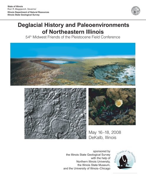
State <strong>of</strong> <strong>Illinois</strong>Rod. R. Blagojevich, Governor<strong>Illinois</strong> Department <strong>of</strong> Natural Resources<strong>Illinois</strong> State Geological Survey<strong>Deglacial</strong> <strong>History</strong> <strong>and</strong> <strong>Paleoenvironments</strong><strong>of</strong> <strong>Northeastern</strong> <strong>Illinois</strong>54 th Midwest Friends <strong>of</strong> the Pleistocene Field ConferenceMay 16–18, 2008DeKalb, <strong>Illinois</strong>sponsored bythe <strong>Illinois</strong> State Geological Surveywith the help <strong>of</strong>Northern <strong>Illinois</strong> University,the <strong>Illinois</strong> State Museum,<strong>and</strong> the University <strong>of</strong> <strong>Illinois</strong>–Chicago
Meetings <strong>of</strong> the Midwest Friends <strong>of</strong> the Pleistocene*1 1950 Eastern Wisconsin2 1951 Southeastern MinnesotaH.E. Wright Jr. <strong>and</strong> R.V. Ruhe3 1952 Western <strong>Illinois</strong> <strong>and</strong> eastern IowaP.R. Shaffer <strong>and</strong> W.H. Scholtes4 1953 <strong>Northeastern</strong> WisconsinF.T. Thwaites5 1954 Central MinnesotaH.E. Wright, Jr., <strong>and</strong> A.F. Schneider6 1955 Southwestern IowaR.V. Ruhe7 1956 Northwestern lower MichiganJ.H. Zumberge <strong>and</strong> W.N. Melhorn8 1957 South-central IndianaW.D. Thornbury <strong>and</strong> W.J. Wayne9 1958 Eastern North DakotaW.M. Laird <strong>and</strong> others10 1959 Western WisconsinR.F. Black11 1960 Eastern South DakotaA.G. Agnew <strong>and</strong> others12 1961 Eastern AlbertaC.P. Gravenor <strong>and</strong> others13 1962 Eastern OhioR.P. Goldthwait14 1963 Western <strong>Illinois</strong>J.C. Frye <strong>and</strong> H.B. Willman15 1964 Eastern MinnesotaH.E. Wright, Jr. <strong>and</strong> E.J. Cushing16 1965 <strong>Northeastern</strong> IowaR.V. Ruhe <strong>and</strong> others17 1966 Eastern NebraskaE.C. Reed <strong>and</strong> others18 1967 South-central North DakotaLee Clayton <strong>and</strong> T.F. Freers19 1969 Cyprus Hills, Saskatchewan <strong>and</strong> AlbertaW.O. Kupsch20 1971 Kansas <strong>and</strong> Missouri BorderC.K. Bayne <strong>and</strong> others21 1972 East-central <strong>Illinois</strong>W.H. Johnson, L.R. Follmer <strong>and</strong> others22 1973 West-central Michigan & east-central WisconsinE.B. Evenson <strong>and</strong> others23 1975 Western MissouriW.H. Allen <strong>and</strong> others24 1976 Meade County, KansasC.K. Bayne <strong>and</strong> others25 1978 Southwestern IndianaR.V. Ruhe <strong>and</strong> C.G. Olson26 1979 Central <strong>Illinois</strong>L.R. Follmer, E.D. McKay III <strong>and</strong> others27 1980 Yarmouth, IowaG.R. Hallberg <strong>and</strong> others28 1981 <strong>Northeastern</strong> lower MichiganW.A. Burgis <strong>and</strong> D.F. Eschman29 1982 Driftless Area, WisconsinJ.C. Knox <strong>and</strong> others30 1983 Wabash Valley, IndianaN.K. Bleuer <strong>and</strong> others31 1984 West-central WisconsinR.W. Baker32 1985 North-central <strong>Illinois</strong>R.C. Berg <strong>and</strong> others33 1986 <strong>Northeastern</strong> KansasW.C. Johnson <strong>and</strong> others34 1987 North-central OhioS.M. Totten <strong>and</strong> J.P. Szabo35 1988 Southwestern MichiganG.J. Larson <strong>and</strong> G.W. Monaghan36 1989 <strong>Northeastern</strong> South DakotaJ.P. Gilbertson37 1990 Southwestern IowaE.A. Bettis III <strong>and</strong> others38 1991 Mississippi Valley, Missouri <strong>and</strong> <strong>Illinois</strong>E.R. Hajic W.H. Johnson <strong>and</strong> others39 1992 <strong>Northeastern</strong> MinnesotaJ.D. Lehr <strong>and</strong> H.C. Hobbs40 1993 Door Peninsula, WisconsinA.F. Schneider <strong>and</strong> others41 1994 Eastern Ohio <strong>and</strong> western IndianaT.V. Lowell <strong>and</strong> C.S. Brockman42 1995 Southern <strong>Illinois</strong> <strong>and</strong> southeast MissouriS.P. Esling <strong>and</strong> M.D. Blum43 1996 Eastern North Dakota & northwestern MinnesotaK.I. Harris <strong>and</strong> others44 1998 North-central WisconsinJ.W. Attig <strong>and</strong> others45 1999 North-central Indiana & south-central MichiganS.E. Brown, T.G. Fisher <strong>and</strong> others46 2000 Southeast Nebraska <strong>and</strong> Northeast KansasR.D. M<strong>and</strong>el <strong>and</strong> E.A. Bettis III47 2001 NorthwestW Ontario <strong>and</strong> Northeast MinnesotaB.A.M. Phillips <strong>and</strong> others48 2002 East-Central Upper MichiganW.L. Loope <strong>and</strong> J.B. Anderton49 2003 Southwest MichiganB.D. Stone, K.A. Kincare <strong>and</strong> others50 2004 Central MinnesotaA.R. Knaeble, G.N. Meyer <strong>and</strong> others51 2005 North-central <strong>Illinois</strong>E.D. McKay III, R.C. Berg <strong>and</strong> others52 2006 Northwest-Central North DakotaL. A. Manz53 2007 East-Central WisconsinT. S. Hooyer54 2008 <strong>Northeastern</strong> <strong>Illinois</strong>B. B. Curry* No meetings were held in 1968, 1970, 1974, 1977, <strong>and</strong>1997.On cover: Top image is digitally joined pictures <strong>of</strong> two ice-walled lakes in the Tamyr Peninsula, Russia (photos courtesy <strong>of</strong> HelenaAlex<strong>and</strong>erson). The shaded relief map is <strong>of</strong> rimmed ice-walled lake plains on the Tinley Moraine near Wadsworth, <strong>Illinois</strong> (LiDARdata courtesy <strong>of</strong> the Lake County Department <strong>of</strong> Information <strong>and</strong> Technology, GIS/Mapping Division). The flower is Dryas integrifoliaby Pierre Brousseau from the Web site <strong>of</strong> Environment Canada, Imagier Flowers 4 Gallery.Released by the authority <strong>of</strong> the State <strong>of</strong> <strong>Illinois</strong> 5/08Equal opportunity to participate in programs <strong>of</strong> the <strong>Illinois</strong> Department <strong>of</strong> NaturalResources (IDNR) <strong>and</strong> those funded by the U.S. Fish <strong>and</strong> Wildlife Service <strong>and</strong> otheragencies is available to all individuals regardless <strong>of</strong> race, sex, national origin, disability,age, religion, or other non-merit factors. If you believe you have been discriminatedagainst, contact the funding source’s civil rights <strong>of</strong>fice <strong>and</strong>/or the Equal EmploymentOpportunity Officer, IDNR, 524 S. 2nd, Springfield, IL 62701-1787; 217/785-0067; TTY217/782-9175. This information may be provided in an alternative format if required.Contact the IDNR Clearninghouse at 217/782-7498
<strong>Deglacial</strong> <strong>History</strong> <strong>and</strong> <strong>Paleoenvironments</strong> <strong>of</strong><strong>Northeastern</strong> <strong>Illinois</strong>54th Midwest Friends <strong>of</strong> the Pleistocene Field Conference:May 16–18, 2008DeKalb, <strong>Illinois</strong>Edited by Br<strong>and</strong>on CurryWith contributions from:Jason Thomason, Christopher Stohr, Steven Brown, Nicole Fox, Timothy Larson, DavidGrimley, <strong>Illinois</strong> State Geological SurveyMichael Konen, Jay Stravers,Ivan Camilo Higuera-Diaz,Northern <strong>Illinois</strong> UniversityJeffrey Saunders<strong>Illinois</strong> State MuseumRoy Plotnick, Fabien KenigUniversity <strong>of</strong> <strong>Illinois</strong>-ChicagoPeter JacobsUniversity <strong>of</strong> Wisconsin, WhitewaterKevin Befus, Jim ClarkWheaton CollegeTimothy Kemmis,Earthtech Inc., Sheboygan, WIAndrew ScottRoyal Holloway, University <strong>of</strong> LondonIan GlasspoolField Museum <strong>of</strong> Natural <strong>History</strong>David VoorheesWaubonsee Community CollegeIlllinois State Geological Survey Open File 2008-1Champaign, ILPublished by authority <strong>of</strong> the Chief, William W. Shilts, 2008<strong>Illinois</strong> State Geological Survey
CONTENTSIntroduction 1Comprehensive List <strong>of</strong> Radioarbon Ages 42Comprehensive Bibliography 45STOP 1: Buffalo Rock State Park:Large floods <strong>and</strong> rapid deglaciation <strong>of</strong> the Lake MichiganLobe <strong>and</strong> environs 62Stop 2a: Wedron Silica Company Quarry: Stratigraphic succession <strong>of</strong> glacial deposits atWedron, IL 68Stop 2b: Wedron Silica Company Quarry:Sedimentological <strong>and</strong> paleontological evidence forevolving lacustrine environments prior to the last glacial maximum, Wedron Southeast Section73Stop 3: Central Quarry: Exceptionally Well-preserved Paleokarst <strong>and</strong> Pennsylvanian Cavefills 79Stop 4: Oswego Channel: The 15,770 C-14 yr BP Oswego channel <strong>and</strong> evidence <strong>of</strong> its synchronousformation with other overflow channels 88Stop 5: Mastodon Lake at Phillips Park, Aurora: <strong>History</strong>, Educational Outreach, Mastodons,Cosmic Dust?, <strong>and</strong> Geology 95Stop 6: LaFarge S<strong>and</strong> <strong>and</strong> Gravel Pit: A buried catena <strong>of</strong> the Farmdale-Sangamon GeosolComplex, Elburn, <strong>Illinois</strong> 123Stop 7: DeKalb mounds: Archives <strong>of</strong> deglacial history <strong>and</strong> postglacial environments: 138Stop 8: Spring Lake S<strong>and</strong> <strong>and</strong> Gravel Pit: Glaciotectonic deformation <strong>of</strong> Wisconsin Episodesediment: shallow décollements, sheath folding, <strong>and</strong> corroborating strain indicators in overlyingdiamicton 152Stop 9: Thelen S<strong>and</strong> <strong>and</strong> Gravel Pits: Sedimentology <strong>of</strong> kame terrace deposits at the Thelens<strong>and</strong> <strong>and</strong> gravel pits, northwestern Lake County, <strong>Illinois</strong> 164
AcknowledgementsBr<strong>and</strong>on is grateful to his colleagues for their support <strong>and</strong> expertise including LaDonna Pearl<strong>and</strong> Mike Konen (logistics), Lisa Young (accounting), Barbara Stiff <strong>and</strong> Jennifer Carrell (maps<strong>and</strong> other graphics), Pam Carrillo (layout <strong>and</strong> graphics), <strong>and</strong> Cheryl Nimz (editing). Specialthanks to Chris Stohr, Steve Brown, <strong>and</strong> John Esch for providing the technical know-how for providingshaded relief maps on the bus TV monitors <strong>and</strong> real-time bus locations. Br<strong>and</strong>on thanksall property owners who have allowed l<strong>and</strong> access for this field trip. L<strong>and</strong>owners <strong>and</strong> managerswho have been especially helpful to us include Ron Holl<strong>and</strong>er (Stop #2), John Shaw (Stop 3),Jim Pilmer, <strong>and</strong> Cindy <strong>and</strong> R<strong>and</strong>y Johnson (Stop 5), Dan Brees (Stop 6), Craig Vinson (Stop 7);Jeff Thurwell (Stop 8), <strong>and</strong> the Thelen family (Stop 9).
INTRODUCTIONThe surficial geology <strong>of</strong> northeastern <strong>Illinois</strong> encompasses Paleozoic shale, dolomite, limestone,s<strong>and</strong>stone, <strong>and</strong> coal that are covered by as much as 120 m <strong>of</strong> Pleistocene diamicton, s<strong>and</strong><strong>and</strong> gravel, <strong>and</strong> silt <strong>and</strong> clay. We will focus our trip through l<strong>and</strong>scapes formed during the lastglaciation (Wisconsin Episode). The study area is framed on the north <strong>and</strong> west by the BloomingtonMorainic System, <strong>and</strong> to the south by the <strong>Illinois</strong> <strong>and</strong> Des Plaines rivers (Figures 1 <strong>and</strong>2). Throughout this area, l<strong>and</strong>forms <strong>of</strong> glacial origin dominate the l<strong>and</strong>scape. In most places,moraines that were formed largely by subglacial processes are partly mantled by supraglacialsediment, such as lake sediment, flowed till, <strong>and</strong> ice-contact s<strong>and</strong> <strong>and</strong> gravel <strong>of</strong> ice-walled lakeplains. In some areas, the glacial l<strong>and</strong>forms are pockmarked by kettle basins caused by collapseby melting ice <strong>and</strong> groundwater sapping. More rare on the l<strong>and</strong>scape, but neverthelessimportant to the glacial history, are valleys that slash across several moraines. The steep slopes<strong>of</strong> the valley walls <strong>and</strong> large-scale fluvial l<strong>and</strong>forms attest to the erosive power <strong>of</strong> floods causedby proglacial lakes that overtopped their moraine dams. In other areas, anastomosing valleyswith underfit streams appear to have been formed by subglacial drainage. Low areas on thel<strong>and</strong>scape <strong>of</strong> either fluvial or supraglacial origin were partly filled with sediment, at first by resedimentedsilty loess, <strong>and</strong> subsequently by post-glacial biogenic deposits <strong>of</strong> peat <strong>and</strong> marl.Technological advancements over the past 20 years or so have improved our precision <strong>and</strong>presentation in mapping, <strong>and</strong> tightened our chronological control. Recently acquired shadedrelief maps using LiDAR (Light Detection <strong>and</strong> Ranging) or high-resolution photogrammetric techniqueshave increased our awareness <strong>of</strong> subtle l<strong>and</strong>forms <strong>and</strong> interest in mapping <strong>and</strong> investigatingthe near-surface geology <strong>of</strong> this area. New computer s<strong>of</strong>tware <strong>and</strong> technology, in manycases aided by geophysical data, helps us to visualize three-dimensional relationships amonggeologic bodies <strong>and</strong> speculate on their genesis. Isotope <strong>and</strong> trace element assay <strong>of</strong> very smallsamples is now possible with mass spectrometers. For example, radiocarbon assay with acceleratormass spectrometry (AMS) uses samples containing as little as about 10 micrograms<strong>of</strong> carbon (a few spruce needles or seeds <strong>of</strong> terrestrial plants). Similarly, we can determine the 18 O values <strong>of</strong> biogenic carbonate samples as small as 50 micrograms (e.g., 2 to 10 ostracodevalves about one millimeter across). These data may be used in a variety <strong>of</strong> paleoenvironmentalreconstructions, such as in the assessment <strong>of</strong> water source in proglacial lakes (was the waterderived from primarily meltwater or precipitation?). Our new AMS ages not only allow revision <strong>of</strong>our local chronologies, but we are in much better position to compare our events with well-datedglobal records <strong>of</strong> climate change. For mapping in this region, these collective computer <strong>and</strong> labtechnologies have aided, along with old-fashioned coring, near-surface geophysics, <strong>and</strong> airphotointerpretation, in the identification <strong>of</strong> subtle ice-walled lake plains, <strong>and</strong> the age <strong>of</strong> tundra plantfossils contained in the laminated sediment therein.<strong>Northeastern</strong> <strong>Illinois</strong> has long been the focus <strong>of</strong> research <strong>of</strong> sediments <strong>of</strong> the last glaciation. Thefindings <strong>of</strong> applied studies have contributed to our evolving underst<strong>and</strong>ing <strong>of</strong> the “pure science”<strong>of</strong> glacial sedimentology <strong>and</strong> stratigraphy. These applied investigations have involved topicssuch as water supply, water quality, aggregate resources, wetl<strong>and</strong> evaluation, climate change,l<strong>and</strong>fill siting, <strong>and</strong> l<strong>and</strong>fill leachate migration. As urban growth continues in this region, appliedstudies will remain as an important means <strong>of</strong> assuring the public’s health <strong>and</strong> safety. The Northern<strong>Illinois</strong> Planning Commission projects that from 2000 to 2030 the population <strong>of</strong> the six largestcounties in northeastern <strong>Illinois</strong> will increase from about 8.1 to 10.0 million (an increase <strong>of</strong>25%; Figure 3). This doesn’t count Kendall County, where two <strong>of</strong> our stops are located, that iscurrently the fastest growing county in the United States (Keen, 2008). The current population isabout 100,000… up 77% since the year 2000.1
WINNEBAGOOGLEMarengo MoraineWoodstock M.BOONE MCHENRY LAKEDEKALBKANEBarlina M.Fox Lake M.98COOKLakeMichiganLakeBorderMoraines7DUPAGEBloomingtonMorainic SystemBUREAUPUTNAMLEELASALLEBurlingtonMoraineArlington MoraineFarm Ridge Moraine12Elburn ComplexMarseilles Morainic SystemKENDALLGRUNDYlunchMinooka Moraine6St. Charles M.435WILLRockdale MoraineKANKAKEEValparaiso Morainic SystemDeerfield MorainePark Ridge MoraineTinley MoraineFigure 1 Moraines <strong>and</strong> morainic complexes <strong>of</strong> the last glaciation in northeastern <strong>Illinois</strong>, highlighting thestudy area <strong>and</strong> field trip route.The glacial succession at Fermi National Laboratory, Batavia, <strong>Illinois</strong>, was among the first to beshown to be comprised <strong>of</strong> sediment layers with unique physical properties that may be tracedin 3 dimensions (L<strong>and</strong>on <strong>and</strong> Kempton, 1971). Particle-size distribution, moisture content, <strong>and</strong>Atterberg Limit data from this study’s cores provided validation that a well-characterized stratigraphicframework was necessary for meaningful future applied studies (Kempton, 1981; Graeseet al., 1988; Berg et al., 1999).For deposits <strong>of</strong> the last glaciation in northeastern <strong>Illinois</strong>, the current stratigraphic framework is areclassification by Hansel <strong>and</strong> Johnson (1996) <strong>of</strong> the independent multiple classification system<strong>of</strong> Willman <strong>and</strong> Frye (1970). Included among the former’s most important features <strong>and</strong> contributions:1) Stratigraphic upgrades <strong>and</strong> revisions (i.e., Wedron Formation = Wedron Group; TiskilwaTill Member = Tiskilwa Formation, Wadsworth Till Member = Wadsworth Formation, <strong>and</strong>2
LakeMichiganWINNEBAGOBOONE MCHENRY LAKEOGLEDEKALBKANECOOKDe KalbDUPAGELEEKENDALLWILLDes PlainesRiverChicagoBUREAULASALLEFoxRiverGRUNDY<strong>Illinois</strong>RiverKankakeePUTNAMRiverKANKAKEEFigure 2 Painted relief map <strong>of</strong> northeastern <strong>Illinois</strong>; modified from Luman et al. (2003)establishment <strong>of</strong> the Lemont Formation, comprised <strong>of</strong> the Batestown, Yorkville, <strong>and</strong> HaegerMembers).2) Definition <strong>of</strong> the Mason Group, comprised <strong>of</strong> units <strong>of</strong> sorted sediment that in many placesinterfinger (tongue) with units <strong>of</strong> the Wedron Group.3) The replacement <strong>of</strong> chronostratigraphic (time) units with diachronic units based on thelithostratigraphic reclassification outlined above (Hansel <strong>and</strong> Johnson, 1992; Hansel et al.,1997).4) Abolishment <strong>of</strong> the genetic terms “till” <strong>and</strong> “loess” in the names <strong>of</strong> stratigraphic units.5) Organization <strong>of</strong> pertinent radiocarbon ages by stratigraphic unit <strong>and</strong> location. Many ageswere previously unpublished or in the “gray literature”.3
Figure 3 Projected growth areas in northeastern <strong>Illinois</strong> (from the Northern <strong>Illinois</strong> Planning Commission(NIPC)). Kendall County, not part <strong>of</strong> NIPC, is presently the fastest growing county in the United States(Keen, 2008).Presently, the ISGS is engaged in an ambitious program <strong>of</strong> mapping the surficial geology <strong>of</strong> theentire state at a scale <strong>of</strong> 1:24,000 (ISGS, 1992; Bhagwat, 2001; Figure 4). Begun in earnest inthe late 1990’s, geologic mapping has been funded by federal <strong>and</strong> state programs (STATEMAP,EDMAP, <strong>and</strong> CGLGMC (The Central Great Lakes Geologic Mapping Coalition)) <strong>and</strong> by variouscounty agencies, particularly in Kane, Lake, McHenry, DuPage, DeKalb, <strong>and</strong> Kendall counties.From start to finish, production <strong>of</strong> one 1:24,000 scale surficial geology map in northeastern <strong>Illinois</strong>costs, on average, about $250,000. The dollar amount is noteworthy because mitigation <strong>of</strong>emerging environmental <strong>and</strong> health issues, <strong>of</strong>ten dealing with water quality or water availability,may be addressed with geologic maps. Having up-to-date <strong>and</strong> accurate surficial geology maps<strong>and</strong> three-dimensional geology maps can potentially save taxpayers roughly ten times the cost<strong>of</strong> the original map (Bhagwat <strong>and</strong> Berg, 1992; Bhagwat <strong>and</strong> Ipe, 2000).Today’s applied studies are able to utilize the stratigraphic framework in applied studies byrendering the geology in three dimensions via digital models, cross sections, structure contour4
WINNEBAGOBOONE MCHENRY LAKEOGLEDEKALBKANECOOKDUPAGELEEKENDALLWILLBUREAULASALLEGRUNDYPUTNAMKANKAKEEMapping planned or in progressMapping completeEDMAP areas (mapping complete)County boundaryFigure 4. Location <strong>of</strong> quadrangles with published surficial geology maps.maps, <strong>and</strong> other visualizations. Given key stratigraphic points in the area <strong>of</strong> interest, geologistsmay now explore issues such as the variability <strong>of</strong> channel sinuosity, width, <strong>and</strong> depth given aninterpreted environment <strong>of</strong> deposition. The three-dimensional model may be rendered for use indigital flow models by hydrogeologists to evaluate groundwater availability. In Kane County, forexample, the stratigraphic framework <strong>and</strong> unit architecture broadly defined by detailed core studies<strong>and</strong> mapping (Kempton et al., 1987a,b; Curry et al., 1988; Grimley <strong>and</strong> Curry, 2001, 2002)was harnessed to code description <strong>of</strong> the materials noted in about 30,000 water well logs <strong>and</strong>other observations (Dey et al., 2007a). Isopach <strong>and</strong> structure contour maps were produced for5
Surficial fine-textured layerTiskilwa FormationHenry Formation(surficial deposits)Ashmore Tongue <strong>of</strong> theHenry FormationHaeger Member <strong>of</strong> theLemont FormationGlasford Formation(upper fine-textured layer)Beverly Tongue <strong>of</strong> theHenry FormationGlasford Formation(upper coarse-textured layer)Yorkville Member <strong>of</strong> theLemont FormationGlasford Formation(middle fine-textured layer)Unnamed Tongue <strong>of</strong> theHenry FormationGlasford Formation( lower coarse-textured layer)Batestown Member <strong>of</strong> theLemont FormationGlasford Formation(lower fine-textured layer)Unnamed Tongue <strong>of</strong> theHenry FormationBedrock SurfaceFigure 5. Stacked three dimensional model <strong>of</strong> glacial drift units in Kane County (Abert et al., 2007)6
11 glacial drift units <strong>and</strong> three bedrock units (Dey et al., 2007b, c, d) as well as an aquifer sensitivitymap (Dey et al., 2007e). The 14 layers were digitally stitched together to form a 1:100,000scale three-dimensional model <strong>of</strong> the geology <strong>of</strong> Kane County (Abert et al., 2007; Figure 5). The<strong>Illinois</strong> State Water Survey recently adapted this model for groundwater flow by converting it to a3-D array <strong>of</strong> square grid cells about 200 m across with a minimum thickness, employed in areas<strong>of</strong> absence, <strong>of</strong> 0.3 m. The groundwater flow model <strong>of</strong> the glacial drift <strong>and</strong> uppermost bedrockconsists <strong>of</strong> 18 layers <strong>and</strong> approximately 1.5 million grid cells. The groundwater flow model wascalibrated using stream flow measurements <strong>and</strong> by numerous water level measurements fromwells open to the various aquifer units, including a “synoptic” measurement <strong>of</strong> water levels fromover 1000 wells during a 60-day period (Locke <strong>and</strong> Meyer, 2007). Ultimately, the model will permitplanning <strong>of</strong>ficials in Kane County to evaluate water availability under various scenarios <strong>of</strong>climate change to help them plan for future growth.ObjectivesOur discussions will focus on the deglacial history <strong>of</strong> northeastern <strong>Illinois</strong> based on identification<strong>of</strong> key l<strong>and</strong>forms <strong>and</strong> their constituent sediment <strong>and</strong> fossils. We will examine the glacial l<strong>and</strong>scape<strong>of</strong> northeastern <strong>Illinois</strong> <strong>and</strong> discuss the physical characteristics <strong>of</strong> the sediment units thatwe have identified <strong>and</strong> mapped. The succession <strong>and</strong> unit characteristics are the basis for ourstratigraphic framework; our mapping is influenced further by interpretation <strong>of</strong> the environment <strong>of</strong>deposition <strong>of</strong> the units. We will also highlight the geomorphology the area by referring <strong>of</strong>ten to ashaded relief maps based on either 10-m DEM data (McGarry, 2000), LiDAR data (Lake CountyDepartment <strong>of</strong> Information <strong>and</strong> Technology, 2004), or 30-m DEM data (Luman et al., 2003).Physical Setting<strong>Northeastern</strong> <strong>Illinois</strong> is located in a region <strong>of</strong> varied geomorphologic character (Figure 2). Severalnamed moraines that formed during the last glaciation occur in upl<strong>and</strong> areas. We will be travelingacross the Burlington, Marengo, Woodstock, <strong>and</strong> Ransom moraines, <strong>and</strong> the Bloomington<strong>and</strong> Marseilles Morainic Systems (Figure 1). The hummocky or ridge-like topography <strong>of</strong> themoraines contrasts with intervening tracts <strong>of</strong> lakebeds <strong>and</strong> the valleys <strong>of</strong> waterways. Most rivervalleys were formed by meltwater erosion, in some cases, clearly by the catastrophic release <strong>of</strong>meltwater.Previous InvestigationsDuring the late 19th century, the Geological Survey <strong>of</strong> <strong>Illinois</strong> reported on many aspects <strong>of</strong> northeastern<strong>Illinois</strong> geology (e.g., Bannister, 1870, 1882). At that time water was being obtained frommajor waterways such as the Fox <strong>and</strong> Kishwaukee Rivers <strong>and</strong> from relatively shallow s<strong>and</strong> <strong>and</strong>gravel alluvial aquifers. Building stone was mined from dolomite that cropped out along majorrivers (Conover, 1884). Ancient lake bed sediments supplied clay for manufacture <strong>of</strong> brick <strong>and</strong>decorative terra cotta; peat was mined for fuel <strong>and</strong> soil conditioning.Between World Wars I <strong>and</strong> II, information gained from the drilling <strong>of</strong> water wells had become amajor source <strong>of</strong> geologic information (Udden, 1914) as well as test borings for determination <strong>of</strong>dolomite resources (Thwaites, 1923, 1927; Palmer, 1933). Evidence was emerging for the distribution<strong>of</strong> buried bedrock valleys, filled <strong>and</strong> covered by more recent glacial sediments, <strong>and</strong> thecharacter <strong>of</strong> the deposits within those valleys (Leighton, 1925; Horberg, 1953).In the late 1950’s, geologists at the ISGS began to recognize that glacial deposits are traceablein the subsurface <strong>and</strong> their relationships could be classified based on stratigraphic principles,like rocks <strong>of</strong> Paleozoic age. The physical characteristics <strong>of</strong> glacial deposits such as particle-sizedistribution, clay mineralogy, <strong>and</strong> clast lithology began to be routinely analyzed on core sub-7
samples, especially diamict units. Hackett (1960) <strong>and</strong> Hackett <strong>and</strong> Hughes (1965) implementeddrilling programs designed specifically to acquire cores <strong>of</strong> glacial deposits (Lund, 1965a,b, 1966;Reed, 1972, 1975). L<strong>and</strong>on <strong>and</strong> Kempton (1971) characterized the glacial drift sequence duringsiting <strong>of</strong> the Fermi National Accelerator Laboratory at Batavia. Later, efforts to bring the U.S.Department <strong>of</strong> Energy’s Superconducting Super Collider (SSC) to the region included a detailedexamination <strong>of</strong> the stratigraphy, groundwater resources, <strong>and</strong> engineering characteristics <strong>of</strong>geologic materials through yet another drilling program in Kane County <strong>and</strong> surrounding areas(Kempton et al., 1987a,b; Curry et al., 1988; Graese et al., 1988; Vaiden et al., 1988; Harza EngineeringCo., 1988). Wickham et al. (1988) also described the glacial geology <strong>of</strong> the area, <strong>and</strong>was based on the Master’s thesis <strong>of</strong> the senior author.Recent hydrogeological investigations have used a combination <strong>of</strong> geophysical techniques,especially seismic refraction, in addition to test borings <strong>and</strong> pumping tests, to characterize sediments<strong>and</strong> groundwater resources in buried bedrock valleys (e.g., Gilkeson et al., 1987; Fitzpatricket al., 1992; Larson <strong>and</strong> Orozco, 1991, 1992; Larson et al., 1992a,b) <strong>and</strong> deeper bedrockaquifers (Visocky et al., 1985). Heigold (1990) analyzed <strong>and</strong> interpreted seismic refraction <strong>and</strong>reflection data that had been collected chiefly for the SSC study.The first surficial geologic map <strong>of</strong> Kane County emphasized locating s<strong>and</strong> <strong>and</strong> gravel aggregateresources (Leighton et al., 1930). A regional geologic mapping program in northeastern<strong>Illinois</strong> (at a scale <strong>of</strong> 1:100,000), augmented with data from test-borings, was cosponsored by<strong>Northeastern</strong> <strong>Illinois</strong> Planning Commission <strong>and</strong> ISGS in the 1970s (Gilkeson <strong>and</strong> Westerman,1976; Kempton et al., 1977). A regional s<strong>and</strong> <strong>and</strong> gravel aggregate map (scale: 1:100,000) wasupdated by Masters (1978). As an outgrowth <strong>of</strong> the geologic investigations for the SSC, maps ata scale <strong>of</strong> 1:62,500 were published <strong>of</strong> Kane County’s drift aquifers (Vaiden <strong>and</strong> Curry, 1990a),bedrock topography (Vaiden <strong>and</strong> Curry, 1990b), drift thickness (Erdmann et al., 1990), stackunits(to a depth <strong>of</strong> 15 m; Curry, 1990a), Tiskilwa Formation isopach (Curry, 1990b), <strong>and</strong> surfaceslopes (Schneider et al., 1990).The surficial geology <strong>of</strong> McHenry County was mapped at a scale <strong>of</strong> 1;100,000 (Curry et al.,1997). Published prior to the present mapping program, discussed below, McHenry County wasselected for this early mapping effort because <strong>of</strong> high population growth rates <strong>and</strong> abundantshallow s<strong>and</strong> <strong>and</strong> gravel deposits (ISGS, 1992). Thirteen borings were sampled; particle-sizedeterminations <strong>and</strong> clay mineral analysis confirmed the stratigraphic framework that includedseven aquifers (Curry, 1995; Curry et al., 1997). An aquifer sensitivity map, mapped to a depth<strong>of</strong> 15 m, <strong>and</strong> the first <strong>of</strong> its kind at a scale <strong>of</strong> 1:100,000, verified that a significant portion <strong>of</strong> thecounty was underlain by shallow s<strong>and</strong> <strong>and</strong> gravel aquifers. A series <strong>of</strong> piezometric surfaces foreach aquifer were mapped based on “synoptic” measurement <strong>of</strong> about 700 water wells over a 15day period (Meyer, 1998). This experience led to the Kane County mapping projects, discussedabove.Recent work has been programmatically driven by STATEMAP (National Cooperative GeologicMapping Program) <strong>and</strong> the Central Great Lakes Geologic Mapping Coalition (CGLGMC). Thelatter program formed in 1999 (Berg et al., 1999) as a partnership <strong>of</strong> the <strong>Illinois</strong>, Indiana, Michigan,Ohio, <strong>and</strong> United States geological surveys. The partnership utilizes the collective technical<strong>and</strong> scientific expertise <strong>of</strong> the agencies to map the glacial deposits in three dimensions <strong>of</strong> theparticipating states. The collaboration focuses on delivering earth science information to supportunderst<strong>and</strong>ing <strong>of</strong> societal <strong>and</strong> geologic hazards (see www.greatlakesgeology.org). BothSTATEMAP <strong>and</strong> CGLGMC have provided resources needed to do geologic mapping <strong>and</strong> as aconsequence, have led us to many <strong>of</strong> the stops on this trip. For work in Lake County, the ISGShas combined the efforts <strong>of</strong> these two programs to reach the goal <strong>of</strong> mapping the geology in8
three dimensions. Maps <strong>of</strong> glacial deposits at the surface are produced via STATEMAP, but thesame areas are targeted with CGLGMP funds for additional deep exploration <strong>of</strong> glacial deposits,determination <strong>of</strong> facies relationships, <strong>and</strong> underst<strong>and</strong>ing the near-surface l<strong>and</strong>form-sedimentrelationships. Mapping in Lake County has been underway since 2000. The project includes anextensive drilling program; more than 150 boreholes have been drilled including 64 with continuouscores to rock drilled since 2002. The ISGS plans on coring 20 to 30 new boreholes in LakeCounty over the next two years focusing on the Tinley <strong>and</strong> Lake Border moraines.GEOLOGIC FRAMEWORKBedrock GeologyPaleozoic bedrock occurs beneath the glacial drift in northeastern <strong>Illinois</strong> ranging in age fromCambrian siliciclastic rocks to Pennsylvanian s<strong>and</strong>stone, siltstone, shale <strong>and</strong> coal (Figure 6).Distribution <strong>of</strong> rocks at the bedrock surface partially reflects the attitude <strong>of</strong> the bedrock units aswell as post-Paleozoic erosion <strong>and</strong> incision <strong>of</strong> bedrock valleys as much as 115 m deep.<strong>Northeastern</strong> <strong>Illinois</strong> is located at the intersection <strong>of</strong> the Wisconsin <strong>and</strong> the Kankakee Arches.The Kankakee Arch separates the <strong>Illinois</strong> Basin to the south from the Michigan Basin to thenortheast (Figure 7). In much <strong>of</strong> northeastern <strong>Illinois</strong>, bedrock strata dip to the southeast approximately0.1° to 0.2° (Graese, 1991). Small amplitude folds <strong>and</strong> minor faults are superposedupon this regional dip. Other major structural features in northeastern <strong>Illinois</strong> include the DesPlaines disturbance (Nelson, 1995), the S<strong>and</strong>wich Fault Zone (Kolata et al., 1978), <strong>and</strong> La SalleAnticlinorium (Figure 7; Kolata, 2005). Faults <strong>of</strong> the S<strong>and</strong>wich Fault Zone are nearly vertical withnet northward downthrow as much as 240 m. The northern part <strong>of</strong> the La Salle Anticlinoriumoccurs near the stops on Day 1 at Wedron <strong>and</strong> Buffalo Rock. Near these sites, this structure ismanifest as an angular unconformity between beds <strong>of</strong> the Ordovician St. Peter S<strong>and</strong>stone thatdip as much as 45 degrees in contact with nearly horizontal beds <strong>of</strong> shale <strong>and</strong> siltstone <strong>of</strong> thePennsylvanian Tradewater Formation.Bedrock Units Underlying Glacial DriftSt. Peter S<strong>and</strong>stone. Both promontories at Buffalo Rock <strong>and</strong> Starved Rock State Parks areformed <strong>of</strong> St. Peter S<strong>and</strong>stone 30 to 60 m thick. We will observe this unit where it is mined atthe Wedron S<strong>and</strong> Pits (Stop 2). The unit is composed <strong>of</strong> weakly cemented, well-rounded, nearlypure quartz s<strong>and</strong> (99.85% SiO 2). In general, more than 90% <strong>of</strong> the unit is finer than 0.5 mm <strong>and</strong>coarser than 0.15 mm with the mode occurring between 0.5 <strong>and</strong> 0.2 mm (medium s<strong>and</strong>). TheSt. Peter S<strong>and</strong>stone is used for melting s<strong>and</strong> (used for containers, panes, fiberglass, <strong>and</strong> otherproducts), foundry s<strong>and</strong>, oil <strong>and</strong> gas extraction, construction s<strong>and</strong>, fillers in products such aspaint, grout, caulk, pool filter s<strong>and</strong>, <strong>and</strong> play s<strong>and</strong> (Keith <strong>and</strong> Kemmis, 2005).Galena <strong>and</strong> Platteville Groups. Carbonate rocks <strong>of</strong> the Galena <strong>and</strong> Platteville Groups typicallyconsist <strong>of</strong> pale yellowish brown, fine- to medium-grained, medium-bedded dolomite, <strong>and</strong> oneregion <strong>of</strong> limestone (Graese, 1991). The beds are generally 15 to 30 cm thick, wavy, <strong>and</strong> areseparated by thin (1 – 2 mm), commonly stylolitic shale laminae. In some intervals the carbonaterocks contain chert nodules. The combined thickness <strong>of</strong> the Galena <strong>and</strong> Platteville Groups rangesfrom about 90 to more than 105 m where overlain by the Maquoketa Group. We will examinekarst features formed in limestone <strong>of</strong> the Galena Group at Stop 3.Maquoketa Group. Above the dolomite <strong>of</strong> the Galena Group is the thinly bedded dolomite, minorlimestone, <strong>and</strong> shale <strong>of</strong> the Maquoketa Group. The full thickness <strong>of</strong> the Maquoketa in northeastern<strong>Illinois</strong> ranges from about 70 to 50 m. In most places in northeastern <strong>Illinois</strong>, facies changeswithin the Maquoketa (Graese, 1991) preclude recognition <strong>of</strong> the formations identified by Kolata9
OaOgSuWINNEBAGOOgBOONE MCHENRY LAKEOGLEDEKALBKANECOOKOgOmSuPzOaOpDUPAGEOpdcLEEPtOgCKENDALLWILLLASALLEOpdcOmDmSuBUREAUPcOpOaOp OgGRUNDYSuPtPspPmPUTNAMPbPcPspPmPspKANKAKEEPennsylvanian SystemPm Mattoon FmPb Bond FmPspPc Carbondale FmPt Tradewater FmShelburn-Patoka Fms., undividedDevonian SystemDm Muskatatuck Gp; shaleshale,s<strong>and</strong>stone,coal,limestoneSilurian SystemSu Silurian Fms, undifferentiated; dolomiteOrdovician SystemOm Maquoketa Gp; dolomite <strong>and</strong> shaleOg Galena Gp; dolomite, some limestoneOp Plattville Gp; dolomite, argillaceousOa Ancell Gp; St. Peter S<strong>and</strong>stoneOpcd Prairie Du Chien Gp; dolomite, shale, s<strong>and</strong>stoneCambrian SystemC Cambrian formations, undifferentiated, includingPotosi Fm (dolomite) <strong>and</strong> Mt. Simon S<strong>and</strong>stonePzPaleozoic System, undifferentiated.Figure 6 Bedrock geology <strong>of</strong> northeastern <strong>Illinois</strong> (Kolata et al., 2005).10
WISCONSINARCHS<strong>and</strong>wich Fault Zone.DesPlainesdisturbanceanticlinesynclinemonoclinefault, ticks ondownthrown sidestructure caused bymeteorite impactPeru MonoclineILINAnticlinoriumLa SalleKANKAKEE ARCH0020 40 60 mi40 80 kmNFigure 7 Major structural features associatedwith the bedrock <strong>of</strong> northeastern <strong>Illinois</strong> (fromNelson, 1995).<strong>and</strong> Graese (1983). Although we will not see outcrops <strong>of</strong> this unit, it was readily comminuted byglaciers to silt <strong>and</strong> clay-sized particles. These fines were entrained in the glacial bed, later to bedeposited as till, or redeposited as supraglacial or paraglacial debris, such as proglacial lakesediment.Silurian-age rocks at or near the bedrock surface in northeastern <strong>Illinois</strong> primarily are composed<strong>of</strong> light gray, fine-grained dolomite <strong>and</strong> limestone with occasional wavy, greenish gray shale laminae.The oldest Silurian unit is typically the Elwood Formation, which is a slightly argillaceous,light gray, fine-grained dolomite; chert nodules <strong>and</strong> layers as much as 7 cm thick are presentin most places. This unit is about 7 to 10 m thick where it has not been eroded. The ElwoodFormation grades upward into the non-cherty, relatively pure dolomite <strong>of</strong> the Kankakee, Joliet,Sugar Run, <strong>and</strong> Racine formations with a combined thickness <strong>of</strong> about 115 m (Kolata, 2005).Devonian-age rocks have recently been discovered in <strong>Illinois</strong> near the Indiana border, but theywill not be seen on the field trip. S<strong>of</strong>t, easily eroded Devonian black shale subcrop beneath lakesediment <strong>and</strong> glacial drift in the Lake Michigan basin (Wold et al., 1981), <strong>and</strong> comprise as muchas 20% <strong>of</strong> the coarse s<strong>and</strong> fraction <strong>of</strong> some grey till units (Willman <strong>and</strong> Frye, 1970). Microscopicamber discs (spores) <strong>of</strong> the Devonian green algae Tasmanites are resilient to glacial comminution<strong>and</strong> were concentrated in fine-grained diamicton <strong>and</strong> proglacial lake sediment.Pennsylvanian-age shale, siltstone, s<strong>and</strong>stone, <strong>and</strong> coal occur along the <strong>Illinois</strong> River valley inthe southern part <strong>of</strong> the study area. Here, the Pennsylvanian Tradewater <strong>and</strong> Carbondale Formationsoccur above an angular unconformity developed in Ordovician <strong>and</strong> Cambrian rocks thatform the northern part <strong>of</strong> the La Salle Anticlinorium (Kolata, 2005; Figure 6).Bedrock TopographyThe regional bedrock surface is characterized by gently sloping highl<strong>and</strong>s cut by steep-walledbedrock valleys (Figure 8). Elevations <strong>of</strong> the highest bedrock upl<strong>and</strong>s in the study region rangefrom about 210 to 250 m, <strong>and</strong> the lowest elevations, between about 120 to 135 m. Fluvial <strong>and</strong>glaci<strong>of</strong>luvial s<strong>and</strong> <strong>and</strong> gravel deposited in the bedrock valleys serve as important aquifers in thewestern suburbs that are reliant on groundwater, such as in McHenry <strong>and</strong> Kane county. TheTroy, Rock, <strong>and</strong> St. Charles bedrock valleys are the largest buried bedrock valleys in this region(Figure 8). Maximum relief <strong>of</strong> the bedrock surface in the area is about 110 m. The overall slope<strong>of</strong> the bedrock valley floors is gradual. For example, the slope <strong>of</strong> the elevation <strong>of</strong> the St. Charles11
Bedrock valley floor changes in Kane County from approximately 180 m above sea level to lessthan 150 m with a mean gradient <strong>of</strong> approximately 3 m/km.GLACIAL DRIFT AND SURFICIAL DEPOSITSThe Pleistocene sediments <strong>of</strong> northeastern <strong>Illinois</strong>, as much as 120 m thick, were deposited duringmultiple fluctuations <strong>of</strong> the Laurentide Ice Sheet. For deposits <strong>of</strong> the last glaciation, moraineorientation, composition, <strong>and</strong> internal architecture (Mickelson et al., 1983) serve to characterizel<strong>and</strong>forms associated with sublobes <strong>of</strong> the Lake Michigan lobe. The l<strong>and</strong>scape is formed <strong>of</strong>unlithified diamicton, s<strong>and</strong> <strong>and</strong> gravel, silt, <strong>and</strong> silty clay, materials known collectively as glacialdrift.MethodsLithostratigraphic units were identified in this study on the basis <strong>of</strong> (a) stratigraphic position, (b)physical <strong>and</strong> mineralogical characteristics <strong>of</strong> mappable units (including interpretations <strong>of</strong> downholenatural gamma-ray logs), <strong>and</strong> (c) identification <strong>of</strong> glacigenic successions.Particle-size analyses. An important physical characteristic used to classify diamicton unitsin this region is particle-size distribution. Most analyses at the ISGS are determined by a hydrometer.The percentage <strong>of</strong> gravel (>2 mm) is calculated from the 15 to 40 gram samples. Theweight <strong>of</strong> the gravel fraction is removed when calculating the relative percentages <strong>of</strong> s<strong>and</strong>, silt<strong>and</strong> clay. Particle-grain size categories <strong>of</strong> the < 2mm fraction include s<strong>and</strong> (2 mm to 0.063 mm),silt (0.063 to 0.004 mm), <strong>and</strong> clay (< 0.004 mm). Midwestern Quaternary geologists <strong>and</strong> soil scientistsuse agricultural textural terms such as “loam” <strong>and</strong> “silty clay loam” to classify the texture<strong>of</strong> the > 2 mm grain-size fraction (Buol et al., 2003).Other physical characteristics commonly measured in applied <strong>and</strong> characterization studies,such as moisture content <strong>and</strong> Atterberg Limits, are strongly related to grain-size distribution(Curry, 1991), <strong>and</strong> aid in the identification <strong>of</strong> some stratigraphic units (L<strong>and</strong>on <strong>and</strong> Kempton,1971; Wickham et al., 1988; Graese et al., 1988). For example, at Fermilab, a statistical analysiswas done <strong>of</strong> a data set <strong>of</strong> more than 1,000 samples from about 50 borings used to characterizethe glacial drift <strong>of</strong> the ca. 4 km 2 site. Not surprisingly, the analyses show that clay content has astrong positive linear correlation with moisture content <strong>and</strong> Atterberg Limit values (Curry, 1991).Linear regression equations developed from these relationships provide a quantitative basis forusing moisture content, a cheap <strong>and</strong> readily obtained physical parameter, to aid in the classification<strong>of</strong> diamicton units. For example, loam to s<strong>and</strong>y loam diamicton typically has moisture contentsthat range from 9 to 12%, whereas silty clay diamicton has moisture contents ranging from18 to 24% or more (Figure 9). The range in grain-size <strong>of</strong> diamicton in this data set (s<strong>and</strong>y loamto clay) is representative <strong>of</strong> all major diamicton units in northeastern <strong>Illinois</strong>Semi-quantitative phase analyses, commonly referred to as clay mineral analyses, were doneusing oriented, aggregate, glycolated slides <strong>of</strong> the < 0.002 mm fraction (Wickham et al.,1988;Curry et al., 1999; Hughes et al., 1994). Clay minerals were separated into three groups <strong>and</strong>quantitatively calculated using peak height measurements (counts per second) at diagnostic d-spacings. The three groups include:a) exp<strong>and</strong>able clay minerals: all materials that exp<strong>and</strong> to approximately 17Å (10 -9 cm) whensolvated with ethylene glycol;b) illite: clay minerals with a 10Å basal spacing that do not exp<strong>and</strong> when treated with ethyleneglycol, <strong>and</strong>c) kaolinite plus chlorite: all clay minerals with a 7.2Å basal spacing.12
TroyRockWINNEBAGOBOONE MCHENRY LAKELakeMichiganOGLEDEKALBKANECOOKDUPAGELEESt. CharlesKENDALLWILLBUREAULASALLEGRUNDYPUTNAMTiconaKANKAKEEFigure 8 Shaded relief map <strong>of</strong> the bedrock topography <strong>of</strong> northeastern <strong>Illinois</strong> based on the map <strong>of</strong> Herzoget al. (1994) <strong>and</strong> data from Luman et al. (2003). Map courtesy <strong>of</strong> Curt Abert, ISGS. .On the X-ray diffractograms, the spacings for the groups above are measured at 5.1, 8.8, <strong>and</strong>12.4˚2 respectively; correction factors <strong>of</strong> 1.4, 4.0, <strong>and</strong> 1.8 are applied, respectively, in order tocalculate relative percentages <strong>of</strong> each group (Hughes et al., 1994).In more recent studies, the ISGS has been estimating kaolinite <strong>and</strong> chlorite percentages by applyingthe peak height ratio measured at 24.9˚2 <strong>and</strong> 25.1˚2 for kaolinite <strong>and</strong> chlorite, respectively,to the peak measured at 12.4˚2 (e.g., Curry <strong>and</strong> Grimley, 2006). We have found the individualmeasurements <strong>of</strong> kaolinite <strong>and</strong> chlorite to be useful in characterizing loess units in northeastern<strong>Illinois</strong>, but less useful for helping to differentiate among diamicton units <strong>of</strong> the WedronFormation. Relative calcite <strong>and</strong> dolomite content <strong>of</strong> the < 0.002 mm fraction were measured bypeak height (counts per second) on the XRD diffractograms. In some studies, we have estimatedthe relative content <strong>of</strong> quartz, plagioclase, <strong>and</strong> potassium feldspar from X-ray diffractograms(e.g., Curry <strong>and</strong> Grimley, 2006). Another useful parameter in characterizing stratigraphic units<strong>and</strong> identifying weathering horizons is the diffraction intensity ratio (DI). The DI is the ratio <strong>of</strong> the13
illite peak (8.8°2) with thecompound kaolinite-pluschloritepeak at (12.4°2).The ratio increases upwardsthrough a weatheringpr<strong>of</strong>ile due to the loss <strong>of</strong>chlorite. Chlorite weatheringis among the first reactionsto take place in the soilpr<strong>of</strong>ile (Droste, 1956), <strong>and</strong>occurs in many places beforeleaching <strong>of</strong> carbonateminerals is complete. Lowcharge<strong>and</strong> high-chargevermiculite are products <strong>of</strong>this weathering process.Moisture content(W)302010Natural gamma-ray logging.Many lithostratigraphic unitsin the glacial drift in northeastern<strong>Illinois</strong> have characteristicdown-hole naturalgamma-ray “signatures” thatfacilitate mapping <strong>and</strong> interpretation<strong>of</strong> environments <strong>of</strong>deposition in three dimensions.The ISGS routinelyobtains downhole naturalgamma-ray logs for its deepboreholes. The logs revealthe natural radioactivity <strong>of</strong>the material surrounding00W = 0.22CL + 7.2R = 0.70Percent clay (< 2um), < 2 mm fraction(CL)Figure 9. Relationship between clay content (< 0.004 mm), moisturecontent, plastic limit, <strong>and</strong> liquid limit (after Curry, 1991) based on datacollected by the Army Corps <strong>of</strong> Engineers <strong>and</strong> the ISGS. Units lya, lyar,lyb, <strong>and</strong> lyc are facies <strong>of</strong> the Yorkville Member, <strong>and</strong> lb is the BatestownMember. See Table 2 for additional characterization data for theseunits..the boring. In northeastern <strong>Illinois</strong>, the natural radioactivity is positively correlated to clay content.Clay minerals contain relatively high concentrations <strong>of</strong> the naturally occurring radioactiveisotope <strong>of</strong> potassium, 40 K. Other sources <strong>of</strong> natural radioactivity include organic matter in paleosols(which under reducing conditions attracts <strong>and</strong> retains Uranium). The Batestown Member(Lemont Formation) is a relatively s<strong>and</strong>y diamicton unit that logs, in some areas, relatively highpossibly due to the occurrence <strong>of</strong> ultramafic minerals (Curry et al., 1999). Natural gamma-raylogs may be used to differentiate diamicton from lacustrine successions <strong>and</strong> other deposits, <strong>and</strong>indicate the top <strong>of</strong> bedrock. Moreover, events may be interpreted from logging patterns, suchas a gradual upsection shift to lower counts, indicative <strong>of</strong> decreasing clay content, <strong>and</strong> perhapshinting <strong>of</strong> an advancing ice margin into a proglacial lake (Bleuer, 2004). Such interpretations arevalidated by examining cores <strong>and</strong> cuttings.In summary, a mappable diamicton unit (formation) is characterized by its position in the stratigraphicsuccession, its relationship to moraines, color, <strong>and</strong> texture. Characterization may berefined further with mineralogical analyses, moisture content, <strong>and</strong> analysis <strong>of</strong> downhole naturalgamma-ray logs. Several units have a characteristic frequency <strong>of</strong> inclusion <strong>of</strong> bodies <strong>of</strong> sortedsediment (Curry et al., 1999), discussed below.40ly a<strong>and</strong> ly arly bly clb8014
Drift ThicknessDrift thickness in northeastern <strong>Illinois</strong> ranges from nil (where bedrock is exposed at the l<strong>and</strong> surface)to about 120 m under the Marengo Moraine (Piskin <strong>and</strong> Bergstrom, 1975). Other morainesare formed <strong>of</strong> thinner drift from ca. 50 to 60 m thick. In general, the glacial drift thins to thesouth. Drift is absent along reaches <strong>of</strong> all major drainages such as the <strong>Illinois</strong>, Kankakee, Fox,<strong>and</strong> Des Plaines rivers.Stratigraphic SuccessionIn the study area, there is evidence for two major advances <strong>of</strong> the Lake Michigan lobe with anintervening interglacial period when there was warmer climate <strong>and</strong> significant soil accretion,bioturbation, <strong>and</strong> weathering. The older <strong>Illinois</strong> Episode ice sheet <strong>and</strong> its meltwater depositedthe Glasford <strong>and</strong> Pearl Formations, <strong>and</strong> the Teneriffe Silt from about 200,000 to 130,000 yr BP(Johnson, 1976; Curry <strong>and</strong> Follmer, 1992; Curry <strong>and</strong> Pavich, 1996; McKay, 2008). In northeastern<strong>Illinois</strong>, the Sangamon <strong>and</strong> Farmdale Geosols are superposed weathering pr<strong>of</strong>iles developedin late <strong>Illinois</strong> Episode glacial drift <strong>and</strong> Alton Subepisode (Wisconsin Episode) loess,respectively (Curry, 1989; Curry <strong>and</strong> Pavich, 1996). Michigan Subepisode (Wisconsin Episode)glacial sediment, dating from about 29,000 to 14,670 cal yr BP (24,000 to 12,500 C-14 yr BP),overlie the soil complexes, including sorted sediment <strong>of</strong> the Mason Group, <strong>and</strong> diamicton <strong>of</strong> theWedron Group (Figure 10; Hansel <strong>and</strong> Johnson, 1992, 1996).The thickness <strong>and</strong> general character <strong>of</strong> lithostratigraphic units are portrayed in cross sectionsacross Kane County (Figures 11a,b) <strong>and</strong> McHenry County (Figure 11c). For deposits <strong>of</strong> the lastglaciation, at the highest level <strong>of</strong> classification is the Mason <strong>and</strong> Wedron groups which differentiatesorted from very poorly sorted glacigenic sediment. The Mason Group is subdivided into deposits<strong>of</strong> laminated silt <strong>and</strong> clay (Equality Formation), uniform <strong>and</strong>/or weathered silt (Peoria <strong>and</strong>Roxana silts), <strong>and</strong> stratified or cross-bedded s<strong>and</strong> or s<strong>and</strong> <strong>and</strong> gravel (Henry Formation). Reflectingthe importance <strong>of</strong> regionally important glaciogenic successions, several units are stratigraphictongues which have the same rank as members. The inclusion <strong>of</strong> tongues in the newstratigraphic scheme allows for the repetition <strong>of</strong> units at the formation level at a single locality.Banner Formation. The oldest named Quaternary lithostratigraphic unit in the region is correlatedwith the pre-<strong>Illinois</strong> Episode Lierle Clay Member <strong>of</strong> the Banner Formation (Willman <strong>and</strong> Frye,1970). Of the more than 100 borings to bedrock, this unit was identified twice, once in northernmostMcHenry County (Curry <strong>and</strong> Pavich, 1996), <strong>and</strong> once in northern Kendall County (Curryet al., 1988). At these sites, the Lierle Clay Member is one m-thick, <strong>and</strong> composed <strong>of</strong> gleyed,leached clayey diamicton <strong>and</strong> sesquioxide (organic iron - manganese) concretions. These featuresformed in an ancient pedogenic environment. The Lierle Clay Member also contains abundantclay minerals such as mixed-layer kaolinite/smectite, which is further indication <strong>of</strong> weathering.As it is elsewhere in the region, the Lierle Clay is considered part <strong>of</strong> the Yarmouth Geosol(Grimley et al., 2003).Glasford Formation. Deposited during the <strong>Illinois</strong> Episode, the Glasford Formation is generallythe oldest Quaternary unit observed in the study region. It generally occurs above bedrock <strong>and</strong>below sediment <strong>of</strong> the Mason or Wedron Groups. The Glasford Formation consists <strong>of</strong> generallygray to reddish brown diamicton with lenses <strong>of</strong> s<strong>and</strong> <strong>and</strong> gravel <strong>and</strong> local inclusions <strong>of</strong> fine s<strong>and</strong>,silt, <strong>and</strong> clay. The Glasford pinches out to the south <strong>and</strong> east. Several till members <strong>of</strong> the GlasfordFormation have been traced from Boone <strong>and</strong> Winnebago Counties in the Rockford area toMcHenry <strong>and</strong> Kane counties (Graese et al., 1988; Kempton et al., 1985).15
Grayslake Peat (gr)Peoria Silt (not mapped)Mason GroupCahokia Fm (c)Equality Fm (e)Henry Fm.(h), undividedBeverly Tongue (h-b), Henry Fmunnamed tongue (h(l-y)), Henry Fm.unnamed tongue (h(l-b)) , Henry FmHenry Fm (h)unnamed tongueWadsworth Fm. (w)Haeger Mbr.(l-h)Yorkville Mbr (l-y)Batestown Mbr (l-b)Lemont Fm Wadsworth FmWedron GroupAshmore Tongue(h-a), Henry FmPeddicord Tongue (e-p)Robein Mbr, Roxana Silt (rr)Tiskilwa Fm (t)Tiskilwa FmGlasford Fm (g)Silurian undifferentiated (S)Maquoketa Group (Om)Galena-Platteville Groups (Ogp)Figure 10 Quaternary stratigraphic framework <strong>of</strong> northeastern <strong>Illinois</strong> (after Curry et al., 1997).Pearl Formation is composed <strong>of</strong> chiefly s<strong>and</strong> <strong>and</strong> gravel; Teneriffe Silt is primarily silt <strong>and</strong> clay.Like Glasford Formation deposits, the upper parts <strong>of</strong> these units possess features attributed tothe Sangamon Geosol.The Sangamon Geosol, a distinctive buried weathered horizon (Follmer, 1983) occurs in manyplaces in upper <strong>Illinois</strong> Episode sediment where it may be overlain by accretionary Berry Clay ororganic-rich Roxana Silt (Curry, 1989; Curry <strong>and</strong> Pavich, 1996; Curry et al., 1999; Jacobs et al.,this volume (Stop 6)). Accretion gley deposits classified with the Sangamon Geosol are knownas Berry Clay. Originally included as a member <strong>of</strong> the Glasford Formation by Willman <strong>and</strong> Frye(1970), the Berry Clay has been treated as a formation in areas where it is s<strong>of</strong>t, fine-grained,smectite-rich, <strong>and</strong> distinct from the underlying hard, illite-rich loam diamicton (i.e., Curry et al.,1994).16
1,100WestAMarengo MoraineEastA'1,1001,000900800700600500hfl-bh-a1,0009008007006005001,000SouthB5 0 5 10 MILES5 5010 KILOMETERSNorthB'1,000900800700600500h(l-y)l-bl-yh(l-b)l-yh-aSh(l-y)Aurora Nelson Lakel-y hl-bl-yh(l-y)h(l-y)l-b l-y l-yh(l-b) h(l-y)l-yl-b l-bl-bl-yh-ah-ah-a gOmSSMill Creekh(l-b)Sh-al-bSh-al-bh(l-b)Sh-ah(l-b)l-bOmSOgph-ah hfhh(l-b)h-al-bh-aSh-al-bSh-aOmh(l-b)S h-af fl-yOgph(l-y) l-yl-bh-a900800700CMarengo-WoodstockMoraineC'1,000900800700Elevation (ft)600WaWch5?0l-hl-hh-b e5h-beh-b10 MILESl-hWonder LakeValley Complexeh1,000900Elevation (ft)8007006005005 0 5 10 KILOMETERS500hghtgftffhftfttfhthfghhttfhghtghgtghhhghtfthgfhhghElevation (ft)Elevation (ft)Elevation (ft)Elevation (ft)OmOmOgpl-bh(l-b)h-aSh-ah-ah(l-y) h-bl-b l-hl-yh(l-y) h(l-b)S600500hghthhtghhgth(l-b)h-a h-ah-aFox RiverfgfhhfhgffSbedrock undiff.Figure 11 (A-A') East-west cross section <strong>of</strong> northern Kane County based on three-dimensional modeling (Dey et al., 2007a), (B-B') North-southcross section <strong>of</strong> central Kane County based on three-dimensional modeling (Dey et al., 2007a), (C-C' East-west cross section <strong>of</strong> northern McHenryCounty (after Curry et al., 1997).17
DEPOSITS OF THE LAST GLACIATIONMason GroupOccurring above the Sangamon Geosol, the Mason Group (Hansel <strong>and</strong> Johnson, 1996) is comprised<strong>of</strong> sorted sediment, including:D Robein Member, Roxana Silt. Composed <strong>of</strong> leached, black, organic-rich silty clay <strong>and</strong> siltloam as much as about 1 m thick, the Robein Member ranges in age from about 55,000 yr BPto 29,000 cal yr BP. The lower bounding age is based, in part, on studies <strong>of</strong> the Roxana Silt insouthwestern <strong>Illinois</strong> where it is thicker (McKay, 1979; Leigh <strong>and</strong> Knox, 1993). Most radiocarbonages <strong>of</strong> this unit in northeastern <strong>Illinois</strong> are finite, <strong>and</strong> younger than 40,000 C-14 yr BP.D Henry Formation. Composed <strong>of</strong> mostly s<strong>and</strong>, gravel, cobbles, <strong>and</strong> occasional coarser clasts,Henry Formation was deposited as outwash, littoral deposits, or in dunes. The largest mappedareas <strong>of</strong> Henry deposits, typically less than 15 m thick, form outwash plains <strong>and</strong> valley trains(Figure 12). Subunits <strong>of</strong> the Henry include (1) the Ashmore Tongue, which extends beneaththe Tiskilwa Formation, (2) the Wasco facies, which forms most <strong>of</strong> the kames <strong>and</strong> eskers in theice-stagnation topography <strong>of</strong> the Elburn Complex (Grimley <strong>and</strong> Curry, 2001) <strong>and</strong> (3) the BeverlyTongue which extends beneath the Haeger Member. Unnamed tongues <strong>of</strong> basal s<strong>and</strong> <strong>and</strong>gravel <strong>of</strong> the Batestown <strong>and</strong> Yorkville member <strong>of</strong> the Lemont Formation were mapped in KaneCounty by Dey et al. (2007a). Usually associated with deposits <strong>of</strong> the Wedron Group, at Stop 2(the Wedron pit) we will observe an uncommon example <strong>of</strong> organic-rich s<strong>and</strong> <strong>and</strong> gravel facies<strong>of</strong> the Henry Formation that was synchronous with deposition <strong>of</strong> Roxana Silt.The Beverly Tongue is regionally the thickest <strong>and</strong> most continuous subunit <strong>of</strong> the Henry Formation.Because thick near-surface deposits occur on the Valparaiso, West Chicago, <strong>and</strong> Woodstockmoraines in areas <strong>of</strong> urban growth, the Beverly Tongue is mined for aggregate. Exposures<strong>of</strong> this unit are located at the Beverly Pit (Hansel et al., 1985), Meyers Pit (Curry et al., 1997), theSpring Lake pit (Stop 8), <strong>and</strong> the Thelen Pit (Stop 9). In many places the Beverly Tongue comprisesthree facies including 1) laminated fine s<strong>and</strong> <strong>and</strong> silt, 2) cross-bedded fine s<strong>and</strong> to coarses<strong>and</strong> with gravel <strong>and</strong> small cobbles, <strong>and</strong> 3) very poorly-sorted coarse s<strong>and</strong>, gravel, cobbles, witheither a silty s<strong>and</strong>y binder, or open framework. These facies roughly correspond to the distal,medial, <strong>and</strong> proximal facies, respectively, <strong>of</strong> Cobb <strong>and</strong> Fraser (1981) for deposits mapped nearCrystal Lake, <strong>Illinois</strong>. In vertical section, the boundaries between facies typically are abrupt. Insome parts <strong>of</strong> Lake <strong>and</strong> DuPage counties, the silt <strong>and</strong> fine s<strong>and</strong> facies may extend eastwardbeneath diamicton <strong>of</strong> the Wadsworth Formation to areas where s<strong>and</strong>y loam Haeger Memberdiamicton pinches out. In such areas, this material may be classified as an unnamed tongue <strong>of</strong>the Equality Formation (e.g., Stumpf, 2006). The Beverly Tongue is the primary component <strong>of</strong>the Valparaiso aquifer <strong>of</strong> Curry <strong>and</strong> Seaber (1990) <strong>and</strong> the related Carpentersville aquifer <strong>of</strong> Deyet al. (2007a).D Equality Formation is composed <strong>of</strong> primarily finely stratified, laminated, or uniform finegrained,moderately- to well-sorted clay, silt, <strong>and</strong> fine s<strong>and</strong>. The Equality has one named tongue,the Peddicord Tongue, which occurs beneath diamicton <strong>of</strong> the Tiskilwa Formation (Figure 10).Deposits <strong>of</strong> the Peddicord Tongue will be observed at Stop 6 (the LaFarge pit) <strong>and</strong> Stop 2 (theWedron pit). Muds <strong>of</strong> the Equality <strong>and</strong> s<strong>and</strong>y deposits <strong>of</strong> the Henry unit intertongue in manyplaces; how they are mapped <strong>and</strong> interpreted in cross section is “author’s choice”. The laminations,fine-grained texture, fossils, <strong>and</strong> l<strong>and</strong>form association indicate that most deposits <strong>of</strong> theEquality Formation are <strong>of</strong> lacustrine origin. Throughout northeastern <strong>Illinois</strong>, surficial deposits <strong>of</strong>the Equality Formation are generally less than 8 m thick, but beneath some large lakes are asmuch as 15 m thick (Curry et al., 1999).18
LakeMichiganWINNEBAGOBOONE MCHENRY LAKEOGLEDEKALBKANECOOKDUPAGELEEKENDALLWILLBUREAULASALLEGRUNDYPUTNAMKANKAKEECahokia Fm (s<strong>and</strong>, silt, clay)Grayslake PeatEquality Fm. Carmi Mbr (silt <strong>and</strong> clay)Henry Fm., Parkl<strong>and</strong> facies (s<strong>and</strong>)Henry Fm. (s<strong>and</strong> <strong>and</strong> gravel)Wadsworth Fm (silty loam diamicton)Lemont Fm.Haeger Mbr (s<strong>and</strong>y-textured diamicton)Yorkville Mbr (fine-textured diamicton)Batestown Mbr (s<strong>and</strong>y-textured diamicton)Tiskilwa Fm. (loam, clay loam diamicton)Tiskilwa Fm. (s<strong>and</strong>y loam diamicton)Glasford Fm, undifferentiatedsurface minebedrock outcropmoraineFigure 12 Simplified surficial geology map <strong>of</strong> northeastern <strong>Illinois</strong> (after Hansel <strong>and</strong> Johnson, 1996)19
WisconsinCheck here ifH homestead credit an amended return 2013Claimant’s social security numberClaimant’s legal last nameSpouse’s legal last nameSpouse’s social security numberLegal first nameSpouse’s legal first nameM.I.M.I.Check below then fill in either the name <strong>of</strong> city,village, or town, <strong>and</strong> the county in which you livedat the end <strong>of</strong> 2013.City, village,or townCityVillageTownCurrent home address (number <strong>and</strong> street)Apt. no.County <strong>of</strong>City or post <strong>of</strong>ficeStateZip codeSpecialconditions (See page 7.)1a What was your age as <strong>of</strong> December 31, 2013? (If you were under 18, you do not qualify for homestead credit for 2013.)1a Fill in ageb If your spouse was age 65 or over as <strong>of</strong> December 31, 2013, check where indicated ..................... 1b Check here2 Were you a legal resident <strong>of</strong> Wisconsin from 1-1-13 through 12-31-13? (If “No,” you do not qualify.) .......... 2 Yes No3 Were you claimed or will you be claimed as a dependent on someone else’s 2013 federal income tax return?(If “Yes” <strong>and</strong> you were under age 62 on December 31, 2013, you do not qualify.) ........................ 3 Yes No4a Are you now living in a nursing home? (If “Yes,” indicate the date you entered<strong>and</strong> thenursing home name <strong>and</strong> address ) ... 4a Yes Nob If “Yes,” are you receiving medical assistance under Title XIX? (If both 4a <strong>and</strong> 4b are “Yes,” you do not qualify.) .... 4b Yes No5 Did you become married or divorced in 2013? (If “Yes,” fill in date ; see page 16.) . ...5 Yes No6a If married for any part <strong>of</strong> 2013, did you <strong>and</strong> your spouse maintain separate homes during any part <strong>of</strong> the year?(If “Yes,” see page 15.) ....................................................................... 6a Yes Nob If you <strong>and</strong> your spouse maintained separate homes while married during 2013, did either spouse notifythe other <strong>of</strong> their marital property income? (See page 15.) ............................................ 6b Yes NoPrint numbers like this Not like this 7 Wisconsin income from your 2013 income tax return. If you already filed your tax return,attach a copy marked “Duplicate.” (See page 5, Part C.1, paragraph 3.) .................. 78 If you or you <strong>and</strong> your spouse are not filing a 2013 Wisconsin return, fill in Wisconsintaxable income on lines 8a <strong>and</strong> 8b.a Wages .00 + Interest .00 + Dividends .00 = ... 8ab Other taxable income. Attach a schedule listing each income item ......................... 8b9 Nontaxable household income. Do not include amounts filled in on line 7, 8a, or 8b.a Unemployment compensation ...................................................... 9ab Social security, federal <strong>and</strong> state SSI, SSI-E, SSD, <strong>and</strong> caretaker supplement payments.Include Medicare premium deductions ............................................... 9bc Railroad retirement benefits. Include Medicare premium deductions ........................ 9cd Pensions <strong>and</strong> annuities, including IRA, SEP, SIMPLE, <strong>and</strong> qualified plan distributions (see page 9)e Contributions to deferred compensation plans (see box 12 <strong>of</strong> wage statements, <strong>and</strong> page 9) . .... 9ef Contributions to IRA, self-employed SEP, SIMPLE, <strong>and</strong> qualified plans . ..................... 9fg Interest on United States securities (e.g., U.S. Savings Bonds) <strong>and</strong> state <strong>and</strong> municipal bonds ... 9gh Scholarships, fellowships, grants (see page 9), <strong>and</strong> military compensation or cash benefits . ..... 9hi Child support, maintenance payments, <strong>and</strong> other support money (court ordered) .............. 9ij Wisconsin Works (W2), county relief, kinship care, <strong>and</strong> other cash public assistance (see page 9) . 9j10 Add lines 7 through 9j. Enter here <strong>and</strong> on line 11a, at the top <strong>of</strong> page 2 ..................... 10NO COMMAS; NO CENTSHousehold Income Include all 2013 income as listed below. If married, include the incomes <strong>of</strong> both spouses. See pages 7 to 11.9d.00.00.00.00.00.00.00.00.00.00.00.00.00.00I-016i26
Fossils are an important component <strong>of</strong> all <strong>of</strong> the Equality deposits described above. Deposits<strong>of</strong> proglacial <strong>and</strong> slackwater lakes, <strong>and</strong> ice-walled lake plains all contain fossil shells <strong>of</strong> minutepelecypods (pillclams, Pisidium sp.), valves <strong>of</strong> ostracodes, head capsules <strong>of</strong> chironomids (midgelarvae), elytra <strong>and</strong> eggcases <strong>of</strong> insects, cocoons <strong>of</strong> flatworms (Tubellaria), leaves <strong>and</strong> rootlets <strong>of</strong>aquatic plants, <strong>and</strong> the stems, branches, <strong>and</strong> leaves <strong>of</strong> tundra plants, especially bilberry (Vacciniumugilinosum sp) <strong>and</strong> Arctic avens (Dryas integrifolia; Curry <strong>and</strong> Yansa, 2004). In additionto their paleoecological significance, the terrestrial plant material may provide meaningful radiocarbonages. Other dating techniques may yield useful information, but the errors are, at thistime in their technological development, larger than with AMS radiocarbon ages. For example,an optically stimulated luminescent age <strong>of</strong> about 15,000 yr BP will have, at best, about 5% error(≈ 750 yrs) whereas a radiocarbon assay <strong>of</strong> same-aged material will yield an error <strong>of</strong> about 0.3%(≈ 45 years). In most cases, calibration <strong>of</strong> radiocarbon ages increase the lab error, but for ages<strong>of</strong> the Michigan Subepisode <strong>and</strong> younger, the error increase will be less than about 0.6% (Reimeret al., 2004). An appreciable component <strong>of</strong> the organic matter in proglacial lake sedimentsis Tasmanites (fossil green algae). In addition to fragments <strong>of</strong> Pennsylvanian coal <strong>and</strong> other Paleozoicorganics, occurrence <strong>of</strong> these cysts renders bulk samples <strong>of</strong> lake sediment unsuitable forradiocarbon dating.D Peoria Silt is a ca. 1 m-thick mantle <strong>of</strong> silt loam <strong>and</strong> silty clay loam on most upl<strong>and</strong> surfaces.It is generally absent on l<strong>and</strong>forms that postdate 14,670 cal yr BP (12,500 C-14 yr BP) includingmost modern floodplains. Initially deposited as eolian silt (loess), Peoria Silt in northeastern <strong>Illinois</strong>has been significantly altered by modern soil development.Wedron GroupAs much as 95 m feet thick, the Wedron Group is composed <strong>of</strong> glacigenic diamicton <strong>and</strong> interbeddedlayers <strong>of</strong> sorted sediment that overlie the Glasford Formation, the Berry Clay <strong>and</strong>Roxana Silt, Ashmore Tongue <strong>of</strong> the Henry Formation, or Peddicord Formation <strong>of</strong> the EqualityFormation (Figure 10). Previously classified as the Wedron Formation (Willman <strong>and</strong> Frye, 1970),five principal till units are mapped in the region: the Tiskilwa Formation, the Batestown, Yorkville,<strong>and</strong> Haeger Members <strong>of</strong> the Lemont Formation, <strong>and</strong> the Wadsworth Formation (Hansel <strong>and</strong>Johnson, 1996).As much as 80 m thick, the Tiskilwa Formation is the thickest Wedron unit in northeastern <strong>Illinois</strong>(Wickham et al., 1988; Curry et al., 1997) forming the prominent Marengo Moraine, Burlingtonmoraine (Curry, 2008), <strong>and</strong> Bloomington Morainic System (Figure 1); in places, it also formsthe core <strong>of</strong> the St. Charles Moraine (Grimley <strong>and</strong> Curry, 2002; Curry, 2002). Diamicton <strong>of</strong> theTiskilwa Formation is readily identified by its uniformity, thickness, <strong>and</strong> monotonic gamma-raysignature (Table 1; Figures 13 <strong>and</strong> 14). About 30 m <strong>of</strong> Tiskilwa Formation diamicton was identifiedin boring F-14 (Kempton et al., 1987a) located on the northwestern corner <strong>of</strong> the campus <strong>of</strong>Northern <strong>Illinois</strong> University. Although we will not see outcrops <strong>of</strong> the Tiskilwa Formation, it is thesurficial glacigenic diamicton adjacent to <strong>and</strong> underlying the ice-walled lake plains at Stop 7.The Lemont Formation embraces the Batestown, Yorkville <strong>and</strong> Haeger members. The BatestownMember was previously classified as the Malden Member (Hansel <strong>and</strong> Johnson, 1996),whereas the Yorkville <strong>and</strong> Haeger members have been retained from Willman <strong>and</strong> Frye (1970).Batestown Member forms parts <strong>of</strong> the Elburn Complex where its diamicton laps onto <strong>and</strong> interfingerswith kamic s<strong>and</strong> <strong>and</strong> gravel deposits <strong>of</strong> the Wasco facies <strong>of</strong> the Henry Formation (Grimley,2005; Curry, 2006). The Batestown Member also forms the Arlington <strong>and</strong> Farm Ridge Moraines(Figure 1). The Batestown Member is noted for its abundant interbeds <strong>of</strong> s<strong>and</strong> <strong>and</strong> s<strong>and</strong>21
Table 1 Summary <strong>of</strong> particle size <strong>of</strong> drift units; data from Graese et al. (1988).< 2-mm fractionGravel (% <strong>of</strong> S<strong>and</strong> Silt ClayUnit whole sample) (%) (%) (%)Cahokia Formationx 6 29 45 26N 44 48 48 48R 0-51 0-59 16-73 6-49Grayslake Peatx 2 8 52 40n 6 10 10 10R 0-3 0-23 26-72 22-61Richl<strong>and</strong> Siltx 1 7 50 43n 8 8 8 8R 0-3 0-15 40-61 35-53Equality Formationx 1 8 60 32n 172 198 198 198R 0-10 0-30 9-94 2-84Henry Formationx 29 53 32 15n 112 113 113 113R 0-76 5-91 2-92 0-53Wadsworth Formationx 6 14 43 43n 54 54 54 54R 0-15 0-39 16-81 21-70Haeger Memberx 21 38 49 13n 27 27 27 27R 5-41 16-53 39-65 5-24Yorkville Memberx 4 10 46 44n 379 987 987 987R 0-29 0-54 18-83 13-68Batestown Memberx 13 36 43 21n 54 54 54 54R 0-32 4-57 23-63 6-38Tiskilwa Formation22
(ablation facies)x 17 43 39 18n 41 43 43 43R 5-70 16-62 18-54 8-37Tiskilwa Formationx 7 35 38 27n 315 315 315 315R 0-25 4-52 28-71 6-45Robein Member/Sangamon Soilx 8 36 32 32n 3 3 3 3R
Table 2 Selected physical properties <strong>of</strong> diamicton units identified by L<strong>and</strong>on <strong>and</strong> Kempton (1971) at FermilabNational Accelerator Laboratory. Units B, C, <strong>and</strong> D are facies <strong>of</strong> the Yorkville Member, <strong>and</strong> Unit E isthe Batestown Member, both <strong>of</strong> the Lemont FormationNumber <strong>of</strong>. < 2 mm fraction MoistureUnit Samples Gravel -1 S<strong>and</strong> Silt Clay ContentB 341 5 ± 6 11 ± 6 47 ± 8 43 ± 8 17 ± 3C 399 10 ± 9 20 ± 12 47 ± 9 33 ± 10 14 ± 3D 210 4 ± 6 9 ± 6 36 ± 7 55 ± 9 20 ± 3E 101 16 ± 11 44 ± 9 39 ± 14 16 ± 4 10 ± 2-1 whole sampleCounts per second0 30Diamicton, s<strong>and</strong> <strong>and</strong> gravel (fill)600hS<strong>and</strong> <strong>and</strong> gravel with thin interbeds <strong>of</strong> gray siltyclay diamicton (Henry Fm.)12.3 ft28.6 ftl-yDiamicton (silty claymatrix) <strong>and</strong> interbeds<strong>of</strong> gravelly s<strong>and</strong>(Yorkville Mbr., LemontFm.)20l-bDiamicton, s<strong>and</strong>y loam (BatestownMbr., Lemont Fm.)39.5 ft40Depth (ft)tDiamicton, clay loam(Tiskilwa Fm.)6071.2 ft25,200 ± 360 yr BP(ISGS-5305) [71.8-72.0 ft]73.8 ftrrglake sedimentpeat, lake sediment, <strong>and</strong> organicsilt (Robein Mbr., Roxana Silt)diamicton; s<strong>and</strong>y loam; dolomiteclast-rich (Glasford Formation)77 ftdolomite (Silurian Fm?)Figure 13 Schematic lithologic log <strong>and</strong> natural gamma-ray log <strong>of</strong> boring E-6, Elgin 7.5-minute quadrangle(Curry, 2007a).8024
Counts per second40 8071335l-yl-bDiamicton; clay to silty clayloam; brown (2.5Y 6/4) togray (2.5Y 5/2) (Yorkville Mbr,Lemont Fm), cont.;resedimented <strong>and</strong>basal till;cobbles at 25 ftSilt loam; loess <strong>and</strong> paludal sedimentDiamicton; clay loam to silty clay;weathered (Yorkville Mbr, Lemont Fm)Diamicton; loam; brown (7.5YR 5/2)(Batestown Member, Lemont Formation);basal till6076S<strong>and</strong> <strong>and</strong> gravel; brown (7.5YR 5/2) clasts composedprimarily <strong>of</strong> crystalline rocks (Batestown Mbr, LemontFm); proglacial outwashDepth (ft)111112125127135137tDiamicton; clay loam; brown(6YR 5/2)(Tiskilwa Formation);with interbeds <strong>of</strong> s<strong>and</strong> <strong>and</strong>gravel <strong>and</strong> silt; till165167172175183189197199208213rrgSilty clay loam; black (10YR 2/1); leached (Robein Mbr., Roxana Silt)S<strong>and</strong> <strong>and</strong> gravel (not sampled); Pearl Fm.Dolomite chips (bedrock)Figure 14 Schematic lithologic log <strong>and</strong> natural gamma-ray log <strong>of</strong> boring E-1, Elgin 7.5-minute quadrangle(Curry, 2007a).lard Lake (Curry, 2007b; Jean Bogner, personal communication), <strong>and</strong> Blackwell Forest Preserve(Vagt, 1987). both located on the Valparaiso Morainic System, suggests that the Wadsworth iscomprised <strong>of</strong> beds <strong>of</strong> fine-grained diamicton about 4 m thick separated in many places by thinbeds <strong>of</strong> silt or loam about 1 m thick or less. Many natural gamma-ray logs <strong>of</strong> the Wadsworth Formationconfirm its lithological variability (Figure 16).Postglacial DepositsCahokia Formation is composed <strong>of</strong> postglacial deposits in the floodplains <strong>and</strong> channels alongmodern rivers. Little work has been done to characterize the lithology <strong>and</strong> fossils characteristic<strong>of</strong> the Cahokia, <strong>and</strong> what physical attributes might be used to distinguish it from late glacial de-25
l-h0 counts per second50Diamicton,bouldery, s<strong>and</strong>yloam matrix,(Haeger Mbr,Lemont Fm)h-bS<strong>and</strong> <strong>and</strong> gravel;proglacial outwash(Beverly Tongue,Henry Formation)l-ySilt <strong>and</strong> clay, (YorkvilleMbr, Lemont Fm)S<strong>and</strong> <strong>and</strong> gravel; proglacialoutwash(unnamed tongue, HenryFormation)tDiamicton with lenses <strong>of</strong> s<strong>and</strong><strong>and</strong> gravel, clay loam to loammatrix texture; till (Tiskilwa Fm) TDh-aDolomite (Silurian? undiff.)S<strong>and</strong> <strong>and</strong> gravel; proglacialoutwash; Ashmore Tongue,Henry Fm)Figure 15 Schematic lithologic log <strong>and</strong> natural gamma-ray log <strong>of</strong> boring 35003, Chrystal Lake 7.5-minutequadrangle (Curry, 2005a).posits <strong>of</strong> s<strong>and</strong> <strong>and</strong> gravel in valleys (Henry Formation) or slackwater lake <strong>and</strong> other lake deposits(Equality Formation). S<strong>and</strong> <strong>and</strong> gravel deposits occur along active channels which grade t<strong>of</strong>ossiliferous organic silt, silty clay, with pockets <strong>of</strong> woody debris, <strong>and</strong> containing discontinuouslenses <strong>of</strong> s<strong>and</strong> <strong>and</strong> gravel. The Cahokia Formation is typically less than 3 m thick in the studyregion.Grayslake Peat is composed <strong>of</strong> peat <strong>and</strong> marl; the marl typically underlies the peat. Peat depositsin northeastern <strong>Illinois</strong> are typically composed <strong>of</strong> degraded emergent wetl<strong>and</strong> plants such atcattails <strong>and</strong> sedges, <strong>and</strong> wood (such as larch). Moss is common at sites that were once fenswhere bicarbonate-charged groundwater emerged from seeps <strong>and</strong> springs.Postglacial deposits <strong>of</strong> organic <strong>and</strong> marly gyttja (Equality Formation) occur in modern lakes <strong>and</strong>in the many reservoirs in the area. In natural lakes, these sediments grade laterally to deposits<strong>of</strong> marl <strong>and</strong> peat <strong>of</strong> the Grayslake Peat. Pr<strong>of</strong>undal post-settlement deposits in Crystal Lake,McHenry County, <strong>Illinois</strong> (maximum depth = 12 m), are black <strong>and</strong> odiferous, contain relativelyabundant ragweed pollen (Eric Grimm, personal communication), <strong>and</strong> a species-poor ostracodefauna (Cypria ophthalmica <strong>and</strong> Physocypria globula) that tolerate summer anoxia by being rapid26
1132w020DiamictonDiamicton; silty clay loamSilt; sticky, plastic40 6080Depth (feet)Clay <strong>and</strong> siltlake sediment135Silt <strong>and</strong> diamictonDiamicton <strong>and</strong> s<strong>and</strong>g?Diamicton; silty clayloam; hard; pebbly200211217g?Diamicton; siltyclay; pebbly; stickySilt with clay; massiveto bedded; very hardS<strong>and</strong>Diamicton; silty clayloam; reddish brown264 TDBedrock; dolomiteFigure 16 Schematic lithologic log <strong>and</strong> natural gamma-ray log <strong>of</strong> boring WAD 02-05, Wadsworth,7.5-minute quadrangle.swimmers. Underlying this “Anthropocene” sediment (Zalasiewicz et al., 2008) is gray, marlygyttja <strong>and</strong> marl with abundant ostracodes that live today in deep waters rich in dissolved oxygenyear-round. These species are absent in the lake today. The post-settlement changeover toless species-rich assemblages is likely due to anthropogenic additions <strong>of</strong> limiting nutrients suchas phosphorus <strong>and</strong> nitrogen that enhance primary production (diatom activity) in the lake <strong>and</strong>concomitant bacterial metabolism that result in anoxia, especially during the summer prior to fallturnover.GLACIAL HISTORYThe glacial history <strong>of</strong> northeastern <strong>Illinois</strong> is based largely on the relative position <strong>of</strong> lithostratigraphicunits <strong>and</strong> cross-cutting relationships among l<strong>and</strong>forms <strong>and</strong> buried l<strong>and</strong> surfaces (i.e.,moraines, lake plains, flood channels, <strong>and</strong> paleosols) <strong>and</strong> their ages. The ISGS has adopteddiachronic time classification for deposits associated with the last glaciation in northeastern <strong>Illinois</strong>(Figure 17; Hansel <strong>and</strong> Johnson, 1992, 1996; Johnson et al., 1997). This system replaced,or was <strong>of</strong>fered as an alternative to, the chronostratigraphic scheme <strong>of</strong> Willman <strong>and</strong> Frye (1970).Both diachronic <strong>and</strong> chronostratigraphic systems use type sections <strong>and</strong> material referents todefine units <strong>and</strong> establish events. An event in this context refers to either a point in time or span27
Geochronologic<strong>and</strong> ChronostratigraphicUnitsTime-distance diagram for a transect from south <strong>of</strong> Peoria, <strong>Illinois</strong>, to the Straits <strong>of</strong> Mackinacin Michigan, showing diachronic units <strong>and</strong> their material referentsStraits <strong>of</strong>Peoria Chicago MilwaukeeMackinacHoloceneAgeHoloceneStage2Greatlakean SGreatlakean SHudson EpisodeModern soil, Cahokia Fm (in part)Two Creeks PTwo Rivers PHudson Episode246810Wisconsinan AgeWisconsinan StageTwocreekan SWoodfordianSubageWoodfordianSubstageFarmdalian SFarmdalian SAltonian SubageAltonian Substage46Wisconsin EpisodeAthens SubepisodePeoriaSiltMichiganSubepisodeM a s o n G r o u pFarmdaleAlton PhaseCrown Point P Mackinaw PMilwaukee PWWorth PHLivingston PYWoodstock PBPutnam PTShelby PGeosolMarengo PFarmdale PhaseRoxana SiltT?Athens SubepisodeW e d r o n G r o u pS,MPort Huron PTRMichigan Subepisode?Wisconsin Episode121416182022242628303234363840424446Age, in thous<strong>and</strong>s <strong>of</strong> 14 C years before presentSangamonianAgeIllinoianAgeSangamonianStageIllinoianStagenot to scaleSangamonEpisode<strong>Illinois</strong>EpisodeSangamon GeosolSangamonEpisodeWinnebago <strong>and</strong> Glasford FormationsLovel<strong>and</strong> Silt<strong>Illinois</strong> Episode??IllinoianAgeIllinoianStage<strong>Illinois</strong>EpisodeShelbyPFarmdalianSFarmdalianSglacial phasegeochronologic unitchronostratigraphic unitdiachronic unitphasesubstagesubage?not to scaleFigure 17 Geochronological, stratigraphic, <strong>and</strong> diachronic units in the Lake Michigan Lobe (Hansel<strong>and</strong> Johnson, 1996).<strong>of</strong> time depending <strong>of</strong> the environment <strong>of</strong> deposition or other issues. An underlying principle indiachronic classification is that the time-lines between lithostratigraphic units from place to placeare time-transgressive. In chronostratigraphic classification, the time boundaries are defined at atype section, <strong>and</strong> are invariant.Pre-<strong>Illinois</strong> Episode (ca. 2,000,000-190,000 yr BP)McKay et al. (2005) suggest that “because <strong>of</strong> correlation uncertainties <strong>and</strong> a paucity <strong>of</strong> agedetermination <strong>of</strong> oldest Quaternary deposits, glacial <strong>and</strong> interglacial episodes that predate the28
<strong>Illinois</strong> Episode are … (known) collectively as the Pre-<strong>Illinois</strong> Episode.” As noted above, pre-<strong>Illinois</strong> deposits are rarely observed in cores from the study area, but they have been noted froma number <strong>of</strong> localities to the south <strong>and</strong> west. The “County Line Silt” is a unit from near Quincy,<strong>Illinois</strong>, that is magnetically reversed <strong>and</strong> ostensibly older than the Bruhnes Chron (ca. 700,000yr BP; Miller et al., 1994). Magnetically reversed sediment is also described from western Indiana(Bleuer, 1976). In western Iowa <strong>and</strong> other places further west, volcanic ashes <strong>and</strong> theirradiometric ages, <strong>and</strong> paleomagnetostratigraphy indicate that glaciation <strong>of</strong> north-central UnitedStates began before the Matuyama Chron (ca. 2.0 my; Roy et al., 2004). The age <strong>of</strong> the upperboundary <strong>of</strong> 190,000 is based on the age <strong>of</strong> the end <strong>of</strong> Marine Oxygen Isotope Stage 7 (Martinsonet al. (1987) <strong>and</strong> supported by OSL ages (McKay, 2008), <strong>and</strong> Be-10 inventories (Curry <strong>and</strong>Pavich, 1996).<strong>Illinois</strong> Episode (190,000 – 130,000 yr BP)Most researchers concur that the <strong>Illinois</strong> Episode corresponds to Marine Oxygen Isotope Stage6 (190,000 to 130,000 yr BP; Martinson et al., 1987). A Be-10 inventory <strong>of</strong> the Sangamon Geosoldeveloped in the Glasford Formation in north-central McHenry County, <strong>Illinois</strong>, indicated an age<strong>of</strong> the latter deposit <strong>of</strong> 130,000 to 170,000 yr BP (Curry <strong>and</strong> Pavich, 1996). OSL ages <strong>of</strong> s<strong>and</strong><strong>and</strong> gravel outwash that underlie the Kellerville Till (Glasford Formation) from cores sampled inthe middle reaches <strong>of</strong> the <strong>Illinois</strong> River valley are in agreement with this assessment (McKay,2008).Sangamon Episode (130,000-55,000 yr BP)The beginning <strong>of</strong> the Sangamon Episode, the penultimate interglaciation, is estimated to be130,000 yr BP (Martinson et al., 1987). There is no referent section for the Sangamon Episode.The fossiliferous successions at Raymond <strong>and</strong> Pittsburg basins (Curry <strong>and</strong> Baker, 2000), <strong>and</strong>the paleosol-loess succession at Athens Quarry (Follmer et al., 1979; Curry <strong>and</strong> Follmer, 1992)are viable c<strong>and</strong>idates, but are not well-dated.The end <strong>of</strong> the Sangamon Episode, 55,000 years ago, is marked by the onset <strong>of</strong> loess depositionassociated with the last glaciation (Wisconsin Episode). This age estimate comes with caveats,however. Based on extrapolation <strong>of</strong> uncalibrated radiocarbon ages, McKay (1979), Leigh<strong>and</strong> Knox (1993), <strong>and</strong> Curry <strong>and</strong> Follmer (1992) arrive at an age <strong>of</strong> ca. 55,000 C-14 yr BP. Investigation<strong>of</strong> the stable isotope pr<strong>of</strong>iles <strong>of</strong> U-series dated speleothems at Crevice Cave, Missouri,indicated the very same age <strong>of</strong> 55,000 yr BP (Dorale et al., 1998), but this age is neither extrapolated,nor does it need calibration. Moreover, the age is precise, with an error <strong>of</strong> about 500 yrs(less than 1%). This age, however, is not based on a material referent, but rather on an interpretation<strong>of</strong> vegetation change based on 13 C values <strong>of</strong> the speleothems. Presently, the radiocarbonrecord is confidently calibrated to 24,000 C-14 yr BP (Reimer et al., 2004), <strong>and</strong> work is underwayto calibrate the older portion <strong>of</strong> the record. Before it is, it is prudent not to attempt extrapolation<strong>of</strong> age <strong>of</strong> radiocarbon ages may require significant correction due to geomagnetic events suchas the Mono Lake <strong>and</strong> Leschamps excursions (Grimm et al., 2006). At present, use <strong>of</strong> Dorale etal’s age <strong>of</strong> 55,000 yr BP for the end <strong>of</strong> the Sangamon Episode is recommended.A note about calibration. In the remainder <strong>of</strong> this section, radiocarbon ages that were calibratedusing Calib 5.02 (Reimer et al., 2004) will be denoted by “cal yr BP”, <strong>and</strong> uncalibrated radiocarbonyears as “C-14 yr BP”. Radiocarbon ages greater than 24,000 C-14 yr BP were calibratedusing CalPal online (Danzeglocke et al., 2008). Table 3 compiles the radiocarbon ages fromthe study region, <strong>and</strong> identified those ages that help to constrain or define diachronic boundaryages.29
Wisconsin EpisodeAthens Subepisode (55,000 yr BP-29,000 to 24,300 cal yr BP)The end <strong>of</strong> the Athens Subepisode is marked by the age <strong>of</strong> the top <strong>of</strong> Robein Member <strong>of</strong> theRoxana Silt. In northeastern <strong>Illinois</strong>, the youngest age is about 29,000 cal yr BP (24,000 C-14year BP; Curry <strong>and</strong> Yansa, 2004; Curry, 2007a). In areas <strong>of</strong> thin loess, such as the Lomax site inwestern <strong>Illinois</strong>, the age is as young as about 24,300 cal yr BP (20,350 C-14 yr BP; Curry, 1998).At Athens Quarry in central <strong>Illinois</strong> where the combined thickness <strong>of</strong> the Peoria <strong>and</strong> Roxana siltsis about 6 m, the age is about 30,000 cal yr BP (25,000 C-14 yr BP; Curry <strong>and</strong> Follmer, 1992).This boundary is the most time-transgressive time boundary in the <strong>Illinois</strong> Pleistocene stratigraphicrecord, probably because it is so readily identified, occurs over a broad area, <strong>and</strong> containsabundant wood fragments for radiocarbon assay.Michigan Subepisode (29,000-16,250 cal yr BP for till <strong>and</strong> outwash; 29,000-14,670 for loess)The upper boundary <strong>of</strong> the Michigan Subepisode marks the end <strong>of</strong> the last glaciation in northeastern<strong>Illinois</strong>. The youngest known age (16,250 cal yr BP (13,650 ± 40 C-14 yr BP)) is <strong>of</strong> Dryasintegrifolia leaves <strong>and</strong> stems from the base <strong>of</strong> an ice-walled lake succession on the DeerfieldMoraine in Wadsworth, <strong>Illinois</strong>. The age is about 350 years younger than 14,000 C-14 yr BPindicated by Hansel <strong>and</strong> Mickelson (1985) <strong>and</strong> Hansel <strong>and</strong> Johnson (1992, 1996). The age isalso about 240 years younger than the age <strong>of</strong> 13,890 ± 120 C-14 yr BP reported from wood fragmentsburied by s<strong>and</strong> <strong>and</strong> gravel in the Glenwood spit formed by Glacial Lake Chicago duringthe Glenwood I Phase. These dates confirm that the Lake Michigan lobe waxed <strong>and</strong> waned inGlacial Lake Chicago while it formed the Lake Border moraines.In <strong>Illinois</strong>, the upper boundary <strong>of</strong> the the Michigan Subepisode with the Hudson Episode is theage <strong>of</strong> the top <strong>of</strong> Peoria Silt (Hansel <strong>and</strong> Johnson, 1996). In many places, this corresponds toground surface, but in most river valleys <strong>and</strong> depressions, the Peoria Silt was redeposited byslopewash, or by suspension <strong>and</strong> settling in water. Investigations at Mastodon Lake (Stop 5)<strong>and</strong> Brewster Creek (Curry et al., 2007) indicate that the rate <strong>of</strong> loess resedimentation in shallowlakes abruptly slowed at about 14,670 cal yr BP (12,500 C-14 yr BP). The boundary is demarcatedby terriginous silt loam below <strong>and</strong> biogenic marl above. The age <strong>of</strong> this boundary coincideswith the boundary between the Oldest Dryas <strong>and</strong> Bölling Chronozones (Stuiver et al., 1995).Moreover, this age roughly corresponds with the drop in the level <strong>of</strong> Glacial Lake Chicago fromthe Glenwood to the Calumet levels (Hansel <strong>and</strong> Mickelson, 1988).Burlington Phase(?), Michigan Subepisode, age unknown. Originally mapped as part <strong>of</strong> theElburn Complex by Willman <strong>and</strong> Frye (1970), a well-defined ridge in northwestern Kane County<strong>and</strong> northeastern DeKalb County has been informally dubbed the Burlington moraine by Curry(2008). On its northern end, the crest <strong>of</strong> the Burlington moraine appears to be truncated by theMarengo Moraine near the village <strong>of</strong> Hampshire (Figure 18). The Burlington moraine is thusolder than the Marengo Moraine. Both ridges are formed <strong>of</strong> diamicton <strong>of</strong> the Tiskilwa Formation(Curry, 2008). Several radiocarbon ages establish that the Marengo Moraine formed by 24,000C-14 yr BP (see below), but as <strong>of</strong> yet, there are no radiocarbon ages <strong>of</strong> Robein Member belowthe Burlington Moraine to verify the cross-cutting relationship described above.Marengo Phase, Michigan Subepisode (29,000 to ≈ 27,200 cal yr BP). The earliest glacialdeposits <strong>of</strong> the last glaciation include proximal lacustrine sediment <strong>and</strong> outwash. In manyplaces, these sediments were overridden during the Marengo Phase by the Harvard sublobe,which deposited diamicton <strong>and</strong> sorted sediment <strong>of</strong> the Tiskilwa Formation (Figure 19). The age<strong>of</strong> the advance is documented at the LaFarge s<strong>and</strong> pit (Stop 7) by radiocarbon ages <strong>of</strong> a stumpdated about 28,970 cal yr BP (24,000 ± 390 C-14 yr BP (ISGS- 2108; Curry et al., 1999)), <strong>and</strong>30
."DEKALB COUNTYKANE COUNTYoutwash fanSystemoutwashfan28.MarengoMorainePrimarily slackwater lake plainsIce-walled lake plainsPrimarily ground moraine withsome terraced lake plainsOutwash fansBloomington MorainicBurlington moraineMarengo MoraineBloomington Morainic SystemMarengo Morainefig. 9moraine.Ground moraine (<strong>Illinois</strong> Episode)Burlington0 1 2 MI0 1KMFigure 18 Shaded relief map <strong>of</strong> 2-m DEM <strong>of</strong> a portion <strong>of</strong> the Hampshire 7.5-minute Quadrangleshowing truncation <strong>of</strong> the Burlington moraine against the Marengo Moraine.at a quarry near Elgin, a wood date <strong>of</strong> about 28,990 cal yr BP (24,000 ± 270 C-14 yr BP; Curry<strong>and</strong> Yansa, 2005). The Harvard sublobe was severed from the main body <strong>of</strong> the Lake Michiganlobe by the Princeton Sublobe at about 27,200 cal yr BP (21,370 C-14 yr BP). This age is basedon two dates on wood fragments sampled from a tundra-like plant fossil assemblage discoveredat Wedron Quarry <strong>of</strong> 21,460 ± 470 C-14 yr BP (ISGS-1486; Garry et al, 1990) <strong>and</strong> 21,370 ± 240C-14 yr BP (ISGS-2484; Hansel <strong>and</strong> Johnson, 1996).A note about radiocarbon ages associated with ice-walled lakes. Peppered throughout the discussion<strong>of</strong> the age <strong>of</strong> phases <strong>of</strong> the Michigan Subepisode are radiocarbon ages <strong>of</strong> tundra plantsfrom laminated silt <strong>and</strong> very fine s<strong>and</strong> that form the core <strong>of</strong> ice-walled lake plains. The upper 1to 4 m <strong>of</strong> the laminated sediment are weathered <strong>and</strong> do not contain reliably dateable material.Therefore, the youngest radiocarbon ages <strong>of</strong> ice-walled lake plain deposits provide minimuml<strong>and</strong>form ages. The oldest radiocarbon ages give minimum ages <strong>of</strong> when ice deposited the underlyingdiamicton. Detailed radiocarbon dating <strong>of</strong> a single core from the iec-walled lake plainvisited at Stop 1 suggests that sediment accumulation rates are non-linear <strong>and</strong> should not beused to estimate the age <strong>of</strong> the top <strong>of</strong> the lake deposit (Stop 1, this volume).31
MarengoPhaseMarengo MoraineHarvardSublobeLakeMichiganBloomingtonMorainic SystemPrincetonSublobeJolietSublobePeoriaSublobeFigure 19 Moraine map showing the location <strong>of</strong> the ice margin during the Marengo Phase (29,000 to≈ 27,200 cal yr BP). Red lines show the boundaries between the sublobes <strong>of</strong> the Lake Michiganlobe..Shelby Phase, Michigan Subepisode (≈ 27,200 to 24,000 cal yr BP). After the Marengo Morainewas formed by the Harvard sublobe, the Princeton sublobe advanced into the southernpart <strong>of</strong> the study area forming the moraines <strong>of</strong> the Bloomington Morainic System, including possiblythe Burlington moraine discussed above. The change in flow direction <strong>of</strong> the lobe, as interpretedby moraine orientations was attributed by Wickham et al (1988) to interaction <strong>of</strong> the LakeMichigan lobe with the Huron-Erie lobe (Figures 20 <strong>and</strong> 21). The Northern <strong>Illinois</strong> Universitycampus is built on ground moraine <strong>of</strong> this age (Kempton et al., 1987b).Putnam Phase (≈ 24,000 to ≈22,000 cal yr BP). After melting back to about the Kane-DuPagecounty boundary, the Princeton sublobe readvanced into central <strong>Illinois</strong> to form a series <strong>of</strong> moraines,the most prominent <strong>of</strong> which is the Arlington Moraine (Figure 20). Radiocarbon ages asyoung as 15,250 C-14 yr BP <strong>of</strong> fossils contained in ice-walled lake plains located to the westnear Hampshire indicate that the Harvard sublobe stagnated during the Putnam Phase <strong>and</strong>32
ShelbyPhaseLakeMichiganFigure 20 Moraine map showing the location <strong>of</strong> theice margin during the the Shelby Phase (≈27,200 to24,000 cal yr BP).early Livingston Phase, described below. Presently,there are no reliable ages from materialsassociated with the Putnam Phase.Livingston Phase (≈22,000 to ≈20,000 calyr BP). Although at present there are no agesthat define the boundaries <strong>of</strong> the LivingstonPhase, there are dates <strong>of</strong> about 20,750 cal yrBP from two localities that indicate when therewas a significant change in the flow direction<strong>of</strong> the Lake Michigan lobe. During the earlypart <strong>of</strong> the Livingston Phase, the Princetonsublobe formed the St. Charles Moraine <strong>and</strong>possibly the Barlina Moraine, followed by formation<strong>of</strong> the Marseilles Morainic System bythe Peoria Sublobe (Figure 23). After thesesublobes retreated to an unknown position, theice readvanced as the Joliet sublobe to formthe Rockdale, Minooka, <strong>and</strong> possibly Barlinamoraines (Figure 24). This change in flowbehavior is attributed to cessation <strong>of</strong> interaction <strong>of</strong> the Lake Michigan lobe with the Huron-Erielobe, a condition that had begun during the Shelby Phase (Figure 21). The age in the change inglacier behavior is about 20,750 cal yr BP (17,540 ± 130 yr BP; ISGS-A-0021). The age comesfrom assay <strong>of</strong> tundra plant fossils recovered from lacustrine sediment s<strong>and</strong>wiched by till <strong>of</strong> theYorkville Member below that forms the St. Charles Moraine, <strong>and</strong> overlying sorted sediment associatedwith the Minooka Moraine (Curry et al., 1999; Curry <strong>and</strong> Yansa, 2004; Figure 24). The20,750 cal yr BP age is confirmed by an age <strong>of</strong> 20,970 cal yr BP (17,760 ± 60 C-14 yr BP; UCI-AMS-26260) <strong>of</strong> tundra plant fossils recovered from the upper part <strong>of</strong> a large ice-walled lake plaindeposit on the Marseille Morainic Complex near the Newark Channel (Figure 23). The intervalthat is dated here is buried by about 4 m <strong>of</strong> unfossiliferous, pedogenically altered lacustrine sediment;the age thus provides a minimum age for the Marseille Morainic System.Woodstock Phase (≈20,000 to 18,150 cal yr BP). During the Woodstock Phase, the coalescedHarvard <strong>and</strong> Joliet sublobes formed the Woodstock Moraine <strong>and</strong> the lower part <strong>of</strong> the West ChicagoMoraine. Extensive outwash plains associated with these moraines were deposited duringthis time (Figure 25). There are no ages to constrain the beginning <strong>of</strong> the Woodstock Phase.The end <strong>of</strong> the Woodstock Phase is limited by ages <strong>of</strong> about 17,640 cal yr BP (14,860 ± 110 C-14yr BP (ISGS-A-0165)) <strong>of</strong> fossils collected at the base <strong>of</strong> a kettle fill on the Woodstock Morainein Crystal Lake (Curry, 2005), <strong>and</strong> an age <strong>of</strong> 17,950 cal yr BP (14,780 ± 50 C-14 yr BP; UCI-AMS-46831) on the eaves <strong>and</strong> stems <strong>of</strong> Dryas from laminated silts forming an ice-walled lakeplain near Streamwood, <strong>Illinois</strong> (Figure 25).Kankakee Torrents. Ekblaw <strong>and</strong> Athy (1925) were the first to describe features such as boulder-toppedalluvial successions, <strong>and</strong> large transverse bars in the <strong>Illinois</strong> River valley attributed tolarge meltwater discharge. The legacy <strong>of</strong> a large flood has held the interest <strong>of</strong> Quaternarists eversince, but curiously there has been no concentrated study directed at underst<strong>and</strong>ing this eventor related events, in part because <strong>of</strong> the paucity <strong>of</strong> dateable material in the flood-related sediment.We are beginning to piece together fragments <strong>of</strong> the history <strong>of</strong> the “Kankakee Torrent”,<strong>and</strong> one conclusion seems inescapable: there was more than one flood, <strong>and</strong> that the youngestflood was among the largest.33
Three erosional channels cut across the Marseilles Morainic System located near the communities<strong>of</strong> Oswego, Newark, <strong>and</strong> Marseilles (Figure 26). The Marseilles channel is occupiedtoday by the <strong>Illinois</strong> River. A remarkable 9-m thick succession <strong>of</strong> fossiliferous lacustrine sediment,marl, <strong>and</strong> peat occurs below the floor <strong>of</strong> the Oswego channel (Stop 4). Four AMS C-14age <strong>of</strong> tundra plant fossils are the basis for the minimum age <strong>of</strong> channel erosion; the weightedmean age is about 18,920 cal yr BP (15,690 ± 35 yr BP). A younger flood is interpreted from awell-dated slackwater lake deposit located in the lower <strong>Illinois</strong> River valley near the town <strong>of</strong> Havana.The oldest age, on fine organic material from near the base <strong>of</strong> the deposit, is 18,030 calyr BP (14,830 ± 50 C-14 yr BP; Hajic, 2007). This age is similar to several ages that post-dateretreat <strong>of</strong> the Harvard sublobe during theWoodstock Phase, <strong>and</strong> the onset <strong>of</strong> theMilwaukee Phase, discussed below. Aninvestigation <strong>of</strong> isostatic rebound indicatessynchronous initial formation <strong>of</strong> the threechannels (Stop 4).Milwaukee Phase (< 18,100 <strong>and</strong> > 17,300cal yr BP). During the Milwaukee Phase,the coalesced Harvard <strong>and</strong> Joliet sublobesmelted back to as far north as about Milwaukee,Wisconsin, depositing lacustrinesediment attributed to Glacial Lake Milwaukee(Schneider <strong>and</strong> Need, 1985). Later,the lacustrine sediment was buried by glacigenicdiamicton <strong>of</strong> the Wadsworth Member<strong>of</strong> <strong>Illinois</strong> <strong>and</strong> Oak Creek Member <strong>of</strong>Wisconsin during the Crown Point Phase,discussed below. Correlative lacustrinesediment comprises a large proportion <strong>of</strong>the glacial drift succession in northeasternFigure 21 Major lobes <strong>of</strong> the south-central part<strong>of</strong> the Laurentide Ice Sheet at about 29,000,24,000 <strong>and</strong> 19,000 cal yr BP showing how interactionwith the Huron-Erie lobe impacted theflow direction <strong>of</strong> the Lake Michigan lobe (fromCurry et al., 2007). During this period <strong>of</strong> interaction(which began at about 29,000 cal yr BPduring the Shelby Phase), the west-flowing Erielobe abutted against the south-flowing LakeMichigan lobe. The interaction caused the LakeMichigan lobe to flow in a more westerly directionresulting in arcuate moraines with similarorientations as the end moraine <strong>of</strong> the Erielobe (Iroquois Moraine). As the Erie <strong>and</strong> LakeMichigan lobes melted back during the latterpart <strong>of</strong> the Livingston Phase, the interactionceased such that the subsequent ice advancethat formed the younger Minooka Moraine wasparallel to the modern southwestern shoreline<strong>of</strong> Lake Michigan.Green BayGreen BayLake MichiganLake MichiganSaginawca. 29,000 cal yr BP, Marengo Phase in <strong>Illinois</strong>Lake MichiganSaginawca. 24,000 cal yr BP, Shelby Phase in <strong>Illinois</strong>Fox RiverTorrent?KankakeeTorrent?Saginawca. 19,000 cal yr BP, Woodstock Phase in <strong>Illinois</strong>Huron-ErieHuron-ErieHuron-Erie34
Minooka Moraine<strong>Illinois</strong> RiverOswegochannelNewark channelMarseilles channelDes Plaines RiverValparaiso MorainicSystemKankakee RiverFigure 26 Shaded reliefmap <strong>of</strong> 30-m DEM <strong>of</strong>northern <strong>Illinois</strong> showinglocation <strong>of</strong> the Oswego,Newark, <strong>and</strong> Marseilleschannels across theMarseilles Morainic System.Marseilles Morainic SystemCrown Point Phase (>17,300 <strong>and</strong>
Boring WAD-05-02Tinley Moraine*DesPlainesRiverIWLPDeerfield MoraineBoring WAD--08-12IWLP*Figure 28 Shaded relief map <strong>of</strong> LiDAR data from Lake County showing portions <strong>of</strong> the Tinley <strong>and</strong> Deerfieldmoraines in Old Mill Creek <strong>and</strong> Wadsworth, <strong>Illinois</strong>. Radiocarbon ages from boring WAD-05-02 onthe Tinley Moraine include 17,290 cal yr BP, 16,820 cal yr BP, <strong>and</strong> 16,580 cal yr BP. The radiocarbon agefrom boring WAD-12-08 on the Deerfield Moraine is 16,250 cal yr BP.the bedrock-defended floor <strong>of</strong> the Chicago outlet (Bretz, 1951). The Glenwood Phase includesa two high st<strong>and</strong>s known as the Glenwood I <strong>and</strong> Glenwood II levels (Figure 30). Of importanceto this discussion are littoral deposits formed during the Glenwood I level. Wood buried by s<strong>and</strong><strong>and</strong> gravel <strong>of</strong> the Glenwood spit located in the southern part <strong>of</strong> the lake include ages <strong>of</strong> about16,240 <strong>and</strong> 16,310 cal yr BP (Hansel <strong>and</strong> Johnson, 1992). These ages are chronologically consistentwith the youngest age <strong>of</strong> about 16,770 cal yr BP from the ice-walled lake plain depositson the Tinley Moraine described above. Ice later readvanced into Glacial Lake Chicago severaltimes to form the Lake Border Moraines; the basal age <strong>of</strong> 16,250 cal yr BP associated with theice-walled lake plain deposit on the Deerfield Moraine is in harmony with this interpretation.Glenwood I <strong>and</strong> II levels were separated by the intra-Glenwood (Mackinaw) low-water phasethat dates at about 13,470 ± 130 C-14 yr BP (ISGS-1378; Monaghan <strong>and</strong> Hansel, 1990). Duringthis time, the Lake Michigan lobe retreated north to the point that the Chicago outlet was ab<strong>and</strong>onedin favor <strong>of</strong> drainage to the north across the Straits <strong>of</strong> Mackinaw or Indian River lowl<strong>and</strong>in northern Michigan. During the Glenwood II lake phase, ice readvanced during the Port Huronglacial phase causing drainage to revert back through the Chicago outlet. At about 14,670 cal yrBP (12,500 C-14 yr BP), the level <strong>of</strong> Glacial Lake Chicago dropped to the Calumet level at about175 m (Figure 30). This drop in lake level was attributed by Bretz (1951) to lowering <strong>of</strong> the level<strong>of</strong> the Chicago outlet, but other hypotheses have been advocated (Hansel <strong>and</strong> Mickelson, 1988;Colman et al., 1994; Chrzastowski <strong>and</strong> Thompson, 1994) such as a changes in discharge attributedto climate change (Hansel <strong>and</strong> Mickelson, 1988). With respect to the findings <strong>of</strong> recentinvestigations on the mainl<strong>and</strong>, it is notable that drop from the Glenwood II to Calumet I levels37
* *Shore featureLake bottomGlenwood (12,700–12,000 C-14 yr BP)Calumet (11,80011,000 C-14 yr BP)Nipissing (6,000–4,000 C-14 yr BP)MoraineFigure 29 Map <strong>of</strong> Glacial Lake Chicago <strong>and</strong> its relationship with the Lake Border Moraines (after Hansel<strong>and</strong> Mickelson, 1988). The location <strong>of</strong> Figure 28 <strong>and</strong> the two dated ice-walled lake plains are shown inthe red box.38
Figure 30 Glacial <strong>and</strong> lake phases associated with GlacialLake Chicago (after Hansel <strong>and</strong> Mickelson, 1988).corresponds in time with when loessaccumulation rates slowed considerablyin shallow lakes in northeastern <strong>Illinois</strong>(discussed below).Keller Farm Phase [new](in studyarea, post-Michigan Subepisode)(20,900 to 14,670 cal yr BP). A newphase is proposed for the time whenPeoria Silt was deposited. In the timedistancediagrams <strong>of</strong> Hansel <strong>and</strong> Johnson(1992; 1996), Peoria Silt is shownto have been deposited during theMichigan Subepisode (Figure 17). Bythis definition, the material should be relatedin some fundamental way to sedimentcomprising the Wedron Formation.However, the Peoria is mineralogicallydistinct from sediment <strong>of</strong> the WedronFormation, with the former containingprimarily exp<strong>and</strong>able clay minerals, <strong>and</strong>the latter, illite <strong>and</strong> chlorite (Graese etal., 1988). The particle-size distributionis likewise distinct from depositsrepresented by the Wedron Formation;the former is primarily well-sorted siltloam to silty clay loam; the latter, matrixsupporteddiamicton (Table 1). Masonet al. (2007) show that the Peoria Silt ineastern Nebraska is partly, if not mostly,derived from non-glacial alluvium derivedfrom bedrock occurring in the HighPlains. Hence, there are neither compositionalnor textural, <strong>and</strong> in at least easternNebraska, genetic reasons to havethe Michigan Subepisode embrace thePeoria Silt as a material referent.The well-dated section at Keller Farm,<strong>Illinois</strong> (Wang et al., 2003) is suggested for the material referent section for the Keller FarmPhase. In northeastern <strong>Illinois</strong>, data from core BC-1 at Brewster Creek is a proposed paratypesection (Curry et al., 2007). In this core, the lower boundary is marked by a change in lithologyfrom glacigenic diamicton or outwash below to sorted, silt-rich sediment above. In depressions<strong>and</strong> on some slopes, the upper boundary is marked by silty, terriginous sediment below, <strong>and</strong>biogenic marl <strong>and</strong> peat above (Figure 31). The terriginous-poor material was deposited duringthe Hudson Episode, discussed below. Several radiocarbon ages <strong>of</strong> spruce needles pickedfrom <strong>of</strong> the contact at the Brewster Creek site indicates that the change in lithology occurred at14,670 cal yr BP (ca. 12,500 C-14 yr BP; Figure 31; Curry et al., 2007). The upper boundary isground surface in most upl<strong>and</strong> situations.39
Age (cal yr BP)AMS 14 C datesDepth (cm)DiachronicUnitsWeight percent0 10010,500250peat11,00011,50012,000300350organic matter12,500400marl13,00013,50014,00014,500450500550600Hudson Episodecalcium carbonatesilt loam,laminated15,00015,50016,000650700750800850Keller Farm PhaseLake Michigan SubepisodeWisconsin Episodeterriginous sediment(quartz, feldspar, clay minerals)900Figure 31 Downcore loss-on-ignition data <strong>and</strong> radiocarbon ages from core BC-1 at the Brewster Creeksite showing the lithologic contact demarcating the terriginous-rich silt <strong>of</strong> the Wisconsin Episode (MichiganSubepisode) below <strong>and</strong> the biogenic marl <strong>and</strong> peat-rich material <strong>of</strong> the Hudson Episode. From Curryet al. (2007).The results <strong>of</strong> recent work in northeastern <strong>Illinois</strong> poses an additional dilemna regarding diachronicclassification. A glacial “phase”, as used by Hansel <strong>and</strong> Johnson (1996) is the timeassociated with deposition <strong>of</strong> a material referent (i.e., a lithostratigraphic unit). Radiocarbondating <strong>of</strong> fossils in ice-walled lake sediment indicates that the latter stages <strong>of</strong> sedimentation associatedwith stagnating ice may overlap in time with initial formation <strong>of</strong> an adjacent morainecomposed <strong>of</strong> another material referent. For example, the sediment comprising ice-walled lakeplains <strong>of</strong> the DeKalb region date from about 20,400 to 18,600 cal yr BP (17,250 to 15,150 C-14yr BP; Curry, 2008; Stop 7); this time corresponds with the Livingston <strong>and</strong> Woodstock Phaseswhen the Yorkville <strong>and</strong> Haeger Members were respectively deposited. The lakes occur beyondthe mapped limits <strong>of</strong> these units, <strong>and</strong> the age <strong>of</strong> their sediments transgresses multiple glacialphases. Hence, they should have their own unique name <strong>and</strong> referent sections. Since phases40
were not intended to overlap (North American Commission <strong>of</strong> Stratigraphic Nomenclature, 1983;Hansel <strong>and</strong> Johnson, 1996), a special case is necessary for ice-walled lake plain deposits. Toavoid a proliferation <strong>of</strong> new diachronic names, it is proposed that the ice-walled lake deposits in<strong>Illinois</strong> were deposited during the early Keller Farm phase.Hudson Episode (14,670 cal yr BP – present). The Hudson Episode began when loess-relatedsedimentation ceased after the last glaciation. As discussed above, this time boundary atthe Brewster Creek site coincides with a material change from silt loam to sediment that is dominatedby biogenic marl <strong>and</strong> peat. At this site, the lake was relatively shallow (< 7 m deep). Thesediment record from deeper lakes (17-20 m deep) in northeastern <strong>Illinois</strong> (e.g. Crystal Lake inSE McHenry County) are complicated by layers <strong>of</strong> s<strong>and</strong>y sediment probably derived from turbiditesthat delivered littoral sediment to pr<strong>of</strong>undal zones by deep, wind-driven waves during storms(Curry, unpublished data).The deglacial <strong>and</strong> postglacial history <strong>of</strong> northeastern <strong>Illinois</strong> is known from pollen <strong>and</strong> ostracoderecords from cores sampled from Nelson <strong>and</strong> Mastodon lakes (Kane County), Crystal Lake(McHenry County), <strong>and</strong> Brewster Creek (Curry et al., 2007). A synopsis <strong>of</strong> the late Pleistocene<strong>and</strong> Holocene vegetation history begins with replacement <strong>of</strong> tundra vegetation by a dense borealforest at about 16,700 cal yr BP (data from Nelson Lake <strong>and</strong> from Stop 5). This coniferousforest was dense <strong>and</strong> comprised almost exclusively <strong>of</strong> white <strong>and</strong> black spruce, <strong>and</strong> persisted toabout 14,670 cal yr BP. During the transition from the last glacial to present interglacial (14,670cal yr BP to about 10,700 cal yr BP), deciduous trees became more important, especially blackash. The dominance in the pollen record <strong>of</strong> this wetl<strong>and</strong>-loving tree <strong>and</strong> spruce indicates thatnortheastern <strong>Illinois</strong> remained wet during the transition. At Brewster Creek, spruce pollen persistedto about 10,500 cal yr BP, about 650 years longer than at Crystal Lake (Gonzales <strong>and</strong>Grimm, unpublished data). The nature <strong>of</strong> the remainder <strong>of</strong> the Holocene vegetation record hasbeen investigated in Nelson Lake (Nelson et al., 2006) <strong>and</strong> in Crystal Lake to about 8,000 cal yrBP (Gonzales, unpublished data). The early Holocene deciduous forest included abundant oak,elm, <strong>and</strong> black ash, suggesting conditions somewhat wetter than present. Pollen-assemblages<strong>and</strong> the δ13C values <strong>and</strong> accumulation rates <strong>of</strong> charcoal reveal that the prairie initially developedfrom about 9,000 to 7,300 cal yr BP. There was a brief return to wetter conditions from 7,300 toabout 6,200 cal yr BP after which there was full expansion <strong>of</strong> the prairie (Nelson et al., 2006).Tree st<strong>and</strong>s were comprised chiefly <strong>of</strong> oak, hickory, <strong>and</strong> walnut, <strong>and</strong> persisted to when the areawas settled by Europeans in the early-mid 1800’s.The modern l<strong>and</strong>scape largely reflects the glacial legacy presented above although the postglaciall<strong>and</strong>scape has been smoothed somewhat by infilling <strong>of</strong> depressions <strong>and</strong> low areas withalluvium <strong>and</strong> biogenic sediment. Since the encroachment <strong>of</strong> settlers more than 150 years ago innortheastern <strong>Illinois</strong>, many trees have been removed, swampy soils have been drained for agriculturaldevelopment, <strong>and</strong> large amounts <strong>of</strong> s<strong>and</strong> <strong>and</strong> gravel have been extracted for aggregateused in the construction <strong>of</strong> roads <strong>and</strong> foundations. Lakes, both natural <strong>and</strong> man-made, havefilled in quickly with sediment derived from agricultural practices <strong>and</strong> urban improvements. Asthe population <strong>of</strong> northeastern <strong>Illinois</strong> grows, the glacial deposits have found new significanceas both a receptacle for waste disposal <strong>and</strong> as a groundwater resource, in addition to continueduse in agriculture <strong>and</strong> as an aggregate resource.41
Table 3 Comprehensive list <strong>of</strong> radiocarbon ages. Site locations shown on Figure 32.Site or boring C-14 age Cal year (BP)No. Lab number (depth, cm) Material dated (BP) ± sigma 1 mean sigma 115 Mastodon Lake, kettle, variable lithology, Stop 5CAMS-116407 Base peat, trench, isl<strong>and</strong> bulrush seeds 9115 35 10254 10210 10390CAMS-110992 museum specimen Collagen 10430 40 12340 12120 12610UCIAMS-19321 museum specimen Collagen 10190 25 11770 11900 12030CAMS-110994 museum specimen Collagen 10980 60 12920 12850 13050UCIAMS-19329 museum specimen Collagen 11130 30 12940 13030 13110CAMS-110995 museum specimen Collagen 11320 50 13200 13110 13290ISGS-5657 Top <strong>of</strong> marl, main cut wood 11520 90 13370 13210 13600ISGS-5790 Base <strong>of</strong> marl, main cut wood 12360 130 14400 13980 14930ISGS-5633 Silt unit, trench on isl<strong>and</strong> wood 13600 70 16190 15800 16610ISGS-5656 Silt unit, main cut wood 13710 70 16330 15960 16750ISGS-5655 Silt unit, main cut wood 14130 70 16850 16420 1726014 Brewster Creek core BC-1, kettle, variable lithologyCAMS-105794 216 cm (peat) Larch needles 9185 40 10244 10342 10487CAMS-105795 240 (peat) Larch needles 9335 40 10421 10549 10671CAMS-105796 256 (peat) Larch needles 9525 40 10686 10860 11082CAMS-116405 314 (peat) Larch needles 9925 35 11236 11312 11596CAMS-111247 341.5-345 (peat) Larch needles 10555 40 12395 12430* 12738CAMS-116406 389-390 (marl) Larch needles 10495 35 12246 12530† 12678CAMS-111248 435 (marl) bulrush seeds 10980 35 12854 12909 12974CAMS-111409 557-559 (marl) Larch needles 11605 45 13319 13440 13598CAMS-111410 575-576 (marl) Larch needles 12055 45 13793 13907 14023CAMS-111411 592-594 (silt) Larch ndls + charcoal 12495 45 14247 14614 14940CAMS-105797 772 (silt) Picea needles 13750 40 16034 16380 16761CAMS-105798 828 (silt) Picea needles 13870 60 16148 16526 1690913 Deerfield Moraine (Lake Border Moraine), ice-walled lake plain, fine s<strong>and</strong>UCIAMS-46829 WAD 08-12 (base) stems, leaves 13650 40 16050 16250 1643012 Glacial Lake Glenwood spit, driftwood (s<strong>and</strong>)ISGS-1549 Lynwood Res. wood 13870 170 16240 16530 16810ISGS-1649 Tinley Park wood 13890 120 16310 16550 1679011 Tinley Moraine, IWLP, tundra plants, siltUCIAMS-26262 WAD 05-02 342-366 stems, leaves 14070 40 16580 16770 16970UCIAMS-26263 WAD 05-02 384-392 stems, leaves 14110 35 16640 16820 17020UCIAMS-26264 WAD 05-02 692-695 stems, leaves 14420 40 17100 17290 1751010 Sleepy Hollow oxbow, organic matter, siltISGS-2054 30766; 402 wood 13670 140 16010 16270 165209a9bCranberry Lake (West Chicago Moraine), ice-walled lake plain, tundra plant fossils, siltUCIAMS-46831 STR 05-01 439-451 leaves 14780 50 17830 17950 18050UCIAMS-26265 STR 05-01 698-716 stems, leaves 14860 40 17960 18080 18150Nancy Drive kettle, (Woodstock Moraine); tundra fossils, siltISGS-A-0143 37144; 738 stems 14610 110 17940 18140 18240ISGS-A-0165 37144; 841 stems 14860 110 17450 17640 1795042
West Chicago Moraine,9c Higgins/Sutton Rd intersection (Streamwood Quad), plant fossils in 3-6 m thick bedsUCIAMS-46835 Higgins/Sutton #3: 150 Picea needles 13910 45 16370 16570 16770UCIAMS-46834-1 Higgins/Sutton #2: 243 stems, leaves 14880 80 17982 18100 182108 Havana, IL, slackwater lake, beyond glacial margin, organic matter, siltB-207033 EMQ-33; 853 organics 14400 50 17080 17270 17500B-207031 EMQ-32; 1298 organics 14830 50 17890 18030 181307 Oswego overflow channel lake; tundra plant fossils, silt, Stop 4UCIAMS-26256 KC2 853-884 stems, leaves 15750 45 18910 18960 19000UCIAMS-26257 KC2 884-896 stems, leaves 15660 60 18860 18910 18960UCIAMS-26258 KC3 853-896 stems, leaves 15670 140 18810 18920 19010UCIAMS-26259 KC3 899-945 stems, leaves 15470 110 18720 18800 18870mean <strong>of</strong> four ages above 15690 35 18880 18920 189606 Fox River Stone Company, delta; tundra plant fossils, siltOxA-W814-13 FX-A-411 stems, leaves 17540 130 20480 20700 208805 De Kalb Mounds (ice-walled lake plains), tundra plant fossils, silt, Stop 7UCIAMS-23773 23513; 428 stems, leaves 15150 45 18170 18590 18340UCIAMS-23772 35696; 415 stems, leaves 15740 150 18750 18970 19280UCIAMS-23765 35155; 497 stems, leaves 17290 140 20070 20420 20850UCIAMS-23768 35696; 268 stems, leaves 15125 45 18130 18560 18360UCIAMS-23770 35696; 335 stems, leaves 17090 190 19850 20220 20690UCIAMS-23769 35696; 579 stems, leaves 17250 60 20130 20370 20620OxA-W917-11 35527; 610 stems, leaves 16700 90 19560 19850 20060OxA-W917-9 35527; 759 stems, leaves 17610 270 20120 20820 216104 Marseilles Morainic Complex; ice-walled lake plain; tundra plant fossils, siltUCIAMS-26260 KC5 524-579 stems, leaves 17760 60 20780 20970 21150UCIAMS-26261 KC5 782-792 stems, leaves 18210 60 21510 21680 219103 Shelbyville Morainic Complex; proglacial lake,wood; silt, (Hansel <strong>and</strong> Johnson 1996)ISGS-2918 Charleston Quarry wood 19340 180 22660 23010 23290ISGS-2842 Charleston Quarry wood 19980 150 23740 23930 24140ISGS-2593 Charleston Quarry wood 20050 170 23800 24010 242302 Marengo Moraine (NE <strong>Illinois</strong>); proglacial lake,wood; siltISGS-5632 Bluff City Quarry wood 24700 270 28420 28850 29290ISGS-2108 Feltes Pit stump 24000 390 28370 28870 29370ISGS-1830 Feltes Pit wood 24360 430 28570 29170 29760ISGS-3982 Feltes Pit wood 24670 220 29170 29620 30080ISGS-4055 Feltes Pit wood 25820 310 30440 30850 31270\43
Comprehensive BibliographyAbert, C.C., W.S. Dey, A.M. Davis, <strong>and</strong> B.B. Curry, 2007, Three-dimensional Geologic Model, Kane County, <strong>Illinois</strong>:<strong>Illinois</strong> State Geological Survey, <strong>Illinois</strong> County Geologic Map, ICGM Kane-3D. Description: One 27- x 36- mapsheet; includes 3-D geologic model <strong>and</strong> descriptive text with figure.Alex<strong>and</strong>erson, H., Adrielsson, L., Hjort, C. Möller, P., Antonov, O., Eriksson, S. <strong>and</strong> Pavlov, M., 2002, Depositionalhistory <strong>of</strong> the North Tamyr ice-marginal zone, Siberia –a l<strong>and</strong>system approach: Journal <strong>of</strong> Quaternary Science,v. 17, p. 361–382.\Alsop, G.I., <strong>and</strong> R.E. Holdsworth, 2004, The geometry <strong>and</strong> topology <strong>of</strong> natural sheath folds: A new tool for structuralanalysis: Journal <strong>of</strong> Structural Geology 26:1561–1589.Alsop, G.I., R.E. Holdsworth, <strong>and</strong> K.J.W. McCaffrey, 2007, Scale invariant sheath folds in salt, sediments <strong>and</strong> shearzones, Journal <strong>of</strong> Structural Geology 29:1585–1604.Anderson, C. B., 1919, The Artesian waters <strong>of</strong> northeastern <strong>Illinois</strong>: <strong>Illinois</strong> State Geological Survey Bulletin 34, 326pp.Anderson, N. C. 1905. A preliminary list <strong>of</strong> fossil mastodon <strong>and</strong> mammoth remains in <strong>Illinois</strong> <strong>and</strong> Iowa. AugustanaLibrary Publications, Number Five, Rock Isl<strong>and</strong>, Ill.ASTM D422-63, 2007, “St<strong>and</strong>ard Test Method for Particle-Size Analysis <strong>of</strong> Soils” ASTM International, West Conshohocken,PA, www.astm.org.Athy, L.F. 1928. Geology <strong>and</strong> mineral resources <strong>of</strong> the Herschel Quadrangle, <strong>Illinois</strong> State Geological Survey Bulletin55. 120 p.Baker F.C. 1935. L<strong>and</strong> <strong>and</strong> freshwater mollusca from North Star Lake <strong>and</strong> vicinity, Itasca County, Minnesota. TheAmerican Midl<strong>and</strong> Naturalist 16: 257-274.Baker F.C. 1928. The fresh water mollusca <strong>of</strong> Wisconsin; Part 1, Gastropoda. Wisconsin Geological <strong>and</strong> Natural <strong>History</strong>Survey Bulletin 70: Madison, Wisconsin.Baker, R.G., E.A. Bettis III, D.P. Schwert, D.G. Horton, C.A. Chumbley, L.A. Gonzalez, <strong>and</strong> M.K. Reagan. 1996. Holocenepaleoenvironments <strong>of</strong> northeast Iowa. Ecological Monographs 66:203-234.Baker, R.G., L.J. Maher, C.A. Chumbley, <strong>and</strong> K.L. Van Zant. 1992. Patterns <strong>of</strong> Holocene environmental change inthe Midwestern United States. Quaternary Research 37:379-389.Baker, V.R. 1978. Large-scale erosional <strong>and</strong> depositional features <strong>of</strong> the Channeled Scabl<strong>and</strong>. In, The ChanneledScabl<strong>and</strong>, Baker, V.R. <strong>and</strong> Nummedal, D. (eds.), p. 81-115. National Aeronautics <strong>and</strong> Space Administration.Balme, B.E., 1995, Fossil in-situ spores <strong>and</strong> pollen grains - an annotated catalog – introduction, Review <strong>of</strong> Palaeobotany<strong>and</strong> Palynology 87:81-323.Banham, P.H., <strong>and</strong> C.E. Ranson, 1965, Structural study <strong>of</strong> the contorted drift <strong>and</strong> disturbed chalk at Weybourne,North Norfolk, Geological Magazine 102:164 -174.Bannister, H. M., 1870, Geology <strong>of</strong> DeKalb, Kane, <strong>and</strong> DuPage Counties, in Worthen, A. H., ed., Geology <strong>and</strong> paleontology:,<strong>Illinois</strong> Geological Survey 4, pp. 111‐125.Bannister, H. M., 1882, Geology <strong>of</strong> DeKalb, Kane, <strong>and</strong> DuPage Counties, in Worthen, A. H., ed., Economical geology<strong>of</strong> <strong>Illinois</strong>:, <strong>Illinois</strong> Geological Survey 2, pp. 361‐377.Barnhisel R.I., <strong>and</strong> Bertsch, P.M., 1989. Chlorite <strong>and</strong> hydroxy-interlayered vermiculite <strong>and</strong> smectite. In: Dixon, J.B.<strong>and</strong> Weed, S.B., Editors, 1989. Minerals in Soil Environments (2nd ed.), SSSA Book Ser. vol. 1, SSSA, Madison,WI, pp. 729–788.Barrows, H.H. 1910. Geography <strong>of</strong> the Middle <strong>Illinois</strong> Valley. <strong>Illinois</strong> State Geological Survey Bulletin 15, 128 p.Bartow, E., J. A. Udden, S. W. Parr, <strong>and</strong> G. T. Palmer, 1909, The mineral content <strong>of</strong> <strong>Illinois</strong> waters: <strong>Illinois</strong> StateGeological Survey Bulletin 10, 192 pp.Bates, R. L., <strong>and</strong> J. A. Jackson, 1987, Glossary <strong>of</strong> geology [3rd edition]: American Geological Institute, Alex<strong>and</strong>ria,VA, 751 pp.Benn, D.I., 1995, Fabric signature <strong>of</strong> subglacial till deformation, Breidamerkurjökull, Icel<strong>and</strong>, Sedimentology42:735–747.45
Benn D.I., 2002, Clast fabric development in a shearing granular material: implications for subglacial till <strong>and</strong> faultgouge: discussion: Bulletin <strong>of</strong> the Geological Society <strong>of</strong> America 114:382–383.Bennett, M.R., R.I. Waller, N.F. Glasser, M.J. Hambrey, <strong>and</strong> D. Huddart, 1999, Glacigenic clast fabric: genetic fingerprintor wishful thinking?, Journal <strong>of</strong> Quaternary Science 14:125–135.Bennett, M.R., D. Huddart, <strong>and</strong> T. McCormick, 2000, An integrated approach to the study <strong>of</strong> glaciolacustrine l<strong>and</strong>forms<strong>and</strong> sediments: a case study from Hagavatn, Icel<strong>and</strong>: Quaternary Science Reviews 19:633 – 665.Berg, R. C., <strong>and</strong> J. P. Kempton, 1988, Stack‐unit mapping <strong>of</strong> geologic materials in <strong>Illinois</strong> to a depth <strong>of</strong> 15 meters: <strong>Illinois</strong>State Geological Survey Circular 542, 23 pp.Berg, R. C., J. P. Kempton, <strong>and</strong> K. Cartwright, 1984a, Potential for contamination <strong>of</strong> shallow aquifers in <strong>Illinois</strong>: <strong>Illinois</strong>State Geological Survey Circular 532, 30 pp.Berg, R. C., J. P. Kempton, <strong>and</strong> A. N. Stecyk, 1984b, Geology for planning in Boone <strong>and</strong> Winnebago Counties: <strong>Illinois</strong>State Geological Survey Circular 531, 69 pp.Berg. R. C., N. K. Bleuer, B. E. Jones, K. A. Kincare, R. R. Pavey, <strong>and</strong> B. D. Stone, 1999, Mapping the glacial geology<strong>of</strong> the Central Great Lakes Region in three dimensions-A model for State-Federal Cooperation. U.S. GeologicalSurvey Open-File Report 99-349.Bhagwat, S. B., 2001, Recent study validates ambitious geologic mapping program. <strong>Illinois</strong> State Geological SurveyMiscellaneous Publications Bhagwat 01, 4 p.http://library.isgs.uiuc.edu/Pubs/pdfs/misc/miscpub-bhag01.pdfBhagwat, S.B. <strong>and</strong> R. C. Berg, 1992, Environmental benefits vs. costs <strong>of</strong> geologic mapping. Environmental Geology<strong>and</strong> Water Sciences, 19:1-9.Bhagwat, S. B. <strong>and</strong> V. C. Ipe, 2000, Economic benefits <strong>of</strong> detailed geologic mapping to Kentucky. <strong>Illinois</strong> State GeologicalSurvey Special Report 3, 89 p,Bier, J. A. 1980. L<strong>and</strong>forms <strong>of</strong> <strong>Illinois</strong>. <strong>Illinois</strong> State Geological Survey, Champaign.Birkel<strong>and</strong>, P.W. 1999. Soils <strong>and</strong> Geomorphology. Oxford University Press, NY., 430 pBlake, G. R., <strong>and</strong> Hartge, K. H., 1986. Bulk density. In Klute, A., ed., Methods <strong>of</strong> soil analysis, part 1, second edition.American Society <strong>of</strong> Agronomy, Madison, WI, 363-375.Block, D. A., 1960, S<strong>and</strong> <strong>and</strong> gravel resources <strong>of</strong> Kane County: <strong>Illinois</strong> State Geological Survey Circular 299, 11 pp.Bleuer, N. K., 1976. Remnant magnetism <strong>of</strong> Pleistocene sediments <strong>of</strong> Indiana. Proceedings <strong>of</strong> the Indiana Academy<strong>of</strong> Sciences 18: 277-294.Bleuer, N. K., 2004, Slow logging subtle sequences. Bloomington, Indiana, Indiana Geological Survey Special Report65, 39 p.Boulton, G.S. 1996a. The theory <strong>of</strong> glacial erosion, transport <strong>and</strong> deposition as consequence <strong>of</strong> subglacial sedimentdeformation. J. Glaciol., 42, 43-62.Boulton, G.S. 1996b. The origin <strong>of</strong> till sequences by subglacial sediment deformation beneath mid-latitude icesheets. Ann. Glaciol., 22, 75-84.Boulton G.S., K.E. Dobbie, <strong>and</strong> S. Zatsepin, 2001, Sediment deformation beneath glaciers <strong>and</strong> its coupling to thesubglacial hydraulic system, Quaternary International 86:3–28.Bretz, J. H.,1940, Solution cavities in the Joliet limestone <strong>of</strong> northeastern <strong>Illinois</strong>, Journal <strong>of</strong> Geology 48:337-384.Bretz, J. H., 1951, The stages <strong>of</strong> Lake Chicago; Their causes <strong>and</strong> correlations. American Journal <strong>of</strong> Science249:401-429.Brophy, J.A., 1959. Heavy mineral ratios <strong>of</strong> Sangamon weathering pr<strong>of</strong>iles in <strong>Illinois</strong>. <strong>Illinois</strong> State Geological SurveyCircular 273.Buckley, S.B., 1975, Study <strong>of</strong> post-Pleistocene ostracode distribution in the s<strong>of</strong>t sediments <strong>of</strong> southern Lake Michigan. Unpublished Ph.D. dissertation, University <strong>of</strong> <strong>Illinois</strong> , Urbana-Champaign, 293 p.Bullock, P., <strong>and</strong> Thompson, M.L., 1985. Micromorphology <strong>of</strong> Alfisols. In: Douglas, L.A., Thompson, M.L., Eds., SoilMicromorphology <strong>and</strong> Soil Classification. Spec. Pub. 15, Soil Science Society <strong>of</strong> America, Madison, WI, p.17-47.46
Buol, S. W., R. J. Southard, R. C. Graham, <strong>and</strong> P.A. McDaniel, 2003, Soil Genesis <strong>and</strong> Classfication, 5 th edition, Wiley& Sons, 494 p.Cady, G.H. 1919. Geology <strong>and</strong> mineral resources <strong>of</strong> the Hennepin <strong>and</strong> La Salle Quadrangles. <strong>Illinois</strong> State GeologicalSurvey Bulletin 37, 136 p.Caldwell, L. T., 1963, Ground water geology <strong>of</strong> the DeKalb <strong>and</strong> Sycamore Quadrangles: Ill. Acad. Sci. Trans., v. 55,pp. 146‐163.Chrzastowski, M. J. <strong>and</strong> T. A. Thompson, 1994, Late Wisconsin <strong>and</strong> Holocene geologic history <strong>of</strong> the <strong>Illinois</strong>-Indianacoast <strong>of</strong> Lake Michigan. Journal <strong>of</strong> Great Lakes Research 20(1): 9-26.Clark, J.A., K.M. Befus, T.S. Hooyer, P.W. Stewart, T.D. Shipman, C.T. Gregory, <strong>and</strong> D.J. Zylstra, 2008, Numericalsimulation <strong>of</strong> the paleohydrology <strong>of</strong> Glacial Lake Oshkosh, eastern Wisconsin, USA, Quaternary Research69:117-129.Clarke AH. 1981. The freshwater mollusks <strong>of</strong> Canada. National Museum <strong>of</strong> Natural Sciences, National Museums <strong>of</strong>Canada: Ottawa, Canada.Clayton, L., 1967, Stagnant-glacier features <strong>of</strong> the Missouri Coteau in North Dakota, North Dakota Geological MiscellaneousSeries 30, pp. 2546.Clayton, L., J.W. Attig, N.R. Ham, M.D. Johnson, C.E. Jennings, <strong>and</strong> K.M. Syverson, 2008, Ice-walled -lakeplains: Implications for the origin <strong>of</strong> hummocky glacial topography in middle North America, Geomorphology97:237–248.Clinch, J. M., 1991, Bedrock topographic mapping <strong>and</strong> the drainage history <strong>of</strong> southwestern Ohio [abst]: GeologicalSociety <strong>of</strong> America, Abstracts with Programs, v. 23, no. 3, p. 8.Cobb, J. C., <strong>and</strong> G. S. Fraser, 1981, Application <strong>of</strong> sedimentology to development <strong>of</strong> s<strong>and</strong> <strong>and</strong> gravel resources inMcHenry <strong>and</strong> Kane Counties, northeastern <strong>Illinois</strong>: <strong>Illinois</strong> State Geological Survey <strong>Illinois</strong> Mineral Notes 82, 17pp.Coleman, D. D., 1976, The origin <strong>of</strong> drift-gas deposits as determined by radiocarbon dating <strong>of</strong> methane: Ninth InternationalRadiocarbon Conference, University <strong>of</strong> California, Los Angeles <strong>and</strong> San Diego, June, 20-26, 1976.Collinson, C., M.L. Sargent, <strong>and</strong> J.R. Jennings, 1988, <strong>Illinois</strong> Basin region, p. 383-426. In L. L. Sloss (ed.), Sedimentarycover, North American Craton.Volume D-2. Geological Society <strong>of</strong> America., Boulder, CO.Commission Internationale de l'Eclairge (CIE), 1978, Recommendations on Uniform Color Spaces, Color Difference,<strong>and</strong> Psychometric Color Terms. Paris, CIE, Coloimetry, publications 15, supplement 2, 21 p.Conover, A. D., 1884, Descriptions <strong>of</strong> quarries <strong>and</strong> quarry regions. <strong>Illinois</strong>, in Report on the building stones <strong>of</strong> theUnited States <strong>and</strong> statistics <strong>of</strong> the quarry industry for 1880: U.S. Dept. Interior, Census Office, 10th Census:,pp. 219‐226.Cummings, K., personal communication, <strong>Illinois</strong> State Natural <strong>History</strong> Survey.Curry, B. B., 1989, Absence <strong>of</strong> Altonian glaciation in <strong>Illinois</strong>: Quaternary Research, v. 31, pp. 1‐13.Curry, B. B., 1990a, Stack-unit map (to 50 feet) <strong>of</strong> Kane County. <strong>Illinois</strong> State Geological Survey Open File Series1990-2i; 1:62,500 map <strong>and</strong> accompanying legend.Curry, B. B., 1990b, Distribution <strong>and</strong> thickness <strong>of</strong> the Tiskilwa Till in Kane County. <strong>Illinois</strong> State Geological SurveyOpen File Series 1990-2g. 1:62,500 map.Curry, B. B., 1991, Statistical evaluation <strong>of</strong> common geotechnical parameters <strong>of</strong> glacial drift units at Fermi NationalAccelerator Laboratory, Batavia, <strong>Illinois</strong>: Proceedings, 34th Annual Meeting, Association <strong>of</strong> Engineering Geologists,Sept. 29 - Oct. 4, 1991, Chicago, Ill., pp. 258.Curry, B.B. 1995. Groundwater Protection Mapping for McHenry County, <strong>Illinois</strong>: Drilling Report: <strong>Illinois</strong> State GeologicalSurvey Open-File Report 1995-1, 123 p.Curry, B.B. 1998. Evidence at Lomax, <strong>Illinois</strong>, for mid-Wisconsin (ca. 40,000 yr B.P.) position <strong>of</strong> the Des MoinesLobe, <strong>and</strong> for diversion <strong>of</strong> the Mississippi River by the Lake Michigan Lobe (20,350 yr B.P.). Quaternary Research50:128-138.Curry, B.B. 200l. Surficial Geology Map, Aurora North Quadrangle, Kane <strong>and</strong> DuPage Counties, <strong>Illinois</strong>. <strong>Illinois</strong> StateGeological Survey, <strong>Illinois</strong> Geological Quadrangle Map, IGQ - Aurora North-SG. 1:24,000.47
Curry, B.B. 2003. Linking Ostracodes to Climate <strong>and</strong> L<strong>and</strong>scape: In, Bridging the Gap: Trends in the Ostracode Biological<strong>and</strong> Geological Sciences (L.E. Park <strong>and</strong> A.J. Smith, Editors), The Paleontological Society Papers, Vol 9,pp. 223-246.Curry, B.B. 2005. Surficial Geology <strong>of</strong> Crystal Lake Quadrangle, McHenry <strong>and</strong> Kane Counties, <strong>Illinois</strong>. <strong>Illinois</strong> StateGeological Survey, <strong>Illinois</strong> Geological Quadrangle Map, IGQ - Crystal Lake-SG. 1:24,000. Three sheets.Curry, B.B. 2007a. Surficial Geology <strong>of</strong> Elgin Quadrangle, Kane <strong>and</strong> Cook Counties, <strong>Illinois</strong>. <strong>Illinois</strong> State GeologicalSurvey, <strong>Illinois</strong> Geological Quadrangle Map, IGQ – Elgin-SG. 1:24,000.Curry, B.B., 2007b, Surficial Geology <strong>of</strong> West Chicago Quadrangle, DuPage <strong>and</strong> Kane Counties, <strong>Illinois</strong>. <strong>Illinois</strong>State Geological Survey, <strong>Illinois</strong> Preliminary Geologic Map, IPGM-West Chicago-SG. 1:24,000.Curry, B.B., 2008, Surficial Geology <strong>of</strong> Hampshire Quadrangle, Kane <strong>and</strong> DeKalb Counties, <strong>Illinois</strong>. <strong>Illinois</strong> StateGeological Survey, <strong>Illinois</strong> Geological Quadrangle Map, IGQ – Hampshire SG. 1:24,000. Two sheets.Curry, B. B., A. M. Graese, M. J. Hasek, R. C. Vaiden, R. A. Bauer, D. A. Schumacher, K. A. Norton, <strong>and</strong> W. G. Dixon,Jr., 1988, Geological‐geotechnical studies for siting the Superconducting Super Collider in <strong>Illinois</strong>: results <strong>of</strong>the 1986 test drilling program: <strong>Illinois</strong> State Geological Survey Environmental Geology Notes 122, 108 pp.Curry, B.B. <strong>and</strong> C.H. Yansa, 2004 (published in 2006), Evidence <strong>of</strong> stagnation <strong>of</strong> the Harvard sublobe (Lake Michiganlobe) in northeastern <strong>Illinois</strong>, USA, from 24 000 to 17 600 BP <strong>and</strong> subsequent tundra-like ice-marginal paleoenvironmentsfrom 17 600 to 15 700 BP. Géographie physique et Quaternaire 58: 305-321.Curry, B.B. <strong>and</strong> C.H. Yansa, 2005, Erratum, Géographie physique et Quaternaire 59: 278-280.Curry, B.B. <strong>and</strong> D.A. Grimley, 2006, Provenance, age, <strong>and</strong> environment <strong>of</strong> mid-Wisconsin Episode slackwater lakesediment in the St. Louis Metro East area. Quaternary Research 65: 108-122.Curry, B.B., D. A. Grimley, <strong>and</strong> J. A. Stravers. 1999. Quaternary geology, geomorphology, <strong>and</strong> climatic history <strong>of</strong>Kane County, <strong>Illinois</strong>. <strong>Illinois</strong> State Geological Survey Guidebook 28, 40 p.Curry, B.B., D.A. Grimley, <strong>and</strong> T.H. Larson. 2002. Surficial Geology Map, Sugar Grove Quadrangle, Kane County, <strong>Illinois</strong>:<strong>Illinois</strong> State Geological Survey, <strong>Illinois</strong> Geological Quadrangle Map, IGQ Sugar Grove-SG, 1:24,000.Curry, B.B., E.C. Grimm, J.E. Slate, B.C. Hansen <strong>and</strong> M.E. Konen, 2007, The late glacial <strong>and</strong> early Holocene geology,paleoecology, <strong>and</strong> paleohydrology <strong>of</strong> the Brewster Creek site, a proposed wetl<strong>and</strong> restoration site, Pratt’sWayne Woods Forest Preserve <strong>and</strong> James “Pate” Philip State Park, Bartlett, <strong>Illinois</strong>, <strong>Illinois</strong> State GeologicalSurvey Circular 571, 50 p.Curry, B.B., K.G. Troost, <strong>and</strong> R.C. Berg. 1994. Quaternary geology <strong>of</strong> the Martinsville Alternative Site, Clark County,<strong>Illinois</strong>, a proposed low level radioactive waste disposal site: <strong>Illinois</strong> State Geological Survey Circular 556, 85 p.Curry, B.B. <strong>and</strong> L.R. Follmer. 1992. The last interglacial - glacial transition in <strong>Illinois</strong>: 123-25 ka, m, P.U. Clark <strong>and</strong>P.D. Lea (eds.), The Last Interglacial-Glacial Transition in North America: Boulder, Colorado, Geologic Society<strong>of</strong> America Special Paper 270, pp. 71-88.Curry, B.B., <strong>and</strong> M.J. Pavich, 1996, Absence <strong>of</strong> glaciation in <strong>Illinois</strong> during marine isotope stages 3 through 5: QuaternaryResearch.Curry, B. B., <strong>and</strong> P. R. Seaber, 1990, Hydrogeology <strong>of</strong> shallow groundwater resources, Kane County, <strong>Illinois</strong>: <strong>Illinois</strong>State Geological Survey Contract/Grant Report 1990‐1, 37 pp.Curry, B.B., R.C. Berg, <strong>and</strong> R.C. Vaiden. 1997. Geologic mapping for environmental planning, McHenry County, <strong>Illinois</strong>.<strong>Illinois</strong> State Geological Survey Circular 559, 79 p.Curry, B.B., S.E. Brown, E. Hajic, <strong>and</strong> M. Konen, 2007, Large Floods <strong>and</strong> Rapid Deglaciation <strong>of</strong> the Lake MichiganLobe <strong>and</strong> Environs, ca. 19 to 18 ka: EOS Transactions, v. 88, no. 52, AGU Fall Meeting Supplement, AbstractU04Curry, B.B., J.A. Dorale, J.A. <strong>and</strong> R.A. Henson, 2002. Function-fitting vegetation proxy record pr<strong>of</strong>iles <strong>of</strong> the Sangamon<strong>and</strong> Wisconsin Episodes from Missouri <strong>and</strong> <strong>Illinois</strong>, Geological Society <strong>of</strong> America, Abstracts with Programs34, no.6, p.199.Daln, L., Nyström, V., Valdiosera, C., Germonpr M., Sablin, M., Turner, E., Angerbjörn, A., Arsuaga, J. L., Götherström,A. 2007. Ancient DNA reveals lack <strong>of</strong> postglacial habitat tracking in the arctic fox. Proceedings NationalAcademy <strong>of</strong> Sciences USA 104, 6726-6729.48
Danzeglocke, U., Jöris, O., Weninger, B., 2008. CalPal-2007online. http://www.calpal-online.de/, accessed2008-04-30.Dawley, C., 1947, Distribution <strong>of</strong> Aquatic Mollusks in Minnesota, American Midl<strong>and</strong> Naturalist 38:671-697.Dean, W. E., Forester. R.M., <strong>and</strong> Bradbury, J.P., 2002, Early Holocene change in atmospheric circulation in theNorthern Great Plains : an upstream view <strong>of</strong> the 8.2 ka cold event: Quaternary Science Reviews, v. 21, p.1763–1775.DeGans, W., 1988, Pingo scars <strong>and</strong> their identification, in Clark , M.J., ed., Advances in Periglacial Geomorphology:John Wiley & Sons Ltd., pp. 299–322.Delorme, L.D., 1989, Methods in Quaternary ecology. No 7a: Freshwater Ostracoda: Geoscience Canada, v. 16, p.85–90.Delorme, L.D., 1970a. Freshwater ostracodes <strong>of</strong> Canada. Part II. Subfamily Cypridopsinae <strong>and</strong> Herpetocypridinae,<strong>and</strong> family Cyclocyprididae. Can. J. Zool. 48: 253–266.Delorme, L.D., 1970b. Freshwater ostracodes <strong>of</strong> Canada. Part III. Subfamily C<strong>and</strong>onidae. Can. J. Zool. 48:1099–1127.Delorme, L.D., 1970c. Freshwater ostracodes <strong>of</strong> Canada. Part IV. Families Ilyocyprididae, Notodromadidae, Darwinulidae,Cytherideidae, <strong>and</strong> Entocytheridae. Can. J. Zool. 48:1251–1259.Delorme, L.D., 1971. Freshwater ostracodes <strong>of</strong> Canada. Part V. Families Limnocytherdae, Loxoconchidae. Can. J.Zool. 49: 43–64.Dettman, D.L., Smith, A.J., Rea, D.K., Moore , T.C., <strong>and</strong> Lohmann, K.C., 1995, Glacial meltwater in Lake Huron duringearly postglacial time as inferred from single-valve analysis <strong>of</strong> oxygen isotopes in ostracodes: QuaternaryResearch, v. 43, p. 297–310.Dey, W.S., A. M. Davis, B. Br<strong>and</strong>on Curry, D.A. Keefer, <strong>and</strong> C.C. Abert, 2007a, Kane County Water Resources Investigations:Final Report on Geologic Investigations: <strong>Illinois</strong> State Geological Survey, Open File Series 2007-7,114 p.Dey, W.S., A.M. Davis, <strong>and</strong> B.B. Curry, 2007b, Bedrock Geology, Kane County, <strong>Illinois</strong>: <strong>Illinois</strong> State Geological Survey,<strong>Illinois</strong> County Geologic Map, ICGM Kane-BG, 1:100,000.Dey, W.S., A.M. Davis, <strong>and</strong> B.B. Curry, 2007c, Major Quaternary Aquifers, Kane County, <strong>Illinois</strong>: <strong>Illinois</strong> State GeologicalSurvey, <strong>Illinois</strong> County Geologic Map, ICGM Kane-QA, 1:100,000.Dey, W.S., A.M. Davis, B.B. Curry, <strong>and</strong> C.C. Abert, 2007d, Geologic Cross Sections, Kane County, <strong>Illinois</strong>: <strong>Illinois</strong>State Geological Survey, <strong>Illinois</strong> County Geologic Map, ICGM Kane-CS, 1:100,000.Dey, W.S., A.M. Davis, <strong>and</strong> B.B. Curry, 2007e, Aquifer Sensitivity to Contamination, Kane County, <strong>Illinois</strong>: <strong>Illinois</strong>State Geological Survey, <strong>Illinois</strong> County Geologic Map, ICGM Kane-AS, 1:100,000.Dorale, J.A., Edwards, R.E., Ito, E. <strong>and</strong> Gonzalez, L.A., 1998. Climate <strong>and</strong> vegetation history <strong>of</strong> the Midcontinentfrom 75 to 25 ka: a speleothem record from Crevice Cave, Missouri, USA. Science 282, 1871–1874.Dowdeswell, J.A. <strong>and</strong> M. Sharp, 1986, Characterization <strong>of</strong> pebble fabrics in modern terrestrial glacigenic sediments,Sedimentology 33:699-710.Droste, J. B., 1956, Clay minerals in calcareous till in northeastern Ohio, Journal <strong>of</strong> Geology 64: 187-190.Eichenlaub, V., 1979, Weather <strong>and</strong> Climate <strong>of</strong> the Great Lakes Region: University <strong>of</strong> Notre Dame Press, NotreDame, Indiana, 335 p.Ekblaw, G.E. <strong>and</strong> L.F. Athy, 1925, Glacial Kankakee torrent in northeastern <strong>Illinois</strong>, Geological Society <strong>of</strong> AmericaBulletin 36:417-427.Ekblaw, G. E., <strong>and</strong> J.E. Lamar, 1964, S<strong>and</strong> <strong>and</strong> gravel resources <strong>of</strong> northeastern <strong>Illinois</strong>: <strong>Illinois</strong> State GeologicalSurvey Circular 359, 8 pp.Embleton, C. 1987. Glacial Geology <strong>and</strong> Geomorphology In R.A. Meyers (ed.), Encyclopedia <strong>of</strong> Physical Science<strong>and</strong> Technology. Academic Press, Inc.Erdmann, A.L., 1990, Drift thickness <strong>of</strong> Kane County. <strong>Illinois</strong> State Geological Survey Open File Series 1990-2c.1:62,500 map.49
Eyles, N. 1983. Glacial Geology: An introduction for Engineers <strong>and</strong> Earth Scientists. N. Eyles (ed.), PergamonPress, New York. 409p.Fenton, M.M., Moran, S.R., Teller, J.T., <strong>and</strong> Clayton, L. 1983. Quaternary stratigraphy <strong>and</strong> history in the southernpart <strong>of</strong> the Lake Agassiz basin. In, Glacial Lake Agassiz, Teller, J.T. <strong>and</strong> Clayton, L. (eds.), p. 49-74. GeologicalAssociation <strong>of</strong> Canada Special Paper 26.Fisher, D. C. 1990. Age, sex, <strong>and</strong> season <strong>of</strong> death <strong>of</strong> the Gr<strong>and</strong>ville mastodont. In “Pilot <strong>of</strong> the Gr<strong>and</strong>: papers in tributeto Richard E. Fl<strong>and</strong>ers. Part I,” edited by Terrance J. Martin <strong>and</strong> Charle E. Clel<strong>and</strong>, pp. 141-160. The MichiganArchaeologist 36.Firestone, R.B., A. West, J. P. Kennett, L. Becker, T. E. Bunch, Z. S. Revay, P. H. Schultz, T. Belgya, D. J. Kennett,J. M. Erl<strong>and</strong>son, O. J. Dickenson, A. C. Goodyear, R. S. Harris, G. A. Howard, J. B. Kloosterman, P. Lechler,P. A. Mayewski, J. Montgomery, R. Poreda, T. Darrah, S. S. Que Hee, A. R. Smith, A. Stich, W. Topping, J. H.Wittke, <strong>and</strong> W. S. Wolbach, 2007, Evidence for an extraterrestrial impact 12,900 years ago that contributed tothe megafaunal extinctions <strong>and</strong> the Younger Dryas cooling, Proceedings <strong>of</strong> the National Academy <strong>of</strong> Sciences104: 16016-16021.Fisher, D.J. 1925. Geology <strong>and</strong> mineral resources <strong>of</strong> he Joliet Quadrangle. <strong>Illinois</strong> State Geological Survey Bulletin51, 160 p.Fischer, M.P., <strong>and</strong> P.B. Jackson, 1999, Stratigraphic controls on deformation patterns in fault-related folds; a detachmentfold example from the Sierra Madre Oriental, Northeast Mexico, Journal <strong>of</strong> Structural Geology 21:613-633.Fitzpatrick, F. A., T. H. Larson, S. S. McFadden, <strong>and</strong> R. H. Gilkeson, 1992, Hydrogeologic environments along theFox River Valley in Kane County, <strong>Illinois</strong>: <strong>Illinois</strong> State Geological Survey Open File Series 1992‐6, 24 pp.Fleisher, P. J. 2003. Glacial regime <strong>and</strong> depositional environments along the retreating Laurentide ice sheet, northeasternAppalachian Plateau, New York. York State Geological Association field trip guidebook, E. L. Johnson(ed.), pp 102-140.Flemal, R.C., Hinkley, K.C., <strong>and</strong> Hesler, J.L., 1973, De Kalb mounds: A possible Pleistocene (Woodfordian) ping<strong>of</strong>ield in north-central <strong>Illinois</strong>, in Black, R.F., Goldthwait, R.P., <strong>and</strong> Willman, H.B., eds., The Wisconsin Stage:Geological Society <strong>of</strong> America Memoir 136, pp. 229–250.Follmer, L.R., 1978. The Sangamon Soil in its Type Area -- A review. In Mahaney, W.C. ed., Quaternary Soils.GeoAbstracts, Norwich, 125-165.Follmer, L. R., 1982. The geomorphology <strong>of</strong> the Sangamon surface: its spatial <strong>and</strong> temporal attributes. In Thorn, C.E. (ed.), Space <strong>and</strong> Time in Geomorphology. Allen <strong>and</strong> Unwin, London, 117‐146.Follmer, L. R., 1983, Sangamonian <strong>and</strong> Wisconsinan pedogenesis in the Midwestern United States, in S. C. Porter(ed.), Late Quaternary Environments <strong>of</strong> the United States, Volume 1, The Late Pleistocene, University <strong>of</strong> MinnesotaPress, Minneapolis, p 138-144.Follmer, L.R., 1998. Klumpen – a mesoscale level <strong>of</strong> classification for soil structure: Rationale. Quaternary International51/52, 14-16.Follmer, L.R., McKay, E.D., King, J.E., <strong>and</strong> King, F.B., 1990. Athens quarry sections: Type locality <strong>of</strong> the SangamonSoil, in Wisconsinan <strong>and</strong> Sangamonian type sections <strong>of</strong> central <strong>Illinois</strong>, <strong>Illinois</strong> State Geological Survey Guidebook21, 27-40.Follmer, L. R., McKay, E.D., Lineback, J.A., <strong>and</strong> Gross, D.L., 1979, Wisconsinan, Sangamonian, <strong>and</strong> Illinoian Stratigraphyin Central <strong>Illinois</strong>, <strong>Illinois</strong> State Geological Survey Guidebook 13, 139 p.Forester, R.M., Colman, S.M., Reynolds, R.L., <strong>and</strong> Keigwin, L.D., 1994, Lake Michigan’s Late Quaternary limnological<strong>and</strong> climate history from ostracode, oxygen isotope, <strong>and</strong> magnetic susceptibility records: Journal <strong>of</strong> GreatLakes Research, v. 20, p. 93–107.Forester, R.M., Smith, A.J., Palmer, D.F. <strong>and</strong> Curry, B.B., 2006, North American Non-Marine Ostracode DatabaseANANODe@, Version 1, http://www.kent.edu/nanode, Kent State University , Kent , Ohio , U.S.A.Forman, S.L. <strong>and</strong> J. Pierson. 2002. Latre Pleistocene luminescence chronology <strong>of</strong> loess deposition in the Missouri<strong>and</strong> Mississippi river valleys, United States. Palaeogeography, Palaeoclimatology, Palaeoecology 186: 25-46.Fraser, G. S., <strong>and</strong> J. C. Cobb, 1982, Late Wisconsinan proglacial sedimentation along the West Chicago Moraine innortheastern <strong>Illinois</strong>: J. Sediment. Petrol., v. 52, pp. 473‐491.50
Frye, J. C., H. D. Glass, J. P. Kempton, <strong>and</strong> H. B. Willman, 1969, Glacial tills <strong>of</strong> northwestern <strong>Illinois</strong>: <strong>Illinois</strong> StateGeological Survey Circular 437, 47 pp.Garry, C. E., D. P. Schwert, R. G. Baker, T. J. Kemmis, D. G. Horton, <strong>and</strong> A. E. Sullivan, 1990. Plant <strong>and</strong> insect remainsfrom the Wisconsin Interstadial/Stadial transition at Wedron, north-central <strong>Illinois</strong>. Quaternary Research33: 387-399.Gilbert, G.K., 1890, Lake Bonneville: U.S. Geological Survey Monograph 1, P. 65-89.Gilkeson, R. H., S. S. McFadden, D. E. Laymon, <strong>and</strong> A. P. Visocky, 1987, Hydrogeologic evaluation <strong>of</strong> groundwaterresources in buried bedrock valleys, northeastern <strong>Illinois</strong>: Proceedings <strong>of</strong> the Focus Conference on MidwesternGround Water Issues, National Water Well Association, pp. 245‐267.Gilkeson, R. H., <strong>and</strong> A. A. Westerman, 1976, Geology for planning in northeastern <strong>Illinois</strong>, II. Geology for planningin Kane County: <strong>Illinois</strong> State Geological Survey, unpublished maps <strong>and</strong> open file report, prepared for the<strong>Northeastern</strong> <strong>Illinois</strong> Planning Commission, 41 pp.Glasspool, I.J., M.E. Collinson, A.C. Scott, A.T. Brain, R.E. Plotnick, <strong>and</strong> F. Kenig. in review. Insights into the ontogeny<strong>and</strong> affinity <strong>of</strong> early Middle Pennsylvanian age megaspores from the <strong>Illinois</strong> Basin. Review <strong>of</strong> Palaeobotany<strong>and</strong> Palynology.Goddard, T. M., 1979, Soil survey <strong>of</strong> Kane County, <strong>Illinois</strong>: <strong>Illinois</strong> Agricultural Experiment Station Soil Report no.109, 179 pp.Graese, A. M., 1991, Facies analysis <strong>of</strong> the Ordovician Maquoketa Group <strong>and</strong> adjacent strata in Kane County: <strong>Illinois</strong>State Geological Survey Circular 547, 36 pp.Graese, A. M., R. A. Bauer, B. B. Curry, R. C. Vaiden, W. G. Dixon, Jr., <strong>and</strong> J. P. Kempton, 1988, Geological‐geotechnicalstudies for siting the Superconducting Super Collider in <strong>Illinois</strong>: regional summary: <strong>Illinois</strong> State GeologicalSurvey Environmental Geology Notes 123, 100 pp.Greenpool, M., 1990, Soil drainage characteristics <strong>of</strong> Kane County. <strong>Illinois</strong> State Geological Survey Open File Series1990-2f. 1:62,500 map.Grimley, D.A., 2004, Surficial Geology <strong>of</strong> Maple Park Quadrangle, Kane County, IL: <strong>Illinois</strong> State Geological Survey,<strong>Illinois</strong> Preliminary Geologic Map, IPGM Maple Park-SG, 1:24,000.Grimley, D.A., 2005, Surficial Geology <strong>of</strong> Pingree Grove Quadrangle, Kane County, <strong>Illinois</strong>: <strong>Illinois</strong> State GeologicalSurvey, <strong>Illinois</strong> Geologic Quadrangle Map, IGQ Pingree Grove-SG. 1:24,000.Grimley, D.A. <strong>and</strong> B.B. Curry, 2001. Surficial Geology Map, Elburn Quadrangle, Kane County, IL: <strong>Illinois</strong> State GeologicalSurvey, <strong>Illinois</strong> Geologic Quadrangle Map IGQ Elburn-SG, 1:24,000.Grimley, D.A. <strong>and</strong> B.B. Curry, 2002, Surficial Geology Map, Geneva Quadrangle, Kane County, IL: <strong>Illinois</strong> StateGeological Survey, <strong>Illinois</strong> Geologic Quadrangle Map IGQ Geneva-SG, 1:24,000.Grimley, D.A., L.R. Follmer, R.E. Hughes, <strong>and</strong> P.A. Solheid. 2003. Modern, Sangamon <strong>and</strong> Yarmouth soil developmentin loess <strong>of</strong> unglaciated southwestern <strong>Illinois</strong>: Quaternary Science Reviews 22:225-244.Grimm, E.C., W. A. Watts, G. L. Jacobson Jr., B. C. S. Hansen, H. R. Almquist, <strong>and</strong> A.C. Dieffenbacher-Krall, 2006,Evidence for warm wet Heinrich events in Florida. Quaternary Science Reviews 25: 2197-2211.Grootes, P.M., Stuiver, M., White, J.W.C., Johnsen, S., <strong>and</strong> Jouzel, J., 1993. Comparison <strong>of</strong> oxygen isotope recordsfrom the GISP2 <strong>and</strong> GRIP Greenl<strong>and</strong> ice cores: Nature, v. 366, p. 552–554.Gross, D. L., 1969, Glacial geology <strong>of</strong> Kane County, <strong>Illinois</strong> [PhD. thesis]: Urbana‐Champaign, University <strong>of</strong> <strong>Illinois</strong>,211 pp.Grüger, E., 1972. Pollen <strong>and</strong> seed studies <strong>of</strong> Wisconsinan vegetation in <strong>Illinois</strong>, U.S.A. Geol. Soc. Amer. Bull., 83:2715-2734Guthrie, R. D., 2004. Radiocarbon evidence <strong>of</strong> mid-Holocene mammoths str<strong>and</strong>ed on an Alaskan Bering Sea isl<strong>and</strong>.Nature 429,746-749.Hackett, J. E., 1960, What’s under the surface: Water Well Journal, June 1960.Hackett, J. E., <strong>and</strong> G. M. Hughes, 1965, Controlled drilling program in northeastern <strong>Illinois</strong>: <strong>Illinois</strong> State GeologicalSurvey Environmental Geology Notes 1, 5 pp.51
Hajic, E.R., 1990. Late Pleistocene <strong>and</strong> Holocene l<strong>and</strong>scape evolution, depositional subsystems, <strong>and</strong> stratigraphy inthe lower <strong>Illinois</strong> River Valley <strong>and</strong> adjacent central Mississippi River valley. Unpublished Ph.D. dissertation, University<strong>of</strong> <strong>Illinois</strong> at Urbana-Champaign, 342 p.Hajic, E.R. 1990. Late Pleistocene <strong>and</strong> Holocene l<strong>and</strong>scape evolution, depositional subsystems, <strong>and</strong> stratigraphyin the Lower <strong>Illinois</strong> River Valley <strong>and</strong> adjacent Central Mississippi River Valley. Unpublished Ph.D. dissertation,University <strong>of</strong> <strong>Illinois</strong>, Urbana – Champaign, 301 p.Hajic, E.R. <strong>and</strong> W.H.. Johnson, 1989. Catastrophic flooding in the <strong>Illinois</strong> River Valley: "Kankakee Torrent" revisited.(Abs) Geol. Soc. <strong>of</strong> America, Abstracts <strong>and</strong> Programs 21:6: A280.Hajic, E.R., W.H. Johnson,, <strong>and</strong> L.R. Follmer, 1991. Quaternary deposits <strong>and</strong> l<strong>and</strong>forms, confluence region <strong>of</strong> theMississippi, Missouri, <strong>and</strong> <strong>Illinois</strong> Rivers, Missouri <strong>and</strong> <strong>Illinois</strong>: terraces <strong>and</strong> terrace problems. Midwest Friends<strong>of</strong> the Pleistocene Guidebook, 38th Field Conference, May 10–12, 1991, Department <strong>of</strong> Geology, University <strong>of</strong><strong>Illinois</strong> at Urbana-Champaign, 106 p.Ham, N.R. <strong>and</strong> J.W. Attig, 1998, Ice wastage <strong>and</strong> l<strong>and</strong>scape evolution along the southern margin <strong>of</strong> the LaurentideIce Sheet, north-central Wisconsin, Boreas 25:171-186.Hall, R.D., 1999. A comparison <strong>of</strong> surface soils <strong>and</strong> buried soils: factors <strong>of</strong> soil development. Soil Science 164,264-287.Harris, C., 1985. Geomorphological applications <strong>of</strong> soil micromorphology with particular reference to periglacialsediments <strong>and</strong> processes. In Richards, K.S., Arnett, R.R., Ellis, S. (eds.) Geomorphology <strong>and</strong> Soils. Allen &Unwin, NY, p.219-232.Hart, J.K., <strong>and</strong> B. Smith, 1997, Subglacial deformation associated with fast ice flow, from the Columbia Glacier,Alaska, Sedimentary Geology 111:177-197.Hart, J.K., 1997, The relationship between drumlins <strong>and</strong> other forms <strong>of</strong> subglacial glaciotectonic deformation, QuaternaryScience Reviews 16:93 – 107.Hansel, A.K., 1983, The Wadsworth Member <strong>of</strong> <strong>Illinois</strong> <strong>and</strong> the equivalent Oak Creek Formation <strong>of</strong> Wisconsin, GeoscienceWisconsin 7:1-16.Hansel, A. K. <strong>and</strong> W. H. Johnson, 1992, Fluctuations <strong>of</strong> the Lake Michigan Lobe during the late Wisconsin Episode:Sveriges Geologiska Undersokning, v. 81, pp. 133-144.Hansel, A. K., <strong>and</strong> W. H. Johnson, 1986, Stratigraphic relationships, sedimentation <strong>and</strong> correlation <strong>of</strong> the Haeger TillMember in northeastern <strong>Illinois</strong>, in A. K. Hansel <strong>and</strong> W. H. Johnson, Quaternary records <strong>of</strong> northeastern <strong>Illinois</strong><strong>and</strong> northwestern Indiana: <strong>Illinois</strong> State Geological Survey Guidebook 22, pp. 83-89.Hansel, A.K., <strong>and</strong> W.H. Johnson, 1996, The Wedron <strong>and</strong> Mason Groups, a lithostratigraphic reclassification <strong>of</strong> deposits<strong>of</strong> the Wisconsin Episode, Lake Michigan Lobe area. <strong>Illinois</strong> State Geological Survey Bulletin 104, 116 p.Hansel, A. K., J. M. Masters, <strong>and</strong> B. J. Socha, 1985, The Beverly section, in W. H. Johnson, A. K. Hansel, B. J. Socha,L. R. Follmer, <strong>and</strong> J. M. Masters, Depositional environments <strong>and</strong> correlation problems <strong>of</strong> the Wedron Formation(Wisconsinan) in northeastern <strong>Illinois</strong>: <strong>Illinois</strong> State Geological Survey Guidebook 16, pp. 53-70.Hansel, A. K. <strong>and</strong> D. M. Mickelson, 1988, Reevaluation <strong>of</strong> the timing <strong>and</strong> causes <strong>of</strong> high lake phases in the LakeMichigan basin. Quaternary Research 29: 113-128.Hansel, A. K., D. M. Mickelson, A. F. Schneider, <strong>and</strong> C. E. Larson, 1985, Late Wisconsinan <strong>and</strong> Holocene history <strong>of</strong>the Lake Michigan basin. In P. F. Karrow <strong>and</strong> P. E. Calkin (eds.), Quaternary Evolution <strong>of</strong> the Great Lakes, v. 30,Geological Association <strong>of</strong> Canada, St. John’s Newfoundl<strong>and</strong>, Canada, Special Paper, pp. 39-53.Harza Engineering Co., 1988, Geotechnical summary to the proposal to site the Superconducting Super Collider in<strong>Illinois</strong>: Champaign, IL, <strong>Illinois</strong> State Geological Survey 129 pp.Hay. O. P. 1923. The Pleistocene <strong>of</strong> North America <strong>and</strong> its vertebrated animals from the states east <strong>of</strong> the MississippiRiver <strong>and</strong> from the Canadian provinces east to Longitude 95o. Carnegie Institution <strong>of</strong> Washington Pub. 322.Heigold, P. C., 1990, Seismic reflection <strong>and</strong> seismic refraction surveying in northeastern <strong>Illinois</strong>: <strong>Illinois</strong> State GeologicalSurvey Environmental Geology 136, 52 pp.Herzog, B.L., B.J. Stiff, C.A. Chenoweth, K.L. Werner, J.B. Sieverling, <strong>and</strong> C. Avery, 1994, Buried bedrock surface <strong>of</strong><strong>Illinois</strong>. <strong>Illinois</strong> State Geological Survey <strong>Illinois</strong> Map 5.52
Hester, N. C., <strong>and</strong> J. E. Lamar, 1969, Peat <strong>and</strong> humus in <strong>Illinois</strong>: <strong>Illinois</strong> State Geological Survey Industrial MineralNotes 37, 14 pp.Hicock S.R., J.R. G<strong>of</strong>f, O.B. Lian O.B., <strong>and</strong> E.C. Little E.C., 1996, On the interpretation <strong>of</strong> subglacial till fabric, Journal<strong>of</strong> Sedimentary Research 66:928–934.Horberg, C. L., 1950, Bedrock topography <strong>of</strong> <strong>Illinois</strong>: <strong>Illinois</strong> State Geological Survey Bulletin 73, 111 pp.Horberg, C. L., 1953, Pleistocene deposits below the Wisconsin drift in northeastern <strong>Illinois</strong>: <strong>Illinois</strong> State GeologicalSurvey Report <strong>of</strong> Investigations 165, 61 pp.Hooyer T.S., <strong>and</strong> N.R. Iverson, 2000, Diffuse mixing between shearing granular layers: constraints on bed deformationfrom till contacts, Journal <strong>of</strong> Glaciology 46:641–651.Huddart, D. <strong>and</strong> M.J. Hambrey, 1996, Sedimentary <strong>and</strong> tectonic development <strong>of</strong> a high-arctic thrust moraine complex,Comfortlessbreen, Svalbard, Boreas 25:227–243.Hughen, K., S. Lehman, J. Southon, J. Overpeck, O. Amrchal, C. Herring, <strong>and</strong> J. Turnbull. 2004. 14 C activity <strong>and</strong>global carbon cycle changes over the past 50,000 years. Science 303: 202–207.Hughes, G. M., P. Kraatz, <strong>and</strong> R. A. L<strong>and</strong>on, 1966, Bedrock aquifers <strong>of</strong> northeastern <strong>Illinois</strong>: <strong>Illinois</strong> State GeologicalSurvey Circular 406, 15 pp.Hughes, R.E., Moore, D.M., <strong>and</strong> ReynoldsJr., R.C., 1993, The nature, occurrence, <strong>and</strong> origin <strong>of</strong> kaolinite/smectiteIn H.H. Murray, W.M. Bundy, <strong>and</strong> C.C. Harvey (eds.), Kaolin Genesis <strong>and</strong> Utilization, Special Publications, ClayMinerals Society 1:291-323.Hughes, R.E., Moore, D.M., <strong>and</strong> Glass, H.D., 1994, Qualitative <strong>and</strong> quantitative analysis <strong>of</strong> clay minerals in soils, inAmonette, J.E., <strong>and</strong> Zelazny, L.W., eds., Quantitative Methods in Soil Mineralogy: Madison, WI, Soil ScienceSociety <strong>of</strong> America, p. 330–359.Ianacelli, M., 2003, Reinterpretation <strong>of</strong> the original De Kalb mounds in <strong>Illinois</strong> : Physical Geography, v. 24,p.170–182.<strong>Illinois</strong> State Geological Survey, 1992, Geologic mapping for the future <strong>of</strong> <strong>Illinois</strong>. <strong>Illinois</strong> State Geological SurveySpecial Report 1, 49 p.Iverson N.R., <strong>and</strong> T.S. Hooyer, 2002, Clast fabric development in a shearing granular material: implications for subglacialtill <strong>and</strong> fault gouge: reply: Bulletin <strong>of</strong> the Geological Society <strong>of</strong> America 114L:383– 384.Jacobs, P.M., 1998a. Influence <strong>of</strong> parent material grain size on genesis <strong>of</strong> the Sangamon Geosol in south-centralIndiana. Quaternary International 51/52, 127-132.Jacobs, P.M., 1998b. Morphology <strong>and</strong> weathering trends <strong>of</strong> the Sangamon Soil Complex in south-central Indiana inrelation to paleodrainage. Quaternary Research 50, 221-229.Jenson, J.W., D.R. MacAyeal, P.U. Clark, C.L. Ho <strong>and</strong> J.C. Vela. 1996. Numerical modeling <strong>of</strong> subglacial sedimentdeformation: implication for the behavior <strong>of</strong> the Lake Michigan Lobe, Laurentide Ice Sheet. J. <strong>of</strong> Geophys. Res.,101, 8717-8728.Johnson, D.L., <strong>and</strong> Balek, C.L., 1991. The genesis <strong>of</strong> Quaternary l<strong>and</strong>scapes with stone-lines. Physical Geography12, 385– 395.Johnson, W. H., 1976, Quaternary stratigraphy in <strong>Illinois</strong>: status <strong>and</strong> current problems, in W. C. Mahaney, ed., Quaternarystratigraphy <strong>of</strong> North America: Dowden, Hutchinson <strong>and</strong> Ross, Stroudsburg, PA, pp. 161-196.Johnson, W. H., <strong>and</strong> A. K. Hansel, 1989, Age, stratigraphic position, <strong>and</strong> significance <strong>of</strong> the Lemont drift, northeastern<strong>Illinois</strong>: Journal <strong>of</strong> Geology, v. 97, pp. 301-318.Johnson, W. H., <strong>and</strong> A. K. Hansel, 1990, Multiple Wisconsinan glacigenic sequences at Wedron, <strong>Illinois</strong>: Journal <strong>of</strong>Sedimentary Petrology, v. 60, no 1., pp 26-41.Johnson, W.H. <strong>and</strong> A.K. Hansel. 1999. Wisconsinan Episode glacial l<strong>and</strong>scape <strong>of</strong> central <strong>Illinois</strong>: a product <strong>of</strong> subglacialdeformation processes? In Mickelson, D.M. <strong>and</strong> J.W. Attig, eds. Glacial Processes Past <strong>and</strong> Present,Geol. Soc. <strong>of</strong> Am. Spec. Paper 337, Boulder, CO, 121-136.Johnson, W.H., A.K. Hansel, B.J. Socha, L.R. Follmer, <strong>and</strong> J.M. Masters, 1985, Depositional environments <strong>and</strong> correlationproblems <strong>of</strong> the Wedron Formation (Wisconsinan) in northeastern <strong>Illinois</strong>, ISGS Guidebook Series 16,91 p.J53
Johnson, W. H., A. K. Hansel, E. A. Bettis III, P. F. Karrow, G. J. Larson, T.V. Lowell, <strong>and</strong> A. F. Schneider, 1997, LateQuaternary temporal <strong>and</strong> event classifications, Great Lakes region, North America, Quaternary Research 47:Kane County Regional Planning Commission, 1996, Kane County, <strong>Illinois</strong>, 2020 L<strong>and</strong> Resource Management Plan,Kane County Development Department - Planning Division, Geneva, IL.Kantrud, H.A., J.B. Millar, <strong>and</strong> A.G. van der Valk, 1989, Vegetation <strong>of</strong> wetl<strong>and</strong>s <strong>of</strong> the prairie pothole region, In A.G.van der Valk (ed.) Northern Prairie Wetl<strong>and</strong>s, Iowa State University Press, Ames, IA, pp. 132-187.Karlstrom, E.T., Oviatt, C.G., Ransom, M.D., 2007. Paleoenvironmental interpretation <strong>of</strong> multiple soil-loess sequenceat Milford Reservoir, northeastern Kansas. Catena 72, 113-128.Keen, J., 2008, Small-town appeal spurs big-time growth, USA Today, March 26, 2008, p. 2Keith, K. S. <strong>and</strong> T. J. Kemmis, 2005, The White Cliffs <strong>of</strong> Ottawa. <strong>Illinois</strong> State Geological Survey Open File Series2005-8, 35 p.Kehew, A.E. 1982. Catastrophic flood hypothesis for the origin <strong>of</strong> the Souris spillway, Saskatchewan <strong>and</strong> North Dakota.Geological Society <strong>of</strong> America Bulletin 93: 1051-1058.Kehew, A.E. <strong>and</strong> Clayton, L. 1983. Late Wisconsinan floods <strong>and</strong> development <strong>of</strong> the Souris-Pembina spillway systemin Saskatchewan, North Dakota, <strong>and</strong> Manitoba. In, Glacial Lake Agassiz, Teller, J.T. <strong>and</strong> Clayton, L. (eds.),p. 187-209. Geological Association <strong>of</strong> Canada Special Paper 26.Kehew, A.E. <strong>and</strong> Lord, M.L. 1986. Origin <strong>and</strong> large-scale erosional features <strong>of</strong> glacial-lake spillways in the northernGreat Plains. Geological Society <strong>of</strong> America Bulletin 97: 162-177.Kehew, A. E. <strong>and</strong> Lord, M.L. 1987. Glacial-lake outbursts along the mid-continent margins <strong>of</strong> the Laurentide icesheet.In, Catastrophic Flooding, Mayer, L. <strong>and</strong> Nash, D. (eds.), p. 95-120. State University <strong>of</strong> New York atBinghamton, Publications in Geomorphology.Kemmis, T. L., 1978, Properties <strong>and</strong> origin <strong>of</strong> the Yorkville Till Member at the National Accelerator Laboratory Site,northeast <strong>Illinois</strong> [MS thesis]: Urbana‐ Champaign, University <strong>of</strong> <strong>Illinois</strong>, 331 pp.Kemmis, T.J., D. Quade, A. Bettis. 1988. Hallet Gravel Pits, in Natural <strong>History</strong> <strong>of</strong> Ledges State Park <strong>and</strong> the DesMoines Valley in Boone County, Geologic Society <strong>of</strong> Iowa Guidebook 48, pp. 37-71.Kemmis, T.J., E.. Hajic, C. Stohr, A. Stumpf, S. Nelson, <strong>and</strong> J. Dexter. 2006. Stop 1-7 Midwest Materials CompanySite, Lacon; Late Wisconsin Episode High Terrace Succession, Quaternary Deposits <strong>and</strong> <strong>History</strong> <strong>of</strong> the AncientMississippi River Valley, North-Central <strong>Illinois</strong>. <strong>Illinois</strong> State Geological Survey Open File Series 2005-7, pp.41-52.Kempton, J. P., 1981, Three‐dimensional geologic mapping for environmental studies in <strong>Illinois</strong>: <strong>Illinois</strong> State GeologicalSurvey Environmental Geology Notes 100, 43 pp.Kempton, J. P., R. A. Bauer, B. B. Curry, W. G. Dixon, Jr., A. M. Graese, D. R. Kolata, P. C. Reed, M. L. Sargent, <strong>and</strong>R. C. Vaiden, 1986, Geological‐ geotechnical studies for siting the Superconducting Super Collider in <strong>Illinois</strong>:results <strong>of</strong> the fall 1984 test drilling program: <strong>Illinois</strong> State Geological Survey Environmental Geology Notes 117,102 pp.Kempton, J. P., R. A. Bauer, B. B. Curry, W. G. Dixon, Jr., A. M. Graese, P. C. Reed, M. L. Sargent, <strong>and</strong> R. C. Vaiden,1987a. Geological‐geotechnical studies for siting the Superconducting Super Collider in <strong>Illinois</strong>: results <strong>of</strong>the Fall 1984 test drilling program: <strong>Illinois</strong> State Geological Survey Environmental Geology Notes 117, 101 pp.Kempton, J. P., R. A. Bauer, B. B. Curry, W. G. Dixon, Jr., A. M. Graese, P. C. Reed, <strong>and</strong> R. C. Vaiden, 1987b, Geological‐geotechnicalstudies for siting the Superconducting Super Collider in <strong>Illinois</strong>: results <strong>of</strong> the Spring 1985test drilling program: <strong>Illinois</strong> State Geological Survey Environmental Geology Notes 120, 88 pp.Kempton, J.P., R.C. Berg, <strong>and</strong> L.R. Follmer, 1985, Revision <strong>of</strong> the stratigraphy <strong>and</strong> nomenclature <strong>of</strong> glacial depositsin central northern <strong>Illinois</strong>. <strong>Illinois</strong> State Geological Survey Guidebook 19, pp. 1-19.Kempton, J. P., J. E. Bogner, <strong>and</strong> K. Cartwright, 1977, Geology for planning in northeastern <strong>Illinois</strong>, VIII. Regionalsummary: <strong>Illinois</strong> State Geological Survey, open file, prepared for the <strong>Northeastern</strong> <strong>Illinois</strong> Planning Commission,77 pp.Kempton, J. P., <strong>and</strong> J. E. Hackett, 1968, Stratigraphy <strong>of</strong> the Woodfordian <strong>and</strong> Altonian drifts <strong>of</strong> northern <strong>Illinois</strong>, inBergstrom, R. E., ed., The Quaternary <strong>of</strong> <strong>Illinois</strong>: Univ. <strong>Illinois</strong> Coll. Ag. Sp. Pub. 14, pp. 27‐34.54
Killey, M.M., <strong>and</strong> J.A. Lineback, 1983, Stratigraphic reassignment <strong>of</strong> the Hagarstown Member in <strong>Illinois</strong>. In: <strong>Illinois</strong>State Geological Survey Circular 529, Geologic Notes, pp. 13-16.Kilmer, V. J. <strong>and</strong> Alex<strong>and</strong>er, L. T., 1949. Methods <strong>of</strong> making mechanical analysis <strong>of</strong> soils. Soil Science 68, 15-24.King, J.E. 1981. Late Quaternary vegetational history <strong>of</strong> <strong>Illinois</strong>. Ecological Monographs 51:43-62King, J. E., Saunders, J. J. 1984. Environmental insularity <strong>and</strong> the extinction <strong>of</strong> the American mastodont. In “Quaternaryextinctions: a prehistoric revolution,” edited by Paul S. Martin <strong>and</strong> Richard G. Klein, pp. 315-339.Kluiving, S.J., M. Rappol, <strong>and</strong> D. van derWateren, 1991, Till stratigraphy <strong>and</strong> ice movements in eastern Overijssel,The Netherl<strong>and</strong>s, Boreas 20:193 – 205.Kolata, D. R. (compiler), 2005, Bedrock Geology <strong>of</strong> <strong>Illinois</strong>, <strong>Illinois</strong> State Geological Survey, <strong>Illinois</strong> Map 14, scale1:500,000.Kolata, D. R., T. C. Buschbach, <strong>and</strong> J. D. Treworgy, 1978, The S<strong>and</strong>wich Fault Zone <strong>of</strong> northern <strong>Illinois</strong>. <strong>Illinois</strong> StateGeological Survey Circular 505, 26 p.Kolata, D. R., <strong>and</strong> A. M. Graese, 1983, Lithostratigraphy <strong>and</strong> depositional environments <strong>of</strong> the Maquoketa Group(Ordovician) in northern <strong>Illinois</strong>: <strong>Illinois</strong> State Geological Survey Circular 528, 49 pp.Konen, M. E., 1999, Human impacts on soils <strong>and</strong> geomorphic processes on the Des Moines Lobe, unpublished PhDthesis, Iowa State University, Ames, Iowa, 259 p.Konen, M. E., Jacobs, P. M., Burras, C. L., Talaga, B. L., Mason, J. A., 2002. Equations for predicting soil organiccarbon using loss-on-ignition for north central U.S. soils. Soil Science Society <strong>of</strong> America Journal 66,1878-1881.Krumbein, W.C., <strong>and</strong> F.J. Pettijohn, 1938, Sedimentary Petrography, New York, D. Appleton-Century, 549 p.Krumbein, W.C., <strong>and</strong> L.L. Sloss, 1963, Stratigraphy <strong>and</strong> Sedimentation, 2nd Ed. W.H. Freeman <strong>and</strong> Company, SanFrancisco, CA.Lake County Department <strong>of</strong> Information <strong>and</strong> Technology, 2004, GIS/Mapping Division, LIDAR Derived CountywideDEM, digital data.Lamar, J.E., 1927, Geology <strong>and</strong> Economic Resources <strong>of</strong> the St. Peter S<strong>and</strong>stone <strong>of</strong> <strong>Illinois</strong>, ISGS Bulletin 53, 175 p.L<strong>and</strong>on, R. A., <strong>and</strong> J. P. Kempton, 1971, Stratigraphy <strong>of</strong> the glacial deposits at the National Accelerator Laboratorysite, Batavia, <strong>Illinois</strong>: <strong>Illinois</strong> State Geological Survey Circular 456, 21 pp.Larson, T. H., S. S. McFadden, <strong>and</strong> R. H. Gilkeson, 1992a, Hydrogeology <strong>of</strong> shallow groundwater resources, Aurora<strong>and</strong> vicinity, Kane County, <strong>Illinois</strong>: <strong>Illinois</strong> State Geological Survey Open File Series 1991‐12, 19 pp.Larson, T. H., S. S. McFadden, <strong>and</strong> R. H. Gilkeson, 1992b, Hydrogeology <strong>of</strong> shallow groundwater resources, Geneva‐BataviaTownship, Kane County, <strong>Illinois</strong>: <strong>Illinois</strong> State Geological Survey Open File Series 1992‐5, 15 pp.Larson, T. H., <strong>and</strong> P. G. Orozco, 1991, Results <strong>of</strong> a shallow seismic refraction survey near the village <strong>of</strong> North Aurora,<strong>Illinois</strong>: <strong>Illinois</strong> State Geological Survey Open File Series 1991‐15, 17 pp.Larson, T. H., <strong>and</strong> P. G. Orozco, 1992, Results <strong>of</strong> a shallow seismic refraction survey near Gilberts in Kane County,<strong>Illinois</strong>: <strong>Illinois</strong> State Geological Survey Open File Series 1992-11, 27 pp.Lawson, D. E. 1979, A comparison <strong>of</strong> the pebble orientation in ice <strong>and</strong> deposits <strong>of</strong> the Matanuska Glacier, Alaska,Journal <strong>of</strong> Geology 87: 629–645.Leary, R.L., 1981, Early Pennsylvanian geology <strong>and</strong> paleobotany <strong>of</strong> the Rock Isl<strong>and</strong> County, <strong>Illinois</strong>, area; Part 1,Geology, <strong>Illinois</strong> State Museum Report <strong>of</strong> Investigations, 37:1-88.Leary, R.L., <strong>and</strong> C.B. Trask, 1985, Early Pennsylvanian paleotopography <strong>and</strong> depositional environments, Rock Isl<strong>and</strong>County, <strong>Illinois</strong>. Guidebook Series - <strong>Illinois</strong> State Geological Survey, 18:42.Leigh, D. S. <strong>and</strong> J. C. Knox, 1993. AMS radiocarbon age <strong>of</strong> the upper Mississippi River Valley Roxana Silt. QuaternaryResearch 39: 282-289.Leighton, M. M., 1925, The glacial history <strong>of</strong> the Elgin region: Ill. Acad. Sci. Trans., v. 17, pp. 65‐71.Leighton, M.M. <strong>and</strong> H.B. Willman, 1953, Basis <strong>of</strong> subdivisions <strong>of</strong> Wisconin glacial stage in northeastern <strong>Illinois</strong>:Guidebook 4 th Bienn. State Geologists Field Conf., ISGS <strong>and</strong> IGS, 73 p.55
Leighton, M.M., P. MacClintock, L.E. Workman, <strong>and</strong> W.E. Powers, 1930, Geology <strong>and</strong> Mineral Resources <strong>of</strong> theBarrington, Elgin <strong>and</strong> Geneva Quadrangles, <strong>Illinois</strong> State Geological Survey, Manuscript 252, 207 p.Leonard, A.B., <strong>and</strong> J.C. Frye, 1960, Wisconsinan molluscan faunas <strong>of</strong> the <strong>Illinois</strong> Valley region, <strong>Illinois</strong> State GeologicalSurvey Circular 304, 32 p.Leverett, F., 1898. The weathered zone (Sangamon) between the Iowan loess <strong>and</strong> Illinoian till sheet. Journal <strong>of</strong> Geology6, 171-181.Leverett, R., 1899, The <strong>Illinois</strong> glacial lobe: U.S. Geological Survey Mon. 38, 817 pp.Lian, O.B., S.R. Hicock, <strong>and</strong> A. Dreimanis, 2003, Laurentide <strong>and</strong> Cordilleran fast ice flow: some sedimentologicalevidence from Wisconsinan subglacial till <strong>and</strong> its substrate, Boreas 32:102 -113.Lineback, J.A., 1979, Quaternary deposits <strong>of</strong> <strong>Illinois</strong>. <strong>Illinois</strong> State Geological Survey 1:500,000 map.Liu, C.L., K.M. Riley, <strong>and</strong> D.D. Coleman, 1986, <strong>Illinois</strong> State Geological Survey radiocarbon dates IX, Radiocarbon28:110-122.Locke, R.A., II <strong>and</strong> S.C. Meyer. 2007. Kane County Water Resources Investigations: Final Report on Shallow AquiferPotentiometric Surface Mapping. <strong>Illinois</strong> State Water Survey Contract Report 2007-06, Champaign, IL.Lukert, M. T., <strong>and</strong> H. A. Winters, 1965, The Kaneville Esker, Kane County, <strong>Illinois</strong>: Ill. Acad. Sci. Trans., v. 58, pp.3‐10.Luman, D.E., L. R. Smith, <strong>and</strong> C. C. Goldsmith, 2003, <strong>Illinois</strong> Surface Topography, <strong>Illinois</strong> State Geological Survey,IMAP-011, 1:500,000 map.Lund, C. R., 1965a, Data from controlled drilling program in Kane, Kendall, <strong>and</strong> DeKalb Counties, <strong>Illinois</strong>: <strong>Illinois</strong>State Geological Survey Environmental Geology Notes 6, 56 pp.Lund, C. R., 1965b, Data from controlled drilling program in McHenry County,<strong>Illinois</strong>. <strong>Illinois</strong> State Geological SurveyEnvironmental Geology Notes 7, 64 p.Lund, C. R., 1966, Data from controlled drilling program in Lake County <strong>and</strong> the northern part <strong>of</strong> Cook County, <strong>Illinois</strong>.Illinios State Geological Survey Environmental Geology Notes No. 9, 41 p.Lyons, P.C., <strong>and</strong> W.C. Darrah, 1989, Earliest conifers <strong>of</strong> North America: Upl<strong>and</strong> <strong>and</strong>/or paleoclimatic indicators.Palaios 4:480-486.Markewich, H.W., Wysocki, D.A., Pavich, M.J., Rutledge, E.M., Millard Jr., H.T. Rich, F.J., Maat, P.B., Rubin, M., <strong>and</strong>McGeehin, J.P., 1998. Paleopedology plus TL, 10 Be, <strong>and</strong> 14 C dating as tools in stratigraphic <strong>and</strong> paleoclimaticinvestigations, Mississippi River Valley, USA. Quaternary International 51/52, 143-168.Martinson, D.G., Pisias, N.G., Hays, J.D., Imbrie, J., Moore, T.C. Jr., Shackleton, N.J. 1987. Age dating <strong>and</strong> the orbitaltheory <strong>of</strong> the Ice Ages: development <strong>of</strong> a high-resolution 0 to 300,000-year chronostratigraphy. QuaternaryResearch 27: 1-29.Mason, J. A., R. M. Joeckel, <strong>and</strong> E. A. Bettis III, 2007. Middle to Late Pleistocene loess record in eastern Nebraska,USA, <strong>and</strong> implications for the unique nature <strong>of</strong> Oxygen Isotope Stage 2. Quaternary Science Reviews 26:773-792.Masters, J. M., 1978, S<strong>and</strong> <strong>and</strong> gravel <strong>and</strong> peat resources in northeastern <strong>Illinois</strong>: <strong>Illinois</strong> State Geological SurveyCircular 503, 11 pp.Matoshko, A.V., 1995. The Dnieper Glaciation: bedrock dislocations <strong>and</strong> glacial erosional l<strong>and</strong>scapes, In: J. Ehlers,S. Kozarski, P. Gibbard (eds.), Glacial Deposits in North-East Europe. A.A. Balkema, Rotterdam, Netherl<strong>and</strong>s,pp. 241-248.McBride, J.H., A.J.M. Pugin, <strong>and</strong> R.D. Hatcher Jr., 2007, Scale invariance <strong>of</strong> décollement thrusting, Geological Society<strong>of</strong> America Memoir 200:109-126.McFadden, S. S., C. R. Gendron, <strong>and</strong> F. A. Stanke, 1989, Shallow groundwater resources assessment for the Village<strong>of</strong> Montgomery, <strong>Illinois</strong>: <strong>Illinois</strong> State Geological Survey, contract report.McGarry, C. S., 2000, Shaded relief <strong>of</strong> Kane County, <strong>Illinois</strong>. Illnois State Geological Survey, OFS 2000-6, 1:62,500map.McKay, E.D., III, 1979, Stratigraphy <strong>of</strong> Wisconsinan <strong>and</strong> older loesses in southwestern <strong>Illinois</strong>. <strong>Illinois</strong> State GeologicalSurvey Guidebook 14: 37-67.56
McKay, E.D., III, 2008, Optical ages spanning two glacial-interglacial cycles from deposits <strong>of</strong> the ancient MississippiRiver, north-central <strong>Illinois</strong>. Geological Society <strong>of</strong> America Programs With AbstractsMcKay, E.D. III, R. C. Berg, A. K. Hansel, T. J. Kemmis, <strong>and</strong> A. J. Stumpf, 2005. Quaternary deposits <strong>and</strong> history<strong>of</strong> the Ancient Mississippi River Valley, north-central <strong>Illinois</strong>. <strong>Illinois</strong> State Geological Survey Open file series2005-7, 100 p.Meents, W. F., 1960, Glacial-drift gas in <strong>Illinois</strong>: <strong>Illinois</strong> State Geological Survey Circular 292, 58 p.Menzies J., 2000, Micromorphological analyses <strong>of</strong> micr<strong>of</strong>abrics <strong>and</strong> microstructures indicative <strong>of</strong> deformation processesin glacial sediments, In: Deformation <strong>of</strong> Glacial Materials, A.J. Maltman, B. Hubbard, <strong>and</strong> J.M. Hambrey(eds.), Geological Society <strong>of</strong> London Special Publication, p. 245–257.Meyer, S. C., 1998, Ground-water studies <strong>of</strong> environmental planning, McHenry County, <strong>Illinois</strong>, Contract Report 630,<strong>Illinois</strong> State Water Survey, Champaign, IL, 141 p.Mickelson, D. M., L. Clayton, D. S. Fullerton, <strong>and</strong> H. W. Borns, 1983. The late Wisconsin glacial record <strong>of</strong> theLaurentide ice sheet in the United States, in Porter, S. C. (ed.), Late-Quaternary Environments <strong>of</strong> the UnitedStates, Vol. 1. The Pleistocene, Minneapolis, Univ. Minnesota Press, Pp. 3-37.Miller, B. B., R. W. Graham, A. V. Morgan, N. G. Miller, W. D. McCoy, D. F. Palmer, A. J. Smith, <strong>and</strong> J. J. Pliny, 1994.A biota associated with Matuyama-age sediments in west-central <strong>Illinois</strong>. Quaternary Research 41: 350-365.Möller, P., 2006, Rogen moraine: an example <strong>of</strong> glacial reshaping <strong>of</strong> preexisting l<strong>and</strong>forms, Quaternary Science Reviews25:362-389.Nelson, W. J., 1995, Structural Features in <strong>Illinois</strong>, <strong>Illinois</strong> State Geological Survey Bulletin 100, 144 p.Nelson, D.M., F.S. Hu, E.C. Grimm, B.B. Curry, <strong>and</strong> J.E. Slate, 2006, The influence <strong>of</strong> aridity <strong>and</strong> fire on Holoceneprairie communities in the eastern Prairie Penninsula, Ecology 87: 2523-2536.North American Commission on Stratigraphic Nomenclature, 1983, North American stratigraphic code: AmericanAssociation <strong>of</strong> Petroleum Geologists Bulletin, v. 67, pp. 841-875.Oliver, J. S. <strong>and</strong> B.B. Curry,2007. 2004 Aurora/Mastodon Lake report (draft copy). Ms on file at the <strong>Illinois</strong> State Museum,Springfield.Owen, L.A., <strong>and</strong> E. Derbyshire, 1988, Glacially deformed diamictons in the Karakoram Mountains, northern Pakistan,In: D.G. Croot (ed.), Glaciotectonics: Forms <strong>and</strong> Processes. Balkema, Rotterdam, pp. 149 -176.Pasenko, M. R., Schubert, B. W., 2007. Mammuthus jeffersonii (Proboscidea, Mammalia) from northern <strong>Illinois</strong>. PaleoBios24, 19-24.Phillips, E. <strong>and</strong> C. Auton, C., 2007, Microtextural analysis <strong>of</strong> a glacially ‘deformed’ bedrock: implications for inheritance<strong>of</strong> preferred clast orientations in diamictons, Journal <strong>of</strong> Quaternary Science 23:229–240.Palmer, B. L., 1933, Some reasons for studying the geology <strong>of</strong> our territory: Ill. Well Driller, v. 3, pp. 6‐7.Palmer, M.V. <strong>and</strong> A.N. Palmer,1989,Paleokarst <strong>of</strong> the United States, p. 337-366. In P. Bosák, D. Ford, J. Głazek, <strong>and</strong>I. Horáček (eds.), Paleokarst. Elsevier, Amsterdam.Panno, S.V., C.P. Weibel, <strong>and</strong> W. Li, 1997, Karst regions <strong>of</strong> <strong>Illinois</strong>. <strong>Illinois</strong> State Geological Survey Open File Series,1997-2:1-42.Parrish, J. T.,1998, Interpreting Pre-Quaternary climate from the Geologic Record. Columbia University Press, NewYork, 338 p.Paton, T.R., Humphreys, G.S., <strong>and</strong> Mitchell, P.B., 1995. Soils: A new global view. Yale University Press, New Haven,CT.Pedersen, S.A.S., 2000. Superimposed deformation in Glaciotectonics, Bulletin <strong>of</strong> the Geological Society <strong>of</strong> Denmark46:125 - 144.Peppers, R.A., 1996, Palynological correlation <strong>of</strong> major Pennsylvanian (Middle <strong>and</strong> Upper Carboniferous) chronostratigraphicboundaries in the <strong>Illinois</strong> <strong>and</strong> other coal basins. Geological Society <strong>of</strong> America Memoir 188:1-111.Phillips, J.D., 2004. Geogenesis, pedogenesis, <strong>and</strong> multiple causality in the formation <strong>of</strong> texture-contrast soils. Catena58, 275-295.Pirazek, R.R., 1970, Glacial ice-contact ridges <strong>and</strong> rings, Geological Society <strong>of</strong> America Special Paper 123, pp.49–102.57
Piskin, K., <strong>and</strong> R. E. Bergstrom, 1975, Glacial drift in <strong>Illinois</strong>: thickness <strong>and</strong> character: <strong>Illinois</strong> State Geological SurveyCircular 490, 35 pp.Powers, W. E. 1935. Geological setting <strong>of</strong> the Aurora mastodon remains. Transactions <strong>of</strong> the <strong>Illinois</strong> Academy <strong>of</strong> Sciences28, 193-194.Ramos, A., <strong>and</strong> Sopena, A., 1983, Gravel bars in low-sinuosity streams (Permian <strong>and</strong> Triassic, central Spain): InternationalAssociation <strong>of</strong> Sedimentologists Special Publication No 6: 301-312.Reed, P. C., 1972, Data from controlled drilling program in DuPage, Kane, <strong>and</strong> Kendall Counties, <strong>Illinois</strong>: <strong>Illinois</strong>State Geological Survey Environmental Geology Notes 53, 42 pp.Reed, P. C., 1975, Data from controlled drilling program in Kane County, <strong>Illinois</strong>: <strong>Illinois</strong> State Geological Survey EnvironmentalGeology Notes 75, 38 pp.Reimer, P. J., Baillie, M. G. L., Bard, E., Bayliss, A., Beck, J. W., Bertr<strong>and</strong>, C. J. H., Blackwell, P. G., Buck, C. E.,Burr, G. S., Cutler, K. B., Damon, P. E., Edwards, R. L., Fairbanks, R. G., Friedrich, M., Guilderson, T. P., Hogg,A. G., Hughen, K. A., Kromer, B., McCormac, G., Manning, S., Ramsey, C. B., Reimer, R. W., Remmele, S.,Southon, J. R., Stuiver, M., Talamo, S., Taylor, F. W., van der Plicht, J., <strong>and</strong> Weyhenmeyer, C. E., 2004, INT-CAL04 terrestrial radiocarbon age calibration, 0‐26 cal kyr BP: Radiocarbon, v. 46, p. 1029‐1058.Remenda, V.H., Cherry, J.A. <strong>and</strong> Edwards, T.W.D., 1994, Isotopic composition <strong>of</strong> old ground water from Lake Agassiz: Implications for late Pleistocene climate: Science, v. 266, p. 1975–1978.Rothwell, G.W., G. Mapes, <strong>and</strong> R.H. Mapes, 1997, Late Paleozoic conifers <strong>of</strong> North America: Structure, diversity <strong>and</strong>occurrences. Review <strong>of</strong> Palaeobotany <strong>and</strong> Palynology 95:95-113.Roy, M., P.U. Clark, R.W. Barendregt, J.R. Glasmann <strong>and</strong> R.J. Enkin. 2004. Glacial stratigraphy <strong>and</strong> paleomagnetism<strong>of</strong> late Cenozoic deposits <strong>of</strong> the north-central United States. Geological Society <strong>of</strong> America Bulletin: 116:30B41.Sauer, C.O., 1916, Geography <strong>of</strong> the Upper <strong>Illinois</strong> Valley <strong>and</strong> history <strong>of</strong> development, ISGS Bulletin 27, 208 p.Schneider, A. F. <strong>and</strong> E. A. Need, 1985, Laek Milwaukee: An “early” proglacial lakein the Lake Michigan basin, inP.F. Karrow <strong>and</strong> P.E. Calkin (eds.), Quaternary evolution <strong>of</strong> the Great Lakes: Geological Association <strong>of</strong> CanadaSpecial Paper 30, pp. 55-62.Schneider, N.P., M.E. Read, <strong>and</strong> D.L. Barclift, 1990, Slope percent <strong>of</strong> Kane County. <strong>Illinois</strong> State Geological SurveyOpen File Series 1990-2e. 1:62,500 map.Schubert, B. W., Graham, R. W., McDonald, H. G., Grimm, E. C., Stafford, T. W., Jr. 2004. Latest Pleistocene paleoecology<strong>of</strong> Jefferson’s ground sloth (Megalonyx jeffersonii) <strong>and</strong> elk-moose (Cervalces scotti) in northern <strong>Illinois</strong>.Quaternary Research 61, 231-240.Scott, A.C. <strong>and</strong> I.J. Glasspool, 2006, The diversification <strong>of</strong> Paleozoic fire systems <strong>and</strong> fluctuations in atmosphericoxygen concentration, Proceedings <strong>of</strong> the National Academy <strong>of</strong> Sciences, U.S.A, 103:10861-10865.Searle, M.P., <strong>and</strong> G.I. Alsop, 2007, Eye-to-eye with a mega-sheath fold; a case study from Wadi Mayh, northernOman Mountains: Geology 35: 1043-1046.Shane, L.C.K. 1987. Late-glacial vegetational <strong>and</strong> climatic history <strong>of</strong> the Allegheny Plateau <strong>and</strong> the Till Plains <strong>of</strong>Ohio <strong>and</strong> Indiana, U.S.A. Boreas 16:1-20.Shane, L.C.K., <strong>and</strong> K.H. Anderson. 1993. Intensity, gradients <strong>and</strong> reversals in late-glacial environmental change ineast-central North America. Quaternary Science Reviews 12:307-320.Shepard, R.G. <strong>and</strong> Schumm, S.A. 1974. Experimental study <strong>of</strong> river incision. Geological Society <strong>of</strong> America Bulletin5: 257-268.Simpkins, W.W., 1995. Isotopic composition <strong>of</strong> precipitation in central Iowa : Journal <strong>of</strong> Hydrology, v. 172, p.185–207.Sloss, L.L. 1964 Tectonic cycles <strong>of</strong> the North American Craton. Kansas Geoleological. Survey Bulletin 169:449-460.Smith, A.J., 1993, Lacustrine ostracodes as hydrochemical indicators in lakes <strong>of</strong> the north-central United States,Journal <strong>of</strong> Paleolimnology 8:121-134.Smith, A.J. <strong>and</strong> R.M. Forester, 1994, Estimating past precipitation <strong>and</strong> temperature from fossil ostracodes, in IHL-RWM Proceedings, ASCE <strong>and</strong> ANS, 5th international Conference, Las Vegas, NV, pp. 2545-2552.58
Smith, C. R. 1935. Mastodon <strong>and</strong> other remains at Aurora, <strong>Illinois</strong>. Science 81, 379-380.Smith, C. R. 1935. Mastodon <strong>and</strong> other finds at Aurora. Transactions <strong>of</strong> the <strong>Illinois</strong> Academy <strong>of</strong> Sciences 28,195-196.Smith, C. R. 1960. Elephants at Crystal Lake. Earth Science 13, 63-64.Smith, C. R. 1967 “The mastodon finds at Aurora” a note on reposit in the <strong>Illinois</strong> State Museum (September 20,1967).Smith, G. W. 1980. End moraines <strong>and</strong> the pattern <strong>of</strong> last ice retreat from central <strong>and</strong> south coastal Maine. In G. J.Larson <strong>and</strong> B. D. Stone (eds.) Late Wisconsinan Glaciation <strong>of</strong> New Engl<strong>and</strong>, Proceedings <strong>of</strong> the Late WisconsinanGlaciation <strong>of</strong> New Engl<strong>and</strong> Symposium, Philadelphia, PA, March 13, 1980. Kendall/Hunt Publishing Company,Dubuque, IA.Soil Survey Staff, 1993. Soil Survey Manual. USDA H<strong>and</strong>book No. 18. Washington, D.C.: U.S. Government PrintingOffice. 437 pp.Soil Survey Staff, 1999, Soil Taxonomy, 2 nd Edition, A Basic System <strong>of</strong> Soil Classification for Making <strong>and</strong> InterpretingSoil Surveys. United States Department <strong>of</strong> Agriculture, Natural Resources Conservation Service, AgricultureH<strong>and</strong>book No. 436, 871 p.Southon, J. 2002. A first step to reconciling the GRIP <strong>and</strong> GISP2 ice-core chronologies, 0-14,500 yr B.P. QuaternaryResearch 57,32-37.Stravers, J.A., Higuera-Díaz, I.C., 2002, Glacial tectonic deformation in the Chain O’ Lakes region <strong>of</strong> NE <strong>Illinois</strong>,Geological Society <strong>of</strong> America Abstracts with Programs v. 34, p. 549.Stewart, R.E. <strong>and</strong> H.A. Kantrud, 1972, Vegetation <strong>of</strong> prairie potholes, North Dakota, in relation to quality <strong>of</strong> water<strong>and</strong> other environmental factors. U.S. Geological Survey Pr<strong>of</strong>essional Paper 585-D, 36 p.Stuiver, M., P. M Grootes, <strong>and</strong> T. F. Braziunas, 1995, the GISP2 18 O climate record <strong>of</strong> the past 16,500 years <strong>and</strong> therole <strong>of</strong> the sun, ocean, <strong>and</strong> volcanoes. Quaternary Research 44: 341-354.Stoops, G., 2003. Guidelines for analysis <strong>and</strong> description <strong>of</strong> soil <strong>and</strong> regolith thin sections. Soil Science Society <strong>of</strong>America, Madison, WI.Stumpf, A. J., 2006, Surficial Geology <strong>of</strong> Lake Zurich Quadrangle, Lake <strong>and</strong> Cook counties, <strong>Illinois</strong>, <strong>Illinois</strong>. <strong>Illinois</strong>Preliminary Geologic Map Zurich-SG, scale 1:24,000.Syverson, K.M., 2007, Pleistocene Geology <strong>of</strong> Chippewa County, Wisconsin. Wisconsin Geological <strong>and</strong> Natural <strong>History</strong>Survey Bulletin 103, 53 p.Thomas, G.S.P., 1984, The origin <strong>of</strong> the glacio-dynamic structure <strong>of</strong> the Bride Moraine, Isle <strong>of</strong> Man, Boreas 13:355 –364.Thomason, J. F. <strong>and</strong> M. L. Barnhardt, 2007, Surficial geology <strong>of</strong> Barrington Quadrangle, Cook, Lake, <strong>and</strong> McHenryCounties, <strong>Illinois</strong>. <strong>Illinois</strong> Preliminary Geologic Map Barrington-SG, scale 1:24,000.Thomason, J.F. <strong>and</strong> N.R. Iverson, in review, Deformation <strong>of</strong> the Batestown Till, Lake Michigan Lobe, submitted toJournal <strong>of</strong> Glaciology.Thwaites, F. T., 1923, The Paleozoic rocks found in deep wells in Wisconsin <strong>and</strong> northern <strong>Illinois</strong>: J. Geol., v. 31, pp.529‐555.Thwaites, F. T., 1927, Stratigraphy <strong>and</strong> geologic structure <strong>of</strong> northern <strong>Illinois</strong>, with special reference to undergroundwater supplies: <strong>Illinois</strong> State Geological Survey Report <strong>of</strong> investigations 13, 49 pp.Trent, G. C. <strong>and</strong> S. P. Esling, 1995. The Big Muddy Valley (Chapter 1.) Quaternary Sections in Southern <strong>Illinois</strong> <strong>and</strong>Southeast Missouri, Midwest Friends <strong>of</strong> the Pleistocene 42 nd Annual Meeting, Southern <strong>Illinois</strong> University, CarbondaleUdden, J. A., 1914, Some deep borings in <strong>Illinois</strong>: <strong>Illinois</strong> State Geological Survey Bulletin 24, 141 ppUnited State Environmental Protection Agency, 1994, SEPA Method 6020A, Determination <strong>of</strong> Trace Elements inWaters <strong>and</strong> Wastes by Inductively Coupled Plasma - Mass Spectrometry”, Rev. 5.4, In Methods for the Determination<strong>of</strong> Metals in Environmental Samples, PA-600/R-94/111, May 1994, USEPA, Environmental MonitoringSystems Laboratory, Office <strong>of</strong> Research <strong>and</strong> Development, Cincinnati, OH.59
Vagt, P. J., 1987. Characterization <strong>of</strong> a L<strong>and</strong>fill - Derived Contaminant Plume in Glacial <strong>and</strong> Bedrock Aquifers, Du-Page County, <strong>Illinois</strong>. Unpublished PhD thesis, Northern <strong>Illinois</strong> University, 309 p.Vaiden, R.C., <strong>and</strong> B.B. Curry, 1990a, Aquifers with potential for development <strong>of</strong> public water supplies. <strong>Illinois</strong> StateGeological Survey Open File Series 1990-2a. 1:62,500 map.Vaiden, R.C., <strong>and</strong> B.B. Curry, 1990b, Bedrock topography <strong>of</strong> Kane County. <strong>Illinois</strong> State Geological Survey OpenFile Series 1990-2b. 1:62,500 map.Vaiden, R. C., M. J. Hasek, C. R. Gendron, B. B. Curry, A. M. Graese, <strong>and</strong> R. A. Bauer, 1988, Geological‐geotechnicalstudies for siting the Superconducting Super Collider in <strong>Illinois</strong>: results <strong>of</strong> drilling large‐diameter testholes in1986: <strong>Illinois</strong> State Geological Survey Environmental Geology Notes 124, 58 pp.Van der Wateren, F.M., 1999. Structural geology <strong>and</strong> sedimentology <strong>of</strong> the Heiligenhafen till section, Northern Germany,Quaternary Science Reviews 18:1625 – 1639.Veevers, J.J., <strong>and</strong> M. Powell, 1987, Late Paleozoic glacial episodes in Gondwanal<strong>and</strong> reflected in transgressiveregressivedepositional sequences in Euramerica. Geological Society <strong>of</strong> America Bulletin 98:475-487.Visocky, A. P., M. G. Sherrill, <strong>and</strong> K. Cartwright, 1985, Geology, hydrology, <strong>and</strong> water quality <strong>of</strong> the Cambrian <strong>and</strong>Ordovician Systems in northern <strong>Illinois</strong>: <strong>Illinois</strong> State Geological Survey Cooperative Groundwater/ResourcesReport 10, 136 pp.von Grafenstein, U., H. Erlenkeuser , A. Kleinmann , J. Mtiller, <strong>and</strong> R Trimborn, 1994, High-frequency climatic oscillationsduring the last deglaciation as revealed by oxygen-isotope records <strong>of</strong> benthic organisms (Ammersee,southernGermany), Journal <strong>of</strong> Paleolimnology 11: 349-357.von Grafenstein, U., H. Erlernkeuser, <strong>and</strong> P. Trimborn, 1999, Oxygen <strong>and</strong> carbon isotopes in modern fresh-waterostracod valves: assessing vital <strong>of</strong>fsets <strong>and</strong> autecological effects <strong>of</strong> interest for palaeoclimate studies: Palaeogeography,Palaeoclimatology, Palaeoecology, v. 148, p.133–152.Walker, E.D., <strong>and</strong> W.F. Purnell, 1964, Underst<strong>and</strong>ing soils: University <strong>of</strong> <strong>Illinois</strong>, College <strong>of</strong> Agriculture, CooperativeExtension Service Circular 758, 43 pp.Walter, N.F., G.R. Hallberg, <strong>and</strong> T.E. Fenton, 1978, Particle-size analysis by the Iowa State University Soil SurveyLaboratory, St<strong>and</strong>ard procedures for evaluation <strong>of</strong> Quaternary material in Iowa, Iowa City, Iowa, p. 61-74.Walton, W. C., 1970, Groundwater resource evaluation; McGraw Hill Series in Hydroscience <strong>and</strong> Hydrosystems Engineering:New York, NY, McGraw Hill, 664 pp.Walton, W. C., 1985, Practical aspects <strong>of</strong> ground water modeling: National Water Well Association, Worthington,OH., 588 pp.Wang, H., Follmer, L.R. <strong>and</strong> Liu, J.C., 2000, Isotope evidence <strong>of</strong> paleo-El Niño-Southern Oscillation cycles in loesspaleosolrecord in the central United States: Geology, v. 28, p. 771–774.Wang, H., Hughes, R.E., Steele, J.D., Lepley, S.W., <strong>and</strong> Tian, J., 2003, Correlation <strong>of</strong> climate cycles in middle MississippiValley loess <strong>and</strong> Greenl<strong>and</strong> ice. Geology 31: 179–182.Wang, H. F., <strong>and</strong> M. P. Anderson, 1982, Introduction to groundwater modeling: W. H. Freeman, 237 pp.Waters, M. R., Stafford, T. W., Jr., 2007. Redefining the age <strong>of</strong> Clovis: implications for the peopling <strong>of</strong> the Americas.Science 315, 1122-1126.Weaver, A. J., Saenko, O. A., Clark, P. U., Mitrovica, J. X. 2003. Meltwater pulse 1A from Antarctica as a trigger <strong>of</strong>the Bølling-Allerød warm interval. Science 299, 1709-1713.Wetmore, A., 1935. A Record <strong>of</strong> the trumpeter swan from the late Pleistocene <strong>of</strong> <strong>Illinois</strong>. Wilson Bulletin XLVII, 237.Wickham, S.S., W.H. Johnson, <strong>and</strong> H. D. Glass, 1988, Regional geology <strong>of</strong> the Tiskilwa Till Member, Wedron Formation,northeastern <strong>Illinois</strong>: <strong>Illinois</strong> State Geological Survey Circular 543, 35 pp.Wilber, C. D. 1861. Mastodon giganteus. Transactions <strong>of</strong> the <strong>Illinois</strong> State Agricultural Society, with Notices <strong>and</strong> Proceedings<strong>of</strong> County Societies, <strong>and</strong> Kindred Associations. Volume IV.--1859-’60.Willman, H.B. <strong>and</strong> Payne, J.N. 1942. Geology <strong>and</strong> mineral resources <strong>of</strong> the Marseilles, Ottawa, <strong>and</strong> Streator Quadrangles.<strong>Illinois</strong> State Geological Survey Bulletin 66, 388 p.Willman, H.B., 1971, Summary <strong>of</strong> the geology <strong>of</strong> the Chicago area: <strong>Illinois</strong> State Geological Survey Circular 460, 77pp.60
Willman, H.B., <strong>and</strong> J.C. Frye, 1970, Pleistocene stratigraphy <strong>of</strong> <strong>Illinois</strong>: <strong>Illinois</strong> State Geological Survey Bulletin 94,204 pp.Willman, H.B., 1979. Comments on the Sangamon Soil. In Wisconsinan, Sangamonian, <strong>and</strong> Illinoian Stratigraphy incentral <strong>Illinois</strong>. <strong>Illinois</strong> State Geological Survey Guidebook 13, 92-94.Willman, H.B., H.D. Glass, <strong>and</strong> J.C. Frye, 1966, Mineralogy <strong>of</strong> glacial tills <strong>and</strong> their weathering pr<strong>of</strong>iles in <strong>Illinois</strong>.Part II: Weathering pr<strong>of</strong>iles. <strong>Illinois</strong> State Geological Survey Circular 400, 76 pp.Willman, H. B., <strong>and</strong> D. R. Kolata, 1978, The Platteville <strong>and</strong> Galena Groups in northern <strong>Illinois</strong>: <strong>Illinois</strong> State GeologicalSurvey Circular 502, 75 pp.Willman, H. B., <strong>and</strong> J. N. Payne, 1942, Geology <strong>and</strong> mineral Resources <strong>of</strong> the Marseilles, Ottawa, <strong>and</strong> StreatorQuadrangles: <strong>Illinois</strong> State Geological Survey Bulletin 66, 388 pp.Willman, H.B., A.B. Leonard <strong>and</strong> J.C. Frye, 1971, Farmdalian Lake Deposits <strong>and</strong> Faunas in Northern <strong>Illinois</strong>, <strong>Illinois</strong>State Geological Circular 467, 21 p.Winter, T.C. <strong>and</strong> M.-K. Woo, 1989. Hydrology <strong>of</strong> lakes <strong>and</strong> wetl<strong>and</strong>s. In: M.G. Wolman <strong>and</strong> H.C. Riggs (eds.), SurfaceWater Hydrology. The Geology <strong>of</strong> North America, v. O-1, Geological Society <strong>of</strong> America, pp. 159-187Wold, R.J., R.A. Paull, C.A. Wolosin, <strong>and</strong> R.J. Friedel, 1981, Geology <strong>of</strong> central Lake Michigan, AAPG Bulletin65:1621-1632.Wood, G.H., Jr., <strong>and</strong> Bergin, M. J., 1970, Structural controls <strong>of</strong> the anthracite region, Pennsylvania, In: Studies <strong>of</strong>Appalachian geology, Central <strong>and</strong> Southern, G.W. Fisher, F.J. Pettijohn, J.C. Reed Jr, <strong>and</strong> K.N. Weaver, K.N.(eds.), p. 147, Wiley Interscience, New York.Zalasiewicz, J., M. Williams, A. Smith, T. L.. Barry, A L. Coe, P. R. Bown, P. Brenchley, D. Cantrill, A. Gale, P. Gibbard,F. J. Gregory, M. W. Hounslow, A. C. Kerr, P. Pearson, R. Knox, J. Powell, C. Waters, J. Marshall, M.Oates, P. Rawson, <strong>and</strong> P. Stone, 2008. Are we now living in the Anthropocene? Geology Today 18 (2): 4-8.61
STOP 1: Buffalo Rock State ParkLarge floods <strong>and</strong> rapid deglaciation <strong>of</strong> the Lake Michigan Lobe <strong>and</strong>environsEdward Hajic <strong>and</strong> Br<strong>and</strong>on CurryIntroduction <strong>and</strong> PurposeBuffalo Rock is a bedrock-defended topographic high isolated within the upper <strong>Illinois</strong> River valley(Figure 1). In plan view, Buffalo Rock has a streamlined erosional form that approaches theshape <strong>of</strong> a lemniscate loop, a shape that minimizes fluid drag. Such streamlined forms elevatedabove bedrock or till valley floors are referred to as erosional residuals, a common geomorphicfeature resulting from catastrophic outburst floods along major valleys that drained the LaurentideIce Sheet (c.f. Kehew <strong>and</strong> Lord, 1986; 1987; Baker, 1978). Buffalo Rock formed during theKankakee Torrent (Ekblaw <strong>and</strong> Athy, 1925; Athy, 1928), the term used for one or more floods <strong>of</strong>catastrophic magnitude that coursed down the <strong>Illinois</strong> Valley, so named for evidence <strong>of</strong> torrentialflooding in the Kankakee River subbasin <strong>of</strong> the <strong>Illinois</strong> River drainage basin. Hajic (1990; Hajic<strong>and</strong> Johnson, 1989) concluded that the bedrock valley trench <strong>of</strong> the upper <strong>Illinois</strong> River, <strong>and</strong>many other macro-geomorphic features in the upper <strong>Illinois</strong> Valley region <strong>and</strong> along the length<strong>of</strong> the <strong>Illinois</strong> Valley resulted from one or more catastrophic floods <strong>of</strong> the Kankakee Torrent. Thepurpose <strong>of</strong> this stop is to review the evidence for catastrophic flooding that cut the upper <strong>Illinois</strong>River valley bedrock trench, <strong>and</strong> accounts for a range <strong>of</strong> large-scale geomorphic features alongthe valley <strong>and</strong> within lake basins drained by the flooding (Hajic, 1990). Collectively, floods <strong>of</strong>the Kankakee Torrent <strong>and</strong> the resulting suite <strong>of</strong> mega-geomorphic features just post-date whatwill be discussed at most stops on the fieldtrip, but there is some interesting temporal synchronicitybetween retreat <strong>and</strong> disintegration <strong>of</strong> the Lake Michigan lobe <strong>and</strong> onset <strong>of</strong> catastrophicflooding.Catastrophic Flood Geomorphology <strong>of</strong> the Upper <strong>Illinois</strong> ValleyKehew <strong>and</strong> Lord (1986) described the suite <strong>of</strong> large-scale geomorphic features resulting fromcatastrophic glacial lake outbursts. In addition to the bedrock valley trench, functionally an innerflood channel, these features include an outer erosional zone, large-scale bars, spillways, erosionalresiduals, underflow fans at the heads <strong>of</strong> lake basins, <strong>and</strong> incised lake outlets. The entiresuite <strong>of</strong> geomorphic features, as well as associated sediments, was identified in <strong>and</strong> along the<strong>Illinois</strong> valley (Hajic, 1990) (Figure 2).The outer erosional zone is believed to be the product <strong>of</strong> initial scour by floodwater where thereis no well-defined pre-existing channel large enough to transport the flow (Kehew, 1982). Upl<strong>and</strong>sbetween end moraines from the Marseilles Moraine to the bend at Hennepin show evidence<strong>of</strong> oriented scour <strong>and</strong> channelization to varying degrees (Figure 3a). North <strong>of</strong> the valley,where best expressed, shallow anastomosing channels influence the course <strong>of</strong> many first ordertributaries <strong>and</strong> several higher order tributaries. Contrasting tonal patterns on high altitude aerialphotography reflect subtle channels <strong>and</strong> erosional patterns. Maximum altitude <strong>of</strong> scour is about195.1 m (640 ft). Channels were cut into thin drift away from the valley <strong>and</strong> into bedrock alongthe valley. The lip <strong>of</strong> the bedrock valley illustrates various degrees <strong>of</strong> convexity. Locally, multiplebenches are eroded into the lip, <strong>and</strong> were cited as evidence supporting a step-wise incision<strong>of</strong> the upper <strong>Illinois</strong> valley (Willman <strong>and</strong> Payne, 1942). Several streamlined deposits <strong>of</strong> generallypoorly sorted s<strong>and</strong> <strong>and</strong> gravel exhibiting steep foreset cross-stratification occur upon scouredupl<strong>and</strong> surfaces near the valley trench. These represent bars deposited in the outer erosionalzone as a late phase <strong>of</strong> the scouring, perhaps as flow was concentrated <strong>and</strong> incision <strong>of</strong> the in-62
Stop 11 kmFigure 1 Location <strong>of</strong> Stop 1 at Buffalo Rock State Park on the Starved Rock, <strong>Illinois</strong>, 7.5-minute Quadrangle63
ner channel began. Previously, these features were interpreted as deltas deposited periodicallyin “Lake <strong>Illinois</strong>” as the Lake Michigan Lobe advanced <strong>and</strong> retreated (Fisher, 1925; Willman <strong>and</strong>Payne, 1942). Because these deposits are the only cited evidence for a “Lake <strong>Illinois</strong>”, the existence<strong>of</strong> such a lake is unlikely. Down valley from Hennepin, there is no obvious outer erosionalzone, but there was a pre-existing valley (Ancient Mississippi Valley). However, there are a fewsaddles along the margin <strong>of</strong> the upl<strong>and</strong>s between 158.5 <strong>and</strong> 170.7 m (520 <strong>and</strong> 560 ft) that mayhave been scoured at the time <strong>of</strong> floodingDuring flood flow, the inner channel forms with widening <strong>and</strong> deepening <strong>of</strong> a preferred longitudinalgroove. Once initiated, cutting <strong>of</strong> the inner channel is thought to progress rapidly because<strong>of</strong> the inefficiency <strong>of</strong> flows with large wetted perimeters <strong>and</strong> potential effects <strong>of</strong> armoring <strong>of</strong> theeroding surface (Shepherd <strong>and</strong> Schumm, 1974; Kehew, 1982). The upper <strong>Illinois</strong> Valley exhibitsclassic morphology <strong>of</strong> spillways formed by catastrophic discharge (Kehew <strong>and</strong> Lord, 1987). Itis a deep trench (typically 53 m [175 ft] deep west <strong>of</strong> the Morris basin) with vertical valley wallsthat maintain a uniform width <strong>of</strong> about 2 km (1.2 mi) along the length <strong>of</strong> the upper valley (Figure3b). Morphology is independent <strong>of</strong> lithology as carbonates, s<strong>and</strong>stone <strong>and</strong> unlithified glacialdrift were excavated with little, if any, effect on channel course. Citing the straightness <strong>of</strong> thevalley walls, Barrows (1910) <strong>and</strong> Cady (1919) suggested large floods from the Chicago Outlet, afeature we now know to post-date the Kankakee Torrent, cut the valley walls.Typical <strong>of</strong> spillway channels, sedimentation is minimal because <strong>of</strong> the erosive power <strong>of</strong> theinitial, relatively sediment fee, glacial lake discharge. There are no large-scale bar forms preservedwithin the upper <strong>Illinois</strong> bedrock trench, but poorly sorted gravel, including house-sizedblocks <strong>of</strong> till, underlies a terrace just upstream <strong>of</strong> the spillway downstream <strong>of</strong> Morris (Figure 3c).Six pendant <strong>and</strong> alcove bars, most with marginal channels, are preserved in the upper-middle<strong>Illinois</strong> Valley between Hennepin <strong>and</strong> Peoria (Figure 3d). Immediately preceding flooding, the<strong>Illinois</strong> Valley downstream <strong>of</strong> Hennepin was at a relatively high level (Hajic, 1990), filled withearly Late Wisconsin outwash over the distinctly pinkish Sankoty S<strong>and</strong> Member. Stratigraphy<strong>and</strong> sedimentology underlying one <strong>of</strong> the bars suggests not all <strong>of</strong> this pre-flood outwash wasscoured from the valley south <strong>of</strong> Hennepin (Kemmis et al., 2005).Several spillways through moraines, in addition to the major breaches in moraines throughwhich the <strong>Illinois</strong> <strong>and</strong> Vermilion Rivers flow, formed in response to flooding <strong>and</strong> cutting <strong>of</strong> the innerflood channel (upper valley trench). Narrow spillways at altitudes similar to the maximum altitude<strong>of</strong> upl<strong>and</strong> scour cut Farm Ridge Moraine on either side <strong>of</strong> the inner flood channel (Figure3e). A spillway through the Minonk Moraine directed proglacial lake waters to the upper-middle<strong>Illinois</strong> valley via S<strong>and</strong>y Creek (Hajic, 1990). Two spillways through the Marseilles Moraine,namedthe Oswego <strong>and</strong> Newark channels at Stop 4, channeled floodwater down the Fox RiverValley. A small spillway through the Farm Ridge Moraine connected the Streator-Pontiac basinto the Ottawa basin. These smaller spillways cover a range <strong>of</strong> altitudes <strong>and</strong> some <strong>of</strong> the higherones may be related to drainage <strong>of</strong> smaller ice-marginal lakes.With the exception <strong>of</strong> Buffalo Rock, erosional residuals in the upper <strong>Illinois</strong> trench are less pronouncedon the bedrock valley floor, in part simply having less relief, <strong>and</strong> in part being somewhatobscured by later sedimentation. For example, streamlined residuals <strong>of</strong> low relief arelocated slightly east-southeast <strong>and</strong> west <strong>of</strong> Buffalo Rock (Figure 3f). Starved Rock, the famous<strong>Illinois</strong> l<strong>and</strong>mark on the south side <strong>of</strong> the upper <strong>Illinois</strong> Valley, just south <strong>of</strong> Buffalo Rock, appearsto be an erosional residual ab<strong>and</strong>oned before it became completely detached from theupl<strong>and</strong>s (Figure 3f). The town <strong>of</strong> Joliet is situated on an eroded diamicton remnant that could beconsidered an erosion residual. Two similar forms lie directly north <strong>of</strong> Joliet. Over a dozen well-64
Figure 2 Macro-geomorphic features related to catastrophic flooding <strong>of</strong> ‘Kankakee Torrent’ floods, upper<strong>and</strong> upper-middle <strong>Illinois</strong> River Valley.expressed erosional residuals occur in the lower-middle <strong>Illinois</strong> Valley, in the inner flood channel,between Peoria <strong>and</strong> Beardstown.S<strong>and</strong> <strong>and</strong> gravel bodies in glacial lakes at the mouths <strong>of</strong> former spillways that lack delta foresetsor a delta foreset scarp are interpreted as underflow fans deposited when lakes were receivingcatastrophic discharge from basins upstream (cf. Fenton et al., 1983; Kehew <strong>and</strong> Clayton,1983). S<strong>and</strong> bodies that probably represent underflow fans occur in the Streator-Pontiac, Iroquois,<strong>and</strong> Morris basins just downstream <strong>of</strong> lake inlets (Figures 2 <strong>and</strong> 3g).Outburst floods from glacial lake basins tend to entrench outlet areas below glacial lake plains(cf. Kehew <strong>and</strong> Clayton, 1983). East <strong>of</strong> the Marseilles Moraine <strong>and</strong> the Morris basin outlet, the65
Figure 3 (A) Example <strong>of</strong> outer erosional zone between Farm Ridge Moraine <strong>and</strong> Utica to the west, <strong>and</strong>the Marseilles Moraine <strong>and</strong> Ottawa to the east. (B) Inner flood channel (upper <strong>Illinois</strong> River bedrock valley)between Spring Valley to the west <strong>and</strong> La Salle to the east. (C) 1944 topographic map (Ci) <strong>of</strong> a highterrace immediately upstream <strong>of</strong> the <strong>Illinois</strong> Valley gap in the Marseilles Moraine <strong>and</strong> downstream <strong>of</strong> Morris,<strong>and</strong> modern aerial imagery (Cii) showing mined terrace. “Isl<strong>and</strong>s” <strong>and</strong> protrusion into the mined areaare enormous blocks <strong>of</strong> till.66
Figure 3 continued (D) Alcove bar with marginal channel at Chillicothe in the upper-middle <strong>Illinois</strong> Valley.(E) Spillway through the Farm Ridge Moraine north <strong>of</strong> the <strong>Illinois</strong> Valley trench. (F) Buffalo Rock, astrong example <strong>of</strong> an erosional residual, a more subtle erosional residual to the west <strong>of</strong> Buffalo Rock witha s<strong>and</strong> cover, <strong>and</strong> Starved Rock, a failed erosional residual (G) L<strong>and</strong>sat imagery illustrating lighter tone<strong>of</strong> underflow fan at the head <strong>of</strong> the Streator – Pontiac Basin. (H) Incised lake outlet in the Morris Basinbehind the Marseilles Moraine.<strong>Illinois</strong> Valley is entrenched only 12.2 to 6.1 m (40 to 20 ft) deep where it represents the incisedoutlet <strong>of</strong> a lake that drained catastrophically from the Morris Basin (Figure 3h). It is assumed thiswas the principal spillway <strong>and</strong> watercourse for the Kankakee Torrent. The lowest reach <strong>of</strong> theVermilion River Valley is the outlet <strong>of</strong> the Streator-Pontiac basin. It is entrenched somewhat, butnot to the extent <strong>of</strong> the upper <strong>Illinois</strong> Valley.67
Stop 2a: Wedron Silica Company QuarryStratigraphic succession <strong>of</strong> glacial deposits at Wedron, ILJason ThomasonBackground <strong>of</strong> Studies at WedronNot only an important source for silica s<strong>and</strong> (Keith <strong>and</strong> Kemmis, 2005), the Wedron Quarry hasbeen an important resource for exposures <strong>of</strong> Quaternary units in <strong>Illinois</strong> since the turn <strong>of</strong> thecentury. The first mention <strong>of</strong> this site in ISGS archives is 1907, when geologist G.H. Cady observedthat the quarry “produced a capacity <strong>of</strong> 7 car loads (<strong>of</strong> silica s<strong>and</strong>) per day” at a price <strong>of</strong>about $1 per ton. The Wedron Quarry was also important for early publications <strong>of</strong> the geography<strong>and</strong> geology <strong>of</strong> the <strong>Illinois</strong> River Valley (Sauer, 1916) <strong>and</strong> geology <strong>and</strong> economic resources<strong>of</strong> the St. Peter S<strong>and</strong>stone (Lamar, 1927).Extensive study <strong>of</strong> the glacial deposits at Wedron began in the 1930s when distinguished ISGSgeologist H.B. Willman examined the drift exposures in the quarry to help reconstruct the history<strong>of</strong> glaciation in <strong>Illinois</strong>. For the next three decades, with his colleagues M.M. Leighton, J.C.Frye, <strong>and</strong> J.N. Payne, Willman related layers <strong>of</strong> glacial sediment at Wedron with similar depositsWedron1 kmStop 2bStop 2aFigure 1 Location <strong>of</strong> Stops 2a <strong>and</strong> 2b at the Wedron Silica quarry on the digital orthophotoquad map <strong>of</strong>the Wedron, <strong>Illinois</strong>, 7.5-minute map.68
found in end moraines to the west (Willman<strong>and</strong> Payne, 1942; Leighton <strong>and</strong> Willman,1953; Willman <strong>and</strong> Frye, 1970). University<strong>of</strong> <strong>Illinois</strong> Pr<strong>of</strong>essor W.H. Johnson regularlyvisited Wedron Quarry with his glacialgeology students in the 1970s through the1990s. In the 1980s, he <strong>and</strong> ISGS geologistA.K. Hansel began stratigraphic studiesat Wedron Quarry, which serves asthe type section <strong>of</strong> the deposits <strong>of</strong> the lastglaciation. In the 1990s, Johnson <strong>and</strong> Hanselundertook research at Wedron Quarryon glacial sedimentation processes <strong>and</strong>ice sheet dynamics <strong>of</strong> the Lake Michiganlobe (Johnson <strong>and</strong> Hansel, 1990; 1999;Hansel <strong>and</strong> Johnson, 1996). Their studies,sponsored in part by a National ScienceFoundation (NSF) grant, initiated furtherNSF-sponsored research at Wedron bypr<strong>of</strong>essors <strong>and</strong> students from the University<strong>of</strong> Maine, the University <strong>of</strong> Cincinnati,Oregon State University, <strong>and</strong> Iowa StateUniversity.abYorkvilleBatestownTiskilwaSampledexposure100 mW3W2W12 mRegionalice-flowdirectionActive quarryNFigure 2 (a) Oblique aerial view <strong>of</strong> the Wedron silicaquarry <strong>and</strong> pr<strong>of</strong>iles W1-W3. (b) Wedron exposure <strong>of</strong> theBatetown member <strong>and</strong> members deposited by earlier(Tiskilwa) <strong>and</strong> later (Yorktown) advances.Quaternary unitsStratigraphic sections are currently exposed<strong>and</strong> accessible along the south <strong>and</strong>west walls <strong>of</strong> Pit 7 (Fig. 1b, excerpt fromThomason <strong>and</strong> Iverson, in review). Thegeneral succession <strong>of</strong> deposits is similarto those described in other pits throughoutthe quarry (Johnson <strong>and</strong> Hansel, 1990; Johnson et al., 1985), but local variability exists.Pre-Wisconsin deposits are not preserved at this location. However, most complete exposuresreveal diamicton units <strong>of</strong> the first three Wisconsin Episode glacial advances into north-central<strong>Illinois</strong>: named Tiskilwa, Batestown, <strong>and</strong> Yorkville, respectively. Multiple glacigenic facies areassociated with each Wisconsin advance. Lacustrine <strong>and</strong> fluvial facies <strong>of</strong> fine s<strong>and</strong>, silt <strong>and</strong>clay <strong>of</strong>ten underlie till facies. Beneath the lowermost till bed (Tiskilwa), boudinage structuresare commonly preserved within fine silty s<strong>and</strong> <strong>of</strong> the Peddicord Formation, which is also <strong>of</strong>tenenfolded into the base <strong>of</strong> the overlying till. Till beds are distinguished by differences in lithology(grain size, color, mineralogy) <strong>and</strong> are commonly composed <strong>of</strong> multiple subfacies (e.g. Batestown).The Batestown till is underlain by massive clay lacustrine deposits which likely served aslocal sediment supply for a fine-grained facies <strong>of</strong> the till. Furthermore, subglacial channel depositsare sometimes found within <strong>and</strong> between till beds, which typically have erosional contactsat their bases. Fluvial facies <strong>of</strong> stratified s<strong>and</strong> <strong>and</strong> gravel are in places found beneath the uppermosttill facies (Yorkville) <strong>and</strong> are marked by a remarkably sharp upper boundary with the till. Athink blanket <strong>of</strong> loess composes the uppermost portion <strong>of</strong> the section.69
N N N0.0W20.5W1W3Depth (m)1.01.5Ring-shearsteady value95%confidencelimitFigure 3 AMS fabric strengths <strong>and</strong> directions as a function <strong>of</strong> depth at W1-3. Horizontal <strong>and</strong> vertical0.4 0.5 0.6 0.7 0.8 0.9 1.0 0.4 0.5 0.6 0.7 0.8 0.9 1.0marks W1 in lower-hemisphere W2 stereoplots are k 1<strong>and</strong> k 3orientations, respectively. Their respective W3eigenvec-tors (V 1) are shown with open circles k 1fabric <strong>and</strong> squares. strength, Great S circles1k 1fabric indicate strength, planes <strong>of</strong> Sshear, as inferred by1assuming only simple shear <strong>and</strong> directly applying relationships from ring-shear experiments (see text).Solid dots within those planes indicate the direction <strong>of</strong> shear. W1 <strong>and</strong> W2 were about 2 m apart; W3 was~ 100 m away.70
0.00.1 mNW1W30.1 mNSWNESWNE0.3 m0.3 mWEWE0.5 m0.5 mWE0.5SWNE0.7 m0.7 mSWNEWE0.9 m0.9 m1.1 mWEDepth (m)1.01.1 mWESWNEWE1.3 m1.3 mWESWNE1.5 m1.5 mWESN1.7 mSWNE1.5Ring-shearsteadyvalue(95%confidencelimits1.7 mSWNEW10.4 0.5 0.6 0.7 0.8W3S<strong>and</strong>-grain fabric strength, S 1Figure 4 S<strong>and</strong>-grain long-axis fabric strength <strong>and</strong> direction as a function <strong>of</strong> depth at W1 <strong>and</strong> W3. Fullcirclediagrams display particle measurements in a horizontal plane. Triangular tick marks at circle perimeterindicate orientations <strong>of</strong> V 1(azimuths). Half-circle diagrams display particle measurements in a verticalplane parallel to V 1. Two-dimensional S 1values are based on orientations <strong>of</strong> particles in vertical thinsections, to allow direct comparison with measurements from ring-shear experiments.71
0.00.2W3W2W1W1W3W2Ringshearresult0.40.6RegionalflowdirectionW3W1Depth (m)0.81.0FaciescontactFaciescontactFaciescontact1.21.41.6a b cbW E1.8-50 0 50 100 150 200 -50 0 50 100 150 200 -80 -40 0 40 80k 1azimuth, degrees S<strong>and</strong> azimuth (degrees) k 1plunge, degrees0.0W2 W3 W10.20.4RingshearresultRing-shearresultDepth (m)0.60.81.0W1FaciescontactW3Faciescontact1.21.41.6d1.8-80 -40 0 40 80S<strong>and</strong> plunge (degrees)eSN-40 -20 0 20 40 60 80k 2plunge, degreesFigure 5. (a) Azimuths (V 1orientations) <strong>of</strong> k 1fabrics at W1-3. Dashed, bold line is a regression <strong>of</strong> thedata. The regional flow direction was assumed to be the clast-fabric direction measured by Hansel <strong>and</strong>Johnson (1996). (b) Azimuths <strong>of</strong> s<strong>and</strong>-grain fabrics at W1 W3. (c) Plunges <strong>of</strong> k 1fabrics at W1-3 <strong>and</strong>ring-shear result. (d) Plunges Figure <strong>of</strong> s<strong>and</strong> 10. grain Thomason fabrics at W1 <strong>and</strong> W3 Iverson with ring-shear result (e) Plunges <strong>of</strong> k 2at W1-3 compared with the result from ring-shear tests.5072
DiscussionBased on the remarkable preservation <strong>of</strong> stratigraphic relationships at other Wedron pits, thefacies changes throughout succession were interpreted to be a result <strong>of</strong> major changes in sedimentaryenvironment from subglacial to subaerial, <strong>and</strong> vice versa. Till facies at Wedron werethought to be largely deposited by lodgement (deposition directly from glacial ice) with somelocal subglacial transport <strong>and</strong> deposition (Johnson <strong>and</strong> Hansel, 1990). However, studies latersuggested that deformation <strong>of</strong> sediments in the subglacial environment may have contributedlargely to ice flow mechanisms, sediment transport, <strong>and</strong> geomorphic processes <strong>of</strong> the LakeMichigan Lobe (Boulton, 1996a,b; Jenson et al, 1996). Thus, the sequences at Wedron werelater studied <strong>and</strong> interpretations included the possibility <strong>of</strong> sediment transport <strong>and</strong> geomorphiccontributions by subglacial deformation (Johnson <strong>and</strong> Hansel, 1999). Figures 3, 4, <strong>and</strong> 5 includesexcerpts <strong>of</strong> a paper aimed at investigating the degree <strong>of</strong> deformation within the Batestowntill (Thomason <strong>and</strong> Iverson, in review, Journal <strong>of</strong> Glaciology). Analyses with various tillfabric-measurement techniques suggest that subglacial deformation was likely, but it was shallow<strong>and</strong> spatially heterogeneous.Things to see at this stop:1) Completeness <strong>of</strong> glacial sequences associated with ice advances.2) Nature <strong>of</strong> contacts between lithologic units.3) Homogeneity within a given till facies.4) Differences in character between till units (color, texture, etc.)5) Boudinage/deformation structures within stratified s<strong>and</strong> below the Tiskilwa tillStop 2b: Wedron Silica Company QuarrySedimentological <strong>and</strong> paleontological evidence for evolving lacustrineenvironments prior to the last glacial maximum, Wedron Southeast SectionNicole Fox, Jason Thomason, Br<strong>and</strong>on Curry, David GrimleyIntroductionOur objective at this stop is to examine a 9 m-thick succession <strong>of</strong> fossiliferous lacustrine <strong>and</strong>barren proglacial lacustrine sediment at Pit 7 <strong>of</strong> the Wedron Silica Company quarry in La SalleCounty, <strong>Illinois</strong> (41.41ºN, -88.79ºW). Dating from about 31,000 to 30,000 cal yr BP (26,000 to25,000 C-14 yr BP), modern analogs <strong>of</strong> ostracodes, gastropods, <strong>and</strong> spruce needles <strong>and</strong> coneshint that the fossiliferous part <strong>of</strong> the succession was deposited in a shallow but deepening lakeunder conditions that were somewhat drier <strong>and</strong> much cooler than today. Our results contrastwith another study at Wedron Quarry. Garry et al. (1999) investigated the fossil beetles <strong>and</strong>plant macr<strong>of</strong>ossils from a pocket <strong>of</strong> colluvium resting on bedrock (St. Peter S<strong>and</strong>stone) <strong>and</strong>buried by diamicton <strong>of</strong> the last glaciation (the Tiskilwa Formation). Dating from about 25,120 calyr BP (21,370 ± 240 C-14 yr BP; ISGS-2484; Hansel <strong>and</strong> Johnson, 1992), the assemblage wasinterpreted to be tundra or tundra-like, containing some boreal elements. Regional radiocarbonevidence indicates that this age probably just predates arrival <strong>of</strong> the Princeton sublobe (LakeMichigan lobe), the last glacier to advance across this region. Hence, our study, <strong>and</strong> the aforementionedstudy <strong>of</strong> Garry et al. (1999) provide snapshots <strong>of</strong> paleoenvironmental conditions prior73
to the arrival <strong>of</strong> the last glaciers with about 4,400 years <strong>of</strong> record missing between them.The Wedron quarry is well-known for studies <strong>of</strong> glacial stratigraphy <strong>and</strong> sedimentology (Willman<strong>and</strong> Frey, 1970; Johnson <strong>and</strong> Hansel, 1990; Stop 2a), but notable paleontological studies havebeen done as well. Gastropods from correlative lacustrine sediment at the Wedron Quarry <strong>and</strong>other sites were the focus <strong>of</strong> investigation by Leonard <strong>and</strong> Frye (1960) <strong>and</strong> Willman et al. (1971).Radiocarbon ages obtained in these early studies ranged from about 28,000 to 25,000 C-14yr BP. Additional radiocarbon ages have been obtained at Wedron from stratigraphic horizonspertinent to our investigation including an age <strong>of</strong> 28,000 cal yr BP (24,900 ± 200 C-14 yr BP;ISGS-862) <strong>of</strong> wood in leached organic-rich silt (Robein Member, Roxana Silt), <strong>and</strong> 28,500 calyr BP (24,370 ± 310 C-14 yr BP; ISGS-863) <strong>of</strong> wood in overlying calcareous lacustrine sediment(Liu et al., 1986).Our study differs from these earlier studies by including analysis <strong>of</strong> the ostracode fauna, particle-sizedistribution, <strong>and</strong> clay mineralogy <strong>of</strong> the sediment succession. Sedimentological <strong>and</strong>mineralogical data were collected to verify stratigraphic correlations <strong>and</strong> aid in the interpretation<strong>of</strong> depositional environments. Paleontological data was collected to provide a basis for our paleoenvironmental<strong>and</strong> paleoclimatic interpretations.MethodsThe section at Pit 7, freshly excavated <strong>and</strong> benched by normal quarry activity, was described indetail. Samples were collected every 0.5 m for analyses <strong>of</strong> particle-size distribution (PSD), semiquantitativephase analyses (i.e., clay mineralogy), <strong>and</strong> fossil assemblages. PSD analyses wereperformed in a lab at the <strong>Illinois</strong> State Geological Survey using st<strong>and</strong>ard sieve <strong>and</strong> hydrometertechniques. Data are reported as percentage <strong>of</strong> gravel in the whole sample, <strong>and</strong> percentages<strong>and</strong> (2.00 to 0.062 mm), silt (0.062 to 0.004 mm), <strong>and</strong> clay (less than 0.004 mm) in the matrix(all material less than 2.00 mm). Clay minerals were analyzed using X-ray diffraction <strong>of</strong> ethyleneglycol-solvated aggregate slides <strong>of</strong> the < 2−µm size fraction. Peak heights were measured fromdiffractograms using a Scintag Model XPH-103 diffractometer. We used the peak intensity correctionfactors shown in Hughes et al. (1994). About 100 grams <strong>of</strong> material were examined ateach interval for gastropods. Samples were s<strong>of</strong>tened in tap water, <strong>and</strong> then wet sieved. Shellswere identified using the keys <strong>of</strong> Leonard <strong>and</strong> Frye (1960) <strong>and</strong> the Leonard gastropod collectionhoused at the <strong>Illinois</strong> State Geological Survey. The numbers <strong>of</strong> shells were also tabulated.Ostracodes were extracted <strong>and</strong> identified from ca. 20 gram subsamples <strong>of</strong> the material used forgastropods. The material was pretreated in boiling water <strong>and</strong> wet sieved under a shower spray<strong>of</strong> water. Species were identified by using the web site NANODe (Forester et al., 2006) <strong>and</strong> thereference articles <strong>of</strong> Delorme (1970a,b,c; 1971). Preliminary paleoenvironmental reconstructionsbased on presence/absence ostracode data were done using the range method <strong>of</strong> Smith <strong>and</strong>Forester (1994) using the ca. 600 sites from the United States in NANODe. This method usesthe sort function in computer spreadsheets to identify the best-fit sites in NANODe.DescriptionThe Wedron Southeast section overlies weakly cemented St. Peter S<strong>and</strong>stone (Ordovician)which is hydraulically mined at the Wedron quarry (Keith <strong>and</strong> Kemmis, 2005). Starting at thebase, the section begins with approximately 1 m <strong>of</strong> medium to coarse s<strong>and</strong> <strong>and</strong> fine to mediumgravel with common conifer wood fragments. Much <strong>of</strong> the clastic component is s<strong>and</strong> reworkedfrom the subjacent bedrock. The sorted sediment occurs in channels that are 0.5-3 m wide <strong>and</strong>
Depth(m)SamplesGraphic Description 14C Grain size % Clay Min. %Carbonatecounts per sec.0 100 0 100 0 700Gyraulus parvusAmnicola limosan=220Valvata sinceraValvata tricarinataFossaria parvaHelisoma ancepsMarstonia lacustriaSilt <strong>and</strong> very fine s<strong>and</strong><strong>and</strong> colluviumS<strong>and</strong>; thinly beddedXXXXXXXXXXXXXXXXXXXXXXXXXSilt; oxidizedPeddicord BSilty clay; laminated, no faunaPeddicord ASilt; organic rich, abundantgastropods, large bivalvesat topS<strong>and</strong>; organic rich with woodS<strong>and</strong> <strong>and</strong> gravel; coarsewith large wood fragmentsS<strong>and</strong>stone; St. Peter S<strong>and</strong>stone(Ordovician)25010 (+/- 150)25100 (+/- 140)25260 (+/- 190)25490 (+/- 160)s<strong>and</strong>28670 (+/- 380)25900 (+/- 220)siltclayFigure 1 Stratigraphic column, radiocarbon ages, < 2 mm grain size distribution, < 2 m clay mineralproportions, <strong>and</strong> gastopod assemblage <strong>of</strong> lacustrine sediments at the Wedron Southeast Section. Mineralogicaldata include cumulative exp<strong>and</strong>ables (E), illite (I), kaolinite (K), <strong>and</strong> chlorite (C). Gastropod datawere collected from bulk samples (800-1000 grams), <strong>and</strong> a majority <strong>of</strong> V.sincera was juvenile.EIKCCalDolm thick. The grayish-brown organic silt is weakly stratified <strong>and</strong> contains abundant aquatic gastropods,lacustrine ostracodes, plant macr<strong>of</strong>ossils (terrestrial <strong>and</strong> aquatic), <strong>and</strong> small wood fragments.The upper 0.25 m <strong>of</strong> this unit contains fewer gastropods <strong>and</strong> ostracodes, is grayer, <strong>and</strong>contains abundant large bivalves (shells > 5 cm long; Fig. 1). Above the silt unit is approximately2 m <strong>of</strong> laminated silty clay <strong>and</strong> silt. In places, the beds in the lower 1 m are rhythmically beddedwith grayish-red clay 1-3 cm thick <strong>and</strong> laminae <strong>of</strong> pale yellow silt. This unit is barren <strong>of</strong> fossils,<strong>and</strong> is calcareous. The contact between the fossiliferous silt <strong>and</strong> barren silty clay is abrupt <strong>and</strong>planar, but in some places the lower few cm <strong>of</strong> the latter unit contain few small wood fragments,ostracodes, <strong>and</strong> needles. Above the laminated red clay are beds <strong>of</strong> oxidized silt, <strong>and</strong> fine s<strong>and</strong>0.8 to 1.2m thick into which the modern soil is developed. In another short-lived section about300 m to the northwest <strong>of</strong> our main section, the laminated clays are about 4 m thick <strong>and</strong> overlainby about 5 m <strong>of</strong> s<strong>and</strong> <strong>and</strong> gravel (Ashmore Tongue, Henry Formation) <strong>and</strong> an unknown thickness<strong>of</strong> reddish-brown diamicton (the Tiskilwa Formation). This study focuses on the brown silt<strong>and</strong> red clay units.75
Sedimentology <strong>and</strong> stratigraphyThe channels <strong>and</strong> coarse texture <strong>of</strong> the basal unit indicate a fluvial origin, <strong>and</strong> is correlated withan unnamed tongue <strong>of</strong> the Henry Formation. The fossils <strong>and</strong> laminations in the organic silt <strong>and</strong>barren silty clay clearly point to a lacustrine origin. Because these sorted muds are buried bydiamicton <strong>of</strong> the Tiskilwa Formation, they are correlated to the Peddicord Tongue <strong>of</strong> the EqualityFormation (Hansel <strong>and</strong> Johnson, 1996). This unit was originally named the Peddicord Formationby Willman et al. (1971). The two subunits <strong>of</strong> the Peddicord are differentiated as PeddicordA (the fossiliferous silts) <strong>and</strong> Peddicord B (the barren silty clay). The weathered material islikely colluvium that we correlate to the Peyton Formation. The s<strong>and</strong> <strong>and</strong> gravel unit observed tothe northwest is the Ashmore Tongue <strong>of</strong> the Henry Formation, <strong>and</strong> the diamicton, the TiskilwaFormation (Stop 9b). In many places in the Wedron pit, the Tiskilwa or Peddicord units overlieleached, pedogenically modified, organic-rich silt known as the Robein Member (Roxana Silt;Johnson et al., 1999). This latter unit will be examined in detail at Stop 7.ResultsClay mineral percentages <strong>and</strong> particle-size distributions in Peddicord A (Table 1) are similar tothat <strong>of</strong> Robein Member (Roxana Silt) analyzed from previous studies at Wedron (Johnson et al.,1985; 1999). The absence or low quantity <strong>of</strong> calcite <strong>and</strong> dolomite in the clay fraction <strong>of</strong> PeddicordA is notable given the abundance <strong>of</strong> mollusk shells <strong>and</strong> ostracode valves.Peddicord B has more than 50% more clay than Peddicord A, <strong>and</strong> contains more illite. The claymineral assemblage is similar to that <strong>of</strong> the Peddicord clay as well as that <strong>of</strong> the overlying TiskilwaFormation (Johnson et al.,1985; 1999), Radiocarbon ages <strong>of</strong> wood <strong>and</strong> needles from PeddicordA span less than 1,000 years, from about 30, 910 – 30,000 cal yr BP (25,900-25,010 C-14yr BP; Radiocarbon Table, p 44). These ages are within the range <strong>of</strong> ages obtained from earlierstudies in <strong>and</strong> around the Wedron area (Leonard <strong>and</strong> Frye, 1960; Willman et al., 1971), with theexception <strong>of</strong> the younger ages <strong>of</strong> subtundra fossils <strong>of</strong> about 25,500 cal yr BP (21,340 C-14 yrBP; Garry et al., 1990; Hansel <strong>and</strong> Johnson, 1992).Fossil gastropod shells <strong>and</strong> pill clams (Pisidium sp.) are most abundant between depths <strong>of</strong> 8-5m in Peddicord A (Fig. 1). Fifteen gastropod species were identified. The most abundant speciesinclude Valvata tricarinata, Amnicola limosa, <strong>and</strong> Gyraulus parvus, with fewer Valvata sincera,Marstonia lustrica, Fossaria parva, <strong>and</strong> Helisoma anceps. The large bivalve noted from thetop <strong>of</strong> Peddicord A is Pyganodon gr<strong>and</strong>is (Giant Floater). Ostracodes identified in Peddicord Ainclude Fabaeformisc<strong>and</strong>ona rawsoni, F. caudata, C<strong>and</strong>ona acuta, Cypridopsis vidua, C<strong>and</strong>onainopinata, Cyclocypris laevis, C<strong>and</strong>ona distincta, Cyclocypris ampla, <strong>and</strong> Physocypria globula.DiscussionThe collective evidence <strong>of</strong> radiocarbon ages <strong>and</strong> mineralogy indicates that unit Peddicord A wasdeposited in a lake adjacent to an upl<strong>and</strong> in which a soil was forming in loessial parent material,the Robein Member <strong>of</strong> the Roxana Silt. The clay mineralogy <strong>of</strong> Peddicord A (our analyses) <strong>and</strong><strong>of</strong> the Robein Member (earlier analyses) reveals little high-charge vermiculite <strong>and</strong> abundant illite,unlike several samples <strong>of</strong> the Robein Member from the LaFarge pit at Stop 7. We attributethe differences in mineralogy to provenance <strong>of</strong> the source outwash. In the case <strong>of</strong> the Robeinfrom Stop 7, the silt was likely derived from Rock River outwash sourced from Wisconsin, whereasthe Robein at this stop was derived from ancient Mississippi River outwash sourced from theupper Mississippi River basin. This scenario requires that there was little or no winds from thenorth which would have homogenized the clay mineral proportions from these two sites.76
The paleoenvironmental data in the lake succession represents the final 1,000 year period <strong>of</strong>a ca. 4,000 year period during which the Farmdale Geosol developed in northeastern <strong>Illinois</strong>,roughly from 32,500 to 28,850 cal yr BP (28,000 to 24,000 C-14 yr BP; Curry, 1989; Curry et al.,1999). The switch to tundra conditions prior to approach <strong>of</strong> the Princeton Sublobe is not known,but occurred between the youngest known age <strong>of</strong> Peddicord A <strong>of</strong> about 29,150 cal yr BP (24,370± 310 C-14 yr BP; Liu et al., 1986) <strong>and</strong> the age <strong>of</strong> 25,540 cal yr BP (21,370 ± 240 C-14 yr BP) <strong>of</strong>Hansel <strong>and</strong> Johnson (1992).The molluscan assemblage thrives today on the aquatic vegetation in permanent lakes in theGreat Lakes region such as in Minnesota (Baker, 1935; Dawley, 1947), Wisconsin (Baker, 1928)<strong>and</strong> southern Ontario (Clarke, 1981). Indeed, we found abundant charophyte oogonia (charophytesare a green algae common to hard-water lakes <strong>and</strong> ponds), as well as the seeds <strong>and</strong>leaves <strong>of</strong> aquatic plants, including Zanichellia palustris <strong>and</strong> Naja sp.(Kantrud et al., 1989). Twogastropod species, Martstonia lustrica (boreal Marstonia) <strong>and</strong> Valvata sincera (boreal turretsnail), though not common, are more typical <strong>of</strong> northern regions, with southern limits in Minnesota,Wisconsin, <strong>and</strong> Massachusetts (Baker, 1928; Clarke, 1981). Valvata tricarinata, Helisomaanceps, Amnicola limosa <strong>and</strong> Gyraulus parvus are cosmopolitan North American species.The decrease in gastropod shells <strong>and</strong> occurrence <strong>of</strong> the large bivalve Pyganodon gr<strong>and</strong>is inthe upper part <strong>of</strong> unit Peddicord A indicates a change to high sediment accumulation rates <strong>and</strong>greater water depth (Kevin Cummings, INHS, personal communication). We attribute the paucity<strong>of</strong> fossils in Peddicord B to heightened rates <strong>of</strong> sediment accumulation, dilute water (whichwould have dissolved any biogenic carbonate), <strong>and</strong> lower productivity, in part due to shorter annualice-free lake conditions <strong>and</strong> cooler temperatures as the glacier approached.Based on the modern analog analysis using NANODe (Forester et al., 2006), the paleolacustineenvironment was similar to lakes that occur today in northwestern Iowa (Lake Okiboji, StormLake, Goose Lake) <strong>and</strong> southwestern Minnesota (Bloody Lake, Lake Mina). These lakes occurin an area where the average mean annual precipitation is roughly 700 mm/yr, about 200 mm/yr less than the Wedron area today. In terms <strong>of</strong> effective/net moisture, the analog lakes occur ina region with negative values between -100 to -200 mm/yr (because evaporation exceeds precipitation);the modern effective moisture/ net moisture <strong>of</strong> the Wedron area is positive 50 mm/yr (Winter <strong>and</strong> Woo, 1988). The average mean annual temperature <strong>of</strong> the modern analog lakesis about 6.5ºC, about 3ºC cooler than the Wedron region today. The modern analog lakes arehard-water lakes, meaning that more than 50% <strong>of</strong> their dissolved anions were bicarbonate ions(HCO3-). Fabaeformisc<strong>and</strong>ona rawsoni <strong>and</strong> the aquatic plant Zannichellia palustris are commonto lakes in the prairie pothole region <strong>of</strong> the North American prairies (Smith, 1993; Stewart <strong>and</strong>Kantrud, 1972).The character <strong>of</strong> the environmental shift from boreal to tundra-like conditions is not capturedin the section we analyzed. Instead, there is a hiatus <strong>of</strong> about 4,400 years, an unconformitymarked by the contact between Peddicord A <strong>and</strong> B.The collective lacustrine ostracode <strong>and</strong> gastropod fauna, coupled with the presence <strong>of</strong> spruceneedles <strong>and</strong> wood, suggest that the Peddicord A unit was deposited in a lake with a waterdepth within the photic zone such that aquatic vegetation was abundant. The modern analoglakes indicated by the ostracodes occur near the prairie-forest tension zone. Plant macr<strong>of</strong>ossils,particularly <strong>of</strong> needles, indicate that spruce trees grew around the margin <strong>of</strong> the lakes. Thesouthernmost occurrence <strong>of</strong> spruce in Minnesota occurs at a latitude <strong>of</strong> about 43ºN well withinthe range <strong>of</strong> the northernmost analog lakes such as Lake Mina (45.89ºN, -95.45ºW). Ironically,the ostracode F. rawsoni <strong>and</strong> aquatic plant Z. palustris indicate that the upl<strong>and</strong> vegetation was77
prairie-like. Pollen analyses may bear this out, but we note that the relative abundance <strong>of</strong> borealtree pollen in lake records is strongly dependent upon the size or shoreline development <strong>of</strong> thelake. In areas with riparian boreal trees <strong>and</strong> upl<strong>and</strong> prairie plants, smaller lakes, or lakes withmany embayments <strong>and</strong> isl<strong>and</strong>s will have a higher tree/prairie pollen ratio compared to largerlakes with smooth shorelines (Grüger, 1972).Peddicord lake deposits occur as high as ~163 m (535 feet) elevation in both the Wedron <strong>and</strong>Morris sections. This relationship suggested to Willman et al. (1971) the presence <strong>of</strong> a largeFarmdale Phase slackwater lake in the Ticona Valley <strong>and</strong> its tributaries. The latter is a buriedbedrock valley, only partially filled with pre-Wisconsin Episode deposits, tributary to the ancientMississippi River valley (see Figure 8 <strong>of</strong> prologue, p 13). Aggradation <strong>of</strong> the ancient MississippiRiver valley in response to glaciation <strong>of</strong> the upper Midwest would have served to impound theTicona Valley. As Wisconsin Episode glaciers approached the site, sediment accumulation rates<strong>and</strong> water depth increased. The provenance <strong>of</strong> the lake sediment changed from eolian <strong>and</strong> pedogenicto fresh glacial debris under colder conditions that marked the eventual arrival <strong>of</strong> MichiganSubepisode glaciers.Table1 Comparison <strong>of</strong> sedimentological data between the current study <strong>and</strong>previous studies at Wedron.StudySedimentMean %E I K+CStop 10 Peddicord A 13.1 48.4 18.5Johnson et al., 1985 Robein silt 20.2 59.4 20.4Stop 10 Peddicord B 11.5 64.6 12.5Johnson et al., 1985 Peddicord clay 7.3 73.1 19.6Wickham et al., 1988 Tiskilwa diamicton 8.2 68.0 23.0s<strong>and</strong> silt clayStop 10 Peddicord A 28.7 55.0 16.3Johnson et al., 1985 Robein silt 12.9 58.1 28.9Stop 10 Peddicord B 0.3 41.6 58.1Johnson et al., 1985 Peddicord clay 1.2 9.8 89.0Questions for discussion:1) What processes/factors may have contributed to systematic changes <strong>of</strong> biota abundance with depth?Is the missing 4,400 years <strong>of</strong> sedimentation between the two types <strong>of</strong> organic deposits atWedron due to erosion or slow deposition rates? What is the nature <strong>of</strong> the sharp contact betweenthe brown silt (Peddicord A) <strong>and</strong> red clay (Peddicord B) units?2) What does the presence <strong>of</strong> Pyganodon gr<strong>and</strong>is, giant floater, indicate about the paleoenvironment?The death position <strong>of</strong> Pyganodon gr<strong>and</strong>is is such that the shells lie flat on the ancient lakebottom instead <strong>of</strong> perpendicular to that surface like most large bivalves. What does this suggestabout the locomotion <strong>and</strong> living strategy <strong>of</strong> this species? In what kinds <strong>of</strong> lacustrine environmentswould this be advantageousfor this species?78
Stop 3: Central QuarryExceptionally Well-preserved Paleokarst <strong>and</strong> Pennsylvanian CavefillsRoy E. Plotnick, Fabien Kenig, Andrew Scott, Ian GlasspoolIntroductionAt this stop we will view a recently discovered middle Paleozoic paleokarst <strong>and</strong> Lower MiddlePennsylvanian cave fill. This site contains a diverse plant assemblage in the poorly consolidatedinfill, much <strong>of</strong> which is superbly preserved as charcoal meso- <strong>and</strong> macr<strong>of</strong>ossils <strong>and</strong> includeswhat is possibly the earliest North American conifer. The site is also important for our underst<strong>and</strong>ing<strong>of</strong> sub-Absaroka erosion <strong>and</strong> the earliest stages <strong>of</strong> Absaroka deposition on the northernedge <strong>of</strong> the <strong>Illinois</strong> Basin.The paleokarst was discovered in 2004 during a UIC graduate paleontology class field trip.Investigations are still ongoing, <strong>and</strong> include detailed paleontological <strong>and</strong> biogeochemical studies.WE ASK THAT COLLECTING BE KEPT TO A MINIMUM AND THAT ANY NOTEWOR-THY FINDS BE REPORTED TO US. ALSO NOTE THAT THE SLOPES ARE UNSTABLE ANDTHERE IS A STRONG POSSIBILITY OF ROCK FALLS. PLEASE USE CAUTION!!Sloss (1964) recognized that the Phanerozoic stratigraphic record <strong>of</strong> the North American cratonis marked by large bodies <strong>of</strong> sedimentary rock, now termed “Sloss sequences”, bounded above<strong>and</strong> below by extensive unconformities. For example, the Absaroka sequence is comprised <strong>of</strong>cratonal sediments deposited from the beginning <strong>of</strong> the Pennsylvanian through the Permian.These rocks are separated by a deep <strong>and</strong> widespread erosional surface from the underlyingDevonian-Mississippian Kaskaskia sequence.The erosional surface below the Absaroka sequence is one <strong>of</strong> the most extensive <strong>and</strong> bestknownunconformities in mid-continent North America, with maximum relief on the order <strong>of</strong> 120m (Collinson et al., 1988). This unconformity can be recognized worldwide <strong>and</strong> has been tiedto a major eustatic sea-level drop during the late Mississippian, resulting from the initiation <strong>of</strong>widespread Southern Hemisphere glaciation in Gondwana (Veevers <strong>and</strong> Powell, 1987). Extensivekarst is developed on this surface in the western United States (Palmer <strong>and</strong> Palmer, 1989)<strong>and</strong> is particularly well-known from the Black Hills. Palmer <strong>and</strong> Palmer termed this the “post-Kaskaskia” paleokarst. In general, rocks under the unconformity in the eastern United Statesare clastic, <strong>and</strong> thus paleokarst features are much less common (Palmer <strong>and</strong> Palmer, 1989).In northwestern <strong>Illinois</strong>, paleokarst features are known from Devonian limestones <strong>of</strong> the RockIsl<strong>and</strong> area (Leary, 1981; Leary <strong>and</strong> Trask, 1985) including solution widened joints (“cutters”),caves, sinkholes <strong>and</strong> solution channels. These features are filled <strong>and</strong> overlain by clastic sediments.Some localized channel fills contain an abundant flora at their base with plants thatgrew on well-drained soils above the water table (Leary, 1981). This flora may be as old asLate Mississippian. Other channel fills contain strata <strong>of</strong> oldest Pennsylvanian age (Morrowan =lower Bashkirian; Figure 1) belonging to the Caseyville Formation. These rocks also contain anabundant flora, with drier climate elements in the lower parts, followed by a more typical wetl<strong>and</strong>(mire) flora.Evidence for a karst surface <strong>of</strong> top on Silurian dolomitic bedrock in northeastern <strong>Illinois</strong> wasreviewed by Panno et al. (1997). A number <strong>of</strong> Pennsylvanian sinkhole <strong>and</strong> fissure fill depositshave also been described from these dolomites (Bretz, 1940). The best known are in the LehighStone Quarry about 17 km west <strong>of</strong> Kankakee. Bretz described sinkhole deposits at this quarry79
CarboniferousFigure 1 Carboniferous stratigraphic nomenclature. The inferred stratigraphic position <strong>of</strong> the CentralQuarry site is indicated by the large “C” in the North American Stage column. Figure produced with TS-Creator (http://www.stratigraphy.org).as being predominantly shale with pyrite <strong>and</strong> plant fragments. Plant remains include leaves,stems, spores, charcoal, <strong>and</strong> pyritized wood. We have recently revisited this quarry. Quarry operationsover the last 70 years have not only exposed additional <strong>of</strong> sinkhole deposits, but als<strong>of</strong>illed caves lower in the section.80
The SiteThe paleokarst <strong>and</strong> associated fill we will see are located in the Central Limestone quarry, KendallCounty, <strong>Illinois</strong> (Sec. 28, T35N,R7E; N 41.48 W 88.44), about 80 km southwest <strong>of</strong> Chicago.The host rocks for the paleokarst are Late Ordovician limestones <strong>of</strong> the Dunleith Formation,Galena Group. A detailed section <strong>of</strong> the quarry was published by Willman <strong>and</strong> Kolata (1978)who described styolites <strong>and</strong> calcite-filled cavities near the top <strong>of</strong> the sequence. We have notedextensive sulfide mineralization (pyrite <strong>and</strong>/or marcasite) along fractures in the limestone. Thelimestone is somewhat fossiliferous, including brachiopods (Rafinesquina, Protozyga), trilobites(Illaenus), crinoids, bryozoans, snails (Hormotoma) <strong>and</strong> receptaculitid algae (“sunflower corals”).Trace fossils are also common in somelayers.Central Quarry is located about 5 km north <strong>of</strong>the mapped edge <strong>of</strong> the Pennsylvanian outcropbelt in northern <strong>Illinois</strong> (Figure 2). The nearestPennsylvanian outcrops are small outliers <strong>of</strong>poorly constrained age near Morris. Test boringsfor a proposed solid waste disposal facilityhave revealed undated Pennsylvanian s<strong>and</strong>stones<strong>and</strong> shales 3 km to the east. Structurally,the locality lies on the northern edge <strong>of</strong>the <strong>Illinois</strong> Basin, about 65 km east <strong>of</strong> the crest<strong>of</strong> the LaSalle Anticlinorium <strong>and</strong> about 10 kmsouthwest <strong>of</strong> the S<strong>and</strong>wich Fault Zone, on theupthrown side <strong>of</strong> the fault (Kolata et al., 1978).Figure 2 Local bedrock geology. X marks the location<strong>of</strong> the Central Quarry. S<strong>and</strong>wich Fault Zone isto the north. Scale is in kilometers. Og = OrdovicianGalena Group; Om = Ordovician Maquoketa Group;P = Pennsylvanian. Based on Kolata et al. (1978).The Caves <strong>and</strong> CavefillsThe ancient caves <strong>and</strong> associated fills are locatedin the upper part <strong>of</strong> the section, along an approximately 300 m exposure along the southernwall <strong>of</strong> the quarry. The smallest features are about one meter in cross section. The best preservedfilled cave is approximately 10 m high <strong>and</strong> 18 m across (Figure 3). Unpublished boringdata for a new quarry suggest that the paleokarst extends at least 1 km to the south.The ancient caves are generally semi-circular in cross-section, with an irregular flat upper surface,including what may be pendants produced by differential solution <strong>of</strong> the ro<strong>of</strong> rock (Figure4). These pr<strong>of</strong>iles are typical <strong>of</strong> cave passages formed at the water table (A. Palmer, pers.comm.) A number <strong>of</strong> the lateral margins are noticeably smoothed. There is no evidence <strong>of</strong> speleothems.Although there is some collapse breccia at the base <strong>of</strong> some <strong>of</strong> the caves, most <strong>of</strong> thefill is allochthonous. Overall, this suggests the caves were an open system at the time <strong>of</strong> filling.The cave fills are variable in composition <strong>and</strong> are very poorly lithified, disaggregating readilywhen rewetted. Being ro<strong>of</strong>ed, they were subject only to minor compaction due to settling <strong>and</strong>dewatering. Acidic groundwater infiltration has likely removed any potential carbonate cements(A. Palmer, pers. comm.). Due to rapid erosion <strong>of</strong> exposed fill, the visual appearance <strong>of</strong> the variouscaves is constantly in flux; many <strong>of</strong> the smaller features are relatively ephemeral.The fills show evidence <strong>of</strong> s<strong>of</strong>t-sediment deformation. In the largest features, the beds dip <strong>and</strong>pinch out towards the margin <strong>of</strong> the cave. Some <strong>of</strong> the smaller features show concentric layerssurrounding the center <strong>of</strong> the fill, suggesting that these were passages that filled from the outsidein (Figure 4).81
Figure 3 Largest <strong>and</strong> best preserved <strong>of</strong> the caves <strong>and</strong> cave fills at Central Quarry.Figure 4 Smaller cave fillshowing possible ro<strong>of</strong> pendant(arrow) <strong>and</strong>concentric filling.82
m109MUD SAND GRAVELELimestoneLimestonebrecciaS<strong>and</strong>stonewith coalMudstoneSiltstone8DS<strong>and</strong>stoneCoal7Plant material65C432B1A0Figure 5 Stratigraphic section <strong>of</strong> the largest fill. We correlate unit C with the Babylon s<strong>and</strong>stone <strong>and</strong> unitE with the Cheltenham Clay. Both are in the Atokan age Tradewater Formation.The largest <strong>and</strong> best preserved fill shows a distinct fining upward sequence, which can be subdividedinto five facies (Figure 5). One or several <strong>of</strong> these units also occur in the smaller features.These units are, from the bottom up:1) Ro<strong>of</strong> collapse breccia; breccia is also embedded in other units elsewhere in the quarry;2) Alternating layers <strong>of</strong> coarse s<strong>and</strong> <strong>and</strong> poorly-sorted coarse silt <strong>and</strong> fine s<strong>and</strong> with varyingamounts <strong>of</strong> coaly shale. Small scale cross-bedding is observed at some places;3) Coarse quartz s<strong>and</strong>stone, generally massive, with distinct euhedral overgrowths; occasionalcoaly lenses <strong>and</strong> thin coaly layers;4) Poorly sorted, laminated grey siltstones, with appreciable amounts <strong>of</strong> s<strong>and</strong> <strong>and</strong> clay <strong>and</strong>abundant plant debris; small-scale cross beds are common.5) Finely laminated grey clay, which <strong>of</strong>ten breaks conchoidally, with minor fine s<strong>and</strong> grains.The layers occasionally exhibit small normal faults (Figure 6). X-ray diffraction <strong>of</strong> the clayshows the presence <strong>of</strong> kaolinite <strong>and</strong> illite (Guggenheim, pers. comm.)83
Figure 6 Small normal faults in laminated claystones.Secondary sulfide minerals (pyrite or marcasite)are common throughout the fill. There is a possibleangular unconformity between the laminatedsiltstone <strong>and</strong> the underlying s<strong>and</strong>stone (Figure 5).This suggests that there was a hiatus between thedeposition <strong>of</strong> the two units, during which the lowerunits underwent some compaction.The sedimentology <strong>and</strong> stratigraphy <strong>of</strong> the fill suggestseveral episodes <strong>of</strong> fluvial sedimentation. Ithas not been determined to what extent these mayhave caused additional erosion <strong>of</strong> the cave passages.The similarity to surface stratigraphy elsewherein northern <strong>Illinois</strong> (see below) suggests aclose connection between the karst system <strong>and</strong> thesurface, probably through sinkholes or fissures thatare not currently visible.PaleontologyFossil plants occur in all units <strong>of</strong> the fill, with thegeneral exception <strong>of</strong> the grey clay. Megascopicplant remains consist <strong>of</strong> abundant small wood fragments,leaves, seeds, <strong>and</strong> rare small leafy twigs(Figure 7) . Most <strong>of</strong> these are preserved as charcoal<strong>and</strong> show remarkable anatomical <strong>and</strong> morphologicdetail.Many <strong>of</strong> the megascopic remains can be assignedto the extinct tree Cordaites, believed to closelyrelated to conifers. There are also true conifers,which are probably related to walchian conifers,although detailed taxonomic assignment is difficultfrom isolated leaves <strong>and</strong> twigs (Figure 7).Figure 7 Small twig <strong>of</strong> walchian conifer.Length is about 2.5 cm.84
Figure 8 Micrograph <strong>of</strong> Cystoporites megaspore takenwith a scanning electron microscope.Microscopically, the conifer leaves possessstomata with overarching papillae; suchfeatures are usually considered adaptationsto water stress (Hern<strong>and</strong>ez-Castillo etal., 2001).The diverse palyn<strong>of</strong>lora includes lycopsidmegaspores <strong>and</strong> miospores. Lycopsids arean ancient group <strong>of</strong> l<strong>and</strong> plants that includethe modern club mosses <strong>and</strong> quillworts.The megaspores include the taxa Cystosporites,Rotatisporites, Zonalesporites <strong>and</strong>Pseudovalvisisporites <strong>and</strong> show minimalcompaction (Figure 8; Glasspool et al., inreview).The miospore assemblage indicates a parentvegetation dominated by herbaceousforms, particularly those belonging to thelycopsid groups Chaloneriaceae (Isoetales)<strong>and</strong> Selginellales. Miospores from arborescentlycopids are rarer, <strong>and</strong> include spores produced by the isoetalean Lepidocarpaceae <strong>and</strong>Sigillariaceae (Balme, 1995).In addition to the lycopsid miospores, Florinites is also abundant. Pollen <strong>of</strong> this type has beenreported in situ from Cordaitanthus <strong>and</strong> further indicates the importance <strong>of</strong> the cordaite vegetationat this locality. Similarly, the occurrence <strong>of</strong> Potonieisporites type pollen further supports theleaf evidence for the presence <strong>of</strong> conifers.Animal fossils are rare. We have fragmentary pieces <strong>of</strong> scorpion cuticle, but have found no boneor teeth.Age <strong>of</strong> the Fill <strong>and</strong> PaleokarstThe cave deposits are correlated both litho- <strong>and</strong> biostratigraphically to the Pennsylvanian. Inwestern <strong>Illinois</strong>, the base <strong>of</strong> the Pennsylvanian is in most places the Babylon S<strong>and</strong>stone Member<strong>of</strong> the lower part <strong>of</strong> the Tradewater Formation (Wanless, 1962). This unit is also the earliestwidespread Pennsylvanian unit in northwestern <strong>Illinois</strong> (Leary <strong>and</strong> Trask, 1985). Peppers (1996)placed this unit in Westphalian B (=Atokan, =late Bashkirian). The Babylon S<strong>and</strong>stone is comprised<strong>of</strong> medium to coarse quartz, with prominent secondary euhedral overgrowths (Wanless,1962). Based on this distinctive lithology, we suggest that the massive s<strong>and</strong>stones in the quarrycorrespond to this unit.In most <strong>of</strong> northern <strong>Illinois</strong>, including nearby localities to the southeast <strong>and</strong> southwest <strong>of</strong> theCentral Quarry , the lithologic unit below the Colchester Coal is the Cheltenham Clay (Wanless,1962). This unit is known locally as the Goose Lake Clay in Grundy County <strong>and</strong> the Lowell Clay<strong>and</strong> Utica Clay in LaSalle County. Wanless (1939) mentioned that s<strong>and</strong>stones similar to theBabylon s<strong>and</strong>stone are found in places beneath the Utica <strong>and</strong> Lowell Clays in LaSalle County.The Cheltenham Clay ranges from the upper part <strong>of</strong> the Tradewater Formation into the lowerpart <strong>of</strong> the Carbondale Formation. Lithologically, it is grey, breaks conchoidally, <strong>and</strong> is dominatedby kaolinite, with minor amounts <strong>of</strong> illite <strong>and</strong> abundant pyrite. There are also grains <strong>of</strong> fines<strong>and</strong>, which may be derived from the underlying St. Peter s<strong>and</strong>stone. Based on similar lithology85
<strong>and</strong> mineralogy, we propose that the clay deposits at the top <strong>of</strong> the sequence in the quarry (unitE in Figure 5) with Cheltenham Clay.This stratigraphic placement is consistent with the biostratigraphy provided by the miospores.With the assistance <strong>of</strong> Cortl<strong>and</strong> Eble <strong>of</strong> the Kentucky Geological Survey, we have placed thecave deposits within the Torispora secures – Vestispora fenestrate (SF), <strong>and</strong> Radiizonates difformis(RD) miospore zones <strong>of</strong> Peppers (1996), which are Middle to late-Middle Atokan (=WestphalianC, =Moscovian) in age. In sum, the paleocave deposits can with confidence be placedin the Tradewater Formation <strong>and</strong> in the Atokan Stage (=Westphalian C, possibly as old as WestphalianB).The age <strong>of</strong> cave formation is more difficult to constrain, since it can only be bracketed based onthe age <strong>of</strong> the host rock <strong>and</strong> the fill as being mid-Paleozoic. The regional distribution <strong>of</strong> erosionalfeatures below Pennsylvanian deposits indicates that it is correlative to the “post-Kaskaskia” paleokarst<strong>and</strong> thus formed in the latest Mississippian or earliest Pennsylvanian.DiscussionThe paleocaves <strong>and</strong> associated fills are significant for our underst<strong>and</strong>ing <strong>of</strong> plant evolution <strong>and</strong>paleoenvironments in this portion <strong>of</strong> the Pennsylvanian <strong>of</strong> the mid-continent North America. First<strong>of</strong> all, based on our correlation, the conifers are probably the oldest known from North America.The previously oldest described North American material (Rothwell et al., 1997), have been datedas Upper Moscovian (= Westphalian D). Second, nearly all Pennsylvanian plants representwetl<strong>and</strong> (mire) deposits; i.e., the classic Pennsylvanian coal forest vegetation. Plants from drier<strong>and</strong> well-drained environments are relatively rare. The lycopsids in our cave fill are predominantin the lower part <strong>of</strong> the sequence <strong>and</strong> prefer wetter environments. Early conifers, which arefound near the top, are thought to live in drier environments (Lyons <strong>and</strong> Darrah, 1989). Thisinterpretation is supported by the over-arching papillae <strong>of</strong> the conifers, a stomatal structure thatallows growth under relatively dry conditions.The presence <strong>of</strong> abundant charcoal in the deposit indicates the existence <strong>of</strong> ancient wildfires<strong>and</strong> thus <strong>of</strong> at least occasional dry episodes supporting combustion (Scott <strong>and</strong> Glasspool,2006). The presence <strong>of</strong> fire is also indicated by the presence <strong>of</strong> large polyaromatic hydrocarbons(PAHs). Lipid extracts are dominated by PAHs such as pyrene, benzo[a]pyrene, benzo[e]pyrene, benzo[g,h,i]perylene, <strong>and</strong> coronene, which are typical products <strong>of</strong> vegetation fires.Finally, as summarized by (Parrish, 1998), karst formation is generally indicative <strong>of</strong> a humid climate.The karst features may be attributed to the onset <strong>of</strong> wet conditions at the inception <strong>of</strong> theearliest Pennsylvanian.What to look for:1) Distribution <strong>of</strong> ancient caves along the quarry wall.2) Pr<strong>of</strong>iles <strong>and</strong> sizes <strong>of</strong> the cave passages.3) Facies differences within <strong>and</strong> among the cave fills.4) Distribution <strong>of</strong> fossil plant material within the fills.5) Sedimentary structures within the fill layers.6) Fossils within the surrounding bedrock.Questions to ask while looking:1) Why are the sediments so poorly indurated?2) Why are the plant remains so fragmentary?3) What is the relationship <strong>of</strong> cave formation to changes in the local water table?4) Why is are sulfide minerals so common?5) Why are bones <strong>and</strong> teeth absent?86
What questions remain:1) When did the caves form?2) Were there multiple episodes <strong>of</strong> cave filling?3) What is the relationship between surface sedimentation <strong>and</strong> deposition within the karst system?4) Did enlargement <strong>of</strong> the caves occur contemporaneously with sediment infilling?5) What is the climate signal from karst formation <strong>and</strong> cave filling?6) What was the surface environment like at the time the caves formed <strong>and</strong> when they filled?Acknowledgements:Cortl<strong>and</strong> Eble (Kentucky Geological Survey) provided invaluable help on dating the fill. JohnShaw (Central Limestone Co.) has been extremely cooperative in granting access to the quarry.Jack Wood <strong>and</strong> Arthur Palmer contributed useful discussions on caves <strong>and</strong> paleokarsts. S.Gibbons is thanked for laboratory preparation <strong>and</strong> P. Goggin <strong>of</strong> the Royal Holloway Electron MicroscopeUnit for help with the SEM. S. Guggenheim performed the x-ray diffraction analysis <strong>of</strong>the clay samples. G. T. Ventura first suggested the cave nature <strong>of</strong> the deposits, Z. Mateo <strong>and</strong> A.Burkemper assisted with the granulometry. W. DiMichele provided numerous useful comments.The comments <strong>of</strong> C. P. Weibel <strong>and</strong> B. B. Curry greatly improved the manuscript.87
Stop 4: Oswego ChannelThe 15,770 C-14 yr BP Oswego channel <strong>and</strong> evidence <strong>of</strong> its synchronousformation with other overflow channelsBr<strong>and</strong>on Curry, Kevin Befus, James ClarkThe Oswego channel breaches the Marseilles Morainic System between the villages <strong>of</strong> Yorkville<strong>and</strong> Oswego (Figure 1). The floor <strong>of</strong> Oswego channel is underlain by a succession <strong>of</strong> silty glaciallake sediment, gyttja, marl, <strong>and</strong> peat; this succession rests on dolomite bedrock. The age <strong>of</strong> thebase <strong>of</strong> the channel fill is 18,900 ± 35 cal yr BP (15,710 ± 35 C-14 yr BP), <strong>and</strong> is the weightedmean <strong>of</strong> four AMS C-14 ages <strong>of</strong> fossil stems <strong>and</strong> leaves <strong>of</strong> Vaccinium ugilinosum. These are theonly known ages in <strong>Illinois</strong> (or in Midwestern North America?) associated with a breached mo-1 kmStop 4Figure 1 Location <strong>of</strong> Stop 4 <strong>and</strong> the Oswego overflow channel on parts <strong>of</strong> the Aurora South, Yorkville,Yorkville SE, <strong>and</strong> Plattville, <strong>Illinois</strong>, 7.5-Minute Quadrangles.88
ainic dam at its source, <strong>and</strong> the discharge (“torrent”) that ostensibly formed the channel. Theages are, however, about 900 years older than the oldest known slackwater lake sediment in thevalley <strong>of</strong> the <strong>Illinois</strong> River near Havana, <strong>Illinois</strong>, attributed to large-scale flooding. The Havanasite is just downstream <strong>of</strong> where the <strong>Illinois</strong> River crosses the Shelbyville Morainic System, theWisconsin Episode terminal moraines <strong>of</strong> the Lake Michigan Lobe.Glacial Lake Wauponsee is one <strong>of</strong> several proglacial lakes dammed by looping moraines <strong>of</strong> thePeoria <strong>and</strong> Decatur sublobes (Willman <strong>and</strong> Frye, 1970). The formation <strong>of</strong> the overflow channelsacross the Marseilles Morainic System was likely associated with overflow <strong>of</strong> Glacial LakeWauponsee. North <strong>of</strong> the <strong>Illinois</strong> River in Kendall County, deposits attributed to Glacial LakeWauponsee are as much as about 10 m thick, but are typically less than 3 m thick. The sedimentis rhythmically bedded to uniform silty clay, silt loam, <strong>and</strong> silt. The rhythmically beddedsections appear “varved” <strong>and</strong> are comprised <strong>of</strong> centimeter-thick beds <strong>of</strong> silty clay intercalatedwith 1-3 mm layers <strong>of</strong> silt. No dateable fossils have been found in these deposits, althoughthey should be amenable to optically stimulated luminescence dating. The elevation <strong>of</strong> the topsurface <strong>of</strong> the surficial lake sediments are about one meters higher than the elevation <strong>of</strong> theoverflow sill (196.9 vs. 195.7 m) consistent with channel formation by overflow <strong>of</strong> Glacial LakeWauponsee.Oswego channelNewark channelChicago outletMarseilles channelMarseilles MorainicSystem,southern armSt. Anne outletFigure 2 Location <strong>of</strong> the Oswego, Newark, <strong>and</strong> Marseilles channels, <strong>and</strong> St. Anne outlet across the MarseillesMorainic System. The base map is from Luman et al. (2003).89
NewarkMarseillesIroquoisSt. AnneOswegoFigure 3 Time dependent elevations <strong>of</strong> Newark, Marseilles, <strong>and</strong> Oswego channels, <strong>and</strong> <strong>of</strong> the St. Anne<strong>and</strong> Iroquois outlets.The Oswego channel is one <strong>of</strong> three that breach the Marseilles Morainic System; the others arethe Newark <strong>and</strong> Marseilles channels (Figure 2). Near their heads, the elevations <strong>of</strong> the overflowsills <strong>of</strong> the Newark <strong>and</strong> Oswego channel are about 197.5 m <strong>and</strong> 195.7 m, respectively. The ancientfloor <strong>of</strong> the Marseilles channel was subsequently eroded, notably by discharge that formedthe Chicago outlet.To explore the idea that Oswego channel formed first, followed by the Newark <strong>and</strong> Marseilleschannels due to isostatic rebound, we used the model <strong>of</strong> Clark et al. (2008). Figure 3 shows thetime dependent deformation <strong>of</strong> the three overflow channels. Note that during the time <strong>of</strong> interest,19,000 to 18,000 yr BP, there is little differential rebound between the sites. Models <strong>of</strong> GlacialLake Wauponsee at 19,000 <strong>and</strong> 18,000 yr BP (Figures 4 <strong>and</strong> 5) were done by (1) creating aground surface DEM from 10-m data available from the USGS, (2) tilting the model accordingto isobases generated by the model <strong>of</strong> Clark et al. (2008) <strong>and</strong> , (3) modeling the extent <strong>of</strong>Glacial Lake Wauponsee. The lake was modeled to fit between the Joliet sublobe at about theposition <strong>of</strong> the Minooka <strong>and</strong> Rockdale Moraines, <strong>and</strong> the Marseilles Morainic system (the Marseilleschannel was artificially “plugged”). The lake levels shown in the figures are the highestlevels before water began to drain across the Oswego channel. The aerial extent <strong>of</strong> Glacial LakeWauponsee shown in Figures 4 <strong>and</strong> 5 are likely conservative because the evidence <strong>of</strong> the initialsills are not preserved in the channel valleys. It is interesting to note that the southern shores<strong>of</strong> Glacial Lake Wauponsee coincides with the approximate northern extent <strong>of</strong> the gigantic field<strong>of</strong> ice-walled lakes that occur on the southern arm <strong>of</strong> the Marseilles Morainic System. This sug-90
Joliet sublobe, ,maximum extent(to ther Minooka MoraineGlacial LakeWauponsee,ca. 19,000 yrFigure 4 Predicted isobases (meters) <strong>of</strong> deformation relative to present for 19,000 yr BP, <strong>and</strong> extent <strong>of</strong>Glacial Lake Wauponsee. The position <strong>of</strong> the Joliet sublobe is inferred.gests that some ice-walled lake plains may have been obliterated by Glacial Lake Wauponseeor are onlapped by its deposits.The results <strong>of</strong> the deglacial isostatic rebound models indicate that the three channels that theOswego, Newark, <strong>and</strong> Marseilles channels formed at the same time. This suggests that risingwater in the proglacial lake exploited low passes <strong>of</strong> nearly equal elevation across the moraine.Multiple breaches across moraines are known from other moraines in <strong>Illinois</strong>, notably the Marengo<strong>and</strong> Rockdale moraines. The elevation <strong>of</strong> gaps (breaches) <strong>and</strong> diamicton thickness acrossthe Marengo Moraine suggest that proto-channel formed while the moraine was being deposited(Curry et al., 1997). During deglaciation, meltwater exploited the low pass across the moraine,91
Joliet sublobe;retreat to theValparaise MorainicSystemGlacial LakeWauponsee,ca. 18,000 yr BPFigure 5 Predicted isobases (meters) <strong>of</strong> deformation relative to present for 18,000 yr BP.<strong>and</strong> in many cases, modern drainage follows these drainage paths. In the case <strong>of</strong> the MarseillesMorainic System, the three channels across the Marseilles Morainic System may have beenformed initially by subglacial drainage, <strong>and</strong> later were exploited for drainage by Glacial LakeWauponsee.There is little geomorphic evidence to suggest that the Oswego channel formed by one largedischarge event, although high-quality shaded-relief maps <strong>of</strong> northern Kendall County may reveallarge-scale structures covered or obscured by modern infrastructures. There is, however,geomorphic evidence for one or two large discharge events associated with formation <strong>of</strong> theNewark channel. Aerial photography reveals megaripples <strong>and</strong> younger distributary channels onan alluvial fan or delta where the Newark channel widens into the valley <strong>of</strong> the Fox River (Figure6).92
Fox Rivermegaripples?Marseilles MorainicSystemdistributarychannelsFigure 6 Porton <strong>of</strong> the Newark, <strong>Illinois</strong>, 7.5-minute Quadrangle (top) <strong>and</strong> digital orthophotoquad (USGS,1983; bottom) showing maegaripples <strong>and</strong> younger distributary channels fan deposits leading from themouth <strong>of</strong> the Newark channel towards the Fox River.93
Sediment coresSeveral sediment cores have been sampled along Reservation Road with a PowerProbe <strong>and</strong>CME 750 drill rig; three cores were sampled at Stop 4 where the road crosses Morgan Creek.Each core revealed about 8.5 m <strong>of</strong> lacustrine <strong>and</strong> paludal sediment resting on dolomite bedrock.The bedrock “high” in this region may explain the existence <strong>of</strong> the lake. Although it may havesimply been eroded to its configuration during overflow, the northern lip <strong>of</strong> the basin may besealed by the gently rising bedrock surface. The cored successions includes 3.41 m <strong>of</strong> gray siltloam with few interbeds <strong>of</strong> fine to coarse s<strong>and</strong>, 2.59 m <strong>of</strong> silty, organic gyttja, 0.79 m <strong>of</strong> marl, <strong>and</strong>2.44 m <strong>of</strong> surficial peat. The moisture content <strong>of</strong> the lower silt unit is about 50%, which morethan doubles in the lower part <strong>of</strong> the gyttja unit to more than 120%. One sample <strong>of</strong> shell-richpeat yielded a moisture content <strong>of</strong> 350%. Core recovery <strong>of</strong> marl <strong>and</strong> peat was less than 15%,whereas core recovery <strong>of</strong> the silts exceeded 100% (the latter occurs due to vertical expansion<strong>of</strong> the cored material during sampling). There is great potential to do a paleoecological study <strong>of</strong>paleovegetation <strong>and</strong> paleohydrological change during the topographic inversion that will be discussedmore fully at Stop 7, in particular, <strong>of</strong> the changes that occurred when vegetation shiftedfrom tundra to boreal forest. Ostracodes, plant macr<strong>of</strong>ossils, <strong>and</strong> charcoal are especially abundantin the succession.Future studiesOur work in this area indicates the following themes for future research:1) Obtaining OSL ages on sediments <strong>of</strong> Glacial Lake Wauponsee to confirm the connectionbetween the latter <strong>and</strong> formation <strong>of</strong> the overflow channel.2) Underst<strong>and</strong>ing the nature <strong>of</strong> the transition from when vegetation changed from tundra toboreal forests. The topographic inversion that occurred from about 15,000 to 14,000 C-14 yrBP is not represented in either ice-walled lake deposits (too old) or in most kettle succession(too young).3) Although we have tried at three localities, additional cores should be taken in the Newarkchannel to see if it has dateable material to confirm that it formed at about the same time asthe Oswego channel. Our earlier cores showed thin debris (< 1 m) modified by the modernsoil over silty clay till.4) Determining discharge rates <strong>of</strong> Glacial Lake Wauponsee through geomorphic studies <strong>of</strong>the overflow channels.5) Underst<strong>and</strong>ing the age <strong>and</strong> nature <strong>of</strong> the interconnection between Glacial Lake Wauponsee<strong>and</strong> other large proglacial lakes such as glacial lakes Iroquois <strong>and</strong> Pontiac, as well asthe potential discharge from the receding Erie, Saginaw, <strong>and</strong> eastern Lake Michigan lobesvia the Kankakee River.6) Gain a better underst<strong>and</strong>ing <strong>of</strong> the slackwater records in the <strong>Illinois</strong> River valley suchas the one near Havana, <strong>Illinois</strong>. Perhaps more earlier <strong>and</strong> more complete records <strong>of</strong> largefloods occur in large valleys tributary to the <strong>Illinois</strong>, such as the Spoon or Sangamon rivers.94
Stop 5: Mastodon Lake at Phillips Park, Aurora<strong>History</strong>, Educational Outreach, Mastodons, Cosmic Dust?, <strong>and</strong> GeologyIntroductionThe remains <strong>of</strong> mastodonts are known from marl <strong>and</strong> peat-filled kettle depressions locatedthroughout continentally glaciated North America. Many <strong>of</strong> these fossils were deposited duringthe last glacial/interglacial transition, the ca. 2,400 year period known to many as the Bölling,Allerød, <strong>and</strong> Younger Dryas Chronozones. At this stop, three “experts” will give their perspective<strong>of</strong> recent work done at "the Aurora site" <strong>and</strong> other sites in the region. Br<strong>and</strong>on Curry willreview the geology <strong>of</strong> the site, Jeffrey Saundeers will provide a literature review <strong>of</strong> the Auroramastodonts, in addition to a picture-laden review <strong>of</strong> mastodonts in <strong>Illinois</strong>, <strong>and</strong> David Vorheeswill discuss the history <strong>of</strong> excavations at the site, <strong>and</strong> his experiences with the "Aurora MastodonProject", a successful education outreach program funded by the City <strong>of</strong> Aurora.GeologyBr<strong>and</strong>on CurryMastodon Lake occupies a complex <strong>of</strong> interconnected kettle basins on the western flank <strong>of</strong>the Minooka Moraine (Figure 1) which is formed <strong>of</strong> clayey diamicton <strong>of</strong> the Yorkville Member,Lemont Formation. The west side <strong>of</strong> Mastodon Lake is nestled in s<strong>and</strong> <strong>and</strong> gravel <strong>of</strong> the HenryFormation (Willman <strong>and</strong> Frye, 1970; Hansel <strong>and</strong> Johnson, 1995). The Minooka Moraine was1 kmStop 5Figure 1 Location <strong>of</strong> Mastodon Lake in Phillips Park, Aurora, <strong>Illinois</strong>. The map is located on the AuroraSouth, <strong>Illinois</strong> 7.5-minute Quadrangle.95
formed during the late Livingston Phase, between about 20,750 to ≈20,000 cal yr BP. At MastodonLake, radiocarbon ages from organics found above the Yorkville diamicton are much younger.Here wood fragments encased in the basal lacustrine silt from a backhoe trench on the largeisl<strong>and</strong> yielded an age <strong>of</strong> 17,480 ± 180 cal yr BP (14,130 ± 70 C-14 yr BP).The geologic investigation <strong>of</strong> Mastodon Lake included sampling eight 4.5-cm diameter coreswith a PowerProbe. Many coring sites were located on terraces that were interpreted from theshaded relief map <strong>of</strong> 2-ft contour data (McGarry, 1990). Without exception, the terraces provedto be man-made benches composed <strong>of</strong> fill. It appears that the entire kettle basin has either beenscooped out (to deepen lakes <strong>and</strong> ponds for recreational use), or has been stripped <strong>of</strong> peat <strong>and</strong>marl <strong>and</strong> replaced by fill composed <strong>of</strong> compacted diamicton, peat, <strong>and</strong> marl. The sediment coresindicated that a site just north <strong>of</strong> present-day Mastodon Lake has the thickest succession <strong>of</strong> silt,gyttja, marl, <strong>and</strong> lower peat. In late 2007, a continuous 10.9 m core was sampled at this site usinga Livingstone piston corer. The core was sampled three years after the mastodon dig as part<strong>of</strong> a separate study <strong>of</strong> four lakes in northeastern <strong>Illinois</strong> to examine the pollen <strong>and</strong> ostracode recordsfrom the last glacial to interglacial transition. The study is projected to be completed by theyear 2010. Among the four sites, Mastodon Lake was the last site that was cored, so we havethe least information about it. The other three sites are located at Brewster Creek, Crystal Lake,<strong>and</strong> Nelson Lake. Eventually the core will be examined in great detail, with perhaps as many as20 radiocarbon ages to help anchor a sediment accumulation model. The regional geology <strong>and</strong>paleoenvironments are discussed in a recently completed report on the geology, paleohydrology,<strong>and</strong> paleovegetation <strong>of</strong> the Brewster Creek site (Curry et al., 2007).StratigraphyThe contacts between the units described below are abrupt. The sediment succession recoveredfrom the Phillips Park study includes, from base to top:1) Diamicton, matrix supported, with a silty clay matrix or very poorly sorted s<strong>and</strong> <strong>and</strong> graveloutwash about 15 m thick2) Organic-rich silt, uniform to laminated, about 0.5 m thick, that occurs on the basin marginwhere the student’s excavations took place. The unit contains large wood fragments, includinglogs, probably <strong>of</strong> spruce. Large wood fragments have yielded the following radiocarbonages: 14,130 ± 35 C-14 yr B.P. (ISGS-5655), 13,710 ± 35 C-14 yr B.P. (ISGS-5656), <strong>and</strong>13,600 ± 35 C-14 yr B.P. (ISGS-5633).3) Gyttja, a deep-water facies <strong>of</strong> unit 2, the organic-rich silt. Gyttja is a coprogeneous lakesediment, <strong>and</strong> is as much as about 5 m thick. The deposit is bioturbated, uniform, or finelylaminated. Initially a dark olive-green, the gyttja oxidizes within about 5 minutes to black. Thetexture is primarily silt.4) Marl, composed <strong>of</strong> almost entirely biogenic carbonate, is as much as 3.1 m thick. Alongthe kettle margin, the marl is uniform, but towards the center <strong>of</strong> the kettle, the marl is b<strong>and</strong>ed.Some marl layers are fiber-rich. Mollusc shells, ostracode valves, micrite, <strong>and</strong> carbonateencrustations on charophyte oogonia <strong>and</strong> stems are the bulk <strong>of</strong> the biogenic carbonate.5) Fibric peat with matted vegetation typical <strong>of</strong> wetl<strong>and</strong>s is as much as 1.7 m thick. In manyplaces, this unit <strong>of</strong>ten contains glass, fragments <strong>of</strong> clay pigeons, etc. A sample <strong>of</strong> basal,matted peat with abundant reed stems yielded an age <strong>of</strong> about 10,210 cal yr BP (9,115 ± 35C-14 yr BP).6) Fill as much as 2.3 m thick consisting <strong>of</strong> redeposited peat, marl, diamicton, bricks, mortar,96
sinter, ash, glass, <strong>and</strong> other debris encased in blocks <strong>of</strong> unweathered diamicton, peat, ormarl.The most important aspects <strong>of</strong> the succession described above have yet to be explored. Wewould like to verify the hypothesis that the silt (gyttja)-to-marl transition occurred at the onset <strong>of</strong>the Bölling Chronozone, about 14,670 cal yr BP (12,500 C-14 yr BP). In addition, we are examiningthe core in some detail for geochemical, charcoal, <strong>and</strong> other evidence for a bollide explosionassociated with the onset <strong>of</strong> the Younger Dryas at about 12,900 cal yr BP (11,000 C-14 yr BP(Firestone et al., 2007).Annotated bibliography <strong>of</strong> paleontological resources for Aurora, <strong>Illinois</strong>Jeffrey SaundersWilber, C. D. 1861. Mastodon giganteus. Transactions <strong>of</strong> the <strong>Illinois</strong> State Agricultural Society,with Notices <strong>and</strong> Proceedings <strong>of</strong> County Societies, <strong>and</strong> Kindred Associations.Volume IV.--1859-’60.“The ‘largest specimen’ <strong>of</strong> this order, (Mastodon,) once lived near Aurora, where his remainswere recently found [1850 fide Smith, see below; 1853 fide Anderson, 1905], in excavating forthe track <strong>of</strong> the Chicago, Burlington <strong>and</strong> Quincy railroad. There were the tusks <strong>and</strong> seven teeth--all in a good state <strong>of</strong> preservation, the “tooth <strong>of</strong> time” having consumed all other vestiges. Theteeth <strong>and</strong> tusks were found as near each other as when they were in the animal’s head; fromwhich we may conclude that he laid him down to die with much composure, <strong>and</strong> was allowed tosleep on quietly through the ages.”Anderson, N. C. 1905. A Preliminary List <strong>of</strong> Fossil Mastodon <strong>and</strong> Mammoth Remains in <strong>Illinois</strong><strong>and</strong> Iowa. Augustana Library Publications, Number Five, Rock Isl<strong>and</strong>, Ill.“Kane County. Aurora.--In 1870 tusks <strong>and</strong> several teeth <strong>of</strong> a mastodon were obtained from thesuperficial deposits <strong>of</strong> this county near Aurora when the excavation for the track <strong>of</strong> the Chicago,Burlington <strong>and</strong> Quincy railroad were made. These remains are in the Museum <strong>of</strong> Clark Seminaryat that place (<strong>Illinois</strong> Geological Survey, Vol. IV, p. 113).”Aurora.--In 1853, while extending the Burlington railroad south <strong>of</strong> Aurora, workmen found teeth<strong>and</strong> a tusk <strong>of</strong> a mastodon in a swamp on the edge <strong>of</strong> Fox River, where the Burlington repairshops at Aurora are located. The remains were presented to Jennings Seminary by an <strong>of</strong>ficial <strong>of</strong>the road, Benjamin Hackney. (Reported by Mrs. Susan H. Quereau, Aurora.)”Smith, C. R. 1935. Mastodon <strong>and</strong> other Remains at Aurora, <strong>Illinois</strong>. Science, April 19,1935, Vol. 81, No. 2103, pages 379-380.“Finding <strong>of</strong> mastodon parts <strong>and</strong> other material during recent months will contribute items <strong>of</strong> interestregarding the life <strong>of</strong> this vicinity in early post-glacial times. The finds were made by CWAworkers while digging for an artificial lake in a swamp in Phillip’s Park, which is located in thesoutheast part <strong>of</strong> Aurora, <strong>Illinois</strong>.The mastodon parts consist <strong>of</strong> three skulls, one <strong>of</strong> which includes the lower jaw, three tusks, afemur, an ulna, a scapula, a number <strong>of</strong> ribs, several vertebra <strong>and</strong> a number <strong>of</strong> foot bones. Most<strong>of</strong> the material is in excellent preservation. E. S. Riggs, ... Field Museum <strong>of</strong> Natural history inChicago, ... identified the species as being Mastodon americanus. There were also found in thesame formation as the mastodon material three pairs <strong>of</strong> bird humeri <strong>and</strong> a portion <strong>of</strong> breast, all<strong>of</strong> the same species <strong>of</strong> bird. Identification has not yet been made <strong>of</strong> the bird specimens, but they97
are being examined by Pr<strong>of</strong>essor L. A. Adams, ... the University <strong>of</strong> <strong>Illinois</strong>. The size suggests abird possibly four feet in height.The [fossil producing] deposit...is a bed <strong>of</strong> gray marl enclosed on three sides by hills <strong>of</strong> glacialtill, ... situated a mile <strong>and</strong> a half east <strong>of</strong> the Fox River. Pr<strong>of</strong>essor William E. Powers, ... NorthwesternUniversity, has examined the geological features <strong>of</strong> the locality, <strong>and</strong> believes that the marlrepresents a post-glacial lake which probably once connected with the river. A series <strong>of</strong> boringsmade in a north ...- south line across the marl bed revealed a maximum thickness <strong>of</strong> thirty feet.Overlying the marl was a layer <strong>of</strong> peat varying in thickness from two to five feet <strong>and</strong> over thisabout two feet <strong>of</strong> black muck which comprised the bottom <strong>of</strong> the modern swamp. The mastodon<strong>and</strong> bird skeletal parts were found in the upper three feet <strong>of</strong> marl, with the exception <strong>of</strong> the[mastodont] scapula which was in clay at the margin <strong>of</strong> the marl bed. This was the first specimenfound, <strong>and</strong> obscurity <strong>of</strong> reports as to exact locality do not justify definite conclusions as towhether it differs in age from the rest <strong>of</strong> the specimens [thus 3 or 4 individuals represented].A hemlock cone found in the cavity <strong>of</strong> one <strong>of</strong> the mastodon tusks has been identified by Dr. W.T. McLaughlin, ... Northwestern University, as being <strong>of</strong> the species, Tsuga canadensis. Severalother cones found in the marl <strong>of</strong> the same vicinity, he considers to be <strong>of</strong> the same species.There were also found two cones which he considers to be apparently black spruce, Picea mariana.Pr<strong>of</strong>essor F. C. Baker, ... University <strong>of</strong> <strong>Illinois</strong>, ... identified twenty-one species <strong>of</strong> shells in asample <strong>of</strong> the marl sent to him by Pr<strong>of</strong>essor Powers. Baker reports that “it is, as far as climateis concerned, a cold-temperate fauna.” He also states that it is “quite like the marl fauna founda few years ago in the bottom <strong>of</strong> Green Lake, Wisconsin, which is certainly middle Wisconsinin age, not later.” He considers the cones <strong>of</strong> hemlock <strong>and</strong> spruce as further indication <strong>of</strong> a coldtemperateclimate.Another find <strong>of</strong> interest was a right femur <strong>of</strong> the giant beaver, Castoroides ohioensis, the specimen... identified by Pr<strong>of</strong>essor Adams. It was reported by workmen to have been found in thepeat layer, but there is reason for believing that this may be an error <strong>and</strong> that the specimen wasmore likely in the marl.In the peat layer quite a collection <strong>of</strong> mammal skeletal parts has been found <strong>and</strong> most <strong>of</strong> it examinedby Pr<strong>of</strong>essor Adams. Most frequently represented is the Virginia deer. A skull he hasidentified as that <strong>of</strong> a female elk. The most recent find in the peat layer is a skull apparently <strong>of</strong> amuskrat. This has not yet been studied in detail.With the completion <strong>of</strong> the lake-digging project the finding <strong>of</strong> specimens has now come to anend. .... The City <strong>of</strong> Aurora is keeping the specimens on display in a museum at Phillip’s Park.”Powers, W. E. 1935. Geological Setting <strong>of</strong> the Aurora Mastodon Remains. Transactions <strong>of</strong>the <strong>Illinois</strong> Academy <strong>of</strong> Sciences, Vol. 28:193-194.“Since March, 1934, excavation for a municipal lake in Phillips Park, Aurora, has yielded remains<strong>of</strong> a surprising assemblage <strong>of</strong> now extinct animals. Among these remains are three skulls <strong>of</strong> theAmerican mastodon, three tusks, a lower jaw, <strong>and</strong> other smaller parts <strong>of</strong> the same animal, togetherwith bones belonging to the trumpeter swan, giant beaver, deer, elk, bear [this is the onlymention <strong>of</strong> bear among the 1935 reports], <strong>and</strong> other animals. These bones have been carefullystudied by pr<strong>of</strong>essor Clarence R. Smith <strong>of</strong> Aurora College. Largely through his work, they havebecome known to the local public <strong>and</strong> have aroused large popular interest.98
The area from which these remains were taken is a peat bog in the southeastern part <strong>of</strong> Aurora.Part <strong>of</strong> the bones came from the peat itself, but practically all the bones <strong>of</strong> the mastodon <strong>and</strong>trumpeter swan were found in the upper part <strong>of</strong> shell marl that underlies the peat.The peat ....attains a maximum thickness <strong>of</strong> about six feet, <strong>and</strong> everywhere except at the edgesit rests on shell marl. Beneath the peat is white to light gray marl known to attain a thickness <strong>of</strong>30 feet.”Smith, C. R. 1935. Mastodon <strong>and</strong> Other Finds at Aurora. Transactions <strong>of</strong> the <strong>Illinois</strong> Academy<strong>of</strong> Sciences, Vol. 28:195-196.“Finding the remains <strong>of</strong> mastodon <strong>and</strong> other forms <strong>of</strong> life in an old bog at Aurora has furnisheda glimpse <strong>of</strong> that locality in a more or less fragmentary sequence from early post-glacial timesdown to the present. The locality is within the limits <strong>of</strong> Phillips Park in Aurora <strong>and</strong> about a mile<strong>and</strong> a half east <strong>of</strong> the Fox River. The bog itself is surrounded on three sides by hills <strong>of</strong> glacial till,<strong>and</strong> the formation consists <strong>of</strong> a deep deposit <strong>of</strong> gray marl surmounted by a layer <strong>of</strong> peat, in turncovered by a layer <strong>of</strong> black muck which has comprised the bottom <strong>of</strong> the modern swamp. Thespecimens were found by CWA workmen while excavating for an artificial lake.The mastodon parts were found in the upper 3 feet <strong>of</strong> marl deposit <strong>and</strong> consist <strong>of</strong> three skulls(one including the m<strong>and</strong>ible), three tusks, a scapula, an ulna, a femur, a number <strong>of</strong> vertebra,ribs, <strong>and</strong> several foot bones. In color the bones were brownish-yellow to brown <strong>and</strong> were in agood state <strong>of</strong> preservation except for the scapula <strong>and</strong> one skull which were very fragile. Oneskull measured 45 ½ inches long <strong>and</strong> 28 ½ inches wide. Two <strong>of</strong> the tusks appeared to constitutea pair, nearly white in color, <strong>of</strong> similar curvature <strong>and</strong> lengths–8 feet 2 inches <strong>and</strong> 8 feet 3 inches.The third tusk was not well preserved <strong>and</strong> broke into three pieces during exhumation. Mr. E. S.Riggs ... Field Museum <strong>of</strong> Natural <strong>History</strong>, ... Chicago, identified the species as Mastodon americanus.For preservation treatment the mastodon bones were saturated with the following mixture: Varnishhaving 100 per cent bakelite base 70 cc., turpentine 18 cc., raw linseed oil 10 cc., <strong>and</strong> oil <strong>of</strong>wintergreen 2 cc. The use <strong>of</strong> bakelite varnish for fossils is not new; the other ingredients wereadded after experimentation by the author. It was hoped that the penetrating properties <strong>of</strong> oil<strong>of</strong> wintergreen would be an advantage with dense materials such as tusk ivory <strong>and</strong> teeth. Themixture is more efficacious than shellac in hardening fossil bone <strong>and</strong> in retarding the cracking asthe bone dries <strong>and</strong> shrinks.At the pulp end <strong>of</strong> the two better preserved tusks were a series <strong>of</strong> six or eight faint ridges or socalled“growth rings.” Such rings have been mentioned by Kunz <strong>and</strong> others but their true significanceis uncertain. However, if we entertain the possibility <strong>of</strong> their representing years <strong>of</strong> growth,the figures are interesting. The average width <strong>of</strong> the rings is 62 mm., <strong>and</strong> assuming uniformityfor the entire length <strong>of</strong> the tusks, would represent the age <strong>of</strong> the animal as 41 years. Within each<strong>of</strong> the wide rings is a series <strong>of</strong> about seven narrower rings <strong>of</strong> differing widths, <strong>and</strong> in any twoadjacent wide rings these secondary ring patterns are remarkably similar. This seems to supportthe theory that the wide rings represent yearly growth <strong>and</strong> that the secondary pattern representsa physiological response to change in weather, abundance <strong>of</strong> food, kind <strong>of</strong> food, etc., withinthe year. [It is ? noteworthy that only since 1990 have the implications <strong>of</strong> these observations bySmith, regarding in essence “annual <strong>and</strong> seasonal cycles in proboscidean dentin” become atopic <strong>of</strong> research–tuskology; see for example Fisher 1990].In the north area <strong>of</strong> the marl deposit were found at about the same level as the mastodon parts,three pairs <strong>of</strong> bird humeri <strong>and</strong> breast portions which were identified by Dr. Alex<strong>and</strong>er Wetmore,99
assistant secretary <strong>of</strong> the Smithsonian Institution, as being <strong>of</strong> the trumpeter swan (Cygnus buccinator).The species is now said to be almost extinct, being found only in parts <strong>of</strong> northernCanada, although according to Audubon <strong>and</strong> other early writers it was abundant in the MississippiValley a century ago. It is <strong>of</strong> no small interest to trace its residence here back to Pleistocenetime.A jaw <strong>and</strong> right femur have been identified as being <strong>of</strong> the giant beaver (Castoroides ohioensis),the jaw having been identified by Mr. E. S. Riggs ... <strong>and</strong> the femur by Pr<strong>of</strong>essor L. A. Adams<strong>of</strong> the University <strong>of</strong> <strong>Illinois</strong>. The reports <strong>of</strong> workmen are obscure as to depth <strong>and</strong> other circumstances,but there is reason to believe that the specimens came from the upper marl layer.In the peat layer above the marl, <strong>and</strong> consequently <strong>of</strong> later date, were found several horns <strong>and</strong>numerous bones <strong>of</strong> the Virginia deer, also skull <strong>and</strong> other parts <strong>of</strong> elk. Most <strong>of</strong> this material wassubmitted to Pr<strong>of</strong>essor Adams who very kindly studied the collection <strong>and</strong> made identifications.Buried in the black earth above the peat was a small skull identified as muskrat by Dr. S. H.McFarlene <strong>of</strong> Aurora College. Its condition suggests an age <strong>of</strong> perhaps a hundred years, thusbringing the sequence up to modern times. The black earth layer also produced the skeleton <strong>of</strong>a buffalo which does not show evidence <strong>of</strong> having been buried more than 30 to 50 years. TheCustodian <strong>of</strong> Phillips Park is sure it could not be a captive buffalo which died in the park, hisopinion being based on the skeleton having been found outside <strong>of</strong> the former park boundary.The finding <strong>of</strong> a buffalo skeleton, however, would not be out <strong>of</strong> harmony with the well known fact<strong>of</strong> their inhabiting this area in modern times.A small cone found with the marl in the hollow end <strong>of</strong> one <strong>of</strong> the mastodon tusks has beenidentified by Dr. W. T. McLaughlin <strong>of</strong> Northwestern University as being <strong>of</strong> the species Tsugacanadensis, <strong>and</strong> throws some light on the vegetation <strong>of</strong> the time. Numerous sticks <strong>and</strong> logs <strong>of</strong>wood were found deep in the marl as well as in the upper layers. Some <strong>of</strong> these were twistedsimilar to cedar. The tapered end <strong>of</strong> one stick suggested that it may have been cut by a beaver.The City <strong>of</strong> Aurora plans to keep the specimens. They are at present on display in a temporaryMuseum at Phillips Park, <strong>and</strong> an attempt is being made to promote interest in a better housingfor the material.”Wetmore, A. 1935. A Record <strong>of</strong> the Trumpeter Swan from the Late Pleistocene <strong>of</strong> <strong>Illinois</strong>.Wilson Bulletin, XLVII, September, 1935, page 237.“In material secured at Aurora, <strong>Illinois</strong>, by Pr<strong>of</strong>essor Clarence R. Smith <strong>of</strong> Aurora College, forwardedto me for examination by Dr. L. A. Adams <strong>of</strong> the University <strong>of</strong> <strong>Illinois</strong>, I have identifiedhumeri, a broken sternum, <strong>and</strong> part <strong>of</strong> the scapula <strong>of</strong> the Trumpeter Swan (Cygnus buccinator).According to Pr<strong>of</strong>essor Smith [1935. Science 81, 380, see above] these specimens were foundin a marl deposit underlying a peat bog above which was a layer <strong>of</strong> muck forming the bottom <strong>of</strong>a swamp in Phillip’s Park in the southeast part <strong>of</strong> Aurora at a point a mile <strong>and</strong> a half east <strong>of</strong> theFox River. They were obtained by C. W. A. workers during excavation <strong>of</strong> the swamp to make anartificial lake.The swan remains were associated with bones <strong>of</strong> mastodon (Mastodon americanus) <strong>and</strong> giantbeaver (Castoroides ohioensis) <strong>and</strong> are believed to have been deposited in the bed <strong>of</strong> a postglaciallake. .... Dr. Adams writes me that mollusks <strong>of</strong> Pleistocene species were taken from thepneumatic foramina <strong>of</strong> the swan humeri.The bones are distinguishable at a glance as those <strong>of</strong> the Trumpeter Swan. The sternum, whilein fragments, shows the characteristic bulbous swelling projecting into the body cavity at the100
anterior end in addition to the swollen channel in which the trachea is folded. The humeri exhibittwo sizes, possibly indicative <strong>of</strong> sexual difference in wing measurement, <strong>and</strong> are greater in sizethan the largest Whistling Swans. All <strong>of</strong> the specimens , which bear numbers 111, 734, B, C, D,F, H, J, <strong>and</strong> K, are fresh <strong>and</strong> clean in appearance, <strong>and</strong> are in good state <strong>of</strong> preservation.Previously this swan has been reported from Pleistocene deposits in Oregon <strong>and</strong> Florida, thepresent being the first occurrence <strong>of</strong> it in the central portion <strong>of</strong> our country. The find is one <strong>of</strong>definite importance in view <strong>of</strong> the few reports <strong>of</strong> birds that have come from Pleistocene beds <strong>of</strong>the area in question.The specimens have been returned to Pr<strong>of</strong>essor Smith, ... <strong>and</strong> are preserved by the city <strong>of</strong> Aurorain a museum at Phillip’s Park.Smith, Clarence R. 1967 “The Mastodon Finds at Aurora” a note on reposit in the <strong>Illinois</strong>State Museum (September 20, 1967):“The mastodon bones <strong>of</strong> 1934 were found in the upper three feet <strong>of</strong> a marl deposit which wassurmounted by a 5-ft layer <strong>of</strong> peat which in turn was overlain by a layer <strong>of</strong> black muck whichcomprised the bottom <strong>of</strong> the modern swamp. A series <strong>of</strong> borings revealed the marl deposit tohave an average thickness <strong>of</strong> about 15 feet, although at one spot a thickness <strong>of</strong> nearly 40 feetwas found.Dr. William E. Powers <strong>of</strong> Northwestern University has described the glacial setting <strong>of</strong> this bogas “between a high rolling ridge, the Minooka glacial moraine, on the east, <strong>and</strong> a flat terrace<strong>of</strong> gravel on the west. The gravel terrace st<strong>and</strong>s 50 to 60 ft. above the Fox River <strong>and</strong> evidentlymarks a period when the Fox River valley was filled with gravel to the level <strong>of</strong> the present terracetop.Interest in the finds <strong>of</strong> 1934 led to searching <strong>of</strong> old newspaper reports <strong>and</strong> interviewing farmers<strong>and</strong> old-time residents regarding previous finds. Altogether, there is now evidence <strong>of</strong> at least18 individual mastodons within 20 miles <strong>of</strong> Aurora....The first find in the area was in Aurora in1850 when a 10-foot tusk <strong>and</strong> several teeth were found. Other finds have been made not onlyin Aurora but also at Batavia, Bristol Station, Hinckley, Kaneville, Maple Park, Oswego, Plano<strong>and</strong> Yorkville. Another find not far from the Aurora area was made at Crystal Lake in December,1958 [Smith, C. R. 1960. Elephants at Crystal Lake. Earth Science 13, 63-64.].Also found at Aurora, associated with the mastodon finds <strong>of</strong> 1934, were bones <strong>of</strong> the TrumpeterSwan <strong>and</strong> Giant beaver.”101
Annotated Illustrated Guide to the Ancient Probiscideans <strong>of</strong> IlliinoisFigure 2 A map showingthe relationship <strong>of</strong>recently dated proboscideanremains to primaryglacial features <strong>and</strong> pollenpr<strong>of</strong>iles in northeastern <strong>Illinois</strong>.The locations <strong>of</strong> theWyanet Mammoth (WM),Lincoln College Mammoth(LCM), <strong>and</strong> HawthorneFarm (HF) Mastodontrelative to the ChatsworthBog (CB), pollen pr<strong>of</strong>ile<strong>and</strong> <strong>of</strong> the BrewsterCreek (BC), <strong>and</strong> Auroramastodonts (AM), <strong>and</strong> theNelson Lake pollen pr<strong>of</strong>ile(NL) are indicated.Figure 3 (Facing page) Aurora mastodonts “1" (above) <strong>and</strong> “2" (below) are two <strong>of</strong> four mastodonts(Mammut americanum) recovered beginning in March 1934 by Civil Works Administration workers diggingwhat is now known as Mastodon Lake in Phillips Park, Aurora, <strong>Illinois</strong>. Renewed excavations in thesummer <strong>of</strong> 2004 by James S. Oliver (<strong>Illinois</strong> State Museum), Br<strong>and</strong>on Curry (<strong>Illinois</strong> State GeologicalSurvey), <strong>and</strong> David Voorhees (Waubonsee Community College) were supported by the City <strong>of</strong> AuroraParks <strong>and</strong> Recreation Department. Although these excavations failed to uncover additional remains, theyfacilitated the two AMS dates shown here. Both dates are later than Brewster Creek Mammut <strong>and</strong> currentlydated Mammuthus spp. As <strong>of</strong> now Mastodont 1 at Aurora is <strong>Illinois</strong>’ “last mastodont st<strong>and</strong>ing.”102
103
Figure 4 The BrewsterCreek mastodont (M.americanum) was discoveredon the present daysurface following a controlledburn in August 2005by Daniel Terpstra whileconducting wet-l<strong>and</strong> restorationin Pratt’s WayneWoods, a part <strong>of</strong> the ForestPreserve District <strong>of</strong> DuPage County near Bartlett,<strong>Illinois</strong>.Brewster Creek is one <strong>of</strong>four Chicago area sitescurrently being investigatedby Br<strong>and</strong>on Curry <strong>of</strong>the ISGS, Eric Grimm <strong>of</strong>the ISM, <strong>and</strong> colleagues(the other sites are Nelson,Crystal, <strong>and</strong> Mastodonlakes: Curry, B. B, et al.2006). Primarily for thisreason, its recovery was <strong>of</strong>immediate interest that expeditedits dating, fundedby the Forest PreserveDistrict <strong>of</strong> Du Page County<strong>and</strong> coordinated by Dr.Tom Stafford.Although it is not a particularlylate date for <strong>Illinois</strong>mastodonts, theage indicated for BrewsterCreek–11,455+35 C-14 yrBP–postdates the youngestdate (11,500+160 C-14yr BP) provided by Guthrie(2004) for Mammuthusprimigenius in mainl<strong>and</strong> Alaska <strong>and</strong> the Yukon. This, coupled with the fact that the Aurora mastodontsare later, whereas no currently dated mammoths are, suggest the possibility that in <strong>Illinois</strong> Mammutamericanum survived Mammuthus spp. in the latest Pleistocene–a view long ago nurtured by ClarenceSmith: ”.... It is well known that these gigantic beasts were at home in Northern <strong>Illinois</strong> in early post glacialtimes. Remains <strong>of</strong> eighteen individual mastodons have been found within twenty miles <strong>of</strong> Aurora where amajor series <strong>of</strong> finds have been made in 1934. Many other finds have been made in <strong>Illinois</strong>.A number <strong>of</strong> these are <strong>of</strong> written record <strong>and</strong> there is hardly a museum or collection <strong>of</strong> curios in the statewhich does not have a mastodon or mammoth tooth. In data so far accumulated by this author, specimensfound in gravel deposits have represented the mammoth <strong>and</strong> those found in peat deposits havebeen mastodons. If more extensive evidence should follow this pattern it would indicate that the mammothwas the earlier inhabitant, possibly being here very early in the retreat <strong>of</strong> the Wisconsin glaciation ifnot actually disturbed by the last state <strong>of</strong> this glaciation. The mastodon on the other h<strong>and</strong>, where positiveidentification could be made, has not been found in the gravel deposits but in the marl <strong>and</strong> peat beds <strong>of</strong>several thous<strong>and</strong>s <strong>of</strong> years later date. ....”[Smith, C.R. 1960. Elephants at Crystal Lake. Earth Science 13,63-64.]104
Figure 5 The left upper 3rd molar (with maxillary bone adhering, including the resorbing alveolus<strong>of</strong> the 2nd molar) <strong>of</strong> the Lincoln College Mammoth (Mammuthus primigenius), recovered in December,2005 by Dr. G. Dennis Campbell, <strong>of</strong> Lincoln College. Its features <strong>of</strong> short length, wide width, thinenamel, <strong>and</strong> high ridge-plate compression clearly indicate a woolly mammoth is represented.105
Figure 6 The left lower 3rd molar <strong>of</strong> the Hawthorne Farm Mastodont (M. americanum) fromFord County, recovered in 1956 <strong>and</strong> formerly in the collections <strong>of</strong> the University <strong>of</strong> <strong>Illinois</strong> Museum<strong>of</strong> Natural <strong>History</strong> that were transferred to the <strong>Illinois</strong> State Museum in 2005.This was <strong>of</strong> dating interest because the tooth’s small size (L = 191 mm, W [tritolophid] = 104mm),<strong>and</strong> rugged cingulum on the buccal side <strong>of</strong> the crown were consistent with a previousmodel proposing a very late occurrence on these bases (King <strong>and</strong> Saunders 1984). But thedate–12,248+40 C-14 yr BP–is relatively early.106
Figure 7 The right lower second molar <strong>of</strong> the Wyanet Mammoth from Bureau County, <strong>Illinois</strong>.Reported recently by Pasenko <strong>and</strong> Schubert (2007), it is one <strong>of</strong> the few <strong>Illinois</strong> mammothsattributed in the literature to Mammuthus jeffersonii, the riparian or Jeffersonian species.An age <strong>of</strong> 11,170+140 C-14 yr BP was assigned to the tooth on the basis <strong>of</strong> looselyassociated Picea wood. But the actual AMS dated age <strong>of</strong> the individual on the basis <strong>of</strong>dentine collagen–15,947+60 C-14 yr BP–was nearly 5000 years older, resulting in “a cautionarytale.”107
Figure 8 The left upper 3rd molar <strong>of</strong> the Painter Creek Mammoth, Mammuthus primigenius,from Hancock County, <strong>Illinois</strong> has been in the ISM collections since 1905. Expressing features<strong>of</strong> short length, wide width, thin enamel, <strong>and</strong> high ridge-plate compression the PCM is, like theLCM, clearly shown to be a woolly mammoth. The PCM was AMS dated to pursue the hypothesisthat the appearance <strong>of</strong> the woolly mammoth south <strong>of</strong> 55 degrees N. latitude occurred onlyafter the opening <strong>of</strong> the “ice free corridor.” The date–17,681+70 C-14 yr BP–demonstrated thishypothesis to be false.108
Figure 9 Pollenpr<strong>of</strong>iles <strong>and</strong> datedremains from a sedimentcore <strong>of</strong> NelsonLake (above) with“pollen spectra” forthe Brewster Creek<strong>and</strong> Aurora mastodonts,indicated indark, light, <strong>and</strong> darkgreen, with calibrateddates shown at theright margin. Thebrown shading representsthe Bølling/Allerød warm interval,the blue shadingthe Younger Dryascold event. A mixedspruce (Picea), blackash (Fraxinus nigra),<strong>and</strong> oak (Quercus)forest is indicated foreach mastodont represented.Chatsworth Bog(below) with similarspectra for theWyanet <strong>and</strong> LincolnCollege mammoths<strong>and</strong> Hawthorne Farmmastodont.. Whenplotted against thedated pollen pr<strong>of</strong>ile at Chatsworth Bog, the Hawthorne Farm mastodont is shown, like the former, to beoccupying a forest <strong>of</strong> spruce, black ash, <strong>and</strong> oak during the Bølling warm interval.The Lincoln College Mammoth is also shown to be occupying a forest during the succeeding Allerødwarm interval, but a forest now with less spruce <strong>and</strong> dominated by black ash. Black ash represented atthis percentage <strong>of</strong> relative abundance (55%) is non-analog today. It suggests, most conservatively, coolwinters, warm <strong>and</strong> moist summers, <strong>and</strong> poorly drained soil. Less conservatively, the poorly drained soilsupporting black ash in these amounts may have been developing in very wet mires. In any event a dry,arid <strong>and</strong> treeless l<strong>and</strong>scape usually interpreted for Mammuthus primigenius is not indicated for the LincolnCollege mammoth. Nor does this spectrum leave room for a refuge–a “locally buffered tundra-likeopening”–in a regional forest. Rather it suggests that the woolly mammoth in the Southern Great Lakes,like recently shown for the Arctic fox in mid-latitude Europe (Dalén et al. 2007), did not track habitat, asthe latter shifted northward.109
Figure 10 This slide elaborates on the former, plotting our dated sites along the GISP2 icecorepaleoclimatic time scale. It is noteworthy that the Brewster Creek <strong>and</strong> both Aurora mastodontsextend into the Clovis Interval reported by Waters <strong>and</strong> Stafford (2007). It is also noteworthythat Aurora Mastodont 1 extends nearly to the Allerod-Younger Dryas boundary, at 12,900cal yr BP. This boundary coincides with the late Pleistocene extinction event, marking the finaldisappearance, through climatic change, human hunting, disease, or fireballs, <strong>of</strong> the NorthAmerican (mainl<strong>and</strong>) “Mammoth fauna.”110
Figure 11 Brewster Creek Mastodont (Mammut americanum) DuPage County, <strong>Illinois</strong>111
Aurora Mastodont Project 2004 – A successful outreach <strong>and</strong> educationalexperimentDavid VoorheesBackgroundIn the late Spring <strong>of</strong> 2003,David Stover, the Mayor<strong>of</strong> Aurora, <strong>and</strong> Jim Pilmer,Director <strong>of</strong> Parks <strong>and</strong>Recreation for the City <strong>of</strong>Aurora (CoA) approachedWaubonsee CommunityCollege (WCC) <strong>and</strong> its sciencefaculty to see if theywere up to a challenge.In this meeting the Mayordescribed the 18 monthCivil Works Administration(CWA) project that startedin 1934 that consisted <strong>of</strong>555 men with picks <strong>and</strong>shovels that were assignedto dig a municipal lake out<strong>of</strong> a swamp in Phillips Park,to be called Townsend Lake.During the initial months <strong>of</strong>the CWA project, the digging progressed withoutincident creating an isl<strong>and</strong> <strong>of</strong> spoil, presumably thenorth isl<strong>and</strong> <strong>of</strong> the isl<strong>and</strong>s in Mastodon Lake (Figure12). In January <strong>of</strong> 1934, four mastodont bones(Mammut americanum) were discovered by CWAworkman Joseph Gari, according to a Beacon Newsarticle. Work continued on digging the lake through1935, recovering more mastodont bones. Ultimatelythree skulls, three tusks, a scapula, a m<strong>and</strong>ible,three ribs, a femur, several articulated vertebrae<strong>and</strong> toes were recovered from the CWA project (ondisplay in the Phillips Park Mastodon Gallery at thisstop). A crude map was drawn showing the widedistribution <strong>of</strong> these finds, which is mainly along theeastern shore <strong>of</strong> Mastodon Lake (Figure 13). In additionto the mastodont remains, the right femur <strong>of</strong>a giant beaver (Casteroides ohioensis) <strong>and</strong> threepair <strong>of</strong> humeri from a trumpeter swan (Cygnus buc-Figure 12 Map <strong>of</strong> the Phillips Park kettle showing Mastodon Lake. The2004 AMP was along the easternFigure 13 Map <strong>of</strong> the distribution <strong>of</strong> the CWA finds <strong>of</strong>1934 – 1935 in Mastodon Lake112
Figure 14 Aurora Mastodon Project (AMP) in June <strong>of</strong> 2004, showing some <strong>of</strong> the activity on the opensquares with volunteers <strong>and</strong> students.cinator) were recovered. These biologic remains were reportedly found in the upper three feet<strong>of</strong> gray marl that was overlain by two to five feet <strong>of</strong> peat, which in turn was overlain by two feet<strong>of</strong> black muck which was the bottom <strong>of</strong> the Modern swamp. The identification <strong>of</strong> the mastodonbones was confirmed by Pr<strong>of</strong>essor Clarence R Smith <strong>of</strong> Aurora College (now Aurora University),as well as being <strong>of</strong> Pleistocene age. The trumpeter swan finds were identified by Pr<strong>of</strong>essor L.A. Adams <strong>of</strong> the University <strong>of</strong> <strong>Illinois</strong>. Dr. F.C. Baker (UIUC) identified 20 <strong>and</strong> species <strong>of</strong> gastropods<strong>and</strong> pelecypods in the marl <strong>and</strong> proclaimed them consistent with an interpretation <strong>of</strong> coldtemperateclimate <strong>of</strong> Middle Wisconsin age. This cold climate was supported by the occurrence<strong>of</strong> hemlock <strong>and</strong> spruce cones (Tusga canadensis <strong>and</strong> Picea mariana) in association with themastodont remains (Powers, 1935; Smith, 1935). Remains <strong>of</strong> deer, elk <strong>and</strong> muskrat were foundin the peat, <strong>and</strong> were probably <strong>of</strong> Modern age. The mastodont finds from the 1930’s so enrapturedthe residents <strong>of</strong> Aurora at the time that the lake became known un<strong>of</strong>ficially as ‘MastodonLake’, to which it is referred to today. These mastodont bones are now on permanent display inthe Phillips Park Visitor Center <strong>and</strong> Mastodon Gallery.During Mayor Stover’s presentation he indicated that there is an oral tradition in Aurora thattells <strong>of</strong> mastodont bones that remain in Mastodon Lake. He then told the story <strong>of</strong> Ray Moses,who was one <strong>of</strong> the original CWA workers <strong>and</strong> subsequently a Superintendent <strong>of</strong> Phillips Park.Ray’s son Ed, who was a boy during the CWA project, remembers his father telling <strong>of</strong> a fourthmastodont skull that was found near the end <strong>of</strong> the project. Since the CWA project monieswere nearly gone, <strong>and</strong> time was short, it was reburied <strong>and</strong> left in the ground to be recovered byan interested scientific or educational agency. Other legends indicate that there is as much as113
a full skeleton still buried. Ed Moses also recalls that the fourth mastodont skull (or skeleton)was reburied near the ‘big rock’ along the eastern shore <strong>of</strong> Mastodon Lake (Figure 13). It wasthis (these) mastodont remains that Mayor Stover <strong>and</strong> Mr. Pilmer was challenging the sciencefaculty <strong>of</strong> WCC to recover. All that were present at that meeting saw an exciting opportunity forscientific research, education, <strong>and</strong> collaboration.The collaboration was started when WCC Earth Science / Geology Instructor David Voorheescontacted Dr. B. Br<strong>and</strong>on Curry <strong>of</strong> the <strong>Illinois</strong> State Geological Survey (ISGS) <strong>and</strong> Dr. JeffreySaunders <strong>of</strong> the <strong>Illinois</strong> State Museum (ISM). Both Curry <strong>and</strong> Saunders were familiar with theAurora mastodonts <strong>and</strong> agreed to the project's potential. A budget was drawn up <strong>and</strong> presentedto the CoA, who provided WCC <strong>and</strong> the ISM with a $60,000 grant to initiate, organize, <strong>and</strong> conductan archeologically based excavation <strong>of</strong> the rumored mastodont remains, thus beginning the2004 Aurora Mastodont Project (AMP). All four agencies were hopeful <strong>of</strong> encouraging communityparticipation, creating an active learning environment <strong>and</strong> a model that would encourage allparticipants to engage in the scientific process (Figure 14). The ISM provided the paleontological<strong>and</strong> archeological expertise, WCC provided the educational <strong>and</strong> outreach expertise, the CoAprovided significant logistical expertise, <strong>and</strong> the ISGS provided the geological expertise. TheISM also was able to provide a major contribution to the project by selecting Jim Oliver as theField Director <strong>of</strong> the 2004 AMP.Outreach activitiesThe 2004 AMP could not have been as successful as it was without the army <strong>of</strong> dedicated <strong>and</strong>enthusiastic volunteers, many <strong>of</strong> which returned countless times. A total <strong>of</strong> 212 volunteers participatedduring the 11 weeks <strong>of</strong> the project. Volunteers were asked to sign up for a minimum<strong>of</strong> 5 days, either in a row or in consecutive weeks. The volunteers were given the choice <strong>of</strong>working in the morning, the afternoon, or both. Volunteers were able to sign up by calling theProgram Development <strong>and</strong> Alternative Learning Office <strong>of</strong> WCC (a total <strong>of</strong> 96) or by filling out aresponse window on the <strong>of</strong>ficial AMP website (a total <strong>of</strong> 116). Upon receipt <strong>of</strong> the volunteer’sresponse, a confirmation letter was sent out to each volunteer, listing the days <strong>and</strong> times theysigned up for. Included in this confirmation letter were release forms which had to be signedprior to participating in the dig. There were on average 10 to 13 volunteers every day participatingin the dig.The experience <strong>and</strong> motivation for participation <strong>of</strong> the volunteers varied from a general interestin science <strong>and</strong> archeology (viz., paleontology), to wanting to be a part <strong>of</strong> the same projectthat their gr<strong>and</strong>fathers, who were part <strong>of</strong> the original CWA project. The ability to participate in apr<strong>of</strong>essionally run archeological dig in their own backyard was also irresistible to many. One <strong>of</strong>these volunteers expressed her thoughts on the Volunteers log <strong>of</strong> the dig website (dig.waubonsee.edu):My gr<strong>and</strong>father was one <strong>of</strong> the hundreds who worked to dig Mastodon Lake. Somewherethere is a photo <strong>of</strong> him at the site leaning on a shovel. Thanks to Francis I now have a picture<strong>of</strong> myself at the dig leaning on a shovel. Someday, I hope to place those two photos side byside.I learned how to systematically trowel <strong>and</strong> level a square ten centimeters at a time. I practicedhow to measure for level <strong>and</strong> experienced the frustration <strong>of</strong> water seeping, trickling,<strong>and</strong>/or flowing into my square. I encountered broken bottles, rocks, twigs, a mussel shell,<strong>and</strong> marl. I felt an ownership for square C14. After that week in June, it was my square.114
When I came back for one last day in July, Jim sent me to C4. There I did it all again, but thistime I maneuvered around several pieces <strong>of</strong> spruce, trying my best to get rid <strong>of</strong> water, levelthe square, <strong>and</strong> protect those fragile pieces <strong>of</strong> history.Although there is disappointment that the elusive skull has not been found, many peoplehave been given the opportunity to learn scientific methods <strong>and</strong> participate in a historicalundertaking. What a fantastic experience it has been for all <strong>of</strong> us! If the dig is reopened nextsummer, I will be back, <strong>and</strong> I will be joined by many <strong>of</strong> my fellow volunteers. We are hooked<strong>and</strong> someday a part <strong>of</strong> a mastodon will be recovered from the area. Until then I can only expressmy gratitude to Jim, Dave, Jane, <strong>and</strong> the many great people I worked with for allowingme to participate in this remarkable experience.Many <strong>of</strong> the volunteers spent many days at the dig, performing countless hours <strong>of</strong> mundane,dirty, <strong>and</strong> physically difficult tasks that are the nature <strong>of</strong> scientific research. Most were surprisedto learn how physically dem<strong>and</strong>ing the ‘dirty side <strong>of</strong> science’ can really be. The firstphase <strong>of</strong> the excavation involved removing the Modern muck from the bottom <strong>of</strong> the newlydrained lake bottom (Figure 15). The process was to fill a 5 gallon bucket <strong>of</strong> mud, haul it to thebank <strong>of</strong> the lake, dump it in a wheel-barrow, <strong>and</strong> then cart the wheel-barrow to the dump pile. Itwas this first phase that was a true eye-opener, which inspired one student enrolled in the WCCSpecial Topics class to pen the “Life cycle <strong>of</strong> mud” in her field notebook (Figure 16).Although an initial motivationfor volunteeringmay have been an interestin science, the development<strong>of</strong> new friends<strong>and</strong> re-acquainting withold friends <strong>of</strong>ten becamea secondary motivation.The excitement <strong>of</strong>actively engaging in thescientific process withnew-found friends becameso strong with onevolunteer, Anita Weber,Figure 15 Removal <strong>of</strong> Modern muck behindnewly placed c<strong>of</strong>fer damFigure 16 Sketch from a student’s fieldnotebook about removing Modern muck.115
Figure 17 Field leader Anita Weber demonstrating screen washing.that she returned each <strong>and</strong> every day for the entire 11 weeks, after initially volunteering for only4 days. Her talents <strong>and</strong> enthusiasm naturally led her to assume a critical role as she supervised<strong>and</strong> organized the screen wash station for the entire summer (Figure 17). Some <strong>of</strong> her thoughtsat the end <strong>of</strong> the AMP which she posted to the dig website:I have so many good memories about the dig it is hard to narrow them down to fit on thispage but I will try. I knew when I first heard about the dig I needed to get involved. And Iam glad I did. I have met some really great people. Everyone was upbeat <strong>and</strong> optimistic thewhole time. One day that st<strong>and</strong>s out was when we got a good afternoon shower <strong>and</strong> I camedown from the screen wash area to help cover the dig sites. Doreen, Jim <strong>and</strong> I had to spreadthe tarps over the sites so they wouldn’t get too wet. We were sliding all over the place. Doreen<strong>and</strong> I were laughing through the whole process. Then we started packing up the equipment.I asked Doreen if she was having a good time, Which she answered with, “Yes, <strong>and</strong>are you?” I told her I was having a blast! Jim walked up <strong>and</strong> said, “You guys are sick!”I enjoyed our ‘picnics in the park’ when we could get together <strong>and</strong> talk about the progress <strong>of</strong>the dig, what we did over the weekend or what we had plans for the next day. This is probablywhere we learned more about what we did individually (in our real lives). Because Ispend a majority <strong>of</strong> my time at the screen wash area, I didn’t have a lot <strong>of</strong> time to ’socialize’with the dig crew so I looked forward to lunch.I was lucky enough to have both my mother <strong>and</strong> my daughter help with the project. My momcame out two to three days a week. She really enjoyed the experience. We had a lot <strong>of</strong> fun,even if she did have to keep me in line sometimes. My daughter came out for one week <strong>and</strong>she can’t wait for school to start so she can share this experience with them. She is alreadyworking on her Science Fair project that is due in March 2005.116
At the end <strong>of</strong> the day sometimes Jim <strong>and</strong> Dave would come up to screen wash. Dave wouldmake me laugh because he was always looking for a bone <strong>and</strong> found wood. When I wouldshow him a bone, he would ask if I was sure. I think it was in the last two weeks when he finallyfound a bone all by himself. He was so happy!Of course there were the water fights. You can’t have eight hoses hooked up to a fire hydrant<strong>and</strong> not spray someone once in a while. You better make sure if you point a hose at someone,you have room to run.I remember when we had a backlog <strong>of</strong> buckets in the garage <strong>and</strong> I was trying desperatelyto get them done. I could bring about nine buckets at a time up to the screen wash area onthe club cart. I would just get started on dumping them when I would hear this sound. It wasthe sound <strong>of</strong> the red truck backing up to drop <strong>of</strong>f a load <strong>of</strong> buckets. About 25 to 30 per load. Iwould dread this. I had dreams about it. I was haunted by red trucks. Then in the later weeks,when we were caught up, I saw the truck as ‘job security’. It meant I still had something todo. The digging slowed <strong>and</strong> I could usually get the buckets up from the dig site throughoutthe day.Now that it is over, I miss my friends, I miss the picnics in the park, my tan is fading, <strong>and</strong> Ireally want to see that red truck back up with another load <strong>of</strong> buckets. I guess I will have towait until next year.A boy scout’s memories posted to the website:I remember how hot <strong>and</strong> muddy the site was. I was one <strong>of</strong> the boy scouts working thescreens, shaking them back <strong>and</strong> forth, looking for mastodon bones. Once I shook the screentoo hard, fell backwards <strong>and</strong> nearly l<strong>and</strong>ed in the lake! That really made me laugh.I learned how to bag <strong>and</strong> tag any item found <strong>and</strong> how important it is to document <strong>and</strong> aboutaccuracy. I had fun being part <strong>of</strong> the group for this dig <strong>and</strong> most <strong>of</strong> all working alongside withmy Dad, Terry Morrison.The WCC Continuing <strong>and</strong> Pr<strong>of</strong>essional Education Department created a course for (15) K-12teachers that provided exposure to the scientific process <strong>of</strong> an archeological dig for 15 CPDUcredits after participating at the AMP for three days. The WCC Community Education Department<strong>of</strong>fered several Paleontologist For A Day programs for (89) K-8 students, <strong>and</strong> the Bone UpOn Mastodon’s, a four day course for grades 3-5 for10 students. Highlights <strong>of</strong> activities in thePaleontologist for a Day Program included making a glacier out <strong>of</strong> crushed ice from a snow conemachine, a special tour <strong>of</strong> dig site, <strong>and</strong> screen washing (Figure 18), where the Junior Paleontologistswere able to actively participate in the scientific research <strong>of</strong> the dig, <strong>and</strong> get wet at thesame time. The goal was to send them home happy, tired & covered in mud!WCC’s video production team created a video that was shown throughout the district on educationaltelevision to inform the community <strong>of</strong> the project <strong>and</strong> to recruit volunteers. WCC’s PublicRelations Department also distributed the video <strong>and</strong> press releases to television stations <strong>and</strong>newspapers. This began a flurry <strong>of</strong> press coverage, in which the AMP was ultimately featured in35 newspaper articles, 3 radio interviews, <strong>and</strong> 5 television programs. In addition, WCC also createda comprehensive <strong>and</strong> interactive web page (http://dig.waubonsee.edu) to communicate thehistory <strong>of</strong> the site, the science <strong>and</strong> the scientists, <strong>and</strong> allow visitors to monitor the progress byviewing the Field Director’s field log, <strong>and</strong> also to post their own impressions <strong>of</strong> the project. As <strong>of</strong>May 2008, this website is still live.117
Figure 18 Paleontologist For A Day participantsscreenwashing matrix from MastodonLake.Perhaps the most common outreachactivity came after the common cryfrom a passer-by in the Park or a passengeron the Phillips Park MastodonExpress tram (Figure 19) <strong>of</strong> “Have yafound anything yet?”. To which wewould always answer, “No, but…”,which is when we would use this ‘teachingmoment’ to give the questioneran impromptu lecture on the scientificimportance <strong>of</strong> what we were doing,what we had found, as well as generalPleistocene geology. These informallectures were repeated throughout thesummer to an estimated 2400 visitors toPhillips Park <strong>and</strong> the digsite.Figure 19 Phillips Park Mastodon Expresstram on one <strong>of</strong> its daily trips to the AMPdigsite.118
The WCC Special Topics classWCC <strong>of</strong>fered two sections <strong>of</strong> a credit class taught by David Voorhees entitled ESC 296 SpecialTopics: Mastodont Excavation. The first section was a four credit class that began on 18May, <strong>and</strong> the second section was a three credit class that began on 12 June. The three creditclass was scheduled to begin with the end <strong>of</strong> the semester <strong>of</strong> the surrounding Middle <strong>and</strong> HighSchools to allow any interested science teachers to enroll. Both sections had one credit <strong>of</strong> lecture,<strong>and</strong> the remaining credits as ‘laboratory’ at the Phillips Park dig site.A total <strong>of</strong> 15 students were enrolled in both sections, 10 in the four credit class <strong>and</strong> 5 in the threecredit (none were teachers); 7 were present or future WCC students, 4 were high school (<strong>and</strong>1 home-schooled), 3 were out <strong>of</strong> the WCC district, <strong>and</strong> one was a returning student who was aformer student <strong>of</strong> Pr<strong>of</strong>essor Clarence Smith <strong>of</strong> Aurora College. Of the 15 students registered forthe 2 classes, 9 expressed interest in geology, paleontology or archeology, thus providing a pivotalevent in their educational <strong>and</strong> scientific careers. As experienced educators are well aware,to teach is to know, <strong>and</strong> the students enrolled in the class were at the digsite enough so thatthey themselves became teachers to the new volunteers that showed up daily.The one credit lecture component consisted <strong>of</strong> 16 hours <strong>of</strong> class time on the topics listed inTable 1, <strong>and</strong> consisted 25% <strong>of</strong> the students’ grade for the course. Topics 9, 10 <strong>and</strong> 15 were presentedby guest lecturers Dr. B. Br<strong>and</strong>on Curry (ISGS), Dan Ward (WCC), <strong>and</strong> Jim Oliver (ISM),respectively (Figure 20). Therequired texts for the course wereKilley (1998) <strong>and</strong> Lange (2002).Upon completion <strong>of</strong> the lecturecomponent <strong>of</strong> the class, the studentswere given a take-homeessay exam <strong>and</strong> given 1 week toanswer the ten questions. The essaysthat were submitted were <strong>of</strong>a quality higher than I expected,based upon my experience as aCommunity College science instructor.The combination <strong>of</strong> theexperiential learning <strong>and</strong> activeengagement at the dig site significantlyreinforced the classroommaterial much more than routinelibrary study.Figure 20 Jim Oliver (ISM) discussing donated cow bones usedin a taphonomy experiment using the wolves at the Phillips ParkZoo as part <strong>of</strong> the WCC Special Topics class.The laboratory component comprised75% <strong>of</strong> the students’ finalgrade; 40% for the evaluation <strong>of</strong>the student’s field notebook <strong>and</strong>35% for a final report. The “labs”met immediately after the lecture,<strong>and</strong> were for 3 or 4 hours (dependingupon whether the student wasregistered for the 3 or 4 creditclass), during which the studentslearned about the activities <strong>of</strong> a119
paleontologist/geologist/archeologist during a ‘field season’ or dig. Tasks assigned to the studentsincluded those <strong>of</strong> the volunteers (digging in assigned squares, manning the screen wash),as well as sorting <strong>and</strong> cataloguing the recovered samples, <strong>and</strong> general geologic, stratigraphic<strong>and</strong> pedologic description <strong>of</strong> the walls <strong>of</strong> the squares <strong>and</strong> several test trenches. In both <strong>of</strong>these classes, the students immediately went from the classroom to the field with the newfoundknowledge in geology, sedimentology, evolution, fossilization, mastodonts, <strong>and</strong> the glacial <strong>and</strong>paleoenvironmental history <strong>of</strong> <strong>Illinois</strong>.The final report was to be written in the style <strong>of</strong> a paper publishable in the Journal <strong>of</strong> GeoscienceEducation, <strong>and</strong> the students were given a copy <strong>of</strong> their ‘Instructions to Authors’. In the finalreport the students were to answer 3 questions: (1) What did I learn about the geology, ecology,<strong>and</strong> biology <strong>of</strong> Phillips Park <strong>and</strong> the biologic components <strong>of</strong> Mastodon Lake?, (2) What techniquesdid I learn or observations did I make in the excavation process?, <strong>and</strong> (3) What are mycomments <strong>and</strong> reflections <strong>of</strong> the class just completed?.Several students commented on their experiences in the class as part <strong>of</strong> the third question <strong>of</strong>their final report. Several excerpts are provided below:High school student: This class has given me some excellent resources, <strong>and</strong> a thoroughbackground in field geology, paleontology, <strong>and</strong> archaeology, which will benefit me in the futureto pursue a college degree <strong>and</strong> a career in paleontology. I have thoroughly enjoyed thisexperience <strong>and</strong> have learned a wealth <strong>of</strong> information in this class. This summer has helpedme to confirm that I really do love field paleontology.WCC student: This class was an important experience for me as an aspiring archaeologist.I learned so much in this course that I never dreamed I would learn. Now I underst<strong>and</strong> justhow difficult it is to be an archaeologist, geologist or any kind <strong>of</strong> scientist for that matter. It isone thing hearing about it in a classroom <strong>and</strong> a whole new experience actually doing the excavatingyourself.Out <strong>of</strong> district Journalism major: As I look back upon the summer, I realize I have learneda lot about scientific processes, paleontology, <strong>and</strong> the geology <strong>of</strong> <strong>Illinois</strong> – all without everlaying eyes on the fabled Mastodont <strong>of</strong> Phillips Park. Like a true paleontologist, I learned thatnot every excavation is successful. As I gazed across sites A <strong>and</strong> B on the last day <strong>of</strong> excavation,I saw the progress we made <strong>and</strong> enthusiasm we churned, even without finding whatwe came there to find. Even if all we produced was a large hole, we inspired people to visitthe site <strong>and</strong> ask questions, to learn, <strong>and</strong> to think about the l<strong>and</strong> we live on. Above ground,Aurora will bustle with the normal activity <strong>of</strong> modern Northern <strong>Illinois</strong> <strong>and</strong> a new generation <strong>of</strong>students <strong>and</strong> excavators has added a chapter to the legend <strong>of</strong> the Phillips Park Mastodont,while below ground, those mysterious bones await discovery for at least one more year.WCC student: As I reflect back on this course, I am very pleased with myself for taking it<strong>and</strong> gaining so much experience plus reigniting my passion for the monsters <strong>of</strong> the past. Ihave enjoyed an experience I wanted since I was 3 years old <strong>and</strong> that is working at a paleontologicaldig site. Why I have almost passed out in the heat, became ill in the cold rain, stungby ants, bitten by mosquitos <strong>and</strong> pestered by a sore body, but when I look at those ancientbones from big movers <strong>and</strong> shakers <strong>of</strong> the Pleistocene like the deer, buffalo, <strong>and</strong> carnivores Ican’t help but smile <strong>and</strong> I’d do it all over again to enjoy that electrical excitement <strong>of</strong> holding inmy very palm the jaw, tooth or vertebrae <strong>of</strong> an animal that actually was born, lived <strong>and</strong> died,not to mention shared life with or was one <strong>of</strong> the amazing monsters <strong>of</strong> the <strong>Illinois</strong> Pleistocene.120
High School student: I enjoyed the dig <strong>and</strong> found it very worthwhile. I have always beeninterested in archaeology <strong>and</strong> being able to experience it firsth<strong>and</strong> was very beneficial, especiallyas I am at an age when considering what my future career will be is a main focus.I believe the lecture portion <strong>of</strong> the course was well taught. I feel very pr<strong>of</strong>icient in mastodonts<strong>and</strong> glacial history. It was challenging in the assignments, which made for a more thoroughlearning experience.The actual excavation portion <strong>of</strong> the course was also challenging, but in a physical way. Afew hours in the sun <strong>and</strong> carrying buckets can leave you exhausted. Exhaustion can makeyou sarcastic <strong>and</strong> cause you to create crude drawings (Figure G2). However, the knowledgegained in the mastodont dig far outweighs the physically tiring aspect. The experience itselfoutweighs the fact that the rumored mastodont skull has not been discovered.Prior to the beginning <strong>of</strong> the actual dig at Mastodon Lake, an Honors student at WCC workedwith Dr. Br<strong>and</strong>on Curry (ISGS) to learn about ostracodes <strong>and</strong> how to process cores for ostracodeanalyses. She extracted <strong>and</strong> studied the ostracodes in subsamples <strong>of</strong> cores taken as part<strong>of</strong> a reconnaissance study around Phillips Park. Her interpretation <strong>of</strong> the ostracode data suggestedthat Mastodon Lake was once a lake that eventually became a wetl<strong>and</strong>.Table 1 Topics covered in the lecture component <strong>of</strong> ESC 296NumberTopic1 Introduction to class <strong>and</strong> history <strong>of</strong> Phillips Park2 How to be a Field geologist / archeologist3 Minerals & rocks4 Sedimentary rocks5 Sedimentary facies6 Glacial geology7 Glacial sedimentology & geomorpholog8 <strong>Illinois</strong> Quaternary history9 <strong>Illinois</strong> Quaternary history10 Evolution <strong>of</strong> Mammut americanum11 Mastodont systematics & differences with other Proboscideans12 Mastodont habitat & finds13 Mastodont anatomy14 Fossils & fossilization15 TaphonomyI would suggest that the Special Topics classes were extremely successful, as half <strong>of</strong> the studentsreceived an A, indicating very active involvement <strong>and</strong> participation. As an aside, I rarelyhave greater than about 10% <strong>of</strong> any <strong>of</strong> my traditional classes earning an A. The performance <strong>of</strong>the students in these classes clearly demonstrates the effectiveness <strong>of</strong> the active pedagogy <strong>of</strong>laboratories <strong>and</strong> field work in (geo)science education. In addition, a very effective component <strong>of</strong>the classes was application <strong>of</strong> concepts we talked about in the classroom almost immediately atthe Phillips Park digsite. This course design provided the students with an underst<strong>and</strong>ing <strong>of</strong> the121
scientific rationale behind the seemingly menial <strong>and</strong> mundane tasks that incorporates much <strong>of</strong>the typical scientific research process.Also, in these classes I was fortunate to develop a closer relationship with students that is notnormally possible given the traditional semester schedule. In doing so, I was able to foster <strong>and</strong>develop individual interests <strong>of</strong> the students, especially those interested in the geosciences. Iwas truly impressed with the depth <strong>of</strong> interest in the geosciences, <strong>and</strong> in some cases, depth <strong>of</strong>knowledge, in students who may have otherwise gone unnoticed in the more traditional collegiatelearning environment. These classes have also given me a pr<strong>of</strong>ound sense <strong>of</strong> satisfactionto see the students becoming excited about a subject that I am personally passionate about,even (or especially) when they are covered in mud.ConclusionsThe 2004 AMP was an unqualified outreach <strong>and</strong> pedagogic success. The integration <strong>of</strong> outreachactivities alongside formal classes was challenging, but extremely rewarding. Throughthe 2004 AMP, we were able to expose a significant portion <strong>of</strong> the community to the excitement<strong>and</strong> importance <strong>of</strong> science <strong>and</strong> geology at a time when the scientific literacy <strong>of</strong> the general publicseems to be declining. Given the overwhelming response to the 2004 AMP, as well as thecontinued inquires four years later, there is a natural curiosity about science, geology <strong>and</strong> paleontologythat is ready, willing, <strong>and</strong> able to be tapped <strong>and</strong> enriched, as long as, we as scientists<strong>and</strong> educators, can reach out to it.Although it would be very difficult to replicate this initiative at other colleges, it is clear that thiscould serve as a model for the integration <strong>of</strong> multidisciplinary studies that would provide uniquelearning opportunities. Clearly, a direct replication would require the discovery <strong>of</strong> an extinct Probiscidean,although extremely rare, it is not unheard <strong>of</strong>. For example, the educational programdeveloped by Dr. Janice Treworgy at Principia College (Treworgy, et al., 2006 <strong>and</strong> Treworgy,2008) was used as a model for the formal classes in this project. Parts <strong>of</strong> the 2004 AMP couldeasily be replicated to study or answer a particular research question, which would integrate theclassroom with the active learning in the field while collecting data to answer this question, usingformally enrolled students or the general public. Applications <strong>of</strong> this model to other earth science<strong>and</strong> geology initiatives might include the intensive study <strong>of</strong> a watershed that is threatenedwith industrial or residential development.I would like to thank Mr. Jim Pilmer <strong>and</strong> all <strong>of</strong> the Phillips Park employees who were extremelygenerous in giving <strong>of</strong> both their time <strong>and</strong> resources to the 2004 AMP. Their generosities werea significant contributor to the success <strong>of</strong> the project. There were also many other donors <strong>and</strong>contributors, too many to individually mention here, from local businesses <strong>and</strong> academia whichmade the 2004 AMP a little easier <strong>and</strong> productive.122
Stop 6: LaFarge S<strong>and</strong> <strong>and</strong> Gravel PitA buried catena <strong>of</strong> the Farmdale-Sangamon Geosol Complex, Elburn,<strong>Illinois</strong>Peter Jacobs, Michael Konen, <strong>and</strong> Br<strong>and</strong>on CurryIntroductionThe Farmdale-Sangamon Geosol complex is historically significant because the last interglacial(LIG; Sangamon Episode) in North America was originally recognized by Leverett (1898) on thebasis <strong>of</strong> what are now accepted as soil characteristics between till sheets (Follmer et al., 1979).Today, the Farmdale-Sangamon Geosol complex provides the most extensive paleopedologicalrecord <strong>of</strong> the last interglacial to glacial transition in the Midwest United States (Follmer, 1983;Curry <strong>and</strong> Follmer, 1992). The Sangamon Geosol forms the lower part, <strong>and</strong> the Farmdale Geosol,the upper part <strong>of</strong> the pedocomplex.The type area <strong>of</strong> the Sangamon Geosol is in central <strong>Illinois</strong>, just beyond deposits marking thelimits <strong>of</strong> Marine Isotope Stage (MIS) 2 glaciation, where the LIG l<strong>and</strong>scape is preserved intact,buried by MIS 2 loess deposits (Follmer, 1978). Beyond the type area, the Sangamon Geosolis widely distributed across the Midwest <strong>and</strong> Great Plains, especially outside the limits <strong>of</strong> MIS2 glaciation. Most geochronologic studies indicate that this geosol developed throughout MIS5 <strong>and</strong> 4, continuing into MIS 3 in many cases (Curry <strong>and</strong> Pavich, 1996; Markewich et al., 1998;Karlstrom et al., 2007; Mason et al., 2007).Pr<strong>of</strong>iles <strong>of</strong> the Sangamon Geosol occur in two genetic types: in situ <strong>and</strong> accretion gley (Follmer,1978). In situ pr<strong>of</strong>iles occur most frequently (Willman, 1979), <strong>and</strong> are those pr<strong>of</strong>iles that formedin place by weathering <strong>and</strong> pedogenic reorganization <strong>of</strong> a geologic material such as till, outwash,or loess. The weathering <strong>and</strong> morphological characteristics vary with drainage status <strong>of</strong>the paleopr<strong>of</strong>ile: brown, oxidized colors are typical on upl<strong>and</strong>s or topographic highs, while darkgray colors prevail under poor drainage conditions. Nearly all in situ pr<strong>of</strong>iles are texture-contrastpr<strong>of</strong>iles with distinct horizonation. Most pr<strong>of</strong>iles are believed to include eluvial upper sola <strong>and</strong> illuvial(argillic) B horizons, however the texture contrast has been accentuated in most pr<strong>of</strong>iles byrelatively slow aggradation <strong>and</strong> bioturbation <strong>of</strong> eolian silt, mainly during MIS 3 (Follmer, 1983).Known as the Roxana Silt, this loess was incorporated into the pr<strong>of</strong>ile <strong>and</strong> led to the development<strong>of</strong> a very thick <strong>and</strong> silty upper solum with pedogenic characteristics associated with coolingclimatic conditions during MIS 3. Only in sites within about 30 km <strong>of</strong> major outwash sluicewayswas the loess accumulated rapidly enough so that sola <strong>of</strong> the Sangamon <strong>and</strong> FarmdaleGeosols are separated by relatively unweathered loessial material, in some places with thin A/Ccouplets (Curry <strong>and</strong> Follmer, 1992). Pr<strong>of</strong>iles that display the aggradational genetic pr<strong>of</strong>ile, normallywith a relatively thin increment <strong>of</strong> Roxana Silt, formed partly in sediment deposited duringMIS 3 are referred to as the Farmdale-Sangamon Geosol pedocomplex.In situ pr<strong>of</strong>iles resemble modern Alfisols or Ultisols, <strong>and</strong> the degree <strong>of</strong> morphological expressionvaries northward across the type area (Follmer, 1983). In addition, in situ pr<strong>of</strong>iles across theMidwest are leached <strong>of</strong> carbonates, <strong>of</strong>ten to several meters, <strong>and</strong> the degree <strong>of</strong> mineral alterationincreases with coarser parent material grain size (Brophy, 1959; Jacobs 1998a).As a formal pedostratigraphic unit, the designation <strong>of</strong> a type catena (i.e., composite stratotype)is necessary to document <strong>and</strong> define the range in pedological characteristics (i.e., ped<strong>of</strong>acies)<strong>of</strong> the Sangamon Geosol. Follmer et al. (1990) designated exposures in a limestone quarry atAthens, <strong>Illinois</strong> as the type locality because <strong>of</strong> the accessibility, quality, <strong>and</strong> range <strong>of</strong> pr<strong>of</strong>ile fea-123
tures exposed, from well drained in situ to accretion gley pr<strong>of</strong>iles. Other studies in the mid-continentdemonstrated that variations in paleodrainage conditions <strong>and</strong> parent materials contributeto significant differences in pr<strong>of</strong>ile morphology, weathering trends, <strong>and</strong> post burial modification(Hall, 1999; Jacobs, 1998b).Here we report on the paleoenvironmental record <strong>of</strong> l<strong>and</strong>scape <strong>and</strong> soil forming processespreserved in a paleo-hillslope that forms a catena <strong>of</strong> in situ pr<strong>of</strong>iles <strong>of</strong> the Farmdale-SangamonGeosol complex that is preserved under Wisconsin Episode glacial sediments. Specifically, weinvestigate the effect <strong>of</strong> topography on morphological expression <strong>and</strong> weathering characteristicsover the LIG to glacial transition. Our findings indicate that interglacial-scale pedogenesis alonga hillslope is best associated with drainage-related morphological differences in pr<strong>of</strong>iles <strong>of</strong> bothgeosols, but the distinction is most pronounced in the Farmdale Geosol. Clay mineral <strong>and</strong> horizonationpatterns appear be more strongly controlled by variations in parent material grain size<strong>and</strong> its stratification than topography.Study SiteLocation <strong>and</strong> significanceThe catena we studied is located in a large gravel mine owned by Lafarge, Inc. (formerly knownas the Feltes S<strong>and</strong> <strong>and</strong> Gravel Company) south <strong>of</strong> Elburn, <strong>Illinois</strong> (Figure 1). The pit containsa thick sequence <strong>of</strong> <strong>Illinois</strong> <strong>and</strong> Wisconsin Episode outwash <strong>and</strong> diamicton (Figure 2; Curry etal., 1999). The site is located just west <strong>of</strong> the Elgin Bedrock Valley, a tributary <strong>of</strong> the St. CharlesBedrock Valley; both features contain important aquifers (Curry <strong>and</strong> Seaber, 2000; Curry et al.,2002; Dey et al., 2007a). This site is significant because it is among the most northerly catenas<strong>of</strong> the Sangamon-Farmdale complex, located 150 km north <strong>of</strong> the type area at Athens Quarry.Stratigraphy <strong>and</strong> AgeThe stratigraphic units exposed in our catena include a coarsening upwards > 2 m thick bed<strong>of</strong> dolomite-rich, cobbly s<strong>and</strong> <strong>and</strong> gravel capped by < 0.5 m <strong>of</strong> loamy diamicton <strong>of</strong> the GlasfordFormation (MIS 6; <strong>Illinois</strong> Episode). The coarse texture <strong>and</strong> locally-derived dolomite <strong>of</strong> the <strong>Illinois</strong>Episode deposits probably reflect ice marginal deposition. The Sangamon Geosol isformed in these coarse-grained deposits, whereas the Farmdale Geosol formed in an eolian<strong>and</strong> colluvial silt (Robein Silt). In situ stumps that once grew in the Robein Silt yielded radiocarbonages ranging from 24,000 to 25,820 C-14 yr BP (see Radiocarbon Table, p. 43). Thesetrees were killed when they were inundated by a proglacial lake dammed by ice or sediment associatedwith the Lake Michigan Lobe during the last glaciation. The lake sediment (PeddicordTongue, Equality Formation) protected the catena from erosion by Wisconsin Episode glacier ice<strong>and</strong> meltwater that ultimately deposited about 10 m <strong>of</strong> sediments.MethodsThe contacts between depositional <strong>and</strong> pedostratigraphic units exposed along the paleohillslopesequence were surveyed <strong>and</strong> mapped along a 40 m transect. Four soil pr<strong>of</strong>iles weredescribed <strong>and</strong> sampled in detail to assess slope effects on Farmdale-Sangamon pedogenesis.In the field, the elevation <strong>of</strong> soil horizon <strong>and</strong> stratigraphic breaks were all surveyed from a commonbench mark using a theodolite <strong>and</strong> stadia rod. Because <strong>of</strong> modest slump <strong>and</strong> wash <strong>of</strong> theexcavation face, we chose to survey pr<strong>of</strong>iles at even intervals where we could scrape the surface<strong>of</strong> the pr<strong>of</strong>ile clean. For the pr<strong>of</strong>iles selected for detailed analysis, we excavated back intothe face several decimeters to a meter or more. Soils were described in the field in pedologicdetail using NRCS terminology (Soil Survey Staff, 1993). Samples were collected from each124
Key to MorainesMarengo MoraineBloomington Morainic SystemElburn ComplexSt. Charles MoraineMinooka MoraineWoodstock MoraineWest Chicago Moraineother morainessublobe boundarySugar Grove QuadrangleN015 milesFigure 1 Major moraines <strong>of</strong> the last glaciation, northeastern <strong>Illinois</strong> (after Willman <strong>and</strong> Frye, 1970; Hansel<strong>and</strong> Johnson, 1996). The location <strong>of</strong> the Sugar Grove 7.5-Minute Quadrangle is shown; the LaFargePit is located in the northwestern corner <strong>of</strong> the mapgenetic horizon described, <strong>and</strong> horizons thicker than 20 cm were subdivided to maintain closeintervalsampling. In addition to bulk samples for laboratory analysis, each horizon was sampledfor bulk density using a metal tube (Blake <strong>and</strong> Hartge, 1986), <strong>and</strong> in selected horizons intact orientedsamples were collected for thin sections.Laboratory analyses presented here include particle size analysis determined by wet sieving<strong>and</strong> pipet (Kilmer <strong>and</strong> Alex<strong>and</strong>er, 1949). Organic carbon (OC) was determined by loss on ignition(Konen et al., 2002) <strong>and</strong> total C <strong>and</strong> N using a CNH analyzer. Inorganic carbon, believed tobe mostly calcium <strong>and</strong> magnesium carbonate was calculated by difference.Semi-quantitative mineralogy <strong>of</strong> the < 2−µm size fraction was determined by X-ray diffractionusing ethylene glycol-solvated aggregate slides <strong>and</strong> a Scintag Model XPH-103 diffractometer.Peak heights for common phyllosilicates, carbonates, <strong>and</strong> silicates in the clay were measured atfixed 2 positions. Relative abundance was corrected by the peak intensity factors in Hugheset al. (1994). The relative proportion <strong>of</strong> two mineral suites was determined: 1) clay minerals (e.g.,exp<strong>and</strong>able clays, illite, kaolinite, <strong>and</strong> chlorite) <strong>and</strong> 2) dolomite plus the silicate minerals quartz,potassium feldspar, <strong>and</strong> plagioclase. The percentage <strong>of</strong> kaolinite <strong>and</strong> chlorite was determinedby calculating the ratio <strong>of</strong> the intensity (in counts per second) <strong>of</strong> the 2 nd −order kaolinite peak at24.9º 2 versus the 4 th −order chlorite peak at 25.1º 2 <strong>and</strong> applying that ratio to the relative intensity<strong>of</strong> the compound 1 st −order kaolinite/2 nd −order chlorite peak at 12.4º 2.125
N1 km1 miAA’lbgphhwheA1380 lbFeltes s<strong>and</strong> <strong>and</strong> gravel pitttlb33656339173367433673lb800A1380 (Reed, 1975,pp. 19–23)lbtrrheg (s<strong>and</strong> <strong>and</strong> gravel)hrr33917 (fig. 3)fillthRoute 4733674gpBlackberry Creek33673tgpha33656e700elevation (ft)600gPzgeElburn Bedrock Valley500Figure 2 The LaFarge s<strong>and</strong> <strong>and</strong> gravel pit, Elburn, <strong>Illinois</strong>. (A) Shaded relief map <strong>of</strong> 10-m DEM (afterMcGarry, 2000) showing line <strong>of</strong> section for cross section A-A’. (B) Portion <strong>of</strong> surficial geology map <strong>of</strong> theSugar Grove Quadrangle (Curry et al., 2002). (C) Cross section A-A’ (Curry et al., 2002). For the surficialgeology map <strong>and</strong> cross section, Pz = Paleozoic bedrock, undifferentiated, g = Glasford Formation, e =Equality Formation, ha = Ashmore Tongue, Henry Formation, t = Tiskilwa Formation, <strong>and</strong> lb = BatestownMember, Lemont Formation.126
Oriented thin sections, 25 x 45 mm <strong>and</strong> 30 µm thick were prepared by Spectrum Petrographics,Inc., Winston, Oregon. Micromorphological observations were made to interpret soil formingprocesses <strong>and</strong> environmental history <strong>and</strong> are largely non-quantitative. Terminology follows thatin Stoops (2003).ResultsFigure 3 Schematic cross section <strong>of</strong> paleo-hillslope exposureat LaFarge S<strong>and</strong> <strong>and</strong> Gravel showing stratigraphy <strong>and</strong>soil geomorphology. Location <strong>and</strong> identification <strong>of</strong> pr<strong>of</strong>iles isshown at arrows.Hillslope topographic pr<strong>of</strong>ile:Topographic relief on the Sangamon paleosurface was approximately 0.75 m along the 40 mtransect (Figure 3). The western end <strong>of</strong> the transect is lowest <strong>and</strong> is quite flat until about 17 meast <strong>of</strong> the starting point. Between17 <strong>and</strong> 24 m is a backslope that rises0.64 m, a 9% slope, to a nearly flatsurface on the eastern end <strong>of</strong> thetransect. Pr<strong>of</strong>ile 23 is located on theflat topographic low <strong>and</strong> is hereinreferred to as the low pr<strong>of</strong>ile. Themiddle pr<strong>of</strong>ile, Pr<strong>of</strong>ile 20, is locatedon the backslope. The upper pr<strong>of</strong>ile,Pr<strong>of</strong>ile 17, is located on the higher flatsurface. Pr<strong>of</strong>ile 18A is located at thehead <strong>of</strong> a gulley cut into the high flatsurface near Pr<strong>of</strong>ile 17 <strong>and</strong> was usedfor some morphological measurements<strong>and</strong> for collection <strong>of</strong> thin sections.Recognition <strong>of</strong> the top <strong>of</strong> theSangamon paleogeomorphic surfacewas based on characteristics suchas the s<strong>and</strong>-silt ratio, coarse fragments,color, <strong>and</strong> mesoscale soil fabric(klumpen fabric <strong>of</strong> Follmer, 1998), <strong>and</strong> is supported by laboratory analyses. In contrast, totaltopographic relief on the Farmdale paleosurface is only 0.45 m. In nearly all cases there wasno indication <strong>of</strong> erosion <strong>of</strong> the Farmdale surface <strong>and</strong> contact with the overlying Equality Formationlake sediment is apparently conformable, based on horizonation characteristics such as thedarkest topsoil colors <strong>and</strong> the occurrence <strong>of</strong> woody detritus.The overall topography <strong>of</strong> the study pr<strong>of</strong>ile is an irregular surface that is attributed to sedimentologicalprocesses associated with ice stagnation. The actual mode <strong>of</strong> hillslope formation is notclear from the outcrop, but since we observed no faulting or deformation in the Sangamon Geosolor underlying sediment, we believe the irregular surface topography originated from debrisflow rather than collapse caused by melting <strong>of</strong> buried ice.Physical, chemical, <strong>and</strong> mineralogical characteristics <strong>of</strong> the sedimentary unitsAnalytical characteristics <strong>of</strong> each lithologic unit <strong>and</strong> soil horizon are reported in Table 1. Thecalcareous Glasford Formation diamicton (soil C horizons) is loamy, with 50-60% s<strong>and</strong>, 30-40%silt, <strong>and</strong> 10-15% clay in the fine earth fraction. Coarse fragments are mostly dolostone <strong>and</strong>limestone <strong>and</strong> are greater than 20% <strong>of</strong> the bulk soil material. Due to small number <strong>of</strong> samples,variation in grain size characteristics along the hillslope can not be tested statistically, but we didobserve less s<strong>and</strong> in topographic lows, which may reflect the deposition processes that createdthe original topography. Clay content is relatively invariable, so as s<strong>and</strong> content decreases, silt127
Table 1 Soil horizonation <strong>and</strong> depths, along with selected physical <strong>and</strong> chemical data <strong>of</strong> pr<strong>of</strong>iles at the La-Farge S<strong>and</strong> <strong>and</strong> Gravel pit.Upper Lower Gravel S<strong>and</strong> Silt Clay USDA Geometric Mean Bulk densitydepth depth % % % % Texture 2-0.002 mm fraction whole soil pH carbon carbon SampleHorizon (cm) (cm) 2-0.053mm 0.053-0.002mm
increases in the topographic low at Pr<strong>of</strong>ile 23. Bulk density <strong>of</strong> the whole soil diamicton is >1.83gm/cm 3 in three samples, only slightly higher than in some <strong>of</strong> the overlying Bt horizon samples.Other physical <strong>and</strong> chemical characteristics were either not measured or were sufficiently invariablealong the hillslope to provide insight into genesis <strong>of</strong> the F-S Geosol complex. Organiccarbon is very low, <strong>and</strong> total carbon is as much as 7.6%, reflecting both primary carbonates notleached from the sediment during Sangamon soil formation <strong>and</strong> also secondary carbonate thatwas precipitated from groundwater flow following burial. Carbonate pendants were commonlyobserved on the underside <strong>of</strong> cobbles in the diamicton <strong>and</strong> especially underlying gravels, but wedid not quantify the amount or attempt to distinguish a chronology <strong>of</strong> deposition. Clay mineralogy<strong>of</strong> calcareous Glasford Formation diamicton is dominated by illite (average <strong>of</strong> 68%), but alsocontains kaolinite plus chlorite (16%), vermiculite (10%), <strong>and</strong> exp<strong>and</strong>able minerals (6%).The Sangamon Geosol formed in the Glasford Formation diamicton, based on grain size characteristics,namely vertical continuity <strong>of</strong> siliceous coarse fragments <strong>and</strong> relatively high s<strong>and</strong>content in all Sangamon Geosol soil horizons (Table 1). S<strong>and</strong> <strong>and</strong> silt content are especiallyvariable with depth in pr<strong>of</strong>iles 17 <strong>and</strong> 23, the topographic high <strong>and</strong> low pr<strong>of</strong>ile, respectively (Figure4). In no horizons do the particle size characteristics resemble an eolian sediment such asloess or dune s<strong>and</strong>. Clay content is enriched considerably, with pedogenic alteration effectsdescribed below.Pr<strong>of</strong>ile 17Pr<strong>of</strong>ile 20Pr<strong>of</strong>ile 2350 050 500 5010001000 50 100Robein Member, Roxana Siltsilt100s<strong>and</strong>s<strong>and</strong>siltclayThe Robein Member <strong>of</strong> the Roxana Silt was identified on the basis <strong>of</strong> no more than traceamounts <strong>of</strong> coarse fragments, high silt content (Figure 4) <strong>and</strong> soil horizonation characteristic <strong>of</strong>the Farmdale Geosol. While there was no clear macromorphological evidence <strong>of</strong> downslopemovement <strong>and</strong> sorting <strong>of</strong> the silt, which is the defining characteristic <strong>of</strong> the Robein Member,thickness <strong>and</strong> grain size characteristics suggest the unit did experience hillslope mobilizationfollowing deposition (Figures 4 <strong>and</strong> 5). The decrease in relief from the Sangamon to Farmdalesurface is a reflection <strong>of</strong> downslope movement <strong>of</strong> eolian silt on the l<strong>and</strong>scape that filled the topos<strong>and</strong>siltclayclay200gravelgravelgravel300Figure 4 Relative abundance <strong>of</strong> gravel (total sample) <strong>and</strong> <strong>of</strong> the s<strong>and</strong>-silt-clay fraction <strong>of</strong> selectedpr<strong>of</strong>iles shown in Figure 3. Grain-size classes include: gravel (> 2mm); s<strong>and</strong> (2mm – 0.0625 mm), silt(0.0625 – 0.002 mm) <strong>and</strong> clay (< 0.002 mm).129
Figure 5 Morphological measure <strong>of</strong> the Farmdale <strong>and</strong> Sangamon Geosol pr<strong>of</strong>iles along the hillslopetransect. (a) A <strong>and</strong> B horizon <strong>and</strong> total pr<strong>of</strong>ile thicknesses <strong>of</strong> the Farmdale Geosol pr<strong>of</strong>iles; (b) thickness<strong>of</strong> former A horizons (2AEb), all eluvial horizons, <strong>and</strong> the solum <strong>of</strong> the Sangamon Geosol pr<strong>of</strong>iles; (c)thickness <strong>of</strong> Bt horizons (2Btb), all subsurface horizons described with clay coatings (e.g., 2BCtb), <strong>and</strong>the depth <strong>of</strong> leaching <strong>of</strong> the Sangamon Geosol pr<strong>of</strong>iles; (d) two measures <strong>of</strong> clay accumulation in SangamonGeosol pr<strong>of</strong>iles relative to unleached Glasford Formation diamiction at the base <strong>of</strong> each pr<strong>of</strong>ile (seeBirkel<strong>and</strong>, 1999).graphic low. While the clay-free geometric mean particle size fines somewhat down slope, onlyin the lowest pr<strong>of</strong>ile is the mean particle size considerably finer, perhaps indicating relatively uniformcontributions <strong>of</strong> particle from across the hillslope (Table 1).An interesting mineralogical feature <strong>of</strong> the Robein Silt is the occurrence <strong>of</strong> hydroxy interlayedvermiculite (HIV), which is not as dominant in the Robein Silt in other regions <strong>of</strong> <strong>Illinois</strong>. HIV (orHI smectite) is identified on the basis <strong>of</strong> a very distinctive peak at about 6.1° 2 that does notcollapse after a heat treatment (Figures 6 <strong>and</strong> 7); Barnhisel <strong>and</strong> Bertsch, 1989). The significance<strong>of</strong> HIV in the clay <strong>of</strong> the Robein is that it may provide clues to the provenance <strong>of</strong> dust duringMIS 3, discussed below.Conformably overlying the brown, organic-rich silt <strong>of</strong> the Robein Member is pinkish-brown,fissile, rhythmically bedded, laminated silt <strong>of</strong> the Equality Formation. The unit is calcareous, <strong>and</strong>locally contains fossils <strong>of</strong> the lacustrine ostracode Cytherissa lacustris <strong>and</strong> the pillclam Pisidiumconventus. In many places, the lower contact is marked by a thin, continuous layer <strong>of</strong> very fines<strong>and</strong>. Many laboratory parameters serve to distinguish the lake sediment from the buried soilsuch as the former’s low organic carbon content, higher bulk density, high illite content, <strong>and</strong> highcontents <strong>of</strong> clay-sized calcite <strong>and</strong> dolomite. The overlying diamicton <strong>of</strong> the Tiskilwa Formation isidentified by its hardness, high s<strong>and</strong> <strong>and</strong> gravel content, high density, <strong>and</strong> lack <strong>of</strong> stratification.The Equality <strong>and</strong> Tiskilwa have very similar mineral types <strong>and</strong> proportions in the clay-sizefraction.130
Counts per second (CPS)2000150010005000Unweathered Wisconsin Episode proglacial lake sedimentFarmdale Geosol; Robein Mbr., Roxana SiltSangamon Geosol; Bt horizon, Glasford FormationSangamon Geosol; CD horizon, Glasford Formation0 10 20 30 40Degrees, 2-thetaFigure 6 Representative X-ray diffractograms <strong>of</strong> key units. Thescanned samples are oriented aggregate slides <strong>and</strong> were solvated inethylene glycol.00Pr<strong>of</strong>ile 17Pr<strong>of</strong>ile 2050 100 050Macro <strong>and</strong> micromorphologicalcharacteristics <strong>of</strong> thepedostratigraphic unitsSangamon Geosol. Morphological<strong>and</strong> physical characteristics<strong>of</strong> the Sangamon Geosolindicate that subtle hillslopecharacteristics do influencemorphological expression <strong>and</strong>measures <strong>of</strong> soil developmentover interglacial timescales,but that depth variation in parentmaterial uniformity appearsto exert greater control overmeasures <strong>of</strong> soil thickness <strong>and</strong>clay accumulation. SangamonGeosol solum thickness isleast (145 cm) in the low, highestin the middle (221 cm) <strong>and</strong>slightly less in the upper (170cm) hillslope positions (Figure5). Horizonation is generallysimilar in all pr<strong>of</strong>iles along thetransect. We recognized elu-Pr<strong>of</strong>ile 23100 0 50 100EXPVEXPRobein Member, Roxana SiltV100ILK + CEXPVK + CDepth (cm)K + CILIL200300Figure 7 Relative abundance <strong>of</strong> clay minerals <strong>of</strong> pr<strong>of</strong>iles shown in Figure 4. Clay mineral groups include:EXP (exp<strong>and</strong>able clay minerals that swell to 17Å under ethylene glycol-solvation), V (non-exp<strong>and</strong>ablevermiculite), IL (illite), <strong>and</strong> K + C (kaolinite plus chlorite).131
vial upper solum characteristics, designated as an AE horizon on the basis <strong>of</strong> upper pr<strong>of</strong>ile location,low fines content, pale low chroma colors, <strong>and</strong> weak soil structure that is in many placesplaty <strong>and</strong> has segregated s<strong>and</strong> or silt coatings. Thickness <strong>of</strong> the AE horizon ranged from 23 cmin the upper pr<strong>of</strong>ile to 10 cm in the low pr<strong>of</strong>ile. In the low pr<strong>of</strong>ile, we additionally described a 9cm thick EA horizon, which when combined with the AE horizon thickness indicates that Sangamonupper solum horizons are relatively similar all along the transect (Figure 5). The apparentdifferences in horizonation (AE vs. EA) may relate to post-burial modification in the differenthillslope positions through accretion <strong>of</strong> early Wisconsin Episode loess <strong>and</strong> overprinting by FarmdaleGeosol pedogenesis. In the middle <strong>and</strong> lower slope positions we described a BE horizon,where faces <strong>of</strong> subangular blocks have some s<strong>and</strong> coatings <strong>and</strong> gave the appearance <strong>of</strong> being“degraded” through clay dispersion <strong>and</strong> eluviation; clay coatings occur on some ped faces inthese BE horizons.Micromorphology <strong>of</strong> the upper solum horizons provides evidence <strong>of</strong> weatherable mineral depletion,clay loss, <strong>and</strong> fabric reorganization (Figure 8). In thin section, the AE horizons all appearmineralogically mature, being dominated by quartz with only minor amounts <strong>of</strong> weatherablegrains that are visibly being transformed to clays, or the accumulation <strong>of</strong> opaque Fe oxide segregationsor coatings. Microstructure evident in thin section mostly consists <strong>of</strong> channels <strong>and</strong>vughs with occasional granules, but in the upper hillslope position platy structure is also evident.Zones <strong>of</strong> segregated silt that may have originated along the faces <strong>of</strong> peds <strong>of</strong>ten appear isolatedin the interior <strong>of</strong> massive fabric areas. We suspect the collapse following burial, especially underglacial ice, contributed to the degradation <strong>of</strong> aggregation. The b-fabric <strong>of</strong> these horizonsis variable. In some places, it is nearly absent, reflecting the lack <strong>of</strong> fine grained (plasma) <strong>and</strong>dominance <strong>of</strong> skeletal materials. In other pr<strong>of</strong>iles, small areas <strong>of</strong> speckled or striated b-fabricappear to be detached <strong>and</strong> embedded from underlying horizons, features characteristic <strong>of</strong> Ehorizons (Bullock <strong>and</strong> Thompson, 1985). The lack <strong>of</strong> grain coatings <strong>and</strong> void infills <strong>of</strong> birefrigentFigure 8 (Facing page) Photomicrographs <strong>of</strong> vertical thin sections with up on top <strong>of</strong> image, PPL = planepolarized light, XPL = cross polarized light. Images (a-e) are <strong>of</strong> Sangamon Geosol B horizon characteristics.(a) Compound infillings with alternating impure <strong>and</strong> limpid clay, plus rounded embedded fragment <strong>of</strong>a clay coating (upper pr<strong>of</strong>ile, 2BEtb, PPL); (b) illuvial argillans in channel, note most clay is iron stained,but is overlain by an opaque coating <strong>of</strong> Fe/Mn that also fills cracks in the argillan (upper pr<strong>of</strong>ile, 2Btb1,PPL); (c) subangular blocky microstructure showing abundance <strong>of</strong> illuvial clay that occurs as fragmentedclay coatings, matrix infillings, <strong>and</strong> grain coats, while clay coatings in channels are largely absent (middlepr<strong>of</strong>ile, 2Btb1, PPL); (d) well-oriented illuvial clay lining channels <strong>and</strong> matrix dominated by mosaic stippledb-fabric (low pr<strong>of</strong>ile, 2Btb1, XPL); (e) blocky microstructure with accommodating planar voids linedwith illuvial clay coatings in horizon still containing primary carbonate grains (two large grains labeled c)marks the advancing front <strong>of</strong> pedogenesis into the lower solum horizon (low pr<strong>of</strong>ile, 2BCtb, XPL). Images(f-h) are <strong>of</strong> Sangamon Geosol upper solum characteristics. (f) 2AEb horizon <strong>of</strong> upper pr<strong>of</strong>ile showingremarkably clay-free porphyric fabric reflecting eluvial loss <strong>of</strong> clay (XPL); (g) feldspar grain weatheringto clay surrounded by clay-free matrix <strong>and</strong> void indicating the clay production potential <strong>of</strong> the upper solahorizons was probably limited to mineral weathering sources (middle pr<strong>of</strong>ile, 2AEb, PPL); (h) sorted siltyb<strong>and</strong>s <strong>and</strong> occasional clay remaining in fabric <strong>of</strong> the upper solum <strong>of</strong> the lower pr<strong>of</strong>ile (2AEb, PPL). Images(i-k) are <strong>of</strong> Farmdale Geosol characteristics. (i) Moderately separated granular microstructure withsome tendency toward platy structure probably as a result <strong>of</strong> compression; note humus staining is commonthroughout <strong>and</strong> opaque areas are Fe/Mn oxides that may have precipitated around organic materials(middle pr<strong>of</strong>ile, Ab1, PPL); (j) thin silt coatings only a few grains thick, <strong>and</strong> lack <strong>of</strong> illuvial clay coatings(middle pr<strong>of</strong>ile, ABgb2 PPL); (k) secondary calcite accumulation surrounded by Fe oxide, indicatingcalcite precipitation prior to Fe; note also stipple speckled <strong>and</strong> granostriated b-fabric but no illuvial clayped<strong>of</strong>eatures (middle pr<strong>of</strong>ile, Bgb3, XPL); (l) apparently massive microstructure that appears to consist <strong>of</strong>humus-stained granules (gr) separated by unstained silt (si) (lower pr<strong>of</strong>ile, Bgb2, PPL).132
133
material indicates long term dispersion <strong>and</strong> translocation <strong>of</strong> clay from these horizons to subjacenthorizons. We are confident that these horizons represent Sangamon Geosol eluvial uppersola horizons, <strong>and</strong> that these pr<strong>of</strong>iles were not truncated prior to deposition <strong>of</strong> Robein Silt.All <strong>of</strong> the Sangamon Geosol pr<strong>of</strong>iles are visually dominated by horizons with argillic horizoncharacteristics such as blocky soil structure that is coated with readily identifiable clay coatings.Soil colors <strong>of</strong> upper Bt horizons along the transect vary systematically along the hillslope,ranging from 5YR in the highest pr<strong>of</strong>ile to 7.5 YR to 10 YR hues in the lowest position. In allinstances, the “brightest” color development is expressed in the upper part <strong>of</strong> the Bt horizons.In most horizons, color values <strong>and</strong> chromas are ≥4 <strong>and</strong> indicate oxidation <strong>and</strong> retention <strong>of</strong> ironoxyhydroxides in the solum. In most upper Bt horizons color values are ≥4 <strong>and</strong> chromas are ≥4.Only in the lower Bt <strong>and</strong> subjacent horizons <strong>of</strong> the lower pr<strong>of</strong>ile do colors display chromas ≤2.All Bt horizons <strong>of</strong> Sangamon Geosol pr<strong>of</strong>iles along the transect display easily recognized evidence<strong>of</strong> clay illuviation. In upper Bt horizons <strong>of</strong> every pr<strong>of</strong>ile, structure is moderate medium <strong>and</strong>fine subangular blocky <strong>and</strong> covered with clay coatings. In the upper pr<strong>of</strong>ile the coatings are pervasive<strong>and</strong> control the color <strong>of</strong> the horizons, whereas in the lower pr<strong>of</strong>ile the coatings are moderatelythick, patchy, <strong>and</strong> have darker colors than the matrix. In lower Bt horizons, clay coatingsare moderately thick to thick <strong>and</strong> continuously cover the faces <strong>of</strong> moderate medium <strong>and</strong> coarsesubangular blocky structure. Clay coatings extend into horizons described as BCt <strong>and</strong> CBt thatbecome progressively more till-like in terms <strong>of</strong> density <strong>and</strong> fabric arrangement. The coatingsin these horizons are <strong>of</strong>ten confined to ped faces <strong>of</strong> coarse structural units, but also commonlycoat clasts <strong>and</strong> s<strong>and</strong> grains. The color <strong>of</strong> the clay coatings in the lowermost horizons is distinctlyredder (7.5 YR hue) than the matrix (<strong>of</strong>ten 2.5Y hue).In thin section, the single most obvious pedogenic effect in B horizons <strong>of</strong> the Sangamon Geosolis accumulation <strong>of</strong> illuvial clay, although as with the upper sola horizons, the Bt horizons also appearmineralogically mature in the s<strong>and</strong> <strong>and</strong> coarse silt fractions. The large proportion <strong>of</strong> clayoccurs as grain coatings, as infills in packing voids, <strong>and</strong> as illuvial coatings in pores <strong>and</strong> alongped faces. Microstructure is most typically blocky <strong>and</strong> vughy, with b-fabric that is striking in theamount <strong>of</strong> clay that is oriented around individual grains, coating voids, or filling voids. Clay bodies<strong>of</strong>ten show well developed extinction patterns, indicating preferred orientation <strong>of</strong> the clay <strong>and</strong>an illuvial origin (Stoops, 2003). The colors <strong>of</strong> illuvial clay coatings generally reflect the drainageposition along the hillslope, being distinctly reddish in the upper hillslope position, more yellowishin the middle position, <strong>and</strong> then a mix <strong>of</strong> red <strong>and</strong> yellow in the lowermost hillslope position.While fragmented bits <strong>of</strong> clay coatings occur in the matrix <strong>of</strong> most Bt horizons, a large amount <strong>of</strong>clay occurs as infilled voids, which probably reflect void space that was created by the dissolution<strong>of</strong> carbonate grains subsequently filled with clay. Deeper in the pr<strong>of</strong>iles, the distribution <strong>of</strong>illuvial clay changes from being pervasively distributed throughout the fabric to being more concentratedas illuvial clay coatings along the walls <strong>of</strong> voids, with the interior <strong>of</strong> aggregates showinga weakly expressed stipple speckled b-fabric. These features reflect the less weathered nature<strong>of</strong> the lowest horizons, where carbonate dissolution <strong>and</strong> clay production <strong>and</strong> migration hadnot yet occurred prior to burial. In addition, redoximorphic features such as opaque Fe/Mn coatingsthat overlie illuvial argillans <strong>and</strong> fill cracks in the argillans, indicate that Fe/Mn accumulatedlate during pedogenesis or perhaps following burial by Wisconsin Episode glacial sediment.Farmdale Geosol. Changes in thickness <strong>and</strong> morphology <strong>of</strong> the Farmdale Geosol along thehillslope transect are more marked than the Sangamon Geosol, despite the overall greater simplicity<strong>of</strong> the morphological expression <strong>of</strong> the Farmdale Geosol pr<strong>of</strong>iles. We attribute the thicknessdifferences to slope-redistribution <strong>of</strong> loess <strong>and</strong> the morphological differences to changes inl<strong>and</strong>scape drainage.134
In the upper l<strong>and</strong>scape position, the solum is 50 cm thick, color is oxidized (10YR 4/4), soilstructure is dominated by moderate fine plates that part into fine subangular blocks. Much <strong>of</strong>the platy structure is coated with gray segregated silt coatings <strong>and</strong> high chroma iron stains (7.5YR 5/6). In this l<strong>and</strong>scape position we did not describe a genetic B horizon in the FarmdaleGeosol. The uniformity <strong>of</strong> color, texture, <strong>and</strong> structure led us to the interpretation that the entire50 cm thickness was an A horizon aggraded on the Sangamon l<strong>and</strong>scape. Given the uniformlythinner Farmdale Geosol A horizons in the other pr<strong>of</strong>iles along the hillslope, it is distinctly possiblethat this soil possessed B horizon characteristics prior to burial but that compaction <strong>and</strong>post-burial degradation led to loss <strong>of</strong> those characteristics. Alternatively, this soil may neverhave been differentiated with a B horizon because the topographically higher l<strong>and</strong>scape positionwas likely not as wet as the topographically lower pr<strong>of</strong>iles; our recognition <strong>of</strong> subsoil horizoncharacteristics in the lower pr<strong>of</strong>iles appears to largely reflect differences in drainage <strong>and</strong> howwetness impacted soil color <strong>and</strong> soil organic carbon storage.In the middle l<strong>and</strong>scape position, the solum is 68 cm thick <strong>and</strong> is clearly differentiated into A <strong>and</strong>B horizons (Figure 5). The A horizons are 21 cm thick, colors range from dark gray (10YR 4/1)to black (10YR 2/1), <strong>and</strong> soil structure is thick platy that parts to moderate fine granular. Thethick plates are interpreted as resulting from compression <strong>of</strong> the granular structured A horizon.The three B horizons are designated Bg horizons on the basis <strong>of</strong> low chroma colors. The horizonsvariably have subangular blocky or granular structure <strong>and</strong> gray, segregated silt coatingsare common. Only the lowest B horizon (Bgb3) had the field appearance <strong>of</strong> gleying rather th<strong>and</strong>ark colors from organic matter accumulation.In the low l<strong>and</strong>scape position, the solum is 86 cm thick, <strong>and</strong> while differentiated into multiple horizonshave cumulic morphology. The uppermost horizon is black (2.5Y 2.5/1) <strong>and</strong> appears massivewith some platiness, which supported by soil organic carbon values >2% <strong>and</strong> low bulk density(Table 1), is interpreted as a sapric organic horizon (muck). Wood <strong>and</strong> charcoal fragmentsare common <strong>and</strong> correspond to the source <strong>of</strong> radiocarbon ages presented above. The underlyinghorizons are very dark gray (10YR 3.5/1) <strong>and</strong> consist throughout <strong>of</strong> very friable moderatefine granular structure that is somewhat compressed. Redoximorphic features such as commonfine gray (2.5Y 5/1) depletion zones <strong>and</strong> few fine yellowish brown (10YR 5/6) iron accumulationzones are typical.In thin section the Farmdale Geosol A horizon is readily identifiable in all three hillslope positionson the basis <strong>of</strong> one or more <strong>of</strong> the following: charcoal, humus staining, or compressed granularstructure (Figure 8). The strength <strong>of</strong> expression <strong>of</strong> these features increased downslope. AlthoughA horizon characteristics such as color <strong>and</strong> aggregation are readily identifiable in thinsection, the silt coatings typically observed during morphological description <strong>and</strong> sampling werenot pervasive in thin section <strong>and</strong> proved to be only be a few grains thick. This is attributed to thesilt coatings losing their field moisture more readily than the organic-rich <strong>and</strong> clayier ped interiors.The compressed granular structure may simply reflect compaction under the WisconsinEpisode glacier <strong>and</strong> sediments, but when considered with the silt coatings, may reflect the occurrence<strong>of</strong> segregated ice in the pr<strong>of</strong>ile prior to burial (Harris, 1985).Particle size <strong>and</strong> clay mineralogical characteristics <strong>of</strong> the pedostratigraphic unitsParticle Size Trends. In conjunction with morphology <strong>and</strong> micromorphology, pr<strong>of</strong>ile distribution<strong>of</strong> soil particle size separates all indicate that the Sangamon Geosol pr<strong>of</strong>iles are texture contrastpr<strong>of</strong>iles with an important part <strong>of</strong> horizon differentiation being the translocation <strong>of</strong> clay from eluvialupper sola horizons to subsurface B horizons. Particle size characteristics in each pr<strong>of</strong>ileare variable with depth, <strong>and</strong> still strongly reflect sedimentation patterns <strong>of</strong> the glacial sediment135
(Table 1). S<strong>and</strong> <strong>and</strong> silt values <strong>of</strong>ten change by 20 or 30 percent between samples, <strong>and</strong> theclay-free geometric mean particle size <strong>of</strong>ten changes by more than 50 μm over short intervals.We attribute these characteristics to pre-pedogencic, geogenic processes discussed above.Coarse fragments support this interpretation; they are common in the Sangamon Geosol <strong>and</strong>decrease upward in the Farmdale Geosol. Beneath the former Sangamon surface, coarse fragmentcontent is variable with occasional concentrated layers or lenses that also correspond withincreases in s<strong>and</strong> content that strongly suggest they are the result <strong>of</strong> sedimentation rather thanpedogenesis.Clay content in each pr<strong>of</strong>ile is greater in subsurface horizons than overlying upper sola horizonsconsistent with texture-contrast pr<strong>of</strong>iles, but depth distributions are not uniform nor do they consistentlydecay from a horizon with peak clay content (Table 1). The Bt horizons with peaks inclay content also have less s<strong>and</strong>, which may reflect finer grained packages <strong>of</strong> stratified sedimentthat either contained more clay initially, acted to trap more illuvial clay, or provided a weatheringenvironment that was conducive to in situ weathering <strong>and</strong> clay production.Recognizing the variable sedimentation pattern is critical to our underst<strong>and</strong>ing <strong>of</strong> formation <strong>of</strong>the Sangamon Geosol because particle size discontinuities influence soil water <strong>and</strong> air movementthrough the pr<strong>of</strong>ile, which ultimately affects soil depth, leaching, clay translocation <strong>and</strong> othermorphological <strong>and</strong> weathering features. Along the hillslope transect, the middle pr<strong>of</strong>ile showsthe most uniform particle size trends, <strong>and</strong> it is also the deepest pr<strong>of</strong>ile. We believe the greaterdepth <strong>of</strong> this pr<strong>of</strong>ile is directly a result <strong>of</strong> the greater uniformity <strong>of</strong> particle size distribution withdepth that enabled more carbonate leaching <strong>and</strong> solum extension than adjacent pr<strong>of</strong>iles whereparticle size, hence pore size, discontinuities impeded water percolation. The greater thickness<strong>of</strong> genetic soil horizons in the midslope pr<strong>of</strong>ile also produces the highest measures <strong>of</strong> pr<strong>of</strong>ileclay accumulation (Figure 5), since, in addition to clay content <strong>and</strong> bulk density, these measuresare thickness dependent.Clay Mineralogy. Down pr<strong>of</strong>ile trends in clay mineral composition in the Sangamon Geosolpr<strong>of</strong>iles are consistent with our interpretation <strong>of</strong> the soils forming into stratified diamiction. Wehave divided the pr<strong>of</strong>iles into an upper zone that has characteristics <strong>of</strong> a weathered clay mineralassemblage, <strong>and</strong> a lower zone with a secondary peak that appears to mimic weathering trends.In the upper sola <strong>of</strong> each pr<strong>of</strong>ile <strong>of</strong> the Sangamon Geosol, there are increases in kaolinite, vermiculite,<strong>and</strong> exp<strong>and</strong>able minerals at the expense <strong>of</strong> illite, a typical mineral weathering sequenceobserved in the Sangamon Geosol (Willman et al.,1963). In all three pr<strong>of</strong>iles, this trend is evidentfor 30-40 cm beneath the former Sangamon l<strong>and</strong>surface. With depth, however, vermiculite<strong>and</strong> kaolinite again increase relative to illite, which is not an expected weathering pattern in midcontinentsoils <strong>and</strong> paleosols. This trend is most pronounced in the upper pr<strong>of</strong>ile, <strong>and</strong> we interpretthis trend to be the result <strong>of</strong> sediment stratification during deposition.Throughout the Sangamon Geosol the percentage <strong>of</strong> illite remains above 25%, <strong>of</strong>ten >60%, <strong>and</strong>in diffractograms the illite peak remains sharp throughout the solum. We do not observe clearevidence <strong>of</strong> mixed-layered kaolinite <strong>and</strong> exp<strong>and</strong>able minerals (K/E) in these pr<strong>of</strong>iles unlike thosedeveloped in loess in southern <strong>Illinois</strong> (Hughes et al., 1993; Grimley et al., 2003). We attributethis to either less intensive weathering due our sites more northerly location or differences inparent material. Compared to most other sites in which Sangamon Geosol pr<strong>of</strong>iles have beencharacterized, our pr<strong>of</strong>iles have parent material that is clay-poor <strong>and</strong> carbonate rich; many physicalcharacteristics described above may be attributed to carbonate dissolution.The mineralogy <strong>of</strong> the Robein Member (Roxana Silt) is unusual in that several samples havelittle or no illite, <strong>and</strong> abundant HIV vermiculite (Figure 6). The latter mineral has been identified,136
usually as a minor component, <strong>of</strong> most glacial drift <strong>and</strong> loess deposits in <strong>Illinois</strong>. The absence <strong>of</strong>illite is especially noteworthy because sharp illite peaks are observed in the underlying weathereddiamicton. Illite also occurs in nearly all Ordovician-through-Pennsylvanian-age rocks in<strong>Illinois</strong>. This suggests that the outwash source <strong>of</strong> this loess was derived from areas where upperPaleozoic rocks are uncommon. We suspect that the provenance <strong>of</strong> the HIV vermiculite isweathered mica from the granitic <strong>and</strong> other crystalline rocks <strong>of</strong> central Wisconsin. In this scenario,the Rock River valley was the outwash conduit that brought materials with this unusual claymineral composition to near the LaFarge site.Questions for discussionWhy is there no evidence <strong>of</strong> eolian silt (loess) associated with <strong>Illinois</strong> Episode glaciation?This region <strong>of</strong> <strong>Illinois</strong> contains ≥1 m <strong>of</strong> late Wisconsin Episode Peoria Silt that originated as aloess deposit mantling the deglaciated MIS 2 l<strong>and</strong>scape. Plus, Forman <strong>and</strong> Pierson (2002) <strong>of</strong>feredIRSL evidence from several Midwestern loess sections that they interpreted as evidence<strong>of</strong> two episodes <strong>of</strong> loess sedimentation during the period MIS 5 through MIS 4. The Feltes siteis a distal sedimentation site at ~150 km from a presumed Mississippi Valley source area, yetwe see no compelling evidence in soil morphology or particle size characteristics to indicate anyrecognizable additions <strong>of</strong> loess to the surface <strong>of</strong> the Sangamon Geosol prior to the Robein Silt.That is, we see no evidence <strong>of</strong> MIS 6, 5, or 4 loess overlying Glasford Formation glaciogenicsediments in this distal setting. We suggest that environmental conditions that controlled dustsources <strong>and</strong>/or distribution at the end <strong>of</strong> the <strong>Illinois</strong> <strong>and</strong> Wisconsin Episodes glaciations weredifferent.What mechanisms explain the texture-contrast morphology <strong>of</strong> the Sangamon Geosol?Multiple causes <strong>of</strong> texture-contrast soil pr<strong>of</strong>iles with coarser textured upper sola <strong>and</strong> clayey Bhorizons have been described <strong>and</strong> occur in a variety <strong>of</strong> environments (Phillips, 2004). For theSangamon Geosol, we document morphological <strong>and</strong> micromorphological evidence <strong>of</strong> eluviation-illuviation(lessivage), probably along with subsoil clay production by weathering. Macro-,meso-, <strong>and</strong> micromorphological evidence all indicate that upper sola horizons are depleted inclay <strong>and</strong> that soil horizons are enriched in clay that is well oriented <strong>and</strong> likely illuvial.In contrast, Paton et al. (1995) presented a model <strong>of</strong> the origin <strong>of</strong> texture contrast soils wherethe biological actions <strong>of</strong> soil mixing <strong>and</strong> surface mounding followed by downslope rainwash depletesthe upper solum <strong>of</strong> fines, leaving the characteristic coarser texture. Johnson <strong>and</strong> Balek(1991) proposed the Sangamon Geosol texture contrast originated through such a model, illustratingtheir idea through the use <strong>of</strong> hypothetical chronographs. Our data do not support thismodel, however. Evidence such as the uniformity <strong>of</strong> thickness <strong>and</strong> particle size characteristics<strong>of</strong> the upper solum horizons in all topographic positions, along with s<strong>and</strong>y upper sola texturesin the topographic low do not support the contention that long-term soil mounding by fauna <strong>and</strong>subsequent erosional winnowing by rainwash led to accumulation <strong>of</strong> fines in the low position, asdescribed by Paton et al. (1995). We acknowledge that our catena does not provide a full underst<strong>and</strong>ing<strong>of</strong> the geometry <strong>and</strong> flow paths <strong>of</strong> surface water in the paleol<strong>and</strong>scape, but given theshort 9% slope along the transect, we believe if this process had been significant to the origin <strong>of</strong>these texture contrast pr<strong>of</strong>iles that some sedimentary record would be preserved by variation ins<strong>and</strong>y topsoil thickness <strong>and</strong> fines accumulated in the low topographic position.137
STOP 7: DeKalb moundsArchives <strong>of</strong> deglacial history <strong>and</strong> postglacial environmentsB. Br<strong>and</strong>on Curry, Michael E. Konen, Timothy H. LarsonAbstractThe “type” DeKalb mounds <strong>of</strong> northeastern <strong>Illinois</strong>, USA, archive a rich flora <strong>and</strong> fauna datingfrom about 20,700 to 18,700 cal yr BP (17,500 to 15,250 C-14 yr BP). The loess-mantled moundsare formed <strong>of</strong> (1) a basal lag <strong>of</strong> s<strong>and</strong> <strong>and</strong> gravel, (2) laminated, rhythmically bedded, fossiliferoussilt loam <strong>and</strong> very fine s<strong>and</strong> <strong>and</strong>, (3) weathered s<strong>and</strong> <strong>and</strong> gravel or diamicton. Generally from 2to 7 m thick, the unoxidized fossiliferous sediment contains well-preserved fossils <strong>of</strong> ostracodes,pillclams, tundra plants, <strong>and</strong> chironomids.In <strong>Illinois</strong>, DeKalb mounds are found on ground moraine <strong>and</strong> moraines <strong>of</strong> the last glaciation asfar south as Royal, <strong>Illinois</strong> (40.17ºN). DeKalb mounds are especially abundant on the Gilman,Woodstock, <strong>and</strong> Tinley moraines, <strong>and</strong> on the southern arm <strong>of</strong> the Marseilles Morainic System.South <strong>of</strong> about 40.15ºN, the ice-walled lake deposits tend to be < 5 m thick, <strong>and</strong> the plant fossilsare pyritized <strong>and</strong> unsuitable for radiocarbon dating. Other fossils, such as beetle elytra <strong>and</strong> ostracodevalves, persist. The ice-walled lake plains near Royal were formed shortly after the PutnamPhase (Wisconsin Episode), <strong>and</strong> are the oldest such features in <strong>Illinois</strong>, but they have yetto yield a meaningful chronology. The youngest ice-walled lake plains so far explored in <strong>Illinois</strong>are located on the Deerfield Moraine in Lake County. From the base <strong>of</strong> a lacustrine succession,abundant Dryas integrifolia twigs <strong>and</strong> leaves yielded an age <strong>of</strong> about 16,270 cal yr BP (13,650± 140 C-14 yr BP; UCIAMS-46829), ages that are consistent with the oldest radiocarbon agesassociated with the Glenwood Spit formed by Glacial Lake Chicago at about 16,310 cal yr BP(13,890 ± 120 C-14 yr BP; ISGS-1649).The sedimentology <strong>and</strong> architecture <strong>of</strong> the mound successions, as well as modern analogs <strong>of</strong>Lake Michigan ostracode fauna, indicate the mounds were once ice-walled lakes as much as 8to 15 m deep. Ice-walled lakes similar in depth <strong>and</strong> form to the DeKalb mounds occur today onthe slowly melting Kara ice sheet on the Siberian Taymyr Peninsula. Paleoecological <strong>and</strong> stableisotopic evidence suggests that the moisture source for the ice-walled lakes was primarily precipitation,<strong>and</strong> less from meltwater. The ostracode fauna <strong>of</strong> the “type” DeKalb mounds is dominatedby Cytherissa lacustris <strong>and</strong> Limnocythere friabilis. C. lacustris valves from the moundsyield 18 O values <strong>of</strong> -2.3‰ to +1.5‰, which are similar to values obtained from modern ostracodevalves from nearby hard-water lakes which receive about 75% <strong>of</strong> their precipitation frommoisture evaporated from the Gulf <strong>of</strong> Mexico.Exogenic fossils <strong>of</strong> tundra plants preserved in mound successions provide material for C-14-agecontrol on early deglacial history <strong>and</strong> postglacial l<strong>and</strong>form development. The span <strong>of</strong> time whendeglacial topographic inversion occurred is revealed by the C-14 age <strong>of</strong> terrestrial plant remainspreserved in ice-walled lake sediment compared to those C-14 ages <strong>of</strong> organics from basal kettlesuccessions that accumulated after melting <strong>of</strong> most surficial ice. In northeastern <strong>Illinois</strong>, thistopographic inversion occurred between about 18,600 <strong>and</strong> 16,650 cal yr BP (15,150 <strong>and</strong> 14,000C-14 yr BP.).138
INTRODUCTIONNumerous circular to semicircular flat-topped hills from 30 to 10,000 m across occur throughoutDeKalb <strong>and</strong> Kane counties in northeastern <strong>Illinois</strong>, USA. The hills are subtle features, rising fromabout 1.5 to 9 m above adjacent glacial deposits. Flemal at al. (1973) named these featuresthe DeKalb mounds. They attributed their genesis to sediment infilling <strong>of</strong> melting pingos (protrusionsin areas <strong>of</strong> continuous permafrost caused by deep, upwelling groundwater) althoughthey did not dismiss that the mounds could be ice-contact ridges, a hypothesis championed byIanacelli (2003). Some <strong>of</strong> the key characteristics <strong>of</strong> the DeKalb mounds (Figure 1) include: 1)circular to semicircular appearance from aerial photography, with light-toned rims <strong>and</strong> darkerinteriors (evocative <strong>of</strong> the moniker “glacial doughnuts”); 2) narrow moats; 3) “parasitic” or “satellite”doughnuts; 4) rim-breaching channels; <strong>and</strong> 5) interiors <strong>of</strong> laminated silt <strong>and</strong> fine s<strong>and</strong>. MappingDeKalb mounds is facilitated by interpretation <strong>of</strong> shaded relief maps <strong>of</strong> 2-m DEM data fromLiDAR or detailed photogrammetry (Curry, 2006). Our new contribution to underst<strong>and</strong>ing thesel<strong>and</strong>forms is the discovery <strong>of</strong> micro- <strong>and</strong> macr<strong>of</strong>ossils, including abundant ostracode valves, rareto common tundra plant leaves <strong>and</strong> stems (Figure 2), rare chironomid head capsules, <strong>and</strong> beetleelytra. Ostracode autecology <strong>and</strong> valve chemistry indicate moisture from the Gulf <strong>of</strong> Mexicoprovided the bulk <strong>of</strong> water in the ice-walled lakes.METHODSColor infra-red <strong>and</strong> black-<strong>and</strong>-white aerial photography were examined in the type area <strong>of</strong> theDeKalb mounds (Figure 3) to assess their distribution, shape, <strong>and</strong> size. In order to conductfuture statistical analyses <strong>of</strong> these attributes, the mounds were mapped using ArcGIS. Studycores were sampled with PowerProbe <strong>and</strong> CME-750 drill rigs, as well as a Giddings rig. Manycores were sampled on the Hampshire, <strong>Illinois</strong>, 7.5-minute Quadrangle (Curry, 2008), in particularat a mound located 2 km west <strong>of</strong> Burlington, <strong>Illinois</strong> (Stop 7). Additional cores were sampledfrom mounds located on or adjacent to the Woodstock, Tinley, Deerfield, <strong>and</strong> Champaign moraines,<strong>and</strong> the Marseilles Morainic System (Figure 3).Core H-22 was selected for detailed study (Figure 1). Plant macr<strong>of</strong>ossils, ostracodes, <strong>and</strong> otherfossils were picked <strong>and</strong> identified from prepared core segments about 4 cm long. Moist sampleswere disaggregated by pretreating in boiling water with a pinch <strong>of</strong> baking soda, cooled to roomtemperature, <strong>and</strong> wet-sieved using a shower spray on a Tyler #100 sieve (150 µm openings).Plant macr<strong>of</strong>ossils, if used for C-14 analysis, were kept refrigerated in vials containing tap water<strong>and</strong> a drop <strong>of</strong> 10% hydrochloric acid. Ostracode valves were picked from the dried residue <strong>and</strong>identified using the NANODe website (Forester et al., 2006). Four to five valves <strong>of</strong> Cytherissalacustris were selected for chemical analyses, <strong>and</strong> cleaned by soaking in household 2% hydrogenperoxide until particulate matter, if present, became detached from the valves. The valveswere then bathed in methanol for 1-2 minutes. Air-dried shells were analyzed for C-13 <strong>and</strong> O-18using a Finnigan-MAT 252 mass spectrometer with a Kiel II device. The phosphoric acid residuefrom each sample was subsequently analysed for dissolved Mg 2+ , Ca 2+ , <strong>and</strong> Sr 2+ using an ICP-MS (USEPA, 1994). The mineralogy <strong>of</strong> the
acA A ‘*"e H-2278bde(x)1 kmFigure 1 Located on the Hampshire, <strong>Illinois</strong>, 7.5-minute Quadrangle, these four maps are <strong>of</strong> the same area along Plank Road, immediatelywest <strong>of</strong> Burlington, <strong>Illinois</strong>. DeKalb mounds are mapped as unit e(x) on map d. The maps show (a) topography with ten-foot contour intervals,(b) U.S. Geological Survey digital orthophoto quadrangle (DOQ) imagery, (c) shaded relief made from a DEM <strong>of</strong> 2-foot contours, <strong>and</strong> (d) thesurficial geology map. On the latter map, gp is Grayslake Peat; e, Equality Formation; e(x) Equality Formation complex; h, Henry Formations<strong>and</strong> <strong>and</strong> gravel <strong>and</strong> t is clay loam diamicton <strong>of</strong> the Tiskilwa Formation (from Curry, 2008). Map c also shows (1) the line <strong>of</strong> section for the resistivitypr<strong>of</strong>iles (red lines), the geological cross section A-A' (yellow; Figure 7), <strong>and</strong> location <strong>of</strong> boring H-22.140
VacciniumSalix herbaceaugiliosaL. (snowbed willow)(Arctic blueberry)500 µmTinley Moraine IWLPsCrystal LakeDeerfieldMoraineIWLPsDeKalbmoundsatope) Cytherissa lacustris, right valveMarseilles MorainicSystem IWLP fieldGilman MoraineIWLP fieldNewark channelIWLPsRoyal IWLPsb200 µmFigure 2 Examples <strong>of</strong> fossils recovered from laminatedsilt loam forming the DeKalb mounds (a)leaf <strong>of</strong> Salix herbacea (snowbed willow) <strong>and</strong> (b)Cytherissa lacustris, an ostracode.last glacial maximumFigure 3 Location <strong>of</strong> areas with high concentrations<strong>of</strong> “glacial doughnuts”. The location <strong>of</strong> CrystalLake, McHenry County, is also shown.dipole array <strong>and</strong> 2-m electrode separation. Approximate depth <strong>of</strong> penetration for this array was10 m <strong>and</strong> the resolution about 1 m laterally <strong>and</strong> vertically. Raw data were processed into 2-Dtopographically corrected resistivity models using a least-squares inversion technique (Loke <strong>and</strong>Barker, 1996).RESULTSThous<strong>and</strong>s <strong>of</strong> DeKalb mounds occur throughout northeastern <strong>and</strong> central <strong>Illinois</strong> in areas wellbeyond the “type” area described by Flemal et al. (1973; Figure 3). On aerial photography,mound shapes are round, multilobate (Figure 1), elliptical (Figure 4), <strong>and</strong> irregular (Figure 5). Inthe southern half <strong>of</strong> the DeKalb, <strong>Illinois</strong>, 7.5-minute Quadrangle, 311 features interpreted to beDeKalb mounds have been identified on aerial imagery, <strong>and</strong> all four shapes are present (Table1). On the Hampshire, <strong>Illinois</strong>, 7.5-minute Quadrangle, 95 DeKalb mounds were mapped byCurry (2008).Occurring above diamicton <strong>of</strong> the last glaciation, the DeKalb mounds are composed <strong>of</strong> five layers,including (1) basal s<strong>and</strong> <strong>and</strong> gravel, (2) fossiliferous, uniform silt <strong>and</strong> very fine s<strong>and</strong>, (3) fossiliferous,rhythmically bedded, (varved?), laminated silt loam <strong>and</strong> very fine s<strong>and</strong>, (4) weathered141
1 kmFigure 4 Typical distribution <strong>and</strong> shape <strong>of</strong>DeKalb mounds in the SW ¼ <strong>of</strong> the Sycamore,<strong>Illinois</strong>, 7.5-minute Quadrangle. Notethe lighter colored rims <strong>and</strong> the variety <strong>of</strong>mound sizes <strong>and</strong> shapes. The large ellipticalmound in the southwest corner <strong>of</strong>this image is typical <strong>of</strong> many <strong>of</strong> the largermounds with their long axes oriented northeast-southwest.1 kmFigure 5 Typical distribution<strong>and</strong> morphology <strong>of</strong> irregularlyshapedmounds in the NW ¼<strong>of</strong> the DeKalb Quadrangle.Note the lighter toned rims <strong>and</strong>the variety <strong>of</strong> mound sizes <strong>and</strong>shapes.142
0 152305457 610Boring H-22: 2675'NL, 475'WL, Section 9, T. 41 N., R. 6 E.; Elevation: 925 ft(from 2 ft DEM). API: 12-089-35696Depths are in cm.0-18; Silt loam, very dark brown (10YR 3/1); friable [Ap horizon]18-35; Silt loam; as above, med crumb struct., friable, earthworms, leached[A hor]35-51; Silt loam; as above, but not as friable, <strong>and</strong> somewhat finer textured[A3 hor]51-79; Silt loam, thick, continuous, dark gray (2.5Y 4/1) argillans, very firm,varicolored (deoxidized), s<strong>and</strong>ier with depth [Bt horizon in Peoria Silt]79-92; Transition zone [IIC1 in Henry Formation]92-114; Diamicton, s<strong>and</strong>y loam, leached, yellowish brown (10YR 5/4)114-122; S<strong>and</strong> <strong>and</strong> gravel, loose, oxidized, slowly calcareous, light yellowishbrown (10YR 6/4) [IIC2 horizon in Henry Fm]122-139; Silt, coarse, laminated, calcareous, light brown (7.5YR 6/4); EqualityFormation139-152; Core loss152-164; S<strong>and</strong>, very fine, stratified, with thin beds <strong>of</strong> uniform silt; s<strong>and</strong> is yellowishbrown (10YR 7/6), silt is light brown (7.5YR 6/4)164-207; Silt; uniform to laminated, light brown (7.5YR 6/4); mottles (5%), gray5Y 6/1) 207-210; Krotovina210-227; Ibid.227-263; Silt loam, brown (8YR 5/3), rhythmically laminated with very thin beds tolaminae <strong>of</strong> very fine s<strong>and</strong>; silt loam layers are 5 to 10 mm thick; very fine s<strong>and</strong>beds are 1 to 2 mm thick <strong>and</strong> are light yellowish brown (10YR 6/4), oxidized263-275; Transition zone to less oxidized sediment; silt is progressively grayer;very fine s<strong>and</strong> is brighter (yellowish brown (10YR 5/8), oxidized275-291; Silt loam, grayish brown (10YR 5/2) with common black (N 2.5/0)smudges [Equality Formation, cont.]291-305; Core loss305-430; As above, with brightly oxidized layers at 318-320 cm <strong>and</strong> 338-340 cm430-457; Core loss457-563; As above [Equality Formation, cont.]563-610; Core loss610-650; As above, but formed folds due to sediment resistance to sliding uptube during sampling; fold amplitudes as least 10 cm [Equality Formation, base]650-662; Gravel, cobbles, with s<strong>and</strong>y matrix, brown (10YR 5/2) [unnamedtongue, Henry Formation]662-692; As above, but light olive brown (2.5Y 5/3); abrupt, planar lower boundary[Henry Formation, cont.]765692-765; Diamicton; clay loam matrix, brown (8YR 5/2), hard, calcareous, uniform[Tiskilwa Formation]End <strong>of</strong> boring563SUMMARY:0-79 cm; Modern soil in loess (Peoria Silt)79-122 cm; S<strong>and</strong>y loam diamictonEquality122-650 cm; Silt <strong>and</strong> very fine s<strong>and</strong>; laminated ice-proximal Formationlacustrine sediment; oxidized <strong>and</strong> fossil-poor Complexfrom 122-275 cm; fossiliferous from 275-650 cm)650-692 cm; S<strong>and</strong> <strong>and</strong> gravel outwash692-765 cm; Diamicton, uniform; clay loam matrix; till (Tiskilwa Formation)430139 291Figure 6 Representative core segments from site H-22 sampled with aPowerProbe. Core diameters are about 5 cm.143
Vertical exaggeration =20x5 mB-9AWeathered s<strong>and</strong> <strong>and</strong>gravel <strong>and</strong> diamictonB-1100 mWeathered silt (loess)Laminated, fossiliferous siltloam; some interbeds <strong>of</strong> s<strong>and</strong>35692AS<strong>and</strong> <strong>and</strong> gravelDiamicton(Tiskilwa Fm.)Figure 7 Cross section across part <strong>of</strong> an ice-walled lake deposit. The line <strong>of</strong> section is shown in Figure1c.s<strong>and</strong>y loam diamicton or s<strong>and</strong> <strong>and</strong> gravel, <strong>and</strong> (5) weathered silty loess (Figures 6 <strong>and</strong> 7). Thehigh resolution resistivity pr<strong>of</strong>iles distinguished between the diamicton, silt-rich units (units 2 <strong>and</strong>3), <strong>and</strong> s<strong>and</strong>y unit 4, but was unable to detect unit 1 (the basal s<strong>and</strong> <strong>and</strong> gravel), <strong>and</strong> the mantle<strong>of</strong> loess (Figure 8). Sediment cores <strong>of</strong> the other ice-walled lake plains reveal nearly identicalsediment successions, although they are floored by younger diamictons, including the Batestown,Yorkville, Haeger, <strong>and</strong> Wadsworth units <strong>of</strong> Hansel <strong>and</strong> Johnson (1996).Unit 2 contains only fossils <strong>of</strong> wood fragments. The fine cellular structure <strong>and</strong> presence <strong>of</strong> resinindicates that the wood fragments are from boreal trees. A radiocarbon age <strong>of</strong> 24,950 ± 150 yrTable 1 DeKalb mound sizes classified by shape.(L = long axis; W = short axis)Round Elliptical IrregularW (m) L (m) W (m) L/W W (m) L (m)Average 84 122 74 1.7 138 276Median 66 104 66 1.6 114 208Maximum 312 824 578 7.0 1003 1354Minimum 38 38 28 1.1 47 66Number 54 170 87BP indicates that most, ifnot all, <strong>of</strong> the wood fragmentsare reworked fromthe Robein Member (RoxanaSilt).The fossiliferous laminatedsilt <strong>of</strong> unit 3 also containsfragments <strong>of</strong> boreal trees,but they are less commonthan valves <strong>of</strong> ostracodes,head capsules <strong>of</strong> chironomids,aquatic plant seeds,144
Figure 8 High-resolution resistivity pr<strong>of</strong>iles across the DeKalb mound visited at Stop 7. The lower pr<strong>of</strong>ileapproximately follows the line <strong>of</strong> section for the cross section in Figure 7, which has been stretched toapproximately match the line <strong>of</strong> section <strong>of</strong> the resistivity pr<strong>of</strong>ile. The ‘hottest” colors – magenta <strong>and</strong> red– are interpreted to be deposits <strong>of</strong> s<strong>and</strong> <strong>and</strong> gravel. Most domains with warm colors (orange, <strong>and</strong> yellow)are interpreted to be clay loam diamicton <strong>of</strong> the Tiskilwa Formation. Cool colors <strong>of</strong> green <strong>and</strong> blue are deposits<strong>of</strong> silt loam, silty clay loam, <strong>and</strong> silty clay. Some structures in the shallow sediment are attributed todrainage tiles.145
Valve concentration(#/gm, moist)0.0 1.00Relative fossil leaf fragmentabundance(>4 = enough for AMS assay))1 4 8Cytherissa lacustris200Limnocythere friabilisDepth (cm)400600Hampshire Quad boring H-22sample interval = 4 cmFigure 9 Pr<strong>of</strong>iles <strong>of</strong> ostracode abundance (left) <strong>and</strong> plant fragments (right) from 4-cm long subsamples<strong>of</strong> core H-22.resting cocoons <strong>of</strong> flatworms (Tuberellia), shells <strong>of</strong> pillclams (Pisidium sp.), tundra plants, <strong>and</strong>beetle elytra. The older mounds (e.g., ones located in the “type” area, Woodstock Moraine, <strong>and</strong>on the Marseilles Morainic System) contain tundra plant fossils <strong>of</strong> Arctic bilberry (Vaccinium uliginosumssp. alpinium) <strong>and</strong> snowbed willow (Salix herbacia), whereas plant fossils from youngermounds on Lake Border moraines are dominated by stems <strong>and</strong> leaves <strong>of</strong> Arctic dryad (Dryasintegrifolia). The fossil plant remains tend to be concentrated at the base <strong>and</strong> at the top <strong>of</strong> laminatedunit 3 (Figure 9). As <strong>of</strong> yet, needles <strong>and</strong> cones <strong>of</strong> boreal trees have not been identifiedfrom DeKalb mound sediments in <strong>Illinois</strong>. Sediment deformation <strong>and</strong> core loss incurred duringsampling precludes precise counting <strong>of</strong> the laminae which may be varves.The ostracode assemblage identified from core H-22 includes Cytherissa lacustris, Limnocytherefriabilis, <strong>and</strong> uncommon Heterocypris sp. Valve concentration ranges from nil to 1.4valves per gram dry sediment, with abundant L. friabilis at the base, <strong>and</strong> near-constant abundance<strong>of</strong> C. lacustris (Figure 9). Additional species have been identified from other mounds(Table 2). Especially common are valves <strong>of</strong> Fabaeformisc<strong>and</strong>ona rawsoni <strong>and</strong> F. caudata.In core H-22, XRD clay mineral analyses <strong>of</strong> unweathered laminated silt yielded values <strong>of</strong> about14% exp<strong>and</strong>able clay minerals, 75% illite, 12% kaolinite, <strong>and</strong> 8% chlorite, nearly identical to the146
00Clay mineralogy (%)Illite/Chlorite(CPS)Calcite (red)Dolomite(blue)(CPS)Rednessa*(L*a*b*)Particle-sizedistribution100 3100 15100Exp<strong>and</strong>ableclays S<strong>and</strong>(2000-63 um)200Silt(63-4 um)Illite400Depth (cm)600Clay(
200-8Value (‰)-6 -4 -2 0 2 0.00 0.04 0.08 0.07 13 C 18 Mg/Ca mSr/Ca m0.012400Boring H-22Depth (cm)600Crystal Lakecore16,000 to14,670 cal yr BP14,670 cal yr BP to present 18 values onlyFigure 11 Pr<strong>of</strong>iles <strong>of</strong> biogeochemical pr<strong>of</strong>iles <strong>of</strong> valves <strong>of</strong> Cytherissa lacustris, including 13 C, 18 O,Mg 2+ /Ca 2+ , <strong>and</strong> m Sr2+ /Ca 2+ from boring H-22. The range <strong>of</strong> values from a sediment core from CrystalmLake (Figure 3) is shown except for 13 C. The 18 O values <strong>of</strong> C<strong>and</strong>ona ohioensis have adjusted +0.65 ‰to account for the greater vital effect compared to Cythersisa lacustris (von Grafenstein et al.,1994, 1999)mineralogy <strong>of</strong> the subjacent glacial diamicton, <strong>and</strong> dissimilar to the mantle <strong>of</strong> smectite-rich loess(Figure 10). Loss <strong>of</strong> chlorite, high illite/chlorite ratios, loss <strong>of</strong> carbonate minerals, <strong>and</strong> greatersample redness are all indications that the upper 1.5 m or so <strong>of</strong> the laminated fines are weathered.These sediments contain abundant sesquioxide concretions, <strong>and</strong> contain no fossils.The biogeochemical pr<strong>of</strong>iles <strong>of</strong> Cytherissa lacustris from boring H-22 shows ranges <strong>of</strong> -5.9‰ to-1.7‰ for 13 C,–2.3‰ to +1.5 ‰ for 18 O, 0.0071 to 0.012 for Sr 2+ /Ca 2+ , <strong>and</strong> 0.008 to 0.073 formMg 2+ /Ca 2+ . The isotopic pr<strong>of</strong>iles reveal upward trends towards “heavier” values, whereas themtrace element ratios reveal no trends (Figure 11).DISCUSSIONThe combined evidence <strong>of</strong> cross sections <strong>and</strong> modern analogs <strong>of</strong> the ostracode assemblagesindicates that the DeKalb mounds are deposits <strong>of</strong> ice-walled lakes. Cross-sections across thelargest mounds (not shown) suggest ice thickness was at least 8 m; the ostracode evidence,presented below, suggests depths <strong>of</strong> at least 15 m. These estimates do not support the theory<strong>of</strong> mound genesis through degradation <strong>of</strong> pingos as promoted by Flemal et al. (1973). Waterdepths in modern degrading pingos are usually < 4 m; the greatest water depth estimated fordeposits attributed to Pleistocene pingos in western Europe is about 12 m (DeGans, 1988, <strong>and</strong>references therein). The sediment successions in the European paleo-pingos are composed <strong>of</strong>primarily biogenic sediment (gyttja, marl, <strong>and</strong> peat), whereas the De Kalb Mounds contain littlebiogenic sediment. Likely modern analogs for the De Kalb mounds are the ice-walled lakes <strong>of</strong>the Siberian Taymyr Peninsula formed in slowly melting remnants <strong>of</strong> the Kara ice sheet (Figure12; ≈ 75 º N, 100º E; Alex<strong>and</strong>erson et al., 2002). Here, the tundra-plant laden soil cover is thin148
(< 2 m), <strong>and</strong> susceptible to slumping (see guidebook cover).Bathymetric maps reveal that some lakes are flat-bottomed,<strong>and</strong> have steep slopes that drop abruptly to more than 14 mdeep (Figure 12). Other more-<strong>of</strong>ten photographed modern icewalledlakes are located on stagnant arms <strong>of</strong> active mountainglaciers with supraglacial debris tens <strong>of</strong> meters thick, such asthe Bering Glacier, Alaska. Although thick supraglacial driftwas not present during formation <strong>of</strong> the DeKalb mounds, suchconditions have been interpreted in areas peppered with highreliefice-walled lake plains on the North American prairies(i.e., Pirazek, 1970; Ham <strong>and</strong> Attig, 1996).ILTPThe assemblage <strong>of</strong> Cytherissa lacustris <strong>and</strong> Limnocythere friabilisis known from Lake Michigan in water >15 m deep (Buckley,1975). Cytherissa lacustris is also common in Canadianlakes containing water with low total dissolved solids (TDS;196-365 mg/L) that are > 3 m deep (Delorme, 1989) althoughthey have been identified in shallow water <strong>of</strong> such deep lakes(Forester, personal communication). Importantly, DeKalbmounds from outside the “type” area have yielded other assemblages,including Cytherissa lacustris, Fabaeformisc<strong>and</strong>onarawsoni, F. caudata, <strong>and</strong> Limnocythere varia (Table 2) thatcollectively are also known from the pr<strong>of</strong>undal zone <strong>of</strong> LakeMichigan (Buckley, 1975). Only C<strong>and</strong>ona subtriangulata ismissing from the pr<strong>of</strong>undal assemblage, perhaps because thesalinity <strong>of</strong> the ice-walled lakes was too great for this species totolerate (Forester et al. (1994).Much source water <strong>of</strong> the ice-walled lakes was likely derivedfrom precipitation. Today, water evaporated from the Gulf <strong>of</strong>Mexico accounts for about 75% <strong>of</strong> the precipitation receivedin the Upper Midwest (Simpkins, 1995). The 18 O values <strong>of</strong> lakes in northeastern <strong>Illinois</strong> typicallyrange from about -5 to +2‰; shallow groundwaters typically range from -9 to -5‰. The otherlikely water source, glacier meltwater, had 18 O values estimated to be from -24‰ to -17‰ (Remendaet al., 1994; Dettman et al., 1995). The 18 O values <strong>of</strong> adult Cytherissa lacustris in coreH-22 range from -2.3 to+1.5‰; given this species vital effect <strong>of</strong> about +1.5‰ (von Grafenstein etal., 1999), the values <strong>of</strong> the host water ranged from +0.0 to -3.8‰. This suggests that the waterin the ice-walled lakes was derived from precipitation rather than meltwater. Moreover, the range<strong>of</strong> ostracodal 18 O values in boring H-22 fall within the range <strong>of</strong> 18 O values yielded by fossilvalves <strong>of</strong> the ostracode C<strong>and</strong>ona ohioensis from Crystal Lake, <strong>Illinois</strong> (location shown in Figure3). The age range <strong>of</strong> these analyses is from 14,670 cal yr BP to the present. Interestingly, the 18 O values from Crystal Lake dating from 16,000 to 14,670 cal yr BP are much "lighter" from theyounger samples. This earlier period was likely when the water was colder <strong>and</strong> possibly influencedmore by groundwater or possibly meltwater.Radiocarbon ages associated with ice-walled lakes allow a more robust assessment <strong>of</strong> deglacialhistory than previously possible. Bottom ages from the laminated, fossiliferous silt loam faciesindicate when glacial conditions shifted from active to stagnating (about 17,500 C-14 yr BP forthe DeKalb mounds). Top ages provide minimum age estimates <strong>of</strong> the period <strong>of</strong> stagnation. Thespan <strong>of</strong> time between the latter ages <strong>and</strong> those ages from the base <strong>of</strong> kettle sediment succe-4141288N1 kmFigure 12 Bathymetric maps <strong>of</strong>two ice-walled lakes from the TaymyrPeninsula, Siberia. Contourinterval = 2 m. On the inset map,TP = Taymyr Peninsula <strong>and</strong>IL = <strong>Illinois</strong>.149
sions encompass the period <strong>of</strong> final melting. In the Hampshire area, this period was betweenabout 15,150 <strong>and</strong> 14,000 C-14 yr BP (Curry, 2008). Ages from several localities on the WoodstockMoraine indicate the period lasted from about 14,900 to 13,900 C-14 yr BP. This span <strong>of</strong>time represents an important topographic reversal during deglaciation. At the onset, ice-walledlakes were the lowest parts <strong>of</strong> the glacial l<strong>and</strong>scape; later, kettles formed in the low spots <strong>of</strong> thedeglaciated l<strong>and</strong>scape that included terraces formed <strong>of</strong> lacustrine deposits that had accumulatedin the ice-walled lakes. A concomitant response to the inversion <strong>of</strong> topography is a reversalin the direction <strong>of</strong> shallow groundwater flow.Our core studies, modern analog analyses <strong>of</strong> fossil ostracodes, <strong>and</strong> high-resolution resistivitypr<strong>of</strong>iling indicate that DeKalb mound sediments were deposited in ice-walled lakes. The best evidence<strong>of</strong> this is the laminated sediment with deep-water ostracode assemblages that extend theedge <strong>of</strong> the mounds (Figures 7 <strong>and</strong> 8). The lake bottom was irregular with meters <strong>of</strong> relief suchthat lake sediment thickness varies from nil to more than 10 m (Figure 7). Below the loess mantle,mounds are capped on the sides <strong>and</strong> on the top by a continuous 1 -2 m-thick layer <strong>of</strong> s<strong>and</strong><strong>and</strong> gravel <strong>and</strong> s<strong>and</strong>y loam, matrix-supported diamicton. It is important to note that the laminated,silty, fossiliferous sediment in the mounds contains little sediment coarser than coarse s<strong>and</strong>,<strong>and</strong> yet it separates deposits <strong>of</strong> s<strong>and</strong> <strong>and</strong> gravel that contain little silt.The architecture <strong>and</strong> sediment texture discussed above suggests the following set <strong>of</strong> processesduring the ontogeny <strong>of</strong> a DeKalb mound. These scenarios are consistent with the formation <strong>of</strong>“perched” ice-walled lake deposits as envisioned by Clayton (1967) <strong>and</strong> others (e.g., Syverson,2007). The first step was to form the accommodation space (“hole”) occupied by the ice-walledlake as suggested by Ham <strong>and</strong> Attig (1997). Formation <strong>of</strong> the “hole” likely developed from a surficial“seed” lake; once the lake formed, its expansion was enhanced through the latent heat releasedwhen water freezes. The second step was for a period <strong>of</strong> stabilization when the lake wasseasonally open to allow terrestrial plants to be washed in to the lake. In order to keep coarsematerial from the ice walls from falling into the lake, conditions were likely colder than the initialperiod <strong>of</strong> formation. The source <strong>of</strong> the silty material probably was not from debris in the ice-walls<strong>of</strong> the lake, but rather from suspended sediment that was perhaps discharged into the lake byway <strong>of</strong> subterranean springs. The provenance <strong>of</strong> the suspended sediment was likely the debrisrichice that was thermally <strong>and</strong> mechanically eroded by water in englacial conduits with accessto seasonal atmospheric precipitation. This accounts for the similar clay mineralogy <strong>of</strong> the lakesediment <strong>and</strong> underlying diamicton, as well as the isotopically "heavy" 18 O values <strong>of</strong> the lakewater as indicated by analyses <strong>of</strong> ostracode valves.The third <strong>and</strong> final step in the ontogeny <strong>of</strong> the DeKalb mounds was final collapse. The specialconditions that allowed the ice-walled lakes to slowly fill with fossiliferous lake sediment abruptlychanged such that the once-stable ice walls melted back. Saturated, coarse debris eventuallyspread across the shallow frozen lake. During this final stage, permafrost may have formed inthe upper 1-2 m <strong>of</strong> the lake sediment which may account for some <strong>of</strong> the remarkable featuresobserved on aerial photography, such as doughnut-in-doughnut features (Flemal et al., 1973;Ianacelli, 2003).In summary, the ecology <strong>and</strong> age <strong>of</strong> terrestrial <strong>and</strong> aquatic fossils <strong>of</strong> the De Kalb mounds indicatethey formed in the karstified, stagnating Lake Michigan lobe during the last deglaciation.Endogenic fossils <strong>of</strong> DeKalb mounds in <strong>Illinois</strong> include Cytherissa lacustris, Limnocythere friabilis,L. varia, Fabaeformisc<strong>and</strong>ona rawsonia, <strong>and</strong> F. caudata, an ostracode assemblage knownonly from pr<strong>of</strong>undal Lake Michigan (Buckley, 1975). Exogenic fossils <strong>of</strong> tundra plants preservedin mound successions provide some temporal control on the onset <strong>and</strong> duration <strong>of</strong> glacier stagnation.150
Table 2 Location <strong>and</strong> ostracode fauna from ice-walled lake plains located in <strong>Illinois</strong>. Thickness refers to the thickness <strong>of</strong> the complex<strong>of</strong> sediments comprising the mounds (i.e., the Equality Formation complex shown on Figure 7), including the mantle <strong>of</strong> lloess.7.5-minute diameter thicknessMoraine map N Lat W Long (km) (cm) CYTH LFRI HET FRAW FCAU LVAR CYCADeerfield Wadsworth 42.43 -87.90 0.872 640 C A NP NP C NP NPTinley Wadsworth 42.44 -87.97 0.642 698A A NP NP C NP NPWest Chicago Streamood 42.02 -88.20 0.8741 716A A R NP C R RBurlington Hampshire 42.05 -88.57 1.17251 624 A A R NP NP R NPMarseilles (N) Newark 41.50 -88.54 0.6059 853 A A NP C C R NPMarseilles (S) Dwight 41.08 -88.49 0.3151 411 NP A NP A NP NP NPGilman Gilman 40.82 -87.99 0.5166 411 C C NP A NP NP NPChampaign Royal 40.17 -87.98 0.5496 381 NP A R C NP NP CQualitative abundance per ca. 200 gm sample (moist): A = abundant (hundreds <strong>of</strong> valves); C = common (tens); R = rare (single valves); NP = not presentCYTH = Cytherissa lacustris, LFRI = Limnocythere friabilis, HETI = Heterocypris incongruens(?), FRAW = Fabaeformisc<strong>and</strong>ona rawsoni, FCAU = F. caudata,LVAR = L. varia; CYCA = Cyclocypris ampla.151
Stop 8: Spring Lake S<strong>and</strong> <strong>and</strong> Gravel PitGlaciotectonic deformation <strong>of</strong> Wisconsin Episode sediment: shallowdécollements, sheath folding, <strong>and</strong> corroborating strain indicators inoverlying diamictonI. C. Higuera-Diaz, J. Stravers, <strong>and</strong> D. KulczyckiIntroductionSediments underlying moving ice sheets undergo deformation processes due to the shearstresses caused by local ice pushing, dragging, <strong>and</strong> differential rates <strong>of</strong> movement <strong>and</strong> frictionbetween the ice, bed, <strong>and</strong> substrate. Such stress is amplified at glacier margins where massbalance <strong>of</strong> ice flux necessitates compressive flow. However, there is still discussion about therelationship between directional strain indicators <strong>and</strong> paleo-iceflow directions. Clast macr<strong>of</strong>abricanalysis has been used to evaluate deformation attitudes in subglacial sediment (Bennett et al.,1999; Hooyer <strong>and</strong> Iverson, 2000; Boulton et al., 2001; Benn, 2002; Iverson <strong>and</strong> Hooyer, 2002).Macr<strong>of</strong>abric analysis <strong>of</strong> deformed subglacial diamictons have shown correlation between prolateclast orientation <strong>and</strong> glacier-induced shear stress direction <strong>and</strong> intensity (Phillips <strong>and</strong> Auton,2008; Van der Wateren et al., 2000). Complementary to macr<strong>of</strong>abric studies, micromorphological<strong>and</strong> microstructural analysis can provide insights into complex deformation histories insubglacial sediments (Phillips <strong>and</strong> Auton, 2000; Menzies, 2000; Thomason <strong>and</strong> Iverson, 2006;Hooyer et al., 2007). Evidence <strong>of</strong> deformation <strong>of</strong> unlithified subglacial diamicton has been describedat sites worldwide <strong>and</strong> across the geologic record (Banham <strong>and</strong> Ranson, 1965; Hart,1997; Thomas, 1984; Owen, 1988; Owen <strong>and</strong> Derbyshire, 1988; Kluiving et al., 1991; Matoshko,1995; Van der Wateren, 1999; Pedersen, 2000; Van der Wateren et al., 2000; Bennett et al.,2000; Lian et al., 2003; Möller, 2006).A complete underst<strong>and</strong>ing <strong>of</strong> the relationships between paleo-iceflow direction <strong>and</strong> bed or substratedeformation requires three-dimensional mapping <strong>of</strong> folds, joints, <strong>and</strong> faults, as well asmeasurement <strong>of</strong> sediment fabrics. The sediments exposed in man-made exposures are idealfor making statistically significant <strong>and</strong> verifiable analyses <strong>of</strong> the geometry <strong>and</strong> kinematics <strong>of</strong>sediment deformation, as well as determining the directions <strong>of</strong> paleo-iceflow that were likely thestresses responsible for subglacial deformation. Geophysical data, such as the seismic reflectiondata <strong>of</strong> McBride et al. (2007), may reveal interesting glaciotectonic features deeper in thesediment succession.The study site is located at the Spring Lake s<strong>and</strong> <strong>and</strong> gravel pit, Spring Grove, <strong>Illinois</strong> (42.43ºN,-88.24ºW; Figure 1). The quarry is located on the edge <strong>of</strong> the Ringwood Upl<strong>and</strong>, a geomorphicl<strong>and</strong>system element in McHenry County (Curry et al., 1997). The upl<strong>and</strong> is bounded on the eastby an ice-contact moraine (the Fox Lake Moraine <strong>of</strong> Willman <strong>and</strong> Frye, 1970), <strong>and</strong> on the othersides by anastomosing surficial channels with underfit drainage, possibly tunnel valleys, thatwere formed during the earliest phase <strong>of</strong> the Wisconsin glaciation (Curry et al., 1997).Previous workThe succession <strong>of</strong> deformed sediments revealed at the Spring Lake pit was first mapped byStravers et al., (2001). Although much has been written about the lithostratigraphy <strong>and</strong> environments<strong>of</strong> deposition <strong>of</strong> the region’s glacial deposits (Willman <strong>and</strong> Frye, 1970; Hansel <strong>and</strong> Johnson,1996; Curry et al., 1997) there are few published analyses <strong>of</strong> the glaciotectonic structures inthis region. The seismic reflection data <strong>of</strong> McBride et al. (2007), located about 25 km east <strong>of</strong> theSpring Lake pit, indicates a north to south-trending décollement which occurred along the drift/152
edrock interface. Moreover, they interpreted low-angle listric faulting <strong>of</strong> glacial drift <strong>of</strong> the WadsworthFormation, the unit forming the Valparaiso Morainic System, Tinley Moraine, <strong>and</strong> LakeBorder moraines to the east. Layers <strong>of</strong> folded s<strong>and</strong> <strong>and</strong> gravel deposits with diapiric intrusions<strong>of</strong> silty clay diamicton (the Yorkville Member <strong>of</strong> the Lemont Formation) have been observed atthe Meyers s<strong>and</strong> <strong>and</strong> gravel pit immediately west <strong>of</strong> the municipality <strong>of</strong> McHenry. This site is locatedon the southern margin <strong>of</strong> the same upl<strong>and</strong> element as the Spring Lake pit (Figure 1).In this investigation, we determine the directional stress fields that produced structural elementsobserved in a sequence <strong>of</strong> folded <strong>and</strong> faulted proglacial <strong>and</strong> subglacial sediment <strong>of</strong> the last glaciation,<strong>and</strong> compare these directional data with pebble fabrics in the overlying diamicton. Thestratigraphic units <strong>and</strong> deformation involved in our analysis are older than those described byMcBride et al. (2007). Ostensibly, the direction <strong>and</strong> intensity <strong>of</strong> paleostresses imparted on thenow-deformed sediment were controlled primarily by paleotopography, local ice flow velocity,<strong>and</strong> the conditions at the base <strong>of</strong> the glacier — whether the bed was frozen onto the substrateor was sliding along a film or layer <strong>of</strong> water. The latter factor likely changed over time as the icemargin first crossed the area <strong>and</strong> eventually reached its terminal position at the Woodstock Moraine.Our analyses show (1) a correlation between ice-flow direction <strong>and</strong> the orientation <strong>of</strong> theshear stresses causing the deformation, <strong>and</strong> (2) that deformation occurred in a system with astrong coupling along the ice-sediment interface <strong>and</strong> ductile deformation in the underlying outwashsediments.MethodsExcept for the mantle <strong>of</strong> Peoria Silt, <strong>and</strong> diamicton <strong>of</strong> the upper part <strong>of</strong> the Haeger Member, allsedimentary units exposed in the highwalls <strong>of</strong> the Spring Lake quarry are deformed. Subunits <strong>of</strong>sorted sediment <strong>of</strong> the Beverly Tongue (Henry Formation) <strong>and</strong> diamicton <strong>of</strong> the Haeger Member(Lemont Formation) are described based on lateral continuity <strong>and</strong> inferred mechanical behavior.These units were mapped in detail throughout the quarry along with a detailed census <strong>of</strong> structuralfeatures <strong>and</strong> attitudes. We recorded approximately 300 structural data from bedding surfaces,joints, faults, axial <strong>and</strong> foliation planes. At each pebble fabric station located in Figure 2,we measured the orientation <strong>of</strong> 25 prolate clasts > 2 cm long within a horizontal circle 1 m wide.Although some studiesRockfordILLINOISSpringfieldChicagoSpring Grove RdRoute 12Figure 1 Location <strong>of</strong> the project area in northeastern <strong>Illinois</strong>. Detailed satelliteimage <strong>of</strong> the Spring Lake Quarry taken from Google Maps.Meyer Rduse larger numbers <strong>of</strong>clasts in fabric analyses(Hart <strong>and</strong> Smith, 1997;Benn, 1995; Huddart<strong>and</strong> Hambrey, 1996), oureigenvector analysesare statistically significantby using 25 measurementsas prescribedby Lawson (1979). Thestrength <strong>and</strong> character<strong>of</strong> our eigenvector plotsare similar to those <strong>of</strong>the Haeger Member byHansel <strong>and</strong> Johnson(1986) who also used 25measurements.153
Stratigraphy <strong>and</strong> Mechanical StratigraphyThe stratigraphic succession below the floor <strong>of</strong> the quarry is not known, but a nearby boring(MC-13; Curry, 1995), also located on the Ringwood Upl<strong>and</strong>, reveals about 95 m <strong>of</strong> glacial driftincluding from bottom to top: a.) pre-Wisconsin Episode s<strong>and</strong> <strong>and</strong> gravel about 10 m thick; b)undifferentiated sorted sediment <strong>and</strong> reddish-brown diamicton about 10 m thick; c) laminatedsilt, silt loam, <strong>and</strong> fine to medium s<strong>and</strong> more than 30 m thick that are part <strong>of</strong> the Equality Formation;d.) s<strong>and</strong> <strong>and</strong> gravel about 10 m thick that form the Beverly Tongue <strong>of</strong> the Henry Formation;e) s<strong>and</strong>y loam diamicton with interbeds <strong>of</strong> s<strong>and</strong> <strong>and</strong> gravel about 10 m thick that are part <strong>of</strong> theHaeger Member (Lemont Formation) <strong>and</strong>, f.) silt loam <strong>and</strong> silty clay loam about 1 m thick (PeoriaSilt). To the west <strong>of</strong> the Spring Lake quarry, diamicton <strong>of</strong> the Tiskilwa Formation becomes animportant component in the stratigraphic succession (Wickham et al., 1988; Curry et al., 1997).Tiskilwa diamicton, if it occurs at depth at the quarry, may correlate with the second unit frombottom to top in the MC-13 boring. Only the four upper units identified in the MC-13 boring arefound <strong>and</strong> were mapped in the high walls <strong>of</strong> the quarry.The units shown in Figure 2a were defined by their inferred contrasting mechanical competence,<strong>and</strong> are lithotectonic units (Wood <strong>and</strong> Bergin, 1970; Fischer <strong>and</strong> Jackson, 1999). Our geometrical<strong>and</strong> kinematical analyses are based on these units. The Equality Formation is the oldestunit exposed in the mapped area, <strong>and</strong> is composed <strong>of</strong> laminated gray to brownish-red clays <strong>and</strong>silty clays. Due to the limited exposures <strong>of</strong> this unit, it was not possible to characterize its mechanicalbehavior from field data. However, our structural analyses suggest this is a mechanicallyweak unit that serves as a basal detachment for deformation.Overlying the Equality Formation is the Beverly Tongue <strong>of</strong> the Henry Formation which we subdivideinto: a) the lower gravel (HBlg), a matrix-supported gravel with clast sizes ranging fromgranule to pebble (Figure 3d). Matrix composition is mostly s<strong>and</strong>y with traces <strong>of</strong> silt <strong>and</strong> clay.Mechanically this is a strong unit that formed large folds tens <strong>of</strong> meters across without developingobvious structural micro- or mes<strong>of</strong>abrics; b) the gravel <strong>and</strong> s<strong>and</strong> (HBgs) package is thethickest subunit <strong>of</strong> the Beverly Tongue (Figures 3a, f). It consists <strong>of</strong> meter-scale fining-upwardssuccessions <strong>of</strong> pebbles, gravel, <strong>and</strong> medium to fine-grained s<strong>and</strong>. Mechanically, the interlayering<strong>of</strong> thin, strong gravel beds with thicker, weak s<strong>and</strong> beds resulted in the unit as a wholebehaving as a weak unit. Meter scale disharmonic folding is common with short throw (< 1 m)reverse faulting in the gravel beds; c) the s<strong>and</strong> unit (HBs) is stratified medium to fine s<strong>and</strong>. Mechanically,this unit is the weakest among the Beverly Tongue. Disharmonic folding at small tolarge scales, foliation, <strong>and</strong> jointing are common features <strong>of</strong> this unit. Eye-shaped folds exhibitsheath folding (Alsop et al., 2007) within this unit (Figures 3b, c); d) the upper gravel (HBug) isclast-supported gravel with particle sizes ranging from granule to cobble. Although the grain-tograincontacts <strong>of</strong> large clasts would suggest a strong unit, it behaved as a weak unit.The s<strong>and</strong> <strong>and</strong> gravel <strong>of</strong> the Beverly Tongue is unconformably overlain by two subunits <strong>of</strong> theHaeger Member. Both subunits are composed <strong>of</strong> s<strong>and</strong>y loam diamicton, but the upper unit(LHud) contains lense-shaped inclusions <strong>of</strong> silt-coated diamicton <strong>and</strong> attenuated lenses <strong>of</strong> s<strong>and</strong>.Deformation <strong>of</strong> the lower diamicton subunit (LHld) is coupled with the underlying Beverly tongue.The upper subunit is not involved with deformation, <strong>and</strong> is considered to be rigid.Structural DomainsThe mapped area can be divided in four structural domains with characteristic deformation patterns(Figure 2b). The northernmost domain involves the two upper lithotectonic units <strong>of</strong> theBeverly Tongue <strong>and</strong> the two units <strong>of</strong> the Haeger Member. This domain is the highest structurallevel revealed in the quarry. Folds have meter-scale wavelengths <strong>and</strong> amplitudes, with axial154
a. b.397600D-8397700 397800EAge Fm MbThUnit (m) Lithology FaciesD-7Late WisconsinLemont FmYork Beverly TongueHaeger MbLHudLHldLBugLBsLBgsLBlgYtMAP KEYNormalOverturnedSynclineOverturned S.AnticlineOverturned A.Thrust FaultD25 TMapping StationDmDmGsShGsFlGsSmFlGsFlD25D -1D-5D-4AD-3D-2D 0D1D 3BD 4D-6D24D 2AD 5D2D 6CD 6AD 6BD 6D7CB'D23D22A'D 8 D 9D10D11D 12E'D 8A D8BD 9AD 13D14D21D'D15D20D16D18D19D17C'D4697800 4697900469800046981004698200 4698300 4698400Figure 2a Stratigraphic units exposed at the Spring Lake pit (after Hansel <strong>and</strong> Johnson, 1996). Subunitsare defined in part by their likely mechanical behavior during folding. Figure 2b. Detailed geologicalmap <strong>of</strong> pit walls showing the location <strong>of</strong> representative field-collected data, sampling stations, <strong>and</strong> structuralcross-sections location.155
ABCDEFFigure 3 Characteristic deformation <strong>of</strong> unconsolidated s<strong>and</strong>, gravel, <strong>and</strong> diamicton. Station locations areshown on Figure 2b. a.) Overturned anticline involving the upper gravel <strong>of</strong> the Beverly Tongue (HBug)<strong>and</strong> the lower diamicton <strong>of</strong> the Haeger Member (LHld). The anticline is beheaded by the contact withthe upper diamicton <strong>of</strong> the Haeger Member (LHud). In the upper half <strong>of</strong> the picture note the overturned<strong>and</strong> nearly vertical lower diamicton (LHld) cut by the horizontal upper diamicton (LHud). Picture takenfrom the east towards station D 12. b.) Subvertical anticline in the upper gravel <strong>of</strong> the Beverly Tonguedecapitated by the upper diamicton <strong>of</strong> the Haeger member (LHud). The lower diamicton (LHld) was removedfrom the crest <strong>of</strong> this anticline. Picture taken from the east towards station D 6. c.) Section cuttingthrough the noses <strong>of</strong> a succession <strong>of</strong> sheath folds in the middle s<strong>and</strong>y member <strong>of</strong> the Beverly Tongue(HLBs). Picture taken between stations D 7 <strong>and</strong> 8. d.) Thrust faults <strong>and</strong> folds above a detachment in thegravel <strong>and</strong> s<strong>and</strong>y members <strong>of</strong> the Beverly Tongue (HBgs). Both the thrust <strong>and</strong> the fold axial planes diptowards the north in this picture. Picture taken between stations D 16 <strong>and</strong> 18; photo courtesy <strong>of</strong> B. Curry).e.) Cross-section <strong>of</strong> sheath folds involving the lower diamicton <strong>of</strong> the Haeger Member (LHld), <strong>and</strong> the uppergravel <strong>of</strong> the Beverly Tongue (LBug). Picture taken near station D 2. f.) Drag features caused by theoverriding the <strong>of</strong> the upper diamicton <strong>of</strong> the Haeger Member (LBud) on the vertical layers <strong>of</strong> the s<strong>and</strong>yunit <strong>of</strong> the Beverly Tongue (HBs) <strong>and</strong> the lower diamicton <strong>of</strong> the Haeger Member (LBld). Picture takennear station D 13.156
a.N208 mA-A’Sb.A50 m A'c.WEBW80 m B'Ed.B-B'176 mFigure 4 Detailed wall pr<strong>of</strong>iles <strong>and</strong> structural cross sections <strong>of</strong> the northern half <strong>of</strong> the Spring Lake quarry.For wall pr<strong>of</strong>iles <strong>and</strong> structural cross sections locations refer to Figure 2b, <strong>and</strong> for color codes <strong>of</strong> theunits refer to Figure 2a. Gray units are modern slumps. a.) Meter-scale wavelength folding <strong>of</strong> the BeverlyTongue, <strong>and</strong> the lower diamicton <strong>of</strong> the Haeger Member. The upper diamicton dip is nearly horizontal <strong>and</strong>lies on top <strong>of</strong> the deformed sequence. b.) Cross-section through a meter-scale fold with an axial planethat dips to the east. c.) An isoclinal fold involving the lower diamicton <strong>of</strong> the Haeger Member, <strong>and</strong> theBeverly Tongue. d.) Meter-scale wavelength folding <strong>and</strong> sheath folds in the Beverly Tongue, <strong>and</strong> the lowerdiamicton <strong>of</strong> the Haeger Member. This wall is cut along the strike <strong>of</strong> the sheath folds <strong>and</strong> perpendicularto the main fold axis.planes verging (angle respect to a vertical plane) towards the west (Figure 4b), <strong>and</strong> fold axestrending north to south. The lower diamicton (LHld) is involved with folds parallel to the BeverlyTongue (Figure 4a) whereas the lower contact <strong>of</strong> the upper diamicton is a nearly horizontalthrust fault that cross-cuts several features such as anticlines (Figures 3a,b,d,f).The north-central domain reveals deformation <strong>of</strong> most lithotectonic units. The domain involvestwo structural levels: an upper level that is a continuation <strong>of</strong> domain A, <strong>and</strong> an intermediatestructural level with subhorizontal folding (Figures 4c, d). The amplitude <strong>and</strong> wavelength <strong>of</strong> foldsin this level ranges from meters to tens <strong>of</strong> meters with horizontal axial planes. Axial planes <strong>of</strong>non-horizontal folds in this level trend east-west <strong>and</strong> verge southwards.The south-central <strong>and</strong> southernmost domains (C <strong>and</strong> D in Figure 2) involve all lithotectonicunits, <strong>and</strong> reveal a third, deeper structural level (Figure 5). The shallow <strong>and</strong> intermediate structurallevels occur in these areas as well. Unique characteristics <strong>of</strong> the southern domains are thelack <strong>of</strong> small scale folding in the rigid units, <strong>and</strong> major south-verging thrust faulting in the deepestlevels <strong>of</strong> the Beverly Tongue.157
a.b.C90 mC'WED85 mD'c.D200 mD'NSd.D220 mD'Figure 5 Detailed wall pr<strong>of</strong>iles <strong>and</strong> structural cross sections for the southern half <strong>of</strong> the Spring Lakequarry. For wall pr<strong>of</strong>iles <strong>and</strong> structural cross sections locations refer to Figure 2b, <strong>and</strong> for color codes <strong>of</strong>the units refer to Figure 2a. a <strong>and</strong> b) Disharmonic short-wavelength folds <strong>of</strong> the Beverly Tongue. c <strong>and</strong>d) South-dipping thrust fault with associated disharmonic folding in the hanging wall, <strong>and</strong> folds with wavelengths<strong>of</strong> ≈ 10 m or more in the footwall.Structural AnalysisTo determine the orientation <strong>of</strong> the paleostresses responsible for the deformation described <strong>of</strong>the subglacial sediments, we used direct inversion analysis <strong>of</strong> fold geometry, <strong>and</strong> orientation <strong>of</strong>axial planes, fault planes <strong>and</strong> joint sets. Our analyses show that each structural domain has elementswith similar orientations. Fold axes orientation determined from a π diagram trend NEE toSWW (Figure 6a). Consistent with these data, a wind rose analysis <strong>of</strong> the axial planes <strong>of</strong> 24 individualfolds show a mean orientation <strong>of</strong> 230˚ (Figure 6b). Five <strong>of</strong> six joint planes indicate a mainstress <strong>of</strong> 221˚ (Figure 6c). This value is statistically insignificant, but is given because the resultsare in step with the fold data analysis. An analysis <strong>of</strong> 24 faults planes indicate that the maximumprincipal stress was oriented 262˚ with a dip <strong>of</strong> 52˚ (Figure 6d).Clast fabricsFabric data were measured at five stations each for the lower diamicton unit, <strong>and</strong> the upperdiamicton unit <strong>of</strong> the Haeger Member (see Figure 2a for station locations). At each station wemeasured plunge <strong>and</strong> bearing <strong>of</strong> the long axis <strong>of</strong> 25 prolate clasts. Across the mapped area,fabrics from LHud stations show a consistent NW-SE trend (Figure 7a). The fabrics shown inFigure 7b are <strong>of</strong> folded layers <strong>of</strong> LHld; Figure 7c shows these fabrics rotated such that bedding158
a. b. c. d.N = 181p147.2°, 30.6°CI: 39.3°b338.0°, 14.3°CI: 44.5°N = 24mode = 230N = 6Main Stresss1: 41º - 221ºN = 24Stress Tensors1: 262º, 52ºs2: 30º, 26ºs3: 134º, 26ºFigure 6 Structural analyses <strong>of</strong> deformation. a.) Equal area lower hemisphere stereographic projections<strong>of</strong> poles to bedding for the SLQ. P- <strong>and</strong> B diagram indicate the folding is conical. b.) Wind rose for theazimuths <strong>of</strong> the axial planes <strong>of</strong> metric-scale wavelength folds with a mode orientation <strong>of</strong> 230˚. c.) Equalarea lower hemisphere stereographic projections <strong>of</strong> poles to joints. d.) Equal area lower hemisphere stereographicprojections <strong>of</strong> poles to faults. Stress tensors responsible for the mean fault plane orientationwere determined by multiple iterations <strong>of</strong> direct inversion techniques.is horizontal. The transformation produces stronger fabrics, <strong>and</strong> a slight to no change in fabricorientation. We examined the statistical robustness <strong>of</strong> the fabric dataset by using Bingham axialdistribution analyses to determine the eigenvalues <strong>and</strong> eigenvectors for every station (Figure7d). These values are used to determine if our sediment fabrics are consistent with other evidence<strong>of</strong> paleoice- flow direction. Moreover, pebble fabric data are routinely used to interpret thedepositional setting <strong>of</strong> subglacial sediments (Benn, 1994, 1995; Bennet et al., 1999). Other insightsinto kinematics are possible; for example, the ratio between E1 <strong>and</strong> E3 eigenvectors providesa measure <strong>of</strong> fabric isotropy, <strong>and</strong> the E2:E3 ratio indicates fabric elongation. The pebblefabric data from Spring Grove quarry show that at most stations, the lower <strong>and</strong> upper diamictonunits have high E1 values indicative <strong>of</strong> stong preferred prolate pebble orientations (Figure 7e).DiscussionPaleoice flow <strong>and</strong> paleo stress directionsOur collective field data indicate that biaxial stresses imparted simple shear near the base <strong>of</strong>the glacier resulting in folding <strong>and</strong> faulting <strong>of</strong> proglacial s<strong>and</strong> <strong>and</strong> gravel, <strong>and</strong> beds <strong>of</strong> loam diamicton.Orientations <strong>of</strong> axial planes, joints <strong>and</strong> faults indicate that maximum principal stresseswere oriented along two main trends: 221˚ to 230˚, <strong>and</strong> 262˚ (Figure 6). The direction <strong>of</strong> ice-flowdetermined from fabrics in the lower diamicton shows two distinctive families trending along36º-216º <strong>and</strong> 90º-270º <strong>and</strong> two slightly different families for the upper diamicton units trendingalong 49º-229º <strong>and</strong> 63º-243º. Since the upper diamicton is not involved in folding, we suggestthat its deposition occurred in a later event not related to the deformation <strong>of</strong> the lower diamictonunit <strong>and</strong> subjacent sorted sediment. The correlation between main stresses <strong>and</strong> paleoice flowdirections for the deformed sediments indicates that deformation occurred during deposition <strong>of</strong>the lower diamicton. Hence, we attribute folding <strong>of</strong> Beverly Tongue sediment was due to simpleshear applied by the ice depositing the Lower Haeger Member. The younger ice that deposited159
a.b.c.d. e.LHudSTATION E1 E2 E3LHld-2-2aUPPER DIAMICTON0.5499 0.28440.8450 0.0968(LHud)0.16570.05820.80.28a17200.88080.83590.92130.09630.11570.05480.02280.04840.0239IsotropyE 3: E 10.60.4Elongation1-(E 2: E 1)-4LOWER DIAMICTON (LHld)0.8380 0.09770.06330.40.6-1020.84570.55100.55360.12420.35870.30250.03000.09030.14390.20.8130.81000.17220.0178GirdleClusterFIGURE 7Figure 7. Equal area lower hemisphere stereographic projections <strong>of</strong> poles <strong>and</strong> contouring<strong>of</strong> principal axes <strong>of</strong> prolate casts in the upper diamicton (a) <strong>and</strong> the lower diamicton <strong>of</strong>the Haeger Member (b). The diagrams in the bottom row (c) show the results <strong>of</strong> rotatingthe clasts <strong>of</strong> the lower Haeger Member (7b) to the horizontal, thus eliminating the effects<strong>of</strong> folding, <strong>and</strong> showing the pre-folding direction if ice-flow. d.) Table summarizing theeigenvalues <strong>of</strong> clasts fabrics for every station in the lower <strong>and</strong> upper diamicton. e.) Triangulareigenvalue plot after Benn (1994) <strong>and</strong> Bennett et al. (1999) emphasizing the importance <strong>of</strong>clast-fabric shape <strong>and</strong> showing that our fabric data is non-isotropic <strong>and</strong> strongly clustered.160
a. b.AMV: 049, 08063, 07AMV: 036, 14090, 39Figure 8 Summary <strong>of</strong> fabric data shown in Figure 7. Figure 8a shows the combined data for the fabricsshown in Figure 7c (the lower diamicton unit), <strong>and</strong> Figure 8b shows the combined data shown in Figure7a (the upper diamicton unit). Each diagram shows the superposition <strong>of</strong> the equal area lower hemisphereprojection contouring <strong>of</strong> poles with the wind rose diagram <strong>of</strong> the azimuths <strong>of</strong> clasts.the upper diamicton was not as strongly coupled to its substrate <strong>and</strong> did not induce further folding.Instead, the debris-rich ice eroded some <strong>of</strong> the anticline crests formed during the previousfolding. These results are in step with recent work in glaciotectonics indicate that subglacialdeformation is caused by simple shear at the base <strong>of</strong> the glacier <strong>of</strong> the base <strong>of</strong> the ice sheet theoverriding the sediments (Alsop et al., 2007).In a simple simple shear regime clasts should be oriented parallel to the shear surface givingstrong clustered fabrics (Hicock et al., 1996). The orientation <strong>and</strong> strength <strong>of</strong> fabric will also beaffected by bedrock topography <strong>and</strong> the thickness <strong>of</strong> the deforming layer. In deformation tillsformed by the deformation <strong>of</strong> unconsolidated sediment beneath a moving glacier, the style <strong>of</strong>fabric will depend on the style <strong>of</strong> deformation (Bennet, 1999). In deforming subglacial sediment,clast fabric resembles the cumulative strain ellipsoid <strong>of</strong> the deforming matrix through rotation(Benn, 1995). In places with strongly defined boundaries the ellipsoid is closely constrainedcausing the fabric to be non-isotropic <strong>and</strong> strongly clustered. Alternatively, fabric strength indeforming subglacial glacier beds may be attributed to the thickness <strong>of</strong> the deforming bed <strong>and</strong>strain magnitude (Hart, 1994). A thin layer should provide strong fabrics in the direction <strong>of</strong> deformationwhereas a thick layer should provide weak fabric strengths.Folding geometry <strong>and</strong> kinematicsStrong coupling along the interface between the basal debris-rich ice was needed for the subglacialsediments to be dragged <strong>and</strong> folded. This does not necessarily imply that the bed wascompletely frozen onto the sorted sediment; significant shear can be applied at the base <strong>of</strong>a glacier with a continuous film <strong>of</strong> water if the bed roughness is great enough, which has notbeen observed or measured here. Another important variable is the ice flow velocity, with highervelocities imparting higher shear stresses, all other variables being equal. Although the foldedsediment is impressive here, it is important to realize that the actual amount <strong>of</strong> strain (bed shortening)is much less than the strain that deformed the diamicton during its deposition at the base<strong>of</strong> the glacier. In addition, as the sediment deformed, void spaces likely enlarged as particlesrotated against one another, leading to lower pore water pressure, <strong>and</strong> greater bulk strength <strong>of</strong>the deforming body. The increase in strength may have been a primary cause for the cessation<strong>of</strong> folding process.161
In the weaker units, several characteristics<strong>of</strong> the folded s<strong>and</strong> units are consistentwith sheath folds (Figure 9). Manyfolds <strong>of</strong> s<strong>and</strong>y beds at the Spring Lakequarry are conical (Figure 6a) <strong>and</strong> appearas bull’s-eyes in some quarry walls(Figures 3c <strong>and</strong> 4d). Another featureattributed to sheath folds are folds withsub-horizontal axial planes (Figures 4d<strong>and</strong> 5d). Sheath folds are flattened ellipsoidalfeatures with stacked interior foldsthat close along both the base <strong>and</strong> thetop <strong>of</strong> the fold. Both the outer <strong>and</strong> interiorfolds show double vergence similar toboudinage (Alsop <strong>and</strong> Holdsworth, 2004;Alsop et al., 2007; Searle <strong>and</strong> Alsop,2007). The importance <strong>of</strong> the sheathfolds is that it indicates that the weakerRo<strong>of</strong> DetachmentEye FoldsBasal DetachmentFigure 9 Three-dimensional model <strong>of</strong> a sequence <strong>of</strong> sheathfolds showing the characteristic eye folding <strong>and</strong> wrapping <strong>of</strong>the eye folds by basal <strong>and</strong> ro<strong>of</strong> detachments. Modified fromSearle <strong>and</strong> Alsop, (2007).beds in the deforming sequence became realigned such that they no longer show geometriesindicative <strong>of</strong> a fluvial sedimentary regime, but had been transformed to a structural fabric consistentin concept with the aligned pebbles in the overlying diamicton.In the Spring Lake quarry folding, fracturing <strong>and</strong> internal strain seems to be confined to a deformationsheet bounded by basal <strong>and</strong> ro<strong>of</strong> detachments, respectively (Figure 10). Neither, thebasal, or the ro<strong>of</strong> detachments were observed in the field. However, by using established areabalancerestoration techniques (Epard <strong>and</strong> Groshong, 1993) it was possible to determine theposition <strong>of</strong> the depth-to-detachment for the basal décollement. The ro<strong>of</strong> detachment was mostlikely near the ice sediment interface, <strong>and</strong> since we have observed deep erosion by the upperdiamicton (Figure 4a) we suggest that it may have been completely eroded away.We constructed a balanced <strong>and</strong> restored cross-section to estimate the minimum shortening thatsediment layers underwent in this area. We assume parallel folding for all layers <strong>and</strong> that for theshort extent <strong>of</strong> the quarry the layer thickness remain constant. Our restoration technique usesE E’250250ELEVATION (m)200LYLYLHudLHldLBugLBsLBgsLBlgLY LY LY2001704698500DISTANCE (m N)46980001704697800Figure 10 Balanced <strong>and</strong> restored cross-section <strong>of</strong> the sediment sequence at the Spring Lake quarry.The line <strong>of</strong> section is shown in Figure 2b. Only the southernmost thrust fault was field-mapped. Locations<strong>of</strong> the other thrusts faults are interpretative <strong>and</strong> based on geometric <strong>and</strong> fault kinematics criterion. Thebasal detachment is located in the Equality Formation <strong>and</strong> the depth to-detachment was estimated usingarea-balancing methods. The ro<strong>of</strong> detachment <strong>of</strong> the sheath-fold complex is eroded away, <strong>and</strong> correspondsto the surface between the early Haeger ice, <strong>and</strong> the lower diamicton. Restoration using a constantline-length method shows a maximum shortening <strong>of</strong> 22 %. The section pinpoint was located alongthe vertical axial plane <strong>of</strong> the northernmost syncline. The inclined southern end <strong>of</strong> the cross-sectionindicates an increasing shortening from top to bottom due to the shear stress <strong>and</strong> the difference <strong>of</strong> thecoupling between the basal <strong>and</strong> ro<strong>of</strong> detachment.162
a method that measures the line-length <strong>of</strong> the deformed layers <strong>and</strong> transfers those lengths to atemplate where all layers are horizontal. Hence, layer shortening is estimated. This techniqueaccounts for deformation due to folding <strong>and</strong> faulting, but does not include internal deformationsuch as layer flattening or stretching due to sediment compaction, reaccommodation, or internalshear strain. Our shortening estimates indicate that maximum shortening was about 22%, withsomewhat lower values occurring lower in the field section. There is less deformation in the conglomerates.The geometry <strong>of</strong> a basal detachment <strong>and</strong> multiple thrust faults rooting to it that we interpreted forour structural cross section is similar to the interpretation <strong>of</strong> shallow seismic reflection lines byMcBride et al., (1997). Although deformation occurred was interpreted to have occur in different(younger) stratigraphic units at greater depths that in this study, collectively, our results indicatethat glaciotectonic deformation associated deposits <strong>of</strong> the Lake Michigan lobe should be expected.AcknowledgmentsWe would like to thank Jeff Thurlwell owner <strong>of</strong> the Spring Lake Quarry for allowing us access tothe quarry. We gratefully acknowledge reviews by B. Curry <strong>and</strong> J. Thomason whose suggestionsgreatly improved <strong>and</strong> made this paper readable. This research is part <strong>and</strong> was supportedby <strong>of</strong> the ISGS-USGS EDMAP.I am also indebted to Paradigm Geophysical, Inc. for the free use <strong>and</strong> support <strong>of</strong> the Geosec2Ds<strong>of</strong>tware. Structural analyses <strong>of</strong> fabric data were done using Stereoplot© a s<strong>of</strong>twarewritten by R. Allmendinger, <strong>and</strong> Daisy© a s<strong>of</strong>tware written by F. Salvini.163
Stop 9: Thelen S<strong>and</strong> <strong>and</strong> Gravel PitsSedimentology <strong>of</strong> kame terrace deposits at the Thelen s<strong>and</strong> <strong>and</strong> gravel pits,northwestern Lake County, <strong>Illinois</strong>Christopher Stohr, Timothy Kemmis, Andrew Stumpf, Jason Thomason,Br<strong>and</strong>on CurryIntroductionDeposits forming the Fox Lake Moraine <strong>and</strong> a kame terrace west <strong>of</strong> the Fox River valley nearSpring Grove, <strong>Illinois</strong>, are important aggregate resources in northwestern Lake County. Investigation<strong>of</strong> excavations in two large s<strong>and</strong> <strong>and</strong> gravel surface-mines at <strong>Illinois</strong> Highway 173 <strong>and</strong>Wilmot Road (Figure 1) focused on the sedimentary characteristics <strong>and</strong> the environment <strong>of</strong>deposition <strong>of</strong> surficial outwash sediments attributed to a proglacial delta. Using a reflectorlesstotal station (RTS), bedding characteristics were described with a lith<strong>of</strong>acies code, <strong>and</strong> beddingplane altitudes were mapped along a 3.5 kilometer-long pr<strong>of</strong>ile. Use <strong>of</strong> the RTS allowed geologiststo describe from a safe distance the ca. 27m-high walls exposed in the pits.Wilmot RdIL Route 173!(!(!( !(!(452 1 Stop 93!(Location <strong>of</strong> figure0 375 750 1,125 1,500MetersMcHenry CoLake CoFigure 1 National Agriculture Imagery Program (2004) color-infrared orthophotograph showing the location<strong>of</strong> pr<strong>of</strong>iles surveyed at the Thelen pits, <strong>and</strong> the approximate location <strong>of</strong> Stop 3. The image is locatedin northwestern Lake <strong>and</strong> northeastern McHenry counties, <strong>Illinois</strong>.164
Dual frequency Leica 399 GPSreceiver/antenna with controller on prism poleprism on poleTrimble TTS500 reflectorlesstotal stationFigure 2 Equipment used for surveying.Quadrangle-scale mapping indicates that the deltaic sediment is younger than the folded beds<strong>of</strong> s<strong>and</strong> <strong>and</strong> gravel <strong>and</strong> diamicton observed at Stop 8. The deltaic sediments were depositedduring an early (earliest?) part <strong>of</strong> the Milwaukee Phase as the Harvard sublobe paused at theposition <strong>of</strong> the Fox Lake Moraine prior to melting back as far north as Milwaukee, Wisconsin.Later, the Lake Michigan lobe readvanced as the Joliet sublobe, forming the Valparaiso MorainicSystem immediately east <strong>of</strong> the Fox River during the Crown Point Phase.MethodsA reflectorless total station (RTS) (Figure 2) permitted detailed descriptions <strong>of</strong> six pr<strong>of</strong>iles asmuch as 27 m high at a safe distance from the working face <strong>of</strong> a s<strong>and</strong> pit. Bed thicknesses <strong>and</strong>unit contact elevations were surveyed to a precision less than 3 cm. The georeferenced datacan be used in 3-D maps <strong>and</strong> models.The RTS sends a pulsed laser to a target (Kemmis et al., 2005) but unlike conventional instruments,a reflective prism is not needed at the surveyed point. Ground control for the RTSsurveys was made using high-precision, dual-frequency Leica 399 GPS receivers processedwith US National Geodetic Survey’s Online Positioning User Service. Two vertical control monumentsat the Thelen study site were established with 3 cm <strong>and</strong> 9 cm precision; horizontal controlprecision was 0.02m N <strong>and</strong> 0.09m E, <strong>and</strong> 0.02m E <strong>and</strong> 0.04m N.Each unit was described using a lith<strong>of</strong>acies code (Table 1) based on estimation <strong>of</strong> grain size,sorting, <strong>and</strong> sedimentary structures <strong>and</strong> bedforms related to flow-regime as observed visually<strong>and</strong> through the RTS telescope. The lith<strong>of</strong>acies code permitted rapid description <strong>of</strong> the successions.The altitude <strong>of</strong> every bedding plane in the six pr<strong>of</strong>iles was surveyed. Each pr<strong>of</strong>ile wasmeasured, described, <strong>and</strong> discussed by our team in about two hours. Binoculars were helpfulfor team interpretation <strong>and</strong> discussion. The recording <strong>of</strong> absolute X, Y, <strong>and</strong> Z coordinates for165
Table 1 Lith<strong>of</strong>acies code for fluvial <strong>and</strong> glaci<strong>of</strong>luvial deposits (modified from Kemmis et al. 1988)GROSS PARTICLE SIZE – first symbolsBGCGboulder gravelcobble gravelPG pebble gravelcm clast-supportedmscmSFmatrix-supportedclast-to-matrix supporteds<strong>and</strong>finesBEDDING STRUCTURES6 - second symbols, in parentheses(m) massive(pl)(h)(r)(t)(w)(p)(c)(la)(ccf)(ccfc)planar-bedded; crudely horizontal, may be slightly undulatoryhorizontally laminated; may be slightly undulatoryripple-drift cross-laminated (various types)trough cross-bedded; size (scale) <strong>and</strong> single or multiple sets noted on logwedge cross-bedded; size (scale) <strong>and</strong> single or multiple sets noted on logplanar cross-bedded; size (scale) <strong>and</strong> single or multiple sets noted on logcross-bedded deposits with complex upper <strong>and</strong> lower contacts; generally large-scale, solitarysets: lower contacts commonly undulatory over irregular channel floor; upper contactscommonly undulatory, truncated by overlying bedding structureslateral-accretion depositschannel cut-<strong>and</strong>-fill; massive or simple structures mimicking the scoured channel cross-sectionchannel cut-<strong>and</strong>-fill structure with complex facies changes within the fill (see Ramos <strong>and</strong>Sopena, 1983)(ccft) channel cut-<strong>and</strong>-fill structure with transverse fill (see Ramos <strong>and</strong> Sopena, 1983)(ccfms) channel cut-<strong>and</strong>-fill structure with multi-storey fill (see Ramos <strong>and</strong> Sopena, 1983)(lag)(g)(ig)(n-i)(i-n)(l)(e)(s)(sc)(-t)(-f)(-b)lag at base <strong>of</strong> channel or cross-bed setnormally gradedinversely gradednormal to inversely gradedinversely to normally gradedlow angle (
each bed or unit contact (Stohr, 2007) is a geospatial registration that permits comparison <strong>of</strong> elevationswith correlated contacts at other sites to calculate the slope <strong>of</strong> boundary surfaces, <strong>and</strong>geometry <strong>of</strong> large-scale bedforms, such as channels. Establishment <strong>of</strong> the three-dimensionalcharacteristics <strong>of</strong> major features, such as kame-deltas, is a valuable contribution to multisourcepr<strong>of</strong>iles <strong>and</strong> 3-D models.Geology <strong>of</strong> the Spring Grove Kame TerraceRegional Geology <strong>and</strong> GeomorphologyThe Thelen site is located on the eastern edge <strong>of</strong> a dissected plain that dips south towards NippersinkCreek (Figure 3). The western edge <strong>of</strong> the terrace abuts against a semicircular scarpabout 15 m high that steps up to the Ringwood Upl<strong>and</strong> <strong>of</strong> Curry et al. (1997). On the east, theplain abuts against the Fox Lake Moraine <strong>and</strong> thence to the lowl<strong>and</strong>s <strong>of</strong> the Chain ‘O LakesLowl<strong>and</strong>, a drop in elevation <strong>of</strong> more than 40 m in some places. This relief reflects minimum icethickness during formation <strong>of</strong> the moraine. In McHenry County, the upl<strong>and</strong> is formed <strong>of</strong> s<strong>and</strong>yloam diamicton <strong>of</strong> the Haeger Member (Lemont Formation) <strong>and</strong> proglacial outwash (BeverlyTongue, Henry Formation) that was visited previously at Stop 2. The succession observed at theThelen site is inset into deposits <strong>of</strong> the Ringwood Upl<strong>and</strong>. The upl<strong>and</strong> succession was formedduring the Woodstock glacial phase; the terrace deposits, described below, were formed duringthe earliest part <strong>of</strong> the Milwaukee lake phase.WonderLakeComplexRingwoodUpl<strong>and</strong>6!( !( 514!(!(!(Fox Lake MoraineFox Lake RiverChain O’ LakesLowl<strong>and</strong>A !(A’23Valparaisoscarpkame terraceNippersink Cr.Fox Lake MoraineMoraineSpring Lake s<strong>and</strong> <strong>and</strong> gravelpit (Stop 8)0 1,250 2,500 3,750 5,000MetersRingwoodUpl<strong>and</strong>Chain O’ LakesLowl<strong>and</strong>Figure 3 Digital elevation model <strong>of</strong> 30-meter USGS elevation data showing the Spring Grove kame terracewest <strong>of</strong> the Chain O Lakes lowl<strong>and</strong>, Fox River, <strong>and</strong> the Valparaiso Moraine. The scarp <strong>of</strong> the terraceis shown inset into part <strong>of</strong> the Ringwood Upl<strong>and</strong>. The Wonder Lake Complex (including the valley <strong>of</strong>Nippersink Creek) is a series <strong>of</strong> anastomosing channels that may have been exploited to drain early GlacialLake Milwaukee. The line <strong>of</strong> section, A-A’, is for Figure 4. The location <strong>of</strong> surveyed sections (1-6) isshown along with the location <strong>of</strong> figure 5 (x).167
The erosion <strong>of</strong> the large semi-circular scarp marks a fundamental change in the behavior <strong>of</strong> theHarvard sublobe. Prior to scarp erosion, the sublobe had overridden <strong>and</strong> deformed proglacialoutwash <strong>and</strong> diamicton (discussed at Stop 8) perhaps as ice advanced west <strong>and</strong> south to formthe Woodstock Moraine. As the Harvard sublobe retreated into the Chain O’ Lake lowl<strong>and</strong>, depositionwas primarily by meltwater. In the area <strong>of</strong> the Thelen site, meltwater eroded along theedge <strong>of</strong> the retreating ice to form the semicircular scarp <strong>and</strong> low area later filled by a proglaciallake correlated to Glacial Lake Milwaukee. The unconformity left by this period <strong>of</strong> erosion is irregular,with some erosional remnants <strong>of</strong> older, finer-grained material preserved immediatelysouth <strong>of</strong> the Thelen pits (Jack Thelen, personal communication). Ostensibly, base level for thisperiod <strong>of</strong> erosion was the channels <strong>of</strong> the Wonder Lake complex, an anastomosing network <strong>of</strong>subglacial channels inset into the Ringwood Upl<strong>and</strong> that includes the valley associated with underfitNippersink Creek (Figure 3; Curry et al., 1997). This suggests that the direction <strong>of</strong> flow inthe channel <strong>of</strong> Nippersink Creek was the opposite <strong>of</strong> what it is today.As meltwater formed the scarp, the retreating Harvard sublobe stalled to form the Fox LakeMoraine. A proglacial lake extended west from the morainic front to the scarp, leaving a depositionalbasin exploited by at least one proglacial delta, described in detail below. The FoxLake Moraine is unusual for <strong>Illinois</strong> because it is formed in most places <strong>of</strong> stratified, folded, <strong>and</strong>faulted deposits <strong>of</strong> s<strong>and</strong> <strong>and</strong> gravel, as well as laminated <strong>and</strong> stratified silt <strong>and</strong> s<strong>and</strong> (Figure 5).Most other moraines in <strong>Illinois</strong> are formed primarily <strong>of</strong> diamicton (till) with less s<strong>and</strong> <strong>and</strong> graveloutwash than the Fox Lake Moraine.Geologic TransectsExcavations at the Thelen pits reveal that the s<strong>and</strong> <strong>and</strong> gravel is composed <strong>of</strong> a deltaic sequenceprograding west away from the former glacial margin marked by the Fox Lake Moraine(Figure 4). Sediments grade from cobbles <strong>and</strong> boulders to s<strong>and</strong>, but little sediment finer thanfine s<strong>and</strong> is observed. The deltaic sediments are bounded on the distal (west) side by an upl<strong>and</strong>similar to the kame terrace setting described by Fleisher (2003) rather than the valley icetongue-type described by Embleton (1987) <strong>and</strong> Eyles (1983).WestEastRingwoodUpl<strong>and</strong>kame terraceFox Moraine Lake Fox River &Chain O’ LakesValparaiso Moraine920 870 740 800 Surface elevation in feetAhb lhebedrocke6h (kt)older sediment1 32 45Pre-excavation topographyhDescribed pr<strong>of</strong>ileswA'06251,250 2,500 3,750 5,000 metersVertical exaggeration 20XFigure 4 Schematic cross section A-A’ showing changes in the geology crossing east from the RingwoodUpl<strong>and</strong>, kame terrace, Fox Lake Moraine, Chain O’ Lakes lowl<strong>and</strong>, <strong>and</strong> Valparaiso Moraine. Unitsinclude (e) = Equality Formation (silt <strong>and</strong> clay), h = Henry Formation (s<strong>and</strong> <strong>and</strong> gravel), hb = BeverlyTongue, Henry Formation, lh = Haeger Member, Lemont Formation, h (kt) = kame terrace formed <strong>of</strong> HenryFormation), <strong>and</strong> w = Wadsworth Formation.168
topsetforesetbottomsetatopsetforesetbottomsetbFigure 5 Folded <strong>and</strong> faulted deltaic sediments at eastern edge <strong>of</strong> kame terrace. The deformation is attributedto stresses at the glacial margin.169
Topset sequences are composed <strong>of</strong> boulder <strong>and</strong> cobble gravels that fine westward, away fromthe glacial margin. Thickness <strong>of</strong> beds varies but generally decreases from up to 2.7 m (proximal,east) to about 1 m (distal, west). Fluctuating flows left planar-bedded, multistory <strong>and</strong> complexchannel fills, trough cross-beds, <strong>and</strong> planar cross-bedding structures interbedded with rippledrift, cross laminated s<strong>and</strong> suggesting rapid deposition succeeded by sustained, low flows.At he bottom <strong>of</strong> the topset facies, the planar gravels layer, dips 1.2° west about parallel with theground surface (1.8°) which forms the top <strong>of</strong> the deltaic deposits. The truncation <strong>of</strong> the foresetbeds displaying contacts parallel with the ground surface is same as reported by Smith (1980) <strong>of</strong>ice-frontal deltas in New Engl<strong>and</strong>.Overall thickness <strong>of</strong> the foreset sequence abruptly decreases from 11 m at Pr<strong>of</strong>ile 5 (proximal,Figure 5a) to the west (distal) only 0.7-3.2 m at Pr<strong>of</strong>iles 1 through 4, a distance <strong>of</strong> 100 to 400meters (Figure 5b). This differs from the “ideal” delta described by Gilbert (1890). Foreset sequencesare dipping, mostly planar or massive bedding structures with occasional ripple driftstructure. Local, high angle faulting probably associated with loading rarely occur. ComparingPr<strong>of</strong>ile 5 with the other pr<strong>of</strong>iles shows how texture <strong>of</strong> the foreset beds coarsens eastward towardthe glacier source. Steep dips <strong>of</strong> foresets grade into nearly horizontally bedded bottomsetswhich form the delta floor.Bottomsets are composed <strong>of</strong> the finest-grained meltwater sediments in the deltaic sequence<strong>and</strong> progressively thicken <strong>and</strong> fine away from the glacier source (westward). Bottomset beds asobserved in Pr<strong>of</strong>iles 5 to 2 contain large proportions <strong>of</strong> medium to fine <strong>and</strong> very fine s<strong>and</strong> whichhave little commercial value. The s<strong>and</strong> is typically horizontally laminated, massive <strong>and</strong> rippledriftcross-laminated. Normally graded beds are attributed to local deposition from debris flowsDiscussionWhat features can you see on the shaded relief map in Figure 6 that were not obvious fromthe shaded relief map on Figure 3? The latter was created from 30-m elevation data, <strong>and</strong> Figure6 was created from a variety <strong>of</strong> sources, including LiDAR (Lake County), 2-ft contour data(McHenry County), <strong>and</strong> 10-m DEM from the National Elevation Database. A portion <strong>of</strong> the FoxLake <strong>and</strong> Richmond 7.5-minute Quadrangles are shown below for comparison. See if you canfind the Spring Lake s<strong>and</strong> <strong>and</strong> gravel pit (Stop 8) rotational l<strong>and</strong>slide scarps, <strong>and</strong> a small, buttowering ice-walled lake plain. A more advanced exercise is for students to develop a geologichistory based on cross-cutting surfaces observed on the kame terrace.AcknowledgementsThe research described was possible because <strong>of</strong> the cooperation <strong>and</strong> support <strong>of</strong> Thelen S<strong>and</strong><strong>and</strong> Gravel, Inc. especially Steve, Tom <strong>and</strong> Jack Thelen <strong>and</strong> Mary Varak; Payne <strong>and</strong> Dolan, Inc.;<strong>and</strong> <strong>Illinois</strong> State Geological Survey staff especially Joel Dexter, Curt Blakley <strong>and</strong> Ahmed Ismail.Financial support was provided through the Central Great Lakes Geologic Mapping Coalitionunder U.S. Geological Survey cooperative agreement 04ERAG0052 <strong>and</strong> <strong>Illinois</strong> State GeologicalSurvey. We also acknowledge the contributions <strong>of</strong> ISGS colleagues Michael Barnhardt,Steve Brown, Ardith Hansel, <strong>and</strong> Subhash Bhagwat.170
06251,250 2,500 3,750 5,000 metersVertical exaggeration 20XFigure 6 Shaded relief maps <strong>of</strong> portions <strong>of</strong> Lake <strong>and</strong> McHenry Counties, <strong>Illinois</strong>(top), <strong>and</strong> portions <strong>of</strong> the Richmond <strong>and</strong> Fox Lake, <strong>Illinois</strong>, 7.5-minute Quadrangles.171
APPENDIX A. Description <strong>of</strong> Pr<strong>of</strong>ile 1 at the Thelen Pitusing the lith<strong>of</strong>acies code (Table 1).THELEN NORTH PITPROFILE 1Date: July 27, 2005Described by: T.J. Kemmis, C. Stohr, A. StumpfLocation: SW/SE/NE section 8, T. 46 N., R. 9 E., McHenry County, <strong>Illinois</strong>Projected Coordinates: 401149.434 m East, 4703969.889 m North, 271.285 m orthometric -UTM16, NAD83Geographic Coordinates: 42.4817728 North Latitude, 88.20270013 West Longitude, NAD83Geographic Coordinates: 42.481753714 North Latitude, 88.202611897 West LongitudeNAD27Ground Surface Elevation: 890.041 ft MSLGeologic Setting: The site is located on a kame terrace west <strong>of</strong> the Fox River Lowl<strong>and</strong> that isincised into upl<strong>and</strong>s which are underlain by Lemont Formation Haeger Member glacial deposits.The terrace is 1.5 to 2 miles wide (east-west) <strong>and</strong> just over 3 miles long (north-south), with anice-contact face on its eastern margin that descends into the Fox River Lowl<strong>and</strong> (Chain O’Lakesarea). Ground surface elevations are about __ feet lower than the upl<strong>and</strong> to the west <strong>and</strong> __feet higher than the crest <strong>of</strong> the younger Valparaiso Morainic System east <strong>of</strong> the Fox River Lowl<strong>and</strong>which is underlain by Wadsworth Formation glacial deposits.Site Setting: The described section is located near the western end <strong>of</strong> the Thelen North Pit,close to the intersection between <strong>Illinois</strong> Route 173 <strong>and</strong> Wilmot Road, on the north face <strong>of</strong> theactive pit.Geologic Overview <strong>of</strong> the Described Section: The Thelen North Pit is located on the easternedge <strong>of</strong> the kame terrace, but west <strong>of</strong> the ice-contact face. This section occurs on the north(south-facing) wall near the western edge <strong>of</strong> the North Pit.Thick fine <strong>and</strong> very fine s<strong>and</strong> deltaic bottomset deposits occur at the base <strong>of</strong> the section. Thesegrade into <strong>and</strong> are overlain by thin deltaic foresets <strong>of</strong> s<strong>and</strong> <strong>and</strong> pebbly s<strong>and</strong>. This section showsthe lateral gradation <strong>of</strong> foresets <strong>and</strong> bottomsets away from the delta apex. The thickness <strong>of</strong> thebottomset sequence increased as the delta prograded westward to this location. Correspondingly,the foresets thin <strong>and</strong> become finer grained away from the delta apex because the basinbecame shallower as the bottomset sequence aggraded.An angular unconformity separates the deltaic bottomset <strong>and</strong> foreset deposits from the overlyingsequence <strong>of</strong> cobble <strong>and</strong> boulder gravels. The cobble <strong>and</strong> boulder gravels are laterally extensive,planar-bedded, matrix-supported (poorly sorted) cobble <strong>and</strong> boulder gravels interbeddedwith discontinuous broad, shallow channel fills composed <strong>of</strong> fine s<strong>and</strong> <strong>and</strong> pebble gravels thatoccur in a variety <strong>of</strong> bedding structures. Most <strong>of</strong> these channels are marked by thin fine s<strong>and</strong>sthat drape over broad, shallow scours (channels) on the surface <strong>of</strong> the underlying laterally ex-172
tensive, planar-bedded cobble <strong>and</strong> boulder gravels. In thicker channels fills (up to about 0.5 mthick) various pebble gravels were <strong>of</strong>ten deposited. This sequence indicates high-magnitudemeltwater events that deposited the laterally continuous, coarse cobble <strong>and</strong> boulder gravels.When stage waned, fine s<strong>and</strong>s <strong>and</strong> pebble gravels were locally deposited in broad, shallowchannels on the cobble gravel surfaces. The repetition <strong>of</strong> these deposits upward indicates significantlyfluctuating flow as the sequence aggraded, with flow variations <strong>of</strong> this magnitude mostlikely on a seasonal scale.Top TopBed Elevation Depth Thickness USCSNo. (ft) (ft) (ft) Lith<strong>of</strong>acies Description ClassificationFILL (1.5 feet thick)1 890.0 0.0 1.5 Fill Fill. Silt loam <strong>and</strong> gravelly CL;loam fill; drainage tile atCL with gravebase.l1a 888.5 0.0 0.8 Fill Base <strong>of</strong> soil A horizon CL;developed in fill.CL with gravel1b 887.7 0.8 0.7 Fill Base <strong>of</strong> soil B horizon CL;developed in fill.CL with gravelUNIT Z – Planar-bedded cobble gravels with interbedded, discontinuous channel fills (23.3 feet thick)2 887.0 3.0 3.4 CGms(m) Laterally extensive, GW with s<strong>and</strong>matrix-supported, massive t<strong>of</strong>aintly planar-bedded cobblegravel; matrix consists <strong>of</strong> fineto medium pebble gravel <strong>and</strong>coarse s<strong>and</strong>; beta soil horizonin upper 12 to 18 inches3a 883.6 6.4 0.2 S(m)(ccf) Massive coarse s<strong>and</strong> with very SP t<strong>of</strong>ine pebble gravel; this bed is SP with gravelpart <strong>of</strong> a medium scale channelfill that is lenticular within thesequence <strong>and</strong> pinches outlaterally.3b 883.4 6.6 1.1 CGms(pl)(ccf) Matrix-supported, planar- GW with s<strong>and</strong>bedded cobble gravel; matrix ispebble gravel <strong>and</strong> coarse s<strong>and</strong>;cobbles constitute only about10 percent <strong>of</strong> the unit; this bedis part <strong>of</strong> the same mediumscale channel fill as the overlyingS(m) bed <strong>and</strong> is lenticular withinthe sequence <strong>and</strong> pinches outlaterally.3c 882.3 7.7 2.8 S(t)(ccf) Medium bedded, trough cross- SPbedded medium s<strong>and</strong>; this bedis part <strong>of</strong> the same mediumscale channel fill that includesthe overlying CGms(pl) <strong>and</strong>S(m) beds <strong>and</strong> is lenticularwithin the sequence <strong>and</strong>173
pinches out laterally.4 879.6 10.5 2.9 CGms(pl) Laterally extensive, matrix- GW with s<strong>and</strong>supported, planar-beddedcobble gravel; matrix is primarilypebble gravel with lesseramount <strong>of</strong> coarse s<strong>and</strong>.5a 876.7 13.4 0.6 S(t) Small-scale trough cross- SPbedded medium s<strong>and</strong>.5b 876.1 14.0 2.5 PGms(t)(ccf) Matrix-supported, trough cross- GW with s<strong>and</strong>bedded to small-scale channelfill <strong>of</strong> coarse to fine pebblegravel; matrix is fine pebblegravel <strong>and</strong> coarse s<strong>and</strong>; somethin fine s<strong>and</strong> beds in lower part.5c 873.5 16.5 3.1 CGms(t)(ccf) Trough-cross bedded to small- GW to GPscale channel fill <strong>of</strong> matrixsupportedcobble gravel; matrixis medium to coarse pebblegravel <strong>and</strong> s<strong>and</strong>.6 870.4 19.6 2.7 PGms(pl) Lenticular bed <strong>of</strong> matrix- GW to GPsupported planar-bedded pebblegravel; matrix is coarse s<strong>and</strong> <strong>and</strong>very fine pebble gravel.7a 867.6 22.3 0.1 S(m)(ccf) Massive, reddish brown silty very SP-SMfine s<strong>and</strong> draped over <strong>and</strong> infillingunderlying cobble gravel that fillsa broad, shallow channel.7b 867.6 22.4 2.1 CGms(pl)(ig)(ccf) Matrix-supported, planar- GW with s<strong>and</strong>bedded cobble gravel fillingbroad, shallow channel; matrixis fine pebble gravel <strong>and</strong> s<strong>and</strong>with occasional medium gravel;inversely graded (coarsensupward).8a 865.5 24.6 0.2 S(m)(ccf) Massive, horizontal bed <strong>of</strong> SP-SMreddish brown silty very fine s<strong>and</strong>draped over underlying cobblegravel that fills a broad, shallowchannel.8b 865.3 24.8 4.6 CGms(pl)(ig)(ccf) Matrix-supported, planar-bedded GW with s<strong>and</strong>cobble gravel filling broad,shallow channel; matrix is fine tocoarse pebble gravel with s<strong>and</strong>;inversely graded (coarsensupward).UNIT Y – Deltaic Foresets (2.8 feet thick)9 860.7 29.4 2.8 S(h-f)-S(pl-f) Deltaic foresets <strong>of</strong> laminated to SPvery thinly bedded medium <strong>and</strong>coarse s<strong>and</strong>; foresets dip to thewest-southwest.174
UNIT X – Deltaic Bottomsets (3.9 feet exposed, extends below base <strong>of</strong> pit – at least 12.3 feet thick)10 857.9 32.2 3.9 S(h-b)-S(r-b) Deltaic bottomsets <strong>of</strong> laminated<strong>and</strong> ripple-drift cross-laminatedfine <strong>and</strong> very fine s<strong>and</strong>.SPSLUMP853.9 36.1 8.4 Slump Top <strong>of</strong> scree at base <strong>of</strong>outcrop.845.5 44.5 Pit floor Bottom <strong>of</strong> outcrop.175


