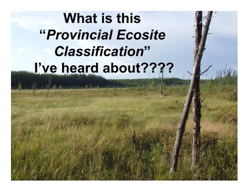
What is this âProvincial Ecosite Classificationâ I've heard about????
What is this âProvincial Ecosite Classificationâ I've heard about????
What is this âProvincial Ecosite Classificationâ I've heard about????
- No tags were found...
You also want an ePaper? Increase the reach of your titles
YUMPU automatically turns print PDFs into web optimized ePapers that Google loves.
ELC Program Solutions• Process began 10 years ago• Opportunity to get on board for the eFRI asannounced in 2005• Development of 3 provincial systems:• <strong>Ecosite</strong> classification• Substrate classification• Vegetation classification• All classifications expanded to include entireprovince – not just AOU• Acknowledgement and incorporation of nontimberrelated ecosystems (rock, shrub etc)
Individual and small group plans must coveressential health benefits (EHBs).Ambulatory patient servicesEmergency servicesHospitalizationMaternity and newborn careMental health and substance used<strong>is</strong>order services, includingbehavioral health treatmentPrescription drugsRehabilitative and habilitativeservices and devicesLaboratory servicesPreventive and wellness servicesand chronic d<strong>is</strong>ease managementPediatric services, including oraland v<strong>is</strong>ion care
Site• A site <strong>is</strong> dealing with land that <strong>is</strong>characterized by uniform potentials andconstraints• <strong>Ecosite</strong> classification has recognizedand grouped the ecological potentialsand constraints (very shallow rocky orhydric mineral)• Provides a mechan<strong>is</strong>m to map polygonsfor use in forest management planning• Designed to be stable for 20-40 years
<strong>Ecosite</strong> Framework• Front-loaded to stable (relatively static)features related to potential and capability– landform, mo<strong>is</strong>ture regime• Secondarily modified by biotic featurescontributing to potential and capability– vegetation• Eligible modifiers to provide additionalinformation <strong>about</strong> the site– range, vegetation cover, depth, chem<strong>is</strong>tryHierarchy of Influence created as astandard throughout all ELC products
ClimatePermanentFloodingHierarchy of InfluenceHigh Energy /AnthropogenicFreezing / SalineSeasonal FloodingShallowSubstratesGradients ofSubstrate Texture,Mo<strong>is</strong>ture Regime,Nutrients
ClimatePermanentFloodingHierarchy of InfluenceHigh Energy /AnthropogenicFreezing / SalineSeasonal FloodingShallowSubstratesGradients ofSubstrate Texture,Mo<strong>is</strong>ture Regime,Nutrients
ClimatePermanentFloodingHierarchy of InfluenceHigh Energy /AnthropogenicFreezing / SalineSeasonal FloodingShallowSubstratesGradients ofSubstrate Texture,Mo<strong>is</strong>ture Regime,Nutrients
ClimatePermanentFloodingHierarchy of InfluenceHigh Energy /AnthropogenicFreezing / SalineSeasonal FloodingShallowSubstratesGradients ofSubstrate Texture,Mo<strong>is</strong>ture Regime,Nutrients
ClimatePermanentFloodingHierarchy of InfluenceHigh Energy /AnthropogenicFreezing / SalineSeasonal FloodingShallowSubstratesGradients ofSubstrate Texture,Mo<strong>is</strong>ture Regime,Nutrients
ClimatePermanentFloodingHierarchy of InfluenceHigh Energy /AnthropogenicFreezing / SalineSeasonal FloodingShallowSubstratesGradients ofSubstrate Texture,Mo<strong>is</strong>ture Regime,Nutrients
Diversity• Diversity inherent to the province of Ontario• Similarities in ecosites at a conceptual levelBUT a bog in the south <strong>is</strong> different than a bogin the far north• Create geographic ecosite ranges where“flavors” of ecosites are recognized on aprovincial scale and yet independent basedprimarily on vegetation and mode ofdeposition• Geographic ranges are based on ecoregionand ecod<strong>is</strong>trict boundaries
Geographic Ranges of Ontario
Extension of Geographic Rangeinto Adjacent Ecod<strong>is</strong>trictsOverlap
Geographic range:• You must select one of:A-subarcticB-BorealG-GLSLS-SouthernU-UCL (inventory application only!)
Unique ecosite number:• Allows for the standardized identification ofecosites across the province• Obtained from the bottom of the ecositekeys
Vegetative modifier:Tt-tall treed (tree species ≥ 10m tall)Tl-low treed (tree species
Depth modifier:Inventory will select M-moderate or D-deepfor every ecosite.Field may select from an additional l<strong>is</strong>t ofshallow, moderate, moderately deep anddeep.Depth modifier does not apply to rock, veryshallow, anthropogenic or hydric ecosites.
Chem<strong>is</strong>try modifier:Inventory will select k-calcareous or n-noncalcareous for every ecosite in Ontarioexcept for the Anthropogenic ecositesField may select from an additional l<strong>is</strong>t ofacidic, basic or saline (salt influence)
Minimum <strong>Ecosite</strong> Coding(Level for FRI)B055TtDnGeographic Range - B(A, B, G, S)Unique <strong>Ecosite</strong> Number - 055(3 digits)Vegetative Modifier - Tt(Tt, Tl, S, N, X)Depth Modifier – D(M, D)Chem<strong>is</strong>try Modifier – n(n, k)We know that th<strong>is</strong>ecosite aspen/birch mixon dry/fresh, coarsetexture materials, talltrees (>10m), deepsubstrate and noncalcareous all from th<strong>is</strong>code!
B012TtnMinimum <strong>Ecosite</strong> Coding(Level for FRI)Geographic Range - B(A, B, G, S)Unique <strong>Ecosite</strong> Number - 012(3 digits)Vegetative Modifier - Tt(Tt, Tl, S, N, X)Depth Modifier – not requiredfor very shallow(M, D)Chem<strong>is</strong>try Modifier – n(n, k)We know that th<strong>is</strong>ecosite pine/spruce mixon dry/fresh substrate,tall trees (>10m), veryshallow substrate andnon calcareous all fromth<strong>is</strong> code!
How <strong>Ecosite</strong>s Inform Inventory• “enhanced” FRI through the addition of ecositeinformation and ecological approach to photointerpretation• <strong>Ecosite</strong> concepts developed with photointerpretability in mind; designed to be useful atan operational scale; good fit for FRI but mayonly be a coarse filter for program areas such asSAR habitat modelling (ie caribou)• provide key pieces of site information; aids theforest management dec<strong>is</strong>ion making process
Mapping Concepts• Mapping <strong>is</strong> an art as much as a science• Systematic delineation of easily identifiable andrecognizable conditions• Scale and technology dependent• Spatially explicit• Generally seamless (no holes)
<strong>Ecosite</strong>s are the lowest levelof spatial association in theELC hierarchyMapping constructRelated to potentials andconstraints
ELC Components and ScalesEcozonesEcoprovincesEcoregionsEcod<strong>is</strong>trictsEcosections<strong>Ecosite</strong>sPolygon / Geographic AssociationsPlots / TaxonomicEcoelements•Vegetation Community (V-type)•Substrate (S-Type)
Polygons Differentiated By…• Minimum mapping standards for size• Cons<strong>is</strong>tent species composition• Cons<strong>is</strong>tent age, height, stocking• Recognition of a dominant substrate texture,depth and mo<strong>is</strong>ture regime
Complex <strong>Ecosite</strong>G012TlnG055TtMnG012Tln (Very Shallow Dry toFresh: Pine-Black Spruce Conifer)<strong>is</strong> the dominant ecositeG055TtMn (Dry to Fresh, Coarse:Aspen-Birch Hardwood) an inclusionthat composes greater than 20% ofthe polygonThe complexed code would bewritten as G012Tln / G055TtDn


