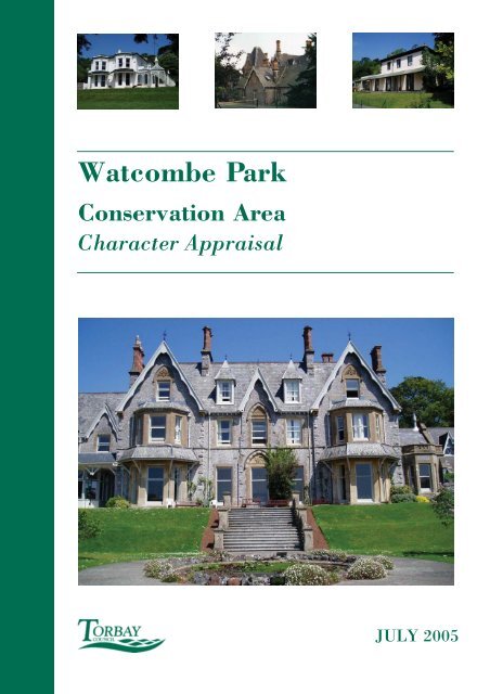
Watcombe Park Conservation Area Character ... - Torbay Council
Watcombe Park Conservation Area Character ... - Torbay Council
Watcombe Park Conservation Area Character ... - Torbay Council
- No tags were found...

Create successful ePaper yourself
Turn your PDF publications into a flip-book with our unique Google optimized e-Paper software.
<strong>Watcombe</strong> <strong>Park</strong><strong>Conservation</strong> <strong>Area</strong><strong>Character</strong> AppraisalJULY 2005
WATCOMBECONSERVATION AREACHARACTER APPRAISALRevisedHal Bishop BA MA Cert Ecol & ConsJuly 2005TORBAY COUNCILInitial research by John Fisher BA MA MRTPI IHBCAugust 2001
CONTENTSPAGE1. Location and Essential <strong>Character</strong>istics 22 Historic Environment, Origins and Development 23. <strong>Character</strong> <strong>Area</strong>s 53.2 Brunel Manor, the Historic <strong>Park</strong> and Garden3.3 The Villas and Associated Development3.4 Later Development4. Architectural and Historic Qualities 54.1 Listed & Other Key Buildings4.2 Building Form, Ornament and the Use Of Materials4.3 Condition of Buildings5. Local Details, <strong>Character</strong> and Relationship of Spaces 86. Green Landscape and Trees 87. The Setting and Features of Special Importance 98 Extent of Loss, Damage and Intrusion 109 Summary 1010 <strong>Conservation</strong> <strong>Area</strong> Policies 11Bibliography 13PHOTOGRAPHSEARLY EDITION ORDNANCE SURVEY:1: 2500 scale maps (not to scale)- Ordnance Survey County Series First Edition surveyed 1862-87- Ordnance Survey County Series Second Edition surveyed 1904- Ordnance Survey County Series Third Edition surveyed 1933APPRAISAL MAPS- Map One: Historic Buildings- Map Two: Age of Buildings- Map Three: Building Materials - Roofs- Map Four Building Materials - Walls- Map Five Important Features1<strong>Watcombe</strong> <strong>Park</strong> <strong>Conservation</strong> <strong>Area</strong> <strong>Character</strong> Appraisal adopted 2 August 2005
2<strong>Watcombe</strong> <strong>Park</strong> <strong>Conservation</strong> <strong>Area</strong> <strong>Character</strong> Appraisal adopted 2 August 2005
1 LOCATION AND ESSENTIAL CHARACTERISTICS1.1 The <strong>Watcombe</strong> <strong>Park</strong> conservation area is situated some 4 km north of the centre ofTorquay and straddles the A379 Teignmouth Road. The wooded slopes of <strong>Watcombe</strong><strong>Park</strong> are an important topographic and landscape feature; they slope from a height ofover 150m (about 500 feet) on the north to between 85-100m OD in the south. In1987 the park was included on the Register of Historic <strong>Park</strong>s and Gardens (grade II )and its extent revised in July 2003 to more closely coincide with the boundary of theconservation area.1.2 Until the mid-20 th century there was little development apart from the park and itshouse, built on an estate built up by Isambard Kingdom Brunel between 1847 and1859, and the half dozen mid-19 th century villas to its south and east. In the early-20 th century a few further detached houses were built in the field forming thenorthwest corner of the junction of Teignmouth Road and Moor Lane. But from the1960s onwards this outer part of Torquay saw a major population increase, such thatthe whole conservation area, with the exception of <strong>Watcombe</strong> Beach Road, is nowencircled by houses and bungalows. About 20 of these are somewhat incongruouslyincluded within the boundary, as is the Steps Cross Special School, the latter a postwarfoundation.2 HISTORIC ENVIRONMENT, ORIGINS AND DEVELOPMENT2.1 <strong>Watcombe</strong> is located on the northern edge of the large historic parish of StMarychurch, itself the mother church of the adjoining parishes of Kingskerswell andCoffinswell – the three were probably once part of a very large Saxon estate whichhad been divided up before the Conquest. By Domesday the manorial estates werewell defined with five combined within the parish of St Marychurch: St Marychurchproper, Combe Pafford, Edginswell, Shiphay Collaton and Ilsham. <strong>Watcombe</strong> hasbeen assumed to lie within the Combe Pafford manor, the Domesday æcclam SMARIÆ held by the Bishops and diocese of Exeter until 1800.2.2 There has been human activity and possibly settlement in the area since prehistorictimes; 400m to the west lies Great Hill, at 180m (587 feet) the highest part of the 4-mile ridge that stretches from Milber Down to the sea at Maidencombe. A beacon atthe top, a well-marked hollow and a large standing stone, of presumed prehistoricdate stood here until removed by the Torquay Corporation reservoir which wascompleted in 1926. The ridge, a boundary from prehistoric times, divides theparishes of St Marychurch from Coffinswell, very much as a similar ridge to the southof <strong>Torbay</strong> divides the historic parishes of Paignton and Churston with the prehistoricBroadsands Chambered tomb lying astride it.2.3 <strong>Watcombe</strong> is first recorded as Whatecomb in a Charter Rolls of 1414 and Whetecombein an Inquistion post-mortem of 1438. Wheat Valley suggests arable fields assarted upto the steep slopes north of Moor Lane. On the 1809 OS 1 inch map there is aconspicuous absence where <strong>Watcombe</strong> <strong>Park</strong> is now, Great Hill is recorded as3<strong>Watcombe</strong> <strong>Park</strong> <strong>Conservation</strong> <strong>Area</strong> <strong>Character</strong> Appraisal adopted 2 August 2005
Holloway Head and <strong>Watcombe</strong> only appears as a name on the coast located as<strong>Watcombe</strong> Head. An estate map of c.1859 records Great Hill as Telegraph Hill.2.4 A series of early stucco villas were built on either side of the Torquay to TeignmouthRoad, which had been improved as a turnpike after the opening of the ShaldonBridge in 1827; completed in the 1840s they are typical of the Torquay style beingbuilt extensively in the Lincombes and Warberries areas at this time, several haveintegral service wings. The Brunels occupied two of them between 1849 and 1859; anumber became the temporary homes of other prominent persons.2.4 But <strong>Watcombe</strong> as a landscape is inseparable from the Brunel family, whose creationit was. In 1847 Isambard Kingdom Brunel, indefatigable engineer of the GreatWestern Railway, the steamship Great Britain, the Clifton Suspension Bridge et multialia, decided to build a house and grounds for his residence at <strong>Watcombe</strong>. There wasno ready made estate to take over, Brunel began buying land from the local owners,prinicipally Henry Langford Brown; after the last land purchase in 1858 the estatewhen surveyed that year amounted to 136 acres. Brunel’s envisioned house was neverbuilt, but its successor Brunel Manor, now a private conference centre, is thecentrepiece of the conservation area within the park which was finished.2.5 After the first major land acquisitions Brunel began the creation of the park in 1848;two historic trackways, one east-west from Barton, the other north-south linking StMarychurch and Teignmouth, were closed and converted into carriage drives. Bothlay to the west of the present Teignmouth Road whose broad curves swinging up thehill were part of the turnpike improvements. In the north the old road fromTeignmouth diverged from the turnpike just south of Little Acre (SX 291900 68130)meeting the east-west one from Barton between what is now 30 and 32 BrunelAvenue. The Barton road ran from here north of Brunel Avenue to the point where 49Moor Lane is now, the two forming a reversed L. At the intersection Brunel formedwhat was to be his southern entrance to Torquay by continuing the east-west line tojoin the new Teignmouth Road between where now Skara Brae and <strong>Watcombe</strong>Cottage are situated.2.6 In return Brunel constructed the steps at the top of Steps Lane (from whence it takesits name) to from a quick pedestrian link across the lower curves of the new turnpike;Steps Lane formed the lower end of the pre-turnpike road. Additionally he built MoorLane west of Steps Cross to form the link to Barton.2.7 Brunel no doubt selected the location for <strong>Watcombe</strong> <strong>Park</strong> because of its elevatedposition and favourable aspect. In 1852 he bought land for a small estate of cottages,schoolroom and chapel for his workers at Barton, a medieval rural settlement about amile to the southwest (also a designated conservation area), where these buildings,although much altered, can still be seen.2.8 Perhaps the single most impressive aspect of the Brunel’s landscaping was hisplanned grand entrance from over Great Hill to the north east. Here, at the parishboundary at a height of 591’, the Admiralty had planned a new semaphore signalstation using the Popham system of semaphore. This would be part of the existingchain running between London and Plymouth, but east of the Exe would form a new4<strong>Watcombe</strong> <strong>Park</strong> <strong>Conservation</strong> <strong>Area</strong> <strong>Character</strong> Appraisal adopted 2 August 2005
southern route avoiding the Haldons where the existing shutter system was in use. Inthe event the land purchased for the purpose in the 1820s was not needed when theelectric telegraph made the whole system obsolete. Brunel bought the hill from theAdmiralty in 1849 for £10. This allowed him to approach <strong>Watcombe</strong> from his mainline railway station at Newton Abbot, climb Milber Hill using another turnpike roadand cross the Great Hill ridge for nearly ½ mile on his own land before entering thelandscaped park via a western lodge, now demolished and the site of the post-warClarence Falls. The ridge route itself no longer exists, the avenue of trees whichmarked the driveway was felled in 1983.2.9 Much of the park was designed by Brunel himself – his notebooks with plantingdiagrams survive – under the influence of William Nessfield, famed for his use oftrees, notably at Kew. The execution of the work by Alexander Forsyth, best knownnow for the great Arboretum at Alton Towers, was carried out between 1849-55. Thetrees were supplied by the Veitchs, many of them were then rare, being introductionsof the 1840s; the monkey puzzle in particular was only available after 1844. At onestage over 50 men were employed when massive earth movement and road buildingtook place, thousands of tons of peat were brought over Great Hill to bed the trees.2.10 Brunel’s <strong>Watcombe</strong> estate with its formal drives and parkland extended over a muchlarger area than that which is defined as a registered historic garden today; thesouthern extent of the estate was Moor Lane. Water was a key element and Brunelemployed William Simpson, a leading hydraulic engineer and London colleague, todevise a system for supply. At the northeast corner of the junction of Moor Lane andwhat is now Padacre Road a reservoir was built to take the water from seven wellsrunning east to west along the north side of Moor Lane; the pump house powered bygas was located within the curtilage of No. 17. An ornamental lake was alsoconstructed whose footprint is now contained by the curtilages of Nos 11-19 MoorLane. An estate map, compiled after Brunel’s death in 1859, clearly shows thearrangement. By the time the OS County Series First Edition was published in 1890(from surveys of 1862-87) the former lake had been drained and its profile is shownas earthworks.2.11 Brunel had intentionly designed and landscaped the grounds before beginning thebuilding of his house. His architect William Burn had had plenty of time to draw upfull plans; these survive as do drawings of the main façade. However With Brunel’searly death the main building work was left in limbo, the house designed but onlyground works up to balustrade level completed. Mary Brunel continued to live in<strong>Watcombe</strong>, occupying Langley Lodge (now Langley Manor and just outside theconservation area), immediately north of Portland Villa from 1861-2. In 1863<strong>Watcombe</strong> <strong>Park</strong> was sold to the Vicary brothers of Newton Abbot. The presentsubstantial stone house of c.1870 was built for J. R. Crompton, a wealthy Lancastrianpaper manufacturer, who bought from the Vicarys.2.12 By 1887 the estate was owned by a Colonel Ichabod Wright who enlarged the house;an article in that October’s The Gardeners’ Chronicle extolled the park grounds:5<strong>Watcombe</strong> <strong>Park</strong> <strong>Conservation</strong> <strong>Area</strong> <strong>Character</strong> Appraisal adopted 2 August 2005
Many who have seen the grounds pronounce them the most beautiful to be metwith in this delightful part of the west … Nature has done much for the placeand the natural advantages present have been turned to good account …Acting on the principle that whilst men are sleeping trees are growing he[Brunel] took the wise course of having the ground-work and planting donebefore beginning to build. Mr Forsyth was entrusted by Mr Brunel with thelaying out of the grounds. How well he acquitted himself in the work is shownby the appearance of the place at the present day, when some thirty years haveelapsed since the planting was completed … Standing immediately in front ofthe house, which faces down the valley in a southerly direction, the view acrossthe country is one of the finest imaginable.2.13 Colonel Wright’s mounting debts forced the sale of the estate in 1907, from whichpoint it was dismantled, the land being sold off piecemeal. The buildings whichsurrounds the park on all sides are almost entirely post-war.3 CHARACTER AREAS3.1 The conservation area may be sub-divided into three quite separate character areas;they are marked on Appraisal Map One and are:3.2 (1) Brunel Manor, the Historic <strong>Park</strong> and GardenThe largest charcater area comprises: Brunel Manor and its terraced gardens; thepublic park – now known as Brunel Woods; and the original stable yard buildings ofthe main house, recently converted to housing and adjacent to other private housingdating from the late-19 th to late-20 th century.3.3 (2) The Villas and their Associated DevelopmentTwo small groups of informally arranged detached villas, some since subdivided: theformer with access from Teignmouth Road, the latter from <strong>Watcombe</strong> Beach Road.Also included in this group is <strong>Watcombe</strong> Cottage, originally built as a chapel forBrunel’s estate workers.3.4 (3) Later DevelopmentMost of the later development in the conservation area dates from the latter half of the20 th century, and its inclusion can only be justified in terms of the importantlandscape setting and the few surviving landscape features. This is especially true ofthe so-called ‘Tea Field’, in which the Steps Cross Special School is located, and theunfortunate recent development of the Conifers in the school’s former playing field.4 ARCHITECTURAL AND HISTORIC QUALITIES4.1 LISTED & OTHER KEY BUILDINGS6<strong>Watcombe</strong> <strong>Park</strong> <strong>Conservation</strong> <strong>Area</strong> <strong>Character</strong> Appraisal adopted 2 August 2005
4.1.1 The conservation area contains five buildings listed as being of special architecturalor historic importance, with three additional listings of artefacts associated withBrunel Manor. They are all grade II and are denoted here in bold.4.1.2 Largely hidden from public view, other than glimpses from a footpath to the north,Brunel Manor itself was built in a neo-Gothic style around 1870 (with plenty of spikygables and dormers Pevsner). The architect was J. Watson, who took over Burn’sfoundations, and was later responsible for Holy Trinity, Torwood 1894-6 ( in theTorquay Harbour <strong>Conservation</strong> <strong>Area</strong>). Apart from its size, the house is alsodistinguished by its steeply pitched roofs, cusped barge-boards, and tall chimneystacks of banded brick and stone. The listing describes Brunel Manor as ‘a handsomeHigh Victorian house with eclectic detail, preserving most of its original fittings’.There are two separate listings for the terraced gardens to the south and west; theseare the work of W. E. Nesfield and are thought to be contemporary with the Manor.On the west side and centrally there are two flights of steps including balustradingbuilt of freestone and beyond a balustrade and a retaining wall, the work of Burn. Allthe balustrades match in design having square piers and shallow quatrefoil panels;the balusters by contrast are classically circular with cushion capitals below thecontinuous coping; the retaining wall is of dressed limestone with some artificialstonereplacement.4.1.3 Where the drive to the Brunel Manor approaches Teignmouth Road there are twogate-piers and a wall of local grey limestone with ashlar dressings, probablyassociated with Nesfield’s later garden layout. There are also several importantunlisted buildings; principally the former stable block which is built around threesides of a rectangular courtyard and entered through a tall arch. This has recentlybeen restored and converted to apartments in a manner very much in keeping withthe original building.4.1.4 The remaining listed buildings form a loose-knit group of early-mid 19 th centuryvillas, some with service wings, to the southeast of <strong>Watcombe</strong> <strong>Park</strong>. Probably theearliest is <strong>Watcombe</strong> Hill House said to date from 1838; it is stuccoed with a hippedslate roof and rendered stacks. Its moulded doorcase contains panelled reveals, andits windows are in the main 12-pane sashes. The interior retains panelled doors,plaster cornices, and a stick-baluster stair. To the south is <strong>Watcombe</strong> Cottage whichwas built c.1850 as a chapel by Brunel, for workers on the estate; it is believed tohave been converted to a cottage quite soon after his death when an extension wasadded. It is built of stone rubble with a slate roof and stone stacks. Two pointed-archwindows remain, and some doors date from the original conversion. The listing citesdrawings, now at Bristol University, made by Brunel for an elaborate altar piece herewhich however does not appear to have been carried out.4.1.5 On the east side of Teignmouth Road, built into the hillside is the now divided villa of<strong>Watcombe</strong> Lodge dating from the 1840s; the former service wing is now LanternHouse; it was rented by the Brunels between 1849 and 1857 when it was known as<strong>Watcombe</strong> Villa. The main features are the round-headed entrance, panelled frontdoor and a fanlight over with glazing bars and stained glass. The service wing has 12-pane sash windows, probably original, and across the front is a conservatory, with7<strong>Watcombe</strong> <strong>Park</strong> <strong>Conservation</strong> <strong>Area</strong> <strong>Character</strong> Appraisal adopted 2 August 2005
canted corners, round-headed lights and end pinnacles with lead finials. The unlistedcoach house has also been converted to residential use under that name.4.1.6 On the north side of <strong>Watcombe</strong> Beach Road is the former <strong>Watcombe</strong> House dated1858 – now divided in two as Washington House and <strong>Watcombe</strong> Court; it isstuccoed with a slate roof having deep eaves with a dentil course. The house isbroadly rectangular with its most prominent façades to the east, facing the sea.Elevational detail is typical of the period with the bays having round-headed arches,some original 12-pane sash windows, and a projecting porch with pilasters. Theinterior is thought to retain the original staircase.4.1.7 The Lodge Cottage, west of <strong>Watcombe</strong> Court was one of <strong>Watcombe</strong> House’soutbuildings; it is built of grey limestone and slate with crested ridge tiles; it isvirtually unaltered from its original design with casement windows of leaded lights,deep set eaves and porch. <strong>Watcombe</strong> Hall, on the south side of <strong>Watcombe</strong> BeachRoad is also one of the mid-19 th century stuccoed villa group, but has been de-listed.Despite this and being somewhat disfigured by a large extension and a corridor link,the original house retains some good original detail including a low-pitched slate roof,rendered stacks with recesses and platbands, canted corners, deep-bracketed eavesand an imposing west-facing landing window one and a half storeys in height withstained glass.4.1.8 At the junction of Teignmouth and <strong>Watcombe</strong> Beach Roads, Tithe Barn Cottage,although relatively undistinguished architecturally, may contain fabric from a pre-19 th century building. For the final two years of his life the Brunels lived opposite thepresent entrance to the <strong>Park</strong> in Portland Villa, later known as Maidencombe Houseand converted to a hotel it was demolished in 1988 for flats. To the south between1861 and 1912 a wooden bridge designed by Brunel and built by his son Henrycrossed the Torquay-Teignmouth road where it entered a cutting. Its site is nowwithin the curtilage of Timberlands.4.2 BUILDING FORM, ORNAMENT & THE USE OF MATERIALS4.2.1 The handsome frontages of the stucco or rendered villas are a major feature of theconservation area. The villas typically have hipped slate roofs and occasionalprojecting gables or hips incorporating bay windows, and a few yet more extravagantdetails. The position of the chimney stacks in relation to the roof profile variesconsiderably with no set pattern. The majority of these are rendered, though some arecorniced. Watson’s work at Brunel Manor shows an eclectic mix of materials, mostlyexposed stone and brick, skillfully used both in the main house and the stable yard tothe north.4.2.2 Openings can vary widely in detail, although sash windows are the traditional meansof glazing. The frontages and corner details of the buildings have been skillfullyexecuted, often with two or more prominent frontages, with the villas orientated toprovide sea views. Additional ornament to the stuccoed villas extends in a fewinstances to rusticated quoins, plat bands and cornices, bracketed eaves, roundarchedopenings including porches, verandahs, and at <strong>Watcombe</strong> Lodge a fine 19 th8<strong>Watcombe</strong> <strong>Park</strong> <strong>Conservation</strong> <strong>Area</strong> <strong>Character</strong> Appraisal adopted 2 August 2005
century conservatory. For the most part the 19 th -century buildings in the conservationarea have not suffered from the addition of large extensions that so easily mar theintegrity of the original – and does so elsewhere in Torquay.4.2.3 Two types of stone predominate; most widely used is the local grey Torquay limestonemainly in a crazed form here, and Permian red sandstone. Both are used in boundarywalls and in the former stable buildings; both were also quarried on estate land eastof Teignmouth Road.4.2.4 Welsh or Cornish slate, especially the former, was the dominant roofing material ofthe 19 th century. In the majority of cases this has survived, although there areinstances of replacement with artificial substitutes. New natural slate has been usedto good effect in the conversion of the former stable block.4.3 CONDITION OF BUILDINGS4.3.1 From external observation, the majority of buildings in the conservation area appearto be in a sound structural condition; the large majority are in private residential, orinstitutional, use and these appear to be in good or exceptionally good order.Although there has been some loss or replacement of original architectural featuresthis is not widespread, and the conversion of the former stables has been wellexecuted with due regard to the original building.5 LOCAL DETAILS, CHARACTER AND THE RELATIONSHIP OF SPACES5.1 The relatively steep topography, with Teignmouth Road taking the route of anelongated S-curve across the conservation area, creates a sense of discrete isolationbetween the separate parts. The park is an ideal environment for walkers, as theextensive footpaths allow circular walks to be made from within Brunel Woods to thesurrounding countryside and coastline. Long years of neglect and extensive treegrowth since the <strong>Park</strong> was laid out in the 19 th century has obscured many elements ofBrunel and Forsyth’s work; Nesfield’s garden terraces are in private hands and notnormally visible to the public. From some of the more elevated parts of theconservation area there are dramatic outward views, especially towards the south.5.2 The original buildings are for the most part very reclusive, with their main façadesturned away from the carriageway; some frontages are barely visible even at closerange. From a distance the stuccoed villas can be glimpsed encircled by trees on theslopes of <strong>Watcombe</strong> Hill. The more recent housing within the conservation areaconsists mainly of bungalows of the 1960s-80s; while these detract from the historiclandscape they are relatively well screened and the most prominent slopes remainundeveloped.6 GREEN LANDSCAPE AND TREES9<strong>Watcombe</strong> <strong>Park</strong> <strong>Conservation</strong> <strong>Area</strong> <strong>Character</strong> Appraisal adopted 2 August 2005
6.1 Brunel Woods form the focal point of the main landscape features within theconservation area, about half of which consists of tree cover. An information boardwithin the wood outlines the history of the park, its richness and variety of vegetation.It records the thousands of cartloads of peat that were brought in to assist in theplanting of an arboretum, with many species of conifer introduced, for example theMonterey Cypress (Cupressa macrocarpa), which at the time was a rarity. The part ofthe park dedicated to the public suffered neglect between Brunel’s death in 1859right up until 1987 when a local trust was formed to research and protect Brunel’sachievement: plotting all the trees just before a major storm of 1990. This became avaluable record when Task Force Trees (jointly operated by <strong>Torbay</strong> <strong>Council</strong> and thethen Countryside Commission) carried out major landscape restoration. The BrunelColumn and the associated sculptures surrounding it, using storm damaged timber,were completed in 1993 by Keith Barrett and record aspects of Brunel’s life andwork.6.2 In spite of the storm many of the original trees survived and there are some goodexamples of Mediterranean pine and especially Monterey pine (Pinus radiata). Alsopresent are holm oak (quercus ilex), Spanish oak (quercus x hispanica) and whatappears to be one or more specimens of the locally found Lucombe Oak(LUCOMBEANA). There are also many of the more common deciduous species, forexample oak (quercus robur), ash (fraxinus excelsior), lime (tilia x europaea),sycamore (acer pseudoplatanus), beech (fagus sylvatica), and horse chestnut (aesculushippocastanum). Clearly the original concept was thematic and separate parts of thepark are identified as the thornery, beech wood, pinetum, the avenues, the quarry,Brunel’s Rockery, and the meadow.6.3 Dense woodland also exists to the east of Teignmouth Road and north of <strong>Watcombe</strong>Beach Road, but apart from a single footpath from the public car park it is largelyinaccessible. Otherwise landscape features fall into two main categories. Firstly thereare hedges and hedgerow trees bordering parts of Moor Lane, Steps Lane,Teignmouth and <strong>Watcombe</strong> Beach Roads. Secondly are mature trees either within orbordering the grounds of the villas with a few fine specimen trees surrounded bylawns. Almost everywhere, trees act as a foil or a backdrop to buildings, even in thecase of recent development, and in some cases obscuring them almost completely.6.4 Between <strong>Watcombe</strong> Lodge and <strong>Watcombe</strong> House the rough land is the result of claypit diggings. G F Allen, who had bought <strong>Watcombe</strong> House in 1857 to retire to,discovered a rich vein of potters’ clay here during 1867 while digging for a wellduring landscaping. He establsihed the <strong>Watcombe</strong> Terrac-Cotta Clay Company ½mile away in St Marychurch to exploit it.7 THE SETTING AND FEATURES OF SPECIAL IMPORTANCE7.1 <strong>Watcombe</strong> complete absence from the historical record – early 19 th century mapsrecord it as open countryside – comes to an end with the construction of theTeignmouth-Torquay turnpike following the opening of the Shaldon bridge in 1827,and Torquay’s development as a fashionable resort. The scattering of villas begin to10<strong>Watcombe</strong> <strong>Park</strong> <strong>Conservation</strong> <strong>Area</strong> <strong>Character</strong> Appraisal adopted 2 August 2005
appear on the hillsides around <strong>Watcombe</strong> and Maidencombe from the late 1830s.Brunel’s designed landscape of the 1850s was of a greater order.7.2 The important elements contributing to the character of the <strong>Watcombe</strong> <strong>Park</strong>conservation area can be simply summarised as follows:v first and foremost Brunel’s unique designed landscape of the 1850s aided by Forsyth,with the historic house of 1870 including the early work by Burn, and Nessfield’slater work;v the large extent of remaining open space within the historic park, including theextensive network of footpaths in Brunel Woods provided for public recreation;v the 19 th century villa development orientated towards the sea, some of which remainsignificantly unaltered, including the original spatial arrangement, roof profiles,stacks and original pots, etc;v the range of historic frontage and layout forms employing an intricacy of detail, andusing a range of materials including mid-19 th century decorative stucco cornices andmoulding, and the later-19 th century use of polychromatic building materials;v the survival of a high proportion of period detail, both internal and external, such asoriginal sash windows with their glazing bars, stained glass, moulded architraves, andpanelled doors, shutters and reveals;v the survival of boundary walls using local grey limestone and red sandstone;v the location of the <strong>Watcombe</strong> Beach Road public car park, providing access to anunspoiled beach; the Valley of the Rocks; woodland and coastal walks with access tothe South West Coast Path;v extensive tree cover and tree groups which often act as an important foil to buildings,especially in the Beach Road area.8 EXTENT OF LOSS, DAMAGE AND INTRUSION8.1 There are fortunately few elements that are detrimental to the character andappearance of the conservation area. These are:♦ the insensitive and inappropriate inroads made into the landscape by bungalowdevelopment, especially around Steps Lane, and on land north of Brunel Manor offSeymour Drive during the 1960s-80s;♦ the loss of some historic joinery, especially original sash windows and glazing bars,and four and six-panel original doors;11<strong>Watcombe</strong> <strong>Park</strong> <strong>Conservation</strong> <strong>Area</strong> <strong>Character</strong> Appraisal adopted 2 August 2005
♦ the loss of natural roofing slate and its partial or complete replacement with artificialsubstitutes;♦ Some trees which have become over-mature and dominate the setting of buildings.9 SUMMARY9.1 The ensemble of the listed Brunel Manor and the registered Historic <strong>Park</strong> andGarden are combined in the <strong>Watcombe</strong> <strong>Park</strong> <strong>Conservation</strong> <strong>Area</strong>, both contribute to aan area of local distinctiveness and national importance. They form an attractive andenvironmentally sensitive part of Torquay. The origins of the historic park and itsassociation with possibly the most famous of the great 19 th century engineers gives theconservation area much of its historic status and a uniqueness, for there is no otherlandscape known to have been created by Brunel. The eastern portion also includesan area of great landscape value and is part of the coastal preservation area,containing some of the best countryside to be found anywhere along the southerncoastline of Devon.9.2 The original character of the 19 th century buildings has been little compromised bysubsequent alterations and additions, but they are widely spaced and tend to recedeinto a landscape which, for the most part, is the dominant feature of the conservationarea. There are some locations where boundaries and the surviving historic elementsof design and ornament are significant and need safeguarding. This is especially thecase in those parts where recent development has taken place. The conservation areacontains some widely disparate elements, but now that the landscape and countrysidefeatures of an important historic setting are fully appreciated, scope for futuredevelopment that would result in significant further changes is likely to be verylimited – and should remain so.10 CONSERVATION AREA POLICIES10.1 <strong>Conservation</strong> <strong>Area</strong> policies are addressed in the adopted local plan:Policy BE5 - Development within or affecting a <strong>Conservation</strong> <strong>Area</strong> will onlybe permitted where it will preserve or enhance the character or appearance ofthat area.The Policy outlines the <strong>Council</strong>’s strategy for <strong>Conservation</strong> <strong>Area</strong>s. It includesissues such as the control of demolition, alterations and extensions, boundaryfeatures and design aspects, as well as the control of development in adjacentareas which could impact significantly on the townscape and environmentalqualities within <strong>Conservation</strong> <strong>Area</strong>s. (The Built Environment 14.9)further it is recognised that:12<strong>Watcombe</strong> <strong>Park</strong> <strong>Conservation</strong> <strong>Area</strong> <strong>Character</strong> Appraisal adopted 2 August 2005
Roof materials, chimneys, cornices and mouldings, original windows andshopfronts, railings and boundary walls can all make an importantcontribution to the character of a <strong>Conservation</strong> <strong>Area</strong>. The <strong>Council</strong> willintroduce Article 4(2) Directions to bring such items under normal developmentcontrol. (The Built Environment 14.56)10.2 To frame specific policies within the <strong>Watcombe</strong> <strong>Park</strong> conservation area:(1) All unlisted buildings identified as key buildings or groups of buildings thatcontribute to the historic built environment (see Map One) should beincluded within Article 4(2) Directions to control inappropriate changes tothe principal elevations.(2) Protect from detrimental loss all the significant features, identified in sections7 and 9 as contributing to the local character and special importance, whichneed to be safeguarded or enhanced, and where in future, <strong>Conservation</strong> <strong>Area</strong>or Article 4 consent may be required.(3) Give due consideration to other key local factors which make up the featuresof special importance, such as the building groups of merit just outside theperiphery of the conservation area and the extension of the existing boundarywhere appropriate.13<strong>Watcombe</strong> <strong>Park</strong> <strong>Conservation</strong> <strong>Area</strong> <strong>Character</strong> Appraisal adopted 2 August 2005
BIBLIOGRAPHY AND REFERENCESWard, C.S., & Baddeley, M.J.B. South Devon & South Cornwall - Thorough Guide SeriesDulau & Co., London, (third edition) 1889Hope-Moncrieff, A.R (Ed.) Black’s Guide to Devonshire Adam & Charles Black, London(sixteenth edition) 1898Ellis, Arthur C. An Historical Survey of Torquay 1930Red Guides Torquay & South Devon Ward Lock & Co. Ltd. London (Fifteenth Edition)1939-40Hoskins, W.G. Devon William Collins, London 1954 (revised edition published DevonBooks 1992)Wilson, John R.A. A Study in the Development of a Fashionable Resort UnpublishedDissertation Wellswood <strong>Park</strong>, Torquay 1957Clifton-Taylor, Alec The Pattern of English Building Faber & Faber London 1975Brunel in Devon Trust Outline Plan for I. K. Brunel’s Heritage <strong>Park</strong> at <strong>Watcombe</strong>, Devon1987Born, Anne, The <strong>Torbay</strong> Towns Phillimore 1989 ISBN 0 85033 694 5Tudor, Geoffrey The Brunels in <strong>Torbay</strong> Torquay Natural History Society 1989Cherry, Bridget and Pevsner, Nikolaus The Buildings of England, Devon Penguin (secondedition) 1989 ISBN 0 14 071050 7Travis, John F. The Rise of the Devon Seaside Resorts University of Exeter Press 1993 ISBN0-85989-398-8Department of National Heritage Revised List of Buildings of Special Architectural or HistoricInterest - Borough of <strong>Torbay</strong>, Devon, <strong>Area</strong> of Torquay. May 1994Quality in Town and Country Department of the Environment June 1994Power of Place - The future of the historic environment English HeritageDecember 2000Building Regulations – Balancing the needs for energy conservation with those of buildingconservation: an Interim Guidance Note on the application of Part L English Heritage March2004<strong>Torbay</strong> Local Plan 1995-2011 Adopted Version <strong>Torbay</strong> <strong>Council</strong> April 200414<strong>Watcombe</strong> <strong>Park</strong> <strong>Conservation</strong> <strong>Area</strong> <strong>Character</strong> Appraisal adopted 2 August 2005
PHOTOGRAPHS
The Setting of the <strong>Park</strong>1 The view from southern edge of Brunel Woods towards the twin churches of St.Marychurch: the Anglican tower and the Roman Catholic spire.2 The bank on the right hand side of Steps Lane was formerly the division between the<strong>Watcombe</strong> Estate which lay to west and neighbouring land holdings.3 'The Meadow' is a clearing in Brunel Woods, part of the planned landscape. Manytrees included in the original design were lost in the severe storm of January 1990,but some fine conifers survive, as for example, this Douglas Fir.4-5 The 1990 storm left much fallen timber from which this large wood-carved groupwas created by Keith Barrett in 1993 for the public park. The stand of MontereyCypress were rare in Britain when first planted in the mid-19th century (5). Brunel'strademark tall top hat makes him easily identifiable from a distance.
1.2.3.5.4.
6 The well-concealed car park in <strong>Watcombe</strong> Beach Road gives access to the beach400 metres distant. The heavily wooded setting here extends well beyond both theconservation area and the registered gardens of <strong>Watcombe</strong> <strong>Park</strong>.Brunel Manor Buildings7-9 Brunel Manor dates from c.1870, the existing building, now a conference centre, wasbuilt for the wealthy Lancashire paper manufacturer J R Crompton by J Watson, to aground plan originally prepared by William Burn for Isambard Kingdom Brunel, butwas left incomplete at the latter's death in 1859. The building has a wealth of neo-Gothic detail and a rich combination of materials, mainly of local limestone in acrazed rubble pattern with Bath stone dressings and with stone and brickpolychromy in the tall stacks (8). The eastern extension is from the later 20thcentury (9).10-11 The former estate buildings and stable yard 100 metres northeast of the main househave been recently converted to housing. The high standard of craftsmanship inbrick and stone is evident across the block.
6.7.8.9.10.
The Villas12 <strong>Watcombe</strong> Hill House is probably the earliest of the villas in the conservation area;it is said to date from 1838. It is simple stucco structure with a hipped slate roofabove deep eaves. The verandah extends along the length of both the southwest andthe southeast sides. The interior retains panelled doors, plaster cornices, and a stickbalusterstair.13 <strong>Watcombe</strong> Cottage was built c.1850 as a chapel by Brunel, for workers on the estate;it is believed to have been converted to a cottage quite soon after his death when anextension was added. It is built of stone rubble with a slate roof and stone stacks.Two pointed-arch windows remain, and some doors date from the original conversion.14 The former <strong>Watcombe</strong> Lodge is now sub-divided with the rear service wing forming aseparate house, the Lantern House, with the main house of <strong>Watcombe</strong> Lodge to thesouth. The buildings mainly date from c.1860 and are well screened by mature treeswhich largely obscure a fine 13-bay conservatory. This extends across the east frontwith many decorative elements such as the round-headed lights, end pinnacles withlead finials, and the adjustable vents along the ridge.15-16 The former <strong>Watcombe</strong> House dated 1858, is now also sub-divided, with WashingtonHouse forming the eastern half (15), and the flats of <strong>Watcombe</strong> Court the west (16).It retains many typical period features, among which are the low hipped roof withdeep eaves and tall rendered stacks. The house is broadly rectangular with its mostprominent façades to the east, facing the sea. The detail is typical of the period withthe bays having round-headed arches, and a projecting porch flanked by prominentpilasters.
11.12.13.15.14.
17 The stone-and-slate built Lodge Cottage of the former <strong>Watcombe</strong> House is in typicallate-19th century cottage style using local limestone. Almost unaltered from itsoriginal design, it maintains casement windows with leaded lights, deep set eaves, aporch, and crested ridge tiles.18 <strong>Watcombe</strong> Hall, here from the northwest, is the southernmost of all the villas andone of the largest. The stuccoed villa has been delisted - being somewhat disfiguredby its extension and corridor link - despite this the original house retains some goodoriginal detail including its low-pitched slate roof; rendered stacks with recesses andplatbands, canted corners; deep-bracketed eaves; and an imposing west-facinglanding window one-and-a-half storeys in height with stained glass.Later Housing19 Houses dating from the 1970s in Brunel Avenue; beyond at the extreme right thestone walls enclosing an early footpath link from the top of Steps Lane (hence thename) to Teignmouth Road can be seen.Details20 One of a pair of listed gate-piers at the entrance drive to Brunel Manor.21 A wall in local red sandstone delineates part of an early carriage drive leading westfrom the manor to sweep south into the area of 'The Avenues', part of the earlyplanned landscape. It survives as a footpath to the rear of Seymour Drive. At thisnorthern edge of the conservation area, there are a number of mid-late 20th centurydwellings set within the richly wooded landscape that is integral to its overallcharacter.
16.17.18.19. 20.
This map is based upon Ordnance Survey material with the permission of Ordnance Survey on behalf of the Controller of HMSOffice © Crown copyright.Unauthorised reproduction infringes Crown copyright and may lead to prosecution or civil proceedings. <strong>Torbay</strong> <strong>Council</strong>. LA079782. 2005.Ordnance Survey County Series 1:2500First Edition surveyed 1862-87WATCOMBE PARK
This map is based upon Ordnance Survey material with the permission of Ordnance Survey on behalf of the Controller of HMSOffice © Crown copyright.Unauthorised reproduction infringes Crown copyright and may lead to prosecution or civil proceedings. <strong>Torbay</strong> <strong>Council</strong>. LA079782. 2005.WATCOMBE PARKOrdnance Survey County Series 1:2500Second Edition surveyed 1904
This map is based upon Ordnance Survey material with the permission of Ordnance Survey on behalf of the Controller of HMSOffice © Crown copyright.Unauthorised reproduction infringes Crown copyright and may lead to prosecution or civil proceedings. <strong>Torbay</strong> <strong>Council</strong>. LA079782. 2005.WATCOMBE PARKOrdnance Survey County Series 1:2500Third Edition surveyed 1933
242918498El Sub Sta21209 to 124192a621988.7m505 to 8PADACRE ROAD6Police Houses217521LEA ROADBM 89.55m1 to 4423712LB34245PoliceHouses26TCB382636231220ClarendonOaklands29Edgehill85.0mLBBalmoralRusset WoodSunways2118LintonCrantockTree TopsCoppice17Linterns Reach33368Path (um)Clarence6AVENUEFalls9510Dawn CoppiceWinscombe Lodge83.8mRedlandsBryn Coed425WoodlandsHigh PinesFourwindsWard BdyRivendellHillcrest2El Sub Sta1SCORESBY1816BM 84.94m120292Swimming Pool172113311446PostsEl Sub Sta21Posts35TrackTennis Courts85MOOR LANEBRUNEL AVENUE430Sinks54431727StepsCrossPond9123424Issues(Christian Centre)38MS86.9m131.7m6Steps CrossPlaygroundBM 129.32mBRUNEL AVENUE2BM 143.59mTHE144.8mPinewood Lodge46Brunel LodgeStable House4810CarouselBeaumontAnchor StoneSkerriesYellandsEl Sub Sta<strong>Watcombe</strong> Hill HouseBrunel Manor LodgePlaying FieldPrimrose HillEl Sub StaTimberlandsPine Trees<strong>Watcombe</strong> Hill House16152.1mMaidencombeHouseSea WindsTwo GatesManorRidgeSkaraBrae1718120HouseYellandsROADWard BdyA 379*SEYMOUR DRIVEHayloftA 379LBTEIGNMOUTHROADAshleigh CottageThe BarnLangleyManorROCK HOUSE LANEOrestoneCottage34OrestoneRock HouseLodgeWATCOMBE PARK CONSERVATION AREAOrestoneHouseRockNumber 17 - Designated: 26 July 1988MAP ONEHISTORIC BUILDINGS<strong>Conservation</strong> <strong>Area</strong> BoundaryListed Buildings - Grade ITrackBrunel Manor126MaidencombeAshley HouseFoxcombeListed Buildings - Grade II*14HouseAshleyPriorsListed Buildings - Grade II19Swim.P (open)Listed GardenMERRIVALE CLMERRIVALECLOSEKINGSGATE CLOSEPath (um)Ward BdyWATCOMBE HEIGHTS ROADManor RidgeManorPortlandHouseGodetiaGlengarryNimbusASHLEY PRIORS LANEEl Sub StaSub Divisions (refer to text)Other key buildings and building groups ofarchitectural importance or which make asignificant contribution to the townscapePath (um)TEIGNMOUTH ROADWoodTwoHootsPalmwoodCroftReproduced from the Ordnance Survey mapping with the permission of the Controller of HMSO.(c) Crown Copyright. Unauthorised reproduction infringes crown copyright and may lead toprosecution or civil proceedings. <strong>Torbay</strong> <strong>Council</strong> LA079782Path (um)The Avenues1SeaWindsEagleRockBlueSeasMelanieCourtKestrelHighmeadTreesPinewoodsMeadowsweetHilltopDownhillsPath (um)WATCOMBE HEIGHTS ROADPath (um)Path (um)TrackEmbemereMalvernSunningwoodArdkeenWendyHouseMidwayThe AvenuesCedarBankGoat PathHousePath (um)BrentwoodHeights EndMandalayHawks RidgeCoastal SlopePath (um)Coastal SlopeFROUDEAVENUEValley of RocksLittlePriorsPath (um)SCORESBY CL16.7m A 379 BM 113.73mTEIGNMOUTHPADACRE ROADCLOSE<strong>Watcombe</strong>PriorsLodge<strong>Watcombe</strong>PriorsLEA ROADCONIFERSWard BdyROADSkaraBraeElSubStaThe Coach HouseThe Lantern House<strong>Watcombe</strong> LodgePath (um)FROUDEHEAVISIDEBRUNELAVENUECLOSE<strong>Watcombe</strong>Cottage<strong>Watcombe</strong>Court<strong>Watcombe</strong> Pines3 2Car<strong>Park</strong>TheLodge1 to 4WashingtonHouseRedlandsGreenacreTEIGNMOUTH ROADEl Sub Sta<strong>Watcombe</strong> Hall25 to 2829 to 32Prince Charles Ct33 to 36PathSTEPS LANEMayfield School51Tithe BarnCottageIssues85.0mPCMOOR LANE100.3mLBIssuesMINCENT CLOSE1 to 4ISAMBARD COURT5 to 89 to 12250m<strong>Watcombe</strong> CountyPrimary SchoolPlayingFieldWard BdyTrack14 to 17Path (um)
242918498El Sub Sta21209 to 124192a621988.7m505 to 8PADACRE ROAD6Police Houses21752LEA ROADBM 89.55m11 to 442312LB34245PoliceHouses26TCB382636231220ClarendonOaklands29Edgehill85.0mLBBalmoralRusset WoodSunways2118LintonCrantock9 to 12Tree TopsCoppice17Linterns Reach33368Path (um)Clarence6AVENUEFalls9510Dawn CoppiceWinscombe Lodge83.8mRedlandsBryn Coed425WoodlandsHigh PinesFourwindsWard BdyRivendellHillcrest2El Sub Sta1SCORESBY1816BM 84.94m120292Swimming Pool172113311446PostsEl Sub Sta21Posts35Track85MOOR LANEBRUNEL AVENUE43054431727Pond9123424Issues(Christian Centre)38MS86.9m131.7m6Steps CrossPlaygroundBM 129.32mBRUNEL AVENUE2BM 143.59mTHE144.8mPinewood Lodge46Brunel LodgeStable House4810CarouselBeaumontAnchor StoneSkerriesYellandsEl Sub Sta<strong>Watcombe</strong> Hill HouseBrunel Manor LodgePrimrose HillEl Sub StaTimberlandsPine Trees<strong>Watcombe</strong> Hill House16152.1mMaidencombeSea WindsHouseTwo GatesManorRidgeSkaraBrae17HouseWard BdyA 379Rock HouseLodge*SEYMOUR DRIVEHayloftA 379LBTEIGNMOUTHROADAshleigh CottageThe BarnLangleyManorROCK HOUSE LANEOrestoneCottageRockWATCOMBE PARK CONSERVATION AREA34OrestoneOrestoneHouseNumber 17 - Designated: 26 July 1988MAP TWOAGE OF BUILDINGS1<strong>Conservation</strong> <strong>Area</strong> BoundaryBrunel Manor6Ashley House12MaidencombeHouseFoxcombeBefore 150014182019AshleyPriors1500 - 1690sCLOSEPath (um)Swim.P (open)1700 - 1820sMERRIVALEKINGSGATE CLOSEWard BdyPortlandHouseGlengarryASHLEY PRIORS LANEEl Sub Sta1830 - 1860sManor RidgeGodetiaWATCOMBE HEIGHTS ROADMERRIVALE CLManorNimbus1870 - 1915WoodTEIGNMOUTH ROADTwoHootsPalmwoodCroftAfter 1915Path (um)SeaWindsEagleRockBlueSeasMelanieCourtKestrelTreesReproduced from the Ordnance Survey mapping with the permission of the Controller of HMSO.Meadowsweet(c) Crown Copyright. Unauthorised reproduction infringes crown copyright and may lead toprosecution or civil proceedings. <strong>Torbay</strong> <strong>Council</strong> LA079782PinewoodsHilltopDownhillsThe AvenuesHighmeadWATCOMBE HEIGHTS ROADPath (um)Path (um)TrackEmbemereMalvernSunningwoodArdkeenWendyHouseMidwayThe AvenuesCedarBankGoat PathHousePath (um)BrentwoodHeights EndMandalayHawks RidgeCoastal SlopePath (um)FROUDEValley of RocksAVENUESCORESBY CLLittlePriorsPath (um)116.7m A 379 BM 113.73mTEIGNMOUTHPADACRE ROADCLOSE<strong>Watcombe</strong>PriorsLodge<strong>Watcombe</strong>PriorsLEA ROADCONIFERSWard BdyROADSkaraBraeElSubStaThe Coach HouseThe Lantern House<strong>Watcombe</strong> LodgePath (um)FROUDEHEAVISIDEBRUNELAVENUECLOSE<strong>Watcombe</strong>Cottage<strong>Watcombe</strong>Court<strong>Watcombe</strong> PinesCar<strong>Park</strong>TheLodge1 to 4WashingtonHouseRedlandsGreenacreTEIGNMOUTH ROADEl Sub Sta<strong>Watcombe</strong> Hall25 to 2829 to 32Prince Charles Ct33 to 36PathSTEPS LANEMayfield School51Tithe BarnCottageIssues85.0mPCMINCENT CLOSE1 to 4ISAMBARD COURT5 to 8250mPlayingFieldMOOR LANE100.3mWard BdyLBTrackIssues
241889 to 122042a6250PADACRE ROAD751LEA ROAD31234ClarendonOaklands29EdgehillBalmoralRusset WoodSunwaysLintonCrantockTree TopsCoppiceLinterns Reach8ClarenceFallsPath (um)Dawn CoppiceWinscombe Lodge25RedlandsBryn CoedWoodlandsHigh PinesFourwindsRivendellHillcrestSCORESBY291731358BRUNEL AVENUE41Pond(Christian Centre)Steps CrossBRUNEL AVENUETHEPinewood LodgeBrunel LodgeStable House48CarouselBeaumontAnchor StoneSkerries<strong>Watcombe</strong> Hill HouseBrunel Manor LodgePrimrose HillTimberlandsPine Trees<strong>Watcombe</strong> Hill HouseMaidencombeSea WindsHouseTwo GatesManorRidgeSkaraBrae17119HouseWard BdyROADRock*36SEYMOUR DRIVEEl Sub Sta46544366HayloftA 379LBTEIGNMOUTHAshleigh CottageThe BarnLangleyManorROCK HOUSE LANEOrestoneCottage3OrestoneWATCOMBE House PARK CONSERVATION AREA4OrestoneNumber 17- Designated: 26 July 1988MAP THREEBUILDING MATERIALS - ROOFS152.1m2226LBBrunel ManorEl Sub Sta126Maidencombe18Ashley HouseFoxcombe<strong>Conservation</strong> <strong>Area</strong> BoundaryHouse231420AshleyPriorsThatch21Swim.P (open)Natural SlateMERRIVALECLOSEKINGSGATE CLOSEPath (um)Ward BdyBM 143.59m144.8mWATCOMBE HEIGHTS ROADManor RidgePortlandHouseGodetiaGlengarryASHLEY PRIORS LANEEl Sub StaBitumen covered ("Turnerised") slateArtificial slateMERRIVALE CLEl Sub StaManorWoodNimbusPlain Tiles (including concrete tiles)6TEIGNMOUTH ROADTwoHootsPalmwoodCroftPantiles, Double Roman and derivativesPath (um)The AvenuesSeaWindsEagleRockBlueSeasMelanieCourtKestrelHighmeadTreesPinewoodsCorrugated iron or asbestosMeadowsweetHilltopOther roofs (specified)Downhills29Path (um)The AvenuesPath (um)TrackMS131.7mEmbemereMalvernWATCOMBE HEIGHTS ROADCedarBankReproduced from the Ordnance Survey mapping with the permission Midway of the Controller ofArdkeenHMSO. (c) Crown Copyright. WendyHouseUnauthorised reproduction infringes crown copyright and may lead to prosecution or civilSunningwoodproceedings.<strong>Torbay</strong> <strong>Council</strong> LA079782Goat PathHousePath (um)BrentwoodHeights EndBM 129.32mMandalay19TrackHawks RidgeCoastal SlopeFROUDEAVENUE5303438Valley of Rocks202621SCORESBY CL146LittlePriorsPath (um)62127116.7m A 379TEIGNMOUTHPADACRE ROAD2217418CLOSE<strong>Watcombe</strong>Priors2Lodge<strong>Watcombe</strong>2074PriorsElSub121613Ward BdySkaraBraeStaThe Coach HouseThe Lantern House<strong>Watcombe</strong> Lodge9ROADBM 113.73mLEA ROADCONIFERSPath (um)18FROUDE1HEAVISIDE2El Sub StaAVENUE21049BM 89.55m4510BRUNELAVENUE5CLOSE16<strong>Watcombe</strong>Cottage<strong>Watcombe</strong>Court88.7mLBTCB214Posts1<strong>Watcombe</strong> PinesCar<strong>Park</strong>TheLodge1 to 4WashingtonHousePolice Houses3325 to 2829 to 32Prince Charles Ct4233 to 36PoliceHouses3836Path85.0m83.8mBM 84.94m21Posts92STEPS LANEMayfield SchoolRedlands5Greenacre1TEIGNMOUTH ROADTithe BarnCottageEl Sub Sta<strong>Watcombe</strong> HallIssues5 to 8MOOR LANE85.0mSwimming Pool1 to 4MOOR LANE100.3mLBIssues21MINCENT CLOSE191 to 4ISAMBARD COURT5 to 8250mEl Sub StaIssues86.9mPlaygroundPlayingFieldWard BdyTrack
2a621988.7m505 to 8PADACRE ROAD6Police Houses21752LEA ROADBM 89.55m11 to 442312LB34245PoliceHouses26TCB382636231220ClarendonOaklands29Edgehill85.0mLBBalmoralRusset WoodSunways2118LintonCrantockTree TopsCoppice17Linterns Reach33368Path (um)AVENUEClarence6Falls9510Dawn CoppiceWinscombe Lodge83.8mRedlandsBryn Coed425WoodlandsHigh PinesFourwindsWard BdyRivendellHillcrest2El Sub Sta1SCORESBY1816BM 84.94m120292Swimming Pool172113311446PostsEl Sub Sta21Posts35Track85MOOR LANEBRUNEL AVENUE43054431727Pond9123424(Christian Centre)38MS86.9m131.7m6Steps CrossBM 129.32mBRUNEL AVENUE2BM 143.59mTHE144.8mPinewood Lodge46Brunel LodgeStable House4810CarouselBeaumontAnchor StoneSkerriesYellandsEl Sub Sta<strong>Watcombe</strong> Hill HouseBrunel Manor LodgePrimrose HillEl Sub StaTimberlandsPine Trees<strong>Watcombe</strong> Hill House16152.1mMaidencombeHouseSea WindsTwo GatesManorRidgeSkaraBrae17ROADWard BdyA 379Rock HouseLodge*NumberHayloftTEIGNMOUTHROADThe BarnAshleigh CottageROCK HOUSE LANEOrestoneCottageRockHouseWATCOMBE PARK CONSERVATION AREAOrestone34OrestoneHouse17 - Designated: 26 July 1988SEYMOUR DRIVEA 379LBLangleyManorMAP FOURBUILDING MATERIALS - WALLSTrackBrunel Manor61Ashley HouseFoxcombe<strong>Conservation</strong> <strong>Area</strong> Boundary12MaidencombeHouse14182019AshleyPriorsExposed stoneSwim.P (open)CLOSEPath (um)BrickMERRIVALEKINGSGATE CLOSEWard BdyWATCOMBE HEIGHTS ROADManor RidgePortlandHouseGodetiaGlengarryASHLEY PRIORS LANEEl Sub StaPainted stone or brickMERRIVALE CLTEIGNMOUTH ROADManorWoodTwoNimbusStucco or renderHootsPalmwoodCroftPath (um)Path (um)The AvenuesPath (um)TrackSeaWindsEmbemereMalvernWATCOMBE HEIGHTS ROADEagleRockBlueSeasMelanieCourtKestrelHighmeadTreesSunningwoodPinewoodsMeadowsweetOther walls (specified)HilltopDownhillsReproduced from the Ordnance Survey mapping with the permission of theController of HMSO. (c) Crown Copyright.Unauthorised reproduction infringes crown copyright Midway and may lead toArdkeenprosecution or civil proceedings.WendyHouse<strong>Torbay</strong> <strong>Council</strong> LA079782The AvenuesCedarBankGoat PathHousePath (um)BrentwoodHeights EndMandalayHawks RidgeCoastal SlopePath (um)FROUDEAVENUEValley of RocksLittlePriorsPath (um)SCORESBY CLTEIGNMOUTHCLOSEROAD<strong>Watcombe</strong>PriorsLodge<strong>Watcombe</strong>PriorsLEA ROADCONIFERSWard Bdy16.7m A 379 BM 113.73mSkaraBraeElSubStaThe Coach HouseThe Lantern House<strong>Watcombe</strong> LodgePath (um)FROUDEHEAVISIDEBRUNELAVENUECLOSE<strong>Watcombe</strong>Cottage<strong>Watcombe</strong>Court<strong>Watcombe</strong> PinesCar<strong>Park</strong>TheLodge1 to 4WashingtonHouseRedlandsGreenacreTEIGNMOUTH ROADEl Sub Sta<strong>Watcombe</strong> Hall29 to 32Prince Charles Ct33 to 36PathSTEPS LANEMayfield School51Tithe BarnCottageIssues1 to 4ISAMBARD COURT250m85.0mMOOR LANE100.3mLBTrackIssuesPC5 to 8PlayingWard Bdy
4192a621988.7m505 to 8PADACRE ROAD6Police Houses217225LEA ROADBM 89.55m11 to 4423712LB34245PoliceHouses26TCB382636231220ClarendonOaklands29Edgehill85.0mLBBalmoralRusset WoodSunways2118LintonCrantock9 to 12Tree TopsCoppice17Linterns Reach33368Path (um)Clarence6Falls9510Dawn CoppiceWinscombe Lodge83.8m425RedlandsBryn CoedWoodlandsHigh PinesFourwindsWard BdyRivendellHillcrest2El Sub Sta11816BM 84.94m120292Swimming Pool172113311446PostsEl Sub Sta21Posts35TrackTennis Courts85BRUNEL AVENUE430Sinks54431727StepsCrossPond9123424Issues(Christian Centre)38MS86.9m131.7m66Steps CrossPlaygroundBM 129.32m2BM 143.59mTHE144.8mPinewood Lodge46Brunel LodgeStable House4810CarouselBeaumontAnchor StoneSkerriesYellandsEl Sub Sta<strong>Watcombe</strong> Hill HouseBrunel Manor LodgePlaying FieldPrimrose HillEl Sub StaTimberlandsPine Trees<strong>Watcombe</strong> Hill House16152.1mMaidencombeHouseSea WindsManorTwo GatesRidgeSkaraBraeA 37917SandTEIGNMOUTH29 to 32kkkPath (um)kPath (um)The AvenuesPrince Charles CtMERRIVALE CLkk33 to 361 to 4MERRIVALEkCLOSEkPath*kFROUDELEA ROADISAMBARD COURT5 to 8AVENUEkkkkThe AvenueskkkkKINGSGATE CLOSEFROUDEkSEYMOUR DRIVEkAVENUESCORESBY CLPath (um)SCORESBYCLOSEPath (um)BRUNELAVENUEMOOR LANEWard Bdyk kkkkkk kk k kkkkkk kk kk kkk kkkkkkk kkkkkk k k kkkkk kk kk kkkk kkkkkBrunel Manorkk k k k kkkk kkk kk kk kkkk k k kkk kk kkkkkk kk kk kk kkk kkkk kkkkkk kkkkkk k kkkk kkk k kkk k k kkkk k kkkk kkkkk kk kk k k kkk k kkk kkk kkkkkkkkkk kkk k k k kkkkkkkkkkk k k kk kkk kk kk kkkk kkk kkk kk kkkk kk kkk kkk k kkkkk k kkkkkkk k kk kk kkk kk kkkkkkk kkkkk kk kkkkk kk k kkkk k k kk kkkkk k kkkkkkkkkkkkkkkkkkkk250mWard Bdy85.0mHEAVISIDECLOSETrackkkkSTEPS LANETEIGNMOUTH ROADkkkkBRUNEL AVENUEMayfield SchoolkkHayloftCONIFERSk kkWATCOMBE HEIGHTS ROADkYellandsWard BdykkkkkROADA 379PlayingLBMOOR LANEROADBM 113.73mA 379TEIGNMOUTH16.7mField6112MaidencombeManor Ridgek<strong>Watcombe</strong>CottageRedlands514SeaWinds1820EmbemerekSkaraBraeHouse19ManorWoodMalvern<strong>Watcombe</strong>PriorsLodgeA 379TEIGNMOUTHROAD<strong>Watcombe</strong> PinesSwim.P (open)TwoHootsGreenacre1100.3mWard BdyThe BarnAshley Housek kkElkSubkStak kkk kk kkkkkk k kWATCOMBE HEIGHTS ROADkkAshleigh CottageCedarBankTEIGNMOUTH ROADLBLangleyPortlandHousePalmwoodCroftManorFoxcombekkkkkkAshleyPriorsk kkkTithe BarnCottagekEagleRockGodetiaBrentwoodROCK HOUSE LANEBlueSeasGlengarryMandalaykkkk k k<strong>Watcombe</strong>kk kThe Coach HouseThe Lantern House<strong>Watcombe</strong> Lodgekkk k kkWATCOMBE PARK CONSERVATION AREAkMelanieCourtNimbusASHLEY PRIORS LANEHawks RidgeLittlePriorsk kkEl Sub StaOrestoneNumber 17 - Designated: 26 July 1988KestrelCottageHighmeadk kkPriorsk kkkTreesSunningwoodk k k k kkTrackCar<strong>Park</strong>34PinewoodsArdkeenOrestoneHeights EndOrestoneMAP FIVEIMPORTANT FEATURESkHouse<strong>Conservation</strong> BoundaryTheLodgek kkkEl Sub kStakMeadowsweet<strong>Watcombe</strong> HallWendyHousekk<strong>Watcombe</strong>Court1 to 4kkkkkkRock HouseImportant building groups, normally of a similardate, or character of frontage detail.Largely unspoilt frontages retaining significantperiod detail (including original shop fronts)Main tree groups and individual treesOpen Space - largely unrestricted public accessOpen Space - limited or restricted public accessSignificant LandmarkHilltopLodgeGoat PathHouseReproduced from the Ordnance Survey mapping with the permission of the Controller of HMSO. (c) Crown Copyright.Unauthorised reproduction infringes crown copyright and may lead to prosecution or civil proceedings. <strong>Torbay</strong> <strong>Council</strong> LA079782HouseRockHousePath (um)kkkWashingtonkkkkkMidwaykkkkkk kkkkIssueskkDownhillsPath (um)Coastal SlopeValley of Rockskkkkk k kk kkkk k kkIssuesPath (um)TatraUseful pedestrian linksMain Hedgerow Prominent wallsPath (um)PCTrackPath (um)Feature of Special InterestViewpoint - open Viewpoint - enclosedCoastal Slope<strong>Watcombe</strong> CountyPrimary School14 to 17Path (um)