Wanted: Oscar Obsidian - Auckland Museum
Wanted: Oscar Obsidian - Auckland Museum
Wanted: Oscar Obsidian - Auckland Museum

You also want an ePaper? Increase the reach of your titles
YUMPU automatically turns print PDFs into web optimized ePapers that Google loves.
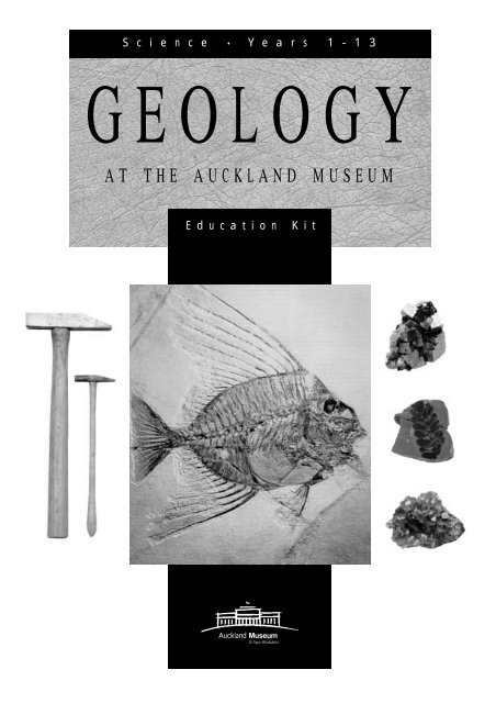
S c i e n c e • Y e a r s 1 - 1 3<br />
GEOLOGY<br />
AT THE AUCKLAND MUSEUM<br />
Education Kit<br />
<strong>Auckland</strong> <strong>Museum</strong><br />
Te Papa Whakahiku
Contents<br />
CONTENTS<br />
Booking Information 1<br />
Introduction to the Resource 2<br />
Plan of Natural History Galleries 2<br />
Teacher Background:<br />
Earth's Structure 3<br />
Plate Tectonics/ Continental Drift 3<br />
Types of Rocks 4<br />
The Rock Cycle 6<br />
Minerals 6<br />
Dating Rocks and Rock Layers 7<br />
Volcanism and Earthquakes 7<br />
<strong>Auckland</strong> - City of Volcanoes 10<br />
New Zealand's Geological Origins 12<br />
The Geological Origins of <strong>Auckland</strong> 14<br />
What are Fossils? 15<br />
New Zealands Dinosaurs, Pterosaurs<br />
and Marine Reptiles 16<br />
Curriculum Links, Pre and Post-Visit Activities 18<br />
Curriculum Links Level 1-8 18<br />
Level 1-2 Pre and Post-visit Activities 19<br />
Level 3-4 Pre and Post-visit Activities 20<br />
Level 5-6 Pre and Post-visit Activities 22<br />
Level 7-8 Pre and Post-visit Activities 23<br />
Classroom Activity Sheets 25<br />
BOOKING INFORMATION<br />
All school visits must be booked.<br />
Phone: 306 7040 Fax: 306 7075<br />
A small service charge applies to school groups.<br />
Charges as at 1999 are:<br />
Self-conducted Visits:<br />
free<br />
Gallery Introductions:<br />
free to member schools,<br />
$1.00 per student non-member schools<br />
Hands-on Sessions:<br />
$1.00 per student member schools,<br />
$1.00 per student non-member schools<br />
<strong>Auckland</strong> <strong>Museum</strong> 1<br />
page
INTRODUCTION TO THE RESOURCE<br />
Geology at the <strong>Auckland</strong> <strong>Museum</strong> focuses on the Origins Gallery in<br />
<strong>Auckland</strong> <strong>Museum</strong>’s Natural History Floor. This gallery looks at the geological<br />
origins of our land and the origins of our plants and animals.<br />
Visiting schools may book for the following learning opportunities:<br />
· Self-conducted visit with supporting resource material.<br />
· Gallery Introduction with <strong>Museum</strong> Educator (approx 15 minutes), plus<br />
resource material.<br />
· Hands-on activity session with <strong>Museum</strong> Educator (approx 45 - 50 mins), plus<br />
resource material. Students have the opportunity to handle rock collections,<br />
fossils, lava bombs etc. Sessions can be tailored to suit the level and focus of<br />
your visit.<br />
ABOUT THIS RESOURCE:<br />
This resource has been designed to meet the needs of Science classes, Years 1-13.<br />
The kit includes:<br />
· Teacher Background Material<br />
· Curriculum Links and Pre and Post Visit Activities<br />
· Classroom Activity Sheets<br />
· Gallery Activity Sheets are available on booking your group<br />
MAORI NATURAL<br />
HISTORY<br />
EAST<br />
GALLERY<br />
LOGAN<br />
CAMPBELL<br />
GALLERY<br />
MEZZANINE<br />
GALLERY<br />
WEST<br />
GALLERY<br />
HUMAN<br />
IMPACTS<br />
ORIGINS<br />
LAND<br />
MATAPUNA<br />
Natural History<br />
Resource Centre<br />
2<br />
OCEANS<br />
DISCOVERY<br />
CENTRE<br />
First Floor.<br />
<strong>Auckland</strong> <strong>Museum</strong><br />
Introduction
Background<br />
TEACHER BACKGROUND<br />
THE EARTH'S STRUCTURE<br />
4.6 billion years ago the Earth was formed. A<br />
dynamic planet, its continents move constantly over<br />
a hot fluid interior. Radioactive decay at its centre<br />
generates the heat engine powering this<br />
motion.<br />
Crust<br />
Outer core<br />
3560km<br />
Inner core<br />
Mantle<br />
2800<br />
The Earth is composed of several layers. The solid<br />
inner core is surrounded by a liquid outer core.<br />
The mantle is solid, but the top 250 kilometres is<br />
plastic enough to move, and carry the thin but<br />
rigid crust above.<br />
<strong>Auckland</strong> <strong>Museum</strong> 3<br />
PLATE TECTONICS / CONTINENTAL DRIFT<br />
The Earth's crust is broken into many fragments<br />
called tectonic plates. These move at different<br />
rates. They spread apart, push past, override<br />
and dive under each other, constantly moving the<br />
continents around the globe.<br />
There are three main types of plate boundaries:<br />
divergent/spreading centres, convergent/ subduction<br />
zones and transform margins.<br />
Upwelling in the mantle forms new oceanic crust,<br />
which then spreads apart. The crust ultimately gets<br />
recycled as it becomes subducted under more buoyant<br />
crust, like continental or younger, oceanic crust.<br />
Sea Floor Spreading Zones<br />
The mantle reaches the Earth's surface through an<br />
opening between two tectonic plates, up to 5km<br />
under the sea surface in the middle of some<br />
ocean basins. It solidifies to produce new crust<br />
and pushes out the older crust symmetrically away<br />
from this 'spreading centre'. This produces a long<br />
chain of undersea volcanoes, also called a midoceanic<br />
ridge.<br />
Subduction Zones<br />
Old oceanic crust is heavy and dense. Over time,<br />
parts of it sink back into the mantle, creating a<br />
tectonic plate boundary as it slips under another<br />
World map showing the boundaries of tectonic plates. The arrows show the directions they<br />
move in. As the plates move, they pull apart, collide, grind past or dive beneath one another,<br />
the way luggage does on an airport conveyer belt.
piece of crust. Subduction of old oceanic crust<br />
can happen under continents, such as the South<br />
American west coast or under younger oceanic<br />
crust, such as in the Tonga-Kermadec area, just<br />
north of New Zealand.<br />
As the crust goes into the mantle, a deep trench<br />
develops at the point of subduction, where the<br />
sea can be up to 10km deep. A New Zealand<br />
example is the Hikurangi Trough, which is off the<br />
east coast of the North Island.<br />
During subduction, sediment that has settled on the<br />
ocean floor is scraped off the subducting plate<br />
and gets plastered onto the edge of the upper<br />
plate. The compression causes friction between<br />
the two plates, which in turn causes earthquakes<br />
and pushes up mountains.<br />
The Alpine fault,<br />
as seen from<br />
space.<br />
4<br />
New crust forming and spreading<br />
out from an upwelling in the<br />
mantle.<br />
Once this oceanic crust sinks well down<br />
into the mantle, it starts to soften and<br />
become plastic again. But because<br />
there are traces of water in this crust,<br />
partial melting occurs and this extra hot<br />
material rises up in bubbles through the<br />
mantle and over-riding crust. Once it reaches<br />
Earth's surface, it gets erupted to form volcanoes.<br />
Transform Margins<br />
Transform margins occur where 2 plates slide past<br />
each other, neither creating or destroying oceanic<br />
crust.<br />
An excellent example of a transform boundary is<br />
the Alpine Fault in the South Island, one of the<br />
longest natural straight lines on Earth.<br />
TYPES OF ROCKS<br />
What is a rock?<br />
It is a naturally-occurring aggregate of minerals.<br />
A piece of concrete is made up of minerals, but<br />
since it is artificial, it is NOT a rock. Rocks can be<br />
classified in three broad categories: Igneous,<br />
Sedimentary and Metamorphic.<br />
TYPE 1: Igneous Rocks<br />
Are formed when magma (molten rock) cools and<br />
solidifies. There are two types of igneous rocks -<br />
plutonic and volcanic.<br />
Igneous Plutonic<br />
Plutonic rocks form from magma trapped under<br />
the Earth's surface. This magma cools slowly, and<br />
large crystals of minerals form in the rock. The<br />
slower the rocks have cooled, the larger the crystals.<br />
Examples:<br />
Granite - Granites crystallise from magmas with a<br />
composition similar to the continental crust. They<br />
are high in silica, and rich in elements such as<br />
potassium and sodium. Granite polishes well and<br />
is prized for its colourful appearance which is due<br />
to the crystals of quartz (whitish) feldspar (often<br />
pinkish) and brown biotite. It is often used as<br />
flooring or benchtops.<br />
<strong>Auckland</strong> <strong>Museum</strong><br />
Background
Background<br />
Igneous Volcanic<br />
Magma cools quickly when it reaches the Earth's<br />
surface in a volcanic eruption. Small crystals<br />
already form underneath the ground, but when<br />
the eruption happens the rest of the magma chills<br />
almost instantly to form tiny crystals and glass.<br />
Gas is often trapped during the formation of<br />
these rocks, resulting in many holes in the rock surface.<br />
Examples:<br />
Rhyolite - Rhyolite is a low density high silica rock,<br />
most commonly erupted through continental crust.<br />
It is the volcanic equivalent of granite. Pumice<br />
and obsidian have an identical rhyolitic chemical<br />
composition, so what makes them look so different?<br />
The Pumice is full of holes and represents the<br />
froth on top of the magma, resulting from the<br />
rapid release of gases in the initial stages of an<br />
eruption. The <strong>Obsidian</strong> is a volcano’s dying gasps.<br />
Although the quietly erupted magma cools quickly<br />
to form glass, the microstructure is such that light is<br />
absorbed by its surface, making <strong>Obsidian</strong> appear<br />
dark. Rhyolitic rocks can be found around Lake<br />
Taupo. <strong>Obsidian</strong> can also be found on Mayor<br />
Island.<br />
Basalt - Basalt is a dark, dense volcanic rock low<br />
in silica. It is erupted in vast quantities from midoceanic<br />
ridges, forming the sea floor. The<br />
<strong>Auckland</strong> volcanoes (not Waitakeres) are basaltic<br />
volcanoes. Scoria is a form of basalt produced<br />
by fire fountaining. The rock has many holes due<br />
to being produced in a frothy, gas-filled manner.<br />
Andesite - Andesite has an intermediate composition<br />
between basalt and rhyolite, and is erupted<br />
from volcanoes usually at convergent plate boundaries,<br />
such as the Waitakeres and Ruapehu in<br />
New Zealand, or the Andes mountains of South<br />
America, from which andesite gets its name.<br />
TYPE 2: Sedimentary Rocks<br />
Sedimentary rocks are rocks made from other<br />
rocks. Sedimentary rock comes from older rocks<br />
eroded from the land, carried into lakes or seas<br />
by rivers, deposited, and then compacted into a<br />
solid mass. Other sedimentary rocks form from<br />
plant and animal matter, like coal and limestone.<br />
Still others are precipitated from mineral-rich solutions,<br />
such as halite from brine.<br />
<strong>Auckland</strong> <strong>Museum</strong> 5<br />
As more sediment is deposited on top, it squeezes<br />
water from the underlying sediments and packs<br />
the particles closer together. Sometimes the particles<br />
are cemented together with calcite, deposited<br />
from new fluids percolating through the sediment.<br />
Other times the cement is clay, formed from some<br />
of the particles breaking down.<br />
Examples:<br />
Limestone - When shelled organisms die, their<br />
shells fall to the sea floor and become cemented<br />
together, forming limestone. Limestone is usually a<br />
chalky white colour. Limestone fizzes with acid.<br />
Sandstone - Sand deposited by rivers and on<br />
beaches, when compressed and cemented,<br />
becomes sandstone. Because of all the vigorous<br />
washing, the particles are all a similar size and<br />
can be seen with the naked eye. Sandstone varys<br />
in colour according to its composition.<br />
Mudstone - Mudstone is made up of particles too<br />
fine to be seen by the naked eye. Mud usually<br />
settles in lakes and the deep ocean where the<br />
water currents are quiet. Mudstone varies in<br />
colour from dark grey to pale yellow.<br />
Shale - Shale is mudstone which flakes in fine layers.<br />
Conglomerate - In high energy environments like<br />
river channels and steep slopes, pebbles and<br />
boulders are deposited along with finer sediments,<br />
which then consolidates into conglomerate.<br />
Conglomerate particle sizes vary greatly. A rock<br />
containing particles all the same size is well sorted,<br />
a conglomerate is poorly sorted. Colour<br />
varies according to the rocks composition.<br />
Breccia - Breccia is similar to conglomerate rock,<br />
although its particles are angular. This means the<br />
particles have not been in water long. Breccia<br />
also can be made of angular volcanic particles.<br />
Type 3: Metamorphic Rocks<br />
Rocks can get deeply buried in the crust, experiencing<br />
high pressure and temperature. They<br />
deform, change (morph) and recrystallise in a<br />
process called metamorphism. It is possible to see<br />
layers in many metamorphic rocks.
Examples:<br />
Slate - In the first stage of metamorphism, a rock<br />
becomes flattened like book pages. Slate is a<br />
fine-grained rock which was originally a mudstone.<br />
Slate varies in colour although is often<br />
black with greenish tints. It cleaves (splits) into thin<br />
layers and is often used for footpaths and<br />
rooftiles because of this.<br />
Schist - Schist is metamorphosed slate or basalt.<br />
Under higher pressure and temperature, new crystals<br />
start to grow and form bands of different<br />
mineral composition. Schist contains mica and can<br />
have garnets.<br />
Gneiss - With further metamorphism, the crystals<br />
grow larger and the bands become thicker. The<br />
schist turns into a gneiss (pronounced 'nice').<br />
Gneiss exhibits mixes of pale and dark layers,<br />
with frequent bands of quartz and feldspar<br />
throughout.<br />
Marble - High temperature and pressure changes<br />
limestone into marble. Marble is made of calcite<br />
and will fizz with acid. Colours of marble vary.<br />
In New Zealand, marble can be found in a number<br />
of areas including around Takaka (Nelson).<br />
Marble is often used in flooring, or statues.<br />
Greenstone (Pounamu) - New Zealand's most<br />
famous metamorphic rock is Greenstone- composed<br />
mostly of the mineral nephrite. Pounamu is<br />
tougher than steel, hence its use in early Maori<br />
tools. Pounamu can be found in the West Coast<br />
rivers of the South Island.<br />
Igneous volcanic<br />
rocks (blown out)<br />
The Rock Cycle.<br />
heat<br />
Magma<br />
6<br />
THE ROCK CYCLE<br />
The continents are continuously recycling themselves.<br />
This Rock Cycle involves processes such as<br />
volcanism, erosion, deep burial and remelting.<br />
MINERALS<br />
What is a mineral?<br />
It is a natural inorganic solid with a specific internal<br />
structure and chemical composition.<br />
There are many different types of minerals.<br />
These are based on their chemical composition<br />
e.g. Silicates, Oxides, Sulphides, Halides,<br />
Carbonates, Hydroxides, Phosphates, Nitrates<br />
amongst others. However, there are only a few<br />
common rock-forming minerals.<br />
The silicates are the main rock-forming minerals<br />
that make up most of the crust and mantle.<br />
Silica and oxygen combine with metallic ions to<br />
form the building blocks of our planet.<br />
Examples:<br />
Quartz - Quartz is made of silica. The colour<br />
ranges according to impurities and can be clear,<br />
opaques, white or purple (amethyst). Quartz<br />
crystals are six-sided. They are hard and cannot<br />
be easily scratched. Quartz is common in many<br />
rocks.<br />
Feldspar - Feldspars contain silica, aluminium and<br />
a number of other elements. Colour ranges from<br />
white to pink, the pink being common in granite.<br />
Feldspar crystals are four or six-sided. They are<br />
used to make porcelain and also are used in some<br />
kitchen abrasive cleaners.<br />
Weathering and erosion<br />
Igneous plutonic<br />
(buried)<br />
Metamorphic<br />
rock<br />
pressure<br />
Water<br />
Sedimentary layers<br />
<strong>Auckland</strong> <strong>Museum</strong><br />
Background
Background<br />
Mica - Mica flakes into thin sheets. One form is<br />
blackish and shiny and is called biotite, a mix of<br />
iron and magnesium. Flakes are sometimes called<br />
'fools gold' as they resembles flakes of gold.<br />
Another form is white and silvery and is called<br />
muscovite. Muscovite was used in windows in<br />
Moscow, hence the name. Mica is found in granite<br />
and schist.<br />
Calcite - Calcite is calcium carbonate and does<br />
not contain silica. Calcite crystals are soft and<br />
are easily scratched.<br />
Identifying Minerals<br />
When identifying minerals, we can use their physical<br />
properties as an aid.<br />
Crystal form: the way the crystal faces are<br />
arranged.<br />
Cleavage: the tendency for a mineral to break<br />
along certain weak planes in their crystal structure.<br />
Hardness: a measure of a mineral's resistance to<br />
abrasion.<br />
Specific gravity: the density of a mineral.<br />
Colour: there can be many colours for each mineral,<br />
not very diagnostic.<br />
Streak: each mineral leaves a distinctive streak<br />
when rubbed against unglazed porcelain.<br />
DATING ROCKS AND ROCK LAYERS<br />
Geologists often work out the age of rocks by the<br />
fossils that occur in them. Many organisms that<br />
were alive in the past have since become extinct.<br />
So even if the actual age of the rock is not known<br />
in years, it can still be assigned to a Geological<br />
Era or Period eg Devonian, because of the unique<br />
fossils it contains.<br />
When igneous rocks are found in a record such as<br />
this they can be radiometrically dated ie an age<br />
in years can be worked out by the decay of<br />
radioactive elements in the rock<br />
After rocks are deposited they become buried<br />
and can be buckled or folded by tectonic processes<br />
such as mountain building. Earthquakes fracture<br />
rock, causing displacement of blocks along<br />
fault lines.<br />
<strong>Auckland</strong> <strong>Museum</strong> 7<br />
Lower rock layers are generally older than upper<br />
rock layers. Sometimes the rocks may get pushed<br />
up and eroded and a soil may develop on this<br />
new surface. When younger rocks are deposited<br />
over the surface, it produces what geologists call<br />
an unconformity which is an interval of geologic<br />
time missing from the rock record.<br />
VOLCANISM AND EARTHQUAKES<br />
A large proportion of Earth's earthquakes and<br />
active volcanoes occur around the edge of the<br />
Pacific Ocean. This is called the Pacific Ring of<br />
Fire and includes the currently active volcanoes in<br />
New Zealand, from White Island to Ruapehu.<br />
Earthquakes<br />
Earthquakes can be deep or shallow. Shallow<br />
earthquakes occur along plate boundaries and<br />
along plate spreading zones, and are the most<br />
destructive. Deep earthquakes occur in subduction<br />
zones, where one edge of a plate is forced<br />
beneath another.<br />
New Zealand experiences both shallow earthquakes<br />
and deep earthquakes. This is because<br />
we are on the collision boundary of the Pacific<br />
and Australian plates.<br />
Volcanoes<br />
Volcanoes occur in three plate tectonic settings:<br />
1. Subduction zones, where parts of the subducted<br />
plate melt and rise through the overlying crust to<br />
erupt as volcanoes eg New Zealand, Japan,<br />
Indonesia.<br />
2. Mid-Oceanic Ridges, where tectonic plates are<br />
pulling apart and new oceanic crust is being produced<br />
as a chain of undersea basalt volcanoes. eg<br />
Antarctica.<br />
3. Hot Spots, where 'plumes' of extra hot mantle<br />
rise through the crust, regardless of the location on<br />
a tectonic plate. When the plate moves over this<br />
hotspot, a chain of volcanoes is produced eg<br />
Hawaii, <strong>Auckland</strong>.<br />
New Zealand's active volcanoes mostly occur in<br />
the Taupo and Rotorua areas of North Island, also<br />
known as the Taupo Volcanic Zone. This zone continues<br />
offshore to the north into the Kermadec<br />
Islands, including some submarine volcanoes. The<br />
other area of active volcanoes in New Zealand is<br />
in <strong>Auckland</strong> City.
The Southern Alps are not volcanoes. They lie<br />
along the Alpine Fault where plates are pushing<br />
past each other. Collision forces have pushed the<br />
edge of the Pacific plate up along the alpine<br />
fault to form the alps. The Alpine Fault is the<br />
longest line on land visible in space.<br />
Types Of Volcanic Rock<br />
Volcanoes erupt different types of magma that<br />
are classified mainly by silica content (SiO2).<br />
They range from a silica content of about 50% in<br />
basalt to greater than 70% in rhyolite. The higher<br />
the silica content the more viscous and sticky<br />
the magma is, and that controls how explosive the<br />
eruption will be. Once magma reaches earth's<br />
surface and flows along the ground, it becomes<br />
known as lava.<br />
Basalt - Basaltic magma has the hottest temperature,<br />
around 1200 °C. It is very fluid, basic and<br />
produces the least violent eruptions. <strong>Auckland</strong>'s<br />
volcanoes are basaltic. Scoria is a form of basalt<br />
formed during gaseous fire-fountaining.<br />
Associated volcano shapes include: scoria cones,<br />
shield volcanoes and tuff rings.<br />
Andesite - Intermediate in composition between<br />
basalt and rhyolite, andesite magma erupts at<br />
temperatures around 1100 °C. Mt Ruapehu is an<br />
andesitic volcano. Associated volcanic shapes<br />
include stratovolcanoes and scoria cones.<br />
Rhyolite - This is very sticky, acidic, viscous magma<br />
which erupts at the lowest temperature of around<br />
800 °C. It can produce the most violent types of<br />
eruptions and leaves deposits called ignimbrite.<br />
Taupo is a rhyolitic volcano. Pumice and obsidian<br />
are rhyolitic rocks. Associated volcanic shapes<br />
include: calderas and lava domes.<br />
Caldera volcano<br />
8<br />
Shapes of Volcanoes<br />
The composition of the magma controls the type<br />
of volcano that forms.<br />
Shield Volcano - Shield volcanoes form from the<br />
outpouring of very fluid basaltic lava that produce<br />
very gentle flanks. They are made up<br />
almost entirely of lava flows. An example is<br />
Rangitoto in <strong>Auckland</strong>. Shield volcanoes are some<br />
of the largest volcanoes on Earth. Mauna Kea in<br />
Hawaii is a shield volcano rising nearly 9 km from<br />
the floor of the Pacific Ocean, making it the tallest<br />
mountain on Earth<br />
Scoria Cones - Scoria cones are formed by the<br />
fire-fountaining of gas-rich magma, which reaches<br />
the surface without coming into contact with water.<br />
Frothy lava thrown high into the air cools to form<br />
scoria which piles up in steep slopes. Mt Eden<br />
and One Tree Hill are examples of Scoria cones.<br />
Tuff Rings - Tuff rings are formed during explosive<br />
eruptions when groundwater is heated to produce<br />
superheated steam. The resulting explosion<br />
sends a cloud of pulverised rock and ash into the<br />
air, settling in a ring hundreds of metres from the<br />
explosion. Tuff rings are a mixture of ash and<br />
lapilli (pebble sized lava particles). The <strong>Auckland</strong><br />
Domain and Lake Pupuke are examples of Tuff<br />
rings.<br />
Stratovolcano - Stratovolcanoes have the typical<br />
cone-shape usually associated with volcanoes, and<br />
include famous examples like Mt Fuji in Japan, Mt<br />
Etna in Sicily and Mt Vesuvius in Italy. They are<br />
made up of layers of fluid lava flows and more<br />
explosively erupted ash and scoria. Because<br />
andesitic and dacitic lava is more viscous, the stratovolcano<br />
has steeper sides than a shield volcano.<br />
Lava dome Stratovolcano<br />
Scoria cone Tuff ring Shield volcano<br />
<strong>Auckland</strong> <strong>Museum</strong><br />
Background
Background<br />
Ruapehu, Taranaki and Ngauruhoe are typical<br />
New Zealand examples. The Pacific Rim of Fire<br />
consists mostly of stratovolcanoes.<br />
Caldera - Caldera volcanoes are huge craters in<br />
the ground and can often lack any type of built<br />
up flanks around them. They form from gigantic<br />
explosions of rhyolite magma. The sudden<br />
release of large volumes of ash drains the<br />
magma chamber and results in collapse of the<br />
structure forming a large depression called a<br />
caldera. Some calderas can be as much as 50<br />
km in diameter such as in Yellowstone National<br />
Park in the USA. Lakes Taupo and Rotorua are<br />
typical New Zealand examples of this type of<br />
volcano.<br />
Dome - After an explosive dacitic or rhyolitic<br />
eruption, some magma can remain around the<br />
edges of the caldera. This material is very viscous<br />
and all the gases have already escaped, so it<br />
oozes out like toothpaste to form steep sided<br />
domes of obsidian. A New Zealand example is<br />
Ngongotaha on the shores of Lake Rotorua.<br />
Eruption Styles<br />
The driving force of an eruption is the escape of<br />
gases which are pressurised (eg water, carbon<br />
dioxide) underground in the magma. If the<br />
magma is not viscous the gases escape easily and<br />
the eruption is not violent. When the magma is<br />
viscous the release of gas is highly explosive.<br />
Examples:<br />
Lava flows - When gases are released quietly, the<br />
lava will flow along the ground. Sometimes blobs<br />
of lava fly through the air producing aerodynamically<br />
shaped bombs.<br />
Fire fountaining - Spectacular fire fountaining produces<br />
frothy gas-rich fragments of basalt called<br />
scoria. Scoria forms steep sided cones like Mt<br />
Eden.<br />
<strong>Auckland</strong> <strong>Museum</strong> 9<br />
Pyroclastic fall - In viscous magma the gases are<br />
explosively released as a jetblast, producing an<br />
ash column into the atmosphere. The ash can blow<br />
hundreds of kilometres away from the volcano<br />
and mantle the landscape. Volcanic ash is very<br />
abrasive.<br />
Raindrops falling through ash clouds can produce<br />
fossil raindrops, called accretionary lapilli. Each<br />
one grows like a snowball as ash is added onto<br />
the surface as it falls.<br />
Pyroclastic flows - Sometimes the eruption column<br />
above the vent becomes so ash-laden that it collapses<br />
back to earth and flows along the ground.<br />
This is called a pyroclastic flow. These flows consist<br />
of gas and fine volcanic debris that are hot<br />
(700°C) and can travel at high speeds (100 to<br />
700 km/h). When pyroclastic flows stop and cool,<br />
they leave deposits called ignimbrite.<br />
Size Does Matter<br />
The 1995-6 eruptions from Mt Ruapehu affected<br />
human activities such as skifields and airports. But<br />
these events were small compared to the 1991<br />
Pinatubo eruption in the Philippines which lowered<br />
the average global temperature by at least 0.5<br />
°C.<br />
The largest eruption in modern history was when<br />
Tambora in Indonesia erupted in April 1815<br />
(erupting 150kms 3 of rock). The effects on the<br />
weather were marked- Europe and North America<br />
experienced 'a year without a summer' in 1816.<br />
The Taupo Volcanic Zone is the most active rhyolitic<br />
region on Earth, regularly producing many<br />
large-scale eruptions. The most recent was the<br />
hugely explosive Taupo eruption of AD 232<br />
(erupting 145kms 3 of rock). However, even this is<br />
dwarfed in size by its predecessor from the same<br />
caldera 26 000 years ago (which erupted<br />
800kms 3 of rock). In comparison, the largest<br />
known volcanic eruption was 76 000 years ago<br />
when the Indonesian island of Sumatra exploded<br />
to form the Toba Caldera, erupting 2800 km 3 of<br />
rock.<br />
From right, Lake Taupo (26,000 years ago), Lake Rotorua (230,000 years ago), Tambora (1815), Lake Taupo<br />
(232 AD), Pinatubo (1991), St Helens (1980), Tawawera (1886), Ruapehu (1995-6).
AUCKLAND- CITY OF VOLCANOES<br />
Living On A Hotspot<br />
About 100 km beneath <strong>Auckland</strong> City lies an<br />
active hotspot- an area of extra hot mantle. This<br />
hotspot creates bubbles of magma that rise<br />
through the crust and erupt at the surface, creating<br />
<strong>Auckland</strong>'s basalt volcanic field, similar to<br />
Hawaii.<br />
<strong>Auckland</strong> Volcanic Field.<br />
10<br />
Forty eight volcanoes have erupted within 29 km<br />
of <strong>Auckland</strong> <strong>Museum</strong> over the last 150 000 years.<br />
The <strong>Museum</strong> itself is built on the rim of the Domain<br />
Volcano. The most recent eruption, 600 years<br />
ago, formed Rangitoto Island at the entrance to<br />
the harbour. Another eruption within <strong>Auckland</strong><br />
City can be expected at any time.<br />
<strong>Auckland</strong> <strong>Museum</strong><br />
Background
Background<br />
Shapes of <strong>Auckland</strong> Volcanoes<br />
<strong>Auckland</strong>'s volcanoes come in a variety of landforms,<br />
depending on the style of eruption. Each<br />
volcano is formed by one eruption, or a short<br />
series of eruptions lasting no longer than a few<br />
months. Then a plug of lava solidifies in the vent,<br />
and later bubbles of magma find another place<br />
to erupt.<br />
Fieldtrips Around <strong>Auckland</strong>'s Volcanic Field<br />
The following is a list of places which provide a<br />
great opportunity to study <strong>Auckland</strong>'s volcanic<br />
field at first hand. The list does not include all the<br />
possibilities.<br />
Meola Reef, Pt Chevalier - <strong>Auckland</strong>'s longest lava<br />
flow, home to burgeoning mangrove swamps and<br />
being redeveloped as a park.<br />
Mt Eden, One Tree Hill, Mt Albert, Big King,<br />
Mangere Mountain etc - Scoria cones, craters and<br />
lava flows, also providing evidence of use by<br />
Maori and Pakeha. Use the map to check out volcanoes<br />
in your area.<br />
Three styles of eruption were involved in building<br />
the <strong>Auckland</strong> volcanic field. Each has produced its<br />
own type of rock and landform. While some volcanoes<br />
were created by one style, others were<br />
created by a combination. The landforms and<br />
eruption styles have been discussed previously, but<br />
this chart provides a summary of the events in<br />
forming <strong>Auckland</strong>'s volcanoes.<br />
Eruption Style Rock type Volcanic Shape Examples<br />
Lava Flows and<br />
Fields<br />
Conditions:<br />
Magma is free of gas and<br />
oozes out of volcano rim or<br />
side vent<br />
Fire fountaining<br />
Conditions:<br />
Gas-rich magma reaches<br />
surface without contact with<br />
water<br />
Explosive eruption<br />
Conditions:<br />
Rising magma meets<br />
groundwater causing<br />
superheated steam<br />
Solid basalt<br />
There are two types of<br />
lava flow:<br />
pahoehoe fluid, fast<br />
flowing and smooth.<br />
a'a thick, slowmoving and<br />
rough<br />
<strong>Auckland</strong> <strong>Museum</strong> 11<br />
Shield Rangitoto<br />
<strong>Auckland</strong> Domain - Tuff ring, <strong>Auckland</strong>'s first<br />
water supply and one of the earliest quarries,<br />
evidence of layers in tuff ring.<br />
Rangitoto - shield volcano, lava caves.<br />
In addition many volcanoes<br />
have lava flows but are<br />
not shield volcanoes.<br />
Meola reef is the longest<br />
flow and was extruded<br />
from the Three Kings<br />
volcano.<br />
Scoria Scoria cone Mt Eden, Three Kings, Mt<br />
Albert, One Tree Hill etc<br />
(these also exhibit other<br />
eruption styles)<br />
Tuff (ash and lapilli) Tuff ring <strong>Auckland</strong> Domain. Lake<br />
Pupuke, Panmure Basin<br />
Old Mt Eden Prison Quarry (<strong>Auckland</strong> Grammar<br />
land) - basalt columns.<br />
Takapuna Beach - fossil forest which was engulfed<br />
by lava from Lake Pupuke.
NEW ZEALAND'S GEOLOGICAL ORIGINS<br />
Eighty five million years ago, New Zealand began<br />
to break away from the supercontinent called<br />
Gondwana where it had been united with all the<br />
other countries in the southern hemisphere. As<br />
New Zealand drifted away from Australia taking<br />
with it animals (including dinosaurs) and plants<br />
that lived on it, the opening between them began<br />
to form the Tasman Sea.<br />
Gondwana.<br />
12<br />
Timeline.<br />
Remnants of Gondwana in New Zealand<br />
Rocks and fossils provide links to our past connection<br />
with other countries. Most of the rock types in<br />
the Southwest corner of the South Island match up<br />
with rocks in south east Australia and Antarctica.<br />
Fossil ferns found in rocks near Port Waikato grew<br />
in coastal Gondwana forest 140 million years<br />
ago. Fossils of the seed fern Glossopteris have<br />
been found in New Zealand, Australia, Antarctica,<br />
South America and India.<br />
In the 60 million years since the Tasman<br />
Sea finished opening, erosion, tectonic<br />
processes and climate change have<br />
drastically altered the shape of New<br />
Zealand. These changes have had a<br />
huge impact on our plants and animals.<br />
New Zealand drifted north away from<br />
Antarctica as a heavily eroded lowland<br />
plain. As it moved, Earth's crust<br />
stretched and thinned and the land<br />
sank. From considerable continental<br />
beginnings, New Zealand became an<br />
archipelago of small swampy low-lying<br />
islands.<br />
<strong>Auckland</strong> <strong>Museum</strong><br />
Background
Background<br />
As the land area reduced, species that had<br />
evolved here faced advancing waters and<br />
destruction of habitats, creating a biotic bottleneck.<br />
The original Gondwanan flora and fauna<br />
was considerably reduced. Later the survivors<br />
diversified and new species evolved. Wrens, moa<br />
and giant weta were all affected. Some modern<br />
birds are probably descendants of a single surviving<br />
species.<br />
New Zealand did not remain a small archipelago<br />
for long. About 25 million years ago, a plate<br />
boundary started to develop through New<br />
Zealand between the Australian and Pacific<br />
plates.<br />
The collision between these two plates has pushed<br />
up our mountain ranges within the last 6 million<br />
years. Sediments from the continuous erosion of<br />
the mountains has extended our coastlines to create<br />
new land.<br />
Coal and Oil<br />
Coal and oil are evidence of former widespread<br />
lowland swamps with rich plant growth and a<br />
warm climate. Until the beginning of the<br />
Oligocene 35 million years ago, New Zealand's<br />
climate was warmer than today's. Oil is produced<br />
from the breakdown of dead animals and plants<br />
after burial and moderate heating.<br />
Coal results from the accumulation of dead plant<br />
material in swamps which has then been deeply<br />
buried and heated to higher temperatures. There<br />
are a number of coalfields around New Zealand<br />
including the West Coast of the South Island and<br />
the Hauraki Plains area of the North Island.<br />
In the late Cretaceous to Paleocene (70-60 million<br />
years ago) organic matter accumulated, was<br />
buried and turned into oil. During this process, the<br />
oil moves underground to find a reservoir, a<br />
porous rock that soaks the oil up like a sponge.<br />
Reservoir rocks in New Zealand range in age<br />
from Paleocene to Miocene. The Taranaki oilfields<br />
are the most productive in New Zealand.<br />
Climate Change and the Ice Ages<br />
In the course of its history, New Zealand has<br />
changed many times in both location and climate<br />
from subtropical to subantarctic. All have had a<br />
great influence on its plants and animals. The climate<br />
changes are mediated by tectonic movements<br />
as well as more cosmic events. The current<br />
distribution of many indigenous animals is a lega-<br />
<strong>Auckland</strong> <strong>Museum</strong> 13<br />
cy of the Pleistocene glaciations which ended<br />
some 10,000 years ago.<br />
During the last 64 million years there has been a<br />
global trend towards a cooler climate. In the<br />
Paleocene and Eocene the oceans were sluggish<br />
and Antarctica had no ice cap. During the<br />
Oligocene the movement of Australia away from<br />
Antarctica and the opening of the Drake Passage<br />
at the bottom of South America allowed the formation<br />
of a cold circumpolar current around<br />
Antarctica. This thermally isolated Antarctica,<br />
allowing an ice cap to form. There was a warming<br />
trend in the late Oligocene- Middle Miocene.<br />
The drop in temperature at the end of the<br />
Miocene is due to the isolation and evaporation of<br />
the Mediterranean Sea. This event decreased the<br />
salinity of the oceans, allowing them to freeze at<br />
higher temperatures. The polar ice cap increased<br />
in size. The uplift of the Himalayas drove drier<br />
winds over Northern Africa, and affected rainfall<br />
in Asia.<br />
Three million years ago, North and South America<br />
joined, terminating warm currents around the<br />
equator and promoting the warm Gulf Stream in<br />
the North Atlantic. The Gulf Stream is responsible<br />
for snowfall on the North Pole, creating the<br />
Northern Hemisphere Ice cap.<br />
A Touch of the Tropics<br />
25 -14 million years ago warm currents from<br />
tropical seas washed New Zealand shores and the<br />
climate was subtropical. Coconuts, corals and<br />
cone shells flourished. Warmth-loving plants<br />
established. Some died out later when the climate<br />
cooled again, others adapted and stayed.<br />
The Ice Ages<br />
Earth's climate has swung between warm and cold<br />
about 50 times in the last 2.6 million years.<br />
During particularly cold periods called Ice Ages<br />
or Glaciations, ice sheets grew on the continents<br />
causing sea levels to drop up to 120 m. The frequency<br />
and regularity of the oscillations tell us<br />
that it is changes in Earth's orbit that controls the<br />
amount of heat reaching Earth's surface<br />
The ice age climate had a large impact on New<br />
Zealand's flora. This included the expansion of<br />
grasslands in both islands and the growth of<br />
alpine shrubs and herbs at much lower elevations<br />
than today.
THE GEOLOGICAL ORIGINS OF AUCKLAND<br />
<strong>Auckland</strong>'s geological history started 250 million<br />
years ago just off the coast of Gondwana.<br />
Sediments were eroded off the supercontinent<br />
and accumulated in layers until 140 million years<br />
ago, when this part of the sea floor was uplifted<br />
by large earthquakes to become new land along<br />
the Gondwana coast.<br />
Then, 85 million years ago, Gondwana started to<br />
break up. A large rift formed in the eastern part<br />
of the continent, becoming the Tasman Sea. New<br />
Zealand started to move away to the east, until<br />
60 million years ago when it reached its present<br />
position. Part of the <strong>Auckland</strong> region remained<br />
land until the beginning of the Miocene (25 million<br />
years ago). By then, the Pacific and Australian<br />
plates had started to collide, pushing the Pacific<br />
plate beneath the Australian plate. Sediments that<br />
had accumulated on the sea floor were scraped<br />
off the down going Pacific plate, and plastered<br />
onto the area we now call Northland. These tectonic<br />
forces created a 'bow wave' of subsidence in<br />
front of the huge mass, submerging the <strong>Auckland</strong><br />
region and forming the Waitemata Basin 22 million<br />
years ago.<br />
14<br />
About this time the huge Waitakere and Kaipara<br />
volcanoes started erupting offshore from the present-day<br />
west coast of <strong>Auckland</strong>, as part of a<br />
large chain of volcanoes that formed along the<br />
western shores of Northland. Over time, the<br />
forces of erosion have levelled the Waitakere volcano<br />
which now forms the Waitakere Ranges.<br />
The Waitemata Basin started filling up with sand<br />
and sediment 17-22 million years ago, eroding<br />
off the newly formed land to the north.<br />
Waitemata Sandstone is a familiar sight around<br />
our local coastlines e.g. Long Bay. Sometimes<br />
gravelly deposits of volcanic debris from the<br />
Waitakere volcano are included in the Waitemata<br />
Sandstones. These are called Parnell Grit.<br />
Lahars and debris flows from the volcanoes also<br />
flowed into the basin.<br />
Then, volcanism ceased 15 million years ago and<br />
the whole <strong>Auckland</strong> region was uplifted to<br />
become land. Other periods of uplift tilted<br />
<strong>Auckland</strong> to the west, creating what later became<br />
the Manukau and Kaipara harbours.<br />
<strong>Auckland</strong> <strong>Museum</strong><br />
Background
Background<br />
WHAT ARE FOSSILS?<br />
Most fossils are the preserved hard parts of<br />
plants or animals, such as wood, shells, bones and<br />
teeth. Less common are the traces of soft parts<br />
like leaves and soft tissues. Some fossils show<br />
where an animal has been, such as footprints and<br />
worm trails. Fossils are found in sedimentary rocks<br />
in many parts of New Zealand, from sea level to<br />
mountain tops.<br />
When an animal or plant dies, its soft parts are<br />
usually eaten by scavengers or decay rapidly.<br />
The hard parts may be buried by soil, mud, or<br />
sand, which protects them from further decay or<br />
damage.<br />
Many layers of sediment may accumulate on top.<br />
Eventually, they harden into rock.<br />
<strong>Auckland</strong> <strong>Museum</strong> 15<br />
Forces deep within the earth may fold or tilt the<br />
rock and push some of them up to form land and<br />
mountains.<br />
We find fossils in cliffs and road cuttings where<br />
natural erosion or bulldozers have exposed layers<br />
of rock.<br />
Animal and plant remains may be preserved as<br />
fossils in a number of ways:<br />
Shells and skeletons - The most common fossils are<br />
an animal's hard skeletal parts composed of bone<br />
or shell. These can remain virtually unchanged in<br />
the rock.<br />
Mummification - When both the hard and soft<br />
parts of an animal is preserved, it is called mummification.<br />
Some examples are the mummified<br />
remains of moa in caves, the freezing of mammoths<br />
in ice, or the complete preservation of<br />
insects in gum.<br />
Petrification - Dissolved minerals that seep slowly<br />
through rock often add to or replace the original<br />
fossil. This gradual process often increases the<br />
fossil's weight and hardness and literally turns it to<br />
stone.
Moulds and casts - After a shell has been buried<br />
and the surrounding sediments hardened into rock,<br />
water may creep through the rock and dissolve<br />
the shell. This leaves a cavity, with the same<br />
shape and markings as the original shell - a natural<br />
mould.<br />
If a fossil shell was hollow inside it may have filled<br />
with mud and sand during burial. If the shell dissolves,<br />
a hardened internal cast of the shell is also<br />
left as a fossil.<br />
Carbonisation - turned to soot - Where buried<br />
plants and animals decayed in places without<br />
oxygen, they left a thin flattened fossil behind.<br />
These fossils are rich in carbon and have a black<br />
colour.<br />
Trace fossils - leaving tracks - A fossil may also be<br />
the preserved track, burrow, footprint or even<br />
excrement of a passing animal. Burrow shape<br />
and size can often be used to identify the animal<br />
that once lived in it.<br />
Examples of Fossils found in New Zealand:<br />
Giant Ammonite - Ammonites are extinct shellbearing<br />
squid, the closest living relative of which<br />
is the Pearly Nautilus. The cast on display is of<br />
the largest ammonite fossil found in New Zealand.<br />
It was uncovered near Kawhia Harbour.<br />
Ammonites became extinct at the same time as<br />
dinosaurs. This ammonite is 145 million years old.<br />
Belemnites - Belemnites were the ancestors of<br />
today’s squid. Only the hard bullet-like tail skeletons<br />
remain. Belemnites became extinct at the<br />
same time as dinosaurs.<br />
Belemnite fossils.<br />
16<br />
Trilobites - Trilobites resembled sea lice. They<br />
were the first animals to develop hard parts that<br />
could be fossilised and have been found worldwide.<br />
Their bodies are divided into three parts<br />
(hence the name) and vary in size from 4mm to<br />
70cm. Fossil trilobites found in the Cobb Valley of<br />
Nelson are New Zealand's oldest fossils, at 530<br />
million years.<br />
Trilobite fossil.<br />
Many other fossils including those of plants and<br />
dinosaurs can also be viewed in the exhibition.<br />
NEW ZEALANDS DINOSAURS, PTEROSAURS<br />
AND MARINE REPTILES<br />
The Age of Reptiles is known as the Mesozoic era,<br />
which consists of the Triassic, Jurassic and<br />
Cretaceous periods. At this time, New Zealand<br />
was closer to the South Pole and had a polar<br />
environment. It is uncertain how the dinosaurs<br />
adapted to the cold winters with few daylight<br />
hours, but it is now known that some of these<br />
dinosaurs must have been warm-blooded.<br />
No complete dinosaur skeletons have been found<br />
in New Zealand and the fragments found have<br />
not been sufficient to classify as new species or<br />
species found elsewhere. The first dinosaur bone<br />
was discovered by Joan Wiffen in the<br />
Mangahouanga Valley (Hawkes Bay), and was the<br />
tail bone of a theropod dinosaur.<br />
<strong>Auckland</strong> <strong>Museum</strong><br />
Background
Background<br />
Other dinosaurs fossils indicate the existence of<br />
agile ornithopod dinosaurs and large<br />
four-footed sauropods.<br />
Theropod Dinosaurs<br />
Theropods were agile<br />
predators that walked<br />
upright on strong hind<br />
legs, had short front<br />
legs and large heads<br />
with sharp teeth.<br />
Tyrannosaurus and<br />
Allosaurus were<br />
theropods. The cast<br />
on display is of<br />
Cryolophosaurus, an<br />
Antarctic dinosaur.<br />
One small species of<br />
theropods evolved into the<br />
first birds around 150 million<br />
years ago.<br />
Sauropod Dinosaurs<br />
Sauropods were large four footed dinosaurs with<br />
long necks and tails. They were herbivores which<br />
probably lived in herds. A fragment of rib bone<br />
has been found in New Zealand.<br />
Ornithopod Dinosaurs<br />
Ornithopod dinosaurs were bird-hipped dinosaurs<br />
which were herbivorous and walked exclusively on<br />
their back legs. Part of a pelvis has been found<br />
in New Zealand.<br />
Icthyosaur fossil.<br />
Cryolophosaurus.<br />
<strong>Auckland</strong> <strong>Museum</strong> 17<br />
Pterosaurs<br />
Pterosaurs were flying reptiles, not<br />
dinosaurs. They had bat-like wings<br />
formed by a membrane of skin,<br />
although only the fourth finger<br />
was elongated to support<br />
the wing whereas<br />
all four fingers in bats<br />
are elongated. Two<br />
small bones have<br />
been found in New<br />
Zealand.<br />
Marine Reptiles -<br />
Mosasaurs, Plesiosaurs<br />
and Icthyosaurs<br />
Mosasaurs were giant<br />
marine lizards similar to<br />
Komodo dragons. At least<br />
five species were known in New<br />
Zealand. Mosasaurs were predators<br />
that grew as long as 12 metres.<br />
Plesiosaurs were predators with small heads,<br />
sharp teeth and limbs which were paddle-shaped.<br />
Some grew to 13metres long. Elasmosaurs were<br />
long-necked forms, while Pliosaurs were shortnecked<br />
forms. The plesiosaur fossil on display<br />
was removed recently from the Kaikoura region.<br />
Icthyosaurs were fast-swimming marine predators<br />
like dolphins (although dolphins are mammals).<br />
They probably fed on squid-like belemnites.
CURRICULUM LINKS AND<br />
PRE AND POST-VISIT ACTIVITIES<br />
This section is divided into the learning levels.<br />
Curriculum links are made but may not be all<br />
inclusive.<br />
The suggested pre-visit learning activities will provide<br />
opportunities to gain the minimum knowledge<br />
required by students before visiting the <strong>Museum</strong>.<br />
These are sample indicators of the type of activity<br />
that may be carried out.<br />
Post-visit learning activities are also suggested,<br />
although some of these may also be used as previsit<br />
material. These are sample indicators of the<br />
type of activity that may be carried out.<br />
Teachers may wish to select material from different<br />
levels, according to the ability of their students.<br />
CURRICULUM LINKS LEVEL 1<br />
Science in the New Zealand Curriculum Level 1<br />
Making Sense of Planet Earth and Beyond<br />
Students can:<br />
1/ 4 share their ideas about some easily<br />
observable features and patterns that occur in<br />
their physical environment and how some of these<br />
features may be protected, e.g. hills, beaches,<br />
cliffs<br />
2 suggest ways that their immediate physical<br />
environment was different in the past e.g. land<br />
use<br />
Making Sense of the Material World<br />
Students can:<br />
2 clarify and communicate their own ideas<br />
on appropriate choices of materials for familiar<br />
activities based on simple, easily observable<br />
properties<br />
CURRICULUM LINKS LEVEL 2<br />
Science in the New Zealand Curriculum Level 2<br />
Making Sense of Planet Earth and Beyond<br />
Students can:<br />
1/ 4 investigate easily observable features<br />
and patterns and consider how the features are<br />
affected by people e.g. local landscapes, rocks,<br />
soils<br />
2 understand that Earth is very old and<br />
that animals and plants in past times were very<br />
different<br />
18<br />
Making Sense of the Material World<br />
Students can:<br />
1 group familiar objects, using observable<br />
physical properties<br />
CURRICULUM LINKS LEVEL 3<br />
Science in the New Zealand Curriculum Level 3<br />
Making Sense of Planet Earth and Beyond<br />
Students can:<br />
2 gather and present information about the<br />
origins and history of major natural features of<br />
the local landscapes, e g volcanic cones<br />
Making Sense of the Material World<br />
Students can:<br />
2 investigate and describe how the physical<br />
properties of materials are related to their<br />
use<br />
CURRICULUM LINKS LEVEL 4<br />
Science in the New Zealand Curriculum Level 4<br />
Making Sense of Planet Earth and Beyond<br />
Students can:<br />
2 collect and use evidence from landforms,<br />
rocks, fossils, and library research to describe the<br />
geological history of the local area<br />
Making Sense of the Material World<br />
Students can:<br />
3 investigate and explain how use of<br />
everyday materials are related to their physical<br />
and simple chemical properties<br />
CURRICULUM LINKS LEVEL 5<br />
Science in the New Zealand Curriculum Level 5<br />
Making Sense of Planet Earth and Beyond<br />
Students can:<br />
1/ 2 investigate and describe processes which<br />
change the Earth's surface over time at local and<br />
global levels e.g. earthquakes, volcanoes, continental<br />
drift, plate tectonics<br />
CURRICULUM LINKS LEVEL 6<br />
Science in the New Zealand Curriculum Level 6<br />
Making Sense of Planet Earth and Beyond<br />
Students can:<br />
1/ 2 (a) investigate and classify some common<br />
minerals and rocks according to their easily<br />
observed properties and relate to their common<br />
use e.g. calcite, feldspar, quartz, road aggregates,<br />
use in industry<br />
<strong>Auckland</strong> <strong>Museum</strong><br />
Curriculum<br />
Links
Pre and Postvisit<br />
Activities<br />
(b) investigate how the three major types of rocks<br />
are formed (igneous, metamorphic and sedimentary)<br />
and describe how rock sequences provide evidence<br />
for past events through geological time<br />
CURRICULUM LINKS LEVEL 7<br />
Science in the New Zealand Curriculum Level 7<br />
Making Sense of Planet Earth and Beyond<br />
Students can:<br />
1/ 2 (a) use a range of techniques to infer<br />
what events may have shaped local and national<br />
landform features e.g. volcano formation, uplifting,<br />
faulting, fossils<br />
PRE-VISIT LEARNING ACTIVITIES<br />
LEVELS 1 AND 2<br />
Focus Questions<br />
· What land shapes can I see where I live?<br />
· Has the land always looked like this?<br />
· What is in the ground under my feet?<br />
· What do I notice about this rock? (descriptive<br />
words)<br />
· What is a dinosaur?<br />
· What is a fossil?<br />
· How do fossils begin?<br />
Possible Learning Activities<br />
1. Volcanoes<br />
· Brainstorm what students want to know about<br />
volcanoes.<br />
· Ask students to draw a volcano or model one in<br />
wet sand. Collect and chart their ideas about volcanoes,<br />
lava etc.<br />
· Read a story about a volcano e.g. a myth of<br />
Rangitoto (refer activity sheets).<br />
· Visit a local volcano, walk in the crater, try and<br />
find rocks that might have come from the volcano.<br />
2. Rocks<br />
· Begin a rock collection. Walk around the school<br />
to find some, then encourage children to bring<br />
some rocks from around where they live. Look at<br />
these rocks with magnifying glasses.<br />
· Make a list of words which could describe rocks<br />
e.g. hard, rough, bumpy, smooth, sparkling etc.<br />
· Try sorting the rocks into groups which fit the<br />
word list.<br />
3. Dinosaurs and Fossils<br />
· Brainstorm how they know whether something is<br />
living. Look for words like: moving, growing, eating,<br />
having babies, breathing.<br />
<strong>Auckland</strong> <strong>Museum</strong> 19<br />
CURRICULUM LINKS LEVEL 8<br />
Science in the New Zealand Curriculum Level 8<br />
Making Sense of Planet Earth and Beyond<br />
Students can:<br />
2 investigate and describe the sequence<br />
and characteristics of major events in the earth's<br />
geological past.<br />
· Carry out a post box activity to identify what<br />
students know about fossils and rocks. Record and<br />
use to evaluate what has been learnt at the end<br />
of the topic.<br />
· Group things by playing 'Animal, Plant (vegetable),<br />
Never Alive (mineral).<br />
· Bury some things in a sandpit e.g spades, buckets,<br />
shells, insects, leaves, rocks and stage a 'fossil<br />
hunt'. Key idea: fossils were once living things.<br />
· Make a collection of animal bones, leaf skeletons,<br />
insect exo-skeletons and shells.<br />
· Collect children's ideas about how old fossils are.<br />
Discuss what they have found buried at beaches<br />
etc, how long they have been buried, which parts<br />
would last longest.<br />
· Brainstorm ideas about dinosaurs: what they<br />
looked like, when and where they lived, what they<br />
ate, are there any around now, names of some.<br />
· Make a collage of dinosaur pictures or children<br />
draw their own.<br />
· Make a model of a dinosaur using wire netting<br />
covered with plaster, then layers of paper which<br />
is then painted.<br />
· Make several fossil or dinosaur jigsaw puzzles<br />
for children to use in class, later play the fossilhunter<br />
game by burying the puzzle pieces in a<br />
sandpit.<br />
POST-VISIT LEARNING ACTIVITIES<br />
LEVELS 1 AND 2<br />
1. Volcanoes<br />
· Sit on the front steps of the <strong>Museum</strong> or on top of<br />
another volcano and try and identify all the volcanoes<br />
they can see. Draw one of them, walk<br />
around the one they are on and use words like<br />
crater, scoria cone, ash etc . Also look for evidence<br />
that people have used the volcano.<br />
· Try making a flip book of a volcano erupting (at
least 10 pages).<br />
· Use volcano visit information and any other<br />
ideas to construct a diagram of what has happened<br />
to an <strong>Auckland</strong> volcano. Start with the<br />
eruption. Discuss what happens next and continue<br />
to include how Maori and Pakeha may have<br />
changed the volcano.<br />
· Collect newspaper and magazine pictures of<br />
volcanoes around the world. Try and find one<br />
that has been active recently.<br />
2. Rocks<br />
· Use rocks collected and additional volcanic rocks<br />
to group and classify. Divisions may include:<br />
heavy/light, rough/smooth, dark/light etc extend<br />
by including whether they came from a volcano.<br />
Rocks that come from a volcano have holes in<br />
them e.g. scoria and pumice, or else have large<br />
crystals e.g. granite. Play a 'guess my rock group'<br />
game.<br />
· Try some heating and cooling activities. List children's<br />
ideas of what happens to things when they<br />
get heated. Watch a candle melt, boil some<br />
water, look at an element in a heater. Record<br />
before and after ideas pictorially. Make jelly or<br />
toffee. Predict what will happen when the mixture<br />
cools. Children suggest and try different<br />
ways of cooling e.g. on a bench, in a fridge, in<br />
water. Record results. Try changing different<br />
aspects e.g. the size of the container. Does it<br />
affect the cooling? Link the ideas to lava cooling<br />
and rock forming.<br />
· Children could choose a rock that they really<br />
like. Try and give them the correct name for it.<br />
Children could then decide a way that they could<br />
use the rock e.g. for jewellery, building etc, based<br />
on some of its observable properties.<br />
3. Dinosaurs and Fossils<br />
· Borrow fossil samples or use photographs to<br />
group and classify as animal or plant. Include<br />
recent leaves and shells. Animal fossils could be<br />
grouped further into those with wings, sharp teeth<br />
etc.<br />
· Make fossils. Select a shell or bone. Cover in<br />
vaseline and press into plasticine or clay. Remove<br />
the shell and fill the imprint with wet Plaster of<br />
Paris mix. When set hard, remove the plaster fossil<br />
from the plasticine mould.<br />
· Use the skeleton collection from the pre-visit<br />
activities to construct a ‘who passed here’ game.<br />
Children match pictures or real objects with the<br />
20<br />
skeletons. The game could be extended by using<br />
footprints, insect marks on leaves, droppings etc<br />
· Compare dinosaurs with some familiar animals<br />
today e.g. body form, teeth, skeletons, lifestyle.<br />
Identify them as reptiles and look for examples of<br />
reptiles around now. Show in a poster form.<br />
· Make a display of what we know about<br />
dinosaurs.<br />
PRE-VISIT LEARNING ACTIVITIES<br />
LEVEL 3 AND 4<br />
Focus Questions<br />
· Where are <strong>Auckland</strong>'s volcanoes and how were<br />
they made?<br />
· Has the land always looked like this?<br />
· What rock is this?<br />
· What do I notice about this rock?<br />
· How could I use this rock?<br />
· What is a dinosaur?<br />
· What is a fossil and how are they made?<br />
· What things lived in New Zealand a long time<br />
ago?<br />
Possible Learning Activities<br />
1. Volcanoes<br />
· Carry out a post box activity to a) identify what<br />
students want to know about volcanoes and b)<br />
what they actually know. One question could ask<br />
'what do I want to know?', and 4 questions could<br />
be about volcanoes.<br />
· Read a legend or story about a volcano e.g. a<br />
myth of Rangitoto (refer activity sheets).<br />
· Visit a local volcano. Identify the cone, crater,<br />
any volcanic rocks, ash layers, lava etc Try and<br />
identify other volcanoes. Are they the same<br />
shape? Try and identify evidence indicating<br />
human use of the volcano.<br />
2. Rocks<br />
· Begin a rock collection. Try and include rocks<br />
which are igneous (volcanic). These might have<br />
holes e.g. pumice and scoria, or have large crystals<br />
e.g. granite. Also include some sedimentary<br />
rocks (soft) e.g. sandstone, mudstone. Students<br />
contribute to the collection with rocks they find.<br />
· Make your own sandstone using half sand and<br />
Plaster of Paris in water. Later experiment with<br />
grinding other rocks against both real sandstone<br />
and artificial sandstone. Compare hardness and<br />
abrasiveness.<br />
· Make a list of words which could describe these<br />
rocks then try sorting the rocks into groups which<br />
<strong>Auckland</strong> <strong>Museum</strong><br />
Pre and Postvisit<br />
Activities
Pre and Postvisit<br />
Activities<br />
fit the word list. Extend by grouping according to<br />
whether they might have come from a volcano or<br />
are soft rocks.<br />
· Take a walk around your neighbourhood and try<br />
and identify ways in which volcanic rocks have<br />
been used e.g. walls, paving.<br />
· Brainstorm who could be used as an expert by<br />
the class e.g. Maori historians, geologists.<br />
3. Dinosaurs and Fossils<br />
· Brainstorm how they know whether something is<br />
living. Look for words like: moving, growing, eating,<br />
having babies, breathing.<br />
· Group things by playing 'Animal, Plant (vegetable),<br />
Never Alive (mineral). Identify which of<br />
these could become a fossil.<br />
· Make several different fossil rocks using Plaster<br />
of Paris mixed with a number of items e.g. bones,<br />
shell, leaves, twigs. Children break open the fossil<br />
rock to discover the fossils. They can make up<br />
their own stories about how the thing became a<br />
fossil.<br />
· Look at a number of sedimentary rocks. Identify<br />
some of the properties of this rock. Discuss how<br />
the rocks are formed and why it is that fossils are<br />
sometimes found in sedimentary rocks.<br />
· Brainstorm ideas about dinosaurs: what they<br />
looked like, when and where they lived, what they<br />
ate, are there any around now, names of some.<br />
· Children select one type of dinosaur to research,<br />
including factors like: what it was called, when it<br />
lived, what it ate, what it looked like, any interesting<br />
behaviours. Work can be developed as a<br />
book, model, video, game etc. Each child presents<br />
their work to the class in a short speech.<br />
· Make a model of a dinosaur using wire netting<br />
covered with plaster, then layers of paper which<br />
are then painted.<br />
POST-VISIT LEARNING ACTIVITIES<br />
LEVEL 3 AND 4<br />
1. Volcanoes<br />
· Use volcano visit information and any other<br />
ideas to construct a diagram or model of what<br />
has happened to an <strong>Auckland</strong> volcano. Start with<br />
the eruption. Discuss what happens next and continue<br />
to include how Maori and Pakeha may have<br />
changed the volcano.<br />
· Try making a flip book of a volcano erupting (at<br />
least 10 pages).<br />
· Write a magazine article about a volcanic eruption,<br />
including scientific information, pictures and<br />
<strong>Auckland</strong> <strong>Museum</strong> 21<br />
stories of individuals involved.<br />
· Use Rangitoto or <strong>Auckland</strong> volcanic legends to<br />
create your own legend about a specific volcano.<br />
· Research volcano types in <strong>Auckland</strong> e.g. scoria<br />
cones caused by fire-fountaining, tuff rings caused<br />
by explosive eruptions, or shield volcanoes and<br />
lava flows. As a class construct a model of<br />
<strong>Auckland</strong>'s volcanic field identifying the volcano<br />
shapes, lava flows and relative sizes.<br />
· Carry out a fieldtrip of Meola Reef or some<br />
other area which demonstrates a volcanic formation<br />
other than a scoria cone. What plants are<br />
now growing? How has the land been used?<br />
· Debate what should be done with <strong>Auckland</strong>'s<br />
volcanoes e.g. should they be quarried, made into<br />
parks, tourist attractions etc. Find out what the<br />
plans for your local volcano is from the City<br />
Council.<br />
· After research on Rangitoto, write a diary spanning<br />
a week in the life of a village dweller on<br />
Motutapu island.<br />
· Research New Zealand's spectacular volcanic<br />
events e.g. Tarawera, Mt Taranaki, Taupo, White<br />
Island or recently Ruapehu.<br />
2. Rocks<br />
· Use rocks collected and additional volcanic rocks<br />
to group and classify. Highlight the features of<br />
volcanic (igneous) rocks e.g the holes in scoria,<br />
pumice, basalt, the large crystals in granite, the<br />
anomaly of obsidian. Identify the soft sedimentary<br />
rocks which sometimes hold fossils.<br />
· Try some heating and cooling activities. Make<br />
hokey pokey rocks. Investigate how the rate of<br />
cooling affects the final 'rock', e.g. cooling in a<br />
fridge quickly, or cooling slowly on a bench.<br />
Encourage students to repeat the experiment this<br />
time changing one other aspect. Compare to the<br />
textures of scoria and basalt, or pumice and<br />
obsidian.<br />
· Design experiments to test the best rocks for<br />
specific uses e.g. a hangi stone (use hot water), a<br />
piece of jewellery, an old Maori scraping tool or<br />
fishing net float, a chopping tool.<br />
· Grow a copper sulphate crystal. What happens<br />
to crystal size if it is cooled quickly or slowly?<br />
· Write a legend about a specific type of rock<br />
e.g. pounamu, obsidian.<br />
· Date rock layers using a picture or by visiting a<br />
local road cutting or river bed. Alternatively construct<br />
own rock layers using different coloured jellies.<br />
Try to show what might happen in an earth-
quake. Write a story about each layer, reflecting<br />
how that piece of land has been used and<br />
changed over time.<br />
· Design a '<strong>Wanted</strong> - Rock Identification' Poster<br />
linking rock properties to a picture and poem.<br />
(refer activity sheets).<br />
3. Dinosaurs and Fossils<br />
· Design a dinosaur board or card game e.g.<br />
match things to do with specific dinosaurs to a<br />
name and picture card, or a game which maps<br />
the extinction of dinosaurs.<br />
· Make a 'what happened here?' mystery poster<br />
using footprints or other clues to provide evidence<br />
of events involving a dinosaur with something else.<br />
· Children work in pairs to make set of dinosaur<br />
footprints using plaster casts. Details in the cast<br />
include skin texture, number of claws, size, whether<br />
the dinosaur was walking or running, stood on two<br />
or four legs. Student pairs then swap with another<br />
pair to guess facts about the creature from the<br />
prints.<br />
· Make fossils. Select a shell or bone. Cover in<br />
vaseline and press into plasticine or clay. Remove<br />
the shell and fill the imprint with wet Plaster of<br />
Paris mix. When set hard, remove the plaster fossil<br />
from the plasticine mould.<br />
· Research other forms of fossilisation.<br />
· Research some of New Zealand's palaentologists<br />
e.g. Joan Wiffen, Alexander McKay, Julius von<br />
Haast (refer activity sheets).<br />
· Make a mobile of some of New Zealand's<br />
dinosaurs or other extinct giant reptile and fossils.<br />
· Design your own dinosaur (refer activity sheets).<br />
PRE-VISIT LEARNING ACTIVITIES<br />
LEVEL 5 AND 6<br />
Focus Questions<br />
· What type of rock is that?<br />
· What is the rock cycle and how are rocks made?<br />
· What's in a rock? (minerals)<br />
· How could I use that rock?<br />
· How is a volcano formed?<br />
· What causes earthquakes?<br />
· What was Gondwanaland and where does New<br />
Zealand fit in?<br />
· What is plate tectonics and continental drift?<br />
Possible Learning Activities<br />
1. Rocks<br />
· Make a rock collection and carry out an identification<br />
activity, grouping into each of the three<br />
22<br />
rock types. Design a key to help intermediateage<br />
students use the activity.<br />
· Students select one rock and devise a 'what am<br />
I?' game involving 3 questions which identify the<br />
rock type and some properties of it. The answer<br />
should be hidden on it somewhere.<br />
· Investigate the physical properties of these rocks.<br />
Students design own investigation to selects rocks<br />
for specific jobs, e.g. for use as chopping or<br />
scraping tools, as jewellery, for building, for heating<br />
purposes etc.<br />
· Investigate the rate of cooling on crystal growth<br />
and relate this to igneous rocks, e.g. granite and<br />
specifically pumice and obsidian. Copper sulphate<br />
crystals can be grown, or hokey pokey can<br />
be made.<br />
· Make your own sandstone using half sand and<br />
Plaster of Paris in water. Later experiment with<br />
grinding other rocks against both real sandstone<br />
and artificial sandstone. Compare hardness and<br />
abrasiveness.<br />
2. Volcanoes, Earthquakes, Continental Drift and<br />
Plate Tectonics<br />
· Carry out a post box activity to a) identify what<br />
students want to know about volcanoes and earthquakes<br />
and b) what they actually know. One<br />
question could identify 'what do I want to know?'<br />
3 questions could be about volcanoes and 3<br />
about earthquakes.<br />
· Ask students to draw a volcano or make a<br />
model. Then provide key words with definitions<br />
such as magma, dykes and sills, vents. Add into<br />
diagram. Supporting activity sheet available.<br />
· Visit a local volcano. Identify the cone, crater,<br />
any volcanic rocks, ash layers, lava etc. Try and<br />
identify other volcanoes. Are they the same<br />
shape? Try and identify evidence indicating<br />
human use of the volcano.<br />
· Read a legend about a volcano e.g a myth of<br />
Rangitoto (refer activity sheets).<br />
· Construct models or mobiles of the earth's structure<br />
which can be hung from the ceiling of the lab.<br />
Concentric circles demonstrate the principle well.<br />
· Examine a picture of the Ring of Fire. Identify<br />
why this is an area of volcanic activity and of<br />
earthquakes and name the plates that New<br />
Zealand is situated over.<br />
3. Gondwanaland<br />
· Make a large jigsaw puzzle which shows how<br />
several countries were once part of the landmass<br />
<strong>Auckland</strong> <strong>Museum</strong><br />
Pre and Postvisit<br />
Activities
Pre and Postvisit<br />
Activities<br />
called Gondwana. Pull the pieces apart to illustrate<br />
relative positions of the countries today.<br />
· Make fossils e.g. Glossepteris, and describe how<br />
they provide evidence that New Zealand was<br />
part of Gondwana.<br />
POST-VISIT LEARNING ACTIVITIES<br />
LEVEL 5 AND 6<br />
1. Rocks<br />
· Refer to the rock collection again, this time trying<br />
to name individual rocks as well as classifying<br />
them.<br />
· Design a rock identification game which could be<br />
used by primary school students.<br />
· Construct a model or diagram which describes<br />
the rock cycle. Terms such as sedimentary, metamorphic,<br />
igneous volcanic, igneous plutonic should<br />
be featured as should volcanoes, and areas of<br />
water. Try also to include subduction zones to<br />
show how volcanoes or earthquakes may be started.<br />
· Make a piece of jewellery or a tool out of a<br />
piece of rock, selecting for and identifying the<br />
relevant qualities. Don't forget safety issues!<br />
· Construct a geological map of part or all of<br />
New Zealand showing sites of specific rocks<br />
· Design an experiment to demonstrate how sedimentary<br />
rocks are made.<br />
· Make a flipchart showing the stages in fossil formation.<br />
2. Volcanoes, Earthquakes, Continental Drift and<br />
Plate Tectonics<br />
· Study a geological map of New Zealand.<br />
Identify areas where igneous rocks are found.<br />
(Geological maps of <strong>Auckland</strong> and New Zealand<br />
provided in teacher background). Identify the<br />
Alpine Fault if possible. Find the most ancient<br />
rocks. How has the Alpine Fault worked to shift<br />
the two groups of ancient rocks?<br />
· Construct a 3D model demonstrating an aspect<br />
of plate tectonics / continental drift or earthquakes<br />
e.g. New Zealand's placement , the Alpine<br />
Fault, what a subduction zone is, making your own<br />
seismograph.<br />
· Design an experiment to demonstrate how convection<br />
currents play a role in continental drift.<br />
· Make a strata poster that shows the following<br />
things: rock layers dated oldest to youngest, and<br />
either an example of folding or faulting (refer<br />
activity sheets).<br />
· Use volcano visit information and any other<br />
ideas to construct a diagram or model of what<br />
<strong>Auckland</strong> <strong>Museum</strong> 23<br />
has happened to an <strong>Auckland</strong> volcano. Start with<br />
the eruption. Discuss what happens next and continue<br />
to include how Maori and Pakeha may have<br />
changed the volcano.<br />
· Debate what should be done with <strong>Auckland</strong>'s<br />
volcanoes e.g. should they be quarried, made into<br />
parks, tourist attractions etc. Find out what the<br />
plans for your local volcano is from the City<br />
Council.<br />
· Produce a flipchart showing the stages in the life<br />
of an <strong>Auckland</strong> volcano.<br />
3. Gondwanaland<br />
· Research a New Zealand palaeontologist such<br />
as Joan Wiffen.<br />
· Construct a mobile featuring animals and plants<br />
(today and in the past) which provide evidence<br />
that New Zealand was once part of Gondwana.<br />
· Write a book for primary school students which<br />
outlines how we know New Zealand was once<br />
part of Gondwana.<br />
· Design a game which demonstrates aspects of<br />
New Zealand's geological history and highlights<br />
effects on some species.<br />
· Construct a timeline showing key stages in earth's<br />
geological and biological history and including<br />
relevant points for New Zealand e.g. breakaway<br />
from Gondwana. Include details about evolution<br />
of reptiles (dinosaurs), mammals, birds e.g. moa,<br />
impact of ice ages, humans etc. A sample timeline<br />
is provided in teacher background.<br />
PRE-VISIT LEARNING ACTIVITIES<br />
LEVEL 7 AND 8<br />
Focus Questions<br />
· How is a volcano formed?<br />
· What causes earthquakes, and what are faults?<br />
· What is continental drift and plate tectonics?<br />
· What has happened in New Zealand's geological<br />
past?<br />
· What is Gondwanaland and where does New<br />
Zealand fit in?<br />
· What does a geological map show?<br />
Possible Learning Activities<br />
· Visit a local road cutting, Waitemata formations<br />
in cliffs around <strong>Auckland</strong>'s beaches, or river banks.<br />
Identify layers, oldest to youngest. Look for evidence<br />
that the layers have shifted e.g. folded.<br />
· Examine a geological map of New Zealand.<br />
Identify areas which are volcanic, identify what<br />
rock types are common around your school and<br />
district if possible.
· Design an experiment to investigate how crystal<br />
size is affected by the rate of cooling. Relate this<br />
to igneous rocks and mount a display of igneous<br />
rocks showing crystal sizes.<br />
· Research what the Ring of Fire is and why it is<br />
such a volatile area.<br />
· Design a book for a primary-aged child that<br />
highlights the stages in the life of an <strong>Auckland</strong><br />
volcano. Start with the eruption. Discuss what<br />
happens next and continue to include how Maori<br />
and Pakeha may have changed the volcano.<br />
· Visit a local volcano with an archaeologist and/<br />
or a geologist.<br />
· Write a myth about a local volcano or to<br />
explain some other geological event.<br />
POST-VISIT LEARNING ACTIVITIES<br />
LEVEL 7 AND 8<br />
· Debate what should be done with <strong>Auckland</strong>'s<br />
volcanoes e.g. should they be quarried, made into<br />
parks, tourist attractions etc. Find out what the<br />
plans for your local volcano is from the City<br />
Council.<br />
· Design a 'Rocks of <strong>Auckland</strong>' display suitable for<br />
use in Weird &Wonderful Discovery Centre.<br />
· Produce a video about ‘<strong>Auckland</strong>'s Next<br />
Eruption'.<br />
24<br />
· Make a flipchart demonstrating stages in the life<br />
of an <strong>Auckland</strong> volcano.<br />
· Construct a 3D model demonstrating an aspect<br />
of plate tectonics / continental drift or earthquakes<br />
e.g. New Zealand's placement , the Alpine<br />
Fault, what a subduction zone is, making your own<br />
seismograph.<br />
· Construct a geological map of part or all of<br />
New Zealand showing sites of specific rocks.<br />
· Study a range of aerial photographs, identifying<br />
relevant geological features.<br />
· Write a tourist-style pamphlet about the geological<br />
history of a specific area.<br />
· Design an experiment to demonstrate how convection<br />
currents play a role in continental drift.<br />
· Construct a timeline showing key stages in earth's<br />
geological and biological history and including<br />
relevant points for New Zealand e.g. breakaway<br />
from Gondwana. Include details about evolution<br />
of reptiles (dinosaurs), mammals, birds e.g. moa,<br />
impact of ice ages, humans etc. A sample timeline<br />
is provided in teacher background.<br />
· Invite an expert in climate change or New<br />
Zealand's geological past to speak to your class.<br />
Students then prepare an article suitable for New<br />
Zealand Geographic on New Zealand's changing<br />
shape, life since our split from Gondwana etc.<br />
<strong>Auckland</strong> <strong>Museum</strong><br />
Pre and Postvisit<br />
Activities
Activity<br />
Sheet<br />
ACTIVITY SHEET<br />
BE A ROCK DETECTIVE<br />
Choose your favourite rock and research carefully how it was created, where you would be likely to find<br />
it and how it might be used by people.<br />
Feel it and study it to really get to know the textures and colours.<br />
Make a "WANTED" poster to hang on the wall. The rest of the class can try to match the 'guilty' rock with<br />
your description. You can work alone or in groups.<br />
Start off with a big heading, for example:<br />
<strong>Wanted</strong>:<br />
<strong>Oscar</strong> <strong>Obsidian</strong><br />
<strong>Oscar</strong> <strong>Obsidian</strong> is a sharp guy.<br />
He can cut through most things.<br />
He is hard to see in the dark.<br />
Once he was really hot stuff.<br />
But now he is a real cool dude.<br />
<strong>Auckland</strong> <strong>Museum</strong> 25<br />
Select a snappy name.<br />
Begin with the same letter as the rock.<br />
Describe some of the rock's properties.<br />
Is it used in a special way? (shape/weight).<br />
Describe something of the colour or texture.<br />
Hint at the way the rock was created.<br />
What is the rock like now? Compare it to someone's<br />
personality. Add things about where this stone is likely<br />
to be found, whether or not it is rare/precious/highly<br />
valuable etc.<br />
Picture of the wanted stone wearing the clothes you<br />
think would suit its description.
ACTIVITY SHEET<br />
CITY OF VOLCANOES<br />
A Maori Legend Of The <strong>Auckland</strong> Isthmus<br />
The name Pakuranga, or more correctly "Pakuranga rahihi" (battle of the sun rays), is derived from the legend<br />
concerning a battle between the turehu (pale, fairy) of Waitakere and those of the Hunua. Hinemairangi,<br />
a chieftainess of Hunua, had eloped with Tamaireia, whose home was Hikurangi south of Piha within the tribal<br />
boundaries of the Kawerau a Maki people. Kowiriki, chief of the Hunua turehu, demanded her return which<br />
was refused, so he led a taua or war party against Tamaireia and his people. A great battle took place near<br />
Huirangi (Pigeon Mountain) but neither side could gain advantage until the tohunga of Hunua caused the sun<br />
to rise prematurely. Over the rim of the hills rose Tamanui te Ra, the sun, his red hot fiery rays catching the<br />
Waitakere people unexpectedly and many of them perished. Kowiriki moved on towards the Waitakere<br />
ranges, but the tohunga of Hikurangi, seeing the war party advancing, caused the volcanoes to burst out all<br />
around them and they were enveloped and killed in the ash and buried in the molten lava that flowed over the<br />
country from the roaring vents. Fiery balls of hot rock shot forth and set the forests on fire, so that the people<br />
of Hunua were driven to the deep areas of that range. Meanwhile the tohunga of Hikurangi watched<br />
with satisfaction the results of their incantations, but with a change of wind, the wild fire began to approach<br />
their own forest. They then caused heavy rain to fall and quench the flames. The whole Tamaki isthmus<br />
became cratered by a succession of volcanoes and the forests over the plain were burnt; evidence of this disruption<br />
remains today.<br />
Rangitoto<br />
Motutapu was named in the memory of a sacred island at Hawaiki. It is also said that Rangitoto was originally<br />
called Te Rangitotongia a Tamatekapua, the day Tamatekapua's ( the captain of the Te Arawa canoe)<br />
blood flowed, because he cut himself on the sharp rocks. Some of the rocks are still stained red.<br />
Other versions of Rangitoto's naming come from Ngati Tai and Kawerau tribes.<br />
Ngati Tai Legend of Rangitoto<br />
Ohomatakamokamo lived in a mountain that once stood on low land now occupied by Lake Pupuke. One day<br />
he asked his wife Matakerepo and her maid to cut flax and make him some new clothing. However, he did<br />
not like the finished product and quarreled bitterly with his wife. In the argument they cursed the fire goddess<br />
Mahuika. Their fire went out and could not be relit. Furious that she had been cursed, Mahuika asked the<br />
parent god Mataoho to send a volcanic eruption to punish the quarrelsome couple. Their mountain home was<br />
destroyed and sank down leaving in its place Lake Pupuke which which means 'overflowing sea'.<br />
Ohomatakamokamo, Matakerepo and the maid Tukiata quickly fled but were thrown underground by violent<br />
eruptions, the remains of which are the craters at Awataha, near Northcote. As their mountain home sank,<br />
Rangitoto emerged from the sea nearby. Mataoho then placed three peaks on Rangitoto so that the troublemakers,<br />
exiled underground, might emerge and look across at the site of Pupuke. When those peaks are covered<br />
by cloud or rain, it is said that those three weep for their former home.<br />
Kawerau a Maki Legend Of Rangitoto<br />
Tiriwa was an early turehu ancestor of the Kawerau a Maki people of Waitakere. Using appropriate<br />
karakia, or rituals, Tiriwa lifted Rangitoto (which had formed near Karekare) onto his shoulders and in several<br />
large strides carried the mountain eastwards over the Waitakere ranges and out into the Waitemata. But as<br />
the cold water rose to his loins, he gasped and dropped Rangitoto in the position in which it is found today.<br />
While other iwi have their own traditions which explain the origins of Rangitoto, this is the explanation handed<br />
down by the Kawerau people not only for the origin of Rangitoto but also for the existence of the chasm<br />
(Mercer Bay) known as 'Te Unuhanga o Rangitoto' or 'The drawing out of Rangitoto'.<br />
26<br />
<strong>Auckland</strong> <strong>Museum</strong><br />
Activity<br />
Sheet
Activity<br />
Sheet<br />
ACTIVITY SHEET<br />
PARTS OF A VOLCANO<br />
Volcano worksheet L1-3, L4-8<br />
For L1-3:<br />
Label the following:<br />
- water<br />
- lava (very hot melted rock)<br />
- rock made by a volcano<br />
(may have small gas holes)<br />
- rock from sand<br />
(made from broken down<br />
rocks)<br />
- molten magma<br />
(ready to erupt out)<br />
For L 4-8:<br />
<strong>Auckland</strong> <strong>Museum</strong> 27<br />
Label the following:<br />
- sinking sediment (including shells)<br />
- sedimentary rock (deeply buried<br />
may become metamorphic rock)<br />
- lava (fluidity depends on temperature)<br />
- plutonic rock (cools slowly creating large<br />
crystals, no gas)<br />
- sill and dyke (intruded magma creates<br />
rock)<br />
- ash, pulverized lava (may contain<br />
chunks; creates air traffic hazard; toxic<br />
gas killer)
ACTIVITY SHEET<br />
PALAEONTOLOGISTS<br />
Scientists who specialize in uncovering the earth's past through studying fossils and rock layers are called<br />
palaeontologists. Some go to university, while others have their interest sparked at an early age. One<br />
such person was an 11 year old English girl, Mary Anning, who discovered an Ichthyosaur fossil, a large<br />
sea-living creature, in 1810. As you can imagine her interest became a passion and she made many more<br />
discoveries. She is commemorated in a church stained glass window.<br />
New Zealand has many famous palaeontologists, people such as: Joan Wiffen, James Allen Thompson,<br />
Alexander McKay, Sir Charles Fleming and Julius von Haast. Research one of these, or call your local university<br />
or museum to find out about one of the palaeontologists there.<br />
Set out your information as below or use your own headings (Do not use this sheet, but make your own).<br />
Picture or photograph.<br />
Name of the scientist.<br />
Born? Family? Anyone else<br />
famous in family?<br />
How they became a palaeontologist.<br />
Picture or photograph.<br />
One famous discovery.<br />
Include the how, when where<br />
and who was involved.<br />
Sketch or copy image. Tools of a palaeontologist.<br />
Describe the materials and the<br />
methods used to get the fossils<br />
out.<br />
28<br />
<strong>Auckland</strong> <strong>Museum</strong><br />
Activity<br />
Sheet
Activity<br />
Sheet<br />
ACTIVITY SHEET<br />
DESIGN YOUR OWN DINOSAUR<br />
Most dinosaurs are named by using Latin and Greek words describing special things about the creature.<br />
For example a dinosaur discovered in the Antarctic in 1991 had Cryo- (meaning icy-cold) attached to its<br />
name, Cryo-lopho-saurus means cold crested lizard and it is on display at the <strong>Auckland</strong> <strong>Museum</strong>.<br />
Usually Saur or Saurus is added to the end to indicate its ancient lizard-like skeleton.<br />
Your Task:<br />
You have just discovered a totally new dinosaur. From the prefixes (word-beginnings) and suffixes (word<br />
endings) below you can choose a good descriptive name for your discovery and in the box draw a<br />
detailed sketch showing your new type of dinosaur.<br />
Prefixes<br />
A- without<br />
Lepto- weak<br />
Di- two<br />
Auri- ear<br />
Derma- skin<br />
Alti- high<br />
Dino- terrible<br />
Coelo- hollow<br />
Pachy- thick<br />
Diplo- double<br />
Odon- tooth<br />
Rhino- nose<br />
Tetra- four<br />
Necto- swimming<br />
Name of the dinosaur:________________________ Discovered by:________________________<br />
Date:_________ Discovered in:________________________<br />
This discovery was named _______________________________________________ because of its<br />
________________________________________________________________________________.<br />
It lived in (habitat)_________________________________________________________________.<br />
It ate ________________________________________ as you can tell by the shape of its teeth and<br />
body. It defended itself by__________________________________________________________.<br />
It laid eggs in _____________________________________________________. Young dinosaurs<br />
were____________________________________________________________________________.<br />
<strong>Auckland</strong> <strong>Museum</strong> 29<br />
Suffixes<br />
saurus- lizard<br />
mimus- imitate<br />
pteryx- wing<br />
raptor- thief<br />
spinax- thorn<br />
ichthys- fish<br />
saur or saurus can be put at the<br />
very end.e.g. Di-pteryx-saurus<br />
(two winged lizard).
ACTIVITY SHEET<br />
FOSSIL DIGGING<br />
In your fossil dig you have discovered many pieces of a large creature. Once you have dug all the pieces<br />
up you will need to fit them together so you can see what sort of a creature you have found. Sometimes<br />
you might have some other bones mixed with your discovery, so be careful.<br />
You could try to find out what the countryside this creature lived in was like and paint a background for it.<br />
For the teacher (cover this when photocopying for students).<br />
Skeleton of Camarasaurus. Skull and flipper from an icthyosaur.<br />
30<br />
<strong>Auckland</strong> <strong>Museum</strong><br />
Activity<br />
Sheet
Activity<br />
Sheet<br />
1<br />
2<br />
3<br />
4<br />
5<br />
6<br />
7<br />
ACTIVITY SHEET<br />
ROCK STRATA<br />
Look at this diagram of a cliff face. These are layers of sediment deposited by water. The faster the<br />
water, the larger the particle size deposited, the slower the water, the finer the particle deposited.<br />
Conglomerate<br />
Limestone<br />
Mudstone<br />
Greywacke<br />
Lava flow<br />
· Which is the oldest layer?______________________________________________________<br />
· Which is the youngest layer?____________________________________________________<br />
· What evidence could be used to date layer numbers 2 and 3?<br />
· Why are fossils sometimes found in sedimentary rocks?<br />
____________________________________________________________________________<br />
____________________________________________________________________________<br />
· Sedimentary layers are deposited by water.<br />
What events might have happened when layer 3 was deposited?<br />
____________________________________________________________________________<br />
____________________________________________________________________________<br />
· Write what you think happened as each layer was deposited. Start at layer 7.<br />
____________________________________________________________________________<br />
____________________________________________________________________________<br />
____________________________________________________________________________<br />
____________________________________________________________________________<br />
<strong>Auckland</strong> <strong>Museum</strong> 31<br />
Soil<br />
Sandstone
ACTIVITY SHEET<br />
GEOLOGICAL MAPS<br />
Examine the geological map of New Zealand.<br />
Young alluvium, moraine, dunes<br />
Young sedimentary rocks<br />
Old sedimentary rocks<br />
Young volcanic rocks<br />
Old volcanic and intrusive rocks<br />
Metamorphic rocks<br />
Granite rocks<br />
· What rock is most common in both of the islands?___________________________________<br />
· What areas of New Zealand exhibit volcanic activity?<br />
____________________________________________________________________________<br />
____________________________________________________________________________<br />
· Find the old volcanic and intrusive rocks. Where are they found?________________________<br />
· Why might the only area of metamorphic rocks in New Zealand be close to the Alpine Fault?<br />
____________________________________________________________________________<br />
____________________________________________________________________________<br />
· Find the alpine fault. If you were to cut the map along this line and slide Nelson down beside<br />
Fiordland (as New Zealand looked millions of years ago), what do you notice about the rock types?<br />
____________________________________________________________________________<br />
____________________________________________________________________________<br />
· The Nelson area is still sliding slowly northwards along the Alpine Fault. How might the South Island<br />
look in the distant future?<br />
32<br />
<strong>Auckland</strong> <strong>Museum</strong><br />
Activity<br />
Sheet
Activity<br />
Sheet<br />
ACTIVITY SHEET<br />
PLOTTING VOLCANIC DATA (PAGE 1)<br />
Plot the data about deep and shallow earthquakes and volcanoes on the map of the Pacific Ocean. Select<br />
different symbols for the two types of earthquakes and volcanoes.<br />
· What do you notice when all the data has been recorded?<br />
· What is this region of the world named because of this phenomenon?<br />
· Where else would you expect earthquakes to occur in this region?<br />
· Compare your map with another completed map from a textbook or from computer sources. Find the<br />
scientific explanation for the occurrence of the shallow and the deep earthquakes. You could write an<br />
explanatory caption for your map.<br />
Deep Earthquakes.<br />
Below 100-700km. Scarcely<br />
noticed on the surface.<br />
Kamchatka Peninsula<br />
Alaskan Peninsula<br />
Mexico<br />
Peru, Andes Mtns<br />
Chile, Andes Mnts<br />
Northern Japan<br />
Sumatra<br />
Java<br />
Philippines<br />
N. Coast New Guinea<br />
Vanuatu<br />
Samoa<br />
North Island N.Z<br />
South Island N.Z.<br />
<strong>Auckland</strong> <strong>Museum</strong> 33<br />
Shallow Earthquakes. Within the<br />
top 20km of the crust. Much damage<br />
and death.<br />
(dates over the last 200 years)<br />
San Francisco 1906, 1990<br />
Tokyo 1923, 1948,<br />
Kobe 1995<br />
Chile 1906, 1939, 1960<br />
Peru 1868, 1970<br />
Nicaragua 1972<br />
Ecuador, 1868, 1949<br />
Philippines 1976<br />
Venezuela 1875<br />
Columbia 1875<br />
Guatemala 1976<br />
New Guinea 1976<br />
New Zealand, Wellington 1855<br />
New Zealand, Napier 1931<br />
New Zealand, Inangahua1968<br />
New Zealand, Edgecumbe 1987<br />
Alaska, Kodiak Island 1964<br />
Volcanoes<br />
Mt. Aconcagua, Argentina<br />
Mt. Minchinmavida, Chile<br />
Mt. Cotopaxi, Ecuador<br />
Mt. Koryakskaya Sopka,<br />
Kamchatka Peninsula<br />
Mt. Redoubt, Alaska<br />
Mt. Popocatepetl, Mexico<br />
Mt. St. Helens, Washington State<br />
Mt. Asahi, Japan<br />
Mt. Fujiyama, Japan<br />
Mt.Apo, Philippines<br />
Mt. Merapi, Java<br />
Mt. Jaya, New Guinea<br />
Mt. Silisili, Samoa<br />
Rabaul Caldera, New Britain<br />
White Island, New Zealand<br />
A teacher reference of deep and shallow earthquakes can be found in the <strong>Auckland</strong> <strong>Museum</strong> book Volcanoes and<br />
Giants. Contact the <strong>Auckland</strong> <strong>Museum</strong> for further information.
ACTIVITY SHEET<br />
PLOTTING VOLCANIC DATA (PAGE 2)<br />
Key: Deep Shallow Volcanoes<br />
North American Plate<br />
Map Caption:<br />
Pacific Plate<br />
34<br />
Nazca Plate<br />
Australian Plate<br />
South American Plate<br />
<strong>Auckland</strong> <strong>Museum</strong><br />
Activity<br />
Sheet
Activity<br />
Sheet<br />
ACTIVITY SHEET<br />
DOMAIN VOLCANO FIELDTRIP (PAGE 1)<br />
Background<br />
A visit to this area would allow students to get an appreciation for a large explosion type of eruption<br />
which can be compared with other areas. The volcano is 60000 - 150 000 years old, and began life<br />
with a large explosion or series of explosions. The bank surrounding the playing field with the <strong>Museum</strong> on<br />
one side and the Hospital on the other is a tuff ring made from a mixture of fine scoria, or lapilli and<br />
original basement rock. A small lava flow to the west, outside the tuff ring in the region of the medical<br />
school and a small scoria cone formed by fire fountaining in the centre completed this activity.<br />
The Domain has been altered to some extent by contact with humans. It was an ideal site for Maori habitation<br />
with the flat swampy crater providing eels and plenty of water. Pukekawa means 'hill of bitter<br />
memories' and refers to tribal battles fought here until 1828 between Hongi Hika leading the Ngapuhi<br />
from the North and Potatau Te Wherowhero leading the local Ngati Whatua. A sacred Totara tree planted<br />
by Princess Te Puea Herangi to commemorate the battles and the eventual settlement of the dispute<br />
stands on the scoria mound surrounded by a palisade. Pukekawa was part of the land which Ngati<br />
Whatua sold to the Europeans who by 1860 had drained and filled the swamp and turned it into cricket<br />
fields. A quarry was established at the north end of the scoria mound for a time. The old quarry is now<br />
used as a fernery. No sign of the old vents that formed the scoria mound are left.<br />
Tennis<br />
Domain<br />
Drive<br />
Tuff<br />
ring<br />
Reservoir<br />
beneath hill<br />
<strong>Museum</strong><br />
Tuff<br />
ring<br />
Tuff exposure<br />
(on<br />
pathway)<br />
Explosion<br />
crater<br />
(playing<br />
fields)<br />
<strong>Auckland</strong> <strong>Museum</strong> 35<br />
Tuff ring<br />
Central<br />
scoria cone<br />
Duck ponds<br />
Explosion<br />
crater<br />
(playing<br />
fields)<br />
<strong>Auckland</strong> Hospital<br />
Grounds<br />
Tuff ring<br />
Scoria cone<br />
Tuff<br />
ring<br />
Tuff ring<br />
High-ground tuff<br />
Low-ground tuff<br />
<strong>Auckland</strong> Domain.
ACTIVITY SHEET<br />
DOMAIN VOLCANO FIELDTRIP (PAGE 2)<br />
Crater and scoria cone<br />
Stand on the top of the tuff ring by the museum and walk halfway across the playing fields which are<br />
part of the crater. Sketch what the surrounding shape of the crater is.<br />
Now walk to the side of the scoria cone near the toilets. What colour is the rock?<br />
____________________________________________________________________________<br />
Walk up the scoria cone to its highest point near the palisade surrounding the sacred totara. Walk<br />
around the top until you feel you have looked at all of the crater. Is the scoria mound almost<br />
central?______________________________________________________________________<br />
Sketch what the shape of the crater, scoria cone and tuff ring would look like from the air.<br />
36<br />
<strong>Auckland</strong> <strong>Museum</strong><br />
Activity<br />
Sheet
Activity<br />
Sheet<br />
ACTIVITY SHEET<br />
DOMAIN VOLCANO FIELDTRIP (PAGE 3)<br />
The vent has gone - what may have happened to it?<br />
____________________________________________________________________________<br />
____________________________________________________________________________<br />
____________________________________________________________________________<br />
Two styles of eruption created the shape of the Domain volcano. Which two are they?<br />
Which eruption came first?<br />
____________________________________________________________________________<br />
____________________________________________________________________________<br />
____________________________________________________________________________<br />
Fernery<br />
Visit the Fernery through the back of the Wintergardens. What rock type is present here?<br />
____________________________________________________________________________<br />
Where do you think some of this rock possibly came from?<br />
____________________________________________________________________________<br />
Why do you think cement was used to line the bottom of the Fernery ponds and not the other rocks that<br />
are there?<br />
____________________________________________________________________________<br />
____________________________________________________________________________<br />
Duckponds<br />
Cross the road at the kiosk end of the duckponds and walk down the track called Lover's Walk.<br />
Look at the basalt blocks that lie in the stream. Are they natural or were they put there on purpose?<br />
____________________________________________________________________________<br />
Basalt blocks are used to form steps on the path (as well as the edges of many roads in <strong>Auckland</strong>).<br />
Where do you think the blocks came from and who would have quarried and shaped them? Hint!<br />
These rocks are not from the Domain, but from another volcano close to the Domain.<br />
____________________________________________________________________________<br />
____________________________________________________________________________<br />
As you go down the path, list the methods you can see that are used to stop erosion the stream and the<br />
path.<br />
____________________________________________________________________________<br />
____________________________________________________________________________<br />
____________________________________________________________________________<br />
<strong>Auckland</strong> <strong>Museum</strong> 37
ACTIVITY SHEET<br />
DOMAIN VOLCANO FIELDTRIP (PAGE 4)<br />
Tuff deposites<br />
Take the right hand track just before the second bridge over the stream. Just before the track divides<br />
again (the Glade and Lover’s Walk Link), look at the tuff deposits on the right, opposite a big rimu.<br />
What colours make up the tuff deposit?<br />
____________________________________________________________________________<br />
The green colour is not part of the tuff. What could be causing this colour?<br />
____________________________________________________________________________<br />
Is it made up of large boulders?, tiny pebbles?, or a mixture?<br />
____________________________________________________________________________<br />
Can you see any layers? What do you think might cause different layers to form?<br />
____________________________________________________________________________<br />
____________________________________________________________________________<br />
____________________________________________________________________________<br />
Draw the tuff layers to help to illustrate your answers.<br />
38<br />
<strong>Auckland</strong> <strong>Museum</strong><br />
Activity<br />
Sheet
Recorded information (09) 306 7067<br />
Administration (09) 309 0443 Fax (09) 379 9956<br />
AUCKLAND WAR MEMORIAL MUSEUM<br />
The Domain <strong>Auckland</strong><br />
Private Bag 92018 <strong>Auckland</strong> New Zealand<br />
<strong>Auckland</strong> <strong>Museum</strong><br />
Te Papa Whakahiku