GIS Worksheet 4a - Pearson Australia Media Resources
GIS Worksheet 4a - Pearson Australia Media Resources
GIS Worksheet 4a - Pearson Australia Media Resources

Create successful ePaper yourself
Turn your PDF publications into a flip-book with our unique Google optimized e-Paper software.
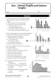
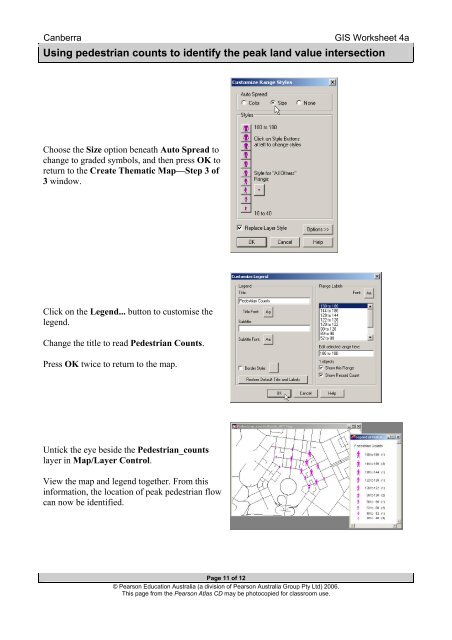
Canberra<strong>GIS</strong> <strong>Worksheet</strong> <strong>4a</strong>Using pedestrian counts to identify the peak land value intersectionChoose the Size option beneath Auto Spread tochange to graded symbols, and then press OK toreturn to the Create Thematic Map—Step 3 of3 window.Click on the Legend... button to customise thelegend.Change the title to read Pedestrian Counts.Press OK twice to return to the map.Untick the eye beside the Pedestrian_countslayer in Map/Layer Control.View the map and legend together. From thisinformation, the location of peak pedestrian flowcan now be identified.Page 11 of 12© <strong>Pearson</strong> Education <strong>Australia</strong> (a division of <strong>Pearson</strong> <strong>Australia</strong> Group Pty Ltd) 2006.This page from the <strong>Pearson</strong> Atlas CD may be photocopied for classroom use.