UDO Administrative Manual - Currituck County Government
UDO Administrative Manual - Currituck County Government
UDO Administrative Manual - Currituck County Government

You also want an ePaper? Increase the reach of your titles
YUMPU automatically turns print PDFs into web optimized ePapers that Google loves.
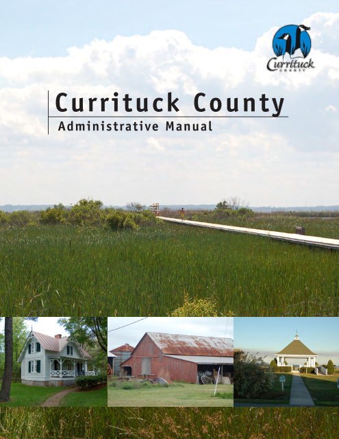
<strong>Currituck</strong> <strong>County</strong><strong>Administrative</strong> <strong>Manual</strong>
PURPOSE AND INTENTThis purpose of this manual is to assist in the administration of the Unified Development Ordinance(<strong>UDO</strong>). The manual’s primary goal is to explain the review procedures of developmentapplications established in the <strong>UDO</strong>. In an effort to ease the review process, this manual alsocontains application forms, staff review checklists, and submittal and fee schedules. Theadministrative manual consolidates information in the development review process, and helpsapplicants understand the procedures and requirements. The intent of this administrative manualis more specifically to:A. Establish a process that is clear and understandable to all interested parties, applicants andstaff;B. Clarify the standards and procedures for submitting complete and relevant information fordevelopment applications;C. Provide information and tools to assist applicants during the review process;D. Provide official interpretations of the <strong>UDO</strong>; andE. Establish planting standards that promote health and survival of landscaping installed in thecounty.Should you have any questions or comments about this manual please contact the Planning andCommunity Development Department.Second EditionEffective November 2012
TABLE OF CONTENTS1. INTRODUCTION ..................................................................................... 1.11.1 <strong>Manual</strong> Overview ........................................................................................... 1.12. PROCEDURES AND APPLICATIONS ................................................................... 2.12.1 Development Review Summary Table ......................................................... 2.12.2 <strong>Administrative</strong> Adjustment ............................................................................. 2.32.3 Appeal .............................................................................................................. 2.92.4 Building Permit2.4.1 Residential ....................................................................................... 2.172.4.2 Manufactured Home ...................................................................... 2.252.4.3 Nonresidential ................................................................................. 2.332.4.4 Building Inspections Procedures ................................................... 2.412.5 CAMA Minor Permit ........................................................................................ 2.452.6 Clear-Cutting Permit ....................................................................................... 2.552.7 Conditional Rezoning ...................................................................................... 2.592.8 Development Agreement ............................................................................... 2.672.9 Interpretation ................................................................................................... 2.732.10 Planned Development .................................................................................... 2.772.11 Sign Permit ....................................................................................................... 2.852.12 Site Plan2.12.1 Major ................................................................................................ 2.912.12.2 Minor ................................................................................................ 2.972.13 Subdivision2.13.1 Major ................................................................................................ 2.1032.13.2 Minor ................................................................................................ 2.1152.14 Temporary Use Permit ................................................................................... 2.1212.15 Text Amendment .............................................................................................. 2.1292.16 Use Permit ......................................................................................................... 2.1332.17 Variance ............................................................................................................ 2.1432.18 Zoning Compliance Permit ............................................................................. 2.1512.19 Zoning Map Amendment ................................................................................ 2.157
TABLE OF CONTENTS3. APPENDICES ............................................................................................................ 3.13.1 Certificates, Certifications, and Statements................................................. 3.13.1.1 Major Subdivision – Final Plat3.1.1.A Certificates................................................................... 3.13.1.1.B Statements.................................................................... 3.33.1.1.C As-built Surveys........................................................... 3.53.1.2 Minor Subdivision - Final Plat3.1.2.A Certificates................................................................... 3.53.1.2.B Statements.................................................................... 3.73.1.3 Site Plan3.1.3.A Certificates................................................................... 3.83.1.3.B As-built Surveys........................................................... 3.93.1.4 Other Site Certifications3.1.4.A Building Pad & Finished Floor Elevations................ 3.93.1.4.B Culvert Certification ................................................... 3.93.1.4.C Elevation Certificate................................................... 3.93.1.4.D Height Certificate ....................................................... 3.93.1.4.E Stormwater Plan Certification .................................. 3.93.1.4.F V-Zone Certificate ...................................................... 3.103.2 Flood Damage Pervention3.2.1 General Application Submittal Requirements ........................... 3.103.2.2 Specific Application Submittal Requirement ............................. 3.113.3 Links to Other Useful Tools3.3.1 Unified Development Ordinance ................................................. 3.123.3.2 2006 Land Use Plan ...................................................................... 3.123.3.3 Maple-Barco Small Area Plan ..................................................... 3.133.3.4 Corolla Village Small Area Plan ................................................. 3.133.3.5 Official <strong>Currituck</strong> <strong>County</strong> Zoning Map ....................................... 3.133.3.6 Interactive Online Mapping ......................................................... 3.143.4 Interpretations .................................................................................................. 3.14
TABLE OF CONTENTS3. APPENDICES ............................................................................................................ 3.13.1 Flood Damage Pervention ............................................................................. 3.13.1.1 General Application Submittal Requirements ........................... 3.13.1.2 Specific Application Submittal Requirement ............................. 3.23.2 Links to Other Useful Tools ............................................................................ 3.33.2.1 Unified Development Ordinance ................................................. 3.33.2.2 2006 Land Use Plan ...................................................................... 3.33.2.3 Maple-Barco Small Area Plan ..................................................... 3.33.2.4 Corolla Village Small Area Plan ................................................. 3.43.2.5 Official <strong>Currituck</strong> <strong>County</strong> Zoning Map ....................................... 3.43.2.6 Interactive Online Mapping ......................................................... 3.43.3 Interpretations .................................................................................................. 3.43.4 Planting Standards ......................................................................................... 3.53.4.1 New Plantings ................................................................................. 3.53.4.2 Species Diversity ............................................................................ 3.53.4.3 Installation ....................................................................................... 3.63.4.4 Berms ................................................................................................. 3.63.4.5 Limitations on Landscaping Placement ....................................... 3.63.4.6 Recommended Plantings ............................................................... 3.73.5 Staff Review Checklist .................................................................................... 3.93.5.1 Site Plan ........................................................................................... 3.113.5.2 Major Subdivision ........................................................................... 3.133.5.3 Minor Subdivision ........................................................................... 3.233.6 Submittal & Fee Schedule .............................................................................. 3.293.6.1 Submittal Schedule ......................................................................... 3.293.6.2 Fee Schedule ................................................................................... 3.30
IntroductionSECTION 1.1: MANUAL OVERVIEW1. INTRODUCTION1.1. MANUAL OVERVIEWThe <strong>Currituck</strong> <strong>County</strong> development review process is established by the Board of Commissioners toprovide a framework that allows reasonable oversight by county staff and officials while ensuringdevelopment projects are consistent with the Unified Development Ordinance and adopted plans.This process provides an opportunity to not only protect the public health, safety, and welfare;but also allows the county to coordinate development impacts with the provision of services.To help consolidate the development process and promote efficiency, the Board of Commissionershas established this administrative manual as an aid for citizens, public officials, engineers, anddevelopers. The manual includes information on review processes, submittal procedures, anddesign/review requirements. The basic intent of this manual is to consolidate the zoning reviewand decision making processes outlined in the Unified Development Ordinance in an easy to useand understandable document.While the administrative manual is not an ordinance, it is adopted by resolution of the Board ofCommissioners and incorporated by reference within the Unified Development Ordinance. Thisallows the procedures outlined in the manual to be applied flexibly and remain reflective ofchanging economic and environmental conditions. If the Administrator determines the manualneeds to be amended, notice of any such change will be provided via the county website andelectronic mailing lists maintained by the Planning and Community Development Department.Applicants are reminded this manual does not serve as a substitute for any of <strong>Currituck</strong> <strong>County</strong>’sadopted ordinances or plans and is intended only as a guide to the users of the <strong>Currituck</strong> <strong>County</strong>Unified Development Ordinance. In case of conflict between this document and other countyordinances, the adopted county ordinances shall control.A digital version of this manual is available online at the Planning and Community DevelopmentDepartment’s webpage at:http://www.co.currituck.nc.us/planning-community-development.cfm<strong>Administrative</strong> <strong>Manual</strong>Page 1.1
Procedures and ApplicationsSECTION 2.1: DEVELOPMENT REVIEW SUMMARY TABLE2. PROCEDURES ANDAPPLICATIONS2.1. DEVELOPMENT REVIEW SUMMARY TABLETable 2.1, Development Review Procedures, identifies the advisory and decision-makingbodies responsible for making recommendations or decisions on development applicationsreviewed under the Unified Development Ordinance. The table also identifies thedevelopment applications requiring a public hearing.TABLE 2.1: DEVELOPMENT REVIEW PROCEDURESD = DECIDE R = RECOMMENDATION A = APPEAL = PUBLIC HEARINGADVISORY AND DECISION-MAKING BODIESPROCEDUREBOARD OFCOMMISSIONERSPLANNINGBOARDBOARD OFADJUSTMENTTECHNICALREVIEWCOMMITTEEPLANNINGDIRECTOR<strong>Administrative</strong> AdjustmentDAppeal [1]Building PermitDCAMA Minor PermitDClear-Cutting PermitDConditional Rezoning R RDevelopment Agreement R RInterpretationDPlanned Development R RSign PermitDSite PlanMajor Site PlanDMinor Site PlanDSubdivisionMajor SubdivisionPreliminary Plat, Type 1DPreliminary Plat, Type II R RConstruction DrawingsDFinal PlatDMinor SubdivisionDTemporary Use Permit R DText Amendment R RUse Permit R RVariance RZoning Compliance PermitDZoning Map Amendment R R[1] Appeals of decisions by the Board of Commissioners or the Board of Adjustment are heard by the Superior Court for<strong>Currituck</strong> <strong>County</strong>.<strong>Administrative</strong> <strong>Manual</strong>Page 2.1
<strong>Administrative</strong> <strong>Manual</strong>Page 2.2
<strong>Administrative</strong> AdjustmentReview ProcessPre-applicationConference(optional)SubmitApplicationContact Information<strong>Currituck</strong> <strong>County</strong> Phone: 252.232.3055Planning and Community Development Fax: 252.232.3026153 Courthouse Road, Suite 110<strong>Currituck</strong>, NC 27929Website:http://www.co.currituck.nc.us/planning-community-development.cfmDetermination ofCompletenessStaff Report(optional)Planning DirectorDecisionNotice ofDecision<strong>Administrative</strong>AdjustmentStep 1: Application Submittal and AcceptanceThe applicant must submit a complete application packet on or before the application submittaldate. An administrative adjustment may be requested either as a stand-alone application or inconjunction with other application(s). If an administrative adjustment application is submitted inconjunction with another application, it shall be reviewed and decided prior to the otherapplication. A complete application packet consists of the following:o Completed <strong>Currituck</strong> <strong>County</strong> <strong>Administrative</strong> Adjustment Application.o Application Fee ($100)o A site plan for setback modifications or architectural elevations for height modifications. Theplan/elevations shall include the items listed in the administrative adjustment designstandards checklist.o Other documentation deemed necessary by the administrator.o Number of Copies Submitted:□ 3 Copies of site plans/architectural elevations□ 3 Hard copies of ALL documents□ 1 PDF digital copy (ex. Compact Disk – e-mail not acceptable) of all plans ANDdocumentsOn receiving an application, staff shall, within ten business days, determine whether the application iscomplete or incomplete. A complete application contains all the information and materials listed above, and isin sufficient detail to evaluate and determine whether it complies with appropriate review standards. If anapplication is determined to be incomplete, the applicant may correct the deficiencies and resubmit theapplication for completeness determination. Failure to resubmit a complete application within 45 calendardays after being determined incomplete will result in the application being considered withdrawn.Step 2: Staff Review and ActionOnce an application is determined complete, it will be distributed by staff to all appropriate staff and reviewagencies for review and comment, and the preparation of a staff report, if appropriate. An application foran administrative adjustment shall be approved upon finding the applicant demonstrates all of the followingstandards are met:oThe administrative adjustment does not exceed:□ Modifications in building height by up to 15 percent;□ Modifications in a building setback by up to 20 percent in Full Service areas designated on the futureland use map of the 2006 Land Use Plan;□ Modifications in building setbacks by up to 15 percent in all other areas in the county;□ Modifications in major arterial street setbacks by up to 40 percent, provided the structure maintains aminimum distance of at least 20 feet from the major arterial street;Section 2.2<strong>Administrative</strong> <strong>Manual</strong>Page 2.3<strong>Administrative</strong> ApplicationPage 1 of 6
oooooThe administrative adjustment is consistent with the character of development on surrounding land, and iscompatible with surrounding land uses;The administrative adjustment is either:□ Required to compensate for some unusual aspect of the site or the proposed development that is notshared by landowners in general;□ Supports an objective or goal from the purpose and intent statements of the district where it islocated; or□ Saves healthy existing trees;The administrative adjustment will not pose a danger to the public health or safety;Any adverse impacts will be mitigated, to the maximum extent practicable; andThe site is not subject to a series of multiple, incremental administrative adjustments that results in areduction in development standards by the maximum allowed.Unless otherwise specified in the approval, an application for a building permit shall be approved within oneyear of the date of the approval of the administrative adjustment, or the administrative adjustment shallbecome null and void, and automatically expire. Permitted timeframes do not change with successive owners.<strong>Administrative</strong> <strong>Manual</strong>Page 2.4<strong>Administrative</strong> ApplicationPage 2 of 6
<strong>Administrative</strong> AdjustmentApplicationOFFICIAL USE ONLY:Case Number:Date Filed:Gate Keeper:Amount Paid:Contact InformationAPPLICANT:Name:Address:PROPERTY OWNER:Name:Address:Telephone:E-Mail Address:Telephone:E-Mail Address:LEGAL RELATIONSHIP OF APPLICANT TO PROPERTY OWNER:Property InformationPhysical Street Address: ___Location: _______Parcel Identification Number(s): ____Total Parcel(s) Acreage: __Existing Land Use of Property:Proposed Land Use of Property:___________________________________________________________RequestBuilding Height ModificationRequired Maximum Height: _________ Proposed Height: _________ Percent Change: _________Setback ModificationRequired Setback: _________ Proposed Setback: _________ Percent Change: _________Full Service (Y/N): _________ Major Arterial Street Setback (Y/N): _________<strong>Administrative</strong> <strong>Manual</strong>Page 2.5<strong>Administrative</strong> ApplicationPage 3 of 6
NarrativePlease write a short narrative of the request including the reason the administrative adjustment is beingsought.___________________________________________________________________________________________________________________________________________________________________________________________________________________________________________________________________________________________________________________________________________________________________________________________________________________________________________________________________________________________________________________________________________________________________________________________________________________I, the undersigned, do certify that all of the information presented in this application is accurate to the bestof my knowledge, information, and belief.Further, I hereby authorize county officials to enter my property for purposes of determining zoningcompliance. All information submitted and required as part of this application process shall become publicrecord.Property Owner(s)/Applicant*Date*NOTE: Form must be signed by the owner(s) of record, contract purchaser(s), or other person(s) having arecognized property interest. If there are multiple property owners/applicants a signature is required for each.<strong>Administrative</strong> <strong>Manual</strong>Page 2.6<strong>Administrative</strong> ApplicationPage 4 of 6
<strong>Administrative</strong> Adjustment Design Standards ChecklistThe table below depicts the design standards of the surveyed site plan or architectural elevations for anadministrative adjustment application. Please make sure to include all applicable listed items unlesswaived by staff to ensure all appropriate standards are reviewed.<strong>Administrative</strong> AdjustmentDesign Standards ChecklistDate Received: _______________Applicant/Property Owner: ______________________________________________________________<strong>Administrative</strong> Adjustment Design Standards ChecklistSite Plan (Setback Modification)1 Property owner name, address, phone number, and e-mail address.2 Site address and parcel identification number.3 North arrow and scale to be 1” = 100’ or larger.4 Existing zoning classification of the property.5 Scaled drawing showing property lines, setbacks, existing and proposed development, andproposed setback modification. Additional site features (i.e. vehicular use areas, utilities,infrastructure, surface water) may be required by the administrator if applicable.6 Approximate Flood Zone line and Base Flood Elevation as delineated on the “Flood InsuranceRate Maps/Study <strong>Currituck</strong> <strong>County</strong>.”7 Approximate location of all designated Areas of Environmental Concern or other such areaswhich are environmentally sensitive on the property, such as Maritime Forest, CAMA, 404, or401 wetlands as defined by the appropriate agency.OR Architectural Elevations (Height Modification)8 Architectural drawings and/or sketches illustrating the design, character, and height of theproposed building(s).Other9 Any other documentation deemed necessary by the administrator to determine compliancewith administrative adjustment review standards.<strong>Administrative</strong> <strong>Manual</strong>Page 2.7<strong>Administrative</strong> ApplicationPage 5 of 6
Conditional Rezoning Submittal ChecklistStaff will use the following checklist to determine the completeness of your application within ten businessdays of submittal. Please make sure all of the listed items are included. Staff shall not process anapplication for further review until it is determined to be complete.<strong>Administrative</strong> AdjustmentSubmittal ChecklistDate Received: ________________Applicant/Property Owner: ______________________________________________________________<strong>Administrative</strong> Adjustment Submittal Checklist1 Complete <strong>Administrative</strong> Adjustment application2 Application fee ($100)3 Site Plan or Architectural Elevations4 Other documentation deemed necessary5 3 copies of plans6 3 hard copies of ALL documents7 1 PDF digital copy of all plans AND documents (ex. Compact Disk – e-mail not acceptable)For Staff OnlyPre-application Conference (optional)Pre-application Conference was held on_______ and the following people were present:_______________________________________________________________________________________________________________Comments_____________________________________________________________________________________<strong>Administrative</strong> <strong>Manual</strong>Page 2.8<strong>Administrative</strong> ApplicationPage 6 of 6
AppealReview ProcessPre-ApplicationConference(optional)SubmitNotice of AppealAssembleRecord of AppealStaff Review andReportScheduleHearingPublicNotificationBoard ofAdjustmentHearing /DecisionNotice ofDecisionContact Information<strong>Currituck</strong> <strong>County</strong> Phone: 252.232.3055Planning and Community Development Fax: 252.232.3026153 Courthouse Road, Suite 110<strong>Currituck</strong>, NC 27929Website:http://www.co.currituck.nc.us/planning-community-development.cfmStep 1: Application Submittal and AcceptanceThe applicant must submit a complete application packet within thirty days of the date of theinterpretation or decision being appealed, or within ten days of the date of the notice ofviolation being appealed. A complete application packet consists of the following:○ Complete <strong>Currituck</strong> <strong>County</strong> Appeal Application.○ Application Fee ($150).On receiving an application, staff shall, determine whether the application is complete orincomplete. A complete application contains all the information and materials listed above, andis in sufficient detail to evaluate and prepare a staff report. If an application is determined tobe incomplete, the applicant may correct the deficiencies and resubmit the application forcompleteness determination within the thirty or ten day appeal window.Step 2: Staff Review and ActionAfter accepting the appeal application, staff shall review it and prepare a written report. Staffshall transmit the appeal and the record of material considered by the decision-maker in makingthe decision or interpretation, including but not limited to the application and support materials,staff report, other plans, documents, reports, and studies considered in making the decision, andany minutes, transcripts, or record of the meetings held to consider and make the decision. Thesematerials, plus the Land Use Plan, Unified Development Ordinance (<strong>UDO</strong>), and any otherrelevant adopted plan, shall constitute the record of the appeal.AppealStep 3: Public Hearing Scheduling and Public NotificationStaff shall ensure the public hearing is scheduled for a regularly scheduled Board of Adjustment meeting or ameeting specially called for by the Board of Adjustment. The required public hearing with the Board ofAdjustment shall be scheduled so there is sufficient time for a staff report to be prepared and for the publicnotification requirements to be satisfied under state law.The application shall meet the following public notification requirements:oPublished NoticeStaff shall publish a notice of the hearing once a week for two successive calendar weeks in a newspaperhaving general circulation in the county. The first time notice is published, it shall not be less than 10 daysnor more than 25 days before the date fixed for the hearing.Section 2.3<strong>Administrative</strong> <strong>Manual</strong>Page 2.9Appeal ApplicationPage 1 of 7
ooMailed Notice*Staff shall be responsible for preparing and mailing a written notice between 10 and 25 days before thepublic hearing. Notice shall be mailed to:□ All owners of the land subject to the application;□□The applicant, if different from the land owner;All owners of land within 200 feet of the property lines of land subject to the application (includingowners of land located outside the county) whose address is known by reference to the latest advalorem tax records; and□ Commanders of military bases located within five miles of the subject application when thedevelopment proposal affects the type of uses allowed.Posted Notice*At least 10 days before the public hearing, posted notice shall be made by staff. A sign shall be placedin a conspicuous location as to be clearly visible to the traveled portion of the respective street. Wherethe land subject to the notice does not have frontage on a public street, the sign shall be erected on thenearest street right-of-way with an attached notation generally indicating the direction and distance tothe land subject to the application.*Mailed and Posted notification are required only in cases where the appeal pertains to a specific parcel ofland.Step 4: Public Hearing Procedures, and Decision-Making Body Review and DecisionStaff will present the application and staff report to the Board of Adjustment. The applicant must attend thepublic hearing to present evidence and answer any questions the board or public may have about theapplication. The Board of Adjustment shall conduct a quasi-judicial hearing that is subject to procedural rulesset forth by the courts including having all persons who intend to present evidence to the board be sworn.Quasi-judicial public hearings are subject to the following:○○○○Opportunity to Present Testimony and EvidenceAny affected party shall be afforded a reasonable opportunity to present testimony and evidence insupport of or in opposition to the application, and to ask questions of the applicant and the applicant’srepresentatives and county staff and county staff’s representatives. At the discretion of the personchairing the body conducting the public hearing, an affected party may be granted an opportunity to askquestions of any other member of the public who has testified at the hearing.Not Bound by Rules of EvidenceExcept as otherwise provided in the North Carolina General Statutes, the board is not bound by the rulesof evidence, or limited to consideration of evidence that is admissible in a court of law. The board mayconsider all testimony and evidence it deems competent and material to the application underconsideration.Cross ExaminationAny inquiry under cross-examination shall be limited to matters raised in the direct examination of thewitness. No re-direct or re-cross shall be allowed unless requested by the applicant, and affected party,or the county – who shall state the desired area of inquiry – and the request is approved by the personchairing the body conducting the hearing. If re-direct or re-cross is allowed, it shall be limited to questionsof the witness on issues raised in the cross-examination.Ex Parte CommunicationEx parte communication between an applicant or an affected party and a member of the boardreviewing or making a decision on the application is prohibited, and must be disclosed during the publichearing, if it concurs.The Board of Adjustment shall decide on the application base solely on the record of the appeal, assupplemented by arguments presented at the public hearing. The decision shall be one of the following:○○○Affirmation of the decision or interpretation (in whole or in part);Modification of the decision or interpretation (in whole or in part); orReversal of the decision or interpretation (in whole or in part).A vote to reverse or modify a decision or interpretation shall require a four/fifths majority of Board ofAdjustment members present and voting.<strong>Administrative</strong> <strong>Manual</strong>Page 2.10Appeal ApplicationPage 2 of 7
In deciding on the appeal application, the board is limited to the following determinations, which shall bebased on clear and substantial evidence in the record:○○○○The decision-maker did not make an error or correctly applied the standards of the <strong>UDO</strong> in making thedecision or interpretation;The decision-maker made an error in determining whether a standard was met. The record must indicatethat an error in judgment occurred or facts, plans, or regulations were misread in determining whether theparticular standard was or was not met;The decision-maker made the decision based on a standard not contained in the <strong>UDO</strong> or otherappropriate county ordinances, regulations, or state law, or that a standard more strict or broad than thestandard established in the <strong>UDO</strong> was applied; orThe decision-maker made an error in applying a standard or measuring a standard.Where conflicting evidence exists, the appeal is limited to determining what evidence or testimony bears thegreatest credibility in terms of documentation and qualifications of those making the determination.The Board of Adjustment shall not hear any evidence or make any decision based on hardships or specialconditions. Such matters may only be considered in the context of an application for a variance or use permit.<strong>Administrative</strong> <strong>Manual</strong>Page 2.11Appeal ApplicationPage 3 of 7
This page left blank for formatting purposes.<strong>Administrative</strong> <strong>Manual</strong>Page 2.12Appeal ApplicationPage 4 of 7
AppealApplicationOFFICIAL USE ONLY:Case Number:Date Filed:Gate Keeper:Amount Paid:Contact InformationAPPLICANT:Name:Address:PROPERTY OWNER:Name:Address:Telephone:E-Mail Address:Telephone:E-Mail Address:LEGAL RELATIONSHIP OF APPLICANT TO PROPERTY OWNER:Property InformationPhysical Street Address:Location:Parcel Identification Number(s): ________Statement of Error, or Improper Decision or InterpretationI wish to appeal a: □ Decision or Interpretation □ Notice of ViolationThe determination being dated ___/___/______.Grounds for appealState the facts you are prepared to prove to the Board of Adjustment that should lead the board to conclude that thedecision of the administrator was made in error.__________________________________________________________________________________________________________________________________________________________________________________________________________________________________________________________________________________________________Please include all related support materials with the application.I, the undersigned, do certify that all of the information presented in this application is accurate to the bestof my knowledge, information, and belief. All information submitted and required as part of thisapplication process shall become public record.Appellant/ApplicantDate_______<strong>Administrative</strong> <strong>Manual</strong>Page 2.13Appeal ApplicationPage 5 of 7
Owner VerificationIf the person who is requesting the Board of Adjustment to take action on a particular piece of property isnot the owner of the property, or under contract to purchase, then the actual owner of the land mustcomplete this section. If the owner is the appellant/application please do not complete this section.Dear Sir or Madame:I am the owner of the property located at______.I hereby authorize______to appear with my consent before the Board of Adjustment in order to request an appeal or interpretationat the above location. I authorize you to advertise and present this matter in my name as the owner of theproperty.Further, I hereby authorize county officials to enter my property for purposes of determining zoningcompliance.If you have any questions, you may contact me at the following at the address, phone number, or emailaddress listed on this application.Respectfully yours,OwnerDateSworn to and subscribed before me, this the day of , 20 .Notary PublicMy commission expires:<strong>Administrative</strong> <strong>Manual</strong>Page 2.14Appeal ApplicationPage 6 of 7
Appeal Submittal ChecklistStaff will use the following checklist to determine the completeness of your application. Only completeapplications will be accepted.AppealSubmittal ChecklistDate Received: _Project Name: __Applicant/Property Owner: ____BOA Date: ______Appeal Submittal Checklist1 Complete Appeal application2 Application fee ($150)3 All related support materials/evidence.4 10 hard copies of ALL documents5 1 PDF digital copy of all plans AND documents (ex. Compact Disk – e-mail not acceptable)For Staff OnlyPre-application Conference (optional)Pre-application Conference was held on_______ and the following people were present:_______________________________________________________________________________________________________________Comments_____________________________________________________________________________________<strong>Administrative</strong> <strong>Manual</strong>Page 2.15Appeal ApplicationPage 7 of 7
<strong>Administrative</strong> <strong>Manual</strong>Page 2.16
Residential Building Permit ApplicationReview ProcessContact Information<strong>Currituck</strong> <strong>County</strong>Planning and Community DevelopmentCentral Permitting DivisionMainland Office153 Courthouse Road, Suite 117 Mainland Phone: 252.232.3378<strong>Currituck</strong>, NC 27929 Mainland Fax: 252.232.3470Corolla Office1123 Ocean Trail Corolla Phone: 252.453.8555PO Box 73 Corolla Fax: 252.453.8300Corolla, NC 27927Website:http://www.co.currituck.nc.us/planning-community-development.cfmStep 1 Application SubmittalThe applicant must submit a complete application packet. A complete application packet consists of the following:o Completed <strong>Currituck</strong> <strong>County</strong> Residential Building Permit Applicationo Permit Fee(s) (at permit issuance)o Construction Planso Site Plan (including stormwater plan, if required)o Septic/Sewer Approval (wastewater improvements permit, existing system inspection, or wastewaterreservation)o Well Permit, if requiredo CAMA Permit, if requiredo V Flood Zone Certificate, if requiredo Submittal ChecklistStep 2 Permit ReviewThe county staff will review the application for completeness and code compliance. Once all requirements are metthe permit will be issued. Approved permits must be signed by the owner or applicant.Step 3 Posting of Permit and PlansBuilding permits must be posted at the construction site and clearly visible from the road. One set of approvedconstruction plans must be on the jobsite for all inspections.Step 4 InspectionsInspections must be scheduled by 4:00 pm one business day before the requested inspection. Inspections areperformed between 8:00 am and 5:00 pm, Monday through Friday. The required inspections will vary for eachproject; please review the Inspection Handbook for inspection types.Section 2.4.1<strong>Administrative</strong> <strong>Manual</strong>Page 2.17Residential Building Permit ApplicationPage 1 of 7
Residential Building Permit ApplicationApplication FormContact InformationAPPLICANT: ______________________________ PROPERTY OWNER: ___________________________Telephone: __ _ Telephone: ___Mobile: _ Mobile: ___E-Mail Address: _ E-Mail Address: ___Project InformationEstimated Project Cost: $ _________________Physical Street Address:__Parcel Identification Number(s): __ Subdivision: __Project ClassificationAdditional Project InformationDescription of Work:____________________________________Type of HVAC system: (heat pump, elec., gas, other)____________________________________Does this project include installation of a gas line, appliance, or equipment?Is this project outside of the existing footprint?Is this project within 75 feet of a waterway?Is the ROG finished? □ Yes □ No□ Single Family□ Addition□ Pool□ Hot Tub□Yes □ No□ Yes □ No□ Accessory Structure□ Alterations□ Elevator□ Pier/Bulkhead□ Yes □ NoWill the natural contour of the property be modified by grading or filling higher than adjacent grades? □ Yes □ No(If yes, stormwater plan required for development without a state approved stormwater management plan).□ Trade Permit□ OTHER:BedroomsBathroomsSquare FootageHeated Living 1 st fl2 nd fl3 rd flGarage/ShedROG/FROGPorchDeckMisc.TOTALThe permit is null and void if work or construction authorized under this permit is not commenced within 6 months, after commencementof work no required inspection is requested and approved within any 12-month period, or for substantial deviations from plans. Ihereby certify that I have read and examined this application and know the same to be true and correct. All provisions of laws andordinances governing this type of work will be complied with whether specified herein or not. The granting of the permit does notpresume to give authority to violate other state or local laws regulating construction or the performance of construction._Printed Full Name of Applicant Signature of Applicant DateOFFICIAL USE ONLY:__Building Permit NumberType of Water:CAMA Number .................................... Septic Permit Number:Zoning of Property: Flood Zone: BFE: _____ DFE: Max % Coverage:Min Setbacks: Front Side (R) Side (L) _____ Rear Accessory<strong>Administrative</strong> <strong>Manual</strong>Page 2.18Residential Building Permit ApplicationPage 2 of 7
Contractor of RecordContractor of RecordBuilding Contractor Name NC License #AddressPhoneCity/StContact NameElectrical Contractor Name NC License #AddressPhoneCity/StContact NameMechanical Contractor Name NC License #AddressPhoneCity/StContact NamePlumbing Contractor Name NC License #AddressPhoneCity/StContact NameInsulation Contractor Name NC License # Not RequiredAddressPhoneCity/StContact NameGas Contractor Name NC License #AddressPhoneCity/StContact NameMoving Contractor Name NC License #AddressPhoneCity/StContact NamePool/Hot Tub Contractor Name NC License #AddressPhoneCity/StContact NameOther Contractor Name NC License #AddressPhoneCity/StContact NameOWNER CONTRACTORAs owner of the property, I intend to retain the finished project exclusively for my own use and will occupy theproperty for at least one year following the completion of construction. I understand that it is myresponsibility to obtain workers’ compensation insurance, if necessary. I will contract with a North Carolinalicensed electrical, plumbing, mechanical, and gas contractor for this project unless otherwise noted. As ownerof the property, I will complete the following:□ General □ Electrical □ Mechanical □ Plumbing □ GasSignature of Property OwnerDate<strong>Administrative</strong> <strong>Manual</strong>Page 2.19Residential Building Permit ApplicationPage 3 of 7
Contractor AffidavitContractor AffidavitPlease submit the signed affidavit with the permit application or prior to the first inspection of thepermitted work.STATE OF NORTH CAROLINACOUNTY OF CURRITUCKCONTRACTOR AFFIDAVIT□ General □ Electrical □ Mechanical □ Plumbing □ GasContractor InformationLicense Holder:Name of Business:Business Address:Phone:License InformationNC License Number:License Classification:Project InformationProject Address:Building Permit Number:Cost of Trade Work: $I am licensed and qualified to assume all responsibility and ability as a contractor on this project. If I resignor am no longer affiliated with this project, I will notify the <strong>Currituck</strong> <strong>County</strong> Central Permitting Division inwriting within three working days. I understand that it is my responsibility to obtain workers’ compensationinsurance, if necessary.Signature of License HolderDate<strong>Administrative</strong> <strong>Manual</strong>Page 2.20Residential Building Permit ApplicationPage 4 of 7
Property Owner AffidavitOwner Exemption AffidavitPursuant to North Carolina General Statutes 87-14(a)(1)STATE OF NORTH CAROLINACOUNTY OF CURRITUCKOWNER EXEMPTION AFFIDAVITPURSUANT TO GS 87-14(a)(1)Property Address or PIN:I, , hereby claim an exemption from licensureunder G.S. 87-1(b)(2) by initialing the relevant provisions in paragraph 1 and initialing paragraphs 2-4 below andattesting to the following:1. I certify that I am the owner of the property set forth above on which this building is to be constructed oraltered.OR2. I am legally authorized to act on behalf of the firm or corporation which is constructing or altering thisbuilding on the property owned by the firm or corporation as set forth above (name of firm orcorporation): .3. I will personally superintend and manage all aspects of the construction or alteration of the building andthat duty will not be delegated to any person not duly licensed under the terms of Article 1 of Chapter 87of the General Statutes of North Carolina.4. I will be personally present for all inspections required by the North Carolina State Building Code, unlessthe plans for the construction or alteration of the building were drawn and sealed by an architect licensedpursuant to Chapter 83A of the General Statutes of North Carolina.5. I understand that a copy of this AFFIDAVIT will be transmitted to the North Carolina Licensing Board forGeneral Contractors for verification that I am validly entitled to claim an exemption under G.S.87-1(b)(2)for the building construction or alteration specified herein. I further understand that, if the North CarolinaLicensing Board for General Contractors determines that I was not entitled to claim this exemption, thebuilding permit issued for the building construction or alteration specified herein shall be revoked pursuantto G.S. 153A-362 or G.S. 160A-422.Signature of AffiantDateSworn to (or affirmed) and subscribed before me this theday of , 20 .Signature of Notary PublicPrinted Name of Notary PublicMy commission expires:(Notary Stamp or Seal)Note: This affidavit is used for construction projects that exceed $30,000. It is a Class F felony to willfully commitperjury in any affidavit taken pursuant to law – G.S. 14-209.<strong>Administrative</strong> <strong>Manual</strong>Page 2.21Residential Building Permit ApplicationPage 5 of 7
Submittal ChecklistSubmittal ChecklistResidential Building Permit Submittal ChecklistApplications/Forms/Permits1 Residential Building Permit Application Form2 Wastewater approval or permitNew Septic: Construction improvements permit (ARHS)Existing Septic: Existing system inspection (ARHS)Central Sewer: Sewer reservation form (operator of central system)3 Well Permit, if required (ARHS)4 Contractor of Record Form5 Contractor and/or owner affidavit(s)7 CAMA permit, if required8 V-Zone Certificate, if development is located in VE flood zonePlans9 Two complete sets of detailed building plansName, address, and signature of plan designerFoundation Plan (sizes and spacing):○ Flood vent openings (SFHA only)Floor planBuilding elevationsTypical wall sections (sizes and spacing)Design pressure ratingWind ratings (120mph or greater)10 Site plan (if lot is 20,000 square feet or smaller the site plan must be prepared by aprofessional such as a licensed surveyor, engineer, or architect)Lot/parcel dimensionsLocation of existing physical features (roads, streets, navigable waterways)Location and dimensions of the proposed construction and existing structuresSetback measurements to all property linesSeptic system, repair area, and well locationsProposed fill or grade changes11 Stormwater Plan, if required (must be prepared by a professional such as a licensedsurveyor, engineer, or architect)Lot/parcel dimensionsAdjacent property grades and drainage areas (within 30 feet from the subjectproperty to the extent practicable)Approximate depth of seasonal high water tableExisting and proposed elevations sufficient to determine drainage pattern on site andon adjoining sites (i.e. contours in one foot intervals)Stormwater management improvements that provide detention to capture a four inchrainfall event from the built upon area within the drainage areaStormwater Plan Certifications (<strong>Administrative</strong> <strong>Manual</strong>)An operation and maintenance planNarrative describing the proposed development and measures planned to comply withthe requirements of Section 7.3.3.D. of the <strong>UDO</strong>Flood Damage Prevention, if Applicable12 Boundary of the Special Flood Hazard Area (SFHA), Floodway, Coastal Barrier ResourceSystem (CBRS) Area, water course relocation, or a statement that the entire lot is within a<strong>Administrative</strong> <strong>Manual</strong>Page 2.22Residential Building Permit ApplicationPage 6 of 7
specific SFHA13 Proposed elevation of all structures and utility systems14 Plans for non-structural fill (if being utilized in V zone)Fees15 Permit fees to be paid at permit issuance<strong>Administrative</strong> <strong>Manual</strong>Page 2.23Residential Building Permit ApplicationPage 7 of 7
<strong>Administrative</strong> <strong>Manual</strong>Page 2.24
Manufactured Home Permit ApplicationReview ProcessContact Information<strong>Currituck</strong> <strong>County</strong>Planning and Community DevelopmentCentral Permitting DivisionMainland Office153 Courthouse Road, Suite 117 Mainland Phone: 252.232.3378<strong>Currituck</strong>, NC 27929 Mainland Fax: 252.232.3470Corolla Office1123 Ocean Trail Corolla Phone: 252.453.8555PO Box 73 Corolla Fax: 252.453.8300Corolla, NC 27927Website:http://www.co.currituck.nc.us/planning-community-development.cfmStep 1 Application SubmittalThe applicant must submit a complete application packet. A complete application packet consists of the following:o Completed <strong>Currituck</strong> <strong>County</strong> Manufactured Home Permit Applicationo Permit Fee(s) (paid at permit issuance)o Construction Plans for modulars, decks, porches, or room additionso Site Plan, if required (replacement mobile homes in a mobile home park do not require a site plan)o Stormwater Plan, if requiredo Septic/Sewer Approval (wastewater improvements permit, existing septic system inspection, or wastewaterreservation)o Well Permit, if requiredo CAMA Permit, if requiredo V Flood Zone certificate, if requiredo Submittal ChecklistThe construction of 2 – 3’x3’ landings with stairs are included in the manufactured home permit. Decks, porches, orroom additions require plans and specifications.Step 2 Permit ReviewThe county staff will review the application for completeness and code compliance. Once all requirements are met andpermit fees are paid the permit will be issued. Approved permits must be signed by the owner or applicant.Step 3 Posting of Permit and PlansBuilding permits must be posted at the construction site and clearly visible from the road. One set of approved plans(modulars, decks, porches, additions) and set-up manual (mobile homes) must be on the jobsite for all inspections.Step 4 InspectionsInspections must be scheduled by 4:00 pm one business day before the requested inspection. Inspections areperformed between 8:00 am and 5:00 pm, Monday through Friday. The required inspections will vary for eachproject; please review the Inspection Handbook for inspection types.Section 2.4.2<strong>Administrative</strong> <strong>Manual</strong>Page 2.25Manufactured Home Building Permit ApplicationPage 1 of 7
Manufactured Home Permit ApplicationApplication FormContact InformationAPPLICANT: ______________________________ PROPERTY OWNER: ___________________________Telephone: __ _ Telephone: ___Mobile: _ Mobile: ___E-Mail Address: _ E-Mail Address: ___Project InformationESTIMATED PROJECT COST: $ _________________Physical Street Address: ___ ___Parcel Identification Number(s): __ Subdivision:Year Make Model __Serial Number # of Bedrooms # of Bathrooms ________Permit Classification□ Singlewide□ Doublewide□ Triplewide□ Modular, on frame□ Modular, off frame□ OtherAdditional Project Information□ Pool□Pier/Bulkhead□ Elevator□ Hot Tub□ OtherDoes this project include installation of a gas line, appliance, or equipment?□ Yes □ No□ Yes □ No□ Yes □ NoWill this home replace an existing home on the property?Is this project within 75 feet of a waterway?Are you building a deck or porch?□ Yes □ NoWill the natural contour of the property be modified by grading or filling higher than adjacent grades? □ Yes □ No(If yes, stormwater plan required for development without a state approved stormwater management plan).Who will set-up the MODULAR home? □ Owner □ Licensed General Contractor□ Other, provide an original $5,000 surety bond in accordance with NCGS 143-139.1Square FootageHeated LivingPorchDeckMisc.TOTALThe permit is null and void if work or construction authorized under this permit is not commenced within 6 months, after commencement of work norequired inspection is requested and approved within any 12-month period, or for substantial deviations from plans. I hereby certify that I haveread and examined this application and know the same to be true and correct. All provisions of laws and ordinances governing this type ofwork will be complied with whether specified herein or not. The granting of the permit does not presume to give authority to violate or cancelthe provisions of any other state or local law regulation, construction, or the performance of construction._Printed Full Name of Applicant Signature of Applicant Date__OFFICIAL USE ONLY:Building Permit NumberType of Water:CAMA Number .................................... Septic Permit Number:Zoning of Property: _____ Flood Zone: _____ BFE: _____ DFE: _______ Max % Coverage: ____Min Setbacks: Front Side (R) Side (L) _____ Rear _<strong>Administrative</strong> <strong>Manual</strong>Page 2.26Manufactured Home Building Permit ApplicationPage 2 of 7
Contractor of RecordContractor of RecordMH Set-up Contractor Name NC License #AddressPhoneCity/StContact NameMoving Contractor Name NC License #AddressPhoneCity/StContact NameBuilding Contractor Name NC License #AddressPhoneCity/StContact NameElectrical Contractor Name NC License #AddressPhoneCity/StContact NameMechanical Contractor Name NC License #AddressPhoneCity/StContact NamePlumbing Contractor Name NC License #AddressPhoneCity/StContact NameGas Contractor Name NC License #AddressPhoneCity/StContact NameOther Contractor Name NC License #AddressPhoneCity/StContact NameOWNER CONTRACTORAs owner of the property, I intend to retain the finished project exclusively for my own use and will occupy theproperty for at least one year following the completion of construction. I understand that it is my responsibility toobtain workers’ compensation insurance, if necessary. I will contract with a North Carolina licensed electrical,plumbing, mechanical, and gas contractor for this project unless otherwise noted. As owner of the property, I willcomplete the following:□ Set-up □ General/Building □ Electrical □ Mechanical □ Plumbing □ GasSignature of Property OwnerDate<strong>Administrative</strong> <strong>Manual</strong>Page 2.27Manufactured Home Building Permit ApplicationPage 3 of 7
Contractor AffidavitContractor AffidavitPlease submit the signed affidavit with the permit application or prior to the first inspection of thepermitted work.STATE OF NORTH CAROLINACOUNTY OF CURRITUCKCONTRACTOR AFFIDAVIT□ General □ Electrical □ Mechanical □ Plumbing □ GasContractor InformationLicense Holder:Name of Business:Business Address:Phone:License InformationNC License Number:License Classification:Project InformationProject Address:Building Permit Number:Cost of Trade Work: $I am licensed and qualified to assume all responsibility and ability as a contractor on this project. If I resign or amno longer affiliated with this project, I will notify the <strong>Currituck</strong> <strong>County</strong> Central Permitting Division in writing withinthree working days. I understand that it is my responsibility to obtain workers’ compensation insurance, ifnecessary.Signature of License HolderDate<strong>Administrative</strong> <strong>Manual</strong>Page 2.28Manufactured Home Building Permit ApplicationPage 4 of 7
Property Owner AffidavitOwner Exemption AffidavitPursuant to North Carolina General Statutes 87-14(a)(1)STATE OF NORTH CAROLINACOUNTY OF CURRITUCKOWNER EXEMPTION AFFIDAVITPURSUANT TO GS 87-14(a)(1)Property Address or PIN:I, , hereby claim an exemption from licensure underG.S. 87-1(b)(2) by initialing the relevant provisions in paragraph 1 and initialing paragraphs 2-4 below and attesting to thefollowing:1. I certify that I am the owner of the property set forth above on which this building is to be constructed oraltered.OR2. I am legally authorized to act on behalf of the firm or corporation which is constructing or altering this buildingon the property owned by the firm or corporation as set forth above (name of firm or corporation):.3. I will personally superintend and manage all aspects of the construction or alteration of the building and thatduty will not be delegated to any person not duly licensed under the terms of Article 1 of Chapter 87 of theGeneral Statutes of North Carolina.4. I will be personally present for all inspections required by the North Carolina State Building Code, unless theplans for the construction or alteration of the building were drawn and sealed by an architect licensed pursuantto Chapter 83A of the General Statutes of North Carolina.5. I understand that a copy of this AFFIDAVIT will be transmitted to the North Carolina Licensing Board for GeneralContractors for verification that I am validly entitled to claim an exemption under G.S.87-1(b)(2) for the buildingconstruction or alteration specified herein. I further understand that, if the North Carolina Licensing Board forGeneral Contractors determines that I was not entitled to claim this exemption, the building permit issued for thebuilding construction or alteration specified herein shall be revoked pursuant to G.S. 153A-362 or G.S. 160A-422.Signature of AffiantDateSworn to (or affirmed) and subscribed before me this theday of , 20 .Signature of Notary PublicPrinted Name of Notary PublicMy commission expires:(Notary Stamp or Seal)Note: This affidavit is used for construction projects that exceed $30,000. It is a Class F felony to willfully commit perjury inany affidavit taken pursuant to law – G.S. 14-209.<strong>Administrative</strong> <strong>Manual</strong>Page 2.29Manufactured Home Building Permit ApplicationPage 5 of 7
Submittal ChecklistSubmittal ChecklistResidential Manufactured Home Permit Submittal ChecklistApplications/Forms/Permits1 Residential Manufactured Home Permit Application Form2 Wastewater approval or permitNew Septic: Construction improvements permit (ARHS)Existing Septic: Existing system inspection (ARHS)Central Sewer: Sewer reservation form (operator of central system)3 Well Permit, if required (ARHS)4 Contractor of Record Form5 Contractor and/or owner affidavit(s)7 CAMA permit, if required8 V- Zone Certificate (if development is located in VE flood zone)9 Foundation Certification (if chassis is 36 inches or more above grade)Plans10 Two complete sets of detailed modular plans11 Two complete sets of detailed building plans (decks, porches, room additions)Name, address, and signature of plan designerFoundation Plan (sizes and spacing):○ Flood vent openings (SFHA only)Floor planBuilding elevationsTypical wall sections (sizes and spacing)Design pressure ratingWind ratings (120mph or greater)12 Site plan (if lot is 20,000 square feet or smaller the site plan must be prepared by alicensed surveyor, engineer, or architect)Lot/parcel dimensionsLocation of existing physical features (roads, streets, navigable waterways)Location and dimensions of the proposed construction and existing structuresSetback measurements to all property linesSeptic system, repair area, and well locationsProposed fill or grade changes13 Stormwater Plan, if required (must be prepared and sealed by a North Carolina licensedsurveyor, engineer, or architect)Lot/parcel dimensionsAdjacent property grades and drainage areas (within 30 feet from the subjectproperty to the extent practicable)Approximate depth of seasonal high water tableExisting and proposed elevations sufficient to determine drainage pattern on site andon adjoining sites (i.e. contours in one foot intervals)Stormwater management improvements that provide detention to capture a four inchrainfall event from the built upon area within the drainage areaStormwater Plan Certification (<strong>Administrative</strong> <strong>Manual</strong>)An operation and maintenance planNarrative describing the proposed development and measures planned to comply withthe requirements of Section 7.3.3.D. of the <strong>UDO</strong><strong>Administrative</strong> <strong>Manual</strong>Page 2.30Manufactured Home Building Permit ApplicationPage 6 of 7
Flood Damage Prevention, if Applicable14 Boundary of the Special Flood Hazard Area (SFHA), Floodway, Coastal Barrier ResourceSystem (CBRS) Area, water course relocation, or a statement that the entire lot is within aspecific SFHA.15 Proposed elevation of all structures and utility systems16 Plans for nonstructural fill (if being utilized in V zone)Fees17 Permit fees to be paid at permit issuance<strong>Administrative</strong> <strong>Manual</strong>Page 2.31Manufactured Home Building Permit ApplicationPage 7 of 7
<strong>Administrative</strong> <strong>Manual</strong>Page 2.32
Non-Residential Building Permit ApplicationReview ProcessContact Information<strong>Currituck</strong> <strong>County</strong>Planning and Community DevelopmentCentral Permitting DivisionMainland Office153 Courthouse Road, Suite 117 Mainland Phone: 252.232.3378<strong>Currituck</strong>, NC 27929 Mainland Fax: 252.232.3026Corolla Office1123 Ocean Trail Corolla Phone: 252.453.8555PO Box 73 Corolla Fax: 252.453.8300Corolla, NC 27927Website:http://www.co.currituck.nc.us/planning-community-development.cfmStep 1 Application SubmittalThe applicant must submit a complete application packet. A complete application packet consists of the following:o Completed <strong>Currituck</strong> <strong>County</strong> non-residential building permit application.o Construction Plans and Specificationso Site Plans reviewed by Planning staff, TRC, and/or Board of Commissioners (as applicable).o Stormwater Plan, if requiredo Contractor of Record Formo Contractor and/or Owner Affidavito Wastewater Improvements Permit, Existing System Inspection, or Wastewater Reservationo Receipt of paid water tap or Well Permit, if requiredo CAMA Permit, if requiredo V Flood Zone certificate, if requiredo Submittal ChecklistStep 2 Permit ReviewThe county staff will review the application for completeness and code compliance. Once all requirements are metand permit fees are paid the permit will be issued. The permit fee will be determined at application submittal.Approved permits must be signed by the owner or applicant.Step 3 Posting of Permit and PlansBuilding permits must be posted at the construction site and clearly visible from the road. One set of approvedconstruction plans must be on the jobsite for all inspections.Step 4 InspectionsInspections must be scheduled by 4:00 pm the day before the requested inspection. Inspections are performedbetween 8:00 am and 5:00 pm, Monday through Friday. The required inspections will vary for each project;please review the Inspection Handbook for inspection types.Section 2.4.3<strong>Administrative</strong> <strong>Manual</strong>Page 2.33Nonresidential Building Permit ApplicationPage 1 of 7
Non-Residential Building Permit ApplicationApplication FormContact InformationAPPLICANT: ______________________________ PROPERTY OWNER: ___________________________Telephone: __ _ Telephone: ___Mobile: _ Mobile: ___E-Mail Address: _ E-Mail Address: ___Project InformationEstimated Project Cost: $ _________________Project Name: Physical Street Address: __Parcel Identification Number(s): __ Subdivision: __Type of ConstructionI II III IV VAdditional ProjectInformationProposed Use:Description of Work:______________________________________Type of HVAC system: (heat pump, elec., gas, other)_______________________________________Is this project outside of the existing footprint? □Yes □ NoIs this project within 75 feet of a waterway?□ New Construction□ Addition□ Alteration□ Yes □ No□ Accessory Structure□ Waterway Structure□ Trade Permit□ Multi-Family□ OTHER: ___________Number of Units: ____ Occupancy: ________ Number of Floors: □1 □2 □3Will the natural contour of the property be modified by grading or filling higher than adjacent grades? □ Yes □ No(If yes, stormwater plan required for development without a state stormwater management plan).Square FootageHeatedUnheatedMisc.TOTALThe permit is null and void if work or construction authorized under this permit is not commenced within 6 months or if aftercommencement of work no required inspection is requested and approved within any 12-month period thereafter or for substantialdeviations from plans. I hereby certify that I have read and examined this application and know the same to be true and correct. Allprovisions of laws and ordinances governing this type of work will be complied with whether specified herein or not. The granting ofthe permit does not presume to give authority to violate or cancel the provisions of any other state or local law regulation constructionor the performance of construction._Printed Full Name of Applicant Signature of Applicant Date__OFFICIAL USE ONLY:Building Permit NumberType of Water:CAMA Number .................................... Septic Permit Number:Zoning of Property: Flood Zone: BFE: _______ DFE: Max % Coverage:Min Setbacks: Front Side (R) Side (L) ______ Rear __<strong>Administrative</strong> <strong>Manual</strong>Page 2.34Nonresidential Building Permit ApplicationPage 2 of 7
Contractor of RecordContractor of RecordBuilding Contractor Name NC License #AddressPhoneCity/StContact NameElectrical Contractor Name NC License #AddressPhoneCity/StContact NameMechanical Contractor Name NC License #AddressPhoneCity/StContact NamePlumbing Contractor Name NC License #AddressPhoneCity/StContact NameInsulation Contractor Name NC License # Not RequiredAddressPhoneCity/StContact NameGas Contractor Name NC License #AddressPhoneCity/StContact NamePool/Hot Tub Contractor Name NC License #AddressPhoneCity/StContact NameOther Contractor Name NC License #AddressPhoneCity/StContact NameOWNER CONTRACTORAs owner of the property, I intend to retain the finished project exclusively for my own use and will occupy theproperty for at least one year following the completion of construction. I understand that it is myresponsibility to obtain workers’ compensation insurance, if necessary. I will contract with a North Carolinalicensed electrical, plumbing, mechanical, and gas contractor for this project unless otherwise noted. As ownerof the property, I will complete the following:□ Building □ Electrical □ Plumbing □ Mechanical □ GasSignature of Property OwnerDate<strong>Administrative</strong> <strong>Manual</strong>Page 2.35Nonresidential Building Permit ApplicationPage 3 of 7
Property Owner AffidavitOwner Exemption AffidavitPursuant to North Carolina General Statutes 87-14(a)(1)STATE OF NORTH CAROLINACOUNTY OF CURRITUCKOWNER EXEMPTION AFFIDAVITPURSUANT TO GS 87-14(a)(1)<strong>Currituck</strong> <strong>County</strong> Inspections DepartmentProperty Address or PIN:I, , hereby claim an exemption from licensureunder G.S. 87-1(b)(2) by initialing the relevant provisions in paragraph 1 and initialing paragraphs 2-4 below andattesting to the following:1. I certify that I am the owner of the property set forth above on which this building is to be constructed oraltered.OR2. I am legally authorized to act on behalf of the firm or corporation which is constructing or altering thisbuilding on the property owned by the firm or corporation as set forth above (name of firm orcorporation): .3. I will personally superintend and manage all aspects of the construction or alteration of the building andthat duty will not be delegated to any person not duly licensed under the terms of Article 1 of Chapter 87of the General Statutes of North Carolina.4. I will be personally present for all inspections required by the North Carolina State Building Code, unlessthe plans for the construction or alteration of the building were drawn and sealed by an architect licensedpursuant to Chapter 83A of the General Statutes of North Carolina.5. I understand that a copy of this AFFIDAVIT will be transmitted to the North Carolina Licensing Board forGeneral Contractors for verification that I am validly entitled to claim an exemption under G.S.87-1(b)(2)for the building construction or alteration specified herein. I further understand that, if the North CarolinaLicensing Board for General Contractors determines that I was not entitled to claim this exemption, thebuilding permit issued for the building construction or alteration specified herein shall be revoked pursuantto G.S. 153A-362 or G.S. 160A-422.Signature of AffiantDateSworn to (or affirmed) and subscribed before me this theday of , 20 .Signature of Notary PublicPrinted Name of Notary PublicMy commission expires:(Notary Stamp or Seal)Note: This affidavit is used for construction projects that exceed $30,000. It is a Class F felony to willfully commitperjury in any affidavit taken pursuant to law – G.S. 14-209.<strong>Administrative</strong> <strong>Manual</strong>Page 2.36Nonresidential Building Permit ApplicationPage 4 of 7
Contractor AffidavitContractor AffidavitPlease submit the signed affidavit with the permit application or prior to the first inspection of thepermitted work.STATE OF NORTH CAROLINACOUNTY OF CURRITUCKCONTRACTOR AFFIDAVIT□ General □ Electrical □ Mechanical □ Plumbing □ Gas □ Pool/Hot TubContractor InformationLicense Holder:Name of Business:Business Address:Phone:License InformationNC License Number:License Classification:Project InformationProject Address:Building Permit Number:Cost of Trade Work: $I am licensed and qualified to assume all responsibility and ability as a contractor on this project. If I resignor am no longer affiliated with this project, I will notify the <strong>Currituck</strong> <strong>County</strong> Central Permitting Division inwriting within three working days.Signature of License HolderDate<strong>Administrative</strong> <strong>Manual</strong>Page 2.37Nonresidential Building Permit ApplicationPage 5 of 7
Submittal ChecklistSubmittal ChecklistNon-residential Permit Submittal ChecklistApplications/Forms/Permits1 Non-residential Permit Application Form2 Wastewater approval or permitNew Septic: Construction improvements permit (ARHS)Existing Septic: Existing system inspection (ARHS)Central Sewer: Sewer reservation form (operator of central system)3 Well Permit, if required (ARHS)4 Contractor of Record Form5 Contractor and/or owner affidavit(s)7 CAMA permit, if required8 V-Zone Certificate (if development is located in VE flood zone)Plans9 Three complete sets of detailed building plans and specificationsName, address, phone number, and signature of plan designerFoundation Plan (sizes and spacing):○ Flood vent openings (SFHA only)Floor planBuilding elevationsTypical wall sections (sizes and spacing)Plumbing, electrical, and mechanical plansFire protection plans (sprinkler design, pull stations, smoke detectors) if requiredDesign pressure ratingWind ratings (120mph or greater)Appendix B, if requiredChapter 34 Summary, if required10 Three complete sets of reviewed site plansMinor or major site plan reviewed by the planning staff, TRC and/or Board ofCommissioners11 Stormwater Plan, if required (must be prepared by a professional such as a licensedsurveyor, engineer, or architect)Lot/parcel dimensionsAdjacent property grades and drainage areas (within 30 feet from the subjectproperty)Approximate depth of seasonal high water tableExisting and proposed elevations sufficient to determine drainage pattern on site andon adjoining sites (i.e. contours in one foot intervals)Stormwater management improvements that provide detention to capture a four inchrainfall event from the built upon area within the drainage areaStormwater Plan Certifications (<strong>Administrative</strong> <strong>Manual</strong>)An operation and maintenance planNarrative describing the proposed development and measures planned to comply withthe requirements of Section 7.3.3.D. of the <strong>UDO</strong>Flood Damage Prevention, if Applicable12 Boundary of the Special Flood Hazard Area (SFHA), Floodway, Coastal Barrier ResourceSystem (CBRS) Area, water course relocation, or a statement that the entire lot is within aspecific SFHA.<strong>Administrative</strong> <strong>Manual</strong>Page 2.38Nonresidential Building Permit ApplicationPage 6 of 7
13 Proposed elevation of all structures and utility systems14 Nonresidential Floodproofing, if proposed:Floodproofing Certificate and supporting dataOperational PlanInspections and Maintenance PlanFees15 Permit fees to be paid at permit issuance<strong>Administrative</strong> <strong>Manual</strong>Page 2.39Nonresidential Building Permit ApplicationPage 7 of 7
<strong>Administrative</strong> <strong>Manual</strong>Page 2.40
Procedures and ApplicationsSECTION 2.4 BUILDING PERMITSubsection 2.4.4: Building Inspections Procedures2.4.4. Building Inspections ProceduresConstruction associated with a residential building and/or non-residential building permitmust be in accordance with the North Carolina State Building Code. Listed below is asummary of inspection categories and required certifications:A. Temporary PoleA temporary pole shall be constructed to meet the utility company standards andthe state codes.B. FootingA footing inspection requires all property lines to be identified with pins and stringor staked by a surveyor to determine compliance with setbacks. The inspection isperformed prior to installation of pilings and before the concrete is poured. Thefollowing specific provisions shall apply for each of the foundation styles:(1) Concrete Block FoundationTrenches shall be excavated, reinforcing steel and supports are in placeand appropriately secured at the time of footing inspection. Gradestakes shall be in place indicating the proper depth of footing.(2) Slab FoundationWhen plumbing is located in the slab, a pressure test shall be performedand inspected prior to footing inspection. Termite treatment is requiredprior to inspection(3) Piling FoundationPilings shall be located on the job site but not placed into the ground. Thecorners of the house shall be identified.C. BlockThe block inspection includes footing projection, bed joint, solid filled cells, andcapping where required.D. FoundationThe foundation inspection is performed after all foundation supports are installed.Foundation supports include all piers, girders, and floor joist. Sub-flooring shallnot be installed before the approval of the foundation inspection. The crawlspace shall be free of vegetation.E. Nailing and Tie DownThe nailing and tie down inspection shall be performed before the siding and roofmaterial are installed. The inspection includes all tie downs, all thread, andnailing pattern on the structural sheathing.<strong>Administrative</strong> <strong>Manual</strong>Page 2.41
Procedures and ApplicationsSECTION 2.4 BUILDING PERMITSubsection 2.4.4: Building Inspections ProceduresF. Rough-inThe rough-in inspection is performed after all required documentation andcertifications are submitted and the structure is completely closed in and weathertight. Siding shall be at least 75% complete on all sides and all electrical,plumbing and mechanical are roughed-in. The following documentation andcertificates must be submitted prior to scheduling the rough-in inspection:(1) Trade AffidavitsAll signed trade affidavits (electrical, mechanical, plumbing, and/or gas)before scheduling the first inspection for that trade.(2) Building Pad Elevation CertificationA building pad elevation certification is required for construction locatedin a major subdivision that has an approved drainage plan and indicatesa minimum building pad elevation for the referenced lot. The requiredelevation is established by the design professional and is required toprevent flooding from a ten-year storm event. The certification shall becompleted by a surveyor or engineer. The building pad elevation maybe submitted prior to commencement of construction but must be submittedprior to scheduling the rough-in inspection.(3) Elevation CertificateAn elevation certificate is required for structures under construction andlocated in the 100-year floodplain (A, AE, VE, AEFW). The certificate isrequired within seven calendar days of establishment of the referencelevel elevation. Nonresidential development may provide a floodproofingcertificate if approved by the county prior to the issuance of thefloodplain development permit.G. InsulationThe insulation inspection is performed with all insulation and vapor barriers inplace but before wall or ceiling covering is in place. Insulation blown in the ceilingcan be inspected at the final inspection.H. Final ElectricalThe final electrical inspection is performed after the electric is complete andready to be safely energized. The septic system must be operational and thesewer line connected. Carpet may be installed after the final electric inspection.The following documentation must be provided to Central Permitting prior toscheduling the final electric inspection:(1) Final SepticThe final septic system approval must be obtained from AlbemarleRegional Health Services (ARHS), Environmental Health.(2) Power Company Work Request Number<strong>Administrative</strong> <strong>Manual</strong>Page 2.42
Procedures and ApplicationsSECTION 2.4 BUILDING PERMITSubsection 2.4.4: Building Inspections ProceduresThe applicant must obtain a work request number from Dominion NCPower. Properties serviced by Albemarle Electric Membership Corp arenot issued a work request number. After the approval of the final electricinspection, Central Permitting will request the power company to installpermanent power and the meter.I. FinalThe structure must be complete and ready for occupancy. House numbers must bedisplayed on the dwelling and shall be in accordance with <strong>Currituck</strong> Code ofOrdinances. Occupancy of the structure and placement of personal belongingsmay not occur until a certificate of compliance is issued. A certificate ofcompliance can be issued upon approval of the final inspection. Non-residentialprojects must be inspected and approved by the fire marshal and the planningdepartment. The following inspections, documentation, and certificates must besubmitted prior to scheduling the final inspection:(1) CAMA FinalConstruction associated with a CAMA permit must obtain an approvedCAMA final inspection prior to scheduling the final building inspection.(2) Final Elevation CertificateA final as-built elevation certificate is required for structures constructedand located in the 100-year floodplain (A, AE, VE, AEFW). Theapplicant must submit the original certificate; copies or faxes can not beaccepted for the final elevation certificate.(3) As-Built SurveyConstruction projects that require the submittal of an as-built survey mustbe provided to the department. The as-built survey shall illustrate all theproperty boundaries and all improvements on the property including suchitems as structures, parking, vehicular areas, stormwater, etc.(4) Height CertificationConstruction projects that require a height certification shall be completedby a surveyor or engineer. The certification will indicate the structurecomplies with the maximum height requirements.(5) Finished Floor ElevationA finished floor elevation certification is required for construction locatedin a major subdivision that has an approved drainage plan and indicatesa minimum finished floor elevation. The required elevation is establishedby the design professional and is required to prevent flooding from aten-year storm event. The certification shall be completed by a surveyoror engineer.(6) Driveway Culvert Certification or WaiverAll driveway culverts installed after May 16, 2005 along all public andprivate roads must submit the Driveway Culvert Certification or Waiver.As a general rule an approved grading and drainage plan is filed withthe Planning Department for major subdivisions approved after July,<strong>Administrative</strong> <strong>Manual</strong>Page 2.43
Procedures and ApplicationsSECTION 2.4 BUILDING PERMITSubsection 2.4.4: Building Inspections Procedures2003 and culverts shall be installed in accordance with the approvedplan and certified by NCDOT or a registered land surveyor or engineer.For subdivisions without an approved grading and drainage plan,excluding private access, family, and exempt subdivisions, a NCDOTrepresentative, a registered land surveyor engineer may complete thecertification. Property owners who install culverts in private access, familyand exempt subdivisions shall complete the waiver. Copies of the formare provided to the applicant upon issuance of the building permit.(7) Well FinalAll dwellings served by a new well shall submit a copy of the final wellpermit from Albemarle Regional Health Services, Environmental Healththat indicates the new well is installed, inspected, and approved.(8) Well Water TestAll dwellings served by a new or existing well shall submit a copy of thelab report that indicates the well water has been tested by a watertesting facility, approved, and is negative for coliform. Well water canbe tested by a water testing facility. <strong>Currituck</strong> <strong>County</strong> WaterDepartment is a local testing facility.(9) Reinspection feesReinspection fees assessed for each failed inspection must be paid priorto scheduling a final inspection.<strong>Administrative</strong> <strong>Manual</strong>Page 2.44
CAMA Minor PermitReview ProcessContact InformationPre-applicationConference(optional)AdjoiningProperty OwnerNotificationApplicationSubmittal andAcceptanceStaff Review andAction<strong>Currituck</strong> <strong>County</strong> Phone: 252.232.3055Planning and Community Development Fax: 252.232.3026153 Courthouse Road, Suite 110<strong>Currituck</strong>, NC 27929Website:http://www.co.currituck.nc.us/planning-community-development.cfmStep 1: Adjacent Property Owner NotificationAs required by CAMA regulations, the applicant must notify the adjacent riparian propertyowners of the proposed development. The applicant must send the following to the adjacentriparian property owners by certified mail (return receipt requested):○○○○A letter detailing the proposed development (sample letter attached).One copy of the site plan showing all proposed development.One copy of the completed CAMA Minor Development Permit Application (attached).Adjacent Riparian Property Owner Statement Form (attached).Step 2: Application Submittal and AcceptanceCAMA MinorPermitAfter sending the above items to the adjacent property owners, the applicant must submit acomplete application consisting of the following:○○○○○○○Completed CAMA Minor Development Permit Application.Application Fee ($100.00 check made payable to <strong>Currituck</strong> <strong>County</strong>).Site plan showing all proposed development.Copies of the letters mailed to the adjacent riparian property owners and certified mailreceipts or signed adjacent property owner statement forms.Albemarle Regional Health Department Site Evaluation or Approval.Authorized Agent Form (if applicant is not the property owner, attached)AEC Hazard Notice (for Ocean Hazard & V-Zone development only) – This form must befilled out by the Local Permit Officer prior to being signed by the property owner.)Step 3: Staff Review and ActionAfter receiving a complete application, the CAMA Local Permit Officer will review it for compliance with allapplicable CAMA regulations. A review period of 25 days is provided by law and an additional 25 dayperiod can be imposed when such time is necessary to complete the review of the proposed project.After review, staff will either approve, conditionally approve, or deny the application.Section 2.5<strong>Administrative</strong> <strong>Manual</strong>Page 2.45
This page left blank for formatting purposes.<strong>Administrative</strong> <strong>Manual</strong>Page 2.46CAMA Minor ApplicationPage 2 of 10
CAMA Minor Permit Design StandardsThe table below depicts the design standards of the site plan for a CAMA Minor application. Please makesure to include all applicable listed items to ensure all appropriate standards are reviewed.CAMA Minor PermitSite Plan Design Standards ChecklistDate Received: _Project Name: __Applicant/Property Owner: ____CAMA Minor Permit Design Standards Checklist1 Site Plan drawn to scale (1”=20’ or 1”=30’).2 Name, property address, date, and scale.3 Property dimensions and names of adjacent property owners.4 Dimensions and location of all existing and proposed structures, driveways, stormwatercontrols, sewage disposal system (attach ARHS Improvements Permit, if applicable), and decks(labeled as covered or uncovered and dimensions shown).5 Adjacent water body contour labeled as Normal Water Level (NWL).6 Marsh and/or wetland areas labeled (wetland delineation documentation from USACOEArmy Corps of Engineers must be included with the application, if applicable).7 All areas of ground disturbance and/or landscaping.Property located in a Ocean Hazard Area, must include a completed AEC Hazard Notice with theapplication, and include the following items on the site plan:8 Dunes and dune system contours, dune crests, landward and oceanward dune toes, and spotelevations of the highest portion of the dunes.9 First line of stable, natural vegetation as flagged by the CAMA Local Permit Officer andapplicable ocean hazard setback per 15A NCAC 07H . 0306.10 Cross-sectional/elevations of the proposed structure(s) showing the number of floors, roof anddeck profiles.11 Total enclosed floor area.Property located in a Coastal Shoreline AEC must include the additional items on the site plan:12 Dimensions of footprint/roofline of all structures (includes roof overhangs).13 Areas of Environmental Concern (AEC); 75 feet landward of NWL for Estuarine Shoreline AEC(Coastal or Joint Waters); 30 feet landward of NWL if adjacent Public Trust Shoreline (InlandWaters).14 Total square footage of impervious surface of proposed development.15 30 foot buffer landward of NWL.<strong>Administrative</strong> <strong>Manual</strong>Page 2.47CAMA Minor ApplicationPage 3 of 10
CAMA Minor Permit Submittal ChecklistStaff will use the following checklist to determine the completeness of your application. Please make sureall of the listed items are included.CAMA Minor PermitSubmittal ChecklistDate Received: _Project Name: __Applicant/Property Owner: ____CAMA Minor Permit Submittal Checklist1 Complete CAMA Minor Development Permit Application2 Application fee ($100)3 Site Plan of all proposed development4Copies of the letters mailed to the adjacent riparian property owners and certified mailreceipts or signed adjacent property owner statements.5 Albemarle Regional Health Department Site Evaluation or Approval, if applicable6 Authorized Agent Form, if applicant is not the property owner7 AEC Hazard Notice (Ocean Hazard & V-Zone Only)For Staff OnlyPre-application Conference (optional)Pre-application Conference was held on_______ and the following people were present:__________________________Comments____________________________________________________________________________<strong>Administrative</strong> <strong>Manual</strong>Page 2.48CAMA Minor ApplicationPage 4 of 10
APPLICATION FORCAMA MINORDEVELOPMENTPERMITIn 1974, the North Carolina General Assembly passed the Coastal Area Management Act (CAMA) andset the stage for guiding development in fragile and productive areas that border the state’s soundsand oceanfront. Along with requiring special care by those who build and develop, the GeneralAssembly directed the Coastal Resources Commission (CRC) to implement clear regulations thatminimize the burden on the applicant.This application for a minor development permit under CAMA is part of the Commission’s effort tomeet the spirit and intent of the General Assembly. It has been designed to be straightforward andrequire no more time or effort than necessary from the applicant. Please go over this folder with theLocal Permit Officer (LPO) for the locality in which you plan to build to be certain that you understandwhat information he or she needs before you apply.Under CAMA regulations, the minor permit is to be issued within 25 days once a complete applicationis in hand. Often less time is needed if the project is simple. The process generally takes about 18days. You can speed the approval process by making certain that your application is complete andsigned, that your drawing meets the specifications given inside and that your application fee isattached.Other permits are sometimes required for development in the coastal area. While these are not CAMArelated,we urge you to check with the Local Permit Officer to determine which of these you mayneed. A list is included on page two of this folder.We appreciate your cooperation with the North Carolina Coastal Management Program and yourwillingness to build in a way that protects the resources of our beautiful and productive coast.Coastal Resources CommissionDivision of Coastal Management<strong>Administrative</strong> <strong>Manual</strong>Page 2.49CAMA Minor ApplicationPage 5 of 10
Locality _______________________________________________________Permit Number ___________Ocean Hazard _____ Estuarine Shoreline _____ ORW Shoreline _____ Public Trust Shoreline_____ Other_____(For official use only)GENERAL INFORMATIONLAND OWNERName: _______________________________________________________________________________________Address: _____________________________________________________________________________________City: _____________________________ State: _________ Zip: ____________ Phone: ______________________Email: _______________________________________________________________________________________AUTHORIZED AGENTName: _______________________________________________________________________________________Address: _____________________________________________________________________________________City: _______________________________ State: _________ Zip: ___________ Phone: _____________________Email: _______________________________________________________________________________________LOCATION OF PROJECT: (Address, street name and/or directions to site. If not oceanfront, what is the name of theadjacent waterbody.) __________________________________________________________________________DESCRIPTION OF PROJECT: (List all proposed construction and land disturbance.) ______________________________________________________________________________________________________________________SIZE OF LOT/PARCEL: ____________ square feet ______________ acresPROPOSED USE: Residential □ (Single-family □ Multi-family □ )Commercial/Industrial □ Other □COMPLETE EITHER (1) OR (2) BELOW (Contact your Local Permit Officer if you are not sure which AEC applies to yourproperty):(1) OCEAN HAZARD AECs: TOTAL FLOOR AREA OF PROPOSED STRUCTURE: ____________ square feet(includes air conditioned living space, parking elevated above ground level, non-conditioned space elevated aboveground level but excluding non-load-bearing attic space)(2) COASTAL SHORELINE AECs: SIZE OF BUILDING FOOTPRINT AND OTHER IMPERVIOUS OR BUILT UPONSURFACES: ______ square feet (includes the area of the roof/drip line of all buildings, driveways, covereddecks, concrete or masonry patios, etc. that are within the applicable AEC. Attach your calculations with the projectdrawing.)STATE STORMWATER MANAGEMENT PERMIT: Is the project located in an area subject to a State StormwaterManagement Permit issued by the NC Division of Water Quality?YES_____ NO_____If yes, list the total built upon area/impervious surface allowed for your lot or parcel: ______________ square feet.<strong>Administrative</strong> <strong>Manual</strong>Page 2.50CAMA Minor ApplicationPage 6 of 10
OTHER PERMITS MAY BE REQUIRED: The activity you are planning may require permits other than the CAMA minordevelopment permit, including, but not limited to: Drinking Water Well, Septic Tank (or other sanitary wastetreatment system), Building, Electrical, Plumbing, Heating and Air Conditioning, Insulation and Energy Conservation,FIA Certification, Sand Dune, Sediment Control, Subdivision Approval, Mobile Home Park Approval, HighwayConnection, and others. Check with your Local Permit Officer for more information.STATEMENT OF OWNERSHIP:I, the undersigned, an applicant for a CAMA minor development permit, being either the owner of property in anAEC or a person authorized to act as an agent for purposes of applying for a CAMA minor development permit,certify that the person listed as landowner on this application has a significant interest in the real property describedtherein. This interest can be described as: (check one)____an owner or record title, Title is vested in _____________________________, see Deed Book __________page ______ in the _____________________ <strong>County</strong> Registry of Deeds.____an owner by virtue of inheritance. Applicant is an heir to the estate of_____________________;probate was in _______________________ <strong>County</strong>.____if other interest, such as written contract or lease, explain below or use a separate sheet & attach to thisapplication.NOTIFICATION OF ADJACENT PROPERTY OWNERS:I furthermore certify that the following persons are owners of properties adjoining this property. I affirm that I havegiven ACTUAL NOTICE to each of them concerning my intent to develop this property and to apply for a CAMApermit.(Name) (Address)(1)___________________________________________________________________________________________(2)___________________________________________________________________________________________(3)___________________________________________________________________________________________(4)___________________________________________________________________________________________ACKNOWLEDGEMENTS:I, the undersigned, acknowledge that the land owner is aware that the proposed development is planned for anarea which may be susceptible to erosion and/or flooding. I acknowledge that the Local Permit Officer hasexplained to me the particular hazard problems associated with this lot. This explanation was accompanied byrecommendations concerning stabilization and floodproofing techniques.I furthermore certify that I am authorized to grant, and do in fact grant, permission to Division of CoastalManagement staff, the Local Permit Officer and their agents to enter on the aforementioned lands in connection withevaluating information related to this permit application.This the ____________day of__________,20________________________________________________________________________________________________Landowner or person authorized to act as his/her agent for purpose of filing a CAMA permit applicationThis the _________ day of ___________, 20 _______<strong>Administrative</strong> <strong>Manual</strong>Page 2.51CAMA Minor ApplicationPage 7 of 10
Letter to Adjacent Property Owners___________________________________Date___________________________________Adjacent Property Owner___________________________________Mailing Address___________________________________City, State, Zip CodeDear Adjacent Property Owner,This letter is to inform you that I, _____________________________ have applied for a CAMA MinorPermit on my Property at ______________________________, in <strong>Currituck</strong> <strong>County</strong>. As required byCAMA regulations, I have enclosed a copy of my permit application and proposed site plan as notificationof my proposed development. No action is required from you or you may sign and return the enclosed noobjection form. If you have any questions or comments about my proposed project, please contact me byphone at ____________________ or by mail at the address listed below. If you wish to file writtencomments or objections with the <strong>Currituck</strong> <strong>County</strong> CAMA Minor Permit Program, you may submit them to:CAMA Local Permit Officer for <strong>Currituck</strong> <strong>County</strong>153 Courthouse Road, Suite 110<strong>Currituck</strong> <strong>County</strong>, NC 27929Sincerely,____________________________________Property Owner____________________________________Mailing Address____________________________________City, State, Zip Code<strong>Administrative</strong> <strong>Manual</strong>Page 2.52CAMA Minor ApplicationPage 8 of 10
ADJACENT RIPARIAN PROPERTY OWNER__STATEMENT FOR CAMA MINOR PERMITS__I hereby certify that I own property adjacent to ______________________________’s property(Name of Property Owner)located at _____________________________________, on __________________________, in(Address, Lot, Block, Road, etc.)(Waterbody)______________________________________, NC.(Town and/or <strong>County</strong>)The applicant has described to me the proposed development as shown in the attached application andproposed site plan. I have no objections with the application.(APPLICATION AND PROPOSED SITE PLAN OF THE DEVELOPMENT ATTACHED)__________________________Signature_________________________Print or Type Name_________________________Telephone Number_________________________Date<strong>Administrative</strong> <strong>Manual</strong>Page 2.53CAMA Minor ApplicationPage 9 of 10
Date ________________________N.C. DIVISION OF COASTAL MANAGEMENTAGENT AUTHORIZATION FORMName of Property Owner Applying for Permit:__________________________________________________Mailing Address:____________________________________________________________________________________________________I certify that I have authorized (agent) _________________________________ to act on mybehalf, for the purpose of applying for and obtaining all CAMA Permits necessary to install orconstruct (activity) ____________________________________________________, at (my propertylocated at) _____________________________________________________.This certification is valid thru (date) ___________________________.______________________________________________________________________________Property Owner SignatureDate<strong>Administrative</strong> <strong>Manual</strong>Page 2.54CAMA Minor ApplicationPage 10 of 10
Clear-Cutting PermitReview ProcessPre-applicationConference(optional)SubmitApplicationDetermination ofCompletenessStaff Report(optional)Planning DirectorDecisionNotice ofDecisionClear-CuttingPermitContact Information<strong>Currituck</strong> <strong>County</strong> Phone: 252.232.3055Planning and Community Development Fax: 252.232.3026153 Courthouse Road, Suite 110<strong>Currituck</strong>, NC 27929Website:http://www.co.currituck.nc.us/planning-community-development.cfmStep 1: Application Submittal and AcceptanceA clear-cutting permit is required if all or the majority of existing trees on a lot or site areharvested, cleared, or removed for development and is not in corrdination with any other specificpermit as required by the Unified Development Ordinance (<strong>UDO</strong>). The applicant must submit acomplete application packet consisting of the following:○ Completed <strong>Currituck</strong> <strong>County</strong> Clear-Cutting Application.○ Application Fee ($50)○ Site plan drawn to scale. The plan shall include the items listed in the clear-cutting designstandards checklist.○ Number of Copies Submitted:□ 3 Copy of the site plan?□ 3 Copy of ALL documents?□ 1 PDF digital copy (ex. Compact Disk – e-mail not acceptable) of all plans ANDdocuments.On receiving an application, staff shall, within ten business days, determine whether theapplication is complete or incomplete. A complete application contains all the information andmaterials listed above, and is in sufficient detail to evaluate and determine whether it complieswith appropriate review standards. If an application is determined to be incomplete, theapplicant may correct the deficiencies and resubmit the application for completenessdetermination. Failure to resubmit a complete application within 45 calendar days after beingdetermined incomplete will result in the application being considered withdrawn.Step 2: Staff Review and ActionOnce an application is determined complete, staff shall distribute it to all appropriate staff and reviewagencies. After review, staff shall decide to approve, approve subject to conditions, or disapprove theapplication based on the following review standards:○All healthy heritage trees 1 within the site are preserved or maintained during and after any tree removalor other land-disturbing activity, or a plan for mitigation has been approved by staff consistent with thefollowing requirements:□ Each healthy heritage tree removed or destroyed shall be replaced by replacements trees with acumulative caliper measurement that equals or exceeds the diameter of the heritage tree(s) removed.Each replacement tree shall be at least three inches in caliper at the time of planting, be of the samespecies as the heritage tree removed, and be replanted within 12 months of the removal ordestruction or the heritage tree(s).□ Replacement trees shall be either planted on the parcel of land from which the heritage tree(s) wasremoved, if sufficient space is available, or place on nearby lands in accordance with Section 5.2.9,Alternative Landscape Plan, of the Unified Development Ordinance (<strong>UDO</strong>).Section 2.6<strong>Administrative</strong> <strong>Manual</strong>Page 2.55Clear-Cutting ApplicationPage 1 of 4
○○□ Replacement trees shall be maintained through an establishment period of at least three years. Theapplicant shall guarantee the survival and health of all replacement trees during the establishmentperiod and guarantee any associated replacement costs through a performance guarantee (seeSection 6.3 of the <strong>UDO</strong>). If the replacement trees do not survive the establishment period, theapplicant shall purchase and install new replacement trees.A tree protection zone around all heritage trees to be preserved is established consistent with thefollowing requirements:□ The tree protection zone shall be demarcated on the site plan.□ The tree protection zone shall incorporate the root zones and driplines of all heritage trees to beretained.□ Heritage trees shall not be cut, removed, pushed over, killed, or otherwise harmed.□ The area within the dripline of any heritage tree shall not be subject to soil compaction greater than25 percent of the total area within the dripline, or within 12 feet of the tree trunk.In the event a tract or site proposed for tree removal or other land-disturbing activity contains no heritagetrees, the clear cutting permit shall indicate that no tree protection zones are required.1 ”Heritage trees” shall include all existing Live Oak (Quercus Virginiana) with a diameter at breast height (DBH) ofeight inches or greater, as well as all other existing trees with a DBH of 18 inches or greater. The following trees,regardless of size, shall not be considered heritage trees: southern yellow pine, bradford pear, mulberry, sweet gum,and silver maple.<strong>Administrative</strong> <strong>Manual</strong>Page 2.56Clear-Cutting ApplicationPage 2 of 4
Clear-Cutting PermitApplicationOFFICIAL USE ONLY:Case Number:Date Filed:Gate Keeper:Amount Paid:Contact InformationAPPLICANT:Name:Address:PROPERTY OWNER:Name:Address:Telephone:E-Mail Address:Telephone:E-Mail Address:LEGAL RELATIONSHIP OF APPLICANT TO PROPERTY OWNER:Property InformationPhysical Street Address: _________________________________________________________________Location: _____________________________________________________________________________Parcel Identification Number(s): ___________________________________________________________Total Parcel(s) Acreage: _________________________________________________________________Existing Land Use of Property: ____________________________________________________________Proposed Land Use of Property: __________________________________________________________RequestProposed Land Disturbance: ________________________________________________________________________________________________________________________________________________________________________________________________________________________________________________________________________________________________________Area of Disturbance: ______________________Number of Heritage Trees: _________________I hereby authorize county officials to enter my property for purposes of determining compliance with allapplicable standards. All information submitted and required as part of this process shall become publicrecord.Property Owner(s)/Applicant*Date*NOTE: Form must be signed by the owner(s) of record, contract purchaser(s), or other person(s) having arecognized property interest. If there are multiple property owners/applicants a signature is required for each.<strong>Administrative</strong> <strong>Manual</strong>Page 2.57Clear-Cutting ApplicationPage 3 of 4
Clear-Cutting Permit Design Standards and Submittal ChecklistThe table below depicts the design standards of the site plan for a clear-cutting application. Please makesure to include all applicable listed items to ensure all appropriate standards are reviewed.Clear-Cutting PermitSite Plan Design Standards and Submittal ChecklistDate Received: _________________Project Name: _________________________________________________________________________Applicant/Property Owner: ______________________________________________________________Clear Cutting Permit Design Standards Checklist1 Property owner name, address, phone number, and e-mail address.2 Site address and parcel identification number.3 A scaled drawing showing existing boundary lines, total acreage, location of streets, rights-ofway,and easements.4 North arrow and scale to be 1” = 100’ or larger.5 Approximate location of the following existing items within the area of the property to bedisturbed:Pathways, structures, septic systems, wells, utility lines, water lines, culverts, storm drainagepipes, ditches, canals, streams, wooded areas, ponds, and cemeteries.6 Location of heritage trees, tree protection zones, and any proposed fencing or walls.7 Approximate location of all designated Areas of Environmental Concern or other such areaswhich are environmentally sensitive on the property, such as Maritime Forest, CAMA, 404, or401 wetlands as defined by the appropriate agency.Clear-Cutting Permit Submittal ChecklistStaff will use the following checklist to determine the completeness of your application within ten businessdays of submittal. Please make sure all of the listed items are included. Staff shall not process anapplication for further review until it is determined to be complete.Clear-Cutting Submittal Permit Checklist1 Complete Clear-Cutting application2 Application fee ($50)3 Site Plan5 3 copies of plans6 3 hard copies of ALL documents7 1 PDF digital copy of all plans AND documents (ex. Compact Disk – e-mail not acceptable)For Staff OnlyPre-application Conference (optional)Pre-application Conference was held on_______ and the following people were present:____________________________________________________________________________________________________________________________________________________________________________________________________Comments____________________________________________________________________________<strong>Administrative</strong> <strong>Manual</strong>Page 2.58Clear-Cutting ApplicationPage 4 of 4
Conditional RezoningReview ProcessPre-ApplicationConferenceCommunityMeetingSubmitApplication andConceptualDevelopmentDetermination ofCompletenessTRC Review andReportPlanningBoardMeeting /RecommendationPublicNotificationScheduleMeeting andHearingBoard ofCommissionersHearing /DecisionNotice ofDecisionUpdate ZoningMapContact Information<strong>Currituck</strong> <strong>County</strong> Phone: 252.232.3055Planning and Community Development Fax: 252.232.3026153 Courthouse Road, Suite 110<strong>Currituck</strong>, NC 27929Website:http://www.co.currituck.nc.us/planning-community-development.cfmStep 1: Pre-application ConferenceThe purpose of a pre-application conference is to provide an opportunity for the applicant todetermine the submittal requirements and the procedures and standards applicable to ananticipated development application. A pre-application conference is also intended to providean opportunity for county staff to become familiar with, and offer the applicant preliminarycomments about, the scope, features, and impacts of the proposed development, as it relates tothe standards in the Unified Devlopment Oridinance (<strong>UDO</strong>).The applicant shall submit conceptual drawings that show the location, general layout, and mainelements of the development to be proposed as part of the application to the Planning andCommunity Development Department at least three business days before the pre-applicationconference.Step 2: Community MeetingThe purpose of the community meeting is to inform owners and occupants of nearby lands aboutthe application for a conditional rezoning that is going to be reviewed under the <strong>UDO</strong>, and toprovide the applicant an opportunity to hear comments and concerns about the application as ameans of resolving conflicts and outstanding issues, where possible.Community meetings are opportunities for informal communication between applicants and theowners and occupants of nearby lands, and other residents who may be affected by theapplication.The community meeting shall comply with the following procedures:ooTime and Place□ The meeting shall be held at a place that is convenient and accessible to neighborsresiding in close proximity to the land subject to the proposed conditional rezoning.Notification□ Mailed Notice• The applicant shall mail notice of the meeting a minimum of ten days in advance ofthe meeting to the Planning Director and to:i. All owners of the land subject to the application;ii. All owners of land within 200 feet of the property lines of land subject to theapplication (including owners of land located outside the county) whoseaddress is known by reference to the latest ad valorem tax records; andiii. Commanders of military bases located within five miles of the subjectapplication when the development proposal affects the type of uses allowed.ConditionalRezoning<strong>Administrative</strong> <strong>Manual</strong>Section 2.7 - Page 2.59Conditional Rezoning ApplicationPage 1 of 8
oooo□ Posted Notice• The applicant shall post notice of the community meeting on the land subject to the applicationfor at least ten days before the date fixed for the meeting, in a form established by thePlanning Director. Signs used for posted notice shall have a minimum size of six square feet perside.□ Notice Content• The notice shall state the time and place of the meeting and general nature of the conditionalrezoning.Conduct of MeetingAt the meeting, the applicant shall explain the development proposal and application, inform attendeesabout the application review process, respond to question and concerns neighbors raise about theapplication, and propose ways to resolve conflicts and concerns.Staff Attendance<strong>County</strong> staff shall attend the meeting for purpose of advising attendees about the applicable provisionsof the <strong>UDO</strong> and the land use plan, but shall not serve as facilitators or become involved in discussionsabout the proposed conditional rezoning.Written Summary of Community MeetingThe applicant shall prepare a written summary of the meeting that includes a list of meeting attendees, asummary of attendee comments, discuss issues related to the conditional rezoning application, and anyother information the applicants deems appropriate. The meeting summary shall be included with theapplication materials and be made available to the public for inspection.Response to SummaryAny person attending the community meeting may submit a written response to the applicant’s meetingsummary to the Planning Director within 30 days after the application is determined complete. Theresponse may state their understanding of attendee comments, discuss issues related to the developmentproposal, and include any other information they deem appropriate. All written responses to theapplicant’s summary of the community meeting shall be transmitted to the applicant, included with theapplication materials, and made available to for public inspection.Step 3: Application Submittal and AcceptanceThe applicant must submit a complete application packet on or before the application submittal date.Conditional rezoning applications may not be initiated by anyone other than the landowner(s) of the subjectland. A complete application packet consists of the following:ooooooCompleted <strong>Currituck</strong> <strong>County</strong> Conditional Rezoning Application.Application Fee ($150 plus $5 for each acre)Written Summary of Community Meeting.A conceptual development plan drawn to scale. The plan shall include the items listed in the conceptualplan design standards checklist.Architectural drawings and/or sketches illustrating the design and character of the proposed structures.Number of Copies Submitted:□ 5 Copies of conceptual site plans□ 5 Hard copies of ALL documents□ 1 PDF digital copy (ex. Compact Disk – e-mail not acceptable) of all plans AND documentsOn receiving an application, staff shall, within ten business days, determine whether the application iscomplete or incomplete. A complete application contains all the information and materials listed above, and isin sufficient detail to evaluate and determine whether it complies with appropriate review standards. If anapplication is determined to be incomplete, the applicant may correct the deficiencies and resubmit theapplication for completeness determination. Failure to resubmit a complete application within 45 calendardays after being determined incomplete will result in the application being considered withdrawn.Step 4: Staff Review and ActionOnce an application is determined complete, it will be distributed to the Technical Review Committee (TRC).TRC shall review the application, prepare a staff report, and provide a recommendation on the application.The staff report may identify and recommend conditions of approval addressing how compliance deficienciesmight by corrected and adverse effects of the application might be mitigated.<strong>Administrative</strong> <strong>Manual</strong>Page 2.60Conditional Rezoning ApplicationPage 2 of 8
Step 5: Advisory Body Review and RecommendationAfter the TRC prepares a staff report and provides a recommendation on the application, staff shall schedulethe application for a public meeting with the Planning Board. At the public meeting, the Planning Board shallconsider the application, relevant support materials, staff report, and any public comments. It may suggestrevisions to the proposed conditions including the conceptual plan with only those revisions agreed to in writingby the applicant being incorporated into the application. It shall then recommend approval, approval subjectto revised or additional conditions agreed to by the applicant, or denial, and clearly state that factorsconsidered in making the recommendation. The Planning Board shall provide a recommendation on anapplication it reviews within two months from the date of its initial meeting to consider the application.Step 6: Public Hearing Scheduling and Public NotificationAfter the Planning Board provides a recommendation on the application, staff shall ensure that the publichearing on it is scheduled for a regularly scheduled Board of Commissioners meeting or a meeting speciallycalled for by the Board of Commissioners. The required public hearing with the Board of Commissioners shallbe scheduled so there is sufficient time for a staff report to be prepared and for the public notificationrequirements to be satisfied under state law.The application shall meet the following public notification requirements:oooPublished NoticeStaff shall publish a notice of the hearing once a week for two successive calendar weeks in a newspaperhaving general circulation in the county. The first time notice is published, it shall not be less than 10 daysnor more than 25 days before the date fixed for the hearing.Mailed NoticeStaff shall be responsible for preparing and mailing a written notice between 10 and 25 days before thepublic hearing. Notice shall be mailed to:□ All owners of the land subject to the application;□□The applicant, if different from the land owner;All owners of land within 200 feet of the property lines of land subject to the application (includingowners of land located outside the county) whose address is known by reference to the latest advalorem tax records; and□ Commanders of military bases located within five miles of the subject application when thedevelopment proposal affects the type of uses allowed.Posted NoticeAt least 10 days before the public hearing, posted notice shall be made by staff. A sign shall be placedin a conspicuous location as to be clearly visible to the traveled portion of the respective street. Wherethe land subject to the notice does not have frontage on a public street, the sign shall be erected on thenearest street right-of-way with an attached notation generally indicating the direction and distance tothe land subject to the application.Step 7: Public Hearing Procedures, and Decision-Making Body Review and DecisionThe applicant must be in attendance at the public hearing. During the public hearing, the Planning Director willpresent the staff report and any review body findings and recommendation to the Board. The applicant willthen have the opportunity to present any information they deem appropriate. The burden of demonstratingthat an application complies with applicable review and approval standards of the <strong>UDO</strong> is on the applicant.The public may be permitted to speak in accordance with the Board of Commissioners rules of procedure, or attheir discretion, as appropriate, in support of or in opposition to the application. The applicant and PlanningDirector may respond to any comments, documents, or materials presented.The Board of Commissioners shall make one of the following decisions on the application:ooooApproval of the conditional rezoning subject to the conditions included in the application;Approval of the conditional rezoning subject to any revised or additional conditions agreed to by theapplicant, in writing;Denial of the conditional rezoning; orRemand of the conditional rezoning application back to the Planning Board for further consideration.<strong>Administrative</strong> <strong>Manual</strong>Page 2.61Conditional Rezoning ApplicationPage 3 of 8
A conditional rezoning is a matter committed to the legislative discretion of the Board of Commissioners and isnot controlled by any one factor. In determining whether to adopt or deny a conditional rezoning, the Boardof Commissioners may weigh the relevance of and consider whether and the extent to which the application:oooooooooooIs consistent with the goals, objectives, and policies of the Land Use Plan, other applicable county-adoptedplans, and the purposes of the <strong>UDO</strong>;Is in conflict with any provision of the <strong>UDO</strong>, or the <strong>County</strong> Code of Ordinances;Is required by changed conditions;Addresses a demonstrated community need;Is compatible with existing and proposed uses surrounding the land subject to the application, and is theappropriate zoning district and uses for the land;Adversely impacts nearby lands;Would result in a logical and orderly development pattern;Would result in significant adverse impacts on the natural environment including, but not limited to, water,air, noise, stormwater management, wildlife, vegetation, wetlands, and the natural functioning of theenvironment;Would result in development that is adequately served by public facilities (e.g., streets, potable water,sewerage, stormwater management, solid waste collection and disposal, schools, parks, police, and fireand emergency medical facilities.);Would not result in significantly adverse impacts on the land values in the surrounding area; andWould not conflict with the public interest, and is in harmony with the purposes and intent of the <strong>UDO</strong>.<strong>Administrative</strong> <strong>Manual</strong>Page 2.62Conditional Rezoning ApplicationPage 4 of 8
Conditional RezoningApplicationOFFICIAL USE ONLY:Case Number:Date Filed:Gate Keeper:Amount Paid:Contact InformationAPPLICANT:Name:Address:PROPERTY OWNER:Name:Address:Telephone:E-Mail Address:Telephone:E-Mail Address:LEGAL RELATIONSHIP OF APPLICANT TO PROPERTY OWNER:Property InformationPhysical Street Address: ___Location: _______Parcel Identification Number(s): ____Total Parcel(s) Acreage: __Existing Land Use of Property:RequestCurrent Zoning of Property: __________ Proposed Zoning District: __Community MeetingDate Meeting Held: _________________ Meeting Location: ______<strong>Administrative</strong> <strong>Manual</strong>Page 2.63Conditional Rezoning ApplicationPage 5 of 8
Conditional Rezoning RequestTo Chairman, <strong>Currituck</strong> <strong>County</strong> Board of Commissioners:The undersigned respectfully requests that, pursuant to the Unified Development Ordinance, a conditional zoningdistrict be approved for the following use(s) and subject to the following condition(s):Proposed Use(s):Proposed Zoning Condition(s):An application has been duly filed requesting that the property involved with this application be rezoned from:_________ to:_______It is understood and acknowledged that if the property is rezoned as requested, the property involved in this requestwill be perpetually bound to the conceptual development plan, use(s) authorized, and subject to such condition(s) asimposed, unless subsequently changed or amended as provided for in the <strong>Currituck</strong> <strong>County</strong> Unified DevelopmentOrdinance. It is further understood and acknowledged that final plans for any development be made pursuant toany such conditional zoning district so authorized and shall be submitted to the Technical Review Committee.Property Owner (s)DateNOTE: Form must be signed by the owner(s) of record. If there are multiple property owners a signature isrequired for each owner of record.<strong>Administrative</strong> <strong>Manual</strong>Page 2.64Conditional Rezoning ApplicationPage 6 of 8
Conditional Rezoning Design Standards ChecklistThe table below depicts the design standards of the conceptual development plan for a conditionalrezoning application. Please make sure to include all applicable listed items to ensure all appropriatestandards are reviewed.Conditional RezoningConceptual Development Plan Design Standards ChecklistDate Received: _Project Name: __Applicant/Property Owner: ____TRC Date: ______Conditional Rezoning Design Standards Checklist1 Property owner name, address, phone number, and e-mail address.2 Site address and parcel identification number.3 A scaled drawing showing existing boundary lines, total acreage, adjacent use types, locationof streets, rights-of-way, and easements.4 North arrow and scale to be 1” = 100’ or larger.5 Vicinity map showing property’s general location in relation to streets, railroads, andwaterways.6 Existing zoning classification of the property and surrounding properties.7 Approximate location of the following existing items within the property to be rezoned andwithin 50’ of the existing property lines:Pathways, structures, septic systems, wells, utility lines, water lines, culverts, storm drainagepipes, ditches, canals, streams, wooded areas, ponds, and cemeteries.8 Approximate Flood Zone line and Base Flood Elevation as delineated on the “Flood InsuranceRate Maps/Study <strong>Currituck</strong> <strong>County</strong>.”9 Approximate location of all designated Areas of Environmental Concern or other such areaswhich are environmentally sensitive on the property, such as Maritime Forest, CAMA, 404, or401 wetlands as defined by the appropriate agency.10 Proposed zoning classification and intended use of all land and structures, including thenumber of residential units and the total square footage of any non-residential development.11 Proposed building footprints and usages.12 Proposed traffic, parking, and circulation plans including streets, drives, loading and serviceareas, parking layout, and pedestrian circulation features.13 Approximate location of storm drainage patterns and facilities intended to serve thedevelopment.14 Proposed common areas, open space set-asides, anticipated landscape buffering, and fencesor walls (if proposed).15 Architectural drawings and/or sketches illustrating the design and character of the proposeduses.16 Proposed development schedule.<strong>Administrative</strong> <strong>Manual</strong>Page 2.65Conditional Rezoning ApplicationPage 7 of 8
Conditional Rezoning Submittal ChecklistStaff will use the following checklist to determine the completeness of your application within ten businessdays of submittal. Please make sure all of the listed items are included. Staff shall not process anapplication for further review until it is determined to be complete.Conditional RezoningSubmittal ChecklistDate Received: _Project Name: __Applicant/Property Owner: ____TRC Date: ______Conditional Rezoning Submittal Checklist1 Complete Conditional Rezoning application2 Application fee ($150 plus $5 for each acre or part thereof)3 Community meeting written summary4 Conceptual development plan5 Architectural drawings and/or sketches of the proposed structures.6 5 copies of plans7 5 hard copies of ALL documents8 1 PDF digital copy of all plans AND documents (ex. Compact Disk – e-mail not acceptable)For Staff OnlyPre-application ConferencePre-application Conference was held on_______ and the following people were present:_______________________________________________________________________________________________________________Comments_____________________________________________________________________________________<strong>Administrative</strong> <strong>Manual</strong>Page 2.66Conditional Rezoning ApplicationPage 8 of 8
Development AgreementReview ProcessPre-ApplicationConference(optional)CommunityMeeting(optional)SubmitApplicationContact Information<strong>Currituck</strong> <strong>County</strong> Phone: 252.232.3055Planning and Community Development Fax: 252.232.3026153 Courthouse Road, Suite 110<strong>Currituck</strong>, NC 27929Website:http://www.co.currituck.nc.us/planning-community-development.cfmStep 1: Application Submittal and AcceptanceThe applicant must submit a complete application packet on or before the application submittaldate. A complete application packet consists of the following:Determination ofCompletenessTRC Review andReport○○○○Completed <strong>Currituck</strong> <strong>County</strong> Development Agreement Application.Application Fee ($150 plus $5 for each acre).Phasing Plan.Number of Copies Submitted:□ 5 Copies of phasing plan□ 5 Hard copies of ALL documents□ 1 PDF digital copy (ex. Compact Disk – e-mail not acceptable) of all plans ANDdocumentsPlanningBoardMeeting /RecommendationScheduleMeeting andHearingPublicNotificationBoard ofCommissionersHearing /DecisionNotice ofDecisionAnnualReviewDevelopmentAgreement<strong>Administrative</strong> <strong>Manual</strong>Section 2.8 - Page 2.67On receiving an application, staff shall, within ten business days, determine whether theapplication is complete or incomplete. A complete application contains all the information andmaterials listed above, and is in sufficient detail to evaluate and determine whether it complieswith appropriate review standards. If an application is determined to be incomplete, theapplicant may correct the deficiencies and resubmit the application for completenessdetermination. Failure to resubmit a complete application within 45 calendar days after beingdetermined incomplete will result in the application being considered withdrawn.Step 2: Staff Review and ActionOnce an application is determined complete, it will be distributed to the Technical ReviewCommittee (TRC). TRC shall review the application, prepare a staff report, and provide arecommendation on the application. The staff report may identify and recommend conditions ofapproval addressing how compliance deficiencies might by corrected and adverse effects of theapplication might be mitigated.Step 3: Advisory Body Review and RecommendationAfter the TRC prepares a staff report and provides a recommendation on the application, staffshall schedule the application for a public meeting with the Planning Board. At the publicmeeting, the Planning Board shall consider the application, relevant support materials, staffreport, and any public comments. It may suggest revisions to the proposed conditions includingthe conceptual plan with only those revisions agreed to in writing by the applicant beingincorporated into the application. It shall then recommend approval, approval subject to revisedor additional conditions agreed to by the applicant, or denial, and clearly state that factorsconsidered in making the recommendation. The Planning Board shall provide a recommendationon an application it reviews within two months from the date of its initial meeting to consider theapplication.Development Agreement ApplicationPage 1 of 5
Step 4: Public Hearing Scheduling and Public NotificationAfter the Planning Board provides a recommendation on the application, staff shall ensure that the publichearing on it is scheduled for a regularly scheduled Board of Commissioners meeting or a meeting speciallycalled for by the Board of Commissioners. The required public hearing with the Board of Commissioners shallbe scheduled so there is sufficient time for a staff report to be prepared and for the public notificationrequirements to be satisfied under state law.The application shall meet the following public notification requirements:oooPublished NoticeStaff shall publish a notice of the hearing once a week for two successive calendar weeks in a newspaperhaving general circulation in the county. The first time notice is published, it shall not be less than 10 daysnor more than 25 days before the date fixed for the hearing.Mailed NoticeStaff shall be responsible for preparing and mailing a written notice between 10 and 25 days before thepublic hearing. Notice shall be mailed to:□ All owners of the land subject to the application;□□The applicant, if different from the land owner;All owners of land within 200 feet of the property lines of land subject to the application (includingowners of land located outside the county) whose address is known by reference to the latest advalorem tax records; and□ Commanders of military bases located within five miles of the subject application when thedevelopment proposal affects the type of uses allowed.Posted NoticeAt least 10 days before the public hearing, posted notice shall be made by staff. A sign shall be placedin a conspicuous location as to be clearly visible to the traveled portion of the respective street. Wherethe land subject to the notice does not have frontage on a public street, the sign shall be erected on thenearest street right-of-way with an attached notation generally indicating the direction and distance tothe land subject to the application.Step 5: Public Hearing Procedures, and Decision-Making Body Review and DecisionThe applicant must be in attendance at the public hearing. During the public hearing, the Planning Director willpresent the staff report and any review body findings and recommendation to the Board. The applicant willthen have the opportunity to present any information they deem appropriate. The burden of demonstratingthat an application complies with applicable review and approval standards of the <strong>UDO</strong> is on the applicant.The public may be permitted to speak in accordance with the Board of Commissioners rules of procedure, or attheir discretion, as appropriate, in support of or in opposition to the application. The applicant and PlanningDirector may respond to any comments, documents, or materials presented.The Board of Commissioners shall make one of the following decisions on the application:oooEnter into the Development Agreement, as submitted;Enter in the Development Agreement, subject to modifications agreed to in writing by the developer; orNot enter into the Development Agreement.A development agreement is a matter committed to the legislative discretion of the Board of Commissionersand is not controlled by any one factor. However, for consideration of the county to participate in adevelopment agreement, a development subject to the agreement must meet the following:oooThe property subject to the Development Agreement shall contain 25 acres or more of developableproperty (exclusive of wetlands, mandatory buffers, unbuildable slopes, and other portions of theproperty that may be precluded from the property at the time of application).The development shall demonstrate phasing, and participation in the proposed agreement shall notexceed 20 years.The development shall demonstrate the impact on existing and future provisions of capital improvementsby the county, including at least one of the following: transportation, potable water, sanitary sewer, solidwaste, stormwater management, educational, parks and recreational, and health systems and facilities.<strong>Administrative</strong> <strong>Manual</strong>Page 2.68Development Agreement ApplicationPage 2 of 5
Development AgreementApplicationOFFICIAL USE ONLY:Case Number:Date Filed:Gate Keeper:Amount Paid:Contact InformationAPPLICANT:Name:Address:PROPERTY OWNER:Name:Address:Telephone:E-Mail Address:Telephone:E-Mail Address:LEGAL RELATIONSHIP OF APPLICANT TO PROPERTY OWNER:Property InformationPhysical Street Address: ___Location: _______Parcel Identification Number(s): ____Total Parcel(s) Acreage: __Existing Land Use of Property:Proposed Land Use of Property: __________________________________________________________NarrativePlease provide a narrative of the proposed Development Agreement._____________________________________________________________________________________________________________________________________________________________________________________________________________________________________________________________________________________________________________________________________________________________________________________________________________________________________________________________________________________________________________________________________________________________________________________________________________________________________________________________________________________________________________________________________________________________________________________________________________________________________________________________________________________________________<strong>Administrative</strong> <strong>Manual</strong>Page 2.69Development Agreement ApplicationPage 3 of 5
Impact on Capital ImprovementsHow does the development impact existing and future provisions of capital improvements by the county?____________________________________________________________________________________________________________________________________________________________________________________________________________________________________________________________________________________________________________________________________________________________________________________________________________________________________________________________________________________________________________________________________________________________________________________________________________________________________________________________________________________________________________________________________________________________________________________________________________________________________________________________________________________________________________________________________________________________________________________________________________________________________________________________I, the undersigned, do certify that all of the information presented in this application is accurate to the bestof my knowledge, information, and belief.Further, I hereby authorize county officials to enter my property for purposes of determining zoningcompliance. All information submitted and required as part of this application process shall become publicrecord.Property Owner(s)/Applicant*Date*NOTE: Form must be signed by the owner(s) of record, contract purchaser(s), or other person(s) having arecognized property interest. If there are multiple property owners/applicants a signature is required for each.<strong>Administrative</strong> <strong>Manual</strong>Page 2.70Development Agreement ApplicationPage 4 of 5
Development Agreement Submittal ChecklistStaff will use the following checklist to determine the completeness of your application within ten businessdays of submittal. Please make sure all of the listed items are included. Staff shall not process anapplication for further review until it is determined to be complete.Development AgreementSubmittal ChecklistDate Received: _Project Name: __Applicant/Property Owner: ____TRC Date: ______Development Agreement Submittal Checklist1 Complete Development Agreement application2 Application fee ($150 plus $5 for each acre)3 Phasing Plan of development5 5 copies of plans6 5 hard copies of ALL documents7 1 PDF digital copy of all plans AND documents (ex. Compact Disk – e-mail not acceptable)For Staff OnlyPre-application Conference (optional)Pre-application Conference was held on_______ and the following people were present:_______________________________________________________________________________________________________________Comments_____________________________________________________________________________________<strong>Administrative</strong> <strong>Manual</strong>Page 2.71Development Agreement ApplicationPage 5 of 5
<strong>Administrative</strong> <strong>Manual</strong>Page 2.72
InterpretationReview ProcessPre-applicationConference(optional)SubmitApplicationDetermination ofCompletenessStaff Report(optional)Planning DirectorInterpretationNotice ofDecisionInterpretationContact Information<strong>Currituck</strong> <strong>County</strong> Phone: 252.232.3055Planning and Community Development Fax: 252.232.3026153 Courthouse Road, Suite 110<strong>Currituck</strong>, NC 27929Website:http://www.co.currituck.nc.us/planning-community-development.cfmStep 1: Application Submittal and AcceptanceAn application for a written interpretation may be initiated by the Board of Commissioners, thePlanning Board, any resident or landowner in the county, or any person having a contractoralinterest in land in the county. Staff is responsible for making interpretations of all provisions ofthe Unified Development Ordinance (<strong>UDO</strong>), including but not limited to:○○○○Interpretations of the text;Interpretations of the zoning district boundaries;Interpretations of whether an unlisted use in Table 4.1.1 Summary Use Table, is comparableto a listed use or not, and should be allowed in a zoning district or prohibited in that district;andInterpretations of compliance with a condition of approval.The applicant must submit a complete application packet on or before the application submittaldate. A complete application packet consists of the following:○Complete <strong>Currituck</strong> <strong>County</strong> Interpretation Application.On receiving an application, staff shall, within ten business days, determine whether the application iscomplete or incomplete. A complete application contains all the information and materials listed above, and isin sufficient detail to evaluate and determine whether it complies with appropriate review standards. If anapplication is determined to be incomplete, the applicant may correct the deficiencies and resubmit theapplication for completeness determination. Failure to resubmit a complete application within 45 calendardays after being determined incomplete will result in the application being considered withdrawn.Step 2: Staff Review and ActionAfter accepting the interpretation application, staff shall review the request and make a formal writteninterpretation. In making the determination, staff shall consider the following standards:○Section 2.9<strong>Administrative</strong> <strong>Manual</strong>Page 2.73Zoning District Map Boundaries□ Boundaries shown as approximately following a utility line or a street, alley, railroad, or other publicaccess way shall be interpreted as following the centerline of the right-of-way or easement for theutility line or access way.□ Boundaries shown as approximately following a property line shall be interpreted as following theproperty line as it existed when the boundary was established. If a subsequent minor adjustment(such as from settlement of a boundary dispute or overlap) results in the property line moving ten feetor less, the zoning boundary shall be interpreted as moving with the property line.□ Boundaries shown as approximately following a river, stream, canal, lake, or other watercourse shallbe interpreted as following the centerline of the watercourse as it actually exists, and as moving withthat centerline to the extent the watercourse moves as a result of natural processes (flooding, erosion,sedimentation, etc.).Interpretation ApplicationPage 1 of 4
○○□ Boundaries shown as approximately following shorelines shall be interpreted to follow the shoreline,even in the event of change.□ Boundaries shown parallel to or as extensions of features indicated in this subsection shall beinterpreted as such.□ If the specific location of depicted boundary cannot be determined from notations on the OfficialZoning Map or application of the above standards, it shall be determined by using the map’s scale todetermine the boundary’s distance from other features shown on the map.□ Where the actual locations of existing physical or natural features vary from that shown on theOfficial Zoning Map, or in other circumstances not covered by the subsection, staff shall have theauthority to interpret the district boundaries.□ Interpretation of the floodplain boundary shall be made by staff in accordance with the standards inSection 7.4, Flood Damage Prevention, of the Unified Development Ordinance (<strong>UDO</strong>).Unspecified Uses□ Staff shall interpret an unlisted use permitted in a particular zoning district only after determining thatthe nature, function, and duration of the use and the impact of allowing it in the zoning district aresimilar use to those of a use type or use category allowable in the zoning district that the unlistedland use should be deemed allowable in the zoning district in the same manner as the similar use typeor use category. In making such determination, staff shall consider the purpose and intent statementsin the <strong>UDO</strong> concerning the zoning district, the character of use types allowable in the district, and allrelevant characteristics of the unlisted use, including but not limited to the following:• The volume and type of sales, retail, wholesale, etc.;• The size and type of items sold and nature of inventory of the premises;• Any processing done on the premises, including assembly, manufacturing, warehousing, shipping,distribution;• Any dangerous, hazardous, toxic, or explosive materials used in the processing;• The nature and location of storage and outdoor display of merchandise, whether enclosed, open,inside or outside the principal building; predominant types of items stored (such as businessvehicles, work-in-process, inventory, and merchandise, construction materials, scrap and junk, andraw materials including liquids and powders);• The type, size, and nature of buildings and structures;• The number and density of employees and customer per unit area of site in relation to businesshours and employment shifts;• Transportation requirements, including the modal split for people and freight, by volume typeand characteristics of traffic generation to and from the site;• Trip purposes and whether trip purposes can be shared by other use types on the site;• Parking requirements, turnover and generation, ratio of the number of spaces required per unitarea or activity;• The amount and nature of any nuisances generated on the premises, including but not limited tonoise, smoke, odor, glare, vibration, radiation, and fumes;• Any special public utility requirements for serving the proposed use type, including but not limitedto water supply, wastewater output, pre-treatment of wastes and emissions required orrecommended, and any significant power structures and communications towers or facilities; and• The impact on adjacent lands created by the proposed use type, which should not be greaterthan that of other types allowed in the zoning district.• Consistency with the Land Use Plan.□ If, after applying the criteria above, staff determines that a proposed unlisted use is not similar to alisted use, the proposed use shall be prohibited.Text Provisions□ Interpretations of the text and its application shall be based on the standards in Section 10.1,General Rules for Interpretation, of the <strong>UDO</strong>, and the following considerations.• The clear and plain meaning of the provision’s wording, as defined by the meaning andsignificance given specific terms used in the provision – as established in Section 10.5 Definitions,and by the common and accepted usage of the term;• The intended purpose of the provision, as indicated by purpose statements, its context andconsistency with surrounding and related provisions, and any legislative history related to itsadoption;• The general purposes served by the <strong>UDO</strong>, as set forth in Section 1.3, General Purpose andIntent; and• Consistency with the Land Use Plan.<strong>Administrative</strong> <strong>Manual</strong>Page 2.74Interpretation ApplicationPage 2 of 4
InterpretationApplicationOFFICIAL USE ONLY:Case Number:Date Filed:Gate Keeper:Amount Paid:Contact InformationAPPLICANT:Name: Telephone: ___________________Address:E-Mail Address:RequestZoning District Map BoundariesProperty Address or Parcel Identification Number(s): ________________________________________________________________________________________________________________________________Location of Questioned Boundary: _________________________________________________________Unspecified UseProposed Use: _________________________________________________________________________Narrative of Proposed Use (please submit additional information if desired): ___________________________________________________________________________________________________________________________________________________________________________________________________________________________________________________________________________________________________________________________________________________________________________Text ProvisionUnified Development Ordinance Section: ____________________________________________________Condition of Approval on Zoning or Use Permit: ______________________________________________Other: _______________________________________________________________________________Narrative: ___________________________________________________________________________________________________________________________________________________________________________________________________________________________________________________________________________________________________________________________________________Appellant/ApplicantDate_______<strong>Administrative</strong> <strong>Manual</strong>Page 2.75Interpretation ApplicationPage 3 of 4
Interpretation Submittal ChecklistStaff will use the following checklist to determine the completeness of your application. Only completeapplications will be accepted.InterpretationSubmittal ChecklistDate Received: _Project Name: __Applicant/Property Owner: ____Interpretation Submittal Checklist1 Complete Interpretation application2 2 hard copies of ALL documents3 1 PDF digital copy of all plans AND documents (ex. Compact Disk – e-mail not acceptable)For Staff OnlyPre-application Conference (optional)Pre-application Conference was held on_______ and the following people were present:_______________________________________________________________________________________________________________Comments_____________________________________________________________________________________<strong>Administrative</strong> <strong>Manual</strong>Page 2.76Interpretation ApplicationPage 4 of 4
Planned DevelopmentReview ProcessPre-ApplicationConferenceCommunityMeetingSubmitApplication andMaster PlanDetermination ofCompletenessTRC Review andReportPlanningBoardMeeting /RecommendationScheduleMeeting andHearingPublicNotificationContact Information<strong>Currituck</strong> <strong>County</strong> Phone: 252.232.3055Planning and Community Development Fax: 252.232.3026153 Courthouse Road, Suite 110<strong>Currituck</strong>, NC 27929Website:http://www.co.currituck.nc.us/planning-community-development.cfmStep 1: Pre-application ConferenceThe purpose of a pre-application conference is to provide an opportunity for the applicant todetermine the submittal requirements and the procedures and standards applicable to ananticipated development application. A pre-application conference is also intended to providean opportunity for county staff to become familiar with, and offer the applicant preliminarycomments about, the scope, features, and impacts of the proposed development, as it relates tothe standards in the Unified Devlopment Oridinance (<strong>UDO</strong>).The applicant shall submit conceptual drawings that show the location, general layout, and mainelements of the development to be proposed as part of the application to the Planning andCommunity Development Department at least three business days before the pre-applicationconference.Step 2: Community MeetingThe purpose of the community meeting is to inform owners and occupants of nearby lands aboutthe application for a planned development that is going to be reviewed under the <strong>UDO</strong>, and toprovide the applicant an opportunity to hear comments and concerns about the application as ameans of resolving conflicts and outstanding issues, where possible.Community meetings are opportunities for informal communication between applicants and theowners and occupants of nearby lands, and other residents who may be affected by theapplication.The community meeting shall comply with the following procedures:Board ofCommissionersHearing /DecisionNotice ofDecisionUpdate ZoningMapooTime and Place□ The meeting shall be held at a place that is convenient and accessible to neighborsresiding in close proximity to the land subject to the proposed planned development.Notification□ Mailed Notice• The applicant shall mail notice of the meeting a minimum of ten days in advance ofthe meeting to the Planning Director and to:i. All owners of the land subject to the application;ii. All owners of land within 200 feet of the property lines of land subject to theapplication (including owners of land located outside the county) whoseaddress is known by reference to the latest ad valorem tax records; andiii. Commanders of military bases located within five miles of the subjectapplication when the development proposal affects the type of uses allowed.PlannedDevelopment<strong>Administrative</strong> <strong>Manual</strong>Section 2.10 - Page 2.77Planned Development ApplicationPage 1 of 7
oooo□ Posted Notice• The applicant shall post notice of the community meeting on the land subject to the applicationfor at least ten days before the date fixed for the meeting, in a form established by thePlanning Director. Signs used for posted notice shall have a minimum size of six square feet perside.□ Notice Content• The notice shall state the time and place of the meeting and general nature of the planneddevelopment.Conduct of MeetingAt the meeting, the applicant shall explain the development proposal and application, inform attendeesabout the application review process, respond to question and concerns neighbors raise about theapplication, and propose ways to resolve conflicts and concerns.Staff Attendance<strong>County</strong> staff shall attend the meeting for purpose of advising attendees about the applicable provisionsof the <strong>UDO</strong> and the land use plan, but shall not serve as facilitators or become involved in discussionsabout the proposed planned development.Written Summary of Community MeetingThe applicant shall prepare a written summary of the meeting that includes a list of meeting attendees, asummary of attendee comments, discuss issues related to the planned development application, and anyother information the applicants deems appropriate. The meeting summary shall be included with theapplication materials and be made available to the public for inspection.Response to SummaryAny person attending the community meeting may submit a written response to the applicant’s meetingsummary to the Planning Director within 30 days after the application is determined complete. Theresponse may state their understanding of attendee comments, discuss issues related to the developmentproposal, and include any other information they deem appropriate. All written responses to theapplicant’s summary of the community meeting shall be transmitted to the applicant, included with theapplication materials, and made available to for public inspection.Step 3: Application Submittal and AcceptanceThe applicant must submit a complete application packet on or before the application submittal date. Planneddevelopment applications may not be initiated by anyone other than the landowner(s) of the land subject tothe application. A complete application packet consists of the following:ooooooCompleted <strong>Currituck</strong> <strong>County</strong> Planned Development Application.Application Fee ($150 plus $5 for each acre)Written Summary of Community Meeting.Master plan. The plan shall include the items listed in the master plan design standards checklist.Terms and conditions document. The document shall include items listed in the terms and conditionsdocument checklist.Number of Copies Submitted:□ 5 Copies of conceptual site plans□ 5 Hard copies of ALL documents□ 1 PDF digital copy (ex. Compact Disk – e-mail not acceptable) of all plans AND documentsOn receiving an application, staff shall, within ten business days, determine whether the application iscomplete or incomplete. A complete application contains all the information and materials listed above, and isin sufficient detail to evaluate and determine whether it complies with appropriate review standards. If anapplication is determined to be incomplete, the applicant may correct the deficiencies and resubmit theapplication for completeness determination. Failure to resubmit a complete application within 45 calendardays after being determined incomplete will result in the application being considered withdrawn.Step 4: Staff Review and ActionOnce an application is determined complete, it will be distributed to the Technical Review Committee (TRC).TRC shall review the application, prepare a staff report, and provide a recommendation on the application.The staff report may identify and recommend conditions of approval addressing how compliance deficienciesmight by corrected and adverse effects of the application might be mitigated.<strong>Administrative</strong> <strong>Manual</strong>Page 2.78Planned Development ApplicationPage 2 of 7
Step 5: Advisory Body Review and RecommendationAfter the TRC prepares a staff report and provides a recommendation on the application, staff shall schedulethe application for a public meeting with the Planning Board. At the public meeting, the Planning Board shallconsider the application, relevant support materials, staff report, and any public comments. It shall thenrecommend approval, approval subject to revised or additional conditions related to the planneddevelopment (PD) master plan or PD terms and conditions, or denial, and clearly state that factors consideredin making the recommendation. The Planning Board shall provide a recommendation on an application itreviews within two months from the date of its initial meeting to consider the application.Step 6: Public Hearing Scheduling and Public NotificationAfter the Planning Board provides a recommendation on the application, staff shall ensure that the publichearing on it is scheduled for a regularly scheduled Board of Commissioners meeting or a meeting speciallycalled for by the Board of Commissioners. The required public hearing with the Board or Commissioners shallbe scheduled so there is sufficient time for a staff report to be prepared and for the public notificationrequirements to be satisfied under state law.The application shall meet the following public notification requirements:oooPublished NoticeStaff shall publish a notice of the hearing once a week for two successive calendar weeks in a newspaperhaving general circulation in the county. The first time notice is published, it shall not be less than 10 daysnor more than 25 days before the date fixed for the hearing.Mailed NoticeStaff shall be responsible for preparing and mailing a written notice between 10 and 25 days before thepublic hearing. Notice shall be mailed to:□ All owners of the land subject to the application;□□The applicant, if different from the land owner;All owners of land within 200 feet of the property lines of land subject to the application (includingowners of land located outside the county) whose address is known by reference to the latest advalorem tax records; and□ Commanders of military bases located within five miles of the subject application when thedevelopment proposal affects the type of uses allowed.Posted NoticeAt least 10 days before the public hearing, posted notice shall be made by staff. A sign shall be placedin a conspicuous location as to be clearly visible to the traveled portion of the respective street. Wherethe land subject to the notice does not have frontage on a public street, the sign shall be erected on thenearest street right-of-way with an attached notation generally indicating the direction and distance tothe land subject to the application.Step 7: Public Hearing Procedures, and Decision-Making Body Review and DecisionThe applicant must be in attendance at the public hearing. During the public hearing, the Planning Director willpresent the staff report and any review body findings and recommendation to the Board. The applicant willthen have the opportunity to present any information they deem appropriate. The burden of demonstratingthat an application complies with applicable review and approval standards of the <strong>UDO</strong> is on the applicant.The public may be permitted to speak in accordance with the Board of Commissioners rules of procedure, or attheir discretion, as appropriate, in support of or in opposition to the application. The applicant and PlanningDirector may respond to any comments, documents, or materials presented.The Board of Commissioners shall make one of the following decisions on the application:ooooApproval of the planned development subject to the PD master plan and conditions in the application;Approval of the planned development subject to additional or revised conditions related to the PD masterplan or PD terms and conditions;Denial of the planned development; orRemand of the planned development application back to the Planning Board for further consideration.<strong>Administrative</strong> <strong>Manual</strong>Page 2.79Planned Development ApplicationPage 3 of 7
Establishing a planned development is a matter committed to the legislative discretion of the Board ofCommissioners and is not controlled by any one factor. In determining whether to adopt or deny a conditionalrezoning, the Board of Commissioners may weigh the relevance of and consider whether and the extent towhich the application:oooooooooooIs consistent with the goals, objectives, and policies of the Land Use Plan, other applicable county-adoptedplans, and the purposes of the <strong>UDO</strong>;Is in conflict with any provision of the <strong>UDO</strong>, or the <strong>County</strong> Code of Ordinances;Is required by changed conditions;Addresses a demonstrated community need;Is compatible with existing and proposed uses surrounding the land subject to the application, and is theappropriate zoning district and uses for the land;Adversely impacts nearby lands;Would result in a logical and orderly development pattern;Would result in significant adverse impacts on the natural environment including, but not limited to, water,air, noise, stormwater management, wildlife, vegetation, wetlands, and the natural functioning of theenvironment;Would result in development that is adequately served by public facilities (e.g., streets, potable water,sewerage, stormwater management, solid waste collection and disposal, schools, parks, police, and fireand emergency medical facilities.);Would not result in significantly adverse impacts on the land values in the surrounding area; andWould not conflict with the public interest, and is in harmony with the purposes and intent of the <strong>UDO</strong>.<strong>Administrative</strong> <strong>Manual</strong>Page 2.80Planned Development ApplicationPage 4 of 7
Planned DevelopmentApplicationOFFICIAL USE ONLY:Case Number:Date Filed:Gate Keeper:Amount Paid:Contact InformationAPPLICANT:Name:Address:PROPERTY OWNER:Name:Address:Telephone:E-Mail Address:Telephone:E-Mail Address:LEGAL RELATIONSHIP OF APPLICANT TO PROPERTY OWNER:Property InformationPhysical Street Address: ___Location: _______Parcel Identification Number(s): ____Total Parcel(s) Acreage: __Existing Land Use of Property:RequestCurrent Zoning of Property:________________________Proposed Zoning District: □ Planned Development – Residential (PD-R)Community Meeting□ Planned Development – Mixed (PD-M)□ Planned Development – Outer Banks (PD-ODate Meeting Held: _________________ Meeting Location: ______Planned Development RequestIt is understood and acknowledged that if the property is rezoned as requested, the property involved in this requestwill be perpetually bound to the master plan, terms and conditions document, use(s) authorized, and subject to suchcondition(s) as imposed, unless subsequently changed or amended as provided for in the <strong>Currituck</strong> <strong>County</strong> UnifiedDevelopment Ordinance. It is further understood and acknowledged that final plans for any development be madepursuant to any such planned development so authorized and shall be submitted to the Technical Review Committee.Property Owner (s)DateNOTE: Form must be signed by the owner(s) of record. If there are multiple property owners a signature is required for eachowner of record.<strong>Administrative</strong> <strong>Manual</strong>Page 2.81Planned Development ApplicationPage 5 of 7
Planned Development Design Standards ChecklistThe table below depicts the design standards of the master plan for a planned development application.Please make sure to include all applicable listed items to ensure all appropriate standards are reviewed.Planned DevelopmentMaster Plan Design Standards ChecklistDate Received: _Project Name: __Applicant/Property Owner: ____TRC Date: ______Master Plan Design Standards Checklist1 Statement of planning objectives for the district.2 General location of individual development areas, identified by land use(s) and/ordevelopment density or intensity.3 General configuration and relationship of the principal elements of the proposeddevelopment, including general building types.4 Identify for the entire PD district and each development area the acreage, types and mix ofland uses, number of residential units (by use type), nonresidential floor area (by use type),residential density, and nonresidential intensity.5 General location, amount, and type (whether designated for active or passive recreation) ofopen space.6 Location of environmentally sensitive lands, wildlife habitat, and resource protection lands.7 On-site transportation circulation system, including the general location of all public andprivate streets, existing or projected transit corridors, pedestrian and vehicular circulationfeatures, and how they will connect with existing and planned county systems.8 General location of on-site potable water and wastewater facilities, and how they willconnect to county systems.9 General location of on-site stormwater management facilities, and how they will connect tocounty systems.10 General location of all other on-site public facilities serving the development, including but notlimited to parks, schools, and facilities for fire protection, police protection, EMS, and solidwaste management.11 The following types of dimensional standards:1. Minimum lot area.2. Minimum lot width.3. Minimum and maximum setbacks.4. Maximum lot coverage.5. Maximum building height.6. Maximum individual building size.7. Floor area ratio.8. Minimum setbacks form adjoining residential development or residential zoningdistricts.12 Development phasing plan that identifies the general sequence or phases in which the districtis proposed to be developed, including how residential and nonresidential development willbe timed, how infrastructure (public and private) and open space will be provided and timed,and how development will be coordinated with the county’s capital improvements program.13 Transition areas along the perimeter of the PD district where there are compatibility issues.<strong>Administrative</strong> <strong>Manual</strong>Page 2.82Planned Development ApplicationPage 6 of 7
Planned Development Terms and Conditions, and Submittal ChecklistThe terms and conditions document shall incorporate by reference or include, but not be limited to the itemslisted in the checklist. Staff will use the following checklist to determine the completeness of yourapplication within ten business days of submittal. Please make sure all of the listed items are included.Staff shall not process an application for further review until it is determined to be complete.Planned DevelopmentTerms and Conditions and Submittal ChecklistDate Received: _Project Name: __Applicant/Property Owner: ____TRC Date: ______Terms and Conditions Checklist1 Conditions related to approval of the application for the PD zoning district classification.2 The master plan, including and density/intensity standards, dimensional standards, anddevelopment standards established in the master plan.3 Conditions related to the approval of the master plan, including any conditions related to theform and design of development shown in the master plan.4 Provisions addressing how transportation, potable water, wastewater, stormwatermanagement, and other infrastructure will be provided to accommodate the proposeddevelopment.5 Provisions related to environmental protection and monitoring.6 Any other provisions the Board of Commissioners determines are relevant and necessary to thedevelopment of the PD in accordance with applicable standards and regulations.Submittal Checklist1 Complete Planned Development application2 Application fee ($150 plus $5 for each acre or part thereof)3 Community meeting written summary4 Master Plan5 Terms and Conditions6 5 copies of plans7 5 hard copies of ALL documents8 1 PDF digital copy of all plans AND documents (ex. Compact Disk – e-mail not acceptable)For Staff OnlyPre-application ConferencePre-application Conference was held on_______ and the following people were present:_______________________________________________________________________________________________________________Comments_____________________________________________________________________________________<strong>Administrative</strong> <strong>Manual</strong>Page 2.83Planned Development ApplicationPage 7 of 7
<strong>Administrative</strong> <strong>Manual</strong>Page 2.84
Sign Permit ApplicationReview ProcessContact Information<strong>Currituck</strong> <strong>County</strong>Planning and Community DevelopmentCentral Permitting DivisionMainland Office153 Courthouse Road, Suite 117 Mainland Phone: 252.232.3378<strong>Currituck</strong>, NC 27929 Mainland Fax: 252.232.3470Corolla Office1123 Ocean Trail Corolla Phone: 252.453.8555PO Box 73 Corolla Fax: 252.453.8300Corolla, NC 27927Website:http://www.co.currituck.nc.us/planning-community-development.cfmStep 1 Application SubmittalThe applicant must submit a complete application packet. A complete application packet consists of the following:o Completed <strong>Currituck</strong> <strong>County</strong> Sign Permit Applicationo Permit Fee(s) (at pick-up)o Construction Plans (2 copies)o Contractor of Record Formo Site Plan (2 copies)o If lighted, provide specificationso Submittal ChecklistStep 2 Permit Review<strong>County</strong> staff will review the application for completeness and code compliance. Once all requirements are metthe permit will be issued. Approved permits must be signed by the owner or applicant.Step 3 Posting of Permit and PlansSign permits must be posted at the construction site and clearly visible from the road. One set of approvedconstruction plans must be on the jobsite for all inspections.Step 4 InspectionsInspections must be scheduled by 4:00 pm one business day before the requested inspection.performed between 8:00 am and 5:00 pm, Monday through Friday.Inspections areSection 2.11<strong>Administrative</strong> <strong>Manual</strong>Page 2.85Sign Permit ApplicationPage 1 of 6
Sign Permit ApplicationApplication FormContact InformationAPPLICANT: ______________________________ PROPERTY OWNER: ___________________________Telephone: __ _ Telephone: ___Mobile: _ Mobile: ___E-Mail Address: _ E-Mail Address: ___Project InformationPhysical Street Address:__Parcel Identification Number(s): __ ______________________________________On-Premise Wall Sign(s)Location Sign Dimensions Square Footage Mounting Height Est. Cost Lighted? (Y/N)Freestanding Sign(s)Location Sign Dimensions Square Footage Sign Height Est. Cost Lighted? (Y/N)The permit is null and void if work or construction authorized under this permit is not commenced within 6 months or if aftercommencement of work no required inspection is requested and approved within any 12-month period thereafter or for substantialdeviations from plans. I hereby certify that I have read and examined this application and know the same to be true and correct. Allprovisions of laws and ordinances governing this type of work will be complied with whether specified herein or not. The granting ofthe permit does not presume to give authority to violate or cancel the provisions of any other state or local law regulation constructionor the performance of construction._Printed Full Name of Applicant Signature of Applicant Date__<strong>Administrative</strong> <strong>Manual</strong>Page 2.86Sign Permit ApplicationPage 2 of 6
Contractor of RecordContractor of RecordSign Contractor Name NC License #AddressPhoneCity/StContact NameElectrical Contractor Name NC License #AddressPhoneCity/StContact NameOWNER CONTRACTORAs owner of the property, I intend to retain the finished project exclusively for my own use and will occupy the propertyfor at least one year following the completion of construction. I understand that it is my responsibility to obtain workers’compensation insurance, if necessary. I will contract with a North Carolina licensed electrical, plumbing, mechanical, andgas contractor for this project unless otherwise noted. As owner of the property, I will complete the following:□ Building□ ElectricalSignature of Property OwnerDate<strong>Administrative</strong> <strong>Manual</strong>Page 2.87Sign Permit ApplicationPage 3 of 6
Property Owner AffidavitOwner Exemption AffidavitPursuant to North Carolina General Statutes 87-14(a)(1)STATE OF NORTH CAROLINACOUNTY OF CURRITUCKOWNER EXEMPTION AFFIDAVITPURSUANT TO GS 87-14(a)(1)<strong>Currituck</strong> <strong>County</strong> Inspections DepartmentProperty Address or PIN:I, , hereby claim an exemption from licensureunder G.S. 87-1(b)(2) by initialing the relevant provisions in paragraph 1 and initialing paragraphs 2-4 below andattesting to the following:1. I certify that I am the owner of the property set forth above on which this building is to be constructed oraltered.OR2. I am legally authorized to act on behalf of the firm or corporation which is constructing or altering thisbuilding on the property owned by the firm or corporation as set forth above (name of firm orcorporation): .3. I will personally superintend and manage all aspects of the construction or alteration of the building andthat duty will not be delegated to any person not duly licensed under the terms of Article 1 of Chapter 87of the General Statutes of North Carolina.4. I will be personally present for all inspections required by the North Carolina State Building Code, unlessthe plans for the construction or alteration of the building were drawn and sealed by an architect licensedpursuant to Chapter 83A of the General Statutes of North Carolina.5. I understand that a copy of this AFFIDAVIT will be transmitted to the North Carolina Licensing Board forGeneral Contractors for verification that I am validly entitled to claim an exemption under G.S.87-1(b)(2)for the building construction or alteration specified herein. I further understand that, if the North CarolinaLicensing Board for General Contractors determines that I was not entitled to claim this exemption, thebuilding permit issued for the building construction or alteration specified herein shall be revoked pursuantto G.S. 153A-362 or G.S. 160A-422.Signature of AffiantDateSworn to (or affirmed) and subscribed before me this theday of , 20 .Signature of Notary PublicPrinted Name of Notary PublicMy commission expires:(Notary Stamp or Seal)Note: This affidavit is used for construction projects that exceed $30,000. It is a Class F felony to willfully commitperjury in any affidavit taken pursuant to law – G.S. 14-209.<strong>Administrative</strong> <strong>Manual</strong>Page 2.88Sign Permit ApplicationPage 4 of 6
Contractor AffidavitContractor AffidavitPlease submit the signed affidavit with the permit application or prior to the first inspection of thepermitted work.STATE OF NORTH CAROLINACOUNTY OF CURRITUCKCONTRACTOR AFFIDAVIT□ General □ Electrical □ Mechanical □ Plumbing □ GasContractor InformationLicense Holder:Name of Business:Business Address:Phone:License InformationNC License Number:License Classification:Project InformationProject Address:Building Permit Number:Cost of Trade Work: $I am licensed and qualified to assume all responsibility and ability as a contractor on this project. If I resignor am no longer affiliated with this project, I will notify the <strong>Currituck</strong> <strong>County</strong> Central Permitting Division inwriting within three working days. I understand that it is my responsibility to obtain workers’ compensationinsurance, if necessary.Signature of License HolderDate<strong>Administrative</strong> <strong>Manual</strong>Page 2.89Sign Permit ApplicationPage 5 of 6
Submittal ChecklistSubmittal ChecklistSign Permit Submittal ChecklistApplications/Forms/Permits1 Sign Permit Application Form2 Contractor of Record Form3 Contractor and/or owner affidavit(s)Plans4 Two complete sets of detailed plansName, address, and signature of plan designerConstruction DrawingsSign elevations & dimensionsFor lighted signs provide manufacturer’s specifications, must be Full Cut-Off per <strong>UDO</strong>Section 5.6.45 Site plan drawn to scale consisting of the following applicable items:Lot/parcel dimensionsLocation of existing physical features (rights-of-ways, vehicular use areas, navigablewaterways)Location and dimensions of the proposed sign and existing structuresSetback measurements to all property linesFees6 Permit fees to be paid at permit issuance<strong>Administrative</strong> <strong>Manual</strong>Page 2.90Sign Permit ApplicationPage 6 of 6
Major Site PlanReview ProcessPre-ApplicationConferenceCommunityMeeting(optional)SubmitApplicationDetermination ofCompletenessStaff Report(optional)Technical ReviewCommitteeDecisionNotice ofDecisionMajorSite PlanContact Information<strong>Currituck</strong> <strong>County</strong> Phone: 252.232.3055Planning and Community Development Fax: 252.232.3026153 Courthouse Road, Suite 110<strong>Currituck</strong>, NC 27929Website:Generalhttp://www.co.currituck.nc.us/planning-community-development.cfmMajor site plan approval is required for any non-residential, multi-family, or mixed-usedevelopment that:○○Exceeds 500 square feet of gross floor area; orExceeds 5,000 square feet of off-street parking, impervious surface, disturbed land area, orother use area.Step 1: Pre-application ConferenceThe purpose of a pre-application conference is to provide an opportunity for the applicant todetermine the submittal requirements and the procedures and standards applicable to ananticipated development application. A pre-application conference is also intended to providean opportunity for county staff to become familiar with, and offer the applicant preliminarycomments about, the scope, features, and impacts of the proposed development, as it relates tothe standards in the Unified Devlopment Oridinance (<strong>UDO</strong>).The applicant shall submit conceptual drawings that show the location, general layout, and mainelements of the development to be proposed as part of the application to the Planning andCommunity Development Department at least three business days before the pre-applicationconference.Step 2: Application Submittal and AcceptanceThe applicant must submit a complete application packet on or before the application submittal date. Acomplete application packet consists of the following:oooooooo○Completed <strong>Currituck</strong> <strong>County</strong> Major Site Plan Application.Application Fee ($.02 per square foot of gross floor area or $50 minimum).Site plan drawn to scale. The plan shall include the items listed in the major site plan design standardschecklist.Landscape plan drawn to scale. The plan shall include the items listed in the major site plan designstandards checklist.Exterior lighting plan drawn to scale. The plan shall include the items listed in the major site plan designstandards checklist.Stormwater plan drawn to scale. The plan shall include the items in the major site plan design standardschecklist.Architectural elevations illustrating the design and character of the proposed structures, if applicable.ARHS Construction Improvements Permit or letter of commitment from centralized sewer provider.NCDENR, DWQ stormwater permit application (if 10,000sf or more of built upon area).Section 2.12.1<strong>Administrative</strong> <strong>Manual</strong>Page 2.91Major Site Plan ApplicationPage 1 of 6
oooNCDENR, Land Quality, Erosion and Sedimentation Control permit application (if one acre or more of landdisturbance).NCDOT Street and Driveway Access Permit Application and Encroachment Agreement.Number of Copies Submitted:□ 5 Copies of site plans□ 5 Hard copies of ALL documents□ 1 PDF digital copy (ex. Compact Disk – e-mail not acceptable) of all plans AND documentsOn receiving an application, staff shall, within ten business days, determine whether the application iscomplete or incomplete. A complete application contains all the information and materials listed above, and isin sufficient detail to evaluate and determine whether it complies with appropriate review standards. If anapplication is determined to be incomplete, the applicant may correct the deficiencies and resubmit theapplication for completeness determination. Failure to resubmit a complete application within 45 calendardays after being determined incomplete will result in the application being considered withdrawn. Applicantsmay submit applications for a site plan and building permit concurrently.Step 3: Staff Review and ActionOnce an application is determined complete, it will be distributed to the Technical Review Committee (TRC)and be place on the TRC meeting agenda. TRC shall review and prepare a written report that will includeany outstanding concerns with the application. The applicant is required to attend the TRC meeting to discussthe outstanding concerns listed in the written report. TRC shall approve, approve subject to conditions ordisapprove the application. Conditions of approval shall be limited to those deemed necessary to ensurecompliance with the standards of the <strong>UDO</strong>.An application for a site plan shall be approved on a finding the applicant has demonstrated the proposeddevelopment:○○○○Is consistent with the Land Use Plan or other officially adopted plan;Complies with the applicable district, use-specific, development, environmental, and infrastructure designstandards of the <strong>UDO</strong>;Complies with the <strong>Currituck</strong> <strong>County</strong> Stormwater <strong>Manual</strong> and all other applicable standards of the <strong>UDO</strong>and the <strong>County</strong> Code of Ordinances; andComplies with all standards or conditions of any prior applicable development permits or approvals.<strong>Administrative</strong> <strong>Manual</strong>Page 2.92Major Site Plan ApplicationPage 2 of 6
Major Site PlanApplicationOFFICIAL USE ONLY:Case Number:Date Filed:Gate Keeper:Amount Paid:Contact InformationAPPLICANT:Name:Address:PROPERTY OWNER:Name:Address:Telephone:E-Mail Address:Telephone:E-Mail Address:LEGAL RELATIONSHIP OF APPLICANT TO PROPERTY OWNER:Property InformationPhysical Street Address: ___Location: _______Parcel Identification Number(s): ____Total Parcel(s) Acreage: __Existing Land Use of Property:RequestProject Name:Proposed Use of the Property:Deed Book/Page Number and/or Plat Cabinet/Slide Number:Total square footage of land disturbance activity:Total lot coverage:Total vehicular use area:Existing gross floor area:Proposed gross floor area:______I hereby authorize county officials to enter my property for purposes of determining zoning compliance.All information submitted and required as part of this process shall become public record.Property Owner(s)/Applicant*Date______*NOTE: Form must be signed by the owner(s) of record, contract purchaser(s), or other person(s) having arecognized property interest. If there are multiple property owners/applicants a signature is required for each.<strong>Administrative</strong> <strong>Manual</strong>Page 2.93Major Site Plan ApplicationPage 3 of 6
Major Site Plan Design Standards ChecklistThe table below depicts the design standards of the major site plan application. Please make sure toinclude all applicable listed items to ensure all appropriate standards are reviewed.Major Site PlanDesign Standards ChecklistDate Received: ___________________TRC Date: _________________Project Name: _________________________________________________________________________Applicant/Property Owner: ______________________________________________________________Site Plan Design Standards ChecklistGeneral1 Property owner name, address, phone number, and e-mail address.2 Site address and parcel identification number.3 North arrow and scale to be 1” = 100’ or larger.4 Vicinity map showing property’s general location in relation to streets, railroads, andwaterways.5 Existing zoning classification and zoning setback lines of the property.6 Scaled drawing showing existing and proposed site features:Property lines, acreage, adjacent use types, streets (right-of-ways), easements, buildingsand accessory structures (including square feet and use), parking layout, vehicular useareas, driveways (including opposing driveways), loading spaces, refuse collection facilities(dumpsters), outdoor storage areas, ground based utility equipment, fences and walls, andsidewalks and pedestrian circulation.And location and size of existing and proposed infrastructure:Water mains (including and water taps), water meter details, backflow prevention details,wells, sewer mains or on-site septic systems (including repair area), electrical service, firehydrants, detail of fire apparatus access to buildings, and any other public utility within alladjacent public right-of-ways and easements.7 Approximate location of all designated Areas of Environmental Concern or other such areaswhich are environmentally sensitive on the property, such as Maritime Forest, CAMA, 404, or401 wetlands as defined by the appropriate agency.8 Sight distance triangles.9 Proposed common areas, open space set-asides, and required buffers.Landscape Plan10 All existing and proposed planting areas and vegetation that will be used to comply with thelandscaping requirements, including the species, caliper, and spacing of all vegetation.11 Existing and proposed physical barriers to be used to comply with the bufferyard andscreening requirements.12 Heritage tree inventory and proposed tree protection zones.13 Adjoining property lines, zoning, and names and address of adjoining propertyowners.Exterior Lighting Plan14 Location, height, and type of all proposed exterior lighting including but not limited to site,street, building, and security lighting.15 Footcandle measurements of the entire site including lot lines, or light fixture documentationwhen minimal lighting is proposed.Stormwater Management Plan16 Location of storm drainage patterns, BMP’s and drainage infrastructure intended to serve the<strong>Administrative</strong> <strong>Manual</strong>Page 2.94Major Site Plan ApplicationPage 4 of 6
development.17 Stormwater narrative report with supporting calculations.18 Topographic plan that indicates location and elevation changes above or below naturalgrade (shown in one foot intervals) within the past six months.19 Area of land disturbing activity and sedimentation and erosion control plan.20 The following certificate:I, , owner/agent do hereby certify that I will develop the property inaccordance with the approved plans which will be constructed or maintained so that surfacewaters from such development are not unreasonably collected and channeled onto loweradjacent properties at such locations or at such volumes as to cause substantial damage to suchlower adjacent properties. In addition, the development will be constructed or maintained sothat it will not unreasonably impede the natural flow of water from higher or adjacent propertiesacross such development, thereby unreasonably causing substantial damage to such higheradjacent properties.Date:Owner/Agent:Architectural Elevations21 Architectural drawings and/or sketches illustrating the design, character, height, and materialsof the proposed buildings.Flood Damage Prevention, if Applicable22 Proposed elevation of all structures and utilities.23 Location, dimensions, and use of:Development and disturbance, existing and proposed structures and utility systemsgrading and pavement areas, fill materials, storage areas, drainage facilities, and otherdevelopment.24 Boundary of Special Flood Hazard Area (SFHA), floodway, Coastal Barrier ResourceSystem (CBRS) Area, water course relocation, or a statement that the entire lot iswithin a specific SFHA.25 Flood zone designation as determined on the <strong>County</strong>’s Flood Insurance Rate Maps(FIRM).26 Design Flood Elevation (Base Flood Elevation plus one foot freeboard).27 Plans and/or details for the protection of public facilities and utilities (sewer, gas,electrical, and water systems) from inundation of flood waters up to Design FloodElevation.28 Water course alteration or relocation:Description of alteration or relocation, report on effects of proposed project onthe flood carrying capacity of the water course, and effects to properties locatedup and downstream.29 Fill – plans for non-structural fill (if being utilized in VE zone).<strong>Administrative</strong> <strong>Manual</strong>Page 2.95Major Site Plan ApplicationPage 5 of 6
Major Site Plan Submittal ChecklistStaff will use the following checklist to determine the completeness of your application within ten businessdays of submittal. Please make sure all of the listed items are included. Staff shall not process anapplication for further review until it is determined to be complete.Major Site PlanSubmittal ChecklistDate Received: _Project Name: __Applicant/Property Owner: ____TRC Date: ______Major Site Plan Submittal Checklist1 Complete Major Site Plan application2 Application fee ($.02 per square foot of gross floor area or $50 minimum)3 Site plan4 Landscape plan5 Exterior Lighting plan6 Stormwater Management plan7 Architectural elevations, if applicable8 ARHS Construction Improvements Permit or letter of commitment from centralized sewerprovider.9 NCDENR, DWQ stormwater permit application (if 10,000sf or more of built upon area).10 NCDENR, Land Quality, Erosion and Sedimentation Control permit application (if one acre ormore of land disturbance).11 NCDOT Street and Driveway Access Permit Application and Encroachment Agreement12 5 copies of plans13 5 hard copies of ALL documents14 1 PDF digital copy of all plans AND documents (ex. Compact Disk – e-mail not acceptable)For Staff OnlyPre-application ConferencePre-application Conference was held on_______ and the following people were present:_______________________________________________________________________________________________________________Comments_____________________________________________________________________________________<strong>Administrative</strong> <strong>Manual</strong>Page 2.96Major Site Plan ApplicationPage 6 of 6
Minor Site PlanReview ProcessPre-ApplicationConferenceCommunityMeeting(optional)SubmitApplicationDetermination ofCompletenessStaff Report(optional)Technical ReviewCommitteeDecisionNotice ofDecisionMajorSite PlanContact Information<strong>Currituck</strong> <strong>County</strong> Phone: 252.232.3055Planning and Community Development Fax: 252.232.3026153 Courthouse Road, Suite 110<strong>Currituck</strong>, NC 27929Website:Generalhttp://www.co.currituck.nc.us/planning-community-development.cfmMinor site plan approval is required for any non-residential, multi-family, or mixed-usedevelopment that:○○Does not exceed 500 square feet of gross floor area; orDoes not exceed 5,000 square feet of off-street parking, impervious surface, disturbed landarea, or other use area.Step 1: Application Submittal and AcceptanceThe applicant must submit a complete application packet consisting of the following:○ Completed <strong>Currituck</strong> <strong>County</strong> Minor Site Plan Application.○ Application Fee ($50).○ Site plan drawn to scale. The plan shall include the items listed in the minor site plan designstandards checklist.○ Landscape plan drawn to scale. The plan shall include the items listed in the minor site plandesign standards checklist, if applicable.○ Exterior Lighting plan drawn to scale. The plan shall include the items listed in the minor siteplan design standards checklist, if applicable.○ Stormwater management plan drawn to scale. The plan shall include the items listed in theminor site plan design standards checklist, if applicable.○ Architectural elevations illustrating the design and charater of the proposed structures, ifapplicable.○ ARHS Construction Improvements Permit or letter of commitment from centralized sewerprovider.○ Number of Copies Submitted:□ 3 Copies of required plans□ 3 Hard copies of ALL documents□ 1 PDF digital copy (ex. Compact Disk – e-mail not acceptable) of all plans ANDdocuments.On receiving an application, staff shall determine whether the application is complete or incomplete. Acomplete application contains all the information and materials listed above, and is in sufficient detail toevaluate and determine whether it complies with appropriate review standards. If an application isdetermined to be incomplete, the applicant may correct the deficiencies and resubmit the application forcompleteness determination. Failure to resubmit a complete application within 45 calendar days after beingdetermined incomplete will result in the application being considered withdrawn. Applicants may submitapplications for a site plan and building permit concurrently.Section 2.12.2<strong>Administrative</strong> <strong>Manual</strong>Page 2.97Minor Site Plan ApplicationPage 1 of 6
Step 2: Staff Review and ActionOnce an application is determined complete, it will be distributed to the Technical Review Committee (TRC).TRC shall review and prepare a written report that will include any outstanding concerns with the application.The applicant must address any outstanding concerns for approval. TRC shall approve, approve subject toconditions or disapprove the application. Conditions of approval shall be limited to those deemed necessary toensure compliance with the standards of the <strong>UDO</strong>.An application for a site plan shall be approved on a finding the applicant has demonstrated the proposeddevelopment:○○○○Is consistent with the Land Use Plan or other officially adopted plan;Complies with the applicable district, use-specific, development, environmental, and infrastructure designstandards of the <strong>UDO</strong>;Complies with the <strong>Currituck</strong> <strong>County</strong> Stormwater <strong>Manual</strong> and all other applicable standards of the <strong>UDO</strong>and the <strong>County</strong> Code of Ordinances; andComplies with all standards or conditions of any prior applicable development permits or approvals.<strong>Administrative</strong> <strong>Manual</strong>Page 2.98Minor Site Plan ApplicationPage 2 of 6
Minor Site PlanApplicationOFFICIAL USE ONLY:Case Number:Date Filed:Gate Keeper:Amount Paid:Contact InformationAPPLICANT:Name:Address:PROPERTY OWNER:Name:Address:Telephone:E-Mail Address:Telephone:E-Mail Address:LEGAL RELATIONSHIP OF APPLICANT TO PROPERTY OWNER:Property InformationPhysical Street Address: ___Location: _______Parcel Identification Number(s): ____Total Parcel(s) Acreage: __Existing Land Use of Property:RequestProject Name:Proposed Use of the Property:Deed Book/Page Number and/or Plat Cabinet/Slide Number:Total square footage of land disturbance activity:_______Total lot coverage: Total vehicular use area: ______Existing gross floor area:Proposed gross floor area:I hereby authorize county officials to enter my property for purposes of determining zoning compliance.All information submitted and required as part of this process shall become public record.Property Owner(s)/Applicant*Date______*NOTE: Form must be signed by the owner(s) of record, contract purchaser(s), or other person(s) having arecognized property interest. If there are multiple property owners/applicants a signature is required for each.<strong>Administrative</strong> <strong>Manual</strong>Page 2.99Minor Site Plan ApplicationPage 3 of 6
Minor Site Plan Design Standards ChecklistThe table below depicts the design standards of the minor site plan application. Please make sure toinclude all applicable listed items to ensure all appropriate standards are reviewed.Minor Site PlanDesign Standards ChecklistDate Received: _Project Name: __Applicant/Property Owner: ________Site Plan Design Standards ChecklistGeneral1 Property owner name, address, phone number, and e-mail address.2 Site address and parcel identification number.3 North arrow and scale to be 1” = 100’ or larger.4 Vicinity map showing property’s general location in relation to streets, railroads, andwaterways.5 Existing zoning classification and zoning setback lines of the property.6 Scaled drawing showing existing and proposed site features:Properties lines, acreage, adjacent use types, streets (right-of-ways), easements, buildingsand accessory structures (including square feet and use), parking layout, vehicular useareas, driveways (including opposing driveways), loading spaces, refuse collection facilities(dumpsters), outdoor storage areas, ground based utility equipment, fences and walls, andsidewalks and pedestrian circulation.And location and sizes of existing and proposed infrastructure:Water mains (including water taps), water meter details, backflow prevention details, wells,sewer mains or on-site septic systems (including repair area), electrical service, firehydrants, detail of fire apparatus access to buildings, and location and size of any otherpublic utility within all adjacent public right-of-ways and easements.7 Approximate location of all designated Areas of Environmental Concern or other such areaswhich are environmentally sensitive on the property, such as Maritime Forest, CAMA, 404, or401 wetlands as defined by the appropriate agency.8 Sight distance triangles.9 Proposed common areas, open space set-asides, and required buffers.Landscape Plan10 All existing and proposed planting areas and vegetation that will be used to comply with thelandscaping requirements, including the species, caliper, and spacing of all vegetation.11 Existing and proposed physical barriers to be used to comply with the bufferyard andscreening requirements.12 Heritage tree inventory and proposed tree protection zones.13 Adjoining property lines, zoning, and names and address of adjoining propertyowners.Exterior Lighting Plan14 Location, height, and type of all proposed exterior lighting including but not limited to site,street, building, and security lighting.15 Footcandle measurements of the entire site including lot lines, or light fixture documentationwhen minimal lighting is proposed.Stormwater Management Plan16 Location of storm drainage patterns, BMP’s and drainage infrastructure intended to serve the<strong>Administrative</strong> <strong>Manual</strong>Page 2.100Minor Site Plan ApplicationPage 4 of 6
development.17 Stormwater narrative report with supporting calculations.18 Topographic plan that indicates location and elevation changes above or below naturalgrade (shown in one foot intervals) within the past six months.19 Area of land disturbing activity and sedimentation and erosion control plan.20 The following certificate:I, , owner/agent do hereby certify that I will develop the property inaccordance with the approved plans which will be constructed or maintained so that surfacewaters from such development are not unreasonably collected and channeled onto loweradjacent properties at such locations or at such volumes as to cause substantial damage to suchlower adjacent properties. In addition, the development will be constructed or maintained sothat it will not unreasonably impede the natural flow of water from higher or adjacent propertiesacross such development, thereby unreasonably causing substantial damage to such higheradjacent properties.Date:Owner/Agent:Architectural Elevations21 Architectural drawings and/or sketches illustrating the design, character, height, and materialsof the proposed buildings.Flood Damage Prevention, if Applicable22 Proposed elevation of all structures and utilities.23 Location, dimensions, and use of:Development and disturbance, existing and proposed structures and utility systemsgrading and pavement areas, fill materials, storage areas, drainage facilities, and otherdevelopment.24 Boundary of Special Flood Hazard Area (SFHA), floodway, Coastal Barrier ResourceSystem (CBRS) Area, water course relocation, or a statement that the entire lot iswithin a specific SFHA.25 Flood zone designation as determined on the <strong>County</strong>’s Flood Insurance Rate Maps(FIRM).26 Design Flood Elevation (Base Flood Elevation plus one foot freeboard).27 Plans and/or details for the protection of public facilities and utilities (sewer, gas,electrical, and water systems) from inundation of flood waters up to Design FloodElevation.28 Water course alteration or relocation:Description of alteration or relocation, report on effects of proposed project onthe flood carrying capacity of the water course, and effects to properties locatedup and downstream.29 Fill – plans for non-structural fill (if being utilized in VE zone).<strong>Administrative</strong> <strong>Manual</strong>Page 2.101Minor Site Plan ApplicationPage 5 of 6
Minor Site Plan Submittal ChecklistStaff will use the following checklist to determine the completeness of your application within ten businessdays of submittal. Please make sure all of the listed items are included. Staff shall not process anapplication for further review until it is determined to be complete.Minor Site PlanSubmittal ChecklistDate Received: _Project Name: __Applicant/Property Owner: ____Minor Site Plan Submittal Checklist1 Completed Minor Site Plan application2 Application fee ($50)3 Site plan4 Exterior Landscape plan, if applicable5 Lighting plan, if applicable6 Stormwater Management plan, if applicable7 Architectural elevations, if applicable8 ARHS Construction Improvements Permit or letter of commitment from centralized sewerprovider.9 3 copies of plans10 3 hard copies of ALL documents11 1 PDF digital copy of all plans AND documents (ex. Compact Disk – e-mail not acceptable)For Staff OnlyPre-application Conference (optional)Pre-application Conference was held on_______ and the following people were present:_______________________________________________________________________________________________________________Comments_____________________________________________________________________________________<strong>Administrative</strong> <strong>Manual</strong>Page 2.102Minor Site Plan ApplicationPage 6 of 6
Major SubdivisionReview ProcessPre-ApplicationConferenceSubmitApplicationDetermination ofCompletenessStaff Report(optional)TRCDecisionNotice ofDecisionType IPreliminaryPlatContact Information<strong>Currituck</strong> <strong>County</strong> Phone: 252.232.3055Planning and Community Development Fax: 252.232.3026153 Courthouse Road, Suite 110<strong>Currituck</strong>, NC 27929Website:Generalhttp://www.co.currituck.nc.us/planning-community-development.cfmDevelopment of a major subdivision requires approval of a Type I (20 or fewer lots) or Type II(21+ lots) preliminary plat with a use permit, if applicable, construction drawings, and final plat.Preliminary plat and construction drawings may be submitted simultaneously as may preliminaryplat and final plat. Also, a conservation and development plan is required for conservationsubdivisions.Step 1: Pre-application ConferenceType I and Type II Preliminary Plat (Optional for Construction Drawings and Final Plat)The purpose of a pre-application conference is to provide an opportunity for the applicant todetermine the submittal requirements and the procedures and standards applicable to ananticipated development application. A pre-application conference is also intended to providean opportunity for county staff to become familiar with, and offer the applicant preliminarycomments about, the scope, features, and impacts of the proposed development, as it relates tothe standards in the Unified Devlopment Ordinance (<strong>UDO</strong>).The applicant shall submit drawings that show the location, layout, and main elements of thedevelopment to be proposed as part of the application to the Planning and CommunityDevelopment Department at least three business days before the pre-application conference.Step 2: Community MeetingType II Preliminary PlatThe purpose of the community meeting is to inform owners and occupants of nearby lands about theapplication for a major subdivision that is going to be reviewed under the <strong>UDO</strong>, and to provide the applicantan opportunity to hear comments and concerns about the application as a means of resolving conflicts andoutstanding issues, where possible.Community meetings are opportunities for informal communication between applicants and the owners andoccupants of nearby lands, and other residents who may be affected by the application.Section 2.13.1<strong>Administrative</strong> <strong>Manual</strong>Page 2.103Major Subdivision ApplicationPage 1 of 11
The community meeting shall comply with the following procedures:Pre-ApplicationConferenceCommunityMeetingSubmitApplicationDetermination ofCompletenessTRC Review andReportScheduleMeeting andHearingPublicNotificationPlanningBoardMeeting /RecommendationBoard ofCommissionersHearing /DecisionNotice ofDecisionType IIPreliminaryPlat /UsePermitooooooTime and PlaceThe meeting shall be held at a place that is convenient and accessible to neighbors residingin close proximity to the land subject to the proposed major subdivision.Notification□ Mailed Notice• The applicant shall mail notice of the meeting a minimum of ten days in advance ofthe meeting to the Planning Director and to:i. All owners of the land subject to the application;ii. All owners of land within 200 feet of the property lines of land subject to theapplication (including owners of land located outside the county) whose addressis known by reference to the latest ad valorem tax records; andiii. Commanders of military bases located within five miles of the subject applicationwhen the development proposal affects the type of uses allowed.□ Posted Notice• The applicant shall post notice of the community meeting on the land subject to theapplication for at least ten days before the date fixed for the meeting, in a formestablished by the Planning Director. Signs used for posted notice shall have aminimum size of six square feet per side.□ Notice Content• The notice shall state the time and place of the meeting and general nature of themajor subdivision.Conduct of MeetingAt the meeting, the applicant shall explain the development proposal and application,inform attendees about the application review process, respond to question and concernsneighbors raise about the application, and propose ways to resolve conflicts and concerns.Staff Attendance<strong>County</strong> staff shall attend the meeting for purpose of advising attendees about theapplicable provisions of the <strong>UDO</strong> and the land use plan, but shall not serve as facilitators orbecome involved in discussions about the proposed major subdivision.Written Summary of Community MeetingThe applicant shall prepare a written summary of the meeting that includes a list of meetingattendees, a summary of attendee comments, discuss issues related to the major subdivisionapplication, and any other information the applicants deems appropriate. The meetingsummary shall be included with the application materials and be made available to thepublic for inspection.Response to SummaryAny person attending the community meeting may submit a written response to theapplicant’s meeting summary to the Planning Director within 30 days after the application isdetermined complete. The response may state their understanding of attendee comments,discuss issues related to the development proposal, and include any other information theydeem appropriate. All written responses to the applicant’s summary of the communitymeeting shall be transmitted to the applicant, included with the application materials, andmade available to for public inspection.Step 3: Application Submittal and AcceptanceType I and Type II Preliminary Plat, Construction Drawings, Final PlatThe applicant must submit a complete application packet on or before the application submittaldate. A complete application packet consists of the following:oooooCompleted <strong>Currituck</strong> <strong>County</strong> Major Subdivision Application.Completed Use Permit application, if one or more public facilities are within 85% of themaximum capacity for a Type I subdivision and for all Type II subdivisions.Preliminary Plat application Fee ($100 per lot or $250 for an amended plat request)A plat and development plan drawn to scale.For a complete list of submittal requirements, see the design standards checklist.<strong>Administrative</strong> <strong>Manual</strong>Page 2.104Major Subdivision ApplicationPage 2 of 11
Pre-ApplicationConference(optional)SubmitApplicationDetermination ofCompletenessStaff Report(optional)Technical ReviewCommitteeDecisionNotice ofDecisionConstructionDrawingsoNumber of Copies Submitted:□ 5 Copies of the plat and development plans□ 5 Hard copies of ALL documents□ 1 PDF digital copy (ex. Compact Disk – e-mail not acceptable) of all plans ANDdocumentsOn receiving an application, staff shall, within ten business days, determine whether theapplication is complete or incomplete. A complete application contains all the information andmaterials listed above, and is in sufficient detail to evaluate and determine whether it complieswith appropriate review standards. If an application is determined to be incomplete, theapplicant may correct the deficiencies and resubmit the application for completenessdetermination. Failure to resubmit a complete application within 45 calendar days after beingdetermined incomplete will result in the application being considered withdrawn.Step 4: Staff Review and ActionType I and Type II Preliminary Plat, Construction Drawings, Final PlatOnce an application is determined complete, it will be distributed to the Technical ReviewCommittee (TRC). TRC shall review the application, prepare a staff report, and provide arecommendation on the application for a preliminary plat/use permit and a decision forconstruction drawings and final plats. The staff report may identify and recommend conditions ofapproval addressing how compliance deficiencies might by corrected and adverse effects of theapplication might be mitigated.Step 5: Advisory Body Review and RecommendationType II Preliminary PlatThe Planning Board following a public meeting shall make a recommendation on the application.After the TRC prepares a staff report and provides a recommendation on the application, staffshall schedule the application for a public meeting with the Planning Board. At the publicmeeting, the Planning Board shall consider the application, relevant support materials, staffreport, and any public comments. It shall then recommend approval, approval subject toconditions, or denial, and clearly state that factors considered in making the recommendation.The Planning Board shall provide a recommendation on an application it reviews within twomonths from the date of its initial meeting to consider the application.Step 6: Public Hearing Scheduling and Public NotificationType II Preliminary PlatThe Planning Board will provide a recommendation on the application and staff shall ensure that the publichearing on it is scheduled for a regularly scheduled Board of Commissioners meeting or a meeting speciallycalled for by the Board of Commissioners. The required public hearing with the Board or Commissioners shallbe scheduled so there is sufficient time for a staff report to be prepared and for the public notificationrequirements to be satisfied under state law.The application shall meet the following public notification requirements:ooPublished NoticeStaff shall publish a notice of the hearing once a week for two successive calendar weeks in a newspaperhaving general circulation in the county. The first time notice is published, it shall not be less than 10 daysnor more than 25 days before the date fixed for the hearing.Mailed NoticeStaff shall be responsible for preparing and mailing a written notice between 10 and 25 days before thepublic hearing. Notice shall be mailed to:□ All owners of the land subject to the application;□□□The applicant, if different from the land owner;All owners of land within 200 feet of the property lines of land subject to the application (includingowners of land located outside the county) whose address is known by reference to the latest advalorem tax records; andCommanders of military bases located within five miles of the subject application when thedevelopment proposal affects the type of uses allowed.<strong>Administrative</strong> <strong>Manual</strong>Page 2.105Major Subdivision ApplicationPage 3 of 11
Pre-ApplicationConference(optional)SubmitApplicationDetermination ofCompletenessStaff Report(optional)Technical ReviewCommitteeDecisionNotice ofDecisionoPosted NoticeAt least 10 days before the public hearing, posted notice shall be made by staff. A sign shallbe placed in a conspicuous location as to be clearly visible to the traveled portion of therespective street. Where the land subject to the notice does not have frontage on a publicstreet, the sign shall be erected on the nearest street right-of-way with an attached notationgenerally indicating the direction and distance to the land subject to the application.Step 7: Public Hearing Procedures and Decision-Making Body Review and DecisionType II Preliminary PlatThe applicant must be in attendance at the public hearing. During the public hearing, thePlanning Director will present the staff report and any review body findings andrecommendation to the Board. The applicant will then have the opportunity to present anyinformation they deem appropriate. The burden of demonstrating that an application complieswith applicable review and approval standards of the <strong>UDO</strong> is on the applicant. The public maybe permitted to speak in accordance with the Board of Commissioners rules of procedure, or attheir discretion, as appropriate, in support of or in opposition to the application. The applicantand Planning Director may respond to any comments, documents, or materials presented.The Board of Commissioners shall make one of the following decisions on the application:ooooAdoption of the use permit;Adoption of the use permit subject to conditions of approval;Denial of the use permit; orRemand of the use permit application back to the Planning Board for further consideration.A use permit shall be approved on a finding the applicant demonstrates the proposed use will:RecordationFinalPlatooooNot endanger the public health or safety;Not injure the value of adjoining or abutting lands and will be in harmony with the area inwhich it is located;Be in conformity with the Land Use plan or other officially adopted plan;Not exceed the county’s ability to provide adequate public facilities, including but notlimited to schools, fire and rescue, law enforcement, and other county facilities. Applicablestate standards and guidelines shall be followed for determining when public facilities areadequate.<strong>Administrative</strong> <strong>Manual</strong>Page 2.106Major Subdivision ApplicationPage 4 of 11
Major SubdivisionApplicationOFFICIAL USE ONLY:Case Number:Date Filed:Gate Keeper:Amount Paid:Contact InformationAPPLICANT:Name:Address:PROPERTY OWNER:Name:Address:Telephone:E-Mail Address:Telephone:E-Mail Address:LEGAL RELATIONSHIP OF APPLICANT TO PROPERTY OWNER:RequestSubdivision Name:Number of Lots or Units:Phase:TYPE OF SUBMITTALTYPE OF SUBDIVISION□ Conservation and Development Plan □ Traditional Development□ Preliminary Plat (or amended) □ Conservation Subdivision□Type I OR □Type II□ Construction Drawings (or amended)□ Final Plat (or amended)I hereby authorize county officials to enter my property for purposes of determining compliance with allapplicable standards. All information submitted and required as part of this process shall become publicrecord.Property Owner(s)/Applicant*Date*NOTE: Form must be signed by the owner(s) of record, contract purchaser(s), or other person(s) having arecognized property interest. If there are multiple property owners/applicants a signature is required for each.Community Meeting, if applicableDate Meeting Held: _________________ Meeting Location: ______<strong>Administrative</strong> <strong>Manual</strong>Page 2.107Major Subdivision ApplicationPage 5 of 11
Major Subdivision Design Standards ChecklistThe table below depicts the design standards for a major subdivision. Please make sure to include allapplicable listed items to ensure all appropriate standards are reviewed.PreliminaryPlatConstructionDrawingsFinal PlatGENERAL AND ZONINGName of Subdivision, Township, <strong>County</strong>, State X X XName, signature, license number, seal, and address ofengineer, land surveyor, architect, planner, and/orlandscape architect involved in preparation of the platX X XProperty owner(s) name, address, phone number, and e-mail addressX X XSite address and parcel identification number X X XNorth arrow and scale (1” = 100’ or larger) X X XVicinity map showing property’s general location inrelation to streets, railroads, and waterwaysX X XZoning classification of the property and surroundingpropertiesXXAll applicable certificates and statements as listed inXSection 3.1.1 of the <strong>Administrative</strong> <strong>Manual</strong>A scaled drawing showing the following existing featureswithin the property and within 50’ of the existingproperty lines: boundary lines, total acreage, adjacentuse types, sidewalks and pedestrian circulation courses,streets, rights-of-way, easements, structures, septicsystems, wells, utilities lines (water, sewer, telephone,electric, lighting, and cable TV), fire hydrant, culverts,stormwater infrastructure (drainage pipes, ditches, etc.),water bodies, wooded areas, and cemeteriesX X XLot layout including lot line locations and dimension, totalnumber of lots, total lot area, and lot numbers for entiretract (No future development area left undefined)Location or areas to be used for non-residential and multifamilypurposes, if applicableLocation of recreation and park area dedication (orpayment in-lieu)Proposed landscape plan including common areas, openspace set-aside configuration and schedule, requiredbuffers, fences and walls, and tree protection plan. Openspace calculations must be shown on platAs-built for landscaping including street trees, heritagetrees, and required buffers, fences, and walls. Openspace calculations must be shown on platX X XX X XX X XWater access and recreational equipment storagelocations, if applicableX X XCultural resources protection plan, if applicable X X XZoning conditions and/or overlay standards listed on plat X X XContour intervals of two feet, if required by theX X XadministratorPhasing schedule, if applicable X X XXXX<strong>Administrative</strong> <strong>Manual</strong>Page 2.108Major Subdivision ApplicationPage 6 of 11
ENVIRONMENTAL PROTECTIONLocation of all designated Areas of EnvironmentalConcern or other such areas which are environmentallysensitive on the property, such as Maritime Forest, CAMA,404, or 401 wetlands as defined by the appropriateagencyFlood Zone line and Base Flood Elevation as delineatedon the “Flood Insurance Rate Maps/Study <strong>Currituck</strong><strong>County</strong>”Delineate all soil series based on <strong>Currituck</strong> <strong>County</strong> SoilsMap or NC Licensed Soil Scientist.STREETS, STORMWATER, AND INFRASTRUCTUREApproximate location of streets, sidewalks, pedestriancirculation paths, and utilitiesPreliminaryPlatConstructionDrawingsFinal PlatX X XX X XStreet name(s) as approved by GIS X X XSight triangles X X XStreet connectivity indexXLocation and type of site identification signs, trafficcontrol signs, street name signs, and directional signs.XXProposed street, stormwater management infrastructure,and utility construction drawings including water, sanitarysewer, telephone, electric, fire hydrant, lighting, andcable TV. Drawings must include design data, details,and profiles.XProposed lighting plan, if street lights are proposedXStormwater management narrative, approximate BMP Xlocations, and preliminary grading planFinal stormwater management narrative, BMP locations,Xand grading planBuilding pad and first floor elevation, including datum X XEngineering certificate of all required improvementsinstalled (streets, water/sewer lines, stormwatermanagement, and lighting)XAs-builts for streets, stormwater managementinfrastructure, lighting (if applicable), sidewalks,pedestrian circulation paths, and utility constructiondrawings including water, sanitary sewer, telephone,electric, fire hydrant, lighting, and cable TVMoumentation set and control corner(s) establishedAppropriate certification blocks and notesPERMITS AND OTHER DOCUMENTATIONARHS septic evaluations for each individual lot or letter ofcommitment from centralized sewer service providerNCDENR wastewater line extension permit, if applicableNCDENR wastewater plant construction permit, ifapplicableNCDENR wastewater system completion/connectioncertifications for central systems and permit to authorizewastewater flows if a dry-line construction permit waspreviously issuedNCDENR waterline extension permit, if applicableNCDENR waterline acceptance certification fromXXXXXXXXXXX<strong>Administrative</strong> <strong>Manual</strong>Page 2.109Major Subdivision ApplicationPage 7 of 11
Preliminary Construction Final PlatPlat DrawingsWater/sewer district documents and approvals, ifXapplicableNCDENR approved stormwater permit (includingXapplication, plan, narrative, and calculations)NCDENR approved Soil Erosion and SedimentationXControl plan and permitNCDENR Coastal Area Management Act permits forXimprovements, if applicableNCDOT driveway permitXNCDOT right-of-way encroachment agreementXNCDOT pavement certification with asphalt test dataXStreet, open space, and stormwater infrastructureXperformance guarantees, if applicableFire chief certification for dry hydrant installation, ifXapplicableGeological analysis for development or use of landXcontaining a significant dune, if applicableEconomic and public facilities impact narrative, if required Xby administratorCopy of Homeowner’s Association documents andXrestrictive covenants which are to be recordedADDITIONAL INFORMATION FOR CONSERVATION SUBDIVISIONApproved conservation and development planXProposed density per acre (not including CAMA wetlands) XMinimum lot area, lot width, setbacks, and lot coverage X X XScreening from major arterialsX<strong>Administrative</strong> <strong>Manual</strong>Page 2.110Major Subdivision ApplicationPage 8 of 11
Major Subdivision Submittal Checklist – Preliminary PlatStaff will use the following checklist to determine the completeness of your application for preliminary platwithin ten business days of submittal. Please make sure all of the listed items are included. Staff shall notprocess an application for further review until it is determined to be complete.Major SubdivisionSubmittal Checklist – Preliminary PlatDate Received: _Project Name: __Applicant/Property Owner: ____TRC Date: ______Major Subdivision – Preliminary Plat Submittal Checklist1 Complete Major Subdivision application2 Complete Use Permit application, if applicable3 Application fee at Preliminary Plat ($100 per lot) or $250 for amended plats4 Community meeting written summary, if applicable5 Preliminary Plat with engineer’s seal6 Existing features planProposed landscape plan, including common areas, open space set-aside configuration and7schedule, required buffers, fences and walls, and tree protection plan8 Stormwater management narrative and preliminary grading plan9 Completely executed street name approval formSeptic evaluations by ARHS for each individual lot or letter of commitment from centralized10sewer service provider11 Letter of commitment from centralized water provider, if applicable12 Wetland certification letter and map, if applicable13 NCDOT Driveway permit14 Geological analysis for development or use of land containing a significant dune, if applicable15 Economic and public facilities impact narrative, if required by administrator16 Conservation Subdivision: Approved conservation and development plan17 5 copies of plans18 1- 8.5” x 11” copy of plan19 5 hard copies of ALL documents20 1 PDF digital copy of all plans AND documents (ex. Compact Disk – e-mail not acceptable)For Staff OnlyPre-application ConferencePre-application Conference was held on_______ and the following people were present:__________________________Comments<strong>Administrative</strong> <strong>Manual</strong>Page 2.111Major Subdivision ApplicationPage 9 of 11
Major Subdivision Submittal Checklist – Construction DrawingsStaff will use the following checklist to determine the completeness of your application for constructiondrawings within ten business days of submittal. Please make sure all of the listed items are included. ThePlanning Director shall not process an application for further review until it is determined to be complete.Major SubdivisionSubmittal Checklist – Construction DrawingsDate Received: _Project Name: __Applicant/Property Owner: ____TRC Date: ______Construction Drawings Submittal Checklist1 Complete Major Subdivision application2 Construction drawing with engineer’s seal3Proposed landscape plan, including common areas, open space set-aside configuration andschedule, required buffers, fences and walls, and tree protection plan4 Final stormwater management narrative and grading plan, if changed since preliminary plat5 Proposed construction drawings (road, stormwater management infrastructure, utilities)6 NCDENR wastewater line extension permit, if applicable7 NCDENR wastewater plant construction permit, if applicable8 NCDENR waterline extension permit, if applicable9 NCDENR stormwater permit including application, plan, and narrative with calculations10 NCDENR soil erosion and sedimentation control permit11 NCDENR CAMA major permit, if applicable12 NCDOT driveway permit and encroachment agreement, if applicable13 5 copies of plans14 1- 8.5” x 11” copy of plan15 5 hard copies of ALL documents16 1 PDF digital copy of all plans AND documents (ex. Compact Disk – e-mail not acceptable)For Staff OnlyPre-application Conference (Optional)Pre-application Conference was held on_______ and the following people were present:_______________________________________________________________________________________________________________Comments<strong>Administrative</strong> <strong>Manual</strong>Page 2.112Major Subdivision ApplicationPage 10 of 11
Major Subdivision Submittal Checklist – Final PlatStaff will use the following checklist to determine the completeness of your final plat application within tenbusiness days of submittal. Please make sure all of the listed items are included. The Planning Directorshall not process an application for further review until it is determined to be complete.Major SubdivisionSubmittal Checklist – Final PlatDate Received: _Project Name: __Applicant/Property Owner: ____TRC Date: ______Final Plat Submittal Checklist1 Complete Major Subdivision application2 Final plat with engineer’s sealAs-built drawings (streets, stormwater management infrastructure, utilities (including hydrant34locations), and lighting (if applicable)As-built for landscaping including street trees, heritage trees, and required buffers, fences,and walls5 Fire Chief certification for dry hydrant installation, if applicable6 Water/sewer district documents and approvals, if applicable7 Copy of homeowners association by-laws and restrictive covenants to be recorded8 Street, stormwater infrastructure, and open space performance bonds, if applicable9 NCDOT pavement certification (with asphalt test documents)10 NCDENR waterline acceptance certification form11NCDENR Wastewater system completion/connection certificates for central systems and permitto authorize wastewater flows if a dry-line construction permit was previously approved.12 5 copies of plans13 1- 8.5” x 11” copy of plans14 5 hard copies of ALL documents15 1 PDF digital copy of all plans AND documents (ex. Compact Disk – e-mail not acceptable)For Staff OnlyPre-application Conference (Optional)Pre-application Conference was held on_______ and the following people were present:_______________________________________________________________________________________________________________Comments<strong>Administrative</strong> <strong>Manual</strong>Page 2.113Major Subdivision ApplicationPage 11 of 11
<strong>Administrative</strong> <strong>Manual</strong>Page 2.114
Minor SubdivisionReview ProcessContact InformationSubmitApplicationDetermination ofCompletenessStaff Report(optional)Planning DirectorDecisionNotice ofDecisionRecordationMinorSubdivision<strong>Currituck</strong> <strong>County</strong> Phone: 252.232.3055Planning and Community Development Fax: 252.232.3026153 Courthouse Road, Suite 110<strong>Currituck</strong>, NC 27929Website:Generalhttp://www.co.currituck.nc.us/planning-community-development.cfmTraditional Minor Subdivision – The division of land into five or fewer lots when thesubdivision does not constitute a no review subdivision and the subdivision fronts on anexisting NCDOT maintained public street or private access street.Family Subdivision – A subdivision where single family lots may only be conveyed tofamily members within two degrees of kinship (e.g. child, grandchild) and the divisionof lots may occur at a rate not greater than one lot per year up to a maximum of fivelots.Step 1: Application Submittal and AcceptanceThe applicant must submit a complete application packet. A complete applicationpacket consists of the following:o Completed <strong>Currituck</strong> <strong>County</strong> Minor Subdivision Applicationo Fully executed Water System Requirements form, Traditional Minoro Application Fee ($50)o A final plat drawn to scale. The plat shall include the items listed in the designstandards checklisto One paper copy of final plato Fully executed Street Name Request form, if applicableOn receiving an application, staff shall, within ten business days, determine whether the application iscomplete or incomplete. A complete application contains all the information and materials listed above,and is in sufficient detail to evaluate and determine whether it complies with appropriate reviewstandards. If an application is determined to be incomplete, the applicant may correct the deficienciesand resubmit the application for completeness determination. Failure to resubmit a complete applicationwithin 45 calendar days after being determined incomplete will result in the application being consideredwithdrawn.Step 2: Staff Review Decision Making StandardsOnce an application is determined complete, staff may prepare a staff report and shall provide adecision on the application. The staff report may identify and recommend conditions of approvalSection 2.13.2<strong>Administrative</strong> <strong>Manual</strong>Page 2.115Minor Subdivision ApplicationPage 1 of 6
addressing how compliance deficiencies might by corrected and adverse effects of the application mightbe mitigated. A minor subdivision shall be approved on a finding that:o It complies with the <strong>UDO</strong>.o It will result in lots that are at least 40,000 square feet in area, unless in the SFR district,where lots shall be at least 120,000 square feet in size;o It will result in five or fewer lots created from the parent parcel or tract (including the residualparcel or tract of less than ten acres in area), as it existed on April 2, 1989;o It does not create a private access street serving more than two lots unless it is a familysubdivision; and,o Any private access street complies with Private Access Street Standards in the <strong>UDO</strong>.Family subdivisions shall follow the review procedure for minor subdivisions and shall comply withthe general standards above as well as the following:o Lots shall be conveyed solely to family members within two degrees of kinship (e.g., child,grandchild);o No more than one lot shall be created per year;o Ingress and egress to a lot shall not be from a major arterial street;o Private access streets created shall not serve more than five lots; and,o Principal uses shall be limited to single family detached dwellings and customary accessoryuses.Step3: Final Plat Signature and RecordationOnce the final plat is reviewed and corrections, if any, are made, the following items must be submitted:□□□□2 paper copies1 hard copy of ALL documents1 – 8.5” x 11” copy of plan1 Mylar copy for signature and recordingStaff will sign the Mylar and return it to the applicant for recordation with the <strong>Currituck</strong> <strong>County</strong> Register ofDeeds within 90 days of its approval or it shall be null and void.<strong>Administrative</strong> <strong>Manual</strong>Page 2.116Minor Subdivision ApplicationPage 2 of 6
Minor SubdivisionApplicationOFFICIAL USE ONLY:Date Filed:Gate Keeper:Amount Paid:Contact InformationAPPLICANT:Name:Address:PROPERTY OWNER:Name:Address:Telephone:E-Mail Address:Telephone:E-Mail Address:LEGAL RELATIONSHIP OF APPLICANT TO PROPERTY OWNER:SURVEYOR (if different from applicant):Name:Address:Telephone:E-Mail Address:RequestSubdivision Name:Street Address:Parcel Identification Number Number of Lots :TYPE OF SUBDIVISION□ Traditional□ FamilyI hereby authorize county officials to enter my property for purposes of determining compliance with allapplicable standards. All information submitted and required as part of this process shall become publicrecord.Property Owner(s)/Applicant*Date*NOTE: Form must be signed by the owner(s) of record, contract purchaser(s), or other person(s) having arecognized property interest. If there are multiple property owners/applicants a signature is required for each.<strong>Administrative</strong> <strong>Manual</strong>Page 2.117Minor Subdivision ApplicationPage 3 of 6
Minor Subdivision Design Standards ChecklistThe table below depicts the design standards for a final plat for a minor subdivision application. Pleasemake sure to include all applicable listed items to ensure all appropriate standards are reviewed.Minor SubdivisionDesign Standards ChecklistDate Received: _Project Name: __Applicant/Property Owner: ____Minor Subdivision Design Standards Checklist1 Name of Subdivision, Township, <strong>County</strong>, State2 Name, signature, license number, seal, address, and phone number of land surveyor,engineer, architect, planner, and/or landscape architect involved in preparation of the plat3 Property owner name(s), address, phone number, and e-mail address.4 Site address and parcel identification number5 North arrow and scale to be 1” = 100’ or larger6 Vicinity map showing property’s general location in relation to streets, railroads, andwaterways7 Zoning classification of the property and surrounding properties8 All applicable certificates and statements as listed in Section 3.1.2 of the <strong>Administrative</strong><strong>Manual</strong>9 A scaled drawing showing the following existing features within the property and within 50’of the existing property lines: boundary lines, total acreage, adjacent use types, sidewalksand pedestrian circulation courses, streets, rights-of-way, easements, structures septic systems,wells, utility lines (water, sewer, telephone, electric, lighting, and cable TV), fire hydrants,culverts, stormwater infrastructure (drainage pipes, ditches, etc.), water bodies, woodedareas, and cemeteries10 Lot layout including lot lines locations and dimensions, total number of lots, total lot area, andlot numbers for entire tract (No future development area left undefined)11 Location of all designated Areas of Environmental Concern or other such areas which areenvironmentally sensitive on the property, such as Maritime Forest, CAMA, 404, or 401wetlands as defined by the appropriate agency.12 Location or areas to be used for non-residential and multi-family purposes, if applicable.13 Location and type of site identification signs, traffic control signs, street name signs, anddirectional signs, if applicable.14 Flood Zone line and Base Flood Elevation as delineated on the “Flood Insurance RateMaps/Study <strong>Currituck</strong> <strong>County</strong>”15 Street name and street addresses as approved by GIS16 Contour intervals of two feet, with flood elevation data, if required by the administrator17 Delineate all soil series based on <strong>Currituck</strong> <strong>County</strong> Soils Map or NC licensed Soil Scientist18 Proposed street design data with profile, if applicable.19 Monumentation set and control corner established.20 Appropriate certification blocks and notes.<strong>Administrative</strong> <strong>Manual</strong>Page 2.118Minor Subdivision ApplicationPage 4 of 6
Minor Subdivision Submittal ChecklistStaff will use the following checklist to determine the completeness of your application within ten businessdays of submittal. Please make sure all of the listed items are included. The Planning Director shall notprocess an application for further review until it is determined to be complete.Minor SubdivisionSubmittal ChecklistDate Received: _Project Name: __Applicant/Property Owner: ____TRC Date: ______Major Subdivision – Preliminary Plat Submittal Checklist1 Complete Minor Subdivision application2 Application fee ($50)3 Final Plat with surveyor’s seal4 Completely executed street name approval form5 Wetland certification letter and map, if applicable6 Letter of commitment from centralized water provider, if applicableNCDENR, PWS, wastewater and waterline extension certification, if connecting to existing7central waterNCDENR, DWQ stormwater management permit (including application, plan, narrative, and8 calculations), if disturbing more than one acre or 10,000 square feet or more of built uponarea.NCDENR, DLQ, erosion and sedimentation control permit, if one acre or more of total land910disturbance.NCDENR, DCM CAMA permit, if development is proposed within the coastal management’sarea of environmental concern.11 NCDOT, encroachment agreement, if required.12 3 copies of plans (1 at application; 2 at final approval)13 8.5” x 11” copy of plan14 Hard copies of ALL documents<strong>Administrative</strong> <strong>Manual</strong>Page 2.119Minor Subdivision ApplicationPage 5 of 6
Minor Subdivision Street/Private Access Name Request FormPlease complete this form and submit it to the <strong>Currituck</strong> <strong>County</strong> Geographical Information Systems (GIS)Coordinator for review prior to the submittal of your minor subdivision application to the Planning Division.The GIS Coordinator can be reached at 252-232-2034.RequestThis section to be completed by the applicant.Subdivision Name:Subdivision Type:Proposed Street NameOffice Use OnlyAlternate Street Name(s): Please provide at least one alternate street nameProposed Alternate Street Name(s)Office Use OnlyStreet Name ReviewThis section to be completed by GIS Coordinator.Proposed street name(s) with a check mark are approved. Proposed street names with an X mark aredenied.Reviewed By:Date:Please return copy to lead Planner:<strong>Administrative</strong> <strong>Manual</strong>Page 2.120Minor Subdivision ApplicationPage 6 of 6
Temporary Use PermitReview ProcessPre-applicationConference(optional)SubmitApplicationContact Information<strong>Currituck</strong> <strong>County</strong> Phone: 252.232.3055Planning and Community Development Fax: 252.232.3026153 Courthouse Road, Suite 110<strong>Currituck</strong>, NC 27929Website:http://www.co.currituck.nc.us/planning-community-development.cfmDetermination ofCompletenessStaff Report(optional)Planning DirectorDecisionNotice ofDecisionTemporary UsePermitStep 1: Application Submittal and AcceptanceThis permit allows for the establishment of certain temporary uses of limited duration and specialevents. Temporary uses shall not involve the construction or alteration of any permanent buildingor structure. Temporary structures or uses that require a building permit are not required tosubmit a temporary use permit application prior to submitting a building permit application.The applicant must submit a complete application packet consisting of the following:ooooCompleted <strong>Currituck</strong> <strong>County</strong> Temporary Use Permit Application.Any other documentation/site plan deemed necessary by the administrator.For Special Events:□ Application Fee ($50)□ A site plan drawn to scale including the items listed in the temporary use permit designstandards checklist.Number of Copies Submitted:□ 3 Copies of ALL required documents□ 1 PDF digital copy (ex. Compact Disk – e-mail not acceptable) of all plans ANDdocumentsStep 2: Staff Review and ActionOnce an application is determined complete, it will be distributed to all appropriate staff and reviewagencies for review and comment. A Temporary Use Permit shall be approved on a finding that theapplicant demonstrates the proposed temporary use, temporary structure, or special event complies with therelevant standards in section 4.4 Temporary Use Standards. Once all requirements are met and permit feesare paid the permit will be issued. Approved permits must be signed by the owner or applicant.Section 2.14<strong>Administrative</strong> <strong>Manual</strong>Page 2.121Temporary Use Permit ApplicationPage 1 of 7
This page left blank for formatting purposes.<strong>Administrative</strong> <strong>Manual</strong>Page 2.122Temporary Use Permit ApplicationPage 2 of 7
Temporary Use PermitApplicationContact InformationAPPLICANT:Name:Address:PROPERTY OWNER:Name:Address:Telephone:E-Mail Address:Telephone:E-Mail Address:LEGAL RELATIONSHIP OF APPLICANT TO PROPERTY OWNER:Property InformationPhysical Street Address: ___Parcel Identification Number(s): ____Existing Land Use of Property:_____________________________________ Flood Zone: _________________(Temporary uses or structures in a special flood hazard area shall not remain on site for more than three months)Please check the applicable use below: Construction Related Activities for NewConstruction (offices, storage, parking, etc.) Expansion or Replacement of ExistingFacilities (offices, residences, etc.) Garage or Yard Sales Outdoor Seasonal SalesTemporary Use Information Real Estate Sales Office/Model Sales Home Temporary Campground Temporary Keeping of Livestock Portable Shipping Container Temporary Tent Special Event (complete page 4 of thisapplication)Please provide a detailed description of the proposed temporary use or special event:_______________________________________________________________________________________________________________________________________________________________________________________________________________________________________________________________Provide Timeframe of Temporary Use (if special event provide dates & hours):__________________________________________________________________________________________Property Owner(s)/Applicant*Date*NOTE: Form must be signed by the owner(s) of record, contract purchaser(s), or other person(s) having a recognizedproperty interest. If there are multiple property owners/applicants a signature is required for each.<strong>Administrative</strong> <strong>Manual</strong>Page 2.123Temporary Use Permit ApplicationPage 3 of 7
Special Event InformationEstimated attendance (include participants and spectators):Will there be sound amplification equipment (music or loudspeakers)?Will camping be allowed?___________________Provide description of Signage (include type & number of signs)*: _____________________________________________________________________________________________________________________*NOTE: Signage for special events is subject to the requirements in Chapter 5 of the <strong>UDO</strong>. Signage shall not be placed withina right-of-way.Safety Measures• Describe Crowd Control Procedures: _______________________________________________________________________________________Designated Crowd Control Manager: Contact #• Will safety resources be provided? (Ex. private security)• Impact of the event on existing parking areas, streets, highways, and the burden placed upon publicagencies for traffic, crowd security, and control:• Impact on fire control and prevention including life safety precautions:______• Provisions for emergency medical services and first aid:• How many event staff will be working the event? If shifts, how many on each shift?Sanitary Facilities• Provisions for collecting recyclables and collecting and disposing of solid wastes including trash andgarbage:• Describe what sanitary facilities will be provided. (NOTE: The number of toilets will be determinedby the Chief Building Inspector and Environmental Health Department)____________________________________________________________________________________• Describe the number and type of concessions:<strong>Administrative</strong> <strong>Manual</strong>Page 2.124Temporary Use Permit ApplicationPage 4 of 7
Temporary Use Permit Design Standards Checklist (Special Event)The table below depicts the site plan design standards of the temporary use permit application for aspecial event. Please make sure to include all applicable listed items to ensure all appropriate standardsare reviewed.Temporary Use PermitDesign Standards Checklist (Special Event)Date Received: _Project Name: __Applicant/Property Owner: ________Site Plan Design Standards Checklist (Special Event)General1 Property owner name, address, phone number, and e-mail address.2 Site address and parcel identification number.3 North arrow and scale to be 1” = 100’ or larger.4 Vicinity map showing property’s general location in relation to streets, railroads, andwaterways.5 Existing zoning classification and zoning setback lines of the property.6 A scaled drawing showing the location of the following existing and proposed items:Boundaries of main event and entire site, buildings, concessions, parking and trafficcirculation (including all access control points and drive aisle widths), medical services, trashand recycling receptacles, sanitary facilities, tents and canopies, camping locations, andfire hydrant locations.7 Approximate Flood Zone line and Base Flood Elevation as delineated on the “Flood InsuranceRate Maps/Study <strong>Currituck</strong> <strong>County</strong>”.8 Approximate location of all designated Areas of Environmental Concern or other such areaswhich are environmentally sensitive on the property, such as Maritime Forest, CAMA, 404, or401 wetlands as defined by the appropriate agency.<strong>Administrative</strong> <strong>Manual</strong>Page 2.125Temporary Use Permit ApplicationPage 5 of 7
Temporary Use Permit Submittal ChecklistStaff will use the following checklist to determine the completeness of your application within 10 businessdays of submittal. Please make sure all of the listed items are included. Staff shall not process anapplication for further review until it is determined to be complete.Temporary Use PermitSubmittal ChecklistDate Received: _Project Name: __Applicant/Property Owner: ____Temporary Use Submittal Checklist1 Completed Temporary Use Permit application2 Other documentation deemed necessary by the administrator3 Application fee - $50 (special event)4 Site plan (special event)4 3 copies of plans5 1 PDF digital copy of all plans AND documents<strong>Administrative</strong> <strong>Manual</strong>Page 2.126Temporary Use Permit ApplicationPage 6 of 7
FOR COUNTY USE ONLYComments and/or restrictions imposed by the <strong>County</strong>:Approved by:PlanningDateFire MarshalDateChief Building Inspector ______ DateSheriffDateEnvironmental Health ______ DateEmergency ManagementDateEmergency Medical Svcs ______ DateOn-Site Inspection:Fire MarshalDateResultChief Building Inspector ______ DateResult<strong>Administrative</strong> <strong>Manual</strong>Page 2.127Temporary Use Permit ApplicationPage 7 of 7
<strong>Administrative</strong> <strong>Manual</strong>Page 2.128
Text AmendmentReview ProcessPre-ApplicationConferenceSubmitApplicationDetermination ofCompletenessStaff Review andReportPlanningBoardMeeting /RecommendationContact Information<strong>Currituck</strong> <strong>County</strong> Phone: 252.232.3055Planning and Community Development Fax: 252.232.3026153 Courthouse Road, Suite 110<strong>Currituck</strong>, NC 27929Website:http://www.co.currituck.nc.us/planning-community-development.cfmStep 1: Pre-application ConferenceThe purpose of a pre-application conference is to provide an opportunity for the applicant todetermine the submittal requirements and the procedures and standards applicable to ananticipated text amendment application. A pre-application conference is also intended toprovide an opportunity for county staff to become familiar with, and offer the applicantpreliminary comments about, the scope, features, and impacts of the proposed text amendment,as it relates to the standards in the Unified Devlopment Oridinance (<strong>UDO</strong>).The applicant shall submit a written description of the nature and purpose of the text amendmentto the Planning and Community Development Department during the pre-application conference.Step 2: Application Submittal and AcceptanceScheduleMeeting andHearingPublicNotificationBoard ofCommissionersHearing /DecisionNotice ofDecisionTextAmendmentThe applicant must submit a complete application pack on or before the application submittaldate. Applications may be initiated by the Board of Commissioners, the Planning Boards, thePlanning Director, the TRC, or any other interested party. A complete application packet consistsof the following:o Completed <strong>Currituck</strong> <strong>County</strong> Text Amendment Application.o Application Fee ($150)o Number of Copies Submitted:□ 3 Hard copies of ALL documents□ 1 PDF digital copy (ex. Compact Disk – e-mail not acceptable) of all documentsOn receiving an application, staff shall determine whether the application is complete orincomplete. A complete application contains all the information and materials listed above, andis in sufficient detail to evaluate and determine whether it complies with appropriate reviewstandards. If an application is determined to be incomplete, the applicant may correct thedeficiencies and resubmit the application for completeness determination. Incompleteapplications will not be processed.Step 3: Staff Review and ActionAfter accepting the text amendment application, staff shall review it, prepare a written report,and provide a recommendation on the application. The recommendation may include a secondoption that will include text to address conflicts with the existing ordinance or adopted plans.Step 4: Advisory Body Review and RecommendationSection 2.15<strong>Administrative</strong> <strong>Manual</strong>Page 2.129After the staff prepares a staff report and provides a recommendation on the application, staff shall schedulethe application for a public meeting with the Planning Board. At the public meeting, the Planning Board shallconsider the application, relevant support materials, staff report, and any public comments. It shall thenText Amendment ApplicationPage 1 of 4
ecommend approval, approval of a modified version, or denial, and clearly state that factors considered inmaking the recommendation. The Planning Board shall provide a recommendation on an application it reviewswithin two months from the date of its initial meeting to consider the application.Step 5: Public Hearing Scheduling and Public NotificationAfter the Planning Board provides a recommendation on the application, staff shall ensure that the publichearing on it is scheduled for a regularly scheduled Board of Commissioners meeting or a meeting speciallycalled for by the Board of Commissioners. The required public hearing with the Board of Commissioners shallbe scheduled so there is sufficient time for a staff report to be prepared and for the public notificationrequirements to be satisfied under state law.The application shall meet the following public notification requirements:oPublished NoticeStaff shall publish a notice of the hearing once a week for two successive calendar weeks in a newspaperhaving general circulation in the county. The first time notice is published, it shall not be less than 10 daysnor more than 25 days before the date fixed for the hearing.Step 6: Public Hearing Procedures, and Decision-Making Body Review and DecisionThe applicant must be in attendance at the public hearing. During the public hearing, the Planning Director willpresent the staff report and any review body findings and recommendation to the Board. The applicant willthen have the opportunity to present any information they deem appropriate. The public may be permitted tospeak in accordance with the Board of Commissioners rules of procedure, or at their discretion, asappropriate, in support of or in opposition to the application. The applicant and Planning Director mayrespond to any comments, documents, or materials presented.The Board of Commissioners shall make one of the following decisions on the application:ooooAdoption of the text amendment as proposed;Adoption of a revised text amendment;Denial of the text amendment; orRemand of the text amendment application back to the Planning Board for further consideration.A text amendment is a matter committed to the legislative discretion of the Board of Commissioners and is notcontrolled by any one factor. In determining whether to adopt or deny a conditional rezoning, the Board ofCommissioners may weigh the relevance of and consider whether and the extent to which the application:oooooooIs consistent with the goals, objectives, and policies of the Land Use Plan, other applicable county-adoptedplans, and the purposes of the <strong>UDO</strong>;Is in conflict with any provision of the <strong>UDO</strong>, or the <strong>County</strong> Code of Ordinances;Is required by changed conditions;Addresses a demonstrated community need;Is compatible with the purpose and intent of the zoning district in the <strong>UDO</strong>, or would improve compatibilityamong uses and ensure efficient development within the county;Would result in a logical and orderly development pattern; andWould result in significant adverse impacts on the natural environment including, but not limited to, water,air, noise, stormwater management, wildlife, vegetation, wetlands, and the natural functioning of theenvironment;<strong>Administrative</strong> <strong>Manual</strong>Page 2.130Text Amendment ApplicationPage 2 of 4
Text AmendmentApplicationOFFICIAL USE ONLY:Case Number:Date Filed:Gate Keeper:Amount Paid:Contact InformationAPPLICANT:Name:Address:PROPERTY OWNER:Name:Address:Telephone:E-Mail Address:Telephone:E-Mail Address:LEGAL RELATIONSHIP OF APPLICANT TO PROPERTY OWNER:RequestI, the undersigned, do hereby make application to change the <strong>Currituck</strong> <strong>County</strong> <strong>UDO</strong> as herein requested.Amend Chapter(s) Section(s) as follows:*Request may be attached on separate paper if needed.PetitionerDate<strong>Administrative</strong> <strong>Manual</strong>Page 2.131Text Amendment ApplicationPage 3 of 4
Text Amendment Submittal ChecklistStaff will use the following checklist to determine the completeness of your application. Only completeapplications will be accepted.Text AmendmentSubmittal ChecklistDate Received: _Project Name: __Applicant/Property Owner: ____Text Amendment Submittal Checklist1 Complete Text Amendment application2 Application fee ($150)3 3 hard copies of ALL documents4 1 PDF digital copy of all documents (ex. Compact Disk – e-mail not acceptable)For Staff OnlyPre-application ConferencePre-application Conference was held on_______ and the following people were present:_______________________________________________________________________________________________________________Comments_____________________________________________________________________________________<strong>Administrative</strong> <strong>Manual</strong>Page 2.132Text Amendment ApplicationPage 4 of 4
Use PermitReview ProcessPre-ApplicationConferenceCommunityMeetingSubmitApplicationDetermination ofCompletenessTRC Review andReportPlanningBoardMeeting /RecommendationScheduleHearingPublicNotificationContact Information<strong>Currituck</strong> <strong>County</strong> Phone: 252.232.3055Planning and Community Development Fax: 252.232.3026153 Courthouse Road, Suite 110<strong>Currituck</strong>, NC 27929Website:http://www.co.currituck.nc.us/planning-community-development.cfmStep 1: Pre-application ConferenceThe purpose of a pre-application conference is to provide an opportunity for the applicant todetermine the submittal requirements and the procedures and standards applicable to ananticipated development application. A pre-application conference is also intended to providean opportunity for county staff to become familiar with, and offer the applicant preliminarycomments about, the scope, features, and impacts of the proposed development, as it relates tothe standards in the Unified Devlopment Oridinance (<strong>UDO</strong>).The applicant shall submit conceptual drawings that show the location, general layout, and mainelements of the development to be proposed as part of the application to the Planning andCommunity Development Department at least three business days before the pre-applicationconference.Step 2: Community MeetingThe purpose of the community meeting is to inform owners and occupants of nearby lands aboutthe application for a use permit that is going to be reviewed under the <strong>UDO</strong>, and to provide theapplicant an opportunity to hear comments and concerns about the application as a means ofresolving conflicts and outstanding issues, where possible.Community meetings are opportunities for informal communication between applicants and theowners and occupants of nearby lands, and other residents who may be affected by theapplication.The community meeting shall comply with the following procedures:Board ofCommissionersHearing /DecisionNotice ofDecisionUsePermitooTime and Place□ The meeting shall be held at a place that is convenient and accessible to neighborsresiding in close proximity to the land subject to the proposed use permit application.Notification□ Mailed Notice• The applicant shall mail notice of the meeting a minimum of ten days in advance ofthe meeting to the Planning Director and to:i. All owners of the land subject to the application;ii. All owners of land within 200 feet of the property lines of land subject to theapplication (including owners of land located outside the county) whoseaddress is known by reference to the latest ad valorem tax records; andiii. Commanders of military bases located within five miles of the subjectapplication when the development proposal affects the type of uses allowed.Section 2.16<strong>Administrative</strong> <strong>Manual</strong>Page 2.133Use Permit ApplicationPage 1 of 9
oooo□ Posted Notice• The applicant shall post notice of the community meeting on the land subject to the applicationfor at least ten days before the date fixed for the meeting, in a form established by thePlanning Director. Signs used for posted notice shall have a minimum size of six square feet perside.□ Notice Content• The notice shall state the time and place of the meeting and general nature of the use permitapplication.Conduct of MeetingAt the meeting, the applicant shall explain the development proposal and application, inform attendeesabout the application review process, respond to question and concerns neighbors raise about theapplication, and propose ways to resolve conflicts and concerns.Staff Attendance<strong>County</strong> staff shall attend the meeting for purpose of advising attendees about the applicable provisionsof the <strong>UDO</strong> and the land use plan, but shall not serve as facilitators or become involved in discussionsabout the use permit application.Written Summary of Community MeetingThe applicant shall prepare a written summary of the meeting that includes a list of meeting attendees, asummary of attendee comments, discuss issues related to the use permit application, and any otherinformation the applicants deems appropriate. The meeting summary shall be included with theapplication materials and be made available to the public for inspection.Response to SummaryAny person attending the community meeting may submit a written response to the applicant’s meetingsummary to the Planning Director within 30 days after the application is determined complete. Theresponse may state their understanding of attendee comments, discuss issues related to the developmentproposal, and include any other information they deem appropriate. All written responses to theapplicant’s summary of the community meeting shall be transmitted to the applicant, included with theapplication materials, and made available to for public inspection.Step 3: Application Submittal and AcceptanceThe applicant must submit a complete application packet on or before the application submittal date. Acomplete application packet consists of the following:o Completed <strong>Currituck</strong> <strong>County</strong> Use Permit Application.o Application Fee ($150)o Written Summary of Community Meeting.o Site plan drawn to scale, if applicable. The plan shall include the items listed in the use permit designstandards checklist.o Landscape plan drawn to scale, if applicable. The plan shall include the items listed in the use permit plandesign standards checklist.o Exterior lighting plan drawn to scale, if applicable. The plan shall include the items listed in the use permitdesign standards checklist.o Stormwater plan drawn to scale, if applicable. The plan shall include the items in the use permit designstandards checklist.o Architectural elevations illustrating the design and character of the proposed structures, if applicable.o ARHS Construction Improvements Permit, if applicable.○ NCDENR, DWQ stormwater permit application (if 10,000sf or more of built upon area).o NCDENR, Land Quality, Erosion and Sedimentation Control permit application (if one acre or more of landdisturbance).o NCDOT Street and Driveway Access Permit Application and Encroachment Agreement, if applicable.o Number of Copies Submitted:□ 5 Copies of conceptual site plans□ 5 Hard copies of ALL documents□ 1 PDF digital copy (ex. Compact Disk – e-mail not acceptable) of all plans AND documentsOn receiving an application, staff shall, within ten business days, determine whether the application iscomplete or incomplete. A complete application contains all the information and materials listed above, and isin sufficient detail to evaluate and determine whether it complies with appropriate review standards. If anapplication is determined to be incomplete, the applicant may correct the deficiencies and resubmit theapplication for completeness determination. Failure to resubmit a complete application within 45 calendardays after being determined incomplete will result in the application being considered withdrawn.<strong>Administrative</strong> <strong>Manual</strong>Page 2.134Use Permit ApplicationPage 2 of 9
Step 4: Staff Review and ActionOnce an application is determined complete, it will be distributed to the Technical Review Committee (TRC).TRC shall review the application, prepare a staff report, and provide a recommendation on the application.The staff report may identify and recommend conditions of approval addressing how compliance deficienciesmight by corrected and adverse effects of the application might be mitigated.Step 5: Advisory Body Review and RecommendationAfter the TRC prepares a staff report and provides a recommendation on the application, staff shall schedulethe application for a public meeting with the Planning Board. At the public meeting, the Planning Board shallconsider the application, relevant support materials, staff report, and any public comments. It shall thenrecommend approval, approval subject to additional conditions, or denial, and clearly state that factorsconsidered in making the recommendation. The Planning Board shall provide a recommendation on anapplication it reviews within two months from the date of its initial meeting to consider the application.Step 6: Public Hearing Scheduling and Public NotificationAfter the Planning Board provides a recommendation on the application, staff shall ensure that the publichearing on it is scheduled for a regularly scheduled Board of Commissioners meeting or a meeting speciallycalled for by the Board of Commissioners. The required public hearing with the Board of Commissioners shallbe scheduled so there is sufficient time for a staff report to be prepared and for the public notificationrequirements to be satisfied under state law.The application shall meet the following public notification requirements:oooPublished NoticeStaff shall publish a notice of the hearing once a week for two successive calendar weeks in a newspaperhaving general circulation in the county. The first time notice is published, it shall not be less than 10 daysnor more than 25 days before the date fixed for the hearing.Mailed NoticeStaff shall be responsible for preparing and mailing a written notice between 10 and 25 days before thepublic hearing. Notice shall be mailed to:□ All owners of the land subject to the application;□□The applicant, if different from the land owner;All owners of land within 200 feet of the property lines of land subject to the application (includingowners of land located outside the county) whose address is known by reference to the latest advalorem tax records; and□ Commanders of military bases located within five miles of the subject application when thedevelopment proposal affects the type of uses allowed.Posted NoticeAt least 10 days before the public hearing, posted notice shall be made by staff. A sign shall be placedin a conspicuous location as to be clearly visible to the traveled portion of the respective street. Wherethe land subject to the notice does not have frontage on a public street, the sign shall be erected on thenearest street right-of-way with an attached notation generally indicating the direction and distance tothe land subject to the application.Step 7: Public Hearing Procedures, and Decision-Making Body Review and DecisionThe applicant must be in attendance at the public hearing. During the public hearing, the Planning Director willpresent the staff report and any review body findings and recommendation to the Board. The applicant willthen have the opportunity to present any information they deem appropriate. The burden of demonstratingthat an application complies with applicable review and approval standards of the <strong>UDO</strong> is on the applicant.The public may be permitted to speak in accordance with the Board of Commissioners rules of procedure, or attheir discretion, as appropriate, in support of or in opposition to the application. The applicant and PlanningDirector may respond to any comments, documents, or materials presented.<strong>Administrative</strong> <strong>Manual</strong>Page 2.135Use Permit ApplicationPage 3 of 9
The Board of Commissioners shall make one of the following decisions on the application:ooooAdoption of the use permit;Adoption of the use permit subject to conditions or approval;Denial of the use permit; orRemand of the use permit application back to the Planning Board for further consideration.The Board of Commissioners may attach additional conditions of approval, including timing limits on residentialbuilding lots or units available for occupancy, to assure adequate public facilities remain sufficient to serve thedevelopment.A use permit shall be approved on a finding the applicant demonstrates the proposed use will:ooooNot endanger the public health or safety;Not injure the value of adjoining or abutting lands and will be in harmony with the area in which it islocated;Be in conformity with the Land Use Plan or other officially adopted plan; andNot exceed the county’s ability to provide adequate public facilities, including, but not limited to, schools,fire and rescue, law enforcement, and other county facilities. Applicable state standards and guidelinesshall be followed for determining when public facilities are adequate.<strong>Administrative</strong> <strong>Manual</strong>Page 2.136Use Permit ApplicationPage 4 of 9
Use PermitApplicationOFFICIAL USE ONLY:Case Number:Date Filed:Gate Keeper:Amount Paid:Contact InformationAPPLICANT:Name:Address:PROPERTY OWNER:Name:Address:Telephone:E-Mail Address:Telephone:E-Mail Address:LEGAL RELATIONSHIP OF APPLICANT TO PROPERTY OWNER:Property InformationPhysical Street Address: ___Location: _______Parcel Identification Number(s): ____Total Parcel(s) Acreage: __Existing Land Use of Property:RequestProject Name:Proposed Use of the Property:Deed Book/Page Number and/or Plat Cabinet/Slide Number:Total square footage of land disturbance activity:_______Total lot coverage: Total vehicular use area: ______Existing gross floor area:Proposed gross floor area:Community MeetingDate Meeting Held: _________________ Meeting Location: ______<strong>Administrative</strong> <strong>Manual</strong>Page 2.137Use Permit ApplicationPage 5 of 9
Purpose of Special Use Permit and Project Narrative (please provide on additional paper if needed):_____________________________________________________________________________________________________________________________________________________________________________________The applicant shall provide a response to the each one of the following issues. The Board ofCommissioners must provide specific findings of fact based on the evidence submitted. All findings shall bemade in the affirmative for the Board of Commissioners to issue the special use permit.A. The use will not endanger the public health or safety.B. The use will not injure the value of adjoining or abutting lands and will be in harmony with thearea in which it is located._______C. The use will be in conformity with the Land Use Plan or other officially adopted plan.D. The use will not exceed the county’s ability to provide adequate public facilities, including, but notlimited to, schools, fire and rescue, law enforcement, and other county facilities. Applicable statestandards and guidelines shall be followed for determining when public facilities are adequate.I, the undersigned, do certify that all of the information presented in this application is accurate to the bestof my knowledge, information, and belief. Further, I hereby authorize county officials to enter myproperty for purposes of determining zoning compliance. All information submitted and required as partof this application process shall become public record.__________________________Property Owner(s)/Applicant*Date*NOTE: Form must be signed by the owner(s) of record, contract purchaser(s), or other person(s) having a recognizedproperty interest. If there are multiple property owners/applicants a signature is required for each.<strong>Administrative</strong> <strong>Manual</strong>Page 2.138Use Permit ApplicationPage 6 of 9
Use Permit Design Standards ChecklistThe table below depicts the design standards of the use permit application. Please make sure to includeall applicable listed items to ensure all appropriate standards are reviewed.Use PermitDesign Standards ChecklistDate Received: _ ____ TRC Date: ______Project Name: __Applicant/Property Owner: ____Site Plan Design Standards ChecklistGeneral1 Property owner name, address, phone number, and e-mail address.2 Site address and parcel identification number.3 North arrow and scale to be 1” = 100’ or larger.4 Vicinity map showing property’s general location in relation to streets, railroads, andwaterways.5 Existing zoning classification and zoning setback lines of the property.6 Scaled drawing showing existing and proposed site features:Properties lines, acreage, adjacent use types, streets (right-of-ways), easements, buildingsand accessory structures (including square feet and use), parking layout, vehicular useareas, driveways (including opposing driveways), loading spaces, refuse collection facilities(dumpsters), outdoor storage areas, ground based utility equipment, fences and walls, andsidewalks and pedestrian circulation.And location and size of existing and proposed infrastructure:Water mains (including water taps), water meter details, backflow prevention details, wells,sewer mains or on-site septic systems (including repair area), electrical service, firehydrants, detail of fire apparatus access to buildings, and of any other public utility withinall adjacent public right-of-ways and easements.7 Approximate location of all designated Areas of Environmental Concern or other such areaswhich are environmentally sensitive on the property, such as Maritime Forest, CAMA, 404, or401 wetlands as defined by the appropriate agency.8 Sight distance triangles.9 Proposed common areas, open space set-asides, and required buffers.Landscape Plan10 All existing and proposed planting areas and vegetation that will be used to comply with thelandscaping requirements, including the species, caliper, and spacing of all vegetation.11 Existing and proposed physical barriers to be used to comply with the bufferyard andscreening requirements.12 Heritage tree inventory and proposed tree protection zones.13 Adjoining property lines, zoning, and names and address of adjoining propertyowners.Exterior Lighting Plan14 Location, height, and type of all proposed exterior lighting including but not limited to site,street, building, and security lighting.15 Footcandle measurements of the entire site including lot lines, or light fixture documentationwhen minimal lighting is proposed.Stormwater Management Plan16 Location of storm drainage patterns, BMP’s and drainage infrastructure intended to serve thedevelopment.<strong>Administrative</strong> <strong>Manual</strong>Page 2.139Use Permit ApplicationPage 7 of 9
17 Stormwater narrative report with supporting calculations.18 Topographic plan that indicates location and elevation changes above or below naturalgrade (shown in one foot intervals) within the past six months.19 Area of land disturbing activity and sedimentation and erosion control plan.20 The following certificate:I, , owner/agent do hereby certify that I will develop the property inaccordance with the approved plans which will be constructed or maintained so that surfacewaters from such development are not unreasonably collected and channeled onto loweradjacent properties at such locations or at such volumes as to cause substantial damage to suchlower adjacent properties. In addition, the development will be constructed or maintained sothat it will not unreasonably impede the natural flow of water from higher or adjacent propertiesacross such development, thereby unreasonably causing substantial damage to such higheradjacent properties.Date:Owner/Agent:Architectural Elevations21 Architectural drawings and/or sketches illustrating the design, character, height, and materialsof the proposed buildings.Flood Damage Prevention, if Applicable22 Proposed elevation of all structures and utilities.23 Location, dimensions, and use of:Development and disturbance, existing and proposed structures and utility systemsgrading and pavement areas, fill materials, storage areas, drainage facilities, and otherdevelopment.24 Boundary of Special Flood Hazard Area (SFHA), floodway, Coastal Barrier ResourceSystem (CBRS) Area, water course relocation, or a statement that the entire lot iswithin a specific SFHA.25 Flood zone designation as determined on the <strong>County</strong>’s Flood Insurance Rate Maps(FIRM).26 Design Flood Elevation (Base Flood Elevation plus one foot freeboard).27 Plans and/or details for the protection of public facilities and utilities (sewer, gas,electrical, and water systems) from inundation of flood waters up to Design FloodElevation.28 Water course alteration or relocation:Description of alteration or relocation, report on effects of proposed project onthe flood carrying capacity of the water course, and effects to properties locatedup and downstream.29 Fill – plans for non-structural fill (if being utilized in VE zone).<strong>Administrative</strong> <strong>Manual</strong>Page 2.140Use Permit ApplicationPage 8 of 9
Use Permit Submittal ChecklistStaff will use the following checklist to determine the completeness of your application within ten businessdays of submittal. Please make sure all of the listed items are included. Staff shall not process anapplication for further review until it is determined to be complete.Use PermitSubmittal ChecklistDate Received: _Project Name: __Applicant/Property Owner: ____TRC Date: ______Use Permit Submittal Checklist1 Complete Use Permit application2 Application fee ($150)3 Community meeting written summary4 Site plan, if applicable5 Landscape plan, if applicable6 Exterior lighting plan, if applicable7 Stormwater management plan, if applicable8 Architectural elevations, if applicable9 ARHS Construction Improvements Permit, if applicable10 NCDENR, DWQ stormwater permit application (if 10,000sf or more of built upon area).11 NCDENR, Land Quality, Erosion and Sedimentation Control permit application (if one acre ormore of land disturbance).12 NCDOT Street and Driveway Access Permit Application and Encroachment Agreement, ifapplicable13 5 copies of plans14 5 hard copies of ALL documents15 1 PDF digital copy of all plans AND documents (ex. Compact Disk – e-mail not acceptable)For Staff OnlyPre-application ConferencePre-application Conference was held on_______ and the following people were present:_______________________________________________________________________________________________________________Comments_____________________________________________________________________________________<strong>Administrative</strong> <strong>Manual</strong>Page 2.141Use Permit ApplicationPage 9 of 9
<strong>Administrative</strong> <strong>Manual</strong>Page 2.142
VarianceReview ProcessPre-ApplicationConference(optional)SubmitApplicationDetermination ofCompletenessStaff Review andReportScheduleHearingPublicNotificationBoard ofAdjustmentHearing /DecisionNotice ofDecisionVarianceContact Information<strong>Currituck</strong> <strong>County</strong> Phone: 252.232.3055Planning and Community Development Fax: 252.232.3026153 Courthouse Road, Suite 110<strong>Currituck</strong>, NC 27929Website:http://www.co.currituck.nc.us/planning-community-development.cfmStep 1: Application Submittal and AcceptanceThe applicant must submit a complete application packet on or before the application submittaldate. A complete application packet consists of the following:○ Completed <strong>Currituck</strong> <strong>County</strong> Variance Application.○ Application Fee ($150).○ Site plan drawn to scale. The plan shall include the items listed in the variance designstandards checklist.○ Any other documentation deemed necessary by the administrator to determine compliancewith variance review standards.○ Number of Copies Submitted:□ 10 Copy of the site plan.□ 10 Copy of ALL documents.□ 1 PDF digital copy (ex. Compact Disk – e-mail not acceptable) of all plans ANDdocuments.On receiving an application, staff shall, within ten business days, determine whether theapplication is complete or incomplete. A complete application contains all the information andmaterials listed above, and is in sufficient detail to evaluate and determine whether it complieswith appropriate review standards. If an application is determined to be incomplete, theapplicant may correct the deficiencies and resubmit the application for completenessdetermination. Failure to resubmit a complete application within 45 calendar days after beingdetermined incomplete will result in the application being considered withdrawn.Step 2: Staff Review and ActionAfter accepting the variance application, staff shall review it, relevant support material, and anycomments or recommendations from other staff and review agencies to which the application wasreferred. After review, staff will prepare a written report including a recommendation on theapplication. A copy of the staff report and recommendation will be provided to the applicant inadvance of the Board of Adjustment meeting. At the discretion of the administrator, nonresidentialrequests for a variance may be reviewed by the Technical Review Committee onemonth prior to the Board of Adjustment meeting.Step 3: Public Hearing Scheduling and Public NotificationStaff shall ensure that the public hearing on it is scheduled for a regularly scheduled Board of Adjustmentmeeting or a meeting specially called for by the Board of Adjustment. The required public hearing with theBoard of Adjustment shall be scheduled so there is sufficient time for a staff report to be prepared and for thepublic notification requirements to be satisfied under state law.Section 2.17<strong>Administrative</strong> <strong>Manual</strong>Page 2.143Variance ApplicationPage 1 of 7
The application shall meet the following public notification requirements:ooMailed NoticeStaff shall be responsible for preparing and mailing a written notice between 10 and 25 days before thepublic hearing. Notice shall be mailed to:□ All owners of the land subject to the application;□□The applicant, if different from the land owner;All owners of land within 200 feet of the property lines of land subject to the application (includingowners of land located outside the county) whose address is known by reference to the latest advalorem tax records; and□ Commanders of military bases located within five miles of the subject application when thedevelopment proposal affects the type of uses allowed.Posted NoticeAt least 10 days before the public hearing, posted notice shall be made by staff. A sign shall be placedin a conspicuous location as to be clearly visible to the traveled portion of the respective street. Wherethe land subject to the notice does not have frontage on a public street, the sign shall be erected on thenearest street right-of-way with an attached notation generally indicating the direction and distance tothe land subject to the application.Step 4: Public Hearing Procedures, and Decision-Making Body Review and DecisionStaff will present the application and staff report to the Board of Adjustment. The applicant must attend thepublic hearing to present evidence and answer any questions the board or public may have about theapplication. The Board of Adjustment shall conduct a quasi-judicial hearing that is subject to procedural rulesset forth by the courts including having all persons who intend to present evidence to the board be sworn.Quasi-judicial public hearings are subject to the following:○○○○Opportunity to Present Testimony and EvidenceAny affected party shall be afforded a reasonable opportunity to present testimony and evidence insupport of or in opposition to the application, and to ask questions of the applicant and the applicant’srepresentatives and county staff and county staff’s representatives. At the discretion of the personchairing the body conducting the public hearing, an affected party may be granted an opportunity to askquestions of any other member of the public who has testified at the hearing.Not Bound by Rules of EvidenceExcept as otherwise provided in the North Carolina General Statutes, the board is not bound by the rulesof evidence, or limited to consideration of evidence that is admissible in a court of law. The board mayconsider all testimony and evidence it deems competent and material to the application underconsideration.Cross ExaminationAny inquiry under cross-examination shall be limited to matters raised in the direct examination of thewitness. No re-direct or re-cross shall be allowed unless requested by the applicant, and affected party,or the county – who shall state the desired area of inquiry – and the request is approved by the personchairing the body conducting the hearing. If re-direct or re-cross is allowed, it shall be limited to questionsof the witness on issues raised in the cross-examination.Ex Parte CommunicationEx parte communication between an applicant or an affected party and a member of the boardreviewing or making a decision on the application is prohibited, and must be disclosed during the publichearing, if it concurs.The Board of Adjustment shall approve the variance application on a finding the applicant demonstrates all ofthe following standards are met:○○○○○○Strict compliance with the provisions of the Ordinance results in no reasonable use of the land;The alleged hardship is suffered by the applicant as a result of the application of the Ordinance, and thesame hardship is not shared by neighbors or the general public;The hardship relates to the applicant’s land, rather than personal circumstances;The hardship is unique, or nearly so, rather than one shared by many surrounding properties;The hardship is not the result of the applicant’s own actions; andThe variance will neither result in the extension of a nonconformity nor authorize the initiation of anonconforming use of land.<strong>Administrative</strong> <strong>Manual</strong>Page 2.144Variance ApplicationPage 2 of 7
VarianceApplicationOFFICIAL USE ONLY:Case Number:Date Filed:Gate Keeper:Amount Paid:Contact InformationAPPLICANT:Name:Address:Name:Address:PROPERTY OWNER:Telephone:Fax Number:E-Mail Address:Telephone:Fax Number:E-Mail Address:LEGAL RELATIONSHIP OF APPLICANT TO PROPERTY OWNER:______Property InformationPhysical Street Address:Location: _______Parcel Identification Number(s): _______________RequestI, , hereby request a variance from Section(s) of theUnified Development Ordinance.Provide a narrative of why the variance is needed and what circumstances have lead to the need for avariance:<strong>Administrative</strong> <strong>Manual</strong>Page 2.145Variance ApplicationPage 3 of 7
Relevant Factors for Issuance of a VarianceA variance may be granted by the Board of Adjustment if it concludes that strict enforcement of theordinance would result in practical difficulties or unnecessary hardships for the applicant and that, bygranting the variance, the spirit of the ordinance will be observed, public safety and welfare secured,and substantial justice done. It may reach these conclusions if it makes detailed written findings that:A. Strict compliance with the provisions of the Ordinance results in no reasonable use of the land. (It isnot sufficient that failure to grant the variance simply makes the property less valuable. Ordinarily some physical problempreventing development of the property in an authorized manner should be shown).B. The alleged hardship is suffered by the applicant as a result of the application of the Ordinance.(Variances can not be granted if the hardship is the result of restrictions other than those of the ordinance; restrictivecovenants are an example).C. The hardship is unique, or nearly so, rather than personal circumstances. (Hardships suffered by theapplicant should relate to the applicant’s land and not result from the ordinance regulations).D. The hardship is unique, or nearly so, rather than one shared by many surrounding properties.(Hardships suffered by the applicant in common with neighbors does not justify a variance, the proper remedy is not avariance, but rather an amendment of the ordinance. Courts have held that a board’s granting a variance based on suchfactors amounts to an attempted usurpation of legislative power).E. The hardship is not the result of the applicant’s own actions. (Where a property owner has either knowlinglyor unknowingly violated the ordinance by erecting a forbidden structure, he/she cannot cite expenses as a hardship,otherwise no one would ever comply with the ordinance. Similarly, when a person buys property and certain restrictionsexist, he/she cannot be said to suffer hardship if those restrictions are enforced; such hardship would be self imposed)._______<strong>Administrative</strong> <strong>Manual</strong>Page 2.146Variance ApplicationPage 4 of 7
F. The variance will neither result in the extension of a nonconformity nor authorize the initiation of anonconforming use of land. (State facts and arguments to show that the variance requested represents the leastpossible deviation from the letter of the ordinance that will allow a reasonable use of the land and that the use of theproperty, if the variance is granted will not create a new nonconformity).I, the undersigned, do certify that all of the information presented in this application is accurate to thebest of my knowledge, information, and belief.Further, I hereby authorize county officials to enter my property for purposes of determining zoningcompliance. All information submitted and required as part of this application process shall becomepublic record.Property Owner(s)/Applicant*______Date*NOTE: Form must be signed by the owner(s) of record, contract purchaser(s), or other person(s) having arecognized property interest. If there are multiple property owners/applicants a signature is required foreach.Owner VerificationIf the person who is requesting the Board of Adjustment to take action on a particular piece ofproperty is not the owner of the property, or under contract to purchase, then the actual owner of theland must complete this section. If the owner is the appellant/application please do not complete thissection.Dear Sir or Madame:I am the owner of the property located at______.I hereby authorizeto appear with my consent before the Board of Adjustment in order to request a variance at theabove location. I understand that a variance, if granted, is permanent and runs with the land. Iauthorize you to advertise and present this matter in my name as the owner of the property.If you have any questions, you may contact me at the following at the address, phone number, oremail address listed on this application.Respectfully yours,OwnerDateSworn to and subscribed before me, this the day of , 20 .Notary PublicMy commission expires:<strong>Administrative</strong> <strong>Manual</strong>Page 2.147Variance ApplicationPage 5 of 7
Variance Design Standards ChecklistThe table below depicts the design standards of the site plan for a variance application. Please makesure to include all applicable listed items to ensure all appropriate standards are reviewed.VarianceSite Plan Design Standards ChecklistDate Received: _Project Name: __Applicant/Property Owner: ____Site Plan Design Standards ChecklistGeneral1 Property owner name, address, phone number, and e-mail address.2 Site address and parcel identification number.3 North arrow and scale to be 1” = 100’ or larger.4 Existing zoning classification of the property.5 Scaled drawing showing property lines, setbacks, existing and proposed development, andproposed dimensional modification. Additional site features (i.e. vehicular use areas, utilities,infrastructure, surface water) may be required by the administrator if applicable.6 Approximate Flood Zone line and Base Flood Elevation as delineated on the “Flood InsuranceRate Maps/Study <strong>Currituck</strong> <strong>County</strong>.”7 Approximate location of all designated Areas of Environmental Concern or other such areaswhich are environmentally sensitive on the property, such as Maritime Forest, CAMA, 404, or401 wetlands as defined by the appropriate agency.OR Architectural Elevations (Height Modification)8 Architectural drawings and/or sketches illustrating the design, character, and height of theproposed building(s).Other9 Any other documentation deemed necessary by the administrator to determine compliancewith variance review standards.<strong>Administrative</strong> <strong>Manual</strong>Page 2.148Variance ApplicationPage 6 of 7
Variance Submittal ChecklistStaff will use the following checklist to determine the completeness of your application within ten businessdays of submittal. Please make sure all of the listed items are included. Staff shall not process anapplication for further review until it is determined to be complete.VarianceSubmittal ChecklistDate Received: _Project Name: __Applicant/Property Owner: ____Variance Submittal Checklist1 Complete Variance application2 Application fee ($150)3 Site Plan4 Other documentation deemed necessary6 10 copies of plans7 10 hard copies of ALL documents8 1 PDF digital copy of all plans AND documents (ex. Compact Disk – e-mail not acceptable)For Staff OnlyPre-application Conference (Optional)Pre-application Conference was held on_______ and the following people were present:_______________________________________________________________________________________________________________Comments_____________________________________________________________________________________<strong>Administrative</strong> <strong>Manual</strong>Page 2.149Variance ApplicationPage 7 of 7
<strong>Administrative</strong> <strong>Manual</strong>Page 2.150
Zoning Compliance PermitReview ProcessPre-applicationConference(optional)SubmitApplicationDetermination ofCompletenessStaff Report(optional)Planning DirectorDecisionNotice ofDecisionZoningCompliancePermitContact Information<strong>Currituck</strong> <strong>County</strong> Phone: 252.232.3055Planning and Community Development Fax: 252.232.3026153 Courthouse Road, Suite 110<strong>Currituck</strong>, NC 27929Website:http://www.co.currituck.nc.us/planning-community-development.cfmStep 1: Application Submittal and AcceptanceA zoning compliance permit is required for a change in use or commencement of an activity thatdoes not require any other specific permit as listed in the Unified Development Ordinance (<strong>UDO</strong>).The applicant must submit a complete application packet consisting of the following:○○○○Completed <strong>Currituck</strong> <strong>County</strong> Zoning Compliance Permit Plan Application.Site plan drawn to scale, if applicable. The plan shall include the items listed in the zoningcompliance permit site plan design standards checklist.Any other documentation deemed necessary by the administrator.Number of Copies Submitted:□ 1 Hard copies of ALL documentsOn receiving an application, staff shall determine whether the application is complete orincomplete. A complete application contains all the information and materials listed above, andis in sufficient detail to evaluate and determine whether it complies with appropriate reviewstandards. If an application is determined to be incomplete, the applicant may correct thedeficiencies and resubmit the application for completeness determination. Failure to resubmit acomplete application within 45 calendar days after being determined incomplete will result inthe application being considered withdrawn. Applicants may submit applications for a site planand building permit concurrently.Step 2: Staff Review and ActionOnce an application is determined complete, it will be distributed to appropriate staff. Staff shall review andprepare a written report that will include any outstanding concerns with the application. The applicant mustaddress any outstanding concerns for approval. Staff shall approve, approve subject to conditions ordisapprove the application. Conditions of approval shall be limited to those deemed necessary to ensurecompliance with the standards of the <strong>UDO</strong>.Section 2.18<strong>Administrative</strong> <strong>Manual</strong>Page 2.151Zoning Compliance ApplicationPage 1 of 5
This page left blank for formatting purposes.<strong>Administrative</strong> <strong>Manual</strong>Page 2.152Zoning Compliance ApplicationPage 2 of 5
Zoning ComplianceApplicationOFFICIAL USE ONLY:Case Number:Date Filed:Gate Keeper:Amount Paid:Contact InformationAPPLICANT:Name:Address:PROPERTY OWNER:Name:Address:Telephone:E-Mail Address:Telephone:E-Mail Address:LEGAL RELATIONSHIP OF APPLICANT TO PROPERTY OWNER:Property InformationPhysical Street Address: ___Location: _______Parcel Identification Number(s): ____Total Parcel(s) Acreage: __Existing Land Use of Property:RequestProject Name:Proposed Use of the Property:Current Value of Existing Structure: ___ Proposed Costs of Improvements:Percentage of Improvement Costs to Value of Structure:______Narrative of request: ___________________________________________________________________________________________________________________________________________________________________________________________________________________________________________________________________________________________________________________________________________________________________________________________________________________________________________________________________________________________________I hereby authorize county officials to enter my property for purposes of determining zoning compliance.All information submitted and required as part of this process shall become public record.Property Owner(s)/Applicant*Date______*NOTE: Form must be signed by the owner(s) of record, contract purchaser(s), or other person(s) having arecognized property interest. If there are multiple property owners/applicants a signature is required for each.<strong>Administrative</strong> <strong>Manual</strong>Page 2.153Zoning Compliance ApplicationPage 3 of 5
Zoning Compliance Permit Design Standards ChecklistThe table below depicts the design standards of the site plan for a zoning compliance application. Pleasemake sure to include all applicable listed items to ensure all appropriate standards are reviewed.Zoning Compliance PermitPlan Design Standards ChecklistDate Received: _Project Name: __Applicant/Property Owner: ____Site Plan Design StandardsGeneral1 Property owner name, address, phone number, and e-mail address.2 Site address and parcel identification number.3 North arrow and scale to be 1” = 100’ or larger.4 Existing zoning classification of the property.5 Scaled drawing showing property lines, existing and proposed development, vehicular useareas and landscaping.Flood Damage Prevention, if Applicable6 Boundary of the Special Flood Hazard Area (SFHA), Floodway, Coastal Barrier ResourceSystem (CBRS) Area, water course relocation, or a statement that the entire lot is within aspecific SFHA.Other7 Other documentation deemed necessary by the administrator.<strong>Administrative</strong> <strong>Manual</strong>Page 2.154Zoning Compliance ApplicationPage 4 of 5
Zoning Compliance Permit Submittal ChecklistStaff will use the following checklist to determine the completeness of your application. Please make sureall of the listed items are included. Staff shall not process an application for further review until it isdetermined to be complete.Zoning Compliance PermitSubmittal ChecklistDate Received: _Project Name: __Applicant/Property Owner: ____Zoning Compliance Permit Submittal Checklist1 Completed Zoning Compliance Permit application2 Site plan, if applicable3 Documentation deemed necessary by administrator4 1 hard copy of ALL documentsFor Staff OnlyPre-application Conference (Optional)Pre-application Conference was held on_______ and the following people were present:_______________________________________________________________________________________________________________Comments_____________________________________________________________________________________<strong>Administrative</strong> <strong>Manual</strong>Page 2.155Zoning Compliance ApplicationPage 5 of 5
<strong>Administrative</strong> <strong>Manual</strong>Page 2.156
Zoning Map AmendmentReview ProcessPre-ApplicationConferenceCommunityMeetingSubmitApplicationDetermination ofCompletenessStaff Review andReportPlanningBoardMeeting /RecommendationScheduleHearingPublicNotificationContact Information<strong>Currituck</strong> <strong>County</strong> Phone: 252.232.3055Planning and Community Development Fax: 252.232.3026153 Courthouse Road, Suite 110<strong>Currituck</strong>, NC 27929Website:http://www.co.currituck.nc.us/planning-community-development.cfmStep 1: Pre-application ConferenceThe purpose of a pre-application conference is to provide an opportunity for the applicant todetermine the submittal requirements and the procedures and standards applicable to ananticipated development application. A pre-application conference is also intended to providean opportunity for county staff to become familiar with, and offer the applicant preliminarycomments about, the scope, features, and impacts of the proposed development, as it relates tothe standards in the Unified Devlopment Oridinance (<strong>UDO</strong>).The applicant may submit conceptual drawings that show the location, general layout, and mainelements of the development to be proposed as part of the application to the Planning andCommunity Development Department at least three business days before the pre-applicationconference.Step 2: Community Meeting (only when more intense base zoning district is proposed)The purpose of the community meeting is to inform owners and occupants of nearby lands aboutthe application for a conditional rezoning that is going to be reviewed under the <strong>UDO</strong>, and toprovide the applicant an opportunity to hear comments and concerns about the application as ameans of resolving conflicts and outstanding issues, where possible.Community meetings are opportunities for informal communication between applicants and theowners and occupants of nearby lands, and other residents who may be affected by theapplication.The community meeting shall comply with the following procedures:Board ofCommissionersHearing /DecisionNotice ofDecisionUpdate ZoningMapMapAmendmentSection 2.19<strong>Administrative</strong> <strong>Manual</strong>Page 2.157ooTime and Place□ The meeting shall be held at a place that is convenient and accessible to neighborsresiding in close proximity to the land subject to the proposed zoning map amendmentapplication.Notification□ Mailed Notice• The applicant shall mail notice of the meeting a minimum of ten days in advance ofthe meeting to the Planning Director and to:i. All owners of the land subject to the application;ii. All owners of land within 200 feet of the property lines of land subject to theapplication (including owners of land located outside the county) whoseaddress is known by reference to the latest ad valorem tax records; andiii. Commanders of military bases located within five miles of the subjectapplication when the development proposal affects the type of uses allowed.Zoning Map Amendment ApplicationPage 1 of 6
oooo□ Posted Notice• The applicant shall post notice of the community meeting on the land subject to the applicationfor at least ten days before the date fixed for the meeting, in a form established by thePlanning Director. Signs used for posted notice shall have a minimum size of six square feet perside.□ Notice Content• The notice shall state the time and place of the meeting and general nature of the zoning mapamendment application.Conduct of MeetingAt the meeting, the applicant shall explain the development proposal and application, inform attendeesabout the application review process, respond to question and concerns neighbors raise about theapplication, and propose ways to resolve conflicts and concerns.Staff Attendance<strong>County</strong> staff shall attend the meeting for purpose of advising attendees about the applicable provisionsof the <strong>UDO</strong> and the land use plan, but shall not serve as facilitators or become involved in discussionsabout the proposed zoning map amendment.Written Summary of Community MeetingThe applicant shall prepare a written summary of the meeting that includes a list of meeting attendees, asummary of attendee comments, discuss issues related to the zoning map amendment application, and anyother information the applicants deems appropriate. The meeting summary shall be included with theapplication materials and be made available to the public for inspection.Response to SummaryAny person attending the community meeting may submit a written response to the applicant’s meetingsummary to the Planning Director within 30 days after the application is determined complete. Theresponse may state their understanding of attendee comments, discuss issues related to the developmentproposal, and include any other information they deem appropriate. All written responses to theapplicant’s summary of the community meeting shall be transmitted to the applicant, included with theapplication materials, and made available to for public inspection.Step 3: Application Submittal and AcceptanceThe applicant must submit a complete application packet on or before the application submittal date. Zoningmap amendment applications may be initiated by the Board of Commissioners, Planning Board, the PlanningDirector, or other party with recognized property interest. A complete application packet consists of thefollowing:ooooooCompleted <strong>Currituck</strong> <strong>County</strong> Zoning Map Amendment Application.Application Fee ($150 plus $5 for each acre)Written Summary of Community Meeting, if applicable.A site plan or map drawn to scale that includes the following, unless otherwise waived by theadministrator:□ Lot/parcel dimensions;□ Zoning designation;□ All existing physical features (structures, buildings, streets, roads, etc.); and,□ Location and dimensions of any proposed construction.A copy of the metes and bounds of the proposed area to be rezoned [if the request does not includeentire parcel(s)].Number of Copies Submitted:□ 5 Copies of plans or maps□ 5 Hard copies of ALL documents□ 1 PDF digital copy (ex. Compact Disk – e-mail not acceptable) of all plans AND documentsOn receiving an application, staff shall, within ten business days, determine whether the application iscomplete or incomplete. A complete application contains all the information and materials listed above, and isin sufficient detail to evaluate and determine whether it complies with appropriate review standards. If anapplication is determined to be incomplete, the applicant may correct the deficiencies and resubmit theapplication for completeness determination. Failure to resubmit a complete application within 45 calendardays after being determined incomplete will result in the application being considered withdrawn.<strong>Administrative</strong> <strong>Manual</strong>Page 2.158Zoning Map Amendment ApplicationPage 2 of 6
Step 4: Staff Review and ActionOnce an application is determined complete, it will be distributed to the appropriate staff for review. Staffshall review the application, prepare a staff report, and provide a recommendation on the application. Thereport will also include any outstanding concerns with the application.Step 5: Advisory Body Review and RecommendationAfter staff prepares the report and provides a recommendation on the application, staff shall schedule theapplication for a public meeting with the Planning Board. At the public meeting, the Planning Board shallconsider the application, relevant support materials, staff report, and any public comments. It shall thenrecommend approval, approval subject to additional conditions, or denial, and clearly state that factorsconsidered in making the recommendation. The Planning Board shall provide a recommendation on anapplication it reviews within two months from the date of its initial meeting to consider the application.Step 6: Public Hearing Scheduling and Public NotificationAfter the Planning Board provides a recommendation on the application, staff shall ensure that the publichearing on it is scheduled for a regularly scheduled Board of Commissioners meeting or a meeting speciallycalled for by the Board of Commissioners. The required public hearing with the Board of Commissioners shallbe scheduled so there is sufficient time for a staff report to be prepared and for the public notificationrequirements to be satisfied under state law.The application shall meet the following public notification requirements:oooPublished NoticeStaff shall publish a notice of the hearing once a week for two successive calendar weeks in a newspaperhaving general circulation in the county. The first time notice is published, it shall not be less than 10 daysnor more than 25 days before the date fixed for the hearing.Mailed NoticeStaff shall be responsible for preparing and mailing a written notice between 10 and 25 days before thepublic hearing. Notice shall be mailed to:□ All owners of the land subject to the application;□□□The applicant, if different from the land owner;All owners of land within 200 feet of the property lines of land subject to the application (includingowners of land located outside the county) whose address is known by reference to the latest advalorem tax records; andCommanders of military bases located within five miles of the subject application when thedevelopment proposal affects the type of uses allowed.Mailed Notice shall not be required when a zoning map amendment includes more than 50 lots or tracts,owned by at least 50 different landowners, provided the county publishes a map (occupying at least onehalfof a newspaper of general circulation once a week for two successive calendar weeks, with the firstnotice published not less than ten days nor more than 25 days before the date fixed for a public hearing.Affected land owners residing outside the newspaper circulation are shall be notified via first class mail.Posted NoticeAt least 10 days before the public hearing, posted notice shall be made by staff. A sign shall be placedin a conspicuous location as to be clearly visible to the traveled portion of the respective street. Wherethe land subject to the notice does not have frontage on a public street, the sign shall be erected on thenearest street right-of-way with an attached notation generally indicating the direction and distance tothe land subject to the application.Step 7: Public Hearing Procedures, and Decision-Making Body Review and DecisionThe applicant must be in attendance at the public hearing. During the public hearing, the Planning Director willpresent the staff report and any review body findings and recommendation to the Board of Commissioners.The applicant will then have the opportunity to present any information they deem appropriate. The burdenof demonstrating that an application complies with applicable review and approval standards of the <strong>UDO</strong> ison the applicant. The public may be permitted to speak in accordance with the Board of Commissioners rulesof procedure, or at their discretion, as appropriate, in support of or in opposition to the application. Theapplicant and Planning Director may respond to any comments, documents, or materials presented.<strong>Administrative</strong> <strong>Manual</strong>Page 2.159Zoning Map Amendment ApplicationPage 3 of 6
The Board of Commissioners shall make one of the following decisions on the application:ooooApproval of the map amendment as submitted;Approval of the map amendment with a reduction in the area proposed to be rezoned;Approval of a map amendment to more restricted base zoning district; orDenial of the map amendment application.A zoning map amendment is a matter committed to the legislative discretion of the Board of Commissionersand is not controlled by any one factor. In determining whether to adopt or deny a zoning map amendmentapplication, the Board of Commissioners may weigh the relevance of and consider whether and the extent towhich the application:oooooooooooIs consistent with the goals, objectives, and policies of the Land Use Plan, other applicable county-adoptedplans, and the purposes of the <strong>UDO</strong>;Is in conflict with any provision of the <strong>UDO</strong>, or the <strong>County</strong> Code of Ordinances;Is required by changed conditions;Addresses a demonstrated community need;Is compatible with existing and proposed uses surrounding the land subject to the application, and is theappropriate zoning district and uses for the land;Adversely impacts nearby lands;Would result in a logical and orderly development pattern;Would result in significant adverse impacts on the natural environment including, but not limited to, water,air, noise, stormwater management, wildlife, vegetation, wetlands, and the natural functioning of theenvironment;Would result in development that is adequately served by public facilities (e.g., streets, potable water,sewerage, stormwater management, solid waste collection and disposal, schools, parks, police, and fireand emergency medical facilities.);Would not result in significantly adverse impacts on the land values in the surrounding area; andWould not conflict with the public interest, and is in harmony with the purposes and intent of the <strong>UDO</strong>.<strong>Administrative</strong> <strong>Manual</strong>Page 2.160Zoning Map Amendment ApplicationPage 4 of 6
Zoning Map AmendmentApplicationOFFICIAL USE ONLY:Case Number:Date Filed:Gate Keeper:Amount Paid:Contact InformationAPPLICANT:Name:Address:PROPERTY OWNER:Name:Address:Telephone:E-Mail Address:Telephone:E-Mail Address:LEGAL RELATIONSHIP OF APPLICANT TO PROPERTY OWNER:Property InformationPhysical Street Address: ___Location: _______Parcel Identification Number(s): ____Total Parcel(s) Acreage: __Existing Land Use of Property:RequestCurrent Zoning of Property: __________ Proposed Zoning District: __Total Acreage for Rezoning: Are you rezoning the entire parcel(s): Yes/NoMetes and Bounds Description Provided: Yes/NoCommunity Meeting, if ApplicableDate Meeting Held: _________________ Meeting Location: ______I, the undersigned, do certify that all of the information presented in this application is accurate to the bestof my knowledge, information, and belief.Further, I hereby authorize county officials to enter my property for purposes of determining zoningcompliance. All information submitted and required as part of this application process shall become publicrecord.Property Owner(s)/Applicant*Date______*NOTE: Form must be signed by the owner(s) of record, contract purchaser(s), or other person(s) having arecognized property interest. If there are multiple property owners/applicants a signature is required for each.<strong>Administrative</strong> <strong>Manual</strong>Page 2.161Zoning Map Amendment ApplicationPage 5 of 6
Zoning Map Amendment Design Standards and Submittal ChecklistThe table below depicts the design standards of the site plan or map for a zoning map amendmentapplication. Please make sure to include all applicable listed items to ensure all appropriate standardsare reviewed.Zoning Map AmendmentSite Plan Design Standards and Submittal ChecklistDate Received: _Project Name: __Applicant/Property Owner: ____Site Plan or Map Design Standards Checklist1 Lot/parcel dimensions.2 Zoning designation.3 All existing physical features (structures, buildings, streets, roads, etc.).4 Location and dimensions of any proposed construction.Zoning Map Amendment Submittal ChecklistStaff will use the following checklist to determine the completeness of your application within ten businessdays of submittal. Please make sure all of the listed items are included. Staff shall not process anapplication for further review until it is determined to be complete.Zoning Map Amendment Submittal Checklist1 Complete zoning map amendment application2 Application fee ($150 plus $5 for each acre or part thereof)3 Community meeting written summary, if applicable4 Site plan or map5 Metes and bounds survey, if applicable6 5 copies of plans or maps7 5 hard copies of ALL documents8 1 PDF digital copy of all plans AND documents (ex. Compact Disk – e-mail not acceptable)For Staff OnlyPre-application ConferencePre-application Conference was held on_______ and the following people were present:_______________________________________________________________________________________________________________Comments_____________________________________________________________________________________<strong>Administrative</strong> <strong>Manual</strong>Page 2.162Zoning Map Amendment ApplicationPage 6 of 6
AppendicesSECTION 3.1: CERTIFICATES, CERTIFICATIONS, AND STATEMENTSSubsection 3.1.1: Major Subdivision – Final Plat3. APPENDICES3.1. CERTIFICATES, CERTIFICATIONS, AND STATEMENTS3.1.1. Major Subdivision – Final PlatA. CertificatesMajor subdivision final plats shall contain the following applicable certificates:(1) Approval CertificateI hereby certify that the subdivision shown on this plat is in all respects incompliance with the <strong>Currituck</strong> <strong>County</strong> Unified Development Ordinanceand, therefore, this plat has been approved by the <strong>Currituck</strong> <strong>County</strong>Technical Review Committee and signed by the administrator, subject toits being recorded in the <strong>Currituck</strong> <strong>County</strong> Registry within 90 days of thedate below._______________________DateAdministrator(2) Environmental Concern CertificateThis subdivision (or portions thereof) is located within an Area ofEnvironmental Concern._________________________DateLocal Permit Officer(3) Ownership and Dedication CertificateI hereby certify that I am the owner of the property described hereon,which property is located within the subdivision regulation jurisdiction of<strong>Currituck</strong> <strong>County</strong>, that I hereby freely adopt this plat of subdivision anddedicate to public use all area shown on this plat as streets, utilities,alleys, walks, recreation and parks, open space and easements, exceptthose specifically indicated as private and that I will maintain all suchareas until the offer of dedication is accepted by the appropriate publicauthority or home owners’ association. All property shown on this plat asdedicated for a public use shall be deemed to be dedicated for anyother public use authorized by law when such use is approved by theappropriate public authority in the public interest._______________________DateOwnerI, , a notary public of <strong>County</strong>,North Carolina, do hereby certify thatpersonally appeared before me this date and acknowledged the dueexecution of the foregoing certificate.Witness my hand and official seal this day of , 20 .Notary PublicMy commission expires<strong>Administrative</strong> <strong>Manual</strong>Page 3.1
AppendicesSECTION 3.1: CERTIFICATES, CERTIFICATIONS, AND STATEMENTSSubsection 3.1.1: Major Subdivision – Final Plat(4) Private Streets Owner CertificateI hereby certify that the private streets shown on this plat are intendedfor private use and will remain under the control, maintenance andresponsibility of the developer and/or a homeowner's association andacknowledge that some public services may not be provided due to theprivate nature of the road.__________________________DateOwner(5) Public Streets Division of Highway District Engineer CertificateI hereby certify that the public streets shown on this plat are intended fordedication and have been designed or completed in accordance with atleast the minimum specifications and standards of the NC Department ofTransportation for acceptance of subdivision streets on the NC highwaysystem for maintenance.________________________DateDistrict Engineer(6) Review Officer CertificateState of North Carolina<strong>County</strong> of <strong>Currituck</strong>I, , Review Officer of <strong>Currituck</strong> <strong>County</strong>,certify that the map or plat to which this certification is affixed meets allstatutory requirements for recording._________________DateReview Officer(7) Stormwater Improvements Engineer Certificate(a) If all required improvements are complete prior to the subdivisionof the final plat the following certificate shall be shown on theplat:(b)I hereby certify that all improvements required by the <strong>Currituck</strong><strong>County</strong> Unified Development Ordinance have been installed inaccordance with the plans and specifications prepared by______________________, and said improvements comply with<strong>Currituck</strong> <strong>County</strong> specifications.________________DateRegistered Land Surveyor/Engineer___________________Registration NumberIf all required improvements are not completed prior to thesubdivision of the final plat the following certificate shall beshown on the plat:I hereby certify that all improvements required by the <strong>Currituck</strong><strong>County</strong> Unified Development Ordinance have (1) been installed inaccordance with the plans and specifications prepared by______________________, and said improvements comply with<strong>Currituck</strong> <strong>County</strong> specifications, and (2) a performance guaranteehas been posted with <strong>Currituck</strong> <strong>County</strong> guaranteeing that all<strong>Administrative</strong> <strong>Manual</strong>Page 3.2
AppendicesSECTION 3.1: CERTIFICATES, CERTIFICATIONS, AND STATEMENTSSubsection 3.1.1: Major Subdivision – Final Platremaining improvements must be completed by this ___ day of___________, 20___ according to plans and specificationsprepared by ______________________.Date________________Registered Land Surveyor/Engineer___________________Registration Number(8) Public Dedication of Recreation and Park Area<strong>Currituck</strong> <strong>County</strong> hereby accepts the recreation and park area dedicationshown on this plat for use in the development of recreation and parkareas to serve the recreational needs of the residents of the subdivisionand development within the immediate area._________________Date<strong>County</strong> Manager(9) Survey and Accuracy CertificateI hereby certify that this map (drawn by me) (drawn under mysupervision) from (an actual survey made by me) (an actual survey madeunder my supervision) (a deed description recorded in Book , Page_ of the <strong>County</strong> Registry) (other); that the error of closureas calculated by latitudes and departures is 1: ; that the boundaries notsurveyed are shown as broken lines plotted from information found inBook , Page and that this map was prepared inaccordance with G. S. 47-30, as amended. Witness my originalsignature, registration number and seal this day of 20 _.(Seal or Stamp)______Registered Land SurveyorRegistration Number___ The survey creates a subdivision of land in an area covered by asubdivision ordinance.___ The survey is of land in an unregulated area.___ The survey is of an existing parcel or parcels and does not createa new street or change in an existing street.___ The survey is of another category, such as the recombination ofexisting parcels or a court-ordered survey, or other exception tothe definition of a subdivision.___ From the information available, the surveyor is unable to make adetermination of the above provisions.B. StatementsMajor subdivision final plats shall contain the following applicable statements:(1) Adjacent Active Farmland StatementAs of the recorded date of this plat, some portions of this developmentadjoin land used for active agriculture purposes that is anticipated togenerate noise, light, dust, or vibration as part of its normal operation.(2) Airport Overlay District Statement<strong>Administrative</strong> <strong>Manual</strong>Page 3.3
AppendicesSECTION 3.1: CERTIFICATES, CERTIFICATIONS, AND STATEMENTSSubsection 3.1.1: Major Subdivision – Final PlatAll or a portion of this property lies within the Airport Overlay District.Persons on the premises may be exposed to noise and other effects asmay be inherent in airport operations. <strong>Currituck</strong> <strong>County</strong> has placedcertain restrictions on development and use of property within thisoverlay.(3) Easement Establishment StatementA 10 foot easement for utilities and drainage along rear and sideproperty lines and a 15 foot easement along the front property line ishereby established.(4) Floodway/Floodplain StatementUse of land within a floodway or floodplain is substantially restricted byChapter 6 of the <strong>Currituck</strong> <strong>County</strong> Unified Development Ordinance.(5) Interconnectivity StatementThis subdivision contains a right-of-way that is platted with the intent ofbeing extended and continued to and from adjoining properties. Accesswithin the right-of-way for streets and utilities shall not be restricted.(6) Public Dedication of Recreation and Park Area, StatementA payment-in-lieu of recreation and park area dedication has beenprovided in accordance with the <strong>Currituck</strong> <strong>County</strong> Unified DevelopmentOrdinance. Payments-in-lieu received by the county shall be used onlyfor the acquisition or development of recreation and park areas, andopen space sites consistent with the requirements of North CarolinaGeneral Statutes Section 153A-331.(7) SFR Zoning District and Road StatementFuture property owners in this area should be aware of the fact that nostate maintained road extends into this area or is planned and thataccess to all lots is generally available only to four-wheel drive vehiclesutilizing the public beach right-of-way. The road or streets shown on thisplat do not meet state standards for the assumption of maintenance dueto inadequate right-of-way and/or construction or lack of publicdedication. It is not the function of the county government in the State ofNorth Carolina to construct or maintain roads. There may be areas ofstanding water on the lots after ocean over wash or periods of heavyrains that my impede access to the individual home sites. It is the soleresponsibility of the owners to provide an improved access to theirproperties.(8) Stormwater StatementNo more than %* of any lot shall be covered by impervious structuresand materials, including asphalt, gravel, concrete, brick stone, slate, orsimilar material, not including wood decking or the water surface ofswimming pools. This covenant is intended to ensure compliance with theStormwater Permit number issued by the State of North Carolina.The covenant may not be changed or deleted without the consent of theState. Filling in or piping of any vegetative conveyances (ditches, swales,etc.) associated with this development, except for average drivewaycrossings, is strictly prohibited by any person. The lot coverageallowance provided in the <strong>Currituck</strong> <strong>County</strong> Unified Development<strong>Administrative</strong> <strong>Manual</strong>Page 3.4
AppendicesSECTION 3.1: CERTIFICATES, CERTIFICATIONS, AND STATEMENTSSubsection 3.1.2: Minor Subdivision – Final PlatOrdinance may be different than the NC State Stormwater Permit. Themost restrictive lot coverage shall apply.(9) Wetlands StatementProperty on this plat may contain 404 wetlands and may require U.S.Corp of Engineers approval prior to development of the property.C. As-built Survey(s)Prior to major subdivision final plat approval, all improvements made to the siteshall be depicted on an as-built survey and submitted to the Planning andCommunity Development Department for compliance with the approvedconstruction drawings. Improvements include:(1) Landscaping(2) Open Space Improvements(3) Stormwater Infrastructure(4) Streets & Sidewalks(5) UtilitiesThe as-built survey(s) shall contain the following certificate:As-Built Survey CertificateI hereby certify that all improvements for this subdivision have been installedaccording to the construction plans prepared by __________________ andapproved by <strong>Currituck</strong> <strong>County</strong>.___________Date3.1.2. Minor Subdivision – Final Plat________________________________Registered Land Surveyor/Engineer__Registration NumberA. CertificatesMinor subdivision final plats shall contain the following applicable certificates:(1) Approval for Minor Conventional Subdivisions CertificateI hereby certify that the subdivision shown on this plat does not involve thecreation of new public street or any change in existing public streets, thatthe subdivision shown is in all respects in compliance with the <strong>Currituck</strong><strong>County</strong> Unified Development Ordinance and that therefore this plat hasbeen approved by the <strong>Currituck</strong> <strong>County</strong> administrator subject to its beingrecorded in the Office of the <strong>Currituck</strong> <strong>County</strong> Register of Deeds withinninety (90) days of the date below._________________DateAdministrator(2) Approval for Family Subdivisions CertificateI hereby certify that the family subdivision shown on this plat does/doesnot involve the creation of a new accessway, but no change in existingpublic streets, that the subdivision shown is in all respects in compliancewith the <strong>Currituck</strong> <strong>County</strong> Unified Development Ordinance and thattherefore this plat has been approved by the <strong>Currituck</strong> <strong>County</strong><strong>Administrative</strong> <strong>Manual</strong>Page 3.5
AppendicesSECTION 3.1: CERTIFICATES, CERTIFICATIONS, AND STATEMENTSSubsection 3.1.2: Minor Subdivision – Final Platadministrator subject to its being recorded in the Office of the <strong>Currituck</strong><strong>County</strong> Register of Deeds within 90 days of the date below.____________________________DateAdministrator(3) Approval for Minor Subdivisions – Private Access Street CertificateI hereby certify that the subdivision shown on this plat does involve thecreation of a new private access street but no change in existing publicstreets, that the subdivision shown is in all respects in compliance with the<strong>Currituck</strong> <strong>County</strong> Unified Development Ordinance and that therefore thisplat has been approved by the <strong>Currituck</strong> <strong>County</strong> administrator subject toits being recorded in the Office of the <strong>Currituck</strong> <strong>County</strong> Register of Deedswithin ninety (90) days of the date below.______________________________DateAdministrator(4) Attestation for Family Subdivisions CertificateThe purpose of this subdivision is solely for the conveyance of a lot to afamily member within two degrees of kinship, and that conveyance of alot in a family subdivision to a non-family member or family memberbeyond two degrees of kinship is a violation of the Unified DevelopmentOrdinance. I hereby convey lot number to (name)who is my (kinship) .____________________________________DateOwner(5) Ownership, Dedication, and Drainage CertificateI hereby certify that I am the owner of the property described hereon,which property is located within the subdivision regulations jurisdiction of<strong>Currituck</strong> <strong>County</strong>, that I hereby freely adopt this plat of subdivision andirrevocably dedicate to public use all areas shown on this plat aseasements, except those specifically indicated as private, and that I willmaintain all such areas until the offer of dedication is accepted by anappropriate public authority, or a private road maintenance agreementis executed by all property owners in this subdivision. All property shownon this plat as dedicated for public use shall be deemed to be dedicatedfor any other public use authorized by law when such use is approved bythe appropriate public authority in the public interest.I hereby certify that this development shall be constructed and maintainedso that no adjacent properties are unreasonably burdened with surfacewaters as a result of this development. This development shall notimpede nor obstruct the natural flow of water from higher adjacentproperties nor shall it unreasonably collect and channel surface watersfrom the development unto lower adjacent properties.________________________DateOwnerI, , a notary public of <strong>County</strong>,North Carolina, do hereby certify thatpersonallyappeared before me this date and acknowledged the due execution ofthe foregoing certificate.<strong>Administrative</strong> <strong>Manual</strong>Page 3.6
AppendicesSECTION 3.1: CERTIFICATES, CERTIFICATIONS, AND STATEMENTSSubsection 3.1.2: Minor Subdivision – Final PlatWitness my hand and official seal this ___ day of __,20___.Notary Public(6) Review Officer CertificateState of North Carolina,<strong>County</strong> of <strong>Currituck</strong>My commission expires ______I, , Review Officer of <strong>Currituck</strong> <strong>County</strong>,certify that the map or plat to which this certification is affixed meets allstatutory requirements for recording.________________________DateReview Officer(7) Survey and Accuracy CertificateI hereby certify that this map (drawn by me) (drawn under mysupervision) from (an actual survey made by me) (an actual survey madeunder my supervision) (a deed description recorded in BookPage of the _______ (<strong>County</strong> Registry) (other); that the errorof closure as calculated by latitudes and departures is 1: ; that theboundaries not surveyed are shown as broken lines plotted frominformation found in Book , Page , and that thisplat was prepared in accordance with G.S. 47-30, as amended. Witnessmy original signature, registration number and seal this _________ dayof________, 20__.(Seal or Stamp)Registered Land SurveyorRegistration Number____________________The survey creates a subdivision of land in an area covered by asubdivision ordinance.The survey is of land in an unregulated area.The survey is of an existing parcel or parcels.The survey is of another category, such as the recombination ofexisting parcels or a court-ordered survey.From the information available, the surveyor is unable to make adetermination of the above provisions.B. StatementsMinor subdivision final plats shall contain the following applicable statements:(1) Airport Overlay District StatementAll or a portion of this property lies within the Airport Overlay District.Persons on the premises may be exposed to noise and other effects asmay be inherent in airport operations. <strong>Currituck</strong> <strong>County</strong> has placedcertain restrictions on development and use of property within thisoverlay.<strong>Administrative</strong> <strong>Manual</strong>Page 3.7
AppendicesSECTION 3.1: CERTIFICATES, CERTIFICATIONS, AND STATEMENTSSubsection 3.1.3: Site Plan3.1.3. Site Plan(2) Easement Establishment StatementA 10 foot easement for utilities and drainage along rear and sideproperty lines and a 15 foot easement along the front property line ishereby established.(3) Floodway/Floodplain StatementUse of land within a floodway or floodplain is substantially restricted bythe <strong>Currituck</strong> <strong>County</strong> Unified Development Ordinance.(4) Private Access Disclosure StatementPrivate access streets do not meet the NCDOT’s minimum standards forassumption of maintenance. <strong>Currituck</strong> <strong>County</strong> does not construct ormaintain streets. Further subdivision of any lot shown on this plat may beprohibited by the <strong>Currituck</strong> <strong>County</strong> <strong>UDO</strong> unless the private access street isimproved consistent with minimum NCDOT standards.(5) Property Adjacent to Active Farmland StatementAs of the recorded date of this plat, some portions of this developmentadjoin land used for active agriculture purposes which may include, butnot be limited to activities such as dust generation, spraying of chemicals,etc., therefore, further investigation may be desired by prospectivepurchasers.(6) Wetlands StatementProperty on this plat may contain 404 wetlands and may require U.S.Corp of Engineers approval prior to development of the property.A. CertificatesMajor and minor site plans shall contain the following applicable certificates onthe plan or application.(1) Airport Overlay District StatementAll or a portion of this property lies within the Airport Overlay District.Persons on the premises may be exposed to noise and other effects asmay be inherent in airport operations. <strong>Currituck</strong> <strong>County</strong> has placedcertain restrictions on development and use of property within thisoverlay.(2) Stormwater Management CertificateI, _________________, owner/agent do hereby certify that I willdevelop the property in accordance with the approved plans which willbe constructed or maintained so that surface waters from suchdevelopment are not unreasonably collected and channeled onto loweradjacent properties. In addition, the development will be constructed ormaintained so that it will not unreasonably impede the natural flow ofwater from higher or adjacent properties across such development,thereby unreasonably causing substantial damage to such higher adjacentproperties.___________________________________DateOwner/Agent<strong>Administrative</strong> <strong>Manual</strong>Page 3.8
AppendicesSECTION 3.1: CERTIFICATES, CERTIFICATIONS, AND STATEMENTSSubsection 3.1.4: Other Site CertificationsB. As-built SurveysIf the principal building is located within one foot of any required buildingsetback line(s), an as-built survey shall be required prior to issuance of acertificate of occupancy. The Planning Director or Chief Building Inspector mayalso require an as-built survey as deemed necessary prior to issuance of acertificate of occupancy or final approval.3.1.4. Other Site CertificationsDepending on the development, the Planning Director may require the following sitecertifications prior to issuance of a certificate of occupancy or final approval.A. Building Pad & Finished Floor ElevationsCertification prepared by a North Carolina registered land surveyor certifyingthe building pad and finished floor elevation of the structure. The certificationshall be prepared using NAVD 88 datum.B. Culvert CertificationCertification prepared by a land surveyor, engineer, or NCDOT certifying theculvert installed meets all applicable drainage requirements including theapproved grading and drainage plan.C. Elevation CertificateCertificate developed by FEMA and prepared by a land surveyor, engineer, orarchitect that certifies different elevations of a structure. A elevation certificate isused to verify compliance with FEMA standards for development within a floodzone.D. Height CertificationCertification prepared by a North Carolina registered land surveyor or civilengineer certifying the height of a structure. Height certificates shall be requiredif the proposed structure is within two foot of the any required height standard.E. Stormwater Plan CertificationCertification completed by the property owner acknowledging the responsibilityfor operation and maintenance of the stormwater improvements, and certificationprepared by a land surveyor or engineer certifying the stormwater drainageimprovements. The stormwater plan shall contain the following certifications:(1) Stormwater Management Operation and MaintenanceI hereby certify that I am the owner of this property, I received theoperation and maintenance plan, and I am responsible for the continuingmaintenance of all required stormwater improvements in accordance tothe approved site plan and operation and maintenance plan.________________________________________DateProperty Owner(2) Stormwater Management CertificateThe stormwater drainage improvements shall be installed in accordancewith these plans and specifications as approved by <strong>Currituck</strong> <strong>County</strong>.<strong>Administrative</strong> <strong>Manual</strong>Page 3.9
AppendicesSECTION 3.2: FLOOD DAMAGE PREVENTIONSubsection 3.2.1: General Application Submittal Requirements<strong>Currituck</strong> <strong>County</strong> assumes no responsibility for the design, maintenance, orthe guaranteed performance of the stormwater drainage improvements.________________________________________DateRegistered Land Surveyor/EngineerAfter the stormwater improvements are installed a land surveyor or engineer shallsubmit the following certification to the Planning and Community DevelopmentDepartment certifying compliance with the approved stormwater managementplans.(1) Stormwater ManagementI hereby certify the stormwater drainage improvements for the propertyowned byand located athave beeninstalled in accordance with the plans and specifications approved by<strong>Currituck</strong> <strong>County</strong>.___________Date_____________________________Registered Land Surveyor/EngineerF. V-Zone CertificateCertificate prepared by an engineer or architect certifying the design,specifications, and plans for development located within Coastal High HazardZone conforms to the requirements of the Unified Development.3.2. FLOOD DAMAGE PREVENTIONApplications for development activities located within the Special Flood Hazard Areas(SFHA) shall include the following items:3.2.1. General Application Submittal RequirementsA. A site plan (drawn to scale) that includes but is not limited to:(1) Boundary of the Special Flood Hazard Area (SFHA), floodway, CoastalBarrier Resource System (CBRS), water course relocation or alteration, ora statement that the entire lots is within a specific SFHA.(2) Location, dimension, and general description of the existing and proposeddevelopment or disturbance including but not limited to:(a) Structures(b) Utility systems(c) Grading and pavement areas(d) Fill materials(e) Storage areas(f) Drainage(g) Facilities(h) Other development<strong>Administrative</strong> <strong>Manual</strong>Page 3.10
AppendicesSECTION 3.2: FLOOD DAMAGE PREVENTIONSubsection 3.2.2: Specific Application Submittal Requirements(3) Designation of Flood Zone of the proposed development or disturbanceas determined on the Flood Insurance Rate Map (FIRM) or the FloodInsurance Study.(4) Design Flood Elevation- Base Flood Elevation (BFE) plus one footfreeboard.(5) Proposed elevation of all existing and proposed structures (referencelevel) and utility systems.B. Foundation Plan (to scale) that includes details of the proposed foundation system:(1) Proposed method of elevation (i.e. fill, solid foundation perimeter wall,solid backfilled foundation, open foundation on columns/posts/piers/piles/shear walls).(2) Openings to facilitate automatic equalization of hydrostatic flood forceson walls in accordance with Chapter 7: Environmental Protection Section7.4.6.A.8.E.(3) Usage of any enclosed areas below the lowest floor.3.2.2. Specific Application Submittal RequirementsA. V Zones:(1) V Zone Certification with accompanying plans and specifications verifyingthe engineered structure and any breakaway wall designs.(2) Detailed plans for open latticework or insect screening.(3) Detailed plans for breakaway walls.(4) Plans for non-structural fill.B. Non-Residential Flood Proofing (developed and carried out in accordance withTechnical Bulletin 3-93):(1) Floodproofing Certificate (FEMA Form 81-65) with supporting dataoutlining the elevation that any non-residential structure or utility systemwill be floodproofed.(2) Operational Plan.(3) Inspection and Maintenance Plan- Detailed explanation of installation,exercise, and maintenance of floodproofing measures.C. Public Utilities: Plans, details, and locations for the protection of public utilitiesand facilities up to the Design Flood Elevation or DFE that minimize potential flooddamage. This includes sewer, gas, electrical, and water systems.D. Water Course Alteration or Relocation:(1) Engineering report on the effects of the proposed project on the floodcarrying capacity of the watercourse and effects to properties both upand downstream.(2) Detailed map (if not shown on site plan) showing the location of theproposed watercourse alteration or relocation.<strong>Administrative</strong> <strong>Manual</strong>Page 3.11
AppendicesSECTION 3.3: LINKS TO OTHER USEFUL TOOLSSubsection 3.3.1: Unified Development OrdinanceE. Recreational Vehicles (RV)- Documentation of RV location placement inaccordance with Chapter 7: Environmental Protection Section 7.4.6.A.7.F. Temporary Structures (i.e. construction trailers, FEMA trailers, etc) in accordancewith Chapter 7: Environmental Protection Section 7.4.6.A.6.(1) Individual and contact information responsible for removal of temporarystructure.(2) Location outside of the SFHA where temporary structure will be moved.3.3. LINKS TO OTHER USEFUL TOOLS3.3.1. Unified Development OrdinanceThe propose of the Unified Development Ordinance (<strong>UDO</strong>) isto protect the public health, safety and general welfare ofthe citizens and landowners of <strong>Currituck</strong> <strong>County</strong>, and toimplement the policies and objectives of county-adoptedplans addressing the county’s growth and development. Theitems in this manual are to assist in the administration of therules, regulations, and review procedures of the <strong>UDO</strong>.The <strong>UDO</strong> can be found online at:http://www.co.currituck.nc.us/unified-development-ordinancenew.cfm3.3.2. 2006 Land Use PlanThe Land Use Plan is intended to provide a framework thatwill guide local government officials and private citizens asthey make day-to-day and long-term decisions affectingdevelopment. Serving as the overall “blueprint” fordevelopment of <strong>Currituck</strong> <strong>County</strong>, the Land Use Plan aims tohave the most suitable and appropriate use of land andprovision of public services. The goals and policies of theLand Use Plan are implemented through the UnifiedDevelopment Ordinance.The 2006 Land Use Plan can be found online at:http://www.co.currituck.nc.us/land-use-plan.cfm<strong>Administrative</strong> <strong>Manual</strong>Page 3.12
AppendicesSECTION 3.3: LINKS TO OTHER USEFUL TOOLSSubsection 3.3.3: Maple-Barco Small Area Plan3.3.3. Maple-Barco Small Area PlanThe purpose of the Maple – Barco Small Area Plan is tobalance growth and economic expansion with the integrityand character of the existing community. This planningdocument is used by county staff, state agencies,appointed officials, and the elected body to promoteorderly growth and make important land use decisions forthe Maple-Barco area.The Maple-Barco Small Area can be found online at:http://www.co.currituck.nc.us/sap-maple-barco.cfm3.3.4. Corolla Village Small Area PlanThe goal of the Corolla Village Small is to balancegrowth in a way that preserves the physical and naturalenvironments that make Corolla Village distinct fromother coastal communities. The plan is used to assist staffand the Board of Commissioners in guiding growth aswell as planning for future improvements.The Corolla Village Small Area Plan can be found onlineat:http://www.co.currituck.nc.us/sap-corolla.cfm3.3.5. Official <strong>Currituck</strong> <strong>County</strong> Zoning MapThe official zoning map illustrates zoning designations for<strong>Currituck</strong> <strong>County</strong> including base, conditional, and overlaydistricts. Development in the county is subject to thestandards of the zoning district in which it is located.Specific standards for base and overlay districts can befound in the <strong>UDO</strong>.The Official <strong>Currituck</strong> <strong>County</strong> Zoning Map can be foundonline at:http://www.co.currituck.nc.us/zoning-map.cfm<strong>Administrative</strong> <strong>Manual</strong>Page 3.13
AppendicesSECTION 3.4: INTERPRETATIONSSubsection 3.3.6: Interactive Online Mapping3.3.6. Interactive Online MappingThe <strong>Currituck</strong> <strong>County</strong> Geographic InformationServices (GIS) Online Mapping Applicationgives users information on property in thecounty. Users can locate a specific propertyand access data on it such as its zoning, floodzone, and ownership, and look at aerialphotography.The Interactive Online Mapping can be foundat:http://currituckncgov.com/Freeance/Client/PublicAccess1/index.html?appconfig=BaseMap3.4. INTERPRETATIONSThis section is reserved for official interpretations of the Unified Development Ordinance.3.5. PLANTING STANDARDSExcept where expressly exempted, Section 5.2 of the <strong>Currituck</strong> <strong>County</strong> UnifiedDevelopment Ordinance applies landscaping standards to all development in the county.To ensure compliance with the standards of that section, a landscape plan demonstratinghow plant material will be placed on a development site shall be prepared in accordancewith the following standards:3.5.1. New PlantingsA. Canopy trees shall have a minimum caliper of 2 inches at the time of planting andshall be a species having an expected height at maturity of 30 feet or more.Canopy trees a minimum of eight feet in height above ground level at the time ofplanting shall be allowed as an alternative to the minimum two inch caliperrequirement provided equal or better performance is achieved.B. Understory trees shall have a minimum caliper of 1.5 inches at the time of plantingand shall be a species having an expected height at maturity of no greater than30 feet. Understory trees a minimum of six feet in height above ground level atthe time of planting shall be allowed as an alternative to the minimum two inchcaliper requirement provided equal or better performance is achieved.C. Shrubs shall be a minimum size of 3 gallons at the time of planting and have aminimum mature height of 36 inches above grade.D. Grasses shall be a minimum size of 3 gallons at the time of planting and have aminimum mature height of 36 inches above grade.E. In cases where an aggregate caliper inch (ACI) requirement is utilized to derive arequired amount of landscaping, and the ACI figure includes a fraction, thefraction shall be dropped.F. The minimum caliper of the tree trunk is measured six inches above the ground fortrees up to and including four inches in diameter, 12 inches above the ground for<strong>Administrative</strong> <strong>Manual</strong>Page 3.14
AppendicesSECTION 3.5: PLANTING STANDARDSSubsection 3.5.2: Species Diversitytrees greater than four inches and up to ten inches in diameter, and at breastheight (4½ feet) for trees ten inches or greater in diameter.G. All landscape plant materials shall be of high-quality nursery grade and conformto the latest version of the American Standard of Nursery Stock (ANSI Z60.1, asamended).H. The use of native, drought tolerant plant material is encouraged to reducedependency on irrigation.I. All planting materials and specifications shall correspond to the approvedplanting guidelines listed in the <strong>Administrative</strong> <strong>Manual</strong>, unless alternative materialsor specifications are proposed as part of an Alternative Landscape Plan.3.5.2. Species DiversityTo curtail the spread of disease or insect infestation in a plant species, new plantings shallcomply with the following standards:A. When fewer than 20 trees are required on a site, at least two different speciesshall be utilized, in roughly equal proportions.B. When more than 20 but fewer than 40 trees are required to be planted on a site,at least three different species shall be utilized, in roughly equal proportions.C. When 40 or more trees are required to be planted on a site, at least fourdifferent species shall be utilized, in roughly equal proportions.D. Nothing in this subsection shall be construed so as to prevent the utilization of alarger number of different species than specified above.3.5.3. Installation3.5.4. BermsA. Required landscaping shall be installed in accordance with planting proceduresestablished by the North Carolina Cooperative Extension. Additional informationis available at: http://www.ces.ncsu.edu/depts/hort/consumer/factsheets/treesnew/text/planting.htmlB. All landscape planting areas shall be stabilized and maintained with groundcovers, mulches, or other approved materials to prevent soil erosion and allowrainwater infiltration.All berms shall comply with the following standards:A. No berm shall be located within ten feet on any lot line.B. The slope of all berms shall not exceed a two-to-one (2:1) ratio (horizontal tovertical), shall have a top width at least one-half the berm height, and a maximumheight of eight feet above the toe of the berm.C. All berms, regardless of size, shall be stabilized with a ground cover or othersuitable vegetation.D. Berms proposed to be placed along street right-of-way shall be designed andconstructed to provide adequate sight distances at intersections and along thestreet.<strong>Administrative</strong> <strong>Manual</strong>Page 3.15
AppendicesSECTION 3.5: PLANTING STANDARDSSubsection 3.5.5: Limitations on Landscaping PlacementE. Berms shall not damage the roots of existing healthy vegetation designated to bepreserved.3.5.5. Limitations on Landscaping PlacementA. Within Easements(1) Nothing except groundcover shall be planted or installed within anyunderground or overhead easement without the prior written consent ofthe owner.(2) Where required landscape plant material is damaged or removed dueto utility activity within an easement, the landowner shall be responsiblefor replanting all damaged or removed vegetation necessary to ensurerequired landscaping meets the standards of the <strong>Currituck</strong> <strong>County</strong>Unified Development Ordinance.B. Near Functional Fire ProtectionNothing except groundcover shall be planted or installed within three feet of afire protection system without the prior written consent of the county. Under nocircumstances shall plantings violate the current adopted version of the NorthCarolina Fire Code.C. Near Underground MeterNothing except groundcover shall be planted or installed within three feet of anunderground meter without prior written consent of the utility provider or thecounty.D. Beneath Overhead UtilitiesCanopy trees shall not be planted beneath overhead utilities. Understory treesmay be planted beneath overhead utilities with prior consent from the easementholder, or as provided for by the applicable easement agreement.3.5.6. Recommended PlantingsThe following plants are recommended for use in <strong>Currituck</strong> <strong>County</strong>:TABLE 3.4.6: RECOMMENDED PLANTINGSCOMMON NAME/SCIENTIFIC NAMEHEIGHT/SPREADGROWTHRATESITE REQUIREMENTSCANOPY TREESBald cypress/Sun; grows in variety of soils (wet, dry,50-100’/20-30’ ModerateTaxodium distichum [2]compacted)Ginkgo (Maidenhair)/Sun; range of soil types except wet40-70’/20-40’ SlowGinkgo biloba [2]soilHoneylocust/50-75’/25-40’ Rapid Sun; range of soil typesGleditsia triacanthos [2]Laurel oak/Moderate to40-60’/30-40’Sun to partial shade; well drained soilQuercus hemisphaericarapidLive oak/Slow to Sun; range of soil types; tolerates30-50’/50-80’Quercus virginiana [1]moderate moist and compacted clay soilLondon planetree/Sun to light shade; wide range of soil70-100’/65-80’ ModeratePlatnus x acerifoliatypesNorway Maple/ 40-50’/30-45’ Moderate Sun; range of soil types (sand, clay)<strong>Administrative</strong> <strong>Manual</strong>Page 3.16
AppendicesAcer platanoidesRed maple/Acer rubrum [2]Red oak/Quercus rubraRiver Birch/Betula nigra [2]Scarlet oak/Quercus coccineaSouthern Magnolia/Magnolia grandiflora [2]Sycamore/Platanus occidentalisSweet gum/Liquidambar styraciflua [2]Willow oak/Quercus phellos [2]American holly/Ilex opaca [2]Black haw/Viburnum prunifoliumCarolina cherry laurel/Prunus caroliniana [2]Chickasaw plum/Prunus angustifoliaChinquapin/Castanea pumilaCrape myrtle/Lagerstroemia indica [2]Eastern redbud/Cercis Canadensis [2]Flowering Dogwood/Cornus floridaFringe tree/Chionanthus virginicus [2]Goldenrain tree/Koelreuteria paniculata [2]Purple leaf plum/Prunus cerasiferaShadbush serviceberry/Amelanchier canadensisWashington hawthorn/Crataegus phaenopyrum [2]Witchhazel/Hamamelis virginianaYaupon Holly/Ilex vomitoria [1][2]Burford holly/Ilex cornuta [2]Dwarf (coastal) azalea/Rhododendron atlanticumDwarf horned holly/Ilex cornuta rotundaSECTION 3.5: PLANTING STANDARDSSubsection 3.5.6: Recommended Plantings40-50’/25-45’Moderate torapid60-75’/60-75’ Rapid40-70’/40-60’Moderate torapidSun to shade; range of soil typesSun; well drained soil; toleratesdroughtSun to partial shade; moist, welldrained soil.50-80’/40-50’ Rapid Sun; tolerates dry, sandy soil40-80’/30-40’Slow tomoderate70-100’/60-80’Medium torapid60-100’/50-75’Moderate torapid60-80’/30-40’Moderate torapidUNDERSTORY TREES15-30’/10-20’ Slow12-15’/8-12’ Moderate20-40’/15-20’ RapidSun to partial shade; well drainedsoil; tolerates high moistureSun to partial shade; prefers moist,well drained soilSun to partial shade; dry to moist soilSun; prefers moist well drained soilSun to partial shade; moist welldrained soil; avoid dry/windy sitesSun to partial shade; moist welldrained soil; does well in dry sitesSun to partial shade; moist welldrained soil15-25’/15-25’ Rapid Sun; range of soil types20-25’/6-20’ ModerateSun to light shade; range of soil types;prefers moist well drained soil15-30’/6-15’ Rapid Sun; moist, well drained soil20-30’/25-35’ Moderate15-30’/15-20’12-20’/12-20’20-40’/15-35’15-25’/15-20’Slow tomoderateSlow tomoderateModerate torapidModerate torapid6-15’/15-20’ Moderate25-30’/20-25’Rapid whenyoung15-30’/15-25’Slow tomoderate15-20’/10-20’Moderate torapidSHRUBSSun to partial shade; prefers moistwell drained soilPartial shade; moist well drained soilSun to partial shade; prefers moistwell drained soilSun; range of soil typesSun ; moist well drained soilSun to partial shade; moist welldrained soil; tolerates dry soilSun; range of soil typesSun to partial shade; moist welldrained soilSun to partial shade; tolerates arange of soil types8-20’/5-10’ Moderate Sun to light shade; range of soil types3-6’/3-6’Slow tomoderate3-4’/3-4’ SlowSun to partial shade; uniformly moistwell drained soilSun to partial shade; tolerates arange of soil types<strong>Administrative</strong> <strong>Manual</strong>Page 3.17
AppendicesSECTION 3.6: STAFF REVIEW CHECKLISTSSubsection 3.5.6: Recommended PlantingsDwarf yaupon holly/Ilex vomitoria nana [1][2]Glossy abelia/Abelia x grandiflora [2]Indian hawthorn/Rhaphiolepis indica [1]Inkberry/Ilex glabra [2]Japanese euonymus/Euonymus japonicus [1][2]Japanese holly/Ilex crenata [2]Japanese pittosporum/Pittosporum tobira [1][2]Japanese Yew/Taxus cuspidate [2]Laurel/Lauris noblisRugosa rose/Rosa rugosa [1][2]Southern waxmyrtle/Myrica cerifera [1][2]Warty barberry/Berberis verruculosa [2]Waxleaf privet/Ligustrum lucidum [1][2]Wintergreen barberry/Berberis julianae [2]Yeddo hawthorn/Rhaph. umbellate [1][2]3-5’/3-6’3-6’/3-6’Moderate torapidModerate torapid3-5’/3-6’ Slow6-8’/6-10’Slow tomoderateSun to partial shade; range of soilconditionsSun to partial shade; moist welldrained soil; tolerates dry soilSun to partial shade; prefers moistwell drained soilSun to partial shade; prefers moistacidic soil10-15’/5-6’ Rapid Sun to shade; range of soil types4-10’/3-5’8-12’/4-8’Slow tomoderateSlow tomoderate4-6’/5-7’ SlowSun to partial shade; prefers moistwell drained soil, acidic soilSun to shade; well drained soilSun to shade; prefers well drainedsandy soil10-12’/8’10’ - Sun to partial shade; moist soil4-6’/4-6’ Rapid10-15’/8-10’ Rapid3-6’/3-4’ Slow15-20’/8-15’ Rapid4-6’/6-8’ Slow4-6’/4-6’ SlowGRASSESIndian grass/Sorphaatum nutansPampas grass/Cortaderia selloanaSwitch grass/Panicum virgatumNOTES:[1] Recommended for planting on the Outer Banks[2] Drought tolerant5-7’ -6-10’ -4-6’ -Sun; prefers well drained soil enrichedwith organic matterSun to partial shade; range of soiltypesSun to partial shade; tolerates rangeof soil typesSun to partial shade; range of soilconditions (except constantly wet)Sun to partial shade; range of soiltypesSun to shade; prefers moist welldrained soil; not deer resistantSun; tolerates a range of soilconditionsTolerates a variety of soils; prefersmoist well drained soilSun to partial shade; tolerant of moistor dry soil3.6. STAFF REVIEW CHECKLISTSThe following checklists are used by staff to determine if development applications meetthe standards of the Unified Development Ordinance. Applicants are not required tocomplete a staff review checklist, but may reference them to ensure compliance with theapplicable standards. Please note, the checklists do not list all the standards andrequirements of the <strong>UDO</strong>.Site Plan (Section 3.5.1)Major Subdivision (Section 3.5.2)Minor Subdivision (Section 3.5.3<strong>Administrative</strong> <strong>Manual</strong>Page 3.18
<strong>Currituck</strong> <strong>County</strong> Planning and Community DevelopmentSite Plan Review ChecklistGeneral InformationAddress: ____________________________________________Proposed Use:________________________________________Real Estate Taxes:_____________ Flood Zone: _____________Comments:PIN:_________________________________________________Review Process/Required Permit:____________Section:________Case #:___________________ Lot of Record:_______________Zoning Districts – Chapter 3Zoning District (3.3):___________________________________Zero Lot Line Development (3.2.2):________________________Required Proposed Required ProposedMax FAR %FrontMax Lot Coverage %SideMax Building HeightSide CornerMin Spacing Between BuildingsRearAgriculturalArterial Street FS or NonFSFillAccessory UseWetland/Riparian WaterDriveway/ParkingCheck notes underneath Dimensional Standards Table:________ Overlay Zoning District:_________________________________Comments:SetbacksUse Standards – Chapter 4Use Specific Standards Section: _________ Accessory Use Standards Section:_________ Temp Use Standards Section:___________Comments:SetbacksDevelopment Standards – Chapter 5 - ParkingSection 5.1.3 1 space per: _______________ Stacked Spaces (5.1.3.C):_________ Min Number:____________Required Proposed Surfacing (5.1.4.A.4): __________________________________Min Number of SpacesCross Access (5.1.4.A.7):________________________________Max Number of Spaces 1Curbs and Motor Vehicle Stops (5.1.4.A.11):_________________Min Dimension – Parallel 10 x 22 x Bicycle Parking 2 (5.1.7):__________ Min Number:____________Perpendicular/Angled 10 x 18 xMin Aisle Width (5.1.5) 1 5.1.3.C – Comm/Industrial 5,000 sf = 125%, Alt plan =175%Loading Space(5.1.8) 7,500 sf 12 x 30 x 2 30+ DU AND Comm 5,000 sf or Comm 30,000 sf - FSComments:*Alternative Parking Plan (5.1.6) ____Development Standards – Chapter 5 - LandscapingSite Landscaping (5.2.4) Required Proposed Landscape Buffer (5.2.6) Type:__________Option:___________Canopy - _______ per acre Required ProposedStreet façade – 1 shrub per 5’ __ ACI of Canopy per 100’Vehicular Use Area 1 (5.2.5) __ ACI of Understory per 100’Shrubs or grasses spacing – 5’ __ Shrubs per 100’- Vacant Land 8’ Fence/Berm- Shading (5.2.5.D) Canopy tree within 60’ of all parking:_____Streetscape (5.2.8) Fronts or within 1,000’ of major arterial Screening (5.2.7):_______________________________________ ACI of Canopy per 100’Method:____________________________________________ ACI of Understory per 100’1 Min Width 5’; Not required between parking lots__ Shrubs per 100’*Alternative Landscape Plan? (5.2.9) ____Comments:NotesSection 3.6.1<strong>Administrative</strong> <strong>Manual</strong>Page 3.19Nonresidential Site Plan Review ChecklistPage 1 of 2
<strong>Currituck</strong> <strong>County</strong> Planning and Community DevelopmentSite Plan Review ChecklistDevelopment Standards – Chapter 5 – Fences, Lighting, and Refuse CollectionFences and Walls (5.3) _____ Height Standards (4)_______ Lighting (5.4)_______ Full Cut-Off (6.B) ___________Exemption for Security Plan (5)________________________ Max Height 25’ (6.C) _______Abutting Major Arterial (6) _____ Offsets every 100’_______ Max Footcandles (6.D) Required ProposedMaterials_______ Good side______ Uniformed Style _______ Property lineRefuse Collection (5.5)____ 20’ from SFD lot (3.A)_________ On site 30Not between principle structure and street (3.A)_________ Specific Uses and Features (7)6” concrete pad (3.B) ________ Awnings________ Beachfront Lots______ Canopies__________Comments:Sports & Performance Venues________ Wall Pack___________Exemption for Security Plan (5.4.9)________________________Development Standards – Chapter 5 – Community Form StandardsExternal/Internal Street Connectivity (5.6.4&5)______________ 15’ Driveway Apron –asphalt or 6” concrete (7.A)____________(5.6.6 – 5.6.7) Required Proposed Driveway 20’ into lot before parking spaces/drives (7.B)______Min Development Entry PointsDriveway Spacing 100’ ______ Alignment – opposing lot _____Driveway width Min - MaxPrimary Drive Aisle (200+ parking) (5.6.8) _________________Driveways on Restricted Access Street (7.E) Frontage__________ - Max 38’____No Parallel parking w/I 60’ primary entrance___Max Driveways- With sidewalks and street trees ________________________Min Separation – MPH______Pedestrian Pathways (200+ parking) (5.6.9) _______________Sidewalks (5.6.10) ______ Configuration (10.B) ____________Comments:Development Standards – Chapter 5 – Design Standards*See Design Standards ChecklistNonresidential Standards (5.8.3) – Industrial and Shopping Centers Exempt ________ *Metal siding prohibited major arterial ____Large Retail Standards (5.8.4) – Single tenant 30,000 sf w/ 60% retail ___________Shopping Center Design Standards (5.9.3) – Commercial in one or more buildings 5,000+ sf with four or more units. ___________Development Standards – Chapter 5 – Community (5.10) and Farmland (5.11) Compatibility Standards(5.10.2) – For Commercial, Industrial, Mixed-use and Multi-family located adjacent or across local street from SFD ___________(5.10.3) – Design StandardsParking not exceeded min required (A.1.A) _____________ Multi-building w/ low intensity use adjacent SFD (B) __________Location of parking in preferred location (A.1.B)__________ Similar roof type (slope, arrangement) to SFDs (C.1.A) ________Parking structure facades by SFD = solid building wall (A.1.C)__ Facades 80’+ designed as storefronts < 50% width (C.1.B) ____Parking adjacent SFD screened w/ TypeD buffer (A.1.D) ______ Compatible exterior colors (C.1.C) ___________Loading and refuse areas screened from SFD (D.1) __________ Similar architectural features (C.1.D) ___________Lighting max height 15’ and screened from SFD (D.2) ________ Exterior site features away from SFD (C.1.E) ___________Signage reduced within 50’ and 20’ of SFD lot line (D.3) ______ Max height 35’ within 100’ of SFD lot line (C.2.A) ___________Required open space between development & SFD (D.4) ______ 3+ storied building broken up into modules (C.2.B) __________Farmland (5.11) – 10+ acres ____ 50’ vegetated buffer (5.A) ____ 25’ undisturbed (1)____ 15 caliper canopy per 100’ (2)____Staggered two rows (3) ____ Fence, berm, ditch (4) ____ OpenSpace (5.B) ____________Comments:Development Standards – Chapter 5 – Sustainability Development Practices Incentives – (5.13)(5.13.3) New development in MXR, planned developments, business, and mixed-use districts – residential density or height only MXR,CC, and VC _______ Type of Incentive _____________________________________ Required: Schedule A ____ Schedule B ____Comments:Chapter 7 Environmental Protection & Chapter 8 Nonconformities(7.1) Open Space – MXR and mixed use developments ______ (7.6) Riparian Buffers(10+ acres) ____(7.7) Dune Protection___(7.2) Tree Protection ____ - Heritage trees on site (3.A) ______ Tree inventory _____ Removal & Replacement _____________5% parking reduction to preserve trees (7.2.6.B) ____________(7.4) Flood Damage Prevention ____ Flood Zone ___________DFE _______ Flood Certificates (5) _______________________(8) Nonconformities – Use (2) ___________ Structures (3) ___________ Lots of Record (4) ___________ Sites (6) _____________Structure value ___________________ Cost of improvement __________________ Percentage _____________Comments:<strong>Administrative</strong> <strong>Manual</strong>Page 3.20Nonresidential Site Plan Review ChecklistPage 2 of 2
<strong>Currituck</strong> <strong>County</strong> Planning and Community DevelopmentMajor Subdivision Staff Review ChecklistGeneral InformationSubdivision Name:PIN:Type of Plat: Preliminary/Pre-Construction/FinalType of Development: Traditional/ConservationType of Subdivision: Type I/Type IIAmended Plat? Yes/NoDelinquent Taxes? Yes/NoAll PlatsTownship, <strong>County</strong>, StateEngineer’s firm and license informationVicinity mapNorth arrowMax scale 1”=100’Property BoundariesOwnership of adjacent propertiesZoning of subject property and adjacent propertiesTotal site acreageTotal number of lotsTotal lot areaFlood map panel, zone, and Base Flood Elevation (FIS) verified and delineatedActual location of AEC (Maritime Forest, CAMA, wetlands) delineatedExisting streets and ROWs shown including Route # and namesExisting features shown, including utilities (wells, culverts, utility lines, fire hydrants), showing actual locationsProposed street names shown as approved by GISDriveways (3.6.7)Meet NCDOT driveway standardsIngress/egress from major arterial, asphalt or concrete 15’ from edge of pavementCorner lots shall provide access from street w/ less trafficRestricted access street standardsCommunity Form Standards (RC/SFR/Conservation Subdivision/Minor Subdivisions exempt)Internal street connectivity index score detail (5.6.4)External street connectivity (5.6.5)Development entry points (5.6.6)Sidewalks and pedestrian circulation (5.6.10)Sustainable development incentive detail, if applicable (5.13)20+ lots, abuts public trust water, provides water access (20,000 sf/100’wide) (6.1.3)20+ lots, average lot size less than 40,000 sf, must provide recreational equipment storage @ two 20’ x 40’spaces for every 20 lots or dwelling units (6.1.3)No restriction of public access areas historically enjoyed by the people of <strong>Currituck</strong> <strong>County</strong> (6.1.3)Provide direct access to improved street that meets NCDOT standards OR one that has been accepted by NCDOT(6.2.1)Streets designed to NCDOT standards including pavement cross-section (6.2.1)Street Intersections (6.2.1)Intersect as nearly as possible at right angles and not intersect another street at less than 70 degreesNo more than two streets shall intersection at any one point unless NCDOT certifiesOn major arterial, intersections at least 1000’ apartNot major arterial, intersections at least 400’ apartStreet jogs at least 400’ apartDeceleration lane for non-residential or 40+ residential lots on major arterial street OR left turn lane on Tulls CreekRoad or Poplar Branch Road OR deceleration lane per street front for >60 trips per peak hour (6.2.1)Section 3.6.2<strong>Administrative</strong> <strong>Manual</strong>Page 3.21Major Subdivision Staff Review ChecklistPage 1 of 6
Cul-de-sac not less than 150’ in length AND must terminate in ‘hammer-head’ with 120’ width; ‘Y’ turnaround with60’ width; OR cul-de-sac with 96’ width (6.2.1)Location and type of signs – site identification, street name, directional (6.2.1)Landscaping plan, including street trees (6.2.1), major arterial screening (5.2.8), farmland compatibility (5.11.5),and heritage tree inventory and protection plan (7.2.3)Blocks (SFO, MXR, GB, CC, VC)- 200’ min; 1000’ max (6.2.2)All utilities shall be underground (6.2.3)Utility easements shown (6.2.3)Reserve utility open space, 20+ lots (6.2.3)Schedule and summary of open space recreational improvements (playgrounds, recreation fields, trail system, etc.)and open space table including open space required; open space provided; upland open space required; uplandopen space provided (6.4.4 and 7.1.3) (Minimum: Residential districts = 30%; Mixed Use 20% of which 35% mustbe active recreation)Recreation and Park Area Dedication (6.5) (single parcel – even if phases; ½ can be water; reasonable location; access toall lots via street)Upland = .0255 acres per dwellingWater feature = .0275 acres per dwelling unit (max 50%)OR Payment-in-lieu (6.5.4)Adequate public facilities (6.6)No more than 24” of fill for septic system (7.3.3)SFR – FLNSV or dune line shown (7.4.6)Wetlands or land regularly underwater shall not be included in determining minimum lot area (10.3.3)404 Wetlands maximum 50% of minimum lot area (10.3.3)5’ non-access easement on most travelled street for double frontage lots (10.3.3)Sight triangles (70’ x 10’) (10.3.4)Preliminary PlatCompatible with Land Use PlanContour intervals of 1’Soils map with typeProposed utilities shown (wells, culverts, utility lines, fire hydrants)Building setback lines shownProposed location of areas to be dedicated for public/private useProposed location of areas to be used for non-residential and multi-family purposesLetter of commitment from central water and sewer service providersSUITABLE ARHS site evaluations for each lot OR sewer availability letter for existing wastewaterProposed grading and drainage plan, including property line swales, ditch grades and slopes, driveway culvertelevations, and run-off calculationsCorp of Engineer permit for 404 fillSUP criteria met (2.4.7)Proposed road, stormwater infrastructure, and utility construction drawings (2.4.8)Proposed street grade, design data for street corners and curves, plan and profile for streets and water/sewerlines (6.2.1)<strong>Administrative</strong> <strong>Manual</strong>Page 3.22Major Subdivision Staff Review ChecklistPage 2 of 6
Pre-Construction PlanNCDENR approved Soil Erosion and Sedimentation Control plan and permitNCDENR approved Stormwater permit, including application, plan, narrative, and calculationsNCDENR Waterline extension permitNCDENR wastewater plan construction permitNCDENR wastewater line extension permitNCDOT Driveway permit and encroachment agreement issued for new roadsCAMA major permitMinimum building pad and finished floor elevations, datum shown (FFE 18” above 10 yr storm or BFE)Proposed location of areas to be dedicated for public/private useProposed location of areas to be used for non-residential and multi-family purposesProposed property line swales, ditch grades, and slopes, sufficient to determine driveway culvert (2.4.8)Proposed road, stormwater infrastructure, and utility construction drawings (2.4.8)Proposed fire hydrant construction detailsActual location and area of land to be dedicated for public/private useActual location of areas to be used for non-residential and multi-family purposesStreet light plan and detail, if proposed. (5.4.5)Proposed street grade, design data for street corners and curves, plan and profile for streets and water/sewerlines (6.2.1)Final PlatControl corner and monument (G.S.)Minimum building pad and finished floor elevations (FFE 18” above 10 yr storm or BFE)NCDENR Waterline acceptance certificationNCDENR Wastewater system completion certification and permit to authorize wastewater flows if dry-lineconstruction permit was previously issuedNCDOT pavement certification with asphalt test dataFire chief certification for dry hydrant installationDrainage system as-builts, including property line swales, ditch grades and slopes, and driveway culvert dataConservation easement documents submitted and recorded, if applicableLocation and area of land to be dedicated for public/private use and provisions concerning their future ownershipand maintenanceLocation of areas to be used for non-residential and multi-family purposesStreet address for each lot as approved by GISAs-builts for road, stormwater infrastructure, and utilities (water, sewer, stormwater, telephone, electric, fire hydrant,lighting, cable TV) (2.4.8)Landscaping as-built, including street trees and major arterial screening (5.2.8) and farmland compatibility buffers(5.11.5)Lighting plan as built, if installed (5.4.5)External street connectivity signage, final plat notes, turn-arounds (5.6.5)Phasing plan (6.1.3)Homeowners’ Association documents and Restrictive Covenants (6.1.4) (Make sure they address requirements ofNCDWQ stormwater permit)Water/sewer district established (6.2.3)Location of fire protection ponds andStreet trees installed or bonded @ 115% (6.4.1)Performance bond for incomplete infrastructure improvements @115% (6.4.1)<strong>Administrative</strong> <strong>Manual</strong>Page 3.23Major Subdivision Staff Review ChecklistPage 3 of 6
Conservation subdivision: lot area, lot width, setbacks, and lot coverage (6.4.4)Approval CertificateEnvironmental Concern CertificateOwnership and Dedication CertificatePrivate Street Owner CertificatePublic Streets Division of Highway District Engineer CertificateReview Officer CertificateRequired Improvements Engineer CertificatePublic Dedication of Recreation and Park AreaSurvey and Accuracy CertificateAdjacent Active Farmland StatementAirport Overlay District StatementEasement Establishment StatementFloodway/Floodplain StatementInterconnectivity StatementPublic Dedication of Recreation and Park AreaSFR Zoning District and Road StatementStormwater StatementWetlands StatementConservation Subdivision [AG (mandatory) and SFM (optional)](Additional requirements prior to submittal of preliminary plat)Site analysis map (6.4.3)Site inspection (6.4.3)Conservation and development areas map (6.4.3, 6.4.5)Conservation and development plan (6.4.3)Minimum project size, 6 ac min (6.4.4)Required conservation area (AG 50%; SFM 40%) (6.4.4)Maximum density (AG: 50% o/s = .4 du/a; 60% o/s = .5 du/a; 70% o/s = 66% o/s) (SFM: Full Service = 2du/a; Limited Service = 1 du/a) (6.4.4)Lot Coverage (60% max) (6.4.4)Farmland compatibility (6.4.4)Screening from major arterials (6.4.4)<strong>Administrative</strong> <strong>Manual</strong>Page 3.24Major Subdivision Staff Review ChecklistPage 4 of 6
Zone Max Density Min LotAreaOpenSpace %RC None 40,000 30 ormixed usew/ du 20AGTD None 3 30 ormixed useCS50% OS=.460% OS=.570% OS= .5Nonew/ du 2030 ormixed usew/ du 20SFMTD None 40,000 30 ormixed usew/ du 20CSLSA=1.0FSA=2.0None30 ormixed usew/ du 20SFO None 20,000 30 ormixed usew/ du 20SFR None 120,000 30 ormixed usew/ du 20SFI None 130,000 30 ormixed usew/ du 20MXRSFDMin LotWidth,InteriorLot (min35’ stfrnt)Min LotWidth,CornerMax LotDepthMin FrontSetbackCornerSideSetbackMajorArterialStreetSetbackSideSetbackRearSetbackAgSetbackNone None None 50 50 50 15 35 50 50125 135 4:1 20 20 50 15 25 None 50None None None None None 50 None None 50 50125 135 4:1 20 20 50 10 25 50 50None None None None None 50 None None 50 50100 110 4:1 20 20 50 10 25 50 50125 125 4:1 20 20 None 10 25 None 50125 135 4:1 20 20 50 15 25 50 50FSA=2.0 20,000 30 100 100 None 20 20 None 10 25 50 50LSA=1.0OR FSA=3.0 10,000 30 200 200 None 50 50 None 30 30 50 50LSA=2.0NR FSA=2.0 20,000 10 200 200 None 20 20 None 30 30 50 50LSA=1.0GB None 40,000 None 125 125 4:1 20 20 FSA=30 15 25 50 50RiparianBuffer<strong>Administrative</strong> <strong>Manual</strong>Page 3.25Major Subdivision Staff Review ChecklistPage 5 of 6
Zone Max Density Min LotAreaOpenSpace %Min LotWidth,InteriorLot (min35’ stfrnt)Min LotWidth,CornerMax LotDepthMin FrontSetbackCornerSideSetbackNotFSA=100MajorArterialStreetSetbackLB None 40,000 None 125 125 4:1 20 20 FSA=30NotFSA=100CC 3 5,000 None 35 None 4:1 None,Max 20VC 3 5,000 None 35 None 4:1 None,Max 20SideSetbackNone 30 3; 6 ifzoningboundarylineNone 30 3; 6 ifzoningboundarylineLI None 60,000 None 125 135 4:1 20 20 50 15; 30 ifabuttingresidentialdistrictHI None 80,000 None 125 135 4:1 20 20 50 15; 30 ifabuttingresidentialdistrictRearSetbackAgSetbackRiparianBuffer15 25 50 5010; 20if zoningboundary line10; 20if zoningboundary line25; 50ifabuttingresidentialdistrict25; 50ifabuttingresidentialdistrict50 5050 5050 5050 50<strong>Administrative</strong> <strong>Manual</strong>Page 3.26Major Subdivision Staff Review ChecklistPage 6 of 6
<strong>Currituck</strong> <strong>County</strong> Planning and Community DevelopmentMinor Subdivision Staff Review ChecklistGeneral InformationSubdivision Name:PIN:Type of Subdivision: Conventional/Private Accessway/FamilyTotal number of splits since April 2, 1989:Reviewed by:Delinquent Taxes? Yes/NoDate:PlatTownship, <strong>County</strong>, StateEngineer’s firm and license informationVicinity mapNorth arrowMax scale 1”=100’Property BoundariesOwnership of adjacent propertiesZoning of subject property and adjacent propertiesTotal site acreageTotal number of lotsTotal lot areaFlood map panel, zone, and Base Flood Elevation (FIS) verified and delineatedActual location of AEC (Maritime Forest, CAMA, wetlands) shownExisting streets and ROWs shown including Route # and namesExisting features shown, including structures and utilities (wells, culverts, utility lines, fire hydrants)Street name and address for each lot as approved by GISSUITABLE ARHS site evaluations for each lot OR sewer availability letter for existing central wastewaterControl corner and monument (G.S.)No more than five lots since April 2, 1989 (2.4.8)Lots front on an existing NCDOT maintained street or a private access street (2.4.8.C.2)No public ROW dedication (2.4.8.C.2)No private street or private access serving more than two lots, except family subdivision (2.4.8.C.2)Family Subdivision (2.4.8.D.2)Lot conveyed to family member within two degrees of kinshipNo more than one lot per yearIngress and egress to a lot shall not be from a major arterialPrivate accessway created shall not serve more than five lotsMinimum lot size 40,000 sf unless SRF (120,000) (Chapter 3)Minimum lot width 125’ OR 135’ for corner lot (Chapter 3)Driveways (5.6.7)Ingress/egress from major arterial, asphalt or concrete 15’ from edge of pavementCorner lots shall provide access from street w/ less trafficRestricted access street standardsNo restriction of public access areas historically enjoyed by the people of <strong>Currituck</strong> <strong>County</strong> (6.1.3)Streets (6.2.1)20’ ROW16’ wide street with 3”of compacted gravel2’ wide shoulders with 1” of compacted gravelShow private access street cross-section on platStreet Intersections (6.2.1)Intersect as nearly as possible at right angles and not intersect another street at less than 70 degreesNo more than two streets shall intersection at any one point unless NCDOT certifiesSection 3.6.3<strong>Administrative</strong> <strong>Manual</strong>Page 3.27Minor Subdivision Staff Review ChecklistPage 1 of 2
On major arterial, intersections at least 1000’ apartNot major arterial, intersections at least 400’ apartStreet jogs at least 400’ apartCul-de-sac not less than 150’ in length AND must terminate in ‘hammer-head’ with 120’ width; ‘Y’ turnaround with60’ width; OR cul-de-sac with 96’ width (6.2.1)Location of street and stop signs (6.2.1)All utilities shall be underground (6.2.3)Utility easements shown (6.2.3)No more than 24” of fill for septic system (7.3.3)SFR – FLNSV or dune line shown (7.4.6)Wetlands or land regularly underwater shall not be included in determining minimum lot area (10.3.3)404 Wetlands maximum 50% of minimum lot area (10.3.3)5’ non-access easement on most travelled street for double frontage lots (10.3.3)Sight triangles (70’ x 10’) (10.3.4)Approval Certificate (Conventional, Private Access, or Family)Attestation for Family Subdivision CertificateOwnership, Dedication, and Drainage CertificateReview Officer CertificateSurvey and Accuracy CertificateAirport Overlay StatementEasement Establishment StatementFloodway/Floodplain StatementPrivate Access Disclosure StatementProperty Adjacent to Active Farmland StatementWetland Statement<strong>Administrative</strong> <strong>Manual</strong>Page 3.28Minor Subdivision Staff Review ChecklistPage 2 of 2
AppendicesSECTION 3.7: SUBMITTAL & FEE SCHEDULESubsection 3.7.1: Submittal Schedule3.7. SUBMITTAL & FEE SCHEDULE3.7.1. Submittal ScheduleApplications to be reviewed by the TRC, Planning Board, or Board of Commissioners, mustfollow the submittal schedule below (Table 3.5.1). Submittal deadlines are firm and shallnot be waived. Cut-off time is 3:00 p.m. for all submittal dates. In order to avoid late orincomplete submissions, it is recommended that an applicant submit all required materialsin advance of the scheduled deadline. An appointment with the Planning Technician, 252-232-6026, is necessary for all application submittals on the submittal date.SUGGESTEDPRE-APPLICATIONCONFERENCEAPPLICATIONSUBMITTALDATETRCCOMMENTSTOAPPLICANTSUBMITTAL SCHEDULETRCMEETINGTRCREVISIONSDEADLINEPLANNINGBOARDMEETINGUSEPERMIT/REZONINGBOCMEETINGTEXTAMENDMENTBOCMEETING10/18/12 10/25/12 11/15/12 11/21/12 11/26/12 12/11/12 01/07/13 01/22/1311/14/12 11/21/12 12/13/12 12/19/12 12/21/12 01/08/13 02/04/13 02/18/1312/20/12 12/27/12 01/10/13 01/16/13 01/18/13 02/12/13 03/04/13 03/18/1301/17/13 01/24/13 02/14/13 02/20/13 02/25/13 03/12/13 04/01/13 04/15/1302/21/13 02/28/13 03/14/13 03/20/13 03/25/13 04/09/13 05/06/13 05/20/1303/21/13 03/28/13 04/11/13 04/17/13 04/29/13 05/14/13 06/03/13 06/17/1304/18/13 04/25/13 05/09/13 05/15/13 05/20/13 06/11/13 07/01/13 07/15/1305/16/13 05/23/13 06/13/13 06/19/13 06/24/13 07/09/13 08/05/13 08/19/1306/20/13 06/27/13 07/11/13 07/17/13 07/22/13 08/13/13 09/03/13 09/16/1307/18/13 07/25/13 08/15/13 08/21/13 08/26/13 09/10/13 10/07/13 10/21/133.7.2. Fee ScheduleTABLE 3.5.2: FEE SCHEDULEPLANNING AND ZONINGSPECIFIC REVIEW PROCEDUREFEES<strong>Administrative</strong> Adjustment $100Appeal $150CAMA Minor Permit $100Clear-Cutting Permit $50Conditional Rezoning$150 plus $5 per acreDevelopment Agreement$150 plus $5 per acreInterpretationsNo FeePlanned Development$150 plus $5 per acreSign PermitNo Fee (Building permit feesapply)<strong>Administrative</strong> <strong>Manual</strong>Page 3.29
AppendicesSECTION 3.7: SUBMITTAL & FEE SCHEDULESubsection 3.7.2: Fee ScheduleSite Plan - Major$.02/sf or gross floor area;$50 minimumSite Plan - Minor $50Subdivision - Major$100 per lot$250 amended platSubdivision - Minor $50Temporary Use Permit$50 for special eventsText Amendment $150Use Permit $150Variance $150Zoning Compliance PermitNo FeeZoning Map Amendment$150 plus $5 per acreCENTRAL PERMITTING AND INSPECTIONS [1]PERMIT RESIDENTIAL COMMERCIALAlterations $.10/sf $.12/sfConstruction, Additions, Canopy (NEW)(Excluding storage, garages, utility buildings)$.25/sf$.35/sfChimney/Woodstove $25 No FeeDemolition $25 $75Detached Storage, Garage $.15/sf $.15/sfElectrical$50$25 [2]$100$50 [2]Gas (Propane or Natural) $25 $50Gas and Oil Pumps No Fee $50 per pumpInsulation $50 $100Mechanical$50$100$25 [2]$50 [2]Mobile Homes and Modulars $.10/sf No Fee$50$100Plumbing$25 [2]$50 [2]Roofing $25 $25<strong>County</strong>, State, Federal, and Church No Fee No FeePre-Manufactured Metal Carport No Fee No FeeFarm Building No Permit No PermitRoofing (Shingle Replacement) No Permit No PermitMISCELLANEOUS RESIDENTIAL COMMERCIALAbove Ground Swimming Pool, Hot Tub $25 $100In-Ground Swimming Pool $50 $100Electrical for Swimming Pool $25 $50Moving $.20/sf $.20/sfPier, Bulkhead, Dock, Boatlift $50 $50Private Schools & Day Cares No Fee $.07/sfSigns (On-Premise) No Fee $25Signs (Off-Premise) No Fee $50<strong>Administrative</strong> <strong>Manual</strong>Page 3.30
AppendicesSECTION 3.7: SUBMITTAL & FEE SCHEDULESubsection 3.7.2: Fee ScheduleTemporary Office Building No Fee $60Tent (Public Assembly/Fire Rating Required) $50 No FeeWindow Replacement/Doors/Siding >$5,000 $25 $25Re-Inspections $50 $50Negligence (Building/working without a permitor occupying building without a Certificate of 25% of permit cost ($25 minimum)Occupancy)LITERATURE AND MATERIALSITEMFEESUnified Development Ordinance (<strong>UDO</strong>)$40 hard copy$5 compact disc2006 Land Use Plan $20Small Area Plans $10Official Zoning Map (Copy) $7.50Personal Copies$.10 (1-sided)$.15 (2-sided)[1] Review fee $25 (to be paid at application, balance of fees due when permit is issued).[2] Alterations only. Does not include new construction, additions, or providing power.<strong>Administrative</strong> <strong>Manual</strong>Page 3.31