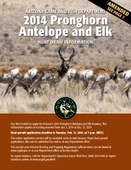
2013-14 Arizona Hunting Regulations - Arizona Game and Fish ...
2013-14 Arizona Hunting Regulations - Arizona Game and Fish ...
2013-14 Arizona Hunting Regulations - Arizona Game and Fish ...
- No tags were found...

Create successful ePaper yourself
Turn your PDF publications into a flip-book with our unique Google optimized e-Paper software.
<strong>Arizona</strong> <strong>Game</strong> <strong>and</strong> <strong>Fish</strong> Commission Rules About <strong>Hunting</strong>under these circumstances, an applicant shall submit allof the following to the <strong>Arizona</strong> <strong>Game</strong> <strong>and</strong> <strong>Fish</strong> Department,Draw Section, 2221 W. Greenway Rd., Phoenix, AZ85023:1. A letter from the applicant requesting reinstatementof bonus points;2. The hunt number for which the hunt permit-tag isvalid;3. Evidence of mobilization or duty status, such as aletter from the public agency or official orders;4. An official declaration of a state of emergency fromthe public agency or authority making the declarationof emergency, if applicable; <strong>and</strong>5. The valid, unused hunt permit-tag, which must bereceived before the beginning date of the hunt forwhich the hunt permit-tag is valid, or evidence ofmobilization or activation that precluded the applicantfrom submitting the tag before the beginningdate of the hunt.R12-4-108Management Unit BoundariesA. For the purpose of this Section, parentheses mean “alsoknown as,” <strong>and</strong> the following definitions shall apply:1. “FH” means “forest highway,” a paved road.2. “FR” means “forest road,” an unpaved road.3. “Hwy” means “Highway.”4. “mp” means “milepost.”B. The state is divided into units for the purpose of managingwildlife. Each unit is identified by a number, ora number <strong>and</strong> letter. For the purpose of this Section,Indian reservation l<strong>and</strong> contained within any managementunit is not under the jurisdiction of the <strong>Arizona</strong><strong>Game</strong> <strong>and</strong> <strong>Fish</strong> Commission or the <strong>Arizona</strong> <strong>Game</strong> <strong>and</strong><strong>Fish</strong> Department.C. Management unit descriptions are as follows:Unit 1 – Beginning at the New Mexico state line <strong>and</strong> U.S.Hwy 60; west on U.S. Hwy 60 to Vernon Junction; southerlyon the Vernon-McNary road (FR 224) to the Fort WhiteMountain Apache Indian Reservation boundary; east <strong>and</strong>south along the reservation boundary to Black River; east<strong>and</strong> north along Black River to the east fork of Black River;north along the east fork to Three Forks; <strong>and</strong> continuingnorth <strong>and</strong> east on the Three Forks-Williams Valley-AlpineRd. (FR 249) to U.S. Hwy 180; east on U.S. Hwy 180 to theNew Mexico state line; north along the state line to U.S.Hwy 60.Unit 2B – Beginning at Springerville; east on U.S. Hwy 60to the New Mexico state line; north along the state line tothe Navajo Indian Reservation boundary; westerly along thereservation boundary to U.S. Hwy 191 (AZ Hwy 61); southon U.S. Hwy 191 (U.S. Hwy 180) to Springerville.Unit 2C -- Beginning at St. Johns on U.S. Hwy 191 (AZ Hwy61); west on to AZ Hwy 61 Concho; southwest on AZ Hwy61 to U.S. Hwy 60; east on U.S. Hwy 60 to U.S. Hwy 191(U.S. Hwy 180); north on U.S. Hwy 191 (U.S. Hwy 180) toSt. Johns.Unit 3A – Beginning at the junction of U.S. Hwy 180 <strong>and</strong> AZHwy 77; south on AZ Hwy 77 to AZ Hwy 377; southwesterlyon AZ Hwy 377 to AZ Hwy 277; easterly on AZ Hwy 277 toSnowflake; easterly on the Snowflake-Concho Rd. to U.S.Hwy 180A; north on U.S. Hwy 180A to U.S. Hwy 180; northwesterlyon U.S. Hwy 180 to AZ Hwy 77.Unit 3B – Beginning at Snowflake; southerly along AZ Hwy77 to U.S. Hwy 60; southwesterly along U.S. Hwy 60 to theWhite Mountain Apache Indian Reservation boundary; easterlyalong the reservation boundary to the Vernon-McNaryRd. (FR 224); northerly along the Vernon-McNary Rd. to U.S.Hwy 60; west on U.S. Hwy 60 to AZ Hwy 61; northeasterlyon AZ Hwy 61 to AZ Hwy 180A; northerly on AZ Hwy 180Ato Concho-Snowflake Rd.; westerly on the Concho-SnowflakeRd. to Snowflake.Unit 3C – Beginning at Snowflake; westerly on AZ Hwy 277to AZ Hwy 260; westerly on AZ Hwy 260 to the SitgreavesNational Forest boundary with the Tonto National Forest;easterly along the Apache-Sitgreaves National Forestboundary to U.S. Hwy 60 (AZ Hwy 77); northeasterly onU.S. Hwy 60 (AZ Hwy 77) to Showlow; northerly along AZHwy 77 to Snowflake.Unit 4A – Beginning on the boundary of the Apache-SitgreavesNational Forest with the Coconino National Forest atthe Mogollon Rim; north along this boundary (Leonard Canyon)to East Clear Creek; northerly along East Clear Creekto AZ Hwy 99; north on AZ Hwy 99 to AZ Hwy 87; northon AZ Hwy 87 to Business I-40 (3rd St.); west on BusinessI-40 (3rd St.) to Hipkoe Dr.; northerly on Hipkoe Dr. to I-40;west on I-40 to mp 221.4; north to the southwest corner ofthe Navajo Indian Reservation boundary; east along theNavajo Indian Reservation boundary to the Little ColoradoRiver; southerly along the Little Colorado River to ChevelonCreek; southerly along Chevelon Creek to Woods Canyon;westerly along Woods Canyon to Woods Canyon Lake Rd;westerly <strong>and</strong> southerly along the Woods Canyon Lake Rd. tothe Mogollon Rim; westerly along the Mogollon Rim to theboundary of the Apache-Sitgreaves National Forest with theCoconino National Forest.Unit 4B – Beginning at AZ Hwy 260 <strong>and</strong> the SitgreavesNational Forest boundary with the Tonto National Forest;northeasterly on AZ Hwy 260 to AZ Hwy 277; northeasterlyon AZ Hwy 277 to Hwy 377; northeasterly on AZ Hwy377 to AZ Hwy 77; northeasterly on AZ Hwy 77 to I-40 Exit286; northeasterly along the westbound lane of I-40 to Exit292; north on AZ Hwy 77 to the Navajo Indian Reservationboundary; west along the reservation boundary to the LittleColorado River; southerly along the Little Colorado River toChevelon Creek; southerly along Chevelon Creek to WoodsCanyon; westerly along Woods Canyon to Woods CanyonLake Rd.; westerly <strong>and</strong> southerly along the Woods CanyonLake Rd. to the Mogollon Rim; easterly along the MogollonRim to AZ Hwy 260.Unit 5A – Beginning at the junction of the SitgreavesNational Forest boundary with the Coconino National Forestboundary at the Mogollon Rim; northerly along this boundary(Leonard Canyon) to East Clear Creek; northeasterlyalong East Clear Creek to AZ Hwy 99; north on AZ Hwy 99to AZ Hwy 87; north on AZ Hwy 87 to Business I-40 (3rdSt.); west on Business I-40 (3rd St.) to Hipkoe Dr.; north onHipkoe Dr. to I-40; west on I-40 to the Meteor Crater Rd.(Exit 233); southerly on the Meteor Crater-Chavez Pass-Jack’s Canyon Rd. (FR 69) to AZ Hwy 87; southwesterlyalong AZ Hwy 87 to the Coconino-Tonto National Forestboundary; easterly along the Coconino-Tonto National Forestboundary (Mogollon Rim) to the Sitgreaves NationalForest boundary with the Coconino National Forest.Unit 5B – Beginning at Lake Mary-Clint’s Well Rd. (FH3) <strong>and</strong>Walnut Canyon (mp 337.5 on FH3); southeasterly on FH3 toAZ Hwy 87; northeasterly on AZ Hwy 87 to FR 69; westerly<strong>and</strong> northerly on FR 69 to I-40 (Exit 233); west on I-40 toWalnut Canyon (mp 210.2); southwesterly along WalnutCanyon to Walnut Canyon National Monument; southwesterlyalong the northern boundary of the Walnut CanyonNational Monument to Walnut Canyon; southwesterly alongWalnut Canyon to FH3 (mp 337.5).Unit 6A – Beginning at the junction of U.S. Hwy 89A <strong>and</strong>FR 237; southwesterly on U.S. Hwy 89A to the Verde River;southeasterly along the Verde River to Childs; easterly onthe Childs-Strawberry Rd. to Fossil Creek north on the creekto Fossil Springs; southeasterly on FS trail 18 (Fossil SpringTrail) to the top of the rim; northeasterly on the rim to NashPoint on the Tonto-Coconino National Forest boundary;easterly along this boundary to AZ Hwy 87; northeasterly onAZ Hwy 87 to Lake Mary-Clint’s Well Rd. (FH3); northwesterlyon FH3 to FR 132; southwesterly on FR 132 to FR 296;southwesterly on FR 296 to FR 296A; southwesterly on FR296A to FR 132; northwesterly on FR 132 to FR 235; westerlyon FR 235 to Priest Draw; southwesterly along the bottomof Priest Draw to FR 235; westerly on FR 235 to FR 235A;westerly on FR 235A to FR 235; southerly on FR 235 to FR235K; northwesterly on FR 235K to FR 700; northerly on FR700 to Mountainaire Rd.; west on Mountainaire Rd. to FR237; westerly on FR 237 to U.S. Hwy 89A except those portionsthat are sovereign tribal l<strong>and</strong>s of the Yavapai-ApacheNation.Unit 6B -- Beginning at mp 188.5 on I-40 at a point justnorth of the east boundary of Camp Navajo; south alongthe eastern boundary of Camp Navajo to the southeasterncorner of Camp Navajo; southeast approximately 1/3 milethrough the forest to the forest road in section 33; southeaston the forest road to FR 231 (Woody Mountain Rd.);easterly on FR 231 to FR 533; southerly on FR 533 to U.S.Hwy 89A; southerly on U.S. Hwy 89A to the Verde River;northerly along the Verde River to Sycamore Creek; northeasterlyalong Sycamore Creek <strong>and</strong> Volunteer Canyon to thesouthwest corner of the Camp Navajo boundary; northerlyalong the western boundary of Camp Navajo to the northwestcorner of Camp Navajo; continuing north to I-40 (mp180.0); easterly along I-40 to mp 188.5.Unit 7 – Beginning at the junction of AZ Hwy 64 <strong>and</strong> I-40(in Williams); easterly on I-40 to FR 171 (mp 184.4 on I-40);northerly on FR 171 to the Transwestern Gas Pipeline; easterlyalong the Transwestern Gas Pipeline to FR 420 (SchultzPass Rd.); northeasterly on FR 420 to U.S. Hwy 89; acrossU.S. Hwy 89 to FR 545; east on FR 545 to the Sunset CraterNational Monument; easterly along the southern boundaryof the Sunset Crater National Monument to FR 545; easton FR 545 to the 345 KV transmission lines 1 <strong>and</strong> 2; southeasterlyalong the power lines to I-40 (mp 212 on I-40); easton I-40 to mp 221.4; north to the southwest corner of theNavajo Indian Reservation boundary; northerly <strong>and</strong> westerlyalong the reservation boundary to the Four CornersGas Line; southwesterly along the Four Corners Gas Line toU.S. Hwy 180; west on U.S. Hwy 180 to AZ Hwy 64; south onAZ Hwy 64 to I-40.Unit 8 – Beginning at the junction of I-40 <strong>and</strong> U.S. Hwy 89(in Ash Fork, Exit <strong>14</strong>6); south on U.S. Hwy 89 to the VerdeRiver; easterly along the Verde River to Sycamore Creek;northerly along Sycamore Creek to Volunteer Canyon;northeasterly along Volunteer Canyon to the west boundaryof Camp Navajo; north along the boundary to a pointdirectly north of I-40; west on I-40 to U.S. Hwy 89.Unit 9 -- Beginning where Cataract Creek enters the HavasupaiReservation; easterly <strong>and</strong> northerly along the HavasupaiReservation boundary to Gr<strong>and</strong> Canyon National Park; easterlyalong the Gr<strong>and</strong> Canyon National Park boundary tothe Navajo Indian Reservation boundary; southerly alongthe reservation boundary to the Four Corners Gas Line;southwesterly along the Four Corners Gas Line to U.S.Hwy 180; westerly along U.S. Hwy 180 to AZ Hwy 64; southalong AZ Hwy 64 to Airpark Rd.; west <strong>and</strong> north along AirparkRd. to the Valle-Cataract Creek Rd.; westerly along theValle-Cataract Creek Rd. to Cataract Creek at Isl<strong>and</strong> Tank;northwesterly along Cataract Creek to the Havasupai ReservationBoundary.Unit 10 – Beginning at the junction of AZ Hwy 64 <strong>and</strong> I-40;westerly on I-40 to Crookton Rd. (AZ Hwy 66, Exit 139);westerly on AZ Hwy 66 to the Hualapai Indian Reservationboundary; northeasterly along the reservation boundary toGr<strong>and</strong> Canyon National Park; east along the park boundaryto the Havasupai Indian Reservation; easterly <strong>and</strong> southerlyalong the reservation boundary to where Cataract Creekenters the reservation; southeasterly along Cataract Creekin Cataract Canyon to Isl<strong>and</strong> Tank; easterly on the CataractCreek-Valle Rd. to Airpark Rd.; south <strong>and</strong> east along AirparkRd. to AZ Hwy 64; south on AZ Hwy 64 to I-40.Unit 11M – Beginning at the junction of Lake Mary-Clint’sWell Rd. (FH3) <strong>and</strong> Walnut Canyon (mp 337.5 on FH3);northeasterly along Walnut Canyon to the Walnut CanyonNational Monument boundary; northeasterly alongthe northern boundary of the Walnut Canyon NationalMonument to Walnut Canyon; northeasterly along WalnutCanyon to I-40 (mp 210.2); east on I-40 to the 345 KV116 <strong>Arizona</strong> <strong>Game</strong> <strong>and</strong> <strong>Fish</strong> Department — www.azgfd.gov