2013-14 Arizona Hunting Regulations - Arizona Game and Fish ...
2013-14 Arizona Hunting Regulations - Arizona Game and Fish ...
2013-14 Arizona Hunting Regulations - Arizona Game and Fish ...
- No tags were found...
You also want an ePaper? Increase the reach of your titles
YUMPU automatically turns print PDFs into web optimized ePapers that Google loves.
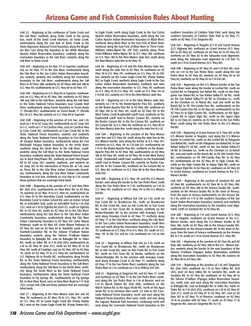
<strong>Arizona</strong> <strong>Game</strong> <strong>and</strong> <strong>Fish</strong> Commission Rules About <strong>Hunting</strong>Unit 23 – Beginning at the confluence of Tonto Creek <strong>and</strong>the Salt River; northerly along Tonto Creek to the springbox, north of the Tonto Creek Hatchery, on Tonto Creek;northeasterly along the east fork of Tonto Creek to theTonto-Sitgreaves National Forest boundary along the MogollonRim; east along this boundary to the White MountainApache Indian Reservation boundary; southerly along thereservation boundary to the Salt River; westerly along theSalt River to Tonto Creek.Unit 24A – Beginning on AZ Hwy 177 in Superior; southeasterlyon AZ Hwy 177 to the Gila River; northeasterly alongthe Gila River to the San Carlos Indian Reservation boundary;easterly, westerly <strong>and</strong> northerly along the reservationboundary to the Salt River; southwesterly along the SaltRiver to AZ Hwy 288; southerly on AZ Hwys 288 <strong>and</strong> 188 toU.S. Hwy 60; southwesterly on U.S. Hwy 60 to AZ Hwy 177.Unit 24B – Beginning on U.S. Hwy 60 in Superior; northeasterlyon U.S. Hwy 60 to AZ Hwy 188; northerly on AZ Hwys188 <strong>and</strong> 288 to the Salt River; westerly along the Salt Riverto the Tonto National Forest boundary near Granite ReefDam; southeasterly along Forest boundary to Forest Route77 (Peralta Rd.); southwesterly on Forest Route 77 (PeraltaRd.) to U.S. Hwy 60; easterly on U.S. Hwy 60 to Superior.Unit 25M – Beginning at the junction of 51st Ave. <strong>and</strong> I-10;west on I-10 to AZ Loop 303, northeasterly on AZ Loop 303to I-17; north on I-17 to Carefree Hwy; east on Carefree Hwyto Cave Creek Rd.; northeasterly on Cave Creek Rd. to theTonto National Forest boundary; easterly <strong>and</strong> southerlyalong the Tonto National Forest boundary to Fort McDowellYavapai Nation boundary; northeasterly along the FortMcDowell Yavapai Nation boundary to the Verde River;southerly along the Verde River to the Salt River; southwesterlyalong the Salt River to the Tonto National Forestboundary; southerly along the Tonto National Forest boundaryto Bush Hwy/Power Rd.; southerly on Bush Hwy/PowerRd to AZ Loop 202; easterly, southerly, <strong>and</strong> westerly onAZ Loop 202 to the intersection of Pecos Rd. at I-10; weston Pecos Rd. to the Gila River Indian Community boundary;northwesterly along the Gila River Indian Communityboundary to 51st Ave; northerly on 51st Ave to I-10; exceptthose portions that are sovereign tribal l<strong>and</strong>s.Unit 26M – Beginning at the junction of I-17 <strong>and</strong> New RiverRd. (Exit 232); southwesterly on New River Rd. to AZ Hwy74; westerly on AZ Hwy 74 to U.S. Hwy 93; southeasterly onU.S. Hwy 93 to the Beardsley Canal; southwesterly on theBeardsley Canal to Indian School Rd; west on Indian SchoolRd. to Jackrabbit Trail; south on Jackrabbit Trail to I-10 (Exit121); west on I-10 to Oglesby Rd (Exit112); south on OglesbyRd. to AZ Hwy 85; south on AZ Hwy 85 to the Gila River;northeasterly along the Gila River to the Gila River IndianCommunity boundary; southeasterly along the Gila RiverIndian Community boundary to AZ Hwy 347 (John WayneParkway); south on AZ Hwy 347 (John Wayne Parkway) toAZ Hwy 84; east on AZ Hwy 84 to Stanfield; south on theStanfield-Cocklebur Rd. to the Tohono O’odham Nationboundary; easterly along the Tohono O’odham Nationboundary to Battaglia Rd.; east on Battaglia Rd. to ToltecRd.; north on Toltec Rd. to I-10 (Exit 203); southeasterly onI-10 to AZ Hwy 87 (Exit 211); north on AZ Hwy 87 to AZHwy 287 north of Coolidge; east on AZ Hwy 287 to AZ Hwy79; north on AZ Hwy 79 to U.S. Hwy 60; northwesterly onU.S. Highway 60 to Peralta Rd.; northeasterly along PeraltaRd. to the Tonto National Forest boundary; northwesterlyalong the Tonto National Forest boundary to the Salt River;northeasterly along the Salt River to the Verde River; northerlyalong the Verde River to the Tonto National Forestboundary; northwesterly along the Tonto National Forestboundary to Fig Springs Rd.; southwesterly on Fig SpringsRd. to New River Road; west on New River Road to I-17 (Exit232); except Unit 25M <strong>and</strong> those portions that are sovereigntribal l<strong>and</strong>s.Unit 27 – Beginning at the New Mexico state line <strong>and</strong> AZHwy 78; southwest on AZ Hwy 78 to U.S. Hwy 191; northon U.S. Hwy 191 to Lower Eagle Creek Rd. (Pump StationRd.); west on the Lower Eagle Creek Rd. (Pump Station Rd.)118 <strong>Arizona</strong> <strong>Game</strong> <strong>and</strong> <strong>Fish</strong> Department — www.azgfd.govto Eagle Creek; north along Eagle Creek to the San CarlosApache Indian Reservation boundary; north along the SanCarlos Apache Indian Reservation boundary to Black River;northeast along Black River to the East Fork of Black River;northeast along the East Fork of Black River to Three Forks-Williams Valley-Alpine Rd. (FR 249); easterly along ThreeForks-Williams Valley-Alpine Rd. to U.S. Hwy 180; southeaston U.S. Hwy 180 to the New Mexico state line; south alongthe New Mexico state line to AZ Hwy 78.Unit 28 – Beginning at I-10 <strong>and</strong> the New Mexico state line;north along the state line to AZ Hwy 78; southwest on AZHwy 78 to U.S. Hwy 191; northwest on U.S. Hwy 191 to Clifton;westerly on the Lower Eagle Creek Rd. (Pump StationRd.) to Eagle Creek; northerly along Eagle Creek to the SanCarlos Indian Reservation boundary; southerly <strong>and</strong> westalong the reservation boundary to U.S. Hwy 70; southeaston U.S. Hwy 70 to U.S. Hwy 191; south on U.S. Hwy 191 toI-10 Exit 352; easterly on I-10 to the New Mexico state line.Unit 29 -- Beginning on I-10 at the New Mexico state line;westerly on I-10 to the Bowie-Apache Pass Rd.; southerlyon the Bowie-Apache Pass Rd. to AZ Hwy 186; southeast onAZ Hwy 186 to AZ Hwy 181; south on AZ Hwy 181 to theWest Turkey Creek-Kuykendall cutoff road; southerly on theKuykendall cutoff road to Rucker Canyon Rd.; easterly onthe Rucker Canyon Rd. to the Tex Canyon Rd.; southerly onTex Canyon Rd. to U.S. Hwy 80; northeast on U.S. Hwy 80 tothe New Mexico state line; north along the state line to I-10.Unit 30A -- Beginning at the junction of the New Mexicostate line <strong>and</strong> U.S. Hwy 80; south along the state line to theU.S.-Mexico border; west along the border to U.S. Hwy 191;northerly on U.S. Hwy 191 to I-10 Exit 331; northeasterly onI-10 to the Bowie-Apache Pass Rd.; southerly on the Bowie-Apache Pass Rd. to AZ Hwy 186; southeasterly on AZ Hwy186 to AZ Hwy 181; south on AZ Hwy 181 to the West TurkeyCreek - Kuykendall cutoff road; southerly on the Kuykendallcutoff road to Rucker Canyon Rd.; easterly on Rucker CanyonRd. to Tex Canyon Rd.; southerly on Tex Canyon Rd. toU.S. Hwy 80; northeast on U.S. Hwy 80 to the New Mexicostate line.Unit 30B -- Beginning at U.S. Hwy 191 <strong>and</strong> the U.S.-Mexicoborder; west along the border to the San Pedro River; northalong the San Pedro River to I-10; northeasterly on I-10 toU.S. Hwy 191; southerly on U.S. Hwy 191 to the U.S.-Mexicoborder.Unit 31 -- Beginning at Willcox Exit 340 on I-10; north onFort Grant Rd. to Brookerson Rd.; north on BrookersonRd. to Ash Creek Rd.; west on Ash Creek Rd. to Fort GrantRd.; north on Fort Grant Rd. to Bonita; northerly on theBonita-Klondyke Rd. to the junction with Aravaipa Creek;west along Aravaipa Creek to AZ Hwy 77; northerly alongAZ Hwy 77 to the Gila River; northeast along the Gila Riverto the San Carlos Indian Reservation boundary; south theneast <strong>and</strong> north along the reservation boundary to U.S. Hwy70; southeast on U.S. Hwy 70 to U.S. Hwy 191; south on U.S.Hwy 191 to the 352 exit on I-10; southwest on I-10 to Exit340.Unit 32 -- Beginning at Willcox Exit 340 on I-10; north onFort Grant Rd. to Brookerson Rd.; north on BrookersonRd. to Ash Creek Rd.; west on Ash Creek Rd. to Fort GrantRd.; north on Fort Grant Rd. to Bonita; northerly on theBonita-Klondyke Rd. to the junction with Aravaipa Creek;west along Aravaipa Creek to AZ Hwy 77; southerly alongAZ Hwy 77 to the San Pedro River; southerly along the SanPedro River to I-10; northeast on I-10 to Willcox Exit 340.Unit 33 – Beginning at Tangerine Rd. <strong>and</strong> AZ Hwy 77; north<strong>and</strong> northeast on AZ Hwy 77 to the San Pedro River; southeastalong the San Pedro River to I-10 at Benson; west onI-10 to Marsh Station Rd. (Exit 289); northwest on theMarsh Station Rd. to the Agua Verde Rd.; north on the AguaVerde Rd. to its terminus then north 1/2 mile to the CoronadoNational Forest boundary; north <strong>and</strong> west along theNational Forest boundary; then west, north, <strong>and</strong> east alongthe Saguaro National Park boundary; continuing north <strong>and</strong>west along the Coronado National Forest boundary to thesouthern boundary of Catalina State Park; west along thesouthern boundary of Catalina State Park to AZ Hwy 77;north on AZ Hwy 77 to Tangerine Rd.Unit 34A – Beginning in Nogales at I-19 <strong>and</strong> Gr<strong>and</strong> Avenue(U.S. Highway 89); northeast on Gr<strong>and</strong> Avenue (U.S. Hwy.89) to AZ Hwy 82; northeast on AZ Hwy 82 to AZ Hwy 83;northerly on AZ Hwy 83 to the Sahuarita road alignment;west along the Sahuarita road alignment to I-19 Exit 75;south on I-19 to Gr<strong>and</strong> Avenue (U.S. Hwy 89).Unit 34B – Beginning at AZ Hwy 83 <strong>and</strong> I-10 Exit 281; easterlyon I-10 to the San Pedro River; south along the SanPedro River to AZ Hwy 82; westerly on AZ Hwy 82 to AZHwy 83; northerly on AZ Hwy 83 to I-10 Exit 281.Unit 35A – Beginning on the U.S.-Mexico border at the SanPedro River; west along the border to Lochiel Rd.; north onLochiel Rd. to Patagonia San Rafael Rd.; north on the PatagoniaSan Rafael Rd. to San Rafael Valley-FS 58 Rd.; northon the San Rafael Valley-FS 58 Rd. to Christian Ln.; northon the Christian Ln. to Ranch Rd.; east <strong>and</strong> north on theRanch Rd. to FR 799-Canelo Pass Rd.; northeasterly on theFR 799-Canelo Pass Rd. to AZ Hwy 83; northwesterly on theAZ Hwy 83 to Elgin Canelo Rd.; northeasterly on the Elgin-Canelo Rd. to Upper Elgin Rd.; north on the Upper ElginRd. to AZ Hwy 82; easterly on AZ Hwy 82 to the San PedroRiver; south along the San Pedro River to the U.S.-Mexicoborder.Unit 35B – Beginning at Gr<strong>and</strong> Avenue (U.S. Hwy 89) at theU.S.-Mexico border in Nogales; east along the U.S.-Mexicoborder to Lochiel Rd.; north on the Lochiel Rd. to PatagoniaSan Rafael Rd.; north on the Patagonia San Rafael Rd. to SanRafael Valley-FS 58 Rd.; north on the San Rafael Valley-FS58 Rd. to Christian Ln.; north on the Christian Ln. to RanchRd.; east <strong>and</strong> north on the Ranch Rd. to FR 799-Canelo PassRd.; northeasterly on FR 799-Canelo Pass Rd. to AZ Hwy83; northwesterly on the AZ Hwy 83 to Elgin Canelo Rd.;north on the Elgin Canelo Rd. to Upper Elgin Rd.; north onthe Upper Elgin Rd. to AZ Hwy 82; southwest on AZ Hwy 82to Gr<strong>and</strong> Avenue; southwest on Gr<strong>and</strong> Avenue to the U.S.-Mexico border.Unit 36A – Beginning at the junction of S<strong>and</strong>ario Rd. <strong>and</strong>AZ Hwy 86; southwesterly on AZ Hwy 86 to AZ Hwy 286;southerly on AZ Hwy 286 to the Arivaca-Sasabe Rd.; southeasterlyon the Arivaca-Sasabe Rd. to the town of Arivaca;from the town of Arivaca northeasterly on the Arivaca Rd.to I-19; north on I-19 to the southern boundary of the SanXavier Indian Reservation boundary; westerly <strong>and</strong> northerlyalong the reservation boundary to the S<strong>and</strong>ario road alignment;north on S<strong>and</strong>ario Rd. to AZ Hwy 86.Unit 36B – Beginning at I-19 <strong>and</strong> Gr<strong>and</strong> Avenue (U.S. Hwy89) in Nogales; southwest on Gr<strong>and</strong> Avenue to the U.S.-Mexico border; west along the U.S.-Mexico border to AZHwy 286; north on AZ Hwy 286 to the Arivaca-Sasabe Rd.;southeasterly on the Arivaca-Sasabe Rd. to the town of Arivaca;from the town of Arivaca northeasterly on the ArivacaRd. to I-19; south on I-19 to Gr<strong>and</strong> Avenue (U.S. Hwy 89).Unit 36C -- Beginning at the junction of AZ Hwy 86 <strong>and</strong> AZHwy 286; southerly on AZ Hwy 286 to the U.S.- Mexico border;westerly along the border to the east boundary of theTohono O’odham (Papago) Indian Reservation; northerlyalong the reservation boundary to AZ Hwy 86; easterly onAZ Hwy 86 to AZ Hwy 286.Unit 37A -- Beginning at the junction of I-10 <strong>and</strong> TangerineRd. (Exit 240); southeast on I-10 to Avra Valley Rd. (Exit242); west on Avra Valley Rd. to S<strong>and</strong>ario Rd.; south onS<strong>and</strong>ario Rd. to AZ Hwy 86; southwest on AZ Hwy 86 tothe Tohono O’odham (Papago) Indian Reservation boundary;north, east, <strong>and</strong> west along the reservation boundaryto Battaglia Rd.; east on Battaglia Rd. to Toltec Rd.; north onToltec Rd. to I-10 (Exit 203); southeast on I-10 to AZ Hwy 87(Exit 211); north on AZ Hwy 87 to AZ Hwy 287; east on AZHwy 287 to AZ Hwy 79 at Florence; southeast on AZ Hwy79 to its junction with AZ Hwy 77; south on AZ Hwy 77 toTangerine Rd.; west on Tangerine Rd. to I-10.


