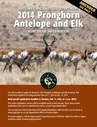
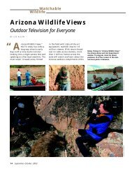
2013-14 Arizona Hunting Regulations - Arizona Game and Fish ...
2013-14 Arizona Hunting Regulations - Arizona Game and Fish ...
2013-14 Arizona Hunting Regulations - Arizona Game and Fish ...
- No tags were found...

You also want an ePaper? Increase the reach of your titles
YUMPU automatically turns print PDFs into web optimized ePapers that Google loves.
<strong>Arizona</strong> <strong>Game</strong> <strong>and</strong> <strong>Fish</strong> Commission Rules About <strong>Hunting</strong>Unit 37B -- Beginning at the junction of AZ Hwy 79 <strong>and</strong> AZHwy 77; northwest on AZ Hwy 79 to U.S. Hwy 60; east onU.S. Hwy 60 to AZ Hwy 177; southeast on AZ Hwy 177 toAZ Hwy 77; southeast <strong>and</strong> southwest on AZ Hwy 77 to AZHwy 79.Unit 38M -- Beginning at the junction of I-10 <strong>and</strong> TangerineRd. (Exit 240); southeast on I-10 to Avra Valley Rd. (Exit242); west on Avra Valley Rd. to S<strong>and</strong>ario Rd.; south onS<strong>and</strong>ario Rd. to the San Xavier Indian Reservation boundary;south <strong>and</strong> east along the reservation boundary to I-19;south on I-19 to Sahuarita Rd. (Exit 75); east on SahuaritaRd. to AZ Hwy 83; north on AZ Hwy 83 to I-10 (Exit 281);east on I-10 to Marsh Station Rd. (Exit 289); northwest onMarsh Station Rd. to the Agua Verde Rd.; north on the AguaVerde Rd. to its terminus, then north 1/2 mile to the CoronadoNational Forest boundary; north <strong>and</strong> west along theNational Forest boundary, then west, north, <strong>and</strong> east alongthe Saguaro National Park boundary; continuing north <strong>and</strong>west along the Coronado National Forest boundary to thesouthern boundary of Catalina State Park; west along thesouthern boundary of Catalina State Park to AZ Hwy 77;north on AZ Hwy 77 to Tangerine Rd.; west on Tangerine Rd.to I-10.Unit 39 – Beginning at AZ Hwy 85 <strong>and</strong> the Gila River; eastalong the Gila River to the western boundary of the GilaRiver Indian Reservation; southeasterly along the reservationboundary to AZ Hwy 347 (John Wayne Parkway); southon AZ Hwy 347 (John Wayne Parkway) to AZ Hwy 84; easton AZ Hwy 84 to Stanfield; south on the Stanfield-CockleburRd. to I-8; westerly on I-8 to Exit 87; northerly on the AguaCaliente Rd. to the Hyder Rd.; northeasterly on Hyder Rd.to 555th Ave.; north on 555th Ave. to Lahman Rd.; east onLahman Rd., which becomes Agua Caliente Rd.; northeasterlyon Agua Caliente Rd. to Old Hwy 80; northeasterly onOld Hwy 80 to <strong>Arizona</strong> Hwy 85; southerly on AZ Hwy 85to the Gila River; except those portions that are sovereigntribal l<strong>and</strong>s of the Tohono O’odham Nation <strong>and</strong> the Ak-ChinIndian Community.Unit 40A -- Beginning at Ajo; southeasterly on AZ Hwy 85 toWhy; southeasterly on AZ Hwy 86 to the Tohono O’odham(Papago) Indian Reservation; northerly <strong>and</strong> easterly alongthe reservation boundary to the Cocklebur-Stanfield Rd.;north on the Cocklebur-Stanfield Rd. to I-8; westerly on I-8to AZ Hwy 85; southerly on AZ Hwy 85 to Ajo.Unit 40B – Beginning at Gila Bend; westerly on I-8 to theColorado River; southerly along the Colorado River to theMexican border at San Luis; southeasterly along the borderto the Cabeza Prieta National Wildlife Refuge; northerly,easterly <strong>and</strong> southerly around the refuge boundary to theMexican border; southeast along the border to the TohonoO’odham (Papago) Indian Reservation; northerly along thereservation boundary to AZ Hwy 86; northwesterly on AZHwy 86 to AZ Hwy 85; north on AZ Hwy 85 to Gila Bend;except those portions that are sovereign tribal l<strong>and</strong>s of theCocopah Tribe.Unit 41 – Beginning at I-8 <strong>and</strong> U.S. Hwy 95 (in Yuma); easterlyon I-8 to exit 87; northerly on the Agua Caliente Rd. tothe Hyder Rd.; northeasterly on Hyder Rd. to 555th Ave.;north on 555th Ave. to Lahman Rd.; east on Lahman Rd.,which becomes Agua Caliente Rd.; northeasterly on AguaCaliente Rd. to Old Hwy 80; northeasterly on Old Hwy 80to <strong>Arizona</strong> Hwy 85; northerly on AZ Hwy 85 to OglesbyRd.; north on Oglesby Rd. to I-10; westerly on I-10 to Exit45; southerly on Vicksburg-Kofa National Wildlife RefugeRd. to the Refuge boundary; easterly, southerly, westerly,<strong>and</strong> northerly along the boundary to the Castle Dome Rd.;southwesterly on the Castle Dome Rd. to U.S. Hwy 95;southerly on U.S. Hwy 95 to I-8.Unit 42 – Beginning at the junction of the Beardsley Canal<strong>and</strong> U.S. Hwy 93 (U.S. 89, U.S. 60); northwesterly on U.S.Hwy 93 to AZ Hwy 71; southwesterly on AZ Hwy 71 to U.S.Hwy 60; westerly on U.S. Hwy 60 to Aguila; south on theEagle Eye Rd. to the Salome-Hassayampa Rd.; southeasterlyon the Salome-Hassayampa Rd. to I-10 (Exit 81); easterlyon I-10 to Jackrabbit Trail (Exit 121); north along JackrabbitTrail to the Indian School road; east along Indian School Rd.to the Beardsley Canal; northeasterly along the BeardsleyCanal to U.S. Hwy 93.Unit 43A – Beginning at U.S. Hwy 95 <strong>and</strong> the Bill WilliamsRiver; west along the Bill Williams River to the <strong>Arizona</strong>-Californiastate line; southerly to the south end of Cibola Lake;northerly <strong>and</strong> easterly on the Cibola Lake Rd. to U.S. Hwy95; south on U.S. Hwy 95 to the Stone Cabin-King Valley Rd.(King Rd.); east along the Stone Cabin-King Valley Rd. (KingRd.) to the west boundary of the Kofa National WildlifeRefuge; northerly along the refuge boundary to the CrystalHill Rd. (Blevens Rd.); northwesterly on the Crystal Hill Rd.(Blevens Rd.) to U.S. Hwy 95; northerly on U.S. Hwy 95 tothe Bill Williams River; except those portions that are sovereigntribal l<strong>and</strong>s of the Colorado River Indian Tribes.Unit 43B – Beginning at the south end of Cibola Lake;southerly along the <strong>Arizona</strong>-California state line to I-8;southeasterly on I-8 to U.S. Hwy 95; easterly <strong>and</strong> northerlyon U.S. Hwy 95 to the Castle Dome road; northeast onthe Castle Dome Rd. to the Kofa National Wildlife Refugeboundary; north along the refuge boundary to the StoneCabin-King Valley Rd. (King Rd.); west along the StoneCabin-King Valley Rd. (King Rd.) to U.S. Hwy 95; northon U.S. Hwy 95 to the Cibola Lake Rd.; west <strong>and</strong> southon the Cibola Lake Rd. to the south end of Cibola Lake;except those portions that are sovereign tribal l<strong>and</strong>s of theQuechan Tribe.Unit 44A – Beginning at U.S. Hwy 95 <strong>and</strong> the Bill WilliamsRiver; south along U.S. Hwy 95 to AZ Hwy 72; southeasterlyon AZ Hwy 72 to Vicksburg; south on the Vicksburg-KofaNational Wildlife Refuge Rd. to I-10; easterly on I-10 to theSalome-Hassayampa Rd. (Exit 81); northwesterly on theSalome-Hassayampa Rd. to Eagle Eye Rd.; northeasterly onEagle Eye Rd. to Aguila; east on U.S. Hwy 60 to AZ Hwy 71;northeasterly on AZ Hwy 71 to U.S. Hwy 93; northwesterlyon U.S. Hwy 93 to the Santa Maria River; westerly along theSanta Maria <strong>and</strong> Bill Williams rivers to U.S. Hwy 95; exceptthose portions that are sovereign tribal l<strong>and</strong>s of the ColoradoRiver Indian Tribes.Unit 44B – Beginning at Quartzsite; south on U.S. Hwy 95to the Crystal Hill Rd. (Blevens Rd.); east on the Crystal HillRd. (Blevens Rd.) to the Kofa National Wildlife Refuge; north<strong>and</strong> east along the refuge boundary to the Vicksburg-KofaNational Wildlife Refuge Rd.; north on the Vicksburg-KofaNational Wildlife Refuge Rd. to AZ Hwy 72; northwest on AZHwy 72 to U.S. Hwy 95; south on U.S. Hwy 95 to Quartzsite.Unit 45A – Beginning at the junction of the Stone Cabin-King Valley Rd. (King Rd.) <strong>and</strong> Kofa National Wildlife Refugeboundary; east on the Stone Cabin-King Valley Rd. (KingRd.) to O-O Junction; north from O-O Junction on the KofaMine Rd. to the Evening Star Mine; north on a line overPolaris Mountain to Midwell-Alamo Spring-Kofa Cabin Rd.(Wilbanks Rd.); north on the Midwell-Alamo Spring-KofaCabin Rd. (Wilbanks Rd.) to the El Paso Natural Gas PipelineRd.; north on a line from the junction to the north boundaryof the Kofa National Wildlife Refuge; west <strong>and</strong> south on theboundary line to Stone Cabin-King Valley Rd. (King Rd.).Unit 45B – Beginning at O-O Junction; north from O-OJunction on the Kofa Mine Rd. to the Evening Star Mine;north on a line over Polaris Mountain to Midwell-AlamoSpring-Kofa Cabin Rd. (Wilbanks Rd.); north on the Midwell-Alamo Spring-Kofa Cabin Rd. (Wilbanks Rd.) to the El PasoNatural Gas Pipeline Rd.; north on a line from the junctionto the north Kofa National Wildlife Refuge boundary; eastto the east refuge boundary; south <strong>and</strong> west along the KofaNational Wildlife Refuge boundary to the Stone Cabin-KingValley Rd. (Wellton-Kofa Rd./Ave 40E); north <strong>and</strong> west onthe Stone Cabin-King Valley Rd. (Wellton-Kofa Rd./Ave 40E)to O-O Junction.Unit 45C – Beginning at the junction of the Stone Cabin-King Valley Rd. (King Rd.) <strong>and</strong> Kofa National WildlifeRefuge; south, east, <strong>and</strong> north along the refuge boundary tothe Stone Cabin-King Valley Rd. (King Rd.); north <strong>and</strong> weston the Stone Cabin-King Valley Rd. (King Rd.) to the junctionof the Stone Cabin-King Valley Rd. (King Rd.) <strong>and</strong> KofaNational Wildlife Refuge boundary.Unit 46A -- That portionof the Cabeza Prieta National Wildlife Refuge east of theYuma-Pima County line.Unit 46B -- That portion of the Cabeza Prieta National WildlifeRefuge west of the Yuma-Pima County line.R12-4-110Posting <strong>and</strong> Access to State L<strong>and</strong>A. For the purpose of this Section:1. “Corrals,” “feed lots,” or “holding pens” meancompletely fenced areas used to contain livestockfor purposes other than grazing, including feeding,roundup, br<strong>and</strong>ing, doctoring, <strong>and</strong> other relatedpurposes.2. “Existing road” means any maintained or unmaintainedroad, way, highway, trail or path that hasbeen used for motorized vehicular travel <strong>and</strong> clearlyshows or has a history of established vehicle use.3. “State l<strong>and</strong>s” means all l<strong>and</strong> owned or held in trustby the state that is managed by the State L<strong>and</strong>Department <strong>and</strong> l<strong>and</strong>s that are owned or managedby the <strong>Game</strong> <strong>and</strong> <strong>Fish</strong> Commission.B. In addition to those prohibitions against posting inA.R.S. § 17-304, an individual shall not lock a gate, constructa fence, place an obstacle or otherwise commitan act that denies legally available access to or use ofany existing road upon state l<strong>and</strong>s by persons lawfullytaking or retrieving wildlife. An individual in violationof this Section shall take immediate corrective action toremove any lock, fence, or other obstacle that unlawfullyblocks access to state l<strong>and</strong>s. If immediate correctiveaction is not taken, a representative of the Departmentmay remove any unlawful posting <strong>and</strong> remove any lock,fence, or other obstacle that unlawfully blocks access tostate l<strong>and</strong>s. In addition, the Department may take appropriatelegal action to recover expenses incurred in theremoval of any unlawful posting or obstacle that blocksaccess to state l<strong>and</strong>.C. The provisions of this Section do not allow any individualto trespass upon private l<strong>and</strong> to gain access to state l<strong>and</strong>.D. An individual may post state l<strong>and</strong>s within 1/4 mile of anyoccupied residence, cabin, lodge, or other building <strong>and</strong>l<strong>and</strong>s within corrals, feed lots, or holding pens containingconcentrations of livestock other than for grazingpurposes as closed to hunting, fishing, or trapping withoutfurther action by the Commission.E. An individual may post state l<strong>and</strong>s other than thosereferred to in subsection (D) as closed to hunting, fishing,or trapping only if the individual has obtained apermit from the Commission, <strong>and</strong> the Commissiondetermines that the closing is necessary:1. Because the taking of wildlife constitutes an unusualhazard to permitted users;2. To prevent unreasonable destruction of plant life orhabitat; or3. For proper resource conservation, use, or protection,including but not limited to high fire danger,excessive interference with mineral development,developed agricultural l<strong>and</strong>, or timber or livestockoperations.F. An individual shall submit an application for postingstate l<strong>and</strong> to prohibit hunting, fishing, or trapping undersubsection (E), or to close an existing road under subsection(J), as required by R12-4-610. If an application toclose state l<strong>and</strong> to hunting, fishing, or trapping is madeby an individual other than the state l<strong>and</strong> lessee, theDepartment shall provide notice to the lessee <strong>and</strong> theState L<strong>and</strong> Commissioner before the Commission considersthe application. The state l<strong>and</strong> lessee or the StateL<strong>and</strong> Commissioner shall file any objections in writingwithin 30 days after receipt of notice, after which theGetting Started,License <strong>and</strong> Fees Laws, Rules <strong>and</strong> Legal Methods of Take<strong>2013</strong>-<strong>14</strong> <strong>Arizona</strong> <strong>Hunting</strong> <strong>Regulations</strong> 119