three well site check bldg lch-4022
three well site check bldg lch-4022
three well site check bldg lch-4022

You also want an ePaper? Increase the reach of your titles
YUMPU automatically turns print PDFs into web optimized ePapers that Google loves.
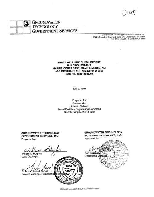
GR~uNDWATERTECHNOLOGYGroundwater Technolo@ Government Services, Inc.1244 B Executive Boulevard, Suite 106, Chesapeake, VA 23320Tel: (804) 431i7881 Fax: (804) 43(i2312THREE WELL SITE CHECK REPORTBUILDING LCH-<strong>4022</strong>MARINE CORPS BASE, CAMP LEJEUNE,A&E CONTRACT NO: N62470-91-D-6652JOB NO. 630011068.13NCJuly 9, 1993Prepared for:CommanderAtlantic DivisionNaval Facilities Engineering CommandNorfolk, Virginia 2351 l-6287GROUNDWATER TECHNOLOGY GROUNDWATER TECHNOLOGYGOVERNMENT SERVICES, INC. GOVERNMENT SERVICES, INC.Prepared by: Approved by:. Ilo!!!William L. HughesLead GeologistOffices throughout the U.S., Canada and Overseas
TABLE OF CONTENTSPAGEl.OlNTRODUCTlON ........................................................... 11.1 Definition of Terms .................................................... 12.0 BACKGROUND ............................................................. 32.1 Site Description ....................................................... 32.2 Land and Water Use ................................................... 32.3 Regional Geology ..................................................... 32.4 Regional Hydrogeology ................................................. 73.0 INVESTIGATIVE METHODS .................................................... 83.1 Soil Sampling and Monitoring Well Installation ................................. 83.2 Groundwater Sampling ................................................. 93.3 Well Elevation Survey .................................................. 93.4 Groundwater Monitoring ................................................ 94.0 INVESTIGATIVERESULTS ................................................... 114.1SiteGeology ........................................................ 114.2SiteHydrogeology ................................................... 114.3 Presence of Hydrocarbons ............................................. 114.3.1 Adsorbed-Phase Hydrocarbons ................................... 114.3.2 Dissolved-Phase Hydrocarbons ................................... 154.3.3 Liquid-Phase Hydrocarbons ..................................... 154.4 Drill Cutting and Purge Water Disposal ..................................... 164.5TechnicalSummary ................................................... 175.0 RECOMMENDATIONS . . . . . . . . . . . . . . . . . . . . . . . . . . . . . . . . . . . . . . . . . . . . . . . . . . . . . . . 186.0 REFERENCES............................................................. 19
LIST OF FIGURESPAGEFigure 1: Site Location Map .................................................. 5Figure 2: SiteMap ........................................................ 6Figure 3: Potentiometric Surface and Dissolved-Phase Hydrocarbon Distribution Map ....... 12Figure 4: Adsorbed-Phase Hydrocarbon Distribution Map ............................. 13LIST OF TABLESTable 1: Summary of Soil Sample Analytical Results, March 26, 1993 .................. 14Table 2: Summary of Groundwater Sample Analytical Results, March 29, 1993 ........... 15LIST OF APPENDICESAppendix A: Geologic Well LogsAppendix B: Soil and Groundwater Sample Analytical Laboratory Reports with Chain-of-CustodyRecordAppendix C: Well Survey DataAppendix D: Well Gauging DataAppendix E: Waste Management Documentation
1 .O INTRODUCTIONGroundwater Technology Government Services, Inc. (GSI) contracted by the Atlantic Division (LANTDIV)Naval Facilities Engineering Command (NAVFACENGCOM) of the Department of the Navy to conduct a<strong>site</strong> <strong>check</strong> to identify and/or verify suspected hydrocarbon-impacted subsurface soils and groundwater.The <strong>site</strong> <strong>check</strong> was performed at Building LCH-<strong>4022</strong> located at Marine Corps Base, Camp Lejeune,North Carolina.This <strong>site</strong> <strong>check</strong> is based on the NAVFAC contractual requirements. Our efforts included severalactivities:nDrilling of <strong>three</strong> soil borings;1 Installation of <strong>three</strong> monitoring <strong>well</strong>s (LCH<strong>4022</strong>-1, LCH<strong>4022</strong>-2 and LCH<strong>4022</strong>-3) tofacilitate groundwater sampling;n Collection of soil and groundwater samples for laboratory analyses forpetroleum hydrocarbon concentrations;w Surveying of monitoring <strong>well</strong>s for location and elevation;n Determination of groundwater flow direction and gradient; andn Characterization, removal and treatment/disposal of soil cuttings and purgedgroundwater generated during field activities.Subsequent sections of this report will describe <strong>site</strong> background information; <strong>site</strong> conditions in terms ofphysiography, geology and hydrogeology; and results of the field investigations including the evaluationfor and concentrations of any petroleum hydrocarbons in the subsurface soils and groundwater.1.1 Definition of TermsThis section defines the four phases which petroleum hydrocarbons may exist in the subsurface. Liquidphasehydrocarbons are liquids that may exist in the subsurface as an immobile residual liquid in theunsaturated zone and capillary fringe or free mobile liquids that migrate near the top of the capillaryfringe. Dissolved-phase hydrocarbons are liquid-phase hydrocarbons which have dissolved in thegroundwater. The tendency for hydrocarbons to transfer to the dissolved phase is a result of the degreeof mixing and contact, and the solubility of the released substance in the groundwater. Dissolved-phasehydrocarbons can be present in infiltrating water in the unsaturated zone, the capillary fringe and in the1
groundwater of the saturated zone. Vapor-phase hydrocarbons are liquid-phase hydrocarbons that havetransferred into the vapor phase as the result of volatilization. Vapor-phase result hydrocarbons can bepresent In the pore spaces of the unsaturated zone or as small bubbles in the saturated zone.Adsorbed-phase hydrocarbons are liquid- or dissolved-phase hydrocarbons that cover the surfaces ofsediment in the saturated and unsaturated zone.2
2.0 BACKGROUND2.1 Site DescriptionThe <strong>site</strong> is located on the north side of Marine Corps Base, Camp Lejeune, North Carolina (Figure 1).The <strong>site</strong> map (Figure 2) illustrates the location of the Building LCH-<strong>4022</strong>, and the location of the installed<strong>well</strong>s. According to past documents, one steel 1 ,OOO-gallon capacity underground storage tank (UST)used to store fuel oil was excavated and removed on June 28, 1992. GSI could not identify anyinformation documenting the age or condition of the UST when removed. According to the TankRemoval Report prepared for the <strong>site</strong> by Environmental and Regulatory Consultants, Inc.-onSeptember 17, 1992, two soil samples were collected for laboratory analysis during excavation activities.The samples were analyzed for the presence of total petroleum hydrocarbons (TPH)-asdiesel andTPH-as-gasoline by U.S. Environmental Protection Agency (EPA) Methods 3550 and 5030, respectively.Analytical results from the Tank Removal Report indicate that the soil sample collected at 2 feet belowthe north end of the UST contained 599 parts per million (ppm) TPH-as-gasoline and 4,300 ppm TPH-asdiesel.The soil sample collected at the same depth from the south end of the excavation contained 699ppm TPH-as-gasoline and 14,900 ppm TPH-asdiesel.2.2 Land and Water UseBuilding LCH-<strong>4022</strong> is located approximately 2,500 feet south of Mott Creek. The area immediatelyadjacent Building LCH-<strong>4022</strong> is comprised of buildings that house the Base personnel. The <strong>site</strong> issituated in an area dominated by relatively flat topography. The nearest body of surface water is MottCreek to the north. Potable water for the base is supplied by <strong>well</strong>s located approximately 1.5 milestowards the west that tap the Castle Hayne aquifer.2.3 Regional GeologyThe coastal plain consists of a layered sequence of unconsolidated sand, gravel, silt, and clay depositsof Miocene to Holocene age. These deposits and formations of Lower Cretaceous age, which overliebedrock of Pre-Cretaceous age, thicken and dip eastward with a thickness of 1,500 feet in the Camp *Lejeune area (Harned et al., 1989). The geologic units in the area are divided into six formations: the3
Castle Hayne Formation of the Eocene Series; the River Bend Formation of the Oligocene Series; theBelgrade, Pungo River, and Eastover Formations of the Miocene Series; the Yorktown Formation of thePliocene Series; and undifferentiated units of the Quaternary Series. The Castle Hayne Formation iscomposed of limestones and marls. The Castle Hayne Formation is overlain by the River BendFormation.4GFKWNDWATER%%%iii;SERVICIZS
!Jz!xm+ MONITORING WELLFORMER 1,000 GALLONFUEL OIL LISTBUILDINGLCH-40’22INILCH<strong>4022</strong>-2 ++ LCH<strong>4022</strong>-30doSCALEFEETSOURCE: BOBBIll SURVMNG. PA (5/5/93)1244-B EXECUM BLVD.CHES*PwE, “A. 23320(804) 436-7681REV. NO.:DRAWlNG DATE:4/l 3/93 Acm ‘lE: <strong>4022</strong>-STECLIENT:IANTDIVSITE MAPNAVFACENGCOMLOCATION:BUILDING LCH-<strong>4022</strong>PE/RC:MARINE CORPS BASE, CAMP CEJEUNE. N.C.DESIGNED: DElAILF.D: PROJECT NO.: FIGURE:BH PJC 830011088.1301 2_.. - -.. ..-- ---.. ..- -
3.0 INVESTIGATIVE METHODS3.1 Soil Sampling and Monitoring Well InstallationTo investigate for the presence/absence of adsorbed-phase hydrocarbons in the soils beneath the <strong>site</strong>,<strong>three</strong> soil borings (LCH<strong>4022</strong>-1, LCH<strong>4022</strong>-2 and LCH<strong>4022</strong>-3) were drilled to a depth of 20 feet on March26, 1993. All drilling activities were performed by a trailer-mounted drill rig equipped with lo-inch outsidediameter hollow stem augers, and all soil samples were collected with a split-spoon core samplingdevice. Before and between drilling each borehole, all augers and drill rods were steam cleaned. Allsplit-spoon sampling devices were cleaned with an alconox wash followed by a distilled water rinse aftereach sampling event. During drilling, a geologist logged soil samples and drill cuttings for soilclassification. Collection of split-spoon samples occurred at each of the following depths: 0.0 to 1.5 feet(ft.), 3.5 to 5.0 ft., 8.5 to 10.0 ft., 13.5 to 15.0 ft., and 18.5 to 20.0 ft. below grade surface. A portion ofeach core sample was placed into the appropriate laboratory container, sealed, labelled and stored onice. The remainder of each core sample was placed into a labelled air-tight container which waspermitted to warm to ambient temperature where any hydrocarbons, if present, would volatilize. Afterthe equilibration period, each sample was scanned with a photo-ionization detector (PID) by inserting thesampling probe into the head space of the container and a reading was recorded. The PID is a fieldmonitoring instrument used to measure volatile organic constituents in parts per million (ppm). All thePID readings were recorded on the drill logs. Upon completion of each boring, the PID readings fromeach split-spoon sample were compared and the sample with the highest PID reading collected fromabove the saturated zone was selected for laboratory analysis. The corresponding sample was storedon ice in the laboratory container and was submitted to Groundwater Technology EnvironmentalLaboratories, Inc. (GTEL) for analysis. The samples were analyzed for the presence of total petroleumhydrocarbons (TPH) by gas chromatograph, flame-ionization detector by (GC-FID) by U.S.Environmental Protection Agency (EPA) Method 3550/8015.The soil borings were converted to two-inch diameter monitoring <strong>well</strong>s to allow for the collection ofgroundwater samples and to detect the presence/absence of liquid-phase hydrocarbons in thegroundwater. Locations of soil borings/monitoring <strong>well</strong>s are depicted on Figure 2. To counter theeffects of drilling and to maximize the hydraulic connection between the <strong>well</strong> and the surroundingaquifer, each <strong>well</strong> was developed using a surge and pump technique. This was accomplished byagitating the water in the <strong>well</strong> to remove the fine-grained sediments in the <strong>well</strong> screen and sand pack.8
compared to a common datum. Measurements made in the field included depth to water, depth toliquid-phase hydrocarbons (if present), and thickness of liquid-phase hydrocarbons (if present). If thepresence of liquid-phase hydrocarbons was indicated by measurements with the Interface Probe’“, aclear acrylic bailer was used to obtain a groundwater sample from the <strong>well</strong> for visual confirmation. Allmeasured liquid levels and all pertinent field observations were immediately recorded in a bound fieldbook to provide a permanent record of the <strong>site</strong> visit.10GOVERNMENT SERVICES
METHOD 3550/8015(ppm)FORMER 1.000 GALLONFUEL OIL USTBUILDINGLCH-<strong>4022</strong>LCH<strong>4022</strong>-2 +(-32)SCALEFEETSOURCE: BOBBITT SURVMNG. PA (5/5/WREV. NO.:DRAWING DATE:4/l 3/93Acm ‘lE:1244-B EXEMM ELKICHMPEAJX, Yk 2u20(604) 436-71yJl<strong>4022</strong>-STEADSORBED-PHASE HYDROCARBONDISTRIBUTION MAPCLIENT:IANTDIVNAMACENCCOMLDCAWON:PE/RG:BUILDING LCH-<strong>4022</strong>MARINE CORPS EASE. CAMP LEJEUNE. N.C.DESIGNED: DETAILED: PROJECT NO.: FIGURE:BH PJC 830011088.1301 4PM:
Table 1Summary of Soil Sample Analytical ResultsBy EPA Method 3550/8015March 26, 1993SampleLocationLCH<strong>4022</strong>-1LCH<strong>4022</strong>-213.5-15 -- -- -- -- -- -- 0.918.5-20 -- -- -- -_ -- -- 1.6LCH<strong>4022</strong>-3o-1.5 -- _- -- -- -- -- 2.6GT-3 3.5-5
4.3.2 Dissolved-Phase HvdrocarbonsGroundwater samples were collected from monitoring welts LCH<strong>4022</strong>-2 and LCH<strong>4022</strong>-3 onMarch 29, 1993, and analyzed for the presence of dissolved-phase purgeable aromatics by EPA Method602. Groundwater samples were collected from monitoring <strong>well</strong> LCH<strong>4022</strong>-1 on June 25, 1993 and wereanalyzed for the presence of dissolved-phase purgeable aromatics by EPA Method 602. Copies of theanalytical reports including the chain-of-custody documentation are presented in Appendix B and aresummarized in Table 2. Analytical results for the groundwater samples collected indicates thatdissolved-phase petroleum hydrocarbon concentrations were detected in all of the groundwater samplescollected. Benzene and ethylbenzene concentrations in all of the groundwater samples collected aregreater than the State Water Quality Standards established by the North Carolina Department ofEnvironment, Health, and Natural Resources (NCDEHNR).Table 2Summary of Groundwater Sample Analytical ResultsBy Modified EPA Method 602March 29, 1993 and June 25, 1993Sample .Benzene TolueneLocation (PPb) (wb)LCH<strong>4022</strong>-1 12 0.9LCH<strong>4022</strong>-2 17 0.6LCH<strong>4022</strong>-3 110 C5.0DUP* 17 CO.5SWQS 1 1,000Ethylbenzene(PM446381603929XylenesW487612963400wb= parts per billion bg/L)< = less than laboratory’s reported method detection limitSWQS = state water quality standardsNOTE: DUP* is a duplicate of sample LCH<strong>4022</strong>-2.4.3.3 Liar-rid-Phase HvdrocarbonsMonitoring <strong>well</strong>s LCH<strong>4022</strong>-1, LCH<strong>4022</strong>-2 and LCH<strong>4022</strong>-3 were gauged on March 29, 1993 (Appendix D). Liquidphasehydrocarbons were not detected in monitoring <strong>well</strong>s LCH<strong>4022</strong>-2 and LCH<strong>4022</strong>-3 during the gauging event.Monitoring <strong>well</strong> LCH<strong>4022</strong>-1 contained 0.01 feet of liquid-phase hydrocarbons. On June 16, 1993, all of the <strong>well</strong>swere gauged at the <strong>site</strong>. Monitoring <strong>well</strong>s LCH<strong>4022</strong>-2 and LCH2044-3 contained liquid-phase hydrocarbonthicknesses of 1.19 and 7.95 feet, respectively.15
4.4 Drill Cutting and Purge Water DisposalDuring the drilling of each of the monitoring <strong>well</strong>s, drill cuttings from the boreholes were collected andplaced in <strong>three</strong> 55-gallon barrels. Upon completion of <strong>site</strong> activities a compo<strong>site</strong> soil sample (CS-1) of allthe cuttings was collected and analyzed for:BTEX by EPA Method 8020;Polychlorinated Biphenyls by EPA Method 8080;Total Petroleum Hydrocarbons by modified EPA Method 418.1;Metals using the toxicity characteristic leaching procedure (TCLP) by EPA Methods 6010and 7470;Extractable Organic Halides by EPA Method 9020; andPercentage Moisture by EPA CLP Method.On June 7, 1993, the soils were disposed of accordingly, in compliance with contract, state, federal andlocal regulations. The drums were transported with a waste manifest to.a remediation facility located inFayetteville, North Carolina for treatment and disposal. Prior to transport, a completed materia<strong>lch</strong>aracterization form and copy of the compo<strong>site</strong> soil sample analytical results was provided to theremediation contractor for acceptance of the soils.Within the treatment facility, the soils are emptied from the drums upon a thick low-permeability soil floorin a large, enclosed building. An inoculum of known hydrocarbondigesting microbes is added to thematerial and the pH is adjusted to approximately 7 to 8. A bulking agent such as chicken manure maybe added and the materials are agitated. Following a period of approximately 30 days ofbiodegradation, one compo<strong>site</strong> soil sample is collected from each 50 tons of treated material to assessthe treatment conducted and insure proper clean-up levels are achieved. Once cleanup levels areattained, the material is then used for road base, asphalt mixes, fill material, and other appropriate uses.Upon completion of remediation, a certificate, with complete analytical data will be forwarded to thegenerator to remove this portion of responsibility.During monitoring <strong>well</strong> development and groundwater sample collection, purge water was stored in <strong>three</strong>55-gallon drums on <strong>site</strong>. The purge water was treated using a portable carbon adsorption unit anddischarged on <strong>site</strong>.16
5.0 RECOMMENDATIONSBased on the results of this <strong>site</strong> <strong>check</strong>, Groundwater Technology Government Services, Inc. suggeststhe following additional actions at the <strong>site</strong>:w Review the UST removal documentation to determine if the excavated soil wasremoved from the <strong>site</strong> and disposed or used as backfill in the excavation. If theexcavated soils were used as backfill material, the soils that had originallysurrounded the UST would have the greatest potential for containing adsorbedphasehydrocarbons. It is suggested that one shallow soil boring be installedwithin the former UST excavation to evaluate the soil. Two soil samples shouldbe collected and analyzed for the presence of TPH by EPA Methods 5030/8015and 3550/8015. This data could be used to determine if any potentially releasedhydrocarbon concentrations present are greater than the clean-up levelsestablished by the NCDEHNR.n Install monitoring <strong>well</strong>s towards the north, south, east and west of the <strong>site</strong> tofurther evaluate and delineate the vertical and areal extent of the presence ofadsorbed- and dissolved-phase hydrocarbons. Collect one soil sample fromeach boring during drilling activities and analyze for the presence of petroleumhydrocarbons by EPA Method 5030/8015 and 3550/8015. Collect groundwatersamples from all of the monitoring <strong>well</strong>s and analyze for the presence ofdissolved-phase hydrocarbons by EPA Methods 602 and 610.n Complete a Site Sensitivity Evaluation form to evaluate the sensitivity ofgroundwater to contamination by the hydrocarbon release.n Install a passive hydrocarbon recovery device in monitoring <strong>well</strong>s where liquidphasehydrocarbons are detected. Floating liquid-phase hydrocarbons aresiphoned from the water surface and stored in a collection chamber. A passivesystem would not require piping, electronics or air compressors for operation.18
6.0 REFERENCESBlackwelder, B.W., and Ward, L.W., 1980, Stratigraphy of the Chesapeake Group of Maryland andVirginia. Geological Society of America, Annual Meeting, March 2976, Guidebook for Fieldtrip7b, Arlington, Virginia, pp. l-55.Harned, D.A., Lioyd, Jr., O.B., and Treece, Jr., M.W., 1989, Hydrogeologic Water Level, and WaterQuality Data from Monitoring Wells at Marine Corps Base, Camp Lejeune, North Carolina.United States Geological Survey Water-Resources Investigation Report 89-4096.Hoffman, C.W., and Ward, L.W., 1989, Upper Tertiary and Pleistocene Deposits of Northeastern NorthCarolina, 1: Harris, W.B., Hurst, V.J., Nystrom, P.G. and Ward, L.W., eds., Upper Cretaceousand Cenozoic Geology of the Southeastern Atlantic Coastal Plain, 28th International GeologicalCongress, pp. 63-75.19
GROUNDWATERTECHNOLOGYGOVERNMENT SERVICESDrillingLogMonitoring Well LCH<strong>4022</strong>-1prolect Building LCH-<strong>4022</strong> Owner LANTDIV NA VFACENGCOMLocation MCE, Camp Leieune, NC project No. 83001i088.13 Date drilled J/26/93Surface Elev. Total Hole Depth 20 ‘I. Diameter 8 in.Top of Casing Water Level Initial Static 2.26 ft.Screen: Dia 2 in. Length 15 ft. Type/Size .a20 in.Casing: Dia 2 in. Length 1.5 ft. Type Sch. 40 PVCFilter Pack Material No. 2 Sand Rig/Core Type CME 45C/SPit SPOOfIDrilling Company Fishburne Orillin,q Method Ho//ow stem Auger Permit iDriller Matt Taylor Log 0y Rick PaciorkaChecked By Taylor Sword License No. CPG APIG #8334See Site MapFor Boring LocationCOMMENTS:Momtonng <strong>well</strong>s LCU<strong>4022</strong>-I, LCH<strong>4022</strong>-2and LCH<strong>4022</strong>-3 were insfaIled on thewest side of Buddmg LCH-<strong>4022</strong> alMCB. Camp Leieune. NC.Jz--c:Li.i-0-aEa,aDescription(Color, Texture, Structure)Trace C 10%. Little 10% to 20%. Some 20% to 35%. And 35% to 50%Concrete, <strong>three</strong> inches thick.bark brown color, moist, fine- to medium-grained SAND, loose.ylack color organic fragments.29.6 2.25iT-IGrey color, saturated, clayey fine-grained SAND, very loose,hydrocarbon sheen on split-spoon.Grey color, saturated, clayey fine-grained SAND, very loose, runningsands, hydrocarbon sheen on split-spoon.Grey color, saturated, clayey fine-grained SAND, very loose. runntngsands.1618Grey color, saturated, clayey fine-grained SAND, very loose, runningand dark grey color, saturated, medium-gralned SAND, loose,rey color, saturated, clayey fine-grarned SAND, loose.24OZ:ZS ‘IS3 htnlog-idn93 Page: I of I
GROUNDWATERTECHNOLOGYGOVERNMENT SERVICESDrillingLogMonitoring Well LCH<strong>4022</strong>-2proiect Building LCH-<strong>4022</strong>Location MCB, Camp Leieune, NCSurface Elev.Top of CasingScreen: Oia 2 in.Casing: Dla 2 in.Filter Pack Material No. 2 SandDrilling Company Fishburne DrilliwDriller Matt TaylorChecked By Taylor SwordOwner LAN TDIV NA VFACENGCOM See Site MapFor Boring Locationproject No. 8300/1088./3 Date drilled 3/26/93Total Hole Depth 20 ft. Diameter 8 in.COMMENTS.Water Level InitialStatic 2.06 ft.Length 17 ft.Type/Size .020 in.Length ’ ft.Type Sch. 40 PVCRig/Core Type CME 45C/Spit SPOOfIMethod tiO/tOW stem Auger Permit %Log 0y Rick PaciorkaLicense No. CPG APIG #8334Mon!loring <strong>well</strong>s LCH<strong>4022</strong>-I 1 CH<strong>4022</strong>-2and LC#<strong>4022</strong>-3 were installed on fhewest side of Building LCH-<strong>4022</strong> atMB. Camp Leieune. NC.AZ--.20.Gaa/Description(Color. Texture, Structure)Trace C lo%, Little 10% to 20%. Some 20% to 35%. And 35% to 50%_- i- 0- 2- 4- 6- 8101618-,- -..=. -. -_=.=.-.-. -_ =-=-.=. :.-.-_- :_-..:_:..-.:_.z = -_’z /:_’:1.14.51.00.91.6‘.‘./I///////7-/////-SI-SI’ [:L///--I. . jFii -Light brown, fine- to medium-grained SAND.Light brown and grey, moist to saturated, layey fine-grained SAND,loose.Light grey color, saturated, clayey fine-grained SAND, very loose.Grey color, saturated, clayey fine-grained SAND, very loose, runntngsands, clay very elastic.\ The weight of the hammer IS enough to drive the split-spoon.Grey color, saturated, sandy CLAY, very soft, elastic.Grey color. saturated, sandy CLAY. very soft, elastic.‘-Light and dark grey color, saturated, medium-grained SAND, loose,poorly sorted.rey color, saturated, clayey fine-gralned SAND, loose.nd of boring.iPage:I of I
GROUNDWATERTECHNOLOGYGOVERNMENT SERVICESDrillingLogMonitoring Well LCH<strong>4022</strong>-3project Buildinq LCH-<strong>4022</strong> Owner LAN TDIV NA VFACENGCOMLocation MCB, Camp Leieune, NC proiect ~0. 830011088.13 Oate drilled 3/26/93Surface Elev. Total Hole Depth 20 ft. Diameter 8 in.Top of Casing Water Level Initial 3.0 ft. Static 2.39 ft.Screen: Oia 2 in. Length 17 ff. Type/Size .020 in.Casing: Dia 2 in. Length / ft. Type Sch. 40 PVCFilter Pack Material No. 2 Sand Rig/Core Type CME 45C/Spit SpoonDrilling Company Fishburne L7rillin.q Method h’O/iOw Stem Auqer Permit #Oriller Matt Taylor Log ey Rick PaciorkaChecked 0~ TavIor Sword License No. CPG APIG #8334See Site MapFor Boring LocationCOMMENTS.Monlloring welts LCH<strong>4022</strong>-I. LCH<strong>4022</strong>-2and LCH<strong>4022</strong>-3 were mstalled on thewest side of Building LCH-<strong>4022</strong> atMCB. Camp Leteune. NC.Description(Color, Texture, Structure)Trace < lo%, Little 10% to 20%, Some 20% to 35X, And 35% to 50%.- 2-. 0 -7B2 -:’4 - ::fj -I.8 -f-10 -:’12 -:14 --.-18 --i I-.-- :20 -2 IY/I ilji7124 :,I=.= . -1 -. = -. :=-=. -. -_ =*=.7.-.=.-.- .=- =.=.-.-_ =.-.-.- =-. -_ -. =.-.-= =.: : .5 /: _-.- _: _-: __!I2.660.73.4I.81.84.3 \/2~3T-31.2.1I2.0.1 -I75.4II,Concrete, six inches thick.\ight brown and light grey color, moist, clayey fine-grained SAND,loose.Encounteredwater.Wrey color, saturated, clayey fine-grained SAND, very loose,hydrocarbon staining and odor.Light grey color, saturated, clayey fine-gralned SAND, very loose,xrades to grey color, sandy CLAY, soft.Grey color, saturated, very clayey fine-grained SAND, very soft,loose.Grey color, saturated, clayey fine-grained SAND, looseqight and dark grey color, saturated, medium-grained SAND, loose,7 poorly sorted.L nd of boring.Page: I of :
APPENDIX BSoil and Groundwater Sample Analytical Laboratory Reportwith Chain-of-Custody Record
GTE1ENVIRONMENTAL- LABORATORIES, INC.Client Number: 830011088Project ID: BLDG <strong>4022</strong>Login Number: M3-03-0769Northeast RegionMeadowbrook Industrial ParkMilford, NH 03055(603) 672-4835(603) 673-8105 (FAX)April 5, 1993Taylor SwordGroundwater Technology, Inc.1244-B Executive Blvd.Chesapeake, VA 23320Dear Mr. Sword:Enclosed please find the analytical results forthe samples received by GTEL EnvironmentalLaboratories, Inc. on 03/27/93 under chain-of-custody record 54577.A formal Quality Assurance / Quality Control (QA/QC) program is maintained by GTEL,which is designed to meet or exceed the EPA requirements. Analytical work for this projectmet QA/QC criteria unless otherwise stated in the footnotes.If you have any questions regarding this analysis, or if we can be of further assistance,please call our Customer Service Representative.Sincerely,GTEL Environmental Laboratories, Inc.san C. Uhleraboratory DirectorGTEL Milford, NHK3030769.DOC: 1
Client Number: 830011088Project ID: BLDG <strong>4022</strong>Login Number: M3-03-0769ANALYTICAL RESULTSHydrocarbpn Screen in Soilby GC FlDa11 DieselFuel Oil #6 10 < 12 < 12 < 12 < 11Lubricating Oil 10 < 12 < 12 < 12 < 11Detection Limit Multiplier 1.23 1.19 1.20 1.14Percent Solids, % 80.4 83.0 82.8 86.1a Test Methods for Evaluating Solid Waste, SW-846, Third Edition, Revision 0, US EPA November 1986;Methylene chloride extraction by modified EPA Method 3550; modification as per California StateWater Resources Control Board LUFT Manual protocols. Concentration calculated on a dry weightbasis.b The sample chromatogram shows a loss of n-Alkanes consistent with models of a degraded diesel.GTEL Milford, NHKSO30769.DOC:2ENVIRONMENTAL- LABORAlORIES. INC.
- -MEADGBROZ lNDU6?RlAL-&K - CHAIN--OF-ClJS%%D Y RETORD -GTE1MILFORD, NH 03055AND ANALYSIS REQUEST 54577ENVIRONMENTAL(603) 672-4835 ?LABORAlORIES. INC. (800) LAB-GTEL-:L 1- - - -Impany Nnmo: Phone II: ‘J,,, y 4 3~. TV%/:.,.?!a.ilqy/&,-d ..+Jttest that the proper field samplingFieldSampleIDTAT(NAME) &L? 6 f/U 22Sampler Name (Print):iiB8xi9”E --------EClEi8izq2dw---------Clix+clg3qITi%t22Lu-----------qsi+2z0$2ClIi!Q32-----------qskiqsEv,ms2u-----------0Dm3.oisE------riority (24 hr)xpedited (48 hr)GTEL ContactQuote/Contract #Confirmation #POXSPECIAL REPORTING REQUIREMENTSLab Use Only Lot # Storage Location:LUE ClCLP q)A I QC LEVELOTHERRelinquished by Sampler: /-DateTimeWork Order #Received by:WSTODY1 Date TimeRECORD Relinquished by: I ,’ Date TimeReceivedby:, 7101
GTE1ENVIRONMENTAL- LABORATORIES, INC.Client Number: 830011088Project ID: LANTDIVLogin Number: M3-03-0820Northeast RegionMeadowbrook industrial ParkMilford, NH 03055(603) 672-4835(603) 673-8105 (FAX)April 6, 1993Taylor SwordGroundwater Technology, Inc.1244-B Executive Blvd.Chesapeake, VA 23320Dear Mr. Sword:Enclosed please find the analytical results for the samples received by GTEL EnvironmentalLaboratories, Inc. on 03/31/93 under chain-of-custody record 54833.A formal Quality Assurance / Quality Control (QA/QC) program is maintained by GTEL,which is designed to meet or exceed the EPA requirements. Analytical work for this projectmet QA/QC criteria unless otherwise stated in the footnotes.If you have any questions regarding this analysis, or if we can be of further assistance,please call our Customer Service Representative.Sincerely,GTEL Environmental Laboratories, Inc.LaboratoryDirectorGTEL Milford, NHA3030820.DOC: 1
‘,.3Client Number: 830011088Project ID: LANTDIVLogin Number: M3-03-0820ANALYTICAL RESULTSPurgeable Aromatics in WaterModified EPA Method 602aabFederal Register, Vol. 49, October 26, 1984. Method modified to include additional compounds.The detection limit multiplier indicates the adjustments made to the data and detection limits for sampledilutions.GTEL Milford, NHA303082O.DOC2GTE1ENVIRONMENTAL- lAIORATORlES. INC.
- - - - - - - - - -~v~cnDOLvtmc)OK II~IJUSTIIIHL PAHK$j GTE 1*-:.“* fN”IRONMfNTA1w LABORATORIfS. INC.OWr,nvr4\\ .f3ompeny Address:\ y//(0* 5&a*&#est that the proper field sampling.ocedures were used during the collectionthese samples.- - -1 nELrl”MILFORD, NH 03055 AND ANALYSIS REQUEST 54833“L”(603) 672-4835 ‘q?:>(800) LAB-GTELPho”e II: f?PY +%7setFAX/l: 80°C (.(G 2 3\7
Client Number: 830011088Project ID: BLDG <strong>4022</strong>Login Number: M3-03-0770ENVIRONMENTALw LABORATORIES, INC.Northeast RegionMeadowbrook Industrial ParkMilford, NH 03055(603) 672-4835(603) 673-8105 (FAX)April 14, 1993Taylor SwordGovernment Services, Inc.1244-B Executive Blvd.Chesapeake, VA 23320Dear Mr. Sword:Enclosed please find the analytical results for the samples received by GTEL EnvironmentalLaboratories, Inc. on 03/27/93 under chain-of-custody record 54578.A formal Quality Assurance / Quality Control (QA/QC) program is maintained by GTEL,which is designed to meet or exceed the EPA requirements. Analytical work for this projectmet QA/QC criteria unless otherwise stated in the footnotes.If you have any questions regarding this analysis, or if we can be of further assistance,please call our Customer Service Representative.Sincerely,GTEL Environmental Laboratories, Inc.$.ikFZ!’ l!i!iGLaboratoryDirectorGTEL Mitford, NHUO3oi7O.DOC: 1
Client Number: 830011088Project ID: BLDG <strong>4022</strong>Login Number: M3-03-0770ANALYTICALRESULTSAromatic Volatile Organics in SoilModified EPA Method 8020aa Test Methods for Evaluating Solid Waste, SW-846, Third Edition, Revision 0, US EPA November 1986;Methanolic extraction by EPA Method 5030 (purge and trap). Method modified to include additionalcompounds.b The sample dilution factor indicates the adjustments made to the data and detection limits as a resultof dilutions and percent solids.GTEL Milford, NHA303877O.DOC:2ENVIRONMENTAL- 1AIORATORIES. INC.
Client Number: 830011088Project ID: BLDG <strong>4022</strong>Login Number: M3-03-0770ANALYTICAL RESULTSPolychlorinated Biphenyls in SoilEPA Method 8080aa Test Methods for Evaluating Solid Waste, SW-846, Third Edition, Revision 0, US EPA November 1986;Extraction by EPA Method 3550 (low level sonication). Results are reported on a dry weight basis.b The detection limit multiplier indicates the adjustments made to the data and detection limits as a resultof dilutions and percent solids.GTEL Milford, NHA303077O.DOC:3ENVIRONMENTAL- LAEORATORIES. INC.
Client Number: 830011088Project ID: BLDG <strong>4022</strong>Login Number: M3-03-0770ANALYTICAL RESULTSMetals in TCLP LeachateaCadmium 6010 0.050 c 0.050 -- -- -_Chromium 6010 0.050 c 0.050 -- -- --Lead 6010 0.50 < 0.50 L- -- --Mercury 7470 0.002 < 0.002 -- -- --Selenium 6010 0.20 < 0.20 -- -- --Silver 6010 0.050 < 0.050 -- -- --Quantitation Limit Multiplier-c 1 .oo -- -- --a Federal Register, June 29,1990,40 CFR, Part 261, Appendix II - Method 1311. These data are correctedfor analytical bias as required by Method 1311 by applying a correction determined by matrix spikeb ?&?%&ds for Evaluating Solid Waste SW-846, Third Edition, Revision 0, US EPA, November 1986;Digestion by Method 3050 (except mercury).C The quantitation limit multiplier indicates the adjustments made to the data and detection limits forsample dilutions.GTEL Milford, NHA303077O.DOC:4ENVIRONMENTAL- LABORAIORIES. INC.
‘.Client Number: 830011088Project ID: BLDG <strong>4022</strong>Login Number: M3-03-0770ANALYTICAL RESULTSExtractableOrganic Halides in SoilaSample Date Date Percent Detection Concentration,IdentificationSampled Analyzed Solids, % Limit, mg/kg w/kgGTEL No. Client ID -- -- -- -- -_030770-0 1cs-103/26/93 03/31/93 81.9 74 c 74a EPA 800/4-84-008, Appendix D, Method for Extractable Organic Halides in Soil, US EPA, June, 1983.Concentration is calculated on a dry weight basis.GTEL Milford, NHA303077O.DOC:5EGTELENVIRONMENTAL- LABORATORIES. INC.
Client Number: 830011088Project ID: BLDG <strong>4022</strong>Login Number: M3-03-0770ANALYTICAL RESULTSPercent MoistureEPA CLP MethodaSampleDateIdentificationSampledGTEL No. Client ID --030770-01 cs-1 03/26/93DateAnalyzed--03/29/93PercentMoisture--18.1a EPA CLP Statement of Work, ILM 01 .Ol , Section IV, Part F.GTEL Milford, NHA3030770.DOC:6GTE1ENVIRONMENTAL- LABORATORIES. INt
Client Number: 830011088Project ID: BLDG <strong>4022</strong>Login Number: M3-03-0770ANALYTICALRESULTSTotal Recoverable Petroleum Hydrocarbons in Soilby Infrared SpectrometryModified EPA Method 418.laSampleDate Date Date Percent Detection Concentration,IdentificationSampled Extracted Analyzed Solids, % Limit, mg/kg w/kgGTEL No. Client ID -- -- -- -- --030770-01 cs-1 03/26/93 03/29/93 03/30/93 81.9 210 1000a EPA 600/4-79X)20, March 1983 revision. Extraction modified for soils (Soxhlet). Concentration calculatedon a dry weight basis.GTEL Milford. NHA303077O.DOC:7GTE1ENVIRONMENTAL- LABORATORIES. INC.
0 311s 0 3ll.l KIWI WV30 VkJ3b’ 0 lV1 0 WJWJd h!JO!Jd - SlWfl Vd3 .’0 qJaH 0 Wd 0 VOA-!U’aS 0 VOAkh’W dl31I X-l 1 I I I 1 I II-./\0 =‘P!a!qJaH 0 saPwad 0 .vmy\l x01 d30 OlE8 0 019 Vd3-0 809 VI0 0208 Vd3 0 Z09 V(0 0108 Vd3 0 109 VI.0 TZOS Vd3 0 L’COS Vt0 Kls 4 d38a 0 PDS 40 EOS WS H'SCP HI/H
GTE1ENVIRONMENTALw LABORATORIES, INC.Northeast RegionMeadowbrook Industrial ParkMilford, NH 03055(603) 672-4835(603) 673-8105 (FAX)Client Number: 830011088Project ID: LCH <strong>4022</strong>Login Number: M3-06-0730July 6, 1993Taylor SwordGroundwater Technology Government Services, inc.1244-B Executive Blvd.Chesapeake, VA 23320Dear Mr. Sword:Enclosed please find the analytical results for the samples received by GTEL EnvironmentalLaboratories, Inc. on 06/26/93 under chain-of-custody record 44862.A formal Quality Assurance / Quality Control (QA/QC) program is maintained by GTEL,which is designed to meet or exceed the EPA requirements. Analytical work for this projectmet QA/QC criteria unless otherwise stated in the footnotes.If you have any questions regarding this analysis, or if we can be of further assistance,please call our Customer Service Representative.Sincerely,GTEL Environmental Laboratories, Inc.laboratoryDirectorGTEL Mitford, NHKa6073O.DOC: 1
Client Number: 830011088Project ID: LCH <strong>4022</strong>Login Number: M3-06-0730ANALYTICAL RESULTSPurgeable Aromatics in WaterModified EPA Method 602aabFederal Register, Vol. 49, October 26, 1984. Method modified to include additional compounds.The detection limit multiplier indicates the adjustments made to the data and detection limits for sampledilutions.GTEL Milford, NHKUM5073ODCC:2GTE1tNVtPOHMtNlAt- LAsORArOPIfS. INC
0 Ap!yeatj 0 wad use14 0 A~!A!s~JJ~:r~ peal que6J(cl 0109 0 1ZPL 0 OZPL cl .i’ooZ El Z’GEZ pea0 371s 0 31~ waw WV:0 vtxw 0 iv1 0 iuemllod bJo!Jd - slelaw vdicl qJaH IJWd cl voktuas q VOA q steiaw dl3.0 sawwat4 0 satmsad 0 sleiaw x01 diOOlEP q 019Vd'dlq kZ+) SBN q lVL'OfZB q lldd/9Z9 Vdiq h+)SElN q lVJfOPZ8 q llddlbZ9Vdiq lbJ'J 83d 00808 q 809Vdiq lOZO9 Vd3 Cl209 Vdiq Olb8Vd3 q lO9VdiOZ'ZO9Vd3El l‘EO3Vdiq 605 WS Cl 1'81P kil/Hd.0135 ws q zw 0 cw asew we I!(0 kiawts) atuoJd uoqJesoJ@t0~~~0s 0 tasa!a 0 se3 at403 suoqJemJp403~~ u!~ oat4aid SuoqJemJpAH sekm311q l381W lll!M q lOZO8 MZO9MltI---------;2.!i-z-5v ---77------A---------------------------------------------------------------------------------------------.------------------------------------------------------------------------------------------------------------------ntzi-i2--------ii&-kAL
kI0 h!A!13ealJ 0 lU!Od qselj I-J Al!A!SOllO~•I peal ye6101 00109 0 LZPL q OZPL q L'OOZ OZ'6EZ Peal0 ms 0 37~ sww wv30 V113tl 0 1’41 Cl 1’JQfYlod h!JO!Jd - sl%‘W Vd30 qJal-l Cl Fad Cl VOA-!UJaS Cl VOA Cl sl’3aW dl310 wwqw 0 saPwad 0 wwW x01 d3q OlEQ 0019 Vd3Cl kZ +) SHN III lVUOLZ8 Cl lddEZ9 Vd3Cl (Sl +) SBN 0 lVUOPZ8 Cl lddlPZ9 Vd3Cl ho93d Cl 0808 Cl 809 Vd3q OZO8 Vd3 El ZO9 Vd3El 0108 Vd3 Cl 109 VdCl Z’ZOS Vdd3 Cl 1’609 Vd0 POS A9 d38a 0 bOoS hq 8aq EOS W’S 0 1’8lP tll/Hd0 txs ws 0 zw 0 cw~ asew w I!(0 klaWlS) al!loJd uO’4Je~JP~lcl U=J% cl ia=!a 0 se9 ais30 s’J’4JemJPh0 3alw 41!M cl aidlaId S’JOqJ-JPAH swx3kCl 3fflW U!MI3 OZ08 4ZO9lx311,sJau!e&lo~ #---------------------TIt-;-G- 4-i --5 -----2x ------c7;-----------------------Fri1:2 ,-7-5-h-_.2- d-7--T -----5-iEcl -?-------------------------------------1 t---2%--I-E0t-2s i-p-2i--J-6-ii! cn----\IL3-4-:.3- -
APPENDIX CWell Survey Data
WGMTIC NORTH 1993UwITca YFLLELE V. 98.89AwlTaR WELLELEV. 98. ?8,060GRAPH/C SCALE - FEETBOBB ITT SURVEY ING, P. A.P. 0. BOX 952 \ 443 DABNEY WIMlENoERscw. NORTH CARa INA. 27536(ffF1CE) 919 - 438 - 5162(FAX) 919 - 439 - 7,sSURVEYFORCAM0 L E JUNE( BUILDING NO. L CH-<strong>4022</strong> 1ONSLOW COUNTY, NORTH CAROL INASCALE I’ - 20 TCCT APRIL STtl, 1993PLAT FILE NO. 93-C-~-24
APPENDIX DWell Gauging Data
GROUNDWATERTECHNOLOGYGOVERNMENTSERVICESGroundwater Technology Government Services, Inc.1244 B Executive Boulevard, Suite 106, Chesapeake, VA 23320Tel: (804) 436-7881 Fax: (804) 4362312LIQUID LEVEL MEASUREMENTSCLIENT: NAVFACENGCOMLOCATION: Building LCH-<strong>4022</strong>MCB, Camp Lejeune, NCDATE: March 29, 1993MONITORINGWELLSDEPTH TO WATER MEASURED RELATIVE TO LIP OF PVCDTW = Depth to WaterDTP = Depth to ProductPT = Product ThicknessTOC = Top of CasingElev-WElevation of WaterCorrected Elev-W 1 Corrected water elevation for thepresence of hydrocarbon floating on thewater table= TOC ELEV - DTW + (Pi x 0.88)Offices throughout the U.S., Cu - Ida and Overseas
GROUNDWATERTECHNOLOGYGOVERNMENTSERVICESGroundwater Technology Government Services, Inc.1244 B Executive Boulevard, Suite 106, Chesapeake, VA 23320Tel: (804) 436-7881 Fax: (804) 4362312LIQUID LEVEL MEASUREMENTSCLIENT: NAVFACENGCOMLOCATION: Building LCH-<strong>4022</strong>MCB, Camp Lejeune, NCDATE: June 16. 1993MONITORINGWELLSDEPTH TO WATER MEASURED RELATIVE TO LIP OF PVCDTW = Depth to WaterDTP = Depth to ProductPT = Product ThicknessTOC = Top of CasingElev-WCorrected Elev-W 1Elevation of WaterCorrected water elevation for thepresence of hydrocarbon floating on thewater table= TOC ELEV - DTW + (PT x 0.88)OtTices throughout the US.. Canada and Overseas
APPENDIX EWaste ManagementDocumentation
*FOR OFFICE USE ONLYTERRADYNE Site TERRADYNE Job No. DateDate Accepted Date Re jetted Date- ReceivedDate Start Treatment Date End Treatment Date ReturnEXHIBIT AAPPLICATION FOR TREATMENT OFPETROLEUM CONTAMINATED SOILGeneral Directions: In order to determine whether TERRADYNE ENVIRONMENTAL SERVICES, INC.can properly and safely handle and treat your PCS, we must obtain information about thechemical and physical properties of the waste. Please be complete in your answers; ifyOUK response is "none" OK "not available," so indicate: Answers must be printed in inkor typewritten and the completed form signed.1)2)3)4)Generator/Owner Name/Address Naval Facilities Engineering Cormnand/AS/S kvironmentalmacement Buildinq 001, Carno IRieune MCB. NC 28542-5001FZS Site Complete Address/Description (No P-0. Bo~')_.B~~SZ.~~.,,S~~~~~~~-~,..MCB, Camp Lejeune, NCEngineer/Environmental Firm-m Gxwmnwnt SPYV~PPG. TnrProject Manager Taylor Sword, C.P.G.Company/'AdZress- 1244B Executive Boulevard, Suite 106, Cbesatie. VA 23320Telephone Number (804) 436-7881PCS Site Description (Gas station, full service or convenience store, cardealership; number o.f tanks, age of.tanks, type of'fuel sold, tank or plumbing leak,accident, etc.). Attach Engineering Report or Assessment.UST was used to 'store fuel oil at the <strong>site</strong>.5)6)719)10)11)Type of Contamination (Gasoline, Jet Fuel, Diesel,'other) ~11~1 0i.lAnticipated Volume Four 55-sallon drums (TONS)Soil Type (Sand, Clay, Unified Soil Classification) Silty Sand81 Average Contamination 1 IOO.0 ppm Measured by Lab TestsIs this soil a "Hazardous Waste" as defined by Regulations of the U.S. E.P.A.pursuant.to Section 3001 of the Resource.Conservation and Recovery Act (See 40 CFR,Part 261 for definition). 'Yes ,No= .Soil Properties (TCLP, Total Petroleum Hydrocarbon, % Moisture, etc.) AttachEngineeKing~Environmental Report with Laboratory'results.THE PROCEDURES ON'THE REVERSE SIDE SHALL BE FOLLOWED WITH SPECIFICITY AND-ARE MADE APART OF THIS APPLICATION.I hereby certify that the above-attached description is complete.and accurate to the bestof my knowledge and ability to .determine, that no deliberate or willful omissions ofcomposition of properties exists and all known or suspected hazards have been disclosed.In the event that any of the dat.a is determined to be incomplete, inaccurate ormisrepresentation, the undersigned agrees to indemnify TERRADYNE from and against any andall loss, cost OK damages, including attorney fees which it may suffer.Jpon acceptance of this application by TERRADYNE, it shall bec.ome a material part of theAgreement between the parties hereto and attached thereto as Exhibit A.qwners Authorized1. Name @A&~,\D.&~~ Title& is tm Authorized SignatoryDate 4-Z&7-9-3 ,qTitle &&~I.?Registration (P.E.,P.G. 1 State,CCEPTED:TERRADYNE ENVIRONMENTAL SERVICES, INC.By:Date:
FROM : TERRADYNE EtW IROtdMEt4TRL PHONE NO. : 919 4% WOE) PQl.FOR OFFICE USE ONLYTERRADYNE S 1 te TERRADYNE ,lnh Nn. ..oate--_Date-- Accepted Date &jecied Date ’Dote start Trcatmcnt Date End Treatment ndtp-I-._ __.EXHIBIT A AE’PLICATION FOR TREATHENT OFPIZTROLEUH CONTAHINATRD 90ItReceivedReturnGeneral ulrectlons: In order to ck~e~~air~t: whrLhr TERRADYNE ENVIRONWENT= CERVICES, INC.can properly and cafcly handle and treat your PCS, ve must nhtain Information about thechemical and physical properties of the vaatc. please Be complete in your d~iswrtti~; ifyuUL reayurlar is “aiuw” UL “~1 ~v~ll~l~le,~ so indicate. Answcrc must -be Printed in inkOL typevr itten and the completed form signed.1)2)3)4);-i-6)7)9)10)111Ocnerator/Owner tiame/Addrcaa Nawal Fac.i f i Si as nd/AS/S Environmentalnt kildirurr 00 . Czunu 1.?Re;43-W~1f%3 Site Complete Addr~ss/uesc~~p*t~~~~O 20. Box’).,~&&.-%?..., ,~&Kw&&&&!&?~~~.~_ MCB, Camp Lej,e_unGJ ‘NC .e-- -_I.Rnglnoar/Rnvironmon~al Firm- *- - ~...Se?vi rcct Tnr:. --.--Project Hanager Taylor Swril. C.P.G..-._-Company/Addrccc 12448 SEwcut~we FM.e&rd, Suite 106. Ch~sacc?ake.” VA 23320. .Telephone Number 1804) 436-1tl81.-. _-PCS SiLc D~vcriptiorl (tie uL~Ll&l, full service ok convenience store, cardaalership, number of tanks, age of .tanks, type of ‘fuel sold, tank or p!llrmhing leak,accident, etc. I_ Attach Engineering Report or Assessment.UST’ WAR 113e.d t.0 SI~OVF~ fue.t oi 1 at. t.he. 3-i t.e..Type of Contaminatiori (6asoline, Jet Fuel, Diesel,’ other-l FII~I ni.1Anticipated Volume (TONS )Soil Type (Sanrl, Clay, Unified Soil ClaFsifiration) Silty Sand ..8) Average Contamlnatlon 1,000 ppm Heasured by Lab TeslsIc thic coil a Wanardouc Vac4cfl ac defined by Regulatiots of the U.S. E.P.X.pursuant to Section 3001 of the Resource Conservation and Recovery Act (See 40 CE’K,ParL. 261 Lur defilliliqrl). ‘Yc?s . NomSoil Propartios (TCLP, ;Potal Patro~~ydrocarbon, t Moisture, eke.1 Attach~ngineerlng~Environmenta1 Report with Laboratory’ results.THE PROCEDURES ON’THE REVERSE SIDE SHALL BE FOLLOWED VITII 3PECIFICITY AND-ARE HADI APART OF THIS APPLICATION._.. -. . ..--_I hnrehy clerk; f.y that th e ihovs-attached description is cnmplc?te and acl~:c~rrtxa ta the bestof my knovledge and ability to .determine, that no dellberate 02 vlllful omishi.ons ofcomposition of properties exista and all known or auapactad hazards havo been disclosed.--In the event that any of the data is determined to be incomplete, inaccurate 02lalarrprusentation, the underslqned agrees to lndcmnlfy TERRADYNE from and against any andall lae~, coct or damogcs, includiny attorney fee3 which it lruy cuffcr.Upon ecccpldocc of This application by TERRADYNE, it shall LJ~~~~~~ rl wlerial park of LhcAqreaaont betveen tlie patties hereto and attached thcrcto ;IIZ Exhibit A.- Dote t;/,$3\7.? ticflueI -. onmen al F rm Authorized Signatory~~~~~~~~~~~ Date d-2& 9.7 NameReqlstratlon (P.E.,P.G. 1 .___- _____ -State._-__-ACCEPTED : TERRADYNE ENVIRONHENTAL SERVICE.S, INC.
.ATERRADYNE ENVIRONMENTAL SERVICES, INC.818 Ann Street Fayetteville, NC 28301919/486-4285 / FAX 919/486-0200NON- HAZARDOUS WASTE MANIFESTTERRADYNE JOB It 930098-01 LOAD #ENVR CONSULTANT : Groundwater Technoloqv *G. S. CONTACT : -Bi 11 Hushes1244 B-Executive Blvd. St 106 PHONE : 804-436-7881Chesapeake, VA 23320GENERATOR: Building <strong>4022</strong> CONTACT :Second Street PHONE : --Camp LeJeune MCB. NCTRANSPORTER : Terradvne Environmental Services CONTACT : Tom Hoen isman818 Ann Street PHONE : 919-486-4285Favetteville, NC 28301DESTINATION : m ENVIRONMENTAL SERVICES CONTACT: JERWWE ENVBON. SERVICESFacility 818 Ann Street PHONE : 919/486-4285Favetteville, NC 28301 919/486-.0200 (FAX)WASTE DESCRIPTION: NON-HAZARDOUS PETROLEUM CONTAMINATED SOIL __ ‘3 ibw-45’WASTE ORIGINATION POINT (COMPLETE ADDRESS): Buildinq <strong>4022</strong>, Second Street, MCBCamp LeJeune, North CarolinaTRUCK #GROSS WEIGHT:TARE WEIGHT:NET WEIGHT:GENERATOR’S CERTIFICATION: I certify the materials described above on this manifest are not subject tofederal regulations for reporting proper disposal of HAZARDOUS WASTE.PRINTED/TYPED NAME, TITLE DATE0 hr-&gm-xITRUCK DRIVER’S SIGNATURE (acknowledgerent of receipt of rateria)):Date :NOTED DISCREPANCIES:INSPECTED & ACCEPTED (except as noted above) BY:WHITI: Terradyne OfficeCAIUI: GeneratorPIIK: TransportCOLDElPO3: Pacllity PccelptTRUCKS MUST HAVE (1) THIS MANIFEST AND (2) WEIGHT TICKETTRUCKERS MUST KNOW TARE WEIGHT