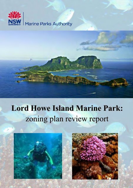
Lord Howe Island Marine Park zoning plan review report
Lord Howe Island Marine Park zoning plan review report
Lord Howe Island Marine Park zoning plan review report
- No tags were found...

You also want an ePaper? Increase the reach of your titles
YUMPU automatically turns print PDFs into web optimized ePapers that Google loves.
ContentsAbbreviationsFigures and tablesGlossaryExecutive summary1. Introduction .................................................................................................................. 11.1 Purpose, scope and legislative framework........................................................ 32. Overview of the <strong>zoning</strong> <strong>plan</strong> ....................................................................................... 72.1 Background................................................................................................... 72.2 Summary of the <strong>zoning</strong> <strong>plan</strong> ........................................................................... 83. Conserve marine biological diversity and maintain ecological processes ........ 133.1 Assessment criterion 1: Include a network of sanctuary zones that iscomprehensive and representative of the full range of marine biodiversityand habitats in the marine park ..................................................................... 133.2 Assessment criterion 2: Include a network of zones that is adequate inmaintaining marine biodiversity and ecological processes over time ................. 303.3 Assessment criterion 3: Protect areas of international, national, regional orlocal conservation significance for marine biodiversity ..................................... 373.4 Assessment criterion 4: protect areas and/or habitats that support protectedspecies and threatened species, and/or ecological communities ...................... 453.5 Assessment criterion 5: Complement the conservation of adjacent areas,particularly the Commonwealth and State marine protected areas andterrestrial protected areas ............................................................................. 584. Provide for ecological sustainable use of fish and marine vegetation andopportunities for public appreciation, understanding and enjoyment................... 624.1 Assessment criterion 6: Provide for ecologically sustainable use of fish andmarine vegetation ........................................................................................ 624.2 Assessment criterion 7: Allow for effective research and monitoring toassess performance over time ...................................................................... 754.3 Assessment criterion 8: Provide opportunities for public appreciation,understanding and enjoyment ....................................................................... 79Zoning <strong>plan</strong> <strong>review</strong> <strong>report</strong>
4.4 Assessment criterion 9: Balance social and economic costs and benefitswhile ensuring effective conservation outcomes.............................................. 834.5 Assessment criterion 10: Have straightforward rules and zone boundaries........ 904.6 Assessment criterion 11: Protect areas with significant cultural andhistorical values ........................................................................................... 945. Conclusion.................................................................................................................. 976. References .................................................................................................................. 987. Appendices ............................................................................................................... 103Appendix 1: Sanctuary Zone values...................................................................103Appendix 2: Migratory Birds ..............................................................................105Appendix 3: Summary of stakeholder consultation and submissions .....................107Appendix 4: Values and issues identified for each zone ......................................108Appendix 5: Shipwrecks of <strong>Lord</strong> <strong>Howe</strong> <strong>Island</strong> <strong>Marine</strong> <strong>Park</strong> ...................................116Appendix 6: Photo List......................................................................................118<strong>Lord</strong> <strong>Howe</strong> <strong>Island</strong> <strong>Marine</strong> <strong>Park</strong>
FIGURES AND TABLESFiguresFigure 1: <strong>Marine</strong> parks in NSW bioregions....................................................................... 2Figure 2: Zoning scheme in <strong>Lord</strong> <strong>Howe</strong> <strong>Island</strong> <strong>Marine</strong> <strong>Park</strong>, including the adjacent<strong>Lord</strong> <strong>Howe</strong> <strong>Island</strong> <strong>Marine</strong> <strong>Park</strong> (Commonwealth waters). ....................................... 9Figure 3: Detailed <strong>zoning</strong> scheme in <strong>Lord</strong> <strong>Howe</strong> <strong>Island</strong> <strong>Marine</strong> <strong>Park</strong>. ................................. 9Figure 4: Map of known seabed habitats on the shelf around <strong>Lord</strong> <strong>Howe</strong> <strong>Island</strong> andBalls Pyramid (Data in part sourced from Geoscience Australia and Universityof Wollongong)................................................................................................. 15Figure 5: Percentage of habitats in sanctuary zones within <strong>Lord</strong> <strong>Howe</strong> <strong>Island</strong> <strong>Marine</strong><strong>Park</strong> (State waters). ........................................................................................ 18Figure 6: Map of known habitats in the <strong>Lord</strong> <strong>Howe</strong> <strong>Island</strong> lagoon (Bathymetry datacourtesy of Geoscience Australia and University of Wollongong) .......................... 19Figure 7: Bathymetric map of the shelf of <strong>Lord</strong> <strong>Howe</strong> <strong>Island</strong>. ......................................... 23Figure 8: Examples of seabed habitats on the shelf of <strong>Lord</strong> <strong>Howe</strong> <strong>Island</strong> .........................25Figure 9: Bathymetric map of the <strong>Lord</strong> <strong>Howe</strong> <strong>Island</strong> shelf-edge and slope ..........................27Figure 10: Density of fish species belonging to different trophic levels and size classesrecorded in 2006, 2008, 2009 and 2010 ............................................................. 34Figure 11: Mean abundance for fished areas versus sanctuary zones for Galapagosshark Carcharhinus galapagensis ...................................................................... 54Figure 12: <strong>Lord</strong> <strong>Howe</strong> <strong>Island</strong> <strong>Marine</strong> <strong>Park</strong> (State and Commonwealth waters) <strong>zoning</strong>map ............................................................................................................... 59Figure 13: Map of Permanent <strong>Park</strong> Preserve ................................................................. 61Figure 14: Total monthly fishing effort in all <strong>report</strong>ing region at <strong>Lord</strong> <strong>Howe</strong> <strong>Island</strong> from2004 to 2009.................................................................................................... 65Figure 15: Total annual CPUE for all finfish kept and released by the <strong>Lord</strong> <strong>Howe</strong><strong>Island</strong> fishery in all regions from 2004 to 2009..................................................... 67Figure 16: Total annual number and weight of kingfish kept and released in the <strong>Lord</strong><strong>Howe</strong> <strong>Island</strong> fishery from 2004 to 2009............................................................... 68Figure 17: Total annual number and weight of silver trevally kept and released in the<strong>Lord</strong> <strong>Howe</strong> <strong>Island</strong> fishery from 2004 to 2009. .................................................... 70Figure 18: Total annual number and weight of wahoo kept and released in the <strong>Lord</strong><strong>Howe</strong> <strong>Island</strong> fishery from 2004 to 2009. ............................................................ 71Figure 19: Total annual number and weight of bluefish kept and released in the <strong>Lord</strong><strong>Howe</strong> <strong>Island</strong> fishery from 2004 to 2009. ............................................................ 72Figure 20: Activities undertaken within the <strong>Lord</strong> <strong>Howe</strong> <strong>Island</strong> <strong>Marine</strong> <strong>Park</strong>........................ 80<strong>Lord</strong> <strong>Howe</strong> <strong>Island</strong> <strong>Marine</strong> <strong>Park</strong>
TablesTable 1: Process for <strong>review</strong>ing the <strong>Lord</strong> <strong>Howe</strong> <strong>Island</strong> <strong>Marine</strong> <strong>Park</strong> <strong>zoning</strong> <strong>plan</strong> ................... 5Table 2: Assessment criteria for <strong>review</strong>ing the <strong>zoning</strong> <strong>plan</strong>................................................ 6Table 4: Species that may be taken for recreational purposes (without permit) from habitatprotection zones............................................................................................... 11Table 5: Bag limits for species that may be taken from habitat protection zones forrecreational purposes ....................................................................................... 11Table 6: Species that may be taken for sale .................................................................. 11Table 7: Species prohibited from being taken for sale..................................................... 12Table 8: Area of each zone type in <strong>Lord</strong> <strong>Howe</strong> <strong>Island</strong> <strong>Marine</strong> <strong>Park</strong>................................... 14Table 9: Ecosystems and habitats ................................................................................ 16Table 10: Proportion of habitat type in each zone within <strong>Lord</strong> <strong>Howe</strong> <strong>Island</strong> <strong>Marine</strong> <strong>Park</strong>..... 17Table 11: <strong>Marine</strong> species and their status...................................................................... 55Table 12: Vegetation communities and their status......................................................... 55Table 13: Seabirds and waders and their status............................................................. 56Table 14: Syngnathids recorded within <strong>Lord</strong> <strong>Howe</strong> <strong>Island</strong> <strong>Marine</strong> <strong>Park</strong>............................. 57Table 15: Percentage of habitat types in sanctuary zones within the combined State andCommonwealth marine park areas..................................................................... 60Table 16: Average annual total (kept + released) catch, and % of total catch of all species. 63Table 17: Total annual fishing effort (hours fished) in each <strong>report</strong>ing region at <strong>Lord</strong> <strong>Howe</strong><strong>Island</strong> from 2004 to 2009................................................................................... 65Table 18: Total annual number and weight (kilograms) of all finfish kept and released by the<strong>Lord</strong> <strong>Howe</strong> <strong>Island</strong> fishery from 2004 to 2009. ...................................................... 66Table 19: Total annual CPUE (kg/hr) for all finfish for all locations in the <strong>Lord</strong> <strong>Howe</strong> <strong>Island</strong>fishery from 2004 to 2009.................................................................................. 66Table 20: Key research projects conducted in <strong>Lord</strong> <strong>Howe</strong> <strong>Island</strong> <strong>Marine</strong> <strong>Park</strong> between 2004-2010 ............................................................................................................... 76Table 21: Key research projects identified as priorities in <strong>Lord</strong> <strong>Howe</strong> <strong>Island</strong> <strong>Marine</strong> <strong>Park</strong>between 2010-15 ............................................................................................. 77Table 22: Tourist boats in the lagoon ............................................................................ 85Table 23: Dive vessels ................................................................................................ 86Table 24: Charter fishing vessels.................................................................................. 86<strong>Lord</strong> <strong>Howe</strong> <strong>Island</strong> <strong>Marine</strong> <strong>Park</strong>
AbbreviationsAFMA Australian Fisheries Management AuthorityANZECC Australian and New Zealand Environment and Conservation CouncilBRUVS Baited remote underwater video stationsCAMBA China-Australia Migratory Birds AgreementCMS Convention for Migratory SpeciesCITES Convention for International Trade in Endangered SpeciesCPUE Catch per unit effortDECCW Department of Environment, Climate Change and Water, NSWDSEWPAC Department of the Sustainability, Environment, Water, Population andCommunities, Australian GovernmentEPBC Environment Protection and Biodiversity Conservation Act 1999HPZ habitat protection zoneI&I NSW NSW Department of Industry and InvestmentIMCRA Integrated <strong>Marine</strong> and Coastal Regionalisation of AustraliaIUCN International Union for Conservation of Nature and Natural ResourcesJAMBA Japan - Australia Migratory Birds AgreementLEP Local Environmental PlanLHI <strong>Lord</strong> <strong>Howe</strong> <strong>Island</strong>LHIB <strong>Lord</strong> <strong>Howe</strong> <strong>Island</strong> BoardLHIMP <strong>Lord</strong> <strong>Howe</strong> <strong>Island</strong> <strong>Marine</strong> <strong>Park</strong>LHIMPAC <strong>Lord</strong> <strong>Howe</strong> <strong>Island</strong> <strong>Marine</strong> <strong>Park</strong> Advisory CommitteeLHIMPCW <strong>Lord</strong> <strong>Howe</strong> <strong>Island</strong> <strong>Marine</strong> <strong>Park</strong> (Commonwealth waters)MP marine parkMPA <strong>Marine</strong> <strong>Park</strong>s Authority, NSWPWC personal watercraft (jetskis)ROKAMBA Republic of Korea – Australia Migratory Birds AgreementSZ Sanctuary zoneSPZ Special purpose zoneTSC Threatened Species Conservation Act 1995Zoning <strong>plan</strong> <strong>review</strong> <strong>report</strong>
GLOSSARYascidian: sea-squirtassemblage: a community of species occupying a particular habitat or area at aparticular timebarrens habitat: area where sea urchins have overgrazed kelp bedsbathymetry: depth of the seabedbenthic: living on the seabedbioregion: an ecologically-based area characterised by natural features andenvironmental processes that influence the functioning of ecosystemsbivalve: mollusc with two shells such as an oyster, mussel or clamecosystem: a dynamic combination of <strong>plan</strong>ts, animals and micro-organic communitiesand their environment interacting as a functional unitechinoderm: marine invertebrate, such as a starfish or sea urchin, with an internalcalcareous skeleton and often spinesgeomorphology: study of landforms and the processes that shape theminfauna: fauna living in the sedimentmacroinvertebrates: invertebrate species that can be seen with the naked eyepelagic: associated with the surface or middle depths of the open sea<strong>plan</strong>kton: microscopic animals or <strong>plan</strong>ts that drift in the seapolychaetes: segmented marine worms with bristles along the bodysessile: attached by the base, generally to the seabedsurrogates: components related to biological diversity that are more easily measuredor mapped than biological diversity itselfsyngnathiformes: species characterised by their elongated snouts, fused jaws, the absence ofpelvic fins, and by thick plates of bony armour covering the body. Such species includeseahorses and pipefish.<strong>Lord</strong> <strong>Howe</strong> <strong>Island</strong> <strong>Marine</strong> <strong>Park</strong>
EXECUTIVE SUMMARYNSW marine parks aim to conserve marine biodiversity, maintain ecological processes andprovide for a range of sustainable uses of the marine environment. <strong>Lord</strong> <strong>Howe</strong> <strong>Island</strong> <strong>Marine</strong><strong>Park</strong>, declared in 1999, is located 590 kilometres east of Port Macquarie on the mid-northcoast of NSW. The marine park has long been recognised as an area with outstandingnatural values, extraordinary array of marine habitats and biodiversity, rich maritime culturalheritage and social and economic importance to the community. Its nomination as part of theWorld Heritage area in 1982 and the declaration of the adjoining 300,000 hectareCommonwealth marine park in 2000 add to the international and national importance of themarine park.The <strong>zoning</strong> <strong>plan</strong>, which commenced in 2004, protects the important natural and culturalvalues of the marine park, while providing for a range of sustainable uses including beachactivities, swimming, surfing, charter and recreational fishing, scuba diving, sailing, boating,research and other activities.The <strong>Marine</strong> <strong>Park</strong>s Act 1997 requires that <strong>zoning</strong> <strong>plan</strong>s are <strong>review</strong>ed after the first five yearsof operation, and then every ten years. The purpose of the <strong>review</strong> is to determine whetherthe <strong>zoning</strong> <strong>plan</strong> for the marine park remains appropriate for meeting the objects of the Act. Aset of 11 criteria, based on the national and state criteria for <strong>zoning</strong> marine protected areas,has been used to assess the <strong>zoning</strong> <strong>plan</strong>. The NSW <strong>Marine</strong> <strong>Park</strong>s Authority initiated the<strong>review</strong> of the <strong>Lord</strong> <strong>Howe</strong> <strong>Island</strong> <strong>Marine</strong> <strong>Park</strong> <strong>zoning</strong> <strong>plan</strong> in December 2009, with a period ofpublic consultation undertaken from July to September 2010. There were 14 stakeholdermeetings and information sessions and 169 submissions were received. This <strong>report</strong> presentsthe results of the first <strong>review</strong> of the <strong>Lord</strong> <strong>Howe</strong> <strong>Island</strong> <strong>Marine</strong> <strong>Park</strong> <strong>zoning</strong> <strong>plan</strong>.Since the <strong>zoning</strong> <strong>plan</strong> was implemented, research and monitoring have provided newinformation on the marine park. Projects have investigated its biodiversity, habitats andecosystems, as well as ways in which it is used by the local community and visitors. Theresearch has allowed more detailed maps of the marine park to be developed, includinghabitat mapping of deep water reefs that occur off <strong>Lord</strong> <strong>Howe</strong> <strong>Island</strong> and Balls Pyramidshelfs.New information shows that all ecosystems and habitat types in the marine park arerepresented in sanctuary zones, (except the estuaries which are protected under the <strong>Lord</strong><strong>Howe</strong> <strong>Island</strong> Local Environmental Plan) although only 6% of the total area of relict reef isincluded in sanctuary zones.During community consultation as part of the <strong>review</strong> of the <strong>zoning</strong> <strong>plan</strong>, a number of issueswere raised, including:• the level of protection provided by the sanctuary zones;• the level of protection provided to threatened and protected species, including theblack cod, elegant wrasse, bluefish, seabirds and various shorebirds;• the level of protection provided to endemic species, including the doubleheaderwrasse, McCullochs anemonefish and three stripped butterflyfish;• the impacts of fish feeding, specifically the use of bread at Neds Beach;• the risks associated with fish cleaning in the <strong>Lord</strong> <strong>Howe</strong> <strong>Island</strong> Lagoon;• the unlicensed <strong>Lord</strong> <strong>Howe</strong> <strong>Island</strong> commercial fishery occurring in the marine park;• maintaining current regulation prohibiting export of fish;• the reduction of current bag limits for protected species – bluefish, doubleheaderwrasse and spangled emperor;• the availability of shore based fishing at the North Bay Sanctuary Zone;Zoning <strong>plan</strong> <strong>review</strong> <strong>report</strong>
• the availability of fishing around South East Rock in the Balls Pyramid SanctuaryZone;• the request to allow spearfishing in the marine park; and• suggested changes to current anchoring and mooring regulations.The <strong>review</strong> has found that the <strong>zoning</strong> <strong>plan</strong> is adequately meeting the objects of the <strong>Marine</strong><strong>Park</strong>s Act 1997. Opportunities to fine-tune and improve the effectiveness of the <strong>zoning</strong> <strong>plan</strong>may exist, and it is recommended that alternative means of addressing these issues otherthan amendments to the <strong>zoning</strong> <strong>plan</strong>, be explored in conjunction with the <strong>Lord</strong> <strong>Howe</strong> <strong>Island</strong><strong>Marine</strong> <strong>Park</strong> Advisory Committee.Key findings and issues include:1. Comprehensiveness and representativeness of the sanctuary zones• <strong>Lord</strong> <strong>Howe</strong> environments can be divided into: estuarine, lagoonal, open coast, shelf,shelf edge and slope ecosystems.• Most habitats and ecosystems are well represented and replicated in sanctuaryzones, with the exception of relict reefs and estuaries.• Lagoonal environments contain a mosaic of habitats that support endemic andprotected species, and include: seagrasses, macroalgal communities, lagoon holesand fringing reef and are protected by sanctuary zones.• Opportunities should be explored to increase the representation of subtidal macroalgal communities in sanctuary zones.• Monitoring indicates success of the sanctuary zones in protecting key species andbiomass, though longer term datasets are required.• The current distribution of sanctuary zones in the marine park should be maintained.2. Adequacy in maintaining marine biodiversity and ecological processes• The marine park contains several areas of high conservation value that provideshabitat for threatened species.• The adequacy of the <strong>zoning</strong> <strong>plan</strong> is also strongly supported by the presence of twolarge sanctuary zones, East Coast and Shelf Sanctuary Zone and Balls PyramidSanctuary Zone which comprise 27% of the park.• These large zones protect a continuum of habitats, which encompasses the range ofhabitats used by marine species throughout their life cycles.• The remaining 73% is protected by a large habitat protection zone where dredging,trawling, drop-lining, long-lining, and other types of fishing except for line fishing areprohibited.3. Protecting areas of international, national and local conservation significance• <strong>Lord</strong> <strong>Howe</strong> <strong>Island</strong> <strong>Marine</strong> <strong>Park</strong> comprises the majority of the <strong>Lord</strong> <strong>Howe</strong> <strong>Island</strong> GroupWorld Heritage Area that was declared in 1982 and was listed on the NationalHeritage List in 2007.• Areas of recognised international, national, regional or local conservation significanceare either fully or partially protected in sanctuary zones under the current <strong>zoning</strong> <strong>plan</strong>with the exception of the estuaries which are protected in the <strong>Lord</strong> <strong>Howe</strong> <strong>Island</strong> LocalEnvironmental Plan (LEP 2010).• Areas of international, national, regional and/or local significance include: estuaries,lagoon (North Bay, lagoon holes), fringing reef, <strong>Lord</strong> <strong>Howe</strong> <strong>Island</strong> shelf (relict reef,Admiralties <strong>Island</strong>s and Malabar Reef, shelf and outer slope) and Balls Pyramid shelf<strong>Lord</strong> <strong>Howe</strong> <strong>Island</strong> <strong>Marine</strong> <strong>Park</strong>
(Balls Pyramid, Observatory Rock, South-East Rock, relict reef, shelf and outerslope).4. Protect areas and/or habitats that support threatened or protected species• Further research is required to determine the abundance and distribution of blackcod.• The loggerhead turtle and leatherback turtle migrate through the park, and the greenturtle and hawksbill turtle reside in the marine park and important seagrass habitatare protected within the North Bay and Lagoon sanctuary zones.• Significant foraging habitat for threatened migratory waders is found in the intertidalseagrass habitats of North Bay, Hunter Bay and Lovers Bay within the <strong>Lord</strong> <strong>Howe</strong><strong>Island</strong> lagoon.• Significant oceanic feeding areas for migrating and breeding seabirds are protected insanctuary zones.• The critically endangered Lagunaria (sallywood) swamp forest and vulnerablesaltmarsh communities present in the estuarine systems of the marine park are ofcritical importance as they are listed as endangered ecological communities (EEC).• Protected fish species which inhabit the park include the Ballina angelfish, bluefish,elegant wrasse and various sygnathids.5. Compliment the conservation of adjacent protected areas• Commonwealth waters (3-12 nautical miles) are managed by the NSW MPA throughan Annual Business Agreement with Department of the Sustainability, Environment,Water, Population and Communities (DSEWPaC).• Unique conservation effort reached through the connection of Permanent <strong>Park</strong>Preserve, State marine park sanctuary zones and Commonwealth sanctuary zones,capturing a complete cross section of the island, shelf, and seamount bathyal plain.• The Commonwealth marine park comprises 300,000 hectares of marine park areawhich adjoins the 47,000 hectares of State marine park.• The <strong>Lord</strong> <strong>Howe</strong> <strong>Island</strong> Board manage the terrestrial landscape protecting 1340hectares within Permanent <strong>Park</strong> Preserve.6. Sustainable use of fish and marine vegetation• The charter fishing vessels are permitted under the <strong>Marine</strong> <strong>Park</strong>s Act 1997 andsubmit catch return data for the size and number of fish caught and released in themarine park.• The catch return data shows a sustainable and viable fishery for the target species offish.• <strong>Lord</strong> <strong>Howe</strong> <strong>Island</strong> <strong>Marine</strong> <strong>Park</strong> charter fishing catch is dominated by yellow tailkingfish.• <strong>Lord</strong> <strong>Howe</strong> <strong>Island</strong> <strong>Marine</strong> <strong>Park</strong> fishery catch per unit effort is comparatively morewhen compared to mainland fisheries.• Attitudinal surveys show that the marine park is well supported by both fishers andnon-fishers and the level of support for sanctuary zones is also high amongst fishers.Zoning <strong>plan</strong> <strong>review</strong> <strong>report</strong>
7. Allow for effective research and monitoring to assess performance over time• The 2010-15 Strategic Research Framework identifies the key research areas.• Further specific research on the macro-algal community to examine the need forsome sanctuary zone protection to allow effective monitoring of ecological changesthrough time.• More research is needed in areas of endemic species, deep water habitats, fisheries,impacts of fish feeding, rat bait program, and nutrients from contaminatedgroundwater.8. Provide opportunities for public appreciation, understanding and enjoyment• A comprehensive range of marine activities both extractive and non extractive can beundertaken in the marine park.• The most popular marine park pursuits are non extractive such as swimming andsnorkelling which is not influenced by the marine park <strong>zoning</strong> <strong>plan</strong>.• The use of personal water craft (jetskis) and spearfishing is currently prohibited underthe <strong>zoning</strong> <strong>plan</strong>.• Under the current <strong>zoning</strong> <strong>plan</strong> fish cleaning is permitted in the lagoon. Publicconsultation has identified that the community has concerns over the possibility of anincreased risk of shark attack and the incompatibility of this activity with snorkelling.• Fish feeding is permitted under the current <strong>zoning</strong> <strong>plan</strong> and is an important touristattraction; however both islanders and visitors have concerns over the health of thekingfish.9. Balance social and economic costs and benefits while ensuring conservationoutcomes• Approximately 91% of tourists considered the ocean and marine park as veryimportant relative to other activities on their trip.• The establishment of the marine park has contributed to the island’s value as anationally important eco-tourism destination.• There has been an increase in the amount of marine-based charter operations sincethe introduction of the marine park.10. Have straight forward rules and boundaries• Most zones in the marine park have straight boundaries that originate from distinctivelandmarks and follow a compass bearing to either another prominent landmark or the3 nautical mile State water boundary.• There have been very few compliance issues with users regarding any difficulty inlocating these boundaries.• The State zone locations, colours and rules compliment the larger (300,000 hectares)commonwealth zones that abut them.• There is some overlap in jurisdiction between the MPA and the <strong>Lord</strong> <strong>Howe</strong> <strong>Island</strong>Board regulations, especially in regard in activities that fall within the 3 nautical milezone of the Local Environmental Plan and the mean low water mark boundary of the<strong>Lord</strong> <strong>Howe</strong> <strong>Island</strong> Act.<strong>Lord</strong> <strong>Howe</strong> <strong>Island</strong> <strong>Marine</strong> <strong>Park</strong>
11. Protect cultural and historical sites• The marine park contains a number of shipwrecks and other maritime heritageartefacts that are generally well protected under existing legislation.• Twelve shipwrecks have been positively identified in the State waters with another 3yet to be found and mapped.• The NSW Department of Planning (Heritage Branch) has identified the discovery ofan anchor lost in 1788 from the First Fleet armed tender HMS Supply at <strong>Lord</strong> <strong>Howe</strong><strong>Island</strong>’s South Passage which would reveal an archaeological find of potentialnational heritage significance.• There is a need to further investigate the site of the Ovalau shipwreck and itsproximity to the north western roadstead large vessel anchoring area.Finalising the <strong>review</strong>This <strong>review</strong> <strong>report</strong> will be provided to the <strong>Lord</strong> <strong>Howe</strong> <strong>Island</strong> <strong>Marine</strong> <strong>Park</strong> Advisory Committeefor comment, as required under the <strong>Marine</strong> <strong>Park</strong>s Act 1997. The NSW <strong>Marine</strong> <strong>Park</strong>sAuthority will provide the <strong>report</strong> and any comments from the Advisory Committee, to theMinister for Climate Change and the Environment and the Minister for Primary Industries fortheir consideration. On the basis of the <strong>review</strong> <strong>report</strong> and advisory committee comments, theMinisters will direct the NSW <strong>Marine</strong> <strong>Park</strong>s Authority to:• prepare a draft <strong>zoning</strong> <strong>plan</strong> to amend or replace the <strong>zoning</strong> <strong>plan</strong>, or• continue with the current <strong>zoning</strong> <strong>plan</strong>.The Ministers may also direct the NSW <strong>Marine</strong> <strong>Park</strong>s Authority to take other actions that donot require any changes to the <strong>zoning</strong> <strong>plan</strong>, to address issues identified in this <strong>report</strong>. If theMinisters decide that a draft <strong>zoning</strong> <strong>plan</strong> is to be prepared, this will occur in consultation withthe <strong>Lord</strong> <strong>Howe</strong> <strong>Island</strong> <strong>Marine</strong> <strong>Park</strong> Advisory Committee and be subject to further publicconsultation, including a three-month public exhibition period.The <strong>Lord</strong> <strong>Howe</strong> <strong>Island</strong> <strong>Marine</strong> <strong>Park</strong> Operational Plan 2004 supports the <strong>zoning</strong> <strong>plan</strong>, byoutlining the scheme of operation for the marine park including the management ofdevelopment activities within and adjacent to the marine park. It identifies how the <strong>Marine</strong><strong>Park</strong>s Authority works with other agencies, local government, research institutions andcommunity groups to conserve biodiversity in the marine park.Should any changes to the <strong>zoning</strong> <strong>plan</strong> be made as a consequence of the <strong>review</strong>, theoperational <strong>plan</strong> will be subsequently <strong>review</strong>ed to ensure it is consistent with, and supports,the <strong>zoning</strong> <strong>plan</strong>.Zoning <strong>plan</strong> <strong>review</strong> <strong>report</strong>
Figure 1: <strong>Marine</strong> parks in NSW bioregionsNote: IMCRA refers to the Integrated <strong>Marine</strong> and Coastal Regionalisation of Australia(Commonwealth of Australia 2006).2 <strong>Lord</strong> <strong>Howe</strong> <strong>Island</strong> <strong>Marine</strong> <strong>Park</strong>
The <strong>zoning</strong> <strong>plan</strong> came into effect on 1 December 2004 to protect the biodiversity in the marine parkand to manage various activities. Currently, 26.8% of the marine park is protected in sanctuaryzones, 73.2% in habitat protection zones and
The <strong>Marine</strong> <strong>Park</strong>s Act 1997 requires this <strong>review</strong> <strong>report</strong> to include:(a) an assessment of the existing arrangements for:(i) the conservation of natural and cultural heritage(ii) the management of zones(iii) the sustainable use of resources(b) any relevant findings and recommendations arising from the <strong>review</strong> – these are grouped withrelevant assessment criteria. Note that some recommendations apply to one or moreassessment criteria.(c) such other information arising from the <strong>review</strong> as the NSW <strong>Marine</strong> <strong>Park</strong>s Authority considersappropriate.The process undertaken to <strong>review</strong> the <strong>Lord</strong> <strong>Howe</strong> <strong>Island</strong> <strong>Marine</strong> <strong>Park</strong> <strong>zoning</strong> <strong>plan</strong> is set out in Table1.The assessment criteria used to <strong>review</strong> the <strong>zoning</strong> <strong>plan</strong> are consistent with the criteria used todevelop it and are set out in Table 2.The <strong>review</strong> <strong>report</strong> also considers new information and issues identified since the <strong>zoning</strong> <strong>plan</strong>commenced, including those raised during consultation and via submissions. A summary ofresearch projects conducted in the marine park can be found at www.mpa.nsw.gov.au.This <strong>report</strong> does not include a comprehensive overview of the natural, social, economic and culturalvalues of the <strong>Lord</strong> <strong>Howe</strong> <strong>Island</strong> <strong>Marine</strong> <strong>Park</strong>. Rather, it draws on other documents that presentthose values, including:• Natural values of <strong>Lord</strong> <strong>Howe</strong> <strong>Island</strong> <strong>Marine</strong> <strong>Park</strong> (MPA 2010e)• <strong>Lord</strong> <strong>Howe</strong> <strong>Island</strong> <strong>Marine</strong> <strong>Park</strong> Attitudinal Report (MPA 2010c)• <strong>Lord</strong> <strong>Howe</strong> <strong>Island</strong> <strong>Marine</strong> <strong>Park</strong> Visitor and Expenditure Survey (MPA 2010b)A <strong>review</strong> of the external boundaries of the park, and of other regulations which apply within theboundaries of the marine park including regulations for Crown lands, fisheries, or national parks andwildlife are outside of the scope of this <strong>zoning</strong> <strong>plan</strong> <strong>review</strong>, and so are not covered in this <strong>report</strong>.It is acknowledged that marine park <strong>zoning</strong> <strong>plan</strong>s are not the only tool used to conserve marinebiodiversity, but that a range of complementary government programs exist, including catchmentmanagement, pollution reduction, biosecurity and fisheries management programs.This <strong>review</strong> <strong>report</strong> only considers the <strong>zoning</strong> <strong>plan</strong> for <strong>Lord</strong> <strong>Howe</strong> <strong>Island</strong> <strong>Marine</strong> <strong>Park</strong>. While thepublic consultation undertaken during stage one of the <strong>review</strong> also involved feedback on the <strong>Lord</strong><strong>Howe</strong> <strong>Island</strong> <strong>Marine</strong> <strong>Park</strong> (Commonwealth waters) Management Plan in collaboration with theCommonwealth Department of Sustainability, Environment, Water, People and Communities, this<strong>report</strong> does not assess the Commonwealth marine park management <strong>plan</strong>.4 <strong>Lord</strong> <strong>Howe</strong> <strong>Island</strong> <strong>Marine</strong> <strong>Park</strong>
Table 1: Process for <strong>review</strong>ing the <strong>Lord</strong> <strong>Howe</strong> <strong>Island</strong> <strong>Marine</strong> <strong>Park</strong> <strong>zoning</strong> <strong>plan</strong>Stage 1: Identifying the key issues with the <strong>zoning</strong> <strong>plan</strong>On 23 June 2010, an information package was publicly released and placed onwww.mpa.nsw.gov.au. This package advised on ways in which the community could getinvolved in the <strong>review</strong>, and contained the following documents:1. a guide on the <strong>review</strong> process2. a form for making submissions3. a copy of the <strong>zoning</strong> <strong>plan</strong> users guide4. an updated habitat map5. a summary of the natural values of the marine park6. a summary of the social, economic and cultural uses of the marine park7. a summary of research and monitoring in the marine park8. a summary of the management of the marine park9. frequently asked questions10. natural values of <strong>Lord</strong> <strong>Howe</strong> <strong>Island</strong> <strong>Marine</strong> <strong>Park</strong>11. <strong>Lord</strong> <strong>Howe</strong> <strong>Island</strong> <strong>Marine</strong> <strong>Park</strong> attitudinal <strong>report</strong>12. <strong>Lord</strong> <strong>Howe</strong> <strong>Island</strong> <strong>Marine</strong> <strong>Park</strong> visitor and expenditure survey.14 meetings and information sessions were held so stakeholder groups and the communitycould comment on the current <strong>zoning</strong> <strong>plan</strong>. Details of these activities were advertised in localnewspapers.A formal consultation period of 11 weeks enabled the public to comment on the current<strong>zoning</strong> <strong>plan</strong> and make submissions. The closing date for submissions was 8 September2010 and 169 submissions were received.Stage 2: Preparing this <strong>review</strong> <strong>report</strong>This <strong>review</strong> <strong>report</strong> includes an analysis of the current <strong>zoning</strong> <strong>plan</strong> against assessment criteriaand summary of stakeholder consultation and submissions.(refer to Appendix 3)This <strong>review</strong> <strong>report</strong> will be provided to the <strong>Lord</strong> <strong>Howe</strong> <strong>Island</strong> <strong>Marine</strong> <strong>Park</strong> Advisory Committeefor at least 10 days to enable comment.This <strong>review</strong> <strong>report</strong>, and comments from the advisory committee, will be provided by the NSW<strong>Marine</strong> <strong>Park</strong>s Authority to the Minister for Climate Change and the Environment, and theMinister for Primary Industries, for their consideration.Stage 3: Finalising the <strong>review</strong>On the basis of the <strong>review</strong> <strong>report</strong>, the Ministers will direct the NSW <strong>Marine</strong> <strong>Park</strong>s Authorityeither to prepare a draft <strong>zoning</strong> <strong>plan</strong> to amend the current <strong>zoning</strong> <strong>plan</strong>, or to continue with the<strong>zoning</strong> <strong>plan</strong>.If the Ministers decide that a draft <strong>zoning</strong> <strong>plan</strong> is to be prepared, this will occur in consultationwith the <strong>Lord</strong> <strong>Howe</strong> <strong>Island</strong> <strong>Marine</strong> <strong>Park</strong> Advisory Committee. The new draft <strong>zoning</strong> <strong>plan</strong> willbe subject to further public consultation, including a three-month public exhibition period.Zoning <strong>plan</strong> <strong>review</strong> <strong>report</strong> 5
Table 2: Assessment criteria for <strong>review</strong>ing the <strong>zoning</strong> <strong>plan</strong><strong>Marine</strong> <strong>Park</strong>s Act objects(a) to conserve marine biological diversity, and(b) to maintain ecological processesTo achieve these objects, the marine park <strong>zoning</strong> <strong>plan</strong> should:NoAssessment criterion1 Include a network of sanctuary zones that is comprehensive and representative ofthe full range of marine biodiversity and habitats in the marine park2 Include a network of zones that are adequate in maintaining marine biodiversityand ecological processes over time3 protect areas of international, national, regional or local conservation for marinebiodiversity4 protect areas and/or habitats that support protected species and threatenedspecies, and/or ecological communities5 complement the conservation of adjacent areas, particularly Commonwealth andstate protected areas and terrestrial protected areas<strong>Marine</strong> <strong>Park</strong>s Act objects(c) where consistent with objects (a) to conserve marine biological diversity and(b) to maintain ecological processes:(i) to provide for ecological sustainable use of fish and marine vegetation(ii) to provide opportunities for public appreciation, understanding andenjoymentTo achieve these objects, the marine park <strong>zoning</strong> <strong>plan</strong> should:6 provide for ecologically sustainable use of fish and marine vegetation7 allow for effective research and monitoring to assess performance over time8 provide opportunities for public appreciation, understanding and enjoyment9 balance social and economic costs and benefits while ensuring effectiveconservation outcomes10 have straightforward rules and zone boundaries11 protect areas with significant cultural or historical values6 <strong>Lord</strong> <strong>Howe</strong> <strong>Island</strong> <strong>Marine</strong> <strong>Park</strong>
2. Overview of the <strong>zoning</strong> <strong>plan</strong>2.1 Background<strong>Lord</strong> <strong>Howe</strong> <strong>Island</strong> <strong>Marine</strong> <strong>Park</strong> was declared as a marine park in 1999. The <strong>plan</strong>ning process for themarine park was launched at the beginning of 2000, to develop <strong>zoning</strong> and operational <strong>plan</strong>s asrequired under the <strong>Marine</strong> <strong>Park</strong>s Act 1997. A <strong>zoning</strong> <strong>plan</strong> was implemented in 2004 to protectbiological diversity and ecological processes while allowing for ecologically sustainable use. Inaccordance with State and Commonwealth <strong>plan</strong>ning policies, a key objective was to achievecomprehensive, adequate and representative protection of ecosystems and habitats, and in doingso protect the range of biodiversity found in the marine park. The ecosystem and habitatclassification used to help develop the <strong>zoning</strong> <strong>plan</strong> had the following categories:• Estuarine ecosystem• Lagoonal ecosystem• Intertidal (open coast) ecosystem• Shelf ecosystem• Shelf-edge ecosystem (sometimes known as the “dropoff”)• Slope ecosystemA range of scientific, social, cultural and economic information was collated to inform the <strong>zoning</strong>process. In August 2001, an Issues Paper was released for public comment and submissions werereceived covering a wide variety of issues. In June 2002, a document containing draft <strong>zoning</strong> <strong>plan</strong>examples was released outlining a number of options for <strong>zoning</strong>. Submissions on this documenttogether with advice from the <strong>Lord</strong> <strong>Howe</strong> <strong>Island</strong> <strong>Marine</strong> <strong>Park</strong> Advisory Committee contributed to thedevelopment of a draft <strong>zoning</strong> <strong>plan</strong>. The draft <strong>zoning</strong> <strong>plan</strong> was released for public comment inDecember 2003. There were 495 submissions received during this time. From 2001-2004 staff metand worked closely with both <strong>Island</strong>ers and mainlanders and stakeholder groups to seek commentand identify key issues. The current <strong>zoning</strong> <strong>plan</strong> commenced on 1 December 2004.Lagoon reef <strong>Lord</strong> <strong>Howe</strong> <strong>Island</strong> <strong>Marine</strong> <strong>Park</strong> (Photo: Geoff Kelly/MPA)Zoning <strong>plan</strong> <strong>review</strong> <strong>report</strong> 7
2.2 Summary of the <strong>zoning</strong> <strong>plan</strong>The <strong>zoning</strong> <strong>plan</strong> for the <strong>Lord</strong> <strong>Howe</strong> <strong>Island</strong> <strong>Marine</strong> <strong>Park</strong> is contained in Part 4 of the <strong>Marine</strong> <strong>Park</strong>s(Zoning Plans) Regulation 1999. It provides various levels of biodiversity protection in <strong>Lord</strong> <strong>Howe</strong><strong>Island</strong> <strong>Marine</strong> <strong>Park</strong> by regulating activities according to zones, regulating specific activities tomanage environmental impacts, and protecting particular species.In summary:• sanctuary zones account for approximately 27% (12,500 hectares) of the marine park andprovide the highest level of protection by prohibiting all forms of fishing and collecting. Activitiesthat do not harm <strong>plan</strong>ts, animals and habitats are permitted, including boating and diving(according to anchoring and mooring regulations).• habitat protection zones account for 73% (34,000 hectares) of the marine park and conservemarine biodiversity by protecting habitats and reducing high impact activities includingdroplining, longlining, dredging and trawling. Recreational fishing is permitted in these zones.• special purpose zones account for 0.004% (1.7 hectares) of the marine park and are used forspecial management needs, specifically to allow limited fish feeding.<strong>Lord</strong> <strong>Howe</strong> <strong>Island</strong> <strong>Marine</strong> <strong>Park</strong> does not contain any general use zones.The <strong>zoning</strong> <strong>plan</strong> also contains regulations:• for specific activities – for example, there are restrictions on anchoring and methods offishing; and• that provide additional protection for species of particular significance – for example, onlyparticular species can be taken from habitat protection zones and some species are protectedthroughout the marine park.Protection afforded by other legislation, such as fisheries management arrangements, or protectionof threatened species under the Environmental Protection, Biodiversity and Conservation Act 1999,Fisheries Management Act 1994 and Threatened Species Conservation Act 1995, still applies.Figure 2 shows the <strong>zoning</strong> <strong>plan</strong> in the <strong>Lord</strong> <strong>Howe</strong> <strong>Island</strong> <strong>Marine</strong> <strong>Park</strong>. Table 3 summarises activitiesthat are permitted in the marine park. Table 4 lists the species that may be taken for recreationalpurposes in habitat protection zones, Table 5 outlines the bag limits for species that may be takenfrom habitat protection zones. Table 6 outlines the species that may be taken for sale and Table 7outlines the species prohibited from being taken for sale.Windsurfing in the <strong>Lord</strong> <strong>Howe</strong> <strong>Island</strong> lagoon (Photo: Jack Shick)8 <strong>Lord</strong> <strong>Howe</strong> <strong>Island</strong> <strong>Marine</strong> <strong>Park</strong>
Figure 2: Zoning scheme in <strong>Lord</strong> <strong>Howe</strong> <strong>Island</strong> <strong>Marine</strong> <strong>Park</strong>, including the adjacent<strong>Lord</strong> <strong>Howe</strong> <strong>Island</strong> <strong>Marine</strong> <strong>Park</strong> (Commonwealth waters).Figure 3: Detailed <strong>zoning</strong> scheme in <strong>Lord</strong> <strong>Howe</strong> <strong>Island</strong> <strong>Marine</strong> <strong>Park</strong>.Zoning <strong>plan</strong> <strong>review</strong> <strong>report</strong> 9
Table 3: Summary of activities permitted in <strong>Lord</strong> <strong>Howe</strong> <strong>Island</strong> <strong>Marine</strong> <strong>Park</strong>For full details of activities permitted in zones, and zone boundary locations, refer to the <strong>Marine</strong> <strong>Park</strong>s (ZoningPlans) Regulation 1999ActivitySanctuaryHabitatProtectionSpecialPurpose (FishFeeding)NON EXTRACTIVE RECREATIONAL ACTIVITIESNavigation of vessels (other than personal water craftor hovercraft) (e) (e) (e)Surfing, snorkelling, diving, swimming Personal water craft (e.g. Jet Skis) and Hovercraft RECREATIONAL FISHINGLine Fishing (a), (b), (c) Trapping (a), (b), (c) Netting (a), (b), (c) Hand collection for bait or food (a), (b), (c) Spearfishing COMPETITIONSLine fishing P DOMESTIC ANIMAL EXERCISE (d) (d) (d)RESEARCH P P PCOLLECTINGCollecting for aquariums (commercial) Collecting for aquariums (recreational) P Collecting for educational purposes P P PAQUACULTURE COMMERCIAL OPERATIONSNon extractive tours (diving, snorkelling, sightseeing,etc) P P PCharter fishing P COMMERCIAL FISHINGLimited line fishing (a), (c), (g) Trawling, dredging, trapping, netting, long-line anddrop-line fishing methods Key Activity permitted Activity prohibitedP Activity requires a permit from the <strong>Marine</strong> <strong>Park</strong> Authority(a) NSW Fisheries Regulations apply(b ) Restricted to those species listed in Table 2(c) Fishing only by the following methods: hand held line or rod andreef, dip or scoop nets, landing nets and bait traps (as defined inthe Fisheries Management (General) Regulation 2007)(d) Domestic animals are permitted except where currentlyprohibited by legislation administered by the <strong>Lord</strong> <strong>Howe</strong> <strong>Island</strong>Board(e) Permit required for anchoring of vessels over 5 metres in thelagoon. Vessels over 25 metres may only anchored indesignated anchoring areas. Anchoring in sanctuary zones(other than in designated areas)(g) Restricted to those species listed in table 410 <strong>Lord</strong> <strong>Howe</strong> <strong>Island</strong> <strong>Marine</strong> <strong>Park</strong>
Table 4: Species that may be taken for recreational purposes (without permit) fromhabitat protection zonesCommon name Class/family/order SpeciesFin-fish (fish with fins and scales) Class OsteichthyesAll species except those prohibited by theFisheries Management (General)Regulation 2002Polychaete Worms Class Polychaeta All speciesCrabs Order Brachyura All speciesLobster, Crayfish Family Palinuridae All speciesGhost shrimp, marine yabbie,nipperFamily Calliannassidae All speciesSnapping shrimp Family Alpheidae All speciesSlipper lobster, shovel nosedlobster or bugFamily Scyllaridae All speciesPrawns Family Penaeidae All speciesSquid and octopus Class Cephalopoda All speciesTurban shell Family Turbinadae All speciesBlack snail Family Neritidae Nerita atramentosaSea urchinClass EchinoideaCentrostephanus rodgersiiHeliocidaris tuberculataSharks and raysClass ChondrichthyesAll species except those prohibited by theFisheries Management (General)Regulation 2002Table 5: Bag limits for species that may be taken from habitat protection zones forrecreational purposesCommon name Species Maximum number allowed to betaken per person per dayDoubleheader wrasse Coris bulbifrons 1Bluefish Girella cyanea 5Spangled emperor Lethrinus nebulosus 2Scorpionfish, red rock cod,bucket headScorpaena cookiiScorpaena cardinalis2 in total comprised of one species or acombination of bothTable 6: Species that may be taken for saleCommon name Class or Family SpeciesFin-fish (fish with fins andscales)Class OsteichthyesAll species except those prohibited by theFisheries Management (General) Regulation2002Sharks and rays Class Chondrichthyes All species except for those prohibited by theFisheries Management (General) Regulation2002Zoning <strong>plan</strong> <strong>review</strong> <strong>report</strong> 11
Table 7: Species prohibited from being taken for saleCommon name Class or Family SpeciesDoubleheader wrasse Family Labridae Coris bulbifronsBluefish Family Girellidae Girella cyaneaRelationship to the operational <strong>plan</strong>In addition to the <strong>zoning</strong> <strong>plan</strong>, the <strong>Marine</strong> <strong>Park</strong>s Act 1997 requires an operational <strong>plan</strong> to beprepared for each marine park.The operational <strong>plan</strong> for the <strong>Lord</strong> <strong>Howe</strong> <strong>Island</strong> <strong>Marine</strong> <strong>Park</strong> came into effect in 2004 and outlinesthe scheme of operations that the NSW <strong>Marine</strong> <strong>Park</strong>s Authority is undertaking or allowing (includingarrangements with other agencies) in the marine park in accordance with the <strong>zoning</strong> <strong>plan</strong> andobjects of the <strong>Marine</strong> <strong>Park</strong>s Act 1997.The management actions in the operational <strong>plan</strong> include activities which complement the <strong>zoning</strong><strong>plan</strong>, such as:• compliance and community education programs;• infrastructure programs such as provision of vessel moorings;• research and monitoring;• issuing licenses and permits;• development and <strong>plan</strong>ning;• protection of cultural heritage;• pollution control and incident management;• managing invasive pest species;• management arrangements with the Australian Government and NSW Governmentagencies; and• additional actions to facilitate conservation and sustainable use.Should the Ministers direct the NSW <strong>Marine</strong> <strong>Park</strong>s Authority to amend the <strong>zoning</strong> <strong>plan</strong>; theoperational <strong>plan</strong> will be subsequently <strong>review</strong>ed in accordance with the <strong>Marine</strong> <strong>Park</strong>s Act 1997.<strong>Marine</strong> <strong>Park</strong> vessel at the Admiralty <strong>Island</strong>s (Photo: Justin Gilligan)12 <strong>Lord</strong> <strong>Howe</strong> <strong>Island</strong> <strong>Marine</strong> <strong>Park</strong>
3. Conserve marine biological diversity and maintain ecologicalprocesses3.1 Assessment criterion 1: Include a network of sanctuary zones thatis comprehensive and representative of the full range of marinebiodiversity and habitats in the marine parkKEY FINDINGS• The <strong>Lord</strong> <strong>Howe</strong> <strong>Island</strong> <strong>Marine</strong> <strong>Park</strong> is comprised of 26.8% sanctuary zones (12,500 ha).• <strong>Lord</strong> <strong>Howe</strong> environments can be divided into: estuarine; lagoonal; open coast; shelf; shelfedge and slope ecosystems.• Estuarine ecosystems contain threatened saltmarsh and sallywood forest communities andmangrove species which support aquatic and terrestrial communities adapted to brackishconditions. They are not currently protected by sanctuary zones, but are protected under the<strong>Lord</strong> <strong>Howe</strong> <strong>Island</strong> Local Environmental Plan 2010 as Significant Native Vegetation.• Open coast ecosystems contain intertidal sands (beaches) and rock platform and rubbleshore habitats. These are not quantified within the current habitat map, though they areprotected by Neds Beach and Admiralty <strong>Island</strong>s and East Coast and Shelf sanctuary zones.• Lagoonal environments contain a mosaic of habitats that support numerous endemic andprotected species, and include: coral, sand, seagrasses, macroalgal communities, lagoonalholes and fringing reef. They are protected by the Lagoon, Sylphs Hole and North Baysanctuary zones.• The shelf ecosystem experiences significant variation in characteristic abiotic and bioticfactors. The inner shelf contains rocky reef habitat; the mid-shelf is characterised by theformation of a relict reef structure and inter-reefal sands; and the outer shelf contains sandand rubble material. These are well represented in sanctuary zones, with the exception ofrelict reef habitat• The shelf edge ecosystem is characterised by high productivity resulting from dramaticseamount slopes and is protected by the Balls Pyramid Sanctuary Zone.• The shelf slope ecosystem appears to be an important habitat though requires furtherresearch. It is currently protected by Balls Pyramid Sanctuary Zone.• The <strong>zoning</strong> <strong>plan</strong> includes examples of most defined habitat types within the marine parksanctuary zones. While most habitat types are well represented in sanctuary zones, there islimited representation of the relict reef habitat, and estuaries are unrepresented. Outer shelfsands, shelf slope and drop-off habitats are not represented in sanctuary zones on the <strong>Lord</strong><strong>Howe</strong> <strong>Island</strong> shelf, and only occur on the Balls Pyramid shelf. As a result, therepresentativeness of the <strong>zoning</strong> <strong>plan</strong> could be improved.• Monitoring of the marine park indicates success of the sanctuary zones in protecting keyspecies and biomass, though given the recent introduction of the marine park longer termdatasets are required.• Representations were received during community consultation to increase sanctuary zonesto protect biodiversity, specifically the southern lagoon ‘algal holes’ and Balls Pyramid andprotect and maintain sanctuary zones of North Bay and Lagoon sanctuary zones.The <strong>Lord</strong> <strong>Howe</strong> <strong>Island</strong> <strong>Marine</strong> <strong>Park</strong> (State waters) encompasses approximately 46 500 ha , and iscomprised of sanctuary zones, habitat protection zones and special purpose zones an (Table 8). Atpresent, approximately 12,500 hectares of waters are protected in sanctuary zones, whichrepresent approximately 26.8% of the marine park area (Table 8).Zoning <strong>plan</strong> <strong>review</strong> <strong>report</strong> 13
Table 8: Area of each zone type in <strong>Lord</strong> <strong>Howe</strong> <strong>Island</strong> <strong>Marine</strong> <strong>Park</strong>ZoneArea of zone in Total zone inmarine park (ha) marine park (%)Habitat protection zone 34,033 73.2Sanctuary zone 12,4901 26.8Special purpose (fishfeeding) zone1.69 0.004Total zoned area 46,525 100Comprehensiveness and representativenessAt the bioregional scale, the <strong>plan</strong>ning principle of comprehensiveness refers to the extent to whichthe full range of ecosystems are included in marine protected areas (ANZECC TFMPA 1999). The<strong>Lord</strong> <strong>Howe</strong> <strong>Island</strong> <strong>Marine</strong> <strong>Park</strong> is in the <strong>Lord</strong> <strong>Howe</strong> Province under the Commonwealth East <strong>Marine</strong>Bioregional Plan (DEWHA 2009). Currently there are two other marine protected areas in theprovince: the <strong>Lord</strong> <strong>Howe</strong> <strong>Island</strong> <strong>Marine</strong> <strong>Park</strong> (Commonwealth waters) and the Elizabeth andMiddleton Reefs <strong>Marine</strong> National Nature Reserve. Together these three MPA’s in the provinceencompass around 534,200 hectares of marine protected areas in the province.At the scale of a marine park, the <strong>plan</strong>ning principle of representativeness refers to the degree towhich the <strong>zoning</strong> <strong>plan</strong> protects the full range of biodiversity in the marine park, and includesrepresentative samples of biodiversity that are characteristic of the marine park. In the absence ofdetailed knowledge of marine biodiversity at suitable scales, habitat has been used as a surrogatemeasure for biodiversity in NSW. Additional research since 2004 has increased knowledge andunderstanding of habitat types and locations in the marine park and as a result the habitatclassification scheme for the park has been refined. There are sixteen habitats defined across thesix ecosystem types (Table 9).The six types of ecosystems include: estuarine, lagoon, open coast intertidal, shelf, shelf-edge andslope ecosystems. These ecosystems include a range of habitats, many of which have only recentlybeen mapped (Figure 4), therefore allowing a calculation of the proportion of individual habitatsprotected in sanctuary zones in <strong>Lord</strong> <strong>Howe</strong> <strong>Island</strong> <strong>Marine</strong> <strong>Park</strong>. This is used to evaluate thecomprehensiveness and representativeness of the current <strong>zoning</strong> <strong>plan</strong>.McCullochs anemonefish (Amphiprion McCullochi) (Photo: Graham Edgar)14 <strong>Lord</strong> <strong>Howe</strong> <strong>Island</strong> <strong>Marine</strong> <strong>Park</strong>
Figure 4: Map of known seabed habitats on the shelf around <strong>Lord</strong> <strong>Howe</strong> <strong>Island</strong> andBalls Pyramid (Data in part sourced from Geoscience Australia and University of Wollongong)Zoning <strong>plan</strong> <strong>review</strong> <strong>report</strong> 15
Table 9: Ecosystems and habitatsEcosystem Habitats Community/substrate typesEstuarine ecosystemLagoon ecosystemIntertidal ecosystem(open coast)Shelf ecosystemSaltmarshMangrovesIntertidal reefsIntertidal sand (beaches)Intertidal rock and rubbleshorelineSubtidal reefsSubtidal sandSeagrassIntertidal sand (beaches)Intertidal rock and rubbleshoresInner-shelf rocky reefsInter-reefal sandMid-shelf relict reefsOuter-shelf sandSaltmarsh dominatedMangrove dominatedCoral, calcareous algae and coral rubbledominatedSand dominatedCalcarenite and basalt rock platformsand coral rubble dominatedCoral dominatedMixed coral, macroalgae and seagrassMacroalgal dominatedSand dominatedSeagrass dominatedSand dominatedCalcarenite platforms and basaltplatforms and coral and rubble boulderdominatedMacroalgal dominatedMixed coral, macroalgaeSand dominatedCoralline algae and coral rubbleSand and rubble dominatedShelf-edge ecosystem Shelf-edge Sessile filter-feeding invertebratedominatedSlope ecosystem Slope Limited available dataMeasuring the percentage of the area of habitat contained in sanctuary zones relative to the totalarea of habitat within the marine park is a common method of assessing representativeness. In<strong>Lord</strong> <strong>Howe</strong> <strong>Island</strong> <strong>Marine</strong> <strong>Park</strong>, most ecosystems and habitats that occur within state waters areprotected in sanctuary zone, with the exception of the estuarine system, which includes saltmarshand mangroves habitats (Table 10). Representation of the mid-shelf relict reef is the smallest at 6%,with the remaining habitats in sanctuary zones ranging from 23% to 72%.The <strong>zoning</strong> <strong>plan</strong> therefore includes examples of 5 of the 6 ecosystems and 14 of the 16 habitatsthat have been identified as effective surrogates for assessing comprehensiveness andrepresentativeness in <strong>Lord</strong> <strong>Howe</strong> <strong>Island</strong> <strong>Marine</strong> <strong>Park</strong>. While there is no definitive figure of how mucharea or habitat should be represented in protective <strong>zoning</strong>, the area of each habitat representedshould be adequate to support the continuation of ecological processes (see criteria 2). The specificproportion of each habitat type in the <strong>zoning</strong> <strong>plan</strong> is detailed in Table 10 and Figure 5.16 <strong>Lord</strong> <strong>Howe</strong> <strong>Island</strong> <strong>Marine</strong> <strong>Park</strong>
Table 10: Proportion of habitat type in each zone within <strong>Lord</strong> <strong>Howe</strong> <strong>Island</strong> <strong>Marine</strong><strong>Park</strong> (State waters).EcosystemEstuarineecosystemLagoonecosystemIntertidalecosystem(open coast)Shelfecosystem(open coast)Shelf-edgeecosystemSlopeecosystemHabitatsHabitat inHPZ (%)Habitat inSZ (%)Habitatin SPZ(%)% of marineparkcontaininghabitatArea ofhabitat inmarinepark (ha)Saltmarsh* - - - - -Mangroves* - - - - -Intertidal reefs 60.3 39.4 0.3 0.2 70Intertidal sand 89.0 11.0 0 - 500(beaches)Intertidal rock- - - - -and rubbleshorelineSubtidal reefs 50.7 49.1 0.2 0.9 450Subtidal sand 70.7 28.7 0.6 0.2 80Seagrass 53.0 47.0 0
% of habitat in Sanctuary Zone80706050403020100Saltmarsh*Mangroves*Lagoon intertidal reefsLagoon beachesLagoon subtidal reefsLagoon subtidal sandSeagrassOpen coast beachesOpen coast intertidal reefsInner-shelf rocky reefsInter-reefal sandMid-shelf relic reefsOuter-shelf sandShelf-edgeSlope* represents those habitats where neither length nor area is calculated.Figure 5: Percentage of habitats in sanctuary zones within <strong>Lord</strong> <strong>Howe</strong> <strong>Island</strong> <strong>Marine</strong><strong>Park</strong> (State waters).Estuarine ecosystemsThe marine mark boundary extends to the mean high water mark and therefore includes theestuaries of Soldiers Creek; Cobbys Creek; and Old Settlement Creek which all border the lagoon.These are intermittently connected to the lagoon several times a year, with Soldiers Creek being themost connected and is frequently flushed during periods of higher rainfall (Pollard and Burchmore1985). Cobbys Creek and Old Settlement Creek are small creeks that are infrequently open toincursions of marine water, as little as once a year, and hence remain almost permanently brackish.The estuaries contain two species of mangrove and small stands of saltmarsh on the fringes ofestuaries (Pollard and Burchmore 1985) and support a variety of invertebrates, fish and migratorybirds.At present, none of the estuarine ecosystems in the marine park are protected in sanctuary zonesand hence none of the estuarine vegetation types, that is, mangroves and saltmarsh arerepresented in sanctuary zones. All of the estuaries are zoned within habitat protection zones. Theprimary intent of the habitat protection <strong>zoning</strong> is to protect estuarine habitats from direct humanrelateddisturbance. Other measures are also in place to protect habitats and species in estuaries,including protective <strong>zoning</strong> through the <strong>Lord</strong> <strong>Howe</strong> <strong>Island</strong> Local Environmental Plan, 2010(classified as significant native vegetation) and on-ground protective fencing to prevent disturbanceand access.18 <strong>Lord</strong> <strong>Howe</strong> <strong>Island</strong> <strong>Marine</strong> <strong>Park</strong>
Lagoon ecosystemThe lagoon is an important component of the marine ecosystems of <strong>Lord</strong> <strong>Howe</strong> <strong>Island</strong>, and includesa diverse range of habitats and species. The lagoon contains distinct habitats including intertidalreefs, subtidal reefs (dominated by either corals, macroalgae, or a mix of these and small amountsof seagrass), lagoonal holes, subtidal sand, intertidal sand (beaches) and seagrass (Figure 6). Thefringing reef forms part of the intertidal reef and subtidal reefs located on the leeward side of thelagoon. These lagoon habitats are important nursery and feeding areas for birds, fish andinvertebrate species.Figure 6: Map of known habitats in the <strong>Lord</strong> <strong>Howe</strong> <strong>Island</strong> lagoonZoning <strong>plan</strong> <strong>review</strong> <strong>report</strong> 19
Lagoon intertidal reefsThe lagoon intertidal reef represents the areas of the true coral fringing reef of the lagoon that areexposed and inundated with fluctuating tides. Coral and macroalgal composition of the reef variesfrom the north to south of the lagoon and across the reef profile. Hard scleractinian live coral coverof the fringing reef has been calculated at 37%, with greatest overall development in the back-reefenvironment. Reef crest habitats display Isopora and epilithic algal matrix while the back-reefhabitats are characterised by Acropora and Pocillopora species (Hoey and Pratchett 2010).These areas are protected in the Lagoon, Slyphs Hole and North Bay sanctuary zones, with specialpurpose zones located at Erscotts Hole. Currently, around 39% of lagoon intertidal reefs areprotected in these sanctuary zones.Lagoon intertidal sand (beaches)Old Settlement Beach, North Bay Beach and the Lagoon Beach comprise the intertidal sand(beaches) habitat in the lagoon. Macrofauna such as crustaceans, polychaetes and molluscs areassociated with this habitat type along with assemblages of various meiofauna. Intertidal beachesare also key feeding and roosting sites for seabirds and migratory wading birds (MPA 2010e).The area of this habitat type has not been, however it is approximately 5.0 kilometres long, andcurrently around 11% of its length is represented in the North Bay Sanctuary Zone.Lagoon rock and rubble shoresThe lagoonal rock and rubble shores encompass those along the shore of the lagoon (that areeither calcarenite rock platforms and basalt rocky shores) and drying rubble banks and other coralrubble shores which are exposed on most low tides. Rubble also dominates the shore on reefs atthe northern and southern ends of the lagoon. A range of endemic species of molluscs,echinoderms and algae are limited to these rock and rubble shore, and they are therefore importantareas to protect (MPA 2010e, Environment Australia and MPA 2001).The sheltered calcarenite platforms in the lagoon support different species assemblages to thosefound on exposed platforms in other areas of the marine park and may also be an important nurseryarea for juvenile bluefish (M. Lewis, unpublished data). The basalt rocky shores support acommunity of algae distinct from those found on the calcarenite platforms and some species ofmolluscs and crabs appear to be restricted to the basalt rocky shore habitat. Different speciesassemblages are associated with the drying rubble banks and coral rubble habitats.These habitats have not been mapped to date, though they are protected within the North BaySanctuary Zone.Calcarenite platform in the Lagoon (Photo: Geoff Kelly/MPA)20 <strong>Lord</strong> <strong>Howe</strong> <strong>Island</strong> <strong>Marine</strong> <strong>Park</strong>
Lagoon subtidal reefsExtensive subtidal reefs occur within the lagoon and research undertaken in the park hasdemonstrated this particular habitat type can be broadly divided further into four different subtidalreef community types, with these community types most strongly represented at the ‘algal holes’,inner lagoon holes, outer lagoon and North Bay (Aquenal 2010).Lagoon subtidal reefs form part of the lagoonal fringing back-reef environment. On the lagoonalfringing reef (which encompasses lagoonal intertidal reef, subtidal reef and parts of inner shelf rockyreef) the greatest overall development occurs in this back-reef environment, which forms part of thelagoonal subtidal habitat. Back-reef habitats are characterised by Acropora and Pocillopora species(Hoey and Pratchett 2010).The protected reefs, particularly those around the edges of the deeper lagoon holes (e.g. Comet’sHole and Erscott’s Hole) and back-reef slopes, constitute the only ‘true coral reefs’ in the marinepark, where the corals exhibit reef accretion and grow on a built-up skeleton of limestone. On the farleeward side of the lagoon patchy reefs occur intermixed with a sandy substrate, with a gradualincrease in extent and biotic cover towards the crest of the fringing reef and areas.The coral reefs typically contain a predominance of tropical fishes and invertebrates, a highbiomass of predatory fish species and few mobile macroinvertebrates. In contrast, the macroalgalhabitats contain a high biomass of macroalgae, a high proportion of fishes with warm temperateaffinity, a high biomass of herbivorous fishes andmacroinvertebrates dominated by warmtemperate seas urchin species (Edgar et al2009).Around 49% of lagoon subtidal reef habitat iscontained in the Lagoon, North Bay and SylphsHole sanctuary zones, and as a result lagoonsubtidal reef habitat and associated communitytypes is generally well represented under thecurrent <strong>zoning</strong> <strong>plan</strong>. <strong>Howe</strong>ver, one particularsubtidal reef community type, the macroalgaldominated community is localised at the southernend of the lagoon (algal holes), and therefore thiscommunity type is not represented in a sanctuaryzone.Three-striped butterflyfish and Lagoon reef (Photo: Sallyann Gudge)Lagoon subtidal sandMuch of the seabed of the lagoon consists of bare sand and supports many specialised organismssuch as burrowing bivalves, urchins, seastar, polychaete worms, eels, sea slugs, sand anemones,various crustaceans and fish (MPA 2010e). Currently around 29% of subtidal sand habitat isprotected within sanctuary zone, and is therefore well represented. Specifically this habitat isrepresented in North Bay, the Lagoon and Sylph’s Hole sanctuary zones (MPA 2010e).Lagoon seagrassTwo species of seagrass are common in the lagoon at <strong>Lord</strong> <strong>Howe</strong> <strong>Island</strong>: eelgrass (Zostera muellericapricorni) and paddleweed (Halophila ovalis). The most extensive seagrass beds occur in Hunterand North bays at the northern end of the lagoon, where mixed stands of the two species form bedsoff sections of the beaches. Seagrass is also found in smaller patches over the entire length of thelagoon, occurring on sandy sediments in protected pools and other habitats to depths of at least 5metres (Kuiter 2003, Picard 1983). While the two species are regularly mixed, eelgrass is regardedas the dominant species close to shore in North and Hunter bays, while paddleweed tends to bedominant at the bottom of the lagoonal holes (Picard 1983, Environment Australia and <strong>Marine</strong> <strong>Park</strong>sAuthority 2001). North Bay sanctuary zone therefore provides protection for one of the mostextensive seagrass beds dominated by eelgrass found in the marine park, and the LagoonSanctuary Zone provides protection for paddleweed dominant seagrass beds in the lagoon.Zoning <strong>plan</strong> <strong>review</strong> <strong>report</strong> 21
Currently, around 47.0 % of seagrass habitat in the lagoon ecosystem is represented in the NorthBay and Lagoon sanctuary zones.Overall, the sanctuary zones protect a substantial portion of the lagoon, located in the central regionand forming approximately 40% of the total lagoon area. The Lagoon Sanctuary Zone does notextend to include the ‘algal holes’ in the south and this exclusion decreases the comprehensivenessand representativeness of the marine park.Intertidal ecosystem (open coast)Most of the open coastline is composed ofrugged, steeply-sloping volcanic rock exposedto strong wave action, although there are anumber of promontories on the north-east coastwhich give partial protection from ocean swells(Veron and Done 1979). The entire coastline ofBalls Pyramid as well as much of the southerncoast of <strong>Lord</strong> <strong>Howe</strong> <strong>Island</strong> are characterised byvertical basalt cliffs plunging into subtidal reefsof variable extent.Open coast intertidal sand (beaches)Open coast beaches are restricted to theeastern side of the island, and the habitatsuperficially appears to support similar fauna tothat of lagoon intertidal sand habitat (MPA2010e). The area of this habitat type has notbeen mapped due to its small extent, however itis approximately 2.1 kilometres long, andcurrently around 23.2% of this habitat type isrepresented in the Neds Beach & Admiralty<strong>Island</strong>s Sanctuary Zone.Middle Beach reef platform (Photo: Sallyann Gudge)Open coast intertidal rock and rubble shoresThere are two types of open coast intertidal rock and rubble shoreline habitat: calcarenite rockplatforms and open coast boulder shores. The open coast calcarenite platforms on <strong>Lord</strong> <strong>Howe</strong><strong>Island</strong> are highly dissected by crevices, channels, moats and pools providing a huge variety offine scale habitats. There is a high diversity of invertebrates (Aquenal 2006a, 2008; Hutton andHarrison 2004), and abundant algae, including the common green algae sea grapes Caulerparacemosa and sea lettuce Ulva ranunculata, and growing in deeper pools, the green turtle weedChlorodesmis major (Hutton and Harrison 2004).The open coast intertidal rock and rubble shorelines are also the only known habitats of a range ofendemic species belonging to groups such as the molluscs, echinoderms and algae (Hedley andHull 1912, Hutton and Harrison 2004, Kraft 2000, Ponder 1981). Coastal rocky and coral rubbleshores are important roosting and feeding habitat for many birds, such as noddys, terns and otherprotected seabird species that live on <strong>Lord</strong> <strong>Howe</strong> <strong>Island</strong> or visit seasonally.Currently 52.3% of open coast rock and rubble shorelines habitat is represented in sanctuaryzones. Open coast calcarenite rock platforms are represented within the Neds Beach and Admiralty<strong>Island</strong>s Sanctuary Zone whereas open coast boulder shores are represented in both the East Coastand Shelf and Neds Beach and Admiralty <strong>Island</strong>s sanctuary zones.22 <strong>Lord</strong> <strong>Howe</strong> <strong>Island</strong> <strong>Marine</strong> <strong>Park</strong>
Shelf ecosystemThe shelf ecosystem dominates the marine park in terms of area, with a large shelf extendingaround both <strong>Lord</strong> <strong>Howe</strong> <strong>Island</strong> and Balls Pyramid for distances between around 4 to 15 kilometresoff the islands (Figure 4, 7). The shelf can be broadly divided into four habitat types that lie withinregions broadly characterised into the inner, mid and outer shelf based on depth range and habitatstructure. For the purposes of this <strong>report</strong>, the inner shelf comprises inner-shelf rocky reef whichsurrounds the island, with the relict reef dominating the mid-shelf region and outer reef sandsforming the outer shelf. Inter-reefal sands are distributed across the inner and mid-shelf region,though they predominately occur on the mid-shelf. Calculations of representation are presented inTable 10.Figure 7: Bathymetric map of the shelf of <strong>Lord</strong> <strong>Howe</strong> <strong>Island</strong>. Lines represent Statewaters and zone boundaries (Bathymetry data courtesy of Geoscience Australia and University ofWollongong)Zoning <strong>plan</strong> <strong>review</strong> <strong>report</strong> 23
Inner-shelf rocky reefsThe inner-shelf rocky reef that surrounds the island borders the intertidal reef and extends intodepths of mostly around 30 metres, although it extends deeper in some places (Figure 7). Detailedinformation on the processes and assemblages related to this habitat needs further investigation.This reef habitat is characterised by pinnacles and patch reef coral development atop basalt andcalcarenite outcrops closer to the island, with more continuous reef structures developing furtherfrom the island atop the limestone relict reef structure (Figure 8). This habitat comprises part of thelagoon fringing reef slope, reaching a depth of 20 metres or more over approximately 800 metres,and includes areas of both deeply grooved and smooth slope habitat.Macroalgal growth is most substantial on the reef crest and slope in the southern area of thelagoon. This may be associated with the shadowing of the mountains and input of runoff from theterrestrial environment at this location. Abundance of juvenile corals is lowest at the southern end ofthe lagoon where macroalgal communities are greatest. Herbivorous species associated with thereef are most commonly macroalgal browsing species, as opposed to the grazers typicallyabundant in tropical coral reef systems (Hoey and Pratchett 2010). The macroalgal dominatedhabitats are most abundant in exposed waters off the southern lagoon where they form in locationsknown as the algal holes’. The macroalgal communities of <strong>Lord</strong> <strong>Howe</strong> <strong>Island</strong> are globally significantdue to their high species diversity and endemism. For example, <strong>Lord</strong> <strong>Howe</strong> <strong>Island</strong> is recognised asone of the richest localities for macroalgae in Australia for its size, and is also important because itsits at the extreme latitudinal limit of many algal species and genera (Millar and Kraft 1994a, b).In the shallower areas, such as the reefs surrounding Admiralty <strong>Island</strong>s, the reefs consist of unusualrheophilic reefs (i.e. reefs characterised by strong currents) on both calcareous and basaltsubstrates, and gulches containing unconsolidated boulder stacks adjacent to vertical rock walls(Allender and Kraft 1983, MPA 2004a).Overall, while there is some overlap of community composition between reefs in the shelteredlagoon and open coastal reefs, most of the latter comprise a distinctive community containing apredominance of warm temperate fish species, a very high abundance and richness ofmacroinvertebrate species, and high densities of soft corals, <strong>plan</strong>ktivorous fishes and the urchinCentrostephanus rodgersii, which forms small barrens in some areas (Aquenal 2008). The innershelf rocky reefs also differ in that they appear to be actively erosional or consist of a relatively thincover of living coral communities on rock (Veron and Done 1979) rather than on an accumulatedlimestone skeleton (Bullard 2003, Harriott and Banks 2002, Harriott et al 1995). Certain algalspecies are also mostly associated with open coast environments (e.g. the red alga Dasya pilosa).Fish species with warm temperate affinities tend to dominate the rocky reef sites, contrasting withthe tropical-dominated communities of the sheltered lagoonal reefs. The rocky reefs also support ahigher biomass of insular fish species than sheltered lagoonal habitats (Aquenal 2008). Suchinsular fish species are predominantly found at <strong>Lord</strong> <strong>Howe</strong> <strong>Island</strong> and associated islands, but withvagrant individuals on the NSW coast and in northern New Zealand.While the distribution and extent of inner-shelf rocky reef habitat is defined based on its geomorphiccharacteristics, several distinct inner-shelf reef community types have been identified from surveysof fishes, macro-invertebrates and sessile organisms, and these are best represented at Admiralty<strong>Island</strong>s and Balls Pyramid. The fauna at many other open-coast reef sites largely comprised amixture of species of corals, macroalgae and other sessile invertebrates (Edgar et al 2009).Subsequent surveys indicate that fish and invertebrate communities present in the offshore regionof Malabar and the Admiralty <strong>Island</strong>s are different to those present along the outer Lagoon edge(Aquenal 2010). When patterns of fish biomass of different species are examined across the region,fish communities near Balls Pyramid (i.e. Observatory Rocks, Wheatsheaf Rocks and South EastRock) are seen to differ from those present elsewhere.In the deeper areas of the inner shelf region, large areas of inter-reef sands are prominent, and reefmorphology becomes increasingly patchy and discontinuous. There is only limited information onthe deeper areas of this habitat (Brooke et al. 2010, MPA 2010a, Speare et al. 2004). Considerablyless is known about the benthic habitat types and communities on the Balls Pyramid shelf.24 <strong>Lord</strong> <strong>Howe</strong> <strong>Island</strong> <strong>Marine</strong> <strong>Park</strong>
Overall, this habitat type represents a large component of the marine park (29.4%, 13,700hectares), with 36.2% of the habitat found within sanctuary zones. Present within the majority ofsanctuary zones, this habitat is considered very well represented. The inner shelf zone is bestrepresented by the East Coast and Shelf Sanctuary Zone, Neds Beach and Admiralty <strong>Island</strong>sSanctuary Zone and the Lagoon Sanctuary Zone.Inter-reefal sandInter-reefal sands occur both as surficial deposits of sand within and the inner-shelf rocky reef, midshelfrelict reef, as well as broad scale accumulations of sands in basin depressions of the mid-shelfregion. The large accumulations of sand contains large sand ripples (MPA 2010a) and were foundto be largely devoid of macro benthic flora and fauna and structural features (Speare et al 2004)(Figure 8).Unconsolidated sands occur on the fringing reef foreslope intermixed with algae and coral(Environment Australia and <strong>Marine</strong> <strong>Park</strong>s Authority 2001). The outer reef slopes give way to largerareas of sand and rubble which form a transition into the sandy habitats of the mid-shelf.Preliminary analysis of sub-bottom profiles suggests that the sands in the mid-shelf (i.e. inshore ofthe mid-shelf relict reef located in a depth of 30–70 metres) may have accumulated as lagoonalsands when the relict reef was an active system during periods of lower sea level (Brooke et al2010).Around 29.7% of the mapped area of inter-reefal sand is represented in sanctuary zones.Figure 8: Examples of seabed habitats on the shelf of <strong>Lord</strong> <strong>Howe</strong> <strong>Island</strong>(Bathymetry data courtesy of Geoscience Australia and University of Wollongong)Zoning <strong>plan</strong> <strong>review</strong> <strong>report</strong> 25
Mid-shelf relict reefsA broad area of relict reef occurs on the mid-shelf of much of the <strong>Lord</strong> <strong>Howe</strong> <strong>Island</strong> shelf, mostlybetween depths of 25 - 50 metres (Woodroffe et al 2010, Brooke et al 2010). It is more than 20times greater than the modern lagoonal reef, and averages 3 kilometres in width (Brooke et al2010). Recent high resolution seabed mapping has collected detailed bathymetry of the relict reefstructure, and core data has revealed a Holocene age of 9,000 to 2,000 years in the upper fewmetres of material (Brooke et al 2010, Woodroffe et al 2010). On the surface of this reef are sandsinter-dispersed amongst macroalgae, coralline algae, coral rubble and sparse hard corals (Figure 8)(Speare et al 2004, MPA 2010a,e).The mid-shelf relict reef is considerably under-represented in the marine park sanctuary zoneswhen compared to the other habitat types, with only 5.7% of the mapped relict reef habitat presentwithin the sanctuary zones. This represents around half the total of 13.8% represented within thetotal park area. When combining the State and Commonwealth data, 14.5% of relict reef iscontained by sanctuary zones, with the habitat represented within the East Coast and ShelfSanctuary Zone.Outer-shelf sandThe outer shelf habitat occurs in depths of around 70–100 metres and consists almost entirely ofthe outer shelf sands. Both the detailed bathymetry and sediment samples of this outer shelf region(Brooke et al 2010), together with towed video data (Speare et al 2004) have enabled greaterunderstanding of these habitats. This area is characterised by low profile sand waves, with sparsecoral rubble contained in the troughs or low spots (Speare et al 2004) (Figure 8). Backscatter datashow these sands and rubble form over a hard substrate base (Brooke et al 2010).Around 25.5% of the mapped area of outer-shelf sand is represented in sanctuary zones, being wellrepresented in the Balls Pyramid Sanctuary Zone, although there is no sanctuary zone protection ofthis habitat within State waters on the <strong>Lord</strong> <strong>Howe</strong> <strong>Island</strong> shelf, which is in part due to the limit of thestate boundaries.The Commonwealth and State jurisdiction combined protects 26.6% of the total outer-shelf sandshabitat, part of which connects to the East Coast and Shelf Sanctuary Zone.Sand dominated habitat on Balls Pyramid shelf (Photo: MPA)26 <strong>Lord</strong> <strong>Howe</strong> <strong>Island</strong> <strong>Marine</strong> <strong>Park</strong>
Figure 9: Bathymetric map of the <strong>Lord</strong> <strong>Howe</strong> <strong>Island</strong> shelf-edge and slope (Bathymetrydata courtesy of Geoscience Australia and University of Wollongong)Shelf-edge ecosystemShelf edgeThis area encompasses the outer rim of the seamount shelf and contains habitats to depths ofapproximately 200 metres near the steep shelf drop-off at <strong>Lord</strong> <strong>Howe</strong> <strong>Island</strong> and Balls Pyramid.Upwelling of nutrients contained within deep sea waters relate to the abundance and diversity ofmarine life in this environment (Koslow 2007).The deeper areas have been identified as the most topographically complex habitat with overhangs,outcrops and wall features evident and fish populations seen to gather around such featuresZoning <strong>plan</strong> <strong>review</strong> <strong>report</strong> 27
(Speare et al 2004). Less is known about these areas due to the inaccessibility of these deeperwaters, though present benthic studies currently extend to 200 metres (Speare et al 2004).On the shelf edge of the <strong>Lord</strong> <strong>Howe</strong> <strong>Island</strong> shelf, gorgonians were found to occur on bedrockoutcrops and sparse patches of brown algae were present with unconsolidated sand and silts nearthe drop off and into deeper waters (Speare et al 2004). They are known to support a diverse andabundant fauna of filter-feeding invertebrates and large numbers of reef fish (Speare et al 2004).Benthic communities are dominated by octocorals such as gorgonians and sea whips, with prolificgorgonian gardens found in some areas and a mix of algae and low–medium density gorgonians inother areas. Filter-feeding crinoids, sponges, ascidians and pencil urchins, Phyllacanthus sp., alsooccur in large numbers. The latter are more common than on the shelf and are particularlyabundant on the bedrock of the northern margin of Balls Pyramid (Speare et al 2004).Only small areas of the shelf-edge are present within State waters, with much of this on the westernedge of Balls Pyramid shelf. It is best represented in this sanctuary zone, with a total of around25.9% of this habitat type found within sanctuary zones, and therefore this habitat is consideredwell represented.The Commonwealth and State jurisdiction combined protects 21.7% of the total shelf-edge habitat,part of which connects to the East Coast and Shelf Sanctuary Zone (see Table 15 in AssessmentCriteria 5).Slope ecosystemGorgonian fan coral (Photo: Geoff Kelly/MPA)SlopeSeamount slopes comprise a unique deep-sea environment, characterised by substantiallyenhanced currents, high species diversity and a fauna dominated by suspension feeders (Koslowet al 1998, de Forges et al 2000, Environment Australia and MPA 2001). Detailed bathymetry andsediment samples of this outer shelf region (Brooke et al 2010) (Figure 9), together with towedvideo data (Speare et al 2004) and interpretations of slope morphology, (Kennedy et al in press)have enabled greater understanding of these habitats.High levels of endemism have been <strong>report</strong>ed, with studies identifying a large number of speciesand genera that are new to science and, in some cases, are confined to particular seamounts(Clark et al 2003). Seamounts are also believed to act as refugia for deep sea ‘archaic’ fauna,representing relic species that have survived through long periods of geological time (Pichon1995).Only a very small area of the slope habitat is present within State waters, with much of this on thewestern edge of Balls Pyramid shelf. It is best represented in this sanctuary zone, with a total of28 <strong>Lord</strong> <strong>Howe</strong> <strong>Island</strong> <strong>Marine</strong> <strong>Park</strong>
71.8% of this habitat type within State waters found within sanctuary zones, and therefore thishabitat is considered well represented. The Commonwealth sanctuary zone connects to the StateEast Coast and Shelf Sanctuary Zone and Balls Pyramid Sanctuary Zone and together they protect32.9% of slope habitat (see Table 15 in Assessment Criteria 5).Feedback from submissions:During consultation there were numerous submissions which reinforced the need for keeping thecurrent sanctuary zones in tact due to their importance for biological diversity. There weresubmissions requesting several changes in sanctuary zones, including opening areas of North Bayand Balls Pyramid sanctuary zones to allow fishing. There were also submissions which requestedthe addition of sanctuary zones in areas recognised as having biodiversity value, including BallsPyramid, southern lagoon ‘algal holes’, Middle Beach rock platform, Old Settlement Beach andportions of the western shelf extending from the lagoon.RECOMMENDATIONS• Retain the existing network of sanctuary zones in the marine park to maintain thecomprehensiveness and representativeness of the <strong>zoning</strong> <strong>plan</strong>.• Work with the Australian Government to maintain protection for habitats that occur inboth State and Commonwealth waters (including relict reef, outer shelf, shelf-edge andslope).• Investigate and consider opportunities for improving the comprehensiveness andrepresentativeness of the <strong>zoning</strong> <strong>plan</strong> by including examples of macroalgal reefs,especially the ‘algal holes’, in sanctuary zones.• Work with the <strong>Lord</strong> <strong>Howe</strong> <strong>Island</strong> Board to protect the estuaries of the marine park thatare currently protected under the <strong>Lord</strong> <strong>Howe</strong> <strong>Island</strong> Local Environmental Plan assignificant native vegetation.• Refine the habitat classification system for the marine park by continuing to improve themapping of ecosystems and habitats, especially around Balls Pyramid and the southeasternshelf.Zoning <strong>plan</strong> <strong>review</strong> <strong>report</strong> 29
3.2 Assessment criterion 2: Include a network of zones that isadequate in maintaining marine biodiversity and ecologicalprocesses over timeKEY FINDINGS• The <strong>Lord</strong> <strong>Howe</strong> <strong>Island</strong> marine park contains three types of zones: sanctuary zones (27%),habitat protection zones (73%) and special purpose zones (
Network of <strong>zoning</strong> within <strong>Lord</strong> <strong>Howe</strong> <strong>Island</strong> <strong>Marine</strong> <strong>Park</strong>The <strong>Lord</strong> <strong>Howe</strong> <strong>Marine</strong> <strong>Park</strong> comprises three types of zones:1. Sanctuary zonesSanctuary zones (SZs) offer the highest level of protection for biodiversity and ecologicalprocesses. All forms of fishing are prohibited in these zones, and many other activities such asanchoring and mooring have strict restrictions in these areas. These zones include Balls PyramidSanctuary Zone (7,000ha), East Coast and Shelf Sanctuary Zone (6,700ha), Lagoon, Neds Beachand Admiralty <strong>Island</strong>s Sanctuary Zone, Observatory Rock Sanctuary Zone and Sylphs HoleSanctuary Zone. Altogether, these zones comprise 27% of the park (12,500 ha).2. Habitat protection zonesHabitat protection zones (HPZs) occur in the remaining 73% of the marine park (34,000 ha).Though these areas allow fishing, the methods are restricted to hand held single lines, with moredestructive methods of dredging, trawling, droplining, longlining, trapping and netting prohibited.These activities are typically permitted in ‘general use zones’, which the marine park does not havein place, therefore affording greater protection. Activities such as spearfishing and the use ofpersonal motorised watercraft are also prohibited in all zones which further reduce species andecosystem impacts.3. Special purpose zonesSpecial purpose zones (SPZs) at Neds Beach, Erscotts Hole and North Bay Wreck are selectedareas which allow for the feeding of bread to the fish (1/3 loaf per person per day). In total theycomprise
• level of ecosystem and habitat vulnerability;• level of threat to biodiversity; and• management of threats.Configuration of zonesThe individual size and shape of each sanctuary zone has a bearing on the adequacy of thenetwork. Larger sanctuary zones are more likely to contain a broad range of fine scale habitats fordifferent species, and increase the probability of including a range of habitats used at different timesof day, in different seasons and at different life stages by various species.Most sanctuary zones in the marine park are large and broad enough to minimise edge effects(influences on the management of an area caused by the management practices of an adjacentarea) and the influence of off-reserve impacts. Sanctuary zones which are narrow or small includethose at Sylphs Hole and Observatory Rock. The area surrounding Sylphs Hole Sanctuary Zone isnot subject to high impact activities and therefore this zone experiences minimal edge effects. Thearea surrounding Observatory Rock is also not subject to high impact activities and therefore thiszone experiences only minimal edge effects.With the exception of the estuarine ecosystem habitats, the network of sanctuary zonesencompasses the range of habitats used by marine species throughout their life stages.The lack of estuarine seagrass, saltmarsh and mangrove habitat protected in sanctuary zonesrepresents the most significant gap in protecting all life stages. In relation to the lagoon habitat andthe mid to outer shelf habitats, there are ecological relationships that may require cross-shelfrepresentation of the habitats in this area. For example, juvenile black cod may use the lagoon asnursery habitat (Hobbs et al 2009) and have been observed in adult stages in the deeper waters ofthe mid shelf (MPA 2010a).Continuity of habitat in sanctuary zones should also be considered. Studies elsewhere haveindicated that fully including a contiguous reef in a sanctuary zone will more effectively protect thespecies within that zone, due to many resident species not moving across the reef–sand interface(Chapman and Kramer 1999). The East Coast and Shelf Sanctuary Zone encompasses acontinuum of habitats across the <strong>Lord</strong> <strong>Howe</strong> <strong>Island</strong> shelf and encapsulates coral spawning sitesand nursery grounds, along with intertidal reefs and inner-shelf rocky reefs, thus allowing dispersalacross the different habitat types. <strong>Howe</strong>ver, the ecologically important transition of lagoon intertidalreef to mid-shelf reef is not captured within the <strong>zoning</strong>.Green turtle (Chelonia mydas) over seagrass habitat (Photo: Justin Gilligan)32 <strong>Lord</strong> <strong>Howe</strong> <strong>Island</strong> <strong>Marine</strong> <strong>Park</strong>
Replication of habitatsReplication of habitats within marine protected areas provides insurance against human or naturalimpacts at single locations.Habitat types that are replicated in sanctuary zones in the marine park include:• examples of lagoonal intertidal reef habitat are replicated in the North Bay and Lagoonsanctuary zones;• examples of lagoonal subtidal coral and macroalgal reefs are replicated in North Bay, SylphsHole and the Lagoon sanctuary zones;• examples of lagoonal subtidal sand replicated in North Bay and the Lagoon sanctuaryzones;• examples of lagoonal seagrass beds replicated in North Bay, Sylphs Hole and Lagoonsanctuary zones;• examples of open coast intertidal rock and rubble shoreline habitat replicated in Neds Beachand Admiralty <strong>Island</strong>s and East Coast and Shelf sanctuary zones; and• examples of inner shelf rocky reef and inter-reefal sand habitat replicated in East CoastShelf, Neds Beach and Admiralty <strong>Island</strong>s and Lagoon sanctuary zones.Habitat types that occur within one sanctuary zone include:• example of lagoonal intertidal sand (beaches) represented by North Bay Sanctuary Zone;• example of lagoonal intertidal rock and rubble shoreline represented by North BaySanctuary Zone;• example of open coast intertidal sand habitat (beaches) represented in Neds Beach andAdmiralty <strong>Island</strong>s Sanctuary Zone;• example of mid-shelf relict reef are represented in East Coast and Shelf Sanctuary Zone;• example of shelf-edge ecosystem are represented in Balls Pyramid Sanctuary Zone;• example of slope ecosystem are represented in Balls Pyramid Sanctuary Zone; and• example of outer-shelf sands are represented in Balls Pyramid Sanctuary Zone.Replication is limited for habitat types including lagoon intertidal sand, mid-shelf relict reef, outershelfsand, shelf-edge and slope, yet further representation can be found within sanctuary zones inthe Commonwealth marine park. Furthermore, there is no representation of the estuarine habitatsas these are currently not represented in sanctuary zones.Urchin aggregation (Tripneustes gratilla) (Photo: Aquenal)Zoning <strong>plan</strong> <strong>review</strong> <strong>report</strong> 33
Temporal studies of biodiversity and ecological processesOne means of evaluating the adequacy of marine park <strong>zoning</strong> arrangements is through ongoingassessment of specific ecosystem parameters temporally within zones and between differentzones. As the introduction of the <strong>zoning</strong> within the marine park is recent, this hinders the analysis ofecosystem and biodiversity protection over time.In a study of fish populations, the success of sanctuary zones is demonstrated by underwater visualcensuses which showed positive impacts including an increase by one order of magnitude indensities of large fish (>40 centimetres in length) and increased abundance of spotted sawtail(Prionurus maculatus) compared to stable levels in habitat protection zones, and stable densities ofbluefish (Girella cyanea) in sanctuary zones compared to decreases in habitat protection zones.Significantly greater proportions of higher carnivores and <strong>plan</strong>ktivores were also observed insanctuary zones (Figure 10) (Aquenal 2010).Baited Remote Underwater Video Surveys investigated fish abundance in sanctuary and habitatprotection zones and found the Balls Pyramid shelf to have a distinctly different species compositioncompared to the <strong>Lord</strong> <strong>Howe</strong> <strong>Island</strong> Shelf. This data will be conducted periodically to assist withascertaining changes over time.Several studies have investigated the differences between sanctuary zones and habitat protectionzones, and although the success of the zones is apparent, much of the data will remaininconclusive until a longer time frame can be established.600400Benthic carnivoresHabitat ProtectionSanctuary252015Higher carnivores20010500Density (/1000 m 2 )2001601208040Herbivores18001200600Planktivores00160Fish (>30 cm)90Fish (>40 cm)1206080403002006 2008 2009 201002006 2008 2009 2010Figure 10: Density of fish species belonging to different trophic levels and sizeclasses recorded in 2006, 2008, 2009 and 2010 (+ SE of site means), in the two majormanagement zones (Aquenal 2010).34 <strong>Lord</strong> <strong>Howe</strong> <strong>Island</strong> <strong>Marine</strong> <strong>Park</strong>
Impacting activities and threats to biodiversity<strong>Lord</strong> <strong>Howe</strong> <strong>Island</strong> <strong>Marine</strong> <strong>Park</strong> is unique to other NSW marine parks in that there are manyregulations and restrictions that protect the marine park. Limits of available beds (400 visitors, 350residents maximum) assists in limiting the pressures placed on the marine environment whenpopulations expand. Also, there are no general use zones within the marine park <strong>zoning</strong> <strong>plan</strong> andtherefore the park is not subject to high impact commercial fishing activities including trawling,dredging, long-lining and drop-lining. Furthermore, limiting recreational fishing to low impactmethods, such as hand held line or rod and reel, has further afforded better protection for the park.Key threats to the marine life at <strong>Lord</strong> <strong>Howe</strong> <strong>Island</strong> identified by Edgar et al (2010) include:• potential changes to local biota and coral bleaching due to climate change;• the introduction of invasive marine species;• risk of population outbreaks of native species, particularly urchins and crown of thornsstarfish;• loss of macroalgal communities due to intensive grazing by urchins;• increased epiphytic growth in the lagoon due to increased nutrient levels; and• oil and chemical spills.A recent bleaching event occurred in February 2010, and substantial bleaching was observed in thelagoon hole environments (Harrison et al 2010). Preliminary analysis indicates that some of theaffected sites were Sylphs Hole and Comets Hole with up to 90-95% coral bleaching, with 57%bleaching at Erscotts Hole. Increased nutrient inputs from groundwater discharges are believedhave contributed to the more severe bleaching of coral at Sylphs and Comets Holes. Higher nutrientinputs have the potential to result in phase-shifts from coral dominated to macroalgal dominatedcommunities. Prior to this event, bleaching was estimated at 0.2% (Edgar et al 2010).There have been no introduced species recorded at <strong>Lord</strong> <strong>Howe</strong> <strong>Island</strong> (Aquenal 2006a). Thepossibility of introduced species occurring in the park is greatly reduced due to the prohibition ofvessels from discharging ballast water from outside the marine park, and the <strong>zoning</strong> <strong>plan</strong> allowingheavily fouled vessels to be expelled from the park. Also, a monitoring program is being run by the<strong>Marine</strong> <strong>Park</strong>s Authority for early detection of invasive species and to treat invasions according toresponse protocols.There are three native species that pose a risk of outbreak at <strong>Lord</strong> <strong>Howe</strong> <strong>Island</strong> and include thecrown-of-thorns starfish Acanthaster <strong>plan</strong>ci, the hollow-spined urchin Centrostephanus rodgersiiand the lamington urchin Tripneustes gratilla (Edgar et al 2010).The crown-of-thorns starfish is limited primarily to the inner shelf rocky reef (de Vantier andAndrews 1987, de Vantier and Deacon 1990, Harriott 1995), with the most recent surveysidentifying it in depths of 8–26 metres, a shallower depth range than previously recorded, althoughcolonisation has still not occurred in the lagoon. Damage to reefs is evident from feeding scars andlocalised declines in coral cover (de Vantier and Deacon 1990, Taylor 2003), although populationshave remained relatively small and the probability of a major starfish outbreak has been categorisedas low (Harriott 1995).Recent studies have shown a sharp increase in the abundance of urchin populations withassociated decreases in foliose algae (Valentine and Edgar 2010) and some authors haveconnected the presence of key predator species to reductions in urchin barrens and increases inmacroalgal cover in long term marine park reserves (Shears and Babcock 2003, Shears andBabcock 2002, Babcock et al 1999). There are high densities of hollow-spined urchins in someareas forming urchin barrens and there has been an increase in numbers of lamington urchinssince 2006 (Edgar et al 2010).Increased urchin populations can have a potentially devastating effect on the diverse and endemicmacroalgal communities, as recreational fishing removes the predator species which feed on theurchins which in turn feed on the macroalgae. Sanctuary zones provide protection for urchinpredators and reduce the effect of overfishing.Zoning <strong>plan</strong> <strong>review</strong> <strong>report</strong> 35
Input of excess nutrients into the marine system can also have a significant effect on the marine life.The estuaries of Soldiers Creek; Cobbys Creek; and Old Settlement Creek environments receivenutrient rich inputs from terrestrial run off (nutrients sourced from fertilisers and septic systems)which can lead to eutrophication. This is enhanced by the grazing of cattle and also the disturbancecaused by mechanical opening of the estuaries for flushing with the lagoon.Increased nutrient levels have been recorded in the lagoon and it is thought that this is the cause ofthick growth of cyanobacteria and increased epiphytic algal growth primarily on seagrass but alsoon coral. Excessive growth of macroalgae can inhibit the recruitment and establishment of existingcorals (Hoey and Pratchett 2010) and causes shading and reduced nutrient availability to seagrass(Frankovich and Fourqerean 1997). The potential for eutrophication to occur within the lagoon isevident through water quality assessments which found elevated oxidised nitrogen in the lagoonand contaminated groundwater. Presence of faecal matter and nutrients within groundwatersuggests sewage leakage, with high levels corresponding to settled areas (DECCW 2010). The<strong>Marine</strong> <strong>Park</strong>s Authority is working closely with the <strong>Lord</strong> <strong>Howe</strong> <strong>Island</strong> Board to help investigate theimpacts of nutrient load in the lagoon. Additional monitoring will be conducted to assess the impactsand provide recommendations.Activities that are most popular in this environment are snorkelling, recreational fishing and scubadiving. Snorkelling impacts are mainly concentrated to the habitats close to the shore, where themost significant effect is likely to be feeding marine life and trampling seagrass beds. These bedsoccur at North Bay and Old Settlement Bay, and the disturbance from human activities have beenobserved to alter the distribution patterns of seabirds and waders (pers. comm. Hank Bower) andcan disrupt the continuity of ongoing scientific studies.Recreational fishing is permissible from the beach, and also commonly occurs in the lagoon holes,reef passages and back-reef environment. Though a popular activity, population limits assist inreducing fishing pressures.Scuba diving activities are the dominant activity in the Neds Beach and Admiralty <strong>Island</strong>s SanctuaryZone and the Lagoon Sanctuary Zone where anchor damage from larger vessels is the mostsignificant impact. Anchoring of larger vessels is prohibited within the lagoon, which ensuresprotection of these habitats.Concerns were raised over the sustainability of recreational and charter fishing, with greaterenforcement of bag and size limits to ensure the healthy populations are maintained. Issues werealso raised over the damaging effect of anchoring on coral, and alternative methods wererequested. For scuba diving, frequently anchoring at popular sites was an issue and passive divingtechniques were supported.RECOMMENDATIONS• Retain the present network of large sanctuary zones and habitat protection zones that span themarine park to maintain the adequacy of the <strong>zoning</strong> <strong>plan</strong>.• Maintain the current restrictions on fishing methods to maintain the adequacy of the <strong>zoning</strong> <strong>plan</strong>.• Continue monitoring for invasive marine species.• Continue to work closely with the <strong>Lord</strong> <strong>Howe</strong> <strong>Island</strong> Board to maintain and improve themanagement of activities occurring on the <strong>Island</strong> which may impact the marine environment,including investigating the impacts of nutrient load in the lagoon.• Work with the Australian Government to maintain and improve the management of activities inthe surrounding Commonwealth marine park that have the potential to manage high impactactivities that have the potential to impact on biodiversity and ecological processes in the Statemarine park.36 <strong>Lord</strong> <strong>Howe</strong> <strong>Island</strong> <strong>Marine</strong> <strong>Park</strong>
3.3 Assessment criterion 3: Protect areas of international, national,regional or local conservation significance for marine biodiversityKEY FINDINGS• <strong>Lord</strong> <strong>Howe</strong> <strong>Island</strong> <strong>Marine</strong> <strong>Park</strong> comprises the majority of the <strong>Lord</strong> <strong>Howe</strong> <strong>Island</strong> Group WorldHeritage Area that was declared in 1982 and listed on the National Heritage List in 2007. Assuch the park protects an area of international and national conservation significance.• Areas of recognised international, national, regional or local conservation significance are eitherfully or partially protected in sanctuary zones under the current <strong>zoning</strong> <strong>plan</strong> with the exception ofthe estuaries. Further investigation is required for the ‘algal holes’ region.• Areas of international, national, regional and/or local significance include: estuaries, lagoon(North Bay, lagoon holes), fringing reef, the ‘algal holes’ region, <strong>Lord</strong> <strong>Howe</strong> <strong>Island</strong> shelf (relictreef, Admiralties and Malabar, shelf and outer slope) and Balls Pyramid shelf (Balls Pyramid,Observatory Rock, South-East Rock, relict reef, shelf and outer slope).• Representations were made during public consultation to incorporate the ‘algal holes’ in asanctuary zone and to provide better protection to Ballina angelfish habitat, specifically BallsPyramid. Representation was also made to allow for fishing at North Bay and South East Rockand to allow for anchoring within the <strong>Lord</strong> <strong>Howe</strong> <strong>Island</strong> Lagoon.Since 1982 the <strong>Lord</strong> <strong>Howe</strong> <strong>Island</strong> Group has been listed as a UNESCO World Heritage Area (WorldHeritage Properties and Conservation Act 1983). This international recognition was formed on thebasis of the spectacular and unique vistas, natural vegetation, geological formations, the southernmost coral reefs in the world and the range of endemic and endangered species present (UNESCO2010). The region’s national conservation significance was recognised in May 2007 when the <strong>Lord</strong><strong>Howe</strong> <strong>Island</strong> Group was declared on the National Heritage List (DEWHA 2008) and was listedunder the Environment Protection and Biodiversity Conservation Act 1999 (EPBC Act). The <strong>Lord</strong><strong>Howe</strong> <strong>Island</strong> <strong>Marine</strong> <strong>Park</strong> complements the World Heritage Status of the <strong>Lord</strong> <strong>Howe</strong> <strong>Island</strong> Groupand it comprises the majority of the area covered by the World Heritage Area (MPA 2010a).Neds Beach and Admiralty <strong>Island</strong>s Sanctuary Zone (Photo: Michael Legge-Wilkinson)Zoning <strong>plan</strong> <strong>review</strong> <strong>report</strong> 37
Areas identified as significant to the World Heritage values include (UNESCO 2010):• its spectacular and diverse landscape and geological features within a small area;• outstanding underwater vistas;• a high number of endemic terrestrial and marine species;• its position as a major seabird breeding site in the south west Pacific Ocean;• high diversity created by its position at the junction of tropical and temperate latitudes; and• the southern most coral reefs in the world.The variety of habitat types present within the marine park support a range of communities subjectto international interest and protection and the high endemism and diversity of <strong>Lord</strong> <strong>Howe</strong> <strong>Island</strong>marine life translates to numerous opportunities for scientific research. The unique attributes of theregion attract international attention and scientific findings are proving to gain international attention.The waters of the marine park contain tropical, subtropical and temperate marine fauna and flora,many of which are endemic to the <strong>Lord</strong> <strong>Howe</strong> <strong>Island</strong> area. More than 1,500 species of snails andshellfish are likely to occur in the park, in addition to at least 70 species of crustaceans and 110species of echinoderms. A total of 86 species of hard corals have been recorded, which issignificant given the latitude of the park, the small size of the reef and the reef’s isolation from othermajor coral communities. A total of 318 species of marine algae have been recorded, including 174species of red algae, 68 of brown algae and 76 of green algae. Of these, 47 species (15%) areconsidered endemic. More than 500 species of fishes have been recorded, with approximately 440documented in coastal inshore habitats. Approximately 16 endemic reef fishes have beenidentified. The most commonly seen are McCulloch’s anemonefish, three-striped butterflyfish,double-header wrasse and the <strong>Lord</strong> <strong>Howe</strong> coral fish (MPA 2010e).Submissions were received to increase protection of endemic and protected species throughreduction of bag limits – in particular bluefish and doubleheader wrasse that have a current bag limitof five and one per person per day respectively.Given the mixture of tropical and temperate conditions, this environment experiences a variety ofspecies existing at their marginal extremities and it therefore offers a unique landscape with whichto monitor the effects and responses to climate change, particularly in terms of coral reef growthboth past and present (Woodroffe et al 2010). Macroalgal communities in the region occur at theirlatitudinal limits, and support highly diverse and endemic species (Edgar et al 2010).Migrating seabirds and waders are of particular importance for national protection and managementgiven their protection under several international conventions (JAMBA, CAMBA, ROKAMBA). Themarine park also supports the only population of Galapagos whaler sharks (Carcharhinusgalapagensis) in NSW waters. This species is currently listed as near threatened on the IUCN’sRed List of Threatened Species (IUCN 2010). For more information on threatened and protectedspecies, see Assessment Criteria 4.Sites of significance or high conservation value were generally included in sanctuary zones in 2004.EstuariesSoldiers Creek, Old Settlement Creek and Cobbys Creek are the sites of the only estuarineenvironments found in <strong>Lord</strong> <strong>Howe</strong> <strong>Island</strong> <strong>Marine</strong> <strong>Park</strong>. Populations of Lagunaira swamp forest(Sallywood forest) a critically endangered ecological community listed under the ThreatenedSpecies Conservation Act 1995 is distributed in the low lying, poorly drained areas of these creeks,with only one stand of habitat remains of the previous five present. It is considered a high priority toprotect this habitat from potential threats, such as grazing and wind exposure (DECC 2007).Saltmarsh communities, listed as vulnerable ecological communities under the Threatened Speciesand Conservation Act 1995, also occur in these creeks. Though these communities are protectedunder the NSW North Coast Bioregion and not specifically at <strong>Lord</strong> <strong>Howe</strong> <strong>Island</strong>, they are presumedto be of conservation significance at this location. These estuarine environments are currently not38 <strong>Lord</strong> <strong>Howe</strong> <strong>Island</strong> <strong>Marine</strong> <strong>Park</strong>
epresented in sanctuary zones, but are zoned as areas of significant native vegetation under the<strong>Lord</strong> <strong>Howe</strong> <strong>Island</strong> Local Environmental Plan 2010.<strong>Lord</strong> <strong>Howe</strong> <strong>Island</strong> LagoonThe <strong>Lord</strong> <strong>Howe</strong> <strong>Island</strong> Lagoon is an area of international, national, regional and local conservationsignificance. The lagoon is internationally significant as it contains the southern most true coralreefs in the world and this has contributed to the <strong>Lord</strong> <strong>Howe</strong> <strong>Island</strong> Group’s recognition as a WorldHeritage area. As many of these corals are at the southernmost and northernmost limits of growth,the health of the organisms can be greatly affected by climate change. For this reason, coral growthat these high latitudes can be important in studying the response of reefs to climate change(Woodroffe et al 2010).It is an area of regional conservation significance as the fringing coral reef lagoon is the only one ofits kind in NSW. The lagoon’s corals are an important source of genetic diversity with high potentialfor adaptation to climatic perturbations due to the high diversity of coral richness and speciesmorphology. There is also high diversity of zooxanthalle within some coral species at <strong>Lord</strong> <strong>Howe</strong><strong>Island</strong>, considerably higher than the diversity found in tropical locations and reduced hostspecificity, suggesting they may be better able to adapt to stressful conditions. These zooxanthalleappear to have evolved to suit the cooler climatic conditions of the area (Wicks 2009).The lagoon is of local conservation significance as it supports numerous endemic populations, withover 75% of McCullochs anemonefish (A. mccullochi), 50% of three striped butterflyfish (C.tricinctus) and 33% of doubleheader wrasse (C. bulbifrons) observed across sites in the lagoon.Additionally, McCullochs anemonefish host anemone (E. quadricolor) accounted for 88% of allanemones counted within sanctuary zones. (Hobbs et al 2009). It represents the last remainingstronghold for McCullochs anemonefish in the world (Hobbs et al, 2009). The reef edges of thelagoon are where the host anemone for this species is most abundant and hence supports themajority of the population of McCullochs anemonefish.The lagoon is a nursery area for juvenile bluefish and doubleheader wrasse and may also be anursery area for black cod and Galapagos sharks (Hobbs et al 2009), which are listed as nearthreatened on the IUCN Red List of Threatened Species (IUCN 2010).During community consultation, submissions were received which emphasised the need to protectendemic species, particularly doubleheader wrasse.The <strong>zoning</strong> <strong>plan</strong> provides protection for the <strong>Lord</strong> <strong>Howe</strong> <strong>Island</strong> lagoon as there are three sanctuaryzones within the lagoon, the Lagoon Sanctuary Zone, Sylph’s Hole Sanctuary Zone and North BaySanctuary Zone. The remainder of the lagoon is zoned habitat protection and further protection tothe habitats found in the lagoon is afforded by anchoring restrictions under the <strong>zoning</strong> <strong>plan</strong>.North BayNorth Bay contains one of the most extensive seagrass beds in the park is located in the shelteredarea of the bay. The seagrass beds provide foraging habitat for sea turtles and various invertebratespecies, and are key breeding grounds for the eastern sea garfish and nursery grounds for juvenilefish (Environment Australia and MPA 2001).The inter-tidal flats of the seagrass habitats are also important for migrating birds that congregateon <strong>Lord</strong> <strong>Howe</strong> <strong>Island</strong> for both temporary and extended time periods, such as the northernhemisphere whimbrels, bar-tailed godwits, ruddy turnstones, Pacific golden plovers and tattlers andthe New Zealand double-banded plovers (Hutton 2006). Some of the migratory species that utilisethe inter-tidal flats and seagrass beds of North Bay are protected under international agreements,such as the Japan-Australia Migratory Birds Agreement (JAMBA) China-Australia Migratory BirdsAgreement (CAMBA) and Republic of Korea – Australia Migratory Birds Agreement (ROKAMBA) aswell as the EPBC Act. These species are discussed in more detail in Section 3.4 - AssessmentCriteria 4The diverse coral communities in North Bay contain scleractinian corals that are rare elsewhere andthe high percentage of Acropora branching coral cover is important for fish species, notably theendemic three-striped butterflyfish. Underwater visual census monitoring found that the branchingcoral (Acropora yongei) cover at North Bay averaged 58%, compared to an average of 0.19 %Zoning <strong>plan</strong> <strong>review</strong> <strong>report</strong> 39
across the remaining 37 survey sites. Other unique characteristics of the North Bay site includedlow foliose algal cover and sand patches with of seagrass, including Zostera muelleri (formerlyZostera capricorni), a species that was not recorded at any of the other survey sites (Aquenal2008). The deeper coral and seagrass areas of North Bay also provide habitat and food for thehawksbill and green turtles.Seagrass (Halophila ovalis) (Photo: Geoff Kelly/MPA)Lagoonal Holes, Erscotts Hole, Comets Hole, Sylphs Hole and Stephens HoleErscotts, Comet’s and Sylphs Holes are of international, national, regional and local conservationsignificance as they are some of the main sites where the ‘true coral reefs’ occur in the park andprotected, threatened and endemic species are known to occur at these sites. Coral surveysrecorded areas of highest coral cover at Comets Hole, Stephens Hole and Erscotts Hole (Harriott etal 1995).Sylph’s Hole contains a mix of both true coral reefs and seagrass. The diverse reefs at ErscottsHole and Comets Hole contain a high abundance of doubleheader wrasse (C. bulbifrons), threestripedbutterflyfish (C. trincinctus) and McCullochs anemonefish (A. McCullochi) and its anemone(E. quadricolor).Black cod, a vulnerable species, have been sighted at both Sylph’s Hole and Erscotts Hole andBooth’s pipefish, a protected sygnathid has been sighted at Comet’s Hole. Hawksbill turtles andgreen turtles (listed as vulnerable under the EPBC Act) are frequently been seen at Sylphs Holeand occasionally seen in other lagoonal holes. The blotched fantail ray (Taeniura meyeni), which islisted as vulnerable on the IUCN’s Red List of threatened species (IUCN 2010) utilises the reefhabitats at all of these locations. Erscotts Hole is the site where the endemic <strong>Lord</strong> <strong>Howe</strong> <strong>Island</strong>Pygmy seahorse (Hippocampus colemani) was relatively recently discovered (Kuiter, 2003).Although these sites occur within the lagoon, research has shown they contain distinct fish andcoral communities and differing natural values from that of the surrounding lagoon. Sylphs andComets Hole have deeper areas that may have fresh water infiltration but this is yet to bequantified.The majority of submissions were supportive of the Lagoon Sanctuary Zone with a number ofsubmissions requesting extension to include mid-shelf transitional reef, to include the ‘algal holes’and to extend North Bay Sanctuary Zone to include the reef bommie at North head. There weresubmissions received to allow for beach fishing in the North Bay Sanctuary Zone and fishing in thetrevally hole in the Lagoon Sanctuary Zone.40 <strong>Lord</strong> <strong>Howe</strong> <strong>Island</strong> <strong>Marine</strong> <strong>Park</strong>
Fringing ReefSouthernmost fringing coral reefPositioned at the latitudinal limit to reef growth, the presence of southward flowing currents enablesthe island to support the southernmost reef in the Pacific Ocean (Allen et al 1976) together with adiverse range of tropical, subtropical and temperate marine species and ecological communities.Though overall diversity is low compared to tropical areas, it is significant given its latitude andisolation. As these corals are at the southern-most limits of growth, the health of the organisms canbe greatly affected by climate change. For this reason, they represent important indicators to globalwarming impacts and the <strong>Lord</strong> <strong>Howe</strong> <strong>Island</strong> fringing reef system is of international, regional andlocal significance.The subtropical benthic macroalgae is considered one of the richest communities globally, with over305 species present and 15% endemism and a unique feature of having algal growth in closeproximity to coral communities (Edgar et al 2010). Many of the temperate macroalgal species are attheir northernmost limits and some species occur at their southern-most limit for the continent.Some species are the only records for New South Wales (Kraft 2000).The ‘algal holes’, located at the southern end of the lagoon fringing reef have been identified asareas of high diversity for macroalgal species (Aquenal 2010 draft, Edgar et al 2010). Monitoring ofreef fish communities within <strong>Lord</strong> <strong>Howe</strong> <strong>Island</strong> <strong>Marine</strong> <strong>Park</strong> has shown the community assemblageat the ‘algal holes’ is significantly different to any other site surveyed in the park due to the uniqueand diverse macroalgal dominated ecosystem. This site is therefore of global as well as localconservation significance as the subtropical benthic macroalgae found at <strong>Lord</strong> <strong>Howe</strong> <strong>Island</strong> isconsidered one of the richest communities globally with over 305 species present and 15%endemism (Edgar et al 2010). Currently the ‘algal holes’ are not protected by sanctuary zones andfishing, collecting and anchoring is permitted. These algal communities are threatened byincreasing urchin numbers, which feed on algae, resulting from fishing of urchin predators such aslobster and fish (Aquenal 2010).Representations were received from the scientific community in submissions to include the ‘algalholes’ in sanctuary zones as these are unique and diverse communities that are unrepresented inprotected areas.Sawtail fish (Prionurus maculatus) at the ‘algal holes’ (Photo: Sallyann Gudge/MPA)Zoning <strong>plan</strong> <strong>review</strong> <strong>report</strong> 41
<strong>Lord</strong> <strong>Howe</strong> <strong>Island</strong> ShelfRelict reefRecent studies of the geomorphology of the shelf have uncovered an extensive relict reef structure25 times greater than the modern fringing reef positioned at a depth of around 25-50 metres(Woodroffe et al 2010; Brooke et al 2010). This relict reef shows significant reef growth during theHolocene epoch (9-2 ka), with inferred exposure during the last glacial period and substantialgrowth during previous interglacial periods. Furthermore, there appears to be relict reef growth onthe Balls Pyramid shelf indicating Balls Pyramid may represent the southernmost extent of coralreef in the Pacific (Woodroffe et al 2010, Brooke et al 2010).Such development demonstrates the potential of substantial reef growth at the latitudinal limits, andthe extent and age of the relict reef structures has particular significance for the response of coralreefs to future climatic changes related to global warming (Woodroffe et al 2010).The relict reef is represented in the East Coast and Shelf Sanctuary Zone, though only a smallproportion of the habitat is represented. This representation is larger when taking into account theadjacent Commonwealth sanctuary zone.Admiralty <strong>Island</strong>s and MalabarIn the surrounding waters of the Admiralty <strong>Island</strong>s, there are a range of exposed coast habitattypes, including calcarenite rock platform, boulder cliff, coral reef and beach. Due to the flow ofcurrents, unusual rheophilic reefs form in the nearshore environment. These reefs contain largefoliose and vase shaped hard corals, whip corals, black corals, fan gorgonians, crinoids, colonialascidians, coralliomorphs, basket stars and hydroids (MPA 2004a).Malabar Reef, contained within the Neds Beach and Admiralty <strong>Island</strong>s Sanctuary Zone, is a site ofinternational, national, regional and local conservation significance due to a recent discovery of acommunity of highly fluorescent corals. The abundance and diversity of these highly fluorescingcorals found in relatively shallow waters (15-20m) are unique, as they are usually found at depthsgreater than 40 metres (Dr. Anya Salih pers. comm.). The corals also have unique scientificapplication in that the red fluorescing corals contains pigments which are used to help track theinner working of cells and are highly sought after for cancer cell research. The Malabar site wasalso relatively unaffected by the coral bleaching event that occurred in 2010. The uniquelyfluorescing corals at this site may assist researchers to understand corals response to globalwarming, particularly the role of fluorescence in corals resilience to bleaching events. This site iscurrently protected in the Neds Beach and Admiralty <strong>Island</strong>s Sanctuary Zone.Admiralty <strong>Island</strong>s (Photo: Michael Legge-Wilkinson)42 <strong>Lord</strong> <strong>Howe</strong> <strong>Island</strong> <strong>Marine</strong> <strong>Park</strong>
Shelf and outer slopeThe inclusion of deep-water habitats up to 500 metres is uncommon in marine parks of NSW, andresults from the geological formation of the island as a volcanic seamount. Typically seamountformations are biologically productive areas as they are affected by nutrient rich deep watersupwelling to the surface (Koslow 2007). As a result, the management of these areas requiresfurther scientific study to understand the benthic habitats of these environments.Currently, the outer shelf sands, shelf edge and slope are not represented in sanctuary zones onthe <strong>Lord</strong> <strong>Howe</strong> <strong>Island</strong> shelf, though they are protected in the Commonwealth sanctuary zoneconnected to the East Coast and Shelf Sanctuary Zone. These habitats are afforded protection bythe Balls Pyramid Sanctuary Zone and adjacent Commonwealth sanctuary zone.Submissions, particularly from the scientific community, indicated the need for further investigationof these deep water habitats.Balls Pyramid shelfThe habitat and biodiversity associated with the Balls Pyramid shelf is distinctly different from that ofthe <strong>Lord</strong> <strong>Howe</strong> Shelf (MPA 2010a). Reef ecological monitoring work has demonstrated BallsPyramid has a distinct reef community type (Aquenal 2010). The fish community found herecontains species of large body mass and also includes large schools of knifefish (Bathystethuscultratus) and damselfish (Chromis hypsilepis). Balls Pyramid has also been identified as importanthabitat for the protected Ballina angelfish (C. ballinae) (Aquenal 2010).The Balls Pyramid Sanctuary Zone currently protects approximately 40% of the Balls Pyramidsection of the marine park. Young masked boobies and flesh-footed shearwaters are known to feedin the southern area of the Balls Pyramid section of the marine park and the sanctuary zonetherefore provides feeding areas and is recognised as being a significant area for seabirds (DECC2007).Knife fish (Bathystethus cultratus ) Balls Pyramid Sanctuary Zone (Photo: Sallyann Gudge/MPA)Observatory RockObservatory Rock contains a very high diversity of species usually found in much deeper water,including delicate branching forms of corals, hydroids and bryozoans. It is known habitat for theBallina angelfish (C. ballinae) and was the site where a single humphead wrasse (Cheilinusundulatus) was observed in 2008 - the first record of the species in the <strong>Lord</strong> <strong>Howe</strong> <strong>Island</strong> regionZoning <strong>plan</strong> <strong>review</strong> <strong>report</strong> 43
(Aquenal 2008). This area of local conservation significance is currently protected within theObservatory Rock Sanctuary Zone.South East RockSouth East Rock is of local conservation significance as the protected Ballina angelfish (C. ballinae)have been sighted here and it also contains exceptionally high fish biomass. Reef ecologicalmonitoring work has shown total fish biomass at South East Rock was more than twice the biomassestimated at any other monitoring site and high fish biomass was evident at all trophic levels (withthe exception of benthic carnivores), including large carnivorous fishes (Aquenal 2010). Thehawkfish (Cyprinocirrhites polyactis) was also recorded here during 2010 reef ecological monitoringsurveys and is the first record of this species in the region (Aquenal 2010). South East Rock iscontained within the Balls Pyramid Sanctuary Zone.Balls Pyramid Shelf relict reef and drop offDeeper shelf and slope habitats are lesser known though studies of endemism from samples on thedeeper shelf reveal high rates of endemic taxa (13%) within mollusc populations. This suggestsgreater endemism may be occurring on the shelf, which further builds the high conservation valuesof the area (Ponder et al 2000). No endemic coral species have been found.The deep water shelf habitat is important for the endemic Ballina angelfish, which have beensighted in deeper waters (25–200 metres) of the <strong>Lord</strong> <strong>Howe</strong> <strong>Island</strong> and Balls Pyramid shelves.These species likely inhabit these deeper areas in larger populations than observed in shallowerhabitats (Speare et al 2004). <strong>Lord</strong> <strong>Howe</strong> <strong>Island</strong> endemic coral fish and half banded angelfish arealso presumed to be more abundant in deeper waters (Hobbs et al 2009). Balls Pyramid, SouthEast Rock and Observatory Rock are important areas for these endemic and protected species(Speare et al 2004).Recent studies of the surface and sub-surface of the Balls Pyramid reveal a submerged structurecomparable to the relict reef on the <strong>Lord</strong> <strong>Howe</strong> <strong>Island</strong> shelf Preliminary evidence suggests this reefmay represent a more southern reef system to that found at <strong>Lord</strong> <strong>Howe</strong> <strong>Island</strong>, though further studyis required (Brooke et al 2010).The only representations of outer shelf sands, shelf edge and shelf slope occur within the Statemarine park occurs at Balls Pyramid Sanctuary Zone. Additional protection is provided by theadjacent Commonwealth sanctuary zone at Balls Pyramid.Submissions were received to include the reef around Balls Pyramid itself within sanctuary zone toincrease protected area for endemic and protected species particularly the Ballina angelfish. Thescientific community raised the need to further investigate the Balls Pyramid shelf, particularly inregard to its relationship to endemic species distribution and its geomorphological significance.RECOMMENDATIONS• Maintain protection of high conservation value areas within sanctuary zones.• Opportunities to improve protection of areas of high conservation value should be furtherconsidered, including: incorporating areas of high conservation value such as the ‘algalholes’ in to sanctuary zones.• Maintain protection of endemic species and their habitat.• Work with the <strong>Lord</strong> <strong>Howe</strong> <strong>Island</strong> Board to protect the Sallywood swamp forest, mangrovesand saltmarsh communities at Old Settlement, Soldiers and Cobbys creeks.• Work with <strong>Lord</strong> <strong>Howe</strong> <strong>Island</strong> Board and Commonwealth Department of Sustainability,Environment, Water, Populations and Communities to maintain world heritage values.44 <strong>Lord</strong> <strong>Howe</strong> <strong>Island</strong> <strong>Marine</strong> <strong>Park</strong>
3.4 Assessment criterion 4: protect areas and/or habitats that supportprotected species and threatened species, and/or ecologicalcommunitiesKEY FINDINGS• Black cod (listed as vulnerable) have been sighted at various locations in the marine parkincluding the shelf area and the lagoon.• Further research is required to determine the abundance and distribution of black cod.• The loggerhead turtle and leatherback turtle migrate through the park, and the green turtle andhawksbill turtle reside in the marine park. Important seagrass habitat are protected within theNorth Bay and Lagoon sanctuary zones.• There are 31 species of nationally significant marine mammal species listed as potentiallyoccurring in the waters of the park, including dolphins, seals and whales. These would primarilyoccur in the Commonwealth waters, and they are protected in their passage through the areafrom trawling and other destructive methods prohibited in the marine park as well as largesanctuary zones that provide additional protection.• Significant foraging habitat for threatened migratory waders is found in the intertidal seagrasshabitats of North Bay, Hunter Bay and Lovers Bay within the <strong>Lord</strong> <strong>Howe</strong> <strong>Island</strong> Lagoon – theNorth Bay seagrass habitat is protected within the North Bay Sanctuary Zone.• Significant oceanic feeding areas for migrating and breeding seabirds are protected in sanctuaryzones.• The critically endangered Lagunaria (sallywood) swamp forest and vulnerable saltmarshcommunities present in the estuarine systems of the marine park are of critical importance asthey are listed as endangered ecological communities (EEC).• Protected fish species which inhabit the park include the Ballina angelfish, bluefish, black cod,elegant wrasse and various sygnathids.• Current information indicates Balls Pyramid, South East Rock, Observatory Rock and deeperwater habitat in the Balls Pyramid Sanctuary Zone may be important sites for Ballina angelfish,however information describing the distribution and abundance of this species within the marinepark is limited.• Populations of the protected elegant wrasse appear stable.• The population status and specific habitat requirements of the protected syngnathid speciesoccurring in the marine park are not well known.• During community consultation, representations were received for improved protection ofthreatened and protected species in the marine park. Recognition of the importance of the NorthBay habitat and lagoon habitat for threatened and protected species were also received.A large number of species listed as threatened and protected occur in the marine park (Table 11,12, 13) and are protected under the following legislation: Environmental Protection, Biodiversity andConservation Act 1999 (Commonwealth), Fisheries Management Act 1994 (NSW) and ThreatenedSpecies Conservation Act 1995 (NSW). Some of these species, such as whales, some sharks andsome seabirds, have very large home ranges stretching well beyond marine park boundaries.<strong>Howe</strong>ver, the marine park can protect feeding, resting or breeding sites that may be seasonallyimportant for such species, and can manage threats to their wellbeing or survival in the marine park.Some species with known requirements within the marine park are discussed below. For moreinformation on threatened species found within the Commonwealth waters see <strong>Lord</strong> <strong>Howe</strong> <strong>Island</strong><strong>Marine</strong> <strong>Park</strong> (Commonwealth Waters) Management Plan (Commonwealth of Australia 2002a).Zoning <strong>plan</strong> <strong>review</strong> <strong>report</strong> 45
Threatened species and communitiesFishBlack codThe black cod (Epinephelus daemelii) is listed as a vulnerable species under the NSW FisheriesManagement Act 1994. Distribution of black cod ranges across the sub-tropical and temperatewaters of the south-west Pacific, extending from southern Queensland to South Australia, withpopulations present at <strong>Lord</strong> <strong>Howe</strong> <strong>Island</strong> and Elizabeth and Middleton Reefs (Pogonoski et al2002). It is currently not known whether the black cod population from <strong>Lord</strong> <strong>Howe</strong> <strong>Island</strong> representsa separate genetic stock from the coastal NSW and Elizabeth and Middleton Reefs populations(NSW Industry & Investment 2009).Generally, black cod are mainly found on rocky reefs from shallow depths of less than 50 metres.<strong>Howe</strong>ver, fishers have <strong>report</strong>ed catching individuals in depths of up to 100 metres. Smallindividuals are encountered on nearshore reefs and recently settled juveniles (approximately 10centimetres in length) have been found in intertidal rock pools. As adults, the fish often reside incave under-hang or gutter habitat on rocky reefs and can be highly territorial, often occupying thesame location for decades (NSW DPI 2007). It is hypothesised black cod undergo ontogeneticmigration from inshore to offshore on the east coast of Australia as they mature from juveniles toadults (Hamish Malcolm pers. comm.).<strong>Marine</strong> park sanctuary areas are important locations for black cod as they are protected from thefishing pressures of which they are extremely susceptible. Population numbers have been heavilydepleted in the past by over fishing. This vulnerability to over-fishing is due to their large size (up totwo metres in length and 80 kilograms in weight), delectable taste, and their slow motion, curiosityand territorial behaviour (Pogonoksi et al 2002).Black cod (Epinephelus daemelii) (Photo: MPA)There are several key threats that have been identified in relation to black cod. Hook and linefishing in areas important for the survival of threatened fish species, including the black cod, is listedas a key threatening process under the Fisheries Management Act 1994. Impacts on juvenile blackcod may also occur due to the loss or degradation of estuarine nursery habitats (NSW DPI 2007).Other threats include spearfishing, which has been identified as a threat to black cod species due totheir inquisitiveness and tame behaviour (Pogonoski et al 2002).Several studies (Speare et al 2004, Hobbs et al 2009, Aquenal 2010, MPA 2010a) have beenconducted in the marine park which has provided results on the distribution and abundance of blackcod in the marine park.Hobbs et al (2009) investigated the distribution and abundance of black cod at <strong>Lord</strong> <strong>Howe</strong> <strong>Island</strong>and at Middleton and Elizabeth Reefs. It was discovered the lagoons at Middleton and Elizabeth46 <strong>Lord</strong> <strong>Howe</strong> <strong>Island</strong> <strong>Marine</strong> <strong>Park</strong>
Reefs appeared to be significant nursery areas for black cod and contained the greatest densities.In comparison there were low densities in the <strong>Lord</strong> <strong>Howe</strong> <strong>Island</strong> lagoon and the authors expressedconcern as the lagoon may well be an important nursery area. Specifically, this study detectedjuvenile black cod (all individuals sighted were less than 70 centimetres in length) in the shallownearshore and lagoonal waters (0-15 metres). The study recommended further research on nurseryareas and the abundance of black cod in deeper water around <strong>Lord</strong> <strong>Howe</strong> <strong>Island</strong>.Black cod have also been monitored in the marine park through the ecological monitoring of shallowreef fish communities in the marine park by the NSW <strong>Marine</strong> <strong>Park</strong> Authority (Aquenal 2010).Between 2006 and 2010 two black cod were sighted at North Bommie with other individuals sightedat algal holes south, Sugarloaf, North Bay, Sylphs Hole and Erscotts Hole. Recorded sightings ofthe black cod were insufficient in number for analysis of population trends (Aquenal 2010).Baited underwater video surveys undertaken in deeper waters in 2010 recorded adults on the midand outer <strong>Lord</strong> <strong>Howe</strong> shelf, resulting in the discovery black cod were locally abundant in rubbledominated habitat to the east of <strong>Lord</strong> <strong>Howe</strong> <strong>Island</strong>. No individuals were recorded at the BallsPyramid shelf. The size of individuals observed were not estimated, however the individualsobserved were classed as adults due to their large size and adult colouration (MPA 2010a). Thisstudy discovered the sites where black cod were most abundant were dominated by low profilerubble, relict reef and sand habitats, a habitat it is not generally associated with.Areas recognised as important for the survival of threatened fish species include areas known to beused for feeding and breeding. The lagoon habitat and near shore reefs are well represented withinthe current network of sanctuary zones hence there is a reasonable amount of protection forjuveniles. High levels of representation also exist for the mid and outer-shelf habitats where adultblack cod have been observed, with the exception of relict reef habitat.Despite the overall high representation of habitats where juvenile and adult black cod are currentlyknown to occur, with the current configuration of sanctuary zones, a single continuous sanctuaryzone encompassing potentially important juvenile and adult habitat is not present.Whale sharkThe whale shark (Rhincodon typus) is listed as vulnerable under the EPBC Act and is alsoprotected under Appendix II of the Convention for Migratory Species (CMS) and Appendix II of theConvention for International Trade in Endangered Species (CITES).Whale sharks inhabit tropical and temperate seas and undergo migration throughout Australianwaters (DEH 2005). These species are threatened by commercial fishing practices, primarilyharvesting in international regions – a threat that does not exist in the <strong>Lord</strong> <strong>Howe</strong> <strong>Island</strong> <strong>Marine</strong><strong>Park</strong> due to prohibition on commercial long-lining, trawling, and drop-lining and the infrequentoccurrence of whale sharks within park waters. They can also be threatened by habitat destructionand pollution, which are minimal due to the pristine nature of the park, as well as research andtourism activities, which may have a minor impact on the whale sharks if they are encountered,which is extremely rare (DEH 2005).Great white sharkThe Great white shark (Carcharodon carcharias) is listed as vulnerable under the EBPC Act and isalso protected under Appendix II of the Convention for International Trade in Endangered Species(CITES).Great white sharks are located in temperate and subtropical regions, extending from Moreton Bay insouth Queensland around the southern coastline up to North West Cape in Western Australia. Theyare typically associated with rocky reef and island inshore areas, though more information isrequired of their biology, reproduction and behaviour and movement patterns (Commonwealth ofAustralia 2002b).Key threats to great white sharks include commercial and recreational fishing practices and sharkcontrol measures (Commonwealth of Australia 2002b). With no control measures, such as nets, inplace at <strong>Lord</strong> <strong>Howe</strong> <strong>Island</strong>, and no commercial fishing industry, the recreational fishing is the mainZoning <strong>plan</strong> <strong>review</strong> <strong>report</strong> 47
threat to these species within the marine park. Given the small population, low fishing pressuresresult in low risk to these species.<strong>Marine</strong> reptilesTurtlesFour species of marine turtles reside in or periodically migrate through the parks waters. Theloggerhead turtle (Caretta caretta) and leatherback turtle (Dermochelys coriacea) migrate throughthe park, and the green turtle (Chelonia midas) and hawksbill turtle (Eretmochelys imbricate) residein the marine park.All marine turtles are protected under the EPBC Act, with the loggerhead turtle listed asendangered by the EPBC Act and TSC Act, leatherback turtle and green turtle listed as vulnerableunder these acts, and the hawksbill turtle listed as vulnerable under the EPBC Act.Turtles migrate vast distances to feed and reproduce, with coral reefs, seagrass beds, mangroveforests and beach coasts being vital habitats. The green turtle occurs from the sheltered habitats ofthe lagoon through to the offshore fringing reefs and deeper shelf waters of the park (Aquenal2008). The hawksbill turtle has been recorded on the <strong>Lord</strong> <strong>Howe</strong> <strong>Island</strong> shelf and are common inthe waters of the lagoon.In a recent study conducted by Taronga Zoo, satellite tags have been attached to two juvenileloggerhead turtles in an attempt to track their migration from <strong>Lord</strong> <strong>Howe</strong> <strong>Island</strong> around the Pacific.Preliminary results have showed one of the turtles journey reached as far south as New Zealand(Taronga Zoo unpublished). The key threat to turtles is the destruction of habitat (EnvironmentAustralia 2003). The habitats where these two species are known to occur – seagrass and coralreefs are well represented within sanctuary zones in the current <strong>zoning</strong> <strong>plan</strong>. Other threats to seaturtle populations include accidental drowning from discarded fish gear, over harvesting of eggs andturtles and predation of eggs. There are no recent records of turtles nesting on the islands of thepark, and incidental death from fishing gear is uncommon within the marine park as currently allnets are prohibited.Concerns were raised in submissions over the feeding of turtles at Old Settlement Beach and thepotential health implications if it is continued. Requests were received to prohibit this activity. Turtleviewing eco-tourism operations on glass-bottom boats occur within the Lagoon and this activity isseen as a low-impact and provides education and awareness to park users in relation to marineturtles.<strong>Marine</strong> mammalsThere are 31 species of nationally significant marine mammal species are listed as potentiallyoccurring in the waters of the park, including dolphins, seals and whales (MPA 2010e).DolphinsDolphins are protected and are included as migratory species under the EPBC Act. Dolphins arenot currently listed as threatened under State and Commonwealth legislation. The common dolphin(Dephinus delphis) and bottlenose dolphin (Tursiops truncatus) live in the marine park throughoutthe year. Migratory dolphins which pass through the marine park include the spinner dolphin(Stenella longirostris), dusky dolphin (Lagenorhynchus obscurus) and pantropical spotted dolphin(Stenella attenuate) (Environment Australia and <strong>Marine</strong> <strong>Park</strong>s Authority 2001). Dolphins have beenknown to frequent the lagoon, which is protected in part by sanctuary zone, and more commonly inthe trench between the <strong>Lord</strong> <strong>Howe</strong> <strong>Island</strong> and Balls Pyramid shelves, which is within habitatprotection zones.Seals and sea lionsIndividual seals and sea lions occasionally arrive on <strong>Lord</strong> <strong>Howe</strong> <strong>Island</strong> beaches, particularly inwinter, however this does not occur frequently and no breeding occurs (Environment Australia and<strong>Marine</strong> <strong>Park</strong>s Authority 2001). All pinniped (seals and sea lion) species are protected under theEPBC Act. Species typically include the Australian fur seal (Arctocepalus pusillus doriferus) and theNew Zealand fur seal (Arctocepalus fosteri), and they are known to congregate around rocky48 <strong>Lord</strong> <strong>Howe</strong> <strong>Island</strong> <strong>Marine</strong> <strong>Park</strong>
shores, including Blackburn <strong>Island</strong>. The shores of Blackburn <strong>Island</strong> are protected by the LagoonSanctuary Zone, with other rocky coastlines largely protected by East Coast and Shelf and NedsBeach and Admiralty <strong>Island</strong>s sanctuary zones.WhalesThere are many whale species that pass through the deeper waters of the marine park during theirmigrations, including:• humpback whale (Megaptera novaeangliae);• southern right whale (Eubalaena australis);• sperm whale (Physeter macrocephalus);• pilot whales (Globicephala sp.);• blue whale (Balaenoptera musculus); and• dense-beaked whale (Mesoplodon densirostris).Blue whales are listed as endangered under the EPBC Act and TSC Act, with southern right whaleslisted as endangered under the EPBC Act and vulnerable under the TSC Act. Humpback whalesare vulnerable under both acts, with sperm whales vulnerable under the TSC Act. Other speciessuch as the sei whale and fin whale are listed as vulnerable under the EPBC Act, and likely passthrough marine park waters. The humpback, southern right, sperm and blue whales are also listedas migratory species under the EPBC Act. The marine park lies within the migratory pathway of thehumpback whale, and is the most commonly observed whale species (Environment Australia and<strong>Marine</strong> <strong>Park</strong>s Authority 2001). Humpback whales are sighted on both northern and southernmigrations, particularly from August to October/ November when mothers and calves return toAntarctic waters from their northern breeding grounds in the Coral Sea (Hutton and Harrison 2004).The distribution of these mammals extend well beyond the marine park, with recent studiesanalysing the migration pathways of distinct whale groups that travel through specific geographicalregions (Garrigue et al 2008, Franklin et al 2008). They would primarily occur in the Commonwealthwaters, though they are protected in their passage through the area from trawling and other suchdestructive methods that are prohibited in the marine park (State and Commonwealth) and largesanctuary zones provide additional protection.Waders and seabirdsHumpback whale (Megaptera novaeangliae) off <strong>Lord</strong> <strong>Howe</strong> <strong>Island</strong> (Photo Jack Shick)There are numerous waders and seabirds that forage, feed and breed within the marine park, suchas the grey plover, whimberal, bar-tailed godwit and wandering albatross These species maypermanently inhabit the region or pass through for brief or extended periods (McAllan et al 2004).Zoning <strong>plan</strong> <strong>review</strong> <strong>report</strong> 49
Many of the bird species are listed as endangered or vulnerable under the NSW TSC Act andCommonwealth EPBC Act (Table 13), with migratory birds protected by international agreementssuch as CAMBA, JAMBA and ROKAMBA (Appendix 2).Several threatened seabirds are known to breed within the park, with their breeding sites occurringabove the littoral zone (MPA 2010e). For foraging and feeding, waders utilise the seagrass andintertidal zones of North Bay, Hunter Bay and Lovers Bay (Figure 11). The shores of North Bay areknown as a feeding hotspot, particularly for migratory shorebirds (MPA 2010e). Foraging areas forseabirds are closely linked to the food supply of the oceans however, seabirds are known to forageon the shelf edge and in the open ocean waters within the marine park. The <strong>zoning</strong> <strong>plan</strong> affordsprotection to the seabirds in many of these foraging areas via the protection from longlines in thewhole park and 12,500 ha of sanctuary zone within the State marine park.The key threats to seabirds and migratory waders are disturbance to breeding and roosting sites byhuman activities and predation on eggs by rats (Rattus rattus). Many bird species are sensitive todisturbance, and movements of congregations have been associated with increased disturbance inareas such as Cobbys Corner and Old Settlement Beach (Hank Bower pers. comm.). For thisreason, the undisturbed habitat of North Bay and the seagrass beds within the North Bay SanctuaryZone act as significant refuges for these threatened bird species.Currently, the seagrass habitat at North Bay is within sanctuary zone; however the remainingestuarine habitats utilised by these bird species are within habitat protection zones and hence areafforded less protection.Migratory waders, bar-tailed godwit (right) and sanderling (centre), foraging in seagrass habitat (Photo Geoff Kelly/MPA).Vegetation communitiesThe critically endangered Lagunaria swamp forest (sallywood forest) and vulnerable saltmarshcommunities present in the estuarine systems of the marine park are of critical importance as theyare listed as endangered ecological communities (EEC) under Schedule 1A and 2 of NSWThreatened Species Conservation Act 1995 (TSC Act).The sallywood community is distributed in the estuarine ecosystems of Old Settlement Creek,Soliders Creek and Cobbys Creek (DECC 2007). There is only one stand of habitat remaining, withmuch of the vegetation cleared for grazing or affected by wind exposure. Sallywood forest has beenassigned ‘first priority’ in the sites designated as most threatened as the loss of habitat isconsidered highly significant (DECC 2007). The <strong>Lord</strong> <strong>Howe</strong> <strong>Island</strong> Board (LHIB) has implementedmanagement strategies to protect and re-establish these vegetation communities includingextension of the existing stands and electric fencing to protect from disturbance such as grazing.The saltmarsh community is protected by the TSC Act within the NSW North Coast Bioregion. <strong>Lord</strong><strong>Howe</strong> <strong>Island</strong> has not been identified as being within the North Coast Bioregion, though the status50 <strong>Lord</strong> <strong>Howe</strong> <strong>Island</strong> <strong>Marine</strong> <strong>Park</strong>
would likely apply to this area. Small stands of saltmarsh communities exist at Soldiers and OldSettlement Creeks and are currently being protected and managed through re-vegetation and othermeasures (electric fencing and vegetation buffers) by the LHIB (pers comm).Throughout public consultation support was expressed for the conservation of the North Bay areaand Old Settlement Bay, acknowledging these areas as important seagrass habitat for migratorybirds. The introduction of fishing to North Bay was proposed by some stakeholders, in particular thearea where anchoring is currently permitted, which threatens the low level of disturbance at this site.Sallywood forest (listed as a critically endangered ecological community under the TSC Act) reafforestation area, Old Settlement Creek(Photo: Christo Haselden/LHIB).Protected SpeciesBallina angelfishBallina angelfish (Chaetodontoplus ballinae) are a naturally rare species and are listed a protectedfish in NSW under the Fisheries Management Act 1994.Currently, Ballina angelfish are known to occur in northern NSW around Coffs Harbour, Ballina andNorth Solitary <strong>Island</strong>s, and around the Balls Pyramid area of <strong>Lord</strong> <strong>Howe</strong> <strong>Island</strong>. The species isknown to inhabit coral and rocky reefs between depths of 25-125 metres but they are generallyfound in deep water (at and often below the limits of scuba diving) in rocky regions such asseamounts with some individuals recorded at depths of 200m (Speare et al 2004, NSW DPI 2007).Ballina angelfish have been observed in pairs at Balls Pyramid, occupying territories of 2500 squaremetres. Speare et al (2004) observed twelve individuals around <strong>Lord</strong> <strong>Howe</strong> and Balls Pyramid onthe towed video at depths between 27-200 metres. Another individual was observed on a baitedvideo set north-east of Balls Pyramid in 51 metres. A single Ballina angelfish was sighted at SouthEast Rock during reef ecological monitoring work undertaken in the park in 2010 (Aquenal 2010).Nine Ballina angelfish were observed in the Commonwealth sanctuary zone to the south of BallsPyramid, several of which were observed in habitats dominated by rubble and sea urchins, a habitattype from which it was not previously known (MPA 2010a). Balls Pyramid shelf, Balls Pyramid,Observatory Rock and South East Rock appear to be important habitats for this species.Zoning <strong>plan</strong> <strong>review</strong> <strong>report</strong> 51
Ballina Angelfish (Chaetadonplus ballinae) (Photo: MPA)Elegant wrasseElegant wrasse (Anampses elegans) is a widespread but rare species found on coral reef and rockyreef habitats at depths from 2 to 35 metres. The distribution of elegant wrasse extends fromsouthern Queensland to Montague <strong>Island</strong> on the NSW south coast, particularly around inshoreislands. The species is also found at <strong>Lord</strong> <strong>Howe</strong> <strong>Island</strong>, especially in the shallow lagoon habitat,and at nearby Elizabeth and Middleton Reefs. Little information is available on the biology of thespecies (NSW DPI 2006b).Ecological monitoring of reef communities undertaken between 2006 and 2010 demonstrates thespecies is quite common in the shallow waters around <strong>Lord</strong> <strong>Howe</strong> <strong>Island</strong> and elegant wrassenumbers appear to have remained stable in both sanctuary and habitat protection zones during thesurvey period (Aquenal 2010).Baited remote underwater video station (BRUVS) research undertaken in the park on behalf of theAuthority sighted individuals in deeper waters (30-50 metres) in the Balls Pyramid Sanctuary Zone,South East and Shelf Sanctuary Zone and in the habitat protection zone to the north-west of the<strong>Island</strong>.BluefishBluefish (Girella cyanea) are listed as protected under the NSW Fisheries Management Act 1994,and are prohibited from being taken in all NSW waters. <strong>Howe</strong>ver, they are able to be taken fromwithin the waters of <strong>Lord</strong> <strong>Howe</strong> <strong>Island</strong> <strong>Marine</strong> <strong>Park</strong>, with a bag limit of 5 per person per day.Bluefish are distributed along the eastern coast of Australia and are found at <strong>Lord</strong> <strong>Howe</strong> <strong>Island</strong>,Elizabeth and Middleton Reef and Norfolk <strong>Island</strong> (NSW DPI 2006a). They are an important fishspecies for the residents of <strong>Lord</strong> <strong>Howe</strong> <strong>Island</strong>, however little is known about the basic biology andecology of this species. Bluefish are a long lived species and may only become sexually mature at alate stage; hence bluefish populations are likely to be vulnerable to overexploitation.Several studies have been conducted in the park providing data on distribution and abundance,population structure, reproductive ecology and feeding of the <strong>Lord</strong> <strong>Howe</strong> <strong>Island</strong> population of bluefish. Research has shown nearshore areas are the likely nurseries for bluefish populations on theisland (MPA 2010b). The fish use intertidal boulder fields as well as the calcarenite rock pools andsub-adult juveniles tend to be associated with nearshore complex rocky reef habitats rather than inareas dominated by coral (MPA 2010b). Data indicated angling activities are likely to be targetingsub-adult fish (MPA 2010b).52 <strong>Lord</strong> <strong>Howe</strong> <strong>Island</strong> <strong>Marine</strong> <strong>Park</strong>
Ecological monitoring of reef communities (Aquenal 2010) has shown a greater than tenfold declineof the bluefish population in habitat protection zones, while stable populations are maintained insanctuary zones.Speare et al (2004) discovered bluefish were not abundant anywhere in deeper waters anddiscussed that no evidence was found that the fished population in the lagoon could be replenishedby inshore movements from unfished aggregations in deeper shelf waters. Speare et al (2004) donote however, that coverage of deeper waters in the study was limited.Baited underwater video surveys found bluefish in deeper waters of the park (30-50 metres) weregenerally rare, but were more abundant on the <strong>Lord</strong> <strong>Howe</strong> shelf, compared to the Balls Pyramidshelf, with only one individual sighted at Balls Pyramid (MPA 2010a). The results of this worksupports the hypothesis put forward by Speare et al (2004) that stocks will not be replenished byunfished aggregations in deeper waters.The nearshore rocky reef habitats that are inhabited by bluefish are largely protected by sanctuaryzones, particularly at Neds Beach and Admiralty <strong>Island</strong>s and East Coast and Shelf sanctuary zones.Given the rarity of species in deeper waters, populations in inshore areas need to be carefullymonitored.In submission comments, there was a call for greater protection of bluefish. This includeddecreases in the current bag limits of the species to 1-2 or complete ‘no-take’ status. Thesecomments were coupled with <strong>report</strong>s that recent observations of declining numbers in their usualhabitats.SyngnathidsAll Syngnathiformes are listed as protected species under the Fisheries Management Act 1994.Pipehorses, seahorses and pipefishes have been recorded in the park from the shallows of thelagoon through to the deep waters of the seamount slope (Clarke et al 2003; Kuiter 2003). Anendemic <strong>Lord</strong> <strong>Howe</strong> <strong>Island</strong> seahorse was also recently described (Kuiter 2003). A full list ofsyngnathids recorded in the park is provided in Table 14.Very little information exists on the population status and habitat requirements of these specieswithin the marine park. The smooth flutemouth is known to inhabit coastal reefs and seagrass beds,the rough flutemouth and Duncker’s pipehorse inhabits deeper waters, and the <strong>Lord</strong> <strong>Howe</strong> <strong>Island</strong>seahorse was found in shallow seagrass beds (Kuiter 2003) located within the Lagoon SanctuaryZone.Near-ThreatenedGalapagos sharks (Carcharhinus galapagensis) are listed as Near Threatened by the IUCN (IUCN2010). Surveys have recorded high abundances in underwater baited video footage (Speare et al2004, MPA 2010a, Heagney et al in press), though the numbers observed may be repeated countsof the same sharks following the vessel (MPA 2010). Pelagic surveys in the mid-water regions ofthe shelf by Heagney et al (in press) encountered numerous Galapagos sharks, with greaterabundances observed in the sanctuary zones (Figure 11).The Galapagos whaler shark has a patchy distribution worldwide, but in Australia is limited to thewaters of <strong>Lord</strong> <strong>Howe</strong> <strong>Island</strong> and Balls Pyramid, and Elizabeth and Middleton Reefs to the north.Surveys in the region have found this species to be ubiquitous across lagoonal, fringing reef, shelfand deeper pelagic environments (Allen et al 1976, Speare et al 2004, Heagney et al 2007,Aquenal 2008), with juveniles abundant on both the <strong>Lord</strong> <strong>Howe</strong> <strong>Island</strong> and Balls Pyramid shelves,indicating that these areas could be an important nursery for Galapagos whalers. A significantamount of this habitat is protected within sanctuary zones. There is recent genetic evidence thatthe <strong>Lord</strong> <strong>Howe</strong> <strong>Island</strong> population is distinct from the Elizabeth and Middleton Reefs population andthere is little migration into the <strong>Lord</strong> <strong>Howe</strong> <strong>Island</strong> area (van Herwerden et al 2008).Zoning <strong>plan</strong> <strong>review</strong> <strong>report</strong> 53
Figure 11: Mean abundance (±SE) for fished areas versus sanctuary zones forGalapagos shark Carcharhinus galapagensis (Heagney et al 2007).Information obtained from local charter fishing catch returns show that the Galapagos whaler sharkis the second most commonly caught species at <strong>Lord</strong> <strong>Howe</strong> <strong>Island</strong>, with an average of 7,394 kgcaught each year, representing 21% of the total annual catch. Whalers accounts for around 20% ofthe catch by weight in all regions except the lagoon where it is only 1.5%. Hooking rates of whalersmore than doubled from a total catch of 728 individuals in 2004 to 1,587 in 2008, which decreasedto 1,104 individuals in 2009. Typically, around 95% of whalers are released, although substantiallymore were kept in 2007 (88% released) giving a total of 159 individuals taken (Figueria 2010).The catch data only captures interactions with Galapagos whalers in which the fish was directlyhooked and landed and then either kept or released. There are other potential sources of mortalityfor whalers due to their interactions with hooked fish. The frequency of such interactions is believedto be increasing in concert with fishing activity, in general however, there is no data confirming this.At present, due to the high abundance of Galapagos whalers in <strong>Lord</strong> <strong>Howe</strong> <strong>Island</strong> marine parkwaters, and that around 95% of individuals are released there are no indications of concerns aboutthe current level of sustainability. <strong>Howe</strong>ver, the low fecundity and limited migration of this speciesindicates that it is susceptible to high levels of fishing and would take considerable time to recover.Therefore, research into deterrents to reduce incidental shark by-catch of Galapagos whalers at<strong>Lord</strong> <strong>Howe</strong> <strong>Island</strong> is recommended, and while initial surveys using magnetic deterrents showedmixed results, some combinations of magnets further show potential for use as shark deterrentsand should be further investigated.Galapagos whaler shark (Charcharhinus galapagensis) (Photo: Steve Lindfield)Humphead wrasse (Cheilinus undulatus) are also listed as Endangered by the IUCN (IUCN 2010).The first recorded sighting of the species was in 2008 at Observatory Rock (Aquenal 2008), an areaprotected by a 50 metre sanctuary zone buffer.54 <strong>Lord</strong> <strong>Howe</strong> <strong>Island</strong> <strong>Marine</strong> <strong>Park</strong>
The blotched fantail ray (Taeniura meyeni) is currently listed as vulnerable by the IUCN (IUCN2010). This species has been observed within shallow and inshore habitats of the marine park(Aquenal 2008).Concerns for the capture and sale of sharks and rays were raised by submissions, with additionalconcerns for the practices of shark mutilation currently occurring on fishing vessels.Table 11: <strong>Marine</strong> species and their statusCommonNameSpecies NameEnvironmentProtectionandBiodiversityConservation Act (Cwth)1999ThreatenedSpeciesConservationAct 1995(NSW)FisheriesManagementAct 1994(NSW)Australian fur Arctocephalus pusillussealdoriferusVulnerableBallinaangelfishChaetodontoplus ballinaeProtectedBlack Cod Epinephelus daemelii VulnerableBlotched fantailrayTaeniura meyeniBlue Whale Balaenoptera musculus Endangered EndangeredDense-beakedwhaleMesoplodon densirostrisElegant wrasse Anampses elegans ProtectedGalapagos CarcharhinussharkgalapagensisGreat whitesharkCarcharodon carcharias Vulnerable VulnerableGreen turtle Chelonia mydas Vulnerable VulnerableHawksbill turtle Eretmochelys imbricata VulnerableHumpbackwhaleMegaptera novaeangliae Vulnerable VulnerableHumpheadwrasseCheilinus undulatusLeathery turtle Dermochelys coriacea Vulnerable VulnerableLoggerheadturtleCaretta caretta Endangered EndangeredNew Zealandfur sealArctocephalus forsteriVulnerableSouthern rightwhaleEubalaena australis Endangered VulnerableSperm whale Physeter macrocephalus VulnerableSyngnathiformesThreatenedWhale sharks Rhincodon typhus VulnerableProtectedIUCN RedList ofThreatenedSpecies(global)VulnerableNearThreatenedEndangeredNote: this list comprises those species that are known to occur or likely to occur within the waters of LHIMP and does notinclude all species occurring under this legislation and does not include all species listed as migratory under the EPBCAct.Table 12: Vegetation communities and their statusCommon NameScientific NameThreatened Species Conservation Act1995 (NSW)Sallywood community Lagaugonia patersonnii EndangeredSaltmarsh communityEndangered (NSW North CoastBioregion)Zoning <strong>plan</strong> <strong>review</strong> <strong>report</strong> 55
Table 13: Seabirds and waders and their statusCommon Name (*)Species NameEnvironmentProtection andBiodiversityConservationAct (Cwth)1999Threatened SpeciesConservation Act 1995(NSW)Black-browed albatross(V)Thalassarche cauta Vulnerable VulnerableBullers albatross (V) Thalassarche bulleri VulnerableThalassarcheIndian yellow-nosedcarteri = Thalassarchealbatross (V)chlororhynchosVulnerableNorthern RoyalDiomedea epomophoraalbatross (V)sanfordiEndangeredBlack-tailed godwit (V) Limosa limosa VulnerableBlack-winged petrel (B) Pterodroma nigripennis VulnerableFlesh-footedshearwater (B)Puffinus carneipesVulnerableGould’s petrel (V)Pterodroma leucopteraleucopteraEndangeredVulnerableGreat knot (V) Calidris tenuirostris VulnerableGreater sand-plover (V) Charadrius leschenaultii VulnerableGrey ternlet (B) Procelsterna cerulea VulnerableKermadec petrel (westPacific subspecies) (B)Pterodroma neglecta neglecta Vulnerable VulnerableLesser sand-plover (V) Charadrius mongolus VulnerableLittle penguin (V)Eudyptula minornovaehollandiaeEndangered populationLittle shearwater (B) Puffinus assimilis VulnerableLittle tern (V) Sterna albifrons EndangeredMasked booby (B) Sula dactylatra VulnerableNorthern giant petrelMacronectes halli Vulnerable Vulnerable(IR)Pied oystercatcher (V) Haematopus longirostris EndangeredProvidence petrel (B) Pterodroma solandri VulnerableRed-tailed tropicbird (B) Phaethon rubricauda VulnerableSanderling (V) Calidris alba VulnerableShy albatross (V) Thalassarche cauta cauta Vulnerable VulnerableSooty oystercatcher (V) Haematopus fuliginosus VulnerableSooty tern (B) Sterna fuscata VulnerableSouthern giant petrel(IR)Macronectes giganteus Endangered EndangeredTerek sandpiper (V) Xenus cinereus VulnerableWandering albatross Diomedea exulans (sensu(R)lato)VulnerableEndangeredWhite tern (B) Gygis alba VulnerableWhite-bellied stormpetrel (B)Fregetta grallaria grallaria Vulnerable Vulnerable• LEGEND: B = breeding species; IR = irregular visitor; R = regular visitor; V = vagrant within <strong>Lord</strong> <strong>Howe</strong><strong>Island</strong> <strong>Marine</strong> <strong>Park</strong> (McAllan et al 2004)Note: this list comprises those species that are known to occur or likely to occur within LHIMP and does not list all specieslisted under these pieces of legislation and does not include all species listed as migratory species under the EPBC Act.56 <strong>Lord</strong> <strong>Howe</strong> <strong>Island</strong> <strong>Marine</strong> <strong>Park</strong>
Table 14: Syngnathids recorded within <strong>Lord</strong> <strong>Howe</strong> <strong>Island</strong> <strong>Marine</strong> <strong>Park</strong>Scientific nameCommon nameFistularia commersoniiSmooth flutemouthFistularia petimbaRough flutemouthCentriscops humerosusBanded yellowfishSolegnathus dunckeriDuncker’s pipehorseHippocampus colemani<strong>Lord</strong> <strong>Howe</strong> <strong>Island</strong> seahorseRECOMMENDATIONS• Maintain existing measures for protecting and conserving threatened species under the<strong>zoning</strong> <strong>plan</strong>.• Continue monitoring of bluefish populations through underwater visual census and othermethods to determine their sustainable take.• Conduct further research into deterrents to reduce incidental shark by-catch of Galapagoswhalers.• Continue to work with other agencies to protect threatened seabirds and migratory waders,including protection of significant foraging habitats and restriction of activities that impact onthese species.• Maintain protection of Lagoon coral reef and seagrass communities within sanctuary zonesdue to significance of these habitats for protected and threatened species, includingmigratory waders.• Maintain existing sanctuary zones (Neds Beach Admiralty <strong>Island</strong>s, Observatory Rock, BallsPyramid and East Coast Shelf) due to significance of these habitats for protected andthreatened species.• Assess currents impacts of turtle feeding at Old Settlement Beach and consider prohibitingturtle feeding.Zoning <strong>plan</strong> <strong>review</strong> <strong>report</strong> 57
3.5 Assessment criterion 5: Complement the conservation of adjacentareas, particularly the Commonwealth and State marine protected areasand terrestrial protected areasKEY FINDINGS• Commonwealth waters (3-12 Nautical miles) are managed by the NSW MPA through anAnnual Business Agreement with Commonwealth Department of Sustainability,Environment. Water, Populations and Communities.• A unique conservation effort is reached through the connection of Permanent <strong>Park</strong>Preserve, State <strong>Marine</strong> <strong>Park</strong> sanctuary zone and Commonwealth sanctuary zone, capturinga complete cross section of the island, shelf and seamount slope and abyssal plain.• The <strong>Lord</strong> <strong>Howe</strong> <strong>Island</strong> Board manages terrestrial protected areas (the Permanent <strong>Park</strong>Preserve) which joins sanctuary zones at most locations.• Threatening processes from the terrestrial environment include nutrient runoff.• The Commonwealth marine park comprises 300,000 ha of marine park area which adjoinsthe 47,000 ha of State marine park.• There are two Commonwealth sanctuary zones that directly connect to the two largest Statesanctuary zones: Balls Pyramid Sanctuary Zone and East Coast and Shelf Sanctuary Zone.• Complementary State and Commonwealth sanctuary zones provide connectedness of theshelf ecosystems and protects interacting cross-shelf processes.• The Commonwealth sanctuary zones improve the representation of relict reef, outer shelfsands, shelf drop off and flanks which were inadequately represented in the State marinepark.• Several activities that are prohibited in State waters are allowed in the Commonwealth <strong>Park</strong>,including spearfishing and droplining.• There is conflicting legislation between the regulations of the <strong>Lord</strong> <strong>Howe</strong> <strong>Island</strong> Board andthe NSW MPA (taking of shells, anchoring and mooring, development applications).• Representations were received throughout public consultation to ensure the <strong>Marine</strong> <strong>Park</strong>s(Zoning Plans) Regulation 1999 and <strong>Lord</strong> <strong>Howe</strong> <strong>Island</strong> Regulation 2004 are consistent.Commonwealth waters are currently managed under the Department of Sustainability, Environment,Water, Population and Communities (DSEWPaC) through habitat protection zones and sanctuaryzones. The terrestrial environment is managed through the <strong>Lord</strong> <strong>Howe</strong> <strong>Island</strong> Board, with thehighest level of <strong>zoning</strong> protection offered by Permanent <strong>Park</strong> Preserve.Habitat conservation at <strong>Lord</strong> <strong>Howe</strong> <strong>Island</strong> contains a unique connection of ecosystems, withprotection zones occurring from the cloud forests of the mountain summits (875 metres) to thebathyal zone of the deep ocean (3000 metres). These extensive ranges of habitats are conservedthrough complementary management of the terrestrial Permanent <strong>Park</strong> Preserve, State sanctuaryzones and Commonwealth sanctuary zones. This effectively captures an entire cross section of theisland, marine shelf and slope within a multi habitat protected area zoneRelationship to Commonwealth Areas:The 47,000 hectares <strong>Lord</strong> <strong>Howe</strong> <strong>Marine</strong> <strong>Park</strong> (State waters) is encircled by the much larger 300,000hectares <strong>Lord</strong> <strong>Howe</strong> <strong>Island</strong> <strong>Marine</strong> <strong>Park</strong> (Commonwealth waters) The Commonwealth watersconsist of two sanctuary zones of 96,000 hectares, <strong>Lord</strong> <strong>Howe</strong> <strong>Island</strong> Sanctuary Zone (17,000hectares) and Balls Pyramid Sanctuary Zone (79,000 hectares), and one large habitat protectionzone (203,000 hectares). Since the declaration of Commonwealth <strong>Marine</strong> <strong>Park</strong> in 2000, the NSW58 <strong>Lord</strong> <strong>Howe</strong> <strong>Island</strong> <strong>Marine</strong> <strong>Park</strong>
<strong>Marine</strong> <strong>Park</strong>s Authority and DSEWPaC have worked together to ensure the day to daymanagement of the Commonwealth marine park is conducted through an Annual BusinessAgreement (ABA).The Commonwealth areas are identified as part of the <strong>Lord</strong> <strong>Howe</strong> Province under the East <strong>Marine</strong>Bioregional Plan (DEWHA 2009). The Australian Government is currently undertaking marinebioregional <strong>plan</strong>ning in the East <strong>Marine</strong> Region and as part of this process has released ‘Areas forFurther Assessment’ (AFA). The Tasmanid-<strong>Lord</strong> <strong>Howe</strong> AFA covers an area of approximately376,568 square kilometres, and includes the Elizabeth and Middleton Reefs <strong>Marine</strong> National NatureReserves and the <strong>Lord</strong> <strong>Howe</strong> <strong>Island</strong> <strong>Marine</strong> <strong>Park</strong> (Commonwealth waters) (DEWHA 2009). TheNSW <strong>Marine</strong> <strong>Park</strong>s Authority will liaise with DSEWPaC throughout the process and work tomaintain complementary management arrangements where possible.Figure 12: <strong>Lord</strong> <strong>Howe</strong> <strong>Island</strong> <strong>Marine</strong> <strong>Park</strong> (State and Commonwealth waters) <strong>zoning</strong>mapZoning <strong>plan</strong> <strong>review</strong> <strong>report</strong> 59
Table 15: Percentage of habitat types in sanctuary zones within the combined Stateand Commonwealth marine park areas.EcosystemShelfecosystemShelf-edgeecosystemSlopeecosystemHabitatsArea of Habitatin SZ(State - ha)Area of Habitatin SZ(Comm. - ha)% of totalhabitat in SZ(State)% of totalhabitat inSZ(Comm.)Inner-shelf rocky 4,950 102 36.2 0.9reefsInter-reefal sand 3,350 390 29.7 3.2Mid-shelf reefs 370 860 5.7 10.2Outer-shelf sand 2,950 4,920 22.5 17.3Shelf-edge 260 5,070 25.9 21.7Slope 310 85,110 71.8 32.8Two of the largest sanctuary zones in the State marine park, East Coast and Shelf Sanctuary Zoneand Balls Pyramid Sanctuary Zone, are directly connected to the two Commonwealth sanctuaryzones. This complements and enhances the benefits associated with large sanctuary zones byexpanding the coverage of high protection areas. This effectively results in a cross shelfrepresentation of both the <strong>Lord</strong> <strong>Howe</strong> <strong>Island</strong> and Balls Pyramid shelf and encompasses the fullrange of habitats from shore to bathyal zone.Extended coverage of the Commonwealth sanctuary zones compensates for habitats that areunder-represented in the State park. Relict reef habitat, outer shelf sands, shelf edge and flankhabitats are limited in representation in the State park, partly due to sanctuary zone placementthough largely due to the State waters limitation of 3 Nautical miles. When accounting for protectionby Commonwealth sanctuary zones, these habitats are considered adequately represented.In terms of activities allowable within State habitat protection zone and Commonwealth habitatprotection zone, there are some activities permitted in the Commonwealth areas that are prohibitedwithin State boundaries, for example spearfishing and droplining. Trawling and longlining remainprohibited in both jurisdictions, with the prohibition of trawling further continuing to 25 Nautical miles(Commonwealth of Australia 2002). With the exception of these activities, regulations on the wholeare very consistent between State and Commonwealth waters.In relation to activities that are allowed in Commonwealth waters but not State waters, severalreferences to allowing the use of spearfishing were raised. There were no concerns overcomplementary management of the marine park with Commonwealth Waters.Relationship to terrestrial areasThe <strong>Lord</strong> <strong>Howe</strong> <strong>Island</strong> Board manage the terrestrial landscape under the <strong>Lord</strong> <strong>Howe</strong> <strong>Island</strong> Act1953, <strong>Lord</strong> <strong>Howe</strong> <strong>Island</strong> Regulation 2004 and <strong>Lord</strong> <strong>Howe</strong> <strong>Island</strong> Local Environmental Plan 2010.The Permanent <strong>Park</strong> Preserve was created to protect terrestrial areas and comprises 1340hectares thus representing 75% of the island area (DECC 2007). The intertidal areas of the marinepark adjoin the Permanent <strong>Park</strong> Preserve on the main island and on a number of smaller islands.After the establishment of the marine park in 1999, the Board and the MPA have workedcooperatively in managing the adjacent areas effectively. There is complete connection betweenmost sanctuary zones in the marine park and the Permanent <strong>Park</strong> Preserve providing continuity ofprotected landscapes from the terrestrial to the marine domain.Concerns with impacts of groundwater eutrophication and the resultant input of nutrient rich watersinto marine environments is an issue that may potentially impact the lagoon ecosystem. The <strong>Marine</strong><strong>Park</strong>s Authority is working closely with the <strong>Lord</strong> <strong>Howe</strong> <strong>Island</strong> Board to help investigate the impactsof nutrient load in the lagoon and from this, formulate appropriate and informed managementdecisions.60 <strong>Lord</strong> <strong>Howe</strong> <strong>Island</strong> <strong>Marine</strong> <strong>Park</strong>
Figure 13: Permanent <strong>Park</strong> Preserve highlighted in blue. Balls Pyramid and theAdmiralty <strong>Island</strong>s (not pictured) are also part of the Permanent <strong>Park</strong> Preserve.Contradictions with policies relating to the Boards jurisdiction to mean low water mark and the MPAjurisdiction to Mean High Water Mark were raised during the consultation process.RECOMMENDATIONS• Work to maintain the complementary <strong>zoning</strong> arrangements between the State andCommonwealth marine parks.• Continue to work with the Australian Government on conducting efficient day to daymanagement of the Commonwealth marine parks.• Continue to work with the <strong>Lord</strong> <strong>Howe</strong> <strong>Island</strong> Board and Department of Environment, ClimateChange and Water to research and monitor any nutrient impacts on the Lagoon ecosystemand recommend appropriate management actions.• Continue to work with the <strong>Lord</strong> <strong>Howe</strong> <strong>Island</strong> Board to resolve any minor discrepanciesbetween the two agencies regulations.• Continue to work with the Australian Government on management of the <strong>Lord</strong> <strong>Howe</strong> <strong>Island</strong>Group World Heritage Area.Zoning <strong>plan</strong> <strong>review</strong> <strong>report</strong> 61
4. Provide for ecological sustainable use of fish and marinevegetation and opportunities for public appreciation,understanding and enjoyment4.1 Assessment criterion 6: Provide for ecologically sustainable use offish and marine vegetationKEY FINDINGS• Charter fishing vessels are permitted under the <strong>Marine</strong> <strong>Park</strong>s Act 1997 and submit catch returndata for the size and number of fish caught and released in the marine park.• The catch return data shows a sustainable and viable fishery for the target species of fish.• <strong>Lord</strong> <strong>Howe</strong> <strong>Island</strong> <strong>Marine</strong> <strong>Park</strong> charter fishing catch is dominated by yellow tail kingfish (Seriolalalandi).• <strong>Lord</strong> <strong>Howe</strong> <strong>Island</strong> <strong>Marine</strong> <strong>Park</strong> fishery catch per unit effort is comparatively more compared tomainland fisheries• Attitudinal surveys show that the marine park is well supported by both fishers and non-fishersand the level of support for sanctuary zones is also high amongst fishers.• Attitudinal surveys show support for current regulation prohibiting spearfishing is well-supportedby fishers and non-fishers• Submissions received from community consultation showed strong support for maintainingcurrent regulations regarding prohibition of commercial export of fish.• Submissions were received concerning: the sustainability of the charter fishing catch andcommercially sold fish, suggested changes to bag limits, specifically reducing bag limits to notake for doubleheader, reducing bag limits for bluefish and spangled emperor and alsoprohibiting the catch and sale of sharks and rays.• Representations were also made to licence the fishery.Charter FishingAs export of fish from <strong>Lord</strong> <strong>Howe</strong> <strong>Island</strong> is currently prohibited under the <strong>Marine</strong> <strong>Park</strong>s (ZoningPlans) Regulation 1999, operators sell their catch to restaurants and visitors on the island. As aresult, the charter-fishing industry on <strong>Lord</strong> <strong>Howe</strong> <strong>Island</strong> is unique in that it is a mixedcommercial/recreational fishery in nature as most boats operate as charter vessels but retain andsell catch for use on the island.The permitted charter-fishing operators conduct tours in the marine park. From 2004 to 2010 a totalof 18 vessels have participated in the fishery, with a maximum of 12 vessels operating concurrently.The summer months and school holidays experience the highest level of activity.Catch return information is provided by the charter fishers to the NSW <strong>Marine</strong> <strong>Park</strong>s Authoritywhere yearly analysis is undertaken. This includes information on the number, length and species offish retained and released from various areas, and the time spent fishing. In general, there are sixfishing regions identified around <strong>Lord</strong> <strong>Howe</strong> <strong>Island</strong> (LHI) for the purposes of <strong>report</strong>ing, includingLagoon, nearshore LHI, shelf LHI, shelf edge LHI, shelf (Ball’s) Pyramid and shelf edge (Ball’s)Pyramid (Figueria 2010).Catch returns include information from all regions fished within <strong>Lord</strong> <strong>Howe</strong> <strong>Island</strong> <strong>Marine</strong> <strong>Park</strong>,including those from both State and Commonwealth waters. The majority of catch identified from62 <strong>Lord</strong> <strong>Howe</strong> <strong>Island</strong> <strong>Marine</strong> <strong>Park</strong>
the shelf edge region would be taken from Commonwealth waters as only a very small proportion ofthis habitat type occurs within State waters.The annual catch has ranged from around 30 to 38 tonnes since marine park catch returns wereestablished as a permit condition in 2004. The primary fishing method is line fishing for speciessuch as yellowtail kingfish, silver trevally, wahoo, emperor fish and red fish, although around 61species of fish, shark and squid are <strong>report</strong>ed to have been caught between 2004 and 2009 (Table16). The top three species (yellowtail kingfish, Galapagos whaler and silver trevally) account for85% of the fish by number and 91% of fish by weight. These refer only to the total catch, not thatproportion actually kept and not released.Table 16: Average annual total (kept + released) catch, and % of total catch of allspecies.Species are ranked by total weight (highest to lowest).% of all catchCommon Name Species Name Number. weightYellowtail kingfish Seriola lalandii 55.4 55.1Galapagos whaler shark Carcharhinus galapagensis 11.4 21.7Silver trevally Pseudocaranx dentex 11.0 8.0Wahoo Acanthocybium solandri 1.1 4.2Yellowfin tuna Thunnus albacares 0.4 1.7Black cod Epinephelus daemelii 0.2 1.2Black marlin Makaira indica 0.0 0.9Opaleye cod Epinephelus morrhua 0.8 0.8Amberjack Seriola durnerili 0.4 0.6Other unknown fish 0.7 0.6Pacific chub Kyphosus pacificus 2.2 0.5Cod - various Epinephelus spp 0.1 0.5Bluefish Girella cyanea 5.0 0.4Mauri cod Epinephelus undulatostriatus 0.3 0.4Rosy job fish Pristopomoides spp 0.6 0.3Doubleheader Coris bulbifrons 1.2 0.3Red rock cod Scorpaena spp 2.1 0.2Red fish Centroberyx spp 0.9 0.2Spangled emperor Lethrinus nebulosus 0.4 0.2Skipjack tuna, stripey Katsuwonus pelamis 0.5 0.2Sailfish Istiophorus platypterus 0.0 0.2Australian salmon Arripis spp 0.5 0.2Freddy vanuatu Scorpis spp 0.1 0.1Black spotted pigfish Bodianus vulpinnis 0.5 0.1Red emperor Lutjanus sebae 0.1 0.1Dolphinfish Coryphaena hippurus 0.1 0.1Jackass fish Nemadactylus macropterus 0.2 0.1Japanese sea bream Gymnocranius euanus 0.1 0.1Southern fusilier, painted lady Caesio spp 0.5 0.1Eastern sea garfish Hyporhamphus australis 0.7 0.1Red throat emperor lethrinus miniatus 0.1 0.1Coral cod Cephalopholis miniata 0.2 0.1Green jobfish Aprion virescens 0.0 0.1Pearl pearch Glaucosoma scapulare 0.1 0.1Mackerel tuna, jack mackerel Euthynnus affinus 0.1 0.1Zoning <strong>plan</strong> <strong>review</strong> <strong>report</strong> 63
% of all catchCommon Name Species Name Number. weightFlame snapper Etelis corsucans 0.0 0.1Black trevally Caranx lugubris 0.0
Table 17: Total annual fishing effort (hours fished) in each <strong>report</strong>ing region at <strong>Lord</strong><strong>Howe</strong> <strong>Island</strong> from 2004 to 2009.NearshoreLHIShelfedgeLHIShelfedgePyramid Unspecified TotalShelfShelfYear LagoonLHIPyramid2004 315 452 477 409 300 98 20502005 200 434 757 204 392 35 20212006 80 178 489 274 622 152 17942007 192 200 817 513 195 74 41 19372008 299 244 695 426 309 80 8 20602009 155 73 316 598 311 22 1474Effort (hr)4504003503002502001501005002004-12004-72005-12005-72006-12006-72007-12007-72008-12008-72009-12009-7Year & MonthFigure 14: Total monthly fishing effort (hours fished) in all <strong>report</strong>ing regions at <strong>Lord</strong><strong>Howe</strong> <strong>Island</strong> from 2004 to 2009.Catch in the fisheryOn average 7,972 fish have been caught each year of the record period, with a net weight of 33,955kilograms (Table 18). All of the weights presented in this analysis relate to whole fish. Weights werecalculated by applying length to weight conversion factors, since fishers record the lengths, ratherthan weights of their fish. Around 41% of these fish (3,244) are released (around 36% by weight,12,098 kilograms). While the total catch by numbers has been relatively constant, catch by weightwas slightly higher in 2007 due principally to landings of larger than normal kingfish. Thepercentage released also increased in 2008, reaching a peak in 2009.Zoning <strong>plan</strong> <strong>review</strong> <strong>report</strong> 65
Table 18: Total annual number and weight (kilograms) of all finfish kept and releasedby the <strong>Lord</strong> <strong>Howe</strong> <strong>Island</strong> fishery from 2004 to 2009.CountWeightYear Kept ReleasedPercentReleased Kept ReleasedPercentReleased2004 4,206 3,126 42.6 18,547 11,110 37.52005 5,679 3,215 36.1 22,608 10,493 31.72006 4,957 2,793 36.0 22,508 11,618 34.02007 5,200 3,074 37.2 25,788 11,998 31.82008 4,486 3,701 45.2 21,945 13,526 38.12009 3,837 3,555 48.1 19,749 13,842 41.2Yearunspecified 3 35 92.1 21 306 93.6Average 4,728 3,244 40.7 21,857 12,098 35.6Catch Per Unit Effort in different locations around <strong>Lord</strong> <strong>Howe</strong> <strong>Island</strong>Catch per unit effort (CPUE) trends in the various locations are quite variable. On average, CPUEwas highest on the <strong>Lord</strong> <strong>Howe</strong> <strong>Island</strong> and Ball Pyramid shelf and shelf edge and lowest in thelagoon (Table 19, Figure 15). <strong>Howe</strong>ver since 2006, CPUE has been increasing in areas where it istypically lowest including the lagoon and LHI near shore, and fell quite dramatically on the LHI shelfand shelf edge before increasing in these locations in 2009. Catch in the lagoon is rather differentin composition than all the other locations which are dominated by kingfish and whaler. Themajority of the catch (series averages by weight) in the lagoon typically consists of kingfish (24%),Pacific chub (22%), doubleheader wrasse (15%) and silver trevally (13%).Table 19: Total annual CPUE (kg/hr) for all finfish for all locations in the <strong>Lord</strong> <strong>Howe</strong><strong>Island</strong> fishery from 2004 to 2009.NearshoreLHIShelfedgePyramidShelf Shelf ShelfALLYear LagoonLHI edge LHI PyramidAREAS2004 1.8 8.0 18.8 22.3 18.1 20.1 14.52005 2.8 5.6 21.0 23.3 22.9 14.3 16.42006 1.9 8.1 18.3 36.0 17.7 18.3 19.02007 2.2 9.1 19.7 25.9 16.6 25.2 18.62008 3.7 10.5 21.8 17.7 19.3 35.3 17.22009 3.2 8.9 33.8 24.0 23.2 9.8 22.8Average 2.6 8.4 22.2 24.9 19.6 20.5 18.166 <strong>Lord</strong> <strong>Howe</strong> <strong>Island</strong> <strong>Marine</strong> <strong>Park</strong>
40.035.0Shelf edge LHI30.0Shelf edgePyramidShelf LHICPUE (kg/hr)25.020.015.010.0ALLAREASShelf Pyramid5.0Near shore LHILagoon0.02004 2005 2006 2007 2008 2009Figure 15: Total annual CPUE (kg/hr) for all finfish kept and released by the <strong>Lord</strong><strong>Howe</strong> <strong>Island</strong> fishery in all regions from 2004 to 2009Yellowtail kingfish catch and catch per unit effort (CPUE)Yellowtail kingfish (Seriola lalandi) is the most commonly caught species in the LHI fisheryaccounting for about 55% of the total catch by weight each year. Kingfish dominates (>50%) thecatch in all areas except for the lagoon where it only accounts for 21% of the average annual catchby weight. The catch of kingfish peaked in 2007 for number (4,995) and weight (23,265 kilograms)of fish and has declined slightly since (Figure 16). Total catch in 2009 was about 95% (by bothcount and weight) of peak values. CPUE declined through 2008 despite gradually increasing effort(Figure 16). <strong>Howe</strong>ver in 2009 there was a 25% reduction in overall effort, which led to an increasein CPUE despite reduced catches of kingfish. In 2008 an average of 2.9 kingfish were caught everyhour per trip, which rose to 4.0 in 2009. CPUE and average sum of total catch of yellow tail kingfishis comparatively higher when compared to CPUE for mainland fisheries (Figure 16). These catchnumbers do not include those taken incidentally by sharks (primarily Galapagos whalers) duringretrieval of fish. This information is not recorded and is therefore not quantified, but is likely to resultin a higher overall mortality than <strong>report</strong>ed here.Around 86% of the kingfish catch by numbers and weight is taken on the <strong>Lord</strong> <strong>Howe</strong> <strong>Island</strong> shelfand shelf edge and Balls Pyramid shelf. The relative proportion of fish released varied little betweenyears, being highest in 2009 (39%) and lowest in 2007 (26%). The majority of released fish arethose under the minimum legal length of 65 centimetres, although the proportion of fish larger thanthis increased in 2008 and 2009. Overall, the length composition of the yellowtail kingfish catch haschanged between 2004 and 2009, with a much higher proportion of fish >75 centimetres evident in2007, 2008 and 2009. The species is defined as growth over fished in NSW coastal waters (i.e.yield per recruit would increase if length at first capture was increased or fishing mortalitydecreased). There is no evidence of this in the LHI population.The second most commonly caught species is the Galapagos whaler shark (Carcharhinusgalapagensis) (listed as Near Threatened by the IUCN, 2010) but there are concerns reguardingthe accuracy of <strong>report</strong>ing as this species is rarely kept and is considered a nuisance by-catchspecies by local fishers. Refer to Criteria 4 for more detailed information relating to this species.Zoning <strong>plan</strong> <strong>review</strong> <strong>report</strong> 67
Total catch (1000s)654321Released(num)Kept(num)CPUE(num)_avgCPUE(num)_suma54321CPUE (num / hr)002004 2005 2006 2007 2008 2009Total catch (1000s kgs)2520151050Released(w t)Kept(w t)CPUE(w t)_NSW90%CPUE(w t)_NSWavgCPUE(w t)_avgCPUE(w t)_sumb20151050CPUE (kg / hr)2004 2005 2006 2007 2008 2009Figure 16: Total annual number (a) and weight (b) of Kingfish kept and released inthe <strong>Lord</strong> <strong>Howe</strong> <strong>Island</strong> fishery from 2004 to 2009.Catch per unit effort (CPUE) is also indicated both the average over all trips (avg) and thesum of catch over total hours fished (sum) for each panel. Comparisons with NSW coastalCPUE data (average and 90% percentile) is also given based upon an assumption of eighthours fished per day.Kingfish (Seriola lalandi) (Photo: Geoff Kelly)68 <strong>Lord</strong> <strong>Howe</strong> <strong>Island</strong> <strong>Marine</strong> <strong>Park</strong>
Silver trevally catch and catch per unit effort (CPUE)Silver trevally (Pseudocaranx dentex) is the third most commonly caught species in the LHI fisheryaccounting for about 11% of the total catch by number and 8% by weight each year. The catch ofsilver trevally peaked in 2005 for number (1,396) and weight (4,239 kilograms) and is at its lowest in2009 (Figure 17). Total catch in 2009 was about 50% (by both count and weight) of peak 2005values. CPUE was also highest in 2005, with reduction in overall effort in 2009 leading to littleoverall change in CPUE despite reduced catches. CPUE of silver trevally is mostly consistent withthe CPUE for the species in the NSW mainland fishery in 2006, 2007 and 2009, and considerablylower in the other years.On average, catch of trevally is highest on the <strong>Lord</strong> <strong>Howe</strong> <strong>Island</strong> shelf and shelf-edge, accountingfor around 59% by number and 71% average annual catch by weight. The higher catch by weightreflects the fact that fish are generally larger on the shelf and shelf edge than in shallower areas.The relative proportion of fish released varied little between years, being highest in 2009 and lowestin 2006 and ranging from 27% to 15%, respectively. The highest proportion of released fishoccurred in the LHI lagoon, with an average of 63% of fish released.The relative proportion of fish released varied little between years, with the majority of released fishabove the minimum legal length of 30 centimetres as very few undersize fish are <strong>report</strong>ed as beingcaught. Overall, the length composition of the silver trevally catch has changed little between 2004and 2009, with the vast majority of the catch being fish >40 centimetres. This is in contrast to thesize composition of the commercial silver trevally catch in the NSW mainland fishery, which inrecent years contains very few fish >40 centimetres (Scandol et al 2008). The species is defined asgrowth over fished in NSW coastal waters (i.e. yield per recruit would increase if length at firstcapture was increased or fishing mortality decreased). There is no evidence of this in the LHIpopulation.Fishing near Balls Pyramid (Photo: Jack Shick)Zoning <strong>plan</strong> <strong>review</strong> <strong>report</strong> 69
Total catch (1000s)1.61.41.21.00.80.60.40.2aReleased(num)Kept(num)CPUE(num)_avgCPUE(num)_sum2.01.51.00.5CPUE (num / hr)0.00.02004 2005 2006 2007 2008 2009Total catch (1000s kgs)5443322110bReleased(wt)Kept(wt)CPUE(wt)_NSW90%CPUE(wt)_NSWavgCPUE(wt)_avgCPUE(wt)_sum6420CPUE (kg / hr)2004 2005 2006 2007 2008 2009Figure 17: Total annual number (a) and weight (b) of silver trevally kept and releasedin the <strong>Lord</strong> <strong>Howe</strong> <strong>Island</strong> fishery from 2004 to 2009. Catch per unit effort (CPUE) isalso indicated both the average over all trips (avg) and the sum of catch over totalhours fished (sum) for each panel. Comparisons with NSW coastal CPUE data(average and 90% percentile) is also given based upon an assumption of eight hoursfished per dayWahoo catch and catch per unit effort (CPUE)Wahoo (Acanthocybium solandri) is the fourth most commonly caught species in the LHI fishery byweight each year (4.4%) and eight by number (~1%). The catch of wahoo peaked in 2008 for bothnumber (166) and weight (4,422 kilograms) and is at its lowest in 2009 (Figure 18). Total catch in2009 was about 20% (by both count and weight) of peak 2008 values. CPUE was also highest in2008 and lowest in 2009.On average, catch of wahoo is highest on the <strong>Lord</strong> <strong>Howe</strong> <strong>Island</strong> shelf, accounting for around 50%by number and 44% average annual catch by weight. Despite the higher catch there was littledifference in CPUE between regions. The relative proportion of fish released varied considerablybetween years, being highest in 2008 and lowest in 2006. The highest proportion of released fishalso occurred in the LHI lagoon (where total catch was very low), and on the LHI shelf (where catchwas highest), with an average of 37% of fish released.70 <strong>Lord</strong> <strong>Howe</strong> <strong>Island</strong> <strong>Marine</strong> <strong>Park</strong>
2.0Released(num)Kept(num)a0.8Total catch (100s)1.51.00.5CPUE(num)_avgCPUE(num)_sum0.60.40.2CPUE (num / hr)0.02004 2005 2006 2007 2008 20090.0Total catch (1000s kgs)3210Released(wt)Kept(wt)bCPUE(wt)_avgCPUE(wt)_sum2004 2005 2006 2007 2008 2009151050CPUE (kg / hr)Figure 18: Total annual number (a) and weight (b) of wahoo kept and released in the<strong>Lord</strong> <strong>Howe</strong> <strong>Island</strong> fishery from 2004 to 2009. Catch per unit effort (CPUE) is alsoindicated both the average over all trips (avg) and the sum of catch over total hoursfished (sum) for each panel.Other species catch informationThe catch of the other species that make up minor proportion of the LHI catch show differingpatterns of total catch and CPUE, and catch distribution. Bluefish (Girella cyanea) is the fourth mostcommonly caught species in the LHI fishery by number each year (5.0%) and thirteenth by weight(~0.4%). The catch of bluefish was at its highest in 2004 for both number (706) and weight (250kilograms), and is at its lowest in 2006 (Figure 7). Total catch in 2006 was about 15% (by bothcount and weight) of peak 2004 values. CPUE was also highest in 2008 and lowest in 2009. Therelative proportion of fish released varied between years, being highest in 2006 and lowest in 2005.The highest proportion of released fish also occurred in the LHI lagoon (62% by number), wheretotal catch was at its highest, representing around 50% of the total catch and weight.Monitoring of bluefish abundance patterns have shown a steady decline in habitat protection zonesites since the 2006 survey (particularly near Erscotts Passage South and the ‘algal holes’), whileremaining at similar densities at sanctuary zone sites (Aquenal 2010). Such trends may be theresult of fishing activities and further monitoring is recommended to examine these patterns forseveral more years. The bluefish is totally protected from fishing in other NSW waters but has a baglimits on LHI. Bluefish are discussed more extensively in section 3.4.Zoning <strong>plan</strong> <strong>review</strong> <strong>report</strong> 71
Total catch (100s)8642Released(num)Kept(num)CPUE(num)_avgCPUE(num)_suma321CPUE (num / hr)02004 2005 2006 2007 2008 20090Total catch (100s kgs)3.02.52.01.51.00.5Released(wt)Kept(wt)CPUE(wt)_avgCPUE(wt)_sumb1.51.00.5CPUE (kg / hr)0.02004 2005 2006 2007 2008 20090.0Figure 19: Total annual number (a) and weight (b) of bluefish kept and released in the<strong>Lord</strong> <strong>Howe</strong> <strong>Island</strong> fishery from 2004 to 2009. Catch per unit effort (CPUE) is alsoindicated both the average over all trips (avg) and the sum of catch over total hoursfished (sum) for each panel.Bluefish (Girella cyanea) (Photo Geoff Kelly/MPA)72 <strong>Lord</strong> <strong>Howe</strong> <strong>Island</strong> <strong>Marine</strong> <strong>Park</strong>
The doubleheader (Coris bulbifrons) represents around 1.2% of the LHI catch by number, with thehighest catch weight of around 200 kilograms caught in 2004. It has been as low as 43 kilograms in2006. The species is taken almost exclusively in the lagoon representing around 90% of the catch,with around 80% of fish released. In most years the released fish are distributed across most sizeclasses, with the few fish >65 centimetres caught being the only ones wholly retained.Doubleheader wrasse does not appear to be related to specific habitats and are therefore notimpacted by habitat loss, though they are susceptible to over fishing (Hobbs et al 2009). As theirdistribution is predominantly restricted to the <strong>Lord</strong> <strong>Howe</strong> <strong>Island</strong> region their conservation status ishigh and monitoring of the catch should continue. Further work is also recommended to reduce thelikelihood of post-release mortality.Black cod (Epinephelus daemelii) are only caught in small numbers, although they represent theeighth most common fish caught by weight (1.2 %). Their overall catch declined in 2008 and 2009to a low of only 4 kilograms. The vast majority of the catch (around 93%) is taken on the LHI shelfor shelf-edge, with most fish >80 centimetres. As this species is listed as vulnerable it is illegal totake black cod, and therefore all fish are released. As most of those caught in LHI are from shelfand shelf edge areas further work is recommended to reduce the likelihood of post-releasemortality.Eastern sea garfish (Hyporhamphus australis) represents a minor species caught in the LHI fisheryby number (0.7%) and by weight (0.1%) each year. It is caught almost exclusively in the LHIlagoon, with all the catch retained. The species is classified as over fished in NSW mainlandwaters, with very few older (3-4 years) and larger (>30 centimetres) fish in the population (Scandolet al 2008). In contrast, the catch in LHI consists almost entirely of fish between 30-40 centimetres,although there is no information on sex ratios as females grow faster and attain larger sizes thanmales.Overall, there is little quantitative evidence that the recent catch levels of individual species areunsustainable within <strong>Lord</strong> <strong>Howe</strong> <strong>Island</strong> <strong>Marine</strong> <strong>Park</strong>. Ongoing monitoring of catch, effort and sizecomposition is required to expand the time series used for the assessments. In addition, it isrecommended that a range of performance indicators and triggers for <strong>review</strong> associated with boththe biological and ecological sustainability of key species are developed.Doubleheader wrasse (Coris bulbifrons) (Photo Sallyann Gudge)Zoning <strong>plan</strong> <strong>review</strong> <strong>report</strong> 73
Current fishing method restrictions for <strong>Lord</strong> <strong>Howe</strong> <strong>Island</strong> <strong>Marine</strong> <strong>Park</strong>The current <strong>zoning</strong> <strong>plan</strong> and associated Fisheries Management Act regulations determine the typeof fishing methods that are currently allowed. The absence of a general use zone in the parkmeans that trawling, long-lining, drop-lining, and dredging are prohibited. Other method restrictionsthat are present are all forms of nets (except dip and scooping) and spearfishing. There was somesupport for the introduction of spanner crab nets in the habitat protection zone but many islanderswant to continue prohibition on any form of set nets.In regards to charter, recreational and commercial fishing, there is a consensus that fishing for localsale and consumption should remain in force and that no commercial fishing for export should beundertaken. Issues over Industry & Investment NSW licensing were raised, though there appears tobe overriding support for conditions to remain as is.Activities such as spearfishing were given significant support from mainland spearfisherman withthe argument that spearfishing is the most ecologically sustainable form of fishing and has minimalecological impact. Despite this, there is overwhelming community pressure to exclude this activitydue to risk of shark attack, human injury, and fear of users not being able to discriminate betweenprotected and non-protected species. The prohibition of nets and traps was generally accepted,with the exception of requests for special-use nets for spanner crab fishing and scoop netting forgarfish.Common responses for catch restrictions included no-take for doubleheader wrasse, and supportfor the reduction in bag limits for bluefish (1-2) and spangled Emperor (1). In some cases no-takefor bluefish and garfish was also suggested. For sizes of kingfish, an increase in the lower limitallowable from 65 centimetres has been suggested. Limitations of only one kingfish over 100centimetres per boat or person per day has also been suggested in order to lessen the impacts ofremoving large fish from the ecosystem. Concerns were also expressed over the catch and sale ofsharks and rays, with additional serious concerns over the <strong>report</strong>s of shark mutilation and crueltypractised among fishermen.In response to threats that may impact fishing sustainability, there was overall support for theprohibition of exporting and importing aquarium fish to the island due to the risk of marine pests anddisease.The release of nutrients into the lagoon was also expressed as a concern which required furtherresearch as there is the risk of eutrophication and coral being out-competed by algae, which wouldhave implications for marine biodiversity.RECOMMENDATIONS• Continue with the monitoring of the commercial charter catch and investigate improving theexisting logbook system.• Consider listing doubleheader wrasse as a no take species.• Consider reducing the bag limit for bluefish and continue monitoring of bluefish populationsthrough underwater visual census and other methods to determine their sustainable take.• Conduct further research to reduce the likelihood of post-release mortality.• Maintain current prohibition of trawling, long-lining, drop-lining and dredging in the marinepark.• Investigate methods of monitoring the recreational fish catch within the park.74 <strong>Lord</strong> <strong>Howe</strong> <strong>Island</strong> <strong>Marine</strong> <strong>Park</strong>
4.2 Assessment criterion 7: Allow for effective research andmonitoring to assess performance over timeKEY FINDINGS• The 2010-15 Strategic Research Framework identifies the key research areas.• The current <strong>zoning</strong> <strong>plan</strong> allows for effective research and monitoring over time as almost allhabitat appear to be well-represented in sanctuary zones.• Further specific research is recommended on the macroalgal community to examine the needfor some sanctuary zone protection for this habitat.• Feedback from the <strong>review</strong> process commented that more research is needed in areas ofendemic species, deep water habitats, fisheries, impacts of fish feeding, poisons from rat baitprogram, and nutrients from contaminated groundwater.• The island community requested the MPA to communicate results of research and monitoringmore regularly.Research is a key component in the development of <strong>zoning</strong> arrangements within <strong>Lord</strong> <strong>Howe</strong> <strong>Island</strong><strong>Marine</strong> <strong>Park</strong>. Monitoring and research provide information to make informed managementdecisions for the conservation and sustainable use of the park mandated by the <strong>Marine</strong> <strong>Park</strong>s Act1997. <strong>Marine</strong> <strong>Park</strong>s Authority research and monitoring programs are guided by a strategic researchframework and a strategic research <strong>plan</strong>. This provides a vision and structure for the developmentof research and monitoring programs that contribute to a 'whole-of-government' approach to thesustainable management of marine resources in NSW.The strategic framework includes two overarching priorities for research and monitoring. These arethe need to:1. identify and select the location and nature of marine parks and their zones2. monitor, evaluate and modify marine park boundaries and <strong>zoning</strong> arrangements.The primary focus is the second of these priorities, particularly as they relate to <strong>Lord</strong> <strong>Howe</strong> <strong>Island</strong><strong>Marine</strong> <strong>Park</strong>. Consistent with these objectives, the supporting priorities are identified as:1. develop a comprehensive research portfolio for each marine park2. manage and professionally <strong>report</strong> the information arising from research and monitoring inmarine parks.The supporting priorities form the basis for an effective research program at the level of eachmarine park that communicates the results to all stakeholders. The program also aims to expandour knowledge and understanding of the marine environment, detect unforeseen changes to thehealth of marine ecosystems and also <strong>report</strong> on the nature and extent of activities occurring in themarine park. All of this information is essential in order to maximise the effectiveness of <strong>zoning</strong> andother management actions while aiming to minimise social, economic and cultural impacts.The research and monitoring projects in the 2010-15 Strategic Research Framework arecategorised under five overall areas.1. Biodiversity and ecological processes2. Ecologically sustainable use3. Specific environmental impacts4. Social and economic influences5. Culture and heritageThe annual Research Work Plan for <strong>Lord</strong> <strong>Howe</strong> <strong>Island</strong> <strong>Marine</strong> <strong>Park</strong> outlines the research andmonitoring projects that the <strong>Marine</strong> <strong>Park</strong>s Authority intends to undertake directly, or throughZoning <strong>plan</strong> <strong>review</strong> <strong>report</strong> 75
collaboration with external research providers. The <strong>Marine</strong> <strong>Park</strong>s Authority actively works with othergovernment agencies and universities to identify priority projects and seek external funding forresearch. This <strong>plan</strong> applies to the <strong>Lord</strong> <strong>Howe</strong> <strong>Island</strong> <strong>Marine</strong> <strong>Park</strong>, but many may extend intoCommonwealth waters. Additional projects may be added to the <strong>plan</strong> during the year as furtherresources become available. Summary details of research projects conducted within the <strong>Marine</strong><strong>Park</strong> are presented in the <strong>Lord</strong> <strong>Howe</strong> <strong>Island</strong> <strong>Marine</strong> <strong>Park</strong> Research Work Plan 2010-11 (MPA2010f). These represent a broad range of projects, many of which provide scientific assessmentsthat are key to the <strong>review</strong> of <strong>zoning</strong> arrangements presented in this <strong>report</strong> (Table 20).The objective of this criterion is to specifically examine whether the current <strong>zoning</strong> arrangements in<strong>Lord</strong> <strong>Howe</strong> <strong>Island</strong> <strong>Marine</strong> <strong>Park</strong> allow for effective ongoing research into the identified key researchareas. Specific results of projects relating to other <strong>zoning</strong> criteria are discussed in the relevantsections. Ongoing and future research priorities are also outlined to identify potential project areasthat will provide information relevant to the <strong>zoning</strong> criteria.Table 20: Key research projects conducted in <strong>Lord</strong> <strong>Howe</strong> <strong>Island</strong> <strong>Marine</strong> <strong>Park</strong> between2004-2010Biodiversity andecological processesEcologicallysustainable use• Assessment of baseline biodiversity survey data - biodiversityunderwater visual census (UVC)• Morphology and age of fossil reefs around <strong>Lord</strong> <strong>Howe</strong> <strong>Island</strong>• Mapping of seabed habitats around <strong>Lord</strong> <strong>Howe</strong> <strong>Island</strong>• Distribution, abundance, habitat association and extinction risk ofendemic marine fishes• Connectivity of marine fishes – comparison of endemic and nonendemicspecies life histories to investigate the mechanisms behindself-recruitment• Genetic diversity and connectivity in brooding reef coral at the limit ofits distribution• Hydrodynamic modelling of <strong>Lord</strong> <strong>Howe</strong> <strong>Island</strong> coastal waters• Assessment of McCullochs anenomefish through communitymonitoring• Benthic fish assemblages on deep water habitats• Habitat as a surrogate measure of reef fish diversity in the <strong>zoning</strong> ofthe marine park• Life history and ecology of bluefish• Fish catch data and population response to fishing pressure• Life history and population study of the east Australian garfishSpecificenvironmentalimpacts• Evaluation of coral stressors (disease, bleaching, predation) in themarine park• Exotic marine pest monitoring• Water quality monitoring• Sea surface temperature monitoring• Reducing the incidental by-catch of Galapagos sharksCulture and heritage • Maritime archaeological surveySocial and economic • Attitudinal survey – <strong>Lord</strong> <strong>Howe</strong> <strong>Island</strong> <strong>Marine</strong> <strong>Park</strong>• Visitor and expenditure surveySuccess of research projectsSignificant findings have been produced from the above mentioned studies, including:• Shallow reef communities in good condition prior to bleaching event in February 2010 whichled to up to 95% bleaching in some areas;• Increases in populations of urchins, declines in populations of bluefish;76 <strong>Lord</strong> <strong>Howe</strong> <strong>Island</strong> <strong>Marine</strong> <strong>Park</strong>
• Benthic habitat map produced of <strong>Lord</strong> <strong>Howe</strong> <strong>Island</strong> and Balls Pyramid shelves;• Relict reef >20 times larger than modern reefs identified on mid-shelf region, implyingsubstantial reef growth possible at latitudinal limits; and• McCullochs anenomefish is extremely rare elsewhere and the lagoon provides vital habitatfor this species.The community has also raised numerous areas of interest for future research, including:• Implement more long term monitoring projects• Greater understanding of deep water habitats• Further study of endemic species• Increased interpretation of research results to locals and visitors• Sustainability of fisheries• Impacts of fish feeding• Impacts of poisons from rat bait program and nutrients inputs from contaminatedgroundwaterThere are a number of new projects proposed as well as a number that will continue into thefollowing years. Key projects identified in the Strategic Research Plan 2010-2015 for <strong>Lord</strong> <strong>Howe</strong><strong>Island</strong> <strong>Marine</strong> <strong>Park</strong> are listed below.Table 21: Key research projects identified as priorities in <strong>Lord</strong> <strong>Howe</strong> <strong>Island</strong> <strong>Marine</strong><strong>Park</strong> between 2010-15Biodiversity andecological processes• Assessment on anenomefish populations• Assessment of baseline biodiversity survey data using UnderwaterVisual Census• Autonomous Reef Monitoring System (ARMS)• Mapping of seabed habitats in the marine park – swath mapping• Coral recruitment and bleaching monitoring• Sea temperature monitoring• Baited Remote Underwater Video surveysEcologicallysustainable useSpecific environmentalimpacts• Reducing incidental catch of Galapagos sharks• Commercial fish catch analysis• Species-specific studies on black cod, bluefish, McCullochsanenomefish, sea turtles, kingfish• Fish feeding impacts• Endemic species research (including connectivity with othersystems)• Investigating risk of eutrophication• Water quality• Exotic marine pest monitoring• Estuarine health monitoringSocial and economic • Economic and social values assessmentsinfluencesCulture and heritage • Survey of historical shipwrecks• Cultural values assessmentZoning <strong>plan</strong> <strong>review</strong> <strong>report</strong> 77
Research performance over timeThroughout the past five years of research and in the five years ahead, the strategic framework hasremained consistent, providing a foundation of research focus areas. This enables project topicsand results to flow on from year to year, expanding our knowledge in particular areas and ensuringimportant research results are further investigated. This relationship is evident when comparing theproject topics of 2004-2010 to 2010-2015 and future research areas. Throughout these researchperiods, there are numerous topics that are directly related to previous projects, and several thatare continuous monitoring programs (such as the underwater visual census biodiversity survey).This consistency provides a flow-on effect of knowledge of past, present and future research.Aspects of the current <strong>zoning</strong> <strong>plan</strong> have been identified as inadequate to effectively monitor thehealth of the macroalgal community at ‘algal holes’ as the community is represented in only onehabitat protection zone. In contrast, most of the sub-tidal and inter-tidal habitat types arerepresented in both sanctuary zones and habitat protection zones; consequently, effects of fishingon these community types can be deduced by contrasting ecological changes at sites subjected tothese two differing management strategies. <strong>Howe</strong>ver, as the macro-algal community appears tolack any sanctuary zone sites and is open to fishing across its full extent, it is not possible tocompare trends through time. In addition, the North Bay site does not appear to have anycomparable habitat protection zones site as it is fully encompassed within a sanctuary zone.Research diver with <strong>Marine</strong> <strong>Park</strong> vessel (Photo: Justin Gilligan)RECOMMENDATIONS• Continue the research program identified in the 2010-15 Strategic Research Framework.• Ensure all research activities conducted within <strong>Lord</strong> <strong>Howe</strong> <strong>Island</strong> <strong>Marine</strong> <strong>Park</strong> is effectivelymanaged and <strong>report</strong>ed.• Conduct further specific research on the macro-algal community to examine the need forsome sanctuary zone protection to allow effective monitoring of ecological changes throughtime.• Continue habitat mapping and in particular complete work on the Balls Pyramid shelf andinner-shelf around <strong>Lord</strong> <strong>Howe</strong> <strong>Island</strong>.• Work cooperatively the <strong>Lord</strong> <strong>Howe</strong> <strong>Island</strong> Board to determine the connection between thecontaminated groundwater and lagoon ecosystem health.78 <strong>Lord</strong> <strong>Howe</strong> <strong>Island</strong> <strong>Marine</strong> <strong>Park</strong>
4.3 Assessment criterion 8: Provide opportunities for publicappreciation, understanding and enjoymentKEY FINDINGS• A comprehensive range of marine activities both extractive and non extractive can beundertaken in the marine park.• The most popular marine park pursuits are non extractive such as swimming and snorkellingwhich is not influenced by the marine park <strong>zoning</strong> <strong>plan</strong>.• The use of jetskis and spearfishing is currently prohibited under the <strong>zoning</strong> <strong>plan</strong>.• Fish feeding is permitted under the current <strong>zoning</strong> <strong>plan</strong> and is an important tourist attraction,however both islanders and visitors have concerns over the health of the fish and that theactivity may attract undesirable species to the area. Changing the type of food, and limiting theamount fed to the fish was frequently proposed throughout public consultation.• Most submissions were satisfied with the opportunities provided under the <strong>zoning</strong> <strong>plan</strong> for publicappreciation understanding and enjoyment of the <strong>Lord</strong> <strong>Howe</strong> <strong>Island</strong> <strong>Marine</strong> <strong>Park</strong>, howevergreater opportunities for education of residents, tourists and tourism operators was a strongtheme.The <strong>Lord</strong> <strong>Howe</strong> <strong>Island</strong> <strong>Marine</strong> <strong>Park</strong> <strong>zoning</strong> <strong>plan</strong> provides a full spectrum of opportunities for publicappreciation understanding and enjoyment of the marine environment. The <strong>zoning</strong> <strong>plan</strong> iscomprised of sanctuary zones (27%), habitat protection zones (73%) and special purpose zones(0.004%).Activities which can be undertaken in sanctuary zones include non-extractive activities such asswimming, snorkelling, surfing and diving. Extractive activities such as recreational and charterfishing and collecting for recreational purposes can be undertaken in habitat protection zones.Special purpose zones allow for fish feeding within these zones.An attitudinal survey undertaken in the summer period of 2008-2009 showed the most popularactivities undertaken in the marine park were non extractive in nature such as swimming andsnorkelling (Figure 20).Snorkeler photographing reef at Neds Beach (Photo: Sallyann Gudge)Zoning <strong>plan</strong> <strong>review</strong> <strong>report</strong> 79
Swimming90.6%Surfing21%Snorkeling79%Scuba diving17.6%ActivityKayakingGlass bottom boat tour, boat cruise, islandtourFishing (recreational)28.8%25.2%64.8%Fishing (charter)16.6%Other marine activity7.4%0 20 40 60 80 100% of respondentsFigure 20: Activities undertaken within the <strong>Lord</strong> <strong>Howe</strong> <strong>Island</strong> <strong>Marine</strong> <strong>Park</strong>Passive useThe lagoon and fringing reef system offers renowned snorkelling, scuba diving and coral viewingopportunities. The sheltered waters of the lagoon provide numerous swimming, kayaking,windsurfing, and kite boarding opportunities, while outside the lagoon a number of surf breaks areutilised by local and visiting surfers. The <strong>zoning</strong> <strong>plan</strong> ensures these activities can still occur whilemaintaining ecological processes.Fishing activitiesThe <strong>zoning</strong> <strong>plan</strong> also provides opportunities for the public to enjoy extractive activities within themarine park including world class offshore and inshore fishing. Most recreational fishing isundertaken in coastal waters around <strong>Lord</strong> <strong>Howe</strong> <strong>Island</strong>, either from trailer boats (anchored ordrifting) or from shore. The main species targeted by recreational fishing include Yellowtail kingfish,bluefish, silver trevally, yellowfin tuna, doubleheader wrasse, Galapagos shark, garfish, spangledemperor, wahoo, Australian salmon and various cod. Some residents occasionally take crayfish byhand while snorkelling.Recreational fishing is undertaken in all accessible areas outside of the sanctuary zone. Specialconsideration was given in the <strong>zoning</strong> <strong>plan</strong> to allow for shore-based fishing in a 50 metre zone(habitat protection) on the shoreline of the Lagoon sanctuary zone. This allowed shore basedfishing to continue along almost the entire lagoon. Lagoon Beach and Blinky Beach are still open torecreational fishing and access to important rock fishing areas including the Old Gulch, DawsonPoint, Clear Place to Middle Beach, Blinky Point and along the shoreline towards the southern endof the lagoon remain under the current <strong>zoning</strong> <strong>plan</strong>. North Bay and Hunter Bay contain the highestproportion and representation of seagrass habitat in the lagoon. Over four years of publicconsultation during the development of the current <strong>zoning</strong> <strong>plan</strong> it was recognised that moreopportunities for fishing is available at Hunter Bay compared to North Bay due to proximity tosettlement area.80 <strong>Lord</strong> <strong>Howe</strong> <strong>Island</strong> <strong>Marine</strong> <strong>Park</strong>
SpearfishingSpearfishing is currently prohibited under the <strong>zoning</strong> <strong>plan</strong>. The prohibition on spearfishing wasproposed and accepted following over four years of public consultation during the development ofthe current <strong>zoning</strong> <strong>plan</strong>. From the 1950’s, prior to the declaration of the <strong>zoning</strong> <strong>plan</strong>, spearfishingwas prohibited in many areas, as it was deemed incompatible with the aquatic activities significantto the tourism based economy under the <strong>Lord</strong> <strong>Howe</strong> <strong>Island</strong> Board public notices (Clive Wilson ex-Port Operations Manager pers. comm.) and in the 1970’s under the Fisheries and Oysters FarmsAct 1935. The <strong>Lord</strong> <strong>Howe</strong> <strong>Island</strong> <strong>Marine</strong> <strong>Park</strong> attitudinal <strong>report</strong> (MPA, 2010c) showed 80% of localsand 87% of visitors supported the current prohibition...Cruise shipsCruise ships can provide the public with an opportunity to understand, appreciate and enjoy themarine environment and can be permitted as a commercial activity under the current <strong>zoning</strong> <strong>plan</strong>.<strong>Howe</strong>ver, throughout the <strong>review</strong> period concerns over the suitability of this activity and the impacts itcould have on the islands tourism based economy were raised. There is a current <strong>Lord</strong> <strong>Howe</strong><strong>Island</strong> Board/MPA cruise ship policy which limits the amount of passengers that can visit the islandat any one time and the appropriate part of the season when the island facilities could best copewith the extra visitors. If transiting the park or anchoring in the appropriate roadsteads, there is littlemarine environmental impact associated with their visit.Fish feedingFish feeding is currently permitted under the <strong>zoning</strong> <strong>plan</strong> at the wreck of the “Favorite” at North Bay,Erscotts Hole and Neds Beach special purpose zones (SPZ’s). Fish feeding at Neds Beach hasbeen conducted by various islanders on a voluntary basis for many years and has become apopular tourist attraction, attracting large crowds of people to the area. This activity is now permittedby the MPA with a limit of 1 kg per day of fish food allowed by licensed operators. At Ned’s BeachSPZ, individuals are also allowed up to 300gms of bread per day. Despite it being a popular touristattraction, submissions to the <strong>review</strong> from both islanders and visitors raised the potential for thisactivity to attract undesirable species to swimming areas. Serious concerns for the health impactson the fish were also raised in submissions. Throughout submissions suggestions were put forwardto either disallow fish feeding entirely or to introduce measures to regulate the type and volume offood used for this activity.Research undertaken by Taronga Zoo and Southern Cross University has found that kingfishsubjected to fish feeding at Neds Beach were in poor health when compared to kingfish from openwaters of the marine park. They had excessive fat deposits in the body cavity, the liver andpancreas were heavily infiltrated with fat and there were multiple hepatocellular carcinomas(tumours of the hepatic tissue). These Neds Beach kingfish also had multiple papillomas, lesionsand ulcers on there skin and scales. There is a possible connection between hepatic carcinomas infish and aflatoxins from mouldy food sources, such as mouldy bread. Due to the low nutritionalvalue of bread and the observed health and behavioural impacts observed on the fish at Ned’sBeach, it is recommended that the quantity and type of food permitted at these sights be <strong>review</strong>ed,with the recommendation that approved aquaculture pellets replace the use of bread at all fishfeeding locations within the park (MPA, 2010c).Zoning <strong>plan</strong> <strong>review</strong> <strong>report</strong> 81
Fish feeding at Neds Beach (Photo: Justin Gilligan)Personal water craftThe operation of personal water craft (PWC) is prohibited within the <strong>Lord</strong> <strong>Howe</strong> <strong>Island</strong> <strong>Marine</strong> <strong>Park</strong>under the <strong>zoning</strong> <strong>plan</strong>. The prohibition on PWC was proposed and accepted following over fouryears of public consultation during the development of the current <strong>zoning</strong> <strong>plan</strong>. The LHIMPattitudinal survey (MPA 2010c) showed 89% of survey respondents strongly agreed or agreed withthis prohibition. Community perceptions and attitudes on PWC are further discussed in section 4.4RECOMMENDATIONS• Continue to provide for the range of recreational uses that exist in the park.• Explore options to resolve issues arising from fish feeding activities in special purposezones.• Continue to limit the impacts of activities that conflict with the world heritage based settingsuch as jetskis and spearfishing.82 <strong>Lord</strong> <strong>Howe</strong> <strong>Island</strong> <strong>Marine</strong> <strong>Park</strong>
4.4 Assessment criterion 9: Balance social and economic costs andbenefits while ensuring effective conservation outcomesKEY FINDINGS• A visitor and expenditure survey of tourists to <strong>Lord</strong> <strong>Howe</strong> <strong>Island</strong> indicated the island’s naturalmarine environment was the most cited reason for their visit to the island. 91% of touristsconsidered the ocean and marine park as very important relative to other activities on their trip.This indicates the establishment of the marine park has contributed to the island’s value as anationally important eco tourism destination.• Since the introduction of the <strong>zoning</strong> <strong>plan</strong> the employment profile of the island has remainedstable over 2004-2007 indicating the implementation of the <strong>zoning</strong> <strong>plan</strong> did not have an adverseimpact on employment on the island.• Despite the implementation of the current <strong>zoning</strong> <strong>plan</strong> in 2004 and a cap on the number ofvisitors to the island through the Local Environmental Plan there has been a growth in both thenumber of charter fishing vessels and capital invested in them.• Cruise ships have visited the park and there is continued interest in <strong>Lord</strong> <strong>Howe</strong> <strong>Island</strong> as acruise ship destination. There are some community concerns over how this could affect the localtourism based economy and whether large cruise ships with significant passenger numbers areappropriate with the existing setting. As a commercial activity cruise shipping requires theconsent of the <strong>Marine</strong> <strong>Park</strong>s Authority.• Under the current <strong>zoning</strong> <strong>plan</strong> fish cleaning is permitted in the lagoon. Public consultation hasidentified the community has concerns over the possibility of an increased risk of shark attackand the incompatibility of this activity with snorkelling, another popular activity in the lagoon.• Community consultation has indicated that the <strong>zoning</strong> <strong>plan</strong> has generally been very wellaccepted over the last five years.• An attitudinal survey of both <strong>Island</strong>ers and tourists has shown a high level of support for themarine park with 83.6 % of respondents strongly supporting the sanctuary zones.• 80% of residents and 87.3% of visitors to the island support the spearfishing restriction in themarine park.• The <strong>Lord</strong> <strong>Howe</strong> <strong>Island</strong> <strong>Marine</strong> <strong>Park</strong> attitudinal survey revealed that 78% of respondents stronglyagreed and 10.6% agreed with the restriction on the use of personal water craft (jetskis).• Representations were made during community consultation to allow fishing access to North Baysanctuary zone and South East Rock and to allow for spearfishing to occur in the marine park.Economic costs and benefitsEmployment in <strong>Lord</strong> <strong>Howe</strong> <strong>Island</strong> is centred around the accommodation and food service industries.This sector represents almost 40% of all employment on the <strong>Island</strong>. At the commencement of the<strong>zoning</strong> <strong>plan</strong> in 2004, the unemployment rate was 0% and this has remained stable over 2004-2008with the exception of a small rise in 2006 to 0.4%, which subsequently dropped back to 0%. Thisindicates the introduction of the <strong>zoning</strong> <strong>plan</strong> did not significantly disrupt the employment profile of<strong>Lord</strong> <strong>Howe</strong> <strong>Island</strong> (ABS 2010).At the commencement of the <strong>zoning</strong> <strong>plan</strong> in 2004 there were 51 recorded businesses on <strong>Lord</strong> <strong>Howe</strong><strong>Island</strong> and there has been no recorded change in the number of businesses from 2004-2007 againindicating the implementation of the <strong>zoning</strong> <strong>plan</strong> did not have a significant impact on the businesscommunity (Arche Consulting, 2010).Little detailed information exists on the <strong>Lord</strong> <strong>Howe</strong> <strong>Island</strong> economy, however available informationon businesses which rely upon the marine environment and had the potential to be affected by theZoning <strong>plan</strong> <strong>review</strong> <strong>report</strong> 83
implementation of the current <strong>zoning</strong> <strong>plan</strong> and trends in park visitation and tourism are consideredin this section.<strong>Park</strong> visitation and tourismUnder the <strong>Lord</strong> <strong>Howe</strong> <strong>Island</strong> Local Environmental Plan 2010 bed licences are capped to 400individuals per day and this limits the number of people able to access the marine park. Littleinformation exists on trends in relation to the value of the tourist industry. <strong>Howe</strong>ver, in 2007 a Visitorand Expenditure Survey was undertaken to gain insight in to where tourists normally reside, whypeople visited the island, the key activities they undertook whilst on the <strong>Island</strong>, the importance ofthe natural features of the island, including the marine park and the total expenditure of visitors.Results from the survey indicated 95% of respondents were of domestic origin. 61% of respondentscame from NSW with 37% of these respondents coming from Sydney. International respondentscame from North America (60%), the United States (40%), the United Kingdom (30%), Canada(17%) and other (10%).The natural marine environment was given as a reason for visiting the island by 35% of internationaland domestic visitors. In comparison 23% visited due to the natural land environment and 19%because of the island’s World Heritage status. Ninety eight percent of respondents rated the naturalmarine and land environments of the island as important and 91% of respondents ranked the oceanand marine park as very important relative to other activities on their trip. These results show theisland’s natural values (including the marine park) were the most important driver of island visitation.These statistics indicate the <strong>zoning</strong> <strong>plan</strong> is unlikely to have had an adverse impact on tourism andmay have increased the appeal of <strong>Lord</strong> <strong>Howe</strong> <strong>Island</strong> to visitors by assisting in highlighting thenatural attractions of the area.Painted morwong (Cheilodactylus ephippium) with diver (Photo: Justin Gilligan)84 <strong>Lord</strong> <strong>Howe</strong> <strong>Island</strong> <strong>Marine</strong> <strong>Park</strong>
<strong>Marine</strong> based tourism and industry sustainabilityBecause of the 400 bed limit on tourism accommodation, visitor numbers to the island are relativelystable. Under current arrangements, commercial operators are not operating in a growing market.In addition, weather constraints also limit the number of days that commercial operators can runtrips for visitors. For this reason, a view has been put by some island residents that there should bea cap on the number of commercial marine tourism operations on the island. It is argued that thiswill help to ensure the commercial viability of operators and therefore help to maintain a high qualityof visitor experiences and high standards of safety and environmental stewardship.The National Competition Policy and its legislation generally prevent government instrumentalitiesfrom fostering the establishment or maintenance of monopolies or oligopolies. <strong>Howe</strong>ver, ifsignificant risks concerning ecological sustainability or public safety are demonstrated, there may bescope for controlling the number of operators through the zone and operational <strong>plan</strong>s for the <strong>Lord</strong><strong>Howe</strong> <strong>Island</strong> <strong>Marine</strong> <strong>Park</strong>.A number of commercial activities are undertaken in the marine park including charter fishing,sightseeing tours, charter scuba diving and glass-bottom boat tours. Because of the remote locationof the island and the distance from the mainland there is a very strong reliance on marine park touroperators to provide water based opportunities for tourists. Results from the Visitor andExpenditure Survey found that 55% of respondents undertook a glass-bottom boat tour, 10%undertook a marine tour, approximately 18% undertook scuba diving and approximately 6%undertook a Balls Pyramid tour at least once in the marine park.A permit from the NSW <strong>Marine</strong> <strong>Park</strong>s Authority is required to undertake commercial activities. Thereare currently 18 vessels and two intertidal commercial operators conducting tours and activitiesunder a permit from the NSW <strong>Marine</strong> <strong>Park</strong>s Authority. The number of charter fishing vessels andglass bottom vessels has risen since the introduction of the <strong>zoning</strong> <strong>plan</strong> in 2004. A substantialcapital investment of six replacement or new surveyed fishing vessels has occurred with oneadditional glass bottom vessel being bought and a replacement scuba dive vessel also purchasedduring this period.Snorkelling and coral viewing by boatSnorkelling in the sheltered waters of the lagoon and coral viewing by boat is a popular activityundertaken in the marine park. Four vessels currently operate in the <strong>Lord</strong> <strong>Howe</strong> <strong>Island</strong> Lagoon. Thetotal passenger capacity of these tourist vessels is approximately 75.Table 22: Tourist boats in the lagoonVESSELCAPACITYAREAS OF OPERATION(PASSENGERS)<strong>Island</strong>er 27 <strong>Lord</strong> <strong>Howe</strong> <strong>Island</strong> LagoonCoral Empress 23 <strong>Lord</strong> <strong>Howe</strong> <strong>Island</strong> LagoonCoral Princess 23 <strong>Lord</strong> <strong>Howe</strong> <strong>Island</strong> LagoonAdventure 1 27 <strong>Lord</strong> <strong>Howe</strong> <strong>Island</strong> LagoonScuba divingThere are currently two charter dive operators on <strong>Lord</strong> <strong>Howe</strong> <strong>Island</strong>. Both work in the lagoon andsurrounding waters of <strong>Lord</strong> <strong>Howe</strong> <strong>Island</strong>. One operator also charters a fast vessel from time to timein order to undertake dive trips to Balls Pyramid. These trips may also involve dolphin watching andswimming with dolphins.Zoning <strong>plan</strong> <strong>review</strong> <strong>report</strong> 85
Table 23: Dive vesselsVESSELCAPACITY AREAS OF OPERATION(PASSENGERS)Explorer IV 10 5 Nm from LHI (may charter otherisland vessels to visit Balls Pyramid)<strong>Howe</strong>a Divers 18 5 Nm from LHI (may charter otherisland vessels to visit Balls Pyramid)There are approximately 50 dive sites used by dive operators in the marine park. No moorings areinstalled at any of these sites outside of the lagoon, with operators anchoring on bare areas to avoidcoral damage.Charter boatsThere are currently twelve charter fishing operators utilising the marine park. Charter operatorsprimarily visit the <strong>Lord</strong> <strong>Howe</strong> <strong>Island</strong> Shelf, Balls Pyramid and fishing locations near the island and inthe lagoon (MPA 2010d). Charter fishing operators also provide round island trips and scenic toursto Balls Pyramid. The total passenger capacity of charter vessels is approximately 100.Table 24: Charter fishing vesselsVESSELCAPACITY AREAS OF OPERATION(PASSENGERS)Carina 18 Within 30 nautical miles of LHIBelle Chase 38 Within 30 nautical miles of LHILulawai 38 Within 30 nautical miles of LHIDouble Trigger 12 Within 30 nautical miles of LHIGreenback 9 Within 30 nautical miles of LHINoctiluca 9 Within 30 nautical miles of LHICoris 6 Within 15 nautical miles of LHIBlue Billie 7 Within 15 nautical miles of LHIAlbatross 23 Waters around LHIOblivienne 5 Waters around LHIBonefish II 5 Lagoon onlyWolfe 7 Within 15 nautical miles of LHICommercial fishingThe current <strong>zoning</strong> <strong>plan</strong> prohibits the export of fish from <strong>Lord</strong> <strong>Howe</strong> <strong>Island</strong>; however fish are able tobe sold locally on the island. The existing <strong>Lord</strong> <strong>Howe</strong> <strong>Island</strong> charter vessels catch and sell theirproduct to local restaurants and visitors. This practise is also carried out by some recreationalfishers. Extensive consultation with the then NSW Fisheries resulted in a special Class 4 categorythat was to licence LHI fishers. This strategy was recently removed from the Fisheries ManagementAct 1994 and at the time of writing the current industry is an unlicensed Class 1 “Ocean Trap andLine Restricted Fishery” to depths of 200 metres. It therefore includes waters in both theCommonwealth and State <strong>Marine</strong> <strong>Park</strong>s.Representations were received during community consultation to allow for a shark fishery.<strong>Howe</strong>ver, there is overall support for no commercial fishing or export of products from the island.86 <strong>Lord</strong> <strong>Howe</strong> <strong>Island</strong> <strong>Marine</strong> <strong>Park</strong>
Cruise shipsUnder the <strong>Marine</strong> <strong>Park</strong>s (Zoning Plans) Regulation 1999 commercial activities such as cruiseshipping requires the written consent of the <strong>Marine</strong> <strong>Park</strong> Authority. In addition anchoring restrictionsunder the current <strong>zoning</strong> <strong>plan</strong> require vessels over 25 metres in length not to be anchoredanywhere in the marine park except at one of the six designated anchorages.Cruise ships have visited <strong>Lord</strong> <strong>Howe</strong> <strong>Island</strong> and there is continuing interest in <strong>Lord</strong> <strong>Howe</strong> <strong>Island</strong> asa cruise ship destination. Currently, cruise ships anchor offshore and day-visitors are broughtashore in small boats. Visitors spend time enjoying the <strong>Island</strong> and/or lagoon and then return to theship.In relation to the introduction of cruise ships, community consultation revealed there wasapproximately even support both for and against the issue. Economic gains and enjoymentopportunities of tourists were sighted as the benefits of vessels arriving to the island. Lack offacilities, negative aesthetic impacts as large groups of highly organised day visitors are notcompatible with the expectations of the <strong>Island</strong>s’ traditional visitors; and damage to island’s WorldHeritage values were commonly described as the detrimental effects should could ships be allowed.Of those that agreed with the arrival of cruise ships, a small vessel size or passenger limit of lessthan 200 persons were outlined as the conditions.Social costs and benefitsThe social benefits of the <strong>zoning</strong> <strong>plan</strong> in relation to providing opportunities for public appreciation,understanding and enjoyment are discussed in detail in criterion 8. The social benefits and costs ofthe current <strong>zoning</strong> <strong>plan</strong> in relation to community acceptance of the current <strong>zoning</strong> <strong>plan</strong> andregulation of particular activities are considered below. Specific impacts of the <strong>zoning</strong> <strong>plan</strong> identifiedduring consultation are included in Appendix 4.Community perceptions and attitudes towards the marine parkAn attitudinal survey was conducted over the summer in 2008-09 to assess the level of awareness,understanding and level of support for <strong>Lord</strong> <strong>Howe</strong> <strong>Island</strong> <strong>Marine</strong> <strong>Park</strong> by visitors to and residents of<strong>Lord</strong> <strong>Howe</strong> <strong>Island</strong> and specific regulations that currently exist under the <strong>zoning</strong> <strong>plan</strong> (MPA 2010c). Atotal of 500 surveys were completed with 419 visitors and 81 residents participating in the survey.General awareness of the marine park was high with 81% of respondents indicating they knew theareas around <strong>Lord</strong> <strong>Howe</strong> <strong>Island</strong> were part of a marine park. Of the 500 individuals surveyed, 79%were strongly in favour and 19% were in favour of the <strong>Lord</strong> <strong>Howe</strong> <strong>Island</strong> <strong>Marine</strong> <strong>Park</strong>. 83.6% ofrespondents strongly supported sanctuary zones, 10.4% of respondents gave some support, 3%were neutral, 0.4% were against, 0.6% were strongly against and 1.6% provided no response.Visitors to the island were slightly more supportive of sanctuary zones (86%) than residents (78%).Fishers (73.4%) were less likely than non-fishers (89.7%) to strongly support the sanctuary zones.Fishers were the only respondents who were against (1.4%) or strongly against (2.1%) thesanctuary zones.Activities impacted by implementation of the current <strong>zoning</strong> <strong>plan</strong>Recreational fishingThe attitudinal survey indicates that most recreational fishers (73.4%) were supportive of sanctuaryzones in <strong>Lord</strong> <strong>Howe</strong> <strong>Island</strong> <strong>Marine</strong> <strong>Park</strong>. Public consultation throughout the <strong>review</strong> reiterated mostrecreational fishers generally accept the current <strong>zoning</strong> <strong>plan</strong>. Throughout public consultation, twoareas (North Bay foreshore and South East Rock) were consistently identified by some members ofthe recreational fishing community as important areas to be able to regain access to.North Bay sanctuary zone was identified as an important location for campers to be able to fish forgarfish off the beach. It is the location of the only campsite on the island with 41% of submissionsnot supporting the fishing restrictions of this zone. The intertidal zone remains an importantseagrass habitat and it is one of the only places on the island where migratory waders can forageZoning <strong>plan</strong> <strong>review</strong> <strong>report</strong> 87
undisturbed and is the only representation of lagoonal intertidal sand habitat (beach) in a sanctuaryzone.South East Rock, currently within the Balls Pyramid sanctuary zone was also identified as a soughtafter fishing location by some fishers. Some of this demand can be explained by the bigger andfaster charter vessel that has been purchased since the inception of the <strong>zoning</strong> <strong>plan</strong> in 2004. . TheBalls Pyramid sanctuary zone, which encompasses South East Rock, is intended to provideprotection for the Ballina angelfish and is an important fish congregation area having a permanentunderwater visual census (UVC) monitoring site established there.Popular beach fishing locations include Lagoon Beach and Blinky Beach and popular rock fishinglocations are Clear Place, Rocky Run and Old Gulch. These are all accessible by shore and locatedwithin habitat protection zones. The commencement of rocky shore sanctuary zones occur at apoint where is difficult/impossible for fishers to access.Beach fishing in the lagoon (Photo: Justin Gilligan)SpearfishingResults from the attitudinal survey demonstrate there is strong support from both residents andvisitors for the prohibition on spearfishing. 80% of residents and 87.3% of visitors to the islandsupport the spearfishing restriction in the marine park. Public consultation throughout the <strong>review</strong>reiterated the general communities support for this restriction; however submissions were receivedthroughout consultation from the spearfishing sector requesting for spearfishing to be allowed withinthe marine park.Anchoring and mooringUnder the current <strong>zoning</strong> <strong>plan</strong> there are restrictions around anchoring to protect delicate benthiccommunities from damage by anchors and chain. Specifically, anchoring is prohibited in sanctuaryzones for vessels less than 10 metres in length except for designated areas within the Admiralty<strong>Island</strong>s and Neds Beach sanctuary zone, the East Coast and Shelf Sanctuary sanctuary zone andwithin 100 metres of the eastern end of North Bay Beach. Vessels greater than 5 metres in lengthcannot be anchored in the <strong>Lord</strong> <strong>Howe</strong> <strong>Island</strong> Lagoon, except in a designated area in North Bay andparts of Blackburn <strong>Island</strong>, North, South and Erscotts Passages and within 50 metres of the boatramp.The MPA has installed ten lagoon moorings for the public and tour operators and the <strong>Lord</strong> <strong>Howe</strong><strong>Island</strong> Board maintains another 18 public moorings for visiting yachts. Vessels over 25 metrescannot anchor anywhere in the marine park except at six designated anchorages. As a result, thesocial costs of the restrictions around anchoring in the lagoon are reduced whilst protection forsensitive habitats from anchoring activities is maintained.A small number of attendees at the recreational and charter fishing focus group meeting and asmall percentage of submissions requested that the 5 metre vessel length restriction within thelagoon be increased to 6 metres. Any change of this regulation will also be have to done88 <strong>Lord</strong> <strong>Howe</strong> <strong>Island</strong> <strong>Marine</strong> <strong>Park</strong>
concurrently with the LHI Board, as their regulation also prohibits vessels over 5 metres anchoringin the lagoon.Dive operators requested anchoring in sanctuary zones through permit conditions or via re-<strong>zoning</strong>to allow commercial dive operators to access additional dive sites (Lagoon sanctuary zone and atNorth Head in North Bay sanctuary zone). Glass bottom boat tour operators also requested thatthey be given permission to anchor in the lagoon to access additional snorkel sites.Submissions were received expressing concerns with anchor damage at North Bay (in thepermitted anchoring area), anchor damage of the westward reef of the lagoon and also requestingthe installation of additional moorings at popular dive and snorkel sites. Scientific submissionsrequested that the no anchoring provision at the Lagoon sanctuary zone should remain as itenables a site for coral communities to be monitored without anchor damage.Regulated activities causing community concernFish cleaningFish cleaning is currently allowed in <strong>Lord</strong> <strong>Howe</strong> <strong>Island</strong> Lagoon in an area between Dawsons Pointand North Passage and this area is in close proximity to a popular tourist operator snorkelling site.The concern that this activity may lead to an increased risk of shark attack for other lagoon userssuch as swimmers, snorkelers and surfers was raised in submissions, and there was strong supportto change this regulation. Proposals included no longer permitting fish cleaning in this area with fishoffal to be disposed either on land or outside the headlands.RECOMMENDATIONS• Continue to work closely with the <strong>Lord</strong> <strong>Howe</strong> <strong>Island</strong> Board to ensure the current cruise shippolicy reflects all social and environmental considerations.• Explore opportunities to ensure marine based tourism remains sustainable.• Explore options to reduce/minimise/limit conflict between recreational and commercial usersof the park who participate in fish cleaning and other marine park users.• Continue to assess the social, cultural, and economic impacts of the <strong>zoning</strong> <strong>plan</strong> on theisland community.• Develop a social and economic monitoring program as part of future marine park researchwork<strong>plan</strong>s.Zoning <strong>plan</strong> <strong>review</strong> <strong>report</strong> 89
4.5 Assessment criterion 10: Have straightforward rules and zoneboundariesKEY FINDINGS• Most zones in the marine park have straight boundaries that originate at distinctive landmarksand follow a compass bearing to either another prominent landmark or the 3nm State waterboundary.• There have been very few compliance issues with users regarding any difficulty in locatingthese boundaries.• The State zone locations, colours and rules compliment the larger (300,000 hectares)commonwealth zones that abut them.• There is some overlap in jurisdiction between the MPA and the <strong>Lord</strong> <strong>Howe</strong> <strong>Island</strong> Boardregulations, especially in regard in activities that fall within the 3 nautical mile zone of the LocalEnvironmental Plan and the mean low water mark boundary of the <strong>Lord</strong> <strong>Howe</strong> <strong>Island</strong> Act.• The rules regarding the legality of catching, selling and receiving of fish at <strong>Lord</strong> <strong>Howe</strong> <strong>Island</strong>need determination from Industry & Investment NSW.• Current marine park community engagement and communication strategies are successful inensuring awareness and understanding of rules and boundaries.• There was strong community support for almost all current zones and regulations with onlyminor changes recommended. There were minimal issues raised by stakeholders in relation toconfusing rules or zone boundaries.Communication/interpretation of zone rules and boundariesVisiting tourists all stay in island accommodation where <strong>Lord</strong> <strong>Howe</strong> <strong>Island</strong> <strong>Marine</strong> <strong>Park</strong> VisitorGuides and promotional <strong>zoning</strong> <strong>plan</strong> posters are available. The large majority of visitors undertakemarine park activities via one of the charter operators – fishing charter, glass bottom boat andscenic tours and hence are provided with interpretation and information in relation to zone rules andboundaries. The <strong>Lord</strong> <strong>Howe</strong> <strong>Island</strong> Visitor Centre, Museum and all marine tour operators are othersources of <strong>Lord</strong> <strong>Howe</strong> <strong>Island</strong> <strong>Marine</strong> <strong>Park</strong> information for visitors, as are marine park educationalsignage located in strategic access points such as the airport and the islands business noticeboard. MPA staff develop and implement various marine park interpretation and educationstrategies as outlined in the <strong>Lord</strong> <strong>Howe</strong> <strong>Island</strong> <strong>Marine</strong> <strong>Park</strong> Community Engagement andCommunications Plan 2010-2012 (MPA 2010g), for example fortnightly “<strong>Marine</strong> <strong>Park</strong> News” for thelocal <strong>Lord</strong> <strong>Howe</strong> <strong>Island</strong> Signal newspaper. Visiting vessels that enter the marine park are met bythe local Maritime/Customs Officer and are provided with an information pack that includes marinepark <strong>zoning</strong> information and a <strong>Lord</strong> <strong>Howe</strong> <strong>Island</strong> <strong>Marine</strong> <strong>Park</strong> Visitors Guide (MPA 2004b).Zone boundariesMost zones in the marine park consist of straight lines or are defined by a distinctive landmark to aidnavigation. The marine park is unique in that it utilises only one land or water based zone marker orsign (Sylphs Hole sanctuary zone). It relies on prominent shore based landmarks and existingstraight lines between well known landmarks or points. Photo 33 is an example of distinctivelandmark used as a zone boundary at <strong>Lord</strong> <strong>Howe</strong> <strong>Island</strong> <strong>Marine</strong> <strong>Park</strong>. Of considerable benefit to thepark user is the complimentary <strong>zoning</strong> colours, names and rules that apply to the three largecommonwealth zones that abut the <strong>Lord</strong> <strong>Howe</strong> <strong>Island</strong> <strong>Marine</strong> <strong>Park</strong> (State waters). Of particular noteis the use of the same parallel of latitude that is used to join the 6,700 hectares Balls Pyramid Statewaters sanctuary zone with the 79,500 hectares Balls Pyramid commonwealth waters sanctuaryzone.90 <strong>Lord</strong> <strong>Howe</strong> <strong>Island</strong> <strong>Marine</strong> <strong>Park</strong>
The only curved or ‘distance off’ boundaries in the park are associated with the 50 metre radiusObservatory Rock, Sylphs Hole sanctuary zones and the 50 metre fish feeding special purposezones at North Bay, Erscotts Hole and Neds Beach. None of these “distance off" zones haveappeared to cause confusion amongst users or associated compliance issues.Very few boundary issues were identified during the <strong>zoning</strong> <strong>review</strong> process. A few fisherssuggested the need to carry a GPS when locating the northern boundary of the Balls Pyramidsanctuary zone, although this zone can also be determined by being approximately 500m north ofthe prominent South East Rock. Another issue that caused a minor concern was that the bombieassociated with the western boundary of the North Bay Sanctuary Zone can be difficult to see on ahigh tide. Other adjustments to the boundaries of zones of the marine park have been suggestedbut this is in relation to either increasing fishing access to existing sanctuary zones or increasinghabitat representation in existing habitat protection zones.In relation to existing rules, there is some jurisdictional overlap between the <strong>Lord</strong> <strong>Howe</strong> <strong>Island</strong>Board and the NSW MPA regulations. In particular this is in relation to the shared boundarybetween the mean high water mark of the NSW MPA and the mean low water mark of the <strong>Lord</strong><strong>Howe</strong> <strong>Island</strong> Board and the 3 nautical mile boundary of the Local Environmental Plan. Somecontradictions apply in regard to taking of shells (1 kg in MPA regulations - prohibited in <strong>Lord</strong> <strong>Howe</strong><strong>Island</strong> Board regulations) and clarification may be needed regarding activities and developmentproposals that are called up in the marine park zone of the <strong>Lord</strong> <strong>Howe</strong> <strong>Island</strong> Local EnvironmentalPlan and the regulations of the <strong>Lord</strong> <strong>Howe</strong> <strong>Island</strong> <strong>Marine</strong> <strong>Park</strong> Act 1997.Alignment of northern boundary of East Coast and Shelf Sanctuary Zone (photo MPA)Unlicensed charter fishing/commercial fishingThe unlicensed <strong>Lord</strong> <strong>Howe</strong> <strong>Island</strong> line fishery has also been featured prominently in submissions,especially from key stakeholders such as the <strong>Lord</strong> <strong>Howe</strong> <strong>Island</strong> Board and some of the islandcharter fishers. In the <strong>Lord</strong> <strong>Howe</strong> <strong>Island</strong> Board submission, they outlined that they see themanagement of these activities as the responsibility of the NSW MPA and Industry & InvestmentNSW to deal with as soon as possible. Some of the fishers note that they pay to have their vessel incommercial survey and pay to have a business licence fee to the <strong>Lord</strong> <strong>Howe</strong> <strong>Island</strong> Board which thesmaller recreational vessels that sell fish to the restaurants do not have to pay.Zoning <strong>plan</strong> <strong>review</strong> <strong>report</strong> 91
Activity regulationsFishing methods generalRules relating to fishing methods are generally straightforward. There is a prohibition onaquaculture, spearfishing, trawling, dredging, droplines, long-lines and nets within the marine parkwhich is unambiguous and mostly well accepted by most locals and visitors (though there is someconfusion with droplines being permitted by DSEWPaC in Commonwealth waters though notallowed by Australian Fisheries Management Authority (AFMA) because of the State watersprohibition).Recreational fishing rules are generally well accepted and straightforward, with the exception of theuse of nets. Current regulations allow for recreational use of hand-held lines, rod and reel, dip orscoop nets, landing nets and bait nets as defined in the Fisheries Management Act (General)Regulation 2002. Garfish is a popular recreational fishing species targeted by locals and visitorsand there are <strong>report</strong>s that scoop nets are being used to target garfish in the marine park. Thisintent of the use of nets is to allow fishers to use nets to land larger fish species and/or collect bait.There were a number of submissions that expressed concern in relation to scoop netting of garfishand suggestions that the legality of this activity should be determined.Anchoring and mooringTo protect important benthic communities from anchor damage, vessels can be anchored andmoored within the marine park according to a number of regulations. The anchoring provisions inthe marine park are quite complex with the following current matrix of anchoring:• All vessels under 25 meters can anchor anywhere in habitat protection zone outside of thelagoon• All vessels greater than 25 metres can only allowed in the six dedicated roadsteads• No anchoring by any vessel in the Lagoon Sanctuary Zone• No anchoring of any vessel greater than 5 metres in the Lagoon (except for eastern end ofNorth Bay, northern side of Blackburn <strong>Island</strong>, 50 metres radius of the boat ramp, 250 metresfrom the pine trees at Erscotts Passage and in North and South Passages in waters over 3metres deep, where vessels less than 10 metres may anchor)• No anchoring in any sanctuary zone except for Neds Beach & Admiralties and East Coastsanctuary zones where vessels under 10 metres can anchorRules in relation to anchoring are generally well-accepted and understood although the rules couldbe defined more clearly through interpretative material.Fish feedingThe current <strong>zoning</strong> <strong>plan</strong> regulations legislation allows the use of bread for users to feed fish withinthe Neds Beach Special Purpose Zone (SPZ). The <strong>zoning</strong> <strong>plan</strong> also allows commercial touroperators to undertake fish feeding within two SPZ’s in the lagoon and one commercial operator tofeed fish at Neds Beach SPZ (through a permit system). There were significant concerns in relationto the current practice, the use of bread and the health of the fish and ecosystem in SPZ’s.Submissions were received that there is little or no available information in relation to potentialimpacts of fish feeding practices and the regulations.Current research justifies the concerns and the current rules in relation to fish feeding needs to beamended to prohibit/limit the use of bread and reduce the amount of food being fed to fish in allSPZ’s. More information on fish feeding is included in section 4.3.Fish cleaningCurrent rules allow the cleaning of fish and the dumping of offal in an area between Dawsons Pointand North Passage. There were a substantial number of submissions received expressing92 <strong>Lord</strong> <strong>Howe</strong> <strong>Island</strong> <strong>Marine</strong> <strong>Park</strong>
concerns about the shark attack risks to swimmers and tourists regarding this activity. There wasstrong support received wanting to change the current regulation and to prohibit the dumping of fishwaste inside the <strong>Lord</strong> <strong>Howe</strong> <strong>Island</strong> lagoon. More information in relation to this activity is included insection 4.3.Activity regulations - otherThe current marine park regulations put additional bag limits on doubleheader (1) bluefish (5)spangled emperor (2) and scorpion fish, bucket head, red rock cod (2 of any one species). There isalso a prohibition of commercial sale of doubleheader and bluefish. Feed back from submissionsand input from scientists has suggested that the bag limit on blue fish needs to be reduced and thetake of doubleheader needs to be considered.The current regulation prohibiting the export of fish for sale has strong community support.RECOMMENDATIONS• Maintain current simple zone boundaries.• Assess current anchoring restrictions within the lagoon.• Continue implementation of <strong>Lord</strong> <strong>Howe</strong> <strong>Island</strong> <strong>Marine</strong> <strong>Park</strong> Communications and CommunityEngagement Plan, including distribution of <strong>zoning</strong> <strong>plan</strong> visitor guides.• Continue to liaise with I&I NSW in relation to the management of commercial fishing.• Continue to work closely with the <strong>Lord</strong> <strong>Howe</strong> <strong>Island</strong> Board to ensure mitigation of anyconflicts or overlaps in relation to rules and regulations.• Assess current rules in relation to use of scoop nets for garfish.Zoning <strong>plan</strong> <strong>review</strong> <strong>report</strong> 93
4.6 Assessment criterion 11: Protect areas with significant cultural andhistorical valuesKEY FINDINGS• <strong>Lord</strong> <strong>Howe</strong> <strong>Island</strong> <strong>Marine</strong> <strong>Park</strong>s’ maritime heritage is an important part of Australia’s maritimehistory.• The numerous shipwrecks in the marine park have significant cultural and historical value and anumber of these are protected under existing heritage legislation.• Twelve shipwrecks have been positively identified in State waters with another 3 yet to be foundand mapped.• The NSW Department of Planning (Heritage Branch) has identified the discovery of an anchorlost in 1788 from the First Fleet armed tender HMS Supply at <strong>Lord</strong> <strong>Howe</strong> <strong>Island</strong>’s SouthPassage which would reveal an archaeological finding of potential national heritagesignificance.• Further investigation is needed to determine whether the site of the 1903 vessel Ovalau is beingbe compromised by its proximity to the north western roadstead large vessel anchoring area.• Development of marine heritage interpretative information has been encouraged by the heritageoffice, tour operators and the general public.<strong>Lord</strong> <strong>Howe</strong> <strong>Island</strong> was first discovered by the British in 1788 by Lieutenant Henry Lidgbird Ball,commander of the First Fleet ship Supply (Rabone 1940, Nichols 2006). Lieutenant Ball and hiscrew decided the island should be used as a stopover point to collect additional supplies betweensettlements as it was not suitable for colonisation (Nichols, 2006).During the voyage of the Third Fleet the crewmen found an abundance of whales in the easternwaters of Australia and pursuit of whales brought new development and trade opportunities to <strong>Lord</strong><strong>Howe</strong> <strong>Island</strong> (Rabone 1940). Whaling was the first big industry to be established at <strong>Lord</strong> <strong>Howe</strong><strong>Island</strong> and the island plays an integral part of whaling history (Rabone 1940). <strong>Lord</strong> <strong>Howe</strong> <strong>Island</strong> waslocated in the centre of one of the six prime whaling grounds in the Pacific established in 1820(Rabone 1940). In the 1830s the industry prompted settlement and three English ex-mariners wereemployed by a Sydney whaling firm to establish a supply station for whaling and trade vessels(Hutton, 1998 and Nichols, 2006). Over several decades more than 200 ships from various parts ofthe world including Australia, America, Britain and Europe anchored on the island to trade andprovision for whaling (Nichols, 2006, Rabone, 1940).There are numerous shipwrecks that lie within the waters of the <strong>Lord</strong> <strong>Howe</strong> <strong>Island</strong> <strong>Marine</strong> <strong>Park</strong> thathold particular significance both historically and culturally. They provide evidence of events inmaritime history and are often sites of tragic losses and are accompanied by interesting tales andshould thus be preserved to allow for public appreciation and also to develop understandingthrough research. Many of the wrecks have been investigated by the NSW Heritage Office who hasassessed them as being historically, scientifically or archaeologically significant. All shipwrecks thatare more than 75 years old and relics that are more than 50 years old are protected under theCommonwealth Historic Shipwrecks Act 1976 and the NSW Heritage Act 1977.A number of shipwrecks of historical significance are believed to be located in both State andCommonwealth waters of the <strong>Marine</strong> <strong>Park</strong>. Of the 15 shipwrecks that have been positively identifiedin the <strong>Lord</strong> <strong>Howe</strong> area (Appendix 5), there appear to be 5 ships lost within the State waters. Theseinclude a number lost at the entrance to the islands lagoon, including the Favorite, a fishing vesselwhich ran aground at the north passage in 1965, Jacques Del Mar a French steamer wrecked at thenorth passage in 1954, an unmanned sailing ship the La Meurthe which was abandoned at seawhilst under tow of another ship and continued to drive ashore near the lagoon in 1907, the Ovalau94 <strong>Lord</strong> <strong>Howe</strong> <strong>Island</strong> <strong>Marine</strong> <strong>Park</strong>
which caught fire and sank at the north passage in 1903 and the SM Stetson which was beached atthe entrance to the north passage in 1877 (NSW Heritage Office 2002).The remains of the Favorite and the Jacques Del Mar wrecks are clearly visible with the Favoritebeing a popular site for snorkelling within the lagoon. The current roadstead area off the Lagoonshould be investigated so as not to interfere with the Ovalau shipwreck site.The La Meurthe and SM Stetson wrecks have not been effectively located or received appropriatearchaeological mapping and monitoring. The 1882-built ex-French warship La Meurthe waswrecked along the reef in 1907. The collier barque SM Stetson left Newcastle with 1150 tons of coalon 10 March 1877 bound for San Francisco. After springing a leak at sea, Captain Curtis beachedvessel at the entrance to the North Passage on 25 March.The anchor from the discovering vessel, Supply, is of considerable historic heritage and has notbeen found to date. It is thought to be located near the South Passage, where the vessel typicallymoored and its discovery would be a significant archaeological finding (NSW Heritage Office 2002).The NSW Department of Planning (Heritage Branch) has identified the likely retention inapproximately 30m of water off the original Man-o-War Passage of an anchor belonging to the FirstFleet armed tender HMS Supply. Lost on its return voyage to the island in 1788, discovery of theanchor would reveal an archaeological relic of potential national heritage significance. The HeritageBranch intends to pursue an active archaeological search program to locate the relic in 2010/2011,in conjunction with the <strong>Lord</strong> <strong>Howe</strong> <strong>Island</strong> <strong>Marine</strong> <strong>Park</strong>.There are also a number of wrecks in the vicinity of <strong>Lord</strong> <strong>Howe</strong> <strong>Island</strong> that may not necessarily lieinside State waters. These include the whaling ships Wolf (1837) and George (1830), and the Zeno(1895), Maelgyn (1907), Laura (1913), Mystery Star (1936), Pacific Cheiftan (1968), Sylph (1849),Viking (1936), and Whangora (1911). The specific locations of these wrecks have not yet beendiscovered (NSW Heritage Office 2002).Another important part of the island’s history is the era of the flying boat service, <strong>plan</strong>es that wereused for transport to the island from Sydney (NSW Heritage Office 2002). Aircraft wreckage ofsome of these <strong>plan</strong>es is known to be submerged in the deeper waters of the island. Flying boatPacific Chieftain sustained damage while at the island and was subsequently towed and sunk offNorth Passage in 1963. The archaeological remains of the aircraft represent an important physicalrecord of early island tourism; however they have not yet been discovered.The Favorite shipwreck – North Bay (Photo MPA)Zoning <strong>plan</strong> <strong>review</strong> <strong>report</strong> 95
Both the Supply anchor and Pacific Chieftain are protected under the relics provisions of the NSWHeritage Act 1977. The majority of the shipwrecks are older than 75 years and are thereforeprotected under the Historic Shipwrecks Act 1976 and the NSW Heritage Act 1977. <strong>Howe</strong>ver, thewrecks of the Favorite and the Jacques Del Mar are not protected under these Acts but the NSWHeritage Office (2002) have assessed these as not requiring any conservation work and thereforedo not have any specific threats.The NSW Heritage Act requires all State government instrumentalities (i.e. government agencies) tokeep a register of heritage assets within land that they control. These may include shipwrecks andother archaeological sites within their jurisdiction.Many submissions raised the issue of insufficient mapping and interpretation of historic shipwrecks,aircraft and artefacts. Suggestions were made for site-based interpretative signage to tell the historyof these vessels, their crews and historic links to <strong>Lord</strong> <strong>Howe</strong> <strong>Island</strong>.RECOMMENDATIONS• Investigate whether the Ovalau shipwreck site, which is in close proximity to the NorthWestern roadstead, is at threat from large vessel anchor damage.• Support establishment of a section 170 register of the shipwrecks and underwater sites ofthe <strong>Lord</strong> <strong>Howe</strong> <strong>Island</strong> <strong>Marine</strong> <strong>Park</strong>.• Support archaeological mapping and monitoring of shipwrecks, including the ex-Frenchwarship La Meurthe and SM Stetson.• Work in conjunction with NSW Department of Planning (Heritage Branch) to locate theanchor belonging to the First Fleet armed tender HMS Supply in the <strong>Lord</strong> <strong>Howe</strong> <strong>Island</strong><strong>Marine</strong> <strong>Park</strong>.• Continue to work closely with NSW Department of Planning (Heritage Branch) to manage,map, register, protect and interpret the island's cultural heritage assets.• Explore opportunities to facilitate interpretation of maritime cultural heritage sites for marinebased tourism operators and the visiting public.96 <strong>Lord</strong> <strong>Howe</strong> <strong>Island</strong> <strong>Marine</strong> <strong>Park</strong>
5. ConclusionThe assessment of the <strong>zoning</strong> <strong>plan</strong> to date has found that the <strong>zoning</strong> <strong>plan</strong> is generally meeting theobjects of the <strong>Marine</strong> <strong>Park</strong>s Act 1997.The <strong>review</strong> of the <strong>zoning</strong> <strong>plan</strong> has shown that the information base has improved since 2004,particularly regarding more detailed knowledge of marine habitats and ecological assemblages.<strong>Howe</strong>ver, more information is needed, particularly on the mapping of Balls Pyramid shelf, the relictreef, inner-shelf rocky reef and the extent of the reef slope of the <strong>Lord</strong> <strong>Howe</strong> <strong>Island</strong> lagoonal fringingreef, the ecology and distribution of threatened, protected and endemic species and the impacts ofeutrophication on the marine environment.New information has revealed that some ecosystems, habitats and associated communities in themarine park are under-represented in sanctuary zones. The estuarine ecosystem is not representedin sanctuary zones but the estuaries are well protected in the <strong>Lord</strong> <strong>Howe</strong> <strong>Island</strong> LocalEnvironmental Plan as Significant Native Vegetation. Habitats which are under-represented includerelict reef, shelf edge and shelf slope habitats; however these habitats are represented in theadjacent Commonwealth marine park sanctuary zones. The ‘algal holes’ macroalgal communitytype is not currently represented within a sanctuary zone.Community consultation conducted during the <strong>review</strong> has revealed that the community generallyaccepts the marine park and the <strong>zoning</strong> <strong>plan</strong>. <strong>Howe</strong>ver the <strong>review</strong> did identify some particularissues of concern, including the protection of threatened and endemic species, the protection ofhabitats presently under-represented in sanctuary zones, fishing access to some current sanctuaryzones and the consistency between other government regulations.Recommendations have been developed to address the issues highlighted in the communityconsultation. Alternative means of addressing these issues other than amendments to the <strong>zoning</strong><strong>plan</strong> should be explored in conjunction with the Advisory Committee.RECOMMENDATIONSThe NSW <strong>Marine</strong> <strong>Park</strong>s Authority has <strong>review</strong>ed the <strong>zoning</strong> <strong>plan</strong> for <strong>Lord</strong> <strong>Howe</strong> <strong>Island</strong> <strong>Marine</strong> <strong>Park</strong>,and considers the current <strong>zoning</strong> <strong>plan</strong> is adequately meeting the objects of the <strong>Marine</strong> <strong>Park</strong>s Act1997. Opportunities for addressing issues identified in this <strong>report</strong> should be further explored with the<strong>Lord</strong> <strong>Howe</strong> <strong>Island</strong> <strong>Marine</strong> <strong>Park</strong> Advisory Committee.Zoning <strong>plan</strong> <strong>review</strong> <strong>report</strong> 97
6. ReferencesAllen GR, Hoese DF, Paxton JR, Randall JE, Russell BC, Starck WA, Talbot FH and Whitley GP1976, ‘Annotated checklist of the fishes of <strong>Lord</strong> <strong>Howe</strong> <strong>Island</strong>’, Records of the AustralianMuseum 30, pp 365–454.Allender BM and Kraft GT 1983, ‘The marine algae of <strong>Lord</strong> <strong>Howe</strong> <strong>Island</strong> (New South Wales): theDictyotales and Cutleriales (Phaeophyta)’, Brunonia 6, pp 73–130.ANZECC TFMPA 1999, Strategic <strong>plan</strong> of action for establishing the national representative systemof marine protected areas, Environment Australia, Canberra.ANZECC TFMPA 1998, Interim marine and coastal regionalisation for Australia. An ecosystembased classification for marine and coastal environments, Environment Australia, Canberra.Aquenal 2006a, Baseline surveys of marine flora and fauna at <strong>Lord</strong> <strong>Howe</strong> <strong>Island</strong> <strong>Marine</strong> <strong>Park</strong>, NewSouth Wales, February 2006, <strong>report</strong> prepared by Aquenal Pty Ltd for the NSW <strong>Marine</strong> <strong>Park</strong>sAuthority.Aquenal 2006b, Exotic marine pests survey, <strong>Lord</strong> <strong>Howe</strong> <strong>Island</strong>, New South Wales, <strong>report</strong> preparedby Aquenal Pty Ltd for the NSW <strong>Marine</strong> <strong>Park</strong>s Authority.Aquenal 2008, Monitoring of biotic changes at <strong>Lord</strong> <strong>Howe</strong> <strong>Island</strong> <strong>Marine</strong> <strong>Park</strong>, New South WalesFebruary 2008, <strong>report</strong> prepared by Aquenal Pty Ltd for the NSW <strong>Marine</strong> <strong>Park</strong>s Authority.Aquenal 2010, Ecological monitoring of reef communities at <strong>Lord</strong> <strong>Howe</strong> <strong>Island</strong> <strong>Marine</strong> <strong>Park</strong>, NSW206-2010, <strong>report</strong> prepared by Aquenal Pty Ltd for the NSW <strong>Marine</strong> <strong>Park</strong>s Authority.Australian Bureau of Statistics 2010, National Regional Profile: <strong>Lord</strong> <strong>Howe</strong> <strong>Island</strong> (Statistical LocalArea), accessed onlinehttp://www.abs.gov.au/ausstats/abs@.nsf/d17e9cef8c1b4483ca256df5007d1391/7a6856d7f4b52056ca25771300180717!OpenDocumentBabcock RC, Kelly S, Shears NT, Walker JW and Willis TJ 1999, Changes in community structurein temperate marine reserves, <strong>Marine</strong> Ecology Progress Series, 189, pp125-134.Brooke B, Woodroffe C, Linklater M, McArthur M, Nichol S, Jones B, Kennedy D, Buchanan C,Spinoccia M, Mleczko R, Cortese A, Atkinson I and Sexton M 2010, Geomorphology of the<strong>Lord</strong> <strong>Howe</strong> <strong>Island</strong> shelf and submarine volcano, SS06–2008 post-survey <strong>report</strong>, GeoscienceAustralia, record 2010/26.Bullard JM 2003, ‘Assessing the status of the marine benthic communities at <strong>Lord</strong> <strong>Howe</strong> <strong>Island</strong>using video transects’, Honours thesis, Southern Cross University.Clarke M, Roberts C, Williams A and Last P 2003, Voyage <strong>report</strong> of a biodiversity survey ofseamounts and slopes of the Norfolk Ridge and <strong>Lord</strong> <strong>Howe</strong> Rise (NORFANZ), May-June2003, CSIRO, Hobart.Commonwealth of Australia 2006, A guide to the integrated marine and coastal regionalisation ofAustralia version 4.0, Department of the Environment and Heritage, CanberraCommonwealth of Australia 2002a, <strong>Lord</strong> <strong>Howe</strong> <strong>Island</strong> <strong>Marine</strong> <strong>Park</strong> (Commonwealth Waters)Management Plan, Environment Australia, Canberra.Commonwealth of Australia 2002b, White Shark (Carcharodon carcharias) Recovery Plan,Environment Australia, Canberra.de Forges BR, Koslow JA and Poore GCB 2000, ‘Diversity and endemism of the benthic seamountfauna in the southwest Pacific’, Nature 405, pp 944–947.Department of Environment and Heritage (DEH) 2005, Whale Shark (Rhincodon typus) RecoveryPlan 2005-2010, Department of Environment and Heritage, Canberra.98 <strong>Lord</strong> <strong>Howe</strong> <strong>Island</strong> <strong>Marine</strong> <strong>Park</strong>
Department of Environment, Water, Heritage and the Arts (DEWHA) 2008, National Heritage List –<strong>Lord</strong> <strong>Howe</strong> <strong>Island</strong> Group, accessed onlinehttp://www.environment.gov.au/heritage/places/world/lord-howe/index.htmlDepartment of Environment, Water, Heritage and the Arts (DEWHA) 2009, The East <strong>Marine</strong>Bioregional Plan – bioregional profile, Department of Environment, Water, Heritage and theArts, Canberra.Department of Environment Climate Change (NSW) (DECC) 2007, <strong>Lord</strong> <strong>Howe</strong> <strong>Island</strong> BiodiversityManagement Plan, Department of Environment and Climate Change (NSW), Sydney.Department of Environment, Climate Change and Water (DECCW) 2010, Eutrophication Risk in<strong>Lord</strong> <strong>Howe</strong> <strong>Island</strong> Lagoon: Nutrient and stable isotope monitoring results, unpublished <strong>report</strong>to the NSW <strong>Marine</strong> <strong>Park</strong>s Authority.de Vantier LM and Andrews GJ 1987, Report on surveys of the distribution, abundance and impactof Acanthaster <strong>plan</strong>ci on the fringing reefs of <strong>Lord</strong> <strong>Howe</strong> <strong>Island</strong> and the Solitary <strong>Island</strong>s,Australian Institute of <strong>Marine</strong> Science, Townsville.de Vantier LM and Deacon G 1990, ‘Distribution of Acanthaster <strong>plan</strong>ci at <strong>Lord</strong> <strong>Howe</strong> <strong>Island</strong>, thesouthernmost Indo-Pacific reef’, Coral Reefs 9, pp 145–148.Edgar GJ, Davey A, Kelly G, Mawbey R, and Parsons K (2010) ‘Biogeographical and ecologicalcontext for managing threats to coral and rocky reef communities in the <strong>Lord</strong> <strong>Howe</strong> <strong>Island</strong><strong>Marine</strong> <strong>Park</strong>, south-western Pacific’, Aquatic Conservation: <strong>Marine</strong> and FreshwaterEcosystems 20, pp 378-396.Edgar GJ, Davey A, Kelly G, Mawbey R, and Parsons K (2009) ‘Biogeographical and ecologicalcontext for managing threats to coral and rocky reef communities in the <strong>Lord</strong> <strong>Howe</strong> <strong>Island</strong><strong>Marine</strong> <strong>Park</strong>, south-western Pacific’, Aquatic Conservation: <strong>Marine</strong> and FreshwaterEcosystems,Environment Australia 2002, <strong>Lord</strong> <strong>Howe</strong> <strong>Island</strong> <strong>Marine</strong> <strong>Park</strong> (Commonwealth Waters) ManagementPlan, 2002, Environment Australia, Canberra.Environment Australia, 2003 Recovery Plan for <strong>Marine</strong> Turtles in Australia. Prepared by the <strong>Marine</strong>Species Section Approvals and Wildlife Division, Environment Australia in consultation withthe <strong>Marine</strong> Turtle Recovery Team July 2003Environment Australia and <strong>Marine</strong> <strong>Park</strong>s Authority 2001, <strong>Lord</strong> <strong>Howe</strong> <strong>Island</strong> <strong>Marine</strong> <strong>Park</strong> issuespaper. A <strong>plan</strong>ning issues paper for the <strong>Lord</strong> <strong>Howe</strong> <strong>Island</strong> <strong>Marine</strong> <strong>Park</strong> (State andCommonwealth waters), Environment Australia, Canberra, and NSW <strong>Marine</strong> <strong>Park</strong>s Authority.Figueria W 2010, <strong>Lord</strong> <strong>Howe</strong> <strong>Island</strong> charter fishing catch <strong>report</strong>, <strong>report</strong> to NSW MPA by WillFigueira, University of Sydney.Frankovich and Fourqerean 1997, Seagrass epiphyte loads along a nutrient availability gradient,Florida Bay, USA, <strong>Marine</strong> Ecology Progress Series 159, pp 37-50.Franklin W, Franklin T, Brooks L, Gibbs N, Childerhouse S, Burns D, Paton D, Garrigue R, Poole M,Hauser N, Donoghue M, Russell K, Mattila DK, Robbins J, Anderson M, Olayarria C, JacksonJ, Noad M, Harrison P, Baverstock P, Leaper R, Baker S and Clapham P 2008, EasternAustralia (E1 breeding grounds) may be a wintering destination for Area V Humpback Whales(Megaptera novaeangliae) migrating through New Zealand waters, SC/60/SH3Garrigue C, Franklin T, Russell K, Burns D, Poole M, Paton D, Hauser N, Oremus M, ConstantineR, Childerhouse S, Mattila D, Gibbs N, Franklin W, Robbins J, Clapham P and Baker SC2008, First assessment of interchange of humpback whales between Oceania and the eastcoast of Australia, Journal of Cetacean Research Management, pp 1-10.Harriott VJ, Harrison PL and Banks SA 1995, ‘The coral communities of <strong>Lord</strong> <strong>Howe</strong> <strong>Island</strong>’, <strong>Marine</strong>and Freshwater Research 46, pp 457–465.Harriott VJ 1995, ‘Is the crown-of-thorns starfish a threat to the reefs of <strong>Lord</strong> <strong>Howe</strong> <strong>Island</strong>?’, AquaticConservation: <strong>Marine</strong> and Freshwater Ecosystems 5, pp 179–190.Zoning <strong>plan</strong> <strong>review</strong> <strong>report</strong> 99
Harriott VJ and Banks SA 2002, ‘Latitudinal variation in coral communities in eastern Australia: aqualitative biophysical model of factors regulating coral reefs’, Coral Reefs 21, pp 83–94.Harrison PL, Dalton S and Carroll A 2010, Initial Summary Report on the 2010 Coral Bleaching andReef Surveys at <strong>Lord</strong> <strong>Howe</strong> <strong>Island</strong> for the NSW MPA, <strong>report</strong> prepared by Southern CrossUniversity for the NSW <strong>Marine</strong> <strong>Park</strong>s Authority.Heagney E, Lynch TP, Babcock RC and Suthers I 2007, ‘Pelagic fish assemblages assessed usingmid-water baited video: standardising fish counts using bait plume size’, <strong>Marine</strong> EcologyProgress Series 350, pp 255–266.Heagney E, Lynch TP, Babcock RC and Suthers I in press, ‘Pelagic fish assemblages on the <strong>Lord</strong><strong>Howe</strong> <strong>Island</strong> continental shelf assessed using mid-water baited video: accounting for currentspeed’, <strong>Marine</strong> Ecology Progress Series.Hedley C and Hull AFB 1912, ‘The polyplacophora of <strong>Lord</strong> <strong>Howe</strong> <strong>Island</strong> and Norfolk <strong>Island</strong>s’,Proceedings of the Linnean Society of New South Wales 37, pp 271–281.Hobbs JPA, Neilson J and Gilligan JJ 2009, Distribution, abundance, habitat association andextinction risk of marine fishes endemic to the <strong>Lord</strong> <strong>Howe</strong> <strong>Island</strong> region, <strong>report</strong> to <strong>Lord</strong> <strong>Howe</strong><strong>Island</strong> <strong>Marine</strong> <strong>Park</strong>, <strong>report</strong> prepared by James Cook University for the NSW MPA.Hoey A and Pratchett 2010, Resilience of coral reef habitats in the <strong>Lord</strong> <strong>Howe</strong> <strong>Island</strong> <strong>Marine</strong> <strong>Park</strong>,<strong>report</strong> prepared by James Cook University and the ARC Centre of Excellence Coral ReefStudies for the Department of Environment, Water, Heritage and the Arts.Hutton I 1998 The Australian Geographic Book of <strong>Lord</strong> <strong>Howe</strong> <strong>Island</strong>, Australian Geographic, TerryHills.Hutton I 2006, A field guide to the birds of <strong>Lord</strong> <strong>Howe</strong> <strong>Island</strong>, Ian Hutton, <strong>Lord</strong> <strong>Howe</strong> <strong>Island</strong>.Hutton I and Harrison P 2004, A field guide to the marine life of <strong>Lord</strong> <strong>Howe</strong> <strong>Island</strong>, Ian Hutton, <strong>Lord</strong><strong>Howe</strong> <strong>Island</strong>.International Union for Conservation of Nature and Natural Resources 2010, IUCN Red list ofendangered species, accessed online at www.iucnredlist.org.Kennedy DM, Brooke BP, Woodroffe CD, Jones BG, Waikari C, Nichol S (in press). Thegeomorphology of the flanks of the <strong>Lord</strong> <strong>Howe</strong> <strong>Island</strong> volcano, Tasman Sea, Australia. Deep-Sea Research II.Koslow JA 2007, ‘The Silent Deep: The discovery, ecology and conservation of the deep sea’,University of NSW, Sydney.Koslow JA and Gowlett-Holmes K 1998, The seamount fauna off southern Tasmania: benthiccommunities, their conservation and impacts of trawling, final <strong>report</strong> to Environment Australiaand the Fisheries Research and Development Corporation, Canberra.Koslow JA, Gunn J and Rintoul SR 1998, Deep-water ecosystem structure and the management ofa proposed deep-water marine park south of Tasmania, <strong>report</strong> to Environment Australia,Canberra.Kraft GT 2000, ‘<strong>Marine</strong> and estuarine benthic green algae (Chlorophyta) of <strong>Lord</strong> <strong>Howe</strong> <strong>Island</strong>,south-western Pacific’, Australian Systematic Botany 13, pp 509–648.Kuiter RH 2003, ‘A new pygmy seahorse (Pisces: Syngnathidae: Hippocampus) from <strong>Lord</strong> <strong>Howe</strong><strong>Island</strong>’, Records of the Australian Museum 55, pp 113–116.Linklater M 2009, ‘An assessment of the geomorphology and benthic environments of the <strong>Lord</strong><strong>Howe</strong> <strong>Island</strong> shelf, south-west Pacific Ocean, and implications for Quaternary sea level’,unpublished environmental science <strong>report</strong>, University of Wollongong, 145 pp.<strong>Marine</strong> <strong>Park</strong>s Authority 2004a, User’s guide to the <strong>zoning</strong> <strong>plan</strong>, <strong>Lord</strong> <strong>Howe</strong> <strong>Island</strong> <strong>Marine</strong> <strong>Park</strong>,NSW <strong>Marine</strong> <strong>Park</strong>s Authority.<strong>Marine</strong> <strong>Park</strong>s Authority 2004b, Visitors Guide to <strong>Lord</strong> <strong>Howe</strong> <strong>Island</strong> <strong>Marine</strong> <strong>Park</strong>, NSW MPA.100 <strong>Lord</strong> <strong>Howe</strong> <strong>Island</strong> <strong>Marine</strong> <strong>Park</strong>
<strong>Marine</strong> <strong>Park</strong>s Authority 2010a, Benthic fish assemblages in deep water habitats around <strong>Lord</strong> <strong>Howe</strong><strong>Island</strong>, NSW <strong>Marine</strong> <strong>Park</strong>s Authority.<strong>Marine</strong> <strong>Park</strong>s Authority (MPA) 2010b, <strong>Lord</strong> <strong>Howe</strong> <strong>Island</strong> <strong>Marine</strong> <strong>Park</strong> Visitor and Expenditure, NSW<strong>Marine</strong> <strong>Park</strong>s Authority.<strong>Marine</strong> <strong>Park</strong>s Authority (MPA) 2010c, <strong>Lord</strong> <strong>Howe</strong> <strong>Island</strong> <strong>Marine</strong> <strong>Park</strong> Attitudinal Report, NSW<strong>Marine</strong> <strong>Park</strong>s Authority.<strong>Marine</strong> <strong>Park</strong>s Authority (MPA) 2010d, <strong>Lord</strong> <strong>Howe</strong> <strong>Island</strong> <strong>Marine</strong> <strong>Park</strong>: Summary of social, culturaland economic uses, NSW <strong>Marine</strong> <strong>Park</strong>s Authority.<strong>Marine</strong> <strong>Park</strong>s Authority (MPA) 2010e, Natural values of <strong>Lord</strong> <strong>Howe</strong> <strong>Island</strong> <strong>Marine</strong> <strong>Park</strong>, NSW<strong>Marine</strong> <strong>Park</strong>s Authority.<strong>Marine</strong> <strong>Park</strong>s Authority (MPA) 2010f, <strong>Lord</strong> <strong>Howe</strong> <strong>Island</strong> <strong>Marine</strong> <strong>Park</strong> Research Work<strong>plan</strong> 2010-11,NSW <strong>Marine</strong> <strong>Park</strong>s Authority.<strong>Marine</strong> <strong>Park</strong>s Authority (MPA) 2010g, <strong>Lord</strong> <strong>Howe</strong> <strong>Island</strong> <strong>Marine</strong> <strong>Park</strong> Community Engagement andCommunication Plan 2010-12, Internal Report NSW <strong>Marine</strong> <strong>Park</strong>s Authority.McAllan IAW, Curtis BR, Hutton I and Cooper RM 2004, ‘The birds of <strong>Lord</strong> <strong>Howe</strong> <strong>Island</strong> Group: A<strong>review</strong> of records’, Bird Observers Club of Australia, Victoria.Millar AJK and Kraft GT 1993, ‘Catalogue of marine and freshwater red algae (Rhodophyta) of NewSouth Wales, including <strong>Lord</strong> <strong>Howe</strong> <strong>Island</strong>, south-western Pacific’, Australian SystematicBotany 6, pp 1–90.Millar AJK and Kraft GT 1994a, ‘Catalogue of marine benthic green algae (Chlorophyta) of NewSouth Wales, including <strong>Lord</strong> <strong>Howe</strong> <strong>Island</strong>, south-western Pacific’, Australian SystematicBotany 7, pp 419–453.Millar AJK and Kraft GT 1994b, ‘Catalogue of marine brown algae (Phaeophyta) of New SouthWales, including <strong>Lord</strong> <strong>Howe</strong> <strong>Island</strong>, south-western Pacific’, Australian Systematic Botany 7, pp1–46.Nichols D 2006, <strong>Lord</strong> <strong>Howe</strong> <strong>Island</strong> Rising, BA Printing and Publishing Services, Brookvale.NSW Industry and Investment 2009, Black Cod (Epinephelus daemelii) Draft Recovery Plan, NewSouth Wales Department of Primary Industries. Threatened Species Unit – Port StephensFisheries Centre.NSW Government 2001, Developing a representative system of marine protected areas – anoverview, NSW <strong>Marine</strong> <strong>Park</strong>s Authority, Sydney.NSW Heritage Office 2002, <strong>Lord</strong> <strong>Howe</strong> <strong>Island</strong> Maritime Archaeological Survey, a joint NSWHeritage Office and NSW <strong>Marine</strong> <strong>Park</strong>s Authority project, <strong>report</strong> prepared by David Nutley andTim Smith.NSW Department of Primary Industries 2007, Black Cod (Epinephelus daemelii) Primefact 189,NSW, accessed online http://www.dpi.nsw.gov.au/__data/assets/pdf_file/0019/144154/blackcod.pdfNSW Department of Primary Industries 2006a, Bluefish (Girella cyanea) Primefact 159, NSW,accessed online http://www.dpi.nsw.gov.au/__data/assets/pdf_file/0006/58227/Bluefish-Primefact-159-final.pdfNSW Department of Primary Industries 2006b, Elegant wrasse (Anampses elegans) Primefact 166,NSW, accessed online http://www.dpi.nsw.gov.au/__data/assets/pdf_file/0007/77416/Elegantwrasse-Primefact-166---final.pdfPicard J 1983, ‘Vegetation of <strong>Lord</strong> <strong>Howe</strong> <strong>Island</strong>’, Cunninghamia 1, pp 133–265.Pichon M 1995, An assessment of the nature conservation values of the Commonwealth waterssurrounding <strong>Lord</strong> <strong>Howe</strong> <strong>Island</strong>, <strong>report</strong> prepared by the Australian Institute of <strong>Marine</strong> Science,Townsville, for the Australian Nature Conservation Agency.Pogonoski JJ, Pollard DA & Paxton JR 2002. Conservation overview and action <strong>plan</strong> for AustralianZoning <strong>plan</strong> <strong>review</strong> <strong>report</strong> 101
threatened and potentially threatened marine and estuarine fishes. Environment Australia,Canberra, ACT pp 227-229.Pollard D and Burchmore J 1985, <strong>Lord</strong> <strong>Howe</strong> <strong>Island</strong> regional environmental study: marineenvironment with a proposal for an aquatic reserve, <strong>report</strong> prepared by the Department ofAgriculture, Sydney, for the <strong>Lord</strong> <strong>Howe</strong> <strong>Island</strong> Board.Ponder WF 1981, ‘<strong>Marine</strong> mollusca’, in HF Recher and WF Ponder (eds) <strong>Lord</strong> <strong>Howe</strong> <strong>Island</strong>: asummary of current and projected scientific and environmental activities, Occasional Reportsof the Australian Museum No. 1, p 10.Ponder WF, Loch I and Berents P 2000, An assessment of the marine invertebrate fauna of the<strong>Lord</strong> <strong>Howe</strong> <strong>Island</strong> shelf, <strong>report</strong> prepared by the Australian Museum, Sydney for EnvironmentAustralia.Rabone HR, 1940, <strong>Lord</strong> <strong>Howe</strong> <strong>Island</strong>: Its Discovery and Early Associations 1788 to 1888, AustralisTraining, Sydney.Scandol J, Rowling K and Graham K (eds) 2008, Status of fisheries resources in NSW 2006-07,NSW Department of Primary Industries, Cronulla, 334pp.Shears NT and Babcock RC 2002, <strong>Marine</strong> reserves demonstrate top-down control of communitystructure on temperate reefs, Oecologia 132, pp131–142Shears NT and Babcock RC 2003, Continuing trophic cascade effects after 25 years of no-takemarine reserve protection, <strong>Marine</strong> Ecology Progress Series, 246, pp1-16Speare P, Cappo M, Rees M, Brownlie J and Oxley W 2004, Deeper water fish and benthic surveysin the <strong>Lord</strong> <strong>Howe</strong> <strong>Island</strong> <strong>Marine</strong> <strong>Park</strong> (Commonwealth Waters): February 2004, <strong>report</strong>prepared by the Australian Institute of <strong>Marine</strong> Science, Townsville, for the Department of theEnvironment and Heritage, Canberra.Taylor L 2003, ‘Distribution and abundance of the crown of thorns seastar (Acanthaster <strong>plan</strong>ci) andits effects on the coral reef communities of <strong>Lord</strong> <strong>Howe</strong> <strong>Island</strong>’, Honours thesis, SouthernCross University.Taronga Zoo Conservation Society and Brookhouse, N (unpublished <strong>report</strong>) Health Status ofYellowtail Kingfish (Seriola lalandi) at Ned’s Beach, <strong>Lord</strong> <strong>Howe</strong> <strong>Island</strong> <strong>Marine</strong> <strong>Park</strong>,unpublished Honours Thesis, Southern Cross UniversityUNESCO 2010, <strong>Lord</strong> <strong>Howe</strong> <strong>Island</strong> Group – UNESCO World Heritage Centre, accessed onlinehttp://whc.unesco.org/en/list/186Valentine JP and Edgar GJ 2010, Impacts of a population outbreak of the urchin Tripneustes gratillaamongst <strong>Lord</strong> <strong>Howe</strong> <strong>Island</strong> coral communities, Coral Reefs, DOI 10.1007/s00338-010-0610-9van Herwerden L, Almojil D, and Choat H 2008, Population genetic structure of AustralianGalapagos reef sharks Carcharhinus galapagensis at Elizabeth and Middleton reefs, <strong>Marine</strong>National Nature Reserve and <strong>Lord</strong> <strong>Howe</strong> <strong>Island</strong> <strong>Marine</strong> <strong>Park</strong>, final <strong>report</strong> prepared by JamesCook University, Townsville, for the Department of the Environment, Water, Heritage and theArts.Veron JEN and Done TJ 1979, ‘Corals and coral communities of <strong>Lord</strong> <strong>Howe</strong> <strong>Island</strong>’, AustralianJournal of <strong>Marine</strong> and Freshwater Research 30, pp 203–236.Wicks LC 2009, Persistence of corals in marginal habitats: the role of the environment, andsymbiont diversity and ecophysiology, Victoria University of Wellington, NZ, PhD thesis,240pp.Woodroffe CD, Dickson ME, Brooke BP and Kennedy DM 2005, ‘Episodes of reef growth at <strong>Lord</strong><strong>Howe</strong> <strong>Island</strong>, the southernmost reef in the south-west Pacific’, Global and Planetary Change49, pp 222–237.Woodroffe CD, Brooke BP, Linklater M, Kennedy DM, Jones BG, Buchanan C, Mleczko R, Hua Qand Zhao J 2010, Response of coral reefs to climate change: Expansion and demise of thesouthernmost Pacific coral reef, Geophysical Research Letters 37102 <strong>Lord</strong> <strong>Howe</strong> <strong>Island</strong> <strong>Marine</strong> <strong>Park</strong>
7. AppendicesAppendix 1: Sanctuary Zone valuesNorth Bay sanctuary zoneThe North Bay sanctuary zone protects diverse coral communities and one of the most extensiveseagrass bed habitats on the island. These seagrass beds are important habitats for turtles, garfishand migratory birds, and are the only location where such species remain undisturbed. The diversereef communities protected within the zone range from hard corals and foliose algae in waveexposed areas to delicate branching corals in more sheltered areas.Sylphs Hole sanctuary zoneSylphs hole lies within Old Settlement Bay, and has been selected for preservation due to thediversity of coral in this region and the habitat it provides for marine mammals, fish andinvertebrates. Sea turtles are known to frequent the area, and it provides a popular snorkelling areafor locals and visitors.In the bleaching event of February 2010, Sylphs hole was one of the worst affected areas, with 90-95% of corals bleached (Harrison et al 2010). Studies are yet to be undertaken to measure reefrecovery.Neds Beach and Admiralty <strong>Island</strong>s sanctuary zoneThis zone protects a range of exposed coast habitat types, including calcarenite rock platform,boulder cliff, coral reef and beach. Due to the flow of currents, unusual rheophilic reefs form in thenearshore environment. These reefs contain large foliose and vase shaped hard corals, whipcorals, black corals, fan gorgonians, crinoids, colonial ascidians, coralliomorphs, basket stars andhydroids.East Coast and Shelf sanctuary zoneThis 7,000 hectares zone is one of the two largest sanctuary zones within the marine park,extending across the south eastern portion of the <strong>Lord</strong> <strong>Howe</strong> <strong>Island</strong> shelf. The larger size wasdesigned to encapsulate coral spawning events and nursery grounds, thus protecting thecommunities within and surrounding the sanctuary zone. This zone protects boulder cliffs andsubmerged rugose and relict reefs, and due to its size and location it incorporates a wide range ofhabitat types and transitional zones from sea level to deeper shelf areas. Species and communitieswithin this area are adapted to higher energy conditions, and include brown, green and red varietiesof algae, sessile and mobile invertebrates, massive corals and a range of fish.The relict reef component is also only captured on the southeast shelf where there is only partialdevelopment of the relict reef structure. Additionally, the transition of lagoonal fringing reef to relictreef is not captured within the <strong>zoning</strong>.Balls Pyramid sanctuary zoneThis is the second of the two large sanctuary zones that cover the marine park, at 6,700 hectaresthis zone comprising 40% of the State marine park waters in the Balls Pyramid region. As with theEast Coast and Shelf sanctuary zone, the large size accounts for the internal and external coralspawning events as well as providing nursery grounds. This extensive sanctuary zone protects avast range of habitat types and important species, including populations of the Ballina angelfish(Aquenal 2010).Further study is required for the Balls Pyramid shelf as details of the benthic habitat types andspecies abundances are lesser known compared to the <strong>Lord</strong> <strong>Howe</strong> <strong>Island</strong> shelf. Initial data revealsreef development on the shelf which appears to be a mixture between modern and relict coralgrowth.The sanctuary zone that protects this region forms the second major sanctuary zone, along with theEast Coast and Shelf sanctuary zone, and covers approximately half of the Balls Pyramid shelf.Zoning <strong>plan</strong> <strong>review</strong> <strong>report</strong> 103
This sanctuary zone contains the only representation of outer shelf sands, drop off and flankshabitat, which solidifies the importance in maintaining the status of high level protection.Observatory Rock sanctuary zoneThis zone forms a buffer around two emergent rocks positioned on the Balls Pyramid shelf, and arethe only representation of open ocean exposed rock. Submerged on the flanks of these rocks arenumerous crevices and caves, which support a diverse range of species including branching corals,hydroids and bryozoans. Protection from anchoring is important for these delicate species.Sightings of Ballina angelfish at this location indicate the area is a potentially significant habitat forthis endemic species as they are known to prefer deeper water habitats (Aquenal 2010).104 <strong>Lord</strong> <strong>Howe</strong> <strong>Island</strong> <strong>Marine</strong> <strong>Park</strong>
Appendix 2: Migratory Birds<strong>Lord</strong> <strong>Howe</strong> <strong>Island</strong> <strong>Marine</strong> <strong>Park</strong> seabirds and waders listed as migratory under the EPBC Act andinternational agreements JAMBA, CAMBA and ROKAMBA (includes vagrant and irregularly visitingseabirds). Compilation based on recordings from DECC (2007) and Hutton (2006).Migratory seabirdsCommon NameBlack-browed albatrossBlack yapped tern*^Black-tailed godwit*^°Brown booby^°Caspian tern*Common (Brown) noddy*^Common tern*°Flesh-footed shearwater*^Gould’s petrelLesser frigate bird*^°Little tern*^°Long tailed jaegerMasked booby^°Providence petrelRed footed booby*^Short-tailed shearwater^Sooty shearwater*^Southern giant petrelWandering albatrossWestland petrelWilson’s Storm petrel^Whiskered Tern (White-winged blacktern)*^°White-tailed tropicbird*^Species NameThalassarche cautaSterna sumatranaLimosa limosaSula leucogasterSterna caspiaAnous stolidusSterna hirundoPuffinus carneipesPterodroma leucoptera leucopteraFregata arielSterna albifronsStercorarius longicaudaSula dactylatraPterodroma solandriSula sulaPuffinus tenuirostrisPuffinus griseusMacronectes giganteusDiomedea exulansProcellaria westlandicaOceanites oceanicusChlidonias leucopteraPhaethon lepturusMigratory wadersBar-tailed Godwit*^°Buff-breasted Sandpiper^°Cattle Egret*^Common Greenshank^Common Sandpiper^Curlew Sandpiper*^Double-banded PloverEastern Curlew*^°Eastern Reef Egret*Pacific Golden Plover°Glossy Ibis*Great Egret*Great Knot*Greater Sand Plover (Large Sandplover/Large sand-dotterel)*^°Grey Plover*^°Grey-tailed Tattler^°Latham’s Snipe°Lesser Sand Plover (Mongolianplover/Mongolian sand-dotterel)*^ °Little Curlew°Marsh Sandpiper°Limosa lapponicaTryngites subruficollisArdea ibisTringa nebulariaTringa hypoleucosCalidris ferrugineaCharadrius bicinctusNumenius madagascariensisEgretta sacraPluvialis fulvaPlegadis falcinellusEgretta albaCalidris tenuirostrisCharadrius leschenaultiiPluvialis squatarolaTringa brevipesGallinago hardwickiiCharadrius mongolusNumenius minutusTringa stagnatilisZoning <strong>plan</strong> <strong>review</strong> <strong>report</strong> 105
Masked LapwingVanellus milesOriental Plover°Charadrius veredusOriental Pratincole°Glareola maldivarumPainted Snipe*Rostratula benghalensisPectoral Sandpiper^°Calidris melanotosRed Knot*Calidris canutusRed-necked Stint^°Calidris ruficollisRuddy Turnstone^°Arenaria interpresSanderling*^Calidris albaSharp-tailed Sandpiper*^Calidris acuminataTerek Sandpiper*^°Xenus cinerusWandering Tattler^Tringa incanaWhimbrel*^°Numenius phaeopus*CAMBA - Australian Treaty Series 1988 No 22^JAMBA – Australian Treaty Series 1981 No 6°ROKAMBA – Australian Treaty Series 2007 ATS 24106 <strong>Lord</strong> <strong>Howe</strong> <strong>Island</strong> <strong>Marine</strong> <strong>Park</strong>
Appendix 3: Summary of stakeholder consultation and submissionsSee separate documentZoning <strong>plan</strong> <strong>review</strong> <strong>report</strong> 107
Appendix 4: Values and issues identified for each zoneNote: The issues identified are a summary of the range of issues raised during the public consultation period of the <strong>review</strong>, and more generally over the last fiveyears. They do not necessarily represent the views of the NSW <strong>Marine</strong> <strong>Park</strong>s Authority.Balls Pyramid Sanctuary ZoneBiodiversity andecological valuesSocial, cultural andeconomic valuesSanctuary Zones• Large sanctuary area of 6,700 ha which adjoins the 80,000 ha commonwealth waters sanctuary zone• Critical deep water habitat for Ballina angel fish• Unique habitat and biodiversity – distinctly different to <strong>Lord</strong> <strong>Howe</strong> <strong>Island</strong> shelf• Contains largest concentration of large predator species• Includes South East Rock and Sunken Rock which contains diverse fish and benthic assemblages• Established long term Underwater Visual Census (UVC) sites within zone e.g. South East Rock and Wheatsheaf Islet• Established long term Baited Underwater Video (BRUV) sites within zone• Popular for scuba diving, sea bird viewing charters and scenic tours• Requests to allow fishing in this area by creating HPZ around South East Rock or extend HPZ boundary to South East Rock to allowIssues identified fishing in this areaRequests to include Balls Pyramid in SZ through a separate sanctuary zone or extending current SZ north.East Coast and Shelf Sanctuary ZoneBiodiversity andecological valuesSocial, cultural andeconomic values• Large sanctuary area of 7,000 ha which adjoins the 17,000ha Commonwealth waters sanctuary zone which provides good cross-shelfrepresentation• Protects a range of habitat types including cliff and boulder rocky shores and associated submerged rocky reefs, near shore areapopulated by a variety of organisms adapted to strong wave action, rugose reef and small sections of relict reef• Contains the only known representation of mid-shelf relict reef habitat in sanctuary zone• Popular for scenic tours and scuba diving• Strong support for this zone from all stakeholders excluding spearfishersIssues identified• Under representation of relict reef within sanctuary zone<strong>Lord</strong> <strong>Howe</strong> <strong>Island</strong> Lagoon Sanctuary ZoneBiodiversity andecological valuesSocial, cultural andeconomic valuesIssues identified108 <strong>Lord</strong> <strong>Howe</strong> <strong>Island</strong> <strong>Marine</strong> <strong>Park</strong>• Includes important habitat for corals, macroalgae and endemic species e.g. Comets Hole and Erscotts Hole• Contains majority of endemic species recorded by surveys throughout marine park (75% McCullochs anemonefish, 50% three stripedbutterflyfish, 33% doubleheader wrasse)• Important habitat for McCullochs anemonefish, which is rare elsewhere, and its associated host anemone species• Representation of fringing reef and significant coral communities• Highly important area for marine eco tourism industry and is the main location for glass bottom boat tours, scuba diving, snorkelling, aswell as recreational swimming, kayaking, snorkelling and surfing• Extend SZ westward to State boundary to include deeper shelf representation and transitional habitats and to also account for life-cyclecontinuity of species (e.g. black cod which utilise lagoon in juvenile stage and deeper shelf in adult stage)
• Extend southward or create additional SZ to include ‘algal holes’ into SZ• Reduce size of SZ to allow access to ‘trevally hole’ for fishingNeds Beach and Admiralty <strong>Island</strong>s Sanctuary ZoneBiodiversity and • Protects a range of habitats including rheophilic reefs which have high populations of filter feeding organisms due to strong currentsecological values • Unique and diverse coral communities both nearshore and surrounding the offshore islandsSocial, cultural and • Is of high importance to scuba dive industry (deeper reefs)economic values • Most popular beach for swimming, snorkelling and reef walking (protected in south west to westerly winds)• Concerns with fish feeding practices at Neds Beach – strong support from community to change type and reduce quantity of food beingfed to fish at this location• Include Admiralty <strong>Island</strong>s into SZIssues identified• Concerns with anchor damage at dive sites• Include Noddy <strong>Island</strong> into HPZ• Increase SZ to include Middle Beach rock platformsNorth Bay Sanctuary ZoneBiodiversity andecological valuesSocial, cultural andeconomic valuesIssues identified• Protects a range of habitats including fore slope of reef dominated by encrusting and massive corals, extensive stands of branching coraland sea grass beds in the sheltered lagoon and bay• Includes seagrass beds that are an important habitat and food source for garfish, sea turtles and as a low tide feeding site for migratorywaders• This ecosystem provides an important source of coral and fish larval recruits to nearby reefs• Includes important long-term coral recruitment research sites• Highly important glass bottom boat tour and snorkelling area• The only camping area on the island is located here• Historical shipwreck Favourite – is located within this zone and is easily accessible as a snorkelling site• Many local submissions requesting fishing from the beach at North Bay to be allowed• Many submissions identifying importance of seagrass habitats• Requests to increase the SZ to include North Passage, La Meurthe shipwreck snorkel site and more seagrass habitatObservatory Rock Sanctuary ZoneBiodiversity and • Important habitat for Ballina angel fishecological values • Diverse and unique deep water species found hereSocial, cultural andeconomic values• Important scuba diving siteIssues identified • Few suggestions to change or remove this zoneSylphs Hole Sanctuary ZoneBiodiversity and • Important coral and seagrass habitat and is dominated by two distinctive species of coral.ecological valuesSocial, cultural andeconomic values• Very popular snorkelling location as it is easily accessed from shoreIssues identified• Concerns with bleaching as this area suffered a severe bleaching event in 2010• Concerns with turtle feeding practices nearby at Old Settlement BeachZoning <strong>plan</strong> <strong>review</strong> <strong>report</strong> 109
• Suggestions to extend to SZ to include more of Hunter BaySpecial Purpose ZoneErscotts Hole Special Purpose ZoneBiodiversity and • Similar values as for lagoon sanctuary zone except provision is made for feeding of fishecological values • High abundance of endemic species (doubleheader wrasse, McCullochs anemonefish) and other species (bluefish, corals)Social, cultural and • Small zone with the provision of fish feeding as part of commercial tour operationseconomic values • Very important area glass bottom boat tours and snorkelling• Concerns with the effect of fish feeding regarding the poor health of fishIssues identified• Concerns with urchins being used to feed doubleheader wrasseNeds Beach Special Purpose ZoneBiodiversity and • Similar values as for Neds Beach and Admiralty <strong>Island</strong>s sanctuary zone except provision is made for feeding of fish in 50 metre radiusecological values from southern beach location.Social, cultural and • Very important swimming, snorkelling, scuba diving and reef walking location – coral reef easily accessible from shoreeconomic values • Fish feeding is carried out by a licensed operator (5 kilograms /day) and also independently (300 gms/person/day)• Serious concerns with the effect of fish feeding regarding the poor health of fish, ecosystem impacts and public safety concerns• Health of fish is being compromised by inappropriate food (bread) and excessive amount of foodIssues identified• Concerns that effected kingfish might contaminate wild stock• Request to remove bread-based diet and change to limited supply of approved pelletsNorth Bay Wreck Special Purpose ZoneBiodiversity and• Similar values as for North Bay Sanctuary Zone except provision is made for feeding of fish.ecological valuesSocial, cultural and • Location of historical shipwreck “Favourite”economic values • High importance for snorkelling, glass bottom boat tours and kayakingIssues identified • Concerns with the effect of fish feeding regarding the poor health of fish, ecosystem impacts and public safety concernsHabitat Protection ZoneArea excluding above mentioned Sanctuary Zones and Special Purpose ZonesBiodiversity and • 73% or 34,000 ha is covered by this zone divided into two sections the <strong>Lord</strong> <strong>Howe</strong> <strong>Island</strong> HPZ and the Balls Pyramid HPZecological values• A diversity of habitats can be found throughout this zone including those in the lagoon, shelf, shelf-edge and slope ecosystems.Social, cultural andeconomic values• Higher concentration of macroalgae compared to coral species can be found at the ‘algal holes’ located within this zone.• The Balls Pyramid shelf is known to host the uncommon Ballina angelfish and supports a diverse abundance of filter feedinginvertebrates and large numbers of reef fish.• Protection is offered by precluding trawling, dredging, netting, long-lining, drop lining, spearfishing and aquaculture• There are many charter companies that operate in this area including fishing, scenic tours, snorkelling, scuba diving and glass bottomboat tours.110 <strong>Lord</strong> <strong>Howe</strong> <strong>Island</strong> <strong>Marine</strong> <strong>Park</strong>
Issues identified• There are also many areas where people recreationally scuba dive, snorkel, kayak, surf, windsurf, kite-surf, and fish.• The jetty and roadsteads provide shipping and trading opportunities.• Suggestion to include Balls Pyramid in the Balls Pyramid sanctuary zone.• Suggestions to open the area around South East Rock to fishing.• Suggestion to include the algal holes in a sanctuary zone.• Spearfishing ban has strong objections from spearfishing stakeholders but the prohibition is strongly supported by islanders• Introduction of spanner crab traps also supported by a form letter with five signatoriesIssues identified with specific activitiesAnchoring and mooringRegulation • Anchoring is prohibited in all sanctuary zones except East Coast & Admiralty <strong>Island</strong>s SZ’s, where vessels under 10m can anchor.Vessels over 5m cannot anchor anywhere in the Lagoon HPZ. Vessels over 25 m can only anchor in 6 designated roadsteadsIssues identified • Increase Lagoon HPZ vessel anchoring from 5m to 6m to allow more local vessels to anchor in lagoon• Concerns with anchor damage to benthic habitats ,suggest anchoring in sand and/or investigating alternative options• Concerns about overlap/conflicting <strong>Lord</strong> <strong>Howe</strong> <strong>Island</strong> Board legislation regarding moorings and anchoring• Requests for additional moorings and areas for anchoring (e.g. to allow access to additional snorkelling and diving sites)• Commercial shipping vessel <strong>Island</strong> Trader would like to anchor in shipping channel within the lagoon when conditions make itotherwise unsafe to anchor outside.AquacultureRegulation • Currently prohibitedIssues identified • Potential for unnecessary risks into marine park – increased nutrients, marine pests and unnecessary infrastructure• Overall support to maintain prohibition of aquaculture• Some support to allow aquaculture only with strict conditionsAquarium collectingRegulation • Recreational aquarium collecting allowed by permit only.• Commercial aquarium collecting prohibited.Issues identified • Prohibit import of any marine species for aquariums due to threat on current marine biodiversity• Prohibit import due to risk of disease and potential for introduction of marine pests• Do not allow export of any aquarium species from the island• Limit recreational collecting in HPZ to locals only through a marine park permitCharter fishingRegulation • Permitted by MPA through permit system but is unlicensed by Department of Industry and Investment• Charter fishers also require a business licence from the <strong>Lord</strong> <strong>Howe</strong> <strong>Island</strong> BoardIssues identified • Issues with licensing: Not licensed by Department of Industry and Investment NSW; currently charter fishers keep catch and sell locally(to restaurants and businesses)• Passengers should be allowed to keep all of their catch when charter fishingZoning <strong>plan</strong> <strong>review</strong> <strong>report</strong> 111
• Support for local operators to be allowed only and to ensure economic sustainability• Enforce catch limits• Concerns with sustainability of fisheriesCollecting shells/dead coralRegulation • Currently 1kg of dead coral and shells allowed per dayIssues identified • Do not allow export of any shells or coral• Current limit excessive – strong support reducing collecting limit $6,000 in turnover)Issues identified• Issues with the fact that there is no licensing by Industry and Investment NSW; currently charter fishers keep catch and sell locally (torestaurants and businesses).• Continue prohibition on export of fish from the island.• Suggestion of export of sharks.• Support to allow only local operators to keep and sell catch to ensure economic sustainability• Strong support to maintain current regulations allowing for local sale of fish only• Enforce catch limits• Concerns with the sustainability of fisheriesCommercial fishingRegulation • <strong>Lord</strong> <strong>Howe</strong> <strong>Island</strong> <strong>Marine</strong> <strong>Park</strong> fishery - unlicensed by Industry & Investment NSW• Commercial trawling, dredging, long-lining, drop-lining, trapping and netting prohibited in all State waters of marine park• <strong>Lord</strong> <strong>Howe</strong> <strong>Island</strong> Board regulations require a business licence (< $6,000 in turnover)Issues identified • Issues with licensing - not licensed by Industry & Investment NSW• Currently charter fishing only in operation through marine park permit system• Support for no commercial fishing industry• Support local sale of fish only – no export• Enforce catch limits• Concerns with sustainability of fisheriesCompetitionsRegulation • All competitions need a permitIssues identified • More regulation needed for fishing competitions• Fishing competitions are an important social activity• Concerns with wasteful catch during fishing competitions112 <strong>Lord</strong> <strong>Howe</strong> <strong>Island</strong> <strong>Marine</strong> <strong>Park</strong>
Cruise shipsRegulation • No regulation prohibiting cruise ships but permit required for visit and they must anchor at roadsteads• <strong>Lord</strong> <strong>Howe</strong> <strong>Island</strong> Board Policy for visiting cruise ships restricts them to < 200 passengersIssues identified • Cruise ships have a negative impact on the World Heritage Area values and pressures on island facilities• They may have positive economic impacts and provide exposure for passengers who may come back to the island• The size of vessels, number of passengers and times of year should be limitedEducationRegulation • Education is a key tool in providing public appreciation, understanding and enjoyment of the marine park as per <strong>Marine</strong> <strong>Park</strong>s Act 1997Issues identified • Important to continue and increase• More interpretation and communication of research results to community is needed• More information for locals/visitors requested on local species, protected species, fish feeding impacts, historic shipwrecks and use ofmarine parkFish cleaningRegulation • Current regulation allows charter boat fish cleaning in the lagoon only at Dawson Point and by recreational fishers anywhere in thelagoonIssues identified • Strong support from locals to change current regulation that allows fish to be cleaned in the lagoon• Clean and dispose of fish waste on land – suggest installing a cleaning station• Clean and dispose of fish waste outside lagoon (outside of a line between North and South Heads)• Risk of attracting sharks near popular recreational areasFish feedingRegulation • Current regulation allows permitted tour operators within the Lagoon SPZ’s to feed 1 kg/site per day of bread or approved fish food• Current regulation allows 1 permitted operator at Neds Beach SPZ to feed 5kg/day of bread or approved fish food• Current regulation allows 300 grams of bread per person/day in Neds Beach SPZIssues identified • Serious concerns with health of fish, ecosystem impacts and public safety at Neds Beach• Strong support from community to change type and reduce quantity of food• Prohibit use of bread as fish food• Provide dispenser for a set amount of approved pellets per day• More education and interpretation needed – on-site and during fish feeding activitiesHistoric shipwrecksRegulation • Currently protected under NSW Heritage Act and Commonwealth Historic Shipwrecks Act 1976Issues identified • Protect historic shipwrecks• Map locations and provide information to community• Concerns with moorings near wrecks (e.g. Ovalau near roadstead at North Passage)• Need to complete section 170 register to record all historic shipwrecks and artefacts• Need to increase understanding and interpretation of shipwreck sitesPersonal watercraft/jetskisRegulation • Currently prohibitedIssues identified • Continue to prohibitZoning <strong>plan</strong> <strong>review</strong> <strong>report</strong> 113
• Some requests to introduce with conditions or for special purpose (e.g. tow in surfers, surf rescue)Recreational fishingRegulation • Local bag limits under MPA regulation for four species in addition to Fisheries bag limitsIssues identified • Allow spearfishing as a permitted method• Enforce bag and size limitsResearchRegulation • Research is one of the most important ways to assess if the MPA is achieving the objectives of the <strong>Marine</strong> <strong>Park</strong>s Act 1997Issues identified • More research required in to areas of endemic species, deep water habitats, fisheries, impacts of fish feeding• More interpretation of research results to community is required• Need to determine effects of terrestrial inputs on marine ecology (e.g. rat bait program, nutrient inputs)Scuba divingRegulation • Current regulation prohibits anchoring in lagoon SZ but allows dive vessels
Bag limits for species that may be taken outsidesanctuary zones for recreational purposes• Doubleheader wrasse – 1• Bluefish – 5• Spangled emperor – 2• Scorpion fish, red rock cod, bucket head – 2 of onespecies or 2 or a combinationSpecies prohibited from being taken for sale• Doubleheader wrasse• BluefishSpecies that may be taken for local sale only• All finish except doubleheader wrasse and bluefish• Sharks and raysIssues with restrictions• Full protection (‘no-take’) of doubleheader and bluefish’• Reduce bag limit of bluefish to 1-2• Reduce bag limit of spangled emperor to 1• Support to remain as is• Full protection of garfish, doubleheader and bluefish• Support to remain as is• Support to prohibit the catch and sale of sharks and raysZoning <strong>plan</strong> <strong>review</strong> <strong>report</strong> 115
Appendix 5: Shipwrecks of <strong>Lord</strong> <strong>Howe</strong> <strong>Island</strong> <strong>Marine</strong> <strong>Park</strong>Favorite - One of the <strong>Island</strong>’s more recent shipwrecks, the Favorite ran aground at the NorthPassage in 1965. Few details have been located for the vessel, its origin, or ownership.George - the earliest shipwreck at <strong>Lord</strong> <strong>Howe</strong> <strong>Island</strong>, the 186 ton whaler George either ranaground or sank off the southern end in December 1830. A 23.77 metre, two-masted whaleroperating out of Tasmania. built at Plymouth, UK in 1810, registered Hobart as 6 of 1830.Jacques del Mar - French-registered 506 ton, 44.28 metre, steel screw steamer wrecked at the<strong>Island</strong>’s North Passage in 1954. Built as the Marion Sleigh at Bremerhaven, Germany in 1906 andone time registered to Sydney as 6 of 1930 with Official Number 139627.La Meurthe - abandoned at sea in gale whilst under the tow of St. Louis. The unmanned “ghostship” drove ashore near the lagoon at <strong>Lord</strong> <strong>Howe</strong> <strong>Island</strong> in 1907 much to the amazement of localresidents. A timber sailing ship of 1597 tons gross built at France in 1882.Laura – lost at sea after departing the Peruvian port of Callao on 18 April, for Newcastle to loadcoal. One of Laura’s lifeboats eventually washed up north of Cronulla Beach, Sydney and thewheel box at <strong>Lord</strong> <strong>Howe</strong> <strong>Island</strong>. A barque formerly known as Claudova.Maelgwyn – abandoned approximately twenty miles northwest <strong>Lord</strong> <strong>Howe</strong> <strong>Island</strong> in 1907.Departing Pisco, Peru on 17 November 1906, the 1276 ton vessel became disabled in a gale afterballast shifted. All 20 crew reached <strong>Lord</strong> <strong>Howe</strong> <strong>Island</strong> in the boats. A 67.06 metre, iron barque builtat, Sunderland, Scotland in 1884 and registered at London. Official Number 89625.Mystery Star – intended as part of a film on <strong>Lord</strong> <strong>Howe</strong> <strong>Island</strong> the 4.88 metre timber motor skiffwas lost after departing the island for New South Wales in October 1936. Crewed by actors BrianAbbot and Leslie Simpson, the vessel was never found despite searches by RAN destroyerWaterhen and RAAF aircraft including Seagull amphibians and a Gannet mono<strong>plan</strong>e.Ovalau – cargo of copra caught fire about 100 miles from <strong>Lord</strong> <strong>Howe</strong> <strong>Island</strong> in Oct 1903 butcontained until reaching that place. Passengers and crew disembarked before the ship exploded,burnt and finally sank off North Passage. A 1229 ton, 70 metre steamer, built in Scotland in 1891,registered at Sydney as 33/1903, Official Number 141471. Cargo of Cockatoos and parrots letloose on the island. Wreckage lies in 19-30 metres of water.Pacific Chieftain – a 10 metre, wooden fishing vessel, wrecked in November 1968 at Flat Rocknear North Rock, Admiralty <strong>Island</strong>s. All 11 passengers and crew escaped on a lifeboat.S.M. Stetson – the 707 ton collier barque SM Stetson left Newcastle with 1150 tons of coal on 10March 1877 bound for San Francisco. Sprang a leak and beached at entrance to North Passageon 25 March. Three crew manned a small boat and after a gruelling 7 day voyage made Sydney.Built in the USA, in 1874. Registered San Francisco. Official Number 115351.Sylph -The 13 metre, 17 ton ketch Sylph foundered at sea after departing <strong>Lord</strong> <strong>Howe</strong> <strong>Island</strong> forSydney on 20 April 1873. All 8 crew and passengers drowned. Built at Brisbane Water in1849,NSW. Owned by <strong>Lord</strong> <strong>Howe</strong> <strong>Island</strong> residents Field, Thompson and Wainright, some of whomwere lost with the vessel. Registered in Sydney at 1 of 1850 with Official Number 32395.Viking – A wooden, double-ender, island boat lost between Sydney and <strong>Lord</strong> <strong>Howe</strong> <strong>Island</strong> inNovember 1936 with the loss of 6 lives.Whangaroa - Became unseaworthy and abandoned about 20 June 1911 after departing NewZealand for Sydney with cargo of hardwood. Crew arrived at <strong>Lord</strong> <strong>Howe</strong> <strong>Island</strong> after four daysclinging to vessel. Wreckage later sighted ashore. A 36.48 metre topsail schooner of 143 tons, builtat Whangaroa in 1893. Registered Sydney as 46 of 1899 with Official Number 94270.Wolf - the 265 ton whaling barque Wolf wrecked near <strong>Lord</strong> <strong>Howe</strong> <strong>Island</strong> in 1837. At sea for 18months with 1700 barrels of sperm whale oil aboard. Exhausted crew went ashore for water andfood. Wolf blew against near-shore reefs and holed, later sinking within ten miles of shore.Originally built as a gun-brig at the Royal Navy Woolwich Dockyard in 1814.116 <strong>Lord</strong> <strong>Howe</strong> <strong>Island</strong> <strong>Marine</strong> <strong>Park</strong>
Zeno - abandoned off <strong>Lord</strong> <strong>Howe</strong> <strong>Island</strong> on a voyage from Newcastle to Wellington, New Zealandwith coal. Foundered on 6 September 1895 with 10 crew making the safety of the island. A 407ton, 38.92 metre brigantine, built at John’s River, Nova Scotia, Canada in 1876. RegisteredAuckland at folio 26 of 1891, Official Number 74343.Zoning <strong>plan</strong> <strong>review</strong> <strong>report</strong> 117
Appendix 6: Photo ListView from Mount Eliza (Photo: Michael Legge-Wilkinson) 1Lagoon reef <strong>Lord</strong> <strong>Howe</strong> <strong>Island</strong> <strong>Marine</strong> <strong>Park</strong> (Photo: Geoff Kelly/MPA) 7Windsurfing in the <strong>Lord</strong> <strong>Howe</strong> <strong>Island</strong> lagoon (Photo: Jack Shick) 8<strong>Marine</strong> <strong>Park</strong> vessel at the Admiralty <strong>Island</strong>s (Photo: Justin Gilligan) 12McCullochs anemonefish (Amphiprion McCullochi) (Photo: Graham Edgar) 14Calcarenite platform in the Lagoon (Photo: Geoff Kelly/MPA) 20Three-striped butterflyfish and Lagoon reef (Photo: Sallyann Gudge) 21Middle Beach reef platform (Photo: Sallyann Gudge) 22Sand dominated habitat on Balls Pyramid shelf (Photo: MPA) 26Gorgonian fan coral (Photo: Geoff Kelly/MPA) 28Green turtle (Chelonia mydas) over seagrass habitat (Photo: Justin Gilligan) 32Urchin aggregation (Tripneustes gratilla) (Photo: Aquenal) 33Neds Beach and Admiralty <strong>Island</strong>s Sanctuary Zone (Photo: Michael Legge-Wilkinson) 37Seagrass (Halophila ovalis) (Photo: Geoff Kelly/MPA) 40Sawtail fish (Prionurus maculatus) at the ‘algal holes’ (Photo: Sallyann Gudge/MPA) 41Admiralty <strong>Island</strong>s (Photo: Michael Legge-Wilkinson) 42Knife fish (Bathystethus cultratus) Balls Pyramid Sanctuary Zone (Photo: Sallyann Gudge/MPA) 43Black cod (Epinephelus daemelii) (Photo: MPA) 46Humpback whale (Megaptera novaeangliae) off <strong>Lord</strong> <strong>Howe</strong> <strong>Island</strong> (Photo Jack Shick) 49Migratory waders, bar-tailed godwit (right) and sanderling (centre), foraging in seagrass habitat(Photo Geoff Kelly/MPA) 50Sallywood forest (listed as a critically endangered ecological community under the TSC Act)reafforestation area, Old Settlement Creek (Photo: Christo Haselden/LHIB) 51Ballina Angelfish (Chaetadonplus ballinae) (Photo: MPA) 52Galapagos whaler shark (Charcharhinus galapagensis) (Photo: Steve Lindfield) 54Kingfish (Seriola lalandi) (Photo: Geoff Kelly/MPA) 68Fishing near Balls Pyramid (Photo: Jack Shick) 69Bluefish (Girella cyanea) (Photo Geoff Kelly/MPA) 72Doubleheader wrasse (Coris bulbifrons) (Photo Sallyann Gudge) 73Research diver with <strong>Marine</strong> <strong>Park</strong> vessel (Photo: Justin Gilligan) 78Snorkeler photographing reef at Neds Beach (Photo: Sallyann Gudge) 79Fish feeding at Neds Beach (Photo: Justin Gilligan) 82Painted morwong (Cheilodactylus ephippium) with diver (Photo: Justin Gilligan) 84Beach fishing in the lagoon (Photo: Justin Gilligan) 88Alignment of northern boundary of East Coast and Shelf Sanctuary Zone (Photo MPA) 91The Favorite shipwreck – North Bay (Photo MPA) 95118 <strong>Lord</strong> <strong>Howe</strong> <strong>Island</strong> <strong>Marine</strong> <strong>Park</strong>