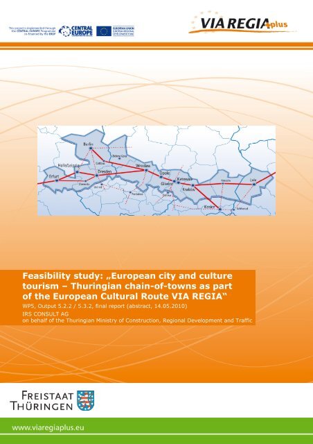
Feasibility study: „European city and culture tourism – Thuringian ...
Feasibility study: „European city and culture tourism – Thuringian ...
Feasibility study: „European city and culture tourism – Thuringian ...

You also want an ePaper? Increase the reach of your titles
YUMPU automatically turns print PDFs into web optimized ePapers that Google loves.
<strong>Feasibility</strong> <strong>study</strong>: <strong>„European</strong> <strong>city</strong> <strong>and</strong> <strong>culture</strong><br />
<strong>tourism</strong> <strong>–</strong> <strong>Thuringian</strong> chain-of-towns as part<br />
of the European Cultural Route VIA REGIA“<br />
WP5, Output 5.2.2 / 5.3.2, final report (abstract, 14.05.2010)<br />
IRS CONSULT AG<br />
on behalf of the <strong>Thuringian</strong> Ministry of Construction, Regional Development <strong>and</strong> Traffic
Final report, VIA REGIA <strong>„European</strong> <strong>city</strong>- <strong>and</strong> <strong>culture</strong> <strong>tourism</strong>“<br />
Table of contents<br />
1 Introduction <strong>and</strong> task .....................................................................................................4<br />
2 Approach <strong>and</strong> methods..................................................................................................5<br />
3 Economic significance of the <strong>tourism</strong> for Thuringia........................................................6<br />
3.1 Tourism in Thuringia ...............................................................................................6<br />
3.2 Culture <strong>tourism</strong> along the VIA REGIA......................................................................6<br />
3.3 Additional <strong>tourism</strong> infrastructure..............................................................................8<br />
3.3.1 Hiking trails ......................................................................................................8<br />
3.3.2 Bicycle traffic....................................................................................................9<br />
3.3.3 Natural l<strong>and</strong>scapes ..........................................................................................9<br />
3.3.4 Waterways .....................................................................................................10<br />
3.4 Mobility..................................................................................................................10<br />
4 Acquisition of destinations of the <strong>culture</strong> <strong>tourism</strong> in Saxony, Pol<strong>and</strong> <strong>and</strong> the Ukraine ..12<br />
4.1 Saxony..................................................................................................................12<br />
4.1.1 Characteristics of the region...........................................................................12<br />
4.1.2 Important cities of Saxony..............................................................................13<br />
4.2 Pol<strong>and</strong>...................................................................................................................15<br />
4.2.1 Region Dolnośląski ........................................................................................15<br />
4.2.2 Region Opolski...............................................................................................17<br />
4.2.3 Region Śląski.................................................................................................18<br />
4.2.4 Region Małopolska.........................................................................................19<br />
4.2.5 Region Podkarpackie .....................................................................................21<br />
4.2.6 Pol<strong>and</strong> <strong>–</strong> Summary.........................................................................................22<br />
4.3 Ukraine .................................................................................................................22<br />
4.3.1 Region Wolynsk .............................................................................................23<br />
4.3.2 Lvivska Region...............................................................................................23<br />
4.3.3 Rivnenska Region..........................................................................................25<br />
4.3.4 Zhytomyrska Region ......................................................................................25<br />
4.3.5 Kiewska Region .............................................................................................26<br />
4.3.6 Ukraine <strong>–</strong> Summary .......................................................................................27<br />
5 Marketing objectives....................................................................................................28<br />
6 Measures of marketing ................................................................................................32<br />
6.1 Audio guide system...............................................................................................32<br />
6.2 Print media............................................................................................................33<br />
7 Implementation proposals of a cycling route for the VIA REGIA along the corridor of its<br />
historical course ..................................................................................................................35<br />
Page 2 of 73
Final report, VIA REGIA <strong>„European</strong> <strong>city</strong>- <strong>and</strong> <strong>culture</strong> <strong>tourism</strong>“<br />
8 Implementation proposals on the positioning of sign- <strong>and</strong> information boards .............58<br />
9 Prospects ....................................................................................................................72<br />
Attachment<br />
Page 3 of 73
Final report, VIA REGIA <strong>„European</strong> <strong>city</strong>- <strong>and</strong> <strong>culture</strong> <strong>tourism</strong>“<br />
1 Introduction <strong>and</strong> task<br />
Being considered as a large coherent <strong>culture</strong>- <strong>and</strong> economic area, as well as a trade route<br />
being rich in tradition, the VIA REGIA looks back on a long history. Now <strong>and</strong> then, this area<br />
takes up an important connecting function between meaningful European states <strong>and</strong><br />
metropolises. It includes an economic area of 37 mill. people <strong>and</strong> provides a significant<br />
contribution to the emergence of a second core market sector in Europe.<br />
With respect to the overall context, it shall be made clear that the emphasis of the project<br />
„Europäischer Entwicklungskorridor III VIA REGIA“ (European Development Corridor III VIA<br />
REGIA) is put on the revival of the historical East-West Corridor as well as on improving the<br />
accessibility of this area. The existing potentials of the locations are to be linked with the<br />
market trends <strong>and</strong> infrastructure development, as also with the mobility decisions made<br />
individually <strong>and</strong> collectively by the actors.<br />
Thereby the traffic infrastructure constitutes merely one factor out of many. In general, it can<br />
be said that the accessibility of a location depends on the allocation of utilization in the area.<br />
The superior aim described finally gives way to the challenge <strong>and</strong> furthermore the prospect,<br />
arising out of the continually increasing mobility of the Eastern-European population.<br />
Constantly growing prosperity promotes the motorization in the new EU countries <strong>and</strong> leads<br />
to an enlargement of the movement radius, particularly as regards the neighbouring<br />
countries of these states. Hence, in the next years, also Thuringia will gain in importance as<br />
target area for these states so that its development focus is not only made up by economic,<br />
but also <strong>tourism</strong> aspects. The tourist commercialization of the Free State Thuringia in the<br />
Eastern European area hasn’t yet been the centre of attention. In fact, it is especially the<br />
high density in Thuringia’s cultural assets, turning out to be a crucial factor in order to push<br />
on a holistic strategy aiming to the <strong>tourism</strong> of the potential marketing in the <strong>city</strong>- <strong>and</strong> <strong>culture</strong><br />
<strong>tourism</strong> within the development corridor of the VIA REGIA, which may bring about an<br />
increase of the popularity on the “Destination Thuringia” as special part of the European<br />
<strong>culture</strong> street VIA REGIA primarily in Eastern Europe.<br />
The aim of this feasibility <strong>study</strong> focuses on the development of international marketing<br />
solutions for the development corridor VIA REGIA as natural l<strong>and</strong>scape <strong>and</strong> cultural area<br />
resp. optimization of already existing ones. This shall take place by way of example for the<br />
<strong>Thuringian</strong> part of the VIA REGIA, so as to show by means of a kind of “best case approach”<br />
the commercialization of tourist <strong>and</strong> cultural potentials of <strong>and</strong> in the East European area<br />
based on the core themes <strong>city</strong>- <strong>and</strong> <strong>culture</strong> <strong>tourism</strong>. In addition to the investigation of<br />
possibilities for the development of a Corporate Identity (CI) already described, this<br />
feasibility <strong>study</strong> <strong>and</strong> implementation of the measures, resulting thereof shall serve as<br />
contribution to the establishment of contacts between the actors <strong>and</strong> service providers within<br />
the scope of the development corridor VIA REGIA <strong>and</strong> bring about a strengthening of<br />
already existing relationships, in order to build up an European network in the area of <strong>city</strong>-<br />
<strong>and</strong> <strong>culture</strong> <strong>tourism</strong>. Moreover the results of the feasibility <strong>study</strong> will be presented at the<br />
Saxony National Exhibition “VIA REGIA” in Görlitz 2011.<br />
Page 4 of 73
Final report, VIA REGIA <strong>„European</strong> <strong>city</strong>- <strong>and</strong> <strong>culture</strong> <strong>tourism</strong>“<br />
2 Approach <strong>and</strong> methods<br />
The feasibility <strong>study</strong> has been worked out in the period of August 2009 to May 2010 <strong>and</strong><br />
documented in form of two interim reports, a final report <strong>and</strong> in this abstract.<br />
The analysis of the tourist <strong>and</strong> cultural potentials was divided into two measure levels:<br />
1. a measure level, being more roughly comprised the VIA REGIA in Saxony, Pol<strong>and</strong><br />
<strong>and</strong> the Ukraine;<br />
2. whereas the more detailed level related to the VIA REGIA in the Free State<br />
Thuringia.<br />
For the reason of integrating the relevant actors, two work shops were organized in order to<br />
enable a better development of objectives, while discussing the practicability of the<br />
approaches indicated at the same time. Apart from the feasibility of the measures, it was<br />
also the networking of the partners involved which was given special emphasis.<br />
The first workshop took place on the 11th of November 2009 in the <strong>Thuringian</strong> Ministry for<br />
Construction, Rural Development <strong>and</strong> Transportation. The invited parties were<br />
representatives of various Federal Ministries, the Saxony State Ministry of Internal Affairs,<br />
representatives of the cities, <strong>and</strong> relevant foundations. The workshop included the common<br />
discussion <strong>and</strong> development of objectives <strong>and</strong> proposals on the realization. The workshop<br />
topics at a glance:<br />
1. Marketing alignment in general<br />
2. Cooperation/Use „VIA REGIA <strong>–</strong> Kulturstraße des Europarates“ („VIA REGIA-Culture<br />
Street of the Council of Europe”)<br />
3. Target groups<br />
4. Uniform national appearance<br />
5. Cooperations with <strong>culture</strong> streets <strong>and</strong> organizations<br />
6. Use of display boards<br />
7. Bike-Hiking (Route network <strong>and</strong> offer items).<br />
Based on these subjects, the second workshop took place on the 3 rd of March 2010 like the<br />
previous one in the <strong>Thuringian</strong> Ministry for Construction, Rural Development <strong>and</strong><br />
Transportation. Emphasis was being laid on the presentation <strong>and</strong> discussion of the concrete<br />
concepts of realization. Invitations were sent to the same circle of participants that had<br />
already joined the first workshop. The agenda consisted of the topics:<br />
1. Presentation of the market research on VIA REGIA<br />
2. Presentation of the marketing objectives<br />
3. Outlining of the marketing sectors <strong>and</strong> discussion of the appropriate concepts with<br />
respect to the implementation.<br />
The discussion results <strong>and</strong> suggestions of both events were incorporated into the following<br />
conceptual work <strong>and</strong> further elaborated.<br />
Page 5 of 73
Final report, VIA REGIA <strong>„European</strong> <strong>city</strong>- <strong>and</strong> <strong>culture</strong> <strong>tourism</strong>“<br />
3 Economic significance of the <strong>tourism</strong> for Thuringia<br />
3.1 Tourism in Thuringia<br />
Thuringia features an impressive diversity of <strong>tourism</strong> destinations, <strong>culture</strong>-historical places,<br />
<strong>and</strong> miscellaneous l<strong>and</strong>scapes. Tourists visiting Thuringia are particularly interested in<br />
experiencing the nature, <strong>culture</strong>/education, as well as in health/recreation (Source:<br />
Reiseanalyse 2008, FUR). It can be assumed a total of approx. 12 mill. overnight-stays per<br />
each year in Thuringia. A quarter of the overnight-stays takes place in the <strong>city</strong> cluster. From<br />
all cities of the <strong>Thuringian</strong> <strong>city</strong> cluster, only Erfurt <strong>and</strong> Weimar rank amongst the top 18 of the<br />
federal German ranking list.<br />
One aim of the VIA REGIA projects is to promote the cross-border <strong>tourism</strong>. In doing so the<br />
focus is on stimulating the exchange with the new EU-acceding countries. Currently, visitors<br />
from Pol<strong>and</strong>, the Czech Republic, Slovakia, the Ukraine <strong>and</strong> Baltic states represent a<br />
definite minority in Thuringia. Hence, the official statistics of the year 2009 shows merely<br />
8,447 (or 4% of all arrivals) arrivals from Pol<strong>and</strong> <strong>and</strong> 3,790 (2% of all arrivals) from the<br />
Czech Republic.<br />
All in all, the <strong>tourism</strong> in Thuringia generates a gross annual income of 3,1734 mrd. EUR per<br />
each year (Source: Wirtschaftsfaktor Tourismus in Thüringen, dwif consulting, 2009). For<br />
this reason, the <strong>tourism</strong> represents one of the most significant economic sectors in the<br />
country. On the basis of these figures, it can be assumed, that employees in the <strong>tourism</strong><br />
industry generate an annual income of approx. 974 mill. EUR after deduction of diverse<br />
taxes <strong>and</strong> preparatory efforts.<br />
3.2 Culture <strong>tourism</strong> along the VIA REGIA<br />
Culture <strong>tourism</strong> describes trips to destinations, mainly cities, for the reason of visiting<br />
historical architecture or cultural events, symbolizing the past or current <strong>culture</strong> of a society.<br />
The VIA REGIA <strong>and</strong> its marketing potentials focus mainly on cultural <strong>tourism</strong> <strong>and</strong> hence on<br />
the <strong>city</strong> axis between Eisenach <strong>and</strong> Weimar.<br />
Apart from the <strong>city</strong> Weimar, national tourist significance is only held as well by Erfurt.<br />
(Source: Study on <strong>city</strong> development of the <strong>Thuringian</strong> urban framework).<br />
An absolute tourist significance for the cities of Thuringia can only be derived by a holistic<br />
consideration, which refers not only to the urban area. The cities are distinguished by their<br />
close distance to interesting natural areas, providing apart from <strong>culture</strong> <strong>and</strong> tourist<br />
attractions as well nature-related destinations, like for instance the Ilmtal at Weimar or the<br />
Saaletal inclusive the Dornburger Schlösser near Jena.<br />
Owing to its historical <strong>and</strong> cultural places, but also due to the fact of being the former <strong>culture</strong><br />
capitol of Europe (1999), the <strong>city</strong> of Weimar has the most important significance for tourists<br />
within Thuringia.<br />
More than a third of Germany’s former capitol- <strong>and</strong> residence cities (being capitol until 1918)<br />
are located in Thuringia. Because of this, there can be found a relatively high density in<br />
cultural goods, created by Dukes or Earls <strong>and</strong> which are located on a small regional area.<br />
Due to the constraints of space, the competition between the owners of the manor houses<br />
Page 6 of 73
Final report, VIA REGIA <strong>„European</strong> <strong>city</strong>- <strong>and</strong> <strong>culture</strong> <strong>tourism</strong>“<br />
proved to be enormously high, so that there were built splendid castles <strong>and</strong> magnificent<br />
gardens, attracting personalities of art, <strong>culture</strong> <strong>and</strong> science to Thuringia. The tourist-related<br />
strengths of the <strong>Thuringian</strong> cities are primarily distinguished by the historical architecture<br />
<strong>culture</strong> as well as by the regional state <strong>culture</strong> (residential <strong>culture</strong>). Also traditions of the art<br />
h<strong>and</strong>icraft <strong>and</strong> products, being regionally typical belong to the <strong>culture</strong>-related tourist<br />
attractions.<br />
These heritages constitute nowadays the potential for a internationally successful <strong>culture</strong><br />
<strong>tourism</strong> in Thuringia <strong>and</strong> simultaneously make up the approach for a common marketing.<br />
Besides the tourist attractions, the cities along the <strong>Thuringian</strong> <strong>city</strong> cluster make as well<br />
directed use of events in order to support the commercialization. The agenda of the annual<br />
event highlights, relevant for that, is shown below (Source: http://www.thueringen<strong>tourism</strong>us.de).<br />
• Thüringer Bachwochen: largest music festival in Thuringia plus „Lange Nacht der<br />
Hausmusik“, taking place for 3 weeks during March/April in Arnstadt, Eisenach, Erfurt,<br />
Mühlhausen, Waltershausen, Wechmar und Weimar<br />
• Krämerbrückenfest: largest old town festival in Thuringia including medieval market<br />
taking place on the third weekend in June in Erfurt<br />
• DomStufen-Festspiele und Sommertheater: Barfüßer-Ruine <strong>and</strong> stairs of the Mariendom<br />
are made up as open air stages in July/August in Erfurt<br />
• Luther - Das Fest: Historic spectacle in August in Eisenach<br />
• Weihnachtsmarkt Erfurt: including fairy tale forest <strong>and</strong> the florist exhibition „Florales zur<br />
Weihnachtszeit“ in front of the scenery of the Domberg in December in Erfurt.<br />
Apart from the annually celebrated events, one-time large-scale events like the state<br />
exhibition 2007 „Elisabeth von Thüringen“ or the exhibition series on occasion of the<br />
Bauhaus anniversary in 2009 may turn out to become important anchor points regarding the<br />
commercialization of the VIA REGIA.<br />
In 2008 the Luther decade has been opened <strong>and</strong> is an event series, aiming to the jubilee of<br />
the 550 th anniversary of Luther’s posting of his theses in the year 2017. Each year within this<br />
period is dedicated to a particular theme.<br />
Selected cities of Thuringia, which are located in the VIA REGIA development corridor, are<br />
individually introduced in the framework of the bicycle offer components set out in chapter 8.<br />
The cities Gera <strong>and</strong> Altenburg are situated at the cycling trail Thuringia <strong>city</strong> cluster <strong>and</strong> touch<br />
the D4 cycling trail. Since these are, however, not included as part of the offer components,<br />
they are already described at this point as follows:<br />
Gera<br />
In Thuringia’s East at the „Weißen Elster“, the <strong>city</strong> Gera is situated. The official first-mention,<br />
dated with the year 995; the <strong>city</strong>’s foundation took place in the year 1237. Gera belongs also<br />
to one of the former residential cities <strong>and</strong> served as capitol for the Principality Reuß j. L. Due<br />
to the minor size of the Principality, there can be found representative buildings, but not to<br />
the same extent like it’s the case for instance in Weimar. Schloss Osterstein, as residence<br />
Page 7 of 73
Final report, VIA REGIA <strong>„European</strong> <strong>city</strong>- <strong>and</strong> <strong>culture</strong> <strong>tourism</strong>“<br />
was destroyed during a bomb attack in World War II, <strong>and</strong> only one tower was preserved (the<br />
castle’s ruin was demolished), serving today as location for regular exhibitions.<br />
In the course of the industrialization <strong>and</strong> owing to the fabric- <strong>and</strong> textile industry Gera<br />
developed to one of the wealthiest cities of Germany. Even in these days, more than 100<br />
mansions in the <strong>city</strong> area provide evidence for the glamour of times past. The former<br />
Wismut-Tagebau has been renatured <strong>and</strong> the surrounding l<strong>and</strong>scape prepared. This project<br />
took place within the framework of the BUGA <strong>and</strong> was successfully completed in 2007. It<br />
represents a revalorization of the region from the tourist perspective. Even in year 1 after the<br />
BUGA, Gera still had higher figures of overnight-stays than in the previous year. On top of<br />
that, the premises which had been used for the BUGA were preserved <strong>and</strong> changed into<br />
attractive park ways.<br />
Altenburg<br />
Altenburg, as well being a former residential <strong>city</strong>, has a history going back to more than 1000<br />
years (first-mention in the year 976). The location nearby important trade routes, namely<br />
exactly in the tri-<strong>city</strong> area Leipzig <strong>–</strong> Chemnitz <strong>–</strong> Gera, <strong>and</strong> a flourishing social life were the<br />
determinative factors of the <strong>city</strong>’s development. As can be traced back to the years<br />
between1810 <strong>and</strong> 1815, the card game Skat was invented in Altenburg. Card sets have<br />
been produced in the <strong>city</strong> since 500 years; the „Bechsteinsche“ card set factory, established<br />
in 1832 developed to the largest card set manufacturer of Germany. With the Lindenau-<br />
Museum in Altenburg, which holds an extensive <strong>and</strong> varied art collection, the <strong>city</strong> gained an<br />
entry in the Blaubuch of the most important cultural facilities in East Germany.<br />
A card set collection can be viewed in the Residenzschloss Altenburg. A highlight is the<br />
annually recurring festival in honour of the “Prinzenraub” in Altenburg.<br />
3.3 Additional <strong>tourism</strong> infrastructure<br />
In addition to approx. 16,000 km well-built hiking trails <strong>and</strong> a cross-regional long-distance<br />
cycling route, Thuringia possesses of varied natural l<strong>and</strong>scapes <strong>and</strong> waterways. Moreover,<br />
theme streets such as the „Klassikerstraße“ (Eisenach <strong>–</strong> Gotha <strong>–</strong> Erfurt - Weimar <strong>–</strong> Arnstadt<br />
<strong>–</strong> Jena) or the TRANSROMANICA (recognised <strong>culture</strong> street by the European Council)<br />
deserve to be mentioned as another <strong>tourism</strong> infrastructure.<br />
3.3.1 Hiking trails<br />
The <strong>Thuringian</strong> forest is as well known for its long-distance hiking trail, being the most<br />
popular one all throughout Germany, namely the Rennsteig, mainly in altitudes from 500 to<br />
970 meters. That’s a hiking trail, leading from Hörschel a. d. Werra nearby Eisenach to<br />
Blankenstein a. d. Saale over 169.3 km <strong>and</strong> distinguishing itself by being a certified „Quality<br />
Hiking Trail“. Furthermore, it represents the longest cultural relic of Thuringia.<br />
Page 8 of 73
Final report, VIA REGIA <strong>„European</strong> <strong>city</strong>- <strong>and</strong> <strong>culture</strong> <strong>tourism</strong>“<br />
In addition to the Rennsteig, there are still more thematic hiking trails. These include the:<br />
- Vogtl<strong>and</strong> Panorama Trail<br />
- Goethe hiking trail from Ilmenau to Stützerbach<br />
- dam trail Zeulenroda<br />
- Panorama trail Schwarzatal<br />
- summit hiking trail Suhl<br />
- Goldpfad.<br />
Further hiking trails are being developed by the <strong>Thuringian</strong> Geoparks „Inselsberg <strong>–</strong> Drei<br />
Gleichen“ <strong>and</strong> Kyffhäuser“ in co-operation with the “Panorama Museum Bad<br />
Frankenhausen”, the “Kaiserpfalz” <strong>and</strong> the Kyffhäuser monument <strong>and</strong> with the<br />
“Barbarossahöhle”.<br />
3.3.2 Bicycle traffic<br />
Thuringia has been deemed as hiking destination <strong>and</strong> ideal place for <strong>culture</strong> interested<br />
tourists for a long time. In the course of the last years, the Federal State Thuringia has<br />
increasingly established itself as destination for bicycle tours. This trend is also supported by<br />
the growing popularity of the cycling in the everyday life. The urgency of this matter has also<br />
been recognized by the policy, therefore a strategically well-founded policy <strong>and</strong> support for a<br />
positive advancement has been provided with the Bicycle Traffic Concept for the Free State<br />
Thuringia from the year 2008 (http://www.radroutenplaner.thueringen.de)<br />
The requirements for the discovery of the VIA REGIA <strong>and</strong> the adjacent regions on or along<br />
the cycling routes of the <strong>Thuringian</strong> <strong>city</strong> cluster are already provided to a large extent.<br />
The Free State Thuringia can resort to a dense network of cycling trails. All in all the Free<br />
State Thuringia comes with over 13 long-distance cycling trails <strong>and</strong> 22 regional cycling trails.<br />
The already existing long-distance cycling trail <strong>Thuringian</strong> <strong>city</strong> cluster is of particular interest<br />
to the VIA REGIA. It´s already designated <strong>and</strong> signposted as such one. It leads along the<br />
historical VIA REGIA <strong>and</strong> comprises all cities of the VIA REGIA from Eisenach to Altenburg.<br />
Along the long-distance cycling trail <strong>Thuringian</strong> <strong>city</strong> cluster, the German route D4 runs in the<br />
sector Eisenach <strong>–</strong> east of Ronneburg. The D4 route Aachen <strong>–</strong> Zittau (center-Germany-route)<br />
continues through Crimmitschau (Saxony) on the long-distance cycling trail Saxony City<br />
Route towards Zittau.<br />
3.3.3 Natural l<strong>and</strong>scapes<br />
Thuringia is also referred to as „The green heart of Germany“, which is owing to the mostly<br />
solid natural- <strong>and</strong> cultural l<strong>and</strong>scapes comprising a considerably high share in forest area for<br />
one reason on the one h<strong>and</strong> <strong>and</strong> on the other one, as it’s situated in the centre of Germany.<br />
A majority of the guests associates as well l<strong>and</strong>scape, nature <strong>and</strong> recreation with Thuringia<br />
(source: results report of the guest survey in the <strong>Thuringian</strong> Forest).<br />
In immediate vicinity to the VIA REGIA, the South is bordered with the natural park<br />
<strong>Thuringian</strong> Forest <strong>and</strong> the GeoPark Inselsberg <strong>–</strong> Drei Gleichen as in the North with the<br />
national park Hainich <strong>and</strong> the natural park Eichsfeld-Hainich-Werratal.<br />
Page 9 of 73
Final report, VIA REGIA <strong>„European</strong> <strong>city</strong>- <strong>and</strong> <strong>culture</strong> <strong>tourism</strong>“<br />
3.3.4 Waterways<br />
The VIA REGIA is crossed by several rivers, which are partly accompanied by tourist routes.<br />
Thus it’s possible to undertake intensive water hiking on the Werra <strong>and</strong> Saale or to try out<br />
most different varieties of water sports, e.g. on the Saale dams Hohenwarte <strong>and</strong> Bleiloch.<br />
But also other rivers provide the opportunity for wataer hiking, like for instance the Unstrut,<br />
Ilm or Gera.<br />
River Intersection<br />
Settlement<br />
Structure<br />
Ilm Weimar Ilmtal-cycling trail,<br />
water-hiking<br />
Saale Jena Water-hiking,<strong>tourism</strong><br />
infrastructure,Saalebike-hiking-trail<br />
Unstrut In parallel to<br />
VIA Regia<br />
Weiße<br />
Elster<br />
Tourism Development Destinations of cultural significance<br />
(selection)<br />
Water-hiking,Unstrutcycling-trail<br />
Gera Water-hiking,White<br />
water rafting<br />
tours,Elster-cycling-trail<br />
Gera Erfurt Water-hiking, Geracycling-trail<br />
Werra Eisenach Water-hiking, boat<br />
rental, Raft rides,<br />
Werratal-Cycling-Trail<br />
UNESCO World Heritage Sites<br />
Weimar,Church “St. Marien”, Stadtilm<br />
,”Oberschloß und Niederburg”<br />
Kranichfeld,Bad Sulza (Weintor)<br />
“Deutsch-Deutsches Museum”<br />
Mödlareuth, Märchenwald Saalburg,<br />
Saalfelder Feengrotten, Schloß<br />
Heidecksburg, Dornburger Schlösser<br />
Wasserburg Heldrungen, Kyffhäuser<br />
(Barbarossa),Marienkirche<br />
Mühlhausen,Ruine Wendelstein,Arche<br />
Nebra<br />
Greizer Park und Sommerpalais, Oberes<br />
Schloss, unteres Schloss,Kloster<br />
Mildenfurth, Otto-Dix-Haus,<br />
Hofwiesenpark, Heinrich-Schütz-Haus,<br />
Erfurt: Mariendom, Severinkirche,<br />
Krämerbrücke, Zitadelle Cyriaksburg,<br />
Michaeliskirche<br />
UNESCO World Heritage Site Wartburg,<br />
Themar, Meiningen,Schloß<br />
Gerstungen,Märchenhöhle Walldorf,<br />
Erlebnisbergwerk Merkers<br />
Image 1: Waterway nearby the VIA REGIA <strong>and</strong> its tourist infrastructure provision<br />
Source: www.thueringen-<strong>tourism</strong>us.de<br />
3.4 Mobility<br />
Thuringia was <strong>and</strong> is a transit country due to its central situation in Middle Europe <strong>and</strong> its<br />
geomorphologic condition <strong>and</strong> takes an important role within the entire <strong>culture</strong>-, economy-<br />
<strong>and</strong> trading area of the VIA REGIA. As well its situation as the relief contributed to the early<br />
development of the traffic related infrastructure in Thuringia.<br />
The incident succession of the cities Eisenach, Gotha <strong>and</strong> Erfurt over to Naumburg along<br />
the West-East traffic pulse allows for the conclusion that traffic roads have started to develop<br />
at a quite early time. This fact, combined with the flourishing trade made up the main<br />
reasons for the establishment of today’s cities constituting the <strong>Thuringian</strong> <strong>city</strong> cluster along<br />
that tie.<br />
Page 10 of 73
Final report, VIA REGIA <strong>„European</strong> <strong>city</strong>- <strong>and</strong> <strong>culture</strong> <strong>tourism</strong>“<br />
Motorised individual traffic<br />
The most important arterial road of the Free State Thuringia <strong>and</strong> the VIA REGIA is the<br />
Bundesautobahn 4, crossing the Free State from West to East nearly parallel to the<br />
<strong>Thuringian</strong> <strong>city</strong> cluster <strong>and</strong> linking, as part of the Transeuropean Transportation Network<br />
(TEN) the VIA REGIA with the subordinated road axes towards East- <strong>and</strong> West Europe.<br />
Furthermore there are another two road axes crossing the Free State in North-South<br />
direction which are namely the Bundesautobahnen 9 <strong>and</strong> 71.<br />
Air traffic<br />
The Free State Thuringia offers with the airports Erfurt <strong>and</strong> Leipzig-Altenburg national <strong>and</strong><br />
international flight connections.<br />
Owing to its cooperated airline Cirrus Airlines, the international airport Erfurt is in the position<br />
to offer daily scheduled flights to Munich (codeshare with Lufthansa). From Munich the<br />
worldwide Lufthansa flightconnections are available. Charter flights with prime destinations<br />
in the South of Europe are offered additionally by Air Berlin.<br />
Railway transport<br />
The reasons for the well development of the Free State Thuringia in general <strong>and</strong> the <strong>city</strong><br />
cluster in particular lie primarily in the geographic situation of Thuringia in the middle of<br />
Germany <strong>and</strong> in the continuous expansion of the location Erfurt as railway junction point,<br />
which has been ongoing over the last years.<br />
Important long-distance routes, crossing Thuringia include:<br />
• ICE route Berlin <strong>–</strong> Munich with stop in Jena Paradies. The route is served every 2<br />
hours<br />
• ICE route Frankfurt (Main) <strong>–</strong> Dresden with stops in Eisenach, Gotha, Erfurt <strong>and</strong><br />
Weimar. The route is served every hour<br />
• ICE/IC route Düsseldorf <strong>–</strong> Stralsund with stops in Eisenach, Gotha, Erfurt <strong>and</strong><br />
Weimar. The route is served every 2 hours.<br />
Another future milestone of the railway infrastructure <strong>and</strong> the connection of Thuringia to<br />
Europe will be the expansion <strong>and</strong> completion of the Trans-European high-speed connection<br />
Verona-Munich-Erfurt-Berlin. This will make possible a fast connection to South Europe.<br />
For train journeys across Thuringia the state provides, besides the well-developed east-west<br />
railway infrastructure (<strong>city</strong> cluster Thuringia), an adequate regional development based on<br />
this „main branch“. All cities of Thuringia with more than 10,000 inhabitants are connected to<br />
the railway network.<br />
The main axis is represented by the <strong>city</strong> cluster which is served at least hourly by the DB<br />
Regio from Eisenach to Gotha over Erfurt through to Weimar. In the East of Weimar, the<br />
capa<strong>city</strong> of the railway infrastructure is to be improved, as already mentioned in the previous<br />
section. Apart from that, it comes to a splitting of the main axis. While one track section forks<br />
off towards North in the direction of Apolda (connection possible without change from<br />
Eisenach to Apolda), another section connects the cities Jena, Gera <strong>and</strong> Altenburg. This<br />
connection leading from Eisenach to Altenburg requires at least one change in Weimar <strong>and</strong><br />
Erfurt.<br />
Page 11 of 73
Final report, VIA REGIA <strong>„European</strong> <strong>city</strong>- <strong>and</strong> <strong>culture</strong> <strong>tourism</strong>“<br />
4 Acquisition of destinations of the <strong>culture</strong> <strong>tourism</strong> in Saxony, Pol<strong>and</strong> <strong>and</strong> the<br />
Ukraine<br />
4.1 Saxony<br />
The emphasis of the investigations carried out in the framework of this <strong>study</strong> is not only set<br />
on the historical course of the VIA REGIA in the Free State of Saxony, but also includes an<br />
introduction of selected prominent cultural trip destinations like Dresden <strong>and</strong> Meißen, which,<br />
though not located immediately at the VIA REGIA route, nevertheless make up a part of the<br />
VIA REGIA development corridor.<br />
The VIA REGIA in the way it represents itself in the Free State of Saxony, is situated along<br />
places like Markranstädt, Leipzig, Eilenburg, Wurzen, Grimma, Mutzschen, Dahlen, Strehla,<br />
Oschatz, Riesa, Großenhain, Schönfeld, Königsbrück, Kamenz, Panschwitz-Kuckau,<br />
Bautzen, Weißenburg, Reichenbach/O. L., <strong>and</strong> Markersdorf, in order to eventually continue<br />
its course in Görlitz <strong>and</strong> through Pol<strong>and</strong> <strong>and</strong> the Ukraine. For the upholding of cultural<br />
traditions, the development of the former <strong>and</strong> new connection Hohe Straße/VIA REGIA for<br />
education, occupation, <strong>and</strong> international exchange, as well as for the reason to promote<br />
tolerance <strong>and</strong> international underst<strong>and</strong>ing, the association VIA REGIA Begegnungsraum <strong>–</strong><br />
L<strong>and</strong>esverb<strong>and</strong> Sachsen e. V. (http://www.viaregia-sachsen.de) was formed 2003 in the<br />
Free State of Saxony.<br />
4.1.1 Characteristics of the region<br />
Owing to its diversity in <strong>culture</strong> <strong>and</strong> nature, the Free State of Saxony is also deemed to be a<br />
popular getaway-destination in Germany. The <strong>tourism</strong> industry in Saxony is not only<br />
constituted by the architecture <strong>and</strong> cultural opportunities in cities like Dresden, Meißen, or<br />
Görlitz: The six holiday regions Oberlausitz, Sächsisches Elbl<strong>and</strong>, Sächsische Schweiz,<br />
Sächsisches Burgen- <strong>and</strong> Heidel<strong>and</strong>, Erzgebirge <strong>and</strong> Vogtl<strong>and</strong> as Saxon l<strong>and</strong>scapes are<br />
touristic in character <strong>and</strong> represent attractive journey destinations for active travellers <strong>and</strong><br />
nature lovers. In addition to active- <strong>and</strong> recreation holidays, these destinations provide as<br />
well highlights such as castles <strong>and</strong> palaces, mining tradition, art <strong>and</strong> tradition, <strong>and</strong> regional<br />
culinary products to mention just a few.<br />
The Free State of Saxony has well-developed <strong>and</strong> sign-posted long-distance cycling routes,<br />
such as the Elbe-cycling trail, the Elster-cycling trail, the Muldental-cycling-hiking trail, <strong>and</strong><br />
the Saxon <strong>city</strong> route, as well as numerous thematic cycling trails <strong>and</strong> such being generally<br />
known as euro-regional cycling trails like the circuit Dreiländereck <strong>and</strong> the Rübezahlweg.<br />
As well the hiking on sign-posted hiking trails <strong>and</strong> long-distance hiking trails such as the<br />
cross-border long-distance hiking trail Vogtl<strong>and</strong> Panorama Weg (Thuringia, Saxony, Bavaria,<br />
<strong>and</strong> Bohemia) is a popular leisure activity in Saxony. Particularly in the Erzgebirge, winter<br />
<strong>tourism</strong> plays a major role.<br />
To be mentioned separately at this point is the euro-region Neiße-Nisa-Nysa, an<br />
amalgamation of three border regions <strong>and</strong> the contact region between Germany, Czech<br />
Republic, <strong>and</strong> Pol<strong>and</strong>. This region that distinguishes itself by its exceptionally geo-political<br />
location is a junction at which the VIA REGIA crosses the former Salzstraße, which led from<br />
the north to the south.<br />
Page 12 of 73
Final report, VIA REGIA <strong>„European</strong> <strong>city</strong>- <strong>and</strong> <strong>culture</strong> <strong>tourism</strong>“<br />
4.1.2 Important cities of Saxony<br />
There are numerous cities in Saxony that are due to their situation <strong>and</strong> history closely linked<br />
with the VIA REGIA. The cultural-historic <strong>city</strong> cluster of Saxony starts in Leipzig <strong>and</strong> ends in<br />
Görlitz, where the VIA REGIA continues its route in Pol<strong>and</strong> after crossing the borderline.<br />
Below, a few of these cities will be considered under their <strong>culture</strong>-related tourist<br />
characteristics.<br />
Leipzig<br />
Leipzig was founded at the crossroads of two old trade routes, the VIA REGIA <strong>and</strong> Via<br />
Imperii in the year 1165. The tradition of Leipzig under the aspect of a trade fair <strong>city</strong> goes<br />
back to the year 1497, when the imperial right of holding trade fairs was granted.<br />
As well the “Oper Leipzig” can look back to a tradition of more than 300 years. The <strong>city</strong> has<br />
numerous museums, like for instance the “Bach-Museum”, the “Mendelssohn-Haus”, the<br />
“Grassi Museum for Ethnology”, the “Sommertheater”, <strong>and</strong> the “Musikinstrumenten<br />
Museum”, being popular for numerous, brilliant music events like for instance the “Bachfest”,<br />
the “Mendelssohn-Festtage”, the “Jazztage” or the “a cappella Festival”.<br />
Wurzen<br />
Wurzen is situated at the ecumenic pilgrim’s route of the St. Jakobus which does for the<br />
most part follow the old railway of the medieval VIA REGIA.<br />
With the cathedrale <strong>and</strong> castle, the centre of the <strong>city</strong> represents an eye-catching highlight for<br />
tourists interested in <strong>culture</strong>.<br />
Still, the environment of Wurzen is mainly left in its natural state thus pretty interesting for<br />
hikers <strong>and</strong> cyclists.<br />
Grimma<br />
Situated in the Muldental, this <strong>city</strong> was founded from the margrave Otto the Rich in the year<br />
1170 <strong>and</strong> had once been a flourishing location. Witnesses of this town’s area include the<br />
historic <strong>city</strong> hall with its remarkable renaissance facade, one fragment of the <strong>city</strong>’s<br />
fortification, the castle, various museums like for instance the “Göschenhaus” or the<br />
“Seume-Haus” as well as the “Wassermühle Höfgen”, <strong>and</strong> the district museum.<br />
Grimma is located at the cycling <strong>and</strong> hiking trail of Muldental, which runs across public roads<br />
with light traffic. The route has a total length of approx. 180 km, from which around 60 km<br />
run through the Muldental district.<br />
Oschatz<br />
Being initially mentioned in the year 1238, Oschatz lived through a changeful history,<br />
becoming visible for the visitor in the well preserved <strong>city</strong> core: Beautiful middle-class houses<br />
in the renaissance style, the <strong>city</strong> hall which has been rebuilt in 1842 after the great fire under<br />
direction of the famous master builder from Dresden Gottfried Semper, as well as the 75 m<br />
high twin towers of the St. Aegidienkirche. One of the <strong>city</strong>’s oldest buildings is the medieval<br />
minster, being the only building, which has been preserved from the ruins of the<br />
Franziskaner Kloster. A particular attraction of the <strong>city</strong> is the „kleine<br />
Schmalspurdampfeisenbahn”. It’s still in operation <strong>and</strong> drives its route as economy- <strong>and</strong><br />
tradition train (goods <strong>and</strong> persons) between Oschatz <strong>and</strong> Mügeln, which provides for a high<br />
attraction level for visitors in this town. Hiking- <strong>and</strong> cycling trails lead through the „Oschatzer<br />
Page 13 of 73
Final report, VIA REGIA <strong>„European</strong> <strong>city</strong>- <strong>and</strong> <strong>culture</strong> <strong>tourism</strong>“<br />
Stadtwald“, passing by the Wüsten Schloss Osterl<strong>and</strong> tot he Collm (314m) <strong>and</strong> Wermsdorfer<br />
Wald.<br />
Meißen<br />
This 1000 year-old <strong>city</strong>, being situated at the „Sächsischen Weinstraße“ is characterized by<br />
its medieval townscape, precious porcelain (popular all over the world for the manufactory of<br />
the Meissen porcelain, the very first porcelain of Europe since 1708) <strong>and</strong> the wine yards of<br />
the Elbtal. The skyline of this picturesque town is distinguished by the „Meißner Dom“<br />
(Meißen Cathedral) <strong>and</strong> the Albrechtsburg which is the first castle building in the Germanspeaking<br />
area.<br />
Meanwhile, Meißen has also become popular for its numerous festivals, like the<br />
AlbrechtsBurgfest, the Pottery market <strong>and</strong> the Wine Festival.<br />
The completed “Elbe - Cycling Trail” (with a total length of 860 km!) proves to be very<br />
popular as place of excursion.<br />
The historic paddle steamers of the Saxon Steam Navigation with an age between 80 <strong>and</strong><br />
130 years are deemed to be particularly appealing to tourists, visiting the surrounding areas<br />
of Meissen. The historic fleed’s route between Seußlitz <strong>and</strong> Bad Sch<strong>and</strong>au in the Saxon<br />
Switzerl<strong>and</strong> also traverses one of the most beautiful river l<strong>and</strong>scapes of Europe, namely the<br />
Dresdner Elbtal.<br />
Großenhain<br />
In the Middle Ages, Großenhain gained great importance at the VIA REGIA <strong>and</strong> was<br />
considered as one of the most significant town festivals of Saxony. The keep <strong>and</strong> fragments<br />
of the <strong>city</strong>’s fortification still remind of the changeful history. Most of buildings in the historic<br />
<strong>city</strong> centre originate from the 18th century.<br />
The probably most important personality of Großenhains in the 19th century was Karl<br />
Benjamin Preusker, as he was the one, who built the first public library of Germany in<br />
Großenhain in the year 1828.<br />
Worthwhile destinations for trips near Großenhain are a.o. the „Schönfelder<br />
Schlossensemble“, the „Palais Zabeltitz“ <strong>and</strong> “Schloss Moritzburg”. Friends of cycling <strong>and</strong><br />
hiking can find more than 380km cycling <strong>and</strong> hiking trails in <strong>and</strong> around Großenhain.<br />
Dresden<br />
Dresden comes up with 800 years of cultural history being linked with modern developments<br />
in the fields of architecture, art, music, <strong>and</strong> theatre in a vibrant way. Hence, tourists will be<br />
impressed by the paramount attractions offered by this European <strong>culture</strong> metropolis.<br />
The historic <strong>city</strong> centre <strong>and</strong> its unique ensemble comprising the „Zwinger“, „Semperoper“,<br />
„Residenzschloss“, „Brühlscher Terrasse“ <strong>and</strong> the „Frauenkirche“, which represent areas of<br />
excellence in the world <strong>culture</strong> are popular all over the world <strong>and</strong> attract millions of visitors.<br />
Bautzen<br />
Bautzen belongs to the sights at the Spree <strong>–</strong> cycling trail, stretching itself across a length of<br />
420 km starting from the river heads of the Spree behind Bautzen running to Berlin. Above<br />
all, it’s the historic <strong>city</strong> core, comprising around 1,500 building monuments <strong>and</strong> a <strong>city</strong><br />
fortification, which has been already completely preserved. Culture-interested visitors will get<br />
their money’s worth as the <strong>city</strong> offer comes up with a. o. remains of a living-together of<br />
Page 14 of 73
Final report, VIA REGIA <strong>„European</strong> <strong>city</strong>- <strong>and</strong> <strong>culture</strong> <strong>tourism</strong>“<br />
German <strong>and</strong> Sorbic traditions (the „Sorbische Museum“ on the Ortenburg <strong>and</strong> the<br />
professionally bilingual theater in Germany being the only one of its kind, namely the<br />
Deutsch-Sorbische Volkstheater) that has lasted for ages. Moreover, embedded between<br />
the lovely „Oberlausitzer Bergl<strong>and</strong>“ <strong>and</strong> a heath- <strong>and</strong> pond l<strong>and</strong>scape, being unique in<br />
Europe, Bautzen provides a full variety of opportunities for tourists in its outer conurbation<br />
area.<br />
Görlitz<br />
Having been hardly destroyed in World War II, Görlitz represents a masterpiece of the<br />
European architecture. The <strong>city</strong> is deemed to be starting point of numerous historic exploring<br />
tours. The most famous sights in Görlitz are the copy of the Holy Sepulchre in Jerusalem,<br />
the “Schlesische Museum”, the “Görlitzer Synagoge”, the “Oberlausitzische Bibliothek” <strong>and</strong><br />
furthermore the “Museum für Naturkunde”.<br />
From May until October 2011, Görlitz is going to host a very special event: The 3 rd Saxon<br />
State Exhibition under the theme “VIA REGIA, 800 Jahre Bewegung und Begegnung”.<br />
4.2 Pol<strong>and</strong><br />
In the course of its boom years, the VIA REGIA was bearing a special meaning: it didn’t only<br />
link countless cities with each other, but was also attached with a symbolic meaning, being<br />
of particular importance for the former European <strong>culture</strong>, as it connected the West with the<br />
East. The following chapter describes the highlights <strong>and</strong> its possible potentials in the tourist<br />
commercialization of the VIA REGIA in Pol<strong>and</strong>. The five regions, which are crossed by the<br />
VIA REGIA are considered to be the most attractive regions for tourists throughout Pol<strong>and</strong>.<br />
4.2.1 Region Dolnośląski<br />
The VIA REGIA’s course in Pol<strong>and</strong> starts at a place in the region Dolnośląski. The<br />
multifaceted face of this region bears large potential for a tourist commercialization of this<br />
<strong>culture</strong> street.<br />
4.2.1.1 Characteristic of the region<br />
Amongst other, this region counts numerous castles <strong>and</strong> manor houses to its highlights,<br />
whose architectural style was continuously changed during the course of history. The most<br />
famous ones <strong>and</strong> those that are most worth of being seen can be found in KsiąŜ, Czocha,<br />
Grodno, <strong>and</strong> Bolków.<br />
Another place, bearing great significance for tourists is the Southern part of the region,<br />
called the Sudetes. They rank among the oldest mountain ranges of Europe. Here, the offer<br />
in plenty of disused galleries <strong>and</strong> mines prove to be highly appealing to tourists. In the<br />
course of these underground routes, the visitors are given a glimpse of the mining history.<br />
The coal mine in Nowa Ruda <strong>and</strong> the gold mine in Zloty Stok belong to the most popular<br />
ones in this context.<br />
The region is provided with a very well-developed tourist infrastructure which is due to a.o. a<br />
high number of health resorts (spa waters), several national- <strong>and</strong> natural parks, reserves,<br />
<strong>and</strong> lots of other interesting locations.<br />
The “Riesengebirge” is one of those tourist regions, coming up with a tourist region being<br />
most rich in tradition across Middle Europe <strong>and</strong> a well-developed network of hiking trails<br />
Page 15 of 73
Final report, VIA REGIA <strong>„European</strong> <strong>city</strong>- <strong>and</strong> <strong>culture</strong> <strong>tourism</strong>“<br />
which was constructed even before World War II. With a total length of several hundreds of<br />
kilometers, the trails‘ structure connects all routes, being situated on the Czech side. One<br />
example for this is represented by the „Weg der Polnisch-Tschechischen Freundschaft“<br />
(Path of the Polish-Czech Friendship).<br />
4.2.1.2 Most important cities of the region Dolnośląski<br />
As regards the <strong>tourism</strong> <strong>and</strong> <strong>culture</strong>, the cities Wrocław, Świdnica <strong>and</strong> Kłodzko are definitely<br />
to be mentioned as cities with the most significance for the region.<br />
Wrocław<br />
Wrocław, the region’s capitol enchants with its over thous<strong>and</strong> year history. As historic centre<br />
of Silesia, it’s not surprising that it’s considered as one of most beautiful <strong>and</strong> largest cities of<br />
Pol<strong>and</strong>. The <strong>city</strong>’s history laden situation, which is at the border point of three states, is<br />
reflected in its sights: in the oldest part, located on the former isl<strong>and</strong> on the Oder <strong>and</strong> whose<br />
diffluence, one can find Ostrów Tumski und Wyspa Piasek (S<strong>and</strong> Isl<strong>and</strong>) <strong>–</strong> that is the<br />
medieval residential part, counting to the historical monuments of Pol<strong>and</strong>. The second<br />
meaningful object of the <strong>city</strong> is the „Jahrhunderthalle“ (Century Hall), which has been<br />
honored with the inclusion into the World Heritage Sites of the UNESCO. Further sights are<br />
the church complex to the Saint Cross <strong>and</strong> the church to the Saint Bartholomaeus.<br />
The <strong>city</strong> itself comes up with numerous bicycle routes which can be found on the town’s<br />
homepage under „Rower w mieście“ (Bicycle in town) . The website includes as well helpful<br />
links for cyclists containing news, tours, parking facilities, etc.<br />
The network of cycling routes in Wroclaw ranks among the best-developed ones in Pol<strong>and</strong>,<br />
which is attributable to an initiative, the “Programm 100 km” being realized since 1994.<br />
Despite this project, it was determined that there would actually be numerous routes, which,<br />
however, don’t enable any provision of a reasonable network.<br />
Świdnica<br />
Worthwhile of being mentioned within this VIA REGIA corridor is Świdnica, as it is deemed<br />
to be a good starting point for trips to the Sudetes <strong>and</strong> furthermore provides a welldeveloped<br />
infrastructure regarding overnight accommodations.<br />
Świdnica is known for its sights <strong>and</strong> tourist attractions. The most popular ones include the<br />
Cathedral of Saint Stanislaw from the year 1330 <strong>and</strong> the “Friedens-Kirche”, being<br />
considered as largest wooden church of Europe (mentioned on the UNESCO list since<br />
2001).<br />
Kłodzko<br />
Kłodzko, a mecca for tourists, is an important centre of <strong>culture</strong>, administration, <strong>and</strong> trade.<br />
The <strong>city</strong> with the thous<strong>and</strong>-year old history (first tradition from the year 981) reflects the<br />
interaction of different <strong>culture</strong>s: Polish people, Germans, Czechs <strong>and</strong> Flamen, who settled<br />
this town in turn, have left their marks.<br />
The fortification complex in Klodzko belongs to the best-maintained systems of its kind from<br />
the 17 th - 18 th century. Its area amounts more than 30 hectares. In the 70ies of the 20 th<br />
century, there was built an underground route at this place facilitating the tourist<br />
commercialization of this newly secured <strong>and</strong> renovated attraction. The market place from the<br />
Page 16 of 73
Final report, VIA REGIA <strong>„European</strong> <strong>city</strong>- <strong>and</strong> <strong>culture</strong> <strong>tourism</strong>“<br />
Renaissance <strong>and</strong> a Gothic bridge originating from the year 1390 complete the lovely picture<br />
of this <strong>city</strong>.<br />
Noteworthy with respect to this region is a.o. the cycling <strong>and</strong> hiking trail ER 2 Szlak<br />
Liczyrzepy (Rübezahl‘s route), which represents one section in the emerging system of<br />
bicycle trails in the Polish part of the Euro-Region NYSA. This region offers many more<br />
designated bicycle trails with a total length of more than 300 km. A graphic depiction of<br />
these trails can be found under http://www.pttk-jg.pl/rower/m_rower.htm.<br />
4.2.2 Region Opolski<br />
4.2.2.1 Characteristic of the region<br />
Loads of sights originating from various epochs can be found in this region as for instance<br />
the precious Renaissance- <strong>and</strong> Prince Castle of the Piast Dystany in Brzeg. Another pearl of<br />
the region is the place Paczków Opole (German: Oppeln) with its historic <strong>city</strong> district.<br />
Because of the music festival that is carried out each year, the place is also referred to as<br />
“Centre of Polish Folk Music”. Even today, the nearby situated Góra Św. Anny (St.<br />
Annaberg) is still home of the largest German minority in Pol<strong>and</strong>.<br />
As well the nature friends will get their money’s worth in this region. A popular starting point<br />
for hiking- <strong>and</strong> cycling tours, as well as water sports <strong>and</strong> horse riding is the historic <strong>city</strong><br />
Glucholazy, situated at the foot of the l<strong>and</strong>scape park Opatowski Mountains, which is a<br />
mountain chain of the Western Sudetes.<br />
4.2.2.2 Important cities of the region Opolskie<br />
Opole<br />
The region’s Capitol is today a cultural, scientific, <strong>and</strong> tourist centre, being renowned as<br />
„Centre of Polish Folk Music“. The festival takes place once a year in the Amphitheater. The<br />
historic <strong>city</strong> district is ornamented with the, by Schinkel <strong>and</strong> Stüler rebuilt <strong>city</strong> hall in<br />
Florentine pattern, the Gothic Cathedral, the former monastery, <strong>and</strong> numerous middle class<br />
houses originating in the 17 th <strong>–</strong> 18 th century. Only the „Piastenturm“ remained intact from the<br />
castle.<br />
The Franziskanerkirche is home to a mausoleum of the Silesian Piasts. The long history of<br />
the <strong>city</strong> can be told in the best way by the Silesian State Museum.<br />
Brzeg<br />
Brzeg lies situated at the VIA REGIA between Opole <strong>and</strong> Wroclaw. It is one oft he oldest<br />
<strong>and</strong> most beautiful cities of Silesia. In 1234 it was first-mentioned as fishing- <strong>and</strong> trading<br />
settlement. Until today the Old Town, founded according to Neumarkt law has remained<br />
preserved. Another interesting sight is the gothic castle, where the Collegiate Church Sankt<br />
Hedwig including its great collection of books was erected.<br />
Besides the monasteries, the Odertor, numerous town houses, the Renaissance <strong>city</strong> hall,<br />
<strong>and</strong> the parish church St. Nikolai, the picturesque Renaissance- <strong>and</strong> Prince Castle of the<br />
Piast Dystany situated at the Oder, represents the most precious monument of architecture.<br />
It contains the Piasts Museum with art collections from the Gothic- <strong>and</strong> Renaissance era, as<br />
well as princely graves in the chapel of the Saint Hedwig.<br />
Page 17 of 73
Final report, VIA REGIA <strong>„European</strong> <strong>city</strong>- <strong>and</strong> <strong>culture</strong> <strong>tourism</strong>“<br />
4.2.3 Region Śląski<br />
4.2.3.1 Characteristic of the region<br />
The face of the region, being primarily known as coal-mine- <strong>and</strong> steel area is today<br />
characterized by the dense <strong>city</strong> network <strong>and</strong> industrial monuments. As museums, the mines<br />
from the 19th century in Zabrze, Rybnik <strong>and</strong> Tarnowskie Góry constitute nowadays an<br />
attraction for tourists. The old mining railway can be used to get from Bytom to Miasteczko<br />
Ślaskie. Moreover there are preserved two listed working class estates (Nikiszowiec <strong>and</strong><br />
Giszowiec). Considered for being prestige residences are the castle in Pszczyna as well as<br />
the hunting lodge in Promnice. An attractive place for hikers is deemed to be the Jura<br />
Krakowsko-Częstochowska (Krakau-Tschenstochauer Jura). In the South, lying on one of<br />
the best developed mountain chains for tourists throughout Pol<strong>and</strong>, namely the Beskid<br />
Śląski, one can find a dense network of designated hiking trails <strong>and</strong> possibilities for alpine<br />
sports, cycling <strong>and</strong> riding. The main destinations are: Szczyrk, Wisła <strong>and</strong> Ustroń.<br />
Over 80 km well-signposted cycling trails, the "Rowerem po Śląsku" with plenty of resting<br />
places invite to discover the surrounding nature reserves.<br />
4.2.3.2 Important <strong>city</strong> of the region Śląskie<br />
Katowice<br />
Katowice, Capitol of the Upper-Silesian region constitutes the centre of one of the largest<br />
conurbations all across Pol<strong>and</strong>. Having been settled by a rural population since the Middle<br />
Ages, it’s above all the lodge construction- <strong>and</strong> mining industry that has particularly<br />
developed under the Prussian rule. After 1922, Katowice belonged to the resurged Pol<strong>and</strong>.<br />
Katowice offers several cultural goods <strong>and</strong> sights, which primarily include the most popular<br />
museum of the <strong>city</strong> Katowice, the Silesian Museum <strong>and</strong> the Museum of the Polish<br />
Scenographers. The Silesian Theatre, being the largest <strong>and</strong> most important theatre of Upper<br />
Silesia is deemed to be one of the <strong>city</strong>’s l<strong>and</strong>marks.<br />
Opened in 1975, the Museum of Law <strong>and</strong> Lawyer represents a unique institution all over<br />
Pol<strong>and</strong>.<br />
The Silesian Philharmonic Orchestra has developed to one of the most important Polish<br />
music institutions <strong>and</strong> makes up being the only philharmonic orchestra in Pol<strong>and</strong> that<br />
possesses three music ensembles with its chamber orchestra, the symphony orchestra <strong>and</strong><br />
the choir.<br />
Katowice is home to many different festivals <strong>and</strong> other <strong>culture</strong> events which are celebrated<br />
every year. One of the most important events of the <strong>city</strong> <strong>and</strong> region is the Rawa-Blues-<br />
Festival, being the greatest Blues festival in Pol<strong>and</strong> with the longest tradition, whose<br />
significance has increased to the international level since 1992.<br />
Page 18 of 73
Final report, VIA REGIA <strong>„European</strong> <strong>city</strong>- <strong>and</strong> <strong>culture</strong> <strong>tourism</strong>“<br />
4.2.4 Region Małopolska<br />
4.2.4.1 Characteristic of the region<br />
A worth seeing region proving to be the best place to get an underst<strong>and</strong>ing of the Polish<br />
history <strong>and</strong> tradition, while beauty of the Polish nature invites for exciting excursions, is<br />
Malopolska (Engl. Small Pol<strong>and</strong>). The respective places in the region provide an unique<br />
chance to discover the Catholic <strong>and</strong> Orthodox wooden churches, farms, <strong>and</strong> open air<br />
museums lying hidden under the villages which are situated in a lovely environment <strong>and</strong><br />
remind, due to their appearance, of the small Polish villages originating in a period of time<br />
centuries ago.<br />
Furthermore there are to be found medieval castles <strong>and</strong> fortresses. The uniqueness of the<br />
Small Pol<strong>and</strong> is also appreciated worldwide. This place has 8 objects, which have been<br />
included into the UNESCO World Cultural Heritage List.<br />
Since 1999, the Days of the World Cultural Heritage are annually organized in Malopolska,<br />
whose purpose aims at the promotion of the region’s cultural institutions.<br />
The hiking routes, being designated throughout Malopolska are best suitable to discover the<br />
history of the joined <strong>culture</strong>s of the Jewish, Lemkos <strong>and</strong> the Polish people.<br />
The most important attractions of the regions include: Kraków, the salt mine in Wieliczka, the<br />
highest Polish mountains in the Tatra <strong>and</strong> Zakopane <strong>–</strong> deemed to be the Winter Capitol of<br />
Pol<strong>and</strong>. The former concentration camp Auschwitz-Birkenau is an important memorial place<br />
of the younger history.<br />
There are plenty of signposted bicycle routes, whose length grows from year to year. The<br />
most interesting ones are situated a.o. in the vicinity of Kraków, Ojców, Zawoja und<br />
Zakopane. Mountain-biker can find all difficulty levels here: from easy routes up to extremely<br />
challenging ones. The exploration of Malopolska by bicycle allows for the close experience<br />
of this unique l<strong>and</strong>scape.<br />
4.2.4.2 Important cities of the region Malopolska<br />
The following provides a brief summary of the most important cities of the region in order to<br />
emphasize their significance for the VIA REGIA.<br />
Kraków<br />
The former Capitol of Pol<strong>and</strong> is situated only 100 km away from the mountainous „Hohen<br />
Tatra“, the picturesque Beskides, <strong>and</strong> the Gorce Mountains. Kraków, the <strong>city</strong> of the Kings<br />
forms the <strong>culture</strong>l <strong>and</strong> historic centre of the country.<br />
The fortress Wawel <strong>and</strong> its cathedral are the national sanctuary while the exhibits, which<br />
have been collected for decades, are considered as evidences to prove the power of the<br />
Polish country.<br />
Other main attractions of the <strong>city</strong> include the Marienkirche, the Tucherhallen on the market<br />
place <strong>and</strong> numerous museums <strong>and</strong> galleries.<br />
Page 19 of 73
Final report, VIA REGIA <strong>„European</strong> <strong>city</strong>- <strong>and</strong> <strong>culture</strong> <strong>tourism</strong>“<br />
Tarnów<br />
The, also referred to as „Pearl of the Renaissance“, renewed Old Town of Tarnów forms a<br />
lovely ensemble of the Gothic <strong>and</strong> Renaissance era with its cathedral <strong>and</strong> the <strong>city</strong> hall. The<br />
fragments of the fortification wall from the 16 th century can still be visited today. Remains of<br />
its dilapidated residence can be found approx. 2 km away from the <strong>city</strong>, situated on the<br />
mountain of the Saint Martin. The 30 m high <strong>city</strong> hall tower provides among others one of the<br />
most valuable collection of glass <strong>and</strong> porcelain made by Polish manufactories, as well as<br />
historic weapons <strong>and</strong> armors. In the unique ethnographic museum, one can find a collection<br />
for Roma-<strong>culture</strong> <strong>and</strong> history including old caravans <strong>and</strong> everyday objects.<br />
Moreover the health resort Bochnia with its salt mine as well as further health resorts like for<br />
instance Krynica rank amongst the most visited places of the region.<br />
4.2.4.3 Recommended tours of the region Malopolska<br />
This region, deemed to be attractive for tourists offers extensive routes <strong>and</strong> thematic trails.<br />
The most popular travel routes are, however, the car tour “UNESCO-Tour through<br />
Malopolska”, which can definitely be considered as example for other routes, combining<br />
nature <strong>and</strong> <strong>culture</strong> in Thuringia or Saxony <strong>and</strong> the “W<strong>and</strong>erweg der Holzarchitecture” (Hiking<br />
trail of the Wood Architecture).<br />
The „UNESCO <strong>–</strong> Tour through Malopolska“ start in Krakau <strong>and</strong> leads through<br />
- Oświęcim (Concentration camp Auschwitz-Birkenau),<br />
- Kalwaria Zebrzydowska: Being the most important sanctuary in Pol<strong>and</strong> besides<br />
Częstochowa. It was founded around the year 1600 in the pattern of the Via<br />
Dolorosa in Jerusalem. This historical site in Kalwaria is constituted by the Basilica of<br />
Saint Mary of the Angels with the miraculous image of the Mother of God of Kalwaria<br />
<strong>and</strong> the Bernadine Monastery.<br />
- Salt mine in Wieliczka. It is one of the world’s oldest salt mines, being still in<br />
operation at which salt has already been h<strong>and</strong>led in the 13th century. In fact, one<br />
started to boil salt at this place 3500 years before our time.<br />
- The „Hl. Michael Erzengel Kirche“ in Dębno Podhalańskie has its origins in the<br />
year 1335 <strong>–</strong> whereas the current shape is from the 15th century. It is built of wood<br />
<strong>and</strong> without the use of nails. The interior of the church is a masterpiece of decoration<br />
(impressive polychromy).<br />
- The „Hl. Apostel Filip <strong>and</strong> Jakob-Kirche“ in Sękowa was built around 1520,<br />
wooden structure <strong>–</strong> halving made of larch wood with the hidden rows of the rain<br />
shield (open galleries).<br />
- The „Hl. Michael Erzengel Kirche“ in Binarowa was built around 1500, wooden<br />
structure <strong>–</strong> halving, famous for its beautiful polychromy from the 16th <strong>and</strong> 17th<br />
century.<br />
- „Leonard Kirche“ in Lipnica Murowana was erected at the end of the 15th century<br />
in the wooden comb construction with a rain shield. The interior of the church<br />
includes countless wood ornaments.<br />
Page 20 of 73
Final report, VIA REGIA <strong>„European</strong> <strong>city</strong>- <strong>and</strong> <strong>culture</strong> <strong>tourism</strong>“<br />
Image 2: „UNESCO-Tour through Małopolska“<br />
Source: http://www.wrotamalopolski.pl/<br />
4.2.5 Region Podkarpackie<br />
4.2.5.1 Characteristic of the region<br />
The region Podkarpackie, an interweaving of the ethnical, political, <strong>and</strong> religious aspects, is<br />
known as one of the most differentiated regions as regards the history <strong>and</strong> <strong>culture</strong> in Pol<strong>and</strong>.<br />
Podkarpackie with its Capitol Rzeszów is apart from its cities, renowned for untouched<br />
nature, the mountain l<strong>and</strong>scapes, fast rivers <strong>and</strong> jungles.<br />
A phenomenon is shown in the local density <strong>–</strong> by the way as well the highest one from whole<br />
Pol<strong>and</strong> <strong>–</strong> of sacral wooden buildings, like Catholic <strong>and</strong> Orthodox churches (Chaczów i Blizne<br />
honored on the UNESCO- World Cultural Heritage List).<br />
Also the old <strong>city</strong> Przemyśl as well castles <strong>and</strong> palaces in Krasiczyn, Baranów S<strong>and</strong>omierski,<br />
Przecław <strong>and</strong> Łańcut represent outst<strong>and</strong>ing monuments of architecture. From Rzeszów,<br />
Jarosław, Przemyśl <strong>and</strong> other cities, one can follow traditional paths crossing river valleys up<br />
to the highest mountain chains. The mountains of the Bieszczady offer a fantastic view on<br />
the miles long mountain pastures.The Bieszczady can be reached with the light railway, by<br />
foot or with horse hikings on the indigenous Huzule horses.<br />
One of the projects being planned for the <strong>tourism</strong> promotion in this region concerns the<br />
construction of a 400 km long bicycle route.<br />
Page 21 of 73
Final report, VIA REGIA <strong>„European</strong> <strong>city</strong>- <strong>and</strong> <strong>culture</strong> <strong>tourism</strong>“<br />
4.2.5.2 Important cities of the region Podkarpackie<br />
Rzeszów<br />
The <strong>city</strong> had its economic boom in the 16th <strong>and</strong> 17th century. During this time, the <strong>city</strong> hall,<br />
the defensive fortifications, the Bernadine Monastery, <strong>and</strong> the castle were built. At the<br />
beginning of the 20 th century, Rzeszów became to the centre of the Polish airplane industry<br />
which was due to the settling of the Public Aircraft Plants PZL. As of today, the <strong>city</strong> prides<br />
itself for the economic- <strong>and</strong> scientific centre of South-East Pol<strong>and</strong>.<br />
Places, worth seeing include, in addition to the cobblestoned Rynek (market place), the<br />
middle-class houses from the 18th-19th century, <strong>and</strong> the neo-classically rebuilt <strong>city</strong> hall, the<br />
labyrinth of the multi-storey cellar vault that are situated under the market place <strong>and</strong> the<br />
middle-class houses.<br />
The Square of the Ghetto Victims, as well as the both synagogues, of which is none any<br />
longer used for religious purposes these days, remind of the Jews who made up 1/3 of the<br />
population in Rzeszów.<br />
S<strong>and</strong>omierz<br />
First-mentioned in the 10th century, S<strong>and</strong>omierz profited from the trade a.o with corn <strong>and</strong><br />
wood in the Middle Ages. It was considered as important inl<strong>and</strong> port on the route to Danzig<br />
<strong>and</strong> was conveniently situated at the trade route towards Kiew. Today, the <strong>city</strong> picture is<br />
evidence of influential <strong>and</strong> prosperous bourgeoisie from those times. The origin face of<br />
S<strong>and</strong>omierz has been preserved. Until today, the <strong>city</strong> impresses with its architectural<br />
integrity <strong>and</strong> a high number of buildings worth seeing.<br />
4.2.6 Pol<strong>and</strong> <strong>–</strong> Summary<br />
The former course of the VIA REGIA running through the five regions shown in South<br />
Pol<strong>and</strong> holds a great tourist potential: a very well-developed tourist infrastructure, pretty<br />
attractive <strong>and</strong> varied regions related to the l<strong>and</strong>scape, locations of many significant historic<br />
buildings, interesting places where old traditions are lived, well-developed traffic networks,<br />
hiking trails, thematic streets <strong>and</strong> lots of available, resp. planned bicycle routes. These<br />
factors that form the basis for active <strong>tourism</strong> are available in South Pol<strong>and</strong> <strong>and</strong> can already<br />
be included in the framework of many interregional resp. international initiatives.<br />
4.3 Ukraine<br />
Although the country has lots of attractive cities <strong>and</strong> l<strong>and</strong>scapes, the Ukraine has been<br />
scarcely developed yet. This is one the h<strong>and</strong> due to the, according to Western-European<br />
st<strong>and</strong>ards poorly considered conditions, making it almost impossible for the people of the<br />
Ukraine to undertake travels as well because of the previous isolation of the state. Merely in<br />
the Western part of the Ukraine around Lviv, in the impressive mountain l<strong>and</strong>scapes of the<br />
Carpates with options for hiking <strong>and</strong> alpine sports, health resorts with mineral water sources<br />
<strong>and</strong> on the Krim with a subtropical climate, popular bath locations, historic monuments <strong>and</strong><br />
beautiful mountain l<strong>and</strong>scapes providing numerous hiking possibilities, there can be spoken<br />
of <strong>tourism</strong> which is worth being mentioned.<br />
A boost of the international <strong>tourism</strong> in the Ukraine is expected from the hosting of the<br />
European Soccer Championship in 2012.<br />
Page 22 of 73
Final report, VIA REGIA <strong>„European</strong> <strong>city</strong>- <strong>and</strong> <strong>culture</strong> <strong>tourism</strong>“<br />
The VIA REGIA runs through the following regions in the Ukraine: Wolynsk, Lvivska,<br />
Rivnenska, Zhytomyrska <strong>and</strong> Kievska. Each of these regions offers excursions to<br />
interesting, historic cities <strong>and</strong> unique l<strong>and</strong>scapes.<br />
4.3.1 Region Wolynsk<br />
In the region Wolynsk, the cities Wolodymir <strong>and</strong> Lutsk prove as evidence of the former<br />
significance of the flyover VIA REGIA.<br />
Wolodymyr<br />
In the course of its thous<strong>and</strong>-year old history, Wolodymyr Wolynsk, a small town in the West<br />
of the Ukraine, has enjoyed far-reaching trade relations to numerous cities of Europe owing<br />
to the connection by the large East-West trading route to numerous cities of Europe, which<br />
are undergoing a revival in the nowadays being independent Ukraine. The place, being an<br />
economic <strong>and</strong> political centre of the Kiew Rus has always been important for the history of<br />
the country, as its inhabitants even stood up for the Ukrain <strong>culture</strong> <strong>and</strong> language during the<br />
different periods of occupation through Russia, Pol<strong>and</strong> <strong>and</strong> Germany. Impressive sanctuary<br />
buildings define the <strong>city</strong>’s picture, thus for example the giant St. Upensky Cathedral, whose<br />
gleaming dome of gold can already been seen from far distance, or the unique Wassylivska<br />
Church <strong>and</strong> not to forget the fiery red shimmering church to the Saint Georg.<br />
Lutsk<br />
Lutsk, being the Capitol of the Region Wolynsk is one of the oldest cities in the West-<br />
Ukraine. The architecture of the <strong>city</strong> reflects the decade-long coexistence of different<br />
<strong>culture</strong>s. The castle in Lutsk, a representative building, constructed in the pattern of the<br />
crusader castle has often been the scene of significantly political events. Today this building<br />
complex houses several municipal museums. Owing to the Wolynsk University, which is<br />
connected to Lutsk <strong>and</strong> the numerous scientific institutes, the <strong>city</strong> became to an important<br />
centre of the intellectual life.<br />
4.3.2 Lvivska Region<br />
The cities Gorodok, Brody <strong>and</strong> Lviv characterize the cultural l<strong>and</strong>scape in the course of the<br />
VIA REGIA through this region.<br />
Gorodok<br />
Gorodok is a county town in the Lviv Oblast <strong>and</strong> the administrative centre of the region. The<br />
<strong>city</strong> was firstly mentioned in a document of 1213. Gorodok (Ukrain: „a small castle“)<br />
received the <strong>city</strong> charter in 1389. The <strong>city</strong>’s first name was Gródek Solny (literally small salt<br />
castle), later Gródek Jagielonski (literally small Jagiellonian castle). Worth seeing are the<br />
remains of a wooden castle from the 12 th <strong>–</strong> 13 th century, several Greek-Catholic <strong>and</strong> Roma-<br />
Catholic churches, as well as a lovely surrounding area abundant with water.<br />
Brody<br />
Brody is over 800 years old <strong>and</strong> has once been a Jewish trade metropolis at the Polish<br />
border. The <strong>city</strong> charter of Magdeburg was achieved by it at a relatively early time, which<br />
facilitated the trade <strong>and</strong> intra-urban h<strong>and</strong>icraft.<br />
Page 23 of 73
Final report, VIA REGIA <strong>„European</strong> <strong>city</strong>- <strong>and</strong> <strong>culture</strong> <strong>tourism</strong>“<br />
A significant factor for the cultural development of the <strong>city</strong> was contributed by the Jewish<br />
population making up temporarily two thirds of the total population. The outer wall of one of<br />
the both former synagogues is still intact. The Jewish cemetery in front of the <strong>city</strong>’s gates is<br />
unkempt, the castle has completely disappeared <strong>and</strong> the fortification walls are dilapidated at<br />
many places.<br />
Lviv<br />
Lviv, the „City of the Lion“ being since ages one of the large traffic junctions <strong>and</strong> trading town<br />
at the VIA REGIA in the East, has been marked for a very long time from the integration of<br />
several races <strong>and</strong> their <strong>culture</strong>s. The <strong>city</strong> picture is characterized by the cultural heritage of<br />
the togetherness of Polish, Jewish, Ukrainian, German, <strong>and</strong> Armenian inhabitants. Many<br />
historic buildings were spared from destruction during the centuries, so that the <strong>city</strong> may be<br />
counted to the most beautiful architecture ensembles of Europe. Right in front of the <strong>city</strong> hall,<br />
over the market place, the VIA REGIA takes course through the Old Town, which belongs<br />
today to World Cultural Heritage of the UNESCO.<br />
The <strong>city</strong> has a large offer for <strong>culture</strong>-oriented tourists: numerous palaces, churches <strong>and</strong><br />
monasteries are evidence of Lviv’s wealth in the centuries past. The parks in the town invite<br />
to relax, taking a walk, having a rest <strong>and</strong> discover the nature. Particularly recommendable is<br />
the visit of the open air museum for public architecture <strong>and</strong> <strong>–</strong> traditions. Lviv is rich in<br />
museums <strong>and</strong> galleries.<br />
Lviv’s <strong>culture</strong> scene is not only known throughout the Ukraine but also beyond the country’s<br />
borders.<br />
The surroundings of Lviv (former Lemberg) comprise many small castles, monasteries, <strong>and</strong><br />
fortresses, which give evidence of the variegated, diverse history of the region <strong>and</strong> the<br />
cultural highlights of the vicinity around Lemberg. They are called as “The Golden<br />
Horseshoe of Lemberg“.<br />
The medieval preserved Zhovkva is an attraction point for tourists being interested in<br />
<strong>culture</strong>-, architecture-, <strong>and</strong> religion-related history.<br />
The castle Olesko has once been a huge fortress. In the 13 th <strong>and</strong> 14 th century, the troops of<br />
the Kiew Rus defended attacks from the West at this place. The castle itself is an<br />
architectonic gem of the region.<br />
In Pidhirtsy, there can be found the probably most beautiful <strong>and</strong> important late renaissance<br />
castle of East Europe, which is famous for its special grounds <strong>and</strong> richly ornamented<br />
facades.<br />
The castle in Zolochiv, originating from the 17th century is considered as model of former<br />
defense architecture. For the purpose of protection against attacks, the castle complex was<br />
embraced by huge walls <strong>and</strong> dams with strong bastions, which had been equipped with<br />
cannons. The castle was one of the most modern fortresses in its days. Today the late<br />
renaissance palace <strong>and</strong> the Chinese Palace is open to public <strong>and</strong> can be visited in order to<br />
view oriental an European art exponates of the extensive collection, which are exhibited by<br />
the Art Gallery of Lemberg.<br />
Page 24 of 73
Final report, VIA REGIA <strong>„European</strong> <strong>city</strong>- <strong>and</strong> <strong>culture</strong> <strong>tourism</strong>“<br />
4.3.3 Rivnenska Region<br />
During the course of the VIA REGIA through Dubno, Rivne <strong>and</strong> Korets in the Rivnenska<br />
region, the architecture being in parts still preserved provides an insight into the former<br />
extent of the trading route.<br />
Dubno<br />
Dubno is one of the oldest cities of Wolhynien, whose early development was facilitated due<br />
to its situation at the junction of two trading routes. In 1507 already, Dubno was granted with<br />
the right of Magdeburg <strong>and</strong> was therefore allowed to hold weekly markets <strong>and</strong> fairs.<br />
Today, this historic <strong>city</strong> comes up with several cultural attractions: the castle, the Lutsk Gate,<br />
the former Bernadine Monastery, both the Roma-Catholic- <strong>and</strong> the Illinskyi Cathedral, the<br />
synagogue as well as further religious <strong>and</strong> temporal buildings from the 18th to 19th century<br />
being listed. The castle, today the oldest building of the <strong>city</strong>, is preserved to a great extent.<br />
(Source: .dubno-adm.rv.ua)<br />
Rivne<br />
Rivne is Capitol of the region Rivenska <strong>and</strong> that place, where those parts of the VIA REGIA,<br />
running through Luck in the North <strong>and</strong> through Lviv in the South, come together again. At the<br />
peak of the magistrale Wuliza Soboma, which can be assumed as the present course of the<br />
old trading route, there is situated a giant Uniate cathedral. Despite the fact of Rivne’s firstmentioning<br />
in the year 1283 <strong>and</strong> thus has already been an important trading centre, there<br />
are not too many possibilities to find any evidences of an old tradition <strong>and</strong> a big history. The<br />
oldest building is a small wooden church from the 18th century that should have been<br />
demolished for several times in the Sovjet period what could always be prevented by the<br />
population.<br />
Korets<br />
The first mention in written of the <strong>city</strong> leads back to the year 1150. It was situated at that<br />
trading route, connecting the Rus with West Europe <strong>and</strong> played an important role in the<br />
history of the Kiew Rus. As time went by, Korets did often become to a significant cultural<br />
centre of the region. Many architectonic <strong>and</strong> historic monuments being of cross-regional<br />
significance have been preserved until today <strong>–</strong> the ruins Prince Chartoryisky’s castle, the<br />
church St. Nikolai from the 19 th century, the Basilianus Monastery, a small palace of the<br />
Chartoryisky, built in the typical architecture of the 18 th century <strong>and</strong> the Catholic Church of<br />
the Saint Antonius. The 1620 founded Frauenkloster represents a real pearl of architecture.<br />
4.3.4 Zhytomyrska Region<br />
The Zhytomyrska region has two cities, namely Nowograd-Wolynskij <strong>and</strong> Zhytomyr, which<br />
bear, owing to their history <strong>and</strong> architecture potential for tourist commercialization of the VIA<br />
REGIA.<br />
Page 25 of 73
Final report, VIA REGIA <strong>„European</strong> <strong>city</strong>- <strong>and</strong> <strong>culture</strong> <strong>tourism</strong>“<br />
Nowograd-Wolynskyj<br />
The <strong>city</strong> was first-mentioned in the year 1256 under the name Woswjagel. One year later, it<br />
was burnt down from the Galician Prince Danilo Galitzkij. At a later time, the <strong>city</strong> was called<br />
Swjagel. In 1795 it got under Russia’s dominion <strong>and</strong> was renamed to Nowograd-Wolynskyj.<br />
From 1920 to 1939 Nowograd-Wolynskyj had an important military significance, as it was<br />
situated at the borderline between the Soviet Union <strong>and</strong> Pol<strong>and</strong>. In World War II, Nowograd<br />
was severely destroyed.<br />
Nowograd-Wolynskyj is the birthplace of the Ukrainian poetess, dramatist, <strong>and</strong> lyricist Lesja<br />
Ukrainka (1871-1913).<br />
Zhytomyr<br />
Zhytomyr was founded around the 9th century. The <strong>city</strong> is an administration-, cultur- <strong>and</strong><br />
industry centre of the region with the same name. It has always been the traffic junction<br />
point of the region, however it has considerably enlarged as location for trade during the last<br />
century. Zhytomyr is popular for its gardens, parks <strong>and</strong> green alleys, in particular those<br />
along the rocky riverside of the Teterew, where the <strong>city</strong> is located. Worth seeing evidences<br />
of the architecture of Zhytomyrs comprise among other the former magistral building from<br />
the 17 th century, the Sophien-Cathedral originating from the 18 th century, as well as several<br />
museums, which include the Korolenko- <strong>and</strong> Koroljow Memorial Place.<br />
4.3.5 Kiewska Region<br />
Since the Middle Ages, Kiew the Capitol of this region, already represents a great tourist<br />
attraction because of itself. Owing to its historic role, people refer to it as Mother of all<br />
Russian Cities.<br />
Being first-mentioned in the year 559, Kijiv (Kiew) has ever since been one of the most<br />
important <strong>culture</strong>- <strong>and</strong> trade metropolises of East Europe <strong>and</strong> is often called as Jerusalem of<br />
the North due to the many churches <strong>and</strong> monasteries, as well as because its meaning for<br />
the Orthodox Christianity.<br />
Kiew’s <strong>city</strong> picture st<strong>and</strong>s in contrast between the dreariness of the metropolitan new<br />
buildings <strong>and</strong> the charm of sacral <strong>and</strong> historic monuments. Popularity was gained by the old<br />
<strong>city</strong> district Prodil with its numerous buildings from the 12th <strong>–</strong> 13th century.<br />
The early years haven’t left that many marks for the characterization of the <strong>city</strong>. The Golden<br />
Gate, which is today a reconstruction in concrete, some uncovered foundation walls of<br />
previous buildings <strong>and</strong> the walls of the Sophien-Cathedral, which have been raised in<br />
Byzantine opus mixtum-technique tell of the early <strong>and</strong> late medieval times.<br />
Characterizing attributes for the present <strong>city</strong> picture are the Ukranian Baroque of the 17th<br />
<strong>and</strong> 18th century, the buildings from the time of the industrialization in the 2. half of the 19 th<br />
century <strong>and</strong> moreover the seven decades of communist rule. Kiew is the starting point for<br />
the popular river boat tours on the Dnjepr.<br />
Page 26 of 73
Final report, VIA REGIA <strong>„European</strong> <strong>city</strong>- <strong>and</strong> <strong>culture</strong> <strong>tourism</strong>“<br />
4.3.6 Ukraine <strong>–</strong> Summary<br />
The former historically-rooted „remoteness“ of the Ukraine as tourist destination is at the<br />
moment deemed to be no longer current.<br />
Without a doubt, the West-Ukraine, which includes the course of the VIA REGIA, can be<br />
considered to be most attractive to tourists. The attractions of this region are multifaceted. It<br />
is the traditional l<strong>and</strong>scape of the Carpathians, plenty of historic cities, whose interesting<br />
factor becomes increased twice in these days due to their communist history, as because of<br />
a noteworthy <strong>culture</strong>, arisen by the coexistence of different nations or the crossings of<br />
numerous historic routes between East <strong>and</strong> West, North <strong>and</strong> South.<br />
The tourist usage of these factors through international travelers faces the „slowing down“aspect<br />
of the language skills, which makes it difficult to travel certainly around in the country.<br />
Page 27 of 73
Final report, VIA REGIA <strong>„European</strong> <strong>city</strong>- <strong>and</strong> <strong>culture</strong> <strong>tourism</strong>“<br />
5 Marketing objectives<br />
For a successful marketing of the “Entwicklungskorridor VIA REGIA” the <strong>city</strong> cluster´s<br />
integration including all its interesting <strong>tourism</strong>, scenic <strong>and</strong> cultural destinations in the Free<br />
State of Thuringia is to be h<strong>and</strong>led with utmost importance. Especially the use of crossconnections<br />
like rivers, cycling trails, <strong>and</strong> natural areas, when starting from the <strong>Thuringian</strong><br />
<strong>city</strong> cluster <strong>and</strong> travelling into the area of Thuringia, bring about a holistic view. This involves<br />
as well the places of cultural interest, which are being located within these cross<br />
connections.<br />
The definition <strong>and</strong> hence specification of the target groups to be approached, represents the<br />
necessary prerequisite in order to realize a successful marketing as regards both, the<br />
internal <strong>and</strong> external scope. The basic elements of the definition for the marketing of the VIA<br />
REGIA result on the one h<strong>and</strong> from the product itself (<strong>culture</strong>, history) as on the other h<strong>and</strong><br />
from the requirement to make possible an integrated experience. The former will pave the<br />
way to the target group made up of <strong>city</strong>- <strong>and</strong> <strong>study</strong> tourists, whereas the latter will attract<br />
bicycle tourists <strong>and</strong> pilgrims. However, it is also an objective to increase the popularity <strong>and</strong><br />
significance of the VIA REGIA among the people which means the approach of the target<br />
group local inhabitants <strong>and</strong> among those pupils <strong>and</strong> students in particular.<br />
In a geographical context, this means that these groups are shortly to be restricted to the<br />
Federal States Thuringia <strong>and</strong> Saxony, as well as to the direct neighboring state Pol<strong>and</strong> so as<br />
to take into account an economic benefit of marketing resources. In the long-run, this<br />
definition needs to be extended step-by-step on all European States. Especially with respect<br />
to the intended European integration, it turns out to be of great importance to successfully<br />
address the Polish market (both, students <strong>and</strong> <strong>culture</strong>- <strong>and</strong> <strong>city</strong> tourists).<br />
Apart from the definition of target groups, it is also necessary to determine the framework of<br />
the contents of marketing regarding the <strong>tourism</strong> in order to enable a successful marketing.<br />
Known as cultural area <strong>and</strong> trade route, the VIA REGIA has been coming up with a multitude<br />
of historic <strong>and</strong> conceptual facets over the centuries, which now have to be sorted for the<br />
selection of focal points.<br />
From a historic viewpoint, the VIA REGIA can´t be attached to only one historic epoch.<br />
That´s why there can´t be recognized any specific style of architecture which dominates the<br />
street. Another point is that it leads along such a high number of environmental features<br />
which makes it impossible to direct any focus on one theme. This thematic diversity of the<br />
VIA REGIA <strong>and</strong> hence the difficult topic oriented positioning are indicative for the particular<br />
challenge being brought about when it comes to a marketing of the VIA REGIA.<br />
The majority of the cultural-<strong>tourism</strong> marketing potentials of the VIA REGIA <strong>culture</strong>-<strong>tourism</strong><br />
arises out from the era of residences. Due to the high density of residences concerning this<br />
matter, Thuringia enjoys a certain monopolistic position in Germany. For the marketing<br />
purposes of the VIA REGIA, it is deemed to be necessary to benefit from exactly this<br />
monopolistic feature <strong>and</strong> the various grasp- <strong>and</strong> livable historic witnesses from those days.<br />
There´s no need for any worries about potential negative impacts on the <strong>tourism</strong> marketing<br />
Page 28 of 73
Final report, VIA REGIA <strong>„European</strong> <strong>city</strong>- <strong>and</strong> <strong>culture</strong> <strong>tourism</strong>“<br />
chances due to the inaccuracies which have to be put up with as regards the historic course<br />
of the VIA REGIA. Besides the representation of buildings, parks, <strong>and</strong> museums which are<br />
already grasp- <strong>and</strong> livable for itself, the implementation of the measures (audio guide, print<br />
media, etc.) has to include conceptual thematic focuses such as:<br />
1. Personalities of art, <strong>culture</strong>, <strong>and</strong> science<br />
2. Dynasties <strong>and</strong> their family relationships<br />
3. Traditions of the art h<strong>and</strong>icraft<br />
4. Regionally popular products<br />
5. Art collections, etc.<br />
which are prepared <strong>and</strong> being brought into relation with the VIA REGIA.<br />
In case of selected marketing measures it´s furthermore advisable to consider the period of<br />
the formation of cities. The integration of descriptions <strong>and</strong> tales about campaigns, longdistance<br />
trades <strong>and</strong> h<strong>and</strong>icraft (e.g. manufacture of indigodine) but also stories about<br />
interesting histories of the dynasties are especially suitable for audio guides, paper chases<br />
across the town <strong>and</strong> student trips. Also ancient buildings take a role in bringing life into<br />
history. As a supportive measure it might be recommendable to combine existing, annual<br />
events <strong>and</strong> <strong>culture</strong> offers like the “Krämerbrückenfest”, the “Kunstfestival Weimar”, the “Tag<br />
des offenen Denkmals”, as well as “die lange Nacht der offenen Museen” with VIA REGIA.<br />
In addition to this, already existing <strong>city</strong> sightseeing tours are ought to improved with the topic<br />
VIA REGIA. Apart from that, it might as well turn out to be reasonable to make a tradition out<br />
of it by means of a “Tourism Theme of the Year” in the Free State Thuringia.<br />
Integration of existing routes<br />
The VIA REGIA, an accredited cultural route of the Council of Europe, is being crossed or<br />
accompanied by various, <strong>tourism</strong>-oriented routes <strong>and</strong> trails.<br />
The integration of three routes <strong>and</strong> trails, „TRANSROMANICA“, „Luther-Weg“ <strong>and</strong><br />
„Ökumenischer Pilgerweg“ (Ecumenical pilgrimage trail) leading through Saxony <strong>and</strong><br />
Thuringia is possible:<br />
� the TRANSROMANICA bears the title „ cultural route of the Council of Europe“ <strong>and</strong><br />
represents the European heritage of the Romanticism<br />
� the „Luther-Weg“ (Thuringia) is being planned to become developed during the<br />
Luther-Decade (2008 to 2017). It´s intended to integrate it with significant Luther<br />
places <strong>and</strong> sites into hiking routes<br />
� the ecumenical pilgrimage trail is oriented towards the historical course of the VIA<br />
REGIA <strong>and</strong> ties in with the history of the pilgrims from the past centuries.<br />
A network or co-operation with these trails might turn out to be advantageous for the<br />
marketing. However, on the one h<strong>and</strong>, it must be carefully considered that there exists a<br />
thematic possibility for a link in order to be able to give plausible reasons for a co-operation.<br />
On the other h<strong>and</strong>, the external presentation of the joint marketing has to be designed in<br />
such a way, that each theme itself still remains recognizable.<br />
Page 29 of 73
Final report, VIA REGIA <strong>„European</strong> <strong>city</strong>- <strong>and</strong> <strong>culture</strong> <strong>tourism</strong>“<br />
Cross-regional integration of the VIA REGIA<br />
Besides the previously described integration with other theme routes, it´s planned to make<br />
use of the promotional effect of the VIA REGIA that is to apply it as connection element in<br />
the cooperation between states/regions.<br />
A realistic example for cooperation between Thuringia <strong>and</strong> Saxony might be pointed up by<br />
means of a cycle path being marketed <strong>and</strong> subject to the topic VIA REGIA whose framework<br />
comes up with various offer packages. The both already existing, cross-regional cycle paths<br />
(long-distance bike-hiking trail <strong>Thuringian</strong> <strong>city</strong> cluster <strong>and</strong> Saxony <strong>city</strong> route) might serve as<br />
basis for the representation of the connecting element.<br />
Another dimensional integration approach can be established by the connection of the<br />
pilgrimage paths „Ökumenischer Pilgerweg“ (Ecumenical pilgrimage trail) in Thuringia <strong>and</strong><br />
Saxony, as well as of the „Jacobusweg“ in Small-Pol<strong>and</strong>, which also follows the route of the<br />
VIA REGIA. An initial contact with the project sponsors has already been made. According<br />
to this, the chances for a sponsorship of cooperation within the framework of the existing<br />
partnership between the Free State of Thuringia <strong>and</strong> the voivodeship of Small-Pol<strong>and</strong> are<br />
pretty good.<br />
Regional integration of the corridor to North <strong>and</strong> South<br />
When it comes to the marketing of the East-West corridor VIA REGIA, it is necessary to also<br />
take the adjacent regions into account. Opening up the North <strong>and</strong> South for development<br />
doesn´t only broaden the offer of the VIA REGIA but also contributes to the promotion <strong>and</strong><br />
marketing of the adjacent regions. There are two topic areas providing promising<br />
opportunities for that. On the one h<strong>and</strong>, it is about the directly adjacent natural areas<br />
(„Naturpark Eichsfeld“, „Geopark Inselsberg-Drei Gleichen“ <strong>and</strong> „Nationalpark Hainich“) <strong>and</strong><br />
on the other h<strong>and</strong>, we´ve got the diversified <strong>culture</strong> of the <strong>Thuringian</strong> residence cities located<br />
outside of the <strong>Thuringian</strong> <strong>city</strong> cluster (Meiningen, Arnstadt, Rudolstadt, Schmalkalden,<br />
Hildburghausen). Appropriate topics for the realization of the envisaged North-South<br />
enlargement would be cycling tours, hiking <strong>and</strong> water-hiking in combination with cultural<br />
destinations.<br />
Bringing history to life<br />
A fundamental challenge for the marketing of history <strong>and</strong> therewith also of the VIA REGIA is<br />
to make these easy to underst<strong>and</strong> <strong>and</strong> exciting at the same time. This turns out to be<br />
inevitable especially with regard to the addressing of younger target groups. A brilliant<br />
opportunity for this purpose is being provided by the well-known paper chases. This<br />
innovative way of getting to know a <strong>city</strong> without the traditional <strong>city</strong> guide provides a mixture<br />
of play, riddle <strong>and</strong> pictures, card sets, <strong>and</strong> other materials which have particularly been<br />
prepared for the purpose of the game. The tourist becomes actively involved in the game<br />
<strong>and</strong> its course. Another essential part of the game is made up of the encounter with<br />
historical personalities of the <strong>city</strong>. Interesting tasks are waiting to be solved in the course of<br />
the <strong>city</strong> tour.<br />
This kind of <strong>city</strong> sightseeing tour is especially for pupils <strong>and</strong> young people attractive, since<br />
the possibilities of bringing in innovative technologies like audio guides or navigation<br />
systems ensure an exciting experience. That way, the multifaceted history <strong>and</strong> significance<br />
of the VIA REGIA can be turned into a vividly graspable <strong>and</strong> comprehensive adventure.<br />
Page 30 of 73
Final report, VIA REGIA <strong>„European</strong> <strong>city</strong>- <strong>and</strong> <strong>culture</strong> <strong>tourism</strong>“<br />
Student exchange, school trips <strong>and</strong> children`s academies<br />
The external marketing of the VIA REGIA can only remain successful in the long-run, if the<br />
internal knowledge <strong>and</strong> acceptance regarding this topic is always present among the<br />
population. In terms of sustainability, it proves to be important to especially address the<br />
target group of the students. School trips <strong>and</strong> student exchange convey knowledge <strong>and</strong><br />
arouse an underst<strong>and</strong>ing of historical <strong>and</strong> geographical relations. This is particularly<br />
important when it comes to the European integration.<br />
Student exchanges provide the opportunity of carrying out regular visits between partner<br />
cities <strong>and</strong> whose students <strong>and</strong> schools while also enabling a cultural exchange. According to<br />
this model, especially student exchanges being arranged between the partner regions Free<br />
State of Thuringia <strong>and</strong> Malopolska (Pol<strong>and</strong>) promise to come up with great success.<br />
Student exchanges are supposed to used in the narrow sense of the project „Europäischer<br />
Entwicklungskorridor III VIA REGIA“. In case of low age levels, the organization of school<br />
trips to places between Saxony <strong>and</strong> Thuringia would be a good choice, whereas higher<br />
school classes are recommended to undertake a trip to places located between Pol<strong>and</strong> <strong>and</strong><br />
Thuringia.<br />
Page 31 of 73
Final report, VIA REGIA <strong>„European</strong> <strong>city</strong>- <strong>and</strong> <strong>culture</strong> <strong>tourism</strong>“<br />
6 Measures of marketing<br />
There can be derived sectors of the <strong>tourism</strong> marketing from the determined objectives. For<br />
this purpose, the project´s definition of the feasibility <strong>study</strong> was taken as a basis <strong>and</strong> the<br />
outcomes of the first <strong>and</strong> second workshop were included. Four sectors <strong>and</strong> the appropriate<br />
measures of realization have been worked out:<br />
1. Audio <strong>city</strong> guide system<br />
2. Print media<br />
3. Offer packages bike tours<br />
4. Information boards<br />
The chapters „Audio <strong>city</strong> guide system“ <strong>and</strong> „Print media” will be shortly explained in the<br />
following passage. The contents “Offer packages bike tours” <strong>and</strong> “Informations boards” are<br />
own chapters 7 <strong>and</strong> 8.<br />
6.1 Audio guide system<br />
Apart from the lacking knowledge of the subject matter, one of the main reasons for the poor<br />
popularity of the VIA REGIA with tourists <strong>and</strong> the population can be attributed to the still<br />
being rudimentary marketing. One of the actual reasons is related to the difficulty of turning<br />
the VIA REGIA´s history into a graspable <strong>and</strong> exciting experience.<br />
The here described approach is based on the imagination of the tourists <strong>and</strong> local<br />
inhabitants. The century-long development of the VIA REGIA <strong>and</strong> the historical events are<br />
things that have to be conveyed to the people. And this can be achieved by means of an<br />
audio guide system. Audio contributions are an ideal means for the representation of the<br />
history related to the respective places being currently visited by the tourist/local inhabitant.<br />
Image 3 shows hardware solutions which facilitate the implementation of the approaches<br />
being introduced in the following section.<br />
Image 3: Possible technical solutions for audio guide systems<br />
Source: Presentation on the project „Erlebnis Grünes B<strong>and</strong>“<br />
According to the requirements <strong>and</strong> provisions to be fulfilled regarding the project matter, the<br />
technical solution options turn out to be suitable in different ways. In addition to this it will<br />
come to efforts of realization which vary from each other depending on the technical<br />
solution.<br />
Page 32 of 73
Final report, VIA REGIA <strong>„European</strong> <strong>city</strong>- <strong>and</strong> <strong>culture</strong> <strong>tourism</strong>“<br />
Besides the provision of mobile information for the relevant end-devices, a significant role in<br />
the framework of an audio guide system is being taken by an accompanying signage <strong>and</strong><br />
print media. These both media ensure for the perception of an audio guide system in<br />
potential users.<br />
Sign boards will be mounted at those places, which provide mobile information on the<br />
subject VIA REGIA. That way, attention is being roused which leads to a considerable<br />
increase of users <strong>and</strong> hence to a broader spread of the subject VIA REGIA. On the contrary<br />
there might be, depending on the technical implement measure, additional information by<br />
means of sign boards required in order to enable the audio guide user for the dem<strong>and</strong> of the<br />
relevant information (e.g. phone number for the tapping of information).<br />
Accompanying print media give the opportunity of obtaining a brief overview of the entire<br />
information offer, illustrating the course of the routes <strong>and</strong> describing the user instruction of<br />
the audio guide system. The next chapter will examine these media in more detail.<br />
Actors of the implementation:<br />
1. <strong>Thuringian</strong> Ministry of Economy, Employment <strong>and</strong> Technology<br />
2. <strong>Thuringian</strong> Ministry of Construction, Regional Development <strong>and</strong> Traffic<br />
3. Thüringer Tourismus GmbH<br />
4. Tourism associations of the respective<br />
5. Tourism attractions <strong>and</strong> cultural sites<br />
6. Agents for the development of the audio guide system<br />
6.2 Print media<br />
With respect to the measures, pointed up within the frame of this feasibility <strong>study</strong>, the<br />
employment of print media for the marketing of the VIA REGIA will turn out to be inevitable<br />
as regards two areas. These are made up of that one concerning the information about the<br />
VIA REGIA on the spot <strong>and</strong> the other one which is related to the h<strong>and</strong>ling <strong>and</strong> integration of<br />
an audio guide.<br />
The first workshop brought out the results that sign postings for the VIA REGIA will create an<br />
information dem<strong>and</strong> in tourists which cannot be adequately satisfied with the contents<br />
available in tourist information <strong>and</strong> tourist accommodations. Since it´s very likely that there<br />
will be an increase of sign postings, there arises a dem<strong>and</strong> for a medium on part of the<br />
responsible bodies for <strong>tourism</strong> that ensures for the availability of the general information on<br />
the VIA REGIA <strong>and</strong> who moreover establish locally historical associations in the respective<br />
cities. Apart from that, these information serve for the purpose of extending the geographical<br />
context of the VIA REGIA to the Eastern neighbor states of the Free State of Thuringia. This<br />
means a concise depiction of <strong>tourism</strong> highlights along the VIA REGIA in the Free State of<br />
Saxony, Pol<strong>and</strong> <strong>and</strong> the Ukraine. Therefore, it becomes necessary to consult the bodies<br />
being in charge of the <strong>tourism</strong> in the respective states <strong>and</strong> countries. As a supportive means<br />
it might be useful to incorporate a cartographic representation.<br />
Page 33 of 73
Final report, VIA REGIA <strong>„European</strong> <strong>city</strong>- <strong>and</strong> <strong>culture</strong> <strong>tourism</strong>“<br />
The possibilities of representation being provided by means of this print medium do,<br />
however, not comply in any form with the dem<strong>and</strong>s (geographical <strong>and</strong> contentual complexity<br />
of the VIA REGIA). The connection with an audio guide system or the VIA REGIA-GIS<br />
created by the European Center for Culture <strong>and</strong> Information in Thuringia which provides a<br />
map-based <strong>and</strong> theme-related depiction of objects <strong>and</strong> events in the VIA REGIA Corridor<br />
open up solutions regarding this matter (http://www.via-regia.org.de).<br />
The print medium ought to include links to additional information about the audio guide (in<br />
form of texts <strong>and</strong> maps). Besides that, there must be pointed out options for the purchase<br />
<strong>and</strong> advice on the h<strong>and</strong>ling of the audio guide devices <strong>and</strong>/or of the information files.<br />
Actors of the implementation:<br />
1. <strong>Thuringian</strong> Ministry of Economy, Employment <strong>and</strong> Technology<br />
2. <strong>Thuringian</strong> Ministry of Construction, Regional Development <strong>and</strong> Traffic<br />
3. Thüringer Tourismus GmbH<br />
4. Official bodies in charge of <strong>tourism</strong> of the cities<br />
5. Agents for the creation of the print medium<br />
Page 34 of 73
Final report, VIA REGIA <strong>„European</strong> <strong>city</strong>- <strong>and</strong> <strong>culture</strong> <strong>tourism</strong>“<br />
7 Implementation proposals of a bicycling route for the VIA REGIA along the<br />
corridor of its historical course<br />
The design of offer components along the VIA REGIA with respect to the aspects „people on<br />
the move“ as well as „experiencing cultural heritage along the VIA REGIA“ represents an<br />
approach for the <strong>tourism</strong> development <strong>and</strong> marketing in future. Based on the framework of<br />
the mobility, priority is given to the theme bicycle trips <strong>and</strong> to the thematic level to the<br />
educational- <strong>and</strong> cultural <strong>tourism</strong>. The aim is to connect these theme blocks with each other<br />
<strong>and</strong> to design attractive offer components.<br />
The starting basis to provide mobility along the VIA REGIA might be the long-distance<br />
cycling-hiking trail <strong>Thuringian</strong> <strong>city</strong> cluster. It leads from Eisenach over Erfurt <strong>and</strong> Weimar<br />
through to Altenburg. It corresponds in parts with the historical route of the VIA REGIA, but<br />
is generally oriented along the corridor VIA REGIA. With the Saxon <strong>city</strong> route (Glauchau,<br />
Chemnitz, Freiberg, Meißen, Dresden, Kamenz, Bautzen, Löbau, Görlitz) there exists also a<br />
cycling trail on the Saxon part, which corresponds with the historical course, resp. the<br />
corridor of the VIA REGIA to some extent. With the inclusion of these both routes, the<br />
realization of a federal state-crossing cycling trail of 565 km length (225 km Thuringia, 340<br />
km Saxony) would be possible <strong>and</strong> might hence serve as starting basis for the offer<br />
development in the framework of the VIA REGIA. Admittedly, the passage of the both<br />
cycling trails still shows gaps in the route. Especially between the places Schmölln <strong>and</strong><br />
Glauchau, the spatial orientation <strong>and</strong> navigation turns out to be problematic.<br />
Selection of the routes for bicycle tours within the VIA REGIA corridor<br />
The definition of a bicycle route leading exactly along the historical course of the VIA REGIA<br />
is not feasible. Through the years of the temporal development, the routes of roads <strong>and</strong><br />
paths have changed <strong>and</strong> buildings <strong>and</strong> cities were built on the historical course of the VIA<br />
REGIA. Today, some places have become busy roads (highways, interstate- <strong>and</strong> country<br />
roads) <strong>and</strong> this makes a bicycle route impossible.<br />
Thus, the already described contemplation of the corridor for the VIA REGIA applies here,<br />
too. As shown in the images 4 <strong>and</strong> 5 (Historical course VIA REGIA <strong>and</strong> bicycle route), it has<br />
been made sure that, besides the possibly short distance to the VIA REGIA, also already<br />
existing cycling trail infrastructure flow into consideration.<br />
In general, it would be best to set the starting point in Eisenach towards east <strong>and</strong> through to<br />
Weimar when the <strong>Thuringian</strong> <strong>city</strong> cluster cycling trail is used. From Weimar, this cycling trail<br />
orients towards east, while the historical course of the VIA REGIA can be found to the northeast.<br />
For this reason, the further route course will, under the use of the Ilmtal cycling trail,<br />
lead towards north-east. This route is divided into four stages, which will be described in<br />
more detail, as follows.<br />
Page 35 of 73
Final report, VIA REGIA <strong>„European</strong> <strong>city</strong>- <strong>and</strong> <strong>culture</strong> <strong>tourism</strong>“<br />
In addition, there are proposed four further round tours, whose starting- <strong>and</strong> destination<br />
points are situated in the cities Eisenach, Gotha, Mühlberg <strong>and</strong> Apolda. See the following<br />
map for this purpose:<br />
------ ----- Possible Fahrradroute Cycling Via trail Regia Via Regia<br />
-------- ----- Alternative round Rundtouren tours<br />
----- Historical course VIA REGIA<br />
-------- Historischer Verlauf VIA REGIA<br />
Image 4: Bicicle route along the VIA REGIA corrido<br />
Source: http://geo.viaregia.org/pub/index.php?pline=historische%20Via%20Regia; Own image<br />
All in all, the bicycle route along the VIA REGIA corridor features a length of 8 stages (4<br />
offer components <strong>and</strong> 4 alternativ round tours). These are described more detailed in the<br />
following sections.<br />
Stage allocation for bicycle routs<br />
Some parts of the proposed offer components run along the long-distance cycling trail<br />
<strong>Thuringian</strong> <strong>city</strong> cluster, the Werratal-cycling trail, as well as the Ilmtal-cycling trail. This route<br />
leads through Thuringia´s areas of outst<strong>and</strong>ing natural beauty, which are also characterized<br />
by their rich history with respect to the VIA REGIA. Tourists interested in <strong>culture</strong> can<br />
discover lovingly renovated historic old towns, medieval flair, or modern architecture in the<br />
cities located along the cycling trails. Intermediate stops offer a perfect opportunity to visit<br />
various sights (castles <strong>and</strong> palaces, cultural institutions, museums, historic monuments).<br />
Page 36 of 73
Final report, VIA REGIA <strong>„European</strong> <strong>city</strong>- <strong>and</strong> <strong>culture</strong> <strong>tourism</strong>“<br />
Stage 1:<br />
Offer component 1: From Eisenach on the long-distance cycling-hiking trail<br />
<strong>Thuringian</strong> <strong>city</strong> cluster to Gotha<br />
Route: Eisenach <strong>–</strong> Wutha/Farnroda <strong>–</strong> Laucha <strong>–</strong> Waltershausen - (Friedrichroda) <strong>–</strong><br />
Hörselgau - Gotha<br />
Distance: approx. 35 km<br />
Use of the long-distance cycling trail <strong>Thuringian</strong> <strong>city</strong> cluster, connection to the<br />
Rennsteig-cycling-hiking trail <strong>and</strong> Werratal-cycling trail<br />
------ ----- One Etappe stage Fahrradroute of Cycling trail Via Regia<br />
----- Historical course VIA REGIA<br />
-------- Historischer Verlauf VIA REGIA<br />
Image 5: Stage from Eisenach to Gotha<br />
Source: http://geo.viaregia.org/pub/index.php?pline=historische%20Via%20Regia; Own Image<br />
Eisenach<br />
Eisenach, situated in the West of Thuringia at the Hörsel <strong>and</strong> the Northern border of the<br />
<strong>Thuringian</strong> Forest, acts as district centre with sub-functions of a regional centre. In the<br />
Middle Ages, Eisenach used to be the residence of the l<strong>and</strong>graves of Thuringia. Eisenach<br />
mainly gained its national popularity through the Wartburg (UNESCO World Heritage), which<br />
is situated above the <strong>city</strong>. The Wartburg has nationwide importance <strong>and</strong> ranks among the<br />
most significant cultural facilities of Germany, which is not only due to the acting of the Saint<br />
Elisabeth of Thuringia (1211-1227) at first, but also because of Martin Luther (1521-1522),<br />
dressed up as “Junker Joerg” while translating the New Testament into German. Despite<br />
these facts, many citizens do not know that the Wartburg is actually situated in Thuringia.<br />
The foundation of the Wartburg is dated to the year 1067. In 1080, this is officially mentioned<br />
for the first time by the Saxon chronicler Bruno von Merseburg. Then, in 1150, the name<br />
“Eisenach” is firstly mentioned in a document, followed by the mention as „l<strong>and</strong>gräfliche<br />
Civitas“ in 1180.<br />
Moreover Eisenach is the birthplace of Johann Sebastian Bach. Eisenach has, besides a<br />
great cultural <strong>and</strong> historical significance, as well a varied function as place for hiking <strong>and</strong><br />
recreation. Situated between two natural areas, the <strong>city</strong>’s vicinity comes up with a great<br />
Page 37 of 73
Final report, VIA REGIA <strong>„European</strong> <strong>city</strong>- <strong>and</strong> <strong>culture</strong> <strong>tourism</strong>“<br />
piece of scenic gem. While the North is directly attached to the natural park Hainich, the<br />
West is surrounded by the Werratal <strong>and</strong> the Hörselberge, whereas the South is attached to<br />
the Northern <strong>Thuringian</strong> Forest <strong>and</strong> the East to the Geopark Inselsberg-Drei Gleichen.<br />
Although Eisenach is a <strong>city</strong> with district status, it has a close connection to the Wartburg<br />
District. This meaning, as well as the depicted one for the tourists of the entire area should<br />
be integrated into a concept, coming up as a whole <strong>and</strong> resulting in an enhancement of the<br />
tourist importance regarding the entire region.<br />
Another attractive face presents the <strong>city</strong> with its scenic highlights which include: the Hörseltal<br />
as location of the <strong>city</strong> centre of Eisenach, the <strong>Thuringian</strong> Forest <strong>and</strong> the famous Rennsteig<br />
as natural south-border of the urban area, the „Drachenschlucht“ (the dragon canyon), the<br />
“L<strong>and</strong>grafenschlucht” (The l<strong>and</strong>graves canyon) see picture documentation, image 1), <strong>and</strong> a<br />
rock cave called “Das verfluchte Jungfernloch” (The cursed maids´ cave) in immediate<br />
distance to the <strong>city</strong>.<br />
As well the mountains of the south urban area are home to one of the most famous <strong>and</strong><br />
popular castles of Germany, the Wartburg. It represents the l<strong>and</strong>mark of Eisenach <strong>and</strong><br />
belongs to the UNESCO World Heritage (see picture documentation, image 2).<br />
The following <strong>culture</strong>- <strong>and</strong> leisure facilities can be found in Eisenach:<br />
- Wartburg<br />
- Thüringer L<strong>and</strong>estheater Eisenach (<strong>Thuringian</strong> State Theatre Eisenach)<br />
- Bachchor Eisenach (Bach choir Eisenach)<br />
- Eisenacher Stadtschloss (City castle of Eisenach)<br />
- Fischbacher Schlösschen (Castle of Fischbach)<br />
- Palais Bechtolsheim<br />
- Hohe Sonne<br />
- Schloss Berteroda (Castle Berteroda)<br />
- Herrensitz Dürrerhof (Mansion Dürrerhof)<br />
- Bachhaus (Bach House)<br />
- Lutherhaus (Luther House)<br />
- W<strong>and</strong>elhalle (open music pavillon)<br />
- Alte Mälzerei (Industrial monument, International Jazz archive)<br />
- Exhibition pavillon of the automotive plant Eisenach<br />
- Automobile Welt Eisenach (Automotive museum )<br />
- Miniaturpark (Miniature park)<br />
- Fraternity monument<br />
- Thüringer Museum<br />
- Goldener Löwe <strong>–</strong> Gründungsstätte SDAP (Golden Lion <strong>–</strong> Founding place SDAP)<br />
The following personalities were born in Eisenach <strong>and</strong> therewith have marked the history of<br />
the <strong>city</strong> (selection):<br />
- Saint Elisabeth of Thuringia (1207 <strong>–</strong> 1231)<br />
- Martin Luther (1483 <strong>–</strong> 1546)<br />
Page 38 of 73
Final report, VIA REGIA <strong>„European</strong> <strong>city</strong>- <strong>and</strong> <strong>culture</strong> <strong>tourism</strong>“<br />
- Johann Sebastian Bach (1685 <strong>–</strong> 1750)<br />
- Charlotte von Stein (1742 <strong>–</strong> 1827)<br />
- Ernst Abbe (1840 <strong>–</strong> 1905)<br />
Wutha-Farnroda<br />
Wutha with its district Farnroda gains its special character by the historic town centre with<br />
the castle tower dated back to the 12 th century <strong>and</strong> the palace garden. Another interesting<br />
monument is the bell tower of the Laurentiuskirche of Farnroda. The “Röbersche Park” at the<br />
townhall ranks among the most beautiful parks of the region. The municipal area possesses<br />
also many natural monuments, such as the Small Hörsel-Hill. Well worth seeing is as well a<br />
memorial „In den Erlengräben“, which was erected in the year 1946.<br />
Laucha<br />
The village being rich in historical events is situated at a low, south-oriented cove of the<br />
Hörseltal. Sights, worth seeing are the St. Kilians-Kirche, which was reconstructed into a hall<br />
church after a major fire, a palace garden <strong>and</strong> memorials like the Steinkreuz, which<br />
commemorates a murder case.<br />
Waltershausen<br />
Waltershausen is said to be the gate to the <strong>Thuringian</strong> Forest. As first staging post in this<br />
scenically attractive region <strong>and</strong>, at the same time, for its cultural-historical sights, this place<br />
is definitely worth a visit. The Castle Tenneberg (see picture documentation, image 3), the<br />
museum of local history, the parish church with the largest baroque organ of Thuringia, as<br />
well as the Salzmann Guth-Muths Memorial place are only a few of the highlights in the<br />
town. The significant puppet-making craft, once an export hit of the toy industry of the GDR<br />
contributed to the popular reputation, Waltershausen has gained over the years. A natural-<br />
<strong>and</strong> cultural-historic heritage trail completes the attractivity of Waltershausen.<br />
Friedrichroda<br />
The small town Friedrichroda is considered to be an interesting side trip with a<br />
“Marienglashöhle”, a former mine which reveals a lot of details about the formation of the<br />
<strong>Thuringian</strong> Forest <strong>and</strong> the mining around Friedrichroda. Moreover, <strong>Thuringian</strong>´s smallest<br />
brewery can be visited here.<br />
Hörselgau<br />
The long-distance cycling trail <strong>Thuringian</strong> <strong>city</strong> cluster leads through that town, where the first<br />
seamless firehose was manufactured as a memorial tablet tells, which can be found at that<br />
house, where Johann Jacob Burbach, a master clothes weaver, ran his business. Apart from<br />
that, a war memorial to remember of the fallen troops in World War I <strong>and</strong> II, <strong>and</strong> a communal<br />
grave with a memorial cross can be visited in Hörselgau.<br />
Gotha<br />
This day-stage ends in Gotha which is known as former residence <strong>city</strong> of the dukedom<br />
Saxony-Gotha. Once, the <strong>city</strong> was a central market place <strong>and</strong> post station at an intersection<br />
of the VIA REGIA. Many historical buildings invite for both, individual <strong>and</strong> guided <strong>city</strong> tours:<br />
Worth a visit are, among others, restored town houses with Baroque portals at the main<br />
Page 39 of 73
Final report, VIA REGIA <strong>„European</strong> <strong>city</strong>- <strong>and</strong> <strong>culture</strong> <strong>tourism</strong>“<br />
market, the historical town hall, <strong>and</strong> the Palace Friedenstein (see picture documentation,<br />
image 4) exhibiting the oldest English Garden on the European continent, as well as the<br />
walkable casemates.<br />
With 45,000 inhabitants, Gotha is the fifth-largest <strong>city</strong> of Thuringia <strong>and</strong> serves as district<br />
centre with sub-functions of a regional centre. Gotha is also an old residential <strong>city</strong> <strong>and</strong> was<br />
capitol <strong>city</strong> of the dukedom Saxony-Gotha until 1918. The castle is deemed as <strong>city</strong>’s<br />
l<strong>and</strong>mark. The geographic proximity brought Gotha into close competition with the Ernestian<br />
Weimar. While this constituted the cultural centre, Gotha rather represented a natural<br />
scientific <strong>and</strong> cartographic centre. Here, the insurance industry was given birth with the<br />
founding of the “Gothaer” <strong>and</strong> the immediate predecessor of the SPD took place in the<br />
Tivoli. Located in the Western centre of Thuringia, it forms the borderline between the<br />
<strong>Thuringian</strong> Basin in the North <strong>and</strong> the foot of the <strong>Thuringian</strong> Forest in the South. With its<br />
first-mention in the year 775, the <strong>city</strong> can look back to a long history.<br />
Meanwhile, Gotha, the <strong>city</strong> of the tramway construction, is also known as operator of the last<br />
existing interurban tram of Germany with destinations in Waltershausen <strong>and</strong> Tabarz<br />
(Thüringerwaldbahn).<br />
The publishing house Justus Perthes has its roots in Gotha. The “Gothaischen<br />
Genealogischen Taschenbücher“ have been published here until 1942 before they were<br />
released under the title „Genealogisches H<strong>and</strong>buch des Adels“ by the publishing house C.A.<br />
Starke.<br />
The following <strong>culture</strong>- <strong>and</strong> leisure facilities can be found in Gotha:<br />
- Schloss Friedenstein with the oldest English Garden of Europe<br />
- Ekhof-Theater<br />
- Kasematten (suburbian weir installations <strong>and</strong> fortifications of Schloss Friedenstein)<br />
- City Hall<br />
- Museum der Natur (Museum of Nature)<br />
- Deutsches Versicherungsmuseum E.W. Arnoldi (German Insurance Museum)<br />
- Schloss Friedrichsthal (Castle Friedrichsthal)<br />
- Abbeys<br />
- Orangery <strong>and</strong> parks<br />
- Zoo of Gotha<br />
- Gothaer Kulturhaus<br />
- Maria-Magdalena-Hospital<br />
- Augustinerkirche (Luther was preaching here)<br />
- Schloss Mönchshof (Castle Mönchshof)<br />
- Foundation place of Dt. Schützenbund<br />
- Cemetery with oldest crematory of Europe<br />
- Horse race-course Boxberg<br />
- Observatory<br />
- Justus-Perthes-Archiv<br />
Page 40 of 73
Final report, VIA REGIA <strong>„European</strong> <strong>city</strong>- <strong>and</strong> <strong>culture</strong> <strong>tourism</strong>“<br />
The following personalities were born in Gotha <strong>and</strong> therewith have marked the history of the<br />
<strong>city</strong> (selection):<br />
- Lucas Cranach d. Ä. (1472 <strong>–</strong> 1553)<br />
- Ernst the Pious (1601 <strong>–</strong> 1675)<br />
- Conrad Ekhof (1720 <strong>–</strong> 1778)<br />
- Adam Weishaupt (1748 <strong>–</strong> 1830)<br />
- Justus Perthes (1749 <strong>–</strong> 1816)<br />
- Friedrich Gerstäcker (1816 <strong>–</strong> 1872)<br />
- Detlev Karsten Rohwedder (1932 <strong>–</strong> 1991)<br />
Stage 2:<br />
Alternative round tour 1: From Eisenach over the Werratal-cyling trail through to Bad<br />
Salzungen (back to Eisenach by DB (German Railways)<br />
Route: Eisenach <strong>–</strong> Herleshausen <strong>–</strong> Gerstungen <strong>–</strong> Heringen <strong>–</strong> Philippstal <strong>–</strong> Vacha <strong>–</strong> Dorndorf<br />
<strong>–</strong> Bad Salzungen <strong>–</strong> Eisenach<br />
Distance: approx. 70 km<br />
Use of the Werratal-cycling trail <strong>and</strong> the DB (German Railways) between Bad<br />
Salzungen <strong>and</strong> Eisenach<br />
----- ------ One Etappe stage Fahrradroute of Cycling trail VIA Via REGIA Regia<br />
----- Historical course VIA REGIA<br />
-------- Historischer Verlauf VIA REGIA<br />
Image 6: Alternative round tour Eisenach <strong>–</strong> Vacha - Eisenach<br />
Source: http://geo.viaregia.org/pub/index.php?pline=historische%20Via%20Regia; Own image<br />
With a length of 70 km, this alternative round tour with the starting point in Eisenach (see<br />
stage 1) is the longest stage out of the proposed ones for bicycle interested tourists in the<br />
VIA REGIA corridor. It leads from the starting point in Eisenach to Bad Salzungen. From<br />
here, it´s possible to use the German Railways to get back to Eisenach. Hourly train<br />
connections between the both cities allow for flexibility, the ride time amounts 30 min.<br />
Page 41 of 73
Final report, VIA REGIA <strong>„European</strong> <strong>city</strong>- <strong>and</strong> <strong>culture</strong> <strong>tourism</strong>“<br />
Herleshausen<br />
The first station along the Werratal-cycling trail is the Castle ruin Br<strong>and</strong>enburg (see picture<br />
documentation, image 5). It´s renowned as the greatest Roman twin castle of Thuringia.<br />
Gerstungen<br />
Gerstungen, the nature protection area Kohlbachtal, is situated about a kilometre in the west<br />
to the site. The area stretching across four kilometers along the Kohlbach is a very speciesrich<br />
<strong>and</strong> varied habitat <strong>and</strong> hence lends itself for short hiking tours.<br />
Heringen<br />
Above all, the place Heringen gained popularity for its potash mining. Over the years of its<br />
mining operations, the potash works Wintershall has piled up the „Monte Kali“, a salt hill<br />
which can be seen far beyond the <strong>city</strong> borders.<br />
Philippstal<br />
In 1191, Philippstal was for the first time officially mentioned. Once, this place was the<br />
residence of the family of knights of Cruceburg. As well in 1191, the former benedictine<br />
abbey Kreuzburg was officially mentioned, which has been secularized in the course of the<br />
reformation. What has been preserved into the present day is the former abbey church<br />
dated back to the 12 th century <strong>and</strong> today being a Protestant church. At the site of the former<br />
abbey, the palace including palace garden Philippstal was built in the 17 th century.<br />
Vacha<br />
The main attraction in Vacha is definitely the approx. 400 years old timber-framed house<br />
Widemark situated at the far-reaching market place (see picture documentation, image 6).<br />
Another important building in Vacha is the Werrabrücke (part of the historical VIA REGIA),<br />
which originally consisted of two bridges before it was united to one bridge with 17 arches<br />
after destruction <strong>and</strong> reconstruction. Today, only 14 arches of the Werrabrücke still exist. As<br />
well the Castle Wendelstein dated back to the 12 th <strong>and</strong> 13 th century with its puppet collection<br />
featuring more than 2000 exhibits in the museum of the castle is well worth seeing (see<br />
picture documentation, image 6). The sight-seeing tour finds its completion in the former <strong>city</strong><br />
fortification that stretches around the whole castle.<br />
An interesting aspect is made up of the concourse of the bicycle route with the historical<br />
course of the VIA REGIA. This point of intersection between a bicycle route <strong>and</strong> the<br />
historical course of the VIA REGIA is only very rare within the project area.<br />
Bad Salzungen<br />
Bad Salzungen is a state-approved <strong>and</strong> predicated health resort <strong>and</strong> health spa at the Werra<br />
in Thuringia Rhön <strong>and</strong> <strong>Thuringian</strong> Forest. The tradition-rich saltwater-spa Bad Salzungen is<br />
particularly famous for its Celtic bath <strong>and</strong> the graduation works. It offers the visitor, resp.<br />
resort guest a healthy <strong>and</strong> salt-containing air <strong>and</strong> therewith the treatment for respiratory<br />
diseases as already mentioned at the beginning (see picture documentation, image 7).<br />
Besides that, Bad Salzungen provides beautiful parks with the Rathenaupark <strong>and</strong> Burgsee,<br />
as well as the Puschkin-Park near the graduation works. Owing to the high salt deposits in<br />
Page 42 of 73
Final report, VIA REGIA <strong>„European</strong> <strong>city</strong>- <strong>and</strong> <strong>culture</strong> <strong>tourism</strong>“<br />
the valley of the Werra, the resort facilities are specialised on the treatment of respiratory<br />
diseases.<br />
From Bad Salzungen, the way leads back to the starting point in Eisenach by German<br />
Railways.<br />
Stage 3:<br />
Alternative round tour 2: From Eisenach over Creuzburg to Eisenach<br />
Route: Eisenach <strong>–</strong> Hörschel <strong>–</strong> Creuzburg <strong>–</strong> Mihla <strong>–</strong> Bischofroda <strong>–</strong> Thiemsburg <strong>–</strong> Neukirchen<br />
<strong>–</strong> Eisenach over Creuzburg <strong>and</strong> Mihla to Craula (partly over Gelbe Route National Park<br />
Hainich <strong>–</strong> up from Bischofroda) <strong>and</strong> way back to Eisenach (over Lerchenberg-Radweg)<br />
Distance: approx. 50 km<br />
Use of the Werratal-cycling trail, the cycling trail Gelbe Route National Park Hainich<br />
<strong>and</strong> of the Lerchenberg-cycling trail<br />
----- ------ One Etappe stage of Fahrradroute Cycling trail Via Regia<br />
----- Historical course VIA REGIA<br />
-------- Historischer Verlauf VIA REGIA<br />
Image 7: Alternative round tour Eisenach <strong>–</strong> Creuzburg <strong>–</strong> Mihla <strong>–</strong> Thiemsburg - Eisenach<br />
Source: http://geo.viaregia.org/pub/index.php?pline=historische%20Via%20Regia; Own image<br />
Eisenach<br />
see stage 1 für details<br />
Creuzburg<br />
Creuzburg ranks among the oldest cities of Thuringia. Being situated at the old trade- <strong>and</strong><br />
army road, called „Lange Hessen“, it established as a settlement area in the 18 th century,<br />
already. In the year 1213, Creuzburg received its town charter. The <strong>city</strong> exhibits some<br />
cultural-historical buildings. In addition to the Nikolaikirche, it´s especially recommended to<br />
visit the medieval castle complex from 1170 <strong>and</strong> the seven-arch Werrabrücke made of stone<br />
(built in 1223), (see picture documentation, image 8).<br />
Page 43 of 73
Final report, VIA REGIA <strong>„European</strong> <strong>city</strong>- <strong>and</strong> <strong>culture</strong> <strong>tourism</strong>“<br />
Mihla<br />
Further along the Werratal-cycling trail, the next place to be reached is Mihla. Here, the<br />
“Graue Schloss” dated back to the 16 th century deserves particular mention (see picture<br />
documentation, image 9).<br />
The Rote Schloss is also dated back to the 16th century <strong>and</strong> ranks among the most<br />
important Renaissance-timber-framed buildings of the Wartburg district. The Protestant<br />
church St. Martin is a Baroque hall church from the 18 th century <strong>and</strong> possesses rococo<br />
furniture. The tower with its characteristically low spire originates from the Roman<br />
predecessor building of the 12 th century.<br />
Thiemsburg<br />
In consideration of a possible routing for the bicycle corridor „VIA REGIA“, Thiemsburg<br />
seems to be a good choice as starting point for the entry into the National Park Hainrich,<br />
which represents one of the scenic highlights in Thuringia. With the National Park centre <strong>and</strong><br />
the Baumkronenpfad, this place offers ideal conditions to find out more about the National<br />
Park <strong>and</strong> its natural peculiarities. This location is at the same time the starting point for<br />
hiking tours within the National Park (see picture documentation, image 10).<br />
Stage 4:<br />
Offer component 2: From Gotha on the long-distance cycling-hiking trail <strong>Thuringian</strong><br />
<strong>city</strong> cluster to Erfurt<br />
Route: Gotha <strong>–</strong> Günthersleben/Wechmar - Mühlberg <strong>–</strong> W<strong>and</strong>ersleben - Apfelstädt -<br />
Neudietendorf - Möbisburg/Rhoda - Erfurt<br />
Distance: approx. 45 Km<br />
Connection to the Gera-cycling trail<br />
----- ------ One Etappe stage Fahrradroute of Cycling trail VIA Via REGIA Regia<br />
-----<br />
--------<br />
Historical<br />
Historischer<br />
course<br />
Verlauf<br />
VIA REGIA<br />
VIA REGIA<br />
Image 8: Stage Gotha - Erfurt<br />
Source: http://geo.viaregia.org/pub/index.php?pline=historische%20Via%20Regia; Own image<br />
Page 44 of 73
Final report, VIA REGIA <strong>„European</strong> <strong>city</strong>- <strong>and</strong> <strong>culture</strong> <strong>tourism</strong>“<br />
Günthersleben/Wechmar<br />
One of the historic buildings in Wechmar is the country house Studnitz. Built in 1750, its<br />
centre-piece, a rococo hall ranks today among the most beautiful halls of its kind in middle<br />
Germany.<br />
Moreover the museum in the Bach-Stammhaus (see picture documentation, image 11) is<br />
worth a visit.<br />
On the grounds of the former water palace in Wechmar, there has been established a<br />
(nearby) recreational area including the „Informationszentrum für Regionalgeschichte und<br />
Geologie“ (Information centre for Regional History <strong>and</strong> Geology). Another sight is the<br />
“Geopark Inselsberg <strong>–</strong> Drei Gleichen”, <strong>and</strong> since 2008 officially the “Nationaler GeoPark in<br />
Deutschl<strong>and</strong>”. The area around the barrier of Wechmar is considered to be an attractive<br />
opportunity for recreation.<br />
Mühlberg<br />
This place located in the region of the „Drei Gleichen“ is renowned as one of the oldest,<br />
officially mentioned places in Thuringia.<br />
The most important sight of Mühlberg is the “Mühlburg” situated at the eastern suburb of the<br />
town <strong>and</strong> one of the „Drei Gleichen“. The Drei Gleichen got its name due to a remarkable<br />
public ensemble on the proposed cycling trail. These include the „Mühlburg“ near Mühlberg,<br />
<strong>and</strong> the „Castle Gleichen“ near W<strong>and</strong>ersleben, as well as the „Veste Wachsenburg“ near<br />
Holzhausen (see picture documentation, image 12).<br />
Further sights are the „Mühlberger Spring“, a karstic spring, <strong>and</strong> the medieval fortified church<br />
Sankt Lukas which was first officially mentioned in 726.<br />
W<strong>and</strong>ersleben<br />
The worth seeing centre-pieces of the place include for instance the „Menantes-<br />
Literaturgedenkstätte“, an exhibition about the life <strong>and</strong> work of the once famous Christian<br />
Friedrich Hunold alias Menantes. Also the medieval tower house, which was rediscovered<br />
during construction in 1985, <strong>and</strong> the church St. Petri with the Schröter-Organ from 1724 (see<br />
picture documentation, image 13) belong to the interesting places.<br />
A popular event is the „Thüringer Burgenfahrt“ (<strong>Thuringian</strong> castle tour), which is participated<br />
by over 10,000 cyclists every year. This event in W<strong>and</strong>ersleben is deemed to be one of the<br />
biggest bicycle rallies worldwide.<br />
Apfelstädt<br />
The town being situated at the river of the same name is worth a visit due to its church St.<br />
Walpurgis which has its origins back in the 11th century <strong>and</strong> can be seen from wide <strong>and</strong> far.<br />
A permanent exhibition about the local history is shown in its immediate vicinity <strong>and</strong><br />
documents the farming lifestyle as well as the history of the school- <strong>and</strong> baking practice.<br />
Another sight of the town is the “Öl- und Mahlmühle” (oil- <strong>and</strong> flour mill).<br />
Neudietendorf<br />
Neudietendorf is rich in history around its mill works to be visited in the town, especially the<br />
listed „Untermühle“ (see picture documentation, image 14). Also worth exploring is, owing to<br />
Page 45 of 73
Final report, VIA REGIA <strong>„European</strong> <strong>city</strong>- <strong>and</strong> <strong>culture</strong> <strong>tourism</strong>“<br />
its numerous interesting details, the church hall of the „Herrnhutter Brüdergemeinde“<br />
(Brüderkirche). The heart of the town which is designed according to the character of the<br />
„Herrnhutter Brüdergemeinde“ invites for an exploration- <strong>and</strong> discovery tour of many<br />
„brotherly” secrets.<br />
Möbisburg/Rhoda<br />
The placid town holds many legends about the formation in its history. These days,<br />
interested tourists may get an insight in a small “Töpfermühle“ (potter´s mill) (1720), where<br />
well-preserved painted Baroque table boards were laid open in 1995.<br />
Erfurt<br />
The day destination: Erfurt, the regional capital st<strong>and</strong>s out with one of the best-preserved<br />
medieval urban cores of Germany. The „Mariendom“ <strong>and</strong> the „Severinkirche“ tower above<br />
these historical, reconstructed timbered-frame houses (see picture documentation, image<br />
16). Another sight represents the „Krämerbrücke“ which is unique in Europe: with 120 m <strong>and</strong><br />
32 houses, it proves to be the longest, entirely developed <strong>and</strong> occupied bridge-street of<br />
Erfurt. For the VIA REGIA, this bridge was an important river crossover (see picture<br />
documentation, image 16).<br />
Erfurt as major <strong>city</strong> of the Free State Thuringia, State Capitol <strong>and</strong> regional centre constitutes<br />
besides Weimar the <strong>tourism</strong> emphasis in the Federal State. Being the State Capitol of<br />
Thuringia, it forms the administrative centre of the Federal State. The first documentary<br />
mention took place in the year 742. Due to the long, changeful history (until 1945, Erfurt<br />
didn’t belong to Thuringia in political terms, but to the Kurmainz <strong>and</strong> Prussia) <strong>and</strong> the size of<br />
the <strong>city</strong>, Erfurt is able to provide the interesting complementary offer, not only in cultural<br />
terms but also as regards the offer of leisure activities for dem<strong>and</strong>ing tourists, whose<br />
expections go beyond a 24/7 offer (i.e. 24 hours a day, 7 days a week). Located in the<br />
centre of Thuringia, it is bordered to the North by the <strong>Thuringian</strong> Baisin <strong>and</strong> to the South<br />
from the foothills of the <strong>Thuringian</strong> Forest.<br />
The following <strong>culture</strong>- <strong>and</strong> leisure facilities can be found in Erfurt:<br />
- Cathedral St. Marien, St. Severikirche, Krämerbrücke (UNESCO World Heritage)<br />
- Protestant Augustinerkloster<br />
- Citadelle Petersberg<br />
- Old synagogue Erfurt<br />
- City Hall<br />
- Emperor Hall<br />
- Predigerkirche und Predigerkloster<br />
- Former „Kurmainzische“ ethnarchy<br />
- Bartholomäusturm<br />
- Waidspeicher<br />
- Haus zum Sonneborn<br />
- Museum for <strong>Thuringian</strong> Ethnography Erfurt<br />
- Druckereimuseum<br />
- City Museum<br />
- Natural History Museum<br />
Page 46 of 73
Final report, VIA REGIA <strong>„European</strong> <strong>city</strong>- <strong>and</strong> <strong>culture</strong> <strong>tourism</strong>“<br />
- Angermuseum<br />
- Horti<strong>culture</strong> Exhibition ega-Park<br />
- Zoo <strong>and</strong> Aquarium<br />
- Erfurt Theatre<br />
- Erfurt Trade Fair<br />
- Gunda-Niemann-Stirnemann Halle<br />
- Steigerwaldstadion<br />
The following personalities were born in Erfurt <strong>and</strong> therewith have marked the history of the<br />
<strong>city</strong> (selection):<br />
- Bonifatius (672/673 <strong>–</strong> 754)<br />
- Meister Eckhardt (1260 <strong>–</strong> 1327/1328)<br />
- Martin Luther (1483 <strong>–</strong> 1546)<br />
- Adam Ries (1492 <strong>–</strong> 1559)<br />
- Johann Ambrosius Bach (1645 <strong>–</strong> 1695)<br />
- Max Weber (1864 <strong>–</strong> 1920)<br />
- Daniel Becke (1975)<br />
- Clemens Fritz (1980)<br />
Stage 5:<br />
Alternative round tour 3: (Gotha <strong>–</strong> Mühlberg) From Mühlberg to Arnstadt <strong>and</strong> over<br />
Mariental back to Mühlberg from Gotha on the long-distance cycling-hiking trail<br />
<strong>Thuringian</strong> <strong>city</strong> cluster to Erfurt<br />
Route: Mühlberg <strong>–</strong> Haarhausen <strong>–</strong> Arnstadt <strong>–</strong> Molsdorf <strong>–</strong> Mariental <strong>–</strong> Ingersleben <strong>–</strong><br />
Neudietendorf <strong>–</strong> Apfelstädt <strong>–</strong> W<strong>and</strong>ersleben <strong>–</strong> Mühlberg<br />
Distance: approx. 44 Km<br />
Use of the Gera-cycling trail <strong>and</strong> the cycling trail <strong>Thuringian</strong> <strong>city</strong> cluster<br />
------ ----- One Etappe stage Fahrradroute of Cycling trail VIA Via REGIA Regia<br />
----- Historical course VIA REGIA<br />
-------- Historischer Verlauf VIA REGIA<br />
Image 9: Alternative round tour Mühlberg <strong>–</strong> Arnstadt <strong>–</strong> Neudietendorf - Mühlberg<br />
Source: http://geo.viaregia.org/pub/index.php?pline=historische%20Via%20Regia<br />
Page 47 of 73
Final report, VIA REGIA <strong>„European</strong> <strong>city</strong>- <strong>and</strong> <strong>culture</strong> <strong>tourism</strong>“<br />
With regard to the layout, the route between Mühlberg <strong>and</strong> Neudietendorf is equal to the day<br />
stage from Gotha to Erfurt along the cycling trail <strong>Thuringian</strong> <strong>city</strong> cluster. More details about<br />
sights along this section can be found in the description of stage 4.<br />
The general emphasis of this tour is put on castles <strong>and</strong> palaces. Besides the already<br />
mentioned „Drei Gleichen“, other worth-seeing sights are the „Wachsenburg“, the Palace<br />
Molsdorf, as well as further castle- <strong>and</strong> palace complexes which are definitely worth a visit.<br />
More sights can be found along the round tour for instance in the Wachsenburggemeinde<br />
(Haarhausen <strong>and</strong> Holzhausen):<br />
• Castle museum Veste Wachsenburg Holzhausen<br />
• Sausage museum Holzhausen<br />
• Ground for Experimental Archaeology Haarhausen<br />
Arnstadt<br />
Arnstadt is also called to be the gate to the <strong>Thuringian</strong> Forest. It offers a lot of sights. The<br />
following leisure activities can be found in Arnstadt.<br />
• Liebfrauenkirche<br />
• Bachkirche<br />
• Papiermühle<br />
• Bach exhibition in the „Haus zum Palmbaum“<br />
• Neues Palais Arnstadt<br />
• Palace museum <strong>and</strong> Palace gardens Arnstadt<br />
• Gärtnerhaus<br />
• Ruine Neideck<br />
• Pheasant house<br />
• Historical <strong>city</strong> tours<br />
Ichtershausen<br />
Still today, Ichtershausen is much influenced by the abbey complex<br />
(Zisterzienserinnenkloster) from the year 1147. For a long time, the abbey was deemed to<br />
be the wealthiest abbey of Thuringia. Especially the abbey church St.Georg <strong>and</strong> Marien from<br />
the year 1133 characterise the appearance of this town (see picture documentation, image<br />
17). As well worth visiting is the town´s museum of local history.<br />
Molsdorf<br />
Castle Molsdorf is a Baroque palace, situated not far from Erfurt (see picture documentation,<br />
image 18). Today it´s considered to be one of the most beautiful Baroque palaces<br />
throughout Thuringia. The Palace has now gone into the possession of the Foundation<br />
<strong>Thuringian</strong> Palaces <strong>and</strong> Gardens. Some rooms of the ground floor were redecorated to a<br />
restaurant. Furthermore, the museum is home of a collection of paintings by the painter Otto<br />
Knöpfer.<br />
Page 48 of 73
Final report, VIA REGIA <strong>„European</strong> <strong>city</strong>- <strong>and</strong> <strong>culture</strong> <strong>tourism</strong>“<br />
Stage 6:<br />
Offer component 3: From Erfurt to Weimar<br />
Route: Erfurt - Azmannsdorf - Vieselbach - Niederzimmern - Hopfgarten - Weimar<br />
Distance: ca. 25 Km<br />
Use of the cycling trail <strong>Thuringian</strong> <strong>city</strong> cluster<br />
------ ----- One Etappe stage Fahrradroute of Cycling trail VIA Via REGIA Regia<br />
----- Historical course VIA REGIA<br />
-------- Historischer Verlauf VIA REGIA<br />
Image 10: Stage Erfurt - Weimar<br />
Source: http://geo.viaregia.org/pub/index.php?pline=Radw<strong>and</strong>erwege<br />
Azmannsdorf<br />
Firstly mentioned in a document in the year 876, Azmannsdorf looks back to a long history.<br />
In the 18 th century, the town experienced a period of prosperity. Today, as a plain residential<br />
area, its cultural center is the choir tower church St. Cyriakus, which was erected in 1769.<br />
Vieselbach<br />
This suburb of Erfurt has been characterised by industrial events after Vieselbach got an<br />
own railway connection to the <strong>Thuringian</strong> railway from Halle <strong>and</strong> Leipzig to Erfurt in 1847.<br />
The establishment of the beer brewery, iron foundry, steam mill, <strong>and</strong> other enterprises made<br />
a considerable contribution to the development in the town. The sights of Vieselbach today<br />
include the village churches, the railway viaduct dated back to 1847 (advanced in 1934), as<br />
well as an Ernst-Thälmann memorial nearby the railway station. The town has one station.<br />
Niederzimmern<br />
Niederzimmern is another town situated in the <strong>Thuringian</strong> Basin. In addition to the idyllic<br />
location, also the village church called the Wigbertikirche is a well worth-seeing sight. Its<br />
older part of the complex was erected in the early 15th century. It enchants the beholder with<br />
the unique portrayals of the Old <strong>and</strong> New Testament, which are eternalised on the galleries.<br />
Hopfgarten<br />
The idyllic town in the Grammetal offers its visitors, besides the beautiful location, interesting<br />
tales from the past <strong>and</strong> presence. The l<strong>and</strong>mark of the town, which is traversed by the small<br />
rivers Weimarbach, Utzberger Bach, <strong>and</strong> Gramme is the Wartturm situated on the<br />
Ettersberg <strong>and</strong> the town´s local mountain. With an own station, Hopfgarten is also connected<br />
to the rail network of the German Railways.<br />
Page 49 of 73
Final report, VIA REGIA <strong>„European</strong> <strong>city</strong>- <strong>and</strong> <strong>culture</strong> <strong>tourism</strong>“<br />
Weimar<br />
The day destination is Weimar known as the thous<strong>and</strong>-year-old town <strong>and</strong> being brought into<br />
relation with numerous big names, such as Goethe or Schiller, personalities which gave the<br />
<strong>city</strong> its unique flair. Numerous museums <strong>and</strong> memorial places bear witness to the glory of<br />
former times. Weimar as a vibrant centre of art, <strong>culture</strong>, <strong>and</strong> science provides a wealth of<br />
sights (see picture documentation, image 19).<br />
Weimar is the fourth-largest <strong>city</strong> of Thuringia, university <strong>city</strong> <strong>and</strong> that <strong>city</strong> in Thuringia,<br />
registering the largest increase in inhabitants. It is situated in the centre of Thuringia at the<br />
river bend of the Ilm. Weimar’s l<strong>and</strong>scape is comprised by the <strong>Thuringian</strong> Basin in the West,<br />
the Ettersberg in the North, <strong>and</strong> the Ilmtal in the South.<br />
Weimar is related with many events of historical significance of the German history. The<br />
first-mention leads back to the year 975, when the settlement “Burg Weimar” war recorded<br />
by emperor Otto II. in documents.<br />
It has been capitol of Saxony-Weimar, resp. of Saxony-Weimar-Eisenach since 1572. With<br />
regard to the interests of the Duchess Anna-Amalia <strong>and</strong> her son, Duke Carl-August, the<br />
epoch, which became later known as the one of the “Weimarer Klassik” was developed by<br />
visits of Goethe, Schiller, Wiel<strong>and</strong>, Herder <strong>and</strong> other artists.<br />
Weimar was capitol of the state Thuringia from 1920 until 1948 <strong>and</strong> furthermore cultural<br />
capitol of Europe in 1999.<br />
The dukedom Saxony-Weimar was the first state in Germany, giving itself a constitution.<br />
This laid the foundation for the „Weimarer Republik“ which was proclaimed through the<br />
constituent assembly of the national assembly in the state theater Weimar in 1919, at which<br />
the German Empire became a democratic federal state.<br />
In the early beginnings of the 20th century, the Bauhaus was developed as a result of the<br />
activities by Henry van de Velde <strong>and</strong> Walter Gropius <strong>and</strong> along with the foundation of the<br />
School for Applied Arts Weimar. However, due to national-socialist trends going on in 1925,<br />
it was relocated to Dessau.<br />
The Third Reich was a dark chapter for the former capitol of the tolerant <strong>and</strong> open-minded<br />
dukedom Saxony-Weimar. Weimar represented a centre of the NSDAP activities, since it<br />
has had a double symbolic significance for them as it was the foundation place of the<br />
abhorred republic <strong>and</strong> cultural centre. The negative highlight to that effect was the<br />
construction of the concentration camp Buchenwald on the nearby Ettersberg in 1937, which<br />
led to the death of approx. 56,000 prisoners.<br />
The offer of Weimar can be categorized in three, partly contrary cultural-tourist areas:<br />
- The „Weimarer Klassik“: Therein included are facilities, Goethe, Schiller, Liszt,<br />
Wiel<strong>and</strong> or Herder have been active in. (UNESCO World Heritage)<br />
- The Bauhaus Buildings (UNESCO World Heritage)<br />
- As symbolic place for the contradictory political views (Weimar Republic <strong>–</strong> National<br />
Socialism)<br />
Page 50 of 73
Final report, VIA REGIA <strong>„European</strong> <strong>city</strong>- <strong>and</strong> <strong>culture</strong> <strong>tourism</strong>“<br />
Weimar offers a wide variety of sights, of which a selection is shown below:<br />
- Deutsches Nationaltheater mit der Staatskapelle Weimar<br />
- Goethe’s residential house<br />
- Bauhaus-Museum<br />
- Rokokosaal of the duchess Anna-Amalia-Bibliothek<br />
- Neues Museum Weimar<br />
- City castle<br />
- Wittumspalais<br />
- Castle <strong>and</strong> park Belvedere<br />
- Schiller’s residential house<br />
- Goethe’s garden house<br />
- Liszt-Museum<br />
- Römisches Haus<br />
- Musterhaus am Horn<br />
- Castle <strong>and</strong> park Tiefurt<br />
- Castle <strong>and</strong> park Ettersburg<br />
- Park at the Ilm<br />
- Jakobskirche with historical cemetary, ducal vault <strong>and</strong> Orthodox grave chapel<br />
- Herzogin-Amalia-Bibliothek<br />
- Museum for prehistory- <strong>and</strong> protohistory<br />
- Deutsches Bienenmuseum<br />
- Memorial of historical: Memorial place of Buchenwald<br />
The following personalities were born in Weimar <strong>and</strong> therewith have marked the history of<br />
the <strong>city</strong> (selection):<br />
- Lucas Cranach d. Ä. (1472 <strong>–</strong> 1553)<br />
- Anna Amalia (1739 <strong>–</strong> 1807)<br />
- Johann Gottfried Herder (1744 <strong>–</strong> 1803)<br />
- Johann Wolfgang von Goethe (1749 <strong>–</strong> 1832)<br />
- Carl August (1757 <strong>–</strong> 1828)<br />
- Friedrich Schiller (1759 <strong>–</strong> 1805)<br />
- Franz Liszt (1811 <strong>–</strong> 1886)<br />
- Friedrich Hebbel (1813 <strong>–</strong> 1863)<br />
- Friedrich Nietzsche (1844 <strong>–</strong> 1900)<br />
- Wassiliy K<strong>and</strong>insky (1866 <strong>–</strong> 1944)<br />
- Lyonel Feininger (1871 <strong>–</strong> 1956)<br />
- Gustav Kiepenheuer (1880 <strong>–</strong> 1949)<br />
- Walter Gropius (1883 <strong>–</strong> 1969)<br />
- Thilo Schoder (1888 <strong>–</strong> 1979)<br />
- Louis Fürnberg (1909 <strong>–</strong> 1957)<br />
Page 51 of 73
Final report, VIA REGIA <strong>„European</strong> <strong>city</strong>- <strong>and</strong> <strong>culture</strong> <strong>tourism</strong>“<br />
Stage 7:<br />
Offer component 4: From Weimar along the Ilmtal cycling trail to Bad Kösen<br />
Route: Weimar- Tiefurt <strong>–</strong> Kromsdorf <strong>–</strong> Oßmannstedt - Apolda <strong>–</strong> Zottelstedt <strong>–</strong> (Dornburg) -<br />
Mattstedt <strong>–</strong> Bad Sulza <strong>–</strong> Großheringen - Bad Kösen<br />
Distance: ca. 40 Km.<br />
Use of the Ilmtal-cycling trail<br />
------ ----- One Etappe stage Fahrradroute of Cycling trail VIA Via REGIA Regia<br />
----- Historical course VIA REGIA<br />
-------- Historischer Verlauf VIA REGIA<br />
Image 11: Stage Weimar <strong>–</strong> Bad Kösen<br />
Source: http://geo.viaregia.org/pub/index.php?pline=Radw<strong>and</strong>erwege<br />
Weimar<br />
see stage 6 for details<br />
Tiefurt<br />
The castle <strong>and</strong> its park Tiefurt, a pearl for <strong>culture</strong> lovers, are located downstream of the Ilm<br />
in approx. 2 km distance to Weimar. The park with 21 ha stretches across both sides of the<br />
Ilm shore. The park architecture <strong>and</strong> its features comprise among others: the „Vergil-Grotte“,<br />
the „Musentempel“ (Temple of the Muses) including a sculpture of the Kalliope, a tea salon,<br />
as well as the “Amor als Nachtigallenfütterer” (Cupid as feeder of the nightingale), a sundial,<br />
a memorial stone in commemoration of Prince Leopold of Brunswick <strong>and</strong> monuments in<br />
honour of Wolfgang Amadeus Mozart <strong>and</strong> Johann Gottfried Herder (see picture<br />
documentation, image 20).<br />
Kromsdorf<br />
The borough Kromsdorf offers two historical constructions for <strong>culture</strong>-interested tourists: The<br />
Renaissance Castle Kromsdorf including the park wall with its 64 busts (see picture<br />
documentation, image 21) <strong>and</strong> the castle Denstedt. A peculiarity in the church of Denstedt<br />
represents, what is known as the Liszt-Orgel (Liszt organ), which was regularly used by the<br />
popular composer Franz Liszt to play organ-music.<br />
Oßmannstedt<br />
The six hectare mansion park in Oßmannstedt features the grave site of the poet Christoph<br />
Martin Wiel<strong>and</strong>, his wife, <strong>and</strong> Sophie Brentano, which can be found right next to the Ilm.<br />
Worth-visiting sights of the park include the well house with its large water basin, the<br />
Page 52 of 73
Final report, VIA REGIA <strong>„European</strong> <strong>city</strong>- <strong>and</strong> <strong>culture</strong> <strong>tourism</strong>“<br />
Baroque sculpture group of the four seasons made of s<strong>and</strong>-stone (in restoration), the stone<br />
basin in the interior courtyard, as well as the Wiel<strong>and</strong>-Grave with an obelisk.<br />
Apolda<br />
The „Glockenstadt“ (bell town) of Apolda owns its name to the 250-years-old tradition of the<br />
bell founding. The most worth-seeing objects in Apolda are among others: The Castle<br />
Apolda, which is today home to the <strong>culture</strong> centre, the town hall being one of the oldest<br />
buildings in town was erected in the years 1558/1559 in the Renaissance style, the<br />
Bismarkturm <strong>and</strong> the town house, a building in the Art Nouveau style. The Martinskirche <strong>and</strong><br />
the Lutherkirche represent examples for the ecclesiastical architecture in Apolda. The most<br />
popular cultural offerings include furthermore: The „Kunsthaus“ Apolda, the bell- <strong>and</strong> town<br />
museum, as well as the permanent exhibition „Olle DDR“.<br />
Zottelstedt<br />
This suburb of Apolda offers interested tourists quite a few cultural features. A “Sühnekreuz”<br />
(Cross of Attonement) made of stone <strong>and</strong> built at some time between the 13 th <strong>and</strong>16th<br />
century welcomes the travellers at the shore of the Ilm right at the town entrance from<br />
Apolda. The 1210-erected village church with the west tower from the 14 th century enchants<br />
with the historic altar <strong>and</strong> the ceiling paintings. Also worth-seeing is the 23 m high<br />
„Seierturm“ (actually: Seigerturm, thus Uhrturm), which was officially mentioned for the first<br />
time in 1499 <strong>and</strong> served for the purpose of a place of execution <strong>and</strong> pillory.<br />
Mattstedt<br />
The first corpus of finds that provide the proof for a Roman colony from the 3 rd to the 5 th<br />
century in Mattstedt were confirmed by archaeological researches. The place, which went<br />
through eventful times in its history (<strong>Thuringian</strong> Deluge, Thirty years´ war) invites its guests<br />
to visit the “Marienkirche” with the historic altar, the organ (around 1800), <strong>and</strong> frescos, as<br />
well as the vicarage <strong>and</strong> the steeped in history feudal estate.<br />
Bad Sulza<br />
The l<strong>and</strong>scape surrounding the state-approved <strong>and</strong> predicated health resort <strong>and</strong> spa town<br />
Bad Sulza is rightly called as the Tuscany of Thuringia. Even more value for tourists in this<br />
area of outst<strong>and</strong>ing natural beauty is given by further features of the town. Moreover, Bad<br />
Sulza is situated in the wine-growing area Saale-Unstrut, which is the 11th of all in all 13<br />
wine-growing areas in Germany. A wine route with a length of 60 km leads through the winegrowing<br />
area Saale-Unstrut. The l<strong>and</strong>scape <strong>and</strong> architecture is characterised by wineyards<br />
<strong>and</strong> wine-growing. The wineyards can be walked through by sign-posted hiking trails.<br />
The Saline- <strong>and</strong> Local History Museum to be found in the premises bear witness to the spa<br />
resort architecture <strong>and</strong> its history. The spring „Johann Agricola“ is used for therapeutic<br />
purposes. The „Toskana Therme“ (Tuskany Thermae), another important part of the range<br />
of <strong>tourism</strong> offers in Bad Sulza combines a water world <strong>and</strong> thermal spa at the same time.<br />
The listed spa gardens on the Lachenberg are another pearl in Bad Sulza. Since 2002, the<br />
sights not to be missed are complemented by “Goethes Gartenhaus” (Goethe´s summer<br />
house) in Weimar, known as “Goethes Gartenhaus zwei” (Goethe´s summer house 2).<br />
Page 53 of 73
Final report, VIA REGIA <strong>„European</strong> <strong>city</strong>- <strong>and</strong> <strong>culture</strong> <strong>tourism</strong>“<br />
Sonnendorf<br />
The worth-seeing Sonnenburg with its enchanting scenic views is situated at the southern<br />
slope of the Sonnenkuppe. Nature-interested tourists may find orchids <strong>and</strong> other rare plants<br />
<strong>and</strong> flowers in the preserve area which has been established there.<br />
Großheringen<br />
One of the wonderful sights in this town is a unique monument. Built in 1753, the historic<br />
house bridge (as well called the Salzbrücke (Salt Bridge)) should serve for the purpose of a<br />
junction between the „alte Salzstraße“ <strong>and</strong> the „Saalfeldsche L<strong>and</strong>“ (see picture<br />
documentation, image 22).<br />
Bad Kösen<br />
Salt extraction is a very important topic in Bad Kösen. Points of interest in this context<br />
include: a graduation works, a plant for the salt extraction, with a length of 320 metres, the<br />
double head frame of the former saline stretching from the Radinsel to the Borlachschacht<br />
<strong>and</strong> the Soleschacht at the graduation works. Also worth a visit is the “Kloster Schulpforta”<br />
(Abbey Schulpforta), the „Romanische Haus“ (Roman House), which ranks among the<br />
oldest civil buildings of Middle Germany, an exhibition about the history of the abbey Pforta<br />
<strong>and</strong> the salt extraction in Bad Kösen, <strong>and</strong> the neo-Gothic Lutherkirche dated back to the<br />
year 1894. Other sights of Bad Kösen are, moreover, its three parks of which one can be<br />
found in the <strong>city</strong> centre with historic pump rooms, a modern thermal spa, a zoo, <strong>and</strong> two<br />
ponds.<br />
Bad Kösen is also situated in the wine-growing area Saale-Unstrut in the Free State of<br />
Saxony. In the vicinity of Bad Kösen, above the “Kösener Pforte”, the castle ruins Saaleck<br />
<strong>and</strong> Rudelsburg can be visited. (see picture documentation, image 23).<br />
Page 54 of 73
Final report, VIA REGIA <strong>„European</strong> <strong>city</strong>- <strong>and</strong> <strong>culture</strong> <strong>tourism</strong>“<br />
Stage 8:<br />
Alternative round tour 4: From Wickerstedt over Apolda/Jena <strong>and</strong> Dornburg to<br />
Wickerstedt<br />
Route: Wickerstedt <strong>–</strong> Apolda<strong>–</strong> Jena <strong>–</strong> Dornburg <strong>–</strong> Zimmern <strong>–</strong> Kösnitz <strong>–</strong> Utenbach -<br />
Wickerstedt<br />
Distance: approx. 48 km<br />
Use of the Napoleon-cycling trail <strong>and</strong> Saale-cycling trail<br />
------ ----- Etappe One stage Fahrradroute of Cycling VIA REGIA trail Via Regia<br />
-------- Historischer Verlauf VIA REGIA<br />
----- Historical course VIA REGIA<br />
Image 12: Alternative round tour Wickerstedt -Apolda <strong>–</strong> Jena- Dorndorf - Wickerstedt<br />
Source: http://geo.viaregia.org/pub/index.php?pline=Radw<strong>and</strong>erwege<br />
Apolda<br />
see stage 7 for details<br />
Jena<br />
Jena constitutes one of the three regional centers of Thuringia <strong>and</strong> has meanwhile become<br />
to the second-largest <strong>city</strong> in the Free State Thuringia. Jena is situated in the Saaletal <strong>and</strong> is<br />
bordered by the Kernberge, which makes the climate milder than in the direct surroundings.<br />
The official first-mention leads back to the year 1182. Considered from a historical point of<br />
view, Jena has an important significance, which proves, however, much more difficult to<br />
conveyed <strong>and</strong> communicated, as it becomes hardly manifested in cultural sights. Viewed<br />
from the economic <strong>and</strong> scientific perspective, Jena’s significance is of utmost importance.<br />
One of the universities in Germany, being most rich in tradition <strong>and</strong> where numerous popular<br />
scientists have taught (among others Fichte, Hegel, Schlegel, Brentano, Häckel) can be<br />
found in Jena (founded in 1558). In Jena, Ernst Abbe, Carl Zeiss und Otto Schott laid the<br />
corner stone for the basic requirements of the modern optic.<br />
But also from the historical point of view, the <strong>city</strong>’s surrounding area plays an important role<br />
reasoned by the twin battle of Napoleon against the Prussians <strong>and</strong> Saxons near Jena <strong>and</strong><br />
Auerstedt in the year 1806. Even today, there are carried out annual memorial events,<br />
organized by the Verein Jena 1806 e. V. Every five years, these are taking place in a larger<br />
scope for the purpose of arousing the interest of the audience.<br />
Page 55 of 73
Final report, VIA REGIA <strong>„European</strong> <strong>city</strong>- <strong>and</strong> <strong>culture</strong> <strong>tourism</strong>“<br />
The cultural l<strong>and</strong>scape of Jena is characterized by the following sights:<br />
- Theaterhaus Jena<br />
- Botanic Garden<br />
- Phyletic Museum<br />
- Optical Museum<br />
- Romantikerhaus<br />
- SchottGlasMuseum<br />
- Imaginata<br />
- Schiller’s garden house<br />
- University Jena<br />
- Griesbachsches Gartenhaus<br />
- Carl-Zeiss-Planetarium<br />
- Mineralogical Collection<br />
- Ernst-Häckel-Haus<br />
- City Museum<br />
- Museum 1806<br />
- Volkshaus Jena<br />
- Shell limestone rock Jenzig <strong>and</strong> l<strong>and</strong>grave<br />
- Dornburg Castles<br />
- Castle Leuchtenburg near Kahla<br />
- Fürstenkeller<br />
- Goethe Gallery<br />
The following personalities were born in jena <strong>and</strong> therewith have marked the history of the<br />
<strong>city</strong> (selection):<br />
- Johann Friedrich I. (Hanfried) (1503 - 1554)<br />
- Johann Matthäus Meyfarth (1590 <strong>–</strong> 1642)<br />
- Johann Gottlieb Fichte (1762 <strong>–</strong> 1814)<br />
- Georg Friedrich Wilhelm Hegel (1770 <strong>–</strong> 1831)<br />
- Novalis (1772 <strong>–</strong> 1801)<br />
- Friedrich Schlegel (1772 <strong>–</strong> 1829)<br />
- Immanuel Hermann von Fichte (1796 <strong>–</strong> 1879)<br />
- Carl Zeiss (1816 <strong>–</strong> 1888)<br />
- Ernst Abbe (1840 <strong>–</strong> 1905)<br />
- Otto Schott (1851 <strong>–</strong> 1935)<br />
- Lothar Späth (1937)<br />
- Bernd Schneider (1973)<br />
- Robert Enke (1977 <strong>–</strong> 2009)<br />
Dornburg<br />
The Dornburger Schlösser (Dornburger Castle), that are definitely worth visiting overlook the<br />
town Dornburg. Dornburg is situated at the edge of a shell limestone plateau featuring<br />
fascinating views into the Saaletal. Three architectonic pearls must be seen in this scenically<br />
attractive area: the Rococo Castle, the Renaissance Castle, <strong>and</strong> the Old Castle. All of them<br />
Page 56 of 73
Final report, VIA REGIA <strong>„European</strong> <strong>city</strong>- <strong>and</strong> <strong>culture</strong> <strong>tourism</strong>“<br />
are surrounded by an impressive palace garden sloping down to the river in several<br />
terraces. Dornburg is also known as Rosenstadt (Town of Roses) (see picture<br />
documentation, image 24).<br />
Actors of the implementation:<br />
1. Thüringer Tourismus GmbH<br />
2. Local <strong>and</strong> regional <strong>tourism</strong> organisations<br />
3. Representatives of accomodation services<br />
4. Representatives of tourist sights <strong>and</strong> cultural sites<br />
Page 57 of 73
Final report, VIA REGIA <strong>„European</strong> <strong>city</strong>- <strong>and</strong> <strong>culture</strong> <strong>tourism</strong>“<br />
8 Implementation proposals on the positioning of sign- <strong>and</strong> information boards<br />
The VIA REGIA as historical east-west corridor defines itself not primarily through specific<br />
„VIA REGIA sights“, but rather by way of the historical <strong>and</strong> cultural overall context through<br />
the many centuries. In order to convey this overall context to both, locals <strong>and</strong> tourists, it´s<br />
necessary to provide more information about the VIA REGIA in public besides the already<br />
realised signposting of historical buildings. Various possibilities may be considered for this<br />
purpose:<br />
1. Sign boards at crossing cycling-/hiking trails<br />
2. Sign boards at crossing theme streets<br />
3. Sign boards at selected railway stations<br />
4. Information boards at <strong>city</strong> limits<br />
5. Information boards at motorway restaurants<br />
As a start, it would be important to establish a clear relation to the VIA REGIA. For the<br />
location of the course, it would be reasonable to integrate a map of Thuringia <strong>and</strong> a<br />
transnational outline. This should go along with the provision of information on the historical<br />
development of the route, as well as details about more sights situated in the vicinity. In<br />
contrast to this, information boards positioned at <strong>city</strong> limits <strong>and</strong> motorway restaurants might<br />
be useful to give a clear overview of trade <strong>and</strong> commerce, <strong>tourism</strong>, <strong>and</strong> serve as orientation<br />
guide for the respective place. Details concerning the content <strong>and</strong> route of the VIA REGIA<br />
should be included here, too.<br />
Possible locations of sign- <strong>and</strong> information boards, such as points of intersections at cycling-<br />
<strong>and</strong> hiking trails, theme streets, as well as at <strong>city</strong> limits, railway stations, <strong>and</strong> motorway<br />
restaurants are introduced in sequence. The picture documentation of the local prerequisites<br />
can be seen in the attachment.<br />
About 1: Sign boards at crossing cycling-/hiking trails<br />
At points of intersections/forks of roads, trails or routes, an information sign board is simply<br />
inevitable. It helps with the geographical orientation <strong>and</strong> can also be used for the thematic<br />
information. Especially from the tourist perspective, it´s a vital requirement to raise the<br />
interest of guests in new thematic aspects or historical backgrounds which are located in<br />
close distance to each other. Often, as it is the case with the location of the VIA REGIA,<br />
there aren´t provided any visual information about the history that took place there.<br />
Page 58 of 73
Final report, VIA REGIA <strong>„European</strong> <strong>city</strong>- <strong>and</strong> <strong>culture</strong> <strong>tourism</strong>“<br />
The following forks/intersections/links of routes/trails offer reasonable possibilities to<br />
attach information boards with respect to the theme VIA REGIA.<br />
3<br />
Image 13: Bad Kösen <strong>and</strong> Großheringen as possible sign board locations<br />
Source: http://geo.viaregia.org/pub/index.php?pline=Radw<strong>and</strong>erwege<br />
2<br />
------ Historical course VIA REGIA<br />
Ecumenical pilgrims` path<br />
------ Cycling trail(s)<br />
Bad Kösen (1 und 2) is not only the starting point <strong>and</strong> final destination of the planned<br />
bicycle route VIA REGIA (over the Ilmtal-cycling trail). At the same time, the town is crossed<br />
by the historical course of the VIA REGIA, whose route can still be recognized at a slope on<br />
the outskirts of the town. As well the ecumenical pilgrims´ path runs in spitting distance to<br />
Bad Kösens in the north. These factors make both, the starting point of the Ilmtal-cycling trail<br />
<strong>and</strong> location of the historical course of the VIA REGIA interesting with regard to information<br />
sign boards. Other places to be considered are the railway station Bad Kösen or the market<br />
place, as both locations represent central places to go within the town.<br />
Großheringen (3) is the meeting point of the Ilmtal- <strong>and</strong> Saale-cycling trail. A sign board at<br />
the intersection point of the both paths would turn out to be reasonable. There can be found<br />
a place, which provides, in addition to opportunities for having a picnic, for the required sign<br />
board infrastructure. This place would be suitable for attaching a VIA REGIA <strong>–</strong> information<br />
sign board (see picture documentation, image 25).<br />
1<br />
Page 59 of 73
Final report, VIA REGIA <strong>„European</strong> <strong>city</strong>- <strong>and</strong> <strong>culture</strong> <strong>tourism</strong>“<br />
------ Historical course VIA REGIA<br />
Ecumenical pilgrims` path<br />
------ Cycling trail(s)<br />
Image 14: Point of intersection long-distance cycling trail <strong>Thuringian</strong> <strong>city</strong> cluster <strong>and</strong> Geracycling<br />
trail<br />
Source: http://geo.viaregia.org/pub/index.php?pline=Radw<strong>and</strong>erwege<br />
Another significant point of intersection is situated in the south to Erfurt. Here, the Geracycling<br />
trail (from the direction of Arnstadt) meets with the long-distance cycling trail<br />
<strong>Thuringian</strong> <strong>city</strong> cluster leading to Eisenach towards west. Moreover, this place is also part of<br />
the previously proposed alternative round tour leading from Mühlberg over Arnstadt <strong>and</strong><br />
Neudietendorf back to Mühlberg. The Gera-cycling trail offers the opportunity to include a<br />
visit of the Palace of Molsdorf to the <strong>Thuringian</strong> <strong>city</strong> cluster.<br />
The point of intersection is already well sign-posted. This existing infrastructure would be<br />
very suitable for the information sign board VIA REGIA (see picture documentation, image<br />
26).<br />
Page 60 of 73
Final report, VIA REGIA <strong>„European</strong> <strong>city</strong>- <strong>and</strong> <strong>culture</strong> <strong>tourism</strong>“<br />
------ Historical course VIA REGIA<br />
Ecumenical pilgrims` path<br />
------ Cycling trail(s)<br />
Image 15: Intersection point long-distance cycling trail <strong>Thuringian</strong> <strong>city</strong> cluster <strong>and</strong> historical course<br />
VIA REGIA<br />
Source: http://geo.viaregia.org/pub/index.php?pline=Radw<strong>and</strong>erwege<br />
Another intersection between the long-distance cycling trail <strong>Thuringian</strong> <strong>city</strong> cluster <strong>and</strong> the<br />
historical course can be found in the east to Eisenach (see picture documentation, image<br />
26). The both trails cross in Sättelstädt, thus it makes it appear reasonable to attach an<br />
information sign board at this place. Whereas the <strong>city</strong> cluster cycling trail leads towards<br />
south, the historical VIA REGIA runs towards east, before both meet again in Eisenach. The<br />
point of intersection can also be found, when coming from the direction Mechterstädt. The<br />
place is situated on the outskirts of Sättelstädt shortly behind the motorway bridge of the A 4<br />
on the Bundesstraße 7.<br />
An information sign board which has already been put up can be found in Sättelstädt nearby<br />
the above-described point of intersection <strong>and</strong> at the same time on the route of the historical<br />
VIA REGIA. It provides information about the township <strong>and</strong> vicinity. Hence, also here the<br />
infrastructure for an information sign board would be available, already (see picture<br />
documentation, image 27).<br />
Page 61 of 73
Final report, VIA REGIA <strong>„European</strong> <strong>city</strong>- <strong>and</strong> <strong>culture</strong> <strong>tourism</strong>“<br />
------ Historical course VIA REGIA<br />
------ Cycling trail(s)<br />
Image 16: Intersection point Werratal-cycling trail, Gelbe Route Nationalpark Hainich <strong>and</strong> historical<br />
course VIA REGIA<br />
Source: http://geo.viaregia.org/pub/index.php?pline=Radw<strong>and</strong>erwege<br />
Creuzburg can look back on an interesting history. Also the VIA REGIA led through the town<br />
in those times. Today, Creuzburg is the intersection between the Werratalweg, the starting<br />
point of the cycling trail Gelbe Route Nationalpark Hainich, <strong>and</strong> the former VIA REGIA<br />
(image 16). Apart from that, Creuzburg takes a significant role regarding the considerations<br />
of the integration of an alternative round tour in the scope of the project “VIA REGIA”.<br />
The intersection of these routes can be found in short distance to the entrance of Creuzburg<br />
(coming from Eisenach) situated at a parking area of the Bundesstraße 7 <strong>and</strong> at the shore of<br />
the Werra. In addition to a pavillon providing information on the region <strong>and</strong> the adjacent<br />
Nationalpark Eichsfeld-Hainich-Werrtal <strong>and</strong> the Nationalpark Hainich, there´s also a sign<br />
board informing about the Werratal-cycling trail <strong>and</strong> further tourist services (see picture<br />
documentation, image 28). This might be a point of approach concerning a sign board for<br />
the VIA REGIA <strong>and</strong> the planned VIA REGIA bicycle route.<br />
About 2: Sign boards at crossing theme streets<br />
There must be made distinctions as regards the co-operation with existing theme streets or<br />
routes. On the one h<strong>and</strong>, a close collaboration <strong>and</strong> thematic connection of two complex<br />
historical topics would be a stumbling block for the comprehensive communication to the<br />
public. On the other h<strong>and</strong>, the co-operation <strong>and</strong> networking, above all on the level of<br />
experience exchange, would be a desired achievement. With respect to the project<br />
“TRANSROMANICA”, the co-operation with the VIA REGIA has already been realised at<br />
one location. Further common intersections coming also into question for this kind of sign<br />
boards in Thuringia concern i.a. the locations Br<strong>and</strong>enburg Lauchröden/Herleshausen,<br />
Creuzburg <strong>and</strong> castle ruin Gleichen W<strong>and</strong>ersleben <strong>and</strong> the ruins of the Lobdeburg Jena (see<br />
picture documentation, image 29, 30, 31, 32):<br />
Page 62 of 73
Final report, VIA REGIA <strong>„European</strong> <strong>city</strong>- <strong>and</strong> <strong>culture</strong> <strong>tourism</strong>“<br />
Further possible locations for a co-operation between „TRANSROMANICA“ <strong>and</strong> „VIA<br />
REGIA“ in terms of a sign-posting are:<br />
• Prot. Parish church St. Nikolai Eisenach<br />
• Medieval residential tower W<strong>and</strong>ersleben<br />
• Wachsenburg Holzhausen<br />
• Liebfrauenkirche Arnstadt<br />
• Abbey St. Georg Ichtershausen<br />
• Benediktinerkloster St. Nikolai und Jakobi (Schottenkirche) <strong>–</strong> Erfurt<br />
• Former abbey St. Peter und Paul <strong>–</strong> Erfurt.<br />
As also already mentioned in chapter 5.3, a possible co-operation might be realised with the<br />
„Ökumenischen Pilgerweg“ (Ecumenical pilgrims´ path). The historical course of the VIA<br />
REGIA <strong>and</strong> today´s route of the ecumenical pilgrims´ path have several intersections<br />
between the towns Vacha in the west of Thuringia through to Großheringen in the (north-)<br />
east, thus a combined sign-posting would be quite reasonable here. First, there are to state<br />
the urban areas (Vacha, Eisenach Gotha, Erfurt <strong>and</strong> Bad Kösen (Saxony-Anhalt)). It is not<br />
only an intersection that arises out of the both trails/routes in these cities. As well an<br />
overlapping with the bicycle route „VIA REGIA“ can be found here.<br />
Also the rural areas provide crossing- or meeting points of all three routes which would allow<br />
for a common sign-posting. The following locations have been elaborated:<br />
Kerspleben - Vieselbach:<br />
Intersection point of the Ecumenical pilgrims´ path <strong>and</strong> the historical course of the VIA<br />
REGIA, long-distance cycling trail <strong>Thuringian</strong> <strong>city</strong> cluster in short distance (see picture<br />
documentation, image 33-36).<br />
------ Historical course VIA REGIA<br />
Ecumenical pilgrims` path<br />
------ Cycling trail(s)<br />
4<br />
Image 17: Map of the region Vieselbach/Kerspleben Source:<br />
http://geo.viaregia.org/pub/index.php?pline=Radw<strong>and</strong>erwege<br />
3<br />
2<br />
1<br />
Page 63 of 73
Final report, VIA REGIA <strong>„European</strong> <strong>city</strong>- <strong>and</strong> <strong>culture</strong> <strong>tourism</strong>“<br />
Wutha-Farnroda:<br />
An intersection of the historical course of the VIA REGIA, ecumenical pilgrims´ path, <strong>and</strong> the<br />
long-distance cycling trail <strong>Thuringian</strong> <strong>city</strong> cluster can also be found in this town situated in<br />
the east towards Eisenach.<br />
------ Historical course VIA REGIA<br />
Ecumenical pilgrims` path<br />
------ Cycling trail(s)<br />
Image 18: Map of the region Wutha-FarnrodaSource:<br />
http://geo.viaregia.org/pub/index.php?pline=Radw<strong>and</strong>erwege<br />
A suitable location for a common sign board posting would be for instance the historical town<br />
centre of Wutha-Farnroda, among others including the „Farnrodaer Schlossturm“ (see<br />
picture documentation, image 37).<br />
About 3: Sign boards at selected railway stations<br />
In general, railway stations come into question as locations for information- <strong>and</strong> orientation<br />
sign-posting, provided they´re situated within the defined VIA REGIA corridor <strong>and</strong> come<br />
along with a certain degree of frequentation on part of travelling persons <strong>and</strong> the train timing.<br />
Railway stations of major cities as important centre spots of the German Railways are,<br />
however, not taken into consideration as possible locations for this project. In fact, the<br />
frequentation of these locations proves to be high, but there are hardly or even no suitable<br />
spots for information sign-postings. Besides the great multitude of most various information<br />
being vital in terms of mobility <strong>and</strong> the travel process in general, it wouldn´t be possible to<br />
attract sufficient attention on information concerning the topic „VIA REGIA“ at such places.<br />
Despite the spitting distance to the project area, the railway stations of Eisenach, Erfurt, <strong>and</strong><br />
Weimar are not taken into account for a VIA REGIA sign-posting.<br />
These restrictions don´t apply for railway stations of the periphery <strong>and</strong> the rural regions.<br />
Subject to the condition of the willingness for co-operation on part of the German Railways<br />
(as owner of the railway stations), this location would lend itself to information sign-postings<br />
with respect to the VIA REGIA. As it becomes clear in some of the following images, an<br />
attractive sign-posting might enhance the status of the respective location.<br />
Page 64 of 73
Final report, VIA REGIA <strong>„European</strong> <strong>city</strong>- <strong>and</strong> <strong>culture</strong> <strong>tourism</strong>“<br />
The following railway stations are considered for information sign-postings regarding the<br />
topic VIA REGIA within the project corridor (proximity to the historical course of the VIA<br />
REGIA as well as to the possible connection to the bicycle trail VIA REGIA).<br />
------ Historical course VIA REGIA<br />
Ecumenical pilgrims` path<br />
------ Cycling trail(s)<br />
1<br />
2<br />
Image 19: Location of possible railway stations for a VIA REGIA information sign-posting Source:<br />
http://geo.viaregia.org/pub/index.php?pline=Radw<strong>and</strong>erwege<br />
The railway station Mechterstädt (1) is directly situated at the planned bicycle route VIA<br />
REGIA <strong>and</strong> in spitting distance to the historical course of the VIA REGIA. Besides these<br />
basic conditions, the railway station (vis-á-vis the building) already includes several<br />
possibilities for the attachment of a sign-posting (see picture documentation, image 38).<br />
Due to its size, the railway station of Seebergen (2) itself is not suitable for information<br />
sign-postings with respect to the VIA REGIA. The example of the sign-posting at this railway<br />
station rather gives an idea of how a sign-posting for the VIA REGIA might look like (see<br />
picture documentation, image 39).<br />
The railway station Neudietendorf (3) also comes into question as location for information<br />
sign-postings. It´s directly situated at the depicted bicycle route VIA REGIA <strong>and</strong> may be<br />
used as starting point for hiking tours or further cycling tours in the Geopark Inselsberg (see<br />
picture documentation, image 40).<br />
The railway station Erfurt-Bischleben (4) lies in short distance to the intersection point of<br />
the cycling trails <strong>Thuringian</strong> <strong>city</strong> cluster <strong>and</strong> Gera-cycling trail (see picture documentation,<br />
image 41, 42) <strong>and</strong> may thus be both, starting point of the bicycle route VIA REGIA <strong>and</strong> of the<br />
alternative round tour over Arnstadt.<br />
3<br />
4<br />
Page 65 of 73
Final report, VIA REGIA <strong>„European</strong> <strong>city</strong>- <strong>and</strong> <strong>culture</strong> <strong>tourism</strong>“<br />
1<br />
Image 20: Location of possible railway stations for a VIA REGIA information sign-posting Source:<br />
http://geo.viaregia.org/pub/index.php?pline=Radw<strong>and</strong>erwege<br />
The railway station of Vieselbach (1) is actually, due to its size, not suitable as location for<br />
a sign-posting. However, the peculiarity of the spitting distance to the bicycle route VIA<br />
REGIA, the ecumenical pilgrims´ path, <strong>and</strong> the historical course of the VIA REGIA make<br />
information sign-postings worth considering at this place (see picture documentation, image<br />
43).<br />
The railway station Oßmannstedt (2) distinguishes itself for its convenient location to<br />
major points of interest (Schloss Kromsdorf, Schloss Tiefurt, <strong>and</strong> Wiel<strong>and</strong>gut Oßmannstedt).<br />
Furthermore, the planned bicycle route VIA REGIA leads straight through this town on the<br />
Ilmtal-cycling trail. There´s already been placed an „information booth“ with details about the<br />
topic bicycle excursions <strong>and</strong> hiking tours (see picture documentation, image 44). This one<br />
might also be integrated into the VIA REGIA sign-posting.<br />
It would be very reasonable to equip the railway station Apolda (3) with information signpostings,<br />
since it provides a very good passenger frequentation <strong>and</strong> train timing. The railway<br />
station Apolda serves as a suitable starting point for the exploration of the sights in town<br />
(see picture documentation, image 45). Another advantage is given by the immediate<br />
connection to the Ilmtal-cycling trail <strong>and</strong> thus to the bicycle route VIA REGIA (as well to the<br />
alternative bicycle route over the Napoleon-cycling trail to Jena <strong>and</strong> further on along the<br />
Saale-cycling trail to the Castle of Dornburg).<br />
2<br />
3<br />
------ Historical course VIA REGIA<br />
Ecumenical pilgrims` path<br />
------ Cycling trail(s)<br />
Page 66 of 73
Final report, VIA REGIA <strong>„European</strong> <strong>city</strong>- <strong>and</strong> <strong>culture</strong> <strong>tourism</strong>“<br />
------ Historical course VIA REGIA<br />
Ecumenical pilgrims` path<br />
------ Cycling trail(s)<br />
1<br />
Image 21: Location of possible railway stations for a VIA REGIA information sign-posting Source:<br />
http://geo.viaregia.org/pub/index.php?pline=Radw<strong>and</strong>erwege<br />
2<br />
The railway station Bad Sulza (1) suits very well as location for information sign-postings.<br />
As a health resort, the town registers a high number of tourists while it is situated at the<br />
planned bicycle route VIA REGIA (Ilmtal-cycling trail). The region around the railway station<br />
is already equipped with information boards (see picture documentation, image 46).<br />
Therefore it would be recommendable to check the possibilities in order to include them in<br />
the plans with respect to the VIA REGIA project.<br />
In immediate distance to the railway station of Großheringen (2), there can be found an<br />
information centre providing all the facts about the history of the old mill works <strong>and</strong> their<br />
significance for the town <strong>and</strong> region. Nearby Großheringen, the Ilmtal-cycling trail crosses<br />
the Saale-cycling trail, in fact, no insignificant location with regard to the bicycle <strong>tourism</strong>, as<br />
the connection of the both trails results automatically in an increase of the bicycle <strong>tourism</strong>.<br />
For this reason, it´s important to provide as well the railway station of Großheringen or even<br />
the existing information centre (if possible) with sign-postings regarding the topic VIA<br />
REGIA.<br />
The further route of the Ilmtal-cycling trail towards north finds its end in Bad Kösen, Saxony-<br />
Anhalt. As it has already been been shown in section 1 of this chapter, Bad Kösen<br />
represents a peculiarity, which is owing to the immediate spatial proximity of the historical<br />
course of the VIA REGIA, the ecumenical pilgrims´ path <strong>and</strong> the start/end of the Ilmtalcycling<br />
trail. These interesting aspects should be factored in, when planning for the<br />
information sign-posting in the town, resp. the railway station.<br />
Page 67 of 73
Final report, VIA REGIA <strong>„European</strong> <strong>city</strong>- <strong>and</strong> <strong>culture</strong> <strong>tourism</strong>“<br />
About 4: Information boards at <strong>city</strong> limits<br />
City limits are generally very suitable for the location of information boards. Many towns put<br />
this into practice by putting up sign boards for trade professionals <strong>and</strong> information on<br />
accommodation possibilities or as a whole by putting up a <strong>city</strong> map which includes the most<br />
important information (sights, car parks nearby, or also park + ride possibilities). As well for<br />
the presentation of the theme “VIA REGIA”, the putting-on of sign boards at much<br />
frequented <strong>city</strong> limits would be very reasonable. However, in this case the focus should be<br />
limited to the major cities within the VIA REGIA corridor, which, apart from that, provide as<br />
well a direct proximity to the VIA REGIA (regarding both, the spatial location <strong>and</strong> the<br />
historical/thematic context). In this case, it concerns in particular the <strong>city</strong> limits of Weimar,<br />
Erfurt, Gotha, <strong>and</strong> Eisenach.<br />
City-focused sign-postings are already available in the following locations <strong>and</strong> may possibly<br />
be used. These plans must be discussed with the individual cities, resp. with the persons<br />
responsible in this matter.<br />
Weimar<br />
The following locations have been defined (see picture documentation, image 48, 49):<br />
Location 1: City limit Weimar (Bundesstraße 85) coming from the direction of Erfurt, nearby<br />
<strong>and</strong> direct at the railway station of Berka<br />
Location 2: Near the <strong>city</strong> entrance to Weimar (Bundesstraße 7) coming from the direction of<br />
Umpferstedt nearby the side road to the industrial area Süssenborn.<br />
1<br />
Image 22: Map of the region Weimar<br />
Source: http://maps.google.de/<br />
2<br />
Page 68 of 73
Final report, VIA REGIA <strong>„European</strong> <strong>city</strong>- <strong>and</strong> <strong>culture</strong> <strong>tourism</strong>“<br />
Erfurt<br />
The following locations have been defined (see picture documentation, image 50, 51, 52):<br />
Location 1: City entrance to Erfurt (Bundesstraße 7) coming from the direction of Gotha<br />
nearby the Park+Ride-area at the trade fair of Erfurt<br />
Location 2: City entrance to Erfurt (Bundesstraße 7 Weimarische Straße) coming from the<br />
direction of Weimar in close proximity to the Globus-Market Erfurt Linderbach<br />
Location 3: In short distance of the <strong>city</strong> entrance to Erfurt (Bundesstraße 4) coming from the<br />
direction of Arnstadt, situated at the car park Hubertus<br />
1<br />
Image 23: Map of the region Erfurt<br />
Source: http://maps.google.de/<br />
3<br />
2<br />
Page 69 of 73
Final report, VIA REGIA <strong>„European</strong> <strong>city</strong>- <strong>and</strong> <strong>culture</strong> <strong>tourism</strong>“<br />
Gotha<br />
The following locations have been defined (see picture documentation, image 54, 55):<br />
Location 1: City entrance to Gotha (Bundesstraße 7) coming from the direction of Erfurt at<br />
the service station Gotha-Ost, as well as a few hundred metres along the further course<br />
Location 2: City entrance to Gotha (Bundesstraße 247) coming from the direction motorway<br />
4, junction Gotha, situated at the barracks of the German armed forces in the commercial<br />
area Gotha Süd<br />
Image 24: Map of the region Gotha<br />
Source: http://maps.google.de/<br />
2<br />
1<br />
Page 70 of 73
Final report, VIA REGIA <strong>„European</strong> <strong>city</strong>- <strong>and</strong> <strong>culture</strong> <strong>tourism</strong>“<br />
Eisenach<br />
The following locations have been defined (see picture documentation, image 56):<br />
Location 1: City entrance to Eisenach (Bundesstraße 7 Kasseler Straße) coming from the<br />
direction of the motorway 4, junction Eisenach West<br />
Location 2: In short distance of the <strong>city</strong> entrance to Eisenach (Bundesstraße 247) coming<br />
from the direction of the motorway 4, junction Eisenach-Ost, situated at the large<br />
roundabout, at the point of intersection with the former course of the motorway 4<br />
Image 25: Map of the region Eisenach<br />
Source: http://maps.google.de/<br />
1<br />
There´s no image available for location 2<br />
2<br />
Page 71 of 73
Final report, VIA REGIA <strong>„European</strong> <strong>city</strong>- <strong>and</strong> <strong>culture</strong> <strong>tourism</strong>“<br />
About 5: Sign boards at motor way restaurants<br />
Putting up information boards at motorway restaurants is definitely reasonable. The service<br />
areas at the motorway A4 Teufelstal (at the Hermsdorfer Kreuz) <strong>and</strong> Hörselgau (between<br />
Erfurt <strong>and</strong> Eisenach) would be appropriate locations to inform tourists about historical<br />
backgrounds <strong>and</strong> the course of the VIA REGIA. Due to the high traffic volume, motorway<br />
restaurants are generally very suitable for the provision of information about this topic.<br />
Especially the location Hörselgau st<strong>and</strong>s out with a direct proximity to the project area,<br />
however, due to the north-south-axis motorway A9, it´s said to be the gateway to Thuringia.<br />
This is also an important aspect which backs up the idea of putting up information boards at<br />
this place. Since both service areas with the motorway restaurant serve as a central point of<br />
interest, the location lends itself to putting up information boards (see picture documentation,<br />
image 57).<br />
Both service areas each provide only one location along the motorway A4 in driving direction<br />
east-west. Thus, only one board would be necessary for each location (see picture<br />
documentation, image 58).<br />
Actors of the implementation:<br />
1. <strong>Thuringian</strong> Ministry of Economy, Employment <strong>and</strong> technology<br />
2. <strong>Thuringian</strong> Ministry of Construction, Regional Development <strong>and</strong> Transportation<br />
3. Administrative units (Regulatory authority)<br />
4. Regional <strong>and</strong> local authorities in charge of <strong>tourism</strong><br />
5. Trade professionals<br />
9 Prospects<br />
The feasibility <strong>study</strong> <strong>„European</strong> <strong>city</strong>- <strong>and</strong> <strong>culture</strong> <strong>tourism</strong> <strong>–</strong> <strong>Thuringian</strong> <strong>city</strong> cluster as part of<br />
the European <strong>culture</strong> street VIA REGIA“ shows potentials <strong>and</strong> measures regarding the<br />
<strong>tourism</strong> marketing of the VIA REGIA along the EDC III development corridor.<br />
Besides the analysis of <strong>tourism</strong>, <strong>culture</strong> <strong>and</strong> mobility, also the relevant actors of these<br />
sectors have been involved in the development of the <strong>study</strong>. Workshops were carried out<br />
for the reason of defining focal points of marketing, finding practical implementation<br />
measures, <strong>and</strong> identifying institutions of the implementation.<br />
Now, it´s important to put the developed results into practice upon the completion of the<br />
<strong>study</strong>. On the one h<strong>and</strong>, the br<strong>and</strong> VIA REGIA might be used to further enhance, link, <strong>and</strong><br />
market already existing things, such as <strong>city</strong> festivals, event series, or <strong>city</strong> tours, while<br />
projects like information boards, information leaflets, bicycle tours, audio-guides, <strong>and</strong> geoinformation<br />
systems are to be realised on the other h<strong>and</strong>.<br />
Page 72 of 73
Final report, VIA REGIA <strong>„European</strong> <strong>city</strong>- <strong>and</strong> <strong>culture</strong> <strong>tourism</strong>“<br />
In the framework of these implementation projects, the co-operation with the national <strong>and</strong><br />
international partners along the pan-European development corridor should be further<br />
deepened <strong>and</strong> an improvement of the know-how transfer should take place, too.<br />
In doing so, every single project can make a contribution to the network formation <strong>and</strong> hence<br />
to the continued integration of the European partner countries <strong>and</strong> of these located in the<br />
east of Europe in particular.<br />
September 2010<br />
Page 73 of 73