

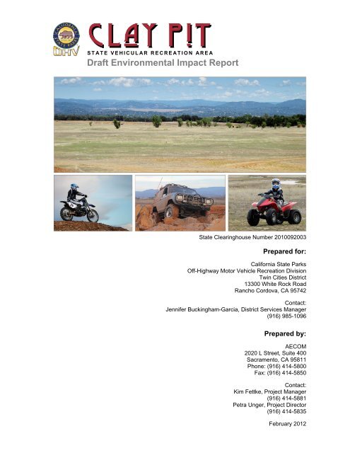
Draft Environmental Impact Report - California Off Highway Vehicle ...
Draft Environmental Impact Report - California Off Highway Vehicle ...
Draft Environmental Impact Report - California Off Highway Vehicle ...

Create successful ePaper yourself
Turn your PDF publications into a flip-book with our unique Google optimized e-Paper software.
STATE VEHICULAR RECREATION AREA<br />
<strong>Draft</strong> <strong>Environmental</strong> <strong>Impact</strong> <strong>Report</strong><br />
State Clearinghouse Number 2010092003<br />
Prepared for:<br />
<strong>California</strong> State Parks<br />
<strong>Off</strong>-<strong>Highway</strong> Motor <strong>Vehicle</strong> Recreation Division<br />
Twin Cities District<br />
13300 White Rock Road<br />
Rancho Cordova, CA 95742<br />
Contact:<br />
Jennifer Buckingham-Garcia, District Services Manager<br />
(916) 985-1096<br />
Prepared by:<br />
AECOM<br />
2020 L Street, Suite 400<br />
Sacramento, CA 95811<br />
Phone: (916) 414-5800<br />
Fax: (916) 414-5850<br />
Contact:<br />
Kim Fettke, Project Manager<br />
(916) 414-5881<br />
Petra Unger, Project Director<br />
(916) 414-5835<br />
February 2012
This page intentionally left blank.
CALIFORNIA STATE PARKS<br />
<strong>Draft</strong><br />
<strong>Environmental</strong> <strong>Impact</strong> <strong>Report</strong><br />
February 2012<br />
State Clearinghouse Number 2010092003<br />
Edmund G. Brown, Jr.<br />
Governor<br />
John Laird<br />
Secretary, The Natural Resources Agency<br />
Ruth Coleman<br />
Director, <strong>California</strong> State Parks<br />
P.O. Box 942896<br />
Sacramento, CA 94296-0001
This page intentionally left blank.
TABLE OF CONTENTS<br />
Table of Contents<br />
Section Page<br />
LIST OF ACRONYMS ........................................................................................................................................... vi<br />
CHAPTER S. SUMMARY ................................................................................................................................ S1<br />
S.1 Project Overview .................................................................................................................................... S‐1<br />
S.2 <strong>Environmental</strong> Effects Eliminated from Further Analysis ................................................... S‐2<br />
S.2 Summary of <strong>Impact</strong>s and Mitigation .............................................................................................. S‐2<br />
S.4 Areas of Known Controversy ............................................................................................................ S‐3<br />
S.5 Issues to Be Resolved ............................................................................................................................ S‐3<br />
S.6 Summary of Alternatives Considered ............................................................................................ S‐3<br />
CHAPTER 1. INTRODUCTION ..................................................................................................................... 11<br />
1.1 Type, Purpose, and Intended Use of this <strong>Environmental</strong> <strong>Impact</strong> <strong>Report</strong> ...................... 1‐1<br />
1.2 General Plan Process and Public Participation ......................................................................... 1‐5<br />
1.3 Comments Received on the Scope of the DEIR ......................................................................... 1‐6<br />
1.4 Focus of the EIR ...................................................................................................................................... 1‐7<br />
1.5 <strong>Environmental</strong> Review Process ...................................................................................................... 1‐7<br />
1.6 Subsequent <strong>Environmental</strong> Review Process ............................................................................. 1‐8<br />
1.7 DEIR Contents and Organization .................................................................................................... 1‐9<br />
CHAPTER 2. PROJECT DESCRIPTION ...................................................................................................... 21<br />
2.1 <strong>Environmental</strong> Setting ........................................................................................................................ 2‐1<br />
2.2 Project Background .............................................................................................................................. 2‐2<br />
2.3 Project Objectives .................................................................................................................................. 2‐5<br />
2.3.1 Mission Statements ................................................................................................................ 2‐5<br />
2.3.2 General Plan Objectives........................................................................................................ 2‐5<br />
2.3.3 Headquarters Facilities Objectives ................................................................................. 2‐6<br />
2.4 General Plan Components.................................................................................................................. 2‐6<br />
2.4.1 Park Classification .................................................................................................................. 2‐6<br />
2.4.2 Purpose ....................................................................................................................................... 2‐7<br />
2.4.3 Vision ............................................................................................................................................ 2‐7<br />
2.4.4 Land Use Management ......................................................................................................... 2‐7<br />
2.4.5 Goals and Guidelines ............................................................................................................. 2‐8<br />
CHAPTER 3. ENVIRONMENTAL ANALYSIS .............................................................................................. 3.1<br />
3.1 Transportation and Traffic ............................................................................................................. 3.1‐1<br />
3.1.1 Existing Setting ..................................................................................................................... 3.1‐1<br />
3.1.2 Regulatory Setting ............................................................................................................... 3.1‐9<br />
3.1.3 Thresholds of Significance ............................................................................................ 3.1‐10<br />
3.1.4 <strong>Environmental</strong> Evaluation ............................................................................................ 3.1‐12<br />
3.1.5 Summary of Significant <strong>Impact</strong>s ................................................................................. 3.1‐31<br />
3.1.6 Mitigation Measures ........................................................................................................ 3.1‐31<br />
Clay Pit Clay Pit State Vehicular Recreation Area<br />
<strong>Draft</strong> EIR i February 2012
Table of Contents<br />
TABLE OF CONTENTS<br />
Section Page<br />
3.2 Air Quality .............................................................................................................................................. 3.2‐1<br />
3.2.1 Existing Setting ..................................................................................................................... 3.2‐1<br />
3.2.2 Regulatory Setting ............................................................................................................... 3.2‐5<br />
3.2.3 Thresholds of Significance ............................................................................................... 3.2‐7<br />
3.2.4 <strong>Environmental</strong> Evaluation ............................................................................................... 3.2‐8<br />
3.2.5 Summary of Significant <strong>Impact</strong>s ................................................................................. 3.2‐18<br />
3.2.6 Mitigation Measures ........................................................................................................ 3.2‐19<br />
3.3 Noise ......................................................................................................................................................... 3.3‐1<br />
3.3.1 Existing Setting ..................................................................................................................... 3.3‐1<br />
3.3.2 Regulatory Setting ............................................................................................................ 3.3‐14<br />
3.3.3 Thresholds of Significance ............................................................................................ 3.3‐14<br />
3.3.4 <strong>Environmental</strong> Evaluation ............................................................................................ 3.3‐15<br />
3.3.5 Summary of Significant <strong>Impact</strong>s ................................................................................. 3.3‐23<br />
3.3.6 Mitigation Measures ........................................................................................................ 3.3‐23<br />
3.4 Visual Resources ................................................................................................................................. 3.4‐1<br />
3.4.1 Existing Setting ..................................................................................................................... 3.4‐1<br />
3.4.2 Regulatory Setting ............................................................................................................... 3.4‐2<br />
3.4.3 Thresholds of Significance ............................................................................................... 3.4‐3<br />
3.4.4 <strong>Environmental</strong> Evaluation ............................................................................................... 3.4‐3<br />
3.4.5 Summary of Significant <strong>Impact</strong>s .................................................................................... 3.4‐6<br />
3.4.6 Mitigation Measures ........................................................................................................... 3.4‐7<br />
3.5 Biological Resources ......................................................................................................................... 3.5‐1<br />
3.5.1 Existing Setting ..................................................................................................................... 3.5‐1<br />
3.5.2 Regulatory Setting ............................................................................................................... 3.5‐1<br />
3.5.3 Thresholds of Significance ............................................................................................... 3.5‐1<br />
3.5.4 <strong>Environmental</strong> Evaluation ............................................................................................... 3.5‐2<br />
3.5.5 Summary of Significant <strong>Impact</strong>s ................................................................................. 3.5‐16<br />
3.5.6 Mitigation Measures ........................................................................................................ 3.5‐16<br />
3.6 Cultural Resources ............................................................................................................................. 3.6‐1<br />
3.6.1 Existing Setting ..................................................................................................................... 3.6‐1<br />
3.6.2 Regulatory Setting ............................................................................................................... 3.6‐2<br />
3.6.3 Thresholds of Significance ............................................................................................... 3.6‐6<br />
3.6.4 <strong>Environmental</strong> Evaluation ............................................................................................... 3.6‐7<br />
3.6.5 Summary of Significant <strong>Impact</strong>s .................................................................................... 3.6‐9<br />
3.6.6 Mitigation Measures ........................................................................................................... 3.6‐9<br />
3.7 Geology and Soils ................................................................................................................................ 3.7‐1<br />
3.7.1 Existing Setting ..................................................................................................................... 3.7‐1<br />
3.7.2 Regulatory Setting ............................................................................................................... 3.7‐2<br />
3.7.3 Thresholds of Significance ............................................................................................... 3.7‐5<br />
3.7.4 <strong>Environmental</strong> Evaluation ............................................................................................... 3.7‐5<br />
3.7.5 Summary of Significant <strong>Impact</strong>s .................................................................................... 3.7‐9<br />
3.7.6 Mitigation Measures ........................................................................................................... 3.7‐9<br />
Clay Pit State Vehicular Recreation Area<br />
February 2012 ii <strong>Draft</strong> EIR
TABLE OF CONTENTS<br />
Table of Contents<br />
Section Page<br />
3.8 Hydrology .............................................................................................................................................. 3.8‐1<br />
3.8.1 Existing Setting ..................................................................................................................... 3.8‐1<br />
3.8.2 Regulatory Setting ............................................................................................................... 3.8‐1<br />
3.8.3 Thresholds of Significance ............................................................................................... 3.8‐4<br />
3.8.4 <strong>Environmental</strong> Evaluation ............................................................................................... 3.8‐6<br />
3.8.5 Summary of Significant <strong>Impact</strong>s ................................................................................. 3.8‐17<br />
3.8.6 Mitigation Measures ........................................................................................................ 3.8‐18<br />
3.9 Public Services and Utilities ........................................................................................................... 3.9‐1<br />
3.9.1 Existing Setting ..................................................................................................................... 3.9‐1<br />
3.9.2 Regulatory Setting ............................................................................................................... 3.9‐3<br />
3.9.3 Thresholds of Significance ............................................................................................... 3.9‐4<br />
3.9.4 <strong>Environmental</strong> Evaluation ............................................................................................... 3.9‐5<br />
3.9.5 Summary of Significant <strong>Impact</strong>s .................................................................................... 3.9‐9<br />
3.9.6 Mitigation Measures ........................................................................................................... 3.9‐9<br />
3.10 Hazards and Hazardous Materials ........................................................................................... 3.10‐1<br />
3.10.1 Existing Setting .................................................................................................................. 3.10‐1<br />
3.10.2 Regulatory Setting ............................................................................................................ 3.10‐2<br />
3.10.3 Thresholds of Significance ............................................................................................ 3.10‐5<br />
3.10.4 <strong>Environmental</strong> Evaluation ............................................................................................ 3.10‐6<br />
3.10.5 Mitigation Measures ..................................................................................................... 3.10‐10<br />
3.11 Climate Change ................................................................................................................................. 3.11‐1<br />
3.11.1 Existing Setting .................................................................................................................. 3.11‐1<br />
3.11.2 Regulatory Setting ............................................................................................................ 3.11‐1<br />
3.11.3 Thresholds of Significance ............................................................................................ 3.11‐3<br />
3.11.4 <strong>Environmental</strong> Evaluation ............................................................................................ 3.11‐5<br />
3.11.5 Summary of Significant <strong>Impact</strong>s ................................................................................. 3.11‐9<br />
3.11.6 Mitigation Measures ........................................................................................................ 3.11‐9<br />
CHAPTER 4. CUMULATIVE ANALYSIS ..................................................................................................... 41<br />
4.1 Introduction ............................................................................................................................................. 4‐1<br />
4.2 Geographic Scope .................................................................................................................................. 4‐1<br />
4.3 Cumulative Forecasting Methodology .......................................................................................... 4‐2<br />
4.3.1 Regional Growth Projections ............................................................................................. 4‐3<br />
4.3.2 List of Cumulative Projects in the Vicinity ................................................................... 4‐3<br />
4.4 Cumulative <strong>Impact</strong> Analysis ............................................................................................................. 4‐3<br />
4.4.1 Transportation and Traffic ................................................................................................. 4‐5<br />
4.4.2 Air Quality ................................................................................................................................ 4‐12<br />
4.4.3 Noise ........................................................................................................................................... 4‐14<br />
4.4.4 Visual Resources ................................................................................................................... 4‐15<br />
4.4.5 Biological Resources ............................................................................................................ 4‐15<br />
4.4.6 Cultural Resources ............................................................................................................... 4‐16<br />
4.4.7 Geology and Soils .................................................................................................................. 4‐16<br />
Clay Pit Clay Pit State Vehicular Recreation Area<br />
<strong>Draft</strong> EIR iii February 2012
Table of Contents<br />
TABLE OF CONTENTS<br />
Section Page<br />
4.4.8 Hydrology and Water Quality .......................................................................................... 4‐17<br />
4.4.9 Public Services and Utilities ............................................................................................. 4‐18<br />
4.4.10 Hazardous Materials ............................................................................................................ 4‐18<br />
4.4.11 Climate Change ...................................................................................................................... 4‐19<br />
CHAPTER 5. OTHER CEQAREQUIRED ANALYSIS ............................................................................... 51<br />
5.1 <strong>Environmental</strong> Effects Eliminated from Further Analysis .................................................. 5‐1<br />
5.1.1 Agricultural Resources ......................................................................................................... 5‐1<br />
5.1.2 Land Use...................................................................................................................................... 5‐1<br />
5.1.3 Minerals ...................................................................................................................................... 5‐1<br />
5.1.4 Population and Housing ....................................................................................................... 5‐1<br />
5.1.5 Recreation .................................................................................................................................. 5‐2<br />
5.2 Unavoidable Significant <strong>Environmental</strong> <strong>Impact</strong>s .................................................................... 5‐2<br />
5.3 Significant Irreversible <strong>Environmental</strong> Changes ..................................................................... 5‐2<br />
5.4 Growth‐Inducing <strong>Impact</strong>s .................................................................................................................. 5‐3<br />
CHAPTER 6. ALTERNATIVES TO THE PROPOSED PROJECT ............................................................ 61<br />
6.1 No‐Project Alternative ........................................................................................................................ 6‐2<br />
6.1.1 Description ................................................................................................................................ 6‐2<br />
6.1.2 Evaluation .................................................................................................................................. 6‐2<br />
6.2 Conservation Alternative ................................................................................................................... 6‐5<br />
6.2.1 Description ................................................................................................................................ 6‐5<br />
6.2.2 Evaluation .................................................................................................................................. 6‐5<br />
6.3 Reduced Developed Use Area Alternative .................................................................................. 6‐6<br />
6.3.1 Description ................................................................................................................................ 6‐6<br />
6.3.2 Evaluation .................................................................................................................................. 6‐6<br />
6.4 Identification of the <strong>Environmental</strong>ly Superior Alternative ............................................... 6‐7<br />
CHAPTER 7. REFERENCES ........................................................................................................................... 71<br />
CHAPTER 8. REPORT CONTRIBUTORS ................................................................................................... 81<br />
Appendices<br />
A Notice of Preparation and Comments<br />
B Project Details and Assumptions Used for Analysis<br />
C Air Quality Data<br />
D Noise Data<br />
Clay Pit State Vehicular Recreation Area<br />
February 2012 iv <strong>Draft</strong> EIR
TABLE OF CONTENTS<br />
Table of Contents<br />
Section Page<br />
Figures<br />
1‐1 Vicinity Map ........................................................................................................................................................ 1‐2<br />
1‐2 Location Map ...................................................................................................................................................... 1‐3<br />
2‐1 Regional Location ............................................................................................................................................. 2‐3<br />
2‐2 Local Setting ........................................................................................................................................................ 2‐4<br />
2‐3 Use Areas and Headquarters Facilities ................................................................................................. 2‐15<br />
3.1‐1 Vicinity Map ..................................................................................................................................................... 3.1‐2<br />
3.1‐2 Existing Weekday PM Peak Hour Traffic Volumes and Lane Configurations ..................... 3.1‐5<br />
3.1‐3 Existing Saturday Afternoon Peak Hour Traffic Volumes and Lane Configurations ........ 3.1‐6<br />
3.1‐4 Project Generated Traffic Existing Year 2010 Peak Hour ......................................................... 3.1‐16<br />
3.1‐5 Project Generated Traffic Year 2017 Peak Hour ........................................................................... 3.1‐17<br />
3.1‐6 Existing Plus Project Weekday PM Peak Hour Traffic Volumes and Lane<br />
Configurations ............................................................................................................................................. 3.1‐21<br />
3.1‐7 Existing Plus Project Saturday Afternoon Peak Hour Traffic Volumes and Lane<br />
Configurations ............................................................................................................................................. 3.1‐22<br />
3.1‐8 Year 2017 No Project Weekday PM Peak Hour Traffic Volumes and Lane<br />
Configurations ............................................................................................................................................. 3.1‐24<br />
3.1‐9 Year 2017 No Project Saturday Afternoon Peak Hour Traffic Volumes and Lane<br />
Configurations ............................................................................................................................................. 3.1‐25<br />
3.1‐10 Year 2017 Plus Project Weekday PM Peak Hour Traffic Volumes and Lane<br />
Configurations ............................................................................................................................................. 3.1‐26<br />
3.1‐11 Year 2017 Plus Project Saturday Afternoon Peak Hour Traffic Volumes and Lane<br />
Configurations ............................................................................................................................................ 3.1‐27<br />
3.3‐1 Common Noise Sources and Levels ....................................................................................................... 3.3‐2<br />
3.3‐2 Ambient Sound Monitoring ....................................................................................................................... 3.3‐9<br />
3.3‐3 Oroville Municipal Airport Noise Contours .................................................................................... 3.3‐13<br />
3.5‐1 Vegetation Map ............................................................................................................................................... 3.5‐3<br />
3.5‐2 CNDDB Occurrences within 5 Miles of the Project Site ................................................................ 3.5‐7<br />
3.11‐1 Butte County Greenhouse Gas Emissions, 2006 ........................................................................... 3.11‐2<br />
4‐1 Cumulative Project Locations ..................................................................................................................... 4‐4<br />
4‐2 Year 2030 Plus Project Weekday PM Peak Hour Traffic Volumes and Lane<br />
Configurations ................................................................................................................................................... 4‐7<br />
4‐3 Year 2030 Plus Project Saturday Afternoon Peak Hour Traffic Volumes and Lane<br />
Configurations ................................................................................................................................................... 4‐8<br />
6‐1 Project Alternatives ......................................................................................................................................... 6‐3<br />
Clay Pit Clay Pit State Vehicular Recreation Area<br />
<strong>Draft</strong> EIR v February 2012
Table of Contents<br />
TABLE OF CONTENTS<br />
Section Page<br />
Tables<br />
1‐1 Location of CEQA‐Required Content ...................................................................................................... 1‐10<br />
2‐1 Use Area Matrix ............................................................................................................................................... 2‐13<br />
3.1‐1 Definition of Level of Service .................................................................................................................... 3.2‐7<br />
3.1‐2 Existing Intersection Levels of Service ................................................................................................ 3.2‐8<br />
3.1‐3 Existing Roadway Levels of Service ...................................................................................................... 3.2‐9<br />
3.1‐4 Peak‐Hour LOS Volume Thresholds by Facility Type ................................................................. 3.2‐13<br />
3.1‐5 Existing Trip Generation for Clay Pit SVRA ..................................................................................... 3.2‐13<br />
3.1‐6 Projected Trip Generation at Clay Pit SVRA .................................................................................... 3.2‐14<br />
3.1‐7 Existing Clay Pit SVRA Directional Distribution............................................................................ 3.2‐15<br />
3.1‐8 Estimated Regional Directional Distribution ................................................................................. 3.2‐15<br />
3.1‐9 Intersection Levels of Service Under Existing Plus Project Conditions .............................. 3.2‐19<br />
3.1‐10 Roadway Levels of Service Under Existing Plus Project Conditions .................................... 3.2‐20<br />
3.1‐11 Intersection Levels of Service Under Year 2017 Conditions ................................................... 3.2‐28<br />
3.1‐12 Roadway Levels of Service Under Year 2017 Conditions ......................................................... 3.2‐29<br />
3.2‐1 Summary of Annual Ambient Air Quality Data ................................................................................. 3.2‐2<br />
3.2‐2 Butte County Ambient Air Quality Attainment Status ................................................................... 3.2‐3<br />
3.2‐3 Existing Emissions1 (lbs/day) from Mobile Sources during the Peak Weekend Day ..... 3.2‐4<br />
3.2‐4 Thresholds of Significance for Criteria Pollutants of Concern ................................................... 3.2‐7<br />
3.2‐5 Maximum daily Unmitigated Air Emissions from General Plan Construction by Year 3.2‐11<br />
3.2‐6 Net Operational Air Emissions during a Peak Weekend Following Construction of<br />
Visitor Facilities Envisioned in the General Plan (Approximately 2017) .......................... 3.2‐14<br />
3.3‐1 Summary of Short–Term, Ambient Noise Levels Monitored During the Daytime ......... 3.3‐10<br />
3.3‐2 Summary of Existing Traffic Noise Levels Modeled in the Planning Area ......................... 3.3‐11<br />
3.3‐4 Summary of Future Noise Levels Modeled for Traffic in the Planning Area .................... 3.3‐18<br />
3.3‐4 Typical Vibration Levels Caused by Construction and Maintenance Equipment ........... 3.3‐20<br />
3.3‐5 Typical Noise Levels Caused by Construction Equipment ....................................................... 3.3‐21<br />
3.6‐1 Previously Recorded Historic Resources within 1 Mile of Clay Pit SVRA ............................. 3.6‐2<br />
3.11‐1 Summary of Modeled Greenhouse Gas Emissions (CO2e) from Implementation of<br />
the Clay Pit SVRA General Plan ............................................................................................................. 3.11‐8<br />
4‐1 Geographic Scope of Cumulative <strong>Impact</strong>s .............................................................................................. 4‐2<br />
4‐2 Regional Growth Projections ....................................................................................................................... 4‐3<br />
4‐3 Cumulative Projects......................................................................................................................................... 4‐5<br />
4‐4 Year 2030 Intersection Levels of Service ............................................................................................. 4‐10<br />
4‐5 Year 2030 Roadway Levels of Service ................................................................................................... 4‐11<br />
4‐6 Long‐Term Operational Air Emissions during a Peak Weekend at General Plan<br />
Buildout .............................................................................................................................................................. 4‐13<br />
Clay Pit State Vehicular Recreation Area<br />
February 2012 vi <strong>Draft</strong> EIR
LIST OF ACRONYMS<br />
μg/l micrograms per liter<br />
μg/m 3 micrograms per cubic meter<br />
AB Assembly bill<br />
ADT average daily trips<br />
Alquist-Priolo Act Alquist-Priolo Earthquake Fault Zoning Act<br />
ALUC airport land use commission<br />
ALUCP Airport Land Use Compatibility Plan<br />
ANSI American National Standards Institute<br />
AQAP Air Quality Attainment Plan<br />
AQMD Air Quality Management District<br />
ARB <strong>California</strong> Air Resources Board<br />
ATV all-terrain vehicle<br />
BAAQMD Bay Area Air Quality Management District<br />
BCFD Butte County Fire Department<br />
BMP best management practice<br />
CAAQS <strong>California</strong> Ambient Air Quality Standards<br />
CAL FIRE <strong>California</strong> Department of Forestry and Fire Protection<br />
Cal/EPA <strong>California</strong> <strong>Environmental</strong> Protection Agency<br />
Caltrans <strong>California</strong> Department of Transportation<br />
CBC <strong>California</strong> Building Standards Code<br />
CCAR <strong>California</strong> Climate Action Registry<br />
CCR <strong>California</strong> Code of Regulations<br />
CEQA <strong>California</strong> <strong>Environmental</strong> Quality Act<br />
CERCLA Comprehensive <strong>Environmental</strong> Response, Compensation, and Liability Act<br />
CESA <strong>California</strong> Endangered Species Act<br />
CFC <strong>California</strong> Fire Code<br />
CFR Code of Federal Regulations<br />
CHP <strong>California</strong> <strong>Highway</strong> Patrol<br />
CLUP comprehensive land use plan<br />
CNDDB <strong>California</strong> Natural Diversity Database<br />
CNEL community noise equivalent level<br />
CNPS <strong>California</strong> Native Plant Society<br />
CO carbon monoxide<br />
Table of Contents<br />
Clay Pit Clay Pit State Vehicular Recreation Area<br />
<strong>Draft</strong> EIR vii February 2012
Table of Contents<br />
CO2<br />
carbon dioxide<br />
CO2e carbon dioxide equivalent<br />
CRHR <strong>California</strong> Register of Historical Resources<br />
CUPA Certified Unified Program Agency<br />
CWA Clean Water Act<br />
dB decibel<br />
dBA A-weighted sound levels<br />
DEIR draft environmental impact report<br />
Department Butte County Department of Water and Resource Conservation<br />
DFG <strong>California</strong> Department of Fish and Game<br />
DMV Department of Motor <strong>Vehicle</strong>s<br />
DOE Determination of Eligibility<br />
DTSC Department of Toxic Substances Control<br />
DU Development Use Area<br />
DWR <strong>California</strong> Department of Water Resources<br />
EB eastbound<br />
EIR environmental impact report<br />
EPA U.S. <strong>Environmental</strong> Protection Agency<br />
ESA federal Endangered Species Act<br />
FBO Fixed Based Operator<br />
FHWA Federal <strong>Highway</strong> Administration<br />
FTA Federal Transit Administration<br />
General Plan Clay Pit State Vehicular Recreation Area General Plan<br />
GHG greenhouse gas<br />
HCP habitat conservation plan<br />
HWCL Hazardous Waste Control Law<br />
in/sec inches per second<br />
L10<br />
noise level exceeded 10% of a specific period of time<br />
L50<br />
noise level exceeded 50% of a specific period of time<br />
L90<br />
noise level exceeded 90% of a specific period of time<br />
lbs/day pounds per day<br />
LCFS Low Carbon Fuel Standard<br />
LDL Larson Davis Laboratories<br />
Ldn<br />
day-night noise level<br />
equivalent hourly average noise level<br />
Leq<br />
Clay Pit State Vehicular Recreation Area<br />
February 2012 viii <strong>Draft</strong> EIR
Lmax<br />
maximum noise level<br />
Ln<br />
statistical descriptor<br />
LOS level of service<br />
mph miles per hour<br />
MS4 municipal separate storm sewer system<br />
MT metric ton<br />
NAAQS National Ambient Air Quality Standards<br />
NAHC Native American Heritage Commission<br />
NB northbound<br />
NCCP natural community conservation plan<br />
NIC Northeast Information Center<br />
NOA notice of availability<br />
NOC notice of completion<br />
NOP notice of preparation<br />
NOx<br />
oxides of nitrogen<br />
NO2<br />
nitrogen dioxide<br />
NPDES National Pollutant Discharge Elimination System<br />
NRCS U.S. Natural Resources Conservation Service<br />
NRHP National Register of Historic Places<br />
NRM Natural Resource Management<br />
OHMVR <strong>Off</strong>-<strong>Highway</strong> Motor <strong>Vehicle</strong> Recreation<br />
OHV off-highway vehicle<br />
OHV BMP Manual OHV BMP Manual for Erosion and Sediment Control<br />
OPR <strong>California</strong> Governor’s <strong>Off</strong>ice of Planning and Research<br />
O3<br />
ozone<br />
PCBs polychlorinated biphenyls<br />
PG&E Pacific Gas and Electric Company<br />
PM particulate matter<br />
PM2.5<br />
Table of Contents<br />
fine particulate matter with an aerodynamic resistance diameter of 2.5 micrometers or<br />
less<br />
PM10<br />
respirable particulate matter with an aerodynamic resistance diameter of 10<br />
micrometers or less<br />
PO Park Operations<br />
Porter-Cologne Act Porter-Cologne Water Quality Control Act<br />
ppm parts per million<br />
PPV peak particle velocity<br />
Clay Pit Clay Pit State Vehicular Recreation Area<br />
<strong>Draft</strong> EIR ix February 2012
Table of Contents<br />
PRC <strong>California</strong> Public Resources Code<br />
PRM Physical Resource Management<br />
RCRA Resource Conservation and Recovery Act<br />
RMS root-mean-square<br />
ROG reactive organic gas<br />
RWQCB Regional Water Quality Control Board<br />
SARA Superfund Amendments and Reauthorization Act<br />
SB southbound<br />
SCAQMD South Coast Air Quality Management District<br />
SCOR Sewerage Commission—Oroville Region<br />
SHPO State Historic Preservation <strong>Off</strong>icer<br />
SIP State Implementation Plan<br />
SOI sphere of influence<br />
Soil Guidelines 2008 Soil Conservation Guidelines<br />
Soil Standard 2008 Soil Conservation Standard<br />
SO2<br />
sulfur dioxide<br />
SPPO State Parks Peace <strong>Off</strong>icer<br />
SR State Route<br />
State Parks <strong>California</strong> Department of Parks and Recreation<br />
SVAB Sacramento Valley Air Basin<br />
SVRA State Vehicular Recreation Area<br />
SWPPP storm water pollution prevention plans<br />
SWRCB State Water Resources Control Board<br />
TAC toxic air contaminant<br />
TCR Transportation Concept <strong>Report</strong>s<br />
TMDL total maximum daily load<br />
TPD tons per day<br />
UBC Uniform Building Code<br />
UFC Uniform Fire Code<br />
U.S. United States<br />
USC U.S. Code<br />
USACE U.S. Army Corps of Engineers<br />
USFWS U.S. Fish and Wildlife Service<br />
V/C volume-to-capacity ratio<br />
VdB vibration decibels<br />
Clay Pit State Vehicular Recreation Area<br />
February 2012 x <strong>Draft</strong> EIR
VELB valley elderberry longhorn beetle<br />
VEO Visitor Experience and Opportunities<br />
WB westbound<br />
Table of Contents<br />
Clay Pit Clay Pit State Vehicular Recreation Area<br />
<strong>Draft</strong> EIR xi February 2012
Table of Contents<br />
This page intentionally left blank.<br />
Clay Pit State Vehicular Recreation Area<br />
February 2012 xii <strong>Draft</strong> EIR
Chapter S.0 – Summary<br />
S.0 Summary<br />
This summary section of the draft environmental impact report (DEIR) for the Clay Pit State<br />
Vehicular Recreation Area General Plan (Clay Pit SVRA General Plan or the General Plan) is<br />
provided in accordance with the <strong>California</strong> <strong>Environmental</strong> Quality Act (CEQA) Guidelines Section<br />
15123, which specifies that an environmental impact report (EIR) contain a brief summary of the<br />
proposed action and its consequences with clear and simple language. It also states that the<br />
summary identify each significant effect with proposed mitigation measures and alternatives that<br />
would reduce or avoid that effect; areas of controversy known to the lead agency, including issues<br />
raised by agencies and the public; and issues to be resolved, including the choice among<br />
alternatives and whether or how to mitigate the significant effects. Accordingly, this summary<br />
includes a brief description of the project, environmental impacts and mitigation, areas of known<br />
controversy, and alternatives to the project.<br />
S.1 Project Overview<br />
Clay Pit State Vehicular Recreation Area (Clay Pit SVRA or SVRA) is considered a destination for<br />
beginner and intermediate riders and offers hills to climb, an open riding area, and informal trails.<br />
A limited number of developed facilities support recreation opportunities within the 220‐acre<br />
SVRA. Existing facilities include a paved parking lot, an interpretive sign, two shade ramadas, two<br />
picnic tables, and a vault toilet.<br />
All units operated by <strong>California</strong> State Parks (State Parks) must have a general plan prepared<br />
before new facilities are developed that may result in the permanent commitment of resources.<br />
The Clay Pit SVRA General Plan outlined in this DEIR is the first general plan prepared for this unit.<br />
General plans are broad‐based policy documents that establish long‐range visions and goals and<br />
provide direction on future types of improvements, services, and programs. The project<br />
considered in this DEIR is the implementation of the Clay Pit SVRA General Plan, including<br />
construction and operation of the headquarters facilities. The General Plan is a guidance document<br />
intended for use over many years, and it outlines goals and guidelines that apply to the entire Clay<br />
Pit SVRA. The goals and guidelines address existing issues and provide ongoing guidance to<br />
management that can be implemented to achieve the long‐term vision for the SVRA, which is to<br />
provide an effectively managed and convenient place for friends, families, and groups to enjoy the<br />
outdoor recreational setting through OHV (off‐highway vehicle) activity and other compatible<br />
recreational uses.<br />
In addition to the long‐range planning provided through the Clay Pit SVRA General Plan, the<br />
project includes multiple improvements to provide basic park facilities related to administration,<br />
maintenance operations, and recreation opportunities in the near term (within 2 years). Proposed<br />
improvements include a relocated entrance, a headquarters building to house administrative and<br />
Clay Pit State Vehicular Recreation Area<br />
<strong>Draft</strong> EIR S-1 February 2012
S.0 Summary<br />
maintenance offices, an entrance kiosk, a maintenance yard, and associated upgraded utilities and<br />
roadways (Figure 2‐3 of Chapter 2.0, “Project Description,” in this DEIR).<br />
The Clay Pit SVRA General Plan provides much of the physical and regulatory setting description<br />
and the project description used for the CEQA analysis in this DEIR. Chapter 2.0 of the General<br />
Plan, “Existing Conditions,” describes the geographical, physical, and management setting,<br />
including resource conditions and planning influences. Chapter 4.0 of the General Plan, “The Plan,”<br />
identifies proposed use areas and management goals and guidelines, which combine to serve as<br />
the project description used for this CEQA analysis.<br />
S.2 <strong>Environmental</strong> Effects Eliminated from Further Analysis<br />
The following topics were eliminated from full analysis in the DEIR because no potential exists for<br />
significant environmental effects to result from implementation of the Clay Pit SVRA General Plan,<br />
including headquarters facilities, related to these issues: agricultural resources, land use, minerals,<br />
population and housing, and recreation. See Chapter 5.0, “Other CEQA‐Required Analyses,” for<br />
additional discussion.<br />
S.3 Summary of <strong>Impact</strong>s and Mitigation<br />
This DEIR provides a detailed analysis of the potential significant environmental effects resulting<br />
from implementation of the Clay Pit SVRA General Plan, including headquarters facilities. The<br />
environmental analysis found that, with incorporation of project design features, implementation<br />
of goals and guidelines as directed by the General Plan, and adherence to regulatory requirements<br />
(e.g., State Parks and <strong>Off</strong>‐<strong>Highway</strong> Motor <strong>Vehicle</strong> Recreation [OHMVR] Division requirements and<br />
guidelines, and requirements from regulatory agencies) implementation of the General Plan,<br />
including headquarters facilities, would result in less than significant environmental impacts to<br />
the following issue areas:<br />
transportation and traffic,<br />
air quality,<br />
noise,<br />
visual resources,<br />
biological resources,<br />
cultural resources,<br />
geology and soils,<br />
hydrology and water quality,<br />
public services and utilities,<br />
hazardous materials, and<br />
climate change.<br />
Clay Pit State Vehicular Recreation Area<br />
February 2012 S-2 <strong>Draft</strong> EIR
S.0 Summary<br />
No mitigation measures are required because impacts for all resource areas were found to be less<br />
than significant.<br />
S.4 Areas of Known Controversy<br />
During the development of the Clay Pit SVRA General Plan, the following issues were found to be<br />
areas of concern and interest:<br />
traffic controls at the site access;<br />
internal circulation;<br />
lack of on‐site staff and maintenance;<br />
limited visitor facilities;<br />
lack of utility services to the site;<br />
erosion and sedimentation on the site;<br />
water quality and runoff from the Oroville Municipal Airport;<br />
lack of aesthetic quality on the site;<br />
public safety;<br />
water supply and water conservation;<br />
air quality degradation (e.g., from dust emissions, vehicle emissions);<br />
protection and preservation of biological resources in portions of Clay Pit SVRA, including<br />
aquatic resources and vernal pools;<br />
noise generated by OHVs and experienced both on‐ and off‐site; and<br />
recreation opportunities restricted by resource protection requirements.<br />
S.5 Issues to Be Resolved<br />
The OHMVR Division is the CEQA lead agency for this project. The lead agency must consider<br />
community needs and desires, long‐term planning, and the OHMVR Division mission for the<br />
purpose of determining the appropriate level of intensity of OHV use at Clay Pit SVRA. It will be<br />
important for OHMVR Division decision makers to resolve the need for balance between open and<br />
developed OHV use areas throughout the SVRA and restrictions in some areas to protect on‐site<br />
natural resources and to provide for public safety and compatibility with surrounding land uses.<br />
S.6 Summary of Alternatives Considered<br />
CEQA requires analysis of a range of potential alternatives to the proposed project which would<br />
reduce any significant impacts. However, implementation of the proposed project (the Clay Pit<br />
SVRA General Plan as described in Chapter 2.0 of this DEIR) would cause no significant impacts.<br />
Therefore, alternatives were developed that have the potential of minimizing at least one less‐<br />
than‐significant impact in at least one resource area.<br />
Clay Pit State Vehicular Recreation Area<br />
<strong>Draft</strong> EIR S-3 February 2012
S.0 Summary<br />
The alternatives analysis evaluates each issue area compared with the proposed project. The<br />
headquarters facilities analyzed in this DEIR were included as part of all of the alternatives except<br />
the No‐Project alternative.<br />
The following three project alternatives are considered in the alternatives analysis:<br />
the No‐Project Alternative,<br />
the Conservation Alternative, and<br />
the Reduced Developed Use Area Alternative.<br />
Under the No‐Project Alternative, Clay Pit SVRA would remain in its current condition with no<br />
improvements or modifications. The Conservation Alternative would preserve some sensitive<br />
areas of the SVRA but would allow development throughout the rest of the SVRA. The Reduced<br />
Developed Use Area Alternative would allow the development of fewer OHV facilities, and<br />
therefore would attract a smaller increase in the number of visitors to the SVRA. Thus, this<br />
alternative would cause the least environmental impact and would be considered the<br />
<strong>Environmental</strong>ly Superior Alternative although it does not meet all of the project objectives.<br />
Clay Pit State Vehicular Recreation Area<br />
February 2012 S-4 <strong>Draft</strong> EIR
Chapter 1.0 – Introduction<br />
1.0 Introduction<br />
This draft environmental impact report (DEIR) provides an evaluation of the environmental<br />
effects associated with the implementation of the Clay Pit State Vehicular Recreation Area General<br />
Plan (Clay Pit SVRA General Plan or General Plan). The intent of this DEIR is to inform decision<br />
makers and the public of the environmental consequences of implementation of the Clay Pit SVRA<br />
General Plan, including construction and operation of a specific near‐term improvement project,<br />
the headquarters facilities. Figures 1‐1 and 1‐2 show the location of Clay Pit State Vehicular<br />
Recreation Area (Clay Pit SVRA or SVRA) near the City of Oroville in Butte County, CA. This DEIR<br />
was prepared in accordance with the <strong>California</strong> <strong>Environmental</strong> Quality Act (CEQA) of 1970 (Public<br />
Resources Code [PRC] Section 21000 et seq.) and the State CEQA Guidelines (<strong>California</strong> Code of<br />
Regulations [CCR] Section 15000 et seq.). The <strong>Off</strong>‐<strong>Highway</strong> Motor <strong>Vehicle</strong> Recreation (OHMVR)<br />
Division of <strong>California</strong> State Parks (State Parks) is the CEQA lead agency for this project.<br />
This introductory chapter provides an overview of the environmental review process required<br />
under CEQA, background information related to the proposed project (the Clay Pit SVRA General<br />
Plan), agency roles and responsibilities, and the organization used in this DEIR.<br />
1.1 Type, Purpose, and Intended Use of This <strong>Environmental</strong> <strong>Impact</strong> <strong>Report</strong><br />
The purpose of an environmental impact report (EIR), under the provisions of CEQA, is “to identify<br />
the significant effects on the environment of a project, to identify alternatives to the project, and to<br />
indicate the manner in which those significant effects can be mitigated or avoided” (PRC Section<br />
21002.1[a]). CEQA requires that all state and local governmental agencies consider the<br />
environmental impacts of projects over which they have discretionary authority and balance the<br />
benefits of a proposed project against its unavoidable environmental consequences. If<br />
environmental impacts are identified as significant and unavoidable, the agency may still approve<br />
the proposed project if it believes that social, economic, or other benefits would outweigh the<br />
unavoidable impacts.<br />
This DEIR was prepared by the OHMVR Division to assess the potential environmental impacts<br />
that could arise in connection with actions related to approval and implementation of the Clay Pit<br />
SVRA General Plan. It is intended to address the potentially significant adverse effects of the<br />
project on the physical environment to the extent that such effects are reasonably foreseeable at<br />
this time.<br />
Because the General Plan is a planning document that provides goals and guidelines for future<br />
development, rather than specific and detailed projects, a program EIR was determined to be the<br />
appropriate CEQA document to analyze the potential environmental impacts of adopting and<br />
implementing the Clay Pit SVRA General Plan.<br />
Clay Pit State Vehicular Recreation Area<br />
<strong>Draft</strong> EIR 1-1 February 2012
1.0 Introduction<br />
Source: Adapted by AECOM 2011<br />
Vicinity Map Figure 1-1<br />
Clay Pit State Vehicular Recreation Area<br />
February 2012 1-2 <strong>Draft</strong> EIR
Source: Adapted by AECOM 2011<br />
1.0 Introduction<br />
Location Map Figure 1-2<br />
Clay Pit State Vehicular Recreation Area<br />
<strong>Draft</strong> EIR 1-3 February 2012
1.0 Introduction<br />
According to the State CEQA Guidelines (Section 15168), a program EIR may be prepared on a<br />
series of actions that can be characterized as one large project; are related geographically; and are<br />
logical parts in the chain of contemplated actions in connection with issuance of rules, regulations,<br />
or plans. A program EIR is a type of EIR that allows a public agency to consider broad policy<br />
alternatives and program‐wide mitigation measures at the early stages of planning. The required<br />
contents of a program EIR are the same as those of a project‐level document. However, the level of<br />
detail and analysis in the two types of documents differ because a program‐level document<br />
analyzes a general conceptual design and location of the proposed alternatives rather than<br />
providing a detailed level of analysis for a specific action (State CEQA Guidelines Section 15146).<br />
This DEIR provides a first‐tier analysis of the environmental effects of implementing the Clay Pit<br />
SVRA General Plan. Future projects associated with the General Plan will be reviewed in light of<br />
the information in this DEIR. If the OHMVR Division finds that, pursuant to Section 15152 of the<br />
State CEQA Guidelines, no new effects would occur or no new mitigation measures would be<br />
required on a subsequent project, the OHMVR Division can approve the activity as being within<br />
the scope of this DEIR. If new effects are identified that were not addressed in this DEIR, the<br />
OHMVR Division would prepare an appropriate CEQA compliance document, tiering from this<br />
DEIR by incorporating the general discussions of the broader EIR by reference and focusing the<br />
analysis solely on the issues specific to the later project.<br />
The headquarters facilities described in the General Plan have been designed, funding for the<br />
facilities has been requested, and the OHMVR Division anticipates constructing the facilities<br />
shortly after adoption of the Clay Pit SVRA General Plan. Therefore, sufficient detail is available to<br />
prepare a project‐level CEQA analysis for this General Plan element. Because potential impacts<br />
related to construction and operation of the headquarters facilities are relatively minor, the<br />
headquarters facilities project would not warrant the preparation of an EIR if it were being<br />
analyzed as a stand‐alone project. However, including analysis of the headquarters facilities at a<br />
project level within this DEIR was determined to be an efficient approach for conducting the<br />
required environmental impact analysis for this project. Therefore, this DEIR also includes a<br />
project‐level analysis of the headquarters facilities.<br />
The project‐level environmental analysis of the headquarters facilities project takes into<br />
consideration all known details of the headquarters facilities as proposed. This analysis meets<br />
CEQA requirements, so no additional analysis would be necessary to implement this project. If<br />
details regarding the headquarters facilities are modified substantially from the assumptions used<br />
for this analysis, additional environmental evaluation may be required before implementation of<br />
the project.<br />
This DEIR is intended to be used by lead, responsible, and trustee agencies that may have review<br />
authority over the project. Agencies that are expected to use the DEIR as a reference for future<br />
actions include, but are not limited to, the following:<br />
Clay Pit State Vehicular Recreation Area<br />
February 2012 1-4 <strong>Draft</strong> EIR
State Parks,<br />
<strong>California</strong> Department of Fish and Game (DFG),<br />
U.S. Fish and Wildlife Service (USFWS),<br />
U.S. Army Corps of Engineers (USACE),<br />
Regional Water Quality Control Board (RWQCB),<br />
Butte County, and<br />
Butte County Air Quality Management District.<br />
1.0 Introduction<br />
The approvals required by the OHMVR Division to implement the Clay Pit SVRA General Plan<br />
project are the approval of the General Plan and DEIR and the approval of the headquarters<br />
facilities funding.<br />
1.2 General Plan Process and Public Participation<br />
General plans are broad‐based policy documents that establish long‐range visions, goals, and<br />
guidelines for management and provide direction on future types of improvements, services, and<br />
programs. General planning provides opportunities to assess resource stewardship, facility<br />
development and management, and interpretation to the public. It provides guidelines for future<br />
land use management and designation, including land acquisition and the development of facilities<br />
required to accommodate expected visitation and administrative needs.<br />
The Clay Pit SVRA General Plan provides a comprehensive framework intended to guide<br />
development, ongoing management, and public use at Clay Pit SVRA for many years. Because it is<br />
intended as a long‐term guide, the General Plan must remain flexible, general in its scope, and<br />
consistent in the vision for Clay Pit SVRA’s future. The General Plan must allow for changing<br />
conditions over time and for solving future management problems.<br />
Public and stakeholder input is an important component of State Parks’ general plan process.<br />
Input is sought at the very beginning and throughout the planning process, and it plays an<br />
essential role in the development of the recommendations, goals, and guidelines within the<br />
general plan. A public participation program was implemented during development of the Clay Pit<br />
SVRA General Plan. The goal of this extensive public and stakeholder outreach effort was to<br />
identify the community’s ideas and desires for future management and use of Clay Pit SVRA, and<br />
to understand the community’s concerns about the future of the park. Elements of the public<br />
participation program included an on‐site and online visitor survey, stakeholder interviews,<br />
distribution of fact sheets and newsletters, compilation of project information in working papers,<br />
and three public workshops (see Clay Pit SVRA General Plan Appendix A).<br />
The following is a chronological list of public information materials and opportunities for public<br />
and stakeholder participation and input provided throughout the planning process for<br />
development of the Clay Pit SVRA General Plan:<br />
Clay Pit State Vehicular Recreation Area<br />
<strong>Draft</strong> EIR 1-5 February 2012
1.0 Introduction<br />
On‐line Survey: May–August 2010,<br />
Fact Sheet: May 2010,<br />
Public Workshop #1: June 2010,<br />
Stakeholder Telephone Interviews: July and August 2010,<br />
Public Workshop #2: August 2010,<br />
Newsletter: August 2010, and<br />
Public Workshop #3: September 2010.<br />
All materials developed in support of the public participation program are available on the Clay Pit<br />
SVRA Website: http://ohv.parks.ca.gov/?page_id=26300.<br />
1.3 Comments Received on the Scope of the DEIR<br />
As required by State CEQA Guidelines Section 15082, the OHMVR Division issued a notice of<br />
preparation (NOP) on September 1, 2010. The purpose of the NOP was to identify agency and<br />
public concerns regarding potential impacts of the Clay Pit SVRA General Plan and to solicit<br />
comments on the scope of the DEIR. The NOP and written and verbal comments received during<br />
the 30‐day public review period for the NOP are included in Appendix A of this DEIR.<br />
Comment letters in response to the NOP were received from:<br />
the Native American Heritage Commission;<br />
<strong>California</strong> Department of Transportation, District 3;<br />
<strong>California</strong> Department of Transportation, Division of Aeronautics; and<br />
Ken Trombley.<br />
In addition to written comments received during the public comment period, a public scoping<br />
meeting was held during Public Workshop #3 in September 2010. Verbal comments were<br />
received during the scoping meeting. Detailed notes of these verbal comments are included in<br />
Appendix A of this document.<br />
Issues, both written and verbal, raised during the public comment period included:<br />
Land Use<br />
compliance with the Butte County Airport Land Use Compatibility Plan<br />
Transportation<br />
safety and traffic operations<br />
Recreation<br />
trails for nonmotorized use (walking and bicycling) on the perimeter<br />
overnight camping<br />
Clay Pit State Vehicular Recreation Area<br />
February 2012 1-6 <strong>Draft</strong> EIR
Safety<br />
proximity to <strong>California</strong> Department of Fish and Game shooting range<br />
separate riding areas for beginners<br />
Cultural Resources<br />
identification and protection of undiscovered archaeological resources<br />
1.4 Focus of the DEIR<br />
1.0 Introduction<br />
Pursuant to Section 15063 of the State CEQA Guidelines, the scope of the analysis in this DEIR was<br />
informed by the results of public workshops that were conducted and comments received during<br />
the NOP comment period, which are summarized in the previous section. This DEIR addresses<br />
those environmental issues known to relate to the site and those issues identified to be of<br />
community concern as expressed at the workshops and scoping process. These environmental<br />
issues are:<br />
transportation and traffic,<br />
air quality,<br />
noise,<br />
visual resources,<br />
biological resources,<br />
cultural resources,<br />
geology and soils,<br />
hydrology and water quality,<br />
public services and utilities,<br />
hazardous materials, and<br />
climate change.<br />
1.5 <strong>Environmental</strong> Review Process<br />
As described in Section 1.3, an NOP was issued to inform agencies and the public about the<br />
preparation of this DEIR and to solicit input regarding the scope of the issues to be addressed<br />
herein. The comments received were considered while this DEIR was prepared.<br />
OHMVR Division filed a notice of completion (NOC) with the <strong>California</strong> Governor’s <strong>Off</strong>ice of<br />
Planning and Research, State Clearinghouse, indicating that this DEIR is complete and is available<br />
for review. A notice of availability (NOA) of this DEIR has also been filed with the State<br />
Clearinghouse; circulated to persons, organizations, and agencies on the project mailing list; and<br />
posted in local papers. The NOA describes the project and the project location, identifies<br />
significant environmental impacts, specifies the review period, and identifies the address where<br />
this DEIR and accompanying General Plan are available for review.<br />
Clay Pit State Vehicular Recreation Area<br />
<strong>Draft</strong> EIR 1-7 February 2012
1.0 Introduction<br />
Agencies and individuals are invited to comment on the information contained in this DEIR.<br />
Comments should address the DEIR’s accuracy and completeness on environmental issues. Where<br />
possible, those responding should endeavor to provide the information they feel is lacking in the<br />
DEIR, or they should indicate where the information may be found. Following the 45‐day public<br />
comment period, all comments will be reviewed and considered by the OHMVR Division. If<br />
necessary, analysis in this DEIR will be revised or expanded to address comments pertaining to<br />
environmental impacts of the project received during the public comment period. The revised<br />
DEIR and all responses to comments will be incorporated into a final EIR. The OHMVR Division<br />
will then consider the final EIR for certification. Certification of the final EIR is not project<br />
approval or adoption but, rather, an action by the lead agency stating that the environmental<br />
analysis is adequate and that CEQA obligations have been fulfilled. The OHMVR Commission has<br />
approval authority for all OHMVR Division general plans and EIRs. This commission determines<br />
whether to accept the certified EIR as a final EIR under State CEQA Guidelines Section 15166 and<br />
adopt the Clay Pit SVRA General Plan as a general plan under PRC 5002.2.<br />
1.6 Subsequent <strong>Environmental</strong> Review Process<br />
The goals, guidelines, proposed use areas, uses, and facilities described in the Clay Pit SVRA<br />
General Plan are evaluated in this DEIR for their potential effects on the environment. Also, actions<br />
that may result from adoption of the General Plan were anticipated and potential impacts<br />
resulting from these actions are analyzed. The environmental analysis has been conducted<br />
concurrent with the development of the General Plan. <strong>Impact</strong> minimization measures have been<br />
incorporated within the General Plan wherever possible to help ensure that planned actions<br />
described in the General Plan, including those to be implemented in the future, would not result in<br />
significant environmental impacts.<br />
Therefore, the CEQA analysis detailed in this DEIR that accompanies the Clay Pit SVRA General<br />
Plan is intended to be adequate for many future projects implemented in a manner consistent with<br />
the goals and guidelines herein. Some actions described in the General Plan may require<br />
additional CEQA analysis documentation after the project details are known. All projects that may<br />
be implemented in the future as a result of adopting this Clay Pit SVRA General Plan must be<br />
subjected to CEQA review according to State CEQA Guidelines Section 15168, in light of the<br />
information in the EIR prepared for the General Plan, to determine whether additional CEQA<br />
documentation is necessary. The type of additional CEQA documentation completed would be<br />
determined based on State CEQA Guidelines Sections 15162–15164. When future projects<br />
requiring additional environmental review are implemented, the OHMVR Division may refer to<br />
this DEIR, prepared for the Clay Pit SVRA General Plan, as a starting point for a “tiered CEQA<br />
analysis,” per Sections 15152 and 15168 of the State CEQA Guidelines.<br />
Clay Pit State Vehicular Recreation Area<br />
February 2012 1-8 <strong>Draft</strong> EIR
1.7 DEIR Contents and Organization<br />
1.0 Introduction<br />
Summary: A summary is included at the beginning of this document to provide simple reference<br />
to the conclusions of the analyses presented in this DEIR. Also addressed in the summary are<br />
issues of known controversy, environmental issues to be resolved, and alternatives considered.<br />
Chapter 1.0, “Introduction”: This chapter provides an introduction and overview describing the<br />
purpose of the DEIR and the CEQA process, a brief overview of the OHMVR Division planning and<br />
public outreach process, comments received on the scope of this DEIR, and a description of future<br />
subsequent environmental review that may be required.<br />
Chapter 2.0, “Project Description”: This chapter provides information on the environmental<br />
setting, information about past and current use of Clay Pit SVRA, project objectives, Clay Pit SVRA<br />
General Plan components and headquarters facilities included for analysis in this DEIR, regional<br />
planning context, and intended uses of this DEIR.<br />
Chapter 3.0, “<strong>Environmental</strong> Analysis”: This chapter evaluates the potential environmental<br />
impacts of the Clay Pit SVRA General Plan and headquarters facilities. This chapter also presents<br />
those goals and guidelines within the General Plan that would reduce those potential impacts.<br />
Chapter 4.0, “Cumulative Analysis”: This chapter analyzes the potential cumulative impacts of<br />
the Clay Pit SVRA General Plan and headquarters facilities in combination with past, present, and<br />
future projects.<br />
Chapter 5.0, “Other CEQARequired Analysis”: Other CEQA‐required analyses provided in this<br />
chapter include environmental effects eliminated from future analysis, unavoidable significant<br />
environmental effects, significant irreversible environmental changes, and growth‐inducing<br />
impacts.<br />
Chapter 6.0, “Alternatives to the Proposed Action”: This chapter considers a reasonable range<br />
of potentially feasible alternatives to the Clay Pit SVRA General Plan that could avoid or<br />
substantially lessen any of the significant effects of the project identified in Chapter 3.0. Analysis of<br />
the No‐Project Alternative is included, as well as identification of the environmentally superior<br />
alternative, as required by CEQA.<br />
Chapter 7.0, “References”: This chapter contains a complete list of all references used during the<br />
preparation of this DEIR, as well as citations for personal communications.<br />
Chapter 8.0, “<strong>Report</strong> Contributors”: This chapter contains a complete list of the DEIR preparers<br />
and contributors.<br />
Table 1‐1 lists the location of CEQA‐required content in this DEIR.<br />
Clay Pit State Vehicular Recreation Area<br />
<strong>Draft</strong> EIR 1-9 February 2012
1.0 Introduction<br />
TABLE 11. LOCATION OF CEQAREQUIRED CONTENT<br />
State CEQA Guidelines Content Location in DEIR<br />
15122 Table of Contents or Index Beginning of this document<br />
15123 Summary EIR Summary, following Table of Contents<br />
15124 Project Description Chapter 2.0, Section 2.4, “Proposed General Plan Components”<br />
Chapter 1.0, “Introduction” (information about project objective<br />
and the Clay Pit SVRA General Plan process)<br />
15125 <strong>Environmental</strong> Setting Chapter 2.0, Section 2.1, “<strong>Environmental</strong> Setting”<br />
15126 Consideration and Discussion of<br />
<strong>Environmental</strong> <strong>Impact</strong>s<br />
(a) Significant <strong>Environmental</strong> Effects of<br />
the Proposed Project<br />
(b) Significant <strong>Environmental</strong> Effects<br />
Which Cannot be Avoided if the<br />
Proposed Project is Implemented<br />
(c) Significant Irreversible<br />
<strong>Environmental</strong> Changes Which<br />
Would be Involved in the Proposed<br />
Project Should it be Implemented<br />
(d) Growth‐Inducing <strong>Impact</strong> of<br />
Proposed Project<br />
(e) The Mitigation Measures Proposed<br />
to Minimize the Significant Effects<br />
(f) Alternatives to the Proposed<br />
Project<br />
15127 Limitations on Discussion of<br />
<strong>Environmental</strong> <strong>Impact</strong><br />
15128 Effects Not Found to be<br />
Significant<br />
15129 Organizations and Persons<br />
Consulted<br />
15130 Discussion of Cumulative<br />
<strong>Impact</strong>s<br />
15131 Economic and Social Effects<br />
(optional topic)<br />
Chapter 3.0, “<strong>Environmental</strong> Analysis”<br />
EIR Summary<br />
Chapter 3.0, “<strong>Environmental</strong> Analysis”; within each topic area as<br />
Section 3.X.5, “Summary of Significant <strong>Impact</strong>s”<br />
Chapter 5.0, Section 5.2, “Unavoidable Significant <strong>Environmental</strong><br />
<strong>Impact</strong>s”<br />
Chapter 5.0, Section 5.3, “Significant Irreversible <strong>Environmental</strong><br />
Changes”<br />
Chapter 5.0, Section 5.4, “Growth‐Inducing <strong>Impact</strong>s”<br />
Chapter 3.0, “<strong>Environmental</strong> Analysis”; within each topic area as<br />
Section 3.X.6, “Mitigation Measures”<br />
EIR Summary, Section S.4, “Summary of <strong>Impact</strong>s and Mitigation”<br />
Chapter 6.0, “Alternatives to the Proposed Action”<br />
EIR Summary, Section S‐7, “Summary of Alternatives Considered”<br />
Chapter 5.0, Section 5.3, “Significant Irreversible <strong>Environmental</strong><br />
Changes”<br />
Chapter 5.0, Section 5.1, “<strong>Environmental</strong> Effects Eliminated from<br />
Further Analysis”<br />
Chapter 1.0, Section 1.2, “General Plan Process and Public<br />
Participation”<br />
Chapter 3.0, Section 3.6, “Cultural Resources” (“Native American<br />
Consultation” section)<br />
Chapter 7.0, “References”<br />
Chapter 8.0, “<strong>Report</strong> Contributors”<br />
Chapter 4.0, “Cumulative Analysis”<br />
Throughout the document under discussions of recreation and<br />
visitor experience<br />
Clay Pit State Vehicular Recreation Area<br />
February 2012 1-10 <strong>Draft</strong> EIR
Chapter 2.0 – Project Description<br />
2.0 Project Description<br />
This chapter provides a description of the Clay Pit SVRA General Plan, including the headquarters<br />
facilities. As described in Section 15124 of the State CEQA Guidelines, a complete project<br />
description must contain the following information:<br />
the location and boundaries of the proposed project;<br />
a statement of objectives sought by the proposed project;<br />
a general description of the project’s technical, economic, and environmental<br />
characteristics; and<br />
a statement briefly describing the intended uses of the EIR.<br />
By legal mandate (PRC Section 5002.2), all units operated by State Parks must have a general plan<br />
prepared before new facilities are developed that may permanently commit a resource to a<br />
particular use. The Clay Pit SVRA General Plan would be the first general plan prepared for Clay Pit<br />
SVRA. General plans are broad‐based policy documents that establish long‐range visions and goals<br />
and provide direction on future types of improvements, services, and programs. General plans are<br />
intended to be used for many years. Therefore, a general plan establishes a decision‐making<br />
framework consistent with the established vision, but it is also flexible enough to allow for<br />
changing conditions over time.<br />
The Clay Pit SVRA General Plan provides much of the physical and regulatory setting description,<br />
and the project description used for the CEQA analysis in this DEIR. Chapter 4.0 of the General<br />
Plan, “The Plan,” identifies (1) proposed use areas, (2) management goals and guidelines, and (3)<br />
project details of the headquarters facilities. These elements combine to serve as the project<br />
description used for this CEQA analysis, and Chapter 4.0 is incorporated by reference herein<br />
consistent with Section 15150 of the State CEQA Guidelines. A summary of the project description<br />
is provided below.<br />
2.1 <strong>Environmental</strong> Setting<br />
This section provides an overview of the general character of Clay Pit SVRA and the surrounding<br />
vicinity. This description includes location, on‐site activities, general environmental<br />
characteristics and resources, and surrounding development. Please also refer to Chapter 2 of the<br />
General Plan for additional detail regarding current conditions and uses of the site.<br />
Clay Pit SVRA is a 220‐acre site that is used for off‐highway vehicle (OHV) recreational use. The<br />
SVRA is located in unincorporated Butte County (Figure 2‐1) on Larkin Road 3 miles southwest of<br />
the city of Oroville and approximately 6.75 miles southwest of Oroville Dam Boulevard (State<br />
Route [SR] 162). The Oroville Municipal Airport is located north and northwest of Clay Pit SVRA.<br />
Scattered residences and agricultural uses are located to the west, the DFG Oroville Wildlife<br />
Clay Pit State Vehicular Recreation Area<br />
<strong>Draft</strong> EIR 2-1 February 2012
2.0 Project Description<br />
Management Area is located to the east and the DFG Shooting Range is south of the site<br />
(Figure 2‐2).<br />
The nearest population centers include the city of Oroville (15,000 population), approximately<br />
3 miles east of Clay Pit SRVA, and the city of Gridley (6,500 population), approximately 9 miles<br />
southwest. The largest city in the region is Chico (88,000 population), approximately 30 miles to<br />
the northwest. Sacramento (447,000 population) is approximately 70 miles to the south. The<br />
population within unincorporated Butte County includes approximately 84,000 people (DOF<br />
2010).<br />
The clay pit basin (a large, shallow, excavated depression) was formed when clay was mined and<br />
used to construct the Oroville Dam in the 1960s. This mining intensely altered the natural<br />
topography of the project site. A terrace surrounding the excavated pit contains the only<br />
remaining natural topography and vegetation. A central drainage canal transects the site from the<br />
northwest to the southeast. During the rainy season, runoff from the airport property to the north<br />
is conveyed through a culvert under Larkin Road and into this canal. This water is then discharged<br />
off‐site to a remnant oxbow lake within the DFG Oroville Wildlife Management Area, adjacent to<br />
the Feather River.<br />
Plant communities in Clay Pit SVRA consist of degraded annual grassland and wetlands. Wetland<br />
communities include vernal pools, an intermittent drainage, the drainage canal, and an emergent<br />
marsh. Degraded annual grasslands occur primarily along the bluffs and elevated rim along the<br />
northern and western perimeter of the SVRA, but also are located throughout the SVRA basin floor<br />
where slight elevations in microtopography occur.<br />
Clay Pit SVRA is considered a destination for beginner and intermediate riders and offers hills to<br />
climb, an open OHV recreation area, and informal trails. The SVRA contains a limited number of<br />
developed facilities, including a paved parking lot, an interpretive sign, two shade ramadas, two<br />
picnic tables, and a vault toilet. Estimates of visitation range from 8,900 to 13,800 passenger<br />
vehicles per year. Using a ratio of 2.5 people per vehicle generates an estimated range of 22,250–<br />
34,500 visitors per year (Appendix C in the Clay Pit SVRA General Plan).<br />
2.2 Project Background<br />
SVRAs are OHV parks that are operated by the OHMVR Division of State Parks. OHVs are land<br />
vehicles mostly used for recreation purposes, such as all‐terrain vehicles (ATVs), motorcycles, and<br />
4‐wheel‐drive trucks. The OHMVR Division is mandated to ensure that SVRAs are managed for<br />
long‐term environmental sustainability and to comply with applicable environmental laws,<br />
guidelines, and regulations.<br />
Clay Pit State Vehicular Recreation Area<br />
February 2012 2-2 <strong>Draft</strong> EIR
Source: AECOM 2011<br />
2.0 Project Description<br />
Regional Location Figure 2-1<br />
Clay Pit State Vehicular Recreation Area<br />
<strong>Draft</strong> EIR 2-3 February 2012
2.0 Project Description<br />
Source: BCAG 2007<br />
Local Setting Figure 2-2<br />
Clay Pit State Vehicular Recreation Area<br />
February 2012 2-4 <strong>Draft</strong> EIR
2.0 Project Description<br />
The OHMVR Division is required to manage SVRAs in accordance with management standards<br />
established for the OHMVR Program (PRC Sections 5090.2, 5090.35, and 5090.53). These<br />
management standards include soil conservation and resource management protocols (State<br />
Parks 2008).<br />
In 1981, State Parks entered into an agreement with DFG and the <strong>California</strong> Department of Water<br />
Resources (DWR), the landowners, to take possession of the Clay Pit site, previously known as “the<br />
impervious materials borrow area at Oroville Division.” The Agreement for Transfer to Department<br />
of Parks and Recreation of the Impervious Materials Borrow Area at Oroville Division was signed on<br />
January 22, 1981. The agreement gave State Parks the right to plan, develop, and administer real<br />
and personal property for the site as an OHV park. DWR retains the right to inundate the site or<br />
remove additional borrow material if necessary for the Oroville Division of the State Water Project<br />
(Oroville Dam); however, to date, DWR has not exercised these rights nor expressed an interest in<br />
exercising these rights.<br />
2.3 Project Objectives<br />
Project objectives are used to develop and evaluate a range of alternatives to the proposed project.<br />
A description of the project objectives is required by Section 15124 of the State CEQA Guidelines.<br />
2.3.1 Mission Statements<br />
<strong>California</strong> State Parks’ Mission<br />
The mission of the <strong>California</strong> Department of Parks and Recreation is to provide for the health,<br />
inspiration and education of the people of <strong>California</strong> by helping to preserve the state's<br />
extraordinary biological diversity, protecting its most valued natural and cultural resources, and<br />
creating opportunities for high‐quality outdoor recreation.<br />
<strong>Off</strong>-<strong>Highway</strong> Motor <strong>Vehicle</strong> Recreation Division Mission Statement<br />
The mission of the OHMVR Division is to provide leadership statewide in the area of OHV<br />
recreation; to acquire, develop, and operate SVRAs; and to otherwise provide for a statewide<br />
system of managed OHV recreational opportunities through funding to other public agencies. The<br />
OHMVR Division also aims to ensure that quality recreational opportunities remain available for<br />
future generations by providing for education, conservation, and enforcement efforts that balance<br />
OHV recreation impacts with programs that conserve and protect cultural and natural resources.<br />
2.3.2 General Plan Objectives<br />
The objectives of the Clay Pit SVRA General Plan are as follows:<br />
Plan orderly implementation of long‐term capital improvements, including the<br />
headquarters facilities and entrance areas in Clay Pit SVRA.<br />
Clay Pit State Vehicular Recreation Area<br />
<strong>Draft</strong> EIR 2-5 February 2012
2.0 Project Description<br />
Guide the enhancement of recreation opportunities that support family and community‐<br />
oriented use.<br />
Provide a framework for the provision of adequate facilities for Clay Pit SVRA management<br />
operations.<br />
Manage Clay Pit SVRA for protection of natural communities and high‐quality OHV<br />
recreational experiences.<br />
Guide future interpretive programs.<br />
Promote public health and safety at Clay Pit SVRA.<br />
Anticipate future area growth pressures and identify strategies to accommodate them at<br />
Clay Pit SVRA.<br />
Maximize the use of Clay Pit SVRA as a recreation resource while also protecting natural<br />
and cultural resources on‐site.<br />
2.3.3 Headquarters Facilities Objectives<br />
The objectives of the headquarters facilities project are as follows:<br />
Provide adequate administration, visitor services, and maintenance facilities to allow an<br />
expansion of OHV recreation facilities for Clay Pit SVRA.<br />
Accommodate increased traffic flow at Clay Pit SVRA ingress and egress points.<br />
2.4 General Plan Components<br />
This section provides an overview of the Clay Pit SVRA General Plan components, including park<br />
classification, purpose, vision, land use management, and proposed improvements.<br />
2.4.1 Park Classification<br />
The Agreement for Transfer to Department of Parks and Recreation of the Impervious Materials<br />
Borrow Area at Oroville Division was signed on January 22, 1981. The agreement gave State Parks<br />
the right to plan, develop, and administer real and personal property for the site as an OHV park<br />
and the site was designated as an SVRA.<br />
2.4.2 Purpose<br />
The declaration of purpose describes the purpose of an SVRA and is the broadest statement of<br />
management goals designed to fulfill the vision of Clay Pit SVRA. A declaration of purpose “setting<br />
forth specific long‐range management objectives for the park consistent with the park’s<br />
classification” is required by PRC Section 5002.2(b), The purpose of the SVRA was developed as<br />
part of the general plan process and is as follows:<br />
The purpose of Clay Pit SVRA is to provide effectively managed, responsible off‐<br />
highway vehicle (OHV) and related recreational opportunities with recognition of<br />
Clay Pit State Vehicular Recreation Area<br />
February 2012 2-6 <strong>Draft</strong> EIR
2.0 Project Description<br />
the significance of Clay Pit SVRA to the local population. The unit’s relatively small<br />
size and unique outdoor recreational setting provide opportunities for various<br />
forms of OHV use, family and social gathering, and interpretive programs.<br />
2.4.3 Vision<br />
A unit’s vision describes an SVRA in future years, after State Parks has achieved the General Plan’s<br />
objectives and satisfied visitor expectations. The vision for the General Plan is as follows:<br />
Clay Pit SVRA provides a safe and convenient place for individuals, families, and<br />
groups to enjoy an outdoor recreational setting. On any given day, visitors are able<br />
to take part in managed OHV recreation and other activities, and to enjoy the unique<br />
setting. Clay Pit SVRA’s natural and cultural history provides opportunities for<br />
education and interpretation. Clay Pit SVRA provides high‐quality outdoor<br />
experiences for both the local and regional community in the greater Oroville area,<br />
already known for its extensive recreational activities.<br />
2.4.4 Land Use Management<br />
Management zones or land use areas (use area) for Clay Pit SVRA are described in the General<br />
Plan, and the construction of headquarters facilities is proposed to support management of the<br />
SVRA.<br />
Use Areas<br />
Use areas were developed to allow for specialized management by area in the SVRA. These use<br />
areas were developed through consideration of a variety of factors, including geographic<br />
relationships, resource values, ecological parameters, management issues and goals, types and<br />
intensities of land use, and visitor use and experience. The General Plan defines three use areas:<br />
the Developed Use Area, the Open OHV Recreation Area, and the Drainage Management Area.<br />
A brief description of features, primary management intent, intended activities, proposed<br />
facilities, and potential or anticipated facilities in these use areas are listed in Table 2‐1, Use Area<br />
Matrix. Figure 2‐3, “Use Areas and Headquarters Facilities,” shows the location and extent of each<br />
of the three use areas in Clay Pit SVRA, as well as the headquarters facilities proposed for<br />
construction within the Developed Use Area. Construction of visitor facilities envisioned in the<br />
General Plan is expected to occur by approximately 2017.<br />
Please also refer to the Chapter 4.0 of the General Plan for additional detail regarding proposed<br />
use areas.<br />
Clay Pit State Vehicular Recreation Area<br />
<strong>Draft</strong> EIR 2-7 February 2012
2.0 Project Description<br />
Headquarters Facilities<br />
The OHMVR Division proposes that the Clay Pit SVRA headquarters facilities would be constructed<br />
in the Developed Use Area in approximately 2013 (Figure 2‐3). The facilities would include a<br />
headquarters building, maintenance yard, new entrance and roadway alignment, and an entrance<br />
kiosk. Supporting utilities would also be constructed including one well, an engineered septic<br />
system, a propane tank, and electricity brought in from facilities at the Oroville Municipal Airport.<br />
These new facilities would play an important role in enabling other proposed facilities and visitor<br />
uses in the future. These facilities would provide for the equipment and staff needed to maintain<br />
Clay Pit SVRA at a higher intensity of use. Because the construction of these facilities (including the<br />
entry kiosk) would facilitate the collection of a use fee, it is anticipated that construction of these<br />
facilities may slightly decrease visitation to the SVRA in the short term until new OHV facilities are<br />
built.<br />
Please also refer to Chapter 4.0 of the General Plan for additional detail regarding the<br />
headquarters facilities.<br />
2.4.5 Goals and Guidelines<br />
Goals and guidelines were developed and described in the General Plan to address existing issues<br />
and to provide ongoing guidance for management of Clay Pit SVRA. Goals and guidelines can be<br />
implemented to achieve the long‐term vision for the SVRA. The goals establish the purpose and<br />
the desired future conditions of the SVRA, while the guidelines provide the direction that the<br />
OHMVR Division will consider to achieve these goals. Parkwide goals and guidelines were<br />
developed to apply across Clay Pit SVRA. Use area goals and guidelines were developed specific to<br />
proposed use areas to provide guidance for specialized management by area.<br />
This section provides a list of the goals proposed in Clay Pit SVRA General Plan. Please refer to<br />
Chapter 4.0 of the General Plan for the complete text of proposed goals and guidelines. Section<br />
4.4.1 of the General Plan presents the parkwide goals and guidelines, and Section 4.4.2 presents<br />
the use area goals and guidelines.<br />
Parkwide Goals<br />
Visitor Experience and Opportunities (VEO)<br />
VEO Goal 1: When planning for recreation opportunities and visitor services provide a<br />
broad range of OHV recreation experiences and opportunities for visitors to enjoy and<br />
appreciate.<br />
VEO Goal 2: Provide state of the art visitor serving facilities to enhance the visitor<br />
experience.<br />
VEO Goal 3: Enhance individual‐, family‐, and community‐centered recreational<br />
opportunities.<br />
Clay Pit State Vehicular Recreation Area<br />
February 2012 2-8 <strong>Draft</strong> EIR
Natural Resources Management (NRM)<br />
2.0 Project Description<br />
NRM Goal 1: Manage the SVRA for a balance of uses that allow protection of natural<br />
resources while maintaining a quality OHV recreational experience.<br />
NRM Goal 2: Encourage a balance of uses within Clay Pit SVRA that allow the restoration<br />
or enhancement of natural habitats while maintaining a quality OHV recreational<br />
experience.<br />
Soils Management (Soils)<br />
Soils Goal 1: Manage the SVRA for a balance of uses that allow protection and conservation<br />
of soil while maintaining a quality OHV recreational experience.<br />
Plants and Natural Communities (Plants)<br />
Plants Goal 1: Manage the SVRA for a balance of uses that allow protection of special‐<br />
status plants and sensitive natural communities while maintaining a quality OHV<br />
recreational experience.<br />
Wildlife<br />
Wildlife Goal 1: Manage the SVRA for a balance of uses that allow protection of native<br />
wildlife species, including special‐status wildlife species, while maintaining a quality OHV<br />
recreational experience.<br />
Water Quality and Supply (Water)<br />
Water Goal 1: Manage the SVRA for the protection of jurisdictional waters of the United<br />
States, including wetlands, while maintaining a quality OHV recreational experience.<br />
Water Goal 2: Manage the SVRA for the protection of water quality while maintaining a<br />
quality OHV recreational experience.<br />
Water Goal 3: Manage the SVRA to conserve water resources while maintaining a quality<br />
OHV recreational experience.<br />
Water Goal 4: Anticipate flooding issues when planning for the development of the SVRA.<br />
Cultural Resource Management (CR)<br />
CR Goal 1: Preserve and protect significant cultural sites and features.<br />
Interpretation and Education (IE)<br />
IE Goal 1: Provide interesting and educational interpretive materials that address the<br />
SVRA’s sense of place and history and meet the needs and interests of the visitor<br />
population.<br />
Clay Pit State Vehicular Recreation Area<br />
<strong>Draft</strong> EIR 2-9 February 2012
2.0 Project Description<br />
IE Goal 2: Increase visitors’ knowledge of, and appreciation for, recreational opportunities<br />
at the SVRA and in the region.<br />
IE Goal 3: Expand understanding of ecological relationships and heighten awareness of,<br />
and sensitivity to, human impacts.<br />
IE Goal 4: Promote safe and responsible OHV recreation.<br />
Operations and Management (OM)<br />
OM Goal 1: Provide visitor services and infrastructure that encourage use of Clay Pit SVRA<br />
and meet visitor needs.<br />
OM Goal 2: Maintain and enhance the quality of OHV recreational opportunities.<br />
OM Goal 3: Provide facilities and services that contribute to the safety and convenience of<br />
visitors and staff.<br />
OM Goal 4: Coordinate with special event sponsors to ensure special events are well<br />
managed and that appropriate visitor services are available.<br />
OM Goal 5: Develop and maintain SVRA facilities and monitor OHV activities to ensure<br />
compatibility with surrounding land uses.<br />
OM Goal 6: Reduce potential air quality impacts that could result from construction,<br />
maintenance, and OHV recreation activities.<br />
Visitor Management (VM)<br />
VM Goal 1: Establish and implement an adaptive management process for managing<br />
visitor capacity at Clay Pit SVRA in support of the SVRA’s purpose and vision.<br />
Use Area Goals and Guidelines<br />
Developed Use Area (DU)<br />
The primary management intent for the Developed Use Area is to accommodate the more intense<br />
uses and built facilities envisioned at Clay Pit SVRA.<br />
DU Goal 1: Enhance OHV activities at the SVRA by providing developed recreation facilities<br />
and support facilities.<br />
DU Goal 2: Enhance the appearance of the SVRA and ensure compatibility with adjacent<br />
land uses.<br />
DU Goal 3: Protect water quality while developing additional OHV recreation opportunities<br />
at the SVRA.<br />
Clay Pit State Vehicular Recreation Area<br />
February 2012 2-10 <strong>Draft</strong> EIR
Open OHV Recreation Area<br />
2.0 Project Description<br />
The primary management intent of the Open OHV Recreation Area is to continue to provide<br />
informal open OHV recreation and trail use while preserving natural resources. Generally, this<br />
area will be left in its current state and will continue to be used for multipurpose OHV use.<br />
ORA Goal 1: Enhance visitor enjoyment of the SVRA by continuing to provide areas for<br />
open riding with support facilities.<br />
Drainage Management Area (DMA)<br />
Runoff from the upstream and adjacent Oroville Municipal Airport, Larkin Road, Table Mountain<br />
Golf Course, the Open OHV Recreation Area, and the Developed Use Area that enters the Drainage<br />
Management Area could contain pollutants and sediments that would degrade water quality of the<br />
drainage canal, which crosses the SVRA and drains to the remnant Feather River oxbow to the east<br />
of the SVRA. Best management practices (BMPs) can improve water quality, which is crucial to<br />
sustaining healthy aquatic habitats and maintaining safe conditions for visitors.<br />
DMA Goal 1: Develop a parkwide water quality management plan to address the quality of<br />
all surface waters entering the SVRA, traveling through the SVRA, and leaving the SVRA<br />
through the Drainage Management Area.<br />
DMA Goal 2: Implement actions within the Drainage Management Area to improve water<br />
quality and to meet water quality standards.<br />
Clay Pit State Vehicular Recreation Area<br />
<strong>Draft</strong> EIR 2-11 February 2012
2.0 Project Description<br />
This page intentionally left blank.<br />
Clay Pit State Vehicular Recreation Area<br />
February 2012 2-12 <strong>Draft</strong> EIR
TABLE 21. USE AREA MATRIX<br />
TOPICS DEVELOPED USE AREA OPEN OHV RECREATION AREA DRAINAGE MANAGEMENT AREA<br />
Description The Developed Use Area contains desirable topographic features for<br />
OHV use and fewer sensitive natural resources than other parts of<br />
Clay Pit SVRA.<br />
Primary<br />
Management<br />
Intent<br />
The primary management intent for the Developed Use Area is to<br />
accommodate the more intense uses and built facilities envisioned at<br />
Clay Pit SVRA.<br />
Intended Activities It is a well suited area for built facilities such as parking lots, OHV<br />
tracks, and 4X4 obstacles.<br />
Facilities<br />
(proposed and<br />
anticipated)<br />
Facilities suitable in the Developed Use Area include an entry area; a<br />
headquarters building; maintenance facilities; developed OHV<br />
facilities such as tracks, trails, a 4X4 play area, and obstacle course;<br />
accompanying staging facilities such as restrooms and picnic areas;<br />
and educational facilities such as interpretive displays or an outdoor<br />
classroom area.<br />
Natural Resources Sensitive natural resources in this area include a linear drainage<br />
feature bisecting the site and a few scattered vernal pools.<br />
Typical Visitor<br />
Activities<br />
Visitor activities in the Developed Use Area may include the use of<br />
MX track(s), ATV track(s), obstacle courses, hill climbs, mud pits,<br />
marked and developed trails, informal trails, staging areas, picnic<br />
areas, educational programs and exhibits, and other built facilities.<br />
Overnight use is limited to special event permits.<br />
Public Access Visitors will be able to access facilities within the Developed Use<br />
Area via roadways that may be constructed between Clay Pit SVRA<br />
entrance and the various developed use facilities. Informal trails or<br />
developed trails may be created throughout this use area.<br />
Source: AECOM 2010<br />
The Open OHV Recreation Area has fewer desirable topographic<br />
features and a higher density of natural resources.<br />
The primary management intent for the Open OHV Recreation Area<br />
is to continue to provide informal open OHV recreation and trail use<br />
while preserving natural resources.<br />
Generally, this area will be left in its current state and will continue<br />
to be used for multi‐purpose OHV use.<br />
Facilities suitable in the Open OHV Recreation Area include marked<br />
or developed trails, informal trails, unpaved staging areas,<br />
accompanying staging facilities such as restrooms and picnic areas,<br />
and educational facilities such as interpretive displays or an outdoor<br />
classroom area. Developed tracks, paving, and other built facilities<br />
are not suitable in this use area.<br />
Sensitive natural resources in this area include a large number of<br />
vernal pools scattered throughout, many of which are known to<br />
support special‐status invertebrate species.<br />
Visitor activities in the Open OHV Recreation Area may include the<br />
use of marked and developed trails, informal trails and open OHV use<br />
areas, staging areas, picnic areas, and educational programs and<br />
exhibits. Overnight use is limited to special event permits.<br />
Generally, access to the Open OHV Recreation Areas will be limited to<br />
OHVs and pedestrians. From the staging areas where most street<br />
vehicles will park, visitors will be able to ride throughout this use<br />
area along existing informal trails, potential future marked trails, or<br />
in open terrain.<br />
2.0 Project Description<br />
The Drainage Management Area bisecting Clay Pit SVRA contains a<br />
linear drainage and several pond features which dry up during the<br />
hot summer months.<br />
The primary management intent for the Drainage Management Area<br />
is to allow for recreational enjoyment of this feature while<br />
preventing water quality degradation and soil loss.<br />
This use area will be actively managed to address water quality<br />
issues related to this drainage.<br />
This use area is not appropriate for developed facilities. Drainage<br />
crossings may be constructed, which could include culverts, bridges,<br />
or other circulatory management features.<br />
This area contains recreational and natural features that change<br />
depending on climatic conditions. During the wet months, this area<br />
conveys and ponds large amounts of water. During the dry season,<br />
this area does not sustain water.<br />
Visitor activities in the Drainage Management Area depend upon the<br />
season. Use will be managed according to water quality and soil loss<br />
management requirements.<br />
This area will be accessible by two roads and by informal trails.<br />
Driving within the drainage will be limited to designated crossings.<br />
Clay Pit State Vehicular Recreation Area<br />
<strong>Draft</strong> EIR 2-13 February 2012
2.0 Project Description<br />
This page intentionally left blank.<br />
Clay Pit State Vehicular Recreation Area<br />
February 2012 2-14 <strong>Draft</strong> EIR
Source: Topographic information provided by David Evans and Associates 2008, planning data developed by AECOM in 2010<br />
2.0 Project Description<br />
Use Areas and Headquarters Facilities Figure 2-3<br />
Clay Pit State Vehicular Recreation Area<br />
<strong>Draft</strong> EIR 2-15 February 2012
2.0 Project Description<br />
This page intentionally left blank.<br />
Clay Pit State Vehicular Recreation Area<br />
February 2012 2-16 <strong>Draft</strong> EIR
Chapter 3.0 – <strong>Environmental</strong> Analysis<br />
3.0 <strong>Environmental</strong> Analysis<br />
This chapter provides a programmatic analysis of the potential environmental impacts resulting<br />
from implementation of the proposed Clay Pit SVRA General Plan, as well as a project‐level<br />
analysis of construction and operation of the headquarters facilities. These two components are<br />
closely linked because construction of the headquarters facilities is a first step in implementing<br />
the vision and goals of the General Plan. As described in Chapter 1.0 “Introduction,” the approach<br />
to the environmental analysis of the General Plan is programmatic because the General Plan<br />
presents a framework for future management and park development. Because the proposed<br />
characteristics and design of the headquarters facilities are available, implementation of this part<br />
of the Clay Pit SVRA General Plan is analyzed at a project‐level.<br />
The programmatic General Plan impact analyses address potential impacts related to all aspects of<br />
the General Plan, including constructing and operating the headquarters facilities. Implementing<br />
all aspects of the General Plan, including constructing and operating the headquarters facilities,<br />
has the potential to result in impacts to a wider array of environmental resources than<br />
constructing and operating the headquarters facilities alone. Therefore, the analysis in this EIR<br />
assumes that if a particular impact determination for the General Plan as a whole is less than<br />
significant, then the determination related to the same effect for the headquarters facilities is also<br />
less than significant. However, in those instances when constructing or operating the<br />
headquarters facilities would result in unique impacts (i.e., potential impacts different from those<br />
that could be caused by implementing the rest of the General Plan), or if additional detail is needed<br />
to meet the expectations of a project‐level analysis, impact statements specific to the headquarters<br />
facilities are provided.<br />
Chapter 4.0 of the General Plan, “The Plan,” serves as the project description for this DEIR as<br />
described in Chapter 2.0 of this DEIR. In addition, because much of the project description is at a<br />
programmatic level of detail (i.e., lacking the detail that will be available when specific projects are<br />
proposed), assumptions about the results of implementing the proposed project were made in<br />
order to conduct this CEQA analysis. These assumptions and other project details are summarized<br />
in Appendix B.<br />
Similarly, Chapter 2.0 of the General Plan, “Existing Conditions,” provides much of the physical and<br />
regulatory setting information used for the environmental analyses presented in this DEIR, and is<br />
hereby incorporated by reference consistent with State CEQA Guidelines Section 15150. Chapter<br />
2.0 of the General Plan, “Existing Conditions,” describes the geographical, physical, and<br />
management setting, including resource conditions and planning influences. This information is<br />
summarized at the beginning of each resource section in this DEIR. Generally, setting information<br />
relevant to the General Plan is provided therein, while supplemental setting information relevant<br />
to the environmental analysis is provided in this DEIR.<br />
Clay Pit State Vehicular Recreation Area<br />
<strong>Draft</strong> EIR 3-1 February 2012
3.0 <strong>Environmental</strong> Analysis<br />
Other regional planning documents relevant to planning efforts at the Clay Pit SVRA (e.g. the Butte<br />
County General Plan) have used year 2030 as the end of their planning horizon, so year 2030 was<br />
also selected for analysis purposes in this DEIR. Using a 2030 planning horizon assumes that the<br />
Clay Pit SVRA General Plan would have a lifespan of approximately 20 years, which is a typical<br />
lifespan for a general plan.<br />
The structure of each environmental issue analysis is similar, starting with a discussion of the<br />
existing environmental setting, followed by a programmatic discussion of potentially significant<br />
adverse effects resulting from implementation of the Clay Pit SVRA General Plan, followed by an<br />
assessment of project‐level impacts specific to the headquarters facilities, where applicable.<br />
Each issue analysis includes the following sections:<br />
Existing Setting: This section describes the existing condition of the environmental issue<br />
being analyzed.<br />
Regulatory Setting: This section describes the applicable federal, state, regional and local<br />
regulations related to the environmental issue being analyzed.<br />
Thresholds of Significance: Thresholds for analysis are independently determined by<br />
considering the regional context and the setting. This section presents the guidelines used<br />
to identify how an impact is to be judged for each issue area in this EIR specific to Clay Pit<br />
SVRA.<br />
<strong>Environmental</strong> Evaluation: This section presents the analysis of each specific<br />
environmental issue area and identifies any potentially significant environmental impacts<br />
that would result or explains why an impact would not occur.<br />
Summary of Significant <strong>Impact</strong>s: Potentially significant impacts identified in the<br />
<strong>Environmental</strong> Evaluation are summarized in this section.<br />
Mitigation Measures: This section identifies mitigation measures that would be required<br />
to mitigate each impact found to be significant.<br />
Clay Pit State Vehicular Recreation Area<br />
February 2012 3-2 <strong>Draft</strong> EIR
3.1 Transportation and Traffic<br />
3.1 Transportation and Traffic<br />
This section presents details about the existing setting and the regulatory setting for<br />
transportation and traffic. It also presents an analysis of the transportation and traffic impacts<br />
that would result from implementing the Clay Pit SVRA General Plan, including constructing and<br />
operating the headquarters facilities.<br />
3.1.1 Existing Setting<br />
Study Area<br />
The 220‐acre Clay Pit SVRA provides an open riding area for motorcycle, all‐terrain vehicle, and<br />
four‐wheel‐drive recreationists. The SVRA is located approximately 2 miles west of SR 70 and 1<br />
mile south of SR 162 in the Oroville area. The SVRA is adjacent to the east side of the Oroville<br />
Municipal Airport. It is accessed via one roadway connection to Larkin Road approximately 1 mile<br />
south of SR 162. Figure 3.1‐1 displays the location of Clay Pit SVRA and the surrounding<br />
circulation system.<br />
The study area includes intersections and roadway segments near Clay Pit SVRA and those<br />
connected to the SVRA site. The traffic analysis investigates the operational characteristics of the<br />
following intersections and roadway segments:<br />
SR 162 (Oroville Dam Boulevard) intersection/SR 99,<br />
SR 162/Larkin Road intersection,<br />
Challenger Avenue/Larkin Road intersection,<br />
Clay Pit SVRA access/Larkin Road,<br />
Airport Park/Larkin Road intersection,<br />
Hamilton Road/Larkin Road intersection,<br />
SR 162 east and west of Larkin Road, and<br />
Larkin Road north| and south of Clay Pit SVRA access and south of Hamilton Road.<br />
Regional Access<br />
State Route 162<br />
SR 162 (also called Oroville Dam Boulevard in the Oroville area) extends across Glenn and Butte<br />
Counties and provides east‐west circulation between Interstate‐5, SR 99, and SR 70. East of SR 99,<br />
SR 162 provides access to the greater Oroville area and the recreational areas surrounding Lake<br />
Oroville. Regional and local traffic associated with commercial uses travel along the SR 162<br />
corridor in the Oroville area. Within the study area, SR 162 is a conventional two‐lane highway<br />
and carries approximately 3,000 daily vehicles west of Larkin Road, with volumes increasing to<br />
approximately 8,500 daily vehicles from Larkin Road east to SR 70. East of Larkin Road, a<br />
Clay Pit State Vehicular Recreation Area<br />
<strong>Draft</strong> EIR 3.1-1 February 2012
3.1 Transportation and Traffic<br />
Source: KD Anderson & Associates 2010<br />
Vicinity Map Figure 3.1-1<br />
Clay Pit State Vehicular Recreation Area<br />
February 2012 3.1-2 <strong>Draft</strong> EIR
3.1 Transportation and Traffic<br />
continuous two‐way, center turn lane is provided along the highway to the Feather River Bridge<br />
just west of the SR 70 interchange.<br />
SR 162 provides 12‐foot‐wide travel lanes and 6‐ to 8‐foot‐wide shoulders. The posted speed limit<br />
through the study area is 45 miles per hour (mph), decreasing to 35 mph to the east near SR 70.<br />
No sidewalks are provided along the roadway within the study area. SR 162 is controlled by traffic<br />
signals at the SR 99 intersection and at the SR 70 interchange.<br />
Larkin Road<br />
Larkin Road is generally a two‐lane rural roadway extending from SR 162 in the north to Eager<br />
Road in the south, just to the north of Yuba City. Within the study area, Larkin Road is classified as<br />
a two‐lane arterial and has a 55‐mph speed limit. Immediately south of SR 162, Larkin Road has<br />
been widened to a three‐lane facility along a portion of the Oroville Municipal Airport property.<br />
Larkin Road is stop‐sign controlled at SR 162 and continues to the north of the highway as 20th<br />
Street. Existing traffic volumes on Larkin Road range from 2,700 daily vehicles south of Hamilton<br />
Road to 4,500 daily vehicles south of SR 162.<br />
The north end of Larkin Road, north and south of the Challenger Avenue intersection, has been<br />
improved with a curb, gutter, and sidewalk. To the south, near the study area, the two‐lane rural<br />
road has 12‐foot‐wide travel lanes and 2‐ to 4‐foot‐wide graded shoulders. A portion of the facility<br />
has been improved to provide 6‐ to 8‐foot‐wide paved shoulders adjacent to the Thermalito<br />
Afterbay. Pavement conditions on Larkin Road past the study area are judged to be good.<br />
Challenger Avenue<br />
Challenger Avenue intersects Larkin Road approximately 600 feet south of SR 162 and provides<br />
access to the Oroville Municipal Airport. The roadway is stop‐sign controlled at Larkin Road.<br />
Airport Park<br />
Airport Park provides access to industrial development at the Oroville Municipal Airport. The<br />
roadway is stop‐sign controlled at Larkin Road. Left‐ and right‐turn channelization is provided on<br />
Larkin Road at the Airport Park intersection.<br />
Hamilton Road<br />
Hamilton Road extends from Larkin Road in the east to past SR 99 in the west. The roadway is<br />
stop‐sign controlled at Larkin Road and SR 99. The roadway has 10‐ to 11‐foot‐wide travel lanes<br />
and no shoulders. Pavement condition is judged to be poor and in need of resurfacing.<br />
Clay Pit State Vehicular Recreation Area<br />
<strong>Draft</strong> EIR 3.1-3 February 2012
3.1 Transportation and Traffic<br />
On-Site Circulation<br />
Larkin Road provides direct access to Clay Pit SVRA. The SVRA is served by one access road<br />
located approximately 1 mile south of SR 162 and 1,000 feet east of the Airport Park/Larkin Road<br />
intersection. Paved approach tapers are provided on Larkin Road at the SVRA access road. The<br />
access road is controlled by a stop sign at the approach to Larkin Road. No left‐turn channelization<br />
is provided on Larkin Road at the existing entrance to Clay Pit SVRA.<br />
The paved access road into Clay Pit SVRA extends for a short distance into the park and leads to a<br />
parking area, picnic tables, and restrooms in the northeast corner of the site. The access road is<br />
gated to restrict vehicles from entering the park after hours. Beyond the parking area, internal<br />
vehicle circulation consists of informal open terrain across the entire site.<br />
Existing Operations<br />
Figures 3.1‐2 and 3.1‐3 display the existing peak‐hour volumes calculated for the intersections<br />
and roadways studied for this analysis. Traffic counts were conducted in April 2010 and consisted<br />
of roadway counts during a 24‐hour period and intersection counts during the peak hours. Traffic<br />
at the intersections was counted in 2‐hour intervals to isolate the volumes for the weekday p.m.<br />
peak hour and Saturday afternoon peak hour. Counts were conducted during clear‐weather<br />
conditions.<br />
The quality of traffic flow through intersections and on individual roadway segments is described<br />
in terms of operating levels of service (LOS). LOS is a qualitative measure of traffic operating<br />
conditions whereby a letter grade, A through F, corresponding to progressively worsening<br />
operating conditions, is assigned to an intersection or roadway segment. Table 3.1‐1 presents the<br />
characteristics associated with each LOS grade.<br />
Tables 3.1‐2 and 3.1‐3 summarize existing peak‐hour intersection and roadway LOS in the study<br />
area. As shown in Table 3.1‐2, all approaches to each of the stop‐sign controlled intersections are<br />
designated satisfactory, LOS A through C, during both the weekday and Saturday peak hours. The<br />
unsignalized intersections convey acceptable peak‐hour volumes, and thus traffic signals do not<br />
need to be installed. Similarly, the signalized SR 162/SR 99 intersection is designated satisfactory,<br />
LOS B, during both the weekday and Saturday peak traffic hours.<br />
The Larkin Road access to Clay Pit SVRA currently experiences satisfactory LOS A to B operations.<br />
The relatively low volume of existing traffic turning left into the site does not warrant left‐turn<br />
channelization on Larkin Road.<br />
Table 3.1‐3 summarizes existing peak‐hour operations on the roadways in the study area. As<br />
shown, all study area roadways experience satisfactory LOS A through C operations during the<br />
weekday and on Saturday.<br />
Clay Pit State Vehicular Recreation Area<br />
February 2012 3.1-4 <strong>Draft</strong> EIR
Source: KD Anderson & Associates 2010<br />
3.1 Transportation and Traffic<br />
Existing Weekday PM Peak Hour Traffic Volumes and Lane Configurations Figure 3.1-2<br />
Clay Pit State Vehicular Recreation Area<br />
<strong>Draft</strong> EIR 3.1-5 February 2012
3.1 Transportation and Traffic<br />
Source: KD Anderson & Associates 2010<br />
Existing Saturday Afternoon Peak Hour Traffic Volumes and Lane Configurations Figure 3.1-3<br />
Clay Pit State Vehicular Recreation Area<br />
February 2012 3.1-6 <strong>Draft</strong> EIR
TABLE 3.11. DEFINITION OF LEVEL OF SERVICE<br />
Level of<br />
Service<br />
A<br />
B<br />
C<br />
D<br />
E<br />
F<br />
3.1 Transportation and Traffic<br />
Signalized Intersection Unsignalized Intersection Roadway (Daily)<br />
Uncongested operations, all queues clear<br />
in a single‐signal cycle.<br />
Delay 10.0 sec and 20.0 sec and 35.0 sec and 55.0 sec and 80.0 sec<br />
Notes: sec = seconds; sec/veh = seconds per vehicle.<br />
Source: Transportation Research Board 2000<br />
Little or no delay.<br />
Delay 10 sec/veh and<br />
15 sec/veh and<br />
25 sec/veh and<br />
35 sec/veh and<br />
50 sec/veh<br />
Completely free flow.<br />
Free flow, presence<br />
of other vehicles<br />
noticeable.<br />
Ability to maneuver<br />
and select operating<br />
speed affected.<br />
Unstable flow,<br />
speeds and ability to<br />
maneuver restricted.<br />
At or near capacity,<br />
flow quite unstable.<br />
Forced flow,<br />
breakdown.<br />
Clay Pit State Vehicular Recreation Area<br />
<strong>Draft</strong> EIR 3.1-7 February 2012
3.1 Transportation and Traffic<br />
TABLE 3.12. EXISTING INTERSECTION LEVELS OF SERVICE<br />
Location Control<br />
Weekday<br />
PM Peak Hour<br />
Saturday Afternoon<br />
Clay Pit State Vehicular Recreation Area<br />
February 2012 3.1-8 <strong>Draft</strong> EIR<br />
LOS<br />
Average<br />
Delay 1<br />
LOS<br />
Average<br />
Delay 1<br />
SR 162/SR 99 Signal B 17.6 B 15.0<br />
SR 162/Larkin Road<br />
WB left turn A 8.1 A 7.7<br />
EB left turn NB, SB stop A 7.5 A 7.5<br />
SB approach C 23.0 B 13.1<br />
NB approach B 11.5 A 9.7<br />
Challenger Ave/Larkin Road<br />
NB left turn A 7.7 A 7.4<br />
SB left turn EB, WB stop A 7.9 A 7.5<br />
Eastbound approach B 12.6 A 9.5<br />
Westbound approach B 11.6 A 9.1<br />
Larkin Road/OHV Access<br />
SB left turn WB stop<br />
A 7.7 A 7.5<br />
WB approach B 10.5 A 9.1<br />
Larkin Road/Airport Park<br />
NB left turn EB stop<br />
A 7.7 A 7.5<br />
EB approach B 11.7 A 9.7<br />
Larkin Road/Hamilton Road<br />
NB left turn EB stop<br />
A 7.6 A 7.4<br />
EB approach B 10.0 A 9.4<br />
Notes: EB = eastbound; LOS = levels of service; NB = northbound; OHV = off‐highway vehicle; SB = southbound;<br />
SR = State Route; WB = westbound.<br />
1 Delays measured in seconds.<br />
Source: KD Anderson & Associates 2010
TABLE 3.13. EXISTING ROADWAY LEVELS OF SERVICE<br />
SR 162<br />
Location<br />
Number<br />
of Lanes<br />
LOS<br />
Standard<br />
Peak<br />
Hour<br />
Volume<br />
3.1 Transportation and Traffic<br />
Weekday Saturday<br />
V/C LOS<br />
Peak<br />
Hour<br />
Volume<br />
V/C LOS<br />
West of Larkin Road 2 D 280 0.15 A–C 240 0.13 A–C<br />
East of Larkin Road 2 D 880 0.47 A–C 560 0.30 A–C<br />
Larkin Road<br />
South of Challenger Ave. 3 D 465 0.25 A–C 230 0.12 A–C<br />
South of Airport Park 2 D 360 0.19 A–C 220 0.12 A–C<br />
South of Hamilton Road 2 C 275 0.15 A–C 175 0.09 A–C<br />
Notes: EB = eastbound; LOS = levels of service; NB = northbound; SB = southbound; SR = State Route; V/C = volume‐to‐<br />
capacity; WB = westbound.<br />
Source: KD Anderson & Associates 2010<br />
3.1.2 Regulatory Setting<br />
This section describes additional planning and regulatory information related to transportation to<br />
supplement information provided in Section 2.7, “Planning Influences,” of the General Plan. No<br />
federal plans, policies, regulations, or laws related to transportation and traffic apply to Clay Pit<br />
SVRA. Other state and regional plans, policies, regulations, and laws related to traffic and<br />
transportation are summarized below.<br />
State Plans, Policies, Regulations, and Laws<br />
The <strong>California</strong> Department of Transportation’s (Caltrans’s) Transportation Concept <strong>Report</strong>s<br />
(TCRs) identify long‐range improvements for specific state highway corridors. These reports<br />
establish the “concept” or desired LOS for corridor segments and identify long‐range<br />
improvements necessary to allow existing facilities to adequately serve the 20‐year traffic<br />
forecasts. Caltrans has published TCRs for all of the state facilities in Butte County, including<br />
SR 162 (Caltrans 2004).<br />
Regional Plans, Policies, Regulations, and Ordinances<br />
Clay Pit SVRA is owned by the State of <strong>California</strong> and is not subject to compliance with local land<br />
use plans. However, it is the intent of the OHMVR Division to develop the SVRA in a manner<br />
compatible with planning values expressed by the surrounding community. In addition, LOS<br />
standards outlined in the Butte County General Plan and the City of Oroville General Plan are<br />
Clay Pit State Vehicular Recreation Area<br />
<strong>Draft</strong> EIR 3.1-9 February 2012
3.1 Transportation and Traffic<br />
relevant for planning purposes and appropriate for use as thresholds. Relevant elements from<br />
these plans are briefly discussed below.<br />
Butte County General Plan<br />
The Circulation Element of the Butte County General Plan 2030 (Butte County 2010) is a document<br />
intended to contain the latest information about the transportation needs of Butte County and the<br />
various modes available to meet these needs. The Circulation Element addresses the safe and<br />
efficient movement of people and goods in and around the county. The element provides roadway<br />
standards, classifications, and goals for acceptable operating conditions and LOS.<br />
City of Oroville General Plan<br />
Similarly, the Circulation Element of the City of Oroville 2030 General Plan (City of Oroville 2009) is<br />
a document intended to contain the latest information about the transportation needs of the City<br />
of Oroville and its sphere of influence (SOI) and the various modes available to meet these needs.<br />
The element provides roadway standards; roadway classifications; and goals, policies, and actions<br />
for acceptable operating conditions and LOS.<br />
3.1.3 Thresholds of Significance<br />
The significance criteria for this analysis are based on the environmental checklist in Appendix G<br />
of the State CEQA Guidelines, as amended. Implementation of the Clay Pit SVRA General Plan,<br />
including construction and operation of the headquarters facilities, would have significant<br />
environmental impacts related to transportation and traffic if it would:<br />
conflict with an applicable plan, ordinance or policy establishing measures of effectiveness<br />
for the performance of the circulation system, taking into account all modes of<br />
transportation including mass transit and nonmotorized travel, and relevant components<br />
of the circulation system, including but not limited to intersections, streets, highways and<br />
freeways, pedestrian and bicycle paths, and mass transit;<br />
conflict with an applicable congestion management program, including, but not limited to<br />
LOS standards and travel demand measures, or other standards established by the county<br />
congestion management agency for designated roads or highways;<br />
result in a change in air traffic patterns, including either an increase in traffic levels or a<br />
change in location that results in substantial safety risks;<br />
substantially increase hazards due to a design feature (e.g., sharp curves or dangerous<br />
intersections) or incompatible uses (e.g., farm equipment);<br />
result in inadequate emergency access; or<br />
conflict with adopted policies, plans, or programs regarding public transit, bicycle, or<br />
pedestrian facilities, or otherwise decrease the performance or safety of such facilities.<br />
Clay Pit State Vehicular Recreation Area<br />
February 2012 3.1-10 <strong>Draft</strong> EIR
3.1 Transportation and Traffic<br />
A traffic impact is considered significant if it renders an unacceptable LOS on a street segment, at a<br />
signalized intersection, or at a stop‐sign controlled intersection or if it worsens already<br />
unacceptable conditions. Local jurisdictions and Caltrans adopt minimum LOS standards for use in<br />
traffic studies and environmental impact reports. For the purposes of this analysis, an impact<br />
would be significant if it would be inconsistent with the following plans and report:<br />
The City of Oroville 2030 General Plan, Policy P2.1, states that the City will allow a minimum<br />
operating standard of LOS D throughout the city.<br />
The Butte County General Plan2030, Policy CIR‐P6.1, states that the LOS for Butte County–<br />
maintained roads within unincorporated areas of the county but outside municipalities’ SOI<br />
shall be LOS C or better during the p.m. peak hour. Within a municipality’s SOI, the LOS<br />
shall meet the municipality’s LOS policy.<br />
In Caltrans’s SR 162 TCR, the 20‐year concept for SR 162 is a two‐lane conventional<br />
highway from the Glen County line to Wilbur Road, east of SR 99. East of Wilbur Road, the<br />
20‐year concept is a four‐lane conventional highway. The identified concept LOS in this<br />
area is LOS D.<br />
Based on the documents reviewed, this analysis uses an LOS D operating threshold for SR 162 and<br />
the majority of Larkin Road within the study area. Larkin Road is within the Oroville city limits<br />
adjacent to the airport and the Oroville SOI extends farther south on Larkin Road to the<br />
Thermalito Afterbay. Beyond this point, Larkin Road and the Hamilton Road/Larkin Road<br />
intersection are within Butte County jurisdiction and County LOS C standard policy would apply.<br />
Implementation of the General Plan, including construction and operation of the headquarters<br />
facilities, would have significant environmental impacts related to transportation and traffic if<br />
traffic generated by the project would cause roadway or intersection LOS to exceed these<br />
identified standards.<br />
At intersections controlled by side‐street stop signs, a supplemental analysis is also typically used<br />
to determine whether a signal is warranted. Minor street traffic can experience significant delays<br />
when accessing a major street; however, side‐street delays at any single approach are typically not<br />
considered significant unless side‐street volumes are large enough to meet peak‐hour thresholds<br />
(or warrants) for installing a traffic signal. Warrants for peak‐hour traffic signals as presented in<br />
the <strong>California</strong> Manual of Uniform Traffic Control Devices for Streets and <strong>Highway</strong>s (Caltrans 2010)<br />
were used as thresholds for this analysis.<br />
The General Plan would not affect airport operations, and therefore, would cause no change in<br />
related safety risks. This issue is not discussed further in this DEIR.<br />
The General Plan does not include any roadway design changes involving curves or dangerous<br />
intersections, or any changes in land use. Circulation to the project site is provided by existing<br />
streets and highways. Access to the project site is proposed via a new connection to the existing<br />
Larkin Road/Airport Park intersection, which has adequate sight distance and would be designed<br />
Clay Pit State Vehicular Recreation Area<br />
<strong>Draft</strong> EIR 3.1-11 February 2012
3.1 Transportation and Traffic<br />
and constructed according to Butte County standards. The General Plan does not pose traffic‐<br />
related hazard risks, and these issues are not discussed further in this DEIR.<br />
The General Plan would improve emergency access by creating a new access point from Larkin<br />
Road at the Airport Park intersection, while retaining the existing access as a secondary<br />
emergency access point. This issue is not discussed further in this DEIR.<br />
The General Plan would not involve changes to any type of public transit, bicycle, or pedestrian<br />
facilities, and thus, would not conflict with any related policies or programs or affect the safety of<br />
such facilities. These issues are not discussed further in this DEIR.<br />
3.1.4 <strong>Environmental</strong> Evaluation<br />
Evaluation Methodology<br />
Operating Standards<br />
The methodology used to analyze existing intersection and roadway operations follows an<br />
approach that is recognized by members of the traffic engineering profession, is consistent with<br />
State CEQA Guidelines, and conforms to Butte County and City of Oroville guidelines for traffic<br />
impact studies. Intersections and roadway segments were selected for analysis based on their<br />
proximity to the Clay Pit SVRA access road and common direction of travel to and from the SVRA.<br />
The 2000 <strong>Highway</strong> Capacity Manual (Transportation Research Board 2000) presents<br />
methodologies for calculating practical capacity and LOS on roadways and at intersections. At<br />
signalized intersections and intersections controlled by all‐way stop signs, traffic conditions are<br />
described in terms of the average length of the delays experienced by all motorists. Intersection<br />
configuration, traffic volumes, and traffic signal timing are all factors that enter into determining<br />
the length of average delay and the resulting LOS.<br />
The delays experienced at intersections controlled by side‐street stop signs are different.<br />
Motorists waiting to turn must yield the right‐of‐way to through traffic, and the length of delays<br />
can vary on each approach to the intersection. For this analysis the length of delays experienced<br />
by motorists on each approach has been calculated. Intersection operations have been quantified<br />
based on 2000 <strong>Highway</strong> Capacity Manual procedures, consistent with Butte County, the City of<br />
Oroville, and Caltrans requirements.<br />
Table 3.1‐4 further quantifies roadway segment capacity thresholds as presented in the<br />
Circulation Element of the Butte County General Plan 2030. These thresholds have been used to<br />
identify the operating LOS for roadway segments in the study area.<br />
Clay Pit State Vehicular Recreation Area<br />
February 2012 3.1-12 <strong>Draft</strong> EIR
TABLE 3.14. PEAKHOUR LOS VOLUME THRESHOLDS BY FACILITY TYPE<br />
Facility Type<br />
3.1 Transportation and Traffic<br />
Peak Hour Level of Service Capacity Threshold<br />
A B C D E F<br />
Two‐Lane Arterial ‐ ‐ 0–970 971–1,760 1,761–1,870 >1,870<br />
Four‐Lane Arterial, Undivided ‐ ‐ 0–1,750 1,751–2,740 2,741–2,890 >2,890<br />
Major Two‐Lane Collector ‐ ‐ 0–550 551–1,180 1,181–1,520 >1,520<br />
Source: Butte County 2010; Transportation Research Board 2000<br />
Trip Generation<br />
To assess traffic conditions that would result from implementing the General Plan, the anticipated<br />
visitor increases at Clay Pit SVRA were forecasted. Traffic counts conducted at the access road to<br />
the SVRA in April 2010 were used as the initial basis for projecting future visitor increases. These<br />
traffic counts showed that 18 vehicles accessed the site on a weekday and 62 vehicles accessed the<br />
site on a Saturday (two‐way volumes were 36 vehicles on a weekday and 124 vehicles on Saturday<br />
[Table 3.1‐5]). Peak‐hour traffic volumes were five vehicles on a weekday and 18 vehicles on<br />
Saturday. Visitor statistics for Clay Pit SVRA and other SVRAs with similar climate conditions<br />
indicate that April generally experiences high levels of OHV usage. Therefore, a 20% reduction<br />
was applied to these April traffic counts to estimate conservative annual average conditions for<br />
purposes of this analysis.<br />
TABLE 3.15. EXISTING TRIP GENERATION FOR CLAY PIT SVRA<br />
Daily<br />
Weekday Saturday<br />
PM Peak Hour<br />
Peak Hour<br />
Daily<br />
In Out Total In Out Total<br />
36 60% 40% 5 124 55% 45% 18<br />
Source: KD Anderson & Associates 2011<br />
Future visitation to Clay Pit SVRA may increase as the result of a combination of several factors.<br />
The first factor considered was population growth in Butte County, because most of the SVRA’s<br />
visitors come from the surrounding communities. Butte County’s population is projected to<br />
increase by an approximate average annual growth of 2% through 2030 (BCAG 2010). This annual<br />
growth was applied to current visitor levels and was assumed to occur with or without<br />
implementation of the General Plan. Also considered were the OHV improvements and<br />
enhancements envisioned in the General Plan, which could attract additional visitors to the park.<br />
Visitor information for other OHV facilities that provide similar amenities, such as the Prairie City<br />
SVRA in Sacramento County, and local commercial OHV facilities, was used to estimate visitor<br />
increases. Using this combination of factors, a 50% increase in visitor attendance to Clay Pit SVRA<br />
Clay Pit State Vehicular Recreation Area<br />
<strong>Draft</strong> EIR 3.1-13 February 2012
3.1 Transportation and Traffic<br />
was estimated following construction of OHV facilities envisioned in the General Plan. This<br />
estimate was used for projecting associated traffic increases generated by the site. Employee<br />
traffic associated with developing the SVRA was also identified and incorporated into traffic<br />
projections. Because construction of the headquarters facilities would facilitate the collection of an<br />
entrance fee, traffic is expected to decrease in the short term until new OHV facilities are<br />
constructed. Therefore, trip generation following construction of the headquarters facilities was<br />
not quantified.<br />
Table 3.1‐6 summarizes the projected trip generation for Clay Pit SVRA for each of the analysis<br />
scenarios used for this environmental evaluation.<br />
TABLE 3.16. PROJECTED TRIP GENERATION AT CLAY PIT SVRA<br />
Trip Type and Condition<br />
Weekday Trips Saturday Trips<br />
Daily<br />
Peak<br />
Hour<br />
Daily<br />
Existing April traffic counts (high‐use month) 36 5 124 18<br />
Existing annual average day (April counts minus 20%) 29 4 99 15<br />
Existing Plus Project Conditions<br />
50% increase in attendance 15 2 50 8<br />
Employee trips 12 3 12 2<br />
Total projectonly trips 27 5 62 10<br />
Existing Plus Project trips 56 9 161 25<br />
Year 2017 Plus Project Conditions<br />
Year 2017 No Project (only 2% annual growth in attendance) 33 5 113 17<br />
50% increase in attendance 17 2 57 8<br />
Employee trips 12 3 12 2<br />
Total projectonly trips 29 5 69 10<br />
Year 2017 Plus Project trips 62 10 182 27<br />
Year 2030 Plus Project Conditions<br />
Year 2030 No Project (only 2% annual growth in attendance) 43 6 147 22<br />
50% increase in attendance 22 3 73 11<br />
Employee trips 12 3 12 2<br />
Total projectonly trips 34 6 85 13<br />
Year 2030 Plus Project trips 77 12 232 35<br />
Source: KD Anderson & Associates 2011<br />
Peak<br />
Hour<br />
Clay Pit State Vehicular Recreation Area<br />
February 2012 3.1-14 <strong>Draft</strong> EIR
Trip Distribution<br />
3.1 Transportation and Traffic<br />
Peak‐hour traffic counts conducted at the intersection of Larkin Road with Clay Pit SVRA access<br />
road were used to identify the directional distribution of traffic. Sixty‐five percent of the traffic<br />
generated by the site was observed to be heading north on Larkin Road, with 35% heading south<br />
(Table 3.1‐7). This trip distribution is not projected to change significantly in the future and has<br />
been used for this analysis. Table 3.1‐8 further defines the estimated regional distribution of<br />
traffic generated by the site throughout the study area. The information in Table 3.1‐8 is derived<br />
from observations at study area intersections. Using the identified directional distribution, traffic<br />
volumes projected to be generated by the site were assigned to the study area street system.<br />
Figures 3.1‐4 through 3.1‐5 display “project only” traffic volumes (i.e., only estimated traffic<br />
volumes resulting from project implementation not including background traffic volumes)<br />
assigned to intersections and roadway segments in the study area for existing, 2017, and 2030<br />
planning horizons.<br />
TABLE 3.17. EXISTING CLAY PIT SVRA DIRECTIONAL DISTRIBUTION<br />
Percent<br />
North on Larkin Road 65%<br />
South on Larkin Road 35%<br />
Total 100%<br />
Source: KD Anderson & Associates 2010<br />
TABLE 3.18. ESTIMATED REGIONAL DIRECTIONAL DISTRIBUTION<br />
Percent<br />
North on SR 99 via SR 162 25%<br />
East on SR 162 40%<br />
West on Hamilton Road 5%<br />
Larkin Road South of Hamilton Road intersection 30%<br />
Total 100%<br />
Note: SR = State Route.<br />
Source: KD Anderson & Associates 2011<br />
Clay Pit State Vehicular Recreation Area<br />
<strong>Draft</strong> EIR 3.1-15 February 2012
3.1 Transportation and Traffic<br />
Source: KD Anderson & Associates 2011<br />
Project-Generated Traffic Existing Year 2010 Peak Hour Figure 3.1-4<br />
Clay Pit State Vehicular Recreation Area<br />
February 2012 3.1-16 <strong>Draft</strong> EIR
Source: KD Anderson & Associates 2011<br />
3.1 Transportation and Traffic<br />
Project-Generated Traffic Year 2017 Peak Hour Figure 3.1-5<br />
Clay Pit State Vehicular Recreation Area<br />
<strong>Draft</strong> EIR 3.1-17 February 2012
3.1 Transportation and Traffic<br />
General Plan <strong>Impact</strong> Analysis<br />
Existing Plus Project Scenario<br />
This subsection includes an analysis of projected traffic operations following implementation of<br />
the General Plan, including construction and operation of the headquarters facilities, without the<br />
estimated 2% population growth, which would occur with or without implementation of the<br />
General Plan. This scenario is theoretical because actual conditions are expected to include a 2%<br />
population growth and a resulting increase in visitors to Clay Pit SVRA. This scenario is used for<br />
analysis purposes to consider traffic impacts related only to SVRA improvements envisioned in<br />
the General Plan. These projected traffic conditions are analyzed relative to existing background<br />
traffic within the study area. Figures 3.1‐6 and 3.1‐7 display these Existing Plus Project traffic<br />
volumes.<br />
IMPACT<br />
3.1-1<br />
Increases to Peak-Hour and Daily Traffic Volumes under Existing Plus Project Conditions<br />
Tables 3.1‐9 and 3.1‐10 present the projected intersection and roadway LOS under Existing Plus<br />
Project conditions. Traffic generated by implementing the General Plan is projected to have a very<br />
minor effect on operations at the study intersections and roadways during either the weekday or<br />
Saturday peak hours. Satisfactory LOS C or better operations are projected to continue at each of<br />
the study intersections and roadways. The stop‐sign controlled intersections in the study area are<br />
projected to continue to operate satisfactorily, and adding traffic signals to the intersections is not<br />
projected to be warranted.<br />
Because projected intersection and roadway LOS remain below specified LOS thresholds,<br />
projected traffic impacts on study area intersections and roadway segments would be less than<br />
significant.<br />
Mitigation Measures: No mitigation is required.<br />
IMPACT<br />
3.1-2<br />
Increases to Peak-Hour and Daily Traffic Volumes during Special Events<br />
Special events are anticipated at Clay Pit SVRA following implementation of the General Plan and<br />
may include events such as motocross or ATV races and four‐wheel‐drive vehicle competitions.<br />
Observations of other similar SVRAs with existing developed OHV facilities were used to quantify<br />
the number of visitors estimated at special events at Clay Pit SVRA (General Plan Appendix C).<br />
These estimates indicate that vehicular volumes would be similar in magnitude to those on a<br />
typical peak Saturday (Table 3.1‐6), as analyzed in this section. Therefore, further quantitative<br />
analysis of special event traffic at Clay Pit SVRA has not been conducted.<br />
Clay Pit State Vehicular Recreation Area<br />
February 2012 3.1-18 <strong>Draft</strong> EIR
3.1 Transportation and Traffic<br />
TABLE 3.19. INTERSECTION LEVELS OF SERVICE UNDER EXISTING PLUS PROJECT<br />
CONDITIONS<br />
Location Control<br />
Weekday<br />
PM Peak<br />
Hour<br />
Existing Existing Plus Project<br />
Saturday<br />
Afternoon<br />
Weekday<br />
PM Peak Hour<br />
LOS Average Average Delay<br />
LOS LOS<br />
Delay1 Delay1 1<br />
Increase<br />
In<br />
Delay 1<br />
Saturday<br />
Afternoon<br />
LOS Delay<br />
1<br />
Increase<br />
in<br />
Delay 1<br />
SR 162/SR 99<br />
SR 162/<br />
Larkin Road<br />
Signal B 17.6 B 15.0 B 17.6 0.0 B 15.1 0.1<br />
WB left turn<br />
NB, SB<br />
A 8.1 A 7.7 A 8.1 0.0 A 7.7 0.0<br />
EB left turn stop A 7.5 A 7.5 A 7.5 0.0 A 7.5 0.0<br />
SB approach C 23.0 B 13.1 C 23.1 0.1 B 13.2 0.1<br />
NB approach<br />
Challenger Avenue/<br />
Larkin Road<br />
B 11.5 A 9.7 B 11.5 0.0 A 9.8 0.1<br />
NB left turn<br />
EB, WB<br />
A 7.7 A 7.4 A 7.7 0.0 A 7.4 0.0<br />
SB left turn stop A 7.9 A 7.5 A 7.9 0.0 A 7.5 0.0<br />
Eastbound approach B 12.6 A 9.5 B 12.6 0.0 A 9.6 0.1<br />
Westbound approach B 11.6 A 9.1 B 11.6 0.0 A 9.1 0.0<br />
OHV Access/<br />
Larkin Road<br />
WB<br />
SB left turn stop A 7.7 A 7.5 A 0.0 0.0 A 0.0 0.0<br />
WB approach B 10.5 A 9.1 A 0.0 0.0 A 0.0 0.0<br />
Airport Park/<br />
Larkin Road<br />
SB left turn ‐ ‐‐ ‐ ‐‐ A 7.6 7.6 A 7.4 7.4<br />
WB approach<br />
EB stop<br />
‐ ‐‐ ‐ ‐‐ B 10.4 10.4 A 9.2 9.2<br />
NB left turn A 7.7 A 7.5 A 7.7 0.0 A 7.5 0.0<br />
EB approach B 11.7 A 9.7 B 12.5 0.8 B 10.3 0.6<br />
Hamilton Road/<br />
Larkin Road<br />
NB left turn<br />
EB stop<br />
A 7.6 A 7.4 A 7.6 0.0 A 7.4 0.0<br />
EB approach B 10.0 A 9.4 B 10.0 0.0 A 9.5 0.1<br />
Notes: EB = eastbound; LOS = levels of service; NB = northbound; OHV = off‐highway vehicle; SB = southbound;<br />
SR = State Route; WB = westbound.<br />
1 Delays measured in seconds.<br />
Source: KD Anderson & Associates 2011<br />
Clay Pit State Vehicular Recreation Area<br />
<strong>Draft</strong> EIR 3.1-19 February 2012
Clay Pit State Vehicular Recreation Area<br />
February 2012 3.1-20 <strong>Draft</strong> EIR<br />
TABLE 3.110. ROADWAY LEVELS OF SERVICE UNDER EXISTING PLUS PROJECT CONDITIONS<br />
SR 162<br />
Location<br />
Number<br />
of Lanes<br />
LOS<br />
Standard<br />
Peak<br />
Hour<br />
Volume<br />
Existing Existing Plus Project<br />
Weekday Saturday Weekday Saturday<br />
V/C LOS<br />
Peak<br />
Hour<br />
Volume<br />
V/C LOS Volume V/C LOS Increase<br />
in V/C<br />
Volume V/C LOS Increase<br />
in V/C<br />
West of Larkin Road 2 D 280 0.15 A–C 240 0.13 A‐C 281 0.15 A–C 0.00 242 0.13 A–C 0.00<br />
East of Larkin Road 2 D 880 0.47 A–C 560 0.30 A‐C 882 0.47 A–C 0.00 565 0.30 A–C 0.00<br />
Larkin Road<br />
South of Challenger<br />
Ave.<br />
3 D 465 0.25 A–C 230 0.12 A‐C 468 0.25 A–C 0.00 237 0.13 A–C 0.01<br />
South of Airport Park 2 D 360 0.19 A–C 220 0.12 A‐C 362 0.19 A–C 0.00 223 0.12 A–C 0.00<br />
South of Hamilton<br />
Road<br />
2 C 275 0.15 A–C 175 0.09 A‐C 277 0.15 A–C 0.00 177 0.09 A–C 0.00<br />
Note: LOS = levels of service; SR = State Route; V/C = volume‐to‐capacity ratio<br />
Source: KD Anderson & Associates 2011
Source: KD Anderson & Associates 2011<br />
3.1 Transportation and Traffic<br />
Existing Plus Project Weekday PM Peak Hour Traffic Volumes and Lane Configurations Figure 3.1-6<br />
Clay Pit State Vehicular Recreation Area<br />
<strong>Draft</strong> EIR 3.1-21 February 2012
3.1 Transportation and Traffic<br />
Source: KD Anderson & Associates 2011<br />
Existing Plus Project Saturday Afternoon Peak Hour Traffic Volumes and<br />
Lane Configurations Figure 3.1-7<br />
Clay Pit State Vehicular Recreation Area<br />
February 2012 3.1-22 <strong>Draft</strong> EIR
3.1 Transportation and Traffic<br />
Other considerations associated with special events include management of on‐site circulation<br />
and parking areas. Special events such as motocross races typically result in a larger proportion of<br />
visitors traveling in motor homes and/or towing large trailers. These vehicles may cause on‐site<br />
parking and traffic issues if visitors park sporadically throughout the main activity areas.<br />
Unmanaged parking could result in safety concerns for pedestrian traffic moving though the area<br />
and could result in obstructed emergency access.<br />
General Plan OM Goal 4 and associated Guidelines 4.2, 4.3, and 4.4 address these issues. A special<br />
event permit from the OHMVR Division would be required for any event sponsor holding a special<br />
event that would bring a certain density of visitors to Clay Pit SVRA. Each special event permit<br />
would be individually reviewed by OHMVR Division staff. Through the permit review process,<br />
traffic and parking control measures would be considered and required, as necessary, as<br />
conditions of approval for the permit.<br />
With parking and traffic control measures required as part of obtaining a special event permit,<br />
potential traffic and parking impacts associated with a special event at Clay Pit SVRA would be<br />
less than significant.<br />
Mitigation Measures: No mitigation is required.<br />
Year 2017 Plus Project Scenario<br />
This subsection includes an analysis of projected traffic operations following implementation of<br />
the General Plan, including construction and operation of the headquarters facilities, relative to<br />
anticipated Year 2017 conditions. This time frame coincides with potential build‐out of the<br />
Developed Use Area. Figures 3.1‐8 through 3.1‐11 display projected 2017 traffic volumes with and<br />
without traffic associated with implementing the General Plan.<br />
Projections of background traffic volumes within the study area for the 2017 planning horizon<br />
were developed using existing traffic counts and forecast traffic volumes. Twenty‐year (i.e., 2030)<br />
traffic forecasts were identified for the study area as discussed in the cumulative analysis (Chapter<br />
4.0 of this DEIR), and Year 2017 conditions were projected by interpolating between existing<br />
conditions and the 20‐year forecasts.<br />
IMPACT<br />
3.1-3<br />
Increases to Peak-Hour and Daily Traffic Volumes under Year 2017 Plus Project Conditions<br />
Projected intersection and roadway LOS are presented in Tables 3.1‐11 and 3.1‐12. Traffic<br />
generated by implementing the General Plan is projected to have a very minor effect on operations<br />
at each of the study intersections during either the weekday or Saturday peak hours (Table<br />
3.1‐11). Satisfactory LOS C or better operations are projected to continue at all locations with the<br />
exception of the southbound approach at the SR 162/Larkin Road intersection. Increased traffic at<br />
Clay Pit State Vehicular Recreation Area<br />
<strong>Draft</strong> EIR 3.1-23 February 2012
3.1 Transportation and Traffic<br />
Source: KD Anderson & Associates 2011<br />
Year 2017 No Project Weekday PM Peak Hour Traffic Volumes and Lane Configurations Figure 3.1-8<br />
Clay Pit State Vehicular Recreation Area<br />
February 2012 3.1-24 <strong>Draft</strong> EIR
Source: KD Anderson & Associates 2011<br />
3.1 Transportation and Traffic<br />
Year 2017 No Project Saturday Afternoon Peak Hour Traffic Volumes and Lane<br />
Configurations Figure 3.1-9<br />
Clay Pit State Vehicular Recreation Area<br />
<strong>Draft</strong> EIR 3.1-25 February 2012
3.1 Transportation and Traffic<br />
Source: KD Anderson & Associates 2011<br />
Year 2017 Plus Project Weekday PM Peak Hour Traffic Volumes and Lane<br />
Configurations Figure 3.1-10<br />
Clay Pit State Vehicular Recreation Area<br />
February 2012 3.1-26 <strong>Draft</strong> EIR
Source: KD Anderson & Associates 2011<br />
3.1 Transportation and Traffic<br />
Year 2017 Plus Project Saturday Afternoon Peak Hour Traffic Volumes and Lane<br />
Configurations Figure 3.1-11<br />
Clay Pit State Vehicular Recreation Area<br />
<strong>Draft</strong> EIR 3.1-27 February 2012
Clay Pit State Vehicular Recreation Area<br />
February 2012 3.1-28 <strong>Draft</strong> EIR<br />
TABLE 3.111. INTERSECTION LEVELS OF SERVICE UNDER YEAR 2017 CONDITIONS<br />
Location Control<br />
Year 2017 No Project Year 2017 Plus Project<br />
Weekday<br />
PM Peak Hour<br />
LOS Average<br />
Delay 1<br />
Saturday<br />
Afternoon<br />
LOS Average<br />
Delay 1<br />
Weekday<br />
PM Peak Hour<br />
LOS Delay 1<br />
Increase<br />
in Delay 1<br />
Saturday<br />
Afternoon<br />
LOS Delay 1<br />
SR 162/SR 99 Signal B 18.2 B 15.2 B 18.2 0.0 B 15.3 0.1<br />
Increase<br />
in Delay 1<br />
SR 162/Larkin Road<br />
WB left turn A 8.4 A 7.9 A 8.4 0.0 A 7.9 0.0<br />
EB left turn NB, SB stop A 7.6 A 7.5 A 7.6 0.0 A 7.5 0.0<br />
SB approach F 183.0 C 15.8 F 190.0 7.0 C 16.0 0.2<br />
NB approach B 13.6 B 10.2 B 13.6 0.0 B 10.3 0.1<br />
Challenger Ave/Larkin Road<br />
NB left turn<br />
SB left turn<br />
Eastbound approach<br />
EB, WB<br />
stop<br />
A<br />
A<br />
B<br />
7.9<br />
8.1<br />
15.0<br />
A<br />
A<br />
B<br />
7.5<br />
7.6<br />
10.0<br />
A<br />
A<br />
C<br />
7.9<br />
8.1<br />
15.0<br />
0.0<br />
0.0<br />
0.0<br />
A<br />
A<br />
B<br />
7.5<br />
7.6<br />
10.1<br />
0.0<br />
0.0<br />
0.1<br />
Westbound approach<br />
OHV Access/Larkin Road<br />
B 11.1 A 9.4 B 11.1 0.0 A 9.4 0.0<br />
SB left turn WB stop A 8.0 A 7.5 A 0.0 0.0 A 0.0 0.0<br />
WB approach B 11.6 A 9.4 A 0.0 0.0 A 0.0 0.0<br />
Airport Park/Larkin Road<br />
SB left turn ‐ ‐‐ ‐ ‐‐ A 7.7 7.7 A 7.5 7.5<br />
WB approach EB stop ‐ ‐‐ ‐ ‐‐ B 11.2 11.2 A 9.4 9.4<br />
NB left turn A 7.9 A 7.6 A 7.9 0.0 A 7.6 0.0<br />
EB approach B 14.3 B 10.1 C 16.0 1.7 B 10.7 0.6<br />
Hamilton Road/Larkin Road<br />
NB left turn EB stop A 7.7 A 7.5 A 7.7 0.0 A 7.5 0.0<br />
EB approach B 10.6 A 9.7 B 10.6 0.0 A 9.7 0.0<br />
Notes: EB = eastbound; LOS = levels of service; NB = northbound; OHV = off‐highway vehicle; SB = southbound; SR = State Route; WB = westbound.<br />
1 Delays measured in seconds.<br />
Source: KD Anderson & Associates 2011<br />
3.1 Transportation and Traffic
Clay Pit State Vehicular Recreation Area<br />
<strong>Draft</strong> EIR 3.1-29 February 2012011<br />
TABLE 3.112. ROADWAY LEVELS OF SERVICE UNDER YEAR 2017 CONDITIONS<br />
Location<br />
SR 162<br />
West of<br />
Larkin Road<br />
East of Larkin<br />
Road<br />
Larkin Road<br />
South of<br />
Challenger<br />
Ave.<br />
South of<br />
Airport Park<br />
South of<br />
Hamilton<br />
Road<br />
Number<br />
of Lanes<br />
LOS<br />
Standard<br />
Peak<br />
Hour<br />
Volume<br />
Year 2017 No Project Year 2017 Plus Project<br />
Weekday Saturday Weekday Saturday<br />
V/C LOS<br />
Peak<br />
Hour<br />
Volume<br />
V/C LOS Volume V/C LOS Increase<br />
in V/C<br />
Volume V/C LOS Increase<br />
in V/C<br />
2 D 360 0.19 A–C 305 0.16 A–C 361 0.19 A–C 0.00 307 0.16 A–C 0.00<br />
2 D 1120 0.60 D 715 0.38 A–C 1122 0.60 D 0.00 720 0.38 A–C 0.00<br />
3 D 590 0.32 A–C 295 0.16 A–C 593 0.32 A–C 0.00 302 0.16 A–C 0.00<br />
2 D 460 0.25 A–C 280 0.15 A–C 462 0.25 A–C 0.00 283 0.15 A–C 0.00<br />
2 C 350 0.19 A–C 225 0.12 A–C 352 0.19 A–C 0.00 227 0.12 A–C 0.00<br />
Note: LOS = levels of service; SR = State Route; V/C = volume‐to‐capacity ratio<br />
Source: KD Anderson & Associates 2011<br />
3.1 Transportation and Traffic
3.1 Transportation and Traffic<br />
this location is projected to result in LOS F at the southbound approach under Year 2017 weekday<br />
conditions with or without the addition of project‐generated traffic. All other approaches to this<br />
intersection are projected to experience satisfactory LOS A or B delays. An analysis of forecasted<br />
volumes in comparison with <strong>California</strong> Manual of Uniform Traffic Control Devices for Streets and<br />
<strong>Highway</strong>s thresholds (Warrant 3, Figure 4C‐4) (Caltrans 2010) indicates that the intersection<br />
would not warrant the installation of a traffic signal. A peak‐hour volume of 87 vehicles is<br />
projected at this approach (Figure 3.1‐10), while a threshold of 190 vehicles would be required to<br />
consider the installation of a traffic signal.<br />
Traffic generated by the site is also projected to have a very minor effect on area roadway<br />
operations (Table 3.1‐12). LOS D or better roadway operations are projected under Year 2017<br />
conditions along each of the study roadway segments.<br />
Because most projected intersection and roadway LOS remain below specified LOS thresholds,<br />
and because traffic volumes at the southbound approach to the SR 162/Larkin Road intersection<br />
do not warrant signalization, projected traffic impacts on study area intersections and roadway<br />
segments would be less than significant.<br />
Mitigation Measures: No mitigation is required.<br />
Headquarters Facilities <strong>Impact</strong> Analysis<br />
The impact analyses described above under “General Plan <strong>Impact</strong> Analysis” address potential<br />
impacts related to all aspects of the General Plan, including constructing and operating the<br />
headquarters facilities. The following analysis addresses potential impacts specific to the<br />
construction or operation of the headquarters facilities alone. These potential impacts are<br />
different from (i.e., less than) the potential impacts described above that could be caused by<br />
implementing the rest of the General Plan elements.<br />
IMPACT<br />
3.1-4<br />
Increases in Peak-Hour and Daily Traffic Volumes Following Construction of the Headquarters<br />
Facilities<br />
Construction of the headquarters facilities would include the construction of an entry kiosk, which<br />
would facilitate the collection of an entrance fee. Because no entrance fee is collected currently,<br />
the number of visitors to Clay Pit SVRA is expected to decline during the time period between<br />
construction of the headquarters facilities and construction of new OHV facilities. Therefore, there<br />
would be no increase in traffic volumes following construction of the headquarters facilities, and<br />
the project would cause no impact.<br />
Mitigation Measures: No mitigation is required.<br />
Clay Pit State Vehicular Recreation Area<br />
February 2012 3.1-30 <strong>Draft</strong> EIR
3.1.5 Summary of Significant <strong>Impact</strong>s<br />
3.1 Transportation and Traffic<br />
Adoption of the General Plan and implementation of resulting actions would not result in<br />
significant impacts on transportation and traffic. Constructing and operating the headquarters<br />
facilities would not result in significant impacts on transportation and traffic.<br />
3.1.6 Mitigation Measures<br />
No significant impacts on transportation or traffic would result from implementing the General<br />
Plan, including constructing and operating the headquarters facilities, and no mitigation is<br />
required.<br />
Clay Pit State Vehicular Recreation Area<br />
<strong>Draft</strong> EIR 3.1-31 February 2012
3.1 Transportation and Traffic<br />
This page intentionally left blank.<br />
Clay Pit State Vehicular Recreation Area<br />
February 2012 3.1-32 <strong>Draft</strong> EIR
3.2 Air Quality<br />
3.2 Air Quality<br />
This section presents details about the existing setting and regulatory setting for air quality. It also<br />
presents an analysis of the air quality impacts that would result from implementing the Clay Pit<br />
SVRA General Plan, including constructing and operating the headquarters facilities.<br />
3.2.1 Existing Setting<br />
The information in this section supplements the existing climate and air quality discussion for the<br />
project area provided in Section 2.3.1, “Physical Resources,” of the Clay Pit SVRA General Plan.<br />
Clay Pit SVRA is located within the Sacramento Valley Air Basin (SVAB), located in the northern<br />
portion of the Central Valley. The SVAB includes Butte, Colusa, Glenn, Sacramento, Shasta, Sutter,<br />
Tehama, Yolo, and Yuba Counties; the western urbanized portion of Placer County; and the<br />
northeastern portion of Solano County.<br />
Because of its inland location, the SVAB’s climate is more extreme than that of the San Francisco<br />
Bay Area or South Coast Air Basins. The winters are generally cool and wet, while the summers<br />
are hot and dry. Primary sources of air emissions in the nonurban areas are from fossil fuel<br />
combustion, on‐road vehicles and OHVs, agricultural tilling, fertilizer, livestock, and road dust.<br />
The City of Oroville is the closest population center to Clay Pit SVRA (approximately 2.5 miles<br />
northeast). Oroville has approximately 15,000 people and the greater Oroville area has a<br />
population of approximately 55,000 people. Much of the Oroville area’s economy is based on<br />
outdoor recreation, with about 1 million visitors per year (City of Oroville 2010).<br />
Butte County Ambient Air Quality<br />
As discussed in the General Plan, Section 2.7.3, “Regulatory Influences,” criteria air pollutants<br />
include ozone, carbon monoxide (CO), nitrogen dioxide (NO2), sulfur dioxide (SO2), respirable<br />
particulate matter with an aerodynamic resistance diameter of 10 micrometers or less (PM10), fine<br />
particulate matter with an aerodynamic resistance diameter of 2.5 micrometers or less (PM2.5),<br />
and lead. The <strong>California</strong> Air Resources Board (CARB) monitors criteria air pollutants within the<br />
SVAB using a number of monitoring stations. The monitoring station closest to the project site<br />
with complete monitoring data is in Chico approximately 22 miles to the north. This monitoring<br />
station measures ozone, CO, NO2, PM10, and PM2.5. In general, the measurements at this station<br />
represent the air quality near the SVRA. Table 3.2‐1 summarizes concentrations and exceedances<br />
of the <strong>California</strong> Ambient Air Quality Standards (CAAQS) and National Ambient Air Quality<br />
Standards (NAAQS) from the most recent 3 years (2008–2010) at the Chico station (CARB 2011a).<br />
Clay Pit State Vehicular Recreation Area<br />
<strong>Draft</strong> EIR 3.2-1 February 2012
3.2 Air Quality<br />
TABLE 3.21. SUMMARY OF ANNUAL AMBIENT AIR Quality DATA a<br />
Ozone (O3)<br />
2008<br />
NAAQS/<br />
CAAQS<br />
2009<br />
NAAQS/<br />
CAAQS<br />
2010<br />
NAAQS/<br />
CAAQS<br />
Maximum concentration (1‐hour/8‐hour, ppm) 0.111/0.096 0.080/0.073 0.077/0.071<br />
Number of days state standard exceeded (1‐hour/8‐hour) 2/14 0/2 0/1<br />
Number of days national standard exceeded (8‐hour) b 6 0 0<br />
Carbon Monoxide (CO)<br />
Maximum concentration (1‐hour/8‐hour, ppm) 3.1/2.74 –/2.35 –/2.35<br />
Number of days state standard exceeded (8‐hour) 0 0 0<br />
Number of days national standard exceeded (1‐hour/8‐hour) 0/0 –/0 –/0<br />
Nitrogen Dioxide (NO2)<br />
Maximum concentration (1‐hour, ppm) 0.048 0.037 0.037<br />
Number of days state standard exceeded 0 0 0<br />
Annual average (ppm) 0.009 0.008 0.008<br />
Fine Particulate Matter (PM2.5)<br />
Maximum concentration (24‐hour, μg/m 3 ) (National/<strong>California</strong> c ) 107.6/190.9 35.1/59.2 31.9/39.8<br />
Number of days national standard exceeded (measured/calculated d ) e 6/36.5 0/0.0 0/0.0<br />
Annual average (μg/m 3 ) (National/<strong>California</strong>) 16.4/18.1 10.0/12.9 8.0/10.8<br />
Respirable Particulate Matter (PM10)<br />
Maximum concentration (24‐hour, μg/m 3 ) (National/<strong>California</strong> c ) 143.5/140.8 48.2/47.7 38.3/40.9<br />
Number of days state standard exceeded (measured/calculated d ) 6/37.0 0/0.0 0/0.0<br />
Number of days national standard exceeded (measured/calculated e ) 0/0.0 0/0.0 0/0.0<br />
Annual average (μg/m3 ) (National/<strong>California</strong>) 27.3/27.6 –/20.1 –/17.0<br />
Notes: μg/m3 = micrograms per cubic meter; ppm = parts per million; — = data not available or insufficient data to<br />
determine value<br />
a Measurements were recorded at the Manzanita Avenue monitoring station in Chico, CA.<br />
b The 8‐hour national ozone standard was revised to 0.075 ppm in March 2008. Statistics shown are based on the<br />
previous 0.08 ppm standard. The 1‐hour national ozone standard was revoked on June 15, 2005. Statistics for the<br />
1‐hour national ozone standard are shown for informational purposes.<br />
c State and national statistics may differ because state statistics are based on <strong>California</strong>‐approved samplers,<br />
whereas national statistics are based on samplers using federal reference or equivalent methods. State and<br />
national statistics may therefore be based on different samplers. State statistics are based on local conditions,<br />
while national statistics are based on standard conditions. State criteria for ensuring that data are sufficiently<br />
complete for calculating valid annual averages are more stringent than the national criteria.<br />
d Measured days are those days that an actual measurement was greater than the level of the state daily standard or<br />
the national daily standard. Measurements are typically collected every 6 days. Calculated days are the estimated<br />
number of days that a measurement would have been greater than the level of the standard had measurements<br />
been collected every day. The number of days above the standard is not necessarily the number of violations of the<br />
standard for the year.<br />
e The national 24‐hour standard for particulate matter with an aerodynamic resistance diameter of 2.5 micrometers<br />
or less was revised from 65 µg/m3 to 35 µg/m3 in 2006. Statistics shown are based on the 65 µg/m3 standard.<br />
Sources: CARB 2011c; EPA 2011<br />
Clay Pit State Vehicular Recreation Area<br />
February 2012 3.2-2 <strong>Draft</strong> EIR
3.2 Air Quality<br />
During this 3‐year period, the station exceeded the state 8‐hour and 1‐hour and the national 8‐<br />
hour standard for ozone. The state CO and NO2 standards were not exceeded in any of the last<br />
3 years. The state 24‐hour PM10 standard was exceeded on multiple days in 2008, but not once<br />
during 2009 or 2010. The national 24‐hour PM2.5 standard was also exceeded on multiple days<br />
during 2008, but not in 2009 or 2010.<br />
Table 3.2‐2 summarizes that Butte County is in state nonattainment for 1‐ and 8‐hour ozone, PM10,<br />
and PM2.5 under the CAAQS. Under the NAAQS, Butte County is in federal nonattainment for 8‐<br />
hour ozone, and areas of lower elevation are in federal nonattainment for PM2.5. The majority of<br />
reactive organic gases (ROG) and oxides of nitrogen (NOX) emissions within the county are<br />
attributable to “mobile sources.” Mobile sources of emissions are emissions from a moving source,<br />
such as passenger vehicles; light‐, medium‐, and heavy duty trucks; buses; motorcycles; and motor<br />
homes.<br />
TABLE 3.22. BUTTE COUNTY AMBIENT AIR QUALITY ATTAINMENT STATUS<br />
Pollutant<br />
State<br />
(CAAQS)<br />
Federal<br />
(NAAQS)<br />
1‐hour ozone Nonattainment – 1<br />
8‐hour ozone Nonattainment Nonattainment 2<br />
Carbon monoxide Attainment Attainment<br />
Nitrogen dioxide Attainment Attainment<br />
Sulfur dioxide Attainment Attainment<br />
Inhalable particulates (PM10) Nonattainment Attainment<br />
Inhalable particulates (PM2.5) Nonattainment Nonattainment 3<br />
Notes: CAAQS = <strong>California</strong> Ambient Air Quality Standards; NAAQS = National Ambient Air Quality Standards<br />
1 The 1‐hour ozone NAAQS was revoked in 2005 and the annual NAAQS for particulate matter with an aerodynamic<br />
diameter of 10 micrometers or less was revoked in 2006.<br />
2 The Butte County Air Quality Management District (Butte County AQMD) expects the 8‐hour ozone levels under<br />
the State Implementation Plan (SIP) to meet NAAQS. The SIP will be due to the U.S. <strong>Environmental</strong> Protection<br />
Agency (EPA) by 2013 (Butte County AQMD 2009a).<br />
3 In December 2009 EPA designated the lower elevations of Butte County as nonattainment for the new standard for<br />
particulate matter with an aerodynamic diameter of 10 micrometers or less (PM2.5). Butte County AQMD staff<br />
expects the PM2.5 SIP to be completed by 2012 (Butte County AQMD 2009a).<br />
Source: Butte County AQMD 2009b<br />
“Area sources” are the greatest contributor of particulate matter emissions in Butte County (CARB<br />
2008). Area sources of emissions are emissions from a source that is not mobile, such as natural<br />
gas combustion, wood fuel combustion, consumer products (e.g., hairspray, deodorants, cleaning<br />
products, spray paint, insecticides), and architectural coatings. Consumer products of concern<br />
Clay Pit State Vehicular Recreation Area<br />
<strong>Draft</strong> EIR 3.2-3 February 2012
3.2 Air Quality<br />
commonly contain volatile organic compounds and may contain toxic air contaminants (TACs) and<br />
greenhouse gases.<br />
Existing Criteria Pollutant Emissions<br />
Existing facilities at Clay Pit SVRA include a 0.6‐acre paved parking lot, two shade ramadas, two<br />
picnic tables, one vault toilet, and one interpretive sign. The SVRA is open for day use only, and<br />
OHV activities take place throughout the SVRA. This is the context in which baseline local<br />
emissions are generated.<br />
Area Sources<br />
Area sources of emissions at the SVRA are measurably negligible, with the exception of PM10<br />
which is generated as windblown fugitive dust from loose soils throughout the SVRA. Windblown<br />
fugitive dust levels vary throughout each day depending on weather conditions.<br />
Mobile Sources<br />
Mobile source emissions at Clay Pit SVRA come from vehicles traveling to and from the SVRA and<br />
from OHVs being driven at the SVRA. Based on traffic counts taken at Clay Pit SVRA in April 2010,<br />
during a peak weekend day, the SVRA generates 124 vehicle trips, and approximately 93 OHVs<br />
operate at the SVRA (Appendix C in the Clay Pit SVRA General Plan and Appendix B in this DEIR).<br />
Also, most visitors are estimated to reside within 50 miles of the SVRA (Appendix B). Based on this<br />
information, estimated emissions from mobile sources are summarized in Table 3.2‐3.<br />
TABLE 3.23. EXISTING EMISSIONS 1 (LBS/DAY) FROM MOBILE SOURCES DURING THE PEAK<br />
WEEKEND DAY<br />
Mobile Source ROG NOX CO PM10 PM2.5<br />
Visitor vehicles 7.78 7.63 85.53 47.47 4.61<br />
OHVs 30.48 1.21 148.10 360.84 35.49<br />
Total emissions 38.26 8.84 233.63 408.31 40.10<br />
Notes: CO = carbon monoxide; lbs/day = pounds per day; NOX = Oxides of Nitrogen; OHV = off‐highway vehicle; PM10<br />
= particulate matter 10 microns in diameter or less; PM2.5 = particulate matter 2.5 microns in diameter or less; ROG =<br />
reactive organic gases.<br />
1 Emissions modeled using the URBEMIS2007, OFFROAD2007, and EMFAC2007 computer models. See Appendix C<br />
for calculations. Assumes an average of 1.5 hours of OHV riding at an average of 15 mph per OHV (i.e. 22.5 miles<br />
per OHV per day).<br />
Source: Appendix C; data modeled by AECOM in 2011<br />
The majority of the Clay Pit SVRA riding area is composed of clay soils with loose gravel, silt, and<br />
cobbles. OHV use on loose soil generates dust during the dry summer months. This dust includes<br />
fugitive PM10 and PM2.5. Temperature inversions in the valley that create a stable atmosphere, and<br />
Clay Pit State Vehicular Recreation Area<br />
February 2012 3.2-4 <strong>Draft</strong> EIR
3.2 Air Quality<br />
geographic barriers surrounding the area cause the particulate matter in the air to accumulate,<br />
concentrate, and reduce visibility.<br />
Point Sources<br />
Point sources of pollutants are stationary, identifiable sources of criteria pollutants and/or TACs.<br />
TACs, as defined in Section 39657 of the <strong>California</strong> Health and Safety Code, are chemicals that can<br />
cause adverse effects to human health or the environment, including hazardous air pollutants, as<br />
defined in the federal Clean Air Act (42 U.S. Code Section 7412[b]). Minor point sources include<br />
charbroilers, dry cleaners, gas stations, and auto body paint shops. Major point sources include<br />
power plants, oil and gas field operations, and manufacturing plants. The SVRA currently<br />
generates no emissions from a point source.<br />
3.2.2 Regulatory Setting<br />
Air quality in Butte County is regulated by the U.S. <strong>Environmental</strong> Protection Agency (EPA), CARB,<br />
and the Butte County Air Quality Management District (Butte County AQMD). Background<br />
summaries of federal and state regulations that govern air quality are provided in Section 2.7.3,<br />
“Regulatory Influences,” of the General Plan.<br />
The state and air district regulations expected to directly affect construction and operation of Clay<br />
Pit SVRA through the life of the General Plan are discussed below. Should the regulations change<br />
after certification of this EIR and before construction of facilities envisioned in the General Plan,<br />
future development on the SVRA would be required to comply with the most current regulations<br />
at the time of construction.<br />
Federal Plans, Policies, Regulations, and Laws<br />
As shown in Table 3.2‐2, Butte County is in federal nonattainment for 8‐hour ozone and PM2.5. At<br />
this time, Butte County AQMD does not have an EPA‐approved State Implementation Plan (SIP) for<br />
attaining the NAAQS for these pollutants. The last SIP for Butte County AQMD was prepared in<br />
2003. In 2009, the district participated in the jointly prepared North Sacramento Valley Planning<br />
Area 2009 Air Quality Plan (2009 Attainment Plan) (Butte County AQMD 2009a) for the CAAQS<br />
nonattainment pollutants (8‐hour ozone and PM2.5 and PM10), which have more stringent<br />
standards than the NAAQS. CARB found the North Sacramento Valley Planning Area air districts<br />
would not be required to prepare a comprehensive plan update for the 2003 SIP update, but<br />
directed the air districts to continue to focus on adopting and implementing the “feasible” control<br />
measures identified in the 2009 Attainment Plan. Butte County AQMD, however, is preparing an 8‐<br />
hour ozone SIP and anticipates it will submitted to EPA by 2013 and expects the PM2.5 SIP to be<br />
completed by 2012 (Butte County AQMD 2009a).<br />
Clay Pit State Vehicular Recreation Area<br />
<strong>Draft</strong> EIR 3.2-5 February 2012
3.2 Air Quality<br />
State Plans, Policies, Regulations, and Laws<br />
<strong>California</strong> Clean Air Act<br />
Butte County does not meet state attainment levels for 1‐ and 8‐hour ozone, PM10, and PM2.5. To<br />
meet the CAAQS, the 2006 Attainment Plan includes control strategies for stationary, areawide,<br />
and indirect sources of those pollutants which are out of attainment. Section 2.7.3, “Regulatory<br />
Influence,” of the Clay Pit SVRA General Plan includes a discussion of the 2006 Attainment Plan.<br />
<strong>California</strong> <strong>Off</strong><strong>Highway</strong> Recreational <strong>Vehicle</strong> Regulations<br />
As discussed in Section 2.7.3, “Regulatory Influence,” <strong>California</strong>’s OHV regulations control mobile<br />
source emissions (including evaporative emissions) of all OHVs operating in <strong>California</strong>. These<br />
emissions are controlled by requiring new OHVs in <strong>California</strong> to meet state emission standards for<br />
OHVs. When an OHV does not meet emission standards, its use may be restricted to specific<br />
months referred to as “the red sticker season.” In general, the Department of Motor <strong>Vehicle</strong>s<br />
(DMV) issues red stickers to all 2003 and newer OHVs that are not certified to <strong>California</strong> OHV<br />
emission standards. Green stickers go to vehicles that meet the emission standards and to those<br />
that are 2002 and older. Green sticker vehicles may operate year‐round. Clay Pit SVRA is currently<br />
subject to the Red Sticker Riding Schedule (Appendix C) whereby red sticker vehicles are only<br />
permitted to operate from September 1 through June 30 each year. Clay Pit SVRA staff at the<br />
proposed entry kiosk will ensure all OHVs operating at the SVRA comply with the Red Sticker<br />
Riding Schedule.<br />
As of October 5, 2010, only 6% of OHVs registered in Butte County were issued red stickers by<br />
DMV. Red sticker OHVs in Butte County and throughout the state are expected to gradually phase<br />
out as they age and with purchase of new OHVs that meet <strong>California</strong> emission standards.<br />
Regional and Local Plans, Policies, Regulations, and Ordinances<br />
All projects in Butte County are subject to applicable Butte County AQMD rules and regulations in<br />
effect at the time of approval. The following specific rules are relevant to the construction and<br />
operation of Clay Pit SVRA:<br />
Rule 200, “Nuisance,” addresses air emissions that would cause nuisance or annoyance “to<br />
any considerable number of persons or to the public.” Odors fall into this category, and the<br />
CEQA Air Quality Handbook; Guidelines for Assessing Air Quality <strong>Impact</strong>s for Projects Subject<br />
to CEQA Review (Butte County AQMD 2008) has identified some common types of facilities<br />
that are known to produce odors and established a 1‐mile screening distance. (See Table 2‐<br />
2 of the handbook.) None of the facilities listed in the handbook are located within 1 mile of<br />
the SVRA.<br />
Clay Pit State Vehicular Recreation Area<br />
February 2012 3.2-6 <strong>Draft</strong> EIR
3.2 Air Quality<br />
Rule 205, “Fugitive Dust Emissions,” was developed to reduce ambient concentrations and<br />
limit fugitive emissions of PM10 from construction activities; bulk material handling and<br />
storage; carryout/trackout (i.e., any bulk materials that adhere to the exterior surfaces of<br />
motor vehicles and/or equipment [including tires] and fall out or track onto a paved road,<br />
creating visible roadway dust) and similar activities; weed abatement activities; unpaved<br />
parking lots, staging areas, and roads; inactive disturbed land; disturbed open areas; and<br />
windblown dust.<br />
Rule 221: Phase I Vapor Recovery Requirements, which requires installation of an CARB‐<br />
certified Phase I vapor recovery system at the time of tank installation. Rule 222, Phase I<br />
Vapor Recovery Requirements, would not apply to the SVRA because it would not be<br />
dispensing gasoline for retail purposes.<br />
3.2.3 Thresholds of Significance<br />
The significance criteria for this analysis are based on the Butte County AQMD’s CEQA Air Quality<br />
Handbook. Under Butte County AQMD’s CEQA Air Quality Handbook (Butte County AQMD 2008:<br />
Section 2), a programmatic evaluation of a general plan, specific plan, or area plan can generally be<br />
done qualitatively. However this assumes that the plan being evaluated will involve different types<br />
of land use and can include measures/policies to reduce urban sprawl and dependence on motor<br />
vehicles, which is not the case with the Clay Pit SVRA General Plan. For this reason, a largely<br />
quantitative analysis was undertaken to evaluate the potential environmental impacts of<br />
implementing the General Plan related to air quality. Implementation of the General Plan,<br />
including construction and operation of the headquarters facilities, would have significant<br />
environmental impacts related to air quality if:<br />
the project construction or operations would generate regional emissions of ROG, NOX, and<br />
PM10 that exceed the thresholds in Table 3.2‐4;<br />
TABLE 3.24. THRESHOLDS OF SIGNIFICANCE FOR CRITERIA POLLUTANTS OF CONCERN<br />
Pollutant<br />
Daily Threshold for Project Emissions 1<br />
Level B Level C<br />
NOX 25 lbs/day 137 lbs/day<br />
ROG 25 lbs/day 137 lbs/day<br />
PM10 80 lbs/day 137 lbs/day<br />
Notes:<br />
1 Emissions that do not exceed Level B thresholds would require the use of Butte County AQMD’s standard<br />
mitigation measures. Emissions in excess of Level B thresholds but less than Level C would require, in addition to<br />
Butte County AQMD’s standard mitigation measures, incorporation of Butte County AQMD’s best available<br />
mitigation measures, to the extent feasible, to reduce project‐related emissions.<br />
Source: Butte County AQMD 2008:2‐2<br />
Clay Pit State Vehicular Recreation Area<br />
<strong>Draft</strong> EIR 3.2-7 February 2012
3.2 Air Quality<br />
the project would be inconsistent with Butte County AQMD’s air quality attainment plan;<br />
the project would generate emissions such that exceedance of a CAAQS or NAAQS could<br />
occur and potentially affect public health/welfare;<br />
the project would generate toxic or hazardous air pollutants such that potential impacts to<br />
human health/welfare would occur; or<br />
the project would create objectionable odors that could affect a substantial number of<br />
people (Butte County AQMD 2008:Section 2.4).<br />
3.2.4 <strong>Environmental</strong> Evaluation<br />
Evaluation Methodology<br />
Air quality impacts were assessed in accordance with methodologies recommended by CARB and<br />
Butte County AQMD in its CEQA Air Quality Handbook.<br />
Temporary (construction) and permanent (operational) criteria pollutant emissions were<br />
calculated using the URBEMIS2007 Version 9.2.4 computer modeling program, data from the<br />
URBEMIS2007 Version 9.2.4 Users Guide (Rimpo and Associates 2008), and OFFROAD2007 (CARB<br />
2007). Predicted construction and operational emissions were then compared with applicable<br />
Butte County AQMD significance thresholds. Mobile sources of criteria pollutants calculated using<br />
URBEMIS2007 include passenger vehicles; light‐, medium‐, and heavy‐duty trucks; buses;<br />
motorcycles; and motor homes. URBEMIS2007 includes exhaust emissions and road dust from<br />
vehicles traveling on roadways.<br />
For on‐road mobile source emissions, URBEMIS2007 relies on CARB’s EMFAC2007, Version 2.3,<br />
computer modeling program. EMFAC calculates emissions from on‐road motor vehicles, including<br />
passenger vehicles; light‐, medium‐, and heavy‐duty trucks; buses; motorcycles; and motor homes.<br />
For scenarios where large material would be hauled, stand‐alone EMFAC modeling was<br />
performed.<br />
Estimates of on‐road vehicle trips by visitors and staff members traveling to and from the SVRA<br />
were derived from estimates of existing visitor numbers and from projections of visits following<br />
implementation of the Clay Pit SVRA General Plan. (Refer to Section 3.1, “Transportation and<br />
Traffic,” in this DEIR and Appendix C in the Clay Pit SVRA General Plan.) The construction of new<br />
visitor facilities envisioned in the General Plan would be expected to increase visitor trips to and<br />
from the project site by 50 average daily trips (ADT), with another 12 ADT by employees for a<br />
total of 62 on‐road vehicle trips attributable to implementing the General Plan. Increases in<br />
regional population and associated increases in the number of Clay Pit SVRA visitors would be<br />
expected to increase this estimate to 69 ADT in 2017 and 85 ADT in 2030.<br />
Clay Pit State Vehicular Recreation Area<br />
February 2012 3.2-8 <strong>Draft</strong> EIR
3.2 Air Quality<br />
URBEMIS2007 also incorporates CARB’s OFFROAD2007 model for off‐road construction and<br />
landscape maintenance equipment emissions. Mobile source emissions associated with the use of<br />
off‐road vehicles, such as recreational vehicles, agricultural equipment, ships, and airplanes are<br />
not calculated by URBEMIS2007. Mobile source emissions of OHVs are calculated in this impact<br />
analysis using separate OFFROAD2007 model runs. While OFFROAD2007 includes OHV, it does<br />
not address differences in red‐ and green‐sticker OHV emissions. However, it does assume an<br />
aging vehicle fleet whereby older vehicles will be phased out over time, as is expected of red‐<br />
sticker OHVs.<br />
Area sources are stationary sources of criteria pollutants that individually emit small quantities of<br />
pollutants, but can collectively contribute to significant quantities of pollutants. Area source<br />
emissions calculated using URBEMIS2007 include natural gas combustion for cooking, heating,<br />
and water heaters; hearth fuel combustion from wood‐burning stoves, wood‐burning fire places,<br />
and natural gas fire places; fuel combustion from landscape equipment; consumer products, such<br />
as hairspray, deodorants, cleaning products, spray paint, and insecticides; and maintenance<br />
architectural coatings. Area sources of PM10 and fugitive dust include paved and unpaved roads,<br />
undeveloped land with no vegetation, and farming operations.<br />
The URBEMIS model uses the Feather River Air Quality Management District EMFAC database<br />
because a database specific to Butte County is not available. This approach is considered<br />
appropriate by Butte County AQMD staff (Kamian, pers. comm., 2010). The analysis of the<br />
construction and operation of the headquarters facilities assumes construction would begin in<br />
2012. However, construction may be delayed to funding or other constraints. Nonetheless, the<br />
analysis reflected herein is accurate and appropriate for the purposes of CEQA because<br />
construction emissions associated with the use of heavy equipment are anticipated to decrease as<br />
technology improvements are realized in subsequent years.<br />
General Plan <strong>Impact</strong> Analysis<br />
IMPACT<br />
3.2-1<br />
Potential Air Quality Pollution Related to Construction Emissions<br />
Construction of new OHV facilities envisioned in the Clay Pit SVRA General Plan may occur in<br />
stages, but construction activities are anticipated to occur over the course of a total of<br />
approximately 12 months, to be completed by June 2017. This analysis evaluates emissions<br />
assuming construction during fiscal years 2012/2013 (headquarters facilities) and 2016/2017<br />
(OHV facilities). Activities that would generate emissions during construction of the<br />
improvements envisioned in the Clay Pit SVRA General Plan include mass site grading, fine<br />
grading and soil compaction, trenching, building construction, asphalt pavement, and architectural<br />
coatings. Other sources of emissions during construction would be from hauling and laying the<br />
Clay Pit State Vehicular Recreation Area<br />
<strong>Draft</strong> EIR 3.2-9 February 2012
3.2 Air Quality<br />
road base in the maintenance yard and in the staging areas, hauling and laying substrate<br />
amendment on the tracks, and hauling and arranging large rocks within the 4x4 area.<br />
Criteria Pollutant Emissions<br />
Construction emissions of criteria pollutants would principally consist of exhaust emissions (NOx,<br />
oxides of sulfur, CO, ROG, PM10, and PM2.5) from heavy‐duty construction equipment, delivery<br />
trucks, and worker commutes. Construction equipment emissions would be largely localized,<br />
while delivery truck and worker commute trips would generate emissions over a broader area.<br />
Fugitive dust would be generated by grading operations, the movement of construction equipment<br />
and vehicular traffic in unpaved areas of the SVRA, and the movement of haul trucks along paved<br />
roads to and from the SVRA. Additionally, paving operations and applications of architectural<br />
coatings would release ROG emissions. Emissions from construction activities can vary<br />
substantially from day to day, depending on the level of activity, the specific type of operation, and<br />
prevailing weather conditions.<br />
Consistent with the General Plan’s Operations and Management (OM) Guideline 6.3, construction<br />
activities would comply with Butte County AQMD Rule 205, “Fugitive Dust Emissions,” to control<br />
PM10 fugitive dust emissions from construction activities and from soil stockpile areas.<br />
Accordingly, the following rules have been incorporated into the URBEMIS2007 model to be<br />
consistent with Rule 205:<br />
Maintain speed on unpaved roads at less than 15 mph.<br />
Water exposed surfaces at least twice daily.<br />
Apply soil stabilizers to inactive areas.<br />
Stabilize soil in equipment loading/unloading areas.<br />
Replace groundcover in disturbed areas quickly.<br />
Manage haul road dust by watering at least twice daily.<br />
Consistent with OM Guideline 6.2, the following measures designed to reduce construction<br />
emissions would be required during construction.<br />
OM Guideline 6.2: Require that contractors and/or staff implement the following actions<br />
to minimize ozone precursor (ROG and NOX) emissions during construction activities:<br />
Post clearly visible signs that no equipment shall be left idling for longer than<br />
5 minutes.<br />
Maintain all construction equipment according to manufacturer’s specifications.<br />
Use diesel construction equipment meeting the <strong>California</strong> Air Resources Board’s 1996<br />
or newer certification standard for off‐road heavy‐duty diesel engines.<br />
Clay Pit State Vehicular Recreation Area<br />
February 2012 3.2-10 <strong>Draft</strong> EIR
3.2 Air Quality<br />
Substitute electric‐ or gasoline‐powered equipment for diesel‐powered equipment,<br />
when feasible.<br />
Use alternatively fueled construction equipment on site, such as compressed natural<br />
gas, liquefied natural gas, propane, or biodiesel, when feasible.<br />
Use equipment that has low‐emission diesel engines, when feasible.<br />
Emissions of criteria pollutants and ozone precursors (ROG and NOX) were calculated for the<br />
anticipated construction years using information provided by the OHMVR Division (Appendix B)<br />
and default assumptions provided in URBEMIS2007 (Appendix C). Table 3.2‐5 shows that the<br />
Butte County AQMD’s project emissions thresholds would not be exceeded during any year of<br />
construction. Thus, construction‐related emissions of criteria air pollutants would be less than<br />
significant.<br />
TABLE 3.25. MAXIMUM DAILY UNMITIGATED AIR EMISSIONS FROM GENERAL PLAN<br />
CONSTRUCTION BY YEAR<br />
Source<br />
First Year of Construction Emissions 2<br />
Construction Emissions (lbs/day) 1<br />
ROG NOX CO PM10 PM2.5<br />
Total unmitigated emissions 2.74 22.02 12.78 21.08 5.17<br />
Butte County AQMD significance threshold 25 25 – 80 –<br />
Exceeds threshold? No No N/A No N/A<br />
Second Year of Construction Emissions 2<br />
Total unmitigated emissions 3.52 24.03 19.41 11.28 3.03<br />
Butte County AQMD project significance<br />
threshold 3<br />
25 25 – 80 –<br />
Exceeds threshold? No No N/A No N/A<br />
Notes: – = not established; lbs/day = pounds per day; CO = carbon monoxide; N/A = not applicable; NOX = oxides of<br />
nitrogen; PM10 = particulate matter less than or equal to 10 microns in diameter; PM2.5 = particulate matter less than<br />
or equal to 2.5 microns in diameter; ROG = reactive organic gases; SOX = oxides of sulfur.<br />
Refer to Appendices B and C of this DEIR for detailed project assumptions and modeling output files.<br />
1 Emissions modeled using the URBEMIS2007 (Version 9.2.4) computer model, incorporating required fugitive dust<br />
control measures from Butte County AQMD Rule 205, “Fugitive Dust Emissions” as part of the unmitigated<br />
condition due to inclusion of OM Guideline 6.3. In general, implementation of OM Guidelines are included as part of<br />
the unmitigated condition.<br />
2 Summertime and wintertime construction emissions are identical, and no seasonal distinction is made.<br />
3 Corresponds to Butte County AQMD’s Level B threshold (Butte County AQMD 2008:2‐2).<br />
Source: Data modeled by AECOM in 2011<br />
Toxic Air Contaminant Emissions<br />
According to the CEQA Air Quality Handbook, a project may result in a significant impact related to<br />
TACs if it is close to sensitive receptors and has the potential to emit TACs (Butte County AQMD<br />
2008:2‐3). For CEQA purposes, a sensitive receptor is generically defined as a location where<br />
Clay Pit State Vehicular Recreation Area<br />
<strong>Draft</strong> EIR 3.2-11 February 2012
3.2 Air Quality<br />
human populations, especially children, seniors, or sick persons would have continuous exposure<br />
to a TAC. Sensitive receptors typically include schools, daycare centers, hospitals, retirement<br />
homes, convalescence facilities, and residences.<br />
During project construction, the use of off‐highway diesel equipment (e.g., for grading, excavation,<br />
paving) and on‐road diesel equipment (to bring materials to and from the project site) would<br />
generate diesel particulate matter (PM) emissions. CARB identified diesel PM as a TAC in 1998<br />
(CARB 2011c).<br />
Diesel PM emitted during construction activities typically collects in a single area for a short<br />
period. Although construction of facilities envisioned in the General Plan, including the<br />
headquarters facilities, would occur over two different construction periods, diesel‐powered<br />
construction equipment would likely be used for no more than a few months in any one area<br />
within the SVRA, and use would cease when construction was completed in that area. The dose to<br />
which receptors are exposed is the primary factor used to determine a health risk. Dose is the<br />
concentration of a substance or substances in the environment and the extent of a person’s<br />
exposure to the substance. Dose is positively correlated with time, meaning that a longer exposure<br />
period would result in a higher dose. The risks estimated for a Maximally Exposed Individual (i.e.,<br />
an individual exposed to the maximum dose of diesel PM expected during project construction)<br />
are higher if a fixed exposure occurs over a longer period of time. According to the <strong>California</strong><br />
<strong>Off</strong>ice of <strong>Environmental</strong> Health Hazard Assessment, health risk assessments, which determine the<br />
exposure of sensitive receptors to toxic emissions, should be based on a 70‐year exposure period;<br />
however, such assessments should be limited to the period/duration of activities associated with<br />
the project. Thus, if the duration of proposed construction activities near any sensitive receptor<br />
were 9 months, the exposure would be approximately 1% of the total exposure period used for<br />
health risk calculation. Therefore, the probability that the Maximally Exposed Individual would<br />
contract cancer from diesel PM generated by project construction would be less than 1 in 1<br />
million. In addition, the diesel PM would not generate ground‐level concentrations of<br />
noncarcinogenic TACs that exceed a Hazard Index greater than 1 for the Maximally Exposed<br />
Individual. Generally, a potential cancer risk greater than 1 in 1 million and a noncarcinogenic<br />
Hazard Index greater than 1 would be considered to represent potential impacts to human<br />
health/welfare. Furthermore, with ongoing implementation of EPA and CARB requirements for<br />
cleaner fuels, diesel engine retrofits, and new, low‐emission diesel engine types, the diesel PM<br />
emissions of individual equipment would be reduced over the years through the life of the General<br />
Plan. Therefore, impacts from TAC emissions during project construction would be less than<br />
significant.<br />
Odors<br />
Butte County AQMD does not have rules that specifically address odors; however, Rule 200,<br />
“Nuisances,” apply to odor emissions generated by a project in the region.<br />
Clay Pit State Vehicular Recreation Area<br />
February 2012 3.2-12 <strong>Draft</strong> EIR
3.2 Air Quality<br />
Implementation of the General Plan could result in odorous emissions from diesel exhaust<br />
generated by construction equipment. Although diesel emissions have an objectionable odor,<br />
diesel exhaust is highly diffusive, few people would be located around the diesel equipment, and<br />
these emissions would be temporary. Therefore, construction would not result in a nuisance<br />
impact, and odor impacts during project construction would be less than significant.<br />
Because potential criteria pollutant emission impacts, TAC impacts, and odor impacts related to<br />
construction would be less than significant, <strong>Impact</strong> 3.21, “Potential Air Quality Pollution<br />
<strong>Impact</strong>s Related to Construction Emissions,” would be less than significant.<br />
Mitigation Measures: No mitigation is required.<br />
IMPACT<br />
3.2-2<br />
Potential Air Quality Pollution Related to Operational Emissions<br />
Criteria Pollutant Emissions<br />
Criteria pollutant emissions would be generated at Clay Pit SVRA as long as the site continues to<br />
be used for OHV recreation as described and envisioned in the General Plan. Area sources of<br />
criteria pollutants would include the propane tank by the headquarters facilities (see <strong>Impact</strong> 3.2‐3<br />
below) and the use of paint to periodically repaint structures on‐site. Mobile sources of criteria<br />
pollutants would include trips generated by SVRA staff and visitors to and from the SVRA, site<br />
maintenance activities (e.g., track grooming), and the existing and increased use of OHVs.<br />
Exhaust Emissions<br />
Routine maintenance at the SVRA would include such activities as watering tracks and 4x4 areas,<br />
grooming tracks, and adding soil amendments to tracks annually. These activities would generate<br />
emissions from haul trucks and maintenance equipment. Implementation of General Plan OM<br />
Guideline 6.1 would reduce criteria pollutant emissions from maintenance activities by requiring<br />
that the engines of all maintenance equipment be maintained in proper tune.<br />
<strong>Vehicle</strong> emissions would also result from employee and visitor trips to and from the SVRA and<br />
from operating OHVs on‐site. Following construction of new facilities envisioned in the General<br />
Plan in 2016/2017, there would be approximately 12 weekends of peak usage annually (see<br />
Appendix C of the General Plan). The mobile source emissions from trips to and from Clay Pit<br />
SVRA would be highest during these 12 peak weekends. The number of OHVs operating at the<br />
SVRA on a typical peak day is expected to increase from approximately 93 OHVs (based on April<br />
2010 traffic counts) to 160 OHVs (Appendix B), 53 of which are expected to result from<br />
implementation of the General Plan. As shown in Table 3.2‐6, modeling results predict that criteria<br />
pollutant levels would be below Butte County AQMD significance thresholds. In addition, because<br />
improvements envisioned in the General Plan are designed to meet an existing local need for<br />
developed facilities, it is anticipated that the SVRA would accommodate OHV recreationists who<br />
Clay Pit State Vehicular Recreation Area<br />
<strong>Draft</strong> EIR 3.2-13 February 2012
3.2 Air Quality<br />
may otherwise drive outside the area to other OHV recreation facilities, or who may operate OHVs<br />
in non‐designated areas in the county. No other SVRAs are located within 80 miles of Clay Pit<br />
SVRA and 4x4 recreationists routinely drive over 100 miles to reach recreation areas outside of<br />
Butte County. By offering new on‐site facilities such as a 4x4 obstacle course and motorcycle<br />
tracks, local user groups would be less likely to drive as far to participate in these activities, thus<br />
reducing potential vehicle emissions.<br />
TABLE 3.26. NET OPERATIONAL AIR EMISSIONS DURING A PEAK WEEKEND FOLLOWING<br />
CONSTRUCTION OF VISITOR FACILITIES ENVISIONED IN THE GENERAL PLAN<br />
(APPROXIMATELY 2017)<br />
Area Sources<br />
Mobile Sources<br />
Source<br />
Emissions (lbs/day) 1<br />
ROG NOX CO PM10 PM2.5<br />
Subtotal Area Sources 0.02 0.02 0.02 0.00 0.00<br />
Visitor <strong>Vehicle</strong>s 2 1.86 2.61 29.71 27.42 3.26<br />
OHVs 17.52 0.69 85.17 ‐15.76 3 ‐1.55 3<br />
Site Maintenance Activities<br />
Subtotal Mobile Sources 21.26 3.30 114.88 11.66 1.71<br />
Subtotal Site Maintenance 0.67 4.34 4.55 3.05 0.79<br />
Total emissions 21.95 7.66 119.45 14.71 2.50<br />
Butte County AQMD significance threshold 4 25 25 – 80 –<br />
Exceeds project threshold? No No N/A No N/A<br />
Notes: Butte County AQMD = Butte County Air Quality Management District; lbs/day = pounds per day; CO = carbon<br />
monoxide; NOX = oxides of nitrogen; PM10 = particulate matter 10 microns in diameter or less; PM2.5 = particulate<br />
matter 2.5 microns in diameter or less; ROG = reactive organic gases; SOX = oxides of sulfur.<br />
The total emissions estimates shown are the highest values that would occur during the year. Totals may not add up<br />
to individual values because the highest emissions for a pollutant from both area and mobile sources may not occur<br />
in the same season.<br />
Refer to Appendices B and C of this DEIR for detailed assumptions and modeling output files.<br />
1 Emissions modeled for annual conditions for Butte County using the URBEMIS2007 (Version 9.2.4), EMFAC2007,<br />
and OFFROAD2007 computer models.<br />
2 Visitor vehicle PM10 emissions from travel on unpaved roads were calculated separately from URBEMIS2007<br />
(Version 9.2.4) to provide a more precise estimate of visitor VMT onsite and on unpaved roads. Assumes an<br />
average trip length of 50 miles on paved roads and 0.5 mile on unpaved roads (at Clay Pit SVRA) since, based on<br />
existing data 80% of visitors reside within 50 miles of the Clay Pit SVRA.<br />
3 PM10 and PM2.5 OHV emissions take into account on‐site watering of the tracks (up to 5 times per day) at Clay Pit<br />
SVRA that would occur under the Clay Pit SVRA General Plan. The reduction in PM emissions from watering would<br />
apply to existing trips under 2017 conditions.<br />
4 Corresponds to Butte County AQMD’s Level B threshold Butte County AQMD 2008:2‐2.<br />
Source: Data modeled by AECOM in 2011<br />
Clay Pit State Vehicular Recreation Area<br />
February 2012 3.2-14 <strong>Draft</strong> EIR
3.2 Air Quality<br />
Fugitive Dust<br />
All freeways and major roadways between nearby cities and the project site are paved, so fugitive<br />
dust generated by employee and visitor trips would be minimal. However, once within the SVRA,<br />
vehicular trips on unpaved areas of the SVRA would generate fugitive dust.<br />
As shown in Table 3.2‐6, modeled levels (14.71 pounds per day [lbs/day]) of PM10 emissions<br />
(primarily fugitive dust) on a peak use weekend would not exceed the Butte County AQMD “Level<br />
B” threshold of 80 lbs/day. Implementing routine operations described in Chapter 4, “The Plan,” in<br />
the General Plan would reduce dust emissions and would constitute mitigation as defined by Butte<br />
County AQMD. Specifically, to control the release of fugitive dust caused by OHV use of tracks<br />
within Clay Pit SVRA, tracks would be watered year‐round, as needed. On peak days, tracks may be<br />
watered as much as five times per day. Also, a selection of sand, rice hulls, chip bark, bark mulch,<br />
top soils, and other materials would be amended into track dirt a minimum of once per year,<br />
which would help retain moisture from track watering and greatly reduce dust generation. These<br />
reductions were accounted for in the projected emissions shown in Table 3.2‐6. Implementation of<br />
OM Guideline 6.1 would also reduce fugitive dust emissions by requiring that the maintenance<br />
area and unpaved staging areas be covered with road base mixed with dust suppressants, and that<br />
dust suppressants and/or surface treatments be applied as needed to the maintenance area and<br />
unpaved staging areas and roads. Further, construction of OHV facilities such as roadways and<br />
tracks would reduce the surface area of loose native soils, which generate fugitive dust from wind<br />
and OHV recreation. Finally, implementation of goals and guidelines that require landscaping and<br />
rehabilitation of drainage features (e.g., DMA Guideline 2.1) would stabilize soils and further<br />
reduce the availability of loose native soils which can generate dust.<br />
In addition, OM Guideline 6.4 requires that dust control measures be implemented for special<br />
events, which could attract as many visitors as a peak weekend (Appendix B in the General Plan).<br />
Dust suppression products would be applied to all unpaved areas that would be used for parking,<br />
foot traffic, nonmobile activities (e.g., vendors, display areas), and at locations where unpaved<br />
areas join paved areas. These products would be applied immediately before setup of a special<br />
event, at the end of each special event day, and throughout the day as needed if excessive dust is<br />
observed. Implementation of these measures would further reduce PM10 emissions during special<br />
events.<br />
With implementation of routine operations, OM Guidelines 6.1 and 6.4, and DMA Guideline 2.1,<br />
Butte County AQMD’s mitigation requirements would be fulfilled, and the impact of exhaust<br />
emissions and fugitive dust related to operation of the Clay Pit SVRA General Plan would be less<br />
than significant.<br />
Odors<br />
Butte County AQMD does not have rules that specifically address odors; however, Rule 200,<br />
“Nuisances,” apply to odor emissions generated by a project in the region. The CEQA Air Quality<br />
Clay Pit State Vehicular Recreation Area<br />
<strong>Draft</strong> EIR 3.2-15 February 2012
3.2 Air Quality<br />
Handbook identifies 12 operations as potentially generating odors: wastewater treatment plants,<br />
sanitary landfill transfer stations, composting facilities, asphalt batch plants, chemical<br />
manufacturing, fiberglass manufacturing, painting/coating operations (e.g., auto body shops),<br />
rendering plants, coffee roasters, food processing facilities, and confined animal facilities. The<br />
SVRA site is not within 1 mile of any facility that conducts these operations so staff and visitors at<br />
the SVRA would not be affected by off‐site odors.<br />
During operations, vault toilets could be sources of potential odors on the project site. However,<br />
OM Guideline 1.6 in the General Plan requires the installation of odor control systems in these<br />
facilities which would ensure that potential odors from the vault toilets would not be considered a<br />
nuisance. With implementation of this General Plan guideline, odor impacts during project<br />
operations would be less than significant.<br />
Toxic Air Contaminant Emissions<br />
The proposed fuel station would dispense gasoline and diesel fuel, which contain benzene, ethyl<br />
benzene, toluene, xylene, and methyl tertiary butyl ether, all of which are TACs. Therefore, the<br />
proposed fuel station would require separate emissions reporting and a permit from Butte County<br />
AQMD under Rule 221, “Phase I Vapor Recovery Requirements.” Compliance with the Butte<br />
County AQMD permit would reduce potential impacts from fuel dispenser emissions.<br />
Several residences are located within one‐quarter mile of Clay Pit SVRA and are considered<br />
sensitive receptors. The potential exists for exposure of sensitive receptors to TAC emissions from<br />
two‐stroke engines. The current estimate of two‐stroke engines used at Clay Pit SVRA is<br />
approximately five per day on peak days, which is approximately 5% of all OHVs (Appendix B).<br />
EPA requires that all OHVs and all‐terrain vehicles manufactured in 2007 or newer be four‐stroke<br />
engines. Based on this EPA mandate, the number of two‐stroke OHVs operated at the SVRA would<br />
be less than 5% of the total OHV fleet inventory in 2017 and even less in 2030. Therefore, the<br />
contribution of TAC emissions from OHV use at Clay Pit SVRA would be negligible. In addition, the<br />
SVRA is subject to the Red Sticker Riding Schedule (Appendix C) whereby red sticker vehicles are<br />
only permitted to operate from September 1 through June 30 each year. However, every OHV<br />
entering the SVRA currently is not inspected for compliance with this schedule. Following<br />
implementation of the General Plan, staff at the proposed entry kiosk would ensure that all OHVs<br />
operating at the SVRA comply with the Red Sticker Riding Schedule, thus reducing TAC emissions<br />
from two‐stroke engines. Finally, CARB does not consider OHVs and ATVs a source of TACs<br />
(Spencer, pers. comm., 2011). Therefore the impact of OHV emissions on sensitive receptors<br />
during project operations would be less than significant.<br />
Localized Concentrations of Carbon Monoxide<br />
Implementation of the General Plan would result in increased use of the SVRA and increased<br />
traffic volumes at project area intersections. If roadway congestion occurred at intersections in<br />
Clay Pit State Vehicular Recreation Area<br />
February 2012 3.2-16 <strong>Draft</strong> EIR
3.2 Air Quality<br />
the project area, the congestion could result in a localized CO concentration (often referred to as a<br />
“CO hotspot”) that could exceed NAAQS or CAAQS for this pollutant, and concentrations could<br />
reach unhealthy levels at nearby sensitive land uses such as residences.<br />
Localized CO concentrations near roadway intersections are a function of traffic volume, speed,<br />
and delay. Transport of CO is extremely limited because it disperses rapidly with distance from the<br />
source under normal meteorological conditions.<br />
Butte County AQMD recommends using a screening approach to determine whether long‐term<br />
project operations would have the potential to violate the CO standard (Butte County AQMD<br />
2008). Based on Butte County AQMD guidance, the General Plan would result in a significant CO<br />
concentration if:<br />
a traffic study for the project indicates that the peak‐hour LOS on one or more streets or at<br />
one or more intersections would be reduced to LOS E or F or<br />
a traffic study indicates that the project would substantially worsen a traffic delay<br />
(i.e., increase delay by 10 or more seconds) on one or more streets or intersections that are<br />
already at a LOS F.<br />
The traffic impact study prepared for the General Plan (see Section 3.1 of this DEIR) states that:<br />
Traffic generated by implementing the General Plan is projected to have a very minor<br />
effect on operations at each of the study intersections during either the weekday or<br />
Saturday peak hours (Table 3.111). Satisfactory LOS C or better operations are<br />
projected to continue at all locations with the exception of the southbound approach<br />
at the SR 162/Larkin Road intersection. Increased traffic at this location is projected<br />
to result in LOS F at the southbound approach under [future] weekday conditions with<br />
or without the addition of projectgenerated traffic. All other approaches to this<br />
intersection are projected to experience satisfactory LOS A or B delays. An analysis of<br />
forecasted volumes in comparison with <strong>California</strong> Manual of Uniform Traffic Control<br />
Devices for Streets and <strong>Highway</strong>s thresholds (Warrant 3, Figure 4C4) (Caltrans<br />
2010) indicates that the intersection would not warrant the installation of a traffic<br />
signal. A peakhour volume of 87 vehicles is projected at this approach (Figure 3.111),<br />
while a threshold of 190 vehicles would be required to consider the installation of a<br />
traffic signal.<br />
Because the projected LOS F volume would not be a result of implementing the General Plan, but<br />
rather, would occur with or without the addition of project‐generated traffic, and because traffic<br />
generated by implementing the General Plan is projected to have a very minor effect on traffic<br />
operations, the project would not be responsible for creating a CO hotspot and this impact would<br />
be less than significant.<br />
Clay Pit State Vehicular Recreation Area<br />
<strong>Draft</strong> EIR 3.2-17 February 2012
3.2 Air Quality<br />
Because potential criteria pollutant emission impacts, TAC impacts, odor impacts, and localized<br />
concentrations of carbon monoxide impacts related to operations would be less than significant,<br />
<strong>Impact</strong> 3.22, “Potential Air Quality Pollution <strong>Impact</strong>s Related to Operational Emissions,”<br />
would be less than significant.<br />
Mitigation Measures: No mitigation is required.<br />
Headquarters Facilities <strong>Impact</strong> Analysis<br />
The impact analyses described above under “General Plan <strong>Impact</strong> Analysis” address potential<br />
impacts related to all aspects of the General Plan, including constructing and operating the<br />
headquarters facilities. The following analysis addresses potential impacts specific to the<br />
construction or operation of the headquarters facilities alone. These potential impacts are<br />
different from (e.g., less than) the potential impacts described above which could be caused by<br />
implementing the rest of the General Plan elements.<br />
IMPACT<br />
3.2-3<br />
Potential Air Quality Pollution Related to Construction and Operation of the Headquarters<br />
Facilities<br />
As shown in Table 3.2‐5 above, maximum daily emissions that would occur at Clay Pit SVRA<br />
during the first year of construction (associated with construction of the headquarters facilities)<br />
would not exceed Butte County AQMD thresholds. Therefore, criteria pollutant impacts associated<br />
with the construction of the headquarters facilities would be less than significant.<br />
The criteria pollutant emissions associated with operation of the headquarters facilities at Clay Pit<br />
SVRA would be limited to the use of propane on‐site. The propane tank is expected to have<br />
residential capacity (250 gallons) and would be used solely for heating and cooking, which would<br />
produce an insubstantial amount of emissions. These emissions are included as part of the overall<br />
project’s less‐than‐significant emissions shown in Table 3.2‐6 above. No propane would be<br />
dispensed commercially at the site; thus, no permitting from Butte County AQMD would be<br />
required. Criteria pollutant impacts related to the use of this propane tank would be less than<br />
significant.<br />
Mitigation Measures: No mitigation is required.<br />
3.2.5 Summary of Significant <strong>Impact</strong>s<br />
Adoption of the General Plan and implementation of resulting actions would not result in<br />
significant air quality impacts. Construction of the headquarters facilities would also not result in<br />
significant air quality impacts.<br />
Clay Pit State Vehicular Recreation Area<br />
February 2012 3.2-18 <strong>Draft</strong> EIR
3.2.6 Mitigation Measures<br />
3.2 Air Quality<br />
No significant impacts to air quality would result with implementation of the General Plan,<br />
including construction of the headquarters facilities, and no mitigation is required.<br />
Clay Pit State Vehicular Recreation Area<br />
<strong>Draft</strong> EIR 3.2-19 February 2012
3.2 Air Quality<br />
This page intentionally left blank.<br />
Clay Pit State Vehicular Recreation Area<br />
February 2012 3.2-20 <strong>Draft</strong> EIR
3.3 Noise<br />
3.3 Noise<br />
This section presents details about the existing setting and regulatory setting for noise. It also<br />
presents an analysis of the noise impacts that would result from implementing the Clay Pit SVRA<br />
General Plan, including constructing and operating the headquarters facilities.<br />
3.3.1 Existing Setting<br />
Acoustic Fundamentals<br />
Acoustics is the scientific study that evaluates perception, propagation, absorption, and reflection<br />
of sound waves. Sound is a mechanical form of radiant energy, transmitted by a pressure wave<br />
through a solid, liquid, or gaseous medium. Sound that is loud, disagreeable, unexpected, or<br />
unwanted is generally defined as noise; consequently, the perception of sound is subjective and<br />
can vary substantially from person to person. Common sources of environmental noise and noise<br />
levels are presented in Figure 3.3‐1.<br />
A sound wave is initiated in a medium by a vibrating object (e.g., vocal chords, the string of a<br />
guitar, the diaphragm of a radio speaker). The wave consists of minute variations in pressure,<br />
oscillating above and below the ambient atmospheric pressure. The number of pressure variation<br />
cycles occurring per second is referred to as the frequency of the sound wave and is expressed in<br />
hertz, which is equivalent to one complete cycle per second.<br />
Directly measuring sound pressure fluctuations would require the use of a very large and<br />
cumbersome range of numbers. To avoid this and have a more useable numbering system, the<br />
decibel (dB) scale was introduced. A sound level expressed in decibels is the logarithmic ratio of<br />
two like pressure quantities, with one pressure quantity being a reference sound pressure. For<br />
sound pressure in air the standard reference quantity is generally considered to be 20<br />
micropascals, which directly corresponds to the threshold of human hearing. The use of the<br />
decibel is a convenient way to handle the million‐fold range of sound pressures to which the<br />
human ear is sensitive. A decibel is logarithmic; it does not follow normal algebraic methods and<br />
cannot be directly added. For example, a 65 dB source of sound, such as a truck, when joined by<br />
another 65 dB source results in a sound amplitude of 68 dB, not 130 dB (i.e., doubling the source<br />
strength increases the sound pressure by 3 dB). A sound level increase of 10 dB corresponds to<br />
10 times the acoustical energy, and an increase of 20 dB equates to a 100‐fold increase in<br />
acoustical energy.<br />
The loudness of sound perceived by the human ear depends primarily on the overall sound<br />
pressure level and frequency content of the sound source. The human ear is not equally sensitive<br />
to loudness at all frequencies in the audible spectrum. To better relate overall sound levels and<br />
loudness to human perception, weighting networks dependent on frequency were developed. The<br />
standard weighting networks are identified as A through E. A strong correlation exists between<br />
Clay Pit State Vehicular Recreation Area<br />
<strong>Draft</strong> EIR 3.3-1 February 2012
3.3 Noise<br />
Source: <strong>California</strong> Department of Transportation 2009.<br />
Common Noise Sources and Levels Figure 3.3-1<br />
Clay Pit State Vehicular Recreation Area<br />
February 2012 3.3-2 <strong>Draft</strong> EIR
3.3 Noise<br />
the way humans perceive sound and A‐weighted sound levels (dBA). For this reason dBA can be<br />
used to predict community response to noise from the environment, including noise from<br />
transportation and stationary sources.<br />
Noise can be generated by a number of sources, including mobile sources (transportation noise<br />
sources) such as automobiles, trucks, and airplanes and stationary sources (nontransportation<br />
noise sources) such as construction sites, machinery, and commercial and industrial operations.<br />
As acoustic energy spreads through the atmosphere from the source to the receptor, noise levels<br />
attenuate (decrease) depending on ground absorption characteristics, atmospheric conditions,<br />
and the presence of physical barriers (e.g., walls, building façades, berms). Noise generated from<br />
mobile sources generally attenuate at a rate of 3 dBA (typical for hard surfaces, such as asphalt) to<br />
4.5 dBA (typical for soft surfaces, such as grasslands) per doubling of distance, depending on the<br />
intervening ground type. Stationary noise sources spread with more spherical dispersion patterns<br />
that attenuate at a rate of 6 to 7.5 dBA per doubling of distance.<br />
Atmospheric conditions such as wind speed, turbulence, temperature gradients, and humidity may<br />
additionally alter the propagation of noise and affect levels at a receptor. Furthermore, the<br />
presence of a large object (e.g., barrier, topographic features, intervening building façades)<br />
between the source and the receptor can provide significant attenuation of noise levels at the<br />
receptor. The amount of noise level reduction or “shielding” provided by a barrier primarily<br />
depends on the size of the barrier, the location of the barrier in relation to the source and<br />
receptors, and the frequency spectra of the noise. Natural barriers such as berms, hills, or dense<br />
woods and human‐made features such as buildings and walls may be effective noise barriers.<br />
Noise Descriptors<br />
The intensity of environmental noise fluctuates over time, and several different descriptors of<br />
time‐averaged noise levels are used. The selection of a proper noise descriptor for a specific<br />
source depends on the spatial and temporal distribution, duration, and fluctuation of both the<br />
noise source and the environment. The noise descriptors most often used to describe<br />
environmental noise are defined below.<br />
Lmax (Maximum Noise Level): The highest A/B/C‐weighted integrated noise level<br />
occurring during a specific period of time.<br />
Ln (Statistical Descriptor): The noise level exceeded n% of a specific period of time,<br />
generally accepted as an hourly statistic. An L10 would be the noise level exceeded 10% of<br />
the measurement period.<br />
Leq (Equivalent Noise Level): The energy mean (average) noise level. The steady‐state<br />
sound level that, in a specified period of time, contains the same acoustical energy as a<br />
varying sound level over the same time period.<br />
Clay Pit State Vehicular Recreation Area<br />
<strong>Draft</strong> EIR 3.3-3 February 2012
3.3 Noise<br />
Ldn (DayNight Noise Level): The 24‐hour Leq with a 10‐dBA “penalty” applied during<br />
nighttime noise‐sensitive hours, 10 p.m. through 7 a.m. The Ldn attempts to account for the<br />
fact that noise during this specific period of time is a potential source of disturbance with<br />
respect to normal sleeping hours.<br />
CNEL (Community Noise Equivalent Level): Similar to the Ldn described above, but with<br />
an additional 5‐dBA “penalty” for the noise‐sensitive hours between 7 p.m. to 10 p.m.,<br />
which are typically reserved for relaxation, conversation, reading, and watching television.<br />
If the same 24‐hour noise data are used, the CNEL is typically 0.5 dBA higher than the Ldn.<br />
Characteristics of Sound Propagation and Attenuation<br />
As sound (or noise) propagates from the source to the receptor, the attenuation, or manner of<br />
noise reduction in relation to distance, depends on surface characteristics, atmospheric<br />
conditions, and the presence of physical barriers. The inverse square law describes the<br />
attenuation caused by the pattern of sound traveling from the source to the receptor. Sound<br />
travels uniformly outward from a point source in a spherical pattern with an attenuation rate of<br />
6 dBA per doubling of distance. However, from a line source (e.g., a road), sound travels uniformly<br />
outward in a cylindrical pattern with an attenuation rate of 3 dBA per doubling of distance. The<br />
surface characteristics between the source and the receptor may result in additional sound<br />
absorption and/or reflection. Atmospheric conditions such as wind speed, temperature, and<br />
humidity may affect noise levels.<br />
Furthermore, the presence of a barrier between the source and the receptor may also attenuate<br />
noise levels. The actual amount of attenuation depends on the barrier size and frequency of the<br />
noise. A noise barrier may be any natural or human‐made feature such as a hill, tree, building,<br />
wall, or berm (Caltrans 2009:2‐39 through 2‐40).<br />
Human Response to Noise<br />
Excessive and chronic exposure to elevated noise levels can result in auditory and nonauditory<br />
effects on humans. Auditory effects of noise on people are those related to temporary or<br />
permanent hearing loss caused by loud noises. Nonauditory effects of exposure to elevated noise<br />
levels are those related to behavioral and physiological effects. The nonauditory behavioral effects<br />
of noise on humans are associated primarily with the subjective effects of annoyance, nuisance,<br />
and dissatisfaction, which lead to interference with activities such as communications, sleep, and<br />
learning. The nonauditory physiological health effects of noise on humans have been the subject of<br />
considerable research attempting to discover correlations between exposure to elevated noise<br />
levels and health problems, such as hypertension and cardiovascular disease. The mass of<br />
research infers that noise‐related health issues are predominantly the result of behavioral<br />
stressors and not a direct noise‐induced response. The extent to which noise contributes to<br />
Clay Pit State Vehicular Recreation Area<br />
February 2012 3.3-4 <strong>Draft</strong> EIR
3.3 Noise<br />
nonauditory health effects remains a subject of considerable research, with no definitive<br />
conclusions.<br />
The degree to which noise results in annoyance and interference is highly subjective and may be<br />
influenced by several nonacoustic factors. The number and effect of these nonacoustic<br />
environmental and physical factors vary depending on individual characteristics of the noise<br />
environment such as sensitivity, level of activity, location, time of day, and length of exposure. One<br />
key aspect in the prediction of human response to new noise environments is the individual level<br />
of adaptation to an existing noise environment. The greater the change in the noise levels that are<br />
attributed to a new noise source, relative to the environment an individual has become<br />
accustomed to, the less tolerable the new noise source will be to the new noise source.<br />
With respect to how humans perceive and react to changes in noise levels, a 1‐dBA increase is<br />
imperceptible, a 3‐dBA increase is barely perceptible, a 6‐dBA increase is clearly noticeable, and a<br />
10‐dBA increase is subjectively perceived as approximately twice as loud (Egan 1988:21). These<br />
subjective reactions to changes in noise levels were developed on the basis of test subjects’<br />
reactions to changes in the levels of steady‐state pure tones or broad‐band noise and to changes in<br />
levels of a given noise source. It is probably most applicable to noise levels in the range of 50 dBA<br />
to 70 dBA, as this is the usual range of voice and interior noise levels. Depending on the existing<br />
noise environment and the new sources added to it, an increase in noise level of 3 dBA or more is<br />
typically considered perceptible in terms of the existing noise environment.<br />
Fundamental Noise Control Options<br />
Any noise problem may be considered as being composed of three basic elements: the noise<br />
source, a transmission path, and a receptor. The appropriate acoustical treatment for a given<br />
project should consider the nature of the noise source and the sensitivity of the receptor. The<br />
problem should be defined in terms of appropriate criteria (Ldn, Leq, or Lmax); the location of the<br />
sensitive receptor (inside or outside); and the time that the problem occurs (daytime or<br />
nighttime). Noise control techniques should then be selected to provide an acceptable noise<br />
environment for the receiving property while remaining consistent with local aesthetic standards<br />
and practical structural and economic limits. Fundamental noise control options are described<br />
below.<br />
Use of Setbacks<br />
Noise exposure may be reduced by increasing the distance between the noise source and the<br />
receiving use. Setback areas can take the form of, for example, open space, frontage roads,<br />
recreational areas, and storage yards. The available noise attenuation from this technique is<br />
limited by the characteristics of the noise source, but is generally about 4–6 dBA.<br />
Clay Pit State Vehicular Recreation Area<br />
<strong>Draft</strong> EIR 3.3-5 February 2012
3.3 Noise<br />
Use of Barriers<br />
Shielding by barriers can be obtained by placing walls, berms, or other structures (such as<br />
buildings) between the noise source and the receptor. The effectiveness of a barrier depends on<br />
blocking the line of transmission (i.e., the line of sight) between the source and receptor;<br />
effectiveness is improved when the sound must travel a longer distance to pass over the barrier<br />
than if it were traveling in a straight line from source to receptor. The difference between the<br />
distance over a barrier and a straight line between source and receptor is called the “path length<br />
difference” and is the basis for calculating noise reduction from placement of a barrier.<br />
Barrier effectiveness depends on the relative heights of the source, barrier, and receptor. In<br />
general, barriers are most effective when placed close to either the receptor or the source. An<br />
intermediate barrier location yields a smaller path length difference for a given increase in barrier<br />
height than does a location closer to either source or receptor.<br />
For maximum effectiveness, barriers must be continuous and relatively airtight along their length<br />
and height. To ensure that sound transmission through the barrier is insignificant, barrier mass<br />
should be about 4 pounds per square foot, although a lesser mass may be acceptable if the barrier<br />
material provides sufficient transmission loss. Satisfaction of the above criteria requires<br />
substantial and well‐fitted barrier materials, placed to intercept the line of sight to all significant<br />
noise sources. Earth, in the form of berms or the face of a depressed area, is also an effective<br />
barrier material. Because most of Clay Pit SVRA is located within the depressed Clay Pit basin, the<br />
sides of the basin effectively serve as noise barriers and attenuate off‐site noise emanating from<br />
OHVs operating in the SVRA.<br />
There are practical limits to the noise reduction provided by barriers. For vehicle traffic or<br />
railroad noise, a noise reduction of 5–10 dBA may often be reasonably attained. A 15‐dBA noise<br />
reduction is sometimes possible, but a 20‐dBA noise reduction is extremely difficult to achieve.<br />
Barriers usually are provided in the form of walls, berms, or berm/wall combinations. The use of<br />
an earth berm in lieu of a solid wall may provide up to 3 dBA additional attenuation over that<br />
attained by a solid wall alone, because of the absorption provided by the earth. Berm/wall<br />
combinations offer slightly better acoustical performance than solid walls alone, and they are<br />
often preferred for aesthetic reasons.<br />
Use of Vegetation<br />
Trees and other vegetation are often thought to provide significant noise attenuation. However,<br />
approximately 100 feet of dense foliage (so that no visual path extends through the foliage) is<br />
required to achieve a 5‐dBA attenuation of traffic noise. Thus, the use of vegetation as a noise<br />
barrier should not be considered a practical method of noise control unless large tracts of dense<br />
foliage are part of the existing landscape.<br />
Clay Pit State Vehicular Recreation Area<br />
February 2012 3.3-6 <strong>Draft</strong> EIR
3.3 Noise<br />
Vegetation can be used to acoustically “soften” intervening ground between a noise source and a<br />
receptor, increasing ground absorption of sound and thus increasing the attenuation of sound<br />
with distance. Planting trees and shrubs also offers aesthetic and psychological value and<br />
vegetation may reduce adverse public reaction to a noise source by removing the source from<br />
view, even though noise levels will be largely unaffected. However, note that trees planted on the<br />
top of a noise‐control berm can actually slightly degrade the acoustical performance of the barrier.<br />
This effect can occur when high‐frequency sounds are diffracted (bent) by foliage and directed<br />
downward over a barrier.<br />
Vibration<br />
Vibration is the periodic oscillation of a medium or object with respect to a given reference point.<br />
Sources of vibration include natural phenomena (e.g., earthquakes, volcanic eruptions, sea waves,<br />
landslides) and those introduced by human activity (e.g., explosions, machinery, traffic, trains,<br />
construction equipment). Vibration sources may be continuous, (e.g., operating factory<br />
machinery) or transient (e.g., explosions). Vibration levels can be depicted in terms of amplitude<br />
and frequency relative to displacement, velocity, or acceleration.<br />
Vibration amplitudes are commonly expressed in peak particle velocity (PPV) or root‐mean‐<br />
square (RMS) vibration velocity. PPV is defined as the maximum instantaneous positive or<br />
negative peak of a vibration signal. RMS is defined as the positive and negative statistical measure<br />
of the magnitude of a varying quantity. PPV is typically used in the monitoring of transient and<br />
impact vibration and has been found to correlate well to the stresses experienced by buildings<br />
(FTA 2006:7‐1 through 7‐8; Caltrans 2004:5‐7). PPV and RMS vibration velocity are normally<br />
described in inches per second (in/sec).<br />
Although PPV is appropriate for evaluating the potential for building damage, it is not always<br />
suitable for evaluating human response. The response of the human body to vibration relates well<br />
to average vibration amplitude; therefore, vibration impacts on humans are evaluated in terms of<br />
RMS vibration velocity. Similar to airborne sound, vibration velocity can be expressed in decibel<br />
notation as vibration decibels (VdB). The logarithmic nature of the decibel serves to compress the<br />
broad range of numbers required to describe vibration.<br />
Typical outdoor sources of perceptible groundborne vibration include construction equipment,<br />
steel‐wheeled trains, and traffic on rough roads. Although the effects of vibration may be<br />
imperceptible at low levels, effects may result in detectable vibrations and slight damage to<br />
nearby structures at moderate and high levels, respectively. At the highest levels of vibration,<br />
damage to structures is primarily architectural (e.g., loosening and cracking of plaster or stucco<br />
coatings) and rarely results in damage to structural components. The range of vibration that is<br />
relevant to this analysis occurs from approximately 50 VdB (the typical background vibration‐<br />
velocity level) to 100 VdB (the general threshold where minor damage can occur in fragile<br />
buildings) (FTA 2006:8‐1 through 8‐8).<br />
Clay Pit State Vehicular Recreation Area<br />
<strong>Draft</strong> EIR 3.3-7 February 2012
3.3 Noise<br />
Noise Survey<br />
In Clay Pit SVRA, the primary noise sources include vehicle traffic, aircraft overflights from the<br />
nearby Oroville Municipal Airport, and shooting range activities at the nearby shooting range.<br />
Ambient noise levels in the area are influenced by traffic on major roads such as Larkin Road and<br />
SR 162.<br />
A community noise survey was conducted on April 24, 2010, to document the existing noise<br />
environment at noise‐sensitive receptors within the project area and existing noise sources.<br />
Noise‐sensitive receptors in the project area were defined as residential land uses. The closest<br />
noise‐sensitive receptor is a residence located to the west of Clay Pit SVRA between Larkin Road<br />
and the Oroville Municipal Airport runway (Figure 3.3‐2). The dominant noise source identified<br />
during the ambient noise survey was traffic from Larkin Road. However, the OHV recreationists at<br />
Clay Pit SVRA, aircraft overflights, and shooting range activities also influenced ambient noise<br />
levels in the project area. Measurements of noise levels were taken in accordance with American<br />
National Standards Institute (ANSI) standards at three locations using a Larson Davis Laboratories<br />
(LDL) Model 820 precision integrating sound‐level meter. The sound‐level meters were calibrated<br />
before and after use with an LDL Model CAL200 acoustical calibrator to ensure that the<br />
measurements would be accurate. The equipment used meets all pertinent specifications of the<br />
ANSI for Type 1 sound‐level meters (ANSI S1.4‐1983[R2006]).<br />
The locations for the community noise survey are shown in Figure 3.3‐2. The Leq, Lmax, L10, L50, and<br />
L90 values were taken at each location, where the ambient noise was measured in hour‐long<br />
intervals (Table 3.3‐1). During the survey, daytime hourly Leq noise levels ranged from 51.5 dBA to<br />
69.2 dBA Leq. The maximum noise levels ranged from 71.8 dBA to 97.6 dBA Lmax, which were<br />
caused by OHV passbys within a foot of the sound level meter and aircraft overflights during<br />
periods when OHV recreationists were inactive.<br />
Existing Traffic Noise<br />
Traffic noise is the dominant noise source in the project area and is influenced by major roads<br />
such as Larkin Road and SR 162. Existing noise levels from vehicle traffic in the project area were<br />
modeled using the Federal <strong>Highway</strong> Administration (FHWA) <strong>Highway</strong> Traffic Noise Prediction<br />
Model (FHWA‐RD‐77‐108) and traffic data provided by the Clay Pit SVRA General Plan traffic<br />
consultant (KD Anderson & Associates 2011). The FHWA model is based on CALVENO reference<br />
noise factors for automobiles, medium trucks, and heavy trucks, with vehicle volume, speed,<br />
roadway configuration, distance to the receptor, and ground attenuation factors considered. Truck<br />
usage and vehicle speeds on study area roadways were estimated from Caltrans data and from<br />
field observations (Caltrans 2010:251).<br />
Clay Pit State Vehicular Recreation Area<br />
February 2012 3.3-8 <strong>Draft</strong> EIR
Source: Data collected by AECOM in 2010<br />
3.3 Noise<br />
Ambient Sound Monitoring Figure 3.3-2<br />
Clay Pit State Vehicular Recreation Area<br />
<strong>Draft</strong> EIR 3.3-9 February 2012
3.3 Noise<br />
TABLE 3.31. SUMMARY OF SHORT–TERM, AMBIENT NOISE LEVELS MONITORED DURING<br />
THE DAYTIME<br />
Site Location Date/Time Noise Sources<br />
1<br />
2<br />
3<br />
SVRA west<br />
boundary,<br />
130 feet east of<br />
Larkin Road<br />
SVRA center,<br />
825 feet south of<br />
Larkin Road and<br />
1,045 feet west<br />
of Clay Pit SVRA<br />
east boundary<br />
SVRA east<br />
boundary,<br />
610 feet south of<br />
Larkin Road<br />
April 24, 2010<br />
11:00 a.m.–12:00<br />
p.m.<br />
April 24, 2010<br />
12:00–1:00 p.m.<br />
April 24, 2010<br />
1:00–2:00 p.m.<br />
April 24, 2010<br />
2:00–3:00 p.m.<br />
April 24, 2010<br />
11:00 a.m.–12:00<br />
p.m.<br />
April 24, 2010<br />
12:00–1:00 p.m.<br />
April 24, 2010<br />
1:00–2:00 p.m.<br />
April 24, 2010<br />
2:00–3:00 p.m.<br />
April 24, 2010<br />
11:00 a.m.–12:00<br />
p.m.<br />
April 24, 2010<br />
12:00–1:00 p.m.<br />
April 24, 2010<br />
1:00–2:00 p.m.<br />
April 24, 2010<br />
2:00–3:00 p.m.<br />
AWeighted Sound Level (dBA)<br />
Leq Lmax L10 L50 L90<br />
OHVs, traffic on Larkin<br />
Road, aircraft overflights 59.9 82.4 55.0 44.9 37.2<br />
OHVs, traffic on Larkin<br />
Road, aircraft overflights<br />
OHVs, traffic on Larkin<br />
Road, aircraft overflights<br />
OHVs, traffic on Larkin<br />
Road, aircraft overflights<br />
55.7 76.7 56.7 48.2 38.1<br />
64.4 97.6 55.0 46.0 36.2<br />
66.8 97.5 57.9 48.0 39.5<br />
OHVs, traffic on Larkin<br />
Road, aircraft overflights 52.2 79.7 51.9 44.6 39.2<br />
OHVs, traffic on Larkin<br />
Road, aircraft overflights<br />
OHVs, traffic on Larkin<br />
Road, aircraft overflights<br />
OHVs, traffic on Larkin<br />
Road, aircraft overflights<br />
54.3 71.8 57.1 47.6 42.7<br />
65.2 90.7 60.0 48.8 41.3<br />
52.3 74.8 52.4 44.5 40.1<br />
OHVs, traffic on Larkin<br />
Road, aircraft overflights 60.1 87.0 55.8 50.1 42.1<br />
OHVs, traffic on Larkin<br />
Road, aircraft overflights<br />
OHVs, traffic on Larkin<br />
Road, aircraft overflights<br />
OHVs, traffic on Larkin<br />
Road, aircraft overflights<br />
54.9 77.0 56.9 50.4 42.7<br />
69.2 95.3 65.2 52.6 44.6<br />
51.5 74.2 51.6 43.4 38.7<br />
Notes: Leq = the equivalent hourly average noise level; Lmax = maximum noise level; L10 = the noise level exceeded<br />
10% of a specific period of time; L50 = the noise level exceeded 50% of a specific period of time; L90 = the noise level<br />
exceeded 90% of a specific period of time.<br />
Monitoring locations correspond to those depicted in Figure 3.3‐2.<br />
Source: Data collected by AECOM in 2010<br />
Clay Pit State Vehicular Recreation Area<br />
February 2012 3.3-10 <strong>Draft</strong> EIR
3.3 Noise<br />
Table 3.3‐2 summarizes the modeled traffic noise levels, provides noise levels at 100 feet from the<br />
centerline of each major roadway, and lists distances from the roadway centerlines to the 60 dBA,<br />
65 dBA, and 70 dBA Ldn traffic noise contours. These traffic noise modeling results are based on<br />
existing peak‐hour traffic volumes. As shown in Table 3.3‐2, the location of the 60 dBA Ldn contour<br />
ranges from 2 to 234 feet from the centerline of the modeled roadways. The extent to which<br />
existing land uses in the project area are affected by existing traffic noise depends on their<br />
proximity to the roadways and their individual sensitivity to noise.<br />
TABLE 3.32. SUMMARY OF EXISTING TRAFFIC NOISE LEVELS MODELED IN THE PLANNING<br />
AREA<br />
Roadway<br />
Saturday Afternoon<br />
Segment<br />
Ldn, 100 Feet<br />
from<br />
Roadway<br />
Centerline<br />
(dBA)<br />
Distance (feet) from<br />
Roadway Centerline to Ldn<br />
Contour<br />
From To 70 dBA 65 dBA 60 dBA<br />
SR 162 SR 99 Larkin Road 60 21 46 98<br />
SR 162 Larkin Road SR 70 64 37 80 173<br />
Larkin Road SR 162 Challenger Avenue 59 18 39 83<br />
Larkin Road Challenger Avenue SVRA Access 60 20 43 92<br />
Larkin Road SVRA Access Airport Park 59 19 40 86<br />
Larkin Road Airport Park Hamilton Road 59 19 42 90<br />
Larkin Road Hamilton Road to the south 58 17 36 77<br />
Challenger Avenue Larkin Road to the west 37 1 1 3<br />
SVRA Access Larkin Road to the south 41 1 2 5<br />
Airport Park Larkin Road to the north 43 2 3 7<br />
Hamilton Road Larkin Road to the west 45 2 5 10<br />
Weekdays<br />
SR 162 SR 99 Larkin Road 61 23 51 109<br />
SR 162 Larkin Road SR 70 66 50 108 234<br />
Larkin Road SR 162 Challenger Avenue 62 30 65 139<br />
Larkin Road Challenger Avenue SVRA Access 63 32 69 148<br />
Larkin Road SVRA Access Airport Park 54 9 19 41<br />
Larkin Road Airport Park Hamilton Road 61 27 58 125<br />
Larkin Road Hamilton Road To the south 60 22 48 104<br />
Challenger Avenue Larkin Road To the west 44 2 4 9<br />
SVRA Access Larkin Road To the south 35 0 1 2<br />
Airport Park Larkin Road To the north 49 4 9 19<br />
Hamilton Road Larkin Road To the west 47 3 7 14<br />
Notes: dBA = A‐weighted decibels; Ldn = day‐night average noise level. See Figure 3.1‐1 for roadway locations.<br />
Source: Modeled by AECOM in 2010<br />
Clay Pit State Vehicular Recreation Area<br />
<strong>Draft</strong> EIR 3.3-11 February 2012
3.3 Noise<br />
Existing Aircraft Flyover Noise<br />
Airports that are either public or serve a scheduled airline are required to have a comprehensive<br />
land use plan (CLUP) prepared by the airport land use commission (ALUC). The purpose of ALUC<br />
is to:<br />
protect public health, safety, and welfare through the adoption of land use standards that<br />
minimize the public’s exposure to safety hazards and excessive levels of noise and<br />
prevent the encroachment of incompatible land uses around public‐use airports, thereby<br />
preserving the utility of these airports into the future.<br />
The adoption and implementation of a CLUP embodies the land use compatibility guidelines for<br />
height, noise, and safety. The Butte County ALUC is the ALUC for public use airports in Butte<br />
County.<br />
The closest airport to Clay Pit SVRA is the Oroville Municipal Airport, located at the northern and<br />
western boundaries of the project site (Figure 3.3‐3). The Oroville Municipal Airport has two<br />
runways: Runway 1–19 (6,020 feet long and 100 feet wide) and Runway 12–30 (3,540 feet long<br />
and 100 feet wide). The airport does not have an air traffic control tower and is operated as a<br />
noncontrolled airport (City of Oroville 2010).<br />
Three main apron areas exist on the airfield, with the largest apron area located around the Table<br />
Mountain Aviation Fixed Based Operator (FBO) buildings. The FBO apron area is home to fuel<br />
tanks and 38 tie‐downs for parking aircraft. The second largest apron area is located in the<br />
midfield area of the airfield, south of Runway 19, and is home to 76 tie‐downs. The third apron<br />
area is located east of the Table Mountain Golf Course and provides space for five tie‐downs (City<br />
of Oroville 2010).<br />
In 2005 the airport was home to 25 single‐engine fixed‐wing aircraft, two multi‐engine fixed‐wing<br />
aircraft, one helicopter, and four ultra‐light aircraft. A total of 36,000 aircraft operations were<br />
recorded and itinerant aviation traffic was accounted for 20,000 of the 36,000 operations.<br />
Approximately 96% of aircraft operations were related to general (not business related) aviation.<br />
Business‐related traffic contributed 1,500 air taxi operations (City of Oroville 2010).<br />
The majority of Clay Pit SVRA project site is located outside the 55 dBA CNEL noise contour<br />
identified for 2010 aircraft traffic at the Oroville Municipal Airport (Figure 3.3‐3) (City of Oroville<br />
1990:35–36).<br />
Clay Pit State Vehicular Recreation Area<br />
February 2012 3.3-12 <strong>Draft</strong> EIR
Source: City of Oroville 1990<br />
3.3 Noise<br />
Oroville Municipal Airport Noise Contours Figure 3.3-3<br />
Clay Pit State Vehicular Recreation Area<br />
<strong>Draft</strong> EIR 3.3-13 February 2012
3.3 Noise<br />
3.3.2 Regulatory Setting<br />
Section 2.7.3, “Regulatory Influences,” of the Clay Pit SVRA General Plan provides a description of<br />
the state standards, including the <strong>Off</strong>‐<strong>Highway</strong> Motor <strong>Vehicle</strong> Recreation Act of 2003 and<br />
<strong>California</strong> <strong>Vehicle</strong> Code Section 38370, related to noise at and surrounding Clay Pit SVRA. No<br />
federal or regional plans, policies, laws, or ordinances have regulatory significance related to<br />
noise.<br />
3.3.3 Thresholds of Significance<br />
The significance criteria for this analysis are based on the environmental checklist in Appendix G<br />
of the State CEQA Guidelines, as amended. Implementation of the Clay Pit SVRA General Plan,<br />
including construction and operation of the headquarters facilities, would have significant<br />
environmental impacts related to noise if it would:<br />
result in a substantial temporary or periodic increase in ambient noise levels in the project<br />
vicinity above levels existing without the project;<br />
expose people residing or working in the project area to excessive noise levels;<br />
expose persons to or generate excessive groundborne vibration or groundborne noise<br />
levels;<br />
for a project located within the area of an airport land use plan or, where such a plan has<br />
not been adopted, within 2 miles of a public airport or public use airport, expose people<br />
residing or working in the project area to excessive noise levels; or<br />
for a project within the vicinity of a private airstrip, expose people residing or working in<br />
the project area to excessive noise levels.<br />
Generally, a project may have a significant effect on the environment if it would substantially<br />
increase the ambient noise levels for adjoining areas or expose people to severe noise levels. In<br />
practice, more specific professional standards have been implemented. These standards state that<br />
a noise impact may be considered significant if it would generate noise that would conflict with<br />
local or regional planning criteria or ordinances or substantially increase noise levels at noise‐<br />
sensitive land uses.<br />
For the Clay Pit SVRA General Plan, the significance of anticipated noise effects is based on a<br />
comparison between predicted noise levels and noise criteria defined by Caltrans and the Federal<br />
Transit Administration (FTA). Noise impacts would be considered significant if:<br />
Clay Pit State Vehicular Recreation Area<br />
February 2012 3.3-14 <strong>Draft</strong> EIR
3.3 Noise<br />
existing or proposed noise‐sensitive land uses were exposed to a 5‐dBA increase in<br />
ambient noise levels, an increase considered “readily perceptible” by Caltrans (Caltrans<br />
2009:7‐5);<br />
sensitive receptors were exposed to vibration levels that exceeded Caltrans’ recommended<br />
standard of 0.2 in/sec PPV concerning the prevention of structural damage for normal<br />
buildings, or the FTA’s maximum acceptable vibration standard of 80 VdB concerning<br />
human response for residential uses (i.e., annoyance) at any existing sensitive land use<br />
near the project site; or<br />
traffic volumes increased 100% (doubled) as a result of construction haul truck traffic,<br />
thereby resulting in a significant temporary increase traffic noise (Caltrans 2009:7‐5).<br />
Because Clay Pit SVRA is owned and operated by the State of <strong>California</strong> and is not subject to<br />
compliance with Butte County policies or ordinances, these policies were not used as thresholds of<br />
significance in this EIR analysis. However, it is the intent of the OHMVR Division to develop the<br />
SVRA in a manner compatible with the values expressed by the surrounding community;<br />
therefore, these policies and ordinances were considered as part of this environmental evaluation.<br />
Noise standards from the Noise Element of the Butte County General Plan indicate that within<br />
Butte County jurisdiction noise impacts are considered significant if existing or proposed noise‐<br />
sensitive land uses would be exposed to exterior noise levels in excess of 60 dBA Ldn or interior<br />
noise levels in excess of 45 dBA Ldn (Butte County 2010:272–273).<br />
According to the Butte County Airport Land Use Compatibility Plan (2000) (ALUCP), the majority of<br />
the Clay Pit SVRA project site is not located within Oroville Municipal Airport noise contours.<br />
A small portion in the northeast of the project site is located within Oroville Municipal Airport’s 55<br />
dBA CNEL noise contour, and portions of the project site are located in areas identified as B2<br />
(extended approach/departure zone) and C (traffic pattern) zone (Butte County 2000:2‐14, 3‐9).<br />
Facilities and land use envisioned in the Clay Pit SVRA General Plan would meet land use<br />
compatibility criteria specified in the ALUCP and would not be considered a prohibited or<br />
conditional use based on noise level contours. Therefore, the project would not result in exposing<br />
people residing or working in the project area to excessive noise levels created by airport<br />
operations for an extended period of time; these issues are not discussed further in this DEIR.<br />
3.3.4 <strong>Environmental</strong> Evaluation<br />
Evaluation Methodology<br />
Noise from increased recreational activities associated with OHV use under the Clay Pit SVRA<br />
General Plan and after completion of the headquarters facilities was estimated based on noise<br />
level restrictions provided in the State of <strong>California</strong> <strong>Vehicle</strong> Code. According to the <strong>Vehicle</strong> Code,<br />
Section 38370(h) (1):<br />
Clay Pit State Vehicular Recreation Area<br />
<strong>Draft</strong> EIR 3.3-15 February 2012
3.3 Noise<br />
Noise emissions of competition off‐highway vehicles manufactured on or after<br />
January 1, 1998, shall be limited to not more than 96 dBA, and if manufactured prior<br />
to January 1, 1998, to not more than 101 dBA, when measured from a distance of 20<br />
inches using test procedures established by the Society of Automotive Engineers<br />
under Standard J‐1287, as applicable. Noise emissions of all other off‐highway<br />
vehicles shall be limited to not more than 96 dBA if manufactured on or after<br />
January 1, 1986, and not more than 101 dBA if manufactured prior to January 1,<br />
1986, when measured from a distance of 20 inches using test procedures<br />
established by the Society of Automotive Engineers under Standard J‐1287, as<br />
applicable.<br />
For the purposes of this analysis, OHVs operating at Clay Pit SVRA are assumed to generate noise<br />
levels not exceeding 96 dBA at a distance of 20 inches.<br />
To assess potential short‐term noise impacts caused by construction of the project, nearby<br />
sensitive receptors and their relative exposure to the noise were identified. The noise levels from<br />
project construction that could be heard at these sensitive receptors were predicted using the<br />
federal Transit Noise and Vibration <strong>Impact</strong> Assessment (FTA 2006: Chapter 12).<br />
Regarding project‐generated increases in traffic noise, AECOM created models of noise levels at<br />
affected roadway segments (e.g., Larkin Road) using the FHWA <strong>Highway</strong> Traffic Noise Prediction<br />
Model (RD‐77‐108) (FHWA 1978) and traffic data (e.g., ADT volumes, vehicle speeds, percent<br />
distribution of vehicle types) from KD Anderson & Associates (2011). This model is based on the<br />
CALVENO reference noise emission factors for automobiles, medium trucks, and heavy trucks and<br />
it accounts for vehicle volume, speed, roadway configuration, distance to the receiver, and ground<br />
attenuation factors. The model does not assume the noise would be shielded by anything natural<br />
or human‐made (e.g., vegetation, berms, walls, buildings). Increases in traffic noise levels<br />
attributable to the project were calculated by comparing the predicted noise levels at 100 feet<br />
from the centerline of the road with and without project‐generated traffic under existing and<br />
cumulative conditions.<br />
Concerning non transportation noise sources (e.g., construction sources) associated with project<br />
implementation, the long‐term impacts caused by project operations were assessed using<br />
reconnaissance data, existing documentation, and standard attenuation rates and modeling<br />
techniques.<br />
To assess the potential exposure of sensitive receptors to and generation of excessive<br />
groundborne vibration and noise levels, sensitive receptors and their relative exposure were<br />
determined by reviewing vibration levels documented for specific sources and using standard<br />
modeling procedures as recommended by guidance from federal and state agencies (Caltrans<br />
2002; FTA 2006).<br />
Clay Pit State Vehicular Recreation Area<br />
February 2012 3.3-16 <strong>Draft</strong> EIR
General Plan <strong>Impact</strong> Analysis<br />
IMPACT<br />
3.3-1<br />
Increased <strong>Off</strong>-Site Noise Levels Related to OHV Use<br />
3.3 Noise<br />
While conducting the community noise survey for this DEIR during the peak activity season, OHV<br />
activity was audible at off‐site sensitive receptors (i.e., residences). Therefore, OHV use currently<br />
contributes to ambient sound levels at nearby residences during the peak season. Additionally,<br />
when surrounding traffic noise is low, such as on weekends, OHV activities at Clay Pit SVRA would<br />
be more audible to people using the outside areas at these residences.<br />
OHV use within the SVRA is estimated to increase by 50% following buildout of the facilities<br />
envisioned in the General Plan. This increase in OHV activity would result in an approximately 1.5‐<br />
dBA increase (Caltrans 2009:7‐5) in noise levels during periods of peak use over current noise<br />
levels near the closest noise‐sensitive receptor, which is a residence on Larkin Road (66.8 dBA Leq,<br />
Table 3.3‐1). Special events are anticipated to attract approximately the same numbers of visitors<br />
and OHVs as a typical peak use day. Therefore, noise levels for special events are also anticipated<br />
to produce an approximately 1.5‐dBA noise level increase. This estimated 1.5‐dBA noise level<br />
increase would not exceed the established threshold of a 5‐dBA increase in ambient noise levels,<br />
which is considered “readily perceptible” (Caltrans 2009:7‐5).<br />
Because off‐site noise levels related to OHV use would increase less than 5 dBA, noise from<br />
increased recreational activities following implementation of the General Plan, including<br />
construction and operation of the headquarters facilities, would be a lessthansignificant impact.<br />
Mitigation Measures: No mitigation is required.<br />
IMPACT<br />
3.3-2<br />
Increased <strong>Off</strong>-Site Noise Levels Related to Traffic<br />
Traffic noise modeling was conducted using the FHWA <strong>Highway</strong> Traffic Noise Prediction Model<br />
and traffic data provided by the project traffic engineer (KD Anderson & Associates 2011). Traffic<br />
noise modeling was conducted for both the existing conditions and for future conditions with and<br />
without implementation of the Clay Pit SVRA General Plan.<br />
Traffic noise predictions are based on 24‐hour roadway counts and peak‐hour intersection counts.<br />
Traffic volumes were taken from the project traffic report (KD Anderson & Associates 2011). For<br />
modeling purposes, future (Year 2030) roadway geometries, traffic mix, and speed conditions are<br />
assumed to remain the same as existing conditions. Table 3.3‐4 summarizes the modeling and<br />
predicted noise level increases expected following implementation of the General Plan.<br />
Clay Pit State Vehicular Recreation Area<br />
<strong>Draft</strong> EIR 3.3-17 February 2012
3.3 Noise<br />
TABLE 3.34. SUMMARY OF FUTURE NOISE LEVELS MODELED FOR TRAFFIC IN THE<br />
PLANNING AREA<br />
Roadway<br />
Saturday Afternoon<br />
Segment Existing<br />
Conditions<br />
From To (dBA)*<br />
Future<br />
Conditions<br />
(dBA)*<br />
Project<br />
Net<br />
Change<br />
Significant<br />
<strong>Impact</strong>?<br />
SR 162 SR 99 Larkin Road 60 61 +1 No<br />
SR 162 Larkin Road SR 70 64 64 0 No<br />
Larkin Road SR 162<br />
Larkin Road<br />
Challenger<br />
Avenue<br />
Challenger<br />
Avenue<br />
59 60 +1 No<br />
SVRA Access 60 60 0 No<br />
Larkin Road SVRA Access Airport Park 59 60 +1 No<br />
Larkin Road Airport Park Hamilton Road 59 59 0 No<br />
Larkin Road Hamilton Road To the south 58 58 0 No<br />
Challenger<br />
Avenue<br />
Larkin Road To the west 37 37 0 No<br />
SVRA Access Larkin Road To the south 41 47 +6 a No<br />
Airport Park Larkin Road To the north 43 43 0 No<br />
Hamilton Road Larkin Road To the west 45 45 0 No<br />
Weekdays<br />
SR 162 SR 99 Larkin Road 61 61 0 No<br />
SR 162 Larkin Road SR 70 66 66 0 No<br />
Larkin Road State Route 162 Challenger<br />
Avenue<br />
Larkin Road<br />
Challenger<br />
Avenue<br />
62 63 +1 No<br />
SVRA Access 63 63 0 No<br />
Larkin Road SVRA Access Airport Park 54 57 +3 a No<br />
Larkin Road Airport Park Hamilton Road 61 61 0 No<br />
Larkin Road Hamilton Road To the south 60 60 0 No<br />
Challenger<br />
Avenue<br />
Larkin Road To the west 44 44 0 No<br />
SVRA Access Larkin Road To the south 35 46 +11 a No<br />
Airport Park Larkin Road To the north 49 49 0 No<br />
Hamilton Road Larkin Road To the west 47 47 0 No<br />
Notes: dBA = A‐weighted decibels; Ldn = day‐night average noise level. See Figure 3.1‐1 for roadway locations.<br />
* Traffic noise levels are predicted at a standard distance of 100 feet from the roadway centerline and do not<br />
account for shielding from existing noise barriers or intervening structures. Traffic noise levels may vary<br />
depending on actual setback distances and localized shielding.<br />
a No sensitive receptors are located adjacent to these locations.<br />
Source: Modeled by AECOM in 2010, Appendix D<br />
Clay Pit State Vehicular Recreation Area<br />
February 2012 3.3-18 <strong>Draft</strong> EIR
3.3 Noise<br />
The extent to which noise‐sensitive receptors in the project area are affected by traffic noise<br />
depends on their respective proximity to the roadways and their individual sensitivity to traffic<br />
noise. The primary roadway of concern for traffic noise is Larkin Road because Larkin Road<br />
provides primary access to Clay Pit SVRA. The receptor nearest to the SVRA along Larkin Road is a<br />
residence located approximately 115 feet west of Larkin Road, just south of Airport Park. This<br />
residence is approximately 130 feet from the Larkin Road centerline; thus, existing traffic noise<br />
levels at this residence are estimated to be approximately 60 dBA Ldn.<br />
Future traffic levels were projected based on the existing number of vehicles entering the SVRA,<br />
future population growth in Butte County, and improvements at the SVRA (e.g., new tracks, trails,<br />
entrance facilities). Implementation of the General Plan, including construction and operation of<br />
the headquarters facilities, is projected to result in 19,837 total vehicles accessing Clay Pit SVRA<br />
annually (approximately 55 vehicles daily). As shown in Table 3.3‐4, future increases in traffic<br />
noise levels would range from 0 dBA to 11 dBA Ldn. The greatest increase would occur along the<br />
SVRA access road from Larkin Road and to the south. However, no noise‐sensitive receptors are<br />
adjacent to this roadway segment. In areas where larger increases in traffic noise are accountable<br />
to the project, low traffic volumes currently exist, so although increases may occur in these areas,<br />
the overall noise level would remain well below 60 dBA Ldn following project implementation.<br />
Where noise‐sensitive receptors are located on Larkin Road between Airport Park and Hamilton<br />
Road, future increases in traffic would result in no increase in noise levels (Table 3.3‐4).<br />
Construction activities are anticipated to result in a short‐term, temporary addition of<br />
approximately 60 haul trucks per day for 42 days along Larkin Road and SR 162. The existing<br />
peak‐hour traffic volume along Larkin Road between the SVRA access road and SR 162 is 426 trips<br />
per day, and the existing peak‐hour traffic volume along SR 162 between SR 99 and Larkin Road is<br />
280 trips per day. Additional traffic volumes generated by construction activities would be less<br />
than 15% of peak hour traffic along Larkin Road and would be less than 22% of peak hour traffic<br />
along SR 162. For construction activities to create a significant increase (+3 dBA) in traffic noise,<br />
the number of trips would need to double (i.e., increase 100%). The increase in traffic from<br />
construction activities would be substantially less than 100%.<br />
Because implementing the Clay Pit SVRA General Plan, including constructing and operating the<br />
headquarters facilities, would not increase off‐site traffic noise levels at noise‐sensitive receptors,<br />
and because construction activities would increase off‐site traffic noise levels by an insubstantial<br />
amount (less than 3 dBA), off‐site noise levels related to traffic would be a lessthansignificant<br />
impact.<br />
Mitigation Measures: No mitigation is required.<br />
IMPACT<br />
3.3-3<br />
Exposure of Sensitive Receptors to Groundborne Noise and Vibration Levels from SVRA<br />
Operations<br />
Clay Pit State Vehicular Recreation Area<br />
<strong>Draft</strong> EIR 3.3-19 February 2012
3.3 Noise<br />
Construction of new facilities and operation of Clay Pit SVRA (e.g., maintenance activities and<br />
increased use of OHVs) have the potential to result in varying degrees of temporary ground<br />
vibration, depending on the specific equipment used and operations involved. Vibration spreads<br />
through the ground and diminishes in magnitude with increases in distance. Table 3.3‐4 displays<br />
vibration levels for typical construction and maintenance equipment; vibration produced by OHVs<br />
would be substantially less.<br />
TABLE 3.34. TYPICAL VIBRATION LEVELS CAUSED BY CONSTRUCTION AND<br />
MAINTENANCE EQUIPMENT<br />
Equipment PPV at 25 feet (in/sec) Approximate Lv at 25 feet 1<br />
Large bulldozer 0.089 87<br />
Trucks 0.076 86<br />
Jackhammer 0.035 79<br />
Small bulldozer 0.003 58<br />
Notes: in/sec = inches per second; PPV = peak particle velocity.<br />
1 Where Lv is the velocity level in decibels and based on the root mean square velocity amplitude.<br />
Source: FTA 2006:12‐12<br />
Vibration levels generated during construction and maintenance would fluctuate depending on<br />
the specific location of activities in Clay Pit SVRA and on the particular type, number, and duration<br />
of use of various pieces of construction and maintenance equipment. Equipment required for<br />
construction and maintenance activities could include concrete mixer/pump trucks, graders,<br />
pneumatic tools, and various other trucks. The most intense generation of ground vibration would<br />
be associated with bulldozers that generate levels of 0.089 in/sec PPV and 87 VdB at a distance of<br />
25 feet. These levels would attenuate to 0.0052 in/sec PPV and 62 VdB at a distance of 165 feet<br />
(i.e., the distance to the closest sensitive receptor to construction activities) (Appendix D). Because<br />
these levels would not exceed Caltrans’ or FTA’s standards of 0.2 in/sec PPV and 80VdB<br />
respectively, these temporary and short‐term vibration impacts would be a lessthansignificant<br />
impact.<br />
Mitigation Measures: No mitigation is required.<br />
IMPACT<br />
3.3-4<br />
Increase in Temporary Short-Term <strong>Off</strong>-Site Noise Levels during Construction and Maintenance<br />
Construction and maintenance activities associated with the construction of facilities envisioned<br />
in the Clay Pit SVRA General Plan would generate short‐term, temporary, and intermittent noise at<br />
or near individual noise‐sensitive locations in the project area. Noise levels generated during<br />
construction and maintenance would fluctuate depending on the physical location of construction<br />
activities at the SVRA, and on the particular type, number, and duration of use of various pieces of<br />
Clay Pit State Vehicular Recreation Area<br />
February 2012 3.3-20 <strong>Draft</strong> EIR
3.3 Noise<br />
equipment. Noise levels from construction and maintenance activities are typically considered a<br />
point source, and drop off at a rate of 6 dBA per doubling of distance over hard site surfaces, such<br />
as streets and parking lots. Noise levels drop off at a rate of approximately 7.5 dBA per doubling of<br />
distance over soft site surfaces, such as grass fields and open terrain with vegetation (FTA 2006:2‐<br />
10 through 2‐11).<br />
Equipment required for construction and maintenance activities at Clay Pit SVRA would include a<br />
paver, backhoe, bulldozer, tractor, and various trucks. The maximum noise levels produced by one<br />
of these types of equipment, at a distance of 50 feet and without the implementation of noise<br />
controls, could range from 80 to 85 dBA Lmax (Table 3.3‐5). Noise levels vary for individual pieces<br />
of equipment because equipment comes in different sizes and with different engines. Noise levels<br />
for construction equipment also vary as a function of the activity level or duty cycle. Typical<br />
construction projects, with equipment moving from one point to another, including work breaks<br />
and idle time, have long‐term noise averages that are lower than many short‐term noise events.<br />
Additionally, noise levels are calculated from the center of the activity because of the dynamic<br />
nature of a construction site. Using these parameters, construction activities, including the<br />
simultaneous operation of multiple pieces of equipment, were modeled to generate a combined<br />
noise level of 86 dBA Leq at 50 feet from the center of construction activity (Appendix D).<br />
TABLE 3.35. TYPICAL NOISE LEVELS CAUSED BY CONSTRUCTION EQUIPMENT 1<br />
Equipment Type<br />
Typical Noise Level<br />
(dBA Lmax) at 50 feet<br />
Equipment Type<br />
Typical Noise Level<br />
(dBA Lmax) at 50 feet<br />
Backhoe 80 Generator 82<br />
Concrete mixer truck 85 Grader 85<br />
Concrete pump truck 82 Paver 85<br />
Dozer 85 Tractor 84<br />
Dump truck 84<br />
Notes: dBA = A‐weighted decibels<br />
1 All equipment fitted with properly maintained and operational noise control device, per manufacturer<br />
specifications. Noise levels listed are the actual measured noise levels for each piece of heavy construction<br />
equipment.<br />
Sources: BBN 1981:8‐4 through 8‐5; FTA 2006:12‐6 through 12‐7; FHWA 2006:3<br />
The closest residence along Larkin Road is located approximately 165 feet from the western SVRA<br />
boundary. The intervening ground type is primarily open space and is considered acoustically soft.<br />
Construction and maintenance activities primarily would occur within the Developed Use Area,<br />
located in the northwestern portion of Clay Pit SVRA. When modeled using FTA noise<br />
methodology (FTA 2006:12‐1 through 12‐15) and the above parameters, noise from construction<br />
and maintenance activities would generate a combined noise level of 72 dBA Leq at this residence<br />
along Larkin Road (Appendix D).<br />
Clay Pit State Vehicular Recreation Area<br />
<strong>Draft</strong> EIR 3.3-21 February 2012
3.3 Noise<br />
Construction noise would be temporary and the existing noise environment surrounding Clay Pit<br />
SVRA is already relatively loud because of OHV use, traffic along Larkin Road, and aircraft<br />
operations at the Oroville Municipal Airport. However, anticipated noise levels generated by<br />
construction and maintenance activities (72 dBA Leq) could exceed existing noise levels at this<br />
residence by 5 to 16 dBA. (This residence is located in the 55 CNEL noise contour for the Oroville<br />
Municipal Airport (Figure 3.3‐3), and ambient noise levels measured at the western boundary of<br />
the SVRA closest to this noise‐sensitive receptor ranged from 55.7 to 66.8 dBA Leq [Table 3.3‐1]).<br />
This 5‐ to 16‐dBA noise level increase would exceed the established significance threshold of a 5‐<br />
dBA increase in ambient noise levels (Caltrans 2009:7‐5).<br />
However, Clay Pit SVRA General Plan OM Guideline 5.2 requires implementation of a number of<br />
noise‐reduction measures during construction and maintenance activities within 500 feet of this<br />
residence. Implementing these measures would reduce temporary, short‐term construction and<br />
maintenance noise impacts within 500 feet of noise‐sensitive receptors such that ambient noise<br />
levels would increase less than 5 dBA. These measures include restrictions on hours of operation,<br />
equipment movements, noise barriers, additional noise muffling devices on equipment, and idling<br />
restrictions that would reduce noise related to construction activities. Therefore, with<br />
implementation of OM Guideline 5.2 increases in temporary short‐term off‐site noise levels during<br />
construction and maintenance activities would be a lessthansignificant impact.<br />
Mitigation Measures: No mitigation is required.<br />
Headquarters Facilities <strong>Impact</strong> Analysis<br />
The impact analyses described above under “General Plan <strong>Impact</strong> Analysis” address potential<br />
impacts related to all aspects of the General Plan, including constructing and operating the<br />
headquarters facilities. The discussion of potential vibration impacts related to construction and<br />
operation of the SVRA (<strong>Impact</strong> 3.3‐3) is also applicable to construction and operation of the<br />
headquarters facilities alone; therefore, no additional analysis related to the headquarters<br />
facilities is necessary. Likewise, discussion of potential noise impacts related to construction of<br />
facilities envisioned in the Clay Pit SVRA General Plan (<strong>Impact</strong> 3.3‐4) is applicable to the<br />
headquarters facilities alone and no additional analysis is necessary.<br />
The following analysis addresses a potential impact specific to the operation of the headquarters<br />
facilities alone. This potential impact is different from (i.e., less than) the potential impacts<br />
described above that could be caused by implementing the rest of the General Plan elements.<br />
IMPACT<br />
3.3-5<br />
Increased <strong>Off</strong>-site Noise Levels Related to Operation of the Headquarters Facilities<br />
Operation of the headquarters facilities would involve the addition of minimal noise associated<br />
with no more than five employees coming and going to and from work. However, construction of<br />
Clay Pit State Vehicular Recreation Area<br />
February 2012 3.3-22 <strong>Draft</strong> EIR
3.3 Noise<br />
the headquarters facilities would include the construction of an entry kiosk, which would facilitate<br />
the collection of an entrance fee. Because no entrance fee is collected currently, the number of<br />
visitors to Clay Pit SVRA is expected to decline during the time period between construction of the<br />
headquarters facilities and construction of new OHV facilities. A decrease in visitors would reduce<br />
off‐site noise related to traffic and OHV use and the project would cause no impact.<br />
Mitigation Measures: No mitigation is required.<br />
3.3.5 Summary of Significant <strong>Impact</strong>s<br />
Adoption of the Clay Pit SVRA General Plan and implementation of resulting actions would not<br />
result in significant noise impacts on noise‐sensitive receptors. Constructing and operating the<br />
headquarters facilities would also not result in significant noise impacts.<br />
3.3.6 Mitigation Measures<br />
No significant impacts on noise resources would result with implementation of the Clay Pit SVRA<br />
General Plan, including construction and operation of the headquarters facilities, and no<br />
mitigation is required.<br />
Clay Pit State Vehicular Recreation Area<br />
<strong>Draft</strong> EIR 3.3-23 February 2012
3.3 Noise<br />
This page intentionally left blank.<br />
Clay Pit State Vehicular Recreation Area<br />
February 2012 3.3-24 <strong>Draft</strong> EIR
3.4 Visual Resources<br />
3.4 Visual Resources<br />
This section presents details on the existing setting and regulatory setting for visual resources. It<br />
also includes an analysis of the visual impacts that would result from implementing the Clay Pit<br />
SVRA General Plan, including constructing and operating the headquarters facilities.<br />
3.4.1 Existing Setting<br />
This section describes additional setting information to supplement the visual setting information<br />
provided in Section 2.3.4, “Aesthetic Resources,” of the Clay Pit SVRA General Plan. The General<br />
Plan describes the features of the project site, including the broad, flat, dirt basin containing<br />
scattered pools, grasses, and trees, and the views of the surrounding area, including the grassland<br />
terrace, the airport, the shooting range, farmland, one residence, the Sierra Nevada, and the Sutter<br />
Buttes. The General Plan also includes photos from five viewpoints at Clay Pit SVRA.<br />
Area Surrounding the Project Site<br />
The topography of the surrounding area is relatively flat and the dominant feature is open annual<br />
grassland interspersed with stands of trees. The terrain exhibits small undulations associated with<br />
the vernal pool features within the grasslands. The area to the east and south of the project site is<br />
characterized by riparian forest growing within dredge tailings along the Feather River. The<br />
airport is located to the northwest of the project site; this area is characterized by low‐rise<br />
construction and roadways with grasslands between runways and surrounding the widely spaced<br />
structures.<br />
Project Viewshed<br />
Views of the site are primarily from Larkin Road, which wraps around the north and west sides of<br />
the project site. From the west side of the site the viewshed incorporates the project site in the<br />
foreground, the riparian vegetation in the DFG Oroville Wildlife Management Area in the middle<br />
ground, and the Sierra Nevada in the background above the trees. From the north side of the site<br />
the viewshed incorporates the project site with the riparian vegetation along the Feather River in<br />
the wildlife refuge on the left side of the view, and to the southwest, the Sutter Buttes can be seen<br />
in the distance.<br />
Visual Quality<br />
The views of the site and across the site are considered low to moderate quality based on visual<br />
resource evaluation methodology developed by FHWA, which uses the concepts of vividness,<br />
unity, and intactness to assign visual quality to scenic resources (FHWA 1988). Visual resources in<br />
the middleground and background, consisting of distant views of the trees at the DFG wildlife<br />
preserve and the Sierra Nevada, are of moderate value; however, the disturbed area in the Clay Pit<br />
dominates the foreground and detracts from these higher quality background views.<br />
Clay Pit State Vehicular Recreation Area<br />
<strong>Draft</strong> EIR 3.4-1 February 2012
3.4 Visual Resources<br />
Visual Sensitivity<br />
Viewer sensitivity or concern is based on the visibility of resources in the landscape, proximity of<br />
the viewers to the visual resource, elevation of the viewers relative to the visual resource,<br />
frequency and duration of views, numbers of viewers, and types and expectations of individuals<br />
and viewer groups.<br />
Viewing groups with high sensitivity to visual change are generally those who experience a view<br />
for a long period of time, such as residents or recreationists engaged in nature appreciation,<br />
hiking, or camping, and who have a high degree of concern regarding the visual resource. Viewers<br />
engaged in passing along the roadway or who are engaged in motorized sports generally have a<br />
lower level of sensitivity to visual changes because their focus is on the roadway, terrain, and<br />
other vehicles as they maneuver and avoid obstacles. Primary viewing groups of the Clay Pit SVRA<br />
site would be travelers passing by the site on Larkin Road and visitors to the site taking part in<br />
activities related to OHVs. Those passing by on Larkin Road include visitors entering or leaving the<br />
airport, visitors to the DFG shooting range located on the south side of the SVRA, and people<br />
traveling to other destinations on Larkin Road. Because the focus of travelers on Larkin Road<br />
would be primarily on driving and the roadway, they would not be considered sensitive viewers.<br />
Site visitors engaged in OHV use would not be considered a sensitive viewing group, since the<br />
focus of their attention would be on other riders, the terrain, and obstacles. Additionally, because<br />
of the disturbed nature of the site, it would not be anticipated that viewers would have high<br />
expectations regarding visual resources on the site. Therefore, viewer sensitivity for the primary<br />
viewer groups is considered low.<br />
3.4.2 Regulatory Setting<br />
This section describes additional planning information related to visual resources to supplement<br />
information provided in Section 2.7, “Planning Influences,” of the Clay Pit SVRA General Plan.<br />
No federal or state plans, policies, regulations, or laws apply to visual resources at Clay Pit SVRA.<br />
Because the SVRA is owned by the State of <strong>California</strong>, it is not subject to compliance with Butte<br />
County policies or ordinances. However, it is the intent of the OHMVR Division to develop the<br />
SVRA in a manner compatible with the values expressed by the surrounding community. Although<br />
these policies and ordinances were not used as thresholds of significance, they were considered<br />
during this environmental evaluation. The Conservation and Open Space Element of the Butte<br />
County General Plan 2030, adopted October 26, 2010, contains goals and policies that address<br />
scenic resources in the county. The intent of the goals and policies is to maintain views of Butte<br />
County’s scenic resources, including water features, unique geologic features, wildlife habitat<br />
areas, and ridgelines (Goal COS‐17, Policies COS‐P17.1, COS‐P17.2). Additionally, the Conservation<br />
and Open Space Element identifies scenic corridors with the aim of protecting scenic areas visible<br />
from highways (Goal COS‐18, Policy COS‐P18.1) (Butte County 2010:263‐266). One scenic<br />
Clay Pit State Vehicular Recreation Area<br />
February 2012 3.4-2 <strong>Draft</strong> EIR
3.4 Visual Resources<br />
resource identified in the Conservation and Open Space Element that is visible from Clay Pit SVRA<br />
is Table Mountain, which is visible in background views from the site. No scenic corridors are<br />
located along highways in the vicinity of the SVRA.<br />
3.4.3 Thresholds of Significance<br />
The significance criteria for this analysis are based on the environmental checklist in Appendix G<br />
of the State CEQA Guidelines, as amended. Implementation of the Clay Pit SVRA General Plan,<br />
including construction and operation of the headquarters facilities, would have significant<br />
environmental impacts related to visual resources if it would:<br />
have a substantial adverse effect on a scenic vista;<br />
substantially damage scenic resources, including, but not limited to, trees, rock<br />
outcroppings, and historic buildings within a state scenic highway;<br />
create a new source of substantial light or glare which would adversely affect day or<br />
nighttime views in the area; or<br />
substantially degrade the existing visual character or quality of the site and its<br />
surroundings.<br />
Because an assessment of visual quality is often a subjective matter, one can debate whether a<br />
change in the visual character of a project site would be beneficial or adverse (thus causing a<br />
degradation of the visual quality). For this analysis, a conservative approach was used, and a<br />
substantial change to the visual character of the project site would be considered an adverse<br />
impact. Therefore, a substantial change to the visual character of the project site would be<br />
considered a degradation of the resource, and a potentially significant impact.<br />
The project site is not on or near a state scenic highway or a county‐designated scenic highway;<br />
therefore, this topic is not addressed further in this DEIR (Caltrans 2010).<br />
3.4.4 <strong>Environmental</strong> Evaluation<br />
Evaluation Methodology<br />
The visual impact analysis is based on field observations conducted by AECOM in March 2010 and<br />
a review of maps and aerial photographs. Potential changes to existing visual resources that would<br />
result from project implementation were evaluated. In determining the extent and implications of<br />
the visual changes, consideration was given to:<br />
specific changes in the visual composition, character, and valued qualities of the affected<br />
environment;<br />
Clay Pit State Vehicular Recreation Area<br />
<strong>Draft</strong> EIR 3.4-3 February 2012
3.4 Visual Resources<br />
the visual context of the affected environment;<br />
the extent to which the affected environment contains places or features that have been<br />
designated in plans and policies for protection or special consideration; and<br />
the number of viewers, their activities, and the extent to which these activities are related<br />
to the aesthetic qualities affected by the project‐related changes.<br />
General Plan <strong>Impact</strong> Analysis<br />
IMPACT<br />
3.4-1<br />
Effect on Scenic Vistas or Visual Character of the Site or its Surroundings<br />
Views of the project site and beyond seen from Larkin Road are considered of moderate quality.<br />
Views to the south and east are free of intrusive elements, such as utility lines and structures, and<br />
provide unobstructed views of the surrounding grasslands, riparian area, and the Sierra Nevada in<br />
the distance. However, the disturbed nature of the site detracts from these vistas. The area to the<br />
north and west of the site is occupied by the airport, which lowers the visual quality of views to<br />
the north and northwest. The project site is characterized by its use as an OHV facility, while the<br />
surrounding area is characterized by its use as an airport and related industrial park, a shooting<br />
range, and a wildlife area. Generally, the character of the area is rural and recreation oriented.<br />
Most of the area designated in the Clay Pit SVRA General Plan for developed uses is located within<br />
the excavated basin. Therefore, most facilities envisioned in the General Plan, such as OHV tracks,<br />
would be built at or below the elevation of the surrounding viewshed, thus keeping existing scenic<br />
views largely unobstructed. (See <strong>Impact</strong> 3.4‐3 below for discussion of effects to scenic vistas and<br />
visual character related to the headquarters facilities.) The recreation facilities envisioned in the<br />
General Plan are also consistent with the existing recreation‐oriented character of Clay Pit SVRA<br />
and surrounding area. Although implementation of the General Plan would create a more<br />
developed project site, the character of the site as an OHV park would remain largely unchanged.<br />
In addition, Clay Pit SVRA General Plan DU Guideline 2.2 requires that facilities be constructed<br />
using materials that complement the nearby natural areas, which would ensure that the<br />
appearance of structures in the Developed Use Area would not substantially detract from the<br />
views across the site, and DU Guideline 2.3 requires that landscaping be used to soften the<br />
appearance of the maintenance yard and buildings. Finally, implementing goals and guidelines<br />
related to water, soils, natural resource management, plants, and wildlife provided in the General<br />
Plan would reduce erosion and protect natural habitats on the site, which would reduce the<br />
potential for degradation of scenic resources and improve existing on‐site scenic resources.<br />
Because most facilities would be constructed below the elevation of the surrounding viewshed,<br />
and because the Clay Pit SVRA General Plan includes goals and guidelines that would protect<br />
Clay Pit State Vehicular Recreation Area<br />
February 2012 3.4-4 <strong>Draft</strong> EIR
3.4 Visual Resources<br />
scenic vistas from degradation, and because the general character of the site would remain the<br />
same, implementing the General Plan would not have a substantial adverse effect on a scenic vista<br />
or on the visual character of the area. This impact would be less than significant.<br />
Mitigation Measures: No mitigation is required.<br />
IMPACT<br />
3.4-2<br />
Increase of Light or Glare<br />
Clay Pit SVRA hours of operation would be restricted to daylight hours, and thus outdoor lighting<br />
would not be required for the OHV activity areas. (See <strong>Impact</strong> 3.4‐4 below for discussion of light<br />
and glare related to the headquarters facilities.) Facilities envisioned in the General Plan would<br />
not require the use of substantial reflective surfaces, such as windows or tin roofs. In addition,<br />
Clay Pit SVRA General Plan DU Guideline 2.2 requires that facilities be constructed without the use<br />
of highly polished or reflective materials (e.g., reflective windows). Therefore, no adverse effects<br />
are anticipated as a result of increased light or glare, and this impact would be less than<br />
significant.<br />
Mitigation Measures: No mitigation is required.<br />
Headquarters Facilities <strong>Impact</strong> Analysis<br />
The following analyses are related yet different from the potential impacts described previously<br />
under “General Plan <strong>Impact</strong> Analysis.” They addresses potential impacts specific to the<br />
construction or operation of the headquarters facilities alone.<br />
IMPACT<br />
3.4-3<br />
Effect on Scenic Vistas or Visual Character following Construction of the Headquarters<br />
Facilities<br />
The headquarter facilities structures proposed in Chapter 4 of the Clay Pit SVRA General Plan<br />
would include an entrance kiosk, a headquarters and maintenance building with adjacent parking<br />
for staff, a maintenance yard and storage buildings, a new entry road, and accompanying<br />
amenities such as a propane tank, septic system, and well. They would be similar in appearance to<br />
nearby structures located at the airport; therefore, they would not substantially degrade the visual<br />
qualities of the area.<br />
The headquarters facilities would be confined to the entrance area, would be single story, and<br />
would be small relative to the viewshed. For these reasons, they would not substantially obstruct<br />
views of the surrounding areas. In addition, the headquarters structures would be colored in earth<br />
tones to blend in with the surrounding area, which would minimize any effect of distracting from<br />
surrounding views. The headquarters structures would be similar in height to structures on the<br />
airport property to the north, and would be constructed in a style similar to structures at other<br />
Clay Pit State Vehicular Recreation Area<br />
<strong>Draft</strong> EIR 3.4-5 February 2012
3.4 Visual Resources<br />
SVRAs. This construction would be consistent with the existing character of the project site as an<br />
OHV area, and with the surrounding rural recreation‐oriented character. DU Guideline 2.2 would<br />
require that the appearance of storage buildings in the maintenance yard be consistent with the<br />
appearance of the headquarters buildings, which would minimize any potential for clashing styles<br />
that could be aesthetically unpleasing. DU Guideline 2.3 requires that landscaping be used to<br />
soften the appearance of the maintenance yard and buildings. Implementation of these guidelines<br />
would further reduce potential visual impacts.<br />
Because the headquarters facilities would not substantially obstruct scenic views, and because the<br />
character of these facilities would be consistent with the existing character of the project site and<br />
the surrounding area, the headquarters facilities would not have a substantial adverse effect on a<br />
scenic vista or on the visual character of the area. This impact would be less than significant.<br />
Mitigation Measures: No mitigation is required.<br />
IMPACT<br />
3.4-4<br />
Increase of Light or Glare following Construction of the Headquarters Facilities<br />
Nighttime security lighting at the headquarters building would be installed for safety and security<br />
purposes, and would be similar to security lighting present at the Oroville Municipal Airport. DU<br />
Guideline 2.1 in the Clay Pit SVRA General Plan includes measures that would minimize potential<br />
light pollution. Exterior lighting would be restricted to entry and exit areas, light would be<br />
directed downward, and the height of parking lot lighting (if any) would be restricted. Sodium<br />
vapor lighting would not be permissible.<br />
Headquarters facilities would not require a substantial use of reflective surfaces, such as windows<br />
or tin roofs. In addition, Clay Pit SVRA General Plan DU Guideline 2.2 requires that facilities be<br />
constructed without the use of highly polished or reflective materials (e.g., reflective windows).<br />
Because nighttime security lighting at the headquarters facilities would be designed to avoid light<br />
pollution, and because these facilities would be constructed without the use of highly polished or<br />
reflective materials, light or glare from the headquarters facilities would not adversely affect<br />
daytime or nighttime views in the area. This impact would be less than significant.<br />
Mitigation Measures: No mitigation is required.<br />
3.4.5 Summary of Significant <strong>Impact</strong>s<br />
Adoption of the Clay Pit SVRA General Plan and implementation of resulting actions would not<br />
result in significant impacts on visual resources. Construction of the headquarters facilities would<br />
also not result in significant impacts on visual resources.<br />
Clay Pit State Vehicular Recreation Area<br />
February 2012 3.4-6 <strong>Draft</strong> EIR
3.4.6 Mitigation Measures<br />
3.4 Visual Resources<br />
No significant impacts on visual resources would result with implementation of the Clay Pit SVRA<br />
General Plan, including construction and operation of the headquarters facilities, and no<br />
mitigation is required.<br />
Clay Pit State Vehicular Recreation Area<br />
<strong>Draft</strong> EIR 3.4-7 February 2012
3.4 Visual Resources<br />
This page intentionally left blank.<br />
Clay Pit State Vehicular Recreation Area<br />
February 2012 3.4-8 <strong>Draft</strong> EIR
3.5 Biological Resources<br />
3.5 Biological Resources<br />
This section presents details about the existing setting and the regulatory setting for biological<br />
resources. It also presents an analysis of the biological resources impacts that would result from<br />
implementing the Clay Pit SVRA General Plan, including constructing and operating the<br />
headquarters facilities.<br />
3.5.1 Existing Setting<br />
Section 2.3.2, “Biotic Resources,” of the General Plan describes the biotic resources (e.g., habitats,<br />
common and special‐status plant and wildlife species, sensitive natural communities) present at<br />
Clay Pit SVRA. Of particular importance is the natural vernal pool grassland on the terrace of the<br />
excavated basin, the disturbed vernal pool habitat within the basin, and the vernal pool fairy<br />
shrimp that live in these pools (Figure 3.5‐1).<br />
3.5.2 Regulatory Setting<br />
Biological resources are subject to a variety of federal and state laws and regulations. Section 2.7,<br />
“Planning Influences,” of the General Plan summarizes the federal, state, and regional plans,<br />
policies, regulations, and laws related to biological resources at Clay Pit SVRA. In particular,<br />
Section 2.7.3, “Regulatory Influences,” includes a description of the federal Endangered Species<br />
Act (ESA); the Migratory Bird Treaty Act; Clean Water Act (CWA) Sections 404 and 401; the<br />
<strong>California</strong> Endangered Species Act (CESA); <strong>California</strong> Fish and Game Code regarding Fully<br />
Protected Species, protection of bird nests, and Streambed Alteration Agreements; and the<br />
<strong>California</strong> Porter‐Cologne Water Quality Control Act. Section 2.7.1, “Systemwide Planning,” also<br />
provides a description of the systemwide Wildlife Habitat Protection Program and the Habitat<br />
Management System (HMS) used to monitor, evaluate, and manage habitats within each SVRA.<br />
3.5.3 Thresholds of Significance<br />
The significance criteria for this analysis are based on the environmental checklist in Appendix G<br />
of the State CEQA Guidelines, as amended. Implementation of the Clay Pit SVRA General Plan,<br />
including construction and operation of the headquarters facilities, would have significant<br />
environmental impacts related to biological resources if it would:<br />
have a substantial adverse effect, either directly or through habitat modifications, on any<br />
species identified as a candidate, sensitive, or special‐status species in local or regional<br />
plans, policies, or regulations, or by DFG or USFWS;<br />
have a substantial adverse effect on any riparian habitat or other sensitive natural<br />
community identified in local or regional plans, policies, or regulations, or by DFG or<br />
USFWS;<br />
Clay Pit State Vehicular Recreation Area<br />
<strong>Draft</strong> EIR 3.5-1 February2012
3.5 Biological Resources<br />
have a substantial adverse effect on federally protected wetlands as defined by Section 404<br />
of the CWA (including but not limited to marsh, vernal pool, coastal, etc.) through direct<br />
removal, filling, hydrological interruption, or other means;<br />
interfere substantially with the movement of any native resident or migratory fish or<br />
wildlife species or with established native resident or migratory wildlife corridors, or<br />
impede the use of nursery sites by native wildlife;<br />
conflict with any local policies or ordinances protecting biological resources, such as a tree<br />
preservation policy or ordinance; or<br />
conflict with the provisions of an adopted habitat conservation plan (HCP), natural<br />
community conservation plan (NCCP), or other approved local, regional, or state HCP.<br />
No nursery sites are located on the project site. This issue is not discussed further in this<br />
DEIR.<br />
Because Clay Pit SVRA is owned and operated by the State of <strong>California</strong>, it is not subject to local<br />
policies or ordinances. Nonetheless, it is the intent of the OHMVR Division to develop Clay Pit<br />
SVRA in a manner compatible with the values expressed by the surrounding community;<br />
therefore, these policies and ordinances were considered as part of this environmental evaluation.<br />
Because the General Plan was developed to preserve biological resources on site, no conflict with<br />
local ordinances would result. This issue it not discussed further in this EIR.<br />
A Butte County HCP/NCCP is under development, but has not yet been adopted, and the project<br />
site is outside the planning area of the planned Butte Regional HCP/NCCP; therefore, no conflicts<br />
would occur between the Clay Pit SVRA General Plan and any adopted HCP or NCCP. This issue is<br />
not discussed further in this DEIR.<br />
3.5.4 <strong>Environmental</strong> Evaluation<br />
Evaluation Methodology<br />
This analysis of potential impacts on biological resources resulting from implementation of the<br />
General Plan is based on a review of documents containing information on existing biological<br />
resources on or near the project site, a reconnaissance‐level wildlife survey, a reconnaissance‐<br />
level survey for vernal pool brachiopod species, field work required to complete a wetland<br />
delineation report of the project site, a review of the <strong>California</strong> Natural Diversity Database<br />
(CNDDB) (CNDDB 2010), a review of the DFG Vegetation Classification and Mapping Program<br />
(DFG 2003), and a review of the <strong>California</strong> Native Plant Society’s (CNPS’s) (CNPS 2010) Inventory<br />
of Rare and Endangered Plants.<br />
Clay Pit State Vehicular Recreation Area<br />
February 2012 3.5-2 <strong>Draft</strong> EIR
Source: TRA 2004, 2007, 2008, AECOM 2010, 2011, NAIP 2009, CDPR 2010<br />
3.5 Biological Resources<br />
Vegetation Map Figure 3.5-1<br />
Clay Pit State Vehicular Recreation Area<br />
<strong>Draft</strong> EIR 3.5-3 February 2012
3.5 Biological Resources<br />
This page intentionally left blank.<br />
Clay Pit State Vehicular Recreation Area<br />
February 2012 3.5-4 <strong>Draft</strong> EIR
3.5 Biological Resources<br />
An AECOM biologist conducted a reconnaissance‐level wildlife survey of Clay Pit SVRA on May 24,<br />
2010. This survey consisted of walking meandering transects that included most of the major<br />
water features, trees, and typical remnant annual grasslands and degraded annual grasslands on<br />
the project site. The purpose of the survey was to characterize and record wildlife and wildlife<br />
habitat present at Clay Pit SVRA.<br />
An AECOM biologist conducted a reconnaissance‐level survey for vernal pool brachiopod species<br />
and habitat on March 10, 2010. Pools were checked for the presence of brachiopods and other<br />
common wetland invertebrates, and general habitat conditions and level of disturbance were<br />
recorded.<br />
AECOM ecologists conducted a site visit on March 5, 2010, to verify and modify information<br />
gathered previously to document and map jurisdictional waters of the United States (U.S.),<br />
including wetlands, and other waters of the U.S. and state at the project site. All previously<br />
delineated features were evaluated in the field and revisions to the previously mapped wetland<br />
boundaries were made as needed. Following the site visit, AECOM biologists prepared an updated<br />
Preliminary Wetland Delineation report according to current USACE standards (AECOM 2010).<br />
The report was submitted to the USACE, and the USACE issued a verification letter in March 2011.<br />
The CNDDB (CNDDB 2011) was reviewed for specific information on previously documented<br />
occurrences of special‐status plant and animal species within a 5‐mile radius of the project site<br />
(Figure 3.5‐2). In addition, a list of terrestrial natural communities recognized by the CNDDB was<br />
reviewed to identify any sensitive vegetation communities that could occur at Clay Pit SVRA (DFG<br />
2003).<br />
The CNPS Inventory (CNPS 2010) was also reviewed for specific information on previously<br />
documented occurrences of special‐status plant species in the Bangor, Biggs, Gridley, Honcut,<br />
Loma Rida, Oroville, Oroville Dam, Nelson, and Palermo U.S. Geological Survey 7.5‐minute<br />
quadrangles. The CNDDB (2011) and CNPS (2010) searches identified special‐status plant species<br />
that had previously been documented in the vicinity and, given the presence of suitable habitat,<br />
could occur at the SVRA in annual grassland, vernal pool habitat, wetlands and drainages.<br />
Relevant documents that were reviewed during preparation of this analysis include:<br />
<strong>Draft</strong> Preliminary Delineation of Waters of the U.S., Including Wetlands. Clay Pit State<br />
Vehicular Recreation Area Project in Oroville, <strong>California</strong> (AECOM 2010);<br />
Special Status Shrimp Reconnaissance Surveys at Clay Pit OHV Park (EcoAnalysts 2010);<br />
Thermalito Afterbay SVRA Project Inventory of Features (State Parks 1978);<br />
a letter memorandum regarding sample and analysis of soil and water at Clay Pit SVRA<br />
(DWR 2005);<br />
Clay Pit State Vehicular Recreation Area<br />
<strong>Draft</strong> EIR 3.5-5 February2012
3.5 Biological Resources<br />
Biological Opinion for the Oroville Facilities Relicensing Project (FERC File Number 2100),<br />
Butte County, <strong>California</strong> (USFWS 2002); and<br />
Clay Pit State Vehicular Recreation Area Sensitive Plant Species Survey (Martin 2005).<br />
General Plan <strong>Impact</strong> Analysis<br />
The basin at Clay Pit SVRA was excavated in the 1960s and the site has been used for OHV<br />
recreation since 1981. Though biological resources at the SVRA are disturbed relative to their<br />
condition prior to excavation and OHV use, an objective of the Clay Pit SVRA General Plan is to<br />
manage the SVRA to protect the natural resources that remain, in addition to providing quality<br />
OHV recreational experiences. To achieve this, Chapter 4 of the General Plan defines use areas,<br />
which allow construction of new facilities at the SVRA over time. These use areas were located in<br />
part based on the location of known sensitive resources, and proposed facilities have been placed<br />
in areas that will maximize quality OHV recreational experiences while minimizing impacts and<br />
conserving natural resources in the most sensitive areas. In addition, Natural Resource<br />
Management (NRM) Goals and Guidelines in Chapter 4 of the General Plan concerning vegetation,<br />
wildlife, and wetlands and other waters of the U.S. provide for the protection, conservation, and<br />
stewardship of biological resources within Clay Pit SVRA. In addition, a number of NRM guidelines<br />
aim to protect water quality at the site, including in the wetlands and vernal pools, which will<br />
benefit the wetlands and the habitat quality provided by these features.<br />
IMPACT<br />
3.5-1<br />
Potential Loss of or Disturbance to Special-Status Plants<br />
A protocol‐level special‐status plant survey of Clay Pit SVRA was conducted by a qualified botanist<br />
in 2005 and no special‐status plants were found (Martin 2005). In addition, a search of the CNDDB<br />
and the CNPS Inventory of Rare and Endangered Plants revealed no sensitive plant species on‐site<br />
(CNDDB 2011; CNPS 2010). While there is a CNDDB occurrence of Ahart’s dwarf rush that<br />
overlaps with the boundary of the SVRA, the record is Accuracy Class 3, meaning it is a nonspecific<br />
bounded area; in other words, the boundaries of this record are not precise. As previously stated,<br />
surveys did not reveal any populations of special‐status plants, including Ahart’s dwarf rush<br />
(Martin 2005). Based on this information, no special‐status plant species are known to occur<br />
within Clay Pit SVRA. Nevertheless, it is possible that special‐status plants could establish within<br />
areas of the SVRA that provide suitable habitat. If special‐status species were present on site,<br />
activities envisioned in the General Plan, such as the construction of facilities and the operation of<br />
OHVs, could cause a loss of or disturbance to special‐status plants.<br />
Clay Pit State Vehicular Recreation Area<br />
February2012 3.5-6 <strong>Draft</strong> EIR
Source: CNDDB April 2011<br />
3.5 Biological Resources<br />
CNDDB Occurrences within 5 Miles of the Project Site Figure 3.5-2<br />
Clay Pit State Vehicular Recreation Area<br />
<strong>Draft</strong> EIR 3.5-7 February2012
3.5 Biological Resources<br />
This page intentionally left blank.<br />
Clay Pit State Vehicular Recreation Area<br />
February2012 3.5-8 <strong>Draft</strong> EIR
3.5 Biological Resources<br />
The annual grassland and vernal pool habitat in the excavated basin of the SVRA is unlikely to<br />
support special‐status plant species because of the degraded nature of this area. The remnant<br />
natural vernal pool grassland on the terrace along Larkin Road provides potential habitat for<br />
special‐status vernal pool plants (i.e., Ahart’s dwarf rush, Ahart’s paronychia, Butte County golden<br />
clover, Butte County meadowfoam, Greene’s tuctoria, and slender Orcutt grass). It is possible that<br />
seeds of special‐status vernal pool plants from nearby source populations could drift onto the<br />
project site naturally (by wind or wildlife deposition) during the life of the General Plan, and these<br />
seeds could colonize vernal pools at Clay Pit SVRA. However, because of the continual disturbance<br />
by OHVs, it is unlikely that these species would establish self‐sustaining populations. Suitable<br />
habitat for Sanford’s arrowhead (CNPS List 1B.2) is present in the cattail vegetation community in<br />
wetlands and drainages at the SVRA. However, this species has not been observed during special‐<br />
status plant surveys conducted at Clay Pit SVRA, and the closest known occurrence of Sanford’s<br />
arrowhead is approximately 2 miles southwest of the SVRA (CNDDB 2011).<br />
Implementation of Plants Goal 1 and associated guidelines in the General Plan would ensure that<br />
future development and improvements within Clay Pit SVRA would not result in significant<br />
adverse impacts on special‐status plants. In particular, these measures stipulate that special‐<br />
status plant surveys would be conducted in areas proposed for facility development prior to<br />
construction. If any special‐status plant species were found, they would be mapped and avoided to<br />
the extent feasible. If avoidance were not possible, mitigation measures would be developed in<br />
coordination with DFG and/or USFWS, as appropriate, for any direct or indirect impacts that could<br />
occur as a result of actions envisioned in the General Plan. Mitigation measures could include<br />
preserving or enhancing populations on‐site, transplanting plants, and/or restoring or creating<br />
suitable habitat off‐site in sufficient quantities to achieve no net loss of occupied habitat or<br />
individuals.<br />
The potential for loss or disturbance of special‐status plants would be less than significant<br />
because (1) no known special‐status plants are on the project site; (2) it is unlikely that special‐<br />
status plants would establish self‐sustaining populations on the project site; and, (3) the General<br />
Plan includes guidelines that would protect special‐status plant species if they were found in areas<br />
that would be disturbed during site development envisioned in the General Plan.<br />
Mitigation Measures: No mitigation is required.<br />
IMPACT<br />
3.5-2<br />
Potential Loss of or Substantial Disturbance to a Sensitive Vegetation Community<br />
The vernal pools on the project site, both along the terrace and in the basin, are classified as vernal<br />
pools, which are designated by DFG as a “sensitive vegetation community,” as described in Section<br />
2.3.2, “Biotic Resources,” of the General Plan. Other undisturbed, nearly pristine northern hardpan<br />
vernal pool habitat exists near Clay Pit SVRA and in the region. Although this type of vernal pool<br />
Clay Pit State Vehicular Recreation Area<br />
<strong>Draft</strong> EIR 3.5-9 February2012
3.5 Biological Resources<br />
community is considered sensitive, the vernal pool community at the project site has been subject<br />
to substantial disturbance (e.g., extensive soil excavation, OHV activity) and is therefore degraded<br />
from its natural condition (e.g. vegetation is very sparse). Because historic and continuing<br />
disturbance of this habitat has so substantially altered it, most changes proposed and envisioned<br />
in the General Plan (e.g. an increase in visitors and OHV use) would not cause a substantial<br />
increase in disturbance to the already‐disturbed conditions of the site. (Refer to impact 3.5‐3<br />
below for a discussion of potential fill of vernal pools.) In fact, these changes would have the<br />
potential to improve the condition of the vernal pool vegetation communities by concentrating<br />
OHV activities in the developed use area of the SVRA which contains the least amount of this<br />
habitat. Because the northern hardpan vernal pool habitat on the project site is already degraded<br />
and because implementation of the General Plan, including construction and operation of the<br />
headquarters facilities, is not anticipated to cause a substantial change in the condition of this<br />
habitat, the potential for loss or disturbance of a sensitive vegetation community would be less<br />
than significant.<br />
Mitigation Measures: No mitigation is required.<br />
IMPACT<br />
3.5-3<br />
Potential Fill of Waters of the U.S., Including Wetlands<br />
Wetland delineations conducted in 2004, 2007, and 2010 identify approximately 26 acres of<br />
jurisdictional waters of the U.S. at Clay Pit SVRA (AECOM 2010). Wetlands within the project site<br />
boundaries include approximately 22.5 acres of vernal pools and 0.03 acre of emergent marsh,<br />
described as the cattail vegetation community in the General Plan. Approximately 3 acres of other<br />
waters of the U.S. consist of approximately 1.25 acres of canal, 0.5 acre of intermittent drainage<br />
channel, and a 0.75‐acre pond. There are also 0.6 acre of ditch and 0.05 acre of ephemeral<br />
drainage. Characterization and acreage of all water features were confirmed during the USACE<br />
verification process for the wetland delineation, and a jurisdictional determination for the SVRA<br />
was obtained in March 2011; consequently, these features are considered waters of the U.S.<br />
subject to USACE jurisdiction under Section 404 of the CWA.<br />
Implementation of the General Plan could cause direct and indirect impacts on these jurisdictional<br />
features. Land use areas in the General Plan are defined such that most facilities would be<br />
constructed in areas that do not contain jurisdictional wetlands and other waters of the U.S. In<br />
addition, Water Guideline 1.1 in the General Plan stipulates that these features be avoided to the<br />
extent feasible. However, the possibility remains that construction of facilities (such as water<br />
crossings or 4x4 facilities) and habitat enhancement activities (such as restoration of eroded<br />
features) could result in the fill of jurisdictional features. Implementation of Water Guideline 2.1,<br />
and Soils Guideline 1.3 in the General Plan would minimize potential impacts on waters of the U.S.,<br />
including wetlands. In particular, if fill of these features were unavoidable, a CWA Section 404<br />
permit would be obtained from USACE, CWA Section 401 certification would be obtained from the<br />
Clay Pit State Vehicular Recreation Area<br />
February2012 3.5-10 <strong>Draft</strong> EIR
3.5 Biological Resources<br />
Central Valley RWQCB, and a Section 1602 Streambed Alteration Agreement would be obtained<br />
from DFG, as appropriate. All conditions of these agreements would be implemented such that the<br />
acreage of all affected wetlands and other waters of the U.S. would be replaced, restored, or<br />
enhanced on a “no net loss” basis, in accordance with CWA Sections 404 and 401 requirements<br />
and the <strong>California</strong> Fish and Game Code. Wetland habitat would be restored, enhanced, and/or<br />
replaced at an acreage and location and by methods agreeable to USACE, the Central Valley<br />
RWQCB, and/or DFG as appropriate and depending on agency jurisdiction.<br />
Compliance with the guidelines in the General Plan would ensure that impacts resulting from<br />
future development and improvements at Clay Pit SVRA, such as the construction of water<br />
crossings, would be less than significant.<br />
Mitigation Measures: No mitigation is required.<br />
IMPACT<br />
3.5-4<br />
Potential Loss of Vernal Pool Fairy Shrimp, Vernal Pool Tadpole Shrimp, or Their Habitat<br />
Suitable habitat for two federally listed vernal pool branchiopod species is present in the vernal<br />
pools at Clay Pit SVRA. These species are vernal pool fairy shrimp and vernal pool tadpole shrimp.<br />
Only vernal pool fairy shrimp, a species federally listed as threatened, has been found within<br />
vernal pools at the SVRA during surveys conducted in 2007, 2008, and 2010 (EcoAnalysts 2010).<br />
Vernal pool fairy shrimp at the SVRA are abundant and were observed in all pools sampled in<br />
2010 and in many pools sampled in 2007 (EcoAnalysts 2010). Based on this survey data, vernal<br />
pool fairy shrimp are abundant despite disturbance from ongoing OHV activity. OHV activity at the<br />
SVRA consists of open terrain riding, enabling riders to cross all terrain present, including<br />
crossing vernal pools and other wetland features. Clay Pit SVRA closes during flood events or<br />
extremely wet conditions, subject to OHMVR District Superintendent’s orders, but is generally<br />
open to the public for most of the year. No empirical information was found describing the effects<br />
of OHV use in vernal pool fairy shrimp habitat. However, OHV activity in occupied shrimp habitat<br />
at the SVRA could presumably damage or destroy individual shrimp or cysts (eggs); conversely,<br />
OHV activity may distribute individual shrimp or cysts, depositing them in pools across the SVRA,<br />
thus helping to perpetuating the population. Because vernal pool fairy shrimp have persisted or<br />
increased in abundance at the SVRA concurrent with on‐going OHV use (EcoAnalysts 2010),<br />
continued or increased use of the site for open terrain riding by OHVs is not expected to result in a<br />
new significant impact to vernal pool fairy shrimp. In addition, Wildlife Guideline 1.3 requires that<br />
special‐status shrimp species be monitored annually as part of the HMS to assess the effects of<br />
anticipated increases in OHV use. If long‐term monitoring (i.e., more than 2 years in a row)<br />
documents a decline in shrimp populations relative to baseline information gathered before<br />
implementation of the General Plan, adaptive management strategies will be developed in<br />
coordination with USFWS to reverse the trend.<br />
Clay Pit State Vehicular Recreation Area<br />
<strong>Draft</strong> EIR 3.5-11 February2012
3.5 Biological Resources<br />
Facilities such as OHV tracks and roadways envisioned in the General Plan would be sited to avoid<br />
vernal pool habitat to the maximum extent possible, consistent with Water Guideline 1.1 in the<br />
General Plan. (See <strong>Impact</strong> 3.5‐9 below for discussion of the headquarters facilities.) This site<br />
planning would minimize fill of vernal pool habitat from construction of these facilities. If fill were<br />
unavoidable, all affected wetlands and other waters of the U.S. would be replaced, restored, or<br />
enhanced on a “no net loss” basis, in accordance with CWA Sections 404 and 401 requirements,<br />
and the <strong>California</strong> Fish and Game Code, as described above in <strong>Impact</strong> 3.5‐3 Potential Fill of Waters<br />
of the U.S., including Wetlands. However, such fill would also pose a potential risk for loss of<br />
special‐status vernal pool shrimp species or their habitat. General Plan Wildlife Guideline 1.4<br />
requires that if fill of such habitat were unavoidable, all affected habitat suitable for vernal pool<br />
fairy shrimp would be replaced, restored, or enhanced consistent with Water Guideline 1.2, and in<br />
accordance with Section 7 ESA requirements including consultation with the USFWS, so that all<br />
functions and values of the affected habitat would be replaced or enhanced. This may include the<br />
restoration or enhancement, and preservation of habitat on‐site. Such habitat would be managed<br />
to maximize conditions favorable to shrimp occupancy. With implementation of Water Guideline<br />
1.1 and Wildlife Guideline 1.4, potential impacts to special‐status vernal pool shrimp and their<br />
habitat by direct fill would be less than significant.<br />
In some cases, facilities proposed and envisioned in the General Plan could be constructed near<br />
existing vernal pools which could provide suitable habitat for vernal pool fairy shrimp and<br />
potentially for other listed vernal pool invertebrates. To avoid potential adverse impacts on water<br />
quality and associated indirect impacts to vernal pool fairy shrimp from the construction or<br />
operation of such facilities, water quality protection measures would be implemented. Numerous<br />
goals and guidelines in Chapter 4 of the General Plan provide specific guidance for the protection<br />
of water quality at Clay Pit SVRA (see Chapter 3.8 “Hydrology and Water Quality” for a detailed list<br />
of water quality protection goals and guidelines). In particular, Water Guideline 2.1 provides<br />
guidance for the protection of water quality during construction. With implementation of these<br />
goals and guidelines, potential indirect impacts on vernal pool fairy shrimp and their habitat as a<br />
result of water quality degradation would be less than significant.<br />
In addition, the General Plan contains NRM Guidelines 1.4, 2.1 and 2.2, Soils Guideline 1.2, and<br />
Wildlife Guideline 1.3, which require annual monitoring of biological resources at the SVRA,<br />
require the use of adaptive management strategies to respond to monitoring results, and provide<br />
guidance for implementing adaptive management strategies should ongoing monitoring reveal<br />
that impacts to biological resources may be occurring.<br />
<strong>Impact</strong>s on federally listed vernal pool fairy shrimp and other listed branchiopods and their<br />
habitat resulting from implementation of the General Plan would be less than significant because<br />
(1) vernal pool fairy shrimp populations have persisted at Clay Pit SVRA despite ongoing OHV use;<br />
(2) the General Plan contains goals and guidelines requiring that if habitat suitable for vernal pool<br />
fairy shrimp were filled, such habitat would be replaced, restored, or enhanced; (3) the General<br />
Clay Pit State Vehicular Recreation Area<br />
February2012 3.5-12 <strong>Draft</strong> EIR
3.5 Biological Resources<br />
Plan contains goals and guidelines for protecting water quality during construction and operation<br />
of the SVRA; and (4) the General Plan contains goals and guidelines for monitoring and adaptive<br />
management over the lifetime of the General Plan.<br />
Mitigation Measures: No mitigation is required.<br />
IMPACT<br />
3.5-5<br />
Potential Loss of Valley Elderberry Longhorn Beetle<br />
Marginally suitable habitat is present for valley elderberry longhorn beetle (VELB), a federally<br />
threatened species, in the isolated blue elderberry shrub that is fenced beside the arroyo willow<br />
habitat at Clay Pit SVRA (Figure 3.5‐1). Because of the isolated nature of the shrub, it is not likely<br />
to be inhabited by VELB. The nearest known VELB occurrence is along the Feather River, 1.4 miles<br />
south of the SVRA (CNDDB 2010). Nevertheless, it is possible that this shrub could provide habitat<br />
for VELB, and activities envisioned in the General Plan, such as the construction of facilities, could<br />
cause destruction of or disturbance to this shrub or individual VELB.<br />
Wildlife Guideline 1.1 of the General Plan includes provisions to protect this shrub and any VELB<br />
that it may contain. USFWS would be consulted to determine whether a protocol‐level VELB<br />
survey is necessary prior to construction of nearby facilities. If USFWS determines that the<br />
elderberry shrub would be considered potential habitat, measures to avoid or mitigate any<br />
potential direct (removal of shrub) or indirect (encroachment on buffer around shrub) impacts<br />
would be identified and implemented according to the standard VELB conservation guidelines<br />
developed by USFWS (USFWS 1999) or alternate guidance received from USFWS. Examples of<br />
mitigation measures include transplantation of elderberry shrubs that cannot be avoided, planting<br />
of additional elderberry seedlings or cuttings and associated native vegetation, and restoration of<br />
damaged buffer areas with native vegetation (USFWS 1999). Implementing these guidelines<br />
would ensure that future development and improvements within Clay Pit SVRA would not result<br />
in significant adverse impacts on this potential VELB habitat or any VELB that it may contain.<br />
Because the General Plan includes guidelines that would protect VELB and potential VELB habitat,<br />
the potential for loss or disturbance of this species or its habitat would be less than significant.<br />
Mitigation Measures: No mitigation is required.<br />
IMPACT<br />
3.5-6<br />
Potential Loss of Special-Status and Nesting Migratory Bird Species<br />
Tricolored blackbird, a <strong>California</strong> species of special concern, and Swainson’s hawk, a <strong>California</strong><br />
threatened species, were observed flying over Clay Pit SVRA during the wildlife survey conducted<br />
on June 22, 2010. No nests were found for either species on the project site, and no suitable<br />
nesting habitat exists for tricolored blackbird. However, the project site contains foraging habitat<br />
Clay Pit State Vehicular Recreation Area<br />
<strong>Draft</strong> EIR 3.5-13 February2012
3.5 Biological Resources<br />
and some low quality nesting habitat suitable for raptors and migratory birds. Superior foraging<br />
and nesting habitat for these species is present within the adjacent DFG Oroville Wildlife<br />
Management Area.<br />
Existing OHV use on the project site has introduced loud noise and fast vehicles to the site, so any<br />
birds using the site for nesting or foraging would be acclimated to this type of activity.<br />
Nonetheless, construction of facilities proposed and envisioned in the General Plan, including<br />
construction and operation of the headquarters facilities, would introduce activities that could be<br />
temporarily disruptive to nesting special‐status and migratory birds, causing them to abandon<br />
their nests.<br />
Implementation of Wildlife Guideline 1.2 in the General Plan would ensure that future<br />
development and improvements within the SVRA would not result in significant adverse impacts<br />
on nesting special‐status and migratory birds. If construction were to occur during the nesting<br />
season, preconstruction surveys would be conducted by a qualified biologist. If nesting special‐<br />
status or migratory birds were found, measures to avoid or minimize disturbance would be<br />
developed in consultation with DFG. Such measures could include, among other things, delaying<br />
construction activities or creating a buffer or screening around the nest site.<br />
Because it is unlikely that special‐status or migratory birds would be found nesting on the project<br />
site, and because the General Plan includes guidelines that would protect nesting special‐status<br />
and migratory birds, the potential for loss or disturbance of special‐status and nesting migratory<br />
birds would be less than significant.<br />
Mitigation Measures: No mitigation is required.<br />
IMPACT<br />
3.5-7<br />
Potential Disruption of a Migratory Wildlife Corridor<br />
Wildlife corridors provide connections between two or more areas of habitat that would<br />
otherwise be isolated and unusable. Often drainages, creeks, or riparian areas are used by wildlife<br />
as movement corridors because these features can provide cover and access across a landscape.<br />
The drainage canal that traverses Clay Pit SVRA connects the northwest corner of the property to<br />
the DFG Oroville Wildlife Management Area, bordering the SVRA on the east, and could serve as a<br />
wildlife movement corridor. However, no activities proposed or envisioned in the General Plan<br />
would permanently interrupt movement through this area. The General Plan designates this<br />
drainage canal as part of the Drainage Management Area, and DMA Goals 1 and 2 and associated<br />
guidelines that would improve water quality and soils management in this use area could improve<br />
this feature as a movement corridor. In addition, Water Guideline 2.4 in the General Plan would<br />
restrict any temporary disturbance that could occur during construction of crossings and culverts<br />
Clay Pit State Vehicular Recreation Area<br />
February2012 3.5-14 <strong>Draft</strong> EIR
3.5 Biological Resources<br />
or during canal enhancement activities during the dry season, thus minimizing any temporary<br />
disturbances to wildlife movement.<br />
Because the General Plan would not include any actions that would permanently disrupt this<br />
potential wildlife corridor, and because the General Plan includes guidelines that would minimize<br />
temporary impacts in this area, potential impacts on wildlife movement would be less than<br />
significant.<br />
Mitigation Measures: No mitigation is required.<br />
Headquarters Facilities <strong>Impact</strong> Analysis<br />
The impact analyses described above under “General Plan <strong>Impact</strong> Analysis” address potential<br />
impacts related to all aspects of the General Plan, including constructing and operating the<br />
headquarters facilities. The discussion of the potential loss of or disturbance to special‐status<br />
plants (<strong>Impact</strong> 3.5‐1) is also applicable to construction and operation of the headquarters facilities<br />
alone; therefore, no additional analysis related to the headquarters facilities is necessary.<br />
Likewise, the discussion of the potential loss of special‐status and nesting migratory bird species<br />
(<strong>Impact</strong> 3.5‐6) is applicable to the headquarters facilities alone and no additional analysis is<br />
necessary.<br />
No migratory corridors are within the headquarters area; therefore, this issue is not discussed<br />
further.<br />
The following analyses address potential impacts specific to the construction or operation of the<br />
headquarters facilities alone. These potential impacts are different from (e.g., less than) the<br />
potential impacts described above which could be caused by implementing the rest of the General<br />
Plan elements.<br />
IMPACT<br />
3.5-8<br />
Potential Fill of Waters of the U.S., Including Wetlands, or Sensitive Vegetation Communities<br />
from Construction of the Headquarters Facilities<br />
The headquarters facilities were designed and sited to avoid the fill of any waters of the U.S.,<br />
including wetlands, or sensitive vernal pool habitat (see Figure 4.1 in the Clay Pit SVRA General<br />
Plan). Therefore, the project would cause no impact.<br />
Mitigation Measures: No mitigation is required.<br />
Clay Pit State Vehicular Recreation Area<br />
<strong>Draft</strong> EIR 3.5-15 February2012
3.5 Biological Resources<br />
IMPACT<br />
3.5-9<br />
Potential Loss of Vernal Pool Fairy Shrimp, Vernal Pool Tadpole Shrimp, or Their Habitat from<br />
Construction of the Headquarters Facilities<br />
Because construction of the headquarters facilities would not require the fill of any vernal pool<br />
habitat, the project would cause no direct loss of vernal pool shrimp or their habitat. The<br />
headquarters facilities would be constructed near existing vernal pools which could provide<br />
suitable habitat for vernal pool fairy shrimp and potentially for other listed vernal pool<br />
invertebrates. To avoid potential adverse impacts on water quality and associated indirect<br />
impacts to vernal pool fairy shrimp from the construction or operation of such facilities, water<br />
quality protection measures would be implemented. Numerous goals and guidelines in Chapter 4<br />
of the General Plan provide specific guidance for the protection of water quality at Clay Pit SVRA.<br />
(See Chapter 3.8 “Hydrology and Water Quality” for a detailed list of water quality protection goals<br />
and guidelines). In particular, Water Guideline 2.1 provides guidance for the protection of water<br />
quality during construction. With implementation of these goals and guidelines, potential direct<br />
and indirect impacts on vernal pool fairy shrimp or their habitat associated with construction of<br />
the headquarters facilities would be less than significant.<br />
Mitigation Measures: No mitigation is required.<br />
IMPACT<br />
3.5-10<br />
Potential Loss of or Disturbance to Valley Elderberry Longhorn Beetle from Construction of<br />
the Headquarters Facilities<br />
The USFWS requires a 100‐foot buffer around potential VELB habitat to avoid indirect impacts<br />
from construction activities. The lone elderberry shrub located at Clay Pit SVRA is located more<br />
than 100 feet away from the headquarters facilities, so construction of these facilities would not<br />
pose a risk of inadvertent disturbance to this habitat or any VELB that it may contain. Therefore,<br />
no impact on VELB would occur from construction of the headquarters facilities.<br />
Mitigation Measures: No mitigation is required.<br />
3.5.5 Summary of Significant <strong>Impact</strong>s<br />
Adoption of the General Plan and implementation of resulting actions would not result in<br />
significant impacts on biological resources. Construction and operation of the headquarters<br />
facilities would not result in significant impacts on biological resources.<br />
3.5.6 Mitigation Measures<br />
No significant impacts on biological resources would result with implementation of the General<br />
Plan, including construction and operation of the headquarters facilities; therefore, no mitigation<br />
is required.<br />
Clay Pit State Vehicular Recreation Area<br />
February2012 3.5-16 <strong>Draft</strong> EIR
3.6 Cultural Resources<br />
3.6 Cultural Resources<br />
This section presents details about the existing setting and the regulatory setting for cultural<br />
resources. It also presents an analysis of the cultural resources impacts that would result from<br />
implementing the Clay Pit SVRA General Plan, including constructing and operating the<br />
headquarters facilities. This section is based on information presented in the cultural resources<br />
inventory report for Clay Pit SVRA (Perez and Long 2009).<br />
3.6.1 Existing Setting<br />
This section describes additional setting information to supplement the cultural setting<br />
information provided in Section 2.3.3, “Cultural Resources,” of the Clay Pit SVRA General Plan. The<br />
General Plan states that because of the Central Valley’s plentiful resources and temperate climate,<br />
the valley was well populated prehistorically and served as the location for some of the more<br />
substantial village sites known in <strong>California</strong>. Ethnographically, the Oroville area was inhabited<br />
primarily by the Maidu (also referred to as the Konkow or the Mechoopda near Clay Pit SVRA).<br />
General John Bidwell’s 1848 discovery of gold on the Feather River in Hamilton, Butte County,<br />
occurred 4 months after James W. Marshall’s discovery at Sutter’s Mill. Present‐day Oroville<br />
progressed from being one of the most dangerous and “wickedest” camps among the Feather<br />
River mines to becoming the county seat in 1856. Agriculture and the construction of the Oroville<br />
Dam in the latter decades of the 20th century had a more significant effect on the economy and<br />
landscape of the region than most other endeavors.<br />
Previously Documented Cultural Resources<br />
According to Northeast Information Center (NIC) records, no cultural resources investigations had<br />
been conducted within Clay Pit SVRA (prior to the inventory described below). In addition, no<br />
prehistoric sites, features, or artifacts have been documented in or within 1 mile of the project site.<br />
NIC records also show that no historic‐era resources have been recorded within the SVRA.<br />
However, eight historic‐era resources have been previously documented within 1 mile of the<br />
project site (Table 3.6‐1).<br />
Newly Documented Cultural Resources<br />
A cultural resource inventory was completed for Clay Pit SVRA by OHVMR Division archaeologists<br />
(Perez and Long 2009). The survey of the project site resulted in identifying one historic‐era site: a<br />
ditch complex (Primary number P‐04‐3142). This complex appears to be associated with the<br />
extensive gold‐dredging operations that occurred in the area between 1898 and 1916, although it<br />
could be associated with construction of the clay pit itself. Such ditches are found throughout the<br />
gold‐bearing regions of <strong>California</strong> and were used as part of elaborate systems for conveying water<br />
to placer diggings. However, this particular complex is not presently known to be directly<br />
associated with any specific significant mining operation. The integrity of the ditch complex was<br />
compromised by activities that took place during the construction of the Lake Oroville Dam, and<br />
Clay Pit State Vehicular Recreation Area<br />
<strong>Draft</strong> EIR 3.6-1 February 2012
3.6 Cultural Resources<br />
TABLE 3.61. PREVIOUSLY RECORDED HISTORIC RESOURCES WITHIN 1 MILE OF CLAY PIT<br />
SVRA<br />
Resource # Description<br />
CA‐BUT‐465H Oroville Feather River Dredge Fields<br />
CA‐BUT‐1345H Oroville Dredge Fields<br />
CA‐BUT‐1894H Western Canal (Feather River Canal Co.): Canal, pumping station, refuse deposits<br />
CA‐BUT‐1895H Homestead site<br />
CA‐BUT‐1937H Road segment<br />
CA‐BUT‐2393H Railroad grade<br />
P‐04‐002680 Hamilton to Thompson Flat Road segment<br />
P‐04‐002681 Structure flat, fruit trees<br />
Source: Perez and Long 2009<br />
the condition of the ditches is recorded as affected by modern‐day activities. Although there are<br />
OHV crossings on the ditches, the ditches remain in fair condition and retain some historic<br />
integrity as interpretive elements of the landscape. The ditches lack a significant association, these<br />
types of ditches are ubiquitous, and the integrity of the ditches has been compromised. A<br />
Determination of Eligibility Statement was prepared for the State Historic Preservation <strong>Off</strong>icer<br />
(SHPO) and submitted on June 16, 2010. SHPO concurred that this resource was not eligible as a<br />
historical resource defined by PRC 5020.1[j].<br />
The archaeological survey also resulted in the documentation of three resources (a culvert<br />
concentration, a historic refuse pile, and a wire cable concentration) that are associated with the<br />
excavation of the basin for the construction of the Lake Oroville Dam. These artifacts date from<br />
1964 and will not become potentially significant cultural resources until they are 50 years old (in<br />
2014). This potential would occur within the lifetime of the General Plan so these potential<br />
resources were included in the June 16, 2010 Determination of Eligibility Statement for SHPO. It<br />
was decided by SHPO, that the 1964‐era resources are not considered eligible as historical<br />
resources defined by PRC 5020.1[j].<br />
3.6.2 Regulatory Setting<br />
State and regional plans, policies, regulations, and laws related to cultural resources at Clay Pit<br />
SVRA are summarized below. Additional regulatory information related to cultural resources can<br />
be found in Section 2.7.3, “Regulatory Influences,” of the Clay Pit SVRA General Plan, including a<br />
summary of Section 106 of the National Historic Preservation Act, the <strong>California</strong> Register of<br />
Historical Resources, PRC Section 15064.5(e) of the State CEQA Guidelines, and PRC 5024.<br />
Clay Pit State Vehicular Recreation Area<br />
February 2012 3.6-2 <strong>Draft</strong> EIR
<strong>California</strong> Public Resource Code<br />
3.6 Cultural Resources<br />
Several sections of the PRC are relevant to cultural resources investigations conducted within the<br />
state.<br />
PRC 5024<br />
PRC 5024 mandates that all state agencies make a good faith effort to protect and preserve all<br />
state‐owned historical resources under its jurisdiction, and to submit to the State Historic<br />
Preservation <strong>Off</strong>icer (SHPO) an inventory of all state‐owned historical resources over 50 years of<br />
age under its jurisdiction. PRC 5024.5 states that SHPO has the authority to review all efforts made<br />
by state agencies to protect and preserve those resources from development and maintenance<br />
projects. SHPO has instituted a Memorandum of Understanding with the State Parks to do 5024<br />
reviews of all projects that have the potential to adversely affect significant historical resources.<br />
Archaeologists from the OHMVR Division prepare a report of 5024 reviews for SHPO annually.<br />
Following the completion of a cultural resources inventory, OHMVR Division archaeologists<br />
evaluate the significance of the resources and determine potential impacts to those resources<br />
resulting from proposed projects. A cultural resource is considered significant if it meets all of the<br />
following criteria:<br />
it meets one of the criteria lists for significance with regard to either the <strong>California</strong> Register<br />
of Historical Resources or the National Register of Historic Places,<br />
it is at least 50 years old, and<br />
it retains its integrity.<br />
The 5024 review process insures that OHMVR Division projects follow the required standards in<br />
managing and protecting cultural resources. Those guidelines are the Secretary of the Interior’s<br />
Standards for the Treatment of Historic Properties. The basic concepts that underlie all the<br />
treatments are:<br />
good documentation is essential to good management;<br />
repair and retain historic fabric instead of replacing;<br />
replace with only “like‐kind” materials, styles, finishes, colors and craftsmanship;<br />
avoid the false historicity that is created by using features that are undocumented or period<br />
styles that never were there;<br />
make treatments reversible whenever possible; and<br />
protect archaeological resources.<br />
Clay Pit State Vehicular Recreation Area<br />
<strong>Draft</strong> EIR 3.6-3 February 2012
3.6 Cultural Resources<br />
To determine if a project will affect a significant cultural resource, an OHMVR Division project<br />
manager prepares a Project Evaluation Form which is submitted to OHMVR Division<br />
archaeologists for review. Division archaeologists consult the most recent cultural resource<br />
geodatabase and cultural resource inventory prepared for the subject SVRA. If a cultural resource<br />
has been recorded in the project area, then a 5024 report is prepared. The cultural resource is<br />
evaluated for significance according to NRHP/CRHR criteria. <strong>Impact</strong>s to the resource are assessed<br />
and mitigation measures are described in the 5024 report. If the archaeologists determine that a<br />
project would have an adverse impact to significant cultural resources, project managers direct<br />
staff to redesign the project to avoid those impacts.<br />
PRC Section 5097<br />
PRC Section 5097 addresses archaeological resources. Archaeological resources that are not<br />
“historical resources” may be “unique archaeological resources” as defined in PRC Section<br />
21083.2, which also generally provides that “non‐unique archaeological resources” do not receive<br />
any protection under CEQA. PRC Section 21083.2, subdivision (g), defines a “unique archaeological<br />
resource” as an archaeological artifact, object, or site that does not merely add to the current body<br />
of knowledge, but has a high probability of meeting any of the criteria identified in this section. If<br />
an archaeological resource is neither a unique archaeological nor a historical resource, the effects<br />
of the project on that resource will not be considered a significant effect on the environment.<br />
PRC Section 5097.5 provides that any unauthorized removal or destruction of archaeological or<br />
paleontological resources on sites located on public lands is a misdemeanor. As used in this<br />
section, “public lands” means lands owned by or under the jurisdiction of the state or any city,<br />
county, district, authority, or public corporation or any agency thereof.<br />
PRC Sections 5097.9–5097.991 (<strong>California</strong> Native American Historic Resource Protection Act)<br />
establishes the Native American Heritage Commission (NAHC) and its responsibilities and<br />
requires cooperation of state and local agencies in carrying out its duties with respect to Native<br />
American resources. The NAHC identifies and catalogs places of special religious or social<br />
significance to Native Americans and known graves and cemeteries of Native Americans on<br />
private lands and performs other duties regarding the preservation and accessibility of sacred<br />
sites and burials and the disposition of Native American human remains and burial items. If<br />
human remains of Native American origin are discovered, the NAHC is responsible for identifying<br />
the person or persons it believes to be the most likely descendant from the deceased Native<br />
American. Section 5097.98: Prohibits obtaining or possessing Native American artifacts or human<br />
remains taken from a grave or cairn and sets penalties for such acts.<br />
<strong>California</strong> Health and Safety Code<br />
The Clay Pit SVRA General Plan also is subject to several sections of the <strong>California</strong> Health and<br />
Safety Code pertaining to the discovery and treatment of human remains.<br />
Clay Pit State Vehicular Recreation Area<br />
February 2012 3.6-4 <strong>Draft</strong> EIR
Section 7050.5<br />
Section 7050.5 includes the following requirements:<br />
3.6 Cultural Resources<br />
Every person who knowingly mutilates or disinters, wantonly disturbs, or willfully<br />
removes any human remains in or from any location other than a dedicated cemetery<br />
without authority of law is guilty of a misdemeanor.<br />
In the event of discovery or recognition of any human remains in any location other than a<br />
dedicated cemetery, there shall be no further excavation or disturbance of the site or any<br />
nearby area reasonably suspected to overlie adjacent remains until the coroner of the<br />
county in which the human remains are discovered has determined, in accordance with<br />
Chapter 10 (commencing with Section 27460) of Part 3 of Division 2 of Title 3 of the<br />
Government Code, that the remains are not subject to the provisions of Section 27491 of<br />
the Government Code or any other related provisions of law concerning investigation of the<br />
circumstances, manner and cause of any death, and the recommendations concerning the<br />
treatment and disposition of the human remains have been made to the person responsible<br />
for the excavation, or to his or her authorized representative. The coroner shall make his or<br />
her determination within two working days from the time the person responsible for the<br />
excavation, or his or her authorized representative, notifies the coroner of the discovery or<br />
recognition of the human remains.<br />
If the coroner determines that the remains are not subject to his or her authority and if the<br />
coroner recognizes the human remains to be those of a Native American, or has reason to<br />
believe that they are those of a Native American, he or she shall contact, by telephone<br />
within 24 hours, the Native American Heritage Commission.<br />
Section 7051<br />
Section 7051 states that any person who removes any part of any human remains from any place<br />
where it has been interred, or from any place where it is deposited while awaiting interment or<br />
cremation, with intent to sell it or to dissect it, without authority of law, or written permission of<br />
the person or persons having the right to control the remains under Section 7100, or with malice<br />
or wantonness, has committed a public offense that is punishable by imprisonment in the state<br />
prison. Similarly, Section 7052 notes that the willing mutilation, disinterment, and removal of<br />
remains known to be human from a place of interment are felony offenses.<br />
Sections 8010–8011<br />
Sections 8010–8011 of the <strong>California</strong> Health and Safety Code establish a state repatriation policy<br />
and facilitate implementation of the federal Native American Graves Protection and Repatriation<br />
Act. The policy requires that all <strong>California</strong> Indian human remains and cultural items be treated<br />
with dignity and respect and encourages voluntary disclosure and return of remains and cultural<br />
Clay Pit State Vehicular Recreation Area<br />
<strong>Draft</strong> EIR 3.6-5 February 2012
3.6 Cultural Resources<br />
items by publicly funded agencies and museums in <strong>California</strong>. The policy provides for mechanisms<br />
to aid <strong>California</strong> Indian tribes, including nonfederally recognized tribes, in filing repatriation<br />
claims and getting responses to those claims.<br />
Native American Consultation<br />
Government Code Section 65352.3 (Senate Bill 18) requires local governments to consult with<br />
<strong>California</strong> Native American tribes identified by the <strong>California</strong> NAHC before adopting or amending a<br />
general plan or specific plan. Senate Bill 18 requires that this consultation take place on a<br />
government‐to‐government level. State Parks issued Departmental Notice No 2007‐05 in 2007.<br />
The notice sets forth State Parks’ policy for consultation with Native <strong>California</strong> Indians regarding<br />
activities that affect matters relating to their heritage, sacred sites, and cultural traditions. General<br />
plans are included in the list of potential activities.<br />
Consultation with the Native American community for Clay Pit SVRA was initiated by State Parks<br />
OHMVR Division with a letter to the NAHC requesting a search of the Sacred Land Files and a list<br />
of appropriate Native American tribal contacts for individual consultation. Contact letters were<br />
sent to the following organizations:<br />
Berry Creek Rancheria of Maidu Indians,<br />
Butte Tribal Council,<br />
Maidu Cultural and Development Group,<br />
Greenville Rancheria of Maidu Indians,<br />
Mechoopda Indian Tribe of Chico Rancheria,<br />
Enterprise Rancheria of Maidu Indians, and<br />
Mooretown Rancheria.<br />
No written responses to the consultation letters were received by State Parks. Follow‐up phone<br />
calls were also made, but no responses or concerns have been provided to State Parks regarding<br />
cultural resources situated within or near Clay Pit SVRA.<br />
3.6.3 Thresholds of Significance<br />
The significance criteria for this analysis are based on the environmental checklist in Appendix G<br />
of the State CEQA Guidelines, as amended. Implementation of the Clay Pit SVRA General Plan,<br />
including construction and operation of the headquarters facilities, would have significant<br />
environmental impacts related to cultural resources if it would:<br />
cause a substantial adverse change in the significance of a historical resource as defined in<br />
Section 15064.5 of the State CEQA Guidelines;<br />
cause a substantial adverse change in the significance of an archaeological resource<br />
pursuant to Section 15064.5 of the State CEQA Guidelines;<br />
Clay Pit State Vehicular Recreation Area<br />
February 2012 3.6-6 <strong>Draft</strong> EIR
3.6 Cultural Resources<br />
directly or indirectly destroy a unique paleontological resource or site, or unique geologic<br />
feature; or<br />
disturb any human remains, including those interred outside of formal cemeteries.<br />
Section 15064.5 of the State CEQA Guidelines defines “substantial adverse change” as physical<br />
demolition, destruction, relocation, or alteration of the resource or its immediate surroundings.<br />
As cited in Section 15064.5, the lead agency shall consider a resource to be “historically<br />
significant” if the resource meets the CRHR criteria for eligibility or is listed in a local historic<br />
register or deemed significant in a historical resource survey. According to the CRHR criteria, a<br />
significant historical resource is one that meets one or more of the following:<br />
a. is associated with events that have made a significant contribution to the broad patterns of<br />
<strong>California</strong>’s history and cultural heritage;<br />
b. is associated with the lives of persons important in our past;<br />
c. embodies the distinctive characteristics of a type, period, region, or method of<br />
construction, or represents the work of an important creative individual, or possesses high<br />
artistic values; or<br />
d. has yielded, or may be likely to yield, information important in prehistory or history.<br />
3.6.4 <strong>Environmental</strong> Evaluation<br />
Evaluation Methodology<br />
A complete cultural resource inventory was completed for Clay Pit SVRA by OHVMR Division<br />
archaeologists (Perez and Long 2009). This investigation included a record search conducted at<br />
the NIC of the <strong>California</strong> Historical Resources Information System located at <strong>California</strong> State<br />
University, Chico, and an archaeological survey of undisturbed portions of the SVRA. In addition,<br />
archaeologists contacted individual representatives and Native American tribal organizations that<br />
might have concerns with or an interest in implementation of the General Plan.<br />
The OHMVR Division archaeologists conducted a pedestrian survey of portions of Clay Pit SVRA on<br />
October 28, 2008. This survey focused on segments of the project site’s original surface elevation<br />
along the existing park boundary, near the fence line. The interior of the SVRA was not surveyed<br />
because it is highly likely the various mining and digging activities have since removed any<br />
existing resources.<br />
Clay Pit State Vehicular Recreation Area<br />
<strong>Draft</strong> EIR 3.6-7 February 2012
3.6 Cultural Resources<br />
General Plan <strong>Impact</strong> Analysis<br />
IMPACT<br />
3.6-1<br />
Degradation of Cultural Resources<br />
A Determination of Eligibility Statement was prepared for the State Historic Preservation <strong>Off</strong>icer<br />
(SHPO) and submitted on June 16, 2010. This statement described cultural resources found on the<br />
SVRA and the condition of these resources. SHPO concurred that cultural resources found at the<br />
SVRA are not eligible as a historical resource defined by PRC 5020.1[j].<br />
However, cultural resources could be discovered inadvertently during construction activities<br />
proposed and envisioned within the General Plan.<br />
The OHMVR Division Cultural Resource Management Program promotes the protection,<br />
preservation, and interpretation of cultural resources throughout the OHMVR Division’s park<br />
units. In addition, the Clay Pit SVRA General Plan includes specific goals and guidelines for the<br />
preservation, avoidance, and protection of cultural resources that may be present within Clay Pit<br />
SVRA. CR Guideline 1.1 requires that known resources be evaluated and protected according to<br />
PRC 5024 and OHMVR practice, while CR Guideline 1.2 does the same for any cultural resources<br />
that may be discovered in the future. CR Guideline 1.3 addresses the inadvertent discovery of<br />
human remains during projects proposed and envisioned under the Clay Pit SVRA General Plan.<br />
Following PRC 5024 requirements, the OHMVR Division is mandated to conduct a full CRHR<br />
evaluation study of any cultural resource and obtain a DOE from the SHPO. Therefore, prior to the<br />
commencement of ground‐disturbing activities in the vicinity of known resources, OHMVR<br />
Division Cultural Resource Management Program specialists will conduct an evaluation of the<br />
resource and obtain a DOE from the SHPO for listing the resource on the NRHP/CRHR. If the<br />
resource is determined to be eligible for NRHP/CRHR listing, an OHMVR Division archaeologist or<br />
other qualified cultural resource professional will develop and implement protection measures<br />
consistent with Section 106 of the National Historic Preservation Act, the Secretary of the<br />
Interior’s Standards for the Treatment of Historic Properties, and CEQA. These measures could<br />
include, but would not necessarily be restricted to: project planning designed to avoid the<br />
resource, archival research, additional in‐field documentation, or interpretive signage.<br />
Oversight by the OHMVR Division Cultural Resource Management Program, and implementation<br />
of the goals and guidelines set forth within the Clay Pit SVRA General Plan would serve to protect<br />
known and yet‐to‐be discovered cultural resources at the SVRA through active stewardship,<br />
monitoring, and management. Required compliance with federal and state cultural resource<br />
regulations and management goals would also minimize the potential for substantial adverse<br />
effects on known or unknown prehistoric and historic resources present within the project site<br />
from future development and improvements within the SVRA. Therefore, potential impacts from<br />
implementation of the General Plan on cultural resources would be less than significant.<br />
Clay Pit State Vehicular Recreation Area<br />
February 2012 3.6-8 <strong>Draft</strong> EIR
Mitigation Measures: No mitigation is required.<br />
Headquarters Facilities <strong>Impact</strong> Analysis<br />
3.6 Cultural Resources<br />
The impact analyses described above under “General Plan <strong>Impact</strong> Analysis” address potential<br />
impacts related to all aspects of the General Plan, including constructing and operating the<br />
headquarters facilities. No potential impacts associated with construction or operation of the<br />
headquarters facilities would be in addition to or otherwise different from the potential impacts<br />
described above; therefore, no additional analysis related to the headquarters facilities is<br />
necessary.<br />
3.6.5 Summary of Significant <strong>Impact</strong>s<br />
Adoption of the Clay Pit SVRA General Plan and implementation of resulting actions would not<br />
result in significant impacts on cultural resources. Constructing and operating the headquarters<br />
facilities would not result in significant impacts on cultural resources.<br />
3.6.6 Mitigation Measures<br />
No significant impacts on cultural resources would result with implementation of the General<br />
Plan, including construction and operation of the headquarters facilities, and no mitigation is<br />
required.<br />
Clay Pit State Vehicular Recreation Area<br />
<strong>Draft</strong> EIR 3.6-9 February 2012
3.6 Cultural Resources<br />
This page intentionally left blank.<br />
Clay Pit State Vehicular Recreation Area<br />
February 2012 3.6-10 <strong>Draft</strong> EIR
3.7 Geology and Soils<br />
3.7 Geology and Soils<br />
This section presents details about the existing setting and the regulatory setting for geology and<br />
soils. It also presents an analysis of the geology and soils impacts that would result from<br />
implementing the Clay Pit SVRA General Plan, including constructing and operating the<br />
headquarters facilities.<br />
3.7.1 Existing Setting<br />
This section describes additional setting information to supplement the geology and soils setting<br />
information provided in Section 2.3.1, “Physical Resources,” of the General Plan. The General Plan<br />
describes the topography of the project site as characterized by a large basin and describes the<br />
disturbed clay and cobble soil characteristics.<br />
Soils<br />
The primary geotechnical constraint identified on the site is the presence of moderate to highly<br />
expansive near‐surface clay soils (Geocon 2010; Appendix D of the General Plan). These types of<br />
soils can cause differential movement (shrinking or swelling) and damage to overlying structures.<br />
Percolation test results also indicate that soils on‐site have very slow infiltration properties, which<br />
would affect the design of leach fields. Refer to General Plan Section 2.3.1, “Physical Resources,”<br />
for additional details regarding soils.<br />
Seismicity and Surface Rupture<br />
The project site is not located near any known “active” earthquake fault trace, according to the<br />
<strong>California</strong> Geologic Survey (CGS 1997). The Alquist‐Priolo Earthquake Fault Zone maps show that<br />
the only fault in Butte County considered active and within the fault zone is the Cleveland Hills<br />
fault. This fault is shown on the Bangor 7.5‐minute quadrangle map (Gay 1977). The fault runs in a<br />
nearly north‐south orientation directly south of Lake Oroville and approximately 5 miles east‐<br />
southeast of Clay Pit SVRA. This fault last ruptured in 1975 (Butte County 2010:4.6‐7).<br />
According to the <strong>California</strong> Geological Survey’s Probabilistic Seismic Hazard Assessment Program,<br />
Butte County is considered to be within an area that is predicted to have a 10% probability that a<br />
seismic event would produce horizontal ground shaking at a level that correlates to a Modified<br />
Mercalli Intensity of V to VII, light to strong. As a result, the <strong>California</strong> Geological Survey has<br />
defined the entire county as a seismic hazard zone (Butte County 2010:4.6‐9).<br />
Liquefaction<br />
Liquefaction is a process in which uniform, clean, loose, fine sandy, and silty sediments below the<br />
water table temporarily lose strength during an earthquake and behave as a viscous liquid rather<br />
than a solid. Liquefaction is restricted to certain geologic and hydrologic environments, primarily<br />
recently deposited sand and silt in areas with high groundwater levels. In Butte County, areas of<br />
Clay Pit State Vehicular Recreation Area<br />
<strong>Draft</strong> EIR 3.7-1 February 2012
3.7 Geology and Soils<br />
liquefiable soil can be found on the valley floor, especially near the Sacramento and Feather Rivers<br />
and minor tributaries, including tributaries that are no longer active (Butte County 2010a: 4.6‐10).<br />
The site is approximately one mile from the Feather River, and is underlain by the Laguna<br />
Formation, a soil formation that generally consists of interbedded alluvial deposits comprising<br />
poorly graded gravel with silt, clay, sand and cobbles, silty gravel, and clayey gravel. Consistency<br />
and relative density of the Laguna Formation is generally stiff/dense to hard/very dense. Based on<br />
subsurface conditions at the site, liquefaction is expected to be low during seismic events (Geocon<br />
2010; Appendix D of the General Plan).<br />
Landslides<br />
The topography of the area surrounding the project site is generally level, as is the natural terrace<br />
surrounding the excavated basin. The basin is approximately 30–40 feet below the surrounding<br />
grade, and is surrounded by gently inclined slopes. In the Thermalito Afterbay ORV Project<br />
Inventory of Features the staff geologist concluded that the borrow pit slopes are not very high or<br />
steep and noted no major landslide problems on the site (State Parks 1978:19).<br />
3.7.2 Regulatory Setting<br />
This section describes additional planning and regulatory information related to geology and soils<br />
to supplement information provided in Section 2.7, “Planning Influences,” of the Clay Pit SVRA<br />
General Plan. In particular, Section 2.7.1, “Systemwide Planning,” includes a summary of the 2008<br />
Soil Conservation Standard and Guidelines ) (State Parks 2008). Other state and regional plans,<br />
policies, regulations, and laws related to geology and soils are summarized below.<br />
Federal Plans, Policies, Regulations, and Laws<br />
No federal plans, policies, regulations, or laws related to geology and soils are applicable to Clay<br />
Pit SVRA. However, while not a regulatory agency, the U.S. Natural Resources Conservation Service<br />
(NRCS) provides science‐based soil information in the National Cooperative Soil Survey, a<br />
cooperative effort of federal and state agencies, universities, and professional societies. The NRCS<br />
is a division of the U.S. Department of Agriculture.<br />
State Plans, Policies, Regulations, and Laws<br />
AlquistPriolo Earthquake Fault Zoning Act<br />
The Alquist‐Priolo Earthquake Fault Zoning Act (Alquist‐Priolo Act) was passed by the <strong>California</strong><br />
Legislature in 1972 to minimize the hazard of surface faulting to structures. The Alquist‐Priolo<br />
Act’s main purpose is to prevent the construction of buildings used for human occupancy on the<br />
surface trace of active faults. The act addresses only the hazard of surface fault rupture and is not<br />
directed toward other earthquake hazards. According to the act, local agencies must regulate most<br />
development in fault zones established by the State Geologist. Before a project can be permitted in<br />
Clay Pit State Vehicular Recreation Area<br />
February 2012 3.7-2 <strong>Draft</strong> EIR
3.7 Geology and Soils<br />
a designated Alquist‐Priolo Earthquake Fault Zone, the city or county with jurisdiction must<br />
require a geologic investigation to demonstrate that proposed buildings would not be constructed<br />
across active faults (CGS 2007a).<br />
Seismic Hazards Mapping Act<br />
The <strong>California</strong> Seismic Hazards Mapping Act of 1990 (PRC Sections 2690–2699.6) addresses<br />
seismic hazards other than surface fault rupture, such as liquefaction and seismically induced<br />
landslides. The Seismic Hazards Mapping Act specifies that the lead agency for a project may<br />
withhold development permits until geologic or soils investigations are conducted for specific<br />
sites and mitigation measures are incorporated into project plans to reduce hazards associated<br />
with seismicity and unstable soils (CGS 2007b).<br />
<strong>California</strong> Building Code<br />
The State of <strong>California</strong> provides minimum standards for building design through the <strong>California</strong><br />
Building Standards Code (CBC), contained in <strong>California</strong> Code of Regulations, Title 24, Part 2. The<br />
CBC incorporates, by reference, the national Uniform Building Code (UBC) with <strong>California</strong>‐specific<br />
amendments, and applies to all occupancies throughout the state unless local amendments have<br />
been adopted. It includes regulations for seismic safety, excavation of foundations and retaining<br />
walls, and grading activities (including drainage and erosion control and construction on unstable<br />
soils) to ensure that structural designs are specific and responsive to site conditions.<br />
<strong>California</strong> Water Code, Part 6, Chapter 4.5, Section 13290<br />
Part 6, Chapter 4.5, of the <strong>California</strong> Water Code, requires owners and operators of new,<br />
rehabilitated, or leaking on‐site sewage treatment systems to adopt minimum operating<br />
requirements related to siting, construction, and performance.<br />
<strong>California</strong> Public Resource Code<br />
The <strong>California</strong> PRC requires management and protection of soil resources specific to SVRA areas.<br />
Section 5090.35(a) states:<br />
The protection of public safety, the appropriate utilization of lands, and the<br />
conservation of land resources are of the highest priority in the management of the<br />
state vehicular recreation areas; and, accordingly, the division shall promptly repair<br />
and continuously maintain areas and trails, anticipate and prevent accelerated and<br />
unnatural erosion, and restore lands damaged by erosion to the extent possible.<br />
2008 Soil Conservation Standard and Guidelines<br />
The 2008 Soil Conservation Standard and Guidelines (State Parks 2008) require that the OHMVR<br />
Division manage OHV recreation facilities to meet the following soil standard:<br />
Clay Pit State Vehicular Recreation Area<br />
<strong>Draft</strong> EIR 3.7-3 February 2012
3.7 Geology and Soils<br />
<strong>Off</strong>‐highway vehicle (OHV) recreation facilities shall be managed for sustainable<br />
long‐term prescribed use without generating soil loss that exceeds restorability, and<br />
without causing erosion or sedimentation which significantly affects resource<br />
values beyond the facilities. Management of OHV facilities shall occur in accordance<br />
with Public Resources Code, Sections 5090.2, 5090.35, and 5090.53.<br />
The 2008 Soil Conservation Standard and Guidelines provide tools and techniques that may be used<br />
to meet the 2008 Standard. Other tools and techniques that are more applicable to specific facility<br />
conditions and organizational protocols also may be used as appropriate to comply with the soil<br />
standard.<br />
OHV BMP Manual for Erosion and Sediment Control<br />
The OHV BMP Manual for Erosion and Sediment Control (OHV BMP Manual) (State Parks 2007)<br />
provides guidance on selecting, implementing, and maintaining BMPs for OHV‐type facilities and<br />
construction activities. BMPs detailed in the manual include BMPs for erosion control (e.g.,<br />
blankets, mulches, hydroseeding techniques), scour control (e.g., check dams and armoring as in<br />
upland swales and ditches), dust control, sediment traps, and waste management.<br />
Regional and Local Plans, Policies, Regulations, and Ordinances<br />
Because Clay Pit SVRA is owned by the State of <strong>California</strong>, it is not subject to compliance with<br />
Butte County policies or ordinances. However, it is the intent of the OHMVR Division to develop<br />
Clay Pit SVRA in a manner compatible with planning values expressed by the surrounding<br />
community; therefore, these policies and ordinances were considered as part of this<br />
environmental evaluation. The Butte County General Plan 2030 Health and Safety Element<br />
addresses seismic and geologic hazards. Goals and policies of the general plan are focused on<br />
reducing risk from earthquakes, compliance with the Alquist‐Priolo Act, reducing risks from steep<br />
slopes, landslides, erosion, and expansive soils (Goals HS‐6 through HS‐9) (Butte County<br />
2010a:298–299).<br />
Butte County regulates septic systems that serve the needs of an individual user (e.g., single<br />
residence, office building). Butte County‘s on‐site wastewater ordinance (Chapter 19 of the Butte<br />
County Municipal Code) regulates and establishes standards for design, construction, installation,<br />
operation, maintenance, monitoring, replacement, alteration, enlargement, repair, and<br />
abandonment of on‐site wastewater treatment, conveyance, and dispersal systems. The ordinance<br />
also ensures compliance with applicable standards, laws, and guidelines as adopted, and/or<br />
modified by the State Water Resources Control Board (SWRCB) or the Central Valley RWQCB. The<br />
ordinance requires a site evaluation as part of obtaining an On‐Site Wastewater System<br />
Construction Permit and examines factors affecting on‐site wastewater system design including,<br />
but not limited to, ground slope, soil textural characteristics, effective soil depth, horizontal<br />
setbacks, and available area for 100% system replacement (Butte County Municipal Code, Chapter<br />
Clay Pit State Vehicular Recreation Area<br />
February 2012 3.7-4 <strong>Draft</strong> EIR
3.7 Geology and Soils<br />
19, On‐Site Wastewater Systems). Because no state‐wide septic regulations apply, the OHMVR<br />
Division will comply with the local Butte County on‐site wastewater ordinance for planning<br />
purposes at Clay Pit SVRA.<br />
3.7.3 Thresholds of Significance<br />
The significance criteria for this analysis are based on the environmental checklist in Appendix G<br />
of the State CEQA Guidelines, as amended. Implementation of the Clay Pit SVRA General Plan,<br />
including construction and operation of the headquarters facilities, would have significant<br />
environmental impacts related to geology and soils if it would:<br />
expose people or structures to potential substantial adverse effects, including the risk of<br />
loss, injury, or death involving the following:<br />
rupture of known earthquake fault, as delineated on the most recent Alquist‐Priolo<br />
Earthquake Fault Zoning Map used by the State Geologist for the area or based on other<br />
substantial evidence of a known fault;<br />
strong seismic ground shaking;<br />
seismic‐related ground failure, including liquefaction; or<br />
landslides;<br />
result in substantial soil erosion or the loss of topsoil;<br />
be located on a geologic unit or soil that is unstable, or that would become unstable as a<br />
result of the project and potentially result in on‐ or off‐site landslides, lateral spreading,<br />
subsidence, liquefaction or collapse;<br />
be located on expansive soil, as defined in Table 18‐1‐B of the UBC (1994), creating<br />
substantial risks to life or property; or<br />
have soils incapable of adequately supporting the use of septic tanks or alternative waste<br />
water disposal systems where sewers are not available for the disposal of waste water.<br />
3.7.4 <strong>Environmental</strong> Evaluation<br />
Evaluation Methodology<br />
This section addresses issues related to geologic hazards, specifically seismicity and soil erosion.<br />
Effects associated with geology and soils that could result from project‐related activities were<br />
evaluated based on expected construction practices, materials used to construct the proposed<br />
improvements, and the nature of the proposed activities on the site. Alquist‐Priolo Earthquake<br />
Clay Pit State Vehicular Recreation Area<br />
<strong>Draft</strong> EIR 3.7-5 February 2012
3.7 Geology and Soils<br />
Fault Zone maps provided by the CGS were consulted to determine the proximity of Clay Pit SVRA<br />
to active earthquake faults, and Geotechnical Investigation, Clay Pit SVRA, Oroville, Butte County,<br />
<strong>California</strong> (geotechnical investigation) (Geocon 2010; Appendix D of the General Plan) provided<br />
the basis for analysis of geology and soils impacts.<br />
General Plan <strong>Impact</strong> Analysis<br />
IMPACT<br />
3.7-1<br />
Risk Related to Geologic Instability, Including Liquefaction, Subsidence, or Collapse<br />
All regulatory requirements related to geologic stability and safety, such as those contained in the<br />
CBC, would be adhered to when designing and constructing Clay Pit SVRA facilities. No major<br />
excavation is anticipated for implementation of the General Plan. Minor excavation and trenching<br />
for utilities or concrete foundations for structures within the SVRA would be required, but would<br />
not be substantial or create geologic instability.<br />
The site is approximately 1 mile from the Feather River and is underlain by the Laguna Formation,<br />
a soil formation that generally consists of interbedded alluvial deposits comprising poorly graded<br />
gravel with silt, clay, sand and cobbles, silty gravel, and clayey gravel. Consistency and relative<br />
density of the Laguna Formation is generally stiff/dense to hard/very dense. Based on subsurface<br />
conditions at the site, liquefaction is expected to be low during seismic events (Geocon 2010:2, 5;<br />
Appendix D of the General Plan).<br />
The Thermalito Afterbay ORV Project Inventory of Features (State Parks 1978) concluded that the<br />
borrow pit presents no landslide danger to people or structures because the slopes are not very<br />
high or steep, and the staff geologist noted no major landslide problems on the site.<br />
Because all regulatory requirements related to geologic stability and safety would be adhered to,<br />
construction activities would not induce geologic instability, and the site contains stable soils,<br />
potential impacts related to geologic instability would be a less than significant.<br />
Mitigation Measures: No mitigation is required.<br />
IMPACT<br />
3.7-2<br />
Risks to People and Structures Caused by Strong Seismic Ground Shaking and Surface Fault<br />
Rupture<br />
The project site is not located within a known active fault trace or within an earthquake fault zone,<br />
as delineated on the Alquist‐Priolo Earthquake Fault Zone maps. Therefore, the potential for<br />
ground rupture resulting from on‐site active faulting is considered low (Geocon 2010; Appendix D<br />
of the General Plan). In addition, the facilities proposed in the Clay Pit SVRA General Plan would be<br />
Clay Pit State Vehicular Recreation Area<br />
February 2012 3.7-6 <strong>Draft</strong> EIR
3.7 Geology and Soils<br />
constructed in compliance with CBC (Title 24), which addresses seismic safety in construction.<br />
Therefore, impacts related to ground shaking and surface rupture would be less than significant.<br />
Mitigation Measures: No mitigation is required.<br />
IMPACT<br />
3.7-3<br />
Soil Erosion or the Loss of Topsoil<br />
At Clay Pit SVRA, erosion can occur from wind and periods of intense rainfall, especially in areas<br />
that have been disturbed. The potential for erosion generally increases as a result of human<br />
activity, primarily through development of structures and impervious surfaces and the removal of<br />
vegetative cover. Some erosion has occurred on‐site in areas where the soil layer has been<br />
disturbed by OHV use. Continued and increased use of OHVs, as envisioned in the General Plan, has<br />
the potential to continue to cause soil erosion. The NRCS provides ratings that indicate the risk of<br />
soil loss from off‐road and off‐trail areas after disturbance activities that expose the soil’s surface.<br />
The soils located on the perimeter of the basin are described as “limited” for crops and other uses<br />
because of ponding, indicating that soils are poorly drained. The soils within the basin are not rated.<br />
Construction and operation of facilities envisioned in the General Plan, including construction and<br />
operation of the headquarters facilities, would result in soil disturbance, the removal of<br />
vegetation, and the creation of impervious surfaces that could increase the potential for erosion.<br />
However, Soils Goal 1 and accompanying guidelines in the Clay Pit SVRA General Plan require the<br />
use of practices which would minimize the potential for erosion and erosion‐related hazards,<br />
including compliance with the 2008 Soil Conservation Standard and Guidelines described in Section<br />
3.7.2, “Regulatory Setting,” above. Soils Guideline 1.3 in the General Plan requires that erosion‐<br />
control measures, including those designed for stock piles, be implemented during the<br />
construction and operation of activities or facilities. Consistency with the OHV BMP Manual (State<br />
Parks 2007) also would be required. Refer to section 3.8 “Hydrology and Water Quality” for<br />
additional discussion of the potential for soil erosion and resulting water quality degradation.<br />
As outlined above, multiple standards and guidelines related to minimizing erosion potential must<br />
be met when implementing actions proposed under the General Plan. With adherence to these<br />
guidelines and requirements, significant erosion impacts would be avoided or minimized, and this<br />
impact would be less than significant.<br />
Mitigation Measures: No mitigation is required.<br />
IMPACT<br />
3.7-4<br />
Risk of Damage to Structures and Infrastructure from Expansive Soils<br />
The presence of moderate to highly expansive clay soils near the surface is the primary<br />
geotechnical constraint at the project site (Geocon 2010; Appendix D of the General Plan). These<br />
Clay Pit State Vehicular Recreation Area<br />
<strong>Draft</strong> EIR 3.7-7 February 2012
3.7 Geology and Soils<br />
types of soils can cause differential movement (shrinking or swelling) and damage to overlying<br />
structures. However, Soils Guideline 1.4 in the General Plan requires that recommendations<br />
contained in the geotechnical investigation addressing site grading, foundations, and other surface<br />
improvements be followed when facilities are constructed, including the headquarters facilities, to<br />
minimize or eliminate risks associated with expansive soils. In addition, development of facilities<br />
envisioned in the General Plan would adhere to all regulatory requirements, such as the CBC,<br />
related to soil safety.<br />
Because construction of facilities would include implementation of measures that would minimize<br />
or eliminate risks associated with expansive soils, this impact would be less than significant.<br />
Mitigation Measures: No mitigation is required.<br />
IMPACT<br />
3.7-5<br />
Wastewater Disposal Incompatibility with Impervious Soils at the SVRA Visitor Facilities<br />
Percolation test results indicate that soils on‐site generally have very slow infiltration properties,<br />
which could make them incompatible with the use of typical septic systems. However, under the<br />
General Plan, sanitary facilities constructed for visitors would consist of vault toilets, which would<br />
not require on‐site septic disposal. (See <strong>Impact</strong> 3.9‐6 below for discussion of wastewater disposal<br />
at the headquarters facilities.) Therefore, this impact would be less than significant.<br />
Mitigation Measures: No mitigation is required.<br />
Headquarters Facilities <strong>Impact</strong> Analysis<br />
The impact analyses described above under “General Plan <strong>Impact</strong> Analysis” address potential<br />
impacts related to all aspects of the General Plan, including constructing and operating the<br />
headquarters facilities. The discussions of risk from geologic instability (<strong>Impact</strong> 3.7‐1), seismic<br />
ground shaking (<strong>Impact</strong> 3.7‐2), erosion (<strong>Impact</strong> 3.7‐3), and expansive soils (<strong>Impact</strong> 3.7‐4) related<br />
to the construction and operation of facilities envisioned in the General Plan are also applicable to<br />
construction and operation of the headquarters facilities alone; therefore, no additional analysis<br />
related to the headquarters facilities is necessary.<br />
The following analysis addresses a potential impact specific to the operation of the headquarters<br />
facilities alone. Wastewater disposal would be handled differently at the headquarters facilities<br />
than in the rest of the SVRA; a septic system would be used for the headquarters facilities while<br />
vault toilets would be used throughout the rest of the SVRA.<br />
IMPACT<br />
3.7-6<br />
Wastewater Disposal Incompatibility with Impervious Soils at the Headquarters Facilities<br />
Clay Pit State Vehicular Recreation Area<br />
February 2012 3.7-8 <strong>Draft</strong> EIR
3.7 Geology and Soils<br />
As noted under “General Plan <strong>Impact</strong> Analysis” above, percolation test results indicate that soils<br />
on‐site generally have very slow infiltration properties, which would make them incompatible<br />
with a standard gravity‐fed septic system. Therefore, the septic system that would serve the<br />
sanitary facilities proposed at the headquarters facilities would require special engineering (e.g.,<br />
an aboveground leach field). Soils Guideline 1.6 and DU Guideline 3.1 require that development of<br />
facilities comply with all regulatory requirements related to soil safety. Accordingly, an on‐site<br />
wastewater site evaluation would be conducted to determine the appropriate system design for<br />
wastewater disposal on the site, and a compatible system would be constructed on‐site.<br />
Implementation of this guideline would result in lessthansignificant impacts.<br />
Mitigation Measures: No mitigation is required.<br />
3.7.5 Summary of Significant <strong>Impact</strong>s<br />
Adoption of the Clay Pit SVRA General Plan and implementation of resulting actions would not<br />
result in significant impacts on geology and soils resources. Constructing and operating the<br />
headquarters facilities would not result in significant impacts on geology and soils resources.<br />
3.7.6 Mitigation Measures<br />
No significant impacts on geology and soils resources would result with implementation of the<br />
Clay Pit SVRA General Plan, including construction and operation of the headquarters facilities,<br />
and no mitigation is required.<br />
Clay Pit State Vehicular Recreation Area<br />
<strong>Draft</strong> EIR 3.7-9 February 2012
3.7 Geology and Soils<br />
This page intentionally left blank.<br />
Clay Pit State Vehicular Recreation Area<br />
February 2012 3.7-10 <strong>Draft</strong> EIR
3.8 Hydrology and Water Quality<br />
3.8 Hydrology and Water Quality<br />
This section presents details about the existing setting and the regulatory for hydrology and water<br />
quality. It also presents an analysis of the hydrology and water quality impacts that would result<br />
from implementing the Clay Pit SVRA General Plan, including constructing and operating the<br />
headquarters facilities.<br />
3.8.1 Existing Setting<br />
This section includes additional setting information to supplement the hydrology and water<br />
quality setting information provided in Section 2.3.1, “Physical Resources,” of the Clay Pit SVRA<br />
General Plan. The General Plan describes the surface water resources near and on Clay Pit SVRA,<br />
including a description of culverts and surface flows that drain into the SVRA, a drainage canal<br />
that runs through the SVRA to an outlet at its eastern boundary, a series of ditches and gullies that<br />
drain surface flows into the main drainage canal, and the outlet of all drainage into a remnant<br />
oxbow of the Feather River. The General Plan also describes surface water management in the<br />
area, groundwater resources and their management, water supply and demand, and surface water<br />
quality. General Plan Section 2.3.2, “Biotic Resources,” and Section 3.5, “Biological Resources” in<br />
this DEIR contain additional details regarding wetlands and vernal pools on the project site.<br />
3.8.2 Regulatory Setting<br />
Section 2.7, “Planning Influences,” of the Clay Pit SVRA General Plan summarizes the planning and<br />
regulatory information related to hydrology and water quality at the SVRA. Specifically, Section<br />
2.7.1, “Systemwide Planning,” includes a summary of the 2008 Soil Conservation Standard and<br />
Guidelines (State Parks 2008) and the OHV BMP Manual (State Parks 2007). Section 2.7.3,<br />
“Regulatory Influences,” includes a summary of Sections 401 and 404 of the CWA, <strong>California</strong> Fish<br />
and Game Code 1602, and the Porter‐Cologne Water Quality Control Act (Porter‐Cologne Act).<br />
Federal Plans, Policies, Regulations, and Laws<br />
Federal Clean Water Act of 1972<br />
In 1972, the Federal Water Pollution Control Act (later referred to as the Clean Water Act [CWA])<br />
was amended to require National Pollutant Discharge Elimination System (NPDES) permits for the<br />
discharge of pollutants to waters of the U.S. from any point source. In 1987, the CWA was<br />
amended to require that EPA establish regulations for permitting of municipal and industrial<br />
storm water discharges under the NPDES permit program. EPA published final regulations<br />
regarding storm water discharges on November 16, 1990. At that time, NPDES regulation was<br />
promulgated to the SWRCB. The regulations require that discharges to surface waters from<br />
municipal separate storm [water] sewer system (MS4) be regulated by a NPDES permit.<br />
Permitting occurred in two phases: Phase I covered operators of medium and large MS4s, that is,<br />
those that generally serve populations of 100,000 or greater; the Phase II Final Rule, published in<br />
Clay Pit State Vehicular Recreation Area<br />
<strong>Draft</strong> EIR 3.8-1 February 2012
3.8 Hydrology and Water Quality<br />
the Federal Register on December 8, 1999, required NPDES permit coverage for storm water<br />
discharges from municipalities not previously covered under Phase I. The following CWA sections<br />
are most relevant to this analysis:<br />
Section 401 of the CWA requires that an applicant for a federal license or permit that<br />
allows activities resulting in a discharge to waters of the U.S. obtain a state certification that<br />
the discharge complies with other provisions of the CWA. The SWRCB administers the<br />
certification program through its nine RWQCBs.<br />
Section 404 of the CWA established a program to regulate the discharge of dredged or fill<br />
materials into waters of the U.S., including wetlands. This program is administered by<br />
USACE.<br />
Section 303(d) of the CWA requires states to develop a list of water bodies that are<br />
considered to be “impaired” from a water quality standpoint, as described below.<br />
Clean Water Act Section 303(d) List of Water Quality Limited Waterways<br />
Under Section 303(d) of the CWA, each state is required to develop a list of surface water bodies<br />
that are impaired for water quality. The waters on the list are designated as not meeting water<br />
quality standards, even after water pollution control measures have been implemented at<br />
pollution point sources. The law requires that waters on the list be ranked for the development of<br />
action plans, including total maximum daily load (TMDL) pollution thresholds, to improve the<br />
water quality (SWRCB 2007). TMDLs are a calculation of the maximum amount of a pollutant that<br />
a water body can receive and still safely meet water quality standards.<br />
The Lower Feather River (Lake Oroville Dam to Confluence with Sacramento River) is listed as<br />
impaired in the final 2008 <strong>California</strong> 305(b)/303(d) integrated report list for chlorpyrifos, Group<br />
A pesticides, mercury, polychlorinated biphenyls (PCBs), and unknown toxicity (SWRCB 2009).<br />
The current TMDLs for the Marysville hydrological unit are:<br />
Chlorpyrifos: 0.025 micrograms per liter (μg/l); 1‐hour average (acute) 0.015 μg/l; 4‐day<br />
average (chronic)<br />
Diazinon: 0.16 μg/l; 1‐hour average (acute) 0.10 μg/l; 4‐day average (chronic)<br />
These pesticide objectives are not to be exceeded more than once in a 3‐year period (State Parks<br />
2011; SWRCB 2008). TMDLs for all other listed pollutants are proposed to be completed between<br />
2011 and 2021.<br />
Clay Pit State Vehicular Recreation Area<br />
February 2012 3.8-2 <strong>Draft</strong> EIR
State Plans, Policies, Regulations, and Laws<br />
OHV BMP Manual for Erosion and Sediment Control<br />
3.8 Hydrology and Water Quality<br />
The OHV BMP Manual was prepared for the OHMVR Division to provide guidelines for selecting<br />
and implementing BMPs to prevent impacts to water quality from OHV trail construction projects;<br />
the construction and maintenance of low‐volume access roads; the creation of new buildings,<br />
campgrounds, and other visitor facilities; special OHV events; and routine park maintenance. The<br />
OHV BMP Manual was compiled for specific use by SVRAs, but also provides BMP selection and<br />
design guidance useful statewide.<br />
The OHV BMP Manual provides methods to minimize the impacts of erosion and sedimentation on<br />
water quality, including guidance for selecting appropriate BMPs for storm water pollution<br />
prevention plans (SWPPPs) required by the NPDES permit for construction activity. There is also<br />
guidance on designing and building trails and roadways in a manner that will minimize watershed<br />
and water‐quality impacts.<br />
To comply with existing water‐quality and erosion‐control regulations, goals outlined in the OHV<br />
BMP Manual are as follows (State Parks 2007):<br />
1. Minimize soil erosion and compaction of soils resulting in loss of soil productivity and<br />
sedimentation to waterways.<br />
2. Minimize disturbance and sedimentation to riparian areas, wetlands, and waterways<br />
adversely impacting amphibians and wildlife.<br />
3. Minimize spread of invasive, nonnative, and noxious weeds along travel routes, and<br />
minimize disturbance to botanical resources.<br />
4. Prevent the creation of additional routes in <strong>Environmental</strong>ly Sensitive Areas.<br />
Statewide General NPDES Permit for Construction Activity<br />
The State of <strong>California</strong> adopted a new Construction General Permit on September 2, 2009, and<br />
enforcement began on July 1, 2010. SWRCB Water Quality Order 2009‐0009‐DWQ (Construction<br />
General Permit) regulates construction site storm water management. Dischargers whose projects<br />
disturb 1 or more acres of soil, or whose projects disturb less than 1 acre but are part of a larger<br />
common plan of development that in total disturbs 1 or more acres, are required to obtain<br />
coverage under the Construction General Permit for discharges of storm water associated with<br />
construction activity. Construction activity subject to this permit includes clearing, grading, and<br />
disturbances to the ground, such as stockpiling or excavation, but does not include regular<br />
maintenance activities performed to restore the original line, grade, or capacity of the facility.<br />
Clay Pit State Vehicular Recreation Area<br />
<strong>Draft</strong> EIR 3.8-3 February 2012
3.8 Hydrology and Water Quality<br />
Permit applicants are required to submit a notice of intent to SWRCB and to prepare a SWPPP. The<br />
SWPPP identifies BMPs that must be implemented to reduce construction effects on receiving<br />
water quality based on pollutants anticipated at the construction site. The BMPs identified are<br />
directed at implementing both sediment‐ and erosion‐control measures and other measures to<br />
control potential chemical contaminants. The SWPPP also includes descriptions of<br />
postconstruction BMPs intended to reduce pollutants in storm water discharges after all<br />
construction phases have been completed.<br />
Central Valley Basin Plan<br />
Section 13240 of the Porter‐Cologne Act requires each RWQCB to formulate and adopt water<br />
quality control plans, or basin plans, for all areas within the region. The Basin Plan for the Central<br />
Valley Basin (Central Valley RWQCB Region 5), revised September 2009, establishes water‐quality<br />
objectives for constituents that could potentially cause an adverse effect or impact on the<br />
beneficial uses of water (Central Valley RWQCB 2009). Specifically, the Central Valley Basin Plan is<br />
designed to accomplish the following:<br />
(1) designate beneficial uses for surface and ground waters;<br />
(2) set the narrative and numerical objectives that must be attained or maintained to protect<br />
the designated beneficial uses and conform to <strong>California</strong>’s anti‐degradation policy;<br />
(3) describe implementation programs to protect the beneficial uses of all water in the region;<br />
and<br />
(4) describe surveillance and monitoring activities to evaluate the effectiveness of the Basin<br />
Plan.<br />
The Central Valley Basin Plan incorporates by reference all applicable SWRCB and RWQCB plans<br />
and policies.<br />
3.8.3 Thresholds of Significance<br />
The significance criteria for this analysis are based on the environmental checklist in Appendix G<br />
of the State CEQA Guidelines, as amended. Implementation of the Clay Pit SVRA General Plan,<br />
including construction and operation of the headquarters facilities, would have significant<br />
environmental impacts related to hydrology and water quality if it would:<br />
violate any water quality standards or waste discharge requirements;<br />
substantially deplete groundwater supplies or interfere substantially with groundwater<br />
recharge such that there would be a net deficit in aquifer volume or a lowering of the local<br />
groundwater table level (e.g., the production rate of pre‐existing nearby wells would drop<br />
Clay Pit State Vehicular Recreation Area<br />
February 2012 3.8-4 <strong>Draft</strong> EIR
3.8 Hydrology and Water Quality<br />
to a level which would not support existing land uses or planned uses for which permits<br />
have been granted);<br />
substantially alter the existing drainage pattern of the site or area, including through the<br />
alteration of the course of a stream or river, in a manner which would result in substantial<br />
erosion or siltation on‐ or off‐site;<br />
substantially alter the existing drainage pattern of the site or area, including through the<br />
alteration of the course of a stream or river, or substantially increase the rate or amount of<br />
surface runoff in a manner which would result in flooding on‐ or off‐site;<br />
create or contribute runoff water which would exceed the capacity of existing or planned<br />
storm water drainage systems or provide substantial additional sources of polluted runoff;<br />
otherwise substantially degrade water quality;<br />
place housing within a 100‐year flood hazard area as mapped on a federal Flood Hazard<br />
Boundary or Flood Insurance Rate Map or other flood hazard delineation map;<br />
place within a 100‐year flood hazard area structures which would impede or redirect flood<br />
flows; or<br />
expose people or structures to a significant risk of loss, injury or death involving flooding,<br />
including flooding as a result of the failure of a levee or dam, or by seiche, tsunami, or<br />
mudflow.<br />
Because Clay Pit SVRA contains very impervious soils, it does not allow a substantial amount of<br />
infiltration for groundwater recharge. This issue is not discussed further in this DEIR.<br />
Because no storm drain systems exist at the SVRA, implementation of the General Plan would not<br />
create or contribute runoff water which would exceed the capacity of existing or planned storm<br />
water drainage systems. This issue is not discussed further in this DEIR.<br />
Because implementation of the General Plan would not involve the construction of housing, it<br />
would not place housing within a 100‐year flood hazard area as mapped on a federal Flood Hazard<br />
Boundary or Flood Insurance Rate Map or other flood hazard delineation map. This issue is not<br />
discussed further in this DEIR.<br />
Although portions of Clay Pit SVRA are located within a 100‐year flood hazard area, construction<br />
of facilities envisioned and proposed in the General Plan would not obstruct flood flows that<br />
already exist and are anticipated to continue across the project site. This issue is not discussed<br />
further in this DEIR.<br />
Clay Pit State Vehicular Recreation Area<br />
<strong>Draft</strong> EIR 3.8-5 February 2012
3.8 Hydrology and Water Quality<br />
Because existing flood patterns are anticipated in the planning and design of facilities proposed<br />
and envisioned in the General Plan, and because flooding as a result of the failure of a levee or<br />
dam, or by seiche, tsunami, or mudflow is not anticipated, implementing the Clay Pit SVRA General<br />
Plan would not expose people or structures to a significant risk of loss, injury or death involving<br />
flooding. This issue is not discussed further in this DEIR.<br />
3.8.4 <strong>Environmental</strong> Evaluation<br />
Evaluation Methodology<br />
This analysis of potential impacts on hydrology and water quality resources resulting from<br />
implementation of the Clay Pit SVRA General Plan is based on a review of documents containing<br />
information on existing hydrology, water supply, and water quality resources on or near the<br />
project site. Information sources include publically available reports and documents, state water<br />
resource and ecosystem online databases, resource‐specific reports and databases, and a Ph.D.<br />
dissertation. The analysis also included review of documentation regarding reconnaissance‐level<br />
survey for vernal pools and review of wetland delineation documentation at the project site.<br />
Standards and guidelines for soil conservation and best management practices for erosion and<br />
sediment control were also reviewed.<br />
Relevant documents that were reviewed during preparation of this analysis include:<br />
<strong>California</strong> 303(d) list of water quality limited segments, Category 5, 2008 (SWRCB 2009);<br />
<strong>California</strong> State Water Project – Oroville Complex – Thermalito Facilities (DWR 2010);<br />
“Characterization of Heavy Metal Particles Embedded in Tire Dust” (Adachi and Tainosho<br />
2004);<br />
Clay Pit SVRA Watershed Analysis and Action Plan (State Parks 2011);<br />
<strong>Draft</strong> Preliminary Delineation of Waters of the U.S., Including Wetlands. Clay Pit State<br />
Vehicular Recreation Area Project in Oroville, <strong>California</strong> (AECOM 2010);<br />
Basin Management Objective, Butte County, Sub‐Inventory Unit, Thermalito (BMO 2010);<br />
Butte County Groundwater Management Plan, Thermalito Sub‐Area (Butte County 2005);<br />
Butte County Operational Plan 2009–2010 (Butte County 2010);<br />
Explorer ‐ Online encyclopedia of plants, animals, and ecosystems of the U.S. and Canada<br />
(NatureServe 2010);<br />
Geotechnical Investigation, Clay Pit SVRA, Oroville, Butte County, <strong>California</strong> (Geocon 2010);<br />
Clay Pit State Vehicular Recreation Area<br />
February 2012 3.8-6 <strong>Draft</strong> EIR
3.8 Hydrology and Water Quality<br />
<strong>Impact</strong> of Turfgrass Systems on the Nutrient Status of Surface Water, and Ground Water<br />
(Zwierschke 2009);<br />
Lower Feather Watershed – 18020106, Lower Feather Watershed Profile (EPA 2011);<br />
OHV BMP Manual for Erosion and Sediment Control (State Parks 2007);<br />
Oroville Reservoir and Thermalito Facilities, Northern <strong>California</strong> Water Association (NCWA<br />
2010);<br />
Proposed 2006 CWA Section 303(d) List of Water Quality Limited Segments, Central Valley<br />
Regional Board (SWRCB 2007);<br />
Resolution No. 2008‐0013, Sacramento and Feather River Diazinon and Chlorpyrifos TMDL<br />
(SWRCB 2008);<br />
2008 Soil Conservation Standard and Guidelines (State Parks 2008);<br />
Special Status Shrimp Reconnaissance Surveys at Clay Pit OHV Park (EcoAnalysts 2010);<br />
The Lower Feather River HUC/Honcut Creek Watershed Existing Conditions Assessment,<br />
Sutter County Resource Conservation District (Foothill Associates 2010);<br />
The Water Quality Control Plan (Basin Plan) for the <strong>California</strong> Regional Water Quality<br />
Control Board – Central Valley Region, fourth edition, revised September 2009 (Central<br />
Valley RWQCB 2009);<br />
University of <strong>California</strong> Santa Barbara Biogeography Lab Website (2011); and<br />
Watershed Browser (CDC 2010).<br />
General Plan <strong>Impact</strong> Analysis<br />
IMPACT<br />
3.8-1<br />
Changes in Drainage Patterns or Amount of Surface Runoff That Could Result in Flooding or<br />
Erosion and Sedimentation<br />
Constructing the facilities envisioned and proposed in the Clay Pit SVRA General Plan, including<br />
the headquarters facilities, would provide or upgrade park facilities related to administration,<br />
maintenance operations, and recreation opportunities.<br />
New development often increases the amount of impervious surfaces across a project site.<br />
Because impervious surfaces preclude the infiltration of water into the ground, they often increase<br />
Clay Pit State Vehicular Recreation Area<br />
<strong>Draft</strong> EIR 3.8-7 February 2012
3.8 Hydrology and Water Quality<br />
the amount of runoff across a project site. An increase in runoff can pose risks associated with<br />
flooding, and erosion and sedimentation.<br />
New development also often requires changing drainage patterns across a project site to<br />
accommodate new facilities. Changing drainage patterns can change the rate or amount of surface<br />
runoff, which can also pose risks associated with flooding, erosion and sedimentation.<br />
Some of the improvements proposed and envisioned in the General Plan, such as the headquarters<br />
building, roads, and parking areas, would result in an increase in impervious surfaces (e.g.,<br />
rooftops, pavement). Others, such as the maintenance yard, unpaved staging areas, and OHV<br />
tracks, would be covered with road base and other somewhat pervious surfaces, and would not be<br />
expected to substantially change the permeability of these surfaces. Because the size of new<br />
impervious surfaces would be small in comparison to the 220‐acre project site (Figure 2‐3), the<br />
relative increase in impervious surfaces would be minimal. In addition, the soil at the Clay Pit<br />
SVRA site has a high clay content and is already very impermeable, so the addition of impervious<br />
surfaces would have little effect on water infiltration and surface runoff. Implementing the General<br />
Plan would result in a very limited increase in impervious surfaces and associated increased<br />
runoff.<br />
Many of the improvements proposed and envisioned in the General Plan, such as the headquarters<br />
building, roads, parking areas, and OHV tracks may require small alterations in local surface water<br />
drainage patterns as flows are directed around these facilities. However, ultimately these flows<br />
would flow to the main drainage canal that runs through the project site, consistent with existing<br />
drainage patterns. Therefore, these small changes in drainage patterns would have a negligible<br />
effect on the flooding characteristics of the site. In addition, the General Plan calls for the<br />
construction of sediment traps and basins to accompany the envisioned recreation facilities (e.g.,<br />
OHV tracks). These facilities would treat surface flows that may contain sediment and other<br />
pollutants onsite. Because the project site does not currently contain any facilities to prevent<br />
erosion and sedimentation, the addition of these treatment facilities is expected to improve<br />
erosion and sedimentation conditions over existing conditions.<br />
According to Clay Pit SVRA General Plan Soil Guidelines 1.1, 1.2, and 1.3 all facility improvements<br />
would comply with the 2008 Soil Conservation Standard and Guidelines, and the OHV BMP Manual.<br />
Furthermore, consistent with Water Guidelines 2.1 and 2.2, operation‐related (post construction)<br />
BMPs such as vegetated swales and infiltration basins or trenches would also be implemented<br />
where appropriate. These efforts would further mitigate increases in the rate or amount of runoff<br />
and the resulting potential for erosion and sedimentation.<br />
Because the amount of new impervious surface created would be relatively small, because the<br />
majority of the site already exhibits a restrictive soil layer, and because appropriate water quality<br />
regulations and BMPs would be followed, potential flooding and erosion impacts related to<br />
Clay Pit State Vehicular Recreation Area<br />
February 2012 3.8-8 <strong>Draft</strong> EIR
3.8 Hydrology and Water Quality<br />
drainage patterns and runoff associated with implementation of the General Plan, including<br />
constructing and operating the headquarters facilities, would be less than significant.<br />
Mitigation Measures: No mitigation is required.<br />
IMPACT<br />
3.8-2<br />
Reduced Surface Water Quality Caused by Erosion, Sedimentation, and Polluted Runoff<br />
The potential for erosion generally increases as a result of human activity, primarily through<br />
developing structures and other impervious surfaces and removing vegetative cover. Erosion may<br />
also occur where unprotected surfaces are exposed to regular or continual disturbance. The<br />
degree of erosion these activities cause often depends on the frequency of disturbance, soil<br />
conditions, and climate. The geology and soils sections of this DEIR and the Clay Pit SVRA General<br />
Plan include discussions of the potential for the native soils at the SVRA to erode.<br />
Implementation of the General Plan would have a potential to cause an increase in erosion and<br />
sedimentation affecting surface water quality as a result of construction activities and increased<br />
vehicular traffic. During construction, grading activities required for elements such as building<br />
pads, roads, staging areas, and tracks would change ground surface contours and drainage<br />
patterns, and loosen surface soils, making them more susceptible to erosion. The mechanical<br />
energy of vehicle tires turning on soil also loosens surface soils, making them more susceptible to<br />
erosion by wind and water. <strong>Vehicle</strong> tires can also remove vegetative cover thus decreasing the<br />
vegetation’s function in helping to stabilize soils. An increase in OHV activity at the SVRA would<br />
increase this potential for erosion.<br />
At Clay Pit SVRA, sheet flow and/or concentrated flows of water can pick up eroded soils and<br />
transport suspended sediments through the SVRA. <strong>Vehicle</strong> use creates depressions in the basin,<br />
and runoff flows into these depressions, creating drainage connections between vernal pools and<br />
gullies throughout the SVRA. Eventually, water drains to the main drainage canal and then off‐site<br />
to the abandoned oxbow of the Feather River along the eastern property boundary. The transport<br />
and deposition of such sediments can decrease water quality within the various drainages<br />
(particularly the main drainage canal) and vernal pools within the SVRA, and within water<br />
features located downstream and off‐site (State Parks 2011).<br />
Implementation of the General Plan would also have a potential to cause an increase in the<br />
accidental or incidental release of other pollutants to surface waters as a result of construction<br />
activities and increased vehicular traffic. Pollutants such as sewage, and lubricants and fuels<br />
associated with vehicle operation, fueling, and maintenance can be dripped or spilled during<br />
construction activities, OHV recreation activities, and maintenance activities. Runoff and drainage<br />
flows can transport such pollutants throughout Clay Pit SVRA and then off‐site, thus decreasing<br />
water quality. The increased use of these materials that would result from proposed and<br />
Clay Pit State Vehicular Recreation Area<br />
<strong>Draft</strong> EIR 3.8-9 February 2012
3.8 Hydrology and Water Quality<br />
envisioned construction activities, maintenance activities, and OHV recreation activities would<br />
also increase the potential for water quality degradation.<br />
However, implementation of the General Plan would be subject to compliance with all federal,<br />
regional, and state water quality standards, as stated in the basin plan for the Central Valley<br />
Region, and as implemented through the Central Valley RWQCB (2009).<br />
In addition, the General Plan contains extensive goals and guidelines designed to eliminate or<br />
minimize the potential for increased soil erosion and sedimentation, the discharge of other<br />
pollutants into waterways, and potential resulting water quality degradation. Although other<br />
sections of this DEIR generally do not quote Goals and Guidelines directly but instead summarize<br />
their content, the entire content of all relevant Goals and Guidelines is provided below to clearly<br />
demonstrate the degree of emphasis given to water quality improvement in the General Plan. The<br />
following goals and guidelines from the Clay Pit SVRA General Plan directly address these issues in<br />
various ways:<br />
Drainage Management Area (DMA) Goal 1: Develop a parkwide water quality management<br />
plan to improve the quality of all surface waters entering Clay Pit SVRA, traveling through<br />
Clay Pit SVRA, and leaving Clay Pit SVRA through the Drainage Management Area.<br />
DMA Guideline 1.1: Coordinate with the Butte County Division of <strong>Environmental</strong> Health,<br />
State Water Resources Control Board, Central Valley RWQCB, Oroville Municipal Airport,<br />
and Table Mountain Golf Course to identify potential sources of pollutants, including<br />
nonpoint sources, entering Clay Pit SVRA from off‐site. Develop management strategies for<br />
control of these pollutants, including sediment, lubricants, debris from tire wear, heavy<br />
metals, fertilizers, and herbicides related to operations at the airport and the golf course,<br />
and runoff from Larkin road.<br />
DMA Guideline 1.2: Identify, design, and implement measures that would eliminate or<br />
minimize potential impacts on water quality, including erosion and sedimentation. Define<br />
or outline all practices to be used parkwide that could affect water quality. These practices<br />
could include practices to be used at fueling and maintenance sites; cleanup practices in<br />
case of accidental release of pollutants; maintenance practices for sediment traps, basins,<br />
and swales; and steps to follow when adaptive management requires temporary or<br />
permanent closures of sensitive areas.<br />
DMA Guideline 1.2: Incorporate practices related to water quality that are developed to<br />
satisfy Water Goals 1 and 2 and associated guidelines; Water Guidelines 4.1 and 4.2; DMA<br />
Goal 2 and associated guidelines; Plant Guideline 1.3; Soils Guidelines 1.1, 1.2, and 1.3; NRM<br />
Guidelines 2.1 and 2.2, OM Guideline 1.5, OM Guideline 4.5, and DU Guideline 3.1.<br />
Clay Pit State Vehicular Recreation Area<br />
February 2012 3.8-10 <strong>Draft</strong> EIR
3.8 Hydrology and Water Quality<br />
DMA Goal 2: Implement actions within the Drainage Management Area to improve water<br />
quality and to meet water quality standards.<br />
DMA Guideline 2.1: To reduce erosion and sedimentation, rehabilitate degraded areas of<br />
the main drainage canal that have experienced substantial erosion from surface water<br />
runoff (e.g., the head cut at the beginning of the canal, areas of deep incision). Implement<br />
rehabilitation concepts for these features as described in the Clay Pit SVRA Watershed<br />
Analysis and Action Plan (State Parks 2011).<br />
DMA Guideline 2.2: Rehabilitate native vegetation in the Drainage Management Area to<br />
serve as filter of sediment and other pollutants that enter this area.<br />
DMA Guideline 2.3: Construct bridges, culverts, and/or low‐flow crossings across the<br />
main drainage canal. Restrict OHV use in the Drainage Management Area.<br />
Water Goal 1: Manage Clay Pit SVRA for the protection of jurisdictional waters of the U.S.,<br />
including wetlands, while maintaining a quality OHV recreational experience.<br />
Water Guideline 1.1: Avoid or minimize locating facilities in areas delineated as<br />
jurisdictional waters of the U.S., including wetlands.<br />
Water Guideline 1.2: If impacts on jurisdictional features cannot be fully avoided,<br />
determine the acreage of direct impacts (i.e., fill of wetlands) and indirect impacts (i.e.,<br />
alterations to wetland hydrology) that would result from project implementation. Obtain a<br />
CWA Section 404 permit from USACE, CWA Section 401 certification from the Central<br />
Valley RWQCB, a Section 1602 Streambed Alteration Agreement from DFG, and hold a<br />
Section 7 Consultation with the USFWS, as appropriate. Implement all conditions of these<br />
agreements such that the acreage of all affected wetlands and other waters of the U.S. are<br />
replaced, restored, or enhanced on a “no net loss” basis, in accordance with CWA Sections<br />
404 and 401 requirements, the <strong>California</strong> Fish and Game Code, and the ESA. Restore,<br />
enhance, and/or replace wetland habitat acreage at a location and by methods agreeable to<br />
USACE, the Central Valley RWQCB, DFG, and/or USFWS as appropriate and depending on<br />
agency jurisdiction.<br />
Water Goal 2: Manage Clay Pit SVRA for the protection of water quality while maintaining a<br />
quality OHV recreational experience.<br />
Water Guideline 2.1: Before, during, and following the construction of facilities proposed<br />
and envisioned in this General Plan, implement all water quality control measures required<br />
under the National Pollutant Drainage Elimination System (NPDES) Construction General<br />
Permit (2009‐0009‐DWQ). Develop a storm water pollution prevention plan, including the<br />
Clay Pit State Vehicular Recreation Area<br />
<strong>Draft</strong> EIR 3.8-11 February 2012
3.8 Hydrology and Water Quality<br />
identification of BMPs that must be implemented to reduce water quality degradation of<br />
receiving waters during and following construction activities. Incorporate construction<br />
BMPs from the OHV BMP Manual as appropriate.<br />
Water Guideline 2.2: When developing detailed plans for facilities proposed and<br />
envisioned in this General Plan, incorporate permanent water quality control features, as<br />
appropriate. Construct sediment traps, sediment basins, and bioswales as described in Clay<br />
Pit SVRA Watershed Analysis and Action Plan (State Parks 2011) to treat runoff from<br />
developed OHV facilities, such as tracks. Incorporate information from the OHV BMP<br />
Manual and the 2008 Soil Conservation Standard and Guidelines as appropriate to designs.<br />
Select water quality control features appropriate to site conditions at Clay Pit SVRA (e.g.,<br />
relatively impervious soils).<br />
Water Guideline 2.3: To reduce erosion and sedimentation, improve degraded areas that<br />
have experienced substantial erosion from surface water runoff (e.g., gullies that<br />
concentrate surface water flows toward the central drainage canal). Implement<br />
rehabilitation concepts for these features as described in the Clay Pit SVRA Watershed<br />
Analysis and Action Plan (State Parks 2011).<br />
Water Guideline 2.4: Support the efforts of the Sacramento Valley Water Quality Coalition<br />
and the Butte/Yuba/Sutter Water Quality Coalition to implement a BMP program and a<br />
program to monitor BMP effectiveness to protect regional water quality (SCRCD 2010a;<br />
SWRCB 2008).<br />
Water Guideline 2.5: Restrict temporary disturbances related to construction activities in<br />
drainage areas to the dry season.<br />
Water Guideline 4.1: If groundwater is encountered during construction of facilities<br />
proposed and envisioned in this General Plan, conduct dewatering activities in compliance<br />
with the NPDES Construction General Permit to avoid flooding in excavated areas.<br />
Water Guideline 4.2: When developing detailed plans for facilities envisioned in this<br />
General Plan, consider known areas of localized seasonal flooding at Clay Pit SVRA and<br />
avoid locating new facilities in such areas.<br />
Plants Guideline 1.3: For landscaping, use drought‐tolerant plants, and as feasible, use<br />
plants and materials native to the site. Select plants that require little or no irrigation. If<br />
irrigation is required for plant establishment, use temporary irrigation methods that allow<br />
a gradual tapering of water over a 3–5 year period. Regulate water pressure at a level that<br />
applies sufficient water without causing erosion, damage to plants, or runoff.<br />
Clay Pit State Vehicular Recreation Area<br />
February 2012 3.8-12 <strong>Draft</strong> EIR
3.8 Hydrology and Water Quality<br />
Soils Guideline 1.1: Manage Clay Pit SVRA recreation facilities to meet the 2008 Soil<br />
Conservation Standard:<br />
<strong>Off</strong>‐highway vehicle (OHV) recreation facilities shall be managed for sustainable<br />
long‐term prescribed use without generating soil loss that exceeds restorability,<br />
and without causing erosion or sedimentation which significantly affects<br />
resource values beyond the facilities. Management of OHV facilities shall occur in<br />
accordance with Public Resources Code, Sections 5090.2, 5090.35, and 5090.53.<br />
Soils Guideline 1.2: Develop an adaptive management plan for soil resources consistent<br />
with <strong>California</strong> PRC Section 5090.35(a) and the 2008 Soil Conservation Standard.<br />
Incorporate the tools and techniques identified in the 2008 Soil Conservation Standard and<br />
Guidelines as appropriate to site conditions at Clay Pit SVRA. Also incorporate other tools<br />
and techniques that may apply to specific facility conditions and management structure at<br />
Clay Pit SVRA.<br />
Soils Guideline 1.3: Incorporate the guidance provided in the OHV BMP Manual for Erosion<br />
and Sediment Control (OHV BMP Manual) (State Parks 2007) when planning for the<br />
development of new OHV facilities. Select, implement, and maintain best management<br />
practices (BMPs) during and following construction activities to avoid soil loss and<br />
potential resulting air pollution or degradation of water quality.<br />
NRM Guideline 1.4: Implement the OHMVR Division’s habitat management system<br />
consistent with biological provisions in the <strong>Off</strong>‐<strong>Highway</strong> Motor <strong>Vehicle</strong> Recreation Act to<br />
monitor and manage natural processes of vegetation succession, to control the spread of<br />
noxious and invasive weeds, and to protect natural wildlife habitat. Select scientifically<br />
accepted techniques and measures appropriate for the unique habitats found within Clay<br />
Pit SVRA. Develop protocols for baseline studies, focused studies, monitoring, and surveys.<br />
Use the habitat management system as a tool to aid in the development of park‐specific<br />
monitoring plans and management techniques.<br />
NRM Guideline 2.1: Develop an adaptive management plan for biological resources that<br />
combines the results of monitoring implemented through the habitat management system<br />
(NRM Guideline 1.4) and monitoring for soil conservation (Soils Guideline 1.2). Identify and<br />
establish Adaptive Management Opportunity Zones in areas of high‐quality natural habitat<br />
(e.g., remnant vernal pool grassland) and sensitive habitat (e.g., particular vernal pools),<br />
around areas showing indications of natural succession toward a desirable natural<br />
community type (e.g., volunteer cottonwood seedling growth), or where populations of<br />
special‐status native wildlife and special‐status plant species occur or could occur (e.g.,<br />
elderberry shrub). Implement management actions to protect these zones from activities<br />
Clay Pit State Vehicular Recreation Area<br />
<strong>Draft</strong> EIR 3.8-13 February 2012
3.8 Hydrology and Water Quality<br />
that could disturb sensitive resources or to enhance/restore them as part of the adaptive<br />
management process, should resource degradation be detected during monitoring.<br />
NRM Guideline 2.2: Consider temporary or rotating closures around Adaptive<br />
Management Opportunity Zones and around areas experiencing heavy use to allow for<br />
natural regenerative processes to occur before degradation of resources requires more<br />
restrictive management actions. Consider the use of directional signage to inform visitors<br />
of sensitive and closed areas. (See IE Guideline 3.3).<br />
OM Guideline 1.5: Construct and design vault toilets that provide sufficient capacity to<br />
store wastewater to accommodate visitor needs and meet all related wastewater disposal<br />
regulatory requirements. Before constructing new vault toilets, confirm with the Sewerage<br />
Commission—Oroville Region (SCOR) that adequate treatment capacity still remains at the<br />
SCOR wastewater treatment plant at the time that new vault toilets would be built.<br />
OM Guideline 4.5: Anticipate and accommodate an increased need for restroom facilities<br />
during special events.<br />
DU Guideline 3.1: Design and construct the on‐site septic system at the headquarters<br />
facilities to provide sufficient wastewater treatment capacity to accommodate proposed<br />
uses at the headquarters facilities and to meet all related septic system regulatory<br />
requirements as may be applicable.<br />
IE Goal 3: Expand understanding of ecological relationships and heighten awareness of and<br />
sensitivity to human impacts.<br />
IE Guideline 3.1: Work with interested parties to provide education about the natural<br />
ecosystem processes at Clay Pit SVRA. Seek assistance in developing creative interpretive<br />
programming from organizations such as Tread Lightly.<br />
IE Guideline 3.2: Provide opportunities for visitors to gain an understanding of Clay Pit<br />
SVRA’s natural resources, including vernal pools and grasslands. Interpret vernal pool<br />
ecology and explain sensitivities to human impacts.<br />
IE Guideline 3.3: Highlight opportunities for OHV riders to minimize their impacts on<br />
natural resources through engaging, creative interpretive programming. Provide<br />
information about temporary and rotating closed areas to encourage visitors to allow<br />
natural regenerative processes to occur in these areas. (See NRM Guideline 2.2.)<br />
Clay Pit State Vehicular Recreation Area<br />
February 2012 3.8-14 <strong>Draft</strong> EIR
3.8 Hydrology and Water Quality<br />
IE Guideline 3.4: Provide directional signage indicating the location of fueling and<br />
maintenance sites within Clay Pit SVRA, and provide educational information regarding the<br />
use and need for these facilities. (See DU Guideline 1.4.)<br />
IE Guideline 3.5: Provide opportunities for visitors to gain an understanding of regional<br />
and local water quality issues, including the importance of implementing good water<br />
quality practices at Clay Pit SVRA. Interpret the on‐site surface water drainage system and<br />
include information on potential water quality pollution sources, about infiltration<br />
properties of the local soils, and about the importance of on‐site treatment measures (e.g.,<br />
sediment basins, vegetative buffers).<br />
With implementation of these Clay Pit SVRA General Plan goals and guidelines, and with<br />
compliance with all pertinent federal, state, and regional water quality standards and laws, water<br />
quality impacts related to erosion, sedimentation, and polluted runoff would be less than<br />
significant.<br />
Mitigation Measures: No mitigation is required.<br />
IMPACT<br />
3.8-3<br />
Inadequate Water Supply or Depletion of Groundwater<br />
No water supply currently exists at Clay Pit SVRA. Implementation of the Clay Pit SVRA General<br />
Plan would require water for landscape irrigation, dust control on unpaved roads and track areas,<br />
and for restroom facilities at the headquarters. The majority of the water demand would be to<br />
control dust. Water would be stored in one or more aboveground tanks, which would be used to<br />
fill water trucks, and could also provide water pressure for piped water uses (e.g., irrigation).<br />
The amount of water required for implementation of the General Plan is estimated to equal or be<br />
less than that used at the Prairie City SVRA in Rancho Cordova. The amount of water used in 2009<br />
at the Prairie City SVRA was approximately 24,500,000 gallons, or 75 acre‐feet. The highest water<br />
use is from March through October, when use is about 50–70% greater than during November<br />
through February. In summer, watering takes place 10 to 12 hours per day Friday through Sunday<br />
at a rate of about 12,000 to 15,000 gallons per track. During the driest parts of the year the highest<br />
daily usage at Prairie City SVRA is approximately 178,000 gallons; the highest monthly usage is<br />
approximately 3,124,600 gallons (9.59 acre‐feet). Water demand does not exceed a maximum of<br />
125 gallons per minute.<br />
Water supplies in the area of Clay Pit SVRA include both surface water and groundwater. The<br />
headquarters facilities will obtain water through the construction of a new on‐site well. Because<br />
the water supply source that will be used to support future development envisioned in the General<br />
Plan has not yet been determined, both surface water and groundwater are evaluated herein.<br />
Clay Pit State Vehicular Recreation Area<br />
<strong>Draft</strong> EIR 3.8-15 February 2012
3.8 Hydrology and Water Quality<br />
Using groundwater as a water supply would depend on the ability of the supply to meet both<br />
short‐term (daily use) and long‐term (expected life of the project) project needs without causing<br />
the supply to be depleted (i.e., a net deficit of aquifer volume or a lowering of the local<br />
groundwater table level). Groundwater depths in the East Butte Subbasin have remained fairly<br />
stable over time. Review of well data from the <strong>California</strong> Department of Water Resources indicates<br />
that depth to groundwater near the Clay Pit SVRA site varies seasonably from approximately 30 to<br />
45 feet below ground surface (Geocon 2010). Shallow wells can yield large quantities of water,<br />
reported from 200 to 2,000 gallons per minute (SCRCD 2010). Long‐term observations of nearby<br />
wells suggest that periodic declines in groundwater elevations are climate related and not the<br />
result of overusing groundwater resources. See Section 2.3.1, “Physical Resources,” of the Clay Pit<br />
SVRA General Plan for additional discussion of groundwater resources. Based on this groundwater<br />
data, the groundwater supply within the area of the SVRA appears to have adequate production<br />
rates and adequate supply for the long‐term water demand required to implement the General<br />
Plan without causing a net deficit of aquifer volume or a lowering of the local groundwater table<br />
level.<br />
An alternative to developing an on‐site groundwater supply would be purchasing water from<br />
Butte County. This water could be conveyed to the Clay Pit SVRA site from facilities that supply<br />
water to the nearby Oroville Municipal Airport. The SVRA is located in an area of abundant surface<br />
water resources with Lake Oroville and the Feather River located nearby. Since Butte County<br />
became a State Water Project contractor in the1960s, the County has sought to find in‐county uses<br />
for its entire allocation. However, because water costs and water infrastructure costs are high,<br />
Butte County has been unable to use the entire 27,500 acre‐foot allocation within the County.<br />
Although the in‐county utilization doubled in 2008‐2009, the Butte County Department of Water<br />
and Resource Conservation (Department) is continuing a feasibility study to investigate options<br />
for the use of their entire contracted allocation. Until full in‐county utilization can be achieved, the<br />
Department will continue to pursue opportunities that allow for the management of surplus water<br />
(Butte County 2010). See Section 2.3.1, “Physical Resources,” of the General Plan for additional<br />
discussion of surface water resources. Because Butte County has historically had a surplus of<br />
water allocated through the State Water Project, this water would be suitable to meet the long‐<br />
term water demand required to implement the General Plan.<br />
In addition, Clay Pit SVRA General Plan Water Guideline 3.1 requires that when the OHMVR<br />
Division is developing detailed plans for facilities envisioned in the General Plan, they assess<br />
available water sources that will yield sufficient water supplies needed for operation and<br />
maintenance of facilities, and that they develop this water supply as appropriate in compliance<br />
with state regulatory requirements at that time. This would account for any change in water<br />
supply or water supply regulation between now and when facilities proposed or envisioned in the<br />
General Plan are constructed.<br />
Clay Pit State Vehicular Recreation Area<br />
February 2012 3.8-16 <strong>Draft</strong> EIR
3.8 Hydrology and Water Quality<br />
Because information regarding groundwater and surface water supplies indicate that these<br />
supplies would be adequate to meet the long‐term needs of Clay Pit SVRA following<br />
implementation of the General Plan, and because Water Guideline 3.1 addresses potential changes<br />
in this supply, impacts related to inadequate water supply or the depletion of groundwater would<br />
be less than significant.<br />
Mitigation Measures: No mitigation is required.<br />
IMPACT<br />
3.8-4<br />
Violation of Water Quality Standards or Waste Discharge Requirements<br />
The Lower Feather River (Lake Oroville Dam to the confluence with Sacramento River), located<br />
approximately 0.5 mile east of Clay Pit SVRA, is listed as impaired on the current Section 303(d)<br />
list. All surface water from the watershed drains through the SVRA to the Lower Feather River<br />
during high flow events via an abandoned oxbow on the east.<br />
All federal, regional, and state water quality standards, as stated in the basin plan for the Central<br />
Valley Region, are implemented through the Central Valley RWQCB (2009). These standards have<br />
been set to control both point and nonpoint sources of water pollution.<br />
As described in <strong>Impact</strong> 3.8‐2 above, implementation of the General Plan would have a potential to<br />
increase the amount of pollutants entering water features within the Clay Pit SVRA area. However,<br />
consistent with Clay Pit SVRA General Plan Soils Guidelines 1.1 through 1.3, Water Guidelines 1.1,<br />
1.2, 2.1, 2.2, and 4.1, all development associated with the General Plan would conform to water<br />
quality standards enforced by the SWRCB, through compliance with the newly adopted NPDES<br />
Construction General Permit, Sections 401 and 404 of the CWA, all State Parks and OHMVR<br />
Division standards and guidelines, and all other relevant standards and regulations described<br />
above and in Section 2.7.3, “Regulatory Influences,” of the General Plan.<br />
Because implementation of the General Plan would adhere to pertinent federal, state, and regional<br />
water quality standards, no water quality standards would be violated and this impact would be<br />
less than significant.<br />
Mitigation Measures: No mitigation is required.<br />
Headquarters Facilities <strong>Impact</strong> Analysis<br />
The impact analyses described above under “General Plan <strong>Impact</strong> Analysis” address potential<br />
impacts related to all aspects of the General Plan, including constructing and operating the<br />
headquarters facilities. No potential impacts associated with construction or operation of the<br />
headquarters facilities would be in addition to or otherwise different from the potential impacts<br />
described above; therefore, no additional analysis related to the headquarters facilities is<br />
necessary.<br />
Clay Pit State Vehicular Recreation Area<br />
<strong>Draft</strong> EIR 3.8-17 February 2012
3.8 Hydrology and Water Quality<br />
3.8.5 Summary of Significant <strong>Impact</strong>s<br />
Adoption of the Clay Pit SVRA General Plan and implementation of resulting actions would not<br />
result in significant impacts on hydrology and water quality resources. Constructing and operating<br />
the headquarters facilities also would not result in significant impacts on hydrology and water<br />
quality resources.<br />
3.8.6 Mitigation Measures<br />
No significant impacts on hydrology and water quality would result with implementation of the<br />
Clay Pit SVRA General Plan, including construction and operation of the headquarters facilities,<br />
and no mitigation is required.<br />
Clay Pit State Vehicular Recreation Area<br />
February 2012 3.8-18 <strong>Draft</strong> EIR
3.9 Public Services and Utilities<br />
3.9 Public Services and Utilities<br />
This section presents details about the existing setting and the regulatory setting for public<br />
services and utilities. It also presents an analysis of the public services and utilities impacts that<br />
would result from implementing the Clay Pit SVRA General Plan, including constructing and<br />
operating the headquarters facilities. This analysis focuses on park security; fire response; medical<br />
aid; emergency access and egress; wastewater treatment facilities; water delivery; and electricity,<br />
gas, and telephone services.<br />
3.9.1 Existing Setting<br />
Emergency Services<br />
Security<br />
State Park Peace <strong>Off</strong>icers (SPPOs) patrol Clay Pit SVRA 7 days per week. Emergency services can<br />
be contacted through the 911 emergency number, and radio communications are available to<br />
emergency responders at the site. Emergency calls are routed through the <strong>California</strong> <strong>Highway</strong><br />
Patrol (CHP) or from State Parks’ NORCOM dispatch center and are dispatched to CHP officers or<br />
to SPPOs from the Oroville offices of the State Parks Northern Buttes District.<br />
Fire Protection<br />
The Butte County Fire Department (BCFD) is the jurisdictional agency responsible for responding<br />
to fires within Clay Pit SVRA; however, fire management is provided through the <strong>California</strong><br />
Department of Forestry and Fire Protection (CAL FIRE). Butte County contracts with CAL FIRE to<br />
provide staffing to the BCFD through an annual cooperative agreement. Under the terms of this<br />
agreement, Butte County funds CAL FIRE professional command, firefighting, and administrative<br />
staff for operations. Through this arrangement, CAL FIRE and BCFD function together as a fully<br />
consolidated fire protection agency and provide cost‐effective fire protection service for Butte<br />
County (Butte County 2007:7‐22). The closest Butte County fire station, Station 72, is located<br />
approximately 5 miles southeast of Clay Pit SVRA (Butte County 2009).<br />
Medical Aid<br />
BCFD responds to 911 calls, and Oroville Ambulance responds to 911 medical aid calls originating<br />
from within the SVRA. On‐site SPPOs are trained in emergency responder medical aid and<br />
typically serve as first responders to medical emergencies. Medical equipment kept on‐site in law<br />
enforcement vehicles includes oxygen, trauma kits, and equipment to assess the extent of injuries,<br />
such as blood pressure gauges and stethoscopes.<br />
Clay Pit State Vehicular Recreation Area<br />
<strong>Draft</strong> EIR 3.9-1 February 2012
3.9 Public Services and Utilities<br />
Emergency Access/Egress<br />
Regional emergency access to the SVRA is provided via SRs 70 and 99, while direct access is<br />
provided via SR 162 and Larkin Road. No formal internal access roads are within the Clay Pit SVRA<br />
boundary. However, an existing entrance road and parking lot at the northeasternmost portion of<br />
the SVRA provide primary access for emergency responders. Overall, Clay Pit SVRA is dominated<br />
by open terrain that is accessible by law enforcement vehicles and most emergency response<br />
vehicles.<br />
Utilities<br />
No utilities are provided on‐site; however, utilities (e.g., telephone, electricity, fiber optic cable,<br />
water, sewer) are provided across Larkin Road at the Oroville Municipal Airport and surrounding<br />
businesses. These utilities could be extended to the SVRA. Telephone is available through AT&T<br />
and Comcast, cable is available through Comcast, electricity is available through the Pacific Gas<br />
and Electric Company (PG&E), and water is available through the Thermalito Irrigation District.<br />
Water also could be provided by constructing one or more wells on‐site; water tables in nearby<br />
wells are shallow.<br />
Wastewater generated at the SVRA through use of the existing vault toilet is treated at the<br />
Sewerage Commission—Oroville Region (SCOR) 60‐acre wastewater treatment plant, which is<br />
designed to process 6.5 million gallons of wastewater per day. The SCOR wastewater treatment<br />
plant serves the city of Oroville and outlying rural areas, including the SVRA. Wastewater stored in<br />
the existing vault toilet is pumped, then transported to the facilities of one of three wastewater<br />
collection agencies (i.e., City of Oroville, Lake Oroville Area Public Utility District, or Thermalito<br />
Water and Sewer District), which convey wastewater to the SCOR wastewater treatment plant<br />
(Butte County LAFCO 2009:3‐1). Percolation test results indicate that soils on‐site have very slow<br />
infiltration properties that are not suitable for a standard gravity‐fed septic system (Geocon<br />
2010).<br />
Recology Butte Colusa Counties provides trash collection and recycling services for residents and<br />
businesses of Butte County. Solid waste is transported to the Neal Road Recycling and Waste<br />
Facility. The Neal Road Recycling and Waste Facility is located in an unincorporated area south of<br />
the city of Chico and approximately 15 miles north of the project site. Permitted waste types at the<br />
Neal Road Recycling and Waste Facility include Class II and III, nonhazardous, municipal waste<br />
(e.g., construction/demolition, green materials, inert, metals, mixed municipal, sludge [biosolids],<br />
tires, wood waste). The permitted rate of disposal for the landfill is a maximum of 1,500 tons per<br />
day, with a maximum permitted capacity of more than 25 million cubic yards. The landfill has a<br />
remaining capacity of more than 20 million cubic yards and is estimated to reach capacity<br />
(i.e., ease operation) in 2033 (CalRecycle 2010).<br />
Clay Pit State Vehicular Recreation Area<br />
February 2012 3.9-2 <strong>Draft</strong> EIR
3.9.2 Regulatory Setting<br />
3.9 Public Services and Utilities<br />
No federal regulations are applicable to public services and utilities associated with implementing<br />
the Clay Pit SVRA General Plan.<br />
State Plans, Policies, Regulations, and Laws<br />
The <strong>California</strong> Fire Code (CFC) and <strong>Off</strong>ice of the State Fire Marshall provide regulations and<br />
guidance for local agencies in the development and enforcement of fire safety standards. The CFC<br />
also establishes minimum requirements that would provide a reasonable degree of safety from<br />
fire, panic, and explosion.<br />
The Uniform Fire Code (UFC) is the primary means for authorizing and enforcing procedures and<br />
mechanisms to ensure the safe handling and storage of any substance that may pose a threat to<br />
public health and safety. The UFC regulates the use, handling, and storage requirements for<br />
hazardous materials at fixed facilities. The UFC (and the Uniform Building Code) use a hazard<br />
classification system to determine what protective measures are required to protect fire and life<br />
safety. These measures may include construction standards, separations from property lines, and<br />
specialized equipment. To ensure that these safety measures are met, the UFC employs a permit<br />
system based on hazard classification.<br />
Regional Plans, Policies, Regulations, and Ordinances<br />
Butte County has an emergency operations plan that serves as the official emergency plan in Butte<br />
County, including Clay Pit SVRA. The plan includes planned operational functions and overall<br />
responsibilities of the Butte County departments during an emergency situation.<br />
Butte County regulates septic systems that serve the needs of an individual user (e.g., single<br />
residence, office building). Butte County’s on‐site wastewater ordinance (Chapter 19 of the Butte<br />
County Municipal Code) regulates and establishes standards for design, construction, installation,<br />
operation, maintenance, monitoring, replacement, alteration, enlargement, repair, and<br />
abandonment of on‐site wastewater treatment, conveyance, and dispersal systems. The ordinance<br />
also ensures compliance with applicable standards, laws, and guidelines as adopted, and/or<br />
modified by the SWRCB or the Central Valley RWQCB. The ordinance requires a site evaluation as<br />
part of obtaining an On‐Site Wastewater System Construction Permit and examines factors<br />
affecting design of on‐site wastewater systems, including ground slope, soil textural<br />
characteristics, effective soil depth, horizontal setbacks, and available area for 100% system<br />
replacement (Butte County Municipal Code, Chapter 19, On‐Site Wastewater Systems). Because no<br />
statewide septic regulations apply, the OHMVR Division will comply with the local Butte County<br />
on‐site wastewater ordinance for planning purposes at Clay Pit SVRA.<br />
Clay Pit State Vehicular Recreation Area<br />
<strong>Draft</strong> EIR 3.9-3 February 2012
3.9 Public Services and Utilities<br />
3.9.3 Thresholds of Significance<br />
The significance criteria for this analysis are based on the environmental checklist in Appendix G<br />
of the State CEQA Guidelines, as amended. Implementation of the Clay Pit SVRA General Plan,<br />
including construction and operation of the headquarters facilities, would have significant<br />
environmental impacts related to public services and utilities if it would:<br />
cause significant environmental impacts from the construction of new or expanded<br />
facilities or services required in order to maintain acceptable service ratios, response<br />
times, or other performance objectives for any public services, including police, fire,<br />
medical aid, emergency access, or schools.<br />
exceed wastewater treatment requirements of the Central Valley RWQCB;<br />
require or result in the construction of new water, wastewater treatment, or utility<br />
(e.g., electrical) facilities or expansion of existing facilities, the construction of which could<br />
cause significant environmental effects;<br />
require or result in the construction of new stormwater drainage facilities or expansion of<br />
existing facilities, the construction of which could cause significant environmental effects;<br />
result in insufficient water supplies available to serve the project from existing<br />
entitlements and resources, or cause significant environmental impacts from the need for<br />
new or expanded entitlements;<br />
result in a determination by the wastewater treatment provider that serves or may serve<br />
the project that it has inadequate capacity to supply the project’s projected demand in<br />
addition to the provider’s existing commitments;<br />
be served by a landfill without sufficient permitted capacity to accommodate the project’s<br />
solid waste disposal needs; or<br />
conflict with federal, state, and local statutes and regulations related to solid waste.<br />
Water quality issues associated with stormwater runoff and water supply issues associated with<br />
the project’s demand for potable water are addressed in Section 3.8, “Hydrology and Water<br />
Quality,” in this DEIR.<br />
Wildland fire hazards and emergency access issues are addressed in Section 3.10, “Hazards and<br />
Hazardous Materials,” in this DEIR.<br />
Clay Pit State Vehicular Recreation Area<br />
February 2012 3.9-4 <strong>Draft</strong> EIR
3.9 Public Services and Utilities<br />
Implementation of the General Plan would not result in or encourage the development of any<br />
residential land uses that would generate a demand for school services; therefore, this issue is not<br />
addressed further in this DEIR.<br />
3.9.4 <strong>Environmental</strong> Evaluation<br />
Evaluation Methodology<br />
Evaluation of public services and utilities is based on research of solid waste facilities, service<br />
providers (e.g., propane, electricity, communications), and utility districts (e.g., sewer) serving the<br />
Oroville area to determine capabilities and potential physical improvements required for serving<br />
the needs associated with implementing the General Plan.<br />
General Plan <strong>Impact</strong> Analysis<br />
IMPACT<br />
3.9-1<br />
Risk of Exceeding Wastewater Treatment Capacity or Requirements<br />
Implementation of the Clay Pit SVRA General Plan would involve the use of on‐site wastewater<br />
treatment and disposal facilities. Vault toilets would be provided to visitors throughout the SVRA.<br />
(See <strong>Impact</strong> 3.9‐4 below for discussion of wastewater treatment at the headquarters facilities.)<br />
Like the existing vault toilet, the proposed vault toilets would store wastewater until it is pumped<br />
and transported to the facilities of one of three wastewater collection agencies: City of Oroville,<br />
Lake Oroville Area Public Utility District, or Thermalito Water and Sewer District. These agencies<br />
would then convey the wastewater to the 60‐acre SCOR wastewater treatment plant, which is<br />
designed to process 6.5 million gallons of wastewater per day. The amount of wastewater that<br />
would be generated by the increase in visitors to the SVRA following implementation of the<br />
General Plan would be negligible relative to the amount of wastewater processed at this treatment<br />
plant and would not be expected to exceed treatment capacity.<br />
Consistent with OM Guideline 1.5, vault toilets would be designed and constructed to provide<br />
sufficient wastewater storage capacity to accommodate visitor needs and to meet all related<br />
wastewater disposal regulatory requirements. In addition, consistent with OM Guideline 1.5,<br />
before constructing new vault toilets, the OHMVR Division would confirm that adequate treatment<br />
capacity still remains at the SCOR wastewater treatment plant at the time that new vault toilets<br />
would be built.<br />
Because all regulatory requirements would be met and because the amount of wastewater that<br />
would be generated by implementation of the General Plan would be negligible relative to the<br />
amount of wastewater processed at the SCOR plant, treatment capacity would not be exceeded,<br />
treatment requirements would be met, and the construction of new or expanded facilities would<br />
not be required. This impact would be less than significant.<br />
Clay Pit State Vehicular Recreation Area<br />
<strong>Draft</strong> EIR 3.9-5 February 2012
3.9 Public Services and Utilities<br />
Mitigation Measures: No mitigation is required.<br />
IMPACT<br />
3.9-2<br />
Increased Demand for Utilities and Solid Waste Disposal That Would Exceed Existing Capacity<br />
OM Guideline 1.3 in the General Plan aims to incorporate sustainable practices into future<br />
development and operations:<br />
The use of sustainability initiatives could reduce demand for utilities such as water, electricity, or<br />
solid waste disposal. The application of LEED standards would help ensure that proposed facilities<br />
are designed and built using strategies aimed at improving performance across many metrics:<br />
energy savings, water efficiency, reduced emissions of carbon dioxide, improved indoor<br />
environmental quality, and stewardship of resources and sensitivity to their impacts. Nonetheless,<br />
implementation of the General Plan would result in an expansion of services to visitors and, thus,<br />
would slightly increase the demand for utilities and solid waste disposal. However, the increase in<br />
demand for utilities and solid waste disposal would be expected to be minor and not exceed<br />
landfill capacity or result in demand for expansion of existing regional facilities.<br />
Following implementation of the General Plan, a limited amount of electricity would be needed at<br />
Clay Pit SVRA. Facility development and improvement under the General Plan would increase<br />
regional electrical demand slightly, though many improvements would not require power (i.e.,<br />
shade structures, trails, picnic facilities). New on‐site electrical distribution would be installed as<br />
necessary. PG&E would provide expanded electrical service to the headquarters facilities via<br />
connection to existing electrical services provided to the Oroville Airport. Telephone service<br />
would also be brought to the headquarters facilities via connection to existing services provided to<br />
the Oroville Airport. The minor increase in demand for electricity and telephone service generated<br />
by implementation of the General Plan would not affect the overall regional supply, facilities, or<br />
distribution. The potential use of photovoltaic solar panels to generate electricity within the SVRA<br />
would help to meet the on‐site demand for electricity.<br />
Propane gas would be provided via an on‐site tank for water and air heating at the headquarters<br />
facility, and demand would be minimal. The propane tank would be refilled as needed. The minor<br />
increase in propane demand generated by implementation of the General Plan would not affect<br />
overall regional supply, facilities, or distribution.<br />
Recology Butte Colusa Counties currently provides solid waste disposal services to the SVRA. With<br />
increased visitation at Clay Pit SVRA, the generation of solid waste would also increase. As future<br />
demand warrants additional waste receptacles, Recology Butte Colusa Counties would provide the<br />
additional needed service and maintenance. Solid waste is transported to the Neal Road Recycling<br />
and Waste Facility. The permitted rate of disposal for the landfill is a maximum of 1,500 tons per<br />
day, with a maximum permitted capacity of more than 25 million cubic yards. The landfill has a<br />
Clay Pit State Vehicular Recreation Area<br />
February 2012 3.9-6 <strong>Draft</strong> EIR
3.9 Public Services and Utilities<br />
remaining capacity of more than 20 million cubic yards and is estimated to reach capacity (i.e.,<br />
cease operation) in 2033 (CalRecycle 2010). The anticipated increase in solid waste generation at<br />
Clay Pit SVRA (estimated at 48 pounds per day [one‐half pound per visitor per day]) would be less<br />
than 1% of permitted waste per day on a regional scale and would not exceed landfill capacity or<br />
require the creation of additional solid waste disposal services or facilities (CalRecycle 2010 and<br />
2011).<br />
Because the increase in demand for utilities and solid waste disposal would be relatively small,<br />
and because it would not result in the need for new or expanded regional or local infrastructure or<br />
supplies, this impact would be less than significant.<br />
Mitigation Measures: No mitigation is required.<br />
IMPACT<br />
3.9-3<br />
Increased Demand for Emergency Services That Would Exceed Existing Capacity<br />
The construction of new OHV facilities envisioned in the General Plan would create additional<br />
OHV riding opportunities at Clay Pit SVRA. Because OHV use has an inherent level of risk, the<br />
construction of new OHV facilities would provide additional opportunities for OHV recreation and<br />
therefore increase this risk. However, the OHV facilities would be designed and constructed with<br />
visitor safety as a primary objective. ORA Guidelines 1.2 and OM 3.2 require that the OHMVR<br />
Division monitor areas for hazards, provide clear signage, and close areas with unsafe conditions<br />
until improvements are completed. In addition, facilities such as OHV tracks and obstacles for 4x4<br />
vehicles would cater to novice and intermediate recreationistss and would not facilitate high‐<br />
speed or high‐risk challenges.<br />
The construction of new OHV facilities at the SVRA is also anticipated to result in an increase of<br />
visitors to the SVRA. An increase in visitors could increase the need for security at the SVRA.<br />
However, future development of Clay Pit SVRA would continue to be focused on community‐ and<br />
family‐oriented OHV and OHV‐compatible recreation opportunities. The family‐focused<br />
atmosphere and novice riding conditions at the SVRA would help to keep the risk of potential<br />
emergency and security situations, such as high‐speed collisions or illegal activity, to a minimum.<br />
For these reasons, the demand for emergency services would not be expected to increase<br />
substantially with implementation of the Clay Pit SVRA General Plan.<br />
Security and first responder medical aid within the SVRA is provided by SPPOs. Although the need<br />
for these services would likely increase by a small amount following implementation of the<br />
General Plan, under typical operating conditions, the full‐time SPPO that currently serves Clay Pit<br />
SVRA would be sufficient to meet these needs. Additional staffing would be required and used<br />
during special events, consistent with staffing levels provided at special events currently held at<br />
other SVRA facilities. An SPPO would continue to patrol the SVRA during open hours, they would<br />
Clay Pit State Vehicular Recreation Area<br />
<strong>Draft</strong> EIR 3.9-7 February 2012
3.9 Public Services and Utilities<br />
continue to be the first to respond to security and medical emergencies, and they would continue<br />
to receive backup services through radio communication with the CHP and the Butte County<br />
Sheriff’s office to ensure an adequate response in the case of an emergency requiring outside<br />
attention, such as medical transport.<br />
Construction of new facilities envisioned in the General Plan, and the resulting anticipated<br />
increase in visitors, could minimally increase the risk of accidental fires and the need for fire<br />
suppression. However, any new facilities constructed would be built to meet all fire code<br />
regulations (summarized above in Section 3.9.2, “Regulatory Setting”). Because the facilities would<br />
be accessible using standard fire equipment, construction of these facilities would not create a<br />
need for additional fire equipment. Because no change in land use or access to the SVRA would<br />
result from implementing the General Plan, there would be no increase in the response time of the<br />
BCFD to the SVRA. Emergency personnel and equipment would continue to have direct access to<br />
Clay Pit SVRA via Larkin Road. As with security services, radio communication between the SPPO,<br />
CHP, and BCFD would continue. BCFD would also continue to respond to all 911 medical<br />
emergencies with an ambulance service provided by Oroville Ambulance.<br />
In addition, General Plan VEO Guidelines 3.4 and 3.5 require continued coordination with state<br />
and local districts and agencies and require that detailed planning for the development of new<br />
facilities include consideration of the adequate provision and access of emergency personnel.<br />
Because the demand for emergency services would not increase substantially with<br />
implementation of the General Plan, because existing emergency services would continue and<br />
would be sufficient to meet emergency response needs, and because all new facilities would meet<br />
fire code regulations, implementation of the General Plan would result in a lessthansignificant<br />
impact on the demand for emergency services.<br />
Mitigation Measures: No mitigation is required.<br />
Headquarters Facilities <strong>Impact</strong> Analysis<br />
The impact analyses described above under “General Plan <strong>Impact</strong> Analysis” address potential<br />
impacts related to all aspects of the General Plan, including constructing and operating the<br />
headquarters facilities. The discussions of solid waste disposal (<strong>Impact</strong> 3.9‐2) and emergency<br />
services (<strong>Impact</strong> 3.9‐3) related to the construction and operation of facilities envisioned in the<br />
General Plan are also applicable to the headquarters facilities alone; therefore, no additional<br />
analysis related to the headquarters facilities is necessary.<br />
The following analysis addresses a potential impact specific to the operation of the headquarters<br />
facilities alone. Wastewater disposal would be handled differently at the headquarters facilities<br />
than in the rest of the SVRA; a septic system would be used for the headquarters facilities while<br />
vault toilets would be used throughout the rest of the SVRA.<br />
Clay Pit State Vehicular Recreation Area<br />
February 2012 3.9-8 <strong>Draft</strong> EIR
IMPACT<br />
3.9-4<br />
Risk of Exceeding Wastewater Treatment Capacity or Requirements<br />
3.9 Public Services and Utilities<br />
Construction and operation of the headquarters facilities proposed in the General Plan would<br />
involve the use of on‐site wastewater treatment and disposal facilities. Because percolation tests<br />
indicate that on‐site soils are not suitable for a standard gravity‐fed septic system, the OHMVR<br />
Division would design and construct an engineered septic system at the headquarters facilities.<br />
This engineered septic system would be designed and constructed according to site constraints<br />
and could involve the use of an aboveground leach field, a sand filtration system, or other<br />
engineered components.<br />
Consistent with DU 3.1, this septic system would be designed and constructed to provide sufficient<br />
wastewater treatment capacity to accommodate proposed uses at the headquarters facilities, and<br />
to meet all related septic system regulatory requirements, including the receipt of an On‐Site<br />
Wastewater System Construction Permit from Butte County as applicable.<br />
Therefore, the capacity of existing wastewater treatment facilities would not be affected, a<br />
demand for additional wastewater treatment capacity would not be created, and treatment<br />
regulations would not be exceeded. This impact would be less than significant.<br />
Mitigation Measures: No mitigation is required.<br />
3.9.5 Summary of Significant <strong>Impact</strong>s<br />
Adoption of the Clay Pit SVRA General Plan and implementation of resulting actions would not<br />
result in significant impacts related to public services or utilities. Constructing and operating the<br />
headquarters facilities would not result in significant impacts related to public services or utilities.<br />
3.9.6 Mitigation Measures<br />
No significant impacts on public services and utilities would result with implementation of the<br />
General Plan, including construction and operation of the headquarters facilities, and no<br />
mitigation is required.<br />
Clay Pit State Vehicular Recreation Area<br />
<strong>Draft</strong> EIR 3.9-9 February 2012
3.9 Public Services and Utilities<br />
This page intentionally left blank.<br />
Clay Pit State Vehicular Recreation Area<br />
February 2012 3.9-10 <strong>Draft</strong> EIR
3.10 Hazards and Hazardous Materials<br />
3.10 Hazards and Hazardous Materials<br />
This section presents details about the existing setting and the regulatory setting for hazards and<br />
hazardous materials. It also presents an analysis of hazards and hazardous materials impacts that<br />
would result from implementing the Clay Pit SVRA General Plan, including constructing and<br />
operating headquarters facilities.<br />
3.10.1 Existing Setting<br />
Section 2.4.2, “Public Safety,” of the General Plan includes a description of the emergency services<br />
available to Clay Pit SVRA and supplements other setting information provided below.<br />
Hazardous Materials<br />
Hazardous materials can be defined as items, substances, or chemicals that are health hazards or<br />
physical hazards and/or can cause harm to people, plants, or animals when released into the<br />
environment. Hazardous materials may be released into the environment through spilling,<br />
pumping, pouring, emitting, emptying, discharging, injecting, escaping, leaching, dumping, or<br />
disposal. The use of hazardous materials is common in many commercial, industrial, and<br />
manufacturing activities, and in general household use. Hazardous materials require special<br />
methods of disposal, storage, and treatment. Common hazardous materials currently used within<br />
Clay Pit SVRA include gasoline and oil products used for vehicle and OHV operations.<br />
In December 2010, a search of the Cortese List database (described below in Section 3.10.2,<br />
“Regulatory Setting”) was performed by AECOM for the vicinity of the Clay Pit SVRA (DTSC 2007;<br />
SWRCB 2010). No documented hazardous materials release sites are located within the SVRA.<br />
There are seven known hazardous materials release sites within 1 mile of the SVRA, all located to<br />
the north of the site on Oroville Municipal Airport property. The status of three of the sites is<br />
“completed‐closed,” meaning a formal closure decision document has been issued for these sites.<br />
Three sites, located 0.8 mile north of the SVRA, are classified “open‐site assessment,” meaning<br />
these sites are under investigation. One site, located approximately 900 feet north of the SVRA, is<br />
classified “open‐inactive,” indicating that no regulatory oversight activities are being conducted by<br />
the lead agency. Contamination at the three sites classified “open‐assessment” stems from former<br />
Army and Air Force activities on the site, and contamination consists of lead in the soils and other<br />
unspecified materials. Contamination at the single site located 900 feet to the north of the SVRA<br />
stems from diesel contamination in surface water.<br />
Airport Safety<br />
The Butte County Airport Land Use Compatibility Plan (ALUCP) (Butte County 2000) describes<br />
compatibility zones surrounding airports in Butte County. These compatibility zones have<br />
compatibility criteria, which are policies and restrictions that minimize potential hazards around<br />
airports. These criteria address issues such as maximum population density, land use intensity,<br />
Clay Pit State Vehicular Recreation Area<br />
<strong>Draft</strong> EIR 3.10-1 February 2012
3.10 Hazards and Hazardous Materials<br />
height restrictions, and lighting. Height restrictions are based on Part 77, Subpart C, of the Federal<br />
Aviation Regulations.<br />
Most of Clay Pit SVRA is located within the Traffic Pattern Compatibility Zone (Zone C) of the<br />
nearby Oroville Municipal Airport. Zone C is the area that is commonly overflown by aircraft at an<br />
altitude of 1,000 feet or less above ground level. A portion of the SVRA, primarily along the<br />
western and northern terrace, is located in the Extended Approach Compatibility Zone (Zone B2).<br />
Zone B2 is the extended aircraft approach/departure zone where moderate degrees of noise and<br />
risk are present. Compatibility criteria contained in the ALUCP require airspace review for objects<br />
greater than 70 feet tall in the Zone B2 and for objects greater than 100 feet tall in Zone C. There<br />
are also restrictions on density and intensity of land uses within these zones (Butte County<br />
2000:3‐2). Clay Pit SVRA is in compliance with these restrictions.<br />
There are no private airstrips within 2 miles of the SVRA site.<br />
Wildfire<br />
Wildland fire protection in <strong>California</strong> is the responsibility of the state, local, or federal government.<br />
Local responsibility areas include incorporated cities, cultivated agricultural lands, and portions of<br />
the desert. Local responsibility area fire protection is typically provided by city fire departments,<br />
fire protection districts, counties, and by CAL FIRE under contract to local government. Clay Pit<br />
SVRA is located in a local responsibility area in unincorporated Butte County. The SVRA is not<br />
located in a fire hazard severity zone as mapped by CAL FIRE (CAL FIRE 2007). Butte County Fire<br />
Department (BCFD) is the jurisdictional agency responsible for responding to fires within the<br />
SVRA; however, because the SVRA is a state facility, fire management is provided through CAL<br />
FIRE. Butte County contracts with CAL FIRE to provide staffing to the BCFD through an annual<br />
cooperative agreement. Under the terms of this agreement, Butte County funds CAL FIRE<br />
professional command, fire‐fighting, and administrative staff for operations. The closest Butte<br />
County fire station, Station 72, is located approximately 5 miles southeast of Clay Pit SVRA (Butte<br />
County 2009). Additional discussion of fire services is included in Section 3.9, “Public Services and<br />
Utilities,” in this DEIR.<br />
3.10.2 Regulatory Setting<br />
This section describes planning and regulatory information related to hazards and hazardous<br />
materials to supplement the information provided in Section 2.7, “Planning Influences,” of the Clay<br />
Pit SVRA General Plan.<br />
Clay Pit State Vehicular Recreation Area<br />
February 2012 3.10-2 <strong>Draft</strong> EIR
Federal Plans, Policies, Regulations, and Laws<br />
Comprehensive <strong>Environmental</strong> Response, Compensation, and Liability Act<br />
3.10 Hazards and Hazardous Materials<br />
Congress enacted the Comprehensive <strong>Environmental</strong> Response, Compensation, and Liability Act<br />
(CERCLA) in 1980 in response to the contamination found at an abandoned factory site at Love<br />
Canal, New York (42 U.S. Code [USC] 9601 et seq.). CERCLA established requirements for<br />
remediation of closed, abandoned hazardous waste sites; provided liability for persons<br />
responsible for release of hazardous substances at these sites; and designated the federal<br />
government as the lead agent for the cleanup of hazardous substances, pollutants, or<br />
contaminants identified at “Superfund” sites (described below). CERCLA was amended in 1986 to<br />
clarify federal responsibilities for remediating contamination found at these sites.<br />
Superfund Amendments and Reauthorization Act<br />
The Superfund Amendments and Reauthorization Act (SARA) included provisions appropriating<br />
funds to federal agencies for the remediation of contamination on federal sites (10 USC 2701 et<br />
seq.). SARA pertains primarily to emergency management of accidental releases. It requires<br />
formation of state and local emergency planning committees, which are responsible for collecting<br />
material handling and transportation data for use as a basis for planning. Chemical inventory data<br />
are made available to the community at large under the “right‐to‐know” provision of the law. In<br />
addition, SARA also requires annual reporting of continuous emissions and accidental releases of<br />
specified compounds. These annual submissions are compiled into a nationwide Toxics Release<br />
Inventory.<br />
Resource Conservation and Recovery Act<br />
The Resource Conservation and Recovery Act (RCRA) Subtitle C addresses hazardous waste<br />
generation, handling, transportation, storage, treatment, and disposal. It includes requirements for<br />
tracking the movement of waste from the site of generation to the site of its ultimate disposition.<br />
The 1984 amendments to RCRA created a national priority for waste minimization. Subtitle D<br />
establishes national minimum requirements for solid waste disposal sites and practices. It<br />
requires states to develop plans for the management of wastes within their jurisdictions. Subtitle I<br />
requires monitoring and containment systems for underground storage tanks that hold hazardous<br />
materials. Owners of tanks must demonstrate financial assurance for the cleanup of a potential<br />
leaking tank.<br />
State Plans, Policies, Regulations, and Laws<br />
Various state agencies regulate hazardous materials, including the <strong>California</strong> <strong>Environmental</strong><br />
Protection Agency (Cal/EPA) and the Governor’s <strong>Off</strong>ice of Emergency Services. The <strong>California</strong><br />
<strong>Highway</strong> Patrol and <strong>California</strong> Department of Transportation enforce regulations for hazardous<br />
materials transport. The Department of Toxic Substances Control (DTSC) has primary regulatory<br />
Clay Pit State Vehicular Recreation Area<br />
<strong>Draft</strong> EIR 3.10-3 February 2012
3.10 Hazards and Hazardous Materials<br />
authority for enforcing hazardous materials regulations. State hazardous waste regulations are<br />
contained primarily in Title 22 of the <strong>California</strong> Code of Regulations (CCR). The <strong>California</strong><br />
Occupational Health and Safety Administration has developed rules and regulations regarding<br />
worker safety around hazardous and toxic substances.<br />
The Cortese List<br />
The Cortese List is a planning document used by state and local agencies and developers to comply<br />
with CEQA. CEQA requires that information be provided about the location of hazardous materials<br />
release sites as related to proposed projects undergoing CEQA review. <strong>California</strong> Government<br />
Code Section 65962.5 requires the Cal/EPA to update the Cortese List database annually. Within<br />
Cal/EPA, DTSC is responsible for a portion of the information contained in the Cortese List. Other<br />
state and local government agencies are required to provide additional hazardous material release<br />
information for the Cortese List.<br />
<strong>California</strong> Hazardous Waste Control Law<br />
The Hazardous Waste Control Law (HWCL) is the primary hazardous waste statute in <strong>California</strong>.<br />
The HWCL implements RCRA as a “cradle‐to‐grave” waste management system in <strong>California</strong>. The<br />
HWCL specifies that generators have the primary duty to determine whether their wastes are<br />
hazardous and to ensure their proper management. The HWCL also establishes criteria for the<br />
reuse and recycling of hazardous wastes used or reused as raw materials. The HWCL exceeds<br />
federal requirements by mandating source‐reduction planning and containing a much broader<br />
requirement for permitting facilities that treat hazardous waste. It also regulates a number of<br />
types of waste and waste management activities that are not covered by federal law under RCRA.<br />
<strong>California</strong> Code of Regulations<br />
Most state and federal regulations and requirements that apply to generators of hazardous waste<br />
are spelled out in CCR, Title 22, Division 4.5. Title 22 contains the detailed compliance<br />
requirements for hazardous waste generators; transporters; and treatment, storage, and disposal<br />
facilities. Because <strong>California</strong> is a fully authorized state according to RCRA, most RCRA regulations<br />
(those contained in 40 CFR 260 et seq.) have been duplicated and integrated into Title 22.<br />
However, because DTSC regulates hazardous waste more stringently than the federal<br />
<strong>Environmental</strong> Protection Agency, the integration of <strong>California</strong> and federal hazardous waste<br />
regulations that make up Title 22 do not contain as many exemptions or exclusions as does 40 CFR<br />
260. As with the <strong>California</strong> Health and Safety Code, Title 22 also regulates a wider range of waste<br />
types and waste management activities than the RCRA regulations in 40 CFR 260. To aid the<br />
regulated community, <strong>California</strong> compiled the hazardous materials, waste, and toxics‐related<br />
regulations contained in CCR, Titles 3, 8, 13, 17, 19, 22, 23, 24, and 27 into one consolidated CCR<br />
Title 26, “Toxics.” However, the <strong>California</strong> hazardous waste regulations are still commonly<br />
referred to as Title 22.<br />
Clay Pit State Vehicular Recreation Area<br />
February 2012 3.10-4 <strong>Draft</strong> EIR
Regional Plans, Policies, Regulations, and Ordinances<br />
Certified Unified Program Agency<br />
3.10 Hazards and Hazardous Materials<br />
The Butte County Public Health Department, <strong>Environmental</strong> Health Division, was certified by<br />
Cal/EPA as the Certified Unified Program Agency (CUPA) for Butte County in 2005. The CUPA<br />
Program is the consolidation of six state hazardous materials management programs into one<br />
program under the authority of CUPA. CUPA inspects businesses or facilities that handle or store<br />
hazardous materials; generate and/or treat hazardous waste; own or operate underground<br />
storage tanks; store petroleum in aboveground tanks over state thresholds; and store federal<br />
regulated hazardous materials over state thresholds. The CUPA Program is instrumental in<br />
accomplishing this goal through education, community and industry outreach, inspections, and<br />
enforcement. Although the CUPA is administered by Butte County, because it was certified by the<br />
Cal/EPA, the CUPA has regulatory authority at the state‐owned Clay Pit SVRA.<br />
Interagency Hazardous Material Team<br />
The Interagency Hazardous Material Team was organized by the Butte County Fire Chiefs'<br />
Association beginning in 1989 through the use of a Joint Powers Agreement. Team members are<br />
provided by the various fire departments in the area: Cities of Chico, Oroville, Paradise, Biggs, and<br />
Gridley; and the County of Butte/CAL FIRE. The team is composed of 30 to 40 hazardous‐material<br />
specialists. Through <strong>California</strong> Master Mutual Aid, this team is available for response throughout<br />
<strong>California</strong> (Butte County 2009).<br />
3.10.3 Thresholds of Significance<br />
The significance criteria for this analysis are based on the environmental checklist in Appendix G<br />
of the State CEQA Guidelines, as amended. Implementation of Clay Pit SVRA General Plan,<br />
including construction and operation of the headquarters facilities, would have significant<br />
environmental impacts related to hazards and hazardous materials if it would:<br />
create a significant hazard to the public or the environment through the routine transport,<br />
use, or disposal of hazardous materials;<br />
create a significant hazard to the public or the environment through reasonably<br />
foreseeable upset and accident conditions involving the release of hazardous materials into<br />
the environment;<br />
emit hazardous emissions or require the handling of hazardous or acutely hazardous<br />
materials, substances, or waste within one‐quarter mile of an existing or proposed school;<br />
Clay Pit State Vehicular Recreation Area<br />
<strong>Draft</strong> EIR 3.10-5 February 2012
3.10 Hazards and Hazardous Materials<br />
be located on a site that is included on a list of hazardous materials sites compiled pursuant<br />
to Government Code Section 65962.5 and, as a result, would create a significant hazard to<br />
the public or the environment;<br />
result in a safety hazard for people residing or working within the area covered by an<br />
airport land use plan or within the vicinity of a private airstrip;<br />
impair implementation of or physically interfere with an adopted emergency response plan<br />
or emergency evacuation plan; or<br />
expose people or structures to a significant risk of loss, injury, or death involving wildland<br />
fires.<br />
There are no schools located within one‐quarter mile of Clay Pit SVRA. This issue is not discussed<br />
further in this DEIR.<br />
As described in the Existing Setting above, no documented hazardous materials release sites are<br />
located within the SVRA or the immediate vicinity. Implementation of the General Plan would pose<br />
no hazard risk from building on such a site. This issue is not discussed further in this DEIR.<br />
No private airstrips are located in the vicinity of Clay Pit SVRA. This issue is not discussed further<br />
in this DEIR.<br />
Implementation of Clay Pit SVRA General Plan would not result in substantial adverse effects to<br />
existing roadways (see Section 3.1, “Transportation and Traffic,” of this DEIR) and would not<br />
interfere with an adopted emergency response plans or emergency access routes. Implementing<br />
the General Plan would improve emergency access to the SVRA by providing a new access road,<br />
while retaining the existing access road for emergency access. Implementing the General Plan<br />
would also improve emergency access within Clay Pit SVRA by constructing an internal circulation<br />
system. This issue is not discussed further in this DEIR.<br />
3.10.4 <strong>Environmental</strong> Evaluation<br />
Evaluation Methodology<br />
Evaluation of hazards and hazardous materials is based on a record search of the Cortese List<br />
database maintained by DTSC; a review of land use compatibility zones and land use compatibility<br />
criteria described in the ALUCP; a review of the State Responsibility Areas and Local<br />
Responsibility Areas as defined by CAL FIRE; and a review of the Butte County General Plan Health<br />
and Safety Element.<br />
Clay Pit State Vehicular Recreation Area<br />
February 2012 3.10-6 <strong>Draft</strong> EIR
General Plan <strong>Impact</strong> Analysis<br />
IMPACT<br />
3.10-1<br />
3.10 Hazards and Hazardous Materials<br />
Potential Risks Associated with Transporting and Using Hazardous Materials<br />
Hazardous materials would be used during construction activities proposed and envisioned in the<br />
Clay Pit SVRA General Plan. Hazardous materials typically used in construction operations include<br />
substances such as diesel fuel, solvents, and paints. Similarly, hazardous materials would be used<br />
during park operation activities proposed and envisioned in the General Plan. In addition, a<br />
propane tank would be installed and used at the headquarters facilities. OM Guideline 3.4 requires<br />
that all hazardous materials used by OHMVR Division staff or contractors during construction<br />
activities be handled, stored, transported, and used in accordance with all federal, state, and local<br />
regulations, thus minimizing any potential accidental release or exposure from these materials.<br />
OHMVR Division maintenance staff would inspect construction activities to ensure compliance<br />
with this guideline.<br />
A self‐contained fuel station may be installed within the proposed outdoor maintenance yard,<br />
which would pose a hazardous risk. The fuel station would consist of one aboveground fuel tank<br />
with pumps, and would be installed on a concrete slab with concrete berms to provide full<br />
containment in case of an accidental spill. The aboveground tank would hold and dispense both<br />
gasoline and diesel for use in State Parks vehicles. Design, construction, and operation of the fuel<br />
station would comply with all applicable regulatory requirements regarding the handling, storage,<br />
containment, transport and use of hazardous materials, thus minimizing any potential accidental<br />
release or exposure from this new facility. OHMVR Division maintenance staff would inspect<br />
operations of this fuel station to ensure proper operations.<br />
The enhancement and expansion of facilities and recreational opportunities at Clay Pit SVRA is<br />
anticipated to attract additional visitors to the park, which would increase the use of gasoline and<br />
oils needed for the operation of OHVs. The increased use of these common materials would not<br />
create a substantial hazard to the public or environment because individuals would handle<br />
relatively small volumes of these materials. In addition, DU Guideline 1.4 requires that one or<br />
more fueling and maintenance sites be constructed at Clay Pit SVRA when new OHV facilities are<br />
constructed. Such stations would be designed to capture materials accidentally spilled during<br />
fueling or maintenance activities, thus minimizing the risk of accidental release of such hazardous<br />
materials into the environment.<br />
Section 3.8, “Hydrology and Water Quality,” <strong>Impact</strong> 3.8‐2, “Reduced Surface Water Quality Caused<br />
by Erosion, Sedimentation, and Polluted Runoff,” includes a discussion of potential impacts at Clay<br />
Pit SVRA as a result of runoff from the Oroville Municipal Airport on surface water quality.<br />
Because the handling, storage, transport, and use of hazardous materials at the SVRA would<br />
comply with all applicable regulatory requirements, and because guidelines in the General Plan<br />
Clay Pit State Vehicular Recreation Area<br />
<strong>Draft</strong> EIR 3.10-7 February 2012
3.10 Hazards and Hazardous Materials<br />
would minimize the potential for hazardous material related accidents and spills, potential risks<br />
associated with the use and transport of hazardous materials resulting from implementation of<br />
the General Plan would be less than significant.<br />
Mitigation Measures: No mitigation is required.<br />
IMPACT<br />
3.10-2<br />
Potential Risks to People Residing or Working Near an Airport<br />
Clay Pit SVRA is located south and east of the Oroville Municipal Airport across Larkin Road.<br />
Implementation of the General Plan would not result in the construction of any new residences<br />
near the airport, and would result in typically no more than five employees on‐site. Visitors to the<br />
SVRA would remain only temporarily, thus reducing their exposure to airport‐related hazards (in<br />
comparison to people working or living at a location near an airport).<br />
The majority of the 220‐acre SVRA site is located in the Airport Traffic Pattern Zone (Zone C),<br />
described in Section 3.10.2 of the ALUCP. Approximately 45 acres of the western portion of the<br />
site is within the Extended Approach/Departure Zone (Zone B2). Objects located in Zone B2 must<br />
be no more than 70 feet tall, and objects in Zone C must be no more than 100 feet tall. Because all<br />
facilities proposed or envisioned in the General Plan would be single story they would comply<br />
with these height restrictions.<br />
Within Zone B2, the density of people in Clay Pit SVRA is limited to a maximum of 50 people/acre<br />
averaged over the 45 acres, with no single acre to exceed 100 people. Within Zone C, the maximum<br />
density is 100 people/acre averaged over the site, with no more than 300 people in any 1 acre<br />
(Butte County 2000). Visitation projections indicate that implementation of the General Plan<br />
would result in an estimated 350 visitors to the SVRA on a peak weekend day (General Plan<br />
Appendix C). These estimates do not represent the number of visitors present at one time, since<br />
visitors would arrive and leave at different times. In addition, visitors are usually scattered over<br />
the 220‐acre site. Therefore, it is not expected that people would typically congregate in densities<br />
that would exceed maximum density limitations in the ALUCP.<br />
Although special events are anticipated to attract a similar number of visitors per day, they may<br />
draw more visitors at one time, and participants and spectators likely would be concentrated in<br />
and near the event areas. Therefore, depending upon the location of event areas and spectator<br />
viewing areas, it is possible that special events could attract concentrations of people that would<br />
exceed Zone B2 maximum density limitations. However, OM Guideline 5.1 requires event areas<br />
and spectator viewing areas to be located to avoid exceeding the ALUCP land use compatibility<br />
criteria. In addition, OM Guideline 4.7 requires that measures to limit such concentrations of<br />
people be implemented as a requirement of Special Event permits. Such measures could include<br />
closing access to a special event area if the number of visitors approaches density limits.<br />
Clay Pit State Vehicular Recreation Area<br />
February 2012 3.10-8 <strong>Draft</strong> EIR
3.10 Hazards and Hazardous Materials<br />
Extensive nighttime lighting at Clay Pit SVRA could pose a hazard risk associated with nighttime<br />
flights to and from the adjacent airport. However, because the SVRA would close at dusk, extensive<br />
nighttime lighting for OHV activities would not be necessary. (See <strong>Impact</strong> 3.10‐4 below for a<br />
discussion of nighttime lighting at the headquarters facilities.)<br />
Because visitors to Clay Pit SVRA would remain only temporarily, facilities would meet ALUCP<br />
height restrictions, General Plan guidelines incorporate measures to restrict concentrations of<br />
people that would exceed ALUCP limits, and extensive nighttime lighting would not be required<br />
for OHV activities, potential risks associated with the nearby airport would be less than<br />
significant.<br />
Mitigation Measures: No mitigation is required.<br />
IMPACT<br />
3.10-3<br />
Potential Risk to People or Structures Caused by Wildland Fire<br />
Because Clay Pit SVRA contains little vegetation, large bare areas, and only one small structure,<br />
on‐site risks associated with wildfire are relatively low. However, activities occurring at the SVRA<br />
could ignite a wildland fire (e.g., sparks from OHVs could ignite a fire in grassland) that could also<br />
spread to adjacent areas. Likewise, activities taking place at the adjacent shooting range, airport,<br />
and wildlife area could ignite a fire that could spread to the SVRA. Implementation of the General<br />
Plan would generate an increase in the number of visitors to the SVRA, thus increasing the risk of<br />
an accidental wildland fire, and would result in the construction of new structures, thus increasing<br />
the risk of potential damage to structures as a result of wildland fire.<br />
Implementation of the General Plan would result in an additional point of egress from the SVRA by<br />
building a new entrance road while maintaining the existing entrance as a service entrance/exit.<br />
This would improve evacuation opportunities in the event of a wildland fire. In addition, OM<br />
Guideline 3.5 requires that OHMVR site management staff monitor and enforce the proper<br />
handling and use of fuels, and the proper use of spark arrestors on OHVs.<br />
Because risks associated with wildland fires are relatively low, egress to the SVRA would be<br />
improved following implementation of the General Plan, and General Plan guidelines include<br />
requirements that would reduce the risk of starting accidental wildland fires, risks associated with<br />
wildland fires would be less than significant.<br />
Mitigation Measures: No mitigation is required.<br />
Headquarters Facilities <strong>Impact</strong> Analysis<br />
The impact analyses described above under “General Plan <strong>Impact</strong> Analysis” address potential<br />
impacts related to all aspects of the General Plan, including constructing and operating the<br />
Clay Pit State Vehicular Recreation Area<br />
<strong>Draft</strong> EIR 3.10-9 February 2012
3.10 Hazards and Hazardous Materials<br />
headquarters facilities. The discussion of the risks associated with transporting and handling<br />
hazardous materials (<strong>Impact</strong> 3.10‐1) is also applicable to the headquarters facilities alone;<br />
therefore, no additional analysis related to the headquarters facilities is necessary. Likewise, the<br />
discussion of risk associated with wildland fire (<strong>Impact</strong> 3.10‐3) is applicable to the headquarters<br />
facilities alone and no additional analysis is necessary.<br />
The following analyses address potential impacts specific to the construction or operation of the<br />
headquarters facilities alone. These potential impacts are different from the potential impacts<br />
described above which could be caused by implementing the rest of the General Plan elements.<br />
IMPACT<br />
3.10-4<br />
Potential Risks Associated with Locating Headquarters Facilities Near an Airport<br />
Nighttime lighting at Clay Pit SVRA could pose a hazard risk associated with nighttime flights to<br />
and from the adjacent airport. However, nighttime security lighting at the headquarters building<br />
required for safety and security purposes would be minimal. In addition, DU Guideline 2.1 in the<br />
Clay Pit SVRA General Plan includes measures that would minimize potential light pollution.<br />
Exterior lighting would be restricted to entry and exit areas, light would be directed downward,<br />
and the height of parking lot lighting would be restricted. Sodium vapor lighting would not be<br />
permissible.<br />
Because nighttime lighting at the headquarters facilities would be minimal, and implementation of<br />
DU Guideline 2.1 would reduce light pollution, this impact would be less than significant.<br />
Mitigation Measures: No mitigation is required.<br />
Summary of Significant <strong>Impact</strong>s<br />
Adoption of the Clay Pit SVRA General Plan and implementation of resulting actions would not<br />
result in significant impacts related to hazards and hazardous materials. Constructing and<br />
operating the headquarters facilities would also not result in significant impacts related to hazards<br />
and hazardous materials.<br />
3.10.5 Mitigation Measures<br />
No significant impacts related to hazards and hazardous materials would result with<br />
implementation of the General Plan, including construction and operation of the headquarters<br />
facilities, and no mitigation is required.<br />
Clay Pit State Vehicular Recreation Area<br />
February 2012 3.10-10 <strong>Draft</strong> EIR
3.11 Climate Change<br />
3.11 Climate Change<br />
This section presents details about the existing setting and regulatory setting related to climate<br />
change. It also presents an analysis of the climate change impacts that would result from<br />
implementing the Clay Pit SVRA General Plan, including constructing and operating the<br />
headquarters facilities.<br />
3.11.1 Existing Setting<br />
This section describes setting information to supplement the setting information on climate<br />
provided in Section 2.3.1, “Physical Resources,” of the General Plan. The General Plan describes<br />
how the topography of the area surrounding Clay Pit SVRA affects the area’s climate, the general<br />
nature of greenhouse gases (GHGs), and the emission of GHGs from OHVs at the SVRA.<br />
Butte County Greenhouse Gas Emissions<br />
The Butte County General Plan 2030 <strong>Draft</strong> EIR included a GHG emissions inventory for 2006 of on‐<br />
road vehicles, off‐road vehicles and equipment, electricity, natural gas, agricultural vehicles and<br />
equipment, stationary sources, and landfills (Figure 3.11‐1). Butte County emissions totaled<br />
601,086 metric tons (MT) of carbon dioxide equivalent (CO2e), or 0.11% of <strong>California</strong>’s emissions.<br />
On‐road vehicles (49%) and energy consumption (electricity and natural gas, 28%) accounted for<br />
the majority of emissions, similar to the State of <strong>California</strong> and other jurisdictions.<br />
3.11.2 Regulatory Setting<br />
State Plans, Policies, Regulations, and Laws<br />
Pavley CleanAir Standards (Assembly Bill 1493)<br />
On September 24, 2009, CARB adopted amendments to the “Pavley” regulations, which reduce<br />
GHG emissions in new passenger vehicles from 2009 through 2016. The Pavley regulations are<br />
expected to reduce GHG emissions from <strong>California</strong> passenger vehicles by about 22% in 2012 and<br />
about 30% in 2016, while improving fuel efficiency and reducing costs for motorists (CARB 2010).<br />
The new approach also includes efforts to support and accelerate the numbers of plug‐in hybrids<br />
and zero‐emission vehicles in <strong>California</strong>.<br />
Low Carbon Fuel Standard<br />
CARB’s Low Carbon Fuel Standard (LCFS) Program is part of the <strong>California</strong> Global Warming<br />
Solutions Act of 2006 (Assembly Bill [AB] 32), under the Governor’s Executive Order S‐01‐07. The<br />
LCFS provides incentives for fuel manufacturers to reduce carbon dioxide (CO2) in all types of<br />
fuels (e.g., gasoline, biodiesel, electricity, hydrogen) throughout the lifecycle of the fuel (i.e., from<br />
developing the fuel to transporting it to consumers). By 2020 the standard is expected to cut GHG<br />
emissions by 10%, replace 20% of the gasoline and diesel currently used with cleaner fuels,<br />
Clay Pit State Vehicular Recreation Area<br />
<strong>Draft</strong> EIR 3.11-1 February 2012
1.11 Climate Change<br />
Stationary<br />
Sources<br />
4,093<br />
1%<br />
Landfills<br />
14,247<br />
2%<br />
Electricity<br />
106,977<br />
18%<br />
<strong>Off</strong>‐Road<br />
<strong>Vehicle</strong>s/<br />
Equipment<br />
40,939<br />
7%<br />
Natural Gas<br />
62,241<br />
10%<br />
Agricultural<br />
<strong>Vehicle</strong>s/<br />
Equipment<br />
77,019<br />
13%<br />
Source: Butte County 2010; adapted by AECOM in 2011<br />
On‐Road<br />
<strong>Vehicle</strong>s<br />
295,570<br />
49%<br />
Butte County 2006 Greenhouse Gas Emissions in MT of CO2e Figure 3.11-1<br />
bring20 times more alternative and hybrid vehicles to <strong>California</strong> roads, and quadruple the use of<br />
low‐carbon biofuels (CARB 2011).<br />
Regional and Local Plans, Policies, Regulations, and Ordinances<br />
The Butte County General Plan 2030’s Land Use, Circulation, and Public Facilities and Services<br />
element includes four overarching goals that relate to climate change:<br />
Reduce greenhouse gas emissions to 1990 levels by 2020.<br />
Promote green building, planning, and business.<br />
Promote a sustainable energy supply.<br />
Conserve energy and fuel resources by increasing energy efficiency.<br />
Associated with each goal are several policies and actions that will help the County achieve its<br />
goals. While many of the policies and actions relate to residential and commercial development, a<br />
number are relevant to the Clay Pit SVRA General Plan:<br />
Greenhouse gas emission impacts from proposed projects shall be evaluated as required by<br />
the <strong>California</strong> <strong>Environmental</strong> Quality Act.<br />
Clay Pit State Vehicular Recreation Area<br />
February 2012 3.11-2 <strong>Draft</strong> EIR
3.11 Climate Change<br />
New development shall comply with Green Building Standards adopted by the <strong>California</strong><br />
Building Standards Commission at the time of building permit application, including<br />
requirements about low‐ or no‐toxicity building materials.<br />
New development should use recycled‐content construction materials.<br />
Continue to update the County program to replace County fleet vehicles with the lowest<br />
emission technology vehicles, wherever possible.<br />
3.11.3 Thresholds of Significance<br />
CARB and Butte County AQMD have not identified a significance threshold for analyzing GHG<br />
emissions associated with development projects such as the General Plan, or a methodology for<br />
analyzing impacts related to GHG emissions or global climate change. By adopting AB 32, the state<br />
has identified goals for reducing GHG emissions and the effect of GHG emissions on global climate<br />
change. While the emissions of one single project will not cause global climate change, GHG<br />
emissions from multiple projects throughout the world could result in a cumulative impact on<br />
global climate change.<br />
To meet AB 32 goals, <strong>California</strong> would need to generate less GHG emissions than current levels.<br />
However, for most projects no simple metric is available to determine whether a single project<br />
would substantially increase or decrease overall GHG emission levels. Although AB 32 did not<br />
amend CEQA, it identifies the myriad of environmental problems in <strong>California</strong> caused by global<br />
warming (<strong>California</strong> Health and Safety Code, Section 38501[a]). Senate Bill 97, however, did<br />
amend CEQA by directing the <strong>California</strong> Governor’s <strong>Off</strong>ice of Planning and Research (OPR) to<br />
revise the State CEQA Guidelines to address the mitigation of GHGs or their consequences. As an<br />
interim step toward developing the required guidelines, OPR published a technical advisory in<br />
June 2008 (CAPCOA 2008). In this technical advisory, OPR recommends that the lead agencies<br />
under CEQA make a good‐faith effort, based on available information, to estimate the quantity of<br />
GHG emissions that would be generated by a proposed project, including the emissions associated<br />
with vehicular traffic, energy consumption, water usage, and construction activities, to determine<br />
whether the impacts would have the potential to result in a project or cumulative impact. OPR also<br />
recommends that the lead agencies mitigate GHG impacts when feasible mitigation is available.<br />
OPR has asked CARB technical staff to recommend a method for setting thresholds that will<br />
encourage consistency and uniformity in the CEQA analysis of GHG emissions throughout the<br />
state. CARB has not yet completed this task.<br />
In the absence of state‐level regulatory standards and significance thresholds, some air quality<br />
management districts have adopted significance thresholds for projects and plans under their<br />
jurisdiction that are consistent with the goals of AB 32. As discussed above, Butte County AQMD<br />
has not adopted any thresholds at this time; however, as described above, climate change must be<br />
addressed in CEQA documents according to Appendix G of the State CEQA Guidelines. Appendix G<br />
Clay Pit State Vehicular Recreation Area<br />
<strong>Draft</strong> EIR 3.11-3 February 2012
1.11 Climate Change<br />
states that a proposed project would have significant environmental impacts related to climate<br />
change if it would:<br />
generate GHG emissions, either directly or indirectly, that may have a significant effect on<br />
the environment or<br />
conflict with any applicable plan, policy, or regulation of an agency adopted for the purpose<br />
of reducing GHG emissions.<br />
In addition, Section 15064.7 of the State CEQA Guidelines states that “a lead agency may consider<br />
thresholds of significance previously adopted or recommended by other public agencies.” On<br />
October 26, 2010, the Butte County General Plan 2030 was adopted. The EIR on the general plan<br />
included a discussion of significance thresholds for climate change and referred to CARB’s scoping<br />
plan, which recommends a goal of reducing emissions by 15% compared to current levels. The EIR<br />
stated that implementing the General Plan would have a cumulatively significant impact on<br />
climate change if it would:<br />
result in GHG emissions that do not achieve a 15% reduction from current levels by 2020<br />
or<br />
subject property and persons to additional risk of physical harm related to flooding, public<br />
health, wildfire risk, and other impacts resulting from climate change.<br />
However, this approach is specific to the Butte County General Plan.<br />
In the absence of other guidance or numerical threshold established by CARB or Butte County<br />
AQMD, this analysis will estimate the GHG emissions associated with the implementation of the<br />
Clay Pit SVRA General Plan and evaluate the net change in emissions against the adopted<br />
thresholds of significance from other jurisdictions, as follows:<br />
Facilities (i.e., stationary, continuous sources of GHG emissions) that generate greater than<br />
25,000 MT CO2e per year are mandated to report their GHG emissions to the CARB<br />
pursuant to AB 32 (CCR Subchapter 10, Article 2).<br />
The South Coast Air Quality Management District (SCAQMD) adopted a threshold of 10,000<br />
MT CO2e per year for stationary sources (SCAQMD 2010).<br />
SCAQMD proposed a significance screening level of 3,000 MT CO2e per year for residential<br />
and commercial projects (SCAQMD 2010).<br />
The Bay Area Air Quality Management District (BAAQMD) adopted a significance threshold<br />
for operational emissions of 1,100 MT CO2e per year (BAAQMD 2011).<br />
Clay Pit State Vehicular Recreation Area<br />
February 2012 3.11-4 <strong>Draft</strong> EIR
3.11 Climate Change<br />
This information is presented for informational purposes only, and the lead agency does not<br />
intend to adopt any of the above‐listed emission levels as a numeric threshold. Rather, the<br />
purpose is to put the project’s GHG emissions in the appropriate statewide context to evaluate<br />
whether the project’s contribution to the global impact of climate change would have a significant<br />
impact on the environment.<br />
3.11.4 <strong>Environmental</strong> Evaluation<br />
Evaluation Methodology<br />
Neither CARB nor Butte County AQMD has formally adopted a recommended methodology for<br />
evaluating GHG emissions associated with new development. The construction and operational<br />
emissions associated with implementation of the Clay Pit SVRA General Plan have been quantified<br />
using the methods described below, pursuant to full disclosure and according to the State CEQA<br />
Guidelines that state, “A lead agency should make a good‐faith effort, based to the extent possible<br />
on scientific and factual data, to describe, calculate or estimate the amount of GHG emissions<br />
resulting from a project.”<br />
Construction‐related GHG emissions were estimated using methodology similar to that described<br />
for criteria air pollutants in Section 3.2, “Air Quality.” URBEMIS2007 Version 9.2.4 also estimates<br />
CO2 emissions associated with construction‐related GHG sources such as off‐road construction<br />
equipment, material delivery trucks, soil haul trucks, and construction worker vehicles.<br />
Operational emissions of GHGs, including GHGs generated by direct and indirect sources, were<br />
evaluated according to the recommended methodologies from CARB and the <strong>California</strong> Climate<br />
Action Registry (CCAR). Direct sources include emissions such as vehicle trips, OHV use, and<br />
propane consumption. Direct emissions associated with area and on‐road mobile sources were<br />
estimated using URBEMIS2007 and the CCAR General <strong>Report</strong>ing Protocol (CCAR 2009). <strong>Off</strong>‐road<br />
OHV emissions were estimated using CARB’s OFFROAD2007 model, which estimates emissions<br />
from off‐road equipment including equipment used for agricultural work, construction, gardening,<br />
and recreation. Modeling was based on project‐specific data (e.g., size and type of near‐term<br />
improvements) and vehicle trip information from the traffic analysis prepared for the General<br />
Plan. Table 3.11‐1 summarizes the modeling results.<br />
Indirect sources could include off‐site emissions occurring as a result of the project’s use of<br />
electricity, sewage treatment, and water consumption. However, with the use of on‐site wells and<br />
vault toilets, anticipated indirect energy needs for sewage treatment and water provision would<br />
be minimal, and no expansion of electrical, sewage treatment, or water treatment capacity or<br />
facilities would be anticipated. (See Section 3.9, “Public Services and Utilities,” and Section 3.8,<br />
“Hydrology and Water Quality.”) In addition, the emissions created by off‐site electrical, sewage<br />
treatment, and water treatment facilities are evaluated under CEQA at the time that these types of<br />
Clay Pit State Vehicular Recreation Area<br />
<strong>Draft</strong> EIR 3.11-5 February 2012
1.11 Climate Change<br />
facilities are constructed or expanded. Therefore, GHG emissions from indirect sources were not<br />
quantified in this analysis.<br />
Future improvements anticipated under the General Plan, such as the headquarters facilities,<br />
would increase electricity consumption; however, electricity use is expected to be minimal and no<br />
plug‐ins would be available for recreational vehicles.<br />
Sewage generated at the headquarters facilities would be disposed of using an individual septic<br />
system with a leach field on‐site, which is expected to use very little energy. Additional vault<br />
toilets would generate additional sewage waste that would be trucked off‐site and treated at the<br />
local water treatment facility. However, additional vehicle miles beyond those already generated<br />
to dispose of waste from the existing vault toilet are not anticipated. Furthermore, the amount of<br />
waste that would be generated would be minimal and would not require any upgrades to<br />
treatment facilities (see Section 3.9, “Public Services and Utilities”).<br />
Water consumption is anticipated for potable uses and dust control at Clay Pit SVRA. Water would<br />
come from one or more on‐site wells or from municipal water currently provided to the adjacent<br />
Oroville Municipal Airport. The energy required to operate one or more wells would be minimal. If<br />
municipal water were used, energy and emissions would be required for water treatment and<br />
transport. In that case, indirect GHG emissions from water use could be estimated in subsequent<br />
CEQA review using the <strong>California</strong> Energy Commission’s 2006 Refined Estimates of Water‐Related<br />
Energy Use in <strong>California</strong> <strong>Report</strong> (CEC 2007), which estimates the energy use associated with the<br />
supply, conveyance, treatment, and distribution of water.<br />
Indirect emissions associated with in‐state energy production and generation of solid waste would<br />
be regulated under AB 32 directly at the source or facility that would handle these processes. The<br />
emissions associated with off‐site facilities (e.g., for manufacturing plants, landfills) in <strong>California</strong><br />
would be closely controlled, reported, capped, and traded under AB 32 and <strong>California</strong> CARB<br />
programs, as recommended by CARB’s scoping plan (CARB 2008). Therefore, it is assumed that<br />
GHG emissions associated with these life‐cycle stages would be consistent with AB 32<br />
requirements.<br />
General Plan <strong>Impact</strong> Analysis<br />
IMPACT<br />
3.11-1<br />
Direct and Indirect <strong>Impact</strong>s Caused by Greenhouse Gas Emissions and Conflict with AB 32<br />
The Clay Pit SVRA General Plan identifies long‐range visions and goals and provides direction on<br />
future types of improvements, services, and programs.<br />
Increased activity within the SVRA, as envisioned in the Clay Pit SVRA General Plan, would result<br />
in increased GHG emissions. The improvements, enhancements, management activities, and<br />
Clay Pit State Vehicular Recreation Area<br />
February 2012 3.11-6 <strong>Draft</strong> EIR
3.11 Climate Change<br />
increased attendance envisioned in the General Plan would occur over a period of 20 years or<br />
more. For this reason, future conditions were analyzed for the year 2030.<br />
Operational area and mobile sources of GHGs for the General Plan would include emissions from<br />
the headquarters facilities, emissions from the OHV recreation facilities envisioned in the General<br />
Plan, and emissions from increased visitation and use of Clay Pit SVRA. Area source emissions of<br />
GHGs would come from propane combustion and fuel station emissions. On‐road, mobile sources<br />
of GHG emissions would be from passenger vehicles, light‐duty trucks, and motorcycles. <strong>Off</strong>‐road,<br />
mobile sources of GHG emissions would be from recreational OHVs. Visitors to and staff of the<br />
SVRA would generate GHG emissions from vehicle trips to and from the project site. Operational<br />
emissions were quantified using the same assumptions as detailed in Section 3.2, “Air Quality.”<br />
Table 3.11‐1 shows the estimated existing GHG emissions for Clay Pit SVRA and those associated<br />
with implementation of the Clay Pit SVRA General Plan. The majority of emissions would come<br />
from on‐road mobile sources (e.g., trips to and from the SVRA). OHV emissions would account for<br />
approximately 34 MT CO2e, or 1.9% of operational emissions. Construction emissions would<br />
account for approximately 695 MT CO2e but are finite and may be amortized (i.e., averaged over<br />
the life of the plan) per the methodology recommended by the Sacramento Metropolitan Air<br />
Quality Management District (SMAQMD; 2009). It should be noted that state measures (i.e., the<br />
LCFS to reduce the carbon intensity of vehicle fuel and the Pavley clean‐air standards to reduce<br />
GHG emission from passenger vehicles) exist that will lower the GHG emissions from mobile<br />
sources. Both measures apply to on‐road transportation vehicles. The net emissions associated<br />
with on‐road travel were estimated using EMFAC and CARB’s Postprocessor, a tool that provides<br />
estimates of how the LCFS and Pavley measures will reduce GHG emissions. The Pavley state<br />
measure does not apply to off‐road vehicles. However, LCFS does apply to off‐road vehicles,<br />
including OHVs, and is estimated to reduce GHG emissions by 10%. When these state measures<br />
are considered, 2030 emissions are 22% lower than conditions would be without consideration of<br />
LCFS and Pavley measures.<br />
The net increase in GHG emissions that would result from implementing the General Plan,<br />
including constructing and operating the headquarters facilities, would be approximately 636 MT<br />
CO2e per year, which is well below all the currently adopted thresholds of other air districts in the<br />
state described above in Section 3.11.3, “Thresholds of Significance.” The purpose of this analysis<br />
is to put the project’s GHG emissions in the appropriate statewide context to evaluate whether the<br />
project’s contribution to the global impact of climate change would have a significant impact on<br />
the environment. Thus, the project’s GHG emissions fall well below the adopted thresholds<br />
discussed above and would not be considered substantial. Therefore, the GHG emissions that<br />
would result from implementing the General Plan, including constructing and operating the<br />
headquarters facilities, would not have a significant impact, either directly or indirectly, on the<br />
environment and would not conflict with <strong>California</strong>’s GHG‐reduction goals and strategies of AB 32.<br />
This impact would be less than significant.<br />
Clay Pit State Vehicular Recreation Area<br />
<strong>Draft</strong> EIR 3.11-7 February 2012
1.11 Climate Change<br />
Mitigation Measures: No mitigation is required.<br />
TABLE 3.111. SUMMARY OF MODELED GREENHOUSE GAS EMISSIONS (CO2e)<br />
FROM IMPLEMENTATION OF THE CLAY PIT SVRA GENERAL PLAN 1<br />
Source of Emissions<br />
2010<br />
(Existing SVRA<br />
Emissions)<br />
MT CO2e<br />
2030<br />
(Clay Pit SVRA<br />
General Plan<br />
Emissions)<br />
2030 with<br />
State<br />
Measures<br />
Net Change 2<br />
Construction – 695 695 695<br />
Amortized construction emissions 3 – 35 35 35<br />
Operational emissions (metric tons per year)<br />
Area sources 4 0 4 0 4<br />
Visitor vehicles 5 1,005 6 732 168 564<br />
OHV 6 48 38 4 34<br />
Maintenance Activities 7 53 0 0 0<br />
Total operational emissions 1,106 829 – 602<br />
Total operational emissions including<br />
amortized construction emissions<br />
1,106 861 – 636<br />
Notes: AB = Assembly bill; MT CO2e = metric tons of carbon dioxide equivalent; OHV = off‐highway vehicle;<br />
SMAQMD = Sacramento Metropolitan Air Quality Management District.<br />
1 The values presented do not include the full life cycle of the greenhouse gas (GHG) emissions. The GHG emissions<br />
from producing and transporting the construction and maintenance materials used under the Clay Pit SVRA<br />
General Plan, from solid waste that would be generated over the life of the project, or from end of life processes<br />
(e.g., recycling of materials) that would occur as an indirect result of the project. Estimating the GHG emissions<br />
associated with these processes would require analysis beyond the current state of the art in impact assessment<br />
and may lead to a false or misleading level of precision in reporting operational GHG emissions. Furthermore,<br />
indirect emissions associated with in‐state energy production and generation of solid waste would be regulated<br />
under AB 32 directly at the source or facility that would handle these processes. The emissions associated with off‐<br />
site facilities (e.g., for manufacturing plants, landfills) in <strong>California</strong> would be closely controlled, reported, capped,<br />
and traded under AB 32 and <strong>California</strong> CARB programs, as recommended by CARB’s scoping plan (CARB 2008).<br />
Therefore, it is assumed that GHG emissions associated with these life‐cycle stages would be consistent with AB 32<br />
requirements.<br />
2 Net decreases are shown in parenthesis.<br />
3 Construction emissions were amortized over a 20‐year period and added to operational emissions per the<br />
methodology recommended by SMAQMD (SMAQMD 2009).<br />
4 Area source emissions include emissions associated with propane combustion for space and water heating.<br />
5 Mobile source emissions estimated including <strong>California</strong>’s Pavley clean‐air standards and Low Carbon Fuel Standard.<br />
6 <strong>Off</strong>‐road source emissions estimated including <strong>California</strong>’s Low Carbon Fuel Standard.<br />
7 Existing maintenance operations would continue through 2030. No increase in maintenance activities is anticipated.<br />
Source: Modeling performed by AECOM in 2011; Appendix C<br />
Clay Pit State Vehicular Recreation Area<br />
February 2012 3.11-8 <strong>Draft</strong> EIR
Headquarters Facilities <strong>Impact</strong> Analysis<br />
3.11 Climate Change<br />
The impact analyses described above under “General Plan <strong>Impact</strong> Analysis” address potential<br />
impacts related to all aspects of the General Plan, including constructing and operating the<br />
headquarters facilities. No potential impacts associated with construction or operation of the<br />
headquarters facilities would be in addition to or otherwise different from the potential impacts<br />
described above; therefore, no additional analysis related to the headquarters facilities is<br />
necessary.<br />
3.11.5 Summary of Significant <strong>Impact</strong>s<br />
Adoption of the Clay Pit SVRA General Plan and implementation of resulting actions would not<br />
result in significant impacts on climate change. Construction and operation of the headquarters<br />
facilities would also not result in significant impacts on climate change.<br />
3.11.6 Mitigation Measures<br />
No significant impacts on climate change would result with implementation of the General Plan,<br />
including construction and operation of the headquarters facilities, and no mitigation is required.<br />
Clay Pit State Vehicular Recreation Area<br />
<strong>Draft</strong> EIR 3.11-9 February 2012
1.11 Climate Change<br />
This page intentionally left blank.<br />
Clay Pit State Vehicular Recreation Area<br />
February 2012 3.11-10 <strong>Draft</strong> EIR
Chapter 4.0 – Cumulative Analysis<br />
4.1 Introduction<br />
4.0 Cumulative Analysis<br />
State CEQA Guidelines Section 15130 requires that an EIR discuss the cumulative impacts of a<br />
project and determine whether the project’s incremental effect is “cumulatively considerable.”<br />
According to CEQA, incremental effects of an individual project are considerable when viewed in<br />
connection with the effects of past projects and the effects of probable future projects (PRC<br />
Section 21083[b][2]). “Cumulative impacts” refers to two or more individual effects that, when<br />
considered together, are considerable or compound or increase other environmental impacts<br />
(State CEQA Guidelines, Section 15355). Cumulative impacts can result from individually minor<br />
but collectively substantial impacts taking place over a period of time. The cumulative impact from<br />
several projects is the change in the environment that results from the incremental impact of the<br />
project when added to other reasonably foreseeable projects that are closely related to the<br />
proposed project.<br />
For purposes of this DEIR, the project would have a significant cumulative effect if:<br />
the cumulative effects of other past, current, and probable future projects without the<br />
project are not significant and the project’s incremental impact is substantial enough, when<br />
added to the cumulative effects, to result in a significant impact; or<br />
the cumulative effects of other past, current, and probable future projects without the<br />
project are already significant and the project contributes measurably to the effect.<br />
A cumulative effect is “measurable” if the impact is noticeable or exceeds an established threshold<br />
of significance.<br />
Section 15130(b) of the State CEQA Guidelines states:<br />
The discussion of cumulative impacts shall reflect the severity of the impacts and<br />
their likelihood of occurrence, but the discussion need not provide as great detail as<br />
is provided for the effects attributable to the project alone. The discussion should be<br />
guided by standards of practicality and reasonableness, and should focus on the<br />
cumulative impact to which the identified other projects contribute rather than the<br />
attributes of other projects which do not contribute to the cumulative impact.<br />
4.2 Geographic Scope<br />
The geographic area that could be affected by implementing the Clay Pit SVRA General Plan,<br />
including constructing and operating the headquarters facilities, varies depending on the type of<br />
environmental resource being considered. Each section of this DEIR considers the specific<br />
geographic segment that is directly related to the individual topic addressed. For example, some<br />
Clay Pit State Vehicular Recreation Area<br />
<strong>Draft</strong> EIR 4-1 February 2012
4.0 Cumulative Analysis<br />
air quality impacts are analyzed based on regional‐scale growth; thus, a regional perspective must<br />
be used to assess cumulative air quality impacts. Aesthetic impacts, given the localized impact<br />
area of concern, require consideration of both a smaller, more localized area that surrounds the<br />
immediate project area and a community scale that encompasses the larger community within<br />
which the SVRA is located. Table 4‐1 presents the geographic scales associated with the different<br />
resources addressed in this DEIR analysis.<br />
TABLE 41. GEOGRAPHIC SCOPE OF CUMULATIVE IMPACTS<br />
Resource Issue Geographic Scope of <strong>Impact</strong>s<br />
Air Quality Local (carbon monoxide, particulate matter, air toxics) and<br />
air basin/regional (ozone and particulate matter)<br />
Biological Resources Local<br />
Cultural Resources Archaeological survey area (local)<br />
Sacramento Valley (regional)<br />
Geology and Soils Local<br />
Hazards and Hazardous Materials Local and community<br />
Hydrology and Water Quality Local and regional areas within the same watershed and aquifer<br />
Noise Local<br />
Transportation and Traffic Regional and local<br />
Public Services and Utilities Regional and community<br />
Visual Resources Local and community<br />
Climate Change Global (GHGs)<br />
Source: Data compiled by AECOM in 2011<br />
4.3 Cumulative Forecasting Methodology<br />
The State CEQA Guidelines allow for use of either the list method or the regional growth<br />
projections method to determine the scope of related projects for the cumulative impacts analysis<br />
(State CEQA Guidelines Section 15130). The list method involves preparing a list of past, present,<br />
and reasonably anticipated future projects that produce or would produce related or cumulative<br />
impacts, including those projects outside the control of the agency. The regional growth<br />
projections method involves preparing a summary of projections contained in an adopted general<br />
plan or a related planning document that is designed to evaluate regional or areawide conditions.<br />
Both approaches were used in this DEIR because although the Clay Pit SVRA General Plan<br />
identifies specific land uses for a specific locality, it would be implemented in an area that has<br />
experienced and will continue to experience regional growth. This method allows for a thorough,<br />
project‐based cumulative analysis within the defined plan area. However, certain issues that<br />
Clay Pit State Vehicular Recreation Area<br />
February 2012 4-2 <strong>Draft</strong> EIR
4.0 Cumulative Analysis<br />
extend far beyond the project vicinity (e.g., air quality, global climate change) also rely on<br />
projections.<br />
4.3.1 Regional Growth Projections<br />
Clay Pit SVRA is located within unincorporated Butte County. As determined through visitor<br />
surveys, visitors to the SVRA are primarily from the local area (less than 50 miles). Implementing<br />
the General Plan, including constructing and operating the headquarters facilities, would enhance<br />
recreational opportunities for the surrounding community. Butte County is expected to experience<br />
population growth as shown in Table 4‐2.<br />
TABLE 42. REGIONAL GROWTH PROJECTIONS<br />
Jurisdiction<br />
Year Total<br />
Increase<br />
2006 2010 2020 2030 2006–2030<br />
Percent<br />
Change<br />
20062030<br />
Butte County 217,209 232,075 276,277 321,315 104,106 +48<br />
Source: BCAG 2010<br />
This type of regional and local growth has the potential to result in numerous environmental<br />
issues such as traffic congestion, air quality degradation, biological habitat loss, water quality<br />
degradation, and other environmental changes. This cumulative analysis considers the regional<br />
growth trends and the specific projects discussed below.<br />
4.3.2 List of Cumulative Projects in the Vicinity<br />
Information on past, present, and reasonably foreseeable future projects and on identified project<br />
impacts were gathered from Butte County, the City of Oroville, and the <strong>California</strong> Department of<br />
Transportation through review of available environmental documentation and consultation with<br />
planning staff (conducted January 2011). Table 4‐3 shows a summary of project information and<br />
identified project impacts for these projects. Figure 4‐1 shows the locations of the cumulative<br />
projects.<br />
4.4 Cumulative <strong>Impact</strong> Analysis<br />
As described in Section 4.2 and Table 4‐1, the cumulative scenario under each environmental<br />
discipline differs depending on the potential area of effect. For example, the cumulative analysis<br />
for regional air quality considers impacts within the entire air basin because air quality impacts<br />
occur on a regional or basin‐level scale, while the cumulative analysis for archaeology is limited to<br />
a local scale because the ground‐disturbing activities would be local. The cumulative setting,<br />
limitations, and analysis for each discipline are discussed as appropriate below.<br />
Clay Pit State Vehicular Recreation Area<br />
<strong>Draft</strong> EIR 4-3 February 2012
4.0 Cumulative Analysis<br />
Source: Butte County 2011, City of Oroville 2011<br />
Cumulative Project Locations Figure 4-1<br />
Clay Pit State Vehicular Recreation Area<br />
February 2012 4-4 <strong>Draft</strong> EIR
TABLE 43. CUMULATIVE PROJECTS<br />
Project<br />
Name<br />
City of Oroville<br />
Oro Bay<br />
Specific Plan<br />
4.0 Cumulative Analysis<br />
Project<br />
Description Location Potential <strong>Impact</strong>s Status<br />
Creation of a new<br />
master planned<br />
housing community<br />
with neighborhood<br />
commercial uses<br />
Walmart Development of new<br />
Walmart store<br />
Butte County<br />
Rio d’Oro<br />
Specific Plan<br />
Development of 689‐<br />
acre site with a mix of<br />
parks, open space,<br />
retail, housing, and<br />
public service uses<br />
West of Oroville<br />
Municipal Airport,<br />
south of SR 162<br />
Southeast corner<br />
of Cal Oak Road<br />
and Feather River<br />
Boulevard<br />
South of Oroville<br />
along SR 70,<br />
between Ophir<br />
Road and Palermo<br />
Road<br />
Note: SR = State Route.<br />
Sources: CEQAnet 2011; City of Oroville 2011; Butte County 2011<br />
4.4.1 Transportation and Traffic<br />
<strong>Environmental</strong><br />
documentation not yet<br />
complete<br />
Project issues included<br />
aesthetics, air quality,<br />
biological resources,<br />
hydrology and water quality,<br />
land use, noise, public<br />
services, transportation, and<br />
urban decay<br />
<strong>Environmental</strong><br />
documentation not yet<br />
complete<br />
Proposed project<br />
pending<br />
Project approved<br />
and notice of<br />
determination<br />
filed December<br />
15, 2010<br />
Proposed project<br />
pending<br />
Cumulative analysis of transportation and traffic must consider long‐term forecasted conditions<br />
that account for background growth; future anticipated development; and implementation of the<br />
Clay Pit SVRA General Plan, including construction and operation of the headquarters facilities.<br />
This subsection includes an analysis of the projected traffic with implementation of the General<br />
Plan relative to a 2030 planning horizon. It provides an analysis of roadway conditions and<br />
intersection operations in 2030 that accounts for anticipated increases in traffic volumes in the<br />
project area in addition to vehicle trips generated by implementation of the General Plan.<br />
Traffic Volume Forecasts<br />
Traffic volume forecasts for a 2030 planning horizon use roadway volume projections presented<br />
in the Butte County General Plan 2030 and City of Oroville 2030 General Plan Circulation Elements.<br />
Forecasts of roadway volume and existing traffic counts were used to identify a corresponding<br />
annual growth percentage to develop forecasts for the volume of turning movements at the study<br />
intersections. Where forecasts for roadway volume differ in the two circulation elements, an<br />
average value was used. Resulting traffic forecasts generally represent an average annual increase<br />
of 3.5 percent over the 20‐year planning horizon. In addition, intersection‐specific forecasts<br />
Clay Pit State Vehicular Recreation Area<br />
<strong>Draft</strong> EIR 4-5 February 2012
4.0 Cumulative Analysis<br />
consider development of adjacent land that is tributary to each of the study intersections. For<br />
example, future development of vacant land at the Oroville Municipal Airport will result in<br />
increased use of Airport Park and Challenger Avenue, thereby directly affecting traffic projections<br />
at the Larkin Road study intersections with these streets. This information has been used to<br />
identify projected increases in peak‐hour traffic volumes during weekdays. For the Saturday<br />
analysis, the existing relationship between weekday and Saturday traffic volumes was used to<br />
forecast Saturday volumes for the 2030 planning horizon.<br />
Identified Roadway Improvements<br />
Planning documents that support projected long‐term traffic conditions have identified that<br />
roadway improvements are needed to SR 162 and the SR 162/Larkin Road intersection. However,<br />
initial roadway and intersection LOS calculations for the 2030 planning horizon do not assume<br />
construction of these improvements. The initial calculations presented were determined by<br />
considering existing circulation patterns. The improvement needs identified are summarized<br />
below for informational purposes:<br />
The City of Oroville 2030 General Plan Circulation Element indicates that widening SR 162<br />
to four lanes from west of Larkin Road to SR 70 is required to maintain satisfactory<br />
roadway and intersection operations for the 2030 planning horizon. Identified<br />
improvements at the SR 162/Larkin Road intersection consist of adding traffic signals and<br />
widening the intersection to provide the following geometrics:<br />
Eastbound and westbound approaches—one left‐turn, two through, and one right‐turn<br />
lane.<br />
Northbound and southbound approaches—one left‐turn, one through, and one right‐turn<br />
lane.<br />
The Butte County General Plan 2030 Circulation Element indicates that widening SR 162 to<br />
four lanes from Larkin Road to SR 70 is required to maintain acceptable LOS for the 2030<br />
planning horizon. Unsatisfactory LOS E operations are projected without this improvement.<br />
Caltrans’s SR 162 TCR indicates that the 20‐year concept for SR 162 is a two‐lane<br />
conventional highway from the Glen County line to Wilbur Road, east of SR 99. East of<br />
Wilbur Road to SR 70, the 20‐year concept is a four‐lane conventional highway with a<br />
concept LOS D.<br />
Analysis of 2030 Plus Project Conditions<br />
The nearest cumulative project that could combine with traffic accessing Clay Pit SVRA and<br />
therefore may have an influence on traffic operations near the SVRA is the Oro Bay Specific Plan.<br />
This project is located approximately 0.75 mile west of the SVRA (Figure 4‐1). Figures 4‐2 and 4‐3<br />
Clay Pit State Vehicular Recreation Area<br />
February 2012 4-6 <strong>Draft</strong> EIR
4.0 Cumulative Analysis<br />
Year 2030 Plus Project Weekday PM Peak Hour Traffic Volumes and Lane Configurations Figure 4-2<br />
Clay Pit State Vehicular Recreation Area<br />
<strong>Draft</strong> EIR 4-7 February 2012
4.0 Cumulative Analysis<br />
Year 2030 Plus Project Saturday Afternoon Peak Hour Traffic Volumes and Lane Figure 4-3<br />
Configurations<br />
Clay Pit State Vehicular Recreation Area<br />
February 2012 4-8 <strong>Draft</strong> EIR
4.0 Cumulative Analysis<br />
display the projected 2030 traffic volumes with and without traffic associated with implementing<br />
the Clay Pit SVRA General Plan.<br />
Projected intersection and roadway LOS are presented in Tables 4‐4 and 4‐5. Under Year 2030<br />
“No Project” Conditions, satisfactory intersection operations are projected at all study locations<br />
with the exception of the SR 162/Larkin Road intersection (Table 4‐4). Unsatisfactory LOS F<br />
delays are projected at the southbound approach during the weekday p.m. peak hour and<br />
forecasted intersection volumes are projected to warrant traffic signals at the intersection. These<br />
projections are consistent with the improvement needs identified in the City of Oroville<br />
Circulation Element. Implementing those improvements are projected to provide satisfactory LOS<br />
C intersection operations.<br />
As identified for near‐term conditions, traffic generated by implementing the Clay Pit SVRA<br />
General Plan is projected to have a minor effect on operations at each of the study intersections<br />
during either the weekday or Saturday peak hours under year 2030 traffic conditions. Satisfactory<br />
LOS D or better operations are projected to continue at all locations with the exception of the<br />
southbound approach at the SR 162/Larkin Road intersection, as discussed above. Project‐<br />
generated traffic would not significantly contribute to delays at this intersection and<br />
improvements identified for the Year 2030 “No Project” Condition would also result in satisfactory<br />
LOS C operations with implementation of the General Plan.<br />
Under Year 2030 “No Project” Conditions, satisfactory roadway operations are projected on all<br />
study segments with the exception of SR 162 east of Larkin Road (Table 4‐5). Forecasted volumes<br />
on this highway segment are projected to be at the LOS D–E threshold. Widening of the highway to<br />
provide four lanes is projected to be required and would provide satisfactory LOS C operation.<br />
These projections are consistent with improvement needs as identified in the Butte County and<br />
City of Oroville general plans’ Circulation Elements and Caltrans’s TCR for SR 162.<br />
Traffic generated from implementation of the Clay Pit SVRA General Plan is projected to have no<br />
measurable effect on study area roadway operations under 2030 conditions. Roadway volume‐to‐<br />
capacity ratios would remain unchanged with the addition of project‐generated traffic to each of<br />
the roadway segments (Table 4‐5). Improvements to SR 162 as identified for the Year 2030 “No<br />
Project” condition would also provide satisfactory operating LOS with implementation of the<br />
General Plan.<br />
In summary, with increased visitation to Clay Pit SVRA, traffic using the nearby roadways that<br />
provide access to the site, and traffic using the regional transportation corridors would increase,<br />
as described in Section 3.1, ”Transportation and Traffic,” of this DEIR. However, as discussed<br />
above, the local roadways would have ample capacity in the year 2030 to accommodate additional<br />
traffic volume before exceeding acceptable LOS C conditions. Therefore, no significant cumulative<br />
impacts on roadway capacity are projected near the project. In addition, because the SVRA would<br />
be visited mostly on weekends, the increase in weekend traffic would not add significantly to the<br />
Clay Pit State Vehicular Recreation Area<br />
<strong>Draft</strong> EIR 4-9 February 2012
Clay Pit State Vehicular Recreation Area<br />
February 2012 4-10 <strong>Draft</strong> EIR<br />
TABLE 44. YEAR 2030 INTERSECTION LEVELS OF SERVICE<br />
Location Control<br />
Weekday<br />
PM Peak Hour<br />
LOS<br />
2030 No Project 2030 plus Project<br />
Average<br />
Delay 1<br />
Saturday<br />
Afternoon<br />
LOS Average<br />
Delay 1<br />
Weekday<br />
PM Peak Hour<br />
LOS Delay 1<br />
Saturday<br />
Afternoon<br />
Increase<br />
LOS Delay1<br />
In Delay1 SR 162/SR 99 Signal C 25.0 B 16.9 C 25.0 0.0 B 16.9 0.0<br />
SR 162/Larkin Road<br />
WB left turn<br />
EB left turn<br />
SB approach<br />
NB approach<br />
Challenger Ave/Larkin Road<br />
NB left turn<br />
SB left turn<br />
Eastbound approach<br />
Westbound approach<br />
OHV Access/Larkin Road<br />
SB left turn<br />
WB approach<br />
Airport Park/Larkin Road<br />
SB left turn<br />
WB approach<br />
NB left turn<br />
EB approach<br />
Hamilton Road/Larkin Road<br />
NB left turn<br />
EB approach<br />
NB, SB stop<br />
EB, WB stop<br />
WB stop<br />
EB stop<br />
EB stop<br />
A<br />
A<br />
F<br />
C<br />
A<br />
A<br />
C<br />
B<br />
A<br />
B<br />
‐<br />
‐<br />
A<br />
C<br />
A<br />
B<br />
9.1<br />
7.8<br />
>300.0<br />
21.6<br />
8.1<br />
8.5<br />
21.7<br />
12.9<br />
8.3<br />
13.3<br />
‐‐<br />
‐‐<br />
8.1<br />
20.5<br />
7.9<br />
11.7<br />
A<br />
A<br />
D<br />
B<br />
A<br />
A<br />
B<br />
B<br />
8.3<br />
7.7<br />
31.4<br />
11.8<br />
7.6<br />
7.7<br />
11.2<br />
10.1<br />
A<br />
A<br />
F<br />
C<br />
A<br />
A<br />
C<br />
B<br />
9.1<br />
7.8<br />
>300.0<br />
21.8<br />
Notes: EB = eastbound; LOS = levels of service; NB = northbound; OHV = off‐highway vehicle; SB = southbound; SR = State Route; WB = westbound.<br />
1 Delays measured in seconds.<br />
Source: Data provided by KD Anderson & Associates in 2011.<br />
A<br />
A<br />
‐<br />
‐<br />
A<br />
B<br />
A<br />
B<br />
7.7<br />
10.0<br />
‐‐<br />
‐‐<br />
7.7<br />
11.2<br />
7.6<br />
10.5<br />
A<br />
A<br />
A<br />
B<br />
A<br />
D<br />
A<br />
B<br />
8.1<br />
8.5<br />
21.8<br />
12.9<br />
0.0<br />
0.0<br />
7.8<br />
12.7<br />
8.1<br />
26.0<br />
7.9<br />
11.7<br />
0.0<br />
0.0<br />
NA<br />
0.2<br />
0.0<br />
0.0<br />
0.1<br />
0.0<br />
0.0<br />
0.0<br />
7.8<br />
12.7<br />
0.0<br />
5.5<br />
0.0<br />
0.0<br />
A<br />
A<br />
D<br />
B<br />
A<br />
A<br />
B<br />
B<br />
A<br />
A<br />
A<br />
B<br />
A<br />
B<br />
A<br />
B<br />
8.3<br />
7.7<br />
32.4<br />
11.9<br />
7.6<br />
7.7<br />
11.3<br />
10.2<br />
0.0<br />
0.0<br />
7.6<br />
10.1<br />
7.7<br />
12.2<br />
7.6<br />
10.5<br />
Increase<br />
In Delay 1<br />
0.0<br />
0.0<br />
1.0<br />
0.1<br />
0.0<br />
0.0<br />
0.1<br />
0.1<br />
0.0<br />
0.0<br />
7.6<br />
10.1<br />
0.0<br />
1.0<br />
0.0<br />
0.0<br />
4.0 Cumulative Analysis
Clay Pit State Vehicular Recreation Area<br />
<strong>Draft</strong> EIR 4-11 February 2012<br />
TABLE 45. YEAR 2030 ROADWAY LEVELS OF SERVICE<br />
SR 162<br />
Location<br />
West of Larkin Road<br />
East of Larkin Road<br />
Larkin Road<br />
South of Challenger Ave.<br />
South of Airport Park<br />
South of Hamilton Road<br />
Number<br />
of Lanes<br />
2<br />
2<br />
3<br />
2<br />
2<br />
LOS<br />
Standard<br />
D<br />
D<br />
D<br />
D<br />
C<br />
Peak<br />
Hour<br />
Volume<br />
560<br />
1750<br />
925<br />
715<br />
545<br />
2030 No Project 2030 plus Project<br />
Weekday Saturday Weekday Saturday<br />
V/C LOS<br />
0.30<br />
0.94<br />
0.50<br />
0.38<br />
0.29<br />
A‐C<br />
D‐E<br />
A‐C<br />
A‐C<br />
A‐C<br />
Peak<br />
Hour<br />
Volume<br />
480<br />
1115<br />
460<br />
435<br />
350<br />
Notes: LOS = levels of service; SR = State Route; V/C = volume‐to‐capacity ratio.<br />
Source: Data provided by KD Anderson & Associates in 2011.<br />
V/C LOS Volume V/C LOS Increase<br />
in V/C<br />
0.26<br />
0.60<br />
0.25<br />
0.23<br />
0.19<br />
A‐C<br />
D<br />
A‐C<br />
A‐C<br />
A‐C<br />
561<br />
1753<br />
929<br />
717<br />
547<br />
0.30<br />
0.94<br />
0.50<br />
0.38<br />
0.29<br />
A‐C<br />
D‐E<br />
A‐C<br />
A‐C<br />
A‐C<br />
0.00<br />
0.00<br />
0.00<br />
0.00<br />
0.00<br />
Volume V/C LOS Increase<br />
in V/C<br />
482<br />
1122<br />
469<br />
440<br />
354<br />
0.26<br />
0.60<br />
0.25<br />
0.23<br />
0.19<br />
A‐C<br />
D<br />
A‐C<br />
A‐C<br />
A‐C<br />
0.00<br />
0.00<br />
0.00<br />
0.00<br />
0.00<br />
4.0 Cumulative Analysis
4.0 Cumulative Analysis<br />
weekday traffic in the area resulting from project development, including the Oro Bay Specific<br />
Plan project. Therefore, implementing the General Plan, including constructing and operating the<br />
headquarters facilities, would not result in a significant cumulative impact or contribute<br />
considerably to a significant cumulative impact on traffic or transportation conditions.<br />
4.4.2 Air Quality<br />
Butte County AQMD’s Air Quality Handbook (Section 4) requires that a cumulative air quality<br />
impact analysis be performed to evaluate the combined air quality impacts of this project and<br />
impacts from existing and proposed future development within 1 mile of the project site. Butte<br />
County AQMD recommends that projects determine their cumulative air quality impacts by<br />
evaluating if the proposed project would be consistent with the Air Quality Attainment Plan<br />
(AQAP), State Implementation Plan (SIP), or exceed Butte County AQMD thresholds even with<br />
mitigation. Butte County AQMD has developed the following criteria to analyze if the proposed<br />
project is consistent with the AQAP:<br />
The project does not require a change in the existing land use designation, and projected<br />
emissions of ROG and NOX from the proposed project are equal to or less than the<br />
emissions anticipated for the site if developed under the existing land use designations.<br />
The project does not exceed the “project alone” significance criteria.<br />
The lead agency for the project requires the project to implement any applicable emission<br />
reduction measures contained in and/or derived from the AQAP.<br />
The project complies with all applicable district rules and regulations.<br />
As discussed in Section 3.2, “Air Quality,” the criteria pollutants and TAC impacts associated with<br />
construction of the Clay Pit SVRA General Plan would be temporary, would be intermittent, and<br />
would cease following completion of the proposed structures/site modifications. In addition, these<br />
impacts were determined to be less than significant. Due to the short‐term nature of these<br />
impacts, it is not anticipated that implementing the General Plan, including constructing and<br />
operating the headquarters facilities, would cause any cumulative construction impacts.<br />
Therefore, implementing the General Plan would not cause a cumulatively considerable increase<br />
in precursor emissions for a regional nonattainment pollutant, and this impact would be less than<br />
significant.<br />
Increased activity within Clay Pit SVRA, as envisioned by the General Plan, would result in<br />
increased air emissions. <strong>Impact</strong>s resulting from implementation of the General Plan would occur<br />
over many years because the Clay Pit SVRA General Plan provides guidance and vision for a period<br />
of 20 years or more. For this reason, future conditions were analyzed for the year 2030. This<br />
Clay Pit State Vehicular Recreation Area<br />
February 2012 4-12 <strong>Draft</strong> EIR
4.0 Cumulative Analysis<br />
future analysis date is appropriate and conservative, as it accounts for projected increases in<br />
traffic on local roadways.<br />
Although implementing the General Plan, including constructing and operating the headquarters<br />
facilities, would not require a change in land use designations, would not generate significant long‐<br />
term increases in ROG and NOX emissions, and would comply with all applicable Butte County<br />
AQMD rules and regulations, regional PM10 emissions would exceed Butte County AQMD’s Level B<br />
threshold under long‐term conditions, as shown in Table 4‐6.<br />
TABLE 46. LONGTERM OPERATIONAL AIR EMISSIONS DURING A PEAK WEEKEND AT<br />
GENERAL PLAN BUILDOUT<br />
Area Sources<br />
Mobile Sources<br />
Source<br />
Emissions (lbs/day) 1<br />
ROG NOX CO PM10 PM2.5<br />
Subtotal Area Sources 0.02 0.02 0.02 0.00 0.00<br />
Visitor <strong>Vehicle</strong>s 2 0.56 1.18 11.00 42.16 4.87<br />
OHVs 22.77 0.94 116.76 85.86 8.42<br />
Site Maintenance Activities<br />
Subtotal Mobile Sources 23.33 2.12 127.76 128.02 13.29<br />
Subtotal Site Maintenance 0.51 3.02 3.50 2.97 0.71<br />
Total emissions 23.86 5.16 131.28 131.0 14.00<br />
Butte County AQMD significance threshold 3 25 25 – 80 –<br />
Exceeds threshold? No No Yes<br />
Notes: AQMD = Air Quality Management District; lbs/day = pounds per day; CO = carbon monoxide; NOX = oxides of<br />
nitrogen; PM10 = particulate matter 10 microns in diameter or less; PM2.5 = particulate matter 2.5 microns in<br />
diameter or less; ROG = reactive organic gases; SOX = oxides of sulfur.<br />
The total emissions estimates shown are the highest values that would occur during the year. Totals may not add up<br />
to individual values because the highest emissions for a pollutant from both area and mobile sources may not occur<br />
in the same season.<br />
Refer to Appendices B and C for detailed assumptions and modeling output files.<br />
1 Emissions modeled for annual conditions for Butte County using the URBEMIS2007 (Version 9.2.4), EMFAC2007,<br />
and OFFROAD2007 computer models.<br />
2 Visitor vehicle PM10 emissions from use on unpaved surfaces were calculated separately from URBEMIS2007<br />
(Version 9.2.4) to provide a more precise estimate of visitor vehicle VMT onsite on unpaved surfaces. Assumes an<br />
average trip length of 50 miles since, based on existing data 80% of visitors reside within 50 miles of Clay Pit SVRA.<br />
3 Corresponds to Butte County AQMD’s Level B threshold.<br />
Source: Data modeled by AECOM in 2011<br />
Considering the nonattainment status of the SVAB with respect to PM10, operational emissions<br />
associated with implementing the General Plan could be considered a cumulatively considerable<br />
Clay Pit State Vehicular Recreation Area<br />
<strong>Draft</strong> EIR 4-13 February 2012
4.0 Cumulative Analysis<br />
contribution to an existing air quality impact. However, the General Plan identifies and requires<br />
BMPs for operation that are consistent with Butte County AQMD’s requirements for mitigation of<br />
any project that emits greater than 80 lbs/day (Level B) but less than 137 lbs/day (Level C). Refer<br />
to Table 3.2‐4 for further clarification regarding Butte County AQMD’s tiered thresholds. Because<br />
the OHMVR Division would implement emission reduction measures and would comply with<br />
Butte County AQMD rules and regulations, and because emissions would not exceed Level C<br />
thresholds for PM10 (or any criteria pollutant), implementing the General Plan would not be<br />
considered inconsistent with the Butte County AQMD AQAP. As a result, cumulative impacts<br />
related to long‐term criteria pollutant emissions, including PM10, would be less than significant.<br />
Furthermore, CARB identifies the 2006 Attainment Plan as the local air quality plan applicable to<br />
emission controls of the ozone precursors NOX and ROG. Although the attainment plan doesn’t<br />
address Clay Pit SVRA specifically, it does include increased emissions from off‐road recreational<br />
vehicles as part of its future emissions inventory for NOX and ROG through 2020. According to the<br />
plan’s emission inventory, emissions of ROG from off‐road recreational vehicles are expected to<br />
increase from 1.775 tons per day (TPD) in 2005 to 2.427 TPD in 2020 1 , while emissions of NOX are<br />
expected to increase from 0.106 TPD in 2005 to 0.147 TPD in 2020. These emission increases<br />
demonstrate that the 2006 Attainment Plan accommodates increased emissions from OHVs,<br />
making implementation of the General Plan consistent with the local air quality plan. Therefore,<br />
implementing the General Plan, including constructing and operating the headquarters facilities,<br />
would not make a considerable contribution to a cumulatively significant impact to air quality.<br />
4.4.3 Noise<br />
In Clay Pit SVRA, the primary noise sources include vehicle traffic, aircraft overflights, and<br />
shooting range activities. Ambient noise levels in the area are influenced by traffic on major roads<br />
such as Larkin Road and SR 162. Because noise can travel only a limited distance, noise is a local<br />
rather than a regional issue; thus, the use of the cumulative project list is appropriate for the<br />
cumulative noise analysis. No development projects are close enough to Clay Pit SVRA to cause a<br />
significant cumulative noise impact. The nearest cumulative project is the Oro Bay Specific Plan<br />
project, located approximately 0.75 mile to the west, which is too far away for noise from that<br />
project to combine with noise from implementation of the Clay Pit SVRA General Plan. In addition,<br />
as described in <strong>Impact</strong> 3.3‐1, “Increased <strong>Off</strong>‐Site Noise Levels Related to OHV Use,” ambient noise<br />
levels would increase by only 1.5 dBA, a minimal amount well below the threshold of 5 dBA.<br />
Implementing the General Plan, including constructing and operating the headquarters facilities,<br />
would increase traffic in the local area because the SVRA would have more visitors. Other projects<br />
in the area would also add traffic to the roadways. However, the majority of traffic generated by<br />
Clay Pit SVRA is during weekends and would not overlap or combine with the typical traffic<br />
1 The updated attainment plan is expected to project NOX and ROG emissions beyond 2020 and include emissions for<br />
2030.<br />
Clay Pit State Vehicular Recreation Area<br />
February 2012 4-14 <strong>Draft</strong> EIR
4.0 Cumulative Analysis<br />
generated by other projects during weekday peak hours, thus minimizing the potential for<br />
cumulative noise impacts caused by increased traffic volumes. Therefore, implementing the<br />
General Plan, including constructing and operating the headquarters facilities, would not make a<br />
considerable contribution to a cumulatively significant noise impact.<br />
4.4.4 Visual Resources<br />
Visual resources can be either localized resources or of regional concern, depending on the overall<br />
aesthetic environment. Because Clay Pit SVRA is not visible at a large or regional scale, and<br />
because it does not have visually dominant features, the cumulative visual environment is the<br />
local area.<br />
Other local projects on the cumulative project list are commercial and residential projects that<br />
would also alter the existing visual environment. The two specific plan projects planned in the<br />
area would construct large mixed‐use developments to the west and southeast of the SVRA. These<br />
projects would extend the urban aesthetic to areas previously used for agriculture. However, these<br />
projects are not in the same viewshed as Clay Pit SVRA and therefore would not combine visually<br />
with improvements planned at the SVRA to alter the existing aesthetic environment.<br />
Implementing the Clay Pit SVRA General Plan, including constructing and operating the<br />
headquarters facilities, would add new structures to the property, but the majority of the area<br />
would continue to be open area for OHV use and recreation. These new structures and other<br />
enhancements would not substantially change the overall existing visual character of the area.<br />
Therefore, implementing the General Plan, including constructing and operating the headquarters<br />
facilities, would not make a considerable contribution to a cumulatively significant impact on<br />
visual resources.<br />
4.4.5 Biological Resources<br />
The geographic scope for biological resources cannot be defined by jurisdictional or other political<br />
boundaries, because sensitive habitats and species can have widespread ranges and can vary for<br />
individual species. For this reason, the analysis of cumulative impacts on biological resources<br />
includes consideration of the local habitat ranges for sensitive species.<br />
Implementing the Clay Pit SVRA General Plan, including constructing and operating the<br />
headquarters facilities, is not anticipated to have a significant impact on biological resources in the<br />
region. Habitat that could support special‐status plant species exists on the project site in the<br />
cattail vegetation community and in remnant vernal pool grassland that occurs on the terrace<br />
along Larkin Road. Suitable habitat for two federally listed vernal pool branchiopod species exists<br />
in the vernal pool habitat at Clay Pit SVRA. The existing activities at the SVRA would continue and<br />
opportunities for recreation would be enhanced under the General Plan. Goals and guidelines in<br />
the General Plan would serve to protect and conserve the natural resources on‐site and prevent<br />
degradation beyond the existing baseline conditions. As described in Section 3.5, “Biological<br />
Clay Pit State Vehicular Recreation Area<br />
<strong>Draft</strong> EIR 4-15 February 2012
4.0 Cumulative Analysis<br />
Resources,” the natural vegetation communities that exist at the SVRA are locally and regionally<br />
common. The goals and guidelines within the General Plan would require appropriate planning,<br />
restrictions, and stewardship to protect and enhance on‐site biological resources. Any sensitive<br />
biological resources that may be affected by implementation of any aspect of the General Plan<br />
would be protected, restored, or enhanced on a no net loss basis and in compliance with all permit<br />
conditions (if applicable). Therefore, implementing the General Plan, including constructing and<br />
operating the headquarters facilities, would not cause a considerable contribution to a<br />
cumulatively significant impact on biological resources.<br />
4.4.6 Cultural Resources<br />
Cultural resources are known to exist throughout northern <strong>California</strong> and are not limited to any<br />
specific locale. For this reason, the geographic scope for considering cumulative impacts on<br />
cultural resources generally includes the perspective of the resources that are physically present<br />
within the project area and within the broader regional geography associated with the<br />
Sacramento Valley.<br />
As discussed in Section 3.6, “Cultural Resources,” the areas currently proposed for disturbance<br />
within Clay Pit SVRA are almost entirely located in vacant, unvegetated, and previously disturbed<br />
areas, and no cultural resources were found in the areas proposed for facilities during surveys. In<br />
addition, the site has been used for OHV recreation for many years. Because the potential is low<br />
that cultural resources are located in areas that would likely be used for future development<br />
under the General Plan, including construction and operation of the headquarters facilities, and<br />
policies would be in place to protect and preserve any resources that could be discovered during<br />
construction, no significant impacts on cultural resources are anticipated. Growth and<br />
development throughout the region, including the projects on the cumulative projects list and<br />
development that may be approved to accommodate the expanding regional population, would<br />
potentially result in a significant cumulative impact on sensitive cultural resources. However,<br />
because implementing the General Plan, including constructing and operating the headquarters<br />
facilities, is not expected to affect significant cultural resources, and because appropriate plans are<br />
in place if cultural resources were to be discovered, implementing the General Plan would not<br />
create a considerable contribution to a cumulatively significant impact on cultural resources.<br />
4.4.7 Geology and Soils<br />
Although geology is a regional topic with geologic features spanning large areas, impacts on soils<br />
and geology are typically site specific. Constructing a project in extreme geologic conditions (e.g.,<br />
steep slopes) may put surrounding areas at risk; however, these risks are generally avoided by<br />
required conformance with the <strong>California</strong> Building Standards Code and other applicable<br />
regulations. In addition, no extreme geologic features are on or near the project site. For these<br />
reasons, the regional area is not considered and instead the analysis focuses on the areas of those<br />
projects in the cumulative projects list.<br />
Clay Pit State Vehicular Recreation Area<br />
February 2012 4-16 <strong>Draft</strong> EIR
4.0 Cumulative Analysis<br />
The potential soil and geology impacts from implementing the General Plan, including<br />
constructing and operating the headquarters facilities, would affect only on‐site development, and<br />
no major excavations or substantial ground disturbance is proposed. The project is not located<br />
next to any projects that would significantly affect soil stability or geologic conditions. In addition,<br />
all development projects would be required to adhere to applicable regulatory guidelines for<br />
geologic, seismic, and soil safety. Thus, implementing the General Plan and the other projects<br />
included on the cumulative projects list would not create unstable geologic conditions in the<br />
surrounding area. Implementing the General Plan, including constructing and operating the<br />
headquarters facilities, would not cause a considerable contribution to a cumulatively significant<br />
impact on geology and soils.<br />
4.4.8 Hydrology and Water Quality<br />
Water quality and hydrology impacts can have widespread effects throughout an entire<br />
watershed, hydrologic unit, and additional downstream locations. For this reason, the analysis of<br />
potential cumulative impacts on water quality and hydrology uses the cumulative project list and<br />
regional growth projections.<br />
With anticipated regional growth in Butte County, new urban development is likely to occur to<br />
support the increase in population, creating new impervious surfaces, runoff, erosion potential,<br />
and pollutant loads. Similar to most other development, new facilities at Clay Pit SVRA would also<br />
create increased impervious surfaces and result in additional non‐point‐source runoff and<br />
pollution. In the pit, runoff flows into depressions caused by vehicles, creating drainage<br />
connections between vernal pools along the riding trails. Eventually the water drains to the main<br />
drainage canal (State Parks 2011a). Sediment transported during precipitation events would<br />
decrease water quality within the various drainages (particularly the main drainage channel) and<br />
vernal pools within the SVRA and off‐site in the abandoned oxbow of the Feather River, located<br />
along the east property boundary. As described in Section 3.8, “Hydrology and Water Quality,”<br />
future development and improvements within the SVRA would not cause substantial adverse<br />
effects on hydrology and water quality if the direction is followed from the OHV BMP Manual for<br />
Erosion and Sediment Control (State Parks 2007), the OHMVR Division’s 2008 Soil Conservation<br />
Standard and Guidelines (State Parks 2008), and Guidelines DMA 1.1 through 1.3 and DMA 2.1<br />
through 2.3 of the Clay Pit SVRA General Plan. This direction would serve to maintain soil stability<br />
and reduce the potential for erosion and sedimentation. All development projects would be<br />
required to adhere to all applicable permitting requirements regarding water quality, such as<br />
preparation and implementation of a storm water pollution prevention plan, thus minimizing the<br />
potential for water quality impacts. For these reasons, implementation of the General Plan,<br />
including construction and operation of the headquarters facilities, would not cause a<br />
considerable contribution to a cumulatively significant impact on water quality.<br />
Clay Pit State Vehicular Recreation Area<br />
<strong>Draft</strong> EIR 4-17 February 2012
4.0 Cumulative Analysis<br />
4.4.9 Public Services and Utilities<br />
The cumulative analysis of public services and utilities is typically based on the local community<br />
being served and the potential impacts to that provision of service. Implementing the General<br />
Plan, including constructing and operating the headquarters facilities, would enhance the existing<br />
uses at Clay Pit SVRA and may slightly increase the need for public services such as emergency<br />
medical services and utilities such as electrical transmission. However, as discussed in Section 3.9,<br />
“Public Services and Utilities,” the increase in demand would be minor and would not affect the<br />
ability of local service providers to adequately serve the rest of the community. Existing<br />
emergency service responders and utility capacities are expected to be sufficient to meet any<br />
increase in demand for emergency services at the SVRA. In addition, projects located in other<br />
jurisdictions may be served by different providers or agencies. For these reasons, implementing<br />
the General Plan, including constructing and operating the headquarters facilities, would not cause<br />
a considerable contribution to a cumulatively significant impact on public services and utilities.<br />
4.4.10 Hazardous Materials<br />
While some hazardous conditions are site specific, other types of hazards, such as release of<br />
hazardous materials, could contaminate an area beyond a project’s boundary. Hazardous<br />
conditions can be generated not just when a project is recently constructed or operated, but after<br />
a project has been in operation for a long time (e.g., gas stations, dry cleaners). Because large areas<br />
could be affected by hazardous conditions, the cumulative study area considered for this topic<br />
includes a 1‐mile radius surrounding Clay Pit SVRA. As described in Section 3.10, “Hazards and<br />
Hazardous Materials,” storage and use of hazardous materials such as gasoline and oil on‐site<br />
would occur. However, the new fueling station would be required to meet all regulatory standards<br />
for safe containment, storage, and handling.<br />
No hazardous materials release sites are documented within the SVRA. Seven known release sites<br />
for hazardous materials are within 1 mile of the SVRA, and all are located north of the site on the<br />
Oroville Municipal Airport property. The status of three of the sites is “completed‐closed” (with a<br />
formal closure decision document having been issued for these sites); three sites, located 0.8 mile<br />
north of the SVRA, are classified “open‐site assessment” (and are under investigation); and one<br />
site, located approximately 900 feet north of the SVRA, is classified “open‐inactive” (indicating that<br />
no regulatory oversight activities are being conducted by the lead agency). Contamination at the<br />
three sites classified “open‐assessment” stems from former military activities (Army, Air Force) on<br />
the site, and contamination consists of lead in the soils and other unspecified materials.<br />
Contamination at the single site located 900 feet north of the SVRA stems from diesel<br />
contamination in surface water.<br />
The site of the Oro Bay Specific Plan project is located within 0.75 mile of Clay Pit SVRA.<br />
Development of the mixed‐use residential and commercial development would likely require<br />
using typical hazardous materials during construction and operation. This project would also be<br />
Clay Pit State Vehicular Recreation Area<br />
February 2012 4-18 <strong>Draft</strong> EIR
4.0 Cumulative Analysis<br />
required to meet and comply with all regulatory safety requirements for hazardous materials to<br />
minimize any potential for release or contamination. With adherence to all requirements,<br />
implementing the General Plan, including constructing and operating the headquarters facilities,<br />
would not cause a considerable contribution to a cumulatively significant impact on hazardous<br />
materials.<br />
4.4.11 Climate Change<br />
Under CEQA, GHG impacts on global climate change are inherently cumulative. GHGs caused by<br />
projects should be evaluated through cumulative impacts because GHG emissions from multiple<br />
projects could result in a cumulative impact with respect to global climate change. This is the<br />
approach that was taken in Section 3.11, “Climate Change.” As detailed in Section 3.11, the<br />
project’s GHG emissions fall well below all adopted levels above which the emissions could be<br />
considered substantial. It is concluded that GHG emissions that would result from implementation<br />
of the General Plan would not have a significant impact, either directly or indirectly, on the<br />
environment, and would not conflict with <strong>California</strong>’s GHG‐reduction goals and strategies of<br />
Assembly Bill 32.<br />
In addition, the General Plan contains policies that would serve to further reduce projected GHG<br />
emissions, such as incorporating sustainability into Clay Pit SVRA development, operations, and<br />
maintenance; supporting electric OHV use; and encouraging visitors to the SVRA and OHV<br />
recreationists to protect natural resources and incorporate sustainable practices. Also, by<br />
providing improvements to the recreational experience, more local visitors are likely to use the<br />
SVRA, which could minimize the distance traveled to access other OHV recreation areas.<br />
Implementing the Clay Pit SVRA General Plan, including constructing and operating the<br />
headquarters facilities, would not generate GHG emissions that could be considered substantial<br />
and may serve to reduce projected emissions; therefore, implementing the General Plan, including<br />
constructing and operating the headquarters facilities, would not cause a considerable<br />
contribution to a cumulatively significant impact from GHG emissions.<br />
Clay Pit State Vehicular Recreation Area<br />
<strong>Draft</strong> EIR 4-19 February 2012
4.0 Cumulative Analysis<br />
This page intentionally left blank.<br />
Clay Pit State Vehicular Recreation Area<br />
February 2012 4-20 <strong>Draft</strong> EIR
Chapter 5.0 – Other CEQA-Required Analysis<br />
5.1 <strong>Environmental</strong> Effects Eliminated from Further Analysis<br />
5.0 Other CEQA Required Analysis<br />
The following topics were eliminated from full analysis in this DEIR because no potential exists for<br />
significant environmental effects resulting from implementation of the Clay Pit SVRA General Plan,<br />
including construction and operation of the headquarters facilities, related to these issues. A brief<br />
reason for elimination is provided below for each issue area.<br />
5.1.1 Agricultural Resources<br />
As described in Chapter 2, “Project Description,” no farmland exists within Clay Pit SVRA. In<br />
addition, the project site is not zoned for agricultural uses. Implementation of improvements to<br />
existing recreational opportunities at the SVRA would not involve changing or converting any<br />
existing agricultural environment in the project area.<br />
5.1.2 Land Use<br />
The General Plan does not include any changes in land use. As described in Chapter 2, no<br />
residences currently exist within the SVRA. The project site does not currently include any<br />
developed land uses. In addition, the Butte County General Plan identifies the project property for<br />
resource conservation uses, which allows for recreational uses (Butte County 2010:54).<br />
Implementation of improvements to existing recreational opportunities at Clay Pit SVRA would<br />
not involve physically dividing an established community or conflict with any applicable land use<br />
plan.<br />
5.1.3 Minerals<br />
The Agreement for Transfer to Department of Parks and Recreation of the Impervious Materials<br />
Borrow Area at Oroville Division, signed on January 22, 1981, gave State Parks the right to plan,<br />
develop, and administer real and personal property for the site as an OHV park, and the site was<br />
designated as an SVRA. DWR retains the right to inundate the site or remove additional borrow<br />
material if necessary for the Oroville Division of the State Water Project (Oroville Dam); however,<br />
to date, DWR has not exercised these rights or expressed an interest in exercising these rights.<br />
Implementation of the Clay Pit SVRA General Plan, including construction and operation of the<br />
headquarters facilities, would not prevent the future use of the site for borrow material or<br />
otherwise affect mineral resources.<br />
5.1.4 Population and Housing<br />
As described in Chapter 2, no residence currently exists within Clay Pit SVRA. In addition, no<br />
seasonal camp hosts live on‐site. No new housing would be constructed or affected on‐site or off‐<br />
Clay Pit State Vehicular Recreation Area<br />
<strong>Draft</strong> EIR 5-1 February 2012
5.0 Other CEQA Required Analysis<br />
site, and improvements to existing recreational opportunities at the SVRA would not generate<br />
substantial population growth in the area or require additional housing demand.<br />
5.1.5 Recreation<br />
As described in Chapter 2, implementing the General Plan would involve improvements to existing<br />
recreational opportunities at Clay Pit SVRA. Implementing recreation improvements at the SVRA<br />
would not create additional demand for other external recreational facilities (e.g., local or regional<br />
parks) or affect the capacity of these facilities. Therefore, there would be no impact to external<br />
recreation facilities and this impact is not discussed as a separate or stand alone topic. In addition,<br />
implementation of facility improvements at the SVRA could result in physical effects to the<br />
environment, that are fully analyzed in Chapter 3, “<strong>Environmental</strong> Analysis,” and Chapter 4,<br />
“Cumulative Analysis,” of this DEIR.<br />
5.2 Unavoidable Significant <strong>Environmental</strong> <strong>Impact</strong>s<br />
As required by State CEQA Guidelines Section 15126.2(b), an EIR must describe any significant<br />
impacts that cannot be avoided, including those impacts that can be mitigated but not reduced to a<br />
less‐than‐significant level. Chapter 3 of this DEIR describes potential environmental impacts that<br />
may occur with implementation of the Clay Pit SVRA General Plan, including construction and<br />
operation of the headquarters facilities. For all issue areas, implementation of the General Plan<br />
would not result in unavoidable significant environmental impacts.<br />
5.3 Significant Irreversible <strong>Environmental</strong> Changes<br />
As required by Section 21100(b)(2)(B) of the CEQA Statutes and Sections 15126(c) and 15127 of<br />
the State CEQA Guidelines, an EIR must analyze the extent to which the project’s primary and<br />
secondary effects would affect the environment and commit nonrenewable resources to uses that<br />
future generations would not be able to reverse. Irretrievable commitment of these resources is<br />
required to be evaluated to ensure that such consumption is justified. Implementation of the Clay<br />
Pit SVRA General Plan, including construction and operation of the headquarters facilities, would<br />
cause the following irreversible environmental changes:<br />
The natural environment would be altered as a consequence of the development process.<br />
Implementation of the General Plan, including construction and operation of the<br />
headquarters facilities, would represent a commitment of land to OHV use and<br />
development of new recreation, administration, and maintenance facilities. This<br />
commitment of land resources would be consistent with the current use and land use<br />
designation of the site and would improve those recreation opportunities offered at Clay<br />
Pit SVRA that are specifically important for the local community.<br />
Requirements of public services and utilities would increase, which represents a<br />
permanent commitment of these resources. As described in Section 3.9, “Public Services<br />
Clay Pit State Vehicular Recreation Area<br />
February 2012 5-2 <strong>Draft</strong> EIR
5.0 Other CEQA Required Analysis<br />
and Utilities,” adequate utility supplies and availability of services exist to serve Clay Pit<br />
SVRA with implementation of the General Plan, including construction and operation of the<br />
headquarters facilities.<br />
Nonrenewable natural resources would be used for construction and operation of facilities<br />
per the General Plan, including construction and operation of the headquarters facilities.<br />
Resources may include diesel, gasoline, or oil for construction equipment; propane to<br />
provide power, heating, and cooling to buildings; and gasoline and oil for OHV operation.<br />
The energy consumed in future development and maintenance of Clay Pit SVRA would be<br />
considered a permanent investment. This impact would be reduced through sustainable<br />
practices in site design, construction, maintenance, and operations that are generally<br />
practiced by the OHMVR Division, and that are proposed in the goals and guidelines in the<br />
General Plan. Sustainable principles used in design, construction, and management may<br />
include the use of nontoxic materials and renewable resources, resource conservation,<br />
recycling, and energy efficiency. With implementation of the General Plan, including<br />
construction and operation of the headquarters facilities, the overall rate of use of<br />
renewable natural resources would not substantially increase or result in the depletion of<br />
any renewable resource.<br />
Various renewable natural resources would be used, such as water and lumber for<br />
construction and operations. Implementation of the General Plan, including construction<br />
and operation of the headquarters facilities, would be a relatively minor consumer of these<br />
supplies when compared to other types of development throughout the region. The use of<br />
drought‐tolerant landscaping would reduce the need for irrigation water consumption.<br />
With implementation of the General Plan, including construction and operation of the<br />
headquarters facilities, the overall rate of use of renewable natural resources would not<br />
substantially increase or result in the depletion of any renewable resource.<br />
5.4 Growth-Inducing <strong>Impact</strong>s<br />
As required by State CEQA Guidelines Section 15126.2, this DEIR must discuss ways the project<br />
could foster economic or population growth, either directly or indirectly, in the surrounding area.<br />
Induced growth is any growth that exceeds planned growth and results from new development<br />
that would not have taken place in the absence of the proposed project. A project can be<br />
determined to have a growth‐inducing impact if it directly or indirectly removes obstacles to<br />
growth or encourages or facilitates other actions considered to be “growth accommodating.”<br />
Growth inducement itself is not an adverse environmental effect, but may lead to environmental<br />
impacts such as increased traffic and noise, degradation of air or water quality, degradation or loss<br />
of plant or wildlife habitats, or conversion of open space land to urban uses.<br />
The Clay Pit SVRA General Plan, including construction and operation of the headquarters<br />
facilities, would not result in the creation of new residential development and, thus, would not<br />
Clay Pit State Vehicular Recreation Area<br />
<strong>Draft</strong> EIR 5-3 February 2012
5.0 Other CEQA Required Analysis<br />
directly facilitate growth in the area. As described above, indirect growth inducement would also<br />
not result.<br />
The construction of infrastructure is often considered an action that removes obstacles to growth<br />
in an area. The site is currently served by existing roadways, but not served by utilities or public<br />
services. All new infrastructure that would be installed with implementation of the Clay Pit SVRA<br />
General Plan, including construction and operation of the headquarters facilities, would serve only<br />
the Clay Pit SVRA on‐site facilities and would not extend off‐site or result in service expansions<br />
that could serve or accommodate other future development in the project area.<br />
Clay Pit SVRA historically and currently serves as an OHV recreation area and social gathering<br />
location for the local community. The General Plan, including construction and operation of the<br />
headquarters facilities, would not change the overall use of the property but, rather, enhance the<br />
existing use and recreation opportunities within the SVRA. The improvement of Clay Pit SVRA<br />
would not be expected to attract new residential development or foster economic or population<br />
growth.<br />
For these reasons, implementation of the General Plan, including construction and operation of<br />
the headquarters facilities, would not result in primary or secondary environmental effects related<br />
to additional growth.<br />
Clay Pit State Vehicular Recreation Area<br />
February 2012 5-4 <strong>Draft</strong> EIR
Chapter 6.0 – Alternatives to the Proposed Project<br />
6.0 Alternatives to the Proposed Action<br />
State CEQA Guidelines Section 15126.6 details the guiding principles for analyzing alternatives in<br />
this DEIR:<br />
consider alternatives that could reduce or eliminate any significant environmental impacts<br />
of the proposed project (the Clay Pit SVRA General Plan), including alternatives that may be<br />
more costly or could otherwise impede the project’s objectives; and<br />
describe a range of reasonable alternatives to the project that could feasibly attain most of<br />
the basic objectives of the project;<br />
evaluate the comparative merits of the alternatives.<br />
The Clay Pit SVRA General Plan was developed concurrently with this DEIR. Development of the<br />
General Plan was guided by the goal to develop a management plan that avoids significant impacts<br />
on the environment. Thus, the General Plan is largely “self mitigating” and implementation of the<br />
Clay Pit SVRA General Plan would not result in significant impacts on the environment. Therefore,<br />
no alternatives exist that could reduce or eliminate significant environmental impacts. However,<br />
the alternatives presented in this chapter each have the potential of minimizing several less‐than‐<br />
significant impacts..<br />
Because the General Plan was developed with the intent to attain all project objectives while<br />
minimizing environmental impacts, it is difficult to develop alternatives that could reduce<br />
environmental impacts while feasibly attaining most of the project objectives. Therefore, this<br />
chapter describes a range of reasonable alternatives that could attain some of the project<br />
objectives.<br />
This chapter evaluates the merits of the alternatives compared with the proposed project, the Clay<br />
Pit SVRA General Plan, as described in Chapter 4 of the General Plan.<br />
The following three project alternatives are shown alongside the proposed project in Figure 6‐1:<br />
the No‐Project Alternative,<br />
the Reduced Developed Use Area Alternative, and<br />
the Conservation Alternative.<br />
The headquarters facilities would be constructed regardless of the alternative selected (except the<br />
No‐Project Alternative); thus, any impacts attributed to the headquarters would occur under each<br />
development alternative.<br />
Clay Pit State Vehicular Recreation Area<br />
<strong>Draft</strong> EIR 6-1 February 2012
6.0 Alternatives to the Proposed Action<br />
State CEQA Guidelines Section 15126.6(d) permits alternatives to be evaluated in less detail than<br />
is used to evaluate the proposed project. The project alternatives, including the No‐Project<br />
Alternative, are described in this DEIR to allow for a meaningful evaluation, analysis, and<br />
comparison of these alternatives with the proposed project, the Clay Pit SVRA General Plan..<br />
The following discussion is intended to inform the public and decision makers of alternatives to<br />
the proposed project and the positive and negative aspects of those alternatives when compared<br />
with the General Plan. Section 6.4 summarizes these findings and makes a conclusion about which<br />
alternative is the environmentally superior alternative.<br />
6.1 No-Project Alternative<br />
6.1.1 Description<br />
CEQA requires an evaluation of the “no project” alternative and its impact (State CEQA Guidelines<br />
Section 15126.6[e][1]). The purpose of describing and analyzing the No‐Project Alternative is to<br />
allow decision makers to compare the impacts of approving the Clay Pit SVRA General Plan with<br />
the impacts of not approving the General Plan.<br />
The following describes the physical conditions likely to exist in the future if the project (the Clay<br />
Pit SVRA General Plan) were not approved and implemented. Without a general plan for Clay Pit<br />
SVRA, the existing patterns of operation and management would be expected to continue and no<br />
major recreational or operational facilities, such as the headquarters or OHV tracks, would be<br />
developed. Likewise, none of the management activities designed to improve environmental<br />
conditions at the SVRA (e.g. water quality and habitat improvements) would occur. Social<br />
gathering would continue as it does currently. Visitation increases would be smaller than under<br />
the proposed project because the SVRA would have fewer recreational opportunities. However,<br />
overall use would still be expected to increase as the statewide and regional populations grow.<br />
6.1.2 Evaluation<br />
If the General Plan was not implemented, impacts related to traffic, air quality, noise, visual<br />
resources, utilities, hazards, and climate change would be less than those that would occur under<br />
the proposed project. <strong>Impact</strong>s to cultural resources and public services would remain largely the<br />
same, while impacts to water quality, biological resources, and geological resources potentially<br />
would be greater.<br />
Although the regional population would grow, and OHV use might continue to grow within the<br />
state, thus causing use of the SVRA to increase, no new OHV facilities would be constructed that<br />
would by their presence cause an increase in the number of visitors to the SVRA. Therefore, less<br />
traffic would be generated, fewer vehicles would emit pollutants at the SVRA, fewer vehicles<br />
would generate noise at the SVRA, no buildings or facilities would affect visual resources, fewer<br />
Clay Pit State Vehicular Recreation Area<br />
February 2012 6-2 <strong>Draft</strong> EIR
Source: AECOM 2010<br />
6.0 Alternatives to the Proposed Action<br />
Project Alternatives Figure 6-1<br />
Clay Pit State Vehicular Recreation Area<br />
<strong>Draft</strong> EIR 6-3 February 2012
6.0 Alternatives to the Proposed Action<br />
This page intentionally left blank.<br />
Clay Pit State Vehicular Recreation Area<br />
February 2012 6-4 <strong>Draft</strong> EIR
6.0 Alternatives to the Proposed Action<br />
utilities (including water) would be required, fewer visitors would be subject to the inherent risks<br />
of OHV recreation, and a smaller carbon footprint would be generated by the SVRA.<br />
Because the Clay Pit SVRA General Plan includes many guidelines that would improve water<br />
quality and erosion, and protect, preserve, and restore biological and geological resources, if the<br />
No Project Alternative were chosen, many of these guidelines would not be implemented beyond<br />
the requirements of laws and regulations.<br />
6.2 Conservation Alternative<br />
6.2.1 Description<br />
If the Conservation Alternative were implemented instead of the proposed project, the areas of the<br />
SVRA that include the greatest density of vernal pools would be designated as conservation areas.<br />
No facilities would be built and OHV use would be precluded from these conservation areas.<br />
Developed uses such as paved parking areas, paved access roads, OHV tracks, ATV tracks, MX<br />
tracks, a trials play area, an obstacle course, internal roadways, and staging facilities including<br />
restrooms and picnic areas could be placed throughout the remainder of the SVRA. A dedicated<br />
Open OHV Recreation Area would not be designated, but Open OHV recreation could occur<br />
throughout the SVRA in areas not occupied by developed facilities or designated as conservation<br />
areas.. Goals and guidelines applicable to the Developed Use Area and Drainage Management Area<br />
would be implemented as described in the General Plan, but goals and guidelines applicable to the<br />
Open OHV Recreation Area would not be implemented.<br />
The Larkin Road entrance to the site would be moved opposite the airport entrance road as<br />
described for the proposed project. The headquarters facilities would be developed as described<br />
in the General Plan and would include a headquarters building, a maintenance yard, an entrance<br />
kiosk, and paved circulation roads. Fulltime staff would be on‐site during operating hours.<br />
6.2.2 Evaluation<br />
If the Conservation Alternative were implemented, impacts related to traffic, air quality, noise,<br />
visual resources, cultural resources, public services, utilities, and climate change would remain<br />
largely the same. <strong>Impact</strong>s to water quality, biological resources, and geological resources would be<br />
different and would be reduced in some ways. Hazardous risks would increase.<br />
Because the facilities envisioned in the General Plan also would be built under the Conservation<br />
Alternative, the number of visitors to the SVRA would be expected to increase by the same<br />
amount. Therefore, impacts to resources would occur in a similar fashion and to the same degree<br />
as with the proposed project. Visual resources and cultural resources would be impacted<br />
differently because facilities would likely be built in different locations, but this would not change<br />
the degree of potential impact.<br />
Clay Pit State Vehicular Recreation Area<br />
<strong>Draft</strong> EIR 6-5 February 2012
6.0 Alternatives to the Proposed Action<br />
Implementing the Conservation Alternative would cause different types of impacts to water<br />
quality, biological resources, and geological resources. Because OHV use would not be allowed in<br />
much of the SVRA, vegetation likely would be more abundant in these areas, water quality (e.g.<br />
turbidity) likely would be improved in these areas, and erosion likely would be reduced in these<br />
areas. However, excluding OHVs from these areas may decrease the distribution of vernal pool<br />
shrimp species across the SVRA. Also, developed uses would have to occur across most of the rest<br />
of the SVRA to accommodate the recreation objectives of the SVRA. This development would<br />
require the fill of more vernal pool acreage than would implementation of the proposed project.<br />
Such fill would reduce the acreage of vernal pool habitat, would involve the take of vernal pool<br />
shrimp species, and could cause more erosion and water quality degradation overall by<br />
distributing developed uses around the park rather than concentrating them in the least sensitive<br />
areas.<br />
Because developed uses would be distributed across the SVRA, there would be little opportunity<br />
to separate developed uses from open OHV recreation. This intermingling of different types of<br />
OHV recreation would increase the risk of hazardous interactions between visitors.<br />
6.3 Reduced Developed Use Area Alternative<br />
6.3.1 Description<br />
If the Reduced Developed Use Area Alternative were implemented, developed uses would be<br />
restricted to a much smaller area. Uses such as paved parking areas, paved access roads, OHV<br />
tracks, ATV tracks, MX tracks, a trials play area, an obstacle course, internal roadways, and staging<br />
facilities including restrooms and picnic areas would be restricted to areas in which no water<br />
features (e.g. vernal pools) are located. The drainage management area would be designated as<br />
described in the General Plan. The Larkin Road entrance to the site would be moved opposite the<br />
airport entrance road, and the headquarters facilities would be developed as described in the<br />
General Plan. Generally, goals and guidelines applicable to the three use areas would be<br />
implemented as described in the General Plan<br />
6.3.2 Evaluation<br />
If the Reduced Developed Use Area Alternative were implemented, impacts related to traffic, air<br />
quality, noise, utilities, hazards, and climate change would be reduced. <strong>Impact</strong>s related to visual<br />
resources, cultural resources, public services would remain largely the same. <strong>Impact</strong>s to water<br />
quality, biological resources, and geological resources would be different and could be reduced in<br />
some ways.<br />
Many of the facilities envisioned in the General Plan also would be built under the Reduced<br />
Developed Use Area Alternative. However, because the area designated for developed uses would<br />
be much smaller than that in the proposed project, the number of visitors to the SVRA would be<br />
expected to increase by a smaller amount. Therefore, traffic, air quality, noise, utilities, hazards,<br />
Clay Pit State Vehicular Recreation Area<br />
February 2012 6-6 <strong>Draft</strong> EIR
6.0 Alternatives to the Proposed Action<br />
and climate change would be impacted in about the same fashion but to a smaller degree than if<br />
the General Plan were implemented. Visual resources and cultural resources would be impacted<br />
differently because facilities would likely be built in different locations, but this would not change<br />
the degree of potential impact.<br />
Implementing the Reduced Developed Use Area Alternative would cause different types of impacts<br />
to water quality, biological resources, and geological resources (e.g. erosion) than implementing<br />
the proposed project. With less area available for developed uses, less natural habitat (e.g. annual<br />
grassland) would be converted. Also, because developed uses would occur only in areas of the<br />
SVRA where no water features (e.g. vernal pools) exist, none of this habitat would be filled.<br />
However, although the proposed project would allow developed uses in some areas where water<br />
features exist, goals and guidelines in the General Plan require that these features be avoided to<br />
the extent feasible (e.g. Water Guideline 1.1, Wildlife Guideline 1.4). Therefore, in practice, if none<br />
of these features were filled then there would be no difference in this regard between the Reduced<br />
Developed Use Area Alternative and the proposed project.<br />
Because development often increases erosion and water quality degradation, the smaller amount<br />
of Developed Use Area in the Reduced Developed Use Area Alternative could improve water<br />
quality in comparison with the proposed project. However, because under the proposed project<br />
developed OHV facilities at the SVRA would concentrate OHV use in areas with the fewest water<br />
features, and because water treatment facilities (e.g. sediment basins) would be incorporated into<br />
OHV facility designs, developing OHV facilities as described in the General Plan (i.e., in suitable<br />
locations and with suitable methods) may reduce water quality degradation (e.g. turbidity) by<br />
reducing the amount of bare soil exposed to erosion.<br />
6.4 Identification of the <strong>Environmental</strong>ly Superior Alternative<br />
Under the proposed project and all of the alternatives except the No‐Project Alternative, the<br />
headquarters buildings, maintenance yard, entrance kiosk, and relocated entrance would be<br />
constructed, and Goals and Guidelines generally would be implemented as described in the<br />
General Plan. Under the No‐Project Alternative, many of the management goals and guidelines for<br />
preserving and restoring natural resources would not be implemented beyond that required by<br />
laws or regulations. For this reason, the No‐Project Alternative is not considered the<br />
environmentally superior alternative.<br />
The Conservation Alternative was developed to preserve many of the vernal pools found on Clay<br />
Pit SVRA. However, the tradeoffs of this alternative include more widely spread development, and<br />
the potential fill of more sensitive habitat (e.g. vernal pools) on the SVRA. For this reason, the<br />
Conservation Alternative is not considered the environmentally superior alternative.<br />
The Reduced Developed Use Area Alternative was developed to prevent the fill of any vernal pools<br />
found on Clay Pit SVRA. Because the facilities that would be developed would be similar under the<br />
Clay Pit State Vehicular Recreation Area<br />
<strong>Draft</strong> EIR 6-7 February 2012
6.0 Alternatives to the Proposed Action<br />
proposed project and under the Reduced Developed Use Area Alternative, the type of<br />
environmental impacts related to construction and operational activities would be similar.<br />
However, the area designated for developed uses would be much smaller than that designated<br />
under the proposed project, and therefore the number of visitors to the SVRA would be expected<br />
to increase by a smaller amount. Thus, generally environmental impacts would occur to a lesser<br />
degree than under the proposed project. For this reason, the Reduced Developed Use Area<br />
Alternative is considered the environmentally superior alternative.<br />
However, the Reduced Developed Use Area Alternative does not meet all of the project objectives.<br />
It would not “Maximize the use of Clay Pit SVRA as a recreation resource while also protecting<br />
natural and cultural resources on‐site,” “Anticipate future area growth pressures and identify<br />
strategies to accommodate them at Clay Pit SVRA”, or “Provide a framework for the provision of<br />
adequate facilities for Clay Pit SVRA management operations.” The proposed project would<br />
provide the best balance between resource protection and recreational use of the Clay Pit SVRA.<br />
Clay Pit State Vehicular Recreation Area<br />
February 2012 6-8 <strong>Draft</strong> EIR
Chapter 7.0 – References<br />
Summary<br />
State Parks. See <strong>California</strong> Department of Parks and Recreation.<br />
<strong>California</strong> Department of Parks and Recreation. 2009. About Us, <strong>California</strong> State Parks. Available:<br />
http://www.parks.ca.gov/?page_id=91. Accessed August 10, 2010.<br />
Chapter 1, “Introduction”<br />
No references are cited.<br />
Chapter 2, “Project Description”<br />
7.0 References<br />
<strong>California</strong> Department of State Parks and Recreation. 2008. 2008 Soil Conservation Standard and Guidelines,<br />
2008 Grants and Cooperative Agreements Program Regulations. Sacramento, CA: <strong>Off</strong>‐<strong>Highway</strong> Motor<br />
<strong>Vehicle</strong> Recreation Division.<br />
———. 2011. Clay Pit State Vehicular Recreation Area General Plan. <strong>Off</strong>‐<strong>Highway</strong> Motor <strong>Vehicle</strong> Recreation<br />
Division, Rancho Cordova, CA. Prepared by AECOM, Sacramento, CA.<br />
<strong>California</strong> Department of Finance. 2010 (May). E‐5 Population and Housing Estimates for Cities and<br />
Counties and the State, 2001 to 2010, with 2000 benchmark. Available:<br />
http://www.dof.ca.gov/research/demographic/reports/view.php#objCollapsiblePanelEstimatesA<br />
nchor. Accessed November 3, 2010.<br />
DOF. See <strong>California</strong> Department of Finance.<br />
State Parks. See <strong>California</strong> Department of State Parks and Recreation.<br />
Section 3.1, “Transportation and Traffic”<br />
BCAG. See Butte County Association of Governments.<br />
Butte County. 2010 (October 26). Butte County General Plan 2030. Oroville, CA.<br />
Butte County Association of Governments. 2010. Final Regional Growth Projections 2006–2030. Available:<br />
http://www.bcag.org/documents/demographics/pop_emp_projections/Final_Regional_Growth_Proj<br />
ections.pdf. Accessed December 16, 2010.<br />
<strong>California</strong> Department of Transportation. 2004 (March). Transportation Concept <strong>Report</strong>, State Route 162.<br />
Sacramento, CA: District 3.<br />
<strong>California</strong> Department of Transportation. 2010 (January 21). <strong>California</strong> Manual of Uniform Traffic Control<br />
Devices for Streets and <strong>Highway</strong>s. Sacramento, CA.<br />
Clay Pit State Vehicular Recreation Area<br />
February 2012 7-1 <strong>Draft</strong> EIR
7.0 References<br />
Caltrans. See <strong>California</strong> Department of Transportation.<br />
City of Oroville. 2009 (June 2). City of Oroville 2030 General Plan. Oroville, CA. Prepared by Design,<br />
Community & Environment, Berkeley, CA.<br />
KD Anderson & Associates. 2011 (March 21). Traffic <strong>Impact</strong> Analysis for the Clay Pit SVRA, Butte County CA.<br />
Loomis, CA. Prepared for AECOM, Sacramento, CA.<br />
Transportation Research Board. 2000. 2000 <strong>Highway</strong> Capacity Manual. Washington, DC.<br />
Section 3.2, “Air Quality”<br />
CARB. See <strong>California</strong> Air Resource Board.<br />
Butte County Air Quality Management District. 2008 (January). CEQA Air Quality Handbook: Guidelines for<br />
Assessing Air Quality <strong>Impact</strong>s Subject to CEQA Review. Chico, CA.<br />
Butte County Air Quality Management District. 2009a (August). Northern Sacramento Valley Planning Area<br />
2009 Triennial Air Quality Attainment Plan. Chico, CA.<br />
Butte County Air Quality Management District. 2009b. Butte County Ambient Air Quality Attainment Status.<br />
Available: http://www.bcaqmd.org/page/_files/Attainment‐status.pdf. Accessed March 8, 2007.<br />
<strong>California</strong> Air Resources Board. 2007. OFFROAD2007 Emissions Inventory.<br />
———. 2008. 2008 Estimate Annual Average Emissions – Almanac Emission Project Data. Available:<br />
http://www.arb.ca.gov/app/emsinv/emssumcat_query.php?F_DIV=‐4&F_DD=Y&F_YR=2008&F_<br />
SEASON=A&SP=2009&F_AREA=CO&F_CO=4. Accessed November 28, 2011.<br />
———. 2010. Ambient Air Quality Standards. August 3. Available:<br />
http://www.arb.ca.gov/research/aaqs/aaqs2.pdf.<br />
———. 2011a. Quality Assurance Site Information for Chico‐Manzanita. Available:<br />
http://www.arb.ca.gov/qaweb/site.php?s_arb_code=04628. Last reviewed February 23, 2011.<br />
Accessed March 24, 2011.<br />
———. 2011b. Highest 4 Daily Maximum Hourly Ozone Measurements. Available:<br />
http://www.arb.ca.gov/adam/topfour/topfourdisplay.php. Accessed March 24, 2011.<br />
———. 2011c. Diesel and Health Research. Available: http://www.arb.ca.gov/research/diesel/diesel‐<br />
health.htm. Page last reviewed June 21, 2011. Accessed June 27, 2011.<br />
City of Oroville. 2010. City Quick Facts, County Seat, County of Butte. Available:<br />
http://www.cityoforoville.org/index.aspx?page=48. Accessed March 24, 2011.<br />
EPA. See U.S. <strong>Environmental</strong> Protection Agency.<br />
Clay Pit State Vehicular Recreation Area<br />
February 2012 7-2 <strong>Draft</strong> EIR
7.0 References<br />
Kamian, Armen. Associate Air Quality Planner. Butte County Air Management District. Oroville, CA. May 13,<br />
2011—phone call with Mike Wolf of AECOM regarding use of Feather River as segregate input for<br />
Butte County analysis within URBEMIS.<br />
KD Anderson & Associates. 2011 (March 21). Traffic <strong>Impact</strong> Analysis for the Clay Pit SVRA, Butte County CA.<br />
Loomis, CA. Prepared for AECOM, Sacramento, CA.<br />
Spencer, Andrew. 2011. Air Pollution Specialist, <strong>Off</strong>‐Road Controls Section. <strong>California</strong> Air Resources Board,<br />
Sacramento, CA. March 15, 2011—phone call with Mike Wolf of AECOM regarding toxic air<br />
contaminants from OHVs.<br />
U.S. <strong>Environmental</strong> Protection Agency. 2010. Monitor Value <strong>Report</strong> (NAAQS), Available:<br />
www.epa.gov/air/data/geosel.html. Accessed November 2010.<br />
Rimpo and Associates. 2008. URBEMIS 2007 v.9.2.4. Urban Emissions Model. Available:<br />
http://www.urbemis.com. Accessed March 2011.<br />
Section 3.3, “Noise”<br />
BBN. See Bolt, Beranek and Newman, Inc.<br />
Bolt, Beranek and Newman, Inc. 1981. Noise Control for Buildings and Manufacturing Plants. Cambridge MA.<br />
Butte County. 2000 (December). Butte County Airport Land Use Compatibility Plan. Oroville, CA. Prepared by<br />
Shutt Moen Associates.<br />
———. 2010 (October). Butte County General Plan 2030. Oroville, CA.<br />
<strong>California</strong> Department of Transportation, 2002 (February 20). Transportation Related Earthborne<br />
Vibrations, Technical Advisory, Vibration, TAV‐02‐01‐R9601. Prepared by Rudy Hendriks.<br />
Sacramento, CA<br />
———. 2004 (June). Transportation and Construction Induced Vibration Guidance Manual. Sacramento, CA.<br />
———. 2009 (November). Technical Noise Supplement. Sacramento, CA. Prepared by ICF Jones and Stokes,<br />
Sacramento, CA.<br />
———. 2010 (December). 2009 Average Annual Daily Truck Traffic on the <strong>California</strong> State <strong>Highway</strong> System.<br />
Sacramento, CA.<br />
Caltrans. See <strong>California</strong> Department of Transportation.<br />
City of Oroville. 1990 (July). Master Plan for Oroville Municipal Airport. Oroville, CA. Prepared by Reinard W.<br />
Brandley.<br />
———. 2010. City of Oroville Airport. Available: http://www.cityoforoville.org/index.aspx?page=210<br />
Accessed December 7, 2010.<br />
Clay Pit State Vehicular Recreation Area<br />
February 2012 7-3 <strong>Draft</strong> EIR
7.0 References<br />
Egan, M. D. 1988. Concepts in Architectural Acoustics. McGraw‐Hill, Inc.<br />
Federal <strong>Highway</strong> Administration (FHWA). 1978 (December). Federal <strong>Highway</strong> Traffic Noise Prediction Model<br />
FHWA RD 77-108. Washington DC.<br />
———. 2006 (January). Roadway Construction Noise Model User’s Guide. Washington DC.<br />
FHWA. See Federal <strong>Highway</strong> Administration.<br />
Federal Transit Administration. 2006 (May). Transit Noise and Vibration <strong>Impact</strong> Assessment. Washington,<br />
DC. Prepared by: Harris Miller Miller & Hanson Inc., Burlington, MA.<br />
FTA. See Federal Transit Administration.<br />
KD Anderson & Associates. 2011 (March 21). Traffic <strong>Impact</strong> Analysis for the Clay Pit SVRA, Butte County CA.<br />
Loomis, CA. Prepared for AECOM, Sacramento, CA.<br />
Section 3.4, “Visual Resources”<br />
Butte County. 2010 (October). Butte County General Plan 2030. Oroville, CA.<br />
<strong>California</strong> Department of Transportation. 2010 (May). <strong>Off</strong>icially Designated State Scenic <strong>Highway</strong>s.<br />
Available http://www.dot.ca.gov/hq/LandArch/scenic/schwy.htm. Accessed May 24, 2010.<br />
Caltrans. See <strong>California</strong> Department of Transportation.<br />
Federal <strong>Highway</strong> Administration. 1988. Visual <strong>Impact</strong> Assessment for <strong>Highway</strong> Projects. Publication No.<br />
FHWA‐HI‐88‐054. Washington, D.C.<br />
FHWA. See Federal <strong>Highway</strong> Administration.<br />
Section 3.5, “Biological Resources”<br />
AECOM. 2010. <strong>Draft</strong> Preliminary Delineation of Waters of the United States, Including Wetlands. Clay Pit State<br />
Vehicular Recreation Area Project in Oroville, <strong>California</strong>. Prepared for the <strong>California</strong> Department of<br />
Parks and Recreation Northern Service Center for submittal to U.S. Army Corps of Engineers.<br />
Sacramento, CA.<br />
<strong>California</strong> Department of Fish and Game. 2003. Vegetation Classification and Mapping Program. List of<br />
<strong>California</strong> Terrestrial Natural Communities Recognized by the <strong>California</strong> Natural Diversity<br />
Database. Sacramento: <strong>California</strong> Department of Fish and Game, Biogeographic Data Branch.<br />
<strong>California</strong> Department of Parks and Recreation. 1978 (September). Thermalito Afterbay SVRA Project<br />
Inventory of Features.<br />
<strong>California</strong> Department of Water Resources. 2005 (October 27). Sample and analysis of soil and water at the<br />
Clay Pit SVRA., Sacramento, CA. Letter memorandum to Karen Feldheim, Associate Resource<br />
Clay Pit State Vehicular Recreation Area<br />
February 2012 7-4 <strong>Draft</strong> EIR
7.0 References<br />
Ecologist, <strong>Off</strong>‐<strong>Highway</strong> Motor <strong>Vehicle</strong> Recreation District, Department of Parks and Recreation.<br />
Sacramento, CA.<br />
<strong>California</strong> Natural Diversity Database. 2010 (January). Results of electronic records search. Sacramento:<br />
<strong>California</strong> Department of Fish and Game, Biogeographic Data Branch.<br />
———. 2011. Results of GIS map search. Sacramento: <strong>California</strong> Department of Fish and Game,<br />
Biogeographic Data Branch.<br />
<strong>California</strong> Native Plant Society. 2010. Electronic Inventory of Rare and Endangered Vascular Plants of<br />
<strong>California</strong>. Available: http://www.cnps.org/inventory. Accessed October 4, 2010.<br />
CNDDB. See <strong>California</strong> Natural Diversity Database.<br />
CNPS. See <strong>California</strong> Natural Plant Society.<br />
DFG. See <strong>California</strong> Department of Fish and Game.<br />
DWR. See <strong>California</strong> Department of Water Resources.<br />
EcoAnalysts, Inc. 2010. Special Status Shrimp Reconnaissance Surveys at Clay Pit OHV Park. Moscow, ID.<br />
Prepared for <strong>California</strong> Department of Parks and Recreation, Davis, CA.<br />
Martin, R. W. 2005. Clay Pit State Vehicular Recreation Area Sensitive Plant Species Survey. Prepared for the<br />
<strong>California</strong> Department of Parks and Recreation Northern Service Center, Sacramento, CA.<br />
State Parks. See <strong>California</strong> Department of Parks and Recreation.<br />
U.S. Fish and Wildlife Service. 1999 (July 9). Conservation Guidelines for the Valley Elderberry Longhorn<br />
Beetle. Sacramento, CA.<br />
———. 2002 (April 9). Biological Opinion for the Oroville Facilities Relicensing Project (FERC File Number<br />
2100), Butte County, <strong>California</strong>. Sacramento, CA. Letter memorandum to Magalie Salas, Secretary,<br />
Federal Energy Regulatory Commission. Washington, DC.<br />
USFWS. See U.S. Fish and Wildlife Service.<br />
Section 3.6, “Cultural Resources”<br />
Perez, A., and K. Long. 2009. Cultural Resource Inventory of the Clay Pit State Vehicular Recreation Area.<br />
Prepared for the <strong>California</strong> Department of Parks and Recreation, Sacramento, CA.<br />
Section 3.7, “Geology and Soils”<br />
Butte County. 2010a (April 8). Butte County General Plan 2030 <strong>Draft</strong> EIR. Oroville, CA.<br />
———. 2010b (October). Butte County General Plan 2030. Oroville, CA.<br />
Clay Pit State Vehicular Recreation Area<br />
February 2012 7-5 <strong>Draft</strong> EIR
7.0 References<br />
<strong>California</strong> Geologic Survey. 1997. Alquist‐Priolo Earthquake Fault Zones. Figure 4H, Index to <strong>Off</strong>icial Maps<br />
of Earthquake Fault Zones. Available: http://www.consrv.ca.gov/cgs/rghm/ap/Map_index/Pages/<br />
F4H.aspx. Last updated 2007. Accessed December 14, 2010.<br />
———. 2007a. Alquist‐Priolo Earthquake Fault Zones. Available:<br />
http://www.consrv.ca.gov/cgs/rghm/ap/Pages/index.aspx. Accessed December 14, 2010.<br />
———. 2007b. Seismic Hazards Zonation Program. Available:<br />
http://www.consrv.ca.gov/CGS/shzp/Pages/prc_shmact.aspx. Accessed December 14, 2010.<br />
CGS. See <strong>California</strong> Geologic Survey.<br />
<strong>California</strong> Department of Parks and Recreation. 1978 (September). Thermalito Afterbay SVRA Project<br />
Inventory of Features.<br />
———. 2007 (November). OHV BMP Manual for Erosion and Sediment Control. <strong>Off</strong>‐<strong>Highway</strong> Motor <strong>Vehicle</strong><br />
Recreation Division. Prepared by Salix Applied Earthcare, Redding, CA, and Geosyntec Consultants,<br />
San Diego, CA.<br />
———. 2008. 2008 Soil Conservation Standard and Guidelines, 2008 Grants and Cooperative Agreements<br />
Program Regulations. Sacramento, CA: <strong>Off</strong>‐<strong>Highway</strong> Motor <strong>Vehicle</strong> Recreation Division.<br />
Gay, T. E. 1977. State of <strong>California</strong> Special Studies Zones, Bangor Quadrangle. <strong>California</strong> – Butte County 7.5<br />
Minute Series. 1:24,000 Scale. Sacramento: <strong>California</strong> Division of Mines and Geology.<br />
Geocon. See Geocon Consultants, Inc.<br />
Geocon Consultants, Inc. 2010 (April). Geotechnical Investigation, Clay Pit SVRA, Oroville, Butte County,<br />
<strong>California</strong>. Rancho Cordova, CA. Prepared for <strong>California</strong> Department of Parks and Recreation,<br />
Sacramento, CA.<br />
State Parks. See <strong>California</strong> Department of Parks and Recreation.<br />
Section 3.8, “Hydrology and Water Quality”<br />
AECOM. 2010. <strong>Draft</strong> Preliminary Delineation of Waters of the U.S., Including Wetlands. Clay Pit State<br />
Vehicular Recreation Area Project in Oroville, <strong>California</strong>. Prepared for OHMVR Division of State<br />
Parks.<br />
Adachi, K. and Y. Tainosho. 2004. Characterization of heavy metal particles embedded in tire dust.<br />
Environment International 30:1009–1017.<br />
Butte County. 2005. Butte County Groundwater Management Plan, Thermalito SubArea. Oroville, CA.<br />
———. 2010. Operational Plan 20092010, Butte County Department of Water and Resource Conservation.<br />
Oroville, CA.<br />
Clay Pit State Vehicular Recreation Area<br />
February 2012 7-6 <strong>Draft</strong> EIR
7.0 References<br />
<strong>California</strong> Department of Conservation. 2010. Watershed Browser, Lower Feather River (ha) and<br />
Marysville (hu). Available: http://www.consrv.ca.gov/dlrp/watershedportal/watershedbrowser/<br />
pages/watershedbrowser.aspx. Accessed June 1, 2011.<br />
<strong>California</strong> Department of Parks and Recreation. 2007 (November). OHV BMP Manual for Erosion and<br />
Sediment Control. <strong>Off</strong>‐<strong>Highway</strong> Motor <strong>Vehicle</strong> Recreation Division. Prepared by Salix Applied<br />
Earthcare, Redding, CA, and Geosyntec Consultants, San Diego, CA.<br />
———. 2008. 2008 Soil Conservation Standard and Guidelines, 2008 Grants and Cooperative Agreements<br />
Program Regulations. Sacramento, CA: <strong>Off</strong>‐<strong>Highway</strong> Motor <strong>Vehicle</strong> Recreation Division.<br />
———. 2011. Clay Pit SVRA Watershed Analysis and Action Plan. Sacramento, CA. Prepared by Geosyntec<br />
Consultants, Oakland, CA.<br />
<strong>California</strong> Department of Water Resources. 2010. <strong>California</strong> State Water Project – Oroville Complex –<br />
Thermalito Facilities<br />
Central Valley Regional Water Quality Control Board. 2009. The Water Quality Control Plan (Basin Plan) for<br />
the <strong>California</strong> Regional Water Quality Control Board, Central Valley Region, The Sacramento River<br />
Basin and the San Joaquin River Basin. Fourth Edition. Revised September 2009 with approved<br />
amendments.<br />
Central Valley RWQCB. See Central Valley Regional Water Quality Control Board.CDC.<br />
See <strong>California</strong> Department of Conservation.<br />
DWR. See <strong>California</strong> Department of Water Resources.<br />
EcoAnalysts, Inc. 2010. Special Status Shrimp Reconnaissance Surveys at Clay Pit OHV Park. Moscow, ID.<br />
Prepared for <strong>California</strong> Department of Parks and Recreation, Davis, CA.<br />
EPA. See U.S. <strong>Environmental</strong> Protection Agency.<br />
Foothill Associates. 2010. The Lower Feather River HUC/Honcut Creek Watershed Existing Conditions<br />
Assessment, Sutter County Resource Conservation District.<br />
Geocon. See Geocon Consultants, Inc.<br />
Geocon Consultants, Inc. 2010 (April). Geotechnical Investigation, Clay Pit SVRA, Oroville, Butte County,<br />
<strong>California</strong>. Rancho Cordova, CA. Prepared for <strong>California</strong> Department of Parks and Recreation,<br />
Sacramento, CA.<br />
NatureServe. 2010. Explorer database. Available: http://www.natureserve.org/explorer. Accessed<br />
December 22, 2011.<br />
NCWA. See Northern <strong>California</strong> Water Association.<br />
Clay Pit State Vehicular Recreation Area<br />
February 2012 7-7 <strong>Draft</strong> EIR
7.0 References<br />
Northern <strong>California</strong> Water Association. 2010. Oroville Reservoir and Thermalito Facilities, Northern<br />
<strong>California</strong> Water Association. Available: http://www.norcalwater.org/watermap/oroville.shtml.<br />
Accessed October 12, 2010.<br />
SCRCD. See Sutter County Resource Conservation District.<br />
State Parks. See <strong>California</strong> Department of Parks and Recreation.<br />
State Water Resources Control Board. 2007. 2006 CWA Section 303(d) List of Water Quality Limited<br />
Segments Requiring TMDLs. Available: http://www.swrcb.ca.gov/water_issues/programs/tmdl/<br />
docs/303dlists2006/epa/r5_06_303d_reqtmdls.pdf. Accessed: February 14, 2011.<br />
———. 2008 (August 12). Resolution No. 2008‐0013, Sacramento and Feather River Diazinon and<br />
Chlorpyrifos TMDL, State Water Resources Control Board. Available: http://www.epa.gov/waters/<br />
tmdldocs/rs2008_0013‐sbrb‐sacfeatherdiazchlor.pdf. Accessed October 4, 2010.<br />
———. 2009. 2008 <strong>California</strong> 303(d) list of water quality limited segments, Category 5. Region 5, Central<br />
Valley Region. Available: http://www.swrcb.ca.gov/rwqcb5/water_issues/tmdl/impaired_waters_<br />
list/final_2008_303d/category5_report.shtml. Accessed January 5, 2011.<br />
SWRCB. See State Water Resources Control Board.<br />
Sutter County Resource Conservation District. 2010 (February 19). The Lower Feather River HUC/Honcut<br />
Creek Watershed Existing Conditions Assessment. Yuba City, CA. Prepared by Foothill Associates,<br />
Chico, CA.<br />
University of <strong>California</strong> Santa Barbara Biogeography Lab Website. 2011. Available:<br />
http://www.biogeog.ucsb.edu/. Accessed December 22, 2011<br />
U.S. <strong>Environmental</strong> Protection Agency. 2011. Surf Your Watershed, Lower Feather Watershed – 18020106,<br />
Lower Feather Watershed Profile. Available: http://cfpub.epa.gov/surf/huc.cfm?huc_code=<br />
18020106. Last updated June 7, 2011. Accessed June 7, 2011.<br />
Zwierschke, K. H. 2009. <strong>Impact</strong> of Turfgrass Systems on the Nutrient Status of Surface Water and Ground<br />
Water, doctoral dissertation, Ohio State University, Ohio.<br />
Section 3.9, “Public Services and Utilities”<br />
Butte County. 2007. Butte County General Plan 20310, Setting and Trends, Public Services. Oroville, CA.<br />
———. 2009. List of fire stations and their addresses. Available:<br />
http://buttecounty.net/Fire/Facilities/Fire%20Stations.aspx. Accessed December 28, 2010.<br />
Butte County LAFCo. See Butte County Local Agency Formation Commission.<br />
Butte County Local Agency Formation Commission. 2009. Municipal Service Review, Wastewater Service<br />
Providers, Oroville Region. Available: http://buttelafco.org/index.php/documents/doc_view/109-06section-30-sc-or?tmpl=component&format=raw.<br />
Accessed December 23, 2011<br />
Clay Pit State Vehicular Recreation Area<br />
February 2012 7-8 <strong>Draft</strong> EIR
7.0 References<br />
CalRecycle. 2010. Facility/Site Summary Details: Neal Road Recycling and Waste Facility (04-AA-0002).<br />
Available: http://www.calrecycle.ca.gov/SWFacilities/Directory/04-AA-0002/Detail/. Accessed<br />
December 29, 2010.<br />
Geocon. See Geocon Consultants, Inc.<br />
Geocon Consultants, Inc. 2010 (April). Geotechnical Investigation, Clay Pit SVRA, Oroville, Butte County,<br />
<strong>California</strong>. Rancho Cordova, CA. Prepared for <strong>California</strong> Department of Parks and Recreation,<br />
Sacramento, CA.<br />
Section 3.10, “Hazards and Hazardous Materials”<br />
Butte County. 2000 (December). Butte County Airport Land Use Compatibility Plan. Oroville, CA. Prepared by<br />
Shutt Moen Associates.<br />
———. 2009. Interagency Hazardous Material Team. Available:<br />
http://www.buttecounty.net/Fire/Specialty%20Teams/Hazardous%20Material.aspx. Accessed June 8,<br />
2011.<br />
CAL FIRE. See <strong>California</strong> Department of Forestry and Fire Protection.<br />
<strong>California</strong> Department of Forestry and Fire Protection. 2007(November). Fire Hazard Severity Zones in State<br />
Responsibility Area (SRA). Butte County, CA.<br />
<strong>California</strong> Department of Toxic Substance Control. 2007. EnviroStor Hazardous Waste and Substances Site List.<br />
Available: http://www.envirostor.dtsc.ca.gov/public/search.asp. Accessed December 15, 2010.<br />
State Water Resources Control Board. 2010. GeoTracker. Available:<br />
http://www.geotracker.waterboards.ca.gov/map. Accessed December 17, 2010.<br />
Section 3.11, “Climate Change”<br />
CARB. See <strong>California</strong> Air Resources Board.<br />
Bay Area Air Quality Management District. 2011 (May). <strong>California</strong> <strong>Environmental</strong> Quality Act Air Quality<br />
Guidelines. San Francisco, CA.<br />
Butte County. 2010 (April 8). Butte County General Plan 2030 <strong>Draft</strong> EIR. Oroville, CA.<br />
<strong>California</strong> Air Pollution Control <strong>Off</strong>icers Association. 2008 (January). CEQA and Climate Change: Evaluating<br />
and Addressing greenhouse gas emissions from projects subject to the <strong>California</strong> <strong>Environmental</strong> Quality<br />
Act (CEQA). Sacramento, CA.<br />
<strong>California</strong> Air Resources Board. 2008 (December). AB 32 Climate Change Scoping Plan. Sacramento, CA.<br />
———. 2010. Clean Car Standards – Pavley, Assembly Bill 1493. Available:<br />
http://www.arb.ca.gov/cc/ccms/ccms.htm. Last reviewed October 4, 2010. Accessed June 21, 2011.<br />
———. 2011. Low Carbon Fuel Standard Program with video. Available:<br />
http://www.arb.ca.gov/fuels/lcfs/lcfs.htm. Last reviewed June 10, 2011. Accessed June 21, 2011.<br />
Clay Pit State Vehicular Recreation Area<br />
February 2012 7-9 <strong>Draft</strong> EIR
7.0 References<br />
<strong>California</strong> Climate Action Registry. 2009 (January). <strong>California</strong> Climate Action Registry General <strong>Report</strong>ing<br />
Protocol. Version 3.1. Los Angeles, CA.<br />
<strong>California</strong> Energy Commission. 2007 (February). Water-Related Energy Use in <strong>California</strong>, Publication CEC-999-<br />
2007-008. Available: http://www.energy.ca.gov/2007publications/CEC-999-2007-008/CEC-999-2007-<br />
008.PDF. Accessed June 22, 2011.<br />
CAPCOA. See <strong>California</strong> Air Pollution Control <strong>Off</strong>icers Association.<br />
CEC. See <strong>California</strong> Energy Commission.<br />
CCAR. See <strong>California</strong> Climate Action Registry.<br />
Sacramento Metropolitan Air Quality Management District. 2009 (December). Guide to Air Quality<br />
Assessment in Sacramento County, Chapter 6. Sacramento, CA. Available:<br />
http://www.airquality.org/ceqa/cequguideupdate/Ch6ghgFINAL.pdf. Accessed June 22, 2011.<br />
SCAQMD. See South Coast Air Quality Management District.<br />
SMAQMD. See Sacramento County Air Quality Management District.<br />
South Coast Air Quality Management District. 2010 (September 28). Minutes for the GHG CEQA Significance<br />
Threshold, item II. Available http://www.aqmd.gov/ceqa/handbook/GHG/2010/sept28mtg/<br />
wkgp15minutes.pdf. Accessed June 22, 2011.<br />
Chapter 4, “Cumulative Analysis”<br />
BCAG. See Butte County Association of Governments.<br />
Butte County Association of Governments. 2010. Final Regional Growth Projections 2006–2030. Available:<br />
http://www.bcag.org/documents/demographics/pop_emp_projections/Final_Regional_Growth_<br />
Projections.pdf. Accessed December 16, 2010.<br />
<strong>California</strong> Department of Parks and Recreation. 2007 (November). OHV BMP Manual for Erosion and<br />
Sediment Control. <strong>Off</strong>‐<strong>Highway</strong> Motor <strong>Vehicle</strong> Recreation Division. Prepared by Salix Applied<br />
Earthcare, Redding, CA, and Geosyntec Consultants, San Diego, CA.<br />
———. 2008. 2008 Soil Conservation Standard and Guidelines, 2008 Grants and Cooperative Agreements<br />
Program Regulations. Sacramento, CA: <strong>Off</strong>‐<strong>Highway</strong> Motor <strong>Vehicle</strong> Recreation Division.<br />
———. 2011. Clay Pit SVRA Watershed Analysis and Action Plan. Sacramento, CA. Prepared by Geosyntec<br />
Consultants, Oakland, CA.<br />
CEQAnet. 2011. Search of CEQA documents submitted to the State Clearinghouse and located in the city of<br />
Oroville. Available: http://www.ceqanet.ca.gov. Accessed January 6, 2011.<br />
Clay Pit State Vehicular Recreation Area<br />
February 2012 7-10 <strong>Draft</strong> EIR
7.0 References<br />
City of Oroville. 2011. Approved Projects 2009, Development Review. Planning and Development Services<br />
Department, Planning Division. Available: http://www.cityoforoville.org/index.aspx?page=455.<br />
Accessed January 5, 2011.<br />
Butte County. 2011. Planning – Specific, Area and Neighborhood Plans. Department of Development<br />
Services. Available: http://www.buttecounty.net/Development%20Services/Planning%20<br />
Division.aspx. Accessed January 5, 2011.<br />
KD Anderson & Associates. 2011 (March 21). Traffic <strong>Impact</strong> Analysis for the Clay Pit SVRA, Butte County CA.<br />
Loomis, CA. Prepared for AECOM, Sacramento, CA.<br />
State Parks. See <strong>California</strong> Department of Parks and Recreation.<br />
Chapter 5, “Other CEQA-Required Analysis”<br />
Butte County. 2010 (October 26). Butte County General Plan 2030. Oroville, CA.<br />
Chapter 6, “Alternatives to the Proposed Action”<br />
No references are cited.<br />
Clay Pit State Vehicular Recreation Area<br />
February 2012 7-11 <strong>Draft</strong> EIR
7.0 References<br />
This page intentionally left blank.<br />
Clay Pit State Vehicular Recreation Area<br />
February 2012 7-12 <strong>Draft</strong> EIR
Chapter 8.0 – <strong>Report</strong> Contributors<br />
8.1 State Parks Staff, OHMVR Division<br />
Jennifer Buckingham‐Garcia, Project Manager<br />
Rick LeFlore, Statewide General Plan Coordinator<br />
Jason De Wall, Sector Superintendent<br />
Robert Williamson, District Superintendent<br />
Kelly Long and Alicia Perez, Associate State Archaeologists<br />
8.2 AECOM – <strong>Environmental</strong> <strong>Impact</strong> <strong>Report</strong><br />
Petra Unger, Project Director<br />
Kim Fettke, Project Manager<br />
Elizabeth Boyd, Public Outreach Specialist/Assistant Project Manager<br />
Melinda Rivasplata, <strong>Environmental</strong> Planner<br />
Chris Shields, Noise Specialist<br />
John Hope, Noise Specialist/<strong>Environmental</strong> Analyst<br />
Jake Weirich, Noise Specialist<br />
Brian Ludwig, Senior Archaeologist<br />
Ann Chrisney, Biologist<br />
Shannon Hickey, Biologist<br />
Michael Wolf, Air Quality Specialist<br />
Rose Mamaghani, Air Quality Specialist<br />
Cheryl Laskowski, Climate Change Specialist<br />
Chris Mundhenk, Air Quality and Climate Change Specialist<br />
Lisa Clement, GIS<br />
Eryn Pimentel, GIS<br />
Chris Donohue, GIS<br />
LorrieJo Williams, Graphic Production<br />
Brian Perry, Graphic Production<br />
Christy Seifert, Editor<br />
Jim Merk, Editor<br />
Gayiety Lane, Document Specialist<br />
Deborah Jew, Document Specialist<br />
Charisse Case, Document Specialist<br />
Kristine Olsen, Document Specialist<br />
8.3 A.D. Hinshaw Associates – <strong>Environmental</strong> Review<br />
Philip Hinshaw, <strong>Environmental</strong> Analyst<br />
8.0 <strong>Report</strong> Contributors<br />
Clay Pit State Vehicular Recreation Area<br />
<strong>Draft</strong> EIR 8-1 February 2012
8.0 <strong>Report</strong> Contributors<br />
8.4 The Sanberg Group, Inc. – Hydrology and Water Quality Analysis<br />
Dale Schneeberger, M.S., P.G., Principal Geologist<br />
8.5 KD Anderson – Traffic Analysis<br />
Mike Becker, Transportation Engineer<br />
Clay Pit State Vehicular Recreation Area<br />
February 2012 8-2 <strong>Draft</strong> EIR


