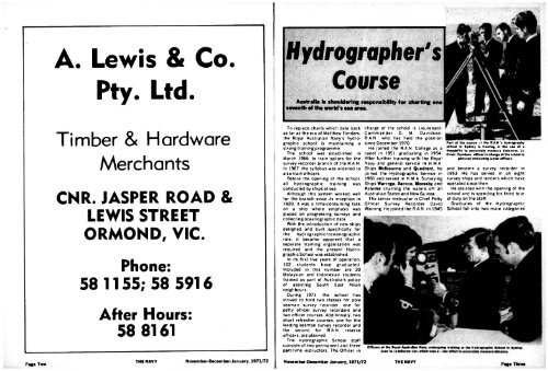
A. Lewis & Co.Pty. Ltd.Timber & HardwareMerchantsCNR. JASPER ROAD &LEWIS STREETORMOND, VIC.Phone:58 1155; 58 5916After Hours:58 8161Hydrographer'sCourse<strong>Australia</strong> to shouldering responsibility for charting oneseventh <strong>of</strong> the world's sea area.To replace charts which date backas far as the era <strong>of</strong> Matthew Flinders,the Royal <strong>Australia</strong>n <strong>Navy</strong>'s hydrographicschool is maintaining astrong training programmeThe school was established inMarch 1966. to train sailors for thesurvey recorder branch <strong>of</strong> the R.A.N.In 1967. the syllabus was widened toalso train <strong>of</strong>ficers.Before the opening <strong>of</strong> the school,all hydrographic training wasconducted by ships at sea.Although this system worked wellfor the branch since its inception in1920. it was a time-consuming taskon a ship where emphasis wasplaced on progressing surveys andcollecting oceanographic data.With the introduction <strong>of</strong> new shipsdesigned and built specifically forthe hydrographic/oceanographicrole, it became apparent that aseparate training organisation wasrequired and the present HydrographicSchool was established.In its first five years <strong>of</strong> operation.102 students have graduated.Included in this number are 20Malaysian and Indonesian studentstrained as part <strong>of</strong> <strong>Australia</strong>'s policy<strong>of</strong> assisting South East Asianneighbours.During <strong>1971</strong>. the school hasstrived to hold two classes for ableseaman survey recorder, one forpetty <strong>of</strong>ficer survey recorders andtwo <strong>of</strong>ficer courses. Additionally, twoshort refresher courses, one for theleading seaman survey recorder andthe second for R.A.N, reserve<strong>of</strong>ficers, are planned.The Hydrographic School staffconsists <strong>of</strong> two permanent and threepart-time instructors. The Officer incharge <strong>of</strong> the school is Lieutenant-Commander D. M. Davidson,R.A.N.. who has held the positionsince <strong>Dec</strong>ember 1970.He joined the R.A.N. College as acadet in 1951. graduating in 1954.After further training with the Royal<strong>Navy</strong> and general service in H.M.A.Ships Melbourne and Quadrant, hejoined the Hydrographic Service in1961 and served in H.M.A. SurveyingShips Warrego, Barcoo, Moresby andPaluma charting the waters <strong>of</strong>f all<strong>Australia</strong>n States and New Guinea.The senior instructor is Chief PettyOfficer Survey Recorder DavidWarning. He joined the R.A.N, in 1945t the R.A.N.'s hydrographyschool in Sydney is training in the UM <strong>of</strong> atheodolite to accurately measure distances. LLCmdr. Davidson, <strong>of</strong>ficer-in-charge <strong>of</strong> the school ispictured instructing junior <strong>of</strong>ficers.and became a survey recorder in1953. He has served in all eightsurvey ships and tenders which haveoperated since then.He assisted with the opening <strong>of</strong> theschool and is spending his third tour<strong>of</strong> duty on the staff.Graduates <strong>of</strong> the HydrographicSchool fall into two main categoriesOfficers <strong>of</strong> theJtoyaHMwtrajlw Nary undergojngfralnlng at the Hydrographic School in Sydney.Pag. TwoTHE NAVY<strong>Nov</strong>ember-<strong>Dec</strong>ember-Jin u»ry.<strong>Nov</strong>ember-<strong>Dec</strong>ember-<strong>Jan</strong>uary, <strong>1971</strong>/72THE NAVYPage Three
MrrCHELLU«MYp i v a l cereals with great flavourcanmake'emPace Four THE NAVY <strong>Nov</strong>ember-<strong>Dec</strong>ember-<strong>Jan</strong>uary, <strong>1971</strong>/72HYDROGRAPHtRSCOURSE— the survey <strong>of</strong>ficers who areexpected to carry out oceanographictasks with little or nosupervision, and the surveyrecorders who initially assist the<strong>of</strong>ficers and later, as seniorrecorders. shoulder moreresponsibility.The term oceanography covers amultitude <strong>of</strong> fields connected withthe ocean including its physicaldimensions and properties, itschemical composition, biology,meteorology and geologicalproperties.The detailed study <strong>of</strong> all thesesections, many <strong>of</strong> them scientificallynew. is beyond the scope <strong>of</strong> oneman. But the <strong>of</strong>ficer's course in 5months endeavours to cover asmany <strong>of</strong> these subjects as possibleso that students can select somefacet to study further.Additionally, as the HydrographicService <strong>of</strong> the R.A.N, is the primarycharting authority for the waters <strong>of</strong><strong>Australia</strong>. New Guinea and southernareas <strong>of</strong> the Pacific Ocean, emphasisis placed on the teaching <strong>of</strong> hydrographicsurveying at the school.The final product <strong>of</strong> the hydrographicsurvey is the published chartwhich goes on sale to internationalship owners and to a public withinterests such as yachting, fishing,skin diving or quiet Sunday boating.The hydrographic surveyor mustbe capable <strong>of</strong> producing a contouredpicture <strong>of</strong> the sea bed. delineatingthe coast line, accurately fixing theposition <strong>of</strong> submerged rocks andreefs — especially those dangerousto navigation. He must recogniseand chart all topographic featureswhich may help a mariner determinehis position.He must also understand tidaltheory and be able to analyse andpredict heights, and the times <strong>of</strong>high and low waters.He must record tidal stream andocean currents. The survey must beaccurately located on the earth'ssurface and the true meridian (northpoint) determined by astronomicalobservations <strong>of</strong> extreme precision.While a chart probably exists <strong>of</strong> anarea, it could be based on a surveyundertaken more than 100 years agoby surveyors undersail using aweight on a marked line todetermine the depth.For all their painstaking care andlong hours <strong>of</strong> work, surveyors <strong>of</strong>bygone days could not survey aseffectively or as accurately as is nowpossible with electronic echosounders, radio fixing systems andmechanical propulsion.The survey recorder has beendefined as a man among men and asailor among sailors. He is expectedto work long hours in the field <strong>of</strong>tenunder difficult and trying conditions.He may be a member <strong>of</strong> asounding boat's crew detached fromthe parent ship for extended periods,or based in a shore camp on aremote coral island operatingmodern electronic position-fixingequipment so that the survey ship— possibly 200 miles away — canaccurately and continuouslydetermine her position.To "The <strong>Navy</strong>",SUBSCRIPTION FORMBox C178, Clarence Street Post Olflce,Sydney. N.S.W., 2M0. <strong>Australia</strong>Alternatively, he<strong>of</strong> that ship's sur ey telin the collection o informsto advance scienti c knowlj^j^This could laU a i H j "observations, the measurement otthe intensity <strong>of</strong> the earth's magneticfield, characteristics <strong>of</strong> sea water atvarious depths, cores and dredgesamples <strong>of</strong> the bottom <strong>of</strong> the sea andplankton hauls.It is the business <strong>of</strong> the HydrographicSchool to ensure that themen conducting these tasks do sowith the pr<strong>of</strong>essionalism expectedby other world oceanographicauthorities.It may be said that the marinerplaces boundless confidence in thepublished chart and almostinvariably assumes that, where nodangers are shown, none in factexist.It is the surveyor's business to seethat this trust is not misplaced.I eadoie SI JO being '