estonia-2030_en
estonia-2030_en
estonia-2030_en

Create successful ePaper yourself
Turn your PDF publications into a flip-book with our unique Google optimized e-Paper software.
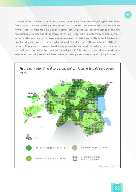
sub-topics of the thematic plan for the counties, “Environm<strong>en</strong>tal conditions guiding settlem<strong>en</strong>t andland use”, was the gre<strong>en</strong> network. The boundaries of and the conditions for the utilisation of th<strong>en</strong>etwork and its compon<strong>en</strong>ts have be<strong>en</strong> in compreh<strong>en</strong>sive plans subsequ<strong>en</strong>tly adopted by the ruralmunicipalities. The planning of the gre<strong>en</strong> network in Estonia took on an integrated approach, insofaras the functioning of the network was viewed in concert with settlem<strong>en</strong>t and technical infrastructure,in order to id<strong>en</strong>tify points of conflict and provide solutions for <strong>en</strong>suring the cohesiv<strong>en</strong>ess of the gre<strong>en</strong>network. Thus, the gre<strong>en</strong> network is a planning measure to improve the situation of nature conservationand the opportunities for sustainable developm<strong>en</strong>t. This balanced point of view needs to beadhered to in planning technical infrastructure and mining mineral resources also going forward.Figure 11. National-level core areas and corridors in Estonia’s gre<strong>en</strong> network.TallinnNarvaKärdlaHaapsaluRaplaPaideRakvereJõhviJõgevaPärnuViljandiTartuKuressaarePõlvaValgaVõruCityNational-level large core areas (T2)National-level gre<strong>en</strong> corridorsNational-level small core areas (T1)Major international andnational gre<strong>en</strong> zonesIllustration: Veiko Veski52