

Meghalaya - Ministry of Environment and Forests
Meghalaya - Ministry of Environment and Forests
Meghalaya - Ministry of Environment and Forests

Create successful ePaper yourself
Turn your PDF publications into a flip-book with our unique Google optimized e-Paper software.
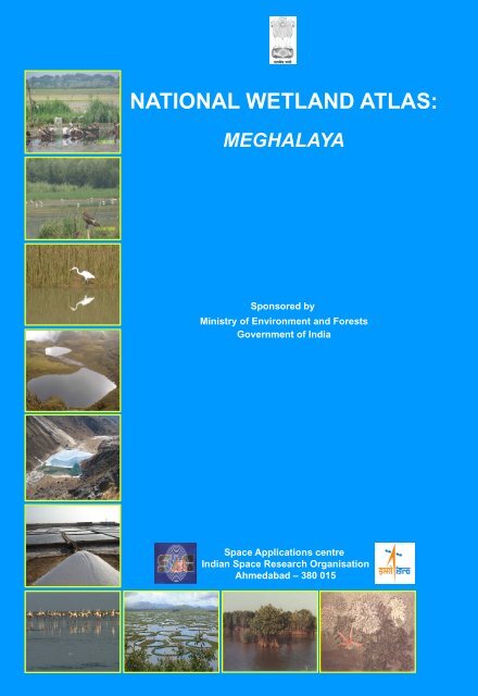
NATIONAL WETLAND ATLAS:MEGHALAYASponsored by<strong>Ministry</strong> <strong>of</strong> <strong>Environment</strong> <strong>and</strong> <strong>Forests</strong>Government <strong>of</strong> IndiaSpace Applications centreIndian Space Research OrganisationAhmedabad – 380 015
This publication deals with the updated database <strong>and</strong>status <strong>of</strong> wetl<strong>and</strong>s, compiled in Atlas format. Increasingconcern about how our wetl<strong>and</strong>s are being influenced hasled to formulation <strong>of</strong> a project entitled “National Wetl<strong>and</strong>Inventory <strong>and</strong> Assessment (NWIA)” to create an updateddatabase <strong>of</strong> the wetl<strong>and</strong>s <strong>of</strong> India. The wetl<strong>and</strong>s arecategorised under 19 classes <strong>and</strong> mapped using satelliteremote sensing data from Indian Remote SensingSatellite: IRS P6- LISS III sensor. The results areorganised at 1: 50, 000 scales at district, state <strong>and</strong>topographic map sheet (Survey <strong>of</strong> India reference) levelusing Geographic Information System (GIS). Thispublication is a part <strong>of</strong> this national work <strong>and</strong> deals withthe wetl<strong>and</strong> status <strong>of</strong> a particular State/Union Territory <strong>of</strong>India, through text, statistical tables, satellite images,maps <strong>and</strong> ground photographs.The atlas comprises wetl<strong>and</strong> information arranged intonine sections. How the NWIA project work has beenexecuted highlighted in the first six sections viz:Introduction, NWIA project, Study area, Data used,Methodology, <strong>and</strong> Accuracy. This is the first time that highresolution digital remote sensing data has been used tomap <strong>and</strong> decipher the status <strong>of</strong> the wetl<strong>and</strong>s at nationalscale. The methodology highlights how the four spectralb<strong>and</strong>s <strong>of</strong> LISS III data (green, red, near infra red <strong>and</strong> shortwave infra red) have been used to derive various indices<strong>and</strong> decipher information regarding water spread,turbidity <strong>and</strong> aquatic vegetation. Since, the aim was togenerate a GIS compatible database, details <strong>of</strong> thest<strong>and</strong>ards <strong>of</strong> database are also highlighted in themethodology.The results <strong>and</strong> finding are organised in three sections;viz: Maps <strong>and</strong> Statistics, Major wetl<strong>and</strong> types, <strong>and</strong>Important Wetl<strong>and</strong>s <strong>of</strong> the area. The Maps <strong>and</strong> Statisticsare shown for state <strong>and</strong> district level. It gives details <strong>of</strong>what type <strong>of</strong> wetl<strong>and</strong>s exists in the area, how manynumbers in each type, their area estimates in hectare.Since, the hydrology <strong>of</strong> wetl<strong>and</strong>s are influenced bymonsoon performance, extent <strong>of</strong> water spread <strong>and</strong> theirturbidity (qualitative) in wet <strong>and</strong> dry season (postmonsoon<strong>and</strong> pre-monsoon period) are also given.Similarly the status <strong>of</strong> aquatic vegetation (mainly floating<strong>and</strong> emergent types) in two seasons is also accounted for.Status <strong>of</strong> small wetl<strong>and</strong>s are also accounted as numbers<strong>and</strong> depicted in maps as points. Wetl<strong>and</strong> map also showimportant ancillary information like roads/rail, relevanthabitations. False Colour Composite (FCC) <strong>of</strong> the satelliteimage used (any one season) is shown along with thederived wetl<strong>and</strong> map to give a feeling <strong>of</strong> manifestation <strong>of</strong>wetl<strong>and</strong>s in remote sensing data <strong>and</strong> synoptic view <strong>of</strong> thearea. The status <strong>of</strong> some <strong>of</strong> the important wetl<strong>and</strong>s likeRamsar sites, National Parks are shown with recent fieldphotographs.For further details contact:Director,Space Applications Centre, ISRO,Ambawadi Vistar (P.O.)Ahmedabad – 380 015director@sac.isro.gov.in
AtlasSAC/RESA/AFEG/NWIA/ATLAS/02/2009NATIONAL WETLAND ATLAS<strong>Meghalaya</strong>Sponsored by<strong>Ministry</strong> <strong>of</strong> <strong>Environment</strong> <strong>and</strong> <strong>Forests</strong>, Government <strong>of</strong> IndiaAs a part <strong>of</strong> the project on National Wetl<strong>and</strong> Inventory <strong>and</strong> Assessment (NWIA)Space Applications Centre (ISRO), Ahmedabad<strong>and</strong>North Eastern Space Applications Centre, Umiam, <strong>Meghalaya</strong>May 2009
First Publication: May 2009, Space Applications Centre (ISRO), AhmedabadCopyright:2009, SAC, ISROThis publication may be produced in whole or in part <strong>and</strong> in any form for education or non-pr<strong>of</strong>it uses,without special permission from the copyright holder, provided acknowledgement <strong>of</strong> source is made. SACwill appreciate a copy <strong>of</strong> any publication which uses this publication as a source.Citation:Available from:Production:National Wetl<strong>and</strong> Atlas: <strong>Meghalaya</strong>, SAC/RESA/AFEG/NWIA/ATLAS/02/2009, Space ApplicationsCentre(ISRO), Ahmedabad, India, 88p.Space Applications Centre, ISRO, Ahmedabad – 380 015, IndiaSAC carried out the work in collaboration with NESAC, Shillong, Sponsored by <strong>Ministry</strong> <strong>of</strong> <strong>Environment</strong> <strong>and</strong><strong>Forests</strong>, Govt. <strong>of</strong> India.
MESSAGEIt gives me great pleasure to introduce this Atlas, the latest in a series, prepared by Space ApplicationsCentre, Ahmedabad in connection with the National Wetl<strong>and</strong> Inventory <strong>and</strong> Assessment Project.This Atlas maps <strong>and</strong> catalogues information on Wetl<strong>and</strong>s across India using the latest in satellite imaging,one <strong>of</strong> the first <strong>of</strong> its kind. Wetl<strong>and</strong>s are areas <strong>of</strong> l<strong>and</strong> critical ecological significance that support a largevariety <strong>of</strong> plant <strong>and</strong> animal species adapted to fluctuating water levels. Their identification <strong>and</strong> protectionbecomes very important.Utility-wise, wetl<strong>and</strong>s directly <strong>and</strong> indirectly support millions <strong>of</strong> people in providing services such as food,fiber <strong>and</strong> raw materials. They play important roles in storm <strong>and</strong> flood control, in supply <strong>of</strong> clean water, alongwith other educational <strong>and</strong> recreational benefits. Despite these benefits, wetl<strong>and</strong>s are the first target <strong>of</strong>human interference <strong>and</strong> are among the most threatened <strong>of</strong> all natural resources. Around 50% <strong>of</strong> theearth’s wetl<strong>and</strong>s are estimated to already have disappeared worldwide over the last hundred years throughconversion to industrial, agricultural <strong>and</strong> residential purposes. Even in current scenario, when theecosystem services provided by wetl<strong>and</strong>s are better understood - degradation <strong>and</strong> conversion <strong>of</strong> wetl<strong>and</strong>scontinues.Aware <strong>of</strong> their importance, the Government <strong>of</strong> India has formulated several policies <strong>and</strong> plans for theconservation <strong>and</strong> preservation <strong>of</strong> these crucial ecosystems. Realising the need <strong>of</strong> an updated geospatialdata base <strong>of</strong> these natural resources as the pre-requisite for management <strong>and</strong> conservation planning,National Wetl<strong>and</strong> Inventory <strong>and</strong> Assessment (NWIA) project was formulated as a joint vision <strong>of</strong> <strong>Ministry</strong> <strong>of</strong><strong>Environment</strong> & Forestry, Govt. India, <strong>and</strong> Space Applications Centre (ISRO). I am told that the latestremote sensing data from Indian Remote Sensing satellite (IRS P6) have been used to map the wetl<strong>and</strong>s.The present atlas is part <strong>of</strong> this project <strong>and</strong> highlights the results <strong>of</strong> the study state in terms <strong>of</strong> statistics <strong>of</strong>various types <strong>of</strong> wetl<strong>and</strong>s, extent <strong>of</strong> water, aquatic vegetation <strong>and</strong> turbidity in pre <strong>and</strong> post monsoon period.I also note that special efforts are made to provide detailed information <strong>of</strong> important wetl<strong>and</strong>s like Ramsarsites, National Parks etc.I am certain that this Atlas will raise the bar in developing such database <strong>and</strong> will be <strong>of</strong> great use forresearchers, planners, policy makers, <strong>and</strong> also members <strong>of</strong> the general public.
FOREWORDWetl<strong>and</strong>s defined as areas <strong>of</strong> l<strong>and</strong> that are either temporarily or permanently covered by water exhibitenormous diversity according to their genesis, geographical location, water regime <strong>and</strong> chemistry. Wetl<strong>and</strong>sare one <strong>of</strong> the most productive ecosystems <strong>and</strong> play crucial role in hydrological cycle. Utility wise, wetl<strong>and</strong>sdirectly <strong>and</strong> indirectly support millions <strong>of</strong> people in providing services such as storm <strong>and</strong> flood control, cleanwater supply, food, fiber <strong>and</strong> raw materials, scenic beauty, educational <strong>and</strong> recreational benefits. TheMillennium Ecosystem Assessment estimates conservatively that wetl<strong>and</strong>s cover seven percent <strong>of</strong> the earth’ssurface <strong>and</strong> deliver 45% <strong>of</strong> the world’s natural productivity <strong>and</strong> ecosystem services. However, the veryexistence <strong>of</strong> these unique resources is under threat due to developmental activities, <strong>and</strong> population pressure.This calls for a long term planning for preservation <strong>and</strong> conservation <strong>of</strong> these resources. An updated <strong>and</strong>accurate database that will support research <strong>and</strong> decision is the first step towards this. Use <strong>of</strong> advancedtechniques like Satellite remote sensing, Geographic Information System (GIS) is now essential for accurate<strong>and</strong> timely spatial database <strong>of</strong> large areas. Space Applications Centre (ISRO) took up this challenging taskunder the project “NWIA” (National Wetl<strong>and</strong> Inventory <strong>and</strong> Assessment) sponsored by <strong>Ministry</strong> <strong>of</strong><strong>Environment</strong> & <strong>Forests</strong>. To account for numerous small yet important wetl<strong>and</strong>s found in the country, mappingat 1:50,000 scales has been taken up. Two date IRS LISS III data acquired during pre <strong>and</strong> post monsoonseason are used for inventory to account for wet <strong>and</strong> dry season hydrology <strong>of</strong> wetl<strong>and</strong>s. The map outputsinclude the status <strong>of</strong> water spread, aquatic vegetation <strong>and</strong> turbidity. Ancillary layers like road/rail, habitationsare also created. Very small wetl<strong>and</strong>s below the mappable unit are also identified <strong>and</strong> shown points. Theresults are complied as Atlases <strong>of</strong> wetl<strong>and</strong>s for states/Union Territories <strong>of</strong> India. This Atlas highlights resultsfor a particular state/UT <strong>and</strong> hopes to improve our underst<strong>and</strong>ing <strong>of</strong> the dynamics <strong>and</strong> distribution <strong>of</strong> wetl<strong>and</strong>s<strong>and</strong> their status in the area.I congratulate the team for bringing out this informative atlas <strong>and</strong> sincerely hope that this will serve as auseful source <strong>of</strong> information to researchers, planners <strong>and</strong> general public.January 25, 2010
PROJECT TEAMProject Director: Dr. (Mrs.) Sushma PanigrahySpace Applications Centre, ISRO, AhmedabadShri J. G. PatelDr. T. S. SinghShri T. V. R MurthyNorth Eastern Space Applications Centre, Umiam, <strong>Meghalaya</strong>Ms. Kasturi Chakraborty
CONTENTS1.0 INTRODUCTION1.1 Wetl<strong>and</strong>s1.2 Mapping <strong>and</strong> geospatial techniques1.3 Wetl<strong>and</strong> Inventory <strong>of</strong> India2.0 NATIONAL WETLAND INVENTORY AND ASSESSMENT2.1 Wetl<strong>and</strong> Classification System2.2 GIS database contents3.0 STUDY AREA4.0 DATA USED5.0 METHODOLOGY5.1 Creation <strong>of</strong> spatial framework5.2 Geo-referencing <strong>of</strong> satellite data5.3 Mapping <strong>of</strong> wetl<strong>and</strong>s5.4 Conversion <strong>of</strong> the conformation into a vector layer5.5 Generation <strong>of</strong> reference layers5.6 Coding <strong>and</strong> attribute scheme5.7 Map composition <strong>and</strong> output6.0 ACCURACY ASSESSMENT7.0 WETLANDS OF MEGHALAYA: MAPS AND STATISTICS7.1 District-wise Wetl<strong>and</strong> Maps <strong>and</strong> Statistics8.0 MAJOR WETLAND TYPES9.0 IMPORTANT WETLANDS OF MEGHALAYA10.0 SOI-MAPSHEET WISE WETLAND MAPS (selected sheets)ReferencesAnnexure–I: Definitions <strong>of</strong> wetl<strong>and</strong> categories used in the project.Annexure–II: Details <strong>of</strong> district information followed in the atlasList <strong>of</strong> FiguresFigure 1: Spectral Signature <strong>of</strong> various targetsFigure 2: Various l<strong>and</strong> features as they appear in four spectral b<strong>and</strong>s <strong>and</strong> in a typical three b<strong>and</strong> FCC.Figure 3: Location mapFigure 4: Spatial framework <strong>of</strong> <strong>Meghalaya</strong>Figure 5: IRS P6 LISS-III coverage <strong>of</strong> <strong>Meghalaya</strong>Figure 6 : IRS LISS-III FCC (25 March 2007 <strong>and</strong> 25 November 2007)Figure 7: Flow chart <strong>of</strong> the methodology usedFigure 8: Steps in the extraction <strong>of</strong> wetl<strong>and</strong> componentsFigure 9: Various combinations <strong>of</strong> the indices/spectral b<strong>and</strong>s used to identify wetl<strong>and</strong> componentsFigure 10: Type-wise wetl<strong>and</strong> distribution in <strong>Meghalaya</strong>Figure 11: District-wise wetl<strong>and</strong> distributionList <strong>of</strong> TablesTable 1: Wetl<strong>and</strong> Classification System <strong>and</strong> codingTable-2: Satellite data usedTable 3: Qualitative turbidity ratingsTable 4: Area estimates <strong>of</strong> wetl<strong>and</strong>s in <strong>Meghalaya</strong>Table-5: District-wise wetl<strong>and</strong> areaTable 6: Area estimates <strong>of</strong> wetl<strong>and</strong>s in West Garo HillsTable 7: Area estimates <strong>of</strong> wetl<strong>and</strong>s in East Garo Hills
Table 8: Area estimates <strong>of</strong> wetl<strong>and</strong>s in South Garo HillsTable 9: Area estimates <strong>of</strong> wetl<strong>and</strong>s in West Khasi HillsTable 10: Area estimates <strong>of</strong> wetl<strong>and</strong>s in Ri BhoiTable 11: Area estimates <strong>of</strong> wetl<strong>and</strong>s in East Khasi HillsTable 12: Area estimates <strong>of</strong> wetl<strong>and</strong>s in Jaintia HillsList <strong>of</strong> PlatesPlate-1: Major wetl<strong>and</strong> types <strong>of</strong> <strong>Meghalaya</strong>Plate-2a <strong>and</strong> 2b : Field photographs <strong>and</strong> ground truth data <strong>of</strong> different wetl<strong>and</strong> types in <strong>Meghalaya</strong>Plate 3: Umiam lakePlate 4: Wetl<strong>and</strong> map - 5 km buffer area <strong>of</strong> Umiam lakePlate 5: Nongkhnum river Isl<strong>and</strong>Plate 6: Wetl<strong>and</strong> map - 5 km buffer area <strong>of</strong> Nongkhnum river Isl<strong>and</strong>Plate 7: RanikorPlate 8: Wetl<strong>and</strong> map - 5 km buffer area <strong>of</strong> Ranikor
1.0 INTRODUCTIONIt is increasingly realized that the planet earth is facing grave environmental problems with fast depletingnatural resources <strong>and</strong> threatening the very existence <strong>of</strong> most <strong>of</strong> the ecosystems. Serious concerns are voicedamong scientists, planners, sociologists, politicians, <strong>and</strong> economists to conserve <strong>and</strong> preserve the naturalresources <strong>of</strong> the world. One <strong>of</strong> the difficulties most frequently faced for decision making is lack <strong>of</strong> scientificdata <strong>of</strong> our natural resources. Often the data are sparse or unconvincing, rarely in the form <strong>of</strong> geospatialdatabase (map), thus open to challenges. Thus, the current thrust <strong>of</strong> every country is to have an appropriategeospatial database <strong>of</strong> natural resources that is based on unambiguous scientific methods. The wetl<strong>and</strong> atlas<strong>of</strong> <strong>Meghalaya</strong>, which is part <strong>of</strong> the National Wetl<strong>and</strong> Atlas <strong>of</strong> India, is an attempt in this direction.1.1 Wetl<strong>and</strong>sWetl<strong>and</strong>s are one <strong>of</strong> the crucial natural resources. Wetl<strong>and</strong>s are areas <strong>of</strong> l<strong>and</strong> that are either temporarily orpermanently covered by water. This means that a wetl<strong>and</strong> is neither truly aquatic nor terrestrial; it is possiblethat wetl<strong>and</strong>s can be both at the same time depending on seasonal variability. Thus, wetl<strong>and</strong>s exhibitenormous diversity according to their genesis, geographical location, water regime <strong>and</strong> chemistry, dominantplants <strong>and</strong> soil or sediment characteristics. Because <strong>of</strong> their transitional nature, the boundaries <strong>of</strong> wetl<strong>and</strong>sare <strong>of</strong>ten difficult to define. Wetl<strong>and</strong>s do, however, share a few attributes common to all forms. Of these,hydrological structure (the dynamics <strong>of</strong> water supply, throughput, storage <strong>and</strong> loss) is most fundamental tothe nature <strong>of</strong> a wetl<strong>and</strong> system. It is the presence <strong>of</strong> water for a significant period <strong>of</strong> time which is principallyresponsible for the development <strong>of</strong> a wetl<strong>and</strong>. One <strong>of</strong> the first widely used classifications systems, devised byCowardin et al., (1979), was associated to its hydrological, ecological <strong>and</strong> geological aspects, such as:marine (coastal wetl<strong>and</strong>s including rock shores <strong>and</strong> coral reefs, estuarine (including deltas, tidal marshes, <strong>and</strong>mangrove swamps), lacustarine (lakes), riverine (along rivers <strong>and</strong> streams), palustarine ('marshy'- marshes,swamps <strong>and</strong> bogs). Given these characteristics, wetl<strong>and</strong>s support a large variety <strong>of</strong> plant <strong>and</strong> animal speciesadapted to fluctuating water levels, making the wetl<strong>and</strong>s <strong>of</strong> critical ecological significance. Utility wise,wetl<strong>and</strong>s directly <strong>and</strong> indirectly support millions <strong>of</strong> people in providing services such as food, fiber <strong>and</strong> rawmaterials, storm <strong>and</strong> flood control, clean water supply, scenic beauty <strong>and</strong> educational <strong>and</strong> recreationalbenefits. The Millennium Ecosystem Assessment estimates conservatively that wetl<strong>and</strong>s cover seven percent<strong>of</strong> the earth’s surface <strong>and</strong> deliver 45% <strong>of</strong> the world’s natural productivity <strong>and</strong> ecosystem services <strong>of</strong> which thebenefits are estimated at $20 trillion a year (Source : www.MAweb.org). The Millennium Assessment (MA)uses the following typology to categorise ecosystem services:Provisioning services: The resources or products provided by ecosystems, such as food, raw materials(wood), genetic resources, medicinal resources, ornamental resources (skin, shells, flowers).Regulating services: Ecosystems maintain the essential ecological processes <strong>and</strong> life support systems, likegas <strong>and</strong> climate regulation, water supply <strong>and</strong> regulation, waste treatment, pollination, etc.Cultural <strong>and</strong> Amenity services: Ecosystems are a source <strong>of</strong> inspiration to human culture <strong>and</strong> educationthroughout recreation, cultural, artistic, spiritual <strong>and</strong> historic information,science <strong>and</strong> education.Supporting services: Ecosystems provide habitat for flora <strong>and</strong> fauna in order to maintain biological <strong>and</strong>genetic diversity.Despite these benefits, wetl<strong>and</strong>s are the first target <strong>of</strong> human interference <strong>and</strong> are among the mostthreatened <strong>of</strong> all natural resources. Around 50% <strong>of</strong> the earth’s wetl<strong>and</strong>s is estimated to already havedisappeared worldwide over the last hundred years through conversion to industrial, agricultural <strong>and</strong>residential developments. Even in current scenario, when the ecosystem services provided by wetl<strong>and</strong>s arebetter understood - degradation <strong>and</strong> conversion <strong>of</strong> wetl<strong>and</strong>s continues. This is largely due to the fact that the‘full value’ <strong>of</strong> ecosystem functions is <strong>of</strong>ten ignored in policy-making, plans <strong>and</strong> corporate evaluations <strong>of</strong>development projects.1.2 Mapping <strong>and</strong> Geospatial techniqueTo conserve <strong>and</strong> manage wetl<strong>and</strong> resources, it is important to have inventory <strong>of</strong> wetl<strong>and</strong>s <strong>and</strong> theircatchments. The ability to store <strong>and</strong> analyse the data is essential. Digital maps are very powerful tools toachieve this. Maps relate the feature to any given geographical location has a strong visual impact. Maps,thus essential for monitoring <strong>and</strong> quantifying change over time scale, assist in decision making. Thetechnique used in the preparation <strong>of</strong> map started with ground survey. The Survey <strong>of</strong> India (SOI) topographicmaps are the earliest true maps <strong>of</strong> India showing various l<strong>and</strong> use/cover classes including wetl<strong>and</strong>s. Recentyears have seen advances in mapping technique to prepare maps with much more information. Of particularimportance is the remote sensing <strong>and</strong> geographic information system (GIS) technique. Remote sensing is1
now recognized as an essential tool for viewing, analyzing, characterizing, <strong>and</strong> making decisions about l<strong>and</strong>,water <strong>and</strong> atmospheric components.From a general perspective, remote sensing is the science <strong>of</strong> acquiring <strong>and</strong> analyzing information aboutobjects or phenomena from a distance (Jensen, 1986; Lilles<strong>and</strong> <strong>and</strong> Keifer, 1987). Today, we define satelliteremote sensing as the use <strong>of</strong> satellite borne sensors to observe, measure, <strong>and</strong> record the electromagneticradiation (EMR) reflected or emitted by the earth <strong>and</strong> its environment for subsequent analysis <strong>and</strong> extraction<strong>of</strong> information. EMR sensors includes visible light, near-, mid- <strong>and</strong> far-infrared (thermal), microwave, <strong>and</strong>long-wave radio energy. The capability <strong>of</strong> multiple sources <strong>of</strong> information is unique to remote sensing. Ofspecific advantage is the spectral, temporal, <strong>and</strong> spatial resolution. Spectral resolution refers to the width orrange <strong>of</strong> each spectral b<strong>and</strong> being recorded. Since each target affects different wavelengths <strong>of</strong> incidentenergy differently, they are absorbed, reflected or transmitted in different proportions. Currently, there aremany l<strong>and</strong> resource remote sensing satellites that have sensors operating in the green, red, near infrared<strong>and</strong> short wave Infra red regions <strong>of</strong> the electromagnetic spectrum giving a definite spectral signature <strong>of</strong>various targets due to difference in radiation absorption <strong>and</strong> reflectance <strong>of</strong> targets. These sensors are <strong>of</strong>common use for l<strong>and</strong> cover studies, including wetl<strong>and</strong>s. Figure 1 shows typical spectral signature <strong>of</strong> fewtargets from green to SWIR region. Converted to image, in a typical false colour composite (FCC) createdusing NIR, red <strong>and</strong> green b<strong>and</strong>s assigned as red, green <strong>and</strong> blue colour, the features become very distinct asshown in Figure 2. In FCC, the vegetation thus appears invariably red (due to high reflection in NIR fromgreen leaves).Since the early 1960s, numerous satellite sensors have been launched into orbit to observe <strong>and</strong> monitor theearth <strong>and</strong> its environment. Most early satellite sensors acquired data for meteorological purposes. The advent<strong>of</strong> earth resources satellite sensors (those with a primary objective <strong>of</strong> mapping <strong>and</strong> monitoring l<strong>and</strong> cover)occurred, when the first L<strong>and</strong>sat satellite was launched in July 1972. Currently, more than a dozen orbitingsatellites <strong>of</strong> various types provide data crucial to improving our knowledge <strong>of</strong> the earth’s atmosphere, oceans,ice <strong>and</strong> snow, <strong>and</strong> l<strong>and</strong>. Of particular interest to India is the indigenous series <strong>of</strong> satellites called IndianRemote Sensing (IRS) satellites. Since the launch <strong>of</strong> the first satellite IRS 1A in 1987, India has now anumber <strong>of</strong> satellites providing data in multi-spectral b<strong>and</strong>s with different spatial resolution. IRSP6/RESOURCESAT 1 is the current generation satellite that provides multi-spectral images in spatialresolution <strong>of</strong> 5.8 m (LISS IV), 23.5 m (LISS III) <strong>and</strong> 56m (AWiFS). Over the past few decades, Indian remotesensing data has been successfully used in various fields <strong>of</strong> natural resources ( Navalgund et al. 2002).Development <strong>of</strong> technologies like Geographic Information System (GIS) has enhanced the use <strong>of</strong> RS data toobtain accurate geospatial database. GIS specialises in h<strong>and</strong>ling related, spatially referenced data, combiningmapped information with other data <strong>and</strong> acts as analytical tool for research <strong>and</strong> decision making. During thepast few decades, technological advances in the field <strong>of</strong> satellite remote sensing (RS) sensors, computerizedmapping techniques, global positioning system (GPS) <strong>and</strong> geographic information system (GIS) hasenhanced the ability to capture more detailed <strong>and</strong> timely information about the natural resources at variousscales catering to local, regional, national <strong>and</strong> global level study.Figure 1: Spectral Signature <strong>of</strong> various targets2
REDGREENNIR RED GREENNIRIRS LISS III FCCSWIRFigure 2: Various l<strong>and</strong> features as they appear in four spectral b<strong>and</strong>s <strong>and</strong> in a typical three b<strong>and</strong> FCC.3
1.3 Wetl<strong>and</strong> Inventory <strong>of</strong> IndiaIndia with its large geographical spread supports large <strong>and</strong> diverse wetl<strong>and</strong> classes, some <strong>of</strong> which areunique. Wetl<strong>and</strong>s, variously estimated to be occupying 1-5 per cent <strong>of</strong> geographical area <strong>of</strong> the country,support about a fifth <strong>of</strong> the known biodiversity. Like any other place in the world, there is a looming threat tothe aquatic biodiversity <strong>of</strong> the Indian wetl<strong>and</strong>s as they are <strong>of</strong>ten under a regime <strong>of</strong> unsustainable humanpressures. Sustainable management <strong>of</strong> these assets therefore is highly relevant. Realising this, Govt. <strong>of</strong> Indiahas initiated many appropriate steps in terms <strong>of</strong> policies, programmes <strong>and</strong> plans for the preservation <strong>and</strong>conservation <strong>of</strong> these ecosystems. India is a signatory to the Ramsar Convention for management <strong>of</strong>wetl<strong>and</strong>, for conserving their biodiversity <strong>and</strong> wise use extending its scope to a wide variety <strong>of</strong> habitats,including rivers <strong>and</strong> lakes, coastal lagoons, mangroves, peatl<strong>and</strong>s, coral reefs, <strong>and</strong> numerous human-madewetl<strong>and</strong>, such as fish <strong>and</strong> shrimp ponds, farm ponds, irrigated agricultural l<strong>and</strong>, salt pans reservoirs, gravelpits, sewage farms, <strong>and</strong> canals. The <strong>Ministry</strong> <strong>of</strong> <strong>Environment</strong> <strong>and</strong> <strong>Forests</strong> has identified a number <strong>of</strong> wetl<strong>and</strong>sfor conservation <strong>and</strong> management under the National Wetl<strong>and</strong> Conservation Programme <strong>and</strong> some financialassistance is being provided to State Governments for various conservation activities through approval <strong>of</strong> theManagement Action Plans. The need to have an updated map database <strong>of</strong> wetl<strong>and</strong>s that will support suchactions has long been realized.Mapping requires a st<strong>and</strong>ard classification system. Though there are many classification systems forwetl<strong>and</strong>s in the world, the Ramsar classification system is the most preferred one. The 1971 RamsarConvention on Wetl<strong>and</strong>s <strong>of</strong> International Importance especially as Waterfowl Habitat is the oldestconservation convention. It owes its name to its place <strong>of</strong> adoption in Iran. It came into being due to seriousdecline in populations <strong>of</strong> waterfowl (mainly ducks) <strong>and</strong> conservation <strong>of</strong> habitats <strong>of</strong> migratory waterfowl.Convention provides framework for the conservation <strong>and</strong> ‘wise use’ <strong>of</strong> wetl<strong>and</strong> biomes. Ramsar convention isthe first modern global intergovernmental treaty on conservation <strong>and</strong> wise use <strong>of</strong> natural resources(www.ramsar.org). Ramsar convention entered into force in 1975. Under the text <strong>of</strong> the Convention (Article1.1) wetl<strong>and</strong>s are defined as:“areas <strong>of</strong> marsh, fen, peatl<strong>and</strong> or water, whether natural or artificial, permanent or temporary, with water thatis static or flowing, fresh, brackish or salt, including areas <strong>of</strong> marine water the depth <strong>of</strong> which at low tide doesnot exceed six meters”.In addition, the Convention (Article 2.1) provides that wetl<strong>and</strong>s:“may incorporate riparian <strong>and</strong> coastal zones adjacent to the wetl<strong>and</strong>s, <strong>and</strong> isl<strong>and</strong>s or bodies <strong>of</strong> marine waterdeeper than six meters at low tide lying within the wetl<strong>and</strong>s”.The first scientific mapping <strong>of</strong> wetl<strong>and</strong>s <strong>of</strong> India was carried out during1992-93 by Space Applications Centre(ISRO), Ahmedabad, at the behest <strong>of</strong> the <strong>Ministry</strong> <strong>of</strong> <strong>Environment</strong> <strong>and</strong> <strong>Forests</strong> (MoEF), Govt. <strong>of</strong> India usingremote sensing data from Indian Remote Sensing (IRS) satellite. The mapping was done at 1:250,000 scaleusing IRS 1A LISS-I/II data <strong>of</strong> 1992-93 timeframe under the Nation-wide Wetl<strong>and</strong> Mapping Project. Since, nosuitable wetl<strong>and</strong> classification existed for comprehensive inventory <strong>of</strong> wetl<strong>and</strong>s in the country at that time, theproject used a classification system based on Ramsar Convention definition <strong>of</strong> wetl<strong>and</strong>s. The classificationconsiders all parts <strong>of</strong> a water mass including its ecotonal area as wetl<strong>and</strong>. In addition, fish <strong>and</strong> shrimp ponds,saltpans, reservoirs, gravel pits were also included as wetl<strong>and</strong>s. This inventory put the wetl<strong>and</strong> extent (inl<strong>and</strong>as well as coastal) at about 8.26 million ha. (Garg et al). These estimates (24 categories) do not includerice/paddy fields, rivers, canals <strong>and</strong> irrigation channels.Further updating <strong>of</strong> wetl<strong>and</strong> maps <strong>of</strong> India was carried out by SAC using IRS P6/Resourcesat AWiFS data <strong>of</strong>2004-05 at 1:250000 scale. In recent years, a conservation atlas has been brought out by Salim Ali Centre forOrnithology <strong>and</strong> Natural History (SACON, 2004), which provide basic information required by stakeholders inboth wetl<strong>and</strong> habitat <strong>and</strong> species conservation. Space Applications Centre has carried out many pilot projectsfor development <strong>of</strong> GIS based wetl<strong>and</strong> information system (Patel et al, 2003) <strong>and</strong> Lake Information system(Singh et al, 2003).4
2.0 NATIONAL WETLAND INVENTORY AND ASSESSMENT (NWIA) PROJECTRealising the importance <strong>of</strong> many small wetl<strong>and</strong>s that dot the Indian l<strong>and</strong>scape, it has been unanimously feltthat inventory <strong>of</strong> the wetl<strong>and</strong>s at 1:50,000 scale is essential. The task seemed challenging in view <strong>of</strong> the vastgeographic area <strong>of</strong> our country enriched with diverse wetl<strong>and</strong> classes. Space Applications Centre with itsexperience in use <strong>of</strong> RS <strong>and</strong> GIS in the field <strong>of</strong> wetl<strong>and</strong> studies, took up this challenging task. This is furtherstrengthened by the fact that guidelines to create geospatial framework, codification scheme, data basestructure etc. for natural resources survey has already been well established by the initiative <strong>of</strong> ISRO undervarious national level mapping projects. With this strength, the National Wetl<strong>and</strong> Inventory <strong>and</strong> Assessment(NWIA) project was formulated by SAC, which was approved <strong>and</strong> funded by MoEF.The main objectives <strong>of</strong> the project are:• To map the wetl<strong>and</strong>s on 1:50000 scale using two date (pre <strong>and</strong> post monsoon) IRS LISS III digital datafollowing a st<strong>and</strong>ard wetl<strong>and</strong> classification system.• Integration <strong>of</strong> ancillary theme layers ( road, rail, settlements, drainage, administrative boundaries)• Creation <strong>of</strong> a seamless database <strong>of</strong> the states <strong>and</strong> country in GIS environment.• Preparation <strong>of</strong> State-wise wetl<strong>and</strong> atlasesThe project was initiated during 2007. The first task was to have a classification system that can be used bydifferent types <strong>of</strong> users while amenable to database. An expert/peer group was formed <strong>and</strong> the peer reviewwas held at SAC in June 2007 where wetl<strong>and</strong> experts <strong>and</strong> database experts participated <strong>and</strong> finalized theclassification system. It was agreed to follow the classification system that has been used for the earlierproject <strong>of</strong> 1:250,000 scale, with slight modification. Modified National Wetl<strong>and</strong> Classification system forwetl<strong>and</strong> delineation <strong>and</strong> mapping comprise 19 wetl<strong>and</strong> classes which are organized under a Level IIIhierarchical system. The definition <strong>of</strong> each wetl<strong>and</strong> class <strong>and</strong> its interpretation method was finalized. Thetechnical/procedure manual was prepared as the st<strong>and</strong>ard guideline for the project execution across thecountry (Garg <strong>and</strong> Patel, 2007). The present atlas is part <strong>of</strong> the national level data base <strong>and</strong> deals with thestate <strong>of</strong> <strong>Meghalaya</strong>.2.1 Wetl<strong>and</strong> Classification SystemIn the present project, Modified National Wetl<strong>and</strong> Classification system is used for wetl<strong>and</strong> delineation <strong>and</strong>mapping comprising 19 wetl<strong>and</strong> classes which are organized under a Level III hierarchical system (Table 1).Level one has two classes: inl<strong>and</strong> <strong>and</strong> coastal, these are further bifurcated into two categories as: natural <strong>and</strong>man-made under which the 19 wetl<strong>and</strong> classes are suitably placed. Two date data pertaining to pre-monsoon<strong>and</strong> post monsoon was used to confirm the classes. Wetl<strong>and</strong>s put to agriculture use in any <strong>of</strong> the two datesare not included as wetl<strong>and</strong> class. Definitions <strong>of</strong> wetl<strong>and</strong> categories used in the project is given in Annexure-I.2.2.1 Spatial Framework <strong>and</strong> GIS DatabaseThe National Spatial Framework) (NSF) has been used as the spatial framework to create the database(Anon. 2007). The database design <strong>and</strong> creation st<strong>and</strong>ard suggested by NRDB/NNRMS guidelines isfollowed. Feature codification scheme for every input element has been worked out keeping in view thenationwide administrative as well as natural hierarchy (State-district- within the feature class for each <strong>of</strong> thetheme. All data elements are given a unique name, which are self explanatory with short forms.Following wetl<strong>and</strong> layers are generated for each inl<strong>and</strong> wetl<strong>and</strong>:• Wetl<strong>and</strong> extent: As wetl<strong>and</strong>s encompass open water, aquatic vegetation (submerged, floating <strong>and</strong>emergent), the wetl<strong>and</strong> boundary should ideally include all these. Satellite image gives a clear signature<strong>of</strong> the wetl<strong>and</strong> extent from the imprint <strong>of</strong> water spread over the years.• Water spread: There are two layers representing post-monsoon <strong>and</strong> pre-monsoon water spread duringthe year <strong>of</strong> data acquisition.• Aquatic vegetation spread: The presence <strong>of</strong> vegetation in wetl<strong>and</strong>s provides information about itstrophic condition. As is known, aquatic vegetation is <strong>of</strong> four types, viz. benthic, submerged, floating,<strong>and</strong> emergent. It is possible to delineate last two types <strong>of</strong> vegetation using optical remote sensing data.A qualitative layer pertaining to presence <strong>of</strong> vegetation is generated for each season (as manifested onpre-monsoon <strong>and</strong> post-monsoon imagery).5
• Turbidity level <strong>of</strong> open water: A layer pertaining to a qualitative turbidity rating is generated. Threequalitative turbidity ratings ( low, medium <strong>and</strong> high) is followed for pre <strong>and</strong> post-monsoon turbidity <strong>of</strong>lakes, reservoirs, barrages <strong>and</strong> other large wetl<strong>and</strong>s.• Small wetl<strong>and</strong>s (smaller than minimum mappable unit) are mapped as point features.• Base layers like major road network, railway, settlements, <strong>and</strong> surface drainage are created (eitherfrom the current image or taken from other project data base).In the case <strong>of</strong> coastal wetl<strong>and</strong>s only wetl<strong>and</strong> extent is given.Table 1: Wetl<strong>and</strong> Classification System <strong>and</strong> coding (Annexure I for more details)Wettcode* Level I Level II Level III1000 Inl<strong>and</strong> Wetl<strong>and</strong>s1100 Natural1101 Lakes1102 Ox-Bow Lakes/ Cut-Off Me<strong>and</strong>ers1103 High altitude Wetl<strong>and</strong>s1104 Riverine Wetl<strong>and</strong>s1105 Waterlogged1106 River/stream1200 Man-made1201 Reservoirs/ Barrages1202 Tanks/Ponds1203 Waterlogged1204 Salt pans2000 CoastalWetl<strong>and</strong>s2100 Natural2101 Lagoons2102 Creeks2103 S<strong>and</strong>/Beach2104 Intertidal mud flats2105 Salt Marsh2106 Mangroves2107 Coral Reefs2200 Man-made2201 Salt pans2202 Aquaculture ponds* Wetl<strong>and</strong> type code6
3.0 STUDY AREA<strong>Meghalaya</strong> occupies the western position <strong>of</strong> the North eastern region. The North Eastern state <strong>of</strong> <strong>Meghalaya</strong>theabode <strong>of</strong> clouds is predominantly a l<strong>and</strong> <strong>of</strong> hills <strong>and</strong> valley. Owing to its natural beauty <strong>and</strong> grace it hasbeen also named as ‘Scotl<strong>and</strong> <strong>of</strong> the East’. Geographical location <strong>of</strong> the state is between 89 o 45’ to 92 o 48’<strong>and</strong> 25 o 02’ to 26 o 05’. The total geographical area <strong>of</strong> the state is 22, 429 Sq Km, extending 300 km west toeast <strong>and</strong> 100 km from north to south.It is bounded on the north by Goalpara <strong>and</strong> Kamrup district <strong>of</strong> Assam, on the east by North Cachar <strong>and</strong> KarbiAnglong, the Western <strong>and</strong> Southern boundary is the International border between India <strong>and</strong> Bangladesh. Theprevailing climate in the state is characterized by heavy rainfall, which favors the action <strong>of</strong> streams to aconsiderable extent.The geological formations, its resultant topography <strong>and</strong> tendency <strong>of</strong> headword erosion by rain water havelead to the creation <strong>of</strong> drainage network in <strong>Meghalaya</strong>. The state is blessed with number <strong>of</strong> perennial rivers.The principal rivers <strong>of</strong> the state run either a Northerly or Southerly direction. Satellite imagery identifies theadaptation <strong>of</strong> streams along major <strong>and</strong> minor lineaments. The rivers flowing towards the north to meet mightyBrahmaputra river <strong>of</strong> Assam plain have gentle gradient <strong>of</strong> longitudinal pr<strong>of</strong>iles <strong>and</strong> thereby do not form anymajor waterfalls <strong>and</strong> deep gorges. The rivers flowing towards the south are characterized by steepestgradient <strong>and</strong> abruptly falls to the Bangladesh plain.The capital <strong>of</strong> <strong>Meghalaya</strong> state is in Shillong. There are total seven districts <strong>of</strong> <strong>Meghalaya</strong> state. The districtsderive their names from that <strong>of</strong> the tribes inhabiting the region. The seven districts are: East Khasi hills, Eastgaro hills, Jaintia hills, Ri Bhoi, South Garo hills,West Garo hills <strong>and</strong> West Khasi hills (Statistical h<strong>and</strong> book <strong>of</strong><strong>Meghalaya</strong>, 2007) . There are about 5,782 villages in the state. The total population <strong>of</strong> the state is 2,318, 822(Manorama year book 2009).The major rivers <strong>of</strong> the state are Ganol, Ringgi, Krishnai, M<strong>and</strong>a, Darong, Bhogai, simsang, Dareng, Umkhri,Umtrew, Umiam, Kopili, Kynshiang,Shella, Umngot, Myntdu, Lubha, etc. One <strong>of</strong> the marked features <strong>of</strong> RiverKynshi in West Khasi Hills is the formation <strong>of</strong> River Isl<strong>and</strong> called Nongkhnum. Nongkhnum is not only India’sbut Asia’s second largest river isl<strong>and</strong>. Ranikor situated in the West Khasi Hills district in the confluence <strong>of</strong>Kynshi <strong>and</strong> Rilang rivers is one <strong>of</strong> the best fishing spots. <strong>Meghalaya</strong> has the highest hydro – electric potentialin the north-eastern region second only to Auranachal Pradesh. Hydel projects such as Umiam <strong>and</strong> Umtrewhave caused construction <strong>of</strong> artificial lakes for the generation <strong>of</strong> electricity. Umiam Lake commonly calledBarapani is formed by the damming <strong>of</strong> the Umiam river under the Umiam Hydro-Electric Project is a place <strong>of</strong>major tourist attraction <strong>and</strong> has great potentialities <strong>of</strong> recreation, aquatic sports, fishing etc. <strong>Meghalaya</strong> is alsonoted for a number <strong>of</strong> river cataracts <strong>and</strong> waterfall <strong>of</strong> great beauty located at different heights <strong>and</strong> scenicsetting.The state is covered by 54 Survey <strong>of</strong> India topographical maps on 1:50,000 scale that spatial framework formapping (Figure 4). The spatial framework was prepared using 15’x15’ grid.7
Figutr 3: Location mapFigure 4: Spatial Framework <strong>of</strong> <strong>Meghalaya</strong>8
4.0 DATA USEDRemote sensing dataIRS P6 LISS III data was used to map the wetl<strong>and</strong>s. IRS P6 LISS III provide data in 4 spectral b<strong>and</strong>s; green,red, Near Infra Red (NIR) <strong>and</strong> Short wave Infra Red (SWIR), with 23 m spatial resolution <strong>and</strong> 24 day repeatcycle. The spatial resolution is suitable for 1:50,000 scale mapping. The state <strong>of</strong> <strong>Meghalaya</strong> is covered in 6IRS LISS III scene (Figure 5). Two date data, one acquired during March <strong>and</strong> another during January wereused to capture the pre-monsoon <strong>and</strong> post-monsoon hydrological variability <strong>of</strong> the wetl<strong>and</strong>s respectively(Table-2). Figure 6 shows part <strong>of</strong> <strong>Meghalaya</strong> as seen in the LISS III FCC <strong>of</strong> post- monsoon pre-monsoon datarespectively.Figure 5: IRS P6 LISS-III coverage (path-row) <strong>of</strong> <strong>Meghalaya</strong>Table-2: Satellite data usedSl.NoResourcesat LISS IIIPath/ RowPost-MonsoonPre-Monsoon1 109/53 Oct 27, 2006 Mar 20, 20072 109/54 Oct 27, 2006 Mar 20, 20073 110/53 Dec 14, 2007 Mar 25, 20074 110/54 Dec 19, 2006 Feb 10,20065 111/53 Nov 25, 2007 Jan 22, 20066 111/54 Nov 30, 2006 Mar 30, 2007Ground truth dataRemote sensing techniques require certain amount <strong>of</strong> field observation called “ground truth” in order toconvert into meaningful information. Such work involves visiting a number <strong>of</strong> test sites, usually taking thesatellite data. The location <strong>of</strong> the features is recorded using the GPS. The st<strong>and</strong>ard pr<strong>of</strong>orma as per theNWIA manual was used to record the field data. Field photographs are also taken to record the water quality(subjective), status <strong>of</strong> aquatic vegetation <strong>and</strong> water spread. All field verification work has been done duringOctober <strong>and</strong> November 2008.Other dataSurvey <strong>of</strong> India topographical maps (SOI) were used for reference purpose. Lineage data <strong>of</strong> National Wetl<strong>and</strong>Maps at 1:50,000 scale was used for reference.9
5.0 METHODOLOGYThe methodology to create the state level atlas <strong>of</strong> wetl<strong>and</strong>s is adhered to NWIA technical guidelines <strong>and</strong>procedure manual (Garg <strong>and</strong> Patel, 2007). The overview <strong>of</strong> the steps used is shown in Figure 7. Salientfeatures <strong>of</strong> methodology adopted are• Generation <strong>of</strong> spatial framework in GIS environment for database creation <strong>and</strong> organisation.• Geo-referencing <strong>of</strong> satellite data• Identification <strong>of</strong> wetl<strong>and</strong> classes as per the classification system given in NWIA Manual <strong>and</strong> mapping <strong>of</strong>the classes using a knowledge based digital classification <strong>and</strong> onscreen interpretation• Generation <strong>of</strong> base layers (rail, road network, settlements, drainage, administrative boundaries) fromsatellite image <strong>and</strong> ancillary data.• Mosaicing/edge matching to create district <strong>and</strong> state level database.• Coding <strong>of</strong> the wetl<strong>and</strong>s following the st<strong>and</strong>ard classification system <strong>and</strong> codification as per NWIAmanual.• Preparation <strong>of</strong> map compositions <strong>and</strong> generation <strong>of</strong> statistics• Outputs on A3 size prints <strong>and</strong> charts for atlas.Work was carried out using ERDAS Imagine, Arc/Info <strong>and</strong> ArcGIS s<strong>of</strong>twares.5.1 Creation <strong>of</strong> spatial frameworkThis is the most important task as the state forms a part <strong>of</strong> the national frame work <strong>and</strong> is covered in multiplemap sheets. To create NWIA database, NNRMS/NRDB st<strong>and</strong>ards is followed <strong>and</strong> four corners <strong>of</strong> the1:50,000 (15’ x 15’) grid is taken as the tics or registration points to create each map taking master grid as thereference. Spatial framework details are given in NWIA manual (Garg <strong>and</strong> Patel, 2007). The spatialframework for <strong>Meghalaya</strong> state is shown in Figure 4.5.2 Geo-referencing <strong>of</strong> satellite dataIn this step the raw satellite images were converted to specific map projection using geometric correction.This is done using archived geometrically corrected LISS III data (ISRO-NRC-l<strong>and</strong> use / l<strong>and</strong> cover project).St<strong>and</strong>ard image processing s<strong>of</strong>tware was used for geo-referencing. First one date data was registered withthe archived image. The second date data was then registered with the first date data.5.3 Mapping <strong>of</strong> wetl<strong>and</strong>sThe delineation <strong>of</strong> wetl<strong>and</strong>s through image analysis forms the foundation for deriving all wetl<strong>and</strong> classes <strong>and</strong>results. Consequently, a great deal <strong>of</strong> emphasis has been placed on the quality <strong>of</strong> the image Interpretation. Inthe present study, the mapping <strong>of</strong> wetl<strong>and</strong>s was done following digital classification <strong>and</strong> onscreen visualinterpretation. Wetl<strong>and</strong>s were identified based on vegetation, visible hydrology <strong>and</strong> geography. There arevarious methods for extraction <strong>of</strong> water information from remote sensing imagery, which according to thenumber <strong>of</strong> b<strong>and</strong>s used, are generally divided into two categories, i.e. Single-b<strong>and</strong> <strong>and</strong> multi-b<strong>and</strong> methods.Single-b<strong>and</strong> method usually involves choosing a b<strong>and</strong> from multi-spectral image to distinguish water froml<strong>and</strong> by subjective threshold values. It may lead to over- or under-estimation <strong>of</strong> open water area. Multi-b<strong>and</strong>method takes advantage <strong>of</strong> reflective differences <strong>of</strong> each b<strong>and</strong>. In this project, five indices known in literaturethat enhances various wetl<strong>and</strong> characteristics were used (McFeetres, 1986; Xu Hanqiu, 2006; Lacaux et al,2007; Townshend <strong>and</strong> Justice, 1986; Tucker <strong>and</strong> Sellers, 1986) as given below:i) Normalised Difference Water Index (NDWI) = (Green-NIR) / (Green + NIR)ii) Modified Normalised Difference Water Index (MNDWI) = (Green-MIR) / (Green + MIR)iii) Normalised Difference Vegetation Index (NDVI) = (NIR - Red) / (NIR + Red)iv) Normalised Difference Pond Index (NDPI) = (MIR – Green / MIR + Green)v) Normalised Difference Turbidity Index (NDTI) = (Red – Green) / (Red + Green)The indices were generated using st<strong>and</strong>ard image processing s<strong>of</strong>tware, stacked as layers. (Figure 8). Variouscombinations <strong>of</strong> the indices/spectral b<strong>and</strong>s were used to identify the wetl<strong>and</strong> features as shown in Figure 9.10
25 March 200725 November 2007Figure 6: IRS LISS-III FCC showing part <strong>of</strong> <strong>Meghalaya</strong> (pre-monsoon <strong>and</strong> post-monsoon satellite images)11
IRS P6 LISS IIIpre <strong>and</strong> post-monsoon dataSpatial frame workLegacy dataAdmin. Boundaries(State, District)Geo-referenced imagesOn-screen interpretation/Digital analysisSOI topographic mapsGround truthMorphometric(Wetl<strong>and</strong> extent)Physical(Wetl<strong>and</strong> type)Biological(Wetl<strong>and</strong> vegetation)Base layers(Road, Settlement, drainage)Quality CheckGIS DATABASE(Wetl<strong>and</strong> layers, Base layers)NWIA Database Organisation(District, State, Country)Accuracy Assessment/Quality CheckAnalysisAtlases/ReportFigure 7: Flow chart <strong>of</strong> the methodology usedThe following indices were used for various layer extractions:• Extraction <strong>of</strong> wetl<strong>and</strong> extent :MNDWI, NDPI <strong>and</strong> NDVI image was used to extract the wetl<strong>and</strong> boundary through suitable hierarchicalthresholds.• Extraction <strong>of</strong> open water :MNDWI was used within the wetl<strong>and</strong> mask to delineate the water <strong>and</strong> no-water areas.• Extraction <strong>of</strong> wetl<strong>and</strong> vegetation :NDPI <strong>and</strong> NDVI image was used to generate the vegetation <strong>and</strong> no-vegetation areas within a wetl<strong>and</strong>using a suitable threshold.• Turbidity information extraction :NDTI <strong>and</strong> MNDWI image was used to generate qualitative turbidity level (high, moderate <strong>and</strong> low)based on signature statistics <strong>and</strong> st<strong>and</strong>ard deviations. In the False Colour Composite (FCC) thesegenerally appear in different hues as given in Table-3.Table 3: Qualitative turbidity ratingsSr. No. Qualitative Turbidity Conditional criteria Hue on False Colour Composite (FCC)1. Low > +1σ Dark blue/blackish2. Moderate > -1σ to
Figure 8: Steps in the extraction <strong>of</strong> wetl<strong>and</strong> components5.4 Conversion <strong>of</strong> the raster (indices) into a vector layerThe information on wetl<strong>and</strong> extent, open water extent, vegetation extent <strong>and</strong> turbidity information wasconverted into vector layers using region growing properties or on-screen digitisation.5.5 Generation <strong>of</strong> reference layersBase layers like major rail, road network, settlements, drainage are interpreted from the current image ortaken from other project database. The administrative boundaries (district, state) are taken from the knownreference data.5.6 Coding <strong>and</strong> attribute schemeFeature codification scheme for every input element has been worked out keeping in view the nationwideadministrative as well as natural hierarchy (State-district-taluka) within the feature class for each <strong>of</strong> the theme.All data elements are given a unique name/code, which are self explanatory with short forms.5.7 Map composition <strong>and</strong> outputMap composition for atlas has been done at district <strong>and</strong> state level. A st<strong>and</strong>ard color scheme has been usedfor the wetl<strong>and</strong> classes <strong>and</strong> other layers. The digital files are made at 1:50,000 scale. The hard copy outputsare taken on A3 size.13
6.0 ACCURACY ASSESSMENTA comprehensive accuracy assessment protocol has been followed for determining the quality <strong>of</strong> informationderived from remotely sensed data. Accuracy assessment involves determination <strong>of</strong> thematic (classification)as well as locational accuracy. In addition, GIS database(s) contents have been also evaluated for accuracy.To ensure the reliability <strong>of</strong> wetl<strong>and</strong> status data, the project adhered to established quality assurance <strong>and</strong>quality control measures for data collection, analysis, verification <strong>and</strong> reporting.This study used well established, time-tested, fully documented data collection conventions. It employedskilled <strong>and</strong> trained personnel for image interpretation, processing <strong>and</strong> digital database creation. All interpretedimageries were reviewed by technical expert team for accuracy <strong>and</strong> code. The reviewing analyst adhered toall st<strong>and</strong>ards, quality requirements <strong>and</strong> technical specifications <strong>and</strong> reviewed 100 percent <strong>of</strong> the work. Thevarious stages <strong>of</strong> quality check include:1. Image-to-Image Geo-referencing/Data generation2. Reference layer preparation using NWIA post monsoon <strong>and</strong> pre-monsoon LISS-III data.3. Wetl<strong>and</strong> mapping using visual/digital interpretation techniques.4. Geo-data base creation <strong>and</strong> organization5. Output products.6.1 Data verification <strong>and</strong> quality assurance <strong>of</strong> output digital data filesAll digital data files were subjected to rigorous quality control inspections. Digital data verification includedquality control checks that addressed the geospatial correctness, digital integrity <strong>and</strong> some cartographicaspects <strong>of</strong> the data. Implementation <strong>of</strong> quality checks ensured that the data conformed to the specifiedcriteria, thus achieving the project objectives. There were tremendous advantages in using newertechnologies to store <strong>and</strong> analyze the geographic data. The geospatial analysis capability built into this studyprovided a complete digital database to better assist analysis <strong>of</strong> wetl<strong>and</strong> change information. All digital datafiles were subjected to rigorous quality control inspections. Automated checking modules incorporated in thegeographic information system (Arc/GIS) were used to correct digital artifacts including polygon topology.Additional customized data inspections were made to ensure that the changes indicated at the imageinterpretation stage were properly executed.14
Open waterMNDWI NDPI NDVIUseful for wetl<strong>and</strong> boundary extraction/delineationG R NIRNDWI NDPI NDVIUseful for wetl<strong>and</strong> vegetation & open water featuresG R SWIRLowHighLowThe Ox-Bow lakes <strong>and</strong> waterlogged areas adjacentto River in West Garo HillsIRS LISS III data, March 2007HighMNDWI MNDWI NDTIUseful for qualitative turbidity delineationFigure 9: Various combinations <strong>of</strong> the indices/spectral b<strong>and</strong>s used to identify wetl<strong>and</strong> components15
MAPS AND STATISTICS17
7.0 WETLANDS OF MEGHALAYA: MAPS AND STATISTICSArea estimates <strong>of</strong> various wetl<strong>and</strong> categories for <strong>Meghalaya</strong> have been carried out using GIS layers <strong>of</strong>wetl<strong>and</strong> boundary, water-spread, aquatic vegetation <strong>and</strong> turbidity. In the state <strong>of</strong> <strong>Meghalaya</strong>, 259 (wetl<strong>and</strong>shave been delineated. Total wetl<strong>and</strong> area estimated is 29987 ha. (Table 4). Small wetl<strong>and</strong>s, which are lessthan minimum mapable units (MMU), are 167 in the district. The major wetl<strong>and</strong> types are River/Stream(24841 ha) <strong>and</strong> Reservoirs (1562 ha). Graphical distribution <strong>of</strong> wetl<strong>and</strong> type is shown in Figure 10.Sr.No.WettcodeTable 4 : Area estimates <strong>of</strong> wetl<strong>and</strong>s in <strong>Meghalaya</strong>Wetl<strong>and</strong> CategoryNumber<strong>of</strong>Wetl<strong>and</strong>sTotalWetl<strong>and</strong>Area% <strong>of</strong>wetl<strong>and</strong>areaOpen WaterPostmonsoonAreaArea in haPremonsoonArea1100 Inl<strong>and</strong> Wetl<strong>and</strong>s - Natural1 1101 Lakes/Ponds 15 501 1.67 337 1752 1102 Ox-bow lakes/ Cut-<strong>of</strong>f me<strong>and</strong>ers 1 461 1.54 316 1073 1104 Riverine wetl<strong>and</strong>s 4 1272 4.24 836 12714 1105 Waterlogged 77 1028 3.43 678 2805 1106 River/Stream 124 24841 82.84 24112 240511200 Inl<strong>and</strong> Wetl<strong>and</strong>s -Man-made6 1201 Reservoirs/Barrages 8 1562 5.21 1520 14157 1202 Tanks/Ponds 29 150 0.50 113 1218 1203 Waterlogged 1 5 0.02 - -Sub-Total 259 29820 99.44 27912 27420Wetl<strong>and</strong>s (
7.1 DISTRICT-WISE WETLAND MAPS AND STATISTICSThe state has seven districts. District-wise wetl<strong>and</strong> area estimates is given in Table-5.Wetl<strong>and</strong> statistics followed by wetl<strong>and</strong> map <strong>and</strong> corresponding satellite data for each district is given to havea fairly good idea about the distribution pattern <strong>and</strong> density <strong>of</strong> wetl<strong>and</strong>s in the district.Table – 5: District-wise wetl<strong>and</strong> areaGeographic Wetl<strong>and</strong> % <strong>of</strong> total % <strong>of</strong> districtSr.DistrictArea Area wetl<strong>and</strong> geographicNo.(sq. km) (ha) areaarea1 West Garo Hills 343890 7196 24.01 0.0212 East Garo Hills 286869 2649 8.84 0.0093 South Garo Hills 187083 3169 10.57 0.0174 West Khasi Hills 522543 5920 19.75 0.0115 Ri Bhoi 237005 1945 6.49 0.0086 East Khasi Hills 285216 4796 16.00 0.0177 Jaintia Hills 379347 4302 14.35 0.011Total 2241953 29977 100.00(* Source: Census 2001)West Garo Hills district <strong>of</strong> <strong>Meghalaya</strong> covers the maximum wetl<strong>and</strong> area (24 %). A major portion <strong>of</strong> wetl<strong>and</strong>areas are observed in West khasi Hills, East Khasi Hills <strong>and</strong> in Jaintia Hills. East Garo Hills <strong>and</strong> Ribhoi districtcovers small portion <strong>of</strong> wetl<strong>and</strong> area. The graphical distribution <strong>of</strong> district-wise wetl<strong>and</strong> area is shown inFigure 11.Figure 11: District-wise wetl<strong>and</strong> distribution20
7.1.1 Wetl<strong>and</strong> Distribution in West Garo HillsWest Garo Hills is one <strong>of</strong> the largest districts <strong>of</strong> <strong>Meghalaya</strong> located in the western part <strong>of</strong> the State. The GaroHills district was divided into two districts, viz. the West Garo Hills district <strong>and</strong> the East Garo Hills district inOctober 1976. The erstwhile West Garo Hills district was further divided into two administrative districts <strong>of</strong>West <strong>and</strong> South Garo Hills on June 1992. The district headquarters <strong>of</strong> West Garo Hills is Tura, which is thesecond largest town in the State after Shillong. The West Garo Hills district is bounded by the East Garo Hillsdistrict on the east, the South Garo Hills on the south-east, the Goalpara district <strong>of</strong> Assam on the north <strong>and</strong>north-west <strong>and</strong> Bangladesh on the south. The total geographic area <strong>of</strong> West Garo Hills district <strong>of</strong> <strong>Meghalaya</strong>is 343890 ha. The wetl<strong>and</strong> area estimated is 7196 ha. Small wetl<strong>and</strong>s, which are less than minimum mapableunits (MMU), are 99 in the district. Details are given in Table 6. The major wetl<strong>and</strong> types are River/Stream,waterlogged areas, Lakes/Ponds <strong>and</strong> Ox-bow lakes.Sr.No.WettcodeTable 6: Area estimates <strong>of</strong> wetl<strong>and</strong>s in West Garo HillsWetl<strong>and</strong> CategoryNumber<strong>of</strong>Wetl<strong>and</strong>sTotalWetl<strong>and</strong>Area% <strong>of</strong>wetl<strong>and</strong>areaOpen WaterPostmonsoonAreaArea in haPremonsoonArea1100 Inl<strong>and</strong> Wetl<strong>and</strong>s - Natural1 1101 Lakes/Ponds 15 501 6.96 337 1752 1102 Ox-bow lakes/ Cut-<strong>of</strong>f me<strong>and</strong>ers 1 461 6.41 316 1073 1105 Waterlogged 74 1010 14.04 665 2684 1106 River/Stream 61 5083 70.64 5149 50871200 Inl<strong>and</strong> Wetl<strong>and</strong>s -Man-made5 1202 Tanks/Ponds 5 37 0.51 26 326 1203 Waterlogged 1 5 0.07 3 3Sub-Total 157 7097 98.62 6496 5672Wetl<strong>and</strong>s (
7.1.7 Wetl<strong>and</strong> Distribution in East Garo HillsThe East Garo Hills district was formed in 1976. The district was carved out from the Garo Hills District. Thedistrict headquarter is located at Williamnagar. As per 2001 census, the district is home to 2,50,582 people.Agriculture, horticulture, fisheries, textile, pottery, h<strong>and</strong>icrafts, sericulture, cottage industries constitute theeconomic scenario <strong>of</strong> East Garo Hills. The topography <strong>of</strong> the district is undulating low hills, with altituderanging from 150 to 600 metres above sea level. The total geographic area <strong>of</strong> East Khasi Hills district <strong>of</strong><strong>Meghalaya</strong> is 286869 ha. The wetl<strong>and</strong> area estimated is 2649 ha. Details are given in Table 7. Smallwetl<strong>and</strong>s, which are less than minimum mapable units (MMU), are 14 in the district. The major wetl<strong>and</strong> typesare River/Stream, tanks/ponds <strong>and</strong> areas under water logging. Other than the Simsang river which drainssoutheastwards, all other rivers run north or northwest towards the Brahmaputra.Sr.No.WettcodeTable 7: Area estimates <strong>of</strong> wetl<strong>and</strong>s in East Garo HillsWetl<strong>and</strong> CategoryNumber<strong>of</strong>Wetl<strong>and</strong>sTotalWetl<strong>and</strong>Area% <strong>of</strong>wetl<strong>and</strong>areaOpen WaterPostmonsoonAreaArea in haPremonsoonArea1100 Inl<strong>and</strong> Wetl<strong>and</strong>s - Natural1 1105 Waterlogged 3 18 0.68 12 122 1106 River/Stream 19 2563 96.75 2563 25631200 Inl<strong>and</strong> Wetl<strong>and</strong>s -Man-made3 1202 Tanks/Ponds 9 54 2.04 32 32Sub-Total 31 2635 99.47 2607 2607Wetl<strong>and</strong>s (
7.1.3 Wetl<strong>and</strong> Distribution in South Garo HillsThe South Garo Hills district came into existence on 18th June 1992 after the division <strong>of</strong> the West Garo Hillsdistrict. The district headquarter is Baghmara. The district is located in the southern part <strong>of</strong> the state <strong>and</strong>bounded by West Garo Hills district in the west, East Garo Hills in the north, West Khasi Hills in the East <strong>and</strong>Bangladesh in the South. The district is hilly with difficult terrain. The total geographic area <strong>of</strong> South Garo Hillsdistrict <strong>of</strong> <strong>Meghalaya</strong> is 187083 ha. The wetl<strong>and</strong> area estimated is 3179 ha. Small wetl<strong>and</strong>s, which are lessthan minimum mapable units (MMU), are 7 in the district. The major wetl<strong>and</strong> types are River/Stream.Sr.No.WettcodeTable 8: Area estimates <strong>of</strong> wetl<strong>and</strong>s in South Garo HillsWetl<strong>and</strong> CategoryNumber<strong>of</strong>Wetl<strong>and</strong>sTotalWetl<strong>and</strong>Area% <strong>of</strong>wetl<strong>and</strong>areaOpen WaterPostmonsoonAreaArea in haPremonsoonArea1100 Inl<strong>and</strong> Wetl<strong>and</strong>s - Natural1 1106 River/Stream 127 3172 99.78 3168 3168Sub-Total 127 3172 99.78 3168 3168Wetl<strong>and</strong>s (
7.1.4 Wetl<strong>and</strong> Distribution in West Khasi HillsThe West Khasi Hills district is presently the largest district <strong>of</strong> <strong>Meghalaya</strong>. It was carved out from the KhasiHills District on the 28 th October, 1976. It is bounded on the north-west by Kamrup district <strong>of</strong> Assam, on thenorth-east by Ri-Bhoi district, on the east by East Khasi Hills district, on the south by Bangladesh, on the westby East Garo <strong>and</strong> South Garo Hills districts. Nongstoin, is the Headquarters <strong>of</strong> the District. Ranikor,Mawlangkhar, Mawthadraishan, Nongkhnum River Isl<strong>and</strong>, Thum Falls, Weinia Falls, Langshiang Falls,Jakrem Hot Spring, Kyllang rock are the major attractions <strong>of</strong> the region. The total geographic area <strong>of</strong> WestKhasi Hills district <strong>of</strong> <strong>Meghalaya</strong> is 522543 ha. The wetl<strong>and</strong> area estimated is 5920 ha. Small wetl<strong>and</strong>s,which are less than minimum mapable units (MMU), are 10 in the district. Details are given in Table 9. Themajor wetl<strong>and</strong> types are River/Stream <strong>and</strong> Riverine wetl<strong>and</strong>s.Sr.No.WettcodeTable 9: Area estimates <strong>of</strong> wetl<strong>and</strong>s in West Khasi HillsWetl<strong>and</strong> CategoryNumber<strong>of</strong>Wetl<strong>and</strong>sTotalWetl<strong>and</strong>Area% <strong>of</strong>wetl<strong>and</strong>areaOpen WaterPostmonsoonAreaArea in haPremonsoonArea1100 Inl<strong>and</strong> Wetl<strong>and</strong>s - Natural1 1104 Riverine wetl<strong>and</strong>s 4 679 11.47 427 6282 1106 River/Stream 135 5192 87.70 5067 50671200 Inl<strong>and</strong> Wetl<strong>and</strong>s -Man-made3 1201 Reservoirs/Barrages 8 39 0.66 35 36Sub-Total 147 5910 99.83 5529 5731Wetl<strong>and</strong>s (
7.1.5 Wetl<strong>and</strong> Distribution in Ri BhoiRi Bhoi District was upgraded from Sub Divisional level to a full fledged district on 4th June, 1992. The newdistrict, was carved out from the erstwhile East Khasi Hills. Its headquarter is at Nongpoh, which is about 53Kms from the State Capital, Shillong. It is bounded on the north by Kamrup District <strong>and</strong> on the East by JaintiaHills <strong>and</strong> Karbi Anglong District <strong>of</strong> Assam <strong>and</strong> on the West by West Khasi Hills district. This district ischaracterized by rugged <strong>and</strong> irregular l<strong>and</strong> surface. It includes a series <strong>of</strong> hill ranges which gradually slopedtowards the north <strong>and</strong> finally joins the Brahmaputra Valley. The important rivers flowing through this regionincludes the Umtrew, Umsiang, Umran <strong>and</strong> Umiam rivers. The total geographic area <strong>of</strong> Ri Bhoi district <strong>of</strong><strong>Meghalaya</strong> is 237005ha. The wetl<strong>and</strong> area estimated is 1945 ha. Small wetl<strong>and</strong>s, which are less thanminimum mapable units (MMU), are 13 in the district. Details are given in Table 10. The major wetl<strong>and</strong> typesare River/Stream <strong>and</strong> Reservoirs/Barrages.Table 10: Area estimates <strong>of</strong> wetl<strong>and</strong>s in Ri BhoiArea in haSr.No.WettcodeWetl<strong>and</strong> CategoryNumber<strong>of</strong>Wetl<strong>and</strong>sTotalWetl<strong>and</strong>Area% <strong>of</strong>wetl<strong>and</strong>areaOpen WaterPostmonsoonAreaPremonsoonArea1100 Inl<strong>and</strong> Wetl<strong>and</strong>s - Natural1 1106 River/Stream 96 1156 59.43 1222 12221200 Inl<strong>and</strong> Wetl<strong>and</strong>s -Man-made2 1201 Reservoirs/Barrages 10 754 38.77 731 7053 1202 Tanks/Ponds 7 22 1.13 18 21Sub-Total 113 1932 99.33 1971 1948Wetl<strong>and</strong>s (
7.1.7 Wetl<strong>and</strong> Distribution in East Khasi HillsEast Khasi Hills district forms central part <strong>of</strong> <strong>Meghalaya</strong>. The headquarter <strong>of</strong> the district is Shillong which isalso the capital city <strong>of</strong> State. The district is bounded by Ri-Bhoi district in the north, Bangladesh in the south,Jaintia Hills district in the east <strong>and</strong> the West Khasi Hills district in the west. Agriculture, horticulture, fisheries,weaving, h<strong>and</strong>icrafts, sericulture <strong>and</strong> cottage industries makes up the economic scenario <strong>of</strong> East Khasi Hills.The East Khasi Hills District is mostly hilly with deep gorges <strong>and</strong> ravines on the southern portion. The mostimportant physiographic features <strong>of</strong> the district is the Shillong Plateau interspersed with river valley, then fallsharply in the southern portion forming deep gorges <strong>and</strong> ravine in Mawsynram <strong>and</strong> Shella-Bholaganjbordering Bangladesh. The total geographic area <strong>of</strong> East Khasi Hills district <strong>of</strong> <strong>Meghalaya</strong> is 285216 ha. Thewetl<strong>and</strong> area estimated is 4796 ha. Small wetl<strong>and</strong>s, which are less than minimum mapable units (MMU), are13 in the district. Details are given in Table 11. The major wetl<strong>and</strong> types are River/Stream, riverine wetl<strong>and</strong>s<strong>and</strong> Reservoirs/Barrages.Sr.No.WettcodeTable 11: Area estimates <strong>of</strong> wetl<strong>and</strong>s in East Khasi HillsWetl<strong>and</strong> CategoryNumber<strong>of</strong>Wetl<strong>and</strong>sTotalWetl<strong>and</strong>Area% <strong>of</strong>wetl<strong>and</strong>areaOpen WaterPostmonsoonAreaArea in haPremonsoonArea1100 Inl<strong>and</strong> Wetl<strong>and</strong>s - Natural1 1104 Riverine wetl<strong>and</strong>s 6 593 12.36 409 6432 1106 River/Stream 107 3656 76.23 3758 37581200 Inl<strong>and</strong> Wetl<strong>and</strong>s -Man-made3 1201 Reservoirs/Barrages 5 509 10.61 493 4744 1202 Tanks/Ponds 6 25 0.52 25 23Sub-Total 124 4783 99.73 4685 4898Wetl<strong>and</strong>s (
7.1.7 Wetl<strong>and</strong> Distribution in Jaintia HillsJaintia Hills being a component <strong>of</strong> the <strong>Meghalaya</strong> Plateau has its physiographical features almost similar tothat <strong>of</strong> Khasi Hills. The only difference is that Jaintia Hills has comparably more flat topography with a mildgradient. The Hills gently slope towards Brahmaputra valley <strong>of</strong> Assam in the North <strong>and</strong> meet up the gentleplains <strong>of</strong> Bangladesh in the South. The Marangksih peak on the Eastern plateau <strong>of</strong> Jaintia Hills st<strong>and</strong>smajestically at the elevation <strong>of</strong> 1631 meters from the mean sea level <strong>of</strong> Karachi <strong>and</strong> is the highest peak in theentire district. The main elevation <strong>of</strong> the district ranges between 1050m to 1350m with Jowai which wasestablished in the year 1972 as its Headquarter lies on the central plateau. In general, the whole district is full<strong>of</strong> rugged <strong>and</strong> undulating terrains with the exception <strong>of</strong> the deep gorges <strong>and</strong> narrow valleys carved out by therivers. The Jaintia Hills is richly endowed with natural resources. Jaintia Hills have large deposits <strong>of</strong> coal <strong>and</strong>rich deposits <strong>of</strong> other mineral resources. Cement factory, c<strong>of</strong>fee plantations, h<strong>and</strong>loom, fisheries <strong>and</strong> byproducts<strong>of</strong> fruit are other means <strong>of</strong> income for the people <strong>of</strong> Jaintia. The total geographic area <strong>of</strong> Jaintia Hillsdistrict <strong>of</strong> <strong>Meghalaya</strong> is 379347 ha. The wetl<strong>and</strong> area estimated is 4302 ha. Small wetl<strong>and</strong>s, which are lessthan minimum mapable units (MMU), are 11 in the district. Details are given in Table 12. The major wetl<strong>and</strong>types are River/Stream <strong>and</strong> Reservoirs/Barrages.Table 12: Area estimates <strong>of</strong> wetl<strong>and</strong>s in Jaintia HillsArea in haSr.No.WettcodeWetl<strong>and</strong> CategoryNumber<strong>of</strong>Wetl<strong>and</strong>sTotalWetl<strong>and</strong>Area% <strong>of</strong>wetl<strong>and</strong>areaOpen WaterPostmonsoonAreaPremonsoonArea1100 Inl<strong>and</strong> Wetl<strong>and</strong>s - Natural1 1106 River/Stream 133 4019 93.42 3186 31851200 Inl<strong>and</strong> Wetl<strong>and</strong>s -Man-made2 1201 Reservoirs/Barrages 1 260 6.04 259 1993 1202 Tanks/Ponds 2 12 0.28 11 12Sub-Total 136 4291 99.74 3456 3396Wetl<strong>and</strong>s (
MAJOR WETLAND TYPES53
8.0 MAJOR WETLAND TYPES OF MEGHALAYAMajor wetl<strong>and</strong> types observed in the state are rivers, reservoirs <strong>and</strong> few lakes. Details are given in Plate-1.Ground truth data was collected for selected wetl<strong>and</strong> sites. The st<strong>and</strong>ard pr<strong>of</strong>orma was used to record thefield data. Field photographs are also taken to record the water quality (subjective), status <strong>of</strong> aquaticvegetation <strong>and</strong> water spread. The location <strong>of</strong> the features was recorded using GPS. Field photographs <strong>and</strong>ground truth data <strong>of</strong> different wetl<strong>and</strong> types are shown in Plates 2a,2b <strong>and</strong> 2c.CBAIRS P6 LISS-III FCCAReservoirBLakesCOx-Bow LakesMNDWI NDPI NDVI (Indices from LISS-IIIPlate - 1: Major wetl<strong>and</strong> types <strong>of</strong> <strong>Meghalaya</strong>55
Sr. No.1.Wetl<strong>and</strong> Type :Man-made ReservoirName: Umiam/BarapaniLocation :longitude: 91 0 51’ Elatitude : 25 0 37’ NAquatic Vegetation : AbsentTurbidity : LowDescriptionField photograph2.Wetl<strong>and</strong> Type : RiverName:River Isl<strong>and</strong> –NongkhnumLocation :longitude: 91 0 14’ Elatitude : 25 0 25’ NTurbidity : Moderate3.Wetl<strong>and</strong> Type : RiverName: RanikorLocation :longitude: 91 0 14’ Elatitude : 25 0 13’ NTurbidity : Low4.Wetl<strong>and</strong> Type : RiverSantuksiarLocation :longitude: 92 0 12’ Elatitude : 25 0 26’ NTurbidity : LowPlate 2a: Field photographs <strong>and</strong> ground truth data <strong>of</strong> different wetl<strong>and</strong> types in <strong>Meghalaya</strong>56
Sr. No.5.Wetl<strong>and</strong> Type : LakesName: Pamphyrnai lakeLocation :longitude: 91 0 20’ Elatitude : 25 0 32’ NAquatic Vegetation : AbsentTurbidity : LowDescriptionField photograph6.Wetl<strong>and</strong> Type : LakesName: Thadlaskein lakeLocation :longitude: 92 0 10’ Elatitude : 25 0 19’ NAquatic Vegetation : AbsentTurbidity : Moderate7.Wetl<strong>and</strong> Type :Name: BarabilLake-Location:longitude: 89 0 58’ Elatitude : 25 0 45’ NAquatic Vegetation : PresentTurbidity : Low8.Wetl<strong>and</strong> Type :Reservoir/BarragesName: KyredemkhulaiLocation :longitude: 91 0 48’ Elatitude : 25 0 44’ NAquatic Vegetation : AbsentTurbidity : ModeratePlate 2b: Field photographs <strong>and</strong> ground truth data <strong>of</strong> different wetl<strong>and</strong> types in <strong>Meghalaya</strong>57
IMPORTANT WETLANDS OF MEGHALAYA59
9.0 IMPORTANT WETLANDS OF MEGHALAYAUmiam lake, Nongkhnum Isl<strong>and</strong> <strong>and</strong> Ranikor riverine area are important wetl<strong>and</strong> sites <strong>of</strong> <strong>Meghalaya</strong>.Extensive ground truth data was collected for these selected wetl<strong>and</strong> sites. Wetl<strong>and</strong> maps <strong>of</strong> 5 km buffer area<strong>and</strong> image map <strong>of</strong> corresponding LISS-III images have been prepared. Details are given in subsequentsections.61
9.1 Umiam LakeUmiam lake, also known as Barapani is located at a distance <strong>of</strong> 14 Kms from Shillong town on the Shillong-Guwahati road. The place is formed by damming <strong>of</strong> the Umiam river under the Umiam-Hydro-Electric project.It is one <strong>of</strong> the places <strong>of</strong> major tourist attraction in <strong>Meghalaya</strong>.1.2.3.4.Name : Umiam/Barapani ReservoirLocation: 91 o 51’ to 91 o 54’25 o 37’ to 25 o 40’Area: 10.24 Sq KmWetl<strong>and</strong> type: Man-made - ReservoirUmiam reservoir shows change in the wetl<strong>and</strong> waterspreadin premonsoon <strong>and</strong> post monsoon boundary. Pre-monsoonimage shows marked shrinkage <strong>of</strong> wetl<strong>and</strong> boundary inparts <strong>of</strong> the lake boundary. No significant growth <strong>of</strong> aquaticvegetation seen in the waterbody. The lake shows lowturbidity level.IRS P6 LISS III, November5.Umiam Lake, also known as Barapani is a spot around 15Km from Shillong where a massive hydro-electric dam hasbeen constructed across the Umiam river stream.TheLake is popular for the Water Sport <strong>and</strong> adventurefacilities that it <strong>of</strong>fers. Kayaking, Water cycling/scooting<strong>and</strong> boating are a few <strong>of</strong> the facilities available at theUmiam Lake. The Lake has been developed as a touristspot by the State authorities <strong>and</strong> the <strong>Meghalaya</strong> TourismDepartment. The water spread <strong>of</strong> the reservoir is about10.24 Sq.km. The climate <strong>of</strong> the area is sub-tropicalmontane characterized by mild summer <strong>and</strong> cold winters.The annual rainfall in the area is about 2400mm. Theamount <strong>of</strong> rainfall increases in the southern parts, comingUnder the Mawsynram- Cherrapunji rain belt.IRS P6 LISS III, MarchPlate 3: Umiam lake62
Plate 4: Wetl<strong>and</strong> map - 5 km buffer area <strong>of</strong> Umiam lake63
9.2 Nongkhnum River Isl<strong>and</strong>Nongkhnum Isl<strong>and</strong> is the biggest River Isl<strong>and</strong> in <strong>Meghalaya</strong> <strong>and</strong> the second biggest isl<strong>and</strong> in Asia, after MajuliIsl<strong>and</strong> in Assam. Located about 14 Kms from Nongstoin, the district hqs. <strong>of</strong> West Khasi Hills, it is 20 to 25 sq.kms in area. The area surrounded by the two Rivers, i.e. Phanliang <strong>and</strong> Namliang forms the NongkhnumIsl<strong>and</strong>. Within the Isl<strong>and</strong>, there are big trees <strong>and</strong> areas <strong>of</strong> grassl<strong>and</strong> <strong>and</strong> natural playground. There are plenty<strong>of</strong> fishing pools, especially near the s<strong>and</strong>y shore, called Wei-Phanliang.1.2.3.4.Name : Nongkhnum River Isl<strong>and</strong>Location : 91 0 14’ to 91 0 16’25 0 25’ to 25 0 27’Area : 25 Sq. KmsWetl<strong>and</strong> type : Natural- Isl<strong>and</strong> formed by riversNongkhnum river isl<strong>and</strong> formed by the three rivers is aprominent feature appearing in the satellite image. TheIsl<strong>and</strong> consists <strong>of</strong> forests, open scrubs <strong>and</strong> s<strong>and</strong> depositsalong the river. No significant change observed in thewetl<strong>and</strong> boundary <strong>and</strong> turbidity in the pre- monsoon <strong>and</strong>post-monsoon seasons.IRS P6 LISS III, February 2006NongkhnumIsl<strong>and</strong>5.The climate <strong>of</strong> the West Khasi Hills is mildly tropical in thenorthern <strong>and</strong> southern foothills, while in the central upl<strong>and</strong>zone; the climate is temperate <strong>and</strong> places at medium altitudein the northern, western <strong>and</strong> southern parts <strong>of</strong> the districtexperience sub-tropical climate. Nongkhnum Isl<strong>and</strong> is thebiggest River Isl<strong>and</strong> in <strong>Meghalaya</strong> <strong>and</strong> the second biggestisl<strong>and</strong> in Asia, after Majuli Isl<strong>and</strong> in Assam covering an area <strong>of</strong>25 Sq.Kms located about 14 Kms from Nongstoin, the districthqs. <strong>of</strong> West Khasi Hills. The Isl<strong>and</strong> is formed by thebifurcation <strong>of</strong> Kynshi River into the Phanliang River <strong>and</strong> theNamliang River. At the point <strong>of</strong> divergence, there is a beautifuls<strong>and</strong>y shore. The Phanliang River forms a beautiful lakeadjacent to the s<strong>and</strong>y beach. The River then moves along <strong>and</strong>before reaching a deep gorge, forms a pretty fall about 60meters high, called Shadthum Fall. At the bottom <strong>of</strong> the fall,there is a beautiful pool where a variety <strong>of</strong> fishes can befound. It then continues its journey <strong>and</strong> finally reunites with theNamliang River, near a place called Thongrin. There areplenty <strong>of</strong> fishing pools, especially near the s<strong>and</strong>y shore, calledWei- Phanliang.IRS P6 LISS III, December 2006NongkhnumIsl<strong>and</strong>Plate 5: Nongkhnum River Isl<strong>and</strong>66
Plate 6: Wetl<strong>and</strong> map - 5 km buffer area <strong>of</strong> Nongkhnum lake67
9.3 RanikorRanikor is an isolated place located around 140 Kms from Shillong in the India- Bangladesh border. It is one<strong>of</strong> the largest wild fishing spot left in the state <strong>of</strong> <strong>Meghalaya</strong>. This river also <strong>of</strong>fers great birding experience.One can also see tribal anglers using modern as well as traditional means <strong>of</strong> angling/fishing. It is also a place<strong>of</strong> great scenic beauty <strong>and</strong> tourist attraction.1.Name : RanikorLocation : 91 o 14’ 12.2’’25 o 13 6.22’’2.3.4.Area : Part <strong>of</strong> riverWetl<strong>and</strong> type : RiverThe river with clear water is the ideal habitat for the fishes.The river flows along the steep hills in <strong>Meghalaya</strong> <strong>and</strong> joinsin Bangladesh. The hills along the river stretch is coveredby dense forests. It is very important that proper care istaken for carrying out sustainable fishing practice in theregion.IRS P6 LISS III, December 20065.Located 140 kms from Shillong, <strong>Meghalaya</strong>,Ranikor is asmall town on the border <strong>of</strong> India <strong>and</strong> Bangladesh. It is one<strong>of</strong> the last wild fishing spots left in the state <strong>of</strong> <strong>Meghalaya</strong>.In the past few years, this place has become famousamongst the local anglers for fish spieces like- Goldenmahseer, Chocolate mahseer, Goonch (Catfish), eels, etc.Fishing area on the river Kynshi at Ranikor is approximately15 to 16 kilometers. The river orginates from a small towncalled Rilang.It is also a place <strong>of</strong> great scenic beauty, <strong>and</strong>makes for an ideal camping spot. The climate <strong>of</strong> the area issub-tropical montane characterized by mild summer <strong>and</strong>cold winters. The annual rainfall in the area is about2400mm.IRS P6 LISS III, February 2006Plate 7: Ranikor70
Plate 8: Wetl<strong>and</strong> map - 5 km buffer area <strong>of</strong> Ranikor71
SOI MAP SHEET-WISE WETLAND MAPS(selected)75
REFERENCES1. Anon. 2005, NNRMS St<strong>and</strong>ards. A National St<strong>and</strong>ards for EO images, thematic & cartographic maps, GISdatabases <strong>and</strong> spatial outputs. ISRO:NNRMS: TR:112:2005. A Committee Report: National Natural ResourcesManagement System, Bangalore2. Anon. 1993. Directory <strong>of</strong> Indian Wetl<strong>and</strong>s, 1993. WWF India, New Delhi <strong>and</strong> AWB Kuala Limpur, xvi+264pp., 32maps.3. Clark, John R. (1977). Coastal Ecosystem Management, A Wiley Interscience Publication, John Wiley & Sons,New York,.4. Cowardin, L.M., Carter, V., Golet, E.C. <strong>and</strong> La Roe (1979). Classification <strong>of</strong> wetl<strong>and</strong>s <strong>and</strong> deep water habitats.USFWS/085-79/31, Office <strong>of</strong> the Biological Services, U.S. Fish <strong>and</strong> Wildlife Service, Washington, D.C.5. Encyclopaedic Directory <strong>of</strong> <strong>Environment</strong> (1988). (Ed. By G.R. Chatwal, D.K. P<strong>and</strong>ey, <strong>and</strong> K.K. N<strong>and</strong>a). Vol. I-IV,Anmol Publications, New Delhi.6. Garg, J.K., Singh, T.S. <strong>and</strong> Murthy, T.V.R. (1998). Wetl<strong>and</strong>s <strong>of</strong> India. Project Report: RSAM/sac/resa/pr/01/98,June 1998, 240 p. Space Applications Centre, Ahmedabad,7. Garg J.K. <strong>and</strong> Patel J. G., 2007. National Wetl<strong>and</strong> Inventory <strong>and</strong> Assessment, Technical Guidelines <strong>and</strong>Procedure Manual, Technical Report, SAC/EOAM/AFEG/NWIA/TR/01/2007, June 2007, Space ApplicationsCentre, Ahmedabad,8. Glossary <strong>of</strong> Geology (1974). (Ed. By Margarate G., Robbert, M. Jr. <strong>and</strong> Wolf, C.L), American Geological Institute,Washington, D.C..9. Jensen, J.R. (1986). Introductory Digital Image Processing: A Remote Sensing Perspective, Prentice Hall,Englewoods Cliff, NJ.10. Lacaux, J.P., Tourre, Y.M., Vignolles, C., Ndione, J.A. <strong>and</strong> Lafaye, M. 2007. Classification <strong>of</strong> ponds from highspatialresolution remote sensing: Application to Rift valley fever epidemics in Senegal. Remote Sensing <strong>of</strong><strong>Environment</strong>, 106, pp. 66-7411. Lilles<strong>and</strong>, T.M. <strong>and</strong> Keifer, R.W. 1987. Remote Sensing <strong>and</strong> Image Interpretation. John Wliey <strong>and</strong> Sons, NewYork.12. Manorama Yearbook 200713. McGraw - Hill Encyclopaedia <strong>of</strong> <strong>Environment</strong>al Science (1974). (Ed. Sybil P. Parkar), McGraw-Hill BookCompany, New York.14. McFeeters, S.K. 1996. The use <strong>of</strong> Normalised Difference Water Index (NDWI) in the delineation <strong>of</strong> open waterfeatures. International Journal <strong>of</strong> remote Sensing, 7, pp. 1425-1432.15. Millennium Ecosystem Assessment. 2005, Ecosystems <strong>and</strong> Human Well-being: A Framework for Assessment,http://www.MAweb.org16. Mitsch, William J. <strong>and</strong> Gosselink, James G. (1986). Wetl<strong>and</strong>s, Van Nostr<strong>and</strong> Reinhold Company, New York.17. Navalgund, R.R., Nayak, S.R., Sudarshana, R., Nagaraja, R. <strong>and</strong> Ravindran, S. 2002. Proceedings <strong>of</strong> the ISPRSCommission VII. Symposium on Resource <strong>and</strong> <strong>Environment</strong>al Monitoring, IAPRS & SIS, Vol.35, Part-7, NRSA,Hyderabad.18. Patel J.G., Singh T.S., Garg J.K. et al, Wetl<strong>and</strong> Information System, West Bengal,SAC/RSAM/RESA/FLPG/WIS/01/2003, A Technical report: Space Applications Centre, Ahmedabad19. Ramsar Convention (2007). www.ramsar.org20. Reid, George K <strong>and</strong> Wood, Richard D. (1976). Ecology <strong>of</strong> Inl<strong>and</strong> Waters <strong>and</strong> Estuaries. D. Van Nostr<strong>and</strong>Company, New York.21. SACON, 2004, Inl<strong>and</strong> Wetl<strong>and</strong>s <strong>of</strong> India : Conservation Atlas. Coimbatore, Salim Ali Centre for Ornithology <strong>and</strong>Natural History, 2004, ISBN 81-902136-1-X. ,Vedams eBooks (P) Ltd. Vardhaman Charve Plaza IV, Building # 9,K.P Block, Pitampura,22. Singh T.S., Patel J.G., Garg J.K. et al. Loktak Lake Resources Information System (LRIS),SAC/RSAM/RESIPA/FLPG/WIS/02/2003, A Technical report: Space Applications Centre, Ahmedabad23. Statistical h<strong>and</strong> book <strong>of</strong> <strong>Meghalaya</strong>, Directorate <strong>of</strong> economics <strong>and</strong> statistics, Govt. <strong>of</strong> <strong>Meghalaya</strong>, 200724. Townshend, J.R., <strong>and</strong> Justice, C.O. 1986. Analysis <strong>of</strong> dynamics <strong>of</strong> African vegetation using the Normaliseddifference Vegetation Index. International Journal <strong>of</strong> Remote Sensing, 7, pp. 1435-1445.25. Tucker, C.J. <strong>and</strong> Sellers, P.J. 1986. Satellite remote sensing <strong>of</strong> primary productivity. International Journal <strong>of</strong>Remote Sensing, 7, pp. 1395-1416.26. Xu Hanqiu, 2006. Modification <strong>of</strong> normalised difference water index (NDWI) to enhance open water features inremotely sensed imagery. International Journal <strong>of</strong> Remote Sensing, 7, pp. 3025-3033.27. http://eastkhasihills.gov.in/district.htm28. http://meghalayaonline.in/pr<strong>of</strong>ile/districts/East_Garo.asp29. http://westgarohills.gov.in/pr<strong>of</strong>ile.htm30. http://meghalayaonline.in/pr<strong>of</strong>ile/districts/West_Khasi.asp31. http://meghalayaonline.in/pr<strong>of</strong>ile/districts/South_Garo.asp32. http://ribhoi.gov.in/districtpr<strong>of</strong>ile_old.htm33. http://jaintia.nic.in/Pr<strong>of</strong>ile.htm83
Annexure IDefinitions <strong>of</strong> wetl<strong>and</strong> categories used in the projectFor ease <strong>of</strong> underst<strong>and</strong>ing, definitions <strong>of</strong> wetl<strong>and</strong> categories <strong>and</strong> their typical appearance on satellite imagery is givenbelow:Wetl<strong>and</strong>Definition <strong>and</strong> descriptiontype code1000 Inl<strong>and</strong> Wetl<strong>and</strong>s1100 Natural1101 Lakes: Larger bodies <strong>of</strong> st<strong>and</strong>ing water occupying distinct basins (Reid et al, 1976). These wetl<strong>and</strong>soccur in natural depressions <strong>and</strong> normally fed by streams/rivers. On satellite images lakes appear indifferent hues <strong>of</strong> blue interspersed with pink (aquatic vegetation), isl<strong>and</strong>s (white if unvegetated, red incase <strong>of</strong> terrestrial vegetation). Vegetation if scattered make texture rough.1102 Ox-bow lakes/ Cut <strong>of</strong>f me<strong>and</strong>ers: A me<strong>and</strong>ering stream may erode the outside shores <strong>of</strong> its broadbends, <strong>and</strong> in time the loops may become cut-<strong>of</strong>f, leaving basins. The resulting shallow crescentshapedlakes are called oxbow lakes (Reid et al, 1976). On the satellite image Ox-bow lakes occurnear the rivers in plain areas. Some part <strong>of</strong> the lake normally has aquatic vegetation (red/pink incolour) during pre-monsoon season.1103 High Altitude lakes: These lakes occur in the Himalayan region. L<strong>and</strong>scapes around high lakes arecharacterized by hilly topography. Otherwise they resemble lakes in the plain areas. For keepinguniformity in the delineation <strong>of</strong> these lakes contour line <strong>of</strong> 3000 m above msl will be taken asreference <strong>and</strong> all lakes above this contour line will be classified as high altitude lakes.1104 Riverine Wetl<strong>and</strong>s: Along the major rivers, especially in plains water accumulates leading t<strong>of</strong>ormation <strong>of</strong> marshes <strong>and</strong> swamp. Swamps are ‘Wetl<strong>and</strong> dominated by trees or shrubs’ (U.S.Definition). In Europe, a forested fen (a peat accumulating wetl<strong>and</strong> that has no significant inflows oroutflows <strong>and</strong> supports acidophilic mosses, particularly Sphagnum) could be called a swamp. In someareas reed grass - dominated wetl<strong>and</strong>s are also called swamps). (Mitsch <strong>and</strong> Gosselink, 1986).Marsh: A frequently or continually inundated wetl<strong>and</strong> characterised by emergent herbaceousvegetation adapted to saturated soil conditions. In European terminology a marsh has a mineral soilsubstrate <strong>and</strong> does not accumulate peat (Mitsch <strong>and</strong> Gosselink, 1986). Tone is grey blue <strong>and</strong> textureis smooth.Comment: Using satellite data it is difficult to differentiate between swamp <strong>and</strong> marsh. Hence, bothhave been clubbed together.1105 Waterlogged: Said <strong>of</strong> an area in which water st<strong>and</strong>s near, at, or above the l<strong>and</strong> surface, so that theroots <strong>of</strong> all plants except hydrophytes are drowned <strong>and</strong> the plants die (Margarate et al, 1974). Floodsor unlined canal seepage <strong>and</strong> other irrigation network may cause waterlogging. Spectrally, during theperiod when surface water exists, waterlogged areas appear more or less similar to lakes/ponds.However, during dry season large or all parts <strong>of</strong> such areas dry up <strong>and</strong> give the appearance <strong>of</strong>mud/salt flats (grey bluish).1106 River/stream: Rivers are linear water features <strong>of</strong> the l<strong>and</strong>scape. Rivers that are wider than themapping unit will be mapped as polygons. Its importance arises from the fact that many stretches <strong>of</strong>the rivers in Indo-Gangetic Plains <strong>and</strong> peninsular India are declared important national <strong>and</strong>international wetl<strong>and</strong>s (Ex. The river Ganga between Brajghat <strong>and</strong> Garh Mukteshwar, is a Ramsar site,Ranganthattu on the Cavery river is a bird sanctuary etc.). Wherever, rivers are wide <strong>and</strong> features likes<strong>and</strong> bars etc. are visible, they will be mapped.1200 Man-made1201Reservoir: A pond or lake built for the storage <strong>of</strong> water, usually by the construction <strong>of</strong> a dam across ariver (Margarate et al, 1974). On RS images, reservoirs have irregular boundary behind a prominentdyke. Wetl<strong>and</strong> boundary in case <strong>of</strong> reservoir incorporates water, aquatic vegetation <strong>and</strong> footprint <strong>of</strong>water as well. In the accompanying images aquatic vegetation in the reservoir is seen in bright pinktone. Tone is dark blue in deep reservoirs while it is ink blue in case <strong>of</strong> shallow reservoirs or reservoirswith high silt load. These will be annotated as Reservoirs/Dam.Barrage: Dykes are constructed in the plain areas over rivers for creating Irrigation/water facilities.Such water storage areas develop into wetl<strong>and</strong>s (Harike Barrage on Satluj – a Ramsar site, Okhlabarrage on the Yamuna etc. – a bird sanctuary). Water appears in dark blue tone with a smoothtexture. Aquatic vegetation appears in pink colour, which is scattered, or contiguous depending on thedensity. Reservoirs formed by barrages will be annotated as reservoir/barrage.85
1202 Tanks/Ponds: A term used in Ceylon <strong>and</strong> the drier parts <strong>of</strong> Peninsular India for an artificial pond, poolor lake formed by building a mud wall across the valley <strong>of</strong> a small stream to retain the monsoon(Margarate et al, 1974). Ponds Generally, suggest a small, quiet body <strong>of</strong> st<strong>and</strong>ing water, usuallyshallow enough to permit the growth <strong>of</strong> rooted plants from one shore to another (Reid et al, 1976).Tanks appear in light blue colour showing bottom reflectance.In this category Industrial ponds/mining pools mainly comprising Ab<strong>and</strong>oned Quarries are alsoincluded (Quarry is defined as "An open or surface working or excavation for the extraction <strong>of</strong> stone,ore, coal, gravel or minerals." In such pits water accumulate (McGraw Hill Encyclopaedia <strong>of</strong><strong>Environment</strong>al Sciences, 1974), Ash pond/Cooling pond (The water body created for dischargingeffluents in industry, especially in thermal power plants (Encyclopaedic Directory <strong>of</strong> <strong>Environment</strong>,1988) <strong>and</strong> Cooling pond: An artificial lake used for the natural cooling <strong>of</strong> condenser-cooling waterserving a conventional power station (Encyclopaedic Directory <strong>of</strong> <strong>Environment</strong>, 1988). These pondscan be <strong>of</strong> any shape <strong>and</strong> size. Texture is rough <strong>and</strong> tonal appearance light (quarry) to blue shade(cooling pond).1203 Waterlogged : Man-made activities like canals cause waterlogging in adjacent areas due to seepageespecially when canals are unlined. Such areas can be identified on the images along canal network.Tonal appearance is in various hues <strong>of</strong> blue. Sometimes, such waterlogged areas dry up <strong>and</strong> leavewhite scars on the l<strong>and</strong>. Texture is smooth.1204 Salt pans: Inl<strong>and</strong> salt pans in India occur in Rajasthan (Sambhar lake). These are shallow rectangularman-made depressions in which saline water is accumulated for drying in the sun for making salt.2000 Coastal Wetl<strong>and</strong>s2100 Natural2101 Lagoons/Backwaters: Such coastal bodies <strong>of</strong> water, partly separated from the sea by barrierbeaches or bass <strong>of</strong> marine origin, are more properly termed lagoons. As a rule, lagoons are elongate<strong>and</strong> lie parallel to the shoreline. They are usually characteristic <strong>of</strong>, but not restricted to, shores <strong>of</strong>emergence. Lagoons are generally shallower <strong>and</strong> more saline than typical estuaries (Reid et al, 1976).Backwater: A creek, arm <strong>of</strong> the sea or series <strong>of</strong> connected lagoons, usually parallel to the coast,separated from the sea by a narrow strip <strong>of</strong> l<strong>and</strong> but communicating with it through barred outlets(Margarate et al, 1974).2102 Creek: A notable physiographic feature <strong>of</strong> salt marshes, especially low marshes. These creeksdevelop as do rivers "with minor irregularities sooner or later causing the water to be deflected intodefinite channels" (Mitsch <strong>and</strong> Gosselink, 1986). Creeks will be delineated, however, their area willnot be estimated.2103 S<strong>and</strong>/Beach: Beach is an unvegetated part <strong>of</strong> the shoreline formed <strong>of</strong> loose material, usually s<strong>and</strong>that extends from the upper berm (a ridge or ridges on the backshore <strong>of</strong> the beach, formed by thedeposit <strong>of</strong> material by wave action, that marks the upper limit <strong>of</strong> ordinary high tides <strong>and</strong> wave wash tolow water mark(Clark,1977).Beach comprising rocky material is called rocky beach.2104 Intertidal mudflats: Most unvegetated areas that are alternately exposed <strong>and</strong> inundated by thefalling <strong>and</strong> rising <strong>of</strong> the tide. They may be mudflats or s<strong>and</strong> flats depending on the coarseness <strong>of</strong> thematerial <strong>of</strong> which they are made (Clark, 1977).2105 Salt Marsh: Natural or semi-natural halophytic grassl<strong>and</strong> <strong>and</strong> dwarf brushwood on the alluvialsediments bordering saline water bodies whose water level fluctuates either tidally or non- tidally(Mitsch <strong>and</strong> Gosselink, 1986). Salt marshes look in grey blue shade when wet.2106 Mangroves: The mangrove swamp is an association <strong>of</strong> halophytic trees, shrubs, <strong>and</strong> other plantsgrowing in brackish to saline tidal waters <strong>of</strong> tropical <strong>and</strong> sub-tropical coastlines (Mitsch <strong>and</strong> Gosselink,1986). On the satellite images mangroves occur in red colour if in contiguous patch. When mangroveassociations are scattered or are degraded then instead <strong>of</strong> red colour, brick red colour may be seen.2107 Coral reefs: Consolidated living colonies <strong>of</strong> microscopic organisms found in warm tropical waters. Theterm coral reef, or organic reef is applied to the rock- like reefs built-up <strong>of</strong> living things, principallycorals. They consist <strong>of</strong> accumulations <strong>of</strong> calcareous deposits <strong>of</strong> corals <strong>and</strong> corraline algae with theintervening space connected with s<strong>and</strong>, which consists largely <strong>of</strong> shells <strong>of</strong> foraminefera. Present reefsare living associations growing on this accumulation <strong>of</strong> past (Clark, 1977). Reefs appear in light blueshade.2200 Man-made2201 Salt pans: An undrained usually small <strong>and</strong> shallow rectangular, man-made depression or hollow inwhich saline water accumulates <strong>and</strong> evaporates leaving a salt deposit (Margarate et al, 1974). Saltpans are square or rectangular in shape. When water is there appearance is blue while salt is formedtone is white.2202 Aquaculture ponds: Aquaculture is defined as "The breeding <strong>and</strong> rearing <strong>of</strong> fresh-water or marinefish in captivity. Fish farming or ranching". The water bodies used for the above are called aquacultureponds (Encyclopaedic Directory <strong>of</strong> <strong>Environment</strong>, 1988). Aquaculture ponds are geometrical in shapeusually square or rectangular. Tone is blue.86
Annexure – IIDetails <strong>of</strong> District information followed in the atlasSource : Survey <strong>of</strong> India (Surveyed in 2004 <strong>and</strong> published in 2005)87
Space Applications Centre (SAC) is one <strong>of</strong> the majorcentres <strong>of</strong> the Indian Space Research Organisation(ISRO). It is a unique centre dealing with a wide variety <strong>of</strong>disciplines comprising design <strong>and</strong> development <strong>of</strong>payloads, societal applications, capacity building <strong>and</strong>space sciences, thereby creating a synergy <strong>of</strong>technology, science <strong>and</strong> applications. The Centre isresponsible for the development, realisation <strong>and</strong>qualification <strong>of</strong> communication, navigation, earth &planetary observation, meteorological payloads <strong>and</strong>related data processing <strong>and</strong> ground systems. Severalnational level application programmes in the area <strong>of</strong>natural resources, weather <strong>and</strong> environmental studies,disaster monitoring/mitigation, etc are also carried out. Itis playing an important role in harnessing spacetechnology for a wide variety <strong>of</strong> applications for societalbenefits.SAC is a host institution for the training programmesrelated to Satellite Communication, Satellite Meteorology<strong>and</strong> global change under the Centre for Space Science &Technology Education in Asia <strong>and</strong> the Pacific (CSSTEAP)affiliated to the United Nations (UN).http://www.isro.org
Space Applications centreIndian Space Research OrganisationAhmedabad – 380 015


