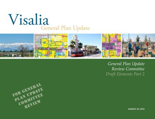
General Plan Update Review Committee Draft Elements Part 2 For ...
General Plan Update Review Committee Draft Elements Part 2 For ...
General Plan Update Review Committee Draft Elements Part 2 For ...

You also want an ePaper? Increase the reach of your titles
YUMPU automatically turns print PDFs into web optimized ePapers that Google loves.
<strong>For</strong> <strong>General</strong><br />
<strong>Plan</strong> UPdate<br />
<strong>Committee</strong><br />
review<br />
<strong>General</strong> <strong>Plan</strong> <strong>Update</strong><br />
<strong>Review</strong> <strong>Committee</strong><br />
<strong>Draft</strong> <strong>Elements</strong> <strong>Part</strong> 2<br />
AUGUST 24, 2012
GENERAL PLAN UPDATE REVIEW COMMITTEE<br />
Bob Brown Waterways and Trails <strong>Committee</strong><br />
Bob Link Visalia City Council<br />
Brad Maaske Tulare County Association of Realtors<br />
Brian Blain Tulare County Farm Bureau<br />
Carl Anderson Kaweah Delta Board of Directors<br />
Carla Calhoun Parks & Recreation Commission<br />
Carlos Melina North Visalia Neighborhood Advisory <strong>Committee</strong><br />
Clarise Dilbeck Visalia Unified School District<br />
Craig Van Horn Mooney Boulevard Merchant’s Organization<br />
Darlene Mata Visalia Community <strong>For</strong>um<br />
Dena Cochran Kaweah Delta Hospital<br />
Dirk Holkeboer Citizens Advisory <strong>Committee</strong><br />
Eric Mittlestead College of the Sequoias<br />
Glenn Morris Visalia Chamber of Commerce<br />
Greg Collins Visalia City Council<br />
Javier Leon Hispanic Chamber of Commerce<br />
Jim Robinson Visalia Economic Development Council<br />
Ken Kugler Tulare County Affordable Housing<br />
Larry Segrue Visalia <strong>Plan</strong>ning Commission<br />
Michael Kreps Downtown Visalians<br />
Mike Knopf Tulare / Kings Home Builders Association<br />
Steven Cullen Historic Preservation Advisory <strong>Committee</strong><br />
Tyson Carroll Environmental <strong>Committee</strong><br />
Vincent Salinas Visalia <strong>Plan</strong>ning Commission
<strong>General</strong> <strong>Plan</strong> <strong>Update</strong><br />
<strong>Review</strong> <strong>Committee</strong><br />
<strong>Draft</strong> <strong>Elements</strong> <strong>Part</strong> 2<br />
PREPARED FOR<br />
THE CITY OF VISALIA BY:<br />
AUGUST 24, 2012
NOTE TO READER:<br />
This document incorporates background material from the Existing Conditions Report as well as<br />
recommended objectives and policies that were previously reviewed by the <strong>General</strong> <strong>Plan</strong> <strong>Update</strong><br />
<strong>Review</strong> <strong>Committee</strong> (GPURC). The City Council, along with the <strong>Plan</strong>ning Commission, has been<br />
reviewing the GPURC's recommendations and may provide further direction on the policies<br />
presented here. New material for GPURC review, which is underlined, includes new rail policies,<br />
hazardous materials policies, and broad objectives throughout the Safety and Noise chapter.<br />
Placeholders have been left in the Noise section for the addition of the Future Noise Contours map<br />
and related land use information. These will be provided to GPURC as soon as they are completed.
TABLE OF CONTENTS<br />
1 Introduction .........................................................................................................................1-1<br />
1.1 Purpose of the <strong>General</strong> <strong>Plan</strong> ....................................................................................1-1<br />
1.2 <strong>General</strong> <strong>Plan</strong> Requirements ......................................................................................1-2<br />
1.3 <strong>Plan</strong>ning Context ..................................................................................................... 1-4<br />
1.4 Public <strong>Part</strong>icipation Process ..................................................................................... 1-9<br />
1.5 <strong>General</strong> <strong>Plan</strong> Themes & Key Initiatives .................................................................. 1-11<br />
1.6 Development Under The <strong>Plan</strong> ................................................................................1-12<br />
1.7 <strong>Plan</strong> Organization ...................................................................................................1-14<br />
1.8 Administration of the <strong>Plan</strong> .....................................................................................1-16<br />
2 Land Use ..............................................................................................................................2-1<br />
2.1 Land Use and Development Characteristics ............................................................2-1<br />
2.2 Growth Strategy ...................................................................................................... 2-5<br />
2.3 Economic Development ............................................................................................2-7<br />
2.4 <strong>General</strong> <strong>Plan</strong> Land Use Diagram ............................................................................2-16<br />
2.5 Urban Boundaries and Growth Management ......................................................2-26<br />
2.6 Rural Buffer and Edge Conditions .........................................................................2-31<br />
2.7 Community Design .................................................................................................2-33<br />
2.8 Infill Development Incentives .................................................................................2-35<br />
2.9 Residential Neighborhoods ................................................................................... 2-38<br />
2.10 Commercial Land Use and Mixed Use Development ........................................... 2-45
2.11 Downtown and East Downtown........................................................................... 2-52<br />
2.12 Industrial Land Use ................................................................................................ 2-57<br />
2.13 Institutional & Civic .................................................................................................2-59<br />
2.14 The Airport ..............................................................................................................2-61<br />
3 Historic Preservation ...........................................................................................................3-1<br />
3.1 Visalia’s Historic Resources .......................................................................................3-1<br />
3.2 Relationship to Land Use, Community Design, and Cultural Resources ............... 3-5<br />
3.3 The City’s Role and Tools for Preservation ............................................................. 3-7<br />
4 Circulation .......................................................................................................................... 4-1<br />
4.1 Complete Streets Framework .................................................................................. 4-1<br />
4.2 Guiding Principles .................................................................................................... 4-2<br />
4.3 Overall Circulation System <strong>Plan</strong>ning ....................................................................... 4-3<br />
4.4 <strong>Plan</strong>ned Improvements ..........................................................................................4-14<br />
4.5 Public Transit .......................................................................................................... 4-30<br />
4.6 Bicycles, Trails, and Pedestrian Circulation ........................................................... 4-36<br />
4.7 Parking ................................................................................................................... 4-41<br />
4.8 Goods Movement .................................................................................................. 4-43<br />
4.9 Aviation .................................................................................................................. 4-47<br />
4.10 Regional Coordination .......................................................................................... 4-48
5 Parks, Schools, Community Facilities, and Utilities ......................................................... 5-1<br />
5.1 Parks and Recreation ............................................................................................... 5-1<br />
5.2 Schools and Community Facilities ..........................................................................5-16<br />
5.3 Public Utilities ......................................................................................................... 5-25<br />
6 Open Space and Conservation .......................................................................................... 6-1<br />
6.1 Open Space Resources ............................................................................................. 6-1<br />
6.2 Water Resources....................................................................................................... 6-4<br />
6.3 Land Resources........................................................................................................6-11<br />
6.4 Biological Resources................................................................................................6-18<br />
6.5 Cultural Resources .................................................................................................. 6-22<br />
7 Air Quality & Greenhouse Gases .......................................................................................7-1<br />
7.1 Air Resources .............................................................................................................7-1<br />
7.2 Climate Change and Greenhouse Gases ................................................................7-10<br />
8 Open Space and Conservation .......................................................................................... 8-1<br />
8.1 Seismic and Geologic Hazards ................................................................................. 8-1<br />
8.2 Flood Hazards .......................................................................................................... 8-5<br />
8.3 Hazardous Materials ................................................................................................ 8-8<br />
8.4 Fire Hazards .............................................................................................................8-12<br />
8.5 Safety Services and Emergency Response .............................................................8-15<br />
8.6 Noise ........................................................................................................................8-19
9 Implementation .................................................................................................................. 9-1<br />
9.1 Responsibilities ......................................................................................................... 9-1<br />
9.2 The <strong>Plan</strong> & Regulatory System ................................................................................ 9-4<br />
9.3 Capital Improvement & Programming ................................................................... 9-7<br />
Glossary ...................................................................................................................................G-1<br />
List of Acronyms ................................................................................................................... G-45<br />
Appendix A: Hazardous Substance Sites ............................................................................... A-1<br />
Appendix B: Existing Traffic Noise Contours ......................................................................... B-1<br />
LIST OF FIGURES<br />
Figure 1-1: Regional Location ......................................................................................... 1-5<br />
Figure 1-2: <strong>Plan</strong>ning Boundaries ......................................................................................1-7<br />
Figure 1-3: Historical Growth .......................................................................................... 1-8<br />
Figure 2-1: Existing Land Use ...........................................................................................2-2<br />
Figure 2-2: Land Use Diagram........................................................................................2-18<br />
Figure 2-3: Proposed Development Footprint by Tier ..................................................2-27<br />
Figure 3-1: Historic Resources in Visalia ......................................................................... 3-4<br />
Figure 4-1: Roadway Classifications ............................................................................... 4-5<br />
Figure 4-2a: Green Street (2-Lane Collector) ................................................................. 4-23<br />
Figure 4-2b: Green Corridor (4-Lane Collector) ............................................................. 4-24<br />
Figure 4-2c: Green Corridor - Downtown (4-Lane Collector) ....................................... 4-24<br />
Figure 4-2d: Transit Corridor (4-Lane Arterial, with Transit) ......................................... 4-24
Figure 4-2e: Gateway Boulevard (6-Lane Arterial) ........................................................ 4-24<br />
Figure 4-3: Year 2030 Mitigated Lane Geometrics and Control ................................. 4-27<br />
Figure 4-4: Transit Routes .............................................................................................. 4-33<br />
Figure 4-5: <strong>General</strong> <strong>Plan</strong> Bikeways ................................................................................ 4-38<br />
Figure 4-6: Truck Routes, Rail Lines, and Airport Facilities .........................................4-44<br />
Figure 5-1: Parks and Recreation Facilities ..................................................................... 5-3<br />
Figure 5-2: Schools ......................................................................................................... 5-20<br />
Figure 5-3: Groundwater Depth ................................................................................... 5-29<br />
Figure 5-4: Sewer System ............................................................................................. 5-31<br />
Figure 5-5: Storm Drainage System .............................................................................. 5-33<br />
Figure 6-1: Water Resources ........................................................................................... 6-6<br />
Figure 6-2: Typical Residential Section along Waterway .............................................. 6-9<br />
Figure 6-3: Neighborhood Commercial Sides onto the Creek ...................................... 6-9<br />
Figure 6-4: Farmland ......................................................................................................6-13<br />
Figure 6-5: Erosion Susceptibility and Shrink-Swell Potential ......................................6-16<br />
Figure 6-6: Biological Resources ................................................................................... 6-20<br />
Figure 8-1: Regional Faults .............................................................................................. 8-3<br />
Figure 8-2: Flood Zones ................................................................................................... 8-7<br />
Figure 8-3: Contaminated Sites ......................................................................................8-10<br />
Figure 8-4: Fire Hazards and Public Safety Services ......................................................8-13<br />
Figure 8-5: Typical Sound Levels ...................................................................................8-19<br />
Figure 8-6: Future Noise Contours ............................................................................... 8-22
LIST OF TABLES<br />
Table 1-1: Required <strong>Elements</strong> & <strong>General</strong> <strong>Plan</strong> <strong>Elements</strong> Correspondence ..................1-3<br />
Table 1-2: Non-Residential Floor Area .........................................................................1-12<br />
Table 1-3: Population ....................................................................................................1-12<br />
Table 1-4: Non-Residential Floor Area .........................................................................1-13<br />
Table 1-5: Employment by Sector ................................................................................1-13<br />
Table 1-6: Jobs per Employed Residents ......................................................................1-14<br />
Table 2-1: Existing Land Use in the <strong>Plan</strong>ning Area ...................................................... 2-4<br />
Table 2-2: Visalia Employment Projections (2010-2030) .............................................. 2-9<br />
Table 2-3: Density and Intensity Standards by Land Use Classification .....................2-19<br />
Table 2-4: Proposed Preferred <strong>Plan</strong> Buildout ..............................................................2-22<br />
Table 2-5: <strong>General</strong> <strong>Plan</strong> Buildout (Gross Acres by Land Use) ......................................2-23<br />
Table 2-6: Percent of Total Developed Acres Added by Quadrant ............................2-29<br />
Table 2-7: Land Use Allocations for Residential Neighborhoods .............................. 2-41<br />
Table 2-8: Neighborhood Commercial Centers .......................................................... 2-47<br />
Table 2-9: Warehousing, Industrial, and R&D Land Demand .................................... 2-58<br />
Table 3-1: Sites Listed on the National Register of Historic Places .............................. 3-2<br />
Table 4-1: Intersection Level of Service Definitions ..................................................... 4-6<br />
Table 4-2: Level of Service Criteria for Roadway Segments ....................................... 4-7<br />
Table 4-3: Existing Intersection LOS (2010) ................................................................... 4-9<br />
Table 4-4: Existing Roadway Segment LOS (2010) ......................................................4-10<br />
Table 4-5: <strong>Plan</strong>ned Roadway Improvements ...............................................................4-15<br />
Table 4-6: Typical Street <strong>Elements</strong> and Widths (Feet) ................................................ 4-22
Table 4-7: Future Intersection LOS (2030) ................................................................... 4-25<br />
Table 4-8: Future Roadway LOS (2030) ....................................................................... 4-28<br />
Table 5-1: Parks and Recreation Facilities Inventory .................................................... 5-4<br />
Table 5-2: Parks Acreage and Parks Ratio ..................................................................... 5-5<br />
Table 5-3: Community Centers and Recreation Facilities ............................................. 5-9<br />
Table 5-4: Schools and Enrollment, Visalia Unified School District ............................5-17<br />
Table 5-5: Student Generation and School Size Assumptions ....................................5-18<br />
Table 5-6: Student Population and School Demand at <strong>General</strong> <strong>Plan</strong> Buildout .........5-19<br />
Table 5-7: Estimated Water Demand by Land Use Type, 2010, 2020, 2030 .............. 5-27<br />
Table 5-8: Waste and Recyclables Collected by the City of Visalia............................ 5-35<br />
Table 6-1: Farmland Classification in the Study Area ..................................................6-14<br />
Table 6-2: Soil Erosion Susceptibility ............................................................................6-15<br />
Table 7-1: State and National Criteria Air Pollutant Standards (2012) ........................ 7-5<br />
Table 7-2: San Joaquin Valley Attainment Status for Ambient Air<br />
Quality Standards ......................................................................................... 7-6<br />
Table 7-3: Greenhouse Gas Emissions Inventories Comparison (2000) ......................7-12<br />
Table 7-4: Visalia GHG Emissions 2000 Baseline, 2020 <strong>For</strong>ecasts, and<br />
Recommended Reduction Targets (MTCO 2 e) .............................................7-13<br />
Table 8-1: Floodplains in <strong>Plan</strong>ning Area ....................................................................... 8-6<br />
Table 8-2: Short-Term Noise Measurements (2010) .................................................... 8-21<br />
Table 8-3: Transportation Noise Sources .................................................................... 8-26<br />
Table 8-4: Stationary Noise Sources ............................................................................ 8-26<br />
Table A-1: Contaminated Sites ....................................................................................... A-1<br />
Table B-1: Existing Traffic Noise Contours .................................................................... B-1
This page intentionally left blank.
4 CIRCULATION<br />
The Circulation Element of the 2030 <strong>General</strong> <strong>Plan</strong> is<br />
intended to provide guidance and specific actions to<br />
ensure the continued safe and efficient operation of<br />
Visalia’s circulation system. The Element is based on<br />
a fundamental philosophy that traffic conditions in<br />
the City can be managed through a comprehensive<br />
program of transportation planning, land use planning,<br />
and growth management strategies. This Element<br />
includes provisions for roadways, transit, aviation,<br />
pedestrian, and bicycle transportation modes, as<br />
well as parking conditions.<br />
The Circulation Element responds directly to the<br />
Government Code [Section 65302(b)], which requires<br />
“a circulation element consisting of the general location<br />
and extent of existing and proposed major thoroughfares,<br />
transportation routes, terminals, any military<br />
airports and ports, and other local public utilities<br />
and facilities, all correlated with the land use element<br />
of the plan.”<br />
State Law recognizes that circulation and land use are<br />
closely related and requires that policies in this Element<br />
and the Land Use Element be linked. Careful<br />
integration of the City’s traffic and circulation policies<br />
with its land use policies will ensure that there<br />
is sufficient roadway capacity to accommodate traffic<br />
generated by planned future development. The City<br />
is committed to designing a system of regional routes,<br />
local roads, public transit and bicycle and pedestrian<br />
pathways that will enhance the community and protect<br />
the environment.<br />
The Land Use Element contains policies related to<br />
the physical framework for development that the circulation<br />
system is designed to serve all transportation<br />
users including vehicles, trucks, bicyclists and pedestrians.<br />
This Element also addresses landscaping along<br />
major streets and planning for street connectivity in<br />
new neighborhoods. It discusses how to create pedestrian-friendly<br />
environments and design for alternate<br />
modes of transportation. The Noise Element of the<br />
<strong>General</strong> <strong>Plan</strong> includes policies to alleviate noise generated<br />
by traffic conditions.<br />
4.1 COMPLETE STREETS FRAMEWORK<br />
In September 2008, the Governor signed into law the<br />
California Complete Streets Act, requiring <strong>General</strong><br />
<strong>Plan</strong>s to develop a plan for a multi-modal transportation<br />
system. The goal of the Act is to encourage cities<br />
to rethink policies that emphasize automobile circulation<br />
and prioritize motor vehicle improvements,<br />
and come up with creative solutions that emphasize<br />
all modes of transportation. Complete Streets design<br />
has many advantages. When people have more transportation<br />
options, there are fewer traffic jams and<br />
the overall capacity of the transportation network<br />
increases. Complete Street design attends to the<br />
needs of people who don’t travel by automobile, who<br />
have often been overlooked. Additionally, increased<br />
transit ridership, walking, and biking can reduce air<br />
pollution, energy consumption, and greenhouse gas<br />
emissions, while improving the overall travel experience<br />
for road users.<br />
DRAFT ELEMENTS<br />
<strong>For</strong> <strong>General</strong> <strong>Plan</strong> <strong>Update</strong> <strong>Review</strong> <strong>Committee</strong><br />
The City is committed to designing a system of<br />
regional routes, local roads, public transit and bicycle<br />
and pedestrian pathways that will enhance the<br />
community and protect the environment.<br />
AUGUST 2012<br />
4-1
4-2<br />
VISALIA GENERAL PLAN UPDATE<br />
To further the goal of optimizing travel by all modes,<br />
this <strong>General</strong> <strong>Plan</strong> incorporates the concept of “Complete<br />
Streets.” Complete Streets are designed and<br />
operated to enable safe, attractive, and comfortable<br />
access and travel for all users, including motorists,<br />
pedestrians, bicyclists, children, seniors, individuals<br />
with disabilities, and users of public transportation.<br />
While there is no standard design template for a<br />
Complete Street, it generally includes one or more of<br />
the following features: bicycle lanes, wide shoulders,<br />
plenty of well-designed and well placed crosswalks,<br />
crossing islands in appropriate midblock locations,<br />
bus pullouts or special bus lanes, audible pedestrian<br />
signals, sidewalk bulb-outs, center medians, and<br />
street trees, planter strips and ground cover. Complete<br />
Streets create a sense of place and improve social<br />
interaction due to their emphasis on encouraging<br />
pedestrian activity.<br />
4.2 GUIDING PRINCIPLES<br />
Visalia’s Circulation Element relies upon three principles:<br />
• Land use and the circulation system are interactive<br />
and interrelated;<br />
• The City’s traffic circulation planning efforts are<br />
integrated with those of the County and Caltrans<br />
in a cooperative, regional planning effort; and<br />
• State of the art transportation engineering is used,<br />
applying a Complete Streets framework, to bring<br />
planned improvements to reality considering the<br />
multi-modal, increased travel capacity and safety<br />
needs of the community.<br />
Only through the development and implementation<br />
of all these principles can the City’s commitment to<br />
a balanced, efficient circulation system be achieved.<br />
Connectivity<br />
The major objective of the Circulation Element is<br />
to provide an interconnected street system with<br />
improved north-south and east-west connections<br />
for existing and future development in Visalia. The<br />
City’s original street layout provided street connections<br />
linking neighborhoods with work places, but<br />
as the community has grown, access has not always<br />
improved.<br />
Traditional grid street designs allow for through<br />
movement and good connections between and<br />
within neighborhoods. Short blocks offer a choice of<br />
routes and enable more direct connections. Variations<br />
from the traditional grid can allow for diagonal and<br />
curvilinear streets as well as larger or smaller blocks<br />
for maximum flexibility and improved connectivity.<br />
In order to ensure that street layout in future development<br />
incorporates the need for neighborhood connectivity<br />
and the comfort and safety of pedestrians<br />
and bicyclists, it is essential that:<br />
• New development is connected to the<br />
surroundings with an increased number of access<br />
points and pedestrian and bicycle connections to<br />
the neighborhood network;<br />
• Blocks are short to allow for more direct<br />
connections;<br />
• Neighborhood streets are designed at a humanscale,<br />
without excessively wide streets; and
• Traffic controls are incorporated including speed<br />
limits, bulb outs, modern roundabouts, signage,<br />
and truck routes to restrict commercial traffic in<br />
neighborhoods.<br />
The 2030 <strong>General</strong> <strong>Plan</strong> provides for new routes in<br />
partially developed portions of the <strong>Plan</strong>ning Area<br />
and expands the capacity and efficiency of the existing<br />
system. In addition, the <strong>Plan</strong> provides for narrower<br />
streets in some areas than might otherwise be<br />
designed based upon current traffic design standards<br />
and requirements alone.<br />
Balanced Modes<br />
Another objective is to create a balanced transportation<br />
system that serves public transit, bicyclists and<br />
pedestrians as well as private motor vehicles. Careful<br />
integration of land use and transportation and<br />
attention to the design and location of all roadway<br />
elements is essential to support pedestrian-oriented<br />
development and maintain the “small-town” atmosphere<br />
that Visalians desire. The 2030 <strong>General</strong> <strong>Plan</strong><br />
includes new bikeways, trails and pedestrian facilities<br />
to link neighborhoods, schools, major recreation<br />
sites, and commercial centers including downtown.<br />
The <strong>Plan</strong> also fosters compact development, which<br />
can support additional public transit. By facilitating<br />
use of alternative modes of travel, Visalia will encourage<br />
physical activity, reduce auto-dependency, and<br />
lessen roadway congestion.<br />
4.3 OVERALL CIRCULATION SYSTEM<br />
PLANNING<br />
Roadway Network<br />
In Visalia, the roadway system is based on a traditional<br />
grid pattern, on which all modes of transportation<br />
depend to some degree. This pattern has been<br />
modified in recent years to include some suburban<br />
curvilinear and cul-de-sac streets in several areas in<br />
the City. While State Routes 63, 99, 198 and 216 provide<br />
regional east/west and north/south access, these<br />
large arterials and freeways create lineal barriers to<br />
connectivity on smaller city streets.<br />
Functional Street Classifications<br />
Visalia’s roadway system is set up around a hierarchy<br />
of street types, which are commonly referred to as<br />
functional classifications. These functional classifications<br />
for most major streets are illustrated on Figure<br />
4-1 and summarized as follows:<br />
Freeways<br />
Freeways provide intra- and inter-regional mobility in<br />
Visalia. Freeway access is restricted to primary arterials<br />
via interchanges. State routes 99 and 198 are the<br />
only freeways within the <strong>Plan</strong>ning Area.<br />
• State Route 99 is a four- to six- lane divided freeway<br />
with a landscaped median. The northbound<br />
segment between Betty Drive in Goshen to Avenue<br />
384 south of Kingsburg (Fresno County) contains<br />
three travel lanes; the remainder of State Route 99<br />
in Tulare County contains two northbound and<br />
two southbound travel lanes. With approximately<br />
55,000 daily trips near State Route 198, State Route<br />
99 is the second most traveled roadway in the<br />
DRAFT ELEMENTS<br />
<strong>For</strong> <strong>General</strong> <strong>Plan</strong> <strong>Update</strong> <strong>Review</strong> <strong>Committee</strong><br />
Good roadway design is essential to support<br />
pedestrian-oriented development and maintain a<br />
“small-town” feel (top).<br />
Visalia’s roadway system is set up around a hierarchy<br />
of street types, including arterials such as Ben Maddox<br />
Way (bottom).<br />
AUGUST 2012<br />
4-3
4-4<br />
VISALIA GENERAL PLAN UPDATE<br />
county. In addition, it is estimated that nearly 25<br />
percent of these trips are trucks.<br />
• State Route 198 is a major east-west corridor that<br />
begins at US 101, travels through the City of<br />
Visalia, and terminates at the Sequoia National<br />
Park entrance. This roadway has several sections<br />
that contain two and four lane roadways. In<br />
Visalia this roadway operates as a four lane<br />
freeway. State Route 198 will be improved to a<br />
four lane expressway between State Route 43 and<br />
State Route 99. State Route 198 serves a mix of<br />
residential, commercial, industrial and agricultural<br />
land uses. SR 198 between Ben Maddox and<br />
Mooney Boulevard is the County’s most traveled<br />
roadway, with 58,000 daily trips in 2011.<br />
Arterials<br />
Arterials collect and distribute traffic from freeways<br />
and expressways to collector streets and vice versa.<br />
On arterials, the optimum distance between intersections<br />
is approximately one quarter mile. Driveways to<br />
major traffic generators may be permitted within the<br />
quarter-mile spacing. Other intersections closer than<br />
one quarter mile should be restricted to right turn<br />
access. Based upon the Visalia Improvement Standards<br />
(2008), the arterial right-of-way widths range<br />
from 84 feet to 110 feet. Arterials feature two to three<br />
through lanes of traffic in each direction with a leftturn<br />
channelization.<br />
Collectors<br />
Collectors connect local and arterial streets and provide<br />
direct access to parcels. At major intersections,<br />
driveways on collector streets should be no closer<br />
than 50 feet to the intersection per the City of Visalia<br />
Improvement Standards. Non-residential driveways<br />
and/or intersecting streets on collector streets should<br />
be no closer than 300 to 400 feet apart.<br />
Major collectors carry four lanes of traffic within an<br />
84-foot right-of-way and two bicycle lanes within an<br />
additional 10 feet of right-of-way. Collectors generally<br />
carry two lanes of traffic and are a minimum of 60<br />
feet wide.<br />
Local Streets<br />
Local streets provide direct access to parcels. Local<br />
streets represent the largest part of the city’s circulation<br />
system. Access to local streets is unrestricted<br />
and right-of-way widths vary between 48 and 66 feet<br />
depending on surrounding land uses (2008 City of<br />
Visalia Design and Improvement Standards). All<br />
roadways not identified in the <strong>General</strong> <strong>Plan</strong> as freeways,<br />
arterials, or collectors are designated local<br />
streets.<br />
Although the City of Visalia Design Standards provide<br />
guidance on cross-section widths and the City<br />
has preserved right-of-way along street corridors for<br />
future transportation-related improvements, street<br />
designs may vary with regard to raised medians,<br />
travel lanes for vehicles, bicycle lanes, parking and<br />
sidewalks within these cross sections. Future roadways<br />
will be developed on a street by street basis<br />
according to direction from the City.
10<br />
160 acres<br />
40<br />
Freeway<br />
Existing Arterial<br />
Year 1-10 Arterial<br />
Year 11-25 Arterial<br />
Existing Collector<br />
Year 1-10 Collector<br />
Year 11-25 Collector<br />
Deferred Arterial<br />
Deferred Collector<br />
Local Street<br />
<strong>Plan</strong>ned Interchange<br />
Improvement<br />
Proposed New<br />
Interchange<br />
Proposed Overcrossing<br />
Urban Development<br />
Boundary<br />
Urban Growth<br />
Boundary<br />
<strong>Plan</strong>ning Area<br />
City Limits<br />
AVE 328<br />
1/2 Mile Radius<br />
ROAD 68<br />
ROAD 76<br />
ROAD 80<br />
GOSHEN AVE<br />
FERGUSON<br />
AVE<br />
N. PLAZA DR<br />
KELSEY ST<br />
S. PLAZA DR<br />
W.RIGGIN AVE<br />
ROAD 86<br />
W. DOE AVE<br />
ROAD 88<br />
AVE 280<br />
ROAD 92<br />
AVE 320 AVE 320<br />
N.SHIRK RD<br />
S.SHIRK RD<br />
RD 92<br />
RIVER WAY DR<br />
W. FERGUSON AVE<br />
ROEBEN ST<br />
W.HURLEY AVE<br />
W. WALNUT AVE<br />
AVE 276<br />
N. AKERS ST<br />
S. AKERS ST<br />
RD 100<br />
LINWOOD ST<br />
W.NOBLE AVE<br />
TULARE AVE<br />
S. LINWOOD ST<br />
N.CHINOWTH ST<br />
S. CHINOWTH ST<br />
AVE 272<br />
N.DEMAREE ST<br />
S. DEMAREE ST<br />
ROAD 108<br />
N. COUNTY CENTER DR<br />
GOSHEN AVE<br />
PRATT AVE<br />
N. MOONEY BLVD<br />
RIVER WAY DR<br />
W.RIGGIN AVE<br />
DIVISADERO<br />
HALL ST<br />
ST<br />
DINUBA BLVD<br />
0 1/2 1 2<br />
MILES<br />
DRAFT ELEMENTS<br />
Figure 4-1:<br />
Figure <strong>For</strong> <strong>General</strong> 4-1: <strong>Plan</strong> Roadway <strong>Update</strong> Classifications<br />
<strong>Review</strong> <strong>Committee</strong><br />
Roadway Classifications<br />
S t J oh n s R i v e r<br />
W. HOUSTON AVE E. HOUSTON AVE<br />
MIL L CREEK DR<br />
CAMPUS AVE<br />
W. SHANNON PKWY N.CAIN ST<br />
S. COUNTY CENTER DR<br />
W. MAIN ST<br />
WOODLAND ST<br />
W. VISALIA PKWY<br />
AVE 264<br />
S.MOONEY BLVD<br />
AVE 328<br />
N. GIDDINGS ST<br />
FERGUSON AVE<br />
MURRAY AVE<br />
MINERAL KING AVE<br />
S. GIDDINGS ST<br />
JACOB ST<br />
S. CONYER ST<br />
WILLIS ST<br />
CENTER AVE<br />
WHITENDALE AVE<br />
W. CALDWELL AVE<br />
CAMERON<br />
COURT ST<br />
2ND<br />
3RD AVE<br />
LOCUST ST<br />
S. COURT ST<br />
AVE<br />
AVE<br />
SANTA FE ST<br />
SANTA FE ST<br />
N. BURKE ST<br />
ACEQUIA AVE<br />
BRIDGE ST<br />
RD 132<br />
ST JOHNS PKWY<br />
BEN MADDOX WAY<br />
TULARE AVE<br />
WALNUT AVE<br />
BEN MADDOX WAY<br />
GOSHEN AVE<br />
N.CAIN ST<br />
MAIN ST<br />
PINKHAM ST<br />
E. K AVE<br />
AVE 272<br />
LOVERS LANE<br />
LOVERS LANE<br />
RD 144<br />
MILLCREEK<br />
PKWY<br />
NOBLE AVE<br />
S. MCAULIFF ST<br />
MC AULIFF ST<br />
RD 148<br />
ROAD 148<br />
ROAD 152<br />
MINERAL KING AVE<br />
AVE 292<br />
AVE 288<br />
AVE 280<br />
ROAD 156<br />
AUGUST 2012<br />
4-5
4-6<br />
VISALIA GENERAL PLAN UPDATE<br />
Level of Service<br />
To determine the operating conditions of a roadway<br />
segment or intersection, the concept of level of service<br />
(LOS) is commonly used. The LOS grading system<br />
is a scale ranging from LOS A to LOS F, with<br />
LOS A representing free-flow conditions and LOS F<br />
representing congested conditions. Table 4-1 provides<br />
more specific definitions.<br />
Table 4-1: Intersection Level of Service Definitions<br />
LOS Description<br />
A Free Flow or Insignificant Delays: Vehicles are completely unimpeded in their ability to<br />
maneuver within the traffic stream. Control delay at signalized intersections is minimal.<br />
B Stable Operation or Minimal Delays: The ability to maneuver within the traffic stream is only<br />
slightly restricted, and control delay at signalized intersections are not significant.<br />
C Stable Operation or Acceptable Delays: The ability to maneuver and change lanes is somewhat<br />
restricted, and average travel speeds may be about 50 percent of the free flow speed.<br />
D Approaching Unstable or Tolerable Delays: Small increases in flow may cause substantial<br />
increases in delay and decreases in travel speed.<br />
E Unstable Operation or Significant Delays: Significant delays may occur and average travel<br />
speeds may be 33 percent or less of the free flow speed.<br />
F <strong>For</strong>ced Flow or Excessive Delays: Congestion, high delays, and extensive queuing occur at<br />
critical signalized intersections with urban street flow at extremely low speeds.<br />
Source: Highway Capacity Manual, Transportation Research Board (TRB).<br />
Max. Volume /<br />
Capacity Ratio<br />
0.6<br />
0.7<br />
0.8<br />
0.9<br />
1.0<br />
>1.0
Existing conditions for roadway segment levels of<br />
service were estimated utilizing average daily traffic<br />
(ADT) and then evaluated based on LOS thresholds;<br />
see Table 4-2.<br />
Table 4-2: Level of Service Criteria for Roadway Segments<br />
Roadway Segment Type<br />
Total Two-way Average Daily Traffic (ADT)<br />
LOS A LOS B LOS C LOS D LOS E<br />
6-Lane Divided Freeway 42,000 64,800 92,400 111,600 120,000<br />
4-Lane Divided Freeway 28,000 43,200 61,600 74,400 80,000<br />
6-Lane Freeway 36,900 61,100 85,300 103,600 115,300<br />
4-Lane Freeway 23,800 39,600 55,200 67,100 74,600<br />
6-lane Divided Expressway (with left-turn lanes) 35,500 42,200 46,200 55,800 60,000<br />
6-Lane Divided Arterial (with left-turn lane) 32,000 38,000 43,000 49,000 54,000<br />
4-Lane Divided Arterial (with left-turn lane) 22,000 25,000 29,000 32,500 36,000<br />
4-Lane Undivided Arterial (no left-turn lane) 18,000 21,000 24,000 27,000 30,000<br />
2-Lane Arterial (with left-turn lane) 11,000 12,500 14,500 16,000 18,000<br />
2-Lane Arterial (no left-turn lane) 9,000 10,500 12,000 13,500 15,000<br />
2-Lane Collector/Local Street 6,000 7,500 9,000 10,500 12,000<br />
Note: All volumes are approximate and assume ideal roadway characteristics. Actual threshold volumes for each Level of Service listed above may<br />
vary depending on a variety of factors including curvature and grade, intersection or interchange spacing, driveway spacing, percentage of trucks<br />
and other heavy vehicles, travel lane widths, signal timing characteristics, on-street parking, volume of cross traffic and pedestrians, etc.<br />
Source: Based on “Highway Capacity Manual,” Transportation Research Board, 2000.<br />
DRAFT ELEMENTS<br />
<strong>For</strong> <strong>General</strong> <strong>Plan</strong> <strong>Update</strong> <strong>Review</strong> <strong>Committee</strong><br />
AUGUST 2012<br />
4-7
All of the intersections and roadway segments studied<br />
for the <strong>General</strong> <strong>Plan</strong> update currently have acceptable<br />
“level of service” traffic conditions, including South<br />
Mooney Boulevard (State Route 63).<br />
4-8<br />
VISALIA GENERAL PLAN UPDATE<br />
Existing Traffic Conditions<br />
The city’s roadways were evaluated using average daily<br />
traffic (ADT) counts for the 2008 to 2010 period.<br />
Intersection facilities were evaluated for the AM and<br />
PM peak-hour using 2010 peak-hour turning movement<br />
counts. Traffic conditions and deficiencies were<br />
identified by calculating level of service (LOS).<br />
LOS is a qualitative measure of traffic operating conditions,<br />
whereby a letter grade “A” through “F” is<br />
assigned to an intersection or roadway segment representing<br />
progressively worsening traffic conditions.<br />
LOS was calculated for different intersection control<br />
types using the methods documented in the Highway<br />
Capacity Manual 2000 (HCM 2000).<br />
The previous <strong>General</strong> <strong>Plan</strong> established LOS “D” as<br />
the minimum acceptable LOS standard on city roadways.<br />
Although Caltrans has not designated a LOS<br />
standard, Caltrans’ Guide for the Preparation of<br />
Traffic Impact Studies (December 2002) indicates<br />
that when the LOS of a State highway facility falls<br />
below the LOS “C/D” cusp in rural areas and the<br />
LOS “D/E” cusp in urban areas, additional traffic<br />
may have a significant impact.<br />
Existing Intersection Level of Service<br />
Existing weekday AM and PM peak-hour traffic volume<br />
counts were conducted at 25 intersections and<br />
24-hour counts were conducted on roadway segments<br />
in April 2010 while school was in session. The AM<br />
peak hour is defined as one-hour of peak traffic flow<br />
counted between 7:00 AM and 9:00 AM and the PM<br />
peak hour is defined as one-hour of peak traffic flow<br />
counted between 4:00 PM and 6:00 PM. Table 4-3<br />
summarizes intersection LOS and seconds of delay<br />
for the AM and PM peak hours; Table 4-4 summarizes<br />
roadway segment LOS in 2010 (the baseline<br />
year).<br />
As Table 4-3 shows, all of the 25 study intersections<br />
operate at acceptable LOS under existing conditions<br />
(2010 baseline).
Table 4-3: Existing Intersection LOS (2010)<br />
No. Intersection<br />
Control<br />
Type<br />
AM Peak Hour PM Peak Hour<br />
Delay LOS Delay LOS<br />
1 Caldwell Avenue/Burke Street Signal 15.6 C 23.8 C<br />
2 Caldwell Avenue/Lovers Lane Signal 18.8 B 21 C<br />
3 Cypress Avenue/Akers Street Signal 17.6 B 34.3 C<br />
4 Ferguson Avenue/Linwood Street AWSC 10.7 B 9 A<br />
5 Goshen Avenue/Plaza Drive Signal 24.7 C 22.5 C<br />
6 Hillsdale Avenue/Akers Street Signal 21.3 C 18.1 B<br />
7 Houston Avenue/Ben Maddox way Signal 20.6 C 24 C<br />
8 Houston Avenue/Demaree Street Signal 23.4 C 19.8 B<br />
9 Houston Avenue/McAuliff Street Signal 20.7 C 18.2 B<br />
10 Hurley Street/Plaza Drive Signal 6.8 A 8.9 A<br />
11 K Avenue/Ben Maddox Way AWSC 9.5 A 13.5 B<br />
12 K Avenue/Lovers Lane OWSC 15.4 C 17.9 C<br />
13 Main Street/West Street Signal 6.6 A 7.1 A<br />
14 Mineral King Avenue/Akers Street Signal 16.9 B 17.9 B<br />
15 Noble Avenue/Akers Street Signal 14.1 B 17.5 B<br />
16 Noble Avenue/Watson Street Signal 8.4 A 7.1 A<br />
17 Riggin Avenue/Demaree Street Signal 17.4 B 19.8 B<br />
18 Riggin Avenue/Dinuba Boulevard Signal 17.3 B 27.5 C<br />
19 Riggin Avenue/Giddings Street TWSC 14.6 B 16.6 C<br />
20 Riggin Avenue/Shirk Road AWSC 9.7 A 9.6 A<br />
21 Tulare Avenue/Santa Fe Street AWSC 13.4 B 14.3 B<br />
22 Visalia Road/Akers Street TWSC 16.9 C 15.6 C<br />
23 Walnut Avenue/Shirk Road AWSC 13.3 B 15.7 C<br />
24 Whitendale Avenue/Demaree Street Signal 8.4 A 8.9 A<br />
25 Whitendale Avenue/Woodland Drive TWSC 11.8 B 14.5 B<br />
Legend:<br />
TWSC = Two-Way-Stop Control; AWSC = All-Way-Stop Control; OWSC = One-Way-Stop Control<br />
<strong>For</strong> Signalized Intersections Average Delay = Average Intersection Delay; <strong>For</strong> TWSC Intersections Average Delay = Worst-Case Intersection<br />
Movement Delay; <strong>For</strong> Signalized Intersections LOS = Average Intersection Level-of-Service; <strong>For</strong> TWSC Intersections LOS = Worst-Case Movement’s<br />
Level-of-Service; Warrant = MUTCD Peak Hour Warrant 3<br />
Source: Omni-Means, 2010<br />
DRAFT ELEMENTS<br />
<strong>For</strong> <strong>General</strong> <strong>Plan</strong> <strong>Update</strong> <strong>Review</strong> <strong>Committee</strong><br />
AUGUST 2012<br />
4-9
4-10 VISALIA GENERAL PLAN UPDATE<br />
Table 4-4 identifies existing roadway segment LOS<br />
for existing conditions (baseline 2010). Table 4-4<br />
shows that all of the 33 roadway segments operate at<br />
acceptable LOS under existing conditions.<br />
Table 4-4: Existing Roadway Segment LOS (2010)<br />
Roadway Segment Limits No. of Lanes Facility Type AADT LOS<br />
Akers Street Rialto – Caldwell Avenue 4 Arterial 7,100 B<br />
Akers Street Goshen Avenue – Ferguson Ave. 4 Arterial 10,400 B<br />
Caldwell Avenue Shirk Street - Aspen 2 Arterial 10,300 B<br />
Caldwell Avenue Ben Maddox Way – Pinkham Ave. 2 Arterial 13,500 B<br />
Center Avenue Floral Street – Court Street 2 Arterial 6,600 B<br />
County Center Beech Street – Walnut Avenue 2 Collector 10,478 C<br />
Demaree Street Damsen - Nicholas 4 Arterial 21,600 B<br />
Demaree Street Walnut Avenue – Tulare Avenue 4 Arterial 18,600 B<br />
Goshen Avenue Demaree Street – Chinowth Street 4 Arterial 18,800 B<br />
Main Street Floral Street – Court Street 2 Collector 7,100 C<br />
Noble Avenue Pinkham Street – Lovers Lane 2 Arterial 9,000 B<br />
Riggin Avenue Akers Street – Linwood Street 2 Arterial 7,800 C<br />
Santa Fe Street Center Avenue – School Street 2 Collector 2,600 B<br />
Santa Fe Street Walnut Avenue – Tulare Avenue 2 Collector 5,300 C<br />
Shirk Avenue Goshen Avenue – Doe Avenue 2 Arterial 7,600 C<br />
Shirk Avenue Walnut Avenue – State Route 198 2 Arterial 6,800 C<br />
Walnut Avenue Atwood – Linwood Street 4 Arterial 11,600 B<br />
Walnut Avenue Conyer Street – Court Street 4 Arterial 15,200 B<br />
Walnut Avenue Yale – Mall Entrance 4 Arterial 15,100 B<br />
Whitendale Avenue Crenshaw – Linwood Street 2 Collector 7,300 C<br />
Whitendale Avenue West Street – Court Street 2 Collector 6,100 C<br />
State Route 63 Caldwell Avenue – Walnut Avenue 6 State Route 33,000 B<br />
State Route 63 Walnut Avenue – Tulare Avenue 6 State Route 31,000 B<br />
State Route 63 School Avenue – Murray Avenue 4 State Route 11,700 B<br />
State Route 99 Caldwell Avenue – State Route 198 4 State Route 55,000 B
Table 4-4: Existing Roadway Segment LOS (2010)<br />
Roadway Segment Limits No. of Lanes Facility Type AADT LOS<br />
State Route 99 State Route 198 – Avenue 304 4 State Route 49,500 B<br />
State Route 99 Avenue 304 – Betty Drive 4 State Route 49,000 B<br />
State Route 198 State Route – Akers Street 4 State Route 50,000 C<br />
State Route 198 Akers Street - Mooney Boulevard 4 State Route 59,000 D<br />
State Route 198 Mooney Boulevard – Lovers Lane 4 State Route 61,000 D<br />
State Route 198 Lovers Lane – Road 156 4 State Route 29,000 B<br />
State Route 216 Mill Creek Parkway – Douglas Ave. 4 State Route 19,200 B<br />
State Route 216 Lovers Lane – McAuliff Street 2 State Route 9,200 C<br />
Source: Omni-Means, 2010<br />
Objectives<br />
T-O-1 Develop and maintain a road system that is<br />
convenient, safe, efficient, and cost effective.<br />
T-O-2 Maximize the use and efficiency of the existing<br />
transportation system through application<br />
of Transportation System Management<br />
(TSM) strategies.<br />
T-O-3 Promote ways to reduce the number of peak<br />
hour trips and vehicle-miles traveled in the<br />
<strong>Plan</strong>ning Area.<br />
T-O-4 *Ensure that new development pays its fair<br />
share of the costs of new and improved transportation<br />
facilities.<br />
Policies<br />
System <strong>Plan</strong>ning<br />
T-P-1 *Provide transportation facilities based on a<br />
“Complete Streets” concept that facilitate the<br />
balanced use of all travel modes (pedestrians,<br />
bicyclists, motorists, and transit users), meeting<br />
the transportation needs of all ages and<br />
abilities and providing mobility for a variety<br />
of trip purposes.<br />
T-P-2 *Optimize roadway operations with priority<br />
given to signal timing coordination in<br />
order to increase traffic-carrying capacity and<br />
decrease air pollution and congestion. Roundabouts<br />
shall be considered when feasible and<br />
beneficial as an alternative to traffic signals.<br />
DRAFT ELEMENTS<br />
<strong>For</strong> <strong>General</strong> <strong>Plan</strong> <strong>Update</strong> <strong>Review</strong> <strong>Committee</strong><br />
AUGUST 2012 4-11
The <strong>Plan</strong> directs the City to design and build future<br />
roadways following the Circulation Diagram, including<br />
new streets and improvements to existing streets (top).<br />
Street design standards are to be updated to follow<br />
the “Complete Streets” concept (bottom).<br />
4-12 VISALIA GENERAL PLAN UPDATE<br />
T-P-3 Design and build future roadways that complement<br />
and enhance the existing network, as<br />
shown on the Circulation Diagram, to ensure<br />
that each new and existing roadway continues<br />
to function as intended.<br />
T-P-4 Where feasible, space traffic signals no closer<br />
than one-quarter mile along two-way arterials<br />
except in unusual circumstances. The<br />
intersections of arterial and collector streets<br />
and access driveways to major traffic generators<br />
that are signalized shall be located so as<br />
to maintain this spacing.<br />
T-P-5 Take advantage of opportunities to consolidate<br />
driveways, access points, and curb cuts<br />
along existing arterials when a change in<br />
development or a change in intensity occurs<br />
or when traffic operation or safety warrants.<br />
T-P-6 *Establish priorities for improvements based<br />
on the primary functions functional classifications<br />
identified for street segments on the<br />
Circulation System Map and on the relative<br />
importance of the roadway for each travel<br />
mode.<br />
<strong>For</strong> example, transit stops and bus turnouts<br />
may have higher priority than improvements for<br />
through traffic on important transit corridors;<br />
through traffic may have higher priority than<br />
on-street parking on major arterials; and pedestrian<br />
and bicycle movement may have high priority<br />
in areas with high pedestrian interest and<br />
activity (such as Downtown).<br />
T-P-7 Continue to implement a monitoring and<br />
evaluation program that will provide the data<br />
and planning needed to develop an effective<br />
and coordinated Capital Improvement<br />
Program (CIP) that will provide circulation<br />
improvements in concert with development<br />
trends.<br />
T-P-8 Give priority to funding and implementing<br />
projects that either complete links on the<br />
transportation system or relieve existing deficiencies.<br />
Level of Service Standards; Engineering and<br />
Safety Standards<br />
T-P-9 *Maintain acceptable levels of service for all<br />
modes and facilities, as established in Tables<br />
4-1, Intersection Level of Service Definitions<br />
and 4-2, Level of Service Criteria for Roadway<br />
Segments.<br />
T-P-10 *Manage local residential streets to limit average<br />
daily vehicle volumes to 1,500 or less and<br />
maintain average vehicle speeds between 15<br />
and 25 miles per hour.<br />
T-P-11 *<strong>Update</strong> the City of Visalia Engineering and<br />
Street Design Standards to ensure that roadway<br />
and streetscape design specifications are<br />
in accordance with the Complete Streets concept<br />
and other policies in this <strong>General</strong> <strong>Plan</strong>.<br />
<strong>Update</strong>d design standards must allow flexibility<br />
to accommodate retrofitting streets with limited<br />
right-of-way. In order to accommodate all travel<br />
modes, adjustments may be made to median,
travel lane, and bike lane widths; alternate<br />
bikeway routes on parallel facilities may also be<br />
considered.<br />
T-P-12 Require or provide adequate traffic safety<br />
measures on all new and existing roadways.<br />
These measures may include, but shall not be<br />
limited to: appropriate levels of maintenance,<br />
proper street design, traffic control devices, street<br />
lights, and coordination with school districts to<br />
provided school crossing signs and protection.<br />
Right of Way Acquisition and Construction<br />
T-P-13 Where possible, acquire right-of-way within<br />
older areas of the city to improve the connectivity<br />
of the roadway system, consistent<br />
with Figure 4-1. The benefits of improved traffic<br />
flow shall be weighed against the adverse<br />
impacts of street widening on the neighborhoods<br />
and adjacent land uses.<br />
T-P-14 *Require residential communities on undeveloped<br />
land planned for urban uses to provide<br />
stubs for future connections to the edge of the<br />
property line. Where stubs exist on adjacent<br />
properties, new streets within the development<br />
should connect to them.<br />
T-P-15 Require additional right-of-way and improvements<br />
of Circulation Element facilities where<br />
needed for turning movements or to provide<br />
access to adjacent properties wherever access<br />
is not feasible from the lower classification<br />
street system.<br />
T-P-16 Promote phased construction of major arterials<br />
where sufficient right-of-way width is<br />
obtained for ultimate future needs, but street<br />
construction width is adequate to meet present<br />
need, thereby avoiding maintenance costs<br />
resulting from unused pavement.<br />
T-P-17 *Use citywide traffic impact fees to provide<br />
additional funding for transportation<br />
improvements with citywide benefits, such<br />
as highway interchanges and ramps. Provide<br />
for automatic annual adjustments in traffic<br />
fees to reflect increases in construction costs<br />
(materials, inflation, etc.).<br />
Traffic Studies and Mitigation Measures<br />
T-P-18 *To ensure that citywide traffic service levels<br />
are maintained, require a traffic study, as<br />
a condition of development, of surrounding<br />
arterials, collectors, access roads, and regionally<br />
significant roadways for any major project<br />
that would require a <strong>General</strong> <strong>Plan</strong> amendment,<br />
and for projects where the proposed use<br />
could create traffic congestion because needed<br />
improvements identified by this <strong>General</strong> <strong>Plan</strong><br />
would not be completed before project occupancy<br />
or are not funded under the CIP.<br />
The City will update its criteria and guidelines<br />
for traffic studies to be consistent with the <strong>General</strong><br />
<strong>Plan</strong>, and projects that conform to <strong>General</strong><br />
<strong>Plan</strong>-specified land use designations and intensities<br />
will generally not be required to prepare a<br />
traffic study.<br />
DRAFT ELEMENTS<br />
<strong>For</strong> <strong>General</strong> <strong>Plan</strong> <strong>Update</strong> <strong>Review</strong> <strong>Committee</strong><br />
AUGUST 2012 4-13
4-14 VISALIA GENERAL PLAN UPDATE<br />
T-P-19 Pursue Transportation System Management<br />
(TSM) for the mitigation of traffic and parking<br />
congestion.<br />
Public transit, traffic management, ride sharing,<br />
and parking management can be used to<br />
implement TSM strategies.<br />
T-P-20 Work with major employers and the Tulare<br />
County Association of Governments (TCAG)<br />
to reduce total vehicle miles traveled and the<br />
total number of daily and peak hour vehicle<br />
trips and provide better utilization of<br />
the transportation system through development<br />
and implementation of Transportation<br />
Demand Management (TDM) strategies that<br />
are tailored to the needs of geographic areas<br />
within the city and the time period of traffic<br />
congestion.<br />
These may include the implementation staggered<br />
work hours, utilization of telecommunications,<br />
increased use of ridesharing in the public and<br />
private sectors, and provision for bicyclists.<br />
Coordination with the College of the<br />
Sequoias<br />
T-P-21 Coordinate with the College of the Sequoias<br />
to develop a transportation plan that ensures<br />
that the College provides adequate parking<br />
areas for students and faculty; improves circulation<br />
issues on and adjacent to campus; integrates<br />
transit; and incorporates Transportation<br />
Demand Management (TDM) strategies<br />
such as incentives for ridesharing and facilities<br />
for bicyclists.<br />
The plan should minimize negative impacts on<br />
surrounding residential areas and on the transportation<br />
system.<br />
4.4 PLANNED IMPROVEMENTS<br />
To achieve a balance between existing and future land<br />
uses and the carrying capacity of transportation corridors,<br />
improvements to the roadway network will be<br />
needed. The future Circulation Diagram is illustrated<br />
in Figure 4-1. Major street improvements consistent<br />
with the Circulation Diagram planned for Visalia<br />
are listed in Table 4-5. These improvements include<br />
widening portions of State Route 198 and other major<br />
arterials, new bridge crossings, interchange improvements<br />
and grade separations. Several new arterial<br />
roads will need to be constructed as well as numerous<br />
collector and residential streets in the targeted growth<br />
areas. The proposed roads are conceptual, subject to<br />
further engineering and environmental review. Interchange<br />
improvements may be done in coordination<br />
with Caltrans and other jurisdictions.<br />
Table 4-5 shows planned improvements where engineering<br />
details are known; additional improvements,<br />
shown on Figure 4-1, will also be needed to accommodate<br />
future traffic and ensure a complete street<br />
system correlated with future land use. Details on<br />
these planned improvements will be defined as the<br />
City moves forward with long-range capital improvement<br />
programming.
Table 4-5: <strong>Plan</strong>ned Roadway Improvements<br />
Facility Project Scope Length Type of Improvement<br />
NEW ROADWAY CONSTRUCTION PROJECTS<br />
Avenue 272 Construct new roadway Rd 122 to Santa Fe; 0.8 mi. New 2-lane; 1/2 arterial<br />
Avenue 276 (Visalia Pkwy) Construct new roadway Ben Maddox to Rd 148; 2 mi. New 2-lane; collector<br />
Avenue 276 (Visalia Pkwy) Construct new roadway Demaree to Ben Maddox; 3 mi. New 4-lane; Arterial<br />
Avenue 308 (Ferguson) Construct new roadway American (Rd 76) to Plaza; 0.5 mi. New 2-lane; collector<br />
Avenue 316 Construct new roadway Plaza to Chinowth; 3.2 mi. New 2-lane; collector<br />
Avenue 320 Construct new roadway Demaree to Mooney; 1 mi. New 2-lane; 1/2 arterial<br />
Ben Maddox Way Construct new roadway Avenue 272 to Caldwell; 0.9 mi. New 4-lane; arterial<br />
Burke Street Construct new roadway Roosevelt to Houston; 0.3 mi. New 2-lane; collector<br />
Cain Street Construct new roadway Goshen to Douglas; 0.2 mi. New 2-lane; collector<br />
Chinowth Street Construct new roadway Avenue 272 to Caldwell; 1 mi. New 2-lane; collector<br />
Chinowth Street Construct new roadway Goshen to Houston; 0.2 mi. New 2-lane; collector<br />
County Center Drive Construct new roadway Avenue 272 to Packwood Creek; 0.7 mi. New 2-lane; collector<br />
County Center Drive Construct new roadway Pratt to Avenue 320; 0.5 mi. New 2-lane; collector<br />
Court Street Construct new roadway Wren to Riggin; 0.2 mi. New 2-lane; collector<br />
Court Street Construct new roadway Avenue 272 to Ave 276; 0.5 mi. New 2-lane; collector<br />
Doe Avenue Construct new roadway Shirk to Roeben; 0.5 mi. New 2-lane; collector<br />
Giddings Street Construct new roadway Shannon Pkwy to Avenue 316; 0.3 mi. New 2-lane; collector<br />
Hurley Avenue Construct new roadway Camp to American (Rd 76); 0.3 mi. New 2-lane; collector<br />
Hurley Avenue Construct new roadway Kelsey to Shirk; 1 mi. New 2-lane; collector<br />
Hurley Avenue Construct new roadway Road 76 to Plaza; 0.5 mi. New 2-lane; collector<br />
K Avenue Construct new roadway Lovers Lane to McAuliff; 0.5 mi. New 2-lane; collector<br />
Kelsey Street Construct new roadway Doe to Riggin; 0.7 mi. New 2-lane; collector<br />
Kelsey Street Construct new roadway Riggin to Avenue 320; 1 mi. New 2-lane; collector<br />
Linwood Street Construct new roadway Avenue 272 to Ave 276 ; 0.5 mi. New 2-lane; collector<br />
Linwood Street Construct new roadway Riggin to Avenue 320 ; 1 mi. New 2-lane; collector<br />
McAuliff Street Construct new roadway Avenue 272 to Caldwell; 1 mi. New 2-lane; collector<br />
McAuliff Street Construct new roadway Walnut to Caldwell; 1 mi. New 2-lane; collector<br />
Mooney Boulevard Construct new roadway Riggin to Avenue 320; 1 mi. New 2-lane; arterial<br />
DRAFT ELEMENTS<br />
<strong>For</strong> <strong>General</strong> <strong>Plan</strong> <strong>Update</strong> <strong>Review</strong> <strong>Committee</strong><br />
AUGUST 2012 4-15
4-16 VISALIA GENERAL PLAN UPDATE<br />
Table 4-5: <strong>Plan</strong>ned Roadway Improvements<br />
Facility Project Scope Length Type of Improvement<br />
Oak Ave Construct new roadway Tipton to Burke; 0.2 mi New 2-lane; local<br />
Pinkham Street Construct new roadway Avenue 272 to Caldwell; 0.9 mi. New 2-lane; collector<br />
Road 148 Construct new roadway Houston (SR 216) to St. John’s Pkwy; 0.2 mi. New 4-lane; Arterial<br />
Road 148 Construct new roadway Mineral King to Houston; 1.1 mi. New 4-lane; Arterial<br />
Road 148 Construct new roadway Walnut to Noble; 0.9 mi. New 4-lane; Arterial<br />
Road 76 (American) Construct new roadway Ferguson (Ave 308) to Riggin; 0.5 mi. New 2-lane; collector<br />
Road 76 (American) Construct new roadway Hurley to Legacy; 0.2 mi. New 2-lane; collector<br />
Road 88 Construct new roadway Riggin to Avenue 320; 1 mi. New 2-lane; collector<br />
Road 96 (Roeben St) Construct new roadway Riggin to Avenue 320; 1.4 mi. New 2-lane; collector<br />
Roeben Street Construct new roadway Caldwell to Whitendale ; 0.5 mi. New 2-lane; collector<br />
Santa Fe Street Construct new roadway Riggin/St John’s Parkway to Shannon<br />
Parkway; 0.3 mi.<br />
New 4-lane; arterial<br />
School Ave Construct new roadway Tipton to Burke; 0.2 mi New 2-lane; local<br />
Shannon Parkway Construct new roadway Dinuba Blvd. (SR 63) to Santa Fe; 0.5 mi. New 2-lane; collector<br />
St John’s Parkway Construct new roadway McAuliff to Rd 148; 0.5 mi. New 2-lane; collector<br />
Stonebrook Street Construct new roadway Avenue 272 to Caldwell; 1 mi. New 4-lane; collector<br />
Sunnyview Avenue Construct new roadway Kelsey to Clancy; 0.5 mi. New 2-lane; collector<br />
Tulare Avenue Construct new roadway Lovers Lane to McAuliff; 0.5 mi. New 2-lane; collector<br />
Tulare Avenue Construct new roadway Shirk to Roeben; 0.5 mi. New 2-lane; collector<br />
Tulare Avenue Construct new roadway Rd 148 to Rd 152; 0.6 mi. New 2-lane; collector<br />
Virmargo Street Construct new roadway Goshen to Houston; 0.5 mi. New 2-lane; collector<br />
Virmargo Street Construct new roadway Houston to St. John’s Parkway; 0.4 mi. New 2-lane; collector<br />
Whitendale Avenue Construct new roadway Shirk to Roeben; 0.5 mi. New 2-lane; collector<br />
EXISTING ROADWAY WIDENING PROJECTS<br />
Akers Road Widen existing roadway Caldwell to Visalia Pkwy (Ave. 276); .5 mi. Widen from 2 to 4 lanes<br />
Akers Street Widen existing roadway Ferguson to Riggin; 0.5 mi. Widen from 2 to 4 lanes<br />
Akers Street Widen existing roadway Avenue 276 to Avenue 272; 0.5 mi. Widen from 2 to 4 lanes<br />
Caldwell Avenue Widen existing roadway Akers St to Linwood Ave; 0.5 mi. Widen from 2 to 4 lanes<br />
Court Street Widen existing roadway Walnut to Tulare; .4 mi. Widen from 2 to 4 lanes
Table 4-5: <strong>Plan</strong>ned Roadway Improvements<br />
Facility Project Scope Length Type of Improvement<br />
Demaree Street Widen existing roadway Pratt to Ave 320; 0.5 mi. Widen from 2 to 4 lanes<br />
Ferguson Avenue Widen existing roadway Plaza to Kelsey; .5 mi. Widen from 2 to 4 lanes<br />
Goshen Avenue Widen existing roadway Camp to American (Rd 76); 0.6 mi. Widen from 2 to 4 lanes<br />
Goshen Avenue Widen existing roadway Santa Fe to Lovers Lane; 1.6 mi. Widen from 2 to 4 lanes<br />
Houston Avenue Widen existing roadway Ben Maddox to Lovers Lane; 1 mi. Widen from 2 to 4 lanes<br />
Houston Avenue Widen existing roadway Santa Fe to Ben Maddox; .5 mi. Widen from 2 to 4 lanes<br />
Hwy 63 (Dinuba Blvd) Widen existing roadway Riggin to St John’s River; 0.6 mi. Widen from 2 to 4 lanes<br />
Lovers Lane Widen existing roadway Ave 272 to Caldwell; 1 mi. Widen from 2 to 4 lanes<br />
McAuliff Street Widen existing roadway Mineral King to Mill Creek Pkwy; 0.6 mi. Widen from 2 to 4 lanes<br />
Mooney Boulevard (SR 63) Widen existing roadway Avenue 272 to Avenue 276; 0.5 mi. Widen from 4 to 6 lanes<br />
Murray Avenue Widen existing roadway Giddings to Santa Fe; 1 mi. Widen from 2 to 4 lanes<br />
Plaza Drive Widen existing roadway Crowley to Avenue 304 (Goshen) Widen from 2 to 4 lanes<br />
Riggin Avenue Widen existing roadway Road 80 to SR 63 Widen from 2 to 4 lanes<br />
Road 148 Widen existing roadway Ave 272 to Ave 276; 0.5 mi. Widen from 2 to 4 lanes<br />
Road 148 Widen existing roadway Ave 276 to Walnut; 1.5 mi. Widen from 2 to 4 lanes<br />
Santa Fe Street Widen existing roadway K St to Tulare; .9 mi. Widen from 2 to 4 lanes<br />
Santa Fe Street Widen existing roadway Tulare to Houston; 1.5 mi. Widen from 2 to 4 lanes<br />
Santa Fe Street Widen existing roadway Caldwell to Ave. 272; 1 mi. Widen from 2 to 4 lanes<br />
Santa Fe Street Widen existing roadway Caldwell to "K"; 0.7 mi. Widen from 2 to 4 lanes<br />
Santa Fe Street Widen existing roadway Houston to Riggin; 1 mi. Widen from 2 to 4 lanes<br />
Shirk Road Widen existing roadway Caldwell to SR198; 4 mi. Widen from 2 to 4 lanes<br />
Shirk Road Widen existing roadway SR198 to Goshen Ave; 1 mi. Widen from 2 to 4 lanes<br />
Shirk Street Widen existing roadway Goshen to Riggin; 1 mi. Widen from 2 to 4 lanes<br />
Walnut Avenue Widen existing roadway Yale to Central; .2 mi. Widen from 2 to 4 lanes<br />
Walnut Avenue Widen existing roadway Cedar to Rd 148; 1.2 mi. Widen from 2 to 4 lanes<br />
Walnut Avenue Widen existing roadway Shirk to Akers; 1 mi. Widen from 2 to 4 lanes<br />
Walnut Avenue Widen existing roadway Rd 148 to Rd 152; 0.5 mi. Widen from 2 to 4 lanes<br />
Whitendale Avenue Widen existing roadway Sallee to Fairway; 0.4 mi. Widen from 2 to 4 lanes<br />
DRAFT ELEMENTS<br />
<strong>For</strong> <strong>General</strong> <strong>Plan</strong> <strong>Update</strong> <strong>Review</strong> <strong>Committee</strong><br />
AUGUST 2012 4-17
4-18 VISALIA GENERAL PLAN UPDATE<br />
Table 4-5: <strong>Plan</strong>ned Roadway Improvements<br />
Facility Project Scope Length Type of Improvement<br />
BRIDGE STRUCTURE PROJECTS<br />
Ben Maddox Way Widen over crossing Ben Maddox Way/SR 198 Widen bridge structure<br />
McAuliff Street New over crossing McAuliff St/SR 198 New bridge structure<br />
Preston Street New bridge Preston St at Mill Creek Ditch New 2-lane bridge; local<br />
TRAFFIC SIGNAL IMPROVEMENT PROJECTS<br />
Acequia Ave at Santa Fe Traffic Signal<br />
Acequia Ave at Bridge St Traffic Signal<br />
Acequia Ave at Burke St Traffic Signal<br />
Akers St at Ferguson Ave Traffic Signal<br />
Akers St at Riggin Ave Traffic Signal<br />
Ashland Ave at County<br />
Center<br />
Traffic Signal<br />
Beech Ave at Court St Traffic Signal<br />
Ben Maddox Way at<br />
Douglas Ave<br />
Traffic Signal<br />
Ben Maddox Way at K Ave Traffic Signal<br />
Bridge St at Center Ave Traffic Signal<br />
Bridge St at Main St Traffic Signal<br />
Bridge St at Murray Ave Traffic Signal<br />
Bridge St at Tulare Ave Traffic Signal<br />
Burke St at Center Ave Traffic Signal<br />
Burke St at Goshen Ave Traffic Signal<br />
Burke St at Main St Traffic Signal<br />
Burke St at St John’s Pkwy Traffic Signal<br />
Burke St at Tulare Ave Traffic Signal<br />
Burrel Ave at Mooney Blvd Traffic Signal<br />
Cain St at Main St Traffic Signal<br />
Cain St at Mineral King Ave Traffic Signal<br />
Cameron Ave at County<br />
Center<br />
Traffic Signal
Table 4-5: <strong>Plan</strong>ned Roadway Improvements<br />
Facility Project Scope Length Type of Improvement<br />
Cameron Ave at Court St Traffic Signal<br />
Campus Ave at County<br />
Center<br />
Traffic Signal<br />
Center Ave at Conyer St Traffic Signal<br />
Center Ave at Santa Fe St Traffic Signal<br />
Central St at Tulare Ave Traffic Signal<br />
Chinowth St at Goshen Ave Traffic Signal<br />
College Ave at Lovers Ln Traffic Signal<br />
County Center at Ferguson<br />
Ave<br />
Traffic Signal<br />
County Center at Houston<br />
Ave<br />
Traffic Signal<br />
County Center at Packwood<br />
Ave<br />
Traffic Signal<br />
County Center at Riggin Ave Traffic Signal<br />
County Center at Royal<br />
Oaks Ave<br />
Traffic Signal<br />
Court St at Ferguson Ave Traffic Signal<br />
Court St at Granite/Pearl St Traffic Signal<br />
Court St at Paradise Ave Traffic Signal<br />
Court St at Whitendale Ave Traffic Signal<br />
Crenshaw St at Whitendale<br />
Ave<br />
Traffic Signal<br />
Cypress Ave at Akers St Lane Modifications<br />
Cypress Ave at Linwood St Traffic Signal<br />
Damsen Ave at Demaree St Traffic Signal<br />
Demaree St at Ferguson<br />
Ave<br />
Traffic Signal<br />
Demaree St at Mill Creek<br />
Pkwy<br />
Traffic Signal<br />
Divisadero St at Walnut Ave Traffic Signal<br />
DRAFT ELEMENTS<br />
<strong>For</strong> <strong>General</strong> <strong>Plan</strong> <strong>Update</strong> <strong>Review</strong> <strong>Committee</strong><br />
AUGUST 2012 4-19
4-20 VISALIA GENERAL PLAN UPDATE<br />
Table 4-5: <strong>Plan</strong>ned Roadway Improvements<br />
Facility Project Scope Length Type of Improvement<br />
Divisadero St at Whitendale<br />
Ave<br />
Traffic Signal<br />
Doe Ave at Shirk St Traffic Signal<br />
Encina St at Walnut Ave Traffic Signal<br />
Ferguson Ave at Mooney<br />
Blvd<br />
Traffic Signal<br />
Ferguson Ave at Linwood St Traffic Signal<br />
Giddings St at Prospect Ave Traffic Signal<br />
Giddings St at Riggin Ave Traffic Signal<br />
Goshen Ave at Mooney<br />
Blvd.<br />
Traffic Signal<br />
Grape St at NE 3rd Traffic Signal<br />
Houston Ave at Willis St Traffic Signal<br />
Houston Ave at Jacob St Traffic Signal<br />
Houston Ave at Mooney<br />
Blvd<br />
Traffic Signal<br />
Houston Ave at Rinaldi St Traffic Signal<br />
Hurley Ave at Shirk St Traffic Signal<br />
Jacob St at Main St Traffic Signal<br />
K Ave at Pinkham St Traffic Signal<br />
Lovers Lane at Tulare Ave Traffic Signal<br />
Main St at Mill Creek Dr Traffic Signal<br />
Main St at Mineral King Ave Traffic Signal<br />
McAuliff St at Noble Ave Traffic Signal<br />
McAuliff St at Walnut Ave Traffic Signal<br />
Murray Ave at Santa Fe St Traffic Signal<br />
Noble Ave at Pinkham St Traffic Signal<br />
Riggin Ave at Giddings St Traffic Signal<br />
Riggin Ave at Shirk Rd Traffic Signal<br />
Roeben St at Tulare Ave Traffic Signal
Table 4-5: <strong>Plan</strong>ned Roadway Improvements<br />
Facility Project Scope Length Type of Improvement<br />
Roeben St at Walnut Ave Traffic Signal<br />
Santa Fe St at Tulare Ave Traffic Signal<br />
Santa Fe St at Walnut Ave Traffic Signal<br />
Shirk St at Walnut Ave Traffic Signal<br />
Traffic signal<br />
Connecting existing traffic 1.0 mile Signal interconnect<br />
interconnection<br />
signals<br />
Tulare Ave at Santa Fe St Traffic Signal<br />
University St at Whitnedale<br />
Ave<br />
Traffic Signal<br />
Visalia Mall entrance at<br />
Walnut Ave<br />
Traffic Signal<br />
Visalia Pkwy at Akers St Traffic Signal<br />
Walnut Ave at Shirk Rd Traffic Signal<br />
West St at Whitendale Ave Traffic Signal<br />
DRAFT ELEMENTS<br />
<strong>For</strong> <strong>General</strong> <strong>Plan</strong> <strong>Update</strong> <strong>Review</strong> <strong>Committee</strong><br />
AUGUST 2012 4-21
4-22 VISALIA GENERAL PLAN UPDATE<br />
Table 4-6: Typical Street <strong>Elements</strong> and Widths (Feet)<br />
Street Classification<br />
Street Standards<br />
Right-of-<br />
Way Width<br />
Curb-to-<br />
Curb Width<br />
Typical street widths and design elements in Visalia<br />
are listed in Table 4-6. All street designs are subject<br />
to review and approval by the Public Works Department<br />
and additional local street cross-sections may<br />
be approved with area plans, development projects<br />
or subdivisions to reflect specific design concepts.<br />
Although the City of Visalia Design Standards provide<br />
guidance on cross-section widths and the City<br />
has preserved right-of-way along street corridors for<br />
future transportation-related improvements, street<br />
designs may vary with regard to raised medians,<br />
travel lanes for vehicles, bicycle lanes, parking and<br />
sidewalks within these cross sections. Future roadways<br />
will be developed on a street by street basis<br />
according to direction from the City.<br />
Travel<br />
Lanes<br />
Parking<br />
Lanes<br />
Bicycle<br />
Lanes<br />
Median<br />
Strip<br />
<strong>Plan</strong>ter<br />
Strip 1 Sidewalk<br />
6-Lane Arterial 134’ 110’ 6 x 12’ None 2 x 6’ 26’ 5’ 7’<br />
4-Lane Arterial 110’ 86’ 4 x 12’ None 2 x 6’ 26’ 5’ 7’<br />
2-Lane Arterial 74’ 50’ 2 x 12’ None 2 x 6’ 14’ 5’ 7’<br />
4-Lane Collector 110’ 86’ 4 x 12’ 2 x 8’ 2 x 5’ 12’ 5’ 7’<br />
2-Lane Collector 84’ 62’ 2 x 12’ 2 x 8’ 2 x 5’ 12’ 5’ 6’<br />
2-Lane Local 60’ 40’ 2 x 12’ 2 x 8’ None None 5’ 5’<br />
1. Minimum planter strip width stated in the table includes the width of the curb.<br />
Source: Dyett and Bhatia, 2010; Omni-Means, 2012.<br />
Streetscape Improvements<br />
Complementing improvements to the citywide street<br />
system are improvements to the city’s streetscape and<br />
city identity. These streetscape types create a hierarchy<br />
for navigation throughout the city, and provide<br />
opportunities for public art, signage, and special<br />
landscaping and fixtures. The <strong>General</strong> <strong>Plan</strong> introduces<br />
four streetscape concepts, shown on the illustrative<br />
street sections that follow.<br />
Figure 4-2a shows a “green street” version of a twolane<br />
collector. Green Streets are more intimate in<br />
scale and provide greater pedestrian facilities like<br />
wide sidewalks, furnishings, curb bulb-outs, and frequent,<br />
well-marked crosswalks. This design may be<br />
appropriate for streets like Main Street, Murray Avenue,<br />
Court Street/Dinuba Boulevard, and Santa Fe<br />
Street. The shared travel/bike lane is a departure from<br />
the typical street section for a two-lane collector.
Figure 4-2b shows a “green corridor” that supports<br />
multimodal circulation, where pedestrians, bicyclists,<br />
and vehicles share the right-of-way. Street trees and<br />
lighting play an important role on these streets in<br />
providing a consistent landscape scheme and shading.<br />
Typically, street parking would be provided on<br />
a collector but not on an arterial. Arterial versions<br />
of green corridors may include major east-west and<br />
north-south connections like Goshen Avenue, Walnut<br />
Avenue, and Demaree Street. Figure 4-2c shows<br />
a green corridor in a Downtown context where rightof-way<br />
may be more limited and buildings are built<br />
to the street edge.<br />
Figure 4-2d shows an arterial that accommodates<br />
transit in its own lane, and supports a pedestrianrealm<br />
that complements transit. The “transit corridor”<br />
may be considered a type of four-lane arterial.<br />
This design could be appropriate along the route of<br />
a future light rail or bus rapid transit line on Goshen<br />
Avenue, South Mooney Boulevard, Main Street<br />
or Murray Avenue.<br />
“Gateway boulevards,” as shown in Figure 4-2e, provide<br />
a sense of identity and entrance into the city.<br />
Double rows of trees, enhanced plantings, and lighting<br />
elements are the primary components of the<br />
streetscape design. Gateway boulevards may be an<br />
appropriate design for six-lane arterials that could<br />
include Shirk Road, Riggin Avenue, Lovers Lane,<br />
and Caldwell Avenue.<br />
Figure 4-2a: Green Street (2-Lane Collector)<br />
DRAFT ELEMENTS<br />
<strong>For</strong> <strong>General</strong> <strong>Plan</strong> <strong>Update</strong> <strong>Review</strong> <strong>Committee</strong><br />
AUGUST 2012 4-23
Figure 4-2b: Green Corridor (4-Lane Collector) Figure 4-2d: Transit Corridor (4-Lane Arterial, with Transit)<br />
Figure 4-2c: Green Corridor - Downtown (4-Lane Collector) Figure 4-2e: Gateway Boulevard (6-Lane Arterial)<br />
4-24 VISALIA GENERAL PLAN UPDATE
Future Traffic Conditions<br />
The TCAG Regional Travel Demand <strong>For</strong>ecast Model<br />
(RTDFM) was used to identify future traffic volumes<br />
along local, collector, and arterial roads and freeways.<br />
The model treats these as a system of links, or streets,<br />
that connect future land uses—i.e., residential and<br />
non-residential uses—based on each city’s and the<br />
county’s general plan. Tulare Council of Governments<br />
(TCAG) provided the transportation model<br />
forecasts for land use and circulation.<br />
Table 4-7 identifies 2030 forecasted AM and PM<br />
peak hour traffic LOS. As shown in Table 4-7, all<br />
of the study intersections are projected to operate at<br />
acceptable LOS with planned improvements, including<br />
traffic signalization and lane modifications that<br />
will be required during the life of the <strong>General</strong> <strong>Plan</strong>. 1<br />
The lane geometry and signal control of each study<br />
intersection is shown in Figure 4-2.<br />
1 Mitigation measures for these impacts will be evaluated in the <strong>Draft</strong> EIR. These may include signalization and intersection improvements as well<br />
as shifting traffic to alternate routes and an expanded grid—options that the TCAG model cannot evaluate because they are fine-grained, but can<br />
be studied with “post-processing” analysis techniques.<br />
Table 4-7: Future Intersection LOS (2030)<br />
No. Intersection<br />
Control<br />
Type<br />
AM Peak Hour PM Peak Hour<br />
Delay LOS Delay LOS<br />
1 Caldwell Avenue/Burke Street Signal 18.2 C 18.2 B<br />
2 Caldwell Avenue/Lovers Lane Signal 25.7 C 46.1 D<br />
3 Cypress Avenue/Akers Street2 Signal 31.2 C 49.2 D<br />
4 Ferguson Avenue/Linwood Street AWSC 20.7 C 12.2 B<br />
5 Goshen Avenue/Plaza Drive Signal 25.1 C 24.9 C<br />
6 Hillsdale Avenue/Akers Street Signal 29.9 C 29 B<br />
7 Houston Avenue/Ben Maddox way Signal 22 C 35.7 D<br />
8 Houston Avenue/Demaree Street Signal 33.3 C 31.1 C<br />
9 Houston Avenue/McAuliff Street Signal 31.6 C 21.5 C<br />
10 Hurley Street/Plaza Drive Signal 22.8 C 42.6 D<br />
11 K Avenue/Ben Maddox Way AWSC 11.9 B 17.6 B<br />
12 K Avenue/Lovers Lane OWSC 13.1 B 19.1 B<br />
13 Main Street/West Street Signal 7.2 A 8.8 A<br />
DRAFT ELEMENTS<br />
<strong>For</strong> <strong>General</strong> <strong>Plan</strong> <strong>Update</strong> <strong>Review</strong> <strong>Committee</strong><br />
AUGUST 2012 4-25
4-26 VISALIA GENERAL PLAN UPDATE<br />
Table 4-7: Future Intersection LOS (2030)<br />
No. Intersection<br />
Control<br />
Type<br />
AM Peak Hour PM Peak Hour<br />
Delay LOS Delay LOS<br />
14 Mineral King Avenue/Akers Street Signal 40.9 D 40.5 D<br />
15 Noble Avenue/Akers Street Signal 33.8 C 52.5 D<br />
16 Noble Avenue/Watson Street Signal 129 B 9.6 A<br />
17 Riggin Avenue/Demaree Street Signal 29.9 C 24.8 C<br />
18 Riggin Avenue/Dinuba Boulevard Signal 22.2 C 24.4 C<br />
19 Riggin Avenue/Giddings Street1 Signal 19.5 B 23.5 C<br />
20 Riggin Avenue/Shirk Road1 Signal 32.9 C 26.2 C<br />
21 Tulare Avenue/Santa Fe Street1 Signal 26.2 C 25.5 C<br />
22 Visalia Parkway/Akers Street1 Signal 23.7 C 24.4 C<br />
23 Walnut Avenue/Shirk Road1 Signal 20.2 C 18.8 B<br />
24 Whitendale Avenue/Demaree Street Signal 8.2 A 11.8 A<br />
25 Whitendale Avenue/Woodland Drive TWSC 14.6 B 21.9 C<br />
TWSC = Two-Way-Stop Control; AWSC = All-Way-Stop Control; OWSC = One-Way-Stop Control;<br />
<strong>For</strong> Signalized Intersections Average Delay = Average Intersection Delay; <strong>For</strong> TWSC Intersections Average Delay = Worst-Case Intersection<br />
Movement Delay; <strong>For</strong> Signalized Intersections LOS = Average Intersection Level-of-Service; <strong>For</strong> TWSC Intersections LOS = Worst-Case Movement’s<br />
Level-of-Service<br />
1. With planned traffic signal.<br />
2. With planned lane modifications.<br />
Source: Omni-Means, 2012.
Source: Omni-Means, 2012<br />
DRAFT ELEMENTS<br />
Figure 4-3: Year 2030 Mitigated <strong>For</strong> <strong>General</strong> Lane <strong>Plan</strong> Geometrics <strong>Update</strong> <strong>Review</strong> and <strong>Committee</strong> Control<br />
AUGUST 2012 4-27
4-28 VISALIA GENERAL PLAN UPDATE<br />
Table 4-8 identifies projected average daily traffic and<br />
LOS in 2030 at 33 study roadway segments. Projected<br />
2030 traffic volumes, consistent with the proposed<br />
<strong>General</strong> <strong>Plan</strong> land uses, are shown below.<br />
Table 4-8: Future Roadway LOS (2030)<br />
Roadway Segment Limits No. of Lanes Facility Type AADT LOS<br />
Akers Street Rialto – Caldwell Avenue 4 Arterial 20,360 B<br />
Akers Street Goshen Avenue – Ferguson Ave. 4 Arterial 32,550 D<br />
Caldwell Avenue Shirk Street - Aspen 4 Arterial 24,570 B<br />
Caldwell Avenue Ben Maddox Way – Pinkham Ave. 4 Arterial 17,090 B<br />
Center Avenue Floral Street – Court Street 2 Arterial 3,220 B<br />
County Center Beech Street – Walnut Avenue 2 Collector 5,200 C<br />
Demaree Street Damsen - Nicholas 4 Arterial 32,010 C<br />
Demaree Street Walnut Avenue – Tulare Avenue 4 Arterial 25,800 C<br />
Goshen Avenue Demaree Street – Chinowth Street 4 Arterial 32,690 D<br />
Main Street Floral Street – Court Street 2 Collector 3,710 B<br />
Noble Avenue Pinkham Street – Lovers Lane 2 Arterial 8,220 B<br />
Riggin Avenue Akers Street – Linwood Street 4 Arterial 17,190 B<br />
Santa Fe Street Center Avenue – School Street 4 Collector 12,310 B<br />
Santa Fe Street Walnut Avenue – Tulare Avenue 4 Collector 9,550 B<br />
Shirk Avenue Goshen Avenue – Doe Avenue 4 Arterial 28,230 B<br />
Shirk Avenue Walnut Avenue – State Route 198 4 Arterial 24,900 B<br />
Walnut Avenue Atwood – Linwood Street 4 Arterial 17,590 B<br />
Walnut Avenue Conyer Street – Court Street 4 Arterial 17,660 B<br />
Walnut Avenue Yale – Mall Entrance 4 Arterial 13,040 B<br />
Whitendale Avenue Crenshaw – Linwood Street 2 Collector 6,940 C<br />
Whitendale Avenue West Street – Court Street 2 Collector 5,060 C<br />
State Route 63 Caldwell Avenue – Walnut Avenue 6 State Route 25,670 B<br />
State Route 63 Walnut Avenue – Tulare Avenue 6 State Route 27,110 B<br />
State Route 63 School Avenue – Murray Avenue 4 State Route 23,330 B<br />
State Route 99 Caldwell Avenue – State Route 198 6 State Route 54,560 B
Table 4-8: Future Roadway LOS (2030)<br />
Roadway Segment Limits No. of Lanes Facility Type AADT LOS<br />
State Route 99 State Route 198 – Avenue 304 6 State Route 49,900 B<br />
State Route 99 Avenue 304 – Betty Drive 6 State Route 48,030 B<br />
State Route 198 State Route 99 – Akers Street 4 State Route 76,020 F<br />
State Route 198 Akers Street - Mooney Boulevard 4 State Route 89,890 F<br />
State Route 198 Mooney Boulevard – Lovers Lane 4 State Route 84,400 F<br />
State Route 198 Lovers Lane – Road 156 4 State Route 42,810 B<br />
State Route 216 Mill Creek Parkway – Douglas Ave. 4 State Route 20,062 B<br />
State Route 216 Lovers Lane – McAuliff Street 2 State Route 17,500 B<br />
Source: TCAG Regional Travel Demand <strong>For</strong>ecast Model; Omni-Means, 2012.<br />
As shown in Table 4-8, the three roadway segments<br />
along State Route 198 between State Route 99 and<br />
Lovers Lane are projected to operate at unacceptable<br />
LOS F conditions at buildout. The State Route 198<br />
Route Concept Report identifies this as a full-build<br />
six-lane freeway in the future between Road 80 and<br />
Downtown Visalia, which would accommodate traffic<br />
projections along these segments. However, State<br />
Route 198 between State Route 99 and Road 80 and<br />
east of Downtown Visalia to Lovers Lane needs to be<br />
a six-lane freeway based upon the TCAG RTDFM<br />
forecasts.<br />
Objectives<br />
T-O-5 <strong>Plan</strong> and develop a transportation system for<br />
Visalia that contributes to community livability,<br />
recognizes and respects community characteristics,<br />
and minimizes negative impacts<br />
on adjacent land uses.<br />
Policies<br />
T-P-22 Require all residential subdivisions to be<br />
designed to discourage use of local streets as a<br />
bypass to congested arterials, and when feasible,<br />
require access to residential development<br />
to be from collector streets.<br />
Local streets should not serve as “cut-throughs”<br />
for through traffic; at the same time, the local<br />
street network should still emphasize connectivity<br />
and minimize dead-ends and cul-de-sacs,<br />
while also providing for neighborhood safety. A<br />
finer-grained street grid can provide for more<br />
neighborhood connectivity.<br />
T-P-23 Require that all new developments provide<br />
right-of-way, which may be dedicated or purchased,<br />
and improvements (including necessary<br />
grading, installation of curbs, gutters,<br />
sidewalks, parkway/landscape strips, bike<br />
and parking lanes) according to <strong>General</strong> <strong>Plan</strong><br />
street cross section standards and designations<br />
DRAFT ELEMENTS<br />
<strong>For</strong> <strong>General</strong> <strong>Plan</strong> <strong>Update</strong> <strong>Review</strong> <strong>Committee</strong><br />
AUGUST 2012 4-29
4-30 VISALIA GENERAL PLAN UPDATE<br />
and other city street design standards. Design<br />
standards will be updaed following <strong>General</strong><br />
<strong>Plan</strong> adoption.<br />
Developments must also dedicate or sell necessary<br />
rights-of-way when subdivision or development<br />
of property adjacent to Circulation Element<br />
streets is proposed.<br />
T-P-24 Require that proposed developments make<br />
necessary off-site improvements if the location<br />
and traffic generation of a proposed development<br />
will result in congestion on major streets<br />
or failure to meet LOS D during peak periods<br />
or if it creates safety hazards.<br />
Such improvements may be eligible for credit or<br />
reimbursement from traffic impact fees.<br />
T-P-25 Require that where arterial streets are necessary<br />
through residential areas, residential<br />
development shall be oriented away (side-on<br />
or rear-on) from such streets and be properly<br />
buffered so that traffic carrying capacity of<br />
the street will be preserved and the residential<br />
environment will be protected from the<br />
adverse characteristics of the arterial street.<br />
This policy also may apply to collector streets if<br />
circumstances warrant.<br />
T-P-26 Require that future commercial developments<br />
or modifications to existing developments be<br />
designed with limited points of automobile<br />
ingress and egress, including shared access,<br />
onto major streets.<br />
T-P-27 Work with Caltrans to modify the State<br />
Route 198 Route Concept Report to ensure<br />
that the facility is designated as a six-lane freeway<br />
from Downtown Visalia east to Lovers<br />
Lane.<br />
T-P-28 Promote traffic safety by requiring that<br />
ingress and egress to shopping centers be carefully<br />
designed, with minimal use of left-turn<br />
movements into and out of these centers.<br />
Existing points of automobile ingress and egress,<br />
including shared access, should be consolidated<br />
wherever possible. Left turn movements into<br />
commercial areas from divided arterials, must<br />
be justified by demonstrating substantial reduction<br />
in U-turns at arterial roadways or other<br />
benefits.<br />
T-P-29 Require, where possible, that arterials and<br />
collectors form four-leg, right-angle intersections.<br />
Jogged, offset, and skewed intersections<br />
at major streets in near proximity shall be<br />
avoided, where possible.<br />
4.5 PUBLIC TRANSIT<br />
The City of Visalia has a variety of public transportation<br />
options including fixed route service and<br />
demand-responsive systems as well as local and<br />
regional systems. Visalia’s Transit Division operates<br />
numerous mass transportation services, allowing residents<br />
to travel conveniently from neighborhoods to<br />
major shopping centers, local schools, medical offices,<br />
and work sites. The following public transportation<br />
systems are available to Visalia residents.
Local Systems<br />
Visalia Transit<br />
Visalia Transit (VT) provides a local fixed route system<br />
for Visalia residents and visitors alike. VT operates<br />
several fixed routes that serve city residents with<br />
some routes serving the outlying cities and communities.<br />
VT operates fixed route service 7 days a week<br />
with operational hours Monday through Friday<br />
between 6:00 a.m. and 9:30 p.m., 9:00 a.m. and 6:30<br />
p.m. on Saturdays, and between 8:00 a.m. and 6:30<br />
p.m. on Sundays. All fixed routes are shown in Figure<br />
4-3. The VT fixed routes are summarized below:<br />
• Route 1 – Transit Center, TCAG Transfer,<br />
Mooney Boulevard, College of Sequoias, Visalia<br />
Mall, Sequoia Mall, downtown Visalia;<br />
• Route 2 –Transit Center, Locust Street/Court<br />
Street, Caldwell Avenue, Linwood Avenue,<br />
Whitendale Avenue, El Diamante School, S. Akers<br />
Street;<br />
• Route 4 – Transit Center, Locust Street/Court<br />
Street, Tulare Avenue, Mt. Whitney School,<br />
Divisadero School, Kmart Shopping Center,<br />
Visalia Medical Clinic;<br />
• Route 5 – Transit Center, Houston Avenue,<br />
Valley Oak School, Golden West School, DMV,<br />
Walmart;<br />
• Route 6 – Transit Center, Goshen Avenue/Murray<br />
Avenue, Save-Mart Shopping Center, Industrial<br />
Park, San Joaquin Valley College, Goshen Walnut<br />
Avenue, Giddings Street, Whitendale Avenue,<br />
Mooney Boulevard, County Center Drive,<br />
Linwood Street, Akers Street, Tulare Avenue;<br />
• Route 7A – Transit Center, Lincoln Oval, N.<br />
Court Street, W. Riggin Avenue, Demaree Street,<br />
W. Ferguson Avenue, W. Houston Avenue,<br />
Mooney Boulevard;<br />
• Route 7B – Transit Center, Lincoln Oval, Mooney<br />
Boulevard/Houston Avenue, Ferguson Avenue/<br />
County Center Drive, Riggin Avenue/Giddings<br />
Street, Ferguson Avenue/Court Street, Locust<br />
Street/NW 2nd Street;<br />
• Route 8A – Transit Center, Center Avenue, Santa<br />
Fe Street/Tulare Avenue, Walmart, Lovers Lane/<br />
Mineral King Avenue, Valley Oak Middle School,<br />
Ben Maddox Way, St. John’s Parkway;<br />
• Route 8B – Transit Center, Ben Maddox Way/St.<br />
John’s Parkway, Valley Oak Middle School, Lovers<br />
Lane/Mill Creek, Walmart, Santa Fe Street/Tulare<br />
Avenue;<br />
• Route 9 – Transit Center, Main Street., S. Ben<br />
Maddox Way, E. Walnut Avenue, Farmersville,<br />
Visalia Road, Exeter;<br />
• Route 10 – Transit Center, Mineral King Avenue,<br />
Noble Avenue, Visalia Airport, Goshen,;<br />
• Route 11 –Transit Center, Mineral King Avenue,<br />
Noble Avenue, Goshen;<br />
• Route 12 – Caldwell Avenue, Visalia Parkway,<br />
Cameron Avenue, S. Court Street, Exeter,<br />
Farmersville; and<br />
• Routes 106 and 610.<br />
DRAFT ELEMENTS<br />
<strong>For</strong> <strong>General</strong> <strong>Plan</strong> <strong>Update</strong> <strong>Review</strong> <strong>Committee</strong><br />
Visalia’s Transit Division operates numerous mass<br />
transportation services, allowing residents to travel<br />
conveniently from neighborhoods to major shopping<br />
centers, local schools, medical offices, and work sites.<br />
AUGUST 2012 4-31
4-32 VISALIA GENERAL PLAN UPDATE<br />
Dial-A-Ride Visalia<br />
Visalia Transit provides Dial-A-Ride curb-to-curb<br />
paratransit service on a shared-ride, demand-response<br />
basis to locations within the city limits of Visalia,<br />
Goshen, Farmersville and to/from Exeter. Reduced<br />
fares are available for the following groups:<br />
• Certificate of eligibility of ADA Paratransit<br />
services<br />
• Visalia City Coach Disabled ID card<br />
• Medicare Card holders<br />
• California DMV Disabled Person or Disabled<br />
Veteran ID<br />
Visalia Dial-A-Ride operates between 6:00 a.m. to<br />
9:30 p.m. during the weekdays, from 9:00 a.m. to<br />
6:30 p.m. on Saturdays and from 8:00 a.m. to 6:30<br />
p.m. on Sundays. Fares range from $1.75 to $3.25 per<br />
passenger and monthly passes are available with limited<br />
service available on holidays.<br />
Visalia Towne Trolley<br />
The Visalia Towne Trolley offers three fixed routes<br />
and operates between 7:30 a.m. and 11:00 p.m.<br />
depending on the route. During the hours of operation<br />
the headway is 10 to 15 minutes. There is a $0.25<br />
service charge to rider with an optional monthly pass<br />
for $5.00 and the service limits are bounded by Murray<br />
Avenue, Acequia Avenue, Tulare County Courthouse<br />
and Santa Fe Street.<br />
The Loop Route<br />
The Loop Route provides a fun, easy, and safe way for<br />
all school-aged kids to access community and recreation<br />
centers in Visalia, including:<br />
• Manual Hernandez Community Center<br />
• Wittman Center<br />
• Anthony Community Center<br />
• Boys & Girls Club<br />
• Redwood High School Pool<br />
• PAL Center<br />
This program is funded through the City general<br />
fund and Measure R and does not receive money<br />
from state or federal sources.<br />
All local transit routes are shown in Figure 4-4.<br />
Sequoia Shuttle<br />
The Sequoia Shuttle serves Sequoia and Kings Canyon<br />
National Parks during the peak summer visitation<br />
period. Sequoia Shuttle departs Visalia five times<br />
per day, seven days per week. In Visalia pick-up/dropoff<br />
locations include the Holiday Inn, Fairfield Inn,<br />
La Quinta, Hampton Inn, Lamplighter Inn, Convention<br />
Center (serving Marriott Hotel and Comfort<br />
Suites), the Visalia Transit Center, the Barn Service<br />
station in Exeter, Three Rivers Comfort Inn, and the<br />
Three Rivers Memorial Building. The Sequoia Shuttle<br />
offers service between Memorial Day and Labor<br />
Day seven days a week, charging $15 per passenger.<br />
The City operates the Sequoia Shuttle routes inside<br />
the Park under an agreement with the National Parks<br />
Service. Sequoia and Kings Canyon National Parks<br />
also provide three internal transit routes to the various<br />
attractions.
Visalia City<br />
Coach Routes<br />
Visalia Towne<br />
Trolley Routes<br />
Gold Route<br />
Red Route<br />
Blue Route<br />
Tulare County<br />
Area Transit<br />
40<br />
10<br />
1<br />
2<br />
3<br />
4<br />
5<br />
6<br />
7<br />
8<br />
9<br />
10<br />
11<br />
10<br />
30<br />
40<br />
160 acres<br />
Urban<br />
Development<br />
Boundary<br />
Urban Growth<br />
Boundary<br />
<strong>Plan</strong>ning Area<br />
City Limits<br />
AVE 328<br />
10<br />
ROAD 68<br />
10<br />
6<br />
ROAD 76<br />
11<br />
ROAD 80<br />
W.FERGUSON AVE<br />
GOSHEN AVE<br />
N. PLAZA<br />
DR<br />
KELSEY ST<br />
6<br />
S. PLAZA DR<br />
AVE 320 AVE 320<br />
10<br />
W.RIGGIN AVE<br />
W. DOE AVE<br />
6<br />
ROAD 86<br />
ROAD 88<br />
11 10<br />
Pe rsian Creek<br />
AVE 280<br />
ROAD 92<br />
N.SHIRK ST<br />
RD 92<br />
Visalia<br />
Medical<br />
Center<br />
6 10<br />
4 5<br />
2 3<br />
2<br />
WHITENDALE AVE<br />
11<br />
W. FERGUSON AVE<br />
W.HURLEY AVE<br />
ROEBEN ST<br />
W. WALNUT AVE<br />
AVE 276<br />
N. AKERS ST<br />
S. AKERS ST<br />
RD 100<br />
2<br />
3 5<br />
LINWOOD<br />
ST<br />
4<br />
6<br />
W.NOBLE AVE<br />
S. LINWOOD ST<br />
AVE 272<br />
N.CHINOWTH ST<br />
4<br />
S. CHINOWTH ST<br />
N.DEMAREE ST<br />
10<br />
S. DEMAREE ST<br />
ROAD 108<br />
PRATT AVE<br />
3<br />
10 7<br />
W. HOUSTON AVE E. HOUSTON AVE<br />
7<br />
5<br />
11<br />
7<br />
5<br />
N. COUNTY CENTER DR<br />
GOSHEN AVE<br />
2<br />
W.RIGGIN AVE<br />
N. MOONEY BLVD<br />
W. MAIN ST<br />
TULARE AVE<br />
S. C OUNTY CENTER<br />
W. VISALIA PKWY<br />
1<br />
1<br />
Tulare County<br />
Government<br />
Plaza<br />
40<br />
AVE 264<br />
S. MOONEY BLVD<br />
4<br />
AVE 328<br />
RIVER WAY DR<br />
W. SHANNON PKWY<br />
10<br />
12<br />
FERGUSON<br />
5<br />
11<br />
6<br />
7<br />
1<br />
DINUBA BLVD<br />
MURRAY AVE<br />
CENTER AVE<br />
MINERAL KING AVE<br />
S. GIDDINGS ST<br />
S. CONYER ST<br />
AVE<br />
1<br />
CAMERON<br />
LOCUST ST<br />
COURT ST<br />
W. CALDWELL AVE<br />
S. COURT ST<br />
2<br />
AVE<br />
SANTA FE ST<br />
N. BURKE ST<br />
40<br />
Visalia<br />
Transit<br />
Center<br />
8<br />
SANTA FE ST<br />
9<br />
RD 132<br />
ST J OHNS PKWY<br />
BEN MADDOX WAY<br />
NOBLE AVE<br />
TULARE AVE<br />
WALNUT<br />
8<br />
AVE<br />
5 9<br />
BEN MADDOX WAY<br />
DRAFT ELEMENTS<br />
<strong>For</strong> <strong>General</strong> <strong>Plan</strong> <strong>Update</strong> <strong>Review</strong> <strong>Committee</strong><br />
S t J oh n s R i v e r<br />
N.CAIN ST<br />
MAIN ST<br />
5<br />
8<br />
GOSHEN AVE<br />
5<br />
12 12<br />
0 1/2 1 2<br />
PINKHAM ST<br />
E. K AVE<br />
AVE 272<br />
MILES<br />
LOVERS LANE<br />
LOVERS LANE<br />
Figure 4-2:<br />
Figure<br />
Transit<br />
4-4: Transit<br />
Routes<br />
Routes<br />
RD 144<br />
S. MCAULIFF ST<br />
MC AULIFF ST<br />
40<br />
RD 148<br />
MINERAL KING AVE<br />
ROAD 148<br />
IVANHOE DR<br />
30<br />
ROAD 152<br />
9<br />
AVE 288<br />
AVE 280<br />
AVE 292<br />
ROAD 156<br />
AUGUST 2012 4-33<br />
9
4-34 VISALIA GENERAL PLAN UPDATE<br />
Regional Systems<br />
Visalia Transit<br />
Visalia Transit regional routes also serve the outlying<br />
community of Goshen and the cities of Exeter and<br />
Farmersville. These services provide access to medical<br />
care facilities, schools, recreational facilities and other<br />
amenities offered in Visalia. These routes provide service<br />
between the hours of 6:00 a.m. and 9:30 p.m.<br />
on weekdays, and between 6:00 a.m. and 6:30 p.m.<br />
on Saturdays and Sundays. Regional services are provided<br />
through an agreement with Tulare County and<br />
the affected communities and schools.<br />
Other services provided for regional travel through<br />
Visalia include Orange Belt Stages, Greyhound and<br />
Amtrak connections to Hanford (Kings County).<br />
Tulare County Area Transit (TCaT) and Kings<br />
County Area Regional Transit (KART) provide<br />
connections to Visalia Transit Center, local schools,<br />
medical centers and other necessities.<br />
Tulare County Area Transit<br />
Tulare County Area Transit (TCaT) provides reliable<br />
and convenient public transit service between cities as<br />
well as intra-city transit service for many small communities<br />
throughout Tulare County. Fixed route services<br />
are offered Monday through Saturday, demandresponse<br />
Dial-A-Ride services are offered Monday<br />
through Friday. All ages are welcome to ride all transit<br />
service. TCaT offers eight fixed routes that serve a<br />
majority of the population centers and communities.<br />
Fixed route service is listed below:<br />
• Route 10 – serves north Tulare County with stops<br />
at the Justice Complex, Dinuba, Sultana, Cutler,<br />
Orosi, Yettem and Seville.<br />
• Route 20 – serves southern Tulare County with<br />
stops in Tulare, Tipton, Pixley, Earlimart, Delano<br />
and Richgrove.<br />
• Route 30 – serves eastern Tulare County with<br />
stops at the Transit Center, in Ivanhoe, Woodlake,<br />
Lemon Cove and Three Rivers.<br />
• Route 40 – serves central Tulare County with<br />
stops at the County Government Center, in<br />
Tulare, Lindsay, Strathmore and Porterville.<br />
• Route 50 – serves northwest Tulare County<br />
with stops in Dinuba, London, Traver and Delft<br />
Colony.<br />
• Route 60 – serves southeast Tulare County with<br />
stops in Lindsay, Strathmore, Plainview and<br />
Woodville.<br />
• Route 70 –serves southeast Tulare County will<br />
service to Springville and Porterville.<br />
• Route 90 – serves Woodville, Poplar and<br />
Porterville.<br />
TCaT regional transit routes are shown in Figure 4-4.<br />
Kings Area Rural Transit<br />
Kings Area Rural Transit (KART) is Kings County’s<br />
complete public rural and urban transportation<br />
provider. KART provides daily routes to the cities of<br />
Hanford and Lemoore, and regular service to most<br />
other communities in the county and daily weekday<br />
service to Visalia. In addition, KART provides transportation<br />
to Fresno every Monday, Wednesday and<br />
Friday and Dial-A-Ride service to eligible residents of<br />
Hanford, Lemoore, Armona and Avenal.
All KART bus routes begin and end at the Intermodal<br />
transfer facility west of Amtrak on 7th Street in<br />
Downtown Hanford. KART fixed routes provide<br />
service to Visalia via the Hanford-Visalia route. The<br />
Hanford-Visalia route makes stops at the College of<br />
Sequoias, Mooney Boulevard/Packwood Creek and<br />
Visalia Transit Center.<br />
Orange Belt Stages<br />
Inter-regional, statewide and nationwide bus transportation<br />
is provided to the Visalia area via Orange<br />
Belt Stages. The Orange Belt Stages depot is located<br />
centrally in the Downtown Visalia area, at 425 East<br />
Oak Street between Bridge and Santa Fe Streets (the<br />
Visalia Transit Center).<br />
Potential Future Transit Improvements<br />
The <strong>General</strong> <strong>Plan</strong> identifies potential transit corridors<br />
along Goshen Avenue and Mooney Boulevard,<br />
with Downtown segments along Murray Avenue<br />
and Main Street. These corridors may support highcapacity<br />
transit in the form of light rail or bus rapid<br />
transit (BRT), and provide a framework for transitoriented<br />
development in Visalia.<br />
Objectives<br />
T-O-6 Work with other agencies and jurisdictions<br />
that provide regional public transportation<br />
to provide connectivity between Visalia and<br />
adjacent jurisdictions.<br />
T-O-7 Develop and maintain a coordinated mass<br />
transportation system that will encourage<br />
increased transit use through convenient,<br />
safe, efficient, and cost-effective services.<br />
Policies<br />
T-P-30 Give high priority to public transportation<br />
systems that are responsive to the needs of<br />
commuters, the elderly, persons with disabilities,<br />
the youth, and low income citizens. Continue<br />
to work with transit providers to expand<br />
services to these populations and to underserved<br />
areas of the City.<br />
T-P-31 Seek cooperation with Tulare County Association<br />
of Governments and Visalia City Coach<br />
to attain a balance of public transportation<br />
opportunities.<br />
These efforts may include the establishment of<br />
criteria to implement transit improvements,<br />
development of short and long range transit<br />
service plans, evaluation and identification of<br />
needed corridor improvements, transit centers,<br />
and park-and-ride lots with amenities for bicyclists.<br />
T-P-32 Work with transit operators to ensure that<br />
adequate transit service facilities are provided,<br />
including bus turn-outs along arterials when<br />
needed, and bus stop amenities including, but<br />
not limited to, lighted shelters, benches and<br />
route information signs.<br />
T-P-33 Work with transit operators to establish transit<br />
stops adjacent to community and regional<br />
parks, senior housing facilities, areas with a<br />
high concentration of medical facilities, major<br />
employment centers, and major retail and<br />
commercial centers.<br />
DRAFT ELEMENTS<br />
<strong>For</strong> <strong>General</strong> <strong>Plan</strong> <strong>Update</strong> <strong>Review</strong> <strong>Committee</strong><br />
The Visalia Transit Center is the hub for all of Visalia’s<br />
bus routes, including the Visalia Towne Trolley and the<br />
Sequoia Shuttle.<br />
AUGUST 2012 4-35
4-36 VISALIA GENERAL PLAN UPDATE<br />
T-P-34 Develop design and development standards<br />
to improve transit service in the community,<br />
such as wider sidewalks to accommodate bus<br />
stops and bus shelters at intersections; bus<br />
pads with shelter and shading vegetation;<br />
widened rights-of-way for buses; dedicated<br />
bus lanes; on-site transit stops for commercial<br />
public, institutional and industrial facilities;<br />
and, bus facilities adjacent to day-care centers,<br />
schools, and major residential areas.<br />
T-P-35 *Schedule public transportation improvement<br />
projects in the Capital Improvements Program.<br />
T-P-36 *<strong>Part</strong>icipate in the planning process for a<br />
potential Cross Valley Rail Line, which could<br />
provide east-west light rail service from Visalia<br />
to Huron and potentially connect to a<br />
future High Speed Rail system.<br />
T-P-37 *Evaluate the feasibility of a future local light<br />
rail system or bus rapid transit (BRT) system<br />
in Visalia, which could connect to Tulare to<br />
the south and points east and west.<br />
The City should preserve right of way to support<br />
the preliminary light rail corridor or BRT system<br />
along Goshen Avenue, K Street, Santa Fe<br />
Avenue, and other roadways, as depicted on the<br />
<strong>Plan</strong>ned Circulation System diagram if either<br />
system is judged financially feasible.<br />
T-P-38 *Support regional high-speed inter-city rail<br />
development and service. Should California<br />
High Speed Rail develop a station in Hanford<br />
(or elsewhere in Kings or Tulare County),<br />
work with the California High Speed Rail<br />
Authority to develop local connections coordinated<br />
with the train schedule.<br />
4.6 BICYCLES, TRAILS AND<br />
PEDESTRIAN CIRCULATION<br />
Bicycling and walking are inexpensive, energy-conserving,<br />
healthful, and non-polluting modes of transportation.<br />
Visalia’s flat topography and dry, moderate<br />
climate make choosing to walk or bicycle an attractive<br />
transportation option during much of the year.<br />
As pedestrian and bicycle travel is directly related<br />
to perceived safety and convenience, providing a<br />
safe and complete network of pedestrian and bicycle<br />
facilities should continue to increase the use of these<br />
modes of travel, especially when crossing heavily traveled<br />
roads such as State Routes 63 and State Route 65.<br />
Bikeways and Trails<br />
From a bicyclist’s perspective, Visalia is an attractive<br />
location to travel. First, the many quiet, tree-shaded<br />
side streets offer comfort and safety. Second, the size<br />
of the city makes practically all parts accessible by all<br />
residents within a 30-minute bicycle ride. During the<br />
summer time, when intense summer sun and heat<br />
are at their greatest, bicyclists and pedestrians may<br />
be deterred. Otherwise, the flat topography and mild<br />
rainfall are ideal for commuting and recreational<br />
bicycle riding.<br />
Once considered a primarily recreational activity,<br />
bicycling is now recognized as a viable alternative<br />
to the automobile. Benefits of increased bicycle use<br />
include reduced traffic, reduced consumption of fuel
esources, improved air quality and reduced health<br />
care costs due to a healthier population. Bicycling is a<br />
vital component of improving environmental, traffic<br />
and quality of life concerns for Visalia residents.<br />
City of Visalia Bikeway <strong>Plan</strong><br />
The City of Visalia Bikeway <strong>Plan</strong> was adopted in<br />
February 2011 and is intended to guide bikeway policies,<br />
programs and facility improvements to improve<br />
safety, comfort and convenience for all bicyclists in<br />
the City of Visalia. The Bikeway <strong>Plan</strong> serves as a tool<br />
for the City in implementing its goal to “provide the<br />
means and support bicycling as an alternative mode<br />
of transportation for work, errand and recreational<br />
trips.”<br />
The Bikeway <strong>Plan</strong> encourages the use of walking and<br />
bicycling and recognizes three classes of bikeways:<br />
• Bike Path (Class I Bikeway, including paseos and<br />
public greenways). Provides a completely separated<br />
right-of-way designated for the exclusive use<br />
of bicycles and pedestrians with cross flows by<br />
motorists minimized.<br />
• Bike Lane (Class II Bikeway). Provides a restricted<br />
right-of-way designated for the exclusive or semiexclusive<br />
use of bicycles with through-travel by<br />
motor vehicles or pedestrians prohibited, but with<br />
vehicle parking and crossflows by pedestrians and<br />
motorists permitted.<br />
• Bike Route (Class III Bikeway). Provides right-ofway<br />
designated by signs or permanent markings<br />
and shared with pedestrians and motorists.<br />
While the City has yet to fully implement the network<br />
presented in the Bikeway <strong>Plan</strong>, several Class I,<br />
II and III facilities exist and are included in the standard<br />
cross-section specifications for the various street<br />
classifications.<br />
Figure 4-5 shows the bikeway system, with the present<br />
facilities in solid lines and the proposed expansion<br />
of the system shown in dashed lines. Completion<br />
of this network would provide Visalia with a robust<br />
bicycle and pedestrian network, linking neighborhoods<br />
to parks, schools, employment centers, and<br />
other destinations. In addition to the bicycle infrastructure,<br />
Visalia offers bicycle racks on buses for<br />
most of the Visalia Transit fleet. The bicycle racks<br />
extend the bicycles ranges and offer connections to<br />
the cities of Woodlake, Tulare, Exeter and Farmersville.<br />
DRAFT ELEMENTS<br />
<strong>For</strong> <strong>General</strong> <strong>Plan</strong> <strong>Update</strong> <strong>Review</strong> <strong>Committee</strong><br />
Visalia’s flat topography and mild rainfall are ideal<br />
for commuting and recreational bicycle riding. The<br />
Bikeway <strong>Plan</strong> encourages the use of walking and<br />
bicycling and recognizes three classes of bikeways,<br />
including Class I trails (top) and Class II bike lanes<br />
(bottom).<br />
AUGUST 2012 4-37
10<br />
40<br />
Class I<br />
Bike Lane<br />
Class II<br />
Bike Lane<br />
Class I Future<br />
Bike Lane<br />
Class II Future<br />
Bike Lane<br />
Class III Future<br />
Bike Lane<br />
160 acres<br />
Sidewalk<br />
Greenway<br />
Urban<br />
Development<br />
Boundary<br />
Urban Growth<br />
Boundary<br />
<strong>Plan</strong>ning Area<br />
City Limits<br />
AVE 328<br />
1/2 Mile Radius<br />
1/4 Mile Radius<br />
4-38 VISALIA GENERAL PLAN UPDATE<br />
ROAD 68<br />
ROAD 76<br />
ROAD 80<br />
W.FERGUSON AVE<br />
GOSHEN AVE<br />
N. PLAZA<br />
DR<br />
KELSEY ST<br />
S. PLAZA DR<br />
W.RIGGIN AVE<br />
ROAD 86<br />
W. DOE AVE<br />
ROAD 88<br />
Pe rsian Creek<br />
ROAD 92<br />
AVE 320 AVE 320<br />
N.SHIRK ST<br />
W.HURLEY AVE<br />
TULARE AVE<br />
W. WALNUT AVE<br />
S. AKERS ST<br />
LINWOOD<br />
ST<br />
GOSHEN AVE<br />
W.NOBLE AVE<br />
S. LINWOOD ST<br />
N.CHINOWTH ST<br />
S. CHINOWTH ST<br />
W.RIGGIN AVE<br />
N.DEMAREE ST<br />
S. DEMAREE ST<br />
PRATT AVE<br />
N. COUNTY CENTER DR<br />
N. MOONEY BLVD<br />
RIVER WAY DR<br />
HALL ST<br />
DINUBA BLVD<br />
CAMERON<br />
AVE<br />
Figure 4-4:<br />
Figure 4-5: <strong>General</strong> <strong>Plan</strong> Bikeways<br />
<strong>General</strong> <strong>Plan</strong> Bikeways<br />
S t J oh n s R i v e r<br />
W. HOUSTON AVE E. HOUSTON AVE<br />
W. MAIN ST<br />
S. MOONEY BLVD<br />
CENTER AVE<br />
MINERAL KING AVE<br />
S. GIDDINGS ST<br />
MURRAY AVE<br />
WHITENDALE AVE<br />
AVE 280 W. CALDWELL AVE<br />
RD 92<br />
W. FERGUSON AVE<br />
ROEBEN ST<br />
AVE 276<br />
N. AKERS ST<br />
RD 100<br />
AVE 272<br />
ROAD 108<br />
S. C OUNTY CENTER<br />
TCAT<br />
TRANSFER<br />
AVE 264<br />
W. SHANNON PKWY<br />
W. VISALIA PKWY<br />
AVE 328<br />
FERGUSON<br />
S. CONYER ST<br />
AVE<br />
COURT ST<br />
LOCUST ST<br />
S. COURT ST<br />
SANTA FE ST<br />
SANTA FE ST<br />
N. BURKE ST<br />
RD 132<br />
ST J OHNS PKWY<br />
TRANSIT<br />
CENTER<br />
BEN MADDOX WAY<br />
NOBLE AVE<br />
TULARE AVE<br />
WALNUT<br />
BEN MADDOX WAY<br />
N.CAIN ST<br />
AVE<br />
GOSHEN AVE<br />
MAIN ST<br />
0 1/2 1 2<br />
PINKHAM ST<br />
E. K AV<br />
AVE 272<br />
MILES<br />
LOVERS LANE<br />
LOVERS LANE<br />
RD 144<br />
S. MCAULIFF ST<br />
MC AULIFF ST<br />
RD 148<br />
MINERAL KING AVE<br />
ROAD 148<br />
IVANHOE DR<br />
ROAD 152<br />
AVE 288<br />
AVE 280<br />
AVE 292<br />
ROAD 156
Pedestrian Circulation<br />
Walking is the most universal form of travel. Every<br />
personal trip involves some element of walking,<br />
whether it is a pure pedestrian trip or combined<br />
with other modes of travel such as transit, driving<br />
or cycling. A pedestrian is legally defined as a person<br />
who walks from one place to another either by foot or<br />
using an assisted mobility device. Pedestrians include<br />
citizens of Visalia and visitors of all ages and abilities.<br />
The pedestrian circulation system in Visalia is mainly<br />
comprised of sidewalks. Currently, the street environment<br />
is mostly auto-oriented with wide roadways and<br />
discontinuous sidewalks. In some areas, there are no<br />
existing sidewalks or they have fallen into disrepair.<br />
Besides standard sidewalks that have been developed<br />
in residential and non-residential areas, several multiuse<br />
(bike/pedestrian) trails are found throughout the<br />
city, including the St. John’s Parkway, Mill Creek,<br />
Goshen Avenue, and others. Visalia Unified School<br />
District and the City of Visalia are also actively<br />
involved in pursuing federal and state Safe Routes to<br />
School (SR2S) grant programs that promote adequate<br />
pedestrian facilities in neighborhoods near schools.<br />
In addition, the City of Visalia is committed to complying<br />
with Americas with Disabilities Act (ADA)<br />
standards with new development and bringing nonstandard<br />
ADA facilities into compliance.<br />
While sidewalk capacity is generally not an issue, all<br />
areas should be designed to a scale that accommodates<br />
pedestrians and bicyclists (in areas where bikeways<br />
are unavailable). Improvements in areas within<br />
the City that currently have undersized, damaged or<br />
no pedestrian facilities should be prioritized so that<br />
the pedestrian system will be better connected. The<br />
new neighborhood centers should also be designed to<br />
be pedestrian friendly. In these areas, wider sidewalks<br />
should be considered to accommodate increased<br />
flows and to give preferential treatment to pedestrians.<br />
Pedestrian-friendly facilities should also be provided<br />
near transit stops and adjacent to medium and<br />
higher density residential areas.<br />
Objectives<br />
T-O-8 Encourage walking and bicycling in Visalia<br />
for commuting and recreational purposes,<br />
and for improvement of public and environmental<br />
health.<br />
T-O-9 Promote non-motorized accessibility through<br />
development of a connected, convenient<br />
pedestrian and bikeway network.<br />
T-O-10 Create a safe and feasible pedestrian, trail and<br />
bikeway system (on- and off-street) for commuting,<br />
recreation and other trips, serving<br />
pedestrians and cyclists of all levels.<br />
T-O-11 *Recognize and meet the mobility needs of<br />
persons using wheelchairs and those with<br />
other mobility limitations.<br />
Policies<br />
Bicycle Transportation and Trails System<br />
T-P-39 Develop bikeways consistent with the Visalia<br />
Bikeway <strong>Plan</strong> and the <strong>General</strong> <strong>Plan</strong>’s Circulation<br />
Element.<br />
• Provide Class I bikeways (right-ofways<br />
for bicyclists and pedestrians<br />
separated from vehicles) along the<br />
DRAFT ELEMENTS<br />
<strong>For</strong> <strong>General</strong> <strong>Plan</strong> <strong>Update</strong> <strong>Review</strong> <strong>Committee</strong><br />
AUGUST 2012 4-39
4-40 VISALIA GENERAL PLAN UPDATE<br />
St. Johns River, Cameron Creek,<br />
Packwood Creek, Mill Creek, Modoc<br />
Ditch, the Santa Fe Railroad rightof-way<br />
and the San Joaquin Railroad<br />
right-of-way;<br />
• Provide Class II bikeways (striped<br />
bike lanes) along selected collector<br />
and arterial streets; and<br />
• Provide Class III bikeways (shareduse<br />
bike routes) along selected local,<br />
collector, and arterial streets.<br />
New bikeway segments should be designed to fit<br />
together with existing bikeways to create a comprehensive,<br />
safe system including scenic routes for<br />
recreational use.<br />
T-P-40 Develop a community-wide trail system along<br />
selected planning area waterways, consistent<br />
with the Waterways and Trails Master <strong>Plan</strong><br />
and <strong>General</strong> <strong>Plan</strong> diagrams.<br />
The system will feature greenway trail corridors<br />
along the St. John’s River, Mill Creek, Packwood<br />
Creek, and Cameron Creek, as well as segments<br />
of Modoc and Persian creeks. The waterway<br />
corridors will provide recreational opportunities,<br />
new links between neighborhoods, parks,<br />
and Downtown, and a new way of experiencing<br />
the City and understanding its natural setting.<br />
Waterway corridors will also provide enhanced<br />
habitat and storm drainage, as described in the<br />
Community Waterways section.<br />
T-P-41 Integrate the bicycle transportation system<br />
into new development and infill redevelopment.<br />
Development shall provide short term<br />
bicycle parking and long term bicycle storage<br />
facilities, such as bicycle racks, stocks,<br />
and rental bicycle lockers. Development also<br />
shall provide safe and convenient bicycle and<br />
pedestrian access to high activity land uses<br />
such as schools, parks, shopping, employment,<br />
and entertainment centers.<br />
T-P-42 Periodically update the City of Visalia Bikeway<br />
<strong>Plan</strong>, as needed.<br />
T-P-43 *Develop and maintain an educational program<br />
to promote bicycle use and safety.<br />
T-P-44 *Increase the safety of those traveling by bicycle<br />
by:<br />
• Sweeping and repairing bicycle paths<br />
and lanes on a regular basis;<br />
• Ensuring that bikeways are signed<br />
and delineated according to Caltrans<br />
or City standards, and that lighting is<br />
provided as needed;<br />
• Providing bicycle paths and lanes on<br />
bridges and overpasses;<br />
• Ensuring that all new and improved<br />
streets have bicycle-safe drainage<br />
grates and are free of hazards such as<br />
uneven pavement or gravel;<br />
• Providing adequate signage and<br />
markings warning vehicular traffic of<br />
the existence of merging or crossing<br />
bicycle traffic where bike lanes and<br />
routes make transitions into or across<br />
roadways.
T-P-45 Require that collector streets that are identified<br />
to function as links for the bicycle transportation<br />
system be provided with Class II<br />
bikeways (bike lanes) or signed as Class III<br />
bike route facilities.<br />
In such cases, the City may accommodate cyclists<br />
on these identified streets by widening the street<br />
or eliminating on-street parking if this will not<br />
significantly affect parking opportunities for<br />
local shoppers or by clearly indicating that bicycles<br />
may share travel lanes with automobiles.<br />
T-P-46 *Cooperate with other agencies to provide<br />
connection and continuation of bicycle corridors<br />
between Visalia and surrounding areas.<br />
T-P-47 Seek funding at the private, local, state, and<br />
federal levels for the expansion of the bicycle<br />
transportation system.<br />
Pedestrian Circulation<br />
T-P-48 Require construction of minimum sidewalk<br />
widths and pedestrian “clear zones” consistent<br />
with the Complete Streets cross-sections in<br />
this <strong>General</strong> <strong>Plan</strong> and with the City’s Engineering<br />
and Street Design Standards for each<br />
designated street type.<br />
T-P-49 *Work with the Visalia Unified School District,<br />
other school districts, and the County<br />
Superintendent of Education, to promote<br />
creation of school attendance areas so as to<br />
minimize students’ crossings of major arterial<br />
streets and facilitate students’ safe travel<br />
to school on foot.<br />
T-P-50 *Provide pedestrian facilities that are accessible<br />
to persons with disabilities and ensure that<br />
roadway improvement projects address accessibility<br />
and use universal design concepts.<br />
T-P-51 Locate sidewalks, pedestrian paths, and<br />
appropriate crosswalks to facilitate access to<br />
all schools and other areas with significant<br />
pedestrian traffic. Whenever feasible, pedestrian<br />
paths shall be developed to allow for<br />
unobstructed pedestrian flow from within a<br />
neighborhood.<br />
T-P-52 Require, where security walls or fences are<br />
proposed for residential developments along<br />
arterial or collector streets, that pedestrian<br />
access be provided between the arterial or collector<br />
and the subdivision to allow access to<br />
transit vehicles operating on an arterial or collector<br />
street.<br />
4.7 PARKING<br />
Parking decisions affect land use and development<br />
patterns, as well as travel behavior. The placement<br />
and type of parking must accommodate the needs<br />
of businesses, pedestrians, motorists, and residents,<br />
while not overwhelming the urban design.<br />
Parking regulations can help to provide accessible,<br />
attractive, secured parking facilities as well as manage<br />
supply. New ideas about parking include shared<br />
parking, multi-use parking lots, and the use of pervious<br />
surfaces with water runoff filtering systems and<br />
the use of solar panels to provide shade as well as<br />
energy production.<br />
DRAFT ELEMENTS<br />
<strong>For</strong> <strong>General</strong> <strong>Plan</strong> <strong>Update</strong> <strong>Review</strong> <strong>Committee</strong><br />
Pedestrian-friendly streets should be provided near<br />
transit stops and adjacent to medium and higher<br />
density residential areas (top).<br />
Pedestrian access should be provided between<br />
neighborhoods and adjacent arterials or collectors<br />
to facilitate walking, including walking to transit<br />
(bottom)..<br />
AUGUST 2012 4-41
Following the Downtown parking and circulation<br />
study, the City will develop flexible parking<br />
requirements based on “best practices.”.<br />
4-42 VISALIA GENERAL PLAN UPDATE<br />
Downtown Parking<br />
The City of Visalia is currently preparing a Downtown<br />
parking and circulation study. The study will<br />
analyze traffic patterns, biking, walking, parking<br />
and how to improve traffic flow in the 70-block area<br />
bounded by Oak Street on the north, Santa Fe Street<br />
on the east, Noble Avenue on the south and Conyer<br />
on the west. The study is still underway.<br />
Among the items to be studied are: integration of<br />
future development with a balanced street/transit/<br />
bicycle network; level of service for vehicles on downtown<br />
streets; transit ridership; existing bike routes<br />
and bike facilities; walkability of Visalia’s downtown<br />
and how downtown streets will handle growth into<br />
2020 and 2030; and parking accommodations to<br />
meet future demand. The study will also consider the<br />
option of closing Willis and West streets to through<br />
traffic, extending Burke Street, and widening Santa<br />
Fe Street to four lanes between Noble and Race<br />
streets.<br />
Objectives<br />
T-O-12 Provide adequate parking to accommodate<br />
demand while avoiding excessive amounts of<br />
surface parking that disrupts the urban fabric<br />
of the city.<br />
Policies<br />
T-P-53 *Develop flexible parking requirements in the<br />
zoning ordinance for development proposals<br />
based on “best practices” and the proven<br />
potential to reduce parking demand.<br />
These could include projects that integrate transit<br />
facilities, incorporate a mix of uses with differing<br />
peak parking demand periods (e.g., residential<br />
and office), incorporate shared parking<br />
or common area parking, or incorporate other<br />
Transportation Demand Management (TDM)<br />
Strategies for residents or tenants (car-sharing,<br />
requiring paid parking, etc.).<br />
T-P-54 Discourage non-residential parking on residential<br />
streets by enforcing parking regulations<br />
and ensuring that businesses near residential<br />
areas are providing adequate on-site<br />
parking for their employees and customers.<br />
T-P-55 If certain neighborhoods are particularly negatively<br />
affected by “spill-over” parking from<br />
businesses or institutions, consider establishing<br />
a residential permit parking program.<br />
T-P-56 *If needed, create public parking benefit<br />
assessment districts to fund consolidated public<br />
parking where supported by local businesses.<br />
T-P-57 *Amend the Zoning Ordinance to include<br />
updated off-street parking and loading area<br />
design standards that have multiple benefits<br />
and reduce environmental impacts. Strategies<br />
may include, but are not limited to:<br />
• Require parking and loading to be<br />
provided on the side of or behind<br />
buildings, where feasible;<br />
• Promote the use of time and/or<br />
motion sensitive parking lot and<br />
security lights, where feasible;
• Establish specific standards for<br />
perimeter landscaping for parking lots<br />
and structures;<br />
• Separate pedestrian pathways from<br />
car lanes where feasible;<br />
• Promote the use of porous pavement<br />
and low impact drainage features, as<br />
appropriate to the site; and<br />
• Restrict use of vacant lots as vehicle<br />
parking and outdoor storage of<br />
commercial equipment, construction<br />
equipment, and similar unless<br />
screened from public view.<br />
T-P-58 Continue to implement and update, as necessary,<br />
the latest Downtown Parking Management<br />
<strong>Plan</strong>.<br />
A Downtown parking needs assessment and survey<br />
should be conducted periodically to determine<br />
the adequacy of the Downtown Parking<br />
Management <strong>Plan</strong> and to indicate when the<br />
<strong>Plan</strong> should be updated and how needs might be<br />
better balanced.<br />
4.8 GOODS MOVEMENT<br />
Truck Routes<br />
In addition to moving people, the roadway system in<br />
Visalia carries a substantial number of trucks moving<br />
goods. These routes are designed to allow truck traffic<br />
to pass through the City with minimal impact on<br />
residential neighborhoods as well as local vehicular<br />
and pedestrian traffic.<br />
Existing truck routes within Visalia were developed<br />
to minimize neighborhood disturbance and consist<br />
primarily of freeways, select expressways, and a<br />
few arterial and collector streets. Section 3012 of the<br />
Municipal Code has designated certain streets within<br />
the city as truck routes. Trucks may use other streets<br />
for access to particular destinations, with the exception<br />
of certain streets from which they are expressly<br />
prohibited. Truck routes may be modified by resolution<br />
by the City Council as needed. Designated truck<br />
routes are shown in Figure 4-6.<br />
Objectives<br />
T-O-13 Provide a transportation system that effectively<br />
transports goods via trucks and rail<br />
with minimal disruption to residential areas.<br />
Policies<br />
T-P-59 *Identify and sign designated truck routes in<br />
Visalia, ensuring that clear signage is provided<br />
from freeways to truck routes in the city.<br />
T-P-60 *Ensure that truck routes are designed according<br />
to the Surface Transportation Assistance<br />
Act standards for intersections, pavement,<br />
and turning movements.<br />
DRAFT ELEMENTS<br />
<strong>For</strong> <strong>General</strong> <strong>Plan</strong> <strong>Update</strong> <strong>Review</strong> <strong>Committee</strong><br />
Truck routes have been identified to minimize<br />
neighborhood disturbance, and consist primarily of<br />
freeways, expressways, and a few arterial and collector<br />
streets.<br />
AUGUST 2012 4-43
160 acres<br />
10<br />
40<br />
Truck Routes<br />
Railroad<br />
Urban<br />
Development<br />
Boundary<br />
Urban Growth<br />
Boundary<br />
<strong>Plan</strong>ning Area<br />
City Limits<br />
AVE 328<br />
1/2 Mile Radius<br />
1/4 Mile Radius<br />
4-44 VISALIA GENERAL PLAN UPDATE<br />
ROAD 68<br />
ROAD 76<br />
ROAD 80<br />
W.FERGUSON AVE<br />
GOSHEN AVE<br />
N. PLAZA<br />
DR<br />
Visalia<br />
Municipal<br />
Airport<br />
Union Pacific Railroad<br />
KELSEY ST<br />
S. PLAZA DR<br />
W.RIGGIN AVE<br />
W. DOE AVE<br />
ROAD 86<br />
ROAD 88<br />
Pe rsian Creek<br />
ROAD 92<br />
N.SHIRK ST<br />
W.HURLEY AVE<br />
W. WALNUT AVE<br />
Figure 4-4:<br />
Figure 4-6: Truck Routes, Rail Lines, and Airport Facilities<br />
Truck Routes, Rail Lines, and Airport Facilities<br />
AVE 320 AVE 320<br />
TULARE AVE<br />
S. AKERS ST<br />
LINWOOD<br />
ST<br />
W.NOBLE AVE<br />
S. LINWOOD ST<br />
N.CHINOWTH ST<br />
S. CHINOWTH ST<br />
PRATT AVE<br />
W.RIGGIN AVE<br />
N.DEMAREE ST<br />
S. DEMAREE ST<br />
N. COUNTY CENTER DR<br />
N. MOONEY BLVD<br />
RIVER WAY DR<br />
GOSHEN AVE<br />
DINUBA BLVD<br />
CAMERON<br />
AVE<br />
S t J oh n s R i v e r<br />
W. HOUSTON AVE E. HOUSTON AVE<br />
W. MAIN ST<br />
S. MOONEY BLVD<br />
CENTER AVE<br />
MINERAL KING AVE<br />
S. GIDDINGS ST<br />
MURRAY AVE<br />
WHITENDALE AVE<br />
AVE 280 W. CALDWELL AVE<br />
RD 92<br />
W. FERGUSON AVE<br />
ROEBEN ST<br />
AVE 276<br />
N. AKERS ST<br />
RD 100<br />
Burlington Northern Railroad<br />
AVE 272<br />
ROAD 108<br />
S. C OUNTY CENTER<br />
AVE 264<br />
W. SHANNON PKWY<br />
W. VISALIA PKWY<br />
AVE 328<br />
FERGUSON<br />
S. CONYER ST<br />
AVE<br />
COURT ST<br />
LOCUST ST<br />
S. COURT ST<br />
SANTA FE ST<br />
SANTA FE ST<br />
Burlington Northern Railroad<br />
N. BURKE ST<br />
RD 132<br />
ST J OHNS PKWY<br />
BEN MADDOX WAY<br />
NOBLE AVE<br />
TULARE AVE<br />
WALNUT<br />
BEN MADDOX WAY<br />
N.CAIN ST<br />
AVE<br />
GOSHEN AVE<br />
MAIN ST<br />
0 1/2 1 2<br />
PINKHAM ST<br />
E. K AV<br />
AVE 272<br />
MILES<br />
LOVERS LANE<br />
LOVERS LANE<br />
RD 144<br />
S. MCAULIFF ST<br />
MC AULIFF ST<br />
RD 148<br />
MINERAL KING AVE<br />
ROAD 148<br />
IVANHOE DR<br />
ROAD 152<br />
AVE 288<br />
AVE 280<br />
AVE 292<br />
Burlington Northern Railroad<br />
ROAD 156
T-P-61 *Encourage high-security off-street parking<br />
areas for tractor-trailer rigs in industrial areas.<br />
T-P-62 Explore possible funding sources, including<br />
truck user fees if feasible, to help finance<br />
truck route improvements and truck parking<br />
areas, at least in part.<br />
T-P-63 *Continue to improve and maintain the condition<br />
and safety of existing railroad crossings<br />
by upgrading surface conditions and installing<br />
signs and signals where warranted.<br />
T-P-64 Explore possible funding sources, including<br />
truck user fees if feasible, to help finance<br />
truck route improvements and truck parking<br />
areas, at least in part.<br />
T-P-65 Prohibit the use of arterial streets for freight<br />
loading and unloading.<br />
Rail<br />
Union Pacific (UP), Burlington Northern & Santa Fe<br />
(BNSF), and San Joaquin Valley Railroad (SJVRR)<br />
provide freight service to Visalia, connecting the<br />
city and Tulare County to major markets in California<br />
(Oakland/San Francisco/San Jose, Sacramento,<br />
and Los Angeles) and to other destinations. Routes<br />
of principal rail lines in the county are identified in<br />
Figure 4-6. Freight terminals and service to specific<br />
industries are located throughout the county. Though<br />
the railroads are reluctant to provide information on<br />
the amount of freight originating in the county, it is<br />
likely that the predominant mode for freight movements<br />
in the county will continue to be by truck in<br />
the foreseeable future.<br />
Passenger rail service (six round trips daily) in the<br />
county is provided by Amtrak on its San Joaquin service,<br />
with the nearest rail station located in Hanford<br />
(Kings County). Amtrak provides bus connections<br />
to and from Visalia (twice daily) and Goshen Junction<br />
(two times daily) to the Hanford station. Either<br />
Orange Belt Stages or Greyhound provides service to<br />
Amtrak from downtown Visalia.<br />
Cross Valley Rail Project<br />
The Cross Valley Rail improvement project was<br />
completed in 2003. The line allows food processing<br />
and industrial businesses to ship by rail as opposed<br />
to heavy-duty trucks. Funding was made possible<br />
through funds from public and private entities,<br />
including Congestion Management Air Quality<br />
Improvement Program funds from Tulare, Kings,<br />
and Fresno County councils of governments, contributions<br />
from the Los Gatos Tomato Company and<br />
the San Joaquin Valley Air Pollution Control District.<br />
California High Speed Rail<br />
The California High Speed Rail Authority is currently<br />
in the process of developing a high-speed rail<br />
system that would provide passenger transportation<br />
and goods movement services throughout California<br />
with 800 miles of track and 24 stations. The<br />
first segment of the route will be between Bakersfield<br />
and Fresno. Through the EIR process, the preferred<br />
alignment and a station has been identified in Kings<br />
County.<br />
This station will be the Kings/Tulare Regional Station<br />
and will be located near the City of Hanford<br />
(Kings County).<br />
DRAFT ELEMENTS<br />
<strong>For</strong> <strong>General</strong> <strong>Plan</strong> <strong>Update</strong> <strong>Review</strong> <strong>Committee</strong><br />
AUGUST 2012 4-45
4-46 VISALIA GENERAL PLAN UPDATE<br />
The purpose of the high speed rail system is to provide<br />
a reliable mode of travel that links the major metropolitan<br />
areas of the state and delivers predictable and<br />
consistent travel times. According to the Authority,<br />
high-speed rail is projected to carry approximately<br />
100 million passengers annually by 2030.<br />
Objectives<br />
T-O-14 Work with other agencies and jurisdictions<br />
that provide regional public transportation to<br />
provide rail connectivity between Visalia and<br />
adjacent jurisdictions.<br />
T-O-15 Develop and maintain a coordinated mass<br />
transportation system that will encourage<br />
increased transit and rail use through convenient,<br />
safe, efficient, and cost-effective services.<br />
T-O-16 Provide a transportation system that effectively<br />
transports goods via trucks and rail<br />
with minimal disruption to residential areas.<br />
T-O-17 Support continued rail freight service in<br />
Tulare County.<br />
Policies<br />
T-P-66 Seek cooperation with Tulare County Association<br />
of Governments Transportation <strong>Plan</strong>ning<br />
Agency to attain a balance of public<br />
transportation opportunities.<br />
T-P-67 *<strong>Part</strong>icipate in the planning process for a<br />
potential Cross Valley Rail Line, which could<br />
provide east-west light rail service from Visa-<br />
lia to Huron and potentially connect to a<br />
future High Speed Rail system.<br />
T-P-68 *Evaluate the feasibility of a future local light<br />
rail system or bus rapid transit (BRT) system<br />
in Visalia, which could connect to Tulare to<br />
the south and points east and west.<br />
The City should preserve right of way to support<br />
the preliminary light rail corridor or BRT system<br />
along Goshen Avenue, K Street, Santa Fe<br />
Street, and other roadways, as depicted on the<br />
Land Use diagram if either light rail or BRT is<br />
judged financially feasible.<br />
T-P-69 *Support regional high-speed inter-city rail<br />
development and service. Should California<br />
High Speed Rail develop a station in Hanford<br />
(or elsewhere in Kings or Tulare County),<br />
work with the California High Speed Rail<br />
Authority to develop local connections coordinated<br />
with the train schedule.<br />
T-P-70 Support continued freight service in Tulare<br />
County, specifically development of freight<br />
rail service within close proximity to agricultural<br />
processing industries.<br />
T-P-71 Continue to participate in and advocate for<br />
collaborative efforts to improve railroad transportation<br />
facilities and reduce conflicts with<br />
the street system.
4.9 AVIATION<br />
Visalia owns and operates the Visalia Municipal Airport<br />
(VIS). Located at the south east interchange of<br />
State Routes 198 and 99, VIS serves Tulare County,<br />
and eastern Kings County. The airport provides commuter<br />
airline and general aviation services. The airport<br />
has four fixed base operators (FBO) that provide<br />
a variety of services including instruction, charter,<br />
maintenance and corporate transport. The airport<br />
is home to over 150 based aircraft. Those aircraft,<br />
along with transient aircraft traffic, generate approximately<br />
80,000 annual operations (take offs and landings).<br />
This includes commercial and non-commercial<br />
flights. Currently, the airport is primarily used for<br />
general aviation operations, including local and itinerant<br />
services. Other Airport activities include air<br />
taxi service and government operations.<br />
Two passenger air services in the county are provided<br />
at the Visalia Municipal Airport. These services<br />
include daily non-stop flights from VIS to/from<br />
Los Angeles International Airport (LAX) and a daily<br />
one-stop flight to/from Las Vegas McCarran International<br />
Airport (LAS).<br />
The current facility has one runway (6,559 feet) which<br />
is planned to be expanded to 8,000 feet. The airport<br />
consists of two parallel taxiways, 17 enclosed hangars,<br />
113 T-hangars, two terminals, aviation fueling station.<br />
There are single-engine aircraft, multi-engine craft,<br />
jets and gliders based at the facility. In addition to<br />
office spaces, free parking is provided at the terminal.<br />
Visalia offers two fixed based operators that offer full<br />
service maintenance and repair. Two charter service<br />
operators are also located in Visalia. A flight school<br />
(Western Air) and charter services are also available.<br />
Objectives<br />
T-O-18 Promote the growth and use of the Visalia<br />
Municipal Airport to satisfy projected aviation<br />
demand for both commercial and noncommercial<br />
users.<br />
Policies<br />
T-P-72 *Finance improvements to the Airport<br />
through user fees and State or federal funds<br />
earmarked for general aviation activities and<br />
other available financing mechanisms.<br />
T-P-73 Continue to upgrade the service capacity of<br />
the Visalia Municipal Airport, as funding<br />
appropriations and revenues permit.<br />
T-P-74 Maintain the airport’s current and future<br />
functionality by limiting land uses and population<br />
densities surrounding the airport to<br />
those that are permitted under the Zoning<br />
Ordinance, as amended for consistency with<br />
this <strong>General</strong> <strong>Plan</strong>.<br />
DRAFT ELEMENTS<br />
<strong>For</strong> <strong>General</strong> <strong>Plan</strong> <strong>Update</strong> <strong>Review</strong> <strong>Committee</strong><br />
Rail right-of-way may allow opportunities to transition<br />
to passenger-carrying operations as a part of a<br />
regional light rail system (top).<br />
Visalia Municipal Airport is primarily used for general<br />
aviation operations, while also providing passenger air<br />
service (bottom).<br />
AUGUST 2012 4-47
4-48 VISALIA GENERAL PLAN UPDATE<br />
4.10 REGIONAL COORDINATION<br />
The transportation system of a community is vital to<br />
its prosperity. Efficient circulation is important to the<br />
economic viability and the creation and preservation<br />
of a quality of life and the environment. The transportation<br />
system is also multi-modal, meaning that<br />
it provides numerous alternatives to the automobile;<br />
these other modes include transit, pedestrian facilities,<br />
bicycle facilities, rail facilities, airport facilities,<br />
etc., so that citizens and visitors can access and travel<br />
within the city using a number of transportation<br />
options to reduce vehicle trips and improve air quality.<br />
The City of Visalia works with other cities, the Tulare<br />
County Association of Governments (TCAG), Caltrans<br />
and the federal government to assist in transportation<br />
planning efforts in the County of Tulare.<br />
TCAG and state and federal agencies work with the<br />
cities and communities in Tulare County to plan for<br />
and fund transportation improvements beneficial to<br />
all of its residents.<br />
Objectives<br />
T-O-19 Ensure compatibility between circulation and<br />
transportation systems in Visalia and adjacent<br />
jurisdictions.<br />
T-O-20 Work with Caltrans to provide an efficient<br />
system for regional travel that minimizes<br />
impacts on local streets and arterials.<br />
T-O-21 *Strive to minimize the effects of local travel<br />
on the regional highway system.<br />
Policies<br />
T-P-75 *Work with Caltrans to achieve timely construction<br />
of programmed freeway, State highway,<br />
and interchange improvements.<br />
T-P-76 Work with TCAG, the city of Tulare, and<br />
Caltrans to plan and develop State highway<br />
improvements between Visalia and Tulare for<br />
regional circulation, consistent with Caltrans’<br />
Transportation Concept Reports for individual<br />
state routes.<br />
T-P-77 *Work with TCAG to ensure that the<br />
Regional Transportation <strong>Plan</strong> (RTP) and Sustainable<br />
Communities Strategy are consistent<br />
with Visalia’s Land Use and Transportation<br />
policies.<br />
T-P-78 Work with the San Joaquin Valley Air Pollution<br />
Control District and TCAG to implement<br />
Transportation Control Measures identified<br />
in the RTP and air quality implementation<br />
plans.<br />
T-P-79 *<strong>Update</strong> traffic study requirements, consistent<br />
with Policy T-P-18, to include analysis of<br />
impacts on the regional highway system and<br />
criteria for mitigation, consistent with this<br />
<strong>General</strong> <strong>Plan</strong>.
6 OPEN SPACE AND CONSERVATION<br />
The Open Space and Conservation Element establishes<br />
policies for the conservation of natural<br />
resources in Visalia. The Element addresses open<br />
space resources; land resources including farmland<br />
and minerals; water resources including groundwater<br />
and waterways; biological resources; and cultural and<br />
historic resources. Air quality and greenhouse gases<br />
are also important environmental issues for the <strong>Plan</strong>ning<br />
Area and are addressed in Chapter 7.<br />
6.1 OPEN SPACE RESOURCES<br />
The City of Visalia defines open space as any parcel of<br />
land or body of water that is essentially unimproved<br />
and undeveloped or is used for recreation. This<br />
includes agricultural land, recreation areas, areas with<br />
hazardous conditions, and conservation areas as well<br />
as open space to shape and limit urban form. Currently<br />
there are approximately 39,760 acres in agricultural<br />
use, accounting for 65 percent of all land in the<br />
<strong>Plan</strong>ning Area. In addition, there are about 400 acres<br />
of land in and along waterways or canals, and 1,167<br />
acres of park land.<br />
Classification of Open Space<br />
State planning law (Government Code Section 65560)<br />
provides a structure for the preservation of open space<br />
by identifying open space categories. An additional<br />
category is proposed for this <strong>Plan</strong> to help define the<br />
urban development edge.<br />
• Open space for public health and safety including,<br />
but not limited to, areas that require special<br />
management or regulation due to hazardous or<br />
special conditions. These might include earthquake<br />
fault zones, areas of unstable soil, floodplains,<br />
watersheds, areas presenting high fire risks, areas<br />
required for the protection of water quality, and<br />
reservoirs. In Visalia, this category includes land<br />
in the 100-year flood plain and land beneath the<br />
airport approach and departure zones.<br />
• Open space for the preservation of natural resources,<br />
including, but not limited to, habitat for fish and<br />
wildlife species; areas required for ecologic and<br />
other scientific study purposes; and rivers, streams,<br />
and creeks and their banks. In Visalia, this<br />
category includes lands with Valley Oak riparian<br />
woodland or Valley Oak woodland habitat,<br />
wetlands, and vernal pools.<br />
• Open space used for the managed production of<br />
resources, including, but not limited to, forest<br />
lands, rangeland, agricultural lands and areas of<br />
economic importance for the production of food<br />
or fiber; areas required for recharge of ground<br />
water basins; marshes, rivers and streams that are<br />
important for the management of commercial<br />
fisheries; and areas containing major mineral<br />
deposits. In Visalia, this category includes prime<br />
farmland, farmland of statewide importance, and<br />
groundwater recharge areas.<br />
• Open space for outdoor recreation, including, but<br />
not limited to, parks and recreation facilities;<br />
DRAFT ELEMENTS<br />
<strong>For</strong> <strong>General</strong> <strong>Plan</strong> <strong>Update</strong> <strong>Review</strong> <strong>Committee</strong><br />
Open space is protected for the preservation of<br />
agricultural lands, natural resources, and outdoor<br />
recreation, among other categories.<br />
AUGUST 2012<br />
6-1
6-2<br />
VISALIA GENERAL PLAN UPDATE<br />
areas particularly suited for park and recreation<br />
purposes, such as land providing access to<br />
lakeshores, rivers and streams; and areas that serve<br />
as links between major recreation and open space<br />
reservations, including utility easements, banks<br />
of rivers and streams, trails, and scenic highway<br />
corridors. In Visalia, this category includes areas<br />
such as land along the St. Johns River and other<br />
waterways, bike and pedestrian trails, plus existing<br />
and proposed parks.<br />
• Open space for the protection of Native American sites,<br />
including, but not limited to, places, features and<br />
objects of historic, cultural, or sacred significance<br />
such as Native American sanctified cemeteries,<br />
places of worship, religious or ceremonial sites,<br />
or sacred shrines located on public property<br />
(further defined in California Public Resources<br />
Code Sections 5097.9 and 5097.993). No sites for<br />
this type of open space have been identified in the<br />
<strong>Plan</strong>ning Area.<br />
• Open space to shape and limit urban form, including,<br />
but not limited to, areas such as agricultural land<br />
buffers and open space corridors established to<br />
implement the <strong>General</strong> <strong>Plan</strong>’s community design<br />
goals and objectives. In Visalia, this category<br />
includes the West Highway 198 corridor, the St.<br />
Johns River corridor, and land designated as Very<br />
Low Density Residential.<br />
<strong>Plan</strong>ned Open Space Network<br />
Identified open space resources are not intended to<br />
imply that the public interest would be best served<br />
by prohibiting development on all such lands. Rather,<br />
these open space resources likely signify one of three<br />
possible scenarios, depending upon the ecosystem<br />
fragility, location, hazard potential, regulatory constraints,<br />
and other pertinent factors.<br />
The three possible scenarios are:<br />
• All development should be prohibited;<br />
• Development should be permitted on part of the<br />
land and the balance preserved as open space—a<br />
clustering concept; or<br />
• Development should be permitted subject to<br />
site plan review and the imposition of specific<br />
conditions to protect against hazards, preserve the<br />
integrity of the land and the environment, and<br />
meet specific development and design standards.<br />
Determination of how these open space resources are<br />
to be protected will be made on a case-by-case basis<br />
following standards and review procedures established<br />
in the Zoning and Subdivision ordinances<br />
consistent with <strong>General</strong> <strong>Plan</strong> policies.<br />
Objectives<br />
Open Space<br />
OSC-O-1 Create and protect open space for the preservation<br />
of natural resources.<br />
OSC-O-2 Work with the County and other organizations<br />
to protect prime farmland and farmland<br />
of Statewide importance outside the<br />
City’s Urban Development Boundary for<br />
agricultural production, and to preserve<br />
areas for groundwater recharge.<br />
OSC-O-3 Create and preserve open space for outdoor<br />
recreation.
OSC-O-4 Create and maintain open space for public<br />
health and safety in areas which require<br />
special management for regulation.<br />
OSC-O-5 Create open space to shape Visalia’s future<br />
urban form, including conservation corridors<br />
along the St. Johns River and along<br />
Highway 198.<br />
Policies<br />
OSC-P-1 Conduct an annual review of cancelled<br />
Williamson Act contracts and development<br />
proposals on agricultural land within<br />
the Urban Area Boundary to foresee<br />
opportunities for acquisition, dedication,<br />
easements or other techniques to preserve<br />
agricultural open space or for groundwater<br />
recharge.<br />
OSC-P-2 Develop open space corridors along<br />
selected community waterways, power<br />
transmission line right-of-ways and abandoned<br />
railroad right-of-ways to serve as<br />
links between park and recreation facilities.<br />
OSC-P-3 Maintain open space around the Visalia<br />
Municipal Airport to minimize incompatible<br />
land uses.<br />
OSC-P-4 Maintain open space around the Visalia<br />
Regional Waste Water Treatment plant to<br />
minimize public health concerns and land<br />
use conflicts.<br />
OSC-P-5 Support community gardens as a valuable<br />
open space resource.<br />
Community gardens are a source of fresh<br />
produce and also learning opportunities for<br />
young and old alike. Ideally, access would<br />
be free for Visalia residents and, where there<br />
are costs, the City will try to provide relief for<br />
low-income residents. A Visalia Community<br />
Gardens program could help identify sites,<br />
secure insurance and provide water. Residents<br />
should be involved in the design and operation<br />
of these gardens. See also policy LU-P-17,<br />
pertaining to urban agriculture.<br />
OSC-P-6 Continue cooperative efforts with the<br />
Kaweah Delta Water Conservation District,<br />
Integrated Regional Water Management<br />
<strong>Plan</strong>ning group, and others to partner<br />
on pursuing grant funding and development<br />
of water resource, recharge, and<br />
conservation projects and programs.<br />
OSC-P-7 Maintain active contact with organizations,<br />
such as the Sequoia Riverlands Trust<br />
and other appropriate agencies, regarding<br />
additions to the Kaweah Oaks Preserve,<br />
programs at Mooney or Cutler parks<br />
and acquisition of new open space sites<br />
throughout the area.<br />
The Trust for Public Land or Nature Conservancy<br />
may temporarily acquire property<br />
for subsequent re-purchase or transfer to the<br />
City.<br />
DRAFT ELEMENTS<br />
<strong>For</strong> <strong>General</strong> <strong>Plan</strong> <strong>Update</strong> <strong>Review</strong> <strong>Committee</strong><br />
AUGUST 2012<br />
6-3
Waterway stewardship should improve surface water<br />
quality, restore riparian habitat, and help reconnect the<br />
City with its creeks.<br />
6-4<br />
VISALIA GENERAL PLAN UPDATE<br />
6.2 WATER RESOURCES<br />
Water resources are important not only for residents<br />
and businesses but also for agriculture, oak woodlands<br />
and other aspects of the natural environment.<br />
Visalia’s natural waterways also contribute to the<br />
character of the community. Careful stewardship is<br />
critical to conserve and protect surface and groundwater,<br />
ensure water quality, manage stormwater, and<br />
create a more livable city.<br />
Water quality standards are established and enforced<br />
by the State and the Central Valley Regional Water<br />
Quality Control Board (RWQCB). Water supply,<br />
use, and conservation measures are addressed in the<br />
Parks, Schools, Community Facilities and Utilities<br />
Element and the Visalia Urban Water Management<br />
<strong>Plan</strong>. Flooding hazards are addressed in the Safety<br />
and Noise Element.<br />
Surface Water<br />
Hydrologic Features and Supply<br />
The <strong>Plan</strong>ning Area is located in the heart of the<br />
Kaweah River’s delta system, so many rivers and<br />
creeks flow through the city. Surface runoff generally<br />
flows from east to west and terminates in the Tulare<br />
Lake Basin. Major surface water resources in the area<br />
include St. Johns River, Mill Creek, Packwood Creek,<br />
Cameron Creek, Deep Creek, Evans Creek, Modoc<br />
Ditch, Mill Creek Ditch, Persian Ditch, Tulare Irrigation<br />
District (TID) Canal, and some other local<br />
ditches (See Figure 6-1). Except for the TID Canal,<br />
most watercourses are intermittent drainages that<br />
receive a significant portion of flow from storm water<br />
runoff during the rainy season. This intermittent flow<br />
is typically supplemented with water released from<br />
Terminous Dam, constructed in 1962 and operated<br />
by the U.S. Army Corps of Engineers.<br />
The City maintains a municipal storm drainage system<br />
that consists of drainage channels, 23 detention<br />
and retention basins, 33 pump stations and 250<br />
miles of pipe. Historically, runoff was disposed of by<br />
directing it to the natural creeks, rivers and irrigation<br />
ditches that flow through the city. With increased<br />
runoff due to urbanization, the City has created<br />
permanent retention basins. These basins also help<br />
replenish groundwater as water infiltrates into the<br />
aquifer. Future restoration of the natural drainages<br />
should be one of the City’s priorities as urbanization<br />
concentrates and redirects flows to these drainages,<br />
causing potential excessive erosion.<br />
Surface Water Quality<br />
The water quality of the Kaweah River Delta system<br />
is considered to be excellent, with no known water<br />
quality impairments in the area. The City complies<br />
with the terms of its permits for storm water discharges<br />
from small municipal separate storm sewer<br />
systems. In November 2005, the City adopted a Storm<br />
Water Management <strong>Plan</strong> that includes a detailed<br />
analysis of plans to handle storm water runoff from<br />
increased amounts of impervious surface. These plans<br />
include retention/detention facilities, street sweeping,<br />
establishment of a water quality hotline, and an illicit<br />
discharge protection system which will allow the City<br />
to determine if there is a serious water quality problem<br />
from illegal discharges.<br />
Additional development in watershed areas has the<br />
potential to cause some surface water quality degradation<br />
through storm water discharges. However,<br />
improved stormwater management should be
expected to prevent further degradation or even<br />
improve water quality. Chapter 4 provides relevant<br />
policies for stormwater management.<br />
Waterway Restoration and a More Livable<br />
Visalia<br />
Waterway restoration is a very important focus of<br />
this <strong>General</strong> <strong>Plan</strong>. Policies in this section outline<br />
City actions to improve surface water quality, restore<br />
riparian habitat, and help reconnect the City with its<br />
creeks through development of greenway trails and<br />
urban design that makes waterways a focus of new<br />
parks and neighborhoods.<br />
Groundwater<br />
Groundwater Resources<br />
The Visalia area is within the Kaweah Groundwater<br />
Subbasin of the San Joaquin Valley Groundwater<br />
Basin. The Subbasin’s 696 square miles generally<br />
comprises lands in the Kaweah Delta Water Conservation<br />
District (KDWCD), and include the Kaweah<br />
and St. Johns Rivers, with the former being the primary<br />
source of groundwater recharge. The alluvial<br />
fans of waterways provide highly permeable areas in<br />
which groundwater is readily replenished. Annual<br />
rainfall in Visalia usually ranges from eight to 12<br />
inches; however, there is no estimate of what percentage<br />
of rainfall reaches the groundwater supply.<br />
Groundwater flow is generally southwestward. Based<br />
on groundwater elevation maps, horizontal groundwater<br />
barriers do not appear to exist in the subbasin.<br />
According to the Department of Water Resources,<br />
groundwater levels in the subbasin have declined<br />
about 12 feet on average from 1970 to 2000, with periodic<br />
fluctuations. As population continues to grow,<br />
and farming practices continue at the current rate,<br />
groundwater levels may also decline unless recharge is<br />
increased. See Chapter 4 for further discussion.<br />
Groundwater Quality<br />
The quality of the groundwater that underlies the City<br />
is excellent for domestic and agricultural uses. This is<br />
due to the abundant snowmelt that originates in the<br />
Sierra Nevada. However, the 2005 Water Supply and<br />
Facilities Master <strong>Plan</strong> for the Visalia District documents<br />
several constituents of concern in groundwater<br />
in the area, including nitrate(fertilizer/private sewage<br />
disposal); volatile organic chemicals (VOCs); MTBE<br />
(gasoline oxygenate); DBCP (pesticide used until<br />
1977); and pentachlorophenol (a wood preservative).<br />
In general, water quality deteriorates west of Highway<br />
99. In addition, groundwater has been contaminated<br />
in two areas by past industrial activities (See<br />
Chapter 8 for more detail on contaminated sites).<br />
Groundwater Management<br />
The City of Visalia and the Kaweah Delta Water<br />
Conservation District (KDWCD) have mutual interests<br />
in restoring and maintaining groundwater supplies<br />
and controlling flood water, and have worked<br />
on a number of projects in the past that benefit<br />
City and District interests. Visalia has implemented<br />
a Groundwater Overdraft Mitigation Ordinance,<br />
which imposes a groundwater mitigation fee on new<br />
development and a groundwater impact fee on water<br />
suppliers. The fees are used to construct and improve<br />
groundwater recharge facilities and to purchase water<br />
for groundwater recharge. Recharge efforts are coordinated<br />
by the City with KDWCD and local irrigation<br />
districts. Chapter 4 provides relevant policies for<br />
water conservation.<br />
DRAFT ELEMENTS<br />
<strong>For</strong> <strong>General</strong> <strong>Plan</strong> <strong>Update</strong> <strong>Review</strong> <strong>Committee</strong><br />
AUGUST 2012<br />
6-5
6-6<br />
10<br />
160 acres<br />
40<br />
} 99<br />
RD 60<br />
Creeks/Canals<br />
Ponds/Basins<br />
<strong>Plan</strong>ning Area<br />
City Limits<br />
AVE 328<br />
AVE 280<br />
VISALIA GENERAL PLAN UPDATE<br />
RD 68<br />
Mill Creek D itch<br />
RD 64<br />
Mill Creek<br />
ROAD 68<br />
CAMP DR<br />
}198<br />
North <strong>For</strong>k Persian Ditch<br />
Tulare Canal<br />
Modoc Ditch<br />
Mill Creek<br />
AVE 260<br />
RD 76<br />
ROAD 80<br />
ALTA AVE<br />
W. FERGUSON AVE<br />
GOSHEN AVE<br />
Watson Ditch<br />
South <strong>For</strong>k Persian Ditch<br />
N. PLAZA D R<br />
N. KELSEY ST<br />
S. PLAZA DR<br />
AVE 320<br />
W. RIGGIN AVE<br />
W. DOE AVE<br />
RD 86<br />
ROAD 88<br />
RD 92<br />
N. SHIRK ST<br />
ROAD 92<br />
RD 92<br />
W. FERGUSON AV E<br />
ROAD 92B<br />
W. HURLEY AVE<br />
Mill CreekMill Creek<br />
North <strong>For</strong>k Persian Ditch<br />
Evans Ditch<br />
Packwood Creek<br />
Tulare Irrigation Canal<br />
Source: FEMA, 2010; ICF, 2010; City of Visalia, 2010;<br />
Tulare County, 2010; Dyett & Bhatia, 2012.<br />
Watson Ditch<br />
AVE 280<br />
Modoc Ditch<br />
S. ROEBEN ST<br />
W. WALNUT AVE<br />
S. AKERS ST<br />
N. AKERS ST<br />
RD 100<br />
Persian Ditch<br />
RD 100<br />
Modoc Ditch<br />
GOSHEN AVE<br />
W. NOBLE AVE<br />
W. TULARE AVE<br />
Evans Ditch<br />
AVE 272<br />
S. LINWOOD ST<br />
W. VISALIA PKWY<br />
Packwood Creek<br />
AVE 264<br />
N. CHINOWTH ST<br />
N. DEMAREE ST<br />
RD 108<br />
Saint Johns River<br />
S. DEMAREE ST<br />
Cameron Creek<br />
RD 108<br />
PRATT RD<br />
Wutchumna Ditch<br />
W. HOUSTON AVE<br />
Mill Creek<br />
S. COUNTY CENTER<br />
Cameron Creek<br />
Modoc Ditch<br />
N. MOONEY BLVD<br />
AVE 328<br />
RIVERWAY DR<br />
W. SHAN N ON PKWY<br />
W. RIGGIN AVE<br />
HALL ST<br />
Evans Ditch<br />
} 63<br />
N. GIDDINGS ST<br />
S. GIDDINGS ST<br />
JACOB ST<br />
MURRAY AVE<br />
S. CONYER ST<br />
LOCUST ST<br />
CENTER AVE<br />
W. WHITENDALE AVE<br />
VINE AVE<br />
W. WALNUT AVE<br />
Evans Ditch<br />
Tulare Irr Canal<br />
W. CALDWELL AVE<br />
CAMERON AVE<br />
N. DINUBA BLVD<br />
RD 124<br />
} 63<br />
Wutchumna Ditch<br />
COURT ST<br />
S. COURT ST<br />
SANTA FE AVE<br />
1ST AVE<br />
Tulare Irrigation District Canal<br />
SANTA FE AVE<br />
S T. J O HNS PKWY<br />
BURKE ST<br />
N. BURKE ST<br />
BEN MADDOX WAY<br />
N. CAIN ST<br />
MAIN ST<br />
MINERAL KING AVE<br />
NOBLE AVE<br />
TULARE AVE<br />
E. HOUSTON AVE<br />
GOSHEN AVE<br />
WALNUT AVE<br />
BEN M A DDOX WAY<br />
AVE 320<br />
St Johns River<br />
Tulare Irrigation Canal<br />
PINKHAM ST<br />
AVE 272<br />
Figure 6-1:<br />
Figure Water 6-1: Water Resources<br />
K AVE<br />
Cameron Creek<br />
LOVER LANE LN<br />
LOVERS LN<br />
ROAD 144<br />
MINERAL KING AVE<br />
0 0.5 1 2<br />
MILES<br />
S. MCAULIFF ST<br />
AVE 313<br />
Matthews Ditch<br />
Wutchum na Ditch<br />
RD 148<br />
}216<br />
Mill Creek<br />
Oakes Ditch<br />
} 198<br />
AVE 280<br />
AVE 288<br />
Deep Creek<br />
Packw ood C reek<br />
AVE 292<br />
Wutchumna Ditch<br />
Saint Johns River
Objectives<br />
OSC-O-6 Protect water resources vital to the health<br />
of the community’s residents and important<br />
to the <strong>Plan</strong>ning Area’s ecological and<br />
economic stability.<br />
OSC-O-7 Preserve and enhance <strong>Plan</strong>ning Area<br />
waterways and adjacent corridors as valuable<br />
community resources which serve as<br />
plant and wildlife habitats, as groundwater<br />
recharge facilities, as flood control and<br />
irrigation components, and as connections<br />
between open space areas.<br />
OSC-O-8 Continue to participate in a waterway program<br />
involving the Tulare Irrigation District,<br />
irrigation companies, private water<br />
companies and state agencies.<br />
Policies<br />
See Chapter 4: Parks, Schools, Community Facilities,<br />
and Utilities for policies concerning stormwater management<br />
and water conservation. These policies address<br />
surface and groundwater quality and water supply.<br />
OSC-P-8 Protect, restore and enhance a continuous<br />
corridor of native riparian vegetation along<br />
<strong>Plan</strong>ning Area waterways, including the St.<br />
Johns River; Mill, Packwood, and Cameron<br />
Creeks; and segments of other creeks<br />
and ditches where feasible, in conformance<br />
with the Parks and Open Space diagram of<br />
this <strong>General</strong> <strong>Plan</strong>.<br />
Waterway corridors provide irrigation water<br />
for agriculture, recreational opportunities,<br />
habitat, and storm drainage. They will provide<br />
new links between neighborhoods, parks,<br />
and Downtown, and provide a new way of<br />
experiencing the City and understanding its<br />
natural setting. See also policies in the Parks<br />
Location and Design and Trails and Bikeways<br />
sections.<br />
OSC-P-9 Protect and enhance plant and wildlife<br />
habitat at the designated Conservation/<br />
Open Space area around the confluence of<br />
Mill Creek and Evans Ditch, and promote<br />
use of this area as an interpretive center for<br />
education and research.<br />
OSC-P-10 *Ensure that building and vehicle service<br />
areas, loading docks, trash enclosures and<br />
storage areas are setback back from waterways<br />
and/or screened from view from the<br />
creek corridor to minimize environmental<br />
and visual impacts.<br />
OSC-P-11 *Create incentives for new development<br />
along waterways to include pocket parks,<br />
patios or plazas that front onto the creek corridor<br />
as an amenity to residential occupants<br />
or visitors to commercial developments.<br />
OSC-P-12 *Where new development is proposed<br />
adjacent to a waterway within an established<br />
urban area, require public access be<br />
provided to creekside and waterway trails,<br />
and that trails be dedicated, improved and<br />
maintained, consistent with an updated<br />
Waterways and Trails Master <strong>Plan</strong>.<br />
DRAFT ELEMENTS<br />
<strong>For</strong> <strong>General</strong> <strong>Plan</strong> <strong>Update</strong> <strong>Review</strong> <strong>Committee</strong><br />
AUGUST 2012<br />
6-7
Protect, restore and enhance a continuous corridor<br />
of native riparian vegetation along <strong>Plan</strong>ning Area<br />
waterways. (Top)<br />
Place special emphasis on the protection and<br />
enhancement of the St. Johns River Corridor by<br />
establishing extensive open space land along both<br />
sides. (Bottom)<br />
6-8<br />
VISALIA GENERAL PLAN UPDATE<br />
Provisions for hearings and granting requests<br />
for exemptions from these public access and<br />
dedication requirements also should be<br />
included in the implementing ordinances.<br />
OSC-P-13 *In new neighborhoods that include<br />
waterways, improvement of the waterway<br />
corridor, including preservation and/or<br />
enhancement of natural features and development<br />
of a continuous waterway trail on<br />
at least one side, shall be required.<br />
Figures 6-2 and 6-3 show examples of typical<br />
future residential and neighborhood commercial<br />
development along waterways. Refined<br />
guidelines and cross-sections should ensure<br />
flexibility while achieving <strong>Plan</strong> policies.<br />
OSC-P-14 *Establish design and development standards<br />
for new development in waterway<br />
corridors to preserve and enhance irrigation<br />
capabilities, if provided, and the natural<br />
riparian environment along these corridors.<br />
In certain locations or where conditions<br />
require it, alternative designs such<br />
as terraced seating or a planted wall system<br />
may be appropriate.<br />
As part of <strong>Plan</strong> implementation, examples of<br />
waterway bank treatments should be developed<br />
to facilitate adoption of these standards.<br />
OSC-P-15 *In new neighborhoods, create public<br />
access points to waterway trails spaced<br />
apart no further than 1,200 feet, wherever<br />
feasible.<br />
OSC-P-16 *In Downtown and East Downtown, the<br />
building setback may be 15 feet from the<br />
discernible top of bank for both sides of<br />
Mill Creek if the features described by<br />
Land Use Element’s community design<br />
policies are incorporated into the development.<br />
OSC-P-17 *Require that new development along<br />
waterways maintain a visual orientation<br />
and active interface with waterways.<br />
Develop design guidelines to be used for<br />
review and approval of subdivision and<br />
development proposals to illustrate how<br />
this can be accomplished for different land<br />
uses in various geographic settings.<br />
These guidelines will show where “back<br />
on” and “side-on” development adjacent to<br />
waterways may be acceptable and where it<br />
would not. They will also enhance views and<br />
public access to planning area waterways and<br />
other significant features such as Valley Oak<br />
groves consistent with flood protection, irrigation<br />
water conveyance, habitat preservation<br />
and recreation planning policies.<br />
Additional policies are provided in the Section<br />
6.4, Biological Resources.<br />
OSC-P-18 Establish a liability agreement between<br />
the City, Tulare Irrigation District, water<br />
conservation districts and ditch companies<br />
related to public access and trail use and<br />
riparian corridor enhancement programs.
Figure 6-2: Typical Residential Section along Waterway<br />
Figure 6-3: Neighborhood Commercial Sides onto the Creek<br />
DRAFT ELEMENTS<br />
<strong>For</strong> <strong>General</strong> <strong>Plan</strong> <strong>Update</strong> <strong>Review</strong> <strong>Committee</strong><br />
The above illustrations are from the Waterways and<br />
Trails Master <strong>Plan</strong> adopted in 2010. They provide<br />
examples of suggested development approaches that<br />
maximize the value of the waterway system to Visalia’s<br />
residents.<br />
AUGUST 2012<br />
6-9
6-10 VISALIA GENERAL PLAN UPDATE<br />
OSC-P-19 Establish easements or require dedication<br />
of land along waterways to protect natural<br />
habitat areas, allow maintenance operations<br />
and promote trails and bike paths.<br />
OSC-P-20 Establish land use priorities for sites facing<br />
waterways for public rather than private<br />
uses to promote access to and security<br />
along waterway corridors.<br />
OSC-P-21 Place special emphasis on the protection<br />
and enhancement of the St. Johns River<br />
Corridor by establishing extensive open<br />
space land along both sides.<br />
OSC-P-22 Maintain a 100-foot riparian habitat development<br />
setback from the St. Johns River’s<br />
south levee’s landside outside-bottom tow<br />
provided that the following public facilities<br />
may be allowed as exceptions within the<br />
required setback:<br />
• Public roadways to provide for<br />
development consistent with the Land<br />
Use and Circulation <strong>Elements</strong>;<br />
• Public trails and bikeways consistent<br />
with this Element; and<br />
• Public restrooms.<br />
Provide an additional mininium 30 foot<br />
firebreak setback from the St. Johns River’s<br />
development setback.<br />
Additional open space is proposed to be created<br />
on both the south and north sides of the<br />
St. Johns River, as shown on the Open Space<br />
System diagram (to be included in the <strong>General</strong><br />
<strong>Plan</strong>).<br />
OSC-P-23 Where no urban development exists, maintain<br />
a minimum riparian habitat development<br />
setback from the discernible top<br />
of the bank—50 feet for both sides of the<br />
Mill, Packwood and Cameron Creek corridors<br />
and 25 feet for both sides of Modoc,<br />
Persian and Mill Creek Ditches—provided<br />
that where riparian trees are located<br />
within 100 feet of the discernible top of the<br />
banks of the Creek corridors and 50 from<br />
the banks for the ditches, the setback shall<br />
be wide enough to include five feet outside<br />
the drip line of such trees. Restore and<br />
enhance the area within the setback with<br />
native vegetation.<br />
• Where existing development or land<br />
committed to development prohibits<br />
the 50 foot setback on Mill, Packwood<br />
and Cameron Creek corridors,<br />
provide the maximum amount of land<br />
available for a development setback<br />
• Where existing development or land<br />
committed to development prohibits<br />
the 25 foot setback along Modoc,<br />
Persian, and Mill Creek Ditches,<br />
provide the maximum amount of land<br />
available for a development setback.<br />
An exception to these setback requirements<br />
also may be allowed to permit piping of the<br />
ditch where necessary to meet City standards,<br />
and where no riparian trees will be lost.
6.3 LAND RESOURCES<br />
This section concerns farmland, soils, and minerals.<br />
The <strong>General</strong> <strong>Plan</strong> assesses these land resources in the<br />
<strong>Plan</strong>ning Area. The Land Use Diagram is intended<br />
to conserve valuable land resources while supporting<br />
development, and policies of this section advance<br />
land conservation goals.<br />
Farmland<br />
Farm land is the most prominent land use in the<br />
<strong>Plan</strong>ning Area, and agriculture has been and continues<br />
to be an important contributor to Visalia’s<br />
economy and character. The region contains rich<br />
soils, available water, good geography, and climatic<br />
conditions that allow farms to be highly productive.<br />
As of 2008, Tulare County was ranked second in the<br />
U.S. in terms of its total value of agricultural production,<br />
closely behind Fresno County. 1 The 2009 Tulare<br />
County Annual Crop and Livestock Report states the<br />
total value of agricultural products at just over $4 billion<br />
in 2009. Milk was the County’s top agricultural<br />
product at $1.229 billion, more than twice that of the<br />
next highest product. Oranges, grapes, and cattle and<br />
calves each produced between $400 and $500 million.<br />
2<br />
California State Law requires that a <strong>General</strong> <strong>Plan</strong><br />
address agricultural resources from both an open<br />
space perspective, described in Section 6.1, and from<br />
the standpoint of soil conservation. Farmland across<br />
the state has been classified by the California Department<br />
of Conservation with respect to its potential for<br />
1 US Census Bureau, 2007 Census of Agriculture.<br />
2 Tulare County Agricultural Commissioner/Sealer, Tulare County<br />
Annual Crop and Livestock Report, 2009.<br />
agricultural productivity based on soil type and other<br />
physical characteristics. The State applies seven farmland<br />
categories:<br />
• Prime Farmland. Land with the best combination<br />
of physical and chemical features able to sustain<br />
long-term agricultural production.<br />
• Farmland of Statewide Importance. Similar to<br />
Prime Farmland but with minor shortcomings,<br />
such as greater slopes or decreased ability to store<br />
soil moisture.<br />
• Unique Farmland. Land with lesser quality soils<br />
used for the production of the state’s leading<br />
agricultural crops.<br />
• Farmland of Local Importance. Land of importance<br />
to the local agricultural economy as determined<br />
by each county’s board of supervisors and local<br />
advisory committee.<br />
• Grazing Land. Land on which the existing<br />
vegetation is suited to the grazing of livestock.<br />
This type is not present in the <strong>Plan</strong>ning Area.<br />
• Urban and Built-up Land. Land occupied by<br />
structures with a building density of at least one<br />
unit to 1.5 acres, or approximately six structures to<br />
a 10-acre parcel.<br />
• Other Land. Low-density rural developments;<br />
brush, timber, wetland, and riparian areas not<br />
suitable for livestock grazing; confined livestock,<br />
poultry or aquaculture facilities; strip mines,<br />
borrow pits; and water bodies smaller than 40<br />
acres. Vacant and nonagricultural land surrounded<br />
on all sides by urban development and greater<br />
than 40 acres.<br />
DRAFT ELEMENTS<br />
<strong>For</strong> <strong>General</strong> <strong>Plan</strong> <strong>Update</strong> <strong>Review</strong> <strong>Committee</strong><br />
Farm land is the most prominent land use in the<br />
<strong>Plan</strong>ning Area and agriculture is an important<br />
contributor to Visalia’s economy and character. As<br />
of 2009, milk and oranges were Tulare County’s two<br />
highest-value crops.<br />
AUGUST 2012 6-11
6-12 VISALIA GENERAL PLAN UPDATE<br />
In 2010, farmland, as defined by the State soil categories,<br />
accounted for approximately 67 percent of the<br />
<strong>Plan</strong>ning Area. The remaining 33 percent of the <strong>Plan</strong>ning<br />
Area is designated as either urban and built-up,<br />
vacant or disturbed land, water resources, or other<br />
types of soils. As shown in Figure 6-4, the majority<br />
of land encircling the urbanized area of Visalia is categorized<br />
as Prime Farmland, which makes up three<br />
quarters of the <strong>Plan</strong>ning Area’s farmland. To the far<br />
northwest there is a band of land classified as Farmland<br />
of Statewide Importance.<br />
Williamson Act<br />
The California Land Conservation Act, commonly<br />
referred to as the Williamson Act, was enacted in 1965<br />
to preserve agricultural and open space land in danger<br />
of premature conversion to urban uses. Its success has<br />
been based on the dual incentives of lowered property<br />
taxes for individual landowners and payments of<br />
subventions to counties for some of the losses of property<br />
tax revenues. Under the Open Space Subvention<br />
Act of 1971, the State has provided annual subvention<br />
payments to counties for foregone property tax revenue<br />
due to Williamson Act contracts. State payments<br />
have been reduced in recent years.<br />
As of 2010, 58 percent of the total agricultural acreage<br />
in the <strong>Plan</strong>ning Area (25,724 acres) were under<br />
Williamson Act contracts. Of these, 2,417 acres are in<br />
non-renewal, meaning that at the end of their 10-year<br />
period, they will not renew their contracts. Figure<br />
6-4 indicates which parcels are under contract and<br />
which are not renewing.<br />
Farmland Protection Issues<br />
Significant agricultural land area within the Visalia<br />
<strong>Plan</strong>ning Area is likely to be converted to urban uses<br />
by 2030 in order to accommodate projected growth.<br />
At buildout, 55 percent of the <strong>Plan</strong>ning Area will be<br />
either urban, water resources or other soil types, compared<br />
with 33 percent in 2010, while 45 percent will<br />
be in agricultural use, down from 67 percent today.<br />
If the <strong>General</strong> <strong>Plan</strong> were developed to its full capacity,<br />
about 14,580 acres of agricultural land would<br />
be replaced by urban development. Land classified<br />
as “Prime Farmland” and “Farmland of Statewide<br />
Importance” account for 89 percent of this land, or<br />
12,490 and 399 acres, respectively. Farmland soils<br />
now and at buildout are summarized in Table 6-1.<br />
Continued conversion of agricultural lands to urban<br />
uses and rural residential uses could have an impact<br />
on the County’s agricultural economic base. To protect<br />
farm land and open space, the Land Use Element<br />
establishes a fairly compact urban area, encouraging<br />
infill development and new growth adjacent to<br />
or near existing urban uses, thus minimizing sprawl<br />
and unnecessary conversion of agricultural lands.<br />
Much of the farmland that is expected to be urbanized<br />
over the next 20 years was designated for development<br />
under the previous <strong>General</strong> <strong>Plan</strong>. In fact, at<br />
32,650 acres the total future urbanized area under the<br />
<strong>General</strong> <strong>Plan</strong> is slightly smaller than under the previous<br />
<strong>Plan</strong> while accommodating population growth to<br />
2030.
Farmland Type<br />
160 acres<br />
10<br />
40<br />
Prime Farmland<br />
Statewide<br />
Importance<br />
Local<br />
Importance<br />
Unique<br />
Farmland<br />
Confined Animal<br />
Agriculture<br />
Semi Ag/Rural<br />
Commercial<br />
Nonagricultural<br />
Rural<br />
Residential<br />
Vacant or<br />
Disturbed Land<br />
Urban and<br />
Built-up Land<br />
Williamson Act<br />
Land<br />
Williamson Act<br />
Contracts in<br />
Non-Renewal<br />
Urban<br />
Development<br />
Boundary<br />
Urban Growth<br />
Boundary<br />
<strong>Plan</strong>ning Area<br />
City Limits<br />
AVE 328<br />
ROAD 68<br />
ROAD 76<br />
ROAD 80<br />
W.FERGUSON AVE<br />
GOSHEN AVE<br />
N. PLAZA<br />
DR<br />
KELSEY ST<br />
S. PLAZA DR<br />
W.RIGGIN AVE<br />
ROAD 86<br />
W. DOE AVE<br />
ROAD 88<br />
Pe rsian Creek<br />
ROAD 92<br />
AVE 320 AVE 320<br />
N.SHIRK ST<br />
W.HURLEY AVE<br />
TULARE AVE<br />
W. WALNUT AVE<br />
S. AKERS ST<br />
LINWOOD<br />
ST<br />
GOSHEN AVE<br />
W.NOBLE AVE<br />
S. LINWOOD ST<br />
N.CHINOWTH ST<br />
S. CHINOWTH ST<br />
W.RIGGIN AVE<br />
N.DEMAREE ST<br />
S. DEMAREE ST<br />
PRATT AVE<br />
N. COUNTY CENTER DR<br />
N. MOONEY BLVD<br />
RIVER WAY DR<br />
HALL ST<br />
CAMERON<br />
AVE<br />
DRAFT ELEMENTS<br />
<strong>For</strong> <strong>General</strong> <strong>Plan</strong> <strong>Update</strong> <strong>Review</strong> <strong>Committee</strong><br />
Figure 6-4: Figure Farmland<br />
6-4:<br />
Farmland in the <strong>Plan</strong>ning Area<br />
DINUBA BLVD<br />
S t J oh n s R i v e r<br />
W. HOUSTON AVE E. HOUSTON AVE<br />
W. MAIN ST<br />
S. MOONEY BLVD<br />
MURRAY AVE<br />
CENTER AVE<br />
MINERAL KING AVE<br />
S. GIDDINGS ST<br />
WHITENDALE AVE<br />
AVE 280 W. CALDWELL AVE<br />
RD 92<br />
W. FERGUSO N AVE<br />
ROEBEN ST<br />
AVE 276<br />
N. AKERS ST<br />
RD 100<br />
AVE 272<br />
ROAD 108<br />
S. COUNTY CENTER DR<br />
AVE 264<br />
W. SHANNON PKWY<br />
W. VISALIA PKWY<br />
AVE 328<br />
FERGUSON<br />
S. CONYERS ST<br />
AVE<br />
COURT ST<br />
LOCUST ST<br />
S. COURT ST<br />
ST JOHNS PKWY<br />
SANTA FE AVE<br />
SANTA FE AVE<br />
N. BURKE ST<br />
RD 132<br />
BEN MADDOX WAY<br />
NOBLE AVE<br />
TULARE AVE<br />
WALNUT<br />
BEN MADDOX WAY<br />
N.CAIN ST<br />
AVE<br />
GOSHEN AVE<br />
0 1/2 1 2<br />
PINKHAM ST<br />
AVE 272<br />
MILES<br />
MAIN ST<br />
E. K AV<br />
LOVERS LANE<br />
LOVERS LANE<br />
RD 144<br />
S. MCAULIFF ST<br />
MC AULIFF ST<br />
RD 148<br />
MINERAL KING AVE<br />
ROAD 148<br />
IVANHOE DR<br />
ROAD 152<br />
AVE 288<br />
AVE 280<br />
AVE 292<br />
ROAD 156<br />
AUGUST 2012 6-13
To protect farm land and open space, the Land Use<br />
Element establishes a fairly compact urban area. The<br />
total future urbanized area under the <strong>General</strong> <strong>Plan</strong><br />
is slightly smaller than under the previous <strong>Plan</strong> while<br />
accommodating population growth to 2030.<br />
6-14 VISALIA GENERAL PLAN UPDATE<br />
Table 6-1: Farmland Classification in the Study Area<br />
Type<br />
Existing<br />
Acres<br />
Soils<br />
The <strong>Plan</strong>ning Area is in a basin bounded by the Sierra<br />
Nevada foothills and mountains to the east and the<br />
Coast Ranges to the west, and filled with deep layers<br />
of sediment from the Sierra Nevada. The St. Johns<br />
River flows through the northeastern portion of the<br />
planning area, along with smaller streams and canals;<br />
these form alluvial fans. The area is basically flat,<br />
lying at an elevation of 330 feet or so above sea level.<br />
Surface soils exhibit various characteristics dependent<br />
on location, slope, parent rock, climate, and<br />
drainage. The most prevalent soils in the <strong>Plan</strong>ning<br />
Area are Nord fine sandy loam (19,200 acres); Grangeville<br />
sandy loam, drained (15,700 acres); Tagus loam<br />
(12,500 acres); and Akers-Akers, saline-sodic, complex<br />
(8,100 acres). These are generally very deep, well<br />
drained soils formed in alluvium derived from granitic<br />
rock sources, with slopes of 0 to 2 percent.<br />
Conservation efforts are continually being made to<br />
prevent soil erosion and the chemical alteration of soils<br />
Percent of<br />
Study Area<br />
Acres at <strong>General</strong><br />
<strong>Plan</strong> Buildout<br />
Percent of<br />
Study Area Change<br />
Prime Farmland 33,991 51% 21,501 32% 12,490<br />
Farmland of Statewide Importance 7,353 11% 6,954 10% 399<br />
Unique Farmland 181 0% 137 0% 44<br />
Farmland of Local Importance 1,630 2% 298 0% 1,333<br />
Confined Animal Agriculture 1,218 2% 908 1% 310<br />
TOTAL FARMLAND 44,374 67% 29,798 45% 14,576<br />
STUDY AREA 66,644 100% 66,644 100% 0<br />
Sources: Department of Conservation, Division of Land Resource Protection, 2012; Dyett & Bhatia, 2012.<br />
caused by overuse, salinization, acidification, or other<br />
chemical soil contamination. Maintaining soil quality<br />
is important to sustain plant and animal productivity,<br />
maintain or enhance water and air quality, and support<br />
human health and habitation. While State and<br />
federal laws regulate soil quality, as indicated by the<br />
farmland classification system, local land use planning<br />
is important for limiting erosion potential.<br />
Erosion Potential<br />
Erosion is the process by which the soil and rock<br />
components of the earth’s crust are worn away and<br />
removed from one place to another by natural forces<br />
such as weathering, solution, and transportation. Soil<br />
erosion can lead to sedimentation of watercourses,<br />
eventually having an adverse impact on water quality<br />
and aquatic life. Furthermore, once erosion occurs, it<br />
may be difficult for natural vegetation to reestablish<br />
itself. The loss of topsoil to erosion is detrimental to<br />
agriculture and other landscaping. The risk of erosion<br />
is greatly increased during grading and construction
activities, and agricultural practices, when soils are<br />
loosened and bare of vegetation.<br />
Soil erodibility can be identified by a specific soil’s<br />
“K-Factor.” 3 Values of K range from 0.02 to 0.69, with<br />
the higher the value, the more susceptible the soil is<br />
to erosion. Soils with K factors above 0.40 are considered<br />
to be the most susceptible to erosion. However,<br />
this factor is only one of the measurements needed to<br />
determine overall soil erosion potential. It does not<br />
take the impacts of rainfall, slope above nine percent<br />
and groundcover on erosion potential into account.<br />
The <strong>Plan</strong>ning Area does not contain soils with a K<br />
factor higher than 0.37, as determined by the US<br />
Natural Resource Conservation Service. However,<br />
soils with moderate or low to moderate erodibility<br />
3 Natural Resources Conservation Service. National Soil Survey<br />
Handbook. http://soils.usda.gov/technical/handbook/contents/<br />
part618.html<br />
Table 6-2: Soil Erosion Susceptibility 1<br />
are found throughout the <strong>Plan</strong>ning Area. In general,<br />
soil conservation is addressed by the City’s site review<br />
and grading plan requirements. Soil erosion potential<br />
is mapped in Figure 6-5, and the acreage of land in<br />
each category is summarized in Table 6-2.<br />
Expansive Soils<br />
Expansive soils create a shrink-swell hazard. Structural<br />
damage may result over a long period of time,<br />
usually from inadequate soils and foundation engineering<br />
or the placement of structures directly on<br />
expansive soils. Expansive soils are largely comprised<br />
of clays, which expand in volume when water<br />
is absorbed and shrink as the soil dries. Four of the<br />
<strong>Plan</strong>ning Area’s soil types are considered to have a<br />
moderate “shrink-swell” potential. These soils underlie<br />
about 2,480 acres, and are located near the Highway<br />
99/198 interchange, north of the St. Johns River,<br />
and in the northwest near the intersection of Road 80<br />
and Avenue 328.<br />
Category Total Acres Percentage of Total<br />
Low (0.17 – 0.20) 23 < 0.5%<br />
Low to Moderate (0.10 to 0.37) 24,821 39%<br />
Moderate (0.20- 0.37) 39,220 61%<br />
High (0.37 and higher) 0 0%<br />
Not Classified 2 379 1%<br />
TOTAL 64,443 100%<br />
1. The evaluation does not account for slope above 9 percent grade, amount of groundcover, or amount of rainfall which impact erosion.<br />
2. Unclassified could mean the area is currently under study, about to be studied or does not meet basic classification criteria (such as<br />
rivers, lakes, etc.).<br />
Sources: USDA Soil Survey Geographic Database, 2012; Dyett & Bhatia, 2012.<br />
DRAFT ELEMENTS<br />
<strong>For</strong> <strong>General</strong> <strong>Plan</strong> <strong>Update</strong> <strong>Review</strong> <strong>Committee</strong><br />
AUGUST 2012 6-15
160 acres<br />
10<br />
40<br />
Moderate Shrink-<br />
Swell Potential<br />
Erosion<br />
Susceptibility<br />
(Kw factor)<br />
Low<br />
(0.10 to 0.20)<br />
Low to Medium<br />
(Soil erosion<br />
susceptibility<br />
may vary,<br />
depending on<br />
soil depth)<br />
Medium<br />
(0.24 to 0.37)<br />
Urban<br />
Development<br />
Boundary<br />
Urban Growth<br />
Boundary<br />
<strong>Plan</strong>ning Area<br />
City Limits<br />
AVE 328<br />
6-16 VISALIA GENERAL PLAN UPDATE<br />
ROAD 68<br />
ROAD 76<br />
ROAD 80<br />
W.FERGUSON AVE<br />
GOSHEN AVE<br />
N. PLAZA<br />
DR<br />
KELSEY ST<br />
S. PLAZA DR<br />
W.RIGGIN AVE<br />
ROAD 86<br />
W. DOE AVE<br />
ROAD 88<br />
Pe rsian Creek<br />
ROAD 92<br />
N.SHIRK ST<br />
W.HURLEY AVE<br />
W. WALNUT AVE<br />
Figure 6-5: Erosion Susceptibility and Shrink-Swell Potential<br />
Figure 6-5:<br />
Erosion Susceptibility and Shrink Swell Potential<br />
AVE 320 AVE 320<br />
TULARE AVE<br />
S. AKERS ST<br />
LINWOOD<br />
ST<br />
GOSHEN AVE<br />
W.NOBLE AVE<br />
S. LINWOOD ST<br />
N.CHINOWTH ST<br />
S. CHINOWTH ST<br />
PRATT AVE<br />
W.RIGGIN AVE<br />
N.DEMAREE ST<br />
S. DEMAREE ST<br />
N. COUNTY CENTER DR<br />
N. MOONEY BLVD<br />
RIVER WAY DR<br />
HALL ST<br />
DINUBA BLVD<br />
CAMERON<br />
AVE<br />
S t J oh n s R i v e r<br />
W. HOUSTON AVE E. HOUSTON AVE<br />
W. MAIN ST<br />
S. MOONEY BLVD<br />
MURRAY AVE<br />
CENTER AVE<br />
MINERAL KING AVE<br />
S. GIDDINGS ST<br />
WHITENDALE AVE<br />
AVE 280 W. CALDWELL AVE<br />
RD 92<br />
W. FERGUSO N AVE<br />
ROEBEN ST<br />
AVE 276<br />
N. AKERS ST<br />
RD 100<br />
AVE 272<br />
ROAD 108<br />
S. COUNTY CENTER DR<br />
AVE 264<br />
W. SHANNON PKWY<br />
W. VISALIA PKWY<br />
AVE 328<br />
FERGUSON<br />
S. CONYERS ST<br />
AVE<br />
COURT ST<br />
LOCUST ST<br />
S. COURT ST<br />
ST JOHNS PKWY<br />
SANTA FE AVE<br />
SANTA FE AVE<br />
N. BURKE ST<br />
RD 132<br />
BEN MADDOX WAY<br />
NOBLE AVE<br />
TULARE AVE<br />
WALNUT<br />
BEN MADDOX WAY<br />
N.CAIN ST<br />
AVE<br />
GOSHEN AVE<br />
0 1/2 1 2<br />
PINKHAM ST<br />
AVE 272<br />
MILES<br />
MAIN ST<br />
E. K AV<br />
LOVERS LANE<br />
LOVERS LANE<br />
RD 144<br />
S. MCAULIFF ST<br />
MC AULIFF ST<br />
RD 148<br />
MINERAL KING AVE<br />
ROAD 148<br />
IVANHOE DR<br />
ROAD 152<br />
AVE 288<br />
AVE 280<br />
AVE 292<br />
ROAD 156
Mineral Resources<br />
The most economically significant mineral resources<br />
in Tulare County are sand, gravel, and crushed stone,<br />
used as sources for aggregate (road materials and<br />
other construction). The two major sources of aggregate<br />
are alluvial deposits (river beds, and floodplains),<br />
and hard rock quarries. Consequently, most Tulare<br />
County mines are located along rivers at the base of<br />
the Sierra foothills.<br />
Surface mining in California is regulated through the<br />
Surface Mining and Reclamation Act (SMARA), a<br />
State law adopted in 1975 to address the dual goals<br />
of protecting the state’s need for a continuing supply<br />
of mineral resources, while protecting public and<br />
environmental health. SMARA mandates that land<br />
be reclaimed after mining has ceased. Reclamation<br />
plans often restore land for agricultural uses or as<br />
wildlife habitat.<br />
SMARA requires that all cities incorporate into their<br />
general plans mapped mineral resource designations<br />
approved by the State Mining and Geology Board.<br />
The Visalia <strong>Plan</strong>ning Area contains three former sand<br />
and gravel mines, but no currently operating mines<br />
and no designated Mineral Resource Zones.<br />
Objectives<br />
OSC-O-9 Protect agricultural land from premature<br />
urban development.<br />
Policies<br />
OSC-P-24 Work with Tulare County to prevent urban<br />
development of agricultural land outside of<br />
the current Urban Development Boundary<br />
and to promote the of use agricultural<br />
preserves, where they will promote orderly<br />
development.<br />
Note: this policy is in the <strong>Draft</strong> Land Use<br />
Element, and will be removed there if it is<br />
preferred here.<br />
OSC-P-25 *Adopt the County’s Right-to-Farm ordinance<br />
to support continued agricultural<br />
operations at appropriate locations within<br />
the City limits, with no new provisions.<br />
This ordinance should not limit urban development<br />
contemplated by the <strong>General</strong> <strong>Plan</strong>.<br />
OSC-P-26 Note: this policy is in the <strong>Draft</strong> Land Use<br />
Element, and will be removed there if it is<br />
preferred here. *Adopt an Urban Agriculture<br />
Ordinance, reflecting “best practices,”<br />
to support community gardens and other<br />
activities.<br />
This ordinance will be prepared in consultation<br />
with the Farm Bureau and other interested<br />
organizations and individuals.<br />
OSC-P-27 Note: this policy is in the <strong>Draft</strong> Land Use<br />
Element, and will be removed there if it is<br />
preferred here. To allow efficient cultivation,<br />
pest control and harvesting methods,<br />
require buffers and transition areas<br />
between urban development and adjoining<br />
or nearby agricultural land.<br />
OSC-P-28 Require new development to implement<br />
measures, as appropriate, to minimize soil<br />
erosion related to grading, site preparation,<br />
landscaping and construction.<br />
DRAFT ELEMENTS<br />
<strong>For</strong> <strong>General</strong> <strong>Plan</strong> <strong>Update</strong> <strong>Review</strong> <strong>Committee</strong><br />
AUGUST 2012 6-17
Riparian forest habitat provides food, water, and<br />
migration and dispersal corridors, as well as escape,<br />
nesting, and thermal cover for wildlife, including<br />
special-status species.<br />
6-18 VISALIA GENERAL PLAN UPDATE<br />
6.4 BIOLOGICAL RESOURCES<br />
The Visalia <strong>Plan</strong>ning Area is located in the center<br />
of the Central Valley in the western part of Tulare<br />
County. Agricultural lands form a perimeter around<br />
the City, which is mostly urbanized. Scattered Valley<br />
oaks exist in and around the City and along watercourses<br />
creating riparian corridors, along with areas<br />
of pristine Valley oak woodland and Valley oak riparian<br />
woodland. Various special status species occur in<br />
the <strong>Plan</strong>ning Area. These species are designated by<br />
federal or state agencies as needing protection due to<br />
rarity or threats to their existence. Land cover types<br />
and special status species are shown on Figure 6-6.<br />
Flora<br />
The San Joaquin Valley eco-region includes large<br />
agricultural areas, croplands, orchards, and vineyard<br />
habitat types, typical in much of the <strong>Plan</strong>ning Area.<br />
While the quality of habitat for wildlife is greatly<br />
diminished when the land is converted to agricultural<br />
uses, crops and fields can provide habitat for wildlife,<br />
particularly for foraging. The urbanized portion of<br />
the <strong>Plan</strong>ning Area also provides limited support for<br />
native plant species, as horticultural plants and disturbed<br />
annual grassland areas are most common.<br />
Valley Oak trees occur in the <strong>Plan</strong>ning Area at various<br />
locations, most notably at Mooney Grove Park.<br />
Oak woodlands are important habitats because of<br />
their high value to wildlife in the form of nesting<br />
sites, cover, and food. The City has made efforts to<br />
restore oak woodland by creating an urban forestry<br />
program that has planted over 5,000 trees. In addition,<br />
Visalia’s Valley Oak Ordinance regulates pruning<br />
and removal of Valley oak trees within the city<br />
limits.<br />
Valley oak riparian woodland occurs along the St.<br />
Johns River, Mill Creek, Packwood Creek, Cameron<br />
Creek, and some smaller ditches. Riparian forest<br />
habitat provides food, water, and migration and dispersal<br />
corridors, as well as escape, nesting, and thermal<br />
cover for wildlife, including several special-status<br />
species. Valley oak riparian habitats are considered<br />
sensitive natural communities by the Department of<br />
Fish and Game (DFG) because they provide several<br />
important ecological functions, including water quality<br />
maintenance and habitat for wildlife. The waterways<br />
themselves also provide habitat for a variety of<br />
wildlife. Some of Visalia’s waterways are waters of the<br />
United States and are regulated by the U.S. Army<br />
Corps of Engineers, the DFG, and the U.S. Fish and<br />
Wildlife Service.<br />
The <strong>Plan</strong>ning Area contains several areas considered<br />
wetlands. <strong>For</strong> the most part these are detention or<br />
retention basins or agricultural ponds, with smaller<br />
areas of freshwater marsh along some drainages. Wetlands<br />
are considered sensitive natural communities<br />
by several resource agencies and are given special consideration.<br />
The <strong>Plan</strong>ning Area features one known<br />
vernal pool, northwest of Goshen Avenue and Road<br />
80 (Plaza Drive). Vernal pools are depressions in the<br />
landscape that pond water intermittently during<br />
the rainy season and are completely dry during late<br />
spring and summer. Because of their unique hydrologic<br />
regime, they support a highly specialized flora<br />
adapted to prolonged inundation and subsequent dry<br />
periods. Vernal pools also provide habitat for many<br />
aquatic invertebrates and others, as described under<br />
“Fauna” below.
Special Status <strong>Plan</strong>t Species<br />
Special-status species are plants and animals that,<br />
because of their documented rarity or vulnerability to<br />
various causes of habitat loss or population decline,<br />
are recognized by federal, state, or other agencies.<br />
Some of these species receive specific protection that<br />
is defined by federal or state endangered species legislation.<br />
Others have been designated as “sensitive”<br />
on the basis of adopted policies and expertise of state<br />
resource agencies or organizations with acknowledged<br />
expertise, or policies adopted by local government<br />
agencies to meet local conservation objectives.<br />
As illustrated in Figure 6-6, some special status plant<br />
species are known to occur or have moderate potential<br />
habitat in the <strong>Plan</strong>ning Area. These include California<br />
satintail (Imperata brevifolia), heartscale (Atriplex<br />
cordulata), and lesser saltscale (Atriplex minuscule).<br />
Fauna<br />
The <strong>Plan</strong>ning Area provides appropriate habitats for<br />
a variety of wildlife species including but not limited<br />
to mule deer, coyotes, grey fox, cottontails, kangaroo<br />
rats, scrub jays, herons, falcons, finches, and sparrows.<br />
Special Status Animal Species<br />
According to the California Natural Diversity Database<br />
(CNDDB) and a list obtained from the USFWS,<br />
six special-status animal species have been known to<br />
occur within the <strong>Plan</strong>ning Area, as shown on Figure<br />
6-6. These species are the San Joaquin kit fox (Vulpes<br />
macrotis mutica); Vernal pool fairy shrimp (Branchinecta<br />
lynchi); Western spadefoot (Spea hammondii);<br />
Western pond turtle (Actinemys marmorata); Western<br />
burrowing owl (Athene cunicularia); and Hopping’s<br />
blister beetle (Lytta hoppingi).<br />
San Joaquin kit fox is a federally-listed Endangered<br />
species and is listed as Threatened in the State of California.<br />
It principally occurs in the San Joaquin Valley<br />
and adjacent open foothills to the west, in annual<br />
grassland or grassy open stages with shrubby vegetation.<br />
There have been known occurrences in the<br />
<strong>Plan</strong>ning Area, and there is potential for the species<br />
to occur in grassland habitats in the <strong>Plan</strong>ning Area.<br />
Vernal pool fairy shrimp is an invertebrate found in<br />
vernal pools in the Central Valley, central and south<br />
Coast Ranges, and is federally-listed as Threatened.<br />
The species has known occurrence at the vernal pool<br />
in the northwestern portion of the <strong>Plan</strong>ning Area.<br />
Western spadefoot, Western pond turtle, and Western<br />
burrowing owl, are not State- or federally-listed<br />
but are identified by the DFG as Species of Special<br />
Concern. Hopping’s blister beetle is a California<br />
species of Special Concern.Other special status species<br />
may occur but are not known to occur within<br />
the <strong>Plan</strong>ning Area. A full list of special status species<br />
with potential to occur in the <strong>Plan</strong>ning Area is<br />
included in the EIR accompanying the <strong>General</strong> <strong>Plan</strong><br />
<strong>Update</strong>.<br />
Development Affecting Biological Resources<br />
Under <strong>General</strong> <strong>Plan</strong> policies, any new development<br />
would have to ensure minimal disruption/loss of habitat<br />
that could support special status animal species.<br />
Natural Communities Conservation <strong>Plan</strong>s (NCCP)<br />
will be required for development that would potentially<br />
affect sensitive habitat. The Natural Communities<br />
Conservation <strong>Plan</strong>ning Act allows a process for<br />
developing NCCPs under DFG direction. NCCPs<br />
provide regional protection of wildlife diversity, while<br />
allowing compatible development.<br />
DRAFT ELEMENTS<br />
<strong>For</strong> <strong>General</strong> <strong>Plan</strong> <strong>Update</strong> <strong>Review</strong> <strong>Committee</strong><br />
AUGUST 2012 6-19
160 acres<br />
10<br />
40<br />
Special Status<br />
Species<br />
Land Cover<br />
Annual<br />
Grassland<br />
Valley Oak<br />
Riparian<br />
Woodland<br />
Valley Oak<br />
Woodland<br />
Vernal Pool<br />
Wetlands<br />
Urban<br />
Development<br />
Boundary<br />
Urban Growth<br />
Boundary<br />
<strong>Plan</strong>ning Area<br />
City Limits<br />
burrowing<br />
owl<br />
Northern<br />
Claypan<br />
Vernal Pool<br />
AVE 328<br />
subtle orache<br />
heartscale<br />
6-20 VISALIA GENERAL PLAN UPDATE<br />
ROAD 68<br />
ROAD 76<br />
ROAD 80<br />
N. PLAZA<br />
DR<br />
San Joaquin<br />
kit fox<br />
KELSEY ST<br />
S. PLAZA DR<br />
AVE 320 AVE 320<br />
lesser<br />
saltscale<br />
vernal pool<br />
fairy shrimp<br />
western<br />
spadefoot<br />
GOSHEN AVE<br />
ROAD 86<br />
ROAD 88<br />
Pe rsian Creek<br />
ROAD 92<br />
W.RIGGIN AVE<br />
N.SHIRK ST<br />
W.HURLEY AVE<br />
TULARE AVE<br />
W. WALNUT AVE<br />
S. AKERS ST<br />
LINWOOD<br />
ST<br />
W.NOBLE AVE<br />
S. LINWOOD ST<br />
N.CHINOWTH ST<br />
S. CHINOWTH ST<br />
PRATT AVE<br />
W.RIGGIN AVE<br />
Source: California Natural Diversity Database, 2010; ICF, 2010;<br />
City of Visalia, 2010; Tulare County, 2010; Dyett & Bhatia, 2010.<br />
N.DEMAREE ST<br />
S. DEMAREE ST<br />
N. COUNTY CENTER DR<br />
GOSHEN AVE<br />
N. MOONEY BLVD<br />
RIVER WAY DR<br />
DINUBA BLVD<br />
CAMERON<br />
AVE<br />
Figure 6-6: Biological Figure Resources<br />
6-6:<br />
Biological Resources<br />
S t J oh n s R i v e r<br />
W. HOUSTON AVE E. HOUSTON AVE<br />
S. MOONEY BLVD<br />
MURRAY AVE<br />
W. MAIN ST<br />
MINERAL KING AVE<br />
S. GIDDINGS ST<br />
WHITENDALE AVE<br />
AVE 280 W. CALDWELL AVE<br />
RD 92<br />
W. FERGUSO N AVE<br />
ROEBEN ST<br />
AVE 276<br />
N. AKERS ST<br />
RD 100<br />
AVE 272<br />
ROAD 108<br />
S. COUNTY CENTER DR<br />
western<br />
mastiff bat<br />
AVE 264<br />
W. SHANNON PKWY<br />
W. VISALIA PKWY<br />
AVE 328<br />
FERGUSON AVE<br />
S. CONYERS ST<br />
COURT ST<br />
CENTER AVE<br />
LOCUST ST<br />
S. COURT ST<br />
ST JOHNS PKWY<br />
SANTA FE AVE<br />
SANTA FE AVE<br />
N. BURKE ST<br />
RD 132<br />
BEN MADDOX WAY<br />
NOBLE AVE<br />
TULARE AVE<br />
BEN MADDOX WAY<br />
N.CAIN ST<br />
WALNUT AVE<br />
0 1/2 1 2<br />
PINKHAM ST<br />
E. K AV<br />
AVE 272<br />
MILES<br />
LOVERS LANE<br />
LOVERS LANE<br />
RD 144<br />
western pond turtle<br />
Hopping�s blister beetle<br />
California satintail<br />
lesser saltscale pallid bat<br />
GOSHEN AVE<br />
MAIN ST<br />
S. MCAULIFF ST<br />
MC AULIFF ST<br />
RD 148<br />
MINERAL KING AVE<br />
ROAD 148<br />
San Joaquin<br />
kit fox<br />
IVANHOE DR<br />
ROAD 152<br />
AVE 288<br />
AVE 280<br />
AVE 292<br />
ROAD 156
Objectives<br />
OSC-O-10 Protect and enhance natural vegetation<br />
throughout the <strong>Plan</strong>ning Area, especially<br />
types that are considered sensitive natural<br />
communities by the Department of Fish<br />
and Game.<br />
Policies<br />
OSC-P-29 *Establish Best Management Practices<br />
(BMPs) for control of invasive plant species<br />
where such plants could adversely impact<br />
wildlife habitat.<br />
Invasive plants displace native plants and<br />
wildlife, increase wildfire and flood danger,<br />
consume valuable water, degrade recreational<br />
opportunities, and destroy productive<br />
range and timber lands. The California<br />
Invasive <strong>Plan</strong>t Council has information the<br />
City can use to develop appropriate guidance<br />
about BMPs that work.<br />
OSC-P-30 *Establish a “no net loss” standard for sensitive<br />
habitat acreage, including wetlands<br />
and vernal pools potentially affected by<br />
development.<br />
OSC-P-31 Protect significant stands of Valley Oak<br />
woodlands from further development by<br />
designating them for Conservation, creating<br />
habitat management plans, where<br />
needed, and undertaking restoration activities<br />
as appropriate.<br />
OSC-P-32 <strong>Update</strong> the Zoning Ordinance to implement<br />
the Conservation land use designation<br />
on the Land Use Diagram.<br />
This designation is intended to preserve areas<br />
with high value as natural areas, including<br />
riparian woodlands and wetlands, and provide<br />
adequate buffer area between habitat<br />
and other high-value resources and development.<br />
It is applied to riparian woodlands<br />
along waterways; Valley Oak woodlands at<br />
Mill Creek and Evans Ditch, south of Cameron<br />
Creek, and elsewhere.<br />
OSC-P-33 Require assessments of biological resources<br />
prior to approval of any discretionary<br />
development projects involving riparian<br />
habitat, wetlands, or special status species<br />
habitat. Early in the development review<br />
process, consult with California Department<br />
of Fish and Game, U.S. Fish and<br />
Wildlife Service, and other agencies.<br />
A list of known natural communities and<br />
special status species in the <strong>Plan</strong>ning Area<br />
will be included in the <strong>General</strong> <strong>Plan</strong>.<br />
OSC-P-34 Protect and enhance habitat for special<br />
status species, designated under state and<br />
federal law. Require protection of sensitive<br />
habitat areas and special status species in<br />
new development in the following order:<br />
(1) avoidance; (2) onsite mitigation, and (3)<br />
offsite mitigation.<br />
These priorities are consistent with the California<br />
Department of Fish and Game guidelines<br />
and represent “best practices.”<br />
DRAFT ELEMENTS<br />
<strong>For</strong> <strong>General</strong> <strong>Plan</strong> <strong>Update</strong> <strong>Review</strong> <strong>Committee</strong><br />
Develop riparian planting and maintenance standards,<br />
and incorporate these standards into conservation area<br />
management plans. (Top)<br />
Use native trees in street and public landscaping<br />
designs, where appropriate, to preserve Visalia’s<br />
character. (Bottom)<br />
AUGUST 2012 6-21
6-22 VISALIA GENERAL PLAN UPDATE<br />
OSC-P-35 Develop riparian planting and maintenance<br />
standards, and incorporate these<br />
standards into conservation area management<br />
plans.<br />
OSC-P-36 Develop a list of recommended native<br />
plants and landscaping guidelines. Make<br />
this list and guidance accessible through<br />
the Community Development Department,<br />
the public library, and the City website.<br />
OSC-P-37 Enhance views and public access to planning<br />
area waterways and other significant<br />
features such as Valley Oak groves consistent<br />
with flood protection, irrigation water<br />
conveyance, habitat preservation and recreation<br />
planning policies.<br />
OSC-P-38 Use native trees in street and public landscaping<br />
designs, where appropriate, to preserve<br />
Visalia’s character.<br />
OSC-P-39 *Prepare a comprehensive habitat management<br />
plan for areas designated as Conservation<br />
in order to take advantage of opportunities<br />
for habitat enhancement, restoration,<br />
and urban forest development and<br />
resource conservation.<br />
Conservation areas are along the St. Johns<br />
River and other community waterways.<br />
OSC-P-40 Design selected storm water ponds and<br />
retention basins to serve a dual role as<br />
wildlife habitat by planting species appropriate<br />
for food and cover needs. Work with<br />
a trained professional in design, selection,<br />
and management of each site.<br />
OSC-P-41 Revise the City’s Valley Oak Ordinance<br />
to include cottonwood groves and other<br />
mature native trees, and update the map of<br />
landmark trees and distinctive biotic areas.<br />
Coordinate with Tulare County, U.S. Fish<br />
and Wildlife Service, California Department<br />
of Fish and Game, and other state agencies to<br />
acquire and manage land preserves that protect<br />
valuable habitat.<br />
6.5 CULTURAL RESOURCES<br />
One of the <strong>General</strong> <strong>Plan</strong> initiatives is to protect community<br />
assets, including sites with historic, archeological<br />
or paleontological significance. Archeological evidence<br />
of pre-historic cultures has been documented. A<br />
large inventory of historic homes and buildings provide<br />
a visual history of the development of the City<br />
from its first modern settlement to today. The existence<br />
of both archaeologically sensitive areas and historic<br />
buildings in Visalia underscores the need for policies<br />
that preserve such aspects of the City’s heritage.<br />
Several State laws, most notably the California Environmental<br />
Quality Act (CEQA), protect archaeological<br />
and historical resources. To preserve historic<br />
resources, the State has formed the State Historical<br />
Resources <strong>Committee</strong> that conducts the State Historic<br />
Resource Inventory and maintains the California<br />
Register of Historic Resources, which identifies<br />
historic landmarks and points of interest. The<br />
<strong>Committee</strong> also provides recommendations for the<br />
National Register of Historic Places. Meanwhile,<br />
Government Code Sections 65351 and 65352 establish<br />
a procedure to help tribes and jurisdictions define<br />
tribal cultural resources and sacred areas more clearly<br />
and incorporate protection of these places earlier into<br />
the <strong>General</strong> <strong>Plan</strong> process.
Archaeological Resources<br />
A records search by the Southern San Joaquin Valley<br />
Information Center at California State University,<br />
Bakersfield found that 152 archaeological investigations<br />
had been performed in the <strong>Plan</strong>ning Area as of<br />
July 2010. The Information Center does not provide<br />
maps showing specific locations in order to protect<br />
sites from looting. Potential unrecorded archaeological<br />
sites may exist in the <strong>Plan</strong>ning Area, particularly<br />
along undisturbed portions of creeks. Any resources<br />
discovered must be evaluated, following CEQA<br />
requirements. There are no archaeological sites currently<br />
listed on the National Register of Historic<br />
Places in the <strong>Plan</strong>ning Area.<br />
In February 2010, a letter to the Native American<br />
Heritage Commission requested a review of the<br />
sacred lands file and a list of Native American contacts<br />
within the region. The sacred lands file did not<br />
contain any known cultural resources information<br />
for the <strong>Plan</strong>ning Area.<br />
Paleontological Resources<br />
Paleontological resources are the mineralized (fossilized)<br />
remains of prehistoric plant and animal<br />
life exclusive of human remains or artifacts. Fossil<br />
remains such as bones, teeth, shells, and leaves are<br />
found in geologic deposits (rock formations) where<br />
they were originally buried. Fossil remains are considered<br />
to be important as they provide indicators of<br />
the earth’s chronology and history. These resources<br />
are afforded protection under CEQA and are considered<br />
to be limited and nonrenewable, and they provide<br />
invaluable scientific and educational data.<br />
The University of California Museum of Paleontology<br />
lists 25 localities where fossils have been found in<br />
Tulare County. However, due to the sensitive nature<br />
of these sites, they are not mapped. 4 Identified fossil<br />
types in the County include prehistoric mammals,<br />
other vertebrates, invertebrates and plants.<br />
Historic Resources<br />
Many of the historic resources in Visalia which date<br />
back to the days of its founding in the late 1800s<br />
and the early 1900s, are located near Downtown.<br />
The City’s historic buildings reflect its changing role<br />
through time as a center of agriculture and commercial<br />
activities.<br />
The City maintains a Local Register of Historic<br />
Structures, which features approximately 340 buildings,<br />
including residential, commercial, civic, and<br />
religious structures. These are classified in three categories:<br />
exceptional, focus, and background structures.<br />
Exceptional structures or sites are those having<br />
preeminent historical, cultural, architectural,<br />
archaeological, or aesthetic significance, considered<br />
candidates for nomination to the National Register<br />
of Historic Places. Currently, four of these buildings<br />
have national and State historic designation: the<br />
Bank of Italy Building on East Main Street; the U.S.<br />
Post Office on West Acequia Avenue; Hyde House<br />
on South Court Street; and the Pioneer statue in<br />
Mooney Grove Park. Visalia’s historic sites are shown<br />
in Figure 3-1, and discussed in more detail in Chapter<br />
3, Historic Preservation.<br />
4 University of California Museum of Paleontology, http://ucmpdb.<br />
berkeley.edu/loc.html. April 17, 2012.<br />
DRAFT ELEMENTS<br />
<strong>For</strong> <strong>General</strong> <strong>Plan</strong> <strong>Update</strong> <strong>Review</strong> <strong>Committee</strong><br />
AUGUST 2012 6-23
Many of the historic resources in Visalia date back to<br />
the days of its founding in the late 1800s and the early<br />
1900s, are reflect its changing role through time. Historic<br />
preservation are covered more fully in Chapter 3.<br />
6-24 VISALIA GENERAL PLAN UPDATE<br />
Objectives<br />
OSC-O-11 Preserve and protect historic features and<br />
archaeological resources of the Visalia<br />
planning area including its agricultural<br />
surrounding for aesthetic, scientific, educational<br />
and cultural values.<br />
Policies<br />
Chapter 3: Historic Preservation provides policies for the<br />
preservation of historic sites, structures, and areas.<br />
OSC-P-42 Establish requirements to avoid potential<br />
impacts to sites suspected of being archeologically,<br />
paleontologically, or historically<br />
significant or of concern, by:<br />
• Requiring a records review for<br />
development proposed in areas that<br />
are considered archaeologically or<br />
paleontologically sensitive;<br />
• Determining the potential effects<br />
of development and construction<br />
on archaeological or paleontological<br />
resources (as required by CEQA);<br />
• Requiring pre-construction surveys<br />
and monitoring during any ground<br />
disturbance for all development in<br />
areas of historical and archaeological<br />
sensitivity; and<br />
• Implementing appropriate measures<br />
to avoid the identified impacts, as<br />
conditions of project approval.<br />
In the event that previously unidentified historical,<br />
archaeological, or paleontological<br />
resources are discovered during construction,<br />
grading activity in the immediate area shall<br />
cease and materials and their surroundings<br />
shall not be altered or collected. A qualified<br />
archaeologist or paleontologist must make an<br />
immediate evaluation and avoidance measures<br />
or appropriate mitigation should be<br />
completed, according to CEQA Guidelines.<br />
The State Office of Historic Preservation<br />
has issued recommendations for the preparation<br />
of Archaeological Resource Management<br />
Reports that will be used as guidelines.<br />
See the Historic Preservation Element for<br />
objectives and policies focused specifically on<br />
historic districts and landmarks and their<br />
preservation.
7 AIR QUALITY & GREENHOUSE GASES<br />
7.1 AIR RESOURCES<br />
Visalia is located in the San Joaquin Valley Air Basin<br />
(SJVAB). The Air Quality monitoring has been conducted<br />
in the SJVAB for many years. While new<br />
and innovative pollution controls have made the<br />
San Joaquin Valley Air Pollution Control District<br />
(SJVAPCD) a leader in the rate of improvement, the<br />
region is not in attainment for numerous criteria air<br />
pollutants and the air basin still has poor air quality.<br />
Much of this pollution is attributed to the Valley’s<br />
topography, meteorology, two major highways, and<br />
intensive agricultural uses. In 2011, the major sources<br />
of air pollution in the San Joaquin Valley were heavy<br />
duty trucks, other mobile sources, autos and light<br />
trucks, and fuel combustion from stationary sources.<br />
Ozone and particulate matter are the two largest contributors<br />
to the Valley’s poor air quality. The causes<br />
and effects of these and other air pollutants are discussed<br />
in the next section.<br />
The California Air Resources Board (CARB) operates<br />
a regional network of air pollution monitoring stations<br />
that provide information on ambient concentrations<br />
of criteria air pollutants and toxic air contaminants.<br />
In Tulare County, CARB measures certain<br />
air pollutants, such as carbon monoxide (CO), ozone<br />
(O3), nitrogen dioxide (NO2), and particulate matter<br />
less than 2.5 microns in diameter (PM-2.5). Data<br />
is collected at five active air quality stations located<br />
in Tulare County. The station in Visalia is on North<br />
Church Street.<br />
Physical Setting & Air Quality<br />
The SJVAB has an inland Mediterranean climate that<br />
is characterized by warm, dry summers and cooler<br />
winters. Summer high temperatures often exceed 100<br />
degrees Fahrenheit (°F). The daily summer temperature<br />
variation can be as high as 30 °F. Winters are<br />
for the most part mild and humid. Average high temperatures<br />
during the winter are in the 50s, while the<br />
average daily low temperature is approximately 45 °F.<br />
The vertical dispersion of air pollutants in the Valley<br />
is limited by the presence of persistent temperature<br />
inversions. Air temperatures usually decrease with<br />
an increase in altitude. A reversal of this atmospheric<br />
state, where the air temperature increases with height,<br />
is termed an inversion. Air above and below an inversion<br />
does not mix because of differences in air density<br />
thereby restricting air pollutant dispersal.<br />
Wind speed and direction play an important role in<br />
dispersion and transport of air pollutants. During<br />
summer periods, winds usually originate from the<br />
north end of the San Joaquin Valley and flow in a<br />
south-southeasterly direction through the Valley,<br />
through the Tehachapi Pass and into the neighboring<br />
Southeast Desert Air Basin. During winter months,<br />
winds occasionally originate from the south end of<br />
the Valley and flow in a north-northwesterly direction.<br />
Also, during winter months, the Valley experiences<br />
light, variable winds, less than 10 miles per<br />
hour. Low wind speeds, combined with low inver-<br />
DRAFT ELEMENTS<br />
<strong>For</strong> <strong>General</strong> <strong>Plan</strong> <strong>Update</strong> <strong>Review</strong> <strong>Committee</strong><br />
The <strong>Plan</strong>ning Area is in a basin bounded by the Sierra<br />
Nevada foothills and mountains to the east and the<br />
Coast Ranges to the west.<br />
AUGUST 2012<br />
7-1
7-2<br />
VISALIA GENERAL PLAN UPDATE<br />
sion layers in the winter, create a climate conducive to<br />
high concentrations of certain air pollutants.<br />
The SJVAB is basically a flat area bordered on the<br />
east by the Sierra Nevada Mountains; on the west by<br />
the Coast Ranges; and to the south by the Tehachapi<br />
Mountains. Airflow in the SJVAB is primarily influenced<br />
by marine air that enters through the Carquinez<br />
Straits where the San Joaquin-Sacramento Delta<br />
empties into the San Francisco Bay. The region’s<br />
topographic features restrict air movement through<br />
and out of the basin. As a result, the SJVAB is highly<br />
susceptible to pollutant accumulation over time. Frequent<br />
transport of pollutants into the SJVAB from<br />
upwind sources also contributes to poor air quality.<br />
Air Quality Regulatory System<br />
Federal and State laws require emission control measures<br />
in areas where air pollution exceeds standards.<br />
The San Joaquin Valley is one of these areas. The<br />
federal government, primarily through the Environmental<br />
Protection Agency (EPA) and the federal<br />
Clean Air Act, sets standards, oversees state and local<br />
actions, and implements programs for toxic air pollutants,<br />
heavy-duty trucks, locomotives, ships, aircraft,<br />
off-road diesel equipment, and some types of<br />
industrial equipment. Currently, EPA has established<br />
national standards for criteria air pollutants:<br />
ozone (O ); carbon monoxide (CO); nitrogen dioxide<br />
3<br />
(NO ); sulfur dioxide (SO ); suspended particulate<br />
2 2<br />
matter (PM-10 and PM-2.5); and lead (Pb).<br />
Pursuant to the California Clean Air Act of 1988, the<br />
State government, through the Air Resources Board<br />
(CARB) and Bureau of Automotive Repair, set more<br />
stringent state standards, oversees local actions, and<br />
implements programs for motor vehicle emissions,<br />
fuels, and smog checks.<br />
The San Joaquin Valley Air Pollution Control District<br />
(SJVAPCD) was established in 1991 to administer<br />
local, state, and federal air quality management<br />
programs and implement control measures.<br />
The SJVAPCD is responsible for developing attainment<br />
plans for the San Joaquin Valley Air Basin, for<br />
inclusion in California’s State Implementation <strong>Plan</strong><br />
(SIP), as well as establishing and enforcing air pollution<br />
control rules and regulations. The attainment<br />
plans must demonstrate compliance with federal and<br />
state ambient air quality standards, and must first be<br />
approved by CARB before inclusion into the SIP. The<br />
SJVAPCD regulates, permits, and inspects stationary<br />
sources of air pollution.<br />
SJVAPCD also administers the Air Toxics “Hot<br />
Spots” Program which involves reviewing new stationary<br />
sources to ensure compliance with required<br />
emission controls and limits, maintaining an inventory<br />
of existing stationary sources of toxic air contaminants,<br />
and developing new rules and regulations<br />
to reduce toxic air contaminant emissions.<br />
Local cities and counties are responsible for implementing<br />
air friendly community planning that promotes<br />
pedestrian traffic, commute alternatives and<br />
cleaner transit fleets. They can also regulate odors<br />
and nuisances and the release of particulate matter at<br />
construction sites.<br />
Criteria Air Pollutants<br />
As required by the Federal Clean Air Act passed in<br />
1977, EPA has identified six criteria air pollutants that<br />
are pervasive in urban environments and for which
State and national health-based ambient air quality<br />
standards have been established. EPA identifies these<br />
pollutants as criteria air pollutants because the agency<br />
has regulated them by developing specific public<br />
health- and welfare-based criteria as the basis for<br />
setting permissible levels. Ozone, carbon monoxide<br />
(CO), nitrogen dioxide (NO 2 ), sulfur dioxide (SO 2 ),<br />
particulate matter (PM), and lead are the six criteria<br />
air pollutants.<br />
Ozone<br />
Ozone is a respiratory irritant and an oxidant that<br />
increases susceptibility to respiratory infections and<br />
that can cause substantial damage to vegetation and<br />
other materials. Ozone is not emitted directly into<br />
the atmosphere, but is a secondary air pollutant produced<br />
in the atmosphere through a complex series of<br />
photochemical reactions involving reactive organic<br />
gases (ROG) and nitrogen oxides (NOx). ROG and<br />
NOx are known as precursor compounds for ozone.<br />
Significant ozone production generally requires<br />
ozone precursors to be present in a stable atmosphere<br />
with strong sunlight for approximately three hours.<br />
Ozone is a regional air pollutant because it is not<br />
emitted directly by sources, but is formed downwind<br />
of sources of ROG and NOx under the influence of<br />
wind and sunlight. Ozone concentrations tend to be<br />
higher in the late spring, summer, and fall, when the<br />
long sunny days combine with regional subsidence<br />
inversions to create conditions conducive to the formation<br />
and accumulation of secondary photochemical<br />
compounds, like ozone. Ground level ozone in<br />
conjunction with suspended particulate matter in the<br />
atmosphere leads to hazy conditions generally termed<br />
as “smog.” In the San Joaquin Valley, most haze is<br />
due to ammonium nitrate (NOx), the principal factor<br />
in the formulation of both ozone and PM-10.<br />
Carbon Monoxide<br />
Carbon monoxide, a colorless and odorless gas, is a<br />
non-reactive pollutant that is a product of incomplete<br />
combustion and is mostly associated with motor<br />
vehicle traffic. High carbon monoxide concentrations<br />
develop primarily during winter when periods<br />
of light wind combine with the formation of ground<br />
level temperature inversions (typically from the evening<br />
through early morning). These conditions result<br />
in reduced dispersion of vehicle emissions. Motor<br />
vehicles also exhibit increased carbon monoxide<br />
emission rates at low air temperatures. When inhaled<br />
at high concentrations, carbon monoxide combines<br />
with hemoglobin in the blood and reduces the oxygen-carrying<br />
capacity of the blood. This results in<br />
reduced oxygen reaching the brain, heart, and other<br />
body tissues. This condition is especially critical for<br />
people with cardiovascular diseases, chronic lung disease<br />
or anemia.<br />
Nitrogen Dioxide<br />
Nitrogen dioxide is an air quality concern because it<br />
acts a respiratory irritant and is a precursor of ozone.<br />
Nitrogen dioxide is produced by fuel combustion in<br />
motor vehicles, industrial stationary sources, ships,<br />
aircraft, and rail transit.<br />
Sulfur Dioxide<br />
Sulfur dioxide is a combustion product of sulfur or<br />
sulfur-containing fuels such as coal and oil, which are<br />
restricted in the San Joaquin Valley. Its health effects<br />
include breathing problems and may cause perma-<br />
DRAFT ELEMENTS<br />
<strong>For</strong> <strong>General</strong> <strong>Plan</strong> <strong>Update</strong> <strong>Review</strong> <strong>Committee</strong><br />
Motor vehicles are primary contributors to ozone and<br />
carbon monoxide in the atmosphere.<br />
AUGUST 2012<br />
7-3
<strong>Part</strong>iculate matter in the atmosphere results from<br />
many kinds of dust- and fume-producing industrial and<br />
agricultural operations.<br />
7-4<br />
VISALIA GENERAL PLAN UPDATE<br />
nent damage to lungs. SO 2 is an ingredient in acid<br />
rain, which can damage trees, lakes and property,<br />
and can also reduce visibility.<br />
<strong>Part</strong>iculate Matter<br />
PM-10 and PM-2.5 consist of particulate matter that<br />
is 10 microns or less in diameter and 2.5 microns or<br />
less in diameter, respectively. (A micron is one-millionth<br />
of a meter). PM-10 and PM-2.5 represent fractions<br />
of particulate matter that can be inhaled into<br />
the air passages and the lungs and can cause adverse<br />
health effects. <strong>Part</strong>iculate matter in the atmosphere<br />
results from many kinds of dust- and fume-producing<br />
industrial and agricultural operations, fuel combustion,<br />
and atmospheric photochemical reactions. Some<br />
sources of particulate matter, such as demolition<br />
and construction activities, are more local in nature,<br />
while others, such as vehicular traffic, have a more<br />
regional effect. Very small particles (PM-2.5) of certain<br />
substances (e.g., sulfates and nitrates) can cause<br />
lung damage directly, or can contain adsorbed gases<br />
(e.g., chlorides or ammonium) that may be injurious<br />
to health. <strong>Part</strong>iculates also can damage materials and<br />
reduce visibility.<br />
PM emissions in the <strong>Plan</strong>ning Area are mainly from<br />
urban sources, dust suspended by vehicle traffic and<br />
secondary aerosols formed by reactions in the atmosphere.<br />
<strong>Part</strong>iculate concentrations near residential<br />
sources generally are higher during the winter, when<br />
more fireplaces are in use and meteorological conditions<br />
prevent the dispersion of directly emitted contaminants.<br />
Lead<br />
Paint (houses, cars) and manufacture of lead storage batteries<br />
have been the primary sources of lead released into<br />
the atmosphere. Lead has a range of adverse neurotoxic<br />
health effects for which children are at special risk. Some<br />
lead-containing chemicals cause cancer in animals.<br />
Ambient Air Quality Standards<br />
Regulation of air pollution is achieved through both<br />
national and State ambient air quality standards and<br />
emissions limits for individual sources of air pollutants.<br />
As required by the Federal Clean Air Act, the<br />
EPA has established National Ambient Air Quality<br />
Standards (national standards) to protect public<br />
health and welfare. California has adopted more<br />
stringent ambient air quality standards for most of<br />
the criteria air pollutants (referred to as State Ambient<br />
Air Quality Standards or State standards). In<br />
addition, California has established State ambient air<br />
quality standards for sulfates, hydrogen sulfide, vinyl<br />
chloride, and visibility-reducing particles. Because of<br />
California’s unique meteorological problems, there<br />
are considerable differences between State and federal<br />
standards currently in effect in California, as shown<br />
in Table 7-1. The table also summarizes the related<br />
health effects and principal sources for each pollutant.<br />
The ambient air quality standards are intended to<br />
protect the public health and welfare, and they<br />
incorporate an adequate margin of safety. They are<br />
designed to protect those segments of the public most<br />
susceptible to respiratory distress, known as sensitive<br />
receptors, including asthmatics, the very young,
Table 7-1: State and National Criteria Air Pollutant Standards (2012)<br />
DRAFT ELEMENTS<br />
<strong>For</strong> <strong>General</strong> <strong>Plan</strong> <strong>Update</strong> <strong>Review</strong> <strong>Committee</strong><br />
Pollutant Averaging Time California Standard National Primary Standard Major Pollutant Sources Pollutant Health and Atmospheric Effects<br />
Ozone (O ) 3 1 hour<br />
8 hours<br />
0.09 ppm<br />
0.070 ppm<br />
—<br />
0.075 ppm<br />
On-road motor vehicles, other mobile sources,<br />
solvent extraction, combustion, industrial and<br />
commercial processes.<br />
Carbon 1 hour 20 ppm 35 ppm Internal combustion engines, primarily gasoline-<br />
Monoxide<br />
powered motor vehicles.<br />
(CO) 8 hours 9.0 ppm 9 ppm<br />
Nitrogen 1 hour 0.25 ppm 100 ppb Motor vehicles, petroleum refining operations,<br />
Dioxide<br />
(NO ) 2<br />
Annual Average 0.03 ppm 53 ppb<br />
industrial sources, aircraft, ships, and railroads.<br />
Sulfur 1 hour 0.25 ppm 75 ppb Fuel combustion, chemical plants, sulfur recovery<br />
Dioxide<br />
(SO ) 2<br />
24 hours<br />
Annual Average<br />
0.04 ppm<br />
—<br />
0.14 ppm<br />
0.03 ppm<br />
plants, and metal processing.<br />
Respirable 24 hours 50 μg/m<br />
<strong>Part</strong>iculate<br />
Matter<br />
(PM ) 10 3 150 μg/m 3 Dust- and fume-producing industrial and<br />
agricultural operations, combustion, atmospheric<br />
Annual Average 20 μg/m photochemical reactions, and natural activities<br />
(e.g., wind-raised dust and ocean sprays).<br />
3 —<br />
Fine 24 hours — 35 μg/m<br />
<strong>Part</strong>iculate<br />
Matter<br />
(PM ) 2.5 3 Fuel combustion in motor vehicles, equipment<br />
and industrial sources; residential and agricultural<br />
Annual Average 12 μg/m<br />
burning. Also formed from photochemical<br />
reactions of other pollutants, including NOx,<br />
sulfur oxides, and organics.<br />
3 15 μg/m 3<br />
Lead Monthly Average 1.5 μg/m 3 — Present source: lead smelters, battery<br />
Quarterly — 1.5 μg/m<br />
manufacturing & recycling facilities.<br />
Past source: combustion of leaded gasoline.<br />
3<br />
Sulfates 24 hours 25 μg/m3 — Combustion of petroleum-derived fuels (e.g.,<br />
gasoline and diesel fuel) that contain sulfur.<br />
Hydrogen<br />
Sulfide<br />
Vinyl<br />
Chloride<br />
1 hour 0.03 ppm — Bacterial decomposition of<br />
sulfur-containing organic substances.<br />
24 hours 0.01 ppm — Microbial breakdown of chlorinated solvents,<br />
detected near landfills, sewage plants, and<br />
hazardous waste sites.<br />
Note: ppm=parts per million; ppb = parts per billion; μg/m 3 =micrograms per cubic meter<br />
Source: California Air Resource Board, 2012<br />
High concentrations can directly affect lungs,<br />
causing irritation. Long-term exposure may cause<br />
damage to lung tissue.<br />
Classified as a chemical asphyxiant, carbon<br />
monoxide interferes with the transfer of fresh<br />
oxygen to the blood and deprives sensitive tissues<br />
of oxygen.<br />
Irritating to eyes and respiratory tract. Colors<br />
atmosphere reddish brown.<br />
Irritates upper respiratory tract, injurious to lung<br />
tissue. Can yellow the leaves of plants, destructive<br />
to marble, iron and steel. Limits visibility and<br />
reduces sunlight.<br />
May irritate eyes and respiratory tract, decreases<br />
lung capacity and increases risk of cancer and<br />
mortality. Produces haze and limit visibility.<br />
Increases respiratory disease, lung damage,<br />
cancer and premature death. Reduces visibility<br />
and results in surface soiling.<br />
Disturbs gastrointestinal system, and causes<br />
anemia, kidney disease, and neuromuscular and<br />
neurological dysfunction.<br />
Aggravation of respiratory symptoms, decrease<br />
in ventilatory function, aggravation of asthmatic<br />
symptoms, and an increased risk of cardiopulmonary<br />
disease.<br />
Exposure to very disagreeable odor.<br />
Short-term exposure: central nervous system<br />
effects, such as dizziness, drowsiness, and<br />
headaches. Long-term exposure: liver damage and<br />
cancer.<br />
AUGUST 2012<br />
7-5
7-6<br />
VISALIA GENERAL PLAN UPDATE<br />
the elderly, people weak from other illness or disease,<br />
or persons engaged in strenuous work or exercise.<br />
Healthy adults can tolerate occasional exposure<br />
to air pollution levels somewhat above the ambient<br />
air quality standards before adverse health effects are<br />
observed.<br />
Attainment Status<br />
Under amendments to the Federal Clean Air Act,<br />
the EPA has classified air basins or portions thereof,<br />
as either “attainment” or “nonattainment” for each<br />
criteria air pollutant, based on whether or not the<br />
national standards have been achieved. The California<br />
Clean Air Act, which is patterned after the<br />
Federal Clean Air Act, also requires areas to be designated<br />
as “attainment” or “nonattainment” for the<br />
State standards. Thus, areas in California have two<br />
sets of attainment/nonattainment designations: one<br />
set with respect to the national standards and one set<br />
with respect to the State standards.<br />
Table 7-2 shows the attainment status of the San Joaquin<br />
Valley with respect to the national and State<br />
ambient air quality standards for criteria pollutants.<br />
Table 7-2: San Joaquin Valley Attainment Status for Ambient Air Quality Standards<br />
Attainment Status<br />
Pollutant Federal Standards State Standards<br />
Ozone – one hour No Federal Standard Nonattainment/Severe<br />
Ozone – eight hour Nonattainment/Extreme Nonattainment<br />
PM-10 Attainment Nonattainment<br />
PM-2.5 Nonattainment Nonattainment<br />
CO – Tulare County Attainment/Unclassified Attainment/Unclassified<br />
Nitrogen Dioxide Attainment/Unclassified Attainment<br />
Sulfur Dioxide – Tulare County Attainment/Unclassified Attainment<br />
Lead No Designation/Classification Attainment<br />
Hydrogen Sulfide No Federal Standard Unclassified<br />
Sulfates No Federal Standard Attainment<br />
Visibility-Reducing <strong>Part</strong>icles No Federal Standard Unclassified<br />
Vinyl Chloride No Federal Standard Attainment<br />
Source: San Joaquin Valley Air Pollution Control District, 2012
Toxic Air Contaminants<br />
The ambient background of toxic air contaminants<br />
(TACs) is the combined result of many diverse<br />
human activities, including emissions from gasoline<br />
stations, automobiles, dry cleaners, industrial operations,<br />
hospital sterilizers, and painting operations.<br />
In 1987, the California State legislature enacted,<br />
through Assembly Bill 2588, the Air Toxics Hot Spots<br />
Information and Assessment Act, which requires<br />
companies in California to provide information<br />
to the public about emissions of toxic air contaminants<br />
and their possible impact on public health. The<br />
SJVAPCD implements this act through the local Air<br />
Toxics “Hot Spots” Program. Toxic air contaminants<br />
are pollutants that occur at relatively low concentrations<br />
and are associated with carcinogenic and other<br />
adverse health effects, but for which no ambient air<br />
quality standards have been established. Impact<br />
is measured as “maximum individual cancer risk”<br />
which is the likelihood that a person exposed to concentrations<br />
of TACs over a lifetime will develop cancer.<br />
As of 2011, there were no facilities located in the<br />
Visalia <strong>Plan</strong>ning Area identified as a significant risk. 1<br />
The Air Resources Board maintains an inventory<br />
of toxic air contaminants concentrations and their<br />
health risks. Total emissions in the year 2011 from<br />
stationary sources of TACs in the San Joaquin Valley<br />
included: 6,073 tons per year of diesel particulate<br />
matter, 4,065 tons per year of formaldehyde, 1,680<br />
tons per year of benzene, 1,602 tons per year of acetaldehyde,<br />
515 tons per year of butadiene, 404 tons per<br />
year of methylene chloride, 360 tons per year of per-<br />
1 San Joaquin Valley Air Pollution Control District, 2011 Annual<br />
Report on the District’s Air Toxics Program.<br />
chloroethylene, and 156 tons per year of para-dichlorobenzene.<br />
The SJVAPCD regulates toxic air contaminants<br />
from stationary sources through their permit process.<br />
Mobile sources of toxic air contaminants are<br />
regulated indirectly through vehicle emissions standards<br />
for reactive organic gas (ROG) and through<br />
fuel specifications. Cities play a role in reducing public<br />
exposure to TACs by enforcing zoning ordinances<br />
and ensuring proper buffer zones between stationary<br />
sources that emit toxic contaminants and sensitive<br />
receptors located down wind.<br />
Sensitive Receptors<br />
Some receptors are considered more sensitive than<br />
others to air pollutants. The reasons for greater than<br />
average sensitivity include pre-existing health problems,<br />
proximity to emissions source, or duration of<br />
exposure to air pollutants. Land uses such as schools,<br />
children’s day care centers, hospitals, and convalescent<br />
homes are considered to be more sensitive<br />
than the general public to poor air quality because<br />
the population groups associated with these uses<br />
have increased susceptibility to respiratory distress<br />
and other air quality-related health problems. Persons<br />
engaged in strenuous work or exercise also have<br />
increased sensitivity to poor air quality. Residential<br />
areas are considered more sensitive to air quality conditions<br />
than commercial and industrial areas, because<br />
people generally spend longer periods of time at their<br />
residences, resulting in greater exposure to ambient<br />
air quality conditions. Recreational uses are also considered<br />
sensitive, due to the greater exposure to ambient<br />
air quality conditions, and because the presence<br />
of pollution detracts from the recreational experience.<br />
DRAFT ELEMENTS<br />
<strong>For</strong> <strong>General</strong> <strong>Plan</strong> <strong>Update</strong> <strong>Review</strong> <strong>Committee</strong><br />
Land uses such as schools, children’s day care centers,<br />
hospitals, and convalescent homes are considered to<br />
be more sensitive than the general public to poor air<br />
quality.<br />
AUGUST 2012<br />
7-7
7-8<br />
VISALIA GENERAL PLAN UPDATE<br />
Objectives<br />
AQ-O-1 *Coordinate air quality planning efforts<br />
with other local, regional and State agencies.<br />
AQ-O-2 Strive to improve air quality by implementing<br />
emissions reduction efforts targeting<br />
mobile sources, stationary sources and construction-related<br />
sources.<br />
Policies<br />
AQ-P-1 *Amend the Zoning Ordinance to prohibit<br />
locating new “sensitive receptor” uses—<br />
hospitals, residential care facilities and<br />
child care facilities—within 500 feet of a<br />
limited access state highway (SR 99 and SR<br />
198), except as provided by approved master<br />
plans.<br />
<strong>For</strong> those projects permitted, require sitespecific<br />
project design improvements (such<br />
as higher-performance windows and HVAC<br />
systems) in order to reduce public health risks<br />
associated with poor air quality in these locations.<br />
AQ-P-2 *Require use of Best Management Practices<br />
(BMPs) to reduce particulate emission<br />
as a condition of approval for all subdivisions,<br />
development plans and grading permits,<br />
in conformance with the San Joaquin<br />
Valley Air Pollution Control District Fugitive<br />
Dust Rule.<br />
AQ-P-3 *Support implementation of the San Joaquin<br />
Valley Air Pollution Control District’s<br />
regulations on the use of wood-burning<br />
fireplaces, as well as their regulations for<br />
the installation of EPA-certified wood<br />
heaters or approved wood-burning appliances<br />
in new residential development and<br />
a “No Burn” policy on days when the air<br />
quality is poor.<br />
AQ-P-4 *Support the San Joaquin Valley Air Pollution<br />
Control District’s “change-out” program,<br />
which provides incentives to help<br />
homeowners replace old word-burning<br />
fireplaces with EPA-certified non woodburning<br />
appliances.<br />
Smoke released from fireplaces and wood<br />
stoves contains carbon monoxide, nitrogen<br />
dioxide, volatile organic compounds, and<br />
inhalable particulate matter (PM-10). The<br />
change-out programs have been successful in<br />
areas of the State where emissions from woodburning<br />
fireplaces cause significant air pollution.<br />
Many grant programs offer cash rebates<br />
to encourage replacement of old wood-burning<br />
appliances with more efficient ones.<br />
AQ-P-5 *When asbestos has been identified in the<br />
preliminary soils report, require all new<br />
development and public works projects to<br />
comply with all provisions of State and<br />
regional ATCM regulations for control of<br />
airborne asbestos emissions relating to construction,<br />
road maintenance, and grading<br />
activities.
State and regional agencies identify Best<br />
Management Practices for construction, grading<br />
and road maintenance in areas with naturally-occurring<br />
asbestos. BMPs may include<br />
but are not limited to:<br />
• Wetting soil during excavation and other<br />
dust suppression measures;<br />
• Wetting roads, excavated materials and<br />
rinsing equipment;<br />
• Limiting vehicle speeds within<br />
construction areas;<br />
• Creating wind breaks and berms;<br />
• Suspending activities when wind creates<br />
visible dust;<br />
• Prohibiting rock-crushing of asbestoscontaining<br />
materials;<br />
• Monitoring dust levels;<br />
• Posting warning signs;<br />
• Replanting; and<br />
• Paving or other permanent sealants or<br />
covers.<br />
AQ-P-6 *Amend the Street Tree Ordinance to promote<br />
use of plants and trees that are efficient<br />
pollutant absorbers.<br />
AQ-P-7 *Be an active partner with the Air District<br />
in its “Spare the Air” program. Encourage<br />
businesses and residents to avoid pollutionproducing<br />
activities such as the use of fireplaces<br />
and wood stoves, charcoal lighter<br />
fluid, pesticides, aerosol products, oil-based<br />
paints, and automobiles and other gasoline<br />
engines on days when high ozone levels are<br />
expected, and promote low-emission vehicles<br />
and alternatives to driving.<br />
AQ-P-8 *<strong>Update</strong> the Zoning Ordinance to strictly<br />
limit the development of drive-through<br />
facilities, only allowing them in autooriented<br />
areas and prohibiting them in<br />
Downtown and East Downtown.<br />
Drive-through businesses result in the idling<br />
of car engines and the concentrated emission<br />
of carbon monoxide and other tailpipe air<br />
pollutants.<br />
AQ-P-9 Continue to mitigate short-term construction<br />
impacts and long-term stationary<br />
source impacts on air quality on a case-bycase<br />
basis and continue to assess air quality<br />
impacts through environmental review.<br />
Require developers to implement Best<br />
Management Practices (BMPs) to reduce<br />
air pollutant emissions associated with the<br />
construction and operation of development<br />
projects.<br />
BMPs include transportation demand management<br />
strategies for large development projects<br />
such as:<br />
• Providing bicycle access and parking<br />
facilities;<br />
• Providing preferential parking for highoccupancy<br />
vehicles, carpools, or alternative<br />
fuels vehicles;<br />
DRAFT ELEMENTS<br />
<strong>For</strong> <strong>General</strong> <strong>Plan</strong> <strong>Update</strong> <strong>Review</strong> <strong>Committee</strong><br />
AUGUST 2012<br />
7-9
7-10 VISALIA GENERAL PLAN UPDATE<br />
• Establishing telecommuting programs or<br />
satellite work centers;<br />
• Allowing alternative work schedules;<br />
• Subsidizing public transit costs for<br />
employee;<br />
• Scheduling Deliveries at off-peak traffic<br />
periods; and<br />
• Providing recharge stations for plug-in<br />
electric vehicles (PEVs).<br />
The San Joaquin Valley Air Pollution Control<br />
District Guidelines for Assessing and Mitigating<br />
Air Quality Impacts provide BMPs for<br />
determining and mitigating project air quality<br />
impacts and related thresholds of significance<br />
for use in environmental documents.<br />
AQ-P-10 Develop public information regarding<br />
high- and low-pollen producing landscape<br />
species, to be made available at City Hall<br />
and other relevant locations throughout<br />
the City. Work with Chamber of Commerce,<br />
local landscape architects, nursery<br />
contractors, and arborists to promote landscaping<br />
with low-pollen plants.<br />
AQ-P-11 Continue to work in conjunction with the<br />
San Joaquin Valley Air Pollution Control<br />
District and others to put in place additional<br />
Transportation Control Measures<br />
that will reduce vehicle travel and improve<br />
air quality and to implement Air Quality<br />
<strong>Plan</strong>s.<br />
7.2 CLIMATE CHANGE AND<br />
GREENHOUSE GASES<br />
Energy Resources<br />
The City of Visalia depends on energy to maintain a<br />
vital economy and desirable lifestyle. It uses electricity<br />
and natural gas to light, heat, and cool structures<br />
and to power its office equipment, industrial machinery,<br />
public services, and home appliances. The City<br />
also uses petroleum products to move people and<br />
products along its transportation corridors.<br />
By reducing the amount of energy consumed in<br />
housing, commercial structures, public facilities, and<br />
transportation and the energy demand per capita plus<br />
using more renewable sources of energy, the environment<br />
and public health will be better protected,<br />
Visalia’s standard of living can be increased, and the<br />
cost of new infrastructure to deliver energy to the city<br />
will be reduced. Building design standards that recommend<br />
better use of materials and insulation, plus<br />
solar-oriented site design, reduces demand for natural<br />
gas and heating products. Transportation and land<br />
use measures that support transit and facilitate walking<br />
and bicycling reduce dependence on fossil fuels.<br />
Low impact development and landscaping can reduce<br />
the urban heat island effect. Together, these steps will<br />
lead to a more sustainable energy future.<br />
In addition to the policies included at the end of this<br />
section, Land Use and Circulation element policies in<br />
this <strong>General</strong> <strong>Plan</strong> contribute to the goals of reducing<br />
energy consumption and per capita energy use.
Global Climate Change<br />
Global climate change (GCC) is currently one of the<br />
most significant scientific, economic, and political<br />
issues in the United States. GCC refers to a change in<br />
the average climate of the earth that may be measured<br />
by wind patterns, storms, precipitation, and temperature.<br />
The baseline by which these changes are measured<br />
originates in historical records identifying temperature<br />
changes that have occurred in the distant past, such<br />
as during previous ice ages. The rate of temperature<br />
change has typically been incremental, with warming<br />
and cooling occurring over the course of thousands<br />
of years. In the past 10,000 years the earth has<br />
experienced incremental warming as glaciers retreated<br />
across the globe. However, scientists have observed an<br />
unprecedented increase in the rate of warming over<br />
the past 150 years, roughly coinciding with the global<br />
industrial revolution.<br />
Potential Impacts in California<br />
According to the California Climate Action Team<br />
(CCAT), accelerating GCC has the potential to cause<br />
a number of adverse impacts in California, including<br />
but not limited to:<br />
• A shrinking Sierra snowpack that would threaten<br />
the state’s water supply;<br />
• Public health threats caused by higher<br />
temperatures and more smog;<br />
• Damage to agriculture and forests due to reduced<br />
water storage capacity, rising temperatures,<br />
increasing salt water intrusion, flooding, and pest<br />
infestations;<br />
• Critical habitat modification and destruction;<br />
• Eroding coastlines;<br />
• Increased wildfire risk; and<br />
• Increased electricity demand. 2<br />
These impacts have and will continue to have considerable<br />
costs associated with them.<br />
Greenhouse Gases<br />
Gases that that trap heat in the Earth’s atmosphere<br />
are called greenhouse gases (GHGs). These gases play<br />
a critical role in determining the Earth’s surface temperature.<br />
Some GHGs occur naturally and are emitted<br />
to the atmosphere through natural processes and<br />
human activities, while others are created and emitted<br />
solely through human activities. The six primary<br />
GHGs are:<br />
• Carbon dioxide (CO 2 ), emitted as a result of fossil<br />
fuel combustion, with contributions from cement<br />
manufacture;<br />
• Methane (CH 4 ), produced through the anaerobic<br />
decomposition of waste in landfills, animal<br />
digestion, decomposition of animal wastes,<br />
production and distribution of natural gas and<br />
petroleum, coal production, and incomplete fossil<br />
fuel combustion;<br />
• Nitrous oxide (N 2 O), typically generated as a<br />
result of soil cultivation practices, particularly the<br />
use of commercial and organic fertilizers, fossil<br />
fuel combustion, nitric acid production, and<br />
biomass burning;<br />
• Hydrofluorocarbons (HFCs), primarily used as<br />
refrigerants;<br />
2 California Climate Action Team, April 2006.<br />
DRAFT ELEMENTS<br />
<strong>For</strong> <strong>General</strong> <strong>Plan</strong> <strong>Update</strong> <strong>Review</strong> <strong>Committee</strong><br />
AUGUST 2012 7-11
Visalia can help to counteract climate change by<br />
promoting smart energy choices for residents and<br />
planning land use in such a way that residents can shift<br />
away from long automobile trips.<br />
7-12 VISALIA GENERAL PLAN UPDATE<br />
• Perfluorocarbons (PFCs), originally introduced<br />
as alternatives to ozone depleting substances and<br />
typically emitted as by-products of industrial and<br />
manufacturing processes; and<br />
• Sulfur hexafluoride (SF 6 ), primarily used in<br />
electrical transmission and distribution systems.<br />
Greenhouse gas emissions contributing to global climate<br />
change are attributable in large part to human<br />
activities associated with the industrial/manufacturing,<br />
transportation, utilities, residential, and agricultural<br />
sectors. Major sources in California include<br />
fossil fuel consumption from transportation (38 percent),<br />
industry (20 percent), and electricity production<br />
(25 percent). 3<br />
Counteracting Climate Change: The City’s<br />
Role<br />
These trends call for significant changes over the<br />
coming decades in the way we produce and consume<br />
3 California Climate Action Registry, 2009.<br />
Table 7-3: Greenhouse Gas Emissions Inventories Comparison (2000)<br />
Locations<br />
energy. The City of Visalia can continue to do its part<br />
by shifting to renewable energy use and improving<br />
energy conservation in its municipal operations, by<br />
promoting smart energy choices for residents and<br />
businesses, and by land use planning in such a way<br />
that allows for residents to meet more of their daily<br />
needs (commute trips, shopping, etc.) without requiring<br />
long automobile trips. The City can also educate<br />
residents and businesses about the economic benefits,<br />
as well as the environmental benefits, of making<br />
these changes. Economic benefits of increased energy<br />
efficiency in particular must not be overlooked.<br />
Sources of Greenhouse Gases in the <strong>Plan</strong>ning<br />
Area<br />
GHG Emissions Inventories<br />
The first step in managing greenhouse gas emissions<br />
is to establish an inventory of those emissions. Table<br />
7-3 shows global greenhouse gas emissions in metric<br />
tons (MT) of CO e generated worldwide, within the<br />
2<br />
United States, within California, and within Visalia,<br />
with Visalia data coming from the City’s <strong>Draft</strong><br />
Preliminary Climate Action <strong>Plan</strong> (CAP) dated May<br />
Emissions<br />
(MTCO 2 e*)<br />
Population<br />
(Millions)<br />
Average Per Capita<br />
Emissions (MTCO 2 e)<br />
World 33,712,900,000 6,055 5.6<br />
United States 7,033,000,000 281 25.0<br />
California 458,450,000 33.9 13.5<br />
Visalia Community (Preliminary CAP Inventory) 1,140,724 0.09 12.5<br />
Visalia Municipal (Preliminary CAP Inventory) 17,412 N/A 0.19<br />
*MTCO 2 e = Metric tons of carbon dioxide equivalents<br />
Source: World emissions from World Resources Institute – Climate Analysis Indicators tool (2004); U.S. emissions from Inventory of U.S.<br />
Greenhouse Gas Emissions and Sinks: 1990-2006, USEPA #430-R-08-005; California emissions from California Air Resources Board; Visalia<br />
emissions from <strong>Draft</strong> Preliminary Climate Action <strong>Plan</strong> (May 2010); U.S. Census.
2010. If California were considered a country of its<br />
own, it would be the 16th largest emitter in the world.<br />
Per capita emissions in California, however, are<br />
among the lowest in the U.S.<br />
At the state level in 2000, the transportation sector<br />
was the largest source of GHG emissions, accounting<br />
for 38 percent of all emissions. Electricity generation—both<br />
in-state production and imported electricity—accounted<br />
for 22 percent of the state’s total<br />
GHG emissions. The remaining emissions sources<br />
include: industrial uses, 22 percent; residential and<br />
commercial uses, 10 percent; agriculture uses, 6 percent;<br />
and other sources, 3 percent. 4<br />
Visalia’s <strong>Draft</strong> Preliminary CAP inventory of GHG<br />
emissions in 2000 indicates that emissions by sec-<br />
4 California Air Resources Board, California Greenhouse Gas<br />
Inventory for 2000-2006, updated March 13, 2009.<br />
tor are: commercial and industrial uses, 49 percent;<br />
transportation, 30 percent; residential uses, 20<br />
percent; solid waste, 1 percent; and other uses (primarily<br />
propane consumption), less than 1 percent. 5<br />
Emissions from gasoline in the transportation sector<br />
account for 18 percent of the City’s total inventoried<br />
emissions. Within the commercial and industrial sector,<br />
refrigerants account for 43 percent of the total<br />
emissions inventoried; 6 electricity, 30 percent; natural<br />
gas, 24 percent; and propane, 2 percent. Within the<br />
residential sector, electricity accounts for 47 percent<br />
of the total emissions inventoried; natural gas, 43 percent;<br />
propane, 5 percent; and refrigerants, 5 percent.<br />
5 Visalia <strong>Draft</strong> Preliminary CAP, Table 10, Page 26.<br />
6 Visalia <strong>Draft</strong> Preliminary CAP, Table 14, page 29. However, the<br />
CAP states explicitly on page 24 that a notable gap in the 2000<br />
base year inventory included the incomplete set of emission from<br />
refrigerant leakage from air conditioning systems and refrigeration<br />
systems for the community and municipal sectors. Therefore,<br />
refrigerant emissions data are more uncertain than other data in the<br />
CAP.<br />
Table 7-4: Visalia GHG Emissions 2000 Baseline, 2020 <strong>For</strong>ecasts, and Recommended Reduction<br />
Targets (MTCO 2 e)<br />
Community Sector Emissions Municipal Sector Emissions<br />
2000 Baseline Inventory 1,140,724 17,412<br />
Recommended 2020 Reduction Target 1,057,0371 15,052 2<br />
2020 Year Emissions under Business-As-Usual 1,622,391 23,796<br />
Reduction Attributable to State Select Measures 255,950 4,451<br />
Reduction Attributable to Existing Community Measures 41,802 6,128<br />
Remaining Reduction Needed 267,602 NA3 1. A reduction target of 7% below 2000 base year level by 2020 (Equivalent to ARB’s recommended reduction target of 15% below 2005<br />
levels).<br />
2. A reduction target of 14% below 2000 emissions level by 2020 (Equivalent to 20% below 2005 levels).<br />
3. With anticipated reductions attributable to existing state and local measures, the City expects to exceed the recommended 2020<br />
reduction target by 1,835 MT CO 2 e.<br />
Source: Visalia <strong>Draft</strong> Preliminary Climate Action <strong>Plan</strong> (May 2010), Tables 3 and 4, Figures 1 and 2.<br />
DRAFT ELEMENTS<br />
<strong>For</strong> <strong>General</strong> <strong>Plan</strong> <strong>Update</strong> <strong>Review</strong> <strong>Committee</strong><br />
AUGUST 2012 7-13
7-14 VISALIA GENERAL PLAN UPDATE<br />
The City’s <strong>Draft</strong> Preliminary CAP shows a “business-as-usual”<br />
(BAU) emission forecast based on the<br />
annual average population growth rate from 2000<br />
to 2020. This BAU forecast shows over 1.6 million<br />
MTCO2e in 2020, a 42-percent increase from 2000<br />
levels. However, the CAP also accounts for emissions<br />
reductions that can be expected from existing<br />
statewide initiatives, such as the Renewables Portfolio<br />
Standard, vehicle fuel efficiency requirements,<br />
low carbon fuel standard, and other new legislation.<br />
Accounting for these State efforts, Visalia community<br />
emissions are expected to grow by only 20 percent<br />
between 2000 and 2020, to about 1.4 million<br />
MTCO 2 e.<br />
The City’s Preliminary <strong>Draft</strong> CAP currently proposes<br />
a 2020 community sector emissions reduction target<br />
equivalent to 7 percent below 2000 levels (or a reduction<br />
of 565,354 metric tons CO2e from business-asusual),<br />
and a municipal sector emissions reduction<br />
target equivalent to 14 percent below 2000 levels. 7 By<br />
implementing measures specified in the CAP, Visalia<br />
can achieve over 7 percent of total emissions reduction<br />
needed. 8 Anticipated emissions reductions from<br />
State initiatives will achieve another 45 percent of<br />
the needed reduction. The <strong>Draft</strong> Preliminary CAP<br />
analysis suggests that remaining reduction needed<br />
to achieve the recommended community target may<br />
be achieved through existing existing State and local<br />
measures related to municipal emissions, but more<br />
7 These suggested reduction targets have not yet been approved or<br />
adopted by the City.<br />
8 These measures are referred to within the <strong>Draft</strong> Preliminary CAP<br />
as “existing measures,” and encompass emissions reductions already<br />
achieved since the 2000 base year as well as emissions reductions<br />
from future measures that will be implemented with high<br />
probability.<br />
analysis and monitoring will be necessary to ensure<br />
that the City is on track to achieve this goal.<br />
Visalia’s Climate Change Initiatives<br />
In January 2007, Visalia’s mayor signed the “Cool<br />
Cities” pledge, part of the U.S. Mayors Climate Protection<br />
Agreement. By signing this pledge, the City<br />
adopted the goal of reducing citywide emissions to 7<br />
percent below 1990 levels by 2012 (An inventory of<br />
1990 emissions has not yet been completed, so this<br />
reduction is not quantified). In 2008, the City also<br />
became a partner in the San Joaquin Valley Clean<br />
Energy Organization (SJVCEO), non-profit serving<br />
the eight-county region.<br />
The methodology to provide a framework for reducing<br />
GHG production includes the following five<br />
steps: 1) conduct an inventory of local GHG emissions;<br />
2) establish a GHG reduction target; 3) develop<br />
a climate action plan (CAP) for achieving the emissions<br />
reduction target; 4) implement the climate<br />
action plan; and 5) re-inventory emissions to monitor<br />
and report on progress toward the target. Through<br />
the <strong>Draft</strong> Preliminary CAP, the City has completed<br />
draft versions of steps 1 through 3, though the CAP<br />
has not yet been finalized or adopted.<br />
The <strong>Draft</strong> Preliminary CAP is the culmination of the<br />
City’s efforts to-date to quantify local GHG impacts,<br />
to develop a set of reasonable and feasible reduction<br />
measures, and to evaluate the potential for those<br />
measures to help Visalia play its part in achieving<br />
statewide AB 32 goals.
Objectives<br />
AQ-O-3 *Reduce emissions of greenhouse gases<br />
that contribute to global climate change in<br />
accord with federal and State law.<br />
Policies<br />
AQ-P-12 *Where feasible, replace City vehicles with<br />
those that employ low-emission technology.<br />
AQ-P-13 *Promote and expand the trip-reduction<br />
program for City employees to reduce air<br />
pollution and emissions of greenhouse gas.<br />
The program may include carpooling and<br />
ridesharing; reimbursement of transit costs;<br />
encouragement of flexible work schedules,<br />
telecommuting, and teleconferencing.<br />
AQ-P-14 *Maintain an inventory of greenhouse gas<br />
emissions from City operations and track<br />
related solid waste, energy, economic, and<br />
environmental data. <strong>Update</strong> the inventory<br />
periodically as additional data and methodologies<br />
become available.<br />
AQ-P-15 *Support State efforts to reduce greenhouse<br />
gases and emissions through local action<br />
that will reduce motor vehicle use, support<br />
alternative forms of transportation, require<br />
energy conservation in new construction,<br />
and energy management in public buildings,<br />
in compliance with AB 32.<br />
By proposing compact development, mixed<br />
use centers, walkable neighborhoods, green<br />
building technology, and jobs-housing balance,<br />
the City will be helping to implement<br />
many of the strategies and programs in the<br />
San Joaquin Valley 2007 Ozone <strong>Plan</strong>.<br />
AQ-P-16 *Prepare and adopt a Climate Action<br />
<strong>Plan</strong> that incorporates a Greenhouse Gas<br />
(GHG) Emissions Reduction <strong>Plan</strong>. The<br />
GHG Emissions Reduction <strong>Plan</strong> will<br />
quantify current and anticipated future<br />
emissions and focus on feasible actions<br />
the City can take to minimize the adverse<br />
impacts of <strong>General</strong> <strong>Plan</strong> implementation<br />
on climate change and air quality.<br />
DRAFT ELEMENTS<br />
<strong>For</strong> <strong>General</strong> <strong>Plan</strong> <strong>Update</strong> <strong>Review</strong> <strong>Committee</strong><br />
Compact development, mixed use centers, and<br />
walkable neighborhoods will help implement the San<br />
Joaquin Valley 2007 Ozone <strong>Plan</strong>, as well as reduce<br />
greenhouse gas emissions.<br />
AUGUST 2012 7-15
7-16 VISALIA GENERAL PLAN UPDATE<br />
This page intentionally left blank.
8 SAFETY AND NOISE<br />
The purpose of the Safety Element is to identify<br />
the natural and man-made public health and safety<br />
hazards that exist within the City, and to establish<br />
preventative and responsive policies and programs<br />
to mitigate their potential impacts. This Element<br />
addresses geologic hazards, flood hazards, hazardous<br />
materials, wildfire hazards, and safety services. It also<br />
includes policies on natural hazards mitigation planning,<br />
which respond to the Federal Disaster Mitigation<br />
Act of 2000 and the Federal Emergency Management<br />
Agency’s implementing regulations and support<br />
the County’s Multi-Jurisdictional Local Hazard<br />
Mitigation <strong>Plan</strong>. Airport safety is addressed in the<br />
Land Use and Circulation <strong>Elements</strong>, as well as in the<br />
Noise section of this chapter.<br />
The purpose of the Noise section is to identify the<br />
noise sources that exist within the City, and to establish<br />
policies and programs to mitigate their potential<br />
impacts through both preventative and responsive<br />
measures. The regulation of some noise sources such<br />
as railroad operations and aircraft operations is overseen<br />
by state and federal agencies. This element has a<br />
direct correlation with the land use, circulation, and<br />
housing elements. It guides the location of industrial<br />
land uses and transportation facilities, since they are<br />
common sources of excessive noise levels. This element<br />
also guides the location of particularly noise–<br />
sensitive uses, such as residences, schools, churches,<br />
and hospitals, so that they may be less affected by<br />
noise.<br />
8.1 SEISMIC AND GEOLOGIC<br />
HAZARDS<br />
Geologic and soils hazards include steep slopes and<br />
landslides, subsidence, expansive soils, and soils with<br />
naturally-occurring asbestos. Additional information<br />
on soils and erosion within the <strong>Plan</strong>ning Area is in<br />
the Open Space & Conservation Element. Seismic<br />
hazards related to earthquakes include groundshaking<br />
and ground failures, such as liquefaction, lateral<br />
spreading, ground lurching, seiches, mudslides, landslides,<br />
and soil slumping.<br />
Geology<br />
The <strong>Plan</strong>ning Area is in a basin bounded by the Sierra<br />
Nevada foothills and mountains to the east and the<br />
Coast Ranges to the west, and filled with deep layers<br />
of sediment from the Sierra Nevada. The St. Johns<br />
River flows through the northeastern portion of<br />
the <strong>Plan</strong>ning Area, along with smaller streams and<br />
canals. The area is basically flat, lying at an elevation<br />
of approximately 330 feet above sea level. As described<br />
in Chapter 6, surface soils in the <strong>Plan</strong>ning Area range<br />
from fine sandy loam and loam to alkali soils. Some<br />
soils have the potential to present moderate geologic<br />
hazards to building, due to their susceptibility to erosion<br />
or to expansion and contraction.<br />
DRAFT ELEMENTS<br />
<strong>For</strong> <strong>General</strong> <strong>Plan</strong> <strong>Update</strong> <strong>Review</strong> <strong>Committee</strong><br />
The Safety Element identifies natural and manmade<br />
hazard and establishes preventative and responsive<br />
policies.<br />
AUGUST 2012<br />
8-1
8-2<br />
VISALIA GENERAL PLAN UPDATE<br />
Expansive Soils<br />
Expansive soils have the potential to shrink or swell<br />
significantly with changes in moisture content, which<br />
can limit the development capacity of an area. The<br />
type and amount of the silt and clay content in the<br />
soil will determine the amount of shrink or swell<br />
associated with the various levels of water content.<br />
Soils comprised of sand and gravel are not expansive<br />
soils.<br />
Expansive soils are most likely to be found in basins<br />
and basin rims. Any structure located on expansive<br />
soils can be significantly damaged should the soil suddenly<br />
shrink or swell. Structural damage may result<br />
over a long period of time, usually from inadequate<br />
soils and foundation engineering or the placement of<br />
structures directly on expansive soils. Construction<br />
in areas of expansive soils may require major subexcavation<br />
and replacement of existing materials with<br />
more stable soils.<br />
Soil types considered to have a moderate “shrinkswell”<br />
potential underlie about 2,480 acres in the<br />
<strong>Plan</strong>ning Area, and are located near the Highway<br />
99/198 interchange, north of the St. Johns River, and<br />
in the northwest near the intersection of Road 80 and<br />
Avenue 328. See Figure 6-3: Erosion Susceptibility<br />
and Shrink-Swell Potential, in Chapter 6.<br />
Subsidence<br />
Subsidence occurs when a large portion of land is<br />
displaced vertically, usually due to the withdrawal of<br />
groundwater, oil, or natural gas. Soils that are partic-<br />
ularly subject to subsidence include those with high<br />
silt or clay content. Some areas in the Central Valley<br />
have subsided more than 20 feet during the past 50<br />
years. 1 Subsidence may occur in the <strong>Plan</strong>ning Area,<br />
particularly in areas with high clay content soils or<br />
due to groundwater withdrawal.<br />
Seismic Hazards<br />
There are no known active earthquake faults in the<br />
<strong>Plan</strong>ning Area. The closest active faults are Owens<br />
Valley fault group and Sierra Nevada Fault Zone,<br />
75 miles to the east of the <strong>Plan</strong>ning Area, the San<br />
Andreas Fault Zone (60 miles to the west), and an<br />
unnamed fault group north of Bakersfield (60 miles<br />
to the south). 2 Major earthquakes such as the 1906<br />
San Francisco, 1952 Kern County, and 1983 Coalinga<br />
quakes were felt and caused some minor to<br />
moderate property damage in Visalia. It is possible,<br />
but unlikely, that previously unknown faults could<br />
become active in the area. The State Geologist has<br />
not delineated any Alquist-Priolo Earthquake Fault<br />
Zones within or near the <strong>Plan</strong>ning Area.<br />
Groundshaking<br />
The most significant hazard associated with earthquakes<br />
for the Visalia area is ground shaking caused<br />
by earthquakes along the San Andreas fault to the<br />
west or Owens Valley fault to the east. However, the<br />
hazards due to groundshaking are considered to be<br />
low, according to the California Geological Survey<br />
and US Geological Survey’s Probabalistic Seismic<br />
Hazard Analysis. The analysis is based on historic<br />
1 Tulare County, <strong>General</strong> <strong>Plan</strong> Background Report, October 2004.<br />
pg. 8-11.<br />
2 USGS Fault Maps, http://quake.wr.usgs.gov/info/faultmaps
Huron<br />
Avenal<br />
46<br />
Kerman<br />
269<br />
145<br />
33<br />
SAN LUIS<br />
OBISPO<br />
COUNTY<br />
180<br />
Lemoore<br />
Naval Air<br />
Station<br />
41<br />
198<br />
Kettleman<br />
City<br />
San Andreas Fault Zone<br />
San Juan Fault Zone<br />
58<br />
5<br />
Easton<br />
KERN<br />
COUNTY<br />
41<br />
Lemoore<br />
33<br />
Fresno<br />
99<br />
Lost<br />
Hills<br />
Fowler<br />
43<br />
Hanford<br />
Selma<br />
Kings River<br />
Corcoran<br />
Sanger<br />
Kingsburg<br />
TULARE COUNTY<br />
KINGS COUNTY<br />
46<br />
5<br />
Buttonwillow<br />
Reedley<br />
201<br />
Orange<br />
Cove<br />
Dinuba<br />
Tulare<br />
Wasco<br />
Squaw<br />
Valley<br />
FRESNO COUNTY<br />
TULARE COUNTY<br />
Orosi<br />
Cutler<br />
Visalia<br />
43<br />
63<br />
99<br />
63<br />
137<br />
Tipton<br />
Woodlake<br />
Ivanhoe<br />
Pixley<br />
Farmers<br />
ville<br />
Earlimart<br />
Shafter<br />
180<br />
190<br />
198<br />
65<br />
Strathmore<br />
Delano<br />
Pond Poso<br />
58<br />
245<br />
McFarland<br />
Exeter<br />
Lindsay<br />
Porterville<br />
Ducor<br />
Rosedale Greenacres<br />
Kern River<br />
St Johns River<br />
99<br />
65<br />
Lake<br />
Kaweah<br />
Oildale<br />
Springville<br />
Lake<br />
Success<br />
TULARE COUNTY<br />
KERN COUNTY<br />
155<br />
Bakersfield<br />
58<br />
178<br />
190<br />
Unnamed<br />
Ground Breaks<br />
of 1952<br />
Camp<br />
Nelson<br />
Figure 8-1<br />
Figure 8-1: Regional Faults<br />
DRAFT ELEMENTS<br />
Regional Faults<br />
<strong>For</strong> <strong>General</strong> <strong>Plan</strong> <strong>Update</strong> <strong>Review</strong> <strong>Committee</strong><br />
Active Fault with Historic<br />
(last 200 years) Displacement<br />
Active Fault with Holocene<br />
(last 11,000 years) Displacement<br />
Potentially Active Fault with<br />
Quaternary (last 1,600,000 years)<br />
Displacement<br />
Visalia City Limits<br />
<strong>Plan</strong>ning Area<br />
County<br />
Source: Department of Conservation,<br />
California Geological Survey, 2005.<br />
0 5 10 20<br />
MILES<br />
AUGUST 2012<br />
8-3
New structures are required to adhere to current<br />
California Uniform Building Code (CUBC) standards.<br />
(Top)<br />
In the <strong>Plan</strong>ning Area, hazards due to ground shaking<br />
are considered to be low. Damage is most likely to<br />
occur to older masonry buildings. (Bottom)<br />
8-4<br />
VISALIA GENERAL PLAN UPDATE<br />
earthquakes, slip rates on major faults and deformation<br />
throughout the region and the potential for<br />
amplification of seismic waves by near-surface geologic<br />
materials. The resulting earthquake shaking<br />
potential is used in developing building code design<br />
values, estimating future earthquake losses and prioritizing<br />
earthquake retrofit. In the <strong>Plan</strong>ning Area, low<br />
levels of shaking, with less frequency, are expected to<br />
damage only weaker masonry buildings. However,<br />
very infrequent earthquakes could still cause strong<br />
shaking. 3<br />
Ground Failure<br />
Earthquake-induced ground failures, such as ruptures,<br />
lateral spreading, ground lurching, seiches, or<br />
mudslides, are unlikely to occur in the <strong>Plan</strong>ning Area<br />
because of its relatively stable geologic formation and<br />
lack of active faults.<br />
3 California Geological Survey and US Geological Survey,<br />
Earthquake Shaking Potential for California, Map Sheet 48<br />
Revised 2008). 2008. http://www.conservation.ca.gov/cgs/<br />
information/publications/ms/Documents/MS48_revised.pdf<br />
Seismic Safety<br />
Existing structures in the <strong>Plan</strong>ning Area could be<br />
affected by the types of earthquake-induced effects<br />
listed above, but to varying degrees based on length,<br />
intensity, and distance of the earthquake from a given<br />
building. New structures are required to adhere to<br />
current California Uniform Building Code (CUBC)<br />
standards for Seismic Zone 3, providingand provide<br />
adequate design, construction and maintenance of<br />
structures to prevent exposure of people and structures<br />
to major geologic hazards. In particular, any<br />
critical facilities such as hospitals, fire and police stations,<br />
and emergency communications and operations<br />
centers must be adequately designed, constructed<br />
and maintained with the goal of remaining<br />
functional after a large seismic event. The use of flexible<br />
utility connections, building anchors, and adequately<br />
reinforced concrete can reduce the loss of life<br />
and damage to buildings for human occupancy.
Objectives<br />
S-O-1 Minimize risks of property damage and personal<br />
injury posed by geologic and seismic<br />
hazards.<br />
Policies<br />
S-P-1 *Work with Caltrans to seismically retrofit<br />
or replace local ramps and freeway overpass<br />
bridges that are categorized as structurally<br />
deficient by Caltrans, are located in<br />
high ground shaking areas, and/or are necessary<br />
for first responders to use during and/<br />
or immediately after a disaster or emergency.<br />
S-P-2 *Seismically retrofit or replace public works<br />
and/or emergency response facilities that are<br />
necessary during and/or immediately after a<br />
disaster or emergency.<br />
S-P-3 *<strong>Update</strong> the City’s Emergency Preparedness<br />
<strong>Plan</strong> to include an Earthquake Disaster <strong>Plan</strong>,<br />
and coordinate procedures with the County<br />
Emergency Services.<br />
S-P-4 *Establish a public relations and education<br />
program to increase community awareness<br />
for emergency preparedness, including “community<br />
emergency preparedness teams.”<br />
Involving residents and having voluntary programs<br />
to help people prepare is the key to an<br />
effective program.<br />
S-P-5 *<strong>Update</strong> subdivision and zoning ordinance<br />
review criteria to include seismic considerations.<br />
S-P-6 *Continue to inspect unoccupied existing<br />
unreinforced masonry structures and “critical<br />
facilities” constructed prior to 1948 and<br />
develop condemnation procedures to be<br />
included in a dangerous building ordinance.<br />
S-P-7 *Consult with a qualified engineering geologist<br />
to periodically review the Safety Element.<br />
8.2 FLOOD HAZARDS<br />
Visalia is subject to flood hazards, but not inundation<br />
hazards related to dam failure. Since the climate<br />
is relatively arid and development continues<br />
to increase the amount of impervious surfaces, surface<br />
run-off and storm drainage must be managed.<br />
The average annual precipitation in the Visalia area<br />
is approximately 11 inches. However, portions of the<br />
Kaweah watershed which contributes to flooding<br />
in Visalia have a mean annual precipitation of 40<br />
inches. Eighty–five percent of the annual precipitation<br />
occurs between November and April.<br />
In the <strong>Plan</strong>ning Area, waterways and surface runoff<br />
generally flow from east to west, terminating in the<br />
Tulare Lake Basin. Channels include the St. John’s<br />
River, Modoc Ditch, Mill Creek Ditch, Mill Creek,<br />
Tulare Irrigation District (TID) Canal, Packwood<br />
Creek, Cameron Creek, Deep Creek, Evans Creek,<br />
Persian Ditch (See Figure 8-2). Most watercourses<br />
are intermittent drainages that receive a significant<br />
portion of flow from storm water runoff during the<br />
rainy season. This intermittent flow is typically supplemented<br />
from water released from Terminus Dam<br />
on the Kaweah River.<br />
DRAFT ELEMENTS<br />
<strong>For</strong> <strong>General</strong> <strong>Plan</strong> <strong>Update</strong> <strong>Review</strong> <strong>Committee</strong><br />
AUGUST 2012<br />
8-5
Historically, runoff was disposed of by directing it to<br />
the natural creeks, rivers and irrigation ditches that<br />
flow through the city.(Top)<br />
Approximately 25 percent of the total <strong>Plan</strong>ning Area is<br />
located within the 100-year floodplain and another 60<br />
percent is within the 500-year floodplain. (Bottom)<br />
8-6<br />
VISALIA GENERAL PLAN UPDATE<br />
Monthly mean outflows from Lake Kaweah, the reservoir<br />
created by Terminus Dam, range from 81 cubic<br />
feet per second (cfs) in October to 1,747 cfs in June.<br />
In general, outflows are highest in the late spring and<br />
early summer and lowest in the fall. The lake is maintained<br />
for flood control, and water is allowed to drain<br />
as quickly as possible after heavy rains. At times, the<br />
reservoir’s capacity has not been sufficient to handle<br />
flows, resulting in flooding downstream. Outflow<br />
from Lake Kaweah drains down into the Kaweah<br />
River Delta system and through the many drainages<br />
and creeks that meander through the City of Visalia.<br />
The City’s municipal storm drainage system consists<br />
of drainage channels, 23 detention and retention<br />
basins, 33 pump stations and 250 miles of pipe. Historically,<br />
runoff was disposed of by directing it to the<br />
natural creeks, rivers and irrigation ditches that flow<br />
through the city. To mitigate the increased runoff<br />
due to urbanization, the City has invested thousands<br />
of dollars in the purchase of land and the construction<br />
of permanent retention basins. See the Parks,<br />
Schools, Public Facilities, and Utilities Element for<br />
more information about storm drainage facilities.<br />
Table 8-1: Floodplains in <strong>Plan</strong>ning Area<br />
Flood Zones<br />
Flood zone mapping by the Federal Emergency<br />
Management Authority (FEMA) indicates that<br />
approximately 25 percent of the total <strong>Plan</strong>ning Area<br />
is located within high risk areas within the 100-year<br />
floodplain and another 60 percent is in moderate<br />
risk areas within the 500-year floodplain (see Table<br />
8-1). FEMA updated the Flood Insurance Rate Map<br />
panels for Visalia in June 2009 to reflect the infrastructure<br />
improvements made to capture and convey<br />
storm water within the city. As shown in Figure 8-2,<br />
some areas of the City, in particular in the Northeast<br />
and Northwest, are at risk of flooding from a<br />
100-year storm event. Most of the rest of the City is<br />
within the 500-year floodplain.<br />
Type Acres Percent of <strong>Plan</strong>ning Area<br />
100 Year Floodplain 16,145 25%<br />
500 Year Floodplain 39,027 60%<br />
Area Outside Floodplain 9,949 15%<br />
Farmland of Local Importance 1,630 2%<br />
Source: FEMA, 2009.
Flooding Risks<br />
10<br />
160 acres<br />
40<br />
} 99<br />
RD 60<br />
High Risk<br />
(100 Year Floodplain)<br />
Moderate Risk<br />
(500 Year Floodplain)<br />
Creeks/Canals<br />
Urban Growth<br />
Boundary<br />
Urban Development<br />
Boundary<br />
<strong>Plan</strong>ning Area<br />
City Limits<br />
AVE 328<br />
RD 64<br />
AVE 280<br />
RD 68<br />
ROAD 68<br />
CAMP DR<br />
}198<br />
AVE 260<br />
RD 76<br />
ROAD 80<br />
ALTA AVE<br />
W. FERGUSON AVE<br />
GOSHEN AVE<br />
N. PLAZA D R<br />
N. KELSEY ST<br />
S. PLAZA DR<br />
AVE 320<br />
W. RIGGIN AVE<br />
W. DOE AVE<br />
Source: FEMA, 2009; ICF, 2010; City of Visalia, 2010;<br />
Tulare County, 2010; Dyett & Bhatia, 2012.<br />
RD 86<br />
ROAD 88<br />
RD 92<br />
N. SHIRK ST<br />
ROAD 92<br />
RD 92<br />
W. FERGUSON AV E<br />
AVE 280<br />
ROAD 92B<br />
W. HURLEY AVE<br />
S. ROEBEN ST<br />
W. WALNUT AVE<br />
S. AKERS ST<br />
N. AKERS ST<br />
RD 100<br />
RD 100<br />
GOSHEN AVE<br />
W. NOBLE AVE<br />
W. TULARE AVE<br />
S. LINWOOD ST<br />
W. VISALIA PKWY<br />
AVE 272<br />
AVE 264<br />
N. CHINOWTH ST<br />
N. DEMAREE ST<br />
RD 108<br />
RD 108<br />
S. DEMAREE ST<br />
PRATT RD<br />
W. HOUSTON AVE<br />
S. COUNTY CENTER<br />
N. MOONEY BLVD<br />
AVE 328<br />
W. RIGGIN AVE<br />
} 63<br />
RIVERWAY DR<br />
W. SHAN N ON PKWY<br />
HALL ST<br />
N. GIDDINGS ST<br />
S. GIDDINGS ST<br />
JACOB ST<br />
MURRAY AVE<br />
S. CONYER ST<br />
LOCUST ST<br />
CENTER AVE<br />
W. WHITENDALE AVE<br />
VINE AVE<br />
W. WALNUT AVE<br />
W. CALDWELL AVE<br />
CAMERON AVE<br />
N. DINUBA BLVD<br />
RD 124<br />
} 63<br />
COURT ST<br />
S. COURT ST<br />
SANTA FE AVE<br />
1ST AVE<br />
SANTA FE AVE<br />
S T. J O HNS PKWY<br />
BURKE ST<br />
N. BURKE ST<br />
BEN MADDOX WAY<br />
N. CAIN ST<br />
MAIN ST<br />
MINERAL KING AVE<br />
NOBLE AVE<br />
TULARE AVE<br />
<strong>For</strong> <strong>General</strong> <strong>Plan</strong> <strong>Update</strong> <strong>Review</strong> <strong>Committee</strong><br />
E. HOUSTON AVE<br />
GOSHEN AVE<br />
WALNUT AVE<br />
BEN M A DDOX WAY<br />
AVE 320<br />
PINKHAM ST<br />
AVE 272<br />
K AVE<br />
LOVER LANE LN<br />
LOVERS LN<br />
Figure 8-2:<br />
DRAFT ELEMENTS<br />
Flood Hazards<br />
Figure 8-2: Flood Zones<br />
ROAD 144<br />
MINERAL KING AVE<br />
0 0.5 1 2<br />
MILES<br />
S. MCAULIFF ST<br />
AVE 313<br />
RD 148<br />
}216<br />
} 198<br />
AVE 280<br />
AVE 288<br />
AVE 292<br />
AUGUST 2012<br />
8-7
8-8<br />
VISALIA GENERAL PLAN UPDATE<br />
Objectives<br />
S-O-2 Protect the community from risks to life and<br />
property posed by flooding and stormwater<br />
runoff.<br />
Policies<br />
Flood Hazards<br />
S-P-8 *Reinforce the City’s transportation infrastructure<br />
for protection from flooding<br />
through activities such as elevating the road,<br />
installing culverts beneath the road, or constructing<br />
a higher bridge across an area that<br />
experiences regular flooding.<br />
S-P-9 *Implement post-fire debris flow and channel<br />
treatments, such as seeding, mulching, and<br />
checking dams and debris racks, as needed.<br />
S-P-10 Implement recommendations contained in<br />
the County Flood Control Master <strong>Plan</strong> that<br />
are within the City’s jurisdiction.<br />
S-P-11 *Create and implement a public outreach<br />
program that informs property owners<br />
located in flood hazard and levee inundation<br />
areas about voluntary flood insurance.<br />
S-P-12 *Increase participation in the National Flood<br />
Insurance Program by enhanced floodplain<br />
management activities that may allow property<br />
owners to receive a discount on their<br />
flood insurance.<br />
S-P-13 *Work with State and federal agencies to create<br />
a program to acquire, relocate, or elevate<br />
critical facilities and residential structures,<br />
in particular those that have been identified<br />
as Repetitive Loss properties that are located<br />
within the 100-year floodplain.<br />
S-P-14 *Work with FEMA Region IX to address<br />
any floodplain management issues that may<br />
have arisen/arise from the countywide Digital<br />
Flood Insurance Rate Map, Community<br />
Assessment Visits, and/or the California<br />
Department of Water Resources oversight.<br />
8.3 HAZARDOUS MATERIALS<br />
The California Code of Regulations defines a hazardous<br />
material as a substance that, because of physical<br />
or chemical properties, quantity, concentration, or<br />
other characteristics, may either (1) cause an increase<br />
in mortality or an increase in serious, irreversible, or<br />
incapacitating, illness or (2) pose a substantial present<br />
or potential hazard to human health or environment<br />
when improperly treated, stored, transported or disposed<br />
of, or otherwise managed. 4 Hazardous wastes<br />
are hazardous materials that no longer have practical<br />
use, such as substances that have been discarded,<br />
discharged, spilled, contaminated, or are being stored<br />
prior to proper disposal. A hazardous materials incident<br />
involves the uncontrolled release of a hazardous<br />
substance during storage, use or transport.<br />
4 California Code of Regulations, Title 22, Division 4.5, Chapter 10,<br />
Article 2, Section 66260.10
Laws and Regulations<br />
Federal and State laws require detailed planning to<br />
ensure that hazardous materials are properly handled,<br />
used, stored, transported and disposed of, and in the<br />
event that such materials are accidentally released,<br />
to prevent or mitigate injury to health or the environment.<br />
Laws and regulations require hazardous<br />
materials users to train employees to manage them<br />
safely. The primary Federal agencies with responsibility<br />
for hazardous materials management include<br />
the U.S. Environmental Protection Agency (EPA),<br />
U.S. Department of Labor Occupational Safety<br />
and Health Administration (OSHA), and the U.S.<br />
Department of Transportation (DOT). In many<br />
cases, California State law mirrors or is more restrictive<br />
than federal law, and enforcement of these laws<br />
has been delegated to the State or a local agency.<br />
The State Water Resources Control Board (SWRCB)<br />
administers the aboveground storage tank (AST) program<br />
and the underground storage tank (UST) program.<br />
The AST program covers facilities that store<br />
petroleum in a single tank, or multiple tanks with<br />
an aggregate capacity in excess of 1,320 gallons, and<br />
requires that tank owners or operators file a storage<br />
statement, pay a facility fee, and prepare and implement<br />
a Federal Soil Prevention, Control and Countermeasure<br />
(SPCC) <strong>Plan</strong>. The SPCC <strong>Plan</strong> must identify<br />
procedures, methods, and equipment in place<br />
at the facility to prevent discharges of petroleum<br />
from reaching navigable waters. State laws governing<br />
USTs specify requirements for permitting, construction,<br />
installation, leak detection monitoring, repairs,<br />
release reporting requirements, corrective actions,<br />
cleanup, and closure.<br />
In Visalia, the Tulare County Environmental Health<br />
Division (TCEHD) is the local agency responsible<br />
for the implementation of the state-mandated Unified<br />
Hazardous Waste and Hazardous Materials<br />
Management Regulatory Program. Tulare County<br />
has prepared a Hazardous Materials Business <strong>Plan</strong><br />
and a Multi-Jurisdictional Local Hazard Mitigation<br />
<strong>Plan</strong> (LHMP) which serves as the County’s emergency<br />
response plan for hazardous materials emergency<br />
incidents. In addition, the TCEHD acts as<br />
lead agency to ensure proper remediation of leaking<br />
underground petroleum storage tank sites and<br />
certain other contaminated sites. TCEHD provides<br />
three permanent Household Hazardous Waste<br />
(HHW) drop-off facilities in the County including<br />
one in Visalia, and operates mobile collection events<br />
throughout the year. These services are available free<br />
of charge to any Tulare County resident.<br />
The City of Visalia Fire Department provides some<br />
oversight of hazardous materials. The Fire Department<br />
is responsible for conducting inspections for<br />
code compliance and fire-safe practices and for investigation<br />
of fire and hazardous materials incidents.<br />
The Fire Department regulates explosive and hazardous<br />
materials under the Uniform Fire Code, and permits<br />
the handling, storage and use of any explosive or<br />
other hazardous material.<br />
Hazardous Materials Sites<br />
Areas where historic or on-going activities have<br />
resulted in the known or suspected release of hazardous<br />
materials into the soil and groundwater are<br />
identified by the Department of Toxic Substances<br />
Control and State Water Resources Control Board.<br />
Many contaminated sites are associated with leak-<br />
DRAFT ELEMENTS<br />
<strong>For</strong> <strong>General</strong> <strong>Plan</strong> <strong>Update</strong> <strong>Review</strong> <strong>Committee</strong><br />
Many contaminated sites are associated with leaking<br />
underground storage tanks which have caused<br />
groundwater infiltration by gasoline and related<br />
compounds. (Top)<br />
State and federal legislation requires every business<br />
that handles hazardous materials report their<br />
inventories to the local fire department. This helps<br />
the City handle emergency incidents more effectively.<br />
(Bottom)<br />
AUGUST 2012<br />
8-9
10<br />
160 acres<br />
40<br />
} 99<br />
RD 60<br />
Contaminated Site Type<br />
!(<br />
!(<br />
!(<br />
!(<br />
!(<br />
!(<br />
Superfund Site<br />
State Response<br />
Corrective Action<br />
AVE 328<br />
Leaking Underground<br />
Storage Tank (SWRCB)<br />
Cleanup Program Site<br />
(SWRCB)<br />
Voluntary Cleanup<br />
(DTSC)<br />
<strong>Plan</strong>ning Area<br />
City Limits<br />
!(<br />
8-10 VISALIA GENERAL PLAN UPDATE<br />
RD 64<br />
AVE 280<br />
RD 68<br />
ROAD 68<br />
CAMP DR<br />
}198<br />
AVE 260<br />
RD 76<br />
ROAD 80<br />
ALTA AVE<br />
W. FERGUSON AVE<br />
GOSHEN AVE<br />
Source: ICF, 2010; City of Visalia, 2010;<br />
Tulare County, 2010; Dyett & Bhatia, 2012.<br />
N. PLAZA D R<br />
N. KELSEY ST<br />
S. PLAZA DR<br />
AVE 320<br />
W. RIGGIN AVE<br />
W. DOE AVE<br />
! (<br />
! (<br />
N. SHIRK ST<br />
! ( ( !<br />
RD 86<br />
ROAD 88<br />
RD 92<br />
ROAD 92<br />
RD 92<br />
W. FERGUSON AV E<br />
AVE 280<br />
ROAD 92B<br />
W. HURLEY AVE<br />
S. ROEBEN ST<br />
S. AKERS ST<br />
W. TULARE AVE<br />
( ! (<br />
W. WALNUT AVE<br />
N. AKERS ST<br />
RD 100<br />
RD 100<br />
S. LINWOOD ST<br />
GOSHEN AVE<br />
W. NOBLE AVE<br />
W. VISALIA PKWY<br />
AVE 272<br />
AVE 264<br />
N. CHINOWTH ST<br />
N. DEMAREE ST<br />
RD 108<br />
RD 108<br />
S. DEMAREE ST<br />
PRATT RD<br />
W. HOUSTON AVE<br />
S. COUNTY CENTER<br />
( !<br />
N. MOONEY BLVD<br />
( !<br />
( !<br />
! ( ! (<br />
!! (( !! (( ! (<br />
( !<br />
! (<br />
AVE 328<br />
W. RIGGIN AVE<br />
} 63<br />
RIVERWAY DR<br />
W. SHAN N ON PKWY<br />
( !<br />
HALL ST<br />
N. GIDDINGS ST<br />
S. GIDDINGS ST<br />
JACOB ST<br />
W. WHITENDALE AVE<br />
( ! (<br />
! (<br />
! ! (<br />
!! (( ! (<br />
! ( !(<br />
( ! ( !<br />
( ! ( ! ! ( ! ( ( !<br />
MURRAY AVE<br />
S. CONYER ST<br />
LOCUST ST<br />
CENTER AVE<br />
VINE AVE<br />
W. WALNUT AVE<br />
W. CALDWELL AVE<br />
CAMERON AVE<br />
N. DINUBA BLVD<br />
RD 124<br />
} 63<br />
COURT ST<br />
S. COURT ST<br />
SANTA FE AVE<br />
1ST AVE<br />
SANTA FE AVE<br />
S T. J O HNS PKWY<br />
BURKE ST<br />
N. BURKE ST<br />
BEN MADDOX WAY<br />
N. CAIN ST<br />
MAIN ST<br />
MINERAL KING AVE<br />
NOBLE AVE<br />
TULARE AVE<br />
! (<br />
E. HOUSTON AVE<br />
GOSHEN AVE<br />
WALNUT AVE<br />
BEN M A DDOX WAY<br />
AVE 320<br />
PINKHAM ST<br />
AVE 272<br />
Figure 8-3:<br />
Contaminated Sites<br />
Figure 8-3: Contaminated Sites<br />
LOVERS LN<br />
! (<br />
K AVE<br />
LOVER LANE LN<br />
ROAD 144<br />
MINERAL KING AVE<br />
0 0.5 1 2<br />
MILES<br />
S. MCAULIFF ST<br />
AVE 313<br />
( !<br />
RD 148<br />
}216<br />
} 198<br />
AVE 280<br />
AVE 288<br />
AVE 292<br />
! (
ing underground storage tanks which have caused<br />
groundwater infiltration by gasoline and related compounds,<br />
or operations which have resulted in groundwater<br />
contamination by PCE. Sites with ongoing or<br />
active cleanup programs are shown on Figure 8-3,<br />
and detailed in Table A-1 in Appendix A. Most sites<br />
are associated with retail and commercial uses (e.g.,<br />
gas stations, convenience stores, car washes, etc.), and<br />
some are associated with local industrial uses.<br />
The <strong>Plan</strong>ning Area contains one Superfund site,<br />
where electrical poles were treated between the 1920s<br />
and the 1980s. The Regional Water Quality Control<br />
Board (RWQCB) initiated cleanup in 1976, and the<br />
site was placed on the National Priorities List (NPL)<br />
in 1987, with the Department of Toxic Substances<br />
Control as lead agency. Work was completed in 2006,<br />
and achievement of water and soil standards was certified<br />
in 2009. Land use restrictions on the site prevent<br />
residential use, hospitals, schools, daycare facilities,<br />
or any use which disturbs the soil below a depth<br />
of ten feet.<br />
The Department of Toxic Substances Control has<br />
led state efforts at three other contaminated sites in<br />
Visalia. Agricultural chemicals were detected on the<br />
20-acre former site of Green Acres Airport on West<br />
Goshen Avenue. Site remediation involving soil excavation<br />
and removal and extensive water sampling was<br />
certified complete in 2009. Future residential use,<br />
day care centers, hospitals, schools, agriculture, or<br />
any soil excavation are not permitted without agency<br />
approval.<br />
At the So. Cal. Gas/Visalia MGP site on North Tipton<br />
Street, site investigations in 1988 found petroleum-based<br />
soil contamination and groundwater con-<br />
tamination with heavy metals and Volatile Organic<br />
Compounds (VOCs). The site was remediated and<br />
capped with asphalt, and a deed restriction requires<br />
that the present commercial/industrial use designation<br />
remain.<br />
Wastes containing VOCs were found to be contaminating<br />
groundwater from two adjacent parcels at<br />
Goshen Avenue and Shirk Road where various industrial<br />
activities had taken place. Remedial investigations<br />
began in 1991, and is still underway.<br />
Objectives<br />
S-O-3 Protect soils, surface water, and groundwater<br />
from contamination from hazardous materials.<br />
Policies<br />
S-P-15 Require remediation and cleanup of sites<br />
contaminated with hazardous substances.<br />
S-P-16 The level of remediation and cleanup will be<br />
determined based on the intended use and<br />
health risk to the public. At the minimum,<br />
remediation will be in compliance with federal<br />
and State standards. Clean up shall be<br />
required in conjunction with new development,<br />
reconstruction, property transfer of<br />
ownership, and/or continued operation after<br />
the discovery of contamination.<br />
S-P-17 Promote the reduction, recycling, and safe<br />
disposal of household hazardous wastes<br />
through public education and awareness.<br />
Collection programs should be reviewed<br />
annually and expanded where appropriate.<br />
DRAFT ELEMENTS<br />
<strong>For</strong> <strong>General</strong> <strong>Plan</strong> <strong>Update</strong> <strong>Review</strong> <strong>Committee</strong><br />
AUGUST 2012 8-11
8-12 VISALIA GENERAL PLAN UPDATE<br />
The City will also coordinate with hazardous<br />
waste recyclers to increase the frequency of<br />
hazardous waste collection events under this<br />
program.<br />
S-P-18 Ensure that all specified hazardous facilities<br />
conform to the Tulare County Hazardous<br />
Materials Business <strong>Plan</strong>.<br />
S-P-19 Coordinate enforcement of the Hazardous<br />
Material Disclosure Law and the implementation<br />
of the Hazardous Material Emergency<br />
Response <strong>Plan</strong> with the Tulare County<br />
Health and Human Service Agency.<br />
S-P-20 State and federal legislation requires every<br />
business that handles hazardous materials<br />
report their inventories to the local fire<br />
department. The program’s primary function<br />
is to identify, monitor, and assist businesses<br />
using or storing hazardous materials and<br />
allow the City to handle emergency incidents<br />
more effectively. The City will maintain and<br />
share this information with police, fire, and<br />
emergency services.<br />
S-P-21 Coordinate with the Tulare County Environmental<br />
Health Division and other appropriate<br />
regulatory agencies during the review<br />
process of all proposals for the use of hazardous<br />
materials or those involving properties<br />
that may have toxic contamination, such as<br />
petroleum hydrocarbons, CAM 17 metals,<br />
asbestos, and lead.<br />
S-P-22 Require applicants of projects in areas of<br />
known or suspected hazardous materials occurrences<br />
such as petroleum hydrocarbon contamination,<br />
CAM 17 metals, USTs, location<br />
of asbestos rocks and other such contamination<br />
to perform comprehensive soil and groundwater<br />
contamination assessments in accordance<br />
with regulatory agency testing standards, and<br />
if contamination exceeds regulatory action levels,<br />
require the project applicant to undertake<br />
remediation procedures prior to grading and<br />
development under the supervision of appropriate<br />
agencies, such as Tulare County Department<br />
of Environmental Heath, Department of<br />
Toxic Substances Control, or Regional Water<br />
Quality Control Board.<br />
8.4 FIRE HAZARDS<br />
Wildland Fires<br />
Fire hazard potential is largely dependent on the<br />
extent and type of vegetation, known as surface fuels,<br />
that exists within a region. Fire hazards are typically<br />
highest in heavily wooded, undeveloped areas as trees<br />
are a greater source of fuel than low-lying brush or<br />
grassland. Suburban, urban areas or rocky barren<br />
areas have minimal surface fuels and therefore typically<br />
have the lowest fire hazard.<br />
The California Department of <strong>For</strong>estry and Fire<br />
Protection (CDF) maps areas of significant fire hazards<br />
in the state. These areas are identified based on<br />
weather, terrain, fuels (e.g. type of ground vegetation),<br />
and other factors. As Figure 8-4 illustrates, very small<br />
portions of the <strong>Plan</strong>ning Area are classified by CDF<br />
as having moderate fire hazards. In general, the threat
Fire Threat<br />
10<br />
160 acres<br />
40<br />
Moderate<br />
}} 99<br />
RD 60<br />
Non-Wildland/Non-<br />
Urban<br />
Urban Unzoned<br />
!( F Fire Station<br />
!( P Police Station<br />
Urban Growth<br />
Boundary<br />
Urban Development<br />
Boundary<br />
<strong>Plan</strong>ning Area<br />
City Limits<br />
AVE 328<br />
RD 64<br />
Visalia Police Department<br />
!<br />
Range<br />
AVE 280<br />
RD 68<br />
ROAD 68<br />
CAMP DR<br />
}} 198<br />
AVE 260<br />
!( P<br />
RD 76<br />
ROAD 80<br />
ALTA AVE<br />
W. FERGUSON AVE<br />
GOSHEN AVE<br />
N. PLAZA D R<br />
!( F<br />
N. KELSEY ST<br />
S. PLAZA DR<br />
AVE 320<br />
W. RIGGIN AVE<br />
Station # 55!<br />
W. DOE AVE<br />
Station # 53<br />
!<br />
Source: Department of <strong>For</strong>estry and Fire Protection, 2007;<br />
City of Visalia, 2010; Tulare County, 2010; Dyett & Bhatia, 2012.<br />
RD 86<br />
ROAD 88<br />
RD 92<br />
N. SHIRK ST<br />
ROAD 92<br />
RD 92<br />
!( F<br />
W. FERGUSON AV E<br />
AVE 280<br />
ROAD 92B<br />
W. HURLEY AVE<br />
S. ROEBEN ST<br />
W. WALNUT AVE<br />
S. AKERS ST<br />
N. AKERS ST<br />
RD 100<br />
RD 100<br />
GOSHEN AVE<br />
W. NOBLE AVE<br />
W. TULARE AVE<br />
S. LINWOOD ST<br />
W. VISALIA PKWY<br />
AVE 272<br />
AVE 264<br />
N. CHINOWTH ST<br />
N. DEMAREE ST<br />
RD 108<br />
RD 108<br />
S. DEMAREE ST<br />
PRATT RD<br />
W. HOUSTON AVE<br />
District # 2<br />
Substation<br />
!<br />
S. COUNTY CENTER<br />
!( P<br />
N. MOONEY BLVD<br />
!( P<br />
!( F<br />
AVE 328<br />
RIVERWAY DR<br />
W. SHAN N ON PKWY<br />
W. RIGGIN AVE<br />
HALL ST<br />
Station # 51!<br />
N. GIDDINGS ST<br />
District # 1<br />
Substation !<br />
S. GIDDINGS ST<br />
JACOB ST<br />
!( P !( F<br />
W. WHITENDALE AVE<br />
!( P !( F<br />
!( P<br />
MURRAY AVE<br />
S. CONYER ST<br />
LOCUST ST<br />
CENTER AVE<br />
W. WALNUT AVE<br />
! Station # 52<br />
W. CALDWELL AVE<br />
CAMERON AVE<br />
Station # 54<br />
!<br />
Visalia Mall Police<br />
!<br />
Service Center<br />
N. DINUBA BLVD<br />
RD 124<br />
VINE AVE<br />
COURT ST<br />
S. COURT ST<br />
1ST AVE<br />
!( P<br />
SANTA FE AVE<br />
SANTA FE AVE<br />
!<br />
S T. J O HNS PKWY<br />
BURKE ST<br />
N. BURKE ST<br />
BEN MADDOX WAY<br />
N. CAIN ST<br />
MAIN ST<br />
MINERAL KING AVE<br />
NOBLE AVE<br />
TULARE AVE<br />
Downtown Police<br />
Service Center<br />
GOSHEN AVE<br />
!( P<br />
BEN M A DDOX WAY<br />
AVE 320<br />
Ferguson Street<br />
Police Service<br />
! Center<br />
PINKHAM ST<br />
DRAFT ELEMENTS<br />
Wildfire Hazards & Public Safety Facilities<br />
}} 63<br />
}} 63<br />
<strong>For</strong> <strong>General</strong> <strong>Plan</strong> <strong>Update</strong> <strong>Review</strong> <strong>Committee</strong><br />
E. HOUSTON AVE<br />
AVE 272<br />
K AVE<br />
LOVER LANE LN<br />
LOVERS LN<br />
!( F<br />
ROAD 144<br />
Mary's Vineyard<br />
Police Service<br />
Center<br />
MINERAL KING AVE<br />
S. MCAULIFF ST<br />
!<br />
Station # 56<br />
0 0.5 1 2<br />
MILES<br />
!<br />
AVE 313<br />
RD 148<br />
Figure 8-4:<br />
Figure 8-4: Fire Hazards and Public Safety Services<br />
}} 216<br />
}} 198<br />
AVE 280<br />
AVE 288<br />
AVE 292<br />
AUGUST 2012 8-13
8-14 VISALIA GENERAL PLAN UPDATE<br />
of wildland fires in Visalia is very small because of the<br />
area’s flat topography and relative absence of grassland,<br />
forest, and brush. The <strong>Plan</strong>ning Area is classified<br />
as a Local Responsibility Area (LRA), meaning<br />
that the City and County are responsible for incorporated<br />
and unincorporated areas, respectively.<br />
Urban Fires<br />
Even though Visalia is not considered to be a fireprone<br />
city, structural fires pose a greater risk to life<br />
and property than wildland fires. The City of Visalia<br />
requires all new development and subdivisions to<br />
meet or exceed Uniform Fire Code provisions, and<br />
reviews all development applications during the plan<br />
check process. Fire services are discussed further in<br />
the following section.<br />
Objectives<br />
S-O-4 Protect Visalia’s residents and businesses<br />
from potential fire hazards.<br />
Policies<br />
S-P-23 *Develop a community wildfire mitigation<br />
plan that identifies and prioritizes areas for<br />
hazard fuel reduction treatments, and recommend<br />
the types of methods of treatments.<br />
S-P-24 *Manage vegetation in areas within and<br />
adjacent to public rights-of-way and in close<br />
proximity to critical facilities in order to<br />
reduce the risk of tree failure and property<br />
damage and avoid creation of wind acceleration<br />
corridors within vegetated areas.<br />
S-P-25 Continue to offer a free annual tree chipping<br />
and tree pick-up day that encourages residents<br />
living in wind hazard areas to manage<br />
trees and shrubs at risk to falling on nearby<br />
structures.<br />
S-P-26 Continue to bolt down the roofs of critical<br />
facilities in wind gust hazard areas in order<br />
to prevent wind damage.<br />
S-P-27 Implement a fuel reduction program, such<br />
as the collection and disposal of dead fuel,<br />
within publicly-owned open spaces and<br />
around critical facilities located within a<br />
high and very high wildfire zones.<br />
S-P-28 Implement a vegetation management program<br />
that provides vegetation management<br />
services to elderly, disabled, or low-income<br />
property owners who lack the resources to<br />
remove flammable vegetation from around<br />
their homes.<br />
S-P-29 Implement a fuel modification program,<br />
which also includes residential maintenance<br />
requirements and enforcement, plan submittal<br />
and approval process, guidelines for<br />
planting, and a listing of undesirable plant<br />
species. Require builders and developers to<br />
submit their plans, complete with proposed<br />
fuel modification zones, to the Fire Department<br />
for review and approval prior to beginning<br />
construction.
S-P-30 Assist in solving the incendiary problem by<br />
improving law enforcement and investigation<br />
equipment, adapting equipment available<br />
in other fields; and purchasing new<br />
equipment where needed. Implement “noburn”<br />
programs, particularly in areas outside<br />
of immediate response zones of fire stations.<br />
S-P-31 Ensure availability of adequate water supplies<br />
to meet public health and safety needs,<br />
and for resource protection, by maintaining<br />
the following order of priority for water use:<br />
• Potable water supply, fire protection, and<br />
domestic use<br />
• Resource protection and preservation<br />
• Industrial, irrigation and commercial<br />
uses<br />
• Water-oriented or water-enhanced<br />
recreation<br />
• Air conditioning.<br />
8.5 SAFETY SERVICES AND<br />
EMERGENCY RESPONSE<br />
Police Services<br />
Law enforcement services in Visalia are provided by<br />
the Visalia Police Department (VPD). The Department<br />
currently has 143 sworn officers, as well as seven<br />
reserve sworn officers, 64 civilian officers, and 65 volunteers.<br />
Operations personnel are supported by dispatch,<br />
records, crime analysis, and other essential<br />
law enforcement units. Police headquarters is at 303<br />
South Johnson Street in downtown Visalia. In 2007,<br />
the Department opened substations on the City’s<br />
north and south sides and shifted to district-based<br />
operations. These facilities are intended to facilitate<br />
contact with the community and support robust incident<br />
response, and are shown on Figure 8-4.<br />
VPD does not adhere to service standards in terms<br />
of officers per thousand residents or incident response<br />
time. The Department’s response times were under 15<br />
minutes for 85 percent of all calls in 2008, and the<br />
average response time for Priority 1 calls was 4.2 minutes.<br />
5 Response times and the ability of the Police<br />
Department to provide acceptable levels of service<br />
are contingent on growing staffing levels, sworn and<br />
civilian, consistent with resident population and the<br />
population of visitors, merchants, schools, and shoppers<br />
in the service area. The Police Department has<br />
identified a new headquarters as a critical need, and<br />
this is anticipated to be part of the Civic Center Master<br />
<strong>Plan</strong>. Growth will impact service delivery over<br />
time, and there may be the need for additional substations<br />
within the 20-year planning period, located<br />
to serve growth areas.<br />
The Police Department collaborates with other law<br />
enforcement agencies and the District Attorney’s<br />
office on crime prevention. VPD works with City<br />
and County agencies and education and social service<br />
providers on a variety of outreach and youth<br />
programs. The Department is engaged in gang prevention<br />
efforts ranging from school presentations to<br />
intensive management of high-risk probation cases to<br />
injunctions against two gangs and the establishment<br />
of a “safe zone” in north Visalia.<br />
5 Visalia Police Department, <strong>General</strong> <strong>Plan</strong> <strong>Update</strong> Service Provider<br />
Response <strong>For</strong>m, 2010.<br />
DRAFT ELEMENTS<br />
<strong>For</strong> <strong>General</strong> <strong>Plan</strong> <strong>Update</strong> <strong>Review</strong> <strong>Committee</strong><br />
Police Department substations on the City’s north and<br />
south sides are intended to facilitate contact with the<br />
community and support robust incident response.<br />
(Top)<br />
The ability of the Police Department to provide<br />
acceptable levels of service are contingent on growing<br />
staffing levels consistent with population growth.<br />
(Bottom)<br />
AUGUST 2012 8-15
VFD follows the National Fire Protection Association<br />
(NFPA) response time standard, aiming to respond to<br />
95 percent of calls within 5 minutes. (Top)<br />
VFD staffs five paramedic engine companies, one truck<br />
company and a Battalion Chief daily, from five fire<br />
station locations. Additional stations are likely to be<br />
required to serve the growing city. (Bottom)<br />
8-16 VISALIA GENERAL PLAN UPDATE<br />
The Tulare County Sheriff’s Department provides police<br />
protection services and investigates crimes in unincorporated<br />
areas of the County, including rural and semirural<br />
areas within the <strong>Plan</strong>ning Area. The Department<br />
is headquartered on the County administrative campus<br />
in Visalia. As Visalia grows, the Police Department will<br />
need to work closely with the Sheriff’s Office.<br />
Fire Services<br />
Visalia Fire Department<br />
The Visalia Fire Department (VFD) provides fire and<br />
life safety services for residents located within the<br />
city limits while the Tulare County Fire Department<br />
provides additional services for unincorporated areas<br />
within the <strong>Plan</strong>ning Area. VFD staffs five paramedic<br />
engine companies, one truck company and a Battalion<br />
Chief daily, from five fire station locations. The<br />
engines and truck are staffed with three personnel,<br />
giving the VFD a daily minimum staffing of 19. All<br />
apparatus are staffed with a paramedic at all times.<br />
The locations of fire stations are illustrated in Figure<br />
8-4, along with 1.5 mile radii from fire stations demonstrating<br />
fire coverage for Visalia residents.<br />
FIRE RESPONSE STANDARD AND ISO RATING<br />
The Insurance Service Office (ISO)—a private organization<br />
that surveys fire departments in cities and<br />
towns across the United States—awarded the Visalia<br />
Fire Department a Class 4 rating (1 being highest and<br />
10 being lowest). This rating considers a community’s<br />
fire defense capacity versus fire potential, and then<br />
uses the score to set property insurance premiums for<br />
homeowners and commercial property owners.<br />
VFD follows the National Fire Protection Association<br />
(NFPA) response time standard, aiming<br />
to respond to 95 percent of calls within 5 minutes,<br />
including one minute of “turnout” and four minutes<br />
of driving. Currently, the Department has an average<br />
response time of 5 minutes 37 seconds. Areas of<br />
southwest Visalia and smaller areas in the northwest<br />
and northeast cannot reasonably be served within<br />
the Department’s target response time. These needs<br />
would become more acute if growth were to occur in<br />
the northwest, northeast, and southwest. The Department<br />
notes that increasing population has historically<br />
been accompanied by an increasing number of service<br />
calls, and there will be a need to increase staffing.<br />
The Department currently has 0.48 responders<br />
per 1,000 residents, compared to the NFPA standard<br />
of 1 per 1,000.<br />
FIRE PREVENTION<br />
Fire prevention is an important part of the Fire<br />
Department’s work. The Department conducts<br />
weed abatement, does public education programs in<br />
schools and other venues, and checks all development<br />
plans during the review process. The Fire Department’s<br />
focus is on making sure that proposed projects<br />
will be adequately served by water, and accessible to<br />
emergency vehicles.<br />
The Department enforces the City’s Hydrant Ordinance,<br />
which determines minimum spacing for fire<br />
hydrants. Street dimensions are scrutinized to ensure<br />
that space will be preserved for ladder trucks to be<br />
stabilized, and for emergency vehicles to turn around.<br />
Basic requirements in the City’s subdivision ordinance<br />
include 52-foot minimum right-of-way widths<br />
and a 53-foot turning radius for cul-de-sacs.
EMERGENCY RESPONSE<br />
In 2008, the Department responded to over 10,000<br />
alarms and calls. The great majority of these calls<br />
(94 percent) were not fire-related, with two-thirds<br />
of calls being for emergency medical or rescue services.<br />
Hazardous conditions, such as gas or oil spills<br />
and downed power lines, were the next most frequent<br />
source of alarms, at 11 percent.<br />
MUTUAL AND AUTOMATIC AID<br />
The City of Visalia actively participates in the California<br />
Master Mutual Aid <strong>Plan</strong>. <strong>For</strong>mal mutual aid<br />
agreements have been written between the City and<br />
surrounding jurisdictions. A broad automatic aid<br />
agreement encompassing 59 square miles surrounding<br />
Visalia exists between Tulare County and the City.<br />
Tulare County Fire Department<br />
The Tulare County Fire Department (TCFD) provides<br />
fire and emergency medical services in unincorporated<br />
areas. The Department’s Emergency Fire<br />
Communications Center, or Fire Com, provides dispatch<br />
services for the County Fire Department along<br />
with seven other rural fire districts, handling an average<br />
of 14,000 incidents annually. 6 The County Fire<br />
Department is also engaged in fire prevention work.<br />
This includes inspecting buildings and enforcing fire<br />
safety codes, conducting plan review for new buildings<br />
and fire protection systems, and interpreting fire<br />
safety codes during the design phase of new buildings.<br />
It also includes ongoing public education programs.<br />
TCFD has six battalion chiefs, 72 fire captains<br />
and lieutenants, and 400 reserve fire fighters.<br />
6 Tulare County Fire Department, accessed at http://www.co.tulare.<br />
ca.us/government/fire/default.asp, 2010.<br />
The Department operates 28 fire stations including<br />
one in the <strong>Plan</strong>ning Area (Fire Station 1) on South<br />
Lovers Lane.<br />
Emergency <strong>Plan</strong>ning<br />
The California Emergency Services Act (Government<br />
Code Section 8550-8668) requires each city to<br />
prepare and maintain an Emergency <strong>Plan</strong> for natural,<br />
manmade, or war-caused emergencies that result<br />
in conditions of disaster or in extreme peril to life.<br />
The Visalia Emergency Operations <strong>Plan</strong> was updated<br />
and adopted in 2011. The <strong>Plan</strong> includes planning<br />
and response scenarios for seismic hazards, extreme<br />
weather conditions, landslides, dam failure and other<br />
flooding, wildland fires, hazardous materials incidents,<br />
transportation emergencies, civil disturbance,<br />
and terrorist attacks. It is meant to work in conjunction<br />
with the Tulare County Emergency Operations<br />
<strong>Plan</strong> and the State Emergency <strong>Plan</strong>. The Emergency<br />
Council of the Tulare County Operational Area<br />
meets for regional coordination purposes at least four<br />
times per year. In addition, the City Fire Department<br />
has specific procedures for hazardous materials emergency<br />
response.<br />
Evacuation Routes and Potential Shelter Sites<br />
The City has designated several evacuation routes<br />
through Visalia to be used in case of catastrophic<br />
emergencies. The extent and the severity of a disaster<br />
will determine which routes and which direction<br />
people must take in order to escape or avoid the<br />
afflicted areas. Kaweah Delta Health Care District<br />
provides emergency health care services.<br />
DRAFT ELEMENTS<br />
<strong>For</strong> <strong>General</strong> <strong>Plan</strong> <strong>Update</strong> <strong>Review</strong> <strong>Committee</strong><br />
Visalia will continue to upgrade preparedness<br />
strategies and techniques in all departments so as to<br />
be prepared when disaster, either natural or manmade,<br />
occurs.<br />
AUGUST 2012 8-17
8-18 VISALIA GENERAL PLAN UPDATE<br />
In the event of a natural or man-made disaster, the<br />
City will coordinate with the Red Cross, Salvation<br />
Army, and state and federal agencies responsible for<br />
providing emergency shelter for displaced residents.<br />
The sites most commonly used are schools, senior<br />
centers, community centers, public buildings, and<br />
churches.<br />
Objectives<br />
S-O-5 Provide a comprehensive program of safety<br />
services including police, fire and medical<br />
response in all parts of the Visalia <strong>Plan</strong>ning<br />
Area.<br />
S-O-6 Provide comprehensive emergency response<br />
and evacuation routes for Visalia area residents.<br />
Policies<br />
S-P-32 *Integrate the Tulare County Hazard Mitigation<br />
<strong>Plan</strong>, in particular the hazard analysis<br />
and mitigation strategy sections, into the<br />
development review process, the City’s emergency<br />
operations plan, and capital improvement<br />
program, as appropriate.<br />
S-P-33 *Create a GIS-based pre-application review<br />
for new construction and major remodels of<br />
residential and/or non-residential structures<br />
in hazard areas.<br />
*Maps from the <strong>General</strong> <strong>Plan</strong> <strong>Update</strong> and the<br />
County’s Hazard Mitigation <strong>Plan</strong> can be integrated<br />
into the City’s GIS system.<br />
S-P-34 Continue to make available fire alarm systems,<br />
as referred to in this Element, to be<br />
tied directly and automatically to the Visalia<br />
City Fire Chief’s alarm-receiving center.<br />
This policy would apply to private companies<br />
that wish to have better protection, as well as<br />
public buildings and other structures where the<br />
Fire Chief and/or the building inspector deem<br />
it necessary to have such protection.<br />
S-P-35 Continue a program designed to eliminate<br />
unfit, unhealthy, dangerous, structurally<br />
unsafe, and fire hazardous housing units by<br />
rehabilitation or removal.<br />
S-P-36 Continue the use of an “inspection team” to<br />
inspect all deteriorated and dilapidated housing<br />
units in the City.<br />
This team carries out appropriate action such<br />
as giving instructions, red tagging, posting and<br />
removal of housing units when necessary. The<br />
team approach incorporates staff from departments<br />
having expertise in the area of inspection<br />
for safety, sanitation, and structural adequacy.<br />
S-P-37 Continue to give those families that must<br />
remove or leave dilapidated units consideration<br />
in the allocation of housing units that are produced<br />
by publically-assisted housing programs.<br />
S-P-38 Locate critical facilities, such as nursing<br />
homes, housing for the elderly, and other<br />
housing for the mentally and physically<br />
infirm, within a reasonable distance (3 miles<br />
or 3 minutes) from fire stations.
S-P-39 *Continue to work with weather forecasting and<br />
public safety agencies to provide warning and<br />
protective information to residents, travelers,<br />
and visitors about severe valley fog conditions.<br />
S-P-40 Continue to rely on the Tulare County<br />
Office of Emergency Services to maintain<br />
inventories of available resources to be used<br />
during disasters.<br />
S-P-41 Continue to upgrade preparedness strategies<br />
and techniques in all departments so as to<br />
be prepared when disaster, either natural or<br />
man-made, occurs.<br />
S-P-42 Continue to coordinate a public education<br />
program in order to foster public awareness<br />
of fire hazards with the intention of reducing<br />
injury and loss of life, damage to property,<br />
and degradation of the natural environment,<br />
particularly in conjunction with the public<br />
school system and “critical facility.”<br />
Education programs can be carried out through<br />
public and private schools, the libraries, police<br />
and fire department, the news media, civic<br />
organizations and on the City website. Programs<br />
should seek to reach all age groups, socioeconomic<br />
classes, and both urban and rural residents.<br />
Education programs should be offered<br />
in both Spanish and English, as appropriate.<br />
S-P-43 Periodically conduct joint training exercises<br />
with the County, State and federal agencies<br />
and others with the goal of developing the<br />
best possible coordinated action in fire suppression<br />
and crowd control.<br />
S-P-44 Continue to keep geographically-indexed fire<br />
data in a GIS form that includes:<br />
• Number of fires by activity and area<br />
• Number of users in the activity<br />
• Number of fires by ignition index in State<br />
responsibility areas<br />
• Any other methods determined by the<br />
Safety <strong>Committee</strong> as necessary.<br />
8.6 NOISE<br />
The purpose of the Noise section is to identify the<br />
noise sources in the City, and to establish policies and<br />
programs to mitigate their potential impacts through<br />
both preventative and responsive measures. The regulation<br />
of noise sources such as traffic, railroad operations<br />
and aircraft operations is overseen by state and<br />
federal agencies; therefore, this element has a direct<br />
correlation with the land use, circulation, and housing<br />
elements. It guides the location of industrial land<br />
uses and transportation facilities, since they are common<br />
sources of excessive noise levels. This element<br />
also guides the location of particularly noise–sensitive<br />
uses, such as residences, schools, churches, and<br />
hospitals, so that they may be less affected by noise.<br />
Noise Characteristics and Measurement<br />
Noise is commonly defined as undesirable or<br />
unwanted sound. Noises vary widely in their scope,<br />
source, and volume, ranging from individual occurrences<br />
such as leaf blowers, to the intermittent disturbances<br />
of overhead aircraft, to the fairly constant<br />
noise generated by traffic on freeways.<br />
DRAFT ELEMENTS<br />
<strong>For</strong> <strong>General</strong> <strong>Plan</strong> <strong>Update</strong> <strong>Review</strong> <strong>Committee</strong><br />
Figure 8-5: Typical Sound Levels<br />
AUGUST 2012 8-19
8-20 VISALIA GENERAL PLAN UPDATE<br />
Three aspects of community noise are used in assessing<br />
the noise environment:<br />
• Level (e.g., magnitude or loudness). Sound levels<br />
are measured and expressed in decibels (dB) with<br />
10 dB roughly equal to the threshold of hearing.<br />
Figure 8-5 shows the decibel levels associated with<br />
different common sounds. Transient noise events<br />
may be described by their maximum A weighted<br />
noise level (dBA).<br />
• Frequency composition or spectrum. Frequency<br />
is a measure of the pressure fluctuations per<br />
second, measured in units of hertz (Hz). The<br />
characterization of sound level magnitude with<br />
respect to frequency is the sound spectrum, often<br />
described in octave bands, which divide the<br />
audible human frequency range (e.g., from 20 to<br />
20,000 Hz) into 10 segments.<br />
• Variation in sound level with time, measured<br />
as noise exposure. Most community noise is<br />
produced by many distant noise sources that<br />
change gradually throughout the day and produce<br />
a relatively steady background noise having no<br />
identifiable source. Identifiable events of brief<br />
duration, such as aircraft flyovers, cause the<br />
community noise level to vary from instant to<br />
instant. A single number called the equivalent<br />
sound level or Leq describes the average noise<br />
exposure level over a period of time. Hourly L eq<br />
values are called Hourly Noise Levels.<br />
Reporting Noise Levels<br />
Measuring and reporting noise levels involves<br />
accounting for variations in sensitivity to noise during<br />
the daytime versus nighttime hours. Noise descriptors<br />
used for analysis need to factor in human sensitivity<br />
to nighttime noise when background noise levels are<br />
generally lower than in the daytime and outside noise<br />
intrusions are more noticeable. Common descriptors<br />
include the Community Noise Equivalent Level<br />
(CNEL) and the Day-Night Average Level (DNL).<br />
Both reflect noise exposure over an average day with<br />
weighting to reflect the increased sensitivity to noise<br />
during the evening and night. The two descriptors<br />
are roughly equivalent. The CNEL descriptor is used<br />
in relation to major continuous noise sources, such<br />
as aircraft or traffic, and is the reference level for the<br />
Noise Element under State planning law.<br />
Knowledge of the following relationships is helpful in<br />
understanding how changes in noise and noise exposure<br />
are perceived:<br />
• Except under special conditions, a change in<br />
sound level of 1 dB cannot be perceived;<br />
• A 3 dB change is considered a just noticeable<br />
difference;<br />
• A 5 dB change is required before any noticeable<br />
change in community response would be expected.<br />
A 5 dB increase is often considered a significant<br />
impact; and<br />
• A 10 dB increase is subjectively heard as an<br />
approximate doubling in loudness and almost<br />
always causes an adverse community response.<br />
According to common practice, maximum noise levels<br />
of 60 dB are considered “normally acceptable” for<br />
unshielded residential development. Noise levels from<br />
60 dB to 70 dB fall within the “conditionally unacceptable”<br />
range, and those in the 70 to 75 dB range<br />
are considered “normally unacceptable.”
Noise Generation in Visalia<br />
A community noise survey was conducted to document<br />
noise exposure in the city containing noise<br />
sensitive land uses and for major roadways. Noise<br />
monitoring sites were selected to be representative of<br />
typical residential, commercial, or recreational areas<br />
within the city. Short-term noise monitoring was conducted<br />
at eight sites on April 15 and 16, 2010. Community<br />
noise monitoring systems were calibrated<br />
with acoustical calibrators in the field prior to use.<br />
The systems comply with all pertinent requirements<br />
of the American National Standards Institute (ANSI)<br />
Table 8-2: Short-Term Noise Measurements (2010)<br />
Site Location Date Time<br />
for Type I sound level meters. Three continuous longterm<br />
24-hour noise monitoring sites were also established<br />
in the city to record day-night statistical noise<br />
level trends and to develop CNEL values. The data<br />
collected included the hourly average (L eq ) the maximum<br />
level (L max ), and the minimum level (L min ) during<br />
the measurement period. Noise monitoring sites<br />
and the measured noise levels at each short-term site<br />
are summarized in Table 8-2.<br />
The major noise sources in Visalia are related to roadways<br />
and vehicle traffic. Other noise sources include air-<br />
Measured Sound Level, dB<br />
L eq L min L max<br />
1 Community Campus, 220 NW 3rd Ave 4/15/10 15 minutes 53.5 45.1 65.1<br />
2 Golden West High School 1717 N. McAuliff 4/15/10 15 minutes 49.8 42.2 62.1<br />
3 Rec Park/Rawhide Stadium 4/15/10 15 minutes 50.7 45.2 60.8<br />
4 College of the sequoias, 915 S. Mooney at<br />
Mineral King<br />
4/15/10 15 minutes 50.3 47.1 58.9<br />
5 Jefferson Park, Myrtle and S Watson 4/15/10 15 minutes 53.8 47.8 66.6<br />
6 Willow Glen School, 310 N Akers 4/15/10 15 minutes 55.1 47.1 65.1<br />
7 Crestwood School, 3001 W Whitendale Ave 4/15/10 15 minutes 54.9 46.3 70.2<br />
8 Highway 198 and Lovers Lane 4/15/10 15 minutes 67.0 57.6 82.6<br />
Source: ICF, 2010.<br />
DRAFT ELEMENTS<br />
<strong>For</strong> <strong>General</strong> <strong>Plan</strong> <strong>Update</strong> <strong>Review</strong> <strong>Committee</strong><br />
AUGUST 2012 8-21
8-22 VISALIA GENERAL PLAN UPDATE<br />
Figure 8-6: Future Noise Contours
craft and rail transportation. Noise produced by industry<br />
has a negligible effect on the City’s residential noise<br />
environment.<br />
Traffic Noise<br />
The level of highway traffic noise depends on three<br />
factors: (1) the volume of the traffic, (2) the speed of<br />
the traffic, and (3) the number of trucks in the flow<br />
of traffic. Vehicle noise is a combination of the noises<br />
produced by the engine, exhaust, tires, and wind generated<br />
by taller vehicles. Other factors that affect the<br />
perception of traffic noise include: distance from the<br />
highway, terrain, vegetation, and natural and structural<br />
obstacles. While tire noise from autos is generally<br />
located at ground level, truck noise sources can be<br />
located as high as ten to fifteen feet above the roadbed<br />
due to tall exhaust stacks and higher engines.<br />
Noise exposure contours for Visalia’s major roadways<br />
were modeled by applying the Federal Highway<br />
Administration’s noise modeling procedure. Traffic<br />
data representing annual average traffic volumes and<br />
truck mix, for existing conditions, were obtained from<br />
the project traffic engineers (Omni Means, 2010) and<br />
Caltrans. Using these data and the FHWA methodology,<br />
traffic noise levels were calculated for existing<br />
traffic volumes. These noise contours are conservative,<br />
meaning that the contours are modeled with minimal<br />
noise attenuation by natural barriers, buildings, etc.<br />
Existing traffic noise contours are provided in Table<br />
B-1, in Appendix B.<br />
Future development within the <strong>Plan</strong>ning Area will<br />
result in increased traffic volumes, thus increasing noise<br />
levels somewhat in some areas. Future noise contours<br />
are illustrated in Figure 8-6. In 2035, approximately<br />
___ acres (___ percent) will be within areas with noises<br />
levels greater than 60 dB. Approximately ___ percent<br />
of the single-family housing ___ percent of the multifamily<br />
housing, and ___ percent of the educational uses<br />
will be within the 60 dB contours. Approximately ___<br />
percent of the single-family residential, ___ percent of<br />
the multi-family residential, and ___ percent of the educational<br />
uses will be within the 55 dB contours. Increases<br />
in traffic levels can be counteracted by the implementation<br />
of alternate forms of transportation and land use<br />
design that factor in noise concerns. Locating noisesensitive<br />
uses away from high-noise areas (e.g. major<br />
transportation routes) and buffering noise levels through<br />
design and landscaping features will help minimize<br />
future noise-related land use conflicts. Policies in this<br />
element establish review criteria for certain land uses to<br />
ensure that future noise levels will not exceed acceptable<br />
levels near noise-sensitive land uses.<br />
Railroad Operations Noise<br />
Railroad activity in the City occurs along two railroad<br />
lines: the Union Pacific Railroad and the Burlington<br />
Northern Santa Fe. Train movements occur<br />
on the Union Pacific Railroad approximately 5 times<br />
per week during daytime hours. Trains will usually<br />
have one engine and 20 cars. There are typically no<br />
train movements between the hours of 10:00 p.m. to<br />
7:00 a.m., and train speeds are restricted to 10 mph.<br />
Train movements rarely occur on the Burlington<br />
Northern Santa Fe Railroad. To represent a worstcase<br />
scenario, the highest noise level measured for<br />
the 1991 <strong>General</strong> <strong>Plan</strong> was used to calculate rail noise<br />
along the Union Pacific line. Where grade crossings<br />
exist, and warning horns and crossing alarms are signaled,<br />
individual single event noise levels associated<br />
with a train generally will increase by approximately<br />
DRAFT ELEMENTS<br />
<strong>For</strong> <strong>General</strong> <strong>Plan</strong> <strong>Update</strong> <strong>Review</strong> <strong>Committee</strong><br />
Vehicle noise is a combination of the noises produced<br />
by the engine, exhaust, tires, and wind generated by<br />
taller vehicles.<br />
AUGUST 2012 8-23
The Visalia Municipal Airport hosts an estimated 71<br />
takeoffs and landings per day. The Tulare County<br />
Comprehensive Airport Land Use <strong>Plan</strong> (CALUP) aims to<br />
minimize the effects of aircraft noise on communities.<br />
(Top)<br />
Other noise sources are associated with service<br />
commercial uses such as automotive repair facilities,<br />
wrecking yards, tire installation centers, car washes,<br />
and loading docks. (Bottom)<br />
8-24 VISALIA GENERAL PLAN UPDATE<br />
10 dB. Warning horns generally are signaled within<br />
one-quarter mile of a grade crossing.<br />
Visalia Municipal Airport Noise<br />
The City recognizes the importance of Visalia Municipal<br />
Airport to the community and region. The Tulare<br />
County Airport Land Use Commission (ALUC), the<br />
agency that has jurisdictional authority over the airport,<br />
assesses adjacent land use. The Tulare County<br />
Comprehensive Airport Land Use <strong>Plan</strong> (CALUP)<br />
guides the ALUC in determining appropriate compatible<br />
land uses with detailed findings and policies.<br />
This includes minimizing the effects of aircraft noise<br />
on communities adjacent to airports. At the time of<br />
the Airport Master <strong>Plan</strong> (2004), the Visalia Municipal<br />
Airport hosted approximately 26,000 total aircraft<br />
operations (an estimated 71 takeoffs and landings<br />
per day).<br />
Major Stationary Noise Sources<br />
Noise can result from many industrial processes,<br />
even when the best available noise control technology<br />
is applied. Noise exposures within industrial<br />
facilities are controlled by federal and state employee<br />
health and safety regulations set by the Occupational<br />
Safety and Health Administration [OSHA] and Cal-<br />
OSHA, but exterior noise levels may exceed locally<br />
acceptable standards. Commercial, recreational and<br />
public service facility activities can also produce noise<br />
that affects adjacent sensitive land uses. These noise<br />
sources can be continuous and may contain tonal<br />
components that may be annoying to individuals<br />
who live nearby. In addition, noise generation from<br />
fixed noise sources may vary based upon climatic<br />
conditions, time of day and existing ambient noise<br />
levels.<br />
Land use uses that may typically produce noise<br />
include wood processing facilities, pump stations,<br />
industrial facilities, trucking operations, tire shops,<br />
auto maintenance shops, metal fabricating shops,<br />
shopping centers, drive-up windows, car washes,<br />
loading docks, public works projects, batch plants,<br />
bottling and canning plants, recycling centers, electric<br />
generating stations, race tracks, landfills, sand<br />
and gravel operations, special events such as concerts,<br />
and athletic fields. Notable operations in the Visalia<br />
<strong>Plan</strong>ning Area are summarized below.<br />
Manufacturing and Food Processing <strong>Plan</strong>ts<br />
WALNUT DRYERS/HULLERS<br />
Three walnut processing facilities are in Visalia: The<br />
Phil Moodey walnut huller at Road 156 and Avenue<br />
280, the Blain Farming nut shelling operation at<br />
1240 E. Caldwell Avenue, and the Sequoia Walnut<br />
Growers Association Facility at Ben Maddox Road<br />
and Goshen Avenue. The dominant noise source is<br />
at the Phil Moodey facility where the blower separates<br />
the nuts from other materials. This facility<br />
operates a few hours per day. Noise levels of 77-78<br />
dBA were measured at 100 feet from the blower. The<br />
Moodey plant is surrounded by agricultural uses.<br />
Roof mounted fans were the dominant noise source<br />
at the Blain Farming facility. All other noise producing<br />
equipment is enclosed within the building. Noise<br />
levels of 76-78 dBA were measured at 100 feet west of<br />
the plant. Agricultural uses surround the plant. The<br />
dominant noise source at the Sequoia Walnut Growers<br />
Association plant is a rubber conveyor belt. Noise<br />
levels ranged from 68-69 dBA at a distance of 100 feet<br />
from the north side of the building. The plant operates<br />
from 8:00 a.m. to 5:00 p.m. for approximately six<br />
weeks per year. The plant is currently surrounded by
other businesses, including a used car lot and a fast<br />
food restaurant.<br />
Agricultural Operations<br />
AERIAL APPLICATION AIRCRAFT (CROP DUSTERS) AND<br />
OTHER FARMING OPERATIONS<br />
Aerial application aircraft are frequently used to spray<br />
crops or to spread seed or fertilizers. The horsepower<br />
ratings of various aircraft used for aerial application<br />
generally ranges from 300 to 1200. Measurements<br />
conducted with a Piper Brave (300 hp/3-bladed propeller)<br />
show noise ranged from 85-88 dBA at about<br />
600 feet, and 97-100 dBA at fifty feet. By contrast,<br />
measurements conducted with a Grumman Ag Cat<br />
(600 hp/2-bladed propeller indicated a maximum<br />
noise level of 103 dBA at 100 to 150 feet overhead.<br />
Finally, measurements taken at the Tulare Municipal<br />
Airport in 1998 showed noise from in the 90-95 dBA<br />
range at approximately 100 feet overhead.<br />
Other Noise Sources<br />
TULARE COUNTY LANDFILL, ROAD 80<br />
Operations at the Tulare County Landfill have not<br />
changed since the 1995 <strong>General</strong> <strong>Plan</strong>. Noise monitoring<br />
for this solid waste landfill documented noise<br />
from refuse trucks and automobiles entering and<br />
leaving the landfill, and the heavy equipment use<br />
to manage and cover the refuse. Noise levels ranged<br />
from 63-68 dBA at a distance of 300 feet. The posted<br />
operating hours of the landfill are 8:00 a.m. to 4:00<br />
p.m., seven days a week.<br />
GENERAL SERVICE COMMERCIAL AND LIGHT<br />
INDUSTRIAL USES<br />
Noise sources associated with service commercial<br />
uses such as automotive repair facilities, wrecking<br />
yards, tire installation centers, car washes, loading<br />
docks, etc., are found at various locations within the<br />
city. The noise emissions of these types of uses are<br />
dependent on many factors and are therefore difficult<br />
to quantify precisely. Nonetheless, noise generated by<br />
the these uses contributes to the ambient noise environment<br />
in the immediate vicinity of these uses and<br />
should be considered where either new noise-sensitive<br />
uses are proposed nearby or where similar uses are<br />
proposed in existing residential areas.<br />
PARKS AND SCHOOL PLAYING FIELDS<br />
There are numerous park and school uses within the<br />
city. Noise generated by these uses depends on the<br />
age and number of people utilizing the respective<br />
facility at a given time and the types of activities they<br />
are engaged in. School playing field activities tend<br />
to generate more noise than those of neighborhood<br />
parks, as the intensity of school playground usage<br />
tends to be higher. At a distance of 100 feet from an<br />
elementary school playground being used by 100 students,<br />
average and maximum noise levels of 60 and<br />
75 dB, respectively, can be expected. At organized<br />
events such as high-school football games with large<br />
crowds and public address systems, the noise generation<br />
is often significantly higher. As with service<br />
commercial uses, the noise generation of parks and<br />
school playing fields is variable.<br />
DRAFT ELEMENTS<br />
<strong>For</strong> <strong>General</strong> <strong>Plan</strong> <strong>Update</strong> <strong>Review</strong> <strong>Committee</strong><br />
AUGUST 2012 8-25
Table 8-3: Transportation Noise Sources<br />
Noise-Sensitive Land Use Outdoor Activity Areas 1 Interior Spaces<br />
8-26 VISALIA GENERAL PLAN UPDATE<br />
DNL/CNEL 2 , dB DNL/CNEL 2 , dB L eq dB 3<br />
Residential 65 45 –-<br />
Transient Lodging 65 45 –-<br />
Hospitals, Nursing Homes 65 45 –-<br />
Theaters, Auditoriums, Music Halls –- –- 35<br />
Churches, Meeting Halls 65 –- 45<br />
Office Buildings –- –- 45<br />
Schools, Libraries, Museums –- –- 45<br />
Notes:<br />
(1) Outdoor activity areas generally include backyards of single-family residences and outdoor patios, decks or common recreation<br />
areas of multi-family developments.<br />
(2) The CNEL is used for quantification of aircraft noise exposure as required by CAC Title 21.<br />
(3) As determined for a typical worst-case hour during periods of use.<br />
Table 8-4: Stationary Noise Sources 1<br />
Daytime<br />
(7:00 a.m. – 10:00 p.m.)<br />
Nighttime<br />
(10:00 p.m. – 7:00 a.m.)<br />
Hourly Equivalent Sound Level (L ), dBA eq 50 45<br />
Maximum Sound Level (L ), dBA max<br />
(1) As determined at the property line of the receiving noise-sensitive use.<br />
70 65<br />
Noise Sensitive Land Uses<br />
Noise-sensitive land uses are generally defined as<br />
locations where people reside or where the presence of<br />
unwanted sound could adversely affect the use of the<br />
land. Places where people live, sleep, recreate, worship<br />
and study generally are considered to be sensitive<br />
to noise because intrusive noise can be disruptive to<br />
these activities.<br />
City of Visalia Noise Ordinance<br />
Section 8.36 of the City’s Municipal Code contains<br />
the City’s noise ordinance, which establishes exterior<br />
and interior noise level standards. Standards are measured<br />
in terms of the cumulative number of minutes<br />
in any one-hour time period during which a noise<br />
level may be exceeded. Lower noise levels (measured<br />
in dBA) may be exceeded for longer periods. Separate<br />
thresholds are established for daytime (6 a.m. to<br />
7 p.m.) and nighttime (7 p.m. to 6 a.m.) hours.<br />
Under the current Ordinance, interior noise levels<br />
should not exceed 70 dBA during evening and<br />
daytime and 65 dBA during the nighttime, for any<br />
period of time. Exterior noise levels should not exceed<br />
55 dBA and 45 dBA, respectively.<br />
The Noise Ordinance should be updated to be consistent<br />
with the <strong>General</strong> <strong>Plan</strong>. It should include specific<br />
maximum hourly noise levels of outdoor activity<br />
areas and indoor spaces for specified land use<br />
types; measurement standards; required noise mitigation<br />
standards for new residential development in<br />
noise-impacted environments; uniform guidelines for<br />
acoustical studies based on current professional standards;<br />
and enforcement procedures.
The Noise Ordinance may remain primarily oriented<br />
to limiting the generation of noise emissions, but<br />
should also include provisions for mandatory mitigation<br />
actions based on target hourly noise levels established<br />
in the <strong>General</strong> <strong>Plan</strong>.<br />
Finally, the Noise Ordinance should establish performance<br />
standards for noise reduction for new housing<br />
that may be exposed to community noise levels above<br />
65 dB DNL/CNEL, as shown on the Noise Contour<br />
Maps, based on the target acceptable noise levels for outdoor<br />
activity levels and interior spaces in Tables 8-2 and<br />
8-3. Noise mitigation measures that may be proposed to<br />
acheive these noise level targets include but are not limited<br />
to the following:<br />
• All façades must be constructed with substantial<br />
weight and insulation;<br />
• Sound-rated windows with enhanced noise<br />
reduction for habitable rooms;<br />
• Sound-rated doors with enhance reduction for all<br />
exterior entries at habitable rooms;<br />
• Minimum setbacks and exterior barriers;<br />
• Acoustic baffling of vents for chimneys, attic and<br />
gable ends;<br />
• Installation of a mechanical ventilation system<br />
affording comfort and fresh air under closed<br />
window conditions is required.<br />
Alternative acoustical designs that achieve the prescribed<br />
noise level reduction may be approved, provided<br />
a certified qualified Acoustical Engineer Consultant<br />
submits information demonstrating that the<br />
required reductions to meet the specific targets for<br />
outdoor activity areas and interior spaces can be<br />
achieved and maintained.<br />
Objectives<br />
N-O-1 Strive to achieve an acceptable noise environment<br />
for present and future residents of Visalia.<br />
N-O-2 Protect the City’s economic base by preventing<br />
the encroachment of incompatible land<br />
uses near known noise producing industries,<br />
railroads, airports and other sources.<br />
N-O-3 Protect noise sensitive land uses such as<br />
schools, hospitals, and senior care facilities<br />
from encroachment of and exposure to<br />
excessive levels of noise.<br />
Policies<br />
N-P-1 *<strong>Update</strong> the City’s Noise Ordinance as<br />
needed to be in conformance with the <strong>General</strong><br />
<strong>Plan</strong>.<br />
N-P-2 *Promote the use of noise attenuation measures<br />
to improve the acoustic environment<br />
inside residences where existing single-family<br />
residential development is located in a noiseimpacted<br />
environment such as along an arterial<br />
street or adjacent to a noise-producing use.<br />
N-P-3 Establish performance standards for noise<br />
reduction for new housing that may be<br />
exposed to community noise levels above<br />
65 dB DNL/CNEL, as shown on the Noise<br />
Contour Maps, based on the target acceptable<br />
noise levels for outdoor activity levels<br />
and interior spaces in Tables 8-2 and 8-3.<br />
Noise mitigation measures that may be considered<br />
to achieve these noise level targets<br />
include but are not limited to the following:<br />
DRAFT ELEMENTS<br />
<strong>For</strong> <strong>General</strong> <strong>Plan</strong> <strong>Update</strong> <strong>Review</strong> <strong>Committee</strong><br />
AUGUST 2012 8-27
Locating noise-sensitive uses away from high-noise<br />
areas and buffering noise levels through design and<br />
landscaping features will help minimize future noiserelated<br />
land use conflicts.<br />
8-28 VISALIA GENERAL PLAN UPDATE<br />
• Construct façades with substantial weight<br />
and insulation;<br />
• Use sound-rated windows with enhanced<br />
noise reduction for primary sleeping and<br />
activity areas;<br />
• Use sound-rated doors for all exterior<br />
entries at primary sleeping and activity<br />
areas;<br />
• Use minimum setbacks and exterior<br />
barriers;<br />
• Use acoustic baffling of vents for<br />
chimneys, attic and gable ends;<br />
• Install a mechanical ventilation system<br />
that provides fresh air under closed<br />
window conditions.<br />
Alternative acoustical designs that achieve<br />
the prescribed noise level standards may be<br />
approved, provided that a qualified Acoustical<br />
Consultant submits information demonstrating<br />
that the alternative designs will achieve and<br />
maintain the specific targets for outdoor activity<br />
areas and interior spaces.<br />
N-P-4 Where new development of industrial, commercial<br />
or other noise generating land uses<br />
(including roadways, railroads, and airports)<br />
may result in noise levels that exceed the<br />
noise level exposure criteria established by<br />
Tables 8-2 and 8-3, require a noise study to<br />
determine impacts, and require developers to<br />
mitigate these impacts in conformance with<br />
Tables 8-2 and 8-3 as a condition of permit<br />
approval through appropriate means.<br />
Noise mitigation measures may include but are<br />
not limited to:<br />
• Screen and control noise sources, such as<br />
parking and loading facilities, outdoor<br />
activities, and mechanical equipment;<br />
• Increase setbacks for noise sources from<br />
adjacent dwellings;<br />
• Retain fences, walls, and landscaping that<br />
serve as noise buffers;<br />
• Use soundproofing materials and doubleglazed<br />
windows;<br />
• Use open space, building orientation and<br />
design, landscaping and running water to<br />
mask sounds; and<br />
• Control hours of operation, including<br />
deliveries and trash pickup, to minimize<br />
noise impacts.<br />
Alternative acoustical designs that achieve<br />
the prescribed noise level reduction may be<br />
approved, provided a qualified Acoustical Consultant<br />
submits information demonstrating<br />
that the alternative designs will achieve and<br />
maintain the specific targets for outdoor activity<br />
areas and interior spaces. As a last resort, developers<br />
may propose to construct noise walls along<br />
state highways and arterials when compatible<br />
with aesthetic concerns and neighborhood character.<br />
This would be a developer responsibility,<br />
with no City funding.
N-P-5 Continue to enforce applicable State Noise<br />
Insulation Standards (California Administrative<br />
Code, Title 24) and Uniform Building<br />
Code (UBC) noise requirements.<br />
N-P-6 Establish noise level performance standards<br />
for new equipment and vehicles purchased<br />
by the City consistent with the best available<br />
control technology (BACT) to minimize<br />
noise and vibration.<br />
N-P-7 Use the land use compatibility zone guidelines<br />
contained in the Airport Master <strong>Plan</strong><br />
or more current information on airport noise<br />
to assess noise compatibility of airport operation<br />
with proposed land uses.<br />
DRAFT ELEMENTS<br />
<strong>For</strong> <strong>General</strong> <strong>Plan</strong> <strong>Update</strong> <strong>Review</strong> <strong>Committee</strong><br />
AUGUST 2012 8-29
8-30 VISALIA GENERAL PLAN UPDATE<br />
This page intentionally left blank.
GLOSSARY<br />
100-Year Flood. That flood event that has a one-percent<br />
chance of occurrence in any one year.<br />
500-Year Flood. The magnitude of a flood expected<br />
to occur on the average every 500 years, based on<br />
historical data. The 500-year flood has a 1/500, or 0.2<br />
percent, chance of occurring in any given year.<br />
Acre, Gross. Area of a site calculated to the centerline<br />
of bounding streets and other public rights-ofway.<br />
Acre, Gross Developable. Area of a site, including<br />
proposed public streets and other proposed rights-ofway<br />
but excluding areas subject to physical or environmental<br />
constraints, which include creek corridors<br />
and floodways, and areas to be dedicated for greenways<br />
or habitat protection.<br />
Acre, Net. Area of a site excluding land to be dedicated<br />
for required easements for vehicles and rights<br />
of way, either public or private; land dedicated to be<br />
hazardous and unbuildable; and land to be dedicated<br />
for schools and parks or other facilities dedicated for<br />
public use.<br />
Affordable Housing. Housing capable of being purchased<br />
or rented by a household with very low, low<br />
(earning below 80 percent of the Tulare County<br />
area median income), or moderate income, (earning<br />
between 80 to 120 percent of the County area<br />
median income) based on a household’s ability to<br />
make monthly payments necessary to obtain housing.<br />
Housing is considered affordable when a household<br />
pays less than 30% of its gross monthly income<br />
for housing property taxes, insurance, and utilities.<br />
Aquifer. An underground, water-bearing layer of<br />
earth, porous rock, sand, or gravel, through which<br />
water can seep or be held in natural storage. Aquifers<br />
generally hold sufficient water to be used as a water<br />
supply.<br />
Arterial. Arterials collect and distribute traffic to/<br />
from freeways and expressways to/from collector<br />
streets.<br />
Attainment Status. Under amendments to the Federal<br />
Clean Air Act, the EPA has classified air basins<br />
or portions thereof, as either “attainment” or “nonattainment”<br />
for each criteria air pollutant, based<br />
on whether or not the national standards have been<br />
achieved.<br />
Best Management Practices (BMP). The combination<br />
of conservation measures, structure, or management<br />
practices that reduces or avoids adverse impacts<br />
of development on adjoining site’s land, water, or<br />
waterways, and waterbodies.<br />
Bike Facilities. These include bike paths (Class I<br />
Facilities), bike lanes (Class II Facilities), and bike<br />
routes (Class III Facilities), following a classification<br />
system established in the Visalia Bikeway <strong>Plan</strong>.
Buffer. In terms of land use, a buffer is a transitional<br />
zone or piece of land between two different land<br />
uses.<br />
Buildout. That level of development characterized<br />
by full occupancy of all developable sites in accordance<br />
with the <strong>General</strong> <strong>Plan</strong>; the maximum probable<br />
level of development envisioned by the <strong>General</strong><br />
<strong>Plan</strong> under specified assumptions about densities and<br />
intensities. Buildout does not necessarily assume parcels<br />
are developed at maximum allowable intensities.<br />
Capital Improvement Program (CIP). The multiyear<br />
scheduling of public physical improvements<br />
based on studies of fiscal resources available and the<br />
choice of specific improvements to be constructed.<br />
Carbon Dioxide (CO2). The most common of the<br />
greenhouse gases, CO2 is emitted as a result of fossil<br />
fuel combustion, with contributions from cement<br />
manufacture.<br />
Carbon Dioxide Equivalent (CO2e). A standard<br />
measurement for assessing total greenhouse gas<br />
emissions, scaling emissions of non-CO2 greenhouse<br />
gases based on their relative global warming potential<br />
compared to CO2.<br />
Carbon Monoxide (CO). A colorless, odorless gas<br />
formed by the incomplete combustion of fuels,<br />
which is toxic because of its tendency to reduce the<br />
oxygen-carrying capacity of the blood.<br />
Climate Change. Climate change, or global climate<br />
change, refers to a change in the average climate of<br />
the earth that may be measured by wind patterns,<br />
storms, precipitation, and temperature. The baseline<br />
by which these changes are measured originates in<br />
historical records identifying temperature changes<br />
that have occurred in the distant past, such as during<br />
previous ice ages.<br />
Collector. Collectors serve as connectors between<br />
local and arterial streets and provide direct access to<br />
parcels.<br />
Community Garden. A cooperatively-managed garden<br />
in an urbanized area. Community gardens can<br />
be a source of fresh produce and provide learning<br />
opportunities for community members.<br />
Community Noise Equivalent Level (CNEL). The<br />
average equivalent A-weighted sound level during a<br />
24-hour day, obtained after addition of five decibels<br />
to sound levels in the evening from 7 p.m. to 10 p.m.<br />
and after addition of 10 decibels to sound levels in<br />
the night from 10 p.m. to 7 a.m.<br />
Compatible. Capable of existing together without<br />
conflict or ill effects.<br />
Complete Streets. Complete Streets are designed<br />
and operated to enable safe, attractive, and comfortable<br />
access and travel for all users, including motorists,<br />
pedestrians, bicyclists, children, seniors, individuals<br />
with disabilities, and users of public transportation.
Connectivity. The quality of street patterns that<br />
allows for through movement between and within<br />
neighborhoods.<br />
Conservation. The management of natural resources<br />
to prevent waste, destruction, or neglect.<br />
Consistent. Free from variation or contradiction.<br />
Programs in the <strong>General</strong> <strong>Plan</strong> are to be consistent,<br />
not contradictory. State law requires consistency<br />
between a general plan and implementation measures<br />
such as the zoning ordinance.<br />
Criteria Air Pollutants. Six pollutants identified by<br />
EPA under the federal Clean Air Act that are pervasive<br />
in urban environments and for which State and<br />
national health-based ambient air quality standards<br />
have been established. These are ozone, carbon monoxide<br />
(CO), nitrogen dioxide (NO2), sulfur dioxide<br />
(SO2), particulate matter (PM), and lead.<br />
Critical Facilities. Hospitals and other care facilities<br />
and similar uses that should be located within a reasonable<br />
distance (3 miles or 3 minutes) from fire stations.<br />
Cultural Facilities. Premises operated to accommodate<br />
cultural pursuits such as visual or performing<br />
arts, lectures, or exhibitions.<br />
Curb Cut. The opening along the curb line at which<br />
point vehicles or other wheeled forms of transportation<br />
may enter or leave the roadway. Curb cuts are<br />
essential at street corners for wheelchair users.<br />
Day-Night Average Sound Level (Ldn). The<br />
A-weighted average sound level for a given area<br />
(measured in decibels) during a 24-hour period with<br />
a 10 dB weighting applied to night-time sound levels<br />
(after 10 p.m. and before 7 a.m.). The Ldn is approximately<br />
numerically equal to the CNEL for most<br />
environmental settings.<br />
Decibel (dB). A unit of measurement used to express<br />
the relative intensity of sound as heard by the human<br />
ear describing the amplitude of sound, equal to 20<br />
times the logarithm to the base 10 of the ratio of the<br />
pressure of the sound measured to the reference pressure,<br />
which is 20 micropascals (20 micronewtons per<br />
square meter).<br />
Decibel, A-weighted (dBA). The “A-weighted” scale<br />
for measuring sound in decibels; weights or reduces<br />
the effects of low and high frequencies in order to<br />
stimulate human hearing. Every increase of 10 dBA<br />
doubles the perceived loudness though the noise is<br />
actually ten times more intense.<br />
Dedication. The commitment by an owner or developer<br />
of private land for public use, and the acceptance<br />
of land for such use by the governmental<br />
agency having jurisdiction over the public function<br />
for which it will be used. Dedications for roads,<br />
parks, school sites, or other public uses often are<br />
required by the city as conditions of approval on a<br />
development.<br />
Dedication, In lieu of. Cash payments which may<br />
be required of an owner or developer as a substitute
for a dedication of land, usually calculated in dollars<br />
per lot, and referred to as in lieu fees or in lieu contributions.<br />
Density. The number of residential dwelling units<br />
per acre of land. Densities specified in the <strong>General</strong><br />
<strong>Plan</strong> are expressed in units per gross developable<br />
acre. (See “Acres, Gross,” and “Acres, Gross Developable.”)<br />
Density Bonus. The allocation of development<br />
rights that allow a parcel to accommodate additional<br />
square footage or additional residential units beyond<br />
the maximum for which the parcel is zoned, usually<br />
in exchange for the provision or preservation of an<br />
amenity at the same site or at another location.Under<br />
California State Law, residential projects that provide<br />
affordable housing may be entitled to a 35 percent<br />
increase of the underlying zone district.<br />
Detention Area. A detention area is an area in the<br />
natural environment where rainwater runoff and<br />
stormwater naturally collects. Human activity and<br />
construction of homes have the effect of changing<br />
the size and shape of a detention area.<br />
Detention Basin/Pond. Facilities classified according<br />
to the broad function they serve, such as storage,<br />
diversion or detention. Detention facilities are<br />
constructed to retard flood runoff and minimize the<br />
effect of floods.<br />
Developer. An individual who, or business which,<br />
prepares raw land for the construction of buildings<br />
or builds or causes to be built physical building space<br />
for use primarily by others, and in which the preparation<br />
of the land or the creation of the building<br />
space is in itself a business and is not incidental to<br />
another business or activity.<br />
Development. The physical extension and/or construction<br />
of urban land uses. Development activities<br />
include but are not limited to: subdivision of land;<br />
construction or alteration of structures, roads, utilities,<br />
and other facilities; installation of septic systems;<br />
grading; deposit of refuse, debris, or fill materials;<br />
and clearing of natural vegetation cover (with<br />
the exception of agricultural activities). Routine<br />
repair and maintenance activities are not considered<br />
as “development.”<br />
Easement. A right given by the owner of land to<br />
another party for specific limited use of that land. An<br />
easement may be acquired by a government through<br />
dedication when the purchase of an entire interest in<br />
the property may be too expensive or unnecessary;<br />
usually needed for utilities or shared parking.<br />
Economic Base. Basic economic sectors in a community<br />
are those that make products and services<br />
that are sold outside the community, thereby creating<br />
income for local workers and companies.<br />
Endangered Species, California. A native species or<br />
sub-species of a bird, mammal, fish, amphibian, reptile,<br />
or plant, which is in serious danger of becoming<br />
extinct throughout all or a significant portion of<br />
its range, due to one or more factors, including loss<br />
in habitat, change in habitat, over-exploitation, pre-
dation, competition, or disease. The status is determined<br />
by the State Department of Fish and Game<br />
together with the State Fish and Game Commission.<br />
Endangered Species, Federal. A species which is in<br />
danger of extinction throughout all or a significant<br />
portion of its range, other than the species of the<br />
Class Insect determined to constitute a pest whose<br />
protection under the provisions of the 1973 Endangered<br />
Species Act, as amended, would present an<br />
overwhelming and overriding risk to humans. The<br />
status is determined by the US Fish and Wildlife<br />
Service and the Department of the Interior.<br />
Environmental Impact Report (EIR). A document<br />
used to evaluate the potential environmental impacts<br />
of a project, evaluate reasonable alternatives to the<br />
project, and identify mitigation measures necessary<br />
to minimize the impacts. The California Environmental<br />
Quality Act (CEQA) requires that the agency<br />
with primary responsibility over the approval of a<br />
project (the lead agency) evaluate the project’s potential<br />
impacts in an Environmental Impact Report<br />
(EIR).<br />
Environmental Justice. Environmental Justice refers<br />
to the fair treatment of all people – regardless of race,<br />
income, and religion – when implementing policies<br />
that affect housing and the environment. The federal<br />
and State government have policies that require<br />
agencies to identify and avoid placing a disproportionately<br />
large number of minority and low-income<br />
populations in certain geographical locations.<br />
Equivalent Sound Level (Leq). A single-number representation<br />
of the fluctuating sound level in decibels<br />
over a specified period of time. It is a sound-energy<br />
average of the fluctuating level.<br />
Erosion. The process by which material is removed<br />
from the earth’s surface (including weathering, dissolution,<br />
abrasion, and transportation), most commonly<br />
by wind or water.<br />
Expansive Soils. Soils which swell when they absorb<br />
water and shrink as they dry.<br />
Farmland Classification. California Department of<br />
Conservation system for categorizing farmland with<br />
respect to its potential for agricultural productivity<br />
based on soil type and other physical characteristics.<br />
Fault. A fracture in the earth’s crust forming a<br />
boundary between rock masses that have shifted.<br />
An active fault is a fault that has moved recently and<br />
which is likely to again. An inactive fault is a fault<br />
which shows no evidence of movement in recent geologic<br />
time and little potential for movement.<br />
Findings. Findings are defined as the results of an<br />
investigation, carried out by an investigating team.<br />
Floodplain. An area adjacent to a lake, stream, ocean<br />
or other body of water lying outside the ordinary<br />
banks of the water body and periodically inundated<br />
by flood flows. Often referred to as the area likely to<br />
be inundated by the 100-year flood.
Flood Zone. The relatively level land area on either<br />
side of the banks of a stream that is subject to flooding<br />
under a 100-year or a 500-year flood.<br />
Floor Area, Gross. The total horizontal area in<br />
square feet of all floors within the exterior walls of<br />
a building, but not including the area of unroofed<br />
inner courts or shaft enclosures.<br />
Floor Area Ratio (FAR). The ratio between gross<br />
floor area of structures on a site and gross site area.<br />
Thus, a building with a floor area of 100,000 square<br />
feet on a 50,000 square-foot lot will have a FAR of<br />
2.0.<br />
Examples showing the concept of FAR:<br />
Flora and Fauna. Flora and fauna refer to plant and<br />
wildlife, respectively. The indigenous plant and wildlife<br />
of a geographical region is often referred to as<br />
that region’s flora and fauna.<br />
Freeway. Freeways provide intra- and inter-regional<br />
mobility. Freeway access is restricted to primary<br />
arterials via interchanges.<br />
Global Warming Potential. The relative impact of<br />
each greenhouse gas on climate change, on a scale<br />
based on the impact of carbon dioxide, whose Global<br />
Warming Potential (GWP) is 1.<br />
Green Building. A Green Building generally refer<br />
to one that is environmentally friendly in terms of<br />
energy consumption, or the waste they produce during<br />
its entire life-cycle. A Green Building will have<br />
little or no significant impact on the environment.<br />
Green buildings are scored by rating systems, such as<br />
the Leadership in Energy and Environmental Design<br />
(LEED) rating system developed by the U.S. Green<br />
Building Council, Green Globes from GBI and<br />
other locally developed rating systems.<br />
Greenhouse Gases. Greenhouse gases are gases<br />
in the atmosphere that absorb and emit radiation<br />
within the thermal infrared range. This process is<br />
the fundamental cause of the greenhouse effect. Carbon<br />
dioxide, methane, and ozone are examples of<br />
greenhouse gases.<br />
Groundwater. Water under the earth’s surface, often<br />
confined to aquifers capable of supplying wells and<br />
springs.
Groundwater Recharge. The natural process of<br />
infiltration and percolation of rainwater from land<br />
areas or streams through permeable soils into waterholding<br />
rocks that provide underground storage (i.e.<br />
aquifers).<br />
Habitat. The natural environmental of a plant or<br />
animal.<br />
Hazardous Material. A material or form of energy<br />
that could cause injury or illness to persons, livestock,<br />
or the natural environment. Some examples<br />
from everyday life include, gasoline, fertilizers,<br />
detergent, used cooking oil, mineral spirits, batteries,<br />
and paint.<br />
Hazardous Waste. Waste which requires special handling<br />
to avoid illness or injury to persons or damage<br />
to property. Includes, but is not limited to, inorganic<br />
mineral acids of sulfur, fluorine, chlorine, nitrogen,<br />
chromium, phosphorous, selenium and arsenic and<br />
their common salts; lead, nickel, and mercury and<br />
their inorganic salts or metallo-organic derivatives;<br />
coal, tar acids such as phenol and cresols and their<br />
salts; and all radioactive materials.<br />
Historic Resource. A historic building or site that<br />
is noteworthy for its significance in local, state,<br />
national, its architecture or design, or its works of<br />
art, memorabilia, or artifacts.<br />
Historic Structure. A structure deemed to be historically<br />
significant based on its visual quality, design,<br />
history, association, context, and/or integrity.<br />
Household. An occupied housing unit.<br />
Impact Fee. A fee, also called a development fee, levied<br />
on the developer of a project by a city, county,<br />
or other public agency as compensation for otherwise-unmitigated<br />
impacts the project will produce.<br />
California Government Code § 54990 specifies that<br />
development fees shall not exceed the estimated reasonable<br />
cost of providing the service for which the<br />
fee is charged. To lawfully impose a development<br />
fee, the public agency must verify its method of calculation<br />
and document proper restrictions on use of<br />
the fund.<br />
Impervious Surface. Any material which reduces or<br />
prevents absorption of water into land.<br />
Implementation. Actions, procedures, programs, or<br />
techniques that carry out policies.<br />
Infill. The development of new housing or other<br />
buildings on scattered vacant lots in a predominantly<br />
developed area or on new building parcels created by<br />
permitted lot splits.<br />
Infiltration. The introduction of underground water,<br />
such as groundwater, into wastewater collection systems.<br />
Infiltration results in increased wastewater<br />
flow levels.<br />
Infrastructure. Permanent utility installations,<br />
including roads, water supply lines, sewage collection<br />
pipes, and power and communications lines.
Intersection Capacity. The maximum number of<br />
vehicles that has a reasonable expectation of passing<br />
through an intersection in one direction during a<br />
given time period under prevailing roadway and traffic<br />
conditions.<br />
Intrusive Noise. That noise which intrudes over and<br />
above the existing ambient noise at a given location.<br />
The relative intrusiveness of a sound depends upon<br />
its amplitude, duration, frequency, time of occurrence,<br />
and tonal or information content as well as<br />
the prevailing noise level.<br />
ISO Rating. This rating considers a community’s<br />
fire defense capacity versus fire potential, and then<br />
uses the score to set property insurance premiums<br />
for homeowners and commercial property owners.<br />
Jobs-Employed Residents Ratio. Total jobs divided<br />
by total employed residents (i.e. people who live in<br />
the area, but may work anywhere). A ratio of 1.0<br />
typically indicates a balance. A ratio greater than 1.0<br />
indicates a net in-commute; less than 1.0 indicates a<br />
net out-commute.<br />
K Factor. Erosion factor K indicates the susceptibility<br />
of a soil to sheet and rill erosion by water. Factor<br />
K is one of six factors used in the Universal Soil<br />
Loss Equation (USLE) and the Revised Universal<br />
Soil Loss Equation (RUSLE) to predict the average<br />
annual rate of soil loss by sheet and rill erosion in<br />
tons per acre per year. The estimates are based primarily<br />
on percentage of silt, sand, and organic matter<br />
and on soil structure and saturated hydraulic<br />
conductivity (Ksat). Values of K range from 0.02 to<br />
0.69. Other factors being equal, the higher the value,<br />
the more susceptible the soil is to sheet and rill erosion<br />
by water.<br />
L10. A statistical descriptor indicating the sound<br />
level exceeded ten percent of the time. It is a commonly<br />
used descriptor of community noise, and has<br />
been used in Federal Highway Administration standards<br />
and the standards of some cities.<br />
LEED. The Leadership in Energy and Environmental<br />
Design (LEED) Green Building Rating System<br />
is the nationally accepted benchmark for the design,<br />
construction, and operation of high performance<br />
green buildings.<br />
Level of Service, LOS (traffic). A qualitative measure<br />
describing operational conditions within a traffic<br />
stream and the perception of motorists and/or<br />
passengers regarding these conditions. A level of service<br />
definition generally describes these conditions<br />
in terms of such factors as traffic volumes, speed<br />
and travel time, delays at traffic signals, freedom<br />
to maneuver, traffic interruptions, comfort, convenience,<br />
and safety.<br />
Liquefaction. A sudden large decrease in the shearing<br />
resistance of a cohesion less soil, caused by a collapse<br />
of the structure by shock or strain, and associated<br />
with a sudden but temporary increase of the<br />
pore fluid pressure.<br />
Low Impact Development. Site planning and development<br />
features that reduce impermeable surface<br />
areas and increase infiltration, such as use of permeable<br />
paving, vegetated swales, and water retention<br />
facilities.
Maximum Contaminant Level. Are standards that<br />
are set by the Environmental Protection Agency for<br />
drinking water quality in Title 40 of the Code of<br />
Federal Regulations. The limit is usually expressed<br />
as a concentration in milligrams or micrograms per<br />
liter of water.<br />
Median Strip. The dividing area, either paved or<br />
landscaped, between opposing lanes of traffic on a<br />
roadway.<br />
Minerals. Any naturally occurring chemical element<br />
or compound, or groups of elements and<br />
compounds, formed from inorganic processes and<br />
organic substances, including, but not limited to,<br />
coal, peat, and bituminous rock, but excluding geothermal<br />
resources, natural gas, and petroleum (Public<br />
Resources Code Section 2005).<br />
Mitigation. A specific action taken to reduce environmental<br />
impacts. Mitigation measures are required<br />
as a component of an environmental impact report<br />
(EIR) if significant measures are identified.<br />
Mitigation Measures. Action taken to avoid, minimize,<br />
or eliminate environmental impacts. Mitigation<br />
includes: avoiding the impact altogether by not<br />
taking a certain action or parts of an action; minimizing<br />
impacts by limiting the degree or magnitude<br />
of the action and its implementation; rectifying the<br />
impact by repairing, rehabilitating, or restoring the<br />
affected environment; reducing or eliminating the<br />
impact over time by preservation and maintenance<br />
during the life of the action; and compensating<br />
for the impact by repairing or providing substitute<br />
resources or environments.<br />
Mixed Use. Describes a development project which<br />
includes two or more categories of land use such as<br />
residential and commercial, or commercial and professional<br />
office and the like <strong>For</strong> further discussion see<br />
the Land Use Element section on Mixed-use centers.<br />
Mode (transportation). Each form of transportation<br />
is a mode: public transit, bicycling, walking, and<br />
driving.<br />
Mode split (transportation). The proportion of trips<br />
that use each mode of transportation.<br />
Nitrogen Oxides (NOx). Chemical compounds containing<br />
nitrogen and oxygen; reacts with volatile<br />
organic compounds, in the presence of heat and sunlight<br />
to form ozone. It is also a major precursor to<br />
acid rain.<br />
Noise Attenuation. Reduction of the level of a noise<br />
source using a substance, material, or surface.<br />
Noise Contours. Lines drawn about a noise source<br />
indicating equal levels of noise exposure. CNEL<br />
and Ldn are the metrics utilized herein to describe<br />
annoyance due to noise and to establish land use<br />
planning criteria for noise.<br />
Open Space. Any parcel or area of land or water<br />
that is essentially unimproved. The <strong>General</strong> <strong>Plan</strong><br />
designates privately-owned rural/grazing lands, and<br />
devoted open space areas as defined by California<br />
planning law.
Overdraft. A groundwater basin is in overdraft conditions<br />
when the amount of water being drawn out<br />
exceeds the amount of water being recharged.<br />
Overlay District. A zoning designation that may<br />
be applied in addition to the “underlying” zoning<br />
district, to meet a specific, additional goal, such as<br />
to encourage affordable housing or allow flexibility<br />
with parking requirements.<br />
Ozone. A compound consisting of three oxygen<br />
atoms that is the primary constituent of smog. It<br />
is formed through chemical reactions in the atmosphere<br />
involving volatile organic compounds, nitrogen<br />
oxides, and sunlight. Surface level Ozone can<br />
initiate damage to the lungs as well as damage to<br />
trees, crops, and materials. There is a natural layer<br />
of Ozone in the upper atmosphere, which shields the<br />
earth from harmful ultraviolet radiation.<br />
Paleontological Resources. The mineralized remains<br />
of prehistoric plant and animal life, not including<br />
human remains or artifacts—also known as fossils.<br />
Park Ratio. The amount of parkland in acres to<br />
1,000 residents.<br />
<strong>Part</strong>iculate Matter (PM-10 and PM-2.5). <strong>Part</strong>iculate<br />
matter in the atmosphere results from many kinds<br />
of dust- and fume-producing industrial and agricultural<br />
operations, fuel combustion, and atmospheric<br />
photochemical reactions. PM-10 and PM-2.5 consist<br />
of particulate matter that is 10 microns or less in<br />
diameter and 2.5 microns or less in diameter, respectively.<br />
PM-10 and PM-2.5 represent fractions of par-<br />
ticulate matter that can be inhaled into the air passages<br />
and the lungs and can cause adverse health<br />
effects.<br />
Peak Hour. The busiest one-hour period for traffic<br />
during a 24-hour period. The PM peak hour is the<br />
busiest one hour period of traffic during the evening<br />
commute period. The AM peak hour is the busiest<br />
one hour period during the morning commute.<br />
Pedestrian-oriented Development. Development<br />
designed with an emphasis on the street sidewalk<br />
and on pedestrian access to the building, rather than<br />
an auto access and parking areas.<br />
Performance Standards. A statement representing a<br />
commitment by a public agency to attain a specified<br />
level or quality of performance through its programs<br />
and policies.<br />
<strong>Plan</strong>ning Area. The land area addressed by a <strong>General</strong><br />
<strong>Plan</strong>, including land within the city limits and<br />
land outside the city limits that bears a relation to<br />
the City’s planning. This area is not all intended for<br />
development; the Urban Growth Boundary shows<br />
the future development area.<br />
Pocket Parks. Parks less than 2 acres in area that<br />
may provide amenities for the immediate area, such<br />
as playlots in residential neighborhoods, or plazas in<br />
commercial and mixed-use areas.<br />
Rare or Endangered Species. A species of animal<br />
or plant listed in Sections 670.2 or 670.5, Title 14,<br />
California Administrative Code; or Title 50, Code
of Federal Regulations, Section 17.11 or Section 17.2,<br />
pursuant to the Federal Endangered Species Act designating<br />
species as rare, threatened, or endangered.<br />
Retention Area. A pond, pool, lagoon, or basin used<br />
for the storage of water runoff, which is not pumped<br />
to another location.<br />
Right-of-Way. A continuous strip of land reserved<br />
for or actually occupied by a road, crosswalk, railroad,<br />
electric transmission lines, oil or gas pipeline,<br />
water line, sanitary storm sewer or other similar use.<br />
Riparian. Characteristic vegetation along waterways,<br />
often described as “riparian corridors.”<br />
Seismic. Caused by or subject to earthquakes or<br />
earth vibrations.<br />
Sensitive Receptors. Persons or land users that are<br />
most sensitive to negative effects of air pollutants.<br />
Persons who are sensitive receptors include children,<br />
the elderly, the acutely ill, and the chronically ill.<br />
The term “sensitive receptors” can also refer to the<br />
land use categories where these people live or spend<br />
a significant amount of time. Such areas include residences,<br />
schools, playgrounds, child-care centers, hospitals,<br />
retirement homes, and convalescent homes.<br />
Shrink-Swell Potential. The extent to which a soil<br />
expands in volume when water is absorbed and<br />
shrinks as the soil dries. Expansive soils, with a high<br />
shrink-swell potential, are largely comprised of clays.<br />
Significant Effect. A beneficial or detrimental<br />
impact on the environment. May include, but is not<br />
limited to, significant changes in an area’s air, water,<br />
and land resources.<br />
Siltation. The process of silt deposition. Silt is a loose<br />
sedimentary material composed of finely divided<br />
particles of soil or rock, often carried in cloudy suspension<br />
in water.<br />
Solid Waste. <strong>General</strong> category that includes organic<br />
wastes, paper products, metals, glass, plastics, cloth,<br />
brick, rock, soil, leather, rubber, yard wastes, and<br />
wood.<br />
Special Status Species. Any species which is listed,<br />
or proposed for listing, as threatened or endangered<br />
by the U.S. Fish and Wildlife Service or National<br />
Marine Fisheries Service under the provisions of the<br />
Endangered Species Act. It also includes any species<br />
designated by the U.S. Fish and Wildlife Service as a<br />
“candidate” or “species of concern” or species identified<br />
on California Native <strong>Plan</strong>t Society’s Lists 1A, 1B,<br />
or 2, implying potential danger of extinction.<br />
Specific <strong>Plan</strong>. A plan that provides detailed design<br />
and implementation tools for a specific portion of<br />
the area covered by a general plan. A specific plan<br />
may include all regulations, conditions, programs,<br />
and/or proposed legislation which may be necessary<br />
or convenient for the systematic implementation of<br />
any general plan element(s).
Sphere of Influence (SOI). The ultimate service<br />
area of an incorporated city, as established by Tulare<br />
County LAFCO.<br />
Stationary Source. A source of air pollution that is<br />
not mobile, such as a heating plant or an exhaust<br />
stack from a laboratory.<br />
Stormwater Runoff. Surplus surface water generated<br />
by rainfall that does not seep into the earth but flows<br />
overland to a watercourse.<br />
Stormwater Management. A coordinated strategy to<br />
minimize the speed and volume of stormwater runoff,<br />
control water pollution, and maximize groundwater<br />
recharge.<br />
Student Generation Rate. The number of new students<br />
that is projected to occur with new housing<br />
units.<br />
Subsidence. Subsidence occurs when a large portion<br />
of land is displaced vertically, usually due to the<br />
withdrawal of groundwater, oil, or natural gas.<br />
Threatened Species, California. A species of animal<br />
or plant is endangered when its survival and reproduction<br />
in the wild are in immediate jeopardy from<br />
one or more causes, including loss of habitat, change<br />
in habitat, over-exploitation, predation, competition,<br />
disease, or other factors; or when although not<br />
presently threatened with extinction, the species is<br />
existing in such small numbers that it may become<br />
endangered if its environment worsens. A species<br />
of animal or plant shall be presumed to be rare or<br />
endangered as it is listed in Sections 670.2 or 670.5,<br />
Title 14, California Code of Regulations; or Title 50,<br />
Code of Federal Regulations Sections 17.11 or 17.12<br />
pursuant to the Federal Endangered Species Act as<br />
rare, threatened, or endangered.<br />
Threatened Species, Federal. A species which is<br />
likely to become an endangered species within the<br />
foreseeable future throughout all or a significant<br />
portion of its range.<br />
Total Dissolved Solids (TDS). Total dissolved solids<br />
comprise inorganic salts and small amounts of<br />
organic matter that are dissolved in water. The principal<br />
constituents are usually calcium, magnesium,<br />
sodium and potassium and the anions carbonate,<br />
bicarbonate, chloride, sulphate and, particularly in<br />
groundwater, nitrate (from agricultural use).<br />
Toxic Air Contaminant. An air pollutant that may<br />
increase a person’s risk of developing cancer and/<br />
or other serious health effects. Toxic air contaminants<br />
include more than 700 chemical compounds<br />
that have been determined to have potential adverse<br />
health impacts.<br />
Transit Oriented Development. A development or<br />
planning concept typified by the location of residential<br />
and commercial districts around a transit station<br />
or corridor with high quality service, good walkability,<br />
parking management and other design features<br />
that facilitate transit use and maximize overall accessibility.
Transportation Demand Management. Measures<br />
to improve the movement of persons and goods<br />
through better and more efficient utilization of existing<br />
transportation systems (e.g., streets and roads,<br />
freeways and bus systems) and measures to reduce<br />
the number of single-occupant vehicles utilized for<br />
commute purposes.<br />
Trip Generation. The number of vehicle trip ends<br />
associated with (i.e., produced by) a particular land<br />
use or traffic study site. A trip end is defined as a<br />
single vehicle movement. Roundtrips consist of two<br />
trip ends.<br />
Urban Development Boundary (UDB). The<br />
administrative boundary beyond which urban development<br />
is not allowed during the <strong>General</strong> <strong>Plan</strong>’s first<br />
time period. <strong>Plan</strong> policies provide specific criteria for<br />
moving from the UDB, or First Tier, to the Urban<br />
Growth Boundary (UGB, or Second Tier).<br />
Urban Growth Boundary (UGB). The line within<br />
which all urban development is to be contained. The<br />
primary purpose of an UGB is to limit the extent of<br />
urbanization.<br />
Use. The purpose for which a lot or structure is or<br />
may be leased, occupied, maintained, arranged,<br />
designed, intended, constructed, erected, moved,<br />
altered, and/or enlarged as per the City’s Zoning<br />
Ordinance and <strong>General</strong> <strong>Plan</strong> land use designation.<br />
Vehicle Miles Traveled (VMT). A measure of both<br />
the volume and extent of motor vehicle operation;<br />
the total number of vehicle miles traveled within a<br />
specified geographical area (whether the entire country<br />
or a smaller area) over a given period of time.<br />
View Corridor. The line-of-sight (identified as to<br />
height, width, and distance) of an observer looking<br />
toward an object of significance to the community<br />
(e.g., ridgeline, river, historic building, etc.).<br />
Walkable. A characteristic of an area in which a variety<br />
of housing types, retail uses, parks, schools and<br />
other destinations are in close proximity and wellconnected<br />
by streets and paths that provide a good<br />
pedestrian environment.<br />
Water Recycling. The reuse of tertiary-treated wastewater<br />
for landscaping, industrial cooling, irrigation,<br />
groundwater recharge, or other uses.<br />
Watershed. The total area above a given point on<br />
a watercourse which contributes water to the flow<br />
of the watercourse; the entire region drained by a<br />
watercourse.<br />
Wetlands. Areas that are permanently wet or periodically<br />
covered with shallow water, such as saltwater<br />
and freshwater marshes, open or closed brackish<br />
marshes, swamps, mud flats, and fens.<br />
Wildlife Corridor. A natural corridor, such as an<br />
undeveloped ravine, that is frequently used by wildlife<br />
to travel from one area to another.<br />
Williamson Act. Known formally as the California<br />
Land Conservation Act of 1965, it was designed as an<br />
incentive to retain prime agricultural land and open
space in agricultural use, thereby slowing its conversion<br />
to urban and suburban development. The program<br />
entails a ten-year contract between an owner<br />
of land and (usually) a county whereby the land is<br />
taxed on the basis of its agricultural use rather than<br />
the market value. The land becomes subject to certain<br />
enforceable restrictions, and certain conditions<br />
need to be met prior to approval of an agreement.<br />
Zoning Ordinance. Title 17 of the Visalia Municipal<br />
Code divides incorporated City land into districts<br />
and establishes regulations governing the use, placement,<br />
spacing, and size of buildings, open spaces,<br />
and other facilities.<br />
LIST OF ACRONYMS<br />
af/y: acre feet/year<br />
ADA: Americans with Disabilities Act<br />
ADT: Average daily traffic<br />
AHO: Affordable Housing Overlay zone<br />
ALUC: Airport Land Use Commission<br />
AST: Aboveground Storage Tank<br />
BAU: Business as Usual<br />
BACT: Best Available Control Technology<br />
BMP: Best Management Practice<br />
Caltrans: California Department of Transportation<br />
CalGreen: California Green Building Code<br />
CalRecycle: California Department of Resources<br />
Recycling and Recovery<br />
CAP: Climate Action <strong>Plan</strong><br />
CARB: California Air Resources Board<br />
CDFG: California Department of Fish and Game<br />
CEQA: California Environmental Quality Act<br />
CFCs: Chlorofluorocarbons
cfs: Cubic feet per second<br />
CGS: California Geologic Survey<br />
CIP: Capital Improvement Program<br />
CLG: Certified Local Government<br />
CMP: Congestion Management Program<br />
CNDDB: California Natural Diversity Database<br />
CNEL: Community Noise Equivalent Level<br />
CO2e: Carbon Dioxide Equivalent<br />
COS: College of the Sequoias<br />
CWMA: Consolidated Waste Management Authority<br />
dB: Decibel<br />
dBA: Decibel A-Weighted<br />
DNL: Day-Night Average Noise Level<br />
DOF: Department of Finance<br />
DPM: Diesel <strong>Part</strong>iculate Matter<br />
DTSC: Department of Toxic Substances Control<br />
DU: Dwelling Unit<br />
du/ac: Dwelling Units per acre (measure of density)<br />
DWR: Department of Water Resources<br />
EIR: Environmental Impact Report (CEQA)<br />
EPA: Environmental Protection Agency<br />
FAR: Floor Area Ratio (measure of intensity)<br />
FEMA: Federal Emergency Management Act<br />
FMMP: Farmland Mapping and Monitoring Program<br />
GCC: Global Climate Change<br />
GHG: Greenhouse Gases<br />
GIS: Geographic Information Systems<br />
GP: <strong>General</strong> <strong>Plan</strong><br />
GPURC: <strong>General</strong> <strong>Plan</strong> <strong>Update</strong> <strong>Review</strong> <strong>Committee</strong><br />
gpcpd: gallons per capita per day (water use)<br />
GWP: Global Warming Potential<br />
HSR: High Speed Rail<br />
HHW: Household Hazardous Waste<br />
ISO: Insurance Service Office<br />
KART: Kings Area Rural Transit<br />
KDHCD: Kaweah Delta Health Care District<br />
KDWCD: Kaweah Delta Water Conservation District<br />
LAFCO: Local Agency <strong>For</strong>mation Commission
LEED: Leadership in Energy and Environmental-<br />
Design<br />
LID: Low Impact Development<br />
Leq: Equivalent Sound Level<br />
Ldn: Day-Night Average Sound Level<br />
LHMP: Local Hazards Mitigation <strong>Plan</strong><br />
LOS: Level of Service<br />
LUST: Leaking Underground Storage Tank<br />
MCL: Maximum Contaminant Level<br />
mgd: Million gallons per day (water or wastewater)<br />
MT: Metric ton (greenhouse gases)<br />
NAAQS: National Ambient Air Quality Standards<br />
NAHC: Native American Heritage Commission<br />
NAICS: North American Industry Classification<br />
System<br />
NFPA: National Fire Protection Association<br />
NPDES: National Pollution Discharge Elimination<br />
System<br />
NFIP: National Flood Insurance Program<br />
NWI: National Wetlands Inventory<br />
PM-2.5: Suspended particulate matter 2.5 microns or<br />
less in diameter<br />
PM-10: Suspended particulate matter 10 microns or<br />
less in diameter<br />
ppb: <strong>Part</strong>s per billion<br />
ppd: Pounds per person per day (waste)<br />
ppm: <strong>Part</strong>s per million (106) by volume or weight<br />
ROG: Reactive Organic Gases<br />
RTP: Regional Transportation <strong>Plan</strong><br />
RWQCB: Regional Water Quality Control Board<br />
SIP: State Implementation <strong>Plan</strong> (Air Pollution)<br />
SJVAPCD: San Joaquin Valley Air Pollution Control<br />
District<br />
SJVAB: San Joaquin Valley Air Basin<br />
SMARA: Surface Mining and Reclamation Act<br />
SOI: Sphere of Influence<br />
Sq. Ft.: Square Feet<br />
SR: State Route<br />
SWMP: Storm Water Management <strong>Plan</strong><br />
SWRCB: State Water Resources Control Board<br />
TAC: Toxic Air Contaminant
TAZ: Traffic Analysis Zone<br />
TCAG: Tulare County Association of Governments<br />
TCAT: Tulare County Area Transit<br />
TCEHD: Tulare County Environmental Health Division<br />
TDM: Transportation Demand Management<br />
TID: Tulare Irrigation District<br />
TOD: Transit Oriented Development<br />
UDB: Urban Development Boundary<br />
UGB: Urban Growth Boundary<br />
USGS: United States Geologic Survey<br />
UST: Underground Storage Tank<br />
UWMP: Urban Water Management <strong>Plan</strong><br />
V/C: Volume to Capacity Ratio<br />
VEDC: Visalia Economic Development Corporation<br />
VFD: Visalia Fire Department<br />
VMT: Vehicle Miles Traveled<br />
VOC: Volatile Organic Chemicals<br />
VPD: Vehicles per Day<br />
VPD: Visalia Police Department<br />
VT: Visalia Transit<br />
VUSD: Visalia Unified School District<br />
WCP: Water Conservation <strong>Plan</strong>t
APPENDIX A: HAZARDOUS SUBSTANCE SITES<br />
Table A-1: Contaminated Sites<br />
DRAFT ELEMENTS<br />
<strong>For</strong> <strong>General</strong> <strong>Plan</strong> <strong>Update</strong> <strong>Review</strong> <strong>Committee</strong><br />
ID Site Name Address Site Type Cleanup Status<br />
ACTIVE CASES IDENTIFIED BY THE DEPARTMENT OF TOXIC SUBSTANCES CONTROL<br />
1 Edison/Visalia Pole Yard 432 Ben Maddox Way Federal Superfund - Listed Active - Land Use Restrictions<br />
2 Kaweah Crop Duster - Green Acres Airport 2530 W. Goshen State Response Active - Land Use Restrictions<br />
3 So. Cal. Gas/Visalia MGP 300 N. Tipton St. State Response Certified - Land Use Restrictions<br />
4 Goshen Avenue and Shirk Road Site 6941 and 6707 W. Goshen Ave. State Response Active<br />
5 Visalia Dry Cleaner Investigation Central City Area State Response Active<br />
6 <strong>For</strong>mer Country Club Cleaners 5214 and 5240 W. Walnut Ave. Voluntary Cleanup Active<br />
7 <strong>For</strong>mer Lamoure's Cleaners and Laundry, Noble 1415 E. Noble Ave. Voluntary Cleanup Active<br />
8 <strong>For</strong>mer Village Cleaners 2615 S. Mooney Blvd. Voluntary Cleanup Active<br />
9 Lamour's Cleaners, Mooney 2911 S. Mooney Blvd. Voluntary Cleanup Active<br />
10 Miller's Cleaners, Whitendale 2235 W. Whitendale Ave. Voluntary Cleanup Active<br />
11 Millers Dry Cleaners 110 N. Willis St. Voluntary Cleanup Active<br />
12 Mission Uniform 520 E. Mineral King Ave. Voluntary Cleanup Active<br />
13 One Hour Martinizing 717 W. Main St. Voluntary Cleanup Active<br />
14 Paragon Dry Cleaners 119 S. Willis St. Voluntary Cleanup Active<br />
15 Visalia Civic Center Brownfields Development NW Burke St. and Oak Ave. Voluntary Cleanup Active<br />
OPEN CASES IDENTIFIED BY THE STATE WATER RESOURCES CONTROL BOARD<br />
16 Country Club Cleaners 2000 W. Whitendale Ave. Cleanup Program Site Open<br />
17 Sierra Beverage Co. 1001 S. Ben Maddox Way Cleanup Program Site Open<br />
18 CDF Visalia Maintenance Yard 1968 S. Lovers Ln. Cleanup Program Site Open - Site Assessment<br />
19 <strong>For</strong>mer Cargill Property 31189 Road 68 Cleanup Program Site Open - Site Assessment<br />
20 Holiday RV Park 6610 Betty Drive Cleanup Program Site Open - Site Assessment<br />
21 Kawneer Company 7200 Doe Ave. Cleanup Program Site Open - Site Assessment<br />
22 Trellis Company Avenue 305 Cleanup Program Site Open - Site Assessment<br />
23 Union Pacific Railroad - Goshen Junction Effie Cleanup Program Site Open - Site Assessment<br />
AUGUST 2012<br />
A-1
Table A-1: Contaminated Sites<br />
ID Site Name Address Site Type Cleanup Status<br />
24 Valley Warehouse 31071 Road 68 Cleanup Program Site Open - Site Assessment<br />
25 Visalia Village Shopping Center (Near Time Oil Inc.) 2615 S. Mooney Blvd. Cleanup Program Site Open - Site Assessment<br />
26 Dunn's Sand, Inc. 15602 Avenue 296 Cleanup Program Site Open - Remediation<br />
27 Sprague Electric Co. (<strong>For</strong>mer) 26899 S. Mooney Blvd. Cleanup Program Site Open - Remediation<br />
28 California Acid Delinting - Visalia Cleanup Program Site Open - Inactive<br />
29 Milbros Investment Company Ave. 305 & Hwy. 99 Cleanup Program Site Open - Inactive<br />
30 Mooney Grove Park 27000 S. Mooney Blvd. LUST Cleanup Site Open - Site Assessment<br />
31 R.L. Frakes 620 E. Center LUST Cleanup Site Open - Site Assessment<br />
32 Sanders Market 27548 Road 148 LUST Cleanup Site Open - Site Assessment<br />
33 Shell Service Station 201 W. Noble LUST Cleanup Site Open - Site Assessment<br />
34 The Job Shop 2129 E. Main St. LUST Cleanup Site Open - Site Assessment<br />
35 Time Oil Co./Mooney Mart 2440 S. Mooney Blvd. LUST Cleanup Site Open - Site Assessment<br />
36 Tulare County Motor Pool Burrel & Sunset LUST Cleanup Site Open - Site Assessment<br />
37 Fast Break Food Store 30821 Hwy. 99 LUST Cleanup Site Open - Remediation<br />
38 JA Fischer Inc. 1633 E. Mineral King LUST Cleanup Site Open - Remediation<br />
39 Lee's Mini Mart 540 N. Court St. LUST Cleanup Site Open - Remediation<br />
40 Tosco - Facility #2177 100 W. Mineral King LUST Cleanup Site Open - Remediation<br />
41 Double D Mini Mart 1500 W. Houston LUST Cleanup Site Open - Verification Monitoring<br />
42 Langendorf Bakery 525 N. Burke LUST Cleanup Site Open - Inactive<br />
42 Langendorf Bakery 525 N. Burke LUST Cleanup Site Open - Inactive<br />
Note: The four highlighted sites are identified by both DTSC and SWRCB. SWCRB classifies each of these sites as Cleanup Program Sites, and classifies their status as Open.<br />
Sources: California Department of Toxic Substances Control, 2010, State Water Resources Control Board, 2010.<br />
A-2<br />
VISALIA GENERAL PLAN UPDATE
APPENDIX B: EXISTING TRAFFIC NOISE CONTOURS<br />
Table B-1: Existing Traffic Noise Contours<br />
DRAFT ELEMENTS<br />
<strong>For</strong> <strong>General</strong> <strong>Plan</strong> <strong>Update</strong> <strong>Review</strong> <strong>Committee</strong><br />
Distance to Contour (feet)<br />
Street Limits L dn at 50 feet 70 L dn 65 L dn 60 L dn<br />
Akers St Visalia Pkwy to Caldwell Ave 64
Table B-1: Existing Traffic Noise Contours<br />
B-2<br />
VISALIA GENERAL PLAN UPDATE<br />
Distance to Contour (feet)<br />
Street Limits L dn at 50 feet 70 L dn 65 L dn 60 L dn<br />
Burke St Cambridge Ave to Tulare Ave 54
Table B-1: Existing Traffic Noise Contours<br />
DRAFT ELEMENTS<br />
<strong>For</strong> <strong>General</strong> <strong>Plan</strong> <strong>Update</strong> <strong>Review</strong> <strong>Committee</strong><br />
Distance to Contour (feet)<br />
Street Limits L dn at 50 feet 70 L dn 65 L dn 60 L dn<br />
Conyer St Noble Ave to Mineral King Ave 61
B-4<br />
Table B-1: Existing Traffic Noise Contours<br />
VISALIA GENERAL PLAN UPDATE<br />
Distance to Contour (feet)<br />
Street Limits L dn at 50 feet 70 L dn 65 L dn 60 L dn<br />
Giddings St Noble Ave Mineral King Ave 64
Table B-1: Existing Traffic Noise Contours<br />
DRAFT ELEMENTS<br />
<strong>For</strong> <strong>General</strong> <strong>Plan</strong> <strong>Update</strong> <strong>Review</strong> <strong>Committee</strong><br />
Distance to Contour (feet)<br />
Street Limits L dn at 50 feet 70 L dn 65 L dn 60 L dn<br />
Houston Ave Willis St to Dinuba Blvd 65
Table B-1: Existing Traffic Noise Contours<br />
B-6<br />
VISALIA GENERAL PLAN UPDATE<br />
Distance to Contour (feet)<br />
Street Limits L dn at 50 feet 70 L dn 65 L dn 60 L dn<br />
Main St Conyer St to West St 60
Table B-1: Existing Traffic Noise Contours<br />
DRAFT ELEMENTS<br />
<strong>For</strong> <strong>General</strong> <strong>Plan</strong> <strong>Update</strong> <strong>Review</strong> <strong>Committee</strong><br />
Distance to Contour (feet)<br />
Street Limits L dn at 50 feet 70 L dn 65 L dn 60 L dn<br />
Riggin Ave Dinuba Blvd to Santa Fe St
Table B-1: Existing Traffic Noise Contours<br />
B-8<br />
VISALIA GENERAL PLAN UPDATE<br />
Distance to Contour (feet)<br />
Street Limits L dn at 50 feet 70 L dn 65 L dn 60 L dn<br />
Walnut Ave Akers St to Demaree St 64
Table B-1: Existing Traffic Noise Contours<br />
DRAFT ELEMENTS<br />
<strong>For</strong> <strong>General</strong> <strong>Plan</strong> <strong>Update</strong> <strong>Review</strong> <strong>Committee</strong><br />
Distance to Contour (feet)<br />
Street Limits L dn at 50 feet 70 L dn 65 L dn 60 L dn<br />
Willis St Acequia Ave to Main St 55
B-10 VISALIA GENERAL PLAN UPDATE<br />
This page intentionally left blank.
CONSULTANTS<br />
Dyett & Bhatia<br />
Urban and Regional <strong>Plan</strong>ners<br />
755 Sansome Street, Suite 400<br />
San Francisco, CA 94111<br />
Michael Dyett, FAICP, Principal-in-Charge<br />
Sophie Martin, Senior Associate<br />
Sarah Nurmela, Senior Associate<br />
Peter Winch, Associate<br />
Isha Bhattarai, GIS Specialist<br />
Mark Chambers, Graphics Manager<br />
Diana Nankin, Senior Graphic Designer<br />
Catarina Bang, Project Assistant<br />
Joyce Lee, Project Assistant<br />
Economic & <strong>Plan</strong>ning Systems<br />
2501 Ninth Street, Suite 200<br />
Berkeley, California 94710<br />
Jason Moody, Managing Principal<br />
Michael Nimon, Associate<br />
ICF International<br />
630 K Street Suite 400<br />
Sacramento, CA 95818<br />
Sally Zeff, Principal<br />
Omni-Means<br />
309 West Main Street, Suite 100<br />
Visalia, California 93291<br />
Marty Inouye, Principal<br />
Gary Mills, Traffic Engineer<br />
Provost & Pritchard<br />
130 North Garden Street<br />
Visalia, CA 93291<br />
John Dutton, Principal Engineer
D Y E T T & B H ATIA<br />
Urban and Regional <strong>Plan</strong>ners<br />
755 Sansome Street, Suite 400<br />
San Francisco, California 94111<br />
415 956 4300 415 956 7315