Using Remote Sensing to Map the Evolution of Marsh Vegetation in ...
Using Remote Sensing to Map the Evolution of Marsh Vegetation in ...
Using Remote Sensing to Map the Evolution of Marsh Vegetation in ...
SHOW LESS

You also want an ePaper? Increase the reach of your titles
YUMPU automatically turns print PDFs into web optimized ePapers that Google loves.
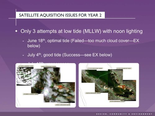
SATELLITE AQUISITION ISSUES FOR YEAR 2• Only 3 attempts at low tide (MLLW) with noon light<strong>in</strong>g June 18 th , optimal tide (Failed—<strong>to</strong>o much cloud cover—EXbelow) July 4 th , good tide (Success—see EX below) July 18 th , unnecessary