Permanent Forest Plot Project (PFPP) - EREN
Permanent Forest Plot Project (PFPP) - EREN
Permanent Forest Plot Project (PFPP) - EREN

Create successful ePaper yourself
Turn your PDF publications into a flip-book with our unique Google optimized e-Paper software.
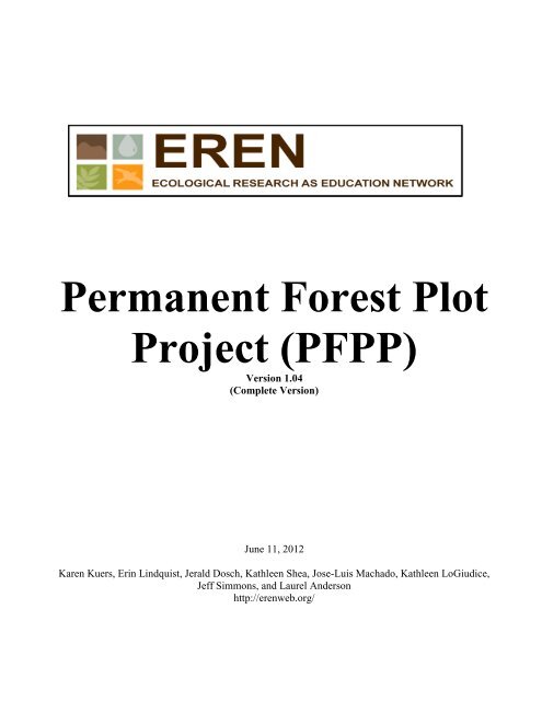
<strong>Permanent</strong> <strong>Forest</strong> <strong>Plot</strong><strong>Project</strong> (<strong>PFPP</strong>)Version 1.04(Complete Version)June 11, 2012Karen Kuers, Erin Lindquist, Jerald Dosch, Kathleen Shea, Jose-Luis Machado, Kathleen LoGiudice,Jeff Simmons, and Laurel Andersonhttp://erenweb.org/
Protocol, Data Sheets, and Appendices<strong>Permanent</strong> <strong>Forest</strong> <strong>Plot</strong> <strong>Project</strong> (<strong>PFPP</strong>) OverviewThe goal of this project is to establish a set of permanent research plots throughout the United Statesthat will allow faculty and students to address questions related to tree biomass, carbon accumulation,invasive species, and disturbance across a range of sites and ecoregions.<strong>Project</strong> participants will establish one or more permanent, 400 m² plots (20 x 20 meters) in forestedareas at or near their home institutions. The protocols have been designed with the goal that work canbe conducted as part of a normal class laboratory or as part of student independent research projects.All trees within the measurement plots will be identified and their diameters’ measured. Additionalplot and tree data will be recorded as well. Tree diameters will be remeasured over time to calculategrowth, mortality, biomass, and carbon sequestration. Data will be entered in an online database thatwill then be accessible to all participants. One or more educational modules will be developed for usewith the database so that faculty can utilize the dataset with students in their classes.Key to the success of this project is that all researchers will use the same protocols so that all data arecomparable. Anyone who is interested in following the protocol and adhering to <strong>EREN</strong>’s DataSharing Policy is encouraged to participate in this collaborative project by setting up their own sitesand contributing to the online database.If you are not yet an <strong>EREN</strong> member, visit http://erenweb.org and sign up!For more information, visit the website, or contact: Karen Kuers (Sewanee: University of the South)or Erin Lindquist (Meredith College).<strong>Project</strong> funded through a grant from the National Science Foundation’s Research Coordination Networks Program.11 June 2012 <strong>EREN</strong> (<strong>PFPP</strong> v 1.04) 2
Protocol, Data Sheets, and AppendicesPotential Research Questions Using <strong>Permanent</strong> <strong>Forest</strong> <strong>Plot</strong>sThere are a large number of research questions that could be addressed using fixed-areapermanent forest plots. The following list provides just a sampling of the questions for which facultyand students could formulate testable hypotheses. As the online database grows, students will be ableto search for and utilize date from plots in other regions for comparison to their own results. <strong>PFPP</strong>participants are encouraged to share the hypotheses they are testing so that over time groups offaculty and students in different regions can work simultaneously on the same questions andhypotheses. Visit http://erenweb.org/project/carbon-storage-project/permanent-plotprotocol/potential-pfpp-research-questions/for a growing list of sample research questions.How many plots to establish?The number of plots you establish will depend upon your research/teaching goals. A single 20x 20 m plot could be used to demonstrate biomass and carbon monitoring techniques, to follow localplot biomass changes over time, and to provide a local vegetation comparison plot for inclusion in the<strong>PFPP</strong> database. New plots could be added in subsequent years and previously established plots remeasured.(It will take significantly less time to re-measure the plot than to establish it.)Participating faculty are encouraged to replicate plots whenever feasible. <strong>Plot</strong> replication canprovide a more robust site characterization and allow statistical analyses among and within sites. 3 to5 plots within each forest type, or site condition being studied could be sufficient for this purpose.For example, to compare biomass in two different local forest types, 3-5 plots could be established ineach forest type. (If there is insufficient time in a single year, a pair of plots could be established eachyear, accumulating plots over time.)Note: There should be a minimum of 20 m between replicate plots, or plots representing differentforest conditions.Deciding where to locate your plots<strong>Plot</strong> locations will be dependent upon the types of questions you interested in addressing, andthe types of forested locations you have available. We welcome plots in any forested site. We arespecifically encouraging the installation of paired plots in the following locations: urban and nonurbanforests; forests with invasive plant species and forests without invasive plants; edge andinterior forests; naturally regenerated and planted forests of similar species; forests with exoticinsect/disease pests and those without; and wetland and upland forests. If you are in an area currentlyor soon to be impacted by an exotic insect or disease (e.g. emerald ash borer; hemlock wooly adelgid;thousand canker disease; oak wilt) and have forests not yet impacted, it would be helpful to installplots before the forest is attacked. For example, the emerald ash borer is moving southward intoKentucky and Tennessee, and it would be helpful to have plots in ash forests to track the arrival andimpact of the insect on forest structure and productivity.(Note: The protocols are still being improved. Please contact Karen Kuers or Erin Lindquist withany problems you encounter, or suggestions you have to improve the format. 11June 2012)11 June 2012 <strong>EREN</strong> (<strong>PFPP</strong> v 1.04) 3
<strong>EREN</strong> <strong>Permanent</strong> <strong>Forest</strong> <strong>Plot</strong> <strong>Project</strong> (<strong>PFPP</strong>)Protocol, Data Sheets, and AppendicesObjectives: The purpose of this project is to use common protocols to establish and measure 400 m 2(0.04 ha) permanent forest inventory plots that can be used to assess biomass levels, woody plantbiodiversity, and/or carbon accumulation in forests located in different ecological regions, climatezones, and/or landscape positions. Once established, the plots can also be used to assess changes overtime, as well as the impacts of a range of variables such as invasive species, proximity to edge, orlocation in urban or other impacted environments.Materials (minimum):1 -2 compasses per group DBH tape (metric) (1 per student group)Tree ID key2-4 metric tapes at least 30 m long (per class)Clinometer to measure canopy heightWire Survey flags: (4 for plot corners, 6 to 25 for 5 x 5 m subplots, 100+ if used to number each tree)List of species abbreviation codes (Appendix V)3 Data Forms: Site/<strong>Plot</strong> Data, Tree Inventory Data, Small Stem DataOptional: Paper copies of the plot layout for mapping tree locations (Appendix VIII)Optional: aluminum nails and tags to permanently mark the treesOptional: Metric calipers or 2.5 cm measuring gauge for very small treesNote: There are a variety of tools available for use in forest measurement. The following linkprovides a list of the most common equipment, describes their uses, and provide a link to potentialsuppliers. http://ext.nrs.wsu.edu/handtools/tools/measurements/index.htm<strong>Plot</strong> Selection<strong>Plot</strong> location is critical to interpretation of the results. <strong>Plot</strong>s located within 30 m of the forestedge are considered “edge” plots, where as “interior” plots are those located at least 30 m from theedge of the wooded area. You should also note whether the plot is an urban patch or in a non-urbanforest.<strong>Plot</strong> layoutFor long term monitoring the trees need to be either mapped by location or each tree needs tobe individually tagged for repeat measurement over time (if possible it would be good to both mapand tag each tree, but mapping could be done at a later time.)There are many approaches to establishing and inventorying a 400 m 2 plot. The approachdescribed on page 10 is for 20 x 20 m square plots (we encourage the use of square plots), but plotscould be either rectangular (10 x 40 m) or circular. Square plots can be easier to maintain long term,but take longer to establish than circular plots. A circular 400 m 2 plot should have a radius of 11.28meters. For the small stems inventory, a circular 25 m 2 plot would have a radius of 2.82 meters.Site and <strong>Plot</strong> Variables to Record: (This data should be entered in the Site/<strong>Plot</strong> Data Sheet).Note: Print data carefully and clearly on the datasheets to avoid mistakes. The data should be easily readable byanyone looking at the data form.Site Variables (These variables can be completed in the lab, either before or after establishing thestudy plots. Enter this data on page 1 of the Site/<strong>Plot</strong> Data sheet.)Site Name: A general name of your location. It may include one or more plots (e.g. OWU, FlattopMtn., Laurel Park, etc.)11 June 2012 <strong>EREN</strong> (<strong>PFPP</strong> v 1.04) 4
Protocol, Data Sheets, and AppendicesSite Date: The date that the site is described. The site will be identified in the database using thisyear.Ecoregion (Bailey’s): Enter the Bailey’s Domain, Division, and Province.A list of Ecoregion Domains, Divisions, and Provinces can be downloaded from the <strong>EREN</strong><strong>PFPP</strong> website. The ecoregion can be visually determined from the following website:http://www.fs.fed.us/land/ecosysmgmt/ Alternately the Province can be determined by entering thezipcode of the location in the following website, http://www.pollinator.org/guides.htm, and theDomain and Division can be found on http://www.fs.fed.us/land/ecosysmgmt/If you live in a region where Bailey’s Ecoregions have not been delineated, record “NoDomain”, “No Division”, and “No Province” in the three blanks.Mean Annual Air Temperature: Record the temperature in degrees Celsius.Mean Temperature data source: Indicate if the source is LOCAL or obtained from the WEB.Air Temperature Source Note: If the source is the WEB, indicate the site used to obtain the data.There are a variety of data sources for obtaining average annual temperatures. If you haveaccess to data from a weather station close to the site, use that data and record the source as LOCAL.If you need to obtain the value, the WEB is a useful source. There are a number of possible sites fromwhich you can obtain your data, some free, some requiring a fee. The following NOAA website(http://www4.ncdc.noaa.gov/cgi-win/wwcgi.dll?WWDI~getstate~USA ) may require a fee for somedata forms.If you use one of the WEB sites, note the actual location for which the data was recorded.Sometime the data for smaller locations are actually reports from the nearest large city. Theinstructions below illustrate how to obtain weather information from two different free sites: WeatherUnderground, and the NOAA Coop site.Weather Underground: http://www.wunderground.com/history/1. Type in location (city name or zip code)2. Type in date and select “submit”3. When data screen opens, select “custom” tab4. Type in any two dates as prompted. Note that they must be < or = one year apart.5. Select “go”.6. Data will appear including:a. Temperature (min, max, mean) d. Precipitationb. Degree days (heating, cooling, growing) e. Windc. Dew point f. Sea level pressure7. Note that you can select any time span up to and including the entire year (12 months) prior to your samplingdate.NOAA Coop Site: http://www7.ncdc.noaa.gov/IPS/coop/coop.htmlThe NOAA COOP site provide free, downloadable pdf files of monthly temperature and precipitation datasubmitted by volunteer COOP stations. The data would need to be converted to spreadsheet format and summarizedto obtain annual totals, a project that could be conducted by students as part of a class activity.To use the COOP site, highlight the correct state, and then select “Next”. Look through the available stations list andsee if there is a COOP station near your forest that has data available for the time period of interest. Note that themost recent month is generally not yet available. If there is an available station, select the station, and “Next”. A listof available months and years will appear. Select the dates of interest. You can download each month as a separatepdf file. Monthly temperature and precipitation data can then be entered in excel and used to compute annualaverages. (Note that the data is reported in degrees Fahrenheit and inches and would need to be converted to degreesCelcius and millimeters.11 June 2012 <strong>EREN</strong> (<strong>PFPP</strong> v 1.04) 5
Protocol, Data Sheets, and AppendicesAverage Annual Precipitation: Record the precipitation in mm.Precipitation information source: Indicate if the source is LOCAL or obtained from the web.Precipitation Source Note: If the source is the WEB, indicate the site used to obtain the data.Length of Growing season: The growing season is the number of days between last and first frost,or approximately the last and first occurrence of 0° C (freezing) overnight low temperature.Indicate the length of the growing season in days.You can obtain the approximate dates of the annual first and lost frost by visiting oneof the following websites: http://davesgarden.com/guides/freeze-frost-dates/http://www.accuracyproject.org/w-FreezeFrost.htmlGrowing Season Data Source: Record the source used to obtain the growing season length.<strong>Plot</strong> Variables –Indoor (These variables can either be determined from records, online data sources, or laboratoryanalysis of samples collected in the field. This data should be entered in the Site/<strong>Plot</strong> Data Sheet, page 1.)<strong>Plot</strong> Name: Provide a name for the plot that includes 6-12 characters, no spaces.<strong>Plot</strong> Year: This is the year by which the plot will be identified in the database.<strong>Plot</strong> Month: This month will be associated with the plot measurement in the database.<strong>Forest</strong> Origin Year: Record the Year of Origin for the forest (yyyy; Leave blank if unknown).The year of origin is the year that the forest was planted, or year in which thedominant/codominant canopy trees began their aboveground growth after some type of disturbance orchange. If you are unable to determine the age of the stand from records, increment cores, or knowndisturbance history, leave this blank.Using an increment borer to determine tree age and the year of stand origin: If you have anincrement borer, you can core one or more of the canopy trees to determine the age of the overstory.Subtract the number of rings at breast height from the current year to determine the Year of Origin.There are a number of good online descriptions of using increment borers to extract increment coresto determine tree age. Most purchased increment borers come with instructions. They can bepurchased from equipment retailers such as <strong>Forest</strong>ry Suppliers and Ben Meadows. See also thefollowing document for obtaining and using increment cores to determine tree age:http://www.fpl.fs.fed.us/documnts/fplgtr/fplgtr25.pdf<strong>Forest</strong> Age Information Source:If you have written or oral records concerning the origin of the forest stand in which the plotis located, circle WRITTEN or ORAL, and record the known <strong>Forest</strong> Origin Year above. If youused an increment borer to determine the age of the overstory, circle MEASURED, and record theyear of origin derived from your increment core. If you have a general idea of approximately how oldthe forest stand is, circle ESTIMATED, leave the origin year blank, and include what you know in“<strong>Forest</strong> Stand Notes”. If you were unable to determine the age of the stand, leave the origin yearblank, and select AgeUNKNOWN.11 June 2012 <strong>EREN</strong> (<strong>PFPP</strong> v 1.04) 6
Protocol, Data Sheets, and Appendices<strong>Forest</strong> Origin Type: Indicate if the stand was PLANTED, NATURALLY REGENERATED, orits origin is UNKNOWN.<strong>Forest</strong> Stand Notes: Please add any information regarding the origin of the stand that could provehelpful in analyzing the data.<strong>Forest</strong> Size : Circle the approximate size (in hectares) of the <strong>Forest</strong> in which the plot is located.If it is an isolated patch, indicate whether the patch is < 1 ha, or 1-10 ha. If it is a largerforest tract, indicate whether the extent of the forested area is 11 – 100 ha, or > 100 ha. SeeAppendix III for a method of using Web Soil Survey to calculate forest area.Soil Order: Record the Soil Order.(See Appendix I for a description of methods to use the web to obtain the Soil Order andgeneral Soil Classification information for your site.)Optional Soil Variables: (See Appendix II for methods to measure these optional soil variables.)Soil pH (optional): Record the soil pH.Soil bulk density (optional): Record the soil bulk density.Soil Organic matter (optional): Record the % soil organic matter.Soil Moisture (optional): Record the % soil moisture.Total Precipitation Preceding 12 months: Record the precipitation in mm.(PPt data can often be obtained from the same web sources as Temperature data.)Precipitation information source: Indicate if the source is LOCAL or obtained from the web.Precipitation Source Note: If the source is the WEB, indicate the site used to obtain the data.<strong>Plot</strong> Variables - Outdoors: (These variables are recorded from plot observations and measurements.This data should be entered in the Site/<strong>Plot</strong> Data Sheet, page 2.)<strong>Plot</strong> shape: Indicate if the plot is Square (S), Circular (C), or Rectangular (R)Square plots are 20 x 20 m, Circular plots have a radius of 11.28 m, andRectangular plots should have dimensions of 20 x 40 m.<strong>Plot</strong> Description Date: Record the date of measurement (yyyy/mm/dd ). If the data is collected over2 or more weeks record the date the field measurements were completed.Latitude / Longitude: Record the latitude and longitude of the NE corner of the plot in the format:Latitude: xx.xxxxxx (decimal degrees) Longitude: xx.xxxxxx (decimal degrees)(Please use at least 4 decimal places; 6 if possible)Decimal degrees can be calculated from Degrees Minutes Seconds by the following formula:Decimal Degrees = Degrees + ((Minutes / 60) + (Seconds / 3600))Note that longitude values that are in the western hemisphere and latitude values that are in the southernhemisphere are recorded as negative decimal degree values. All others are reported as positive values.Example: The decimal degree representation for the location of the United States Capitol38° 53′ 23″ N, 77° 00′ 32″ W = 38.889722°, -77.008889° in decimal degrees11 June 2012 <strong>EREN</strong> (<strong>PFPP</strong> v 1.04) 7
Elevation (m): Record the elevation of the NE corner of the plot in metersProtocol, Data Sheets, and AppendicesAspect (º): Aspect is the direction that a slope faces. If your plot is not flat, stand in the middle of theplot and look to see which direction the slope faces. Point your compass in that direction, read theaspect in degrees, and record it as a number from 0 to 360. If on flat ground, record the azimuth as“flat”.Slope %: Record the average % slope across the plot. If the plot is flat, % slope = 0.Percent slope is equal to the change in elevation per horizontal distance (“Rise” over “run”.)A 45% slope indicates that there is a 45 ft elevation change per 100 ft horizontal distance. One way tomeasure slope % is to use the % scale (left hand scale) on a clinometer. Hold the clinometer parallelwith the ground (upslope or downslope), and look through the clinometers at a point that is equal tothe height of your eye above the ground. (It is best to sight across the entire plot so that you get theoverall slope of the plot.) Read the % slope from the left side of the scale visible in the view finder.Slope % can be > 100.One way to do this is to pick a partner, note the point on your partner that is equal to your eyelevel, and then walk to opposite uphill/downhill sides of the plot and look through the clinometer,aiming at the height of your partner that is equal to your eye level. If no partner is available, identifythe height of an eye level object on the uphill or downhill edge of the plot, walk to the opposite sideof the plot and sight through the clinometer at the object, reading the slope from the % scale. Note:Many compasses also have scale that can be used to read slope.Landscape Shape: Record the shape of the plot as predominately Planar (flat), Concave, or Convex.Concave plots will tend to collect water, and convex plots will tend to have water runoff.Planar plots can be variable, depending upon the % slope<strong>Plot</strong> description: Please include a general description of the plot. Include such information as thepresence of trails, excessive vine coverage, deer browse, and cover of invasive plant species.Interior/Edge: If the plot is at least 30 m from the forest edge recordIf the plot is 30 m or less from the forest edge recordINTEDGEWetland Status: Indicate whether the plot is in a floodplain or wetland: YES or NOUrban Status: Is the plot in an Urban <strong>Forest</strong> patch?YES or NODisturbance History: Please indicate if there is any obvious indication of the following:Fire_____ If yes, record how recent, or record UNK in Disturbance NotesInsect____ If yes, record the insect, or record UNK in Disturbance NotesDisease___ If yes, record the disease, or record UNK in Disturbance NotesWind ___ If yes, record how recent, or record UNK in Disturbance NotesMining____ If yes, record how recent, or record UNK in Disturbance NotesLogging___ If yes, record how recent, or record UNK in Disturbance NotesOther____ If yes, please explain in Disturbance NotesDisturbance History Notes: If you answered YES to any of the preceding disturbances, pleaseindicate any details you might know as to when the disturbance occurred, the type of insect ordisease, etc.11 June 2012 <strong>EREN</strong> (<strong>PFPP</strong> v 1.04) 8
Protocol, Data Sheets, and AppendicesDominant Groundcover: Which statement is most correct with respect to the plot’s dominantgroundcover? L G H W M NNP FF SR noneL: Lichen and/or mosses cover over 50% of the plot.G: Grass: Grass covers over 50% of the plot. (Not including Japanese stilt grass Microstegium).H: Herbaceous (native): Non-grass, native herbaceous plants cover over 50% of the plot.W: Woody (native): Native shrubs cover over 50% of the plot.M: Mixed: Grass and native herbaceous and woody plants combine to cover over 50% of the plot.NNP: Non-native plants: Non-native herbaceous or woody plants cover over 50% of the plot.FF: <strong>Forest</strong>Floor: Leaf/ woody litter covers over 50% of the plot.SR: Bare Soil/ Rock: Bare Soil/ Rock covers over 50% of the plot.none: None of the preceding cover over 50% of the plot.Secondary Groundcover: Which statement is most correct with respect to the plot’s second mostdominant groundcover? L G H W M NNP FF SR noneL: Lichen and/or mosses cover 25 – 49 % of the plot.G: Grass: Grass covers 25 – 49 % of the plot. (Not including Japanese stilt grass Microstegium).H: Herbaceous (native): Non-grass, native herbaceous plants cover 25 – 49 % of the plot.W: Woody (native): Native shrubs cover 25 – 49 % of the plot.M: Mixed: Grass and native herbaceous and woody plants combine to cover 25 – 49 % of the plot.NNP: Non-native plants: Non-native herbaceous or woody plants cover 25 – 49 % of the plot.FF: <strong>Forest</strong>Floor: Leaf/ woody litter cover 25 – 49 % of the plot.SR: Bare Soil/ Rock: Bare Soil/ Rock cover 25 – 49 % of the plot.none: None of the preceding cover 25 – 49 % of the plot.Groundcover: Groundcover includes any vegetation that is less than 1.37 meters tall,as well as leaf/woody plant litter, and/or bare soil and rock. When calculating percentcoverage, exclude the ground that is occupied by tree stems, and base the calculation onthe ground that is not covered by standing large or small stems (living or dead).1% Cover 5% Cover 10% Cover25% Cover 50% Cover 90% coverFigure 1: Diagram depicting different levels of percent to aid in estimating the Dominant andSecondary ground covers in the plot. Appendix IV included a printable handout of this diagram.11 June 2012 <strong>EREN</strong> (<strong>PFPP</strong> v 1.04) 9
Protocol, Data Sheets, and AppendicesVegetation Typical? Is the plot vegetation typical of that in the surrounding forest. YES or NOVegetation Comment: In the answer above is NO, please indicate how it is different.Invasive Species? Are invasive plant species present in the plot? YES or NO.Invasive Species List: If the answer to “Invasive Species?” is yes, please list the invasive plantspecies present in the plot.Avg. Canopy Height (m):Record the height (in meters) of the average level of the top of the canopy. Select one or moretrees that make up the general level of the canopy of forest in which your plot is located and measurethe height of one or more of those trees. See one of the following links for information on how tomeasure the heights of trees:http://www.sewanee.edu/<strong>Forest</strong>ry_Geology/watershed_web/Emanuel/Treehts.htmhttp://extension.usu.edu/forestry/Kids/Kids_TreeHeightMeasure.htmhttp://www.envirothonpa.org/documents/MeasuringTreeHght.pdf<strong>Plot</strong> Establishment and Tree MeasurementsLaying out a 20 x 20 m <strong>Plot</strong> (Preferred plot shape)Mark the NE corner of the 20 x 20 m plot. You will first set the diagonal for the plot to becertain that the final plot is square. (Note: It helps to have two compasses, four people, and four 20 to30 m tapes. However, it can be done with only one compass, two people, and three tapes.)One person stands at the NE corner, sets the compass for S45°W (or 225°) and directs asecond person who walks approximately 30 meters S45°W and turns to face the first person. The firststudent then motions the second student to move right or left until he/she is exactly S45°W. If asecond compass is available, the second person should set his/her compass for N45°E (or 45°) andsight back to the first corner to double check the orientation. Once the students are in agreement, athird person pulls the tape 28.28 m from the initial corner toward the second person. The two peoplewith compasses can direct the person pulling the tape to help him/her walk the straightest path pasttrees and shrubs. Once the tape is straight, taut, and in the correct orientation, mark the new cornerwith a flag. (This is the SW corner of the plot). Leave the tape in place if possible.Next find the NW corner of the plot by using a compass to sight due W from the NE corner,and due N from the SW corner. Pull one tape 20 meters W from the NW corner and another tape 20meters N from the SW corner. Once the two tapes are taut, where they meet at 20 m should representthe NW corner of the plot. (If you plan to divide the plot into 5 m subplots, now is a good time to goahead and place flags at 5 meter intervals along the N and W boundaries of the plot.)Next find the SE corner of the plot by using a compass to sight due S from the NE corner, anddue E from the SW corner. Pull a tape 20 meters S from the NW corner and another tape 20 meters Efrom the SW corner. (These can be the two tapes that you used to set the NW corner.) Once the twotapes are taut, where they meet should represent the SE corner of the plot. (If you plan to divide theplot into 5 m subplots, now is a good time to go ahead and place flags at 5 meter intervals along the Sand E boundaries of the plot.)To check that the plot is square, pull a tape from the SE corner to the NW corner. Thediagonal should be 28.28 meters, and it should cross the other diagonal at 14.14 meters. Adjust thelocation of one or both of the NW and SE corners as needed.11 June 2012 <strong>EREN</strong> (<strong>PFPP</strong> v 1.04) 10
Protocol, Data Sheets, and AppendicesIf you placed flags at 5 m intervals along the boundary, number them 5, 10, and 15 goingfrom N to S, and 5, 10, and 15 going from E to W. Next mark the interior 5 x 5 m subplotboundaries by pulling tapes S from the northern to the southern boundary at the 5, 10, and 15 mintervals.Tree Numbering, Tagging, and MappingIf you plan to number the trees, one method of involving students in the process is to initiallyuse colored pin flags that are numbered and later replaced with aluminum tags. The method thatfollows assumes that you have established 5 m subplots and that there will be 4 student groupsworking simultaneously to measure a plot within a single laboratory period. The main purpose for thedifferent colors of flags is to make it easy for a class with several student groups to easily see whereeach group should measure, and to aid in the mapping of the stems. If the entire plot will be measuredby one group, the trees can be numbered and mapped in one pass, and different colored flags may notbe necessary.Tree NumberingAssign a number to each stem so that it will be possible to relocate and remeasure the tree in afuture year. Trees with multiple stems will require multiple numbers. Multiple stems can either haveunique whole numbers, or may be recorded as a decimal (1.1, 1.2).No two stems in a single 20x20 m plot can have the same number. When plots are remeasuredin the future, smaller trees that grow above the 2.5 cm minimum measurement size should be giventhe next unused number. When a tree dies and falls to the ground, its number is “retired” forever.The method that follows uses pin flags to number each stem.Tagging TreesThere are a number of different methods for permanently tagging trees. Stem attachmentmaterials (nails) and tags should generally be aluminum (or plastic cables) rather than steel (unlesssmall staples are used) to prevent to injury people and equipment if the stem is sawn in the future,either after it dies, or as part of a harvest. Tags can be placed in the ground at the base of the tree, inthe tree stem near the ground (to make them less visible), near DBH (See page 16 for a method ofpositioning the tag and nail to ensure a consistent DBH measurement height), or can be hung fromsmall branches near the base of the tree. The method you choose will depend upon the size and age ofyour trees, desired investment of time and resources, and whether or not you want the tags to bereadily visible. Tags will need to be checked periodically because they are often chewed on bywildlife (or removed by people). Searching the internet for images of tree labels or tree tags also canprovide ideas from innovative ways that people have found to label their trees. The websites below(accessed 14June 2012) provide examples of tree tagging methods.Cable tag: http://www.proaxis.com/~johnbell/equipment/equip56a.htmStem tags: http://www.nationalband.com/nbtplant.htm#Tree_TagsUrban: http://www.tufc.com/pdfs/tree_labels.pdfFor temporary marking, place a pin flag at the base of each living or dead stem that is ≥ 2.5cm in diameter at 1.37 m DBH in each 5 x 5 subplot. (See note at the end of this paragraph.) It helpsto use four different colors of flags to mark the trees, and to use a different colored flag for each ofthe four subplots that make up one 5 m wide N to S transects. You will rotate the colors from onetransect to the next such that no two adjacent subplots have the same color (Figure 2). <strong>Plot</strong>s 1,9,7,and 15 are one color, 2,10,8, and 16 another color, 3,5,11, and 13 a third color, and 4, 6,12, and 14are a fourth color. If the class is divided into 4 groups, each group can be given a different pin flagcolor and can then flag each of the trees in the 4 plots designated to be that color.11 June 2012 <strong>EREN</strong> (<strong>PFPP</strong> v 1.04) 11
Protocol, Data Sheets, and AppendicesNote: It may help to create a 2.5 cm gauge to quickly and uniformly determine which trees are ≥ 2.5cm. It can be made by cutting a 2.5 cm wide indentation in a small block of wood or a plastic card(Figure 3). If you use a different material make certain that the edge is not sharp so that it won’tdamage the small stems.Figure 3. Sample 2.5 cm gauge for separating large fromsmall stems.Figure 2. 20 x 20 m plot layout, including subplots.After all of the trees in the first four subplots have been flagged, someone can begin insubplot 1 to number the stems. Stems should be numbered sequentially throughout the entire plot sothat every stem in the plot has a unique identifier. If there are multiple sprouts on a single stump,number them using decimal notation (2.1, 2.2, 2.3, etc.) After numbering all trees in subplots 1through 4, go next to subplots 5 through 8, then 9 through 12, then 13 through 16. (Note: Thenumbering might be done by the instructor or by a single group of students.)Treatment of Vines: Vines that are ≥ 2.5 cm dbh should be tagged and numbered, and included asindividual stems in the tree inventory, even if they are running up the side of a tree. Stems that are
Protocol, Data Sheets, and AppendicesSpecies:Record the 6 or 7 character abbreviation for the scientific name of living stems. The first 3characters represent the first three letters of the Genus and the last 3 characters are the first 3 letters ofthe specific epithet for the species (GGGSSS). Example: QUEALB = Quercus alba. (Appendix Vcontains a list of abbreviations for most species you are likely to encounter in your inventory. Note: Ifyou have a species not on the list, please email the species to the <strong>EREN</strong> <strong>Permanent</strong> <strong>Plot</strong> contact sothat it can be added to the official list. This needs to be done before you will be able to successfullyupload your data to the database.) When trees are identified to variety, or if two species would givethe same, a 7 th character is added to the name. If the tree is standing dead, record it as SNAG.Standing dead stems that are leaning are only inventoried if the lean is < 45° from vertical. Thosewith a greater lean are included as downed stems. (Note: Please use ALL CAPITAL LETTERS whenentering the species code in Excel.)Inventory Status:Use the following codes to indicate whether a stem is being included in the inventory for thefirst time, has changed condition since the last inventory, or is being removed from the inventorybecause it is no longer a standing tree. (Note: Once a tree is entered in a plot inventory it will alwaysremain as a numbered stem in the inventory, even if it is removed. For that reason trees that grow intoa plot are always given a new number, and no tree numbers are ever repeated in a plot. This columnwill most commonly be completed after the field inventory. All stems in year one will be IL or ID.Subsequent plot measurements will require that the student researchers refer to the data collected inthe previous inventory to complete this column.Inventory Status CodesIL – Initial Living: Initial measurement of a living tree. Only used during the first inventory of a plot. Insubsequent measurements it will be coded as RL.RL – Repeat Living: Repeat measurement of a living treeID – Initial Dead: Initial measurement of a standing dead tree. Only used during the first inventory of a plot. Insubsequent measurements it will be coded as RD.RD – Repeat Dead: Repeat measurement of a standing dead tree (SNAG)IG – Ingrowth: Stems that were too small at the preceding inventory and have now grown large enough toexceed minimum measurement diameter. In subsequent inventories the stem will be coded as RL. (May includesmall stems of a multiple stem tree that have now grown over 2.5 cm dbh.)DD- Dead: Tree that has died since the last inventory, when it was measured as a living stem; On subsequentmeasurements these trees will be coded as RD.SL- Skipped Living: Live tree that was large enough to be tallied at the previous inventory, should have beenentered in the previous inventory, but was overlooked. This tree will not be included in growth increment fromthe previous measurement. In future measurements this stem will be coded as RL.SD – Skipped Dead: Dead tree that was large enough to be tallied at the previous inventory, should have beenentered in the previous inventory, but was overlooked. (There is no way to know if this tree died since the lastinventory or died prior to the last inventory. In future plot measurements this stem will be coded as RD.11 June 2012 <strong>EREN</strong> (<strong>PFPP</strong> v 1.04) 14
Protocol, Data Sheets, and AppendicesDBH:DBH is the abbreviation for “Diameter at breast height”. DBH is diameter measured at 1.37meters above ground on the uphill side of the tree (or 4.5 ft when using English units). Record theDBH of all living and dead stems (including vines) that are ≥ 2.5 cm at 1.37 m. If the ground issloped, measure on the uphill side of the tree. Trees with irregularities or swelling, or other unusualsituations may require special measurements.DBH can be measured using calipers, a special diameter tape (D-tape) that can be purchasedfrom a forestry supply catalog, or the circumference can be measured with a regular measuring tapeand the result divided by pi (3.14) to calculate DBH. Appendix VI includes a printable handout withinstructions, as well as a copy of the following diagram for measuring DBH on irregular stems.Figure 4. Location for measuring DBH in standard and irregular shaped stems. (Adapted from US <strong>Forest</strong>Service.) A copy of this diagram is included in Appendix VI.Vines: If a vine is attached directly to the side of a tree, it may necessary to use larger calipers tomeasure the tree’s diameter. When measuring tree diameter with calipers it is best to take twomeasurements at right angles, since many trees are not completely round. (Calipers can bepurchased from a forestry supply company or could probably be made with a meter stick,wood blocks, and some creativity.)11 June 2012 <strong>EREN</strong> (<strong>PFPP</strong> v 1.04) 15
Methods for Accurate DBH and DBH Increment measurements:Protocol, Data Sheets, and AppendicesMeasurement of biomass and carbon storage and accumulation rates in forested plots requiresaccurate, repeatable measurement of DBH. It is thus very important to measure DBH at the exactsame height on the tree each time it is measured. This may require physically marking the stem,especially when DBH is measured at a non-standard height due to one or more of the situationsillustrated in Fig. 4.It is also important that repeat measurements of DBH are carried out during approximately thesame time of year. It is generally best to measure DBH during the dormant season if growthincrement over time will be determined. Annual growth increments are less accurate whenmeasurements are taken during the active growth period, before diameter increment has ended for theyear.There are a number of methods of ensuring accurate DBH measurements, some of which aredescribed below:1) Mark DBH with lead free tree marking paint or surveyors crayons, both of which areavailable online or through forestry supply catalogs. Either draw a solid or dashed line completelyaround the stem at DBH (1.37 m), or place a dab of paint on opposite sides of the tree stem to assurethat the DBH tape is level when it is wrapped around the tree.2) Use the tree ID tag and nail as guides for measuring DBH. The tree ID tag can be nailed tothe tree (use an aluminum nail) at a defined distance from DBH, either above or below, and thus beused to assure consistent DBH measurement. The tag should be at least 2 cm above or below DBHbecause the nail can cause a slight swelling of the stem and influence the DBH measurementaccuracy. It is also good to leave approximately 2 cm of the nail extending outside the stem to allowfor tree growth and to allow a guide stick to rest on the nail. (If your plot is in a location that might beharvested at a future date, you might want to place the nail in the basal 25 cm of the stem to makecertain it would not be in the path of a saw blade.) Once the nail and tag are in place, a guide stickcan be created whose length is equal to the distance between the nail and DBH. A notch can beplaced in the stick to allow it to be positioned on the nail and used to guide the location for DBHmeasurement.3) Create a 1.37 m wooden guide and position the guide on the ground and measure DBHalong the top of the guide. Note that you would still need to mark those stems for which DBH ismeasured at a non-standard height, and it would be important to position the guide on the same sideof the tree each time a measurement was made.4) Use dendrometer bands for continuous DBH measurement. Dendrometer bands are themost expensive method of measuring long term DBH, but can be purchased and installed on a subsetof stems in the plot to allow students to follow seasonal and annual growth. The USGS has awonderful website with instructions for constructing and installing dendrometer bands on trees:http://www.nwrc.usgs.gov/Dendrometer/index.htmAdditional information is available at: http://web.utk.edu/~grissino/dendrometers.htm11 June 2012 <strong>EREN</strong> (<strong>PFPP</strong> v 1.04) 16
Protocol, Data Sheets, and AppendicesSoundness: Rank stem soundness from 1 to 3 to indicate the degree to which the lower 5 meters ofthe stem is solid wood or is occupied by a hollow cavity. The three categories are (1) 95 to100% solid wood, (2) 50 to 94% solid wood, and (3) < 50% solid wood. Make your judgmentbased upon the width, height, and depth of the hollow cavity relative to the entire 5 m sectionof the tree. (Ignore cavities above that height.) Appendix VII contains additional details.1) The stem appears 95 to 100% solid in the lower 5 m of the stem. Rank the tree a 1 if thereis no obvious cavity into the lower 5 m section of the stem, or if there is a small crack orwedge shaped opening into the side of an otherwise solid tree. The width of the openingshould generally be less than 5% of the circumference of the tree (Figure 5). Stems with smalldecayed sections that do not run the length of the 5 meter stem section can also fit thiscategory.2) The stem appears 50 to 94% solid in the lower 5 m of the stem. This stem will generallyhave an opening that is > 5% of its circumference, and/ or a hollow core that comprisesbetween 5 and 50 % of the stem volume for most of the 5 meter stem section.3) The stem appears < 50% solid in the lower 5 m of the stem. This stem will have anopening that is > 5% of its circumference, and/ or a hollow core that comprises over 50 % ofthe stem volume for most of the 5 meter stem section.The thickness of the shell of wood, and the size of the opening relative to the circumference of thestem can be compared to Tables 2 and 3 in Appendix VII to estimate % stem soundness.(Figure 5).Figure 5. Terminology and images for determining the percentage of sound wood in a stem. (a) Stem with small crack. (b) Stemwith an opening into a hollow cavity. Measure the length of the opening relative to the total circumference to determine theopening % size class and measure the thickness of the shell relative to the stem diameter.11 June 2012 <strong>EREN</strong> (<strong>PFPP</strong> v 1.04) 17
Protocol, Data Sheets, and AppendicesCrown Class (optional): Record the crown class as: DOMINANT/CODOMINANT,INTERMEDIATE, or OVERTOPPED.Dominant / Codominant (DC):These trees form the general level ofthe main canopy, as well as thoseindividuals that stick up above thegeneral level of the canopy. All ofDCDC DC DCthese stems get full sun from aboveand some from the upper sites.Intermediate (I): The tops of thesetrees extend into, but do not reach thetop of the canopy. They receive fullsun only from directly overhead.Figure 6. Diagram of trees in the Dominant/Codominant (DC),Intermediate (I), and Overtopped (O) canopy positions.Overtopped (O): Sometimes referredto as suppressed, these trees areentirely below the main canopy anddo not receive any direct overheadsunlight.Height (optional):Measure and record the height of Dominant/Codominant trees (those that comprise thecanopy of the forest) to the nearest 0.1 meter (Figure 6).See one of the following links for information on how to measure the heights of trees.http://www.sewanee.edu/<strong>Forest</strong>ry_Geology/watershed_web/Emanuel/Treehts.htmhttp://extension.usu.edu/forestry/Kids/Kids_TreeHeightMeasure.htmhttp://www.envirothonpa.org/documents/MeasuringTreeHght.pdfNotes: (Optional):Use the notes column to record tree specific information that may be helpful for future datainterpretation. For example, if you are unable to measure all trees in a plot in a single day, you canuse the notes column to identify those trees that were measured at a different time than the generaltree measurement date. For trees that are SNAGs, you might indicate the actual species in thiscolumn, or you might include information about leaning trees or SNAGS, or Soundness call that aresomewhat questionable.Small Stem Inventory: Stems that are > 1.37 m tall, but less than < 2.5 cm. Record this informationon the Small Stem Data sheet.To obtain an estimate of the number of small stems < 2.5 cm dbh that occupy the plot,randomly select three 5 x 5 m subplots, or circular 25 m 2 plots (radius = 2.82 m). If you established5 x 5 m subplots during the plot layout, record on the datasheet the subplot number for each of thethree tallied subplots. If you did not establish the 5 x 5 m subplot grid, randomly select threelocations within the plot and establish square 5 x 5 meter subplots, numbering them 1 though 3.<strong>Permanent</strong>ly mark the corners of each of the subplots so that they can be remeasured in the future.11 June 2012 <strong>EREN</strong> (<strong>PFPP</strong> v 1.04) 18
Protocol, Data Sheets, and AppendicesIn each of the three subplots, tally (by species if possible) the number of the stems that are atleast 1.37 meters tall, but less than 2.5 cm in diameter, that exit the ground within the boundary of thesubplot. Species that cannot be identified can be tallied as “UNKSPP”. There is no need to measurethe diameter of any of the small stems (although you may choose to do so for your own purposes).This tally should also include small stems (not included in the tree inventory because they did notmeet the 2.5 cm minimum dbh) attached to multiple stemmed trees that did meet the minimum dbhrequirement and were recorded in the tree inventory for the 20 x 20 m plot. If a clump of small stemsis located on the subplot boundary, only include the individual stems that exit the ground within thesubplot boundary. Do not include stems that exit the ground outside the subplot boundary.Also indicate if the small stem density in the subplot is typical of the small stem density of theoverall plot.Calculated and Derived VariablesThe following variables can be derived from the tree data. The online database will includethe Site, <strong>Plot</strong>, Tree Inventory, and Small Stem data obtained from this instruction set, but will notinclude the following derived variables. The choice of variables to calculate will depend upon yourspecific class or research objectives.Basal Area:Basal area (BA) of a tree is equal to the cross sectional area of the tree stem measured at 1.37m (DBH). It is calculated using the equation: BA (m 2 ) = DBH 2 (cm) x 0.00007854. The basal area ofthe plot (m 2 ) is equal to the sum of the basal areas of all of the stems in the plot. While the total basalarea of the 400 m 2 plot could be used for comparison, it is more typical to report basal areas on a perhectare basis to facilitate comparison among plots of different sizes. Divide the sum of the BA forthe plot (m 2 ) by the area of the plot in ha (400 m 2 / 10,000 m 2 ha -1 = 0.04 ha) to obtain BA in m 2 ha -1 .Biomass:The biomass of the entire tree (or of specific tree parts) can be estimated from the DBH usingallometric equations developed either for the species or for a group of similar species. Biomass isreported as kg (or Mg) ha -1 . We suggest using the following publication to estimate tree biomassfrom dbh:Jenkins, J.C., Chojnacky, D.C., Heath, L.S., and Birdsey, R.A. 2004. Comprehensive Database ofDiameter-based Biomass Regressions for North American Tree Species. Gen. Tech. Rep. NE-319. Newtown Square, PA. USDA <strong>Forest</strong> Service Northeastern Research Station. 45p. [1 CD-ROM].The following website includes a link to the publication, as well as excel and pdf copies of thetables from the publication: http://www.uvm.edu/~jcjenkin/?Page=biomassdatabase.html (Accessed14 June 2012) A list of additional references for vegetation biomass analysis can also be found at thefollowing web address: http://www.sewanee.edu/<strong>Forest</strong>ry_Geology/watershed_web/links2.html(Accessed 14 June 2012)Carbon Storage:Carbon (C) storage is estimated from tree biomass using the % C present in plant tissues. Ifexact measurements are not available, the value is commonly estimated to be 45 - 50% of plantbiomass. It is reported as kg C ha -1 .11 June 2012 <strong>EREN</strong> (<strong>PFPP</strong> v 1.04) 19
Protocol, Data Sheets, and AppendicesCarbon Sequestration Rate:Carbon sequestration rate is calculated as the difference in carbon storage measured at twodifferent times, generally in increments of years (1, 5, or other). It is reported as kg C yr -1 .<strong>Forest</strong> Type:The plot can be classified into different forest types based upon the composition of speciesinventoried. The cover type is traditionally based upon the basal area of trees comprising themajority of the canopy, and the name includes the one, two, or sometimes three species predominantspecies. By convention, a species must make up at least 20% of the stand’s basal area to be includedin the name.A more complete description of standard US forest cover types can be found in the followingpublication.Eyre, F.H. (ed.)1980. <strong>Forest</strong> Cover Types of the United States and Canada. Society of American<strong>Forest</strong>ers. 148 pp.The publication is available for purchase from the Society of American <strong>Forest</strong>ers website:http://store.safnet.org/ (Accessed 14 June 2012)The pdf below includes a list of forest cover types include in the publication.http://el.erdc.usace.army.mil/emrrp/emris/EMRIS_PDF/<strong>Forest</strong>CoverTypes.PDFThe following website includes a list of forest cover types used by the US <strong>Forest</strong> Service inthe National <strong>Forest</strong> Inventory and Analysis (FIA).http://www.fs.usda.gov/detailfull/r5/landmanagement/gis/?cid=fsbdev3_047974&width=fullData Check and Data EntryTo enter Data online, your institution must be registered with the online database, andsomeone(s) from your institution must be registered as your Institution’s Administrator(s). Toregister your institution, and identify a site administrator, please email one of the <strong>Project</strong>’s currentLead Scientists, whose names and contact information are included on <strong>EREN</strong>’s <strong>PFPP</strong> webpage.Include in your email the name of your Institution, the name of the Administrator, and theAdministrator’s email address. Once the Lead Scientists have processed your request, theAdministrator will receive an email with instructions for logging on to the database. (Note: This maytake more than 24 hours, so please do this well in advance of the day that you hope to be able to enterSite/<strong>Plot</strong>/Tree data.)Once an Administrator has been registered for your Institution, the Administrator isresponsible for creating and entering Site information (only an Administrator can create Sites for anInstitution), registering other Users (Researchers) who can enter, edit, and upload <strong>Plot</strong>, Tree, andSmall Stem data to the <strong>PFPP</strong> Database website, and registering other Administrators for thatInstitution. All Administrators for an Institution can register Researcher Users for that Institution andapprove tree and small stem data that has been uploaded to the database. (Note: Approval isconfirmation that the data has undergone quality control measures and is ready for inclusion in thedatabase. All tree data must be approved by an Administrator before it becomes a permanent part ofthe database. )In addition to the Researcher Users who can enter <strong>Plot</strong> data and upload stem data, otherindividuals who register themselves with <strong>EREN</strong> as Users will be able to Query the database anddownload data. Users who download data will be asked to complete a form indicating the intendeduse of the data. (While Users can be anyone, this may often be the role assigned to students using the<strong>PFPP</strong> data for their classes.)11 June 2012 <strong>EREN</strong> (<strong>PFPP</strong> v 1.04) 20
Protocol, Data Sheets, and AppendicesSite and <strong>Plot</strong> Data are entered directly into the online <strong>PFPP</strong> Database. Each Site is identifiedby Name and Year, and each <strong>Plot</strong> is linked to a specific Site, and is identified by <strong>Plot</strong> Year, <strong>Plot</strong>Month, and the user specified <strong>Plot</strong> measurement date.Tree and Small stem inventory data will be uploaded to the <strong>PFPP</strong> Database as two separateCSV files. Blank CSV files for each can be downloaded from the <strong>PFPP</strong> Database website and used inExcel to enter the Tree and Small Stem Inventory Data.(Important Note: Once the data has been collected, all data entries should be double checkedfor accuracy. This is especially important given the intended long term use of the datasets. The datawill be published online for use by other faculty and students who need the assurance that the datathey use has undergone standard quality checks. Areas that most often have mistakes, and that areespecially critical for data analysis include the species abbreviation codes, inventory codes, andDBH measurements. Carefully check both the decimal place and the numbers in the DBHmeasurements for accuracy, especially numbers that appear to be outside the range of the rest of thedata. )When you are ready to enter the data online, go to www.erenweb.org under Research/<strong>Permanent</strong> <strong>Plot</strong> <strong>Project</strong>, or Data/<strong>Permanent</strong> <strong>Plot</strong> <strong>Project</strong> where you will links to the online databasealong with additional data entry and data retrieval instructions. Note: To enter Tree or Small StemInventory Data you will need to be able to identify the Site Name, Site Year, <strong>Plot</strong> Name, <strong>Plot</strong> Year,and <strong>Plot</strong> Month before you will be able to upload the data.Using <strong>PFPP</strong> DataUse the Query Tool on the <strong>PFPP</strong> Database to select sites for which you wish to access anddownload data. Data will be downloaded in the form of CSV files. Once you register as an <strong>EREN</strong>user, data is freely available for class and other non-publication uses. Users who download data willbe asked to complete a form indicating the intended use of the data.Publication GuidelinesShould you wish to use <strong>EREN</strong> <strong>PFPP</strong> data in a publication, please check the online Authorshipguidelines posted on the <strong>EREN</strong> website (www.erenweb.org), and contact one of the <strong>PFPP</strong> LeadScientists.11 June 2012 <strong>EREN</strong> (<strong>PFPP</strong> v 1.04) 21
Site/<strong>Plot</strong> Data Entry Form (<strong>EREN</strong> <strong>Permanent</strong> <strong>Forest</strong> <strong>Plot</strong> <strong>Project</strong>)Laboratory (Indoors) WorksheetSite Variables Site Name___________________ Date (yyyy/mm/dd): ____________Your name __________________Bailey’s Ecoregion: Domain_________________________________ or “No Domain”Division_________________________________ or “No Division”Province________________________________ or “No Province”Mean Annual Air Temp. (ºC): _______Mean Annual Temp. source (circle one): LOCAL or WEBAir Temp. Web Source Note:__________________________________________________Avg. Annual Ppt (mm): _________Precipitation information source (circle one): LOCAL or WEBPrecipitation Source Note:___________________________________________________Length of Growing season (days): ______________Growing Season Data Source/Notes: ___________________________________________________<strong>Plot</strong> Variables <strong>Plot</strong> Name__________ <strong>Plot</strong> Year__________ <strong>Plot</strong> Month__________<strong>Forest</strong> Origin Year (yyyy): ___________ (Leave blank if AgeUNKNOWN or ESTIMATED)<strong>Forest</strong> Age Information Source: WRITTEN, ORAL, MEASURED, ESTIMATED or AgeUNKNOWN<strong>Forest</strong> Origin Type (circle one): PLANTED, NATURALLY REGENERATED, or UNK.<strong>Forest</strong> Stand Notes: Include rough or approximate forest age here if ESTIMATED or AgeUNKNOWN,and add what you know regarding the origin or history of the trees.__________________________________________________________________________________________________________________________________________________________________________________________Size of <strong>Forest</strong> (ha) in which the plot is located (Circle one.): < 1 ha 1 - 10 ha 11-100 ha > 100 haSoil Order: ____________________Optional soil variables:Soil pH: ___________Soil bulk density (g/cm 3 ) __________% Soil Organic matter:__________ % Soil Moisture:______________Total Precipitation Preceding 12 months (mm): _________Precipitation information source (circle one): LOCAL or WEBPrecipitation Source Note:___________________________________________________11 June 2012 <strong>PFPP</strong> Version 1.04
<strong>Plot</strong> Variables (Recorded in the plot)Site/<strong>Plot</strong> Data Entry Form (<strong>EREN</strong> <strong>PFPP</strong> Field Data)<strong>Plot</strong> Shape Square, Circular, or Rectangular<strong>Plot</strong> Name____________________<strong>Plot</strong> Description Date (yyyy/mm/dd) __________Latitude (xx.xxxxxx) _____________ Longitude (xx.xxxxxx) _________________Elevation (m)__________ Aspect(°): ________ (0 to 360° or “flat”) Slope %:_______Landscape Shape (Circle one): PLANAR, CONCAVE, or CONVEX<strong>Plot</strong> description: Please include a general description of the plot. Include such information as presence oftrails, old roads, power lines, underground utilities, excessive vine coverage, deer browse, etc…_______________________________________________________________________________________________________________________________________________________________________________________________________________________________________________________________________________________________________________________________________________________________________________________________________________________Interior/Edge:If the plot is at least 30 m from the forest edge circle INT.If the plot is less than 30 m from the forest edge circle EDGE.INT or EDGEWetland Status: Is the plot in a floodplain or wetland: YES or NOUrban Status: Is the plot in an Urban <strong>Forest</strong>? YES or NODisturbance History: Circle YES if there is any obvious indication of the following:Fire YES or NO Wind YES or NO Other YES or NOInsect YES or NO Mining YES or NODisease YES or NO Logging YES or NODisturbance History Notes: If you answered YES to any of the preceding disturbances, please indicate belowany details you might have as to when the disturbance occurred, the type of insect or disease, etc.____________________________________________________________________________________________________________________________________________________________________________________________________________________________________________________________________________________________________________________________________________Dominant Groundcover:L G H W M NNP FF SR noneSecondary Groundcover: L G H W M NNP FF SR noneVegetation Typical? Is plot vegetation / density representative of the surrounding forest? YES or NOVegetation Comment: If the answer above is NO, please indicate how the plot is different._______________________________________________________________________________Invasive Plant Species? Are invasive plant species present in the plot?YES or NOInvasive Plant Species List: Please list the invasive plant species present in the plot.______________________________________________________________________________________________________________________________________________________________Avg. Canopy Height (m): ___________11 June 2012 <strong>PFPP</strong> Version 1.04 2
Tree Data Entry Form (<strong>EREN</strong> <strong>Permanent</strong> <strong>Forest</strong> <strong>Plot</strong> <strong>Project</strong>)Site Name______________ <strong>Plot</strong> Name ____________________ <strong>Plot</strong> shape: Square, Circular, or RectangularTeam members: ________________________________________ Date (yyyy/mm/dd) ______________Optional Required OptionalSub-plotQUADTree #InvStatMor SSpecies CodeDBH(cm)SoundnessCrownClassHt (m)Notes(Tree measurement date, snagID, special observations , etc.)Optional: Subplot 5 x 5 m (1 through 16)Optional: QUAD ID (NE,NW,SE,SW within subplot)Tree #: No two trees within a plot can have the same number. Use unique whole numbers for single stems (1,2,3 etc.), use decimals to indicated differentsprouts arising from multiple stems (4.1, 4.2, 4.2, etc…).InvStat: IL- Initial Living; ID-Initial Dead; RL- Repeat Living; RD-Repeat Dead; IG-Ingrowth; DD-Died; SL- Skipped Living; SD-Skipped Dead.Stem type: M = multiple stem; S = Single stem. (Base judgment on whether stem junction occurs above or below 1.37 m.)Species Code: 6-7 letter abbreviation- Use Capital letters only. Use UNKSPP for unknown species, QUESPP for unknown oaks species, etc.Soundness: The lower 5 m of the main stem appears 1 (95 to 100% solid); 2 (50 to 94% solid), or 3 (< 50% solid).Optional: Crown Class = DC (Dominant and Codominant); I (Intermediate); O (overtopped); Optional: Tree Ht. (m)Optional: Notes (Include date for trees measured on day other than the rest of the plot, SNAG species ID if known, or other helpful observations.)11 June 2012 (<strong>EREN</strong> <strong>PFPP</strong> v1.04)
Small Stem Data Entry Form (<strong>EREN</strong> <strong>Permanent</strong> <strong>Forest</strong> <strong>Plot</strong> <strong>Project</strong>)(Stems ≥ 1.37 m tall, < 2.5 cm dbh)Site Name_____________ <strong>Plot</strong> Name ____________________ Date (yyyy/mm/dd)__________Team members: _________________________________________________________Subplot number________________ Is the small stem density typical of overall plot? YES or NOSpecies Small Stem Tally Species Small Stem TallySubplot number________________ Is the small stem density typical of overall plot? YES or NOSpecies Small Stem Tally Species Small Stem TallySubplot number________________ Is the small stem density typical of overall plot? YES or NOSpecies Small Stem Tally Species Small Stem TallySpecies: Use 6-7 letter code from Appendix V. Use capital letters only. Use “UNKSPP” for unknown species,“OAKSPP” for unknown oak species, etc.Tally by species the number of the stems that are at least 1.37 meters tall, but less than 2.5 cm in diameter, thatexit the ground within the boundary of the three subplots. This tally should also include small stems (not included in thetree inventory because they did not meet the 2.5 cm minimum dbh) attached to multiple stemmed trees that did meet theminimum dbh requirement and were recorded in the tree inventory for the 20 x 20 m plot. If a clump of small stems islocated on the subplot boundary, only include the individual stems that exit the ground within the subplot boundary. Donot include stems that exit the ground outside the subplot boundary.11 June2012 <strong>PFPP</strong> v 1.04
Web Soil Survey Instructions (Version 1.04) 7/30/10p. 1 How to obtain soil order classification and other soil related data from WEB SOIL SURVEY: http://websoilsurvey.nrcs.usda.gov/app/HomePage.htm start hereFirst set the preferences for the Map Legends click here
Web Soil Survey Instructions Then set the scale based on the pixels per inch of your monitor click here7/30/10p. 2 There are many ways to select the location of your specific plots. Two simple one are typing a postal address closer to your plots or type latitude and longitude coordinates if available. The following example uses latitude and longitude of two 20x20 m plots located in the Crum Woods of Swarthmore College. (39° 54’ 20.55” N and 75° 21’ 25.12” W). click here
Web Soil Survey Instructions 7/30/10p. 3 Now we need to define the Area of Interest (AOI). click hereDraw square todefine plotslocationYou can verify that the square you selected has the right size by using the measuring stick: click hereGreen linemeasures lengthresults here
Web Soil Survey Instructions 7/30/10p. 4 We are ready to learn which soil units are part of your plots Click Soil Map tab click hereClick Soil Data Explorer click here
Web Soil Survey Instructions 7/30/10p. 5 Click Soil Reports click hereHere we will select individual reports and add them individually to the shopping cart for later downloading. Lets start with 1. Soil Chemical Properties. Then click on 2. View Soil Report and add it to 3. Shopping Cart 3. click here1. click here2. click here
Web Soil Survey Instructions7/30/10p.6The shopping cart window will allow adding a subtitle to better identify the site/plot/location.Now choose 1. Soil Physical Properties, then 2. Physical Soil Properties, then click 3. View SoilReport, and add it to 4. Shopping Cart.
Web Soil Survey Instructions 7/30/10p. 7 You can choose to write down the data as is generated on the screen or to create a report that will produce a PDF file with the data: click 1. Shopping Cart (Free) Tab, then 2. Check Out and Get Now. 1. click here2. click here
United StatesDepartment ofAgricultureNaturalResourcesConservationServiceA product of the NationalCooperative Soil Survey,a joint effort of the UnitedStates Department ofAgriculture and otherFederal agencies, Stateagencies including theAgricultural ExperimentStations, and localparticipantsCustom Soil ResourceReport forDelawareCounty,PennsylvaniaCrum Woods TBNO plotsJuly 30, 2010
ContentsPreface....................................................................................................................2How Soil Surveys Are Made..................................................................................5Soil Map..................................................................................................................7Soil Map................................................................................................................8Legend..................................................................................................................9Map Unit Legend................................................................................................10Map Unit Descriptions........................................................................................10Delaware County, Pennsylvania.....................................................................12MkF—Manor soils, 35 to 60 percent slopes................................................12Soil Information for All Uses...............................................................................13Soil Reports........................................................................................................13Soil Chemical Properties.................................................................................13Chemical Soil Properties (Crum Woods TBNO plots).................................13Soil Physical Properties..................................................................................16Physical Soil Properties (Crum Woods TBNO plots)...................................16References............................................................................................................20Glossary................................................................................................................224
<strong>EREN</strong> <strong>PFPP</strong> Appendix IIMethods for Soil Analysis at St. Olaf CollegeBy Dr. Kathleen Shea and studentsSoil Collection1. At each site, collect soil samples from six – ten different spots across the site.2. Before you go out label all soil tins with their location and weigh them. After you havetransferred your soil into the tin you can simply subtract the weight of the tin and get outthe weight of your sample.3. Collect soil samples with soil corer. When collecting make sure you have a goodsample that does not have pockets of loose soil or air gaps.Fill soil corer to a certain level so that you will be able to calculate the volume of yoursample.4. Remove soil from soil core and place into a soil tin. Be careful not to lose soil whentransferring to the tin.5. Collect additional samples for pH or nutrient analyses.Soil Moisture1. Collect soil as indicated above.2. Weigh tins with the wet soil.3. Place the tins in the oven for 48 hours at 105 degrees C.4. After drying, weigh the tins.5. Calculate the percent moisture lost from the soil in each tin by using the equation(express in terms of dry weight of soil):(wet weight-dry weight) x 100 = Percent moisturedry weightBulk Density1. Calculate the volume of your soil core. Volume = (area x height) or (πr 2 x height).(For example if you are using the smaller soil corer the diameter is 2 cm and the height is16.5 cm up to the dashed line. Total volume = 51.81cm 3 .)2. To get bulk soil density divide the dry weight of the soil (as determined for soilmoisture) in grams by the volume (cm 3 ). Your result will be the density in g/ cm 3 .Soil Organic MatterThere are several different methods that various manuals suggest for thedetermination of the amount of organic material. The method explained here is fromField and Laboratory Methods for General Ecology, Fourth Ed. by Brower, Zar, and vonEnde; 1998.<strong>EREN</strong> <strong>PFPP</strong> Version 1.04
<strong>EREN</strong> <strong>PFPP</strong> Appendix II1. Use the soil samples you dried for percent moisture.2. Put the samples through a 2 mm sieve (A 1.19mm sieve may work best depending onsoil composition).3. Weigh out samples between 4.5 g and 9.0 g to the nearest hundredth of a gram. Placeeach sample in a crucible and dry in the oven at 105 degrees C for 24 hours.4. Allow the samples to cool and weigh to the nearest hundredth of a gram.5. Place the samples in the muffle furnace at 500 degrees C for four hours. Prevent thetemperature from going over 550 degrees C.6. After four hours, place the samples in a dessicator jar (to prevent them from absorbingmoisture as they cool). Leave the other samples in the muffle furnace if they do not all fitin the dessicator. Make sure that the dessicator pebbles are blue.7. When the samples are cool, weigh them to the nearest hundredth of a gram.8. Find the percentage of organic material by using the equation:% organic material = (weight after 105 C- weight after 500 C)weight after 105 C.pH levels1. Take the pH reading as soon as possible after collection2. Mix 5 grams of soil and 20 ml of deionized water for each sample.3. Vortex each mixture for two minutes.4. Filter these samples using soil analysis filter paper (Hach 2263356) to give 10milliliters of the filtrate. Fold filter paper so that it is fluted.5. Use a pH meter to take readings of each sample. Standardize the amount of time beforea reading is taken. For example, with the pH sensor submersed, agitate the solution for 15seconds, allow it to settle for 1 minute 30 seconds, then read. Do not allow the sensor totouch the sides of the test tube.<strong>EREN</strong> <strong>PFPP</strong> Version 1.04
<strong>EREN</strong> <strong>PFPP</strong> Appendix IIIObtaining <strong>Forest</strong> Size Using the Web Soil Survey1) Navigate your web browser to the Web Soil Survey:http://websoilsurvey.nrcs.usda.gov/app/WebSoilSurvey.aspx2) Using “Quick Navigation” in the left panel, select your location by Address, State and County, orLatitude and Longitude. The following example uses the State and County approach. Enter the State andCounty, and select “View”. The map will zoom in to center on that location.3) Under the “Area of Interest (AOI) Interactive Map”, select the upper left magnifying tool and zoomcloser to the area that contains your forest. Repeat the process, using the pan tool as needed to centerthe map, until your forest area fills most of the map view (Figure 1).Figure 1. The arrow points to the zoom-in tool. It is followed by the zoom-out tool and the pan tool.4) Next use the AOI Polygon Tool (Figure 2), the tool as the far right, to outline the boundary of theforest area that includes your plot(s). Double click to complete the polygon.Figure 2. The arrow points to the polygon AOI tool which can be used to outline the shape of the forestarea. The AOI tool to the left of the AOI polygon can be used if your forest is rectangular in shape.5) After completing the polygon, the program will create your forested area as an AOI. If it is not alreadypresent, the “AOI Information” dialog box will appear above the “Quick Navigation” box in the leftpanel. “Area (acres)” will be included in the “AOI Information” box, and the area in acres will be listed(Figure 3). To convert from acres to hectares, divide the size in acres by 2.47.6) Now that you have created an AOI for your site you can also obtain the soils information needed forthe <strong>Plot</strong> Data sheet. Refer to Appendix II for details on obtaining the soils data. Since have alreadycreated the AOI, you can begin with page 4 of Appendix II.<strong>EREN</strong> <strong>Permanent</strong> <strong>Plot</strong> Protocols Version 1.04 (June 2012)
<strong>EREN</strong> <strong>PFPP</strong> Appendix IIIFigure 3. The outline of the forest area is shown in the ‘Area of Interest Interactive Map” on the right,and the size of the area is indicated in the “AOI Information” box to the left.<strong>EREN</strong> <strong>Permanent</strong> <strong>Plot</strong> Protocols Version 1.04 (June 2012)
Pictoral Guide for Estimating % Groundcover (<strong>EREN</strong> <strong>PFPP</strong> Appendix IV)1% Cover 5% Cover 10% Cover25% Cover 50% Cover 90% CoverPictoral Guide for Estimating % Groundcover1% Cover 5% Cover 10% Cover<strong>EREN</strong> June 2012 (Version 1.04)25% Cover 50% Cover 90% Cover
21.37 m1.37 m1.37 m1 m1.37 m1.37 m1.37 m.1.37 m.1.37 m.1.37 m.0.45 m1.37 m0.9 mor more1.37 m.Figure 1: Measuring dbh on irregular trees. 1.37 m = 4.5 ft; (Modified from U.S. <strong>Forest</strong> Service)Note: It is very important for biomass and carbon sequestration estimates that DBH is measured at a consistent height on the stem.Accurate height measurement may be facilitated by marking DBH on the stem with lead free paint or survey crayons, or by using aphysical guide. See “<strong>EREN</strong> <strong>PFPP</strong> Complete Protocol” for some methods of ensuring repeatable DBH measurements.Modified from “Measurement_of_Tree_Diameter” (New Mexico State University FFA <strong>Forest</strong>ry) and “Condensed tree measurement for Ordway”(Macalester College). <strong>EREN</strong> <strong>PFPP</strong> Version 1.04 (June 2012)
Estimating Stem Soundness (<strong>EREN</strong> <strong>PFPP</strong> Appendix VII)Soundness: Rank stem soundness from 1 to 3 to indicate the degree to which the lower 5 metersof the stem is solid wood or is occupied by a hollow cavity. The three categories are (1)95 to 100% solid wood, (2) 50 to 94% solid wood, and (3) < 50% solid wood. Make yourjudgment based upon the width, height, and depth of the hollow cavity relative to theentire 5 m section of the tree. (Ignore cavities above that height.)1) The stem appears 95 to 100% solid in the lower 5 m of the stem. Rank the tree a 1 if there is no obviouscavity into the lower 5 m section of the stem, or if there is a small crack or wedge shaped opening into theside of an otherwise solid tree. The width of the opening should generally be less than 5% of thecircumference of the tree (Figure 1). Stems with small decayed sections that do not run the length of the 5meter stem section can also fit this category.2) The stem appears 50 to 94% solid in the lower 5 m of the stem. This stem will generally have anopening that is > 5% of its circumference, and/ or a hollow core that comprises between 5 and 50 % of thestem volume for most of the 5 meter stem section.3) The stem appears < 50% solid in the lower 5 m of the stem. This stem will have an opening that is > 5%of its circumference, and/ or a hollow core that comprises over 50 % of the stem volume for most of the 5meter stem section.The thickness of the shell of wood, and the size of the opening relative to the circumference ofthe stem can be compared to Tables 2 and 3 to estimate % stem soundness.Step 1:If there are not any visible openings in the lower 5 meters of the stem other than cracks or other smallopenings < 5% of the stem’s circumference, rank the stem (1). (See Figure 1, left image)Step 2: If there is an opening into the stem > than 5% of the stem’s circumference, or it has a significant internalcavity, measure the width of the opening relative to the overall circumference of the tree to determine the %circumference represented by the opening (Figure 1, Table 1).Step 3: Measure the thickness of the shell of wood surrounding the cavity.Step 4: Compare the thickness of the shell to the minimum thickness needed for a stem to be at least 50% soundwood (Table 2). Rank the stem a (2) if it has at least 50% sound wood.Step 5: If the shell thickness is less than the listed values for dbh for a given stem opening size class, record the stemas a (3).Figure 1. Terminology and images for determining the percentage of sound wood in a stem. (a) Stem with small crack. (b)Stem with an opening into a hollow cavity. Measure the length of the opening relative to the total circumference todetermine the opening % size class and measure the thickness of the shell relative to the stem diameter.<strong>EREN</strong> <strong>PFPP</strong> Version 1.04 (June 2012)
Estimating Stem Soundness (<strong>EREN</strong> <strong>PFPP</strong> Appendix VII)Note: This is an estimate. The values in the tables are not absolutes, but should provide a guidefor making the best field estimate for the three categories.Table 1. DBH, total circumference, and 5, 10, 25, and 33% of circumference for trees ranging in size from5 to 100 cm in diameter.Tree dbh(cm)TreeCircumference(cm)Length of Stem Circumference Representing DifferentPercentages of the Total Circumference (cm)5% 10% 25% 33%5 15.7 0.8 1.6 3.9 5.210 31.4 1.6 3.1 7.9 10.415 47.1 2.4 4.7 11.8 15.620 62.8 3.1 6.3 15.7 20.725 78.5 3.9 7.9 19.6 25.930 94.2 4.7 9.4 23.6 31.135 110.0 5.5 11.0 27.5 36.340 125.7 6.3 12.6 31.4 41.545 141.4 7.1 14.1 35.3 46.750 157.1 7.9 15.7 39.3 51.875 235.6 11.8 23.6 58.9 77.8100 314.2 15.7 31.4 78.5 103.7Table 2. Thickness of wood shell needed for a tree with 5, 10, 25, or 33% opening to contain at least 50%soundwood in the main stem.Thickness (cm) of stemwood shell needed for stem to be50% soundwoodTree dbh Opening < 5% Opening = 10% Opening = 25% Opening = 33%(cm) circumference circumference circumference circumference5 0.7 0.8 1.0 1.110 1.5 1.6 1.9 2.115 2.2 2.5 2.9 3.220 2.9 3.3 3.9 4.225 3.7 4.1 4.8 5.330 4.4 4.9 5.8 6.335 5.1 5.8 6.8 7.440 5.9 6.6 7.8 8.445 6.6 7.4 8.7 9.550 7.3 8.2 9.7 10.575 11.0 12.3 14.5 15.8100 14.6 16.5 19.4 21.1Note: The thickness of the shell can be calculated as follows:Opening 5% (or less) = dbh * 0.146; 10% = dbh * 0.165; 25% = dbh* 0.194; 33% = dbh*0.211<strong>EREN</strong> <strong>PFPP</strong> Version 1.04 (June 2012)
NW15 10 5NE551010<strong>EREN</strong> <strong>PFPP</strong>Appendix VIIIBlank 20 x 20 m <strong>Plot</strong> Map1515SW15 10 5SE
NW51015SW15 10<strong>EREN</strong> <strong>PFPP</strong>Appendix VIIIBlank 20 x 20 m <strong>Plot</strong> Map
10 5NE5<strong>EREN</strong> <strong>PFPP</strong>Appendix VIIIBlank 20 x 20 m <strong>Plot</strong> Map1015SE