Permanent Forest Plot Project (PFPP) - EREN
Permanent Forest Plot Project (PFPP) - EREN
Permanent Forest Plot Project (PFPP) - EREN
You also want an ePaper? Increase the reach of your titles
YUMPU automatically turns print PDFs into web optimized ePapers that Google loves.
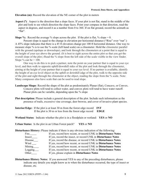
Elevation (m): Record the elevation of the NE corner of the plot in metersProtocol, Data Sheets, and AppendicesAspect (º): Aspect is the direction that a slope faces. If your plot is not flat, stand in the middle of theplot and look to see which direction the slope faces. Point your compass in that direction, read theaspect in degrees, and record it as a number from 0 to 360. If on flat ground, record the azimuth as“flat”.Slope %: Record the average % slope across the plot. If the plot is flat, % slope = 0.Percent slope is equal to the change in elevation per horizontal distance (“Rise” over “run”.)A 45% slope indicates that there is a 45 ft elevation change per 100 ft horizontal distance. One way tomeasure slope % is to use the % scale (left hand scale) on a clinometer. Hold the clinometer parallelwith the ground (upslope or downslope), and look through the clinometers at a point that is equal tothe height of your eye above the ground. (It is best to sight across the entire plot so that you get theoverall slope of the plot.) Read the % slope from the left side of the scale visible in the view finder.Slope % can be > 100.One way to do this is to pick a partner, note the point on your partner that is equal to your eyelevel, and then walk to opposite uphill/downhill sides of the plot and look through the clinometer,aiming at the height of your partner that is equal to your eye level. If no partner is available, identifythe height of an eye level object on the uphill or downhill edge of the plot, walk to the opposite sideof the plot and sight through the clinometer at the object, reading the slope from the % scale. Note:Many compasses also have scale that can be used to read slope.Landscape Shape: Record the shape of the plot as predominately Planar (flat), Concave, or Convex.Concave plots will tend to collect water, and convex plots will tend to have water runoff.Planar plots can be variable, depending upon the % slope<strong>Plot</strong> description: Please include a general description of the plot. Include such information as thepresence of trails, excessive vine coverage, deer browse, and cover of invasive plant species.Interior/Edge: If the plot is at least 30 m from the forest edge recordIf the plot is 30 m or less from the forest edge recordINTEDGEWetland Status: Indicate whether the plot is in a floodplain or wetland: YES or NOUrban Status: Is the plot in an Urban <strong>Forest</strong> patch?YES or NODisturbance History: Please indicate if there is any obvious indication of the following:Fire_____ If yes, record how recent, or record UNK in Disturbance NotesInsect____ If yes, record the insect, or record UNK in Disturbance NotesDisease___ If yes, record the disease, or record UNK in Disturbance NotesWind ___ If yes, record how recent, or record UNK in Disturbance NotesMining____ If yes, record how recent, or record UNK in Disturbance NotesLogging___ If yes, record how recent, or record UNK in Disturbance NotesOther____ If yes, please explain in Disturbance NotesDisturbance History Notes: If you answered YES to any of the preceding disturbances, pleaseindicate any details you might know as to when the disturbance occurred, the type of insect ordisease, etc.11 June 2012 <strong>EREN</strong> (<strong>PFPP</strong> v 1.04) 8


